

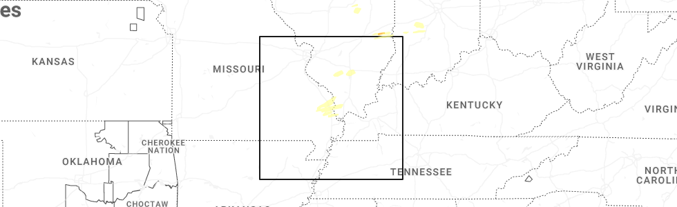
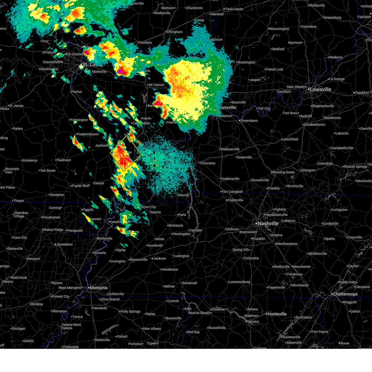
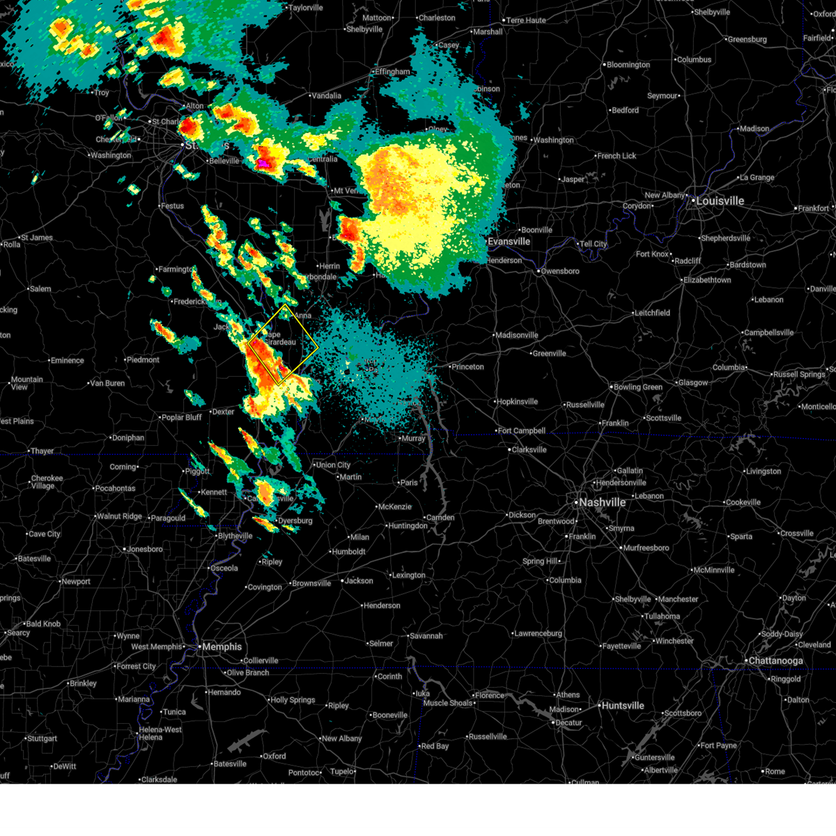
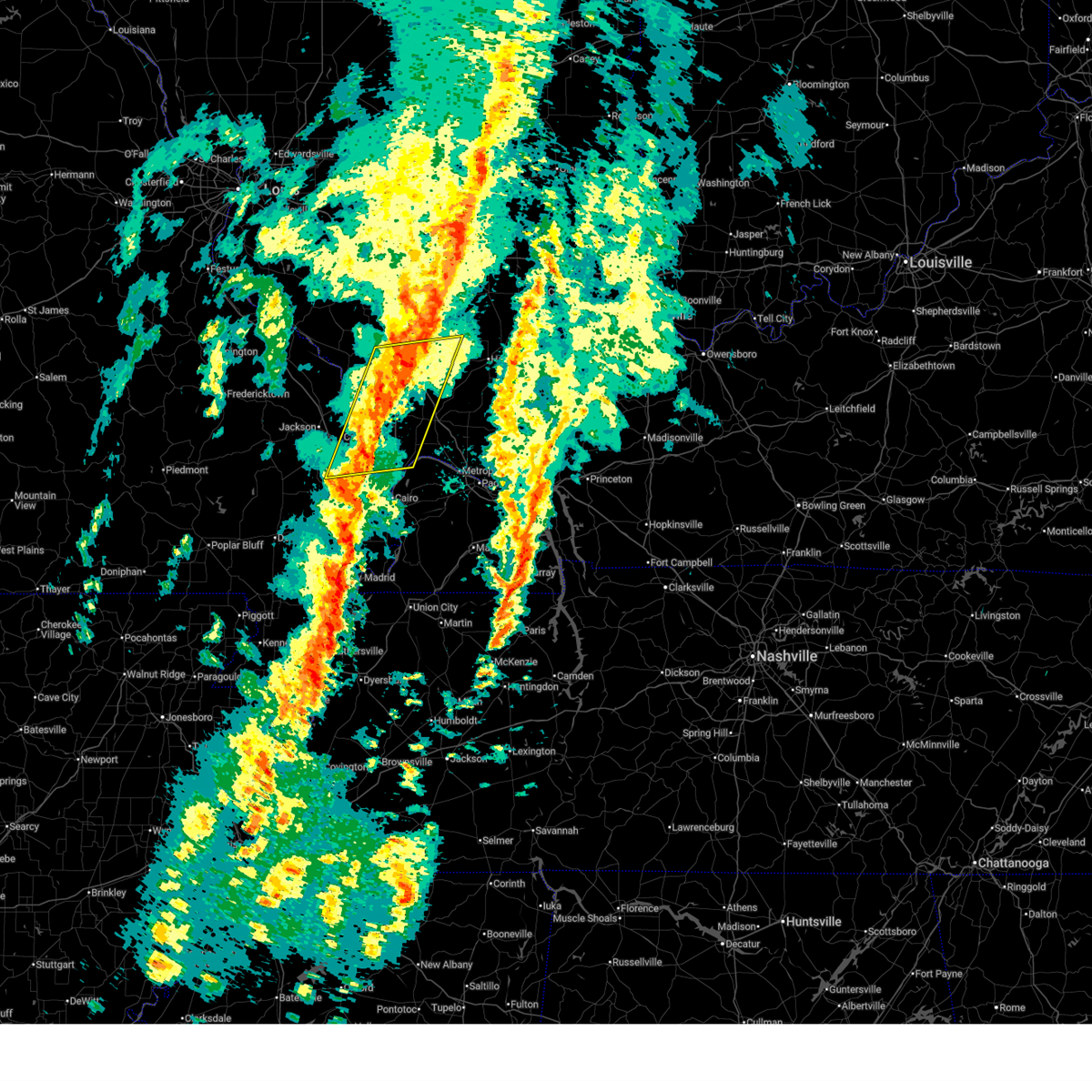
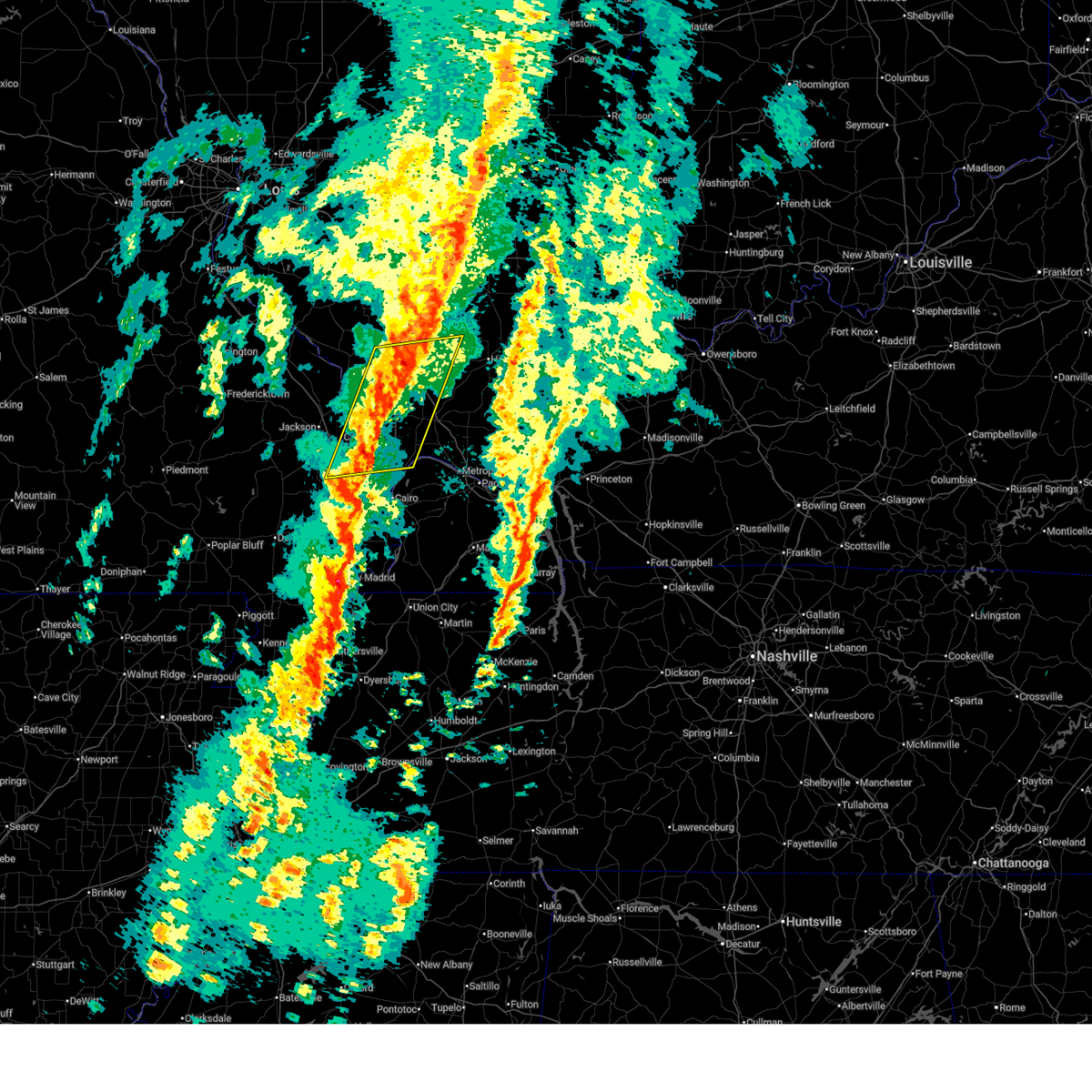
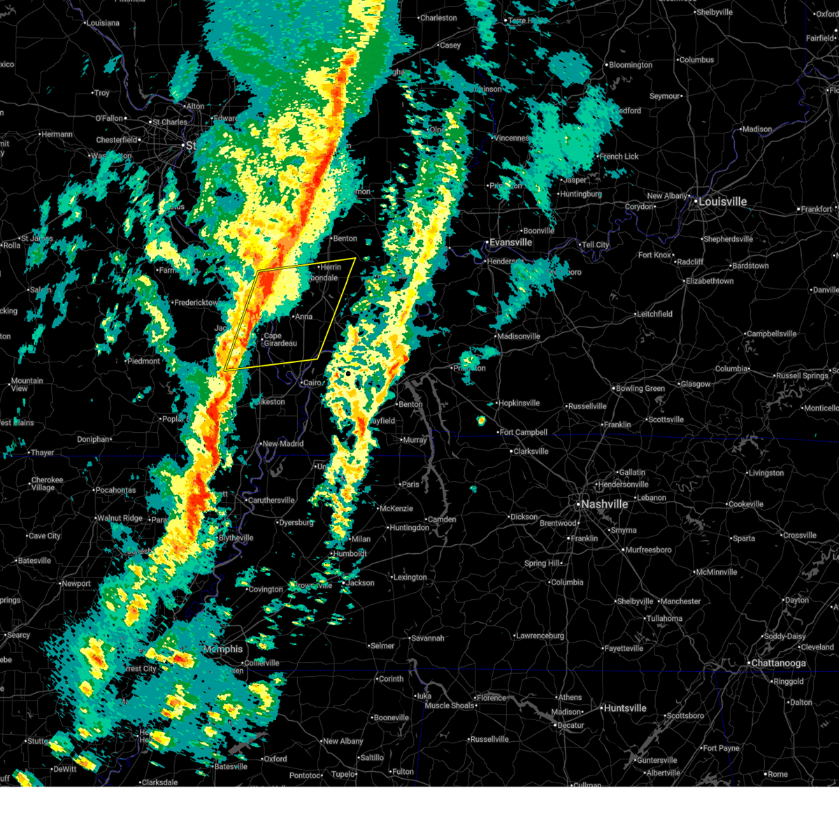
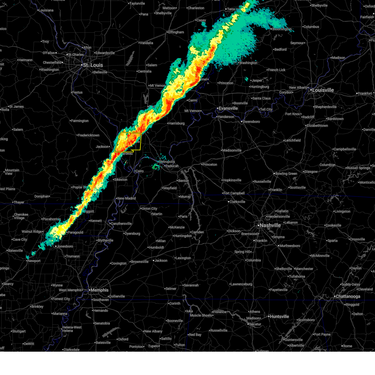
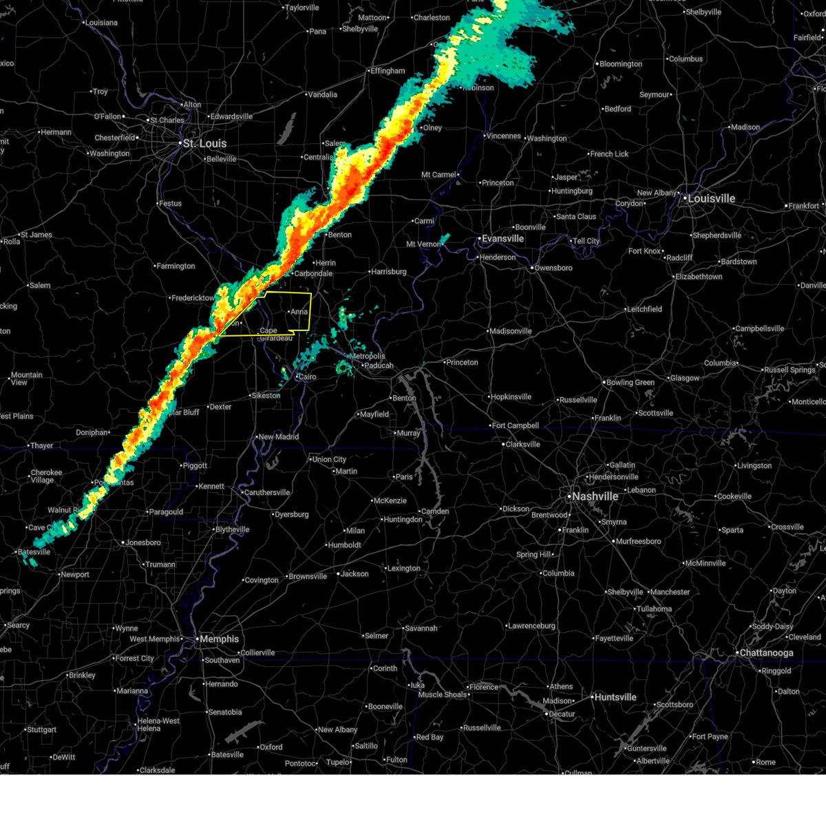
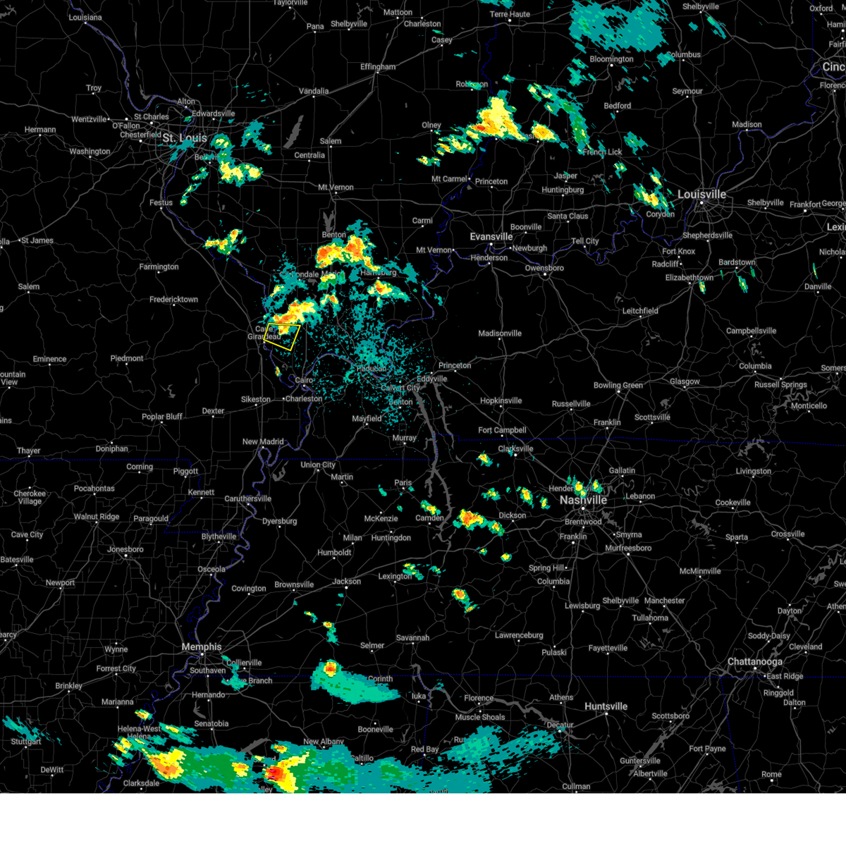
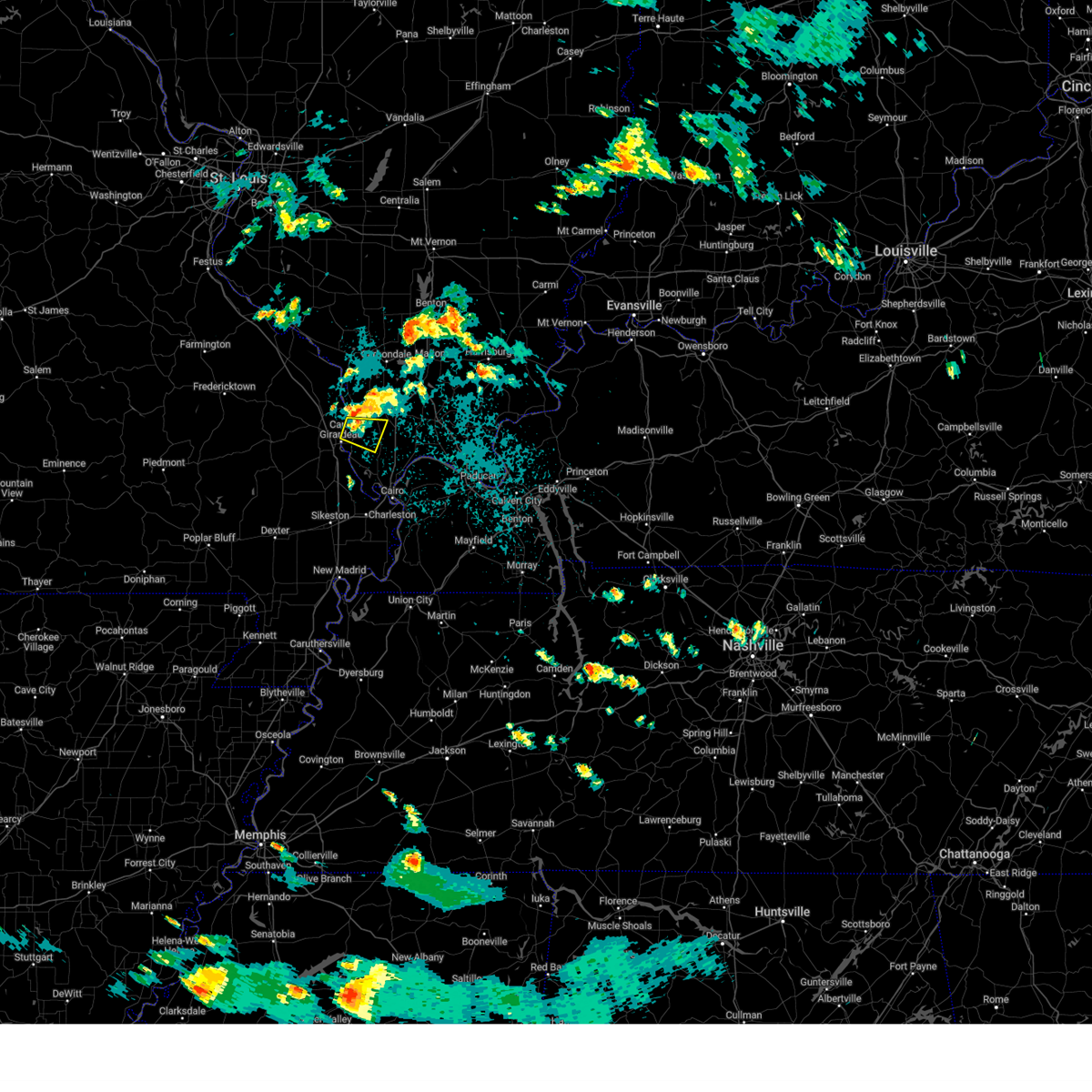
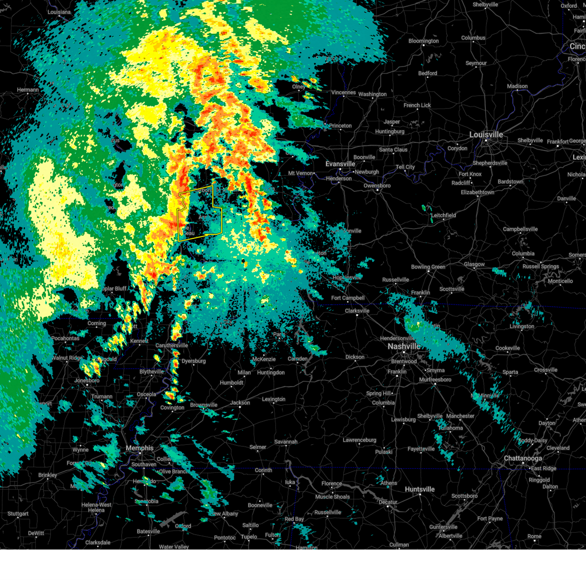
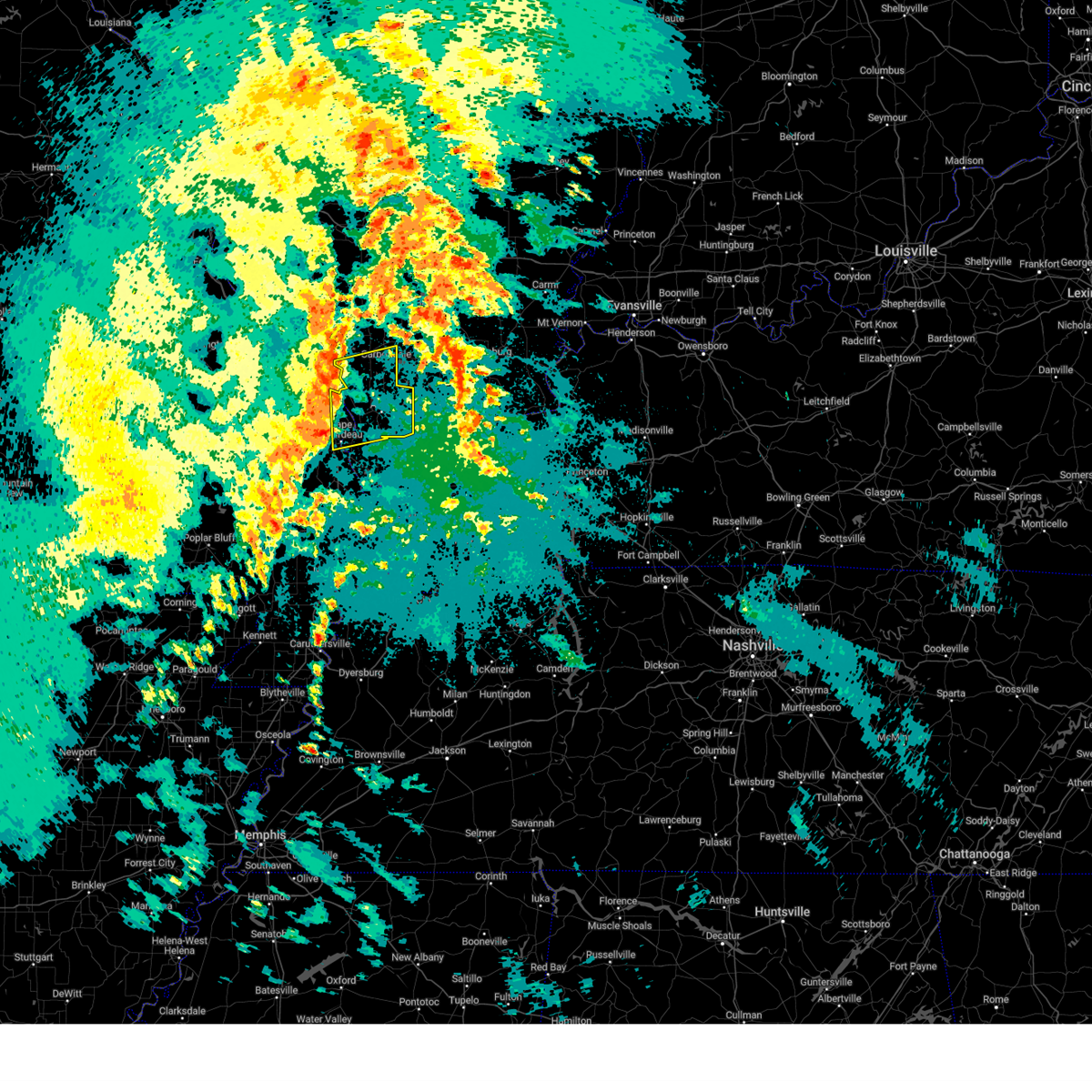
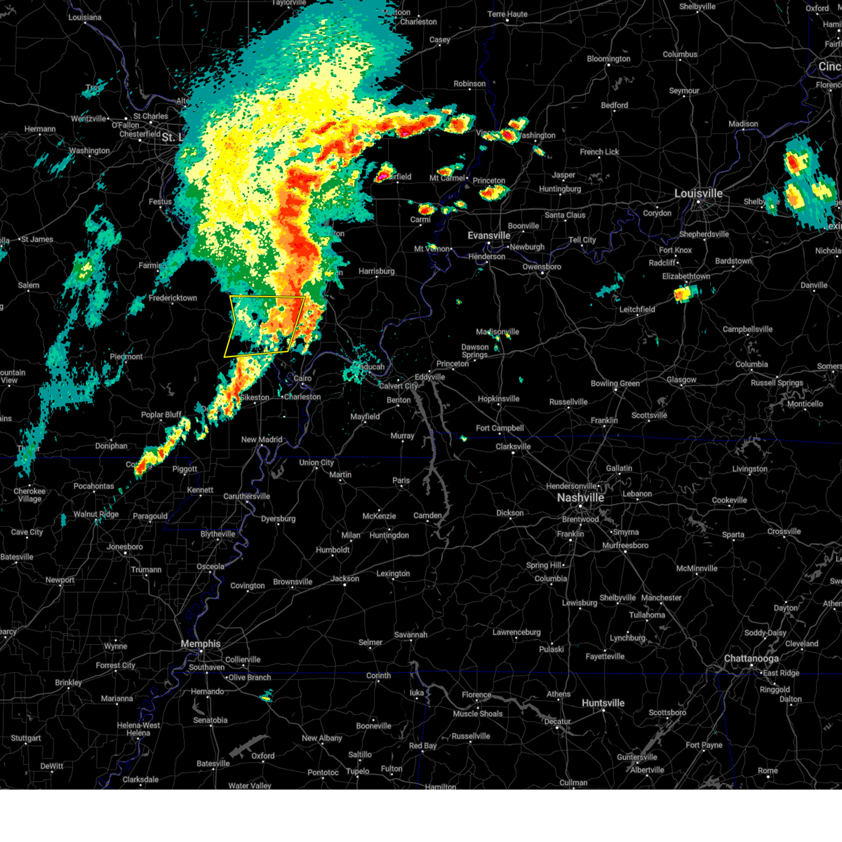
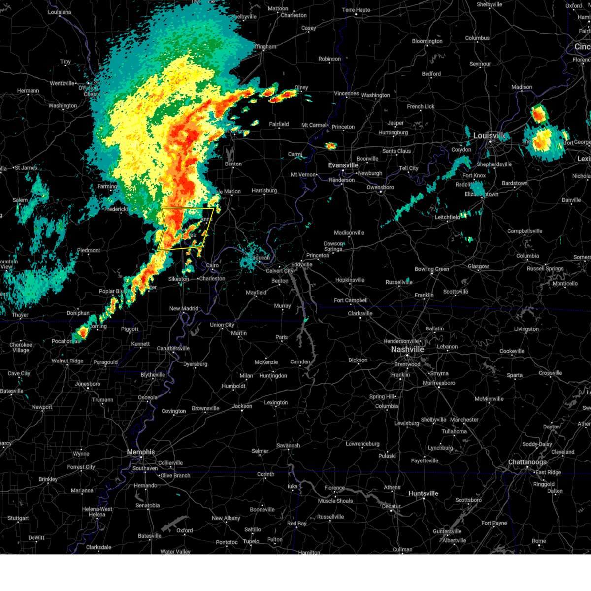
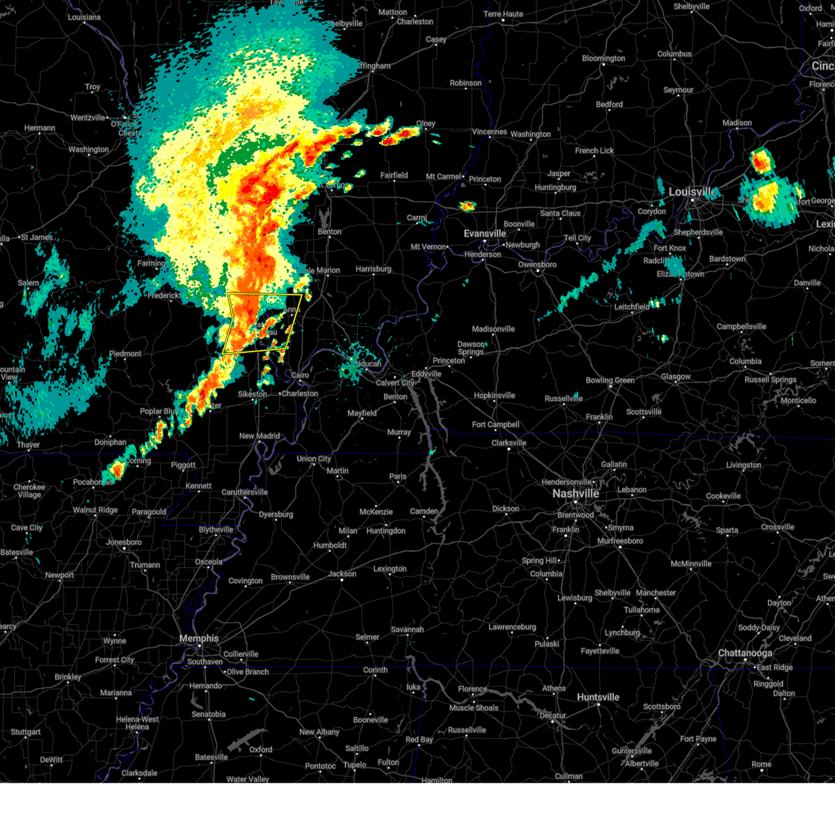
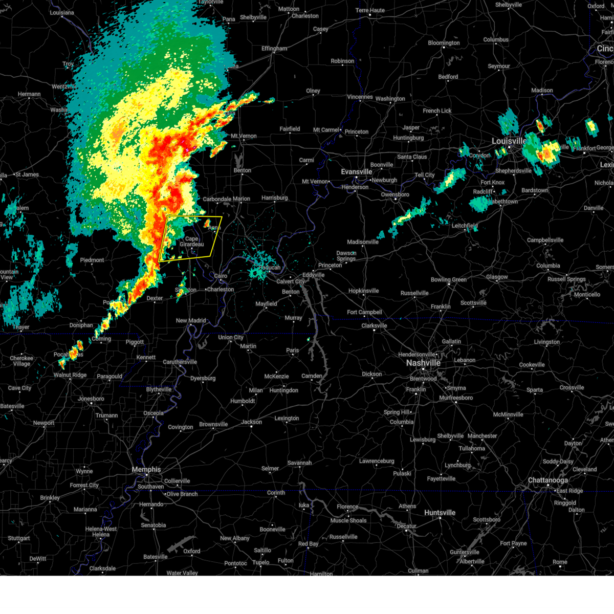
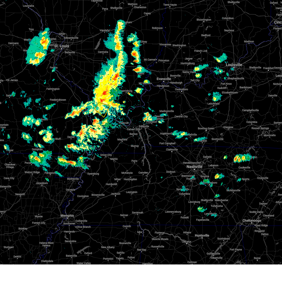
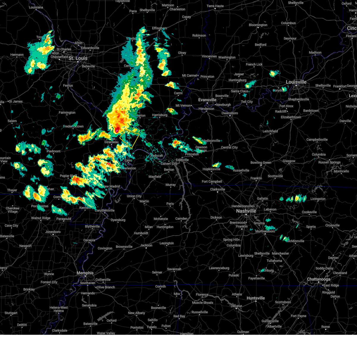
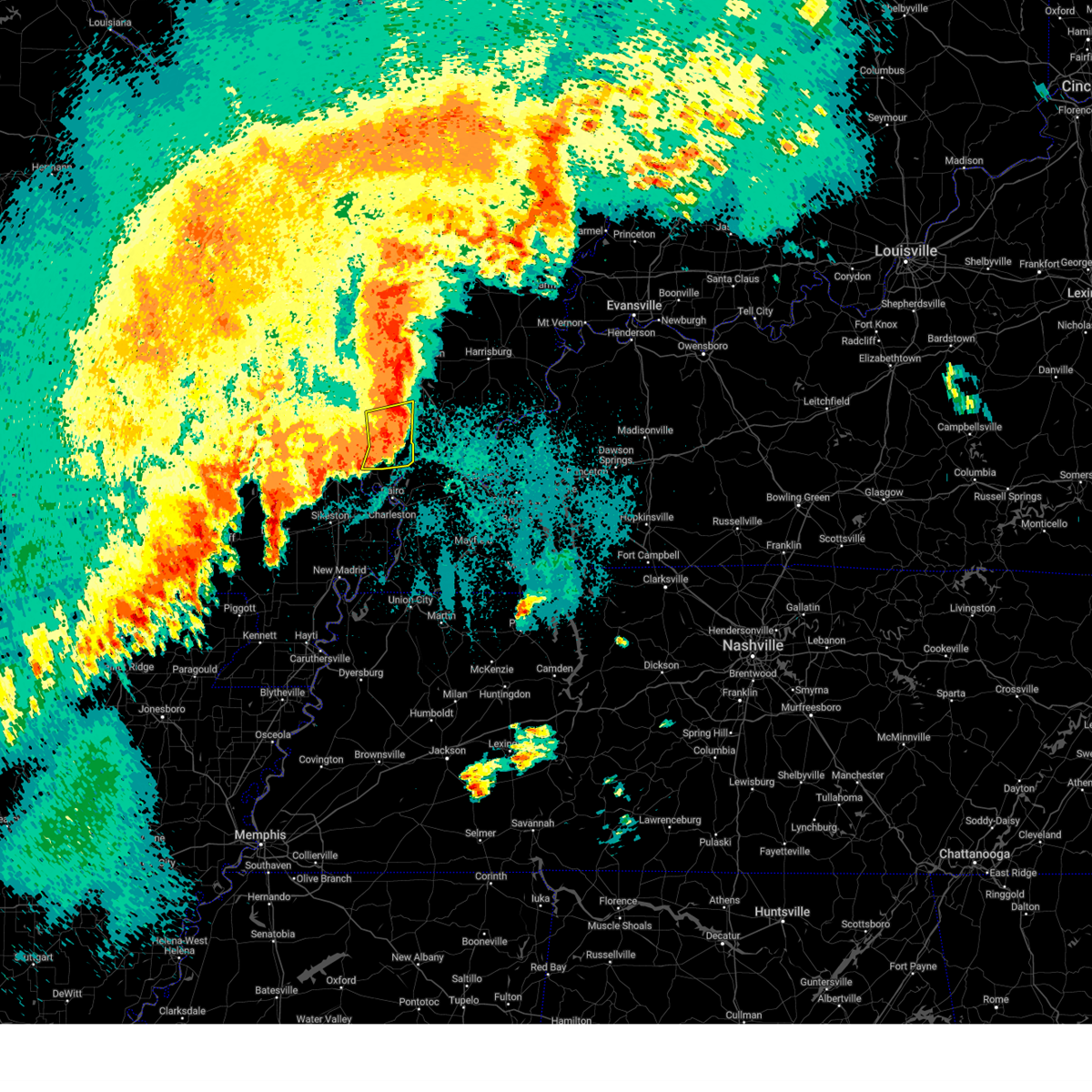
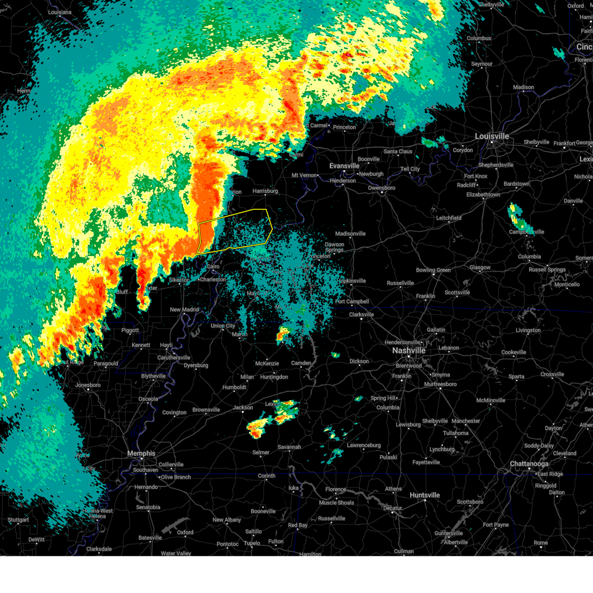
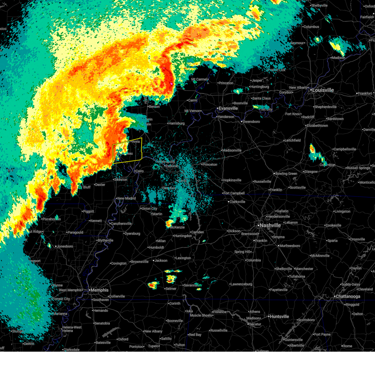
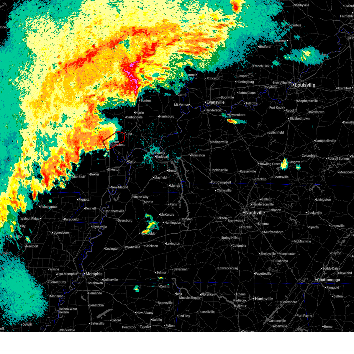
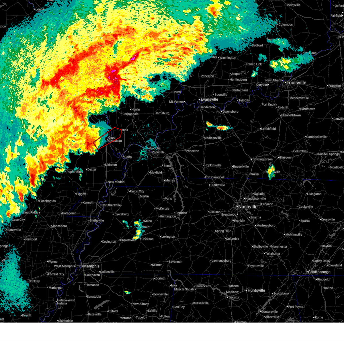
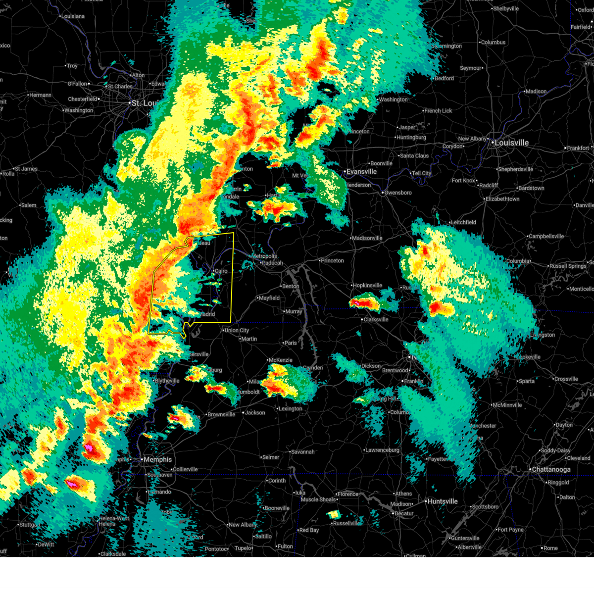
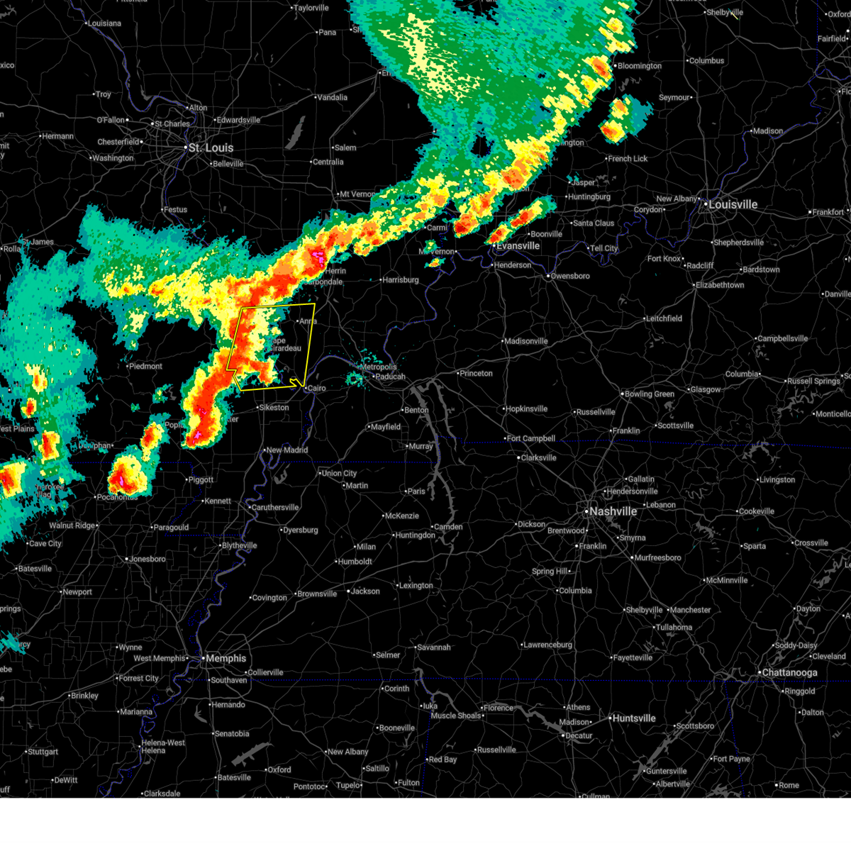
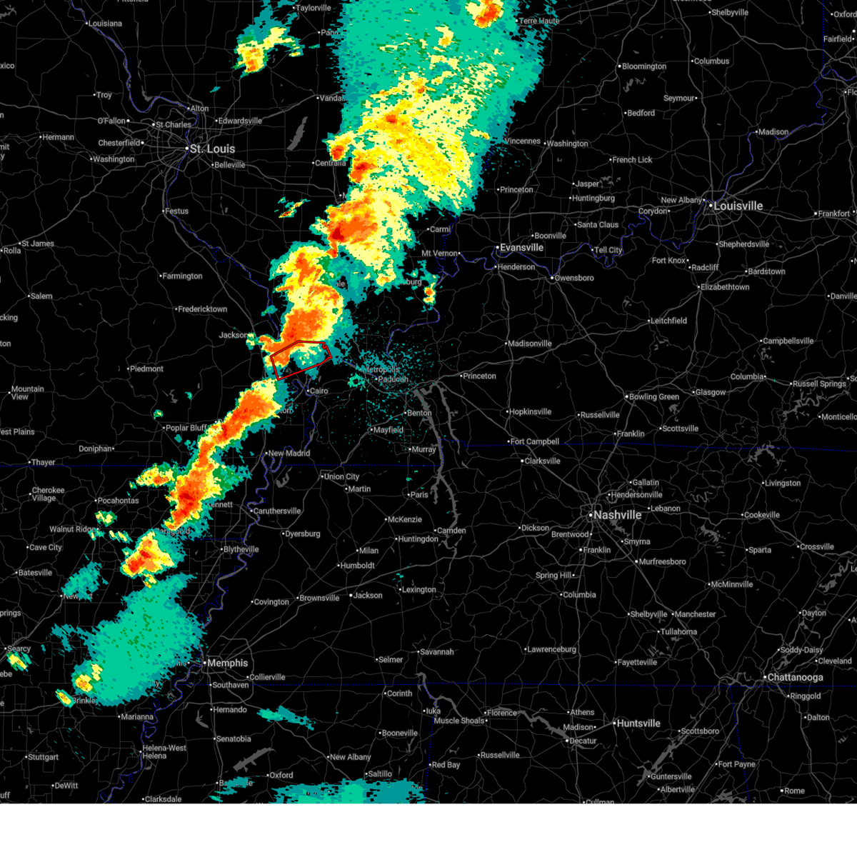
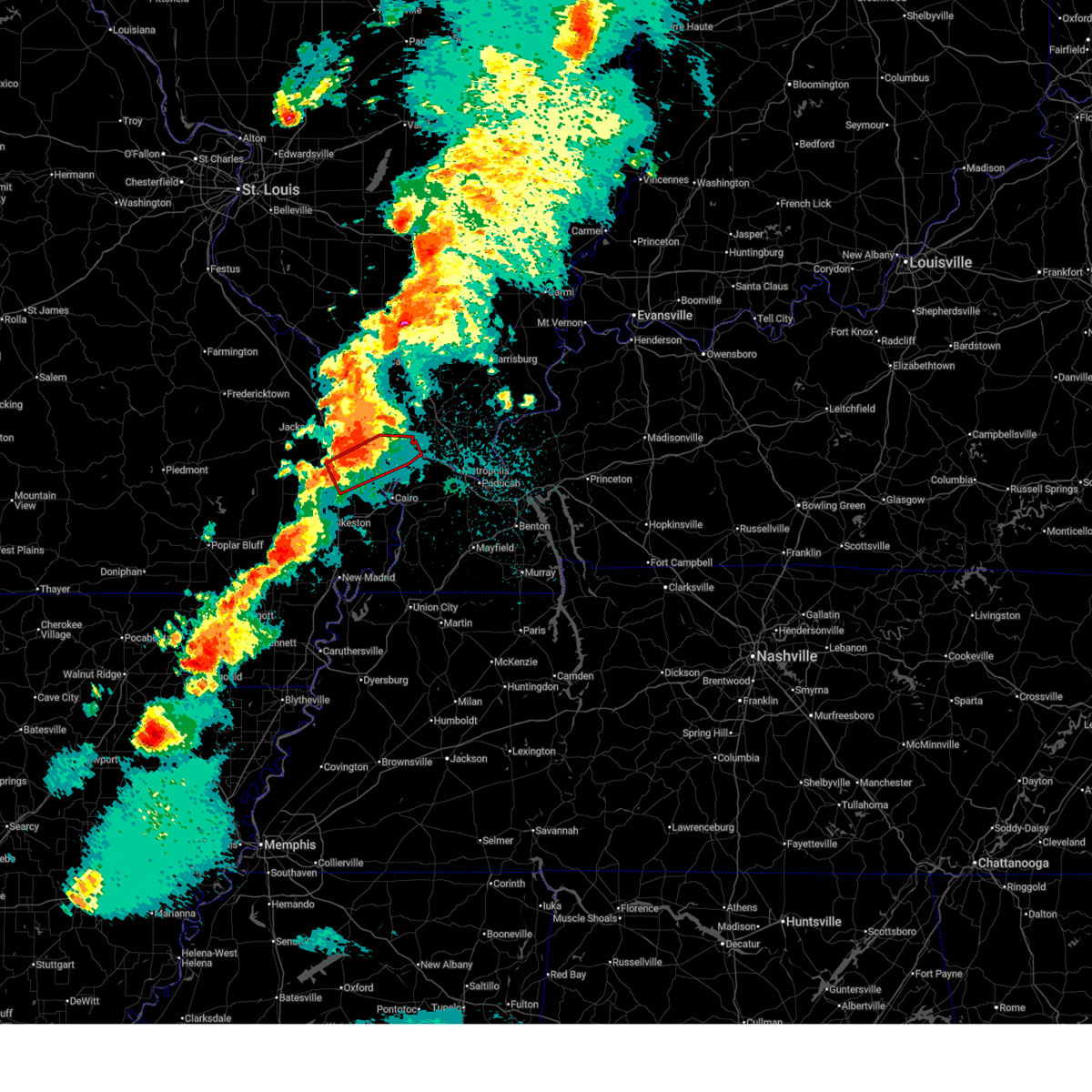
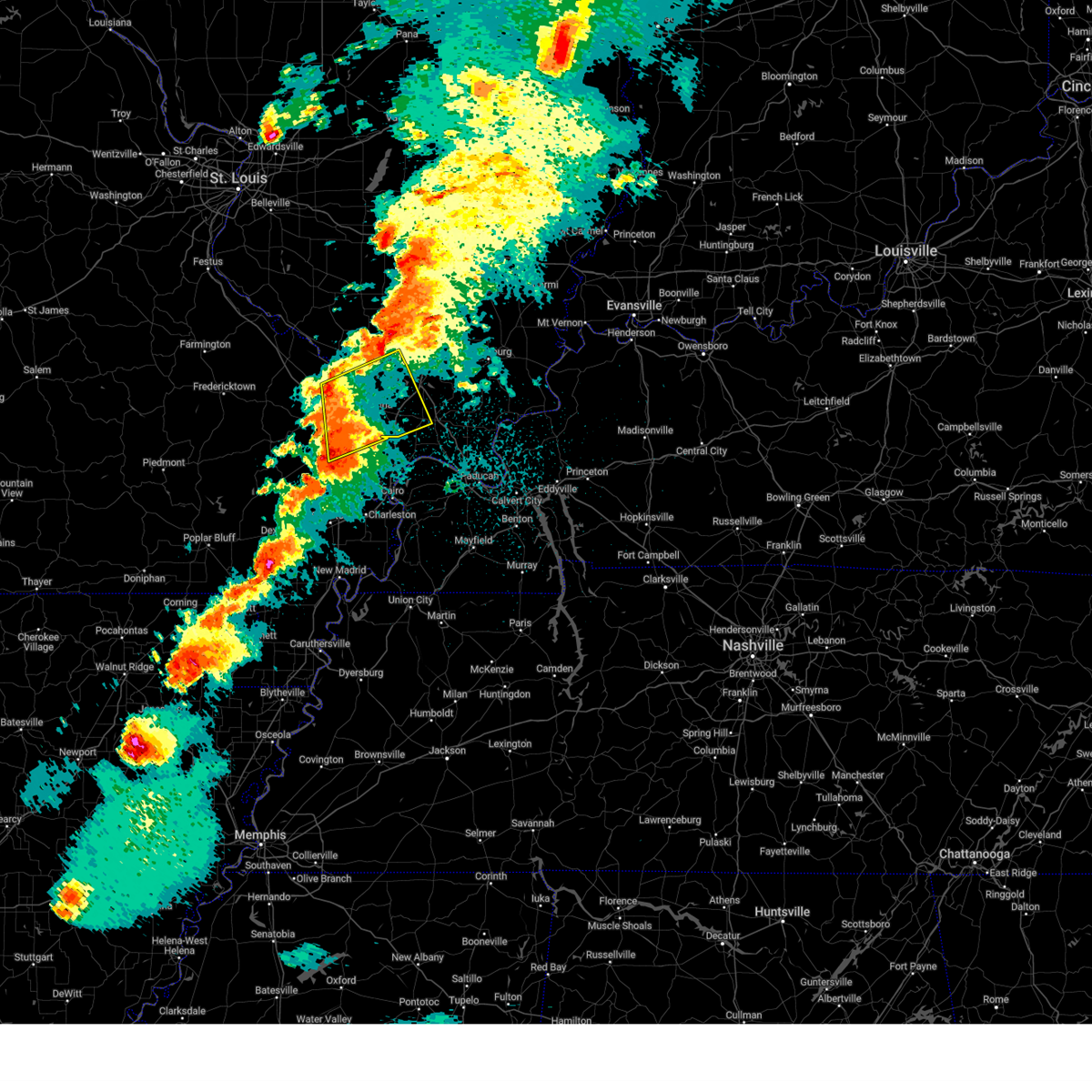
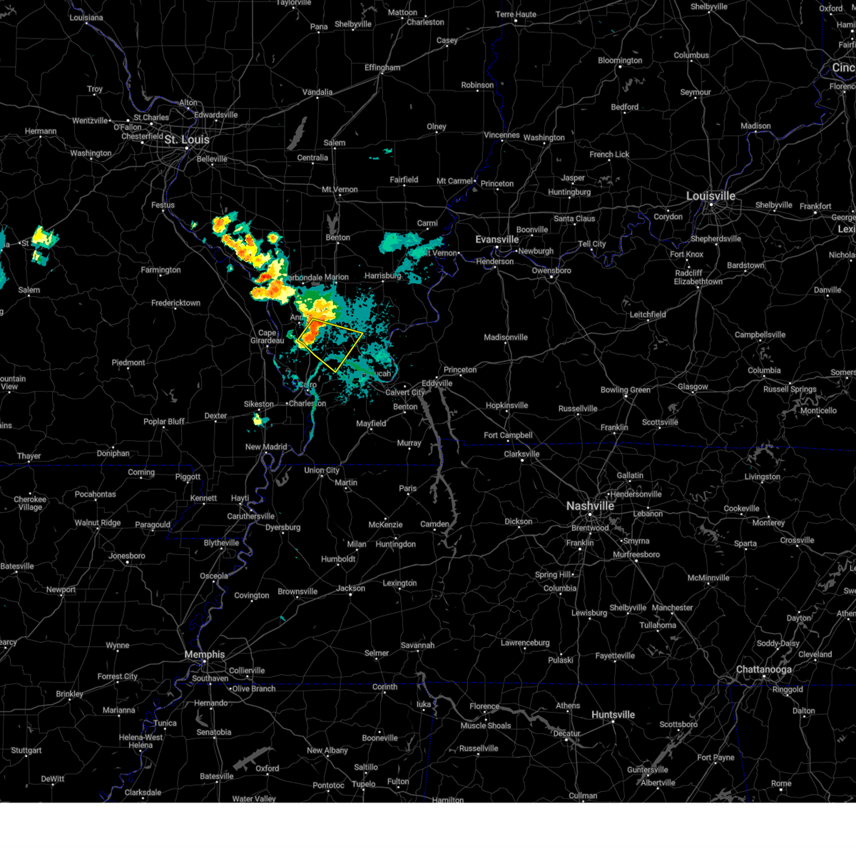
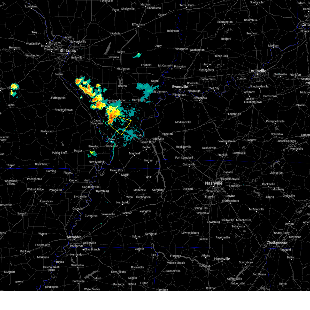
Hail Map for Mill Creek, IL
The Mill Creek, IL area has had 0 reports of on-the-ground hail by trained spotters, and has been under severe weather warnings 18 times during the past 12 months. Doppler radar has detected hail at or near Mill Creek, IL on 80 occasions, including 3 occasions during the past year.
| Name: | Mill Creek, IL |
| Where Located: | 16.3 miles E of Cape Girardeau, MO |
| Map: | Google Map for Mill Creek, IL |
| Population: | 65 |
| Housing Units: | 24 |
| More Info: | Search Google for Mill Creek, IL |
2
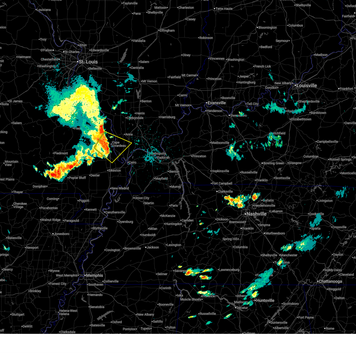
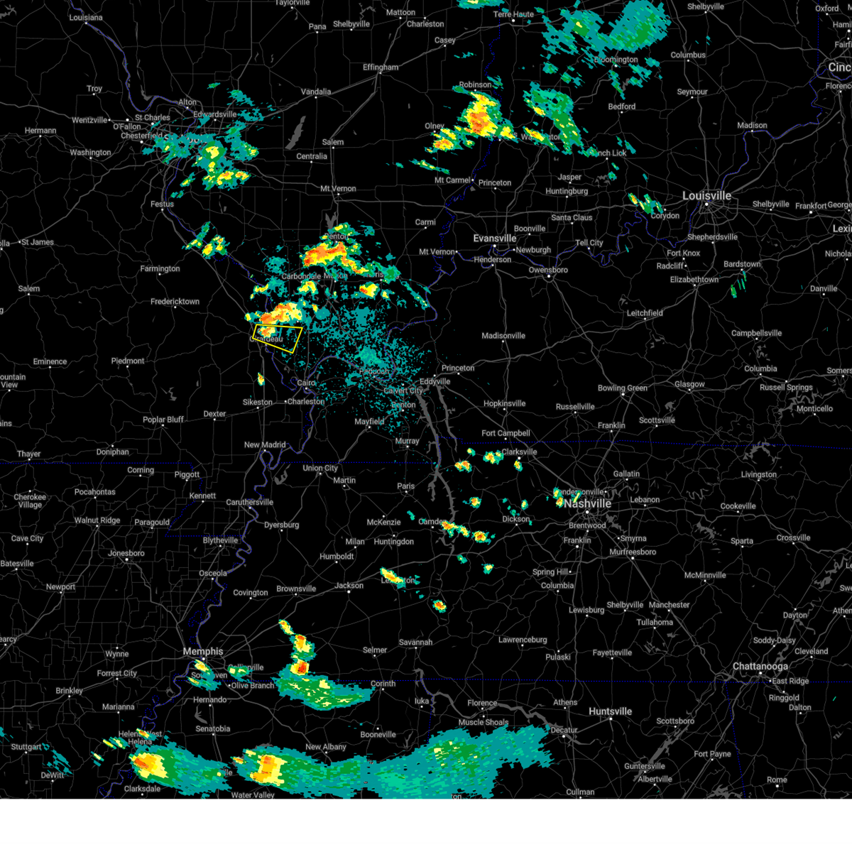
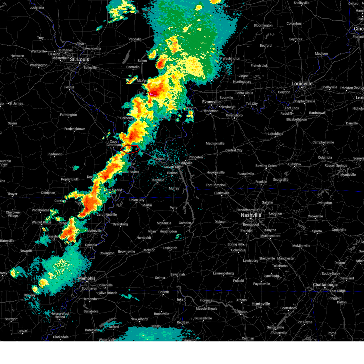
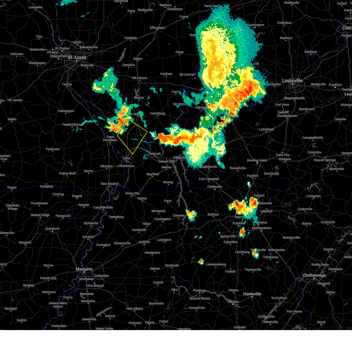
The Top Recent Hail Date for Mill Creek, IL is Tuesday, November 18, 2025 (25th out of 80)
Hail and Wind Damage Spotted near Mill Creek, IL
| Date / Time | Report Details |
|---|---|
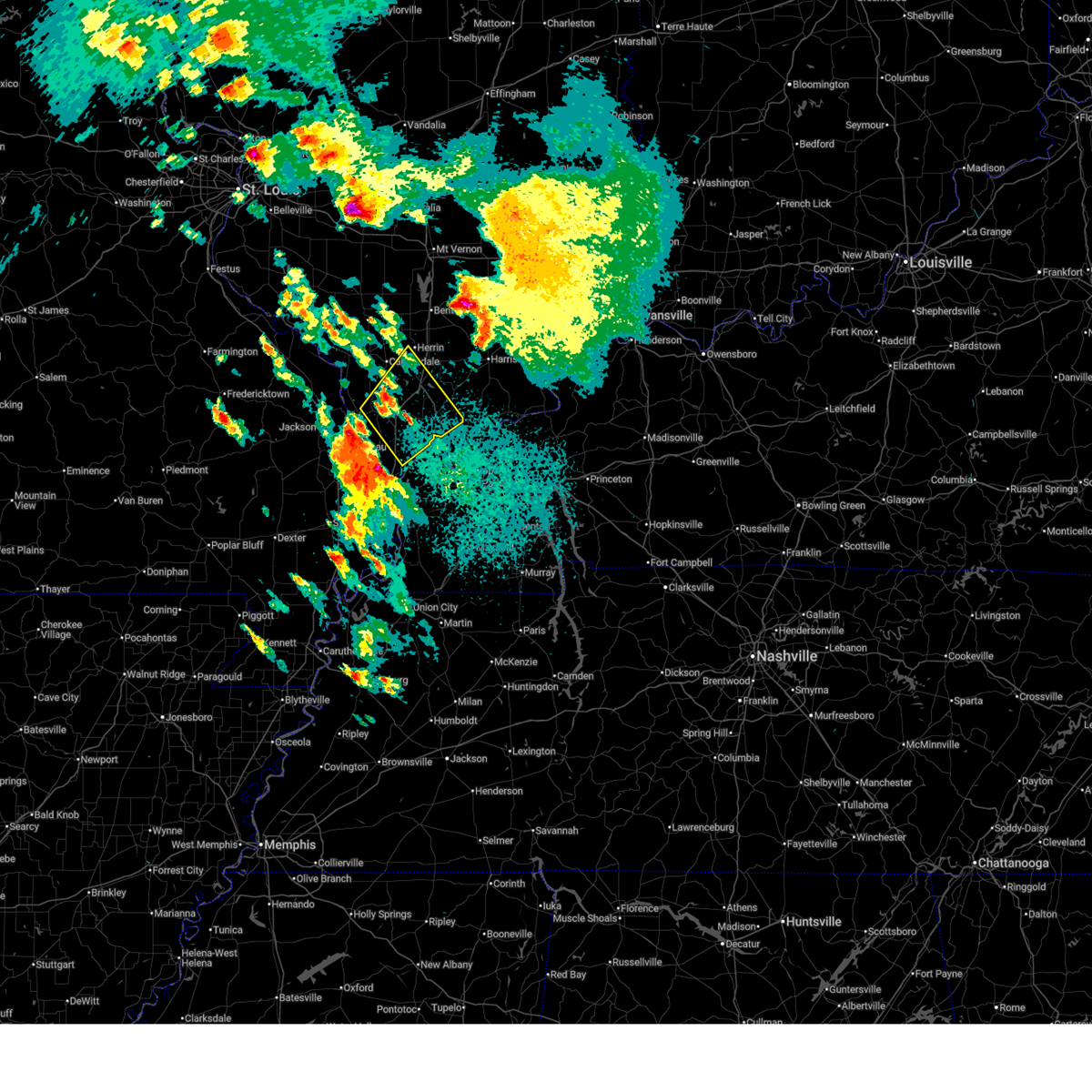
| 5/31/2026 4:00 PM CDT |
 At 358 pm cdt, a severe thunderstorm was located over cape girardeau, moving southeast at 45 mph (radar indicated). Hazards include 70 mph wind gusts. the asos at cape girardeau airport measured 59 mph at 3:53 pm. Expect considerable tree damage. damage is likely to mobile homes, roofs, and outbuildings. locations impacted include, cape girardeau, jackson, scott city, chaffee, benton, tamms, kelso, delta, gordonville, dutchtown, olive branch, cape girardeau airport, ullin, thebes, whitewater, allenville, pocahontas, commerce, mill creek, and lambert. this includes the following highways, interstate 57 in illinois between mile markers 18 and 22. Interstate 55 between mile markers 77 and 110. At 358 pm cdt, a severe thunderstorm was located over cape girardeau, moving southeast at 45 mph (radar indicated). Hazards include 70 mph wind gusts. the asos at cape girardeau airport measured 59 mph at 3:53 pm. Expect considerable tree damage. damage is likely to mobile homes, roofs, and outbuildings. locations impacted include, cape girardeau, jackson, scott city, chaffee, benton, tamms, kelso, delta, gordonville, dutchtown, olive branch, cape girardeau airport, ullin, thebes, whitewater, allenville, pocahontas, commerce, mill creek, and lambert. this includes the following highways, interstate 57 in illinois between mile markers 18 and 22. Interstate 55 between mile markers 77 and 110.
|
| 5/31/2026 4:00 PM CDT |
 the severe thunderstorm warning has been cancelled and is no longer in effect the severe thunderstorm warning has been cancelled and is no longer in effect
|
| 5/31/2026 3:42 PM CDT |
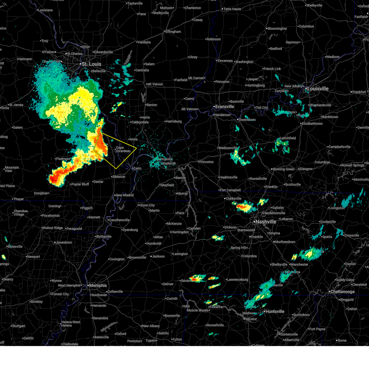 Svrpah the national weather service in paducah has issued a * severe thunderstorm warning for, southwestern union county in southern illinois, northwestern pulaski county in southern illinois, alexander county in southern illinois, east central bollinger county in southeastern missouri, northern scott county in southeastern missouri, cape girardeau county in southeastern missouri, * until 430 pm cdt. * at 342 pm cdt, a severe thunderstorm was located over millersville, or near bollinger mill state historic site, moving southeast at 45 mph (radar indicated). Hazards include 70 mph wind gusts. Expect considerable tree damage. Damage is likely to mobile homes, roofs, and outbuildings. Svrpah the national weather service in paducah has issued a * severe thunderstorm warning for, southwestern union county in southern illinois, northwestern pulaski county in southern illinois, alexander county in southern illinois, east central bollinger county in southeastern missouri, northern scott county in southeastern missouri, cape girardeau county in southeastern missouri, * until 430 pm cdt. * at 342 pm cdt, a severe thunderstorm was located over millersville, or near bollinger mill state historic site, moving southeast at 45 mph (radar indicated). Hazards include 70 mph wind gusts. Expect considerable tree damage. Damage is likely to mobile homes, roofs, and outbuildings.
|
| 4/27/2026 6:53 AM CDT |
 Svrpah the national weather service in paducah has issued a * severe thunderstorm warning for, union county in southern illinois, northeastern pulaski county in southern illinois, johnson county in southern illinois, southwestern williamson county in southern illinois, southeastern jackson county in southern illinois, northern alexander county in southern illinois, * until 745 am cdt. * at 652 am cdt, severe thunderstorms were located along a line extending from near ware to near mounds, moving northeast at 45 mph (radar indicated). Hazards include quarter size hail. damage to vehicles is expected Svrpah the national weather service in paducah has issued a * severe thunderstorm warning for, union county in southern illinois, northeastern pulaski county in southern illinois, johnson county in southern illinois, southwestern williamson county in southern illinois, southeastern jackson county in southern illinois, northern alexander county in southern illinois, * until 745 am cdt. * at 652 am cdt, severe thunderstorms were located along a line extending from near ware to near mounds, moving northeast at 45 mph (radar indicated). Hazards include quarter size hail. damage to vehicles is expected
|
| 4/27/2026 6:50 AM CDT |
 At 649 am cdt, severe thunderstorms were located along a line extending from near cape girardeau to near mounds, moving northeast at 55 mph (trained weather spotters). Hazards include quarter size hail. at 646 am cdt, trained weather spotters reported quarter size hail in cape girardeau. Damage to vehicles is expected. locations impacted include, cape girardeau, scott city, anna, jonesboro, mounds, dongola, tamms, kelso, olive branch, cape girardeau airport, ware, horseshoe lake conservation area, ullin, thebes, pulaski, commerce, mill creek, and east cape girardeau. this includes the following highways, interstate 57 in illinois between mile markers 7 and 25. Interstate 55 between mile markers 87 and 96. At 649 am cdt, severe thunderstorms were located along a line extending from near cape girardeau to near mounds, moving northeast at 55 mph (trained weather spotters). Hazards include quarter size hail. at 646 am cdt, trained weather spotters reported quarter size hail in cape girardeau. Damage to vehicles is expected. locations impacted include, cape girardeau, scott city, anna, jonesboro, mounds, dongola, tamms, kelso, olive branch, cape girardeau airport, ware, horseshoe lake conservation area, ullin, thebes, pulaski, commerce, mill creek, and east cape girardeau. this includes the following highways, interstate 57 in illinois between mile markers 7 and 25. Interstate 55 between mile markers 87 and 96.
|
| 4/27/2026 6:37 AM CDT |
 Svrpah the national weather service in paducah has issued a * severe thunderstorm warning for, southwestern union county in southern illinois, pulaski county in southern illinois, alexander county in southern illinois, north central mississippi county in southeastern missouri, northeastern scott county in southeastern missouri, southeastern cape girardeau county in southeastern missouri, * until 700 am cdt. * at 637 am cdt, severe thunderstorms were located along a line extending from near dutchtown to 7 miles northwest of charleston, moving northeast at 50 mph (radar indicated). Hazards include quarter size hail. damage to vehicles is expected Svrpah the national weather service in paducah has issued a * severe thunderstorm warning for, southwestern union county in southern illinois, pulaski county in southern illinois, alexander county in southern illinois, north central mississippi county in southeastern missouri, northeastern scott county in southeastern missouri, southeastern cape girardeau county in southeastern missouri, * until 700 am cdt. * at 637 am cdt, severe thunderstorms were located along a line extending from near dutchtown to 7 miles northwest of charleston, moving northeast at 50 mph (radar indicated). Hazards include quarter size hail. damage to vehicles is expected
|
| 3/15/2026 7:27 PM CDT |
 The storms which prompted the warning have weakened below severe limits, and no longer pose an immediate threat to life or property. therefore, the warning will be allowed to expire. however, gusty winds are still possible with these thunderstorms. a tornado watch remains in effect until 1100 pm cdt for southern illinois, western kentucky, and southeastern missouri. remember, a tornado warning still remains in effect for portions of union, jackson, and williamson county. The storms which prompted the warning have weakened below severe limits, and no longer pose an immediate threat to life or property. therefore, the warning will be allowed to expire. however, gusty winds are still possible with these thunderstorms. a tornado watch remains in effect until 1100 pm cdt for southern illinois, western kentucky, and southeastern missouri. remember, a tornado warning still remains in effect for portions of union, jackson, and williamson county.
|
| 3/15/2026 7:21 PM CDT |
 the severe thunderstorm warning has been cancelled and is no longer in effect the severe thunderstorm warning has been cancelled and is no longer in effect
|
| 3/15/2026 7:21 PM CDT |
 At 721 pm cdt, severe thunderstorms were located along a line extending from near marion to near horseshoe lake conservation area, moving east at 50 mph (radar indicated). Hazards include 60 mph wind gusts. Expect damage to roofs, siding, and trees. locations impacted include, cape girardeau, carbondale, marion, herrin, murphysboro, carterville, scott city, anna, johnston city, jonesboro, crainville, cambria, cobden, energy, goreville, dongola, tamms, kelso, pittsburg, and creal springs. this includes the following highways, interstate 24 in illinois between mile markers 1 and 11. interstate 57 in illinois between mile markers 10 and 60. Interstate 55 between mile markers 84 and 91. At 721 pm cdt, severe thunderstorms were located along a line extending from near marion to near horseshoe lake conservation area, moving east at 50 mph (radar indicated). Hazards include 60 mph wind gusts. Expect damage to roofs, siding, and trees. locations impacted include, cape girardeau, carbondale, marion, herrin, murphysboro, carterville, scott city, anna, johnston city, jonesboro, crainville, cambria, cobden, energy, goreville, dongola, tamms, kelso, pittsburg, and creal springs. this includes the following highways, interstate 24 in illinois between mile markers 1 and 11. interstate 57 in illinois between mile markers 10 and 60. Interstate 55 between mile markers 84 and 91.
|
| 3/15/2026 6:52 PM CDT |
 Svrpah the national weather service in paducah has issued a * severe thunderstorm warning for, union county in southern illinois, pulaski county in southern illinois, western johnson county in southern illinois, williamson county in southern illinois, southern jackson county in southern illinois, alexander county in southern illinois, north central ballard county in western kentucky, northern scott county in southeastern missouri, southeastern perry county in southeastern missouri, central cape girardeau county in southeastern missouri, northern stoddard county in southeastern missouri, * until 730 pm cdt. * at 652 pm cdt, severe thunderstorms were located along a line extending from murphysboro to near oran, moving east at 50 mph (radar indicated). Hazards include 60 mph wind gusts. expect damage to roofs, siding, and trees Svrpah the national weather service in paducah has issued a * severe thunderstorm warning for, union county in southern illinois, pulaski county in southern illinois, western johnson county in southern illinois, williamson county in southern illinois, southern jackson county in southern illinois, alexander county in southern illinois, north central ballard county in western kentucky, northern scott county in southeastern missouri, southeastern perry county in southeastern missouri, central cape girardeau county in southeastern missouri, northern stoddard county in southeastern missouri, * until 730 pm cdt. * at 652 pm cdt, severe thunderstorms were located along a line extending from murphysboro to near oran, moving east at 50 mph (radar indicated). Hazards include 60 mph wind gusts. expect damage to roofs, siding, and trees
|
| 12/28/2025 6:02 PM CST |
 At 602 pm cst, severe thunderstorms were located along a line extending from lake of egypt area to 6 miles northwest of tamms, moving east at 45 mph (radar indicated). Hazards include 60 mph wind gusts. Expect damage to roofs, siding, and trees. locations impacted include, cape girardeau, anna, jonesboro, trail of tears state park, cobden, dongola, ware, alto pass, and mill creek. This includes interstate 57 in illinois between mile markers 22 and 38. At 602 pm cst, severe thunderstorms were located along a line extending from lake of egypt area to 6 miles northwest of tamms, moving east at 45 mph (radar indicated). Hazards include 60 mph wind gusts. Expect damage to roofs, siding, and trees. locations impacted include, cape girardeau, anna, jonesboro, trail of tears state park, cobden, dongola, ware, alto pass, and mill creek. This includes interstate 57 in illinois between mile markers 22 and 38.
|
| 12/28/2025 5:25 PM CST |
 Svrpah the national weather service in paducah has issued a * severe thunderstorm warning for, union county in southern illinois, northwestern alexander county in southern illinois, central cape girardeau county in southeastern missouri, * until 615 pm cst. * at 525 pm cst, severe thunderstorms were located along a line extending from near grand tower to near burfordville, moving east at 65 mph (radar indicated). Hazards include 60 mph wind gusts. expect damage to roofs, siding, and trees Svrpah the national weather service in paducah has issued a * severe thunderstorm warning for, union county in southern illinois, northwestern alexander county in southern illinois, central cape girardeau county in southeastern missouri, * until 615 pm cst. * at 525 pm cst, severe thunderstorms were located along a line extending from near grand tower to near burfordville, moving east at 65 mph (radar indicated). Hazards include 60 mph wind gusts. expect damage to roofs, siding, and trees
|
| 11/18/2025 5:35 PM CST | the severe thunderstorm warning has been cancelled and is no longer in effect |
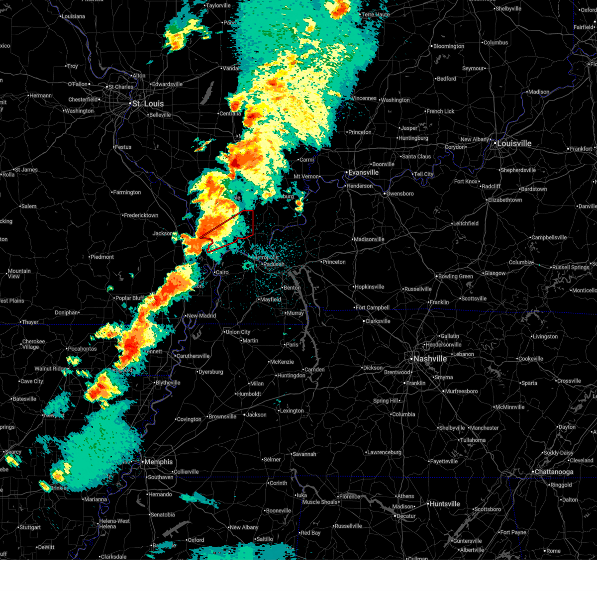
| 11/18/2025 5:25 PM CST | At 525 pm cst, a severe thunderstorm was located near tamms, or 10 miles south of jonesboro, moving east at 40 mph (broadcast media). Hazards include 60 mph wind gusts and quarter size hail. Hail damage to vehicles is expected. expect wind damage to roofs, siding, and trees. locations impacted include, dongola, tamms, ullin, pulaski, and mill creek. This includes interstate 57 in illinois between mile markers 13 and 26. |
| 11/18/2025 5:15 PM CST | At 515 pm cst, a severe thunderstorm was located near tamms, or 10 miles east of scott city, moving east at 40 mph (radar indicated). Hazards include 60 mph wind gusts and quarter size hail. Hail damage to vehicles is expected. expect wind damage to roofs, siding, and trees. locations impacted include, dongola, tamms, olive branch, ullin, pulaski, and mill creek. This includes interstate 57 in illinois between mile markers 13 and 26. |
| 11/18/2025 5:15 PM CST | the severe thunderstorm warning has been cancelled and is no longer in effect |
| 11/18/2025 5:08 PM CST | At 508 pm cst, a severe thunderstorm was located near scott city, moving east at 40 mph (radar indicated). Hazards include 60 mph wind gusts and half dollar size hail. Hail damage to vehicles is expected. expect wind damage to roofs, siding, and trees. locations impacted include, cape girardeau, scott city, dongola, tamms, olive branch, ullin, thebes, pulaski, commerce, mill creek, and east cape girardeau. This includes interstate 57 in illinois between mile markers 12 and 26. |
| 11/18/2025 4:57 PM CST | Svrpah the national weather service in paducah has issued a * severe thunderstorm warning for, south central union county in southern illinois, northwestern pulaski county in southern illinois, alexander county in southern illinois, northern scott county in southeastern missouri, southeastern cape girardeau county in southeastern missouri, * until 545 pm cst. * at 457 pm cst, a severe thunderstorm was located over cape girardeau airport, or near scott city, moving east at 40 mph (radar indicated). Hazards include 60 mph wind gusts and quarter size hail. Hail damage to vehicles is expected. Expect wind damage to roofs, siding, and trees. |
| 6/7/2025 10:52 PM CDT |
 the severe thunderstorm warning has been cancelled and is no longer in effect the severe thunderstorm warning has been cancelled and is no longer in effect
|
| 6/7/2025 10:43 PM CDT |
 At 1042 pm cdt, a severe thunderstorm was located near cape girardeau, moving southeast at 25 mph (radar indicated). Hazards include 60 mph wind gusts. Expect damage to roofs, siding, and trees. Locations impacted include, cape girardeau and mill creek. At 1042 pm cdt, a severe thunderstorm was located near cape girardeau, moving southeast at 25 mph (radar indicated). Hazards include 60 mph wind gusts. Expect damage to roofs, siding, and trees. Locations impacted include, cape girardeau and mill creek.
|
| 6/7/2025 10:30 PM CDT |
 Svrpah the national weather service in paducah has issued a * severe thunderstorm warning for, southwestern union county in southern illinois, northwestern alexander county in southern illinois, east central cape girardeau county in southeastern missouri, * until 1115 pm cdt. * at 1030 pm cdt, a severe thunderstorm was located near cape girardeau, moving southeast at 25 mph (trained weather spotters reported power flashes north of jackson). Hazards include 60 mph wind gusts. expect damage to roofs, siding, and trees Svrpah the national weather service in paducah has issued a * severe thunderstorm warning for, southwestern union county in southern illinois, northwestern alexander county in southern illinois, east central cape girardeau county in southeastern missouri, * until 1115 pm cdt. * at 1030 pm cdt, a severe thunderstorm was located near cape girardeau, moving southeast at 25 mph (trained weather spotters reported power flashes north of jackson). Hazards include 60 mph wind gusts. expect damage to roofs, siding, and trees
|
| 5/20/2025 1:39 AM CDT |
 the severe thunderstorm warning has been cancelled and is no longer in effect the severe thunderstorm warning has been cancelled and is no longer in effect
|
| 5/20/2025 1:39 AM CDT |
 At 139 am cdt, severe thunderstorms were located along a line extending from near cedar lake area to near dongola, moving east at 40 mph (radar indicated). Hazards include 60 mph wind gusts. Expect damage to roofs, siding, and trees. locations impacted include, anna, jonesboro, cobden, goreville, dongola, karnak, makanda, ullin, cypress, buncombe, belknap, and mill creek. this includes the following highways, interstate 24 in illinois between mile markers 1 and 2. Interstate 57 in illinois between mile markers 18 and 45. At 139 am cdt, severe thunderstorms were located along a line extending from near cedar lake area to near dongola, moving east at 40 mph (radar indicated). Hazards include 60 mph wind gusts. Expect damage to roofs, siding, and trees. locations impacted include, anna, jonesboro, cobden, goreville, dongola, karnak, makanda, ullin, cypress, buncombe, belknap, and mill creek. this includes the following highways, interstate 24 in illinois between mile markers 1 and 2. Interstate 57 in illinois between mile markers 18 and 45.
|
| 5/20/2025 1:19 AM CDT |
 Svrpah the national weather service in paducah has issued a * severe thunderstorm warning for, union county in southern illinois, northern pulaski county in southern illinois, western johnson county in southern illinois, southwestern williamson county in southern illinois, southeastern jackson county in southern illinois, northwestern alexander county in southern illinois, east central cape girardeau county in southeastern missouri, * until 200 am cdt. * at 118 am cdt, severe thunderstorms were located along a line extending from near grand tower to near cape girardeau, moving east at 35 mph (radar indicated). Hazards include 60 mph wind gusts. expect damage to roofs, siding, and trees Svrpah the national weather service in paducah has issued a * severe thunderstorm warning for, union county in southern illinois, northern pulaski county in southern illinois, western johnson county in southern illinois, southwestern williamson county in southern illinois, southeastern jackson county in southern illinois, northwestern alexander county in southern illinois, east central cape girardeau county in southeastern missouri, * until 200 am cdt. * at 118 am cdt, severe thunderstorms were located along a line extending from near grand tower to near cape girardeau, moving east at 35 mph (radar indicated). Hazards include 60 mph wind gusts. expect damage to roofs, siding, and trees
|
| 5/20/2025 1:17 AM CDT |
 the severe thunderstorm warning has been cancelled and is no longer in effect the severe thunderstorm warning has been cancelled and is no longer in effect
|
| 5/20/2025 1:10 AM CDT |
 Svrpah the national weather service in paducah has issued a * severe thunderstorm warning for, union county in southern illinois, southern jackson county in southern illinois, northwestern alexander county in southern illinois, northeastern cape girardeau county in southeastern missouri, * until 200 am cdt. * at 110 am cdt, severe thunderstorms were located along a line extending from grand tower to cape girardeau, moving east at 45 mph (radar indicated). Hazards include 60 mph wind gusts. expect damage to roofs, siding, and trees Svrpah the national weather service in paducah has issued a * severe thunderstorm warning for, union county in southern illinois, southern jackson county in southern illinois, northwestern alexander county in southern illinois, northeastern cape girardeau county in southeastern missouri, * until 200 am cdt. * at 110 am cdt, severe thunderstorms were located along a line extending from grand tower to cape girardeau, moving east at 45 mph (radar indicated). Hazards include 60 mph wind gusts. expect damage to roofs, siding, and trees
|
| 4/29/2025 2:17 PM CDT |
 the severe thunderstorm warning has been cancelled and is no longer in effect the severe thunderstorm warning has been cancelled and is no longer in effect
|
| 4/29/2025 2:03 PM CDT |
 Svrpah the national weather service in paducah has issued a * severe thunderstorm warning for, southeastern perry county in south central illinois, eastern union county in southern illinois, northern pulaski county in southern illinois, western johnson county in southern illinois, williamson county in southern illinois, eastern jackson county in southern illinois, north central alexander county in southern illinois, franklin county in south central illinois, * until 245 pm cdt. * at 202 pm cdt, severe thunderstorms were located along a line extending from du quoin to near carbondale to near scott city, moving east at 40 mph (radar indicated). Hazards include 60 mph wind gusts. expect damage to roofs, siding, and trees Svrpah the national weather service in paducah has issued a * severe thunderstorm warning for, southeastern perry county in south central illinois, eastern union county in southern illinois, northern pulaski county in southern illinois, western johnson county in southern illinois, williamson county in southern illinois, eastern jackson county in southern illinois, north central alexander county in southern illinois, franklin county in south central illinois, * until 245 pm cdt. * at 202 pm cdt, severe thunderstorms were located along a line extending from du quoin to near carbondale to near scott city, moving east at 40 mph (radar indicated). Hazards include 60 mph wind gusts. expect damage to roofs, siding, and trees
|
| 4/29/2025 1:55 PM CDT |
 the severe thunderstorm warning has been cancelled and is no longer in effect the severe thunderstorm warning has been cancelled and is no longer in effect
|
| 4/29/2025 1:55 PM CDT |
 At 154 pm cdt, severe thunderstorms were located along a line extending from near grand tower to chaffee, moving east at 50 mph (radar indicated). Hazards include 60 mph wind gusts and penny size hail. Expect damage to roofs, siding, and trees. locations impacted include, old appleton, cape girardeau, pocahontas, cobden, jackson, whitewater, alto pass, cape girardeau airport, dutchtown, gordonville, ware, jonesboro, allenville, trail of tears state park, east cape girardeau, scott city, oak ridge, anna, thebes, and delta. This includes interstate 55 between mile markers 90 and 121. At 154 pm cdt, severe thunderstorms were located along a line extending from near grand tower to chaffee, moving east at 50 mph (radar indicated). Hazards include 60 mph wind gusts and penny size hail. Expect damage to roofs, siding, and trees. locations impacted include, old appleton, cape girardeau, pocahontas, cobden, jackson, whitewater, alto pass, cape girardeau airport, dutchtown, gordonville, ware, jonesboro, allenville, trail of tears state park, east cape girardeau, scott city, oak ridge, anna, thebes, and delta. This includes interstate 55 between mile markers 90 and 121.
|
| 4/29/2025 1:37 PM CDT |
 Svrpah the national weather service in paducah has issued a * severe thunderstorm warning for, union county in southern illinois, southeastern jackson county in southern illinois, northwestern alexander county in southern illinois, east central bollinger county in southeastern missouri, north central scott county in southeastern missouri, southeastern perry county in southeastern missouri, cape girardeau county in southeastern missouri, * until 230 pm cdt. * at 136 pm cdt, severe thunderstorms were located along a line extending from near daisy to near advance, moving east at 40 mph (radar indicated). Hazards include 60 mph wind gusts and penny size hail. expect damage to roofs, siding, and trees Svrpah the national weather service in paducah has issued a * severe thunderstorm warning for, union county in southern illinois, southeastern jackson county in southern illinois, northwestern alexander county in southern illinois, east central bollinger county in southeastern missouri, north central scott county in southeastern missouri, southeastern perry county in southeastern missouri, cape girardeau county in southeastern missouri, * until 230 pm cdt. * at 136 pm cdt, severe thunderstorms were located along a line extending from near daisy to near advance, moving east at 40 mph (radar indicated). Hazards include 60 mph wind gusts and penny size hail. expect damage to roofs, siding, and trees
|
| 4/10/2025 2:19 PM CDT |
 the severe thunderstorm warning has been cancelled and is no longer in effect the severe thunderstorm warning has been cancelled and is no longer in effect
|
| 4/10/2025 2:06 PM CDT |
 Svrpah the national weather service in paducah has issued a * severe thunderstorm warning for, southeastern union county in southern illinois, north central pulaski county in southern illinois, west central johnson county in southern illinois, * until 230 pm cdt. * at 206 pm cdt, a severe thunderstorm was located over anna, moving southeast at 35 mph (radar indicated). Hazards include 60 mph wind gusts and penny size hail. expect damage to roofs, siding, and trees Svrpah the national weather service in paducah has issued a * severe thunderstorm warning for, southeastern union county in southern illinois, north central pulaski county in southern illinois, west central johnson county in southern illinois, * until 230 pm cdt. * at 206 pm cdt, a severe thunderstorm was located over anna, moving southeast at 35 mph (radar indicated). Hazards include 60 mph wind gusts and penny size hail. expect damage to roofs, siding, and trees
|
| 4/4/2025 8:56 PM CDT |
 the severe thunderstorm warning has been cancelled and is no longer in effect the severe thunderstorm warning has been cancelled and is no longer in effect
|
| 4/4/2025 8:56 PM CDT |
 At 856 pm cdt, severe thunderstorms were located along a line extending from anna to near tamms, moving east at 40 mph (radar indicated). Hazards include 70 mph wind gusts and nickel size hail. Expect considerable tree damage. damage is likely to mobile homes, roofs, and outbuildings. locations impacted include, dongola, mill creek, jonesboro, ullin, tamms, olive branch, olmsted, pulaski, and anna. This includes interstate 57 in illinois between mile markers 11 and 34. At 856 pm cdt, severe thunderstorms were located along a line extending from anna to near tamms, moving east at 40 mph (radar indicated). Hazards include 70 mph wind gusts and nickel size hail. Expect considerable tree damage. damage is likely to mobile homes, roofs, and outbuildings. locations impacted include, dongola, mill creek, jonesboro, ullin, tamms, olive branch, olmsted, pulaski, and anna. This includes interstate 57 in illinois between mile markers 11 and 34.
|
| 4/4/2025 8:54 PM CDT |
 Svrpah the national weather service in paducah has issued a * severe thunderstorm warning for, southeastern union county in southern illinois, pulaski county in southern illinois, northwestern massac county in southern illinois, pope county in southern illinois, johnson county in southern illinois, north central alexander county in southern illinois, * until 1000 pm cdt. * at 853 pm cdt, severe thunderstorms were located along a line extending from near anna to near dongola to near tamms, moving east at 40 mph (radar indicated). Hazards include 70 mph wind gusts and nickel size hail. Expect considerable tree damage. Damage is likely to mobile homes, roofs, and outbuildings. Svrpah the national weather service in paducah has issued a * severe thunderstorm warning for, southeastern union county in southern illinois, pulaski county in southern illinois, northwestern massac county in southern illinois, pope county in southern illinois, johnson county in southern illinois, north central alexander county in southern illinois, * until 1000 pm cdt. * at 853 pm cdt, severe thunderstorms were located along a line extending from near anna to near dongola to near tamms, moving east at 40 mph (radar indicated). Hazards include 70 mph wind gusts and nickel size hail. Expect considerable tree damage. Damage is likely to mobile homes, roofs, and outbuildings.
|
| 4/4/2025 8:30 PM CDT |
 Svrpah the national weather service in paducah has issued a * severe thunderstorm warning for, southern union county in southern illinois, northwestern pulaski county in southern illinois, alexander county in southern illinois, north central scott county in southeastern missouri, southeastern cape girardeau county in southeastern missouri, * until 915 pm cdt. * at 830 pm cdt, severe thunderstorms were located along a line extending from near trail of tears state park to near benton, moving east at 50 mph (radar indicated). Hazards include 60 mph wind gusts. expect damage to roofs, siding, and trees Svrpah the national weather service in paducah has issued a * severe thunderstorm warning for, southern union county in southern illinois, northwestern pulaski county in southern illinois, alexander county in southern illinois, north central scott county in southeastern missouri, southeastern cape girardeau county in southeastern missouri, * until 915 pm cdt. * at 830 pm cdt, severe thunderstorms were located along a line extending from near trail of tears state park to near benton, moving east at 50 mph (radar indicated). Hazards include 60 mph wind gusts. expect damage to roofs, siding, and trees
|
| 4/4/2025 7:53 PM CDT |
 At 752 pm cdt, a confirmed tornado was located near gordonville, moving northeast at 45 mph (weather spotters confirmed tornado near gordonville. take shelter now!). Hazards include damaging tornado and ping pong ball size hail. Flying debris will be dangerous to those caught without shelter. mobile homes will be damaged or destroyed. damage to roofs, windows, and vehicles will occur. tree damage is likely. this tornado will be near, cape girardeau and scott city around 755 pm cdt. ware around 800 pm cdt. jonesboro around 805 pm cdt. anna around 810 pm cdt. other locations impacted by this tornadic thunderstorm include mill creek and east cape girardeau. This includes interstate 55 between mile markers 90 and 101. At 752 pm cdt, a confirmed tornado was located near gordonville, moving northeast at 45 mph (weather spotters confirmed tornado near gordonville. take shelter now!). Hazards include damaging tornado and ping pong ball size hail. Flying debris will be dangerous to those caught without shelter. mobile homes will be damaged or destroyed. damage to roofs, windows, and vehicles will occur. tree damage is likely. this tornado will be near, cape girardeau and scott city around 755 pm cdt. ware around 800 pm cdt. jonesboro around 805 pm cdt. anna around 810 pm cdt. other locations impacted by this tornadic thunderstorm include mill creek and east cape girardeau. This includes interstate 55 between mile markers 90 and 101.
|
| 4/4/2025 7:41 PM CDT |
 Torpah the national weather service in paducah has issued a * tornado warning for, southwestern union county in southern illinois, northwestern alexander county in southern illinois, northwestern scott county in southeastern missouri, southern cape girardeau county in southeastern missouri, * until 830 pm cdt. * at 740 pm cdt, a severe thunderstorm capable of producing a tornado was located over dutchtown, or near chaffee, moving northeast at 40 mph (radar indicated rotation. this storm has a history of producing tornadoes and could produce one at any time!). Hazards include tornado and quarter size hail. Flying debris will be dangerous to those caught without shelter. mobile homes will be damaged or destroyed. damage to roofs, windows, and vehicles will occur. tree damage is likely. this dangerous storm will be near, jackson, gordonville, cape girardeau, scott city, dutchtown, and cape girardeau airport around 745 pm cdt. ware around 805 pm cdt. anna and jonesboro around 810 pm cdt. other locations impacted by this tornadic thunderstorm include mill creek, whitewater, east cape girardeau, and allenville. This includes interstate 55 between mile markers 90 and 101. Torpah the national weather service in paducah has issued a * tornado warning for, southwestern union county in southern illinois, northwestern alexander county in southern illinois, northwestern scott county in southeastern missouri, southern cape girardeau county in southeastern missouri, * until 830 pm cdt. * at 740 pm cdt, a severe thunderstorm capable of producing a tornado was located over dutchtown, or near chaffee, moving northeast at 40 mph (radar indicated rotation. this storm has a history of producing tornadoes and could produce one at any time!). Hazards include tornado and quarter size hail. Flying debris will be dangerous to those caught without shelter. mobile homes will be damaged or destroyed. damage to roofs, windows, and vehicles will occur. tree damage is likely. this dangerous storm will be near, jackson, gordonville, cape girardeau, scott city, dutchtown, and cape girardeau airport around 745 pm cdt. ware around 805 pm cdt. anna and jonesboro around 810 pm cdt. other locations impacted by this tornadic thunderstorm include mill creek, whitewater, east cape girardeau, and allenville. This includes interstate 55 between mile markers 90 and 101.
|
| 4/2/2025 7:38 PM CDT |
 At 738 pm cdt, severe thunderstorms were located along a line extending from 8 miles northwest of tamms to near miner to near marston, moving northeast at 50 mph (radar indicated). Hazards include 70 mph wind gusts and quarter size hail. Hail damage to vehicles is expected. expect considerable tree damage. wind damage is also likely to mobile homes, roofs, and outbuildings. locations impacted include, charleston, cayce, mound city, new madrid, diehlstadt, anniston, towosahgy state historic site, bertrand, commerce, dorena, big oak tree state park, pulaski, mounds, bardwell, wilson city, ullin, karnak, wyatt, horseshoe lake conservation area, and olmsted. this includes the following highways, interstate 57 in illinois between mile markers 1 and 23. interstate 57 in missouri between mile markers 1 and 21. Interstate 55 between mile markers 39 and 71. At 738 pm cdt, severe thunderstorms were located along a line extending from 8 miles northwest of tamms to near miner to near marston, moving northeast at 50 mph (radar indicated). Hazards include 70 mph wind gusts and quarter size hail. Hail damage to vehicles is expected. expect considerable tree damage. wind damage is also likely to mobile homes, roofs, and outbuildings. locations impacted include, charleston, cayce, mound city, new madrid, diehlstadt, anniston, towosahgy state historic site, bertrand, commerce, dorena, big oak tree state park, pulaski, mounds, bardwell, wilson city, ullin, karnak, wyatt, horseshoe lake conservation area, and olmsted. this includes the following highways, interstate 57 in illinois between mile markers 1 and 23. interstate 57 in missouri between mile markers 1 and 21. Interstate 55 between mile markers 39 and 71.
|
| 4/2/2025 7:38 PM CDT |
 the severe thunderstorm warning has been cancelled and is no longer in effect the severe thunderstorm warning has been cancelled and is no longer in effect
|
| 4/2/2025 7:33 PM CDT |
 At 733 pm cdt, severe thunderstorms were located along a line extending from near tamms to near miner to near portageville, moving northeast at 55 mph (radar indicated). Hazards include 70 mph wind gusts and quarter size hail. Hail damage to vehicles is expected. expect considerable tree damage. wind damage is also likely to mobile homes, roofs, and outbuildings. locations impacted include, charleston, canalou, cayce, diehlstadt, anniston, morley, bertrand, commerce, dorena, big oak tree state park, mounds, bardwell, ullin, sikeston, hay-wood city, chaffee, arlington, bell city, hunter-dawson state historic site, and blandville. this includes the following highways, interstate 57 in illinois between mile markers 1 and 23. interstate 57 in missouri between mile markers 1 and 21. Interstate 55 between mile markers 33 and 91. At 733 pm cdt, severe thunderstorms were located along a line extending from near tamms to near miner to near portageville, moving northeast at 55 mph (radar indicated). Hazards include 70 mph wind gusts and quarter size hail. Hail damage to vehicles is expected. expect considerable tree damage. wind damage is also likely to mobile homes, roofs, and outbuildings. locations impacted include, charleston, canalou, cayce, diehlstadt, anniston, morley, bertrand, commerce, dorena, big oak tree state park, mounds, bardwell, ullin, sikeston, hay-wood city, chaffee, arlington, bell city, hunter-dawson state historic site, and blandville. this includes the following highways, interstate 57 in illinois between mile markers 1 and 23. interstate 57 in missouri between mile markers 1 and 21. Interstate 55 between mile markers 33 and 91.
|
| 4/2/2025 7:12 PM CDT |
 At 712 pm cdt, a confirmed large and extremely dangerous tornado was located near ware, or near trail of tears state park, moving northeast at 55 mph. this is a particularly dangerous situation. take cover now! (radar confirmed tornado. people and anna and jonesboro need to take shelter immediately!). Hazards include damaging tornado. You are in a life-threatening situation. flying debris may be deadly to those caught without shelter. mobile homes will be destroyed. considerable damage to homes, businesses, and vehicles is likely and complete destruction is possible. the tornado will be near, anna, jonesboro, cobden, and ware around 715 pm cdt. Other locations impacted by this tornadic thunderstorm include mill creek. At 712 pm cdt, a confirmed large and extremely dangerous tornado was located near ware, or near trail of tears state park, moving northeast at 55 mph. this is a particularly dangerous situation. take cover now! (radar confirmed tornado. people and anna and jonesboro need to take shelter immediately!). Hazards include damaging tornado. You are in a life-threatening situation. flying debris may be deadly to those caught without shelter. mobile homes will be destroyed. considerable damage to homes, businesses, and vehicles is likely and complete destruction is possible. the tornado will be near, anna, jonesboro, cobden, and ware around 715 pm cdt. Other locations impacted by this tornadic thunderstorm include mill creek.
|
| 4/2/2025 7:12 PM CDT |
 the tornado warning has been cancelled and is no longer in effect the tornado warning has been cancelled and is no longer in effect
|
| 4/2/2025 7:10 PM CDT |
 Svrpah the national weather service in paducah has issued a * severe thunderstorm warning for, southeastern union county in southern illinois, pulaski county in southern illinois, southwestern johnson county in southern illinois, alexander county in southern illinois, fulton county in western kentucky, western carlisle county in western kentucky, northwestern hickman county in western kentucky, ballard county in western kentucky, mississippi county in southeastern missouri, scott county in southeastern missouri, new madrid county in southeastern missouri, eastern stoddard county in southeastern missouri, * until 800 pm cdt. * at 710 pm cdt, severe thunderstorms were located along a line extending from near ware to near bell city to near holcomb, moving northeast at 55 mph (radar indicated). Hazards include 70 mph wind gusts and quarter size hail. Hail damage to vehicles is expected. expect considerable tree damage. Wind damage is also likely to mobile homes, roofs, and outbuildings. Svrpah the national weather service in paducah has issued a * severe thunderstorm warning for, southeastern union county in southern illinois, pulaski county in southern illinois, southwestern johnson county in southern illinois, alexander county in southern illinois, fulton county in western kentucky, western carlisle county in western kentucky, northwestern hickman county in western kentucky, ballard county in western kentucky, mississippi county in southeastern missouri, scott county in southeastern missouri, new madrid county in southeastern missouri, eastern stoddard county in southeastern missouri, * until 800 pm cdt. * at 710 pm cdt, severe thunderstorms were located along a line extending from near ware to near bell city to near holcomb, moving northeast at 55 mph (radar indicated). Hazards include 70 mph wind gusts and quarter size hail. Hail damage to vehicles is expected. expect considerable tree damage. Wind damage is also likely to mobile homes, roofs, and outbuildings.
|
| 4/2/2025 6:51 PM CDT |
 Torpah the national weather service in paducah has issued a * tornado warning for, central union county in southern illinois, northwestern alexander county in southern illinois, northwestern scott county in southeastern missouri, southeastern cape girardeau county in southeastern missouri, * until 730 pm cdt. * at 650 pm cdt, a confirmed large and extremely dangerous tornado was located over dutchtown, or near chaffee, moving northeast at 50 mph. this storm has produced damage near delta! this is a particularly dangerous situation. take cover now! (weather spotters confirmed tornado). Hazards include damaging tornado. You are in a life-threatening situation. flying debris may be deadly to those caught without shelter. mobile homes will be destroyed. considerable damage to homes, businesses, and vehicles is likely and complete destruction is possible. the tornado will be near, jackson, gordonville, cape girardeau, scott city, dutchtown, and cape girardeau airport around 655 pm cdt. ware around 710 pm cdt. anna and jonesboro around 715 pm cdt. dongola and cobden around 720 pm cdt. other locations impacted by this tornadic thunderstorm include mill creek and east cape girardeau. This includes interstate 55 between mile markers 90 and 101. Torpah the national weather service in paducah has issued a * tornado warning for, central union county in southern illinois, northwestern alexander county in southern illinois, northwestern scott county in southeastern missouri, southeastern cape girardeau county in southeastern missouri, * until 730 pm cdt. * at 650 pm cdt, a confirmed large and extremely dangerous tornado was located over dutchtown, or near chaffee, moving northeast at 50 mph. this storm has produced damage near delta! this is a particularly dangerous situation. take cover now! (weather spotters confirmed tornado). Hazards include damaging tornado. You are in a life-threatening situation. flying debris may be deadly to those caught without shelter. mobile homes will be destroyed. considerable damage to homes, businesses, and vehicles is likely and complete destruction is possible. the tornado will be near, jackson, gordonville, cape girardeau, scott city, dutchtown, and cape girardeau airport around 655 pm cdt. ware around 710 pm cdt. anna and jonesboro around 715 pm cdt. dongola and cobden around 720 pm cdt. other locations impacted by this tornadic thunderstorm include mill creek and east cape girardeau. This includes interstate 55 between mile markers 90 and 101.
|
| 3/30/2025 6:22 PM CDT |
 Svrpah the national weather service in paducah has issued a * severe thunderstorm warning for, southeastern union county in southern illinois, pulaski county in southern illinois, massac county in southern illinois, central pope county in southern illinois, southern johnson county in southern illinois, western livingston county in western kentucky, ballard county in western kentucky, mccracken county in western kentucky, * until 700 pm cdt. * at 622 pm cdt, severe thunderstorms were located along a line extending from near tamms to near cairo, moving east at 55 mph (radar indicated). Hazards include 70 mph wind gusts. Expect considerable tree damage. Damage is likely to mobile homes, roofs, and outbuildings. Svrpah the national weather service in paducah has issued a * severe thunderstorm warning for, southeastern union county in southern illinois, pulaski county in southern illinois, massac county in southern illinois, central pope county in southern illinois, southern johnson county in southern illinois, western livingston county in western kentucky, ballard county in western kentucky, mccracken county in western kentucky, * until 700 pm cdt. * at 622 pm cdt, severe thunderstorms were located along a line extending from near tamms to near cairo, moving east at 55 mph (radar indicated). Hazards include 70 mph wind gusts. Expect considerable tree damage. Damage is likely to mobile homes, roofs, and outbuildings.
|
| 3/30/2025 6:10 PM CDT |
 Svrpah the national weather service in paducah has issued a * severe thunderstorm warning for, union county in southern illinois, northern pulaski county in southern illinois, johnson county in southern illinois, southern williamson county in southern illinois, southeastern jackson county in southern illinois, north central alexander county in southern illinois, * until 700 pm cdt. * at 610 pm cdt, severe thunderstorms were located along a line extending from near cobden to near tamms, moving east at 55 mph (radar indicated). Hazards include 60 mph wind gusts and quarter size hail. Hail damage to vehicles is expected. Expect wind damage to roofs, siding, and trees. Svrpah the national weather service in paducah has issued a * severe thunderstorm warning for, union county in southern illinois, northern pulaski county in southern illinois, johnson county in southern illinois, southern williamson county in southern illinois, southeastern jackson county in southern illinois, north central alexander county in southern illinois, * until 700 pm cdt. * at 610 pm cdt, severe thunderstorms were located along a line extending from near cobden to near tamms, moving east at 55 mph (radar indicated). Hazards include 60 mph wind gusts and quarter size hail. Hail damage to vehicles is expected. Expect wind damage to roofs, siding, and trees.
|
| 3/30/2025 5:43 PM CDT |
 Svrpah the national weather service in paducah has issued a * severe thunderstorm warning for, union county in southern illinois, western pulaski county in southern illinois, alexander county in southern illinois, scott county in southeastern missouri, cape girardeau county in southeastern missouri, * until 630 pm cdt. * at 543 pm cdt, severe thunderstorms were located along a line extending from 7 miles east of daisy to near bell city, moving east at 55 mph (radar indicated). Hazards include 60 mph wind gusts and quarter size hail. Hail damage to vehicles is expected. Expect wind damage to roofs, siding, and trees. Svrpah the national weather service in paducah has issued a * severe thunderstorm warning for, union county in southern illinois, western pulaski county in southern illinois, alexander county in southern illinois, scott county in southeastern missouri, cape girardeau county in southeastern missouri, * until 630 pm cdt. * at 543 pm cdt, severe thunderstorms were located along a line extending from 7 miles east of daisy to near bell city, moving east at 55 mph (radar indicated). Hazards include 60 mph wind gusts and quarter size hail. Hail damage to vehicles is expected. Expect wind damage to roofs, siding, and trees.
|
| 3/15/2025 1:03 AM CDT |
 the tornado warning has been cancelled and is no longer in effect the tornado warning has been cancelled and is no longer in effect
|
| 3/15/2025 1:03 AM CDT |
 At 103 am cdt, a severe thunderstorm capable of producing a tornado was located near dongola, or 12 miles southeast of jonesboro, moving northeast at 60 mph (radar indicated rotation). Hazards include tornado. Flying debris will be dangerous to those caught without shelter. mobile homes will be damaged or destroyed. damage to roofs, windows, and vehicles will occur. tree damage is likely. this tornadic thunderstorm will remain over mainly rural areas of northern pulaski and north central alexander counties, including the following locations, new grand chain, pulaski, and ullin. This includes interstate 57 in illinois between mile markers 14 and 22. At 103 am cdt, a severe thunderstorm capable of producing a tornado was located near dongola, or 12 miles southeast of jonesboro, moving northeast at 60 mph (radar indicated rotation). Hazards include tornado. Flying debris will be dangerous to those caught without shelter. mobile homes will be damaged or destroyed. damage to roofs, windows, and vehicles will occur. tree damage is likely. this tornadic thunderstorm will remain over mainly rural areas of northern pulaski and north central alexander counties, including the following locations, new grand chain, pulaski, and ullin. This includes interstate 57 in illinois between mile markers 14 and 22.
|
| 3/15/2025 12:58 AM CDT |
 Torpah the national weather service in paducah has issued a * tornado warning for, southeastern union county in southern illinois, northern pulaski county in southern illinois, johnson county in southern illinois, * until 130 am cdt. * at 1258 am cdt, a severe thunderstorm capable of producing a tornado was located near tamms, or 11 miles south of jonesboro, moving northeast at 55 mph (radar indicated rotation). Hazards include tornado. Flying debris will be dangerous to those caught without shelter. mobile homes will be damaged or destroyed. damage to roofs, windows, and vehicles will occur. tree damage is likely. this dangerous storm will be near, dongola around 105 am cdt. karnak around 110 am cdt. vienna around 115 am cdt. other locations impacted by this tornadic thunderstorm include mill creek, belknap, cypress, new burnside, ullin, buncombe, pulaski, and simpson. this includes the following highways, interstate 24 in illinois between mile markers 6 and 22. Interstate 57 in illinois between mile markers 15 and 29. Torpah the national weather service in paducah has issued a * tornado warning for, southeastern union county in southern illinois, northern pulaski county in southern illinois, johnson county in southern illinois, * until 130 am cdt. * at 1258 am cdt, a severe thunderstorm capable of producing a tornado was located near tamms, or 11 miles south of jonesboro, moving northeast at 55 mph (radar indicated rotation). Hazards include tornado. Flying debris will be dangerous to those caught without shelter. mobile homes will be damaged or destroyed. damage to roofs, windows, and vehicles will occur. tree damage is likely. this dangerous storm will be near, dongola around 105 am cdt. karnak around 110 am cdt. vienna around 115 am cdt. other locations impacted by this tornadic thunderstorm include mill creek, belknap, cypress, new burnside, ullin, buncombe, pulaski, and simpson. this includes the following highways, interstate 24 in illinois between mile markers 6 and 22. Interstate 57 in illinois between mile markers 15 and 29.
|
| 3/15/2025 12:55 AM CDT |
 At 1255 am cdt, a severe thunderstorm capable of producing a tornado was located over tamms, or 12 miles east of scott city, moving northeast at 45 mph (radar indicated rotation). Hazards include tornado. Flying debris will be dangerous to those caught without shelter. mobile homes will be damaged or destroyed. damage to roofs, windows, and vehicles will occur. tree damage is likely. this dangerous storm will be near, tamms around 100 am cdt. other locations impacted by this tornadic thunderstorm include commerce, new grand chain, ullin, pulaski, thebes, and olmsted. This includes interstate 57 in illinois between mile markers 10 and 22. At 1255 am cdt, a severe thunderstorm capable of producing a tornado was located over tamms, or 12 miles east of scott city, moving northeast at 45 mph (radar indicated rotation). Hazards include tornado. Flying debris will be dangerous to those caught without shelter. mobile homes will be damaged or destroyed. damage to roofs, windows, and vehicles will occur. tree damage is likely. this dangerous storm will be near, tamms around 100 am cdt. other locations impacted by this tornadic thunderstorm include commerce, new grand chain, ullin, pulaski, thebes, and olmsted. This includes interstate 57 in illinois between mile markers 10 and 22.
|
| 3/15/2025 12:42 AM CDT |
 Torpah the national weather service in paducah has issued a * tornado warning for, pulaski county in southern illinois, alexander county in southern illinois, northeastern scott county in southeastern missouri, * until 115 am cdt. * at 1241 am cdt, a severe thunderstorm capable of producing a tornado was located near kelso, or near scott city, moving northeast at 60 mph (radar indicated rotation). Hazards include tornado. Flying debris will be dangerous to those caught without shelter. mobile homes will be damaged or destroyed. damage to roofs, windows, and vehicles will occur. tree damage is likely. this dangerous storm will be near, tamms, scott city, olive branch, and horseshoe lake conservation area around 1245 am cdt. other locations impacted by this tornadic thunderstorm include lambert, commerce, new grand chain, ullin, pulaski, thebes, and olmsted. this includes the following highways, interstate 57 in illinois between mile markers 10 and 22. Interstate 55 between mile markers 79 and 90. Torpah the national weather service in paducah has issued a * tornado warning for, pulaski county in southern illinois, alexander county in southern illinois, northeastern scott county in southeastern missouri, * until 115 am cdt. * at 1241 am cdt, a severe thunderstorm capable of producing a tornado was located near kelso, or near scott city, moving northeast at 60 mph (radar indicated rotation). Hazards include tornado. Flying debris will be dangerous to those caught without shelter. mobile homes will be damaged or destroyed. damage to roofs, windows, and vehicles will occur. tree damage is likely. this dangerous storm will be near, tamms, scott city, olive branch, and horseshoe lake conservation area around 1245 am cdt. other locations impacted by this tornadic thunderstorm include lambert, commerce, new grand chain, ullin, pulaski, thebes, and olmsted. this includes the following highways, interstate 57 in illinois between mile markers 10 and 22. Interstate 55 between mile markers 79 and 90.
|
| 3/15/2025 12:32 AM CDT |
 Svrpah the national weather service in paducah has issued a * severe thunderstorm warning for, union county in southern illinois, northwestern johnson county in southern illinois, southwestern williamson county in southern illinois, southeastern jackson county in southern illinois, northwestern alexander county in southern illinois, north central scott county in southeastern missouri, southeastern perry county in southeastern missouri, eastern cape girardeau county in southeastern missouri, * until 115 am cdt. * at 1232 am cdt, severe thunderstorms were located along a line extending from near altenburg to cape girardeau, moving northeast at 55 mph (trained weather spotters). Hazards include 70 mph wind gusts. the cape girardeau airport gusted to 77 mph. Expect considerable tree damage. Damage is likely to mobile homes, roofs, and outbuildings. Svrpah the national weather service in paducah has issued a * severe thunderstorm warning for, union county in southern illinois, northwestern johnson county in southern illinois, southwestern williamson county in southern illinois, southeastern jackson county in southern illinois, northwestern alexander county in southern illinois, north central scott county in southeastern missouri, southeastern perry county in southeastern missouri, eastern cape girardeau county in southeastern missouri, * until 115 am cdt. * at 1232 am cdt, severe thunderstorms were located along a line extending from near altenburg to cape girardeau, moving northeast at 55 mph (trained weather spotters). Hazards include 70 mph wind gusts. the cape girardeau airport gusted to 77 mph. Expect considerable tree damage. Damage is likely to mobile homes, roofs, and outbuildings.
|
| 8/15/2024 8:01 PM CDT |
 At 801 pm cdt, a severe thunderstorm was located near dongola, or 9 miles southwest of vienna, moving southeast at 25 mph (radar indicated). Hazards include 70 mph wind gusts and quarter size hail. Hail damage to vehicles is expected. expect considerable tree damage. wind damage is also likely to mobile homes, roofs, and outbuildings. locations impacted include, vienna, dongola, karnak, cypress, new grand chain, and belknap. this includes the following highways, interstate 24 in illinois between mile markers 15 and 24. Interstate 57 in illinois between mile markers 19 and 32. At 801 pm cdt, a severe thunderstorm was located near dongola, or 9 miles southwest of vienna, moving southeast at 25 mph (radar indicated). Hazards include 70 mph wind gusts and quarter size hail. Hail damage to vehicles is expected. expect considerable tree damage. wind damage is also likely to mobile homes, roofs, and outbuildings. locations impacted include, vienna, dongola, karnak, cypress, new grand chain, and belknap. this includes the following highways, interstate 24 in illinois between mile markers 15 and 24. Interstate 57 in illinois between mile markers 19 and 32.
|
| 8/15/2024 7:52 PM CDT |
 Svrpah the national weather service in paducah has issued a * severe thunderstorm warning for, southeastern union county in southern illinois, northeastern pulaski county in southern illinois, northwestern massac county in southern illinois, southern johnson county in southern illinois, north central ballard county in western kentucky, northwestern mccracken county in western kentucky, * until 830 pm cdt. * at 752 pm cdt, a severe thunderstorm was located over dongola, or 8 miles southeast of anna, moving southeast at 25 mph (radar indicated). Hazards include 60 mph wind gusts and quarter size hail. Hail damage to vehicles is expected. Expect wind damage to roofs, siding, and trees. Svrpah the national weather service in paducah has issued a * severe thunderstorm warning for, southeastern union county in southern illinois, northeastern pulaski county in southern illinois, northwestern massac county in southern illinois, southern johnson county in southern illinois, north central ballard county in western kentucky, northwestern mccracken county in western kentucky, * until 830 pm cdt. * at 752 pm cdt, a severe thunderstorm was located over dongola, or 8 miles southeast of anna, moving southeast at 25 mph (radar indicated). Hazards include 60 mph wind gusts and quarter size hail. Hail damage to vehicles is expected. Expect wind damage to roofs, siding, and trees.
|
| 7/30/2024 7:58 PM CDT |
 The storms which prompted the warning have weakened below severe limits, and no longer pose an immediate threat to life or property. therefore, the warning will be allowed to expire. however, gusty winds are still possible with these thunderstorms. a severe thunderstorm watch remains in effect until 1000 pm cdt for southern illinois, and western kentucky. The storms which prompted the warning have weakened below severe limits, and no longer pose an immediate threat to life or property. therefore, the warning will be allowed to expire. however, gusty winds are still possible with these thunderstorms. a severe thunderstorm watch remains in effect until 1000 pm cdt for southern illinois, and western kentucky.
|
| 7/30/2024 7:46 PM CDT |
 At 746 pm cdt, severe thunderstorms were located along a line extending from near goreville to 6 miles east of tamms, moving southeast at 35 mph (radar indicated). Hazards include 60 mph wind gusts and quarter size hail. Hail damage to vehicles is expected. expect wind damage to roofs, siding, and trees. locations impacted include, vienna, dongola, karnak, ullin, olmsted, cypress, new grand chain, belknap, and mill creek. this includes the following highways, interstate 24 in illinois between mile markers 15 and 19. Interstate 57 in illinois between mile markers 14 and 30. At 746 pm cdt, severe thunderstorms were located along a line extending from near goreville to 6 miles east of tamms, moving southeast at 35 mph (radar indicated). Hazards include 60 mph wind gusts and quarter size hail. Hail damage to vehicles is expected. expect wind damage to roofs, siding, and trees. locations impacted include, vienna, dongola, karnak, ullin, olmsted, cypress, new grand chain, belknap, and mill creek. this includes the following highways, interstate 24 in illinois between mile markers 15 and 19. Interstate 57 in illinois between mile markers 14 and 30.
|
| 7/30/2024 7:35 PM CDT |
 the severe thunderstorm warning has been cancelled and is no longer in effect the severe thunderstorm warning has been cancelled and is no longer in effect
|
| 7/30/2024 7:35 PM CDT |
 At 735 pm cdt, severe thunderstorms were located along a line extending from near goreville to near dongola, moving southeast at 35 mph (radar indicated). Hazards include 60 mph wind gusts and quarter size hail. Hail damage to vehicles is expected. expect wind damage to roofs, siding, and trees. locations impacted include, anna, jonesboro, vienna, goreville, dongola, karnak, ullin, olmsted, cypress, new grand chain, buncombe, belknap, and mill creek. this includes the following highways, interstate 24 in illinois between mile markers 2 and 19. Interstate 57 in illinois between mile markers 14 and 43. At 735 pm cdt, severe thunderstorms were located along a line extending from near goreville to near dongola, moving southeast at 35 mph (radar indicated). Hazards include 60 mph wind gusts and quarter size hail. Hail damage to vehicles is expected. expect wind damage to roofs, siding, and trees. locations impacted include, anna, jonesboro, vienna, goreville, dongola, karnak, ullin, olmsted, cypress, new grand chain, buncombe, belknap, and mill creek. this includes the following highways, interstate 24 in illinois between mile markers 2 and 19. Interstate 57 in illinois between mile markers 14 and 43.
|
| 7/30/2024 7:18 PM CDT |
 Svrpah the national weather service in paducah has issued a * severe thunderstorm warning for, union county in southern illinois, northern pulaski county in southern illinois, northwestern massac county in southern illinois, johnson county in southern illinois, southwestern williamson county in southern illinois, southeastern jackson county in southern illinois, north central alexander county in southern illinois, north central ballard county in western kentucky, * until 800 pm cdt. * at 718 pm cdt, severe thunderstorms were located along a line extending from 6 miles southwest of crainville to near ware, moving southeast at 35 mph (radar indicated). Hazards include 60 mph wind gusts and nickel size hail. expect damage to roofs, siding, and trees Svrpah the national weather service in paducah has issued a * severe thunderstorm warning for, union county in southern illinois, northern pulaski county in southern illinois, northwestern massac county in southern illinois, johnson county in southern illinois, southwestern williamson county in southern illinois, southeastern jackson county in southern illinois, north central alexander county in southern illinois, north central ballard county in western kentucky, * until 800 pm cdt. * at 718 pm cdt, severe thunderstorms were located along a line extending from 6 miles southwest of crainville to near ware, moving southeast at 35 mph (radar indicated). Hazards include 60 mph wind gusts and nickel size hail. expect damage to roofs, siding, and trees
|
| 6/25/2024 10:44 PM CDT |
 The storms which prompted the warning have weakened below severe limits, and have exited the warned area. therefore, the warning will be allowed to expire. The storms which prompted the warning have weakened below severe limits, and have exited the warned area. therefore, the warning will be allowed to expire.
|
| 6/25/2024 10:18 PM CDT |
 At 1018 pm cdt, severe thunderstorms were located along a line extending from near trail of tears state park to near cape girardeau to near dutchtown, moving east at 45 mph (radar indicated). Hazards include 60 mph wind gusts and quarter size hail. Hail damage to vehicles is expected. expect wind damage to roofs, siding, and trees. locations impacted include, cape girardeau, jackson, scott city, anna, chaffee, jonesboro, trail of tears state park, cobden, dongola, tamms, kelso, delta, gordonville, dutchtown, olive branch, cape girardeau airport, ware, horseshoe lake conservation area, thebes, and alto pass. this includes the following highways, interstate 57 in illinois between mile markers 25 and 36. Interstate 55 between mile markers 84 and 104. At 1018 pm cdt, severe thunderstorms were located along a line extending from near trail of tears state park to near cape girardeau to near dutchtown, moving east at 45 mph (radar indicated). Hazards include 60 mph wind gusts and quarter size hail. Hail damage to vehicles is expected. expect wind damage to roofs, siding, and trees. locations impacted include, cape girardeau, jackson, scott city, anna, chaffee, jonesboro, trail of tears state park, cobden, dongola, tamms, kelso, delta, gordonville, dutchtown, olive branch, cape girardeau airport, ware, horseshoe lake conservation area, thebes, and alto pass. this includes the following highways, interstate 57 in illinois between mile markers 25 and 36. Interstate 55 between mile markers 84 and 104.
|
| 6/25/2024 10:18 PM CDT |
 the severe thunderstorm warning has been cancelled and is no longer in effect the severe thunderstorm warning has been cancelled and is no longer in effect
|
| 6/25/2024 10:01 PM CDT |
 Svrpah the national weather service in paducah has issued a * severe thunderstorm warning for, union county in southern illinois, alexander county in southern illinois, southeastern bollinger county in southeastern missouri, northern scott county in southeastern missouri, cape girardeau county in southeastern missouri, * until 1045 pm cdt. * at 1001 pm cdt, severe thunderstorms were located along a line extending from near daisy to near leopold, moving east at 35 mph (radar indicated). Hazards include 60 mph wind gusts and quarter size hail. Hail damage to vehicles is expected. Expect wind damage to roofs, siding, and trees. Svrpah the national weather service in paducah has issued a * severe thunderstorm warning for, union county in southern illinois, alexander county in southern illinois, southeastern bollinger county in southeastern missouri, northern scott county in southeastern missouri, cape girardeau county in southeastern missouri, * until 1045 pm cdt. * at 1001 pm cdt, severe thunderstorms were located along a line extending from near daisy to near leopold, moving east at 35 mph (radar indicated). Hazards include 60 mph wind gusts and quarter size hail. Hail damage to vehicles is expected. Expect wind damage to roofs, siding, and trees.
|
| 5/26/2024 8:58 PM CDT |
 the severe thunderstorm warning has been cancelled and is no longer in effect the severe thunderstorm warning has been cancelled and is no longer in effect
|
| 5/26/2024 8:15 PM CDT |
 Svrpah the national weather service in paducah has issued a * severe thunderstorm warning for, southeastern union county in southern illinois, pulaski county in southern illinois, johnson county in southern illinois, eastern williamson county in southern illinois, alexander county in southern illinois, northern scott county in southeastern missouri, southeastern cape girardeau county in southeastern missouri, * until 915 pm cdt. * at 814 pm cdt, severe thunderstorms were located along a line extending from herrin to near anna to oran, moving east at 55 mph (radar indicated). Hazards include 70 mph wind gusts and quarter size hail. Hail damage to vehicles is expected. expect considerable tree damage. Wind damage is also likely to mobile homes, roofs, and outbuildings. Svrpah the national weather service in paducah has issued a * severe thunderstorm warning for, southeastern union county in southern illinois, pulaski county in southern illinois, johnson county in southern illinois, eastern williamson county in southern illinois, alexander county in southern illinois, northern scott county in southeastern missouri, southeastern cape girardeau county in southeastern missouri, * until 915 pm cdt. * at 814 pm cdt, severe thunderstorms were located along a line extending from herrin to near anna to oran, moving east at 55 mph (radar indicated). Hazards include 70 mph wind gusts and quarter size hail. Hail damage to vehicles is expected. expect considerable tree damage. Wind damage is also likely to mobile homes, roofs, and outbuildings.
|
| 5/26/2024 8:02 AM CDT |
 the severe thunderstorm warning has been cancelled and is no longer in effect the severe thunderstorm warning has been cancelled and is no longer in effect
|
| 5/26/2024 8:02 AM CDT |
 At 802 am cdt, severe thunderstorms were located along a line extending from 6 miles east of anna to 6 miles northeast of la center to 6 miles south of bardwell to near hickman, moving northeast at 75 mph (radar indicated). Hazards include 70 mph wind gusts and penny size hail. Expect considerable tree damage. damage is likely to mobile homes, roofs, and outbuildings. locations impacted include, paducah, mayfield, metropolis, anna, fulton, hickman, jonesboro, vienna, clinton, la center, bardwell, wickliffe, lone oak, reidland, cobden, goreville, brookport, mounds, dongola, and barlow. this includes the following highways, interstate 24 in kentucky between mile markers 1 and 16. interstate 24 in illinois between mile markers 1 and 38. interstate 57 in illinois between mile markers 5 and 43. Interstate 69 in kentucky between mile markers 1 and 28. At 802 am cdt, severe thunderstorms were located along a line extending from 6 miles east of anna to 6 miles northeast of la center to 6 miles south of bardwell to near hickman, moving northeast at 75 mph (radar indicated). Hazards include 70 mph wind gusts and penny size hail. Expect considerable tree damage. damage is likely to mobile homes, roofs, and outbuildings. locations impacted include, paducah, mayfield, metropolis, anna, fulton, hickman, jonesboro, vienna, clinton, la center, bardwell, wickliffe, lone oak, reidland, cobden, goreville, brookport, mounds, dongola, and barlow. this includes the following highways, interstate 24 in kentucky between mile markers 1 and 16. interstate 24 in illinois between mile markers 1 and 38. interstate 57 in illinois between mile markers 5 and 43. Interstate 69 in kentucky between mile markers 1 and 28.
|
| 5/26/2024 7:42 AM CDT |
 Svrpah the national weather service in paducah has issued a * severe thunderstorm warning for, union county in southern illinois, pulaski county in southern illinois, southern pope county in southern illinois, johnson county in southern illinois, alexander county in southern illinois, massac county in southern illinois, south central williamson county in southern illinois, ballard county in western kentucky, mccracken county in western kentucky, fulton county in western kentucky, southwestern livingston county in western kentucky, carlisle county in western kentucky, hickman county in western kentucky, graves county in western kentucky, mississippi county in southeastern missouri, southeastern new madrid county in southeastern missouri, east central cape girardeau county in southeastern missouri, * until 830 am cdt. * at 741 am cdt, severe thunderstorms were located along a line extending from near cape girardeau to near cairo to near big oak tree state park to near tiptonville, moving northeast at 75 mph (radar indicated). Hazards include 70 mph wind gusts and penny size hail. Expect considerable tree damage. Damage is likely to mobile homes, roofs, and outbuildings. Svrpah the national weather service in paducah has issued a * severe thunderstorm warning for, union county in southern illinois, pulaski county in southern illinois, southern pope county in southern illinois, johnson county in southern illinois, alexander county in southern illinois, massac county in southern illinois, south central williamson county in southern illinois, ballard county in western kentucky, mccracken county in western kentucky, fulton county in western kentucky, southwestern livingston county in western kentucky, carlisle county in western kentucky, hickman county in western kentucky, graves county in western kentucky, mississippi county in southeastern missouri, southeastern new madrid county in southeastern missouri, east central cape girardeau county in southeastern missouri, * until 830 am cdt. * at 741 am cdt, severe thunderstorms were located along a line extending from near cape girardeau to near cairo to near big oak tree state park to near tiptonville, moving northeast at 75 mph (radar indicated). Hazards include 70 mph wind gusts and penny size hail. Expect considerable tree damage. Damage is likely to mobile homes, roofs, and outbuildings.
|
| 5/8/2024 10:21 PM CDT |
 At 1021 pm cdt, severe thunderstorms were located along a line extending from near jonesboro to morley, moving east at 45 mph (radar indicated). Hazards include 60 mph wind gusts. Expect damage to roofs, siding, and trees. locations impacted include, cape girardeau, scott city, anna, chaffee, cairo, jonesboro, oran, benton, cobden, mounds, dongola, morley, tamms, mound city, kelso, karnak, cape girardeau airport, hay-wood city, horseshoe lake conservation area, and olive branch. this includes the following highways, interstate 57 in illinois between mile markers 1 and 39. Interstate 55 between mile markers 76 and 96. At 1021 pm cdt, severe thunderstorms were located along a line extending from near jonesboro to morley, moving east at 45 mph (radar indicated). Hazards include 60 mph wind gusts. Expect damage to roofs, siding, and trees. locations impacted include, cape girardeau, scott city, anna, chaffee, cairo, jonesboro, oran, benton, cobden, mounds, dongola, morley, tamms, mound city, kelso, karnak, cape girardeau airport, hay-wood city, horseshoe lake conservation area, and olive branch. this includes the following highways, interstate 57 in illinois between mile markers 1 and 39. Interstate 55 between mile markers 76 and 96.
|
| 5/8/2024 10:00 PM CDT |
 Svrpah the national weather service in paducah has issued a * severe thunderstorm warning for, union county in southern illinois, pulaski county in southern illinois, alexander county in southern illinois, scott county in southeastern missouri, central cape girardeau county in southeastern missouri, northeastern stoddard county in southeastern missouri, * until 1045 pm cdt. * at 1000 pm cdt, severe thunderstorms were located along a line extending from near trail of tears state park to near bell city, moving east at 50 mph (radar indicated). Hazards include 70 mph wind gusts. Expect considerable tree damage. Damage is likely to mobile homes, roofs, and outbuildings. Svrpah the national weather service in paducah has issued a * severe thunderstorm warning for, union county in southern illinois, pulaski county in southern illinois, alexander county in southern illinois, scott county in southeastern missouri, central cape girardeau county in southeastern missouri, northeastern stoddard county in southeastern missouri, * until 1045 pm cdt. * at 1000 pm cdt, severe thunderstorms were located along a line extending from near trail of tears state park to near bell city, moving east at 50 mph (radar indicated). Hazards include 70 mph wind gusts. Expect considerable tree damage. Damage is likely to mobile homes, roofs, and outbuildings.
|
| 4/18/2024 4:26 PM CDT |
 At 426 pm cdt, a severe thunderstorm was located near dongola, or 13 miles southeast of anna, moving northeast at 20 mph (radar indicated). Hazards include golf ball size hail and 60 mph wind gusts. People and animals outdoors will be injured. expect hail damage to roofs, siding, windows, and vehicles. expect wind damage to roofs, siding, and trees. locations impacted include, vienna, goreville, dongola, karnak, lake of egypt area, ullin, cypress, new burnside, new grand chain, buncombe, belknap, mill creek, and simpson. this includes the following highways, interstate 24 in illinois between mile markers 2 and 19. Interstate 57 in illinois between mile markers 13 and 43. At 426 pm cdt, a severe thunderstorm was located near dongola, or 13 miles southeast of anna, moving northeast at 20 mph (radar indicated). Hazards include golf ball size hail and 60 mph wind gusts. People and animals outdoors will be injured. expect hail damage to roofs, siding, windows, and vehicles. expect wind damage to roofs, siding, and trees. locations impacted include, vienna, goreville, dongola, karnak, lake of egypt area, ullin, cypress, new burnside, new grand chain, buncombe, belknap, mill creek, and simpson. this includes the following highways, interstate 24 in illinois between mile markers 2 and 19. Interstate 57 in illinois between mile markers 13 and 43.
|
| 4/18/2024 4:24 PM CDT |
 At 424 pm cdt, a severe thunderstorm was located near dongola, or 13 miles southeast of anna, moving northeast at 20 mph (radar indicated). Hazards include ping pong ball size hail and 60 mph wind gusts. People and animals outdoors will be injured. expect hail damage to roofs, siding, windows, and vehicles. expect wind damage to roofs, siding, and trees. locations impacted include, vienna, goreville, dongola, karnak, lake of egypt area, ullin, cypress, new burnside, new grand chain, buncombe, belknap, mill creek, and simpson. this includes the following highways, interstate 24 in illinois between mile markers 2 and 19. Interstate 57 in illinois between mile markers 13 and 43. At 424 pm cdt, a severe thunderstorm was located near dongola, or 13 miles southeast of anna, moving northeast at 20 mph (radar indicated). Hazards include ping pong ball size hail and 60 mph wind gusts. People and animals outdoors will be injured. expect hail damage to roofs, siding, windows, and vehicles. expect wind damage to roofs, siding, and trees. locations impacted include, vienna, goreville, dongola, karnak, lake of egypt area, ullin, cypress, new burnside, new grand chain, buncombe, belknap, mill creek, and simpson. this includes the following highways, interstate 24 in illinois between mile markers 2 and 19. Interstate 57 in illinois between mile markers 13 and 43.
|
| 4/18/2024 4:17 PM CDT |
 Svrpah the national weather service in paducah has issued a * severe thunderstorm warning for, southeastern union county in southern illinois, northern pulaski county in southern illinois, johnson county in southern illinois, north central alexander county in southern illinois, * until 445 pm cdt. * at 417 pm cdt, a severe thunderstorm was located near dongola, or 13 miles south of anna, moving northeast at 20 mph (radar indicated). Hazards include 60 mph wind gusts and quarter size hail. Hail damage to vehicles is expected. Expect wind damage to roofs, siding, and trees. Svrpah the national weather service in paducah has issued a * severe thunderstorm warning for, southeastern union county in southern illinois, northern pulaski county in southern illinois, johnson county in southern illinois, north central alexander county in southern illinois, * until 445 pm cdt. * at 417 pm cdt, a severe thunderstorm was located near dongola, or 13 miles south of anna, moving northeast at 20 mph (radar indicated). Hazards include 60 mph wind gusts and quarter size hail. Hail damage to vehicles is expected. Expect wind damage to roofs, siding, and trees.
|
| 4/2/2024 11:58 AM CDT |
 Svrpah the national weather service in paducah has issued a * severe thunderstorm warning for, union county in southern illinois, northwestern alexander county in southern illinois, central cape girardeau county in southeastern missouri, * until 1245 pm cdt. * at 1158 am cdt, a severe thunderstorm was located near dutchtown, or near chaffee, moving northeast at 60 mph (radar indicated). Hazards include 60 mph wind gusts and quarter size hail. Hail damage to vehicles is expected. Expect wind damage to roofs, siding, and trees. Svrpah the national weather service in paducah has issued a * severe thunderstorm warning for, union county in southern illinois, northwestern alexander county in southern illinois, central cape girardeau county in southeastern missouri, * until 1245 pm cdt. * at 1158 am cdt, a severe thunderstorm was located near dutchtown, or near chaffee, moving northeast at 60 mph (radar indicated). Hazards include 60 mph wind gusts and quarter size hail. Hail damage to vehicles is expected. Expect wind damage to roofs, siding, and trees.
|
| 4/2/2024 4:41 AM CDT |
 Rotation has weakend to the point the warning can be dropped for now. therefore, the warning will be allowed to expire. a tornado watch remains in effect until 800 am cdt for southern illinois, and southeastern missouri. remember, a severe thunderstorm warning still remains in effect. Rotation has weakend to the point the warning can be dropped for now. therefore, the warning will be allowed to expire. a tornado watch remains in effect until 800 am cdt for southern illinois, and southeastern missouri. remember, a severe thunderstorm warning still remains in effect.
|
| 4/2/2024 4:35 AM CDT |
 Svrpah the national weather service in paducah has issued a * severe thunderstorm warning for, union county in southern illinois, pulaski county in southern illinois, pope county in southern illinois, johnson county in southern illinois, saline county in southern illinois, alexander county in southern illinois, southeastern franklin county in south central illinois, massac county in southern illinois, williamson county in southern illinois, southeastern jackson county in southern illinois, ballard county in western kentucky, mccracken county in western kentucky, western livingston county in western kentucky, north central mississippi county in southeastern missouri, east central scott county in southeastern missouri, * until 515 am cdt. * at 435 am cdt, severe thunderstorms were located along a line extending from near hurst to near olive branch, moving east at 55 mph (trained weather spotters. cape girardeau airport reported gusts to 66 mph). Hazards include 70 mph wind gusts. Expect considerable tree damage. Damage is likely to mobile homes, roofs, and outbuildings. Svrpah the national weather service in paducah has issued a * severe thunderstorm warning for, union county in southern illinois, pulaski county in southern illinois, pope county in southern illinois, johnson county in southern illinois, saline county in southern illinois, alexander county in southern illinois, southeastern franklin county in south central illinois, massac county in southern illinois, williamson county in southern illinois, southeastern jackson county in southern illinois, ballard county in western kentucky, mccracken county in western kentucky, western livingston county in western kentucky, north central mississippi county in southeastern missouri, east central scott county in southeastern missouri, * until 515 am cdt. * at 435 am cdt, severe thunderstorms were located along a line extending from near hurst to near olive branch, moving east at 55 mph (trained weather spotters. cape girardeau airport reported gusts to 66 mph). Hazards include 70 mph wind gusts. Expect considerable tree damage. Damage is likely to mobile homes, roofs, and outbuildings.
|
| 4/2/2024 4:32 AM CDT |
 At 432 am cdt, severe thunderstorms capable of producing tornadoes were located along a line extending from ware to 6 miles north of olive branch, moving east at 35 mph (radar indicated rotation). Hazards include tornado. Flying debris will be dangerous to those caught without shelter. mobile homes will be damaged or destroyed. damage to roofs, windows, and vehicles will occur. tree damage is likely. these dangerous storms will be near, anna and jonesboro around 435 am cdt. Other locations impacted by these tornadic storms include mill creek. At 432 am cdt, severe thunderstorms capable of producing tornadoes were located along a line extending from ware to 6 miles north of olive branch, moving east at 35 mph (radar indicated rotation). Hazards include tornado. Flying debris will be dangerous to those caught without shelter. mobile homes will be damaged or destroyed. damage to roofs, windows, and vehicles will occur. tree damage is likely. these dangerous storms will be near, anna and jonesboro around 435 am cdt. Other locations impacted by these tornadic storms include mill creek.
|
| 4/2/2024 4:24 AM CDT |
 the severe thunderstorm warning has been cancelled and is no longer in effect the severe thunderstorm warning has been cancelled and is no longer in effect
|
| 4/2/2024 4:24 AM CDT |
 At 423 am cdt, severe thunderstorms were located along a line extending from near grand tower to near kelso, moving east at 65 mph (emergency management. damage was reported in jackson, mo). Hazards include 70 mph wind gusts. Expect considerable tree damage. damage is likely to mobile homes, roofs, and outbuildings. locations impacted include, cape girardeau, jackson, scott city, anna, chaffee, jonesboro, vienna, oran, benton, trail of tears state park, cobden, goreville, mounds, dongola, tamms, mound city, kelso, karnak, delta, and gordonville. this includes the following highways, interstate 24 in illinois between mile markers 2 and 11. interstate 57 in illinois between mile markers 5 and 43. Interstate 55 between mile markers 80 and 113. At 423 am cdt, severe thunderstorms were located along a line extending from near grand tower to near kelso, moving east at 65 mph (emergency management. damage was reported in jackson, mo). Hazards include 70 mph wind gusts. Expect considerable tree damage. damage is likely to mobile homes, roofs, and outbuildings. locations impacted include, cape girardeau, jackson, scott city, anna, chaffee, jonesboro, vienna, oran, benton, trail of tears state park, cobden, goreville, mounds, dongola, tamms, mound city, kelso, karnak, delta, and gordonville. this includes the following highways, interstate 24 in illinois between mile markers 2 and 11. interstate 57 in illinois between mile markers 5 and 43. Interstate 55 between mile markers 80 and 113.
|
| 4/2/2024 4:18 AM CDT |
 At 418 am cdt, a severe thunderstorm capable of producing a tornado was located over gordonville, or near jackson, moving east at 35 mph. this circulation is moving into northern cape girardeau (radar indicated rotation). Hazards include tornado. Flying debris will be dangerous to those caught without shelter. mobile homes will be damaged or destroyed. damage to roofs, windows, and vehicles will occur. tree damage is likely. this dangerous storm will be near, cape girardeau and scott city around 425 am cdt. trail of tears state park around 430 am cdt. ware around 435 am cdt. jonesboro around 440 am cdt. anna around 445 am cdt. other locations impacted by this tornadic thunderstorm include mill creek and east cape girardeau. This includes interstate 55 between mile markers 93 and 105. At 418 am cdt, a severe thunderstorm capable of producing a tornado was located over gordonville, or near jackson, moving east at 35 mph. this circulation is moving into northern cape girardeau (radar indicated rotation). Hazards include tornado. Flying debris will be dangerous to those caught without shelter. mobile homes will be damaged or destroyed. damage to roofs, windows, and vehicles will occur. tree damage is likely. this dangerous storm will be near, cape girardeau and scott city around 425 am cdt. trail of tears state park around 430 am cdt. ware around 435 am cdt. jonesboro around 440 am cdt. anna around 445 am cdt. other locations impacted by this tornadic thunderstorm include mill creek and east cape girardeau. This includes interstate 55 between mile markers 93 and 105.
|
| 4/2/2024 4:18 AM CDT |
 the tornado warning has been cancelled and is no longer in effect the tornado warning has been cancelled and is no longer in effect
|
| 4/2/2024 4:08 AM CDT |
 Torpah the national weather service in paducah has issued a * tornado warning for, southwestern union county in southern illinois, northwestern alexander county in southern illinois, north central scott county in southeastern missouri, central cape girardeau county in southeastern missouri, * until 445 am cdt. * at 408 am cdt, a severe thunderstorm capable of producing a tornado was located near bollinger mill state historic site, moving east at 35 mph (radar indicated rotation). Hazards include tornado. Flying debris will be dangerous to those caught without shelter. mobile homes will be damaged or destroyed. damage to roofs, windows, and vehicles will occur. tree damage is likely. this dangerous storm will be near, cape girardeau, jackson, gordonville, and dutchtown around 415 am cdt. scott city around 420 am cdt. trail of tears state park around 430 am cdt. other locations impacted by this tornadic thunderstorm include mill creek, whitewater, east cape girardeau, and allenville. This includes interstate 55 between mile markers 92 and 106. Torpah the national weather service in paducah has issued a * tornado warning for, southwestern union county in southern illinois, northwestern alexander county in southern illinois, north central scott county in southeastern missouri, central cape girardeau county in southeastern missouri, * until 445 am cdt. * at 408 am cdt, a severe thunderstorm capable of producing a tornado was located near bollinger mill state historic site, moving east at 35 mph (radar indicated rotation). Hazards include tornado. Flying debris will be dangerous to those caught without shelter. mobile homes will be damaged or destroyed. damage to roofs, windows, and vehicles will occur. tree damage is likely. this dangerous storm will be near, cape girardeau, jackson, gordonville, and dutchtown around 415 am cdt. scott city around 420 am cdt. trail of tears state park around 430 am cdt. other locations impacted by this tornadic thunderstorm include mill creek, whitewater, east cape girardeau, and allenville. This includes interstate 55 between mile markers 92 and 106.
|
| 4/2/2024 3:59 AM CDT |
 Svrpah the national weather service in paducah has issued a * severe thunderstorm warning for, union county in southern illinois, pulaski county in southern illinois, western johnson county in southern illinois, alexander county in southern illinois, eastern bollinger county in southeastern missouri, northern scott county in southeastern missouri, south central perry county in southeastern missouri, cape girardeau county in southeastern missouri, north central stoddard county in southeastern missouri, * until 445 am cdt. * at 358 am cdt, severe thunderstorms were located along a line extending from near perryville to near leopold, moving east at 65 mph (radar indicated). Hazards include 70 mph wind gusts. Expect considerable tree damage. Damage is likely to mobile homes, roofs, and outbuildings. Svrpah the national weather service in paducah has issued a * severe thunderstorm warning for, union county in southern illinois, pulaski county in southern illinois, western johnson county in southern illinois, alexander county in southern illinois, eastern bollinger county in southeastern missouri, northern scott county in southeastern missouri, south central perry county in southeastern missouri, cape girardeau county in southeastern missouri, north central stoddard county in southeastern missouri, * until 445 am cdt. * at 358 am cdt, severe thunderstorms were located along a line extending from near perryville to near leopold, moving east at 65 mph (radar indicated). Hazards include 70 mph wind gusts. Expect considerable tree damage. Damage is likely to mobile homes, roofs, and outbuildings.
|
| 3/14/2024 8:14 PM CDT |
 the severe thunderstorm warning has been cancelled and is no longer in effect the severe thunderstorm warning has been cancelled and is no longer in effect
|
| 3/14/2024 7:49 PM CDT |
 Svrpah the national weather service in paducah has issued a * severe thunderstorm warning for, union county in southern illinois, north central alexander county in southern illinois, northeastern cape girardeau county in southeastern missouri, * until 830 pm cdt. * at 749 pm cdt, severe thunderstorms were located along a line extending from 6 miles northwest of trail of tears state park to near cape girardeau, moving east at 40 mph (radar indicated). Hazards include 60 mph wind gusts. expect damage to roofs, siding, and trees Svrpah the national weather service in paducah has issued a * severe thunderstorm warning for, union county in southern illinois, north central alexander county in southern illinois, northeastern cape girardeau county in southeastern missouri, * until 830 pm cdt. * at 749 pm cdt, severe thunderstorms were located along a line extending from 6 miles northwest of trail of tears state park to near cape girardeau, moving east at 40 mph (radar indicated). Hazards include 60 mph wind gusts. expect damage to roofs, siding, and trees
|
| 8/5/2023 6:35 PM CDT |
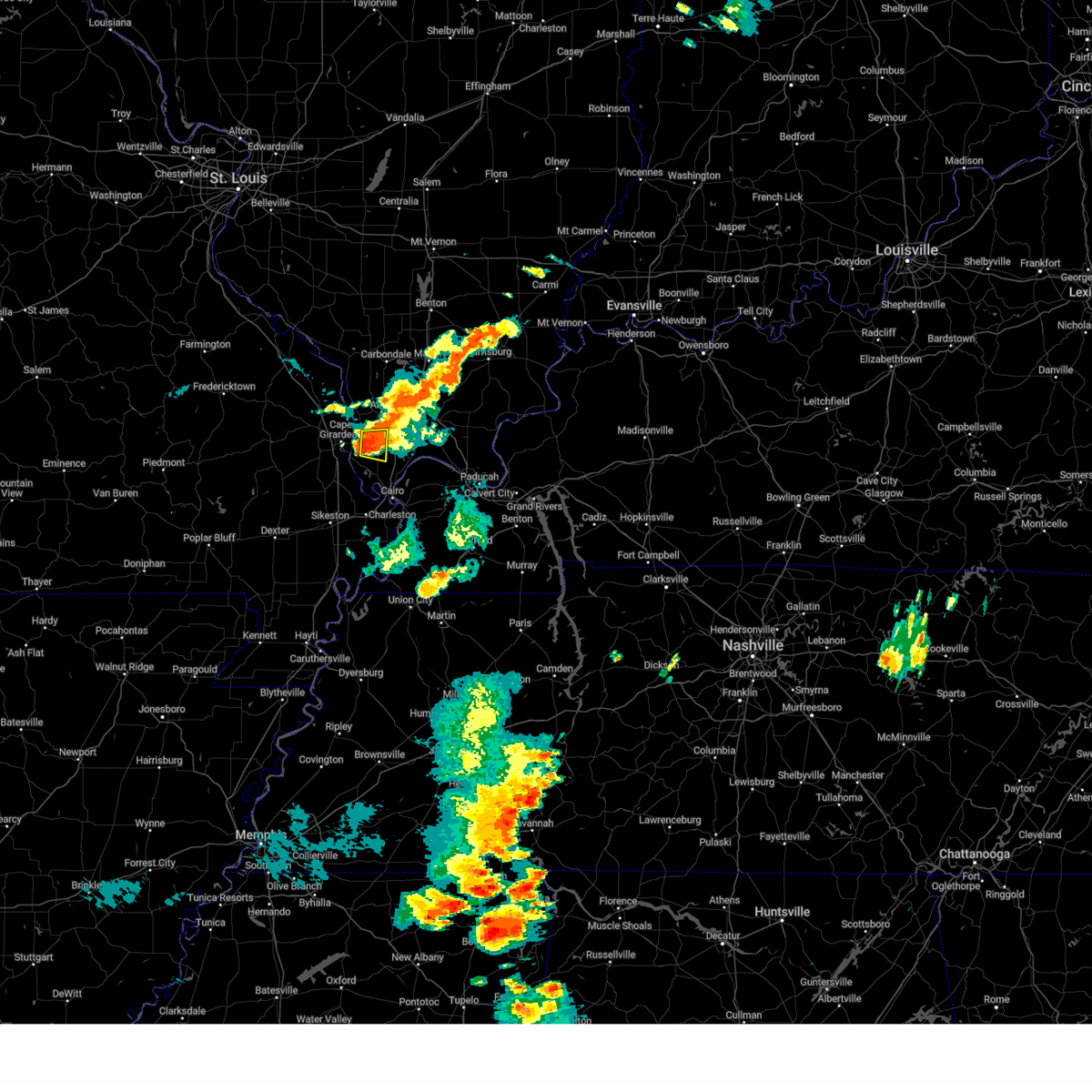 At 635 pm cdt, a severe thunderstorm was located near tamms, or 11 miles south of jonesboro, moving east at 20 mph (radar indicated). Hazards include 60 mph wind gusts and quarter size hail. Hail damage to vehicles is expected. expect wind damage to roofs, siding, and trees. locations impacted include, tamms and mill creek. hail threat, radar indicated max hail size, 1. 00 in wind threat, radar indicated max wind gust, 60 mph. At 635 pm cdt, a severe thunderstorm was located near tamms, or 11 miles south of jonesboro, moving east at 20 mph (radar indicated). Hazards include 60 mph wind gusts and quarter size hail. Hail damage to vehicles is expected. expect wind damage to roofs, siding, and trees. locations impacted include, tamms and mill creek. hail threat, radar indicated max hail size, 1. 00 in wind threat, radar indicated max wind gust, 60 mph.
|
| 8/5/2023 6:22 PM CDT |
 At 621 pm cdt, a severe thunderstorm was located 8 miles northwest of tamms, or 9 miles east of cape girardeau, moving east at 20 mph (radar indicated). Hazards include 60 mph wind gusts and quarter size hail. Hail damage to vehicles is expected. expect wind damage to roofs, siding, and trees. locations impacted include, tamms and mill creek. hail threat, radar indicated max hail size, 1. 00 in wind threat, radar indicated max wind gust, 60 mph. At 621 pm cdt, a severe thunderstorm was located 8 miles northwest of tamms, or 9 miles east of cape girardeau, moving east at 20 mph (radar indicated). Hazards include 60 mph wind gusts and quarter size hail. Hail damage to vehicles is expected. expect wind damage to roofs, siding, and trees. locations impacted include, tamms and mill creek. hail threat, radar indicated max hail size, 1. 00 in wind threat, radar indicated max wind gust, 60 mph.
|
| 8/5/2023 6:11 PM CDT |
 At 611 pm cdt, a severe thunderstorm was located near cape girardeau, moving east at 20 mph (radar indicated). Hazards include 60 mph wind gusts and quarter size hail. Hail damage to vehicles is expected. Expect wind damage to roofs, siding, and trees. At 611 pm cdt, a severe thunderstorm was located near cape girardeau, moving east at 20 mph (radar indicated). Hazards include 60 mph wind gusts and quarter size hail. Hail damage to vehicles is expected. Expect wind damage to roofs, siding, and trees.
|
| 8/3/2023 12:32 AM CDT |
 At 1231 am cdt, severe thunderstorms were located along a line extending from near carbondale to dongola to near kelso, moving east at 50 mph (radar indicated). Hazards include 60 mph wind gusts. Expect damage to roofs, siding, and trees. locations impacted include, cape girardeau, jackson, scott city, anna, chaffee, jonesboro, benton, cobden, goreville, dongola, tamms, kelso, delta, dutchtown, cape girardeau airport, olive branch, ware, cedar lake area, makanda and ullin. this includes the following highways, interstate 24 in illinois between mile markers 1 and 2. interstate 57 in illinois between mile markers 16 and 45. interstate 55 between mile markers 82 and 99. hail threat, radar indicated max hail size, <. 75 in wind threat, radar indicated max wind gust, 60 mph. At 1231 am cdt, severe thunderstorms were located along a line extending from near carbondale to dongola to near kelso, moving east at 50 mph (radar indicated). Hazards include 60 mph wind gusts. Expect damage to roofs, siding, and trees. locations impacted include, cape girardeau, jackson, scott city, anna, chaffee, jonesboro, benton, cobden, goreville, dongola, tamms, kelso, delta, dutchtown, cape girardeau airport, olive branch, ware, cedar lake area, makanda and ullin. this includes the following highways, interstate 24 in illinois between mile markers 1 and 2. interstate 57 in illinois between mile markers 16 and 45. interstate 55 between mile markers 82 and 99. hail threat, radar indicated max hail size, <. 75 in wind threat, radar indicated max wind gust, 60 mph.
|
| 8/3/2023 12:29 AM CDT |
 At 1229 am cdt, severe thunderstorms were located along a line extending from near cedar lake area to near tamms to near oran, moving southeast at 45 mph (radar indicated). Hazards include 60 mph wind gusts. expect damage to roofs, siding, and trees At 1229 am cdt, severe thunderstorms were located along a line extending from near cedar lake area to near tamms to near oran, moving southeast at 45 mph (radar indicated). Hazards include 60 mph wind gusts. expect damage to roofs, siding, and trees
|
| 8/3/2023 12:21 AM CDT |
 At 1221 am cdt, severe thunderstorms were located along a line extending from near carbondale to near jonesboro to chaffee, moving east at 50 mph (radar indicated). Hazards include 70 mph wind gusts. Expect considerable tree damage. damage is likely to mobile homes, roofs, and outbuildings. locations impacted include, cape girardeau, carbondale, jackson, murphysboro, carterville, scott city, anna, chaffee, jonesboro, benton, trail of tears state park, cobden, goreville, dongola, tamms, grand tower, kelso, delta, gordonville and altenburg. this includes the following highways, interstate 24 in illinois between mile markers 1 and 2. interstate 57 in illinois between mile markers 16 and 51. interstate 55 between mile markers 82 and 109. thunderstorm damage threat, considerable hail threat, radar indicated max hail size, <. 75 in wind threat, radar indicated max wind gust, 70 mph. At 1221 am cdt, severe thunderstorms were located along a line extending from near carbondale to near jonesboro to chaffee, moving east at 50 mph (radar indicated). Hazards include 70 mph wind gusts. Expect considerable tree damage. damage is likely to mobile homes, roofs, and outbuildings. locations impacted include, cape girardeau, carbondale, jackson, murphysboro, carterville, scott city, anna, chaffee, jonesboro, benton, trail of tears state park, cobden, goreville, dongola, tamms, grand tower, kelso, delta, gordonville and altenburg. this includes the following highways, interstate 24 in illinois between mile markers 1 and 2. interstate 57 in illinois between mile markers 16 and 51. interstate 55 between mile markers 82 and 109. thunderstorm damage threat, considerable hail threat, radar indicated max hail size, <. 75 in wind threat, radar indicated max wind gust, 70 mph.
|
| 8/3/2023 12:11 AM CDT |
 At 1210 am cdt, severe thunderstorms were located along a line extending from 6 miles west of murphysboro to near ware to near delta, moving east at 50 mph (radar indicated). Hazards include 70 mph wind gusts. Expect considerable tree damage. damage is likely to mobile homes, roofs, and outbuildings. locations impacted include, cape girardeau, carbondale, jackson, murphysboro, carterville, scott city, anna, chaffee, jonesboro, marble hill, benton, bollinger mill state historic site, trail of tears state park, cobden, goreville, dongola, tamms, grand tower, kelso and delta. this includes the following highways, interstate 24 in illinois between mile markers 1 and 2. interstate 57 in illinois between mile markers 16 and 51. Interstate 55 between mile markers 82 and 117. At 1210 am cdt, severe thunderstorms were located along a line extending from 6 miles west of murphysboro to near ware to near delta, moving east at 50 mph (radar indicated). Hazards include 70 mph wind gusts. Expect considerable tree damage. damage is likely to mobile homes, roofs, and outbuildings. locations impacted include, cape girardeau, carbondale, jackson, murphysboro, carterville, scott city, anna, chaffee, jonesboro, marble hill, benton, bollinger mill state historic site, trail of tears state park, cobden, goreville, dongola, tamms, grand tower, kelso and delta. this includes the following highways, interstate 24 in illinois between mile markers 1 and 2. interstate 57 in illinois between mile markers 16 and 51. Interstate 55 between mile markers 82 and 117.
|
| 8/2/2023 11:53 PM CDT |
 At 1153 pm cdt, severe thunderstorms were located along a line extending from 7 miles southwest of ava to near jackson to near marquand, moving east at 50 mph (radar indicated). Hazards include 70 mph wind gusts and penny size hail. Expect considerable tree damage. Damage is likely to mobile homes, roofs, and outbuildings. At 1153 pm cdt, severe thunderstorms were located along a line extending from 7 miles southwest of ava to near jackson to near marquand, moving east at 50 mph (radar indicated). Hazards include 70 mph wind gusts and penny size hail. Expect considerable tree damage. Damage is likely to mobile homes, roofs, and outbuildings.
|
| 7/29/2023 6:31 PM CDT |
 At 630 pm cdt, severe thunderstorms were located along a line extending from 11 miles southeast of carrier mills to near new columbia to near mounds, moving southeast at 35 mph (radar indicated). Hazards include 60 mph wind gusts. Expect damage to roofs, siding, and trees. locations impacted include, scott city, vienna, dongola, tamms, kelso, karnak, cape girardeau airport, horseshoe lake conservation area, new columbia, dixon springs, olive branch, ullin, thebes, olmsted, stonefort, cypress, new burnside, new grand chain, pulaski and buncombe. this includes the following highways, interstate 24 in illinois between mile markers 8 and 25. interstate 57 in illinois between mile markers 9 and 25. interstate 55 between mile markers 88 and 92. hail threat, radar indicated max hail size, <. 75 in wind threat, observed max wind gust, 60 mph. At 630 pm cdt, severe thunderstorms were located along a line extending from 11 miles southeast of carrier mills to near new columbia to near mounds, moving southeast at 35 mph (radar indicated). Hazards include 60 mph wind gusts. Expect damage to roofs, siding, and trees. locations impacted include, scott city, vienna, dongola, tamms, kelso, karnak, cape girardeau airport, horseshoe lake conservation area, new columbia, dixon springs, olive branch, ullin, thebes, olmsted, stonefort, cypress, new burnside, new grand chain, pulaski and buncombe. this includes the following highways, interstate 24 in illinois between mile markers 8 and 25. interstate 57 in illinois between mile markers 9 and 25. interstate 55 between mile markers 88 and 92. hail threat, radar indicated max hail size, <. 75 in wind threat, observed max wind gust, 60 mph.
|
| 7/29/2023 6:01 PM CDT |
 At 600 pm cdt, severe thunderstorms were located along a line extending from near creal springs to near dongola to near cape girardeau, moving southeast at 35 mph (radar indicated). Hazards include 60 mph wind gusts and quarter size hail. Hail damage to vehicles is expected. Expect wind damage to roofs, siding, and trees. At 600 pm cdt, severe thunderstorms were located along a line extending from near creal springs to near dongola to near cape girardeau, moving southeast at 35 mph (radar indicated). Hazards include 60 mph wind gusts and quarter size hail. Hail damage to vehicles is expected. Expect wind damage to roofs, siding, and trees.
|
| 7/20/2023 9:48 AM CDT |
 At 948 am cdt, a severe thunderstorm was located near dongola, or 12 miles southeast of jonesboro, moving southeast at 30 mph (radar indicated). Hazards include 70 mph wind gusts and quarter size hail. Hail damage to vehicles is expected. expect considerable tree damage. wind damage is also likely to mobile homes, roofs, and outbuildings. locations impacted include, dongola, tamms, karnak, ullin, kevil, joppa, olmsted, cypress, new grand chain, pulaski, belknap and mill creek. this includes interstate 57 in illinois between mile markers 12 and 26. thunderstorm damage threat, considerable hail threat, radar indicated max hail size, 1. 00 in wind threat, radar indicated max wind gust, 70 mph. At 948 am cdt, a severe thunderstorm was located near dongola, or 12 miles southeast of jonesboro, moving southeast at 30 mph (radar indicated). Hazards include 70 mph wind gusts and quarter size hail. Hail damage to vehicles is expected. expect considerable tree damage. wind damage is also likely to mobile homes, roofs, and outbuildings. locations impacted include, dongola, tamms, karnak, ullin, kevil, joppa, olmsted, cypress, new grand chain, pulaski, belknap and mill creek. this includes interstate 57 in illinois between mile markers 12 and 26. thunderstorm damage threat, considerable hail threat, radar indicated max hail size, 1. 00 in wind threat, radar indicated max wind gust, 70 mph.
|
| 7/20/2023 9:39 AM CDT |
 At 939 am cdt, a severe thunderstorm was located near dongola, or 7 miles south of jonesboro, moving southeast at 35 mph (radar indicated). Hazards include 60 mph wind gusts and half dollar size hail. Hail damage to vehicles is expected. Expect wind damage to roofs, siding, and trees. At 939 am cdt, a severe thunderstorm was located near dongola, or 7 miles south of jonesboro, moving southeast at 35 mph (radar indicated). Hazards include 60 mph wind gusts and half dollar size hail. Hail damage to vehicles is expected. Expect wind damage to roofs, siding, and trees.
|
| 7/20/2023 9:28 AM CDT |
 At 927 am cdt, a severe thunderstorm was located over ware, or near trail of tears state park, moving southeast at 35 mph (radar indicated). Hazards include 60 mph wind gusts and quarter size hail. Hail damage to vehicles is expected. expect wind damage to roofs, siding, and trees. locations impacted include, jackson, anna, jonesboro, trail of tears state park, ware and mill creek. this includes interstate 55 near mile marker 103. hail threat, radar indicated max hail size, 1. 00 in wind threat, radar indicated max wind gust, 60 mph. At 927 am cdt, a severe thunderstorm was located over ware, or near trail of tears state park, moving southeast at 35 mph (radar indicated). Hazards include 60 mph wind gusts and quarter size hail. Hail damage to vehicles is expected. expect wind damage to roofs, siding, and trees. locations impacted include, jackson, anna, jonesboro, trail of tears state park, ware and mill creek. this includes interstate 55 near mile marker 103. hail threat, radar indicated max hail size, 1. 00 in wind threat, radar indicated max wind gust, 60 mph.
|
| 7/20/2023 9:25 AM CDT |
 At 925 am cdt, a severe thunderstorm was located near ware, or near trail of tears state park, moving southeast at 35 mph (radar indicated). Hazards include 60 mph wind gusts and penny size hail. Expect damage to roofs, siding, and trees. locations impacted include, jackson, anna, jonesboro, trail of tears state park, ware and mill creek. this includes interstate 55 near mile marker 103. hail threat, radar indicated max hail size, 0. 75 in wind threat, radar indicated max wind gust, 60 mph. At 925 am cdt, a severe thunderstorm was located near ware, or near trail of tears state park, moving southeast at 35 mph (radar indicated). Hazards include 60 mph wind gusts and penny size hail. Expect damage to roofs, siding, and trees. locations impacted include, jackson, anna, jonesboro, trail of tears state park, ware and mill creek. this includes interstate 55 near mile marker 103. hail threat, radar indicated max hail size, 0. 75 in wind threat, radar indicated max wind gust, 60 mph.
|
| 7/20/2023 9:14 AM CDT |
 At 914 am cdt, a severe thunderstorm was located over trail of tears state park, moving southeast at 35 mph (radar indicated). Hazards include 60 mph wind gusts and penny size hail. Expect damage to roofs, siding, and trees. locations impacted include, jackson, anna, jonesboro, trail of tears state park, ware, pocahontas and mill creek. this includes interstate 55 between mile markers 103 and 110. hail threat, radar indicated max hail size, 0. 75 in wind threat, radar indicated max wind gust, 60 mph. At 914 am cdt, a severe thunderstorm was located over trail of tears state park, moving southeast at 35 mph (radar indicated). Hazards include 60 mph wind gusts and penny size hail. Expect damage to roofs, siding, and trees. locations impacted include, jackson, anna, jonesboro, trail of tears state park, ware, pocahontas and mill creek. this includes interstate 55 between mile markers 103 and 110. hail threat, radar indicated max hail size, 0. 75 in wind threat, radar indicated max wind gust, 60 mph.
|
| 7/20/2023 9:00 AM CDT |
 At 900 am cdt, a severe thunderstorm was located 7 miles north of jackson, moving southeast at 35 mph (radar indicated). Hazards include 60 mph wind gusts and quarter size hail. Hail damage to vehicles is expected. Expect wind damage to roofs, siding, and trees. At 900 am cdt, a severe thunderstorm was located 7 miles north of jackson, moving southeast at 35 mph (radar indicated). Hazards include 60 mph wind gusts and quarter size hail. Hail damage to vehicles is expected. Expect wind damage to roofs, siding, and trees.
|
| 7/19/2023 7:30 AM CDT |
 At 729 am cdt, severe thunderstorms were located along a line extending from near vienna to near dongola to near jonesboro, moving east at 45 mph (radar indicated). Hazards include 60 mph wind gusts. expect damage to roofs, siding, and trees At 729 am cdt, severe thunderstorms were located along a line extending from near vienna to near dongola to near jonesboro, moving east at 45 mph (radar indicated). Hazards include 60 mph wind gusts. expect damage to roofs, siding, and trees
|
| 7/19/2023 7:11 AM CDT |
 At 711 am cdt, a severe thunderstorm was located near ware, or 7 miles southeast of trail of tears state park, moving southeast at 50 mph (radar indicated). Hazards include 60 mph wind gusts. Expect damage to roofs, siding, and trees. locations impacted include, cape girardeau, anna, jonesboro, dongola, tamms, ware, ullin, pulaski, mill creek and east cape girardeau. this includes interstate 57 in illinois between mile markers 14 and 24. hail threat, radar indicated max hail size, <. 75 in wind threat, radar indicated max wind gust, 60 mph. At 711 am cdt, a severe thunderstorm was located near ware, or 7 miles southeast of trail of tears state park, moving southeast at 50 mph (radar indicated). Hazards include 60 mph wind gusts. Expect damage to roofs, siding, and trees. locations impacted include, cape girardeau, anna, jonesboro, dongola, tamms, ware, ullin, pulaski, mill creek and east cape girardeau. this includes interstate 57 in illinois between mile markers 14 and 24. hail threat, radar indicated max hail size, <. 75 in wind threat, radar indicated max wind gust, 60 mph.
|
| 7/19/2023 7:00 AM CDT | At 700 am cdt, a severe thunderstorm was located over trail of tears state park, moving southeast at 50 mph (radar indicated). Hazards include 60 mph wind gusts. Expect damage to roofs, siding, and trees. locations impacted include, cape girardeau, jackson, anna, jonesboro, trail of tears state park, dongola, tamms, grand tower, ware, ullin, pulaski, pocahontas, mill creek and east cape girardeau. this includes the following highways, interstate 57 in illinois between mile markers 14 and 24. interstate 55 between mile markers 102 and 111. hail threat, radar indicated max hail size, <. 75 in wind threat, radar indicated max wind gust, 60 mph. |
| 7/19/2023 7:00 AM CDT | At 700 am cdt, a severe thunderstorm was located over trail of tears state park, moving southeast at 50 mph (radar indicated). Hazards include 60 mph wind gusts. Expect damage to roofs, siding, and trees. locations impacted include, cape girardeau, jackson, anna, jonesboro, trail of tears state park, dongola, tamms, grand tower, ware, ullin, pulaski, pocahontas, mill creek and east cape girardeau. this includes the following highways, interstate 57 in illinois between mile markers 14 and 24. interstate 55 between mile markers 102 and 111. hail threat, radar indicated max hail size, <. 75 in wind threat, radar indicated max wind gust, 60 mph. |
| 7/19/2023 6:48 AM CDT |
 At 648 am cdt, a severe thunderstorm was located near altenburg, or 12 miles northwest of trail of tears state park, moving southeast at 50 mph (radar indicated). Hazards include 60 mph wind gusts. expect damage to roofs, siding, and trees At 648 am cdt, a severe thunderstorm was located near altenburg, or 12 miles northwest of trail of tears state park, moving southeast at 50 mph (radar indicated). Hazards include 60 mph wind gusts. expect damage to roofs, siding, and trees
|
| 7/18/2023 12:42 PM CDT |
 At 1241 pm cdt, severe thunderstorms were located along a line extending from near goreville to near mound city to near east prairie, moving east at 50 mph (radar indicated). Hazards include 70 mph wind gusts and penny size hail. Expect considerable tree damage. damage is likely to mobile homes, roofs, and outbuildings. locations impacted include, sikeston, charleston, anna, cairo, jonesboro, vienna, la center, miner, wickliffe, cobden, goreville, bertrand, mounds, dongola, barlow, tamms, mound city, karnak, wyatt and lake of egypt area. this includes the following highways, interstate 24 in illinois between mile markers 2 and 16. interstate 57 in illinois between mile markers 1 and 43. interstate 57 in missouri between mile markers 1 and 21. Interstate 55 between mile markers 66 and 76. At 1241 pm cdt, severe thunderstorms were located along a line extending from near goreville to near mound city to near east prairie, moving east at 50 mph (radar indicated). Hazards include 70 mph wind gusts and penny size hail. Expect considerable tree damage. damage is likely to mobile homes, roofs, and outbuildings. locations impacted include, sikeston, charleston, anna, cairo, jonesboro, vienna, la center, miner, wickliffe, cobden, goreville, bertrand, mounds, dongola, barlow, tamms, mound city, karnak, wyatt and lake of egypt area. this includes the following highways, interstate 24 in illinois between mile markers 2 and 16. interstate 57 in illinois between mile markers 1 and 43. interstate 57 in missouri between mile markers 1 and 21. Interstate 55 between mile markers 66 and 76.
|
| 7/18/2023 12:17 PM CDT |
 At 1217 pm cdt, severe thunderstorms were located along a line extending from 6 miles southwest of murphysboro to near scott city to near essex, moving east, southeast at 55 mph (radar indicated). Hazards include 70 mph wind gusts and penny size hail. Expect considerable tree damage. Damage is likely to mobile homes, roofs, and outbuildings. At 1217 pm cdt, severe thunderstorms were located along a line extending from 6 miles southwest of murphysboro to near scott city to near essex, moving east, southeast at 55 mph (radar indicated). Hazards include 70 mph wind gusts and penny size hail. Expect considerable tree damage. Damage is likely to mobile homes, roofs, and outbuildings.
|
| 7/17/2023 7:51 PM CDT |
 The severe thunderstorm warning for south central union, northwestern pulaski and north central alexander counties will expire at 800 pm cdt, the storms which prompted the warning have weakened below severe limits, and no longer pose an immediate threat to life or property. therefore, the warning will be allowed to expire. however gusty winds are still possible with these thunderstorms. a severe thunderstorm watch remains in effect until 900 pm cdt for southeastern missouri. a severe thunderstorm watch also remains in effect until 1100 pm cdt for southern illinois. The severe thunderstorm warning for south central union, northwestern pulaski and north central alexander counties will expire at 800 pm cdt, the storms which prompted the warning have weakened below severe limits, and no longer pose an immediate threat to life or property. therefore, the warning will be allowed to expire. however gusty winds are still possible with these thunderstorms. a severe thunderstorm watch remains in effect until 900 pm cdt for southeastern missouri. a severe thunderstorm watch also remains in effect until 1100 pm cdt for southern illinois.
|
| 7/17/2023 7:43 PM CDT |
 At 743 pm cdt, severe thunderstorms were located along a line extending from near jonesboro to 6 miles southwest of dongola to near tamms, moving east at 15 mph (radar indicated). Hazards include 60 mph wind gusts and penny size hail. Expect damage to roofs, siding, and trees. locations impacted include, dongola, tamms, olive branch, ullin, pulaski and mill creek. this includes interstate 57 in illinois between mile markers 12 and 25. hail threat, radar indicated max hail size, 0. 75 in wind threat, radar indicated max wind gust, 60 mph. At 743 pm cdt, severe thunderstorms were located along a line extending from near jonesboro to 6 miles southwest of dongola to near tamms, moving east at 15 mph (radar indicated). Hazards include 60 mph wind gusts and penny size hail. Expect damage to roofs, siding, and trees. locations impacted include, dongola, tamms, olive branch, ullin, pulaski and mill creek. this includes interstate 57 in illinois between mile markers 12 and 25. hail threat, radar indicated max hail size, 0. 75 in wind threat, radar indicated max wind gust, 60 mph.
|
| 7/17/2023 7:12 PM CDT |
 At 711 pm cdt, severe thunderstorms were located along a line extending from jackson to cape girardeau to kelso, moving northeast at 30 mph (radar indicated). Hazards include 60 mph wind gusts and penny size hail. expect damage to roofs, siding, and trees At 711 pm cdt, severe thunderstorms were located along a line extending from jackson to cape girardeau to kelso, moving northeast at 30 mph (radar indicated). Hazards include 60 mph wind gusts and penny size hail. expect damage to roofs, siding, and trees
|
| 7/2/2023 3:10 PM CDT |
 At 309 pm cdt, severe thunderstorms were located along a line extending from near dongola to near mound city, moving east at 45 mph (radar indicated). Hazards include 60 mph wind gusts. Expect damage to roofs, siding, and trees. locations impacted include, paducah, metropolis, vienna, brookport, mounds, dongola, tamms, mound city, karnak, dixon springs, new columbia, ullin, joppa, olmsted, cypress, new grand chain, pulaski, belknap, eddyville and mill creek. this includes the following highways, interstate 24 in kentucky between mile markers 1 and 2. interstate 24 in illinois between mile markers 12 and 38. interstate 57 in illinois between mile markers 5 and 29. hail threat, radar indicated max hail size, <. 75 in wind threat, radar indicated max wind gust, 60 mph. At 309 pm cdt, severe thunderstorms were located along a line extending from near dongola to near mound city, moving east at 45 mph (radar indicated). Hazards include 60 mph wind gusts. Expect damage to roofs, siding, and trees. locations impacted include, paducah, metropolis, vienna, brookport, mounds, dongola, tamms, mound city, karnak, dixon springs, new columbia, ullin, joppa, olmsted, cypress, new grand chain, pulaski, belknap, eddyville and mill creek. this includes the following highways, interstate 24 in kentucky between mile markers 1 and 2. interstate 24 in illinois between mile markers 12 and 38. interstate 57 in illinois between mile markers 5 and 29. hail threat, radar indicated max hail size, <. 75 in wind threat, radar indicated max wind gust, 60 mph.
|
| 7/2/2023 3:09 PM CDT |
 At 309 pm cdt, a severe thunderstorm was located near karnak, or 12 miles southwest of vienna, moving east at 45 mph (radar indicated). Hazards include 60 mph wind gusts and quarter size hail. Hail damage to vehicles is expected. expect wind damage to roofs, siding, and trees. locations impacted include, dongola, ullin, new grand chain, pulaski and mill creek. this includes interstate 57 in illinois between mile markers 13 and 28. hail threat, radar indicated max hail size, 1. 00 in wind threat, radar indicated max wind gust, 60 mph. At 309 pm cdt, a severe thunderstorm was located near karnak, or 12 miles southwest of vienna, moving east at 45 mph (radar indicated). Hazards include 60 mph wind gusts and quarter size hail. Hail damage to vehicles is expected. expect wind damage to roofs, siding, and trees. locations impacted include, dongola, ullin, new grand chain, pulaski and mill creek. this includes interstate 57 in illinois between mile markers 13 and 28. hail threat, radar indicated max hail size, 1. 00 in wind threat, radar indicated max wind gust, 60 mph.
|
| 7/2/2023 3:00 PM CDT |
 At 300 pm cdt, severe thunderstorms were located along a line extending from near dongola to near mounds, moving east at 45 mph (radar indicated). Hazards include 70 mph wind gusts. Expect considerable tree damage. Damage is likely to mobile homes, roofs, and outbuildings. At 300 pm cdt, severe thunderstorms were located along a line extending from near dongola to near mounds, moving east at 45 mph (radar indicated). Hazards include 70 mph wind gusts. Expect considerable tree damage. Damage is likely to mobile homes, roofs, and outbuildings.
|
| 7/2/2023 2:47 PM CDT |
 At 247 pm cdt, a severe thunderstorm was located near tamms, or 9 miles east of scott city, moving east at 45 mph (trained weather spotters. gusts up to 60 mph have been reported with this storm). Hazards include 60 mph wind gusts and quarter size hail. Hail damage to vehicles is expected. Expect wind damage to roofs, siding, and trees. At 247 pm cdt, a severe thunderstorm was located near tamms, or 9 miles east of scott city, moving east at 45 mph (trained weather spotters. gusts up to 60 mph have been reported with this storm). Hazards include 60 mph wind gusts and quarter size hail. Hail damage to vehicles is expected. Expect wind damage to roofs, siding, and trees.
|
| 7/1/2023 5:07 PM CDT |
 At 506 pm cdt, a severe thunderstorm was located near jonesboro, moving northeast at 50 mph (radar indicated). Hazards include 60 mph wind gusts and penny size hail. Expect damage to roofs, siding, and trees. locations impacted include, anna, jonesboro, dongola, tamms, ullin, new grand chain, pulaski and mill creek. this includes interstate 57 in illinois between mile markers 14 and 34. hail threat, radar indicated max hail size, 0. 75 in wind threat, radar indicated max wind gust, 60 mph. At 506 pm cdt, a severe thunderstorm was located near jonesboro, moving northeast at 50 mph (radar indicated). Hazards include 60 mph wind gusts and penny size hail. Expect damage to roofs, siding, and trees. locations impacted include, anna, jonesboro, dongola, tamms, ullin, new grand chain, pulaski and mill creek. this includes interstate 57 in illinois between mile markers 14 and 34. hail threat, radar indicated max hail size, 0. 75 in wind threat, radar indicated max wind gust, 60 mph.
|
| 7/1/2023 4:48 PM CDT |
 At 448 pm cdt, a severe thunderstorm was located over cape girardeau, moving northeast at 50 mph (radar indicated). Hazards include 60 mph wind gusts and penny size hail. expect damage to roofs, siding, and trees At 448 pm cdt, a severe thunderstorm was located over cape girardeau, moving northeast at 50 mph (radar indicated). Hazards include 60 mph wind gusts and penny size hail. expect damage to roofs, siding, and trees
|
| 5/8/2023 10:46 PM CDT |
 At 1045 pm cdt, severe thunderstorms were located along a line extending from 7 miles northwest of tamms to near olive branch to near benton, moving east at 50 mph (radar indicated. at 1039 pm cdt, a 72 mph gust was recorded at the cape girardeau airport). Hazards include 70 mph wind gusts and nickel size hail. Expect considerable tree damage. damage is likely to mobile homes, roofs, and outbuildings. locations impacted include, cape girardeau, jackson, scott city, anna, chaffee, cairo, jonesboro, oran, benton, tamms, kelso, delta, gordonville, dutchtown, olive branch, cape girardeau airport, ware, horseshoe lake conservation area, thebes and allenville. this includes the following highways, interstate 57 in illinois between mile markers 1 and 4. interstate 55 between mile markers 81 and 106. thunderstorm damage threat, considerable hail threat, radar indicated max hail size, 0. 88 in wind threat, radar indicated max wind gust, 70 mph. At 1045 pm cdt, severe thunderstorms were located along a line extending from 7 miles northwest of tamms to near olive branch to near benton, moving east at 50 mph (radar indicated. at 1039 pm cdt, a 72 mph gust was recorded at the cape girardeau airport). Hazards include 70 mph wind gusts and nickel size hail. Expect considerable tree damage. damage is likely to mobile homes, roofs, and outbuildings. locations impacted include, cape girardeau, jackson, scott city, anna, chaffee, cairo, jonesboro, oran, benton, tamms, kelso, delta, gordonville, dutchtown, olive branch, cape girardeau airport, ware, horseshoe lake conservation area, thebes and allenville. this includes the following highways, interstate 57 in illinois between mile markers 1 and 4. interstate 55 between mile markers 81 and 106. thunderstorm damage threat, considerable hail threat, radar indicated max hail size, 0. 88 in wind threat, radar indicated max wind gust, 70 mph.
|
| 5/8/2023 10:27 PM CDT |
 At 1027 pm cdt, severe thunderstorms were located along a line extending from jackson to chaffee to near hay-wood city, moving east at 35 mph (radar indicated). Hazards include 60 mph wind gusts and nickel size hail. expect damage to roofs, siding, and trees At 1027 pm cdt, severe thunderstorms were located along a line extending from jackson to chaffee to near hay-wood city, moving east at 35 mph (radar indicated). Hazards include 60 mph wind gusts and nickel size hail. expect damage to roofs, siding, and trees
|
| 4/15/2023 8:32 PM CDT |
 At 832 pm cdt, a severe thunderstorm was located over tamms, or 12 miles south of jonesboro, moving northeast at 40 mph (radar indicated). Hazards include 60 mph wind gusts and quarter size hail. Hail damage to vehicles is expected. Expect wind damage to roofs, siding, and trees. At 832 pm cdt, a severe thunderstorm was located over tamms, or 12 miles south of jonesboro, moving northeast at 40 mph (radar indicated). Hazards include 60 mph wind gusts and quarter size hail. Hail damage to vehicles is expected. Expect wind damage to roofs, siding, and trees.
|
| 4/5/2023 12:17 PM CDT |
 At 1216 pm cdt, severe thunderstorms were located along a line extending from near cedar lake area to near kelso to near bell city, moving east at 50 mph (radar indicated). Hazards include 60 mph wind gusts and penny size hail. expect damage to roofs, siding, and trees At 1216 pm cdt, severe thunderstorms were located along a line extending from near cedar lake area to near kelso to near bell city, moving east at 50 mph (radar indicated). Hazards include 60 mph wind gusts and penny size hail. expect damage to roofs, siding, and trees
|
| 4/5/2023 4:57 AM CDT |
 At 457 am cdt, severe thunderstorms were located along a line extending from near cedar lake area to near advance, moving east at 45 mph (radar indicated). Hazards include 60 mph wind gusts. expect damage to roofs, siding, and trees At 457 am cdt, severe thunderstorms were located along a line extending from near cedar lake area to near advance, moving east at 45 mph (radar indicated). Hazards include 60 mph wind gusts. expect damage to roofs, siding, and trees
|
| 4/5/2023 4:39 AM CDT |
 At 439 am cdt, severe thunderstorms were located along a line extending from near gordonville to 8 miles south of grassy, moving northeast at 80 mph (radar indicated). Hazards include 60 mph wind gusts. Expect damage to roofs, siding, and trees. locations impacted include, cape girardeau, carbondale, jackson, anna, jonesboro, trail of tears state park, cobden, dongola, grand tower, gordonville, altenburg, dutchtown, ware, cedar lake area, makanda, alto pass, whitewater, allenville, pocahontas and mill creek. this includes the following highways, interstate 57 in illinois between mile markers 23 and 39. interstate 55 between mile markers 94 and 110. hail threat, radar indicated max hail size, <. 75 in wind threat, radar indicated max wind gust, 60 mph. At 439 am cdt, severe thunderstorms were located along a line extending from near gordonville to 8 miles south of grassy, moving northeast at 80 mph (radar indicated). Hazards include 60 mph wind gusts. Expect damage to roofs, siding, and trees. locations impacted include, cape girardeau, carbondale, jackson, anna, jonesboro, trail of tears state park, cobden, dongola, grand tower, gordonville, altenburg, dutchtown, ware, cedar lake area, makanda, alto pass, whitewater, allenville, pocahontas and mill creek. this includes the following highways, interstate 57 in illinois between mile markers 23 and 39. interstate 55 between mile markers 94 and 110. hail threat, radar indicated max hail size, <. 75 in wind threat, radar indicated max wind gust, 60 mph.
|
| 4/5/2023 4:18 AM CDT |
 At 418 am cdt, severe thunderstorms were located along a line extending from 6 miles west of elkville to near gordonville, moving northeast at 55 mph (trained weather spotters near grand tower). Hazards include 60 mph wind gusts. expect damage to roofs, siding, and trees At 418 am cdt, severe thunderstorms were located along a line extending from 6 miles west of elkville to near gordonville, moving northeast at 55 mph (trained weather spotters near grand tower). Hazards include 60 mph wind gusts. expect damage to roofs, siding, and trees
|
| 2/22/2023 3:05 PM CST |
 At 303 pm cst, severe thunderstorms were located along a line extending from near cedar lake area to near tamms to near anniston, moving east at 50 mph. these storms downed numerous large trees and caused power outages as they moved through cape girardeau (radar indicated). Hazards include 60 mph wind gusts. Expect damage to roofs, siding, and trees. severe thunderstorms will be near, cobden around 310 pm cst. dongola around 315 pm cst. other locations in the path of these severe thunderstorms include bardwell, wickliffe, karnak, vienna and lovelaceville. this includes the following highways, interstate 24 in illinois between mile markers 2 and 17. interstate 57 in illinois between mile markers 1 and 43. interstate 57 in missouri between mile markers 11 and 21. hail threat, radar indicated max hail size, <. 75 in wind threat, radar indicated max wind gust, 60 mph. At 303 pm cst, severe thunderstorms were located along a line extending from near cedar lake area to near tamms to near anniston, moving east at 50 mph. these storms downed numerous large trees and caused power outages as they moved through cape girardeau (radar indicated). Hazards include 60 mph wind gusts. Expect damage to roofs, siding, and trees. severe thunderstorms will be near, cobden around 310 pm cst. dongola around 315 pm cst. other locations in the path of these severe thunderstorms include bardwell, wickliffe, karnak, vienna and lovelaceville. this includes the following highways, interstate 24 in illinois between mile markers 2 and 17. interstate 57 in illinois between mile markers 1 and 43. interstate 57 in missouri between mile markers 11 and 21. hail threat, radar indicated max hail size, <. 75 in wind threat, radar indicated max wind gust, 60 mph.
|
| 2/22/2023 2:58 PM CST |
 At 257 pm cst, severe thunderstorms were located along a line extending from near grand tower to near scott city to near east prairie, moving east at 50 mph. there have been numerous reports of trees down with the storms moving through cape girardeau (radar indicated). Hazards include 60 mph wind gusts. Expect damage to roofs, siding, and trees. these severe storms will be near, charleston and anniston around 300 pm cst. other locations in the path of these severe thunderstorms include olive branch, cobden, tamms and wyatt. this includes the following highways, interstate 57 in missouri between mile markers 1 and 21. interstate 55 between mile markers 61 and 120. hail threat, radar indicated max hail size, <. 75 in wind threat, radar indicated max wind gust, 60 mph. At 257 pm cst, severe thunderstorms were located along a line extending from near grand tower to near scott city to near east prairie, moving east at 50 mph. there have been numerous reports of trees down with the storms moving through cape girardeau (radar indicated). Hazards include 60 mph wind gusts. Expect damage to roofs, siding, and trees. these severe storms will be near, charleston and anniston around 300 pm cst. other locations in the path of these severe thunderstorms include olive branch, cobden, tamms and wyatt. this includes the following highways, interstate 57 in missouri between mile markers 1 and 21. interstate 55 between mile markers 61 and 120. hail threat, radar indicated max hail size, <. 75 in wind threat, radar indicated max wind gust, 60 mph.
|
| 2/22/2023 2:40 PM CST |
 At 240 pm cst, severe thunderstorms were located along a line extending from 6 miles northeast of daisy to near dutchtown to near morehouse, moving east at 50 mph (radar indicated). Hazards include 60 mph wind gusts. Expect damage to roofs, siding, and trees. severe thunderstorms will be near, sikeston around 245 pm cst. scott city, miner, kelso and cape girardeau airport around 250 pm cst. cape girardeau and bertrand around 255 pm cst. charleston and anniston around 300 pm cst. other locations in the path of these severe thunderstorms include olive branch, cobden, tamms and wyatt. this includes the following highways, interstate 57 in missouri between mile markers 1 and 21. interstate 55 between mile markers 61 and 120. hail threat, radar indicated max hail size, <. 75 in wind threat, radar indicated max wind gust, 60 mph. At 240 pm cst, severe thunderstorms were located along a line extending from 6 miles northeast of daisy to near dutchtown to near morehouse, moving east at 50 mph (radar indicated). Hazards include 60 mph wind gusts. Expect damage to roofs, siding, and trees. severe thunderstorms will be near, sikeston around 245 pm cst. scott city, miner, kelso and cape girardeau airport around 250 pm cst. cape girardeau and bertrand around 255 pm cst. charleston and anniston around 300 pm cst. other locations in the path of these severe thunderstorms include olive branch, cobden, tamms and wyatt. this includes the following highways, interstate 57 in missouri between mile markers 1 and 21. interstate 55 between mile markers 61 and 120. hail threat, radar indicated max hail size, <. 75 in wind threat, radar indicated max wind gust, 60 mph.
|
| 7/20/2022 8:43 PM CDT |
 At 842 pm cdt, a severe thunderstorm was located just north of tamms, or 12 miles south of jonesboro, moving southeast at 15 mph (radar indicated). Hazards include 60 mph wind gusts and quarter size hail. Hail damage to vehicles is expected. expect wind damage to roofs, siding, and trees. locations impacted include, mounds. This includes interstate 57 in illinois between mile markers 5 and 21. At 842 pm cdt, a severe thunderstorm was located just north of tamms, or 12 miles south of jonesboro, moving southeast at 15 mph (radar indicated). Hazards include 60 mph wind gusts and quarter size hail. Hail damage to vehicles is expected. expect wind damage to roofs, siding, and trees. locations impacted include, mounds. This includes interstate 57 in illinois between mile markers 5 and 21.
|
| 7/20/2022 8:36 PM CDT |
 At 836 pm cdt, a severe thunderstorm was located near tamms, or 11 miles south of jonesboro, moving southeast at 10 mph (radar indicated). Hazards include 60 mph wind gusts and quarter size hail. Hail damage to vehicles is expected. expect wind damage to roofs, siding, and trees. this severe thunderstorm will be near, tamms around 850 pm cdt. this includes interstate 57 in illinois between mile markers 5 and 21. hail threat, radar indicated max hail size, 1. 00 in wind threat, radar indicated max wind gust, 60 mph. At 836 pm cdt, a severe thunderstorm was located near tamms, or 11 miles south of jonesboro, moving southeast at 10 mph (radar indicated). Hazards include 60 mph wind gusts and quarter size hail. Hail damage to vehicles is expected. expect wind damage to roofs, siding, and trees. this severe thunderstorm will be near, tamms around 850 pm cdt. this includes interstate 57 in illinois between mile markers 5 and 21. hail threat, radar indicated max hail size, 1. 00 in wind threat, radar indicated max wind gust, 60 mph.
|
| 7/17/2022 9:26 PM CDT |
 The tornado warning for south central union and north central alexander counties will expire at 930 pm cdt, the storm which prompted the warning has weakened below severe limits, and has exited the warned area. therefore, the warning will be allowed to expire. however gusty winds and heavy rain are still possible with this thunderstorm. to report severe weather, contact your nearest law enforcement agency. they will relay your report to the national weather service paducah. The tornado warning for south central union and north central alexander counties will expire at 930 pm cdt, the storm which prompted the warning has weakened below severe limits, and has exited the warned area. therefore, the warning will be allowed to expire. however gusty winds and heavy rain are still possible with this thunderstorm. to report severe weather, contact your nearest law enforcement agency. they will relay your report to the national weather service paducah.
|
| 7/17/2022 9:11 PM CDT |
 At 910 pm cdt, a severe thunderstorm capable of producing a tornado was located 7 miles south of ware, or 8 miles southwest of jonesboro, moving east at 40 mph (radar indicated rotation). Hazards include tornado. Flying debris will be dangerous to those caught without shelter. mobile homes will be damaged or destroyed. damage to roofs, windows, and vehicles will occur. tree damage is likely. locations impacted include, dongola and mill creek. This includes interstate 57 in illinois between mile markers 25 and 27. At 910 pm cdt, a severe thunderstorm capable of producing a tornado was located 7 miles south of ware, or 8 miles southwest of jonesboro, moving east at 40 mph (radar indicated rotation). Hazards include tornado. Flying debris will be dangerous to those caught without shelter. mobile homes will be damaged or destroyed. damage to roofs, windows, and vehicles will occur. tree damage is likely. locations impacted include, dongola and mill creek. This includes interstate 57 in illinois between mile markers 25 and 27.
|
| 7/17/2022 9:02 PM CDT |
 At 901 pm cdt, a severe thunderstorm capable of producing a tornado was located 7 miles south of ware, or 8 miles east of cape girardeau, moving east at 40 mph (radar indicated rotation). Hazards include tornado and quarter size hail. Flying debris will be dangerous to those caught without shelter. mobile homes will be damaged or destroyed. damage to roofs, windows, and vehicles will occur. tree damage is likely. locations impacted include, cape girardeau, dongola, mill creek and east cape girardeau. This includes interstate 57 in illinois between mile markers 25 and 27. At 901 pm cdt, a severe thunderstorm capable of producing a tornado was located 7 miles south of ware, or 8 miles east of cape girardeau, moving east at 40 mph (radar indicated rotation). Hazards include tornado and quarter size hail. Flying debris will be dangerous to those caught without shelter. mobile homes will be damaged or destroyed. damage to roofs, windows, and vehicles will occur. tree damage is likely. locations impacted include, cape girardeau, dongola, mill creek and east cape girardeau. This includes interstate 57 in illinois between mile markers 25 and 27.
|
| 7/17/2022 8:53 PM CDT |
 At 853 pm cdt, a severe thunderstorm capable of producing a tornado was located over cape girardeau, moving east at 45 mph (radar indicated rotation). Hazards include tornado and quarter size hail. Flying debris will be dangerous to those caught without shelter. mobile homes will be damaged or destroyed. damage to roofs, windows, and vehicles will occur. Tree damage is likely. At 853 pm cdt, a severe thunderstorm capable of producing a tornado was located over cape girardeau, moving east at 45 mph (radar indicated rotation). Hazards include tornado and quarter size hail. Flying debris will be dangerous to those caught without shelter. mobile homes will be damaged or destroyed. damage to roofs, windows, and vehicles will occur. Tree damage is likely.
|
| 7/17/2022 8:34 PM CDT |
 At 834 pm cdt, severe thunderstorms were located along a line extending from grand tower to 6 miles northwest of advance to near puxico, moving east at 35 mph (radar indicated). Hazards include 60 mph wind gusts. expect damage to roofs, siding, and trees At 834 pm cdt, severe thunderstorms were located along a line extending from grand tower to 6 miles northwest of advance to near puxico, moving east at 35 mph (radar indicated). Hazards include 60 mph wind gusts. expect damage to roofs, siding, and trees
|
| 7/7/2022 2:49 PM CDT |
 At 249 pm cdt, a severe thunderstorm was located 7 miles south of ware, or 8 miles southeast of trail of tears state park, moving southeast at 5 mph (radar indicated). Hazards include 60 mph wind gusts and quarter size hail. Hail damage to vehicles is expected. expect wind damage to roofs, siding, and trees. this severe thunderstorm will remain over mainly rural areas of southwestern union, northwestern alexander and east central cape girardeau counties, including the following locations, mill creek. hail threat, radar indicated max hail size, 1. 00 in wind threat, radar indicated max wind gust, 60 mph. At 249 pm cdt, a severe thunderstorm was located 7 miles south of ware, or 8 miles southeast of trail of tears state park, moving southeast at 5 mph (radar indicated). Hazards include 60 mph wind gusts and quarter size hail. Hail damage to vehicles is expected. expect wind damage to roofs, siding, and trees. this severe thunderstorm will remain over mainly rural areas of southwestern union, northwestern alexander and east central cape girardeau counties, including the following locations, mill creek. hail threat, radar indicated max hail size, 1. 00 in wind threat, radar indicated max wind gust, 60 mph.
|
| 10/23/2020 2:08 PM CDT |
 At 206 pm cdt, a severe thunderstorm was located near scott city, moving northeast at 55 mph (radar indicated). Hazards include 60 mph wind gusts and nickel size hail. a 67 mph wind gust was recorded at the cape girardeau airport at 204 pm. expect damage to roofs, siding, and trees At 206 pm cdt, a severe thunderstorm was located near scott city, moving northeast at 55 mph (radar indicated). Hazards include 60 mph wind gusts and nickel size hail. a 67 mph wind gust was recorded at the cape girardeau airport at 204 pm. expect damage to roofs, siding, and trees
|
| 6/30/2020 6:07 PM CDT |
 The severe thunderstorm warning for southeastern union, pulaski, alexander, mississippi and scott counties will expire at 615 pm cdt, the storms which prompted the warning have weakened below severe limits, and no longer pose an immediate threat to life or property. therefore, the warning will be allowed to expire. however gusty winds are still likely with these thunderstorms. The severe thunderstorm warning for southeastern union, pulaski, alexander, mississippi and scott counties will expire at 615 pm cdt, the storms which prompted the warning have weakened below severe limits, and no longer pose an immediate threat to life or property. therefore, the warning will be allowed to expire. however gusty winds are still likely with these thunderstorms.
|
| 6/30/2020 5:50 PM CDT |
 At 548 pm cdt, severe thunderstorms were located along a line extending from near morley missouri to cobden illinois, moving southeast at 40 mph (law enforcement. a couple of trees were blown down in cape girardeau county around 520 pm). Hazards include 60 mph wind gusts and penny size hail. Expect damage to roofs, siding, and trees. Locations impacted include, sikeston, charleston, scott city, east prairie, chaffee, cairo, and wyatt. At 548 pm cdt, severe thunderstorms were located along a line extending from near morley missouri to cobden illinois, moving southeast at 40 mph (law enforcement. a couple of trees were blown down in cape girardeau county around 520 pm). Hazards include 60 mph wind gusts and penny size hail. Expect damage to roofs, siding, and trees. Locations impacted include, sikeston, charleston, scott city, east prairie, chaffee, cairo, and wyatt.
|
| 6/30/2020 5:27 PM CDT |
 At 525 pm cdt, a cluster of severe thunderstorms was located along a line extending from kelso to near mounds, moving east at 10 mph. a separate line of severe thunderstorms was advancing southeast across cape girardeau county and will affect the warned area after 535 pn (radar indicated). Hazards include 60 mph wind gusts and quarter size hail. Hail damage to vehicles is expected. Expect wind damage to roofs, siding, and trees. At 525 pm cdt, a cluster of severe thunderstorms was located along a line extending from kelso to near mounds, moving east at 10 mph. a separate line of severe thunderstorms was advancing southeast across cape girardeau county and will affect the warned area after 535 pn (radar indicated). Hazards include 60 mph wind gusts and quarter size hail. Hail damage to vehicles is expected. Expect wind damage to roofs, siding, and trees.
|
| 4/8/2020 8:40 PM CDT |
 At 840 pm cdt, severe thunderstorms were located along a line extending from 7 miles southeast of karnak to mounds, moving southeast at 30 mph (radar indicated). Hazards include 60 mph wind gusts and quarter size hail. Hail damage to vehicles is expected. Expect wind damage to roofs, siding, and trees. At 840 pm cdt, severe thunderstorms were located along a line extending from 7 miles southeast of karnak to mounds, moving southeast at 30 mph (radar indicated). Hazards include 60 mph wind gusts and quarter size hail. Hail damage to vehicles is expected. Expect wind damage to roofs, siding, and trees.
|
| 4/8/2020 7:55 PM CDT |
 At 755 pm cdt, severe thunderstorms were located along a line extending from near dongola to near scott city, moving southeast at 25 mph (radar indicated). Hazards include quarter size hail. damage to vehicles is expected At 755 pm cdt, severe thunderstorms were located along a line extending from near dongola to near scott city, moving southeast at 25 mph (radar indicated). Hazards include quarter size hail. damage to vehicles is expected
|
| 4/8/2020 6:56 PM CDT |
 At 656 pm cdt, a severe thunderstorm was located over trail of tears state park, moving southeast at 45 mph (radar indicated). Hazards include 60 mph wind gusts and quarter size hail. Hail damage to vehicles is expected. Expect wind damage to roofs, siding, and trees. At 656 pm cdt, a severe thunderstorm was located over trail of tears state park, moving southeast at 45 mph (radar indicated). Hazards include 60 mph wind gusts and quarter size hail. Hail damage to vehicles is expected. Expect wind damage to roofs, siding, and trees.
|
| 7/17/2019 7:31 PM CDT |
 At 730 pm cdt, a severe thunderstorm was located near karnak, or 8 miles southwest of vienna, moving east at 35 mph (radar indicated). Hazards include 60 mph wind gusts. Expect damage to roofs, siding, and trees. Locations impacted include, goreville, mounds, dongola, mound city, karnak, ullin, olmsted, cypress, new grand chain, pulaski, buncombe, belknap and mill creek. At 730 pm cdt, a severe thunderstorm was located near karnak, or 8 miles southwest of vienna, moving east at 35 mph (radar indicated). Hazards include 60 mph wind gusts. Expect damage to roofs, siding, and trees. Locations impacted include, goreville, mounds, dongola, mound city, karnak, ullin, olmsted, cypress, new grand chain, pulaski, buncombe, belknap and mill creek.
|
| 7/17/2019 7:19 PM CDT |
 At 718 pm cdt, a severe thunderstorm was located over dongola, or 7 miles southeast of anna, moving east at 35 mph (radar indicated). Hazards include 60 mph wind gusts. expect damage to roofs, siding, and trees At 718 pm cdt, a severe thunderstorm was located over dongola, or 7 miles southeast of anna, moving east at 35 mph (radar indicated). Hazards include 60 mph wind gusts. expect damage to roofs, siding, and trees
|
| 6/23/2019 4:09 PM CDT |
 At 409 pm cdt, severe thunderstorms were located along a line extending from near cobden to near cairo to near reelfoot lake state park, moving east at 40 mph (radar indicated). Hazards include 60 mph wind gusts and nickel size hail. Expect damage to roofs, siding, and trees. Locations impacted include, charleston, anna, east prairie, cairo, hickman, jonesboro, clinton, la center, bardwell, wickliffe, towosahgy state historic site, big oak tree state park, cobden, goreville, bertrand, mounds, dongola, barlow, tamms and mound city. At 409 pm cdt, severe thunderstorms were located along a line extending from near cobden to near cairo to near reelfoot lake state park, moving east at 40 mph (radar indicated). Hazards include 60 mph wind gusts and nickel size hail. Expect damage to roofs, siding, and trees. Locations impacted include, charleston, anna, east prairie, cairo, hickman, jonesboro, clinton, la center, bardwell, wickliffe, towosahgy state historic site, big oak tree state park, cobden, goreville, bertrand, mounds, dongola, barlow, tamms and mound city.
|
| 6/23/2019 4:09 PM CDT |
 At 401 pm cdt, a severe thunderstorm capable of producing a tornado was located near mounds, or 10 miles north of cairo, moving northeast at 55 mph (radar indicated rotation). Hazards include tornado. Flying debris will be dangerous to those caught without shelter. mobile homes will be damaged or destroyed. damage to roofs, windows, and vehicles will occur. tree damage is likely. This tornadic thunderstorm will remain over mainly rural areas of pulaski, alexander and northern mississippi counties, including the following locations, new grand chain, ullin, olmsted, pulaski and thebes. At 401 pm cdt, a severe thunderstorm capable of producing a tornado was located near mounds, or 10 miles north of cairo, moving northeast at 55 mph (radar indicated rotation). Hazards include tornado. Flying debris will be dangerous to those caught without shelter. mobile homes will be damaged or destroyed. damage to roofs, windows, and vehicles will occur. tree damage is likely. This tornadic thunderstorm will remain over mainly rural areas of pulaski, alexander and northern mississippi counties, including the following locations, new grand chain, ullin, olmsted, pulaski and thebes.
|
| 6/23/2019 4:09 PM CDT |
 At 409 pm cdt, severe thunderstorms were located along a line extending from near cobden to near cairo to near reelfoot lake state park, moving east at 40 mph (radar indicated). Hazards include 60 mph wind gusts and nickel size hail. Expect damage to roofs, siding, and trees. Locations impacted include, charleston, anna, east prairie, cairo, hickman, jonesboro, clinton, la center, bardwell, wickliffe, towosahgy state historic site, big oak tree state park, cobden, goreville, bertrand, mounds, dongola, barlow, tamms and mound city. At 409 pm cdt, severe thunderstorms were located along a line extending from near cobden to near cairo to near reelfoot lake state park, moving east at 40 mph (radar indicated). Hazards include 60 mph wind gusts and nickel size hail. Expect damage to roofs, siding, and trees. Locations impacted include, charleston, anna, east prairie, cairo, hickman, jonesboro, clinton, la center, bardwell, wickliffe, towosahgy state historic site, big oak tree state park, cobden, goreville, bertrand, mounds, dongola, barlow, tamms and mound city.
|
| 6/23/2019 4:02 PM CDT |
 At 401 pm cdt, a severe thunderstorm capable of producing a tornado was located near mounds, or 10 miles north of cairo, moving northeast at 55 mph (radar indicated rotation). Hazards include tornado. Flying debris will be dangerous to those caught without shelter. mobile homes will be damaged or destroyed. damage to roofs, windows, and vehicles will occur. tree damage is likely. This tornadic thunderstorm will remain over mainly rural areas of pulaski, alexander and northern mississippi counties, including the following locations, new grand chain, ullin, olmsted, pulaski and thebes. At 401 pm cdt, a severe thunderstorm capable of producing a tornado was located near mounds, or 10 miles north of cairo, moving northeast at 55 mph (radar indicated rotation). Hazards include tornado. Flying debris will be dangerous to those caught without shelter. mobile homes will be damaged or destroyed. damage to roofs, windows, and vehicles will occur. tree damage is likely. This tornadic thunderstorm will remain over mainly rural areas of pulaski, alexander and northern mississippi counties, including the following locations, new grand chain, ullin, olmsted, pulaski and thebes.
|
| 6/23/2019 3:52 PM CDT |
 At 352 pm cdt, severe thunderstorms were located along a line extending from near cedar lake area to near charleston to near bolton, moving east at 45 mph (radar indicated). Hazards include 60 mph wind gusts and nickel size hail. Expect damage to roofs, siding, and trees. Locations impacted include, cape girardeau, sikeston, charleston, scott city, anna, portageville, east prairie, new madrid, chaffee, cairo, hickman, jonesboro, clinton, oran, lilbourn, la center, miner, benton, bardwell and wickliffe. At 352 pm cdt, severe thunderstorms were located along a line extending from near cedar lake area to near charleston to near bolton, moving east at 45 mph (radar indicated). Hazards include 60 mph wind gusts and nickel size hail. Expect damage to roofs, siding, and trees. Locations impacted include, cape girardeau, sikeston, charleston, scott city, anna, portageville, east prairie, new madrid, chaffee, cairo, hickman, jonesboro, clinton, oran, lilbourn, la center, miner, benton, bardwell and wickliffe.
|
| 6/23/2019 3:44 PM CDT |
 At 343 pm cdt, a severe thunderstorm capable of producing a tornado was located near benton, moving northeast at 45 mph (radar indicated rotation). Hazards include tornado. Flying debris will be dangerous to those caught without shelter. mobile homes will be damaged or destroyed. damage to roofs, windows, and vehicles will occur. tree damage is likely. this dangerous storm will be near, olive branch and horseshoe lake conservation area around 355 pm cdt. mounds and tamms around 405 pm cdt. Other locations impacted by this tornadic thunderstorm include lambert, diehlstadt, blodgett, commerce, new grand chain, ullin, olmsted, pulaski and thebes. At 343 pm cdt, a severe thunderstorm capable of producing a tornado was located near benton, moving northeast at 45 mph (radar indicated rotation). Hazards include tornado. Flying debris will be dangerous to those caught without shelter. mobile homes will be damaged or destroyed. damage to roofs, windows, and vehicles will occur. tree damage is likely. this dangerous storm will be near, olive branch and horseshoe lake conservation area around 355 pm cdt. mounds and tamms around 405 pm cdt. Other locations impacted by this tornadic thunderstorm include lambert, diehlstadt, blodgett, commerce, new grand chain, ullin, olmsted, pulaski and thebes.
|
| 6/23/2019 3:31 PM CDT |
 At 330 pm cdt, severe thunderstorms were located along a line extending from near altenburg to near miner to near kennett, moving east at 45 mph (radar indicated). Hazards include 60 mph wind gusts and nickel size hail. expect damage to roofs, siding, and trees At 330 pm cdt, severe thunderstorms were located along a line extending from near altenburg to near miner to near kennett, moving east at 45 mph (radar indicated). Hazards include 60 mph wind gusts and nickel size hail. expect damage to roofs, siding, and trees
|
| 6/21/2019 4:27 PM CDT |
 At 427 pm cdt, severe thunderstorms were located along a line extending from near murphysboro to near chaffee to near dudley to near williamsville to milltown, moving southeast at 50 mph (radar indicated). Hazards include 60 mph wind gusts and quarter size hail. Hail damage to vehicles is expected. Expect wind damage to roofs, siding, and trees. At 427 pm cdt, severe thunderstorms were located along a line extending from near murphysboro to near chaffee to near dudley to near williamsville to milltown, moving southeast at 50 mph (radar indicated). Hazards include 60 mph wind gusts and quarter size hail. Hail damage to vehicles is expected. Expect wind damage to roofs, siding, and trees.
|
| 6/16/2019 4:20 PM CDT |
 At 419 pm cdt, severe thunderstorms were located along a line extending from near cobden to near dongola, moving northeast at 15 mph (radar indicated). Hazards include 60 mph wind gusts. Expect damage to roofs, siding, and trees. Locations impacted include, anna, jonesboro, cobden, dongola, ware and alto pass. At 419 pm cdt, severe thunderstorms were located along a line extending from near cobden to near dongola, moving northeast at 15 mph (radar indicated). Hazards include 60 mph wind gusts. Expect damage to roofs, siding, and trees. Locations impacted include, anna, jonesboro, cobden, dongola, ware and alto pass.
|
| 6/16/2019 4:07 PM CDT |
 The national weather service in paducah has issued a * severe thunderstorm warning for. union county in southern illinois. until 430 pm cdt. At 407 pm cdt, severe thunderstorms were located from near cobden to dongola, moving northeast at 20 mph. The national weather service in paducah has issued a * severe thunderstorm warning for. union county in southern illinois. until 430 pm cdt. At 407 pm cdt, severe thunderstorms were located from near cobden to dongola, moving northeast at 20 mph.
|
| 5/29/2019 8:11 PM CDT |
 The severe thunderstorm warning for southeastern union, pulaski and western alexander counties will expire at 815 pm cdt, the storms which prompted the warning have weakened below severe limits, and no longer pose an immediate threat to life or property. therefore, the warning will be allowed to expire. The severe thunderstorm warning for southeastern union, pulaski and western alexander counties will expire at 815 pm cdt, the storms which prompted the warning have weakened below severe limits, and no longer pose an immediate threat to life or property. therefore, the warning will be allowed to expire.
|
| 5/29/2019 7:57 PM CDT |
 At 757 pm cdt, severe thunderstorms were located along a line extending from 6 miles northwest of tamms to near mounds, moving northeast at 50 mph (radar indicated). Hazards include 60 mph wind gusts. Expect damage to roofs, siding, and trees. Locations impacted include, anna, jonesboro, mounds, dongola, tamms, ullin, olmsted, pulaski and mill creek. At 757 pm cdt, severe thunderstorms were located along a line extending from 6 miles northwest of tamms to near mounds, moving northeast at 50 mph (radar indicated). Hazards include 60 mph wind gusts. Expect damage to roofs, siding, and trees. Locations impacted include, anna, jonesboro, mounds, dongola, tamms, ullin, olmsted, pulaski and mill creek.
|
| 5/29/2019 7:41 PM CDT |
 At 740 pm cdt, severe thunderstorms were located along a line extending from kelso to 7 miles southwest of olive branch, moving northeast at 50 mph. a wind gust to 60 mph was measured at the cape girardeau airport in scott county at 739 pm cdt. this storm is capable of wind gusts to 70 mph (trained weather spotters). Hazards include 70 mph wind gusts. Expect considerable tree damage. damage is likely to mobile homes, roofs, and outbuildings. Locations impacted include, scott city, anna, jonesboro, mounds, dongola, tamms, olive branch, horseshoe lake conservation area, ullin, thebes, olmsted, pulaski and mill creek. At 740 pm cdt, severe thunderstorms were located along a line extending from kelso to 7 miles southwest of olive branch, moving northeast at 50 mph. a wind gust to 60 mph was measured at the cape girardeau airport in scott county at 739 pm cdt. this storm is capable of wind gusts to 70 mph (trained weather spotters). Hazards include 70 mph wind gusts. Expect considerable tree damage. damage is likely to mobile homes, roofs, and outbuildings. Locations impacted include, scott city, anna, jonesboro, mounds, dongola, tamms, olive branch, horseshoe lake conservation area, ullin, thebes, olmsted, pulaski and mill creek.
|
| 5/29/2019 7:36 PM CDT |
 At 735 pm cdt, severe thunderstorms were located along a line extending from near kelso to 6 miles north of bertrand, moving northeast at 50 mph. these storms have a history of wind damage (radar indicated). Hazards include 70 mph wind gusts. Expect considerable tree damage. Damage is likely to mobile homes, roofs, and outbuildings. At 735 pm cdt, severe thunderstorms were located along a line extending from near kelso to 6 miles north of bertrand, moving northeast at 50 mph. these storms have a history of wind damage (radar indicated). Hazards include 70 mph wind gusts. Expect considerable tree damage. Damage is likely to mobile homes, roofs, and outbuildings.
|
| 3/9/2019 12:00 PM CST |
 At 1200 pm cst, a severe thunderstorm was located over tamms, or 12 miles east of scott city, moving northeast at 60 mph (radar indicated). Hazards include 60 mph wind gusts. expect damage to roofs, siding, and trees At 1200 pm cst, a severe thunderstorm was located over tamms, or 12 miles east of scott city, moving northeast at 60 mph (radar indicated). Hazards include 60 mph wind gusts. expect damage to roofs, siding, and trees
|
| 6/28/2018 8:20 PM CDT |
 At 755 pm cdt, severe thunderstorms were located along a line extending from near tamms to near daisy, moving south at 35 mph (radar indicated). Hazards include 60 mph wind gusts and penny size hail. expect damage to roofs, siding, and trees At 755 pm cdt, severe thunderstorms were located along a line extending from near tamms to near daisy, moving south at 35 mph (radar indicated). Hazards include 60 mph wind gusts and penny size hail. expect damage to roofs, siding, and trees
|
| 6/28/2018 8:20 PM CDT |
 A severe thunderstorm warning remains in effect until 845 pm cdt for alexander. northeastern mississippi. northern scott and southeastern cape girardeau counties. at 820 pm cdt, severe thunderstorms were located along a line extending from near mounds to near leopold, moving south at 35 mph. hazard. 60 mph wind gusts and penny size hail. A severe thunderstorm warning remains in effect until 845 pm cdt for alexander. northeastern mississippi. northern scott and southeastern cape girardeau counties. at 820 pm cdt, severe thunderstorms were located along a line extending from near mounds to near leopold, moving south at 35 mph. hazard. 60 mph wind gusts and penny size hail.
|
| 6/28/2018 7:55 PM CDT |
 At 755 pm cdt, severe thunderstorms were located along a line extending from near tamms to near daisy, moving south at 35 mph (radar indicated). Hazards include 60 mph wind gusts and penny size hail. expect damage to roofs, siding, and trees At 755 pm cdt, severe thunderstorms were located along a line extending from near tamms to near daisy, moving south at 35 mph (radar indicated). Hazards include 60 mph wind gusts and penny size hail. expect damage to roofs, siding, and trees
|
| 6/28/2018 7:44 PM CDT |
 At 744 pm cdt, severe thunderstorms were located along a line extending from near equality to 8 miles north of golconda to 6 miles northeast of vienna to near cobden, moving southeast at 65 mph (trained weather spotters). Hazards include 70 mph wind gusts and half dollar size hail. Hail damage to vehicles is expected. expect considerable tree damage. wind damage is also likely to mobile homes, roofs, and outbuildings. Locations impacted include, carbondale, marion, herrin, harrisburg, murphysboro, carterville, anna, eldorado, johnston city, jonesboro, vienna, crainville, cambria, cobden, energy, goreville, galatia, ridgway, hurst and dongola. At 744 pm cdt, severe thunderstorms were located along a line extending from near equality to 8 miles north of golconda to 6 miles northeast of vienna to near cobden, moving southeast at 65 mph (trained weather spotters). Hazards include 70 mph wind gusts and half dollar size hail. Hail damage to vehicles is expected. expect considerable tree damage. wind damage is also likely to mobile homes, roofs, and outbuildings. Locations impacted include, carbondale, marion, herrin, harrisburg, murphysboro, carterville, anna, eldorado, johnston city, jonesboro, vienna, crainville, cambria, cobden, energy, goreville, galatia, ridgway, hurst and dongola.
|
| 6/28/2018 7:00 PM CDT |
 At 659 pm cdt, severe thunderstorms were located along a line extending from near bluford to near christopher to percy, moving southeast at 50 mph (radar indicated). Hazards include 70 mph wind gusts and half dollar size hail. Hail damage to vehicles is expected. expect considerable tree damage. Wind damage is also likely to mobile homes, roofs, and outbuildings. At 659 pm cdt, severe thunderstorms were located along a line extending from near bluford to near christopher to percy, moving southeast at 50 mph (radar indicated). Hazards include 70 mph wind gusts and half dollar size hail. Hail damage to vehicles is expected. expect considerable tree damage. Wind damage is also likely to mobile homes, roofs, and outbuildings.
|
| 6/26/2018 7:15 PM CDT |
 At 714 pm cdt, severe thunderstorms were located along a line extending from near cobden to 6 miles south of ware, moving east at 45 mph (radar indicated). Hazards include 70 mph wind gusts and penny size hail. Expect considerable tree damage. Damage is likely to mobile homes, roofs, and outbuildings. At 714 pm cdt, severe thunderstorms were located along a line extending from near cobden to 6 miles south of ware, moving east at 45 mph (radar indicated). Hazards include 70 mph wind gusts and penny size hail. Expect considerable tree damage. Damage is likely to mobile homes, roofs, and outbuildings.
|
| 6/26/2018 7:08 PM CDT |
 At 708 pm cdt, severe thunderstorms were located along a line extending from near cape girardeau to near kelso to near bell city, moving east at 50 mph (radar indicated). Hazards include 60 mph wind gusts. expect damage to roofs, siding, and trees At 708 pm cdt, severe thunderstorms were located along a line extending from near cape girardeau to near kelso to near bell city, moving east at 50 mph (radar indicated). Hazards include 60 mph wind gusts. expect damage to roofs, siding, and trees
|
| 6/26/2018 4:46 PM CDT |
 At 446 pm cdt, severe thunderstorms were located along a line extending from near cobden to 6 miles west of dongola, moving east at 35 mph (radar indicated). Hazards include 60 mph wind gusts and quarter size hail. Hail damage to vehicles is expected. Expect wind damage to roofs, siding, and trees. At 446 pm cdt, severe thunderstorms were located along a line extending from near cobden to 6 miles west of dongola, moving east at 35 mph (radar indicated). Hazards include 60 mph wind gusts and quarter size hail. Hail damage to vehicles is expected. Expect wind damage to roofs, siding, and trees.
|
| 6/12/2018 2:27 PM CDT |
 At 226 pm cdt, a severe thunderstorm was located near ware, or near trail of tears state park, moving east at 25 mph (radar indicated). Hazards include 60 mph wind gusts and nickel size hail. Expect damage to roofs, siding, and trees. Locations impacted include, cape girardeau, anna, jonesboro, trail of tears state park, cobden, tamms, ware, mill creek and east cape girardeau. At 226 pm cdt, a severe thunderstorm was located near ware, or near trail of tears state park, moving east at 25 mph (radar indicated). Hazards include 60 mph wind gusts and nickel size hail. Expect damage to roofs, siding, and trees. Locations impacted include, cape girardeau, anna, jonesboro, trail of tears state park, cobden, tamms, ware, mill creek and east cape girardeau.
|
| 6/12/2018 2:27 PM CDT |
 At 209 pm cdt, a severe thunderstorm was located near trail of tears state park, moving east at 25 mph (radar indicated). Hazards include 60 mph wind gusts and nickel size hail. spotters reported small limbs down in jackson as these storms moved through. expect damage to roofs, siding, and trees At 209 pm cdt, a severe thunderstorm was located near trail of tears state park, moving east at 25 mph (radar indicated). Hazards include 60 mph wind gusts and nickel size hail. spotters reported small limbs down in jackson as these storms moved through. expect damage to roofs, siding, and trees
|
| 6/12/2018 2:10 PM CDT |
 At 209 pm cdt, a severe thunderstorm was located near trail of tears state park, moving east at 25 mph (radar indicated). Hazards include 60 mph wind gusts and nickel size hail. spotters reported small limbs down in jackson as these storms moved through. expect damage to roofs, siding, and trees At 209 pm cdt, a severe thunderstorm was located near trail of tears state park, moving east at 25 mph (radar indicated). Hazards include 60 mph wind gusts and nickel size hail. spotters reported small limbs down in jackson as these storms moved through. expect damage to roofs, siding, and trees
|
| 5/20/2018 2:14 PM CDT |
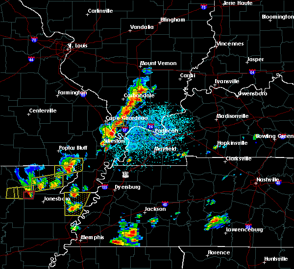 At 214 pm cdt, a severe thunderstorm was located near tamms, or 11 miles east of scott city, moving east at 15 mph (radar indicated). Hazards include 60 mph wind gusts and quarter size hail. Hail damage to vehicles is expected. Expect wind damage to roofs, siding, and trees. At 214 pm cdt, a severe thunderstorm was located near tamms, or 11 miles east of scott city, moving east at 15 mph (radar indicated). Hazards include 60 mph wind gusts and quarter size hail. Hail damage to vehicles is expected. Expect wind damage to roofs, siding, and trees.
|
| 2/24/2018 4:17 PM CST |
 At 416 pm cst, a severe thunderstorm was located near jonesboro, moving northeast at 35 mph (radar indicated). Hazards include 60 mph wind gusts. expect damage to roofs, siding, and trees At 416 pm cst, a severe thunderstorm was located near jonesboro, moving northeast at 35 mph (radar indicated). Hazards include 60 mph wind gusts. expect damage to roofs, siding, and trees
|
| 11/5/2017 7:54 PM CST |
 At 754 pm cst, severe thunderstorms were located along a line extending from near anna to near tamms, moving east at 45 mph (radar indicated). Hazards include 60 mph wind gusts and quarter size hail. Hail damage to vehicles is expected. Expect wind damage to roofs, siding, and trees. At 754 pm cst, severe thunderstorms were located along a line extending from near anna to near tamms, moving east at 45 mph (radar indicated). Hazards include 60 mph wind gusts and quarter size hail. Hail damage to vehicles is expected. Expect wind damage to roofs, siding, and trees.
|
| 10/10/2017 5:53 PM CDT |
 At 553 pm cdt, a severe thunderstorm capable of producing a tornado was located near anna, moving east at 30 mph (radar indicated rotation). Hazards include tornado and half dollar size hail. Flying debris will be dangerous to those caught without shelter. mobile homes will be damaged or destroyed. damage to roofs, windows, and vehicles will occur. Tree damage is likely. At 553 pm cdt, a severe thunderstorm capable of producing a tornado was located near anna, moving east at 30 mph (radar indicated rotation). Hazards include tornado and half dollar size hail. Flying debris will be dangerous to those caught without shelter. mobile homes will be damaged or destroyed. damage to roofs, windows, and vehicles will occur. Tree damage is likely.
|
| 10/10/2017 5:51 PM CDT |
 At 550 pm cdt, a severe thunderstorm was located near anna, moving east at 30 mph (radar indicated). Hazards include 60 mph wind gusts and quarter size hail. Hail damage to vehicles is expected. expect wind damage to roofs, siding, and trees. Locations impacted include, anna, jonesboro, cobden, dongola and mill creek. At 550 pm cdt, a severe thunderstorm was located near anna, moving east at 30 mph (radar indicated). Hazards include 60 mph wind gusts and quarter size hail. Hail damage to vehicles is expected. expect wind damage to roofs, siding, and trees. Locations impacted include, anna, jonesboro, cobden, dongola and mill creek.
|
| 10/10/2017 5:43 PM CDT |
 The national weather service in paducah has issued a * severe thunderstorm warning for. union county in southern illinois. Until 615 pm cdt * at 542 pm cdt, a severe thunderstorm was located over jonesboro, moving east at 30 mph. The national weather service in paducah has issued a * severe thunderstorm warning for. union county in southern illinois. Until 615 pm cdt * at 542 pm cdt, a severe thunderstorm was located over jonesboro, moving east at 30 mph.
|
| 5/27/2017 5:55 PM CDT |
 At 554 pm cdt, severe thunderstorms were located along a line extending from grand tower to cobden to near tamms to near sikeston, moving east at 65 mph. these are very dangerous storms (trained weather spotters. law enforcement reported 80 mph wind gust just north of sikeston missouri. structural damage was reported out of bollinger county). Hazards include 80 mph wind gusts and quarter size hail. Flying debris will be dangerous to those caught without shelter. mobile homes will be heavily damaged. expect considerable damage to roofs, windows, and vehicles. extensive tree damage and power outages are likely. locations impacted include, carbondale, sikeston, murphysboro, charleston, anna, cairo, jonesboro, oran, la center, miner, benton, bardwell, wickliffe, cobden, bertrand, mounds, dongola, morley, barlow and tamms. A tornado watch remains in effect until 700 pm cdt for southeastern missouri. At 554 pm cdt, severe thunderstorms were located along a line extending from grand tower to cobden to near tamms to near sikeston, moving east at 65 mph. these are very dangerous storms (trained weather spotters. law enforcement reported 80 mph wind gust just north of sikeston missouri. structural damage was reported out of bollinger county). Hazards include 80 mph wind gusts and quarter size hail. Flying debris will be dangerous to those caught without shelter. mobile homes will be heavily damaged. expect considerable damage to roofs, windows, and vehicles. extensive tree damage and power outages are likely. locations impacted include, carbondale, sikeston, murphysboro, charleston, anna, cairo, jonesboro, oran, la center, miner, benton, bardwell, wickliffe, cobden, bertrand, mounds, dongola, morley, barlow and tamms. A tornado watch remains in effect until 700 pm cdt for southeastern missouri.
|
| 5/27/2017 5:55 PM CDT |
 At 536 pm cdt, severe thunderstorms were located along a line extending from 6 miles west of altenburg to 6 miles northwest of ware to near kelso to 7 miles northwest of morehouse, moving east at 90 mph (radar indicated). Hazards include 70 mph wind gusts and quarter size hail. Hail damage to vehicles is expected. expect considerable tree damage. Wind damage is also likely to mobile homes, roofs, and outbuildings. At 536 pm cdt, severe thunderstorms were located along a line extending from 6 miles west of altenburg to 6 miles northwest of ware to near kelso to 7 miles northwest of morehouse, moving east at 90 mph (radar indicated). Hazards include 70 mph wind gusts and quarter size hail. Hail damage to vehicles is expected. expect considerable tree damage. Wind damage is also likely to mobile homes, roofs, and outbuildings.
|
| 5/27/2017 5:37 PM CDT |
 At 536 pm cdt, severe thunderstorms were located along a line extending from 6 miles west of altenburg to 6 miles northwest of ware to near kelso to 7 miles northwest of morehouse, moving east at 90 mph (radar indicated). Hazards include 70 mph wind gusts and quarter size hail. Hail damage to vehicles is expected. expect considerable tree damage. Wind damage is also likely to mobile homes, roofs, and outbuildings. At 536 pm cdt, severe thunderstorms were located along a line extending from 6 miles west of altenburg to 6 miles northwest of ware to near kelso to 7 miles northwest of morehouse, moving east at 90 mph (radar indicated). Hazards include 70 mph wind gusts and quarter size hail. Hail damage to vehicles is expected. expect considerable tree damage. Wind damage is also likely to mobile homes, roofs, and outbuildings.
|
| 5/27/2017 3:55 PM CDT |
 At 354 pm cdt, a severe thunderstorm was located over jonesboro, moving east at 40 mph (trained weather spotters. spotters reported trees snapped or uprooted in carbondale illinois). Hazards include 60 mph wind gusts and quarter size hail. Hail damage to vehicles is expected. expect wind damage to roofs, siding, and trees. locations impacted include, carbondale, marion, herrin, carterville, anna, johnston city, jonesboro, crainville, cambria, cobden, energy, hurst, ware, cedar lake area, makanda, alto pass, freeman spur, bush, whiteash and colp. A tornado watch remains in effect until 700 pm cdt for southeastern missouri. At 354 pm cdt, a severe thunderstorm was located over jonesboro, moving east at 40 mph (trained weather spotters. spotters reported trees snapped or uprooted in carbondale illinois). Hazards include 60 mph wind gusts and quarter size hail. Hail damage to vehicles is expected. expect wind damage to roofs, siding, and trees. locations impacted include, carbondale, marion, herrin, carterville, anna, johnston city, jonesboro, crainville, cambria, cobden, energy, hurst, ware, cedar lake area, makanda, alto pass, freeman spur, bush, whiteash and colp. A tornado watch remains in effect until 700 pm cdt for southeastern missouri.
|
| 5/27/2017 3:34 PM CDT |
 At 333 pm cdt, a severe thunderstorm was located near altenburg, or 14 miles northeast of jackson, moving east at 40 mph (radar indicated). Hazards include 60 mph wind gusts and quarter size hail. these storms downed a tree in murphysboro. Hail damage to vehicles is expected. Expect wind damage to roofs, siding, and trees. At 333 pm cdt, a severe thunderstorm was located near altenburg, or 14 miles northeast of jackson, moving east at 40 mph (radar indicated). Hazards include 60 mph wind gusts and quarter size hail. these storms downed a tree in murphysboro. Hail damage to vehicles is expected. Expect wind damage to roofs, siding, and trees.
|
| 4/30/2017 3:38 AM CDT |
 At 337 am cdt, severe thunderstorms were located along a line extending from 6 miles north of grand tower to near cobden to near tamms, moving northeast at 55 mph (radar indicated). Hazards include 60 mph wind gusts. Expect damage to roofs, siding, and trees. Locations impacted include, carbondale, murphysboro, anna, jonesboro, cobden, dongola, ava, tamms, grand tower, ware, cedar lake area, makanda, ullin, alto pass, gorham and mill creek. At 337 am cdt, severe thunderstorms were located along a line extending from 6 miles north of grand tower to near cobden to near tamms, moving northeast at 55 mph (radar indicated). Hazards include 60 mph wind gusts. Expect damage to roofs, siding, and trees. Locations impacted include, carbondale, murphysboro, anna, jonesboro, cobden, dongola, ava, tamms, grand tower, ware, cedar lake area, makanda, ullin, alto pass, gorham and mill creek.
|
| 4/30/2017 3:21 AM CDT |
 At 321 am cdt, severe thunderstorms were located along a line extending from near altenburg to 6 miles southwest of ware to near olive branch, moving northeast at 50 mph (radar indicated). Hazards include 60 mph wind gusts. expect damage to roofs, siding, and trees At 321 am cdt, severe thunderstorms were located along a line extending from near altenburg to 6 miles southwest of ware to near olive branch, moving northeast at 50 mph (radar indicated). Hazards include 60 mph wind gusts. expect damage to roofs, siding, and trees
|
| 4/28/2017 9:59 PM CDT |
 At 958 pm cdt, a severe thunderstorm was located near ware, or 7 miles southwest of jonesboro, moving northeast at 50 mph (radar indicated). Hazards include 60 mph wind gusts and quarter size hail. Hail damage to vehicles is expected. Expect wind damage to roofs, siding, and trees. At 958 pm cdt, a severe thunderstorm was located near ware, or 7 miles southwest of jonesboro, moving northeast at 50 mph (radar indicated). Hazards include 60 mph wind gusts and quarter size hail. Hail damage to vehicles is expected. Expect wind damage to roofs, siding, and trees.
|
| 4/3/2017 3:19 PM CDT |
 At 319 pm cdt, a severe thunderstorm was located over east cape girardeau, or near cape girardeau, moving northeast at 30 mph (radar indicated). Hazards include 60 mph wind gusts and quarter size hail. Hail damage to vehicles is expected. Expect wind damage to roofs, siding, and trees. At 319 pm cdt, a severe thunderstorm was located over east cape girardeau, or near cape girardeau, moving northeast at 30 mph (radar indicated). Hazards include 60 mph wind gusts and quarter size hail. Hail damage to vehicles is expected. Expect wind damage to roofs, siding, and trees.
|
| 3/1/2017 4:21 AM CST |
 At 421 am cst, severe thunderstorms were located along a line extending from 6 miles southeast of grand tower to near ware to near cape girardeau, moving east at 75 mph (radar indicated). Hazards include 60 mph wind gusts and nickel size hail. expect damage to roofs, siding, and trees At 421 am cst, severe thunderstorms were located along a line extending from 6 miles southeast of grand tower to near ware to near cape girardeau, moving east at 75 mph (radar indicated). Hazards include 60 mph wind gusts and nickel size hail. expect damage to roofs, siding, and trees
|
| 7/6/2016 12:42 PM CDT |
 At 1241 pm cdt, severe thunderstorms were located along a line extending from 6 miles northeast of daisy to chaffee to campbell, moving east at 50 mph (radar indicated). Hazards include 60 mph wind gusts and nickel size hail. Expect damage to roofs. siding. And trees. At 1241 pm cdt, severe thunderstorms were located along a line extending from 6 miles northeast of daisy to chaffee to campbell, moving east at 50 mph (radar indicated). Hazards include 60 mph wind gusts and nickel size hail. Expect damage to roofs. siding. And trees.
|
| 5/11/2016 7:41 PM CDT |
 At 741 pm cdt, a severe thunderstorm was located near goreville, or 9 miles east of anna, moving northeast at 40 mph (radar indicated). Hazards include 60 mph wind gusts and quarter size hail. Hail damage to vehicles is expected. expect wind damage to roofs, siding, and trees. Locations impacted include, anna, dongola and mill creek. At 741 pm cdt, a severe thunderstorm was located near goreville, or 9 miles east of anna, moving northeast at 40 mph (radar indicated). Hazards include 60 mph wind gusts and quarter size hail. Hail damage to vehicles is expected. expect wind damage to roofs, siding, and trees. Locations impacted include, anna, dongola and mill creek.
|
| 5/11/2016 7:18 PM CDT |
 At 718 pm cdt, a severe thunderstorm was located over jonesboro, moving northeast at 40 mph (radar indicated). Hazards include 60 mph wind gusts and quarter size hail. Hail damage to vehicles is expected. Expect wind damage to roofs, siding, and trees. At 718 pm cdt, a severe thunderstorm was located over jonesboro, moving northeast at 40 mph (radar indicated). Hazards include 60 mph wind gusts and quarter size hail. Hail damage to vehicles is expected. Expect wind damage to roofs, siding, and trees.
|
| 4/26/2016 5:07 PM CDT |
 The severe thunderstorm warning for northwestern alexander, union and east central cape girardeau counties will expire at 515 pm cdt, the storm which prompted the warning has weakened below severe limits, and no longer pose an immediate threat to life or property. therefore the warning will be allowed to expire. a severe thunderstorm watch remains in effect until 700 pm cdt for southeastern missouri. a severe thunderstorm watch also remains in effect until 1000 pm cdt for southern illinois, and southeastern missouri. The severe thunderstorm warning for northwestern alexander, union and east central cape girardeau counties will expire at 515 pm cdt, the storm which prompted the warning has weakened below severe limits, and no longer pose an immediate threat to life or property. therefore the warning will be allowed to expire. a severe thunderstorm watch remains in effect until 700 pm cdt for southeastern missouri. a severe thunderstorm watch also remains in effect until 1000 pm cdt for southern illinois, and southeastern missouri.
|
| 4/26/2016 4:48 PM CDT |
 At 447 pm cdt, a severe thunderstorm was located near east cape girardeau, or near cape girardeau, moving east at 40 mph (radar indicated). Hazards include 60 mph wind gusts and quarter size hail. Hail damage to vehicles is expected. Expect wind damage to roofs, siding, and trees. At 447 pm cdt, a severe thunderstorm was located near east cape girardeau, or near cape girardeau, moving east at 40 mph (radar indicated). Hazards include 60 mph wind gusts and quarter size hail. Hail damage to vehicles is expected. Expect wind damage to roofs, siding, and trees.
|
| 12/23/2015 2:17 PM CST | At 216 pm cst, a severe thunderstorm was located near charleston, moving northeast at 70 mph (trained weather spotters. spotters reported quarter size hail as the storm moved through sikeston). Hazards include 60 mph wind gusts and quarter size hail. Hail damage to vehicles is expected. Expect wind damage to roofs, siding and trees. |
| 12/23/2015 2:17 PM CST | The national weather service in paducah has issued a * severe thunderstorm warning for. pulaski county in southern illinois. alexander county in southern illinois. ballard county in western kentucky. Until 300 pm cst. |
| 12/23/2015 11:41 AM CST | The severe thunderstorm warning for western pulaski. eastern jackson. alexander. eastern perry. central union and southeastern scott counties will expire at 1145 am cst. the storms which prompted the warning have moved out of the area. however storms remain over alexander county illinois and scott county in missouri. these are expected to weaken. Therefore the. |
| 12/23/2015 11:41 AM CST | The severe thunderstorm warning for western pulaski. eastern jackson. alexander. eastern perry. central union and southeastern scott counties will expire at 1145 am cst. the storms which prompted the warning have moved out of the area. however storms remain over alexander county illinois and scott county in missouri. these are expected to weaken. Therefore the. |
| 12/23/2015 11:34 AM CST | At 1132 am cst, severe thunderstorms were located along a line extending from near tamaroa to 7 miles northeast of cobden to near mounds, moving east at 55 mph (trained weather spotters. 60 mph winds were reported in du quoin il as these storms moved through). Hazards include 60 mph wind gusts. Expect damage to roofs. siding and trees. locations impacted include, carbondale, sikeston, du quoin, pinckneyville, anna, cairo, jonesboro, miner, de soto, cobden, elkville, mounds, dongola, tamaroa, tamms, olive branch, horseshoe lake conservation area, makanda, ullin and dowell. A tornado watch remains in effect until 500 pm cst for southern illinois, western kentucky and southeastern missouri. |
| 12/23/2015 11:34 AM CST | At 1132 am cst, severe thunderstorms were located along a line extending from near tamaroa to 7 miles northeast of cobden to near mounds, moving east at 55 mph (trained weather spotters. 60 mph winds were reported in du quoin il as these storms moved through). Hazards include 60 mph wind gusts. Expect damage to roofs. siding and trees. locations impacted include, carbondale, sikeston, du quoin, pinckneyville, anna, cairo, jonesboro, miner, de soto, cobden, elkville, mounds, dongola, tamaroa, tamms, olive branch, horseshoe lake conservation area, makanda, ullin and dowell. A tornado watch remains in effect until 500 pm cst for southern illinois, western kentucky and southeastern missouri. |
| 12/23/2015 11:23 AM CST | At 1123 am cst, severe thunderstorms were located along a line extending from pinckneyville to near cobden to near horseshoe lake conservation area, moving northeast at 90 mph (trained weather spotters). Hazards include 60 mph wind gusts. Expect damage to roofs. siding and trees. locations impacted include, carbondale, sikeston, murphysboro, du quoin, pinckneyville, anna, cairo, jonesboro, miner, de soto, cobden, elkville, mounds, dongola, ava, tamaroa, tamms, east cape girardeau, cedar lake area and ware. A tornado watch remains in effect until 500 pm cst for southern illinois, western kentucky and southeastern missouri. |
| 12/23/2015 11:23 AM CST | At 1123 am cst, severe thunderstorms were located along a line extending from pinckneyville to near cobden to near horseshoe lake conservation area, moving northeast at 90 mph (trained weather spotters). Hazards include 60 mph wind gusts. Expect damage to roofs. siding and trees. locations impacted include, carbondale, sikeston, murphysboro, du quoin, pinckneyville, anna, cairo, jonesboro, miner, de soto, cobden, elkville, mounds, dongola, ava, tamaroa, tamms, east cape girardeau, cedar lake area and ware. A tornado watch remains in effect until 500 pm cst for southern illinois, western kentucky and southeastern missouri. |
| 12/23/2015 11:06 AM CST | At 1106 am cst, severe thunderstorms were located along a line extending from 7 miles southeast of chester to near jackson to near morehouse, moving east at 55 mph. this line of storms has a mistory of producing wind damage across southeast missouri (trained weather spotters). Hazards include 60 mph wind gusts. Expect damage to roofs. Siding and trees. |
| 12/23/2015 11:06 AM CST | At 1106 am cst, severe thunderstorms were located along a line extending from 7 miles southeast of chester to near jackson to near morehouse, moving east at 55 mph. this line of storms has a mistory of producing wind damage across southeast missouri (trained weather spotters). Hazards include 60 mph wind gusts. Expect damage to roofs. Siding and trees. |
| 7/20/2015 8:11 PM CDT |
 The tornado warning for south central union and northwestern alexander counties will expire at 815 pm cdt, the tornadic thunderstorm which prompted the warning is moving out of the warned area. therefore the warning will be allowed to expire. a severe thunderstorm watch remains in effect until 100 am cdt for southern illinois and southeastern missouri. The tornado warning for south central union and northwestern alexander counties will expire at 815 pm cdt, the tornadic thunderstorm which prompted the warning is moving out of the warned area. therefore the warning will be allowed to expire. a severe thunderstorm watch remains in effect until 100 am cdt for southern illinois and southeastern missouri.
|
| 7/20/2015 7:48 PM CDT |
 At 747 pm cdt, a severe thunderstorm capable of producing a tornado was located over jonesboro, moving east at 30 mph (weather spotters reported a funnel cloud). Hazards include tornado. Flying debris will be dangerous to those caught without shelter. mobile homes will be damaged or destroyed. damage to roofs, windows and vehicles will occur. tree damage is likely. this dangerous storm will be near, anna around 750 pm cdt. dongola around 800 pm cdt. Other locations impacted by this tornadic thunderstorm include mill creek. At 747 pm cdt, a severe thunderstorm capable of producing a tornado was located over jonesboro, moving east at 30 mph (weather spotters reported a funnel cloud). Hazards include tornado. Flying debris will be dangerous to those caught without shelter. mobile homes will be damaged or destroyed. damage to roofs, windows and vehicles will occur. tree damage is likely. this dangerous storm will be near, anna around 750 pm cdt. dongola around 800 pm cdt. Other locations impacted by this tornadic thunderstorm include mill creek.
|
| 7/20/2015 7:42 PM CDT |
 At 742 pm cdt, a severe thunderstorm capable of producing a tornado was located over east cape girardeau, or near cape girardeau, moving east at 45 mph (weather spotters reported funnel cloud). Hazards include tornado. Flying debris will be dangerous to those caught without shelter. mobile homes will be damaged or destroyed. damage to roofs, windows and vehicles will occur. tree damage is likely. this dangerous storm will be near, tamms around 755 pm cdt. Other locations impacted by this tornadic thunderstorm include east cape girardea, mill creek and thebes. At 742 pm cdt, a severe thunderstorm capable of producing a tornado was located over east cape girardeau, or near cape girardeau, moving east at 45 mph (weather spotters reported funnel cloud). Hazards include tornado. Flying debris will be dangerous to those caught without shelter. mobile homes will be damaged or destroyed. damage to roofs, windows and vehicles will occur. tree damage is likely. this dangerous storm will be near, tamms around 755 pm cdt. Other locations impacted by this tornadic thunderstorm include east cape girardea, mill creek and thebes.
|
| 7/20/2015 7:23 PM CDT |
 At 722 pm cdt, a severe thunderstorm capable of producing a tornado was located near ware, or 9 miles north of cape girardeau, moving east at 25 mph (weather spotters reported funnel cloud). Hazards include tornado. Flying debris will be dangerous to those caught without shelter. mobile homes will be damaged or destroyed. damage to roofs, windows and vehicles will occur. tree damage is likely. this dangerous storm will be near, ware around 735 pm cdt. jonesboro around 750 pm cdt. anna around 755 pm cdt. dongola around 800 pm cdt. Other locations impacted by this tornadic thunderstorm include mill creek. At 722 pm cdt, a severe thunderstorm capable of producing a tornado was located near ware, or 9 miles north of cape girardeau, moving east at 25 mph (weather spotters reported funnel cloud). Hazards include tornado. Flying debris will be dangerous to those caught without shelter. mobile homes will be damaged or destroyed. damage to roofs, windows and vehicles will occur. tree damage is likely. this dangerous storm will be near, ware around 735 pm cdt. jonesboro around 750 pm cdt. anna around 755 pm cdt. dongola around 800 pm cdt. Other locations impacted by this tornadic thunderstorm include mill creek.
|
| 7/8/2015 9:18 PM CDT |
 At 918 pm cdt, a severe thunderstorm was located over dongola, or 10 miles southeast of anna, moving east at 40 mph (radar indicated). Hazards include 60 mph wind gusts. Expect damage to roofs. Siding and trees. At 918 pm cdt, a severe thunderstorm was located over dongola, or 10 miles southeast of anna, moving east at 40 mph (radar indicated). Hazards include 60 mph wind gusts. Expect damage to roofs. Siding and trees.
|
| 4/3/2015 11:54 AM CDT | The severe thunderstorm warning for southeastern union. northwestern alexander and northwestern pulaski counties will expire at 1200 pm cdt. the severe thunderstorm which prompted the warning has moved out of the warned area. Therefore the warning will be allowed to expire. |
| 4/3/2015 11:19 AM CDT | The national weather service in paducah has issued a * severe thunderstorm warning for. southeastern union county in southern illinois. northwestern alexander county in southern illinois. northwestern pulaski county in southern illinois. Until noon cdt. |
| 3/25/2015 9:53 PM CDT | The national weather service in paducah has issued a * severe thunderstorm warning for. southern union county in southern illinois. alexander county in southern illinois. pulaski county in southern illinois. Until 1030 pm cdt. |
Hail Maps for Mill Creek, IL

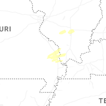
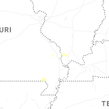

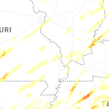


Connect with Interactive Hail Maps