

Hail Map for Millersburg, KY
The Millersburg, KY area has had 3 reports of on-the-ground hail by trained spotters, and has been under severe weather warnings 12 times during the past 12 months. Doppler radar has detected hail at or near Millersburg, KY on 38 occasions, including 1 occasion during the past year.
| Name: | Millersburg, KY |
| Where Located: | 42.8 miles NNW of Irvine, KY |
| Map: | Google Map for Millersburg, KY |
| Population: | 792 |
| Housing Units: | 413 |
| More Info: | Search Google for Millersburg, KY |
0
The Top Recent Hail Date for Millersburg, KY is Saturday, May 16, 2026 (22nd out of 38)
Hail and Wind Damage Spotted near Millersburg, KY
| Date / Time | Report Details |
|---|---|
| 6/22/2026 12:50 AM EDT |
 Svrlmk the national weather service in louisville has issued a * severe thunderstorm warning for, northeastern bourbon county in central kentucky, nicholas county in central kentucky, * until 115 am edt. * at 1250 am edt, a severe thunderstorm was located over carlisle, moving east at 45 mph (radar indicated). Hazards include 60 mph wind gusts. expect damage to roofs, siding, and trees Svrlmk the national weather service in louisville has issued a * severe thunderstorm warning for, northeastern bourbon county in central kentucky, nicholas county in central kentucky, * until 115 am edt. * at 1250 am edt, a severe thunderstorm was located over carlisle, moving east at 45 mph (radar indicated). Hazards include 60 mph wind gusts. expect damage to roofs, siding, and trees
|
| 6/18/2026 5:26 AM EDT |
 The storms which prompted the warning have weakened below severe limits, and no longer pose an immediate threat to life or property. therefore, the warning will be allowed to expire. however, gusty winds and heavy rain are still possible with these thunderstorms. a tornado watch remains in effect until 1100 am edt for central kentucky. The storms which prompted the warning have weakened below severe limits, and no longer pose an immediate threat to life or property. therefore, the warning will be allowed to expire. however, gusty winds and heavy rain are still possible with these thunderstorms. a tornado watch remains in effect until 1100 am edt for central kentucky.
|
| 6/18/2026 4:45 AM EDT |
 Svrlmk the national weather service in louisville has issued a * severe thunderstorm warning for, northeastern spencer county in central kentucky, southern shelby county in central kentucky, woodford county in central kentucky, southern scott county in central kentucky, anderson county in central kentucky, northern clark county in central kentucky, bourbon county in central kentucky, nicholas county in central kentucky, fayette county in central kentucky, southeastern harrison county in central kentucky, southern franklin county in central kentucky, * until 530 am edt. * at 444 am edt, severe thunderstorms were located along a line extending from 10 miles northwest of fairview to 6 miles east of georgetown to 8 miles north of taylorsville, moving southeast at 50 mph (radar indicated). Hazards include 60 mph wind gusts. expect damage to roofs, siding, and trees Svrlmk the national weather service in louisville has issued a * severe thunderstorm warning for, northeastern spencer county in central kentucky, southern shelby county in central kentucky, woodford county in central kentucky, southern scott county in central kentucky, anderson county in central kentucky, northern clark county in central kentucky, bourbon county in central kentucky, nicholas county in central kentucky, fayette county in central kentucky, southeastern harrison county in central kentucky, southern franklin county in central kentucky, * until 530 am edt. * at 444 am edt, severe thunderstorms were located along a line extending from 10 miles northwest of fairview to 6 miles east of georgetown to 8 miles north of taylorsville, moving southeast at 50 mph (radar indicated). Hazards include 60 mph wind gusts. expect damage to roofs, siding, and trees
|
| 4/28/2026 1:51 AM EDT |
 Svrlmk the national weather service in louisville has issued a * severe thunderstorm warning for, north central bourbon county in central kentucky, nicholas county in central kentucky, * until 215 am edt. * at 150 am edt, a severe thunderstorm was located over cynthiana, moving east at 45 mph (radar indicated). Hazards include 60 mph wind gusts. expect damage to roofs, siding, and trees Svrlmk the national weather service in louisville has issued a * severe thunderstorm warning for, north central bourbon county in central kentucky, nicholas county in central kentucky, * until 215 am edt. * at 150 am edt, a severe thunderstorm was located over cynthiana, moving east at 45 mph (radar indicated). Hazards include 60 mph wind gusts. expect damage to roofs, siding, and trees
|
| 3/16/2026 1:44 AM EDT |
 The storms which prompted the warning have weakened below severe limits, and no longer pose an immediate threat to life or property. therefore, the warning will be allowed to expire. however, gusty winds are still possible with these thunderstorms. to report severe weather, contact your nearest law enforcement agency. they will relay your report to the national weather service louisville. The storms which prompted the warning have weakened below severe limits, and no longer pose an immediate threat to life or property. therefore, the warning will be allowed to expire. however, gusty winds are still possible with these thunderstorms. to report severe weather, contact your nearest law enforcement agency. they will relay your report to the national weather service louisville.
|
| 3/16/2026 1:33 AM EDT |
 At 132 am edt, severe thunderstorms were located along a line extending from 10 miles southeast of falmouth to 7 miles east of cynthiana to near paris to near cadentown, moving northeast at 60 mph (radar indicated). Hazards include 60 mph wind gusts. Expect damage to roofs, siding, and trees. Locations impacted include, lexington, nicholasville, paris, cynthiana, carlisle, cadentown, veterans park, bryan station, millersburg, and north middletown. At 132 am edt, severe thunderstorms were located along a line extending from 10 miles southeast of falmouth to 7 miles east of cynthiana to near paris to near cadentown, moving northeast at 60 mph (radar indicated). Hazards include 60 mph wind gusts. Expect damage to roofs, siding, and trees. Locations impacted include, lexington, nicholasville, paris, cynthiana, carlisle, cadentown, veterans park, bryan station, millersburg, and north middletown.
|
| 3/16/2026 1:33 AM EDT |
 the severe thunderstorm warning has been cancelled and is no longer in effect the severe thunderstorm warning has been cancelled and is no longer in effect
|
| 3/16/2026 1:16 AM EDT |
 the severe thunderstorm warning has been cancelled and is no longer in effect the severe thunderstorm warning has been cancelled and is no longer in effect
|
| 3/16/2026 1:16 AM EDT |
 At 115 am edt, severe thunderstorms were located along a line extending from 10 miles northwest of cynthiana to 8 miles northeast of georgetown to highlands to near nicholasville, moving northeast at 55 mph (radar indicated). Hazards include 60 mph wind gusts. Expect damage to roofs, siding, and trees. Locations impacted include, lexington, georgetown, nicholasville, paris, cynthiana, carlisle, cardinal hill, cadentown, fayette mall, and veterans park. At 115 am edt, severe thunderstorms were located along a line extending from 10 miles northwest of cynthiana to 8 miles northeast of georgetown to highlands to near nicholasville, moving northeast at 55 mph (radar indicated). Hazards include 60 mph wind gusts. Expect damage to roofs, siding, and trees. Locations impacted include, lexington, georgetown, nicholasville, paris, cynthiana, carlisle, cardinal hill, cadentown, fayette mall, and veterans park.
|
| 3/16/2026 1:08 AM EDT |
 At 108 am edt, severe thunderstorms were located along a line extending from 15 miles west of cynthiana to near georgetown to meadowthorpe to 7 miles west of nicholasville, moving northeast at 55 mph (radar indicated). Hazards include 70 mph wind gusts. Expect considerable tree damage. damage is likely to mobile homes, roofs, and outbuildings. Locations impacted include, lexington, georgetown, nicholasville, versailles, paris, harrodsburg, cynthiana, carlisle, cardinal hill, and cadentown. At 108 am edt, severe thunderstorms were located along a line extending from 15 miles west of cynthiana to near georgetown to meadowthorpe to 7 miles west of nicholasville, moving northeast at 55 mph (radar indicated). Hazards include 70 mph wind gusts. Expect considerable tree damage. damage is likely to mobile homes, roofs, and outbuildings. Locations impacted include, lexington, georgetown, nicholasville, versailles, paris, harrodsburg, cynthiana, carlisle, cardinal hill, and cadentown.
|
| 3/16/2026 1:08 AM EDT |
 the severe thunderstorm warning has been cancelled and is no longer in effect the severe thunderstorm warning has been cancelled and is no longer in effect
|
| 3/16/2026 12:55 AM EDT |
 Svrlmk the national weather service in louisville has issued a * severe thunderstorm warning for, central mercer county in central kentucky, woodford county in central kentucky, scott county in central kentucky, northwestern garrard county in central kentucky, northwestern clark county in central kentucky, jessamine county in central kentucky, bourbon county in central kentucky, western nicholas county in central kentucky, fayette county in central kentucky, harrison county in central kentucky, northeastern franklin county in central kentucky, * until 145 am edt. * at 1254 am edt, severe thunderstorms were located along a line extending from 13 miles south of owenton to 8 miles east of frankfort to near versailles to near harrodsburg, moving northeast at 60 mph (radar indicated). Hazards include 60 mph wind gusts. expect damage to roofs, siding, and trees Svrlmk the national weather service in louisville has issued a * severe thunderstorm warning for, central mercer county in central kentucky, woodford county in central kentucky, scott county in central kentucky, northwestern garrard county in central kentucky, northwestern clark county in central kentucky, jessamine county in central kentucky, bourbon county in central kentucky, western nicholas county in central kentucky, fayette county in central kentucky, harrison county in central kentucky, northeastern franklin county in central kentucky, * until 145 am edt. * at 1254 am edt, severe thunderstorms were located along a line extending from 13 miles south of owenton to 8 miles east of frankfort to near versailles to near harrodsburg, moving northeast at 60 mph (radar indicated). Hazards include 60 mph wind gusts. expect damage to roofs, siding, and trees
|
| 5/16/2025 10:43 PM EDT |
 Svrlmk the national weather service in louisville has issued a * severe thunderstorm warning for, southeastern anderson county in central kentucky, clark county in central kentucky, jessamine county in central kentucky, nicholas county in central kentucky, harrison county in central kentucky, northeastern franklin county in central kentucky, northern mercer county in central kentucky, woodford county in central kentucky, scott county in central kentucky, bourbon county in central kentucky, northeastern washington county in central kentucky, northern madison county in central kentucky, fayette county in central kentucky, * until 1130 pm edt. * at 1042 pm edt, severe thunderstorms were located along a line extending from 8 miles northwest of owenton to 7 miles northwest of lawrenceburg to 12 miles north of springfield, moving east at 70 mph (radar indicated). Hazards include 70 mph wind gusts and penny size hail. Expect considerable tree damage. Damage is likely to mobile homes, roofs, and outbuildings. Svrlmk the national weather service in louisville has issued a * severe thunderstorm warning for, southeastern anderson county in central kentucky, clark county in central kentucky, jessamine county in central kentucky, nicholas county in central kentucky, harrison county in central kentucky, northeastern franklin county in central kentucky, northern mercer county in central kentucky, woodford county in central kentucky, scott county in central kentucky, bourbon county in central kentucky, northeastern washington county in central kentucky, northern madison county in central kentucky, fayette county in central kentucky, * until 1130 pm edt. * at 1042 pm edt, severe thunderstorms were located along a line extending from 8 miles northwest of owenton to 7 miles northwest of lawrenceburg to 12 miles north of springfield, moving east at 70 mph (radar indicated). Hazards include 70 mph wind gusts and penny size hail. Expect considerable tree damage. Damage is likely to mobile homes, roofs, and outbuildings.
|
| 4/3/2025 3:29 AM EDT |
 The storm which prompted the warning has moved out of the area. therefore, the warning will be allowed to expire. however, gusty winds are still possible with this thunderstorm. a tornado watch remains in effect until 700 am edt for central kentucky. The storm which prompted the warning has moved out of the area. therefore, the warning will be allowed to expire. however, gusty winds are still possible with this thunderstorm. a tornado watch remains in effect until 700 am edt for central kentucky.
|
| 4/3/2025 3:01 AM EDT |
 At 301 am edt, a severe thunderstorm was located near carlisle, moving northeast at 65 mph (radar indicated). Hazards include 60 mph wind gusts and quarter size hail. Hail damage to vehicles is expected. expect wind damage to roofs, siding, and trees. Locations impacted include, paris, carlisle, millersburg, north middletown, blacks crossroads, hutchison, renick, stony point, judianne estates, and moorefield. At 301 am edt, a severe thunderstorm was located near carlisle, moving northeast at 65 mph (radar indicated). Hazards include 60 mph wind gusts and quarter size hail. Hail damage to vehicles is expected. expect wind damage to roofs, siding, and trees. Locations impacted include, paris, carlisle, millersburg, north middletown, blacks crossroads, hutchison, renick, stony point, judianne estates, and moorefield.
|
| 4/3/2025 2:49 AM EDT |
 At 249 am edt, a severe thunderstorm was located near paris, moving northeast at 75 mph (radar indicated). Hazards include 60 mph wind gusts and quarter size hail. Hail damage to vehicles is expected. expect wind damage to roofs, siding, and trees. Locations impacted include, paris, carlisle, millersburg, north middletown, blacks crossroads, hutchison, renick, stony point, judianne estates, and moorefield. At 249 am edt, a severe thunderstorm was located near paris, moving northeast at 75 mph (radar indicated). Hazards include 60 mph wind gusts and quarter size hail. Hail damage to vehicles is expected. expect wind damage to roofs, siding, and trees. Locations impacted include, paris, carlisle, millersburg, north middletown, blacks crossroads, hutchison, renick, stony point, judianne estates, and moorefield.
|
| 4/3/2025 2:49 AM EDT |
 the severe thunderstorm warning has been cancelled and is no longer in effect the severe thunderstorm warning has been cancelled and is no longer in effect
|
| 4/3/2025 2:40 AM EDT |
 Svrlmk the national weather service in louisville has issued a * severe thunderstorm warning for, northwestern clark county in central kentucky, bourbon county in central kentucky, nicholas county in central kentucky, central fayette county in central kentucky, * until 330 am edt. * at 239 am edt, a severe thunderstorm was located over bryan station, moving northeast at 65 mph (radar indicated). Hazards include 60 mph wind gusts and penny size hail. expect damage to roofs, siding, and trees Svrlmk the national weather service in louisville has issued a * severe thunderstorm warning for, northwestern clark county in central kentucky, bourbon county in central kentucky, nicholas county in central kentucky, central fayette county in central kentucky, * until 330 am edt. * at 239 am edt, a severe thunderstorm was located over bryan station, moving northeast at 65 mph (radar indicated). Hazards include 60 mph wind gusts and penny size hail. expect damage to roofs, siding, and trees
|
| 4/3/2025 2:24 AM EDT |
 The storms which prompted the warning have weakened below severe limits, and have exited the warned area. therefore, the warning will be allowed to expire. a tornado watch remains in effect until 700 am edt for central kentucky. The storms which prompted the warning have weakened below severe limits, and have exited the warned area. therefore, the warning will be allowed to expire. a tornado watch remains in effect until 700 am edt for central kentucky.
|
| 4/3/2025 2:22 AM EDT |
 the severe thunderstorm warning has been cancelled and is no longer in effect the severe thunderstorm warning has been cancelled and is no longer in effect
|
| 4/3/2025 2:22 AM EDT |
 At 222 am edt, severe thunderstorms were located along a line extending from brooksville to near fairview to near paris, moving northeast at 95 mph (radar indicated). Hazards include 60 mph wind gusts. Expect damage to roofs, siding, and trees. Locations impacted include, paris, cynthiana, carlisle, millersburg, north middletown, blacks crossroads, ellisville, stony point, colville, and broadwell. At 222 am edt, severe thunderstorms were located along a line extending from brooksville to near fairview to near paris, moving northeast at 95 mph (radar indicated). Hazards include 60 mph wind gusts. Expect damage to roofs, siding, and trees. Locations impacted include, paris, cynthiana, carlisle, millersburg, north middletown, blacks crossroads, ellisville, stony point, colville, and broadwell.
|
| 4/3/2025 2:16 AM EDT |
 At 216 am edt, severe thunderstorms were located along a line extending from 8 miles southwest of brooksville to near carlisle to near bryan station, moving northeast at 95 mph (radar indicated). Hazards include 60 mph wind gusts. Expect damage to roofs, siding, and trees. Locations impacted include, lexington, paris, cynthiana, carlisle, thoroughbred acres, northland, bryan station, u k arboretum, chevy chase, and breckinridge. At 216 am edt, severe thunderstorms were located along a line extending from 8 miles southwest of brooksville to near carlisle to near bryan station, moving northeast at 95 mph (radar indicated). Hazards include 60 mph wind gusts. Expect damage to roofs, siding, and trees. Locations impacted include, lexington, paris, cynthiana, carlisle, thoroughbred acres, northland, bryan station, u k arboretum, chevy chase, and breckinridge.
|
| 4/3/2025 2:16 AM EDT |
 the severe thunderstorm warning has been cancelled and is no longer in effect the severe thunderstorm warning has been cancelled and is no longer in effect
|
| 4/3/2025 2:07 AM EDT |
 the severe thunderstorm warning has been cancelled and is no longer in effect the severe thunderstorm warning has been cancelled and is no longer in effect
|
| 4/3/2025 2:07 AM EDT |
 At 207 am edt, severe thunderstorms were located along a line extending from 10 miles south of falmouth to near paris to dunbar high school, moving northeast at 95 mph (radar indicated). Hazards include 60 mph wind gusts. Expect damage to roofs, siding, and trees. Locations impacted include, lexington, georgetown, paris, cynthiana, carlisle, cardinal hill, bryan station, chevy chase, meadowthorpe, and dunbar high school. At 207 am edt, severe thunderstorms were located along a line extending from 10 miles south of falmouth to near paris to dunbar high school, moving northeast at 95 mph (radar indicated). Hazards include 60 mph wind gusts. Expect damage to roofs, siding, and trees. Locations impacted include, lexington, georgetown, paris, cynthiana, carlisle, cardinal hill, bryan station, chevy chase, meadowthorpe, and dunbar high school.
|
| 4/3/2025 1:59 AM EDT |
 The storms which prompted the warning have moved out of the area. therefore, the warning will be allowed to expire. a tornado watch remains in effect until 700 am edt for central kentucky. The storms which prompted the warning have moved out of the area. therefore, the warning will be allowed to expire. a tornado watch remains in effect until 700 am edt for central kentucky.
|
| 4/3/2025 1:59 AM EDT |
 Svrlmk the national weather service in louisville has issued a * severe thunderstorm warning for, north central mercer county in central kentucky, woodford county in central kentucky, scott county in central kentucky, east central anderson county in central kentucky, northwestern jessamine county in central kentucky, bourbon county in central kentucky, nicholas county in central kentucky, fayette county in central kentucky, harrison county in central kentucky, eastern franklin county in central kentucky, * until 230 am edt. * at 158 am edt, severe thunderstorms were located along a line extending from 14 miles south of williamstown to near georgetown to 9 miles south of versailles, moving northeast at 95 mph (radar indicated). Hazards include 60 mph wind gusts. expect damage to roofs, siding, and trees Svrlmk the national weather service in louisville has issued a * severe thunderstorm warning for, north central mercer county in central kentucky, woodford county in central kentucky, scott county in central kentucky, east central anderson county in central kentucky, northwestern jessamine county in central kentucky, bourbon county in central kentucky, nicholas county in central kentucky, fayette county in central kentucky, harrison county in central kentucky, eastern franklin county in central kentucky, * until 230 am edt. * at 158 am edt, severe thunderstorms were located along a line extending from 14 miles south of williamstown to near georgetown to 9 miles south of versailles, moving northeast at 95 mph (radar indicated). Hazards include 60 mph wind gusts. expect damage to roofs, siding, and trees
|
| 4/3/2025 1:51 AM EDT |
 the severe thunderstorm warning has been cancelled and is no longer in effect the severe thunderstorm warning has been cancelled and is no longer in effect
|
| 4/3/2025 1:51 AM EDT |
 At 150 am edt, severe thunderstorms were located along a line extending from cynthiana to near georgetown, moving east at 60 mph (radar indicated). Hazards include 60 mph wind gusts and penny size hail. Expect damage to roofs, siding, and trees. Locations impacted include, cynthiana, carlisle, millersburg, ellisville, headquarters, colville, barefoot, blue licks springs, morning glory, and venus. At 150 am edt, severe thunderstorms were located along a line extending from cynthiana to near georgetown, moving east at 60 mph (radar indicated). Hazards include 60 mph wind gusts and penny size hail. Expect damage to roofs, siding, and trees. Locations impacted include, cynthiana, carlisle, millersburg, ellisville, headquarters, colville, barefoot, blue licks springs, morning glory, and venus.
|
| 4/3/2025 1:40 AM EDT |
 At 139 am edt, severe thunderstorms were located along a line extending from 12 miles west of cynthiana to 6 miles west of georgetown, moving east at 60 mph (radar indicated). Hazards include 60 mph wind gusts and penny size hail. Expect damage to roofs, siding, and trees. Locations impacted include, paris, cynthiana, carlisle, millersburg, blacks crossroads, leesburg, ellisville, colville, broadwell, and newtown. At 139 am edt, severe thunderstorms were located along a line extending from 12 miles west of cynthiana to 6 miles west of georgetown, moving east at 60 mph (radar indicated). Hazards include 60 mph wind gusts and penny size hail. Expect damage to roofs, siding, and trees. Locations impacted include, paris, cynthiana, carlisle, millersburg, blacks crossroads, leesburg, ellisville, colville, broadwell, and newtown.
|
| 4/3/2025 1:40 AM EDT |
 the severe thunderstorm warning has been cancelled and is no longer in effect the severe thunderstorm warning has been cancelled and is no longer in effect
|
| 4/3/2025 1:21 AM EDT |
 Svrlmk the national weather service in louisville has issued a * severe thunderstorm warning for, north central woodford county in central kentucky, southern scott county in central kentucky, central bourbon county in central kentucky, northwestern nicholas county in central kentucky, north central fayette county in central kentucky, southern harrison county in central kentucky, * until 200 am edt. * at 121 am edt, severe thunderstorms were located along a line extending from 16 miles west of georgetown to 6 miles west of frankfort, moving east at 60 mph (radar indicated). Hazards include 60 mph wind gusts and penny size hail. expect damage to roofs, siding, and trees Svrlmk the national weather service in louisville has issued a * severe thunderstorm warning for, north central woodford county in central kentucky, southern scott county in central kentucky, central bourbon county in central kentucky, northwestern nicholas county in central kentucky, north central fayette county in central kentucky, southern harrison county in central kentucky, * until 200 am edt. * at 121 am edt, severe thunderstorms were located along a line extending from 16 miles west of georgetown to 6 miles west of frankfort, moving east at 60 mph (radar indicated). Hazards include 60 mph wind gusts and penny size hail. expect damage to roofs, siding, and trees
|
| 3/30/2025 11:28 PM EDT |
 The storms which prompted the warning have moved out of the area. therefore, the warning will be allowed to expire. another warning has been issued downstream. a tornado watch remains in effect until 100 am edt for central kentucky. The storms which prompted the warning have moved out of the area. therefore, the warning will be allowed to expire. another warning has been issued downstream. a tornado watch remains in effect until 100 am edt for central kentucky.
|
| 3/30/2025 11:27 PM EDT |
 Svrlmk the national weather service in louisville has issued a * severe thunderstorm warning for, southeastern mercer county in central kentucky, garrard county in central kentucky, clark county in central kentucky, jessamine county in central kentucky, bourbon county in central kentucky, northeastern boyle county in central kentucky, nicholas county in central kentucky, madison county in central kentucky, fayette county in central kentucky, southeastern harrison county in central kentucky, * until midnight edt. * at 1127 pm edt, severe thunderstorms were located along a line extending from near fairview to 6 miles southeast of veterans park, moving east at 60 mph (radar indicated). Hazards include 60 mph wind gusts and penny size hail. expect damage to roofs, siding, and trees Svrlmk the national weather service in louisville has issued a * severe thunderstorm warning for, southeastern mercer county in central kentucky, garrard county in central kentucky, clark county in central kentucky, jessamine county in central kentucky, bourbon county in central kentucky, northeastern boyle county in central kentucky, nicholas county in central kentucky, madison county in central kentucky, fayette county in central kentucky, southeastern harrison county in central kentucky, * until midnight edt. * at 1127 pm edt, severe thunderstorms were located along a line extending from near fairview to 6 miles southeast of veterans park, moving east at 60 mph (radar indicated). Hazards include 60 mph wind gusts and penny size hail. expect damage to roofs, siding, and trees
|
| 3/30/2025 10:50 PM EDT |
 Svrlmk the national weather service in louisville has issued a * severe thunderstorm warning for, northeastern mercer county in central kentucky, woodford county in central kentucky, scott county in central kentucky, east central anderson county in central kentucky, clark county in central kentucky, jessamine county in central kentucky, bourbon county in central kentucky, nicholas county in central kentucky, northern madison county in central kentucky, fayette county in central kentucky, harrison county in central kentucky, * until 1130 pm edt. * at 1050 pm edt, severe thunderstorms were located along a line extending from 10 miles northwest of cynthiana to near georgetown to near lawrenceburg, moving east at 60 mph (radar indicated). Hazards include 60 mph wind gusts and nickel size hail. expect damage to roofs, siding, and trees Svrlmk the national weather service in louisville has issued a * severe thunderstorm warning for, northeastern mercer county in central kentucky, woodford county in central kentucky, scott county in central kentucky, east central anderson county in central kentucky, clark county in central kentucky, jessamine county in central kentucky, bourbon county in central kentucky, nicholas county in central kentucky, northern madison county in central kentucky, fayette county in central kentucky, harrison county in central kentucky, * until 1130 pm edt. * at 1050 pm edt, severe thunderstorms were located along a line extending from 10 miles northwest of cynthiana to near georgetown to near lawrenceburg, moving east at 60 mph (radar indicated). Hazards include 60 mph wind gusts and nickel size hail. expect damage to roofs, siding, and trees
|
| 3/16/2025 9:15 AM EDT |
 The storms which prompted the warning have weakened below severe limits, and no longer pose an immediate threat to life or property. therefore, the warning will be allowed to expire. however, 40 to 50 mph wind gusts are still possible with these thunderstorms. The storms which prompted the warning have weakened below severe limits, and no longer pose an immediate threat to life or property. therefore, the warning will be allowed to expire. however, 40 to 50 mph wind gusts are still possible with these thunderstorms.
|
| 3/16/2025 9:03 AM EDT |
 At 901 am edt, severe thunderstorms were located along a line extending from southwest of cynthiana to south of paris, moving northeast at 55 mph (radar indicated). Hazards include 60 mph wind gusts. Expect damage to roofs, siding, and trees. Locations impacted include, paris, cynthiana, millersburg, north middletown, blacks crossroads, hutchison, leesburg, stony point, bunker hill, and colville. At 901 am edt, severe thunderstorms were located along a line extending from southwest of cynthiana to south of paris, moving northeast at 55 mph (radar indicated). Hazards include 60 mph wind gusts. Expect damage to roofs, siding, and trees. Locations impacted include, paris, cynthiana, millersburg, north middletown, blacks crossroads, hutchison, leesburg, stony point, bunker hill, and colville.
|
| 3/16/2025 9:03 AM EDT |
 the severe thunderstorm warning has been cancelled and is no longer in effect the severe thunderstorm warning has been cancelled and is no longer in effect
|
| 3/16/2025 8:46 AM EDT |
 Svrlmk the national weather service in louisville has issued a * severe thunderstorm warning for, southern scott county in central kentucky, bourbon county in central kentucky, southwestern nicholas county in central kentucky, fayette county in central kentucky, southeastern harrison county in central kentucky, * until 915 am edt. * at 845 am edt, severe thunderstorms were located along a line extending from near georgetown to lexington, moving northeast at 55 mph (radar indicated). Hazards include 60 mph wind gusts. expect damage to roofs, siding, and trees Svrlmk the national weather service in louisville has issued a * severe thunderstorm warning for, southern scott county in central kentucky, bourbon county in central kentucky, southwestern nicholas county in central kentucky, fayette county in central kentucky, southeastern harrison county in central kentucky, * until 915 am edt. * at 845 am edt, severe thunderstorms were located along a line extending from near georgetown to lexington, moving northeast at 55 mph (radar indicated). Hazards include 60 mph wind gusts. expect damage to roofs, siding, and trees
|
| 5/26/2024 1:56 PM EDT |
 The storms which prompted the warning have moved out of the area. therefore, the warning will be allowed to expire. a tornado watch remains in effect until 400 pm edt for central kentucky. a severe thunderstorm watch remains in effect until 800 pm edt for central kentucky. The storms which prompted the warning have moved out of the area. therefore, the warning will be allowed to expire. a tornado watch remains in effect until 400 pm edt for central kentucky. a severe thunderstorm watch remains in effect until 800 pm edt for central kentucky.
|
| 5/26/2024 1:49 PM EDT |
 At 148 pm edt, severe thunderstorms were located along a line extending from 10 miles south of brooksville to doe creek, moving east at 40 mph (radar indicated). Hazards include 60 mph wind gusts. Expect damage to roofs, siding, and trees. Locations impacted include, richmond, winchester, paris, cynthiana, carlisle, harris ferry, breckinridge, berea, millersburg, and north middletown. At 148 pm edt, severe thunderstorms were located along a line extending from 10 miles south of brooksville to doe creek, moving east at 40 mph (radar indicated). Hazards include 60 mph wind gusts. Expect damage to roofs, siding, and trees. Locations impacted include, richmond, winchester, paris, cynthiana, carlisle, harris ferry, breckinridge, berea, millersburg, and north middletown.
|
| 5/26/2024 1:49 PM EDT |
 the severe thunderstorm warning has been cancelled and is no longer in effect the severe thunderstorm warning has been cancelled and is no longer in effect
|
| 5/26/2024 1:11 PM EDT |
 Svrlmk the national weather service in louisville has issued a * severe thunderstorm warning for, northeastern lincoln county in central kentucky, eastern scott county in central kentucky, eastern garrard county in central kentucky, clark county in central kentucky, eastern jessamine county in central kentucky, bourbon county in central kentucky, nicholas county in central kentucky, madison county in central kentucky, fayette county in central kentucky, harrison county in central kentucky, * until 200 pm edt. * at 111 pm edt, severe thunderstorms were located along a line extending from 12 miles west of cynthiana to near boone, moving east at 40 mph (radar indicated). Hazards include 60 mph wind gusts. expect damage to roofs, siding, and trees Svrlmk the national weather service in louisville has issued a * severe thunderstorm warning for, northeastern lincoln county in central kentucky, eastern scott county in central kentucky, eastern garrard county in central kentucky, clark county in central kentucky, eastern jessamine county in central kentucky, bourbon county in central kentucky, nicholas county in central kentucky, madison county in central kentucky, fayette county in central kentucky, harrison county in central kentucky, * until 200 pm edt. * at 111 pm edt, severe thunderstorms were located along a line extending from 12 miles west of cynthiana to near boone, moving east at 40 mph (radar indicated). Hazards include 60 mph wind gusts. expect damage to roofs, siding, and trees
|
| 5/26/2024 1:03 PM EDT |
 At 102 pm edt, a severe thunderstorm was located near thoroughbred acres, moving northeast at 60 mph (radar indicated). Hazards include 70 mph wind gusts. Expect considerable tree damage. damage is likely to mobile homes, roofs, and outbuildings. Locations impacted include, lexington, richmond, georgetown, frankfort, nicholasville, winchester, danville, lawrenceburg, versailles, and paris. At 102 pm edt, a severe thunderstorm was located near thoroughbred acres, moving northeast at 60 mph (radar indicated). Hazards include 70 mph wind gusts. Expect considerable tree damage. damage is likely to mobile homes, roofs, and outbuildings. Locations impacted include, lexington, richmond, georgetown, frankfort, nicholasville, winchester, danville, lawrenceburg, versailles, and paris.
|
| 5/26/2024 12:22 PM EDT |
 Svrlmk the national weather service in louisville has issued a * severe thunderstorm warning for, eastern anderson county in central kentucky, garrard county in central kentucky, clark county in central kentucky, jessamine county in central kentucky, nicholas county in central kentucky, harrison county in central kentucky, franklin county in central kentucky, northern lincoln county in central kentucky, mercer county in central kentucky, woodford county in central kentucky, scott county in central kentucky, bourbon county in central kentucky, boyle county in central kentucky, madison county in central kentucky, fayette county in central kentucky, * until 115 pm edt. * at 1222 pm edt, a severe thunderstorm was located 14 miles southwest of lawrenceburg, moving northeast at 60 mph (radar indicated). Hazards include 70 mph wind gusts. Expect considerable tree damage. Damage is likely to mobile homes, roofs, and outbuildings. Svrlmk the national weather service in louisville has issued a * severe thunderstorm warning for, eastern anderson county in central kentucky, garrard county in central kentucky, clark county in central kentucky, jessamine county in central kentucky, nicholas county in central kentucky, harrison county in central kentucky, franklin county in central kentucky, northern lincoln county in central kentucky, mercer county in central kentucky, woodford county in central kentucky, scott county in central kentucky, bourbon county in central kentucky, boyle county in central kentucky, madison county in central kentucky, fayette county in central kentucky, * until 115 pm edt. * at 1222 pm edt, a severe thunderstorm was located 14 miles southwest of lawrenceburg, moving northeast at 60 mph (radar indicated). Hazards include 70 mph wind gusts. Expect considerable tree damage. Damage is likely to mobile homes, roofs, and outbuildings.
|
| 3/6/2024 10:06 AM EST |
 Torlmk the national weather service in louisville has issued a * this is a test message. tornado warning for, meade county in central kentucky, larue county in central kentucky, jessamine county in central kentucky, nicholas county in central kentucky, adair county in south central kentucky, bourbon county in central kentucky, warren county in south central kentucky, cumberland county in south central kentucky, henry county in central kentucky, russell county in south central kentucky, taylor county in central kentucky, jefferson county in central kentucky, hardin county in central kentucky, spencer county in central kentucky, scott county in central kentucky, hancock county in central kentucky, trimble county in central kentucky, monroe county in south central kentucky, metcalfe county in south central kentucky, shelby county in central kentucky, logan county in south central kentucky, nelson county in central kentucky, anderson county in central kentucky, clark county in central kentucky, marion county in central kentucky, simpson county in south central kentucky, grayson county in central kentucky, casey county in central kentucky, franklin county in central kentucky, edmonson county in south central kentucky, lincoln county in central kentucky, woodford county in central kentucky, butler county in south central kentucky, madison county in central kentucky, barren county in south central kentucky, ohio county in central kentucky, oldham county in central kentucky, garrard county in central kentucky, hart county in central kentucky, bullitt county in central kentucky, harrison county in central kentucky, mercer county in central kentucky, clinton county in south central kentucky, green county in central kentucky, allen county in south central kentucky, washington county in central kentucky, boyle county in central kentucky, breckinridge county in central kentucky, fayette county in central kentucky, * this is a test message. until 1030 am est/930 am cst/. * this is a test message. Torlmk the national weather service in louisville has issued a * this is a test message. tornado warning for, meade county in central kentucky, larue county in central kentucky, jessamine county in central kentucky, nicholas county in central kentucky, adair county in south central kentucky, bourbon county in central kentucky, warren county in south central kentucky, cumberland county in south central kentucky, henry county in central kentucky, russell county in south central kentucky, taylor county in central kentucky, jefferson county in central kentucky, hardin county in central kentucky, spencer county in central kentucky, scott county in central kentucky, hancock county in central kentucky, trimble county in central kentucky, monroe county in south central kentucky, metcalfe county in south central kentucky, shelby county in central kentucky, logan county in south central kentucky, nelson county in central kentucky, anderson county in central kentucky, clark county in central kentucky, marion county in central kentucky, simpson county in south central kentucky, grayson county in central kentucky, casey county in central kentucky, franklin county in central kentucky, edmonson county in south central kentucky, lincoln county in central kentucky, woodford county in central kentucky, butler county in south central kentucky, madison county in central kentucky, barren county in south central kentucky, ohio county in central kentucky, oldham county in central kentucky, garrard county in central kentucky, hart county in central kentucky, bullitt county in central kentucky, harrison county in central kentucky, mercer county in central kentucky, clinton county in south central kentucky, green county in central kentucky, allen county in south central kentucky, washington county in central kentucky, boyle county in central kentucky, breckinridge county in central kentucky, fayette county in central kentucky, * this is a test message. until 1030 am est/930 am cst/. * this is a test message.
|
| 2/28/2024 6:28 AM EST |
 The storm which prompted the warning has weakened below severe limits, and no longer poses an immediate threat to life or property. therefore, the warning will be allowed to expire. however, small hail and gusty winds are still possible with this thunderstorm. a tornado watch remains in effect until 800 am est for central kentucky. a tornado watch also remains in effect until 900 am est for central kentucky. The storm which prompted the warning has weakened below severe limits, and no longer poses an immediate threat to life or property. therefore, the warning will be allowed to expire. however, small hail and gusty winds are still possible with this thunderstorm. a tornado watch remains in effect until 800 am est for central kentucky. a tornado watch also remains in effect until 900 am est for central kentucky.
|
| 2/28/2024 6:07 AM EST |
 Svrlmk the national weather service in louisville has issued a * severe thunderstorm warning for, northeastern woodford county in central kentucky, southeastern scott county in central kentucky, northwestern clark county in central kentucky, bourbon county in central kentucky, southwestern nicholas county in central kentucky, northern fayette county in central kentucky, * until 630 am est. * at 607 am est, a severe thunderstorm was located near highlands, moving east at 60 mph (radar indicated). Hazards include 60 mph wind gusts and quarter size hail. Hail damage to vehicles is expected. Expect wind damage to roofs, siding, and trees. Svrlmk the national weather service in louisville has issued a * severe thunderstorm warning for, northeastern woodford county in central kentucky, southeastern scott county in central kentucky, northwestern clark county in central kentucky, bourbon county in central kentucky, southwestern nicholas county in central kentucky, northern fayette county in central kentucky, * until 630 am est. * at 607 am est, a severe thunderstorm was located near highlands, moving east at 60 mph (radar indicated). Hazards include 60 mph wind gusts and quarter size hail. Hail damage to vehicles is expected. Expect wind damage to roofs, siding, and trees.
|
| 2/28/2024 5:41 AM EST |
 The storms which prompted the warning have moved out of the area. therefore, the warning will be allowed to expire. a tornado watch remains in effect until 800 am est for central kentucky. The storms which prompted the warning have moved out of the area. therefore, the warning will be allowed to expire. a tornado watch remains in effect until 800 am est for central kentucky.
|
| 2/28/2024 5:34 AM EST |
 At 532 am est, severe thunderstorms were located along a line extending from 7 miles east of cynthiana to cardinal hill, moving east at 55 mph (kentucky mesonet). Hazards include 70 mph wind gusts. Expect considerable tree damage. damage is likely to mobile homes, roofs, and outbuildings. Locations impacted include, lexington, paris, cynthiana, carlisle, meadowthorpe, thoroughbred acres, cardinal hill, bryan station, northland, and highlands. At 532 am est, severe thunderstorms were located along a line extending from 7 miles east of cynthiana to cardinal hill, moving east at 55 mph (kentucky mesonet). Hazards include 70 mph wind gusts. Expect considerable tree damage. damage is likely to mobile homes, roofs, and outbuildings. Locations impacted include, lexington, paris, cynthiana, carlisle, meadowthorpe, thoroughbred acres, cardinal hill, bryan station, northland, and highlands.
|
| 2/28/2024 5:30 AM EST |
 Svrlmk the national weather service in louisville has issued a * severe thunderstorm warning for, northern clark county in central kentucky, bourbon county in central kentucky, nicholas county in central kentucky, northeastern fayette county in central kentucky, * until 600 am est. * at 530 am est, severe thunderstorms were located along a line extending from 7 miles west of fairview to chevy chase, moving east at 50 mph (kentucky mesonet). Hazards include 70 mph wind gusts. Expect considerable tree damage. Damage is likely to mobile homes, roofs, and outbuildings. Svrlmk the national weather service in louisville has issued a * severe thunderstorm warning for, northern clark county in central kentucky, bourbon county in central kentucky, nicholas county in central kentucky, northeastern fayette county in central kentucky, * until 600 am est. * at 530 am est, severe thunderstorms were located along a line extending from 7 miles west of fairview to chevy chase, moving east at 50 mph (kentucky mesonet). Hazards include 70 mph wind gusts. Expect considerable tree damage. Damage is likely to mobile homes, roofs, and outbuildings.
|
| 2/28/2024 5:23 AM EST |
 At 523 am est, severe thunderstorms were located along a line extending from cynthiana to near versailles, moving east at 55 mph (kentucky mesonet). Hazards include 70 mph wind gusts. Expect considerable tree damage. damage is likely to mobile homes, roofs, and outbuildings. Locations impacted include, lexington, georgetown, versailles, paris, cynthiana, carlisle, meadowthorpe, thoroughbred acres, cardinal hill, and northland. At 523 am est, severe thunderstorms were located along a line extending from cynthiana to near versailles, moving east at 55 mph (kentucky mesonet). Hazards include 70 mph wind gusts. Expect considerable tree damage. damage is likely to mobile homes, roofs, and outbuildings. Locations impacted include, lexington, georgetown, versailles, paris, cynthiana, carlisle, meadowthorpe, thoroughbred acres, cardinal hill, and northland.
|
| 2/28/2024 5:13 AM EST |
 Svrlmk the national weather service in louisville has issued a * severe thunderstorm warning for, northern woodford county in central kentucky, southeastern scott county in central kentucky, bourbon county in central kentucky, northwestern nicholas county in central kentucky, northern fayette county in central kentucky, southern harrison county in central kentucky, * until 545 am est. * at 513 am est, severe thunderstorms were located along a line extending from 6 miles west of cynthiana to near versailles, moving east at 55 mph (kentucky mesonet). Hazards include 60 mph wind gusts. expect damage to roofs, siding, and trees Svrlmk the national weather service in louisville has issued a * severe thunderstorm warning for, northern woodford county in central kentucky, southeastern scott county in central kentucky, bourbon county in central kentucky, northwestern nicholas county in central kentucky, northern fayette county in central kentucky, southern harrison county in central kentucky, * until 545 am est. * at 513 am est, severe thunderstorms were located along a line extending from 6 miles west of cynthiana to near versailles, moving east at 55 mph (kentucky mesonet). Hazards include 60 mph wind gusts. expect damage to roofs, siding, and trees
|
| 8/25/2023 5:54 PM EDT |
 At 554 pm edt, a severe thunderstorm was located near paris, moving southeast at 20 mph (radar indicated). Hazards include 60 mph wind gusts. expect damage to roofs, siding, and trees At 554 pm edt, a severe thunderstorm was located near paris, moving southeast at 20 mph (radar indicated). Hazards include 60 mph wind gusts. expect damage to roofs, siding, and trees
|
| 5/16/2023 1:45 PM EDT |
 At 145 pm edt, severe thunderstorms were located along a line extending from near carlisle to 6 miles south of paris, moving east at 25 mph (radar indicated). Hazards include 60 mph wind gusts. Expect damage to roofs, siding, and trees. Locations impacted include, paris, carlisle, millersburg, north middletown, sidville, jackstown, blacks crossroads, hutchison, ellisville, and pleasant valley. At 145 pm edt, severe thunderstorms were located along a line extending from near carlisle to 6 miles south of paris, moving east at 25 mph (radar indicated). Hazards include 60 mph wind gusts. Expect damage to roofs, siding, and trees. Locations impacted include, paris, carlisle, millersburg, north middletown, sidville, jackstown, blacks crossroads, hutchison, ellisville, and pleasant valley.
|
| 5/16/2023 1:32 PM EDT |
 At 131 pm edt, severe thunderstorms were located along a line extending from 6 miles east of cynthiana to near bryan station, moving east at 30 mph (radar indicated). Hazards include 60 mph wind gusts. expect damage to roofs, siding, and trees At 131 pm edt, severe thunderstorms were located along a line extending from 6 miles east of cynthiana to near bryan station, moving east at 30 mph (radar indicated). Hazards include 60 mph wind gusts. expect damage to roofs, siding, and trees
|
| 4/5/2023 7:20 PM EDT |
 The severe thunderstorm warning for northeastern clark, eastern bourbon and nicholas counties will expire at 730 pm edt, the storms which prompted the warning havemoved out of the warned area. therefore, the warning will be allowed to expire. a severe thunderstorm watch remains in effect until 1000 pm edt for central kentucky. The severe thunderstorm warning for northeastern clark, eastern bourbon and nicholas counties will expire at 730 pm edt, the storms which prompted the warning havemoved out of the warned area. therefore, the warning will be allowed to expire. a severe thunderstorm watch remains in effect until 1000 pm edt for central kentucky.
|
| 4/5/2023 6:58 PM EDT |
 The severe thunderstorm warning for clark, bourbon, nicholas, madison, eastern fayette and harrison counties will expire at 700 pm edt, the storms which prompted the warning have moved out of the area. therefore, the warning will be allowed to expire. a severe thunderstorm watch remains in effect until 1000 pm edt for central kentucky. The severe thunderstorm warning for clark, bourbon, nicholas, madison, eastern fayette and harrison counties will expire at 700 pm edt, the storms which prompted the warning have moved out of the area. therefore, the warning will be allowed to expire. a severe thunderstorm watch remains in effect until 1000 pm edt for central kentucky.
|
| 4/5/2023 6:57 PM EDT |
 At 657 pm edt, severe thunderstorms were located along a line extending from 8 miles east of cynthiana to near wades mill, moving northeast at 60 mph (radar indicated). Hazards include 60 mph wind gusts. Expect damage to roofs, siding, and trees. severe thunderstorms will be near, carlisle around 700 pm edt. hail threat, radar indicated max hail size, <. 75 in wind threat, radar indicated max wind gust, 60 mph. At 657 pm edt, severe thunderstorms were located along a line extending from 8 miles east of cynthiana to near wades mill, moving northeast at 60 mph (radar indicated). Hazards include 60 mph wind gusts. Expect damage to roofs, siding, and trees. severe thunderstorms will be near, carlisle around 700 pm edt. hail threat, radar indicated max hail size, <. 75 in wind threat, radar indicated max wind gust, 60 mph.
|
| 4/5/2023 6:42 PM EDT |
 At 642 pm edt, severe thunderstorms were located along a line extending from near cynthiana to 6 miles northwest of winchester to near lancaster, moving east at 45 mph (radar indicated). Hazards include 60 mph wind gusts. Expect damage to roofs, siding, and trees. locations impacted include, lexington, richmond, winchester, paris, cynthiana, carlisle, cadentown, bryan station, harris ferry and breckinridge. hail threat, radar indicated max hail size, <. 75 in wind threat, radar indicated max wind gust, 60 mph. At 642 pm edt, severe thunderstorms were located along a line extending from near cynthiana to 6 miles northwest of winchester to near lancaster, moving east at 45 mph (radar indicated). Hazards include 60 mph wind gusts. Expect damage to roofs, siding, and trees. locations impacted include, lexington, richmond, winchester, paris, cynthiana, carlisle, cadentown, bryan station, harris ferry and breckinridge. hail threat, radar indicated max hail size, <. 75 in wind threat, radar indicated max wind gust, 60 mph.
|
| 4/5/2023 6:39 PM EDT |
 At 638 pm edt, severe thunderstorms were located along a line extending from cynthiana to near bryan station to near lancaster, moving east at 45 mph (radar indicated). Hazards include 60 mph wind gusts. Expect damage to roofs, siding, and trees. locations impacted include, lexington, richmond, georgetown, nicholasville, winchester, danville, paris, cynthiana, lancaster and carlisle. hail threat, radar indicated max hail size, <. 75 in wind threat, radar indicated max wind gust, 60 mph. At 638 pm edt, severe thunderstorms were located along a line extending from cynthiana to near bryan station to near lancaster, moving east at 45 mph (radar indicated). Hazards include 60 mph wind gusts. Expect damage to roofs, siding, and trees. locations impacted include, lexington, richmond, georgetown, nicholasville, winchester, danville, paris, cynthiana, lancaster and carlisle. hail threat, radar indicated max hail size, <. 75 in wind threat, radar indicated max wind gust, 60 mph.
|
| 4/5/2023 6:12 PM EDT |
 At 612 pm edt, severe thunderstorms were located along a line extending from 9 miles northwest of cynthiana to 8 miles southwest of danville, moving east at 50 mph (radar indicated). Hazards include 60 mph wind gusts. expect damage to roofs, siding, and trees At 612 pm edt, severe thunderstorms were located along a line extending from 9 miles northwest of cynthiana to 8 miles southwest of danville, moving east at 50 mph (radar indicated). Hazards include 60 mph wind gusts. expect damage to roofs, siding, and trees
|
| 3/3/2023 3:34 PM EST |
 At 334 pm est, severe thunderstorms were located along a line extending from 14 miles southeast of owenton to near georgetown to cadentown, moving northeast at 60 mph (radar indicated). Hazards include 70 mph wind gusts. Expect considerable tree damage. damage is likely to mobile homes, roofs, and outbuildings. locations impacted include, paris, cynthiana and carlisle. thunderstorm damage threat, considerable hail threat, radar indicated max hail size, <. 75 in wind threat, radar indicated max wind gust, 70 mph. At 334 pm est, severe thunderstorms were located along a line extending from 14 miles southeast of owenton to near georgetown to cadentown, moving northeast at 60 mph (radar indicated). Hazards include 70 mph wind gusts. Expect considerable tree damage. damage is likely to mobile homes, roofs, and outbuildings. locations impacted include, paris, cynthiana and carlisle. thunderstorm damage threat, considerable hail threat, radar indicated max hail size, <. 75 in wind threat, radar indicated max wind gust, 70 mph.
|
| 3/3/2023 3:24 PM EST |
 At 324 pm est, severe thunderstorms were located along a line extending from 12 miles northwest of georgetown to near cardinal hill to near veterans park, moving northeast at 60 mph (radar indicated). Hazards include 70 mph wind gusts. Expect considerable tree damage. damage is likely to mobile homes, roofs, and outbuildings. severe thunderstorms will be near, lexington around 330 pm est. georgetown around 335 pm est. other locations in the path of these severe thunderstorms include paris, cynthiana and carlisle. thunderstorm damage threat, considerable hail threat, radar indicated max hail size, <. 75 in wind threat, radar indicated max wind gust, 70 mph. At 324 pm est, severe thunderstorms were located along a line extending from 12 miles northwest of georgetown to near cardinal hill to near veterans park, moving northeast at 60 mph (radar indicated). Hazards include 70 mph wind gusts. Expect considerable tree damage. damage is likely to mobile homes, roofs, and outbuildings. severe thunderstorms will be near, lexington around 330 pm est. georgetown around 335 pm est. other locations in the path of these severe thunderstorms include paris, cynthiana and carlisle. thunderstorm damage threat, considerable hail threat, radar indicated max hail size, <. 75 in wind threat, radar indicated max wind gust, 70 mph.
|
| 1/12/2023 9:56 AM EST |
 The severe thunderstorm warning for central bourbon, southwestern nicholas and southern harrison counties will expire at 1000 am est, the storm which prompted the warning has moved out of the area. therefore, the warning will be allowed to expire. however heavy rain is still possible with this thunderstorm. a severe thunderstorm watch remains in effect until 100 pm est for central kentucky. remember, a severe thunderstorm warning still remains in effect for portions of bourbon and harrison counties. The severe thunderstorm warning for central bourbon, southwestern nicholas and southern harrison counties will expire at 1000 am est, the storm which prompted the warning has moved out of the area. therefore, the warning will be allowed to expire. however heavy rain is still possible with this thunderstorm. a severe thunderstorm watch remains in effect until 100 pm est for central kentucky. remember, a severe thunderstorm warning still remains in effect for portions of bourbon and harrison counties.
|
| 1/12/2023 9:54 AM EST |
 At 954 am est, a severe thunderstorm was located 7 miles northwest of carlisle, moving northeast at 55 mph (radar indicated). Hazards include 60 mph wind gusts and quarter size hail. Hail damage to vehicles is expected. expect wind damage to roofs, siding, and trees. This severe thunderstorm will remain over mainly rural areas of north central bourbon, northern nicholas and east central harrison counties, including the following locations, barefoot, blue licks springs, morning glory, millersburg, ellisville, venus, pleasant valley, headquarters, hooktown and colville. At 954 am est, a severe thunderstorm was located 7 miles northwest of carlisle, moving northeast at 55 mph (radar indicated). Hazards include 60 mph wind gusts and quarter size hail. Hail damage to vehicles is expected. expect wind damage to roofs, siding, and trees. This severe thunderstorm will remain over mainly rural areas of north central bourbon, northern nicholas and east central harrison counties, including the following locations, barefoot, blue licks springs, morning glory, millersburg, ellisville, venus, pleasant valley, headquarters, hooktown and colville.
|
| 1/12/2023 9:46 AM EST |
 At 945 am est, a severe thunderstorm was located 7 miles northwest of paris, moving northeast at 55 mph (radar indicated). Hazards include 60 mph wind gusts and quarter size hail. Hail damage to vehicles is expected. expect wind damage to roofs, siding, and trees. locations impacted include, cynthiana. hail threat, radar indicated max hail size, 1. 00 in wind threat, radar indicated max wind gust, 60 mph. At 945 am est, a severe thunderstorm was located 7 miles northwest of paris, moving northeast at 55 mph (radar indicated). Hazards include 60 mph wind gusts and quarter size hail. Hail damage to vehicles is expected. expect wind damage to roofs, siding, and trees. locations impacted include, cynthiana. hail threat, radar indicated max hail size, 1. 00 in wind threat, radar indicated max wind gust, 60 mph.
|
| 1/12/2023 9:26 AM EST |
 At 926 am est, a severe thunderstorm was located near georgetown, moving east at 55 mph (radar indicated). Hazards include 60 mph wind gusts and quarter size hail. Hail damage to vehicles is expected. expect wind damage to roofs, siding, and trees. this severe thunderstorm will be near, lexington around 930 am est. georgetown around 935 am est. other locations in the path of this severe thunderstorm include paris and cynthiana. hail threat, radar indicated max hail size, 1. 00 in wind threat, radar indicated max wind gust, 60 mph. At 926 am est, a severe thunderstorm was located near georgetown, moving east at 55 mph (radar indicated). Hazards include 60 mph wind gusts and quarter size hail. Hail damage to vehicles is expected. expect wind damage to roofs, siding, and trees. this severe thunderstorm will be near, lexington around 930 am est. georgetown around 935 am est. other locations in the path of this severe thunderstorm include paris and cynthiana. hail threat, radar indicated max hail size, 1. 00 in wind threat, radar indicated max wind gust, 60 mph.
|
| 11/29/2022 9:26 PM EST |
 At 925 pm est, a severe thunderstorm was located near paris, moving northeast at 70 mph (radar indicated). Hazards include quarter size hail. Damage to vehicles is expected. locations impacted include, carlisle. hail threat, radar indicated max hail size, 1. 00 in wind threat, radar indicated max wind gust, <50 mph. At 925 pm est, a severe thunderstorm was located near paris, moving northeast at 70 mph (radar indicated). Hazards include quarter size hail. Damage to vehicles is expected. locations impacted include, carlisle. hail threat, radar indicated max hail size, 1. 00 in wind threat, radar indicated max wind gust, <50 mph.
|
| 11/29/2022 9:11 PM EST |
 At 910 pm est, a severe thunderstorm was located over bryan station, moving northeast at 60 mph (radar indicated). Hazards include quarter size hail. Damage to vehicles is expected. this severe thunderstorm will be near, paris around 925 pm est. other locations in the path of this severe thunderstorm include carlisle. hail threat, radar indicated max hail size, 1. 00 in wind threat, radar indicated max wind gust, <50 mph. At 910 pm est, a severe thunderstorm was located over bryan station, moving northeast at 60 mph (radar indicated). Hazards include quarter size hail. Damage to vehicles is expected. this severe thunderstorm will be near, paris around 925 pm est. other locations in the path of this severe thunderstorm include carlisle. hail threat, radar indicated max hail size, 1. 00 in wind threat, radar indicated max wind gust, <50 mph.
|
| 6/17/2022 12:37 PM EDT |
 The severe thunderstorm warning for clark, central bourbon, nicholas and southeastern harrison counties will expire at 1245 pm edt, the storms which prompted the warning have moved out of the area. therefore, the warning will be allowed to expire. a severe thunderstorm watch remains in effect until 300 pm edt for central kentucky. The severe thunderstorm warning for clark, central bourbon, nicholas and southeastern harrison counties will expire at 1245 pm edt, the storms which prompted the warning have moved out of the area. therefore, the warning will be allowed to expire. a severe thunderstorm watch remains in effect until 300 pm edt for central kentucky.
|
| 6/17/2022 12:26 PM EDT |
 At 1225 pm edt, severe thunderstorms were located along a line extending from near fairview to sharpsburg to near winchester, moving east at 75 mph (radar indicated). Hazards include 60 mph wind gusts and penny size hail. Expect damage to roofs, siding, and trees. locations impacted include, winchester, carlisle, millersburg, north middletown, goffs corner, blacks crossroads, renick, lyndale, jackson ferry and stony point. hail threat, radar indicated max hail size, 0. 75 in wind threat, radar indicated max wind gust, 60 mph. At 1225 pm edt, severe thunderstorms were located along a line extending from near fairview to sharpsburg to near winchester, moving east at 75 mph (radar indicated). Hazards include 60 mph wind gusts and penny size hail. Expect damage to roofs, siding, and trees. locations impacted include, winchester, carlisle, millersburg, north middletown, goffs corner, blacks crossroads, renick, lyndale, jackson ferry and stony point. hail threat, radar indicated max hail size, 0. 75 in wind threat, radar indicated max wind gust, 60 mph.
|
| 6/17/2022 11:59 AM EDT |
 At 1159 am edt, severe thunderstorms were located along a line extending from 7 miles east of owenton to 6 miles northwest of georgetown to near lawrenceburg, moving east at 50 mph (radar indicated). Hazards include 60 mph wind gusts and penny size hail. expect damage to roofs, siding, and trees At 1159 am edt, severe thunderstorms were located along a line extending from 7 miles east of owenton to 6 miles northwest of georgetown to near lawrenceburg, moving east at 50 mph (radar indicated). Hazards include 60 mph wind gusts and penny size hail. expect damage to roofs, siding, and trees
|
| 6/8/2022 6:31 PM EDT |
 At 631 pm edt, a severe thunderstorm was located near paris, moving northeast at 35 mph (radar indicated). Hazards include 60 mph wind gusts and quarter size hail. Hail damage to vehicles is expected. expect wind damage to roofs, siding, and trees. this severe thunderstorm will be near, paris around 640 pm edt. hail threat, radar indicated max hail size, 1. 00 in wind threat, radar indicated max wind gust, 60 mph. At 631 pm edt, a severe thunderstorm was located near paris, moving northeast at 35 mph (radar indicated). Hazards include 60 mph wind gusts and quarter size hail. Hail damage to vehicles is expected. expect wind damage to roofs, siding, and trees. this severe thunderstorm will be near, paris around 640 pm edt. hail threat, radar indicated max hail size, 1. 00 in wind threat, radar indicated max wind gust, 60 mph.
|
| 5/26/2022 5:04 PM EDT |
 At 503 pm edt, a severe thunderstorm was located near sideview, moving northeast at 45 mph (radar indicated). Hazards include 60 mph wind gusts. expect damage to roofs, siding, and trees At 503 pm edt, a severe thunderstorm was located near sideview, moving northeast at 45 mph (radar indicated). Hazards include 60 mph wind gusts. expect damage to roofs, siding, and trees
|
| 5/21/2022 4:17 PM EDT |
 At 417 pm edt, a severe thunderstorm was located near carlisle, moving east at 50 mph (radar indicated). Hazards include 60 mph wind gusts and quarter size hail. Hail damage to vehicles is expected. expect wind damage to roofs, siding, and trees. this severe thunderstorm will remain over mainly rural areas of north central bourbon, central nicholas and east central harrison counties, including the following locations, barefoot, blue licks springs, morning glory, millersburg, ellisville, pleasant valley, headquarters, hooktown, colville and barterville. hail threat, radar indicated max hail size, 1. 00 in wind threat, radar indicated max wind gust, 60 mph. At 417 pm edt, a severe thunderstorm was located near carlisle, moving east at 50 mph (radar indicated). Hazards include 60 mph wind gusts and quarter size hail. Hail damage to vehicles is expected. expect wind damage to roofs, siding, and trees. this severe thunderstorm will remain over mainly rural areas of north central bourbon, central nicholas and east central harrison counties, including the following locations, barefoot, blue licks springs, morning glory, millersburg, ellisville, pleasant valley, headquarters, hooktown, colville and barterville. hail threat, radar indicated max hail size, 1. 00 in wind threat, radar indicated max wind gust, 60 mph.
|
| 5/21/2022 4:01 PM EDT |
 At 401 pm edt, a severe thunderstorm was located near paris, moving east at 50 mph (radar indicated). Hazards include 60 mph wind gusts and quarter size hail. Hail damage to vehicles is expected. expect wind damage to roofs, siding, and trees. this severe thunderstorm will be near, carlisle around 415 pm edt. hail threat, radar indicated max hail size, 1. 00 in wind threat, radar indicated max wind gust, 60 mph. At 401 pm edt, a severe thunderstorm was located near paris, moving east at 50 mph (radar indicated). Hazards include 60 mph wind gusts and quarter size hail. Hail damage to vehicles is expected. expect wind damage to roofs, siding, and trees. this severe thunderstorm will be near, carlisle around 415 pm edt. hail threat, radar indicated max hail size, 1. 00 in wind threat, radar indicated max wind gust, 60 mph.
|
| 4/13/2022 9:13 PM EDT |
 At 912 pm edt, severe thunderstorms were located along a line extending from 7 miles south of owenton to 7 miles east of frankfort to near harrodsburg, moving east at 60 mph (radar indicated). Hazards include 70 mph wind gusts and penny size hail. Expect considerable tree damage. damage is likely to mobile homes, roofs, and outbuildings. severe thunderstorms will be near, georgetown and lexington around 925 pm edt. Other locations in the path of these severe thunderstorms include richmond, paris, cynthiana, carlisle and harris ferry. At 912 pm edt, severe thunderstorms were located along a line extending from 7 miles south of owenton to 7 miles east of frankfort to near harrodsburg, moving east at 60 mph (radar indicated). Hazards include 70 mph wind gusts and penny size hail. Expect considerable tree damage. damage is likely to mobile homes, roofs, and outbuildings. severe thunderstorms will be near, georgetown and lexington around 925 pm edt. Other locations in the path of these severe thunderstorms include richmond, paris, cynthiana, carlisle and harris ferry.
|
| 7/6/2021 5:17 PM EDT |
 At 517 pm edt, a severe thunderstorm was located 7 miles northwest of carlisle, and is nearly stationary (radar indicated). Hazards include 60 mph wind gusts. Expect damage to roofs, siding, and trees. Locations impacted include, millersburg, barefoot, morning glory, headquarters, hooktown and colville. At 517 pm edt, a severe thunderstorm was located 7 miles northwest of carlisle, and is nearly stationary (radar indicated). Hazards include 60 mph wind gusts. Expect damage to roofs, siding, and trees. Locations impacted include, millersburg, barefoot, morning glory, headquarters, hooktown and colville.
|
| 7/6/2021 5:03 PM EDT |
 At 503 pm edt, a severe thunderstorm was located near carlisle, and is nearly stationary (radar indicated). Hazards include 60 mph wind gusts and penny size hail. Expect damage to roofs, siding, and trees. This severe thunderstorm will remain over mainly rural areas of north central bourbon, northwestern nicholas and east central harrison counties, including the following locations, barefoot, oddville, morning glory, millersburg, venus, headquarters, hooktown and colville. At 503 pm edt, a severe thunderstorm was located near carlisle, and is nearly stationary (radar indicated). Hazards include 60 mph wind gusts and penny size hail. Expect damage to roofs, siding, and trees. This severe thunderstorm will remain over mainly rural areas of north central bourbon, northwestern nicholas and east central harrison counties, including the following locations, barefoot, oddville, morning glory, millersburg, venus, headquarters, hooktown and colville.
|
| 8/18/2020 3:41 PM EDT |
 At 341 pm edt, severe thunderstorms were located along a line extending from 9 miles south of falmouth to near paris, moving east at 25 mph (radar indicated). Hazards include 60 mph wind gusts and penny size hail. Expect damage to roofs, siding, and trees. Locations impacted include, cynthiana, carlisle, millersburg, robinson, jackstown, blacks crossroads, oddville, ellisville, pleasant valley and headquarters. At 341 pm edt, severe thunderstorms were located along a line extending from 9 miles south of falmouth to near paris, moving east at 25 mph (radar indicated). Hazards include 60 mph wind gusts and penny size hail. Expect damage to roofs, siding, and trees. Locations impacted include, cynthiana, carlisle, millersburg, robinson, jackstown, blacks crossroads, oddville, ellisville, pleasant valley and headquarters.
|
| 8/18/2020 3:30 PM EDT |
 At 330 pm edt, severe thunderstorms were located along a line extending from 10 miles south of falmouth to near paris, moving east at 25 mph (radar indicated). Hazards include 70 mph wind gusts and nickel size hail. Expect considerable tree damage. damage is likely to mobile homes, roofs, and outbuildings. Locations impacted include, paris, cynthiana, carlisle, breckinridge, millersburg, blacks crossroads, renaker, ellisville, colville and moorefield. At 330 pm edt, severe thunderstorms were located along a line extending from 10 miles south of falmouth to near paris, moving east at 25 mph (radar indicated). Hazards include 70 mph wind gusts and nickel size hail. Expect considerable tree damage. damage is likely to mobile homes, roofs, and outbuildings. Locations impacted include, paris, cynthiana, carlisle, breckinridge, millersburg, blacks crossroads, renaker, ellisville, colville and moorefield.
|
| 8/18/2020 3:12 PM EDT |
 At 312 pm edt, severe thunderstorms were located along a line extending from 9 miles south of williamstown to near paris, moving east at 25 mph (radar indicated). Hazards include 60 mph wind gusts and nickel size hail. expect damage to roofs, siding, and trees At 312 pm edt, severe thunderstorms were located along a line extending from 9 miles south of williamstown to near paris, moving east at 25 mph (radar indicated). Hazards include 60 mph wind gusts and nickel size hail. expect damage to roofs, siding, and trees
|
| 7/20/2020 5:19 PM EDT |
 At 519 pm edt, severe thunderstorms were from 6 miles north of carlisle to south of cynthiana, moving northeast at 15 mph (radar indicated). Hazards include 60 mph wind gusts and penny size hail. Expect damage to roofs, siding, and trees. Locations impacted include, cynthiana, carlisle, millersburg, shawhan, ruddels mills, ellisville, headquarters, colville, broadwell, and currentsville. At 519 pm edt, severe thunderstorms were from 6 miles north of carlisle to south of cynthiana, moving northeast at 15 mph (radar indicated). Hazards include 60 mph wind gusts and penny size hail. Expect damage to roofs, siding, and trees. Locations impacted include, cynthiana, carlisle, millersburg, shawhan, ruddels mills, ellisville, headquarters, colville, broadwell, and currentsville.
|
| 7/20/2020 5:04 PM EDT |
 At 504 pm edt, severe thunderstorms were from 6 miles northwest of carlisle to 7 miles southwest of cynthiana, moving northeast at 20 mph (radar indicated). Hazards include 60 mph wind gusts and quarter size hail. Hail damage to vehicles is expected. Expect wind damage to roofs, siding, and trees. At 504 pm edt, severe thunderstorms were from 6 miles northwest of carlisle to 7 miles southwest of cynthiana, moving northeast at 20 mph (radar indicated). Hazards include 60 mph wind gusts and quarter size hail. Hail damage to vehicles is expected. Expect wind damage to roofs, siding, and trees.
|
| 7/20/2020 4:50 PM EDT |
 At 450 pm edt, a severe thunderstorm was located near paris, moving northeast at 15 mph (radar indicated). Hazards include 60 mph wind gusts and quarter size hail. Hail damage to vehicles is expected. expect wind damage to roofs, siding, and trees. Locations impacted include, paris, carlisle, millersburg, currentsville, brentsville, jackstown, blacks crossroads, weston, kiserton, and east union. At 450 pm edt, a severe thunderstorm was located near paris, moving northeast at 15 mph (radar indicated). Hazards include 60 mph wind gusts and quarter size hail. Hail damage to vehicles is expected. expect wind damage to roofs, siding, and trees. Locations impacted include, paris, carlisle, millersburg, currentsville, brentsville, jackstown, blacks crossroads, weston, kiserton, and east union.
|
| 7/20/2020 4:40 PM EDT |
 At 439 pm edt, a severe thunderstorm was located near paris, moving northeast at 25 mph (radar indicated). Hazards include 60 mph wind gusts. expect damage to roofs, siding, and trees At 439 pm edt, a severe thunderstorm was located near paris, moving northeast at 25 mph (radar indicated). Hazards include 60 mph wind gusts. expect damage to roofs, siding, and trees
|
| 4/8/2020 11:08 PM EDT |
 At 1108 pm edt, severe thunderstorms were located along a line extending from 11 miles southeast of falmouth to 10 miles southeast of owenton, moving southeast at 50 mph (radar indicated). Hazards include 60 mph wind gusts and nickel size hail. expect damage to roofs, siding, and trees At 1108 pm edt, severe thunderstorms were located along a line extending from 11 miles southeast of falmouth to 10 miles southeast of owenton, moving southeast at 50 mph (radar indicated). Hazards include 60 mph wind gusts and nickel size hail. expect damage to roofs, siding, and trees
|
| 1/11/2020 1:20 PM EST |
 At 120 pm est, severe thunderstorms were from 12 miles southeast of falmouth to near cynthiana to cadentown, moving northeast at 70 mph (radar indicated). Hazards include 60 mph wind gusts. Expect damage to roofs, siding, and trees. Locations impacted include, lexington, paris, cynthiana, cadentown, bryan station, millersburg, blacks crossroads, hutchison, colville, and clintonville. At 120 pm est, severe thunderstorms were from 12 miles southeast of falmouth to near cynthiana to cadentown, moving northeast at 70 mph (radar indicated). Hazards include 60 mph wind gusts. Expect damage to roofs, siding, and trees. Locations impacted include, lexington, paris, cynthiana, cadentown, bryan station, millersburg, blacks crossroads, hutchison, colville, and clintonville.
|
| 1/11/2020 1:05 PM EST |
 At 104 pm est, severe thunderstorms were from 9 miles west of cynthiana to near georgetown to lexington, moving northeast at 70 mph (radar indicated). Hazards include 60 mph wind gusts. expect damage to roofs, siding, and trees At 104 pm est, severe thunderstorms were from 9 miles west of cynthiana to near georgetown to lexington, moving northeast at 70 mph (radar indicated). Hazards include 60 mph wind gusts. expect damage to roofs, siding, and trees
|
| 8/31/2019 7:15 PM EDT |
 At 715 pm edt, a severe thunderstorm was located near paris, moving east at 10 mph (radar indicated). Hazards include 60 mph wind gusts and quarter size hail. Hail damage to vehicles is expected. Expect wind damage to roofs, siding, and trees. At 715 pm edt, a severe thunderstorm was located near paris, moving east at 10 mph (radar indicated). Hazards include 60 mph wind gusts and quarter size hail. Hail damage to vehicles is expected. Expect wind damage to roofs, siding, and trees.
|
| 8/31/2019 6:49 PM EDT |
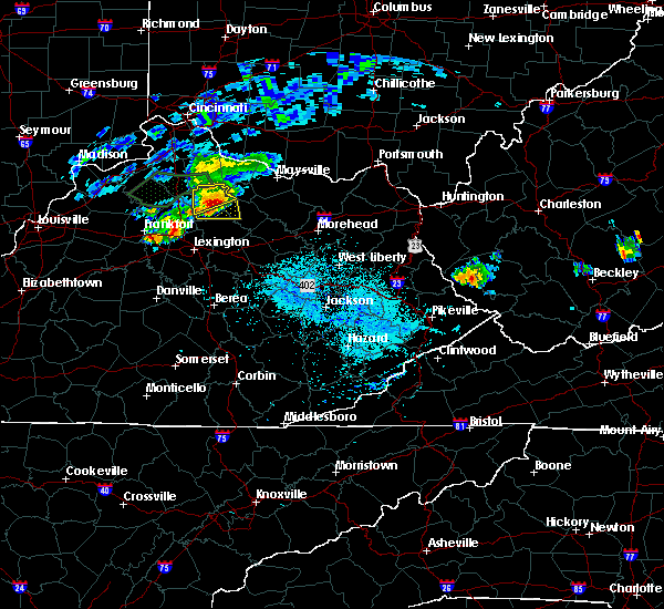 At 642 pm edt, a severe thunderstorm was located over cynthiana, moving east at 5 mph (radar indicated). Hazards include 60 mph wind gusts and quarter size hail. Hail damage to vehicles is expected. Expect wind damage to roofs, siding, and trees. At 642 pm edt, a severe thunderstorm was located over cynthiana, moving east at 5 mph (radar indicated). Hazards include 60 mph wind gusts and quarter size hail. Hail damage to vehicles is expected. Expect wind damage to roofs, siding, and trees.
|
| 8/31/2019 6:42 PM EDT |
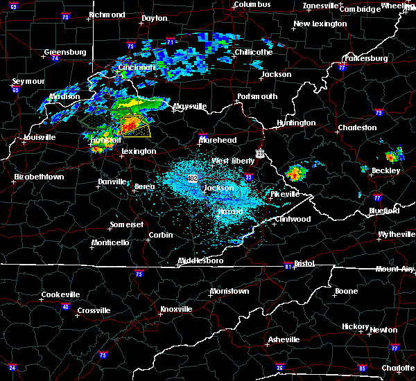 At 642 pm edt, a severe thunderstorm was located over cynthiana, moving east at 5 mph (radar indicated). Hazards include 60 mph wind gusts and quarter size hail. Hail damage to vehicles is expected. Expect wind damage to roofs, siding, and trees. At 642 pm edt, a severe thunderstorm was located over cynthiana, moving east at 5 mph (radar indicated). Hazards include 60 mph wind gusts and quarter size hail. Hail damage to vehicles is expected. Expect wind damage to roofs, siding, and trees.
|
| 7/2/2019 7:15 PM EDT |
 At 714 pm edt, severe thunderstorms were from sherburne to 6 miles north of paris, drifting southeast at 5 mph (radar indicated). Hazards include 60 mph wind gusts and penny size hail. expect damage to roofs, siding, and trees At 714 pm edt, severe thunderstorms were from sherburne to 6 miles north of paris, drifting southeast at 5 mph (radar indicated). Hazards include 60 mph wind gusts and penny size hail. expect damage to roofs, siding, and trees
|
| 7/2/2019 7:03 PM EDT |
 At 702 pm edt, severe thunderstorms were located from 6 miles northwest of bethel to near carlisle to 7 miles southeast of cynthiana, drifting south at 5 mph (radar indicated). Hazards include 60 mph wind gusts and half dollar size hail. Hail damage to vehicles is expected. expect wind damage to roofs, siding, and trees. Locations impacted include, carlisle, millersburg, jackstown, blacks crossroads, ruddels mills, headquarters, moorefield, myers, weston, and hooktown. At 702 pm edt, severe thunderstorms were located from 6 miles northwest of bethel to near carlisle to 7 miles southeast of cynthiana, drifting south at 5 mph (radar indicated). Hazards include 60 mph wind gusts and half dollar size hail. Hail damage to vehicles is expected. expect wind damage to roofs, siding, and trees. Locations impacted include, carlisle, millersburg, jackstown, blacks crossroads, ruddels mills, headquarters, moorefield, myers, weston, and hooktown.
|
| 7/2/2019 6:40 PM EDT |
 At 639 pm edt, severe thunderstorms were located from near cowan to 6 miles southeast of cynthiana, moving south at 15 mph (radar indicated). Hazards include 60 mph wind gusts and penny size hail. expect damage to roofs, siding, and trees At 639 pm edt, severe thunderstorms were located from near cowan to 6 miles southeast of cynthiana, moving south at 15 mph (radar indicated). Hazards include 60 mph wind gusts and penny size hail. expect damage to roofs, siding, and trees
|
| 6/16/2019 6:22 PM EDT |
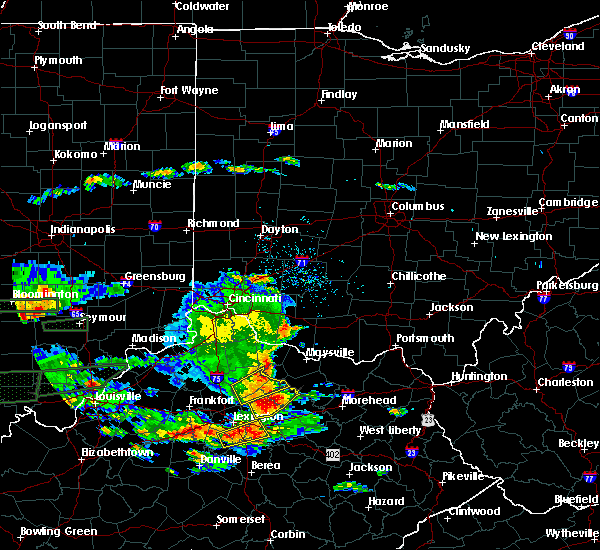 The severe thunderstorm warning for northwestern bourbon, northwestern nicholas and central harrison counties will expire at 630 pm edt, the storm which prompted the warning has weakened below severe limits, and no longer poses an immediate threat to life or property. therefore, the warning will be allowed to expire. however gusty winds and heavy rain are still possible with this thunderstorm. a severe thunderstorm watch remains in effect until 1100 pm edt for central kentucky. The severe thunderstorm warning for northwestern bourbon, northwestern nicholas and central harrison counties will expire at 630 pm edt, the storm which prompted the warning has weakened below severe limits, and no longer poses an immediate threat to life or property. therefore, the warning will be allowed to expire. however gusty winds and heavy rain are still possible with this thunderstorm. a severe thunderstorm watch remains in effect until 1100 pm edt for central kentucky.
|
| 6/16/2019 6:07 PM EDT |
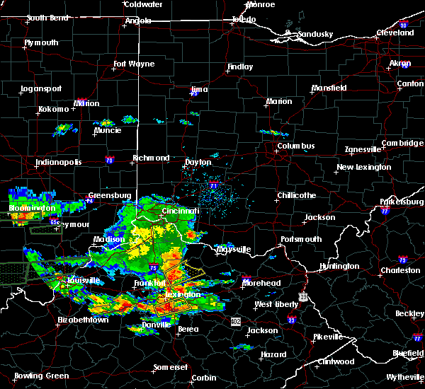 At 607 pm edt, a severe thunderstorm was located near cynthiana, moving northeast at 35 mph (radar indicated). Hazards include 60 mph wind gusts and quarter size hail. Hail damage to vehicles is expected. expect wind damage to roofs, siding, and trees. Locations impacted include, cynthiana, carlisle, millersburg, ellisville, colville, broadwell, currentsville, connersville, barefoot and blue licks springs. At 607 pm edt, a severe thunderstorm was located near cynthiana, moving northeast at 35 mph (radar indicated). Hazards include 60 mph wind gusts and quarter size hail. Hail damage to vehicles is expected. expect wind damage to roofs, siding, and trees. Locations impacted include, cynthiana, carlisle, millersburg, ellisville, colville, broadwell, currentsville, connersville, barefoot and blue licks springs.
|
| 6/16/2019 5:57 PM EDT |
 At 556 pm edt, a severe thunderstorm was located 9 miles northeast of georgetown, moving northeast at 40 mph (radar indicated). Hazards include 60 mph wind gusts and quarter size hail. Hail damage to vehicles is expected. Expect wind damage to roofs, siding, and trees. At 556 pm edt, a severe thunderstorm was located 9 miles northeast of georgetown, moving northeast at 40 mph (radar indicated). Hazards include 60 mph wind gusts and quarter size hail. Hail damage to vehicles is expected. Expect wind damage to roofs, siding, and trees.
|
| 6/5/2019 8:13 PM EDT |
 The national weather service in louisville has issued a * severe thunderstorm warning for. northeastern bourbon county in central kentucky. nicholas county in central kentucky. southeastern harrison county in central kentucky. Until 900 pm edt. The national weather service in louisville has issued a * severe thunderstorm warning for. northeastern bourbon county in central kentucky. nicholas county in central kentucky. southeastern harrison county in central kentucky. Until 900 pm edt.
|
| 8/11/2018 5:53 PM EDT |
 At 553 pm edt, a severe thunderstorm was located over paris, moving southeast at 25 mph (radar indicated). Hazards include 60 mph wind gusts and penny size hail. expect damage to roofs, siding, and trees At 553 pm edt, a severe thunderstorm was located over paris, moving southeast at 25 mph (radar indicated). Hazards include 60 mph wind gusts and penny size hail. expect damage to roofs, siding, and trees
|
| 7/20/2018 4:16 PM EDT |
 At 415 pm edt, a severe thunderstorm was located near paris, moving east at 35 mph (radar indicated). Hazards include 70 mph wind gusts and quarter size hail. Hail damage to vehicles is expected. expect considerable tree damage. wind damage is also likely to mobile homes, roofs, and outbuildings. locations impacted include, paris, carlisle, millersburg, north middletown, blacks crossroads, hutchison, leesburg, ellisville, stony point and colville. isolated wind gusts up to 80 mph are possible. A tornado watch remains in effect until 900 pm edt for central kentucky. At 415 pm edt, a severe thunderstorm was located near paris, moving east at 35 mph (radar indicated). Hazards include 70 mph wind gusts and quarter size hail. Hail damage to vehicles is expected. expect considerable tree damage. wind damage is also likely to mobile homes, roofs, and outbuildings. locations impacted include, paris, carlisle, millersburg, north middletown, blacks crossroads, hutchison, leesburg, ellisville, stony point and colville. isolated wind gusts up to 80 mph are possible. A tornado watch remains in effect until 900 pm edt for central kentucky.
|
| 7/20/2018 4:08 PM EDT |
 At 408 pm edt, a severe thunderstorm was located near paris, moving east at 35 mph (radar indicated). Hazards include 60 mph wind gusts and quarter size hail. Hail damage to vehicles is expected. Expect wind damage to roofs, siding, and trees. At 408 pm edt, a severe thunderstorm was located near paris, moving east at 35 mph (radar indicated). Hazards include 60 mph wind gusts and quarter size hail. Hail damage to vehicles is expected. Expect wind damage to roofs, siding, and trees.
|
| 7/5/2018 6:01 PM EDT |
 The national weather service in louisville has issued a * severe thunderstorm warning for. northeastern bourbon county in central kentucky. southern nicholas county in central kentucky. Until 615 pm edt * at 600 pm edt, a severe thunderstorm was located over carlisle,. The national weather service in louisville has issued a * severe thunderstorm warning for. northeastern bourbon county in central kentucky. southern nicholas county in central kentucky. Until 615 pm edt * at 600 pm edt, a severe thunderstorm was located over carlisle,.
|
| 6/26/2018 3:12 PM EDT |
 At 312 pm edt, severe thunderstorms were located along a line extending from 7 miles south of falmouth to paris, moving east at 45 mph (radar indicated). Hazards include 60 mph wind gusts. Expect damage to roofs, siding, and trees. Locations impacted include, paris, cynthiana, carlisle, breckinridge, millersburg, berry, blacks crossroads, ellisville, colville and currentsville. At 312 pm edt, severe thunderstorms were located along a line extending from 7 miles south of falmouth to paris, moving east at 45 mph (radar indicated). Hazards include 60 mph wind gusts. Expect damage to roofs, siding, and trees. Locations impacted include, paris, cynthiana, carlisle, breckinridge, millersburg, berry, blacks crossroads, ellisville, colville and currentsville.
|
| 6/26/2018 3:01 PM EDT |
 At 301 pm edt, severe thunderstorms were located along a line extending from 9 miles south of falmouth to 7 miles west of paris, moving east at 50 mph (radar indicated). Hazards include 60 mph wind gusts. expect damage to roofs, siding, and trees At 301 pm edt, severe thunderstorms were located along a line extending from 9 miles south of falmouth to 7 miles west of paris, moving east at 50 mph (radar indicated). Hazards include 60 mph wind gusts. expect damage to roofs, siding, and trees
|
| 5/31/2018 4:31 PM EDT |
 At 431 pm edt, severe thunderstorms were located along a line extending from near fairview to cat creek to 6 miles west of blackburn, moving east at 50 mph (radar indicated). Hazards include 60 mph wind gusts. Expect damage to roofs, siding, and trees. Locations impacted include, richmond, winchester, paris, cynthiana, carlisle, harris ferry, breckinridge, millersburg, north middletown and berry. At 431 pm edt, severe thunderstorms were located along a line extending from near fairview to cat creek to 6 miles west of blackburn, moving east at 50 mph (radar indicated). Hazards include 60 mph wind gusts. Expect damage to roofs, siding, and trees. Locations impacted include, richmond, winchester, paris, cynthiana, carlisle, harris ferry, breckinridge, millersburg, north middletown and berry.
|
| 5/31/2018 4:08 PM EDT |
 At 408 pm edt, severe thunderstorms were located along a line extending from 8 miles south of falmouth to near winchester to 7 miles northeast of lancaster, moving east at 50 mph (radar indicated). Hazards include 60 mph wind gusts. expect damage to roofs, siding, and trees At 408 pm edt, severe thunderstorms were located along a line extending from 8 miles south of falmouth to near winchester to 7 miles northeast of lancaster, moving east at 50 mph (radar indicated). Hazards include 60 mph wind gusts. expect damage to roofs, siding, and trees
|
| 5/31/2018 3:40 PM EDT |
 At 340 pm edt, severe thunderstorms were located along a line extending from 12 miles northwest of georgetown to 7 miles south of versailles to 8 miles northeast of springfield, moving east at 45 mph (radar indicated). Hazards include 60 mph wind gusts. expect damage to roofs, siding, and trees At 340 pm edt, severe thunderstorms were located along a line extending from 12 miles northwest of georgetown to 7 miles south of versailles to 8 miles northeast of springfield, moving east at 45 mph (radar indicated). Hazards include 60 mph wind gusts. expect damage to roofs, siding, and trees
|
| 8/2/2017 3:11 PM EDT |
 At 311 pm edt, a severe thunderstorm was located near carlisle, moving east at 15 mph (radar indicated). Hazards include 60 mph wind gusts and penny size hail. expect damage to roofs, siding, and trees At 311 pm edt, a severe thunderstorm was located near carlisle, moving east at 15 mph (radar indicated). Hazards include 60 mph wind gusts and penny size hail. expect damage to roofs, siding, and trees
|
| 6/18/2017 5:31 PM EDT |
 At 530 pm edt, severe thunderstorms were located along a line extending from 12 miles northeast of frankfort to 9 miles northwest of paris to near winchester, moving northeast at 45 mph (radar indicated. numerous trees reported down in lexington). Hazards include 60 mph wind gusts. expect damage to roofs, siding, and trees At 530 pm edt, severe thunderstorms were located along a line extending from 12 miles northeast of frankfort to 9 miles northwest of paris to near winchester, moving northeast at 45 mph (radar indicated. numerous trees reported down in lexington). Hazards include 60 mph wind gusts. expect damage to roofs, siding, and trees
|
| 4/5/2017 7:26 PM EDT |
 The severe thunderstorm warning for western bourbon and northern fayette counties will expire at 730 pm edt, the storms which prompted the warning have moved out of the area. therefore the warning will be allowed to expire. however gusty winds are still possible with these thunderstorms. in addition, a severe thunderstorm warning still remains in effect for bourbon county until 745 pm edt. report severe weather to local law enforcement, post your report to the national weather service louisville facebook page, or tweet your report using hashtag l, m, k, spotter. The severe thunderstorm warning for western bourbon and northern fayette counties will expire at 730 pm edt, the storms which prompted the warning have moved out of the area. therefore the warning will be allowed to expire. however gusty winds are still possible with these thunderstorms. in addition, a severe thunderstorm warning still remains in effect for bourbon county until 745 pm edt. report severe weather to local law enforcement, post your report to the national weather service louisville facebook page, or tweet your report using hashtag l, m, k, spotter.
|
| 4/5/2017 7:22 PM EDT |
 At 721 pm edt, severe thunderstorms were located along a line extending from near cynthiana to 9 miles west of carlisle to near bryan station, moving east at 65 mph (radar indicated). Hazards include 70 mph wind gusts and quarter size hail. Hail damage to vehicles is expected. expect considerable tree damage. Wind damage is also likely to mobile homes, roofs, and outbuildings. At 721 pm edt, severe thunderstorms were located along a line extending from near cynthiana to 9 miles west of carlisle to near bryan station, moving east at 65 mph (radar indicated). Hazards include 70 mph wind gusts and quarter size hail. Hail damage to vehicles is expected. expect considerable tree damage. Wind damage is also likely to mobile homes, roofs, and outbuildings.
|
| 4/5/2017 7:10 PM EDT |
 At 710 pm edt, severe thunderstorms were located along a line extending from 7 miles west of paris to highlands, moving east at 40 mph (trained weather spotters). Hazards include 70 mph wind gusts and quarter size hail. Hail damage to vehicles is expected. expect considerable tree damage. Wind damage is also likely to mobile homes, roofs, and outbuildings. At 710 pm edt, severe thunderstorms were located along a line extending from 7 miles west of paris to highlands, moving east at 40 mph (trained weather spotters). Hazards include 70 mph wind gusts and quarter size hail. Hail damage to vehicles is expected. expect considerable tree damage. Wind damage is also likely to mobile homes, roofs, and outbuildings.
|
| 3/1/2017 7:48 AM EST |
 At 747 am est, severe thunderstorms were located along a line extending from near lewisburg to near paris, moving east at 60 mph (radar indicated). Hazards include 60 mph wind gusts and penny size hail. Expect damage to roofs, siding, and trees. locations impacted include, paris, carlisle, millersburg, north middletown, blacks crossroads, ellisville, colville, moorefield, currentsville and barefoot. a tornado watch remains in effect until 900 am est for central kentucky. A tornado watch also remains in effect until 1100 am est for central kentucky. At 747 am est, severe thunderstorms were located along a line extending from near lewisburg to near paris, moving east at 60 mph (radar indicated). Hazards include 60 mph wind gusts and penny size hail. Expect damage to roofs, siding, and trees. locations impacted include, paris, carlisle, millersburg, north middletown, blacks crossroads, ellisville, colville, moorefield, currentsville and barefoot. a tornado watch remains in effect until 900 am est for central kentucky. A tornado watch also remains in effect until 1100 am est for central kentucky.
|
| 3/1/2017 7:34 AM EST |
 At 733 am est, severe thunderstorms were located along a line extending from 9 miles northwest of cowan to 8 miles east of georgetown, moving east at 60 mph (radar indicated). Hazards include 60 mph wind gusts and penny size hail. Expect damage to roofs, siding, and trees. locations impacted include, georgetown, paris, cynthiana, carlisle, breckinridge, millersburg, north middletown, berry, blacks crossroads and alberta. a tornado watch remains in effect until 900 am est for central kentucky. A tornado watch also remains in effect until 1100 am est for central kentucky. At 733 am est, severe thunderstorms were located along a line extending from 9 miles northwest of cowan to 8 miles east of georgetown, moving east at 60 mph (radar indicated). Hazards include 60 mph wind gusts and penny size hail. Expect damage to roofs, siding, and trees. locations impacted include, georgetown, paris, cynthiana, carlisle, breckinridge, millersburg, north middletown, berry, blacks crossroads and alberta. a tornado watch remains in effect until 900 am est for central kentucky. A tornado watch also remains in effect until 1100 am est for central kentucky.
|
| 3/1/2017 7:17 AM EST |
 At 717 am est, severe thunderstorms were located along a line extending from 6 miles southeast of falmouth to 9 miles northwest of georgetown, moving east at 65 mph (radar indicated). Hazards include 60 mph wind gusts and quarter size hail. Hail damage to vehicles is expected. Expect wind damage to roofs, siding, and trees. At 717 am est, severe thunderstorms were located along a line extending from 6 miles southeast of falmouth to 9 miles northwest of georgetown, moving east at 65 mph (radar indicated). Hazards include 60 mph wind gusts and quarter size hail. Hail damage to vehicles is expected. Expect wind damage to roofs, siding, and trees.
|
| 3/1/2017 5:24 AM EST |
 At 521 am est, severe thunderstorms were located along a line extending from 8 miles northwest of cowan to near carlisle, moving east at 55 mph (radar indicated). Hazards include 60 mph wind gusts and penny size hail. Expect damage to roofs, siding, and trees. Locations impacted include, carlisle, barefoot, morning glory, ellisville, pleasant valley, headquarters, hooktown, barterville, myers and blue licks springs. At 521 am est, severe thunderstorms were located along a line extending from 8 miles northwest of cowan to near carlisle, moving east at 55 mph (radar indicated). Hazards include 60 mph wind gusts and penny size hail. Expect damage to roofs, siding, and trees. Locations impacted include, carlisle, barefoot, morning glory, ellisville, pleasant valley, headquarters, hooktown, barterville, myers and blue licks springs.
|
| 3/1/2017 5:08 AM EST |
 At 507 am est, severe thunderstorms were located along a line extending from near cynthiana to 7 miles east of georgetown, moving east at 55 mph (radar indicated). Hazards include 60 mph wind gusts and penny size hail. expect damage to roofs, siding, and trees At 507 am est, severe thunderstorms were located along a line extending from near cynthiana to 7 miles east of georgetown, moving east at 55 mph (radar indicated). Hazards include 60 mph wind gusts and penny size hail. expect damage to roofs, siding, and trees
|
| 3/1/2017 3:55 AM EST |
 The severe thunderstorm warning for northeastern bourbon and western nicholas counties will expire at 400 am est, the storm which prompted the warning has weakened below severe limits, and have exited the warned area. therefore the warning will be allowed to expire. report severe weather to local law enforcement, post your report to the national weather service louisville facebook page, or tweet your report using hashtag l, m, k, spotter. The severe thunderstorm warning for northeastern bourbon and western nicholas counties will expire at 400 am est, the storm which prompted the warning has weakened below severe limits, and have exited the warned area. therefore the warning will be allowed to expire. report severe weather to local law enforcement, post your report to the national weather service louisville facebook page, or tweet your report using hashtag l, m, k, spotter.
|
| 3/1/2017 3:49 AM EST |
 At 348 am est, a severe thunderstorm was located near carlisle, moving east at 65 mph (radar indicated). Hazards include 60 mph wind gusts. Expect damage to roofs, siding, and trees. locations impacted include, paris, millersburg, currentsville, shawhan, blacks crossroads, ruddels mills, headquarters and hooktown. A tornado watch remains in effect until 500 am est for central kentucky. At 348 am est, a severe thunderstorm was located near carlisle, moving east at 65 mph (radar indicated). Hazards include 60 mph wind gusts. Expect damage to roofs, siding, and trees. locations impacted include, paris, millersburg, currentsville, shawhan, blacks crossroads, ruddels mills, headquarters and hooktown. A tornado watch remains in effect until 500 am est for central kentucky.
|
| 3/1/2017 3:42 AM EST |
 At 341 am est, a severe thunderstorm was located over paris, moving east at 65 mph (radar indicated). Hazards include 60 mph wind gusts. Expect damage to roofs, siding, and trees. locations impacted include, paris, millersburg, shawhan, jackstown, blacks crossroads, ruddels mills, headquarters, currentsville, ewalt crossroads and brentsville. A tornado watch remains in effect until 500 am est for central kentucky. At 341 am est, a severe thunderstorm was located over paris, moving east at 65 mph (radar indicated). Hazards include 60 mph wind gusts. Expect damage to roofs, siding, and trees. locations impacted include, paris, millersburg, shawhan, jackstown, blacks crossroads, ruddels mills, headquarters, currentsville, ewalt crossroads and brentsville. A tornado watch remains in effect until 500 am est for central kentucky.
|
| 3/1/2017 3:37 AM EST |
 At 336 am est, a severe thunderstorm was located 7 miles west of paris, moving east at 65 mph (radar indicated). Hazards include 60 mph wind gusts. Expect damage to roofs, siding, and trees. locations impacted include, georgetown, paris, millersburg, north middletown, spindletop estates, blacks crossroads, hutchison, leesburg, colville and broadwell. A tornado watch remains in effect until 500 am est for central kentucky. At 336 am est, a severe thunderstorm was located 7 miles west of paris, moving east at 65 mph (radar indicated). Hazards include 60 mph wind gusts. Expect damage to roofs, siding, and trees. locations impacted include, georgetown, paris, millersburg, north middletown, spindletop estates, blacks crossroads, hutchison, leesburg, colville and broadwell. A tornado watch remains in effect until 500 am est for central kentucky.
|
| 3/1/2017 3:26 AM EST |
 At 325 am est, a severe thunderstorm was located near georgetown, moving east at 55 mph (radar indicated). Hazards include 60 mph wind gusts. expect damage to roofs, siding, and trees At 325 am est, a severe thunderstorm was located near georgetown, moving east at 55 mph (radar indicated). Hazards include 60 mph wind gusts. expect damage to roofs, siding, and trees
|
| 7/14/2016 12:15 AM EDT |
 At 1215 am edt, a severe thunderstorm was located near carlisle, moving east at 35 mph (radar indicated). Hazards include 60 mph wind gusts. Expect damage to roofs. siding. And trees. At 1215 am edt, a severe thunderstorm was located near carlisle, moving east at 35 mph (radar indicated). Hazards include 60 mph wind gusts. Expect damage to roofs. siding. And trees.
|
| 6/23/2016 5:34 PM EDT |
 At 534 pm edt, severe thunderstorms were located along a line extending from 8 miles southeast of cynthiana to 6 miles south of paris, moving east at 40 mph (radar indicated). Hazards include 60 mph wind gusts and quarter size hail. Hail damage to vehicles is expected. Expect wind damage to roofs, siding, and trees. At 534 pm edt, severe thunderstorms were located along a line extending from 8 miles southeast of cynthiana to 6 miles south of paris, moving east at 40 mph (radar indicated). Hazards include 60 mph wind gusts and quarter size hail. Hail damage to vehicles is expected. Expect wind damage to roofs, siding, and trees.
|
| 6/21/2016 2:18 PM EDT |
 At 218 pm edt, severe thunderstorms were located along a line extending from near carlisle to near winchester, moving southeast at 40 mph (radar indicated). Hazards include 60 mph wind gusts and quarter size hail. Hail damage to vehicles is expected. expect wind damage to roofs, siding, and trees. Locations impacted include, lexington, winchester, paris, carlisle, millersburg, north middletown, clintonville, ruckerville, moorefield and sewell shop. At 218 pm edt, severe thunderstorms were located along a line extending from near carlisle to near winchester, moving southeast at 40 mph (radar indicated). Hazards include 60 mph wind gusts and quarter size hail. Hail damage to vehicles is expected. expect wind damage to roofs, siding, and trees. Locations impacted include, lexington, winchester, paris, carlisle, millersburg, north middletown, clintonville, ruckerville, moorefield and sewell shop.
|
| 6/21/2016 2:13 PM EDT |
 At 212 pm edt, severe thunderstorms were located along a line extending from 6 miles west of carlisle to near cadentown, moving southeast at 40 mph (radar indicated). Hazards include 60 mph wind gusts and quarter size hail. Hail damage to vehicles is expected. Expect wind damage to roofs, siding, and trees. At 212 pm edt, severe thunderstorms were located along a line extending from 6 miles west of carlisle to near cadentown, moving southeast at 40 mph (radar indicated). Hazards include 60 mph wind gusts and quarter size hail. Hail damage to vehicles is expected. Expect wind damage to roofs, siding, and trees.
|
| 6/2/2016 5:59 PM EDT |
 At 559 pm edt, a severe thunderstorm was located near paris, moving northeast at 20 mph (radar indicated). Hazards include 60 mph wind gusts and penny size hail. Expect damage to roofs. siding. and trees. Locations impacted include, paris, millersburg, morning glory, colville, shawhan, brentsville, kiserton, ruddels mills, barterville and hooktown. At 559 pm edt, a severe thunderstorm was located near paris, moving northeast at 20 mph (radar indicated). Hazards include 60 mph wind gusts and penny size hail. Expect damage to roofs. siding. and trees. Locations impacted include, paris, millersburg, morning glory, colville, shawhan, brentsville, kiserton, ruddels mills, barterville and hooktown.
|
| 6/2/2016 5:43 PM EDT |
 At 543 pm edt, a severe thunderstorm was located over paris, moving northeast at 20 mph (radar indicated). Hazards include 60 mph wind gusts and quarter size hail. Hail damage to vehicles is expected. Expect wind damage to roofs, siding, and trees. At 543 pm edt, a severe thunderstorm was located over paris, moving northeast at 20 mph (radar indicated). Hazards include 60 mph wind gusts and quarter size hail. Hail damage to vehicles is expected. Expect wind damage to roofs, siding, and trees.
|
| 6/1/2016 9:05 PM EDT |
 At 905 pm edt, a severe thunderstorm was located 8 miles east of cynthiana, moving east at 20 mph (radar indicated). Hazards include 60 mph wind gusts and quarter size hail. Hail damage to vehicles is expected. Expect wind damage to roofs, siding, and trees. At 905 pm edt, a severe thunderstorm was located 8 miles east of cynthiana, moving east at 20 mph (radar indicated). Hazards include 60 mph wind gusts and quarter size hail. Hail damage to vehicles is expected. Expect wind damage to roofs, siding, and trees.
|
| 5/1/2016 5:25 PM EDT |
 At 524 pm edt, a severe thunderstorm was located near carlisle, moving east at 35 mph (radar indicated). Hazards include 60 mph wind gusts and nickel size hail. Expect damage to roofs. siding. and trees. Locations impacted include, carlisle, morning glory, ellisville, myers, barefoot, barterville, hooktown, headquarters, pleasant valley and blue licks springs. At 524 pm edt, a severe thunderstorm was located near carlisle, moving east at 35 mph (radar indicated). Hazards include 60 mph wind gusts and nickel size hail. Expect damage to roofs. siding. and trees. Locations impacted include, carlisle, morning glory, ellisville, myers, barefoot, barterville, hooktown, headquarters, pleasant valley and blue licks springs.
|
| 5/1/2016 5:13 PM EDT |
 At 512 pm edt, a severe thunderstorm was located near cynthiana, moving east at 45 mph (radar indicated). Hazards include 60 mph wind gusts and nickel size hail. Expect damage to roofs. siding. And trees. At 512 pm edt, a severe thunderstorm was located near cynthiana, moving east at 45 mph (radar indicated). Hazards include 60 mph wind gusts and nickel size hail. Expect damage to roofs. siding. And trees.
|
| 5/1/2016 5:09 PM EDT |
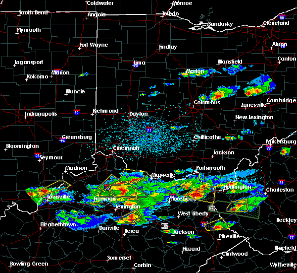 At 508 pm edt, a severe thunderstorm was located over cynthiana, moving east at 50 mph (radar indicated). Hazards include 60 mph wind gusts and nickel size hail. Expect damage to roofs. siding. and trees. Locations impacted include, cynthiana, carlisle, millersburg, morning glory, colville, lair, venus, hooktown, headquarters and oddville. At 508 pm edt, a severe thunderstorm was located over cynthiana, moving east at 50 mph (radar indicated). Hazards include 60 mph wind gusts and nickel size hail. Expect damage to roofs. siding. and trees. Locations impacted include, cynthiana, carlisle, millersburg, morning glory, colville, lair, venus, hooktown, headquarters and oddville.
|
| 5/1/2016 5:00 PM EDT |
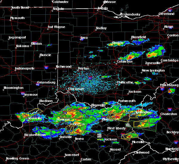 At 459 pm edt, a severe thunderstorm was located near cynthiana, moving east at 35 mph. there is also a flash flood warning for most of the area through 715 pm edt (radar indicated). Hazards include 60 mph wind gusts and quarter size hail. Hail damage to vehicles is expected. expect wind damage to roofs, siding, and trees. Locations impacted include, cynthiana, carlisle, breckinridge, millersburg, morning glory, colville, lair, broadwell, venus and oddville. At 459 pm edt, a severe thunderstorm was located near cynthiana, moving east at 35 mph. there is also a flash flood warning for most of the area through 715 pm edt (radar indicated). Hazards include 60 mph wind gusts and quarter size hail. Hail damage to vehicles is expected. expect wind damage to roofs, siding, and trees. Locations impacted include, cynthiana, carlisle, breckinridge, millersburg, morning glory, colville, lair, broadwell, venus and oddville.
|
| 5/1/2016 4:37 PM EDT |
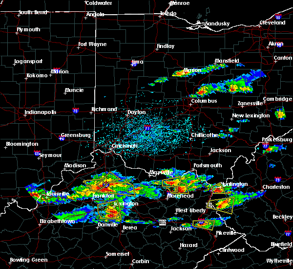 At 435 pm edt, a severe thunderstorm was located 12 miles north of georgetown, moving east southeast at 45 mph (radar indicated). Hazards include 60 mph wind gusts and quarter size hail. Hail damage to vehicles is expected. Expect wind damage to roofs, siding, and trees. At 435 pm edt, a severe thunderstorm was located 12 miles north of georgetown, moving east southeast at 45 mph (radar indicated). Hazards include 60 mph wind gusts and quarter size hail. Hail damage to vehicles is expected. Expect wind damage to roofs, siding, and trees.
|
| 12/23/2015 9:31 PM EST | At 931 pm est, a severe thunderstorm was located over cowan, moving east at 60 mph (radar indicated). Hazards include 60 mph wind gusts. Expect damage to roofs. siding and trees. Locations impacted include, paris, cynthiana, carlisle, millersburg, north middletown, clintonville, morning glory, colville, lair, myers, venus, oddville, moorefield, little rock, ruddels mills, us route 62 at state route 19, currentsville, ellisville, austerlitz and brentsville. |
| 12/23/2015 9:19 PM EST | A severe thunderstorm warning remains in effect until 945 pm est for northern fayette. nicholas. eastern harrison. bourbon and southeastern scott counties. at 919 pm est. a severe thunderstorm was located near carlisle. moving east at 60 mph. hazard. 60 mph wind gusts. |
| 12/23/2015 8:59 PM EST | At 859 pm est, a severe thunderstorm was located near georgetown, moving east at 60 mph (radar indicated). Hazards include 60 mph wind gusts. Expect damage to roofs. Siding and trees. |
| 7/19/2015 4:30 PM EDT |
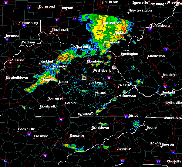 At 429 pm edt, a severe thunderstorm was located 5 miles east of cynthiana, and moving east at 20 mph (radar indicated). Hazards include 60 mph wind gusts and quarter size hail. Hail damage to vehicles is expected. expect wind damage to roofs, siding and trees. Locations impacted include, buena vista, morning glory, hooktown, millersburg, headquarters, barterville, barefoot, ellisville and blacks crossroads. At 429 pm edt, a severe thunderstorm was located 5 miles east of cynthiana, and moving east at 20 mph (radar indicated). Hazards include 60 mph wind gusts and quarter size hail. Hail damage to vehicles is expected. expect wind damage to roofs, siding and trees. Locations impacted include, buena vista, morning glory, hooktown, millersburg, headquarters, barterville, barefoot, ellisville and blacks crossroads.
|
| 7/19/2015 4:11 PM EDT |
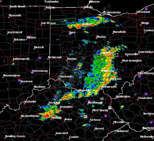 At 410 pm edt, a severe thunderstorm was located near cynthiana, and moving east at 20 mph (radar indicated). Hazards include 60 mph wind gusts and quarter size hail. Hail damage to vehicles is expected. Expect wind damage to roofs, siding and trees. At 410 pm edt, a severe thunderstorm was located near cynthiana, and moving east at 20 mph (radar indicated). Hazards include 60 mph wind gusts and quarter size hail. Hail damage to vehicles is expected. Expect wind damage to roofs, siding and trees.
|
| 7/14/2015 1:59 AM EDT |
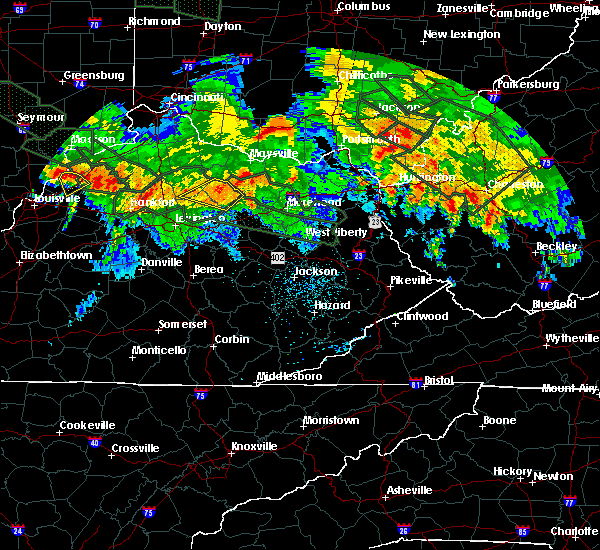 At 157 am edt, a severe thunderstorm was located near carlisle, and moving southeast at 30 mph (radar indicated). Hazards include 60 mph wind gusts. Expect damage to roofs. siding and trees. Locations impacted include, weston, east union, moorefield, sprout and milltown. At 157 am edt, a severe thunderstorm was located near carlisle, and moving southeast at 30 mph (radar indicated). Hazards include 60 mph wind gusts. Expect damage to roofs. siding and trees. Locations impacted include, weston, east union, moorefield, sprout and milltown.
|
| 7/14/2015 1:50 AM EDT |
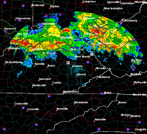 At 150 am edt, a severe thunderstorm was located near carlisle, and moving southeast at 30 mph (radar indicated). Hazards include 60 mph wind gusts. Expect damage to roofs. siding and trees. Locations impacted include, carlisle, jackstown, pleasant valley, myers, weston, east union, moorefield, sprout and milltown. At 150 am edt, a severe thunderstorm was located near carlisle, and moving southeast at 30 mph (radar indicated). Hazards include 60 mph wind gusts. Expect damage to roofs. siding and trees. Locations impacted include, carlisle, jackstown, pleasant valley, myers, weston, east union, moorefield, sprout and milltown.
|
| 7/14/2015 1:37 AM EDT |
 At 136 am edt, a severe thunderstorm was located 9 miles east of cynthiana, and moving southeast at 30 mph (radar indicated). Hazards include 60 mph wind gusts. Expect damage to roofs. Siding and trees. At 136 am edt, a severe thunderstorm was located 9 miles east of cynthiana, and moving southeast at 30 mph (radar indicated). Hazards include 60 mph wind gusts. Expect damage to roofs. Siding and trees.
|
| 7/13/2015 2:42 PM EDT |
 At 240 pm edt, severe thunderstorms were located along a line extending from 9 miles northwest of carlisle to cynthiana to 8 miles north of georgetown, and moving southeast at 40 mph (radar indicated). Hazards include 70 mph wind gusts. Expect considerable tree damage. Damage is likely to mobile homes, roofs and outbuildings. At 240 pm edt, severe thunderstorms were located along a line extending from 9 miles northwest of carlisle to cynthiana to 8 miles north of georgetown, and moving southeast at 40 mph (radar indicated). Hazards include 70 mph wind gusts. Expect considerable tree damage. Damage is likely to mobile homes, roofs and outbuildings.
|
| 7/13/2015 2:21 PM EDT |
 At 219 pm edt, severe thunderstorms were located along a line extending from 6 miles southwest of brooksville to 8 miles southeast of williamstown to 8 miles east of owenton, and moving south at 50 mph (radar indicated). Hazards include 60 mph wind gusts and quarter size hail. Hail damage to vehicles is expected. Expect wind damage to roofs, siding and trees. At 219 pm edt, severe thunderstorms were located along a line extending from 6 miles southwest of brooksville to 8 miles southeast of williamstown to 8 miles east of owenton, and moving south at 50 mph (radar indicated). Hazards include 60 mph wind gusts and quarter size hail. Hail damage to vehicles is expected. Expect wind damage to roofs, siding and trees.
|
| 7/10/2015 1:00 PM EDT |
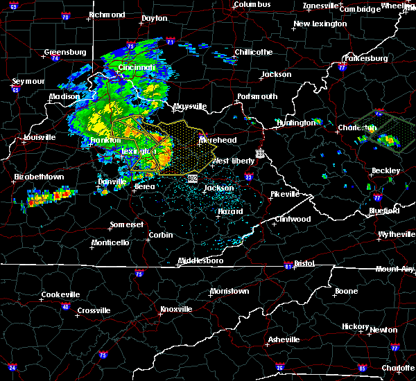 At 1258 pm edt, severe thunderstorms were located along a line extending from 10 miles southeast of williamstown to carlisle to 5 miles southwest of sharpsburg to 8 miles southeast of winchester, and moving east at 30 mph (radar indicated). Hazards include 60 mph wind gusts. Expect damage to roofs. siding and trees. Locations impacted include, garnett, robinson, colemansville, berry, oddville, kiddville and kelat. At 1258 pm edt, severe thunderstorms were located along a line extending from 10 miles southeast of williamstown to carlisle to 5 miles southwest of sharpsburg to 8 miles southeast of winchester, and moving east at 30 mph (radar indicated). Hazards include 60 mph wind gusts. Expect damage to roofs. siding and trees. Locations impacted include, garnett, robinson, colemansville, berry, oddville, kiddville and kelat.
|
| 7/10/2015 12:44 PM EDT |
 At 1240 pm edt, severe thunderstorms were located along a line extending from 12 miles southeast of owenton to paris to 7 miles north of winchester to 7 miles south of winchester, and moving east at 30 mph (radar indicated). Hazards include 60 mph wind gusts. Expect damage to roofs. siding and trees. Locations impacted include, cynthiana, lair, north middletown, ruddels mills, hinton, hunt, franklin, pinchem, blacks crossroads, bloomingdale, haggard, mount zion, rutland, millersburg, cotton branch, little rock, renaker, ruckerville, breckinridge and colville. At 1240 pm edt, severe thunderstorms were located along a line extending from 12 miles southeast of owenton to paris to 7 miles north of winchester to 7 miles south of winchester, and moving east at 30 mph (radar indicated). Hazards include 60 mph wind gusts. Expect damage to roofs. siding and trees. Locations impacted include, cynthiana, lair, north middletown, ruddels mills, hinton, hunt, franklin, pinchem, blacks crossroads, bloomingdale, haggard, mount zion, rutland, millersburg, cotton branch, little rock, renaker, ruckerville, breckinridge and colville.
|
| 7/10/2015 12:19 PM EDT |
 At 1217 pm edt, severe thunderstorms were located along a line extending from 9 miles south of owenton to 7 miles east of georgetown to bryan station to 6 miles west of danville, and moving east at 30 mph (radar indicated). Hazards include 60 mph wind gusts. Expect damage to roofs. Siding and trees. At 1217 pm edt, severe thunderstorms were located along a line extending from 9 miles south of owenton to 7 miles east of georgetown to bryan station to 6 miles west of danville, and moving east at 30 mph (radar indicated). Hazards include 60 mph wind gusts. Expect damage to roofs. Siding and trees.
|
| 4/2/2015 6:17 PM EDT | The national weather service in louisville has issued a * severe thunderstorm warning for. eastern bourbon county in east central kentucky. clark county in east central kentucky. southern nicholas county in east central kentucky. Until 635 pm edt. |
| 12/21/2013 11:55 PM EST | Nicholas county mesonet measured 67.2 mph wind gust in nicholas county KY, 0.9 miles WSW of Millersburg, KY |
| 12/21/2013 11:44 PM EST | Barn destroyed and several trees uprooted snapped. neighbors barn gone as well as several tree in bourbon county KY, 3.2 miles ESE of Millersburg, KY |
| 7/26/2012 6:40 PM EDT | Large tree down on jackstown road about 6 miles off hwy. 6 in bourbon county KY, 3.8 miles N of Millersburg, KY |
| 1/1/0001 12:00 AM | A few trees down in bourbon county KY, 3.6 miles NNW of Millersburg, KY |
| 1/1/0001 12:00 AM | Golf Ball sized hail reported 0.5 miles NE of Millersburg, KY |
| 1/1/0001 12:00 AM | Quarter sized hail reported 0.5 miles NE of Millersburg, KY |
| 1/1/0001 12:00 AM | Baseball sized hail reported 0.5 miles NE of Millersburg, KY |
Hail Maps for Millersburg, KY
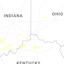


Connect with Interactive Hail Maps