

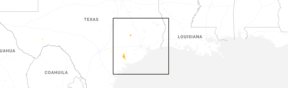
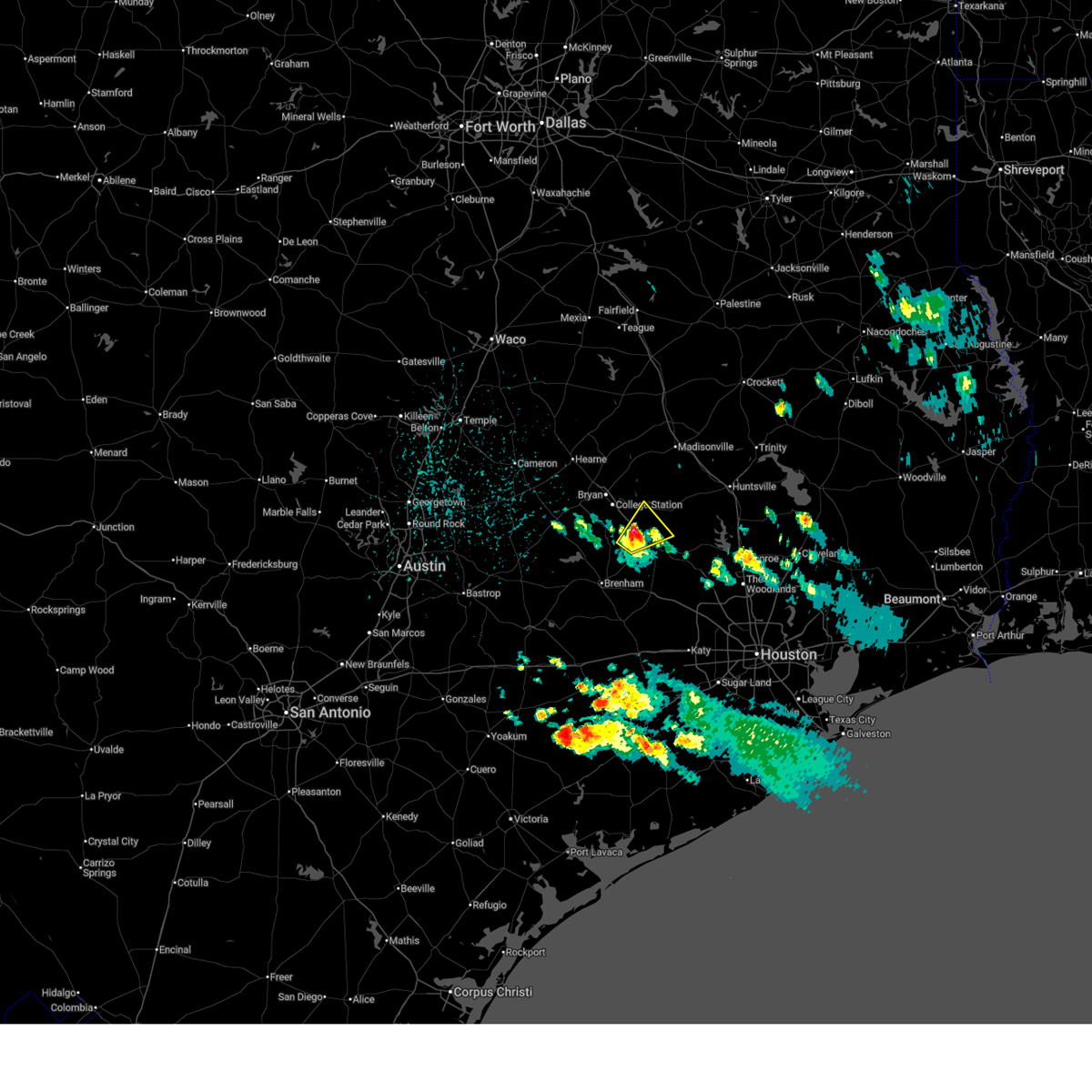
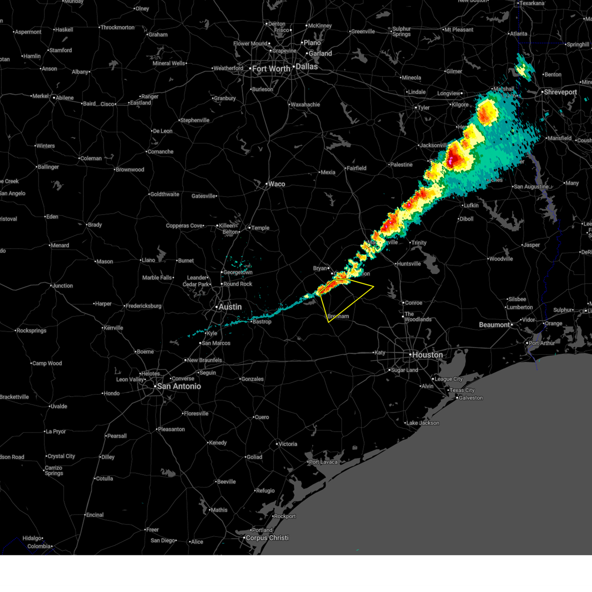
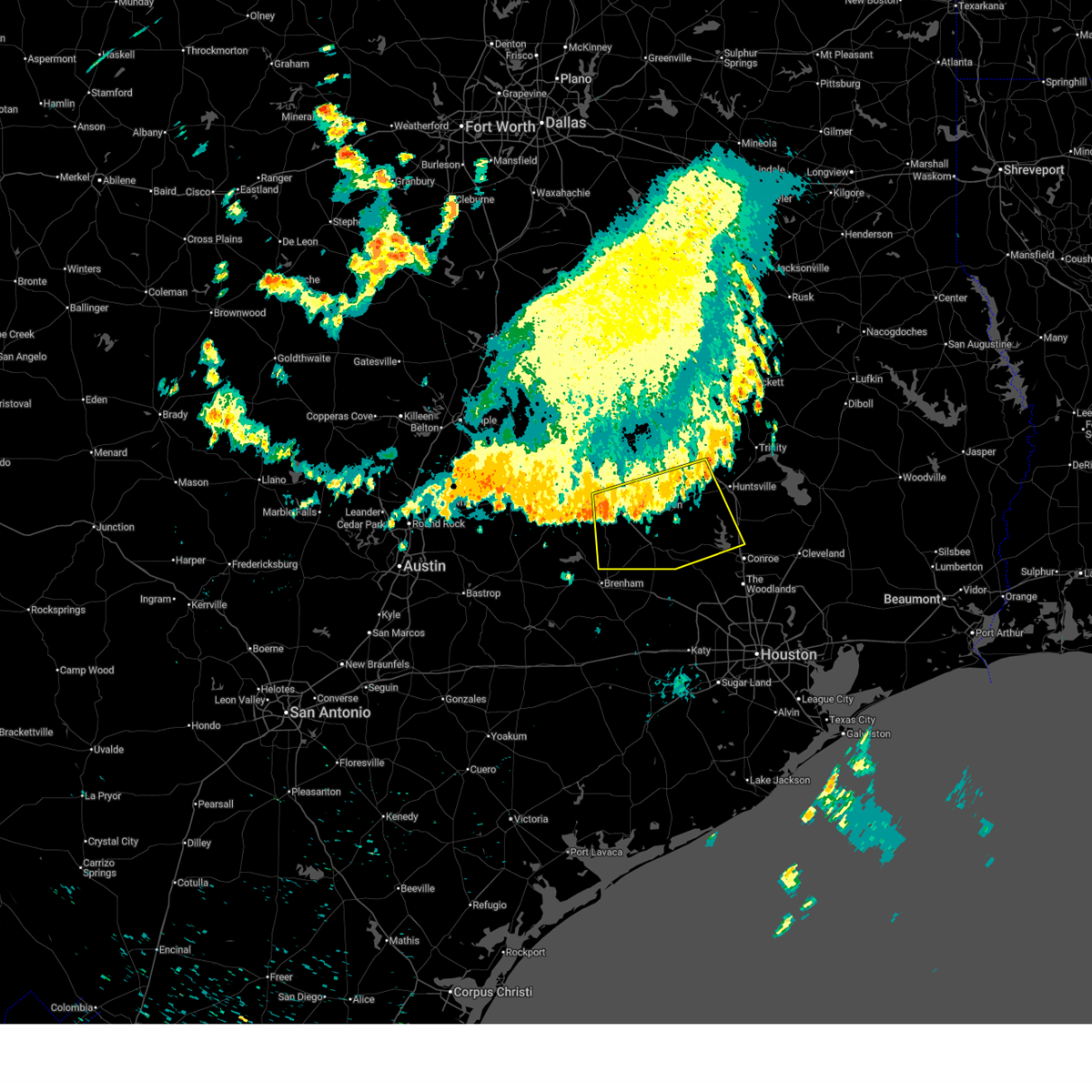
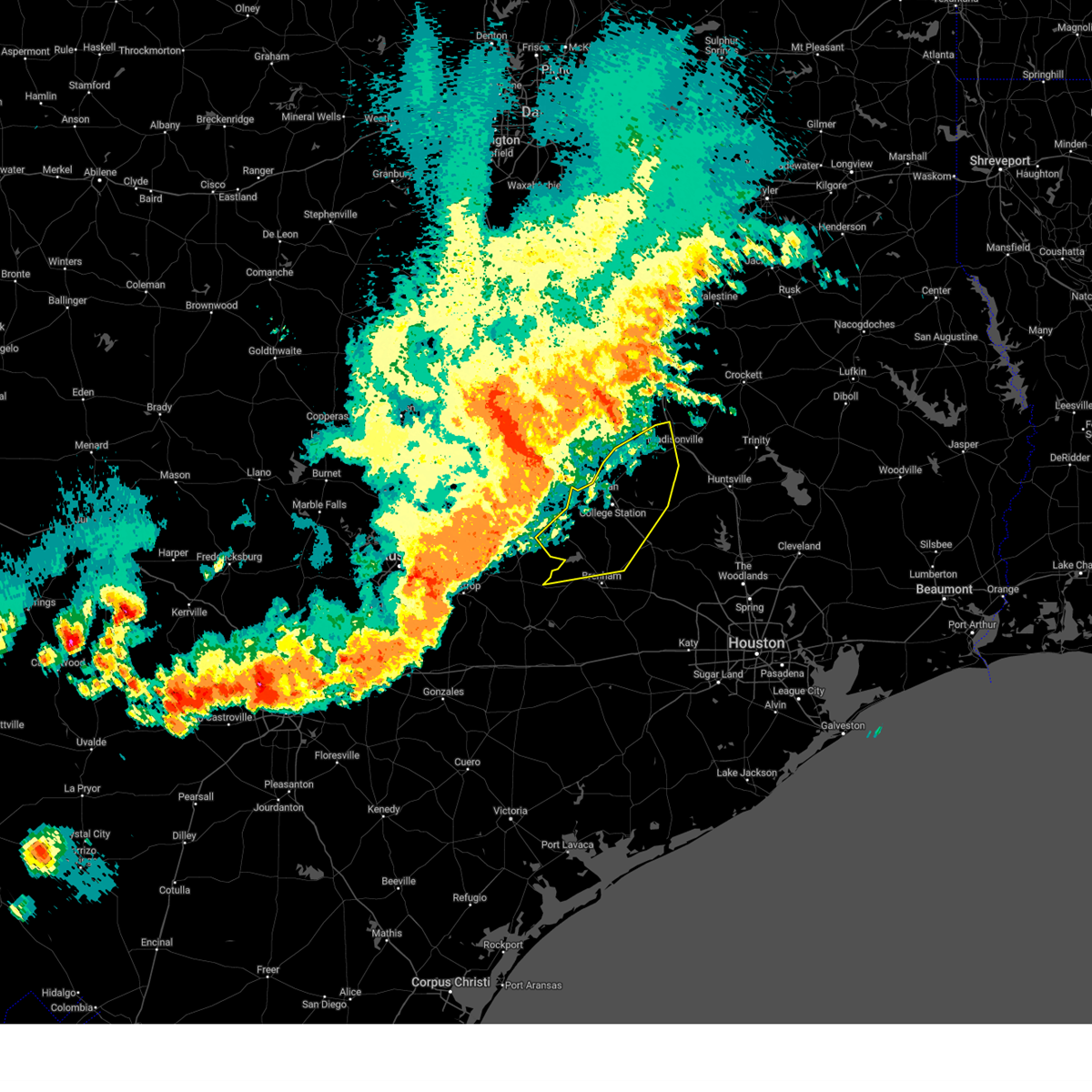
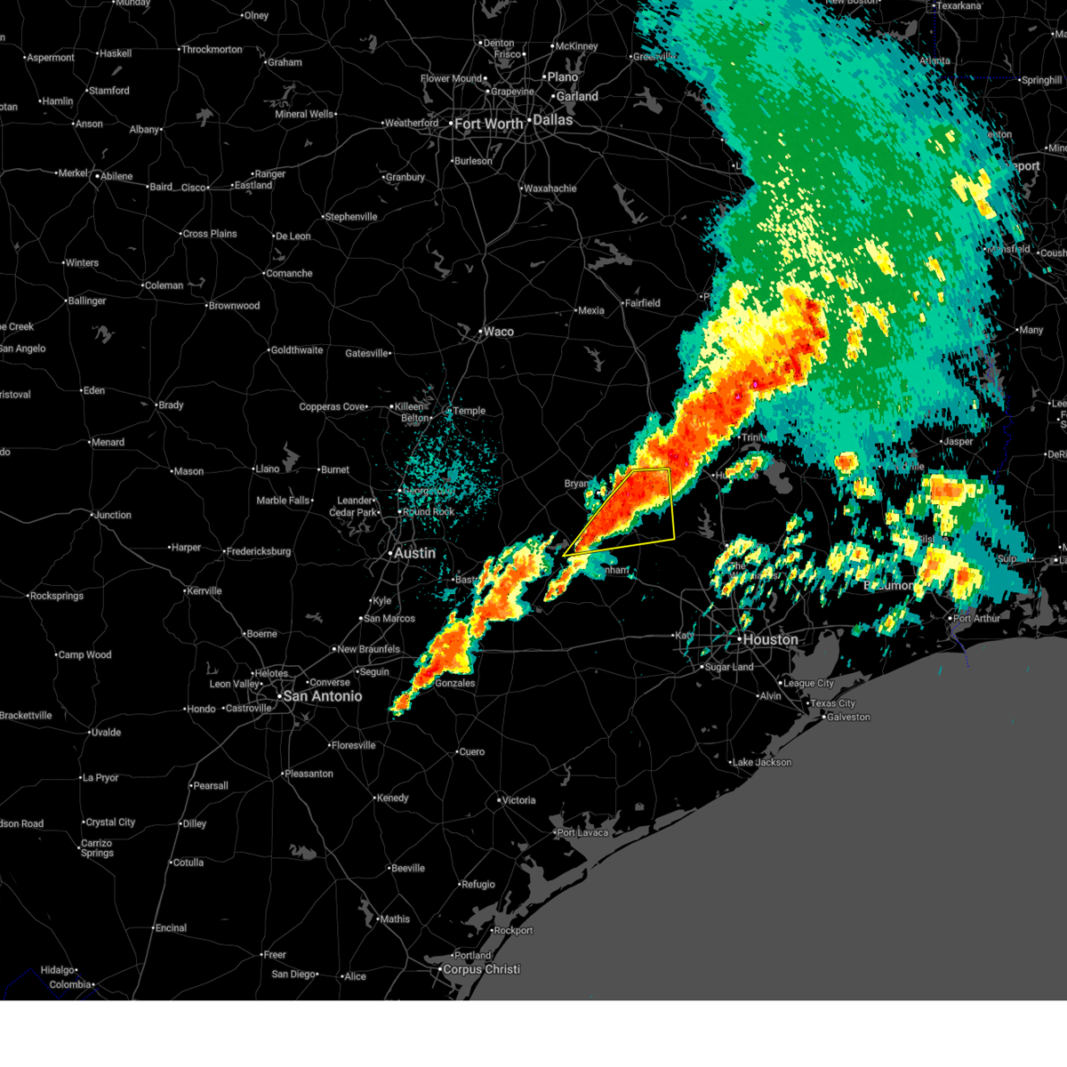
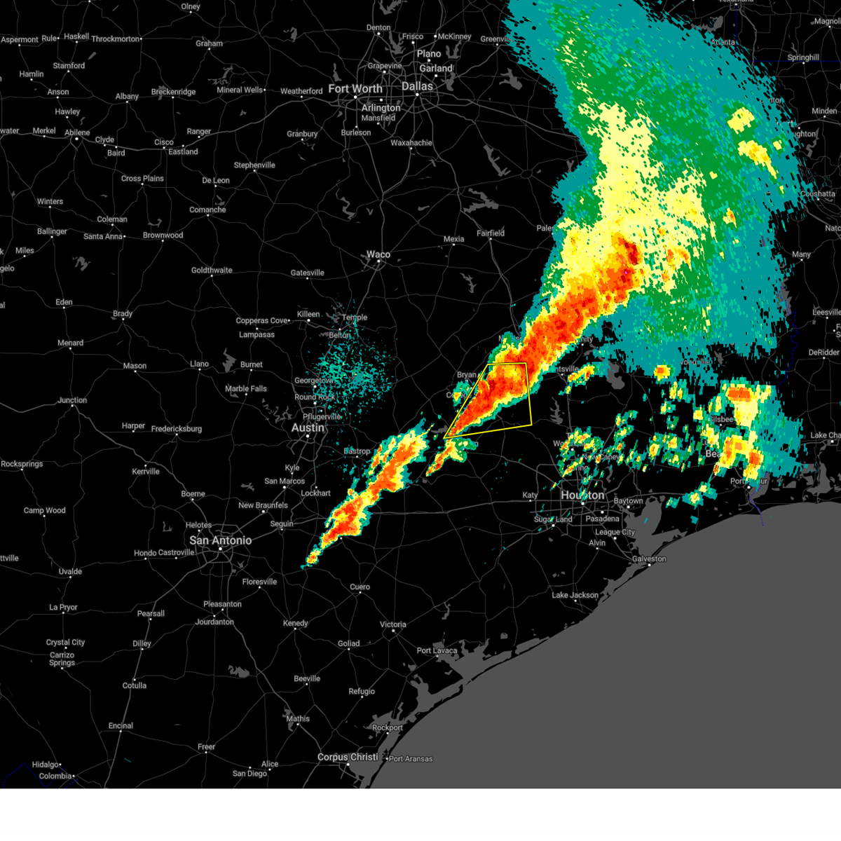
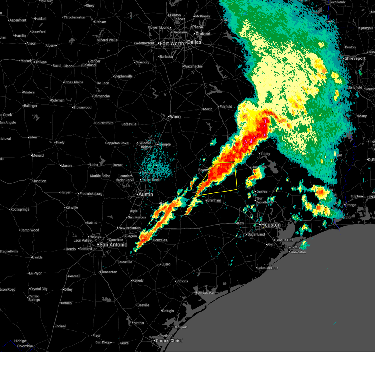
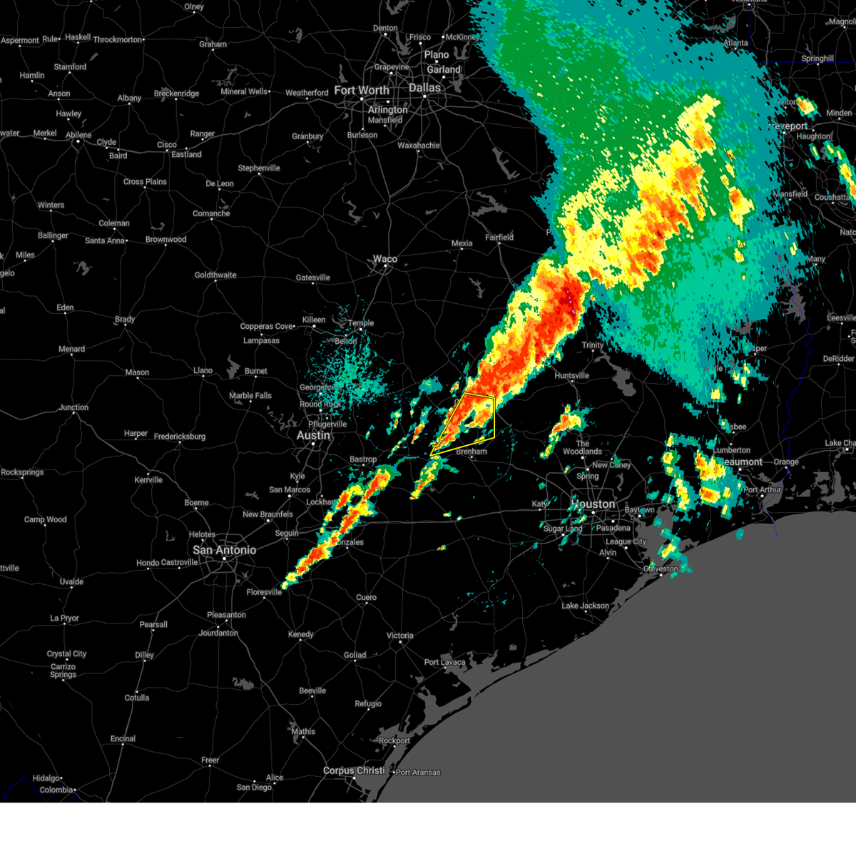
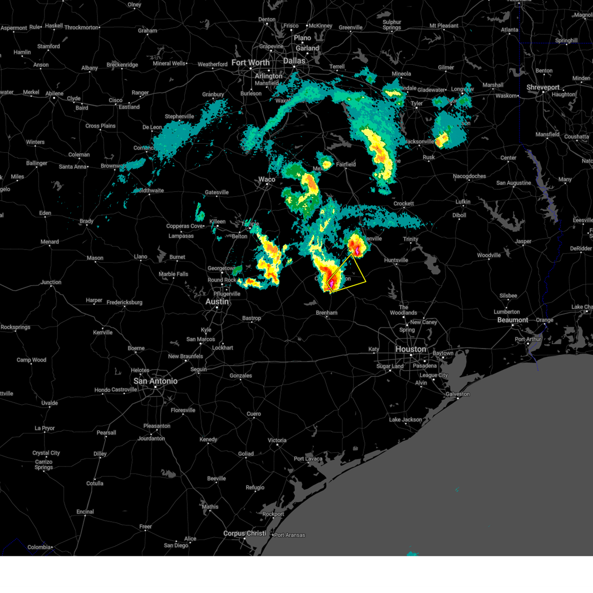
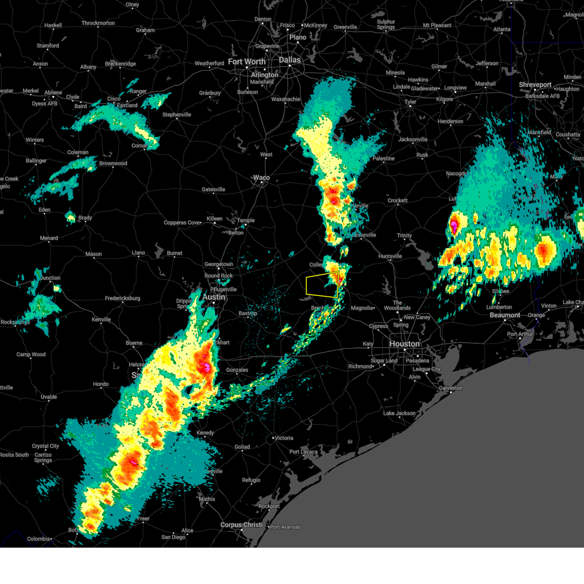
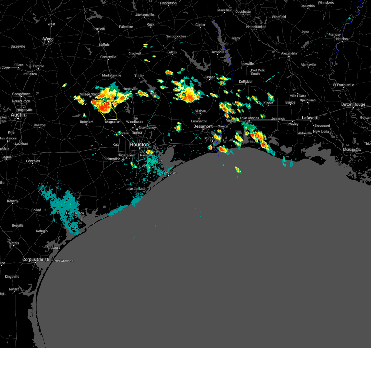
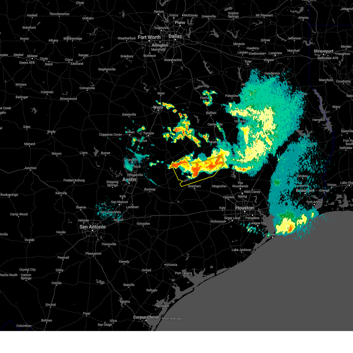
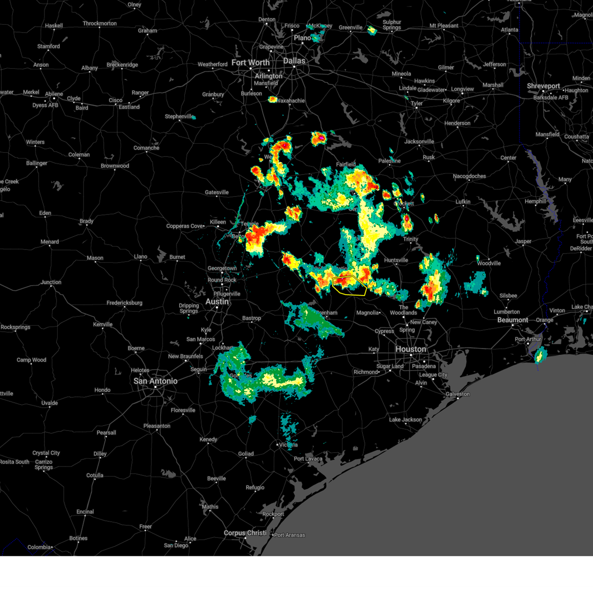
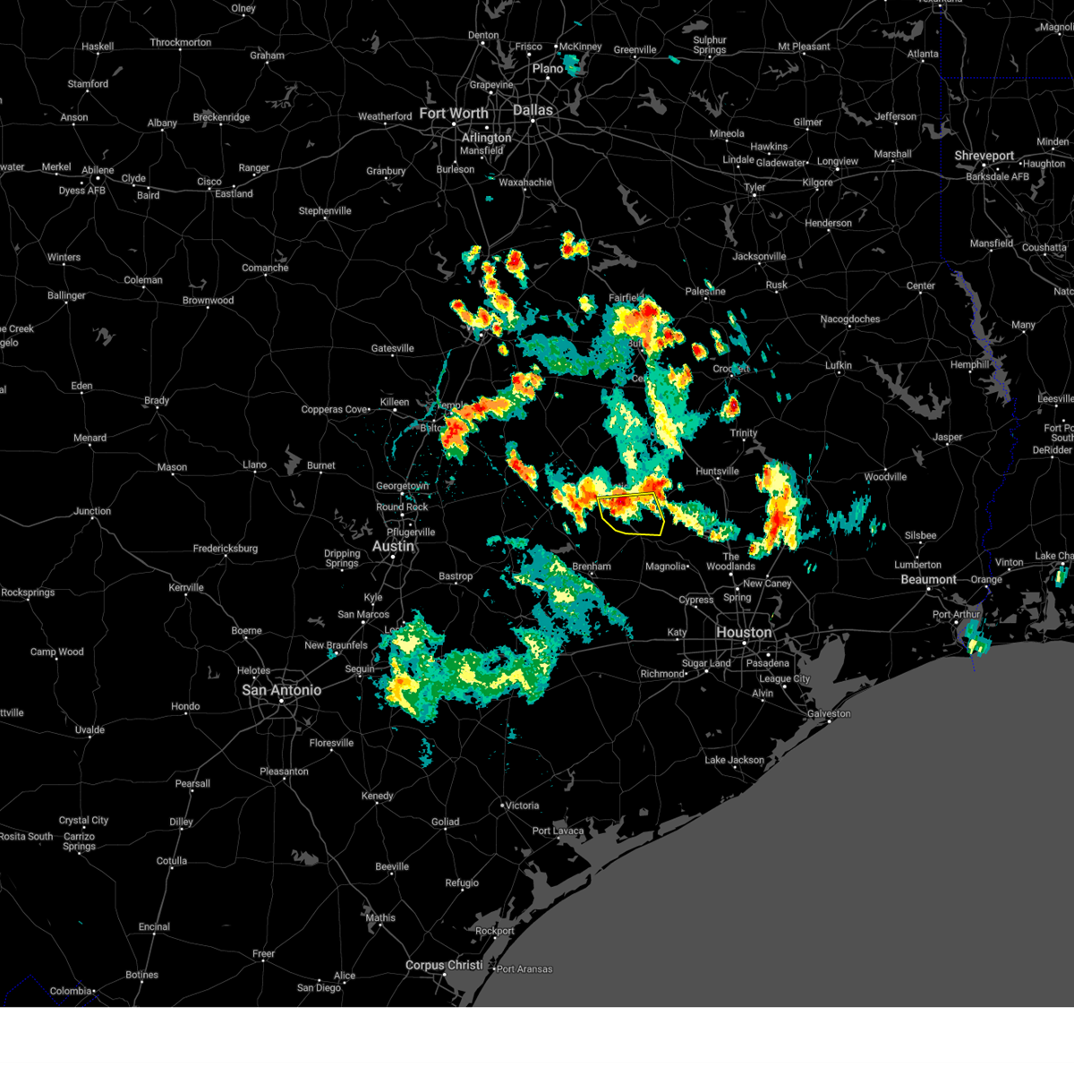
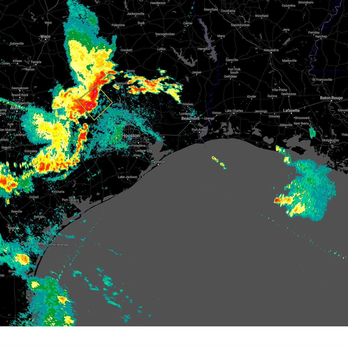
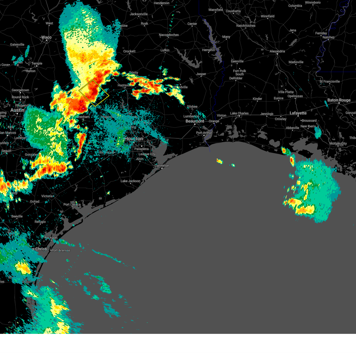
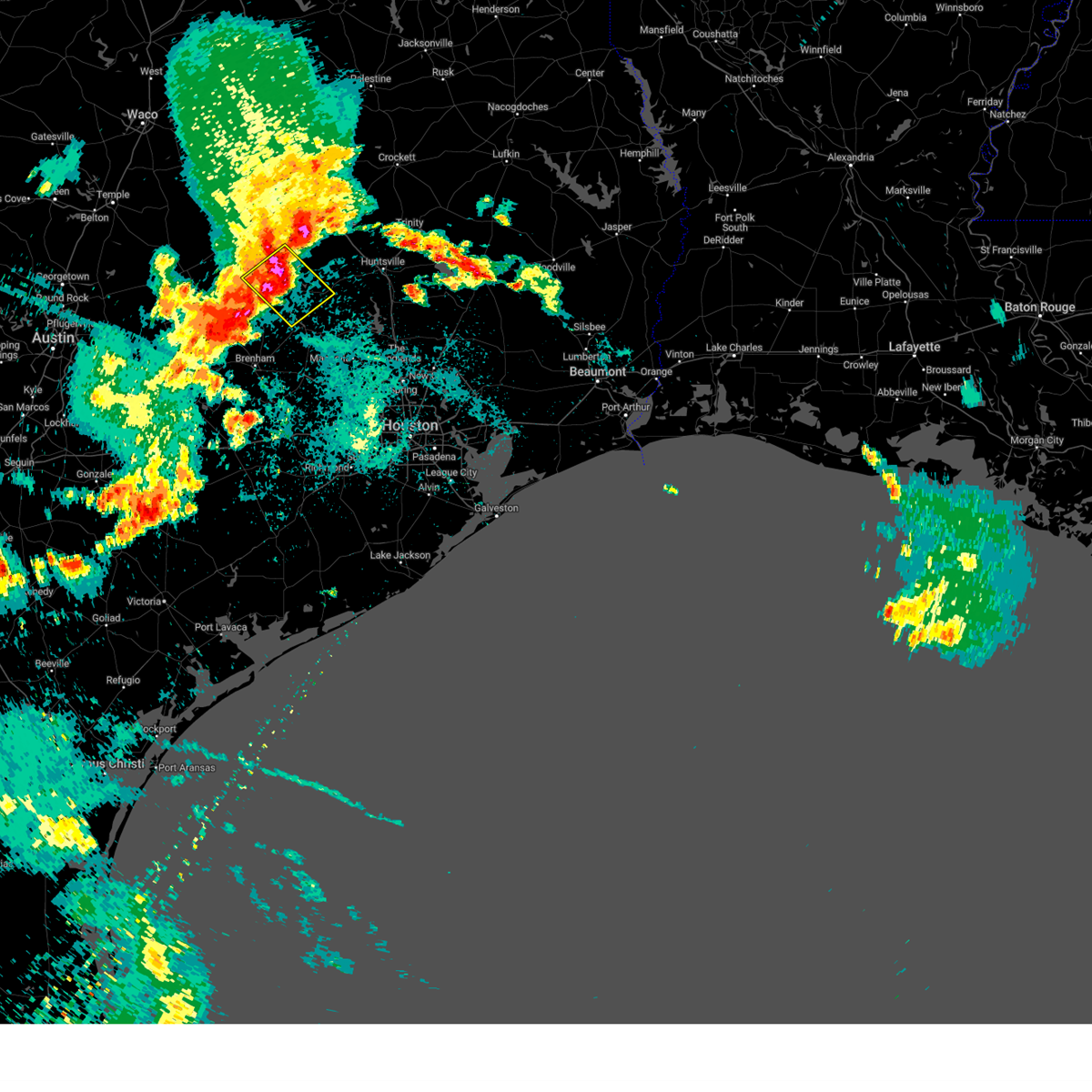
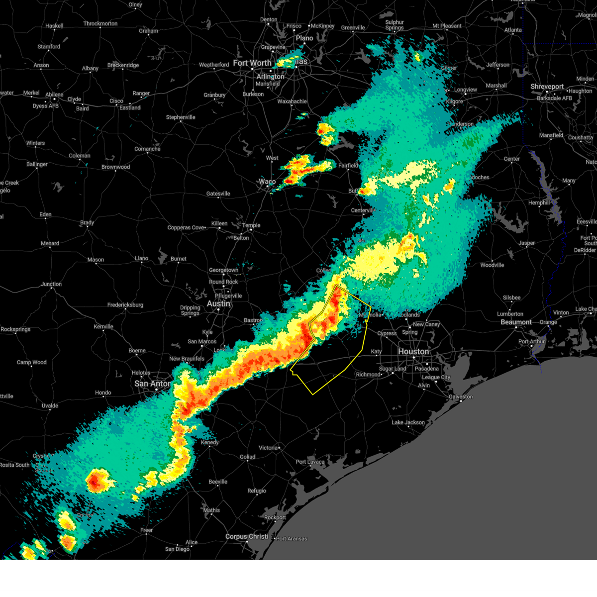
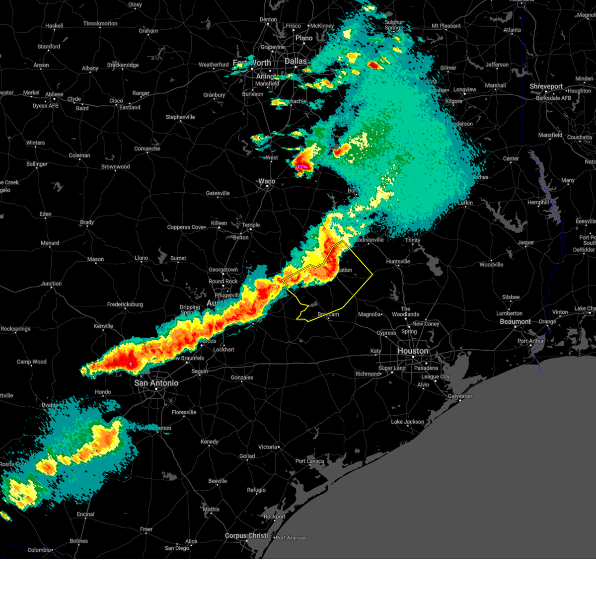
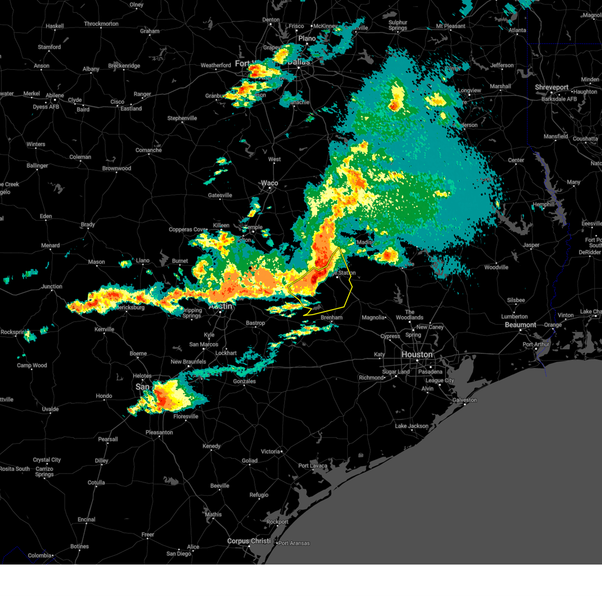
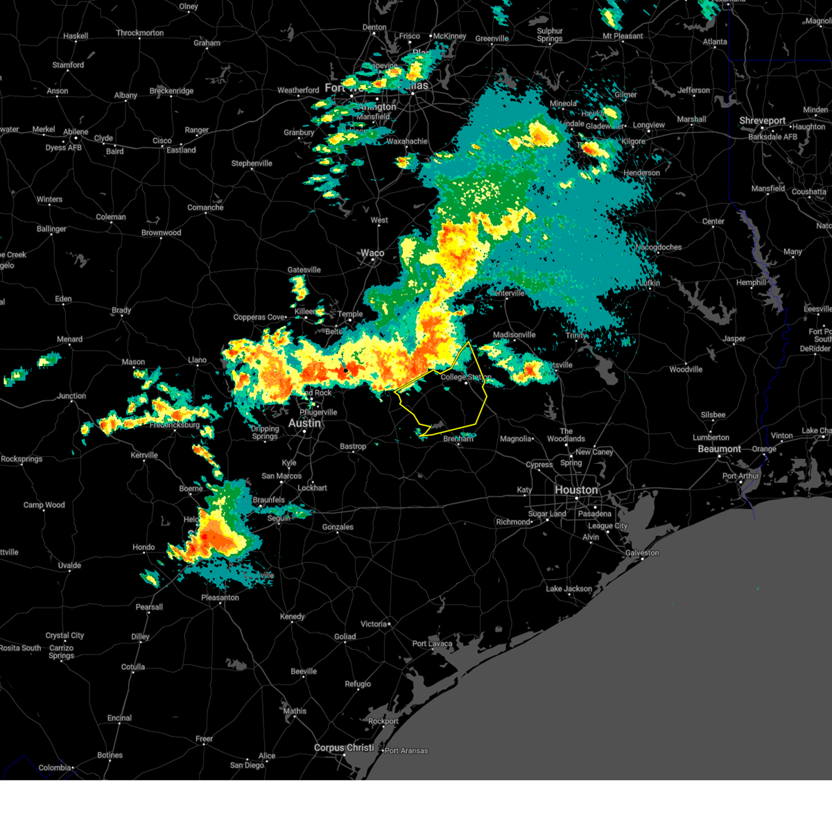
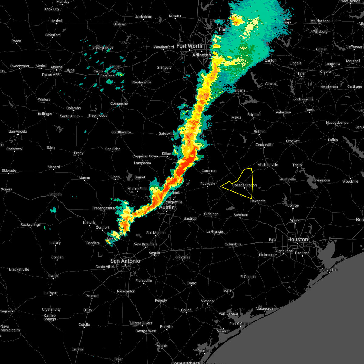
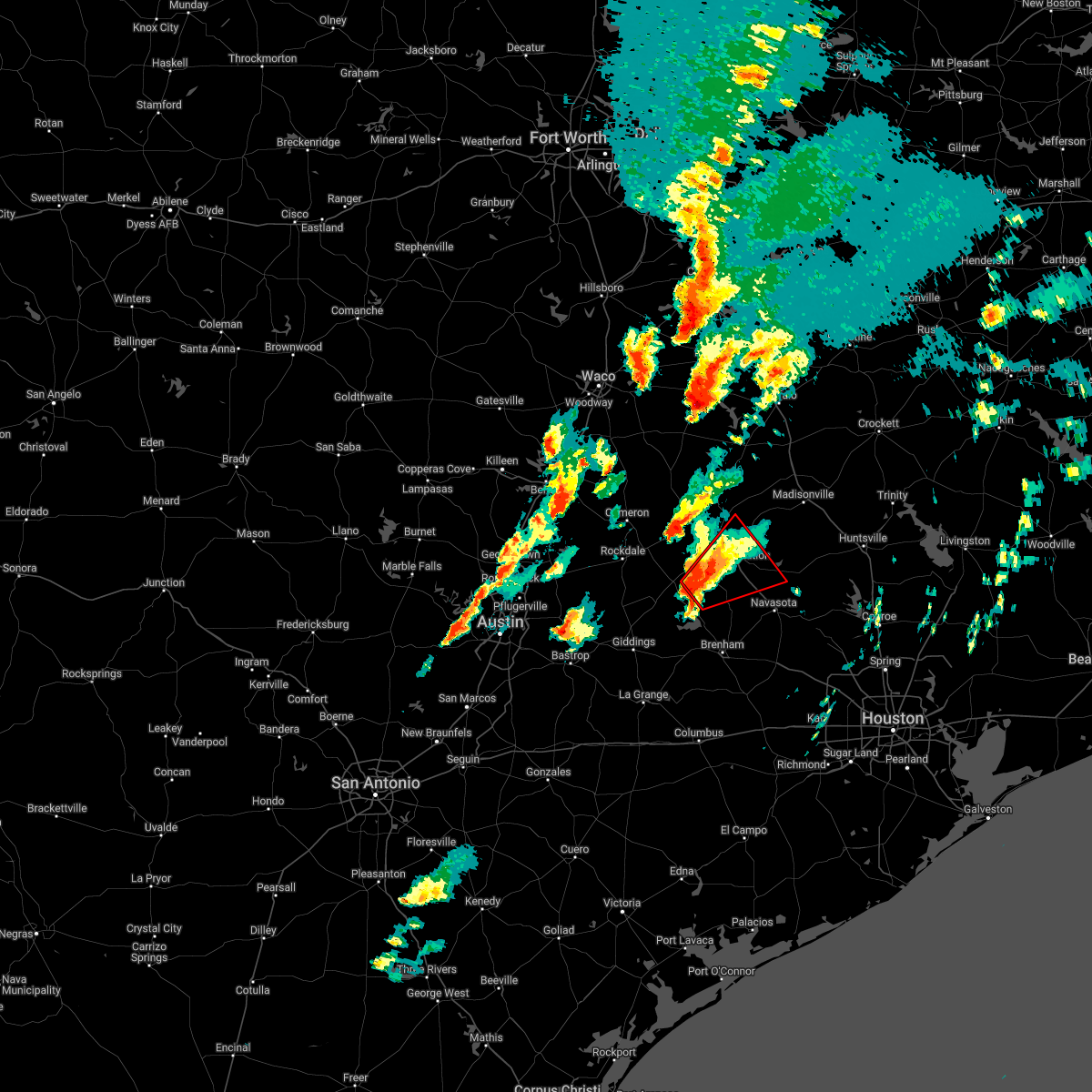
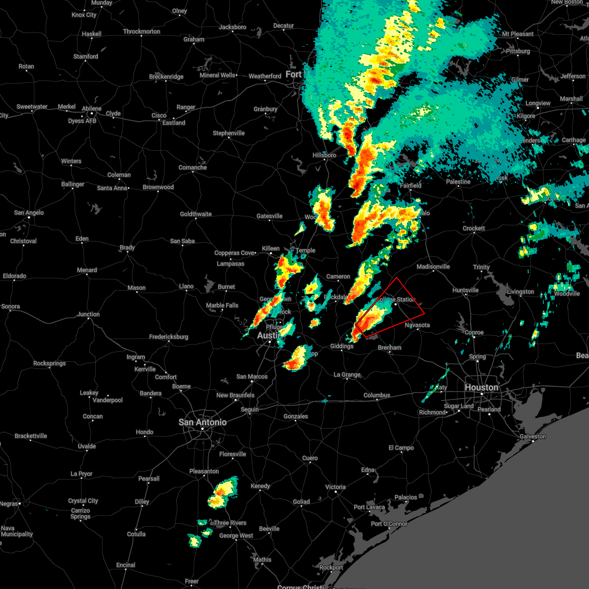
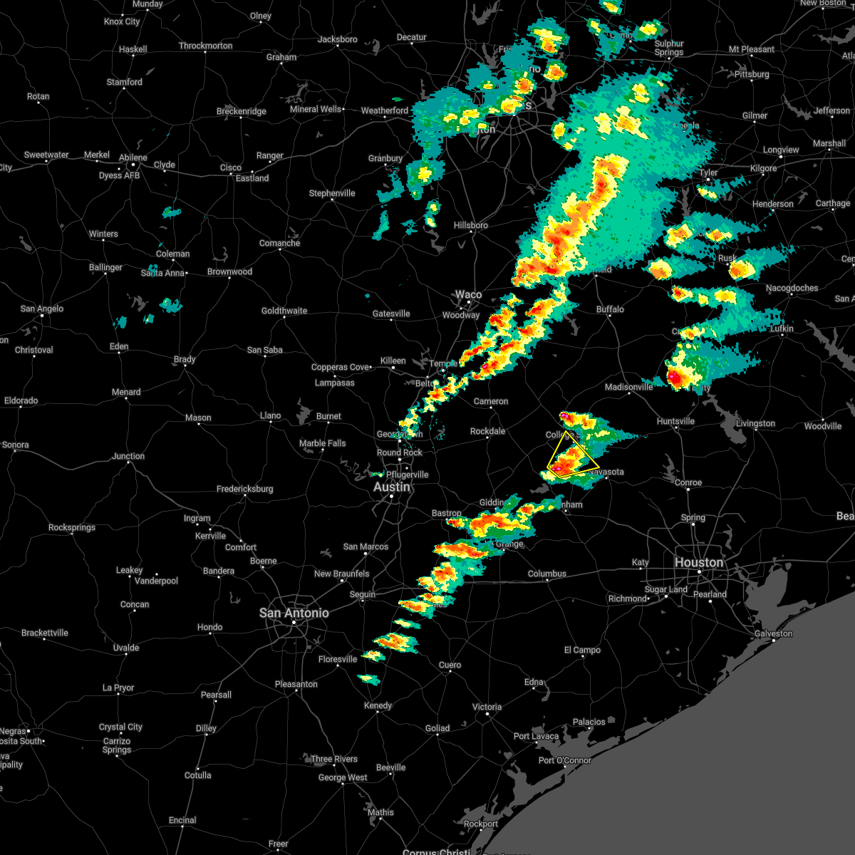
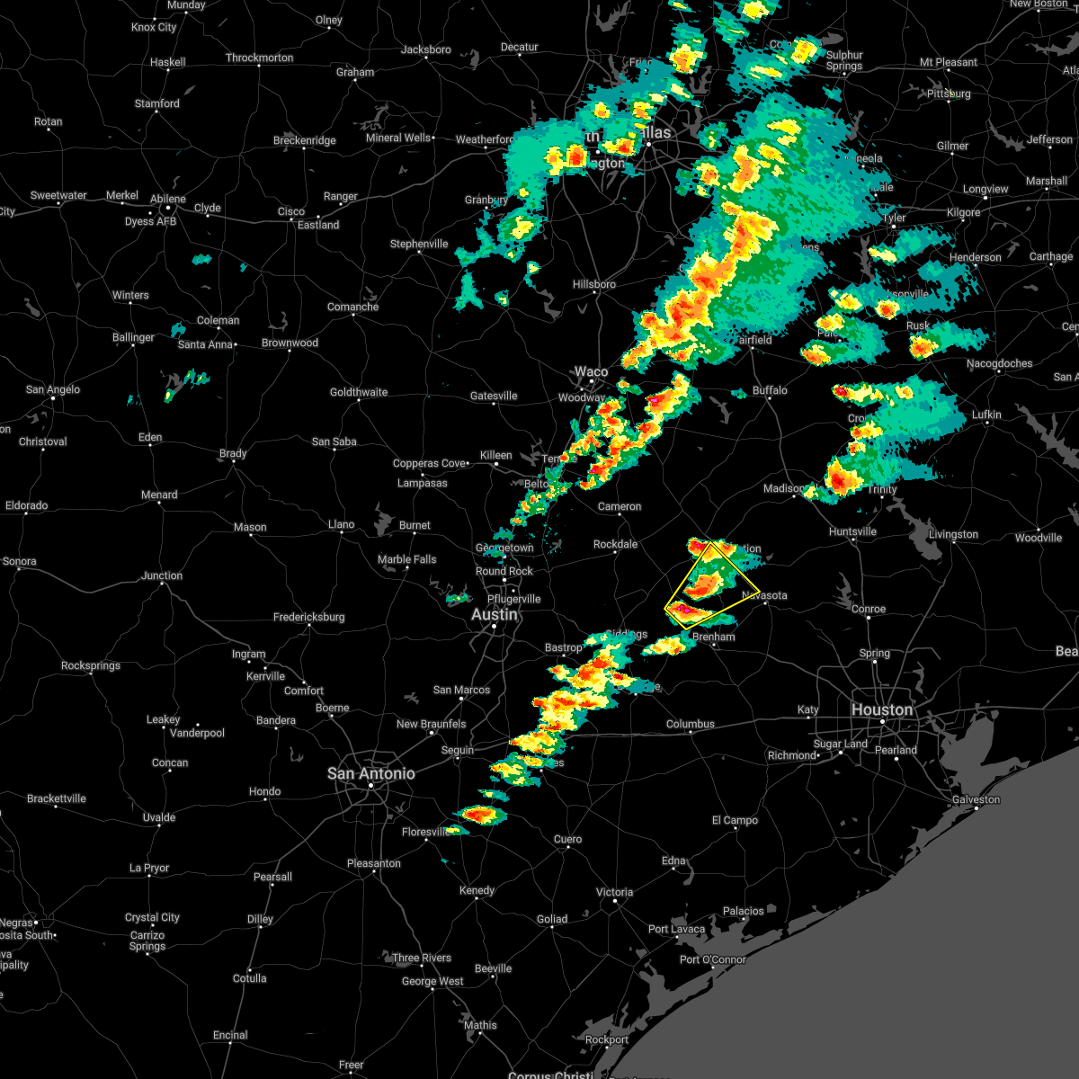
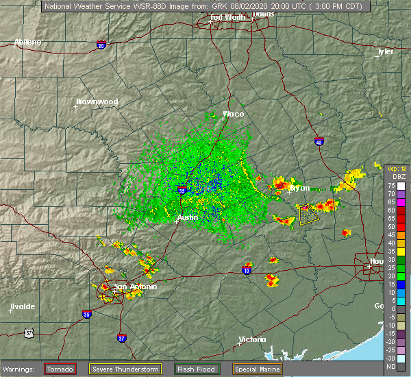
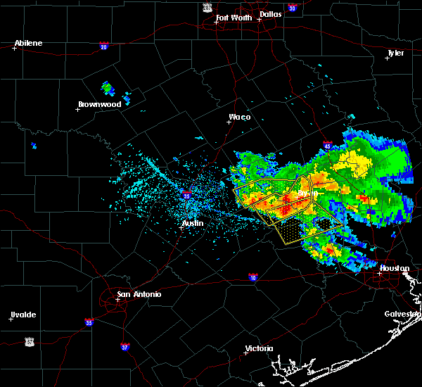
Hail Map for Millican, TX
The Millican, TX area has had 0 reports of on-the-ground hail by trained spotters, and has been under severe weather warnings 9 times during the past 12 months. Doppler radar has detected hail at or near Millican, TX on 43 occasions, including 1 occasion during the past year.
| Name: | Millican, TX |
| Where Located: | 69.3 miles NW of Houston, TX |
| Map: | Google Map for Millican, TX |
| Population: | 240 |
| Housing Units: | 110 |
| More Info: | Search Google for Millican, TX |
1
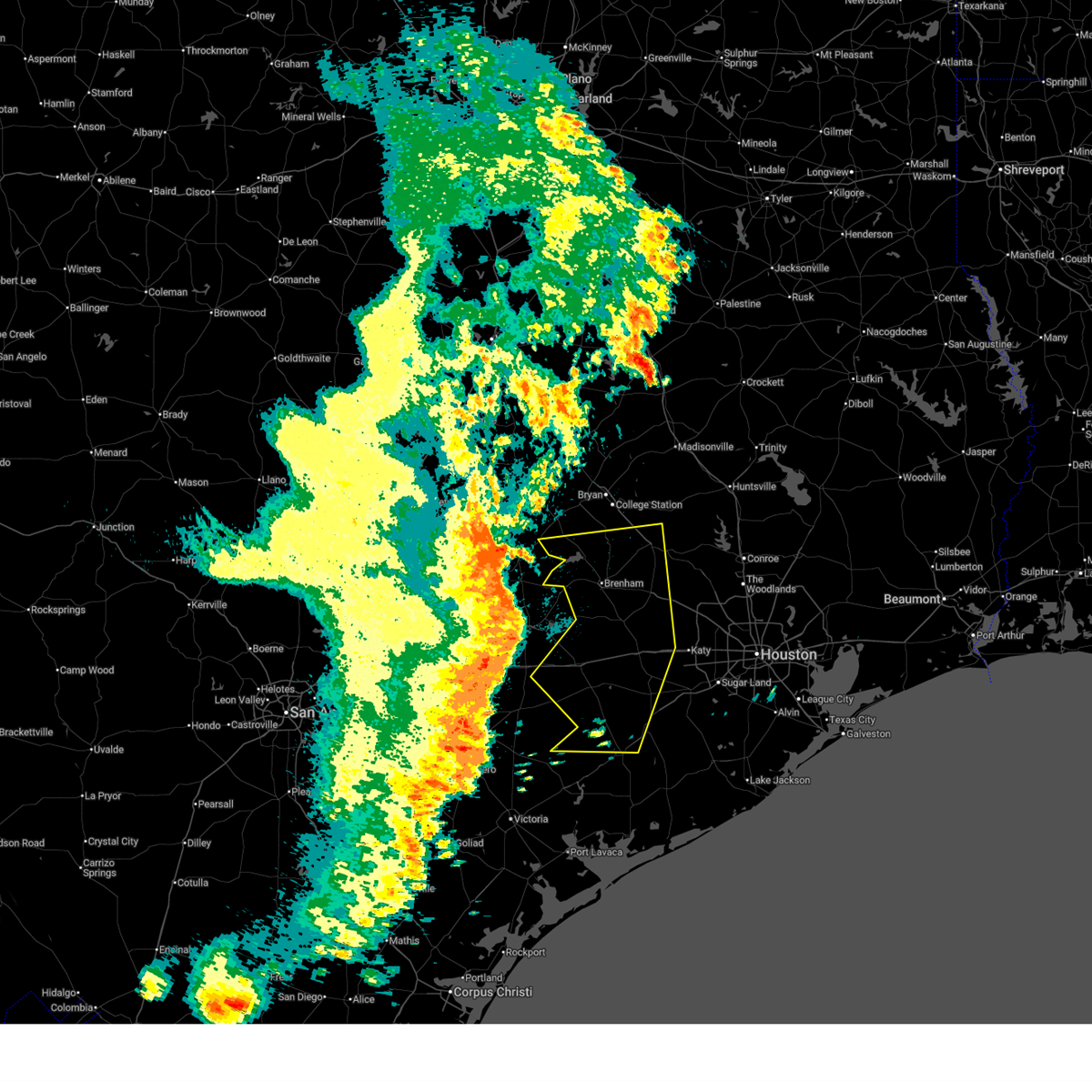
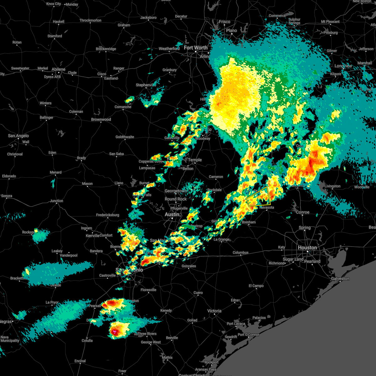
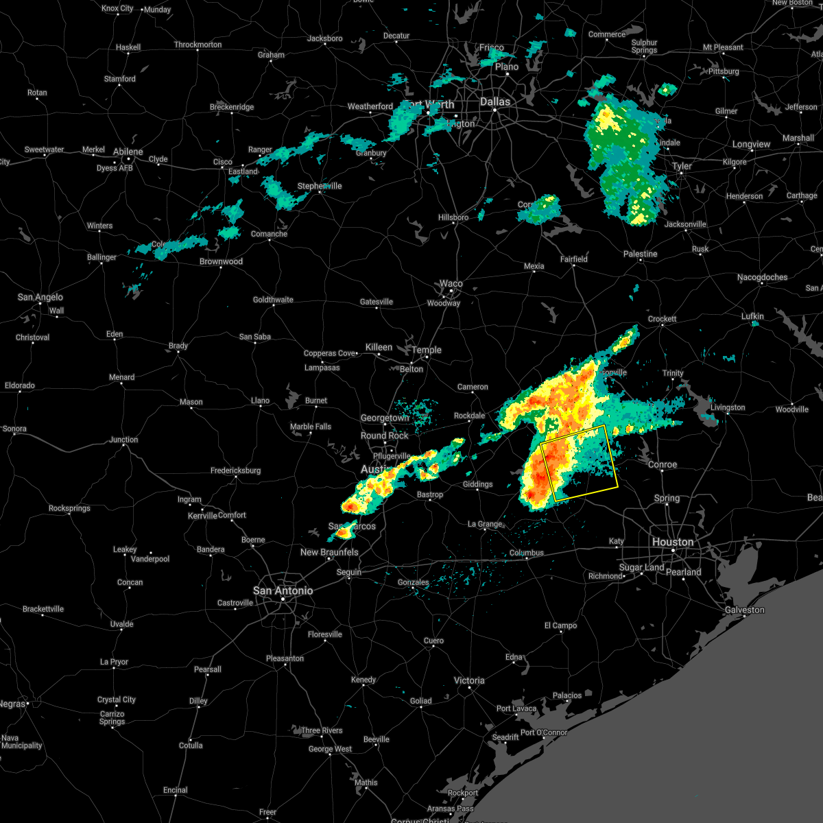
The Top Recent Hail Date for Millican, TX is Wednesday, April 22, 2026 (4th out of 43)
Hail and Wind Damage Spotted near Millican, TX
| Date / Time | Report Details |
|---|---|
| 5/26/2026 11:56 PM CDT |
 Svrhgx the national weather service in league city has issued a * severe thunderstorm warning for, colorado county in southeastern texas, central wharton county in southeastern texas, austin county in southeastern texas, north central jackson county in south central texas, southwestern grimes county in southeastern texas, southern burleson county in southeastern texas, southeastern brazos county in southeastern texas, washington county in southeastern texas, northwestern fort bend county in southeastern texas, waller county in southeastern texas, northwestern harris county in southeastern texas, * until 115 am cdt. * at 1155 pm cdt, severe thunderstorms were located along a line extending from near fedor to near schulenburg to near yoakum, moving east at 40 mph (radar indicated). Hazards include 60 mph wind gusts. expect damage to roofs, siding, and trees Svrhgx the national weather service in league city has issued a * severe thunderstorm warning for, colorado county in southeastern texas, central wharton county in southeastern texas, austin county in southeastern texas, north central jackson county in south central texas, southwestern grimes county in southeastern texas, southern burleson county in southeastern texas, southeastern brazos county in southeastern texas, washington county in southeastern texas, northwestern fort bend county in southeastern texas, waller county in southeastern texas, northwestern harris county in southeastern texas, * until 115 am cdt. * at 1155 pm cdt, severe thunderstorms were located along a line extending from near fedor to near schulenburg to near yoakum, moving east at 40 mph (radar indicated). Hazards include 60 mph wind gusts. expect damage to roofs, siding, and trees
|
| 4/22/2026 5:46 PM CDT |
 At 544 pm cdt, a severe thunderstorm was located near anderson, or 8 miles north of navasota, moving northeast at 20 mph (fire department). Hazards include golf ball size hail and 60 mph wind gusts. People and animals outdoors will be injured. expect hail damage to roofs, siding, windows, and vehicles. expect wind damage to roofs, siding, and trees. Locations impacted include, navasota, millican, anderson, and carlos. At 544 pm cdt, a severe thunderstorm was located near anderson, or 8 miles north of navasota, moving northeast at 20 mph (fire department). Hazards include golf ball size hail and 60 mph wind gusts. People and animals outdoors will be injured. expect hail damage to roofs, siding, windows, and vehicles. expect wind damage to roofs, siding, and trees. Locations impacted include, navasota, millican, anderson, and carlos.
|
| 4/22/2026 5:46 PM CDT |
 the severe thunderstorm warning has been cancelled and is no longer in effect the severe thunderstorm warning has been cancelled and is no longer in effect
|
| 4/22/2026 5:34 PM CDT |
 At 533 pm cdt, a severe thunderstorm was located near millican, or 8 miles north of navasota, moving northeast at 15 mph (fire department). Hazards include golf ball size hail. People and animals outdoors will be injured. expect damage to roofs, siding, windows, and vehicles. Locations impacted include, navasota, millican, anderson, and carlos. At 533 pm cdt, a severe thunderstorm was located near millican, or 8 miles north of navasota, moving northeast at 15 mph (fire department). Hazards include golf ball size hail. People and animals outdoors will be injured. expect damage to roofs, siding, windows, and vehicles. Locations impacted include, navasota, millican, anderson, and carlos.
|
| 4/22/2026 5:29 PM CDT |
 Svrhgx the national weather service in league city has issued a * severe thunderstorm warning for, southeastern burleson county in southeastern texas, west central grimes county in southeastern texas, southeastern brazos county in southeastern texas, northeastern washington county in southeastern texas, * until 600 pm cdt. * at 528 pm cdt, a severe thunderstorm was located near millican, or 7 miles northwest of navasota, moving northeast at 15 mph (radar indicated). Hazards include quarter size hail. damage to vehicles is expected Svrhgx the national weather service in league city has issued a * severe thunderstorm warning for, southeastern burleson county in southeastern texas, west central grimes county in southeastern texas, southeastern brazos county in southeastern texas, northeastern washington county in southeastern texas, * until 600 pm cdt. * at 528 pm cdt, a severe thunderstorm was located near millican, or 7 miles northwest of navasota, moving northeast at 15 mph (radar indicated). Hazards include quarter size hail. damage to vehicles is expected
|
| 3/15/2026 5:47 PM CDT |
 Svrhgx the national weather service in league city has issued a * severe thunderstorm warning for, southeastern burleson county in southeastern texas, southern grimes county in southeastern texas, southeastern brazos county in southeastern texas, eastern washington county in southeastern texas, * until 615 pm cdt. * at 547 pm cdt, severe thunderstorms were located along a line extending from 10 miles southwest of bedias to somerville, moving southeast at around 40 mph (radar indicated). Hazards include 60 mph wind gusts and quarter size hail. Hail damage to vehicles is expected. Expect wind damage to roofs, siding, and trees. Svrhgx the national weather service in league city has issued a * severe thunderstorm warning for, southeastern burleson county in southeastern texas, southern grimes county in southeastern texas, southeastern brazos county in southeastern texas, eastern washington county in southeastern texas, * until 615 pm cdt. * at 547 pm cdt, severe thunderstorms were located along a line extending from 10 miles southwest of bedias to somerville, moving southeast at around 40 mph (radar indicated). Hazards include 60 mph wind gusts and quarter size hail. Hail damage to vehicles is expected. Expect wind damage to roofs, siding, and trees.
|
| 10/25/2025 3:14 AM CDT | The storm which prompted the warning has moved out of the area. therefore, the warning will be allowed to expire. a severe thunderstorm watch remains in effect until 500 am cdt for southeastern texas. a severe thunderstorm watch also remains in effect until 700 am cdt for southeastern texas. |
| 10/25/2025 2:29 AM CDT | Svrhgx the national weather service in league city has issued a * severe thunderstorm warning for, northern grimes county in southeastern texas, southeastern brazos county in southeastern texas, northwestern montgomery county in southeastern texas, southeastern madison county in southeastern texas, southwestern walker county in southeastern texas, * until 315 am cdt. * at 229 am cdt, a severe thunderstorm was located 7 miles north of anderson, or 16 miles northeast of navasota, moving northeast at 30 mph (radar indicated). Hazards include 60 mph wind gusts. expect damage to roofs, siding, and trees |
| 8/4/2025 8:51 AM CDT |
 Svrhgx the national weather service in league city has issued a * severe thunderstorm warning for, southeastern burleson county in southeastern texas, grimes county in southeastern texas, southeastern brazos county in southeastern texas, northeastern washington county in southeastern texas, northwestern montgomery county in southeastern texas, southwestern walker county in southeastern texas, * until 930 am cdt. * at 850 am cdt, a severe thunderstorm was located 8 miles northwest of anderson, or 14 miles east of college station, moving south at 30 mph (radar indicated). Hazards include 60 mph wind gusts. expect damage to roofs, siding, and trees Svrhgx the national weather service in league city has issued a * severe thunderstorm warning for, southeastern burleson county in southeastern texas, grimes county in southeastern texas, southeastern brazos county in southeastern texas, northeastern washington county in southeastern texas, northwestern montgomery county in southeastern texas, southwestern walker county in southeastern texas, * until 930 am cdt. * at 850 am cdt, a severe thunderstorm was located 8 miles northwest of anderson, or 14 miles east of college station, moving south at 30 mph (radar indicated). Hazards include 60 mph wind gusts. expect damage to roofs, siding, and trees
|
| 5/26/2025 10:59 PM CDT |
 The storms which prompted the warning have weakened below severe limits, and no longer pose an immediate threat to life or property. therefore, the warning will be allowed to expire. however, gusty winds are still possible with these thunderstorms. a severe thunderstorm watch remains in effect until 500 am cdt for southeastern texas. The storms which prompted the warning have weakened below severe limits, and no longer pose an immediate threat to life or property. therefore, the warning will be allowed to expire. however, gusty winds are still possible with these thunderstorms. a severe thunderstorm watch remains in effect until 500 am cdt for southeastern texas.
|
| 5/26/2025 10:10 PM CDT |
 Svrhgx the national weather service in league city has issued a * severe thunderstorm warning for, burleson county in southeastern texas, northwestern grimes county in southeastern texas, brazos county in southeastern texas, northern washington county in southeastern texas, western madison county in southeastern texas, * until 1100 pm cdt. * at 1009 pm cdt, severe thunderstorms were located along a line extending from near bremond to near hearne to near caldwell to near dime box to near paige, moving east at 40 mph (radar indicated). Hazards include 60 mph wind gusts. expect damage to roofs, siding, and trees Svrhgx the national weather service in league city has issued a * severe thunderstorm warning for, burleson county in southeastern texas, northwestern grimes county in southeastern texas, brazos county in southeastern texas, northern washington county in southeastern texas, western madison county in southeastern texas, * until 1100 pm cdt. * at 1009 pm cdt, severe thunderstorms were located along a line extending from near bremond to near hearne to near caldwell to near dime box to near paige, moving east at 40 mph (radar indicated). Hazards include 60 mph wind gusts. expect damage to roofs, siding, and trees
|
| 5/6/2025 3:48 PM CDT |
 At 347 pm cdt, a severe thunderstorm was located over millican, or 8 miles southeast of college station, moving east at 15 mph (radar indicated). Hazards include 60 mph wind gusts and nickel size hail. Expect damage to roofs, siding, and trees. Locations impacted include, southeastern college station, navasota, washington, millican, anderson, wellborn, roans prairie, independence, richards, and carlos. At 347 pm cdt, a severe thunderstorm was located over millican, or 8 miles southeast of college station, moving east at 15 mph (radar indicated). Hazards include 60 mph wind gusts and nickel size hail. Expect damage to roofs, siding, and trees. Locations impacted include, southeastern college station, navasota, washington, millican, anderson, wellborn, roans prairie, independence, richards, and carlos.
|
| 5/6/2025 3:46 PM CDT |
 At 345 pm cdt, a severe thunderstorm extends from northern washing to southern brazos, southeast burleson, and northern grimes. damaging wind gusts and hail are the primary concerns (radar indicated). Hazards include 60 mph wind gusts and nickel size hail. Expect damage to roofs, siding, and trees. Locations impacted include, southeastern college station, navasota, washington, millican, anderson, wellborn, roans prairie, independence, richards, and carlos. At 345 pm cdt, a severe thunderstorm extends from northern washing to southern brazos, southeast burleson, and northern grimes. damaging wind gusts and hail are the primary concerns (radar indicated). Hazards include 60 mph wind gusts and nickel size hail. Expect damage to roofs, siding, and trees. Locations impacted include, southeastern college station, navasota, washington, millican, anderson, wellborn, roans prairie, independence, richards, and carlos.
|
| 5/6/2025 3:37 PM CDT |
 At 335 pm cdt, a line of severe thunderstorms extends from northern washington county through southeast burleson, southern brazos, and grimes counties. hail and damaging wind gusts are the primary concerns. a tornado cannot be ruled out. (radar indicated). Hazards include 60 mph wind gusts and quarter size hail. Hail damage to vehicles is expected. expect wind damage to roofs, siding, and trees. Locations impacted include, college station, eastern bryan, navasota, washington, bedias, millican, anderson, iola, independence, wellborn, roans prairie, richards, and carlos. At 335 pm cdt, a line of severe thunderstorms extends from northern washington county through southeast burleson, southern brazos, and grimes counties. hail and damaging wind gusts are the primary concerns. a tornado cannot be ruled out. (radar indicated). Hazards include 60 mph wind gusts and quarter size hail. Hail damage to vehicles is expected. expect wind damage to roofs, siding, and trees. Locations impacted include, college station, eastern bryan, navasota, washington, bedias, millican, anderson, iola, independence, wellborn, roans prairie, richards, and carlos.
|
| 5/6/2025 3:22 PM CDT |
 Svrhgx the national weather service in league city has issued a * severe thunderstorm warning for, southeastern burleson county in southeastern texas, grimes county in southeastern texas, southeastern brazos county in southeastern texas, northeastern washington county in southeastern texas, * until 400 pm cdt. * at 320 pm cdt, a line of severe thunderstorms extended from northern washington county into southeastern burleson county, brazos county, and northern grimes county. it is moving east at 40 mph. hail and damaging wind gusts are the primary concern. however, a tornado cannot be ruled out in association with this line (radar indicated). Hazards include 60 mph wind gusts and quarter size hail. Hail damage to vehicles is expected. Expect wind damage to roofs, siding, and trees. Svrhgx the national weather service in league city has issued a * severe thunderstorm warning for, southeastern burleson county in southeastern texas, grimes county in southeastern texas, southeastern brazos county in southeastern texas, northeastern washington county in southeastern texas, * until 400 pm cdt. * at 320 pm cdt, a line of severe thunderstorms extended from northern washington county into southeastern burleson county, brazos county, and northern grimes county. it is moving east at 40 mph. hail and damaging wind gusts are the primary concern. however, a tornado cannot be ruled out in association with this line (radar indicated). Hazards include 60 mph wind gusts and quarter size hail. Hail damage to vehicles is expected. Expect wind damage to roofs, siding, and trees.
|
| 5/6/2025 3:02 PM CDT |
 Svrhgx the national weather service in league city has issued a * severe thunderstorm warning for, southeastern burleson county in southeastern texas, south central brazos county in southeastern texas, northern washington county in southeastern texas, * until 330 pm cdt. * at 302 pm cdt, a severe thunderstorm was located near snook, or 13 miles southwest of college station, moving east at 40 mph (radar indicated). Hazards include 60 mph wind gusts and quarter size hail. Hail damage to vehicles is expected. Expect wind damage to roofs, siding, and trees. Svrhgx the national weather service in league city has issued a * severe thunderstorm warning for, southeastern burleson county in southeastern texas, south central brazos county in southeastern texas, northern washington county in southeastern texas, * until 330 pm cdt. * at 302 pm cdt, a severe thunderstorm was located near snook, or 13 miles southwest of college station, moving east at 40 mph (radar indicated). Hazards include 60 mph wind gusts and quarter size hail. Hail damage to vehicles is expected. Expect wind damage to roofs, siding, and trees.
|
| 3/15/2025 3:44 AM CDT |
 Svrhgx the national weather service in league city has issued a * severe thunderstorm warning for, northwestern grimes county in southeastern texas, east central burleson county in southeastern texas, southeastern brazos county in southeastern texas, * until 415 am cdt. * at 344 am cdt, a severe thunderstorm was located over college station, moving northeast at around 40 mph (radar indicated). Hazards include golf ball size hail. People and animals outdoors will be injured. Expect damage to roofs, siding, windows, and vehicles. Svrhgx the national weather service in league city has issued a * severe thunderstorm warning for, northwestern grimes county in southeastern texas, east central burleson county in southeastern texas, southeastern brazos county in southeastern texas, * until 415 am cdt. * at 344 am cdt, a severe thunderstorm was located over college station, moving northeast at around 40 mph (radar indicated). Hazards include golf ball size hail. People and animals outdoors will be injured. Expect damage to roofs, siding, windows, and vehicles.
|
| 12/28/2024 12:29 PM CST |
 At 1229 pm cst, severe thunderstorms were located along a line extending from near bryan utilities lake to near snook to lake somerville state park & trailway, moving east at 30 mph (radar indicated). Hazards include 60 mph wind gusts and penny size hail. Expect damage to roofs, siding, and trees. Locations impacted include, college station, bryan, somerville, snook, kurten, wixon valley, millican, lake somerville dam, kyle field, bryan utilities lake, lyons, deanville, and wellborn. At 1229 pm cst, severe thunderstorms were located along a line extending from near bryan utilities lake to near snook to lake somerville state park & trailway, moving east at 30 mph (radar indicated). Hazards include 60 mph wind gusts and penny size hail. Expect damage to roofs, siding, and trees. Locations impacted include, college station, bryan, somerville, snook, kurten, wixon valley, millican, lake somerville dam, kyle field, bryan utilities lake, lyons, deanville, and wellborn.
|
| 12/28/2024 11:46 AM CST |
 Svrhgx the national weather service in league city has issued a * severe thunderstorm warning for, northwestern grimes county in southeastern texas, burleson county in southeastern texas, brazos county in southeastern texas, western washington county in southeastern texas, * until 1245 pm cst. * at 1145 am cst, severe thunderstorms were located along a line extending from 10 miles east of cameron to 7 miles west of caldwell to near lexington, moving east at 25 mph (radar indicated). Hazards include 60 mph wind gusts. expect damage to roofs, siding, and trees Svrhgx the national weather service in league city has issued a * severe thunderstorm warning for, northwestern grimes county in southeastern texas, burleson county in southeastern texas, brazos county in southeastern texas, western washington county in southeastern texas, * until 1245 pm cst. * at 1145 am cst, severe thunderstorms were located along a line extending from 10 miles east of cameron to 7 miles west of caldwell to near lexington, moving east at 25 mph (radar indicated). Hazards include 60 mph wind gusts. expect damage to roofs, siding, and trees
|
| 5/31/2024 5:36 AM CDT |
 Svrhgx the national weather service in league city has issued a * severe thunderstorm warning for, grimes county in southeastern texas, southeastern brazos county in southeastern texas, northwestern montgomery county in southeastern texas, western houston county in southeastern texas, madison county in southeastern texas, western walker county in southeastern texas, * until 600 am cdt. * at 535 am cdt, severe thunderstorms were located along a line extending from 8 miles southwest of elkhart to near navasota, moving east at 40 mph (radar indicated). Hazards include 60 mph wind gusts and penny size hail. expect damage to roofs, siding, and trees Svrhgx the national weather service in league city has issued a * severe thunderstorm warning for, grimes county in southeastern texas, southeastern brazos county in southeastern texas, northwestern montgomery county in southeastern texas, western houston county in southeastern texas, madison county in southeastern texas, western walker county in southeastern texas, * until 600 am cdt. * at 535 am cdt, severe thunderstorms were located along a line extending from 8 miles southwest of elkhart to near navasota, moving east at 40 mph (radar indicated). Hazards include 60 mph wind gusts and penny size hail. expect damage to roofs, siding, and trees
|
| 5/31/2024 5:03 AM CDT |
 At 501 am cdt, severe thunderstorms were located along a line extending from 10 miles southeast of fort boggy state park to 8 miles north of lake somerville state park & trailway, moving southeast at around 45 mph (radar indicated). Hazards include 60 mph wind gusts and penny size hail. Expect damage to roofs, siding, and trees. Locations impacted include, college station, bryan, huntsville, brenham, navasota, madisonville, caldwell, austonio, washington, trinity, somerville, lovelady, snook, riverside, bedias, kurten, burton, wixon valley, millican, and anderson. At 501 am cdt, severe thunderstorms were located along a line extending from 10 miles southeast of fort boggy state park to 8 miles north of lake somerville state park & trailway, moving southeast at around 45 mph (radar indicated). Hazards include 60 mph wind gusts and penny size hail. Expect damage to roofs, siding, and trees. Locations impacted include, college station, bryan, huntsville, brenham, navasota, madisonville, caldwell, austonio, washington, trinity, somerville, lovelady, snook, riverside, bedias, kurten, burton, wixon valley, millican, and anderson.
|
| 5/31/2024 4:36 AM CDT |
 Svrhgx the national weather service in league city has issued a * severe thunderstorm warning for, west central trinity county in southeastern texas, grimes county in southeastern texas, burleson county in southeastern texas, brazos county in southeastern texas, washington county in southeastern texas, northwestern montgomery county in southeastern texas, southwestern houston county in southeastern texas, madison county in southeastern texas, walker county in southeastern texas, * until 530 am cdt. * at 435 am cdt, severe thunderstorms were located along a line extending from 9 miles west of fort boggy state park to near tanglewood, moving southeast at around 50 mph (radar indicated). Hazards include 60 mph wind gusts and penny size hail. expect damage to roofs, siding, and trees Svrhgx the national weather service in league city has issued a * severe thunderstorm warning for, west central trinity county in southeastern texas, grimes county in southeastern texas, burleson county in southeastern texas, brazos county in southeastern texas, washington county in southeastern texas, northwestern montgomery county in southeastern texas, southwestern houston county in southeastern texas, madison county in southeastern texas, walker county in southeastern texas, * until 530 am cdt. * at 435 am cdt, severe thunderstorms were located along a line extending from 9 miles west of fort boggy state park to near tanglewood, moving southeast at around 50 mph (radar indicated). Hazards include 60 mph wind gusts and penny size hail. expect damage to roofs, siding, and trees
|
| 5/30/2024 7:01 PM CDT |
 Svrhgx the national weather service in league city has issued a * severe thunderstorm warning for, southwestern grimes county in southeastern texas, southeastern burleson county in southeastern texas, southern brazos county in southeastern texas, northeastern washington county in southeastern texas, * until 730 pm cdt. * at 701 pm cdt, a severe thunderstorm was located near snook, or 7 miles southwest of college station, moving southeast at 25 mph (radar indicated). Hazards include 60 mph wind gusts and quarter size hail. Hail damage to vehicles is expected. Expect wind damage to roofs, siding, and trees. Svrhgx the national weather service in league city has issued a * severe thunderstorm warning for, southwestern grimes county in southeastern texas, southeastern burleson county in southeastern texas, southern brazos county in southeastern texas, northeastern washington county in southeastern texas, * until 730 pm cdt. * at 701 pm cdt, a severe thunderstorm was located near snook, or 7 miles southwest of college station, moving southeast at 25 mph (radar indicated). Hazards include 60 mph wind gusts and quarter size hail. Hail damage to vehicles is expected. Expect wind damage to roofs, siding, and trees.
|
| 4/9/2024 11:44 PM CDT |
 The storm which prompted the warning has weakened below severe limits, and has exited the warned area. therefore, the warning will be allowed to expire. however, small hail is still possible with this thunderstorm. a severe thunderstorm watch remains in effect until 400 am cdt for southeastern texas. The storm which prompted the warning has weakened below severe limits, and has exited the warned area. therefore, the warning will be allowed to expire. however, small hail is still possible with this thunderstorm. a severe thunderstorm watch remains in effect until 400 am cdt for southeastern texas.
|
| 4/9/2024 11:15 PM CDT |
 Svrhgx the national weather service in league city has issued a * severe thunderstorm warning for, southeastern burleson county in southeastern texas, southeastern brazos county in southeastern texas, northeastern washington county in southeastern texas, * until 1145 pm cdt. * at 1115 pm cdt, a severe thunderstorm was located over snook, or 13 miles southwest of college station, moving east at 25 mph (radar indicated). Hazards include 60 mph wind gusts and quarter size hail. Hail damage to vehicles is expected. Expect wind damage to roofs, siding, and trees. Svrhgx the national weather service in league city has issued a * severe thunderstorm warning for, southeastern burleson county in southeastern texas, southeastern brazos county in southeastern texas, northeastern washington county in southeastern texas, * until 1145 pm cdt. * at 1115 pm cdt, a severe thunderstorm was located over snook, or 13 miles southwest of college station, moving east at 25 mph (radar indicated). Hazards include 60 mph wind gusts and quarter size hail. Hail damage to vehicles is expected. Expect wind damage to roofs, siding, and trees.
|
| 2/11/2024 8:40 AM CST |
 At 839 am cst, severe thunderstorms were located along a line extending from 10 miles south of bedias to near anderson to near navasota, moving east at 40 mph (radar indicated). Hazards include 60 mph wind gusts and quarter size hail. Hail damage to vehicles is expected. Expect wind damage to roofs, siding, and trees. At 839 am cst, severe thunderstorms were located along a line extending from 10 miles south of bedias to near anderson to near navasota, moving east at 40 mph (radar indicated). Hazards include 60 mph wind gusts and quarter size hail. Hail damage to vehicles is expected. Expect wind damage to roofs, siding, and trees.
|
| 2/11/2024 8:28 AM CST |
 At 827 am cst, severe thunderstorms were located along a line extending from 7 miles east of college station to millican to 7 miles northwest of washington, moving east at 30 mph (radar indicated). Hazards include 60 mph wind gusts and quarter size hail. Hail damage to vehicles is expected. expect wind damage to roofs, siding, and trees. locations impacted include, southeastern college station, navasota, millican, anderson, carlos, and roans prairie. hail threat, radar indicated max hail size, 1. 00 in wind threat, radar indicated max wind gust, 60 mph. At 827 am cst, severe thunderstorms were located along a line extending from 7 miles east of college station to millican to 7 miles northwest of washington, moving east at 30 mph (radar indicated). Hazards include 60 mph wind gusts and quarter size hail. Hail damage to vehicles is expected. expect wind damage to roofs, siding, and trees. locations impacted include, southeastern college station, navasota, millican, anderson, carlos, and roans prairie. hail threat, radar indicated max hail size, 1. 00 in wind threat, radar indicated max wind gust, 60 mph.
|
| 2/11/2024 8:18 AM CST |
 At 817 am cst, severe thunderstorms were located along a line extending from near college station to near millican to 10 miles southeast of snook, moving east at 35 mph (radar indicated). Hazards include 60 mph wind gusts and quarter size hail. Hail damage to vehicles is expected. Expect wind damage to roofs, siding, and trees. At 817 am cst, severe thunderstorms were located along a line extending from near college station to near millican to 10 miles southeast of snook, moving east at 35 mph (radar indicated). Hazards include 60 mph wind gusts and quarter size hail. Hail damage to vehicles is expected. Expect wind damage to roofs, siding, and trees.
|
| 9/25/2023 3:30 PM CDT |
 At 330 pm cdt, a severe thunderstorm was located over navasota, moving southeast at 20 mph (radar indicated). Hazards include 60 mph wind gusts and quarter size hail. Hail damage to vehicles is expected. Expect wind damage to roofs, siding, and trees. At 330 pm cdt, a severe thunderstorm was located over navasota, moving southeast at 20 mph (radar indicated). Hazards include 60 mph wind gusts and quarter size hail. Hail damage to vehicles is expected. Expect wind damage to roofs, siding, and trees.
|
| 6/10/2023 10:49 PM CDT |
 At 1048 pm cdt, severe thunderstorms were located along a line extending from 6 miles northwest of lake conroe dam to 7 miles southeast of washington to near dime box, moving east at 50 mph (radar indicated). Hazards include 60 mph wind gusts. areas near and south of caldwell and also near washington could have up to 2 inch hail. People and animals outdoors will be injured. expect hail damage to roofs, siding, windows, and vehicles. expect wind damage to roofs, siding, and trees. locations impacted include, southeastern college station, brenham, navasota, hempstead, caldwell, washington, somerville, montgomery, snook, burton, millican, anderson, todd mission, lake somerville dam, lake somerville state park & trailway, lyons, deanville, dobbin, independence and quarry. thunderstorm damage threat, considerable hail threat, radar indicated max hail size, 2. 00 in wind threat, radar indicated max wind gust, 60 mph. At 1048 pm cdt, severe thunderstorms were located along a line extending from 6 miles northwest of lake conroe dam to 7 miles southeast of washington to near dime box, moving east at 50 mph (radar indicated). Hazards include 60 mph wind gusts. areas near and south of caldwell and also near washington could have up to 2 inch hail. People and animals outdoors will be injured. expect hail damage to roofs, siding, windows, and vehicles. expect wind damage to roofs, siding, and trees. locations impacted include, southeastern college station, brenham, navasota, hempstead, caldwell, washington, somerville, montgomery, snook, burton, millican, anderson, todd mission, lake somerville dam, lake somerville state park & trailway, lyons, deanville, dobbin, independence and quarry. thunderstorm damage threat, considerable hail threat, radar indicated max hail size, 2. 00 in wind threat, radar indicated max wind gust, 60 mph.
|
| 6/10/2023 10:37 PM CDT |
 At 1037 pm cdt, severe thunderstorms were located along a line extending from 8 miles north of montgomery to near washington to near dime box, moving southeast at 50 mph (radar indicated). Hazards include 60 mph wind gusts and up to quarter size hail. Hail damage to vehicles is possible. Expect wind damage to roofs, siding, and trees. At 1037 pm cdt, severe thunderstorms were located along a line extending from 8 miles north of montgomery to near washington to near dime box, moving southeast at 50 mph (radar indicated). Hazards include 60 mph wind gusts and up to quarter size hail. Hail damage to vehicles is possible. Expect wind damage to roofs, siding, and trees.
|
| 6/10/2023 10:30 PM CDT |
 At 1029 pm cdt, severe thunderstorms were located along a line extending from 12 miles west of riverside to 9 miles northeast of anderson to near caldwell, moving east at 45 mph (radar indicated and reports from broadcast media). Hazards include 60 mph wind gusts and quarter size hail. Hail damage to vehicles is possible. expect wind damage to roofs, siding, and trees. locations impacted include, college station, southern bryan, navasota, caldwell, somerville, snook, millican, anderson, lake somerville dam, kyle field, lake somerville state park & trailway, lyons, deanville, independence, chriesman, wellborn, roans prairie and carlos. hail threat, radar indicated max hail size, 1. 00 in wind threat, observed max wind gust, 60 mph. At 1029 pm cdt, severe thunderstorms were located along a line extending from 12 miles west of riverside to 9 miles northeast of anderson to near caldwell, moving east at 45 mph (radar indicated and reports from broadcast media). Hazards include 60 mph wind gusts and quarter size hail. Hail damage to vehicles is possible. expect wind damage to roofs, siding, and trees. locations impacted include, college station, southern bryan, navasota, caldwell, somerville, snook, millican, anderson, lake somerville dam, kyle field, lake somerville state park & trailway, lyons, deanville, independence, chriesman, wellborn, roans prairie and carlos. hail threat, radar indicated max hail size, 1. 00 in wind threat, observed max wind gust, 60 mph.
|
| 6/10/2023 10:11 PM CDT |
 At 1011 pm cdt, severe thunderstorms were located along a line extending from 6 miles southeast of madisonville to 11 miles northeast of millican to 8 miles west of caldwell, moving east at 45 mph (radar indicated). Hazards include 60 mph wind gusts and quarter size hail. Hail damage to vehicles is expected. expect wind damage to roofs, siding, and trees. locations impacted include, college station, bryan, navasota, caldwell, somerville, snook, bedias, wixon valley, millican, anderson, lake somerville dam, kyle field, bryan utilities lake, lake somerville state park & trailway, iola, lyons, deanville, independence, chriesman and wellborn. hail threat, radar indicated max hail size, 1. 00 in wind threat, observed max wind gust, 60 mph. At 1011 pm cdt, severe thunderstorms were located along a line extending from 6 miles southeast of madisonville to 11 miles northeast of millican to 8 miles west of caldwell, moving east at 45 mph (radar indicated). Hazards include 60 mph wind gusts and quarter size hail. Hail damage to vehicles is expected. expect wind damage to roofs, siding, and trees. locations impacted include, college station, bryan, navasota, caldwell, somerville, snook, bedias, wixon valley, millican, anderson, lake somerville dam, kyle field, bryan utilities lake, lake somerville state park & trailway, iola, lyons, deanville, independence, chriesman and wellborn. hail threat, radar indicated max hail size, 1. 00 in wind threat, observed max wind gust, 60 mph.
|
| 6/10/2023 10:00 PM CDT |
 At 1000 pm cdt, severe thunderstorms were located along a line extending from near madisonville to near college station to near tanglewood, moving east at 45 mph (radar indicated). Hazards include 60 mph wind gusts and quarter size hail. Hail damage to vehicles is expected. Expect wind damage to roofs, siding, and trees. At 1000 pm cdt, severe thunderstorms were located along a line extending from near madisonville to near college station to near tanglewood, moving east at 45 mph (radar indicated). Hazards include 60 mph wind gusts and quarter size hail. Hail damage to vehicles is expected. Expect wind damage to roofs, siding, and trees.
|
| 6/8/2023 3:48 PM CDT |
 At 346 pm cdt, a severe thunderstorm was located near millican, or near college station, moving southeast at 15 mph (a trained weather spotter reported 1 inch hail just south of college station). Hazards include golf ball size hail and 60 mph wind gusts. People and animals outdoors will be injured. expect hail damage to roofs, siding, windows, and vehicles. expect wind damage to roofs, siding, and trees. locations impacted include, southeastern college station, navasota, millican, anderson, wellborn and carlos. thunderstorm damage threat, considerable hail threat, observed max hail size, 1. 75 in wind threat, radar indicated max wind gust, 60 mph. At 346 pm cdt, a severe thunderstorm was located near millican, or near college station, moving southeast at 15 mph (a trained weather spotter reported 1 inch hail just south of college station). Hazards include golf ball size hail and 60 mph wind gusts. People and animals outdoors will be injured. expect hail damage to roofs, siding, windows, and vehicles. expect wind damage to roofs, siding, and trees. locations impacted include, southeastern college station, navasota, millican, anderson, wellborn and carlos. thunderstorm damage threat, considerable hail threat, observed max hail size, 1. 75 in wind threat, radar indicated max wind gust, 60 mph.
|
| 6/8/2023 3:38 PM CDT |
 At 337 pm cdt, a severe thunderstorm was located over southeastern college station, moving southeast at 15 mph (radar indicated). Hazards include golf ball size hail and 60 mph wind gusts. People and animals outdoors will be injured. expect hail damage to roofs, siding, windows, and vehicles. expect wind damage to roofs, siding, and trees. locations impacted include, college station, navasota, millican, anderson, kyle field, wellborn and carlos. thunderstorm damage threat, considerable hail threat, radar indicated max hail size, 1. 75 in wind threat, radar indicated max wind gust, 60 mph. At 337 pm cdt, a severe thunderstorm was located over southeastern college station, moving southeast at 15 mph (radar indicated). Hazards include golf ball size hail and 60 mph wind gusts. People and animals outdoors will be injured. expect hail damage to roofs, siding, windows, and vehicles. expect wind damage to roofs, siding, and trees. locations impacted include, college station, navasota, millican, anderson, kyle field, wellborn and carlos. thunderstorm damage threat, considerable hail threat, radar indicated max hail size, 1. 75 in wind threat, radar indicated max wind gust, 60 mph.
|
| 6/8/2023 3:34 PM CDT |
 At 333 pm cdt, a severe thunderstorm was located over southeastern college station, moving southeast at 20 mph (radar indicated). Hazards include 60 mph wind gusts and quarter size hail. Hail damage to vehicles is expected. Expect wind damage to roofs, siding, and trees. At 333 pm cdt, a severe thunderstorm was located over southeastern college station, moving southeast at 20 mph (radar indicated). Hazards include 60 mph wind gusts and quarter size hail. Hail damage to vehicles is expected. Expect wind damage to roofs, siding, and trees.
|
| 6/3/2023 11:58 PM CDT |
 At 1158 pm cdt, a severe thunderstorm was located near millican, or 9 miles north of navasota, moving southeast at 25 mph (radar indicated). Hazards include 70 mph wind gusts and quarter size hail. Hail damage to vehicles is expected. expect considerable tree damage. Wind damage is also likely to mobile homes, roofs, and outbuildings. At 1158 pm cdt, a severe thunderstorm was located near millican, or 9 miles north of navasota, moving southeast at 25 mph (radar indicated). Hazards include 70 mph wind gusts and quarter size hail. Hail damage to vehicles is expected. expect considerable tree damage. Wind damage is also likely to mobile homes, roofs, and outbuildings.
|
| 6/3/2023 11:45 PM CDT |
 At 1144 pm cdt, a severe thunderstorm was located 9 miles east of college station, moving southeast at 25 mph. this is a destructive storm for south central brazos (radar indicated). Hazards include 80 mph wind gusts and quarter size hail. Flying debris will be dangerous to those caught without shelter. mobile homes will be heavily damaged. expect considerable damage to roofs, windows, and vehicles. extensive tree damage and power outages are likely. locations impacted include, college station, bryan, kurten, wixon valley, millican, kyle field, wellborn, roans prairie and carlos. thunderstorm damage threat, destructive hail threat, radar indicated max hail size, 1. 00 in wind threat, observed max wind gust, 80 mph. At 1144 pm cdt, a severe thunderstorm was located 9 miles east of college station, moving southeast at 25 mph. this is a destructive storm for south central brazos (radar indicated). Hazards include 80 mph wind gusts and quarter size hail. Flying debris will be dangerous to those caught without shelter. mobile homes will be heavily damaged. expect considerable damage to roofs, windows, and vehicles. extensive tree damage and power outages are likely. locations impacted include, college station, bryan, kurten, wixon valley, millican, kyle field, wellborn, roans prairie and carlos. thunderstorm damage threat, destructive hail threat, radar indicated max hail size, 1. 00 in wind threat, observed max wind gust, 80 mph.
|
| 6/3/2023 11:30 PM CDT |
 At 1128 pm cdt, a severe thunderstorm was located near kurten, or 9 miles northeast of bryan, moving southeast at 25 mph (radar indicated). Hazards include 60 mph wind gusts and quarter size hail. Hail damage to vehicles is expected. Expect wind damage to roofs, siding, and trees. At 1128 pm cdt, a severe thunderstorm was located near kurten, or 9 miles northeast of bryan, moving southeast at 25 mph (radar indicated). Hazards include 60 mph wind gusts and quarter size hail. Hail damage to vehicles is expected. Expect wind damage to roofs, siding, and trees.
|
| 4/28/2023 7:25 PM CDT |
 At 724 pm cdt, severe thunderstorms were located along a line extending from near millican to 8 miles southeast of brenham to near industry to near schulenburg, moving southeast at 35 mph (radar indicated). Hazards include 60 mph wind gusts and quarter size hail. Hail damage to vehicles is expected. Expect wind damage to roofs, siding, and trees. At 724 pm cdt, severe thunderstorms were located along a line extending from near millican to 8 miles southeast of brenham to near industry to near schulenburg, moving southeast at 35 mph (radar indicated). Hazards include 60 mph wind gusts and quarter size hail. Hail damage to vehicles is expected. Expect wind damage to roofs, siding, and trees.
|
| 4/28/2023 6:23 PM CDT |
 At 622 pm cdt, severe thunderstorms were located along a line extending from near bedias to near anderson to near navasota, moving southeast at 50 mph (radar indicated). Hazards include 60 mph wind gusts and nickel size hail. expect damage to roofs, siding, and trees At 622 pm cdt, severe thunderstorms were located along a line extending from near bedias to near anderson to near navasota, moving southeast at 50 mph (radar indicated). Hazards include 60 mph wind gusts and nickel size hail. expect damage to roofs, siding, and trees
|
| 4/28/2023 6:12 PM CDT |
 At 611 pm cdt, severe thunderstorms were located along a line extending from 6 miles east of kurten to near snook to near dime box, moving southeast at 40 mph (radar indicated. broadcast media reported power lines and trees down in northern brazos county due to the strong winds). Hazards include 60 mph wind gusts and nickel size hail. Expect damage to roofs, siding, and trees. Locations impacted include, college station, bryan, navasota, caldwell, somerville, snook, kurten, burton, wixon valley, millican, lake somerville dam, lake somerville state park & trailway, kyle field, bryan utilities lake, iola, carmine, lyons, deanville, independence and quarry. At 611 pm cdt, severe thunderstorms were located along a line extending from 6 miles east of kurten to near snook to near dime box, moving southeast at 40 mph (radar indicated. broadcast media reported power lines and trees down in northern brazos county due to the strong winds). Hazards include 60 mph wind gusts and nickel size hail. Expect damage to roofs, siding, and trees. Locations impacted include, college station, bryan, navasota, caldwell, somerville, snook, kurten, burton, wixon valley, millican, lake somerville dam, lake somerville state park & trailway, kyle field, bryan utilities lake, iola, carmine, lyons, deanville, independence and quarry.
|
| 4/28/2023 5:59 PM CDT |
 At 559 pm cdt, severe thunderstorms were located along a line extending from near kurten to near snook to near dime box, moving southeast at 40 mph (radar indicated). Hazards include 60 mph wind gusts and nickel size hail. expect damage to roofs, siding, and trees At 559 pm cdt, severe thunderstorms were located along a line extending from near kurten to near snook to near dime box, moving southeast at 40 mph (radar indicated). Hazards include 60 mph wind gusts and nickel size hail. expect damage to roofs, siding, and trees
|
| 4/20/2023 8:16 PM CDT |
 At 815 pm cdt, severe thunderstorms were located along a line extending from 10 miles south of camp creek lake to 8 miles northeast of wixon valley to near kurten to 6 miles east of kyle field to near college station to near snook to 9 miles northeast of somerville, moving east at 30 mph (radar indicated). Hazards include 60 mph wind gusts and quarter size hail. Hail damage to vehicles is expected. expect wind damage to roofs, siding, and trees. locations impacted include, college station, bryan, navasota, washington, snook, bedias, kurten, wixon valley, millican, anderson, kyle field, iola, plantersville, wellborn, roans prairie, richards and carlos. hail threat, radar indicated max hail size, 1. 00 in wind threat, radar indicated max wind gust, 60 mph. At 815 pm cdt, severe thunderstorms were located along a line extending from 10 miles south of camp creek lake to 8 miles northeast of wixon valley to near kurten to 6 miles east of kyle field to near college station to near snook to 9 miles northeast of somerville, moving east at 30 mph (radar indicated). Hazards include 60 mph wind gusts and quarter size hail. Hail damage to vehicles is expected. expect wind damage to roofs, siding, and trees. locations impacted include, college station, bryan, navasota, washington, snook, bedias, kurten, wixon valley, millican, anderson, kyle field, iola, plantersville, wellborn, roans prairie, richards and carlos. hail threat, radar indicated max hail size, 1. 00 in wind threat, radar indicated max wind gust, 60 mph.
|
| 4/20/2023 8:14 PM CDT |
 At 813 pm cdt, severe thunderstorms were located along a line extending from 10 miles south of camp creek lake to 8 miles northeast of wixon valley to near kurten to 6 miles east of kyle field to near college station to near snook to 9 miles northeast of somerville, moving east at 30 mph (radar indicated). Hazards include 60 mph wind gusts and quarter size hail. Hail damage to vehicles is expected. Expect wind damage to roofs, siding, and trees. At 813 pm cdt, severe thunderstorms were located along a line extending from 10 miles south of camp creek lake to 8 miles northeast of wixon valley to near kurten to 6 miles east of kyle field to near college station to near snook to 9 miles northeast of somerville, moving east at 30 mph (radar indicated). Hazards include 60 mph wind gusts and quarter size hail. Hail damage to vehicles is expected. Expect wind damage to roofs, siding, and trees.
|
| 4/20/2023 7:47 PM CDT |
 At 746 pm cdt, severe thunderstorms were located along a line extending from near hearne to 9 miles west of wixon valley to bryan utilities lake to 7 miles northeast of caldwell to 7 miles east of tanglewood, moving east southeast at 25 mph (radar indicated). Hazards include golf ball size hail and 70 mph wind gusts. People and animals outdoors will be injured. expect hail damage to roofs, siding, windows, and vehicles. expect considerable tree damage. wind damage is also likely to mobile homes, roofs, and outbuildings. locations impacted include, college station, bryan, caldwell, somerville, snook, kurten, wixon valley, millican, lake somerville dam, lake somerville state park & trailway, kyle field, bryan utilities lake, lyons, deanville, independence, chriesman and wellborn. thunderstorm damage threat, considerable hail threat, radar indicated max hail size, 1. 75 in wind threat, radar indicated max wind gust, 70 mph. At 746 pm cdt, severe thunderstorms were located along a line extending from near hearne to 9 miles west of wixon valley to bryan utilities lake to 7 miles northeast of caldwell to 7 miles east of tanglewood, moving east southeast at 25 mph (radar indicated). Hazards include golf ball size hail and 70 mph wind gusts. People and animals outdoors will be injured. expect hail damage to roofs, siding, windows, and vehicles. expect considerable tree damage. wind damage is also likely to mobile homes, roofs, and outbuildings. locations impacted include, college station, bryan, caldwell, somerville, snook, kurten, wixon valley, millican, lake somerville dam, lake somerville state park & trailway, kyle field, bryan utilities lake, lyons, deanville, independence, chriesman and wellborn. thunderstorm damage threat, considerable hail threat, radar indicated max hail size, 1. 75 in wind threat, radar indicated max wind gust, 70 mph.
|
| 4/20/2023 7:10 PM CDT |
 At 710 pm cdt, severe thunderstorms were located along a line extending from near wixon valley to 7 miles northwest of caldwell to near thorndale, moving south at 25 mph (radar indicated). Hazards include 60 mph wind gusts and quarter size hail. Hail damage to vehicles is expected. Expect wind damage to roofs, siding, and trees. At 710 pm cdt, severe thunderstorms were located along a line extending from near wixon valley to 7 miles northwest of caldwell to near thorndale, moving south at 25 mph (radar indicated). Hazards include 60 mph wind gusts and quarter size hail. Hail damage to vehicles is expected. Expect wind damage to roofs, siding, and trees.
|
| 10/24/2022 11:00 PM CDT |
 At 1059 pm cdt, a severe thunderstorm was located 7 miles southwest of bedias, or 16 miles northeast of college station, moving east at 45 mph (radar indicated. at 1035 pm cdt, 61 mph winds were reported at easterwood field in college station. power flashes were also reported at 1040 pm cdt near university drive in college station). Hazards include 60 mph wind gusts and quarter size hail. Hail damage to vehicles is expected. expect wind damage to roofs, siding, and trees. Locations impacted include, southeastern college station, navasota, madisonville, bedias, millican, anderson, iola, plantersville, roans prairie, richards, north zulch and carlos. At 1059 pm cdt, a severe thunderstorm was located 7 miles southwest of bedias, or 16 miles northeast of college station, moving east at 45 mph (radar indicated. at 1035 pm cdt, 61 mph winds were reported at easterwood field in college station. power flashes were also reported at 1040 pm cdt near university drive in college station). Hazards include 60 mph wind gusts and quarter size hail. Hail damage to vehicles is expected. expect wind damage to roofs, siding, and trees. Locations impacted include, southeastern college station, navasota, madisonville, bedias, millican, anderson, iola, plantersville, roans prairie, richards, north zulch and carlos.
|
| 10/24/2022 10:44 PM CDT |
 At 1042 pm cdt, a severe thunderstorm was located near kurten, or 7 miles northeast of bryan, moving east at 45 mph (radar indicated. at 1035 pm cdt, 61 mph winds were reported at easterwood field in college station. power flashes were also reported at 1040 pm cdt near university drive in college station). Hazards include 60 mph wind gusts and quarter size hail. Hail damage to vehicles is expected. Expect wind damage to roofs, siding, and trees. At 1042 pm cdt, a severe thunderstorm was located near kurten, or 7 miles northeast of bryan, moving east at 45 mph (radar indicated. at 1035 pm cdt, 61 mph winds were reported at easterwood field in college station. power flashes were also reported at 1040 pm cdt near university drive in college station). Hazards include 60 mph wind gusts and quarter size hail. Hail damage to vehicles is expected. Expect wind damage to roofs, siding, and trees.
|
| 10/24/2022 10:35 PM CDT |
 At 1035 pm cdt, a severe thunderstorm was located near wixon valley, or near bryan, moving east at 40 to 50 mph (radar indicated). Hazards include 60 mph wind gusts and quarter size hail. Hail damage to vehicles is expected. expect wind damage to roofs, siding, and trees. Locations impacted include, college station, bryan, kurten, wixon valley, millican, kyle field and wellborn. At 1035 pm cdt, a severe thunderstorm was located near wixon valley, or near bryan, moving east at 40 to 50 mph (radar indicated). Hazards include 60 mph wind gusts and quarter size hail. Hail damage to vehicles is expected. expect wind damage to roofs, siding, and trees. Locations impacted include, college station, bryan, kurten, wixon valley, millican, kyle field and wellborn.
|
| 10/24/2022 10:02 PM CDT |
 At 1001 pm cdt, a severe thunderstorm was located 9 miles southwest of hearne, moving east at 35 to 45 mph (radar indicated). Hazards include 60 mph wind gusts and quarter size hail. Hail damage to vehicles is expected. Expect wind damage to roofs, siding, and trees. At 1001 pm cdt, a severe thunderstorm was located 9 miles southwest of hearne, moving east at 35 to 45 mph (radar indicated). Hazards include 60 mph wind gusts and quarter size hail. Hail damage to vehicles is expected. Expect wind damage to roofs, siding, and trees.
|
| 5/25/2022 1:29 AM CDT |
 At 127 am cdt, severe thunderstorms were located along a line extending from 10 miles southwest of centerville to near bedias to near navasota to 9 miles north of bellville to sublime, moving southeast at 50 mph (radar indicated). Hazards include 60 mph wind gusts. expect damage to roofs, siding, and trees At 127 am cdt, severe thunderstorms were located along a line extending from 10 miles southwest of centerville to near bedias to near navasota to 9 miles north of bellville to sublime, moving southeast at 50 mph (radar indicated). Hazards include 60 mph wind gusts. expect damage to roofs, siding, and trees
|
| 5/25/2022 12:43 AM CDT |
 At 1242 am cdt, severe thunderstorms were located along a line extending from 7 miles southeast of hearne to 9 miles northeast of caldwell to 6 miles north of lake somerville state park & trailway to 6 miles northwest of round top to near cistern, moving east at 45 mph (radar indicated). Hazards include 70 mph wind gusts and penny size hail. Expect considerable tree damage. Damage is likely to mobile homes, roofs, and outbuildings. At 1242 am cdt, severe thunderstorms were located along a line extending from 7 miles southeast of hearne to 9 miles northeast of caldwell to 6 miles north of lake somerville state park & trailway to 6 miles northwest of round top to near cistern, moving east at 45 mph (radar indicated). Hazards include 70 mph wind gusts and penny size hail. Expect considerable tree damage. Damage is likely to mobile homes, roofs, and outbuildings.
|
| 3/21/2022 8:25 PM CDT |
 At 824 pm cdt, a severe thunderstorm capable of producing a tornado was located over snook, or 11 miles southwest of college station, moving northeast at 40 mph (radar indicated rotation). Hazards include tornado and quarter size hail. Flying debris will be dangerous to those caught without shelter. mobile homes will be damaged or destroyed. damage to roofs, windows, and vehicles will occur. tree damage is likely. this dangerous storm will be near, kyle field around 840 pm cdt. college station around 845 pm cdt. bryan and wixon valley around 850 pm cdt. kurten around 855 pm cdt. Other locations impacted by this tornadic thunderstorm include wellborn and carlos. At 824 pm cdt, a severe thunderstorm capable of producing a tornado was located over snook, or 11 miles southwest of college station, moving northeast at 40 mph (radar indicated rotation). Hazards include tornado and quarter size hail. Flying debris will be dangerous to those caught without shelter. mobile homes will be damaged or destroyed. damage to roofs, windows, and vehicles will occur. tree damage is likely. this dangerous storm will be near, kyle field around 840 pm cdt. college station around 845 pm cdt. bryan and wixon valley around 850 pm cdt. kurten around 855 pm cdt. Other locations impacted by this tornadic thunderstorm include wellborn and carlos.
|
| 3/21/2022 8:09 PM CDT |
 At 808 pm cdt, a severe thunderstorm capable of producing a tornado was located 7 miles northwest of somerville, or 9 miles southeast of caldwell, moving northeast at 40 mph (radar indicated rotation). Hazards include tornado and quarter size hail. Flying debris will be dangerous to those caught without shelter. mobile homes will be damaged or destroyed. damage to roofs, windows, and vehicles will occur. tree damage is likely. this dangerous storm will be near, snook around 825 pm cdt. kyle field around 840 pm cdt. college station, bryan and wixon valley around 850 pm cdt. kurten around 900 pm cdt. Other locations impacted by this tornadic thunderstorm include wellborn, lyons, deanville and carlos. At 808 pm cdt, a severe thunderstorm capable of producing a tornado was located 7 miles northwest of somerville, or 9 miles southeast of caldwell, moving northeast at 40 mph (radar indicated rotation). Hazards include tornado and quarter size hail. Flying debris will be dangerous to those caught without shelter. mobile homes will be damaged or destroyed. damage to roofs, windows, and vehicles will occur. tree damage is likely. this dangerous storm will be near, snook around 825 pm cdt. kyle field around 840 pm cdt. college station, bryan and wixon valley around 850 pm cdt. kurten around 900 pm cdt. Other locations impacted by this tornadic thunderstorm include wellborn, lyons, deanville and carlos.
|
| 3/14/2022 10:11 PM CDT |
 At 1011 pm cdt, a severe thunderstorm was located near anderson, or 10 miles north of navasota, moving east at 40 mph (radar indicated). Hazards include 60 mph wind gusts and penny size hail. Expect damage to roofs, siding, and trees. locations impacted include, college station, navasota, washington, millican, anderson, todd mission, dobbin, dacus, plantersville, wellborn, roans prairie, richards and carlos. hail threat, radar indicated max hail size, 0. 75 in wind threat, radar indicated max wind gust, 60 mph. At 1011 pm cdt, a severe thunderstorm was located near anderson, or 10 miles north of navasota, moving east at 40 mph (radar indicated). Hazards include 60 mph wind gusts and penny size hail. Expect damage to roofs, siding, and trees. locations impacted include, college station, navasota, washington, millican, anderson, todd mission, dobbin, dacus, plantersville, wellborn, roans prairie, richards and carlos. hail threat, radar indicated max hail size, 0. 75 in wind threat, radar indicated max wind gust, 60 mph.
|
| 3/14/2022 9:56 PM CDT |
 At 956 pm cdt, a severe thunderstorm was located over southeastern college station, moving east at 40 mph (radar indicated). Hazards include 60 mph wind gusts and quarter size hail. Hail damage to vehicles is expected. Expect wind damage to roofs, siding, and trees. At 956 pm cdt, a severe thunderstorm was located over southeastern college station, moving east at 40 mph (radar indicated). Hazards include 60 mph wind gusts and quarter size hail. Hail damage to vehicles is expected. Expect wind damage to roofs, siding, and trees.
|
| 3/14/2022 7:01 PM CDT |
 At 700 pm cdt, a severe thunderstorm was located near snook, or 9 miles southwest of college station, moving northeast at 45 mph (radar indicated). Hazards include quarter size hail. Damage to vehicles is expected. locations impacted include, college station, southwestern bryan, snook, millican, kyle field and wellborn. hail threat, radar indicated max hail size, 1. 00 in wind threat, radar indicated max wind gust, <50 mph. At 700 pm cdt, a severe thunderstorm was located near snook, or 9 miles southwest of college station, moving northeast at 45 mph (radar indicated). Hazards include quarter size hail. Damage to vehicles is expected. locations impacted include, college station, southwestern bryan, snook, millican, kyle field and wellborn. hail threat, radar indicated max hail size, 1. 00 in wind threat, radar indicated max wind gust, <50 mph.
|
| 3/14/2022 6:45 PM CDT |
 At 644 pm cdt, a severe thunderstorm was located over somerville, or 13 miles southeast of caldwell, moving northeast at 45 mph (radar indicated). Hazards include quarter size hail. damage to vehicles is expected At 644 pm cdt, a severe thunderstorm was located over somerville, or 13 miles southeast of caldwell, moving northeast at 45 mph (radar indicated). Hazards include quarter size hail. damage to vehicles is expected
|
| 5/11/2021 4:41 PM CDT |
 The severe thunderstorm warning for northwestern grimes, east central burleson and southeastern brazos counties will expire at 445 pm cdt, the storm which prompted the warning has weakened below severe limits, and no longer poses an immediate threat to life or property. therefore, the warning will be allowed to expire. a severe thunderstorm watch remains in effect until 900 pm cdt for southeastern texas. to report severe weather, contact your nearest law enforcement agency. they will relay your report to the national weather service league city. The severe thunderstorm warning for northwestern grimes, east central burleson and southeastern brazos counties will expire at 445 pm cdt, the storm which prompted the warning has weakened below severe limits, and no longer poses an immediate threat to life or property. therefore, the warning will be allowed to expire. a severe thunderstorm watch remains in effect until 900 pm cdt for southeastern texas. to report severe weather, contact your nearest law enforcement agency. they will relay your report to the national weather service league city.
|
| 5/11/2021 4:10 PM CDT |
 At 410 pm cdt, a severe thunderstorm was located near college station, moving east at 25 mph (radar indicated). Hazards include 60 mph wind gusts and quarter size hail. Hail damage to vehicles is expected. Expect wind damage to roofs, siding, and trees. At 410 pm cdt, a severe thunderstorm was located near college station, moving east at 25 mph (radar indicated). Hazards include 60 mph wind gusts and quarter size hail. Hail damage to vehicles is expected. Expect wind damage to roofs, siding, and trees.
|
| 5/4/2021 9:24 AM CDT |
 A severe thunderstorm warning remains in effect until 945 am cdt for southern grimes. southeastern brazos and northeastern washington counties. at 923 am cdt, a severe thunderstorm was located near navasota, moving east at 35 mph. hazard. Quarter size hail. A severe thunderstorm warning remains in effect until 945 am cdt for southern grimes. southeastern brazos and northeastern washington counties. at 923 am cdt, a severe thunderstorm was located near navasota, moving east at 35 mph. hazard. Quarter size hail.
|
| 5/4/2021 8:57 AM CDT |
 At 856 am cdt, a cluster severe thunderstorms was located 8 miles west of washington, or 12 miles northeast of brenham, moving east at 35 mph (radar indicated). Hazards include quarter size hail. damage to vehicles is expected At 856 am cdt, a cluster severe thunderstorms was located 8 miles west of washington, or 12 miles northeast of brenham, moving east at 35 mph (radar indicated). Hazards include quarter size hail. damage to vehicles is expected
|
| 4/8/2021 9:41 PM CDT |
 The tornado warning for west central grimes and southeastern brazos counties will expire at 945 pm cdt, the storm which prompted the warning has weakened below severe limits, and has exited the warned area. therefore, the warning will be allowed to expire. however small hail and gusty winds are still likely with this thunderstorm. The tornado warning for west central grimes and southeastern brazos counties will expire at 945 pm cdt, the storm which prompted the warning has weakened below severe limits, and has exited the warned area. therefore, the warning will be allowed to expire. however small hail and gusty winds are still likely with this thunderstorm.
|
| 4/8/2021 9:33 PM CDT |
 At 932 pm cdt, a severe thunderstorm capable of producing a tornado was located over southeastern college station, moving southeast at 30 mph (radar indicated rotation). Hazards include tornado and half dollar size hail. Flying debris will be dangerous to those caught without shelter. mobile homes will be damaged or destroyed. damage to roofs, windows, and vehicles will occur. tree damage is likely. this dangerous storm will be near, millican around 945 pm cdt. Other locations impacted by this tornadic thunderstorm include wellborn and carlos. At 932 pm cdt, a severe thunderstorm capable of producing a tornado was located over southeastern college station, moving southeast at 30 mph (radar indicated rotation). Hazards include tornado and half dollar size hail. Flying debris will be dangerous to those caught without shelter. mobile homes will be damaged or destroyed. damage to roofs, windows, and vehicles will occur. tree damage is likely. this dangerous storm will be near, millican around 945 pm cdt. Other locations impacted by this tornadic thunderstorm include wellborn and carlos.
|
| 4/8/2021 9:20 PM CDT |
 At 919 pm cdt, a severe thunderstorm capable of producing a tornado was located over northern college station, moving southeast at 30 mph (radar indicated rotation). Hazards include tornado and baseball size hail. Flying debris will be dangerous to those caught without shelter. mobile homes will be damaged or destroyed. damage to roofs, windows, and vehicles will occur. tree damage is likely. this dangerous storm will be near, millican around 945 pm cdt. Other locations impacted by this tornadic thunderstorm include wellborn and carlos. At 919 pm cdt, a severe thunderstorm capable of producing a tornado was located over northern college station, moving southeast at 30 mph (radar indicated rotation). Hazards include tornado and baseball size hail. Flying debris will be dangerous to those caught without shelter. mobile homes will be damaged or destroyed. damage to roofs, windows, and vehicles will occur. tree damage is likely. this dangerous storm will be near, millican around 945 pm cdt. Other locations impacted by this tornadic thunderstorm include wellborn and carlos.
|
| 4/8/2021 9:10 PM CDT |
 At 909 pm cdt, a severe thunderstorm capable of producing a tornado was located over northwestern bryan, moving southeast at 30 mph (radar indicated rotation). Hazards include tornado and golf ball size hail. Flying debris will be dangerous to those caught without shelter. mobile homes will be damaged or destroyed. damage to roofs, windows, and vehicles will occur. tree damage is likely. this dangerous storm will be near, college station and kyle field around 920 pm cdt. millican around 945 pm cdt. Other locations impacted by this tornadic thunderstorm include wellborn and carlos. At 909 pm cdt, a severe thunderstorm capable of producing a tornado was located over northwestern bryan, moving southeast at 30 mph (radar indicated rotation). Hazards include tornado and golf ball size hail. Flying debris will be dangerous to those caught without shelter. mobile homes will be damaged or destroyed. damage to roofs, windows, and vehicles will occur. tree damage is likely. this dangerous storm will be near, college station and kyle field around 920 pm cdt. millican around 945 pm cdt. Other locations impacted by this tornadic thunderstorm include wellborn and carlos.
|
| 4/8/2021 8:58 PM CDT |
 At 857 pm cdt, a severe thunderstorm was located over northwestern bryan, moving southeast at 35 mph (radar indicated). Hazards include ping pong ball size hail. half dollar size hail was just reported at osr and sandy point road. People and animals outdoors will be injured. expect damage to roofs, siding, windows, and vehicles. Locations impacted include, college station, bryan, snook, kurten, wixon valley, millican, kyle field, iola, wellborn and carlos. At 857 pm cdt, a severe thunderstorm was located over northwestern bryan, moving southeast at 35 mph (radar indicated). Hazards include ping pong ball size hail. half dollar size hail was just reported at osr and sandy point road. People and animals outdoors will be injured. expect damage to roofs, siding, windows, and vehicles. Locations impacted include, college station, bryan, snook, kurten, wixon valley, millican, kyle field, iola, wellborn and carlos.
|
| 4/8/2021 8:39 PM CDT |
 At 838 pm cdt, a severe thunderstorm was located near hearne, moving southeast at 45 mph (radar indicated. this storm has a history of producing large hail). Hazards include ping pong ball size hail. People and animals outdoors will be injured. Expect damage to roofs, siding, windows, and vehicles. At 838 pm cdt, a severe thunderstorm was located near hearne, moving southeast at 45 mph (radar indicated. this storm has a history of producing large hail). Hazards include ping pong ball size hail. People and animals outdoors will be injured. Expect damage to roofs, siding, windows, and vehicles.
|
| 1/6/2021 2:23 PM CST |
 The national weather service in league city has issued a * severe thunderstorm warning for. west central grimes county in southeastern texas. eastern burleson county in southeastern texas. southeastern brazos county in southeastern texas. Until 300 pm cst. The national weather service in league city has issued a * severe thunderstorm warning for. west central grimes county in southeastern texas. eastern burleson county in southeastern texas. southeastern brazos county in southeastern texas. Until 300 pm cst.
|
| 1/6/2021 1:57 PM CST |
 The national weather service in league city has issued a * severe thunderstorm warning for. east central burleson county in southeastern texas. south central brazos county in southeastern texas. until 230 pm cst. At 157 pm cst, a severe thunderstorm was located over snook, or 12. The national weather service in league city has issued a * severe thunderstorm warning for. east central burleson county in southeastern texas. south central brazos county in southeastern texas. until 230 pm cst. At 157 pm cst, a severe thunderstorm was located over snook, or 12.
|
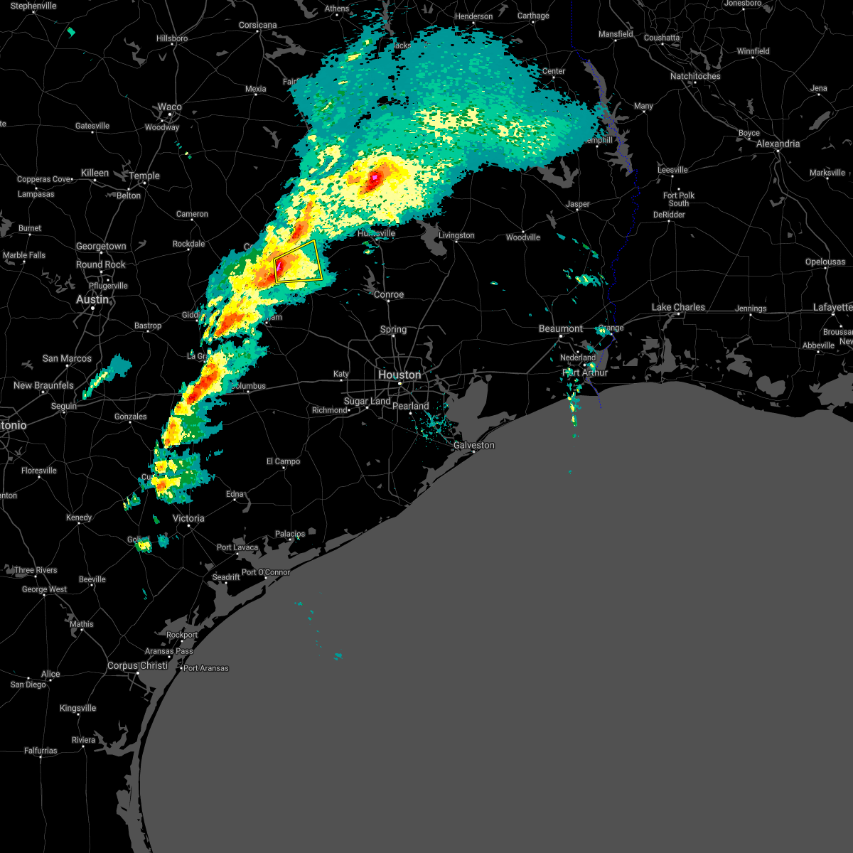
| 8/2/2020 3:26 PM CDT |
 The severe thunderstorm warning for southwestern grimes, northeastern washington and southeastern brazos counties will expire at 330 pm cdt, the storm which prompted the warning has weakened below severe limits, and no longer poses an immediate threat to life or property. therefore, the warning will be allowed to expire. The severe thunderstorm warning for southwestern grimes, northeastern washington and southeastern brazos counties will expire at 330 pm cdt, the storm which prompted the warning has weakened below severe limits, and no longer poses an immediate threat to life or property. therefore, the warning will be allowed to expire.
|
| 8/2/2020 2:59 PM CDT |
 At 258 pm cdt, a severe thunderstorm was located over millican, or 8 miles northwest of navasota, moving south at 20 mph (radar indicated). Hazards include 60 mph wind gusts and penny size hail. expect damage to roofs, siding, and trees At 258 pm cdt, a severe thunderstorm was located over millican, or 8 miles northwest of navasota, moving south at 20 mph (radar indicated). Hazards include 60 mph wind gusts and penny size hail. expect damage to roofs, siding, and trees
|
| 5/27/2020 3:03 PM CDT |
 At 302 pm cdt, severe thunderstorms were located along a line extending from near millican to 10 miles east of lake somerville dam, moving southeast at 55 mph (trained weather spotters). Hazards include golf ball size hail and 60 mph wind gusts. People and animals outdoors will be injured. expect hail damage to roofs, siding, windows, and vehicles. expect wind damage to roofs, siding, and trees. Locations impacted include, southeastern college station, navasota, washington, millican, anderson, wellborn and independence. At 302 pm cdt, severe thunderstorms were located along a line extending from near millican to 10 miles east of lake somerville dam, moving southeast at 55 mph (trained weather spotters). Hazards include golf ball size hail and 60 mph wind gusts. People and animals outdoors will be injured. expect hail damage to roofs, siding, windows, and vehicles. expect wind damage to roofs, siding, and trees. Locations impacted include, southeastern college station, navasota, washington, millican, anderson, wellborn and independence.
|
| 5/27/2020 2:42 PM CDT |
 At 242 pm cdt, severe thunderstorms were located along a line extending from near college station to 6 miles east of caldwell, moving southeast at 30 mph (trained weather spotters). Hazards include ping pong ball size hail and 60 mph wind gusts. People and animals outdoors will be injured. expect hail damage to roofs, siding, windows, and vehicles. Expect wind damage to roofs, siding, and trees. At 242 pm cdt, severe thunderstorms were located along a line extending from near college station to 6 miles east of caldwell, moving southeast at 30 mph (trained weather spotters). Hazards include ping pong ball size hail and 60 mph wind gusts. People and animals outdoors will be injured. expect hail damage to roofs, siding, windows, and vehicles. Expect wind damage to roofs, siding, and trees.
|
| 4/29/2020 4:11 AM CDT |
 At 410 am cdt, severe thunderstorms were located along a line extending from near honey island to near splendora to near woodloch to near navasota to 9 miles north of caldwell, moving south at 40 mph (radar indicated). Hazards include 60 mph wind gusts and quarter size hail. Hail damage to vehicles is expected. Expect wind damage to roofs, siding, and trees. At 410 am cdt, severe thunderstorms were located along a line extending from near honey island to near splendora to near woodloch to near navasota to 9 miles north of caldwell, moving south at 40 mph (radar indicated). Hazards include 60 mph wind gusts and quarter size hail. Hail damage to vehicles is expected. Expect wind damage to roofs, siding, and trees.
|
| 4/29/2020 3:35 AM CDT |
 At 335 am cdt, severe thunderstorms were located along a line extending from near livingston to 9 miles east of new waverly to 9 miles north of anderson to 9 miles northwest of bryan to 7 miles south of calvert, moving south at 35 mph (radar indicated). Hazards include 60 mph wind gusts and quarter size hail. Hail damage to vehicles is expected. Expect wind damage to roofs, siding, and trees. At 335 am cdt, severe thunderstorms were located along a line extending from near livingston to 9 miles east of new waverly to 9 miles north of anderson to 9 miles northwest of bryan to 7 miles south of calvert, moving south at 35 mph (radar indicated). Hazards include 60 mph wind gusts and quarter size hail. Hail damage to vehicles is expected. Expect wind damage to roofs, siding, and trees.
|
| 4/24/2020 8:58 PM CDT |
 At 858 pm cdt, a severe thunderstorm was located near anderson, or near navasota, moving southeast at 50 mph (radar indicated). Hazards include 60 mph wind gusts and quarter size hail. Hail damage to vehicles is expected. Expect wind damage to roofs, siding, and trees. At 858 pm cdt, a severe thunderstorm was located near anderson, or near navasota, moving southeast at 50 mph (radar indicated). Hazards include 60 mph wind gusts and quarter size hail. Hail damage to vehicles is expected. Expect wind damage to roofs, siding, and trees.
|
| 4/9/2020 4:59 PM CDT |
 At 444 pm cdt, a cluster of severe thunderstorms was located near washington, or 9 miles southwest of navasota, moving east at 30 mph. trained weather spotter has reported quarter sized hail in 10 miles northwest of navasota (trained weather spotters). Hazards include 70 mph wind gusts and quarter size hail. Hail damage to vehicles is expected. expect considerable tree damage. wind damage is also likely to mobile homes, roofs, and outbuildings. Locations impacted include, college station, eastern bryan, brenham, navasota, washington, somerville, burton, millican, anderson, lake somerville dam, kyle field, independence, quarry, wellborn and carlos. At 444 pm cdt, a cluster of severe thunderstorms was located near washington, or 9 miles southwest of navasota, moving east at 30 mph. trained weather spotter has reported quarter sized hail in 10 miles northwest of navasota (trained weather spotters). Hazards include 70 mph wind gusts and quarter size hail. Hail damage to vehicles is expected. expect considerable tree damage. wind damage is also likely to mobile homes, roofs, and outbuildings. Locations impacted include, college station, eastern bryan, brenham, navasota, washington, somerville, burton, millican, anderson, lake somerville dam, kyle field, independence, quarry, wellborn and carlos.
|
| 4/9/2020 4:46 PM CDT |
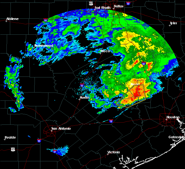 At 444 pm cdt, a cluster of severe thunderstorms was located near washington, or 9 miles southwest of navasota, moving east at 30 mph. trained weather spotter has reported quarter sized hail in 10 miles northwest of navasota (trained weather spotters). Hazards include 70 mph wind gusts and quarter size hail. Hail damage to vehicles is expected. expect considerable tree damage. wind damage is also likely to mobile homes, roofs, and outbuildings. Locations impacted include, college station, eastern bryan, brenham, navasota, washington, somerville, burton, millican, anderson, lake somerville dam, kyle field, independence, quarry, wellborn and carlos. At 444 pm cdt, a cluster of severe thunderstorms was located near washington, or 9 miles southwest of navasota, moving east at 30 mph. trained weather spotter has reported quarter sized hail in 10 miles northwest of navasota (trained weather spotters). Hazards include 70 mph wind gusts and quarter size hail. Hail damage to vehicles is expected. expect considerable tree damage. wind damage is also likely to mobile homes, roofs, and outbuildings. Locations impacted include, college station, eastern bryan, brenham, navasota, washington, somerville, burton, millican, anderson, lake somerville dam, kyle field, independence, quarry, wellborn and carlos.
|
| 4/9/2020 4:34 PM CDT |
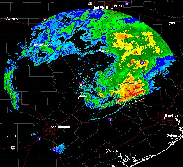 At 431 pm cdt, a severe thunderstorm was located 9 miles west of washington, or 11 miles northeast of brenham, moving east at 30 mph. trained weather spotter has reported quarter sized hail in southern college station (trained weather spotters). Hazards include 70 mph wind gusts and quarter size hail. Hail damage to vehicles is expected. expect considerable tree damage. wind damage is also likely to mobile homes, roofs, and outbuildings. Locations impacted include, college station, eastern bryan, brenham, navasota, washington, somerville, snook, burton, millican, anderson, lake somerville dam, kyle field, lake somerville state park & trailway, lyons, independence, quarry, wellborn and carlos. At 431 pm cdt, a severe thunderstorm was located 9 miles west of washington, or 11 miles northeast of brenham, moving east at 30 mph. trained weather spotter has reported quarter sized hail in southern college station (trained weather spotters). Hazards include 70 mph wind gusts and quarter size hail. Hail damage to vehicles is expected. expect considerable tree damage. wind damage is also likely to mobile homes, roofs, and outbuildings. Locations impacted include, college station, eastern bryan, brenham, navasota, washington, somerville, snook, burton, millican, anderson, lake somerville dam, kyle field, lake somerville state park & trailway, lyons, independence, quarry, wellborn and carlos.
|
| 4/9/2020 4:15 PM CDT |
 At 413 pm cdt, a severe thunderstorm was located over somerville, or 14 miles southeast of caldwell, moving east at 45 mph (radar indicated). Hazards include 70 mph wind gusts and quarter size hail. Hail damage to vehicles is expected. expect considerable tree damage. Wind damage is also likely to mobile homes, roofs, and outbuildings. At 413 pm cdt, a severe thunderstorm was located over somerville, or 14 miles southeast of caldwell, moving east at 45 mph (radar indicated). Hazards include 70 mph wind gusts and quarter size hail. Hail damage to vehicles is expected. expect considerable tree damage. Wind damage is also likely to mobile homes, roofs, and outbuildings.
|
| 1/10/2020 10:15 PM CST |
 At 1014 pm cst, severe thunderstorms were located along a line extending from 14 miles north of kurten to 7 miles east of college station to 8 miles northeast of brenham, moving northeast at 55 mph (radar indicated). Hazards include 60 mph wind gusts. Expect damage to roofs, siding, and trees. severe thunderstorms will be near, navasota around 1030 pm cst. bedias around 1035 pm cst. anderson around 1040 pm cst. Other locations impacted by these severe thunderstorms include wellborn, crabbs prairie, roans prairie, independence, iola, richards, north zulch, carlos, dacus and normangee. At 1014 pm cst, severe thunderstorms were located along a line extending from 14 miles north of kurten to 7 miles east of college station to 8 miles northeast of brenham, moving northeast at 55 mph (radar indicated). Hazards include 60 mph wind gusts. Expect damage to roofs, siding, and trees. severe thunderstorms will be near, navasota around 1030 pm cst. bedias around 1035 pm cst. anderson around 1040 pm cst. Other locations impacted by these severe thunderstorms include wellborn, crabbs prairie, roans prairie, independence, iola, richards, north zulch, carlos, dacus and normangee.
|
| 1/10/2020 9:40 PM CST |
 At 940 pm cst, severe thunderstorms were located along a line extending from 7 miles southwest of hearne to 6 miles west of fayetteville, moving northeast at 60 mph. the most severe part of the line of storms is near caldwell (radar indicated). Hazards include 70 mph wind gusts. Expect considerable tree damage. damage is likely to mobile homes, roofs, and outbuildings. Locations impacted include, college station, bryan, brenham, navasota, caldwell, washington, shelby, somerville, snook, kurten, burton, wixon valley, millican, lake somerville dam, kyle field, lake somerville state park & trailway, iola, carmine, lyons and north zulch. At 940 pm cst, severe thunderstorms were located along a line extending from 7 miles southwest of hearne to 6 miles west of fayetteville, moving northeast at 60 mph. the most severe part of the line of storms is near caldwell (radar indicated). Hazards include 70 mph wind gusts. Expect considerable tree damage. damage is likely to mobile homes, roofs, and outbuildings. Locations impacted include, college station, bryan, brenham, navasota, caldwell, washington, shelby, somerville, snook, kurten, burton, wixon valley, millican, lake somerville dam, kyle field, lake somerville state park & trailway, iola, carmine, lyons and north zulch.
|
| 1/10/2020 9:25 PM CST |
 At 924 pm cst, severe thunderstorms were located along a line extending from 8 miles east of rockdale to near muldoon, moving northeast at 55 mph (radar indicated). Hazards include 60 mph wind gusts. expect damage to roofs, siding, and trees At 924 pm cst, severe thunderstorms were located along a line extending from 8 miles east of rockdale to near muldoon, moving northeast at 55 mph (radar indicated). Hazards include 60 mph wind gusts. expect damage to roofs, siding, and trees
|
| 9/10/2019 4:22 PM CDT |
 The national weather service in league city has issued a * severe thunderstorm warning for. northeastern burleson county in southeastern texas. west central grimes county in southeastern texas. brazos county in southeastern texas. Until 445 pm cdt. The national weather service in league city has issued a * severe thunderstorm warning for. northeastern burleson county in southeastern texas. west central grimes county in southeastern texas. brazos county in southeastern texas. Until 445 pm cdt.
|
| 6/16/2019 9:53 PM CDT |
 At 951 pm cdt, severe thunderstorms were located along a line extending from near anderson to 6 miles southeast of washington, moving southeast at 60 mph (law enforcement). Hazards include 60 mph wind gusts and penny size hail. Expect damage to roofs, siding, and trees. Locations impacted include, southeastern college station, navasota, bedias, millican, anderson, iola, roans prairie, richards and carlos. At 951 pm cdt, severe thunderstorms were located along a line extending from near anderson to 6 miles southeast of washington, moving southeast at 60 mph (law enforcement). Hazards include 60 mph wind gusts and penny size hail. Expect damage to roofs, siding, and trees. Locations impacted include, southeastern college station, navasota, bedias, millican, anderson, iola, roans prairie, richards and carlos.
|
| 6/16/2019 9:33 PM CDT |
 At 933 pm cdt, severe thunderstorms were located along a line extending from 8 miles east of kurten to near millican, moving southeast at 60 mph (radar indicated). Hazards include 60 mph wind gusts and penny size hail. expect damage to roofs, siding, and trees At 933 pm cdt, severe thunderstorms were located along a line extending from 8 miles east of kurten to near millican, moving southeast at 60 mph (radar indicated). Hazards include 60 mph wind gusts and penny size hail. expect damage to roofs, siding, and trees
|
| 6/16/2019 9:28 PM CDT |
 At 927 pm cdt, a severe thunderstorm was located near college station, moving southeast at 50 mph (radar indicated). Hazards include 60 mph wind gusts. expect damage to roofs, siding, and trees At 927 pm cdt, a severe thunderstorm was located near college station, moving southeast at 50 mph (radar indicated). Hazards include 60 mph wind gusts. expect damage to roofs, siding, and trees
|
| 6/16/2019 6:06 PM CDT |
 At 606 pm cdt, a severe thunderstorm was located near millican, or 7 miles west of navasota, moving northeast at 15 mph (radar indicated). Hazards include ping pong ball size hail and 60 mph wind gusts. People and animals outdoors will be injured. expect hail damage to roofs, siding, windows, and vehicles. expect wind damage to roofs, siding, and trees. Locations impacted include, southeastern college station, navasota, washington, millican, anderson, independence and carlos. At 606 pm cdt, a severe thunderstorm was located near millican, or 7 miles west of navasota, moving northeast at 15 mph (radar indicated). Hazards include ping pong ball size hail and 60 mph wind gusts. People and animals outdoors will be injured. expect hail damage to roofs, siding, windows, and vehicles. expect wind damage to roofs, siding, and trees. Locations impacted include, southeastern college station, navasota, washington, millican, anderson, independence and carlos.
|
| 6/16/2019 5:55 PM CDT |
 At 555 pm cdt, a severe thunderstorm was located near millican, or 9 miles west of navasota, moving northeast at 15 mph (radar indicated). Hazards include 60 mph wind gusts and nickel size hail. expect damage to roofs, siding, and trees At 555 pm cdt, a severe thunderstorm was located near millican, or 9 miles west of navasota, moving northeast at 15 mph (radar indicated). Hazards include 60 mph wind gusts and nickel size hail. expect damage to roofs, siding, and trees
|
| 5/8/2019 2:16 PM CDT |
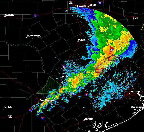 At 213 pm cdt, a severe thunderstorm capable of producing a tornado was located 10 miles west of college station, moving east at 30 mph (radar indicated rotation and a spotter report of a tornado 6 north northeast of snook). Hazards include tornado. Flying debris will be dangerous to those caught without shelter. mobile homes will be damaged or destroyed. damage to roofs, windows, and vehicles will occur. tree damage is likely. this dangerous storm will be near, kyle field around 220 pm cdt. college station around 225 pm cdt. millican around 230 pm cdt. Other locations impacted by this tornadic thunderstorm include wellborn. At 213 pm cdt, a severe thunderstorm capable of producing a tornado was located 10 miles west of college station, moving east at 30 mph (radar indicated rotation and a spotter report of a tornado 6 north northeast of snook). Hazards include tornado. Flying debris will be dangerous to those caught without shelter. mobile homes will be damaged or destroyed. damage to roofs, windows, and vehicles will occur. tree damage is likely. this dangerous storm will be near, kyle field around 220 pm cdt. college station around 225 pm cdt. millican around 230 pm cdt. Other locations impacted by this tornadic thunderstorm include wellborn.
|
| 5/8/2019 2:03 PM CDT |
 At 202 pm cdt, a severe thunderstorm capable of producing a tornado was located near snook, or 10 miles east of caldwell, moving east at 35 mph (radar indicated rotation). Hazards include tornado. Flying debris will be dangerous to those caught without shelter. mobile homes will be damaged or destroyed. damage to roofs, windows, and vehicles will occur. tree damage is likely. this dangerous storm will be near, kyle field around 220 pm cdt. millican around 230 pm cdt. Other locations impacted by this tornadic thunderstorm include wellborn. At 202 pm cdt, a severe thunderstorm capable of producing a tornado was located near snook, or 10 miles east of caldwell, moving east at 35 mph (radar indicated rotation). Hazards include tornado. Flying debris will be dangerous to those caught without shelter. mobile homes will be damaged or destroyed. damage to roofs, windows, and vehicles will occur. tree damage is likely. this dangerous storm will be near, kyle field around 220 pm cdt. millican around 230 pm cdt. Other locations impacted by this tornadic thunderstorm include wellborn.
|
| 5/3/2019 11:12 AM CDT |
 The severe thunderstorm warning for southeastern burleson, southwestern grimes, eastern washington and southeastern brazos counties will expire at 1115 am cdt, the storm which prompted the warning has weakened below severe limits, and no longer poses an immediate threat to life or property. therefore, the warning will be allowed to expire. however gusty winds are still possible with this thunderstorm. The severe thunderstorm warning for southeastern burleson, southwestern grimes, eastern washington and southeastern brazos counties will expire at 1115 am cdt, the storm which prompted the warning has weakened below severe limits, and no longer poses an immediate threat to life or property. therefore, the warning will be allowed to expire. however gusty winds are still possible with this thunderstorm.
|
| 5/3/2019 10:59 AM CDT |
 At 1046 am cdt, a severe thunderstorm was located near brenham, moving northeast at 45 mph (radar indicated). Hazards include 60 mph wind gusts and quarter size hail. Hail damage to vehicles is expected. Expect wind damage to roofs, siding, and trees. At 1046 am cdt, a severe thunderstorm was located near brenham, moving northeast at 45 mph (radar indicated). Hazards include 60 mph wind gusts and quarter size hail. Hail damage to vehicles is expected. Expect wind damage to roofs, siding, and trees.
|
| 5/3/2019 10:46 AM CDT |
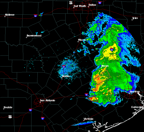 At 1046 am cdt, a severe thunderstorm was located near brenham, moving northeast at 45 mph (radar indicated). Hazards include 60 mph wind gusts and quarter size hail. Hail damage to vehicles is expected. Expect wind damage to roofs, siding, and trees. At 1046 am cdt, a severe thunderstorm was located near brenham, moving northeast at 45 mph (radar indicated). Hazards include 60 mph wind gusts and quarter size hail. Hail damage to vehicles is expected. Expect wind damage to roofs, siding, and trees.
|
| 4/18/2019 2:40 AM CDT |
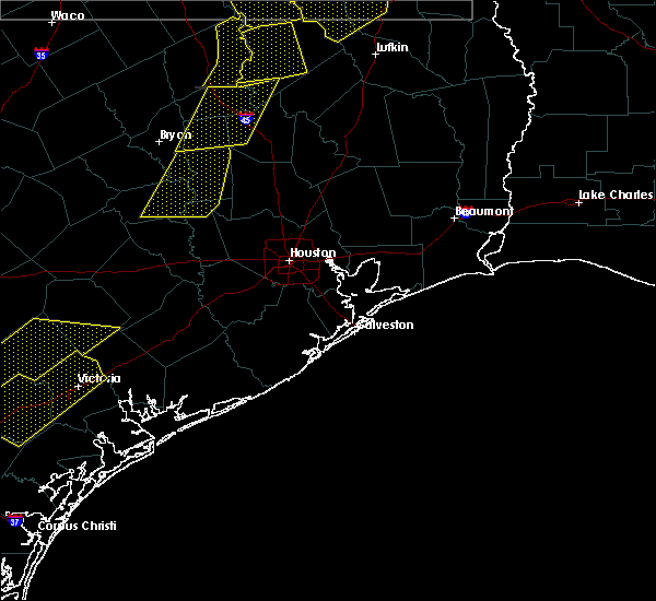 At 239 am cdt, severe thunderstorms were located along a line extending from 10 miles southeast of bedias to 6 miles north of hempstead, moving east at 35 mph (radar indicated). Hazards include 60 mph wind gusts. Expect damage to roofs, siding, and trees. Locations impacted include, southeastern college station, brenham, navasota, hempstead, washington, millican, anderson, roans prairie, independence, richards and carlos. At 239 am cdt, severe thunderstorms were located along a line extending from 10 miles southeast of bedias to 6 miles north of hempstead, moving east at 35 mph (radar indicated). Hazards include 60 mph wind gusts. Expect damage to roofs, siding, and trees. Locations impacted include, southeastern college station, brenham, navasota, hempstead, washington, millican, anderson, roans prairie, independence, richards and carlos.
|
| 4/18/2019 2:13 AM CDT |
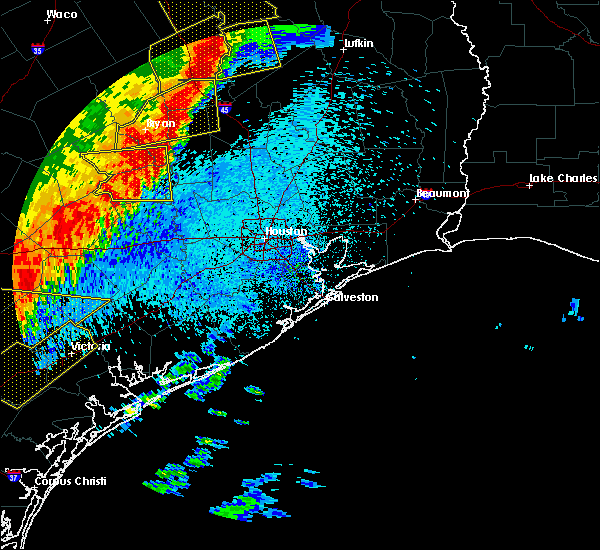 At 213 am cdt, severe thunderstorms were located along a line extending from 9 miles northeast of madisonville to near brenham, moving east at 40 mph (radar indicated). Hazards include 60 mph wind gusts. expect damage to roofs, siding, and trees At 213 am cdt, severe thunderstorms were located along a line extending from 9 miles northeast of madisonville to near brenham, moving east at 40 mph (radar indicated). Hazards include 60 mph wind gusts. expect damage to roofs, siding, and trees
|
| 4/18/2019 1:46 AM CDT |
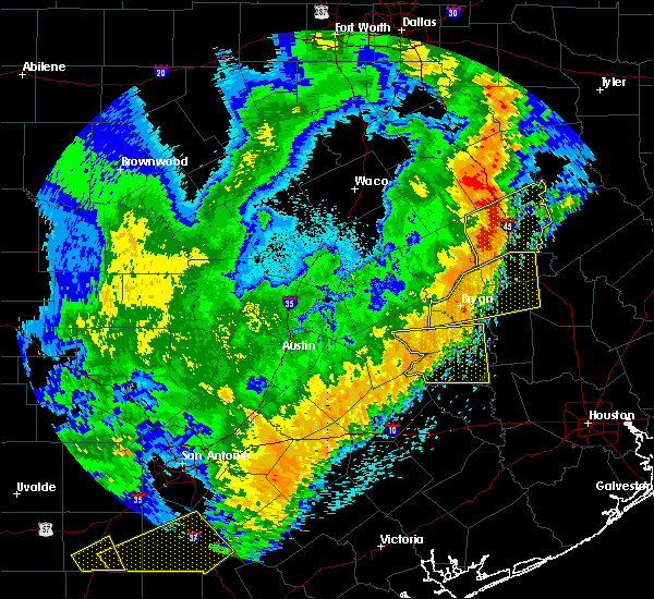 At 145 am cdt, severe thunderstorms were located along a line extending from near snook to near burton, moving east at 45 mph (radar indicated). Hazards include 60 mph wind gusts. Expect damage to roofs, siding, and trees. Locations impacted include, brenham, somerville, snook, burton, millican, lake somerville dam, lake somerville state park & trailway, carmine, lyons, deanville, independence and quarry. At 145 am cdt, severe thunderstorms were located along a line extending from near snook to near burton, moving east at 45 mph (radar indicated). Hazards include 60 mph wind gusts. Expect damage to roofs, siding, and trees. Locations impacted include, brenham, somerville, snook, burton, millican, lake somerville dam, lake somerville state park & trailway, carmine, lyons, deanville, independence and quarry.
|
| 4/18/2019 1:25 AM CDT |
 At 124 am cdt, severe thunderstorms were located along a line extending from 7 miles southeast of caldwell to 7 miles southeast of giddings, moving east at 45 mph (radar indicated). Hazards include 60 mph wind gusts. expect damage to roofs, siding, and trees At 124 am cdt, severe thunderstorms were located along a line extending from 7 miles southeast of caldwell to 7 miles southeast of giddings, moving east at 45 mph (radar indicated). Hazards include 60 mph wind gusts. expect damage to roofs, siding, and trees
|
| 4/7/2019 12:20 PM CDT |
 At 1220 pm cdt, a severe thunderstorm was located near college station, moving northeast at 35 mph (radar indicated). Hazards include 60 mph wind gusts. expect damage to roofs, siding, and trees At 1220 pm cdt, a severe thunderstorm was located near college station, moving northeast at 35 mph (radar indicated). Hazards include 60 mph wind gusts. expect damage to roofs, siding, and trees
|
| 4/6/2019 9:59 AM CDT |
 At 959 am cdt, a severe thunderstorm was located near millican, or 10 miles west of navasota, moving northeast at 30 mph (radar indicated). Hazards include quarter size hail. damage to vehicles is expected At 959 am cdt, a severe thunderstorm was located near millican, or 10 miles west of navasota, moving northeast at 30 mph (radar indicated). Hazards include quarter size hail. damage to vehicles is expected
|
| 6/3/2018 10:42 PM CDT |
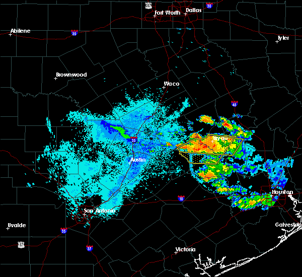 At 1042 pm cdt, severe thunderstorms were located along a line extending from 7 miles northeast of tanglewood to near millican, moving southwest at 15 mph (radar indicated). Hazards include 60 mph wind gusts and penny size hail. expect damage to roofs, siding, and trees At 1042 pm cdt, severe thunderstorms were located along a line extending from 7 miles northeast of tanglewood to near millican, moving southwest at 15 mph (radar indicated). Hazards include 60 mph wind gusts and penny size hail. expect damage to roofs, siding, and trees
|
| 6/3/2018 10:00 PM CDT |
 The national weather service in league city has issued a * severe thunderstorm warning for. central burleson county in southeastern texas. northern grimes county in southeastern texas. brazos county in southeastern texas. Until 1045 pm cdt. The national weather service in league city has issued a * severe thunderstorm warning for. central burleson county in southeastern texas. northern grimes county in southeastern texas. brazos county in southeastern texas. Until 1045 pm cdt.
|
| 4/7/2018 12:39 AM CDT |
 At 1239 am cdt, severe thunderstorms were located along a line extending from 8 miles southeast of bedias to near millican, moving southeast at 35 mph (radar indicated). Hazards include 60 mph wind gusts and quarter size hail. Hail damage to vehicles is expected. Expect wind damage to roofs, siding, and trees. At 1239 am cdt, severe thunderstorms were located along a line extending from 8 miles southeast of bedias to near millican, moving southeast at 35 mph (radar indicated). Hazards include 60 mph wind gusts and quarter size hail. Hail damage to vehicles is expected. Expect wind damage to roofs, siding, and trees.
|
| 4/7/2018 12:11 AM CDT |
 At 1211 am cdt, a severe thunderstorm was located 7 miles south of kurten, or 8 miles northeast of college station, moving east at 45 mph (radar indicated). Hazards include 70 mph wind gusts and penny size hail. Expect considerable tree damage. Damage is likely to mobile homes, roofs, and outbuildings. At 1211 am cdt, a severe thunderstorm was located 7 miles south of kurten, or 8 miles northeast of college station, moving east at 45 mph (radar indicated). Hazards include 70 mph wind gusts and penny size hail. Expect considerable tree damage. Damage is likely to mobile homes, roofs, and outbuildings.
|
| 4/6/2018 11:46 PM CDT |
 At 1146 pm cdt, a severe thunderstorm was located near hearne, moving east at 55 mph (radar indicated). Hazards include 60 mph wind gusts and penny size hail. expect damage to roofs, siding, and trees At 1146 pm cdt, a severe thunderstorm was located near hearne, moving east at 55 mph (radar indicated). Hazards include 60 mph wind gusts and penny size hail. expect damage to roofs, siding, and trees
|
| 3/18/2018 7:14 PM CDT |
 At 713 pm cdt, a severe thunderstorm was located over navasota, moving east at 35 mph (radar indicated). Hazards include tennis ball size hail and 60 mph wind gusts. People and animals outdoors will be injured. expect hail damage to roofs, siding, windows, and vehicles. Expect wind damage to roofs, siding, and trees. At 713 pm cdt, a severe thunderstorm was located over navasota, moving east at 35 mph (radar indicated). Hazards include tennis ball size hail and 60 mph wind gusts. People and animals outdoors will be injured. expect hail damage to roofs, siding, windows, and vehicles. Expect wind damage to roofs, siding, and trees.
|
| 3/18/2018 6:51 PM CDT |
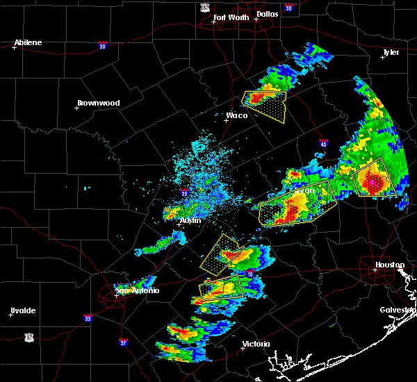 At 651 pm cdt, a severe thunderstorm was located over millican, or 8 miles northwest of navasota, moving east at 45 mph (radar indicated). Hazards include two inch hail and 60 mph wind gusts. People and animals outdoors will be injured. expect hail damage to roofs, siding, windows, and vehicles. expect wind damage to roofs, siding, and trees. Locations impacted include, college station, bryan, navasota, somerville, snook, millican, anderson, lake somerville dam, kyle field, iola, lyons, wellborn, carlos and roans prairie. At 651 pm cdt, a severe thunderstorm was located over millican, or 8 miles northwest of navasota, moving east at 45 mph (radar indicated). Hazards include two inch hail and 60 mph wind gusts. People and animals outdoors will be injured. expect hail damage to roofs, siding, windows, and vehicles. expect wind damage to roofs, siding, and trees. Locations impacted include, college station, bryan, navasota, somerville, snook, millican, anderson, lake somerville dam, kyle field, iola, lyons, wellborn, carlos and roans prairie.
|
| 3/18/2018 6:33 PM CDT |
 At 632 pm cdt, a severe thunderstorm was located over snook, or 11 miles southwest of college station, moving east at 45 mph. these storms have had a history of producing up to softball size hail (radar indicated). Hazards include ping pong ball to golf ball size hail and 60 mph wind gusts. People and animals outdoors will be injured. expect hail damage to roofs, siding, windows, and vehicles. Expect wind damage to roofs, siding, and trees. At 632 pm cdt, a severe thunderstorm was located over snook, or 11 miles southwest of college station, moving east at 45 mph. these storms have had a history of producing up to softball size hail (radar indicated). Hazards include ping pong ball to golf ball size hail and 60 mph wind gusts. People and animals outdoors will be injured. expect hail damage to roofs, siding, windows, and vehicles. Expect wind damage to roofs, siding, and trees.
|
| 3/18/2018 6:01 PM CDT |
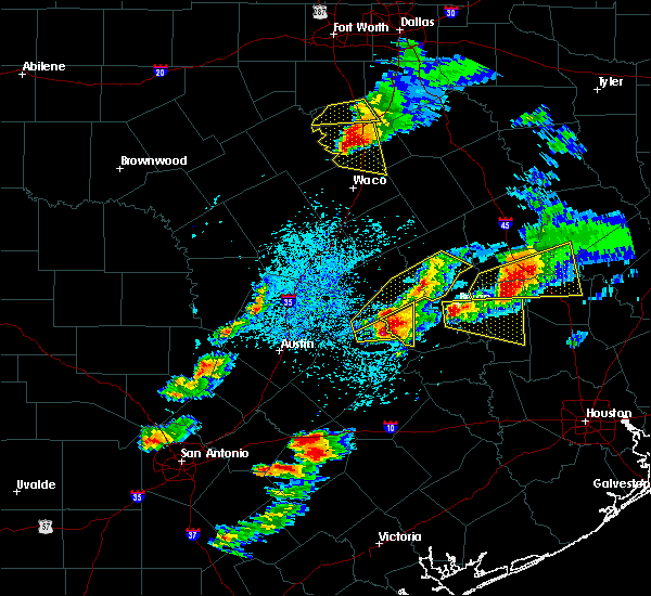 At 600 pm cdt, a severe thunderstorm was located over southwestern bryan, moving east at 40 mph. these storms have a history of producing up to softball size hail (radar indicated). Hazards include golf ball to tennis ball size hail. People and animals outdoors will be injured. Expect damage to roofs, siding, windows, and vehicles. At 600 pm cdt, a severe thunderstorm was located over southwestern bryan, moving east at 40 mph. these storms have a history of producing up to softball size hail (radar indicated). Hazards include golf ball to tennis ball size hail. People and animals outdoors will be injured. Expect damage to roofs, siding, windows, and vehicles.
|
| 3/18/2018 5:29 PM CDT |
 At 528 pm cdt, a severe thunderstorm was located near snook, or 9 miles east of caldwell, moving east at 30 mph. baseball size hail was occurring at the local sheriffs office in caldwell at 528 pm. this is a very dangerous storm (radar indicated). Hazards include baseball size hail and 60 mph wind gusts. People and animals outdoors will be severely injured. Expect shattered windows, extensive damage to roofs, siding, and vehicles. At 528 pm cdt, a severe thunderstorm was located near snook, or 9 miles east of caldwell, moving east at 30 mph. baseball size hail was occurring at the local sheriffs office in caldwell at 528 pm. this is a very dangerous storm (radar indicated). Hazards include baseball size hail and 60 mph wind gusts. People and animals outdoors will be severely injured. Expect shattered windows, extensive damage to roofs, siding, and vehicles.
|
| 8/26/2017 7:48 AM CDT |
 At 748 am cdt, a severe thunderstorm capable of producing a tornado was located over millican, or near navasota, moving northwest at 45 mph (radar indicated rotation). Hazards include tornado. Flying debris will be dangerous to those caught without shelter. mobile homes will be damaged or destroyed. damage to roofs, windows, and vehicles will occur. Tree damage is likely. At 748 am cdt, a severe thunderstorm capable of producing a tornado was located over millican, or near navasota, moving northwest at 45 mph (radar indicated rotation). Hazards include tornado. Flying debris will be dangerous to those caught without shelter. mobile homes will be damaged or destroyed. damage to roofs, windows, and vehicles will occur. Tree damage is likely.
|
| 6/4/2017 2:17 AM CDT |
 At 216 am cdt, a severe thunderstorm was located 10 miles south of bedias, or 18 miles north of navasota, moving east at 25 mph (radar indicated). Hazards include 60 mph wind gusts and penny size hail. Expect damage to roofs, siding, and trees. Locations impacted include, southeastern college station, navasota, bedias, millican, anderson, iola, crabbs prairie, roans prairie, richards, carlos and dacus. At 216 am cdt, a severe thunderstorm was located 10 miles south of bedias, or 18 miles north of navasota, moving east at 25 mph (radar indicated). Hazards include 60 mph wind gusts and penny size hail. Expect damage to roofs, siding, and trees. Locations impacted include, southeastern college station, navasota, bedias, millican, anderson, iola, crabbs prairie, roans prairie, richards, carlos and dacus.
|
| 6/4/2017 2:05 AM CDT |
 At 203 am cdt, a severe thunderstorm was located 10 miles northwest of anderson, or 14 miles east of college station, moving east at 25 mph (radar indicated). Hazards include 60 mph wind gusts and penny size hail. expect damage to roofs, siding, and trees At 203 am cdt, a severe thunderstorm was located 10 miles northwest of anderson, or 14 miles east of college station, moving east at 25 mph (radar indicated). Hazards include 60 mph wind gusts and penny size hail. expect damage to roofs, siding, and trees
|
| 5/28/2017 9:14 PM CDT |
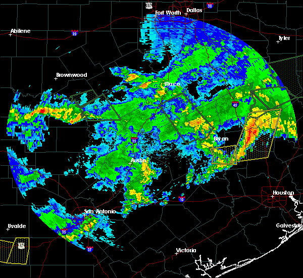 At 913 pm cdt, a severe thunderstorm was located over millican, or near navasota, moving east at 40 mph (radar indicated). Hazards include 60 mph wind gusts. Expect damage to roofs, siding, and trees. Locations impacted include, southern college station, navasota, washington, millican, anderson, wellborn, independence and carlos. At 913 pm cdt, a severe thunderstorm was located over millican, or near navasota, moving east at 40 mph (radar indicated). Hazards include 60 mph wind gusts. Expect damage to roofs, siding, and trees. Locations impacted include, southern college station, navasota, washington, millican, anderson, wellborn, independence and carlos.
|
| 5/28/2017 8:53 PM CDT |
 At 853 pm cdt, a severe thunderstorm was located 7 miles east of snook, or 10 miles south of college station, moving east at 50 mph (radar indicated). Hazards include 60 mph wind gusts. expect damage to roofs, siding, and trees At 853 pm cdt, a severe thunderstorm was located 7 miles east of snook, or 10 miles south of college station, moving east at 50 mph (radar indicated). Hazards include 60 mph wind gusts. expect damage to roofs, siding, and trees
|
| 5/28/2017 7:28 PM CDT |
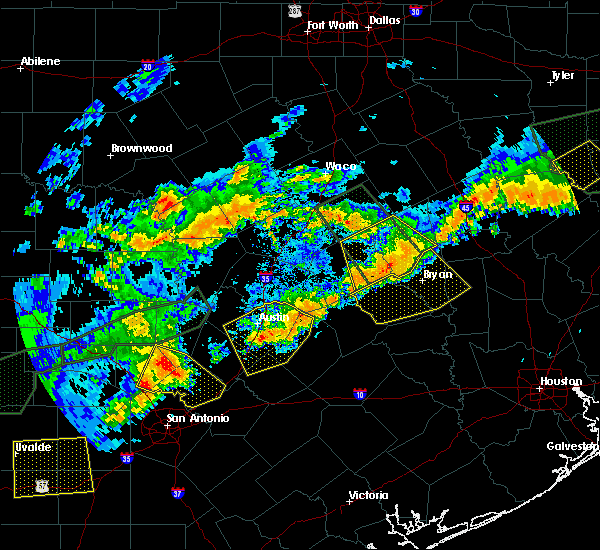 At 727 pm cdt, a severe thunderstorm was located 9 miles north of caldwell, moving southeast at 20 mph. dime size hail has been reported south of goldthwaite (radar indicated). Hazards include 60 mph wind gusts and quarter size hail. Hail damage to vehicles is expected. Expect wind damage to roofs, siding, and trees. At 727 pm cdt, a severe thunderstorm was located 9 miles north of caldwell, moving southeast at 20 mph. dime size hail has been reported south of goldthwaite (radar indicated). Hazards include 60 mph wind gusts and quarter size hail. Hail damage to vehicles is expected. Expect wind damage to roofs, siding, and trees.
|
| 5/28/2017 7:17 PM CDT |
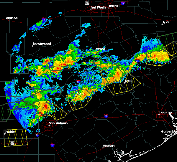 At 716 pm cdt, a severe thunderstorm was located 12 miles northeast of caldwell, moving southeast at 30 mph (radar indicated). Hazards include 60 mph wind gusts and quarter size hail. Hail damage to vehicles is expected. expect wind damage to roofs, siding, and trees. Locations impacted include, college station, bryan, caldwell, snook, kurten, wixon valley, millican, kyle field, iola, lyons, chriesman, wellborn and carlos. At 716 pm cdt, a severe thunderstorm was located 12 miles northeast of caldwell, moving southeast at 30 mph (radar indicated). Hazards include 60 mph wind gusts and quarter size hail. Hail damage to vehicles is expected. expect wind damage to roofs, siding, and trees. Locations impacted include, college station, bryan, caldwell, snook, kurten, wixon valley, millican, kyle field, iola, lyons, chriesman, wellborn and carlos.
|
| 5/28/2017 7:02 PM CDT |
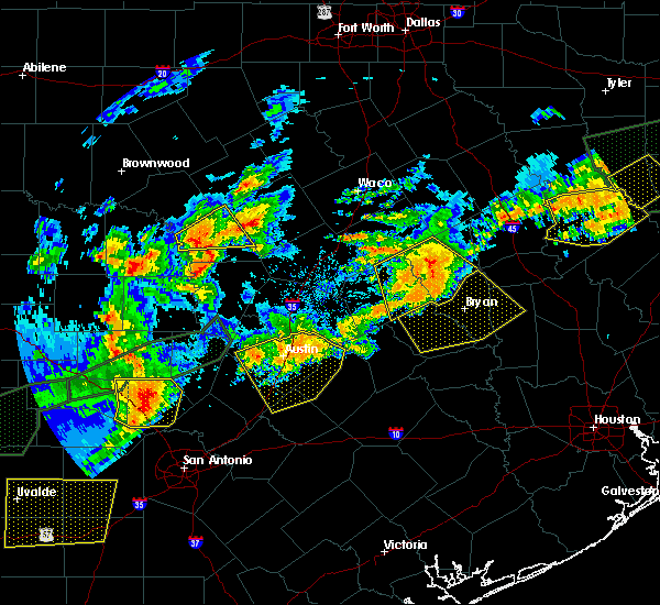 At 657 pm cdt, a severe thunderstorm was located over calvert, or 7 miles northwest of hearne, moving southeast at 50 mph (radar indicated). Hazards include 60 mph wind gusts and quarter size hail. Hail damage to vehicles is expected. Expect wind damage to roofs, siding, and trees. At 657 pm cdt, a severe thunderstorm was located over calvert, or 7 miles northwest of hearne, moving southeast at 50 mph (radar indicated). Hazards include 60 mph wind gusts and quarter size hail. Hail damage to vehicles is expected. Expect wind damage to roofs, siding, and trees.
|
| 5/28/2017 6:57 PM CDT |
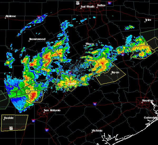 The national weather service in league city has issued a * severe thunderstorm warning for. burleson county in southeastern texas. northwestern grimes county in southeastern texas. brazos county in southeastern texas. Southwestern madison county in southeastern texas. The national weather service in league city has issued a * severe thunderstorm warning for. burleson county in southeastern texas. northwestern grimes county in southeastern texas. brazos county in southeastern texas. Southwestern madison county in southeastern texas.
|
| 5/21/2017 1:25 AM CDT |
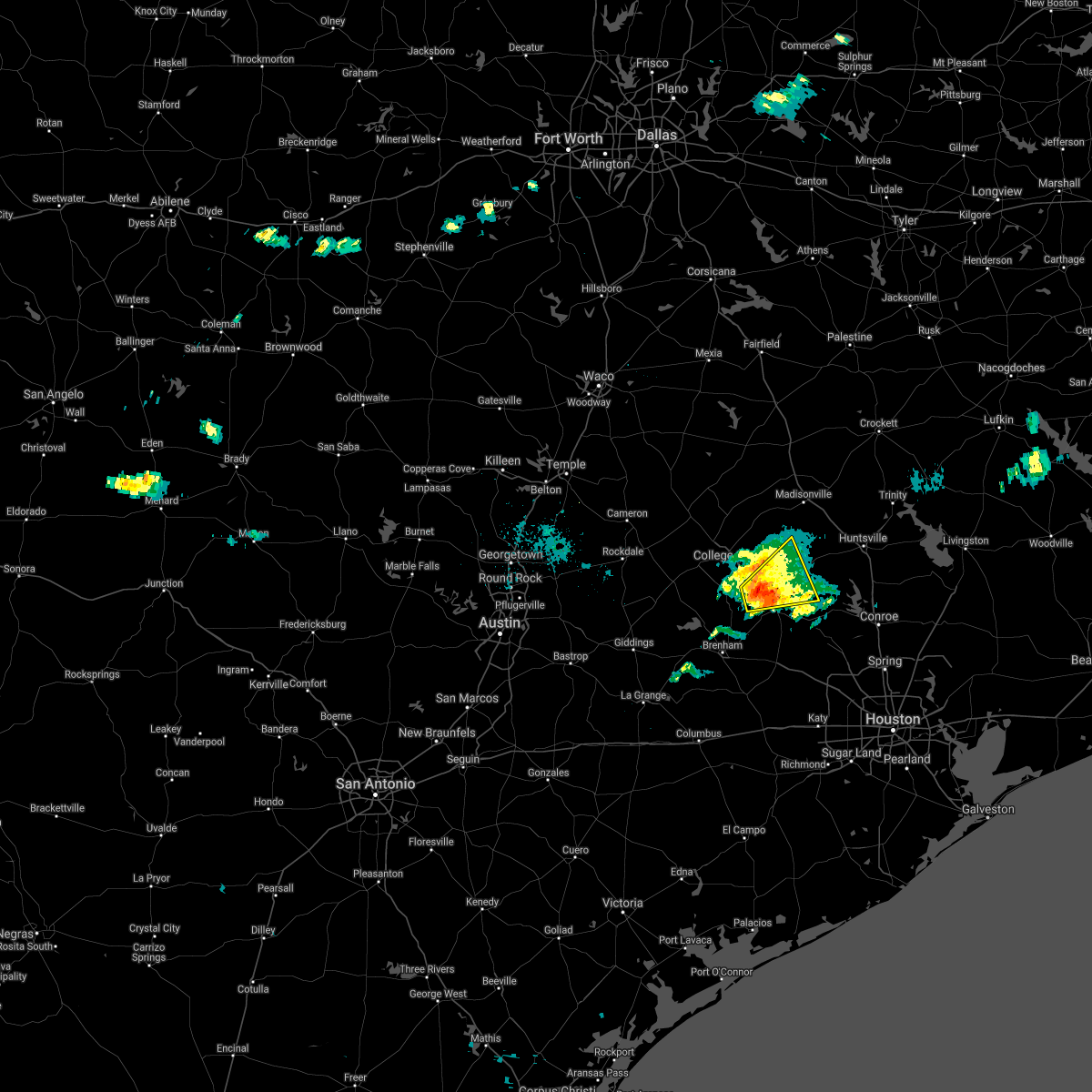 At 124 am cdt, a severe thunderstorm was located near millican, or near navasota, moving east at 35 mph (radar indicated). Hazards include 60 mph wind gusts and quarter size hail. Hail damage to vehicles is expected. expect wind damage to roofs, siding, and trees. Locations impacted include, southeastern college station, navasota, millican, anderson, carlos and roans prairie. At 124 am cdt, a severe thunderstorm was located near millican, or near navasota, moving east at 35 mph (radar indicated). Hazards include 60 mph wind gusts and quarter size hail. Hail damage to vehicles is expected. expect wind damage to roofs, siding, and trees. Locations impacted include, southeastern college station, navasota, millican, anderson, carlos and roans prairie.
|
| 5/21/2017 1:16 AM CDT |
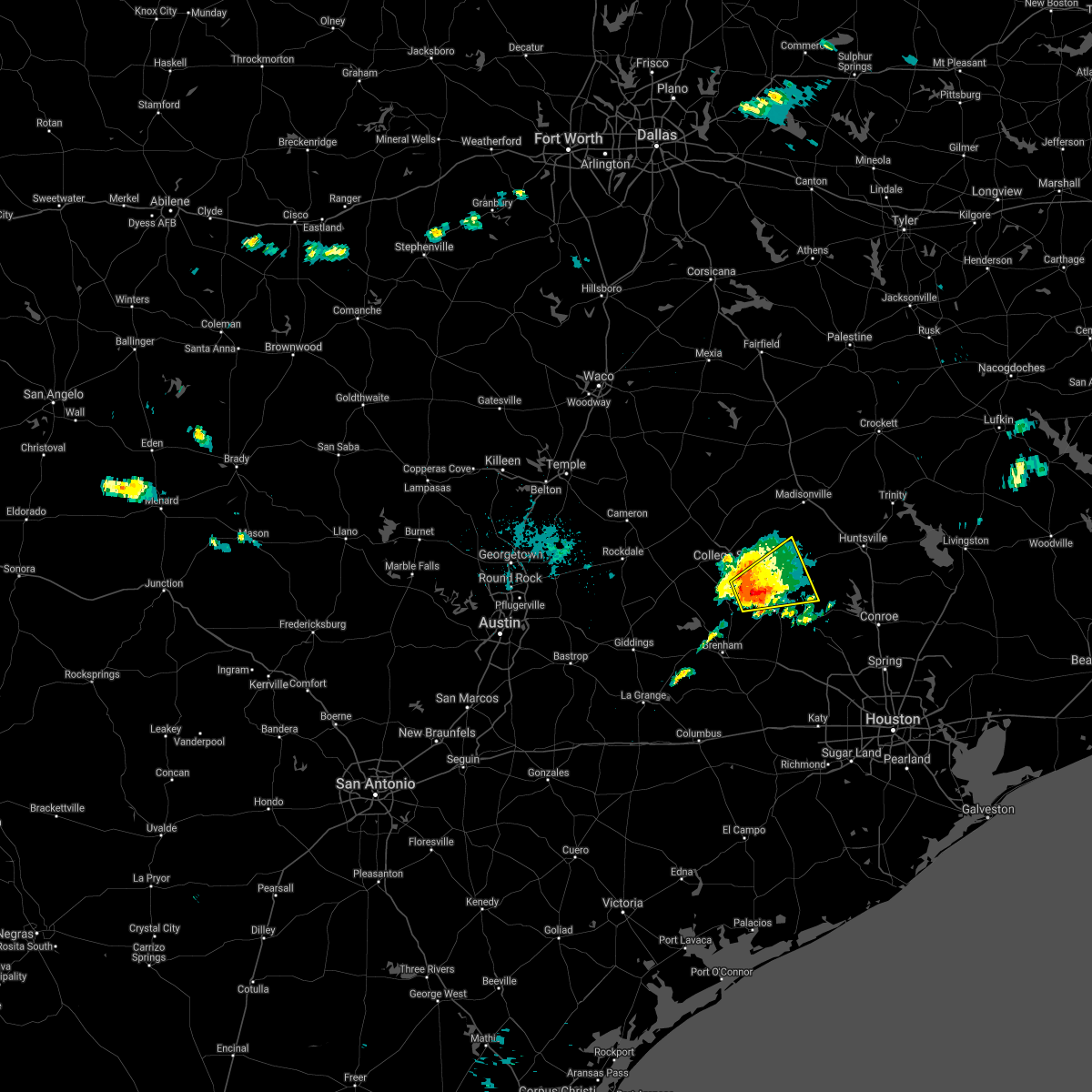 At 116 am cdt, a severe thunderstorm was located over millican, or 9 miles northwest of navasota, moving east at 25 mph (radar indicated). Hazards include quarter size hail. damage to vehicles is expected At 116 am cdt, a severe thunderstorm was located over millican, or 9 miles northwest of navasota, moving east at 25 mph (radar indicated). Hazards include quarter size hail. damage to vehicles is expected
|
| 5/11/2017 8:36 PM CDT |
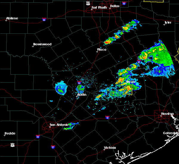 At 836 pm cdt, a severe thunderstorm was located near college station, moving east at 30 mph (radar indicated). Hazards include 60 mph wind gusts and quarter size hail. Hail damage to vehicles is expected. expect wind damage to roofs, siding, and trees. Locations impacted include, college station, southern bryan, millican, kyle field and wellborn. At 836 pm cdt, a severe thunderstorm was located near college station, moving east at 30 mph (radar indicated). Hazards include 60 mph wind gusts and quarter size hail. Hail damage to vehicles is expected. expect wind damage to roofs, siding, and trees. Locations impacted include, college station, southern bryan, millican, kyle field and wellborn.
|
| 5/11/2017 8:25 PM CDT |
 At 825 pm cdt, a severe thunderstorm was located over snook, or 9 miles southwest of college station, moving east at 30 mph (radar indicated). Hazards include 60 mph wind gusts and quarter size hail. Hail damage to vehicles is expected. expect wind damage to roofs, siding, and trees. Locations impacted include, college station, southern bryan, snook, millican, kyle field and wellborn. At 825 pm cdt, a severe thunderstorm was located over snook, or 9 miles southwest of college station, moving east at 30 mph (radar indicated). Hazards include 60 mph wind gusts and quarter size hail. Hail damage to vehicles is expected. expect wind damage to roofs, siding, and trees. Locations impacted include, college station, southern bryan, snook, millican, kyle field and wellborn.
|
| 5/11/2017 8:11 PM CDT |
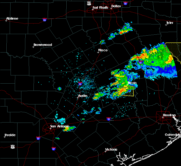 At 811 pm cdt, a severe thunderstorm was located near snook, or 10 miles east of caldwell, moving east at 25 mph (radar indicated). Hazards include 60 mph wind gusts and quarter size hail. Hail damage to vehicles is expected. Expect wind damage to roofs, siding, and trees. At 811 pm cdt, a severe thunderstorm was located near snook, or 10 miles east of caldwell, moving east at 25 mph (radar indicated). Hazards include 60 mph wind gusts and quarter size hail. Hail damage to vehicles is expected. Expect wind damage to roofs, siding, and trees.
|
| 5/3/2017 6:46 PM CDT |
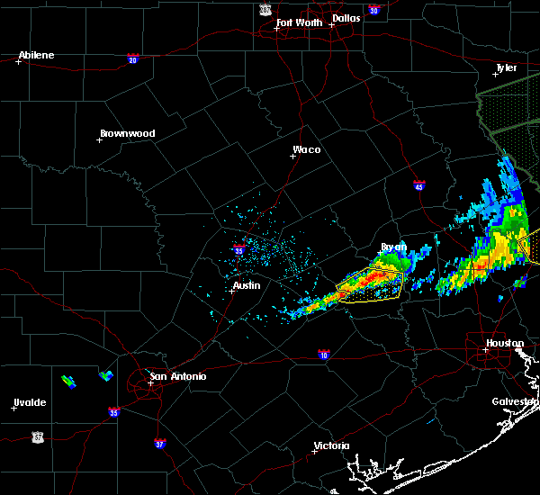 At 644 pm cdt, a severe thunderstorm was located near somerville, or 15 miles north of brenham, moving southeast at 25 mph (radar indicated). Hazards include quarter size hail. Damage to vehicles is expected. Locations impacted include, somerville, snook, millican, lake somerville dam, lyons, independence and quarry. At 644 pm cdt, a severe thunderstorm was located near somerville, or 15 miles north of brenham, moving southeast at 25 mph (radar indicated). Hazards include quarter size hail. Damage to vehicles is expected. Locations impacted include, somerville, snook, millican, lake somerville dam, lyons, independence and quarry.
|
| 5/3/2017 6:25 PM CDT |
 At 625 pm cdt, a severe thunderstorm was located near snook, or 12 miles southeast of caldwell, moving southeast at 30 mph (radar indicated). Hazards include quarter size hail. damage to vehicles is expected At 625 pm cdt, a severe thunderstorm was located near snook, or 12 miles southeast of caldwell, moving southeast at 30 mph (radar indicated). Hazards include quarter size hail. damage to vehicles is expected
|
| 5/3/2017 6:06 PM CDT |
 At 602 pm cdt, a severe thunderstorm was centered 10 miles west of college station, moving east at 40 mph (radar indicated). Hazards include quarter size hail. Hail damage to vehicles is expected. expect wind damage to roofs, siding, and trees. Locations impacted include, college station, bryan, caldwell, snook, millican, kyle field, wellborn and carlos. At 602 pm cdt, a severe thunderstorm was centered 10 miles west of college station, moving east at 40 mph (radar indicated). Hazards include quarter size hail. Hail damage to vehicles is expected. expect wind damage to roofs, siding, and trees. Locations impacted include, college station, bryan, caldwell, snook, millican, kyle field, wellborn and carlos.
|
| 5/3/2017 5:42 PM CDT |
 At 540 pm cdt, a cluster of severe thunderstorms was centered 10 miles northwest of bryan, moving southeast at 40 mph (radar indicated). Hazards include 60 mph wind gusts and quarter size hail. Hail damage to vehicles is expected. Expect wind damage to roofs, siding, and trees. At 540 pm cdt, a cluster of severe thunderstorms was centered 10 miles northwest of bryan, moving southeast at 40 mph (radar indicated). Hazards include 60 mph wind gusts and quarter size hail. Hail damage to vehicles is expected. Expect wind damage to roofs, siding, and trees.
|
| 3/27/2017 2:52 AM CDT |
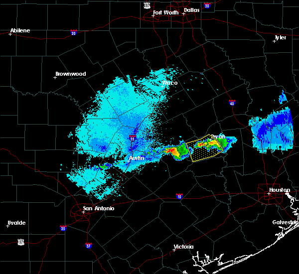 At 250 am cdt, a severe thunderstorm was located near kyle field, or near college station, moving southeast at 20 mph. there have been numerous reports of pea to marble size hail in the bryan and college station area between 240 am and 250 am. radar is showing a weakening trend in the storms (radar indicated). Hazards include quarter size hail. Damage to vehicles is expected. Locations impacted include, college station, bryan, caldwell, somerville, snook, millican, kyle field, wellborn and lyons. At 250 am cdt, a severe thunderstorm was located near kyle field, or near college station, moving southeast at 20 mph. there have been numerous reports of pea to marble size hail in the bryan and college station area between 240 am and 250 am. radar is showing a weakening trend in the storms (radar indicated). Hazards include quarter size hail. Damage to vehicles is expected. Locations impacted include, college station, bryan, caldwell, somerville, snook, millican, kyle field, wellborn and lyons.
|
| 3/27/2017 2:40 AM CDT |
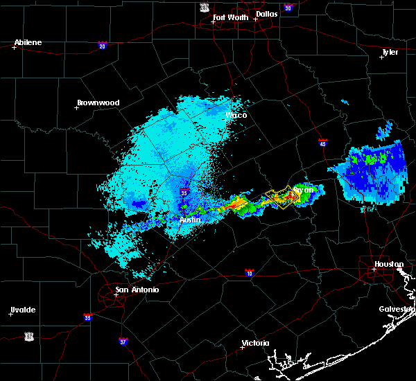 At 239 am cdt, a severe thunderstorm was located near kyle field, or near bryan, moving southeast at 20 mph (radar indicated). Hazards include quarter size hail. damage to vehicles is expected At 239 am cdt, a severe thunderstorm was located near kyle field, or near bryan, moving southeast at 20 mph (radar indicated). Hazards include quarter size hail. damage to vehicles is expected
|
| 2/20/2017 1:28 AM CST |
 At 127 am cst, severe thunderstorms were located along a line extending from near hearne to near bryan to near snook, moving east at 45 mph (radar indicated). Hazards include 70 mph wind gusts. Expect considerable tree damage. Damage is likely to mobile homes, roofs, and outbuildings. At 127 am cst, severe thunderstorms were located along a line extending from near hearne to near bryan to near snook, moving east at 45 mph (radar indicated). Hazards include 70 mph wind gusts. Expect considerable tree damage. Damage is likely to mobile homes, roofs, and outbuildings.
|
| 2/14/2017 6:42 AM CST |
 At 642 am cst, severe thunderstorms were located along a line extending from 8 miles east of lake somerville dam to 13 miles east of sublime, moving east at 30 to 35 mph (radar indicated). Hazards include 60 mph wind gusts. expect damage to roofs, siding, and trees At 642 am cst, severe thunderstorms were located along a line extending from 8 miles east of lake somerville dam to 13 miles east of sublime, moving east at 30 to 35 mph (radar indicated). Hazards include 60 mph wind gusts. expect damage to roofs, siding, and trees
|
| 1/2/2017 6:50 AM CST |
 At 646 am cst, severe thunderstorms were located along a line extending from 9 miles east of kyle field to near college station to 6 miles southeast of snook to 10 miles east of somerville to near brenham to 9 miles northeast of industry, moving east at 35 mph (radar indicated). Hazards include 60 mph wind gusts. expect damage to roofs, siding, and trees At 646 am cst, severe thunderstorms were located along a line extending from 9 miles east of kyle field to near college station to 6 miles southeast of snook to 10 miles east of somerville to near brenham to 9 miles northeast of industry, moving east at 35 mph (radar indicated). Hazards include 60 mph wind gusts. expect damage to roofs, siding, and trees
|
| 1/2/2017 6:06 AM CST |
 At 606 am cst, severe thunderstorms were located along a line extending from 6 miles northeast of tanglewood to near caldwell to 7 miles east of dime box to 7 miles west of burton to near round top, moving northeast at 40 mph (radar indicated). Hazards include 60 mph wind gusts. expect damage to roofs, siding, and trees At 606 am cst, severe thunderstorms were located along a line extending from 6 miles northeast of tanglewood to near caldwell to 7 miles east of dime box to 7 miles west of burton to near round top, moving northeast at 40 mph (radar indicated). Hazards include 60 mph wind gusts. expect damage to roofs, siding, and trees
|
| 6/28/2016 12:57 PM CDT |
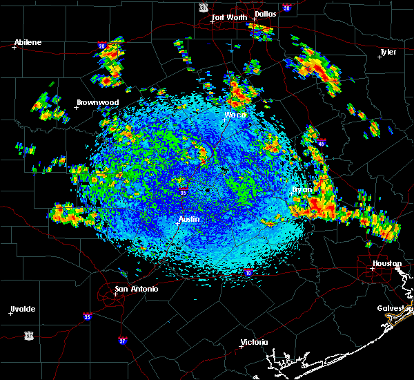 At 1256 pm cdt, a severe thunderstorm was located near anderson, or 8 miles north of navasota, moving south at 15 mph. damaging winds are possible (radar indicated). Hazards include 60 mph wind gusts. Expect damage to roofs. siding. And trees. At 1256 pm cdt, a severe thunderstorm was located near anderson, or 8 miles north of navasota, moving south at 15 mph. damaging winds are possible (radar indicated). Hazards include 60 mph wind gusts. Expect damage to roofs. siding. And trees.
|
| 5/26/2016 5:01 PM CDT |
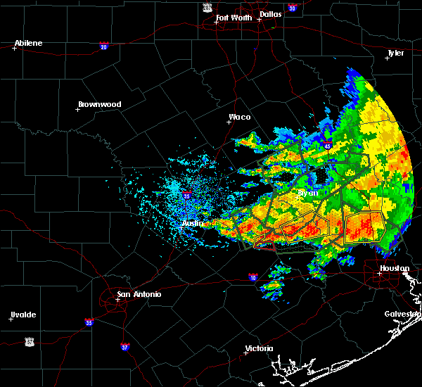 At 501 pm cdt, a severe thunderstorm was located 7 miles north of brenham, moving northeast at 30 mph (radar indicated). Hazards include 60 mph wind gusts and quarter size hail. Hail damage to vehicles is expected. Expect wind damage to roofs, siding, and trees. At 501 pm cdt, a severe thunderstorm was located 7 miles north of brenham, moving northeast at 30 mph (radar indicated). Hazards include 60 mph wind gusts and quarter size hail. Hail damage to vehicles is expected. Expect wind damage to roofs, siding, and trees.
|
| 5/26/2016 4:09 PM CDT |
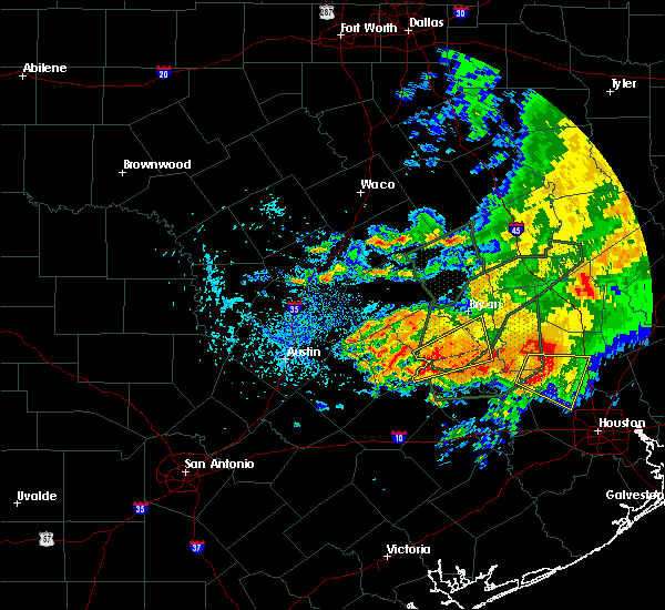 At 409 pm cdt, a severe thunderstorm was located 8 miles southeast of dime box, or 14 miles northeast of giddings, moving northeast at 30 mph (radar indicated). Hazards include 60 mph wind gusts and quarter size hail. Hail damage to vehicles is expected. Expect wind damage to roofs, siding, and trees. At 409 pm cdt, a severe thunderstorm was located 8 miles southeast of dime box, or 14 miles northeast of giddings, moving northeast at 30 mph (radar indicated). Hazards include 60 mph wind gusts and quarter size hail. Hail damage to vehicles is expected. Expect wind damage to roofs, siding, and trees.
|
| 5/26/2016 2:29 PM CDT |
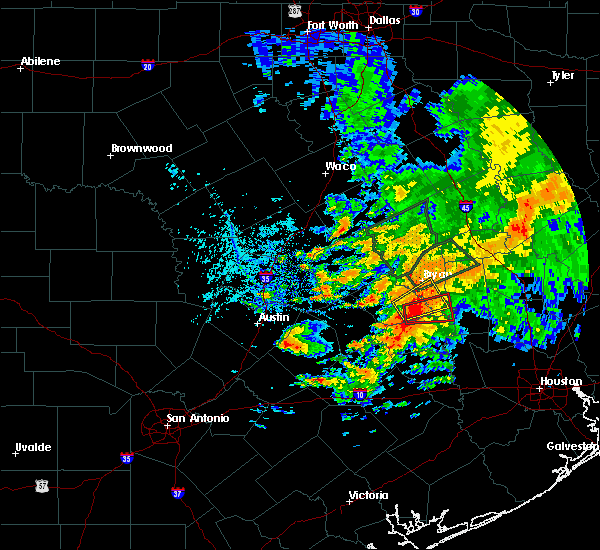 At 229 pm cdt, a severe thunderstorm capable of producing a tornado was located near snook, or 13 miles southwest of college station, moving east at 30 mph (radar indicated rotation). Hazards include tornado. Flying debris will be dangerous to those caught without shelter. mobile homes will be damaged or destroyed. damage to roofs, windows, and vehicles will occur. Tree damage is likely. At 229 pm cdt, a severe thunderstorm capable of producing a tornado was located near snook, or 13 miles southwest of college station, moving east at 30 mph (radar indicated rotation). Hazards include tornado. Flying debris will be dangerous to those caught without shelter. mobile homes will be damaged or destroyed. damage to roofs, windows, and vehicles will occur. Tree damage is likely.
|
| 5/26/2016 2:22 PM CDT |
 At 221 pm cdt, a severe thunderstorm was located over snook, or 13 miles east of caldwell, moving northeast at 25 mph (radar indicated). Hazards include 60 mph wind gusts and quarter size hail. Hail damage to vehicles is expected. Expect wind damage to roofs, siding, and trees. At 221 pm cdt, a severe thunderstorm was located over snook, or 13 miles east of caldwell, moving northeast at 25 mph (radar indicated). Hazards include 60 mph wind gusts and quarter size hail. Hail damage to vehicles is expected. Expect wind damage to roofs, siding, and trees.
|
| 4/30/2016 7:00 AM CDT |
 At 657 am cdt, severe thunderstorms were located along a line extending from 11 miles northwest of bedias to 6 miles southwest of pine island, moving east at 30 mph (college station asos reported a 56 mph wind gust at 653 am). Hazards include 60 mph wind gusts. Expect damage to roofs. siding. and trees. trees are more susceptible of toppling due to recently more saturated ground. Locations impacted include, college station, bryan, brenham, navasota, sealy, hempstead, prairie view, brookshire, bellville, columbus, washington, waller, weimar, pine island, san felipe, snook, pattison, bedias, kurten and industry. At 657 am cdt, severe thunderstorms were located along a line extending from 11 miles northwest of bedias to 6 miles southwest of pine island, moving east at 30 mph (college station asos reported a 56 mph wind gust at 653 am). Hazards include 60 mph wind gusts. Expect damage to roofs. siding. and trees. trees are more susceptible of toppling due to recently more saturated ground. Locations impacted include, college station, bryan, brenham, navasota, sealy, hempstead, prairie view, brookshire, bellville, columbus, washington, waller, weimar, pine island, san felipe, snook, pattison, bedias, kurten and industry.
|
| 4/30/2016 6:33 AM CDT |
 At 632 am cdt, severe thunderstorms were located along a line extending from near kurten to near bellville, moving east at 35 mph (radar indicated). Hazards include 60 mph wind gusts. Expect damage to roofs. siding. and trees. Toppled trees. At 632 am cdt, severe thunderstorms were located along a line extending from near kurten to near bellville, moving east at 35 mph (radar indicated). Hazards include 60 mph wind gusts. Expect damage to roofs. siding. and trees. Toppled trees.
|
| 4/30/2016 6:23 AM CDT |
 At 622 am cdt, severe thunderstorms were located along a line extending from snook to industry to 7 miles northeast of sublime, moving east at 40 mph (radar indicated). Hazards include 60 mph wind gusts and quarter size hail. Downed trees. trees can topple at winds speeds under 60 mph due to saturated grounds. possible home damage from both hail and wind. Locations impacted include, college station, bryan, brenham, navasota, sealy, hempstead, prairie view, caldwell, bellville, columbus, eagle lake, washington, weimar, somerville, wallis, pine island, san felipe, snook, pattison and kurten. At 622 am cdt, severe thunderstorms were located along a line extending from snook to industry to 7 miles northeast of sublime, moving east at 40 mph (radar indicated). Hazards include 60 mph wind gusts and quarter size hail. Downed trees. trees can topple at winds speeds under 60 mph due to saturated grounds. possible home damage from both hail and wind. Locations impacted include, college station, bryan, brenham, navasota, sealy, hempstead, prairie view, caldwell, bellville, columbus, eagle lake, washington, weimar, somerville, wallis, pine island, san felipe, snook, pattison and kurten.
|
| 4/30/2016 5:51 AM CDT |
 At 548 am cdt, severe thunderstorms were located along a line extending from 7 miles east of tanglewood to near la grange to near moulton, moving east at 45 mph (radar indicated). Hazards include 60 mph wind gusts and quarter size hail. Expect possible wind damage to homes and downed trees. trees will topple more easily due to the saturated grounds. Hail damage to vehicles may occur. At 548 am cdt, severe thunderstorms were located along a line extending from 7 miles east of tanglewood to near la grange to near moulton, moving east at 45 mph (radar indicated). Hazards include 60 mph wind gusts and quarter size hail. Expect possible wind damage to homes and downed trees. trees will topple more easily due to the saturated grounds. Hail damage to vehicles may occur.
|
| 12/27/2015 11:06 AM CST |
 At 1105 am cst, a severe thunderstorm capable of producing a tornado was located 8 miles southwest of millican, or 13 miles west of navasota, moving northeast at 40 mph (radar indicated rotation). Hazards include tornado. Flying debris will be dangerous to those caught without shelter. mobile homes will be damaged or destroyed. damage to roofs, windows and vehicles will occur. tree damage is likely. this dangerous storm will be near, millican around 1120 am cst. college station around 1130 am cst. Other locations impacted by this tornadic thunderstorm include wellborn and independence. At 1105 am cst, a severe thunderstorm capable of producing a tornado was located 8 miles southwest of millican, or 13 miles west of navasota, moving northeast at 40 mph (radar indicated rotation). Hazards include tornado. Flying debris will be dangerous to those caught without shelter. mobile homes will be damaged or destroyed. damage to roofs, windows and vehicles will occur. tree damage is likely. this dangerous storm will be near, millican around 1120 am cst. college station around 1130 am cst. Other locations impacted by this tornadic thunderstorm include wellborn and independence.
|
| 11/17/2015 4:16 AM CST |
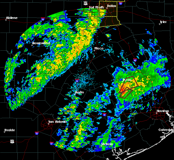 At 416 am cst, a severe thunderstorm capable of producing a tornado was located 8 miles southwest of millican, or 13 miles west of navasota, moving northeast at 40 mph (radar indicated rotation). Hazards include tornado. Flying debris will be dangerous to those caught without shelter. mobile homes will be damaged or destroyed. damage to roofs, windows and vehicles will occur. tree damage is likely. this dangerous storm will be near, millican around 430 am cst. Other locations impacted by this tornadic thunderstorm include wellborn, carlos, roans prairie, iola and independence. At 416 am cst, a severe thunderstorm capable of producing a tornado was located 8 miles southwest of millican, or 13 miles west of navasota, moving northeast at 40 mph (radar indicated rotation). Hazards include tornado. Flying debris will be dangerous to those caught without shelter. mobile homes will be damaged or destroyed. damage to roofs, windows and vehicles will occur. tree damage is likely. this dangerous storm will be near, millican around 430 am cst. Other locations impacted by this tornadic thunderstorm include wellborn, carlos, roans prairie, iola and independence.
|
| 11/17/2015 4:14 AM CST |
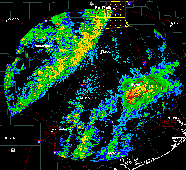 At 413 am cst, a severe thunderstorm capable of producing a tornado was located 10 miles west of washington, or 13 miles north of brenham, moving northeast at 40 mph (radar indicated rotation). Hazards include tornado. Flying debris will be dangerous to those caught without shelter. mobile homes will be damaged or destroyed. damage to roofs, windows and vehicles will occur. tree damage is likely. this dangerous storm will be near, millican around 430 am cst. Other locations impacted by this tornadic thunderstorm include wellborn, carlos, roans prairie and iola. At 413 am cst, a severe thunderstorm capable of producing a tornado was located 10 miles west of washington, or 13 miles north of brenham, moving northeast at 40 mph (radar indicated rotation). Hazards include tornado. Flying debris will be dangerous to those caught without shelter. mobile homes will be damaged or destroyed. damage to roofs, windows and vehicles will occur. tree damage is likely. this dangerous storm will be near, millican around 430 am cst. Other locations impacted by this tornadic thunderstorm include wellborn, carlos, roans prairie and iola.
|
| 11/17/2015 4:06 AM CST |
 At 406 am cst, a severe thunderstorm capable of producing a tornado was located 9 miles north of brenham, moving northeast at 35 mph (radar indicated rotation). Hazards include tornado. Flying debris will be dangerous to those caught without shelter. mobile homes will be damaged or destroyed. damage to roofs, windows and vehicles will occur. tree damage is likely. this dangerous storm will be near, navasota and millican around 430 am cst. Other locations impacted by this tornadic thunderstorm include independence. At 406 am cst, a severe thunderstorm capable of producing a tornado was located 9 miles north of brenham, moving northeast at 35 mph (radar indicated rotation). Hazards include tornado. Flying debris will be dangerous to those caught without shelter. mobile homes will be damaged or destroyed. damage to roofs, windows and vehicles will occur. tree damage is likely. this dangerous storm will be near, navasota and millican around 430 am cst. Other locations impacted by this tornadic thunderstorm include independence.
|
| 5/27/2015 5:21 AM CDT | At 520 am cdt, doppler radar indicated a line of severe thunderstorms capable of producing damaging winds in excess of 60 mph. these storms were located along a line extending from sour lake to near waller, and moving south at 25 mph. frequent lightning and torrential rainfall is also occurring with this line. |
| 5/25/2015 7:08 PM CDT | At 707 pm cdt, doppler radar indicated a severe thunderstorm capable of producing quarter size hail and damaging winds in excess of 60 mph. this storm was located near huntsville state park, or 7 miles southwest of huntsville, moving east at 60 mph. locations impacted include, conroe, huntsville, navasota, willis, washington, panorama village, new waverly, montgomery, bedias, millican, anderson, lake conroe dam, huntsville state park, iola, dobbin, richards, dacus, plantersville, crabbs prairie and carlos. a tornado watch remains in effect until 1000 pm cdt for southeastern texas. |
| 5/25/2015 6:42 PM CDT | At 642 pm cdt, doppler radar indicated a severe thunderstorm capable of producing damaging winds in excess of 60 mph. this storm was located near anderson, or 7 miles north of navasota, and moving east at 60 mph. |
| 5/25/2015 6:28 PM CDT | At 628 pm cdt, doppler radar indicated a severe thunderstorm capable of producing a tornado. this dangerous storm was located near millican, or 9 miles west of navasota, and moving northeast at 50 mph. |
| 5/25/2015 6:18 PM CDT | At 617 pm cdt, doppler radar indicated a severe thunderstorm capable of producing damaging winds in excess of 60 mph. this storm was located near snook, or 9 miles east of caldwell, and moving east at 50 mph. |
| 5/25/2015 5:37 PM CDT | At 537 pm cdt, doppler radar indicated a severe thunderstorm capable of producing damaging winds in excess of 60 mph. this storm was located near wixon valley, or near bryan, moving east at 50 mph. locations impacted include, college station, bryan, caldwell, somerville, snook, kurten, wixon valley, millican, kyle field, iola, wellborn, deanville, chriesman, north zulch, carlos and lyons. a tornado watch remains in effect until 1000 pm cdt for southeastern texas. |
| 5/25/2015 5:37 PM CDT | At 537 pm cdt, doppler radar indicated a severe thunderstorm capable of producing damaging winds in excess of 60 mph. this storm was located near wixon valley, or near bryan, moving east at 50 mph. locations impacted include, college station, bryan, caldwell, somerville, snook, kurten, wixon valley, millican, kyle field, iola, wellborn, deanville, chriesman, north zulch, carlos and lyons. a tornado watch remains in effect until 1000 pm cdt for southeastern texas. |
| 5/25/2015 5:21 PM CDT | At 520 pm cdt, doppler radar indicated a severe thunderstorm capable of producing damaging winds in excess of 60 mph. this storm was located over northwestern bryan, and moving east at 50 mph. |
| 5/25/2015 5:21 PM CDT | At 520 pm cdt, doppler radar indicated a severe thunderstorm capable of producing damaging winds in excess of 60 mph. this storm was located over northwestern bryan, and moving east at 50 mph. |
| 4/27/2015 3:52 AM CDT | At 352 am cdt, doppler radar indicated a line of severe thunderstorms capable of producing damaging winds in excess of 60 mph. these storms were located along a line extending from near snook to 9 miles east of brenham to 7 miles east of columbus, and moving east at 55 mph. they have a history of producing wind damage. |
| 4/27/2015 3:38 AM CDT | At 336 am cdt, doppler radar indicated a line of severe thunderstorms capable of producing damaging winds in excess of 60 mph. these storms were located along a line extending from 13 miles northwest of snook to 6 miles southeast of caldwell to near burton to near industry to 6 miles west of columbus, moving east at 45 mph. storm spotters measured a 48 mph gust at lake somervile at 331 am. locations impacted include, college station, bryan, brenham, navasota, sealy, hempstead, bellville, columbus, eagle lake, washington, weimar, somerville, snook, kurten, industry, burton, wixon valley, millican, kyle field and lake somerville dam. a tornado watch remains in effect until 900 am cdt for southeastern texas. |
| 4/27/2015 3:21 AM CDT | At 319 am cdt, doppler radar indicated a line of severe thunderstorms capable of producing damaging winds in excess of 60 mph. these storms were located along a line extending from 15 miles east of rockdale to 6 miles south of caldwell to near burton to near fayetteville to weimar, and moving east at 45 mph. these storms have a history of downing trees as they moved through areas just west of the region. |
| 4/19/2015 3:44 PM CDT | At 343 pm cdt, doppler radar indicated a severe thunderstorm capable of producing large hail up to ping pong ball size and damaging winds in excess of 60 mph. this storm was located near somerville, or 12 miles south of caldwell, and moving east southeast at 25 mph. |
Hail Maps for Millican, TX
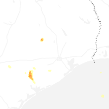
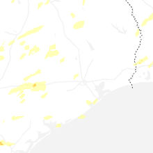

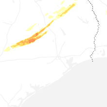


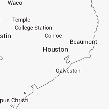


Connect with Interactive Hail Maps