

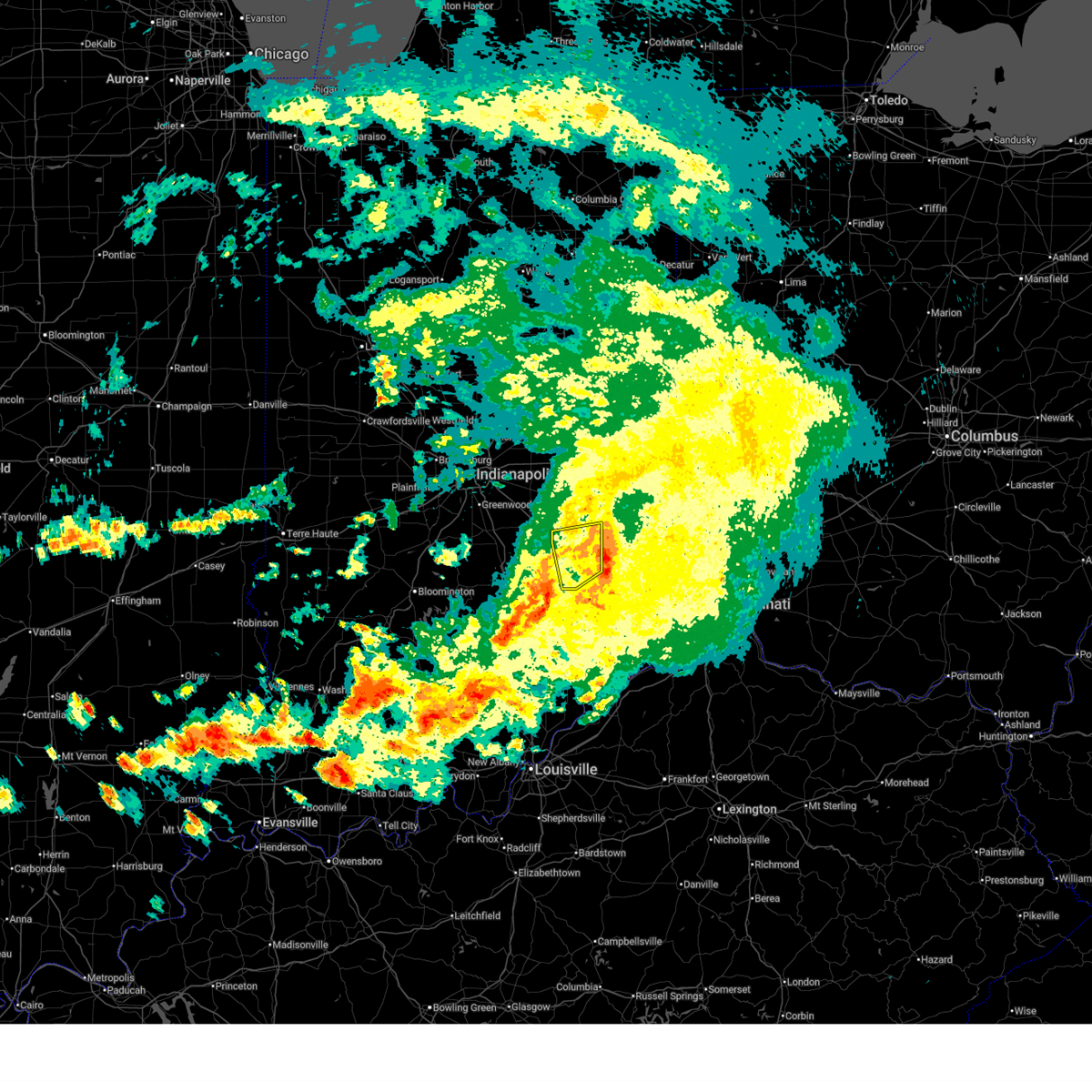
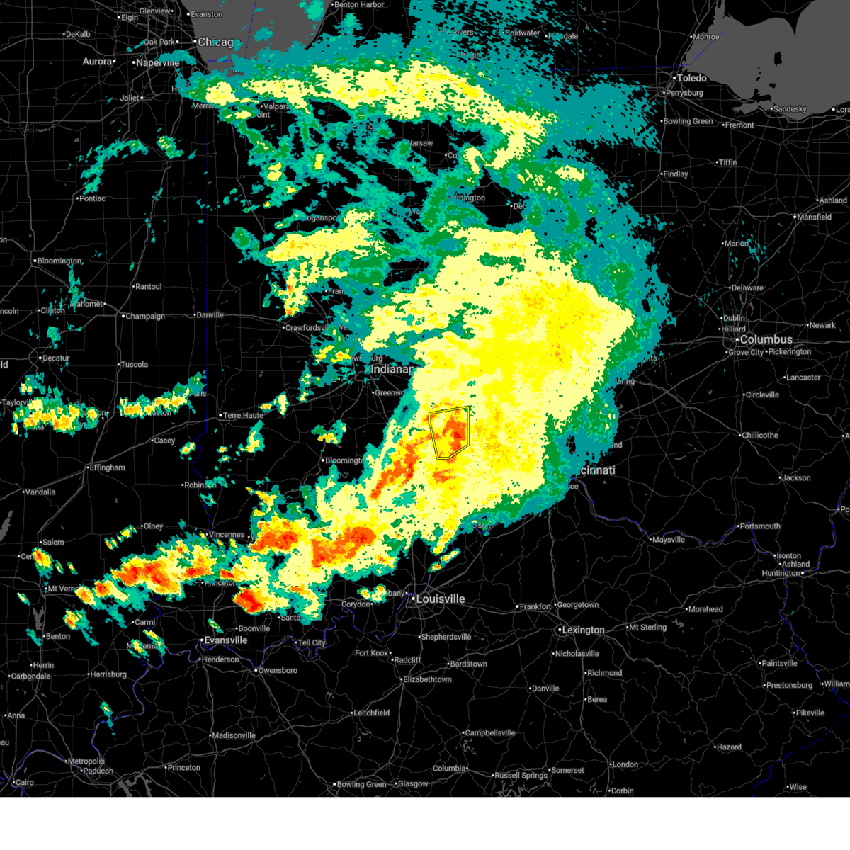
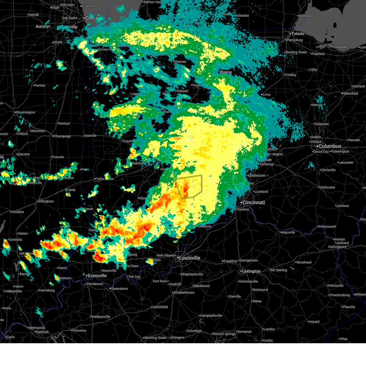
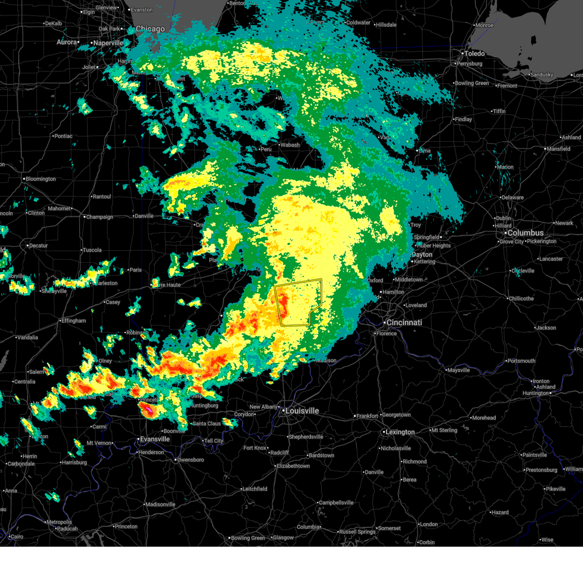
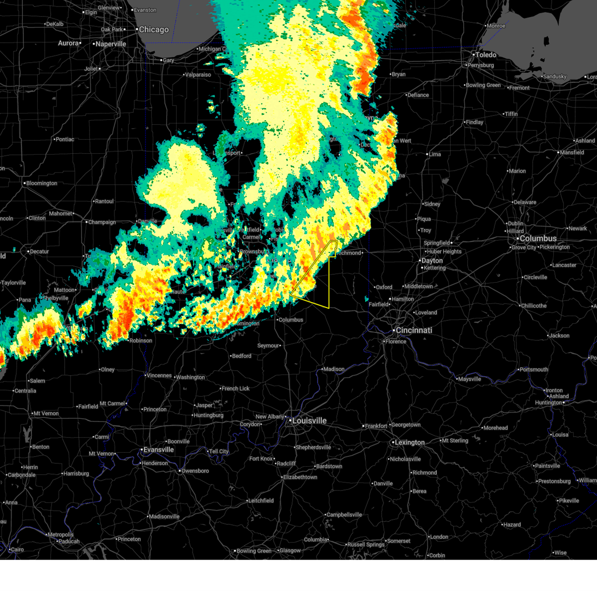
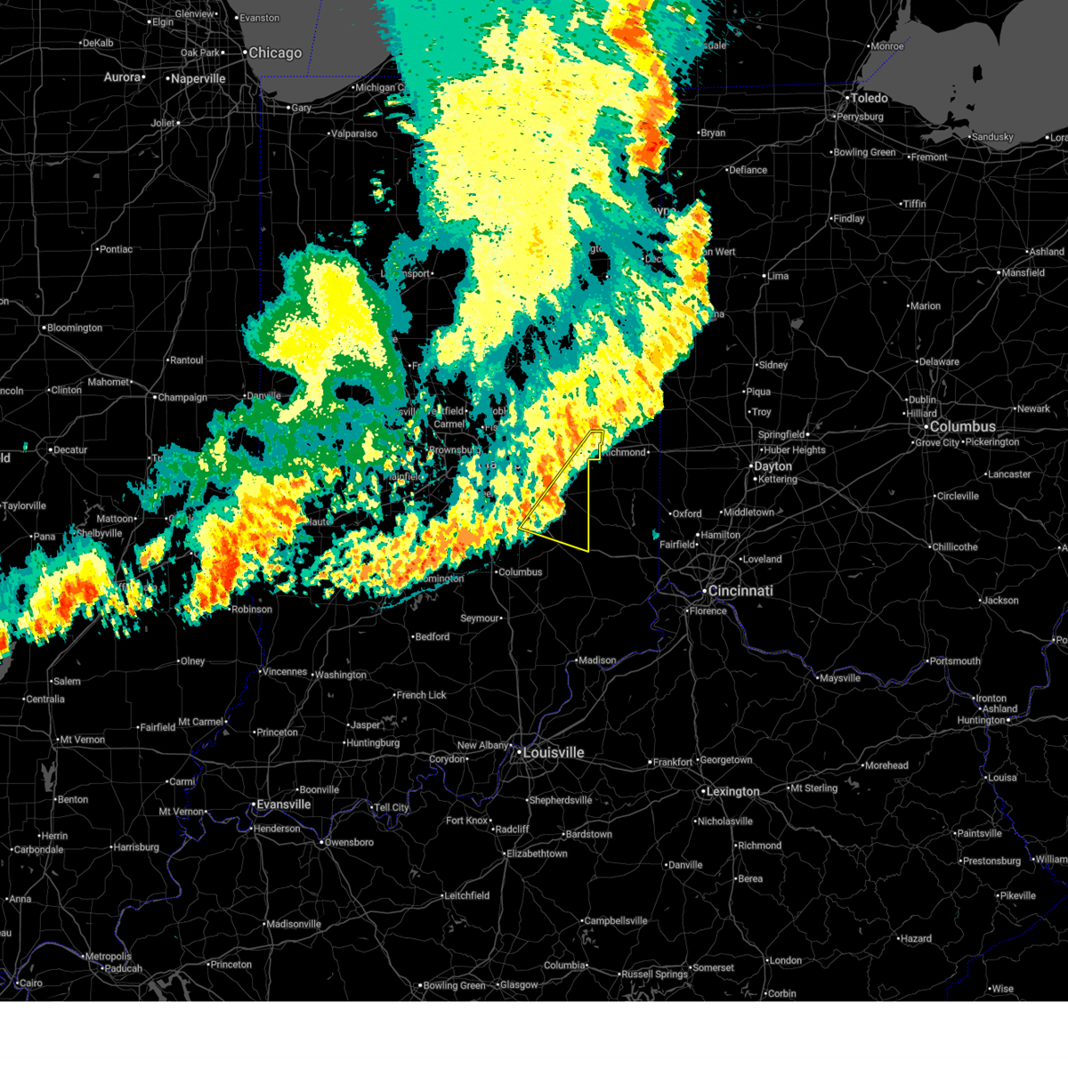
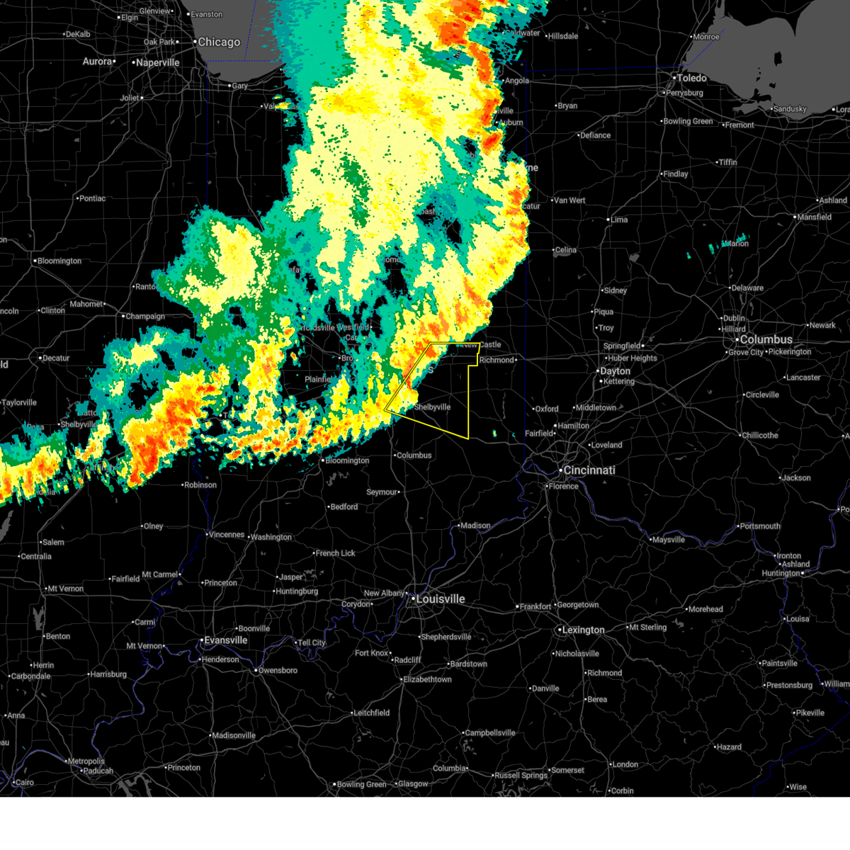
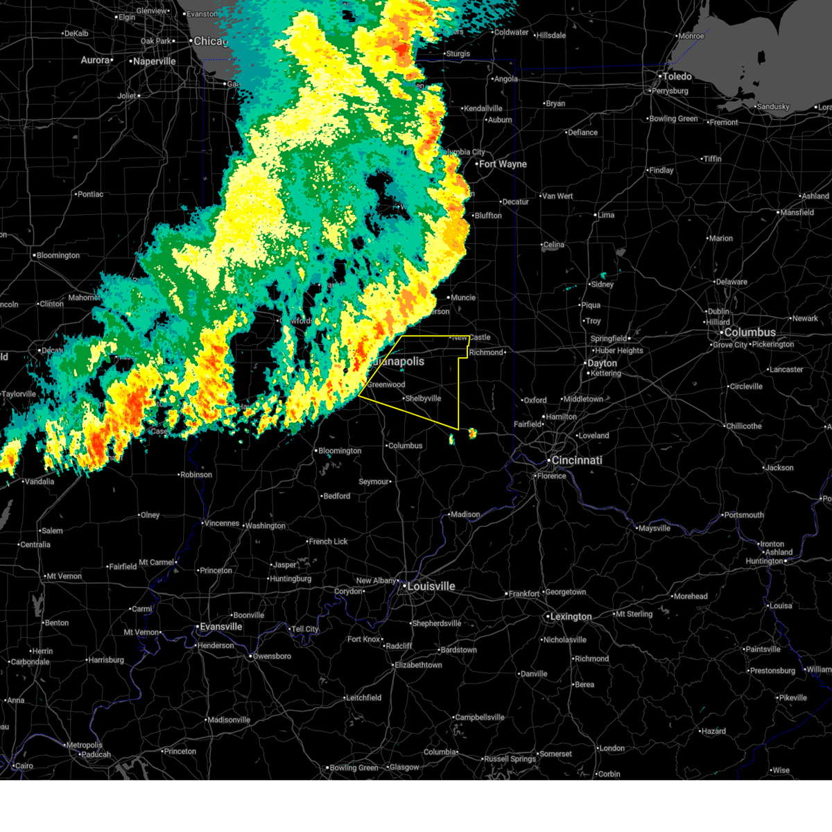
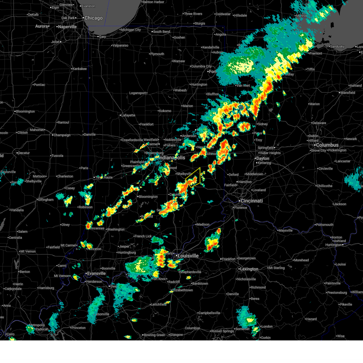
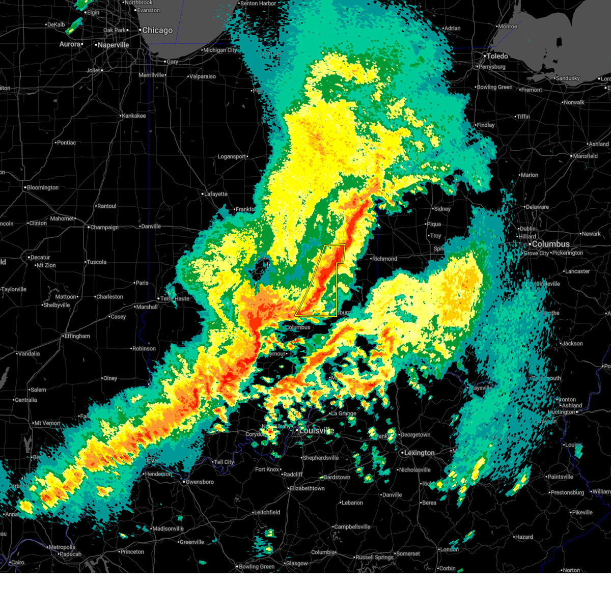
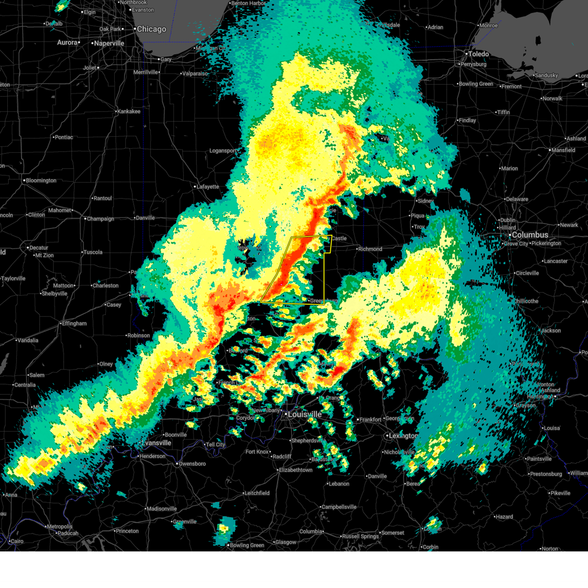
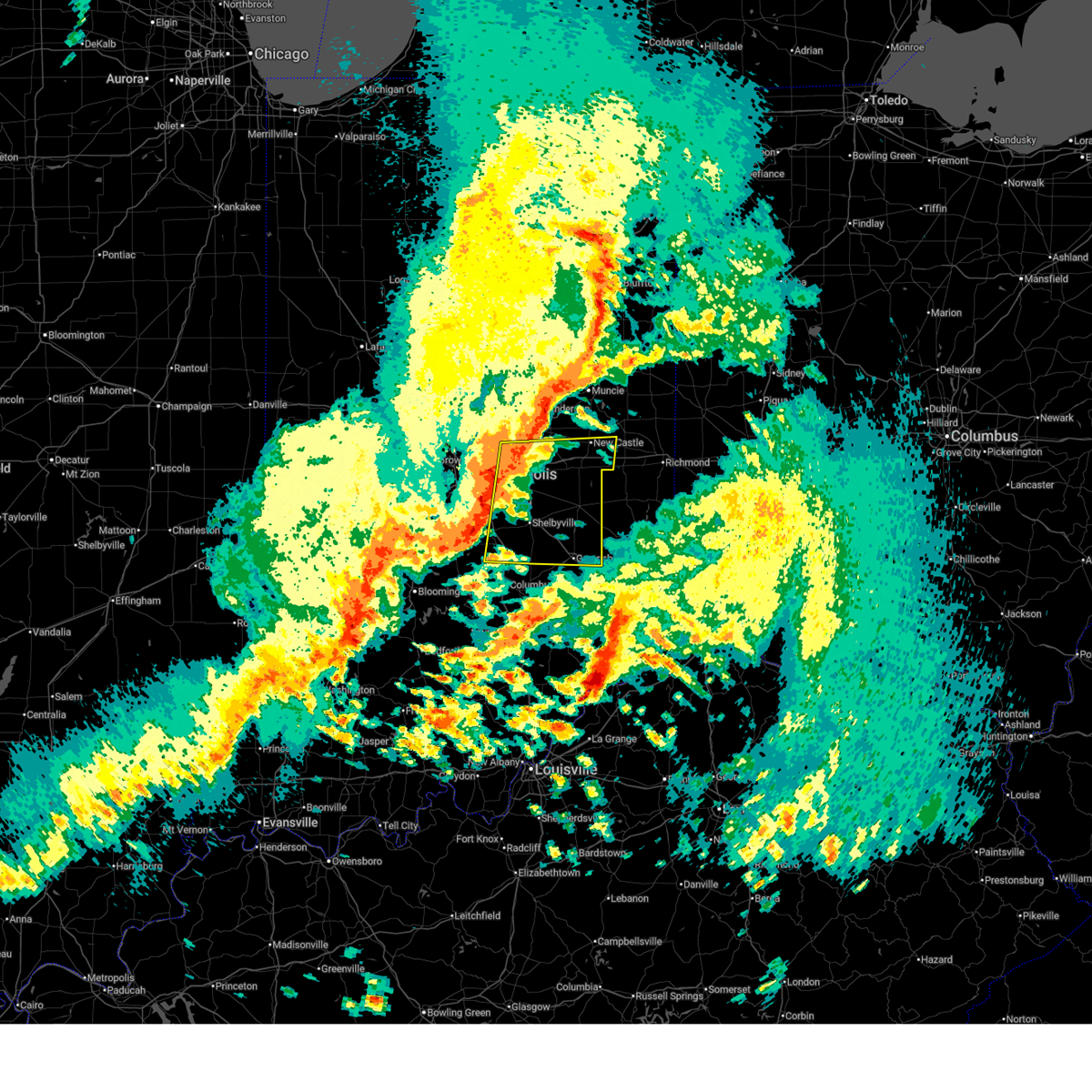
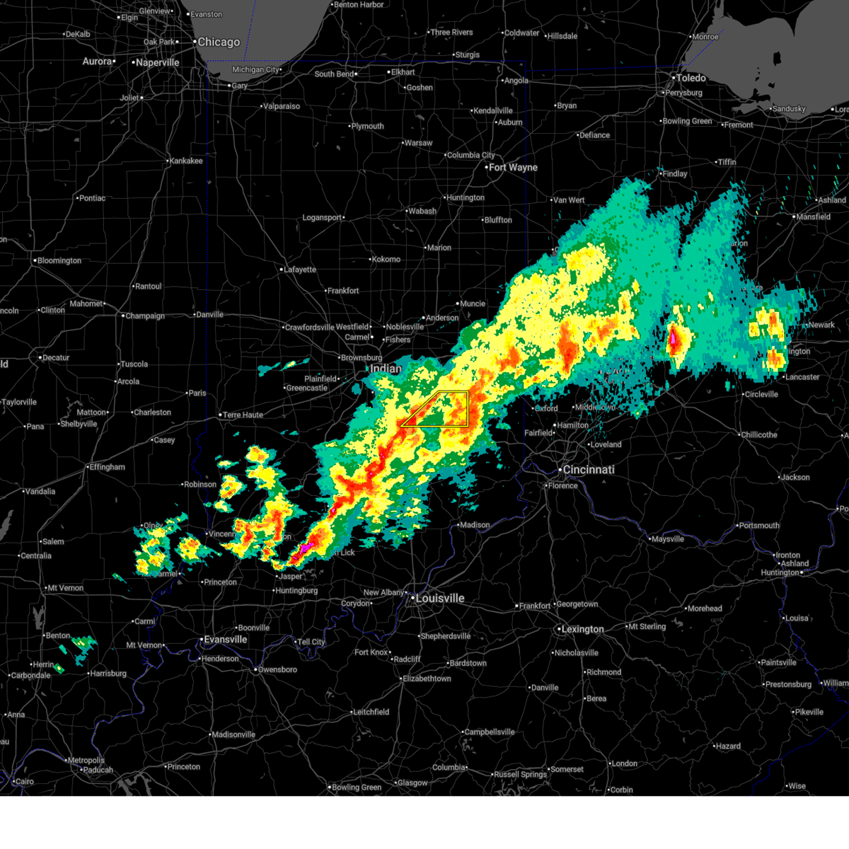
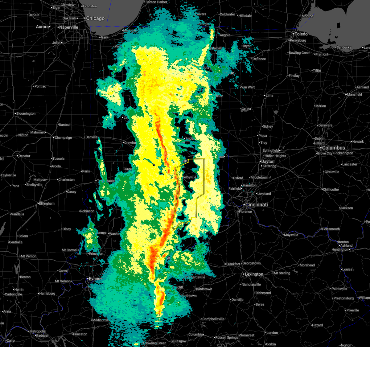
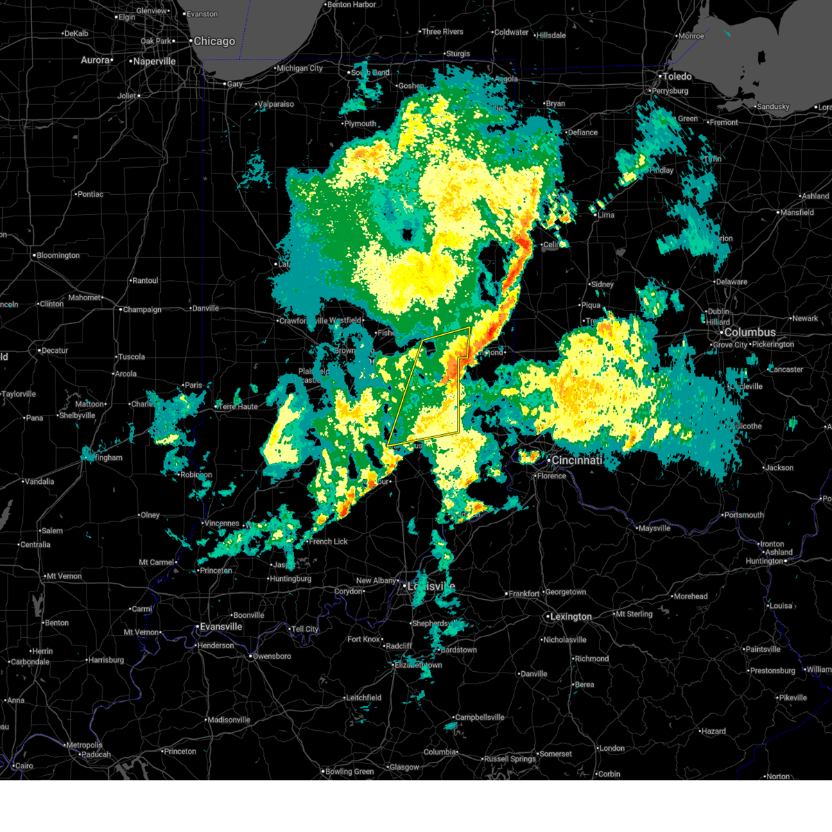
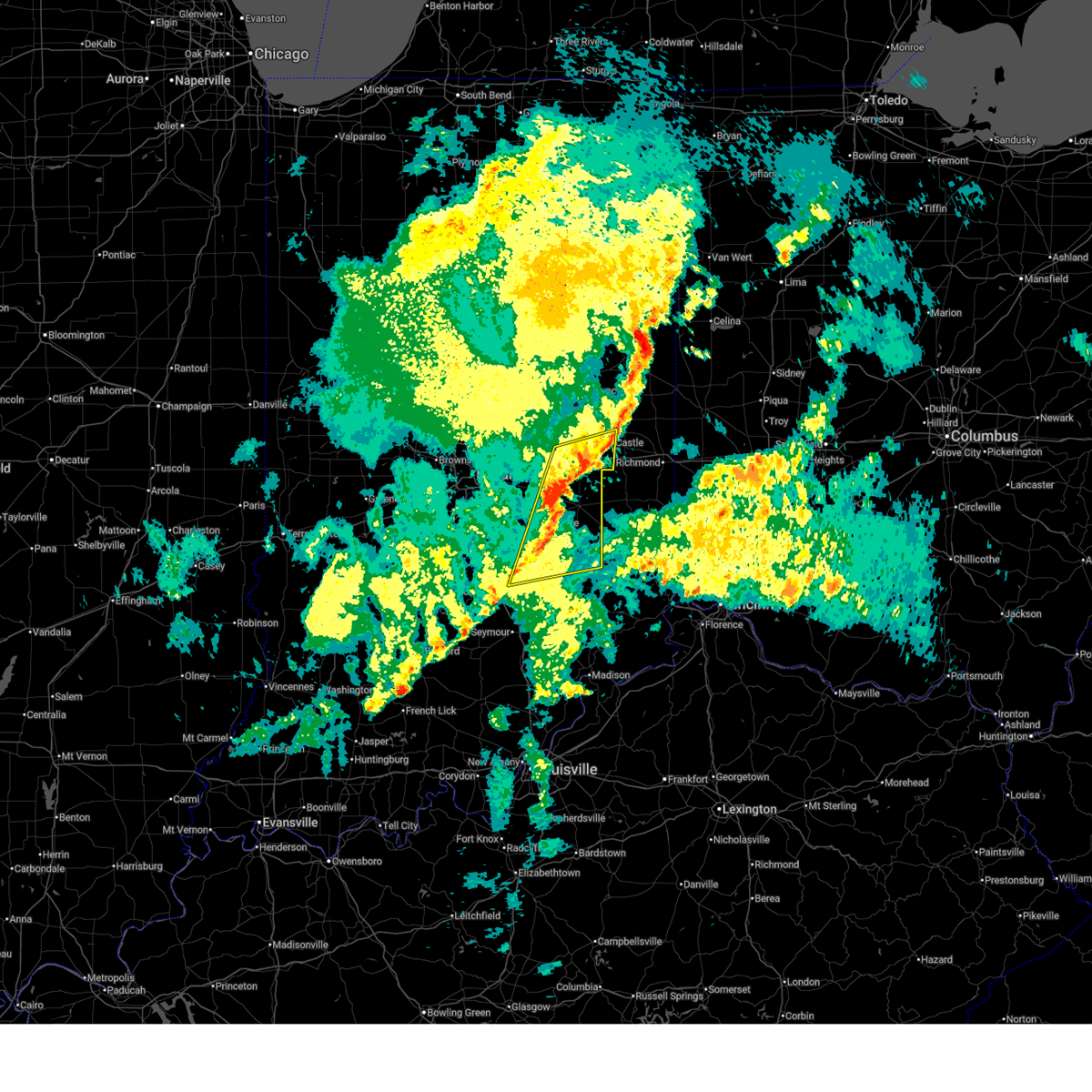
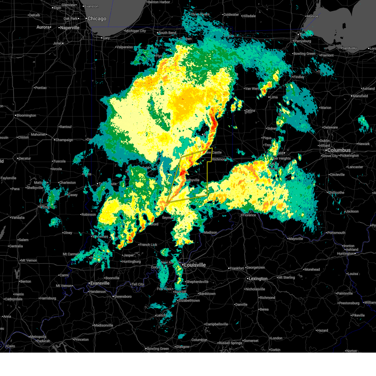
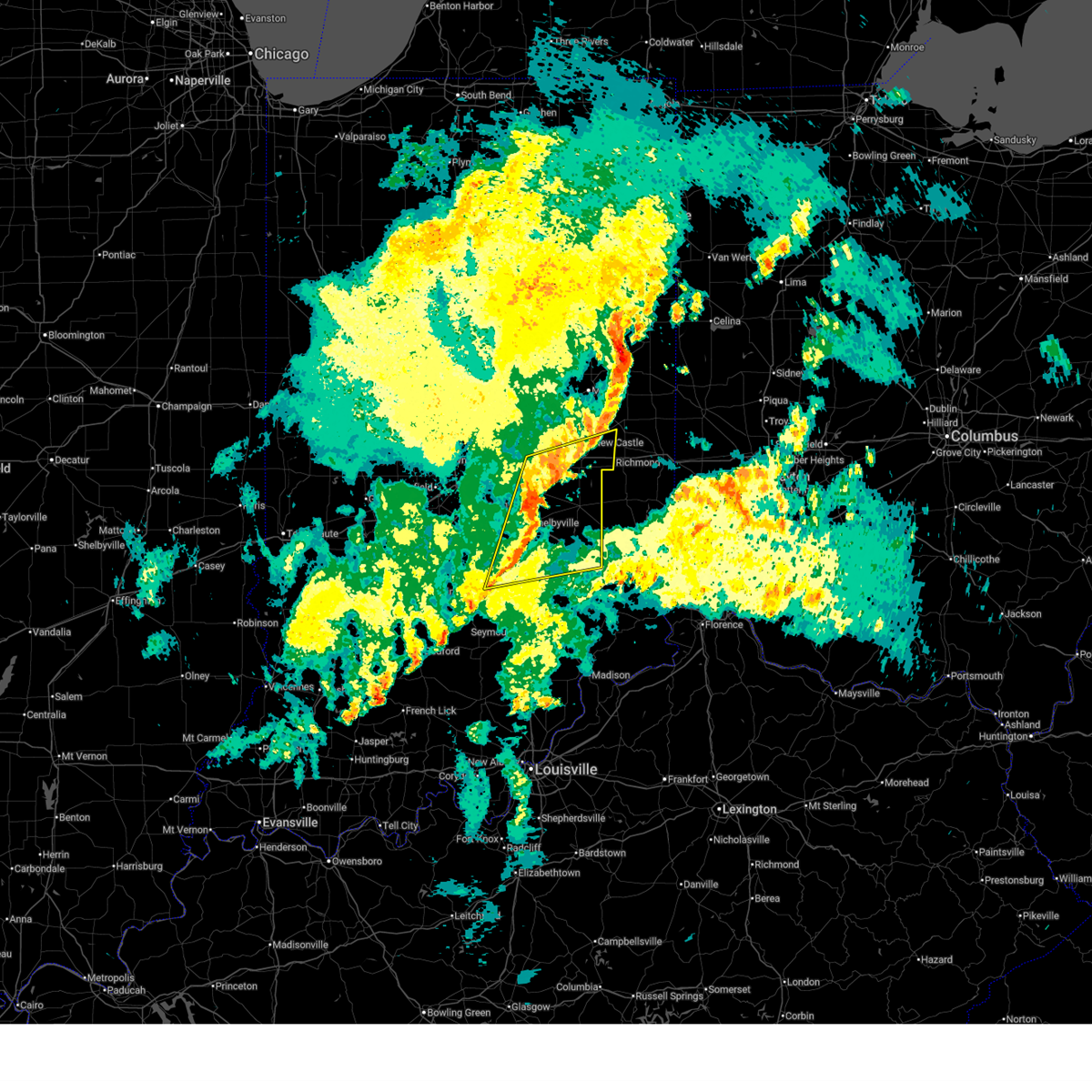
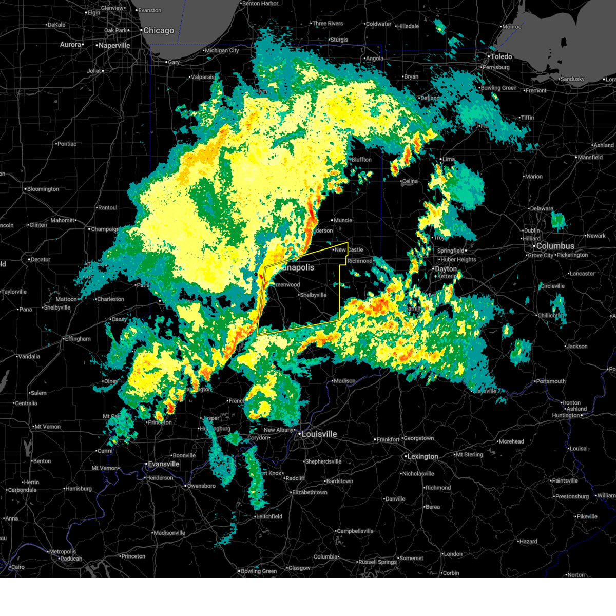
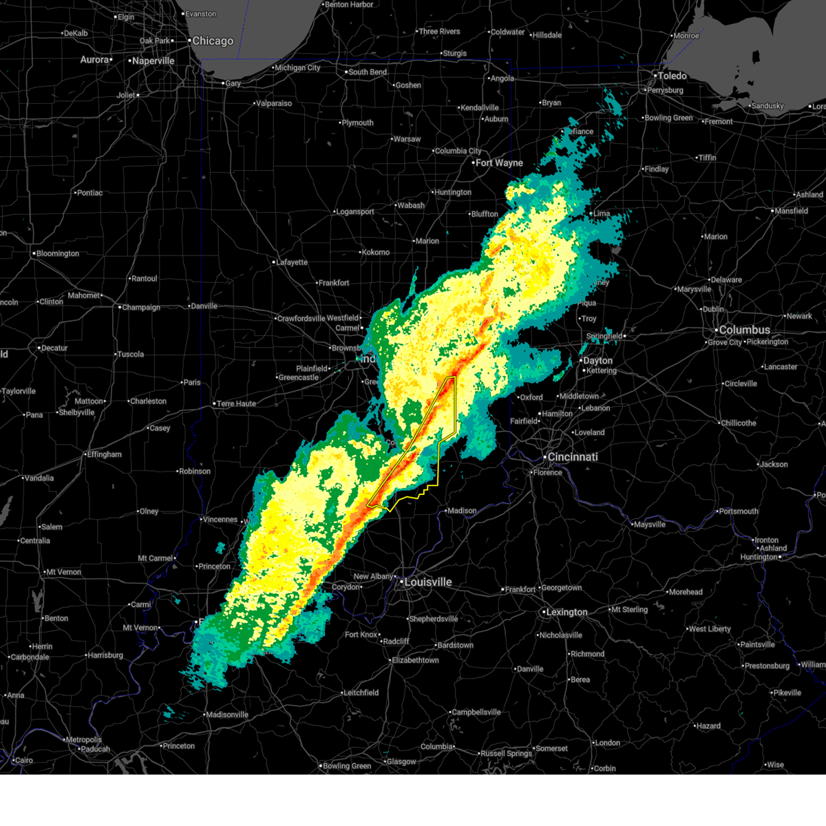
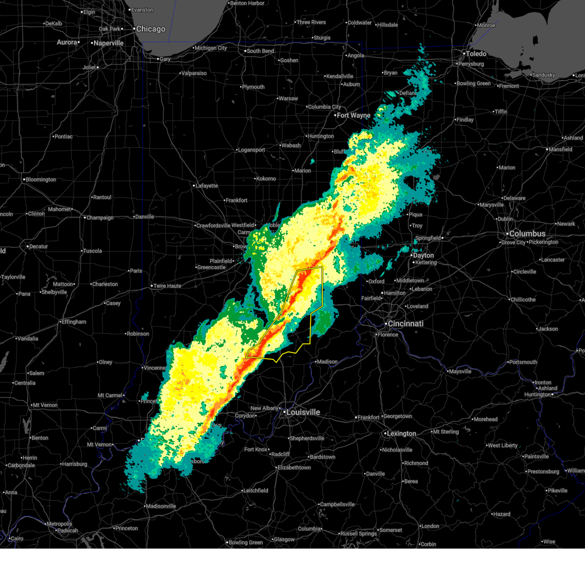
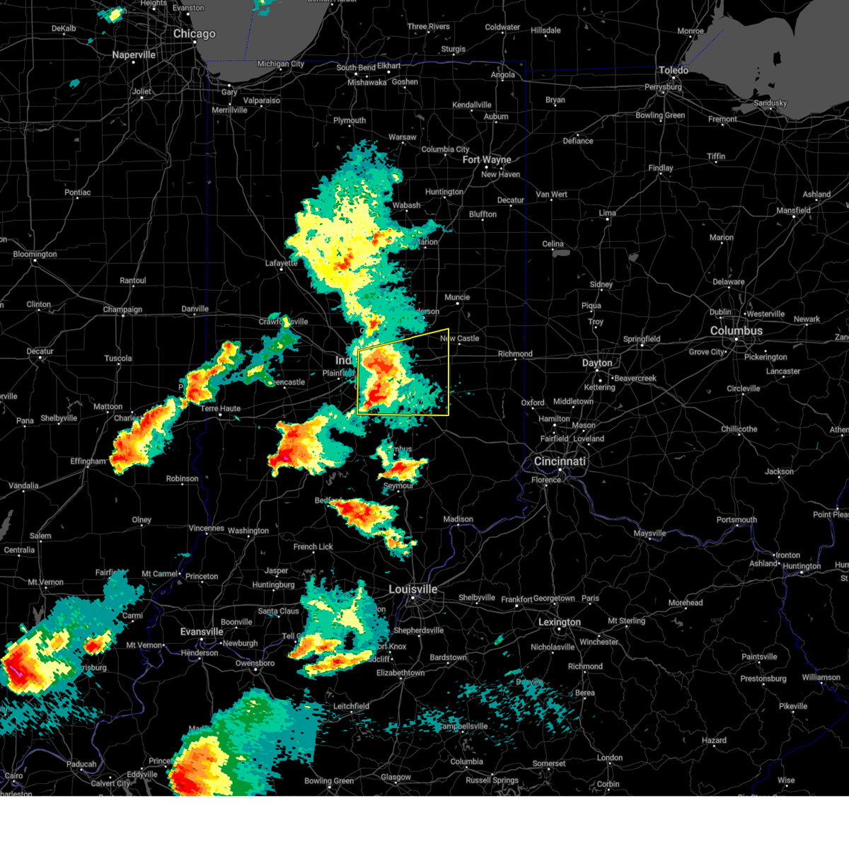
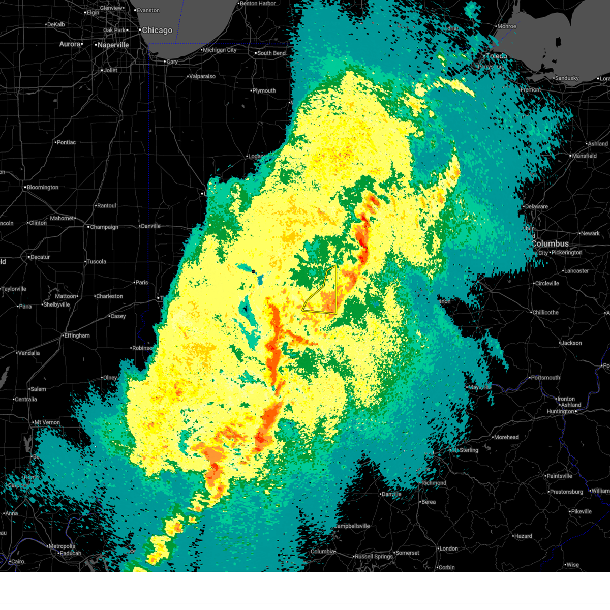
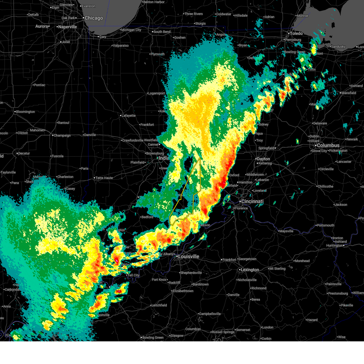
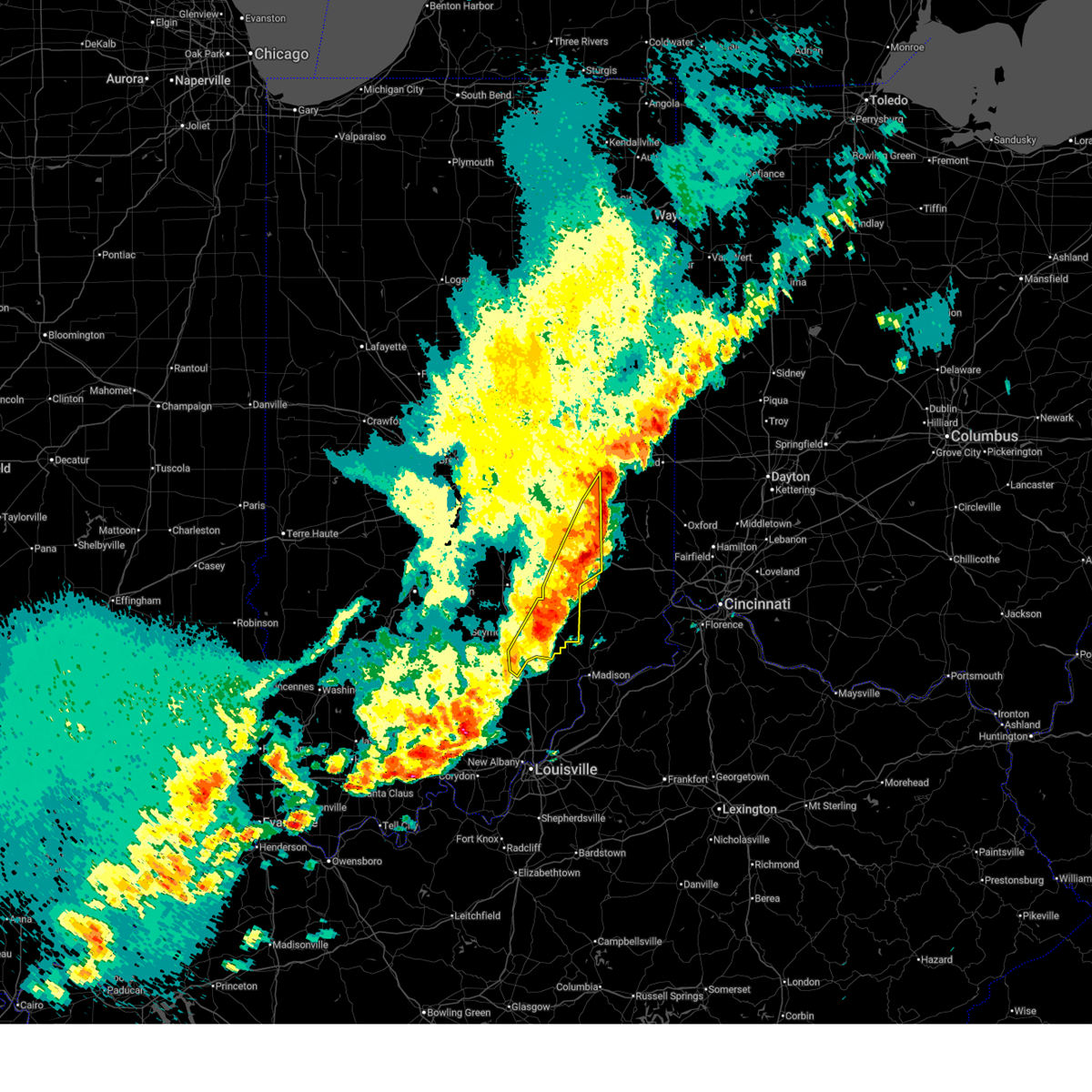
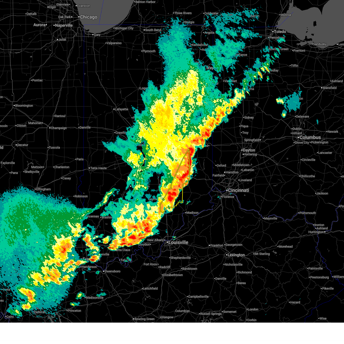
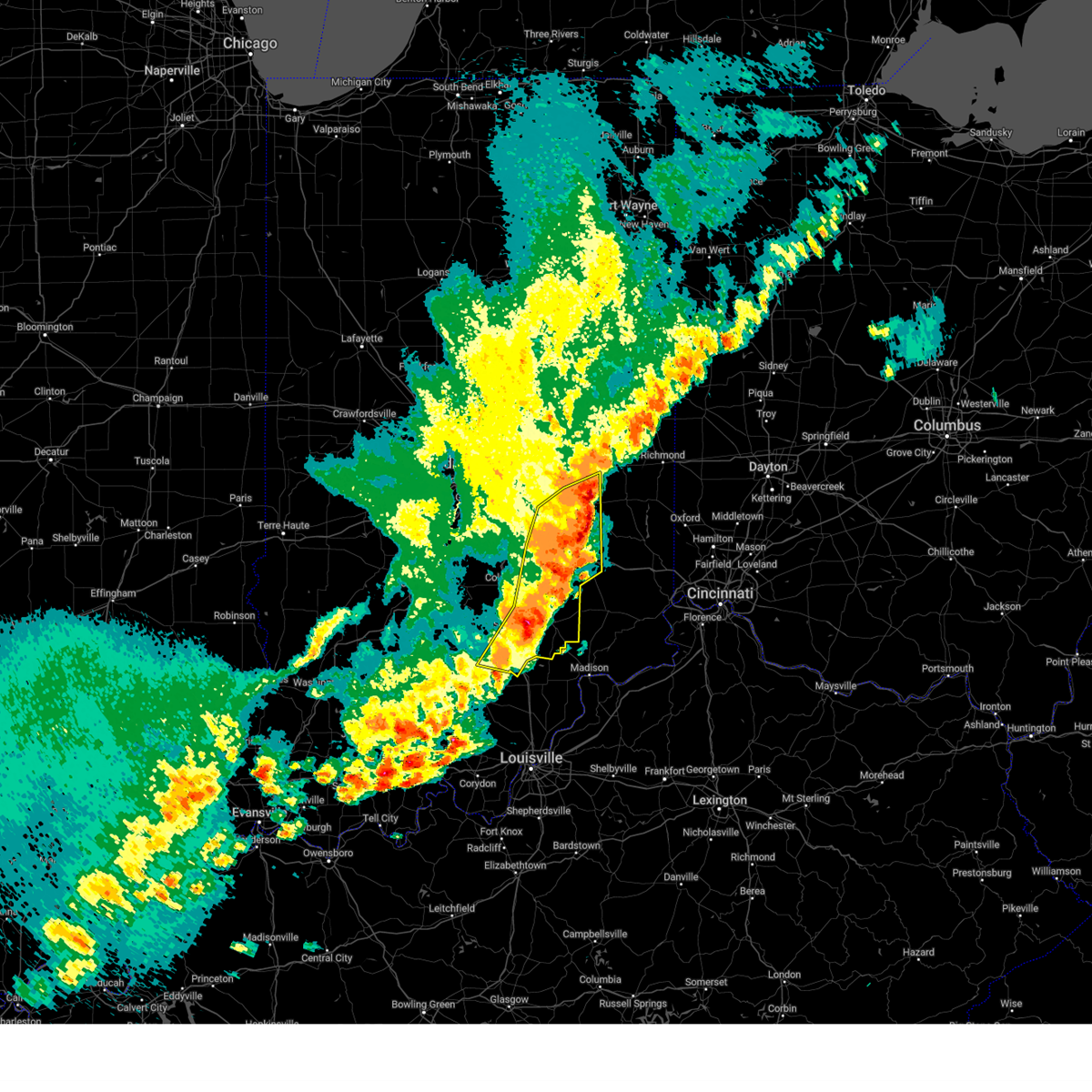
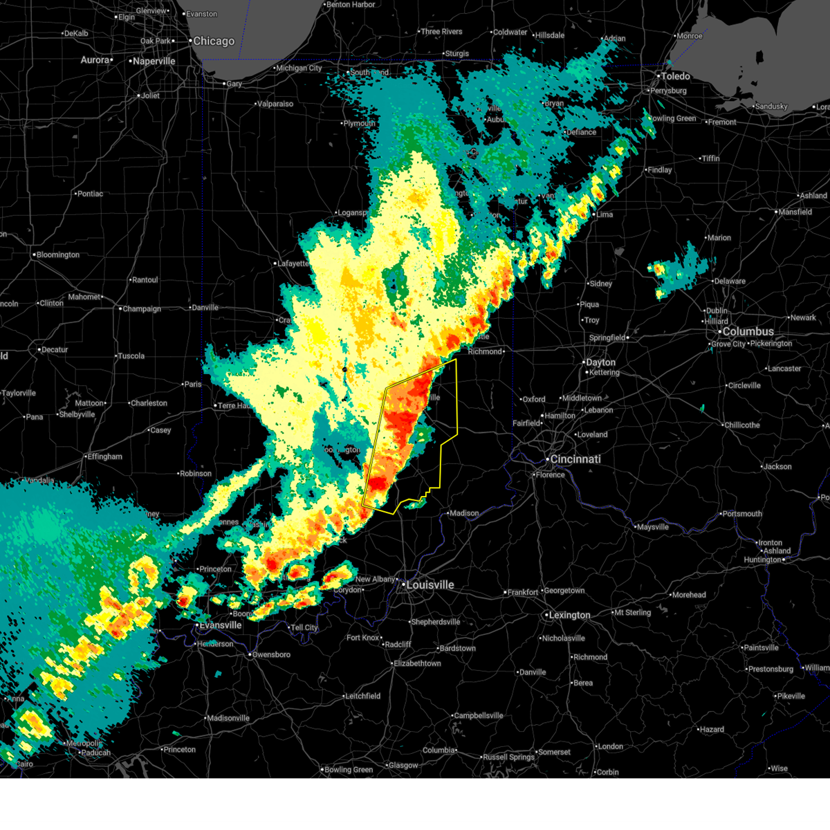
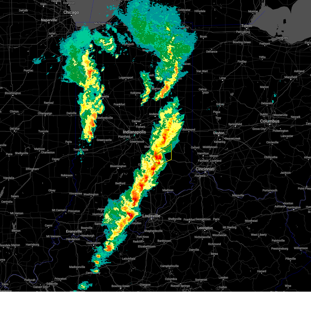
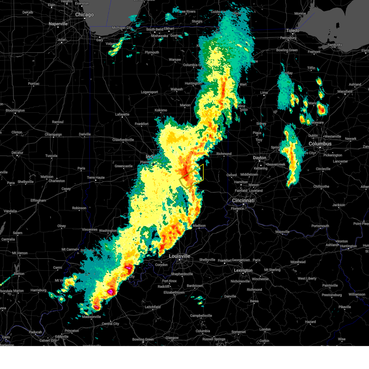
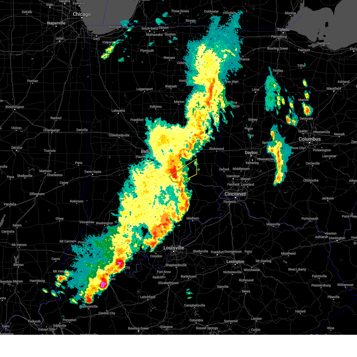
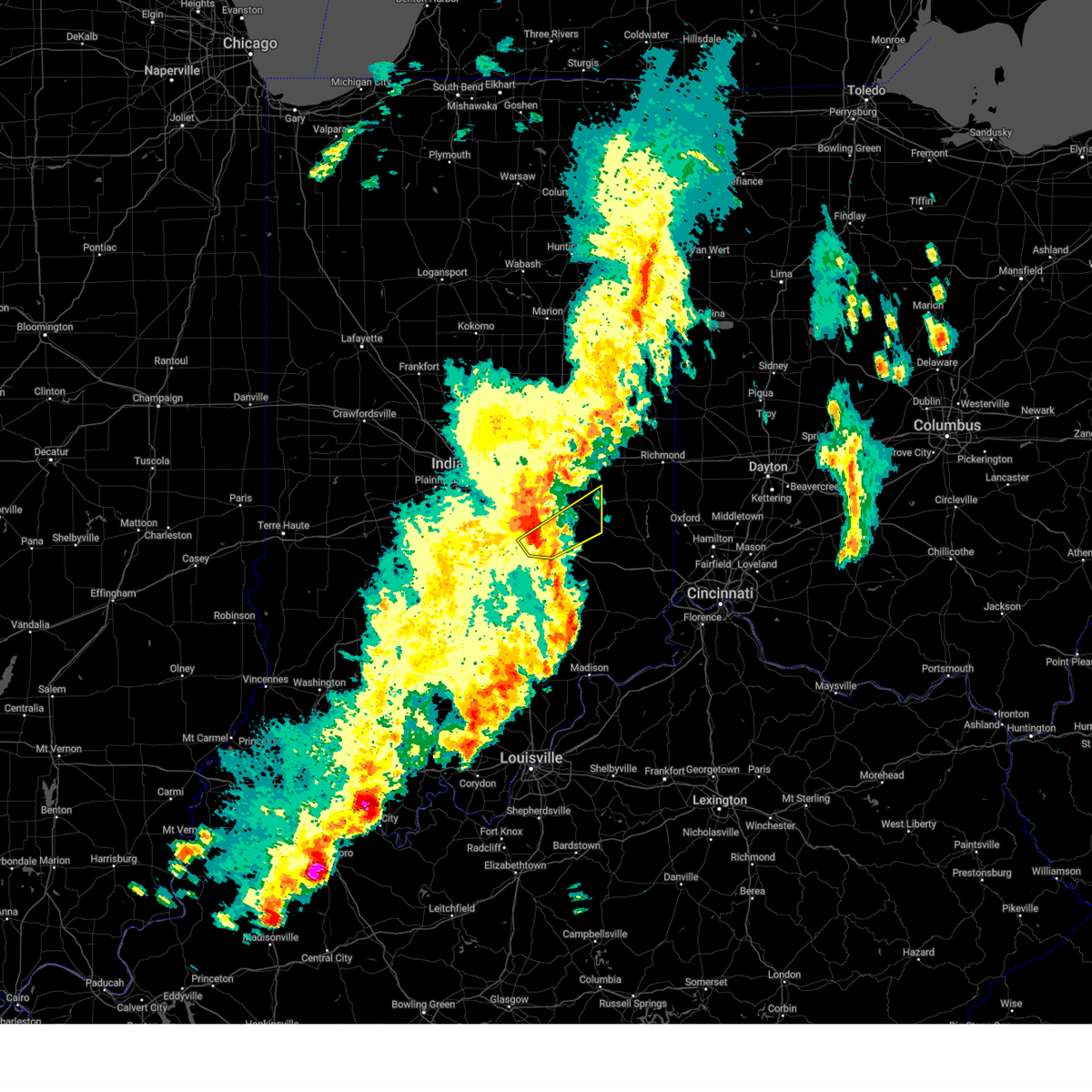
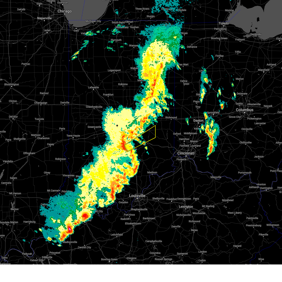
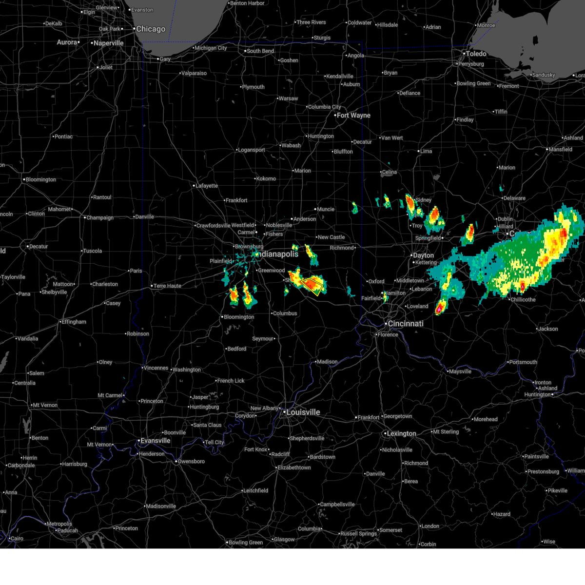
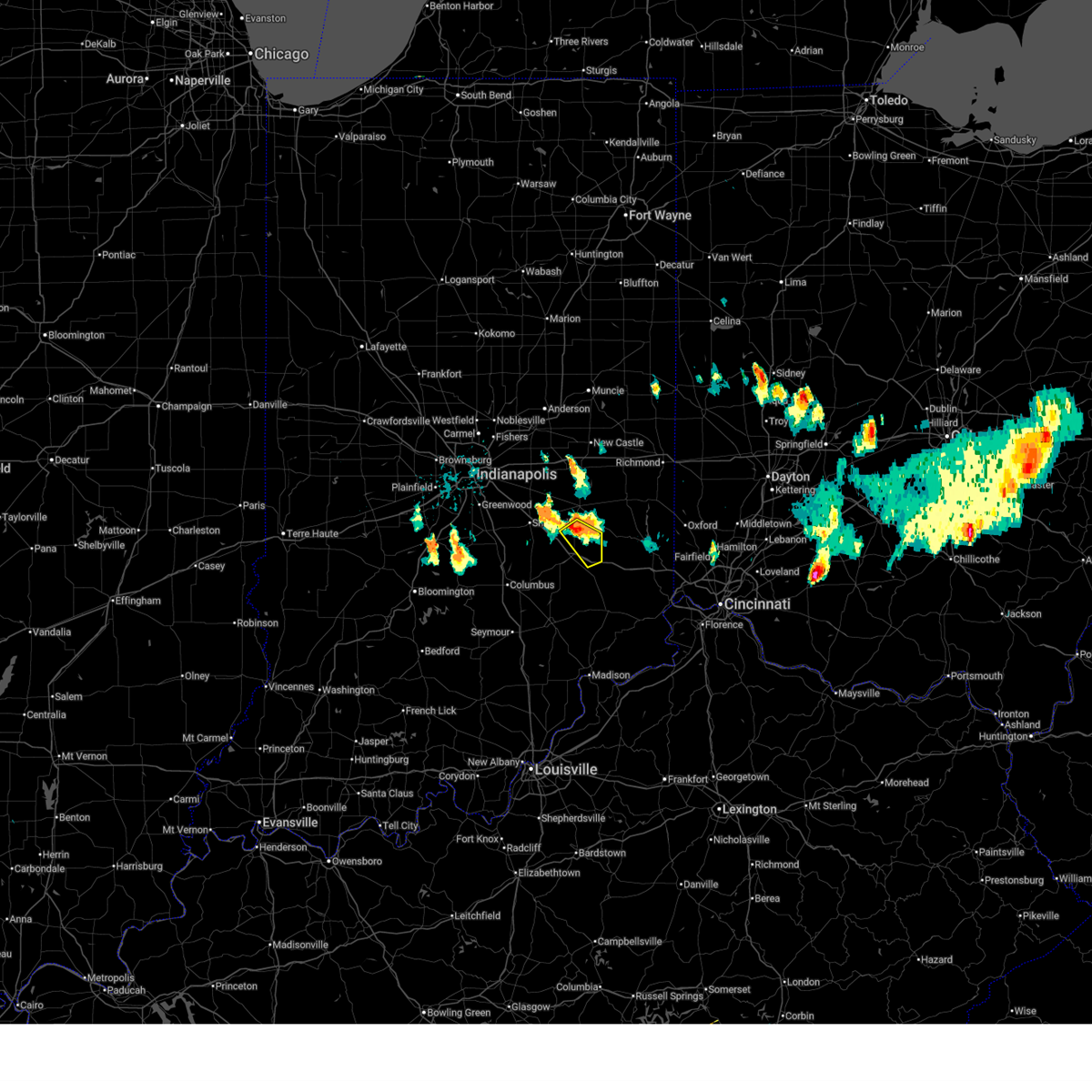
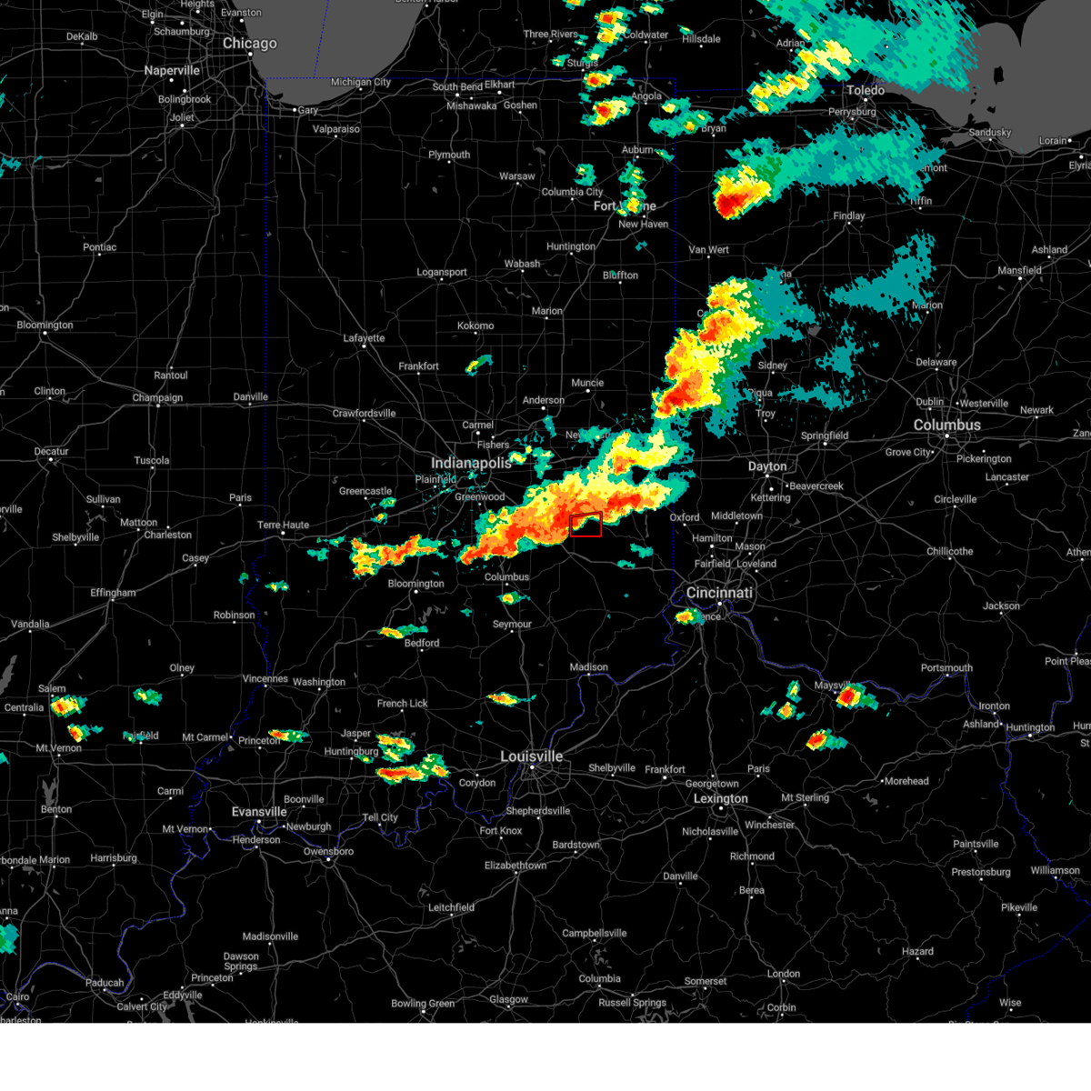
Hail Map for Milroy, IN
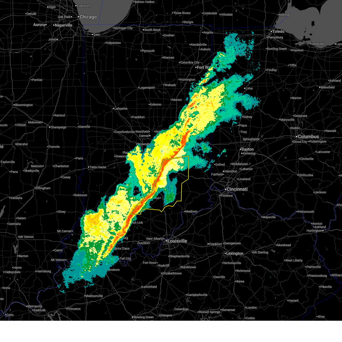
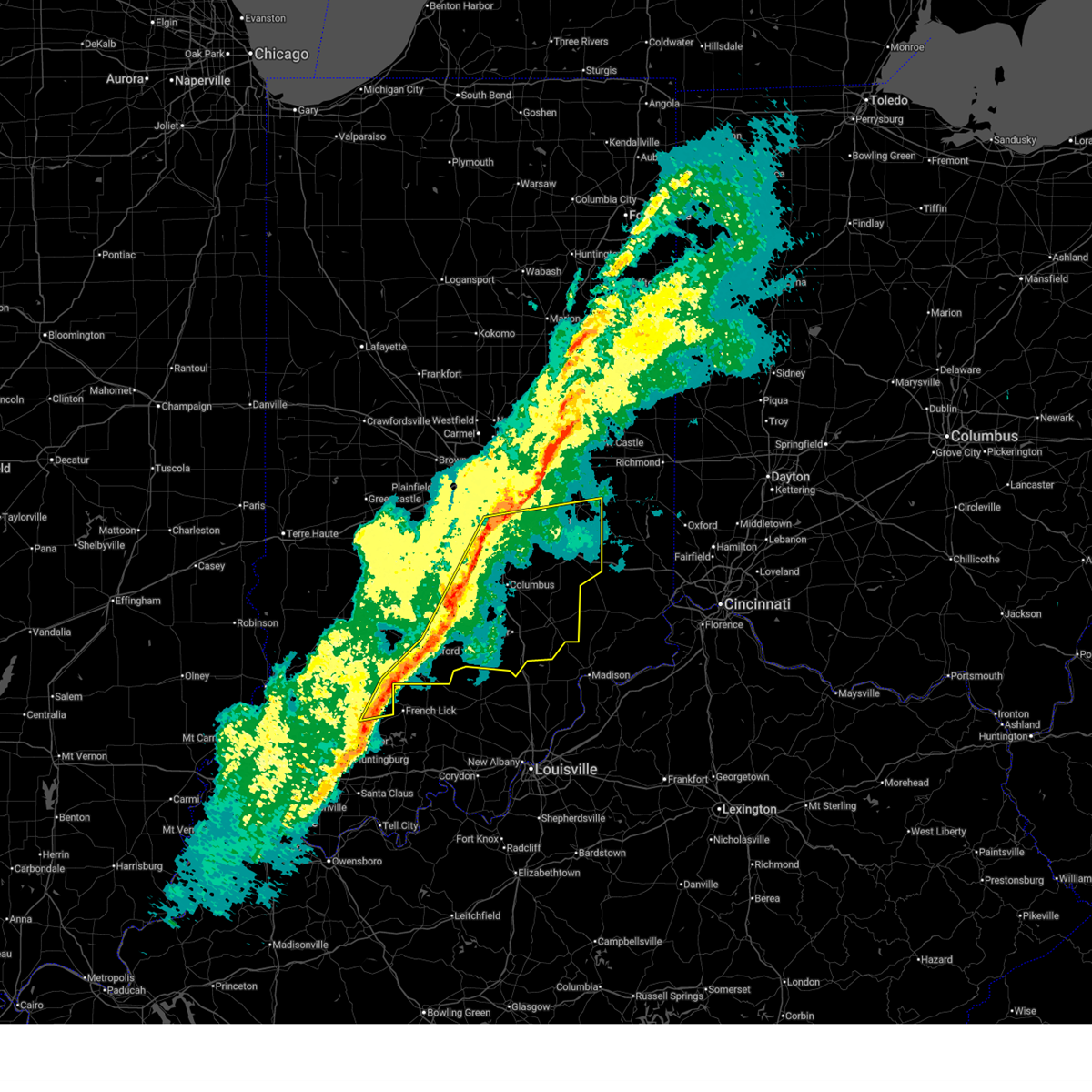
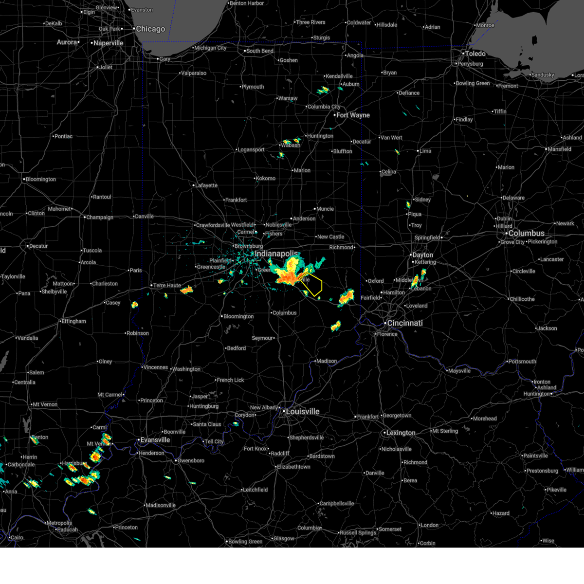
The Milroy, IN area has had 1 report of on-the-ground hail by trained spotters, and has been under severe weather warnings 33 times during the past 12 months. Doppler radar has detected hail at or near Milroy, IN on 56 occasions.
| Name: | Milroy, IN |
| Where Located: | 40.8 miles ESE of Indianapolis, IN |
| Map: | Google Map for Milroy, IN |
| Population: | 604 |
| Housing Units: | 260 |
| More Info: | Search Google for Milroy, IN |
2
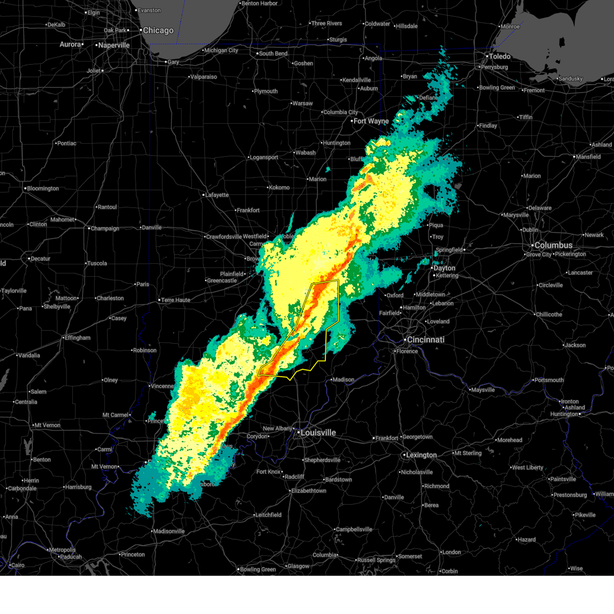
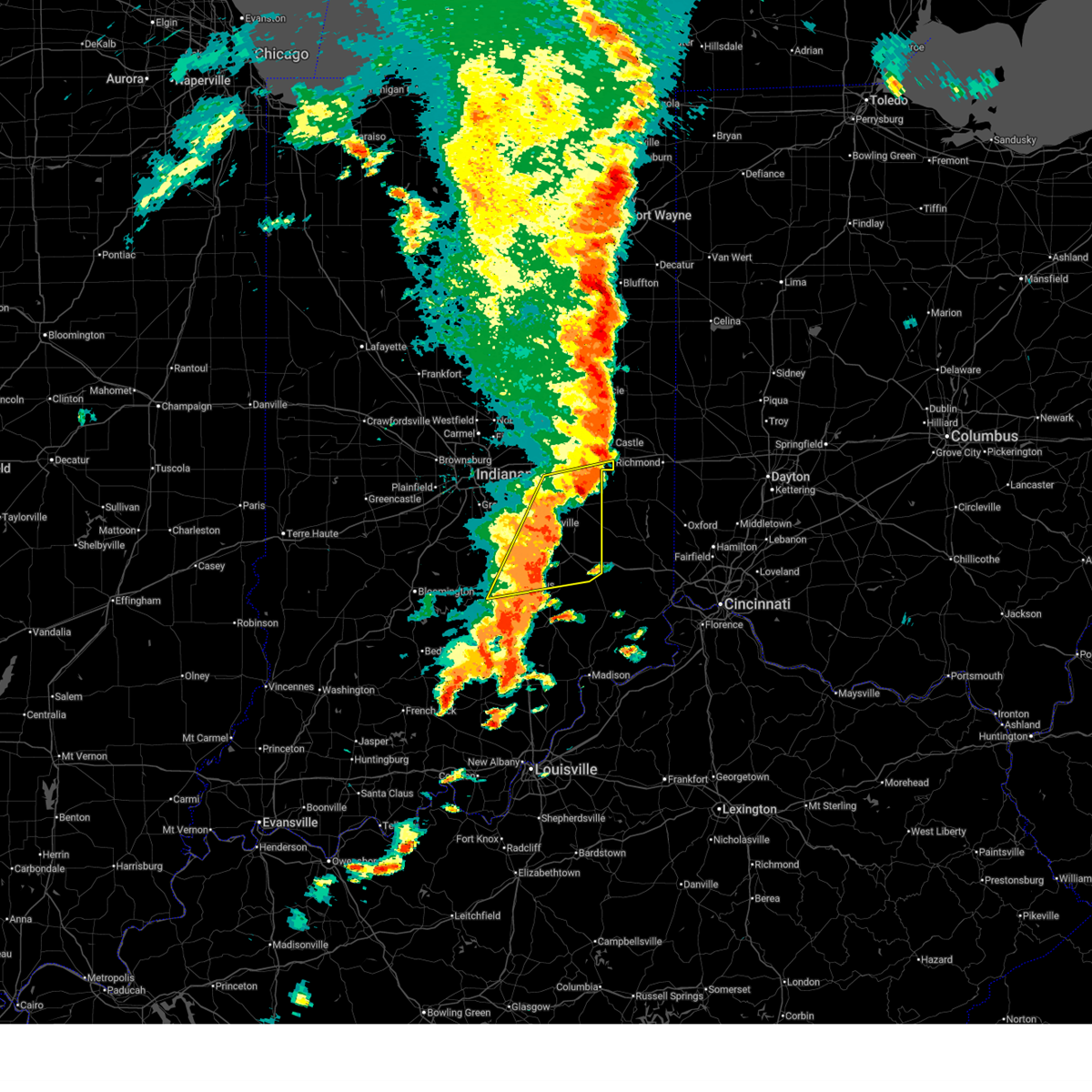
The Top Recent Hail Date for Milroy, IN is Monday, July 15, 2024 (16th out of 56)

Hail and Wind Damage Spotted near Milroy, IN
| Date / Time | Report Details |
|---|---|
| 6/21/2026 9:10 PM EDT |
 The storms which prompted the warning have moved out of the area. therefore, the warning will be allowed to expire. however, heavy rain is still possible with these thunderstorms. a tornado watch remains in effect until midnight edt for central and southeastern indiana. The storms which prompted the warning have moved out of the area. therefore, the warning will be allowed to expire. however, heavy rain is still possible with these thunderstorms. a tornado watch remains in effect until midnight edt for central and southeastern indiana.
|
| 6/21/2026 8:56 PM EDT |
 At 855 pm edt, severe thunderstorms were located along a line extending from near lake santee to 8 miles northwest of osgood, moving east at 35 mph (radar indicated). Hazards include 60 mph wind gusts. Expect damage to roofs, siding, and trees. locations impacted include, greensburg, adams, st. paul, milroy, millhousen, newpoint, clarksburg, letts, sandusky, lake santee, and moscow. This includes interstate 74 between mile markers 124 and 144. At 855 pm edt, severe thunderstorms were located along a line extending from near lake santee to 8 miles northwest of osgood, moving east at 35 mph (radar indicated). Hazards include 60 mph wind gusts. Expect damage to roofs, siding, and trees. locations impacted include, greensburg, adams, st. paul, milroy, millhousen, newpoint, clarksburg, letts, sandusky, lake santee, and moscow. This includes interstate 74 between mile markers 124 and 144.
|
| 6/21/2026 8:42 PM EDT |
 At 841 pm edt, severe thunderstorms were located along a line extending from 6 miles northwest of greensburg to 13 miles northwest of osgood, moving east at 45 mph (radar indicated). Hazards include 60 mph wind gusts. Expect damage to roofs, siding, and trees. locations impacted include, greensburg, adams, hope, milford, westport, geneva, st. paul, hartsville, milroy, millhousen, clarksburg, letts, burney, waldron, moscow, newpoint, sandusky, and lake santee. This includes interstate 74 between mile markers 121 and 144. At 841 pm edt, severe thunderstorms were located along a line extending from 6 miles northwest of greensburg to 13 miles northwest of osgood, moving east at 45 mph (radar indicated). Hazards include 60 mph wind gusts. Expect damage to roofs, siding, and trees. locations impacted include, greensburg, adams, hope, milford, westport, geneva, st. paul, hartsville, milroy, millhousen, clarksburg, letts, burney, waldron, moscow, newpoint, sandusky, and lake santee. This includes interstate 74 between mile markers 121 and 144.
|
| 6/21/2026 8:42 PM EDT |
 the severe thunderstorm warning has been cancelled and is no longer in effect the severe thunderstorm warning has been cancelled and is no longer in effect
|
| 6/21/2026 8:25 PM EDT |
 Svrind the national weather service in indianapolis has issued a * severe thunderstorm warning for, southern shelby county in central indiana, southern rush county in central indiana, decatur county in central indiana, northeastern bartholomew county in central indiana, northern jennings county in southeastern indiana, * until 915 pm edt. * at 825 pm edt, severe thunderstorms were located along a line extending from 8 miles south of shelbyville to 10 miles east of columbus, moving east at 35 mph (radar indicated). Hazards include 60 mph wind gusts. expect damage to roofs, siding, and trees Svrind the national weather service in indianapolis has issued a * severe thunderstorm warning for, southern shelby county in central indiana, southern rush county in central indiana, decatur county in central indiana, northeastern bartholomew county in central indiana, northern jennings county in southeastern indiana, * until 915 pm edt. * at 825 pm edt, severe thunderstorms were located along a line extending from 8 miles south of shelbyville to 10 miles east of columbus, moving east at 35 mph (radar indicated). Hazards include 60 mph wind gusts. expect damage to roofs, siding, and trees
|
| 6/11/2026 11:44 PM EDT |
 the severe thunderstorm warning has been cancelled and is no longer in effect the severe thunderstorm warning has been cancelled and is no longer in effect
|
| 6/11/2026 11:44 PM EDT |
 At 1143 pm edt, severe thunderstorms were located along a line extending from hagerstown to 7 miles northwest of greensburg, moving east at 50 mph (radar indicated). Hazards include 60 mph wind gusts. Expect damage to roofs, siding, and trees. locations impacted include, greensburg, rushville, adams, st. paul, lewisville, milroy, glenwood, straughn, clarksburg, mays, waldron, moscow, new salem, manilla, sandusky, and lake santee. this includes the following highways, interstate 70 between mile markers 126 and 133. Interstate 74 between mile markers 119 and 131, between mile markers 133 and 138, and between mile markers 143 and 144. At 1143 pm edt, severe thunderstorms were located along a line extending from hagerstown to 7 miles northwest of greensburg, moving east at 50 mph (radar indicated). Hazards include 60 mph wind gusts. Expect damage to roofs, siding, and trees. locations impacted include, greensburg, rushville, adams, st. paul, lewisville, milroy, glenwood, straughn, clarksburg, mays, waldron, moscow, new salem, manilla, sandusky, and lake santee. this includes the following highways, interstate 70 between mile markers 126 and 133. Interstate 74 between mile markers 119 and 131, between mile markers 133 and 138, and between mile markers 143 and 144.
|
| 6/11/2026 11:24 PM EDT |
 At 1123 pm edt, severe thunderstorms were located along a line extending from near new castle to shelbyville, moving east at 50 mph (radar indicated). Hazards include 60 mph wind gusts. Expect damage to roofs, siding, and trees. locations impacted include, shelbyville, greenfield, new castle, greensburg, rushville, adams, knightstown, morristown, st. paul, carthage, spiceland, shirley, kennard, wilkinson, lewisville, fairland, milroy, glenwood, straughn, and dunreith. this includes the following highways, interstate 70 between mile markers 107 and 133. Interstate 74 between mile markers 105 and 131, between mile markers 134 and 136, and between mile markers 143 and 144. At 1123 pm edt, severe thunderstorms were located along a line extending from near new castle to shelbyville, moving east at 50 mph (radar indicated). Hazards include 60 mph wind gusts. Expect damage to roofs, siding, and trees. locations impacted include, shelbyville, greenfield, new castle, greensburg, rushville, adams, knightstown, morristown, st. paul, carthage, spiceland, shirley, kennard, wilkinson, lewisville, fairland, milroy, glenwood, straughn, and dunreith. this includes the following highways, interstate 70 between mile markers 107 and 133. Interstate 74 between mile markers 105 and 131, between mile markers 134 and 136, and between mile markers 143 and 144.
|
| 6/11/2026 10:59 PM EDT |
 Svrind the national weather service in indianapolis has issued a * severe thunderstorm warning for, shelby county in central indiana, hancock county in central indiana, rush county in central indiana, northern decatur county in central indiana, northeastern johnson county in central indiana, southern henry county in east central indiana, southeastern marion county in central indiana, * until midnight edt. * at 1058 pm edt, severe thunderstorms were located along a line extending from 10 miles north of greenfield to 6 miles southwest of greenwood, moving east at 50 mph (radar indicated). Hazards include 60 mph wind gusts. expect damage to roofs, siding, and trees Svrind the national weather service in indianapolis has issued a * severe thunderstorm warning for, shelby county in central indiana, hancock county in central indiana, rush county in central indiana, northern decatur county in central indiana, northeastern johnson county in central indiana, southern henry county in east central indiana, southeastern marion county in central indiana, * until midnight edt. * at 1058 pm edt, severe thunderstorms were located along a line extending from 10 miles north of greenfield to 6 miles southwest of greenwood, moving east at 50 mph (radar indicated). Hazards include 60 mph wind gusts. expect damage to roofs, siding, and trees
|
| 5/19/2026 6:22 PM EDT |
 Svrind the national weather service in indianapolis has issued a * severe thunderstorm warning for, southeastern rush county in central indiana, northeastern decatur county in central indiana, * until 645 pm edt. * at 622 pm edt, a severe thunderstorm was located near greensburg, or 17 miles northwest of batesville, moving northeast at 30 mph (radar indicated). Hazards include 60 mph wind gusts. expect damage to roofs, siding, and trees Svrind the national weather service in indianapolis has issued a * severe thunderstorm warning for, southeastern rush county in central indiana, northeastern decatur county in central indiana, * until 645 pm edt. * at 622 pm edt, a severe thunderstorm was located near greensburg, or 17 miles northwest of batesville, moving northeast at 30 mph (radar indicated). Hazards include 60 mph wind gusts. expect damage to roofs, siding, and trees
|
| 4/27/2026 11:47 PM EDT |
 the severe thunderstorm warning has been cancelled and is no longer in effect the severe thunderstorm warning has been cancelled and is no longer in effect
|
| 4/27/2026 11:47 PM EDT |
 At 1146 pm edt, severe thunderstorms were located along a line extending from near richmond to near lake santee, moving east at 65 mph (radar indicated). Hazards include 70 mph wind gusts. Expect considerable tree damage. damage is likely to mobile homes, roofs, and outbuildings. locations impacted include, new castle, greensburg, rushville, adams, milford, geneva, st. paul, spiceland, lewisville, milroy, glenwood, straughn, dunreith, greensboro, waldron, moscow, new salem, manilla, sandusky, and arlington. this includes the following highways, interstate 70 between mile markers 120 and 133. Interstate 74 between mile markers 120 and 144. At 1146 pm edt, severe thunderstorms were located along a line extending from near richmond to near lake santee, moving east at 65 mph (radar indicated). Hazards include 70 mph wind gusts. Expect considerable tree damage. damage is likely to mobile homes, roofs, and outbuildings. locations impacted include, new castle, greensburg, rushville, adams, milford, geneva, st. paul, spiceland, lewisville, milroy, glenwood, straughn, dunreith, greensboro, waldron, moscow, new salem, manilla, sandusky, and arlington. this includes the following highways, interstate 70 between mile markers 120 and 133. Interstate 74 between mile markers 120 and 144.
|
| 4/27/2026 11:28 PM EDT |
 At 1128 pm edt, severe thunderstorms were located along a line extending from near new castle to 7 miles east of shelbyville, moving east at 65 mph (radar indicated). Hazards include 70 mph wind gusts. Expect considerable tree damage. damage is likely to mobile homes, roofs, and outbuildings. locations impacted include, shelbyville, greenfield, new castle, greensburg, rushville, adams, edinburgh, knightstown, flat rock, milford, geneva, morristown, st. paul, carthage, spiceland, shirley, kennard, wilkinson, lewisville, and fairland. this includes the following highways, interstate 65 between mile markers 77 and 86. interstate 70 between mile markers 105 and 133. Interstate 74 between mile markers 107 and 144. At 1128 pm edt, severe thunderstorms were located along a line extending from near new castle to 7 miles east of shelbyville, moving east at 65 mph (radar indicated). Hazards include 70 mph wind gusts. Expect considerable tree damage. damage is likely to mobile homes, roofs, and outbuildings. locations impacted include, shelbyville, greenfield, new castle, greensburg, rushville, adams, edinburgh, knightstown, flat rock, milford, geneva, morristown, st. paul, carthage, spiceland, shirley, kennard, wilkinson, lewisville, and fairland. this includes the following highways, interstate 65 between mile markers 77 and 86. interstate 70 between mile markers 105 and 133. Interstate 74 between mile markers 107 and 144.
|
| 4/27/2026 11:05 PM EDT |
 Svrind the national weather service in indianapolis has issued a * severe thunderstorm warning for, shelby county in central indiana, hancock county in central indiana, rush county in central indiana, northern decatur county in central indiana, eastern johnson county in central indiana, northern bartholomew county in central indiana, southern henry county in east central indiana, eastern marion county in central indiana, * until midnight edt. * at 1105 pm edt, severe thunderstorms were located along a line extending from 8 miles north of greenfield to near franklin, moving east at 55 mph (radar indicated). Hazards include 70 mph wind gusts. Expect considerable tree damage. Damage is likely to mobile homes, roofs, and outbuildings. Svrind the national weather service in indianapolis has issued a * severe thunderstorm warning for, shelby county in central indiana, hancock county in central indiana, rush county in central indiana, northern decatur county in central indiana, eastern johnson county in central indiana, northern bartholomew county in central indiana, southern henry county in east central indiana, eastern marion county in central indiana, * until midnight edt. * at 1105 pm edt, severe thunderstorms were located along a line extending from 8 miles north of greenfield to near franklin, moving east at 55 mph (radar indicated). Hazards include 70 mph wind gusts. Expect considerable tree damage. Damage is likely to mobile homes, roofs, and outbuildings.
|
| 3/22/2026 10:37 PM EDT |
 At 1037 pm edt, severe thunderstorms were located along a line extending from near rushville to 9 miles south of shelbyville, moving east at 45 mph (radar indicated). Hazards include quarter size hail. Damage to vehicles is expected. locations impacted include, rushville, geneva, st. paul, milroy, clarksburg, new salem, manilla, waldron, sandusky, lake santee, and moscow. This includes interstate 74 between mile markers 118 and 129. At 1037 pm edt, severe thunderstorms were located along a line extending from near rushville to 9 miles south of shelbyville, moving east at 45 mph (radar indicated). Hazards include quarter size hail. Damage to vehicles is expected. locations impacted include, rushville, geneva, st. paul, milroy, clarksburg, new salem, manilla, waldron, sandusky, lake santee, and moscow. This includes interstate 74 between mile markers 118 and 129.
|
| 3/22/2026 10:37 PM EDT |
 the severe thunderstorm warning has been cancelled and is no longer in effect the severe thunderstorm warning has been cancelled and is no longer in effect
|
| 3/22/2026 10:23 PM EDT |
 Svrind the national weather service in indianapolis has issued a * severe thunderstorm warning for, central shelby county in central indiana, southern rush county in central indiana, northern decatur county in central indiana, southeastern johnson county in central indiana, * until 1115 pm edt. * at 1022 pm edt, severe thunderstorms were located along a line extending from near shelbyville to 9 miles southeast of franklin, moving east at 45 mph (radar indicated). Hazards include quarter size hail. damage to vehicles is expected Svrind the national weather service in indianapolis has issued a * severe thunderstorm warning for, central shelby county in central indiana, southern rush county in central indiana, northern decatur county in central indiana, southeastern johnson county in central indiana, * until 1115 pm edt. * at 1022 pm edt, severe thunderstorms were located along a line extending from near shelbyville to 9 miles southeast of franklin, moving east at 45 mph (radar indicated). Hazards include quarter size hail. damage to vehicles is expected
|
| 3/15/2026 11:56 PM EDT |
 the severe thunderstorm warning has been cancelled and is no longer in effect the severe thunderstorm warning has been cancelled and is no longer in effect
|
| 3/15/2026 11:56 PM EDT |
 At 1155 pm edt, severe thunderstorms were located along a line extending from 6 miles south of rushville to near vernon, moving northeast at 50 mph (radar indicated). Hazards include 60 mph wind gusts. Expect damage to roofs, siding, and trees. locations impacted include, greensburg, north vernon, rushville, vernon, adams, knightstown, westport, carthage, milroy, glenwood, millhousen, clarksburg, letts, paris crossing, mays, butlerville, moscow, nebraska, newpoint, and new salem. This includes interstate 74 between mile markers 128 and 144. At 1155 pm edt, severe thunderstorms were located along a line extending from 6 miles south of rushville to near vernon, moving northeast at 50 mph (radar indicated). Hazards include 60 mph wind gusts. Expect damage to roofs, siding, and trees. locations impacted include, greensburg, north vernon, rushville, vernon, adams, knightstown, westport, carthage, milroy, glenwood, millhousen, clarksburg, letts, paris crossing, mays, butlerville, moscow, nebraska, newpoint, and new salem. This includes interstate 74 between mile markers 128 and 144.
|
| 3/15/2026 11:35 PM EDT |
 Svrind the national weather service in indianapolis has issued a * severe thunderstorm warning for, southeastern hancock county in central indiana, eastern shelby county in central indiana, rush county in central indiana, decatur county in central indiana, eastern bartholomew county in central indiana, south central henry county in east central indiana, eastern jackson county in south central indiana, jennings county in southeastern indiana, * until 1215 am edt. * at 1134 pm edt, severe thunderstorms were located along a line extending from 10 miles south of shelbyville to 9 miles south of seymour, moving northeast at 50 mph (radar indicated). Hazards include 60 mph wind gusts. expect damage to roofs, siding, and trees Svrind the national weather service in indianapolis has issued a * severe thunderstorm warning for, southeastern hancock county in central indiana, eastern shelby county in central indiana, rush county in central indiana, decatur county in central indiana, eastern bartholomew county in central indiana, south central henry county in east central indiana, eastern jackson county in south central indiana, jennings county in southeastern indiana, * until 1215 am edt. * at 1134 pm edt, severe thunderstorms were located along a line extending from 10 miles south of shelbyville to 9 miles south of seymour, moving northeast at 50 mph (radar indicated). Hazards include 60 mph wind gusts. expect damage to roofs, siding, and trees
|
| 3/11/2026 9:40 AM EDT |
 The storms which prompted the warning have moved out of the area. therefore, the warning will be allowed to expire. a tornado watch remains in effect until noon edt for central and east central indiana. The storms which prompted the warning have moved out of the area. therefore, the warning will be allowed to expire. a tornado watch remains in effect until noon edt for central and east central indiana.
|
| 3/11/2026 9:27 AM EDT |
 the severe thunderstorm warning has been cancelled and is no longer in effect the severe thunderstorm warning has been cancelled and is no longer in effect
|
| 3/11/2026 9:27 AM EDT |
 At 927 am edt, severe thunderstorms were located along a line extending from 7 miles southwest of new castle to 8 miles northwest of greensburg, moving east at 70 mph (radar indicated). Hazards include 60 mph wind gusts. Expect damage to roofs, siding, and trees. locations impacted include, columbus, shelbyville, new castle, greensburg, rushville, adams, knightstown, hope, flat rock, milford, geneva, morristown, st. paul, carthage, spiceland, shirley, kennard, wilkinson, lewisville, and hartsville. this includes the following highways, interstate 70 between mile markers 111 and 133. Interstate 74 between mile markers 114 and 144. At 927 am edt, severe thunderstorms were located along a line extending from 7 miles southwest of new castle to 8 miles northwest of greensburg, moving east at 70 mph (radar indicated). Hazards include 60 mph wind gusts. Expect damage to roofs, siding, and trees. locations impacted include, columbus, shelbyville, new castle, greensburg, rushville, adams, knightstown, hope, flat rock, milford, geneva, morristown, st. paul, carthage, spiceland, shirley, kennard, wilkinson, lewisville, and hartsville. this includes the following highways, interstate 70 between mile markers 111 and 133. Interstate 74 between mile markers 114 and 144.
|
| 3/11/2026 9:16 AM EDT |
 At 916 am edt, severe thunderstorms were located along a line extending from near greenfield to 9 miles northeast of columbus, moving east at 70 mph (radar indicated). Hazards include 60 mph wind gusts. Expect damage to roofs, siding, and trees. locations impacted include, columbus, shelbyville, greenfield, new castle, greensburg, rushville, adams, edinburgh, knightstown, hope, flat rock, milford, geneva, morristown, st. paul, carthage, spiceland, shirley, kennard, and wilkinson. this includes the following highways, interstate 65 between mile markers 69 and 85. interstate 70 between mile markers 102 and 133. Interstate 74 between mile markers 105 and 144. At 916 am edt, severe thunderstorms were located along a line extending from near greenfield to 9 miles northeast of columbus, moving east at 70 mph (radar indicated). Hazards include 60 mph wind gusts. Expect damage to roofs, siding, and trees. locations impacted include, columbus, shelbyville, greenfield, new castle, greensburg, rushville, adams, edinburgh, knightstown, hope, flat rock, milford, geneva, morristown, st. paul, carthage, spiceland, shirley, kennard, and wilkinson. this includes the following highways, interstate 65 between mile markers 69 and 85. interstate 70 between mile markers 102 and 133. Interstate 74 between mile markers 105 and 144.
|
| 3/11/2026 9:16 AM EDT |
 the severe thunderstorm warning has been cancelled and is no longer in effect the severe thunderstorm warning has been cancelled and is no longer in effect
|
| 3/11/2026 8:51 AM EDT |
 Svrind the national weather service in indianapolis has issued a * severe thunderstorm warning for, hancock county in central indiana, shelby county in central indiana, rush county in central indiana, decatur county in central indiana, northeastern brown county in south central indiana, johnson county in central indiana, northern bartholomew county in central indiana, southern henry county in east central indiana, southeastern marion county in central indiana, * until 945 am edt. * at 851 am edt, severe thunderstorms were located along a line extending from near southport to near nashville, moving east at 70 mph (radar indicated). Hazards include 60 mph wind gusts. expect damage to roofs, siding, and trees Svrind the national weather service in indianapolis has issued a * severe thunderstorm warning for, hancock county in central indiana, shelby county in central indiana, rush county in central indiana, decatur county in central indiana, northeastern brown county in south central indiana, johnson county in central indiana, northern bartholomew county in central indiana, southern henry county in east central indiana, southeastern marion county in central indiana, * until 945 am edt. * at 851 am edt, severe thunderstorms were located along a line extending from near southport to near nashville, moving east at 70 mph (radar indicated). Hazards include 60 mph wind gusts. expect damage to roofs, siding, and trees
|
| 12/28/2025 8:57 PM EST |
 Svrind the national weather service in indianapolis has issued a * severe thunderstorm warning for, southeastern rush county in central indiana, decatur county in central indiana, east central bartholomew county in central indiana, southeastern jackson county in south central indiana, jennings county in southeastern indiana, * until 930 pm est. * at 857 pm est, severe thunderstorms were located along a line extending from near glenwood to 10 miles south of greensburg to 8 miles southeast of brownstown, moving east at 55 mph (radar indicated). Hazards include 60 mph wind gusts. expect damage to roofs, siding, and trees Svrind the national weather service in indianapolis has issued a * severe thunderstorm warning for, southeastern rush county in central indiana, decatur county in central indiana, east central bartholomew county in central indiana, southeastern jackson county in south central indiana, jennings county in southeastern indiana, * until 930 pm est. * at 857 pm est, severe thunderstorms were located along a line extending from near glenwood to 10 miles south of greensburg to 8 miles southeast of brownstown, moving east at 55 mph (radar indicated). Hazards include 60 mph wind gusts. expect damage to roofs, siding, and trees
|
| 12/28/2025 8:47 PM EST |
 At 847 pm est, severe thunderstorms were located along a line extending from 9 miles northeast of shelbyville to near columbus to 10 miles west of brownstown, moving east at 55 mph (radar indicated). Hazards include 60 mph wind gusts. Expect damage to roofs, siding, and trees. locations impacted include, columbus, seymour, greensburg, north vernon, rushville, brownstown, vernon, adams, hope, crothersville, milford, westport, geneva, st. paul, medora, elizabethtown, hartsville, milroy, glenwood, and jonesville. this includes the following highways, interstate 65 between mile markers 37 and 60. Interstate 74 between mile markers 121 and 144. At 847 pm est, severe thunderstorms were located along a line extending from 9 miles northeast of shelbyville to near columbus to 10 miles west of brownstown, moving east at 55 mph (radar indicated). Hazards include 60 mph wind gusts. Expect damage to roofs, siding, and trees. locations impacted include, columbus, seymour, greensburg, north vernon, rushville, brownstown, vernon, adams, hope, crothersville, milford, westport, geneva, st. paul, medora, elizabethtown, hartsville, milroy, glenwood, and jonesville. this includes the following highways, interstate 65 between mile markers 37 and 60. Interstate 74 between mile markers 121 and 144.
|
| 12/28/2025 8:47 PM EST |
 the severe thunderstorm warning has been cancelled and is no longer in effect the severe thunderstorm warning has been cancelled and is no longer in effect
|
| 12/28/2025 8:35 PM EST |
 At 835 pm est, severe thunderstorms were located along a line extending from shelbyville to 7 miles southwest of columbus to 7 miles southeast of bedford, moving east at 55 mph (radar indicated). Hazards include 60 mph wind gusts. Expect damage to roofs, siding, and trees. locations impacted include, columbus, shelbyville, seymour, greensburg, north vernon, rushville, brownstown, vernon, adams, mitchell, hope, crothersville, flat rock, milford, westport, geneva, st. paul, medora, elizabethtown, and hartsville. this includes the following highways, interstate 65 between mile markers 37 and 74, and between mile markers 77 and 78. Interstate 74 between mile markers 110 and 144. At 835 pm est, severe thunderstorms were located along a line extending from shelbyville to 7 miles southwest of columbus to 7 miles southeast of bedford, moving east at 55 mph (radar indicated). Hazards include 60 mph wind gusts. Expect damage to roofs, siding, and trees. locations impacted include, columbus, shelbyville, seymour, greensburg, north vernon, rushville, brownstown, vernon, adams, mitchell, hope, crothersville, flat rock, milford, westport, geneva, st. paul, medora, elizabethtown, and hartsville. this includes the following highways, interstate 65 between mile markers 37 and 74, and between mile markers 77 and 78. Interstate 74 between mile markers 110 and 144.
|
| 12/28/2025 8:35 PM EST |
 the severe thunderstorm warning has been cancelled and is no longer in effect the severe thunderstorm warning has been cancelled and is no longer in effect
|
| 12/28/2025 8:16 PM EST |
 Svrind the national weather service in indianapolis has issued a * severe thunderstorm warning for, shelby county in central indiana, southeastern monroe county in south central indiana, southern rush county in central indiana, decatur county in central indiana, brown county in south central indiana, southeastern johnson county in central indiana, bartholomew county in central indiana, southeastern martin county in southwestern indiana, lawrence county in south central indiana, jackson county in south central indiana, jennings county in southeastern indiana, * until 900 pm est. * at 816 pm est, severe thunderstorms were located along a line extending from near franklin to 11 miles south of nashville to 7 miles east of shoals, moving east at 55 mph (radar indicated). Hazards include 60 mph wind gusts. expect damage to roofs, siding, and trees Svrind the national weather service in indianapolis has issued a * severe thunderstorm warning for, shelby county in central indiana, southeastern monroe county in south central indiana, southern rush county in central indiana, decatur county in central indiana, brown county in south central indiana, southeastern johnson county in central indiana, bartholomew county in central indiana, southeastern martin county in southwestern indiana, lawrence county in south central indiana, jackson county in south central indiana, jennings county in southeastern indiana, * until 900 pm est. * at 816 pm est, severe thunderstorms were located along a line extending from near franklin to 11 miles south of nashville to 7 miles east of shoals, moving east at 55 mph (radar indicated). Hazards include 60 mph wind gusts. expect damage to roofs, siding, and trees
|
| 8/19/2025 3:07 PM EDT |
 Svrind the national weather service in indianapolis has issued a * severe thunderstorm warning for, southern rush county in central indiana, northeastern decatur county in central indiana, * until 345 pm edt. * at 307 pm edt, a severe thunderstorm was located 8 miles south of rushville, or 16 miles east of shelbyville, moving southeast at 25 mph (radar indicated). Hazards include 60 mph wind gusts. expect damage to roofs, siding, and trees Svrind the national weather service in indianapolis has issued a * severe thunderstorm warning for, southern rush county in central indiana, northeastern decatur county in central indiana, * until 345 pm edt. * at 307 pm edt, a severe thunderstorm was located 8 miles south of rushville, or 16 miles east of shelbyville, moving southeast at 25 mph (radar indicated). Hazards include 60 mph wind gusts. expect damage to roofs, siding, and trees
|
| 6/18/2025 5:37 PM EDT |
 At 537 pm edt, severe thunderstorms were located along a line extending from 6 miles northwest of rushville to 10 miles north of north vernon, moving east at 65 mph (radar indicated). Hazards include 60 mph wind gusts and penny size hail. Expect damage to roofs, siding, and trees. locations impacted include, columbus, shelbyville, greensburg, rushville, adams, hope, flat rock, milford, geneva, morristown, st. paul, carthage, lewisville, hartsville, milroy, glenwood, clifford, straughn, dunreith, and millhousen. this includes the following highways, interstate 65 between mile markers 65 and 74. Interstate 74 between mile markers 112 and 144. At 537 pm edt, severe thunderstorms were located along a line extending from 6 miles northwest of rushville to 10 miles north of north vernon, moving east at 65 mph (radar indicated). Hazards include 60 mph wind gusts and penny size hail. Expect damage to roofs, siding, and trees. locations impacted include, columbus, shelbyville, greensburg, rushville, adams, hope, flat rock, milford, geneva, morristown, st. paul, carthage, lewisville, hartsville, milroy, glenwood, clifford, straughn, dunreith, and millhousen. this includes the following highways, interstate 65 between mile markers 65 and 74. Interstate 74 between mile markers 112 and 144.
|
| 6/18/2025 5:37 PM EDT |
 the severe thunderstorm warning has been cancelled and is no longer in effect the severe thunderstorm warning has been cancelled and is no longer in effect
|
| 6/18/2025 5:14 PM EDT |
 Svrind the national weather service in indianapolis has issued a * severe thunderstorm warning for, southeastern hancock county in central indiana, shelby county in central indiana, rush county in central indiana, decatur county in central indiana, southeastern brown county in south central indiana, southeastern johnson county in central indiana, bartholomew county in central indiana, southeastern henry county in east central indiana, * until 600 pm edt. * at 513 pm edt, severe thunderstorms were located along a line extending from 7 miles south of greenfield to 11 miles north of brownstown, moving east at 45 mph (radar indicated). Hazards include 60 mph wind gusts and penny size hail. expect damage to roofs, siding, and trees Svrind the national weather service in indianapolis has issued a * severe thunderstorm warning for, southeastern hancock county in central indiana, shelby county in central indiana, rush county in central indiana, decatur county in central indiana, southeastern brown county in south central indiana, southeastern johnson county in central indiana, bartholomew county in central indiana, southeastern henry county in east central indiana, * until 600 pm edt. * at 513 pm edt, severe thunderstorms were located along a line extending from 7 miles south of greenfield to 11 miles north of brownstown, moving east at 45 mph (radar indicated). Hazards include 60 mph wind gusts and penny size hail. expect damage to roofs, siding, and trees
|
| 5/16/2025 8:16 PM EDT |
 Svrind the national weather service in indianapolis has issued a * severe thunderstorm warning for, southeastern hancock county in central indiana, shelby county in central indiana, rush county in central indiana, northwestern decatur county in central indiana, northeastern bartholomew county in central indiana, henry county in east central indiana, * until 900 pm edt. * at 816 pm edt, a severe thunderstorm was located near shelbyville, moving northeast at 50 mph (radar indicated). Hazards include ping pong ball size hail and 60 mph wind gusts. People and animals outdoors will be injured. expect hail damage to roofs, siding, windows, and vehicles. Expect wind damage to roofs, siding, and trees. Svrind the national weather service in indianapolis has issued a * severe thunderstorm warning for, southeastern hancock county in central indiana, shelby county in central indiana, rush county in central indiana, northwestern decatur county in central indiana, northeastern bartholomew county in central indiana, henry county in east central indiana, * until 900 pm edt. * at 816 pm edt, a severe thunderstorm was located near shelbyville, moving northeast at 50 mph (radar indicated). Hazards include ping pong ball size hail and 60 mph wind gusts. People and animals outdoors will be injured. expect hail damage to roofs, siding, windows, and vehicles. Expect wind damage to roofs, siding, and trees.
|
| 5/16/2025 7:56 PM EDT |
 the severe thunderstorm warning has been cancelled and is no longer in effect the severe thunderstorm warning has been cancelled and is no longer in effect
|
| 5/16/2025 7:56 PM EDT |
 At 755 pm edt, severe thunderstorms were located along a line extending from 6 miles northwest of new castle to 8 miles northeast of shelbyville, moving east at 30 mph (radar indicated). Hazards include 60 mph wind gusts and penny size hail. Expect damage to roofs, siding, and trees. locations impacted include, shelbyville, new castle, rushville, knightstown, carthage, spiceland, kennard, sulphur springs, mooreland, lewisville, mount summit, milroy, glenwood, losantville, straughn, modoc, dunreith, cadiz, springport, and greensboro. this includes the following highways, interstate 70 between mile markers 116 and 133. Interstate 74 between mile markers 115 and 118. At 755 pm edt, severe thunderstorms were located along a line extending from 6 miles northwest of new castle to 8 miles northeast of shelbyville, moving east at 30 mph (radar indicated). Hazards include 60 mph wind gusts and penny size hail. Expect damage to roofs, siding, and trees. locations impacted include, shelbyville, new castle, rushville, knightstown, carthage, spiceland, kennard, sulphur springs, mooreland, lewisville, mount summit, milroy, glenwood, losantville, straughn, modoc, dunreith, cadiz, springport, and greensboro. this includes the following highways, interstate 70 between mile markers 116 and 133. Interstate 74 between mile markers 115 and 118.
|
| 5/16/2025 7:48 PM EDT |
 Svrind the national weather service in indianapolis has issued a * severe thunderstorm warning for, shelby county in central indiana, southern rush county in central indiana, northwestern decatur county in central indiana, northeastern brown county in south central indiana, southeastern johnson county in central indiana, northern bartholomew county in central indiana, * until 830 pm edt. * at 747 pm edt, a severe thunderstorm was located 9 miles northwest of columbus, moving northeast at 60 mph (radar indicated). Hazards include golf ball size hail and 60 mph wind gusts. People and animals outdoors will be injured. expect hail damage to roofs, siding, windows, and vehicles. Expect wind damage to roofs, siding, and trees. Svrind the national weather service in indianapolis has issued a * severe thunderstorm warning for, shelby county in central indiana, southern rush county in central indiana, northwestern decatur county in central indiana, northeastern brown county in south central indiana, southeastern johnson county in central indiana, northern bartholomew county in central indiana, * until 830 pm edt. * at 747 pm edt, a severe thunderstorm was located 9 miles northwest of columbus, moving northeast at 60 mph (radar indicated). Hazards include golf ball size hail and 60 mph wind gusts. People and animals outdoors will be injured. expect hail damage to roofs, siding, windows, and vehicles. Expect wind damage to roofs, siding, and trees.
|
| 5/16/2025 7:42 PM EDT |
 Svrind the national weather service in indianapolis has issued a * severe thunderstorm warning for, southeastern madison county in central indiana, eastern hancock county in central indiana, central shelby county in central indiana, rush county in central indiana, southwestern randolph county in east central indiana, henry county in east central indiana, * until 830 pm edt. * at 742 pm edt, severe thunderstorms were located along a line extending from 9 miles south of anderson to near shelbyville, moving east at 30 mph (radar indicated). Hazards include 60 mph wind gusts and penny size hail. expect damage to roofs, siding, and trees Svrind the national weather service in indianapolis has issued a * severe thunderstorm warning for, southeastern madison county in central indiana, eastern hancock county in central indiana, central shelby county in central indiana, rush county in central indiana, southwestern randolph county in east central indiana, henry county in east central indiana, * until 830 pm edt. * at 742 pm edt, severe thunderstorms were located along a line extending from 9 miles south of anderson to near shelbyville, moving east at 30 mph (radar indicated). Hazards include 60 mph wind gusts and penny size hail. expect damage to roofs, siding, and trees
|
| 5/16/2025 7:26 PM EDT |
 At 726 pm edt, severe thunderstorms were located along a line extending from 6 miles northwest of greenfield to near shelbyville, moving east at 50 mph (radar indicated). Hazards include 70 mph wind gusts. Expect considerable tree damage. damage is likely to mobile homes, roofs, and outbuildings. locations impacted include, indianapolis, shelbyville, fishers, greenwood, lawrence, franklin, greenfield, rushville, new whiteland, cumberland, mccordsville, whiteland, fortville, ingalls, knightstown, new palestine, morristown, carthage, shirley, and markleville. this includes the following highways, interstate 65 between mile markers 89 and 99. interstate 70 between mile markers 91 and 120. Interstate 74 between mile markers 94 and 121. At 726 pm edt, severe thunderstorms were located along a line extending from 6 miles northwest of greenfield to near shelbyville, moving east at 50 mph (radar indicated). Hazards include 70 mph wind gusts. Expect considerable tree damage. damage is likely to mobile homes, roofs, and outbuildings. locations impacted include, indianapolis, shelbyville, fishers, greenwood, lawrence, franklin, greenfield, rushville, new whiteland, cumberland, mccordsville, whiteland, fortville, ingalls, knightstown, new palestine, morristown, carthage, shirley, and markleville. this includes the following highways, interstate 65 between mile markers 89 and 99. interstate 70 between mile markers 91 and 120. Interstate 74 between mile markers 94 and 121.
|
| 5/16/2025 7:07 PM EDT |
 Svrind the national weather service in indianapolis has issued a * severe thunderstorm warning for, southern madison county in central indiana, hancock county in central indiana, shelby county in central indiana, western rush county in central indiana, northern johnson county in central indiana, western henry county in east central indiana, marion county in central indiana, southeastern hamilton county in central indiana, * until 745 pm edt. * at 707 pm edt, severe thunderstorms were located along a line extending from near indianapolis to near franklin, moving east at 50 mph (radar indicated). Hazards include 70 mph wind gusts. Expect considerable tree damage. Damage is likely to mobile homes, roofs, and outbuildings. Svrind the national weather service in indianapolis has issued a * severe thunderstorm warning for, southern madison county in central indiana, hancock county in central indiana, shelby county in central indiana, western rush county in central indiana, northern johnson county in central indiana, western henry county in east central indiana, marion county in central indiana, southeastern hamilton county in central indiana, * until 745 pm edt. * at 707 pm edt, severe thunderstorms were located along a line extending from near indianapolis to near franklin, moving east at 50 mph (radar indicated). Hazards include 70 mph wind gusts. Expect considerable tree damage. Damage is likely to mobile homes, roofs, and outbuildings.
|
| 4/29/2025 12:29 PM EDT |
 At 1228 pm edt, severe thunderstorms were located along a line extending from 12 miles southeast of greenfield to near rushville to 9 miles west of lake santee to near greensburg, moving east at 60 mph (radar indicated). Hazards include 70 mph wind gusts. Expect considerable tree damage. damage is likely to mobile homes, roofs, and outbuildings. locations impacted include, clarksburg, adams, st. Paul, glenwood, mays, moscow, carthage, rushville, milroy, new salem, manilla, falmouth, sandusky, arlington, and lake santee. At 1228 pm edt, severe thunderstorms were located along a line extending from 12 miles southeast of greenfield to near rushville to 9 miles west of lake santee to near greensburg, moving east at 60 mph (radar indicated). Hazards include 70 mph wind gusts. Expect considerable tree damage. damage is likely to mobile homes, roofs, and outbuildings. locations impacted include, clarksburg, adams, st. Paul, glenwood, mays, moscow, carthage, rushville, milroy, new salem, manilla, falmouth, sandusky, arlington, and lake santee.
|
| 4/29/2025 12:29 PM EDT |
 the severe thunderstorm warning has been cancelled and is no longer in effect the severe thunderstorm warning has been cancelled and is no longer in effect
|
| 4/29/2025 12:20 PM EDT |
 At 1220 pm edt, severe thunderstorms were located along a line extending from 6 miles southeast of greenfield to 7 miles northeast of shelbyville to 11 miles northwest of greensburg, moving northeast at 60 mph (weather station report. at 1213 pm edt, a 64 mph wind gust was reported at shelbyville municipal airport). Hazards include 70 mph wind gusts. Expect considerable tree damage. damage is likely to mobile homes, roofs, and outbuildings. locations impacted include, clarksburg, adams, st. Paul, glenwood, mays, moscow, carthage, rushville, milroy, new salem, manilla, falmouth, morristown, fairland, sandusky, arlington, lake santee, and knightstown. At 1220 pm edt, severe thunderstorms were located along a line extending from 6 miles southeast of greenfield to 7 miles northeast of shelbyville to 11 miles northwest of greensburg, moving northeast at 60 mph (weather station report. at 1213 pm edt, a 64 mph wind gust was reported at shelbyville municipal airport). Hazards include 70 mph wind gusts. Expect considerable tree damage. damage is likely to mobile homes, roofs, and outbuildings. locations impacted include, clarksburg, adams, st. Paul, glenwood, mays, moscow, carthage, rushville, milroy, new salem, manilla, falmouth, morristown, fairland, sandusky, arlington, lake santee, and knightstown.
|
| 4/29/2025 12:14 PM EDT |
 Svrind the national weather service in indianapolis has issued a * severe thunderstorm warning for, southeastern hancock county in central indiana, northern shelby county in central indiana, rush county in central indiana, northern decatur county in central indiana, * until 100 pm edt. * at 1214 pm edt, severe thunderstorms were located along a line extending from 7 miles south of greenfield to near shelbyville to 14 miles west of greensburg to 9 miles northeast of columbus, moving northeast at 60 mph (radar indicated). Hazards include 60 mph wind gusts. expect damage to roofs, siding, and trees Svrind the national weather service in indianapolis has issued a * severe thunderstorm warning for, southeastern hancock county in central indiana, northern shelby county in central indiana, rush county in central indiana, northern decatur county in central indiana, * until 100 pm edt. * at 1214 pm edt, severe thunderstorms were located along a line extending from 7 miles south of greenfield to near shelbyville to 14 miles west of greensburg to 9 miles northeast of columbus, moving northeast at 60 mph (radar indicated). Hazards include 60 mph wind gusts. expect damage to roofs, siding, and trees
|
| 4/2/2025 11:29 PM EDT |
 The severe thunderstorm which prompted the warning has moved out of the warned area. therefore, the warning will be allowed to expire. a tornado watch remains in effect until 400 am edt for central indiana. The severe thunderstorm which prompted the warning has moved out of the warned area. therefore, the warning will be allowed to expire. a tornado watch remains in effect until 400 am edt for central indiana.
|
| 4/2/2025 11:20 PM EDT |
 At 1120 pm edt, a severe thunderstorm was located near glenwood, or 10 miles southwest of connersville, moving east at 40 mph (radar indicated). Hazards include 70 mph wind gusts. Expect considerable tree damage. damage is likely to mobile homes, roofs, and outbuildings. locations impacted include, milroy, greensburg, clarksburg, milford, new salem, adams, st. paul, glenwood, sandusky, lake santee, moscow, and rushville. This includes interstate 74 between mile markers 124 and 139. At 1120 pm edt, a severe thunderstorm was located near glenwood, or 10 miles southwest of connersville, moving east at 40 mph (radar indicated). Hazards include 70 mph wind gusts. Expect considerable tree damage. damage is likely to mobile homes, roofs, and outbuildings. locations impacted include, milroy, greensburg, clarksburg, milford, new salem, adams, st. paul, glenwood, sandusky, lake santee, moscow, and rushville. This includes interstate 74 between mile markers 124 and 139.
|
| 4/2/2025 11:20 PM EDT |
 the severe thunderstorm warning has been cancelled and is no longer in effect the severe thunderstorm warning has been cancelled and is no longer in effect
|
| 4/2/2025 11:06 PM EDT |
 At 1105 pm edt, a severe thunderstorm was located over glenwood, or 10 miles west of connersville, moving east at 65 mph (radar indicated). Hazards include 70 mph wind gusts. Expect considerable tree damage. damage is likely to mobile homes, roofs, and outbuildings. locations impacted include, straughn, greensburg, clarksburg, milford, adams, st. paul, glenwood, mays, moscow, rushville, milroy, new salem, dunreith, sandusky, lake santee, and lewisville. This includes interstate 74 between mile markers 123 and 139. At 1105 pm edt, a severe thunderstorm was located over glenwood, or 10 miles west of connersville, moving east at 65 mph (radar indicated). Hazards include 70 mph wind gusts. Expect considerable tree damage. damage is likely to mobile homes, roofs, and outbuildings. locations impacted include, straughn, greensburg, clarksburg, milford, adams, st. paul, glenwood, mays, moscow, rushville, milroy, new salem, dunreith, sandusky, lake santee, and lewisville. This includes interstate 74 between mile markers 123 and 139.
|
| 4/2/2025 11:06 PM EDT |
 the severe thunderstorm warning has been cancelled and is no longer in effect the severe thunderstorm warning has been cancelled and is no longer in effect
|
| 4/2/2025 10:50 PM EDT |
 Svrind the national weather service in indianapolis has issued a * severe thunderstorm warning for, eastern shelby county in central indiana, southeastern hancock county in central indiana, rush county in central indiana, northern decatur county in central indiana, southern henry county in east central indiana, * until 1130 pm edt. * at 1050 pm edt, a severe thunderstorm was located 7 miles southwest of rushville, or 11 miles east of shelbyville, moving east at 50 mph (radar indicated). Hazards include 70 mph wind gusts. Expect considerable tree damage. Damage is likely to mobile homes, roofs, and outbuildings. Svrind the national weather service in indianapolis has issued a * severe thunderstorm warning for, eastern shelby county in central indiana, southeastern hancock county in central indiana, rush county in central indiana, northern decatur county in central indiana, southern henry county in east central indiana, * until 1130 pm edt. * at 1050 pm edt, a severe thunderstorm was located 7 miles southwest of rushville, or 11 miles east of shelbyville, moving east at 50 mph (radar indicated). Hazards include 70 mph wind gusts. Expect considerable tree damage. Damage is likely to mobile homes, roofs, and outbuildings.
|
| 3/30/2025 8:27 PM EDT |
 The storms which prompted the warning have moved out of the area. therefore, the warning will be allowed to expire. The storms which prompted the warning have moved out of the area. therefore, the warning will be allowed to expire.
|
| 3/30/2025 8:02 PM EDT |
 At 802 pm edt, severe thunderstorms were located along a line extending from near glenwood to vernon, moving east at 45 mph (radar indicated). Hazards include 60 mph wind gusts and quarter size hail. Hail damage to vehicles is expected. expect wind damage to roofs, siding, and trees. locations impacted include, westport, hayden, north vernon, greensburg, clarksburg, letts, paris crossing, adams, butlerville, crothersville, nebraska, vernon, newpoint, milroy, new salem, millhousen, country squire lakes, sandusky, lake santee, and rushville. this includes the following highways, interstate 65 between mile markers 37 and 49. Interstate 74 between mile markers 128 and 144. At 802 pm edt, severe thunderstorms were located along a line extending from near glenwood to vernon, moving east at 45 mph (radar indicated). Hazards include 60 mph wind gusts and quarter size hail. Hail damage to vehicles is expected. expect wind damage to roofs, siding, and trees. locations impacted include, westport, hayden, north vernon, greensburg, clarksburg, letts, paris crossing, adams, butlerville, crothersville, nebraska, vernon, newpoint, milroy, new salem, millhousen, country squire lakes, sandusky, lake santee, and rushville. this includes the following highways, interstate 65 between mile markers 37 and 49. Interstate 74 between mile markers 128 and 144.
|
| 3/30/2025 8:02 PM EDT |
 the severe thunderstorm warning has been cancelled and is no longer in effect the severe thunderstorm warning has been cancelled and is no longer in effect
|
| 3/30/2025 7:46 PM EDT |
 Svrind the national weather service in indianapolis has issued a * severe thunderstorm warning for, southeastern shelby county in central indiana, rush county in central indiana, decatur county in central indiana, eastern bartholomew county in central indiana, eastern jackson county in south central indiana, jennings county in southeastern indiana, * until 830 pm edt. * at 746 pm edt, severe thunderstorms were located along a line extending from rushville to near north vernon, moving east at 45 mph (radar indicated). Hazards include 60 mph wind gusts and quarter size hail. Hail damage to vehicles is expected. Expect wind damage to roofs, siding, and trees. Svrind the national weather service in indianapolis has issued a * severe thunderstorm warning for, southeastern shelby county in central indiana, rush county in central indiana, decatur county in central indiana, eastern bartholomew county in central indiana, eastern jackson county in south central indiana, jennings county in southeastern indiana, * until 830 pm edt. * at 746 pm edt, severe thunderstorms were located along a line extending from rushville to near north vernon, moving east at 45 mph (radar indicated). Hazards include 60 mph wind gusts and quarter size hail. Hail damage to vehicles is expected. Expect wind damage to roofs, siding, and trees.
|
| 3/30/2025 7:36 PM EDT |
 At 736 pm edt, severe thunderstorms were located along a line extending from 7 miles east of shelbyville to near seymour, moving east at 65 mph (radar indicated). Hazards include 60 mph wind gusts and quarter size hail. Hail damage to vehicles is expected. expect wind damage to roofs, siding, and trees. locations impacted include, greensburg, newbern, paris crossing, hartsville, crothersville, vallonia, azalia, manilla, millhousen, sandusky, arlington, clarksburg, burney, waymansville, clifford, butlerville, boggstown, marietta, rushville, and shelbyville. this includes the following highways, interstate 65 between mile markers 37 and 84. Interstate 74 between mile markers 108 and 144. At 736 pm edt, severe thunderstorms were located along a line extending from 7 miles east of shelbyville to near seymour, moving east at 65 mph (radar indicated). Hazards include 60 mph wind gusts and quarter size hail. Hail damage to vehicles is expected. expect wind damage to roofs, siding, and trees. locations impacted include, greensburg, newbern, paris crossing, hartsville, crothersville, vallonia, azalia, manilla, millhousen, sandusky, arlington, clarksburg, burney, waymansville, clifford, butlerville, boggstown, marietta, rushville, and shelbyville. this includes the following highways, interstate 65 between mile markers 37 and 84. Interstate 74 between mile markers 108 and 144.
|
| 3/30/2025 7:22 PM EDT |
 Svrind the national weather service in indianapolis has issued a * severe thunderstorm warning for, shelby county in central indiana, rush county in central indiana, decatur county in central indiana, southeastern johnson county in central indiana, bartholomew county in central indiana, jackson county in south central indiana, jennings county in southeastern indiana, * until 800 pm edt. * at 721 pm edt, severe thunderstorms were located along a line extending from 7 miles east of franklin to near brownstown, moving east at 40 mph (radar indicated). Hazards include 60 mph wind gusts and quarter size hail. Hail damage to vehicles is expected. Expect wind damage to roofs, siding, and trees. Svrind the national weather service in indianapolis has issued a * severe thunderstorm warning for, shelby county in central indiana, rush county in central indiana, decatur county in central indiana, southeastern johnson county in central indiana, bartholomew county in central indiana, jackson county in south central indiana, jennings county in southeastern indiana, * until 800 pm edt. * at 721 pm edt, severe thunderstorms were located along a line extending from 7 miles east of franklin to near brownstown, moving east at 40 mph (radar indicated). Hazards include 60 mph wind gusts and quarter size hail. Hail damage to vehicles is expected. Expect wind damage to roofs, siding, and trees.
|
| 3/19/2025 9:10 PM EDT |
 Svrind the national weather service in indianapolis has issued a * severe thunderstorm warning for, southeastern shelby county in central indiana, southeastern rush county in central indiana, decatur county in central indiana, northeastern bartholomew county in central indiana, * until 1000 pm edt. * at 910 pm edt, a severe thunderstorm was located 7 miles west of greensburg, or 17 miles southeast of shelbyville, moving northeast at 50 mph (radar indicated). Hazards include 60 mph wind gusts and penny size hail. expect damage to roofs, siding, and trees Svrind the national weather service in indianapolis has issued a * severe thunderstorm warning for, southeastern shelby county in central indiana, southeastern rush county in central indiana, decatur county in central indiana, northeastern bartholomew county in central indiana, * until 1000 pm edt. * at 910 pm edt, a severe thunderstorm was located 7 miles west of greensburg, or 17 miles southeast of shelbyville, moving northeast at 50 mph (radar indicated). Hazards include 60 mph wind gusts and penny size hail. expect damage to roofs, siding, and trees
|
| 3/15/2025 5:56 AM EDT |
 At 556 am edt, a severe thunderstorm was located near rushville, or 16 miles east of shelbyville, moving northeast at 80 mph (radar indicated). Hazards include 70 mph wind gusts. Expect considerable tree damage. damage is likely to mobile homes, roofs, and outbuildings. locations impacted include, rushville, milroy, milford, new salem, adams, st. paul, glenwood, waldron, sandusky, and moscow. This includes interstate 74 between mile markers 118 and 131. At 556 am edt, a severe thunderstorm was located near rushville, or 16 miles east of shelbyville, moving northeast at 80 mph (radar indicated). Hazards include 70 mph wind gusts. Expect considerable tree damage. damage is likely to mobile homes, roofs, and outbuildings. locations impacted include, rushville, milroy, milford, new salem, adams, st. paul, glenwood, waldron, sandusky, and moscow. This includes interstate 74 between mile markers 118 and 131.
|
| 3/15/2025 5:47 AM EDT |
 At 547 am edt, a severe thunderstorm was located 9 miles southeast of shelbyville, moving northeast at 80 mph (radar indicated). Hazards include 60 mph wind gusts. Expect damage to roofs, siding, and trees. locations impacted include, rushville, milroy, milford, new salem, adams, st. paul, glenwood, waldron, geneva, sandusky, and moscow. This includes interstate 74 between mile markers 118 and 131. At 547 am edt, a severe thunderstorm was located 9 miles southeast of shelbyville, moving northeast at 80 mph (radar indicated). Hazards include 60 mph wind gusts. Expect damage to roofs, siding, and trees. locations impacted include, rushville, milroy, milford, new salem, adams, st. paul, glenwood, waldron, geneva, sandusky, and moscow. This includes interstate 74 between mile markers 118 and 131.
|
| 3/15/2025 5:47 AM EDT |
 the severe thunderstorm warning has been cancelled and is no longer in effect the severe thunderstorm warning has been cancelled and is no longer in effect
|
| 3/15/2025 5:33 AM EDT |
 Svrind the national weather service in indianapolis has issued a * severe thunderstorm warning for, southern shelby county in central indiana, southern rush county in central indiana, northwestern decatur county in central indiana, southeastern johnson county in central indiana, northern bartholomew county in central indiana, * until 615 am edt. * at 532 am edt, a severe thunderstorm was located near columbus, moving northeast at 80 mph (radar indicated). Hazards include 60 mph wind gusts. expect damage to roofs, siding, and trees Svrind the national weather service in indianapolis has issued a * severe thunderstorm warning for, southern shelby county in central indiana, southern rush county in central indiana, northwestern decatur county in central indiana, southeastern johnson county in central indiana, northern bartholomew county in central indiana, * until 615 am edt. * at 532 am edt, a severe thunderstorm was located near columbus, moving northeast at 80 mph (radar indicated). Hazards include 60 mph wind gusts. expect damage to roofs, siding, and trees
|
| 7/15/2024 6:18 PM EDT |
 At 617 pm edt, a severe thunderstorm was located over lake santee, or near batesville, moving south at 25 mph (radar indicated). Hazards include 60 mph wind gusts and quarter size hail. Hail damage to vehicles is expected. expect wind damage to roofs, siding, and trees. locations impacted include, sandusky, clarksburg, lake santee, moscow, and newpoint. This includes interstate 74 between mile markers 136 and 143. At 617 pm edt, a severe thunderstorm was located over lake santee, or near batesville, moving south at 25 mph (radar indicated). Hazards include 60 mph wind gusts and quarter size hail. Hail damage to vehicles is expected. expect wind damage to roofs, siding, and trees. locations impacted include, sandusky, clarksburg, lake santee, moscow, and newpoint. This includes interstate 74 between mile markers 136 and 143.
|
| 7/15/2024 6:03 PM EDT |
 At 603 pm edt, a severe thunderstorm was located 7 miles northwest of lake santee, or 16 miles northwest of batesville, moving southeast at 20 mph (radar indicated). Hazards include 60 mph wind gusts and quarter size hail. Hail damage to vehicles is expected. expect wind damage to roofs, siding, and trees. Locations impacted include, milroy and clarksburg. At 603 pm edt, a severe thunderstorm was located 7 miles northwest of lake santee, or 16 miles northwest of batesville, moving southeast at 20 mph (radar indicated). Hazards include 60 mph wind gusts and quarter size hail. Hail damage to vehicles is expected. expect wind damage to roofs, siding, and trees. Locations impacted include, milroy and clarksburg.
|
| 7/15/2024 5:52 PM EDT |
 Svrind the national weather service in indianapolis has issued a * severe thunderstorm warning for, southeastern rush county in central indiana, northeastern decatur county in central indiana, * until 630 pm edt. * at 552 pm edt, a severe thunderstorm was located 7 miles northwest of lake santee, or 16 miles northwest of batesville, moving southeast at 25 mph (radar indicated). Hazards include 60 mph wind gusts and quarter size hail. Hail damage to vehicles is expected. Expect wind damage to roofs, siding, and trees. Svrind the national weather service in indianapolis has issued a * severe thunderstorm warning for, southeastern rush county in central indiana, northeastern decatur county in central indiana, * until 630 pm edt. * at 552 pm edt, a severe thunderstorm was located 7 miles northwest of lake santee, or 16 miles northwest of batesville, moving southeast at 25 mph (radar indicated). Hazards include 60 mph wind gusts and quarter size hail. Hail damage to vehicles is expected. Expect wind damage to roofs, siding, and trees.
|
| 7/15/2024 5:49 PM EDT |
 At 549 pm edt, a severe thunderstorm was located near rushville, or 16 miles east of shelbyville, moving southeast at 20 mph (radar indicated). Hazards include 60 mph wind gusts and quarter size hail. Hail damage to vehicles is expected. expect wind damage to roofs, siding, and trees. Locations impacted include, rushville, milroy, clarksburg, and new salem. At 549 pm edt, a severe thunderstorm was located near rushville, or 16 miles east of shelbyville, moving southeast at 20 mph (radar indicated). Hazards include 60 mph wind gusts and quarter size hail. Hail damage to vehicles is expected. expect wind damage to roofs, siding, and trees. Locations impacted include, rushville, milroy, clarksburg, and new salem.
|
| 7/15/2024 5:35 PM EDT |
 Svrind the national weather service in indianapolis has issued a * severe thunderstorm warning for, southern rush county in central indiana, northeastern decatur county in central indiana, * until 615 pm edt. * at 534 pm edt, a severe thunderstorm was located near rushville, or 12 miles east of shelbyville, moving southeast at 20 mph (public). Hazards include 60 mph wind gusts and quarter size hail. Hail damage to vehicles is expected. Expect wind damage to roofs, siding, and trees. Svrind the national weather service in indianapolis has issued a * severe thunderstorm warning for, southern rush county in central indiana, northeastern decatur county in central indiana, * until 615 pm edt. * at 534 pm edt, a severe thunderstorm was located near rushville, or 12 miles east of shelbyville, moving southeast at 20 mph (public). Hazards include 60 mph wind gusts and quarter size hail. Hail damage to vehicles is expected. Expect wind damage to roofs, siding, and trees.
|
| 6/29/2024 5:15 PM EDT |
 At 515 pm edt, severe thunderstorms were located along a line extending from 9 miles northwest of glenwood to 6 miles southeast of rushville to 7 miles west of greensburg, moving east at 45 mph (radar indicated). Hazards include 60 mph wind gusts. Expect damage to roofs, siding, and trees. locations impacted include, greensburg, rushville, adams, knightstown, st. paul, milroy, glenwood, clarksburg, mays, moscow, newpoint, new salem, sandusky, and lake santee. This includes interstate 74 between mile markers 124 and 144. At 515 pm edt, severe thunderstorms were located along a line extending from 9 miles northwest of glenwood to 6 miles southeast of rushville to 7 miles west of greensburg, moving east at 45 mph (radar indicated). Hazards include 60 mph wind gusts. Expect damage to roofs, siding, and trees. locations impacted include, greensburg, rushville, adams, knightstown, st. paul, milroy, glenwood, clarksburg, mays, moscow, newpoint, new salem, sandusky, and lake santee. This includes interstate 74 between mile markers 124 and 144.
|
| 6/29/2024 5:15 PM EDT |
 the severe thunderstorm warning has been cancelled and is no longer in effect the severe thunderstorm warning has been cancelled and is no longer in effect
|
| 6/29/2024 5:02 PM EDT |
 At 501 pm edt, severe thunderstorms were located along a line extending from 9 miles east of greenfield to 8 miles southwest of rushville to 9 miles south of shelbyville, moving east at 45 mph (radar indicated). Hazards include 60 mph wind gusts. Expect damage to roofs, siding, and trees. locations impacted include, shelbyville, greensburg, rushville, adams, knightstown, geneva, morristown, st. paul, carthage, lewisville, milroy, glenwood, straughn, dunreith, clarksburg, mays, waldron, moscow, newpoint, and new salem. this includes the following highways, interstate 70 between mile markers 107 and 114. Interstate 74 between mile markers 116 and 144. At 501 pm edt, severe thunderstorms were located along a line extending from 9 miles east of greenfield to 8 miles southwest of rushville to 9 miles south of shelbyville, moving east at 45 mph (radar indicated). Hazards include 60 mph wind gusts. Expect damage to roofs, siding, and trees. locations impacted include, shelbyville, greensburg, rushville, adams, knightstown, geneva, morristown, st. paul, carthage, lewisville, milroy, glenwood, straughn, dunreith, clarksburg, mays, waldron, moscow, newpoint, and new salem. this includes the following highways, interstate 70 between mile markers 107 and 114. Interstate 74 between mile markers 116 and 144.
|
| 6/29/2024 5:02 PM EDT |
 the severe thunderstorm warning has been cancelled and is no longer in effect the severe thunderstorm warning has been cancelled and is no longer in effect
|
| 6/29/2024 4:41 PM EDT |
 Svrind the national weather service in indianapolis has issued a * severe thunderstorm warning for, shelby county in central indiana, southern hancock county in central indiana, rush county in central indiana, decatur county in central indiana, southeastern johnson county in central indiana, northeastern bartholomew county in central indiana, southern henry county in east central indiana, * until 530 pm edt. * at 441 pm edt, severe thunderstorms were located along a line extending from near greenfield to near shelbyville to near franklin, moving east at 45 mph (radar indicated). Hazards include 70 mph wind gusts. Expect considerable tree damage. Damage is likely to mobile homes, roofs, and outbuildings. Svrind the national weather service in indianapolis has issued a * severe thunderstorm warning for, shelby county in central indiana, southern hancock county in central indiana, rush county in central indiana, decatur county in central indiana, southeastern johnson county in central indiana, northeastern bartholomew county in central indiana, southern henry county in east central indiana, * until 530 pm edt. * at 441 pm edt, severe thunderstorms were located along a line extending from near greenfield to near shelbyville to near franklin, moving east at 45 mph (radar indicated). Hazards include 70 mph wind gusts. Expect considerable tree damage. Damage is likely to mobile homes, roofs, and outbuildings.
|
| 5/7/2024 9:24 PM EDT |
 Svrind the national weather service in indianapolis has issued a * severe thunderstorm warning for, southern rush county in central indiana, northern decatur county in central indiana, * until 1015 pm edt. * at 924 pm edt, a severe thunderstorm was located near greensburg, or 14 miles southeast of shelbyville, moving east at 45 mph (radar indicated). Hazards include 60 mph wind gusts and half dollar size hail. Hail damage to vehicles is expected. Expect wind damage to roofs, siding, and trees. Svrind the national weather service in indianapolis has issued a * severe thunderstorm warning for, southern rush county in central indiana, northern decatur county in central indiana, * until 1015 pm edt. * at 924 pm edt, a severe thunderstorm was located near greensburg, or 14 miles southeast of shelbyville, moving east at 45 mph (radar indicated). Hazards include 60 mph wind gusts and half dollar size hail. Hail damage to vehicles is expected. Expect wind damage to roofs, siding, and trees.
|
| 5/7/2024 9:13 PM EDT |
 At 913 pm edt, a severe thunderstorm was located 11 miles southeast of shelbyville, moving east at 50 mph (radar indicated). Hazards include 60 mph wind gusts. Expect damage to roofs, siding, and trees. locations impacted include, greensburg, adams, edinburgh, flat rock, milford, geneva, st. paul, milroy, clarksburg, burney, waldron, moscow, marietta, sandusky, and lake santee. this includes the following highways, interstate 65 between mile markers 77 and 83. Interstate 74 between mile markers 121 and 140. At 913 pm edt, a severe thunderstorm was located 11 miles southeast of shelbyville, moving east at 50 mph (radar indicated). Hazards include 60 mph wind gusts. Expect damage to roofs, siding, and trees. locations impacted include, greensburg, adams, edinburgh, flat rock, milford, geneva, st. paul, milroy, clarksburg, burney, waldron, moscow, marietta, sandusky, and lake santee. this includes the following highways, interstate 65 between mile markers 77 and 83. Interstate 74 between mile markers 121 and 140.
|
| 5/7/2024 8:27 PM EDT |
 Svrind the national weather service in indianapolis has issued a * severe thunderstorm warning for, southern shelby county in central indiana, southern rush county in central indiana, northern decatur county in central indiana, northeastern bartholomew county in central indiana, * until 930 pm edt. * at 827 pm edt, a severe thunderstorm was located 11 miles north of columbus, moving east at 35 mph (radar indicated). Hazards include 70 mph wind gusts. Expect considerable tree damage. Damage is likely to mobile homes, roofs, and outbuildings. Svrind the national weather service in indianapolis has issued a * severe thunderstorm warning for, southern shelby county in central indiana, southern rush county in central indiana, northern decatur county in central indiana, northeastern bartholomew county in central indiana, * until 930 pm edt. * at 827 pm edt, a severe thunderstorm was located 11 miles north of columbus, moving east at 35 mph (radar indicated). Hazards include 70 mph wind gusts. Expect considerable tree damage. Damage is likely to mobile homes, roofs, and outbuildings.
|
| 5/7/2024 8:22 PM EDT |
 At 822 pm edt, a severe thunderstorm was located 7 miles south of rushville, or 18 miles southwest of connersville, moving east at 35 mph (radar indicated). Hazards include 60 mph wind gusts and quarter size hail. Hail damage to vehicles is expected. expect wind damage to roofs, siding, and trees. locations impacted include, st. paul, milroy, glenwood, clarksburg, new salem, waldron, sandusky, and moscow. This includes interstate 74 between mile markers 119 and 127. At 822 pm edt, a severe thunderstorm was located 7 miles south of rushville, or 18 miles southwest of connersville, moving east at 35 mph (radar indicated). Hazards include 60 mph wind gusts and quarter size hail. Hail damage to vehicles is expected. expect wind damage to roofs, siding, and trees. locations impacted include, st. paul, milroy, glenwood, clarksburg, new salem, waldron, sandusky, and moscow. This includes interstate 74 between mile markers 119 and 127.
|
| 5/7/2024 8:14 PM EDT |
 the tornado warning has been cancelled and is no longer in effect the tornado warning has been cancelled and is no longer in effect
|
| 5/7/2024 8:14 PM EDT |
 At 814 pm edt, a severe thunderstorm capable of producing a tornado was located 8 miles north of greensburg, or 16 miles east of shelbyville, moving east at 45 mph (radar indicated rotation). Hazards include tornado and quarter size hail. Flying debris will be dangerous to those caught without shelter. mobile homes will be damaged or destroyed. damage to roofs, windows, and vehicles will occur. tree damage is likely. Locations impacted include, milroy and new salem. At 814 pm edt, a severe thunderstorm capable of producing a tornado was located 8 miles north of greensburg, or 16 miles east of shelbyville, moving east at 45 mph (radar indicated rotation). Hazards include tornado and quarter size hail. Flying debris will be dangerous to those caught without shelter. mobile homes will be damaged or destroyed. damage to roofs, windows, and vehicles will occur. tree damage is likely. Locations impacted include, milroy and new salem.
|
| 5/7/2024 8:08 PM EDT |
 the tornado warning has been cancelled and is no longer in effect the tornado warning has been cancelled and is no longer in effect
|
| 5/7/2024 8:08 PM EDT |
 At 807 pm edt, a confirmed tornado was located 9 miles northwest of greensburg, or 12 miles east of shelbyville, moving east at 35 mph (radar confirmed tornado). Hazards include damaging tornado and quarter size hail. Flying debris will be dangerous to those caught without shelter. mobile homes will be damaged or destroyed. damage to roofs, windows, and vehicles will occur. tree damage is likely. locations impacted include, milroy, moscow, and new salem. This includes interstate 74 between mile markers 125 and 126. At 807 pm edt, a confirmed tornado was located 9 miles northwest of greensburg, or 12 miles east of shelbyville, moving east at 35 mph (radar confirmed tornado). Hazards include damaging tornado and quarter size hail. Flying debris will be dangerous to those caught without shelter. mobile homes will be damaged or destroyed. damage to roofs, windows, and vehicles will occur. tree damage is likely. locations impacted include, milroy, moscow, and new salem. This includes interstate 74 between mile markers 125 and 126.
|
| 5/7/2024 8:01 PM EDT |
 Torind the national weather service in indianapolis has issued a * tornado warning for, southeastern shelby county in central indiana, southern rush county in central indiana, northern decatur county in central indiana, * until 830 pm edt. * at 800 pm edt, a severe thunderstorm capable of producing a tornado was located 9 miles southeast of shelbyville, moving east at 40 mph (radar indicated rotation). Hazards include tornado. Flying debris will be dangerous to those caught without shelter. mobile homes will be damaged or destroyed. damage to roofs, windows, and vehicles will occur. Tree damage is likely. Torind the national weather service in indianapolis has issued a * tornado warning for, southeastern shelby county in central indiana, southern rush county in central indiana, northern decatur county in central indiana, * until 830 pm edt. * at 800 pm edt, a severe thunderstorm capable of producing a tornado was located 9 miles southeast of shelbyville, moving east at 40 mph (radar indicated rotation). Hazards include tornado. Flying debris will be dangerous to those caught without shelter. mobile homes will be damaged or destroyed. damage to roofs, windows, and vehicles will occur. Tree damage is likely.
|
| 5/7/2024 7:58 PM EDT |
 Svrind the national weather service in indianapolis has issued a * severe thunderstorm warning for, eastern shelby county in central indiana, southern rush county in central indiana, northeastern decatur county in central indiana, * until 845 pm edt. * at 758 pm edt, a severe thunderstorm was located near shelbyville, moving east at 35 mph (radar indicated). Hazards include 60 mph wind gusts and quarter size hail. Hail damage to vehicles is expected. Expect wind damage to roofs, siding, and trees. Svrind the national weather service in indianapolis has issued a * severe thunderstorm warning for, eastern shelby county in central indiana, southern rush county in central indiana, northeastern decatur county in central indiana, * until 845 pm edt. * at 758 pm edt, a severe thunderstorm was located near shelbyville, moving east at 35 mph (radar indicated). Hazards include 60 mph wind gusts and quarter size hail. Hail damage to vehicles is expected. Expect wind damage to roofs, siding, and trees.
|
| 5/7/2024 7:37 PM EDT |
 At 737 pm edt, a severe thunderstorm was located 8 miles southwest of rushville, or 10 miles east of shelbyville, moving east at 35 mph (radar indicated). Hazards include 60 mph wind gusts and quarter size hail. Hail damage to vehicles is expected. expect wind damage to roofs, siding, and trees. Locations impacted include, rushville, glenwood, and new salem. At 737 pm edt, a severe thunderstorm was located 8 miles southwest of rushville, or 10 miles east of shelbyville, moving east at 35 mph (radar indicated). Hazards include 60 mph wind gusts and quarter size hail. Hail damage to vehicles is expected. expect wind damage to roofs, siding, and trees. Locations impacted include, rushville, glenwood, and new salem.
|
| 5/7/2024 7:37 PM EDT |
 the severe thunderstorm warning has been cancelled and is no longer in effect the severe thunderstorm warning has been cancelled and is no longer in effect
|
| 5/7/2024 7:31 PM EDT |
 Svrind the national weather service in indianapolis has issued a * severe thunderstorm warning for, east central shelby county in central indiana, southern rush county in central indiana, * until 815 pm edt. * at 731 pm edt, a severe thunderstorm was located 7 miles east of shelbyville, moving east at 35 mph (radar indicated). Hazards include 60 mph wind gusts and quarter size hail. Hail damage to vehicles is expected. Expect wind damage to roofs, siding, and trees. Svrind the national weather service in indianapolis has issued a * severe thunderstorm warning for, east central shelby county in central indiana, southern rush county in central indiana, * until 815 pm edt. * at 731 pm edt, a severe thunderstorm was located 7 miles east of shelbyville, moving east at 35 mph (radar indicated). Hazards include 60 mph wind gusts and quarter size hail. Hail damage to vehicles is expected. Expect wind damage to roofs, siding, and trees.
|
| 4/2/2024 4:39 AM EDT |
 At 439 am edt, severe thunderstorms were located along a line extending from 6 miles southwest of rushville to near greensburg to 14 miles east of columbus, moving east at 55 mph (radar indicated). Hazards include 60 mph wind gusts and penny size hail. Expect damage to roofs, siding, and trees. locations impacted include, greensburg, adams, milford, st. paul, hartsville, milroy, millhousen, clarksburg, letts, burney, newbern, moscow, newpoint, new salem, lake santee, and sandusky. This includes interstate 74 between mile markers 124 and 144. At 439 am edt, severe thunderstorms were located along a line extending from 6 miles southwest of rushville to near greensburg to 14 miles east of columbus, moving east at 55 mph (radar indicated). Hazards include 60 mph wind gusts and penny size hail. Expect damage to roofs, siding, and trees. locations impacted include, greensburg, adams, milford, st. paul, hartsville, milroy, millhousen, clarksburg, letts, burney, newbern, moscow, newpoint, new salem, lake santee, and sandusky. This includes interstate 74 between mile markers 124 and 144.
|
| 3/14/2024 9:58 PM EDT |
 the severe thunderstorm warning has been cancelled and is no longer in effect the severe thunderstorm warning has been cancelled and is no longer in effect
|
| 3/14/2024 9:46 PM EDT |
 Svrind the national weather service in indianapolis has issued a * severe thunderstorm warning for, eastern shelby county in central indiana, rush county in central indiana, northern decatur county in central indiana, * until 1030 pm edt. * at 945 pm edt, severe thunderstorms were located along a line extending from 8 miles west of rushville to 9 miles southeast of shelbyville, moving east at 70 mph (radar indicated). Hazards include 60 mph wind gusts. expect damage to roofs, siding, and trees Svrind the national weather service in indianapolis has issued a * severe thunderstorm warning for, eastern shelby county in central indiana, rush county in central indiana, northern decatur county in central indiana, * until 1030 pm edt. * at 945 pm edt, severe thunderstorms were located along a line extending from 8 miles west of rushville to 9 miles southeast of shelbyville, moving east at 70 mph (radar indicated). Hazards include 60 mph wind gusts. expect damage to roofs, siding, and trees
|
| 7/17/2023 7:37 PM EDT |
 At 737 pm edt, severe thunderstorms were located along a line extending from glenwood to 8 miles north of greensburg, moving southeast at 40 mph (radar indicated). Hazards include 60 mph wind gusts and nickel size hail. Expect damage to roofs, siding, and trees. severe thunderstorms will be near, glenwood and new salem around 740 pm edt. greensburg around 745 pm edt. clarksburg around 750 pm edt. lake santee around 755 pm edt. other locations in the path of these severe thunderstorms include newpoint. this includes interstate 74 between mile markers 122 and 144. hail threat, radar indicated max hail size, 0. 88 in wind threat, radar indicated max wind gust, 60 mph. At 737 pm edt, severe thunderstorms were located along a line extending from glenwood to 8 miles north of greensburg, moving southeast at 40 mph (radar indicated). Hazards include 60 mph wind gusts and nickel size hail. Expect damage to roofs, siding, and trees. severe thunderstorms will be near, glenwood and new salem around 740 pm edt. greensburg around 745 pm edt. clarksburg around 750 pm edt. lake santee around 755 pm edt. other locations in the path of these severe thunderstorms include newpoint. this includes interstate 74 between mile markers 122 and 144. hail threat, radar indicated max hail size, 0. 88 in wind threat, radar indicated max wind gust, 60 mph.
|
| 7/17/2023 7:27 PM EDT |
 At 726 pm edt, a severe thunderstorm was located near rushville, or 12 miles east of shelbyville, moving southeast at 30 mph (radar indicated). Hazards include 60 mph wind gusts and penny size hail. Expect damage to roofs, siding, and trees. locations impacted include, rushville, moscow and milroy. hail threat, radar indicated max hail size, 0. 75 in wind threat, radar indicated max wind gust, 60 mph. At 726 pm edt, a severe thunderstorm was located near rushville, or 12 miles east of shelbyville, moving southeast at 30 mph (radar indicated). Hazards include 60 mph wind gusts and penny size hail. Expect damage to roofs, siding, and trees. locations impacted include, rushville, moscow and milroy. hail threat, radar indicated max hail size, 0. 75 in wind threat, radar indicated max wind gust, 60 mph.
|
| 7/17/2023 7:12 PM EDT |
 At 712 pm edt, a severe thunderstorm was located 9 miles northeast of shelbyville, moving southeast at 30 mph (radar indicated). Hazards include 60 mph wind gusts and nickel size hail. Expect damage to roofs, siding, and trees. this severe thunderstorm will be near, arlington and manilla around 720 pm edt. other locations in the path of this severe thunderstorm include rushville, moscow and milroy. hail threat, radar indicated max hail size, 0. 88 in wind threat, radar indicated max wind gust, 60 mph. At 712 pm edt, a severe thunderstorm was located 9 miles northeast of shelbyville, moving southeast at 30 mph (radar indicated). Hazards include 60 mph wind gusts and nickel size hail. Expect damage to roofs, siding, and trees. this severe thunderstorm will be near, arlington and manilla around 720 pm edt. other locations in the path of this severe thunderstorm include rushville, moscow and milroy. hail threat, radar indicated max hail size, 0. 88 in wind threat, radar indicated max wind gust, 60 mph.
|
| 7/2/2023 5:15 PM EDT |
 At 515 pm edt, severe thunderstorms were located along a line extending from hagerstown to near connersville to 9 miles southeast of glenwood to lake santee, moving east at 40 mph (radar indicated). Hazards include 60 mph wind gusts and quarter size hail. Hail damage to vehicles is expected. expect wind damage to roofs, siding, and trees. locations impacted include, new castle, rushville, lewisville, milroy, glenwood, straughn, clarksburg, new salem and sandusky. hail threat, radar indicated max hail size, 1. 00 in wind threat, radar indicated max wind gust, 60 mph. At 515 pm edt, severe thunderstorms were located along a line extending from hagerstown to near connersville to 9 miles southeast of glenwood to lake santee, moving east at 40 mph (radar indicated). Hazards include 60 mph wind gusts and quarter size hail. Hail damage to vehicles is expected. expect wind damage to roofs, siding, and trees. locations impacted include, new castle, rushville, lewisville, milroy, glenwood, straughn, clarksburg, new salem and sandusky. hail threat, radar indicated max hail size, 1. 00 in wind threat, radar indicated max wind gust, 60 mph.
|
| 7/2/2023 5:03 PM EDT |
 At 502 pm edt, severe thunderstorms were located along a line extending from near new castle to near dublin to near glenwood to 8 miles south of rushville, moving east at 45 mph (radar indicated). Hazards include 60 mph wind gusts and quarter size hail. Hail damage to vehicles is expected. expect wind damage to roofs, siding, and trees. these severe thunderstorms will remain over mainly rural areas of southeastern shelby, rush, northeastern decatur and henry counties. hail threat, radar indicated max hail size, 1. 00 in wind threat, radar indicated max wind gust, 60 mph. At 502 pm edt, severe thunderstorms were located along a line extending from near new castle to near dublin to near glenwood to 8 miles south of rushville, moving east at 45 mph (radar indicated). Hazards include 60 mph wind gusts and quarter size hail. Hail damage to vehicles is expected. expect wind damage to roofs, siding, and trees. these severe thunderstorms will remain over mainly rural areas of southeastern shelby, rush, northeastern decatur and henry counties. hail threat, radar indicated max hail size, 1. 00 in wind threat, radar indicated max wind gust, 60 mph.
|
| 7/2/2023 4:39 PM EDT |
 At 438 pm edt, severe thunderstorms were located along a line extending from 10 miles southeast of anderson to 10 miles northwest of rushville to near shelbyville, moving east at 45 mph (radar indicated). Hazards include 60 mph wind gusts and quarter size hail. Hail damage to vehicles is expected. expect wind damage to roofs, siding, and trees. severe thunderstorms will be near, knightstown, kennard and cadiz around 445 pm edt. spiceland, dunreith, greensboro and mays around 450 pm edt. new castle, rushville, lewisville and mount summit around 455 pm edt. other locations in the path of these severe thunderstorms include milroy, straughn, new salem, sandusky, mooreland, glenwood and clarksburg. hail threat, radar indicated max hail size, 1. 00 in wind threat, radar indicated max wind gust, 60 mph. At 438 pm edt, severe thunderstorms were located along a line extending from 10 miles southeast of anderson to 10 miles northwest of rushville to near shelbyville, moving east at 45 mph (radar indicated). Hazards include 60 mph wind gusts and quarter size hail. Hail damage to vehicles is expected. expect wind damage to roofs, siding, and trees. severe thunderstorms will be near, knightstown, kennard and cadiz around 445 pm edt. spiceland, dunreith, greensboro and mays around 450 pm edt. new castle, rushville, lewisville and mount summit around 455 pm edt. other locations in the path of these severe thunderstorms include milroy, straughn, new salem, sandusky, mooreland, glenwood and clarksburg. hail threat, radar indicated max hail size, 1. 00 in wind threat, radar indicated max wind gust, 60 mph.
|
| 6/29/2023 4:32 PM EDT | *** 1 inj *** tree fell on car with occupants... one person injured. time estimated from rada in rush county IN, 2 miles NNE of Milroy, IN |
| 6/29/2023 4:12 PM EDT |
 At 412 pm edt, severe thunderstorms were located along a line extending from 6 miles northeast of greenfield to 12 miles south of shelbyville, moving east at 70 mph (radar indicated). Hazards include 70 mph wind gusts. Expect considerable tree damage. damage is likely to mobile homes, roofs, and outbuildings. severe thunderstorms will be near, st. paul around 415 pm edt. adams and carthage around 420 pm edt. sandusky and mays around 425 pm edt. lake santee and clarksburg around 430 pm edt. this includes interstate 74 between mile markers 114 and 131. thunderstorm damage threat, considerable hail threat, radar indicated max hail size, <. 75 in wind threat, radar indicated max wind gust, 70 mph. At 412 pm edt, severe thunderstorms were located along a line extending from 6 miles northeast of greenfield to 12 miles south of shelbyville, moving east at 70 mph (radar indicated). Hazards include 70 mph wind gusts. Expect considerable tree damage. damage is likely to mobile homes, roofs, and outbuildings. severe thunderstorms will be near, st. paul around 415 pm edt. adams and carthage around 420 pm edt. sandusky and mays around 425 pm edt. lake santee and clarksburg around 430 pm edt. this includes interstate 74 between mile markers 114 and 131. thunderstorm damage threat, considerable hail threat, radar indicated max hail size, <. 75 in wind threat, radar indicated max wind gust, 70 mph.
|
| 6/29/2023 4:06 PM EDT |
 At 405 pm edt, severe thunderstorms were located along a line extending from 10 miles southwest of anderson to 6 miles southwest of columbus, moving southeast at 65 mph (radar indicated). Hazards include 60 mph wind gusts. Expect damage to roofs, siding, and trees. severe thunderstorms will be near, shirley, elizabethtown and wilkinson around 415 pm edt. knightstown, kennard, cadiz, greensboro and grammer around 420 pm edt. spiceland, dunreith and mays around 425 pm edt. other locations in the path of these severe thunderstorms include lewisville, straughn and nebraska. this includes the following highways, interstate 70 between mile markers 109 and 133. interstate 74 between mile markers 114 and 144. hail threat, radar indicated max hail size, <. 75 in wind threat, radar indicated max wind gust, 60 mph. At 405 pm edt, severe thunderstorms were located along a line extending from 10 miles southwest of anderson to 6 miles southwest of columbus, moving southeast at 65 mph (radar indicated). Hazards include 60 mph wind gusts. Expect damage to roofs, siding, and trees. severe thunderstorms will be near, shirley, elizabethtown and wilkinson around 415 pm edt. knightstown, kennard, cadiz, greensboro and grammer around 420 pm edt. spiceland, dunreith and mays around 425 pm edt. other locations in the path of these severe thunderstorms include lewisville, straughn and nebraska. this includes the following highways, interstate 70 between mile markers 109 and 133. interstate 74 between mile markers 114 and 144. hail threat, radar indicated max hail size, <. 75 in wind threat, radar indicated max wind gust, 60 mph.
|
| 6/25/2023 5:10 PM EDT |
 At 510 pm edt, a severe thunderstorm was located near rushville, or 16 miles east of shelbyville, moving east at 40 mph (radar indicated). Hazards include two inch hail and 70 mph wind gusts. People and animals outdoors will be injured. expect hail damage to roofs, siding, windows, and vehicles. expect considerable tree damage. wind damage is also likely to mobile homes, roofs, and outbuildings. Locations impacted include, new salem, clarksburg and lake santee. At 510 pm edt, a severe thunderstorm was located near rushville, or 16 miles east of shelbyville, moving east at 40 mph (radar indicated). Hazards include two inch hail and 70 mph wind gusts. People and animals outdoors will be injured. expect hail damage to roofs, siding, windows, and vehicles. expect considerable tree damage. wind damage is also likely to mobile homes, roofs, and outbuildings. Locations impacted include, new salem, clarksburg and lake santee.
|
| 6/25/2023 4:55 PM EDT |
 At 455 pm edt, a severe thunderstorm was located near shelbyville, moving east at 40 mph (radar indicated). Hazards include two inch hail and 70 mph wind gusts. People and animals outdoors will be injured. expect hail damage to roofs, siding, windows, and vehicles. expect considerable tree damage. wind damage is also likely to mobile homes, roofs, and outbuildings. this severe thunderstorm will be near, arlington around 500 pm edt. moscow around 505 pm edt. rushville, milroy and sandusky around 510 pm edt. other locations in the path of this severe thunderstorm include new salem, clarksburg and lake santee. This includes interstate 74 between mile markers 114 and 123. At 455 pm edt, a severe thunderstorm was located near shelbyville, moving east at 40 mph (radar indicated). Hazards include two inch hail and 70 mph wind gusts. People and animals outdoors will be injured. expect hail damage to roofs, siding, windows, and vehicles. expect considerable tree damage. wind damage is also likely to mobile homes, roofs, and outbuildings. this severe thunderstorm will be near, arlington around 500 pm edt. moscow around 505 pm edt. rushville, milroy and sandusky around 510 pm edt. other locations in the path of this severe thunderstorm include new salem, clarksburg and lake santee. This includes interstate 74 between mile markers 114 and 123.
|
| 6/13/2023 5:26 PM EDT |
 The severe thunderstorm warning for southern rush and northeastern decatur counties will expire at 530 pm edt, the storm which prompted the warning is moving out of the area into franklin county. therefore, the warning will be allowed to expire. however gusty winds and heavy rain are still possible with this thunderstorm. to report severe weather, contact your nearest law enforcement agency. they will relay your report to the national weather service indianapolis. The severe thunderstorm warning for southern rush and northeastern decatur counties will expire at 530 pm edt, the storm which prompted the warning is moving out of the area into franklin county. therefore, the warning will be allowed to expire. however gusty winds and heavy rain are still possible with this thunderstorm. to report severe weather, contact your nearest law enforcement agency. they will relay your report to the national weather service indianapolis.
|
| 6/13/2023 5:04 PM EDT |
 At 503 pm edt, a severe thunderstorm was located 8 miles south of rushville, or 17 miles east of shelbyville, moving east at 45 mph. the storm has weakened since 455 pm but remains capable of damaging winds (radar indicated). Hazards include 60 mph wind gusts. Expect damage to roofs, siding, and trees. this severe storm will be near, clarksburg around 510 pm edt. other locations in the path of this severe thunderstorm include lake santee. this includes interstate 74 between mile markers 124 and 126. hail threat, radar indicated max hail size, <. 75 in wind threat, radar indicated max wind gust, 60 mph. At 503 pm edt, a severe thunderstorm was located 8 miles south of rushville, or 17 miles east of shelbyville, moving east at 45 mph. the storm has weakened since 455 pm but remains capable of damaging winds (radar indicated). Hazards include 60 mph wind gusts. Expect damage to roofs, siding, and trees. this severe storm will be near, clarksburg around 510 pm edt. other locations in the path of this severe thunderstorm include lake santee. this includes interstate 74 between mile markers 124 and 126. hail threat, radar indicated max hail size, <. 75 in wind threat, radar indicated max wind gust, 60 mph.
|
| 6/13/2023 4:51 PM EDT |
 At 451 pm edt, a severe thunderstorm was located 9 miles east of shelbyville, moving east at 45 mph (radar indicated). Hazards include 60 mph wind gusts. Expect damage to roofs, siding, and trees. this severe thunderstorm will be near, moscow around 455 pm edt. milroy around 500 pm edt. sandusky around 505 pm edt. clarksburg and new salem around 510 pm edt. other locations in the path of this severe thunderstorm include lake santee. this includes interstate 74 between mile markers 118 and 126. hail threat, radar indicated max hail size, <. 75 in wind threat, radar indicated max wind gust, 60 mph. At 451 pm edt, a severe thunderstorm was located 9 miles east of shelbyville, moving east at 45 mph (radar indicated). Hazards include 60 mph wind gusts. Expect damage to roofs, siding, and trees. this severe thunderstorm will be near, moscow around 455 pm edt. milroy around 500 pm edt. sandusky around 505 pm edt. clarksburg and new salem around 510 pm edt. other locations in the path of this severe thunderstorm include lake santee. this includes interstate 74 between mile markers 118 and 126. hail threat, radar indicated max hail size, <. 75 in wind threat, radar indicated max wind gust, 60 mph.
|
| 2/27/2023 1:48 PM EST |
 At 148 pm est, a severe thunderstorm was located near rushville, or 17 miles east of shelbyville, moving northeast at 55 mph (radar indicated). Hazards include 60 mph wind gusts. Expect damage to roofs, siding, and trees. Locations impacted include, glenwood. At 148 pm est, a severe thunderstorm was located near rushville, or 17 miles east of shelbyville, moving northeast at 55 mph (radar indicated). Hazards include 60 mph wind gusts. Expect damage to roofs, siding, and trees. Locations impacted include, glenwood.
|
| 2/27/2023 1:35 PM EST |
 At 135 pm est, a severe thunderstorm was located 9 miles southeast of shelbyville, moving northeast at 55 mph (radar indicated). Hazards include 60 mph wind gusts and penny size hail. Expect damage to roofs, siding, and trees. this severe thunderstorm will be near, moscow around 140 pm est. milroy and sandusky around 145 pm est. rushville and new salem around 155 pm est. other locations in the path of this severe thunderstorm include glenwood. This includes interstate 74 between mile markers 119 and 128. At 135 pm est, a severe thunderstorm was located 9 miles southeast of shelbyville, moving northeast at 55 mph (radar indicated). Hazards include 60 mph wind gusts and penny size hail. Expect damage to roofs, siding, and trees. this severe thunderstorm will be near, moscow around 140 pm est. milroy and sandusky around 145 pm est. rushville and new salem around 155 pm est. other locations in the path of this severe thunderstorm include glenwood. This includes interstate 74 between mile markers 119 and 128.
|
| 8/1/2022 9:57 AM EDT |
 The severe thunderstorm warning for southeastern shelby, rush, northern decatur and henry counties will expire at 1000 am edt, the storms which prompted the warning have moved out of the area. therefore, the warning will be allowed to expire. however gusty winds are still possible with these thunderstorms. The severe thunderstorm warning for southeastern shelby, rush, northern decatur and henry counties will expire at 1000 am edt, the storms which prompted the warning have moved out of the area. therefore, the warning will be allowed to expire. however gusty winds are still possible with these thunderstorms.
|
| 8/1/2022 9:43 AM EDT |
 At 943 am edt, severe thunderstorms were located along a line extending from near new castle to 8 miles northwest of lake santee, moving east at 55 mph (radar indicated). Hazards include 60 mph wind gusts. Expect damage to roofs, siding, and trees. locations impacted include, shelbyville, new castle, greensburg, rushville, adams, knightstown, st. paul, carthage, spiceland, kennard, sulphur springs, lewisville, mount summit, milroy, glenwood, straughn, dunreith, cadiz, greensboro and waldron. this includes the following highways, interstate 70 between mile markers 115 and 133. interstate 74 between mile markers 116 and 131, between mile markers 134 and 136, and between mile markers 143 and 144. hail threat, radar indicated max hail size, <. 75 in wind threat, radar indicated max wind gust, 60 mph. At 943 am edt, severe thunderstorms were located along a line extending from near new castle to 8 miles northwest of lake santee, moving east at 55 mph (radar indicated). Hazards include 60 mph wind gusts. Expect damage to roofs, siding, and trees. locations impacted include, shelbyville, new castle, greensburg, rushville, adams, knightstown, st. paul, carthage, spiceland, kennard, sulphur springs, lewisville, mount summit, milroy, glenwood, straughn, dunreith, cadiz, greensboro and waldron. this includes the following highways, interstate 70 between mile markers 115 and 133. interstate 74 between mile markers 116 and 131, between mile markers 134 and 136, and between mile markers 143 and 144. hail threat, radar indicated max hail size, <. 75 in wind threat, radar indicated max wind gust, 60 mph.
|
| 8/1/2022 9:29 AM EDT |
 At 929 am edt, severe thunderstorms were located along a line extending from 9 miles west of new castle to 6 miles east of shelbyville, moving east at 55 mph (radar indicated). Hazards include 60 mph wind gusts. Expect damage to roofs, siding, and trees. locations impacted include, mount summit, moscow, new castle, spiceland, milroy, sandusky, lewisville, straughn, new salem, clarksburg and lake santee. this includes the following highways, interstate 69 between mile markers 221 and 225. interstate 70 between mile markers 107 and 133. interstate 74 between mile markers 105 and 131, between mile markers 133 and 137, and between mile markers 143 and 144. hail threat, radar indicated max hail size, <. 75 in wind threat, radar indicated max wind gust, 60 mph. At 929 am edt, severe thunderstorms were located along a line extending from 9 miles west of new castle to 6 miles east of shelbyville, moving east at 55 mph (radar indicated). Hazards include 60 mph wind gusts. Expect damage to roofs, siding, and trees. locations impacted include, mount summit, moscow, new castle, spiceland, milroy, sandusky, lewisville, straughn, new salem, clarksburg and lake santee. this includes the following highways, interstate 69 between mile markers 221 and 225. interstate 70 between mile markers 107 and 133. interstate 74 between mile markers 105 and 131, between mile markers 133 and 137, and between mile markers 143 and 144. hail threat, radar indicated max hail size, <. 75 in wind threat, radar indicated max wind gust, 60 mph.
|
| 8/1/2022 9:14 AM EDT |
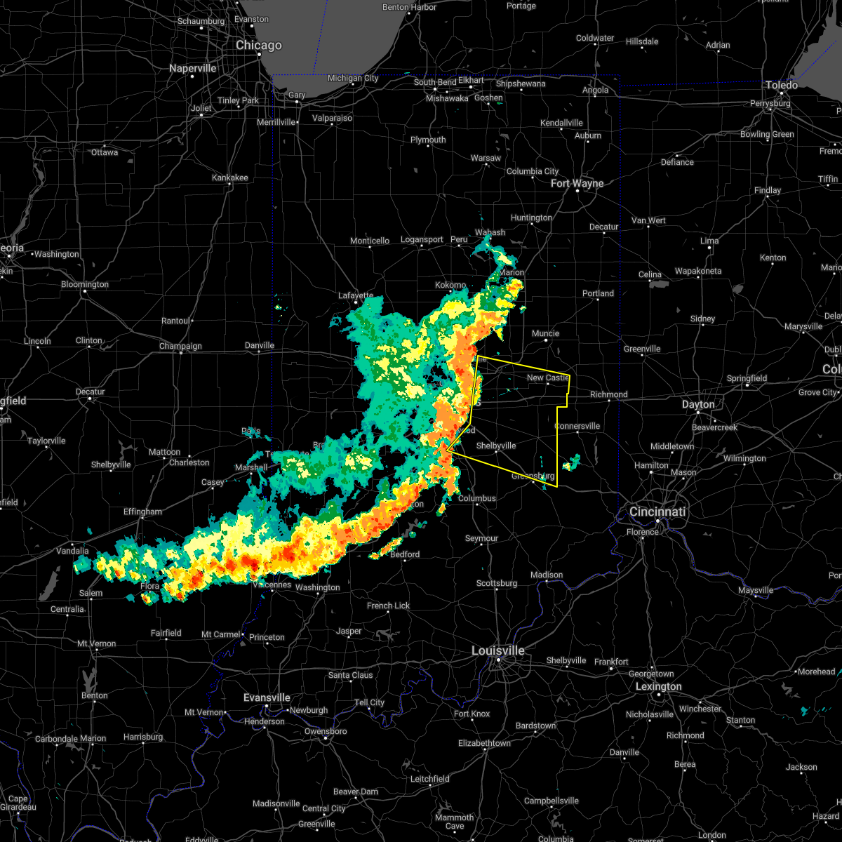 At 914 am edt, severe thunderstorms were located along a line extending from 7 miles southwest of anderson to 8 miles northwest of shelbyville, moving east at 55 mph (radar indicated). Hazards include 70 mph wind gusts. Expect considerable tree damage. damage is likely to mobile homes, roofs, and outbuildings. severe thunderstorms will be near, shelbyville, markleville and wilkinson around 925 am edt. shirley, kennard, cadiz, manilla and waldron around 930 am edt. other locations in the path of these severe thunderstorms include st. paul, spiceland, sulphur springs, mount summit, greensboro, moscow, new castle, lewisville, milroy, dunreith, sandusky, straughn, new salem, clarksburg and lake santee. this includes the following highways, interstate 65 between mile markers 91 and 98. interstate 69 between mile markers 210 and 226. interstate 70 between mile markers 94 and 133. interstate 74 between mile markers 99 and 131, between mile markers 133 and 138, and between mile markers 143 and 144. thunderstorm damage threat, considerable hail threat, radar indicated max hail size, <. 75 in wind threat, radar indicated max wind gust, 70 mph. At 914 am edt, severe thunderstorms were located along a line extending from 7 miles southwest of anderson to 8 miles northwest of shelbyville, moving east at 55 mph (radar indicated). Hazards include 70 mph wind gusts. Expect considerable tree damage. damage is likely to mobile homes, roofs, and outbuildings. severe thunderstorms will be near, shelbyville, markleville and wilkinson around 925 am edt. shirley, kennard, cadiz, manilla and waldron around 930 am edt. other locations in the path of these severe thunderstorms include st. paul, spiceland, sulphur springs, mount summit, greensboro, moscow, new castle, lewisville, milroy, dunreith, sandusky, straughn, new salem, clarksburg and lake santee. this includes the following highways, interstate 65 between mile markers 91 and 98. interstate 69 between mile markers 210 and 226. interstate 70 between mile markers 94 and 133. interstate 74 between mile markers 99 and 131, between mile markers 133 and 138, and between mile markers 143 and 144. thunderstorm damage threat, considerable hail threat, radar indicated max hail size, <. 75 in wind threat, radar indicated max wind gust, 70 mph.
|
| 6/22/2022 3:40 PM EDT |
 The severe thunderstorm warning for southeastern rush and northeastern decatur counties will expire at 345 pm edt, the storm which prompted the warning has weakened below severe limits, and no longer poses an immediate threat to life or property. therefore, the warning will be allowed to expire. The severe thunderstorm warning for southeastern rush and northeastern decatur counties will expire at 345 pm edt, the storm which prompted the warning has weakened below severe limits, and no longer poses an immediate threat to life or property. therefore, the warning will be allowed to expire.
|
| 6/22/2022 3:22 PM EDT |
 At 322 pm edt, a severe thunderstorm was located near lake santee, or 13 miles northwest of batesville, moving east at 25 mph (radar indicated). Hazards include 60 mph wind gusts and quarter size hail. Hail damage to vehicles is expected. expect wind damage to roofs, siding, and trees. locations impacted include, lake santee. hail threat, radar indicated max hail size, 1. 00 in wind threat, radar indicated max wind gust, 60 mph. At 322 pm edt, a severe thunderstorm was located near lake santee, or 13 miles northwest of batesville, moving east at 25 mph (radar indicated). Hazards include 60 mph wind gusts and quarter size hail. Hail damage to vehicles is expected. expect wind damage to roofs, siding, and trees. locations impacted include, lake santee. hail threat, radar indicated max hail size, 1. 00 in wind threat, radar indicated max wind gust, 60 mph.
|
| 6/22/2022 3:08 PM EDT |
 At 308 pm edt, a severe thunderstorm was located 8 miles south of rushville, or 18 miles northwest of batesville, moving southeast at 25 mph (radar indicated). Hazards include 60 mph wind gusts and quarter size hail. Hail damage to vehicles is expected. expect wind damage to roofs, siding, and trees. this severe thunderstorm will be near, clarksburg around 325 pm edt. other locations in the path of this severe thunderstorm include lake santee. hail threat, radar indicated max hail size, 1. 00 in wind threat, radar indicated max wind gust, 60 mph. At 308 pm edt, a severe thunderstorm was located 8 miles south of rushville, or 18 miles northwest of batesville, moving southeast at 25 mph (radar indicated). Hazards include 60 mph wind gusts and quarter size hail. Hail damage to vehicles is expected. expect wind damage to roofs, siding, and trees. this severe thunderstorm will be near, clarksburg around 325 pm edt. other locations in the path of this severe thunderstorm include lake santee. hail threat, radar indicated max hail size, 1. 00 in wind threat, radar indicated max wind gust, 60 mph.
|
| 5/21/2022 4:31 PM EDT |
 At 430 pm edt, a severe thunderstorm was located near glenwood, or 10 miles southwest of connersville, moving east at 60 mph (radar indicated). Hazards include 60 mph wind gusts. Expect damage to roofs, siding, and trees. this severe thunderstorm will remain over mainly rural areas of rush and eastern decatur counties. This includes interstate 74 between mile markers 126 and 144. At 430 pm edt, a severe thunderstorm was located near glenwood, or 10 miles southwest of connersville, moving east at 60 mph (radar indicated). Hazards include 60 mph wind gusts. Expect damage to roofs, siding, and trees. this severe thunderstorm will remain over mainly rural areas of rush and eastern decatur counties. This includes interstate 74 between mile markers 126 and 144.
|
| 5/21/2022 4:17 PM EDT |
 At 416 pm edt, a severe thunderstorm was located 8 miles northwest of greensburg, or 11 miles southeast of shelbyville, moving east at 50 mph (radar indicated). Hazards include 60 mph wind gusts. Expect damage to roofs, siding, and trees. this severe thunderstorm will be near, sandusky around 420 pm edt. milroy around 425 pm edt. clarksburg and lake santee around 430 pm edt. new salem around 435 pm edt. other locations in the path of this severe thunderstorm include glenwood. This includes interstate 74 between mile markers 126 and 144. At 416 pm edt, a severe thunderstorm was located 8 miles northwest of greensburg, or 11 miles southeast of shelbyville, moving east at 50 mph (radar indicated). Hazards include 60 mph wind gusts. Expect damage to roofs, siding, and trees. this severe thunderstorm will be near, sandusky around 420 pm edt. milroy around 425 pm edt. clarksburg and lake santee around 430 pm edt. new salem around 435 pm edt. other locations in the path of this severe thunderstorm include glenwood. This includes interstate 74 between mile markers 126 and 144.
|
| 5/21/2022 4:13 PM EDT |
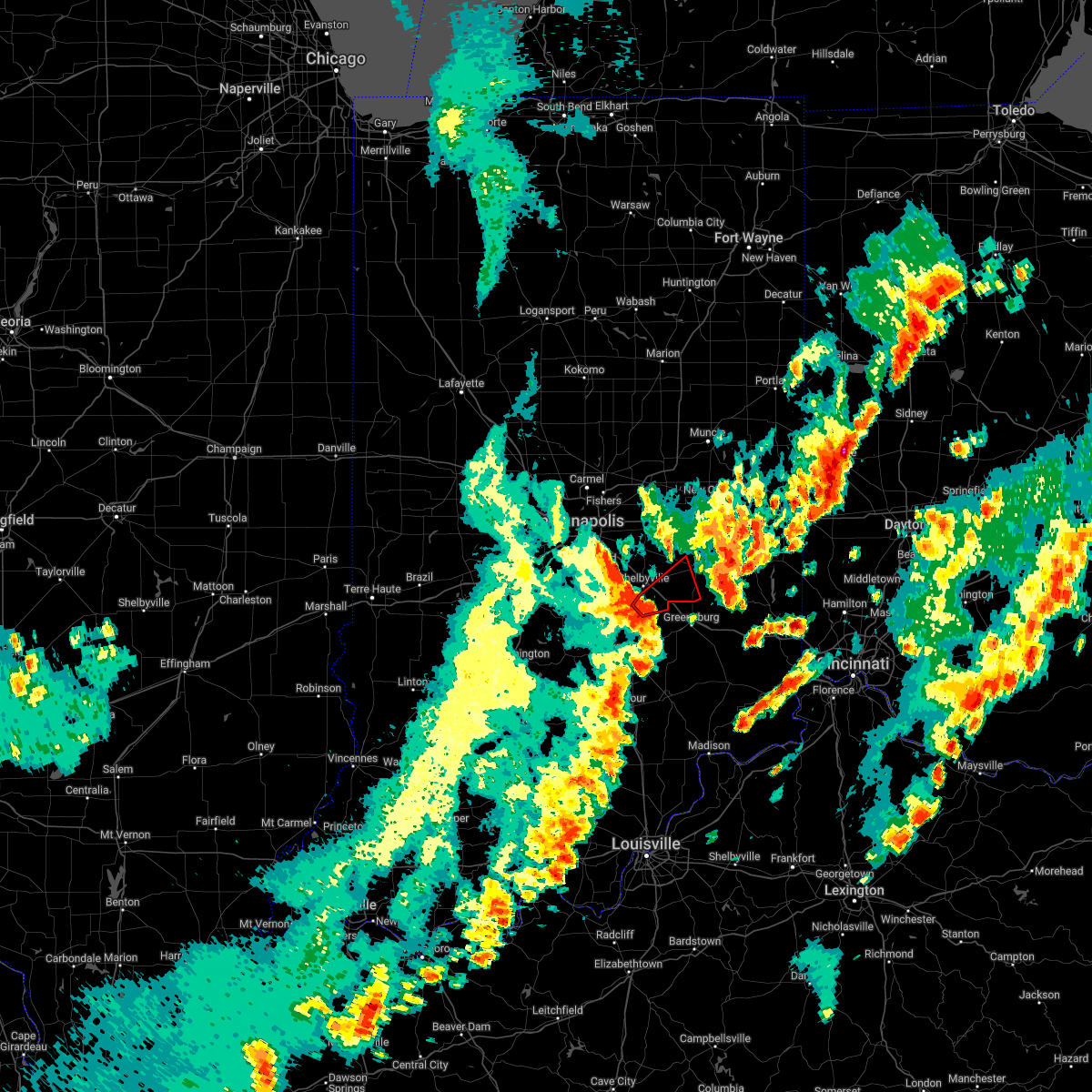 At 412 pm edt, a severe thunderstorm capable of producing a tornado was located near shelbyville, moving northeast at 50 mph (radar indicated rotation). Hazards include tornado. Flying debris will be dangerous to those caught without shelter. mobile homes will be damaged or destroyed. damage to roofs, windows, and vehicles will occur. tree damage is likely. this dangerous storm will be near, moscow around 420 pm edt. other locations in the path of this tornadic thunderstorm include milroy. This includes interstate 74 between mile markers 116 and 123. At 412 pm edt, a severe thunderstorm capable of producing a tornado was located near shelbyville, moving northeast at 50 mph (radar indicated rotation). Hazards include tornado. Flying debris will be dangerous to those caught without shelter. mobile homes will be damaged or destroyed. damage to roofs, windows, and vehicles will occur. tree damage is likely. this dangerous storm will be near, moscow around 420 pm edt. other locations in the path of this tornadic thunderstorm include milroy. This includes interstate 74 between mile markers 116 and 123.
|
| 5/21/2022 4:02 PM EDT |
 At 402 pm edt, a severe thunderstorm capable of producing a tornado was located 8 miles southwest of shelbyville, moving northeast at 50 mph (radar indicated rotation). Hazards include tornado. Flying debris will be dangerous to those caught without shelter. mobile homes will be damaged or destroyed. damage to roofs, windows, and vehicles will occur. tree damage is likely. this dangerous storm will be near, shelbyville and geneva around 410 pm edt. st. paul and waldron around 415 pm edt. moscow and manilla around 420 pm edt. other locations in the path of this tornadic thunderstorm include milroy. this includes the following highways, interstate 65 between mile markers 82 and 83. Interstate 74 between mile markers 113 and 123. At 402 pm edt, a severe thunderstorm capable of producing a tornado was located 8 miles southwest of shelbyville, moving northeast at 50 mph (radar indicated rotation). Hazards include tornado. Flying debris will be dangerous to those caught without shelter. mobile homes will be damaged or destroyed. damage to roofs, windows, and vehicles will occur. tree damage is likely. this dangerous storm will be near, shelbyville and geneva around 410 pm edt. st. paul and waldron around 415 pm edt. moscow and manilla around 420 pm edt. other locations in the path of this tornadic thunderstorm include milroy. this includes the following highways, interstate 65 between mile markers 82 and 83. Interstate 74 between mile markers 113 and 123.
|
| 3/25/2022 10:07 PM EDT |
 The severe thunderstorm warning for rush and northeastern decatur counties will expire at 1015 pm edt, the storm which prompted the warning has weakened below severe limits, and no longer poses an immediate threat to life or property. therefore, the warning will be allowed to expire. The severe thunderstorm warning for rush and northeastern decatur counties will expire at 1015 pm edt, the storm which prompted the warning has weakened below severe limits, and no longer poses an immediate threat to life or property. therefore, the warning will be allowed to expire.
|
| 3/25/2022 9:54 PM EDT |
 At 953 pm edt, a severe thunderstorm was located near rushville, or 14 miles east of shelbyville, moving east at 40 mph (radar indicated). Hazards include 60 mph wind gusts. Expect damage to roofs, siding, and trees. locations impacted include, new salem, clarksburg and lake santee. hail threat, radar indicated max hail size, <. 75 in wind threat, radar indicated max wind gust, 60 mph. At 953 pm edt, a severe thunderstorm was located near rushville, or 14 miles east of shelbyville, moving east at 40 mph (radar indicated). Hazards include 60 mph wind gusts. Expect damage to roofs, siding, and trees. locations impacted include, new salem, clarksburg and lake santee. hail threat, radar indicated max hail size, <. 75 in wind threat, radar indicated max wind gust, 60 mph.
|
| 3/25/2022 9:41 PM EDT |
 At 941 pm edt, a severe thunderstorm was located 8 miles northeast of shelbyville, moving east at 40 mph (radar indicated). Hazards include 60 mph wind gusts. Expect damage to roofs, siding, and trees. this severe thunderstorm will be near, arlington around 945 pm edt. rushville and moscow around 955 pm edt. milroy around 1000 pm edt. other locations in the path of this severe thunderstorm include new salem, clarksburg and lake santee. this includes interstate 74 between mile markers 114 and 124. hail threat, radar indicated max hail size, <. 75 in wind threat, radar indicated max wind gust, 60 mph. At 941 pm edt, a severe thunderstorm was located 8 miles northeast of shelbyville, moving east at 40 mph (radar indicated). Hazards include 60 mph wind gusts. Expect damage to roofs, siding, and trees. this severe thunderstorm will be near, arlington around 945 pm edt. rushville and moscow around 955 pm edt. milroy around 1000 pm edt. other locations in the path of this severe thunderstorm include new salem, clarksburg and lake santee. this includes interstate 74 between mile markers 114 and 124. hail threat, radar indicated max hail size, <. 75 in wind threat, radar indicated max wind gust, 60 mph.
|
| 3/7/2022 2:57 AM EST |
 The severe thunderstorm warning for southeastern rush and decatur counties will expire at 300 am est, the storm which prompted the warning has moved out of the area. therefore, the warning will be allowed to expire. however gusty winds and heavy rain are still possible with ongoing thunderstorms. The severe thunderstorm warning for southeastern rush and decatur counties will expire at 300 am est, the storm which prompted the warning has moved out of the area. therefore, the warning will be allowed to expire. however gusty winds and heavy rain are still possible with ongoing thunderstorms.
|
| 3/7/2022 2:48 AM EST |
 At 247 am est, a severe thunderstorm was located near lake santee, or 12 miles northwest of batesville, moving east at 50 mph (radar indicated). Hazards include 60 mph wind gusts. Expect damage to roofs, siding, and trees. this severe thunderstorm will remain over mainly rural areas of southeastern rush and decatur counties. this includes interstate 74 between mile markers 127 and 144. hail threat, radar indicated max hail size, <. 75 in wind threat, radar indicated max wind gust, 60 mph. At 247 am est, a severe thunderstorm was located near lake santee, or 12 miles northwest of batesville, moving east at 50 mph (radar indicated). Hazards include 60 mph wind gusts. Expect damage to roofs, siding, and trees. this severe thunderstorm will remain over mainly rural areas of southeastern rush and decatur counties. this includes interstate 74 between mile markers 127 and 144. hail threat, radar indicated max hail size, <. 75 in wind threat, radar indicated max wind gust, 60 mph.
|
| 3/7/2022 2:38 AM EST |
 At 238 am est, a severe thunderstorm was located near greensburg, or 16 miles northwest of batesville, moving east at 50 mph (radar indicated). Hazards include 60 mph wind gusts. Expect damage to roofs, siding, and trees. this severe storm will be near, clarksburg and new salem around 245 am est. other locations in the path of this severe thunderstorm include lake santee. this includes interstate 74 between mile markers 121 and 144. hail threat, radar indicated max hail size, <. 75 in wind threat, radar indicated max wind gust, 60 mph. At 238 am est, a severe thunderstorm was located near greensburg, or 16 miles northwest of batesville, moving east at 50 mph (radar indicated). Hazards include 60 mph wind gusts. Expect damage to roofs, siding, and trees. this severe storm will be near, clarksburg and new salem around 245 am est. other locations in the path of this severe thunderstorm include lake santee. this includes interstate 74 between mile markers 121 and 144. hail threat, radar indicated max hail size, <. 75 in wind threat, radar indicated max wind gust, 60 mph.
|
| 3/7/2022 2:29 AM EST |
 At 228 am est, a severe thunderstorm was located 9 miles northwest of greensburg, or 11 miles southeast of shelbyville, moving east at 50 mph (radar indicated). Hazards include 60 mph wind gusts. Expect damage to roofs, siding, and trees. this severe thunderstorm will be near, greensburg and sandusky around 235 am est. milroy around 240 am est. clarksburg and new salem around 245 am est. other locations in the path of this severe thunderstorm include lake santee. this includes the following highways, interstate 65 between mile markers 66 and 68. interstate 74 between mile markers 118 and 144. hail threat, radar indicated max hail size, <. 75 in wind threat, radar indicated max wind gust, 60 mph. At 228 am est, a severe thunderstorm was located 9 miles northwest of greensburg, or 11 miles southeast of shelbyville, moving east at 50 mph (radar indicated). Hazards include 60 mph wind gusts. Expect damage to roofs, siding, and trees. this severe thunderstorm will be near, greensburg and sandusky around 235 am est. milroy around 240 am est. clarksburg and new salem around 245 am est. other locations in the path of this severe thunderstorm include lake santee. this includes the following highways, interstate 65 between mile markers 66 and 68. interstate 74 between mile markers 118 and 144. hail threat, radar indicated max hail size, <. 75 in wind threat, radar indicated max wind gust, 60 mph.
|
| 7/8/2021 1:28 PM EDT |
 At 127 pm edt, a severe thunderstorm was located 7 miles northwest of greensburg, or 13 miles southeast of shelbyville, moving southeast at 20 mph (radar indicated). Hazards include 60 mph wind gusts. expect damage to roofs, siding, and trees At 127 pm edt, a severe thunderstorm was located 7 miles northwest of greensburg, or 13 miles southeast of shelbyville, moving southeast at 20 mph (radar indicated). Hazards include 60 mph wind gusts. expect damage to roofs, siding, and trees
|
| 6/27/2021 4:53 PM EDT |
 At 453 pm edt, a severe thunderstorm was located near rushville, or 13 miles east of shelbyville, moving east at 40 mph (radar indicated). Hazards include 60 mph wind gusts. Expect damage to roofs, siding, and trees. this severe thunderstorm will be near, rushville around 500 pm edt. new salem around 505 pm edt. Other locations in the path of this severe thunderstorm include glenwood. At 453 pm edt, a severe thunderstorm was located near rushville, or 13 miles east of shelbyville, moving east at 40 mph (radar indicated). Hazards include 60 mph wind gusts. Expect damage to roofs, siding, and trees. this severe thunderstorm will be near, rushville around 500 pm edt. new salem around 505 pm edt. Other locations in the path of this severe thunderstorm include glenwood.
|
| 6/18/2021 8:48 PM EDT |
 At 848 pm edt, a severe thunderstorm was located near lake santee, or 10 miles northwest of batesville, moving southeast at 15 mph (radar indicated). Hazards include 60 mph wind gusts and quarter size hail. Hail damage to vehicles is expected. expect wind damage to roofs, siding, and trees. locations impacted include, columbus, shelbyville, greensburg, adams, hope, milford, westport, geneva, st. paul, hartsville, milroy, clifford, millhousen, newbern, waldron, moscow, new salem, manilla, sandusky and clarksburg. This includes interstate 74 between mile markers 113 and 144. At 848 pm edt, a severe thunderstorm was located near lake santee, or 10 miles northwest of batesville, moving southeast at 15 mph (radar indicated). Hazards include 60 mph wind gusts and quarter size hail. Hail damage to vehicles is expected. expect wind damage to roofs, siding, and trees. locations impacted include, columbus, shelbyville, greensburg, adams, hope, milford, westport, geneva, st. paul, hartsville, milroy, clifford, millhousen, newbern, waldron, moscow, new salem, manilla, sandusky and clarksburg. This includes interstate 74 between mile markers 113 and 144.
|
| 6/18/2021 8:28 PM EDT |
 At 828 pm edt, a severe thunderstorm was located near lake santee, or 12 miles northwest of batesville, moving southeast at 30 mph (radar indicated). Hazards include 60 mph wind gusts and quarter size hail. Hail damage to vehicles is expected. expect wind damage to roofs, siding, and trees. locations impacted include, lake santee and newpoint. This includes interstate 74 between mile markers 109 and 144. At 828 pm edt, a severe thunderstorm was located near lake santee, or 12 miles northwest of batesville, moving southeast at 30 mph (radar indicated). Hazards include 60 mph wind gusts and quarter size hail. Hail damage to vehicles is expected. expect wind damage to roofs, siding, and trees. locations impacted include, lake santee and newpoint. This includes interstate 74 between mile markers 109 and 144.
|
| 6/18/2021 8:08 PM EDT |
 At 808 pm edt, a severe thunderstorm was located over shelbyville, moving southeast at 30 mph (radar indicated). Hazards include 60 mph wind gusts and quarter size hail. Hail damage to vehicles is expected. expect wind damage to roofs, siding, and trees. this severe thunderstorm will be near, waldron around 820 pm edt. geneva around 825 pm edt. other locations in the path of this severe thunderstorm include st. paul, moscow, milford, burney, adams, greensburg, sandusky, millhousen and newpoint. this includes the following highways, interstate 65 between mile markers 77 and 83. Interstate 74 between mile markers 108 and 144. At 808 pm edt, a severe thunderstorm was located over shelbyville, moving southeast at 30 mph (radar indicated). Hazards include 60 mph wind gusts and quarter size hail. Hail damage to vehicles is expected. expect wind damage to roofs, siding, and trees. this severe thunderstorm will be near, waldron around 820 pm edt. geneva around 825 pm edt. other locations in the path of this severe thunderstorm include st. paul, moscow, milford, burney, adams, greensburg, sandusky, millhousen and newpoint. this includes the following highways, interstate 65 between mile markers 77 and 83. Interstate 74 between mile markers 108 and 144.
|
| 6/18/2021 7:41 PM EDT |
 At 740 pm edt, a severe thunderstorm was located 7 miles east of beech grove, or 12 miles southeast of indianapolis, moving southeast at 20 mph (radar indicated). Hazards include two inch hail and 60 mph wind gusts. People and animals outdoors will be injured. expect hail damage to roofs, siding, windows, and vehicles. expect wind damage to roofs, siding, and trees. this severe storm will be near, new palestine around 745 pm edt. other locations in the path of this severe thunderstorm include fairland, morristown, shelbyville and manilla. This includes interstate 74 between mile markers 96 and 123. At 740 pm edt, a severe thunderstorm was located 7 miles east of beech grove, or 12 miles southeast of indianapolis, moving southeast at 20 mph (radar indicated). Hazards include two inch hail and 60 mph wind gusts. People and animals outdoors will be injured. expect hail damage to roofs, siding, windows, and vehicles. expect wind damage to roofs, siding, and trees. this severe storm will be near, new palestine around 745 pm edt. other locations in the path of this severe thunderstorm include fairland, morristown, shelbyville and manilla. This includes interstate 74 between mile markers 96 and 123.
|
| 6/18/2021 7:31 PM EDT |
 At 731 pm edt, a severe thunderstorm was located near beech grove, or 9 miles southeast of indianapolis, moving southeast at 25 mph (radar indicated). Hazards include two inch hail and 60 mph wind gusts. People and animals outdoors will be injured. expect hail damage to roofs, siding, windows, and vehicles. expect wind damage to roofs, siding, and trees. this severe thunderstorm will be near, new palestine around 740 pm edt. other locations in the path of this severe thunderstorm include fairland, morristown, shelbyville and manilla. this includes the following highways, interstate 70 near mile marker 89. Interstate 74 between mile markers 93 and 123. At 731 pm edt, a severe thunderstorm was located near beech grove, or 9 miles southeast of indianapolis, moving southeast at 25 mph (radar indicated). Hazards include two inch hail and 60 mph wind gusts. People and animals outdoors will be injured. expect hail damage to roofs, siding, windows, and vehicles. expect wind damage to roofs, siding, and trees. this severe thunderstorm will be near, new palestine around 740 pm edt. other locations in the path of this severe thunderstorm include fairland, morristown, shelbyville and manilla. this includes the following highways, interstate 70 near mile marker 89. Interstate 74 between mile markers 93 and 123.
|
| 11/25/2020 6:06 PM EST |
 At 606 pm est, a severe thunderstorm was located 10 miles southeast of shelbyville, moving east at 40 mph (radar indicated). Hazards include 60 mph wind gusts. expect damage to roofs, siding, and trees At 606 pm est, a severe thunderstorm was located 10 miles southeast of shelbyville, moving east at 40 mph (radar indicated). Hazards include 60 mph wind gusts. expect damage to roofs, siding, and trees
|
| 7/27/2020 5:04 PM EDT |
 At 503 pm edt, a severe thunderstorm was located near glenwood, or 12 miles southwest of connersville, moving east at 35 mph (radar indicated). Hazards include 60 mph wind gusts. Expect damage to roofs, siding, and trees. locations impacted include, greensburg, rushville, adams, milroy, glenwood, clarksburg, new salem, sandusky, lake santee and moscow. This includes interstate 74 between mile markers 125 and 139. At 503 pm edt, a severe thunderstorm was located near glenwood, or 12 miles southwest of connersville, moving east at 35 mph (radar indicated). Hazards include 60 mph wind gusts. Expect damage to roofs, siding, and trees. locations impacted include, greensburg, rushville, adams, milroy, glenwood, clarksburg, new salem, sandusky, lake santee and moscow. This includes interstate 74 between mile markers 125 and 139.
|
| 7/27/2020 4:48 PM EDT |
 At 448 pm edt, a severe thunderstorm was located near rushville, or 16 miles east of shelbyville, moving east at 40 mph (radar indicated). Hazards include 60 mph wind gusts. expect damage to roofs, siding, and trees At 448 pm edt, a severe thunderstorm was located near rushville, or 16 miles east of shelbyville, moving east at 40 mph (radar indicated). Hazards include 60 mph wind gusts. expect damage to roofs, siding, and trees
|
| 6/9/2020 6:33 PM EDT |
 At 632 pm edt, severe thunderstorms were located along a line extending from 9 miles southwest of rushville to near greensburg to 12 miles northwest of osgood to 8 miles northeast of north vernon, moving northeast at 45 mph (radar indicated). Hazards include 60 mph wind gusts. expect damage to roofs, siding, and trees At 632 pm edt, severe thunderstorms were located along a line extending from 9 miles southwest of rushville to near greensburg to 12 miles northwest of osgood to 8 miles northeast of north vernon, moving northeast at 45 mph (radar indicated). Hazards include 60 mph wind gusts. expect damage to roofs, siding, and trees
|
| 4/8/2020 9:46 PM EDT |
 At 945 pm edt, a severe thunderstorm was located 7 miles southwest of batesville, moving southeast at 55 mph (radar indicated). Hazards include 70 mph wind gusts. Expect considerable tree damage. damage is likely to mobile homes, roofs, and outbuildings. locations impacted include, columbus, greensburg, adams, hope, flat rock, milford, westport, geneva, st. paul, hartsville, milroy, clifford, millhousen, newbern, waldron, moscow, nebraska, sandusky, taylorsville and clarksburg. this includes the following highways, interstate 65 between mile markers 68 and 74. Interstate 74 between mile markers 121 and 144. At 945 pm edt, a severe thunderstorm was located 7 miles southwest of batesville, moving southeast at 55 mph (radar indicated). Hazards include 70 mph wind gusts. Expect considerable tree damage. damage is likely to mobile homes, roofs, and outbuildings. locations impacted include, columbus, greensburg, adams, hope, flat rock, milford, westport, geneva, st. paul, hartsville, milroy, clifford, millhousen, newbern, waldron, moscow, nebraska, sandusky, taylorsville and clarksburg. this includes the following highways, interstate 65 between mile markers 68 and 74. Interstate 74 between mile markers 121 and 144.
|
| 4/8/2020 9:27 PM EDT |
 At 926 pm edt, a severe thunderstorm was located 9 miles west of greensburg, or 11 miles southeast of shelbyville, moving southeast at 55 mph (trained weather spotters). Hazards include 60 mph wind gusts. Expect damage to roofs, siding, and trees. locations impacted include, columbus, shelbyville, franklin, greensburg, adams, edinburgh, hope, flat rock, milford, westport, princes lakes, geneva, morristown, trafalgar, st. paul, hartsville, fairland, milroy, clifford and millhousen. this includes the following highways, interstate 65 between mile markers 68 and 90. Interstate 74 between mile markers 109 and 144. At 926 pm edt, a severe thunderstorm was located 9 miles west of greensburg, or 11 miles southeast of shelbyville, moving southeast at 55 mph (trained weather spotters). Hazards include 60 mph wind gusts. Expect damage to roofs, siding, and trees. locations impacted include, columbus, shelbyville, franklin, greensburg, adams, edinburgh, hope, flat rock, milford, westport, princes lakes, geneva, morristown, trafalgar, st. paul, hartsville, fairland, milroy, clifford and millhousen. this includes the following highways, interstate 65 between mile markers 68 and 90. Interstate 74 between mile markers 109 and 144.
|
| 4/8/2020 9:06 PM EDT |
 At 905 pm edt, a severe thunderstorm was located near franklin, or 11 miles west of shelbyville, moving southeast at 55 mph (radar indicated). Hazards include 70 mph wind gusts. Expect considerable tree damage. Damage is likely to mobile homes, roofs, and outbuildings. At 905 pm edt, a severe thunderstorm was located near franklin, or 11 miles west of shelbyville, moving southeast at 55 mph (radar indicated). Hazards include 70 mph wind gusts. Expect considerable tree damage. Damage is likely to mobile homes, roofs, and outbuildings.
|
| 8/20/2019 4:10 PM EDT |
 The severe thunderstorm warning for southeastern rush and eastern decatur counties will expire at 415 pm edt, the storms which prompted the warning have weakened below severe limits, and no longer pose an immediate threat to life or property. therefore, the warning will be allowed to expire. a severe thunderstorm watch remains in effect until 600 pm edt for central and southeastern indiana. to report severe weather, contact your nearest law enforcement agency. they will relay your report to the national weather service indianapolis. The severe thunderstorm warning for southeastern rush and eastern decatur counties will expire at 415 pm edt, the storms which prompted the warning have weakened below severe limits, and no longer pose an immediate threat to life or property. therefore, the warning will be allowed to expire. a severe thunderstorm watch remains in effect until 600 pm edt for central and southeastern indiana. to report severe weather, contact your nearest law enforcement agency. they will relay your report to the national weather service indianapolis.
|
| 8/20/2019 4:08 PM EDT |
 At 408 pm edt, severe thunderstorms were located along a line extending from near glenwood to 8 miles southwest of connersville to near lake santee to 10 miles west of osgood, moving east at 30 mph (radar indicated). Hazards include 60 mph wind gusts. Expect damage to roofs, siding, and trees. locations impacted include, greensburg, rushville, milroy, glenwood, millhousen, newpoint, clarksburg, new salem, sandusky and lake santee. This includes interstate 74 between mile markers 128 and 144. At 408 pm edt, severe thunderstorms were located along a line extending from near glenwood to 8 miles southwest of connersville to near lake santee to 10 miles west of osgood, moving east at 30 mph (radar indicated). Hazards include 60 mph wind gusts. Expect damage to roofs, siding, and trees. locations impacted include, greensburg, rushville, milroy, glenwood, millhousen, newpoint, clarksburg, new salem, sandusky and lake santee. This includes interstate 74 between mile markers 128 and 144.
|
| 8/20/2019 3:50 PM EDT |
 A severe thunderstorm warning remains in effect until 415 pm edt for eastern shelby. rush. decatur and northeastern bartholomew counties. At 348 pm edt, severe thunderstorms were located along a line extending from 10 miles northwest of glenwood to rushville to near greensburg to 14 miles north of north vernon, moving east at 40 mph. A severe thunderstorm warning remains in effect until 415 pm edt for eastern shelby. rush. decatur and northeastern bartholomew counties. At 348 pm edt, severe thunderstorms were located along a line extending from 10 miles northwest of glenwood to rushville to near greensburg to 14 miles north of north vernon, moving east at 40 mph.
|
| 8/20/2019 3:26 PM EDT |
 At 326 pm edt, severe thunderstorms were located along a line extending from 9 miles south of greenfield to 7 miles northeast of columbus, moving east at 30 mph (radar indicated). Hazards include 60 mph wind gusts. expect damage to roofs, siding, and trees At 326 pm edt, severe thunderstorms were located along a line extending from 9 miles south of greenfield to 7 miles northeast of columbus, moving east at 30 mph (radar indicated). Hazards include 60 mph wind gusts. expect damage to roofs, siding, and trees
|
| 8/20/2019 3:18 PM EDT |
 At 318 pm edt, a severe thunderstorm was located near lake santee, or near batesville, moving east at 30 mph (radar indicated). Hazards include 60 mph wind gusts. Expect damage to roofs, siding, and trees. locations impacted include, greensburg, adams, milroy, millhousen, newpoint, clarksburg, sandusky, lake santee and moscow. This includes interstate 74 between mile markers 126 and 144. At 318 pm edt, a severe thunderstorm was located near lake santee, or near batesville, moving east at 30 mph (radar indicated). Hazards include 60 mph wind gusts. Expect damage to roofs, siding, and trees. locations impacted include, greensburg, adams, milroy, millhousen, newpoint, clarksburg, sandusky, lake santee and moscow. This includes interstate 74 between mile markers 126 and 144.
|
| 8/20/2019 3:01 PM EDT |
 At 301 pm edt, a severe thunderstorm was located over greensburg, or 16 miles west of batesville, moving east at 45 mph (radar indicated). Hazards include 60 mph wind gusts. expect damage to roofs, siding, and trees At 301 pm edt, a severe thunderstorm was located over greensburg, or 16 miles west of batesville, moving east at 45 mph (radar indicated). Hazards include 60 mph wind gusts. expect damage to roofs, siding, and trees
|
| 8/20/2019 2:58 PM EDT | 8 inch diameter tree down across roa in rush county IN, 6.8 miles ENE of Milroy, IN |
| 8/18/2019 8:47 PM EDT |
 At 847 pm edt, severe thunderstorms were located along a line extending from 7 miles north of new castle to 7 miles north of rushville to 7 miles southeast of franklin, moving east at 30 mph (radar indicated). Hazards include 60 mph wind gusts and quarter size hail. Hail damage to vehicles is expected. expect wind damage to roofs, siding, and trees. locations impacted include, shelbyville, franklin, new castle, rushville, whiteland, bargersville, knightstown, morristown, carthage, spiceland, shirley, kennard, wilkinson, sulphur springs, mooreland, lewisville, mount summit, fairland, milroy and glenwood. this includes the following highways, interstate 65 between mile markers 90 and 95. interstate 70 between mile markers 110 and 133. Interstate 74 between mile markers 104 and 121. At 847 pm edt, severe thunderstorms were located along a line extending from 7 miles north of new castle to 7 miles north of rushville to 7 miles southeast of franklin, moving east at 30 mph (radar indicated). Hazards include 60 mph wind gusts and quarter size hail. Hail damage to vehicles is expected. expect wind damage to roofs, siding, and trees. locations impacted include, shelbyville, franklin, new castle, rushville, whiteland, bargersville, knightstown, morristown, carthage, spiceland, shirley, kennard, wilkinson, sulphur springs, mooreland, lewisville, mount summit, fairland, milroy and glenwood. this includes the following highways, interstate 65 between mile markers 90 and 95. interstate 70 between mile markers 110 and 133. Interstate 74 between mile markers 104 and 121.
|
| 8/18/2019 8:30 PM EDT |
 At 829 pm edt, severe thunderstorms were located along a line extending from 10 miles northwest of new castle to 10 miles east of greenfield to near franklin, moving east at 30 mph (radar indicated). Hazards include 60 mph wind gusts and quarter size hail. Hail damage to vehicles is expected. expect wind damage to roofs, siding, and trees. locations impacted include, indianapolis, anderson, shelbyville, greenwood, franklin, greenfield, new castle, rushville, southport, new whiteland, whiteland, bargersville, chesterfield, knightstown, new palestine, morristown, carthage, spiceland, shirley and markleville. this includes the following highways, interstate 65 between mile markers 90 and 103. interstate 69 between mile markers 226 and 231. interstate 70 between mile markers 100 and 133. Interstate 74 between mile markers 96 and 121. At 829 pm edt, severe thunderstorms were located along a line extending from 10 miles northwest of new castle to 10 miles east of greenfield to near franklin, moving east at 30 mph (radar indicated). Hazards include 60 mph wind gusts and quarter size hail. Hail damage to vehicles is expected. expect wind damage to roofs, siding, and trees. locations impacted include, indianapolis, anderson, shelbyville, greenwood, franklin, greenfield, new castle, rushville, southport, new whiteland, whiteland, bargersville, chesterfield, knightstown, new palestine, morristown, carthage, spiceland, shirley and markleville. this includes the following highways, interstate 65 between mile markers 90 and 103. interstate 69 between mile markers 226 and 231. interstate 70 between mile markers 100 and 133. Interstate 74 between mile markers 96 and 121.
|
| 8/18/2019 8:00 PM EDT |
 At 759 pm edt, severe thunderstorms were located along a line extending from near anderson to near greenfield to 6 miles northeast of martinsville, moving east at 30 mph (radar indicated). Hazards include 60 mph wind gusts and quarter size hail. Hail damage to vehicles is expected. Expect wind damage to roofs, siding, and trees. At 759 pm edt, severe thunderstorms were located along a line extending from near anderson to near greenfield to 6 miles northeast of martinsville, moving east at 30 mph (radar indicated). Hazards include 60 mph wind gusts and quarter size hail. Hail damage to vehicles is expected. Expect wind damage to roofs, siding, and trees.
|
| 6/15/2019 8:50 PM EDT |
 At 850 pm edt, a confirmed tornado was located near rushville, or 16 miles east of shelbyville, moving northeast at 30 mph. law enforcement stated a possible tornado near milroy (law enforcement confirmed tornado). Hazards include damaging tornado. Flying debris will be dangerous to those caught without shelter. mobile homes will be damaged or destroyed. damage to roofs, windows, and vehicles will occur. tree damage is likely. this tornado will be near, rushville around 855 pm edt. new salem around 900 pm edt. Glenwood around 910 pm edt. At 850 pm edt, a confirmed tornado was located near rushville, or 16 miles east of shelbyville, moving northeast at 30 mph. law enforcement stated a possible tornado near milroy (law enforcement confirmed tornado). Hazards include damaging tornado. Flying debris will be dangerous to those caught without shelter. mobile homes will be damaged or destroyed. damage to roofs, windows, and vehicles will occur. tree damage is likely. this tornado will be near, rushville around 855 pm edt. new salem around 900 pm edt. Glenwood around 910 pm edt.
|
| 6/15/2019 8:38 PM EDT |
 At 838 pm edt, a severe thunderstorm capable of producing a tornado was located 8 miles southwest of rushville, or 10 miles east of shelbyville, moving northeast at 30 mph (radar indicated rotation). Hazards include tornado. Flying debris will be dangerous to those caught without shelter. mobile homes will be damaged or destroyed. damage to roofs, windows, and vehicles will occur. tree damage is likely. this dangerous storm will be near, milroy around 845 pm edt. rushville around 855 pm edt. new salem around 900 pm edt. Glenwood around 910 pm edt. At 838 pm edt, a severe thunderstorm capable of producing a tornado was located 8 miles southwest of rushville, or 10 miles east of shelbyville, moving northeast at 30 mph (radar indicated rotation). Hazards include tornado. Flying debris will be dangerous to those caught without shelter. mobile homes will be damaged or destroyed. damage to roofs, windows, and vehicles will occur. tree damage is likely. this dangerous storm will be near, milroy around 845 pm edt. rushville around 855 pm edt. new salem around 900 pm edt. Glenwood around 910 pm edt.
|
| 5/19/2019 8:10 PM EDT |
 The severe thunderstorm warning for rush and southeastern henry counties will expire at 815 pm edt, the storms which prompted the warning have weakened below severe limits, and have exited the warned area. therefore, the warning will be allowed to expire. however gusty winds are still possible with these thunderstorms. a severe thunderstorm watch remains in effect until 1000 pm edt for central and east central indiana. The severe thunderstorm warning for rush and southeastern henry counties will expire at 815 pm edt, the storms which prompted the warning have weakened below severe limits, and have exited the warned area. therefore, the warning will be allowed to expire. however gusty winds are still possible with these thunderstorms. a severe thunderstorm watch remains in effect until 1000 pm edt for central and east central indiana.
|
| 5/19/2019 8:01 PM EDT |
 At 801 pm edt, severe thunderstorms were located along a line extending from near new castle to near glenwood, moving east at 45 mph (radar indicated). Hazards include 60 mph wind gusts and penny size hail. Expect damage to roofs, siding, and trees. locations impacted include, new castle, rushville, mooreland, lewisville, milroy, glenwood, straughn, new salem and moscow. This includes interstate 70 between mile markers 126 and 133. At 801 pm edt, severe thunderstorms were located along a line extending from near new castle to near glenwood, moving east at 45 mph (radar indicated). Hazards include 60 mph wind gusts and penny size hail. Expect damage to roofs, siding, and trees. locations impacted include, new castle, rushville, mooreland, lewisville, milroy, glenwood, straughn, new salem and moscow. This includes interstate 70 between mile markers 126 and 133.
|
| 5/19/2019 7:51 PM EDT |
 At 750 pm edt, severe thunderstorms were located along a line extending from near new castle to near rushville, moving east at 45 mph (radar indicated). Hazards include 60 mph wind gusts and penny size hail. Expect damage to roofs, siding, and trees. locations impacted include, new castle, rushville, knightstown, carthage, spiceland, shirley, kennard, lewisville, milroy, glenwood, straughn, dunreith, cadiz, greensboro, waldron, mays, moscow, new salem, manilla and arlington. this includes the following highways, interstate 70 between mile markers 113 and 133. Interstate 74 between mile markers 117 and 123. At 750 pm edt, severe thunderstorms were located along a line extending from near new castle to near rushville, moving east at 45 mph (radar indicated). Hazards include 60 mph wind gusts and penny size hail. Expect damage to roofs, siding, and trees. locations impacted include, new castle, rushville, knightstown, carthage, spiceland, shirley, kennard, lewisville, milroy, glenwood, straughn, dunreith, cadiz, greensboro, waldron, mays, moscow, new salem, manilla and arlington. this includes the following highways, interstate 70 between mile markers 113 and 133. Interstate 74 between mile markers 117 and 123.
|
| 5/19/2019 7:25 PM EDT |
 At 724 pm edt, severe thunderstorms were located along a line extending from 7 miles north of greenfield to near shelbyville, moving east at 40 mph. this storm has shown consistent weak rotation in central shelby county (radar indicated). Hazards include 60 mph wind gusts and penny size hail. expect damage to roofs, siding, and trees At 724 pm edt, severe thunderstorms were located along a line extending from 7 miles north of greenfield to near shelbyville, moving east at 40 mph. this storm has shown consistent weak rotation in central shelby county (radar indicated). Hazards include 60 mph wind gusts and penny size hail. expect damage to roofs, siding, and trees
|
| 5/16/2019 6:36 PM EDT |
 The severe thunderstorm warning for southern shelby, southern rush, decatur, southern johnson and northern bartholomew counties will expire at 645 pm edt, the storms which prompted the warning have moved out of the area. therefore, the warning will be allowed to expire. a severe thunderstorm watch remains in effect until 900 pm edt for central and south central indiana. The severe thunderstorm warning for southern shelby, southern rush, decatur, southern johnson and northern bartholomew counties will expire at 645 pm edt, the storms which prompted the warning have moved out of the area. therefore, the warning will be allowed to expire. a severe thunderstorm watch remains in effect until 900 pm edt for central and south central indiana.
|
| 5/16/2019 6:23 PM EDT |
 At 623 pm edt, severe thunderstorms were located along a line extending from 7 miles west of lake santee to near greensburg to 6 miles northeast of columbus, moving southeast at 50 mph (radar indicated). Hazards include 60 mph wind gusts. Expect damage to roofs, siding, and trees. locations impacted include, columbus, greensburg, adams, edinburgh, hope, flat rock, milford, princes lakes, geneva, trafalgar, st. paul, hartsville, milroy, clifford, newbern, waldron, moscow, sandusky, taylorsville and clarksburg. this includes the following highways, interstate 65 between mile markers 73 and 86. Interstate 74 between mile markers 120 and 144. At 623 pm edt, severe thunderstorms were located along a line extending from 7 miles west of lake santee to near greensburg to 6 miles northeast of columbus, moving southeast at 50 mph (radar indicated). Hazards include 60 mph wind gusts. Expect damage to roofs, siding, and trees. locations impacted include, columbus, greensburg, adams, edinburgh, hope, flat rock, milford, princes lakes, geneva, trafalgar, st. paul, hartsville, milroy, clifford, newbern, waldron, moscow, sandusky, taylorsville and clarksburg. this includes the following highways, interstate 65 between mile markers 73 and 86. Interstate 74 between mile markers 120 and 144.
|
| 5/16/2019 6:08 PM EDT |
 At 608 pm edt, severe thunderstorms were located along a line extending from 8 miles east of shelbyville to near franklin, moving southeast at 35 mph (radar indicated). Hazards include 60 mph wind gusts. expect damage to roofs, siding, and trees At 608 pm edt, severe thunderstorms were located along a line extending from 8 miles east of shelbyville to near franklin, moving southeast at 35 mph (radar indicated). Hazards include 60 mph wind gusts. expect damage to roofs, siding, and trees
|
| 4/25/2019 9:09 PM EDT |
 At 909 pm edt, severe thunderstorms were located along a line extending from 12 miles east of greenfield to near rushville to 11 miles east of shelbyville, moving east at 40 mph (radar indicated). Hazards include 60 mph wind gusts. Expect damage to roofs, siding, and trees. locations impacted include, new castle, rushville, knightstown, carthage, spiceland, lewisville, milroy, glenwood, straughn, dunreith, greensboro, mays, new salem, manilla and arlington. This includes interstate 70 between mile markers 111 and 133. At 909 pm edt, severe thunderstorms were located along a line extending from 12 miles east of greenfield to near rushville to 11 miles east of shelbyville, moving east at 40 mph (radar indicated). Hazards include 60 mph wind gusts. Expect damage to roofs, siding, and trees. locations impacted include, new castle, rushville, knightstown, carthage, spiceland, lewisville, milroy, glenwood, straughn, dunreith, greensboro, mays, new salem, manilla and arlington. This includes interstate 70 between mile markers 111 and 133.
|
| 4/25/2019 9:01 PM EDT |
 At 900 pm edt, severe thunderstorms were located along a line extending from 7 miles southeast of greenfield to 8 miles west of rushville to 6 miles east of shelbyville, moving east at 40 mph (radar indicated). Hazards include 60 mph wind gusts. expect damage to roofs, siding, and trees At 900 pm edt, severe thunderstorms were located along a line extending from 7 miles southeast of greenfield to 8 miles west of rushville to 6 miles east of shelbyville, moving east at 40 mph (radar indicated). Hazards include 60 mph wind gusts. expect damage to roofs, siding, and trees
|
| 4/14/2019 3:24 PM EDT |
 The severe thunderstorm warning for eastern rush county will expire at 330 pm edt, the storm which prompted the warning has moved out of the area. therefore, the warning will be allowed to expire. The severe thunderstorm warning for eastern rush county will expire at 330 pm edt, the storm which prompted the warning has moved out of the area. therefore, the warning will be allowed to expire.
|
| 4/14/2019 3:11 PM EDT |
 At 311 pm edt, a severe thunderstorm was located over glenwood, or 11 miles west of connersville, moving northeast at 55 mph (radar indicated). Hazards include 60 mph wind gusts and quarter size hail. Hail damage to vehicles is expected. expect wind damage to roofs, siding, and trees. Locations impacted include, rushville, milroy, glenwood and new salem. At 311 pm edt, a severe thunderstorm was located over glenwood, or 11 miles west of connersville, moving northeast at 55 mph (radar indicated). Hazards include 60 mph wind gusts and quarter size hail. Hail damage to vehicles is expected. expect wind damage to roofs, siding, and trees. Locations impacted include, rushville, milroy, glenwood and new salem.
|
| 4/14/2019 2:55 PM EDT |
 At 255 pm edt, a severe thunderstorm was located near greensburg, or 16 miles northwest of batesville, moving northeast at 55 mph (radar indicated). Hazards include 60 mph wind gusts and quarter size hail. Hail damage to vehicles is expected. Expect wind damage to roofs, siding, and trees. At 255 pm edt, a severe thunderstorm was located near greensburg, or 16 miles northwest of batesville, moving northeast at 55 mph (radar indicated). Hazards include 60 mph wind gusts and quarter size hail. Hail damage to vehicles is expected. Expect wind damage to roofs, siding, and trees.
|
| 8/25/2018 6:48 PM EDT |
 At 647 pm edt, a severe thunderstorm was located near lake santee, or 12 miles north of batesville, moving southeast at 25 mph (emergency management. at 525 pm, several trees were reported down, one on a house in rushville). Hazards include 60 mph wind gusts. Expect damage to roofs, siding, and trees. locations impacted include, milroy, newpoint, clarksburg, new salem, lake santee, sandusky and moscow. This includes interstate 74 between mile markers 139 and 144. At 647 pm edt, a severe thunderstorm was located near lake santee, or 12 miles north of batesville, moving southeast at 25 mph (emergency management. at 525 pm, several trees were reported down, one on a house in rushville). Hazards include 60 mph wind gusts. Expect damage to roofs, siding, and trees. locations impacted include, milroy, newpoint, clarksburg, new salem, lake santee, sandusky and moscow. This includes interstate 74 between mile markers 139 and 144.
|
| 8/25/2018 6:30 PM EDT |
 At 629 pm edt, a severe thunderstorm was located 7 miles south of rushville, or 18 miles southwest of connersville, moving southeast at 25 mph (emergency management). Hazards include 60 mph wind gusts. expect damage to roofs, siding, and trees At 629 pm edt, a severe thunderstorm was located 7 miles south of rushville, or 18 miles southwest of connersville, moving southeast at 25 mph (emergency management). Hazards include 60 mph wind gusts. expect damage to roofs, siding, and trees
|
| 11/5/2017 7:40 PM EDT |
 At 639 pm est, a severe thunderstorm was located over rushville, or 14 miles west of connersville, moving east at 35 mph (radar indicated). Hazards include 60 mph wind gusts and quarter size hail. Hail damage to vehicles is expected. expect wind damage to roofs, siding, and trees. Locations impacted include, rushville, milroy, glenwood, new salem, falmouth, mays and moscow. At 639 pm est, a severe thunderstorm was located over rushville, or 14 miles west of connersville, moving east at 35 mph (radar indicated). Hazards include 60 mph wind gusts and quarter size hail. Hail damage to vehicles is expected. expect wind damage to roofs, siding, and trees. Locations impacted include, rushville, milroy, glenwood, new salem, falmouth, mays and moscow.
|
| 11/5/2017 7:25 PM EDT |
 At 625 pm est, a severe thunderstorm was located near rushville, or 13 miles northeast of shelbyville, moving east at 35 mph (radar indicated). Hazards include 60 mph wind gusts and quarter size hail. Hail damage to vehicles is expected. Expect wind damage to roofs, siding, and trees. At 625 pm est, a severe thunderstorm was located near rushville, or 13 miles northeast of shelbyville, moving east at 35 mph (radar indicated). Hazards include 60 mph wind gusts and quarter size hail. Hail damage to vehicles is expected. Expect wind damage to roofs, siding, and trees.
|
| 8/1/2017 4:00 PM EDT | Several trees and utility lines down around county road 600 south and state road 3 in southern rush county... accompanied by 1/4-inch hail. report relayed by emergency in rush county IN, 1.6 miles SSW of Milroy, IN |
| 8/1/2017 4:00 PM EDT | Several trees and utility lines down around county road 600 south and state road 3 in southern rush county... accompanied by 1/4-inch hail. report relayed by emergency in rush county IN, 1.6 miles SSW of Milroy, IN |
| 7/11/2017 1:28 PM EDT |
 The severe thunderstorm warning for southern madison, northern shelby, hancock, rush, southeastern marion and southern henry counties will expire at 130 pm edt, the storms which prompted the warning have weakened below severe limits, and no longer pose an immediate threat to life or property. therefore the warning will be allowed to expire. however gusty winds are still possible with these thunderstorms. The severe thunderstorm warning for southern madison, northern shelby, hancock, rush, southeastern marion and southern henry counties will expire at 130 pm edt, the storms which prompted the warning have weakened below severe limits, and no longer pose an immediate threat to life or property. therefore the warning will be allowed to expire. however gusty winds are still possible with these thunderstorms.
|
| 7/11/2017 1:13 PM EDT |
 At 113 pm edt, severe thunderstorms were located along a line extending from 8 miles southwest of new castle to near shelbyville, moving southeast at 60 mph (radar indicated). Hazards include 60 mph wind gusts. Expect damage to roofs, siding, and trees. locations impacted include, indianapolis, shelbyville, greenfield, new castle, rushville, southport, pendleton, ingalls, knightstown, new palestine, morristown, carthage, spiceland, shirley, markleville, kennard, wilkinson, lewisville, fairland and milroy. this includes the following highways, interstate 65 between mile markers 102 and 103. interstate 69 between mile markers 214 and 221. interstate 70 between mile markers 100 and 133. Interstate 74 between mile markers 98 and 112. At 113 pm edt, severe thunderstorms were located along a line extending from 8 miles southwest of new castle to near shelbyville, moving southeast at 60 mph (radar indicated). Hazards include 60 mph wind gusts. Expect damage to roofs, siding, and trees. locations impacted include, indianapolis, shelbyville, greenfield, new castle, rushville, southport, pendleton, ingalls, knightstown, new palestine, morristown, carthage, spiceland, shirley, markleville, kennard, wilkinson, lewisville, fairland and milroy. this includes the following highways, interstate 65 between mile markers 102 and 103. interstate 69 between mile markers 214 and 221. interstate 70 between mile markers 100 and 133. Interstate 74 between mile markers 98 and 112.
|
| 7/11/2017 12:58 PM EDT |
 At 1257 pm edt, severe thunderstorms were located along a line extending from 9 miles north of greenfield to 7 miles east of greenwood, moving southeast at 55 mph (radar indicated). Hazards include 60 mph wind gusts. expect damage to roofs, siding, and trees At 1257 pm edt, severe thunderstorms were located along a line extending from 9 miles north of greenfield to 7 miles east of greenwood, moving southeast at 55 mph (radar indicated). Hazards include 60 mph wind gusts. expect damage to roofs, siding, and trees
|
| 7/7/2017 6:09 PM EDT |
 The severe thunderstorm warning for southeastern shelby, southwestern rush and decatur counties will expire at 615 pm edt, the storm which prompted the warning has weakened below severe limits, and no longer poses an immediate threat to life or property. therefore the warning will be allowed to expire. a severe thunderstorm watch remains in effect until 900 pm edt for central indiana. The severe thunderstorm warning for southeastern shelby, southwestern rush and decatur counties will expire at 615 pm edt, the storm which prompted the warning has weakened below severe limits, and no longer poses an immediate threat to life or property. therefore the warning will be allowed to expire. a severe thunderstorm watch remains in effect until 900 pm edt for central indiana.
|
| 7/7/2017 5:50 PM EDT |
 At 550 pm edt, a severe thunderstorm was located near greensburg, or 15 miles southeast of shelbyville, moving southeast at 30 mph (radar indicated). Hazards include ping pong ball size hail and 60 mph wind gusts. People and animals outdoors will be injured. expect hail damage to roofs, siding, windows, and vehicles. expect wind damage to roofs, siding, and trees. locations impacted include, greensburg, adams, milford, geneva, st. paul, milroy, clarksburg, letts, burney, waldron, moscow, sandusky and lake santee. This includes interstate 74 between mile markers 122 and 142. At 550 pm edt, a severe thunderstorm was located near greensburg, or 15 miles southeast of shelbyville, moving southeast at 30 mph (radar indicated). Hazards include ping pong ball size hail and 60 mph wind gusts. People and animals outdoors will be injured. expect hail damage to roofs, siding, windows, and vehicles. expect wind damage to roofs, siding, and trees. locations impacted include, greensburg, adams, milford, geneva, st. paul, milroy, clarksburg, letts, burney, waldron, moscow, sandusky and lake santee. This includes interstate 74 between mile markers 122 and 142.
|
| 7/7/2017 5:30 PM EDT |
 At 530 pm edt, a severe thunderstorm was located near shelbyville, moving southeast at 30 mph (radar indicated). Hazards include ping pong ball size hail and 60 mph wind gusts. People and animals outdoors will be injured. expect hail damage to roofs, siding, windows, and vehicles. Expect wind damage to roofs, siding, and trees. At 530 pm edt, a severe thunderstorm was located near shelbyville, moving southeast at 30 mph (radar indicated). Hazards include ping pong ball size hail and 60 mph wind gusts. People and animals outdoors will be injured. expect hail damage to roofs, siding, windows, and vehicles. Expect wind damage to roofs, siding, and trees.
|
| 5/11/2017 12:03 AM EDT |
 At 1202 am edt, severe thunderstorms were located along a line extending from 6 miles southwest of rushville to 8 miles southwest of greensburg to 6 miles northeast of seymour, moving east at 65 mph (radar indicated). Hazards include 60 mph wind gusts. expect damage to roofs, siding, and trees At 1202 am edt, severe thunderstorms were located along a line extending from 6 miles southwest of rushville to 8 miles southwest of greensburg to 6 miles northeast of seymour, moving east at 65 mph (radar indicated). Hazards include 60 mph wind gusts. expect damage to roofs, siding, and trees
|
| 4/28/2017 8:02 PM EDT |
 At 802 pm edt, a severe thunderstorm was located 9 miles southeast of shelbyville, moving east at 45 mph (radar indicated). Hazards include 60 mph wind gusts. Expect damage to roofs, siding, and trees. locations impacted include, columbus, shelbyville, greensburg, rushville, adams, hope, flat rock, milford, geneva, morristown, st. paul, elizabethtown, hartsville, fairland, milroy, newbern, waldron, moscow, manilla and sandusky. This includes interstate 74 between mile markers 105 and 144. At 802 pm edt, a severe thunderstorm was located 9 miles southeast of shelbyville, moving east at 45 mph (radar indicated). Hazards include 60 mph wind gusts. Expect damage to roofs, siding, and trees. locations impacted include, columbus, shelbyville, greensburg, rushville, adams, hope, flat rock, milford, geneva, morristown, st. paul, elizabethtown, hartsville, fairland, milroy, newbern, waldron, moscow, manilla and sandusky. This includes interstate 74 between mile markers 105 and 144.
|
| 4/28/2017 7:43 PM EDT |
 At 742 pm edt, a severe thunderstorm was located 11 miles southeast of franklin, or 11 miles north of columbus, moving northeast at 55 mph (radar indicated). Hazards include 60 mph wind gusts. expect damage to roofs, siding, and trees At 742 pm edt, a severe thunderstorm was located 11 miles southeast of franklin, or 11 miles north of columbus, moving northeast at 55 mph (radar indicated). Hazards include 60 mph wind gusts. expect damage to roofs, siding, and trees
|
| 4/5/2017 4:50 PM EDT |
 At 450 pm edt, a severe thunderstorm was located near lake santee, or 13 miles northwest of batesville, moving northeast at 40 mph (radar indicated). Hazards include 60 mph wind gusts and quarter size hail. Hail damage to vehicles is expected. expect wind damage to roofs, siding, and trees. locations impacted include, greensburg, milroy, glenwood, millhousen, newpoint, clarksburg, new salem, falmouth, lake santee and sandusky. This includes interstate 74 between mile markers 132 and 144. At 450 pm edt, a severe thunderstorm was located near lake santee, or 13 miles northwest of batesville, moving northeast at 40 mph (radar indicated). Hazards include 60 mph wind gusts and quarter size hail. Hail damage to vehicles is expected. expect wind damage to roofs, siding, and trees. locations impacted include, greensburg, milroy, glenwood, millhousen, newpoint, clarksburg, new salem, falmouth, lake santee and sandusky. This includes interstate 74 between mile markers 132 and 144.
|
| 4/5/2017 4:41 PM EDT |
 At 441 pm edt, a severe thunderstorm was located near greensburg, or 13 miles northwest of batesville, moving northeast at 50 mph (trained weather spotters). Hazards include quarter size hail. damage to vehicles is expected At 441 pm edt, a severe thunderstorm was located near greensburg, or 13 miles northwest of batesville, moving northeast at 50 mph (trained weather spotters). Hazards include quarter size hail. damage to vehicles is expected
|
| 3/20/2017 5:12 PM EDT |
 At 512 pm edt, a severe thunderstorm was located near rushville, or 14 miles southwest of connersville, moving southeast at 40 mph (radar indicated). Hazards include golf ball size hail. People and animals outdoors will be injured. Expect damage to roofs, siding, windows, and vehicles. At 512 pm edt, a severe thunderstorm was located near rushville, or 14 miles southwest of connersville, moving southeast at 40 mph (radar indicated). Hazards include golf ball size hail. People and animals outdoors will be injured. Expect damage to roofs, siding, windows, and vehicles.
|
| 3/1/2017 6:13 AM EST |
 The severe thunderstorm warning for southern shelby. rush. decatur. eastern bartholomew and northern jennings counties will expire at 615 am est. the storm which prompted the warning has moved out of the area. therefore the warning will be allowed to expire. A tornado watch remains in effect until 900 am est for central,. The severe thunderstorm warning for southern shelby. rush. decatur. eastern bartholomew and northern jennings counties will expire at 615 am est. the storm which prompted the warning has moved out of the area. therefore the warning will be allowed to expire. A tornado watch remains in effect until 900 am est for central,.
|
| 3/1/2017 5:52 AM EST |
 At 551 am est, a severe thunderstorm was located 7 miles south of rushville, or 18 miles southwest of connersville, moving northeast at 65 mph (radar indicated). Hazards include 60 mph wind gusts. Expect damage to roofs, siding, and trees. locations impacted include, columbus, shelbyville, greensburg, rushville, adams, hope, flat rock, milford, westport, geneva, st. paul, elizabethtown, hartsville, milroy, glenwood, clifford, millhousen, newbern, waldron and moscow. this includes interstate 74 between mile markers 113 and 144. A tornado watch remains in effect until 900 am est for central, southeastern and east central indiana. At 551 am est, a severe thunderstorm was located 7 miles south of rushville, or 18 miles southwest of connersville, moving northeast at 65 mph (radar indicated). Hazards include 60 mph wind gusts. Expect damage to roofs, siding, and trees. locations impacted include, columbus, shelbyville, greensburg, rushville, adams, hope, flat rock, milford, westport, geneva, st. paul, elizabethtown, hartsville, milroy, glenwood, clifford, millhousen, newbern, waldron and moscow. this includes interstate 74 between mile markers 113 and 144. A tornado watch remains in effect until 900 am est for central, southeastern and east central indiana.
|
| 3/1/2017 5:36 AM EST |
 At 536 am est, a severe thunderstorm was located 9 miles southeast of shelbyville, moving northeast at 65 mph (radar indicated). Hazards include 60 mph wind gusts. expect damage to roofs, siding, and trees At 536 am est, a severe thunderstorm was located 9 miles southeast of shelbyville, moving northeast at 65 mph (radar indicated). Hazards include 60 mph wind gusts. expect damage to roofs, siding, and trees
|
| 2/24/2017 5:20 PM EST |
 At 520 pm est, a severe thunderstorm was located over greensburg, or 15 miles west of batesville, moving northeast at 55 mph (radar indicated). Hazards include 60 mph wind gusts and quarter size hail. Hail damage to vehicles is expected. Expect wind damage to roofs, siding, and trees. At 520 pm est, a severe thunderstorm was located over greensburg, or 15 miles west of batesville, moving northeast at 55 mph (radar indicated). Hazards include 60 mph wind gusts and quarter size hail. Hail damage to vehicles is expected. Expect wind damage to roofs, siding, and trees.
|
| 1/10/2017 8:31 PM EST |
 At 830 pm est, severe thunderstorms were located along a line extending from glenwood to 10 miles southeast of nashville, moving southeast at 45 mph (radar indicated). Hazards include 60 mph wind gusts. Expect damage to roofs, siding, and trees. locations impacted include, columbus, seymour, greensburg, north vernon, rushville, vernon, adams, hope, crothersville, milford, westport, geneva, st. paul, elizabethtown, hartsville, milroy, glenwood, clifford, jonesville and millhousen. this includes the following highways, interstate 65 between mile markers 37 and 71. Interstate 74 between mile markers 123 and 144. At 830 pm est, severe thunderstorms were located along a line extending from glenwood to 10 miles southeast of nashville, moving southeast at 45 mph (radar indicated). Hazards include 60 mph wind gusts. Expect damage to roofs, siding, and trees. locations impacted include, columbus, seymour, greensburg, north vernon, rushville, vernon, adams, hope, crothersville, milford, westport, geneva, st. paul, elizabethtown, hartsville, milroy, glenwood, clifford, jonesville and millhousen. this includes the following highways, interstate 65 between mile markers 37 and 71. Interstate 74 between mile markers 123 and 144.
|
| 1/10/2017 8:14 PM EST |
 At 814 pm est, severe thunderstorms were located along a line extending from 11 miles north of rushville to near nashville, moving southeast at 45 mph (radar indicated). Hazards include 60 mph wind gusts. expect damage to roofs, siding, and trees At 814 pm est, severe thunderstorms were located along a line extending from 11 miles north of rushville to near nashville, moving southeast at 45 mph (radar indicated). Hazards include 60 mph wind gusts. expect damage to roofs, siding, and trees
|
| 8/26/2016 9:30 AM EDT |
 At 929 am edt, a severe thunderstorm was located near greenfield, or 15 miles north of shelbyville, moving east at 20 mph (radar indicated). Hazards include 60 mph wind gusts and quarter size hail. Hail damage to vehicles is expected. expect wind damage to roofs, siding, and trees. locations impacted include, greenfield, rushville, knightstown, morristown, carthage, spiceland, lewisville, milroy, straughn, dunreith, mays, falmouth, manilla, arlington and moscow. This includes interstate 70 between mile markers 108 and 119. At 929 am edt, a severe thunderstorm was located near greenfield, or 15 miles north of shelbyville, moving east at 20 mph (radar indicated). Hazards include 60 mph wind gusts and quarter size hail. Hail damage to vehicles is expected. expect wind damage to roofs, siding, and trees. locations impacted include, greenfield, rushville, knightstown, morristown, carthage, spiceland, lewisville, milroy, straughn, dunreith, mays, falmouth, manilla, arlington and moscow. This includes interstate 70 between mile markers 108 and 119.
|
| 8/26/2016 9:26 AM EDT |
 At 926 am edt, severe thunderstorms were located along a line extending from 8 miles east of greenfield to 9 miles west of rushville to near shelbyville, moving southeast at 35 mph (radar indicated). Hazards include 60 mph wind gusts. Expect damage to roofs. siding. and trees. locations impacted include, shelbyville, greenfield, rushville, adams, knightstown, morristown, st. paul, carthage, spiceland, lewisville, milroy, straughn, dunreith, mays, falmouth, moscow, waldron, manilla and arlington. this includes the following highways, interstate 70 between mile markers 108 and 119. Interstate 74 between mile markers 111 and 130. At 926 am edt, severe thunderstorms were located along a line extending from 8 miles east of greenfield to 9 miles west of rushville to near shelbyville, moving southeast at 35 mph (radar indicated). Hazards include 60 mph wind gusts. Expect damage to roofs. siding. and trees. locations impacted include, shelbyville, greenfield, rushville, adams, knightstown, morristown, st. paul, carthage, spiceland, lewisville, milroy, straughn, dunreith, mays, falmouth, moscow, waldron, manilla and arlington. this includes the following highways, interstate 70 between mile markers 108 and 119. Interstate 74 between mile markers 111 and 130.
|
| 8/26/2016 9:20 AM EDT |
 At 920 am edt, severe thunderstorms were located along a line extending from near greenfield to near shelbyville, moving southeast at 40 mph (radar indicated). Hazards include 60 mph wind gusts and penny size hail. Expect damage to roofs. siding. and trees. locations impacted include, shelbyville, greenfield, rushville, adams, knightstown, morristown, st. paul, carthage, spiceland, lewisville, fairland, milroy, straughn, dunreith, mays, falmouth, moscow, waldron, manilla and arlington. this includes the following highways, interstate 70 between mile markers 108 and 119. Interstate 74 between mile markers 102 and 130. At 920 am edt, severe thunderstorms were located along a line extending from near greenfield to near shelbyville, moving southeast at 40 mph (radar indicated). Hazards include 60 mph wind gusts and penny size hail. Expect damage to roofs. siding. and trees. locations impacted include, shelbyville, greenfield, rushville, adams, knightstown, morristown, st. paul, carthage, spiceland, lewisville, fairland, milroy, straughn, dunreith, mays, falmouth, moscow, waldron, manilla and arlington. this includes the following highways, interstate 70 between mile markers 108 and 119. Interstate 74 between mile markers 102 and 130.
|
| 8/26/2016 9:05 AM EDT |
 At 905 am edt, severe thunderstorms were located along a line extending from 6 miles northeast of greenfield to 10 miles northwest of shelbyville, moving southeast at 35 mph (radar indicated). Hazards include 60 mph wind gusts and quarter size hail. Hail damage to vehicles is expected. Expect wind damage to roofs, siding, and trees. At 905 am edt, severe thunderstorms were located along a line extending from 6 miles northeast of greenfield to 10 miles northwest of shelbyville, moving southeast at 35 mph (radar indicated). Hazards include 60 mph wind gusts and quarter size hail. Hail damage to vehicles is expected. Expect wind damage to roofs, siding, and trees.
|
| 8/24/2016 6:31 PM EDT |
 At 630 pm edt, a severe thunderstorm capable of producing a tornado was located near rushville, or 14 miles east of shelbyville, moving east at 25 mph. the storm has weakened int he last 15 minutes (radar indicated rotation). Hazards include tornado. Flying debris will be dangerous to those caught without shelter. mobile homes will be damaged or destroyed. damage to roofs, windows, and vehicles will occur. tree damage is likely. this dangerous storm will be near, milroy around 635 pm edt. rushville around 640 pm edt. new salem around 650 pm edt. Glenwood and glenwood around 655 pm edt. At 630 pm edt, a severe thunderstorm capable of producing a tornado was located near rushville, or 14 miles east of shelbyville, moving east at 25 mph. the storm has weakened int he last 15 minutes (radar indicated rotation). Hazards include tornado. Flying debris will be dangerous to those caught without shelter. mobile homes will be damaged or destroyed. damage to roofs, windows, and vehicles will occur. tree damage is likely. this dangerous storm will be near, milroy around 635 pm edt. rushville around 640 pm edt. new salem around 650 pm edt. Glenwood and glenwood around 655 pm edt.
|
| 8/24/2016 6:15 PM EDT |
 At 614 pm edt, a severe thunderstorm capable of producing a tornado was located 7 miles northeast of shelbyville, moving east at 25 mph (radar indicated rotation). Hazards include tornado. Flying debris will be dangerous to those caught without shelter. mobile homes will be damaged or destroyed. damage to roofs, windows, and vehicles will occur. tree damage is likely. this dangerous storm will be near, arlington around 625 pm edt. rushville and milroy around 640 pm edt. new salem around 650 pm edt. Glenwood and glenwood around 700 pm edt. At 614 pm edt, a severe thunderstorm capable of producing a tornado was located 7 miles northeast of shelbyville, moving east at 25 mph (radar indicated rotation). Hazards include tornado. Flying debris will be dangerous to those caught without shelter. mobile homes will be damaged or destroyed. damage to roofs, windows, and vehicles will occur. tree damage is likely. this dangerous storm will be near, arlington around 625 pm edt. rushville and milroy around 640 pm edt. new salem around 650 pm edt. Glenwood and glenwood around 700 pm edt.
|
| 7/13/2016 7:57 PM EDT |
 The severe thunderstorm warning for southeastern hancock, rush, decatur, southern henry, northeastern bartholomew and shelby counties will expire at 800 pm edt, the storms which prompted the warning have weakened below severe limits, and no longer pose an immediate threat to life or property. therefore, the warning will be allowed to expire. however gusty winds and heavy rain are still possible with these thunderstorms. a severe thunderstorm watch remains in effect until 100 am edt for southeastern, east central and central indiana. The severe thunderstorm warning for southeastern hancock, rush, decatur, southern henry, northeastern bartholomew and shelby counties will expire at 800 pm edt, the storms which prompted the warning have weakened below severe limits, and no longer pose an immediate threat to life or property. therefore, the warning will be allowed to expire. however gusty winds and heavy rain are still possible with these thunderstorms. a severe thunderstorm watch remains in effect until 100 am edt for southeastern, east central and central indiana.
|
| 7/13/2016 7:51 PM EDT |
 At 750 pm edt, severe thunderstorms were located along a line extending from near new castle to 11 miles south of shelbyville, moving east at 60 mph (radar indicated). Hazards include 60 mph wind gusts. Expect damage to roofs. siding. and trees. locations impacted include, shelbyville, greensburg, rushville, glenwood, adams, knightstown, hope, flat rock, milford, geneva, morristown, st. paul, carthage, spiceland, shirley, lewisville, milroy, straughn, dunreith and greensboro. this includes the following highways, interstate 65 near mile marker 83. interstate 70 between mile markers 111 and 133. Interstate 74 between mile markers 110 and 144. At 750 pm edt, severe thunderstorms were located along a line extending from near new castle to 11 miles south of shelbyville, moving east at 60 mph (radar indicated). Hazards include 60 mph wind gusts. Expect damage to roofs. siding. and trees. locations impacted include, shelbyville, greensburg, rushville, glenwood, adams, knightstown, hope, flat rock, milford, geneva, morristown, st. paul, carthage, spiceland, shirley, lewisville, milroy, straughn, dunreith and greensboro. this includes the following highways, interstate 65 near mile marker 83. interstate 70 between mile markers 111 and 133. Interstate 74 between mile markers 110 and 144.
|
| 7/13/2016 7:40 PM EDT |
 At 740 pm edt, severe thunderstorms were located along a line extending from 6 miles west of new castle to 8 miles north of columbus, moving east at 40 mph (radar indicated). Hazards include 60 mph wind gusts. Expect damage to roofs. siding. and trees. locations impacted include, shelbyville, franklin, greenfield, new castle, greensburg, rushville, glenwood, adams, edinburgh, knightstown, hope, flat rock, milford, princes lakes, geneva, morristown, st. paul, carthage, spiceland and shirley. this includes the following highways, interstate 65 between mile markers 77 and 90. interstate 70 between mile markers 104 and 133. Interstate 74 between mile markers 104 and 144. At 740 pm edt, severe thunderstorms were located along a line extending from 6 miles west of new castle to 8 miles north of columbus, moving east at 40 mph (radar indicated). Hazards include 60 mph wind gusts. Expect damage to roofs. siding. and trees. locations impacted include, shelbyville, franklin, greenfield, new castle, greensburg, rushville, glenwood, adams, edinburgh, knightstown, hope, flat rock, milford, princes lakes, geneva, morristown, st. paul, carthage, spiceland and shirley. this includes the following highways, interstate 65 between mile markers 77 and 90. interstate 70 between mile markers 104 and 133. Interstate 74 between mile markers 104 and 144.
|
| 7/13/2016 7:28 PM EDT |
 At 728 pm edt, severe thunderstorms were located along a line extending from 11 miles south of anderson to 10 miles northwest of columbus, moving east at 60 mph (radar indicated). Hazards include 60 mph wind gusts. Expect damage to roofs. siding. And trees. At 728 pm edt, severe thunderstorms were located along a line extending from 11 miles south of anderson to 10 miles northwest of columbus, moving east at 60 mph (radar indicated). Hazards include 60 mph wind gusts. Expect damage to roofs. siding. And trees.
|
| 6/23/2016 3:56 AM EDT |
 The severe thunderstorm warning for rush county will expire at 400 am edt, the storm which prompted the warning has moved out of the area. therefore, the warning will be allowed to expire. however gusty winds and heavy rain are still possible with this thunderstorm. a tornado watch remains in effect until 500 am edt for central indiana. The severe thunderstorm warning for rush county will expire at 400 am edt, the storm which prompted the warning has moved out of the area. therefore, the warning will be allowed to expire. however gusty winds and heavy rain are still possible with this thunderstorm. a tornado watch remains in effect until 500 am edt for central indiana.
|
| 6/23/2016 3:45 AM EDT |
 At 345 am edt, a severe thunderstorm was located near rushville, or 15 miles southwest of connersville, moving southeast at 40 mph (radar indicated). Hazards include 60 mph wind gusts. Expect damage to roofs. siding. and trees. locations impacted include, rushville, glenwood, milroy, falmouth, moscow, manilla and new salem. A tornado watch remains in effect until 500 am edt for central indiana. At 345 am edt, a severe thunderstorm was located near rushville, or 15 miles southwest of connersville, moving southeast at 40 mph (radar indicated). Hazards include 60 mph wind gusts. Expect damage to roofs. siding. and trees. locations impacted include, rushville, glenwood, milroy, falmouth, moscow, manilla and new salem. A tornado watch remains in effect until 500 am edt for central indiana.
|
| 6/23/2016 3:35 AM EDT |
 At 335 am edt, a severe thunderstorm was located over rushville, or 16 miles east of shelbyville, moving southeast at 55 mph (radar indicated). Hazards include 60 mph wind gusts. Expect damage to roofs. siding. And trees. At 335 am edt, a severe thunderstorm was located over rushville, or 16 miles east of shelbyville, moving southeast at 55 mph (radar indicated). Hazards include 60 mph wind gusts. Expect damage to roofs. siding. And trees.
|
| 6/15/2016 6:36 PM EDT |
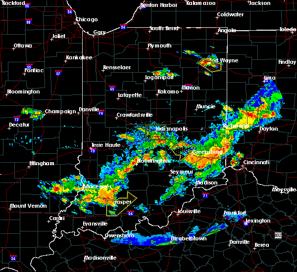 At 636 pm edt, severe thunderstorms were located along a line extending from 9 miles southwest of rushville to near shelbyville, moving east at 40 mph (radar indicated). Hazards include 60 mph wind gusts. Expect damage to roofs. siding. and trees. locations impacted include, shelbyville, adams, milford, geneva, st. paul, milroy, moscow, waldron, manilla, burney and sandusky. This includes interstate 74 between mile markers 114 and 131. At 636 pm edt, severe thunderstorms were located along a line extending from 9 miles southwest of rushville to near shelbyville, moving east at 40 mph (radar indicated). Hazards include 60 mph wind gusts. Expect damage to roofs. siding. and trees. locations impacted include, shelbyville, adams, milford, geneva, st. paul, milroy, moscow, waldron, manilla, burney and sandusky. This includes interstate 74 between mile markers 114 and 131.
|
| 6/15/2016 6:23 PM EDT |
 At 623 pm edt, severe thunderstorms were located along a line extending from 6 miles north of shelbyville to near franklin, moving east at 40 mph (radar indicated). Hazards include 60 mph wind gusts. Expect damage to roofs. siding. And trees. At 623 pm edt, severe thunderstorms were located along a line extending from 6 miles north of shelbyville to near franklin, moving east at 40 mph (radar indicated). Hazards include 60 mph wind gusts. Expect damage to roofs. siding. And trees.
|
| 6/15/2016 5:31 PM EDT |
 At 531 pm edt, severe thunderstorms were located along a line extending from 7 miles north of fountain city to 8 miles northwest of glenwood, moving east at 40 mph (radar indicated). Hazards include 60 mph wind gusts. Expect damage to roofs. siding. and trees. locations impacted include, rushville, glenwood, lewisville, straughn, mays, falmouth, arlington and new salem. This includes interstate 70 between mile markers 126 and 133. At 531 pm edt, severe thunderstorms were located along a line extending from 7 miles north of fountain city to 8 miles northwest of glenwood, moving east at 40 mph (radar indicated). Hazards include 60 mph wind gusts. Expect damage to roofs. siding. and trees. locations impacted include, rushville, glenwood, lewisville, straughn, mays, falmouth, arlington and new salem. This includes interstate 70 between mile markers 126 and 133.
|
| 6/15/2016 5:13 PM EDT |
 At 513 pm edt, severe thunderstorms were located along a line extending from 6 miles northwest of hagerstown to 11 miles southeast of greenfield, moving east at 55 mph (trained spotter. at 512 pm...trained spotters reported power lines down in carthage). Hazards include 60 mph wind gusts. Expect damage to roofs. siding. And trees. At 513 pm edt, severe thunderstorms were located along a line extending from 6 miles northwest of hagerstown to 11 miles southeast of greenfield, moving east at 55 mph (trained spotter. at 512 pm...trained spotters reported power lines down in carthage). Hazards include 60 mph wind gusts. Expect damage to roofs. siding. And trees.
|
| 4/26/2016 6:02 PM EDT |
 At 601 pm edt, severe thunderstorms were located along a line extending from 7 miles southeast of rushville to 9 miles southwest of greensburg, moving east at 20 mph (radar indicated). Hazards include 60 mph wind gusts and quarter size hail. Hail damage to vehicles is expected. expect wind damage to roofs, siding, and trees. locations impacted include, greensburg, adams, milford, westport, st. paul, milroy, millhousen, moscow, burney, sandusky, clarksburg, lake santee, letts, newpoint, nebraska and new salem. This includes interstate 74 between mile markers 124 and 144. At 601 pm edt, severe thunderstorms were located along a line extending from 7 miles southeast of rushville to 9 miles southwest of greensburg, moving east at 20 mph (radar indicated). Hazards include 60 mph wind gusts and quarter size hail. Hail damage to vehicles is expected. expect wind damage to roofs, siding, and trees. locations impacted include, greensburg, adams, milford, westport, st. paul, milroy, millhousen, moscow, burney, sandusky, clarksburg, lake santee, letts, newpoint, nebraska and new salem. This includes interstate 74 between mile markers 124 and 144.
|
| 4/26/2016 5:51 PM EDT |
 At 550 pm edt, severe thunderstorms were located along a line extending from near rushville to 9 miles northeast of columbus, moving east at 10 mph (radar indicated). Hazards include 60 mph wind gusts and quarter size hail. Hail damage to vehicles is expected. Expect wind damage to roofs, siding, and trees. At 550 pm edt, severe thunderstorms were located along a line extending from near rushville to 9 miles northeast of columbus, moving east at 10 mph (radar indicated). Hazards include 60 mph wind gusts and quarter size hail. Hail damage to vehicles is expected. Expect wind damage to roofs, siding, and trees.
|
| 3/27/2016 9:34 PM EDT |
 At 934 pm edt, severe thunderstorms were located along a line extending from near rushville to 7 miles west of greensburg, moving east at 45 mph (radar indicated). Hazards include 70 mph wind gusts and quarter size hail. Hail damage to vehicles is expected. expect considerable tree damage. wind damage is also likely to mobile homes, roofs, and outbuildings. locations impacted include, greensburg, rushville, glenwood, adams, milford, st. paul, milroy, falmouth, moscow, manilla, burney, sandusky, clarksburg, lake santee, letts, newpoint, arlington and new salem. This includes interstate 74 between mile markers 124 and 144. At 934 pm edt, severe thunderstorms were located along a line extending from near rushville to 7 miles west of greensburg, moving east at 45 mph (radar indicated). Hazards include 70 mph wind gusts and quarter size hail. Hail damage to vehicles is expected. expect considerable tree damage. wind damage is also likely to mobile homes, roofs, and outbuildings. locations impacted include, greensburg, rushville, glenwood, adams, milford, st. paul, milroy, falmouth, moscow, manilla, burney, sandusky, clarksburg, lake santee, letts, newpoint, arlington and new salem. This includes interstate 74 between mile markers 124 and 144.
|
| 3/27/2016 9:22 PM EDT |
 At 922 pm edt, severe thunderstorms were located along a line extending from 7 miles west of rushville to 9 miles northwest of greensburg to 10 miles northeast of columbus, moving east at 45 mph (radar indicated). Hazards include 70 mph wind gusts and quarter size hail. Hail damage to vehicles is expected. expect considerable tree damage. wind damage is also likely to mobile homes, roofs, and outbuildings. locations impacted include, columbus, shelbyville, greensburg, rushville, glenwood, adams, hope, flat rock, milford, geneva, st. paul, hartsville, milroy, clifford, moscow, taylorsville, sandusky, clarksburg, letts and arlington. this includes the following highways, interstate 65 between mile markers 67 and 73. Interstate 74 between mile markers 110 and 144. At 922 pm edt, severe thunderstorms were located along a line extending from 7 miles west of rushville to 9 miles northwest of greensburg to 10 miles northeast of columbus, moving east at 45 mph (radar indicated). Hazards include 70 mph wind gusts and quarter size hail. Hail damage to vehicles is expected. expect considerable tree damage. wind damage is also likely to mobile homes, roofs, and outbuildings. locations impacted include, columbus, shelbyville, greensburg, rushville, glenwood, adams, hope, flat rock, milford, geneva, st. paul, hartsville, milroy, clifford, moscow, taylorsville, sandusky, clarksburg, letts and arlington. this includes the following highways, interstate 65 between mile markers 67 and 73. Interstate 74 between mile markers 110 and 144.
|
| 3/27/2016 9:07 PM EDT |
 At 906 pm edt, severe thunderstorms were located along a line extending from near shelbyville to 15 miles east of franklin to near columbus, moving east at 45 mph (radar indicated). Hazards include 70 mph wind gusts and quarter size hail. Hail damage to vehicles is expected. expect considerable tree damage. wind damage is also likely to mobile homes, roofs, and outbuildings. locations impacted include, columbus, shelbyville, franklin, greensburg, rushville, nashville, glenwood, adams, edinburgh, whiteland, bargersville, hope, flat rock, milford, princes lakes, geneva, trafalgar, st. paul, hartsville and fairland. this includes the following highways, interstate 65 between mile markers 67 and 94. Interstate 74 between mile markers 109 and 144. At 906 pm edt, severe thunderstorms were located along a line extending from near shelbyville to 15 miles east of franklin to near columbus, moving east at 45 mph (radar indicated). Hazards include 70 mph wind gusts and quarter size hail. Hail damage to vehicles is expected. expect considerable tree damage. wind damage is also likely to mobile homes, roofs, and outbuildings. locations impacted include, columbus, shelbyville, franklin, greensburg, rushville, nashville, glenwood, adams, edinburgh, whiteland, bargersville, hope, flat rock, milford, princes lakes, geneva, trafalgar, st. paul, hartsville and fairland. this includes the following highways, interstate 65 between mile markers 67 and 94. Interstate 74 between mile markers 109 and 144.
|
| 3/27/2016 8:47 PM EDT |
 At 847 pm edt, severe thunderstorms were located along a line extending from near greenwood to 8 miles south of franklin to near nashville, moving east at 45 mph (radar indicated). Hazards include 60 mph wind gusts and quarter size hail. Hail damage to vehicles is expected. Expect wind damage to roofs, siding, and trees. At 847 pm edt, severe thunderstorms were located along a line extending from near greenwood to 8 miles south of franklin to near nashville, moving east at 45 mph (radar indicated). Hazards include 60 mph wind gusts and quarter size hail. Hail damage to vehicles is expected. Expect wind damage to roofs, siding, and trees.
|
| 12/23/2015 4:19 PM EST | At 419 pm est, severe thunderstorms were located along a line extending from near anderson to near rushville to near greensburg to near vernon, moving east at 60 mph (radar indicated). Hazards include 70 mph wind gusts. Expect considerable tree damage. damage is likely to mobile homes, roofs and outbuildings. locations impacted include, anderson, new castle, greensburg, north vernon, rushville, vernon, glenwood, yorktown, pendleton, chesterfield, knightstown, edgewood, daleville, westport, carthage, spiceland, shirley, markleville, kennard and wilkinson. this includes the following highways, interstate 69 between mile markers 219 and 241. interstate 70 between mile markers 109 and 128. interstate 74 between mile markers 129 and 144. A tornado watch remains in effect until 900 pm est for southeastern indiana. |
| 12/23/2015 4:12 PM EST | Buildings damaged in rush county IN, 0.8 miles NE of Milroy, IN |
| 12/23/2015 3:57 PM EST | At 357 pm est, severe thunderstorms were located along a line extending from near noblesville to near shelbyville to near columbus to 7 miles southeast of brownstown, moving east at 65 mph (radar indicated). Hazards include 70 mph wind gusts. Expect considerable tree damage. Damage is likely to mobile homes, roofs and outbuildings. |
| 7/17/2015 5:14 PM EDT |
 At 513 pm edt, a severe thunderstorm was located 7 miles south of shelbyville, moving southeast at 25 mph (radar indicated). Hazards include 60 mph wind gusts and nickel size hail. Expect damage to roofs. Siding and trees. At 513 pm edt, a severe thunderstorm was located 7 miles south of shelbyville, moving southeast at 25 mph (radar indicated). Hazards include 60 mph wind gusts and nickel size hail. Expect damage to roofs. Siding and trees.
|
| 4/8/2015 9:51 AM EDT | A severe thunderstorm warning remains in effect for decatur. northeastern bartholomew. southeastern rush and southeastern shelby counties until 1000 am edt. at 949 am edt. severe thunderstorms were located along a line extending from 9 miles northwest of oldenburg to greensburg to 10 miles northwest of north vernon. And moving east at 50 mph. |
| 4/8/2015 9:46 AM EDT | A severe thunderstorm warning remains in effect for decatur. northeastern brown. northern bartholomew. southeastern henry. southeastern johnson. southeastern rush and southern shelby counties until 1000 am edt. at 944 am edt. Severe thunderstorms were located along a line extending from 11 miles southeast of rushville to greensburg to 7. |
| 4/8/2015 9:34 AM EDT | A severe thunderstorm warning remains in effect for decatur. northeastern brown. northern bartholomew. southeastern henry. southern johnson. rush and southern shelby counties until 1000 am edt. at 933 am edt. Severe thunderstorms were located along a line extending from dublin to 8 miles east of rushville to 12 miles west. |
| 4/8/2015 9:14 AM EDT | A severe thunderstorm warning remains in effect for decatur. northeastern brown. northern bartholomew. eastern hancock. southern henry. johnson. southeastern madison. southern morgan. rush and shelby counties until 1000 am edt. at 911 am edt. Severe thunderstorms were located along a line extending from 12 miles south of anderson to 9 miles northeast of. |
| 4/8/2015 9:11 AM EDT | The national weather service in indianapolis has issued a * severe thunderstorm warning for. northern bartholomew county in central indiana. northeastern brown county in south central indiana. decatur county in central indiana. Eastern hancock county in central indiana. |
| 1/1/0001 12:00 AM | Golf Ball sized hail reported 2 miles N of Milroy, IN |
Hail Maps for Milroy, IN


Connect with Interactive Hail Maps