

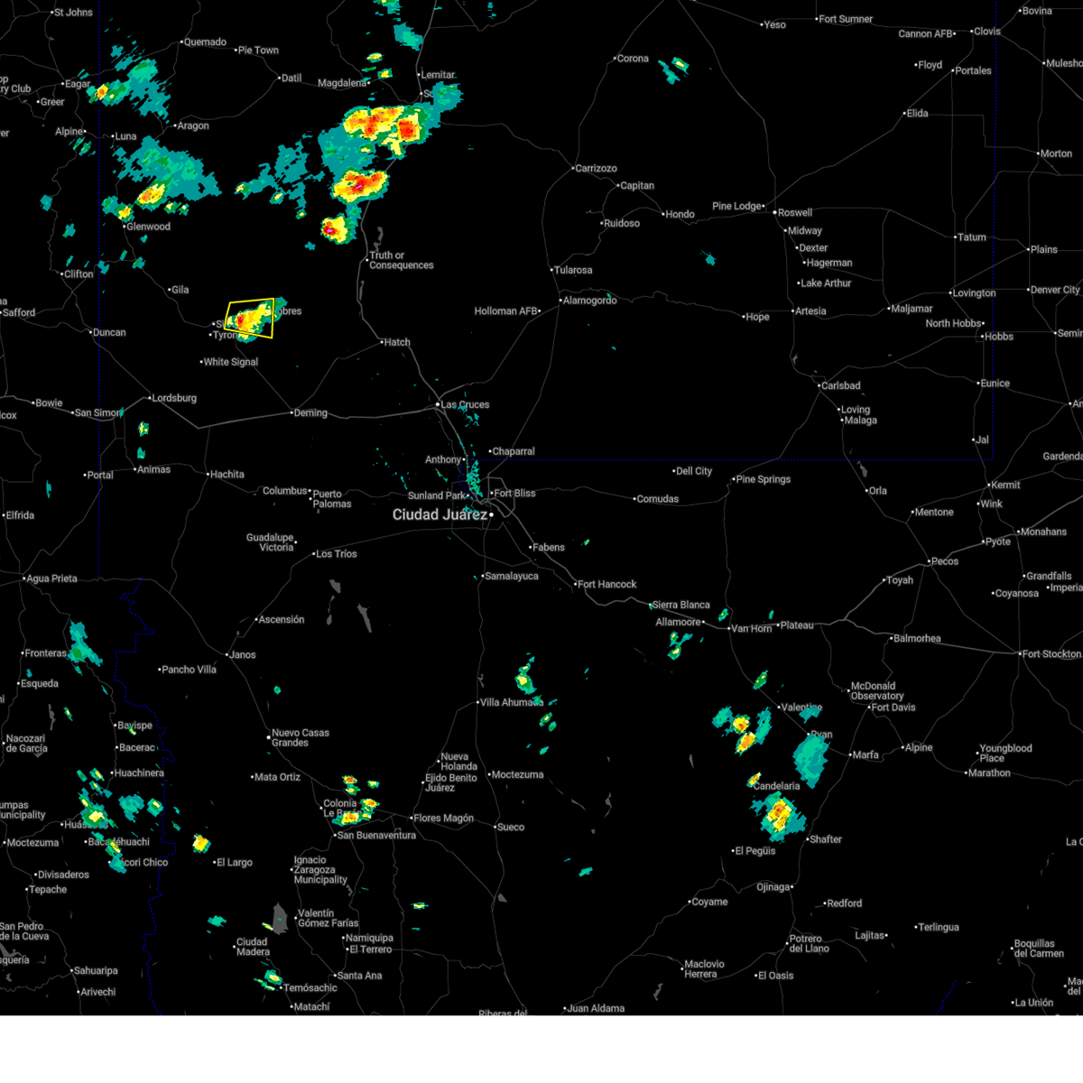
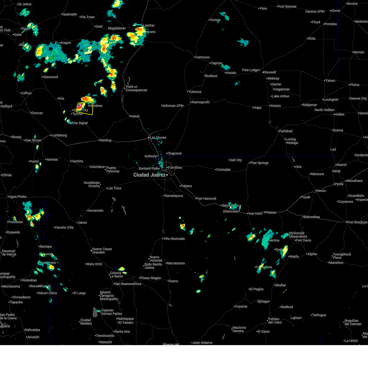
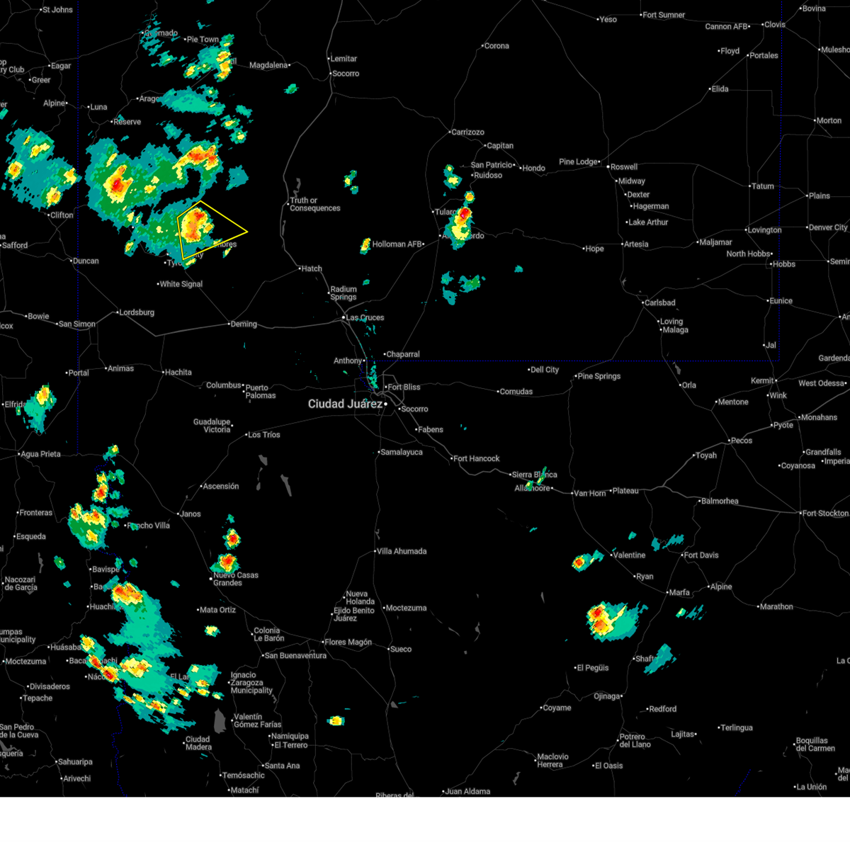
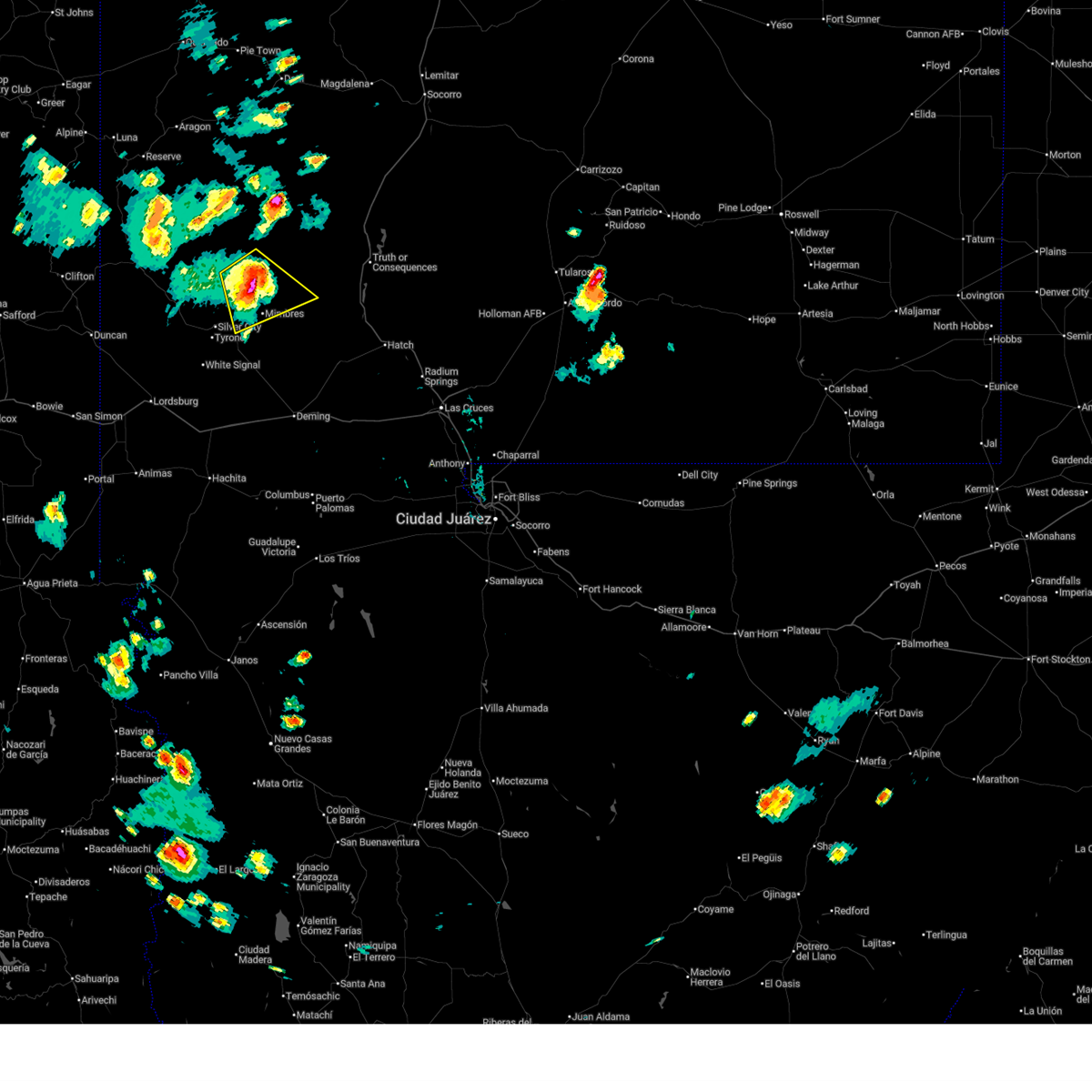
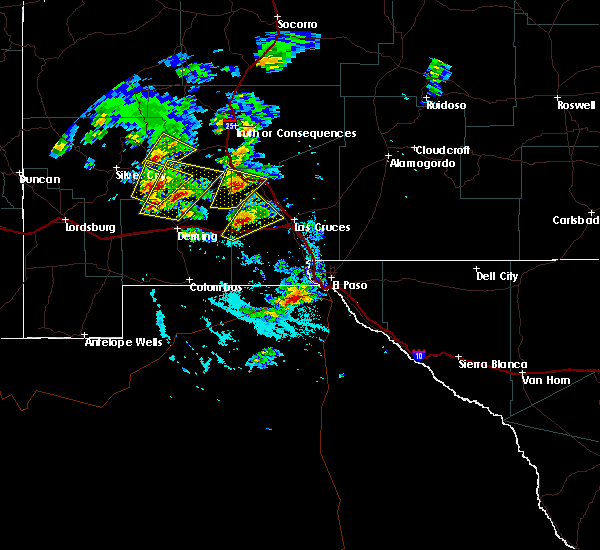
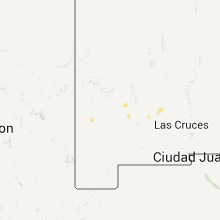
Hail Map for Mimbres, NM
The Mimbres, NM area has had 0 reports of on-the-ground hail by trained spotters, and has been under severe weather warnings 7 times during the past 12 months. Doppler radar has detected hail at or near Mimbres, NM on 13 occasions, including 1 occasion during the past year.
| Name: | Mimbres, NM |
| Where Located: | 19.3 miles ENE of Silver City, NM |
| Map: | Google Map for Mimbres, NM |
| Population: | 667 |
| Housing Units: | 430 |
| More Info: | Search Google for Mimbres, NM |
0
The Top Recent Hail Date for Mimbres, NM is Saturday, September 13, 2025 (12th out of 13)

Hail and Wind Damage Spotted near Mimbres, NM
| Date / Time | Report Details |
|---|---|
| 9/13/2025 3:17 PM MDT | the severe thunderstorm warning has been cancelled and is no longer in effect |
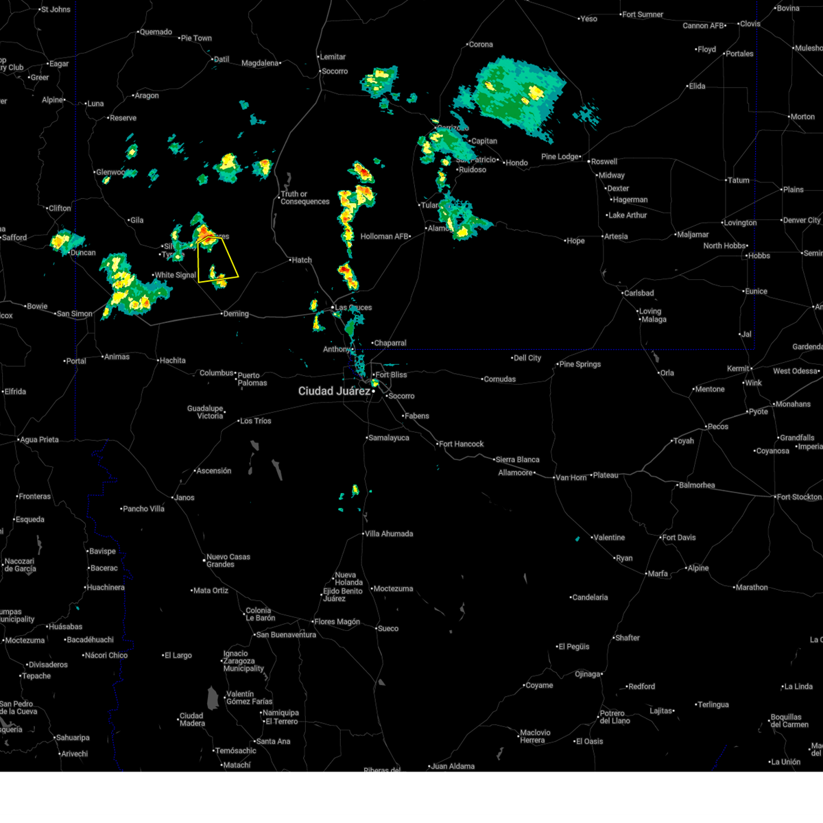
| 9/13/2025 2:54 PM MDT | Svrepz the national weather service in el paso has issued a * severe thunderstorm warning for, northeastern grant county in southwestern new mexico, west central sierra county in south central new mexico, * until 330 pm mdt. * at 254 pm mdt, a severe thunderstorm was located 4 miles east of mimbres river preserve, moving east at 30 mph (radar indicated). Hazards include 60 mph wind gusts and quarter size hail. Hail damage to vehicles is expected. Expect wind damage to roofs, siding, and trees. |
| 8/2/2025 4:31 PM MDT |
 the severe thunderstorm warning has been cancelled and is no longer in effect the severe thunderstorm warning has been cancelled and is no longer in effect
|
| 8/2/2025 3:50 PM MDT |
 Svrepz the national weather service in el paso has issued a * severe thunderstorm warning for, east central grant county in southwestern new mexico, * until 445 pm mdt. * at 349 pm mdt, a severe thunderstorm was located near hanover, moving east at 20 mph (radar indicated). Hazards include 60 mph wind gusts and quarter size hail. Hail damage to vehicles is expected. Expect wind damage to roofs, siding, and trees. Svrepz the national weather service in el paso has issued a * severe thunderstorm warning for, east central grant county in southwestern new mexico, * until 445 pm mdt. * at 349 pm mdt, a severe thunderstorm was located near hanover, moving east at 20 mph (radar indicated). Hazards include 60 mph wind gusts and quarter size hail. Hail damage to vehicles is expected. Expect wind damage to roofs, siding, and trees.
|
| 7/13/2025 2:48 PM MDT |
 At 248 pm mdt, a severe thunderstorm was located 6 miles northeast of cottonwood canyon, moving east at 15 mph (radar indicated). Hazards include quarter size hail. Damage to vehicles is expected. Locations impacted include, lake roberts, san lorenzo, emory pass, cobre, bayard, hanover, kingston, fierro, mimbres, santa clara, fort bayard, mimbres river preserve, cottonwood canyon, soldiers canyon, gattons park, meadow creek, three circle canyon, allie canyon, shingle canyon, and hill canyon. At 248 pm mdt, a severe thunderstorm was located 6 miles northeast of cottonwood canyon, moving east at 15 mph (radar indicated). Hazards include quarter size hail. Damage to vehicles is expected. Locations impacted include, lake roberts, san lorenzo, emory pass, cobre, bayard, hanover, kingston, fierro, mimbres, santa clara, fort bayard, mimbres river preserve, cottonwood canyon, soldiers canyon, gattons park, meadow creek, three circle canyon, allie canyon, shingle canyon, and hill canyon.
|
| 7/13/2025 2:26 PM MDT |
 Svrepz the national weather service in el paso has issued a * severe thunderstorm warning for, northeastern grant county in southwestern new mexico, west central sierra county in south central new mexico, * until 315 pm mdt. * at 226 pm mdt, a severe thunderstorm was located near gattons park, moving east at 15 mph (radar indicated). Hazards include 60 mph wind gusts and quarter size hail. Hail damage to vehicles is expected. Expect wind damage to roofs, siding, and trees. Svrepz the national weather service in el paso has issued a * severe thunderstorm warning for, northeastern grant county in southwestern new mexico, west central sierra county in south central new mexico, * until 315 pm mdt. * at 226 pm mdt, a severe thunderstorm was located near gattons park, moving east at 15 mph (radar indicated). Hazards include 60 mph wind gusts and quarter size hail. Hail damage to vehicles is expected. Expect wind damage to roofs, siding, and trees.
|
| 7/8/2025 4:49 PM MDT |
 Svrepz the national weather service in el paso has issued a * severe thunderstorm warning for, east central grant county in southwestern new mexico, southwestern sierra county in south central new mexico, north central luna county in southwestern new mexico, * until 530 pm mdt. * at 448 pm mdt, a severe thunderstorm was located near sherman, moving south at 15 mph (radar indicated). Hazards include 60 mph wind gusts and quarter size hail. Hail damage to vehicles is expected. Expect wind damage to roofs, siding, and trees. Svrepz the national weather service in el paso has issued a * severe thunderstorm warning for, east central grant county in southwestern new mexico, southwestern sierra county in south central new mexico, north central luna county in southwestern new mexico, * until 530 pm mdt. * at 448 pm mdt, a severe thunderstorm was located near sherman, moving south at 15 mph (radar indicated). Hazards include 60 mph wind gusts and quarter size hail. Hail damage to vehicles is expected. Expect wind damage to roofs, siding, and trees.
|
| 7/20/2024 1:39 PM MDT |
 Svrepz the national weather service in el paso has issued a * severe thunderstorm warning for, northeastern grant county in southwestern new mexico, * until 230 pm mdt. * at 138 pm mdt, a severe thunderstorm was located near fierro, moving southwest at 15 mph (radar indicated). Hazards include 60 mph wind gusts and penny size hail. expect damage to roofs, siding, and trees Svrepz the national weather service in el paso has issued a * severe thunderstorm warning for, northeastern grant county in southwestern new mexico, * until 230 pm mdt. * at 138 pm mdt, a severe thunderstorm was located near fierro, moving southwest at 15 mph (radar indicated). Hazards include 60 mph wind gusts and penny size hail. expect damage to roofs, siding, and trees
|
| 7/9/2024 3:51 PM MDT |
 Svrepz the national weather service in el paso has issued a * severe thunderstorm warning for, east central grant county in southwestern new mexico, * until 430 pm mdt. * at 350 pm mdt, a severe thunderstorm was located over mimbres, moving south at 15 mph (radar indicated). Hazards include 60 mph wind gusts and half dollar size hail. Hail damage to vehicles is expected. Expect wind damage to roofs, siding, and trees. Svrepz the national weather service in el paso has issued a * severe thunderstorm warning for, east central grant county in southwestern new mexico, * until 430 pm mdt. * at 350 pm mdt, a severe thunderstorm was located over mimbres, moving south at 15 mph (radar indicated). Hazards include 60 mph wind gusts and half dollar size hail. Hail damage to vehicles is expected. Expect wind damage to roofs, siding, and trees.
|
| 8/27/2021 2:10 PM MDT |
 The severe thunderstorm warning for northeastern grant county will expire at 215 pm mdt, the storm which prompted the warning has weakened below severe limits, and no longer poses an immediate threat to life or property. therefore, the warning will be allowed to expire. however small hail and heavy rain are still possible with this thunderstorm. The severe thunderstorm warning for northeastern grant county will expire at 215 pm mdt, the storm which prompted the warning has weakened below severe limits, and no longer poses an immediate threat to life or property. therefore, the warning will be allowed to expire. however small hail and heavy rain are still possible with this thunderstorm.
|
| 8/27/2021 1:59 PM MDT |
 At 159 pm mdt, a severe thunderstorm was located 6 miles north of mimbres, moving southwest at 5 mph (radar indicated). Hazards include quarter size hail. Damage to vehicles is expected. locations impacted include, mimbres, camp thunderbird, georgetown, upper mimbres valley and bear canyon lake. hail threat, radar indicated max hail size, 1. 00 in wind threat, radar indicated max wind gust, <50 mph. At 159 pm mdt, a severe thunderstorm was located 6 miles north of mimbres, moving southwest at 5 mph (radar indicated). Hazards include quarter size hail. Damage to vehicles is expected. locations impacted include, mimbres, camp thunderbird, georgetown, upper mimbres valley and bear canyon lake. hail threat, radar indicated max hail size, 1. 00 in wind threat, radar indicated max wind gust, <50 mph.
|
| 8/27/2021 1:42 PM MDT |
 At 142 pm mdt, a severe thunderstorm was located 8 miles north of mimbres, moving southwest at 20 mph (radar indicated). Hazards include quarter size hail. damage to vehicles is expected At 142 pm mdt, a severe thunderstorm was located 8 miles north of mimbres, moving southwest at 20 mph (radar indicated). Hazards include quarter size hail. damage to vehicles is expected
|
| 8/4/2021 3:53 PM MDT |
 At 353 pm mdt, a severe thunderstorm was located over san juan, moving southwest at 15 mph (radar indicated). Hazards include quarter size hail. damage to vehicles is expected At 353 pm mdt, a severe thunderstorm was located over san juan, moving southwest at 15 mph (radar indicated). Hazards include quarter size hail. damage to vehicles is expected
|
| 8/3/2021 3:44 PM MDT |
 At 343 pm mdt, a severe thunderstorm was located near san lorenzo, and is nearly stationary (radar indicated). Hazards include quarter size hail and winds up to 50 mph. Damage to vehicles is expected. locations impacted include, san lorenzo and san juan. hail threat, radar indicated max hail size, 1. 00 in wind threat, radar indicated max wind gust, <50 mph. At 343 pm mdt, a severe thunderstorm was located near san lorenzo, and is nearly stationary (radar indicated). Hazards include quarter size hail and winds up to 50 mph. Damage to vehicles is expected. locations impacted include, san lorenzo and san juan. hail threat, radar indicated max hail size, 1. 00 in wind threat, radar indicated max wind gust, <50 mph.
|
| 8/3/2021 3:21 PM MDT |
 At 321 pm mdt, a severe thunderstorm was located near san lorenzo, and is nearly stationary (radar indicated). Hazards include 60 mph wind gusts and quarter size hail. Hail damage to vehicles is expected. Expect wind damage to roofs, siding, and trees. At 321 pm mdt, a severe thunderstorm was located near san lorenzo, and is nearly stationary (radar indicated). Hazards include 60 mph wind gusts and quarter size hail. Hail damage to vehicles is expected. Expect wind damage to roofs, siding, and trees.
|
| 8/1/2018 1:48 PM MDT |
 At 148 pm mdt, a severe thunderstorm was located 7 miles north of fierro, or 7 miles southeast of lake roberts, moving west at 10 mph (radar indicated). Hazards include 60 mph wind gusts and quarter size hail. Hail damage to vehicles is expected. Expect wind damage to roofs, siding, and trees. At 148 pm mdt, a severe thunderstorm was located 7 miles north of fierro, or 7 miles southeast of lake roberts, moving west at 10 mph (radar indicated). Hazards include 60 mph wind gusts and quarter size hail. Hail damage to vehicles is expected. Expect wind damage to roofs, siding, and trees.
|
| 8/1/2018 1:20 PM MDT |
 At 120 pm mdt, a severe thunderstorm was located near mimbres, or 8 miles northwest of san lorenzo, moving southwest at 5 mph (radar indicated). Hazards include 60 mph wind gusts and quarter size hail. Hail damage to vehicles is expected. expect wind damage to roofs, siding, and trees. Locations impacted include, hanover, camp thunderbird, mimbres, fierro, bear canyon lake, upper mimbres valley, georgetown, and san lorenzo. At 120 pm mdt, a severe thunderstorm was located near mimbres, or 8 miles northwest of san lorenzo, moving southwest at 5 mph (radar indicated). Hazards include 60 mph wind gusts and quarter size hail. Hail damage to vehicles is expected. expect wind damage to roofs, siding, and trees. Locations impacted include, hanover, camp thunderbird, mimbres, fierro, bear canyon lake, upper mimbres valley, georgetown, and san lorenzo.
|
| 8/1/2018 12:55 PM MDT |
 At 1254 pm mdt, a severe thunderstorm was located near mimbres, or 7 miles northwest of san lorenzo, moving south at 10 mph (radar indicated). Hazards include 60 mph wind gusts and quarter size hail. Hail damage to vehicles is expected. Expect wind damage to roofs, siding, and trees. At 1254 pm mdt, a severe thunderstorm was located near mimbres, or 7 miles northwest of san lorenzo, moving south at 10 mph (radar indicated). Hazards include 60 mph wind gusts and quarter size hail. Hail damage to vehicles is expected. Expect wind damage to roofs, siding, and trees.
|
| 11/4/2016 4:46 PM MDT |
 At 446 pm mdt, a severe thunderstorm was located near san lorenzo, moving northeast at 25 mph (radar indicated). Hazards include 60 mph wind gusts and nickel size hail. Expect damage to roofs. siding. And trees. At 446 pm mdt, a severe thunderstorm was located near san lorenzo, moving northeast at 25 mph (radar indicated). Hazards include 60 mph wind gusts and nickel size hail. Expect damage to roofs. siding. And trees.
|
| 11/4/2016 4:40 PM MDT |
 At 439 pm mdt, a severe thunderstorm was located 4 miles west of faywood, moving northeast at 35 mph (radar indicated). Hazards include 60 mph wind gusts and quarter size hail. Hail damage to vehicles is expected. Expect wind damage to roofs, siding, and trees. At 439 pm mdt, a severe thunderstorm was located 4 miles west of faywood, moving northeast at 35 mph (radar indicated). Hazards include 60 mph wind gusts and quarter size hail. Hail damage to vehicles is expected. Expect wind damage to roofs, siding, and trees.
|
| 11/4/2016 4:16 PM MDT |
 At 416 pm mdt, a severe thunderstorm was located 6 miles southeast of hurley, moving north at 30 mph (radar indicated). Hazards include 60 mph wind gusts and half dollar size hail. Hail damage to vehicles is expected. expect wind damage to roofs, siding, and trees. Locations impacted include, hurley, san lorenzo, silver city, san juan, santa clara, hanover, bayard, fort bayard, cobre, sherman, north hurley, arenas valley, and city of rocks state park. At 416 pm mdt, a severe thunderstorm was located 6 miles southeast of hurley, moving north at 30 mph (radar indicated). Hazards include 60 mph wind gusts and half dollar size hail. Hail damage to vehicles is expected. expect wind damage to roofs, siding, and trees. Locations impacted include, hurley, san lorenzo, silver city, san juan, santa clara, hanover, bayard, fort bayard, cobre, sherman, north hurley, arenas valley, and city of rocks state park.
|
| 11/4/2016 3:53 PM MDT |
 At 352 pm mdt, a severe thunderstorm was located 13 miles southeast of white signal, or 17 miles south of hurley, moving north at 30 mph (radar indicated). Hazards include 60 mph wind gusts and half dollar size hail. Hail damage to vehicles is expected. Expect wind damage to roofs, siding, and trees. At 352 pm mdt, a severe thunderstorm was located 13 miles southeast of white signal, or 17 miles south of hurley, moving north at 30 mph (radar indicated). Hazards include 60 mph wind gusts and half dollar size hail. Hail damage to vehicles is expected. Expect wind damage to roofs, siding, and trees.
|
| 10/5/2015 3:44 PM MDT |
 At 336 pm mdt, a severe thunderstorm was located over arenas valley, or 4 miles east of silver city, moving northeast at 20 mph (radar indicated). Hazards include 60 mph wind gusts and quarter size hail. Hail damage to vehicles is expected. expect wind damage to roofs, siding and trees. Locations impacted include, silver city, lake roberts, bayard, santa clara, hurley, white signal, little walnut village, camp thunderbird, north hurley, pinos altos, arenas valley, hanover, fierro, fort bayard, cobre, mimbres, georgetown, tyrone, mcmillan campground, cherry creek campground. At 336 pm mdt, a severe thunderstorm was located over arenas valley, or 4 miles east of silver city, moving northeast at 20 mph (radar indicated). Hazards include 60 mph wind gusts and quarter size hail. Hail damage to vehicles is expected. expect wind damage to roofs, siding and trees. Locations impacted include, silver city, lake roberts, bayard, santa clara, hurley, white signal, little walnut village, camp thunderbird, north hurley, pinos altos, arenas valley, hanover, fierro, fort bayard, cobre, mimbres, georgetown, tyrone, mcmillan campground, cherry creek campground.
|
| 10/5/2015 3:14 PM MDT |
 At 313 pm mdt, a severe thunderstorm was located near tyrone, or 6 miles south of silver city, moving northeast at 20 mph (radar indicated). Hazards include 60 mph wind gusts and quarter size hail or larger. Hail damage to vehicles is expected. Expect wind damage to roofs, siding and trees. At 313 pm mdt, a severe thunderstorm was located near tyrone, or 6 miles south of silver city, moving northeast at 20 mph (radar indicated). Hazards include 60 mph wind gusts and quarter size hail or larger. Hail damage to vehicles is expected. Expect wind damage to roofs, siding and trees.
|
| 8/17/2015 4:00 PM MDT |
 At 400 pm mdt, a severe thunderstorm was located 4 miles southeast of gage, or 16 miles west of deming, moving south at 40 mph (radar indicated). Hazards include 60 mph wind gusts and quarter size hail. Hail damage to vehicles is expected. expect wind damage to roofs, siding and trees. Locations impacted include, city of rocks state park, bayard, santa clara, hurley, hanover, fierro, fort bayard, mimbres, cobre, georgetown, north hurley. At 400 pm mdt, a severe thunderstorm was located 4 miles southeast of gage, or 16 miles west of deming, moving south at 40 mph (radar indicated). Hazards include 60 mph wind gusts and quarter size hail. Hail damage to vehicles is expected. expect wind damage to roofs, siding and trees. Locations impacted include, city of rocks state park, bayard, santa clara, hurley, hanover, fierro, fort bayard, mimbres, cobre, georgetown, north hurley.
|
| 8/17/2015 3:39 PM MDT |
 At 339 pm mdt, a severe thunderstorm was located 12 miles north of gage, or 14 miles southwest of city of rocks state park, moving south at 40 mph (radar indicated). Hazards include 60 mph wind gusts and quarter size hail. Hail damage to vehicles is expected. Expect wind damage to roofs, siding and trees. At 339 pm mdt, a severe thunderstorm was located 12 miles north of gage, or 14 miles southwest of city of rocks state park, moving south at 40 mph (radar indicated). Hazards include 60 mph wind gusts and quarter size hail. Hail damage to vehicles is expected. Expect wind damage to roofs, siding and trees.
|
| 7/10/2015 5:51 PM MDT |
 The severe thunderstorm warning for central grant county will expire at 600 pm mdt, the storm which prompted the warning has weakened below severe limits, and no longer poses an immediate threat to life or property. therefore the warning will be allowed to expire. however gusty winds and heavy rain are still possible with this thunderstorm. The severe thunderstorm warning for central grant county will expire at 600 pm mdt, the storm which prompted the warning has weakened below severe limits, and no longer poses an immediate threat to life or property. therefore the warning will be allowed to expire. however gusty winds and heavy rain are still possible with this thunderstorm.
|
| 7/10/2015 5:16 PM MDT |
 At 515 pm mdt, a severe thunderstorm was located 6 miles west of tyrone, or 8 miles west of silver city, moving east at 40 mph (radar indicated). Hazards include 60 mph wind gusts and nickel size hail. Expect damage to roofs. Siding and trees. At 515 pm mdt, a severe thunderstorm was located 6 miles west of tyrone, or 8 miles west of silver city, moving east at 40 mph (radar indicated). Hazards include 60 mph wind gusts and nickel size hail. Expect damage to roofs. Siding and trees.
|
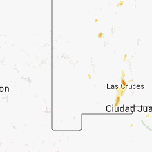
Hail Maps for Mimbres, NM


Connect with Interactive Hail Maps