

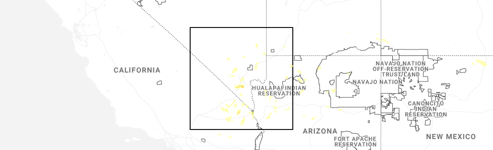
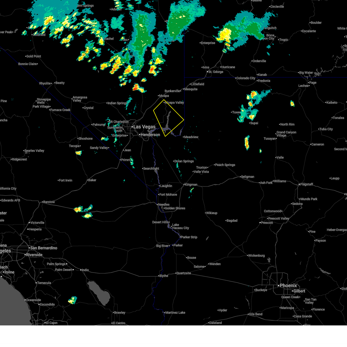
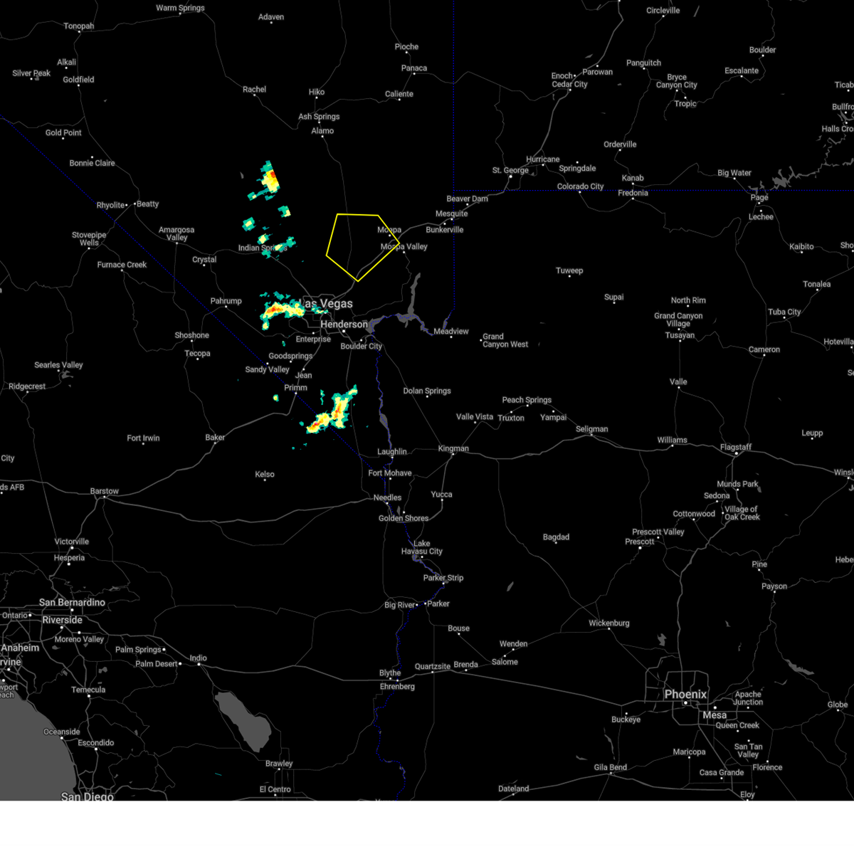
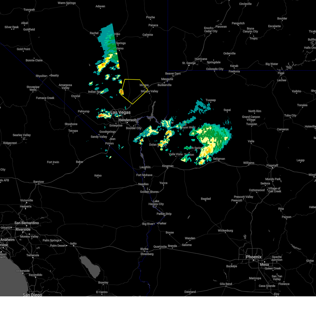
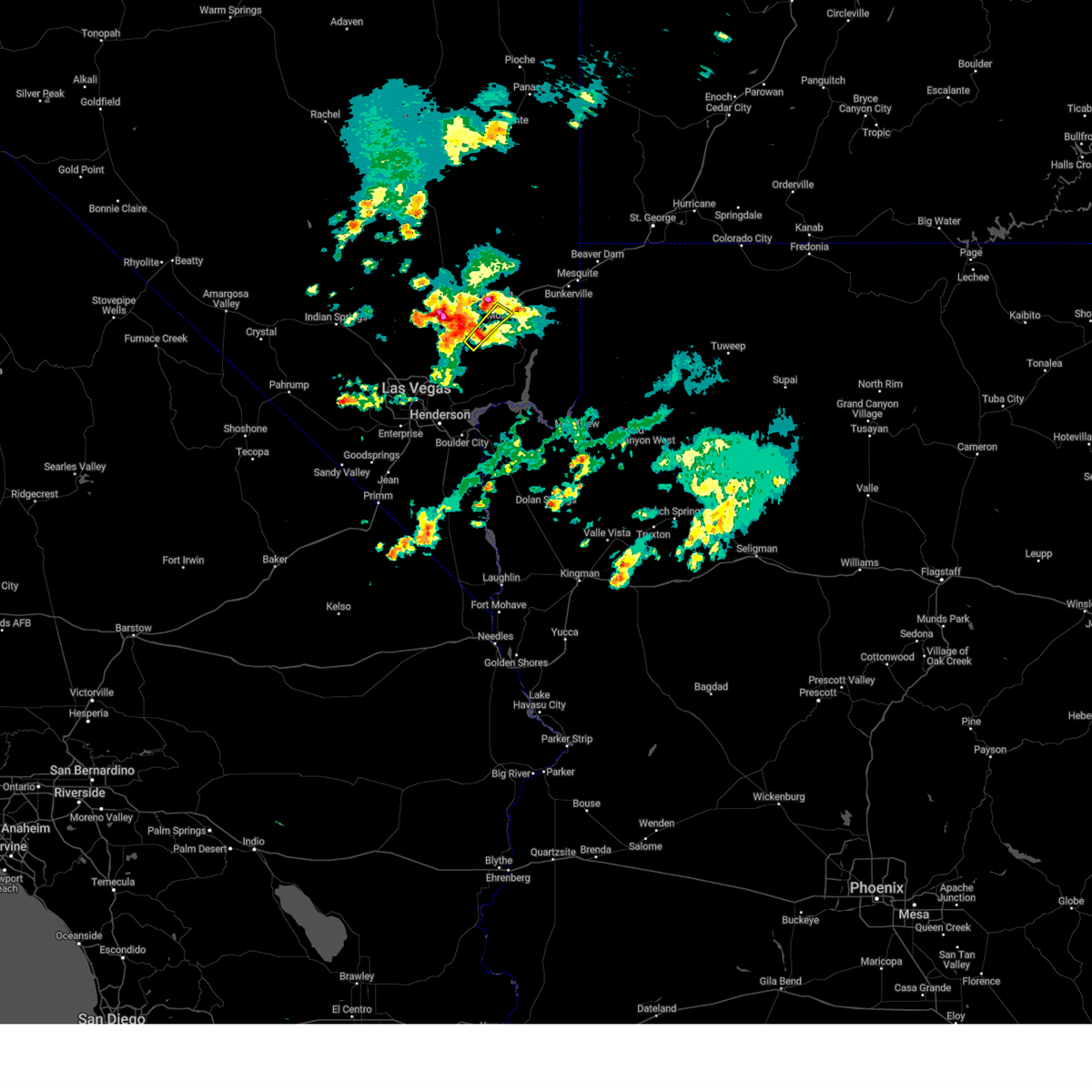
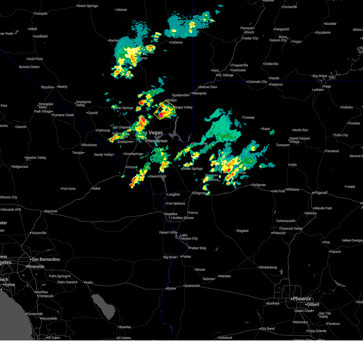
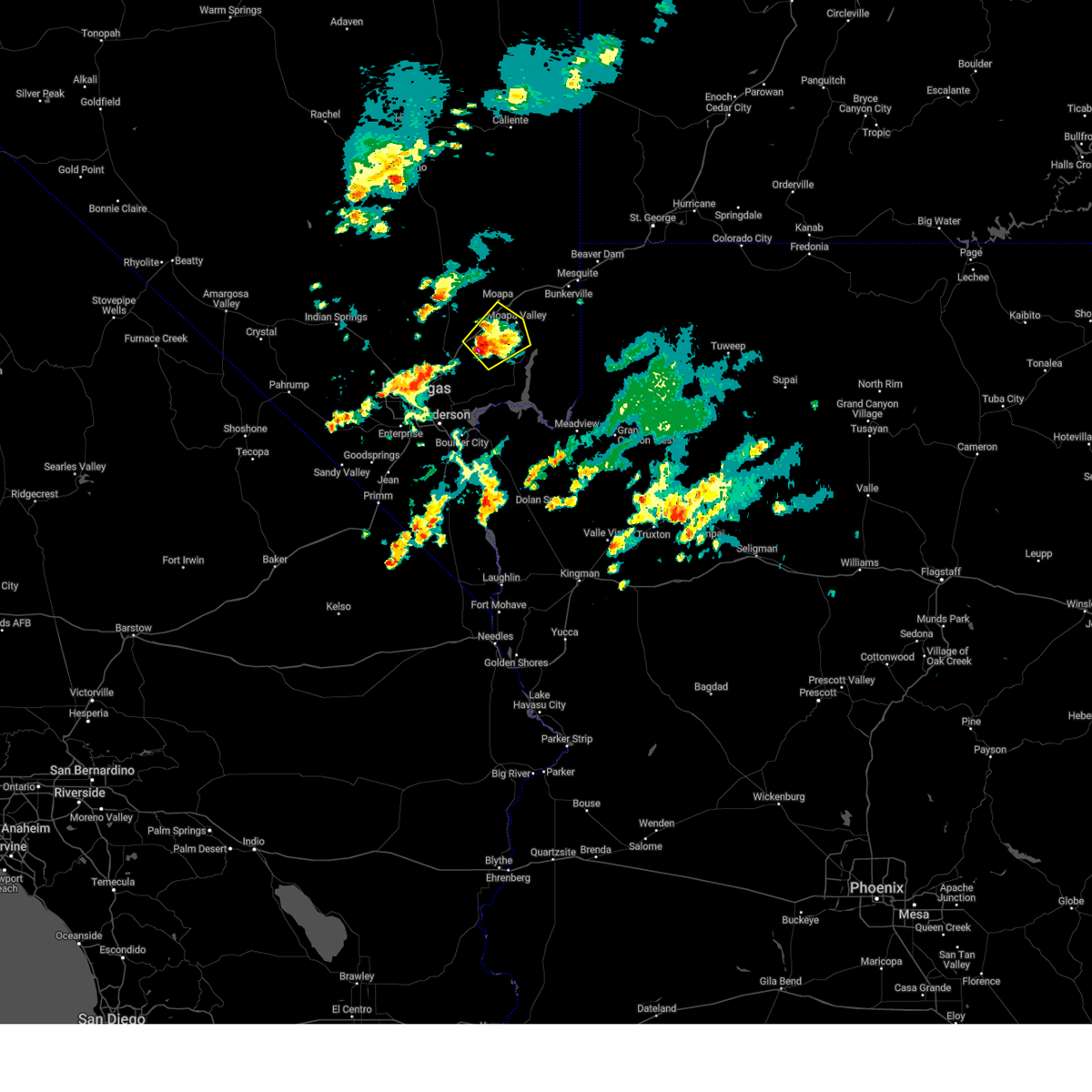
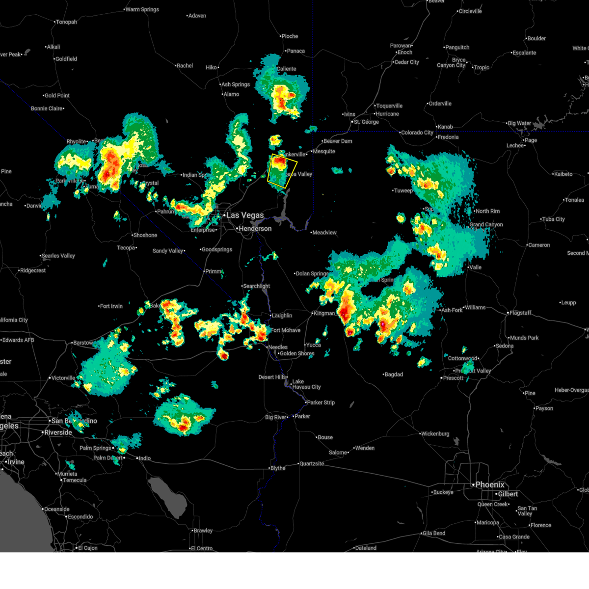
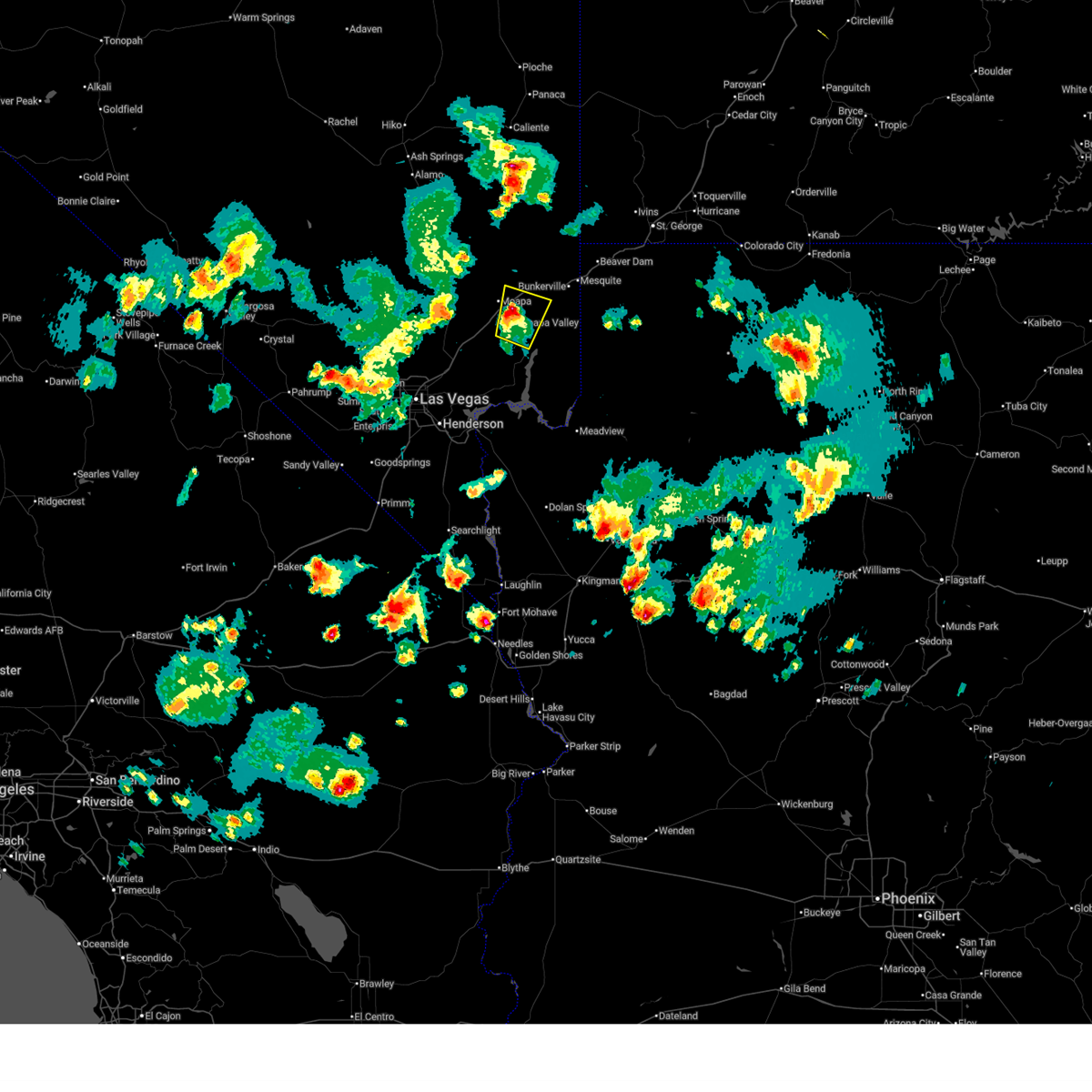
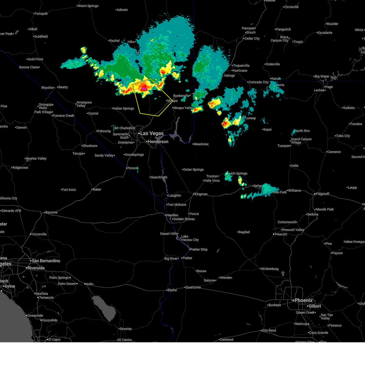
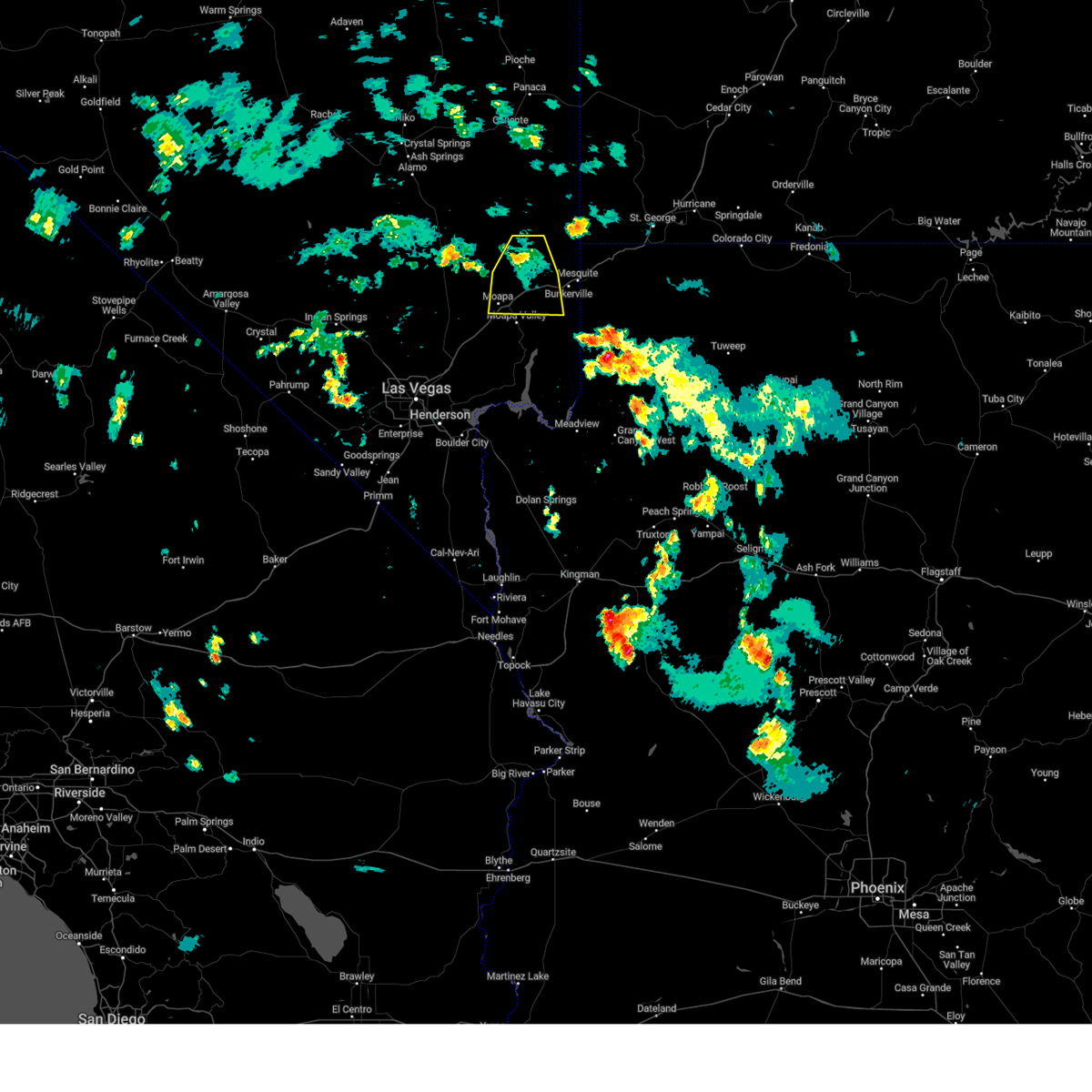
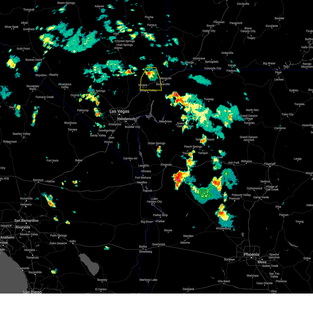
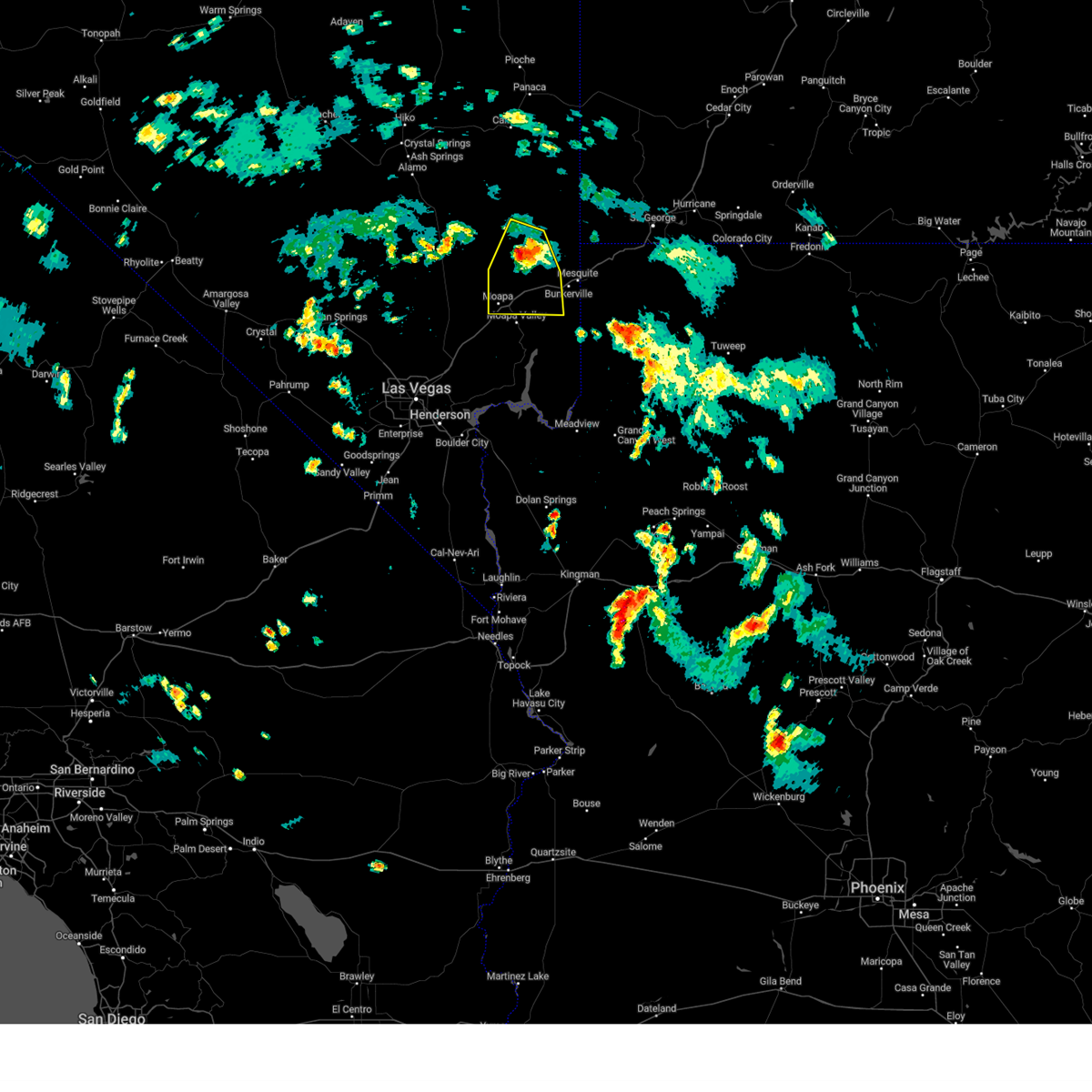
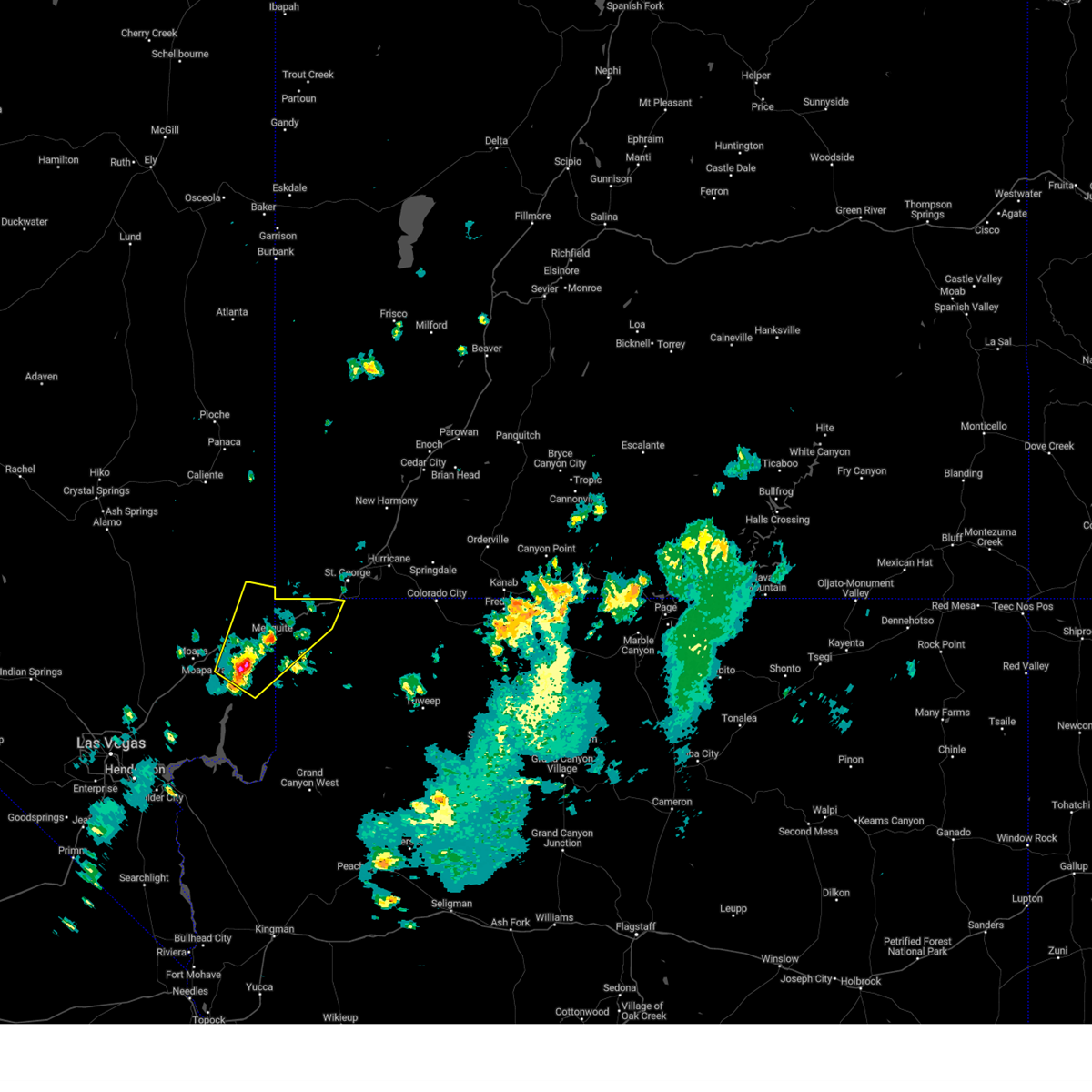
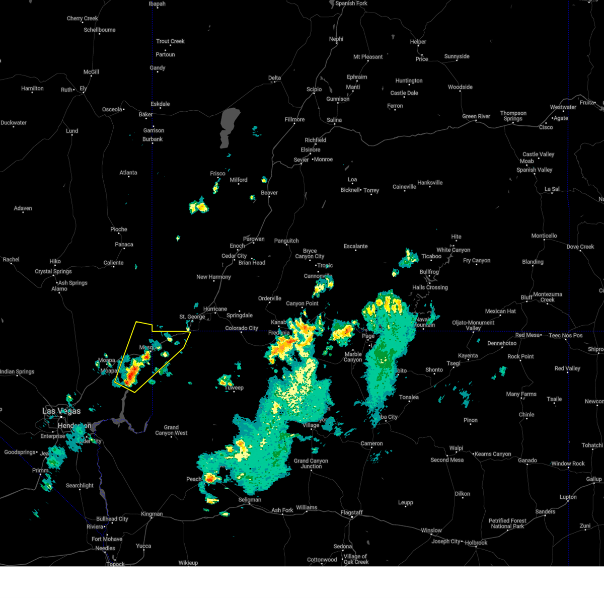
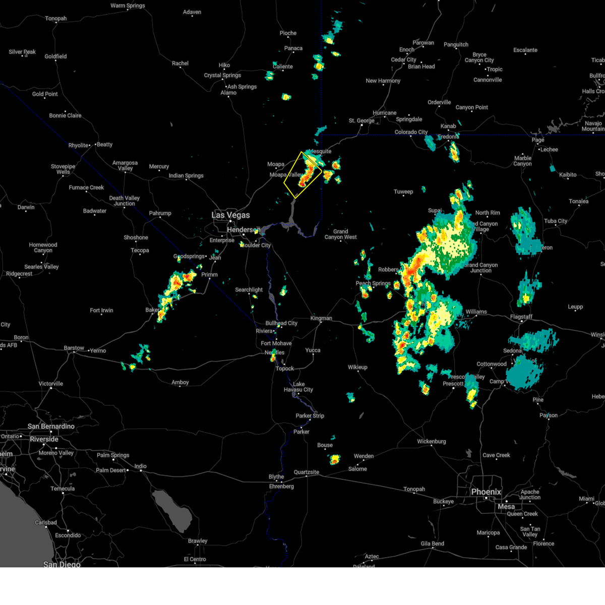
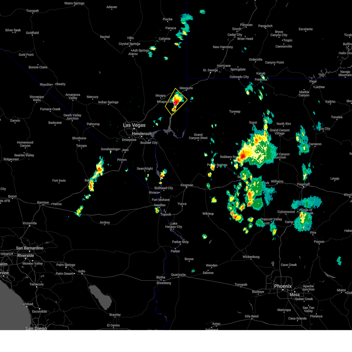
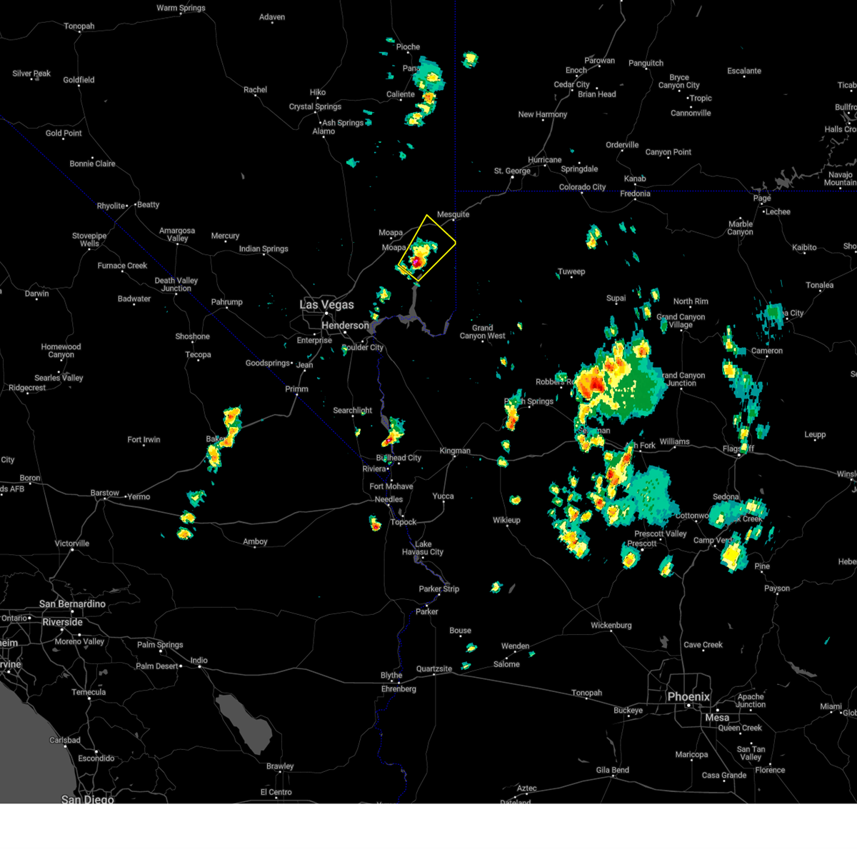
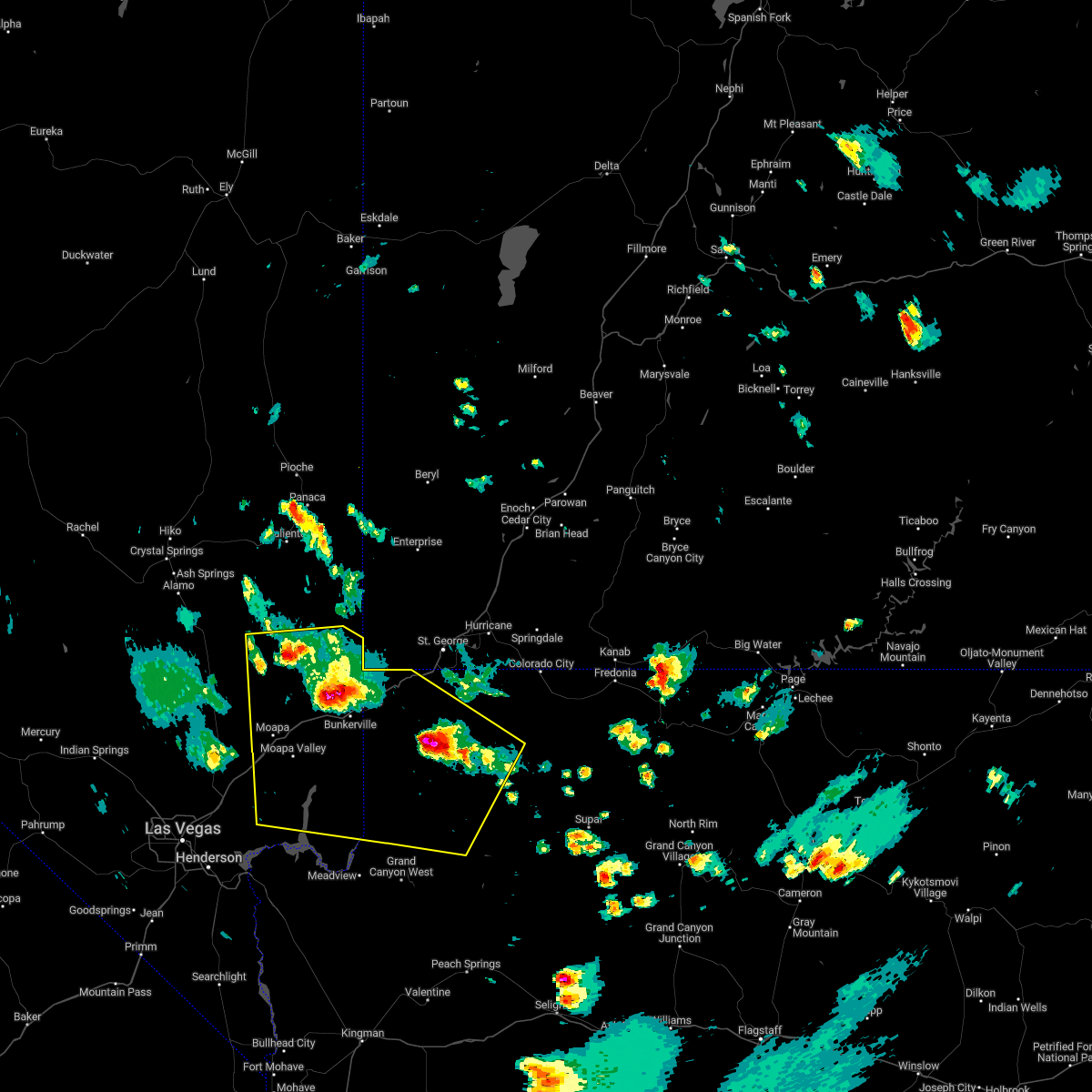
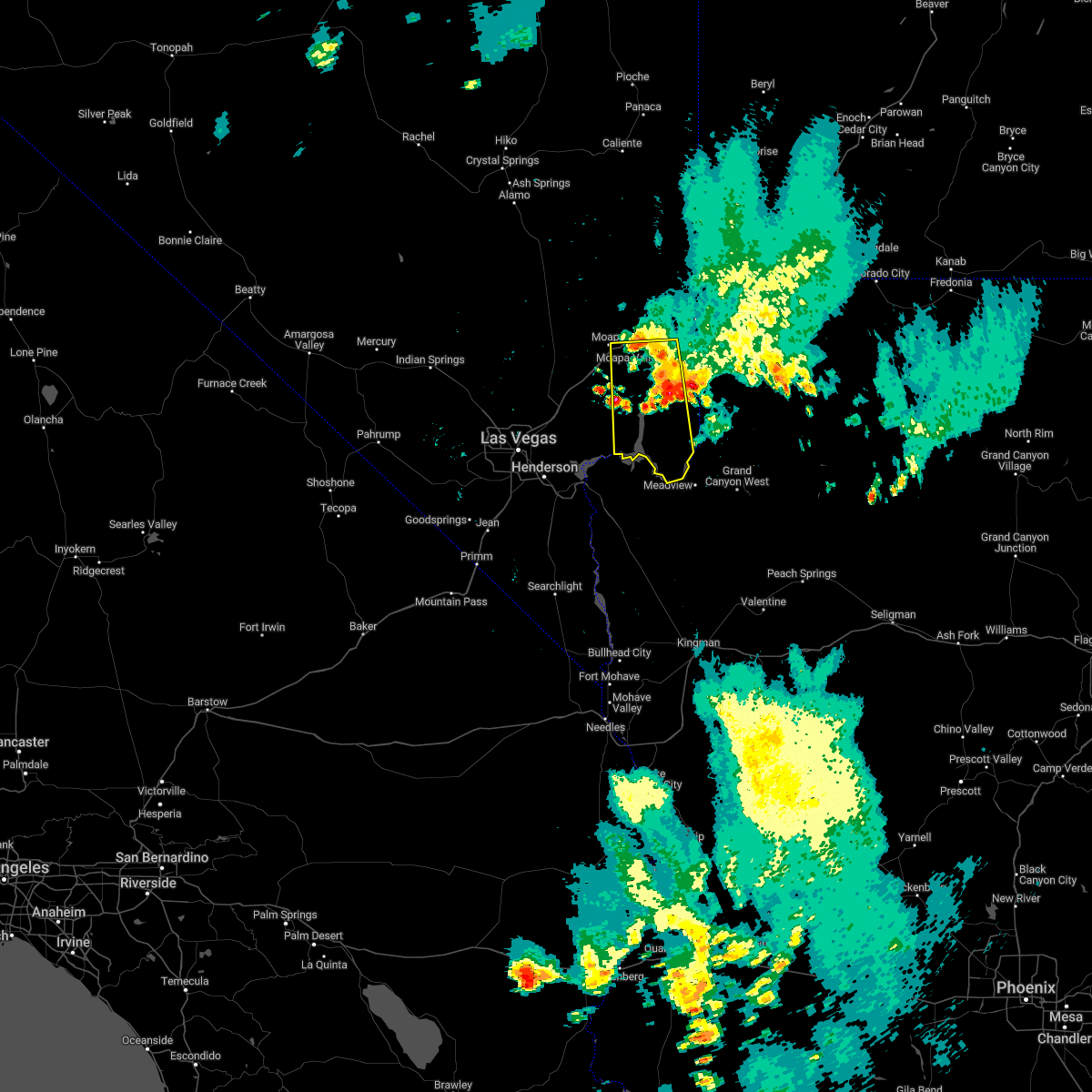
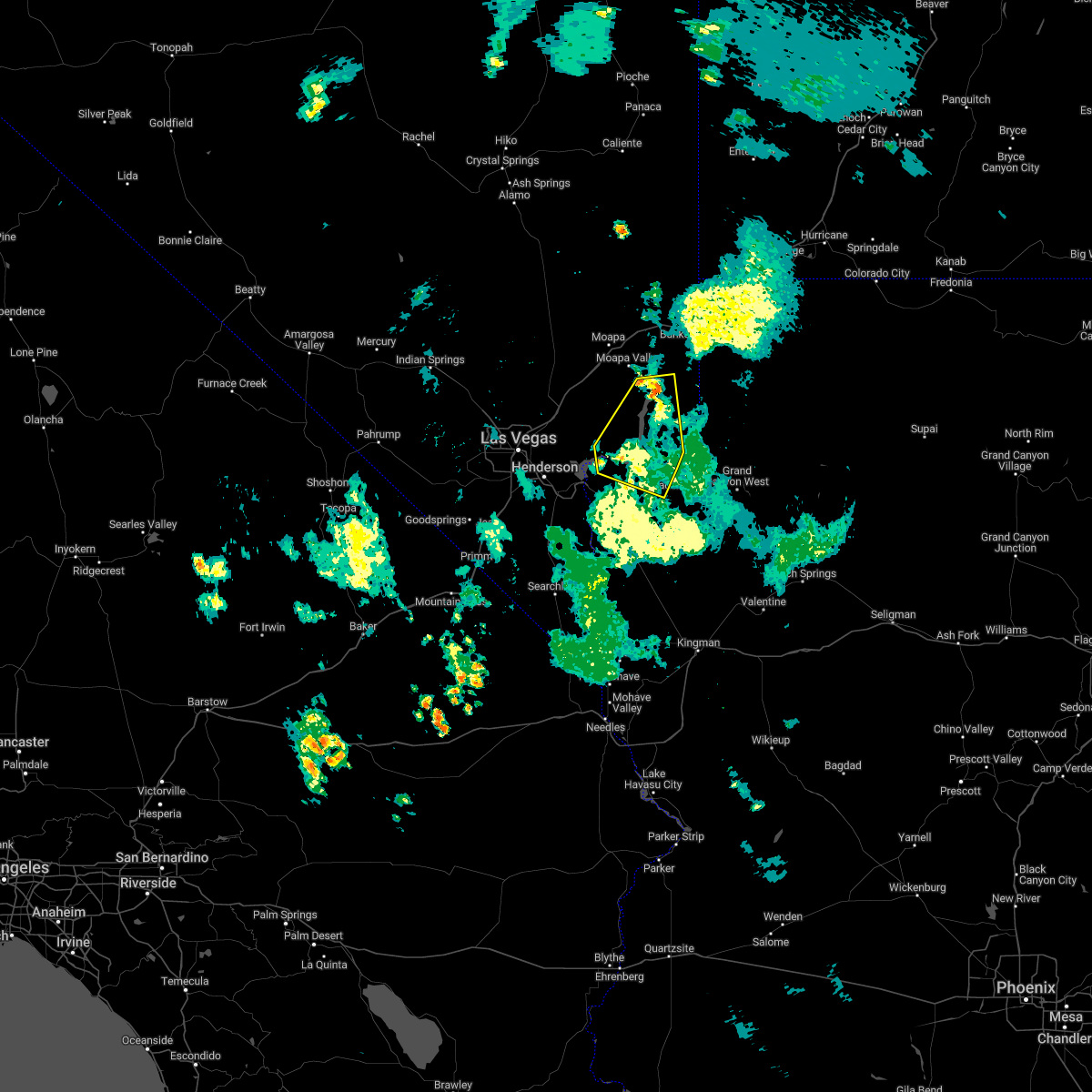
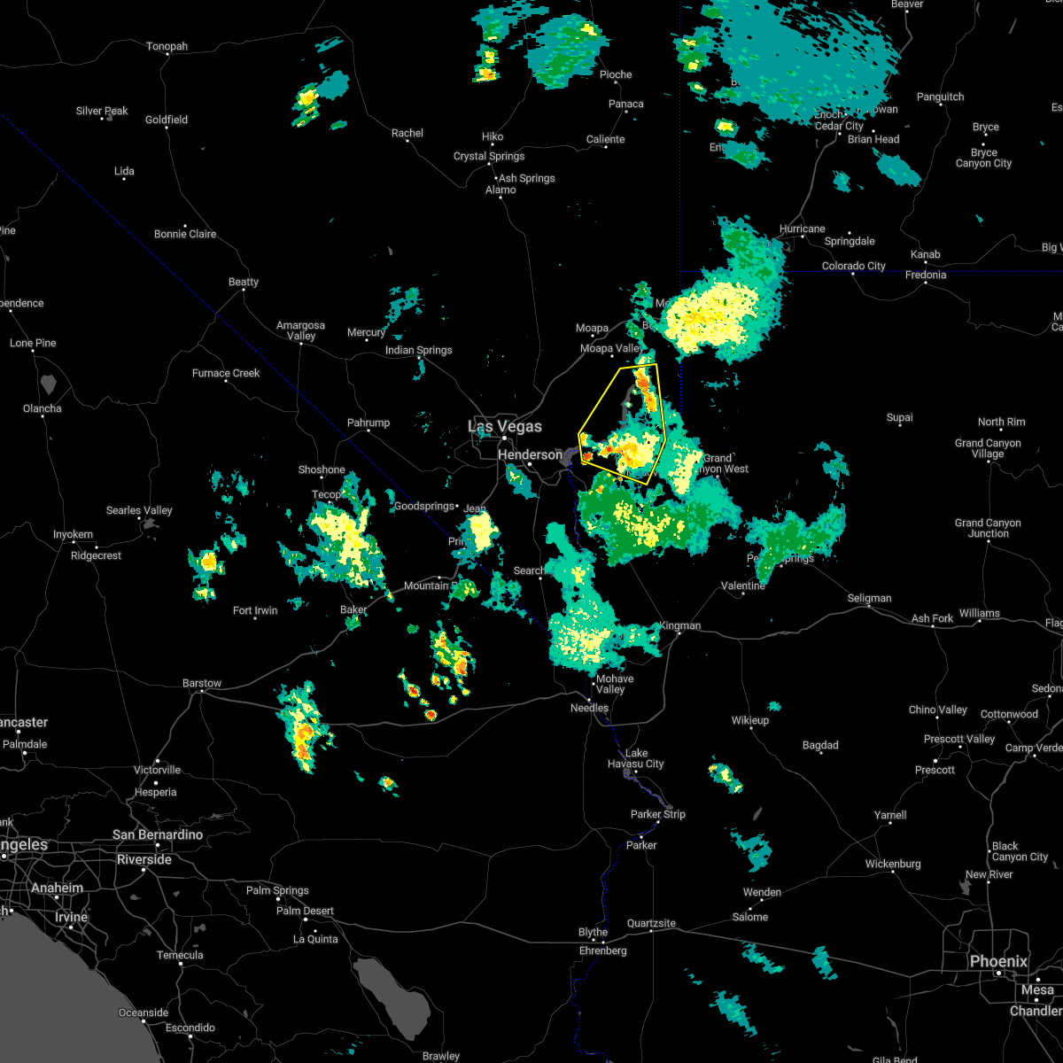
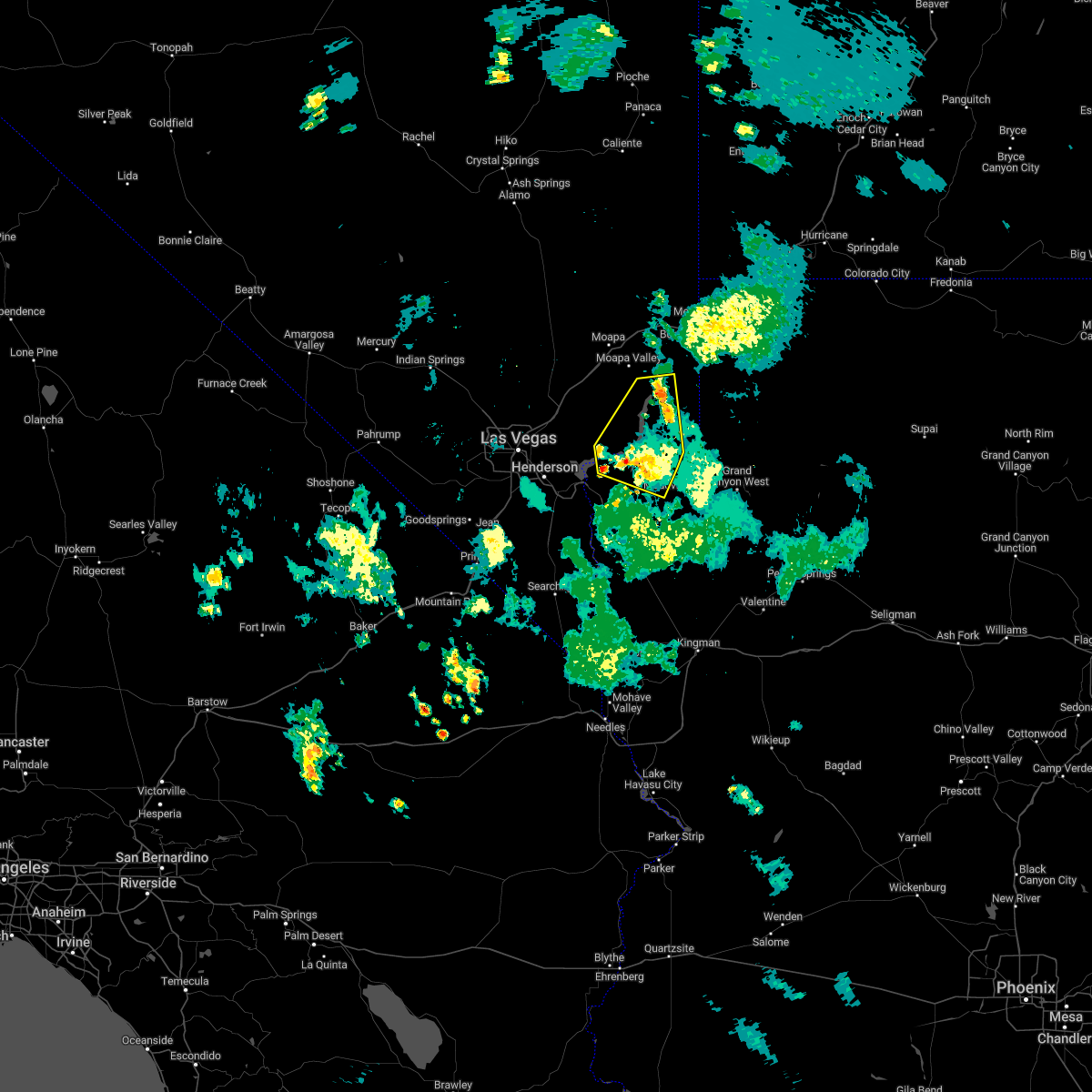
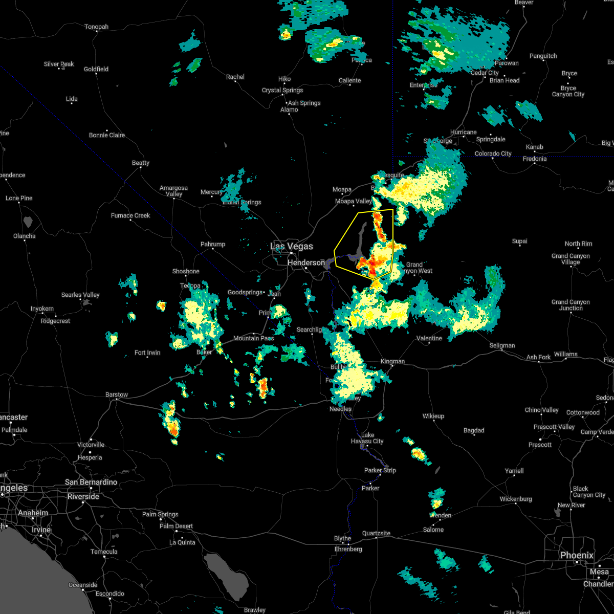
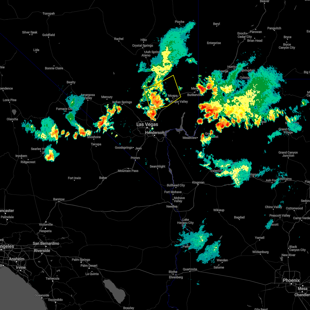
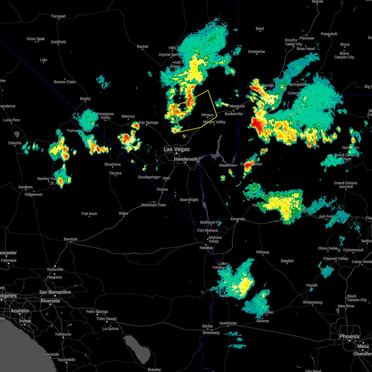
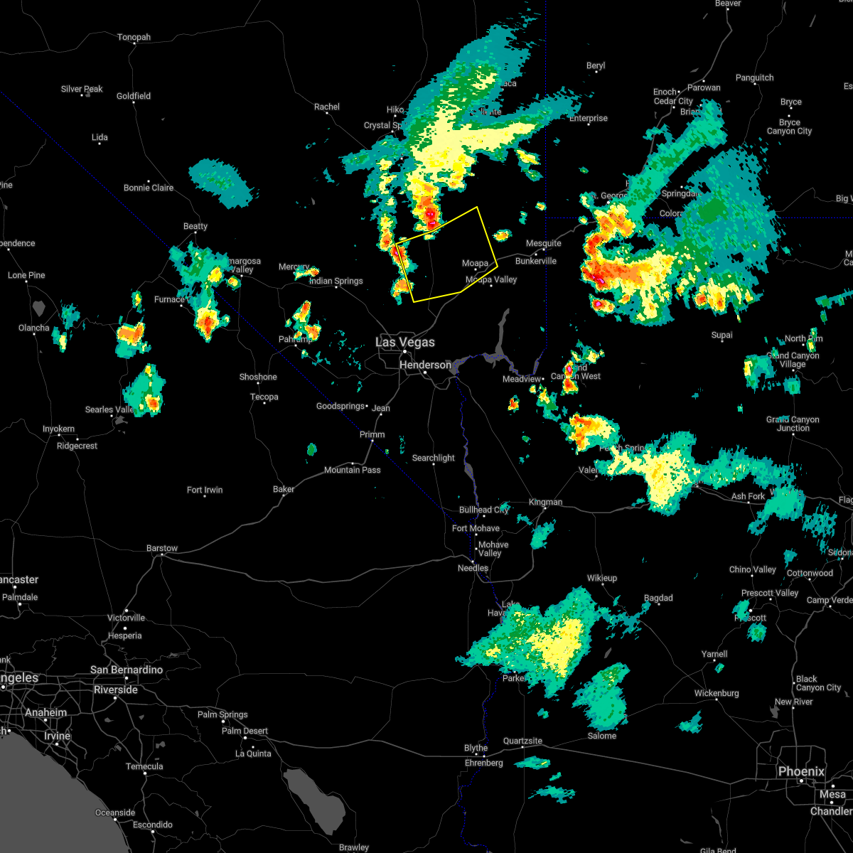
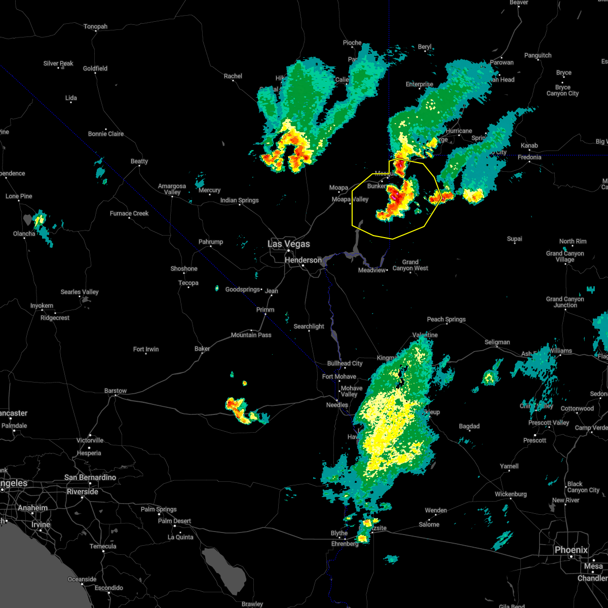
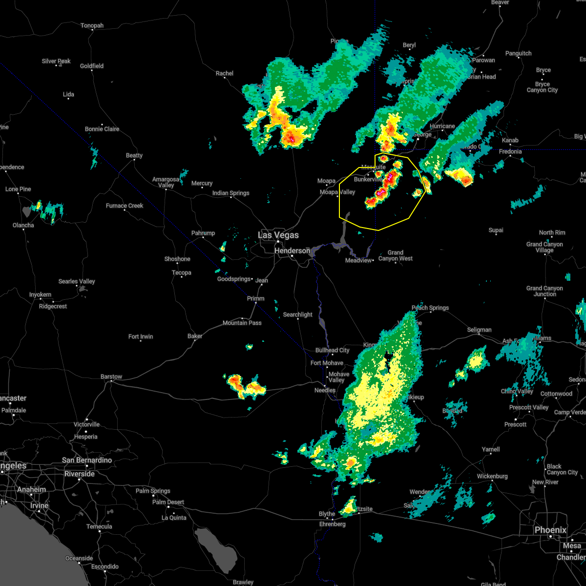
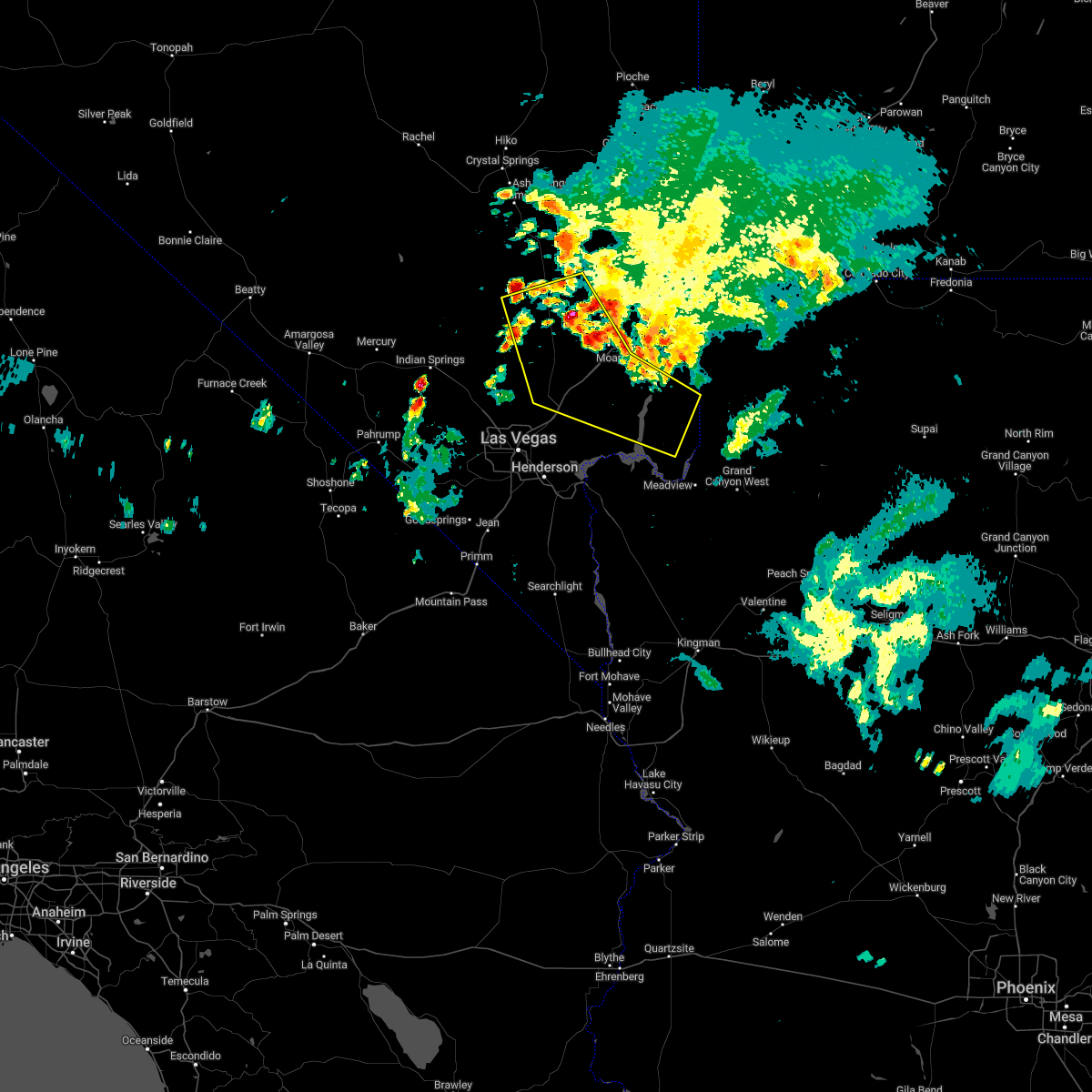
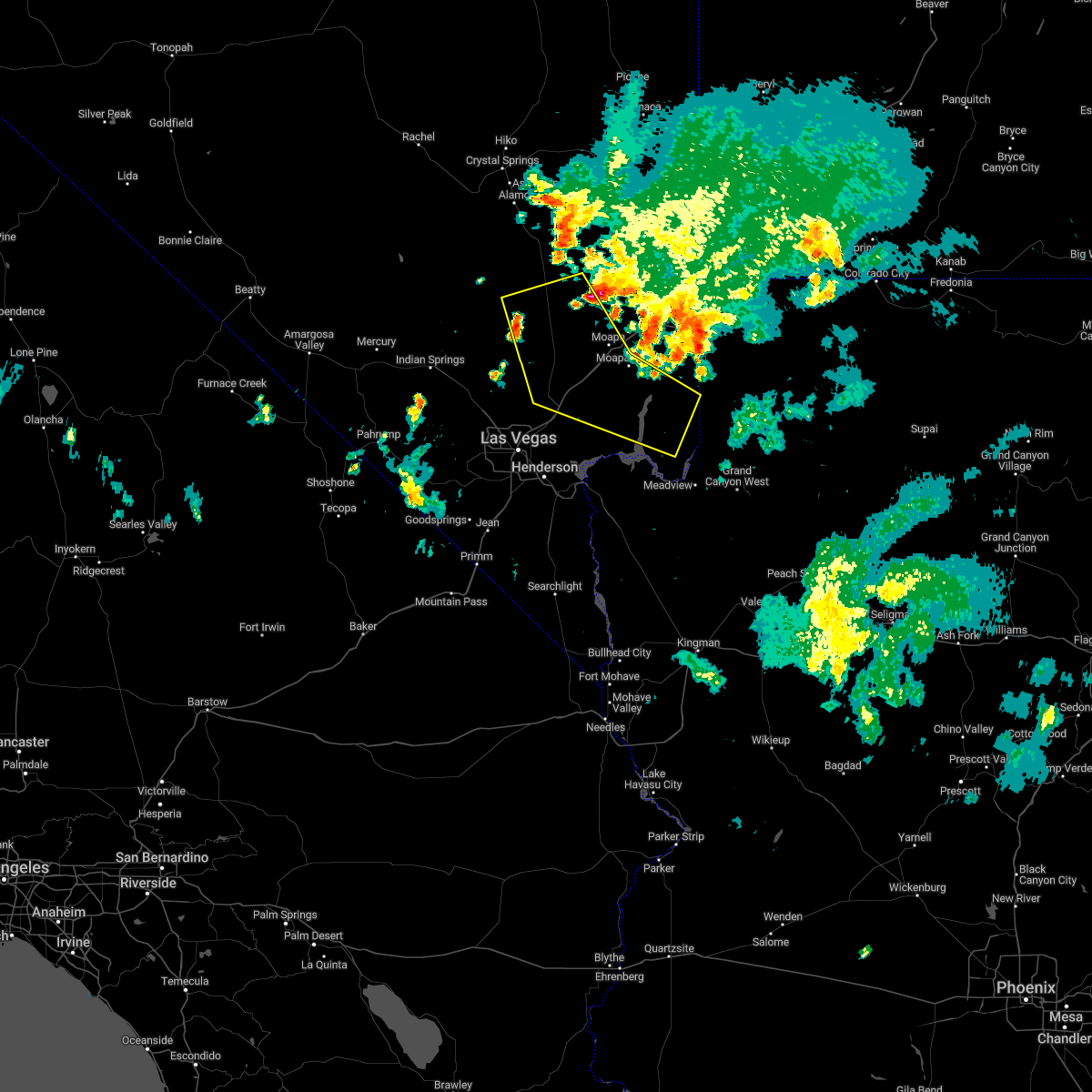
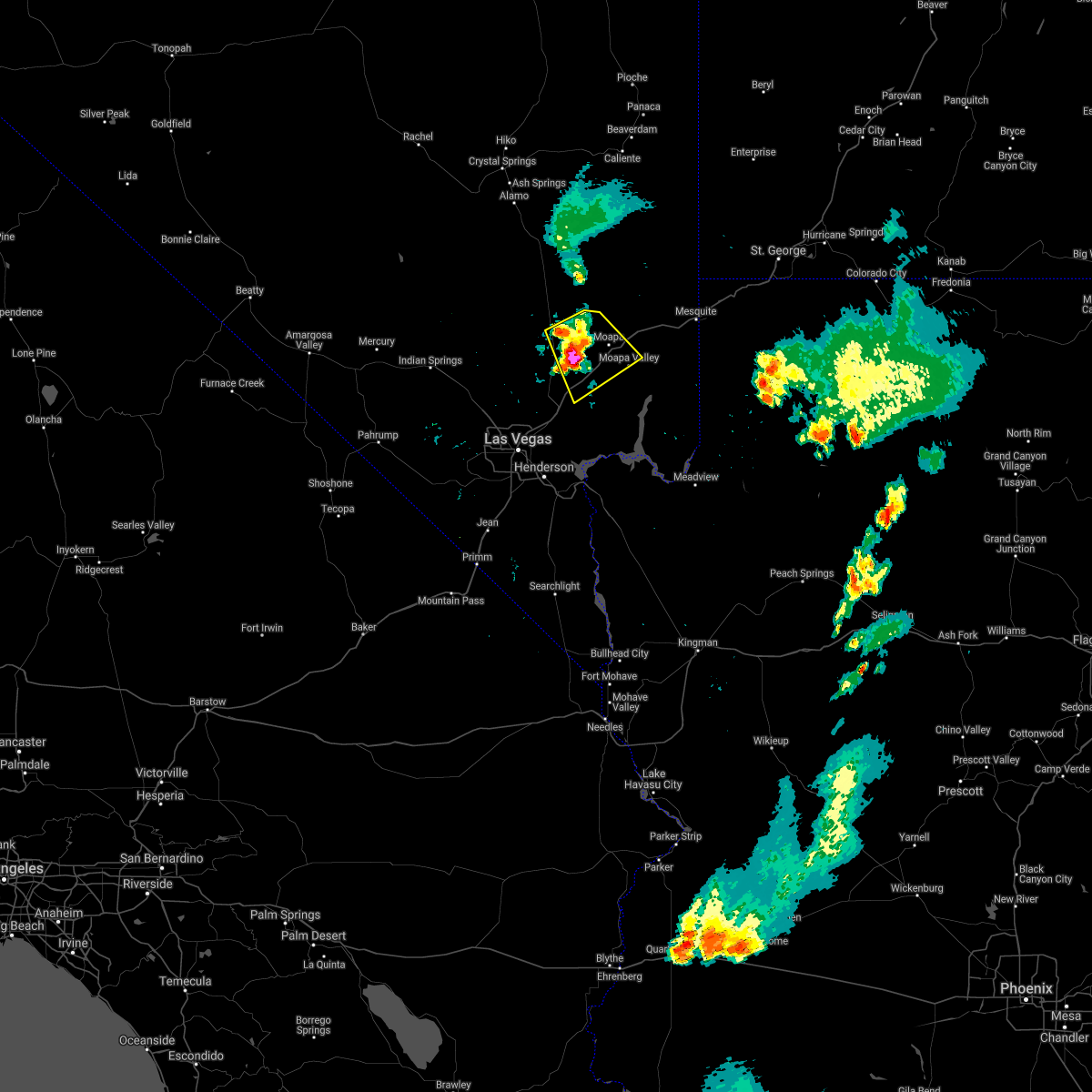
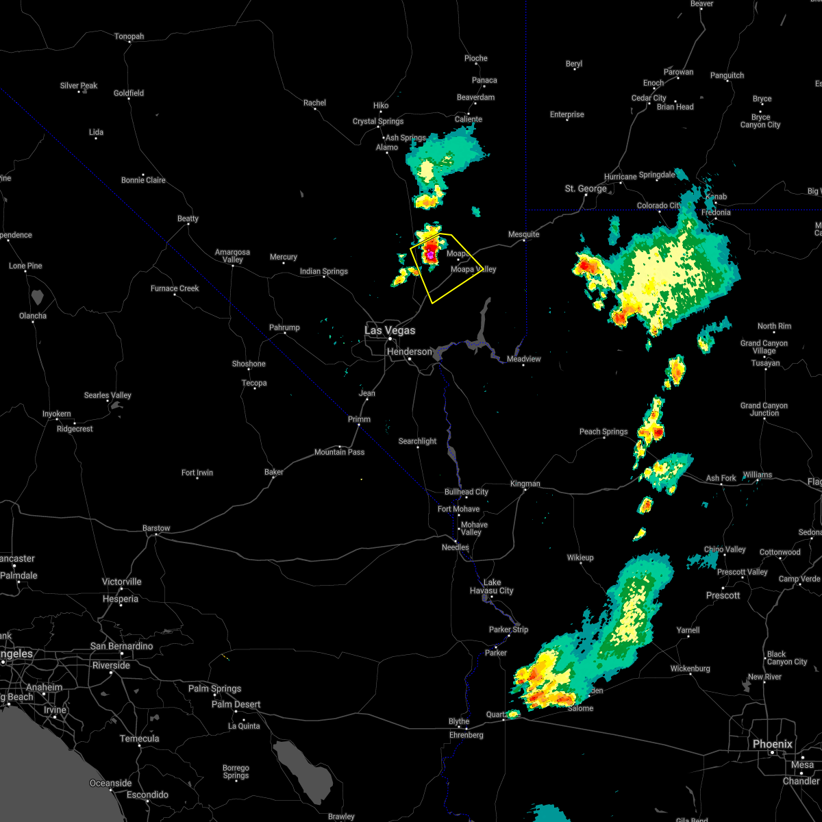
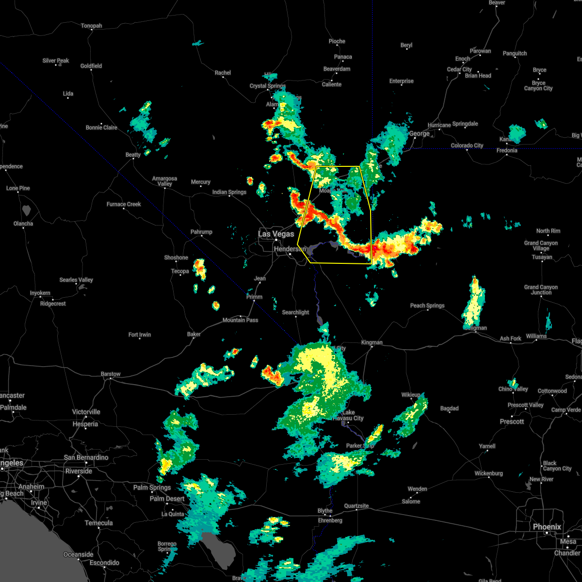
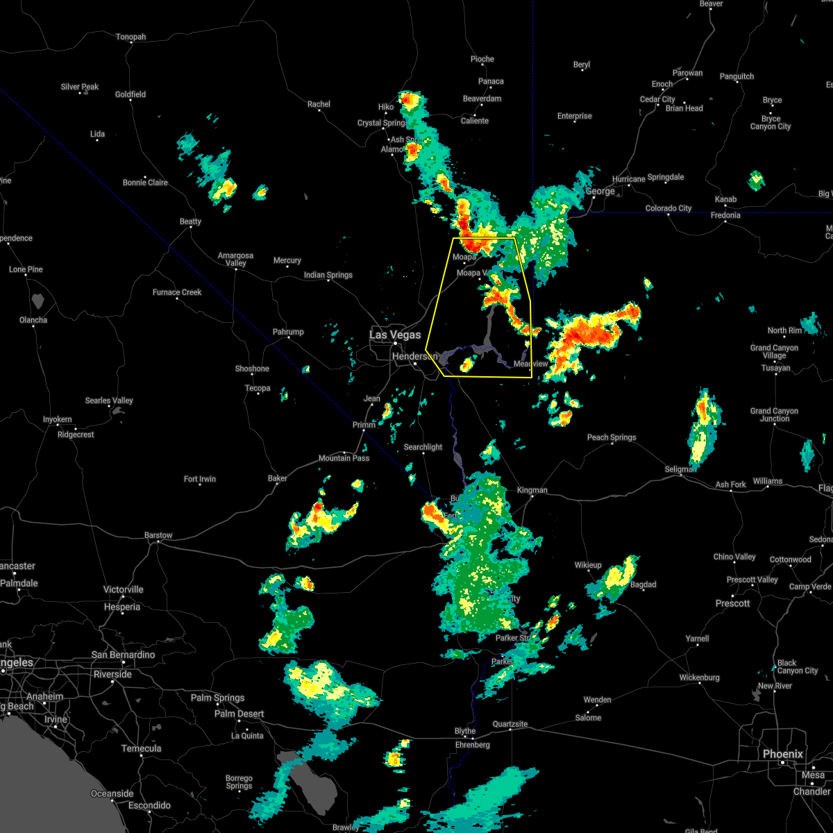
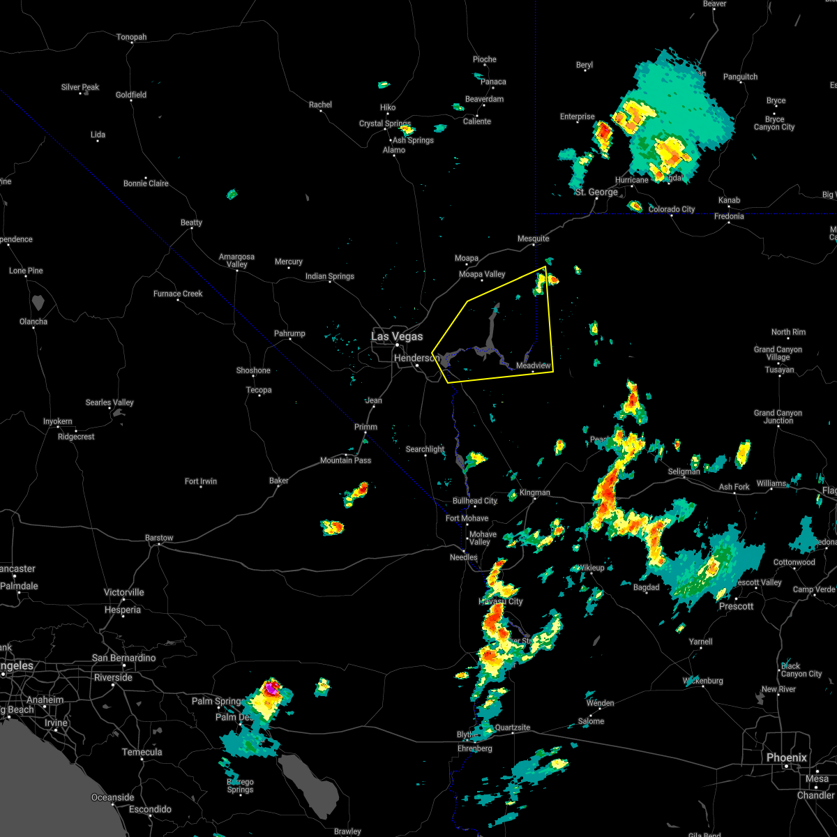
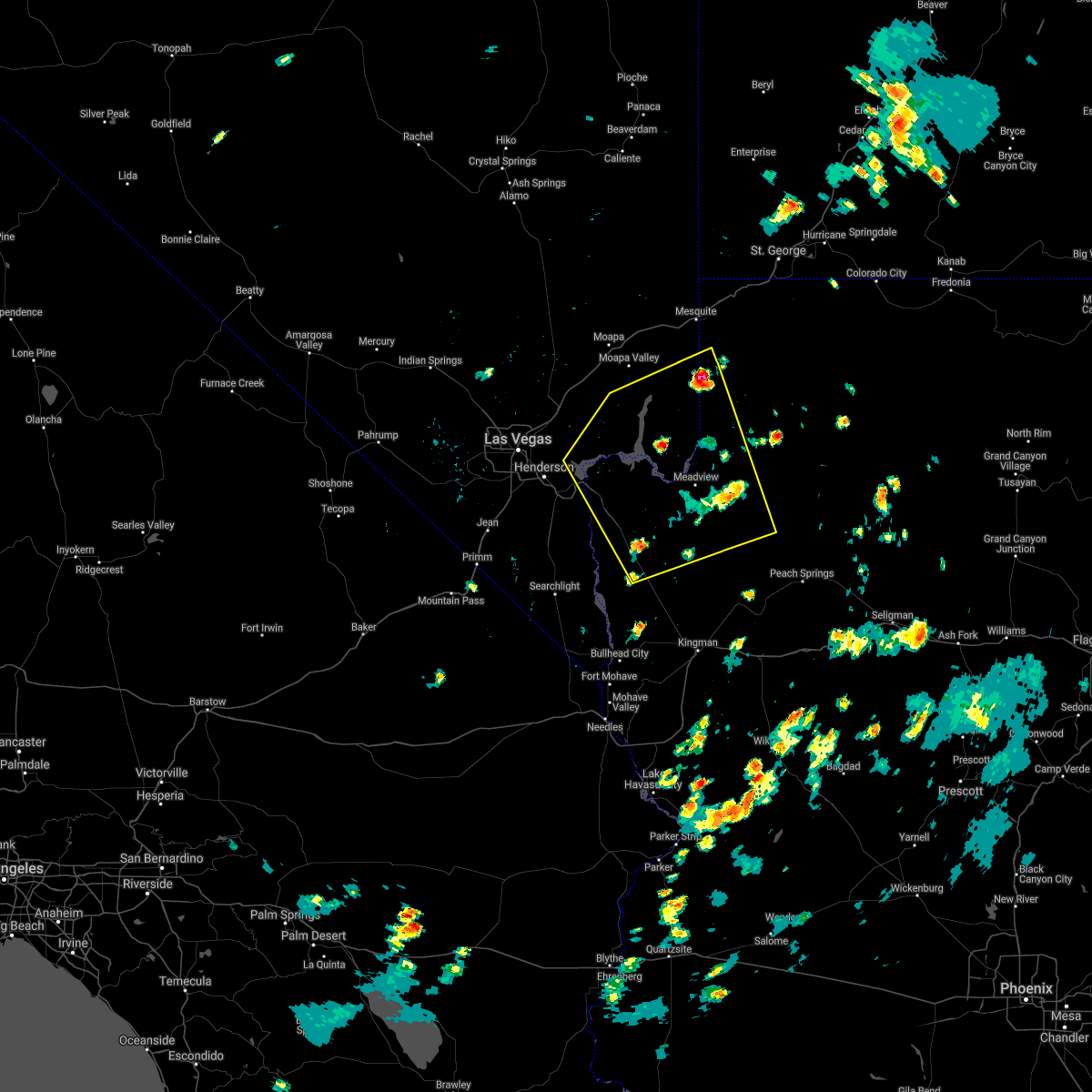
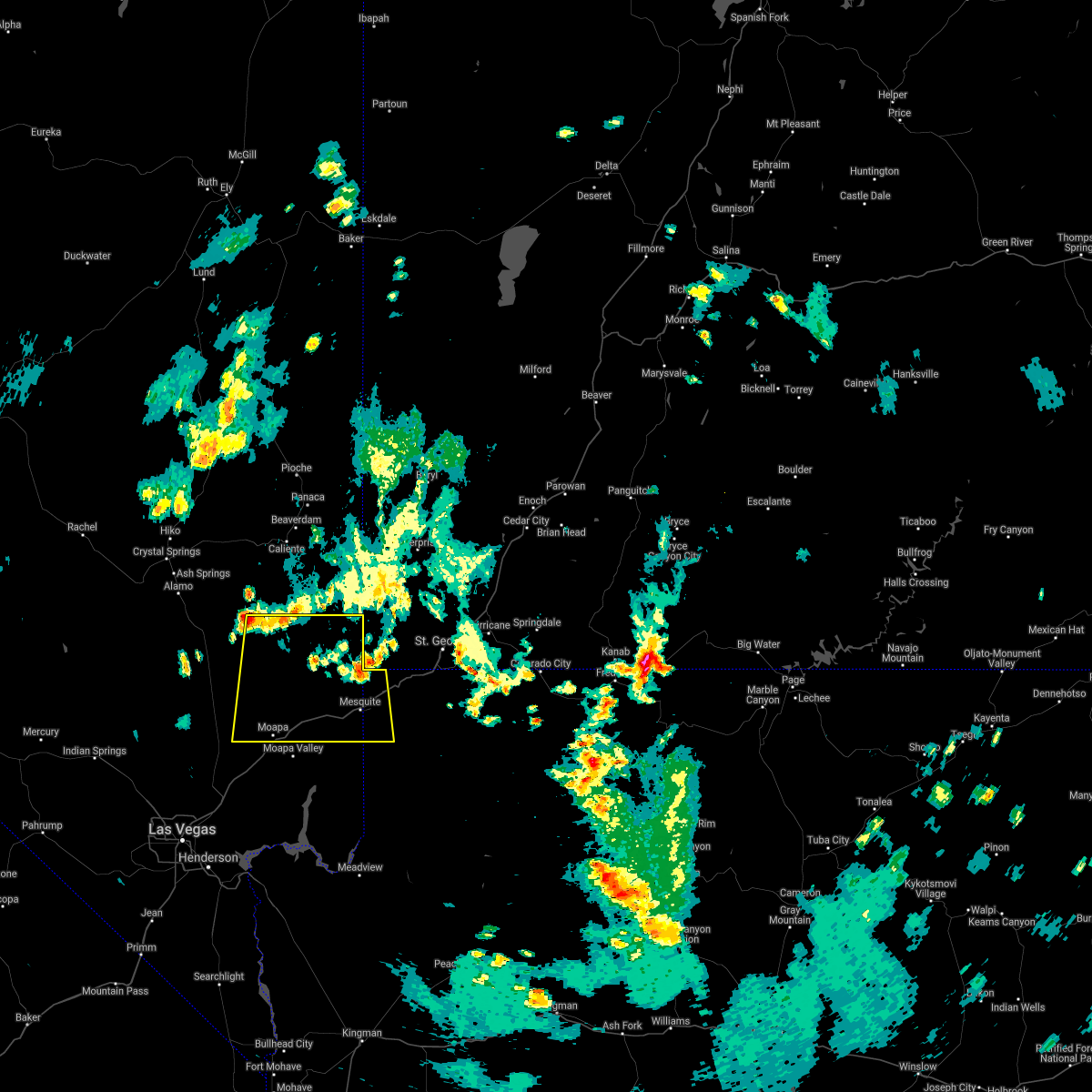
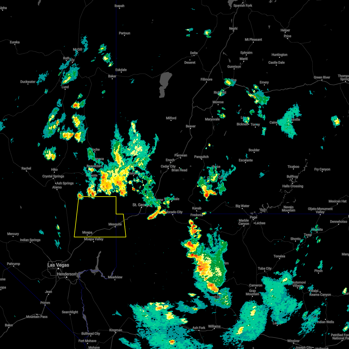
Hail Map for Moapa Valley, NV
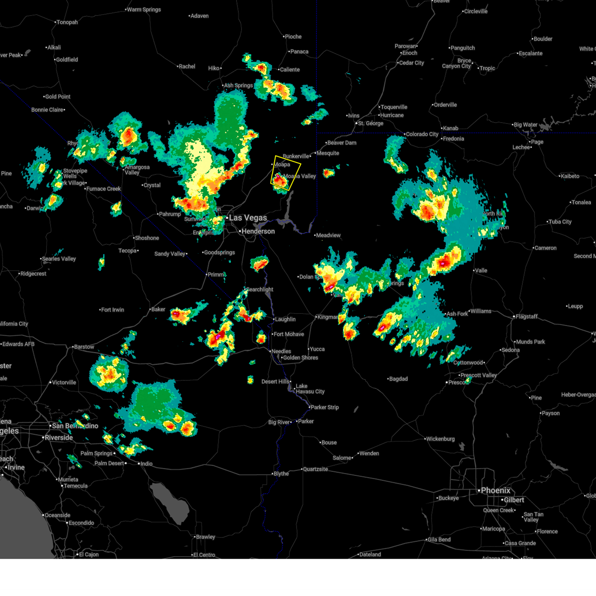
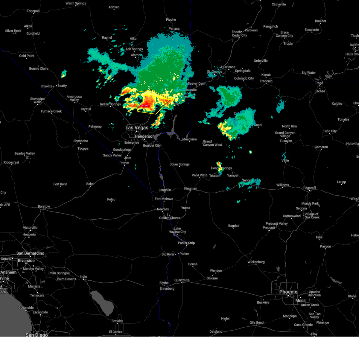
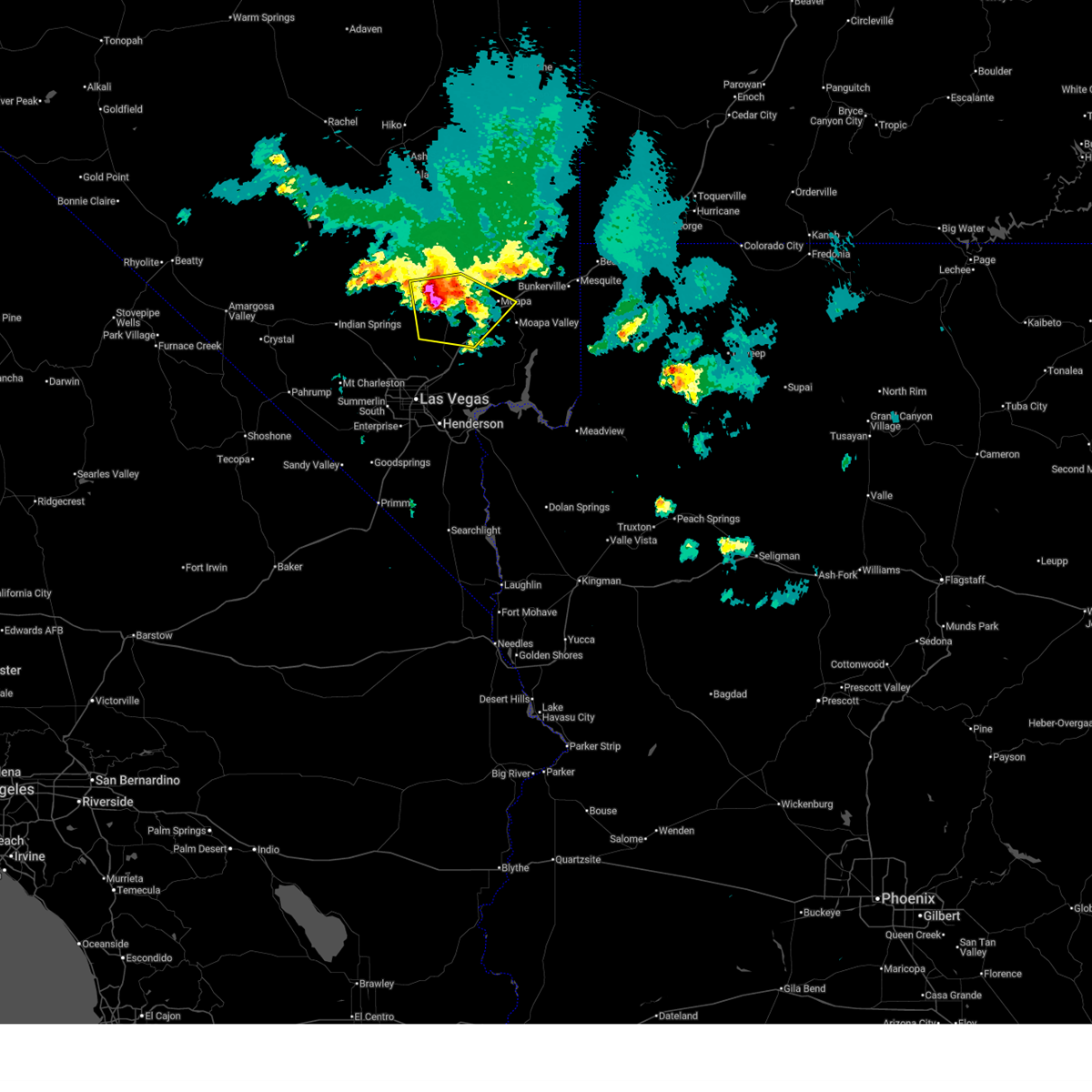
The Moapa Valley, NV area has had 0 reports of on-the-ground hail by trained spotters, and has been under severe weather warnings 3 times during the past 12 months. Doppler radar has detected hail at or near Moapa Valley, NV on 14 occasions.
| Name: | Moapa Valley, NV |
| Where Located: | 47.9 miles NE of Las Vegas, NV |
| Map: | Google Map for Moapa Valley, NV |
| Population: | 6924 |
| Housing Units: | 2793 |
| More Info: | Search Google for Moapa Valley, NV |
2
The Top Recent Hail Date for Moapa Valley, NV is Tuesday, June 3, 2025 (5th out of 14)
Hail and Wind Damage Spotted near Moapa Valley, NV
| Date / Time | Report Details |
|---|---|
| 9/5/2025 11:11 PM PDT |
 The storm which prompted the warning has weakened, and has exited the warned area. therefore, the warning will be allowed to expire. however, gusty winds are still possible with this thunderstorm. to report severe weather, contact your nearest law enforcement agency. they will relay your report to the national weather service las vegas. The storm which prompted the warning has weakened, and has exited the warned area. therefore, the warning will be allowed to expire. however, gusty winds are still possible with this thunderstorm. to report severe weather, contact your nearest law enforcement agency. they will relay your report to the national weather service las vegas.
|
| 9/5/2025 10:36 PM PDT |
 At 1035 pm pdt/1035 pm mst/, a severe thunderstorm was located near echo bay, or 11 miles south of overton, moving southeast at 20 mph (radar indicated). Hazards include 60 mph wind gusts and quarter size hail. Hail damage to vehicles is expected. expect wind damage to roofs and trees. Locations impacted include, overton, moapa valley, echo bay, valley of fire, overton beach, echo bay campground, and logandale. At 1035 pm pdt/1035 pm mst/, a severe thunderstorm was located near echo bay, or 11 miles south of overton, moving southeast at 20 mph (radar indicated). Hazards include 60 mph wind gusts and quarter size hail. Hail damage to vehicles is expected. expect wind damage to roofs and trees. Locations impacted include, overton, moapa valley, echo bay, valley of fire, overton beach, echo bay campground, and logandale.
|
| 9/5/2025 10:09 PM PDT |
 Svrvef the national weather service in las vegas has issued a * severe thunderstorm warning for, west central mohave county in northwestern arizona, northeastern clark county in southern nevada, * until 1115 pm pdt/1115 pm mst/. * at 1008 pm pdt/1008 pm mst/, a severe thunderstorm was located over valley of fire, or near overton, moving southeast at 15 mph (radar indicated). Hazards include 60 mph wind gusts and quarter size hail. Hail damage to vehicles is expected. Expect wind damage to roofs and trees. Svrvef the national weather service in las vegas has issued a * severe thunderstorm warning for, west central mohave county in northwestern arizona, northeastern clark county in southern nevada, * until 1115 pm pdt/1115 pm mst/. * at 1008 pm pdt/1008 pm mst/, a severe thunderstorm was located over valley of fire, or near overton, moving southeast at 15 mph (radar indicated). Hazards include 60 mph wind gusts and quarter size hail. Hail damage to vehicles is expected. Expect wind damage to roofs and trees.
|
| 6/5/2025 3:56 PM PDT |
 The storm which prompted the warning has weakened, and no longer poses an immediate threat to life or property. therefore, the warning will be allowed to expire. The storm which prompted the warning has weakened, and no longer poses an immediate threat to life or property. therefore, the warning will be allowed to expire.
|
| 6/5/2025 3:52 PM PDT |
 The storm which prompted the warning has weakened, and no longer poses an immediate threat to life or property. therefore, the warning will be allowed to expire. The storm which prompted the warning has weakened, and no longer poses an immediate threat to life or property. therefore, the warning will be allowed to expire.
|
| 6/5/2025 3:45 PM PDT |
 At 341 pm pdt, a severe thunderstorm was located 15 miles southwest of moapa town, moving northeast at 15 mph (radar indicated). Hazards include 60 mph wind gusts and quarter size hail. Hail damage to vehicles is expected. expect wind damage to roofs and trees. locations impacted include, moapa town, moapa valley, sr 168 mile marker 21, and coyote springs. This includes interstate 15 in nevada between mile markers 66 and 93. At 341 pm pdt, a severe thunderstorm was located 15 miles southwest of moapa town, moving northeast at 15 mph (radar indicated). Hazards include 60 mph wind gusts and quarter size hail. Hail damage to vehicles is expected. expect wind damage to roofs and trees. locations impacted include, moapa town, moapa valley, sr 168 mile marker 21, and coyote springs. This includes interstate 15 in nevada between mile markers 66 and 93.
|
| 6/5/2025 3:40 PM PDT |
 At 340 pm pdt, a severe thunderstorm was located 7 miles northwest of valley of fire, or 9 miles west of overton, moving northeast at 5 mph (radar indicated). Hazards include 60 mph wind gusts and quarter size hail. Hail damage to vehicles is expected. expect wind damage to roofs and trees. locations impacted include, moapa town and moapa valley. This includes interstate 15 in nevada between mile markers 73 and 91. At 340 pm pdt, a severe thunderstorm was located 7 miles northwest of valley of fire, or 9 miles west of overton, moving northeast at 5 mph (radar indicated). Hazards include 60 mph wind gusts and quarter size hail. Hail damage to vehicles is expected. expect wind damage to roofs and trees. locations impacted include, moapa town and moapa valley. This includes interstate 15 in nevada between mile markers 73 and 91.
|
| 6/5/2025 3:19 PM PDT |
 At 318 pm pdt, a severe thunderstorm was located 7 miles northwest of valley of fire, or 11 miles west of overton, moving northeast at 5 mph (radar indicated). Hazards include 60 mph wind gusts and quarter size hail. Hail damage to vehicles is expected. expect wind damage to roofs and trees. locations impacted include, overton, moapa town, moapa valley, logandale, and valley of fire. This includes interstate 15 in nevada between mile markers 72 and 92. At 318 pm pdt, a severe thunderstorm was located 7 miles northwest of valley of fire, or 11 miles west of overton, moving northeast at 5 mph (radar indicated). Hazards include 60 mph wind gusts and quarter size hail. Hail damage to vehicles is expected. expect wind damage to roofs and trees. locations impacted include, overton, moapa town, moapa valley, logandale, and valley of fire. This includes interstate 15 in nevada between mile markers 72 and 92.
|
| 6/5/2025 3:19 PM PDT |
 At 319 pm pdt, a severe thunderstorm was located 15 miles north of the motor speedway, moving northeast at 15 mph (radar indicated). Hazards include 60 mph wind gusts and quarter size hail. Hail damage to vehicles is expected. expect wind damage to roofs and trees. locations impacted include, moapa town, moapa valley, sr 168 mile marker 21, and coyote springs. This includes interstate 15 in nevada between mile markers 63 and 93. At 319 pm pdt, a severe thunderstorm was located 15 miles north of the motor speedway, moving northeast at 15 mph (radar indicated). Hazards include 60 mph wind gusts and quarter size hail. Hail damage to vehicles is expected. expect wind damage to roofs and trees. locations impacted include, moapa town, moapa valley, sr 168 mile marker 21, and coyote springs. This includes interstate 15 in nevada between mile markers 63 and 93.
|
| 6/5/2025 3:09 PM PDT |
 Svrvef the national weather service in las vegas has issued a * severe thunderstorm warning for, north central clark county in southern nevada, * until 400 pm pdt. * at 308 pm pdt, a severe thunderstorm was located 12 miles north of the motor speedway, moving northeast at 15 mph (radar indicated). Hazards include 60 mph wind gusts and quarter size hail. Hail damage to vehicles is expected. Expect wind damage to roofs and trees. Svrvef the national weather service in las vegas has issued a * severe thunderstorm warning for, north central clark county in southern nevada, * until 400 pm pdt. * at 308 pm pdt, a severe thunderstorm was located 12 miles north of the motor speedway, moving northeast at 15 mph (radar indicated). Hazards include 60 mph wind gusts and quarter size hail. Hail damage to vehicles is expected. Expect wind damage to roofs and trees.
|
| 6/5/2025 2:59 PM PDT |
 Svrvef the national weather service in las vegas has issued a * severe thunderstorm warning for, northeastern clark county in southern nevada, * until 400 pm pdt. * at 258 pm pdt, a severe thunderstorm was located 8 miles west of valley of fire, or 13 miles southwest of overton, moving northeast at 5 mph (radar indicated). Hazards include 60 mph wind gusts and quarter size hail. Hail damage to vehicles is expected. Expect wind damage to roofs and trees. Svrvef the national weather service in las vegas has issued a * severe thunderstorm warning for, northeastern clark county in southern nevada, * until 400 pm pdt. * at 258 pm pdt, a severe thunderstorm was located 8 miles west of valley of fire, or 13 miles southwest of overton, moving northeast at 5 mph (radar indicated). Hazards include 60 mph wind gusts and quarter size hail. Hail damage to vehicles is expected. Expect wind damage to roofs and trees.
|
| 6/3/2025 5:51 PM PDT |
 The severe thunderstorm which prompted the warning has weakened. therefore, the warning will be allowed to expire. however, small hail is still possible with this thunderstorm. The severe thunderstorm which prompted the warning has weakened. therefore, the warning will be allowed to expire. however, small hail is still possible with this thunderstorm.
|
| 6/3/2025 5:24 PM PDT |
 At 523 pm pdt, a severe thunderstorm was located near logandale, or 8 miles east of moapa town, moving north at 15 mph (radar indicated). Hazards include quarter size hail. Damage to vehicles is expected. locations impacted include, overton, moapa town, moapa valley, and logandale. This includes interstate 15 in nevada between mile markers 91 and 101. At 523 pm pdt, a severe thunderstorm was located near logandale, or 8 miles east of moapa town, moving north at 15 mph (radar indicated). Hazards include quarter size hail. Damage to vehicles is expected. locations impacted include, overton, moapa town, moapa valley, and logandale. This includes interstate 15 in nevada between mile markers 91 and 101.
|
| 6/3/2025 5:09 PM PDT |
 Svrvef the national weather service in las vegas has issued a * severe thunderstorm warning for, northeastern clark county in southern nevada, * until 600 pm pdt. * at 508 pm pdt, a severe thunderstorm was located over logandale, or 7 miles north of overton, moving north at 15 mph (radar indicated). Hazards include quarter size hail. damage to vehicles is expected Svrvef the national weather service in las vegas has issued a * severe thunderstorm warning for, northeastern clark county in southern nevada, * until 600 pm pdt. * at 508 pm pdt, a severe thunderstorm was located over logandale, or 7 miles north of overton, moving north at 15 mph (radar indicated). Hazards include quarter size hail. damage to vehicles is expected
|
| 6/2/2025 7:13 PM PDT |
 The storm which prompted the warning has moved south of the area. therefore, the warning will be allowed to expire. a severe thunderstorm warning remains for the apex, lake mead, and far eastern las vegas areas. The storm which prompted the warning has moved south of the area. therefore, the warning will be allowed to expire. a severe thunderstorm warning remains for the apex, lake mead, and far eastern las vegas areas.
|
| 6/2/2025 6:45 PM PDT |
 At 643 pm pdt, a severe thunderstorm was located near sr 168 mile marker 21, or 15 miles west of moapa town, moving southeast at 20 mph (radar indicated). Hazards include 60 mph wind gusts and quarter size hail. Hail damage to vehicles is expected. expect wind damage to roofs and trees. locations impacted include, moapa town, moapa valley, sr 168 mile marker 21, and coyote springs. This includes interstate 15 in nevada between mile markers 71 and 96. At 643 pm pdt, a severe thunderstorm was located near sr 168 mile marker 21, or 15 miles west of moapa town, moving southeast at 20 mph (radar indicated). Hazards include 60 mph wind gusts and quarter size hail. Hail damage to vehicles is expected. expect wind damage to roofs and trees. locations impacted include, moapa town, moapa valley, sr 168 mile marker 21, and coyote springs. This includes interstate 15 in nevada between mile markers 71 and 96.
|
| 6/2/2025 6:45 PM PDT |
 the severe thunderstorm warning has been cancelled and is no longer in effect the severe thunderstorm warning has been cancelled and is no longer in effect
|
| 6/2/2025 6:05 PM PDT |
 Svrvef the national weather service in las vegas has issued a * severe thunderstorm warning for, south central lincoln county in south central nevada, north central clark county in southern nevada, * until 715 pm pdt. * at 604 pm pdt, a severe thunderstorm was located 7 miles northwest of coyote springs, or 26 miles northwest of moapa town, moving southeast at 20 mph (radar indicated). Hazards include 60 mph wind gusts and quarter size hail. Hail damage to vehicles is expected. Expect wind damage to roofs and trees. Svrvef the national weather service in las vegas has issued a * severe thunderstorm warning for, south central lincoln county in south central nevada, north central clark county in southern nevada, * until 715 pm pdt. * at 604 pm pdt, a severe thunderstorm was located 7 miles northwest of coyote springs, or 26 miles northwest of moapa town, moving southeast at 20 mph (radar indicated). Hazards include 60 mph wind gusts and quarter size hail. Hail damage to vehicles is expected. Expect wind damage to roofs and trees.
|
| 8/8/2024 9:25 PM PDT | Nevada dot sensor in moapa reported a gust of 59 mp in clark county NV, 5.1 miles SSE of Moapa Valley, NV |
| 7/22/2024 4:42 PM PDT |
 The storm which prompted the warning has weakened, and no longer poses an immediate threat to life or property. therefore, the warning will be allowed to expire. The storm which prompted the warning has weakened, and no longer poses an immediate threat to life or property. therefore, the warning will be allowed to expire.
|
| 7/22/2024 4:27 PM PDT |
 At 426 pm pdt, a severe thunderstorm was located 18 miles west of mesquite, moving south at 10 mph (radar indicated). Hazards include 60 mph wind gusts. Expect damage to roofs and trees. locations impacted include, moapa town, moapa valley, and bunkerville. this includes the following roads, interstate 15 in nevada between mile markers 88 and 115. State route 168 in clark county between mile markers 19 and 23. At 426 pm pdt, a severe thunderstorm was located 18 miles west of mesquite, moving south at 10 mph (radar indicated). Hazards include 60 mph wind gusts. Expect damage to roofs and trees. locations impacted include, moapa town, moapa valley, and bunkerville. this includes the following roads, interstate 15 in nevada between mile markers 88 and 115. State route 168 in clark county between mile markers 19 and 23.
|
| 7/22/2024 4:07 PM PDT |
 Svrvef the national weather service in las vegas has issued a * severe thunderstorm warning for, southeastern lincoln county in south central nevada, northeastern clark county in southern nevada, * until 445 pm pdt. * at 407 pm pdt, a severe thunderstorm was located 19 miles northwest of mesquite, moving south at 10 mph (radar indicated). Hazards include 60 mph wind gusts. expect damage to roofs and trees Svrvef the national weather service in las vegas has issued a * severe thunderstorm warning for, southeastern lincoln county in south central nevada, northeastern clark county in southern nevada, * until 445 pm pdt. * at 407 pm pdt, a severe thunderstorm was located 19 miles northwest of mesquite, moving south at 10 mph (radar indicated). Hazards include 60 mph wind gusts. expect damage to roofs and trees
|
| 8/31/2023 7:06 PM MST |
 At 705 pm pdt, a severe thunderstorm was located near bunkerville, or 8 miles southwest of mesquite, moving northeast at 25 mph (radar indicated). Hazards include 60 mph wind gusts and quarter size hail. Hail damage to vehicles is expected. expect wind damage to roofs and trees and frequent lightning. locations impacted include, mesquite, virgin river gorge, beaver dam, littlefield, moapa valley, virgin river campground and bunkerville. this includes the following roads, interstate 15 in arizona between mile markers 0 and 28. interstate 15 in nevada between mile markers 104 and 120. hail threat, radar indicated max hail size, 1. 00 in wind threat, radar indicated max wind gust, 60 mph. At 705 pm pdt, a severe thunderstorm was located near bunkerville, or 8 miles southwest of mesquite, moving northeast at 25 mph (radar indicated). Hazards include 60 mph wind gusts and quarter size hail. Hail damage to vehicles is expected. expect wind damage to roofs and trees and frequent lightning. locations impacted include, mesquite, virgin river gorge, beaver dam, littlefield, moapa valley, virgin river campground and bunkerville. this includes the following roads, interstate 15 in arizona between mile markers 0 and 28. interstate 15 in nevada between mile markers 104 and 120. hail threat, radar indicated max hail size, 1. 00 in wind threat, radar indicated max wind gust, 60 mph.
|
| 8/31/2023 6:56 PM MST |
 At 654 pm pdt/654 pm mst/, a severe thunderstorm was located 7 miles southwest of bunkerville, or 11 miles southwest of mesquite, moving northeast at 25 mph (radar indicated). Hazards include 60 mph wind gusts and frequent lightning. Expect damage to roofs and trees. Possible power outages due to wind and frequent lightning. At 654 pm pdt/654 pm mst/, a severe thunderstorm was located 7 miles southwest of bunkerville, or 11 miles southwest of mesquite, moving northeast at 25 mph (radar indicated). Hazards include 60 mph wind gusts and frequent lightning. Expect damage to roofs and trees. Possible power outages due to wind and frequent lightning.
|
| 8/31/2023 5:12 PM PDT |
 The severe thunderstorm warning for northeastern clark county will expire at 515 pm pdt, the storm which prompted the warning has weakened below severe limits, and no longer poses an immediate threat to life or property. therefore, the warning will be allowed to expire. however gusty winds are still possible with this thunderstorm. The severe thunderstorm warning for northeastern clark county will expire at 515 pm pdt, the storm which prompted the warning has weakened below severe limits, and no longer poses an immediate threat to life or property. therefore, the warning will be allowed to expire. however gusty winds are still possible with this thunderstorm.
|
| 8/31/2023 4:54 PM PDT |
 At 452 pm pdt, a severe thunderstorm was located 9 miles east of moapa valley, or 11 miles northeast of overton, moving northeast at 20 mph (radar indicated). Hazards include 60 mph wind gusts and quarter size hail. Hail damage to vehicles is expected. expect wind damage to roofs and trees. locations impacted include, overton, moapa valley, overton beach and bunkerville. this includes the following roads, interstate 15 in nevada between mile markers 107 and 114. state route 167 in clark county between mile markers 50 and 52. hail threat, radar indicated max hail size, 1. 00 in wind threat, radar indicated max wind gust, 60 mph. At 452 pm pdt, a severe thunderstorm was located 9 miles east of moapa valley, or 11 miles northeast of overton, moving northeast at 20 mph (radar indicated). Hazards include 60 mph wind gusts and quarter size hail. Hail damage to vehicles is expected. expect wind damage to roofs and trees. locations impacted include, overton, moapa valley, overton beach and bunkerville. this includes the following roads, interstate 15 in nevada between mile markers 107 and 114. state route 167 in clark county between mile markers 50 and 52. hail threat, radar indicated max hail size, 1. 00 in wind threat, radar indicated max wind gust, 60 mph.
|
| 8/31/2023 4:24 PM PDT |
 At 424 pm pdt, a severe thunderstorm was located near overton, moving northeast at 20 mph (radar indicated). Hazards include 60 mph wind gusts and quarter size hail. Hail damage to vehicles is expected. Expect wind damage to roofs and trees. At 424 pm pdt, a severe thunderstorm was located near overton, moving northeast at 20 mph (radar indicated). Hazards include 60 mph wind gusts and quarter size hail. Hail damage to vehicles is expected. Expect wind damage to roofs and trees.
|
| 8/21/2022 6:57 PM MST | The severe thunderstorm warning for northern mohave and northeastern clark counties will expire at 700 pm pdt/700 pm mst/, this severe thunderstorm warning has been replaced with a new warning. therefore, this warning will be allowed to expire. |
| 8/21/2022 6:57 PM MST | The severe thunderstorm warning for northern mohave and northeastern clark counties will expire at 700 pm pdt/700 pm mst/, this severe thunderstorm warning has been replaced with a new warning. therefore, this warning will be allowed to expire. |
| 8/21/2022 6:08 PM MST | At 604 pm pdt/604 pm mst/, a severe thunderstorm was located near apex and the i-15 in northeast clark county, moving south at 20 mph. a wind sensor located along the i-15 and highway 93 has reported a 70 mph wind gust (radar indicated). Hazards include 70 mph wind gusts. Expect considerable tree damage. damage is likely to mobile homes, roofs, and outbuildings. locations impacted include, henderson, north las vegas, mesquite, boulder city, nellis afb, the motor speedway, las vegas bay, lake las vegas, overton, moapa town, east las vegas, moapa valley, echo bay, grand canyon skywalk, sr 168 mile marker 21, boulder beach campground, las vegas bay campground, meadview, hoover dam and bunkerville. this includes interstate 15 in nevada between mile markers 60 and 116. thunderstorm damage threat, considerable hail threat, radar indicated max hail size, <. 75 in wind threat, radar indicated max wind gust, 70 mph. |
| 8/21/2022 6:08 PM MST | At 604 pm pdt/604 pm mst/, a severe thunderstorm was located near apex and the i-15 in northeast clark county, moving south at 20 mph. a wind sensor located along the i-15 and highway 93 has reported a 70 mph wind gust (radar indicated). Hazards include 70 mph wind gusts. Expect considerable tree damage. damage is likely to mobile homes, roofs, and outbuildings. locations impacted include, henderson, north las vegas, mesquite, boulder city, nellis afb, the motor speedway, las vegas bay, lake las vegas, overton, moapa town, east las vegas, moapa valley, echo bay, grand canyon skywalk, sr 168 mile marker 21, boulder beach campground, las vegas bay campground, meadview, hoover dam and bunkerville. this includes interstate 15 in nevada between mile markers 60 and 116. thunderstorm damage threat, considerable hail threat, radar indicated max hail size, <. 75 in wind threat, radar indicated max wind gust, 70 mph. |
| 8/21/2022 5:56 PM MST | At 555 pm pdt/555 pm mst/, a severe thunderstorm was located near las vegas bay campground, or near the motor speedway, moving south at 20 mph (radar indicated). Hazards include 60 mph wind gusts. expect damage to roofs and trees |
| 8/21/2022 5:56 PM MST | At 555 pm pdt/555 pm mst/, a severe thunderstorm was located near las vegas bay campground, or near the motor speedway, moving south at 20 mph (radar indicated). Hazards include 60 mph wind gusts. expect damage to roofs and trees |
| 8/21/2022 5:37 PM MST |
 At 530 pm pdt/530 pm mst/, a severe thunderstorm was located 30 miles west of mesquite along the lincoln and clark county border moving south at 10 mph and a second severe thunderstorm was located 25 miles southeast of mesquite moving south at 10 mph (radar indicated). Hazards include 60 mph wind gusts and quarter size hail. Hail damage to vehicles is expected. expect wind damage to roofs and trees. locations impacted include, mesquite, virgin river gorge, overton, beaver dam, littlefield, moapa town, moapa valley, echo bay, echo bay campground, bunkerville, virgin river campground, valley of fire, overton beach, logandale and carp. this includes the following highways, interstate 15 in arizona between mile markers 0 and 23. Interstate 15 in nevada between mile markers 80 and 120. At 530 pm pdt/530 pm mst/, a severe thunderstorm was located 30 miles west of mesquite along the lincoln and clark county border moving south at 10 mph and a second severe thunderstorm was located 25 miles southeast of mesquite moving south at 10 mph (radar indicated). Hazards include 60 mph wind gusts and quarter size hail. Hail damage to vehicles is expected. expect wind damage to roofs and trees. locations impacted include, mesquite, virgin river gorge, overton, beaver dam, littlefield, moapa town, moapa valley, echo bay, echo bay campground, bunkerville, virgin river campground, valley of fire, overton beach, logandale and carp. this includes the following highways, interstate 15 in arizona between mile markers 0 and 23. Interstate 15 in nevada between mile markers 80 and 120.
|
| 8/21/2022 5:00 PM MST |
 At 458 pm pdt/458 pm mst/, a severe thunderstorm was located 10 miles west of bunkerville, or 10 miles west of mesquite, moving south at 30 mph. another severe thunderstorm was located 15 miles east southeast of mesquite moving south at 20 mph (radar indicated). Hazards include 60 mph wind gusts and quarter size hail. Hail damage to vehicles is expected. Expect wind damage to roofs and trees. At 458 pm pdt/458 pm mst/, a severe thunderstorm was located 10 miles west of bunkerville, or 10 miles west of mesquite, moving south at 30 mph. another severe thunderstorm was located 15 miles east southeast of mesquite moving south at 20 mph (radar indicated). Hazards include 60 mph wind gusts and quarter size hail. Hail damage to vehicles is expected. Expect wind damage to roofs and trees.
|
| 8/14/2022 7:47 PM PDT |
 At 746 pm pdt, a severe thunderstorm was located near valley of fire, or 10 miles south of overton, moving south at 25 mph (radar indicated). Hazards include 60 mph wind gusts. Expect damage to roofs and trees. locations impacted include, overton, moapa town, moapa valley, echo bay, valley of fire, overton beach, echo bay campground, logandale and lake mead national recreation area. this includes interstate 15 in nevada between mile markers 91 and 95. hail threat, radar indicated max hail size, <. 75 in wind threat, radar indicated max wind gust, 60 mph. At 746 pm pdt, a severe thunderstorm was located near valley of fire, or 10 miles south of overton, moving south at 25 mph (radar indicated). Hazards include 60 mph wind gusts. Expect damage to roofs and trees. locations impacted include, overton, moapa town, moapa valley, echo bay, valley of fire, overton beach, echo bay campground, logandale and lake mead national recreation area. this includes interstate 15 in nevada between mile markers 91 and 95. hail threat, radar indicated max hail size, <. 75 in wind threat, radar indicated max wind gust, 60 mph.
|
| 8/14/2022 7:16 PM PDT |
 At 715 pm pdt, a severe thunderstorm was located over overton, moving south at 25 mph (radar indicated). Hazards include 60 mph wind gusts. expect damage to roofs and trees At 715 pm pdt, a severe thunderstorm was located over overton, moving south at 25 mph (radar indicated). Hazards include 60 mph wind gusts. expect damage to roofs and trees
|
| 8/9/2022 7:08 PM PDT |
 The severe thunderstorm warning for west central mohave and northeastern clark counties will expire at 715 pm pdt/715 pm mst/, the storm which prompted the warning has weakened below severe limits. therefore, the warning will be allowed to expire. The severe thunderstorm warning for west central mohave and northeastern clark counties will expire at 715 pm pdt/715 pm mst/, the storm which prompted the warning has weakened below severe limits. therefore, the warning will be allowed to expire.
|
| 8/9/2022 6:42 PM PDT |
 At 641 pm pdt/641 pm mst/, a severe thunderstorm was located 9 miles north of temple bar campground, or 26 miles south of overton, moving northwest at 5 mph (radar indicated). Hazards include 40-50 mph wind gusts on the lake. hazardous boating conditions. Expect damage to roofs and trees. hazardous boating conditions due to enhanced wave activity. locations impacted include, echo bay, temple bar campground, overton beach, echo bay campground, valley of fire, lake mead national recreation area and temple bar. hail threat, radar indicated max hail size, <. 75 in wind threat, radar indicated max wind gust, 60 mph. At 641 pm pdt/641 pm mst/, a severe thunderstorm was located 9 miles north of temple bar campground, or 26 miles south of overton, moving northwest at 5 mph (radar indicated). Hazards include 40-50 mph wind gusts on the lake. hazardous boating conditions. Expect damage to roofs and trees. hazardous boating conditions due to enhanced wave activity. locations impacted include, echo bay, temple bar campground, overton beach, echo bay campground, valley of fire, lake mead national recreation area and temple bar. hail threat, radar indicated max hail size, <. 75 in wind threat, radar indicated max wind gust, 60 mph.
|
| 8/9/2022 6:18 PM PDT |
 At 617 pm pdt/617 pm mst/, a severe thunderstorm was located 7 miles north of temple bar campground, or 29 miles south of overton, moving northwest at 5 mph. this warning replaces the previous severe thunderstorm warning for lake mead (radar indicated). Hazards include 40-50 mph wind gusts on the lake. hazardous boating conditions. Expect damage to roofs and trees. Hazardous boating conditions due to enhanced wave activity. At 617 pm pdt/617 pm mst/, a severe thunderstorm was located 7 miles north of temple bar campground, or 29 miles south of overton, moving northwest at 5 mph. this warning replaces the previous severe thunderstorm warning for lake mead (radar indicated). Hazards include 40-50 mph wind gusts on the lake. hazardous boating conditions. Expect damage to roofs and trees. Hazardous boating conditions due to enhanced wave activity.
|
| 7/29/2022 8:23 PM PDT |
 At 822 pm pdt/822 pm mst/, a severe thunderstorm was located near echo bay, or 22 miles east of boulder city, moving southeast at 30 mph (radar indicated). Hazards include 60 mph wind gusts. Expect damage to roofs and trees. locations impacted include, las vegas, henderson, north las vegas, mesquite, boulder city, anthem, the strip, nellis afb, downtown las vegas, east las vegas, sam boyd stadium, the motor speedway, las vegas bay, lake las vegas, overton, green valley, moapa town, paradise, enterprise and moapa valley. this includes interstate 15 in nevada between mile markers 60 and 117. hail threat, radar indicated max hail size, <. 75 in wind threat, radar indicated max wind gust, 60 mph. At 822 pm pdt/822 pm mst/, a severe thunderstorm was located near echo bay, or 22 miles east of boulder city, moving southeast at 30 mph (radar indicated). Hazards include 60 mph wind gusts. Expect damage to roofs and trees. locations impacted include, las vegas, henderson, north las vegas, mesquite, boulder city, anthem, the strip, nellis afb, downtown las vegas, east las vegas, sam boyd stadium, the motor speedway, las vegas bay, lake las vegas, overton, green valley, moapa town, paradise, enterprise and moapa valley. this includes interstate 15 in nevada between mile markers 60 and 117. hail threat, radar indicated max hail size, <. 75 in wind threat, radar indicated max wind gust, 60 mph.
|
| 7/29/2022 7:33 PM PDT |
 At 732 pm pdt/732 pm mst/, a severe thunderstorm was located near callville bay campground, or 8 miles northeast of las vegas bay, moving southeast at 30 mph (radar indicated). Hazards include 60 mph wind gusts. expect damage to roofs and trees At 732 pm pdt/732 pm mst/, a severe thunderstorm was located near callville bay campground, or 8 miles northeast of las vegas bay, moving southeast at 30 mph (radar indicated). Hazards include 60 mph wind gusts. expect damage to roofs and trees
|
| 7/29/2022 7:11 PM PDT |
 The severe thunderstorm warning for south central lincoln and north central clark counties will expire at 715 pm pdt, the storm which prompted the warning has weakened below severe limits, and no longer poses an immediate threat to life or property. therefore, the warning will be allowed to expire. however gusty winds are still possible within the moapa valley. The severe thunderstorm warning for south central lincoln and north central clark counties will expire at 715 pm pdt, the storm which prompted the warning has weakened below severe limits, and no longer poses an immediate threat to life or property. therefore, the warning will be allowed to expire. however gusty winds are still possible within the moapa valley.
|
| 7/29/2022 6:40 PM PDT |
 At 640 pm pdt, a severe thunderstorm was located 16 miles southwest of coyote springs, moving south at 40 mph (radar indicated). Hazards include 60 mph wind gusts. Expect damage to roofs and trees. areas of blowing dust are likely. locations impacted include, moapa town, moapa valley, sr 168 mile marker 21 and coyote springs. this includes the following highways, interstate 15 in arizona near mile marker 3. interstate 15 in nevada between mile markers 80 and 100. hail threat, radar indicated max hail size, <. 75 in wind threat, radar indicated max wind gust, 60 mph. At 640 pm pdt, a severe thunderstorm was located 16 miles southwest of coyote springs, moving south at 40 mph (radar indicated). Hazards include 60 mph wind gusts. Expect damage to roofs and trees. areas of blowing dust are likely. locations impacted include, moapa town, moapa valley, sr 168 mile marker 21 and coyote springs. this includes the following highways, interstate 15 in arizona near mile marker 3. interstate 15 in nevada between mile markers 80 and 100. hail threat, radar indicated max hail size, <. 75 in wind threat, radar indicated max wind gust, 60 mph.
|
| 7/29/2022 6:16 PM PDT |
 At 616 pm pdt, a severe thunderstorm was located over coyote springs, or 19 miles northwest of moapa town, moving south at 55 mph (radar indicated). Hazards include 60 mph wind gusts. expect damage to roofs and trees At 616 pm pdt, a severe thunderstorm was located over coyote springs, or 19 miles northwest of moapa town, moving south at 55 mph (radar indicated). Hazards include 60 mph wind gusts. expect damage to roofs and trees
|
| 7/28/2022 7:13 PM MST |
 At 712 pm pdt/712 pm mst/, a severe thunderstorm was located 12 miles southeast of bunkerville, or 16 miles south of mesquite, moving southwest at 20 mph (radar indicated). Hazards include 60 mph wind gusts and quarter size hail. Hail damage to vehicles is expected. expect wind damage to roofs and trees. locations impacted include, mesquite, virgin river gorge, beaver dam, littlefield, overton, moapa valley, overton beach and bunkerville. this includes the following highways, interstate 15 in arizona between mile markers 0 and 2, and between mile markers 4 and 17. interstate 15 in nevada between mile markers 107 and 120. hail threat, radar indicated max hail size, 1. 00 in wind threat, radar indicated max wind gust, 60 mph. At 712 pm pdt/712 pm mst/, a severe thunderstorm was located 12 miles southeast of bunkerville, or 16 miles south of mesquite, moving southwest at 20 mph (radar indicated). Hazards include 60 mph wind gusts and quarter size hail. Hail damage to vehicles is expected. expect wind damage to roofs and trees. locations impacted include, mesquite, virgin river gorge, beaver dam, littlefield, overton, moapa valley, overton beach and bunkerville. this includes the following highways, interstate 15 in arizona between mile markers 0 and 2, and between mile markers 4 and 17. interstate 15 in nevada between mile markers 107 and 120. hail threat, radar indicated max hail size, 1. 00 in wind threat, radar indicated max wind gust, 60 mph.
|
| 7/28/2022 6:51 PM MST |
 At 651 pm pdt/651 pm mst/, a severe thunderstorm was located 11 miles southeast of bunkerville, or 12 miles southeast of mesquite, moving southwest at 20 mph (radar indicated). Hazards include 60 mph wind gusts. expect damage to roofs and trees At 651 pm pdt/651 pm mst/, a severe thunderstorm was located 11 miles southeast of bunkerville, or 12 miles southeast of mesquite, moving southwest at 20 mph (radar indicated). Hazards include 60 mph wind gusts. expect damage to roofs and trees
|
| 7/27/2022 6:30 PM PDT |
 At 629 pm pdt/629 pm mst/, a severe thunderstorm was located 17 miles northeast of the motor speedway, moving southwest at 40 mph. gusty winds will arrive well before any precipitation or lightning (radar indicated). Hazards include 60 mph wind gusts. Expect damage to roofs and trees. locations impacted include, overton, moapa town, moapa valley, echo bay, valley of fire, sr 168 mile marker 21, overton beach, echo bay campground, coyote springs and logandale. this includes the following highways, interstate 15 in arizona near mile marker 3. interstate 15 in nevada between mile markers 63 and 95. hail threat, radar indicated max hail size, <. 75 in wind threat, radar indicated max wind gust, 60 mph. At 629 pm pdt/629 pm mst/, a severe thunderstorm was located 17 miles northeast of the motor speedway, moving southwest at 40 mph. gusty winds will arrive well before any precipitation or lightning (radar indicated). Hazards include 60 mph wind gusts. Expect damage to roofs and trees. locations impacted include, overton, moapa town, moapa valley, echo bay, valley of fire, sr 168 mile marker 21, overton beach, echo bay campground, coyote springs and logandale. this includes the following highways, interstate 15 in arizona near mile marker 3. interstate 15 in nevada between mile markers 63 and 95. hail threat, radar indicated max hail size, <. 75 in wind threat, radar indicated max wind gust, 60 mph.
|
| 7/27/2022 6:12 PM PDT |
 At 612 pm pdt/612 pm mst/, a severe thunderstorm was located near moapa town, moving southwest at 40 mph. wind gusts of 60 mph have been recorded in moapa (public). Hazards include 60 mph wind gusts. expect damage to roofs and trees At 612 pm pdt/612 pm mst/, a severe thunderstorm was located near moapa town, moving southwest at 40 mph. wind gusts of 60 mph have been recorded in moapa (public). Hazards include 60 mph wind gusts. expect damage to roofs and trees
|
| 7/27/2022 6:06 PM PDT | Nvdot sensor measured a gust to 58 mph ahead of thunderstorm in clark county NV, 5.1 miles SSE of Moapa Valley, NV |
| 10/5/2021 12:41 PM PDT |
 At 1240 pm pdt/1240 pm mst/, a severe thunderstorm was located over lake mead national recreation area, moving north at 25 mph (radar indicated). Hazards include 60 mph wind gusts. expect damage to roofs and trees At 1240 pm pdt/1240 pm mst/, a severe thunderstorm was located over lake mead national recreation area, moving north at 25 mph (radar indicated). Hazards include 60 mph wind gusts. expect damage to roofs and trees
|
| 10/5/2021 12:22 PM PDT |
 At 1214 pm pdt/1214 pm mst/, doppler radar continued to indicate a line of thunderstorms with severe winds moving into the lake mead national recreation area. anyone in the path of these storms should take cover and get off of the lake until the threat has ended (radar indicated). Hazards include 70 mph wind gusts. Expect considerable tree damage. damage is likely to mobile homes, roofs, and outbuildings. locations impacted include, boulder city, las vegas bay, overton, moapa valley, echo bay, grand canyon skywalk, boulder beach campground, las vegas bay campground, pierce ferry and antares roads, meadview, hoover dam, temple bar campground, south cove, logandale, boulder beach, echo bay campground, callville bay, grand canyon ranch, valley of fire and callville bay campground. thunderstorm damage threat, considerable hail threat, radar indicated max hail size, <. 75 in wind threat, radar indicated max wind gust, 70 mph. At 1214 pm pdt/1214 pm mst/, doppler radar continued to indicate a line of thunderstorms with severe winds moving into the lake mead national recreation area. anyone in the path of these storms should take cover and get off of the lake until the threat has ended (radar indicated). Hazards include 70 mph wind gusts. Expect considerable tree damage. damage is likely to mobile homes, roofs, and outbuildings. locations impacted include, boulder city, las vegas bay, overton, moapa valley, echo bay, grand canyon skywalk, boulder beach campground, las vegas bay campground, pierce ferry and antares roads, meadview, hoover dam, temple bar campground, south cove, logandale, boulder beach, echo bay campground, callville bay, grand canyon ranch, valley of fire and callville bay campground. thunderstorm damage threat, considerable hail threat, radar indicated max hail size, <. 75 in wind threat, radar indicated max wind gust, 70 mph.
|
| 10/5/2021 11:42 AM PDT |
 At 1139 am pdt/1139 am mst/, a line of severe thunderstorms were located 13 miles southwest of lake mead national recreation area, or 25 miles east of boulder city, moving north at 45 mph (radar indicated). Hazards include 70 mph wind gusts. Expect considerable tree damage. Damage is likely to mobile homes, roofs, and outbuildings. At 1139 am pdt/1139 am mst/, a line of severe thunderstorms were located 13 miles southwest of lake mead national recreation area, or 25 miles east of boulder city, moving north at 45 mph (radar indicated). Hazards include 70 mph wind gusts. Expect considerable tree damage. Damage is likely to mobile homes, roofs, and outbuildings.
|
| 8/12/2021 7:29 PM PDT |
 At 728 pm pdt, a severe thunderstorm was located 7 miles southwest of moapa town, moving southeast at 25 mph. this storm was quickly approaching interstate 15 between moapa and apex. sudden strong crosswinds and areas of blowing dust are likely (radar indicated). Hazards include 60 mph wind gusts and quarter size hail. Hail damage to vehicles is expected. expect wind damage to roofs and trees. locations impacted include, moapa town, moapa valley, logandale and sr 168 mile marker 21. this includes interstate 15 in nevada between mile markers 71 and 96. hail threat, radar indicated max hail size, 1. 00 in wind threat, radar indicated max wind gust, 60 mph. At 728 pm pdt, a severe thunderstorm was located 7 miles southwest of moapa town, moving southeast at 25 mph. this storm was quickly approaching interstate 15 between moapa and apex. sudden strong crosswinds and areas of blowing dust are likely (radar indicated). Hazards include 60 mph wind gusts and quarter size hail. Hail damage to vehicles is expected. expect wind damage to roofs and trees. locations impacted include, moapa town, moapa valley, logandale and sr 168 mile marker 21. this includes interstate 15 in nevada between mile markers 71 and 96. hail threat, radar indicated max hail size, 1. 00 in wind threat, radar indicated max wind gust, 60 mph.
|
| 8/12/2021 7:06 PM PDT |
 At 705 pm pdt, a severe thunderstorm was located near sr 168 mile marker 21, or 10 miles west of moapa town, moving southeast at 25 mph (radar indicated). Hazards include 60 mph wind gusts and quarter size hail. Hail damage to vehicles is expected. Expect wind damage to roofs and trees. At 705 pm pdt, a severe thunderstorm was located near sr 168 mile marker 21, or 10 miles west of moapa town, moving southeast at 25 mph (radar indicated). Hazards include 60 mph wind gusts and quarter size hail. Hail damage to vehicles is expected. Expect wind damage to roofs and trees.
|
| 7/25/2021 7:37 PM PDT |
 At 736 pm pdt/736 pm mst/, a severe thunderstorm was located near valley of fire, or 11 miles southwest of overton, moving southwest at 25 mph (radar indicated). Hazards include 60 mph wind gusts. Expect damage to roofs and trees. locations impacted include, las vegas bay, overton, moapa town, moapa valley, echo bay, boulder beach, boulder beach campground, las vegas bay campground, echo bay campground, callville bay, meadview, hoover dam, valley of fire, callville bay campground, lake mead national recreation area, temple bar campground, overton beach, south cove, logandale and bunkerville. This includes interstate 15 in nevada between mile markers 74 and 115. At 736 pm pdt/736 pm mst/, a severe thunderstorm was located near valley of fire, or 11 miles southwest of overton, moving southwest at 25 mph (radar indicated). Hazards include 60 mph wind gusts. Expect damage to roofs and trees. locations impacted include, las vegas bay, overton, moapa town, moapa valley, echo bay, boulder beach, boulder beach campground, las vegas bay campground, echo bay campground, callville bay, meadview, hoover dam, valley of fire, callville bay campground, lake mead national recreation area, temple bar campground, overton beach, south cove, logandale and bunkerville. This includes interstate 15 in nevada between mile markers 74 and 115.
|
| 7/25/2021 7:08 PM PDT |
 At 706 pm pdt/706 pm mst/, a severe thunderstorm was located over overton beach, or near overton, moving west at 35 mph (radar indicated). Hazards include 60 mph wind gusts. expect damage to roofs and trees At 706 pm pdt/706 pm mst/, a severe thunderstorm was located over overton beach, or near overton, moving west at 35 mph (radar indicated). Hazards include 60 mph wind gusts. expect damage to roofs and trees
|
| 7/25/2021 3:52 PM PDT |
 The severe thunderstorm warning for northwestern mohave and northeastern clark counties will expire at 400 pm pdt/400 pm mst/, the severe thunderstorm which prompted the warning has weakened. therefore, the warning will be allowed to expire. The severe thunderstorm warning for northwestern mohave and northeastern clark counties will expire at 400 pm pdt/400 pm mst/, the severe thunderstorm which prompted the warning has weakened. therefore, the warning will be allowed to expire.
|
| 7/25/2021 3:31 PM PDT |
 At 330 pm pdt/330 pm mst/, a severe thunderstorm was located 9 miles east of callville bay campground, or 16 miles east of las vegas bay, moving southwest at 40 mph (radar indicated). Hazards include 60 mph wind gusts. Expect damage to roofs and trees. Locations impacted include, las vegas bay, echo bay, boulder beach, boulder beach campground, echo bay campground, callville bay, meadview, hoover dam, valley of fire, callville bay campground, temple bar campground, overton beach, south cove, lake mead national recreation area and temple bar. At 330 pm pdt/330 pm mst/, a severe thunderstorm was located 9 miles east of callville bay campground, or 16 miles east of las vegas bay, moving southwest at 40 mph (radar indicated). Hazards include 60 mph wind gusts. Expect damage to roofs and trees. Locations impacted include, las vegas bay, echo bay, boulder beach, boulder beach campground, echo bay campground, callville bay, meadview, hoover dam, valley of fire, callville bay campground, temple bar campground, overton beach, south cove, lake mead national recreation area and temple bar.
|
| 7/25/2021 2:53 PM PDT |
 At 252 pm pdt/252 pm mst/, a severe thunderstorm was located 10 miles northwest of south cove, or 24 miles southeast of overton, moving southwest at 40 mph (radar indicated). Hazards include 60 mph wind gusts and quarter size hail. Hail damage to vehicles is expected. Expect wind damage to roofs and trees. At 252 pm pdt/252 pm mst/, a severe thunderstorm was located 10 miles northwest of south cove, or 24 miles southeast of overton, moving southwest at 40 mph (radar indicated). Hazards include 60 mph wind gusts and quarter size hail. Hail damage to vehicles is expected. Expect wind damage to roofs and trees.
|
| 7/23/2021 7:58 PM PDT |
 At 756 pm pdt/756 pm mst/, severe thunderstorms were located along a line extending from 7 miles west of valley of fire to 15 miles north of south cove, moving southwest at 25 mph (radar indicated). Hazards include 40-50 mph wind gusts. strong winds resulting in very dangerous boating conditions on the lake and near marinas At 756 pm pdt/756 pm mst/, severe thunderstorms were located along a line extending from 7 miles west of valley of fire to 15 miles north of south cove, moving southwest at 25 mph (radar indicated). Hazards include 40-50 mph wind gusts. strong winds resulting in very dangerous boating conditions on the lake and near marinas
|
| 7/23/2021 7:37 PM PDT |
 At 735 pm pdt/735 pm mst/, strong thunderstorm outflow was located near the valley of fire and heading towards the echo bay area of lake mead at 40 mph (radar indicated). Hazards include 40-50 mph wind gusts. Strong winds resulting in very dangerous boating conditions on the lake and near marinas. locations impacted include, las vegas bay, lake las vegas, overton, moapa valley, echo bay, las vegas bay campground, echo bay campground, callville bay, meadview, valley of fire, callville bay campground, lake mead national recreation area, temple bar campground, overton beach, south cove and temple bar. This includes interstate 15 in nevada between mile markers 87 and 88. At 735 pm pdt/735 pm mst/, strong thunderstorm outflow was located near the valley of fire and heading towards the echo bay area of lake mead at 40 mph (radar indicated). Hazards include 40-50 mph wind gusts. Strong winds resulting in very dangerous boating conditions on the lake and near marinas. locations impacted include, las vegas bay, lake las vegas, overton, moapa valley, echo bay, las vegas bay campground, echo bay campground, callville bay, meadview, valley of fire, callville bay campground, lake mead national recreation area, temple bar campground, overton beach, south cove and temple bar. This includes interstate 15 in nevada between mile markers 87 and 88.
|
| 7/23/2021 7:11 PM PDT |
 At 707 pm pdt/707 pm mst/, strong outflow from thunderstorms was located along a line extending from near logandale to 23 miles southeast of bunkerville, moving south at 40 mph (radar and observations). Hazards include 40-50 mph wind gusts over lake mead nra. strong winds resulting in very dangerous boating conditions on the lake and near marinas At 707 pm pdt/707 pm mst/, strong outflow from thunderstorms was located along a line extending from near logandale to 23 miles southeast of bunkerville, moving south at 40 mph (radar and observations). Hazards include 40-50 mph wind gusts over lake mead nra. strong winds resulting in very dangerous boating conditions on the lake and near marinas
|
| 7/23/2021 6:26 PM PDT |
 At 623 pm pdt/623 pm mst/, a cluster of thunderstorms generating strong outflow winds were located 5 miles north of mesquite, moving south at 40 mph (radar indicated). Hazards include 60 mph wind gusts. Expect damage to roofs and trees. locations impacted include, mesquite, beaver dam, littlefield, moapa town, moapa valley, bunkerville and carp. this includes the following highways, interstate 15 in arizona between mile markers 0 and 2, and between mile markers 4 and 10. Interstate 15 in nevada between mile markers 90 and 120. At 623 pm pdt/623 pm mst/, a cluster of thunderstorms generating strong outflow winds were located 5 miles north of mesquite, moving south at 40 mph (radar indicated). Hazards include 60 mph wind gusts. Expect damage to roofs and trees. locations impacted include, mesquite, beaver dam, littlefield, moapa town, moapa valley, bunkerville and carp. this includes the following highways, interstate 15 in arizona between mile markers 0 and 2, and between mile markers 4 and 10. Interstate 15 in nevada between mile markers 90 and 120.
|
| 7/23/2021 5:52 PM PDT |
 At 550 pm pdt/550 pm mst/, outflow from thunderstorms were along a line extending from 16 miles southwest of gunlock state park to 26 miles southwest of cabin pines campground, moving south at 40 mph (radar indicated). Hazards include 60 mph wind gusts. expect damage to roofs and trees At 550 pm pdt/550 pm mst/, outflow from thunderstorms were along a line extending from 16 miles southwest of gunlock state park to 26 miles southwest of cabin pines campground, moving south at 40 mph (radar indicated). Hazards include 60 mph wind gusts. expect damage to roofs and trees
|
| 7/13/2021 9:38 PM PDT |
 The severe thunderstorm warning for northwestern mohave and northeastern clark counties will expire at 945 pm pdt/945 pm mst/, the storm which prompted the warning has weakened below severe limits. therefore, the warning will be allowed to expire. however gusty winds up to 40 mph are still possible. The severe thunderstorm warning for northwestern mohave and northeastern clark counties will expire at 945 pm pdt/945 pm mst/, the storm which prompted the warning has weakened below severe limits. therefore, the warning will be allowed to expire. however gusty winds up to 40 mph are still possible.
|
| 7/13/2021 8:55 PM PDT |
 The severe thunderstorm warning for northwestern mohave and northeastern clark counties will expire at 900 pm pdt/900 pm mst/, this thunderstorm warning has been replaced with another warning. thunderstorms near lake mead are still capable of producing severe winds. The severe thunderstorm warning for northwestern mohave and northeastern clark counties will expire at 900 pm pdt/900 pm mst/, this thunderstorm warning has been replaced with another warning. thunderstorms near lake mead are still capable of producing severe winds.
|
| 7/13/2021 8:52 PM PDT |
 At 852 pm pdt/852 pm mst/, a severe thunderstorm was located over echo bay, or 13 miles south of overton, and is nearly stationary (radar indicated). Hazards include 60 mph wind gusts. expect damage to roofs and trees At 852 pm pdt/852 pm mst/, a severe thunderstorm was located over echo bay, or 13 miles south of overton, and is nearly stationary (radar indicated). Hazards include 60 mph wind gusts. expect damage to roofs and trees
|
| 7/13/2021 8:36 PM PDT |
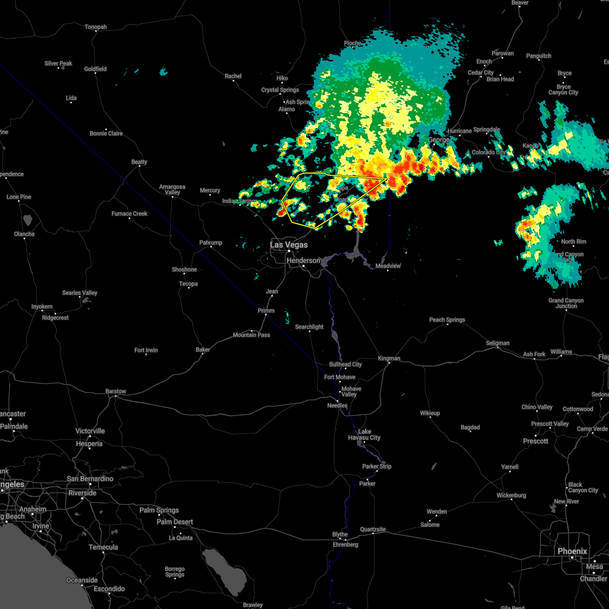 The severe thunderstorm warning for northeastern clark county will expire at 845 pm pdt, the storm which prompted the warning has weakened below severe limits, and has exited the warned area. therefore, the warning will be allowed to expire. however gusty winds up to 55 mph are still possible with this thunderstorm. The severe thunderstorm warning for northeastern clark county will expire at 845 pm pdt, the storm which prompted the warning has weakened below severe limits, and has exited the warned area. therefore, the warning will be allowed to expire. however gusty winds up to 55 mph are still possible with this thunderstorm.
|
| 7/13/2021 8:19 PM PDT |
 At 817 pm pdt, a severe thunderstorm was located 10 miles west of moapa town, moving southeast at 20 mph. at 8:09pm there was an observed wind gust of 70 mph in moapa, nv (radar indicated). Hazards include 60 to 70 mph wind gusts. Expect damage to roofs and trees. locations impacted include, mesquite, moapa town, moapa valley, sr 168 mile marker 21, coyote springs, logandale and bunkerville. this includes the following highways, interstate 15 in arizona near mile marker 3. Interstate 15 in nevada between mile markers 64 and 120. At 817 pm pdt, a severe thunderstorm was located 10 miles west of moapa town, moving southeast at 20 mph. at 8:09pm there was an observed wind gust of 70 mph in moapa, nv (radar indicated). Hazards include 60 to 70 mph wind gusts. Expect damage to roofs and trees. locations impacted include, mesquite, moapa town, moapa valley, sr 168 mile marker 21, coyote springs, logandale and bunkerville. this includes the following highways, interstate 15 in arizona near mile marker 3. Interstate 15 in nevada between mile markers 64 and 120.
|
| 7/13/2021 8:09 PM PDT | Storm damage reported in clark county NV, 5.1 miles SSE of Moapa Valley, NV |
| 7/13/2021 7:36 PM PDT |
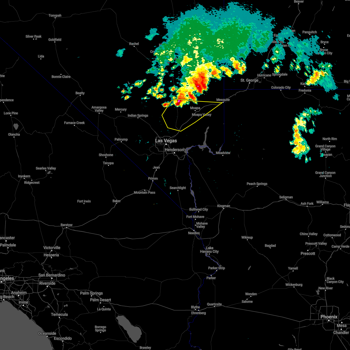 At 736 pm pdt, a severe thunderstorm was located over sr 168 mile marker 21, or 16 miles northwest of moapa town, moving southeast at 20 mph (radar indicated). Hazards include 60 mph wind gusts. expect damage to roofs and trees At 736 pm pdt, a severe thunderstorm was located over sr 168 mile marker 21, or 16 miles northwest of moapa town, moving southeast at 20 mph (radar indicated). Hazards include 60 mph wind gusts. expect damage to roofs and trees
|
| 7/13/2021 7:24 PM PDT |
 At 723 pm pdt/723 pm mst/, severe thunderstorms were located along a line extending from near bunkerville to near overton to 11 miles west of valley of fire, moving southeast at 25 mph (radar indicated). Hazards include 60 mph wind gusts. expect damage to roofs and trees At 723 pm pdt/723 pm mst/, severe thunderstorms were located along a line extending from near bunkerville to near overton to 11 miles west of valley of fire, moving southeast at 25 mph (radar indicated). Hazards include 60 mph wind gusts. expect damage to roofs and trees
|
| 7/12/2021 11:22 PM PDT |
 At 1119 pm pdt/1119 pm mst/, a severe thunderstorm was located over calville bay and the boudler basin of lake mead, moving southeast at 25 mph. gusts up to 59 mph have been observed in the las vegas valley. gusts up to 70 mph and quarter size hail are still likely over lake mead (radar indicated). Hazards include 70 mph wind gusts and quarter size hail. Hail damage to vehicles is expected. expect considerable tree damage. wind damage is also likely to mobile homes, roofs, and outbuildings. locations impacted include, henderson, north las vegas, boulder city, anthem, the strip, nellis afb, downtown las vegas, east las vegas, sam boyd stadium, the motor speedway, las vegas bay, southern highlands, lake las vegas, overton, green valley, paradise, enterprise, moapa valley and echo bay. This includes interstate 15 in nevada between mile markers 60 and 70. At 1119 pm pdt/1119 pm mst/, a severe thunderstorm was located over calville bay and the boudler basin of lake mead, moving southeast at 25 mph. gusts up to 59 mph have been observed in the las vegas valley. gusts up to 70 mph and quarter size hail are still likely over lake mead (radar indicated). Hazards include 70 mph wind gusts and quarter size hail. Hail damage to vehicles is expected. expect considerable tree damage. wind damage is also likely to mobile homes, roofs, and outbuildings. locations impacted include, henderson, north las vegas, boulder city, anthem, the strip, nellis afb, downtown las vegas, east las vegas, sam boyd stadium, the motor speedway, las vegas bay, southern highlands, lake las vegas, overton, green valley, paradise, enterprise, moapa valley and echo bay. This includes interstate 15 in nevada between mile markers 60 and 70.
|
| 7/12/2021 10:44 PM PDT |
 At 1043 pm pdt/1043 pm mst/, a severe thunderstorm was located over the east side of the las vegas valley to 10 miles north of callville bay campground, moving south at 20 mph (radar indicated). Hazards include 70 mph wind gusts and quarter size hail. Hail damage to vehicles is expected. expect considerable tree damage. Wind damage is also likely to mobile homes, roofs, and outbuildings. At 1043 pm pdt/1043 pm mst/, a severe thunderstorm was located over the east side of the las vegas valley to 10 miles north of callville bay campground, moving south at 20 mph (radar indicated). Hazards include 70 mph wind gusts and quarter size hail. Hail damage to vehicles is expected. expect considerable tree damage. Wind damage is also likely to mobile homes, roofs, and outbuildings.
|
| 7/12/2021 10:19 PM PDT |
 At 1015 pm pdt/1015 pm mst/, a severe thunderstorm was located over the interstection of i-15 and valley of fire highway moving southeast at 25 mph. a gust front preceding the storm was moving across valley of fire state park, the overton arm of lake mead and was approaching the boulder basin and the narrows sections of lake mead (radar indicated). Hazards include 60 mph wind gusts. Expect damage to roofs and trees. locations impacted include, las vegas bay, overton, moapa town, moapa valley, echo bay, boulder beach, boulder beach campground, callville bay, echo bay campground, callville bay campground, valley of fire, overton beach, logandale, hoover dam and lake mead national recreation area. This includes interstate 15 in nevada between mile markers 66 and 105. At 1015 pm pdt/1015 pm mst/, a severe thunderstorm was located over the interstection of i-15 and valley of fire highway moving southeast at 25 mph. a gust front preceding the storm was moving across valley of fire state park, the overton arm of lake mead and was approaching the boulder basin and the narrows sections of lake mead (radar indicated). Hazards include 60 mph wind gusts. Expect damage to roofs and trees. locations impacted include, las vegas bay, overton, moapa town, moapa valley, echo bay, boulder beach, boulder beach campground, callville bay, echo bay campground, callville bay campground, valley of fire, overton beach, logandale, hoover dam and lake mead national recreation area. This includes interstate 15 in nevada between mile markers 66 and 105.
|
| 7/12/2021 9:50 PM PDT |
 At 949 pm pdt/949 pm mst/, a severe thunderstorm was located 10 miles west of valley of fire, or 14 miles south of moapa town, moving southeast at 25 mph (radar indicated). Hazards include 60 mph wind gusts. expect damage to roofs and trees At 949 pm pdt/949 pm mst/, a severe thunderstorm was located 10 miles west of valley of fire, or 14 miles south of moapa town, moving southeast at 25 mph (radar indicated). Hazards include 60 mph wind gusts. expect damage to roofs and trees
|
| 6/29/2021 5:40 PM PDT | 61 mph wind gust along with pea sized hail reported by trained weather spotte in clark county NV, 4.1 miles NNW of Moapa Valley, NV |
| 6/29/2021 5:38 PM PDT |
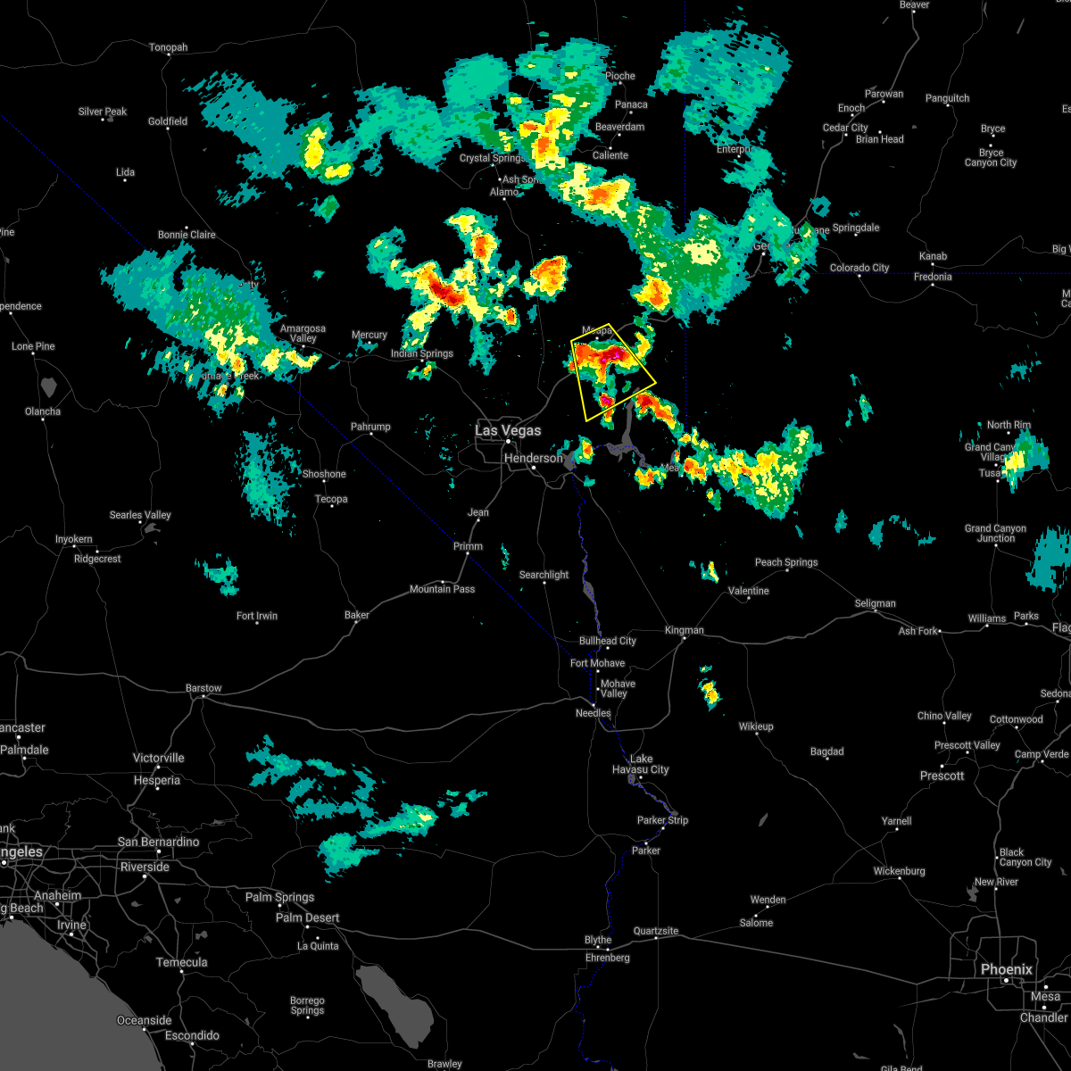 At 535 pm pdt, a severe thunderstorm was located over overton, moving southeast at 20 mph. a 72 mph wind gust was reported with this storm (radar indicated). Hazards include 70 mph wind gusts and quarter size hail. Hail damage to vehicles is possible. expect considerable tree damage. wind damage is also likely to mobile homes, roofs, and outbuildings. locations impacted include, overton, moapa town, moapa valley, valley of fire, overton beach and logandale. This includes interstate 15 in nevada between mile markers 79 and 97. At 535 pm pdt, a severe thunderstorm was located over overton, moving southeast at 20 mph. a 72 mph wind gust was reported with this storm (radar indicated). Hazards include 70 mph wind gusts and quarter size hail. Hail damage to vehicles is possible. expect considerable tree damage. wind damage is also likely to mobile homes, roofs, and outbuildings. locations impacted include, overton, moapa town, moapa valley, valley of fire, overton beach and logandale. This includes interstate 15 in nevada between mile markers 79 and 97.
|
| 6/29/2021 5:16 PM PDT | 72mph wind gusts reported by nvdot mpvnv mesonet sit in clark county NV, 5.1 miles SSE of Moapa Valley, NV |
| 6/29/2021 5:14 PM PDT |
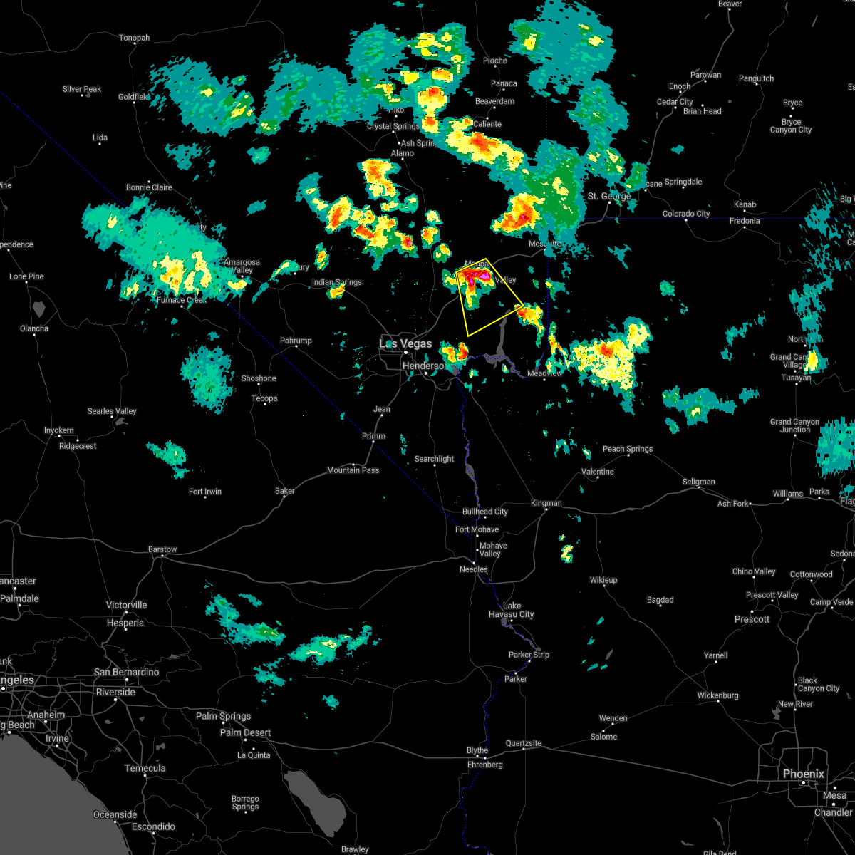 At 513 pm pdt, a severe thunderstorm was located near moapa town, moving southeast at 15 mph (radar indicated). Hazards include 60 mph wind gusts and quarter size hail. Hail damage to vehicles is possible. Expect wind damage to roofs and trees. At 513 pm pdt, a severe thunderstorm was located near moapa town, moving southeast at 15 mph (radar indicated). Hazards include 60 mph wind gusts and quarter size hail. Hail damage to vehicles is possible. Expect wind damage to roofs and trees.
|
| 2/13/2021 3:41 PM MST |
 The severe thunderstorm warning for northwestern mohave and northeastern clark counties will expire at 245 pm pst/345 pm mst/, the storm which prompted the warning has weakened below severe limits, and no longer poses an immediate threat to life or property. therefore, the warning will be allowed to expire. however, gusty north winds will remain likely through the evening and a wind advisory remains in effect through sunday morning. The severe thunderstorm warning for northwestern mohave and northeastern clark counties will expire at 245 pm pst/345 pm mst/, the storm which prompted the warning has weakened below severe limits, and no longer poses an immediate threat to life or property. therefore, the warning will be allowed to expire. however, gusty north winds will remain likely through the evening and a wind advisory remains in effect through sunday morning.
|
| 2/13/2021 3:18 PM MST |
 At 218 pm pst/318 pm mst/, a severe thunderstorm was located 9 miles west of temple bar campground, or 20 miles east of boulder city, moving southeast at 45 mph (radar indicated). Hazards include 60 mph wind gusts. Expect damage to roofs and trees. Locations impacted include, henderson, boulder city, las vegas bay, overton, lake las vegas, moapa valley, echo bay, boulder beach, railroad pass, boulder beach campground, las vegas bay campground, echo bay campground, callville bay, meadview, hoover dam, valley of fire, callville bay campground, lake mead national recreation area, temple bar campground and overton beach. At 218 pm pst/318 pm mst/, a severe thunderstorm was located 9 miles west of temple bar campground, or 20 miles east of boulder city, moving southeast at 45 mph (radar indicated). Hazards include 60 mph wind gusts. Expect damage to roofs and trees. Locations impacted include, henderson, boulder city, las vegas bay, overton, lake las vegas, moapa valley, echo bay, boulder beach, railroad pass, boulder beach campground, las vegas bay campground, echo bay campground, callville bay, meadview, hoover dam, valley of fire, callville bay campground, lake mead national recreation area, temple bar campground and overton beach.
|
| 2/13/2021 2:51 PM MST |
 At 149 pm pst/249 pm mst/, a severe thunderstorm was located near las vegas , moving southeast at 55 mph (radar indicated). Hazards include 60 mph wind gusts. expect damage to roofs and trees At 149 pm pst/249 pm mst/, a severe thunderstorm was located near las vegas , moving southeast at 55 mph (radar indicated). Hazards include 60 mph wind gusts. expect damage to roofs and trees
|
| 8/11/2018 7:40 PM PDT |
 At 738 pm pdt/738 pm mst/, severe thunderstorms were located along a line extending from 7 miles northwest of valley of fire to 6 miles east of echo bay, moving southwest at 25 mph (radar indicated). Hazards include 60 mph wind gusts. expect damage to roofs and trees At 738 pm pdt/738 pm mst/, severe thunderstorms were located along a line extending from 7 miles northwest of valley of fire to 6 miles east of echo bay, moving southwest at 25 mph (radar indicated). Hazards include 60 mph wind gusts. expect damage to roofs and trees
|
| 7/19/2018 9:08 PM PDT |
 The severe thunderstorm warning for northwestern mohave, south central lincoln and northeastern clark counties will expire at 915 pm pdt/915 pm mst/, the high winds which prompted the warning have moved out of the area. therefore, the warning will be allowed to expire. however gusty winds and heavy rain are still possible with these thunderstorms. remember, a severe thunderstorm warning still remains in effect for much of the las vegas valley and western lake mead area. The severe thunderstorm warning for northwestern mohave, south central lincoln and northeastern clark counties will expire at 915 pm pdt/915 pm mst/, the high winds which prompted the warning have moved out of the area. therefore, the warning will be allowed to expire. however gusty winds and heavy rain are still possible with these thunderstorms. remember, a severe thunderstorm warning still remains in effect for much of the las vegas valley and western lake mead area.
|
| 7/19/2018 8:57 PM PDT |
 At 856 pm pdt/856 pm mst/, numerous strong thunderstorms were ongoing across the moapa valley and developing across the lake mead area, moving southwest at 15 mph. strong thunderstorm wind gusts remain possible (radar indicated). Hazards include 60 mph wind gusts. Expect damage to roofs and trees. locations impacted include, north las vegas, mesquite, nellis afb, the motor speedway, las vegas bay, overton, moapa town, lake las vegas, east las vegas, moapa valley, echo bay, sr 168 mile marker 21, boulder beach campground, las vegas bay campground, hoover dam, temple bar campground, logandale, boulder beach, echo bay campground and callville bay. this includes the following highways, interstate 15 in arizona near mile marker 3. Interstate 15 in nevada between mile markers 60 and 83, and between mile markers 85 and 117. At 856 pm pdt/856 pm mst/, numerous strong thunderstorms were ongoing across the moapa valley and developing across the lake mead area, moving southwest at 15 mph. strong thunderstorm wind gusts remain possible (radar indicated). Hazards include 60 mph wind gusts. Expect damage to roofs and trees. locations impacted include, north las vegas, mesquite, nellis afb, the motor speedway, las vegas bay, overton, moapa town, lake las vegas, east las vegas, moapa valley, echo bay, sr 168 mile marker 21, boulder beach campground, las vegas bay campground, hoover dam, temple bar campground, logandale, boulder beach, echo bay campground and callville bay. this includes the following highways, interstate 15 in arizona near mile marker 3. Interstate 15 in nevada between mile markers 60 and 83, and between mile markers 85 and 117.
|
| 7/19/2018 8:16 PM PDT |
 At 814 pm pdt/814 pm mst/, severe thunderstorms were located near moapa, moving southwest at 15 mph. preceding thunderstorm outflow winds with gusts over 60 mph have reached near apex. strong winds may occur well ahead of any thunder or lightning (radar indicated). Hazards include 70 mph wind gusts. Expect considerable tree damage. damage is likely to mobile homes, roofs, and outbuildings. locations impacted include, north las vegas, mesquite, nellis afb, the motor speedway, las vegas bay, overton, moapa town, lake las vegas, east las vegas, moapa valley, echo bay, sr 168 mile marker 21, boulder beach campground, las vegas bay campground, hoover dam, temple bar campground, south cove, logandale, boulder beach and echo bay campground. this includes the following highways, interstate 15 in arizona near mile marker 3. Interstate 15 in nevada between mile markers 60 and 83, and between mile markers 85 and 117. At 814 pm pdt/814 pm mst/, severe thunderstorms were located near moapa, moving southwest at 15 mph. preceding thunderstorm outflow winds with gusts over 60 mph have reached near apex. strong winds may occur well ahead of any thunder or lightning (radar indicated). Hazards include 70 mph wind gusts. Expect considerable tree damage. damage is likely to mobile homes, roofs, and outbuildings. locations impacted include, north las vegas, mesquite, nellis afb, the motor speedway, las vegas bay, overton, moapa town, lake las vegas, east las vegas, moapa valley, echo bay, sr 168 mile marker 21, boulder beach campground, las vegas bay campground, hoover dam, temple bar campground, south cove, logandale, boulder beach and echo bay campground. this includes the following highways, interstate 15 in arizona near mile marker 3. Interstate 15 in nevada between mile markers 60 and 83, and between mile markers 85 and 117.
|
| 7/19/2018 7:55 PM PDT |
 At 752 pm pdt/752 pm mst/, severe thunderstorms were located along a line extending from 21 miles northeast of coyote springs to near moapa town to 16 miles northeast of south cove, moving southwest at 15 mph (radar indicated). Hazards include 60 to 70 mph wind gusts and quarter size hail. Hail damage to vehicles is expected. expect considerable tree damage. Wind damage is also likely to mobile homes, roofs, and outbuildings. At 752 pm pdt/752 pm mst/, severe thunderstorms were located along a line extending from 21 miles northeast of coyote springs to near moapa town to 16 miles northeast of south cove, moving southwest at 15 mph (radar indicated). Hazards include 60 to 70 mph wind gusts and quarter size hail. Hail damage to vehicles is expected. expect considerable tree damage. Wind damage is also likely to mobile homes, roofs, and outbuildings.
|
| 7/14/2018 7:05 PM PDT |
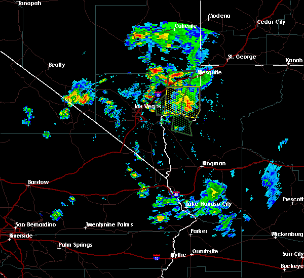 The severe thunderstorm warning for northeastern clark county will expire at 715 pm pdt, the storm which prompted the warning has weakened below severe limits, and no longer poses an immediate threat to life or property. therefore, the warning will be allowed to expire. however gusty winds are still possible with this thunderstorm. The severe thunderstorm warning for northeastern clark county will expire at 715 pm pdt, the storm which prompted the warning has weakened below severe limits, and no longer poses an immediate threat to life or property. therefore, the warning will be allowed to expire. however gusty winds are still possible with this thunderstorm.
|
| 7/14/2018 6:50 PM PDT |
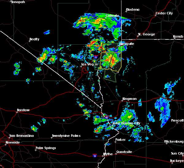 At 649 pm pdt, a severe thunderstorm was located over overton beach, or 10 miles southeast of overton, moving southeast at 15 mph (radar indicated). Hazards include 60 mph wind gusts. Expect damage to roofs and trees. wind-driven waves may create dangerous boating conditions on the overton arm of lake mead. Locations impacted include, overton, moapa valley, echo bay, valley of fire, overton beach, echo bay campground and lake mead national recreation area. At 649 pm pdt, a severe thunderstorm was located over overton beach, or 10 miles southeast of overton, moving southeast at 15 mph (radar indicated). Hazards include 60 mph wind gusts. Expect damage to roofs and trees. wind-driven waves may create dangerous boating conditions on the overton arm of lake mead. Locations impacted include, overton, moapa valley, echo bay, valley of fire, overton beach, echo bay campground and lake mead national recreation area.
|
| 7/14/2018 6:36 PM PDT |
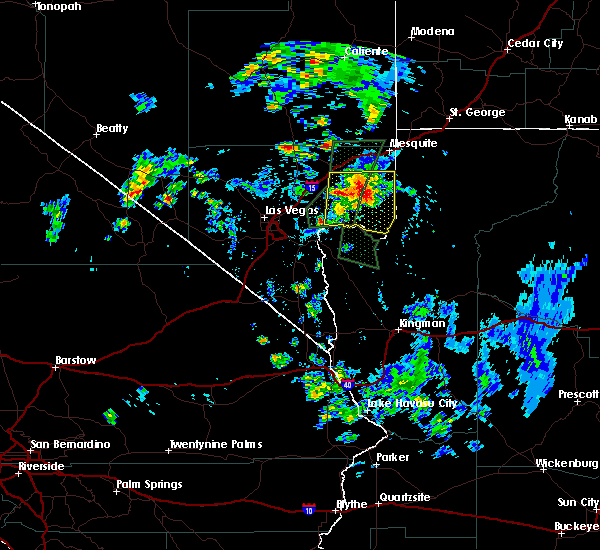 At 635 pm pdt, a severe thunderstorm was located near overton beach, or 8 miles south of overton, moving southeast at 15 mph (radar indicated). Hazards include 60 mph wind gusts and quarter size hail. Hail damage to vehicles is expected. expect wind damage to roofs and trees. Wind-driven waves will cause dangerous boating conditions along the overton arm of lake mead. At 635 pm pdt, a severe thunderstorm was located near overton beach, or 8 miles south of overton, moving southeast at 15 mph (radar indicated). Hazards include 60 mph wind gusts and quarter size hail. Hail damage to vehicles is expected. expect wind damage to roofs and trees. Wind-driven waves will cause dangerous boating conditions along the overton arm of lake mead.
|
| 7/12/2017 8:21 PM PDT |
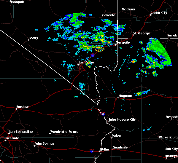 The severe thunderstorm warning for north central clark county will expire at 830 pm pdt, the storm which prompted the warning has weakened below severe limits, and no longer poses an immediate threat to life or property. therefore the warning will be allowed to expire. however gusty winds and heavy rain are still possible with this thunderstorm. The severe thunderstorm warning for north central clark county will expire at 830 pm pdt, the storm which prompted the warning has weakened below severe limits, and no longer poses an immediate threat to life or property. therefore the warning will be allowed to expire. however gusty winds and heavy rain are still possible with this thunderstorm.
|
| 7/12/2017 7:44 PM PDT |
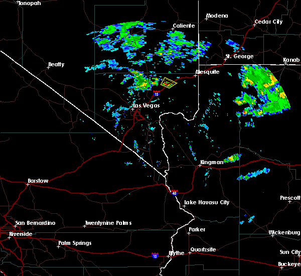 At 744 pm pdt, a severe thunderstorm was located over moapa town, and is nearly stationary (radar indicated). Hazards include 60 mph wind gusts. expect damage to roofs, siding, and trees At 744 pm pdt, a severe thunderstorm was located over moapa town, and is nearly stationary (radar indicated). Hazards include 60 mph wind gusts. expect damage to roofs, siding, and trees
|
| 9/22/2016 4:23 PM MST |
 The severe thunderstorm warning for northwestern mohave and northeastern clark counties will expire at 430 pm pdt/430 pm mst/, the storms which prompted the warning have weakened. therefore the warning will be allowed to expire. The severe thunderstorm warning for northwestern mohave and northeastern clark counties will expire at 430 pm pdt/430 pm mst/, the storms which prompted the warning have weakened. therefore the warning will be allowed to expire.
|
| 9/22/2016 4:23 PM MST |
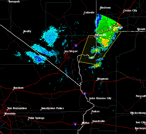 The severe thunderstorm warning for northwestern mohave and northeastern clark counties will expire at 430 pm pdt/430 pm mst/, the storms which prompted the warning have weakened. therefore the warning will be allowed to expire. The severe thunderstorm warning for northwestern mohave and northeastern clark counties will expire at 430 pm pdt/430 pm mst/, the storms which prompted the warning have weakened. therefore the warning will be allowed to expire.
|
| 9/22/2016 3:49 PM MST |
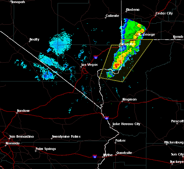 At 348 pm pdt/348 pm mst/, doppler radar indicated severe thunderstorms capable of producing quarter size hail and damaging winds in excess of 60 mph. these storms were located along a line extending from near virgin river campground to near temple bar campground, moving northeast at 30 mph. locations impacted include, mesquite, beaver dam, littlefield, virgin river gorge, moapa valley, temple bar campground, meadview, echo bay, bunkerville, grand canyon ranch, overton beach, virgin river campground, south cove, echo bay campground, valley of fire and temple bar. At 348 pm pdt/348 pm mst/, doppler radar indicated severe thunderstorms capable of producing quarter size hail and damaging winds in excess of 60 mph. these storms were located along a line extending from near virgin river campground to near temple bar campground, moving northeast at 30 mph. locations impacted include, mesquite, beaver dam, littlefield, virgin river gorge, moapa valley, temple bar campground, meadview, echo bay, bunkerville, grand canyon ranch, overton beach, virgin river campground, south cove, echo bay campground, valley of fire and temple bar.
|
| 9/22/2016 3:25 PM MST |
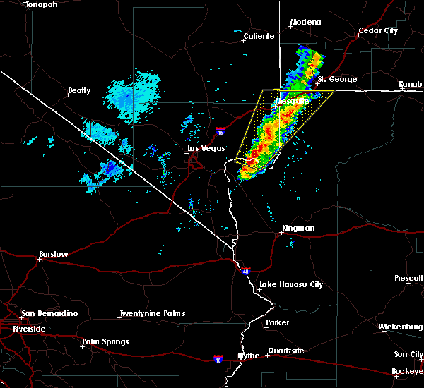 At 324 pm pdt/324 pm mst/, doppler radar indicated a line of severe thunderstorms capable of producing quarter size hail and damaging winds in excess of 60 mph. these storms were located along a line extending from near virgin river gorge to 8 miles west of temple bar campground, and moving northeast at 25 mph. At 324 pm pdt/324 pm mst/, doppler radar indicated a line of severe thunderstorms capable of producing quarter size hail and damaging winds in excess of 60 mph. these storms were located along a line extending from near virgin river gorge to 8 miles west of temple bar campground, and moving northeast at 25 mph.
|
| 9/22/2016 3:09 PM PDT |
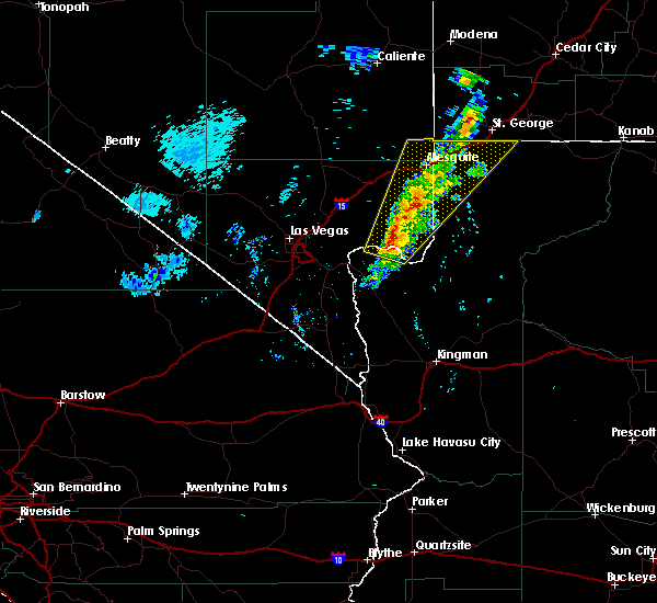 At 307 pm pdt/307 pm mst/, doppler radar indicated severe thunderstorms capable of producing quarter size hail and damaging winds in excess of 60 mph. these storms were located along a line extending from near mesquite to 7 miles northwest of temple bar campground, moving northeast at 25 mph. locations impacted include, mesquite, beaver dam, littlefield, virgin river gorge, moapa valley, temple bar campground, overton beach, virgin river campground, echo bay, bunkerville, echo bay campground, valley of fire and temple bar. At 307 pm pdt/307 pm mst/, doppler radar indicated severe thunderstorms capable of producing quarter size hail and damaging winds in excess of 60 mph. these storms were located along a line extending from near mesquite to 7 miles northwest of temple bar campground, moving northeast at 25 mph. locations impacted include, mesquite, beaver dam, littlefield, virgin river gorge, moapa valley, temple bar campground, overton beach, virgin river campground, echo bay, bunkerville, echo bay campground, valley of fire and temple bar.
|
| 9/22/2016 2:45 PM PDT |
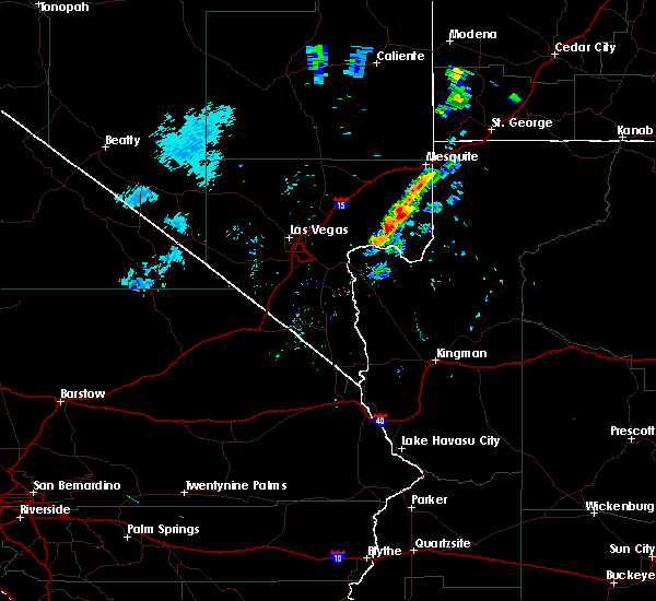 At 243 pm pdt/243 pm mst/, doppler radar indicated a line of severe thunderstorms capable of producing quarter size hail and damaging winds in excess of 60 mph. these storms were located along a line extending from 7 miles south of bunkerville to 6 miles southwest of echo bay campground, and moving northeast at 30 mph. At 243 pm pdt/243 pm mst/, doppler radar indicated a line of severe thunderstorms capable of producing quarter size hail and damaging winds in excess of 60 mph. these storms were located along a line extending from 7 miles south of bunkerville to 6 miles southwest of echo bay campground, and moving northeast at 30 mph.
|
| 7/1/2016 9:38 PM PDT |
 At 935 pm pdt/935 pm mst/, doppler radar indicated a severe thunderstorm capable of producing damaging winds in excess of 60 mph. this storm was located 13 miles northeast of nellis afb, or 13 miles northeast of the motor speedway, and moving east at 10 mph. this is an extension of the previous severe thunderstorm warning for the area. At 935 pm pdt/935 pm mst/, doppler radar indicated a severe thunderstorm capable of producing damaging winds in excess of 60 mph. this storm was located 13 miles northeast of nellis afb, or 13 miles northeast of the motor speedway, and moving east at 10 mph. this is an extension of the previous severe thunderstorm warning for the area.
|
| 7/1/2016 9:24 PM PDT |
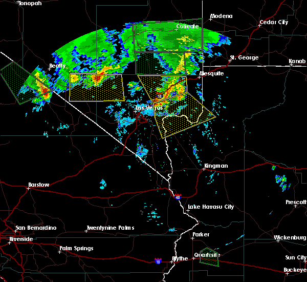 The severe thunderstorm warning for northeastern clark county will expire at 930 pm pdt, the storm which prompted the warning has weakened below severe limits and exited the warned area. therefore the warning will be allowed to expire. The severe thunderstorm warning for northeastern clark county will expire at 930 pm pdt, the storm which prompted the warning has weakened below severe limits and exited the warned area. therefore the warning will be allowed to expire.
|
| 7/1/2016 9:10 PM PDT |
 At 908 pm pdt/908 pm mst/, doppler radar indicated a severe thunderstorm capable of producing damaging winds in excess of 60 mph. this storm was located 11 miles west of valley of fire, or 16 miles southwest of overton, moving southeast at 20 mph. strong north winds are nearing northshore road and will impact the boulder basin and virgin basin through 945 pm. locations impacted include, boulder city, las vegas bay, callville bay, temple bar campground, valley of fire, echo bay, boulder beach, boulder beach campground, callville bay campground, overton beach, hoover dam, south cove, echo bay campground, temple bar and willow beach. At 908 pm pdt/908 pm mst/, doppler radar indicated a severe thunderstorm capable of producing damaging winds in excess of 60 mph. this storm was located 11 miles west of valley of fire, or 16 miles southwest of overton, moving southeast at 20 mph. strong north winds are nearing northshore road and will impact the boulder basin and virgin basin through 945 pm. locations impacted include, boulder city, las vegas bay, callville bay, temple bar campground, valley of fire, echo bay, boulder beach, boulder beach campground, callville bay campground, overton beach, hoover dam, south cove, echo bay campground, temple bar and willow beach.
|
| 7/1/2016 8:56 PM PDT |
 At 856 pm pdt, doppler radar indicated a severe thunderstorm capable of producing quarter size hail and damaging winds in excess of 60 mph. this storm was located 9 miles southwest of moapa town, moving southeast at 15 mph. locations impacted include, moapa town, overton, moapa valley, sr 168 mile marker 21, coyote springs, logandale and valley of fire. At 856 pm pdt, doppler radar indicated a severe thunderstorm capable of producing quarter size hail and damaging winds in excess of 60 mph. this storm was located 9 miles southwest of moapa town, moving southeast at 15 mph. locations impacted include, moapa town, overton, moapa valley, sr 168 mile marker 21, coyote springs, logandale and valley of fire.
|
| 7/1/2016 8:50 PM PDT |
 At 848 pm pdt/848 pm mst/, doppler radar indicated a severe thunderstorm capable of producing damaging winds in excess of 60 mph. this storm was located 11 miles southwest of moapa town, and moving south at 15 mph. At 848 pm pdt/848 pm mst/, doppler radar indicated a severe thunderstorm capable of producing damaging winds in excess of 60 mph. this storm was located 11 miles southwest of moapa town, and moving south at 15 mph.
|
| 7/1/2016 8:27 PM PDT |
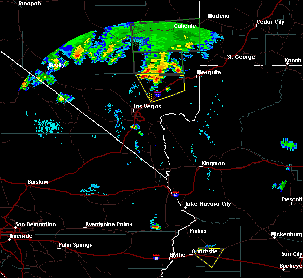 At 826 pm pdt, doppler radar indicated a severe thunderstorm capable of producing quarter size hail and damaging winds in excess of 60 mph. this storm was located 10 miles northeast of sr 168 mile marker 21, or 17 miles northwest of moapa town, and moving southeast at 15 mph. At 826 pm pdt, doppler radar indicated a severe thunderstorm capable of producing quarter size hail and damaging winds in excess of 60 mph. this storm was located 10 miles northeast of sr 168 mile marker 21, or 17 miles northwest of moapa town, and moving southeast at 15 mph.
|
| 1/31/2016 4:25 PM PST |
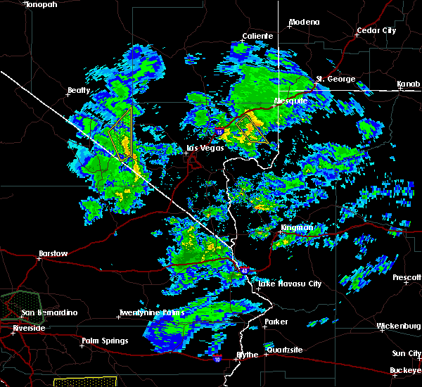 The severe thunderstorm warning for northeastern clark county will expire at 430 pm pst, the storm which prompted the warning in northeastern clark county has weakened below severe limits. therefore the warning will be allowed to expire. The severe thunderstorm warning for northeastern clark county will expire at 430 pm pst, the storm which prompted the warning in northeastern clark county has weakened below severe limits. therefore the warning will be allowed to expire.
|
| 1/31/2016 4:19 PM PST |
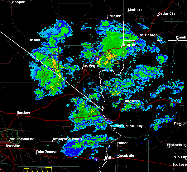 At 419 pm pst, doppler radar indicated a severe thunderstorm capable of producing damaging winds in excess of 60 mph. this storm was located near overton, moving northeast at 35 mph. locations impacted include, overton, moapa valley, overton beach, logandale and valley of fire. At 419 pm pst, doppler radar indicated a severe thunderstorm capable of producing damaging winds in excess of 60 mph. this storm was located near overton, moving northeast at 35 mph. locations impacted include, overton, moapa valley, overton beach, logandale and valley of fire.
|
| 1/31/2016 3:58 PM PST |
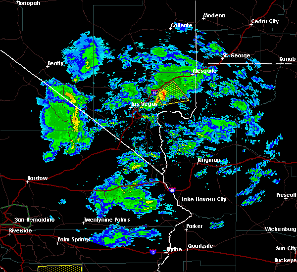 At 357 pm pst, doppler radar indicated a severe thunderstorm capable of producing damaging winds in excess of 60 mph. this storm was located near valley of fire, or 8 miles southwest of overton, moving northeast at 45 mph. locations impacted include, overton, moapa valley, overton beach, valley of fire, logandale, echo bay and echo bay campground. At 357 pm pst, doppler radar indicated a severe thunderstorm capable of producing damaging winds in excess of 60 mph. this storm was located near valley of fire, or 8 miles southwest of overton, moving northeast at 45 mph. locations impacted include, overton, moapa valley, overton beach, valley of fire, logandale, echo bay and echo bay campground.
|
| 1/31/2016 3:42 PM PST |
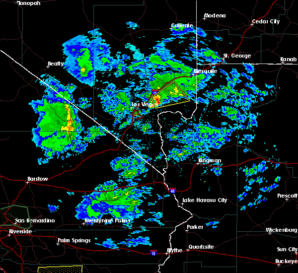 At 341 pm pst, doppler radar indicated a severe thunderstorm capable of producing damaging winds in excess of 60 mph. this storm was located 9 miles north of callville bay campground, or 13 miles northeast of las vegas bay, and moving northeast at 35 mph. At 341 pm pst, doppler radar indicated a severe thunderstorm capable of producing damaging winds in excess of 60 mph. this storm was located 9 miles north of callville bay campground, or 13 miles northeast of las vegas bay, and moving northeast at 35 mph.
|
| 10/18/2015 4:54 PM PDT |
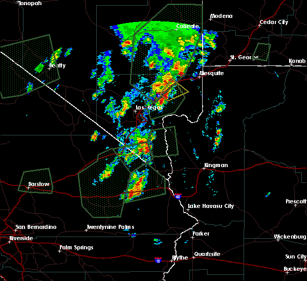 The severe thunderstorm warning for northeastern clark county will expire at 500 pm pdt, the storm which prompted the warning has weakened below severe limits, and no longer poses an immediate threat to life or property. therefore the warning will be allowed to expire. The severe thunderstorm warning for northeastern clark county will expire at 500 pm pdt, the storm which prompted the warning has weakened below severe limits, and no longer poses an immediate threat to life or property. therefore the warning will be allowed to expire.
|
| 10/18/2015 4:35 PM PDT |
 At 435 pm pdt, doppler radar continued to indicate a severe thunderstorm capable of producing quarter size hail and damaging winds in excess of 60 mph. this storm was located near logandale, or near moapa town, moving northeast at 30 mph. locations impacted include, moapa town, overton, moapa valley, logandale and valley of fire. this includes interstate 15 in nevada between mile markers 76 and 96. At 435 pm pdt, doppler radar continued to indicate a severe thunderstorm capable of producing quarter size hail and damaging winds in excess of 60 mph. this storm was located near logandale, or near moapa town, moving northeast at 30 mph. locations impacted include, moapa town, overton, moapa valley, logandale and valley of fire. this includes interstate 15 in nevada between mile markers 76 and 96.
|
| 10/18/2015 4:13 PM PDT |
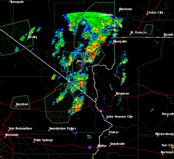 At 412 pm pdt, doppler radar indicated a severe thunderstorm capable of producing large damaging hail up to golf ball size and destructive winds in excess of 70 mph. this storm was located 8 miles west of valley of fire, or 13 miles west of overton, and moving northeast at 30 mph. At 412 pm pdt, doppler radar indicated a severe thunderstorm capable of producing large damaging hail up to golf ball size and destructive winds in excess of 70 mph. this storm was located 8 miles west of valley of fire, or 13 miles west of overton, and moving northeast at 30 mph.
|
| 8/13/2015 4:27 PM PDT | The severe thunderstorm warning for north central clark county will expire at 430 pm pdt, the storm which prompted the warning has weakened below severe limits, and no longer poses an immediate threat to life or property. therefore the warning will be allowed to expire. |
| 8/13/2015 4:12 PM PDT |
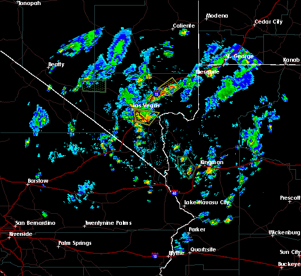 At 412 pm pdt, doppler radar indicated a severe thunderstorm capable of producing quarter size hail and damaging winds in excess of 60 mph. this storm was located over logandale, or near moapa town, moving northwest at 15 mph. locations impacted include, moapa town, overton, moapa valley, logandale and valley of fire. this includes interstate 15 in nevada between mile markers 81 and 98. At 412 pm pdt, doppler radar indicated a severe thunderstorm capable of producing quarter size hail and damaging winds in excess of 60 mph. this storm was located over logandale, or near moapa town, moving northwest at 15 mph. locations impacted include, moapa town, overton, moapa valley, logandale and valley of fire. this includes interstate 15 in nevada between mile markers 81 and 98.
|
| 8/13/2015 4:10 PM PDT | Coop observer measured 59 mph gust which also knocked over precipitation gaug in clark county NV, 4 miles N of Moapa Valley, NV |
| 8/13/2015 3:51 PM PDT |
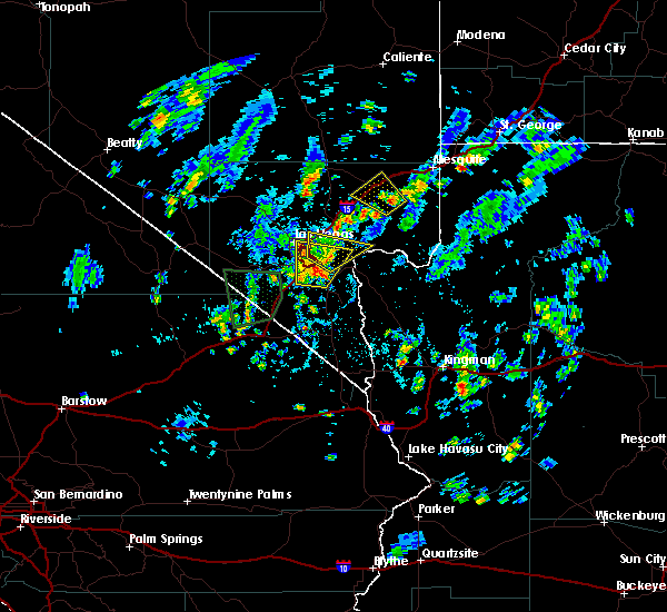 At 351 pm pdt, doppler radar indicated a severe thunderstorm capable of producing quarter size hail and damaging winds in excess of 60 mph. this storm was located over overton, and moving northwest at 10 mph. At 351 pm pdt, doppler radar indicated a severe thunderstorm capable of producing quarter size hail and damaging winds in excess of 60 mph. this storm was located over overton, and moving northwest at 10 mph.
|
| 8/21/2012 7:00 PM PDT | Public reported fence and house damage due to strong winds. party stated that 8 to 10 pound rocks were being thrown into his house causing damage to the stucco. party a in clark county NV, 1 miles SSE of Moapa Valley, NV |
Hail Maps for Moapa Valley, NV


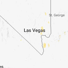


Connect with Interactive Hail Maps