

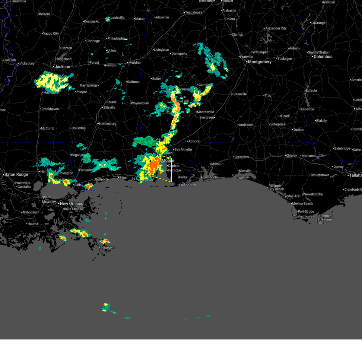
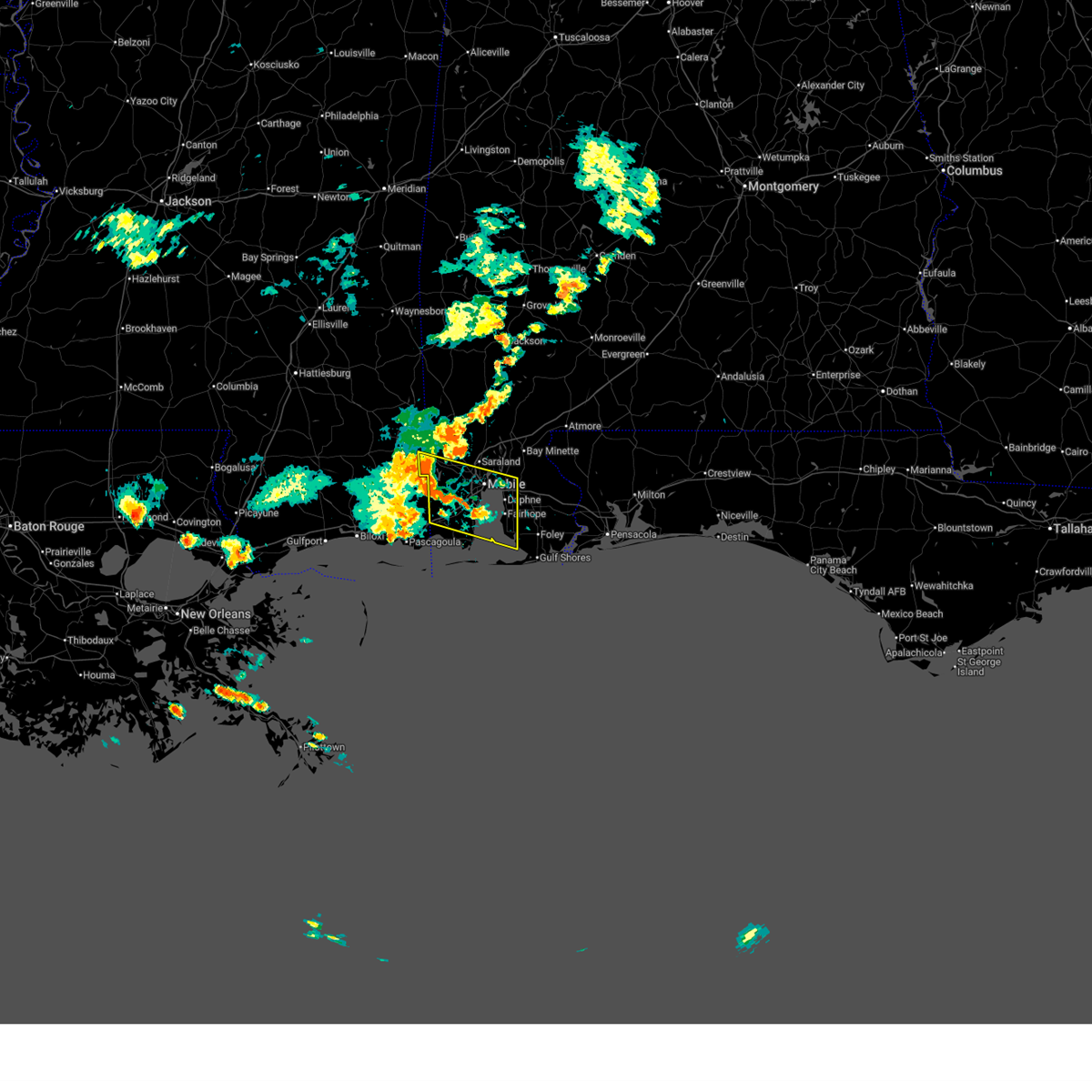
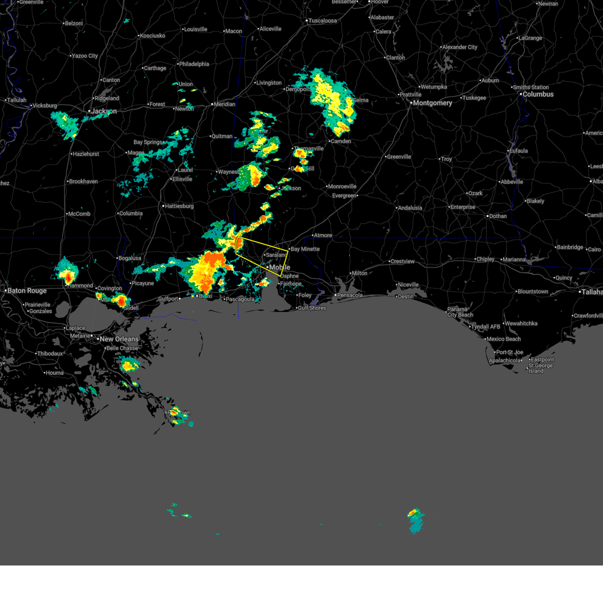
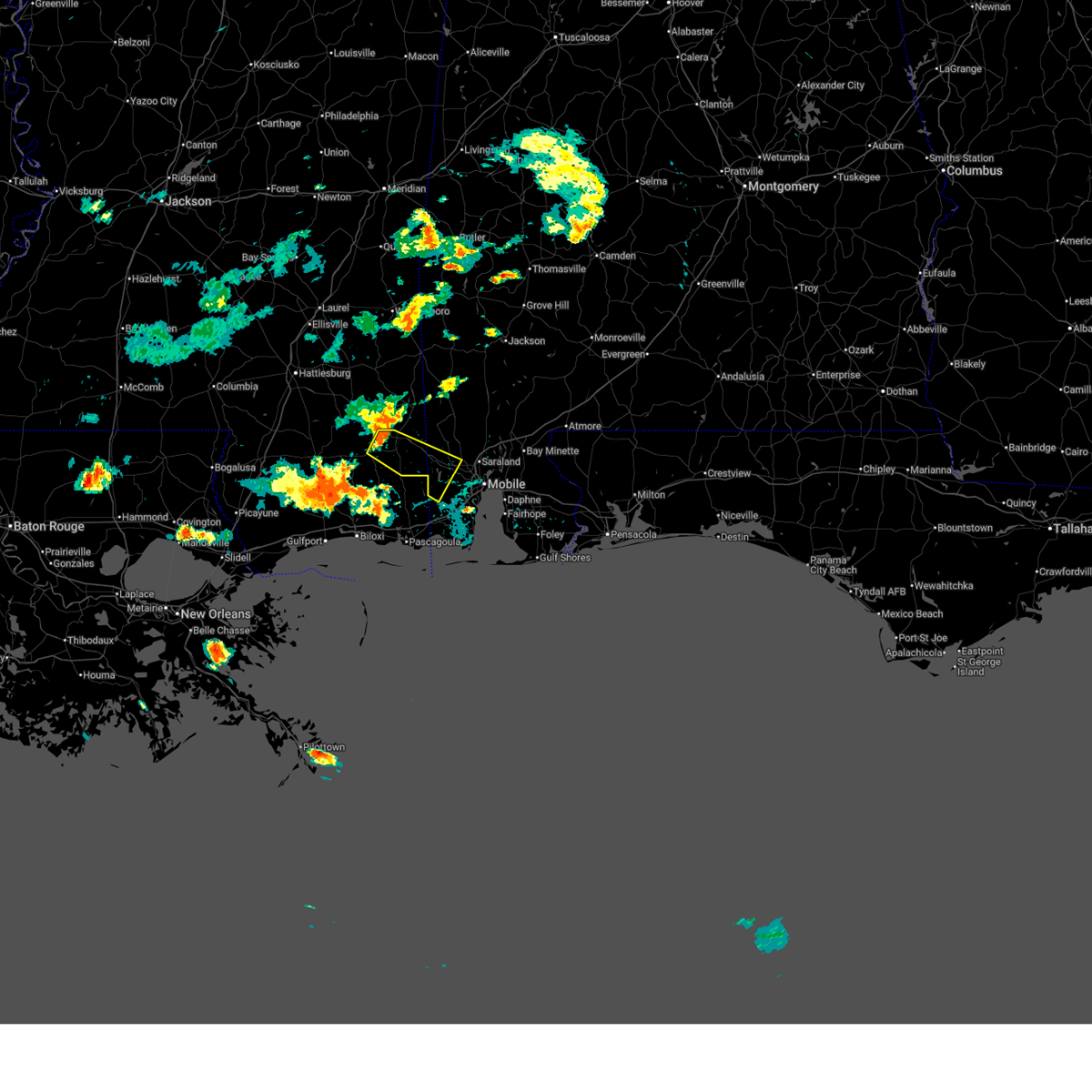
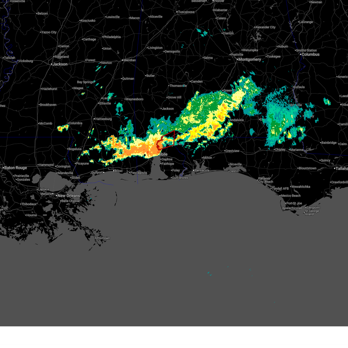
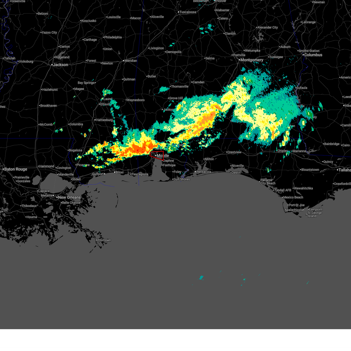
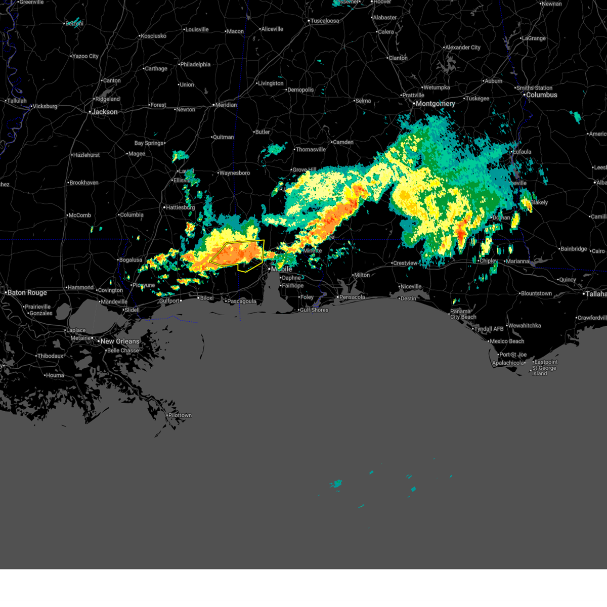
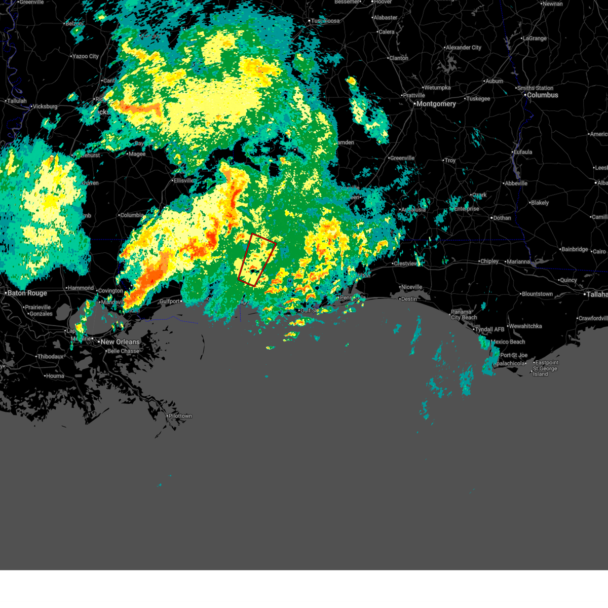
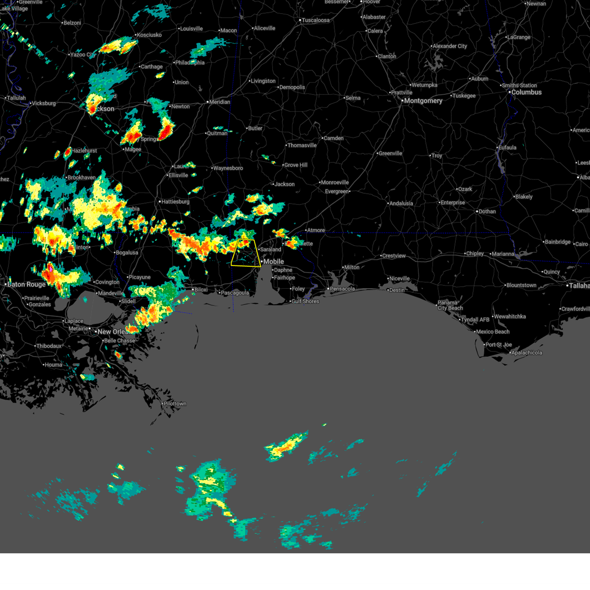
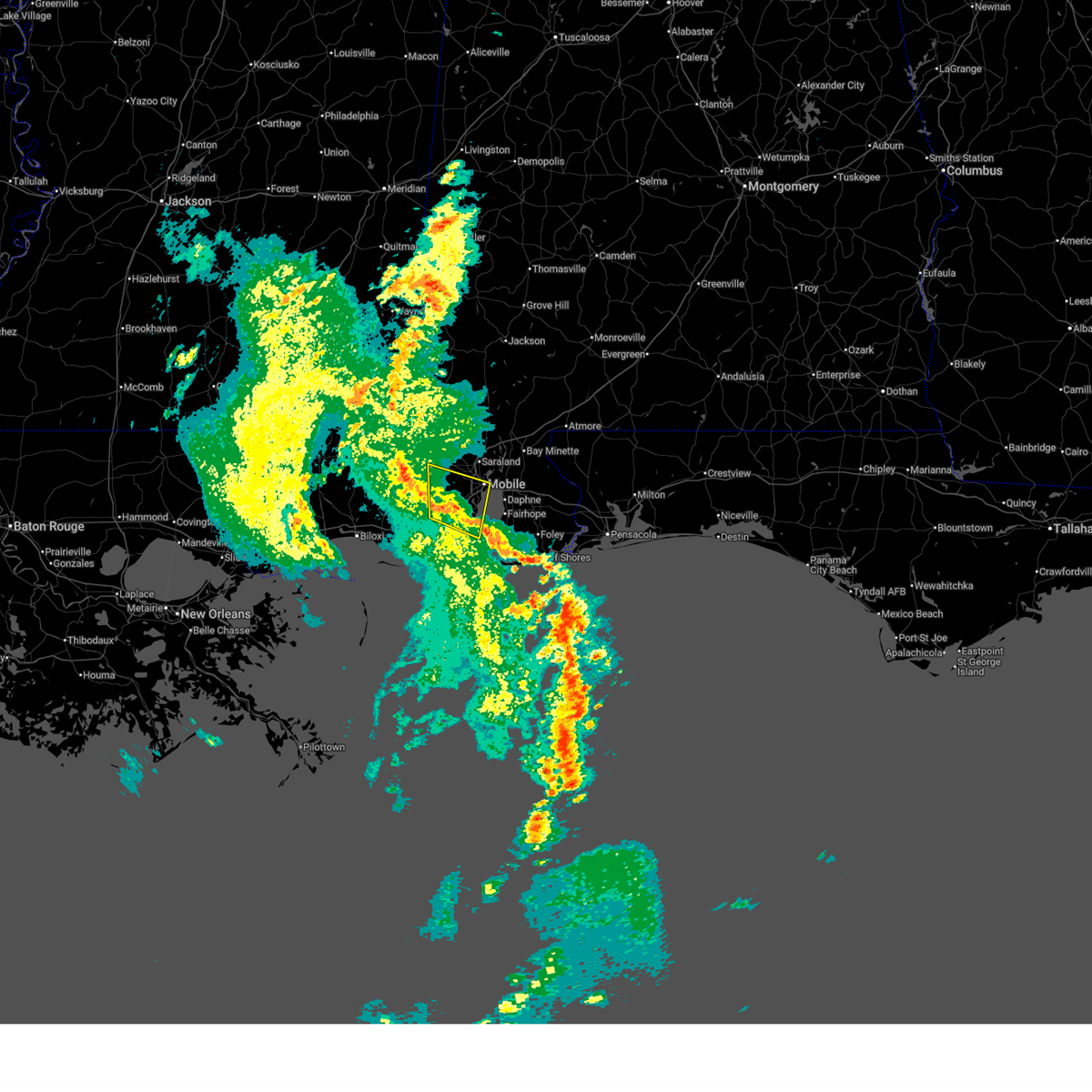
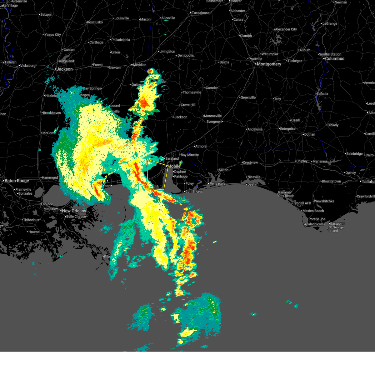
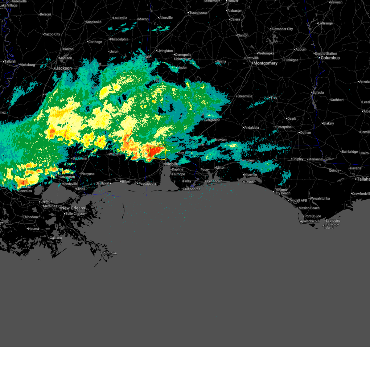
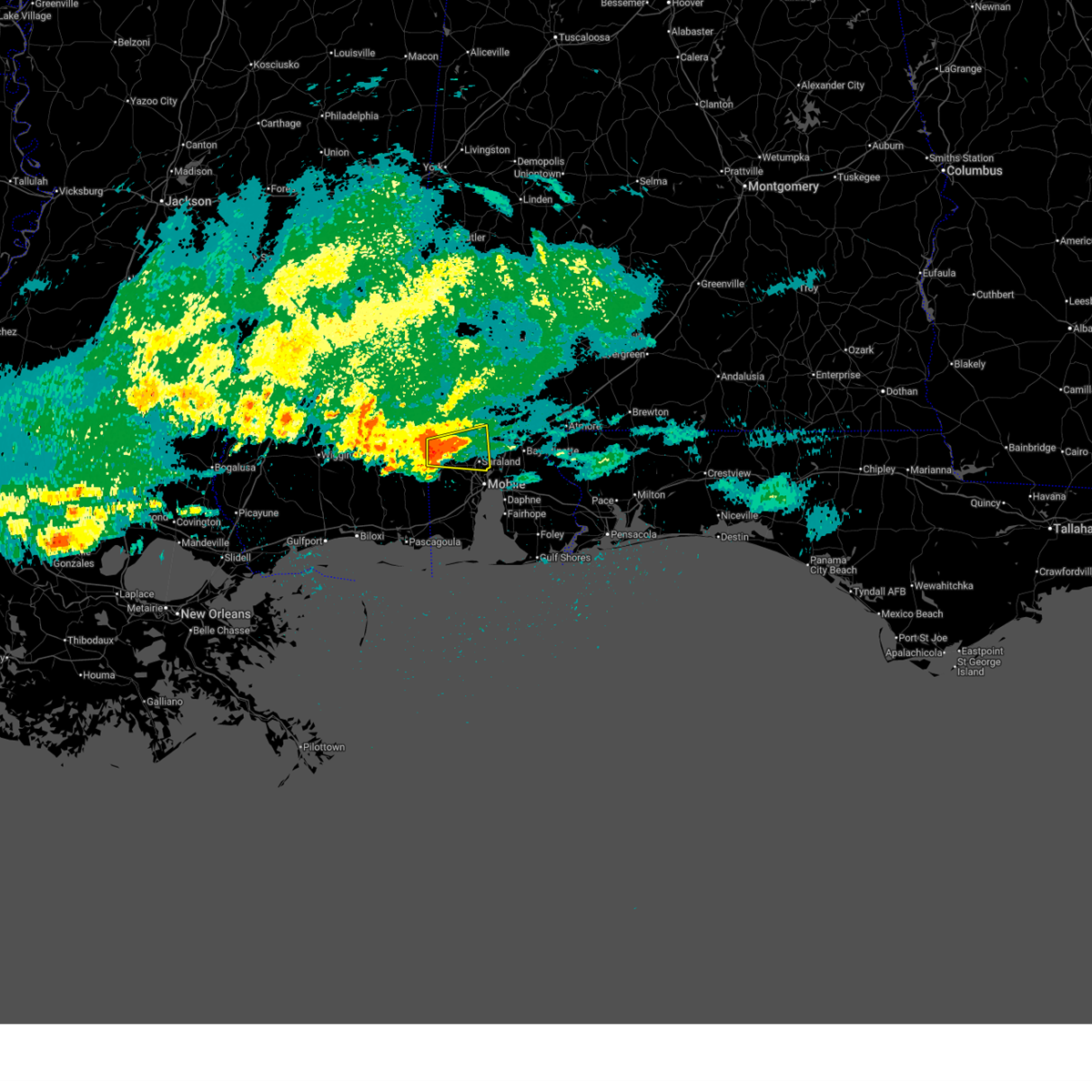
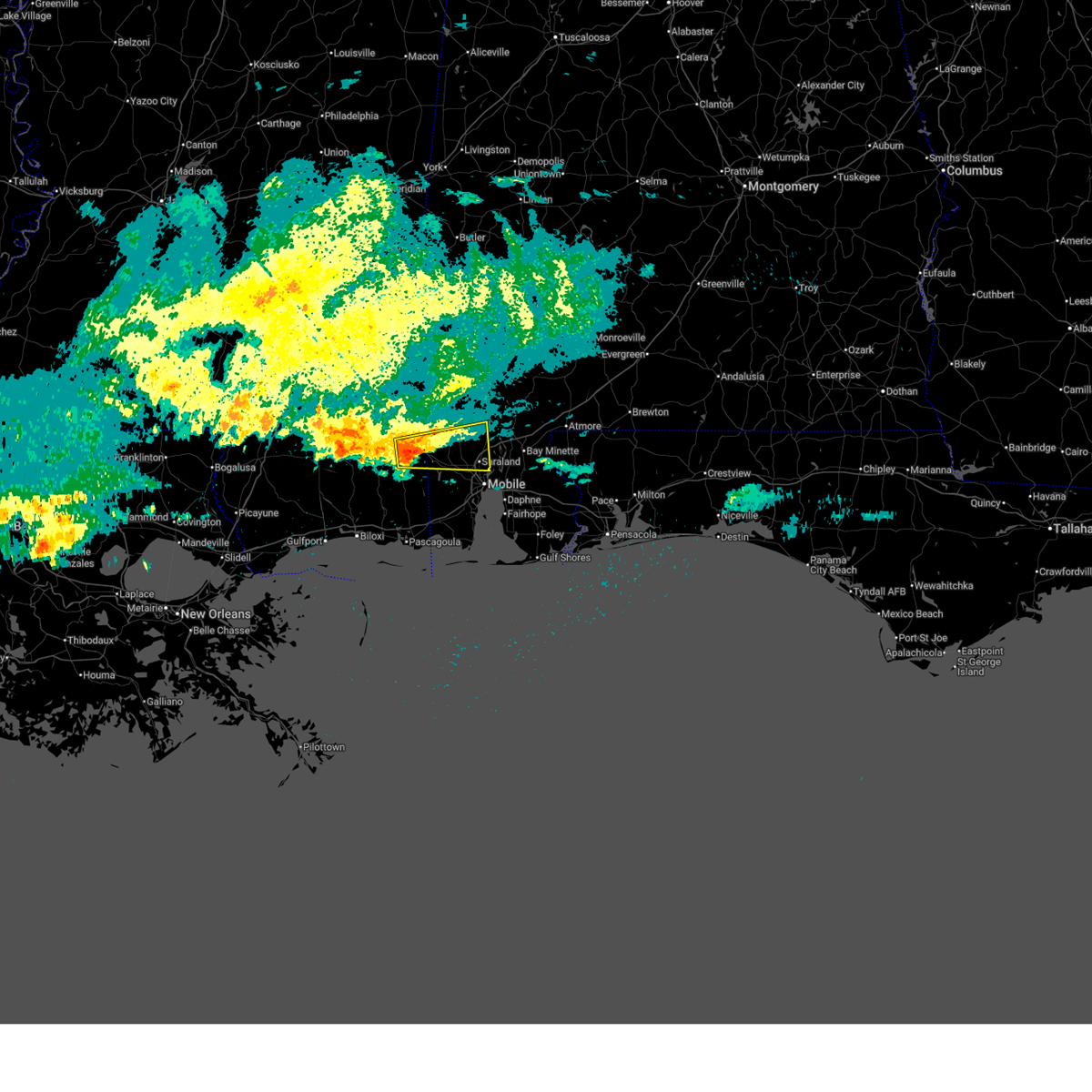
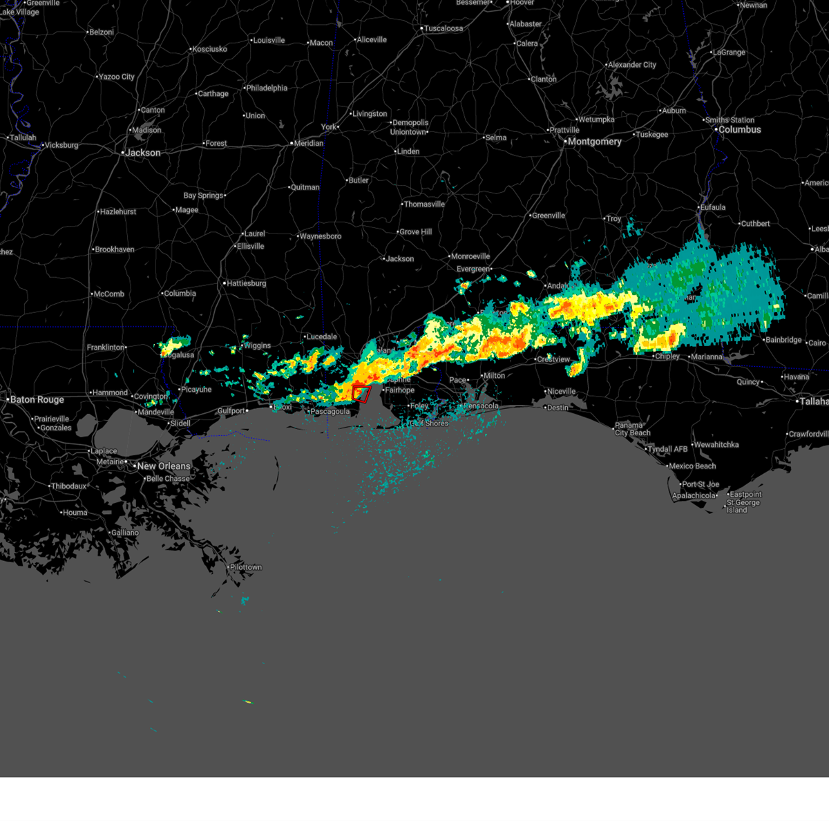
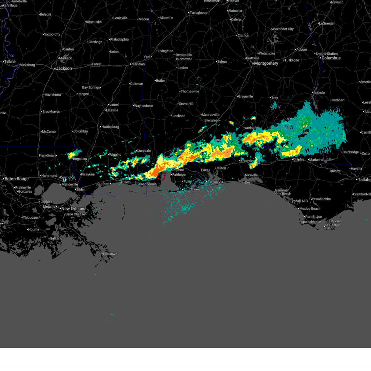
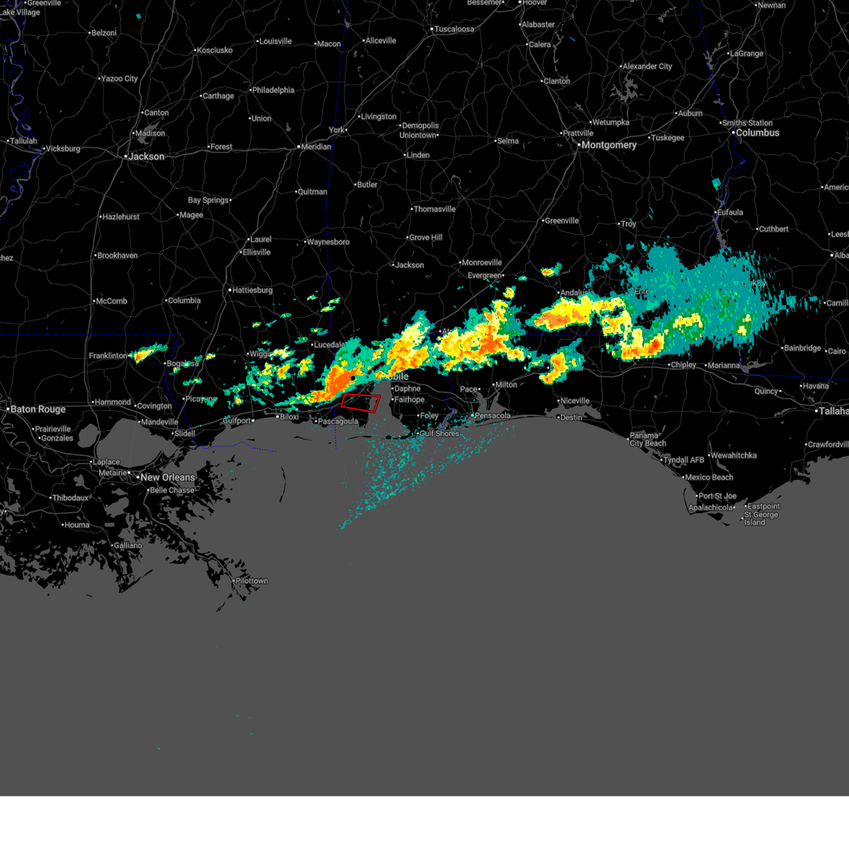
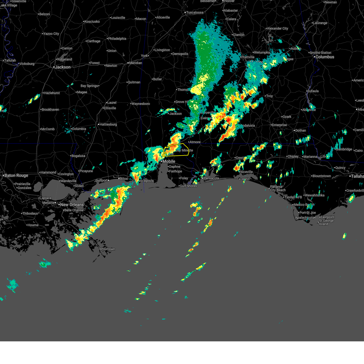
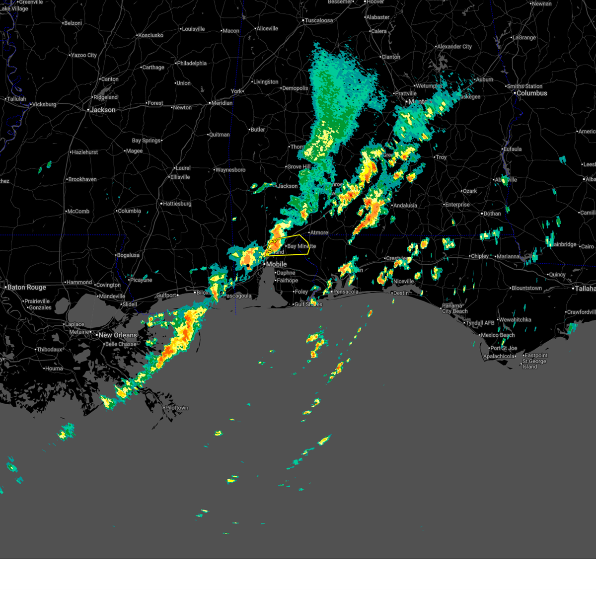
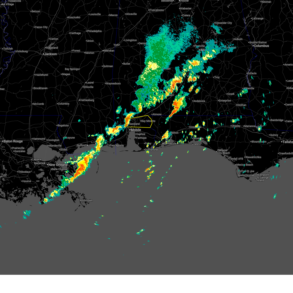
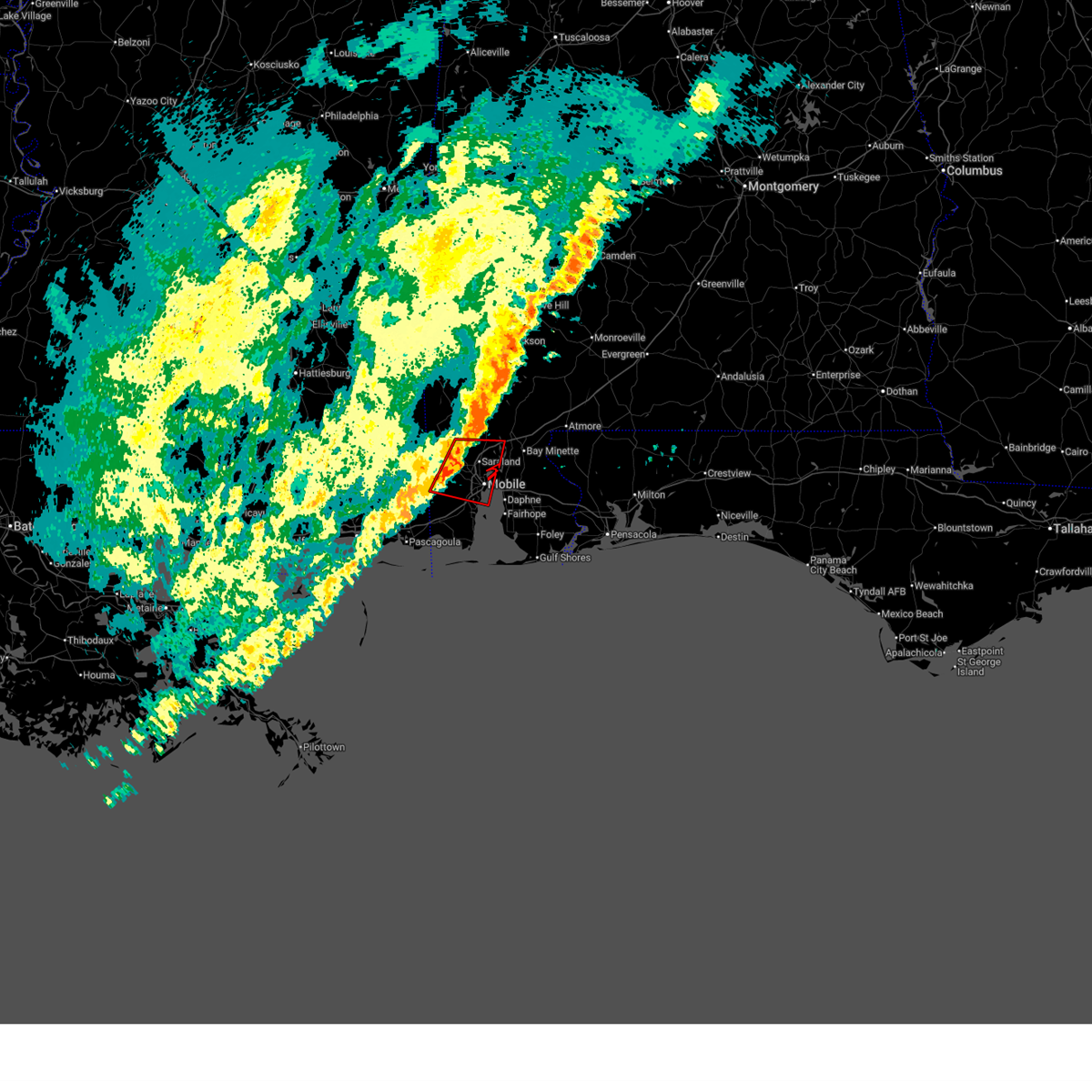
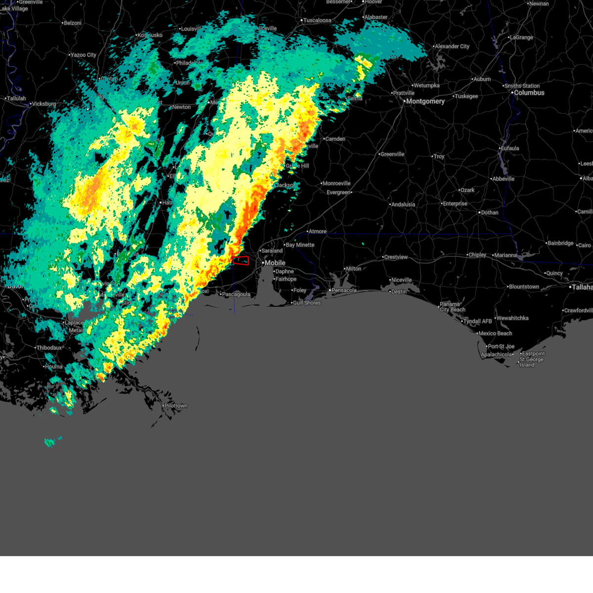
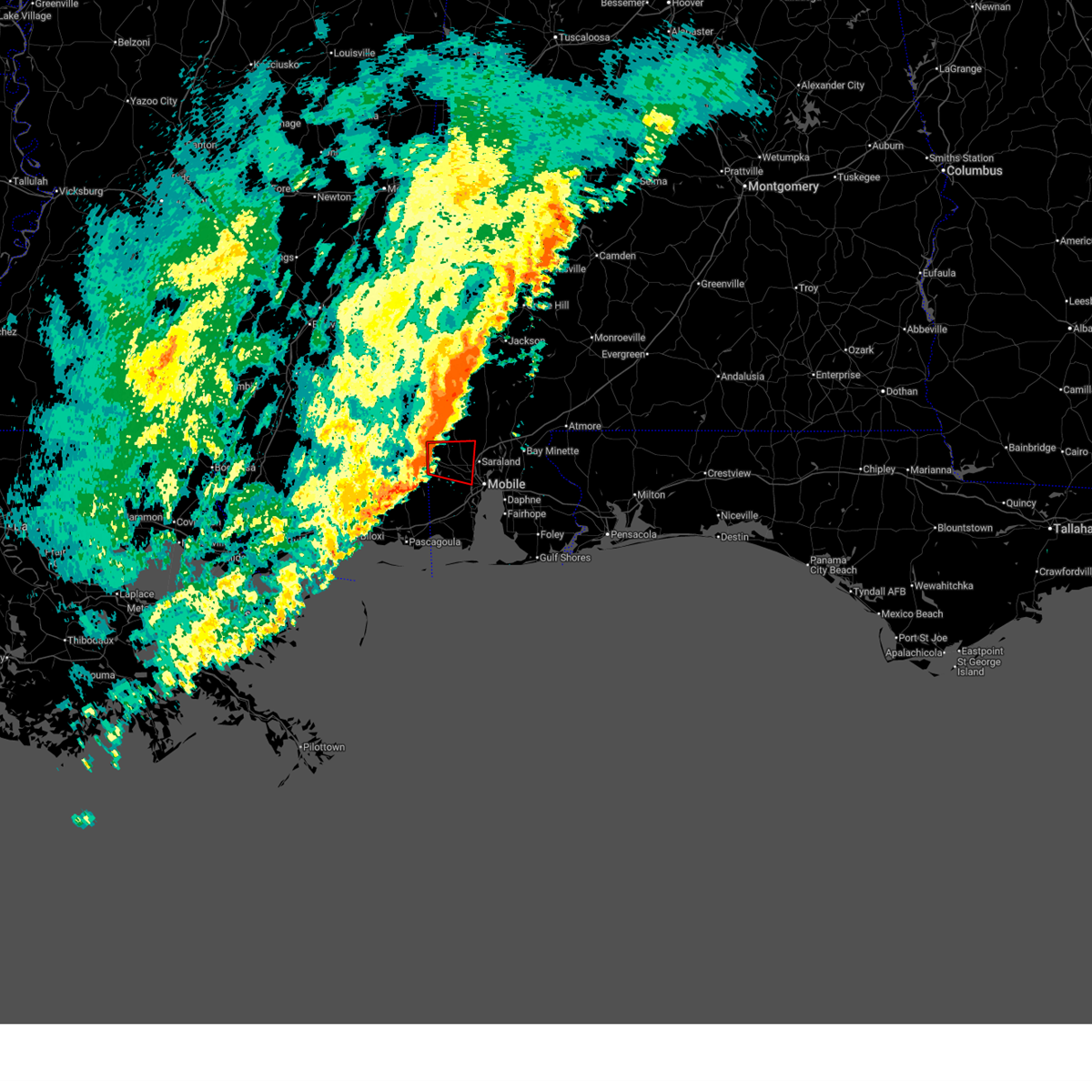
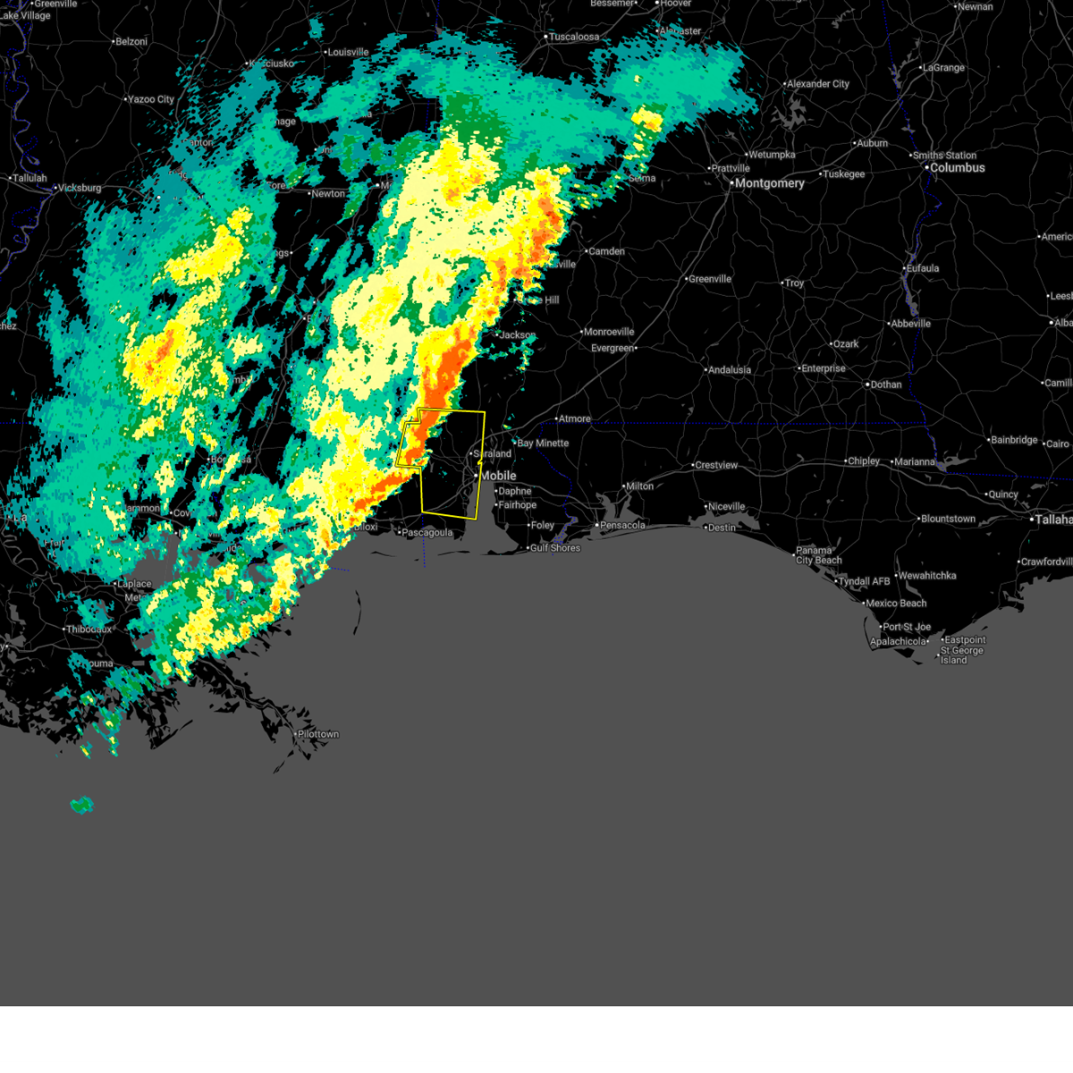
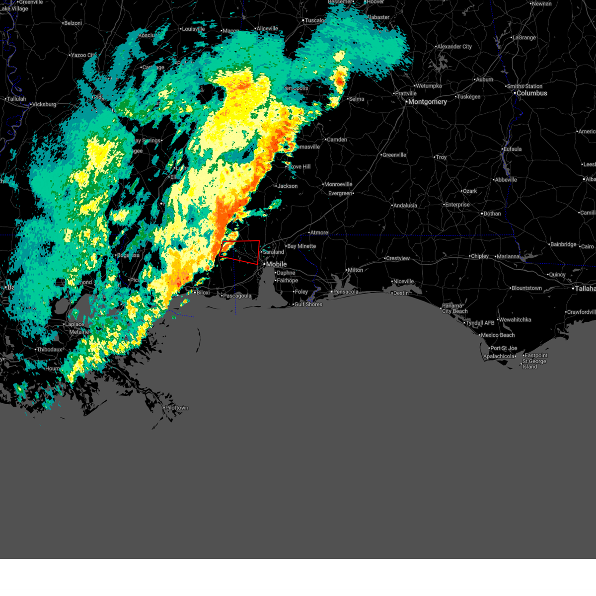
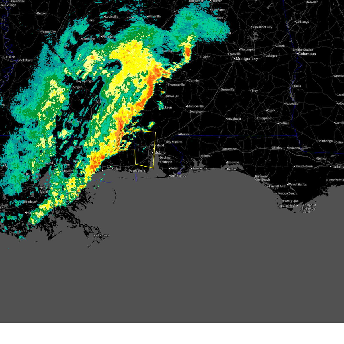
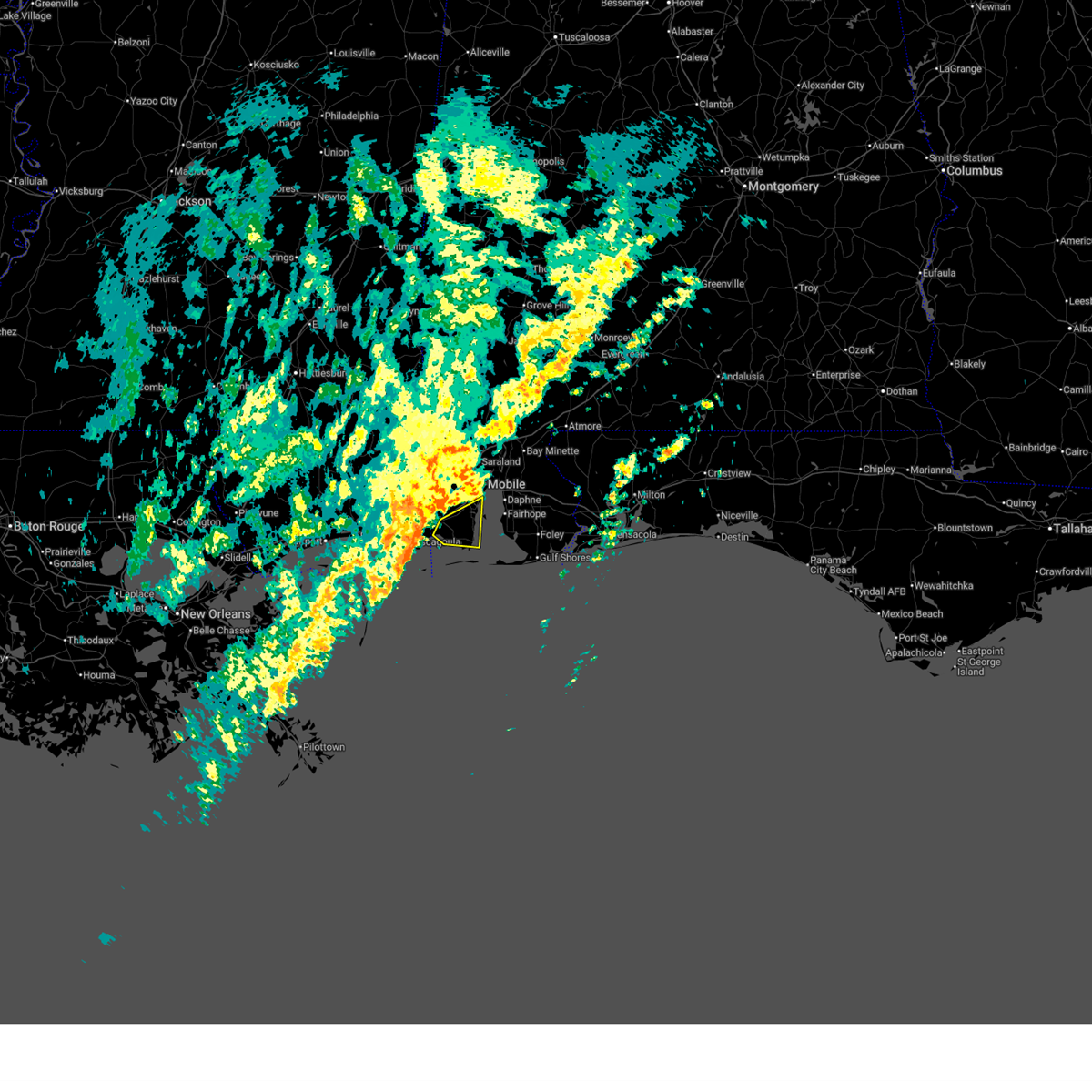
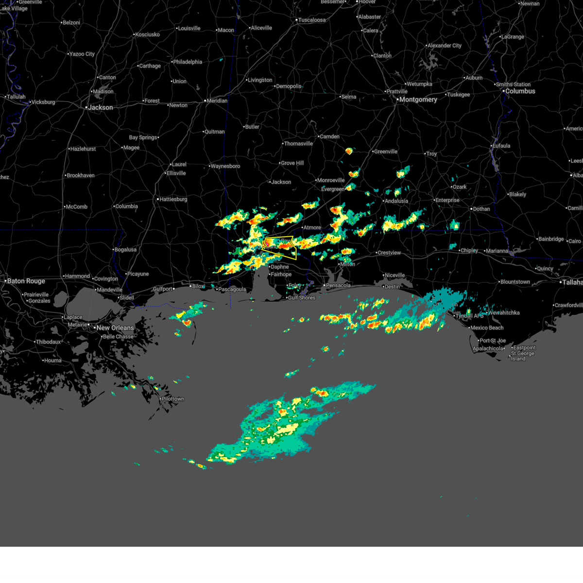
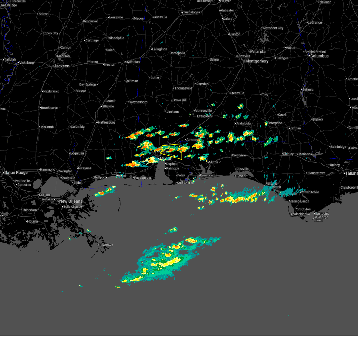
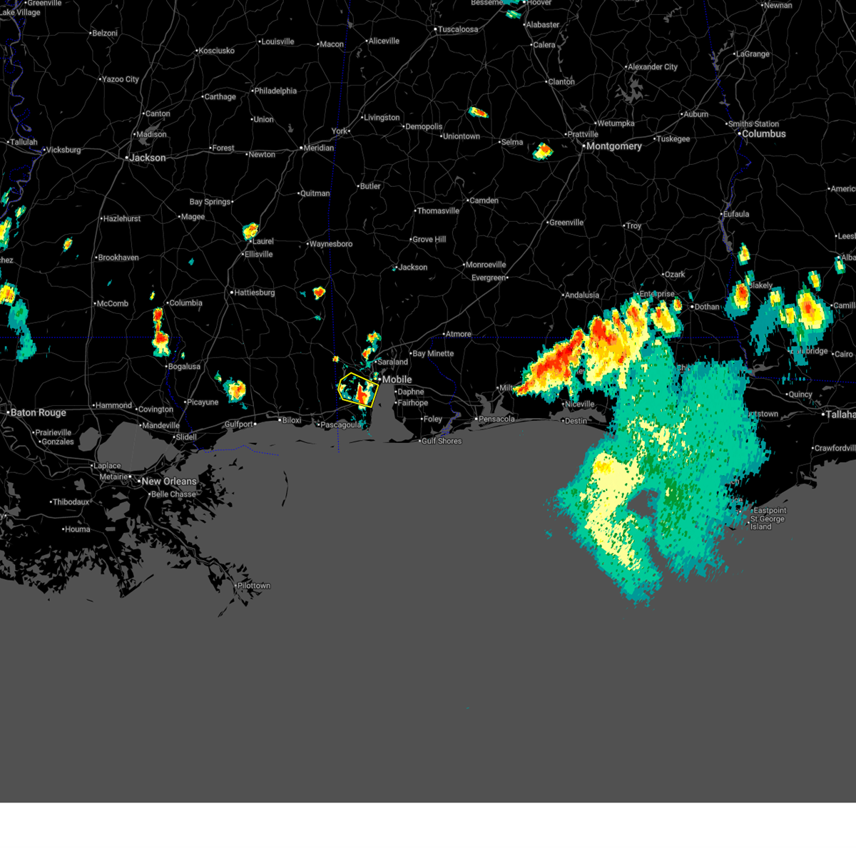
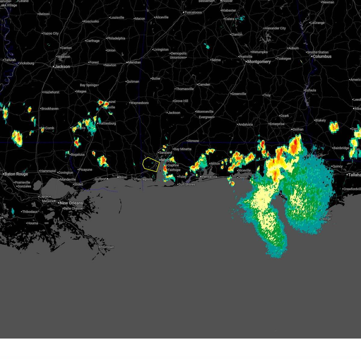
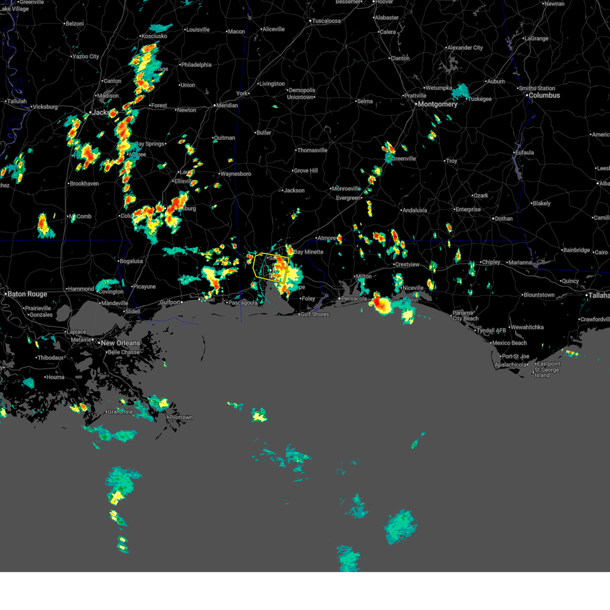
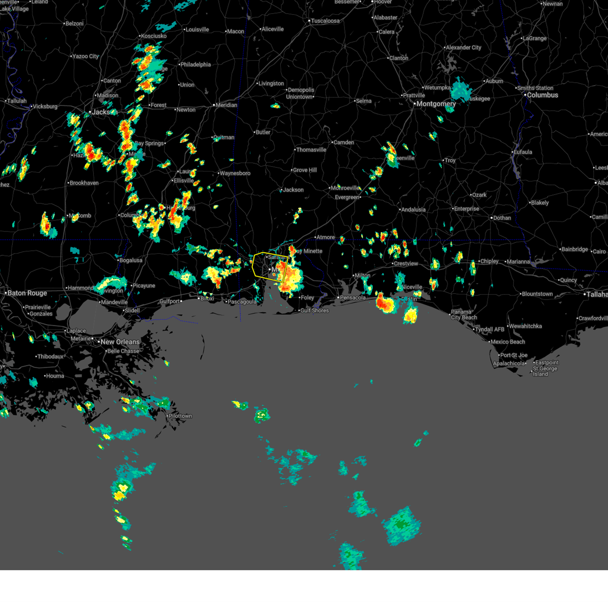
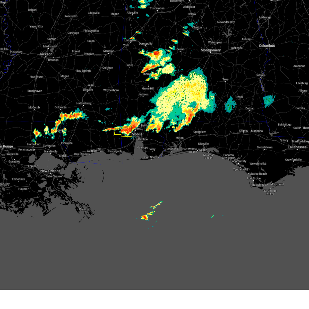
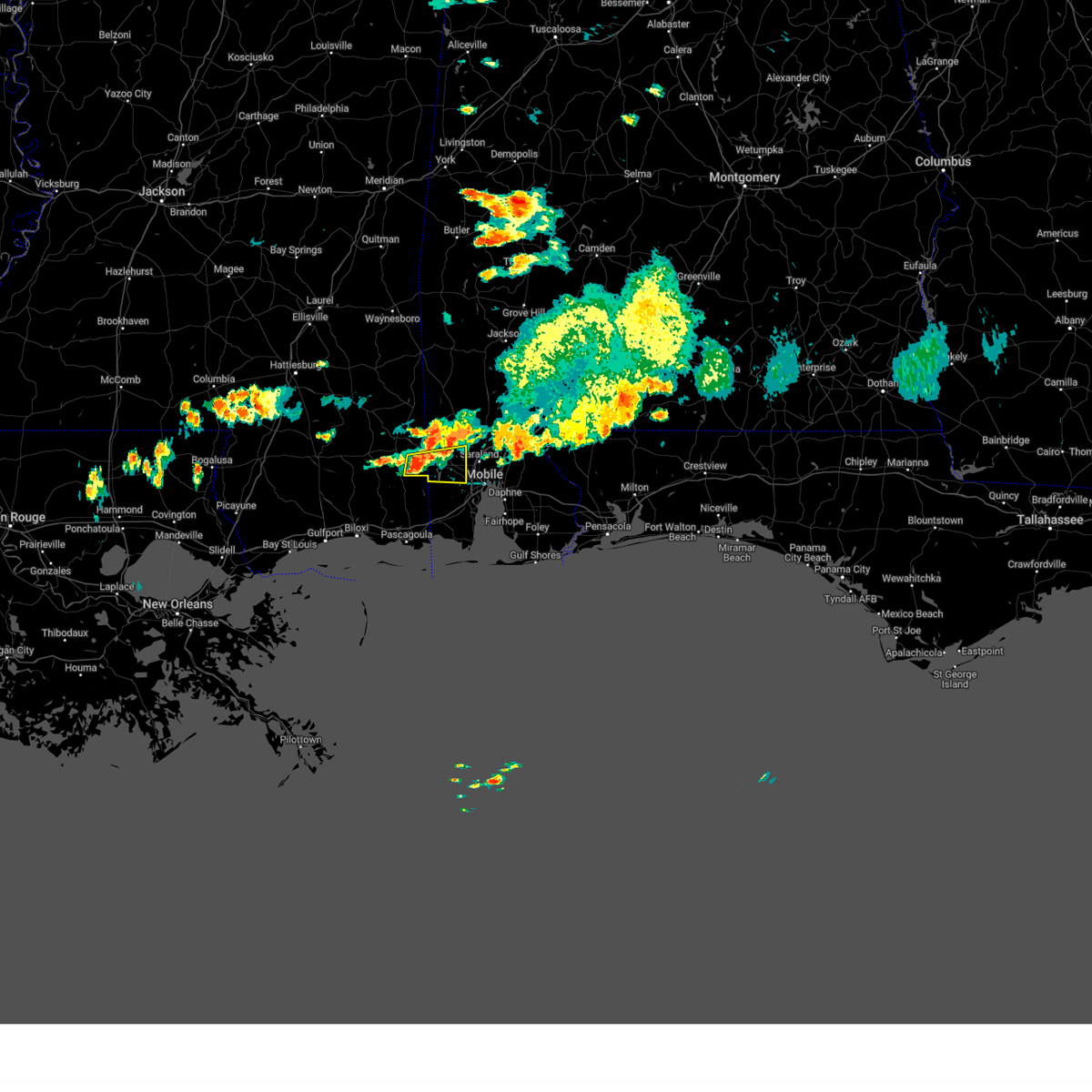
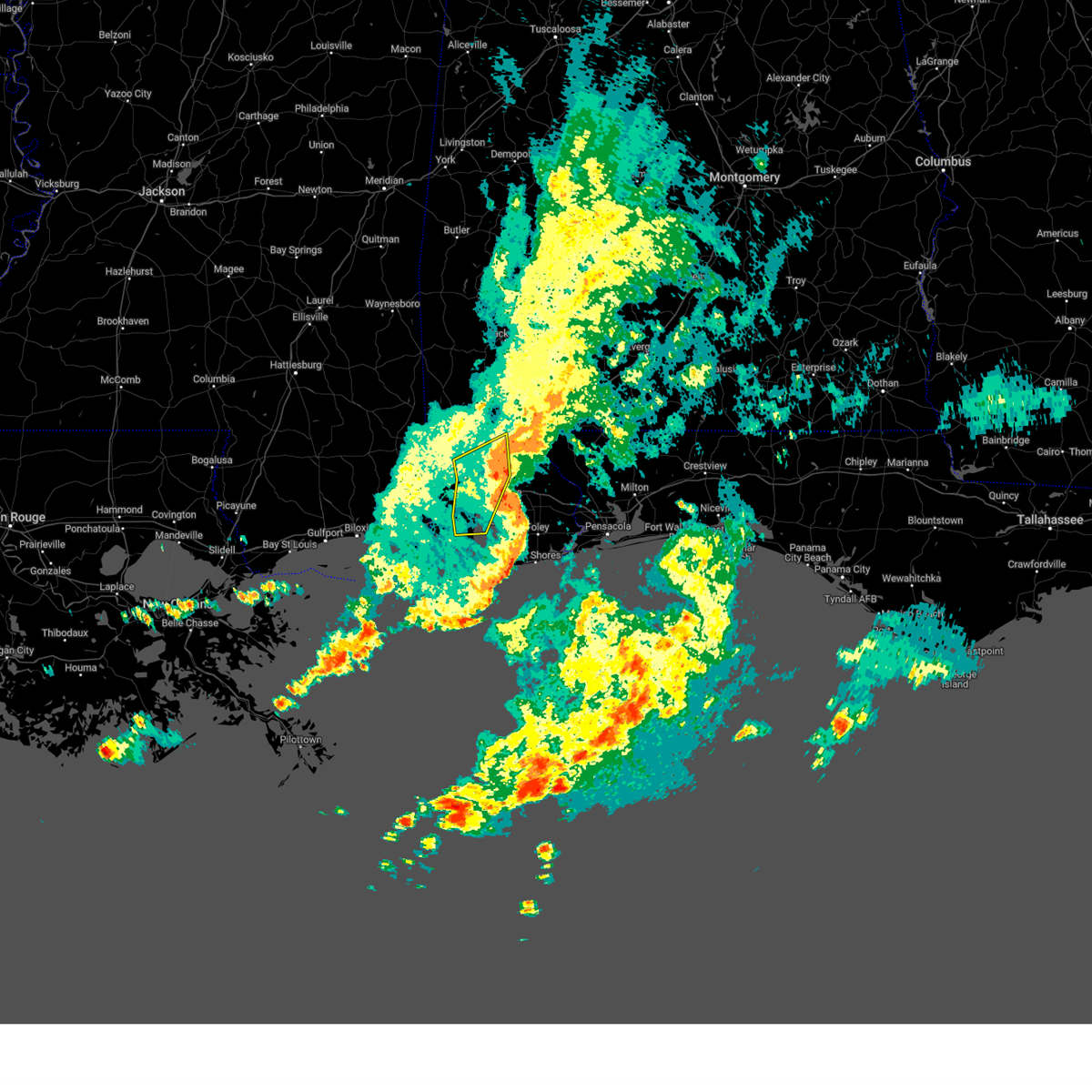
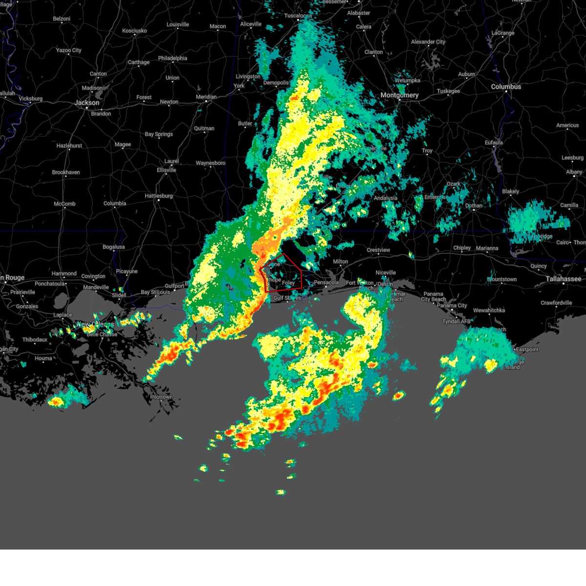
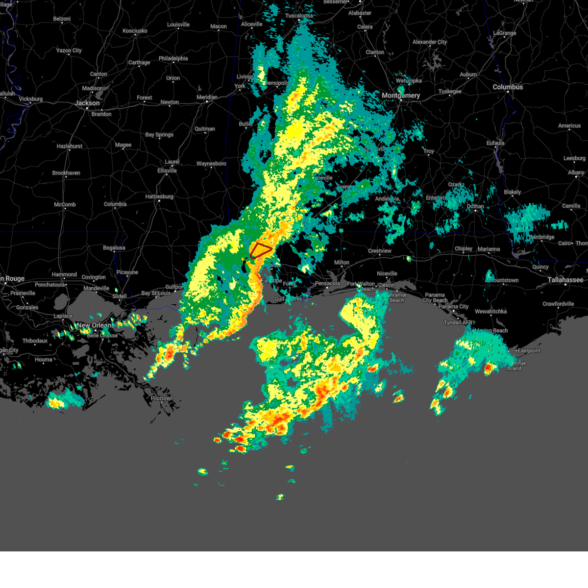
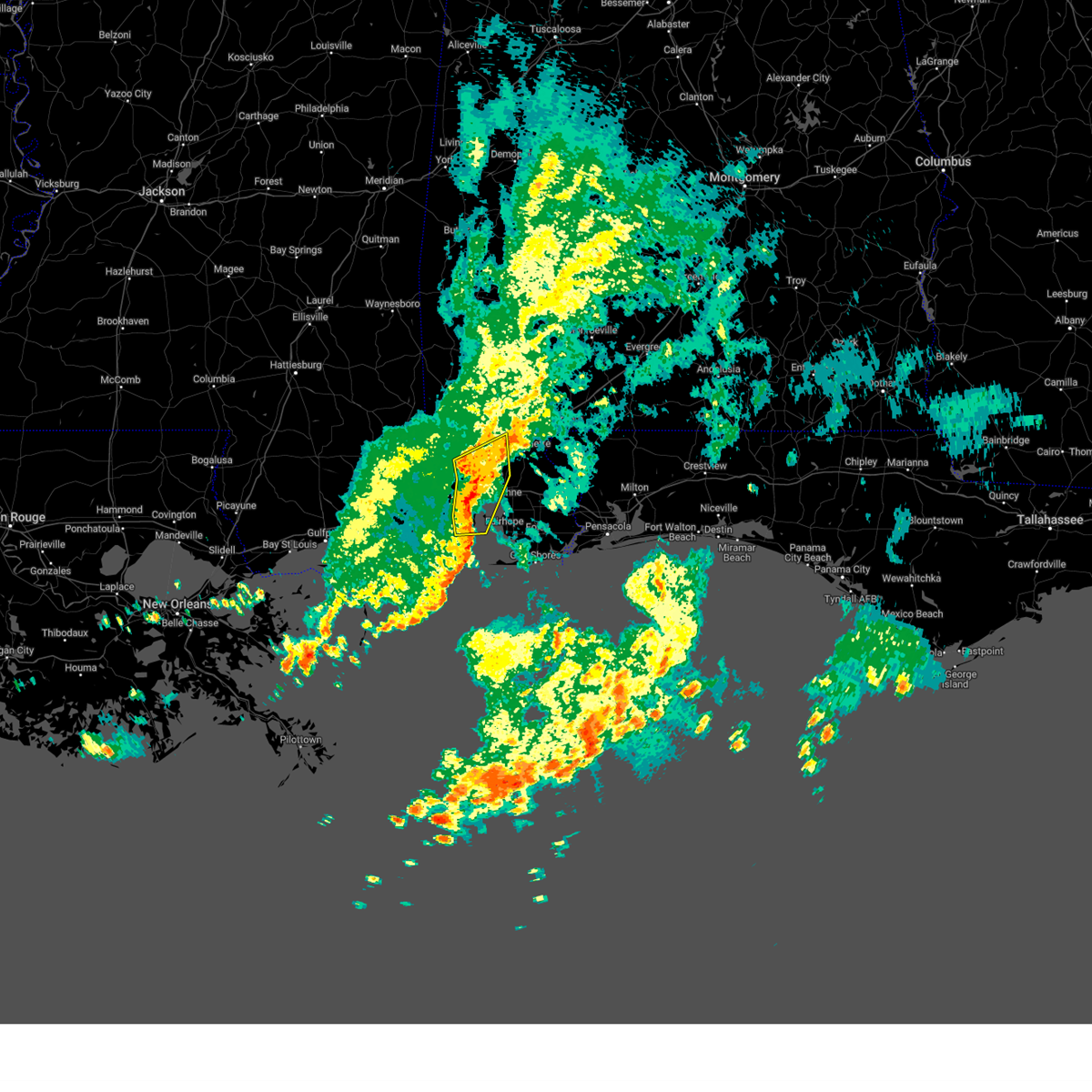
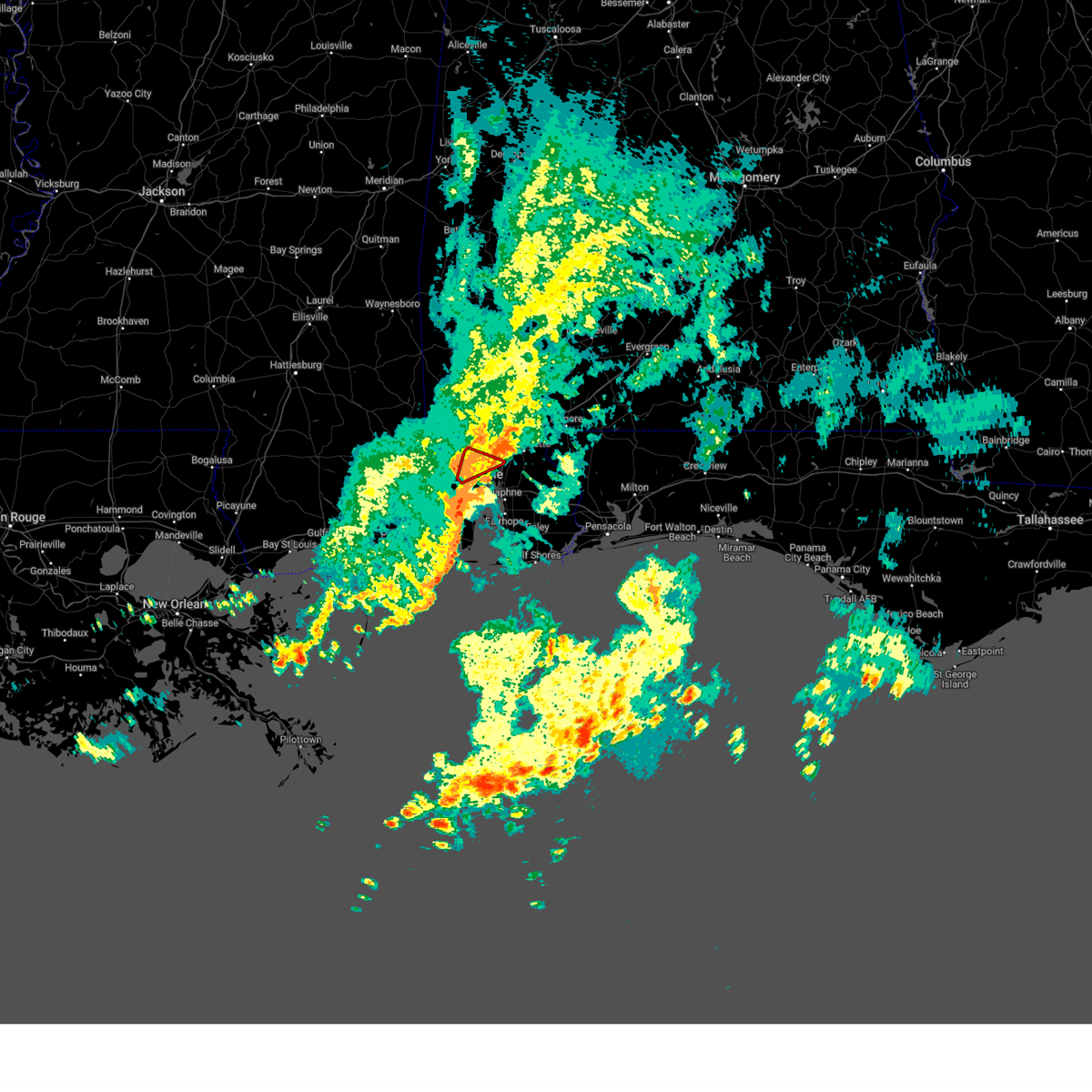
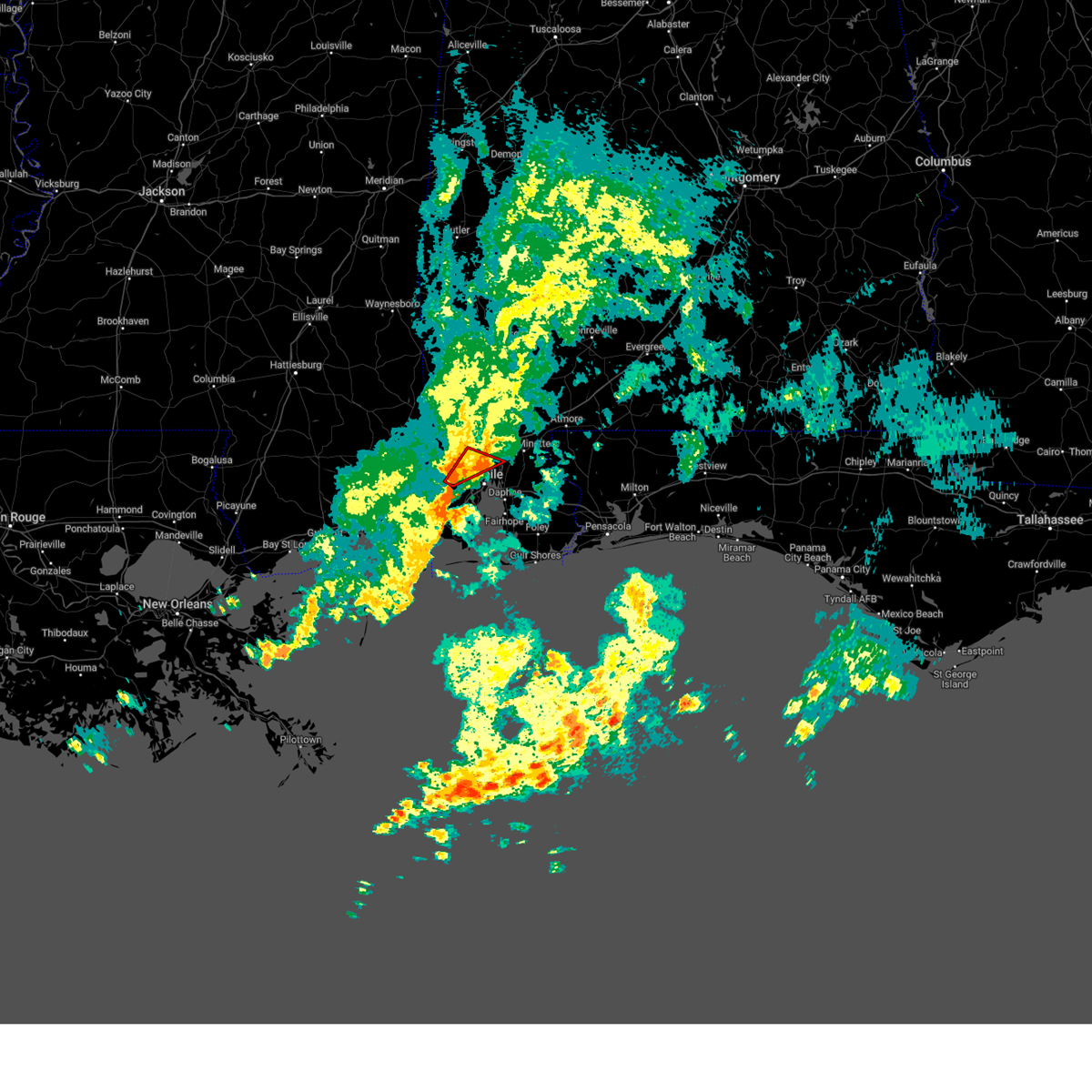
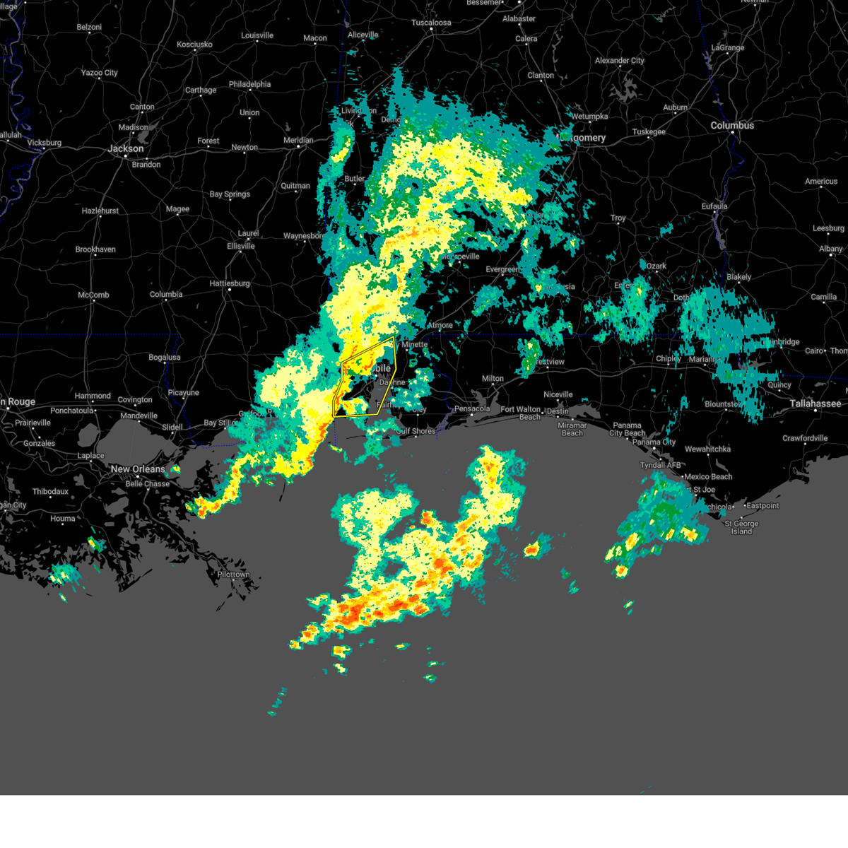
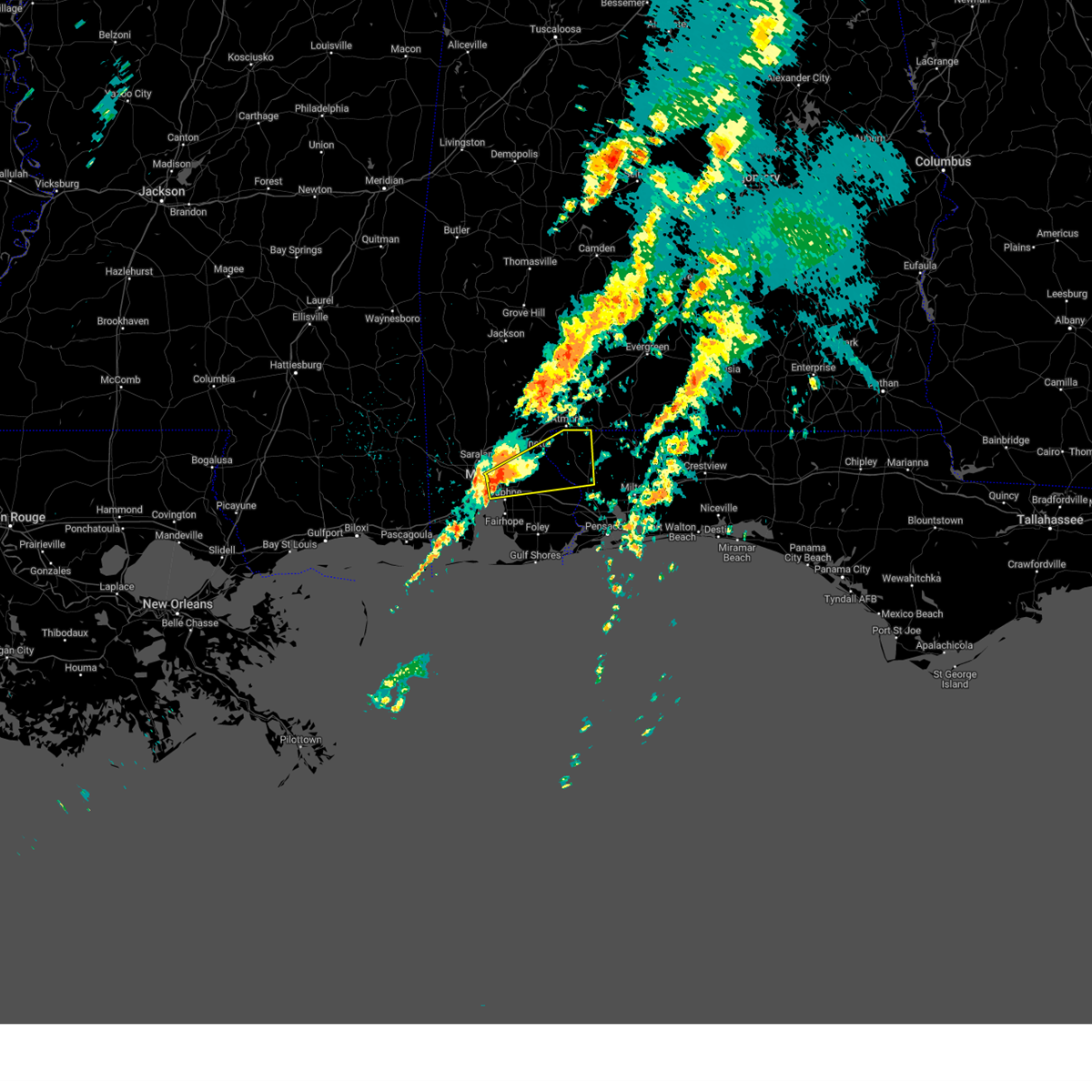
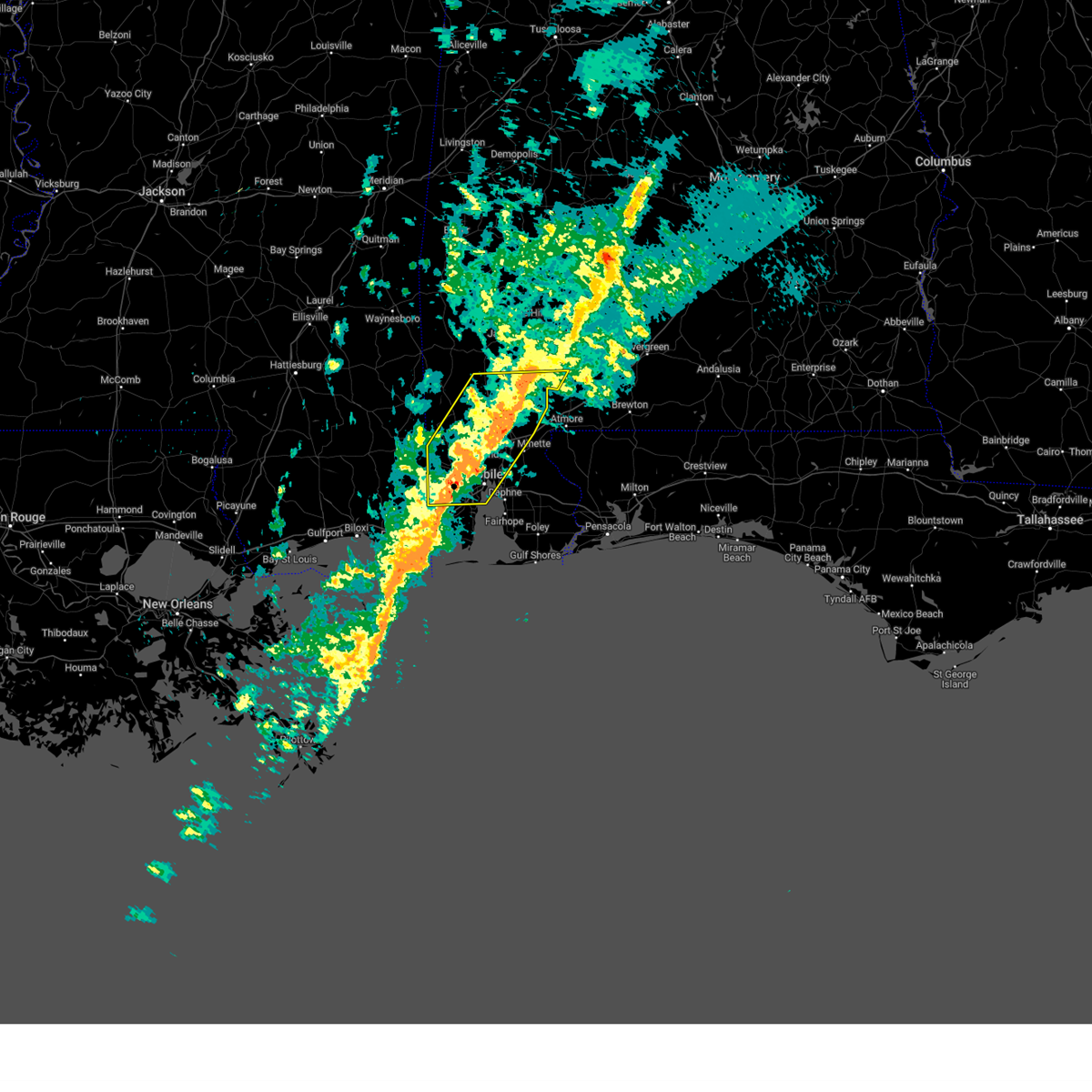
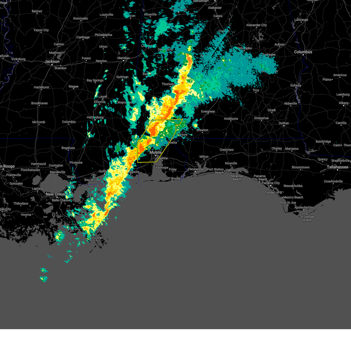
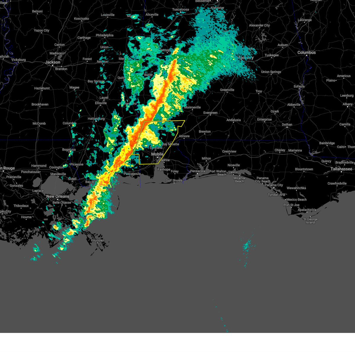
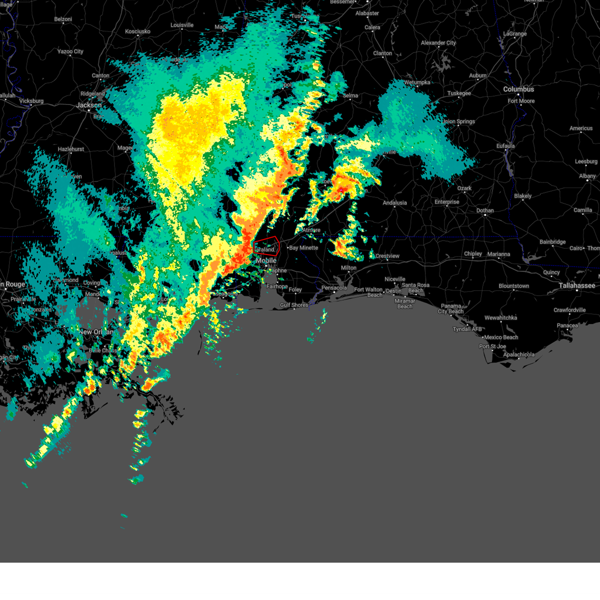
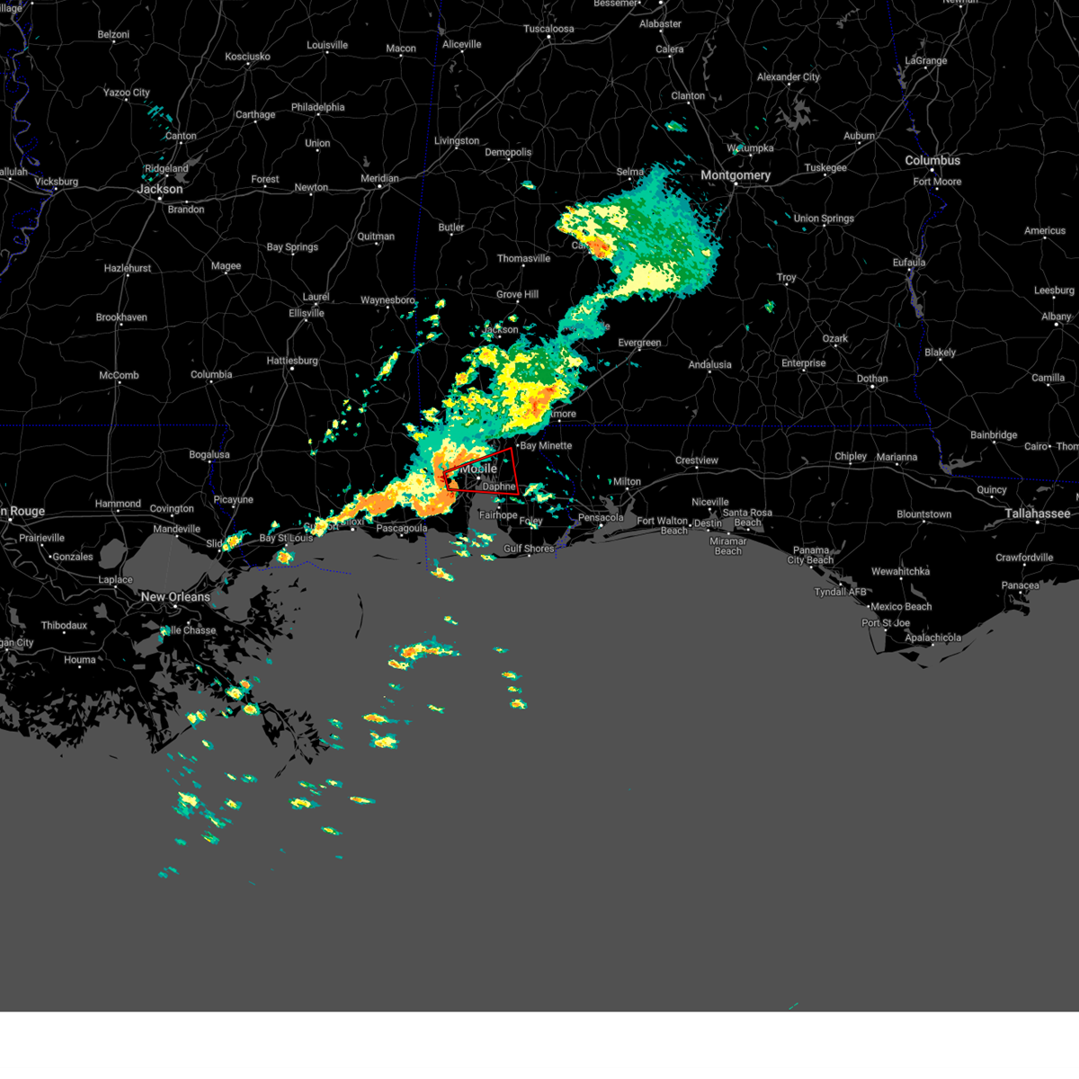
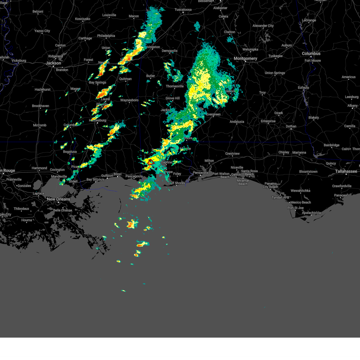
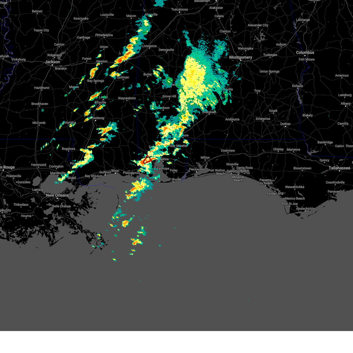
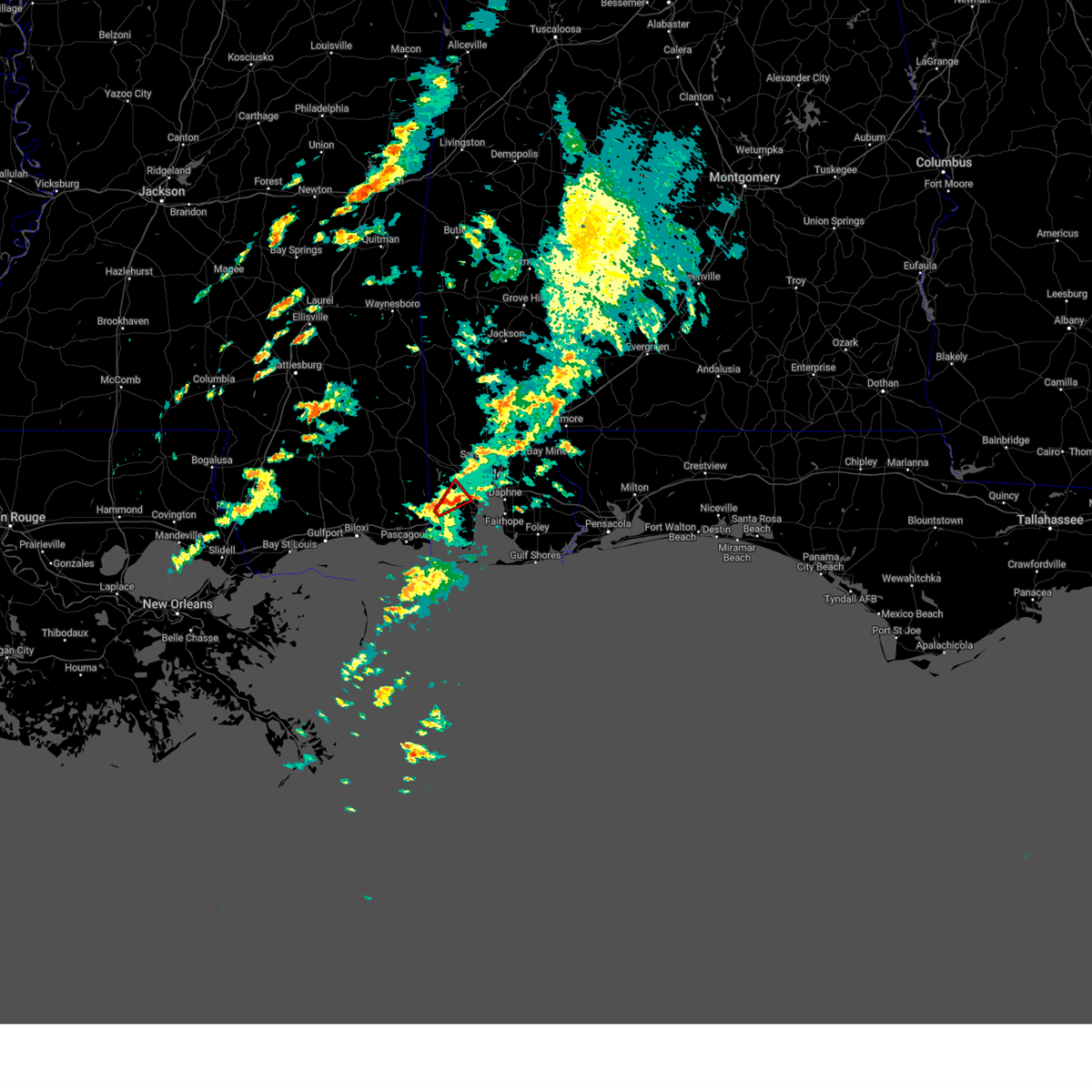
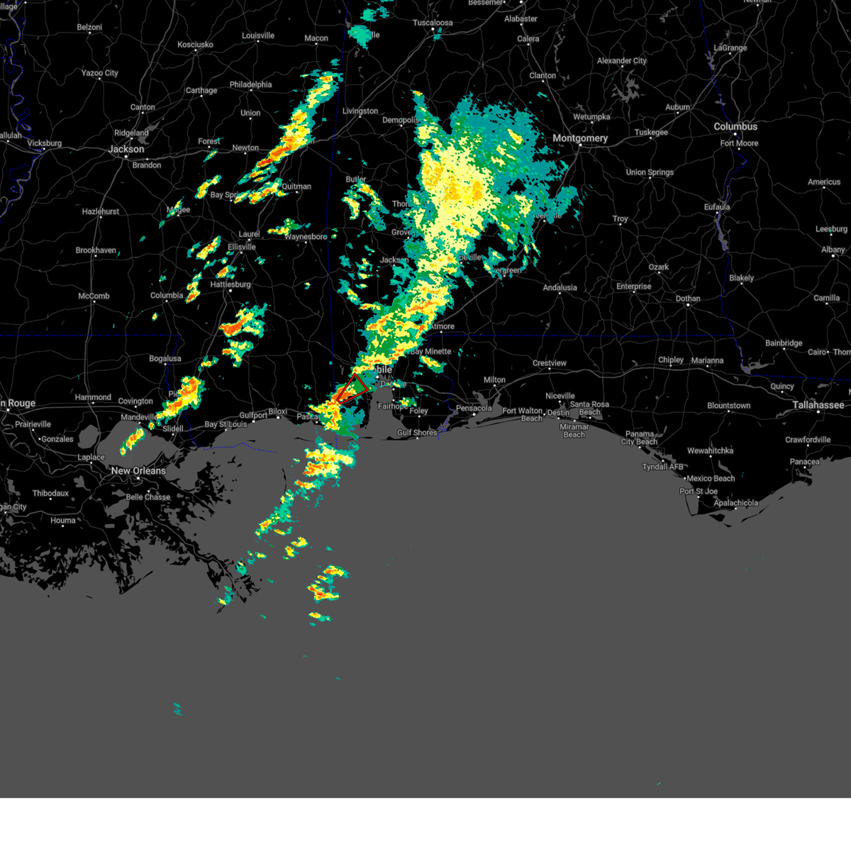
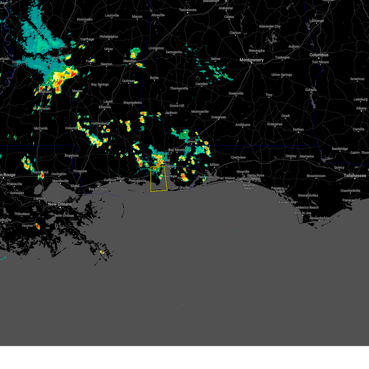
Hail Map for Mobile, AL
The Mobile, AL area has had 20 reports of on-the-ground hail by trained spotters, and has been under severe weather warnings 40 times during the past 12 months. Doppler radar has detected hail at or near Mobile, AL on 98 occasions, including 4 occasions during the past year.
| Name: | Mobile, AL |
| Where Located: | 4.5 miles WSW of Mobile, AL |
| Map: | Google Map for Mobile, AL |
| Population: | 195111 |
| Housing Units: | 89127 |
| More Info: | Search Google for Mobile, AL |
1
The Top Recent Hail Date for Mobile, AL is Thursday, May 7, 2026 (23rd out of 98)
Hail and Wind Damage Spotted near Mobile, AL
| Date / Time | Report Details |
|---|---|
| 6/24/2026 4:37 PM CDT |
 At 436 pm cdt, severe thunderstorms were located along a line extending from near downtown mobile to 6 miles southwest of i65 and al 225, moving east at 25 mph (radar indicated). Hazards include 60 mph wind gusts. Expect damage to roofs, siding, and trees. Locations impacted include, downtown mobile, prichard, chickasaw, spanish fort, and i65 and i165. At 436 pm cdt, severe thunderstorms were located along a line extending from near downtown mobile to 6 miles southwest of i65 and al 225, moving east at 25 mph (radar indicated). Hazards include 60 mph wind gusts. Expect damage to roofs, siding, and trees. Locations impacted include, downtown mobile, prichard, chickasaw, spanish fort, and i65 and i165.
|
| 6/24/2026 4:35 PM CDT | Report with a photo of a large tree blocking the road at cottage hill rd and ashwood d in mobile county AL, 1.8 miles ENE of Mobile, AL |
| 6/24/2026 4:35 PM CDT | Photo from the public relayed by broadcast media shows large limbs down that took out power lines on pleasant valley rd. time estimated by rada in mobile county AL, 0.8 miles WNW of Mobile, AL |
| 6/24/2026 4:35 PM CDT |
 At 435 pm cdt, severe thunderstorms were located along a line extending from downtown mobile to 5 miles south of theodore, moving east at 40 mph (radar indicated). Hazards include 60 mph wind gusts. Expect damage to roofs, siding, and trees. Locations impacted include, midtown mobile, downtown mobile, prichard, daphne, tillmans corner, fairhope, theodore, chickasaw, spanish fort, grand bay, point clear, i65 and i165, and i10 and i65. At 435 pm cdt, severe thunderstorms were located along a line extending from downtown mobile to 5 miles south of theodore, moving east at 40 mph (radar indicated). Hazards include 60 mph wind gusts. Expect damage to roofs, siding, and trees. Locations impacted include, midtown mobile, downtown mobile, prichard, daphne, tillmans corner, fairhope, theodore, chickasaw, spanish fort, grand bay, point clear, i65 and i165, and i10 and i65.
|
| 6/24/2026 4:25 PM CDT | Report of power lines down in the road at airport blvd and alverson rd. widespread power outages across west mobil in mobile county AL, 5.9 miles ESE of Mobile, AL |
| 6/24/2026 4:20 PM CDT | Nws employee relayed a tree blocking the road just east of the roundabout at dawes rd and dawes lane in mobile county AL, 8.9 miles ENE of Mobile, AL |
| 6/24/2026 4:10 PM CDT |
 Svrmob the national weather service in mobile has issued a * severe thunderstorm warning for, southwestern mobile county in southwestern alabama, southwestern baldwin county in southwestern alabama, southeastern george county in southeastern mississippi, * until 500 pm cdt. * at 410 pm cdt, severe thunderstorms were located along a line extending from 3 miles southwest of wilmer to 5 miles south of tanner williams, moving southeast at 35 mph (radar indicated). Hazards include 60 mph wind gusts. expect damage to roofs, siding, and trees Svrmob the national weather service in mobile has issued a * severe thunderstorm warning for, southwestern mobile county in southwestern alabama, southwestern baldwin county in southwestern alabama, southeastern george county in southeastern mississippi, * until 500 pm cdt. * at 410 pm cdt, severe thunderstorms were located along a line extending from 3 miles southwest of wilmer to 5 miles south of tanner williams, moving southeast at 35 mph (radar indicated). Hazards include 60 mph wind gusts. expect damage to roofs, siding, and trees
|
| 6/24/2026 3:53 PM CDT |
 Svrmob the national weather service in mobile has issued a * severe thunderstorm warning for, northern mobile county in southwestern alabama, west central baldwin county in southwestern alabama, * until 445 pm cdt. * at 353 pm cdt, a severe thunderstorm was located 4 miles northeast of wilmer, or 14 miles west of saraland, moving east at 40 mph (radar indicated). Hazards include 60 mph wind gusts and penny size hail. expect damage to roofs, siding, and trees Svrmob the national weather service in mobile has issued a * severe thunderstorm warning for, northern mobile county in southwestern alabama, west central baldwin county in southwestern alabama, * until 445 pm cdt. * at 353 pm cdt, a severe thunderstorm was located 4 miles northeast of wilmer, or 14 miles west of saraland, moving east at 40 mph (radar indicated). Hazards include 60 mph wind gusts and penny size hail. expect damage to roofs, siding, and trees
|
| 6/24/2026 3:49 PM CDT |
 At 349 pm cdt, a severe thunderstorm was located 6 miles west of wilmer, or 9 miles southeast of lucedale, moving southeast at 30 mph (radar indicated). Hazards include 60 mph wind gusts and penny size hail. Expect damage to roofs, siding, and trees. Locations impacted include, lucedale, semmes, tanner williams, and wilmer. At 349 pm cdt, a severe thunderstorm was located 6 miles west of wilmer, or 9 miles southeast of lucedale, moving southeast at 30 mph (radar indicated). Hazards include 60 mph wind gusts and penny size hail. Expect damage to roofs, siding, and trees. Locations impacted include, lucedale, semmes, tanner williams, and wilmer.
|
| 6/24/2026 3:22 PM CDT |
 Svrmob the national weather service in mobile has issued a * severe thunderstorm warning for, west central mobile county in southwestern alabama, george county in southeastern mississippi, * until 400 pm cdt. * at 321 pm cdt, a severe thunderstorm was located 6 miles west of lucedale, moving southeast at 30 mph (radar indicated). Hazards include 60 mph wind gusts and penny size hail. expect damage to roofs, siding, and trees Svrmob the national weather service in mobile has issued a * severe thunderstorm warning for, west central mobile county in southwestern alabama, george county in southeastern mississippi, * until 400 pm cdt. * at 321 pm cdt, a severe thunderstorm was located 6 miles west of lucedale, moving southeast at 30 mph (radar indicated). Hazards include 60 mph wind gusts and penny size hail. expect damage to roofs, siding, and trees
|
| 6/18/2026 7:20 PM CDT |
 Svrmob the national weather service in mobile has issued a * severe thunderstorm warning for, central baldwin county in southwestern alabama, northwestern escambia county in northwestern florida, * until 800 pm cdt. * at 720 pm cdt, severe thunderstorms were located along a line extending from 3 miles west of bay minette to 3 miles northwest of stapleton to near spanish fort, moving east at 40 mph (radar indicated). Hazards include 60 mph wind gusts. expect damage to roofs, siding, and trees Svrmob the national weather service in mobile has issued a * severe thunderstorm warning for, central baldwin county in southwestern alabama, northwestern escambia county in northwestern florida, * until 800 pm cdt. * at 720 pm cdt, severe thunderstorms were located along a line extending from 3 miles west of bay minette to 3 miles northwest of stapleton to near spanish fort, moving east at 40 mph (radar indicated). Hazards include 60 mph wind gusts. expect damage to roofs, siding, and trees
|
| 6/18/2026 7:19 PM CDT |
 At 719 pm cdt, a confirmed tornado was located 5 miles southwest of i65 and al 225, or 7 miles east of creola, moving east at 15 mph (radar confirmed tornado). Hazards include damaging tornado. Flying debris will be dangerous to those caught without shelter. mobile homes will be damaged or destroyed. damage to roofs, windows, and vehicles will occur. tree damage is likely. This tornado will be near, bay minette around 740 pm cdt. At 719 pm cdt, a confirmed tornado was located 5 miles southwest of i65 and al 225, or 7 miles east of creola, moving east at 15 mph (radar confirmed tornado). Hazards include damaging tornado. Flying debris will be dangerous to those caught without shelter. mobile homes will be damaged or destroyed. damage to roofs, windows, and vehicles will occur. tree damage is likely. This tornado will be near, bay minette around 740 pm cdt.
|
| 6/18/2026 7:14 PM CDT |
 At 713 pm cdt, a severe thunderstorm capable of producing a tornado was located over spanish fort, moving east at 45 mph (radar indicated rotation). Hazards include tornado. Flying debris will be dangerous to those caught without shelter. mobile homes will be damaged or destroyed. damage to roofs, windows, and vehicles will occur. tree damage is likely. This dangerous storm will be near, spanish fort around 720 pm cdt. At 713 pm cdt, a severe thunderstorm capable of producing a tornado was located over spanish fort, moving east at 45 mph (radar indicated rotation). Hazards include tornado. Flying debris will be dangerous to those caught without shelter. mobile homes will be damaged or destroyed. damage to roofs, windows, and vehicles will occur. tree damage is likely. This dangerous storm will be near, spanish fort around 720 pm cdt.
|
| 6/18/2026 7:03 PM CDT |
 Tormob the national weather service in mobile has issued a * tornado warning for, central mobile county in southwestern alabama, west central baldwin county in southwestern alabama, * until 730 pm cdt. * at 702 pm cdt, a severe thunderstorm capable of producing a tornado was located over downtown mobile, moving east at 55 mph (radar indicated rotation). Hazards include tornado. Flying debris will be dangerous to those caught without shelter. mobile homes will be damaged or destroyed. damage to roofs, windows, and vehicles will occur. tree damage is likely. This dangerous storm will be near, spanish fort around 710 pm cdt. Tormob the national weather service in mobile has issued a * tornado warning for, central mobile county in southwestern alabama, west central baldwin county in southwestern alabama, * until 730 pm cdt. * at 702 pm cdt, a severe thunderstorm capable of producing a tornado was located over downtown mobile, moving east at 55 mph (radar indicated rotation). Hazards include tornado. Flying debris will be dangerous to those caught without shelter. mobile homes will be damaged or destroyed. damage to roofs, windows, and vehicles will occur. tree damage is likely. This dangerous storm will be near, spanish fort around 710 pm cdt.
|
| 6/18/2026 6:55 PM CDT | Trees down on moffett r in mobile county AL, 6.9 miles SSE of Mobile, AL |
| 6/18/2026 6:45 PM CDT |
 Svrmob the national weather service in mobile has issued a * severe thunderstorm warning for, northwestern mobile county in southwestern alabama, eastern george county in southeastern mississippi, * until 730 pm cdt. * at 645 pm cdt, severe thunderstorms were located along a line extending from 10 miles east of lucedale to 4 miles west of wilmer to 8 miles northwest of hurley, moving east at 25 mph (radar indicated). Hazards include 60 mph wind gusts. expect damage to roofs, siding, and trees Svrmob the national weather service in mobile has issued a * severe thunderstorm warning for, northwestern mobile county in southwestern alabama, eastern george county in southeastern mississippi, * until 730 pm cdt. * at 645 pm cdt, severe thunderstorms were located along a line extending from 10 miles east of lucedale to 4 miles west of wilmer to 8 miles northwest of hurley, moving east at 25 mph (radar indicated). Hazards include 60 mph wind gusts. expect damage to roofs, siding, and trees
|
| 6/18/2026 9:43 AM CDT |
 Tormob the national weather service in mobile has issued a * tornado warning for, central mobile county in southwestern alabama, * until 1030 am cdt. * at 943 am cdt, a severe thunderstorm capable of producing a tornado was located 4 miles southwest of mobile regional airport, or 7 miles west of tillmans corner, moving north at 30 mph (radar indicated rotation). Hazards include tornado. Flying debris will be dangerous to those caught without shelter. mobile homes will be damaged or destroyed. damage to roofs, windows, and vehicles will occur. tree damage is likely. this dangerous storm will be near, mobile regional airport around 950 am cdt. semmes around 1000 am cdt. Chunchula around 1020 am cdt. Tormob the national weather service in mobile has issued a * tornado warning for, central mobile county in southwestern alabama, * until 1030 am cdt. * at 943 am cdt, a severe thunderstorm capable of producing a tornado was located 4 miles southwest of mobile regional airport, or 7 miles west of tillmans corner, moving north at 30 mph (radar indicated rotation). Hazards include tornado. Flying debris will be dangerous to those caught without shelter. mobile homes will be damaged or destroyed. damage to roofs, windows, and vehicles will occur. tree damage is likely. this dangerous storm will be near, mobile regional airport around 950 am cdt. semmes around 1000 am cdt. Chunchula around 1020 am cdt.
|
| 6/2/2026 5:28 PM CDT |
 Svrmob the national weather service in mobile has issued a * severe thunderstorm warning for, west central mobile county in southwestern alabama, * until 600 pm cdt. * at 528 pm cdt, a severe thunderstorm was located 4 miles north of semmes, or 10 miles west of saraland, moving south at 20 mph (radar indicated). Hazards include 60 mph wind gusts. expect damage to roofs, siding, and trees Svrmob the national weather service in mobile has issued a * severe thunderstorm warning for, west central mobile county in southwestern alabama, * until 600 pm cdt. * at 528 pm cdt, a severe thunderstorm was located 4 miles north of semmes, or 10 miles west of saraland, moving south at 20 mph (radar indicated). Hazards include 60 mph wind gusts. expect damage to roofs, siding, and trees
|
| 5/24/2026 4:34 AM CDT |
 At 434 am cdt, severe thunderstorms were located along a line extending from 5 miles east of big point to 6 miles north of alabama port, moving north at 35 mph (radar indicated). Hazards include 60 mph wind gusts. Expect damage to roofs, siding, and trees. Locations impacted include, midtown mobile, downtown mobile, tillmans corner, theodore, tanner williams, i10 and i65, and mobile regional airport. At 434 am cdt, severe thunderstorms were located along a line extending from 5 miles east of big point to 6 miles north of alabama port, moving north at 35 mph (radar indicated). Hazards include 60 mph wind gusts. Expect damage to roofs, siding, and trees. Locations impacted include, midtown mobile, downtown mobile, tillmans corner, theodore, tanner williams, i10 and i65, and mobile regional airport.
|
| 5/24/2026 4:11 AM CDT |
 Svrmob the national weather service in mobile has issued a * severe thunderstorm warning for, southwestern mobile county in southwestern alabama, * until 500 am cdt. * at 411 am cdt, severe thunderstorms were located along a line extending from 7 miles southeast of moss point to near dauphin island, moving north at 35 mph (radar indicated). Hazards include 60 mph wind gusts. expect damage to roofs, siding, and trees Svrmob the national weather service in mobile has issued a * severe thunderstorm warning for, southwestern mobile county in southwestern alabama, * until 500 am cdt. * at 411 am cdt, severe thunderstorms were located along a line extending from 7 miles southeast of moss point to near dauphin island, moving north at 35 mph (radar indicated). Hazards include 60 mph wind gusts. expect damage to roofs, siding, and trees
|
| 5/8/2026 12:36 PM CDT |
 At 1236 pm cdt, a severe thunderstorm was located over chunchula, or 8 miles west of satsuma, moving east at 40 mph (radar indicated). Hazards include 60 mph wind gusts and quarter size hail. Hail damage to vehicles is expected. expect wind damage to roofs, siding, and trees. Locations impacted include, saraland, satsuma, creola, chunchula, axis, and i65 and al 158. At 1236 pm cdt, a severe thunderstorm was located over chunchula, or 8 miles west of satsuma, moving east at 40 mph (radar indicated). Hazards include 60 mph wind gusts and quarter size hail. Hail damage to vehicles is expected. expect wind damage to roofs, siding, and trees. Locations impacted include, saraland, satsuma, creola, chunchula, axis, and i65 and al 158.
|
| 5/8/2026 12:26 PM CDT |
 At 1225 pm cdt, a severe thunderstorm was located near wilmer, or 15 miles west of saraland, moving east at 40 mph (radar indicated). Hazards include 60 mph wind gusts and quarter size hail. Hail damage to vehicles is expected. expect wind damage to roofs, siding, and trees. Locations impacted include, saraland, satsuma, creola, chunchula, axis, i65 and al 158, and wilmer. At 1225 pm cdt, a severe thunderstorm was located near wilmer, or 15 miles west of saraland, moving east at 40 mph (radar indicated). Hazards include 60 mph wind gusts and quarter size hail. Hail damage to vehicles is expected. expect wind damage to roofs, siding, and trees. Locations impacted include, saraland, satsuma, creola, chunchula, axis, i65 and al 158, and wilmer.
|
| 5/8/2026 12:26 PM CDT |
 the severe thunderstorm warning has been cancelled and is no longer in effect the severe thunderstorm warning has been cancelled and is no longer in effect
|
| 5/8/2026 12:07 PM CDT |
 Svrmob the national weather service in mobile has issued a * severe thunderstorm warning for, northwestern mobile county in southwestern alabama, eastern george county in southeastern mississippi, * until 1245 pm cdt. * at 1207 pm cdt, a severe thunderstorm was located 5 miles southeast of lucedale, moving east at 40 mph (radar indicated). Hazards include 60 mph wind gusts and quarter size hail. Hail damage to vehicles is expected. Expect wind damage to roofs, siding, and trees. Svrmob the national weather service in mobile has issued a * severe thunderstorm warning for, northwestern mobile county in southwestern alabama, eastern george county in southeastern mississippi, * until 1245 pm cdt. * at 1207 pm cdt, a severe thunderstorm was located 5 miles southeast of lucedale, moving east at 40 mph (radar indicated). Hazards include 60 mph wind gusts and quarter size hail. Hail damage to vehicles is expected. Expect wind damage to roofs, siding, and trees.
|
| 5/7/2026 9:24 AM CDT |
 The storm which prompted the warning has moved out of the area. therefore, the warning will be allowed to expire. however, gusty winds are still possible with this thunderstorm. to report severe weather, contact your nearest law enforcement agency. they will relay your report to the national weather service mobile. The storm which prompted the warning has moved out of the area. therefore, the warning will be allowed to expire. however, gusty winds are still possible with this thunderstorm. to report severe weather, contact your nearest law enforcement agency. they will relay your report to the national weather service mobile.
|
| 5/7/2026 9:20 AM CDT |
 At 920 am cdt, a severe thunderstorm capable of producing a tornado was located 5 miles east of theodore, moving east at 45 mph (radar indicated rotation). Hazards include tornado. Flying debris will be dangerous to those caught without shelter. mobile homes will be damaged or destroyed. damage to roofs, windows, and vehicles will occur. tree damage is likely. This tornadic thunderstorm will remain over mainly rural areas of central mobile county. At 920 am cdt, a severe thunderstorm capable of producing a tornado was located 5 miles east of theodore, moving east at 45 mph (radar indicated rotation). Hazards include tornado. Flying debris will be dangerous to those caught without shelter. mobile homes will be damaged or destroyed. damage to roofs, windows, and vehicles will occur. tree damage is likely. This tornadic thunderstorm will remain over mainly rural areas of central mobile county.
|
| 5/7/2026 9:06 AM CDT |
 Tormob the national weather service in mobile has issued a * tornado warning for, southwestern mobile county in southwestern alabama, * until 930 am cdt. * at 905 am cdt, a severe thunderstorm capable of producing a tornado was located 5 miles northeast of grand bay, moving east at 45 mph (radar indicated rotation). Hazards include tornado. Flying debris will be dangerous to those caught without shelter. mobile homes will be damaged or destroyed. damage to roofs, windows, and vehicles will occur. tree damage is likely. This dangerous storm will be near, theodore around 910 am cdt. Tormob the national weather service in mobile has issued a * tornado warning for, southwestern mobile county in southwestern alabama, * until 930 am cdt. * at 905 am cdt, a severe thunderstorm capable of producing a tornado was located 5 miles northeast of grand bay, moving east at 45 mph (radar indicated rotation). Hazards include tornado. Flying debris will be dangerous to those caught without shelter. mobile homes will be damaged or destroyed. damage to roofs, windows, and vehicles will occur. tree damage is likely. This dangerous storm will be near, theodore around 910 am cdt.
|
| 3/16/2026 4:51 AM CDT |
 the severe thunderstorm warning has been cancelled and is no longer in effect the severe thunderstorm warning has been cancelled and is no longer in effect
|
| 3/16/2026 4:41 AM CDT |
 At 440 am cdt, a severe thunderstorm was located 4 miles south of i65 and al 225, or 5 miles west of bay minette, moving east at 55 mph (radar indicated). Hazards include quarter size hail. Damage to vehicles is expected. Locations impacted include, bay minette and i65 and al 225. At 440 am cdt, a severe thunderstorm was located 4 miles south of i65 and al 225, or 5 miles west of bay minette, moving east at 55 mph (radar indicated). Hazards include quarter size hail. Damage to vehicles is expected. Locations impacted include, bay minette and i65 and al 225.
|
| 3/16/2026 4:41 AM CDT |
 the severe thunderstorm warning has been cancelled and is no longer in effect the severe thunderstorm warning has been cancelled and is no longer in effect
|
| 3/16/2026 4:29 AM CDT |
 Svrmob the national weather service in mobile has issued a * severe thunderstorm warning for, east central mobile county in southwestern alabama, central baldwin county in southwestern alabama, northwestern escambia county in northwestern florida, * until 515 am cdt. * at 429 am cdt, a severe thunderstorm was located over saraland, moving east at 50 mph (radar indicated). Hazards include quarter size hail. damage to vehicles is expected Svrmob the national weather service in mobile has issued a * severe thunderstorm warning for, east central mobile county in southwestern alabama, central baldwin county in southwestern alabama, northwestern escambia county in northwestern florida, * until 515 am cdt. * at 429 am cdt, a severe thunderstorm was located over saraland, moving east at 50 mph (radar indicated). Hazards include quarter size hail. damage to vehicles is expected
|
| 3/12/2026 12:41 AM CDT |
 the tornado warning has been cancelled and is no longer in effect the tornado warning has been cancelled and is no longer in effect
|
| 3/12/2026 12:41 AM CDT |
 At 1240 am cdt, severe thunderstorms were located along a line extending from near i65 and al 225 to 3 miles southeast of theodore, moving southeast at 30 mph (radar indicated). Hazards include 60 mph wind gusts. Expect damage to roofs, siding, and trees. Locations impacted include, midtown mobile, downtown mobile, prichard, daphne, tillmans corner, fairhope, saraland, bay minette, theodore, chickasaw, satsuma, spanish fort, robertsdale, creola, point clear, loxley, stockton, stapleton, axis, and summerdale. At 1240 am cdt, severe thunderstorms were located along a line extending from near i65 and al 225 to 3 miles southeast of theodore, moving southeast at 30 mph (radar indicated). Hazards include 60 mph wind gusts. Expect damage to roofs, siding, and trees. Locations impacted include, midtown mobile, downtown mobile, prichard, daphne, tillmans corner, fairhope, saraland, bay minette, theodore, chickasaw, satsuma, spanish fort, robertsdale, creola, point clear, loxley, stockton, stapleton, axis, and summerdale.
|
| 3/12/2026 12:11 AM CDT |
 Svrmob the national weather service in mobile has issued a * severe thunderstorm warning for, central mobile county in southwestern alabama, central baldwin county in southwestern alabama, northwestern escambia county in northwestern florida, * until 100 am cdt. * at 1211 am cdt, severe thunderstorms were located along a line extending from near movico to 7 miles south of tanner williams, moving southeast at 30 mph (radar indicated). Hazards include 70 mph wind gusts. Expect considerable tree damage. Damage is likely to mobile homes, roofs, and outbuildings. Svrmob the national weather service in mobile has issued a * severe thunderstorm warning for, central mobile county in southwestern alabama, central baldwin county in southwestern alabama, northwestern escambia county in northwestern florida, * until 100 am cdt. * at 1211 am cdt, severe thunderstorms were located along a line extending from near movico to 7 miles south of tanner williams, moving southeast at 30 mph (radar indicated). Hazards include 70 mph wind gusts. Expect considerable tree damage. Damage is likely to mobile homes, roofs, and outbuildings.
|
| 3/12/2026 12:11 AM CDT |
 Tormob the national weather service in mobile has issued a * tornado warning for, central mobile county in southwestern alabama, * until 100 am cdt. * at 1211 am cdt, severe thunderstorms capable of producing a tornado were located along a line extending from 3 miles east of chunchula to 5 miles southwest of mobile regional airport, moving east at 25 mph (radar indicated rotation). Hazards include tornado. Flying debris will be dangerous to those caught without shelter. mobile homes will be damaged or destroyed. damage to roofs, windows, and vehicles will occur. tree damage is likely. these dangerous storms will be near, i65 and al 158 and mobile regional airport around 1215 am cdt. saraland, satsuma, creola, axis, and i65 and i165 around 1220 am cdt. midtown mobile, prichard, and chickasaw around 1225 am cdt. i10 and i65 around 1230 am cdt. Downtown mobile around 1235 am cdt. Tormob the national weather service in mobile has issued a * tornado warning for, central mobile county in southwestern alabama, * until 100 am cdt. * at 1211 am cdt, severe thunderstorms capable of producing a tornado were located along a line extending from 3 miles east of chunchula to 5 miles southwest of mobile regional airport, moving east at 25 mph (radar indicated rotation). Hazards include tornado. Flying debris will be dangerous to those caught without shelter. mobile homes will be damaged or destroyed. damage to roofs, windows, and vehicles will occur. tree damage is likely. these dangerous storms will be near, i65 and al 158 and mobile regional airport around 1215 am cdt. saraland, satsuma, creola, axis, and i65 and i165 around 1220 am cdt. midtown mobile, prichard, and chickasaw around 1225 am cdt. i10 and i65 around 1230 am cdt. Downtown mobile around 1235 am cdt.
|
| 3/12/2026 12:00 AM CDT |
 Tormob the national weather service in mobile has issued a * tornado warning for, west central mobile county in southwestern alabama, * until 1215 am cdt. * at 1159 pm cdt, a severe thunderstorm capable of producing a tornado was located over tanner williams, or 13 miles west of midtown mobile, moving east at 30 mph (radar indicated rotation). Hazards include tornado. Flying debris will be dangerous to those caught without shelter. mobile homes will be damaged or destroyed. damage to roofs, windows, and vehicles will occur. tree damage is likely. This dangerous storm will be near, mobile regional airport around 1205 am cdt. Tormob the national weather service in mobile has issued a * tornado warning for, west central mobile county in southwestern alabama, * until 1215 am cdt. * at 1159 pm cdt, a severe thunderstorm capable of producing a tornado was located over tanner williams, or 13 miles west of midtown mobile, moving east at 30 mph (radar indicated rotation). Hazards include tornado. Flying debris will be dangerous to those caught without shelter. mobile homes will be damaged or destroyed. damage to roofs, windows, and vehicles will occur. tree damage is likely. This dangerous storm will be near, mobile regional airport around 1205 am cdt.
|
| 3/11/2026 11:48 PM CDT |
 At 1148 pm cdt, a severe thunderstorm capable of producing a tornado was located over wilmer, or 14 miles southeast of lucedale, moving east at 30 mph (radar indicated rotation). Hazards include tornado. Flying debris will be dangerous to those caught without shelter. mobile homes will be damaged or destroyed. damage to roofs, windows, and vehicles will occur. tree damage is likely. This dangerous storm will be near, semmes around 1155 pm cdt. At 1148 pm cdt, a severe thunderstorm capable of producing a tornado was located over wilmer, or 14 miles southeast of lucedale, moving east at 30 mph (radar indicated rotation). Hazards include tornado. Flying debris will be dangerous to those caught without shelter. mobile homes will be damaged or destroyed. damage to roofs, windows, and vehicles will occur. tree damage is likely. This dangerous storm will be near, semmes around 1155 pm cdt.
|
| 3/11/2026 11:48 PM CDT |
 the tornado warning has been cancelled and is no longer in effect the tornado warning has been cancelled and is no longer in effect
|
| 3/11/2026 11:44 PM CDT |
 At 1143 pm cdt, severe thunderstorms were located along a line extending from 3 miles west of citronelle to 4 miles northeast of hurley, moving northeast at 35 mph (radar indicated). Hazards include 60 mph wind gusts. Expect damage to roofs, siding, and trees. Locations impacted include, midtown mobile, downtown mobile, prichard, tillmans corner, saraland, theodore, chickasaw, satsuma, grand bay, creola, chunchula, gulfcrest, axis, semmes, tanner williams, i65 and i165, mobile regional airport, wilmer, i65 and al 158, and i10 and i65. At 1143 pm cdt, severe thunderstorms were located along a line extending from 3 miles west of citronelle to 4 miles northeast of hurley, moving northeast at 35 mph (radar indicated). Hazards include 60 mph wind gusts. Expect damage to roofs, siding, and trees. Locations impacted include, midtown mobile, downtown mobile, prichard, tillmans corner, saraland, theodore, chickasaw, satsuma, grand bay, creola, chunchula, gulfcrest, axis, semmes, tanner williams, i65 and i165, mobile regional airport, wilmer, i65 and al 158, and i10 and i65.
|
| 3/11/2026 11:44 PM CDT |
 the severe thunderstorm warning has been cancelled and is no longer in effect the severe thunderstorm warning has been cancelled and is no longer in effect
|
| 3/11/2026 11:32 PM CDT |
 Tormob the national weather service in mobile has issued a * tornado warning for, west central mobile county in southwestern alabama, southeastern george county in southeastern mississippi, * until 1215 am cdt. * at 1131 pm cdt, a severe thunderstorm capable of producing a tornado was located 6 miles southeast of lucedale, moving east at 35 mph (radar indicated rotation). Hazards include tornado. Flying debris will be dangerous to those caught without shelter. mobile homes will be damaged or destroyed. damage to roofs, windows, and vehicles will occur. tree damage is likely. this dangerous storm will be near, wilmer around 1140 pm cdt. Semmes around 1155 pm cdt. Tormob the national weather service in mobile has issued a * tornado warning for, west central mobile county in southwestern alabama, southeastern george county in southeastern mississippi, * until 1215 am cdt. * at 1131 pm cdt, a severe thunderstorm capable of producing a tornado was located 6 miles southeast of lucedale, moving east at 35 mph (radar indicated rotation). Hazards include tornado. Flying debris will be dangerous to those caught without shelter. mobile homes will be damaged or destroyed. damage to roofs, windows, and vehicles will occur. tree damage is likely. this dangerous storm will be near, wilmer around 1140 pm cdt. Semmes around 1155 pm cdt.
|
| 3/11/2026 11:13 PM CDT |
 Svrmob the national weather service in mobile has issued a * severe thunderstorm warning for, mobile county in southwestern alabama, george county in southeastern mississippi, southeastern greene county in southeastern mississippi, * until 1215 am cdt. * at 1112 pm cdt, severe thunderstorms were located along a line extending from 9 miles southwest of leakesville to 12 miles north of latimer, moving east at 45 mph (radar indicated). Hazards include 60 mph wind gusts. expect damage to roofs, siding, and trees Svrmob the national weather service in mobile has issued a * severe thunderstorm warning for, mobile county in southwestern alabama, george county in southeastern mississippi, southeastern greene county in southeastern mississippi, * until 1215 am cdt. * at 1112 pm cdt, severe thunderstorms were located along a line extending from 9 miles southwest of leakesville to 12 miles north of latimer, moving east at 45 mph (radar indicated). Hazards include 60 mph wind gusts. expect damage to roofs, siding, and trees
|
| 1/25/2026 11:00 AM CST |
 Svrmob the national weather service in mobile has issued a * severe thunderstorm warning for, southwestern mobile county in southwestern alabama, * until 1130 am cst. * at 1100 am cst, a severe thunderstorm was located over bayou la batre, moving northeast at 65 mph (radar indicated). Hazards include 60 mph wind gusts. expect damage to roofs, siding, and trees Svrmob the national weather service in mobile has issued a * severe thunderstorm warning for, southwestern mobile county in southwestern alabama, * until 1130 am cst. * at 1100 am cst, a severe thunderstorm was located over bayou la batre, moving northeast at 65 mph (radar indicated). Hazards include 60 mph wind gusts. expect damage to roofs, siding, and trees
|
| 1/3/2026 12:17 PM CST |
 At 1216 pm cst, a severe thunderstorm was located 7 miles southwest of bay minette, moving east at 35 mph (radar indicated). Hazards include 60 mph wind gusts and half dollar size hail. Hail damage to vehicles is expected. expect wind damage to roofs, siding, and trees. Locations impacted include, bay minette and stapleton. At 1216 pm cst, a severe thunderstorm was located 7 miles southwest of bay minette, moving east at 35 mph (radar indicated). Hazards include 60 mph wind gusts and half dollar size hail. Hail damage to vehicles is expected. expect wind damage to roofs, siding, and trees. Locations impacted include, bay minette and stapleton.
|
| 1/3/2026 12:05 PM CST |
 Svrmob the national weather service in mobile has issued a * severe thunderstorm warning for, central baldwin county in southwestern alabama, * until 1245 pm cst. * at 1205 pm cst, a severe thunderstorm was located 4 miles east of satsuma, moving east at 25 mph (radar indicated). Hazards include 60 mph wind gusts and quarter size hail. Hail damage to vehicles is expected. Expect wind damage to roofs, siding, and trees. Svrmob the national weather service in mobile has issued a * severe thunderstorm warning for, central baldwin county in southwestern alabama, * until 1245 pm cst. * at 1205 pm cst, a severe thunderstorm was located 4 miles east of satsuma, moving east at 25 mph (radar indicated). Hazards include 60 mph wind gusts and quarter size hail. Hail damage to vehicles is expected. Expect wind damage to roofs, siding, and trees.
|
| 6/25/2025 7:07 PM CDT |
 The storm which prompted the warning has weakened below severe limits, and no longer poses an immediate threat to life or property. therefore, the warning will be allowed to expire. however, gusty winds are still possible with this thunderstorm. The storm which prompted the warning has weakened below severe limits, and no longer poses an immediate threat to life or property. therefore, the warning will be allowed to expire. however, gusty winds are still possible with this thunderstorm.
|
| 6/25/2025 6:31 PM CDT |
 Svrmob the national weather service in mobile has issued a * severe thunderstorm warning for, west central mobile county in southwestern alabama, * until 715 pm cdt. * at 630 pm cdt, a severe thunderstorm was located over tillmans corner, moving west at 20 mph (radar indicated). Hazards include 60 mph wind gusts and quarter size hail. Hail damage to vehicles is expected. Expect wind damage to roofs, siding, and trees. Svrmob the national weather service in mobile has issued a * severe thunderstorm warning for, west central mobile county in southwestern alabama, * until 715 pm cdt. * at 630 pm cdt, a severe thunderstorm was located over tillmans corner, moving west at 20 mph (radar indicated). Hazards include 60 mph wind gusts and quarter size hail. Hail damage to vehicles is expected. Expect wind damage to roofs, siding, and trees.
|
| 6/25/2025 6:22 PM CDT | Brookley field asos reports thunderstorm wind gust of 58mp in mobile county AL, 3.9 miles NW of Mobile, AL |
| 6/23/2025 6:09 PM CDT |
 the severe thunderstorm warning has been cancelled and is no longer in effect the severe thunderstorm warning has been cancelled and is no longer in effect
|
| 6/23/2025 5:49 PM CDT |
 Svrmob the national weather service in mobile has issued a * severe thunderstorm warning for, central mobile county in southwestern alabama, west central baldwin county in southwestern alabama, * until 630 pm cdt. * at 548 pm cdt, a severe thunderstorm was located over spanish fort, moving west at 15 mph (radar indicated). Hazards include 60 mph wind gusts. expect damage to roofs, siding, and trees Svrmob the national weather service in mobile has issued a * severe thunderstorm warning for, central mobile county in southwestern alabama, west central baldwin county in southwestern alabama, * until 630 pm cdt. * at 548 pm cdt, a severe thunderstorm was located over spanish fort, moving west at 15 mph (radar indicated). Hazards include 60 mph wind gusts. expect damage to roofs, siding, and trees
|
| 6/22/2025 6:14 PM CDT |
 Svrmob the national weather service in mobile has issued a * severe thunderstorm warning for, west central mobile county in southwestern alabama, * until 645 pm cdt. * at 614 pm cdt, a severe thunderstorm was located over semmes, or 8 miles northwest of midtown mobile, and is nearly stationary (radar indicated). Hazards include 60 mph wind gusts. expect damage to roofs, siding, and trees Svrmob the national weather service in mobile has issued a * severe thunderstorm warning for, west central mobile county in southwestern alabama, * until 645 pm cdt. * at 614 pm cdt, a severe thunderstorm was located over semmes, or 8 miles northwest of midtown mobile, and is nearly stationary (radar indicated). Hazards include 60 mph wind gusts. expect damage to roofs, siding, and trees
|
| 6/10/2025 2:17 PM CDT |
 At 216 pm cdt, a severe thunderstorm was located 6 miles southwest of wilmer, or 13 miles southeast of lucedale, moving east at 5 mph (radar indicated). Hazards include 60 mph wind gusts and quarter size hail. Hail damage to vehicles is expected. expect wind damage to roofs, siding, and trees. Locations impacted include, tanner williams and wilmer. At 216 pm cdt, a severe thunderstorm was located 6 miles southwest of wilmer, or 13 miles southeast of lucedale, moving east at 5 mph (radar indicated). Hazards include 60 mph wind gusts and quarter size hail. Hail damage to vehicles is expected. expect wind damage to roofs, siding, and trees. Locations impacted include, tanner williams and wilmer.
|
| 6/10/2025 1:54 PM CDT |
 Svrmob the national weather service in mobile has issued a * severe thunderstorm warning for, west central mobile county in southwestern alabama, southeastern george county in southeastern mississippi, * until 245 pm cdt. * at 154 pm cdt, a severe thunderstorm was located near tanner williams, or 17 miles northeast of escatawpa, moving east at 5 mph (radar indicated). Hazards include 60 mph wind gusts and quarter size hail. Hail damage to vehicles is expected. Expect wind damage to roofs, siding, and trees. Svrmob the national weather service in mobile has issued a * severe thunderstorm warning for, west central mobile county in southwestern alabama, southeastern george county in southeastern mississippi, * until 245 pm cdt. * at 154 pm cdt, a severe thunderstorm was located near tanner williams, or 17 miles northeast of escatawpa, moving east at 5 mph (radar indicated). Hazards include 60 mph wind gusts and quarter size hail. Hail damage to vehicles is expected. Expect wind damage to roofs, siding, and trees.
|
| 6/9/2025 6:20 PM CDT |
 The storm which prompted the warning has weakened below severe limits, and no longer poses an immediate threat to life or property. therefore, the warning will be allowed to expire. The storm which prompted the warning has weakened below severe limits, and no longer poses an immediate threat to life or property. therefore, the warning will be allowed to expire.
|
| 6/9/2025 5:54 PM CDT |
 Svrmob the national weather service in mobile has issued a * severe thunderstorm warning for, west central mobile county in southwestern alabama, southeastern george county in southeastern mississippi, * until 630 pm cdt. * at 554 pm cdt, a severe thunderstorm was located 7 miles west of wilmer, or 11 miles southeast of lucedale, moving east at 25 mph (radar indicated). Hazards include 60 mph wind gusts and quarter size hail. Hail damage to vehicles is expected. Expect wind damage to roofs, siding, and trees. Svrmob the national weather service in mobile has issued a * severe thunderstorm warning for, west central mobile county in southwestern alabama, southeastern george county in southeastern mississippi, * until 630 pm cdt. * at 554 pm cdt, a severe thunderstorm was located 7 miles west of wilmer, or 11 miles southeast of lucedale, moving east at 25 mph (radar indicated). Hazards include 60 mph wind gusts and quarter size hail. Hail damage to vehicles is expected. Expect wind damage to roofs, siding, and trees.
|
| 5/29/2025 9:43 AM CDT |
 The storms which prompted the warning have moved out of the area. therefore, the warning will be allowed to expire. remember, a tornado warning still remains in effect for baldwin. The storms which prompted the warning have moved out of the area. therefore, the warning will be allowed to expire. remember, a tornado warning still remains in effect for baldwin.
|
| 5/29/2025 9:33 AM CDT |
 the tornado warning has been cancelled and is no longer in effect the tornado warning has been cancelled and is no longer in effect
|
| 5/29/2025 9:30 AM CDT |
 Tormob the national weather service in mobile has issued a * tornado warning for, southern baldwin county in southwestern alabama, * until 1015 am cdt. * at 929 am cdt, severe thunderstorms capable of producing both tornadoes and extensive straight line wind damage were located along a line extending from 6 miles west of fairhope to near point clear, moving east at 35 mph (radar indicated rotation). Hazards include tornado. Flying debris will be dangerous to those caught without shelter. mobile homes will be damaged or destroyed. damage to roofs, windows, and vehicles will occur. tree damage is likely. these dangerous storms will be near, daphne, point clear, and fairhope around 935 am cdt. magnolia springs around 940 am cdt. silverhill around 945 am cdt. summerdale, loxley, robertsdale, and foley around 950 am cdt. Elberta around 1000 am cdt. Tormob the national weather service in mobile has issued a * tornado warning for, southern baldwin county in southwestern alabama, * until 1015 am cdt. * at 929 am cdt, severe thunderstorms capable of producing both tornadoes and extensive straight line wind damage were located along a line extending from 6 miles west of fairhope to near point clear, moving east at 35 mph (radar indicated rotation). Hazards include tornado. Flying debris will be dangerous to those caught without shelter. mobile homes will be damaged or destroyed. damage to roofs, windows, and vehicles will occur. tree damage is likely. these dangerous storms will be near, daphne, point clear, and fairhope around 935 am cdt. magnolia springs around 940 am cdt. silverhill around 945 am cdt. summerdale, loxley, robertsdale, and foley around 950 am cdt. Elberta around 1000 am cdt.
|
| 5/29/2025 9:23 AM CDT |
 At 922 am cdt, a severe thunderstorm capable of producing a tornado was located over i65 and i165, or near chickasaw, moving northeast at 25 mph (radar indicated rotation). Hazards include tornado. Flying debris will be dangerous to those caught without shelter. mobile homes will be damaged or destroyed. damage to roofs, windows, and vehicles will occur. tree damage is likely. this dangerous storm will be near, chickasaw, i65 and al 158, i65 and i165, saraland, and prichard around 925 am cdt. Satsuma around 930 am cdt. At 922 am cdt, a severe thunderstorm capable of producing a tornado was located over i65 and i165, or near chickasaw, moving northeast at 25 mph (radar indicated rotation). Hazards include tornado. Flying debris will be dangerous to those caught without shelter. mobile homes will be damaged or destroyed. damage to roofs, windows, and vehicles will occur. tree damage is likely. this dangerous storm will be near, chickasaw, i65 and al 158, i65 and i165, saraland, and prichard around 925 am cdt. Satsuma around 930 am cdt.
|
| 5/29/2025 9:18 AM CDT |
 At 918 am cdt, a severe thunderstorm capable of producing a tornado was located near i65 and i165, or 4 miles west of prichard, moving northeast at 15 mph (radar indicated rotation). Hazards include tornado. Flying debris will be dangerous to those caught without shelter. mobile homes will be damaged or destroyed. damage to roofs, windows, and vehicles will occur. tree damage is likely. this dangerous storm will be near, chickasaw, i65 and al 158, i65 and i165, and prichard around 925 am cdt. saraland around 930 am cdt. Satsuma around 945 am cdt. At 918 am cdt, a severe thunderstorm capable of producing a tornado was located near i65 and i165, or 4 miles west of prichard, moving northeast at 15 mph (radar indicated rotation). Hazards include tornado. Flying debris will be dangerous to those caught without shelter. mobile homes will be damaged or destroyed. damage to roofs, windows, and vehicles will occur. tree damage is likely. this dangerous storm will be near, chickasaw, i65 and al 158, i65 and i165, and prichard around 925 am cdt. saraland around 930 am cdt. Satsuma around 945 am cdt.
|
| 5/29/2025 9:14 AM CDT |
 At 914 am cdt, severe thunderstorms were located along a line extending from 4 miles west of i65 and al 158 to near midtown mobile to 4 miles east of grand bay, moving east at 20 mph (radar indicated). Hazards include 60 mph wind gusts. Expect damage to roofs, siding, and trees. Locations impacted include, i65 and i165, creola, chickasaw, saraland, midtown mobile, spanish fort, prichard, i65 and al 158, theodore, tillmans corner, i10 and i65, downtown mobile, and satsuma. At 914 am cdt, severe thunderstorms were located along a line extending from 4 miles west of i65 and al 158 to near midtown mobile to 4 miles east of grand bay, moving east at 20 mph (radar indicated). Hazards include 60 mph wind gusts. Expect damage to roofs, siding, and trees. Locations impacted include, i65 and i165, creola, chickasaw, saraland, midtown mobile, spanish fort, prichard, i65 and al 158, theodore, tillmans corner, i10 and i65, downtown mobile, and satsuma.
|
| 5/29/2025 9:08 AM CDT |
 At 907 am cdt, a confirmed tornado was located 4 miles northwest of midtown mobile, moving northeast at 25 mph (radar confirmed tornado). Hazards include damaging tornado. Flying debris will be dangerous to those caught without shelter. mobile homes will be damaged or destroyed. damage to roofs, windows, and vehicles will occur. tree damage is likely. this tornado will be near, chickasaw, i65 and al 158, and i65 and i165 around 915 am cdt. Saraland around 925 am cdt. At 907 am cdt, a confirmed tornado was located 4 miles northwest of midtown mobile, moving northeast at 25 mph (radar confirmed tornado). Hazards include damaging tornado. Flying debris will be dangerous to those caught without shelter. mobile homes will be damaged or destroyed. damage to roofs, windows, and vehicles will occur. tree damage is likely. this tornado will be near, chickasaw, i65 and al 158, and i65 and i165 around 915 am cdt. Saraland around 925 am cdt.
|
| 5/29/2025 8:57 AM CDT |
 Tormob the national weather service in mobile has issued a * tornado warning for, central mobile county in southwestern alabama, northwestern baldwin county in southwestern alabama, * until 945 am cdt. * at 857 am cdt, severe thunderstorms capable of producing both tornadoes and extensive straight line wind damage were located over mobile regional airport, or 7 miles west of midtown mobile, moving northeast at 25 mph (radar indicated rotation). Hazards include tornado. Flying debris will be dangerous to those caught without shelter. mobile homes will be damaged or destroyed. damage to roofs, windows, and vehicles will occur. tree damage is likely. these dangerous storms will be near, i65 and al 158 and i65 and i165 around 915 am cdt. chickasaw and saraland around 920 am cdt. Satsuma around 925 am cdt. Tormob the national weather service in mobile has issued a * tornado warning for, central mobile county in southwestern alabama, northwestern baldwin county in southwestern alabama, * until 945 am cdt. * at 857 am cdt, severe thunderstorms capable of producing both tornadoes and extensive straight line wind damage were located over mobile regional airport, or 7 miles west of midtown mobile, moving northeast at 25 mph (radar indicated rotation). Hazards include tornado. Flying debris will be dangerous to those caught without shelter. mobile homes will be damaged or destroyed. damage to roofs, windows, and vehicles will occur. tree damage is likely. these dangerous storms will be near, i65 and al 158 and i65 and i165 around 915 am cdt. chickasaw and saraland around 920 am cdt. Satsuma around 925 am cdt.
|
| 5/29/2025 8:55 AM CDT |
 Svrmob the national weather service in mobile has issued a * severe thunderstorm warning for, central mobile county in southwestern alabama, west central baldwin county in southwestern alabama, * until 945 am cdt. * at 855 am cdt, severe thunderstorms were located along a line extending from semmes to mobile regional airport to grand bay, moving east at 20 mph (radar indicated). Hazards include 60 mph wind gusts. expect damage to roofs, siding, and trees Svrmob the national weather service in mobile has issued a * severe thunderstorm warning for, central mobile county in southwestern alabama, west central baldwin county in southwestern alabama, * until 945 am cdt. * at 855 am cdt, severe thunderstorms were located along a line extending from semmes to mobile regional airport to grand bay, moving east at 20 mph (radar indicated). Hazards include 60 mph wind gusts. expect damage to roofs, siding, and trees
|
| 4/26/2025 4:02 PM CDT |
 the severe thunderstorm warning has been cancelled and is no longer in effect the severe thunderstorm warning has been cancelled and is no longer in effect
|
| 4/26/2025 3:30 PM CDT |
 Svrmob the national weather service in mobile has issued a * severe thunderstorm warning for, central mobile county in southwestern alabama, * until 415 pm cdt. * at 330 pm cdt, a severe thunderstorm was located over i65 and al 158, or over saraland, and is nearly stationary (radar indicated). Hazards include 60 mph wind gusts and penny size hail. expect damage to roofs, siding, and trees Svrmob the national weather service in mobile has issued a * severe thunderstorm warning for, central mobile county in southwestern alabama, * until 415 pm cdt. * at 330 pm cdt, a severe thunderstorm was located over i65 and al 158, or over saraland, and is nearly stationary (radar indicated). Hazards include 60 mph wind gusts and penny size hail. expect damage to roofs, siding, and trees
|
| 3/24/2025 8:28 AM CDT |
 Svrmob the national weather service in mobile has issued a * severe thunderstorm warning for, central baldwin county in southwestern alabama, northwestern escambia county in northwestern florida, * until 915 am cdt. * at 828 am cdt, a severe thunderstorm was located 5 miles northwest of spanish fort, moving east at 35 mph (radar indicated). Hazards include 60 mph wind gusts and quarter size hail. Hail damage to vehicles is expected. Expect wind damage to roofs, siding, and trees. Svrmob the national weather service in mobile has issued a * severe thunderstorm warning for, central baldwin county in southwestern alabama, northwestern escambia county in northwestern florida, * until 915 am cdt. * at 828 am cdt, a severe thunderstorm was located 5 miles northwest of spanish fort, moving east at 35 mph (radar indicated). Hazards include 60 mph wind gusts and quarter size hail. Hail damage to vehicles is expected. Expect wind damage to roofs, siding, and trees.
|
| 3/15/2025 9:57 PM CDT |
 Svrmob the national weather service in mobile has issued a * severe thunderstorm warning for, central baldwin county in southwestern alabama, northwestern escambia county in northwestern florida, * until 1045 pm cdt. * at 957 pm cdt, a severe thunderstorm was located over spanish fort, moving east at 55 mph (radar indicated). Hazards include 60 mph wind gusts and quarter size hail. Hail damage to vehicles is expected. Expect wind damage to roofs, siding, and trees. Svrmob the national weather service in mobile has issued a * severe thunderstorm warning for, central baldwin county in southwestern alabama, northwestern escambia county in northwestern florida, * until 1045 pm cdt. * at 957 pm cdt, a severe thunderstorm was located over spanish fort, moving east at 55 mph (radar indicated). Hazards include 60 mph wind gusts and quarter size hail. Hail damage to vehicles is expected. Expect wind damage to roofs, siding, and trees.
|
| 3/4/2025 8:59 PM CST |
 The storms which prompted the warning have weakened below severe limits. therefore, the warning will be allowed to expire. however, gusty winds are still possible with these thunderstorms. a tornado watch remains in effect until 100 am cst for south central and southwestern alabama. The storms which prompted the warning have weakened below severe limits. therefore, the warning will be allowed to expire. however, gusty winds are still possible with these thunderstorms. a tornado watch remains in effect until 100 am cst for south central and southwestern alabama.
|
| 3/4/2025 8:31 PM CST |
 the severe thunderstorm warning has been cancelled and is no longer in effect the severe thunderstorm warning has been cancelled and is no longer in effect
|
| 3/4/2025 8:31 PM CST |
 At 830 pm cst, severe thunderstorms were located along a line extending from 11 miles south of jackson to 3 miles southeast of chunchula to big point, moving east at 40 mph (radar indicated). Hazards include 60 mph wind gusts. Expect damage to roofs, siding, and trees. Locations impacted include, citronelle, chickasaw, saraland, wilmer, uriah, i65 and al 225, mcintosh, prichard, gulfcrest, mount vernon, movico, i10 and i65, axis, tanner williams, i65 and i165, creola, semmes, mobile regional airport, calvert, and midtown mobile. At 830 pm cst, severe thunderstorms were located along a line extending from 11 miles south of jackson to 3 miles southeast of chunchula to big point, moving east at 40 mph (radar indicated). Hazards include 60 mph wind gusts. Expect damage to roofs, siding, and trees. Locations impacted include, citronelle, chickasaw, saraland, wilmer, uriah, i65 and al 225, mcintosh, prichard, gulfcrest, mount vernon, movico, i10 and i65, axis, tanner williams, i65 and i165, creola, semmes, mobile regional airport, calvert, and midtown mobile.
|
| 3/4/2025 8:07 PM CST |
 Svrmob the national weather service in mobile has issued a * severe thunderstorm warning for, southwestern monroe county in south central alabama, mobile county in southwestern alabama, northwestern baldwin county in southwestern alabama, southern washington county in southwestern alabama, south central clarke county in southwestern alabama, eastern george county in southeastern mississippi, * until 900 pm cst. * at 807 pm cst, severe thunderstorms were located along a line extending from 6 miles northwest of mcintosh to 3 miles northwest of wilmer to near vancleave, moving east at 40 mph (radar indicated). Hazards include 60 mph wind gusts. expect damage to roofs, siding, and trees Svrmob the national weather service in mobile has issued a * severe thunderstorm warning for, southwestern monroe county in south central alabama, mobile county in southwestern alabama, northwestern baldwin county in southwestern alabama, southern washington county in southwestern alabama, south central clarke county in southwestern alabama, eastern george county in southeastern mississippi, * until 900 pm cst. * at 807 pm cst, severe thunderstorms were located along a line extending from 6 miles northwest of mcintosh to 3 miles northwest of wilmer to near vancleave, moving east at 40 mph (radar indicated). Hazards include 60 mph wind gusts. expect damage to roofs, siding, and trees
|
| 12/28/2024 11:01 PM CST |
 At 1100 pm cst, a severe thunderstorm capable of producing a tornado was located near chunchula, or 5 miles west of satsuma, moving east at 30 mph (radar indicated rotation). Hazards include tornado. Flying debris will be dangerous to those caught without shelter. mobile homes will be damaged or destroyed. damage to roofs, windows, and vehicles will occur. tree damage is likely. this dangerous storm will be near, creola and satsuma around 1105 pm cst. Axis around 1110 pm cst. At 1100 pm cst, a severe thunderstorm capable of producing a tornado was located near chunchula, or 5 miles west of satsuma, moving east at 30 mph (radar indicated rotation). Hazards include tornado. Flying debris will be dangerous to those caught without shelter. mobile homes will be damaged or destroyed. damage to roofs, windows, and vehicles will occur. tree damage is likely. this dangerous storm will be near, creola and satsuma around 1105 pm cst. Axis around 1110 pm cst.
|
| 12/28/2024 10:52 PM CST |
 Tormob the national weather service in mobile has issued a * tornado warning for, northeastern mobile county in southwestern alabama, west central baldwin county in southwestern alabama, * until 1115 pm cst. * at 1051 pm cst, a tornado producing storm was located near chunchula, or 10 miles west of satsuma, moving east at 30 mph (radar confirmed tornado). Hazards include damaging tornado. Flying debris will be dangerous to those caught without shelter. mobile homes will be damaged or destroyed. damage to roofs, windows, and vehicles will occur. tree damage is likely. this tornadic storm will be near, chunchula around 1055 pm cst. creola and satsuma around 1105 pm cst. Axis around 1110 pm cst. Tormob the national weather service in mobile has issued a * tornado warning for, northeastern mobile county in southwestern alabama, west central baldwin county in southwestern alabama, * until 1115 pm cst. * at 1051 pm cst, a tornado producing storm was located near chunchula, or 10 miles west of satsuma, moving east at 30 mph (radar confirmed tornado). Hazards include damaging tornado. Flying debris will be dangerous to those caught without shelter. mobile homes will be damaged or destroyed. damage to roofs, windows, and vehicles will occur. tree damage is likely. this tornadic storm will be near, chunchula around 1055 pm cst. creola and satsuma around 1105 pm cst. Axis around 1110 pm cst.
|
| 12/28/2024 10:28 PM CST |
 Svrmob the national weather service in mobile has issued a * severe thunderstorm warning for, southwestern monroe county in south central alabama, mobile county in southwestern alabama, northwestern baldwin county in southwestern alabama, southern washington county in southwestern alabama, southeastern clarke county in southwestern alabama, eastern george county in southeastern mississippi, southeastern greene county in southeastern mississippi, * until 1130 pm cst. * at 1028 pm cst, severe thunderstorms were located along a line extending from near tibbie to 6 miles south of deer park to 8 miles east of lucedale to 7 miles northwest of hurley, moving east at 30 mph (radar indicated). Hazards include 60 mph wind gusts. expect damage to roofs, siding, and trees Svrmob the national weather service in mobile has issued a * severe thunderstorm warning for, southwestern monroe county in south central alabama, mobile county in southwestern alabama, northwestern baldwin county in southwestern alabama, southern washington county in southwestern alabama, southeastern clarke county in southwestern alabama, eastern george county in southeastern mississippi, southeastern greene county in southeastern mississippi, * until 1130 pm cst. * at 1028 pm cst, severe thunderstorms were located along a line extending from near tibbie to 6 miles south of deer park to 8 miles east of lucedale to 7 miles northwest of hurley, moving east at 30 mph (radar indicated). Hazards include 60 mph wind gusts. expect damage to roofs, siding, and trees
|
| 12/27/2024 8:58 PM CST |
 Svrmob the national weather service in mobile has issued a * severe thunderstorm warning for, baldwin county in southwestern alabama, * until 945 pm cst. * at 858 pm cst, severe thunderstorms were located along a line extending from 3 miles northeast of semmes to 3 miles northwest of midtown mobile to i10 and i65 to theodore to near grand bay, moving east at 25 mph (radar indicated). Hazards include 60 mph wind gusts and quarter size hail. Hail damage to vehicles is expected. Expect wind damage to roofs, siding, and trees. Svrmob the national weather service in mobile has issued a * severe thunderstorm warning for, baldwin county in southwestern alabama, * until 945 pm cst. * at 858 pm cst, severe thunderstorms were located along a line extending from 3 miles northeast of semmes to 3 miles northwest of midtown mobile to i10 and i65 to theodore to near grand bay, moving east at 25 mph (radar indicated). Hazards include 60 mph wind gusts and quarter size hail. Hail damage to vehicles is expected. Expect wind damage to roofs, siding, and trees.
|
| 12/27/2024 8:52 PM CST |
 The tornado threat has diminished and the tornado warning has been cancelled. however, large hail and damaging winds remain likely and a severe thunderstorm warning remains in effect for the area. however, small hail, gusty winds and heavy rain are still possible with this thunderstorm. remember, a severe thunderstorm warning still remains in effect for eastern portions of mobile county and baldwin county. The tornado threat has diminished and the tornado warning has been cancelled. however, large hail and damaging winds remain likely and a severe thunderstorm warning remains in effect for the area. however, small hail, gusty winds and heavy rain are still possible with this thunderstorm. remember, a severe thunderstorm warning still remains in effect for eastern portions of mobile county and baldwin county.
|
| 12/27/2024 8:46 PM CST |
 At 845 pm cst, a possible tornado is located over midtown mobile, moving east at 30 mph (radar indicated rotation). Hazards include tornado and quarter size hail. Flying debris will be dangerous to those caught without shelter. mobile homes will be damaged or destroyed. damage to roofs, windows, and vehicles will occur. tree damage is likely. this tornado will be near, i65 and i165, chickasaw, downtown mobile, and prichard around 850 pm cst. Spanish fort around 905 pm cst. At 845 pm cst, a possible tornado is located over midtown mobile, moving east at 30 mph (radar indicated rotation). Hazards include tornado and quarter size hail. Flying debris will be dangerous to those caught without shelter. mobile homes will be damaged or destroyed. damage to roofs, windows, and vehicles will occur. tree damage is likely. this tornado will be near, i65 and i165, chickasaw, downtown mobile, and prichard around 850 pm cst. Spanish fort around 905 pm cst.
|
| 12/27/2024 8:39 PM CST |
 At 838 pm cst, severe thunderstorms were located along a line extending from 3 miles northwest of midtown mobile to near i10 and i65 to 3 miles southwest of theodore, moving east at 30 mph (radar indicated). Hazards include 60 mph wind gusts and quarter size hail. Hail damage to vehicles is expected. expect wind damage to roofs, siding, and trees. Locations impacted include, midtown mobile, downtown mobile, prichard, daphne, tillmans corner, saraland, bay minette, theodore, chickasaw, satsuma, spanish fort, grand bay, creola, loxley, stapleton, semmes, i65 and i165, mobile regional airport, i65 and al 225, and i65 and al 158. At 838 pm cst, severe thunderstorms were located along a line extending from 3 miles northwest of midtown mobile to near i10 and i65 to 3 miles southwest of theodore, moving east at 30 mph (radar indicated). Hazards include 60 mph wind gusts and quarter size hail. Hail damage to vehicles is expected. expect wind damage to roofs, siding, and trees. Locations impacted include, midtown mobile, downtown mobile, prichard, daphne, tillmans corner, saraland, bay minette, theodore, chickasaw, satsuma, spanish fort, grand bay, creola, loxley, stapleton, semmes, i65 and i165, mobile regional airport, i65 and al 225, and i65 and al 158.
|
| 12/27/2024 8:33 PM CST |
 At 831 pm cst, a confirmed tornado was located over midtown mobile, moving east at 30 mph (radar confirmed tornado). Hazards include damaging tornado and quarter size hail. Flying debris will be dangerous to those caught without shelter. mobile homes will be damaged or destroyed. damage to roofs, windows, and vehicles will occur. tree damage is likely. this tornado will be near, midtown mobile and i10 and i65 around 835 pm cst. downtown mobile and prichard around 840 pm cst. Spanish fort around 855 pm cst. At 831 pm cst, a confirmed tornado was located over midtown mobile, moving east at 30 mph (radar confirmed tornado). Hazards include damaging tornado and quarter size hail. Flying debris will be dangerous to those caught without shelter. mobile homes will be damaged or destroyed. damage to roofs, windows, and vehicles will occur. tree damage is likely. this tornado will be near, midtown mobile and i10 and i65 around 835 pm cst. downtown mobile and prichard around 840 pm cst. Spanish fort around 855 pm cst.
|
| 12/27/2024 8:21 PM CST |
 Tormob the national weather service in mobile has issued a * tornado warning for, central mobile county in southwestern alabama, west central baldwin county in southwestern alabama, * until 900 pm cst. * at 821 pm cst, a severe thunderstorm capable of producing a tornado was located over mobile regional airport, or 7 miles west of midtown mobile, moving east at 30 mph (radar indicated rotation). Hazards include tornado and quarter size hail. Flying debris will be dangerous to those caught without shelter. mobile homes will be damaged or destroyed. damage to roofs, windows, and vehicles will occur. tree damage is likely. this dangerous storm will be near, mobile regional airport around 825 pm cst. midtown mobile around 830 pm cst. i65 and i165, downtown mobile, and prichard around 840 pm cst. Chickasaw around 845 pm cst. Tormob the national weather service in mobile has issued a * tornado warning for, central mobile county in southwestern alabama, west central baldwin county in southwestern alabama, * until 900 pm cst. * at 821 pm cst, a severe thunderstorm capable of producing a tornado was located over mobile regional airport, or 7 miles west of midtown mobile, moving east at 30 mph (radar indicated rotation). Hazards include tornado and quarter size hail. Flying debris will be dangerous to those caught without shelter. mobile homes will be damaged or destroyed. damage to roofs, windows, and vehicles will occur. tree damage is likely. this dangerous storm will be near, mobile regional airport around 825 pm cst. midtown mobile around 830 pm cst. i65 and i165, downtown mobile, and prichard around 840 pm cst. Chickasaw around 845 pm cst.
|
| 12/27/2024 8:16 PM CST |
 Svrmob the national weather service in mobile has issued a * severe thunderstorm warning for, central mobile county in southwestern alabama, central baldwin county in southwestern alabama, * until 900 pm cst. * at 816 pm cst, severe thunderstorms were located along a line extending from near tanner williams to 3 miles south of mobile regional airport to grand bay, moving northeast at 45 mph (radar indicated). Hazards include 60 mph wind gusts and quarter size hail. Hail damage to vehicles is expected. Expect wind damage to roofs, siding, and trees. Svrmob the national weather service in mobile has issued a * severe thunderstorm warning for, central mobile county in southwestern alabama, central baldwin county in southwestern alabama, * until 900 pm cst. * at 816 pm cst, severe thunderstorms were located along a line extending from near tanner williams to 3 miles south of mobile regional airport to grand bay, moving northeast at 45 mph (radar indicated). Hazards include 60 mph wind gusts and quarter size hail. Hail damage to vehicles is expected. Expect wind damage to roofs, siding, and trees.
|
| 12/27/2024 2:42 PM CST |
 The storm which prompted the warning has weakened below severe limits, and no longer appears capable of producing a tornado. therefore, the warning will be allowed to expire. The storm which prompted the warning has weakened below severe limits, and no longer appears capable of producing a tornado. therefore, the warning will be allowed to expire.
|
| 12/27/2024 2:31 PM CST |
 At 230 pm cst, a severe thunderstorm capable of producing a tornado was located near mobile regional airport, or 4 miles northwest of tillmans corner, moving northeast at 20 mph (radar indicated rotation). Hazards include tornado. Flying debris will be dangerous to those caught without shelter. mobile homes will be damaged or destroyed. damage to roofs, windows, and vehicles will occur. tree damage is likely. This tornadic thunderstorm will remain over mainly rural areas of central mobile county. At 230 pm cst, a severe thunderstorm capable of producing a tornado was located near mobile regional airport, or 4 miles northwest of tillmans corner, moving northeast at 20 mph (radar indicated rotation). Hazards include tornado. Flying debris will be dangerous to those caught without shelter. mobile homes will be damaged or destroyed. damage to roofs, windows, and vehicles will occur. tree damage is likely. This tornadic thunderstorm will remain over mainly rural areas of central mobile county.
|
| 12/27/2024 2:21 PM CST |
 At 220 pm cst, a confirmed tornado was located 6 miles south of mobile regional airport, or 6 miles west of tillmans corner, moving northeast at 25 mph (radar confirmed tornado). Hazards include damaging tornado. Flying debris will be dangerous to those caught without shelter. mobile homes will be damaged or destroyed. damage to roofs, windows, and vehicles will occur. tree damage is likely. This tornado will be near, mobile regional airport around 230 pm cst. At 220 pm cst, a confirmed tornado was located 6 miles south of mobile regional airport, or 6 miles west of tillmans corner, moving northeast at 25 mph (radar confirmed tornado). Hazards include damaging tornado. Flying debris will be dangerous to those caught without shelter. mobile homes will be damaged or destroyed. damage to roofs, windows, and vehicles will occur. tree damage is likely. This tornado will be near, mobile regional airport around 230 pm cst.
|
| 12/27/2024 2:13 PM CST |
 At 212 pm cst, a confirmed tornado was located 6 miles north of grand bay, moving northeast at 20 mph (radar confirmed tornado). Hazards include damaging tornado. Flying debris will be dangerous to those caught without shelter. mobile homes will be damaged or destroyed. damage to roofs, windows, and vehicles will occur. tree damage is likely. This tornado will be near, mobile regional airport around 230 pm cst. At 212 pm cst, a confirmed tornado was located 6 miles north of grand bay, moving northeast at 20 mph (radar confirmed tornado). Hazards include damaging tornado. Flying debris will be dangerous to those caught without shelter. mobile homes will be damaged or destroyed. damage to roofs, windows, and vehicles will occur. tree damage is likely. This tornado will be near, mobile regional airport around 230 pm cst.
|
| 12/27/2024 2:08 PM CST |
 At 207 pm cst, a confirmed tornado was located 4 miles north of grand bay, moving northeast at 20 mph (radar confirmed tornado). Hazards include damaging tornado. Flying debris will be dangerous to those caught without shelter. mobile homes will be damaged or destroyed. damage to roofs, windows, and vehicles will occur. tree damage is likely. this tornado will be near, tillmans corner around 235 pm cst. Mobile regional airport around 240 pm cst. At 207 pm cst, a confirmed tornado was located 4 miles north of grand bay, moving northeast at 20 mph (radar confirmed tornado). Hazards include damaging tornado. Flying debris will be dangerous to those caught without shelter. mobile homes will be damaged or destroyed. damage to roofs, windows, and vehicles will occur. tree damage is likely. this tornado will be near, tillmans corner around 235 pm cst. Mobile regional airport around 240 pm cst.
|
| 12/27/2024 2:06 PM CST |
 Tormob the national weather service in mobile has issued a * tornado warning for, west central mobile county in southwestern alabama, * until 245 pm cst. * at 205 pm cst, a severe thunderstorm capable of producing a tornado was located near grand bay, moving northeast at 20 mph (radar indicated rotation). Hazards include tornado. Flying debris will be dangerous to those caught without shelter. mobile homes will be damaged or destroyed. damage to roofs, windows, and vehicles will occur. tree damage is likely. This dangerous storm will be near, tillmans corner around 230 pm cst. Tormob the national weather service in mobile has issued a * tornado warning for, west central mobile county in southwestern alabama, * until 245 pm cst. * at 205 pm cst, a severe thunderstorm capable of producing a tornado was located near grand bay, moving northeast at 20 mph (radar indicated rotation). Hazards include tornado. Flying debris will be dangerous to those caught without shelter. mobile homes will be damaged or destroyed. damage to roofs, windows, and vehicles will occur. tree damage is likely. This dangerous storm will be near, tillmans corner around 230 pm cst.
|
| 8/14/2024 4:37 PM CDT |
 The storm which prompted the warning has weakened below severe limits, and no longer poses an immediate threat to life or property. therefore, the warning will be allowed to expire. The storm which prompted the warning has weakened below severe limits, and no longer poses an immediate threat to life or property. therefore, the warning will be allowed to expire.
|
| 8/14/2024 4:28 PM CDT |
 Svrmob the national weather service in mobile has issued a * severe thunderstorm warning for, baldwin county in southwestern alabama, * until 515 pm cdt. * at 428 pm cdt, a severe thunderstorm was located over fairhope, moving south at 20 mph (radar indicated). Hazards include 60 mph wind gusts and quarter size hail. Hail damage to vehicles is expected. Expect wind damage to roofs, siding, and trees. Svrmob the national weather service in mobile has issued a * severe thunderstorm warning for, baldwin county in southwestern alabama, * until 515 pm cdt. * at 428 pm cdt, a severe thunderstorm was located over fairhope, moving south at 20 mph (radar indicated). Hazards include 60 mph wind gusts and quarter size hail. Hail damage to vehicles is expected. Expect wind damage to roofs, siding, and trees.
|
| 8/14/2024 4:20 PM CDT | Large tree down in country club woods subdivision off airport blvd near azalea roa in mobile county AL, 2.2 miles ESE of Mobile, AL |
| 8/14/2024 4:05 PM CDT |
 Svrmob the national weather service in mobile has issued a * severe thunderstorm warning for, south central mobile county in southwestern alabama, * until 445 pm cdt. * at 405 pm cdt, a severe thunderstorm was located over theodore, moving south at 20 mph (radar indicated). Hazards include 60 mph wind gusts. expect damage to roofs, siding, and trees Svrmob the national weather service in mobile has issued a * severe thunderstorm warning for, south central mobile county in southwestern alabama, * until 445 pm cdt. * at 405 pm cdt, a severe thunderstorm was located over theodore, moving south at 20 mph (radar indicated). Hazards include 60 mph wind gusts. expect damage to roofs, siding, and trees
|
| 6/4/2024 8:22 PM CDT |
 the severe thunderstorm warning has been cancelled and is no longer in effect the severe thunderstorm warning has been cancelled and is no longer in effect
|
| 6/4/2024 8:22 PM CDT |
 At 821 pm cdt, severe thunderstorms were located along a line extending from citronelle to 3 miles west of i65 and i165 to coden, moving east at 50 mph (radar indicated). Hazards include 60 mph wind gusts. Expect damage to roofs, siding, and trees. Locations impacted include, midtown mobile, downtown mobile, prichard, tillmans corner, saraland, theodore, chickasaw, satsuma, grand bay, bayou la batre, creola, chunchula, gulfcrest, axis, mount vernon, semmes, i65 and i165, coden, mobile regional airport, and i65 and al 158. At 821 pm cdt, severe thunderstorms were located along a line extending from citronelle to 3 miles west of i65 and i165 to coden, moving east at 50 mph (radar indicated). Hazards include 60 mph wind gusts. Expect damage to roofs, siding, and trees. Locations impacted include, midtown mobile, downtown mobile, prichard, tillmans corner, saraland, theodore, chickasaw, satsuma, grand bay, bayou la batre, creola, chunchula, gulfcrest, axis, mount vernon, semmes, i65 and i165, coden, mobile regional airport, and i65 and al 158.
|
| 6/4/2024 7:59 PM CDT |
 Svrmob the national weather service in mobile has issued a * severe thunderstorm warning for, mobile county in southwestern alabama, eastern george county in southeastern mississippi, southeastern greene county in southeastern mississippi, * until 845 pm cdt. * at 758 pm cdt, severe thunderstorms were located along a line extending from 6 miles south of leakesville to 4 miles west of tanner williams to 4 miles south of moss point, moving east at 35 mph (radar indicated). Hazards include 60 mph wind gusts. expect damage to roofs, siding, and trees Svrmob the national weather service in mobile has issued a * severe thunderstorm warning for, mobile county in southwestern alabama, eastern george county in southeastern mississippi, southeastern greene county in southeastern mississippi, * until 845 pm cdt. * at 758 pm cdt, severe thunderstorms were located along a line extending from 6 miles south of leakesville to 4 miles west of tanner williams to 4 miles south of moss point, moving east at 35 mph (radar indicated). Hazards include 60 mph wind gusts. expect damage to roofs, siding, and trees
|
| 6/3/2024 6:20 PM CDT |
 The storm which prompted the warning has weakened below severe limits. therefore, the warning will be allowed to expire. The storm which prompted the warning has weakened below severe limits. therefore, the warning will be allowed to expire.
|
| 6/3/2024 5:52 PM CDT |
 Svrmob the national weather service in mobile has issued a * severe thunderstorm warning for, west central mobile county in southwestern alabama, * until 630 pm cdt. * at 551 pm cdt, a severe thunderstorm was located near semmes, or 13 miles west of saraland, moving south at 20 mph (radar indicated). Hazards include 60 mph wind gusts and quarter size hail. Hail damage to vehicles is expected. Expect wind damage to roofs, siding, and trees. Svrmob the national weather service in mobile has issued a * severe thunderstorm warning for, west central mobile county in southwestern alabama, * until 630 pm cdt. * at 551 pm cdt, a severe thunderstorm was located near semmes, or 13 miles west of saraland, moving south at 20 mph (radar indicated). Hazards include 60 mph wind gusts and quarter size hail. Hail damage to vehicles is expected. Expect wind damage to roofs, siding, and trees.
|
| 6/1/2024 2:37 AM CDT |
 The storm which prompted the warning has weakened below severe limits, and no longer poses an immediate threat to life or property. therefore, the warning has been allowed to expire. The storm which prompted the warning has weakened below severe limits, and no longer poses an immediate threat to life or property. therefore, the warning has been allowed to expire.
|
| 6/1/2024 2:15 AM CDT |
 At 214 am cdt, a severe thunderstorm was located over midtown mobile, moving north at 15 mph (radar indicated). Hazards include 60 mph wind gusts. Expect damage to roofs, siding, and trees. Locations impacted include, midtown mobile, downtown mobile, prichard, chickasaw, i65 and i165, and i10 and i65. At 214 am cdt, a severe thunderstorm was located over midtown mobile, moving north at 15 mph (radar indicated). Hazards include 60 mph wind gusts. Expect damage to roofs, siding, and trees. Locations impacted include, midtown mobile, downtown mobile, prichard, chickasaw, i65 and i165, and i10 and i65.
|
| 6/1/2024 1:52 AM CDT |
 Svrmob the national weather service in mobile has issued a * severe thunderstorm warning for, central mobile county in southwestern alabama, * until 230 am cdt. * at 152 am cdt, a severe thunderstorm was located over i10 and i65, or over tillmans corner, moving north at 15 mph (radar indicated). Hazards include 60 mph wind gusts and quarter size hail. Hail damage to vehicles is expected. Expect wind damage to roofs, siding, and trees. Svrmob the national weather service in mobile has issued a * severe thunderstorm warning for, central mobile county in southwestern alabama, * until 230 am cdt. * at 152 am cdt, a severe thunderstorm was located over i10 and i65, or over tillmans corner, moving north at 15 mph (radar indicated). Hazards include 60 mph wind gusts and quarter size hail. Hail damage to vehicles is expected. Expect wind damage to roofs, siding, and trees.
|
| 5/27/2024 8:10 PM CDT |
 The storm which prompted the warning has weakened below severe limits, and no longer poses an immediate threat to life or property. therefore, the warning will be allowed to expire. a severe thunderstorm watch remains in effect until 1000 pm cdt for southwestern alabama. The storm which prompted the warning has weakened below severe limits, and no longer poses an immediate threat to life or property. therefore, the warning will be allowed to expire. a severe thunderstorm watch remains in effect until 1000 pm cdt for southwestern alabama.
|
| 5/27/2024 7:53 PM CDT |
 At 752 pm cdt, a severe thunderstorm was located over creola, moving south at 15 mph (radar indicated). Hazards include 60 mph wind gusts and quarter size hail. Hail damage to vehicles is expected. expect wind damage to roofs, siding, and trees. Locations impacted include, saraland, satsuma, creola, axis, and i65 and al 158. At 752 pm cdt, a severe thunderstorm was located over creola, moving south at 15 mph (radar indicated). Hazards include 60 mph wind gusts and quarter size hail. Hail damage to vehicles is expected. expect wind damage to roofs, siding, and trees. Locations impacted include, saraland, satsuma, creola, axis, and i65 and al 158.
|
| 5/27/2024 7:31 PM CDT |
 Svrmob the national weather service in mobile has issued a * severe thunderstorm warning for, northeastern mobile county in southwestern alabama, northwestern baldwin county in southwestern alabama, * until 815 pm cdt. * at 731 pm cdt, a severe thunderstorm was located 4 miles northwest of axis, or 5 miles northwest of creola, moving south at 15 mph (radar indicated). Hazards include 60 mph wind gusts and quarter size hail. Hail damage to vehicles is expected. Expect wind damage to roofs, siding, and trees. Svrmob the national weather service in mobile has issued a * severe thunderstorm warning for, northeastern mobile county in southwestern alabama, northwestern baldwin county in southwestern alabama, * until 815 pm cdt. * at 731 pm cdt, a severe thunderstorm was located 4 miles northwest of axis, or 5 miles northwest of creola, moving south at 15 mph (radar indicated). Hazards include 60 mph wind gusts and quarter size hail. Hail damage to vehicles is expected. Expect wind damage to roofs, siding, and trees.
|
| 5/17/2024 4:51 PM CDT |
 The storm which prompted the warning has moved out of the area. therefore, the warning will be allowed to expire. The storm which prompted the warning has moved out of the area. therefore, the warning will be allowed to expire.
|
| 5/17/2024 4:15 PM CDT | Off duty nws employee reports downed power lines and a few snapped trees on schillinger rd south of cottage hill roa in mobile county AL, 6.2 miles ENE of Mobile, AL |
| 5/17/2024 4:08 PM CDT |
 Svrmob the national weather service in mobile has issued a * severe thunderstorm warning for, southwestern mobile county in southwestern alabama, * until 500 pm cdt. * at 407 pm cdt, a severe thunderstorm was located 6 miles northeast of grand bay, moving east at 25 mph (radar indicated). Hazards include 60 mph wind gusts and quarter size hail. Hail damage to vehicles is expected. Expect wind damage to roofs, siding, and trees. Svrmob the national weather service in mobile has issued a * severe thunderstorm warning for, southwestern mobile county in southwestern alabama, * until 500 pm cdt. * at 407 pm cdt, a severe thunderstorm was located 6 miles northeast of grand bay, moving east at 25 mph (radar indicated). Hazards include 60 mph wind gusts and quarter size hail. Hail damage to vehicles is expected. Expect wind damage to roofs, siding, and trees.
|
| 5/13/2024 9:52 AM CDT |
 At 951 am cdt, severe thunderstorms were located along a line extending from 3 miles west of brewton to 5 miles northeast of gonzalez to summerdale, moving southeast at 55 mph (radar indicated). Hazards include 70 mph wind gusts and penny size hail. Expect considerable tree damage. damage is likely to mobile homes, roofs, and outbuildings. Locations impacted include, pensacola, ferry pass, brent, west pensacola, ensley, daphne, warrington, gonzalez, pace, milton, brewton, goulding, robertsdale, century, flomaton, bagdad, loxley, lillian, myrtle grove, and east brewton. At 951 am cdt, severe thunderstorms were located along a line extending from 3 miles west of brewton to 5 miles northeast of gonzalez to summerdale, moving southeast at 55 mph (radar indicated). Hazards include 70 mph wind gusts and penny size hail. Expect considerable tree damage. damage is likely to mobile homes, roofs, and outbuildings. Locations impacted include, pensacola, ferry pass, brent, west pensacola, ensley, daphne, warrington, gonzalez, pace, milton, brewton, goulding, robertsdale, century, flomaton, bagdad, loxley, lillian, myrtle grove, and east brewton.
|
| 5/13/2024 9:31 AM CDT |
 Svrmob the national weather service in mobile has issued a * severe thunderstorm warning for, central baldwin county in southwestern alabama, southern escambia county in south central alabama, santa rosa county in northwestern florida, escambia county in northwestern florida, * until 1015 am cdt. * at 930 am cdt, severe thunderstorms were located along a line extending from 4 miles southwest of i65 and al 113 to 11 miles west of molino to near fairhope, moving southeast at 55 mph. these are destructive storms for northerm baldwin, southwestern escambia alabama, and northwestern escambia florida counties (radar indicated). Hazards include 80 mph wind gusts and nickel size hail. Flying debris will be dangerous to those caught without shelter. mobile homes will be heavily damaged. expect considerable damage to roofs, windows, and vehicles. Extensive tree damage and power outages are likely. Svrmob the national weather service in mobile has issued a * severe thunderstorm warning for, central baldwin county in southwestern alabama, southern escambia county in south central alabama, santa rosa county in northwestern florida, escambia county in northwestern florida, * until 1015 am cdt. * at 930 am cdt, severe thunderstorms were located along a line extending from 4 miles southwest of i65 and al 113 to 11 miles west of molino to near fairhope, moving southeast at 55 mph. these are destructive storms for northerm baldwin, southwestern escambia alabama, and northwestern escambia florida counties (radar indicated). Hazards include 80 mph wind gusts and nickel size hail. Flying debris will be dangerous to those caught without shelter. mobile homes will be heavily damaged. expect considerable damage to roofs, windows, and vehicles. Extensive tree damage and power outages are likely.
|
| 5/13/2024 9:17 AM CDT |
 Svrmob the national weather service in mobile has issued a * severe thunderstorm warning for, southwestern mobile county in southwestern alabama, southwestern baldwin county in southwestern alabama, * until 1000 am cdt. * at 917 am cdt, a severe thunderstorm was located over tillmans corner, moving east at 40 mph (radar indicated). Hazards include 60 mph wind gusts. expect damage to roofs, siding, and trees Svrmob the national weather service in mobile has issued a * severe thunderstorm warning for, southwestern mobile county in southwestern alabama, southwestern baldwin county in southwestern alabama, * until 1000 am cdt. * at 917 am cdt, a severe thunderstorm was located over tillmans corner, moving east at 40 mph (radar indicated). Hazards include 60 mph wind gusts. expect damage to roofs, siding, and trees
|
| 5/13/2024 9:04 AM CDT | Large tree down and blocking the road on vivian drive. photos relayed on social medi in mobile county AL, 2.7 miles NE of Mobile, AL |
| 5/13/2024 8:52 AM CDT |
 Svrmob the national weather service in mobile has issued a * severe thunderstorm warning for, northern mobile county in southwestern alabama, central baldwin county in southwestern alabama, southeastern washington county in southwestern alabama, southwestern escambia county in south central alabama, southern clarke county in southwestern alabama, northwestern escambia county in northwestern florida, * until 930 am cdt. * at 850 am cdt, severe thunderstorms were located along a line extending from 3 miles east of calvert to 3 miles northwest of satsuma to 3 miles west of i65 and al 158 to 3 miles west of semmes, moving east at 60 mph. these are destructive storms for much of northern mobile county (radar indicated). Hazards include 80 mph wind gusts and ping pong ball size hail. Flying debris will be dangerous to those caught without shelter. mobile homes will be heavily damaged. expect considerable damage to roofs, windows, and vehicles. Extensive tree damage and power outages are likely. Svrmob the national weather service in mobile has issued a * severe thunderstorm warning for, northern mobile county in southwestern alabama, central baldwin county in southwestern alabama, southeastern washington county in southwestern alabama, southwestern escambia county in south central alabama, southern clarke county in southwestern alabama, northwestern escambia county in northwestern florida, * until 930 am cdt. * at 850 am cdt, severe thunderstorms were located along a line extending from 3 miles east of calvert to 3 miles northwest of satsuma to 3 miles west of i65 and al 158 to 3 miles west of semmes, moving east at 60 mph. these are destructive storms for much of northern mobile county (radar indicated). Hazards include 80 mph wind gusts and ping pong ball size hail. Flying debris will be dangerous to those caught without shelter. mobile homes will be heavily damaged. expect considerable damage to roofs, windows, and vehicles. Extensive tree damage and power outages are likely.
|
| 5/13/2024 8:41 AM CDT |
 At 841 am cdt, severe thunderstorms were located along a line extending from 5 miles west of movico to 3 miles southwest of chunchula to 7 miles northwest of hurley, moving east at 50 mph (radar indicated). Hazards include golf ball size hail and 70 mph wind gusts. People and animals outdoors will be injured. expect hail damage to roofs, siding, windows, and vehicles. expect considerable tree damage. wind damage is also likely to mobile homes, roofs, and outbuildings. Locations impacted include, midtown mobile, downtown mobile, prichard, saraland, chickasaw, satsuma, citronelle, lucedale, creola, chunchula, gulfcrest, axis, mount vernon, semmes, tanner williams, i65 and i165, mobile regional airport, wilmer, i65 and al 158, and movico. At 841 am cdt, severe thunderstorms were located along a line extending from 5 miles west of movico to 3 miles southwest of chunchula to 7 miles northwest of hurley, moving east at 50 mph (radar indicated). Hazards include golf ball size hail and 70 mph wind gusts. People and animals outdoors will be injured. expect hail damage to roofs, siding, windows, and vehicles. expect considerable tree damage. wind damage is also likely to mobile homes, roofs, and outbuildings. Locations impacted include, midtown mobile, downtown mobile, prichard, saraland, chickasaw, satsuma, citronelle, lucedale, creola, chunchula, gulfcrest, axis, mount vernon, semmes, tanner williams, i65 and i165, mobile regional airport, wilmer, i65 and al 158, and movico.
|
| 5/13/2024 8:29 AM CDT |
 At 828 am cdt, severe thunderstorms were located along a line extending from 3 miles northwest of citronelle to 5 miles north of wilmer to 9 miles south of lucedale, moving east at 50 mph (radar indicated). Hazards include 70 mph wind gusts and penny size hail. Expect considerable tree damage. damage is likely to mobile homes, roofs, and outbuildings. Locations impacted include, midtown mobile, downtown mobile, prichard, saraland, chickasaw, satsuma, citronelle, lucedale, creola, chunchula, gulfcrest, axis, mount vernon, semmes, tanner williams, i65 and i165, mobile regional airport, wilmer, i65 and al 158, and movico. At 828 am cdt, severe thunderstorms were located along a line extending from 3 miles northwest of citronelle to 5 miles north of wilmer to 9 miles south of lucedale, moving east at 50 mph (radar indicated). Hazards include 70 mph wind gusts and penny size hail. Expect considerable tree damage. damage is likely to mobile homes, roofs, and outbuildings. Locations impacted include, midtown mobile, downtown mobile, prichard, saraland, chickasaw, satsuma, citronelle, lucedale, creola, chunchula, gulfcrest, axis, mount vernon, semmes, tanner williams, i65 and i165, mobile regional airport, wilmer, i65 and al 158, and movico.
|
| 5/13/2024 8:17 AM CDT |
 Svrmob the national weather service in mobile has issued a * severe thunderstorm warning for, mobile county in southwestern alabama, southwestern washington county in southwestern alabama, george county in southeastern mississippi, southeastern greene county in southeastern mississippi, * until 900 am cdt. * at 817 am cdt, severe thunderstorms were located along a line extending from 7 miles southeast of leakesville to lucedale to 14 miles northwest of wade, moving southeast at 30 mph (radar indicated). Hazards include 60 mph wind gusts. expect damage to roofs, siding, and trees Svrmob the national weather service in mobile has issued a * severe thunderstorm warning for, mobile county in southwestern alabama, southwestern washington county in southwestern alabama, george county in southeastern mississippi, southeastern greene county in southeastern mississippi, * until 900 am cdt. * at 817 am cdt, severe thunderstorms were located along a line extending from 7 miles southeast of leakesville to lucedale to 14 miles northwest of wade, moving southeast at 30 mph (radar indicated). Hazards include 60 mph wind gusts. expect damage to roofs, siding, and trees
|
| 5/10/2024 3:11 AM CDT | Corrects previous non-tstm wnd gst report from brookley field asos. asos station kbfm mobile brookle in mobile county AL, 4.3 miles NW of Mobile, AL |
| 5/10/2024 3:08 AM CDT |
 At 307 am cdt, severe thunderstorms were located along a line extending from 12 miles west of poarch creek reservation to 6 miles east of stockton to near i65 and al 225 to 6 miles east of creola, moving east at 65 mph (radar indicated). Hazards include 70 mph wind gusts. Expect considerable tree damage. damage is likely to mobile homes, roofs, and outbuildings. Locations impacted include, bay minette, atmore, satsuma, creola, stockton, mccullough, axis, i65 and al 225, bratt, i65 and cr 1, i65 and al 21, and poarch creek reservation. At 307 am cdt, severe thunderstorms were located along a line extending from 12 miles west of poarch creek reservation to 6 miles east of stockton to near i65 and al 225 to 6 miles east of creola, moving east at 65 mph (radar indicated). Hazards include 70 mph wind gusts. Expect considerable tree damage. damage is likely to mobile homes, roofs, and outbuildings. Locations impacted include, bay minette, atmore, satsuma, creola, stockton, mccullough, axis, i65 and al 225, bratt, i65 and cr 1, i65 and al 21, and poarch creek reservation.
|
| 5/10/2024 3:08 AM CDT |
 the severe thunderstorm warning has been cancelled and is no longer in effect the severe thunderstorm warning has been cancelled and is no longer in effect
|
| 5/10/2024 3:02 AM CDT |
 Svrmob the national weather service in mobile has issued a * severe thunderstorm warning for, southern mobile county in southwestern alabama, baldwin county in southwestern alabama, southwestern escambia county in northwestern florida, * until 345 am cdt. * at 301 am cdt, severe thunderstorms were located along a line extending from saraland to near i65 and i165 to 6 miles west of theodore to big point, moving southeast at 65 mph (radar indicated). Hazards include 70 mph wind gusts. Expect considerable tree damage. Damage is likely to mobile homes, roofs, and outbuildings. Svrmob the national weather service in mobile has issued a * severe thunderstorm warning for, southern mobile county in southwestern alabama, baldwin county in southwestern alabama, southwestern escambia county in northwestern florida, * until 345 am cdt. * at 301 am cdt, severe thunderstorms were located along a line extending from saraland to near i65 and i165 to 6 miles west of theodore to big point, moving southeast at 65 mph (radar indicated). Hazards include 70 mph wind gusts. Expect considerable tree damage. Damage is likely to mobile homes, roofs, and outbuildings.
|
| 5/10/2024 2:50 AM CDT |
 At 248 am cdt, severe thunderstorms were located along a line extending from 4 miles southwest of chunchula to 3 miles northwest of semmes to 3 miles southeast of hurley to 6 miles west of wade, moving southeast at 65 mph. these are destructive storms for far southeastern george county and central mobile county (radar indicated). Hazards include 80 mph wind gusts and quarter size hail. Flying debris will be dangerous to those caught without shelter. mobile homes will be heavily damaged. expect considerable damage to roofs, windows, and vehicles. extensive tree damage and power outages are likely. Locations impacted include, midtown mobile, downtown mobile, prichard, tillmans corner, saraland, theodore, chickasaw, semmes, tanner williams, i65 and i165, mobile regional airport, wilmer, i65 and al 158, and i10 and i65. At 248 am cdt, severe thunderstorms were located along a line extending from 4 miles southwest of chunchula to 3 miles northwest of semmes to 3 miles southeast of hurley to 6 miles west of wade, moving southeast at 65 mph. these are destructive storms for far southeastern george county and central mobile county (radar indicated). Hazards include 80 mph wind gusts and quarter size hail. Flying debris will be dangerous to those caught without shelter. mobile homes will be heavily damaged. expect considerable damage to roofs, windows, and vehicles. extensive tree damage and power outages are likely. Locations impacted include, midtown mobile, downtown mobile, prichard, tillmans corner, saraland, theodore, chickasaw, semmes, tanner williams, i65 and i165, mobile regional airport, wilmer, i65 and al 158, and i10 and i65.
|
| 5/10/2024 2:39 AM CDT |
 Svrmob the national weather service in mobile has issued a * severe thunderstorm warning for, northern mobile county in southwestern alabama, northwestern baldwin county in southwestern alabama, southwestern washington county in southwestern alabama, southwestern escambia county in south central alabama, northwestern escambia county in northwestern florida, northeastern george county in southeastern mississippi, southeastern greene county in southeastern mississippi, * until 330 am cdt. * at 238 am cdt, severe thunderstorms were located along a line extending from deer park to 5 miles west of citronelle to 9 miles north of wilmer to 6 miles southeast of lucedale, moving east at 80 mph (radar indicated). Hazards include 70 mph wind gusts. Expect considerable tree damage. Damage is likely to mobile homes, roofs, and outbuildings. Svrmob the national weather service in mobile has issued a * severe thunderstorm warning for, northern mobile county in southwestern alabama, northwestern baldwin county in southwestern alabama, southwestern washington county in southwestern alabama, southwestern escambia county in south central alabama, northwestern escambia county in northwestern florida, northeastern george county in southeastern mississippi, southeastern greene county in southeastern mississippi, * until 330 am cdt. * at 238 am cdt, severe thunderstorms were located along a line extending from deer park to 5 miles west of citronelle to 9 miles north of wilmer to 6 miles southeast of lucedale, moving east at 80 mph (radar indicated). Hazards include 70 mph wind gusts. Expect considerable tree damage. Damage is likely to mobile homes, roofs, and outbuildings.
|
| 5/10/2024 2:34 AM CDT |
 Svrmob the national weather service in mobile has issued a * severe thunderstorm warning for, west central mobile county in southwestern alabama, george county in southeastern mississippi, * until 315 am cdt. * at 233 am cdt, severe thunderstorms were located along a line extending from 13 miles northwest of wilmer to lucedale to 14 miles northwest of wade to 13 miles north of latimer, moving east at 50 mph. these are destructive storms for central mobile county and eastern george county (radar indicated). Hazards include 80 mph wind gusts and quarter size hail. Flying debris will be dangerous to those caught without shelter. mobile homes will be heavily damaged. expect considerable damage to roofs, windows, and vehicles. Extensive tree damage and power outages are likely. Svrmob the national weather service in mobile has issued a * severe thunderstorm warning for, west central mobile county in southwestern alabama, george county in southeastern mississippi, * until 315 am cdt. * at 233 am cdt, severe thunderstorms were located along a line extending from 13 miles northwest of wilmer to lucedale to 14 miles northwest of wade to 13 miles north of latimer, moving east at 50 mph. these are destructive storms for central mobile county and eastern george county (radar indicated). Hazards include 80 mph wind gusts and quarter size hail. Flying debris will be dangerous to those caught without shelter. mobile homes will be heavily damaged. expect considerable damage to roofs, windows, and vehicles. Extensive tree damage and power outages are likely.
|
| 4/10/2024 12:22 PM CDT | Buccaneer yc weatherflow site gusted to 53 knot in mobile county AL, 6.5 miles NNW of Mobile, AL |
| 4/10/2024 12:13 PM CDT |
 Svrmob the national weather service in mobile has issued a * severe thunderstorm warning for, central mobile county in southwestern alabama, baldwin county in southwestern alabama, northwestern escambia county in northwestern florida, * until 100 pm cdt. * at 1213 pm cdt, severe thunderstorms were located along a line extending from near i65 and al 158 to near i10 and i65 to 6 miles east of theodore to 4 miles southwest of coden, moving east at 45 mph (radar indicated). Hazards include 60 mph wind gusts and penny size hail. expect damage to roofs, siding, and trees Svrmob the national weather service in mobile has issued a * severe thunderstorm warning for, central mobile county in southwestern alabama, baldwin county in southwestern alabama, northwestern escambia county in northwestern florida, * until 100 pm cdt. * at 1213 pm cdt, severe thunderstorms were located along a line extending from near i65 and al 158 to near i10 and i65 to 6 miles east of theodore to 4 miles southwest of coden, moving east at 45 mph (radar indicated). Hazards include 60 mph wind gusts and penny size hail. expect damage to roofs, siding, and trees
|
| 4/10/2024 12:11 PM CDT |
 At 1211 pm cdt, a severe thunderstorm capable of producing a tornado was located near midtown mobile, moving northeast at 45 mph (radar indicated rotation). Hazards include tornado. Flying debris will be dangerous to those caught without shelter. mobile homes will be damaged or destroyed. damage to roofs, windows, and vehicles will occur. tree damage is likely. This dangerous storm will be near, prichard, saraland, chickasaw, i65 and i165, and i65 and al 158 around 1215 pm cdt. At 1211 pm cdt, a severe thunderstorm capable of producing a tornado was located near midtown mobile, moving northeast at 45 mph (radar indicated rotation). Hazards include tornado. Flying debris will be dangerous to those caught without shelter. mobile homes will be damaged or destroyed. damage to roofs, windows, and vehicles will occur. tree damage is likely. This dangerous storm will be near, prichard, saraland, chickasaw, i65 and i165, and i65 and al 158 around 1215 pm cdt.
|
| 4/10/2024 12:08 PM CDT | Multiple reports of trees down near halls mill rd and old pascagoula r in mobile county AL, 3.7 miles NE of Mobile, AL |
| 4/10/2024 12:06 PM CDT | Off duty nws employee reported multiple downed trees on power lines near the semmes communit in mobile county AL, 11 miles SE of Mobile, AL |
| 4/10/2024 11:57 AM CDT |
 Tormob the national weather service in mobile has issued a * tornado warning for, central mobile county in southwestern alabama, west central baldwin county in southwestern alabama, * until 1230 pm cdt. * at 1157 am cdt, a severe thunderstorm capable of producing a tornado was located over mobile regional airport, or 6 miles northwest of tillmans corner, moving northeast at 50 mph (radar indicated rotation). Hazards include tornado. Flying debris will be dangerous to those caught without shelter. mobile homes will be damaged or destroyed. damage to roofs, windows, and vehicles will occur. tree damage is likely. this dangerous storm will be near, midtown mobile and mobile regional airport around 1200 pm cdt. prichard and i65 and i165 around 1205 pm cdt. Downtown mobile and chickasaw around 1210 pm cdt. Tormob the national weather service in mobile has issued a * tornado warning for, central mobile county in southwestern alabama, west central baldwin county in southwestern alabama, * until 1230 pm cdt. * at 1157 am cdt, a severe thunderstorm capable of producing a tornado was located over mobile regional airport, or 6 miles northwest of tillmans corner, moving northeast at 50 mph (radar indicated rotation). Hazards include tornado. Flying debris will be dangerous to those caught without shelter. mobile homes will be damaged or destroyed. damage to roofs, windows, and vehicles will occur. tree damage is likely. this dangerous storm will be near, midtown mobile and mobile regional airport around 1200 pm cdt. prichard and i65 and i165 around 1205 pm cdt. Downtown mobile and chickasaw around 1210 pm cdt.
|
| 4/10/2024 11:23 AM CDT |
 Svrmob the national weather service in mobile has issued a * severe thunderstorm warning for, mobile county in southwestern alabama, southern washington county in southwestern alabama, george county in southeastern mississippi, southern greene county in southeastern mississippi, * until 1215 pm cdt. * at 1123 am cdt, severe thunderstorms were located along a line extending from near mclain to 11 miles southwest of lucedale to vancleave to 5 miles southwest of gulf park estates, moving east at 50 mph (radar indicated). Hazards include 70 mph wind gusts. Expect considerable tree damage. Damage is likely to mobile homes, roofs, and outbuildings. Svrmob the national weather service in mobile has issued a * severe thunderstorm warning for, mobile county in southwestern alabama, southern washington county in southwestern alabama, george county in southeastern mississippi, southern greene county in southeastern mississippi, * until 1215 pm cdt. * at 1123 am cdt, severe thunderstorms were located along a line extending from near mclain to 11 miles southwest of lucedale to vancleave to 5 miles southwest of gulf park estates, moving east at 50 mph (radar indicated). Hazards include 70 mph wind gusts. Expect considerable tree damage. Damage is likely to mobile homes, roofs, and outbuildings.
|
| 1/9/2024 4:46 AM CST |
 At 446 am cst, severe thunderstorms were located along a line extending from near mccullough to 5 miles south of point clear, moving east at 40 mph (radar indicated). Hazards include 70 mph wind gusts. Expect considerable tree damage. damage is likely to mobile homes, roofs, and outbuildings. Locations impacted include, daphne, fairhope, bay minette, atmore, spanish fort, robertsdale, point clear, loxley, stockton, mccullough, magnolia springs, stapleton, summerdale, silverhill, bratt, i65 and cr 1, i65 and al 21, i65 and al 225, fort morgan, and poarch creek reservation. At 446 am cst, severe thunderstorms were located along a line extending from near mccullough to 5 miles south of point clear, moving east at 40 mph (radar indicated). Hazards include 70 mph wind gusts. Expect considerable tree damage. damage is likely to mobile homes, roofs, and outbuildings. Locations impacted include, daphne, fairhope, bay minette, atmore, spanish fort, robertsdale, point clear, loxley, stockton, mccullough, magnolia springs, stapleton, summerdale, silverhill, bratt, i65 and cr 1, i65 and al 21, i65 and al 225, fort morgan, and poarch creek reservation.
|
| 1/9/2024 4:02 AM CST |
 At 401 am cst, severe thunderstorms were located along a line extending from 5 miles east of mount vernon to 4 miles northeast of grand bay, moving east at 35 mph (radar indicated). Hazards include 70 mph wind gusts. Expect considerable tree damage. damage is likely to mobile homes, roofs, and outbuildings. Locations impacted include, midtown mobile, downtown mobile, prichard, tillmans corner, saraland, theodore, chickasaw, satsuma, grand bay, citronelle, bayou la batre, creola, chunchula, stockton, gulfcrest, axis, mount vernon, calvert, tanner williams, and semmes. At 401 am cst, severe thunderstorms were located along a line extending from 5 miles east of mount vernon to 4 miles northeast of grand bay, moving east at 35 mph (radar indicated). Hazards include 70 mph wind gusts. Expect considerable tree damage. damage is likely to mobile homes, roofs, and outbuildings. Locations impacted include, midtown mobile, downtown mobile, prichard, tillmans corner, saraland, theodore, chickasaw, satsuma, grand bay, citronelle, bayou la batre, creola, chunchula, stockton, gulfcrest, axis, mount vernon, calvert, tanner williams, and semmes.
|
| 1/9/2024 4:02 AM CST |
 A tornado warning remains in effect until 430 am cst for central mobile and west central baldwin counties. at 402 am cst, a confirmed tornado was located near midtown mobile, moving east at 45 mph. hazard. damaging tornado. source. Radar confirmed tornado. A tornado warning remains in effect until 430 am cst for central mobile and west central baldwin counties. at 402 am cst, a confirmed tornado was located near midtown mobile, moving east at 45 mph. hazard. damaging tornado. source. Radar confirmed tornado.
|
| 1/9/2024 4:00 AM CST |
 At 359 am cst, severe thunderstorms were located along a line extending from calvert to 10 miles west of coden, moving east at 40 mph (radar indicated). Hazards include 70 mph wind gusts. Expect considerable tree damage. Damage is likely to mobile homes, roofs, and outbuildings. At 359 am cst, severe thunderstorms were located along a line extending from calvert to 10 miles west of coden, moving east at 40 mph (radar indicated). Hazards include 70 mph wind gusts. Expect considerable tree damage. Damage is likely to mobile homes, roofs, and outbuildings.
|
| 1/9/2024 4:00 AM CST |
 The national weather service in mobile has issued a * severe thunderstorm warning for. central mobile county in southwestern alabama. baldwin county in southwestern alabama. southeastern washington county in southwestern alabama. Southern clarke county in southwestern alabama. The national weather service in mobile has issued a * severe thunderstorm warning for. central mobile county in southwestern alabama. baldwin county in southwestern alabama. southeastern washington county in southwestern alabama. Southern clarke county in southwestern alabama.
|
| 1/9/2024 3:59 AM CST |
 At 359 am cst, a severe thunderstorm capable of producing a tornado was located over mobile regional airport, or 4 miles northwest of tillmans corner, moving east at 40 mph (radar indicated rotation). Hazards include tornado. Flying debris will be dangerous to those caught without shelter. mobile homes will be damaged or destroyed. damage to roofs, windows, and vehicles will occur. tree damage is likely. this dangerous storm will be near, midtown mobile and i10 and i65 around 405 am cst. downtown mobile around 410 am cst. Spanish fort around 420 am cst. At 359 am cst, a severe thunderstorm capable of producing a tornado was located over mobile regional airport, or 4 miles northwest of tillmans corner, moving east at 40 mph (radar indicated rotation). Hazards include tornado. Flying debris will be dangerous to those caught without shelter. mobile homes will be damaged or destroyed. damage to roofs, windows, and vehicles will occur. tree damage is likely. this dangerous storm will be near, midtown mobile and i10 and i65 around 405 am cst. downtown mobile around 410 am cst. Spanish fort around 420 am cst.
|
| 1/9/2024 3:57 AM CST |
 At 357 am cst, a confirmed tornado was located near semmes, or 5 miles northwest of midtown mobile, moving east at 40 mph (radar confirmed tornado). Hazards include damaging tornado. Flying debris will be dangerous to those caught without shelter. mobile homes will be damaged or destroyed. damage to roofs, windows, and vehicles will occur. tree damage is likely. this tornado will be near, i65 and i165 around 400 am cst. prichard, chickasaw, and i65 and al 158 around 405 am cst. Saraland around 410 am cst. At 357 am cst, a confirmed tornado was located near semmes, or 5 miles northwest of midtown mobile, moving east at 40 mph (radar confirmed tornado). Hazards include damaging tornado. Flying debris will be dangerous to those caught without shelter. mobile homes will be damaged or destroyed. damage to roofs, windows, and vehicles will occur. tree damage is likely. this tornado will be near, i65 and i165 around 400 am cst. prichard, chickasaw, and i65 and al 158 around 405 am cst. Saraland around 410 am cst.
|
| 1/9/2024 3:51 AM CST |
 A tornado warning remains in effect until 415 am cst for central mobile and west central baldwin counties. at 350 am cst, a confirmed tornado was located near mobile regional airport, or 9 miles west of midtown mobile, moving east at 40 mph. hazard. damaging tornado. source. Radar confirmed tornado. A tornado warning remains in effect until 415 am cst for central mobile and west central baldwin counties. at 350 am cst, a confirmed tornado was located near mobile regional airport, or 9 miles west of midtown mobile, moving east at 40 mph. hazard. damaging tornado. source. Radar confirmed tornado.
|
| 1/9/2024 3:47 AM CST |
 At 347 am cst, a severe thunderstorm capable of producing a tornado was located near tanner williams, or 11 miles west of midtown mobile, moving east at 45 mph (radar indicated rotation). Hazards include tornado. Flying debris will be dangerous to those caught without shelter. mobile homes will be damaged or destroyed. damage to roofs, windows, and vehicles will occur. tree damage is likely. this dangerous storm will be near, mobile regional airport around 355 am cst. midtown mobile, prichard, and i65 and i165 around 400 am cst. chickasaw and i65 and al 158 around 405 am cst. Saraland around 410 am cst. At 347 am cst, a severe thunderstorm capable of producing a tornado was located near tanner williams, or 11 miles west of midtown mobile, moving east at 45 mph (radar indicated rotation). Hazards include tornado. Flying debris will be dangerous to those caught without shelter. mobile homes will be damaged or destroyed. damage to roofs, windows, and vehicles will occur. tree damage is likely. this dangerous storm will be near, mobile regional airport around 355 am cst. midtown mobile, prichard, and i65 and i165 around 400 am cst. chickasaw and i65 and al 158 around 405 am cst. Saraland around 410 am cst.
|
| 1/9/2024 3:28 AM CST |
 The national weather service in mobile has issued a * severe thunderstorm warning for. mobile county in southwestern alabama. northwestern baldwin county in southwestern alabama. southern washington county in southwestern alabama. Eastern george county in southeastern mississippi. The national weather service in mobile has issued a * severe thunderstorm warning for. mobile county in southwestern alabama. northwestern baldwin county in southwestern alabama. southern washington county in southwestern alabama. Eastern george county in southeastern mississippi.
|
| 1/9/2024 3:28 AM CST |
 At 328 am cst, severe thunderstorms were located along a line extending from 4 miles north of citronelle to near vancleave, moving east at 35 mph (radar indicated). Hazards include 60 mph wind gusts. expect damage to roofs, siding, and trees At 328 am cst, severe thunderstorms were located along a line extending from 4 miles north of citronelle to near vancleave, moving east at 35 mph (radar indicated). Hazards include 60 mph wind gusts. expect damage to roofs, siding, and trees
|
| 1/9/2024 2:19 AM CST |
 A severe thunderstorm warning remains in effect until 230 am cst for northeastern mobile and northwestern baldwin counties. at 219 am cst, a severe thunderstorm was located 4 miles northeast of axis, or 7 miles northeast of creola, moving northeast at 70 mph. hazard. 60 mph wind gusts. source. Radar indicated. A severe thunderstorm warning remains in effect until 230 am cst for northeastern mobile and northwestern baldwin counties. at 219 am cst, a severe thunderstorm was located 4 miles northeast of axis, or 7 miles northeast of creola, moving northeast at 70 mph. hazard. 60 mph wind gusts. source. Radar indicated.
|
| 1/9/2024 1:54 AM CST |
 At 154 am cst, a severe thunderstorm was located over mobile regional airport, or 6 miles northwest of tillmans corner, moving northeast at 70 mph (radar indicated). Hazards include 70 mph wind gusts. Expect considerable tree damage. Damage is likely to mobile homes, roofs, and outbuildings. At 154 am cst, a severe thunderstorm was located over mobile regional airport, or 6 miles northwest of tillmans corner, moving northeast at 70 mph (radar indicated). Hazards include 70 mph wind gusts. Expect considerable tree damage. Damage is likely to mobile homes, roofs, and outbuildings.
|
| 1/8/2024 6:50 PM CST | Large tree uprooted and powerlines downe in mobile county AL, 2.9 miles SE of Mobile, AL |
| 8/28/2023 3:37 AM CDT |
 At 336 am cdt, a severe thunderstorm was located 5 miles northeast of bayou la batre, and is nearly stationary (radar indicated). Hazards include 60 mph wind gusts and quarter size hail. Hail damage to vehicles is expected. Expect wind damage to roofs, siding, and trees. At 336 am cdt, a severe thunderstorm was located 5 miles northeast of bayou la batre, and is nearly stationary (radar indicated). Hazards include 60 mph wind gusts and quarter size hail. Hail damage to vehicles is expected. Expect wind damage to roofs, siding, and trees.
|
| 8/15/2023 5:41 PM CDT |
 The severe thunderstorm warning for central mobile and west central baldwin counties will expire at 545 pm cdt, the storms which prompted the warning have weakened below severe limits, and have exited the warned area. therefore, the warning will be allowed to expire. The severe thunderstorm warning for central mobile and west central baldwin counties will expire at 545 pm cdt, the storms which prompted the warning have weakened below severe limits, and have exited the warned area. therefore, the warning will be allowed to expire.
|
| 8/15/2023 5:03 PM CDT |
 At 502 pm cdt, severe thunderstorms were located along a line extending from 6 miles east of saraland to 3 miles southeast of mobile regional airport, moving southeast at 20 mph (radar indicated). Hazards include 60 mph wind gusts and penny size hail. expect damage to roofs, siding, and trees At 502 pm cdt, severe thunderstorms were located along a line extending from 6 miles east of saraland to 3 miles southeast of mobile regional airport, moving southeast at 20 mph (radar indicated). Hazards include 60 mph wind gusts and penny size hail. expect damage to roofs, siding, and trees
|
| 8/5/2023 8:26 PM CDT |
 At 826 pm cdt, a severe thunderstorm was located 5 miles southwest of mobile regional airport, or 7 miles west of tillmans corner, moving south at 10 mph (radar indicated). Hazards include 60 mph wind gusts. Expect damage to roofs, siding, and trees. locations impacted include, mobile regional airport. hail threat, radar indicated max hail size, <. 75 in wind threat, radar indicated max wind gust, 60 mph. At 826 pm cdt, a severe thunderstorm was located 5 miles southwest of mobile regional airport, or 7 miles west of tillmans corner, moving south at 10 mph (radar indicated). Hazards include 60 mph wind gusts. Expect damage to roofs, siding, and trees. locations impacted include, mobile regional airport. hail threat, radar indicated max hail size, <. 75 in wind threat, radar indicated max wind gust, 60 mph.
|
| 8/5/2023 8:03 PM CDT |
 At 803 pm cdt, a severe thunderstorm was located over mobile regional airport, or 8 miles west of midtown mobile, moving southeast at 10 mph (radar indicated). Hazards include 60 mph wind gusts. expect damage to roofs, siding, and trees At 803 pm cdt, a severe thunderstorm was located over mobile regional airport, or 8 miles west of midtown mobile, moving southeast at 10 mph (radar indicated). Hazards include 60 mph wind gusts. expect damage to roofs, siding, and trees
|
| 8/5/2023 5:48 PM CDT |
 At 547 pm cdt, a severe thunderstorm was located over mobile regional airport, or 6 miles west of midtown mobile, moving southwest at 10 mph (radar indicated). Hazards include 60 mph wind gusts. expect damage to roofs, siding, and trees At 547 pm cdt, a severe thunderstorm was located over mobile regional airport, or 6 miles west of midtown mobile, moving southwest at 10 mph (radar indicated). Hazards include 60 mph wind gusts. expect damage to roofs, siding, and trees
|
| 7/30/2023 7:43 PM CDT |
 The severe thunderstorm warning for southwestern mobile county will expire at 745 pm cdt, the storm which prompted the warning has weakened below severe limits, and no longer poses an immediate threat to life or property. therefore, the warning will be allowed to expire. however, gusty winds are still possible with this thunderstorm. The severe thunderstorm warning for southwestern mobile county will expire at 745 pm cdt, the storm which prompted the warning has weakened below severe limits, and no longer poses an immediate threat to life or property. therefore, the warning will be allowed to expire. however, gusty winds are still possible with this thunderstorm.
|
| 7/30/2023 7:18 PM CDT |
 At 717 pm cdt, a severe thunderstorm was located 6 miles west of tillmans corner, moving south at 15 mph (radar indicated). Hazards include 60 mph wind gusts. Expect damage to roofs, siding, and trees. locations impacted include, midtown mobile, tillmans corner, theodore, grand bay, bayou la batre, i10 and i65, and coden. hail threat, radar indicated max hail size, <. 75 in wind threat, radar indicated max wind gust, 60 mph. At 717 pm cdt, a severe thunderstorm was located 6 miles west of tillmans corner, moving south at 15 mph (radar indicated). Hazards include 60 mph wind gusts. Expect damage to roofs, siding, and trees. locations impacted include, midtown mobile, tillmans corner, theodore, grand bay, bayou la batre, i10 and i65, and coden. hail threat, radar indicated max hail size, <. 75 in wind threat, radar indicated max wind gust, 60 mph.
|
| 7/30/2023 6:59 PM CDT |
 At 659 pm cdt, a severe thunderstorm was located over semmes, or 9 miles northwest of midtown mobile, moving south at 30 mph (radar indicated). Hazards include 60 mph wind gusts and quarter size hail. Hail damage to vehicles is expected. Expect wind damage to roofs, siding, and trees. At 659 pm cdt, a severe thunderstorm was located over semmes, or 9 miles northwest of midtown mobile, moving south at 30 mph (radar indicated). Hazards include 60 mph wind gusts and quarter size hail. Hail damage to vehicles is expected. Expect wind damage to roofs, siding, and trees.
|
| 7/27/2023 5:21 PM CDT |
 At 520 pm cdt, a severe thunderstorm was located over mobile regional airport, or 7 miles west of midtown mobile, and is nearly stationary (radar indicated). Hazards include 60 mph wind gusts and quarter size hail. Hail damage to vehicles is expected. Expect wind damage to roofs, siding, and trees. At 520 pm cdt, a severe thunderstorm was located over mobile regional airport, or 7 miles west of midtown mobile, and is nearly stationary (radar indicated). Hazards include 60 mph wind gusts and quarter size hail. Hail damage to vehicles is expected. Expect wind damage to roofs, siding, and trees.
|
| 6/26/2023 2:25 AM CDT |
 At 224 am cdt, severe thunderstorms were located along a line extending from 5 miles east of stockton to 6 miles east of satsuma to i10 and i65 to 5 miles northwest of grand bay, moving southeast at 45 mph (radar indicated). Hazards include 60 mph wind gusts. Expect damage to roofs, siding, and trees. locations impacted include, midtown mobile, downtown mobile, prichard, daphne, tillmans corner, fairhope, saraland, bay minette, theodore, chickasaw, satsuma, spanish fort, grand bay, robertsdale, bayou la batre, creola, point clear, dauphin island, loxley and chunchula. hail threat, radar indicated max hail size, <. 75 in wind threat, radar indicated max wind gust, 60 mph. At 224 am cdt, severe thunderstorms were located along a line extending from 5 miles east of stockton to 6 miles east of satsuma to i10 and i65 to 5 miles northwest of grand bay, moving southeast at 45 mph (radar indicated). Hazards include 60 mph wind gusts. Expect damage to roofs, siding, and trees. locations impacted include, midtown mobile, downtown mobile, prichard, daphne, tillmans corner, fairhope, saraland, bay minette, theodore, chickasaw, satsuma, spanish fort, grand bay, robertsdale, bayou la batre, creola, point clear, dauphin island, loxley and chunchula. hail threat, radar indicated max hail size, <. 75 in wind threat, radar indicated max wind gust, 60 mph.
|
| 6/26/2023 1:56 AM CDT |
 At 156 am cdt, severe thunderstorms were located along a line extending from 3 miles south of mcintosh to 3 miles southeast of citronelle to wilmer to 7 miles northwest of wade, moving southeast at 45 mph (radar indicated). Hazards include 60 mph wind gusts. expect damage to roofs, siding, and trees At 156 am cdt, severe thunderstorms were located along a line extending from 3 miles south of mcintosh to 3 miles southeast of citronelle to wilmer to 7 miles northwest of wade, moving southeast at 45 mph (radar indicated). Hazards include 60 mph wind gusts. expect damage to roofs, siding, and trees
|
| 6/19/2023 2:46 PM CDT |
 At 246 pm cdt, a severe thunderstorm was located over coden, or over bayou la batre, moving southeast at 15 mph. reports of quarter sized hail near bayou la batre (radar indicated). Hazards include 60 mph wind gusts and quarter size hail. Hail damage to vehicles is expected. Expect wind damage to roofs, siding, and trees. At 246 pm cdt, a severe thunderstorm was located over coden, or over bayou la batre, moving southeast at 15 mph. reports of quarter sized hail near bayou la batre (radar indicated). Hazards include 60 mph wind gusts and quarter size hail. Hail damage to vehicles is expected. Expect wind damage to roofs, siding, and trees.
|
| 6/19/2023 2:23 PM CDT | Report from mping: 3-inch tree limbs broken; power poles broke in mobile county AL, 5.5 miles NE of Mobile, AL |
| 6/19/2023 1:42 PM CDT |
 At 141 pm cdt, severe thunderstorms were located along a line extending from 6 miles east of big point to 7 miles southeast of theodore, moving east at 10 mph (radar indicated). Hazards include 60 mph wind gusts and quarter size hail. Hail damage to vehicles is expected. Expect wind damage to roofs, siding, and trees. At 141 pm cdt, severe thunderstorms were located along a line extending from 6 miles east of big point to 7 miles southeast of theodore, moving east at 10 mph (radar indicated). Hazards include 60 mph wind gusts and quarter size hail. Hail damage to vehicles is expected. Expect wind damage to roofs, siding, and trees.
|
| 6/18/2023 10:20 AM CDT |
 At 1020 am cdt, severe thunderstorms were located along a line extending from 9 miles southwest of atmore to 8 miles northwest of stapleton to near saraland, moving southeast at 45 mph (radar indicated). Hazards include 60 mph wind gusts and penny size hail. Expect damage to roofs, siding, and trees. locations impacted include, downtown mobile, prichard, daphne, fairhope, saraland, bay minette, chickasaw, satsuma, spanish fort, robertsdale, creola, point clear, loxley, stapleton, summerdale, silverhill, i65 and i165, i65 and al 225 and i65 and al 158. hail threat, radar indicated max hail size, 0. 75 in wind threat, radar indicated max wind gust, 60 mph. At 1020 am cdt, severe thunderstorms were located along a line extending from 9 miles southwest of atmore to 8 miles northwest of stapleton to near saraland, moving southeast at 45 mph (radar indicated). Hazards include 60 mph wind gusts and penny size hail. Expect damage to roofs, siding, and trees. locations impacted include, downtown mobile, prichard, daphne, fairhope, saraland, bay minette, chickasaw, satsuma, spanish fort, robertsdale, creola, point clear, loxley, stapleton, summerdale, silverhill, i65 and i165, i65 and al 225 and i65 and al 158. hail threat, radar indicated max hail size, 0. 75 in wind threat, radar indicated max wind gust, 60 mph.
|
| 6/18/2023 10:03 AM CDT |
 At 1002 am cdt, severe thunderstorms were located along a line extending from 10 miles west of poarch creek reservation to axis to 6 miles southwest of gulfcrest, moving southeast at 45 mph (radar indicated). Hazards include 60 mph wind gusts and penny size hail. expect damage to roofs, siding, and trees At 1002 am cdt, severe thunderstorms were located along a line extending from 10 miles west of poarch creek reservation to axis to 6 miles southwest of gulfcrest, moving southeast at 45 mph (radar indicated). Hazards include 60 mph wind gusts and penny size hail. expect damage to roofs, siding, and trees
|
| 6/17/2023 5:16 PM CDT |
 At 516 pm cdt, a severe thunderstorm was located near tanner williams, or 13 miles northwest of tillmans corner, moving southeast at 25 mph (radar indicated). Hazards include 60 mph wind gusts and quarter size hail. Hail damage to vehicles is expected. Expect wind damage to roofs, siding, and trees. At 516 pm cdt, a severe thunderstorm was located near tanner williams, or 13 miles northwest of tillmans corner, moving southeast at 25 mph (radar indicated). Hazards include 60 mph wind gusts and quarter size hail. Hail damage to vehicles is expected. Expect wind damage to roofs, siding, and trees.
|
| 6/17/2023 4:59 PM CDT |
 At 459 pm cdt, a severe thunderstorm was located 4 miles southwest of lucedale, moving southeast at 40 mph (radar indicated). Hazards include ping pong ball size hail and 60 mph wind gusts. People and animals outdoors will be injured. expect hail damage to roofs, siding, windows, and vehicles. expect wind damage to roofs, siding, and trees. locations impacted include, lucedale, semmes, tanner williams and wilmer. hail threat, radar indicated max hail size, 1. 50 in wind threat, radar indicated max wind gust, 60 mph. At 459 pm cdt, a severe thunderstorm was located 4 miles southwest of lucedale, moving southeast at 40 mph (radar indicated). Hazards include ping pong ball size hail and 60 mph wind gusts. People and animals outdoors will be injured. expect hail damage to roofs, siding, windows, and vehicles. expect wind damage to roofs, siding, and trees. locations impacted include, lucedale, semmes, tanner williams and wilmer. hail threat, radar indicated max hail size, 1. 50 in wind threat, radar indicated max wind gust, 60 mph.
|
| 6/17/2023 4:43 PM CDT |
 At 443 pm cdt, a severe thunderstorm was located 9 miles northwest of lucedale, moving southeast at 40 mph (radar indicated). Hazards include 60 mph wind gusts and quarter size hail. Hail damage to vehicles is expected. Expect wind damage to roofs, siding, and trees. At 443 pm cdt, a severe thunderstorm was located 9 miles northwest of lucedale, moving southeast at 40 mph (radar indicated). Hazards include 60 mph wind gusts and quarter size hail. Hail damage to vehicles is expected. Expect wind damage to roofs, siding, and trees.
|
| 6/17/2023 4:14 PM CDT | Quarter sized hail reported 14 miles ENE of Mobile, AL, video on social media of quarter hail falling on newman rd. time using radar. |
| 6/17/2023 3:50 PM CDT |
 At 350 pm cdt, a severe thunderstorm was located over tanner williams, or 16 miles southeast of lucedale, moving southeast at 40 mph (radar indicated). Hazards include 60 mph wind gusts and half dollar size hail. Hail damage to vehicles is expected. expect wind damage to roofs, siding, and trees. locations impacted include, midtown mobile, downtown mobile, prichard, tillmans corner, theodore, chickasaw, spanish fort, grand bay, chunchula, semmes, tanner williams, i65 and i165, mobile regional airport, wilmer, i65 and al 158 and i10 and i65. hail threat, radar indicated max hail size, 1. 25 in wind threat, radar indicated max wind gust, 60 mph. At 350 pm cdt, a severe thunderstorm was located over tanner williams, or 16 miles southeast of lucedale, moving southeast at 40 mph (radar indicated). Hazards include 60 mph wind gusts and half dollar size hail. Hail damage to vehicles is expected. expect wind damage to roofs, siding, and trees. locations impacted include, midtown mobile, downtown mobile, prichard, tillmans corner, theodore, chickasaw, spanish fort, grand bay, chunchula, semmes, tanner williams, i65 and i165, mobile regional airport, wilmer, i65 and al 158 and i10 and i65. hail threat, radar indicated max hail size, 1. 25 in wind threat, radar indicated max wind gust, 60 mph.
|
| 6/17/2023 3:35 PM CDT |
 At 334 pm cdt, a severe thunderstorm was located 5 miles southeast of lucedale, moving southeast at 40 mph (radar indicated). Hazards include two inch hail and 60 mph wind gusts. People and animals outdoors will be injured. expect hail damage to roofs, siding, windows, and vehicles. Expect wind damage to roofs, siding, and trees. At 334 pm cdt, a severe thunderstorm was located 5 miles southeast of lucedale, moving southeast at 40 mph (radar indicated). Hazards include two inch hail and 60 mph wind gusts. People and animals outdoors will be injured. expect hail damage to roofs, siding, windows, and vehicles. Expect wind damage to roofs, siding, and trees.
|
| 6/17/2023 12:53 AM CDT |
 At 1253 am cdt, a severe thunderstorm was located near summerdale, or 5 miles northwest of foley, moving southeast at 40 mph (radar indicated). Hazards include 60 mph wind gusts and quarter size hail. Hail damage to vehicles is expected. expect wind damage to roofs, siding, and trees. Locations impacted include, daphne, fairhope, gulf shores, foley, orange beach, robertsdale, bayou la batre, point clear, dauphin island, loxley, lillian, magnolia springs, bon secour, summerdale, silverhill, perdido beach, elberta, coden, fort morgan and alabama port. At 1253 am cdt, a severe thunderstorm was located near summerdale, or 5 miles northwest of foley, moving southeast at 40 mph (radar indicated). Hazards include 60 mph wind gusts and quarter size hail. Hail damage to vehicles is expected. expect wind damage to roofs, siding, and trees. Locations impacted include, daphne, fairhope, gulf shores, foley, orange beach, robertsdale, bayou la batre, point clear, dauphin island, loxley, lillian, magnolia springs, bon secour, summerdale, silverhill, perdido beach, elberta, coden, fort morgan and alabama port.
|
| 6/17/2023 12:34 AM CDT |
 At 1233 am cdt, a severe thunderstorm was located over daphne, moving southeast at 40 mph (radar indicated). Hazards include 60 mph wind gusts and quarter size hail. Hail damage to vehicles is expected. Expect wind damage to roofs, siding, and trees. At 1233 am cdt, a severe thunderstorm was located over daphne, moving southeast at 40 mph (radar indicated). Hazards include 60 mph wind gusts and quarter size hail. Hail damage to vehicles is expected. Expect wind damage to roofs, siding, and trees.
|
| 6/17/2023 12:34 AM CDT |
 At 1234 am cdt, a severe thunderstorm capable of producing a tornado was located 5 miles northeast of bayou la batre, moving southeast at 30 mph (radar indicated rotation). Hazards include tornado. Flying debris will be dangerous to those caught without shelter. mobile homes will be damaged or destroyed. damage to roofs, windows, and vehicles will occur. tree damage is likely. This dangerous storm will be near, alabama port around 1255 am cdt. At 1234 am cdt, a severe thunderstorm capable of producing a tornado was located 5 miles northeast of bayou la batre, moving southeast at 30 mph (radar indicated rotation). Hazards include tornado. Flying debris will be dangerous to those caught without shelter. mobile homes will be damaged or destroyed. damage to roofs, windows, and vehicles will occur. tree damage is likely. This dangerous storm will be near, alabama port around 1255 am cdt.
|
| 6/17/2023 12:24 AM CDT |
 At 1223 am cdt, a severe thunderstorm capable of producing a tornado was located near theodore, moving southeast at 25 mph (radar indicated rotation). Hazards include tornado. Flying debris will be dangerous to those caught without shelter. mobile homes will be damaged or destroyed. damage to roofs, windows, and vehicles will occur. tree damage is likely. This dangerous storm will be near, alabama port around 1255 am cdt. At 1223 am cdt, a severe thunderstorm capable of producing a tornado was located near theodore, moving southeast at 25 mph (radar indicated rotation). Hazards include tornado. Flying debris will be dangerous to those caught without shelter. mobile homes will be damaged or destroyed. damage to roofs, windows, and vehicles will occur. tree damage is likely. This dangerous storm will be near, alabama port around 1255 am cdt.
|
| 6/17/2023 12:14 AM CDT | Half Dollar sized hail reported 6.1 miles ESE of Mobile, AL, social media photo of hail ranging from nickel to half dollar sized. time using radar. |
| 6/17/2023 12:14 AM CDT | Quarter sized hail reported 5.3 miles ESE of Mobile, AL, social media photo of hail ranging from nickel to quarter size about a mile east of kmob. |
| 6/17/2023 12:07 AM CDT |
 At 1207 am cdt, a severe thunderstorm was located over midtown mobile, moving southeast at 45 mph (radar indicated). Hazards include 60 mph wind gusts and half dollar size hail. Hail damage to vehicles is expected. expect wind damage to roofs, siding, and trees. locations impacted include, midtown mobile, downtown mobile, prichard, daphne, tillmans corner, fairhope, saraland, theodore, chickasaw, satsuma, spanish fort, creola, point clear, loxley, chunchula, stapleton, axis, silverhill, tanner williams and semmes. hail threat, radar indicated max hail size, 1. 25 in wind threat, radar indicated max wind gust, 60 mph. At 1207 am cdt, a severe thunderstorm was located over midtown mobile, moving southeast at 45 mph (radar indicated). Hazards include 60 mph wind gusts and half dollar size hail. Hail damage to vehicles is expected. expect wind damage to roofs, siding, and trees. locations impacted include, midtown mobile, downtown mobile, prichard, daphne, tillmans corner, fairhope, saraland, theodore, chickasaw, satsuma, spanish fort, creola, point clear, loxley, chunchula, stapleton, axis, silverhill, tanner williams and semmes. hail threat, radar indicated max hail size, 1. 25 in wind threat, radar indicated max wind gust, 60 mph.
|
| 6/16/2023 11:56 PM CDT |
 At 1156 pm cdt, a severe thunderstorm was located near semmes, or 8 miles west of saraland, moving southeast at 45 mph (radar indicated). Hazards include 60 mph wind gusts and penny size hail. expect damage to roofs, siding, and trees At 1156 pm cdt, a severe thunderstorm was located near semmes, or 8 miles west of saraland, moving southeast at 45 mph (radar indicated). Hazards include 60 mph wind gusts and penny size hail. expect damage to roofs, siding, and trees
|
| 6/16/2023 10:42 PM CDT |
 At 1042 pm cdt, severe thunderstorms were located along a line extending from near uriah to 11 miles northeast of calvert to citronelle to 6 miles west of deer park, moving south at 35 mph (radar indicated). Hazards include 60 mph wind gusts. expect damage to roofs, siding, and trees At 1042 pm cdt, severe thunderstorms were located along a line extending from near uriah to 11 miles northeast of calvert to citronelle to 6 miles west of deer park, moving south at 35 mph (radar indicated). Hazards include 60 mph wind gusts. expect damage to roofs, siding, and trees
|
| 6/16/2023 8:31 AM CDT |
 At 830 am cdt, severe thunderstorms were located along a line extending from 9 miles southwest of bratt to fort morgan, moving east at 50 mph (radar indicated). Hazards include 60 mph wind gusts and quarter size hail. Hail damage to vehicles is expected. Expect wind damage to roofs, siding, and trees. At 830 am cdt, severe thunderstorms were located along a line extending from 9 miles southwest of bratt to fort morgan, moving east at 50 mph (radar indicated). Hazards include 60 mph wind gusts and quarter size hail. Hail damage to vehicles is expected. Expect wind damage to roofs, siding, and trees.
|
| 6/16/2023 8:04 AM CDT |
 At 802 am cdt, severe thunderstorms were located along a line extending from 12 miles northwest of mccullough to near stockton to saraland to near i10 and i65, moving east at 55 mph (radar indicated). Hazards include 70 mph wind gusts and quarter size hail. Hail damage to vehicles is expected. expect considerable tree damage. wind damage is also likely to mobile homes, roofs, and outbuildings. locations impacted include, midtown mobile, downtown mobile, prichard, daphne, tillmans corner, saraland, chickasaw, satsuma, spanish fort, citronelle, creola, chunchula, stockton, gulfcrest, deer park, axis, tibbie, mount vernon, calvert and tanner williams. thunderstorm damage threat, considerable hail threat, radar indicated max hail size, 1. 00 in wind threat, radar indicated max wind gust, 70 mph. At 802 am cdt, severe thunderstorms were located along a line extending from 12 miles northwest of mccullough to near stockton to saraland to near i10 and i65, moving east at 55 mph (radar indicated). Hazards include 70 mph wind gusts and quarter size hail. Hail damage to vehicles is expected. expect considerable tree damage. wind damage is also likely to mobile homes, roofs, and outbuildings. locations impacted include, midtown mobile, downtown mobile, prichard, daphne, tillmans corner, saraland, chickasaw, satsuma, spanish fort, citronelle, creola, chunchula, stockton, gulfcrest, deer park, axis, tibbie, mount vernon, calvert and tanner williams. thunderstorm damage threat, considerable hail threat, radar indicated max hail size, 1. 00 in wind threat, radar indicated max wind gust, 70 mph.
|
| 6/16/2023 8:03 AM CDT |
 At 802 am cdt, severe thunderstorms were located along a line extending from near yellow bluff to 10 miles west of uriah to 3 miles southeast of creola, moving east at 55 mph (radar indicated). Hazards include 70 mph wind gusts and quarter size hail. Hail damage to vehicles is expected. expect considerable tree damage. Wind damage is also likely to mobile homes, roofs, and outbuildings. At 802 am cdt, severe thunderstorms were located along a line extending from near yellow bluff to 10 miles west of uriah to 3 miles southeast of creola, moving east at 55 mph (radar indicated). Hazards include 70 mph wind gusts and quarter size hail. Hail damage to vehicles is expected. expect considerable tree damage. Wind damage is also likely to mobile homes, roofs, and outbuildings.
|
| 6/16/2023 7:51 AM CDT |
 At 750 am cdt, severe thunderstorms were located along a line extending from 6 miles northwest of point clear to dauphin island, moving east at 45 mph (radar indicated). Hazards include 60 mph wind gusts and quarter size hail. Hail damage to vehicles is expected. Expect wind damage to roofs, siding, and trees. At 750 am cdt, severe thunderstorms were located along a line extending from 6 miles northwest of point clear to dauphin island, moving east at 45 mph (radar indicated). Hazards include 60 mph wind gusts and quarter size hail. Hail damage to vehicles is expected. Expect wind damage to roofs, siding, and trees.
|
| 6/16/2023 7:34 AM CDT |
 At 731 am cdt, severe thunderstorms were located along a line extending from 5 miles east of tibbie to 8 miles east of leakesville to 5 miles east of lucedale to 4 miles north of hurley, moving southeast at 60 mph (radar indicated). Hazards include 70 mph wind gusts and quarter size hail. Hail damage to vehicles is expected. expect considerable tree damage. wind damage is also likely to mobile homes, roofs, and outbuildings. locations impacted include, midtown mobile, downtown mobile, prichard, daphne, tillmans corner, saraland, chickasaw, satsuma, spanish fort, citronelle, lucedale, creola, leakesville, chunchula, stockton, gulfcrest, deer park, axis, tibbie and mount vernon. thunderstorm damage threat, considerable hail threat, radar indicated max hail size, 1. 00 in wind threat, radar indicated max wind gust, 70 mph. At 731 am cdt, severe thunderstorms were located along a line extending from 5 miles east of tibbie to 8 miles east of leakesville to 5 miles east of lucedale to 4 miles north of hurley, moving southeast at 60 mph (radar indicated). Hazards include 70 mph wind gusts and quarter size hail. Hail damage to vehicles is expected. expect considerable tree damage. wind damage is also likely to mobile homes, roofs, and outbuildings. locations impacted include, midtown mobile, downtown mobile, prichard, daphne, tillmans corner, saraland, chickasaw, satsuma, spanish fort, citronelle, lucedale, creola, leakesville, chunchula, stockton, gulfcrest, deer park, axis, tibbie and mount vernon. thunderstorm damage threat, considerable hail threat, radar indicated max hail size, 1. 00 in wind threat, radar indicated max wind gust, 70 mph.
|
| 6/16/2023 7:12 AM CDT |
 At 710 am cdt, severe thunderstorms were located along a line extending from 3 miles west of state line to 9 miles northeast of mclain to 15 miles north of latimer, moving east at 50 mph. other severe thunderstorms were developing in the vicinity of wilmer, semmes, and mobile regional airport, moving east at around 40 mph (radar indicated). Hazards include 60 mph wind gusts and quarter size hail. Hail damage to vehicles is expected. Expect wind damage to roofs, siding, and trees. At 710 am cdt, severe thunderstorms were located along a line extending from 3 miles west of state line to 9 miles northeast of mclain to 15 miles north of latimer, moving east at 50 mph. other severe thunderstorms were developing in the vicinity of wilmer, semmes, and mobile regional airport, moving east at around 40 mph (radar indicated). Hazards include 60 mph wind gusts and quarter size hail. Hail damage to vehicles is expected. Expect wind damage to roofs, siding, and trees.
|
| 6/12/2023 6:21 PM CDT |
 The severe thunderstorm warning for central mobile county will expire at 630 pm cdt, the storm which prompted the warning has weakened below severe limits. therefore, the warning will be allowed to expire. however gusty winds are still possible with this thunderstorm. a severe thunderstorm watch remains in effect until 800 pm cdt for southwestern alabama, and southeastern mississippi. The severe thunderstorm warning for central mobile county will expire at 630 pm cdt, the storm which prompted the warning has weakened below severe limits. therefore, the warning will be allowed to expire. however gusty winds are still possible with this thunderstorm. a severe thunderstorm watch remains in effect until 800 pm cdt for southwestern alabama, and southeastern mississippi.
|
| 6/12/2023 6:12 PM CDT |
 At 612 pm cdt, a severe thunderstorm was located near i65 and al 158, or 4 miles west of saraland, moving southeast at 30 mph (radar indicated). Hazards include 60 mph wind gusts. Expect damage to roofs, siding, and trees. locations impacted include, midtown mobile, downtown mobile, prichard, saraland, chickasaw, satsuma, creola, chunchula, axis, semmes, i65 and i165, mobile regional airport, wilmer and i65 and al 158. hail threat, radar indicated max hail size, <. 75 in wind threat, radar indicated max wind gust, 60 mph. At 612 pm cdt, a severe thunderstorm was located near i65 and al 158, or 4 miles west of saraland, moving southeast at 30 mph (radar indicated). Hazards include 60 mph wind gusts. Expect damage to roofs, siding, and trees. locations impacted include, midtown mobile, downtown mobile, prichard, saraland, chickasaw, satsuma, creola, chunchula, axis, semmes, i65 and i165, mobile regional airport, wilmer and i65 and al 158. hail threat, radar indicated max hail size, <. 75 in wind threat, radar indicated max wind gust, 60 mph.
|
| 6/12/2023 5:47 PM CDT |
 At 547 pm cdt, a severe thunderstorm was located 6 miles southwest of gulfcrest, or 11 miles southwest of citronelle, moving southeast at 30 mph (radar indicated). Hazards include 60 mph wind gusts. expect damage to roofs, siding, and trees At 547 pm cdt, a severe thunderstorm was located 6 miles southwest of gulfcrest, or 11 miles southwest of citronelle, moving southeast at 30 mph (radar indicated). Hazards include 60 mph wind gusts. expect damage to roofs, siding, and trees
|
| 6/10/2023 3:43 PM CDT |
 The severe thunderstorm warning for east central mobile and west central baldwin counties will expire at 345 pm cdt, the storm which prompted the warning has weakened below severe limits. therefore, the warning will be allowed to expire. however gusty winds are still possible with this thunderstorm. The severe thunderstorm warning for east central mobile and west central baldwin counties will expire at 345 pm cdt, the storm which prompted the warning has weakened below severe limits. therefore, the warning will be allowed to expire. however gusty winds are still possible with this thunderstorm.
|
| 6/10/2023 3:26 PM CDT |
 At 326 pm cdt, a severe thunderstorm was located over satsuma, moving southeast at 5 mph (radar indicated). Hazards include 60 mph wind gusts and quarter size hail. Hail damage to vehicles is expected. expect wind damage to roofs, siding, and trees. locations impacted include, prichard, saraland, chickasaw, satsuma, creola, axis and i65 and al 158. hail threat, radar indicated max hail size, 1. 00 in wind threat, radar indicated max wind gust, 60 mph. At 326 pm cdt, a severe thunderstorm was located over satsuma, moving southeast at 5 mph (radar indicated). Hazards include 60 mph wind gusts and quarter size hail. Hail damage to vehicles is expected. expect wind damage to roofs, siding, and trees. locations impacted include, prichard, saraland, chickasaw, satsuma, creola, axis and i65 and al 158. hail threat, radar indicated max hail size, 1. 00 in wind threat, radar indicated max wind gust, 60 mph.
|
| 6/10/2023 3:07 PM CDT |
 At 307 pm cdt, a severe thunderstorm was located over satsuma, moving southeast at 5 mph (radar indicated). Hazards include 60 mph wind gusts and quarter size hail. Hail damage to vehicles is expected. Expect wind damage to roofs, siding, and trees. At 307 pm cdt, a severe thunderstorm was located over satsuma, moving southeast at 5 mph (radar indicated). Hazards include 60 mph wind gusts and quarter size hail. Hail damage to vehicles is expected. Expect wind damage to roofs, siding, and trees.
|
| 4/27/2023 7:59 AM CDT |
 At 759 am cdt, a severe thunderstorm was located near creola, moving east at 25 mph (radar indicated). Hazards include 60 mph wind gusts and quarter size hail. Hail damage to vehicles is expected. Expect wind damage to roofs, siding, and trees. At 759 am cdt, a severe thunderstorm was located near creola, moving east at 25 mph (radar indicated). Hazards include 60 mph wind gusts and quarter size hail. Hail damage to vehicles is expected. Expect wind damage to roofs, siding, and trees.
|
| 4/27/2023 7:06 AM CDT |
 The severe thunderstorm warning for northern mobile and eastern george counties will expire at 715 am cdt, the storm which prompted the warning has weakened below severe limits. therefore, the warning will be allowed to expire. a severe thunderstorm watch remains in effect until noon cdt for southwestern alabama, and southeastern mississippi. The severe thunderstorm warning for northern mobile and eastern george counties will expire at 715 am cdt, the storm which prompted the warning has weakened below severe limits. therefore, the warning will be allowed to expire. a severe thunderstorm watch remains in effect until noon cdt for southwestern alabama, and southeastern mississippi.
|
| 4/27/2023 6:56 AM CDT |
 At 655 am cdt, a severe thunderstorm was located 4 miles north of wilmer, or 15 miles east of lucedale, moving northeast at 30 mph (radar indicated). Hazards include 60 mph wind gusts and quarter size hail. Hail damage to vehicles is expected. expect wind damage to roofs, siding, and trees. locations impacted include, saraland, satsuma, citronelle, creola, chunchula, gulfcrest, axis, semmes, tanner williams, i65 and al 158 and wilmer. hail threat, radar indicated max hail size, 1. 00 in wind threat, radar indicated max wind gust, 60 mph. At 655 am cdt, a severe thunderstorm was located 4 miles north of wilmer, or 15 miles east of lucedale, moving northeast at 30 mph (radar indicated). Hazards include 60 mph wind gusts and quarter size hail. Hail damage to vehicles is expected. expect wind damage to roofs, siding, and trees. locations impacted include, saraland, satsuma, citronelle, creola, chunchula, gulfcrest, axis, semmes, tanner williams, i65 and al 158 and wilmer. hail threat, radar indicated max hail size, 1. 00 in wind threat, radar indicated max wind gust, 60 mph.
|
| 4/27/2023 6:36 AM CDT |
 At 636 am cdt, severe thunderstorms were located along a line extending from 5 miles south of lucedale to hurley, moving northeast at 30 mph (radar indicated). Hazards include 60 mph wind gusts and half dollar size hail. Hail damage to vehicles is expected. Expect wind damage to roofs, siding, and trees. At 636 am cdt, severe thunderstorms were located along a line extending from 5 miles south of lucedale to hurley, moving northeast at 30 mph (radar indicated). Hazards include 60 mph wind gusts and half dollar size hail. Hail damage to vehicles is expected. Expect wind damage to roofs, siding, and trees.
|
| 4/15/2023 3:22 PM CDT |
 The severe thunderstorm warning for south central mobile and southwestern baldwin counties will expire at 330 pm cdt, the storms which prompted the warning have moved out of the area. therefore, the warning will be allowed to expire. a severe thunderstorm watch remains in effect until 400 pm cdt for southwestern alabama. remember, a severe thunderstorm warning still remains in effect for baldwin county until 415 pm cdt. The severe thunderstorm warning for south central mobile and southwestern baldwin counties will expire at 330 pm cdt, the storms which prompted the warning have moved out of the area. therefore, the warning will be allowed to expire. a severe thunderstorm watch remains in effect until 400 pm cdt for southwestern alabama. remember, a severe thunderstorm warning still remains in effect for baldwin county until 415 pm cdt.
|
| 4/15/2023 3:12 PM CDT |
 At 309 pm cdt, severe thunderstorms were located along a line extending from stapleton to 3 miles northeast of fairhope to 3 miles southeast of alabama port, moving east at 55 mph (radar indicated. at 255 pm cdt weather stations in downtown mobile reported wind gusts between 55 and 65 mph). Hazards include 70 mph wind gusts. Expect considerable tree damage. damage is likely to mobile homes, roofs, and outbuildings. locations impacted include, daphne, fairhope, gulf shores, foley, spanish fort, point clear, magnolia springs, bon secour, summerdale, silverhill and alabama port. thunderstorm damage threat, considerable hail threat, radar indicated max hail size, <. 75 in wind threat, observed max wind gust, 70 mph. At 309 pm cdt, severe thunderstorms were located along a line extending from stapleton to 3 miles northeast of fairhope to 3 miles southeast of alabama port, moving east at 55 mph (radar indicated. at 255 pm cdt weather stations in downtown mobile reported wind gusts between 55 and 65 mph). Hazards include 70 mph wind gusts. Expect considerable tree damage. damage is likely to mobile homes, roofs, and outbuildings. locations impacted include, daphne, fairhope, gulf shores, foley, spanish fort, point clear, magnolia springs, bon secour, summerdale, silverhill and alabama port. thunderstorm damage threat, considerable hail threat, radar indicated max hail size, <. 75 in wind threat, observed max wind gust, 70 mph.
|
| 4/15/2023 3:04 PM CDT |
 At 304 pm cdt, severe thunderstorms were located along a line extending from 8 miles northeast of stockton to 3 miles east of spanish fort to 5 miles west of point clear, moving east at 55 mph (radar indicated). Hazards include 60 mph wind gusts and penny size hail. Expect damage to roofs, siding, and trees. locations impacted include, midtown mobile, downtown mobile, prichard, daphne, tillmans corner, fairhope, bay minette, atmore, theodore, chickasaw, spanish fort, robertsdale, century, flomaton, loxley, stockton, mccullough, stapleton, molino and silverhill. hail threat, radar indicated max hail size, 0. 75 in wind threat, radar indicated max wind gust, 60 mph. At 304 pm cdt, severe thunderstorms were located along a line extending from 8 miles northeast of stockton to 3 miles east of spanish fort to 5 miles west of point clear, moving east at 55 mph (radar indicated). Hazards include 60 mph wind gusts and penny size hail. Expect damage to roofs, siding, and trees. locations impacted include, midtown mobile, downtown mobile, prichard, daphne, tillmans corner, fairhope, bay minette, atmore, theodore, chickasaw, spanish fort, robertsdale, century, flomaton, loxley, stockton, mccullough, stapleton, molino and silverhill. hail threat, radar indicated max hail size, 0. 75 in wind threat, radar indicated max wind gust, 60 mph.
|
| 4/15/2023 2:56 PM CDT |
 At 255 pm cdt, severe thunderstorms were located along a line extending from near spanish fort to 5 miles northeast of bayou la batre, moving east at 60 mph (radar indicated). Hazards include 70 mph wind gusts and penny size hail. Expect considerable tree damage. damage is likely to mobile homes, roofs, and outbuildings. locations impacted include, downtown mobile, daphne, tillmans corner, fairhope, gulf shores, foley, theodore, spanish fort, grand bay, bayou la batre, point clear, dauphin island, magnolia springs, bon secour, summerdale, silverhill, coden, fort morgan, i10 and i65 and alabama port. thunderstorm damage threat, considerable hail threat, radar indicated max hail size, 0. 75 in wind threat, radar indicated max wind gust, 70 mph. At 255 pm cdt, severe thunderstorms were located along a line extending from near spanish fort to 5 miles northeast of bayou la batre, moving east at 60 mph (radar indicated). Hazards include 70 mph wind gusts and penny size hail. Expect considerable tree damage. damage is likely to mobile homes, roofs, and outbuildings. locations impacted include, downtown mobile, daphne, tillmans corner, fairhope, gulf shores, foley, theodore, spanish fort, grand bay, bayou la batre, point clear, dauphin island, magnolia springs, bon secour, summerdale, silverhill, coden, fort morgan, i10 and i65 and alabama port. thunderstorm damage threat, considerable hail threat, radar indicated max hail size, 0. 75 in wind threat, radar indicated max wind gust, 70 mph.
|
| 4/15/2023 2:44 PM CDT |
 At 244 pm cdt, severe thunderstorms were located along a line extending from near mount vernon to prichard to near grand bay, moving east at 65 mph (radar indicated). Hazards include 60 mph wind gusts and penny size hail. expect damage to roofs, siding, and trees At 244 pm cdt, severe thunderstorms were located along a line extending from near mount vernon to prichard to near grand bay, moving east at 65 mph (radar indicated). Hazards include 60 mph wind gusts and penny size hail. expect damage to roofs, siding, and trees
|
| 4/15/2023 2:35 PM CDT |
 At 235 pm cdt, severe thunderstorms were located along a line extending from 4 miles west of movico to 3 miles northeast of mobile regional airport to near helena, moving east at 60 mph (radar indicated). Hazards include 60 mph wind gusts and penny size hail. Expect damage to roofs, siding, and trees. locations impacted include, midtown mobile, downtown mobile, prichard, saraland, chickasaw, satsuma, citronelle, creola, chunchula, gulfcrest, axis, mount vernon, semmes, tanner williams, i65 and i165, mobile regional airport, wilmer, i65 and al 158 and movico. hail threat, radar indicated max hail size, 0. 75 in wind threat, radar indicated max wind gust, 60 mph. At 235 pm cdt, severe thunderstorms were located along a line extending from 4 miles west of movico to 3 miles northeast of mobile regional airport to near helena, moving east at 60 mph (radar indicated). Hazards include 60 mph wind gusts and penny size hail. Expect damage to roofs, siding, and trees. locations impacted include, midtown mobile, downtown mobile, prichard, saraland, chickasaw, satsuma, citronelle, creola, chunchula, gulfcrest, axis, mount vernon, semmes, tanner williams, i65 and i165, mobile regional airport, wilmer, i65 and al 158 and movico. hail threat, radar indicated max hail size, 0. 75 in wind threat, radar indicated max wind gust, 60 mph.
|
| 4/15/2023 2:25 PM CDT |
 At 224 pm cdt, severe thunderstorms were located along a line extending from 6 miles northwest of petit bois island to 17 miles southwest of dauphin island, moving northeast at 40 mph (radar indicated). Hazards include 60 mph wind gusts and penny size hail. expect damage to roofs, siding, and trees At 224 pm cdt, severe thunderstorms were located along a line extending from 6 miles northwest of petit bois island to 17 miles southwest of dauphin island, moving northeast at 40 mph (radar indicated). Hazards include 60 mph wind gusts and penny size hail. expect damage to roofs, siding, and trees
|
| 4/15/2023 2:18 PM CDT |
 At 217 pm cdt, severe thunderstorms were located along a line extending from 5 miles southwest of deer park to 6 miles west of wilmer to 6 miles west of vancleave, moving east at 40 mph (radar indicated). Hazards include 60 mph wind gusts and penny size hail. Expect damage to roofs, siding, and trees. locations impacted include, midtown mobile, downtown mobile, prichard, saraland, chickasaw, satsuma, citronelle, lucedale, creola, leakesville, chunchula, gulfcrest, deer park, axis, calvert, mount vernon, semmes, tanner williams, i65 and i165 and mobile regional airport. hail threat, radar indicated max hail size, 0. 75 in wind threat, radar indicated max wind gust, 60 mph. At 217 pm cdt, severe thunderstorms were located along a line extending from 5 miles southwest of deer park to 6 miles west of wilmer to 6 miles west of vancleave, moving east at 40 mph (radar indicated). Hazards include 60 mph wind gusts and penny size hail. Expect damage to roofs, siding, and trees. locations impacted include, midtown mobile, downtown mobile, prichard, saraland, chickasaw, satsuma, citronelle, lucedale, creola, leakesville, chunchula, gulfcrest, deer park, axis, calvert, mount vernon, semmes, tanner williams, i65 and i165 and mobile regional airport. hail threat, radar indicated max hail size, 0. 75 in wind threat, radar indicated max wind gust, 60 mph.
|
| 4/15/2023 1:59 PM CDT |
 At 159 pm cdt, severe thunderstorms were located along a line extending from 3 miles north of leakesville to 5 miles southwest of lucedale to 7 miles east of saucier, moving east at 50 mph (radar indicated). Hazards include 60 mph wind gusts and penny size hail. expect damage to roofs, siding, and trees At 159 pm cdt, severe thunderstorms were located along a line extending from 3 miles north of leakesville to 5 miles southwest of lucedale to 7 miles east of saucier, moving east at 50 mph (radar indicated). Hazards include 60 mph wind gusts and penny size hail. expect damage to roofs, siding, and trees
|
| 3/28/2023 3:46 AM CDT |
 At 345 am cdt, a severe thunderstorm was located over spanish fort, moving east at 25 mph (radar indicated). Hazards include 60 mph wind gusts and quarter size hail. Hail damage to vehicles is expected. expect wind damage to roofs, siding, and trees. locations impacted include, spanish fort. hail threat, radar indicated max hail size, 1. 00 in wind threat, radar indicated max wind gust, 60 mph. At 345 am cdt, a severe thunderstorm was located over spanish fort, moving east at 25 mph (radar indicated). Hazards include 60 mph wind gusts and quarter size hail. Hail damage to vehicles is expected. expect wind damage to roofs, siding, and trees. locations impacted include, spanish fort. hail threat, radar indicated max hail size, 1. 00 in wind threat, radar indicated max wind gust, 60 mph.
|
| 3/28/2023 3:24 AM CDT |
 At 323 am cdt, a severe thunderstorm was located over downtown mobile, moving east at 30 mph (radar indicated). Hazards include 60 mph wind gusts and quarter size hail. Hail damage to vehicles is expected. expect wind damage to roofs, siding, and trees. locations impacted include, midtown mobile, downtown mobile, prichard, chickasaw, spanish fort, i65 and i165 and i10 and i65. hail threat, radar indicated max hail size, 1. 00 in wind threat, radar indicated max wind gust, 60 mph. At 323 am cdt, a severe thunderstorm was located over downtown mobile, moving east at 30 mph (radar indicated). Hazards include 60 mph wind gusts and quarter size hail. Hail damage to vehicles is expected. expect wind damage to roofs, siding, and trees. locations impacted include, midtown mobile, downtown mobile, prichard, chickasaw, spanish fort, i65 and i165 and i10 and i65. hail threat, radar indicated max hail size, 1. 00 in wind threat, radar indicated max wind gust, 60 mph.
|
| 3/28/2023 3:07 AM CDT |
 At 307 am cdt, a severe thunderstorm was located over mobile regional airport, or 6 miles west of midtown mobile, moving east at 25 mph (radar indicated). Hazards include 60 mph wind gusts and quarter size hail. Hail damage to vehicles is expected. Expect wind damage to roofs, siding, and trees. At 307 am cdt, a severe thunderstorm was located over mobile regional airport, or 6 miles west of midtown mobile, moving east at 25 mph (radar indicated). Hazards include 60 mph wind gusts and quarter size hail. Hail damage to vehicles is expected. Expect wind damage to roofs, siding, and trees.
|
| 3/27/2023 1:21 PM CDT |
 The severe thunderstorm warning for southwestern mobile county will expire at 130 pm cdt, the storm which prompted the warning has weakened below severe limits. therefore, the warning will be allowed to expire. The severe thunderstorm warning for southwestern mobile county will expire at 130 pm cdt, the storm which prompted the warning has weakened below severe limits. therefore, the warning will be allowed to expire.
|
| 3/27/2023 12:54 PM CDT |
 At 1253 pm cdt, a severe thunderstorm was located 4 miles east of helena, or 5 miles west of grand bay, moving east at 30 mph (radar indicated). Hazards include 60 mph wind gusts and quarter size hail. Hail damage to vehicles is expected. Expect wind damage to roofs, siding, and trees. At 1253 pm cdt, a severe thunderstorm was located 4 miles east of helena, or 5 miles west of grand bay, moving east at 30 mph (radar indicated). Hazards include 60 mph wind gusts and quarter size hail. Hail damage to vehicles is expected. Expect wind damage to roofs, siding, and trees.
|
| 1/4/2023 4:05 AM CST |
 At 405 am cst, a severe thunderstorm was located over prichard, moving northeast at 40 mph (radar indicated). Hazards include 60 mph wind gusts. expect damage to roofs, siding, and trees At 405 am cst, a severe thunderstorm was located over prichard, moving northeast at 40 mph (radar indicated). Hazards include 60 mph wind gusts. expect damage to roofs, siding, and trees
|
| 12/30/2022 12:06 PM CST |
 At 1204 pm cst, severe thunderstorms were located along a line extending from 3 miles west of bay minette to daphne to 3 miles northwest of dauphin island, moving east at 30 mph (radar indicated). Hazards include 60 mph wind gusts. expect damage to roofs, siding, and trees At 1204 pm cst, severe thunderstorms were located along a line extending from 3 miles west of bay minette to daphne to 3 miles northwest of dauphin island, moving east at 30 mph (radar indicated). Hazards include 60 mph wind gusts. expect damage to roofs, siding, and trees
|
| 12/30/2022 11:29 AM CST |
 At 1128 am cst, severe thunderstorms were located along a line extending from 4 miles east of deer park to prichard to grand bay, moving east at 50 mph (radar indicated). Hazards include 60 mph wind gusts. expect damage to roofs, siding, and trees At 1128 am cst, severe thunderstorms were located along a line extending from 4 miles east of deer park to prichard to grand bay, moving east at 50 mph (radar indicated). Hazards include 60 mph wind gusts. expect damage to roofs, siding, and trees
|
| 12/30/2022 11:21 AM CST |
 At 1120 am cst, severe thunderstorms were located along a line extending from 6 miles north of citronelle to 5 miles northeast of semmes to 5 miles northeast of grand bay, moving east at 40 mph (radar indicated). Hazards include 70 mph wind gusts. Expect considerable tree damage. damage is likely to mobile homes, roofs, and outbuildings. Locations impacted include, midtown mobile, downtown mobile, prichard, tillmans corner, saraland, theodore, chickasaw, satsuma, grand bay, citronelle, bayou la batre, creola, chunchula, gulfcrest, axis, mount vernon, tanner williams, semmes, wilmer and movico. At 1120 am cst, severe thunderstorms were located along a line extending from 6 miles north of citronelle to 5 miles northeast of semmes to 5 miles northeast of grand bay, moving east at 40 mph (radar indicated). Hazards include 70 mph wind gusts. Expect considerable tree damage. damage is likely to mobile homes, roofs, and outbuildings. Locations impacted include, midtown mobile, downtown mobile, prichard, tillmans corner, saraland, theodore, chickasaw, satsuma, grand bay, citronelle, bayou la batre, creola, chunchula, gulfcrest, axis, mount vernon, tanner williams, semmes, wilmer and movico.
|
| 12/30/2022 10:50 AM CST |
 At 1050 am cst, severe thunderstorms were located along a line extending from 4 miles southeast of leakesville to 7 miles north of hurley to escatawpa, moving east at 40 mph (radar indicated). Hazards include 70 mph wind gusts. Expect considerable tree damage. damage is likely to mobile homes, roofs, and outbuildings. Locations impacted include, midtown mobile, downtown mobile, prichard, tillmans corner, saraland, theodore, chickasaw, satsuma, grand bay, citronelle, lucedale, bayou la batre, creola, chunchula, gulfcrest, axis, mount vernon, tanner williams, semmes and wilmer. At 1050 am cst, severe thunderstorms were located along a line extending from 4 miles southeast of leakesville to 7 miles north of hurley to escatawpa, moving east at 40 mph (radar indicated). Hazards include 70 mph wind gusts. Expect considerable tree damage. damage is likely to mobile homes, roofs, and outbuildings. Locations impacted include, midtown mobile, downtown mobile, prichard, tillmans corner, saraland, theodore, chickasaw, satsuma, grand bay, citronelle, lucedale, bayou la batre, creola, chunchula, gulfcrest, axis, mount vernon, tanner williams, semmes and wilmer.
|
| 12/30/2022 10:35 AM CST |
 At 1035 am cst, severe thunderstorms were located along a line extending from 6 miles southwest of leakesville to 7 miles northwest of wade to 5 miles east of gulf hills, moving east at 40 mph (radar indicated). Hazards include 60 mph wind gusts. expect damage to roofs, siding, and trees At 1035 am cst, severe thunderstorms were located along a line extending from 6 miles southwest of leakesville to 7 miles northwest of wade to 5 miles east of gulf hills, moving east at 40 mph (radar indicated). Hazards include 60 mph wind gusts. expect damage to roofs, siding, and trees
|
| 12/14/2022 8:01 PM CST |
 At 800 pm cst, severe thunderstorms were located along a line extending from 10 miles south of whatley to 5 miles south of point clear, moving east at 35 mph (radar indicated). Hazards include 60 mph wind gusts. Expect damage to roofs, siding, and trees. Locations impacted include, daphne, fairhope, gulf shores, bay minette, atmore, foley, orange beach, spanish fort, robertsdale, point clear, frisco city, loxley, stockton, mccullough, magnolia springs, stapleton, bon secour, uriah, summerdale and silverhill. At 800 pm cst, severe thunderstorms were located along a line extending from 10 miles south of whatley to 5 miles south of point clear, moving east at 35 mph (radar indicated). Hazards include 60 mph wind gusts. Expect damage to roofs, siding, and trees. Locations impacted include, daphne, fairhope, gulf shores, bay minette, atmore, foley, orange beach, spanish fort, robertsdale, point clear, frisco city, loxley, stockton, mccullough, magnolia springs, stapleton, bon secour, uriah, summerdale and silverhill.
|
| 12/14/2022 7:28 PM CST |
 At 728 pm cst, severe thunderstorms were located along a line extending from 3 miles northwest of mcintosh to 3 miles south of theodore, moving northeast at 45 mph (radar indicated). Hazards include 60 mph wind gusts. expect damage to roofs, siding, and trees At 728 pm cst, severe thunderstorms were located along a line extending from 3 miles northwest of mcintosh to 3 miles south of theodore, moving northeast at 45 mph (radar indicated). Hazards include 60 mph wind gusts. expect damage to roofs, siding, and trees
|
| 11/30/2022 5:26 AM CST |
 At 525 am cst, severe thunderstorms were located along a line extending from near i65 and al 225 to 3 miles north of stapleton to spanish fort to 7 miles southeast of i10 and i65, moving east at 65 mph (radar indicated). Hazards include 70 mph wind gusts. Expect considerable tree damage. Damage is likely to mobile homes, roofs, and outbuildings. At 525 am cst, severe thunderstorms were located along a line extending from near i65 and al 225 to 3 miles north of stapleton to spanish fort to 7 miles southeast of i10 and i65, moving east at 65 mph (radar indicated). Hazards include 70 mph wind gusts. Expect considerable tree damage. Damage is likely to mobile homes, roofs, and outbuildings.
|
| 11/30/2022 5:19 AM CST |
 At 518 am cst, a severe thunderstorm capable of producing a tornado was located 7 miles northwest of stapleton, or 8 miles north of spanish fort, moving east at 55 mph (radar indicated rotation). Hazards include tornado. Flying debris will be dangerous to those caught without shelter. mobile homes will be damaged or destroyed. damage to roofs, windows, and vehicles will occur. tree damage is likely. This dangerous storm will be near, stapleton around 525 am cst. At 518 am cst, a severe thunderstorm capable of producing a tornado was located 7 miles northwest of stapleton, or 8 miles north of spanish fort, moving east at 55 mph (radar indicated rotation). Hazards include tornado. Flying debris will be dangerous to those caught without shelter. mobile homes will be damaged or destroyed. damage to roofs, windows, and vehicles will occur. tree damage is likely. This dangerous storm will be near, stapleton around 525 am cst.
|
| 11/30/2022 5:15 AM CST |
 At 514 am cst, severe thunderstorms were located along a line extending from 4 miles southeast of creola to 4 miles northeast of downtown mobile to i10 and i65 to 3 miles northwest of grand bay, moving east at 65 mph. these are destructive storms for mobile and areas along the eastern shore of baldwin county (radar indicated). Hazards include 80 mph wind gusts. Flying debris will be dangerous to those caught without shelter. mobile homes will be heavily damaged. expect considerable damage to roofs, windows, and vehicles. extensive tree damage and power outages are likely. Locations impacted include, midtown mobile, downtown mobile, prichard, daphne, tillmans corner, fairhope, saraland, bay minette, theodore, chickasaw, satsuma, spanish fort, grand bay, creola, point clear, stapleton, i65 and i165, mobile regional airport, i65 and al 158 and i10 and i65. At 514 am cst, severe thunderstorms were located along a line extending from 4 miles southeast of creola to 4 miles northeast of downtown mobile to i10 and i65 to 3 miles northwest of grand bay, moving east at 65 mph. these are destructive storms for mobile and areas along the eastern shore of baldwin county (radar indicated). Hazards include 80 mph wind gusts. Flying debris will be dangerous to those caught without shelter. mobile homes will be heavily damaged. expect considerable damage to roofs, windows, and vehicles. extensive tree damage and power outages are likely. Locations impacted include, midtown mobile, downtown mobile, prichard, daphne, tillmans corner, fairhope, saraland, bay minette, theodore, chickasaw, satsuma, spanish fort, grand bay, creola, point clear, stapleton, i65 and i165, mobile regional airport, i65 and al 158 and i10 and i65.
|
| 11/30/2022 5:13 AM CST |
 At 512 am cst, a severe thunderstorm capable of producing a tornado was located over downtown mobile, moving east at 55 mph (radar indicated rotation). Hazards include tornado. Flying debris will be dangerous to those caught without shelter. mobile homes will be damaged or destroyed. damage to roofs, windows, and vehicles will occur. tree damage is likely. this dangerous storm will be near, spanish fort around 520 am cst. Loxley and stapleton around 530 am cst. At 512 am cst, a severe thunderstorm capable of producing a tornado was located over downtown mobile, moving east at 55 mph (radar indicated rotation). Hazards include tornado. Flying debris will be dangerous to those caught without shelter. mobile homes will be damaged or destroyed. damage to roofs, windows, and vehicles will occur. tree damage is likely. this dangerous storm will be near, spanish fort around 520 am cst. Loxley and stapleton around 530 am cst.
|
| 11/30/2022 5:11 AM CST |
 At 510 am cst, severe thunderstorms were located along a line extending from near satsuma to near prichard to near i10 and i65 to 5 miles northeast of helena, moving east at 75 mph (radar indicated). Hazards include 70 mph wind gusts. Expect considerable tree damage. damage is likely to mobile homes, roofs, and outbuildings. Locations impacted include, midtown mobile, downtown mobile, prichard, daphne, tillmans corner, fairhope, saraland, bay minette, theodore, chickasaw, satsuma, spanish fort, grand bay, creola, point clear, stapleton, i65 and i165, mobile regional airport, i65 and al 158 and i10 and i65. At 510 am cst, severe thunderstorms were located along a line extending from near satsuma to near prichard to near i10 and i65 to 5 miles northeast of helena, moving east at 75 mph (radar indicated). Hazards include 70 mph wind gusts. Expect considerable tree damage. damage is likely to mobile homes, roofs, and outbuildings. Locations impacted include, midtown mobile, downtown mobile, prichard, daphne, tillmans corner, fairhope, saraland, bay minette, theodore, chickasaw, satsuma, spanish fort, grand bay, creola, point clear, stapleton, i65 and i165, mobile regional airport, i65 and al 158 and i10 and i65.
|
| 11/30/2022 5:04 AM CST |
 At 504 am cst, a severe thunderstorm capable of producing a tornado was located over i65 and i165, or near chickasaw, moving east at 55 mph (radar indicated rotation). Hazards include tornado. Flying debris will be dangerous to those caught without shelter. mobile homes will be damaged or destroyed. damage to roofs, windows, and vehicles will occur. tree damage is likely. This dangerous storm will be near, stapleton around 525 am cst. At 504 am cst, a severe thunderstorm capable of producing a tornado was located over i65 and i165, or near chickasaw, moving east at 55 mph (radar indicated rotation). Hazards include tornado. Flying debris will be dangerous to those caught without shelter. mobile homes will be damaged or destroyed. damage to roofs, windows, and vehicles will occur. tree damage is likely. This dangerous storm will be near, stapleton around 525 am cst.
|
| 11/30/2022 4:47 AM CST |
 At 447 am cst, severe thunderstorms were located along a line extending from 4 miles west of wilmer to 4 miles north of hurley to wade to 3 miles northwest of latimer, moving east at 65 mph (radar indicated). Hazards include 60 mph wind gusts. expect damage to roofs, siding, and trees At 447 am cst, severe thunderstorms were located along a line extending from 4 miles west of wilmer to 4 miles north of hurley to wade to 3 miles northwest of latimer, moving east at 65 mph (radar indicated). Hazards include 60 mph wind gusts. expect damage to roofs, siding, and trees
|
| 10/29/2022 9:05 PM CDT |
 At 905 pm cdt, a confirmed tornado was located over fairhope, moving north at 25 mph (broadcast media confirmed tornado). Hazards include damaging tornado. Flying debris will be dangerous to those caught without shelter. mobile homes will be damaged or destroyed. damage to roofs, windows, and vehicles will occur. tree damage is likely. This tornado will be near, daphne around 915 pm cdt. At 905 pm cdt, a confirmed tornado was located over fairhope, moving north at 25 mph (broadcast media confirmed tornado). Hazards include damaging tornado. Flying debris will be dangerous to those caught without shelter. mobile homes will be damaged or destroyed. damage to roofs, windows, and vehicles will occur. tree damage is likely. This tornado will be near, daphne around 915 pm cdt.
|
| 10/29/2022 8:44 PM CDT |
 At 844 pm cdt, a severe thunderstorm capable of producing a tornado was located 5 miles south of point clear, moving north at 25 mph (radar indicated rotation). Hazards include tornado. Flying debris will be dangerous to those caught without shelter. mobile homes will be damaged or destroyed. damage to roofs, windows, and vehicles will occur. tree damage is likely. this dangerous storm will be near, point clear around 855 pm cdt. fairhope around 905 pm cdt. Daphne around 915 pm cdt. At 844 pm cdt, a severe thunderstorm capable of producing a tornado was located 5 miles south of point clear, moving north at 25 mph (radar indicated rotation). Hazards include tornado. Flying debris will be dangerous to those caught without shelter. mobile homes will be damaged or destroyed. damage to roofs, windows, and vehicles will occur. tree damage is likely. this dangerous storm will be near, point clear around 855 pm cdt. fairhope around 905 pm cdt. Daphne around 915 pm cdt.
|
| 10/29/2022 7:41 PM CDT |
 The tornado warning for central mobile county will expire at 745 pm cdt, the storm which prompted the warning has weakened below severe limits, and has exited the warned area. therefore, the warning will be allowed to expire. a tornado watch remains in effect until 1000 pm cdt for southwestern alabama. The tornado warning for central mobile county will expire at 745 pm cdt, the storm which prompted the warning has weakened below severe limits, and has exited the warned area. therefore, the warning will be allowed to expire. a tornado watch remains in effect until 1000 pm cdt for southwestern alabama.
|
| 10/29/2022 7:18 PM CDT |
 At 718 pm cdt, a confirmed tornado was located 4 miles east of semmes, or 6 miles northwest of midtown mobile, moving north at 20 mph (radar confirmed tornado). Hazards include damaging tornado. Flying debris will be dangerous to those caught without shelter. mobile homes will be damaged or destroyed. damage to roofs, windows, and vehicles will occur. tree damage is likely. this tornado will be near, i65 and al 158 around 730 pm cdt. Satsuma around 740 pm cdt. At 718 pm cdt, a confirmed tornado was located 4 miles east of semmes, or 6 miles northwest of midtown mobile, moving north at 20 mph (radar confirmed tornado). Hazards include damaging tornado. Flying debris will be dangerous to those caught without shelter. mobile homes will be damaged or destroyed. damage to roofs, windows, and vehicles will occur. tree damage is likely. this tornado will be near, i65 and al 158 around 730 pm cdt. Satsuma around 740 pm cdt.
|
| 10/29/2022 7:11 PM CDT |
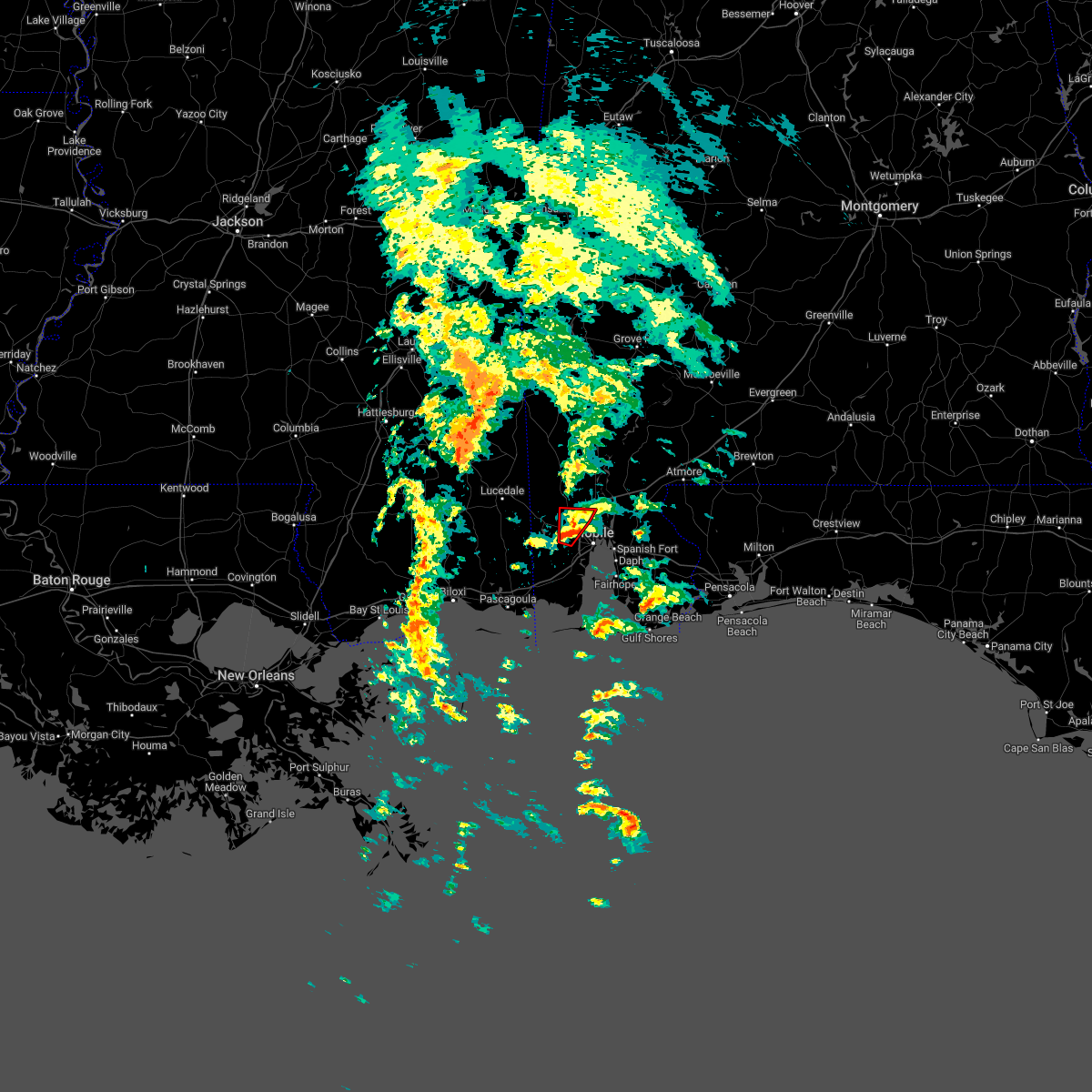 At 711 pm cdt, a confirmed tornado was located near mobile regional airport, or 4 miles northwest of midtown mobile, moving north at 25 mph (radar confirmed tornado). Hazards include damaging tornado. Flying debris will be dangerous to those caught without shelter. mobile homes will be damaged or destroyed. damage to roofs, windows, and vehicles will occur. tree damage is likely. this tornado will be near, i65 and al 158 around 730 pm cdt. saraland around 735 pm cdt. Satsuma around 740 pm cdt. At 711 pm cdt, a confirmed tornado was located near mobile regional airport, or 4 miles northwest of midtown mobile, moving north at 25 mph (radar confirmed tornado). Hazards include damaging tornado. Flying debris will be dangerous to those caught without shelter. mobile homes will be damaged or destroyed. damage to roofs, windows, and vehicles will occur. tree damage is likely. this tornado will be near, i65 and al 158 around 730 pm cdt. saraland around 735 pm cdt. Satsuma around 740 pm cdt.
|
| 10/29/2022 6:54 PM CDT |
 At 654 pm cdt, a tornado producing storm was located 4 miles south of mobile regional airport, or 5 miles northwest of tillmans corner, moving north at 20 mph (radar confirmed tornado). Hazards include damaging tornado. Flying debris will be dangerous to those caught without shelter. mobile homes will be damaged or destroyed. damage to roofs, windows, and vehicles will occur. tree damage is likely. this tornadic storm will be near, mobile regional airport around 705 pm cdt. semmes around 725 pm cdt. I65 and al 158 around 730 pm cdt. At 654 pm cdt, a tornado producing storm was located 4 miles south of mobile regional airport, or 5 miles northwest of tillmans corner, moving north at 20 mph (radar confirmed tornado). Hazards include damaging tornado. Flying debris will be dangerous to those caught without shelter. mobile homes will be damaged or destroyed. damage to roofs, windows, and vehicles will occur. tree damage is likely. this tornadic storm will be near, mobile regional airport around 705 pm cdt. semmes around 725 pm cdt. I65 and al 158 around 730 pm cdt.
|
| 10/29/2022 6:50 PM CDT |
 At 650 pm cdt, a confirmed tornado was located 5 miles west of tillmans corner, moving north at 35 mph (radar confirmed tornado). Hazards include damaging tornado. Flying debris will be dangerous to those caught without shelter. mobile homes will be damaged or destroyed. damage to roofs, windows, and vehicles will occur. tree damage is likely. this tornado will be near, midtown mobile and mobile regional airport around 700 pm cdt. Semmes and i65 and i165 around 710 pm cdt. At 650 pm cdt, a confirmed tornado was located 5 miles west of tillmans corner, moving north at 35 mph (radar confirmed tornado). Hazards include damaging tornado. Flying debris will be dangerous to those caught without shelter. mobile homes will be damaged or destroyed. damage to roofs, windows, and vehicles will occur. tree damage is likely. this tornado will be near, midtown mobile and mobile regional airport around 700 pm cdt. Semmes and i65 and i165 around 710 pm cdt.
|
| 10/29/2022 6:43 PM CDT |
 At 642 pm cdt, a confirmed tornado was located 4 miles west of theodore, moving northeast at 25 mph. another confirmed tornado was located near tillmans corner, moving north at 20 mph (radar confirmed tornado). Hazards include damaging tornado. Flying debris will be dangerous to those caught without shelter. mobile homes will be damaged or destroyed. damage to roofs, windows, and vehicles will occur. tree damage is likely. this tornado will be near, tillmans corner around 655 pm cdt. mobile regional airport and i10 and i65 around 700 pm cdt. midtown mobile around 710 pm cdt. downtown mobile and semmes around 715 pm cdt. Prichard, chickasaw and i65 and i165 around 720 pm cdt. At 642 pm cdt, a confirmed tornado was located 4 miles west of theodore, moving northeast at 25 mph. another confirmed tornado was located near tillmans corner, moving north at 20 mph (radar confirmed tornado). Hazards include damaging tornado. Flying debris will be dangerous to those caught without shelter. mobile homes will be damaged or destroyed. damage to roofs, windows, and vehicles will occur. tree damage is likely. this tornado will be near, tillmans corner around 655 pm cdt. mobile regional airport and i10 and i65 around 700 pm cdt. midtown mobile around 710 pm cdt. downtown mobile and semmes around 715 pm cdt. Prichard, chickasaw and i65 and i165 around 720 pm cdt.
|
| 10/29/2022 6:39 PM CDT |
 At 639 pm cdt, a confirmed tornado was located near tillmans corner, moving north at 20 mph (radar confirmed tornado). Hazards include damaging tornado. Flying debris will be dangerous to those caught without shelter. mobile homes will be damaged or destroyed. damage to roofs, windows, and vehicles will occur. tree damage is likely. this tornado will be near, i10 and i65 around 650 pm cdt. midtown mobile and mobile regional airport around 700 pm cdt. Semmes and i65 and i165 around 715 pm cdt. At 639 pm cdt, a confirmed tornado was located near tillmans corner, moving north at 20 mph (radar confirmed tornado). Hazards include damaging tornado. Flying debris will be dangerous to those caught without shelter. mobile homes will be damaged or destroyed. damage to roofs, windows, and vehicles will occur. tree damage is likely. this tornado will be near, i10 and i65 around 650 pm cdt. midtown mobile and mobile regional airport around 700 pm cdt. Semmes and i65 and i165 around 715 pm cdt.
|
| 10/29/2022 6:30 PM CDT |
 At 630 pm cdt, a confirmed tornado was located over theodore, moving north at 35 mph (radar confirmed tornado). Hazards include damaging tornado. Flying debris will be dangerous to those caught without shelter. mobile homes will be damaged or destroyed. damage to roofs, windows, and vehicles will occur. tree damage is likely. this tornado will be near, tillmans corner around 635 pm cdt. i10 and i65 around 640 pm cdt. midtown mobile and mobile regional airport around 645 pm cdt. downtown mobile around 650 pm cdt. Prichard, chickasaw, semmes and i65 and i165 around 655 pm cdt. At 630 pm cdt, a confirmed tornado was located over theodore, moving north at 35 mph (radar confirmed tornado). Hazards include damaging tornado. Flying debris will be dangerous to those caught without shelter. mobile homes will be damaged or destroyed. damage to roofs, windows, and vehicles will occur. tree damage is likely. this tornado will be near, tillmans corner around 635 pm cdt. i10 and i65 around 640 pm cdt. midtown mobile and mobile regional airport around 645 pm cdt. downtown mobile around 650 pm cdt. Prichard, chickasaw, semmes and i65 and i165 around 655 pm cdt.
|
| 10/29/2022 6:19 PM CDT |
 At 619 pm cdt, a confirmed tornado was located 4 miles south of mobile regional airport, or 5 miles west of tillmans corner, moving northeast at 25 mph (radar confirmed tornado). Hazards include damaging tornado. Flying debris will be dangerous to those caught without shelter. mobile homes will be damaged or destroyed. damage to roofs, windows, and vehicles will occur. tree damage is likely. this tornado will be near, mobile regional airport and i10 and i65 around 630 pm cdt. midtown mobile around 640 pm cdt. semmes around 645 pm cdt. prichard and i65 and i165 around 650 pm cdt. Chickasaw around 655 pm cdt. At 619 pm cdt, a confirmed tornado was located 4 miles south of mobile regional airport, or 5 miles west of tillmans corner, moving northeast at 25 mph (radar confirmed tornado). Hazards include damaging tornado. Flying debris will be dangerous to those caught without shelter. mobile homes will be damaged or destroyed. damage to roofs, windows, and vehicles will occur. tree damage is likely. this tornado will be near, mobile regional airport and i10 and i65 around 630 pm cdt. midtown mobile around 640 pm cdt. semmes around 645 pm cdt. prichard and i65 and i165 around 650 pm cdt. Chickasaw around 655 pm cdt.
|
| 10/29/2022 6:18 PM CDT |
 At 617 pm cdt, a severe thunderstorm capable of producing a tornado was located 4 miles north of bayou la batre, moving north at 30 mph (radar indicated rotation). Hazards include tornado. Flying debris will be dangerous to those caught without shelter. mobile homes will be damaged or destroyed. damage to roofs, windows, and vehicles will occur. tree damage is likely. this dangerous storm will be near, theodore around 630 pm cdt. tillmans corner around 635 pm cdt. i10 and i65 and mobile regional airport around 645 pm cdt. midtown mobile around 650 pm cdt. downtown mobile around 655 pm cdt. Prichard, chickasaw and i65 and i165 around 700 pm cdt. At 617 pm cdt, a severe thunderstorm capable of producing a tornado was located 4 miles north of bayou la batre, moving north at 30 mph (radar indicated rotation). Hazards include tornado. Flying debris will be dangerous to those caught without shelter. mobile homes will be damaged or destroyed. damage to roofs, windows, and vehicles will occur. tree damage is likely. this dangerous storm will be near, theodore around 630 pm cdt. tillmans corner around 635 pm cdt. i10 and i65 and mobile regional airport around 645 pm cdt. midtown mobile around 650 pm cdt. downtown mobile around 655 pm cdt. Prichard, chickasaw and i65 and i165 around 700 pm cdt.
|
| 10/29/2022 6:05 PM CDT |
 At 604 pm cdt, a confirmed tornado was located 4 miles northwest of spanish fort, moving north at 30 mph (broadcast media confirmed tornado). Hazards include damaging tornado. Flying debris will be dangerous to those caught without shelter. mobile homes will be damaged or destroyed. damage to roofs, windows, and vehicles will occur. tree damage is likely. the tornado will be near, i65 and al 225 around 640 pm cdt. Stockton around 645 pm cdt. At 604 pm cdt, a confirmed tornado was located 4 miles northwest of spanish fort, moving north at 30 mph (broadcast media confirmed tornado). Hazards include damaging tornado. Flying debris will be dangerous to those caught without shelter. mobile homes will be damaged or destroyed. damage to roofs, windows, and vehicles will occur. tree damage is likely. the tornado will be near, i65 and al 225 around 640 pm cdt. Stockton around 645 pm cdt.
|
| 10/29/2022 5:35 PM CDT |
 At 534 pm cdt, a severe thunderstorm capable of producing a tornado was located over downtown mobile, moving north at 30 mph (radar indicated rotation). Hazards include tornado. Flying debris will be dangerous to those caught without shelter. mobile homes will be damaged or destroyed. damage to roofs, windows, and vehicles will occur. tree damage is likely. this dangerous storm will be near, prichard around 540 pm cdt. chickasaw and i65 and i165 around 545 pm cdt. i65 and al 158 around 550 pm cdt. saraland around 555 pm cdt. satsuma around 600 pm cdt. creola around 605 pm cdt. Axis around 610 pm cdt. At 534 pm cdt, a severe thunderstorm capable of producing a tornado was located over downtown mobile, moving north at 30 mph (radar indicated rotation). Hazards include tornado. Flying debris will be dangerous to those caught without shelter. mobile homes will be damaged or destroyed. damage to roofs, windows, and vehicles will occur. tree damage is likely. this dangerous storm will be near, prichard around 540 pm cdt. chickasaw and i65 and i165 around 545 pm cdt. i65 and al 158 around 550 pm cdt. saraland around 555 pm cdt. satsuma around 600 pm cdt. creola around 605 pm cdt. Axis around 610 pm cdt.
|
| 10/29/2022 5:24 PM CDT |
 At 523 pm cdt, a severe thunderstorm capable of producing a tornado was located near i10 and i65, or 5 miles south of downtown mobile, moving north at 30 mph (radar indicated rotation). Hazards include tornado. Flying debris will be dangerous to those caught without shelter. mobile homes will be damaged or destroyed. damage to roofs, windows, and vehicles will occur. tree damage is likely. this dangerous storm will be near, downtown mobile around 535 pm cdt. prichard around 540 pm cdt. chickasaw and i65 and i165 around 545 pm cdt. i65 and al 158 around 550 pm cdt. saraland around 555 pm cdt. satsuma around 600 pm cdt. creola around 605 pm cdt. Axis around 610 pm cdt. At 523 pm cdt, a severe thunderstorm capable of producing a tornado was located near i10 and i65, or 5 miles south of downtown mobile, moving north at 30 mph (radar indicated rotation). Hazards include tornado. Flying debris will be dangerous to those caught without shelter. mobile homes will be damaged or destroyed. damage to roofs, windows, and vehicles will occur. tree damage is likely. this dangerous storm will be near, downtown mobile around 535 pm cdt. prichard around 540 pm cdt. chickasaw and i65 and i165 around 545 pm cdt. i65 and al 158 around 550 pm cdt. saraland around 555 pm cdt. satsuma around 600 pm cdt. creola around 605 pm cdt. Axis around 610 pm cdt.
|
| 10/29/2022 5:16 PM CDT |
 At 516 pm cdt, a severe thunderstorm capable of producing a tornado was located over tillmans corner, moving north at 25 mph (radar indicated rotation). Hazards include tornado. Flying debris will be dangerous to those caught without shelter. mobile homes will be damaged or destroyed. damage to roofs, windows, and vehicles will occur. tree damage is likely. This dangerous storm will be near, mobile regional airport around 525 pm cdt. At 516 pm cdt, a severe thunderstorm capable of producing a tornado was located over tillmans corner, moving north at 25 mph (radar indicated rotation). Hazards include tornado. Flying debris will be dangerous to those caught without shelter. mobile homes will be damaged or destroyed. damage to roofs, windows, and vehicles will occur. tree damage is likely. This dangerous storm will be near, mobile regional airport around 525 pm cdt.
|
| 10/29/2022 5:10 PM CDT |
 At 510 pm cdt, a confirmed tornado was located over theodore, moving north at 25 mph (radar confirmed tornado). Hazards include damaging tornado. Flying debris will be dangerous to those caught without shelter. mobile homes will be damaged or destroyed. damage to roofs, windows, and vehicles will occur. tree damage is likely. This tornado will be near, mobile regional airport around 530 pm cdt. At 510 pm cdt, a confirmed tornado was located over theodore, moving north at 25 mph (radar confirmed tornado). Hazards include damaging tornado. Flying debris will be dangerous to those caught without shelter. mobile homes will be damaged or destroyed. damage to roofs, windows, and vehicles will occur. tree damage is likely. This tornado will be near, mobile regional airport around 530 pm cdt.
|
| 10/29/2022 5:04 PM CDT |
 At 504 pm cdt, a confirmed tornado was located over theodore, moving north at 25 mph (radar confirmed tornado). Hazards include damaging tornado. Flying debris will be dangerous to those caught without shelter. mobile homes will be damaged or destroyed. damage to roofs, windows, and vehicles will occur. tree damage is likely. this tornado will be near, tillmans corner around 515 pm cdt. Mobile regional airport around 535 pm cdt. At 504 pm cdt, a confirmed tornado was located over theodore, moving north at 25 mph (radar confirmed tornado). Hazards include damaging tornado. Flying debris will be dangerous to those caught without shelter. mobile homes will be damaged or destroyed. damage to roofs, windows, and vehicles will occur. tree damage is likely. this tornado will be near, tillmans corner around 515 pm cdt. Mobile regional airport around 535 pm cdt.
|
| 10/29/2022 5:00 PM CDT |
 At 459 pm cdt, a severe thunderstorm capable of producing a tornado was located over theodore, moving north at 25 mph (radar indicated rotation). Hazards include tornado. Flying debris will be dangerous to those caught without shelter. mobile homes will be damaged or destroyed. damage to roofs, windows, and vehicles will occur. tree damage is likely. this dangerous storm will be near, theodore around 505 pm cdt. tillmans corner around 515 pm cdt. Midtown mobile and mobile regional airport around 530 pm cdt. At 459 pm cdt, a severe thunderstorm capable of producing a tornado was located over theodore, moving north at 25 mph (radar indicated rotation). Hazards include tornado. Flying debris will be dangerous to those caught without shelter. mobile homes will be damaged or destroyed. damage to roofs, windows, and vehicles will occur. tree damage is likely. this dangerous storm will be near, theodore around 505 pm cdt. tillmans corner around 515 pm cdt. Midtown mobile and mobile regional airport around 530 pm cdt.
|
| 8/17/2022 4:05 PM CDT |
 At 405 pm cdt, a severe thunderstorm was located 4 miles northeast of downtown mobile, moving east at 20 mph (radar indicated). Hazards include 60 mph wind gusts and quarter size hail. Hail damage to vehicles is expected. Expect wind damage to roofs, siding, and trees. At 405 pm cdt, a severe thunderstorm was located 4 miles northeast of downtown mobile, moving east at 20 mph (radar indicated). Hazards include 60 mph wind gusts and quarter size hail. Hail damage to vehicles is expected. Expect wind damage to roofs, siding, and trees.
|
| 8/16/2022 3:25 PM CDT |
 At 324 pm cdt, a severe thunderstorm was located over satsuma, moving southwest at 20 mph (radar indicated). Hazards include 60 mph wind gusts. expect damage to roofs, siding, and trees At 324 pm cdt, a severe thunderstorm was located over satsuma, moving southwest at 20 mph (radar indicated). Hazards include 60 mph wind gusts. expect damage to roofs, siding, and trees
|
| 8/16/2022 3:04 PM CDT |
 At 303 pm cdt, a severe thunderstorm was located over mount vernon, or 12 miles east of citronelle, moving southeast at 10 mph (radar indicated). Hazards include 60 mph wind gusts and quarter size hail. Hail damage to vehicles is expected. Expect wind damage to roofs, siding, and trees. At 303 pm cdt, a severe thunderstorm was located over mount vernon, or 12 miles east of citronelle, moving southeast at 10 mph (radar indicated). Hazards include 60 mph wind gusts and quarter size hail. Hail damage to vehicles is expected. Expect wind damage to roofs, siding, and trees.
|
| 7/11/2022 6:50 PM CDT | Report of a tree down on a house on west daniels rd. time estimated from rada in mobile county AL, 3.9 miles NW of Mobile, AL |
| 7/11/2022 6:45 PM CDT | Reports of multiple power lines down on dauphin island parkway... one blocking the roadway. time estimated from rada in mobile county AL, 2 miles W of Mobile, AL |
| 7/11/2022 6:36 PM CDT |
 At 635 pm cdt, a severe thunderstorm was located near midtown and downtown mobile, moving southwest at 20 mph (radar indicated). Hazards include 60 mph wind gusts. expect damage to roofs, siding, and trees At 635 pm cdt, a severe thunderstorm was located near midtown and downtown mobile, moving southwest at 20 mph (radar indicated). Hazards include 60 mph wind gusts. expect damage to roofs, siding, and trees
|
| 7/11/2022 6:16 PM CDT |
 At 615 pm cdt, severe thunderstorms were located along a line extending from near saraland to 4 miles east of chickasaw to 4 miles west of stapleton, moving southwest at 25 mph (radar indicated). Hazards include 60 mph wind gusts. Expect damage to roofs, siding, and trees. locations impacted include, midtown mobile, downtown mobile, prichard, tillmans corner, saraland, chickasaw, satsuma, spanish fort, creola, i65 and i165, mobile regional airport, i65 and al 158 and i10 and i65. hail threat, radar indicated max hail size, <. 75 in wind threat, radar indicated max wind gust, 60 mph. At 615 pm cdt, severe thunderstorms were located along a line extending from near saraland to 4 miles east of chickasaw to 4 miles west of stapleton, moving southwest at 25 mph (radar indicated). Hazards include 60 mph wind gusts. Expect damage to roofs, siding, and trees. locations impacted include, midtown mobile, downtown mobile, prichard, tillmans corner, saraland, chickasaw, satsuma, spanish fort, creola, i65 and i165, mobile regional airport, i65 and al 158 and i10 and i65. hail threat, radar indicated max hail size, <. 75 in wind threat, radar indicated max wind gust, 60 mph.
|
| 7/11/2022 6:01 PM CDT |
 At 600 pm cdt, severe thunderstorms were located along a line extending from creola to 5 miles west of stapleton, moving southwest at 20 mph (radar indicated). Hazards include 60 mph wind gusts. expect damage to roofs, siding, and trees At 600 pm cdt, severe thunderstorms were located along a line extending from creola to 5 miles west of stapleton, moving southwest at 20 mph (radar indicated). Hazards include 60 mph wind gusts. expect damage to roofs, siding, and trees
|
| 7/11/2022 5:50 PM CDT |
 At 550 pm cdt, a severe thunderstorm was located 4 miles northwest of stapleton, or 6 miles southwest of bay minette, moving southwest at 15 mph (radar indicated). Hazards include 60 mph wind gusts. expect damage to roofs, siding, and trees At 550 pm cdt, a severe thunderstorm was located 4 miles northwest of stapleton, or 6 miles southwest of bay minette, moving southwest at 15 mph (radar indicated). Hazards include 60 mph wind gusts. expect damage to roofs, siding, and trees
|
| 7/3/2022 6:24 PM CDT |
 At 623 pm cdt, a severe thunderstorm was located 6 miles west of citronelle, moving southeast at 15 mph (radar indicated). Hazards include 60 mph wind gusts and quarter size hail. Hail damage to vehicles is expected. expect wind damage to roofs, siding, and trees. locations impacted include, saraland, citronelle, chunchula, gulfcrest, deer park, semmes, i65 and al 158 and wilmer. hail threat, radar indicated max hail size, 1. 00 in wind threat, radar indicated max wind gust, 60 mph. At 623 pm cdt, a severe thunderstorm was located 6 miles west of citronelle, moving southeast at 15 mph (radar indicated). Hazards include 60 mph wind gusts and quarter size hail. Hail damage to vehicles is expected. expect wind damage to roofs, siding, and trees. locations impacted include, saraland, citronelle, chunchula, gulfcrest, deer park, semmes, i65 and al 158 and wilmer. hail threat, radar indicated max hail size, 1. 00 in wind threat, radar indicated max wind gust, 60 mph.
|
| 7/3/2022 6:09 PM CDT |
 At 609 pm cdt, a severe thunderstorm was located 4 miles west of deer park, or 11 miles northeast of leakesville, moving south at 35 mph (radar indicated). Hazards include 60 mph wind gusts and quarter size hail. Hail damage to vehicles is expected. Expect wind damage to roofs, siding, and trees. At 609 pm cdt, a severe thunderstorm was located 4 miles west of deer park, or 11 miles northeast of leakesville, moving south at 35 mph (radar indicated). Hazards include 60 mph wind gusts and quarter size hail. Hail damage to vehicles is expected. Expect wind damage to roofs, siding, and trees.
|
| 6/25/2022 2:46 PM CDT |
 At 245 pm cdt, severe thunderstorms were located along a line extending from near spanish fort to 4 miles northwest of loxley to near stapleton, moving southeast at 20 mph (radar indicated). Hazards include 60 mph wind gusts and penny size hail. expect damage to roofs, siding, and trees At 245 pm cdt, severe thunderstorms were located along a line extending from near spanish fort to 4 miles northwest of loxley to near stapleton, moving southeast at 20 mph (radar indicated). Hazards include 60 mph wind gusts and penny size hail. expect damage to roofs, siding, and trees
|
| 5/25/2022 12:35 AM CDT |
 At 1235 am cdt, a severe thunderstorm was located 6 miles west of theodore, moving north at 45 mph (radar indicated). Hazards include 60 mph wind gusts. Expect damage to roofs, siding, and trees. locations impacted include, midtown mobile, tillmans corner, theodore, grand bay, bayou la batre, semmes, tanner williams, coden, i10 and i65 and mobile regional airport. hail threat, radar indicated max hail size, <. 75 in wind threat, radar indicated max wind gust, 60 mph. At 1235 am cdt, a severe thunderstorm was located 6 miles west of theodore, moving north at 45 mph (radar indicated). Hazards include 60 mph wind gusts. Expect damage to roofs, siding, and trees. locations impacted include, midtown mobile, tillmans corner, theodore, grand bay, bayou la batre, semmes, tanner williams, coden, i10 and i65 and mobile regional airport. hail threat, radar indicated max hail size, <. 75 in wind threat, radar indicated max wind gust, 60 mph.
|
| 5/25/2022 12:07 AM CDT |
 At 1206 am cdt, a severe thunderstorm was located 4 miles southwest of dauphin island, moving north at 50 mph (radar indicated). Hazards include 60 mph wind gusts. expect damage to roofs, siding, and trees At 1206 am cdt, a severe thunderstorm was located 4 miles southwest of dauphin island, moving north at 50 mph (radar indicated). Hazards include 60 mph wind gusts. expect damage to roofs, siding, and trees
|
| 5/15/2022 10:39 PM CDT |
 At 1039 pm cdt, severe thunderstorms were located along a line extending from near axis to 6 miles north of wilmer, moving south at 20 mph (radar indicated). Hazards include 60 mph wind gusts. expect damage to roofs, siding, and trees At 1039 pm cdt, severe thunderstorms were located along a line extending from near axis to 6 miles north of wilmer, moving south at 20 mph (radar indicated). Hazards include 60 mph wind gusts. expect damage to roofs, siding, and trees
|
| 5/15/2022 8:45 PM CDT | Quarter sized hail reported 12.3 miles SE of Mobile, AL, quarter sized hail near mary montgomery school. time estimated by radar. |
| 5/15/2022 8:38 PM CDT | Half Dollar sized hail reported 15.5 miles SE of Mobile, AL, hail estimated to be of quarter or half dollar size reported near glenwood hills drive in wilmer. |
| 5/15/2022 8:07 PM CDT |
 The severe thunderstorm warning for south central mobile county will expire at 815 pm cdt, the storms which prompted the warning have weakened below severe limits. therefore, the warning will be allowed to expire. however gusty winds are still possible with these thunderstorms, and a special weather statement will soon be issued for the potential of wind gusts around 40 mph and small hail. remember, a severe thunderstorm warning still remains in effect for west central mobile county until 845 pm cdt. The severe thunderstorm warning for south central mobile county will expire at 815 pm cdt, the storms which prompted the warning have weakened below severe limits. therefore, the warning will be allowed to expire. however gusty winds are still possible with these thunderstorms, and a special weather statement will soon be issued for the potential of wind gusts around 40 mph and small hail. remember, a severe thunderstorm warning still remains in effect for west central mobile county until 845 pm cdt.
|
| 5/15/2022 8:00 PM CDT |
 At 759 pm cdt, a severe thunderstorm was located over mobile regional airport, or 7 miles west of midtown mobile, moving southwest at 10 mph (radar indicated). Hazards include 60 mph wind gusts and quarter size hail. Hail damage to vehicles is expected. Expect wind damage to roofs, siding, and trees. At 759 pm cdt, a severe thunderstorm was located over mobile regional airport, or 7 miles west of midtown mobile, moving southwest at 10 mph (radar indicated). Hazards include 60 mph wind gusts and quarter size hail. Hail damage to vehicles is expected. Expect wind damage to roofs, siding, and trees.
|
| 5/15/2022 7:57 PM CDT |
 At 757 pm cdt, severe thunderstorms were located along a line extending from 6 miles east of theodore to 3 miles west of midtown mobile, moving southwest at 10 mph (radar indicated). Hazards include 60 mph wind gusts and quarter size hail. Hail damage to vehicles is expected. expect wind damage to roofs, siding, and trees. locations impacted include, midtown mobile, tillmans corner, theodore and i10 and i65. hail threat, radar indicated max hail size, 1. 00 in wind threat, radar indicated max wind gust, 60 mph. At 757 pm cdt, severe thunderstorms were located along a line extending from 6 miles east of theodore to 3 miles west of midtown mobile, moving southwest at 10 mph (radar indicated). Hazards include 60 mph wind gusts and quarter size hail. Hail damage to vehicles is expected. expect wind damage to roofs, siding, and trees. locations impacted include, midtown mobile, tillmans corner, theodore and i10 and i65. hail threat, radar indicated max hail size, 1. 00 in wind threat, radar indicated max wind gust, 60 mph.
|
| 5/15/2022 7:40 PM CDT | Quarter sized hail reported 0.5 miles ENE of Mobile, AL, quarter sized hail report via social media. time estimated by radar. |
| 5/15/2022 7:30 PM CDT |
 At 730 pm cdt, a severe thunderstorm was located over midtown mobile, moving south at 15 mph (radar indicated). Hazards include 60 mph wind gusts and quarter size hail. Hail damage to vehicles is expected. Expect wind damage to roofs, siding, and trees. At 730 pm cdt, a severe thunderstorm was located over midtown mobile, moving south at 15 mph (radar indicated). Hazards include 60 mph wind gusts and quarter size hail. Hail damage to vehicles is expected. Expect wind damage to roofs, siding, and trees.
|
| 5/15/2022 7:08 PM CDT |
 The severe thunderstorm warning for southwestern baldwin county will expire at 715 pm cdt, the storm which prompted the warning has weakened below severe limits. therefore, the warning will be allowed to expire. The severe thunderstorm warning for southwestern baldwin county will expire at 715 pm cdt, the storm which prompted the warning has weakened below severe limits. therefore, the warning will be allowed to expire.
|
| 5/15/2022 6:49 PM CDT |
 At 649 pm cdt, a severe thunderstorm was located 4 miles west of silverhill, or 5 miles southwest of loxley, moving southwest at 15 mph (radar indicated). Hazards include 60 mph wind gusts and quarter size hail. Hail damage to vehicles is expected. expect wind damage to roofs, siding, and trees. locations impacted include, daphne, fairhope, robertsdale, loxley and silverhill. hail threat, radar indicated max hail size, 1. 00 in wind threat, radar indicated max wind gust, 60 mph. At 649 pm cdt, a severe thunderstorm was located 4 miles west of silverhill, or 5 miles southwest of loxley, moving southwest at 15 mph (radar indicated). Hazards include 60 mph wind gusts and quarter size hail. Hail damage to vehicles is expected. expect wind damage to roofs, siding, and trees. locations impacted include, daphne, fairhope, robertsdale, loxley and silverhill. hail threat, radar indicated max hail size, 1. 00 in wind threat, radar indicated max wind gust, 60 mph.
|
| 5/15/2022 6:27 PM CDT |
 At 627 pm cdt, a severe thunderstorm was located over loxley, moving southwest at 10 mph (radar indicated). Hazards include 60 mph wind gusts and quarter size hail. Hail damage to vehicles is expected. Expect wind damage to roofs, siding, and trees. At 627 pm cdt, a severe thunderstorm was located over loxley, moving southwest at 10 mph (radar indicated). Hazards include 60 mph wind gusts and quarter size hail. Hail damage to vehicles is expected. Expect wind damage to roofs, siding, and trees.
|
| 5/12/2022 6:24 PM CDT |
 The severe thunderstorm warning for southwestern mobile and southeastern george counties will expire at 630 pm cdt, the storm which prompted the warning has weakened below severe limits. therefore, the warning will be allowed to expire. The severe thunderstorm warning for southwestern mobile and southeastern george counties will expire at 630 pm cdt, the storm which prompted the warning has weakened below severe limits. therefore, the warning will be allowed to expire.
|
| 5/12/2022 5:55 PM CDT | Quarter sized hail reported 17.8 miles SE of Mobile, AL, social media post showed quarter sized hail. time estimated by radar. |
| 5/12/2022 5:52 PM CDT |
 At 552 pm cdt, a severe thunderstorm was located over wilmer, or 13 miles southeast of lucedale, moving south at 35 mph (radar indicated). Hazards include 60 mph wind gusts and quarter size hail. Hail damage to vehicles is expected. Expect wind damage to roofs, siding, and trees. At 552 pm cdt, a severe thunderstorm was located over wilmer, or 13 miles southeast of lucedale, moving south at 35 mph (radar indicated). Hazards include 60 mph wind gusts and quarter size hail. Hail damage to vehicles is expected. Expect wind damage to roofs, siding, and trees.
|
| 5/6/2022 3:43 AM CDT | At 343 am cdt, a severe thunderstorm capable of producing a tornado was located over daphne, moving northeast at 55 mph (radar indicated rotation). Hazards include tornado. Flying debris will be dangerous to those caught without shelter. mobile homes will be damaged or destroyed. damage to roofs, windows, and vehicles will occur. tree damage is likely. This dangerous storm will be near, loxley around 355 am cdt. |
| 5/6/2022 3:36 AM CDT |
 At 335 am cdt, severe thunderstorms were located along a line extending from axis to 4 miles northeast of downtown mobile to 7 miles east of theodore to 3 miles south of alabama port, moving east at 50 mph (radar indicated). Hazards include 60 mph wind gusts. expect damage to roofs, siding, and trees At 335 am cdt, severe thunderstorms were located along a line extending from axis to 4 miles northeast of downtown mobile to 7 miles east of theodore to 3 miles south of alabama port, moving east at 50 mph (radar indicated). Hazards include 60 mph wind gusts. expect damage to roofs, siding, and trees
|
| 5/6/2022 3:29 AM CDT |
 At 329 am cdt, a severe thunderstorm capable of producing a tornado was located over satsuma, moving east at 45 mph (radar indicated rotation). Hazards include tornado. Flying debris will be dangerous to those caught without shelter. mobile homes will be damaged or destroyed. damage to roofs, windows, and vehicles will occur. tree damage is likely. this dangerous storm will be near, axis around 335 am cdt. I65 and al 225 around 350 am cdt. At 329 am cdt, a severe thunderstorm capable of producing a tornado was located over satsuma, moving east at 45 mph (radar indicated rotation). Hazards include tornado. Flying debris will be dangerous to those caught without shelter. mobile homes will be damaged or destroyed. damage to roofs, windows, and vehicles will occur. tree damage is likely. this dangerous storm will be near, axis around 335 am cdt. I65 and al 225 around 350 am cdt.
|
| 5/6/2022 3:28 AM CDT |
 At 328 am cdt, severe thunderstorms were located along a line extending from near semmes to near tillmans corner to 4 miles southwest of coden to 8 miles south of petit bois island, moving east at 45 mph (radar indicated). Hazards include 60 mph wind gusts. Expect damage to roofs, siding, and trees. Locations impacted include, midtown mobile, downtown mobile, prichard, tillmans corner, saraland, theodore, chickasaw, satsuma, bayou la batre, creola, dauphin island, axis, i65 and i165, coden, i65 and al 158, i10 and i65 and alabama port. At 328 am cdt, severe thunderstorms were located along a line extending from near semmes to near tillmans corner to 4 miles southwest of coden to 8 miles south of petit bois island, moving east at 45 mph (radar indicated). Hazards include 60 mph wind gusts. Expect damage to roofs, siding, and trees. Locations impacted include, midtown mobile, downtown mobile, prichard, tillmans corner, saraland, theodore, chickasaw, satsuma, bayou la batre, creola, dauphin island, axis, i65 and i165, coden, i65 and al 158, i10 and i65 and alabama port.
|
| 5/6/2022 3:25 AM CDT |
 At 324 am cdt, a severe thunderstorm capable of producing a tornado was located over i65 and al 158, or 4 miles west of saraland, moving east at 45 mph (radar indicated rotation). Hazards include tornado. Flying debris will be dangerous to those caught without shelter. mobile homes will be damaged or destroyed. damage to roofs, windows, and vehicles will occur. tree damage is likely. this dangerous storm will be near, satsuma around 330 am cdt. creola and axis around 335 am cdt. I65 and al 225 around 350 am cdt. At 324 am cdt, a severe thunderstorm capable of producing a tornado was located over i65 and al 158, or 4 miles west of saraland, moving east at 45 mph (radar indicated rotation). Hazards include tornado. Flying debris will be dangerous to those caught without shelter. mobile homes will be damaged or destroyed. damage to roofs, windows, and vehicles will occur. tree damage is likely. this dangerous storm will be near, satsuma around 330 am cdt. creola and axis around 335 am cdt. I65 and al 225 around 350 am cdt.
|
| 5/6/2022 3:01 AM CDT |
 At 300 am cdt, severe thunderstorms were located along a line extending from 5 miles north of hurley to 3 miles northeast of escatawpa to 5 miles south of gautier to 19 miles southwest of petit bois island, moving east at 40 mph (radar indicated). Hazards include 60 mph wind gusts. expect damage to roofs, siding, and trees At 300 am cdt, severe thunderstorms were located along a line extending from 5 miles north of hurley to 3 miles northeast of escatawpa to 5 miles south of gautier to 19 miles southwest of petit bois island, moving east at 40 mph (radar indicated). Hazards include 60 mph wind gusts. expect damage to roofs, siding, and trees
|
| 5/6/2022 3:00 AM CDT | Family dollar severely damaged to destroyed in downtown mobile. possible tornad in mobile county AL, 3.8 miles W of Mobile, AL |
| 4/17/2022 10:15 PM CDT |
 At 1013 pm cdt, a severe thunderstorm was located near i10 and i65, or 6 miles east of tillmans corner, moving southeast at 55 mph. this is a destructive storm for areas southeast of interstate 10 just south of the downtown brookely field mobile airport. this is a particularly dangerous situation (radar indicated). Hazards include 80 mph wind gusts and penny size hail. Flying debris will be dangerous to those caught without shelter. mobile homes will be heavily damaged. expect considerable damage to roofs, windows, and vehicles. Extensive tree damage and power outages are likely. At 1013 pm cdt, a severe thunderstorm was located near i10 and i65, or 6 miles east of tillmans corner, moving southeast at 55 mph. this is a destructive storm for areas southeast of interstate 10 just south of the downtown brookely field mobile airport. this is a particularly dangerous situation (radar indicated). Hazards include 80 mph wind gusts and penny size hail. Flying debris will be dangerous to those caught without shelter. mobile homes will be heavily damaged. expect considerable damage to roofs, windows, and vehicles. Extensive tree damage and power outages are likely.
|
| 4/17/2022 10:02 PM CDT |
 At 1002 pm cdt, severe thunderstorms were located along a line extending from 4 miles southeast of mount vernon to 5 miles north of grand bay, moving southeast at 40 mph (radar indicated). Hazards include 70 mph wind gusts and penny size hail. Expect considerable tree damage. damage is likely to mobile homes, roofs, and outbuildings. locations impacted include, midtown mobile, downtown mobile, prichard, daphne, tillmans corner, fairhope, saraland, bay minette, foley, theodore, chickasaw, satsuma, spanish fort, grand bay, robertsdale, bayou la batre, creola, point clear, dauphin island and loxley. thunderstorm damage threat, considerable hail threat, radar indicated max hail size, 0. 75 in wind threat, radar indicated max wind gust, 70 mph. At 1002 pm cdt, severe thunderstorms were located along a line extending from 4 miles southeast of mount vernon to 5 miles north of grand bay, moving southeast at 40 mph (radar indicated). Hazards include 70 mph wind gusts and penny size hail. Expect considerable tree damage. damage is likely to mobile homes, roofs, and outbuildings. locations impacted include, midtown mobile, downtown mobile, prichard, daphne, tillmans corner, fairhope, saraland, bay minette, foley, theodore, chickasaw, satsuma, spanish fort, grand bay, robertsdale, bayou la batre, creola, point clear, dauphin island and loxley. thunderstorm damage threat, considerable hail threat, radar indicated max hail size, 0. 75 in wind threat, radar indicated max wind gust, 70 mph.
|
| 4/17/2022 9:56 PM CDT |
 At 956 pm cdt, severe thunderstorms were located along a line extending from near mount vernon to 5 miles east of big point, moving southeast at 40 mph (radar indicated). Hazards include 60 mph wind gusts and penny size hail. expect damage to roofs, siding, and trees At 956 pm cdt, severe thunderstorms were located along a line extending from near mount vernon to 5 miles east of big point, moving southeast at 40 mph (radar indicated). Hazards include 60 mph wind gusts and penny size hail. expect damage to roofs, siding, and trees
|
| 4/17/2022 9:47 PM CDT |
 At 947 pm cdt, severe thunderstorms were located along a line extending from 7 miles southwest of mcintosh to 4 miles northwest of mount vernon to 6 miles southwest of movico to 4 miles southwest of chunchula to 4 miles west of tanner williams, moving east at 55 mph (radar indicated). Hazards include 60 mph wind gusts and quarter size hail. Hail damage to vehicles is expected. expect wind damage to roofs, siding, and trees. Locations impacted include, midtown mobile, downtown mobile, prichard, tillmans corner, saraland, chickasaw, satsuma, citronelle, creola, chunchula, gulfcrest, deer park, axis, tibbie, mount vernon, calvert, tanner williams, semmes, mcintosh and wilmer. At 947 pm cdt, severe thunderstorms were located along a line extending from 7 miles southwest of mcintosh to 4 miles northwest of mount vernon to 6 miles southwest of movico to 4 miles southwest of chunchula to 4 miles west of tanner williams, moving east at 55 mph (radar indicated). Hazards include 60 mph wind gusts and quarter size hail. Hail damage to vehicles is expected. expect wind damage to roofs, siding, and trees. Locations impacted include, midtown mobile, downtown mobile, prichard, tillmans corner, saraland, chickasaw, satsuma, citronelle, creola, chunchula, gulfcrest, deer park, axis, tibbie, mount vernon, calvert, tanner williams, semmes, mcintosh and wilmer.
|
| 4/17/2022 9:07 PM CDT |
 At 906 pm cdt, severe thunderstorms were located along a line extending from 3 miles southeast of ovett to richton to 5 miles northwest of beaumont to new augusta, moving southeast at 50 mph (radar indicated). Hazards include 70 mph wind gusts and quarter size hail. tornadoes will also be possible as this line moves through the warned area. Hail damage to vehicles is expected. expect considerable tree damage. Wind damage is also likely to mobile homes, roofs, and outbuildings. At 906 pm cdt, severe thunderstorms were located along a line extending from 3 miles southeast of ovett to richton to 5 miles northwest of beaumont to new augusta, moving southeast at 50 mph (radar indicated). Hazards include 70 mph wind gusts and quarter size hail. tornadoes will also be possible as this line moves through the warned area. Hail damage to vehicles is expected. expect considerable tree damage. Wind damage is also likely to mobile homes, roofs, and outbuildings.
|
| 4/13/2022 11:25 PM CDT |
 At 1125 pm cdt, severe thunderstorms were located along a line extending from 6 miles northeast of citronelle to 9 miles northwest of vancleave, moving east at 40 mph (radar indicated). Hazards include 60 mph wind gusts. Expect damage to roofs, siding, and trees. locations impacted include, chunchula, semmes, tanner williams and wilmer. hail threat, radar indicated max hail size, <. 75 in wind threat, radar indicated max wind gust, 60 mph. At 1125 pm cdt, severe thunderstorms were located along a line extending from 6 miles northeast of citronelle to 9 miles northwest of vancleave, moving east at 40 mph (radar indicated). Hazards include 60 mph wind gusts. Expect damage to roofs, siding, and trees. locations impacted include, chunchula, semmes, tanner williams and wilmer. hail threat, radar indicated max hail size, <. 75 in wind threat, radar indicated max wind gust, 60 mph.
|
| 4/13/2022 11:13 PM CDT |
 At 1113 pm cdt, severe thunderstorms were located along a line extending from 4 miles southeast of deer park to 11 miles north of latimer, moving east at 55 mph (radar indicated). Hazards include 60 mph wind gusts. Expect damage to roofs, siding, and trees. locations impacted include, citronelle, lucedale, chunchula, gulfcrest, mount vernon, semmes, tanner williams, movico and wilmer. hail threat, radar indicated max hail size, <. 75 in wind threat, radar indicated max wind gust, 60 mph. At 1113 pm cdt, severe thunderstorms were located along a line extending from 4 miles southeast of deer park to 11 miles north of latimer, moving east at 55 mph (radar indicated). Hazards include 60 mph wind gusts. Expect damage to roofs, siding, and trees. locations impacted include, citronelle, lucedale, chunchula, gulfcrest, mount vernon, semmes, tanner williams, movico and wilmer. hail threat, radar indicated max hail size, <. 75 in wind threat, radar indicated max wind gust, 60 mph.
|
| 4/13/2022 10:55 PM CDT |
 At 1054 pm cdt, severe thunderstorms were located along a line extending from 3 miles northwest of leakesville to 5 miles west of mchenry, moving east at 40 mph (radar indicated). Hazards include 60 mph wind gusts. expect damage to roofs, siding, and trees At 1054 pm cdt, severe thunderstorms were located along a line extending from 3 miles northwest of leakesville to 5 miles west of mchenry, moving east at 40 mph (radar indicated). Hazards include 60 mph wind gusts. expect damage to roofs, siding, and trees
|
| 3/30/2022 11:26 PM CDT |
 At 1126 pm cdt, severe thunderstorms were located along a line extending from 5 miles east of mount vernon to stapleton to fairhope, moving east at 35 mph (radar indicated). Hazards include 70 mph wind gusts. Expect considerable tree damage. damage is likely to mobile homes, roofs, and outbuildings. Locations impacted include, daphne, fairhope, bay minette, atmore, spanish fort, robertsdale, loxley, stockton, stapleton, mount vernon, silverhill, bratt, i65 and cr 1, i65 and al 21, i65 and al 225 and poarch creek reservation. At 1126 pm cdt, severe thunderstorms were located along a line extending from 5 miles east of mount vernon to stapleton to fairhope, moving east at 35 mph (radar indicated). Hazards include 70 mph wind gusts. Expect considerable tree damage. damage is likely to mobile homes, roofs, and outbuildings. Locations impacted include, daphne, fairhope, bay minette, atmore, spanish fort, robertsdale, loxley, stockton, stapleton, mount vernon, silverhill, bratt, i65 and cr 1, i65 and al 21, i65 and al 225 and poarch creek reservation.
|
| 3/30/2022 11:22 PM CDT |
 The tornado warning for central mobile and west central baldwin counties will expire at 1130 pm cdt, the storm which prompted the warning has moved out of the area. therefore, the warning will be allowed to expire. damaging straight line winds are still expected as the line of storms moves across western baldwin county. a tornado watch remains in effect until 400 am cdt for southwestern alabama. The tornado warning for central mobile and west central baldwin counties will expire at 1130 pm cdt, the storm which prompted the warning has moved out of the area. therefore, the warning will be allowed to expire. damaging straight line winds are still expected as the line of storms moves across western baldwin county. a tornado watch remains in effect until 400 am cdt for southwestern alabama.
|
| 3/30/2022 11:09 PM CDT |
 The tornado warning for west central mobile county will expire at 1115 pm cdt, the tornadic thunderstorm which prompted the warning has moved out of the warned area. therefore, the warning will be allowed to expire. this was for the warning that included the communities of grand bay and dees. tornado warnings are still in effect for other parts of mobile county. a tornado watch remains in effect until 400 am cdt for southwestern alabama. The tornado warning for west central mobile county will expire at 1115 pm cdt, the tornadic thunderstorm which prompted the warning has moved out of the warned area. therefore, the warning will be allowed to expire. this was for the warning that included the communities of grand bay and dees. tornado warnings are still in effect for other parts of mobile county. a tornado watch remains in effect until 400 am cdt for southwestern alabama.
|
| 3/30/2022 11:04 PM CDT |
 At 1103 pm cdt, a tornado producing storm was located over satsuma, moving northeast at 40 mph (radar confirmed tornado). Hazards include damaging tornado. Flying debris will be dangerous to those caught without shelter. mobile homes will be damaged or destroyed. damage to roofs, windows, and vehicles will occur. tree damage is likely. this tornadic storm will be near, axis around 1115 pm cdt. i65 and al 225 around 1125 pm cdt. Stockton around 1130 pm cdt. At 1103 pm cdt, a tornado producing storm was located over satsuma, moving northeast at 40 mph (radar confirmed tornado). Hazards include damaging tornado. Flying debris will be dangerous to those caught without shelter. mobile homes will be damaged or destroyed. damage to roofs, windows, and vehicles will occur. tree damage is likely. this tornadic storm will be near, axis around 1115 pm cdt. i65 and al 225 around 1125 pm cdt. Stockton around 1130 pm cdt.
|
| 3/30/2022 11:04 PM CDT |
 At 1103 pm cdt, a confirmed tornado was located over i10 and i65, or 5 miles east of tillmans corner, moving northeast at 50 mph (radar confirmed tornado). Hazards include damaging tornado. Flying debris will be dangerous to those caught without shelter. mobile homes will be damaged or destroyed. damage to roofs, windows, and vehicles will occur. tree damage is likely. this tornado will be near, prichard around 1110 pm cdt. Spanish fort around 1115 pm cdt. At 1103 pm cdt, a confirmed tornado was located over i10 and i65, or 5 miles east of tillmans corner, moving northeast at 50 mph (radar confirmed tornado). Hazards include damaging tornado. Flying debris will be dangerous to those caught without shelter. mobile homes will be damaged or destroyed. damage to roofs, windows, and vehicles will occur. tree damage is likely. this tornado will be near, prichard around 1110 pm cdt. Spanish fort around 1115 pm cdt.
|
| 3/30/2022 10:54 PM CDT | Numerous reports of downed power lines and structural damage near rangeline r in mobile county AL, 5.2 miles NNE of Mobile, AL |
| 3/30/2022 10:49 PM CDT |
 At 1049 pm cdt, severe thunderstorms were located along a line extending from calvert to near grand bay, moving east at 30 mph (radar indicated). Hazards include 70 mph wind gusts. Expect considerable tree damage. Damage is likely to mobile homes, roofs, and outbuildings. At 1049 pm cdt, severe thunderstorms were located along a line extending from calvert to near grand bay, moving east at 30 mph (radar indicated). Hazards include 70 mph wind gusts. Expect considerable tree damage. Damage is likely to mobile homes, roofs, and outbuildings.
|
| 3/30/2022 10:46 PM CDT |
 At 1046 pm cdt, a severe thunderstorm capable of producing a tornado was located over grand bay, moving northeast at 50 mph (radar indicated rotation). Hazards include tornado. Flying debris will be dangerous to those caught without shelter. mobile homes will be damaged or destroyed. damage to roofs, windows, and vehicles will occur. tree damage is likely. this dangerous storm will be near, tillmans corner and theodore around 1100 pm cdt. i10 and i65 around 1105 pm cdt. downtown mobile around 1115 pm cdt. Daphne and spanish fort around 1120 pm cdt. At 1046 pm cdt, a severe thunderstorm capable of producing a tornado was located over grand bay, moving northeast at 50 mph (radar indicated rotation). Hazards include tornado. Flying debris will be dangerous to those caught without shelter. mobile homes will be damaged or destroyed. damage to roofs, windows, and vehicles will occur. tree damage is likely. this dangerous storm will be near, tillmans corner and theodore around 1100 pm cdt. i10 and i65 around 1105 pm cdt. downtown mobile around 1115 pm cdt. Daphne and spanish fort around 1120 pm cdt.
|
| 3/30/2022 10:40 PM CDT |
 At 1039 pm cdt, severe thunderstorms were located along a line extending from 4 miles east of big point to 9 miles northeast of petit bois island to 23 miles south of gautier, moving east at 35 mph (radar indicated). Hazards include 70 mph wind gusts. Expect considerable tree damage. Damage is likely to mobile homes, roofs, and outbuildings. At 1039 pm cdt, severe thunderstorms were located along a line extending from 4 miles east of big point to 9 miles northeast of petit bois island to 23 miles south of gautier, moving east at 35 mph (radar indicated). Hazards include 70 mph wind gusts. Expect considerable tree damage. Damage is likely to mobile homes, roofs, and outbuildings.
|
| 3/30/2022 10:36 PM CDT |
 At 1035 pm cdt, a severe thunderstorm capable of producing a tornado was located 5 miles southeast of moss point, moving northeast at 45 mph (radar indicated rotation). Hazards include tornado. Flying debris will be dangerous to those caught without shelter. mobile homes will be damaged or destroyed. damage to roofs, windows, and vehicles will occur. tree damage is likely. this dangerous storm will be near, grand bay around 1045 pm cdt. theodore around 1100 pm cdt. tillmans corner around 1105 pm cdt. I10 and i65 around 1110 pm cdt. At 1035 pm cdt, a severe thunderstorm capable of producing a tornado was located 5 miles southeast of moss point, moving northeast at 45 mph (radar indicated rotation). Hazards include tornado. Flying debris will be dangerous to those caught without shelter. mobile homes will be damaged or destroyed. damage to roofs, windows, and vehicles will occur. tree damage is likely. this dangerous storm will be near, grand bay around 1045 pm cdt. theodore around 1100 pm cdt. tillmans corner around 1105 pm cdt. I10 and i65 around 1110 pm cdt.
|
| 3/30/2022 10:34 PM CDT | Reports of trees down and damaged structures near wulff road south and howells ferry roa in mobile county AL, 13 miles ESE of Mobile, AL |
| 3/30/2022 10:31 PM CDT |
 At 1031 pm cdt, a confirmed tornado was located over tanner williams, or 16 miles northwest of tillmans corner, moving northeast at 35 mph (radar confirmed tornado). Hazards include damaging tornado. Flying debris will be dangerous to those caught without shelter. mobile homes will be damaged or destroyed. damage to roofs, windows, and vehicles will occur. tree damage is likely. this tornado will be near, semmes around 1045 pm cdt. Chunchula around 1105 pm cdt. At 1031 pm cdt, a confirmed tornado was located over tanner williams, or 16 miles northwest of tillmans corner, moving northeast at 35 mph (radar confirmed tornado). Hazards include damaging tornado. Flying debris will be dangerous to those caught without shelter. mobile homes will be damaged or destroyed. damage to roofs, windows, and vehicles will occur. tree damage is likely. this tornado will be near, semmes around 1045 pm cdt. Chunchula around 1105 pm cdt.
|
| 3/30/2022 10:24 PM CDT |
 At 1024 pm cdt, a severe thunderstorm capable of producing a tornado was located 4 miles east of hurley, or 13 miles north of grand bay, moving northeast at 40 mph (radar indicated rotation). Hazards include tornado. Flying debris will be dangerous to those caught without shelter. mobile homes will be damaged or destroyed. damage to roofs, windows, and vehicles will occur. tree damage is likely. this dangerous storm will be near, tanner williams around 1030 pm cdt. semmes and mobile regional airport around 1040 pm cdt. prichard, chickasaw, i65 and al 158 and i65 and i165 around 1055 pm cdt. saraland and satsuma around 1100 pm cdt. Creola and axis around 1105 pm cdt. At 1024 pm cdt, a severe thunderstorm capable of producing a tornado was located 4 miles east of hurley, or 13 miles north of grand bay, moving northeast at 40 mph (radar indicated rotation). Hazards include tornado. Flying debris will be dangerous to those caught without shelter. mobile homes will be damaged or destroyed. damage to roofs, windows, and vehicles will occur. tree damage is likely. this dangerous storm will be near, tanner williams around 1030 pm cdt. semmes and mobile regional airport around 1040 pm cdt. prichard, chickasaw, i65 and al 158 and i65 and i165 around 1055 pm cdt. saraland and satsuma around 1100 pm cdt. Creola and axis around 1105 pm cdt.
|
| 3/30/2022 9:53 PM CDT |
 At 951 pm cdt, severe thunderstorms were located along a line extending from mcintosh to 4 miles east of lucedale to 5 miles northwest of vancleave, moving east at 55 mph. these are destructive storms for agricola, citronelle, west mobile, (radar indicated). Hazards include 80 mph wind gusts. Flying debris will be dangerous to those caught without shelter. mobile homes will be heavily damaged. expect considerable damage to roofs, windows, and vehicles. Extensive tree damage and power outages are likely. At 951 pm cdt, severe thunderstorms were located along a line extending from mcintosh to 4 miles east of lucedale to 5 miles northwest of vancleave, moving east at 55 mph. these are destructive storms for agricola, citronelle, west mobile, (radar indicated). Hazards include 80 mph wind gusts. Flying debris will be dangerous to those caught without shelter. mobile homes will be heavily damaged. expect considerable damage to roofs, windows, and vehicles. Extensive tree damage and power outages are likely.
|
| 3/23/2022 12:07 AM CDT |
 At 1206 am cdt, severe thunderstorms were located along a line extending from near daphne to fort morgan, moving northeast at 50 mph (radar indicated). Hazards include 60 mph wind gusts. expect damage to roofs, siding, and trees At 1206 am cdt, severe thunderstorms were located along a line extending from near daphne to fort morgan, moving northeast at 50 mph (radar indicated). Hazards include 60 mph wind gusts. expect damage to roofs, siding, and trees
|
| 3/22/2022 7:36 PM CDT |
 At 735 pm cdt, a severe thunderstorm was located 4 miles northwest of satsuma, moving northeast at 40 mph (radar indicated). Hazards include 70 mph wind gusts. Expect considerable tree damage. damage is likely to mobile homes, roofs, and outbuildings. Locations impacted include, saraland, satsuma, creola, chunchula, stockton, axis, mount vernon, calvert, i65 and al 158 and movico. At 735 pm cdt, a severe thunderstorm was located 4 miles northwest of satsuma, moving northeast at 40 mph (radar indicated). Hazards include 70 mph wind gusts. Expect considerable tree damage. damage is likely to mobile homes, roofs, and outbuildings. Locations impacted include, saraland, satsuma, creola, chunchula, stockton, axis, mount vernon, calvert, i65 and al 158 and movico.
|
| 3/22/2022 7:29 PM CDT |
 At 728 pm cdt, a severe thunderstorm was located near i65 and al 158, or 5 miles west of chickasaw, moving northeast at 40 mph (radar indicated). Hazards include 60 mph wind gusts. Expect damage to roofs, siding, and trees. Locations impacted include, midtown mobile, prichard, saraland, chickasaw, satsuma, creola, chunchula, stockton, gulfcrest, axis, calvert, mount vernon, semmes, i65 and i165, i65 and al 158 and movico. At 728 pm cdt, a severe thunderstorm was located near i65 and al 158, or 5 miles west of chickasaw, moving northeast at 40 mph (radar indicated). Hazards include 60 mph wind gusts. Expect damage to roofs, siding, and trees. Locations impacted include, midtown mobile, prichard, saraland, chickasaw, satsuma, creola, chunchula, stockton, gulfcrest, axis, calvert, mount vernon, semmes, i65 and i165, i65 and al 158 and movico.
|
| 3/22/2022 7:11 PM CDT |
 At 711 pm cdt, a severe thunderstorm was located over mobile regional airport, or 7 miles west of midtown mobile, moving northeast at 40 mph (radar indicated). Hazards include 60 mph wind gusts. expect damage to roofs, siding, and trees At 711 pm cdt, a severe thunderstorm was located over mobile regional airport, or 7 miles west of midtown mobile, moving northeast at 40 mph (radar indicated). Hazards include 60 mph wind gusts. expect damage to roofs, siding, and trees
|
| 3/18/2022 10:23 AM CDT |
 The severe thunderstorm warning for south central mobile county will expire at 1030 am cdt, the storm which prompted the warning has moved out of the area. therefore, the warning will be allowed to expire. a tornado watch remains in effect until noon cdt for southwestern alabama. a tornado watch also remains in effect until 200 pm cdt for southwestern alabama. The severe thunderstorm warning for south central mobile county will expire at 1030 am cdt, the storm which prompted the warning has moved out of the area. therefore, the warning will be allowed to expire. a tornado watch remains in effect until noon cdt for southwestern alabama. a tornado watch also remains in effect until 200 pm cdt for southwestern alabama.
|
| 3/18/2022 10:18 AM CDT |
 At 1017 am cdt, a severe thunderstorm was located over daphne, moving northeast at 50 mph (radar indicated). Hazards include 60 mph wind gusts and penny size hail. Expect damage to roofs, siding, and trees. locations impacted include, coden. hail threat, radar indicated max hail size, 0. 75 in wind threat, radar indicated max wind gust, 60 mph. At 1017 am cdt, a severe thunderstorm was located over daphne, moving northeast at 50 mph (radar indicated). Hazards include 60 mph wind gusts and penny size hail. Expect damage to roofs, siding, and trees. locations impacted include, coden. hail threat, radar indicated max hail size, 0. 75 in wind threat, radar indicated max wind gust, 60 mph.
|
| 3/18/2022 10:03 AM CDT |
 At 1003 am cdt, a severe thunderstorm was located near theodore, moving northeast at 45 mph (radar indicated). Hazards include 60 mph wind gusts and penny size hail. Expect damage to roofs, siding, and trees. locations impacted include, downtown mobile, theodore, bayou la batre, coden and i10 and i65. hail threat, radar indicated max hail size, 0. 75 in wind threat, radar indicated max wind gust, 60 mph. At 1003 am cdt, a severe thunderstorm was located near theodore, moving northeast at 45 mph (radar indicated). Hazards include 60 mph wind gusts and penny size hail. Expect damage to roofs, siding, and trees. locations impacted include, downtown mobile, theodore, bayou la batre, coden and i10 and i65. hail threat, radar indicated max hail size, 0. 75 in wind threat, radar indicated max wind gust, 60 mph.
|
| 3/18/2022 9:50 AM CDT |
 At 949 am cdt, a severe thunderstorm was located over bayou la batre, moving northeast at 45 mph (radar indicated). Hazards include 60 mph wind gusts and penny size hail. expect damage to roofs, siding, and trees At 949 am cdt, a severe thunderstorm was located over bayou la batre, moving northeast at 45 mph (radar indicated). Hazards include 60 mph wind gusts and penny size hail. expect damage to roofs, siding, and trees
|
| 3/18/2022 8:51 AM CDT |
 At 850 am cdt, a severe thunderstorm was located 4 miles southwest of i65 and al 225, or 7 miles east of creola, moving northeast at 45 mph (radar indicated). Hazards include 60 mph wind gusts and quarter size hail. Hail damage to vehicles is expected. expect wind damage to roofs, siding, and trees. Locations impacted include, bay minette, satsuma, creola, stockton, axis and i65 and al 225. At 850 am cdt, a severe thunderstorm was located 4 miles southwest of i65 and al 225, or 7 miles east of creola, moving northeast at 45 mph (radar indicated). Hazards include 60 mph wind gusts and quarter size hail. Hail damage to vehicles is expected. expect wind damage to roofs, siding, and trees. Locations impacted include, bay minette, satsuma, creola, stockton, axis and i65 and al 225.
|
| 3/18/2022 8:32 AM CDT |
 At 832 am cdt, a severe thunderstorm was located near i65 and i165, or 4 miles west of prichard, moving northeast at 65 mph (radar indicated). Hazards include 60 mph wind gusts and quarter size hail. Hail damage to vehicles is expected. Expect wind damage to roofs, siding, and trees. At 832 am cdt, a severe thunderstorm was located near i65 and i165, or 4 miles west of prichard, moving northeast at 65 mph (radar indicated). Hazards include 60 mph wind gusts and quarter size hail. Hail damage to vehicles is expected. Expect wind damage to roofs, siding, and trees.
|
| 3/18/2022 8:02 AM CDT |
 At 802 am cdt, a severe thunderstorm was located over semmes, or 8 miles northwest of midtown mobile, moving northeast at 30 mph (radar indicated). Hazards include 60 mph wind gusts. Expect damage to roofs, siding, and trees. locations impacted include, chunchula, axis, mount vernon, semmes and movico. hail threat, radar indicated max hail size, <. 75 in wind threat, radar indicated max wind gust, 60 mph. At 802 am cdt, a severe thunderstorm was located over semmes, or 8 miles northwest of midtown mobile, moving northeast at 30 mph (radar indicated). Hazards include 60 mph wind gusts. Expect damage to roofs, siding, and trees. locations impacted include, chunchula, axis, mount vernon, semmes and movico. hail threat, radar indicated max hail size, <. 75 in wind threat, radar indicated max wind gust, 60 mph.
|
| 3/18/2022 7:51 AM CDT |
 At 750 am cdt, a severe thunderstorm was located just west of mobile regional airport, or 8 miles northwest of tillmans corner, moving northeast at 35 mph (radar indicated). Hazards include 60 mph wind gusts. Expect damage to roofs, siding, and trees. Locations impacted include, creola, chunchula, axis, mount vernon, semmes, movico and mobile regional airport. At 750 am cdt, a severe thunderstorm was located just west of mobile regional airport, or 8 miles northwest of tillmans corner, moving northeast at 35 mph (radar indicated). Hazards include 60 mph wind gusts. Expect damage to roofs, siding, and trees. Locations impacted include, creola, chunchula, axis, mount vernon, semmes, movico and mobile regional airport.
|
| 3/18/2022 7:45 AM CDT |
 At 745 am cdt, a severe thunderstorm was located 7 miles southwest of mobile regional airport, or 9 miles north of grand bay, moving northeast at 35 mph (radar indicated). Hazards include 70 mph wind gusts. Expect considerable tree damage. Damage is likely to mobile homes, roofs, and outbuildings. At 745 am cdt, a severe thunderstorm was located 7 miles southwest of mobile regional airport, or 9 miles north of grand bay, moving northeast at 35 mph (radar indicated). Hazards include 70 mph wind gusts. Expect considerable tree damage. Damage is likely to mobile homes, roofs, and outbuildings.
|
| 3/9/2022 1:01 AM CST |
 At 101 am cst, a confirmed tornado was located near mobile regional airport, or 4 miles west of midtown mobile, moving east at 25 mph (radar confirmed tornado). Hazards include damaging tornado and quarter size hail. Flying debris will be dangerous to those caught without shelter. mobile homes will be damaged or destroyed. damage to roofs, windows, and vehicles will occur. tree damage is likely. this tornado will be near, prichard, i65 and i165 and i65 and al 158 around 120 am cst. Saraland and chickasaw around 125 am cst. At 101 am cst, a confirmed tornado was located near mobile regional airport, or 4 miles west of midtown mobile, moving east at 25 mph (radar confirmed tornado). Hazards include damaging tornado and quarter size hail. Flying debris will be dangerous to those caught without shelter. mobile homes will be damaged or destroyed. damage to roofs, windows, and vehicles will occur. tree damage is likely. this tornado will be near, prichard, i65 and i165 and i65 and al 158 around 120 am cst. Saraland and chickasaw around 125 am cst.
|
| 3/9/2022 12:57 AM CST |
 At 1257 am cst, a confirmed large and extremely dangerous tornado was located over mobile regional airport, or 6 miles west of midtown mobile, moving northeast at 25 mph. this is a particularly dangerous situation. take cover now! (radar confirmed tornado). Hazards include damaging tornado. You are in a life-threatening situation. flying debris may be deadly to those caught without shelter. mobile homes will be destroyed. considerable damage to homes, businesses, and vehicles is likely and complete destruction is possible. the tornado will be near, prichard, chickasaw, i65 and i165 and i65 and al 158 around 120 am cst. Saraland around 130 am cst. At 1257 am cst, a confirmed large and extremely dangerous tornado was located over mobile regional airport, or 6 miles west of midtown mobile, moving northeast at 25 mph. this is a particularly dangerous situation. take cover now! (radar confirmed tornado). Hazards include damaging tornado. You are in a life-threatening situation. flying debris may be deadly to those caught without shelter. mobile homes will be destroyed. considerable damage to homes, businesses, and vehicles is likely and complete destruction is possible. the tornado will be near, prichard, chickasaw, i65 and i165 and i65 and al 158 around 120 am cst. Saraland around 130 am cst.
|
| 3/9/2022 12:53 AM CST |
 At 1253 am cst, a confirmed large and extremely dangerous tornado was located over mobile regional airport, or 8 miles west of midtown mobile, moving northeast at 35 mph. this is a particularly dangerous situation. take cover now! (radar confirmed tornado). Hazards include damaging tornado. You are in a life-threatening situation. flying debris may be deadly to those caught without shelter. mobile homes will be destroyed. considerable damage to homes, businesses, and vehicles is likely and complete destruction is possible. the tornado will be near, prichard and i65 and i165 around 110 am cst. chickasaw and i65 and al 158 around 115 am cst. Saraland around 120 am cst. At 1253 am cst, a confirmed large and extremely dangerous tornado was located over mobile regional airport, or 8 miles west of midtown mobile, moving northeast at 35 mph. this is a particularly dangerous situation. take cover now! (radar confirmed tornado). Hazards include damaging tornado. You are in a life-threatening situation. flying debris may be deadly to those caught without shelter. mobile homes will be destroyed. considerable damage to homes, businesses, and vehicles is likely and complete destruction is possible. the tornado will be near, prichard and i65 and i165 around 110 am cst. chickasaw and i65 and al 158 around 115 am cst. Saraland around 120 am cst.
|
| 3/9/2022 12:50 AM CST |
 At 1249 am cst, a confirmed large and extremely dangerous tornado was located over mobile regional airport, or 8 miles northwest of tillmans corner, moving northeast at 35 mph. this is a particularly dangerous situation. take cover now! (radar confirmed tornado). Hazards include damaging tornado. You are in a life-threatening situation. flying debris may be deadly to those caught without shelter. mobile homes will be destroyed. considerable damage to homes, businesses, and vehicles is likely and complete destruction is possible. the tornado will be near, prichard and i65 and i165 around 110 am cst. chickasaw and i65 and al 158 around 115 am cst. Saraland around 120 am cst. At 1249 am cst, a confirmed large and extremely dangerous tornado was located over mobile regional airport, or 8 miles northwest of tillmans corner, moving northeast at 35 mph. this is a particularly dangerous situation. take cover now! (radar confirmed tornado). Hazards include damaging tornado. You are in a life-threatening situation. flying debris may be deadly to those caught without shelter. mobile homes will be destroyed. considerable damage to homes, businesses, and vehicles is likely and complete destruction is possible. the tornado will be near, prichard and i65 and i165 around 110 am cst. chickasaw and i65 and al 158 around 115 am cst. Saraland around 120 am cst.
|
| 3/9/2022 12:47 AM CST |
 At 1247 am cst, a confirmed large and extremely dangerous tornado was located near mobile regional airport, or 8 miles northwest of tillmans corner, moving northeast at 35 mph. this is a particularly dangerous situation. take cover now! (radar confirmed tornado). Hazards include damaging tornado. You are in a life-threatening situation. flying debris may be deadly to those caught without shelter. mobile homes will be destroyed. considerable damage to homes, businesses, and vehicles is likely and complete destruction is possible. the tornado will be near, mobile regional airport around 1255 am cst. midtown mobile around 100 am cst. prichard and i65 and i165 around 110 am cst. chickasaw and i65 and al 158 around 115 am cst. Saraland around 120 am cst. At 1247 am cst, a confirmed large and extremely dangerous tornado was located near mobile regional airport, or 8 miles northwest of tillmans corner, moving northeast at 35 mph. this is a particularly dangerous situation. take cover now! (radar confirmed tornado). Hazards include damaging tornado. You are in a life-threatening situation. flying debris may be deadly to those caught without shelter. mobile homes will be destroyed. considerable damage to homes, businesses, and vehicles is likely and complete destruction is possible. the tornado will be near, mobile regional airport around 1255 am cst. midtown mobile around 100 am cst. prichard and i65 and i165 around 110 am cst. chickasaw and i65 and al 158 around 115 am cst. Saraland around 120 am cst.
|
| 3/9/2022 12:45 AM CST |
 At 1245 am cst, a confirmed large and extremely dangerous tornado was located 4 miles southwest of mobile regional airport, or 8 miles west of tillmans corner, moving northeast at 35 mph. this is a particularly dangerous situation. take cover now! (radar confirmed tornado). Hazards include damaging tornado. You are in a life-threatening situation. flying debris may be deadly to those caught without shelter. mobile homes will be destroyed. considerable damage to homes, businesses, and vehicles is likely and complete destruction is possible. the tornado will be near, mobile regional airport around 1255 am cst. midtown mobile around 100 am cst. prichard and i65 and i165 around 110 am cst. chickasaw and i65 and al 158 around 115 am cst. Saraland around 120 am cst. At 1245 am cst, a confirmed large and extremely dangerous tornado was located 4 miles southwest of mobile regional airport, or 8 miles west of tillmans corner, moving northeast at 35 mph. this is a particularly dangerous situation. take cover now! (radar confirmed tornado). Hazards include damaging tornado. You are in a life-threatening situation. flying debris may be deadly to those caught without shelter. mobile homes will be destroyed. considerable damage to homes, businesses, and vehicles is likely and complete destruction is possible. the tornado will be near, mobile regional airport around 1255 am cst. midtown mobile around 100 am cst. prichard and i65 and i165 around 110 am cst. chickasaw and i65 and al 158 around 115 am cst. Saraland around 120 am cst.
|
| 3/9/2022 12:44 AM CST |
 At 1244 am cst, a confirmed tornado was located 6 miles southwest of mobile regional airport, or 9 miles west of tillmans corner, moving northeast at 25 mph (radar confirmed tornado). Hazards include damaging tornado. Flying debris will be dangerous to those caught without shelter. mobile homes will be damaged or destroyed. damage to roofs, windows, and vehicles will occur. tree damage is likely. this tornado will be near, mobile regional airport around 100 am cst. midtown mobile around 115 am cst. i65 and i165 around 125 am cst. Downtown mobile, prichard, saraland, chickasaw and i65 and al 158 around 130 am cst. At 1244 am cst, a confirmed tornado was located 6 miles southwest of mobile regional airport, or 9 miles west of tillmans corner, moving northeast at 25 mph (radar confirmed tornado). Hazards include damaging tornado. Flying debris will be dangerous to those caught without shelter. mobile homes will be damaged or destroyed. damage to roofs, windows, and vehicles will occur. tree damage is likely. this tornado will be near, mobile regional airport around 100 am cst. midtown mobile around 115 am cst. i65 and i165 around 125 am cst. Downtown mobile, prichard, saraland, chickasaw and i65 and al 158 around 130 am cst.
|
| 3/9/2022 12:41 AM CST |
 At 1241 am cst, a severe thunderstorm capable of producing a tornado was located 7 miles southwest of mobile regional airport, or 8 miles north of grand bay, moving northeast at 25 mph (radar indicated rotation). Hazards include tornado. Flying debris will be dangerous to those caught without shelter. mobile homes will be damaged or destroyed. damage to roofs, windows, and vehicles will occur. tree damage is likely. this dangerous storm will be near, mobile regional airport around 100 am cst. midtown mobile around 115 am cst. i65 and i165 around 125 am cst. Downtown mobile, prichard, saraland, chickasaw and i65 and al 158 around 130 am cst. At 1241 am cst, a severe thunderstorm capable of producing a tornado was located 7 miles southwest of mobile regional airport, or 8 miles north of grand bay, moving northeast at 25 mph (radar indicated rotation). Hazards include tornado. Flying debris will be dangerous to those caught without shelter. mobile homes will be damaged or destroyed. damage to roofs, windows, and vehicles will occur. tree damage is likely. this dangerous storm will be near, mobile regional airport around 100 am cst. midtown mobile around 115 am cst. i65 and i165 around 125 am cst. Downtown mobile, prichard, saraland, chickasaw and i65 and al 158 around 130 am cst.
|
| 1/9/2022 7:03 PM CST |
 At 702 pm cst, severe thunderstorms were located along a line extending from 4 miles northwest of loxley to near fairhope to 7 miles west of point clear, moving east at 60 mph (radar indicated). Hazards include 60 mph wind gusts and penny size hail. Expect damage to roofs, siding, and trees. locations impacted include, daphne, fairhope, gonzalez, foley, spanish fort, robertsdale, point clear, loxley, magnolia springs, stapleton, molino, summerdale, silverhill and elberta. hail threat, radar indicated max hail size, 0. 75 in wind threat, radar indicated max wind gust, 60 mph. At 702 pm cst, severe thunderstorms were located along a line extending from 4 miles northwest of loxley to near fairhope to 7 miles west of point clear, moving east at 60 mph (radar indicated). Hazards include 60 mph wind gusts and penny size hail. Expect damage to roofs, siding, and trees. locations impacted include, daphne, fairhope, gonzalez, foley, spanish fort, robertsdale, point clear, loxley, magnolia springs, stapleton, molino, summerdale, silverhill and elberta. hail threat, radar indicated max hail size, 0. 75 in wind threat, radar indicated max wind gust, 60 mph.
|
| 1/9/2022 6:43 PM CST |
 At 643 pm cst, severe thunderstorms were located along a line extending from midtown mobile to near tillmans corner to grand bay, moving east at 60 mph (radar indicated). Hazards include 60 mph wind gusts and penny size hail. expect damage to roofs, siding, and trees At 643 pm cst, severe thunderstorms were located along a line extending from midtown mobile to near tillmans corner to grand bay, moving east at 60 mph (radar indicated). Hazards include 60 mph wind gusts and penny size hail. expect damage to roofs, siding, and trees
|
| 1/9/2022 6:05 PM CST |
 At 604 pm cst, severe thunderstorms were located along a line extending from 5 miles west of lucedale to 15 miles northwest of hurley to 13 miles northwest of wade, moving east at 60 mph (radar indicated). Hazards include 60 mph wind gusts. expect damage to roofs, siding, and trees At 604 pm cst, severe thunderstorms were located along a line extending from 5 miles west of lucedale to 15 miles northwest of hurley to 13 miles northwest of wade, moving east at 60 mph (radar indicated). Hazards include 60 mph wind gusts. expect damage to roofs, siding, and trees
|
| 10/27/2021 9:30 PM CDT |
 At 930 pm cdt, a severe thunderstorm capable of producing a tornado was located over midtown mobile, moving northeast at 30 mph (radar indicated rotation). Hazards include tornado. Flying debris will be dangerous to those caught without shelter. mobile homes will be damaged or destroyed. damage to roofs, windows, and vehicles will occur. tree damage is likely. this dangerous storm will be near, midtown mobile around 935 pm cdt. Prichard around 945 pm cdt. At 930 pm cdt, a severe thunderstorm capable of producing a tornado was located over midtown mobile, moving northeast at 30 mph (radar indicated rotation). Hazards include tornado. Flying debris will be dangerous to those caught without shelter. mobile homes will be damaged or destroyed. damage to roofs, windows, and vehicles will occur. tree damage is likely. this dangerous storm will be near, midtown mobile around 935 pm cdt. Prichard around 945 pm cdt.
|
| 10/27/2021 9:19 PM CDT |
 At 918 pm cdt, a severe thunderstorm capable of producing a tornado was located 4 miles west of tillmans corner, moving north at 45 to 50 mph (radar indicated rotation). Hazards include tornado. Flying debris will be dangerous to those caught without shelter. mobile homes will be damaged or destroyed. damage to roofs, windows, and vehicles will occur. tree damage is likely. This dangerous storm will be near, midtown mobile and mobile regional airport around 925 pm cdt. At 918 pm cdt, a severe thunderstorm capable of producing a tornado was located 4 miles west of tillmans corner, moving north at 45 to 50 mph (radar indicated rotation). Hazards include tornado. Flying debris will be dangerous to those caught without shelter. mobile homes will be damaged or destroyed. damage to roofs, windows, and vehicles will occur. tree damage is likely. This dangerous storm will be near, midtown mobile and mobile regional airport around 925 pm cdt.
|
| 10/27/2021 9:13 PM CDT |
 At 913 pm cdt, a severe thunderstorm capable of producing a tornado was located near theodore, moving northeast at 35 mph (radar indicated rotation). Hazards include tornado. Flying debris will be dangerous to those caught without shelter. mobile homes will be damaged or destroyed. damage to roofs, windows, and vehicles will occur. tree damage is likely. This tornadic thunderstorm will remain over mainly rural areas of west central mobile county. At 913 pm cdt, a severe thunderstorm capable of producing a tornado was located near theodore, moving northeast at 35 mph (radar indicated rotation). Hazards include tornado. Flying debris will be dangerous to those caught without shelter. mobile homes will be damaged or destroyed. damage to roofs, windows, and vehicles will occur. tree damage is likely. This tornadic thunderstorm will remain over mainly rural areas of west central mobile county.
|
| 10/27/2021 9:08 PM CDT |
 At 907 pm cdt, a severe thunderstorm capable of producing a tornado was located near grand bay, moving northeast at 30 mph (radar indicated rotation). Hazards include tornado. Flying debris will be dangerous to those caught without shelter. mobile homes will be damaged or destroyed. damage to roofs, windows, and vehicles will occur. tree damage is likely. this dangerous storm will be near, theodore around 920 pm cdt. tillmans corner around 925 pm cdt. mobile regional airport around 935 pm cdt. midtown mobile around 940 pm cdt. Prichard around 950 pm cdt. At 907 pm cdt, a severe thunderstorm capable of producing a tornado was located near grand bay, moving northeast at 30 mph (radar indicated rotation). Hazards include tornado. Flying debris will be dangerous to those caught without shelter. mobile homes will be damaged or destroyed. damage to roofs, windows, and vehicles will occur. tree damage is likely. this dangerous storm will be near, theodore around 920 pm cdt. tillmans corner around 925 pm cdt. mobile regional airport around 935 pm cdt. midtown mobile around 940 pm cdt. Prichard around 950 pm cdt.
|
| 10/27/2021 8:53 PM CDT |
 At 853 pm cdt, a severe thunderstorm capable of producing a tornado was located 5 miles west of bayou la batre, moving northeast at 35 mph (radar indicated rotation). Hazards include tornado. Flying debris will be dangerous to those caught without shelter. mobile homes will be damaged or destroyed. damage to roofs, windows, and vehicles will occur. tree damage is likely. this dangerous storm will be near, grand bay around 900 pm cdt. Theodore around 920 pm cdt. At 853 pm cdt, a severe thunderstorm capable of producing a tornado was located 5 miles west of bayou la batre, moving northeast at 35 mph (radar indicated rotation). Hazards include tornado. Flying debris will be dangerous to those caught without shelter. mobile homes will be damaged or destroyed. damage to roofs, windows, and vehicles will occur. tree damage is likely. this dangerous storm will be near, grand bay around 900 pm cdt. Theodore around 920 pm cdt.
|
| 8/30/2021 12:23 PM CDT |
 At 1223 pm cdt, a tornado producing storm was located over chickasaw, moving northeast at 20 mph (radar confirmed tornado). Hazards include damaging tornado. Flying debris will be dangerous to those caught without shelter. mobile homes will be damaged or destroyed. damage to roofs, windows, and vehicles will occur. tree damage is likely. this tornadic storm will be near, satsuma around 1235 pm cdt. creola around 1245 pm cdt. axis around 1255 pm cdt. I65 and al 225 around 115 pm cdt. At 1223 pm cdt, a tornado producing storm was located over chickasaw, moving northeast at 20 mph (radar confirmed tornado). Hazards include damaging tornado. Flying debris will be dangerous to those caught without shelter. mobile homes will be damaged or destroyed. damage to roofs, windows, and vehicles will occur. tree damage is likely. this tornadic storm will be near, satsuma around 1235 pm cdt. creola around 1245 pm cdt. axis around 1255 pm cdt. I65 and al 225 around 115 pm cdt.
|
| 8/29/2021 7:28 PM CDT |
 At 727 pm cdt, a severe thunderstorm capable of producing a tornado was located over tanner williams, or 16 miles northwest of tillmans corner, moving northwest at 45 mph (radar indicated rotation). Hazards include tornado. Flying debris will be dangerous to those caught without shelter. mobile homes will be damaged or destroyed. damage to roofs, windows, and vehicles will occur. tree damage is likely. This dangerous storm will be near, wilmer around 735 pm cdt. At 727 pm cdt, a severe thunderstorm capable of producing a tornado was located over tanner williams, or 16 miles northwest of tillmans corner, moving northwest at 45 mph (radar indicated rotation). Hazards include tornado. Flying debris will be dangerous to those caught without shelter. mobile homes will be damaged or destroyed. damage to roofs, windows, and vehicles will occur. tree damage is likely. This dangerous storm will be near, wilmer around 735 pm cdt.
|
| 8/29/2021 7:07 PM CDT |
 At 707 pm cdt, a severe thunderstorm capable of producing a tornado was located 5 miles west of theodore, moving northwest at 35 mph (radar indicated rotation). Hazards include tornado. Flying debris will be dangerous to those caught without shelter. mobile homes will be damaged or destroyed. damage to roofs, windows, and vehicles will occur. tree damage is likely. this dangerous storm will be near, mobile regional airport around 715 pm cdt. tanner williams around 730 pm cdt. Wilmer around 740 pm cdt. At 707 pm cdt, a severe thunderstorm capable of producing a tornado was located 5 miles west of theodore, moving northwest at 35 mph (radar indicated rotation). Hazards include tornado. Flying debris will be dangerous to those caught without shelter. mobile homes will be damaged or destroyed. damage to roofs, windows, and vehicles will occur. tree damage is likely. this dangerous storm will be near, mobile regional airport around 715 pm cdt. tanner williams around 730 pm cdt. Wilmer around 740 pm cdt.
|
| 8/20/2021 4:58 PM CDT |
 The severe thunderstorm warning for northwestern mobile county will expire at 500 pm cdt, the storm which prompted the warning has weakened below severe limits, and no longer poses an immediate threat to life or property. therefore, the warning will be allowed to expire. The severe thunderstorm warning for northwestern mobile county will expire at 500 pm cdt, the storm which prompted the warning has weakened below severe limits, and no longer poses an immediate threat to life or property. therefore, the warning will be allowed to expire.
|
| 8/20/2021 4:48 PM CDT |
 At 448 pm cdt, a severe thunderstorm was located near chunchula, or 12 miles south of citronelle, moving southeast at 10 mph (radar indicated). Hazards include 60 mph wind gusts and nickel size hail. Expect damage to roofs, siding, and trees. locations impacted include, chunchula. hail threat, radar indicated max hail size, 0. 88 in wind threat, radar indicated max wind gust, 60 mph. At 448 pm cdt, a severe thunderstorm was located near chunchula, or 12 miles south of citronelle, moving southeast at 10 mph (radar indicated). Hazards include 60 mph wind gusts and nickel size hail. Expect damage to roofs, siding, and trees. locations impacted include, chunchula. hail threat, radar indicated max hail size, 0. 88 in wind threat, radar indicated max wind gust, 60 mph.
|
| 8/20/2021 4:19 PM CDT |
 At 419 pm cdt, a severe thunderstorm was located 6 miles southwest of gulfcrest, or 11 miles southwest of citronelle, moving southeast at 10 mph (radar indicated). Hazards include 60 mph wind gusts and nickel size hail. expect damage to roofs, siding, and trees At 419 pm cdt, a severe thunderstorm was located 6 miles southwest of gulfcrest, or 11 miles southwest of citronelle, moving southeast at 10 mph (radar indicated). Hazards include 60 mph wind gusts and nickel size hail. expect damage to roofs, siding, and trees
|
| 8/1/2021 6:14 PM CDT |
 At 614 pm cdt, a severe thunderstorm was located over satsuma, moving southeast at 5 mph (radar indicated). Hazards include 60 mph wind gusts. Expect damage to roofs, siding, and trees. This severe thunderstorm will remain over mainly rural areas of east central mobile and west central baldwin counties. At 614 pm cdt, a severe thunderstorm was located over satsuma, moving southeast at 5 mph (radar indicated). Hazards include 60 mph wind gusts. Expect damage to roofs, siding, and trees. This severe thunderstorm will remain over mainly rural areas of east central mobile and west central baldwin counties.
|
| 7/17/2021 3:28 PM CDT |
 At 328 pm cdt, a severe thunderstorm was located over midtown mobile, moving northeast at 10 mph (radar indicated). Hazards include 60 mph wind gusts and penny size hail. expect damage to roofs, siding, and trees At 328 pm cdt, a severe thunderstorm was located over midtown mobile, moving northeast at 10 mph (radar indicated). Hazards include 60 mph wind gusts and penny size hail. expect damage to roofs, siding, and trees
|
| 6/24/2021 4:31 PM CDT |
 At 431 pm cdt, a severe thunderstorm was located 4 miles southwest of bay minette, moving west at 10 mph (radar indicated). Hazards include 60 mph wind gusts and nickel size hail. expect damage to roofs, siding, and trees At 431 pm cdt, a severe thunderstorm was located 4 miles southwest of bay minette, moving west at 10 mph (radar indicated). Hazards include 60 mph wind gusts and nickel size hail. expect damage to roofs, siding, and trees
|
| 6/19/2021 3:21 AM CDT |
 At 321 am cdt, a severe thunderstorm capable of producing a tornado was located over alabama port, or 6 miles southeast of bayou la batre, moving north at 35 mph (radar indicated rotation). Hazards include tornado. Flying debris will be dangerous to those caught without shelter. mobile homes will be damaged or destroyed. damage to roofs, windows, and vehicles will occur. tree damage is likely. This dangerous storm will be near, theodore around 345 am cdt. At 321 am cdt, a severe thunderstorm capable of producing a tornado was located over alabama port, or 6 miles southeast of bayou la batre, moving north at 35 mph (radar indicated rotation). Hazards include tornado. Flying debris will be dangerous to those caught without shelter. mobile homes will be damaged or destroyed. damage to roofs, windows, and vehicles will occur. tree damage is likely. This dangerous storm will be near, theodore around 345 am cdt.
|
| 6/19/2021 3:07 AM CDT |
 At 307 am cdt, a severe thunderstorm capable of producing a tornado was located over dauphin island, moving north at 35 mph (radar indicated rotation). Hazards include tornado. Flying debris will be dangerous to those caught without shelter. mobile homes will be damaged or destroyed. damage to roofs, windows, and vehicles will occur. tree damage is likely. this dangerous storm will be near, alabama port around 320 am cdt. coden around 325 am cdt. bayou la batre around 330 am cdt. Theodore around 345 am cdt. At 307 am cdt, a severe thunderstorm capable of producing a tornado was located over dauphin island, moving north at 35 mph (radar indicated rotation). Hazards include tornado. Flying debris will be dangerous to those caught without shelter. mobile homes will be damaged or destroyed. damage to roofs, windows, and vehicles will occur. tree damage is likely. this dangerous storm will be near, alabama port around 320 am cdt. coden around 325 am cdt. bayou la batre around 330 am cdt. Theodore around 345 am cdt.
|
| 6/15/2021 1:48 PM CDT |
 At 148 pm cdt, a severe thunderstorm was located 4 miles south of theodore, moving south at 15 mph (radar indicated). Hazards include 60 mph wind gusts and penny size hail. expect damage to roofs, siding, and trees At 148 pm cdt, a severe thunderstorm was located 4 miles south of theodore, moving south at 15 mph (radar indicated). Hazards include 60 mph wind gusts and penny size hail. expect damage to roofs, siding, and trees
|
| 4/24/2021 6:36 AM CDT |
 At 636 am cdt, severe thunderstorms were located along a line extending from 6 miles southeast of andalusia to 15 miles west of laurel hill to 12 miles northwest of baker to 5 miles northeast of robertsdale, moving east at 55 mph (radar indicated). Hazards include 60 mph wind gusts. Expect damage to roofs, siding, and trees. Locations impacted include, midtown mobile, downtown mobile, prichard, ferry pass, brent, ensley, daphne, crestview, fairhope, gonzalez, bay minette, pace, milton, chickasaw, spanish fort, robertsdale, bagdad, loxley, baker and stapleton. At 636 am cdt, severe thunderstorms were located along a line extending from 6 miles southeast of andalusia to 15 miles west of laurel hill to 12 miles northwest of baker to 5 miles northeast of robertsdale, moving east at 55 mph (radar indicated). Hazards include 60 mph wind gusts. Expect damage to roofs, siding, and trees. Locations impacted include, midtown mobile, downtown mobile, prichard, ferry pass, brent, ensley, daphne, crestview, fairhope, gonzalez, bay minette, pace, milton, chickasaw, spanish fort, robertsdale, bagdad, loxley, baker and stapleton.
|
| 4/24/2021 6:05 AM CDT |
 At 602 am cdt, severe thunderstorms were located along a line extending from 8 miles southeast of castleberry to pollard to 8 miles southeast of bratt to tillmans corner, moving east at 55 mph. mobile 911 call center reports structural damage and intense winds. radar also showing winds near 80 mph a few hundred feet off the surface. these are very dangerous storms (law enforcement). Hazards include 80 mph wind gusts. Flying debris will be dangerous to those caught without shelter. mobile homes will be heavily damaged. expect considerable damage to roofs, windows, and vehicles. extensive tree damage and power outages are likely. Locations impacted include, midtown mobile, downtown mobile, prichard, ferry pass, brent, west pensacola, ensley, daphne, tillmans corner, crestview, fairhope, saraland, gonzalez, gulf shores, bay minette, foley, pace, milton, theodore and chickasaw. At 602 am cdt, severe thunderstorms were located along a line extending from 8 miles southeast of castleberry to pollard to 8 miles southeast of bratt to tillmans corner, moving east at 55 mph. mobile 911 call center reports structural damage and intense winds. radar also showing winds near 80 mph a few hundred feet off the surface. these are very dangerous storms (law enforcement). Hazards include 80 mph wind gusts. Flying debris will be dangerous to those caught without shelter. mobile homes will be heavily damaged. expect considerable damage to roofs, windows, and vehicles. extensive tree damage and power outages are likely. Locations impacted include, midtown mobile, downtown mobile, prichard, ferry pass, brent, west pensacola, ensley, daphne, tillmans corner, crestview, fairhope, saraland, gonzalez, gulf shores, bay minette, foley, pace, milton, theodore and chickasaw.
|
| 4/24/2021 5:57 AM CDT |
 At 556 am cdt, severe thunderstorms were located along a line extending from 5 miles southeast of castleberry to flomaton to 7 miles south of bratt to near tillmans corner, moving east at 55 mph (radar indicated). Hazards include 70 mph wind gusts. Expect considerable tree damage. Damage is likely to mobile homes, roofs, and outbuildings. At 556 am cdt, severe thunderstorms were located along a line extending from 5 miles southeast of castleberry to flomaton to 7 miles south of bratt to near tillmans corner, moving east at 55 mph (radar indicated). Hazards include 70 mph wind gusts. Expect considerable tree damage. Damage is likely to mobile homes, roofs, and outbuildings.
|
| 4/24/2021 5:14 AM CDT |
 At 513 am cdt, severe thunderstorms were located along a line extending from near stockton to satsuma to near wade, moving east at 45 mph (radar indicated). Hazards include 70 mph wind gusts. Expect considerable tree damage. Damage is likely to mobile homes, roofs, and outbuildings. At 513 am cdt, severe thunderstorms were located along a line extending from near stockton to satsuma to near wade, moving east at 45 mph (radar indicated). Hazards include 70 mph wind gusts. Expect considerable tree damage. Damage is likely to mobile homes, roofs, and outbuildings.
|
| 4/24/2021 4:55 AM CDT |
 At 455 am cdt, severe thunderstorms were located along a line extending from 6 miles north of jackson to 3 miles southwest of mcintosh to near tanner williams, moving east at 60 mph (radar indicated). Hazards include 60 mph wind gusts. Expect damage to roofs, siding, and trees. Locations impacted include, midtown mobile, downtown mobile, prichard, saraland, chickasaw, satsuma, spanish fort, jackson, citronelle, lucedale, creola, chunchula, stockton, wagarville, saint stephens, leroy, gulfcrest, deer park, axis and whatley. At 455 am cdt, severe thunderstorms were located along a line extending from 6 miles north of jackson to 3 miles southwest of mcintosh to near tanner williams, moving east at 60 mph (radar indicated). Hazards include 60 mph wind gusts. Expect damage to roofs, siding, and trees. Locations impacted include, midtown mobile, downtown mobile, prichard, saraland, chickasaw, satsuma, spanish fort, jackson, citronelle, lucedale, creola, chunchula, stockton, wagarville, saint stephens, leroy, gulfcrest, deer park, axis and whatley.
|
| 4/24/2021 4:25 AM CDT |
 At 425 am cdt, severe thunderstorms were located along a line extending from 7 miles east of buckatunna to leakesville to 13 miles north of latimer, moving east at 60 mph (radar indicated). Hazards include 60 mph wind gusts. expect damage to roofs, siding, and trees At 425 am cdt, severe thunderstorms were located along a line extending from 7 miles east of buckatunna to leakesville to 13 miles north of latimer, moving east at 60 mph (radar indicated). Hazards include 60 mph wind gusts. expect damage to roofs, siding, and trees
|
| 4/13/2021 5:18 PM CDT |
 At 518 pm cdt, a severe thunderstorm capable of producing damaging winds was located 8 miles north of wilmer, or 11 miles east of lucedale, moving east at 30 mph. this storm has a history of producing wind gusts in excess of 50 mph (radar indicated). Hazards include 60 mph wind gusts. expect damage to roofs, siding, and trees At 518 pm cdt, a severe thunderstorm capable of producing damaging winds was located 8 miles north of wilmer, or 11 miles east of lucedale, moving east at 30 mph. this storm has a history of producing wind gusts in excess of 50 mph (radar indicated). Hazards include 60 mph wind gusts. expect damage to roofs, siding, and trees
|
| 4/10/2021 6:30 AM CDT |
 At 630 am cdt, severe thunderstorms were located along a line extending from 3 miles west of loxley to 14 miles southeast of petit bois island, moving southeast at 50 mph (radar indicated). Hazards include 60 mph wind gusts. Expect damage to roofs, siding, and trees. Locations impacted include, daphne, fairhope, gulf shores, foley, orange beach, spanish fort, robertsdale, bayou la batre, point clear, dauphin island, loxley, lillian, magnolia springs, stapleton, bon secour, summerdale, silverhill, perdido beach, elberta and coden. At 630 am cdt, severe thunderstorms were located along a line extending from 3 miles west of loxley to 14 miles southeast of petit bois island, moving southeast at 50 mph (radar indicated). Hazards include 60 mph wind gusts. Expect damage to roofs, siding, and trees. Locations impacted include, daphne, fairhope, gulf shores, foley, orange beach, spanish fort, robertsdale, bayou la batre, point clear, dauphin island, loxley, lillian, magnolia springs, stapleton, bon secour, summerdale, silverhill, perdido beach, elberta and coden.
|
| 4/10/2021 6:20 AM CDT |
 At 620 am cdt, severe thunderstorms were located along a line extending from near spanish fort to 7 miles southeast of petit bois island, moving southeast at 50 mph (radar indicated). Hazards include 60 mph wind gusts. expect damage to roofs, siding, and trees At 620 am cdt, severe thunderstorms were located along a line extending from near spanish fort to 7 miles southeast of petit bois island, moving southeast at 50 mph (radar indicated). Hazards include 60 mph wind gusts. expect damage to roofs, siding, and trees
|
| 4/10/2021 6:20 AM CDT |
 The national weather service in mobile has issued a * severe thunderstorm warning for. southwestern mobile county in southwestern alabama. southern baldwin county in southwestern alabama. south central escambia county in northwestern florida. Until 700 am cdt. The national weather service in mobile has issued a * severe thunderstorm warning for. southwestern mobile county in southwestern alabama. southern baldwin county in southwestern alabama. south central escambia county in northwestern florida. Until 700 am cdt.
|
| 4/10/2021 3:53 AM CDT |
 At 353 am cdt, severe thunderstorms were located along a line extending from 7 miles southwest of belknap to flomaton to midtown mobile to 4 miles northeast of gulf park estates, moving east at 40 mph (radar indicated). Hazards include 60 mph wind gusts and quarter size hail. Hail damage to vehicles is expected. Expect wind damage to roofs, siding, and trees. At 353 am cdt, severe thunderstorms were located along a line extending from 7 miles southwest of belknap to flomaton to midtown mobile to 4 miles northeast of gulf park estates, moving east at 40 mph (radar indicated). Hazards include 60 mph wind gusts and quarter size hail. Hail damage to vehicles is expected. Expect wind damage to roofs, siding, and trees.
|
| 4/10/2021 3:30 AM CDT |
 At 330 am cdt, severe thunderstorms were located along a line extending from 10 miles west of dannelly reservoir to 6 miles southwest of beatrice to 11 miles west of poarch creek reservation to near tanner williams, moving east at 40 mph (radar indicated). Hazards include 60 mph wind gusts. Expect damage to roofs, siding, and trees. Locations impacted include, midtown mobile, downtown mobile, prichard, saraland, bay minette, atmore, monroeville, chickasaw, satsuma, spanish fort, evergreen, camden, creola, century, flomaton, frisco city, loxley, chunchula, stockton and mccullough. At 330 am cdt, severe thunderstorms were located along a line extending from 10 miles west of dannelly reservoir to 6 miles southwest of beatrice to 11 miles west of poarch creek reservation to near tanner williams, moving east at 40 mph (radar indicated). Hazards include 60 mph wind gusts. Expect damage to roofs, siding, and trees. Locations impacted include, midtown mobile, downtown mobile, prichard, saraland, bay minette, atmore, monroeville, chickasaw, satsuma, spanish fort, evergreen, camden, creola, century, flomaton, frisco city, loxley, chunchula, stockton and mccullough.
|
| 4/10/2021 2:59 AM CDT |
 At 259 am cdt, severe thunderstorms were located along a line extending from near magnolia to 9 miles east of whatley to near mount vernon to 4 miles northwest of wade, moving east at 70 mph (radar indicated). Hazards include 60 mph wind gusts. expect damage to roofs, siding, and trees At 259 am cdt, severe thunderstorms were located along a line extending from near magnolia to 9 miles east of whatley to near mount vernon to 4 miles northwest of wade, moving east at 70 mph (radar indicated). Hazards include 60 mph wind gusts. expect damage to roofs, siding, and trees
|
| 4/10/2021 2:43 AM CDT |
 At 243 am cdt, a severe thunderstorm was located 4 miles southeast of lucedale, moving east at 50 mph (radar indicated). Hazards include 60 mph wind gusts. expect damage to roofs, siding, and trees At 243 am cdt, a severe thunderstorm was located 4 miles southeast of lucedale, moving east at 50 mph (radar indicated). Hazards include 60 mph wind gusts. expect damage to roofs, siding, and trees
|
| 4/9/2021 3:11 AM CDT |
 At 310 am cdt, a severe thunderstorm was located near grand bay, moving northeast at 35 mph (radar indicated). Hazards include 60 mph wind gusts and quarter size hail. Hail damage to vehicles is expected. expect wind damage to roofs, siding, and trees. Locations impacted include, midtown mobile, downtown mobile, prichard, tillmans corner, theodore, grand bay, semmes, i65 and i165, i10 and i65 and mobile regional airport. At 310 am cdt, a severe thunderstorm was located near grand bay, moving northeast at 35 mph (radar indicated). Hazards include 60 mph wind gusts and quarter size hail. Hail damage to vehicles is expected. expect wind damage to roofs, siding, and trees. Locations impacted include, midtown mobile, downtown mobile, prichard, tillmans corner, theodore, grand bay, semmes, i65 and i165, i10 and i65 and mobile regional airport.
|
| 4/9/2021 2:57 AM CDT |
 At 256 am cdt, a severe thunderstorm was located 7 miles southwest of grand bay, moving northeast at 35 mph (radar indicated). Hazards include 60 mph wind gusts and half dollar size hail. Hail damage to vehicles is expected. Expect wind damage to roofs, siding, and trees. At 256 am cdt, a severe thunderstorm was located 7 miles southwest of grand bay, moving northeast at 35 mph (radar indicated). Hazards include 60 mph wind gusts and half dollar size hail. Hail damage to vehicles is expected. Expect wind damage to roofs, siding, and trees.
|
| 11/26/2020 9:06 PM CST |
 At 903 pm cst, a severe thunderstorm was located 4 miles west of grand bay, moving east at 30 mph (radar indicated). Hazards include 60 mph wind gusts. expect damage to roofs, siding, and trees At 903 pm cst, a severe thunderstorm was located 4 miles west of grand bay, moving east at 30 mph (radar indicated). Hazards include 60 mph wind gusts. expect damage to roofs, siding, and trees
|
| 10/28/2020 7:10 PM CDT |
 The tornado warning for southwestern baldwin county will expire at 715 pm cdt, the storm which prompted the warning has weakened below severe limits, and no longer appears capable of producing a tornado. therefore, the warning will be allowed to expire. broad rotation is still apparent with the storm northwest of fairhope over mobile bay and will need to monitor for potential re-issuance of a warning. a tornado watch remains in effect until midnight cdt for southwestern alabama. The tornado warning for southwestern baldwin county will expire at 715 pm cdt, the storm which prompted the warning has weakened below severe limits, and no longer appears capable of producing a tornado. therefore, the warning will be allowed to expire. broad rotation is still apparent with the storm northwest of fairhope over mobile bay and will need to monitor for potential re-issuance of a warning. a tornado watch remains in effect until midnight cdt for southwestern alabama.
|
| 10/28/2020 6:57 PM CDT |
 At 657 pm cdt, a severe thunderstorm capable of producing a tornado over water was located near fairhope, moving north at 55 mph. a second storm capable of producing a tornado over water was locted about 5 miles southwest of point clear moving north at 55 mph (radar indicated rotation). Hazards include tornado. Flying debris will be dangerous to those caught without shelter. mobile homes will be damaged or destroyed. damage to roofs, windows, and vehicles will occur. tree damage is likely. This tornadic thunderstorm will remain over mainly rural areas of southwestern baldwin county. At 657 pm cdt, a severe thunderstorm capable of producing a tornado over water was located near fairhope, moving north at 55 mph. a second storm capable of producing a tornado over water was locted about 5 miles southwest of point clear moving north at 55 mph (radar indicated rotation). Hazards include tornado. Flying debris will be dangerous to those caught without shelter. mobile homes will be damaged or destroyed. damage to roofs, windows, and vehicles will occur. tree damage is likely. This tornadic thunderstorm will remain over mainly rural areas of southwestern baldwin county.
|
| 10/28/2020 6:44 PM CDT |
 At 643 pm cdt, a severe thunderstorm capable of producing a tornado over water was located 5 miles south of point clear, moving north at 55 mph. a second storm capable of producing a tornado over water was located south of gulf highlands (radar indicated rotation). Hazards include tornado. Flying debris will be dangerous to those caught without shelter. mobile homes will be damaged or destroyed. damage to roofs, windows, and vehicles will occur. tree damage is likely. This dangerous storm will be near, fairhope around 655 pm cdt. At 643 pm cdt, a severe thunderstorm capable of producing a tornado over water was located 5 miles south of point clear, moving north at 55 mph. a second storm capable of producing a tornado over water was located south of gulf highlands (radar indicated rotation). Hazards include tornado. Flying debris will be dangerous to those caught without shelter. mobile homes will be damaged or destroyed. damage to roofs, windows, and vehicles will occur. tree damage is likely. This dangerous storm will be near, fairhope around 655 pm cdt.
|
| 10/10/2020 6:00 AM CDT |
 At 549 am cdt, a severe thunderstorm capable of producing a tornado was located near downtown mobile, moving northeast at 45 mph (radar indicated rotation). Hazards include tornado. Flying debris will be dangerous to those caught without shelter. mobile homes will be damaged or destroyed. damage to roofs, windows, and vehicles will occur. tree damage is likely. This tornadic thunderstorm will remain over mainly rural areas of west central baldwin county. At 549 am cdt, a severe thunderstorm capable of producing a tornado was located near downtown mobile, moving northeast at 45 mph (radar indicated rotation). Hazards include tornado. Flying debris will be dangerous to those caught without shelter. mobile homes will be damaged or destroyed. damage to roofs, windows, and vehicles will occur. tree damage is likely. This tornadic thunderstorm will remain over mainly rural areas of west central baldwin county.
|
| 10/10/2020 5:49 AM CDT |
 At 549 am cdt, a severe thunderstorm capable of producing a tornado was located near downtown mobile, moving northeast at 45 mph (radar indicated rotation). Hazards include tornado. Flying debris will be dangerous to those caught without shelter. mobile homes will be damaged or destroyed. damage to roofs, windows, and vehicles will occur. tree damage is likely. This tornadic thunderstorm will remain over mainly rural areas of west central baldwin county. At 549 am cdt, a severe thunderstorm capable of producing a tornado was located near downtown mobile, moving northeast at 45 mph (radar indicated rotation). Hazards include tornado. Flying debris will be dangerous to those caught without shelter. mobile homes will be damaged or destroyed. damage to roofs, windows, and vehicles will occur. tree damage is likely. This tornadic thunderstorm will remain over mainly rural areas of west central baldwin county.
|
| 10/10/2020 5:44 AM CDT |
 At 544 am cdt, a severe thunderstorm capable of producing a tornado was located 5 miles southeast of i10 and i65, or 7 miles south of downtown mobile, moving northeast at 40 mph (radar indicated rotation). Hazards include tornado. Flying debris will be dangerous to those caught without shelter. mobile homes will be damaged or destroyed. damage to roofs, windows, and vehicles will occur. tree damage is likely. This dangerous storm will be near, spanish fort around 600 am cdt. At 544 am cdt, a severe thunderstorm capable of producing a tornado was located 5 miles southeast of i10 and i65, or 7 miles south of downtown mobile, moving northeast at 40 mph (radar indicated rotation). Hazards include tornado. Flying debris will be dangerous to those caught without shelter. mobile homes will be damaged or destroyed. damage to roofs, windows, and vehicles will occur. tree damage is likely. This dangerous storm will be near, spanish fort around 600 am cdt.
|
| 10/10/2020 5:34 AM CDT |
 At 534 am cdt, a severe thunderstorm capable of producing a tornado was located 5 miles east of theodore, moving north at 50 mph (radar indicated rotation). Hazards include tornado. Flying debris will be dangerous to those caught without shelter. mobile homes will be damaged or destroyed. damage to roofs, windows, and vehicles will occur. tree damage is likely. This tornadic thunderstorm will remain over mainly rural areas of central mobile county. At 534 am cdt, a severe thunderstorm capable of producing a tornado was located 5 miles east of theodore, moving north at 50 mph (radar indicated rotation). Hazards include tornado. Flying debris will be dangerous to those caught without shelter. mobile homes will be damaged or destroyed. damage to roofs, windows, and vehicles will occur. tree damage is likely. This tornadic thunderstorm will remain over mainly rural areas of central mobile county.
|
| 10/10/2020 5:33 AM CDT |
 At 533 am cdt, a severe thunderstorm capable of producing a tornado was located over saraland, moving north at 45 mph (radar indicated rotation). Hazards include tornado. Flying debris will be dangerous to those caught without shelter. mobile homes will be damaged or destroyed. damage to roofs, windows, and vehicles will occur. tree damage is likely. This dangerous storm will be near, axis around 545 am cdt. At 533 am cdt, a severe thunderstorm capable of producing a tornado was located over saraland, moving north at 45 mph (radar indicated rotation). Hazards include tornado. Flying debris will be dangerous to those caught without shelter. mobile homes will be damaged or destroyed. damage to roofs, windows, and vehicles will occur. tree damage is likely. This dangerous storm will be near, axis around 545 am cdt.
|
| 10/10/2020 5:28 AM CDT |
 At 528 am cdt, a severe thunderstorm capable of producing a tornado was located 5 miles north of alabama port, or 7 miles southeast of theodore, moving north at 50 mph (radar indicated rotation). Hazards include tornado. Flying debris will be dangerous to those caught without shelter. mobile homes will be damaged or destroyed. damage to roofs, windows, and vehicles will occur. tree damage is likely. This tornadic thunderstorm will remain over mainly rural areas of south central mobile county. At 528 am cdt, a severe thunderstorm capable of producing a tornado was located 5 miles north of alabama port, or 7 miles southeast of theodore, moving north at 50 mph (radar indicated rotation). Hazards include tornado. Flying debris will be dangerous to those caught without shelter. mobile homes will be damaged or destroyed. damage to roofs, windows, and vehicles will occur. tree damage is likely. This tornadic thunderstorm will remain over mainly rural areas of south central mobile county.
|
| 10/10/2020 5:25 AM CDT |
 At 525 am cdt, a severe thunderstorm capable of producing a tornado was located over i65 and i165, or near prichard, moving north at 45 mph (radar indicated rotation). Hazards include tornado. Flying debris will be dangerous to those caught without shelter. mobile homes will be damaged or destroyed. damage to roofs, windows, and vehicles will occur. tree damage is likely. this dangerous storm will be near, i65 and al 158 around 530 am cdt. saraland and satsuma around 535 am cdt. creola around 540 am cdt. Axis around 545 am cdt. At 525 am cdt, a severe thunderstorm capable of producing a tornado was located over i65 and i165, or near prichard, moving north at 45 mph (radar indicated rotation). Hazards include tornado. Flying debris will be dangerous to those caught without shelter. mobile homes will be damaged or destroyed. damage to roofs, windows, and vehicles will occur. tree damage is likely. this dangerous storm will be near, i65 and al 158 around 530 am cdt. saraland and satsuma around 535 am cdt. creola around 540 am cdt. Axis around 545 am cdt.
|
| 10/10/2020 5:21 AM CDT |
 The tornado warning for central mobile county will expire at 530 am cdt, the tornado warning that was previously in effect has been reissued for mobile county and is in effect until 545 am cdt. please refer to that bulletin for the latest severe weather information. a tornado watch remains in effect until 100 pm cdt for southwestern alabama. to report severe weather, contact your nearest law enforcement agency. they will relay your report to the national weather service mobile. The tornado warning for central mobile county will expire at 530 am cdt, the tornado warning that was previously in effect has been reissued for mobile county and is in effect until 545 am cdt. please refer to that bulletin for the latest severe weather information. a tornado watch remains in effect until 100 pm cdt for southwestern alabama. to report severe weather, contact your nearest law enforcement agency. they will relay your report to the national weather service mobile.
|
| 10/10/2020 5:17 AM CDT |
 At 517 am cdt, a tornado producing storm was located near midtown mobile, moving north at 45 mph (radar confirmed tornado). Hazards include damaging tornado. Flying debris will be dangerous to those caught without shelter. mobile homes will be damaged or destroyed. damage to roofs, windows, and vehicles will occur. tree damage is likely. this tornadic storm will be near, midtown mobile around 520 am cdt. prichard and i65 and i165 around 525 am cdt. chickasaw and i65 and al 158 around 530 am cdt. saraland and satsuma around 535 am cdt. creola around 540 am cdt. Axis around 545 am cdt. At 517 am cdt, a tornado producing storm was located near midtown mobile, moving north at 45 mph (radar confirmed tornado). Hazards include damaging tornado. Flying debris will be dangerous to those caught without shelter. mobile homes will be damaged or destroyed. damage to roofs, windows, and vehicles will occur. tree damage is likely. this tornadic storm will be near, midtown mobile around 520 am cdt. prichard and i65 and i165 around 525 am cdt. chickasaw and i65 and al 158 around 530 am cdt. saraland and satsuma around 535 am cdt. creola around 540 am cdt. Axis around 545 am cdt.
|
| 10/10/2020 5:11 AM CDT |
 At 511 am cdt, a confirmed tornado was located over tillmans corner, moving north at 40 mph (radar confirmed tornado). Hazards include damaging tornado. Flying debris will be dangerous to those caught without shelter. mobile homes will be damaged or destroyed. damage to roofs, windows, and vehicles will occur. tree damage is likely. this tornado will be near, i10 and i65 around 520 am cdt. Midtown mobile and downtown mobile around 525 am cdt. At 511 am cdt, a confirmed tornado was located over tillmans corner, moving north at 40 mph (radar confirmed tornado). Hazards include damaging tornado. Flying debris will be dangerous to those caught without shelter. mobile homes will be damaged or destroyed. damage to roofs, windows, and vehicles will occur. tree damage is likely. this tornado will be near, i10 and i65 around 520 am cdt. Midtown mobile and downtown mobile around 525 am cdt.
|
| 10/10/2020 5:05 AM CDT |
 At 504 am cdt, a confirmed tornado was located 4 miles southwest of theodore, moving north at 35 mph (radar confirmed tornado). Hazards include damaging tornado. Flying debris will be dangerous to those caught without shelter. mobile homes will be damaged or destroyed. damage to roofs, windows, and vehicles will occur. tree damage is likely. this tornado will be near, theodore around 510 am cdt. tillmans corner around 515 am cdt. i10 and i65 and mobile regional airport around 525 am cdt. Midtown mobile around 530 am cdt. At 504 am cdt, a confirmed tornado was located 4 miles southwest of theodore, moving north at 35 mph (radar confirmed tornado). Hazards include damaging tornado. Flying debris will be dangerous to those caught without shelter. mobile homes will be damaged or destroyed. damage to roofs, windows, and vehicles will occur. tree damage is likely. this tornado will be near, theodore around 510 am cdt. tillmans corner around 515 am cdt. i10 and i65 and mobile regional airport around 525 am cdt. Midtown mobile around 530 am cdt.
|
| 10/10/2020 5:00 AM CDT |
 At 500 am cdt, a severe thunderstorm capable of producing a tornado was located 4 miles north of bayou la batre, moving northeast at 35 mph (radar indicated rotation). Hazards include tornado. Flying debris will be dangerous to those caught without shelter. mobile homes will be damaged or destroyed. damage to roofs, windows, and vehicles will occur. tree damage is likely. this dangerous storm will be near, theodore around 510 am cdt. tillmans corner around 515 am cdt. i10 and i65 and mobile regional airport around 525 am cdt. Midtown mobile around 530 am cdt. At 500 am cdt, a severe thunderstorm capable of producing a tornado was located 4 miles north of bayou la batre, moving northeast at 35 mph (radar indicated rotation). Hazards include tornado. Flying debris will be dangerous to those caught without shelter. mobile homes will be damaged or destroyed. damage to roofs, windows, and vehicles will occur. tree damage is likely. this dangerous storm will be near, theodore around 510 am cdt. tillmans corner around 515 am cdt. i10 and i65 and mobile regional airport around 525 am cdt. Midtown mobile around 530 am cdt.
|
| 10/10/2020 4:53 AM CDT |
 At 453 am cdt, a severe thunderstorm was located over coden, or over bayou la batre, moving northeast at 40 mph (radar indicated). Hazards include 60 mph wind gusts. expect damage to roofs, siding, and trees At 453 am cdt, a severe thunderstorm was located over coden, or over bayou la batre, moving northeast at 40 mph (radar indicated). Hazards include 60 mph wind gusts. expect damage to roofs, siding, and trees
|
| 9/16/2020 7:40 AM CDT | Multiple trees down (large oaks) and widespread roof damage in cottage hill rd. and demotropolis area. radio reporte in mobile county AL, 2.7 miles NE of Mobile, AL |
| 9/16/2020 7:03 AM CDT | Trees down over cottage hill rd. near the shoppes at bel air in mobile... a in mobile county AL, 0.9 miles WSW of Mobile, AL |
| 9/16/2020 6:29 AM CDT | Large tree down on car in semmes... al. reported through social medi in mobile county AL, 11.5 miles SE of Mobile, AL |
| 9/16/2020 5:58 AM CDT | Landscape and architectural debris found lining streets of downtown mobile... a in mobile county AL, 5.3 miles WSW of Mobile, AL |
| 9/16/2020 5:57 AM CDT | Damage to the renaissance hotel in downtown mobile... a in mobile county AL, 5.3 miles WSW of Mobile, AL |
| 9/16/2020 12:05 AM CDT | 59mph wind gusts measured at cooper park in downtown mobile... a in mobile county AL, 5.3 miles WSW of Mobile, AL |
| 9/15/2020 9:50 PM CDT | Large tree down on home and home damage. reported at roberts st. mobile... a in mobile county AL, 2.8 miles WSW of Mobile, AL |
| 8/18/2020 4:25 PM CDT |
 The severe thunderstorm warning for south central mobile county will expire at 430 pm cdt, the storm which prompted the warning has weakened below severe limits, and no longer poses an immediate threat to life or property. therefore, the warning will be allowed to expire. however gusty winds are still possible with this thunderstorm. The severe thunderstorm warning for south central mobile county will expire at 430 pm cdt, the storm which prompted the warning has weakened below severe limits, and no longer poses an immediate threat to life or property. therefore, the warning will be allowed to expire. however gusty winds are still possible with this thunderstorm.
|
| 8/18/2020 3:52 PM CDT |
 At 352 pm cdt, a severe thunderstorm was located over theodore, and is nearly stationary (radar indicated). Hazards include 60 mph wind gusts. expect damage to roofs, siding, and trees At 352 pm cdt, a severe thunderstorm was located over theodore, and is nearly stationary (radar indicated). Hazards include 60 mph wind gusts. expect damage to roofs, siding, and trees
|
| 8/11/2020 7:47 PM CDT |
 At 725 pm cdt, a severe thunderstorm was located over downtown mobile, moving west at 15 mph (radar indicated). Hazards include 60 mph wind gusts and penny size hail. expect damage to roofs, siding, and trees At 725 pm cdt, a severe thunderstorm was located over downtown mobile, moving west at 15 mph (radar indicated). Hazards include 60 mph wind gusts and penny size hail. expect damage to roofs, siding, and trees
|
| 8/11/2020 7:30 PM CDT | Trees reported down at multiple locations in mobile... including on rebecca drive and stanton road... on mobile street... crescent drive west and old military... cotton in mobile county AL, 4.1 miles SSW of Mobile, AL |
| 8/11/2020 7:25 PM CDT |
 At 725 pm cdt, a severe thunderstorm was located over downtown mobile, moving west at 15 mph (radar indicated). Hazards include 60 mph wind gusts and penny size hail. expect damage to roofs, siding, and trees At 725 pm cdt, a severe thunderstorm was located over downtown mobile, moving west at 15 mph (radar indicated). Hazards include 60 mph wind gusts and penny size hail. expect damage to roofs, siding, and trees
|
| 7/14/2020 4:36 PM CDT |
 The severe thunderstorm warning for west central mobile county will expire at 445 pm cdt, the storm which prompted the warning has weakened below severe limits, and no longer poses an immediate threat to life or property. therefore, the warning will be allowed to expire. The severe thunderstorm warning for west central mobile county will expire at 445 pm cdt, the storm which prompted the warning has weakened below severe limits, and no longer poses an immediate threat to life or property. therefore, the warning will be allowed to expire.
|
| 7/14/2020 4:09 PM CDT |
 At 409 pm cdt, a severe thunderstorm was located over mobile regional airport, or 6 miles west of midtown mobile, moving northwest at 5 mph (radar indicated). Hazards include 60 mph wind gusts. expect damage to roofs, siding, and trees At 409 pm cdt, a severe thunderstorm was located over mobile regional airport, or 6 miles west of midtown mobile, moving northwest at 5 mph (radar indicated). Hazards include 60 mph wind gusts. expect damage to roofs, siding, and trees
|
| 7/13/2020 5:34 PM CDT |
 At 531 pm cdt, a severe thunderstorm was located near theodore, moving south at 25 mph (radar indicated). Hazards include 60 mph wind gusts. expect damage to roofs, siding, and trees At 531 pm cdt, a severe thunderstorm was located near theodore, moving south at 25 mph (radar indicated). Hazards include 60 mph wind gusts. expect damage to roofs, siding, and trees
|
| 7/12/2020 8:10 PM CDT |
 At 809 pm cdt, a severe thunderstorm was located near i10 and i65, or near downtown mobile, moving south at 35 mph (radar indicated). Hazards include 60 mph wind gusts and penny size hail. Expect damage to roofs, siding, and trees. Locations impacted include, midtown mobile, downtown mobile, prichard, daphne, tillmans corner, fairhope, saraland, gulf shores, foley, theodore, chickasaw, satsuma, orange beach, spanish fort, grand bay, robertsdale, bayou la batre, creola, point clear and dauphin island. At 809 pm cdt, a severe thunderstorm was located near i10 and i65, or near downtown mobile, moving south at 35 mph (radar indicated). Hazards include 60 mph wind gusts and penny size hail. Expect damage to roofs, siding, and trees. Locations impacted include, midtown mobile, downtown mobile, prichard, daphne, tillmans corner, fairhope, saraland, gulf shores, foley, theodore, chickasaw, satsuma, orange beach, spanish fort, grand bay, robertsdale, bayou la batre, creola, point clear and dauphin island.
|
| 7/12/2020 7:33 PM CDT |
 At 733 pm cdt, a cluster of severe thunderstorms was located over chunchula, or 7 miles northwest of creola, moving south at 35 mph (radar indicated). Hazards include 60 mph wind gusts and penny size hail. expect damage to roofs, siding, and trees At 733 pm cdt, a cluster of severe thunderstorms was located over chunchula, or 7 miles northwest of creola, moving south at 35 mph (radar indicated). Hazards include 60 mph wind gusts and penny size hail. expect damage to roofs, siding, and trees
|
| 7/1/2020 4:27 PM CDT |
 At 426 pm cdt, a severe thunderstorm was located over fairhope, moving south at 30 mph (radar indicated). Hazards include 60 mph wind gusts. expect damage to roofs, siding, and trees At 426 pm cdt, a severe thunderstorm was located over fairhope, moving south at 30 mph (radar indicated). Hazards include 60 mph wind gusts. expect damage to roofs, siding, and trees
|
| 7/1/2020 4:23 PM CDT |
 At 423 pm cdt, a severe thunderstorm was located near tillmans corner, moving south at 35 mph (radar indicated). Hazards include 60 mph wind gusts. expect damage to roofs, siding, and trees At 423 pm cdt, a severe thunderstorm was located near tillmans corner, moving south at 35 mph (radar indicated). Hazards include 60 mph wind gusts. expect damage to roofs, siding, and trees
|
| 7/1/2020 4:17 PM CDT |
 At 417 pm cdt, a severe thunderstorm was located over mobile regional airport, or 5 miles west of midtown mobile, moving south at 35 mph (radar indicated). Hazards include 60 mph wind gusts. Expect damage to roofs, siding, and trees. Locations impacted include, midtown mobile, downtown mobile, prichard, tillmans corner, saraland, theodore, chickasaw, grand bay, semmes, tanner williams, i65 and i165, mobile regional airport, wilmer, i65 and al 158 and i10 and i65. At 417 pm cdt, a severe thunderstorm was located over mobile regional airport, or 5 miles west of midtown mobile, moving south at 35 mph (radar indicated). Hazards include 60 mph wind gusts. Expect damage to roofs, siding, and trees. Locations impacted include, midtown mobile, downtown mobile, prichard, tillmans corner, saraland, theodore, chickasaw, grand bay, semmes, tanner williams, i65 and i165, mobile regional airport, wilmer, i65 and al 158 and i10 and i65.
|
| 7/1/2020 4:01 PM CDT |
 At 401 pm cdt, a severe thunderstorm was located 5 miles northeast of semmes, or 8 miles west of saraland, moving south at 30 mph (radar indicated). Hazards include 60 mph wind gusts. expect damage to roofs, siding, and trees At 401 pm cdt, a severe thunderstorm was located 5 miles northeast of semmes, or 8 miles west of saraland, moving south at 30 mph (radar indicated). Hazards include 60 mph wind gusts. expect damage to roofs, siding, and trees
|
| 7/1/2020 3:34 PM CDT |
 At 333 pm cdt, a severe thunderstorm was located 4 miles east of axis, or 6 miles northeast of creola, moving southeast at 35 mph (radar indicated). Hazards include 60 mph wind gusts. Expect damage to roofs, siding, and trees. Locations impacted include, satsuma, creola, stockton, axis and i65 and al 225. At 333 pm cdt, a severe thunderstorm was located 4 miles east of axis, or 6 miles northeast of creola, moving southeast at 35 mph (radar indicated). Hazards include 60 mph wind gusts. Expect damage to roofs, siding, and trees. Locations impacted include, satsuma, creola, stockton, axis and i65 and al 225.
|
| 7/1/2020 3:05 PM CDT |
 At 305 pm cdt, a severe thunderstorm was located 6 miles west of calvert, or 9 miles northeast of citronelle, moving southeast at 20 mph (radar indicated). Hazards include 60 mph wind gusts. expect damage to roofs, siding, and trees At 305 pm cdt, a severe thunderstorm was located 6 miles west of calvert, or 9 miles northeast of citronelle, moving southeast at 20 mph (radar indicated). Hazards include 60 mph wind gusts. expect damage to roofs, siding, and trees
|
| 6/24/2020 2:08 PM CDT |
 At 207 pm cdt, severe thunderstorms were located along a line extending from 4 miles southeast of movico to 5 miles west of fairhope to 20 miles southwest of fort morgan, moving east at 40 mph (radar indicated). Hazards include 60 mph wind gusts. expect damage to roofs, siding, and trees At 207 pm cdt, severe thunderstorms were located along a line extending from 4 miles southeast of movico to 5 miles west of fairhope to 20 miles southwest of fort morgan, moving east at 40 mph (radar indicated). Hazards include 60 mph wind gusts. expect damage to roofs, siding, and trees
|
| 6/24/2020 1:53 PM CDT |
 At 152 pm cdt, severe thunderstorms were located along a line extending from 6 miles southwest of movico to prichard to 8 miles west of dauphin island, moving northeast at 45 mph (radar indicated). Hazards include 60 mph wind gusts. Expect damage to roofs, siding, and trees. Locations impacted include, midtown mobile, downtown mobile, prichard, daphne, tillmans corner, fairhope, saraland, theodore, chickasaw, satsuma, spanish fort, grand bay, bayou la batre, creola, point clear, dauphin island, loxley, chunchula, stapleton and axis. At 152 pm cdt, severe thunderstorms were located along a line extending from 6 miles southwest of movico to prichard to 8 miles west of dauphin island, moving northeast at 45 mph (radar indicated). Hazards include 60 mph wind gusts. Expect damage to roofs, siding, and trees. Locations impacted include, midtown mobile, downtown mobile, prichard, daphne, tillmans corner, fairhope, saraland, theodore, chickasaw, satsuma, spanish fort, grand bay, bayou la batre, creola, point clear, dauphin island, loxley, chunchula, stapleton and axis.
|
| 6/24/2020 1:45 PM CDT | Trees down on both wolf ridge rd and feed mill rd. reports via social medi in mobile county AL, 5.4 miles S of Mobile, AL |
| 6/24/2020 1:40 PM CDT | Trees down in a few spots along old shell rd. reports via social medi in mobile county AL, 3.3 miles ESE of Mobile, AL |
| 6/24/2020 1:37 PM CDT | Several large trees snapped near zeigler blvd and cody rd. another tree down near overlook rd. traffic signals damaged. reports and pictures via social medi in mobile county AL, 6.1 miles ESE of Mobile, AL |
| 6/24/2020 1:19 PM CDT |
 At 119 pm cdt, a severe thunderstorm capable of producing a tornado was located over big point, or 10 miles northeast of escatawpa, moving northeast at 45 mph (radar indicated rotation). Hazards include tornado. Flying debris will be dangerous to those caught without shelter. mobile homes will be damaged or destroyed. damage to roofs, windows, and vehicles will occur. tree damage is likely. this dangerous storm will be near, tanner williams around 130 pm cdt. mobile regional airport around 135 pm cdt. semmes around 140 pm cdt. midtown mobile around 145 pm cdt. downtown mobile, prichard, chickasaw, i65 and al 158 and i65 and i165 around 150 pm cdt. saraland and satsuma around 155 pm cdt. Creola and axis around 200 pm cdt. At 119 pm cdt, a severe thunderstorm capable of producing a tornado was located over big point, or 10 miles northeast of escatawpa, moving northeast at 45 mph (radar indicated rotation). Hazards include tornado. Flying debris will be dangerous to those caught without shelter. mobile homes will be damaged or destroyed. damage to roofs, windows, and vehicles will occur. tree damage is likely. this dangerous storm will be near, tanner williams around 130 pm cdt. mobile regional airport around 135 pm cdt. semmes around 140 pm cdt. midtown mobile around 145 pm cdt. downtown mobile, prichard, chickasaw, i65 and al 158 and i65 and i165 around 150 pm cdt. saraland and satsuma around 155 pm cdt. Creola and axis around 200 pm cdt.
|
| 6/24/2020 1:09 PM CDT |
 At 108 pm cdt, severe thunderstorms were located along a line extending from 9 miles southwest of lucedale to 3 miles northwest of escatawpa to 18 miles southwest of petit bois island, moving east at 40 mph (radar indicated). Hazards include 60 mph wind gusts. expect damage to roofs, siding, and trees At 108 pm cdt, severe thunderstorms were located along a line extending from 9 miles southwest of lucedale to 3 miles northwest of escatawpa to 18 miles southwest of petit bois island, moving east at 40 mph (radar indicated). Hazards include 60 mph wind gusts. expect damage to roofs, siding, and trees
|
| 5/27/2020 4:04 PM CDT | Quarter sized hail reported 11.5 miles SE of Mobile, AL, quarter size hail. video report via social media. |
| 5/27/2020 3:50 PM CDT |
 At 350 pm cdt, a severe thunderstorm was located over tanner williams, or 14 miles west of midtown mobile, moving northeast at 25 mph (radar indicated). Hazards include 60 mph wind gusts. expect damage to roofs, siding, and trees At 350 pm cdt, a severe thunderstorm was located over tanner williams, or 14 miles west of midtown mobile, moving northeast at 25 mph (radar indicated). Hazards include 60 mph wind gusts. expect damage to roofs, siding, and trees
|
| 5/27/2020 3:47 PM CDT | Quarter sized hail reported 15.2 miles ESE of Mobile, AL, quarter size hail. video report via social media. |
| 5/27/2020 3:39 PM CDT |
 At 338 pm cdt, a severe thunderstorm was located over tanner williams, or 16 miles northwest of tillmans corner, moving northeast at 25 mph (radar indicated). Hazards include 60 mph wind gusts. expect damage to roofs, siding, and trees At 338 pm cdt, a severe thunderstorm was located over tanner williams, or 16 miles northwest of tillmans corner, moving northeast at 25 mph (radar indicated). Hazards include 60 mph wind gusts. expect damage to roofs, siding, and trees
|
| 5/27/2020 3:39 PM CDT |
 The national weather service in mobile has issued a * severe thunderstorm warning for. west central mobile county in southwestern alabama. southeastern george county in southeastern mississippi. until 430 pm cdt. At 338 pm cdt, a severe thunderstorm was located over tanner. The national weather service in mobile has issued a * severe thunderstorm warning for. west central mobile county in southwestern alabama. southeastern george county in southeastern mississippi. until 430 pm cdt. At 338 pm cdt, a severe thunderstorm was located over tanner.
|
| 5/27/2020 11:22 AM CDT |
 At 1122 am cdt, severe thunderstorms were located along a line extending from 7 miles south of i65 and al 225 to 7 miles southwest of bay minette to 3 miles southwest of stapleton, moving northeast at 35 mph (radar indicated). Hazards include 60 mph wind gusts. expect damage to roofs, siding, and trees At 1122 am cdt, severe thunderstorms were located along a line extending from 7 miles south of i65 and al 225 to 7 miles southwest of bay minette to 3 miles southwest of stapleton, moving northeast at 35 mph (radar indicated). Hazards include 60 mph wind gusts. expect damage to roofs, siding, and trees
|
| 5/27/2020 11:00 AM CDT |
 At 1100 am cdt, severe thunderstorms were located along a line extending from downtown mobile to 3 miles southeast of i10 and i65 to 4 miles southeast of theodore, moving east at 30 mph (radar indicated). Hazards include 60 mph wind gusts. expect damage to roofs, siding, and trees At 1100 am cdt, severe thunderstorms were located along a line extending from downtown mobile to 3 miles southeast of i10 and i65 to 4 miles southeast of theodore, moving east at 30 mph (radar indicated). Hazards include 60 mph wind gusts. expect damage to roofs, siding, and trees
|
| 5/27/2020 10:37 AM CDT |
 At 1037 am cdt, a severe thunderstorm was located over mobile regional airport, or 5 miles west of midtown mobile, moving northeast at 35 mph (radar indicated). Hazards include 60 mph wind gusts. expect damage to roofs, siding, and trees At 1037 am cdt, a severe thunderstorm was located over mobile regional airport, or 5 miles west of midtown mobile, moving northeast at 35 mph (radar indicated). Hazards include 60 mph wind gusts. expect damage to roofs, siding, and trees
|
| 4/23/2020 8:20 AM CDT |
 The severe thunderstorm warning for northern mobile county will expire at 830 am cdt, the storm which prompted the warning has weakened below severe limits, therefore the warning will be allowed to expire. a tornado watch remains in effect until 100 pm cdt for southwestern alabama. The severe thunderstorm warning for northern mobile county will expire at 830 am cdt, the storm which prompted the warning has weakened below severe limits, therefore the warning will be allowed to expire. a tornado watch remains in effect until 100 pm cdt for southwestern alabama.
|
| 4/23/2020 8:00 AM CDT |
 At 759 am cdt, a severe thunderstorm was located over wilmer, or 15 miles east of lucedale, moving east at 40 mph (radar indicated). Hazards include 60 mph wind gusts. Expect damage to roofs, siding, and trees. Locations impacted include, saraland, chickasaw, satsuma, creola, chunchula, axis, semmes, i65 and i165, i65 and al 158 and wilmer. At 759 am cdt, a severe thunderstorm was located over wilmer, or 15 miles east of lucedale, moving east at 40 mph (radar indicated). Hazards include 60 mph wind gusts. Expect damage to roofs, siding, and trees. Locations impacted include, saraland, chickasaw, satsuma, creola, chunchula, axis, semmes, i65 and i165, i65 and al 158 and wilmer.
|
| 4/23/2020 7:41 AM CDT |
 At 741 am cdt, a severe thunderstorm was located 5 miles southeast of lucedale, moving east at 55 mph (radar indicated). Hazards include 60 mph wind gusts. expect damage to roofs, siding, and trees At 741 am cdt, a severe thunderstorm was located 5 miles southeast of lucedale, moving east at 55 mph (radar indicated). Hazards include 60 mph wind gusts. expect damage to roofs, siding, and trees
|
| 4/23/2020 7:41 AM CDT |
 The national weather service in mobile has issued a * severe thunderstorm warning for. northern mobile county in southwestern alabama. eastern george county in southeastern mississippi. until 830 am cdt. At 741 am cdt, a severe thunderstorm was located 5 miles southeast. The national weather service in mobile has issued a * severe thunderstorm warning for. northern mobile county in southwestern alabama. eastern george county in southeastern mississippi. until 830 am cdt. At 741 am cdt, a severe thunderstorm was located 5 miles southeast.
|
| 4/23/2020 7:02 AM CDT |
 At 702 am cdt, severe thunderstorms were located along a line extending from 12 miles north of stockton to 3 miles east of axis to 4 miles south of chunchula, moving east at 50 mph (radar indicated). Hazards include 60 mph wind gusts and penny size hail. Expect damage to roofs, siding, and trees. Locations impacted include, saraland, bay minette, atmore, satsuma, creola, stockton, mccullough, axis, mount vernon, bratt, i65 and cr 1, i65 and al 21, i65 and al 225, i65 and al 158, movico and poarch creek reservation. At 702 am cdt, severe thunderstorms were located along a line extending from 12 miles north of stockton to 3 miles east of axis to 4 miles south of chunchula, moving east at 50 mph (radar indicated). Hazards include 60 mph wind gusts and penny size hail. Expect damage to roofs, siding, and trees. Locations impacted include, saraland, bay minette, atmore, satsuma, creola, stockton, mccullough, axis, mount vernon, bratt, i65 and cr 1, i65 and al 21, i65 and al 225, i65 and al 158, movico and poarch creek reservation.
|
| 4/23/2020 6:50 AM CDT |
 At 650 am cdt, severe thunderstorms were located along a line extending from 3 miles east of calvert to 4 miles northwest of creola to 4 miles northwest of wilmer, moving east at 50 mph (radar indicated). Hazards include 60 mph wind gusts and penny size hail. expect damage to roofs, siding, and trees At 650 am cdt, severe thunderstorms were located along a line extending from 3 miles east of calvert to 4 miles northwest of creola to 4 miles northwest of wilmer, moving east at 50 mph (radar indicated). Hazards include 60 mph wind gusts and penny size hail. expect damage to roofs, siding, and trees
|
| 4/19/2020 11:29 PM CDT |
 At 1127 pm cdt, a severe thunderstorm capable of producing a tornado was located 5 miles south of theodore, moving southeast at 45 mph (radar indicated rotation). Hazards include tornado. Flying debris will be dangerous to those caught without shelter. mobile homes will be damaged or destroyed. damage to roofs, windows, and vehicles will occur. tree damage is likely. This tornadic thunderstorm will remain over mainly rural areas of south central mobile county near the fowl river. At 1127 pm cdt, a severe thunderstorm capable of producing a tornado was located 5 miles south of theodore, moving southeast at 45 mph (radar indicated rotation). Hazards include tornado. Flying debris will be dangerous to those caught without shelter. mobile homes will be damaged or destroyed. damage to roofs, windows, and vehicles will occur. tree damage is likely. This tornadic thunderstorm will remain over mainly rural areas of south central mobile county near the fowl river.
|
| 4/19/2020 11:26 PM CDT |
 At 1125 pm cdt, a severe thunderstorm capable of producing a tornado was located 7 miles southeast of i10 and i65, or 7 miles east of theodore, moving east southeast at 45 mph (radar indicated rotation). Hazards include tornado. Flying debris will be dangerous to those caught without shelter. mobile homes will be damaged or destroyed. damage to roofs, windows, and vehicles will occur. tree damage is likely. this dangerous storm will be near, fairhope around 1135 pm cdt. point clear around 1140 pm cdt. magnolia springs around 1150 pm cdt. summerdale around 1155 pm cdt. foley and bon secour around 1200 am cdt. Elberta around 1205 am cdt. At 1125 pm cdt, a severe thunderstorm capable of producing a tornado was located 7 miles southeast of i10 and i65, or 7 miles east of theodore, moving east southeast at 45 mph (radar indicated rotation). Hazards include tornado. Flying debris will be dangerous to those caught without shelter. mobile homes will be damaged or destroyed. damage to roofs, windows, and vehicles will occur. tree damage is likely. this dangerous storm will be near, fairhope around 1135 pm cdt. point clear around 1140 pm cdt. magnolia springs around 1150 pm cdt. summerdale around 1155 pm cdt. foley and bon secour around 1200 am cdt. Elberta around 1205 am cdt.
|
| 4/19/2020 11:23 PM CDT |
 The severe thunderstorm warning for west central mobile and southern george counties will expire at 1130 pm cdt, the storm which prompted the warning has moved out of the area. therefore, the warning will be allowed to expire. a tornado watch remains in effect until 400 am cdt for southwestern alabama, and southeastern mississippi. The severe thunderstorm warning for west central mobile and southern george counties will expire at 1130 pm cdt, the storm which prompted the warning has moved out of the area. therefore, the warning will be allowed to expire. a tornado watch remains in effect until 400 am cdt for southwestern alabama, and southeastern mississippi.
|
| 4/19/2020 11:22 PM CDT |
 At 1121 pm cdt, a severe thunderstorm capable of producing a tornado was located 4 miles southwest of theodore, moving east at 35 mph (radar indicated rotation). Hazards include tornado. Flying debris will be dangerous to those caught without shelter. mobile homes will be damaged or destroyed. damage to roofs, windows, and vehicles will occur. tree damage is likely. This dangerous storm will be near, alabama port around 1140 pm cdt. At 1121 pm cdt, a severe thunderstorm capable of producing a tornado was located 4 miles southwest of theodore, moving east at 35 mph (radar indicated rotation). Hazards include tornado. Flying debris will be dangerous to those caught without shelter. mobile homes will be damaged or destroyed. damage to roofs, windows, and vehicles will occur. tree damage is likely. This dangerous storm will be near, alabama port around 1140 pm cdt.
|
| 4/19/2020 11:21 PM CDT |
 At 1121 pm cdt, a severe thunderstorm capable of producing a tornado was located 5 miles southeast of i10 and i65, or 5 miles east of theodore, moving southeast at 45 mph (radar indicated rotation). Hazards include tornado. Flying debris will be dangerous to those caught without shelter. mobile homes will be damaged or destroyed. damage to roofs, windows, and vehicles will occur. tree damage is likely. Locations impacted include, theodore. At 1121 pm cdt, a severe thunderstorm capable of producing a tornado was located 5 miles southeast of i10 and i65, or 5 miles east of theodore, moving southeast at 45 mph (radar indicated rotation). Hazards include tornado. Flying debris will be dangerous to those caught without shelter. mobile homes will be damaged or destroyed. damage to roofs, windows, and vehicles will occur. tree damage is likely. Locations impacted include, theodore.
|
| 4/19/2020 11:17 PM CDT |
 At 1116 pm cdt, a severe thunderstorm capable of producing a tornado was located 5 miles northeast of grand bay or 3 miles southeast of dees, moving southeast at 35 mph (radar indicated rotation). Hazards include tornado. Flying debris will be dangerous to those caught without shelter. mobile homes will be damaged or destroyed. damage to roofs, windows, and vehicles will occur. tree damage is likely. this dangerous storm will be near, theodore around 1125 pm cdt. bayou la batre around 1130 pm cdt. Alabama port around 1145 pm cdt. At 1116 pm cdt, a severe thunderstorm capable of producing a tornado was located 5 miles northeast of grand bay or 3 miles southeast of dees, moving southeast at 35 mph (radar indicated rotation). Hazards include tornado. Flying debris will be dangerous to those caught without shelter. mobile homes will be damaged or destroyed. damage to roofs, windows, and vehicles will occur. tree damage is likely. this dangerous storm will be near, theodore around 1125 pm cdt. bayou la batre around 1130 pm cdt. Alabama port around 1145 pm cdt.
|
| 4/19/2020 11:14 PM CDT |
 At 1114 pm cdt, severe thunderstorms were located along a line extending from stockton to tillmans corner to 3 miles east of gautier, moving east at 55 mph (radar indicated). Hazards include 60 mph wind gusts. expect damage to roofs, siding, and trees At 1114 pm cdt, severe thunderstorms were located along a line extending from stockton to tillmans corner to 3 miles east of gautier, moving east at 55 mph (radar indicated). Hazards include 60 mph wind gusts. expect damage to roofs, siding, and trees
|
| 4/19/2020 11:10 PM CDT |
 At 1109 pm cdt, a confirmed tornado was located near tillmans corner, moving southeast at 55 mph (public confirmed tornado). Hazards include damaging tornado. Flying debris will be dangerous to those caught without shelter. mobile homes will be damaged or destroyed. damage to roofs, windows, and vehicles will occur. tree damage is likely. This tornadic thunderstorm will remain over mainly rural areas of central mobile county. At 1109 pm cdt, a confirmed tornado was located near tillmans corner, moving southeast at 55 mph (public confirmed tornado). Hazards include damaging tornado. Flying debris will be dangerous to those caught without shelter. mobile homes will be damaged or destroyed. damage to roofs, windows, and vehicles will occur. tree damage is likely. This tornadic thunderstorm will remain over mainly rural areas of central mobile county.
|
| 4/19/2020 11:07 PM CDT | Trees and power lines down. fence blown dow in mobile county AL, 7.7 miles ENE of Mobile, AL |
| 4/19/2020 11:07 PM CDT | Trees and power lines down. tree damaged a boat trailer. limbs and leaf debris noted all along mcfarland rd/snow rd area. similar damage in the spring grove neighborhoo in mobile county AL, 8.2 miles E of Mobile, AL |
| 4/19/2020 11:07 PM CDT |
 At 1106 pm cdt, a severe thunderstorm capable of producing a tornado was located 6 miles east of big point, or 6 miles north of grand bay, moving southeast at 45 mph (radar indicated rotation). Hazards include tornado. Flying debris will be dangerous to those caught without shelter. mobile homes will be damaged or destroyed. damage to roofs, windows, and vehicles will occur. tree damage is likely. this dangerous storm will be near, grand bay around 1115 pm cdt. theodore around 1120 pm cdt. bayou la batre around 1125 pm cdt. Alabama port around 1135 pm cdt. At 1106 pm cdt, a severe thunderstorm capable of producing a tornado was located 6 miles east of big point, or 6 miles north of grand bay, moving southeast at 45 mph (radar indicated rotation). Hazards include tornado. Flying debris will be dangerous to those caught without shelter. mobile homes will be damaged or destroyed. damage to roofs, windows, and vehicles will occur. tree damage is likely. this dangerous storm will be near, grand bay around 1115 pm cdt. theodore around 1120 pm cdt. bayou la batre around 1125 pm cdt. Alabama port around 1135 pm cdt.
|
| 4/19/2020 11:03 PM CDT |
 At 1103 pm cdt, a severe thunderstorm capable of producing a tornado was located over mobile regional airport, or 8 miles northwest of tillmans corner, moving southeast at 55 mph (radar indicated rotation). Hazards include tornado. Flying debris will be dangerous to those caught without shelter. mobile homes will be damaged or destroyed. damage to roofs, windows, and vehicles will occur. tree damage is likely. this dangerous storm will be near, tillmans corner around 1110 pm cdt. Theodore and i10 and i65 around 1115 pm cdt. At 1103 pm cdt, a severe thunderstorm capable of producing a tornado was located over mobile regional airport, or 8 miles northwest of tillmans corner, moving southeast at 55 mph (radar indicated rotation). Hazards include tornado. Flying debris will be dangerous to those caught without shelter. mobile homes will be damaged or destroyed. damage to roofs, windows, and vehicles will occur. tree damage is likely. this dangerous storm will be near, tillmans corner around 1110 pm cdt. Theodore and i10 and i65 around 1115 pm cdt.
|
| 4/19/2020 10:54 PM CDT |
 At 1054 pm cdt, severe thunderstorms were located along a line extending from near tanner williams to near big point to 4 miles northeast of gulfport, moving east at 50 mph (radar indicated). Hazards include 60 mph wind gusts. expect damage to roofs, siding, and trees At 1054 pm cdt, severe thunderstorms were located along a line extending from near tanner williams to near big point to 4 miles northeast of gulfport, moving east at 50 mph (radar indicated). Hazards include 60 mph wind gusts. expect damage to roofs, siding, and trees
|
| 4/19/2020 10:38 PM CDT |
 At 1038 pm cdt, a severe thunderstorm was located 10 miles northwest of wade, or 14 miles southwest of lucedale, moving east at 65 mph (radar indicated). Hazards include 60 mph wind gusts. expect damage to roofs, siding, and trees At 1038 pm cdt, a severe thunderstorm was located 10 miles northwest of wade, or 14 miles southwest of lucedale, moving east at 65 mph (radar indicated). Hazards include 60 mph wind gusts. expect damage to roofs, siding, and trees
|
| 4/10/2020 1:08 AM CDT |
 The severe thunderstorm warning for southwestern mobile county will expire at 115 am cdt, the storm which prompted the warning has moved out of the area. therefore, the warning will be allowed to expire. The severe thunderstorm warning for southwestern mobile county will expire at 115 am cdt, the storm which prompted the warning has moved out of the area. therefore, the warning will be allowed to expire.
|
| 4/10/2020 12:40 AM CDT |
 At 1240 am cdt, a severe thunderstorm was located 4 miles northeast of bayou la batre, moving southeast at 35 mph (radar indicated). Hazards include 60 mph wind gusts. expect damage to roofs, siding, and trees At 1240 am cdt, a severe thunderstorm was located 4 miles northeast of bayou la batre, moving southeast at 35 mph (radar indicated). Hazards include 60 mph wind gusts. expect damage to roofs, siding, and trees
|
| 3/31/2020 10:51 AM CDT |
 At 1050 am cdt, a cluster of severe thunderstorms was located over stapleton, or 8 miles north of loxley, moving east at 40 mph (radar indicated). Hazards include 70 mph wind gusts. Expect considerable tree damage. damage is likely to mobile homes, roofs, and outbuildings. Locations impacted include, downtown mobile, prichard, bay minette, chickasaw, spanish fort and stapleton. At 1050 am cdt, a cluster of severe thunderstorms was located over stapleton, or 8 miles north of loxley, moving east at 40 mph (radar indicated). Hazards include 70 mph wind gusts. Expect considerable tree damage. damage is likely to mobile homes, roofs, and outbuildings. Locations impacted include, downtown mobile, prichard, bay minette, chickasaw, spanish fort and stapleton.
|
| 3/31/2020 10:40 AM CDT |
 At 1040 am cdt, severe thunderstorms were located along a line extending from 5 miles east of bay minette to stapleton to prichard, moving east at 60 mph (radar indicated). Hazards include 70 mph wind gusts. Expect considerable tree damage. damage is likely to mobile homes, roofs, and outbuildings. Locations impacted include, midtown mobile, downtown mobile, prichard, saraland, bay minette, chickasaw, spanish fort, stapleton, i65 and i165 and i65 and al 158. At 1040 am cdt, severe thunderstorms were located along a line extending from 5 miles east of bay minette to stapleton to prichard, moving east at 60 mph (radar indicated). Hazards include 70 mph wind gusts. Expect considerable tree damage. damage is likely to mobile homes, roofs, and outbuildings. Locations impacted include, midtown mobile, downtown mobile, prichard, saraland, bay minette, chickasaw, spanish fort, stapleton, i65 and i165 and i65 and al 158.
|
| 3/31/2020 10:26 AM CDT |
 At 1026 am cdt, severe thunderstorms were located along a line extending from 5 miles southwest of i65 and al 225 to near chickasaw to 3 miles northeast of tanner williams, moving east at 60 mph (radar indicated). Hazards include 70 mph wind gusts. Expect considerable tree damage. Damage is likely to mobile homes, roofs, and outbuildings. At 1026 am cdt, severe thunderstorms were located along a line extending from 5 miles southwest of i65 and al 225 to near chickasaw to 3 miles northeast of tanner williams, moving east at 60 mph (radar indicated). Hazards include 70 mph wind gusts. Expect considerable tree damage. Damage is likely to mobile homes, roofs, and outbuildings.
|
| 3/31/2020 10:21 AM CDT |
 At 1021 am cdt, severe thunderstorms were located along a line extending from near stockton to 3 miles southeast of satsuma to 3 miles west of mobile regional airport, moving east at 45 mph (radar indicated). Hazards include 70 mph wind gusts. Expect considerable tree damage. damage is likely to mobile homes, roofs, and outbuildings. Locations impacted include, downtown mobile, prichard, saraland, chickasaw, satsuma, creola, chunchula, axis, mount vernon, semmes, tanner williams, i65 and i165, wilmer, i65 and al 158 and movico. At 1021 am cdt, severe thunderstorms were located along a line extending from near stockton to 3 miles southeast of satsuma to 3 miles west of mobile regional airport, moving east at 45 mph (radar indicated). Hazards include 70 mph wind gusts. Expect considerable tree damage. damage is likely to mobile homes, roofs, and outbuildings. Locations impacted include, downtown mobile, prichard, saraland, chickasaw, satsuma, creola, chunchula, axis, mount vernon, semmes, tanner williams, i65 and i165, wilmer, i65 and al 158 and movico.
|
| 3/31/2020 10:17 AM CDT |
 At 1017 am cdt, a confirmed tornado was located over semmes, or 9 miles northwest of midtown mobile, moving east at 40 mph (radar confirmed tornado). Hazards include damaging tornado. Flying debris will be dangerous to those caught without shelter. mobile homes will be damaged or destroyed. damage to roofs, windows, and vehicles will occur. tree damage is likely. This tornado will be near, prichard, saraland, chickasaw, i65 and al 158 and i65 and i165 around 1030 am cdt. At 1017 am cdt, a confirmed tornado was located over semmes, or 9 miles northwest of midtown mobile, moving east at 40 mph (radar confirmed tornado). Hazards include damaging tornado. Flying debris will be dangerous to those caught without shelter. mobile homes will be damaged or destroyed. damage to roofs, windows, and vehicles will occur. tree damage is likely. This tornado will be near, prichard, saraland, chickasaw, i65 and al 158 and i65 and i165 around 1030 am cdt.
|
| 3/31/2020 10:15 AM CDT |
 At 1014 am cdt, severe thunderstorms were located along a line extending from 5 miles southeast of movico to saraland to tanner williams, moving east at 45 mph (radar indicated). Hazards include 70 mph wind gusts. Expect considerable tree damage. damage is likely to mobile homes, roofs, and outbuildings. Locations impacted include, downtown mobile, prichard, saraland, chickasaw, satsuma, creola, chunchula, axis, mount vernon, semmes, tanner williams, i65 and i165, wilmer, i65 and al 158 and movico. At 1014 am cdt, severe thunderstorms were located along a line extending from 5 miles southeast of movico to saraland to tanner williams, moving east at 45 mph (radar indicated). Hazards include 70 mph wind gusts. Expect considerable tree damage. damage is likely to mobile homes, roofs, and outbuildings. Locations impacted include, downtown mobile, prichard, saraland, chickasaw, satsuma, creola, chunchula, axis, mount vernon, semmes, tanner williams, i65 and i165, wilmer, i65 and al 158 and movico.
|
| 3/31/2020 10:11 AM CDT |
 At 1011 am cdt, a confirmed tornado was located over semmes, or 12 miles northwest of midtown mobile, moving east at 40 mph (radar confirmed tornado). Hazards include damaging tornado. Flying debris will be dangerous to those caught without shelter. mobile homes will be damaged or destroyed. damage to roofs, windows, and vehicles will occur. tree damage is likely. This tornado will be near, prichard, saraland, chickasaw, i65 and i165 and i65 and al 158 around 1030 am cdt. At 1011 am cdt, a confirmed tornado was located over semmes, or 12 miles northwest of midtown mobile, moving east at 40 mph (radar confirmed tornado). Hazards include damaging tornado. Flying debris will be dangerous to those caught without shelter. mobile homes will be damaged or destroyed. damage to roofs, windows, and vehicles will occur. tree damage is likely. This tornado will be near, prichard, saraland, chickasaw, i65 and i165 and i65 and al 158 around 1030 am cdt.
|
| 3/31/2020 9:58 AM CDT |
 At 957 am cdt, severe thunderstorms were located along a line extending from 3 miles east of citronelle to 5 miles west of chunchula to 7 miles northwest of hurley, moving east at 45 mph (radar indicated). Hazards include 70 mph wind gusts. Expect considerable tree damage. damage is likely to mobile homes, roofs, and outbuildings. Locations impacted include, downtown mobile, prichard, saraland, chickasaw, satsuma, citronelle, lucedale, creola, chunchula, gulfcrest, axis, mount vernon, semmes, tanner williams, i65 and i165, wilmer, i65 and al 158 and movico. At 957 am cdt, severe thunderstorms were located along a line extending from 3 miles east of citronelle to 5 miles west of chunchula to 7 miles northwest of hurley, moving east at 45 mph (radar indicated). Hazards include 70 mph wind gusts. Expect considerable tree damage. damage is likely to mobile homes, roofs, and outbuildings. Locations impacted include, downtown mobile, prichard, saraland, chickasaw, satsuma, citronelle, lucedale, creola, chunchula, gulfcrest, axis, mount vernon, semmes, tanner williams, i65 and i165, wilmer, i65 and al 158 and movico.
|
| 3/31/2020 9:54 AM CDT |
 At 954 am cdt, a tornado producing storm was located 7 miles west of wilmer, or 10 miles southeast of lucedale, moving east at 40 mph (radar confirmed tornado). Hazards include damaging tornado. Flying debris will be dangerous to those caught without shelter. mobile homes will be damaged or destroyed. damage to roofs, windows, and vehicles will occur. tree damage is likely. this tornadic storm will be near, wilmer around 1005 am cdt. semmes around 1015 am cdt. i65 and al 158 and i65 and i165 around 1030 am cdt. Prichard, saraland and chickasaw around 1035 am cdt. At 954 am cdt, a tornado producing storm was located 7 miles west of wilmer, or 10 miles southeast of lucedale, moving east at 40 mph (radar confirmed tornado). Hazards include damaging tornado. Flying debris will be dangerous to those caught without shelter. mobile homes will be damaged or destroyed. damage to roofs, windows, and vehicles will occur. tree damage is likely. this tornadic storm will be near, wilmer around 1005 am cdt. semmes around 1015 am cdt. i65 and al 158 and i65 and i165 around 1030 am cdt. Prichard, saraland and chickasaw around 1035 am cdt.
|
| 3/31/2020 9:46 AM CDT |
 At 945 am cdt, severe thunderstorms were located along a line extending from 5 miles west of citronelle to 8 miles northwest of wilmer to 11 miles southwest of lucedale, moving east at 45 mph (radar indicated). Hazards include 70 mph wind gusts. Expect considerable tree damage. Damage is likely to mobile homes, roofs, and outbuildings. At 945 am cdt, severe thunderstorms were located along a line extending from 5 miles west of citronelle to 8 miles northwest of wilmer to 11 miles southwest of lucedale, moving east at 45 mph (radar indicated). Hazards include 70 mph wind gusts. Expect considerable tree damage. Damage is likely to mobile homes, roofs, and outbuildings.
|
| 3/31/2020 9:40 AM CDT |
 At 939 am cdt, a severe thunderstorm was located over chunchula, or 8 miles west of creola, moving east at 80 mph (radar indicated). Hazards include 70 mph wind gusts. Expect considerable tree damage. damage is likely to mobile homes, roofs, and outbuildings. Locations impacted include, citronelle, lucedale, chunchula, gulfcrest, semmes, tanner williams and wilmer. At 939 am cdt, a severe thunderstorm was located over chunchula, or 8 miles west of creola, moving east at 80 mph (radar indicated). Hazards include 70 mph wind gusts. Expect considerable tree damage. damage is likely to mobile homes, roofs, and outbuildings. Locations impacted include, citronelle, lucedale, chunchula, gulfcrest, semmes, tanner williams and wilmer.
|
| 3/31/2020 9:08 AM CDT |
 At 907 am cdt, a severe thunderstorm was located 12 miles south of mclain, or 14 miles east of wiggins, moving east at 80 mph (radar indicated). Hazards include 70 mph wind gusts. Expect considerable tree damage. Damage is likely to mobile homes, roofs, and outbuildings. At 907 am cdt, a severe thunderstorm was located 12 miles south of mclain, or 14 miles east of wiggins, moving east at 80 mph (radar indicated). Hazards include 70 mph wind gusts. Expect considerable tree damage. Damage is likely to mobile homes, roofs, and outbuildings.
|
| 1/11/2020 12:49 PM CST |
 At 1248 pm cst, severe thunderstorms were located along a line extending from 3 miles south of i65 and al 225 to 4 miles west of daphne, moving northeast at 50 mph (radar indicated). Hazards include 60 mph wind gusts. Expect damage to roofs, siding, and trees. Locations impacted include, bay minette, atmore, spanish fort and stapleton. At 1248 pm cst, severe thunderstorms were located along a line extending from 3 miles south of i65 and al 225 to 4 miles west of daphne, moving northeast at 50 mph (radar indicated). Hazards include 60 mph wind gusts. Expect damage to roofs, siding, and trees. Locations impacted include, bay minette, atmore, spanish fort and stapleton.
|
| 1/11/2020 12:34 PM CST |
 At 1234 pm cst, severe thunderstorms were located along a line extending from satsuma to i10 and i65, moving east at 30 mph (radar indicated). Hazards include 60 mph wind gusts. expect damage to roofs, siding, and trees At 1234 pm cst, severe thunderstorms were located along a line extending from satsuma to i10 and i65, moving east at 30 mph (radar indicated). Hazards include 60 mph wind gusts. expect damage to roofs, siding, and trees
|
| 11/7/2019 1:47 PM CST |
 At 146 pm cst, a confirmed tornado was located near downtown mobile, moving east at 10 mph (public confirmed tornado). Hazards include damaging tornado. Flying debris will be dangerous to those caught without shelter. mobile homes will be damaged or destroyed. damage to roofs, windows, and vehicles will occur. tree damage is likely. Locations impacted include, downtown mobile. At 146 pm cst, a confirmed tornado was located near downtown mobile, moving east at 10 mph (public confirmed tornado). Hazards include damaging tornado. Flying debris will be dangerous to those caught without shelter. mobile homes will be damaged or destroyed. damage to roofs, windows, and vehicles will occur. tree damage is likely. Locations impacted include, downtown mobile.
|
| 11/7/2019 1:36 PM CST |
 At 135 pm cst, a confirmed tornado was located north of downtown mobile, moving east at 10 mph (public confirmed tornado). Hazards include damaging tornado. Flying debris will be dangerous to those caught without shelter. mobile homes will be damaged or destroyed. damage to roofs, windows, and vehicles will occur. tree damage is likely. This tornadic thunderstorm will remain over mainly rural areas of central mobile and west central baldwin counties. At 135 pm cst, a confirmed tornado was located north of downtown mobile, moving east at 10 mph (public confirmed tornado). Hazards include damaging tornado. Flying debris will be dangerous to those caught without shelter. mobile homes will be damaged or destroyed. damage to roofs, windows, and vehicles will occur. tree damage is likely. This tornadic thunderstorm will remain over mainly rural areas of central mobile and west central baldwin counties.
|
| 10/30/2019 3:29 AM CDT |
 At 328 am cdt, a severe thunderstorm was located over coden, or over bayou la batre, moving north at 20 mph (radar indicated). Hazards include 60 mph wind gusts. expect damage to roofs, siding, and trees At 328 am cdt, a severe thunderstorm was located over coden, or over bayou la batre, moving north at 20 mph (radar indicated). Hazards include 60 mph wind gusts. expect damage to roofs, siding, and trees
|
| 10/30/2019 2:53 AM CDT |
 At 253 am cdt, a severe thunderstorm capable of producing a tornado was located near dauphin island, moving northwest at 15 mph (radar indicated rotation). Hazards include tornado. Flying debris will be dangerous to those caught without shelter. mobile homes will be damaged or destroyed. damage to roofs, windows, and vehicles will occur. tree damage is likely. This dangerous storm will be near, grand bay around 400 am cdt. At 253 am cdt, a severe thunderstorm capable of producing a tornado was located near dauphin island, moving northwest at 15 mph (radar indicated rotation). Hazards include tornado. Flying debris will be dangerous to those caught without shelter. mobile homes will be damaged or destroyed. damage to roofs, windows, and vehicles will occur. tree damage is likely. This dangerous storm will be near, grand bay around 400 am cdt.
|
| 10/26/2019 9:18 AM CDT |
 At 918 am cdt, severe thunderstorms were located along a line extending from midtown mobile to 5 miles south of fort morgan, moving northeast at 30 mph (radar indicated). Hazards include 60 mph wind gusts. Expect damage to roofs, siding, and trees. Locations impacted include, midtown mobile, downtown mobile, prichard, tillmans corner, theodore, chickasaw, i65 and i165, i65 and al 158, fort morgan, i10 and i65 and alabama port. At 918 am cdt, severe thunderstorms were located along a line extending from midtown mobile to 5 miles south of fort morgan, moving northeast at 30 mph (radar indicated). Hazards include 60 mph wind gusts. Expect damage to roofs, siding, and trees. Locations impacted include, midtown mobile, downtown mobile, prichard, tillmans corner, theodore, chickasaw, i65 and i165, i65 and al 158, fort morgan, i10 and i65 and alabama port.
|
| 10/26/2019 9:01 AM CDT |
 At 901 am cdt, a severe thunderstorm was located over coden, or over bayou la batre, moving north at 40 mph (radar indicated). Hazards include 60 mph wind gusts. expect damage to roofs, siding, and trees At 901 am cdt, a severe thunderstorm was located over coden, or over bayou la batre, moving north at 40 mph (radar indicated). Hazards include 60 mph wind gusts. expect damage to roofs, siding, and trees
|
| 10/25/2019 5:11 PM CDT |
 At 509 pm cdt, a severe thunderstorm capable of producing a tornado was located near creola, moving north at 35 mph. a second severe thunderstorm with a possible tornado is 2 miles east of salco, also moving north at 35 mph (radar indicated rotation). Hazards include tornado. Flying debris will be dangerous to those caught without shelter. mobile homes will be damaged or destroyed. damage to roofs, windows, and vehicles will occur. tree damage is likely. this dangerous storm will be near, axis around 520 pm cdt. Mount vernon and movico around 535 pm cdt. At 509 pm cdt, a severe thunderstorm capable of producing a tornado was located near creola, moving north at 35 mph. a second severe thunderstorm with a possible tornado is 2 miles east of salco, also moving north at 35 mph (radar indicated rotation). Hazards include tornado. Flying debris will be dangerous to those caught without shelter. mobile homes will be damaged or destroyed. damage to roofs, windows, and vehicles will occur. tree damage is likely. this dangerous storm will be near, axis around 520 pm cdt. Mount vernon and movico around 535 pm cdt.
|
| 10/25/2019 4:57 PM CDT |
 The national weather service in mobile has issued a * tornado warning for. northeastern mobile county in southwestern alabama. northwestern baldwin county in southwestern alabama. southern clarke county in southwestern alabama. Until 545 pm cdt. The national weather service in mobile has issued a * tornado warning for. northeastern mobile county in southwestern alabama. northwestern baldwin county in southwestern alabama. southern clarke county in southwestern alabama. Until 545 pm cdt.
|
| 10/25/2019 4:10 PM CDT | Broadcast media reports multiple homes with roof damage... power lines down. likely tornado damage. report via social medi in mobile county AL, 9 miles ENE of Mobile, AL |
| 10/25/2019 4:08 PM CDT |
 At 407 pm cdt, a severe thunderstorm capable of producing a tornado was located 4 miles west of tillmans corner, moving north at 35 mph (radar indicated rotation). Hazards include tornado. Flying debris will be dangerous to those caught without shelter. mobile homes will be damaged or destroyed. damage to roofs, windows, and vehicles will occur. tree damage is likely. this dangerous storm will be near, mobile regional airport around 415 pm cdt. tanner williams around 425 pm cdt. semmes around 430 pm cdt. wilmer around 435 pm cdt. chunchula around 445 pm cdt. gulfcrest around 450 pm cdt. Citronelle around 500 pm cdt. At 407 pm cdt, a severe thunderstorm capable of producing a tornado was located 4 miles west of tillmans corner, moving north at 35 mph (radar indicated rotation). Hazards include tornado. Flying debris will be dangerous to those caught without shelter. mobile homes will be damaged or destroyed. damage to roofs, windows, and vehicles will occur. tree damage is likely. this dangerous storm will be near, mobile regional airport around 415 pm cdt. tanner williams around 425 pm cdt. semmes around 430 pm cdt. wilmer around 435 pm cdt. chunchula around 445 pm cdt. gulfcrest around 450 pm cdt. Citronelle around 500 pm cdt.
|
| 10/25/2019 12:39 PM CDT |
 The tornado warning for central mobile county will expire at 1245 pm cdt, the tornado threat has diminished and the tornado warning has been cancelled. however, damaging winds remain likely and a severe thunderstorm warning is now in effect. a tornado watch remains in effect until 400 pm cdt for southwestern alabama. The tornado warning for central mobile county will expire at 1245 pm cdt, the tornado threat has diminished and the tornado warning has been cancelled. however, damaging winds remain likely and a severe thunderstorm warning is now in effect. a tornado watch remains in effect until 400 pm cdt for southwestern alabama.
|
| 10/25/2019 12:38 PM CDT |
 At 1238 pm cdt, a severe thunderstorm was located near i65 and al 158, or 4 miles west of saraland, moving north at 30 mph (radar indicated). Hazards include 60 mph wind gusts. expect damage to roofs, siding, and trees At 1238 pm cdt, a severe thunderstorm was located near i65 and al 158, or 4 miles west of saraland, moving north at 30 mph (radar indicated). Hazards include 60 mph wind gusts. expect damage to roofs, siding, and trees
|
| 10/25/2019 12:28 PM CDT |
 At 1227 pm cdt, a severe thunderstorm capable of producing a tornado was located over i65 and i165, or near chickasaw, moving north at 25 mph. a new tornado warning may be required for this storm (radar indicated rotation). Hazards include tornado. Flying debris will be dangerous to those caught without shelter. mobile homes will be damaged or destroyed. damage to roofs, windows, and vehicles will occur. tree damage is likely. This dangerous storm will be near, i65 and al 158 around 1230 pm cdt. At 1227 pm cdt, a severe thunderstorm capable of producing a tornado was located over i65 and i165, or near chickasaw, moving north at 25 mph. a new tornado warning may be required for this storm (radar indicated rotation). Hazards include tornado. Flying debris will be dangerous to those caught without shelter. mobile homes will be damaged or destroyed. damage to roofs, windows, and vehicles will occur. tree damage is likely. This dangerous storm will be near, i65 and al 158 around 1230 pm cdt.
|
| 10/25/2019 12:15 PM CDT |
 At 1215 pm cdt, a severe thunderstorm capable of producing a tornado was located over midtown mobile, moving north at 25 mph (radar indicated rotation). Hazards include tornado. Flying debris will be dangerous to those caught without shelter. mobile homes will be damaged or destroyed. damage to roofs, windows, and vehicles will occur. tree damage is likely. this dangerous storm will be near, chickasaw and i65 and i165 around 1220 pm cdt. Semmes and i65 and al 158 around 1230 pm cdt. At 1215 pm cdt, a severe thunderstorm capable of producing a tornado was located over midtown mobile, moving north at 25 mph (radar indicated rotation). Hazards include tornado. Flying debris will be dangerous to those caught without shelter. mobile homes will be damaged or destroyed. damage to roofs, windows, and vehicles will occur. tree damage is likely. this dangerous storm will be near, chickasaw and i65 and i165 around 1220 pm cdt. Semmes and i65 and al 158 around 1230 pm cdt.
|
| 10/25/2019 11:59 AM CDT |
 At 1159 am cdt, a severe thunderstorm capable of producing a tornado was located over i10 and i65, or over tillmans corner, moving north at 15 mph (radar indicated rotation). Hazards include tornado. Flying debris will be dangerous to those caught without shelter. mobile homes will be damaged or destroyed. damage to roofs, windows, and vehicles will occur. tree damage is likely. this dangerous storm will be near, i10 and i65 around 1210 pm cdt. midtown mobile and downtown mobile around 1225 pm cdt. mobile regional airport around 1230 pm cdt. prichard around 1235 pm cdt. chickasaw and i65 and i165 around 1240 pm cdt. Saraland, semmes and i65 and al 158 around 1245 pm cdt. At 1159 am cdt, a severe thunderstorm capable of producing a tornado was located over i10 and i65, or over tillmans corner, moving north at 15 mph (radar indicated rotation). Hazards include tornado. Flying debris will be dangerous to those caught without shelter. mobile homes will be damaged or destroyed. damage to roofs, windows, and vehicles will occur. tree damage is likely. this dangerous storm will be near, i10 and i65 around 1210 pm cdt. midtown mobile and downtown mobile around 1225 pm cdt. mobile regional airport around 1230 pm cdt. prichard around 1235 pm cdt. chickasaw and i65 and i165 around 1240 pm cdt. Saraland, semmes and i65 and al 158 around 1245 pm cdt.
|
| 10/25/2019 11:46 AM CDT |
 At 1146 am cdt, a severe thunderstorm was located over midtown mobile, moving north at 30 mph. another severe thunderstorm was located near fowl river bridge and also moving north at 30 mph (radar indicated). Hazards include 60 mph wind gusts. expect damage to roofs, siding, and trees At 1146 am cdt, a severe thunderstorm was located over midtown mobile, moving north at 30 mph. another severe thunderstorm was located near fowl river bridge and also moving north at 30 mph (radar indicated). Hazards include 60 mph wind gusts. expect damage to roofs, siding, and trees
|
| 10/15/2019 5:31 PM CDT |
 At 530 pm cdt, a severe thunderstorm was located over chunchula, or 8 miles northwest of creola, moving southeast at 20 mph (radar indicated). Hazards include 60 mph wind gusts. Expect damage to roofs, siding, and trees. Locations impacted include, satsuma, creola, chunchula and axis. At 530 pm cdt, a severe thunderstorm was located over chunchula, or 8 miles northwest of creola, moving southeast at 20 mph (radar indicated). Hazards include 60 mph wind gusts. Expect damage to roofs, siding, and trees. Locations impacted include, satsuma, creola, chunchula and axis.
|
| 10/15/2019 5:04 PM CDT |
 At 503 pm cdt, a severe thunderstorm was located over gulfcrest, or 6 miles southwest of citronelle, moving east at 20 mph (radar indicated). Hazards include 60 mph wind gusts. expect damage to roofs, siding, and trees At 503 pm cdt, a severe thunderstorm was located over gulfcrest, or 6 miles southwest of citronelle, moving east at 20 mph (radar indicated). Hazards include 60 mph wind gusts. expect damage to roofs, siding, and trees
|
| 7/23/2019 1:28 PM CDT |
 At 128 pm cdt, a severe thunderstorm was located 6 miles north of alabama port, or 6 miles southeast of theodore, moving southeast at 15 mph (radar indicated). Hazards include 60 mph wind gusts. expect damage to roofs, siding, and trees At 128 pm cdt, a severe thunderstorm was located 6 miles north of alabama port, or 6 miles southeast of theodore, moving southeast at 15 mph (radar indicated). Hazards include 60 mph wind gusts. expect damage to roofs, siding, and trees
|
| 7/13/2019 3:44 PM CDT | Mesonet station ew6967 mobile (cooper park) measured a wind gust of 68 mp in mobile county AL, 5.3 miles WSW of Mobile, AL |
| 7/13/2019 3:35 PM CDT | Mesonet station uss alabama (pinto island) measured a wind gust of 72 mp in gmz630 county AL, 6.8 miles W of Mobile, AL |
| 7/13/2019 1:21 PM CDT |
 At 1256 pm cdt, a severe thunderstorm was located 6 miles southwest of dauphin island, moving northeast at 50 mph (radar indicated). Hazards include 60 mph wind gusts. expect damage to roofs, siding, and trees At 1256 pm cdt, a severe thunderstorm was located 6 miles southwest of dauphin island, moving northeast at 50 mph (radar indicated). Hazards include 60 mph wind gusts. expect damage to roofs, siding, and trees
|
| 7/13/2019 12:56 PM CDT |
 At 1256 pm cdt, a severe thunderstorm was located 6 miles southwest of dauphin island, moving northeast at 50 mph (radar indicated). Hazards include 60 mph wind gusts. expect damage to roofs, siding, and trees At 1256 pm cdt, a severe thunderstorm was located 6 miles southwest of dauphin island, moving northeast at 50 mph (radar indicated). Hazards include 60 mph wind gusts. expect damage to roofs, siding, and trees
|
| 6/28/2019 5:22 PM CDT |
 The severe thunderstorm warning for central mobile county will expire at 530 pm cdt, the storm which prompted the warning has weakened below severe limits, therefore the warning will be allowed to expire. The severe thunderstorm warning for central mobile county will expire at 530 pm cdt, the storm which prompted the warning has weakened below severe limits, therefore the warning will be allowed to expire.
|
| 6/28/2019 5:05 PM CDT |
 At 504 pm cdt, a large severe thunderstorm was located over mobile and is producing strong wind gusts which will affect the warned area (radar indicated). Hazards include 60 mph wind gusts. expect damage to roofs, siding, and trees At 504 pm cdt, a large severe thunderstorm was located over mobile and is producing strong wind gusts which will affect the warned area (radar indicated). Hazards include 60 mph wind gusts. expect damage to roofs, siding, and trees
|
| 6/28/2019 4:58 PM CDT |
 At 457 pm cdt, powerful, damaging winds are spreading quickly westward and northward from a severe thunderstorm located over mobile regional airport, or 7 miles northwest of tillmans corner (radar indicated). Hazards include 70 mph wind gusts. Expect considerable tree damage. Damage is likely to mobile homes, roofs, and outbuildings. At 457 pm cdt, powerful, damaging winds are spreading quickly westward and northward from a severe thunderstorm located over mobile regional airport, or 7 miles northwest of tillmans corner (radar indicated). Hazards include 70 mph wind gusts. Expect considerable tree damage. Damage is likely to mobile homes, roofs, and outbuildings.
|
| 6/28/2019 4:50 PM CDT | Asos station kmob measured wind gusts of 59mph with sustained wind of 48mp in mobile county AL, 7.6 miles E of Mobile, AL |
| 6/28/2019 4:50 PM CDT | Metal roof lifted off a building near schillinger & old shell rd. several reports of trees down. reports and pictures via social medi in mobile county AL, 6.6 miles ESE of Mobile, AL |
| 6/28/2019 4:38 PM CDT |
 The national weather service in mobile has issued a * severe thunderstorm warning for. central mobile county in southwestern alabama. until 530 pm cdt. At 438 pm cdt, a severe thunderstorm was located near midtown mobile, and is nearly stationary. The national weather service in mobile has issued a * severe thunderstorm warning for. central mobile county in southwestern alabama. until 530 pm cdt. At 438 pm cdt, a severe thunderstorm was located near midtown mobile, and is nearly stationary.
|
| 6/27/2019 6:55 PM CDT | Trees down near riviere du chien rd and near dauphin island pkwy (near the dog river in mobile county AL, 3.7 miles N of Mobile, AL |
| 6/27/2019 6:45 PM CDT | Numerous reports of trees down in several spots in midtown mobile. powerlines on the road near springhill av in mobile county AL, 2.3 miles SW of Mobile, AL |
| 6/27/2019 6:45 PM CDT | Trees down just south of langan par in mobile county AL, 2.9 miles SE of Mobile, AL |
| 6/27/2019 6:35 PM CDT | Reports of trees and limbs down in the semmes area. pictures and reports via social medi in mobile county AL, 11.5 miles SE of Mobile, AL |
| 6/27/2019 6:32 PM CDT |
 At 632 pm cdt, severe thunderstorms were located along a line extending from near i65 and al 225 to near semmes to 4 miles northwest of hurley, moving south at 40 mph (radar indicated). Hazards include 60 mph wind gusts. expect damage to roofs, siding, and trees At 632 pm cdt, severe thunderstorms were located along a line extending from near i65 and al 225 to near semmes to 4 miles northwest of hurley, moving south at 40 mph (radar indicated). Hazards include 60 mph wind gusts. expect damage to roofs, siding, and trees
|
| 6/27/2019 6:32 PM CDT |
 The national weather service in mobile has issued a * severe thunderstorm warning for. mobile county in southwestern alabama. southwestern baldwin county in southwestern alabama. southeastern george county in southeastern mississippi. Until 730 pm cdt. The national weather service in mobile has issued a * severe thunderstorm warning for. mobile county in southwestern alabama. southwestern baldwin county in southwestern alabama. southeastern george county in southeastern mississippi. Until 730 pm cdt.
|
| 6/27/2019 6:10 PM CDT |
 At 610 pm cdt, severe thunderstorms were located along a line extending from mount vernon to near gulfcrest to 5 miles southwest of beaumont, moving south at 40 mph (radar indicated). Hazards include 60 mph wind gusts. expect damage to roofs, siding, and trees At 610 pm cdt, severe thunderstorms were located along a line extending from mount vernon to near gulfcrest to 5 miles southwest of beaumont, moving south at 40 mph (radar indicated). Hazards include 60 mph wind gusts. expect damage to roofs, siding, and trees
|
| 6/7/2019 1:04 PM CDT |
 At 104 pm cdt, severe thunderstorms were located along a line extending from 3 miles east of axis to 5 miles east of chickasaw to 4 miles southeast of downtown mobile, moving east at 35 mph (radar indicated). Hazards include 60 mph wind gusts. expect damage to roofs, siding, and trees At 104 pm cdt, severe thunderstorms were located along a line extending from 3 miles east of axis to 5 miles east of chickasaw to 4 miles southeast of downtown mobile, moving east at 35 mph (radar indicated). Hazards include 60 mph wind gusts. expect damage to roofs, siding, and trees
|
| 5/4/2019 2:30 PM CDT |
 At 230 pm cdt, a severe thunderstorm capable of producing a tornado was located 6 miles northwest of spanish fort, moving northeast at 45 mph (radar indicated rotation). Hazards include tornado. Flying debris will be dangerous to those caught without shelter. mobile homes will be damaged or destroyed. damage to roofs, windows, and vehicles will occur. tree damage is likely. This dangerous storm will be near, stapleton around 240 pm cdt. At 230 pm cdt, a severe thunderstorm capable of producing a tornado was located 6 miles northwest of spanish fort, moving northeast at 45 mph (radar indicated rotation). Hazards include tornado. Flying debris will be dangerous to those caught without shelter. mobile homes will be damaged or destroyed. damage to roofs, windows, and vehicles will occur. tree damage is likely. This dangerous storm will be near, stapleton around 240 pm cdt.
|
| 5/4/2019 2:28 PM CDT |
 The severe thunderstorm warning for central mobile county will expire at 230 pm cdt, the storm which prompted the warning has moved out of the area. therefore, the warning will be allowed to expire. a severe thunderstorm watch remains in effect until 600 pm cdt for southwestern alabama. The severe thunderstorm warning for central mobile county will expire at 230 pm cdt, the storm which prompted the warning has moved out of the area. therefore, the warning will be allowed to expire. a severe thunderstorm watch remains in effect until 600 pm cdt for southwestern alabama.
|
| 5/4/2019 2:13 PM CDT |
 At 213 pm cdt, a severe thunderstorm capable of producing a tornado was located over i10 and i65, or near midtown mobile, moving northeast at 45 mph (radar indicated rotation). Hazards include tornado. Flying debris will be dangerous to those caught without shelter. mobile homes will be damaged or destroyed. damage to roofs, windows, and vehicles will occur. tree damage is likely. this dangerous storm will be near, downtown mobile around 220 pm cdt. spanish fort around 230 pm cdt. Stapleton around 240 pm cdt. At 213 pm cdt, a severe thunderstorm capable of producing a tornado was located over i10 and i65, or near midtown mobile, moving northeast at 45 mph (radar indicated rotation). Hazards include tornado. Flying debris will be dangerous to those caught without shelter. mobile homes will be damaged or destroyed. damage to roofs, windows, and vehicles will occur. tree damage is likely. this dangerous storm will be near, downtown mobile around 220 pm cdt. spanish fort around 230 pm cdt. Stapleton around 240 pm cdt.
|
| 5/4/2019 2:06 PM CDT |
 At 206 pm cdt, a severe thunderstorm was located over tillmans corner, moving northeast at 45 mph (radar indicated). Hazards include 60 mph wind gusts. Expect damage to roofs, siding, and trees. Locations impacted include, midtown mobile, downtown mobile, prichard, tillmans corner, saraland, theodore, chickasaw, satsuma, spanish fort, i65 and i165, mobile regional airport, i65 and al 158 and i10 and i65. At 206 pm cdt, a severe thunderstorm was located over tillmans corner, moving northeast at 45 mph (radar indicated). Hazards include 60 mph wind gusts. Expect damage to roofs, siding, and trees. Locations impacted include, midtown mobile, downtown mobile, prichard, tillmans corner, saraland, theodore, chickasaw, satsuma, spanish fort, i65 and i165, mobile regional airport, i65 and al 158 and i10 and i65.
|
| 5/4/2019 2:01 PM CDT | Small tree blow down onto a house near colonial hills drive. time estimated by rada in mobile county AL, 8.8 miles E of Mobile, AL |
| 5/4/2019 2:00 PM CDT |
 At 159 pm cdt, a severe thunderstorm was located 4 miles west of theodore, moving northeast at 45 mph (radar indicated). Hazards include 60 mph wind gusts. expect damage to roofs, siding, and trees At 159 pm cdt, a severe thunderstorm was located 4 miles west of theodore, moving northeast at 45 mph (radar indicated). Hazards include 60 mph wind gusts. expect damage to roofs, siding, and trees
|
| 4/25/2019 1:15 PM CDT |
 At 115 pm cdt, severe thunderstorms were located along a line extending from near citronelle to 3 miles west of chunchula to near tanner williams, moving east at 30 mph (radar indicated). Hazards include 60 mph wind gusts. Expect damage to roofs, siding, and trees. Locations impacted include, citronelle, chunchula, gulfcrest, semmes, i65 and i165, i65 and al 158 and wilmer. At 115 pm cdt, severe thunderstorms were located along a line extending from near citronelle to 3 miles west of chunchula to near tanner williams, moving east at 30 mph (radar indicated). Hazards include 60 mph wind gusts. Expect damage to roofs, siding, and trees. Locations impacted include, citronelle, chunchula, gulfcrest, semmes, i65 and i165, i65 and al 158 and wilmer.
|
| 4/25/2019 1:06 PM CDT |
 At 105 pm cdt, severe thunderstorms were located along a line extending from 8 miles southeast of leakesville to 5 miles north of wilmer to 4 miles northwest of tanner williams, moving east at 30 mph (radar indicated). Hazards include 60 mph wind gusts. Expect damage to roofs, siding, and trees. Locations impacted include, citronelle, chunchula, gulfcrest, semmes, tanner williams, i65 and i165, i65 and al 158 and wilmer. At 105 pm cdt, severe thunderstorms were located along a line extending from 8 miles southeast of leakesville to 5 miles north of wilmer to 4 miles northwest of tanner williams, moving east at 30 mph (radar indicated). Hazards include 60 mph wind gusts. Expect damage to roofs, siding, and trees. Locations impacted include, citronelle, chunchula, gulfcrest, semmes, tanner williams, i65 and i165, i65 and al 158 and wilmer.
|
| 4/25/2019 12:44 PM CDT |
 At 1244 pm cdt, severe thunderstorms were located along a line extending from 7 miles southwest of leakesville to 3 miles southeast of lucedale to 7 miles north of wade, moving east at 30 mph (radar indicated). Hazards include 60 mph wind gusts. expect damage to roofs, siding, and trees At 1244 pm cdt, severe thunderstorms were located along a line extending from 7 miles southwest of leakesville to 3 miles southeast of lucedale to 7 miles north of wade, moving east at 30 mph (radar indicated). Hazards include 60 mph wind gusts. expect damage to roofs, siding, and trees
|
| 4/18/2019 7:47 PM CDT |
 At 747 pm cdt, severe thunderstorms were located along a line extending from 7 miles west of frisco city to 7 miles northeast of fort morgan, moving east at 30 mph (radar indicated). Hazards include 60 mph wind gusts. Expect damage to roofs, siding, and trees. Locations impacted include, daphne, fairhope, gulf shores, bay minette, atmore, foley, spanish fort, robertsdale, point clear, frisco city, loxley, stockton, mccullough, magnolia springs, stapleton, bon secour, uriah, summerdale, silverhill and excel. At 747 pm cdt, severe thunderstorms were located along a line extending from 7 miles west of frisco city to 7 miles northeast of fort morgan, moving east at 30 mph (radar indicated). Hazards include 60 mph wind gusts. Expect damage to roofs, siding, and trees. Locations impacted include, daphne, fairhope, gulf shores, bay minette, atmore, foley, spanish fort, robertsdale, point clear, frisco city, loxley, stockton, mccullough, magnolia springs, stapleton, bon secour, uriah, summerdale, silverhill and excel.
|
| 4/18/2019 7:15 PM CDT | Reports of multiple trees down... some on residences near cottage hill rd and university dr. report via social media and time estimated by rada in mobile county AL, 2.4 miles ENE of Mobile, AL |
| 4/18/2019 7:11 PM CDT | Wind damage to an awning near a halls motorsports storage building. time estimated by rada in mobile county AL, 0.5 miles ENE of Mobile, AL |
| 4/18/2019 7:10 PM CDT | Reports of a tree on a home on cottage hill road and another on longleaf rd. report via social media and time estimated by rada in mobile county AL, 3.2 miles ENE of Mobile, AL |
| 4/18/2019 7:08 PM CDT |
 At 708 pm cdt, severe thunderstorms were located along a line extending from 7 miles southeast of jackson to 6 miles southwest of coden, moving east at 30 mph (radar indicated). Hazards include 60 mph wind gusts. expect damage to roofs, siding, and trees At 708 pm cdt, severe thunderstorms were located along a line extending from 7 miles southeast of jackson to 6 miles southwest of coden, moving east at 30 mph (radar indicated). Hazards include 60 mph wind gusts. expect damage to roofs, siding, and trees
|
| 4/18/2019 7:03 PM CDT | Mesonet station fw3662 near pinto island recorded a wind gust of 64 mp in gmz630 county AL, 6.8 miles W of Mobile, AL |
| 4/18/2019 7:00 PM CDT | Radio operator reports trees down in and around providence estates dr. time estimated by rada in mobile county AL, 5.3 miles ESE of Mobile, AL |
| 4/18/2019 6:36 PM CDT |
 At 636 pm cdt, severe thunderstorms were located along a line extending from 6 miles west of wagarville to near moss point, moving east at 25 mph (radar indicated). Hazards include 60 mph wind gusts. expect damage to roofs, siding, and trees At 636 pm cdt, severe thunderstorms were located along a line extending from 6 miles west of wagarville to near moss point, moving east at 25 mph (radar indicated). Hazards include 60 mph wind gusts. expect damage to roofs, siding, and trees
|
| 4/14/2019 3:51 AM CDT |
 The tornado warning for northeastern mobile county will expire at 400 am cdt, the storm which prompted the warning has moved out of the area. therefore, the warning will be allowed to expire. a tornado watch remains in effect until 500 am cdt for southwestern alabama. The tornado warning for northeastern mobile county will expire at 400 am cdt, the storm which prompted the warning has moved out of the area. therefore, the warning will be allowed to expire. a tornado watch remains in effect until 500 am cdt for southwestern alabama.
|
| 4/14/2019 3:47 AM CDT |
 At 347 am cdt, a severe thunderstorm capable of producing a tornado was located over satsuma, moving northeast at 50 mph (radar indicated rotation). Hazards include tornado. Flying debris will be dangerous to those caught without shelter. mobile homes will be damaged or destroyed. damage to roofs, windows, and vehicles will occur. tree damage is likely. this dangerous storm will be near, i65 and al 225 around 400 am cdt. Stockton around 405 am cdt. At 347 am cdt, a severe thunderstorm capable of producing a tornado was located over satsuma, moving northeast at 50 mph (radar indicated rotation). Hazards include tornado. Flying debris will be dangerous to those caught without shelter. mobile homes will be damaged or destroyed. damage to roofs, windows, and vehicles will occur. tree damage is likely. this dangerous storm will be near, i65 and al 225 around 400 am cdt. Stockton around 405 am cdt.
|
| 4/14/2019 3:46 AM CDT |
 At 345 am cdt, a severe thunderstorm capable of producing a tornado was located near satsuma, moving northeast at 35 mph (radar indicated rotation). Hazards include tornado. Flying debris will be dangerous to those caught without shelter. mobile homes will be damaged or destroyed. damage to roofs, windows, and vehicles will occur. tree damage is likely. This tornadic thunderstorm will remain over mainly rural areas of northeastern mobile county. At 345 am cdt, a severe thunderstorm capable of producing a tornado was located near satsuma, moving northeast at 35 mph (radar indicated rotation). Hazards include tornado. Flying debris will be dangerous to those caught without shelter. mobile homes will be damaged or destroyed. damage to roofs, windows, and vehicles will occur. tree damage is likely. This tornadic thunderstorm will remain over mainly rural areas of northeastern mobile county.
|
| 4/14/2019 3:35 AM CDT |
 At 334 am cdt, a severe thunderstorm capable of producing a tornado was located near semmes, or 7 miles west of chickasaw, moving northeast at 35 mph (radar indicated rotation). Hazards include tornado. Flying debris will be dangerous to those caught without shelter. mobile homes will be damaged or destroyed. damage to roofs, windows, and vehicles will occur. tree damage is likely. this dangerous storm will be near, i65 and al 158 around 340 am cdt. saraland around 345 am cdt. Satsuma around 350 am cdt. At 334 am cdt, a severe thunderstorm capable of producing a tornado was located near semmes, or 7 miles west of chickasaw, moving northeast at 35 mph (radar indicated rotation). Hazards include tornado. Flying debris will be dangerous to those caught without shelter. mobile homes will be damaged or destroyed. damage to roofs, windows, and vehicles will occur. tree damage is likely. this dangerous storm will be near, i65 and al 158 around 340 am cdt. saraland around 345 am cdt. Satsuma around 350 am cdt.
|
| 4/14/2019 3:25 AM CDT |
 At 324 am cdt, a severe thunderstorm capable of producing a tornado was located near semmes, or 9 miles west of midtown mobile, moving northeast at 35 mph (radar indicated rotation). Hazards include tornado. Flying debris will be dangerous to those caught without shelter. mobile homes will be damaged or destroyed. damage to roofs, windows, and vehicles will occur. tree damage is likely. this dangerous storm will be near, semmes around 330 am cdt. saraland and i65 and al 158 around 345 am cdt. Satsuma around 350 am cdt. At 324 am cdt, a severe thunderstorm capable of producing a tornado was located near semmes, or 9 miles west of midtown mobile, moving northeast at 35 mph (radar indicated rotation). Hazards include tornado. Flying debris will be dangerous to those caught without shelter. mobile homes will be damaged or destroyed. damage to roofs, windows, and vehicles will occur. tree damage is likely. this dangerous storm will be near, semmes around 330 am cdt. saraland and i65 and al 158 around 345 am cdt. Satsuma around 350 am cdt.
|
| 11/1/2018 7:52 AM CDT |
 At 752 am cdt, severe thunderstorms were located along a line extending from 5 miles northwest of uriah to near summerdale, moving east at 45 mph (radar indicated). Hazards include 60 mph wind gusts. Expect damage to roofs, siding, and trees. locations impacted include, daphne, fairhope, bay minette, atmore, foley, spanish fort, robertsdale, point clear, loxley, lillian, mccullough, magnolia springs, stapleton, bon secour, uriah, summerdale, silverhill, perdido beach, elberta and bratt. A tornado watch remains in effect until 100 pm cdt for south central and southwestern alabama, and northwestern florida. At 752 am cdt, severe thunderstorms were located along a line extending from 5 miles northwest of uriah to near summerdale, moving east at 45 mph (radar indicated). Hazards include 60 mph wind gusts. Expect damage to roofs, siding, and trees. locations impacted include, daphne, fairhope, bay minette, atmore, foley, spanish fort, robertsdale, point clear, loxley, lillian, mccullough, magnolia springs, stapleton, bon secour, uriah, summerdale, silverhill, perdido beach, elberta and bratt. A tornado watch remains in effect until 100 pm cdt for south central and southwestern alabama, and northwestern florida.
|
| 11/1/2018 7:30 AM CDT |
 At 730 am cdt, severe thunderstorms were located along a line extending from 10 miles east of mcintosh to 6 miles east of alabama port, moving east at 50 mph (radar indicated). Hazards include 60 mph wind gusts. expect damage to roofs, siding, and trees At 730 am cdt, severe thunderstorms were located along a line extending from 10 miles east of mcintosh to 6 miles east of alabama port, moving east at 50 mph (radar indicated). Hazards include 60 mph wind gusts. expect damage to roofs, siding, and trees
|
| 11/1/2018 7:21 AM CDT | Al state port authority reports the terminal cranes on pinto island recorded a wind gust of 90 mph (winds sensor at 50 feet). a power pole was snapped on pinto island a in mobile county AL, 5.7 miles WSW of Mobile, AL |
| 11/1/2018 7:18 AM CDT |
 At 717 am cdt, a severe thunderstorm capable of producing a tornado was located near downtown mobile, moving northeast at 50 mph (radar indicated rotation). Hazards include tornado. Flying debris will be dangerous to those caught without shelter. mobile homes will be damaged or destroyed. damage to roofs, windows, and vehicles will occur. tree damage is likely. This tornadic thunderstorm will remain over mainly rural areas of central mobile and western baldwin counties. At 717 am cdt, a severe thunderstorm capable of producing a tornado was located near downtown mobile, moving northeast at 50 mph (radar indicated rotation). Hazards include tornado. Flying debris will be dangerous to those caught without shelter. mobile homes will be damaged or destroyed. damage to roofs, windows, and vehicles will occur. tree damage is likely. This tornadic thunderstorm will remain over mainly rural areas of central mobile and western baldwin counties.
|
| 11/1/2018 7:09 AM CDT | Multiple reports of trees and branches down along the knollwood... lansdowne... and vista ridge areas near tillmans corner. reports... pictures... and videos via social in mobile county AL, 4.1 miles NE of Mobile, AL |
| 11/1/2018 7:09 AM CDT | An nws storm survey found damage consistent with straight line winds of 60 to 70 mph in the lansdowne and vista ridge areas near knollwood dr and government blvd. sever in mobile county AL, 4.6 miles NE of Mobile, AL |
| 11/1/2018 7:07 AM CDT | Report of topped trees near three notch rd and fences blown over. large garage door blown i in mobile county AL, 9.1 miles NE of Mobile, AL |
| 11/1/2018 7:06 AM CDT | An nws storm survey found sporadic damage consistent with 60 to 70 mph straight line winds south of three notch road between airport rd and mcdonald rd. a few homes in in mobile county AL, 9.5 miles NE of Mobile, AL |
| 11/1/2018 7:03 AM CDT |
 At 703 am cdt, a severe thunderstorm capable of producing a tornado was located 5 miles west of tillmans corner, moving northeast at 50 mph (radar indicated rotation). Hazards include tornado. Flying debris will be dangerous to those caught without shelter. mobile homes will be damaged or destroyed. damage to roofs, windows, and vehicles will occur. tree damage is likely. this dangerous storm will be near, midtown mobile and i10 and i65 around 715 am cdt. Downtown mobile around 720 am cdt. At 703 am cdt, a severe thunderstorm capable of producing a tornado was located 5 miles west of tillmans corner, moving northeast at 50 mph (radar indicated rotation). Hazards include tornado. Flying debris will be dangerous to those caught without shelter. mobile homes will be damaged or destroyed. damage to roofs, windows, and vehicles will occur. tree damage is likely. this dangerous storm will be near, midtown mobile and i10 and i65 around 715 am cdt. Downtown mobile around 720 am cdt.
|
| 11/1/2018 6:55 AM CDT |
 At 654 am cdt, severe thunderstorms were located along a line extending from 8 miles west of mcintosh to semmes, moving east at 45 mph (radar indicated). Hazards include 60 mph wind gusts. Expect damage to roofs, siding, and trees. locations impacted include, citronelle, chunchula, gulfcrest, deer park, semmes and wilmer. a tornado watch remains in effect until 900 am cdt for southeastern mississippi. A tornado watch also remains in effect until 100 pm cdt for southwestern alabama. At 654 am cdt, severe thunderstorms were located along a line extending from 8 miles west of mcintosh to semmes, moving east at 45 mph (radar indicated). Hazards include 60 mph wind gusts. Expect damage to roofs, siding, and trees. locations impacted include, citronelle, chunchula, gulfcrest, deer park, semmes and wilmer. a tornado watch remains in effect until 900 am cdt for southeastern mississippi. A tornado watch also remains in effect until 100 pm cdt for southwestern alabama.
|
| 11/1/2018 6:50 AM CDT |
 At 649 am cdt, severe thunderstorms were located along a line extending from 5 miles northwest of citronelle to near moss point, moving northeast at 45 mph (radar indicated). Hazards include 60 mph wind gusts. expect damage to roofs, siding, and trees At 649 am cdt, severe thunderstorms were located along a line extending from 5 miles northwest of citronelle to near moss point, moving northeast at 45 mph (radar indicated). Hazards include 60 mph wind gusts. expect damage to roofs, siding, and trees
|
| 11/1/2018 6:19 AM CDT |
 At 618 am cdt, severe thunderstorms were located along a line extending from 3 miles northwest of leakesville to 8 miles northwest of wade, moving east at 45 mph (radar indicated). Hazards include 60 mph wind gusts. expect damage to roofs, siding, and trees At 618 am cdt, severe thunderstorms were located along a line extending from 3 miles northwest of leakesville to 8 miles northwest of wade, moving east at 45 mph (radar indicated). Hazards include 60 mph wind gusts. expect damage to roofs, siding, and trees
|
| 9/3/2018 6:40 PM CDT |
 At 640 pm cdt, a severe thunderstorm was located 12 miles east of loxley, moving west at 40 mph (radar indicated). Hazards include 60 mph wind gusts. expect damage to roofs, siding, and trees At 640 pm cdt, a severe thunderstorm was located 12 miles east of loxley, moving west at 40 mph (radar indicated). Hazards include 60 mph wind gusts. expect damage to roofs, siding, and trees
|
| 7/16/2018 1:40 PM CDT |
 At 139 pm cdt, a severe thunderstorm was located near theodore, moving southeast at 25 mph (radar indicated). Hazards include 60 mph wind gusts. expect damage to roofs, siding, and trees At 139 pm cdt, a severe thunderstorm was located near theodore, moving southeast at 25 mph (radar indicated). Hazards include 60 mph wind gusts. expect damage to roofs, siding, and trees
|
| 6/28/2018 8:35 PM CDT | Several trees down east of semme in mobile county AL, 7.2 miles SSE of Mobile, AL |
| 6/28/2018 8:32 PM CDT |
 At 832 pm cdt, severe thunderstorms were located along a line extending from near wilmer to 3 miles north of tillmans corner to elberta, moving southeast at 25 mph (radar indicated). Hazards include 60 mph wind gusts. expect damage to roofs, siding, and trees At 832 pm cdt, severe thunderstorms were located along a line extending from near wilmer to 3 miles north of tillmans corner to elberta, moving southeast at 25 mph (radar indicated). Hazards include 60 mph wind gusts. expect damage to roofs, siding, and trees
|
| 6/28/2018 7:15 PM CDT |
 At 715 pm cdt, severe thunderstorms were located along a line extending from fruitdale to 6 miles north of stockton, moving south at 25 mph (radar indicated). Hazards include 60 mph wind gusts. expect damage to roofs, siding, and trees At 715 pm cdt, severe thunderstorms were located along a line extending from fruitdale to 6 miles north of stockton, moving south at 25 mph (radar indicated). Hazards include 60 mph wind gusts. expect damage to roofs, siding, and trees
|
| 6/21/2018 4:37 PM CDT |
 The severe thunderstorm warning for northwestern mobile county will expire at 445 pm cdt, the storm which prompted the warning has weakened below severe limits, and no longer poses an immediate threat to life or property. therefore, the warning will be allowed to expire. however gusty winds are still possible with this thunderstorm. The severe thunderstorm warning for northwestern mobile county will expire at 445 pm cdt, the storm which prompted the warning has weakened below severe limits, and no longer poses an immediate threat to life or property. therefore, the warning will be allowed to expire. however gusty winds are still possible with this thunderstorm.
|
| 6/21/2018 4:36 PM CDT |
 The severe thunderstorm warning for west central mobile and southeastern george counties will expire at 445 pm cdt, the storm which prompted the warning has weakened below severe limits, and no longer poses an immediate threat to life or property. therefore, the warning will be allowed to expire. however gusty winds are still possible with this thunderstorm. The severe thunderstorm warning for west central mobile and southeastern george counties will expire at 445 pm cdt, the storm which prompted the warning has weakened below severe limits, and no longer poses an immediate threat to life or property. therefore, the warning will be allowed to expire. however gusty winds are still possible with this thunderstorm.
|
| 6/21/2018 4:26 PM CDT |
 At 414 pm cdt, a severe thunderstorm was located 7 miles north of wilmer, or 12 miles east of lucedale, moving east at 30 mph (radar indicated). Hazards include 60 mph wind gusts. expect damage to roofs, siding, and trees At 414 pm cdt, a severe thunderstorm was located 7 miles north of wilmer, or 12 miles east of lucedale, moving east at 30 mph (radar indicated). Hazards include 60 mph wind gusts. expect damage to roofs, siding, and trees
|
| 6/21/2018 4:25 PM CDT |
 At 425 pm cdt, a severe thunderstorm was located 4 miles southwest of wilmer, or 13 miles southeast of lucedale, moving east at 30 mph (radar indicated). Hazards include 60 mph wind gusts. Expect damage to roofs, siding, and trees. Locations impacted include, tanner williams and wilmer. At 425 pm cdt, a severe thunderstorm was located 4 miles southwest of wilmer, or 13 miles southeast of lucedale, moving east at 30 mph (radar indicated). Hazards include 60 mph wind gusts. Expect damage to roofs, siding, and trees. Locations impacted include, tanner williams and wilmer.
|
| 6/21/2018 4:14 PM CDT |
 At 414 pm cdt, a severe thunderstorm was located 7 miles north of wilmer, or 12 miles east of lucedale, moving east at 30 mph (radar indicated). Hazards include 60 mph wind gusts. expect damage to roofs, siding, and trees At 414 pm cdt, a severe thunderstorm was located 7 miles north of wilmer, or 12 miles east of lucedale, moving east at 30 mph (radar indicated). Hazards include 60 mph wind gusts. expect damage to roofs, siding, and trees
|
| 6/21/2018 3:55 PM CDT |
 At 355 pm cdt, a severe thunderstorm was located 10 miles southwest of lucedale, moving east at 25 mph (radar indicated). Hazards include 60 mph wind gusts. expect damage to roofs, siding, and trees At 355 pm cdt, a severe thunderstorm was located 10 miles southwest of lucedale, moving east at 25 mph (radar indicated). Hazards include 60 mph wind gusts. expect damage to roofs, siding, and trees
|
| 6/9/2018 3:16 PM CDT |
 At 316 pm cdt, a severe thunderstorm was located near theodore, moving southeast at 20 mph (public). Hazards include 60 mph wind gusts and quarter size hail. Hail damage to vehicles is expected. expect wind damage to roofs, siding, and trees. Locations impacted include, midtown mobile, tillmans corner and mobile regional airport. At 316 pm cdt, a severe thunderstorm was located near theodore, moving southeast at 20 mph (public). Hazards include 60 mph wind gusts and quarter size hail. Hail damage to vehicles is expected. expect wind damage to roofs, siding, and trees. Locations impacted include, midtown mobile, tillmans corner and mobile regional airport.
|
| 6/9/2018 3:13 PM CDT | Tree down over the roadway near the corner of old shell rd near ridgelawn dr. e. time estimated by rada in mobile county AL, 2.4 miles SE of Mobile, AL |
| 6/9/2018 3:07 PM CDT | Half Dollar sized hail reported 4.2 miles ESE of Mobile, AL, broadcast media relayed picture of roughly half dollar size hail at the corner of hillcrest and airport blvd. time estimated from radar data |
| 6/9/2018 3:07 PM CDT | Quarter sized hail reported 4.2 miles SE of Mobile, AL, one inch hail reported at the university of south alabama from numerous pictures and video on social media. |
| 6/9/2018 2:50 PM CDT |
 At 250 pm cdt, a severe thunderstorm was located near mobile regional airport, or 4 miles northwest of tillmans corner, moving southeast at 20 mph (radar indicated). Hazards include 60 mph wind gusts and nickel size hail. expect damage to roofs, siding, and trees At 250 pm cdt, a severe thunderstorm was located near mobile regional airport, or 4 miles northwest of tillmans corner, moving southeast at 20 mph (radar indicated). Hazards include 60 mph wind gusts and nickel size hail. expect damage to roofs, siding, and trees
|
| 6/9/2018 2:32 PM CDT |
 At 231 pm cdt, a severe thunderstorm was located over semmes, or 8 miles west of chickasaw, and is nearly stationary (radar indicated). Hazards include 60 mph wind gusts and nickel size hail. expect damage to roofs, siding, and trees At 231 pm cdt, a severe thunderstorm was located over semmes, or 8 miles west of chickasaw, and is nearly stationary (radar indicated). Hazards include 60 mph wind gusts and nickel size hail. expect damage to roofs, siding, and trees
|
| 5/17/2018 6:20 PM CDT |
 At 620 pm cdt, a severe thunderstorm was located 6 miles northwest of wilmer, or 8 miles east of lucedale, moving southeast at 25 mph (radar indicated). Hazards include 60 mph wind gusts. expect damage to roofs, siding, and trees At 620 pm cdt, a severe thunderstorm was located 6 miles northwest of wilmer, or 8 miles east of lucedale, moving southeast at 25 mph (radar indicated). Hazards include 60 mph wind gusts. expect damage to roofs, siding, and trees
|
| 5/14/2018 3:31 PM CDT |
 At 330 pm cdt, a severe thunderstorm was located near summerdale, or 6 miles southwest of robertsdale, moving west at 25 mph (radar indicated). Hazards include 60 mph wind gusts and nickel size hail. expect damage to roofs, siding, and trees At 330 pm cdt, a severe thunderstorm was located near summerdale, or 6 miles southwest of robertsdale, moving west at 25 mph (radar indicated). Hazards include 60 mph wind gusts and nickel size hail. expect damage to roofs, siding, and trees
|
| 4/14/2018 6:57 PM CDT |
 At 657 pm cdt, a severe thunderstorm was located near tanner williams, or 16 miles southeast of lucedale, moving east at 30 mph (radar indicated). Hazards include 60 mph wind gusts. expect damage to roofs, siding, and trees At 657 pm cdt, a severe thunderstorm was located near tanner williams, or 16 miles southeast of lucedale, moving east at 30 mph (radar indicated). Hazards include 60 mph wind gusts. expect damage to roofs, siding, and trees
|
| 4/7/2018 3:41 AM CDT |
 At 340 am cdt, a severe thunderstorm was located over wilmer, or 14 miles northwest of midtown mobile, moving east at 45 mph (radar indicated). Hazards include 60 mph wind gusts. expect damage to roofs, siding, and trees At 340 am cdt, a severe thunderstorm was located over wilmer, or 14 miles northwest of midtown mobile, moving east at 45 mph (radar indicated). Hazards include 60 mph wind gusts. expect damage to roofs, siding, and trees
|
| 2/10/2018 12:56 PM CST |
 At 1255 pm cst, a severe thunderstorm capable of producing a tornado was located over fairhope, moving northeast at 20 mph (radar indicated rotation). Hazards include tornado. Flying debris will be dangerous to those caught without shelter. mobile homes will be damaged or destroyed. damage to roofs, windows, and vehicles will occur. tree damage is likely. this dangerous storm will be near, daphne around 110 pm cst. spanish fort around 120 pm cst. loxley around 130 pm cst. Stapleton around 145 pm cst. At 1255 pm cst, a severe thunderstorm capable of producing a tornado was located over fairhope, moving northeast at 20 mph (radar indicated rotation). Hazards include tornado. Flying debris will be dangerous to those caught without shelter. mobile homes will be damaged or destroyed. damage to roofs, windows, and vehicles will occur. tree damage is likely. this dangerous storm will be near, daphne around 110 pm cst. spanish fort around 120 pm cst. loxley around 130 pm cst. Stapleton around 145 pm cst.
|
| 10/7/2017 9:50 PM CDT |
 At 948 pm cdt, the storm which prompted the original warning has weakened, but a new severe thunderstorm capable of producing a tornado was located 10 miles southeast of orange beach, moving north at 35 mph (radar indicated rotation). Hazards include tornado. Flying debris will be dangerous to those caught without shelter. mobile homes will be damaged or destroyed. damage to roofs, windows, and vehicles will occur. tree damage is likely. this dangerous storm will be near, orange beach and perdido beach around 1010 pm cdt. Foley and elberta around 1015 pm cdt. At 948 pm cdt, the storm which prompted the original warning has weakened, but a new severe thunderstorm capable of producing a tornado was located 10 miles southeast of orange beach, moving north at 35 mph (radar indicated rotation). Hazards include tornado. Flying debris will be dangerous to those caught without shelter. mobile homes will be damaged or destroyed. damage to roofs, windows, and vehicles will occur. tree damage is likely. this dangerous storm will be near, orange beach and perdido beach around 1010 pm cdt. Foley and elberta around 1015 pm cdt.
|
| 10/7/2017 9:27 PM CDT |
 At 927 pm cdt, a severe thunderstorm capable of producing a tornado was located over orange beach, moving northwest at 40 mph (radar indicated rotation). Hazards include tornado. Flying debris will be dangerous to those caught without shelter. mobile homes will be damaged or destroyed. damage to roofs, windows, and vehicles will occur. tree damage is likely. this dangerous storm will be near, gulf shores around 930 pm cdt. bon secour and elberta around 940 pm cdt. foley and magnolia springs around 945 pm cdt. summerdale around 950 pm cdt. robertsdale around 955 pm cdt. silverhill around 1000 pm cdt. fairhope and loxley around 1005 pm cdt. Daphne around 1010 pm cdt. At 927 pm cdt, a severe thunderstorm capable of producing a tornado was located over orange beach, moving northwest at 40 mph (radar indicated rotation). Hazards include tornado. Flying debris will be dangerous to those caught without shelter. mobile homes will be damaged or destroyed. damage to roofs, windows, and vehicles will occur. tree damage is likely. this dangerous storm will be near, gulf shores around 930 pm cdt. bon secour and elberta around 940 pm cdt. foley and magnolia springs around 945 pm cdt. summerdale around 950 pm cdt. robertsdale around 955 pm cdt. silverhill around 1000 pm cdt. fairhope and loxley around 1005 pm cdt. Daphne around 1010 pm cdt.
|
| 10/7/2017 7:41 PM CDT |
 At 740 pm cdt, a severe thunderstorm capable of producing a tornado was located 4 miles southwest of silverhill, or 6 miles southwest of robertsdale, moving northwest at 50 mph (radar indicated rotation). Hazards include tornado. Flying debris will be dangerous to those caught without shelter. mobile homes will be damaged or destroyed. damage to roofs, windows, and vehicles will occur. tree damage is likely. this dangerous storm will be near, fairhope around 750 pm cdt. daphne around 755 pm cdt. Spanish fort around 800 pm cdt. At 740 pm cdt, a severe thunderstorm capable of producing a tornado was located 4 miles southwest of silverhill, or 6 miles southwest of robertsdale, moving northwest at 50 mph (radar indicated rotation). Hazards include tornado. Flying debris will be dangerous to those caught without shelter. mobile homes will be damaged or destroyed. damage to roofs, windows, and vehicles will occur. tree damage is likely. this dangerous storm will be near, fairhope around 750 pm cdt. daphne around 755 pm cdt. Spanish fort around 800 pm cdt.
|
| 10/7/2017 7:28 PM CDT |
 At 728 pm cdt, a severe thunderstorm capable of producing a tornado was located over foley, moving northwest at 50 mph (radar indicated rotation). Hazards include tornado. Flying debris will be dangerous to those caught without shelter. mobile homes will be damaged or destroyed. damage to roofs, windows, and vehicles will occur. tree damage is likely. this dangerous storm will be near, magnolia springs and summerdale around 735 pm cdt. robertsdale around 740 pm cdt. point clear and silverhill around 745 pm cdt. fairhope and loxley around 750 pm cdt. daphne around 755 pm cdt. Spanish fort around 800 pm cdt. At 728 pm cdt, a severe thunderstorm capable of producing a tornado was located over foley, moving northwest at 50 mph (radar indicated rotation). Hazards include tornado. Flying debris will be dangerous to those caught without shelter. mobile homes will be damaged or destroyed. damage to roofs, windows, and vehicles will occur. tree damage is likely. this dangerous storm will be near, magnolia springs and summerdale around 735 pm cdt. robertsdale around 740 pm cdt. point clear and silverhill around 745 pm cdt. fairhope and loxley around 750 pm cdt. daphne around 755 pm cdt. Spanish fort around 800 pm cdt.
|
| 10/7/2017 6:27 PM CDT |
 At 626 pm cdt, a severe thunderstorm capable of producing a tornado was located over axis, or over creola, moving northwest at 35 mph (radar indicated rotation). Hazards include tornado. Flying debris will be dangerous to those caught without shelter. mobile homes will be damaged or destroyed. damage to roofs, windows, and vehicles will occur. tree damage is likely. this dangerous storm will be near, movico around 640 pm cdt. citronelle around 655 pm cdt. Deer park around 715 pm cdt. At 626 pm cdt, a severe thunderstorm capable of producing a tornado was located over axis, or over creola, moving northwest at 35 mph (radar indicated rotation). Hazards include tornado. Flying debris will be dangerous to those caught without shelter. mobile homes will be damaged or destroyed. damage to roofs, windows, and vehicles will occur. tree damage is likely. this dangerous storm will be near, movico around 640 pm cdt. citronelle around 655 pm cdt. Deer park around 715 pm cdt.
|
| 9/22/2017 3:58 PM CDT | A few power poles were snapped in half near the mobile airpor in mobile county AL, 7.1 miles E of Mobile, AL |
| 9/22/2017 3:54 PM CDT |
 At 354 pm cdt, a severe thunderstorm was located near mobile regional airport, or 6 miles northwest of tillmans corner, moving southwest at 20 mph (radar indicated). Hazards include 60 mph wind gusts and up to penny size hail. expect some damage to roofs, siding, and trees At 354 pm cdt, a severe thunderstorm was located near mobile regional airport, or 6 miles northwest of tillmans corner, moving southwest at 20 mph (radar indicated). Hazards include 60 mph wind gusts and up to penny size hail. expect some damage to roofs, siding, and trees
|
| 8/30/2017 2:10 PM CDT |
 At 210 pm cdt, a severe thunderstorm was located over satsuma, moving north at 30 mph (radar indicated). Hazards include 60 mph wind gusts. Expect damage to roofs, siding, and trees. locations impacted include, saraland, satsuma, creola, stockton, axis, mount vernon, i65 and al 225 and movico. A tornado watch remains in effect until 600 pm cdt for southwestern alabama. At 210 pm cdt, a severe thunderstorm was located over satsuma, moving north at 30 mph (radar indicated). Hazards include 60 mph wind gusts. Expect damage to roofs, siding, and trees. locations impacted include, saraland, satsuma, creola, stockton, axis, mount vernon, i65 and al 225 and movico. A tornado watch remains in effect until 600 pm cdt for southwestern alabama.
|
| 8/30/2017 1:59 PM CDT |
 At 158 pm cdt, a severe thunderstorm was located between chickasaw and prichard, moving northeast at 30 mph (radar indicated). Hazards include 60 mph wind gusts. expect damage to roofs, siding, and trees At 158 pm cdt, a severe thunderstorm was located between chickasaw and prichard, moving northeast at 30 mph (radar indicated). Hazards include 60 mph wind gusts. expect damage to roofs, siding, and trees
|
| 8/30/2017 1:16 PM CDT |
 At 115 pm cdt, severe thunderstorms were located along a line extending from near semmes, to near mobile regional airport, to near tillmans corner, to near theodore to bayou la batre, moving northeast at 45 mph (radar indicated). Hazards include 60 mph wind gusts. Expect damage to roofs, siding, and trees. locations impacted include, midtown mobile, downtown mobile, prichard, daphne, tillmans corner, fairhope, saraland, theodore, chickasaw, satsuma, spanish fort, bayou la batre, creola, point clear, dauphin island, stockton, axis, semmes, i65 and i165 and coden. A tornado watch remains in effect until 600 pm cdt for southwestern alabama. At 115 pm cdt, severe thunderstorms were located along a line extending from near semmes, to near mobile regional airport, to near tillmans corner, to near theodore to bayou la batre, moving northeast at 45 mph (radar indicated). Hazards include 60 mph wind gusts. Expect damage to roofs, siding, and trees. locations impacted include, midtown mobile, downtown mobile, prichard, daphne, tillmans corner, fairhope, saraland, theodore, chickasaw, satsuma, spanish fort, bayou la batre, creola, point clear, dauphin island, stockton, axis, semmes, i65 and i165 and coden. A tornado watch remains in effect until 600 pm cdt for southwestern alabama.
|
| 8/30/2017 12:54 PM CDT |
 At 1254 pm cdt, severe thunderstorms were located along a line extending from near tanner williams to near grand bay to near bayou la batre to near coden, moving northeast at 25 mph (radar indicated). Hazards include 60 mph wind gusts. expect damage to roofs, siding, and trees At 1254 pm cdt, severe thunderstorms were located along a line extending from near tanner williams to near grand bay to near bayou la batre to near coden, moving northeast at 25 mph (radar indicated). Hazards include 60 mph wind gusts. expect damage to roofs, siding, and trees
|
| 7/12/2017 6:56 PM CDT |
 The national weather service in mobile has issued a * severe thunderstorm warning for. northern mobile county in southwestern alabama. west central baldwin county in southwestern alabama. Until 800 pm cdt * at 656 pm cdt, severe thunderstorms were located along a line. The national weather service in mobile has issued a * severe thunderstorm warning for. northern mobile county in southwestern alabama. west central baldwin county in southwestern alabama. Until 800 pm cdt * at 656 pm cdt, severe thunderstorms were located along a line.
|
| 7/12/2017 6:17 PM CDT |
 At 617 pm cdt, a severe thunderstorm was located near bay minette, moving northwest at 10 mph (radar indicated). Hazards include 60 mph wind gusts and penny size hail. expect damage to roofs, siding, and trees At 617 pm cdt, a severe thunderstorm was located near bay minette, moving northwest at 10 mph (radar indicated). Hazards include 60 mph wind gusts and penny size hail. expect damage to roofs, siding, and trees
|
| 6/21/2017 5:29 PM CDT |
 At 526 pm cdt, another severe thunderstorm was moving ashore from the gulf just to the west of gulf shores, moving north at 45 mph. other storms within the warned area also have the potential to become severe (radar indicated). Hazards include 60 mph wind gusts. Expect damage to roofs, siding, and trees. locations impacted include, downtown mobile, prichard, daphne, fairhope, saraland, gulf shores, foley, chickasaw, spanish fort, point clear, magnolia springs, bon secour, i65 and i165 and i65 and al 158. A tornado watch remains in effect until 700 pm cdt for southwestern alabama. At 526 pm cdt, another severe thunderstorm was moving ashore from the gulf just to the west of gulf shores, moving north at 45 mph. other storms within the warned area also have the potential to become severe (radar indicated). Hazards include 60 mph wind gusts. Expect damage to roofs, siding, and trees. locations impacted include, downtown mobile, prichard, daphne, fairhope, saraland, gulf shores, foley, chickasaw, spanish fort, point clear, magnolia springs, bon secour, i65 and i165 and i65 and al 158. A tornado watch remains in effect until 700 pm cdt for southwestern alabama.
|
| 6/21/2017 5:27 PM CDT | Trees down across dawes lane near three notch rd in mobile county AL, 9.1 miles NE of Mobile, AL |
| 6/21/2017 5:22 PM CDT |
 At 521 pm cdt, a severe thunderstorm was located near tillmans corner, moving north at 45 mph (radar indicated). Hazards include 60 mph wind gusts. Expect damage to roofs, siding, and trees. locations impacted include, midtown mobile, tillmans corner, theodore, semmes, tanner williams, i65 and i165, i65 and al 158, mobile regional airport, i10 and i65 and wilmer. A tornado watch remains in effect until 700 pm cdt for southwestern alabama, and southeastern mississippi. At 521 pm cdt, a severe thunderstorm was located near tillmans corner, moving north at 45 mph (radar indicated). Hazards include 60 mph wind gusts. Expect damage to roofs, siding, and trees. locations impacted include, midtown mobile, tillmans corner, theodore, semmes, tanner williams, i65 and i165, i65 and al 158, mobile regional airport, i10 and i65 and wilmer. A tornado watch remains in effect until 700 pm cdt for southwestern alabama, and southeastern mississippi.
|
| 6/21/2017 5:04 PM CDT |
 At 503 pm cdt, a severe thunderstorm was located near magnolia springs, or 9 miles southwest of foley, moving north at 75 mph (radar indicated). Hazards include 60 mph wind gusts. expect damage to roofs, siding, and trees At 503 pm cdt, a severe thunderstorm was located near magnolia springs, or 9 miles southwest of foley, moving north at 75 mph (radar indicated). Hazards include 60 mph wind gusts. expect damage to roofs, siding, and trees
|
| 6/21/2017 4:52 PM CDT |
 At 451 pm cdt, a severe thunderstorm was located near alabama port, or near east dauphin island, moving north at 45 mph (radar indicated). Hazards include 60 mph wind gusts. expect damage to roofs, siding, and trees At 451 pm cdt, a severe thunderstorm was located near alabama port, or near east dauphin island, moving north at 45 mph (radar indicated). Hazards include 60 mph wind gusts. expect damage to roofs, siding, and trees
|
| 6/16/2017 5:20 PM CDT |
 The severe thunderstorm warning for central mobile county will expire at 530 pm cdt, the storm which prompted the warning has weakened below severe limits, and has exited the warned area. therefore, the warning will be allowed to expire. The severe thunderstorm warning for central mobile county will expire at 530 pm cdt, the storm which prompted the warning has weakened below severe limits, and has exited the warned area. therefore, the warning will be allowed to expire.
|
| 6/16/2017 5:07 PM CDT |
 At 506 pm cdt, a severe thunderstorm was located over i65 and al 158, or near chickasaw, moving north at 5 mph (radar indicated). Hazards include 60 mph wind gusts and quarter size hail. Hail damage to vehicles is expected. expect wind damage to roofs, siding, and trees. Locations impacted include, midtown mobile, downtown mobile, prichard, saraland, chickasaw, satsuma, i65 and i165 and i65 and al 158. At 506 pm cdt, a severe thunderstorm was located over i65 and al 158, or near chickasaw, moving north at 5 mph (radar indicated). Hazards include 60 mph wind gusts and quarter size hail. Hail damage to vehicles is expected. expect wind damage to roofs, siding, and trees. Locations impacted include, midtown mobile, downtown mobile, prichard, saraland, chickasaw, satsuma, i65 and i165 and i65 and al 158.
|
| 6/16/2017 4:49 PM CDT |
 At 448 pm cdt, a severe thunderstorm was located over midtown mobile, and is nearly stationary (radar indicated). Hazards include 60 mph wind gusts and quarter size hail. Hail damage to vehicles is expected. Expect wind damage to roofs, siding, and trees. At 448 pm cdt, a severe thunderstorm was located over midtown mobile, and is nearly stationary (radar indicated). Hazards include 60 mph wind gusts and quarter size hail. Hail damage to vehicles is expected. Expect wind damage to roofs, siding, and trees.
|
| 5/29/2017 11:42 PM CDT |
 At 1141 pm cdt, a severe thunderstorm was located near downtown mobile, moving northeast at 30 mph (radar indicated). Hazards include 60 mph wind gusts. expect damage to roofs, siding, and trees At 1141 pm cdt, a severe thunderstorm was located near downtown mobile, moving northeast at 30 mph (radar indicated). Hazards include 60 mph wind gusts. expect damage to roofs, siding, and trees
|
| 5/20/2017 8:21 PM CDT |
 At 820 pm cdt, a severe thunderstorm was located near tillmans corner, moving northeast at 15 mph (radar indicated). Hazards include 60 mph wind gusts. expect damage to roofs, siding, and trees At 820 pm cdt, a severe thunderstorm was located near tillmans corner, moving northeast at 15 mph (radar indicated). Hazards include 60 mph wind gusts. expect damage to roofs, siding, and trees
|
| 5/12/2017 2:07 PM CDT |
 The severe thunderstorm warning for southwestern mobile county will expire at 215 pm cdt, the storms which prompted the warning have moved out of the area. therefore the warning will be allowed to expire. a severe thunderstorm watch remains in effect until 400 pm cdt for southwestern alabama. The severe thunderstorm warning for southwestern mobile county will expire at 215 pm cdt, the storms which prompted the warning have moved out of the area. therefore the warning will be allowed to expire. a severe thunderstorm watch remains in effect until 400 pm cdt for southwestern alabama.
|
| 5/12/2017 1:50 PM CDT |
 At 150 pm cdt, severe thunderstorms were located along a line extending from 6 miles northwest of point clear to alabama port to 7 miles west of central dauphin island, moving east at 30 mph (radar indicated). Hazards include 60 mph wind gusts. Expect damage to roofs, siding, and trees. Locations impacted include, bayou la batre, central dauphin island, fort gaines, coden and alabama port. At 150 pm cdt, severe thunderstorms were located along a line extending from 6 miles northwest of point clear to alabama port to 7 miles west of central dauphin island, moving east at 30 mph (radar indicated). Hazards include 60 mph wind gusts. Expect damage to roofs, siding, and trees. Locations impacted include, bayou la batre, central dauphin island, fort gaines, coden and alabama port.
|
| 5/12/2017 1:47 PM CDT |
 At 146 pm cdt, severe thunderstorms were located along a line extending from 9 miles northeast of stockton to 11 miles southwest of atmore to 7 miles southeast of bay minette to daphne, moving east at 50 to 55 mph (radar indicated). Hazards include 60 mph wind gusts and nickel size hail. Expect damage to roofs, siding, and trees. Locations impacted include, daphne, bay minette, spanish fort, robertsdale, loxley, stockton, stapleton and i65 and al 225. At 146 pm cdt, severe thunderstorms were located along a line extending from 9 miles northeast of stockton to 11 miles southwest of atmore to 7 miles southeast of bay minette to daphne, moving east at 50 to 55 mph (radar indicated). Hazards include 60 mph wind gusts and nickel size hail. Expect damage to roofs, siding, and trees. Locations impacted include, daphne, bay minette, spanish fort, robertsdale, loxley, stockton, stapleton and i65 and al 225.
|
| 5/12/2017 1:43 PM CDT |
 At 143 pm cdt, severe thunderstorms were located along a line extending from 9 miles east of mcintosh to 6 miles west of poarch creek reservation to 6 miles northeast of stapleton to near fairhope, moving east at 45 mph (radar indicated). Hazards include 60 mph wind gusts and nickel size hail. expect damage to roofs, siding, and trees At 143 pm cdt, severe thunderstorms were located along a line extending from 9 miles east of mcintosh to 6 miles west of poarch creek reservation to 6 miles northeast of stapleton to near fairhope, moving east at 45 mph (radar indicated). Hazards include 60 mph wind gusts and nickel size hail. expect damage to roofs, siding, and trees
|
| 5/12/2017 1:28 PM CDT |
 At 128 pm cdt, severe thunderstorms were located along a line extending from theodore to near coden to 11 miles southeast of moss point, moving east at 30 to 35 mph (radar indicated). Hazards include 60 mph wind gusts. expect damage to roofs, siding, and trees At 128 pm cdt, severe thunderstorms were located along a line extending from theodore to near coden to 11 miles southeast of moss point, moving east at 30 to 35 mph (radar indicated). Hazards include 60 mph wind gusts. expect damage to roofs, siding, and trees
|
| 5/12/2017 1:20 PM CDT |
 At 119 pm cdt, severe thunderstorms were located along a line extending from 11 miles west of poarch creek reservation to near bayou la batre, moving east at 40 to 45 mph (radar indicated). Hazards include 60 mph wind gusts and penny size hail. Expect damage to roofs, siding, and trees. Locations impacted include, midtown mobile, downtown mobile, prichard, tillmans corner, saraland, theodore, chickasaw, satsuma, grand bay, bayou la batre, creola, central dauphin island, axis, mount vernon, i65 and i165, coden, mobile regional airport, i65 and al 158, fort gaines and movico. At 119 pm cdt, severe thunderstorms were located along a line extending from 11 miles west of poarch creek reservation to near bayou la batre, moving east at 40 to 45 mph (radar indicated). Hazards include 60 mph wind gusts and penny size hail. Expect damage to roofs, siding, and trees. Locations impacted include, midtown mobile, downtown mobile, prichard, tillmans corner, saraland, theodore, chickasaw, satsuma, grand bay, bayou la batre, creola, central dauphin island, axis, mount vernon, i65 and i165, coden, mobile regional airport, i65 and al 158, fort gaines and movico.
|
| 5/12/2017 1:16 PM CDT |
 At 116 pm cdt, severe thunderstorms were located along a line extending from near movico to near creola to near chickasaw to near theodore, moving east at 35 mph (radar indicated). Hazards include 60 mph wind gusts and nickel size hail. expect damage to roofs, siding, and trees At 116 pm cdt, severe thunderstorms were located along a line extending from near movico to near creola to near chickasaw to near theodore, moving east at 35 mph (radar indicated). Hazards include 60 mph wind gusts and nickel size hail. expect damage to roofs, siding, and trees
|
| 5/12/2017 12:55 PM CDT |
 At 1254 pm cdt, severe thunderstorms were located along a line extending from calvert to near moss point, moving northeast at 65 mph (radar indicated). Hazards include 60 mph wind gusts and penny size hail. Expect damage to roofs, siding, and trees. Locations impacted include, midtown mobile, downtown mobile, prichard, tillmans corner, saraland, theodore, chickasaw, satsuma, grand bay, bayou la batre, creola, central dauphin island, chunchula, gulfcrest, axis, mount vernon, tanner williams, semmes, wilmer and movico. At 1254 pm cdt, severe thunderstorms were located along a line extending from calvert to near moss point, moving northeast at 65 mph (radar indicated). Hazards include 60 mph wind gusts and penny size hail. Expect damage to roofs, siding, and trees. Locations impacted include, midtown mobile, downtown mobile, prichard, tillmans corner, saraland, theodore, chickasaw, satsuma, grand bay, bayou la batre, creola, central dauphin island, chunchula, gulfcrest, axis, mount vernon, tanner williams, semmes, wilmer and movico.
|
| 5/12/2017 12:34 PM CDT |
 At 1234 pm cdt, severe thunderstorms were located along a line extending from gulfcrest to near ocean springs, moving east at 35 mph (radar indicated). Hazards include 60 mph wind gusts and penny size hail. expect damage to roofs, siding, and trees At 1234 pm cdt, severe thunderstorms were located along a line extending from gulfcrest to near ocean springs, moving east at 35 mph (radar indicated). Hazards include 60 mph wind gusts and penny size hail. expect damage to roofs, siding, and trees
|
| 4/4/2017 11:17 PM CDT |
 At 1116 pm cdt, a severe thunderstorm was located near dawes, or near dees, moving northeast at 35 mph (radar indicated). Hazards include 60 mph wind gusts and quarter size hail. Hail damage to vehicles is expected. Expect wind damage to roofs, siding, and trees. At 1116 pm cdt, a severe thunderstorm was located near dawes, or near dees, moving northeast at 35 mph (radar indicated). Hazards include 60 mph wind gusts and quarter size hail. Hail damage to vehicles is expected. Expect wind damage to roofs, siding, and trees.
|
| 4/3/2017 9:00 AM CDT |
 At 859 am cdt, severe thunderstorms were located along a line extending from 7 miles north of elberta to 6 miles southwest of point clear to 16 miles southwest of central dauphin island, moving south at 25 to 30 mph. reports of hail and high wind are also being received behind the line (radar indicated). Hazards include 60 mph wind gusts and quarter size hail. Hail damage to vehicles is expected. Expect wind damage to roofs, siding, and trees. At 859 am cdt, severe thunderstorms were located along a line extending from 7 miles north of elberta to 6 miles southwest of point clear to 16 miles southwest of central dauphin island, moving south at 25 to 30 mph. reports of hail and high wind are also being received behind the line (radar indicated). Hazards include 60 mph wind gusts and quarter size hail. Hail damage to vehicles is expected. Expect wind damage to roofs, siding, and trees.
|
| 4/3/2017 8:09 AM CDT |
 At 808 am cdt, severe thunderstorms were located along a line extending from near castleberry to near big point, moving east at 30 mph (radar indicated). Hazards include 60 mph wind gusts and quarter size hail. Hail damage to vehicles is expected. Expect wind damage to roofs, siding, and trees. At 808 am cdt, severe thunderstorms were located along a line extending from near castleberry to near big point, moving east at 30 mph (radar indicated). Hazards include 60 mph wind gusts and quarter size hail. Hail damage to vehicles is expected. Expect wind damage to roofs, siding, and trees.
|
| 4/3/2017 8:00 AM CDT |
 At 800 am cdt, severe thunderstorms were located along a line extending from i65 and us 84 to near tanner williams, moving east at 50 mph (radar indicated). Hazards include 60 mph wind gusts and quarter size hail. Hail damage to vehicles is expected. expect wind damage to roofs, siding, and trees. locations impacted include, midtown mobile, downtown mobile, prichard, tillmans corner, saraland, bay minette, atmore, chickasaw, satsuma, evergreen, creola, chunchula, stockton, mccullough, gulfcrest, axis, mount vernon, tanner williams, semmes and repton. a tornado watch remains in effect until 900 am cdt for southwestern alabama, and southeastern mississippi. A tornado watch also remains in effect until 100 pm cdt for south central alabama, and northwestern florida. At 800 am cdt, severe thunderstorms were located along a line extending from i65 and us 84 to near tanner williams, moving east at 50 mph (radar indicated). Hazards include 60 mph wind gusts and quarter size hail. Hail damage to vehicles is expected. expect wind damage to roofs, siding, and trees. locations impacted include, midtown mobile, downtown mobile, prichard, tillmans corner, saraland, bay minette, atmore, chickasaw, satsuma, evergreen, creola, chunchula, stockton, mccullough, gulfcrest, axis, mount vernon, tanner williams, semmes and repton. a tornado watch remains in effect until 900 am cdt for southwestern alabama, and southeastern mississippi. A tornado watch also remains in effect until 100 pm cdt for south central alabama, and northwestern florida.
|
| 4/3/2017 7:26 AM CDT | Quarter sized hail reported 17.8 miles SE of Mobile, AL, quarter size hail reported via social media. |
| 4/3/2017 7:26 AM CDT |
 At 725 am cdt, severe thunderstorms were located along a line extending from 7 miles west of frisco city to 8 miles northeast of latimer, moving east at 40 mph (radar indicated). Hazards include 60 mph wind gusts and quarter size hail. Hail damage to vehicles is expected. Expect wind damage to roofs, siding, and trees. At 725 am cdt, severe thunderstorms were located along a line extending from 7 miles west of frisco city to 8 miles northeast of latimer, moving east at 40 mph (radar indicated). Hazards include 60 mph wind gusts and quarter size hail. Hail damage to vehicles is expected. Expect wind damage to roofs, siding, and trees.
|
| 4/3/2017 7:20 AM CDT |
 At 719 am cdt, a severe thunderstorm was located near wilmer, or 10 miles east of lucedale, moving northeast at 50 mph (radar indicated). Hazards include 60 mph wind gusts and quarter size hail. Hail damage to vehicles is expected. expect wind damage to roofs, siding, and trees. locations impacted include, midtown mobile, downtown mobile, prichard, tillmans corner, saraland, bay minette, theodore, chickasaw, satsuma, jackson, citronelle, lucedale, creola, frisco city, chunchula, stockton, mccullough, wagarville, leroy and gulfcrest. a tornado watch remains in effect until 900 am cdt for southwestern alabama, and southeastern mississippi. A tornado watch also remains in effect until 100 pm cdt for south central alabama. At 719 am cdt, a severe thunderstorm was located near wilmer, or 10 miles east of lucedale, moving northeast at 50 mph (radar indicated). Hazards include 60 mph wind gusts and quarter size hail. Hail damage to vehicles is expected. expect wind damage to roofs, siding, and trees. locations impacted include, midtown mobile, downtown mobile, prichard, tillmans corner, saraland, bay minette, theodore, chickasaw, satsuma, jackson, citronelle, lucedale, creola, frisco city, chunchula, stockton, mccullough, wagarville, leroy and gulfcrest. a tornado watch remains in effect until 900 am cdt for southwestern alabama, and southeastern mississippi. A tornado watch also remains in effect until 100 pm cdt for south central alabama.
|
| 4/3/2017 7:12 AM CDT |
 At 712 am cdt, a severe thunderstorm was located 8 miles west of wilmer, or 8 miles southeast of lucedale, moving northeast at 35 mph (radar indicated). Hazards include 60 mph wind gusts and quarter size hail. Hail damage to vehicles is expected. expect wind damage to roofs, siding, and trees. locations impacted include, midtown mobile, downtown mobile, prichard, tillmans corner, saraland, bay minette, theodore, chickasaw, satsuma, jackson, citronelle, lucedale, creola, frisco city, chunchula, stockton, mccullough, wagarville, leroy and mchenry. a tornado watch remains in effect until 900 am cdt for southwestern alabama, and southeastern mississippi. A tornado watch also remains in effect until 100 pm cdt for south central alabama. At 712 am cdt, a severe thunderstorm was located 8 miles west of wilmer, or 8 miles southeast of lucedale, moving northeast at 35 mph (radar indicated). Hazards include 60 mph wind gusts and quarter size hail. Hail damage to vehicles is expected. expect wind damage to roofs, siding, and trees. locations impacted include, midtown mobile, downtown mobile, prichard, tillmans corner, saraland, bay minette, theodore, chickasaw, satsuma, jackson, citronelle, lucedale, creola, frisco city, chunchula, stockton, mccullough, wagarville, leroy and mchenry. a tornado watch remains in effect until 900 am cdt for southwestern alabama, and southeastern mississippi. A tornado watch also remains in effect until 100 pm cdt for south central alabama.
|
| 4/3/2017 6:43 AM CDT |
 At 642 am cdt, severe thunderstorms were located along a line extending from near jackson to near mount vernon to near latimer, moving east at 25 mph (radar indicated). Hazards include 60 mph wind gusts. expect damage to roofs, siding, and trees At 642 am cdt, severe thunderstorms were located along a line extending from near jackson to near mount vernon to near latimer, moving east at 25 mph (radar indicated). Hazards include 60 mph wind gusts. expect damage to roofs, siding, and trees
|
| 3/30/2017 1:41 PM CDT |
 At 141 pm cdt, severe thunderstorms were located along a line extending from near movico to creola to downtown mobile, moving east at 40 mph (radar indicated). Hazards include 60 mph wind gusts and nickel size hail. expect damage to roofs, siding, and trees At 141 pm cdt, severe thunderstorms were located along a line extending from near movico to creola to downtown mobile, moving east at 40 mph (radar indicated). Hazards include 60 mph wind gusts and nickel size hail. expect damage to roofs, siding, and trees
|
| 2/7/2017 3:24 PM CST | Tree down on house in crestview... fl. timing estimated by rada in mobile county AL, 3.4 miles NNE of Mobile, AL |
| 2/7/2017 2:02 PM CST |
 At 202 pm cst, severe thunderstorms were located along a line extending from 9 miles east of stockton to 6 miles east of stapleton to daphne, moving east at 55 mph (radar indicated). Hazards include 60 mph wind gusts and penny size hail. Expect damage to roofs, siding, and trees. locations impacted include, pensacola, ensley, daphne, gonzalez, bay minette, atmore, spanish fort, robertsdale, century, flomaton, loxley, stapleton, molino, silverhill, bratt and i65 and al 225. A tornado watch remains in effect until 600 pm cst for south central and southwestern alabama, and northwestern florida. At 202 pm cst, severe thunderstorms were located along a line extending from 9 miles east of stockton to 6 miles east of stapleton to daphne, moving east at 55 mph (radar indicated). Hazards include 60 mph wind gusts and penny size hail. Expect damage to roofs, siding, and trees. locations impacted include, pensacola, ensley, daphne, gonzalez, bay minette, atmore, spanish fort, robertsdale, century, flomaton, loxley, stapleton, molino, silverhill, bratt and i65 and al 225. A tornado watch remains in effect until 600 pm cst for south central and southwestern alabama, and northwestern florida.
|
| 2/7/2017 2:02 PM CST |
 At 200 pm cst, two clusters of severe thunderstorms will affect coastal alabama. one cluster of severe thunderstorms was located near moss point. another line of severe thunderstorms extended from the dog river bridge, south to the dauphin island causeway. movement was east at 55 mph (radar indicated). Hazards include 70 mph wind gusts and half dollar size hail. Hail damage to vehicles is expected. expect considerable tree damage. Wind damage is also likely to mobile homes, roofs, and outbuildings. At 200 pm cst, two clusters of severe thunderstorms will affect coastal alabama. one cluster of severe thunderstorms was located near moss point. another line of severe thunderstorms extended from the dog river bridge, south to the dauphin island causeway. movement was east at 55 mph (radar indicated). Hazards include 70 mph wind gusts and half dollar size hail. Hail damage to vehicles is expected. expect considerable tree damage. Wind damage is also likely to mobile homes, roofs, and outbuildings.
|
| 2/7/2017 2:02 PM CST |
 At 202 pm cst, severe thunderstorms were located along a line extending from 9 miles east of stockton to 6 miles east of stapleton to daphne, moving east at 55 mph (radar indicated). Hazards include 60 mph wind gusts and penny size hail. Expect damage to roofs, siding, and trees. locations impacted include, pensacola, ensley, daphne, gonzalez, bay minette, atmore, spanish fort, robertsdale, century, flomaton, loxley, stapleton, molino, silverhill, bratt and i65 and al 225. A tornado watch remains in effect until 600 pm cst for south central and southwestern alabama, and northwestern florida. At 202 pm cst, severe thunderstorms were located along a line extending from 9 miles east of stockton to 6 miles east of stapleton to daphne, moving east at 55 mph (radar indicated). Hazards include 60 mph wind gusts and penny size hail. Expect damage to roofs, siding, and trees. locations impacted include, pensacola, ensley, daphne, gonzalez, bay minette, atmore, spanish fort, robertsdale, century, flomaton, loxley, stapleton, molino, silverhill, bratt and i65 and al 225. A tornado watch remains in effect until 600 pm cst for south central and southwestern alabama, and northwestern florida.
|
| 2/7/2017 1:46 PM CST |
 At 146 pm cst, severe thunderstorms were located along a line extending from near stockton to 7 miles north of spanish fort to near i10 and i65, moving east at 55 mph (radar indicated). Hazards include 60 mph wind gusts. expect damage to roofs, siding, and trees At 146 pm cst, severe thunderstorms were located along a line extending from near stockton to 7 miles north of spanish fort to near i10 and i65, moving east at 55 mph (radar indicated). Hazards include 60 mph wind gusts. expect damage to roofs, siding, and trees
|
| 2/7/2017 1:39 PM CST |
 At 139 pm cst, severe thunderstorms were located along a line extending from near i10 and i65 to 8 miles southwest of coden, moving east at 45 mph (radar indicated). Hazards include 60 mph wind gusts and quarter size hail. Hail damage to vehicles is expected. expect wind damage to roofs, siding, and trees. locations impacted include, tillmans corner, theodore, grand bay, bayou la batre, central dauphin island, coden, fort gaines and alabama port. A tornado watch remains in effect until 600 pm cst for southwestern alabama. At 139 pm cst, severe thunderstorms were located along a line extending from near i10 and i65 to 8 miles southwest of coden, moving east at 45 mph (radar indicated). Hazards include 60 mph wind gusts and quarter size hail. Hail damage to vehicles is expected. expect wind damage to roofs, siding, and trees. locations impacted include, tillmans corner, theodore, grand bay, bayou la batre, central dauphin island, coden, fort gaines and alabama port. A tornado watch remains in effect until 600 pm cst for southwestern alabama.
|
| 2/7/2017 1:23 PM CST |
 At 123 pm cst, severe thunderstorms were located along a line extending from 14 miles west of mccullough to near mount vernon to near chunchula to tanner williams, moving east at 45 mph (radar indicated). Hazards include 70 mph wind gusts and quarter size hail. Hail damage to vehicles is expected. expect considerable tree damage. wind damage is also likely to mobile homes, roofs, and outbuildings. locations impacted include, prichard, saraland, bay minette, chickasaw, satsuma, citronelle, creola, chunchula, stockton, gulfcrest, axis, mount vernon, semmes, i65 and i165, wilmer, i65 and al 225, i65 and al 158 and movico. a tornado watch remains in effect until 500 pm cst for southeastern mississippi. A tornado watch also remains in effect until 600 pm cst for southwestern alabama, and northwestern florida. At 123 pm cst, severe thunderstorms were located along a line extending from 14 miles west of mccullough to near mount vernon to near chunchula to tanner williams, moving east at 45 mph (radar indicated). Hazards include 70 mph wind gusts and quarter size hail. Hail damage to vehicles is expected. expect considerable tree damage. wind damage is also likely to mobile homes, roofs, and outbuildings. locations impacted include, prichard, saraland, bay minette, chickasaw, satsuma, citronelle, creola, chunchula, stockton, gulfcrest, axis, mount vernon, semmes, i65 and i165, wilmer, i65 and al 225, i65 and al 158 and movico. a tornado watch remains in effect until 500 pm cst for southeastern mississippi. A tornado watch also remains in effect until 600 pm cst for southwestern alabama, and northwestern florida.
|
| 2/7/2017 1:11 PM CST |
 At 110 pm cst, a severe thunderstorm was located near moss point, moving east at 50 mph (radar indicated). Hazards include 70 mph wind gusts and quarter size hail. Hail damage to vehicles is expected. expect considerable tree damage. Wind damage is also likely to mobile homes, roofs, and outbuildings. At 110 pm cst, a severe thunderstorm was located near moss point, moving east at 50 mph (radar indicated). Hazards include 70 mph wind gusts and quarter size hail. Hail damage to vehicles is expected. expect considerable tree damage. Wind damage is also likely to mobile homes, roofs, and outbuildings.
|
| 2/7/2017 1:06 PM CST |
 At 106 pm cst, severe thunderstorms were located along a line extending from 6 miles northwest of movico to 10 miles west of gulfcrest to 8 miles northwest of wade, moving east at 40 mph (radar indicated). Hazards include 70 mph wind gusts and quarter size hail. Hail damage to vehicles is expected. expect considerable tree damage. Wind damage is also likely to mobile homes, roofs, and outbuildings. At 106 pm cst, severe thunderstorms were located along a line extending from 6 miles northwest of movico to 10 miles west of gulfcrest to 8 miles northwest of wade, moving east at 40 mph (radar indicated). Hazards include 70 mph wind gusts and quarter size hail. Hail damage to vehicles is expected. expect considerable tree damage. Wind damage is also likely to mobile homes, roofs, and outbuildings.
|
| 1/21/2017 7:46 PM CST |
 At 746 pm cst, a severe thunderstorm was located over bay minette, moving northeast at 50 mph (radar indicated). Hazards include 60 mph wind gusts and quarter size hail. Hail damage to vehicles is expected. Expect wind damage to roofs, siding, and trees. At 746 pm cst, a severe thunderstorm was located over bay minette, moving northeast at 50 mph (radar indicated). Hazards include 60 mph wind gusts and quarter size hail. Hail damage to vehicles is expected. Expect wind damage to roofs, siding, and trees.
|
| 1/21/2017 7:24 PM CST |
 At 723 pm cst, a severe thunderstorm capable of producing a tornado was located near i-65 and dauphin street (weather spotters reported rotation near where the tornado was indicated on radar). Hazards include tornado and two inch hail. Flying debris will be dangerous to those caught without shelter. mobile homes will be damaged or destroyed. damage to roofs, windows, and vehicles will occur. tree damage is likely. Locations impacted include, downtown mobile, midtown mobile, prichard, saraland, chickasaw, satsuma, creola, chunchula, i65 and al 158 and i65 and i165. At 723 pm cst, a severe thunderstorm capable of producing a tornado was located near i-65 and dauphin street (weather spotters reported rotation near where the tornado was indicated on radar). Hazards include tornado and two inch hail. Flying debris will be dangerous to those caught without shelter. mobile homes will be damaged or destroyed. damage to roofs, windows, and vehicles will occur. tree damage is likely. Locations impacted include, downtown mobile, midtown mobile, prichard, saraland, chickasaw, satsuma, creola, chunchula, i65 and al 158 and i65 and i165.
|
| 1/21/2017 7:16 PM CST |
 At 716 pm cst, a severe thunderstorm capable of producing a tornado was located near satsuma, moving northeast at 55 mph (radar indicated rotation). Hazards include tornado and two inch hail. Flying debris will be dangerous to those caught without shelter. mobile homes will be damaged or destroyed. damage to roofs, windows, and vehicles will occur. tree damage is likely. This tornadic thunderstorm will remain over mainly rural areas of central mobile county. At 716 pm cst, a severe thunderstorm capable of producing a tornado was located near satsuma, moving northeast at 55 mph (radar indicated rotation). Hazards include tornado and two inch hail. Flying debris will be dangerous to those caught without shelter. mobile homes will be damaged or destroyed. damage to roofs, windows, and vehicles will occur. tree damage is likely. This tornadic thunderstorm will remain over mainly rural areas of central mobile county.
|
| 1/21/2017 7:07 PM CST |
 At 706 pm cst, a severe thunderstorm was located near creola, moving northeast at 40 mph (radar indicated). Hazards include 60 mph wind gusts and quarter size hail. Hail damage to vehicles is expected. Expect wind damage to roofs, siding, and trees. At 706 pm cst, a severe thunderstorm was located near creola, moving northeast at 40 mph (radar indicated). Hazards include 60 mph wind gusts and quarter size hail. Hail damage to vehicles is expected. Expect wind damage to roofs, siding, and trees.
|
| 1/21/2017 7:03 PM CST |
 At 702 pm cst, a severe thunderstorm capable of producing a tornado was located over west mobile, moving northeast at 40 mph (radar indicated rotation). Hazards include tornado and half dollar size hail. Flying debris will be dangerous to those caught without shelter. mobile homes will be damaged or destroyed. damage to roofs, windows, and vehicles will occur. tree damage is likely. this dangerous storm will be near, saraland and satsuma around 715 pm cst. Creola around 720 pm cst. At 702 pm cst, a severe thunderstorm capable of producing a tornado was located over west mobile, moving northeast at 40 mph (radar indicated rotation). Hazards include tornado and half dollar size hail. Flying debris will be dangerous to those caught without shelter. mobile homes will be damaged or destroyed. damage to roofs, windows, and vehicles will occur. tree damage is likely. this dangerous storm will be near, saraland and satsuma around 715 pm cst. Creola around 720 pm cst.
|
| 1/21/2017 6:59 PM CST |
 At 659 pm cst, a severe thunderstorm was located near daphne, moving northeast at 60 mph (radar indicated). Hazards include 60 mph wind gusts and quarter size hail. Hail damage to vehicles is expected. Expect wind damage to roofs, siding, and trees. At 659 pm cst, a severe thunderstorm was located near daphne, moving northeast at 60 mph (radar indicated). Hazards include 60 mph wind gusts and quarter size hail. Hail damage to vehicles is expected. Expect wind damage to roofs, siding, and trees.
|
| 1/21/2017 6:55 PM CST | Hen Egg sized hail reported 7.1 miles ENE of Mobile, AL, off duty nws employee reports 2 inch hail off dawes rd |
| 1/21/2017 6:49 PM CST |
 At 649 pm cst, a severe thunderstorm capable of producing a tornado was located 7 miles southwest of mobile regional airport, or 8 miles west of tillmans corner, moving northeast at 40 mph (radar indicated rotation). Hazards include tornado and half dollar size hail. Flying debris will be dangerous to those caught without shelter. mobile homes will be damaged or destroyed. damage to roofs, windows, and vehicles will occur. tree damage is likely. this dangerous storm will be near, tillmans corner around 655 pm cst. mobile regional airport and i10 and i65 around 700 pm cst. midtown mobile and semmes around 705 pm cst. downtown mobile around 710 pm cst. prichard, chickasaw, i65 and al 158 and i65 and i165 around 715 pm cst. saraland around 720 pm cst. satsuma around 725 pm cst. Creola around 730 pm cst. At 649 pm cst, a severe thunderstorm capable of producing a tornado was located 7 miles southwest of mobile regional airport, or 8 miles west of tillmans corner, moving northeast at 40 mph (radar indicated rotation). Hazards include tornado and half dollar size hail. Flying debris will be dangerous to those caught without shelter. mobile homes will be damaged or destroyed. damage to roofs, windows, and vehicles will occur. tree damage is likely. this dangerous storm will be near, tillmans corner around 655 pm cst. mobile regional airport and i10 and i65 around 700 pm cst. midtown mobile and semmes around 705 pm cst. downtown mobile around 710 pm cst. prichard, chickasaw, i65 and al 158 and i65 and i165 around 715 pm cst. saraland around 720 pm cst. satsuma around 725 pm cst. Creola around 730 pm cst.
|
| 1/21/2017 6:18 PM CST |
 At 617 pm cst, a severe thunderstorm was located over escatawpa, moving north at 45 mph (radar indicated). Hazards include 60 mph wind gusts and quarter size hail. Hail damage to vehicles is expected. Expect wind damage to roofs, siding, and trees. At 617 pm cst, a severe thunderstorm was located over escatawpa, moving north at 45 mph (radar indicated). Hazards include 60 mph wind gusts and quarter size hail. Hail damage to vehicles is expected. Expect wind damage to roofs, siding, and trees.
|
| 1/21/2017 8:00 AM CST | Several cars shifted and moved into each other due to thunderstorm win in mobile county AL, 0.9 miles N of Mobile, AL |
| 1/21/2017 7:51 AM CST |
 The severe thunderstorm warning for west central baldwin and central mobile counties will expire at 800 am cst, the storm which prompted the warning has weakened below severe limits, and no longer pose an immediate threat to life or property. therefore the warning will be allowed to expire. a tornado watch remains in effect until 1100 am cst for southwestern alabama. The severe thunderstorm warning for west central baldwin and central mobile counties will expire at 800 am cst, the storm which prompted the warning has weakened below severe limits, and no longer pose an immediate threat to life or property. therefore the warning will be allowed to expire. a tornado watch remains in effect until 1100 am cst for southwestern alabama.
|
| 1/21/2017 7:43 AM CST |
 At 742 am cst, a severe thunderstorm was located over downtown mobile, moving east at 30 mph (radar indicated). Hazards include 60 mph wind gusts. Expect damage to roofs, siding, and trees. locations impacted include, downtown mobile, midtown mobile, prichard, daphne, tillmans corner, chickasaw, spanish fort, robertsdale, loxley, stapleton, silverhill, i65 and i165 and i10 and i65. A tornado watch remains in effect until 1100 am cst for southwestern alabama. At 742 am cst, a severe thunderstorm was located over downtown mobile, moving east at 30 mph (radar indicated). Hazards include 60 mph wind gusts. Expect damage to roofs, siding, and trees. locations impacted include, downtown mobile, midtown mobile, prichard, daphne, tillmans corner, chickasaw, spanish fort, robertsdale, loxley, stapleton, silverhill, i65 and i165 and i10 and i65. A tornado watch remains in effect until 1100 am cst for southwestern alabama.
|
| 1/21/2017 7:22 AM CST |
 At 721 am cst, a severe thunderstorm was located over mobile regional airport, or 7 miles west of midtown mobile, moving east at 30 mph (radar indicated). Hazards include 60 mph wind gusts. expect damage to roofs, siding, and trees At 721 am cst, a severe thunderstorm was located over mobile regional airport, or 7 miles west of midtown mobile, moving east at 30 mph (radar indicated). Hazards include 60 mph wind gusts. expect damage to roofs, siding, and trees
|
| 1/21/2017 7:15 AM CST | Large tree on a home on darling lane in mobile county AL, 11.3 miles E of Mobile, AL |
| 1/21/2017 7:14 AM CST |
 At 714 am cst, a severe thunderstorm capable of producing a tornado was located over semmes, or 8 miles northwest of midtown mobile, moving east at 35 mph (radar indicated rotation). Hazards include tornado. Flying debris will be dangerous to those caught without shelter. mobile homes will be damaged or destroyed. damage to roofs, windows, and vehicles will occur. tree damage is likely. this dangerous storm will be near, i65 and al 158 around 725 am cst. prichard, chickasaw and i65 and i165 around 730 am cst. Downtown mobile around 735 am cst. At 714 am cst, a severe thunderstorm capable of producing a tornado was located over semmes, or 8 miles northwest of midtown mobile, moving east at 35 mph (radar indicated rotation). Hazards include tornado. Flying debris will be dangerous to those caught without shelter. mobile homes will be damaged or destroyed. damage to roofs, windows, and vehicles will occur. tree damage is likely. this dangerous storm will be near, i65 and al 158 around 725 am cst. prichard, chickasaw and i65 and i165 around 730 am cst. Downtown mobile around 735 am cst.
|
| 1/21/2017 7:02 AM CST |
 At 701 am cst, a severe thunderstorm capable of producing a tornado was located over wilmer, or 15 miles southeast of lucedale, moving east at 40 mph (radar indicated rotation). Hazards include tornado. Flying debris will be dangerous to those caught without shelter. mobile homes will be damaged or destroyed. damage to roofs, windows, and vehicles will occur. tree damage is likely. this dangerous storm will be near, semmes around 710 am cst. mobile regional airport around 715 am cst. midtown mobile and i65 and al 158 around 725 am cst. Downtown mobile, prichard, saraland, chickasaw, satsuma, creola and i65 and i165 around 730 am cst. At 701 am cst, a severe thunderstorm capable of producing a tornado was located over wilmer, or 15 miles southeast of lucedale, moving east at 40 mph (radar indicated rotation). Hazards include tornado. Flying debris will be dangerous to those caught without shelter. mobile homes will be damaged or destroyed. damage to roofs, windows, and vehicles will occur. tree damage is likely. this dangerous storm will be near, semmes around 710 am cst. mobile regional airport around 715 am cst. midtown mobile and i65 and al 158 around 725 am cst. Downtown mobile, prichard, saraland, chickasaw, satsuma, creola and i65 and i165 around 730 am cst.
|
| 1/2/2017 5:47 PM CST |
 At 546 pm cst, severe thunderstorms were located along a line extending from 13 miles southeast of beatrice to 7 miles northwest of brewton to near century to near magnolia springs to near fort morgan, moving east at 35 mph (radar indicated). Hazards include 60 mph wind gusts and quarter size hail. Hail damage to vehicles is expected. expect wind damage to roofs, siding, and trees. locations impacted include, downtown mobile, pensacola, ferry pass, brent, west pensacola, ensley, daphne, warrington, fairhope, gonzalez, gulf shores, foley, pace, gulf breeze, brewton, orange beach, spanish fort, goulding, robertsdale and evergreen. A tornado watch remains in effect until 800 pm cst for south central and southwestern alabama, and northwestern florida. At 546 pm cst, severe thunderstorms were located along a line extending from 13 miles southeast of beatrice to 7 miles northwest of brewton to near century to near magnolia springs to near fort morgan, moving east at 35 mph (radar indicated). Hazards include 60 mph wind gusts and quarter size hail. Hail damage to vehicles is expected. expect wind damage to roofs, siding, and trees. locations impacted include, downtown mobile, pensacola, ferry pass, brent, west pensacola, ensley, daphne, warrington, fairhope, gonzalez, gulf shores, foley, pace, gulf breeze, brewton, orange beach, spanish fort, goulding, robertsdale and evergreen. A tornado watch remains in effect until 800 pm cst for south central and southwestern alabama, and northwestern florida.
|
| 1/2/2017 5:30 PM CST |
 At 528 pm cst, severe thunderstorms were located along a line extending from near beatrice, to near i65 and al 113, to near bratt, to near i10 and i65, to near alabama port, moving east at 45 mph (radar indicated). Hazards include 60 mph wind gusts and quarter size hail. Hail damage to vehicles is expected. expect wind damage to roofs, siding, and trees. locations impacted include, downtown mobile, midtown mobile, pensacola, prichard, ferry pass, brent, west pensacola, ensley, daphne, tillmans corner, warrington, fairhope, gonzalez, gulf shores, bay minette, atmore, foley, pace, monroeville and theodore. A tornado watch remains in effect until 800 pm cst for south central and southwestern alabama, and northwestern florida. At 528 pm cst, severe thunderstorms were located along a line extending from near beatrice, to near i65 and al 113, to near bratt, to near i10 and i65, to near alabama port, moving east at 45 mph (radar indicated). Hazards include 60 mph wind gusts and quarter size hail. Hail damage to vehicles is expected. expect wind damage to roofs, siding, and trees. locations impacted include, downtown mobile, midtown mobile, pensacola, prichard, ferry pass, brent, west pensacola, ensley, daphne, tillmans corner, warrington, fairhope, gonzalez, gulf shores, bay minette, atmore, foley, pace, monroeville and theodore. A tornado watch remains in effect until 800 pm cst for south central and southwestern alabama, and northwestern florida.
|
| 1/2/2017 5:15 PM CST |
 At 513 pm cst, severe thunderstorms were located along a line extending from near beatrice to near uriah to near poarch creek reservation to daphne to near alabama port, moving east at 35 mph (radar indicated). Hazards include 60 mph wind gusts and quarter size hail. Hail damage to vehicles is expected. expect wind damage to roofs, siding, and trees. locations impacted include, downtown mobile, midtown mobile, pensacola, prichard, ferry pass, brent, west pensacola, ensley, daphne, tillmans corner, warrington, fairhope, gonzalez, gulf shores, bay minette, atmore, foley, pace, monroeville and theodore. A tornado watch remains in effect until 800 pm cst for south central and southwestern alabama, and northwestern florida. At 513 pm cst, severe thunderstorms were located along a line extending from near beatrice to near uriah to near poarch creek reservation to daphne to near alabama port, moving east at 35 mph (radar indicated). Hazards include 60 mph wind gusts and quarter size hail. Hail damage to vehicles is expected. expect wind damage to roofs, siding, and trees. locations impacted include, downtown mobile, midtown mobile, pensacola, prichard, ferry pass, brent, west pensacola, ensley, daphne, tillmans corner, warrington, fairhope, gonzalez, gulf shores, bay minette, atmore, foley, pace, monroeville and theodore. A tornado watch remains in effect until 800 pm cst for south central and southwestern alabama, and northwestern florida.
|
| 1/2/2017 4:55 PM CST |
 At 454 pm cst, severe thunderstorms were located along a line extending from 7 miles west of vredenburgh to 13 miles southeast of jackson to 8 miles northeast of stockton to near i10 and i65 to near grand bay, moving east at 35 mph (radar indicated). Hazards include 60 mph wind gusts and quarter size hail. Hail damage to vehicles is expected. Expect wind damage to roofs, siding, and trees. At 454 pm cst, severe thunderstorms were located along a line extending from 7 miles west of vredenburgh to 13 miles southeast of jackson to 8 miles northeast of stockton to near i10 and i65 to near grand bay, moving east at 35 mph (radar indicated). Hazards include 60 mph wind gusts and quarter size hail. Hail damage to vehicles is expected. Expect wind damage to roofs, siding, and trees.
|
| 1/2/2017 4:29 PM CST |
 At 427 pm cst, severe thunderstorms were located along a line extending from near wilmer to near moss point. another cluster of severe thunderstorms was located over southeastern mobile county, between theodore and the dauphin island bridge. movement was east at 50 mph (radar indicated). Hazards include 60 mph wind gusts and quarter size hail. Hail damage to vehicles is expected. Expect wind damage to roofs, siding, and trees. At 427 pm cst, severe thunderstorms were located along a line extending from near wilmer to near moss point. another cluster of severe thunderstorms was located over southeastern mobile county, between theodore and the dauphin island bridge. movement was east at 50 mph (radar indicated). Hazards include 60 mph wind gusts and quarter size hail. Hail damage to vehicles is expected. Expect wind damage to roofs, siding, and trees.
|
| 1/2/2017 3:44 PM CST |
 At 344 pm cst, a severe thunderstorm was located near coden, or near bayou la batre, moving northeast at 45 mph (radar indicated). Hazards include 70 mph wind gusts. Expect considerable tree damage. Damage is likely to mobile homes, roofs, and outbuildings. At 344 pm cst, a severe thunderstorm was located near coden, or near bayou la batre, moving northeast at 45 mph (radar indicated). Hazards include 70 mph wind gusts. Expect considerable tree damage. Damage is likely to mobile homes, roofs, and outbuildings.
|
| 11/30/2016 11:44 AM CST |
 At 1143 am cst, severe thunderstorms were located along a line extending from near theodore to near coden to 7 miles west of central dauphin island to 11 miles south of bayou la batre, moving east at 40 mph (radar indicated). Hazards include 60 mph wind gusts. Expect damage to roofs. siding. and trees. locations impacted include, grand bay, bayou la batre, central dauphin island, fort gaines, alabama port and coden. A tornado watch remains in effect until noon cst for southwestern alabama. At 1143 am cst, severe thunderstorms were located along a line extending from near theodore to near coden to 7 miles west of central dauphin island to 11 miles south of bayou la batre, moving east at 40 mph (radar indicated). Hazards include 60 mph wind gusts. Expect damage to roofs. siding. and trees. locations impacted include, grand bay, bayou la batre, central dauphin island, fort gaines, alabama port and coden. A tornado watch remains in effect until noon cst for southwestern alabama.
|
| 11/30/2016 11:38 AM CST |
 At 1137 am cst, a severe thunderstorm was located over bayou la batre, moving northeast at 35 mph. this storm was along the line and its rotation is being closely monitored (radar indicated). Hazards include 60 mph wind gusts. Expect damage to roofs. siding. and trees. locations impacted include, grand bay, bayou la batre, central dauphin island, fort gaines, alabama port and coden. A tornado watch remains in effect until noon cst for southwestern alabama. At 1137 am cst, a severe thunderstorm was located over bayou la batre, moving northeast at 35 mph. this storm was along the line and its rotation is being closely monitored (radar indicated). Hazards include 60 mph wind gusts. Expect damage to roofs. siding. and trees. locations impacted include, grand bay, bayou la batre, central dauphin island, fort gaines, alabama port and coden. A tornado watch remains in effect until noon cst for southwestern alabama.
|
| 11/30/2016 11:32 AM CST |
 At 1131 am cst, a severe thunderstorm was located over bayou la batre, moving east at 30 mph (radar indicated an area of severe thunderstorm winds along the line). Hazards include 60 mph wind gusts. Expect damage to roofs. siding. And trees. At 1131 am cst, a severe thunderstorm was located over bayou la batre, moving east at 30 mph (radar indicated an area of severe thunderstorm winds along the line). Hazards include 60 mph wind gusts. Expect damage to roofs. siding. And trees.
|
| 9/25/2016 3:55 PM CDT |
 At 354 pm cdt, a severe thunderstorm was located over stapleton, or 8 miles northeast of spanish fort, moving southwest at 25 mph (radar indicated). Hazards include 60 mph wind gusts. Expect damage to roofs. siding. And trees. At 354 pm cdt, a severe thunderstorm was located over stapleton, or 8 miles northeast of spanish fort, moving southwest at 25 mph (radar indicated). Hazards include 60 mph wind gusts. Expect damage to roofs. siding. And trees.
|
| 8/6/2016 5:51 PM CDT |
 At 550 pm cdt, a severe thunderstorm was located over prichard, and is nearly stationary (radar indicated). Hazards include 60 mph wind gusts. Expect damage to roofs. siding. And trees. At 550 pm cdt, a severe thunderstorm was located over prichard, and is nearly stationary (radar indicated). Hazards include 60 mph wind gusts. Expect damage to roofs. siding. And trees.
|
| 8/2/2016 3:50 PM CDT |
 The severe thunderstorm warning for northeastern mobile county will expire at 400 pm cdt, the storm which prompted the warning has weakened below severe limits, and no longer pose an immediate threat to life or property. therefore, the warning will be allowed to expire. however gusty winds are still possible with this thunderstorm. The severe thunderstorm warning for northeastern mobile county will expire at 400 pm cdt, the storm which prompted the warning has weakened below severe limits, and no longer pose an immediate threat to life or property. therefore, the warning will be allowed to expire. however gusty winds are still possible with this thunderstorm.
|
| 8/2/2016 3:27 PM CDT |
 At 327 pm cdt, a severe thunderstorm was located over citronelle, moving south at 30 mph (radar indicated). Hazards include 60 mph wind gusts. Expect damage to roofs. siding. And trees. At 327 pm cdt, a severe thunderstorm was located over citronelle, moving south at 30 mph (radar indicated). Hazards include 60 mph wind gusts. Expect damage to roofs. siding. And trees.
|
| 7/10/2016 1:12 PM CDT | Trees on power lines on forest oaks d in mobile county AL, 5.7 miles SE of Mobile, AL |
| 7/10/2016 1:10 PM CDT |
 At 109 pm cdt, a severe thunderstorm was located between and midtown mobile, moving northwest at 15 mph (radar indicated). Hazards include 60 mph wind gusts and nickel size hail. Expect damage to roofs. siding. And trees. At 109 pm cdt, a severe thunderstorm was located between and midtown mobile, moving northwest at 15 mph (radar indicated). Hazards include 60 mph wind gusts and nickel size hail. Expect damage to roofs. siding. And trees.
|
| 6/17/2016 8:12 PM CDT | The severe thunderstorm warning for southern baldwin, southwestern mobile, southeastern escambia, southern santa rosa and southern okaloosa counties will expire at 815 pm cdt, the storms which prompted the warning have moved out of the area. therefore the warning will be allowed to expire. |
| 6/17/2016 8:12 PM CDT | The severe thunderstorm warning for southern baldwin, southwestern mobile, southeastern escambia, southern santa rosa and southern okaloosa counties will expire at 815 pm cdt, the storms which prompted the warning have moved out of the area. therefore the warning will be allowed to expire. |
| 6/17/2016 7:53 PM CDT |
 At 752 pm cdt, severe thunderstorms were located along a line extending from 6 miles southeast of gautier to near fort gaines to near perdido beach to navarre to 7 miles north of santa rosa beach, moving southeast at 55 mph. wind damage will likely occur along a gust front ahead of the rain and lightning and will continue with the thunderstorms that follow (trained weather spotters). Hazards include 60 mph wind gusts. Expect damage to roofs. siding. and trees. Locations impacted include, pensacola, ferry pass, brent, west pensacola, wright, fort walton beach, ensley, daphne, tillmans corner, warrington, fairhope, niceville, gonzalez, destin, gulf shores, eglin afb, foley, pace, milton and theodore. At 752 pm cdt, severe thunderstorms were located along a line extending from 6 miles southeast of gautier to near fort gaines to near perdido beach to navarre to 7 miles north of santa rosa beach, moving southeast at 55 mph. wind damage will likely occur along a gust front ahead of the rain and lightning and will continue with the thunderstorms that follow (trained weather spotters). Hazards include 60 mph wind gusts. Expect damage to roofs. siding. and trees. Locations impacted include, pensacola, ferry pass, brent, west pensacola, wright, fort walton beach, ensley, daphne, tillmans corner, warrington, fairhope, niceville, gonzalez, destin, gulf shores, eglin afb, foley, pace, milton and theodore.
|
| 6/17/2016 7:20 PM CDT |
 At 719 pm cdt, severe thunderstorms were located along a line extending from 6 miles northwest of vancleave to near tillmans corner to 8 miles east of robertsdale to near point baker to 12 miles north of eglin air force base, moving southeast at 45 mph. wind damage will likely occur along a gust front ahead of the rain and lightning and will continue with the thunderstorms that follow (trained weather spotters. numerous reports of wind damage and measured gusts to 60 mph have been received). Hazards include 60 mph wind gusts and penny size hail. Expect damage to roofs. siding. And trees. At 719 pm cdt, severe thunderstorms were located along a line extending from 6 miles northwest of vancleave to near tillmans corner to 8 miles east of robertsdale to near point baker to 12 miles north of eglin air force base, moving southeast at 45 mph. wind damage will likely occur along a gust front ahead of the rain and lightning and will continue with the thunderstorms that follow (trained weather spotters. numerous reports of wind damage and measured gusts to 60 mph have been received). Hazards include 60 mph wind gusts and penny size hail. Expect damage to roofs. siding. And trees.
|
| 6/17/2016 6:59 PM CDT |
 At 658 pm cdt, severe thunderstorms were located along a line extending from near maxie to 9 miles south of lucedale to near stapleton to 7 miles northwest of baker, moving south at 45 mph. wind damage will likely occur along a gust front ahead of the rain and lightning and will continue with the thunderstorms that follow (trained weather spotters. numerous trees have been reported blown down. there have also been several measured wind gusts of 60 mph). Hazards include 60 mph wind gusts and penny size hail. Expect damage to roofs. siding. and trees. Locations impacted include, downtown mobile, midtown mobile, pensacola, prichard, ferry pass, ensley, daphne, tillmans corner, fairhope, saraland, gonzalez, bay minette, atmore, foley, pace, milton, theodore, chickasaw, satsuma and spanish fort. At 658 pm cdt, severe thunderstorms were located along a line extending from near maxie to 9 miles south of lucedale to near stapleton to 7 miles northwest of baker, moving south at 45 mph. wind damage will likely occur along a gust front ahead of the rain and lightning and will continue with the thunderstorms that follow (trained weather spotters. numerous trees have been reported blown down. there have also been several measured wind gusts of 60 mph). Hazards include 60 mph wind gusts and penny size hail. Expect damage to roofs. siding. and trees. Locations impacted include, downtown mobile, midtown mobile, pensacola, prichard, ferry pass, ensley, daphne, tillmans corner, fairhope, saraland, gonzalez, bay minette, atmore, foley, pace, milton, theodore, chickasaw, satsuma and spanish fort.
|
| 6/17/2016 6:24 PM CDT |
 At 622 pm cdt, severe thunderstorms were located along a line extending from near new augusta to 6 miles west of leakesville to near mount vernon to near i65 and al 113, moving south at 45 mph. wind damage will likely occur along a gust front ahead of the rain and lightning and will continue with the thunderstorms that follow (radar indicated). Hazards include 60 mph wind gusts and nickel size hail. Expect damage to roofs. siding. And trees. At 622 pm cdt, severe thunderstorms were located along a line extending from near new augusta to 6 miles west of leakesville to near mount vernon to near i65 and al 113, moving south at 45 mph. wind damage will likely occur along a gust front ahead of the rain and lightning and will continue with the thunderstorms that follow (radar indicated). Hazards include 60 mph wind gusts and nickel size hail. Expect damage to roofs. siding. And trees.
|
| 4/27/2016 3:37 PM CDT |
 At 336 pm cdt, severe thunderstorms were located along a line extending from near lucedale to wade, moving east at 35 mph (radar indicated). Hazards include 60 mph wind gusts. Expect damage to roofs. siding. and trees. Locations impacted include, mobile, prichard, saraland, chickasaw, lucedale, midtown mobile, regional airport in west mobile, i65 and i165, i10 and i65, chunchula, semmes, i65 and us 45 and i65 and al 158. At 336 pm cdt, severe thunderstorms were located along a line extending from near lucedale to wade, moving east at 35 mph (radar indicated). Hazards include 60 mph wind gusts. Expect damage to roofs. siding. and trees. Locations impacted include, mobile, prichard, saraland, chickasaw, lucedale, midtown mobile, regional airport in west mobile, i65 and i165, i10 and i65, chunchula, semmes, i65 and us 45 and i65 and al 158.
|
| 4/27/2016 3:19 PM CDT |
 At 319 pm cdt, severe thunderstorms were located along a line extending from 8 miles southwest of lucedale to 9 miles northwest of wade, moving east at 40 mph (radar indicated). Hazards include 60 mph wind gusts. Expect damage to roofs. siding. And trees. At 319 pm cdt, severe thunderstorms were located along a line extending from 8 miles southwest of lucedale to 9 miles northwest of wade, moving east at 40 mph (radar indicated). Hazards include 60 mph wind gusts. Expect damage to roofs. siding. And trees.
|
| 3/24/2016 1:06 PM CDT |
 A severe thunderstorm warning remains in effect until 130 pm cdt for west central baldwin and central mobile counties. at 106 pm cdt. severe thunderstorms were located along a line extending from near i65 and al 225 to 6 miles north of i10 near the battl to theodore. moving east at 40 mph. hazard. 60 mph wind gusts and penny size hail. A severe thunderstorm warning remains in effect until 130 pm cdt for west central baldwin and central mobile counties. at 106 pm cdt. severe thunderstorms were located along a line extending from near i65 and al 225 to 6 miles north of i10 near the battl to theodore. moving east at 40 mph. hazard. 60 mph wind gusts and penny size hail.
|
| 3/24/2016 1:00 PM CDT | Wind damage to the roof of apartments on university of south alabama campus. reported by public via social medi in mobile county AL, 4.4 miles ESE of Mobile, AL |
| 3/24/2016 12:49 PM CDT | Large tree reported down near the intersection of airport blvd and green park dr. relayed via social media. time estimated via rada in mobile county AL, 5.9 miles ESE of Mobile, AL |
| 3/24/2016 12:45 PM CDT |
 At 1245 pm cdt, severe thunderstorms were located along a line extending from near gulfcrest to near semmes to near grand bay, moving east at 40 mph (radar indicated). Hazards include 60 mph wind gusts and penny size hail. Expect damage to roofs. siding. And trees. At 1245 pm cdt, severe thunderstorms were located along a line extending from near gulfcrest to near semmes to near grand bay, moving east at 40 mph (radar indicated). Hazards include 60 mph wind gusts and penny size hail. Expect damage to roofs. siding. And trees.
|
| 3/17/2016 8:58 PM CDT |
 At 857 pm cdt, severe thunderstorms were located along a line extending from daphne to near point clear to coden, moving east at 50 mph (radar indicated). Hazards include 60 mph wind gusts and quarter size hail. Hail damage to vehicles is expected. expect wind damage to roofs, siding, and trees. Locations impacted include, mobile, daphne, fairhope, foley, orange beach, robertsdale, bayou la batre, point clear, theodore, elberta, summerdale, magnolia springs, silverhill, perdido beach, coden, bon secour, belle fontaine and fairhope. At 857 pm cdt, severe thunderstorms were located along a line extending from daphne to near point clear to coden, moving east at 50 mph (radar indicated). Hazards include 60 mph wind gusts and quarter size hail. Hail damage to vehicles is expected. expect wind damage to roofs, siding, and trees. Locations impacted include, mobile, daphne, fairhope, foley, orange beach, robertsdale, bayou la batre, point clear, theodore, elberta, summerdale, magnolia springs, silverhill, perdido beach, coden, bon secour, belle fontaine and fairhope.
|
| 3/17/2016 8:45 PM CDT |
 At 843 pm cdt, severe thunderstorms were located along a line extending from near chickasaw to near belle fontaine to near grand bay, moving east at 45 mph (radar indicated). Hazards include 60 mph wind gusts and quarter size hail. Hail damage to vehicles is expected. Expect wind damage to roofs, siding, and trees. At 843 pm cdt, severe thunderstorms were located along a line extending from near chickasaw to near belle fontaine to near grand bay, moving east at 45 mph (radar indicated). Hazards include 60 mph wind gusts and quarter size hail. Hail damage to vehicles is expected. Expect wind damage to roofs, siding, and trees.
|
| 3/17/2016 8:36 PM CDT | Law enforcement reports an overturned vehicle off yorkhaven r in mobile county AL, 5.8 miles E of Mobile, AL |
| 3/17/2016 8:36 PM CDT |
 At 826 pm cdt, a 62 mph wind gust was recorded at mobile regional airport. at 835 pm cdt, severe thunderstorms were located along a line extending from near saraland to near tillmans corner to grand bay, moving east at 45 mph (radar indicated). Hazards include 60 mph wind gusts and quarter size hail. Hail damage to vehicles is expected. expect wind damage to roofs, siding, and trees. Locations impacted include, mobile, prichard, chickasaw, downtown mobile, tillmans corner, theodore, midtown mobile, regional airport in west mobile, northeastern grand bay, i65 and i165, i10 and i65, i65 and us 45, semmes, i65 and al 158 and belle fontaine. At 826 pm cdt, a 62 mph wind gust was recorded at mobile regional airport. at 835 pm cdt, severe thunderstorms were located along a line extending from near saraland to near tillmans corner to grand bay, moving east at 45 mph (radar indicated). Hazards include 60 mph wind gusts and quarter size hail. Hail damage to vehicles is expected. expect wind damage to roofs, siding, and trees. Locations impacted include, mobile, prichard, chickasaw, downtown mobile, tillmans corner, theodore, midtown mobile, regional airport in west mobile, northeastern grand bay, i65 and i165, i10 and i65, i65 and us 45, semmes, i65 and al 158 and belle fontaine.
|
| 3/17/2016 8:26 PM CDT | Mobile asos recorded 62mph wind gust with thunderstorm passag in mobile county AL, 7.1 miles E of Mobile, AL |
| 3/17/2016 8:23 PM CDT |
 At 820 pm cdt, severe thunderstorms were located along a line extending from near semmes to regional airport in west mobile to near helena, moving east at 45 mph (radar indicated). Hazards include 60 mph wind gusts and quarter size hail. Hail damage to vehicles is expected. expect wind damage to roofs, siding, and trees. Locations impacted include, mobile, prichard, chickasaw, downtown mobile, tillmans corner, theodore, midtown mobile, regional airport in west mobile, northeastern grand bay, i65 and i165, i10 and i65, i65 and us 45, semmes, i65 and al 158 and belle fontaine. At 820 pm cdt, severe thunderstorms were located along a line extending from near semmes to regional airport in west mobile to near helena, moving east at 45 mph (radar indicated). Hazards include 60 mph wind gusts and quarter size hail. Hail damage to vehicles is expected. expect wind damage to roofs, siding, and trees. Locations impacted include, mobile, prichard, chickasaw, downtown mobile, tillmans corner, theodore, midtown mobile, regional airport in west mobile, northeastern grand bay, i65 and i165, i10 and i65, i65 and us 45, semmes, i65 and al 158 and belle fontaine.
|
| 3/17/2016 8:23 PM CDT |
 At 822 pm cdt, a severe thunderstorm was located 7 miles north of spanish fort, moving east at 30 mph (radar indicated). Hazards include golf ball size hail and 60 mph wind gusts. People and animals outdoors will be injured. expect hail damage to roofs, siding, windows, and vehicles. expect wind damage to roofs, siding, and trees. Locations impacted include, spanish fort, stapleton and daphne--fairhope. At 822 pm cdt, a severe thunderstorm was located 7 miles north of spanish fort, moving east at 30 mph (radar indicated). Hazards include golf ball size hail and 60 mph wind gusts. People and animals outdoors will be injured. expect hail damage to roofs, siding, windows, and vehicles. expect wind damage to roofs, siding, and trees. Locations impacted include, spanish fort, stapleton and daphne--fairhope.
|
| 3/17/2016 8:16 PM CDT |
 At 815 pm cdt, a severe thunderstorm was located near spanish fort, moving east at 40 mph (radar indicated). Hazards include 60 mph wind gusts and quarter size hail. Hail damage to vehicles is expected. Expect wind damage to roofs, siding, and trees. At 815 pm cdt, a severe thunderstorm was located near spanish fort, moving east at 40 mph (radar indicated). Hazards include 60 mph wind gusts and quarter size hail. Hail damage to vehicles is expected. Expect wind damage to roofs, siding, and trees.
|
| 3/17/2016 8:02 PM CDT |
 At 801 pm cdt, a severe thunderstorm was located near satsuma, moving east at 40 mph (radar indicated). Hazards include 60 mph wind gusts and quarter size hail. Hail damage to vehicles is expected. Expect wind damage to roofs, siding, and trees. At 801 pm cdt, a severe thunderstorm was located near satsuma, moving east at 40 mph (radar indicated). Hazards include 60 mph wind gusts and quarter size hail. Hail damage to vehicles is expected. Expect wind damage to roofs, siding, and trees.
|
| 3/17/2016 8:00 PM CDT |
 At 759 pm cdt, a severe thunderstorm was located near hurley, or 11 miles west of regional airport in west mobile, moving east at 45 mph (radar indicated). Hazards include 60 mph wind gusts and quarter size hail. Hail damage to vehicles is expected. Expect wind damage to roofs, siding, and trees. At 759 pm cdt, a severe thunderstorm was located near hurley, or 11 miles west of regional airport in west mobile, moving east at 45 mph (radar indicated). Hazards include 60 mph wind gusts and quarter size hail. Hail damage to vehicles is expected. Expect wind damage to roofs, siding, and trees.
|
| 3/17/2016 7:39 PM CDT |
 At 738 pm cdt, a severe thunderstorm was located near semmes, or 11 miles west of saraland, moving east at 35 mph (radar indicated). Hazards include 60 mph wind gusts and quarter size hail. Hail damage to vehicles is expected. expect wind damage to roofs, siding, and trees. Locations impacted include, mobile, chunchula and semmes. At 738 pm cdt, a severe thunderstorm was located near semmes, or 11 miles west of saraland, moving east at 35 mph (radar indicated). Hazards include 60 mph wind gusts and quarter size hail. Hail damage to vehicles is expected. expect wind damage to roofs, siding, and trees. Locations impacted include, mobile, chunchula and semmes.
|
| 3/17/2016 7:37 PM CDT |
 At 737 pm cdt, a severe thunderstorm was located over creola, moving east at 30 mph (radar indicated). Hazards include 60 mph wind gusts and quarter size hail. Hail damage to vehicles is expected. Expect wind damage to roofs, siding, and trees. At 737 pm cdt, a severe thunderstorm was located over creola, moving east at 30 mph (radar indicated). Hazards include 60 mph wind gusts and quarter size hail. Hail damage to vehicles is expected. Expect wind damage to roofs, siding, and trees.
|
| 3/17/2016 7:23 PM CDT |
 At 722 pm cdt, a severe thunderstorm was located 10 miles southeast of lucedale, moving east at 35 mph (radar indicated). Hazards include 60 mph wind gusts and quarter size hail. Hail damage to vehicles is expected. Expect wind damage to roofs, siding, and trees. At 722 pm cdt, a severe thunderstorm was located 10 miles southeast of lucedale, moving east at 35 mph (radar indicated). Hazards include 60 mph wind gusts and quarter size hail. Hail damage to vehicles is expected. Expect wind damage to roofs, siding, and trees.
|
| 3/17/2016 2:49 PM CDT |
 At 248 pm cdt, severe thunderstorms were located along a line extending from near axis to creola to saraland to i65 and us 45, moving east at 30 mph (radar indicated). Hazards include 60 mph wind gusts and quarter size hail. Hail damage to vehicles is expected. expect wind damage to roofs, siding, and trees. Locations impacted include, mobile, prichard, saraland, satsuma, chickasaw, creola, axis, i65 and al 158, i65 and i165, i65 and us 43 and chunchula. At 248 pm cdt, severe thunderstorms were located along a line extending from near axis to creola to saraland to i65 and us 45, moving east at 30 mph (radar indicated). Hazards include 60 mph wind gusts and quarter size hail. Hail damage to vehicles is expected. expect wind damage to roofs, siding, and trees. Locations impacted include, mobile, prichard, saraland, satsuma, chickasaw, creola, axis, i65 and al 158, i65 and i165, i65 and us 43 and chunchula.
|
| 3/17/2016 2:39 PM CDT |
 At 238 pm cdt, severe thunderstorms were located along a line extending from near chunchula to near satsuma to north of regional airport in west mobile, moving east at 30 mph (radar indicated). Hazards include 60 mph wind gusts and quarter size hail. Hail damage to vehicles is expected. expect wind damage to roofs, siding, and trees. Locations impacted include, mobile, prichard, saraland, satsuma, chickasaw, creola, gulfcrest, axis, i65 and i165, i65 and us 43, chunchula, i65 and us 45, semmes and i65 and al 158. At 238 pm cdt, severe thunderstorms were located along a line extending from near chunchula to near satsuma to north of regional airport in west mobile, moving east at 30 mph (radar indicated). Hazards include 60 mph wind gusts and quarter size hail. Hail damage to vehicles is expected. expect wind damage to roofs, siding, and trees. Locations impacted include, mobile, prichard, saraland, satsuma, chickasaw, creola, gulfcrest, axis, i65 and i165, i65 and us 43, chunchula, i65 and us 45, semmes and i65 and al 158.
|
| 3/17/2016 2:28 PM CDT |
 At 227 pm cdt, severe thunderstorms were located along a line extending from near chunchula to 6 miles northwest of i65 and al 158 to near semmes, moving east at 20 to 25 mph (radar indicated). Hazards include 70 mph wind gusts and ping pong ball size hail. People and animals outdoors will be injured. expect hail damage to roofs, siding, windows, and vehicles. expect considerable tree damage. wind damage is also likely to mobile homes, roofs, and outbuildings. Locations impacted include, mobile, prichard, saraland, satsuma, chickasaw, creola, gulfcrest, axis, i65 and i165, bucks, i65 and us 43, chunchula, i65 and us 45, semmes and i65 and al 158. At 227 pm cdt, severe thunderstorms were located along a line extending from near chunchula to 6 miles northwest of i65 and al 158 to near semmes, moving east at 20 to 25 mph (radar indicated). Hazards include 70 mph wind gusts and ping pong ball size hail. People and animals outdoors will be injured. expect hail damage to roofs, siding, windows, and vehicles. expect considerable tree damage. wind damage is also likely to mobile homes, roofs, and outbuildings. Locations impacted include, mobile, prichard, saraland, satsuma, chickasaw, creola, gulfcrest, axis, i65 and i165, bucks, i65 and us 43, chunchula, i65 and us 45, semmes and i65 and al 158.
|
| 3/17/2016 2:09 PM CDT |
 At 209 pm cdt, severe thunderstorms were located along a line extending from gulfcrest to 8 miles west of chunchula to 8 miles southeast of lucedale, moving east at 35 to 40 mph (radar indicated). Hazards include 70 mph wind gusts and ping pong ball size hail. People and animals outdoors will be injured. expect hail damage to roofs, siding, windows, and vehicles. expect considerable tree damage. Wind damage is also likely to mobile homes, roofs, and outbuildings. At 209 pm cdt, severe thunderstorms were located along a line extending from gulfcrest to 8 miles west of chunchula to 8 miles southeast of lucedale, moving east at 35 to 40 mph (radar indicated). Hazards include 70 mph wind gusts and ping pong ball size hail. People and animals outdoors will be injured. expect hail damage to roofs, siding, windows, and vehicles. expect considerable tree damage. Wind damage is also likely to mobile homes, roofs, and outbuildings.
|
| 2/23/2016 7:54 PM CST |
 At 754 pm cst, severe thunderstorms were located along a line extending from 7 miles southeast of coffeeville to 6 miles west of mcintosh to near lucedale, moving east at 35 mph (radar indicated). Hazards include 70 mph wind gusts and quarter size hail. Hail damage to vehicles is expected. expect considerable tree damage. wind damage is also likely to mobile homes, roofs, and outbuildings. locations impacted include, mobile, saraland, satsuma, citronelle, lucedale, creola, chatom, mount vernon, mcintosh, gulfcrest, axis, mowa choctaw reservation, saint stephens, deer park, bucks, i65 and us 43, chunchula, semmes, movico and calvert. A tornado watch remains in effect until 1000 pm cst for southwestern alabama and southeastern mississippi. At 754 pm cst, severe thunderstorms were located along a line extending from 7 miles southeast of coffeeville to 6 miles west of mcintosh to near lucedale, moving east at 35 mph (radar indicated). Hazards include 70 mph wind gusts and quarter size hail. Hail damage to vehicles is expected. expect considerable tree damage. wind damage is also likely to mobile homes, roofs, and outbuildings. locations impacted include, mobile, saraland, satsuma, citronelle, lucedale, creola, chatom, mount vernon, mcintosh, gulfcrest, axis, mowa choctaw reservation, saint stephens, deer park, bucks, i65 and us 43, chunchula, semmes, movico and calvert. A tornado watch remains in effect until 1000 pm cst for southwestern alabama and southeastern mississippi.
|
| 2/23/2016 7:37 PM CST |
 At 736 pm cst, severe thunderstorms were located along a line extending from 7 miles northwest of saint stephens to 6 miles south of tibbie to near lucedale, moving northeast at 45 mph (radar indicated). Hazards include 70 mph wind gusts and quarter size hail. Hail damage to vehicles is expected. expect considerable tree damage. wind damage is also likely to mobile homes, roofs, and outbuildings. locations impacted include, mobile, saraland, satsuma, citronelle, lucedale, creola, chatom, mount vernon, state line, mcintosh, mowa choctaw reservation, saint stephens, chunchula, tibbie, gulfcrest, axis, deer park, bucks, i65 and us 43 and semmes. A tornado watch remains in effect until 1000 pm cst for southwestern alabama and southeastern mississippi. At 736 pm cst, severe thunderstorms were located along a line extending from 7 miles northwest of saint stephens to 6 miles south of tibbie to near lucedale, moving northeast at 45 mph (radar indicated). Hazards include 70 mph wind gusts and quarter size hail. Hail damage to vehicles is expected. expect considerable tree damage. wind damage is also likely to mobile homes, roofs, and outbuildings. locations impacted include, mobile, saraland, satsuma, citronelle, lucedale, creola, chatom, mount vernon, state line, mcintosh, mowa choctaw reservation, saint stephens, chunchula, tibbie, gulfcrest, axis, deer park, bucks, i65 and us 43 and semmes. A tornado watch remains in effect until 1000 pm cst for southwestern alabama and southeastern mississippi.
|
| 2/23/2016 7:17 PM CST |
 At 716 pm cst, severe thunderstorms were located along a line extending from 6 miles northwest of chatom to 7 miles southwest of deer park to 13 miles northwest of wade, moving east at 50 mph (radar indicated). Hazards include 70 mph wind gusts and penny size hail. Expect considerable tree damage. Damage is likely to mobile homes, roofs, and outbuildings. At 716 pm cst, severe thunderstorms were located along a line extending from 6 miles northwest of chatom to 7 miles southwest of deer park to 13 miles northwest of wade, moving east at 50 mph (radar indicated). Hazards include 70 mph wind gusts and penny size hail. Expect considerable tree damage. Damage is likely to mobile homes, roofs, and outbuildings.
|
| 2/23/2016 6:19 PM CST |
 At 619 pm cst, a severe thunderstorm capable of producing a tornado was located near semmes, or 10 miles northwest of regional airport in west mobile, moving northeast at 45 mph (radar indicated rotation). Hazards include tornado and quarter size hail. Flying debris will be dangerous to those caught without shelter. mobile homes will be damaged or destroyed. damage to roofs, windows, and vehicles will occur. tree damage is likely. This dangerous storm will be near, chunchula and gulfcrest around 630 pm cst. At 619 pm cst, a severe thunderstorm capable of producing a tornado was located near semmes, or 10 miles northwest of regional airport in west mobile, moving northeast at 45 mph (radar indicated rotation). Hazards include tornado and quarter size hail. Flying debris will be dangerous to those caught without shelter. mobile homes will be damaged or destroyed. damage to roofs, windows, and vehicles will occur. tree damage is likely. This dangerous storm will be near, chunchula and gulfcrest around 630 pm cst.
|
| 2/23/2016 5:54 PM CST |
 At 554 pm cst, a severe thunderstorm capable of producing a tornado was located over hurley, or 13 miles west of regional airport in west mobile, moving northeast at 55 mph (radar indicated rotation). Hazards include tornado and quarter size hail. Flying debris will be dangerous to those caught without shelter. mobile homes will be damaged or destroyed. damage to roofs, windows, and vehicles will occur. tree damage is likely. this dangerous storm will be near, mobile and semmes around 610 pm cst. chunchula and gulfcrest around 620 pm cst. Bucks around 630 pm cst. At 554 pm cst, a severe thunderstorm capable of producing a tornado was located over hurley, or 13 miles west of regional airport in west mobile, moving northeast at 55 mph (radar indicated rotation). Hazards include tornado and quarter size hail. Flying debris will be dangerous to those caught without shelter. mobile homes will be damaged or destroyed. damage to roofs, windows, and vehicles will occur. tree damage is likely. this dangerous storm will be near, mobile and semmes around 610 pm cst. chunchula and gulfcrest around 620 pm cst. Bucks around 630 pm cst.
|
| 2/15/2016 4:40 PM CST |
 At 439 pm cst, severe thunderstorms were located along a line extending from 6 miles northwest of i65 and al 83 to near i65 and al 113 to near i65 and al 225 to escatawpa, moving southeast at 25 mph (radar indicated). Hazards include 60 mph wind gusts. Expect damage to roofs. siding. and trees. locations impacted include, mobile, prichard, foley, saraland, atmore, bay minette, monroeville, satsuma, chickasaw, robertsdale, bayou la batre and creola. A tornado watch remains in effect until 900 pm cst for southwestern alabama and northwestern florida. At 439 pm cst, severe thunderstorms were located along a line extending from 6 miles northwest of i65 and al 83 to near i65 and al 113 to near i65 and al 225 to escatawpa, moving southeast at 25 mph (radar indicated). Hazards include 60 mph wind gusts. Expect damage to roofs. siding. and trees. locations impacted include, mobile, prichard, foley, saraland, atmore, bay minette, monroeville, satsuma, chickasaw, robertsdale, bayou la batre and creola. A tornado watch remains in effect until 900 pm cst for southwestern alabama and northwestern florida.
|
| 2/15/2016 4:28 PM CST |
 At 428 pm cst, severe thunderstorms were located along a line extending from near beatrice to uriah to near i65 and al 225 to near gulf park estates, moving southeast at 30 mph (radar indicated). Hazards include 60 mph wind gusts. Expect damage to roofs. siding. And trees. At 428 pm cst, severe thunderstorms were located along a line extending from near beatrice to uriah to near i65 and al 225 to near gulf park estates, moving southeast at 30 mph (radar indicated). Hazards include 60 mph wind gusts. Expect damage to roofs. siding. And trees.
|
| 2/15/2016 4:20 PM CST |
 At 419 pm cst, severe thunderstorms were located along a line extending from 8 miles southeast of whatley to near mount vernon to near hickory hills, moving east at 50 mph (radar indicated). Hazards include 60 mph wind gusts and quarter size hail. Hail damage to vehicles is expected. expect wind damage to roofs, siding, and trees. locations impacted include, mobile, prichard, daphne, saraland, bay minette, spanish fort, monroeville, satsuma, chickasaw, jackson, citronelle and bayou la batre. a tornado watch remains in effect until 600 pm cst for southeastern mississippi. A tornado watch also remains in effect until 900 pm cst for southwestern alabama. At 419 pm cst, severe thunderstorms were located along a line extending from 8 miles southeast of whatley to near mount vernon to near hickory hills, moving east at 50 mph (radar indicated). Hazards include 60 mph wind gusts and quarter size hail. Hail damage to vehicles is expected. expect wind damage to roofs, siding, and trees. locations impacted include, mobile, prichard, daphne, saraland, bay minette, spanish fort, monroeville, satsuma, chickasaw, jackson, citronelle and bayou la batre. a tornado watch remains in effect until 600 pm cst for southeastern mississippi. A tornado watch also remains in effect until 900 pm cst for southwestern alabama.
|
| 2/15/2016 3:59 PM CST |
 At 358 pm cst, severe thunderstorms were located along a line extending from 8 miles northeast of mcintosh to gulfport, moving southeast at 35 mph (radar indicated). Hazards include 60 mph wind gusts and quarter size hail. Hail damage to vehicles is expected. Expect wind damage to roofs, siding, and trees. At 358 pm cst, severe thunderstorms were located along a line extending from 8 miles northeast of mcintosh to gulfport, moving southeast at 35 mph (radar indicated). Hazards include 60 mph wind gusts and quarter size hail. Hail damage to vehicles is expected. Expect wind damage to roofs, siding, and trees.
|
| 2/15/2016 12:41 PM CST |
 At 1241 pm cst, a severe thunderstorm was located near hurley, or 8 miles west of regional airport in west mobile, moving northeast at 30 mph (radar indicated). Hazards include 60 mph wind gusts. Expect damage to roofs. siding. And trees. At 1241 pm cst, a severe thunderstorm was located near hurley, or 8 miles west of regional airport in west mobile, moving northeast at 30 mph (radar indicated). Hazards include 60 mph wind gusts. Expect damage to roofs. siding. And trees.
|
| 1/21/2016 10:17 PM CST | At 1016 pm cst, a severe thunderstorm was located 7 miles east of i65 and us 43, or 7 miles southeast of creola, moving northeast at 40 mph (radar indicated). Hazards include 60 mph wind gusts and nickel size hail. Expect damage to roofs. siding and trees. locations impacted include, mobile, prichard, saraland, bay minette, satsuma, chickasaw, creola, midtown mobile, downtown mobile, i65 and al 287, i65 and al 225 and axis. A tornado watch remains in effect until 300 am cst for southwestern alabama and northwestern florida. |
| 1/21/2016 9:58 PM CST | At 957 pm cst, a severe thunderstorm was located over downtown mobile, moving northeast at 40 mph (radar indicated). Hazards include 60 mph wind gusts and nickel size hail. Expect damage to roofs. Siding and trees. |
| 12/28/2015 8:46 AM CST |
 At 845 am cst, severe thunderstorms were located along a line extending from near coffeeville to near tibbie to near chunchula to near tillmans corner, moving northeast at 30 mph (radar indicated). Hazards include 60 mph wind gusts. Expect damage to roofs. siding and trees. locations impacted include, mobile, prichard, saraland, satsuma, chickasaw, jackson, thomasville, citronelle, bayou la batre, creola, grove hill and chatom. A tornado watch remains in effect until noon cst for southwestern alabama. At 845 am cst, severe thunderstorms were located along a line extending from near coffeeville to near tibbie to near chunchula to near tillmans corner, moving northeast at 30 mph (radar indicated). Hazards include 60 mph wind gusts. Expect damage to roofs. siding and trees. locations impacted include, mobile, prichard, saraland, satsuma, chickasaw, jackson, thomasville, citronelle, bayou la batre, creola, grove hill and chatom. A tornado watch remains in effect until noon cst for southwestern alabama.
|
| 12/28/2015 8:30 AM CST | Trampoline tossed across yard and into tree in mobile county AL, 17.8 miles SE of Mobile, AL |
| 12/28/2015 8:13 AM CST |
 At 812 am cst, a line of severe thunderstorms capable of producing damaging winds over 60 mph was located along a line extending from near buckatunna to 8 miles southeast of leakesville to near hurley to 6 miles east of pascagoula, and moving northeast at 65 mph. At 812 am cst, a line of severe thunderstorms capable of producing damaging winds over 60 mph was located along a line extending from near buckatunna to 8 miles southeast of leakesville to near hurley to 6 miles east of pascagoula, and moving northeast at 65 mph.
|
| 12/28/2015 6:19 AM CST |
 At 618 am cst, a severe thunderstorm was located near i65 and al 158, or near chickasaw, moving north at 35 mph (radar indicated). Hazards include 60 mph wind gusts. Expect damage to roofs. Siding and trees. At 618 am cst, a severe thunderstorm was located near i65 and al 158, or near chickasaw, moving north at 35 mph (radar indicated). Hazards include 60 mph wind gusts. Expect damage to roofs. Siding and trees.
|
| 12/23/2015 7:01 AM CST | At 700 am cst, a severe thunderstorm was located over i10 and i65, or just east tillmans corner, moving northeast at 40 mph. large hail is likely falling near downtown mobile (radar indicated). Hazards include 60 mph wind gusts and half dollar size hail. Hail damage to vehicles is expected. expect wind damage to roofs, siding and trees. Locations impacted include, mobile, prichard, saraland, satsuma, chickasaw, creola, downtown mobile, tillmans corner, theodore, midtown mobile, regional airport in west mobile and northeastern grand bay. |
| 12/23/2015 7:00 AM CST | Hen Egg sized hail reported 2.7 miles NNW of Mobile, AL, 2 inch hail reported via broadcast media. size estimated from viewer photo. |
| 12/23/2015 6:38 AM CST | At 638 am cst, a severe thunderstorm capable of producing a tornado was located near bayou la batre, moving northeast at 55 mph (radar indicated rotation). Hazards include tornado. Flying debris will be dangerous to those caught without shelter. mobile homes will be damaged or destroyed. damage to roofs, windows and vehicles will occur. tree damage is likely. this dangerous storm will be near, tillmans corner and belle fontaine around 645 am cst. i10 and i65 around 650 am cst. daphne and fairhope around 700 am cst. spanish fort and daphne--fairhope around 705 am cst. Loxley and stapleton around 710 am cst. |
| 12/23/2015 6:33 AM CST |
 At 633 am cst, a severe thunderstorm was located near grand bay, moving northeast at 45 mph (radar indicated). Hazards include 60 mph wind gusts and quarter size hail. Hail damage to vehicles is expected. Expect wind damage to roofs, siding and trees. At 633 am cst, a severe thunderstorm was located near grand bay, moving northeast at 45 mph (radar indicated). Hazards include 60 mph wind gusts and quarter size hail. Hail damage to vehicles is expected. Expect wind damage to roofs, siding and trees.
|
| 12/21/2015 10:10 PM CST |
 The national weather service in mobile has issued a * severe thunderstorm warning for. southwestern baldwin county in southwestern alabama. southwestern mobile county in southwestern alabama. until 1100 pm cst * at 1010 pm cst. A severe thunderstorm was located over bayou la. The national weather service in mobile has issued a * severe thunderstorm warning for. southwestern baldwin county in southwestern alabama. southwestern mobile county in southwestern alabama. until 1100 pm cst * at 1010 pm cst. A severe thunderstorm was located over bayou la.
|
| 11/18/2015 9:11 AM CST |
 The severe thunderstorm warning for northeastern mobile county will expire at 915 am cst, the storm which prompted the warning has weakened below severe limits, and no longer pose an immediate threat to life or property. therefore the warning will be allowed to expire. however gusty winds of 40 to 50 mph are still possible with this thunderstorm. a tornado watch remains in effect until 400 pm cst for southwestern alabama. to report severe weather, contact your nearest law enforcement agency. they will relay your report to the national weather service mobile. stay tuned for further updates from your national weather service in mobile. The severe thunderstorm warning for northeastern mobile county will expire at 915 am cst, the storm which prompted the warning has weakened below severe limits, and no longer pose an immediate threat to life or property. therefore the warning will be allowed to expire. however gusty winds of 40 to 50 mph are still possible with this thunderstorm. a tornado watch remains in effect until 400 pm cst for southwestern alabama. to report severe weather, contact your nearest law enforcement agency. they will relay your report to the national weather service mobile. stay tuned for further updates from your national weather service in mobile.
|
| 11/18/2015 9:01 AM CST |
 At 900 am cst, a severe thunderstorm was located over satsuma, moving northeast at 40 mph (radar indicated). Hazards include 60 mph wind gusts. Expect damage to roofs. siding and trees. locations impacted include, mobile, prichard, saraland, satsuma, chickasaw, creola, regional airport in west mobile, axis, i65 and i165, bucks, i65 and us 43 and i65 and us 45. A tornado watch remains in effect until 400 pm cst for southwestern alabama. At 900 am cst, a severe thunderstorm was located over satsuma, moving northeast at 40 mph (radar indicated). Hazards include 60 mph wind gusts. Expect damage to roofs. siding and trees. locations impacted include, mobile, prichard, saraland, satsuma, chickasaw, creola, regional airport in west mobile, axis, i65 and i165, bucks, i65 and us 43 and i65 and us 45. A tornado watch remains in effect until 400 pm cst for southwestern alabama.
|
| 11/18/2015 8:23 AM CST |
 At 822 am cst, a severe thunderstorm was located over semmes, or near regional airport in west mobile, moving northeast at 30 mph (radar indicated). Hazards include 60 mph wind gusts. Expect damage to roofs. Siding and trees. At 822 am cst, a severe thunderstorm was located over semmes, or near regional airport in west mobile, moving northeast at 30 mph (radar indicated). Hazards include 60 mph wind gusts. Expect damage to roofs. Siding and trees.
|
| 10/31/2015 8:12 PM CDT | The severe thunderstorm warning for west central baldwin and east central mobile counties will expire at 815 pm cdt, the line of storms which prompted the warning have both weakened and moved out of the warned area. therefore the warning will be allowed to expire. a tornado watch remains in effect until 1000 pm cdt for southwestern alabama. |
| 10/31/2015 7:55 PM CDT |
 At 755 pm cdt, severe thunderstorms were located along a line extending from near i65 and al 225 to near saraland to near i10 near the battleship, moving east at 30 mph (radar indicated). Hazards include 60 mph wind gusts. Expect damage to roofs. siding and trees. locations impacted include, mobile, creola, axis and i65 and us 43. A tornado watch remains in effect until 1000 pm cdt for southwestern alabama. At 755 pm cdt, severe thunderstorms were located along a line extending from near i65 and al 225 to near saraland to near i10 near the battleship, moving east at 30 mph (radar indicated). Hazards include 60 mph wind gusts. Expect damage to roofs. siding and trees. locations impacted include, mobile, creola, axis and i65 and us 43. A tornado watch remains in effect until 1000 pm cdt for southwestern alabama.
|
| 10/31/2015 7:45 PM CDT |
 At 744 pm cdt, severe thunderstorms were located along a line extending from axis to saraland to prichard, moving east at 35 mph (radar indicated). Hazards include 60 mph wind gusts. Expect damage to roofs. siding and trees. locations impacted include, mobile, prichard, saraland, satsuma, chickasaw, creola, axis, i65 and al 158, i65 and i165, i65 and us 43 and i65 and us 45. A tornado watch remains in effect until 1000 pm cdt for southwestern alabama. At 744 pm cdt, severe thunderstorms were located along a line extending from axis to saraland to prichard, moving east at 35 mph (radar indicated). Hazards include 60 mph wind gusts. Expect damage to roofs. siding and trees. locations impacted include, mobile, prichard, saraland, satsuma, chickasaw, creola, axis, i65 and al 158, i65 and i165, i65 and us 43 and i65 and us 45. A tornado watch remains in effect until 1000 pm cdt for southwestern alabama.
|
| 10/31/2015 7:41 PM CDT |
 At 740 pm cdt, severe thunderstorms were located along a line extending from creola to i65 and al 158 to i65 and us 45, moving east at 30 mph (radar indicated). Hazards include 60 mph wind gusts. Expect damage to roofs. siding and trees. locations impacted include, mobile, prichard, saraland, satsuma, chickasaw, creola, axis, i65 and al 158, i65 and i165, i65 and us 43 and i65 and us 45. A tornado watch remains in effect until 1000 pm cdt for southwestern alabama. At 740 pm cdt, severe thunderstorms were located along a line extending from creola to i65 and al 158 to i65 and us 45, moving east at 30 mph (radar indicated). Hazards include 60 mph wind gusts. Expect damage to roofs. siding and trees. locations impacted include, mobile, prichard, saraland, satsuma, chickasaw, creola, axis, i65 and al 158, i65 and i165, i65 and us 43 and i65 and us 45. A tornado watch remains in effect until 1000 pm cdt for southwestern alabama.
|
| 10/31/2015 7:26 PM CDT |
 At 725 pm cdt, a severe thunderstorm was located near semmes, or 7 miles west of saraland, moving east at 25 mph (radar indicated). Hazards include 60 mph wind gusts. Expect damage to roofs. Siding and trees. At 725 pm cdt, a severe thunderstorm was located near semmes, or 7 miles west of saraland, moving east at 25 mph (radar indicated). Hazards include 60 mph wind gusts. Expect damage to roofs. Siding and trees.
|
| 10/31/2015 5:26 PM CDT |
 At 525 pm cdt, severe thunderstorms were located along a line extending from 7 miles southwest of crandall to beaumont, moving east at 20 mph (radar indicated). Hazards include 60 mph wind gusts. Expect damage to roofs. Siding and trees. At 525 pm cdt, severe thunderstorms were located along a line extending from 7 miles southwest of crandall to beaumont, moving east at 20 mph (radar indicated). Hazards include 60 mph wind gusts. Expect damage to roofs. Siding and trees.
|
| 9/27/2015 6:45 PM CDT | Law enforcement reports tree down on old shell rd. just e. of university blv in mobile county AL, 2.9 miles SE of Mobile, AL |
| 9/27/2015 6:39 PM CDT |
 At 639 pm cdt, a severe thunderstorm capable of producing damaging winds over 60 mph was located over i10 and i65, or near midtown mobile, and moving north at 10 mph. At 639 pm cdt, a severe thunderstorm capable of producing damaging winds over 60 mph was located over i10 and i65, or near midtown mobile, and moving north at 10 mph.
|
| 9/27/2015 6:30 PM CDT | Law enforcenent reports tree down on cottage hill rd. between azelea and demetropolis road in mobile county AL, 1.8 miles ENE of Mobile, AL |
| 9/27/2015 5:55 PM CDT |
 At 555 pm cdt, a severe thunderstorm capable of producing damaging winds over 60 mph was located near the regional airport in west mobile, and moving west at 10 mph. At 555 pm cdt, a severe thunderstorm capable of producing damaging winds over 60 mph was located near the regional airport in west mobile, and moving west at 10 mph.
|
| 8/8/2015 6:44 PM CDT |
 At 643 pm cdt, a line of severe thunderstorms capable of producing damaging winds over 60 mph was located along a line extending from near orange beach to 8 miles northwest of western dauphin island, and moving south at 30 mph. At 643 pm cdt, a line of severe thunderstorms capable of producing damaging winds over 60 mph was located along a line extending from near orange beach to 8 miles northwest of western dauphin island, and moving south at 30 mph.
|
| 8/8/2015 6:29 PM CDT | Peak wind of 50kts/58mph reported at brookley filed aso in mobile county AL, 7.1 miles E of Mobile, AL |
| 8/8/2015 5:43 PM CDT |
 At 543 pm cdt, a line of severe thunderstorms capable of producing damaging winds over 60 mph was located along a line extending from 8 miles south of i65 and cr 47 to 8 miles northwest of semmes, and moving southeast at 35 mph. At 543 pm cdt, a line of severe thunderstorms capable of producing damaging winds over 60 mph was located along a line extending from 8 miles south of i65 and cr 47 to 8 miles northwest of semmes, and moving southeast at 35 mph.
|
| 8/8/2015 5:06 PM CDT |
 At 505 pm cdt, a line of severe thunderstorms capable of producing damaging winds over 60 mph was located along a line extending from 11 miles east of mcintosh to near deer park, and moving south at 70 mph. At 505 pm cdt, a line of severe thunderstorms capable of producing damaging winds over 60 mph was located along a line extending from 11 miles east of mcintosh to near deer park, and moving south at 70 mph.
|
| 7/17/2015 5:00 PM CDT | Severe thunderstorm blew down powerlines at intersection of old rock rd and governmen in mobile county AL, 8.3 miles NNE of Mobile, AL |
| 7/17/2015 4:57 PM CDT |
 At 456 pm cdt, a line of severe thunderstorms capable of producing damaging winds over 60 mph were located along a line extending from near semmes to near grand bay to near coden to 6 miles north of east end of dauphin, moving west at 20 mph. these severe thunderstorms will be near, bayou la batre, grand bay and coden around 505 pm cdt. other locations impacted by these severe thunderstorms include grand bay, tillmans corner, bayou la batre, theodore, regional airport in west mobile, belle fontaine, coden and mobile. At 456 pm cdt, a line of severe thunderstorms capable of producing damaging winds over 60 mph were located along a line extending from near semmes to near grand bay to near coden to 6 miles north of east end of dauphin, moving west at 20 mph. these severe thunderstorms will be near, bayou la batre, grand bay and coden around 505 pm cdt. other locations impacted by these severe thunderstorms include grand bay, tillmans corner, bayou la batre, theodore, regional airport in west mobile, belle fontaine, coden and mobile.
|
| 7/17/2015 4:39 PM CDT | Severe thunderstorm blew down trees and powerlines near intersection of cody rd and grelot r in mobile county AL, 5.2 miles E of Mobile, AL |
| 7/17/2015 4:38 PM CDT |
 At 435 pm cdt, a line of severe thunderstorms capable of producing damaging winds over 70 mph were located along a line extending from i65 and i165 to theodore to near belle fontaine to near point clear, moving west at 45 mph. these severe thunderstorms will be near, theodore and tillmans corner around 440 pm cdt. mobile, bayou la batre, grand bay, regional airport in west mobile, coden and semmes around 450 pm cdt. other locations impacted by these severe thunderstorms include grand bay, downtown mobile, prichard, chickasaw, tillmans corner, bayou la batre, theodore, midtown mobile, mobile and regional airport in west mobile. At 435 pm cdt, a line of severe thunderstorms capable of producing damaging winds over 70 mph were located along a line extending from i65 and i165 to theodore to near belle fontaine to near point clear, moving west at 45 mph. these severe thunderstorms will be near, theodore and tillmans corner around 440 pm cdt. mobile, bayou la batre, grand bay, regional airport in west mobile, coden and semmes around 450 pm cdt. other locations impacted by these severe thunderstorms include grand bay, downtown mobile, prichard, chickasaw, tillmans corner, bayou la batre, theodore, midtown mobile, mobile and regional airport in west mobile.
|
| 7/17/2015 4:31 PM CDT | Buccaneer yacht club weather station repor in mobile county AL, 6.5 miles NNW of Mobile, AL |
| 7/17/2015 4:30 PM CDT |
 At 429 pm cdt, a line of severe thunderstorms capable of producing damaging winds over 60 mph were located along a line extending from 7 miles east of saraland to 6 miles northwest of fairhope to point clear to magnolia springs, moving west at 20 mph. At 429 pm cdt, a line of severe thunderstorms capable of producing damaging winds over 60 mph were located along a line extending from 7 miles east of saraland to 6 miles northwest of fairhope to point clear to magnolia springs, moving west at 20 mph.
|
| 7/17/2015 4:27 PM CDT | Kbfm asos reported 66 knot wind gus in mobile county AL, 3.9 miles NW of Mobile, AL |
| 7/17/2015 4:22 PM CDT | Severe thunderstorm winds blew down trees near michael donald avenu in mobile county AL, 4.2 miles WSW of Mobile, AL |
| 7/17/2015 4:22 PM CDT | Severe thunderstorm blew down trees along brook avenu in mobile county AL, 2.5 miles NW of Mobile, AL |
| 7/17/2015 4:22 PM CDT | Severe thunderstorm winds blew down trees near dauphin island parkway and rosedal in mobile county AL, 3.6 miles NNW of Mobile, AL |
| 7/17/2015 4:19 PM CDT | Severe thunderstorm winds blew down a street sign along ih-10 near virginia stree in mobile county AL, 4.4 miles W of Mobile, AL |
| 7/17/2015 4:19 PM CDT | Severe thunderstorms blew down powerlines along washington avenue in downtown mobil in mobile county AL, 4.5 miles WSW of Mobile, AL |
| 7/17/2015 4:19 PM CDT |
 At 418 pm cdt, a line of severe thunderstorms capable of producing damaging winds over 60 mph was located along a line extending from 7 miles northwest of stapleton to near daphne to near point clear to near magnolia springs, and moving west at 20 mph. At 418 pm cdt, a line of severe thunderstorms capable of producing damaging winds over 60 mph was located along a line extending from 7 miles northwest of stapleton to near daphne to near point clear to near magnolia springs, and moving west at 20 mph.
|
| 7/17/2015 4:03 PM CDT |
 At 403 pm cdt, a line of severe thunderstorms capable of producing damaging winds over 60 mph was located along a line extending from near stapleton to near magnolia springs, and moving west at 35 mph. At 403 pm cdt, a line of severe thunderstorms capable of producing damaging winds over 60 mph was located along a line extending from near stapleton to near magnolia springs, and moving west at 35 mph.
|
| 7/4/2015 4:27 PM CDT |
 At 427 pm cdt, a line of severe thunderstorms capable of producing damaging winds over 60 mph was located along a line extending from near lucedale to 7 miles northwest of wade, and moving east at 25 mph. At 427 pm cdt, a line of severe thunderstorms capable of producing damaging winds over 60 mph was located along a line extending from near lucedale to 7 miles northwest of wade, and moving east at 25 mph.
|
| 7/1/2015 5:19 PM CDT |
 At 518 pm cdt, a severe thunderstorm capable of producing damaging winds over 60 mph was located near axis, or near creola, and moving east at 20 mph. At 518 pm cdt, a severe thunderstorm capable of producing damaging winds over 60 mph was located near axis, or near creola, and moving east at 20 mph.
|
| 7/1/2015 5:07 PM CDT |
 At 507 pm cdt, a severe thunderstorm capable of producing damaging winds over 60 mph was located near satsuma, moving east at 25 mph. At 507 pm cdt, a severe thunderstorm capable of producing damaging winds over 60 mph was located near satsuma, moving east at 25 mph.
|
| 7/1/2015 4:41 PM CDT |
 At 439 pm cdt, a severe thunderstorm capable of producing damaging winds over 60 mph was located over semmes, or 8 miles north of regional airport in west mobile, moving east at 25 mph. At 439 pm cdt, a severe thunderstorm capable of producing damaging winds over 60 mph was located over semmes, or 8 miles north of regional airport in west mobile, moving east at 25 mph.
|
| 7/1/2015 4:25 PM CDT |
 At 424 pm cdt, a severe thunderstorm capable of producing damaging winds over 60 mph was located 7 miles west of semmes, or 10 miles northwest of regional airport in west mobile, and moving east at 25 mph. At 424 pm cdt, a severe thunderstorm capable of producing damaging winds over 60 mph was located 7 miles west of semmes, or 10 miles northwest of regional airport in west mobile, and moving east at 25 mph.
|
| 6/27/2015 3:54 PM CDT | Power lines down at the corner of cody and cottage hill roads. time estimated from rada in mobile county AL, 5.4 miles ENE of Mobile, AL |
| 6/27/2015 3:48 PM CDT | Power lines down near the intersection of airport blvd and calvert r in mobile county AL, 10.5 miles E of Mobile, AL |
| 6/27/2015 3:42 PM CDT |
 At 342 pm cdt, a severe thunderstorm capable of producing damaging winds over 60 mph was located near regional airport in west mobile, and moving east at 35 mph. At 342 pm cdt, a severe thunderstorm capable of producing damaging winds over 60 mph was located near regional airport in west mobile, and moving east at 35 mph.
|
| 6/23/2015 3:01 PM CDT |
 At 300 pm cdt, a severe thunderstorm capable of producing quarter size hail and damaging winds over 60 mph was located near theodore, and was nearly stationary. At 300 pm cdt, a severe thunderstorm capable of producing quarter size hail and damaging winds over 60 mph was located near theodore, and was nearly stationary.
|
| 6/23/2015 2:51 PM CDT |
 At 250 pm cdt, a severe thunderstorm capable of producing quarter size hail and damaging winds over 60 mph was located near theodore. the storm was drifting slowly southeast at less than 5 mph. At 250 pm cdt, a severe thunderstorm capable of producing quarter size hail and damaging winds over 60 mph was located near theodore. the storm was drifting slowly southeast at less than 5 mph.
|
| 6/23/2015 2:27 PM CDT |
 At 226 pm cdt, a severe thunderstorm capable of producing quarter size hail and damaging winds over 60 mph was located near theodore, and was nearly stationary. At 226 pm cdt, a severe thunderstorm capable of producing quarter size hail and damaging winds over 60 mph was located near theodore, and was nearly stationary.
|
| 6/22/2015 6:15 PM CDT | Tree fell on power lines causing power outages near the vicinity of cottage hill and knollwood roa in mobile county AL, 3.2 miles ENE of Mobile, AL |
| 6/22/2015 6:06 PM CDT |
 At 603 pm cdt, a severe thunderstorm capable of producing quarter size hail and damaging winds over 60 mph was located near regional airport in west mobile, moving west at 5 mph. several reports of hail up to the size of nickels, associated with this thunderstorm, have been received by the national weather service in mobile. At 603 pm cdt, a severe thunderstorm capable of producing quarter size hail and damaging winds over 60 mph was located near regional airport in west mobile, moving west at 5 mph. several reports of hail up to the size of nickels, associated with this thunderstorm, have been received by the national weather service in mobile.
|
| 6/22/2015 5:46 PM CDT |
 At 545 pm cdt, a severe thunderstorm capable of producing quarter size hail and damaging winds over 60 mph was located near regional airport in west mobile, and moving west at 5 mph. At 545 pm cdt, a severe thunderstorm capable of producing quarter size hail and damaging winds over 60 mph was located near regional airport in west mobile, and moving west at 5 mph.
|
| 4/25/2015 2:47 PM CDT | At 246 pm cdt, a line of severe thunderstorms capable of producing quarter size hail and damaging winds over 60 mph was located along a line extending from 8 miles northwest of semmes to near pascagoula, and moving northeast at 60 mph. |
| 4/25/2015 2:21 PM CDT | At 221 pm cdt, a severe thunderstorm capable of producing quarter size hail and damaging winds over 60 mph was located near grand bay, and moving east at 70 mph. |
| 4/25/2015 5:00 AM CDT | At 500 am cdt, a severe thunderstorm capable of producing damaging winds over 60 mph was located over bucks, or near creola, moving east at 45 mph. |
| 4/25/2015 4:59 AM CDT | At 458 am cdt, a severe thunderstorm capable of producing damaging winds over 60 mph was located near bucks, or 9 miles northeast of creola, and moving northeast at 45 mph. |
| 4/25/2015 4:35 AM CDT | At 434 am cdt, a severe thunderstorm capable of producing damaging winds over 60 mph was located 9 miles southwest of gulfcrest, or 13 miles east of lucedale, and moving east at 45 mph. |
| 4/17/2015 8:46 PM CDT | At 845 pm cdt, a severe thunderstorm capable of producing quarter size hail and damaging winds over 60 mph was located near i65 and al 158, or near saraland, and moving southeast at 20 mph. |
| 4/29/2014 2:20 AM CDT | Quarter sized hail reported 8.6 miles NE of Mobile, AL, quarter size hail observerd by off duty nws employee |
| 4/29/2014 2:05 AM CDT | 58 mph wind gust measured at mobile regional airport. dime to nickel size hail observed at the nws offic in mobile county AL, 7.1 miles E of Mobile, AL |
| 4/11/2013 5:30 PM CDT | Multiple warehouses sustained roof damag in mobile county AL, 9.9 miles N of Mobile, AL |
| 12/25/2012 7:40 PM CST | Trees down in mobile county AL, 11.5 miles SE of Mobile, AL |
| 12/20/2012 5:45 AM CST | Damage to mercy medical and nathan furniture. nathans furniture truck flippe in mobile county AL, 7.1 miles E of Mobile, AL |
| 12/20/2012 5:45 AM CST | Windows blown out at pnc bank and ocharleys on airport blv in mobile county AL, 7.1 miles E of Mobile, AL |
| 12/20/2012 5:45 AM CST | Damage to mercy medical and nathan furniture. nathans furniture truck flippe in mobile county AL, 7.1 miles E of Mobile, AL |
| 12/20/2012 5:45 AM CST | Windows blown out at pnc bank and ocharleys on airport blv in mobile county AL, 7.1 miles E of Mobile, AL |
| 12/20/2012 5:45 AM CST | Damage to mercy medical and nathan furniture. nathans furniture truck flippe in mobile county AL, 7.1 miles E of Mobile, AL |
| 12/20/2012 5:45 AM CST | Windows blown out at pnc bank and ocharleys on airport blv in mobile county AL, 7.1 miles E of Mobile, AL |
| 12/20/2012 5:45 AM CST | Damage to mercy medical and nathan furniture. nathans furniture truck flippe in mobile county AL, 7.1 miles E of Mobile, AL |
| 12/20/2012 5:45 AM CST | Severe damage to residences and businesses on union and springhill ave. bp gas station roof caved i in mobile county AL, 7.1 miles E of Mobile, AL |
| 12/20/2012 5:45 AM CST | Damage to shopping center near i-65e service r in mobile county AL, 7.1 miles E of Mobile, AL |
| 12/20/2012 5:45 AM CST | Windows blown out at pnc bank and ocharleys on airport blv in mobile county AL, 7.1 miles E of Mobile, AL |
| 12/20/2012 5:45 AM CST | Damage to shopping center near i-65e service r in mobile county AL, 7.1 miles E of Mobile, AL |
| 7/19/2012 12:08 PM CDT | Probable 40 mph wind damaged the canopy overhanging gasoline pumps at a convenience store at the corner of grelot and knollwood driv in mobile county AL, 3.4 miles E of Mobile, AL |
| 5/30/2012 3:20 PM CDT | Half Dollar sized hail reported 2.3 miles N of Mobile, AL, half dollar size hail reported on lakeside drive in mobile. |
| 5/30/2012 3:15 PM CDT | Half Dollar sized hail reported 13.6 miles ENE of Mobile, AL, nws employee reported nickel to larger than quarter size hail at residence 8 sw of downtown mobile. |
| 5/30/2012 3:00 PM CDT | Quarter sized hail reported 5.8 miles NNE of Mobile, AL, quarter size hail reported in tillmans corner. |
| 1/1/0001 12:00 AM | Measured at uss alabam in gmz630 county AL, 6.2 miles W of Mobile, AL |
| 1/1/0001 12:00 AM | Wind gust measured at exit 30 on interstate 1 in mobile county AL, 7.3 miles W of Mobile, AL |
| 1/1/0001 12:00 AM | Several large tree limbs down on zirlott roa in mobile county AL, 4.2 miles ESE of Mobile, AL |
| 1/1/0001 12:00 AM | Asos pk wnd report in mobile county AL, 7.1 miles E of Mobile, AL |
| 1/1/0001 12:00 AM | A tree was blown down onto powerline in mobile county AL, 2.4 miles SE of Mobile, AL |
| 1/1/0001 12:00 AM | At least one tree and several tree limbs down near downtown mobil in mobile county AL, 2.3 miles WSW of Mobile, AL |
| 1/1/0001 12:00 AM | A few trees down along jeff hamilton rd in west mobile in mobile county AL, 6.4 miles E of Mobile, AL |
| 1/1/0001 12:00 AM | Mobile regional airport asos reported a 61 mph wind gus in mobile county AL, 7.1 miles E of Mobile, AL |
| 1/1/0001 12:00 AM | Quarter sized hail reported 4.1 miles NE of Mobile, AL, quarter size hail hillcrest road at cottage hill road. |
| 1/1/0001 12:00 AM | Tree down just east of university ave at airport blv in mobile county AL, 3 miles ESE of Mobile, AL |
| 1/1/0001 12:00 AM | Tree down at hillcrest road and cottage hill roa in mobile county AL, 4.1 miles NE of Mobile, AL |
| 1/1/0001 12:00 AM | Quarter sized hail reported 3.9 miles S of Mobile, AL, quarter size hail on interstate 65 one mile north of airport blvd. |
Hail Maps for Mobile, AL
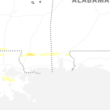
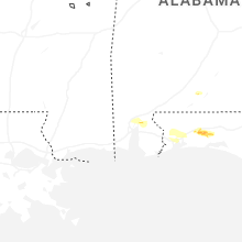
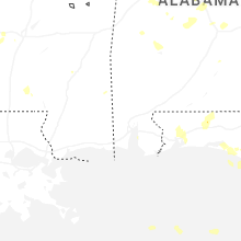
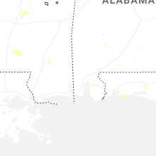
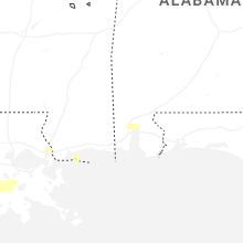
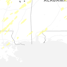


Connect with Interactive Hail Maps