

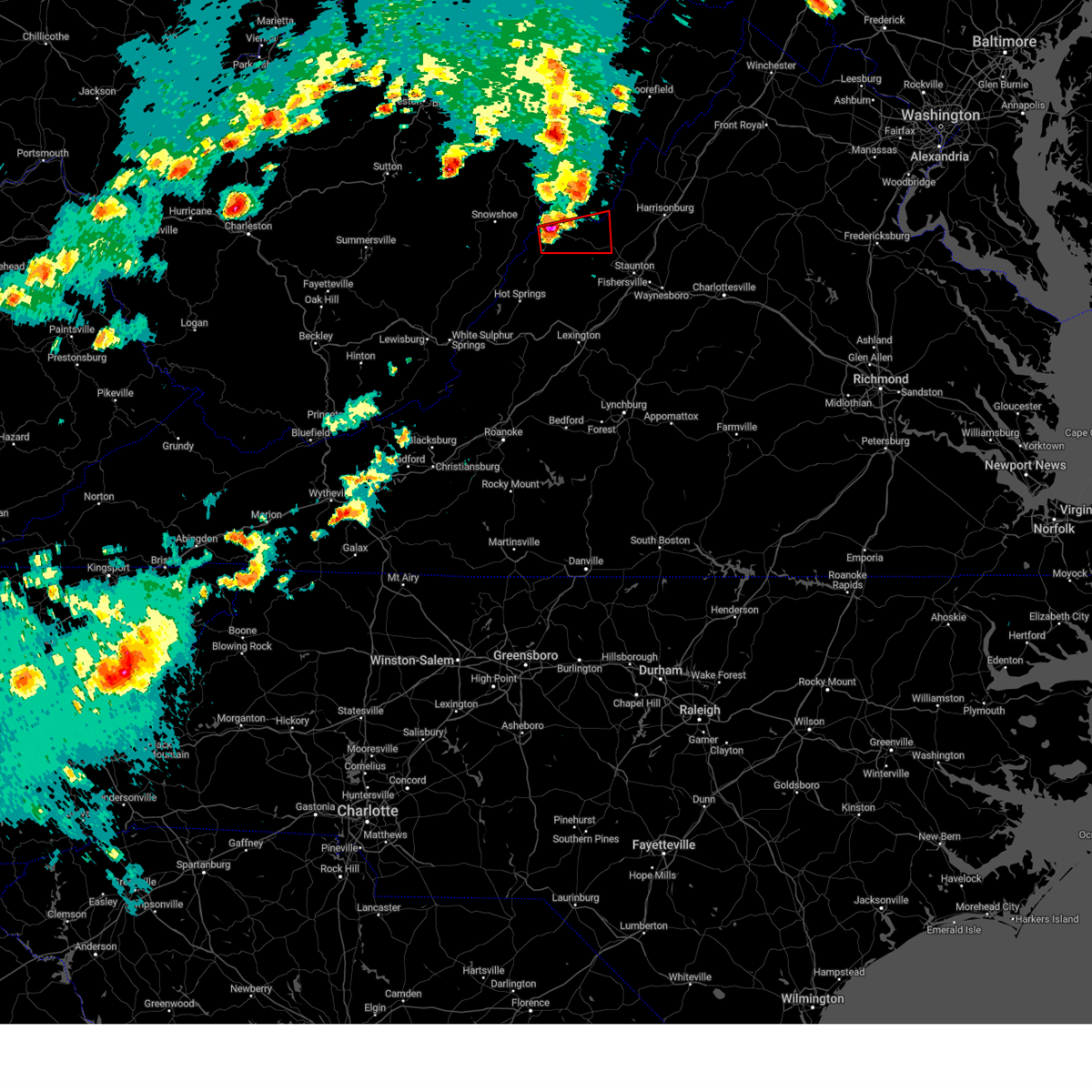
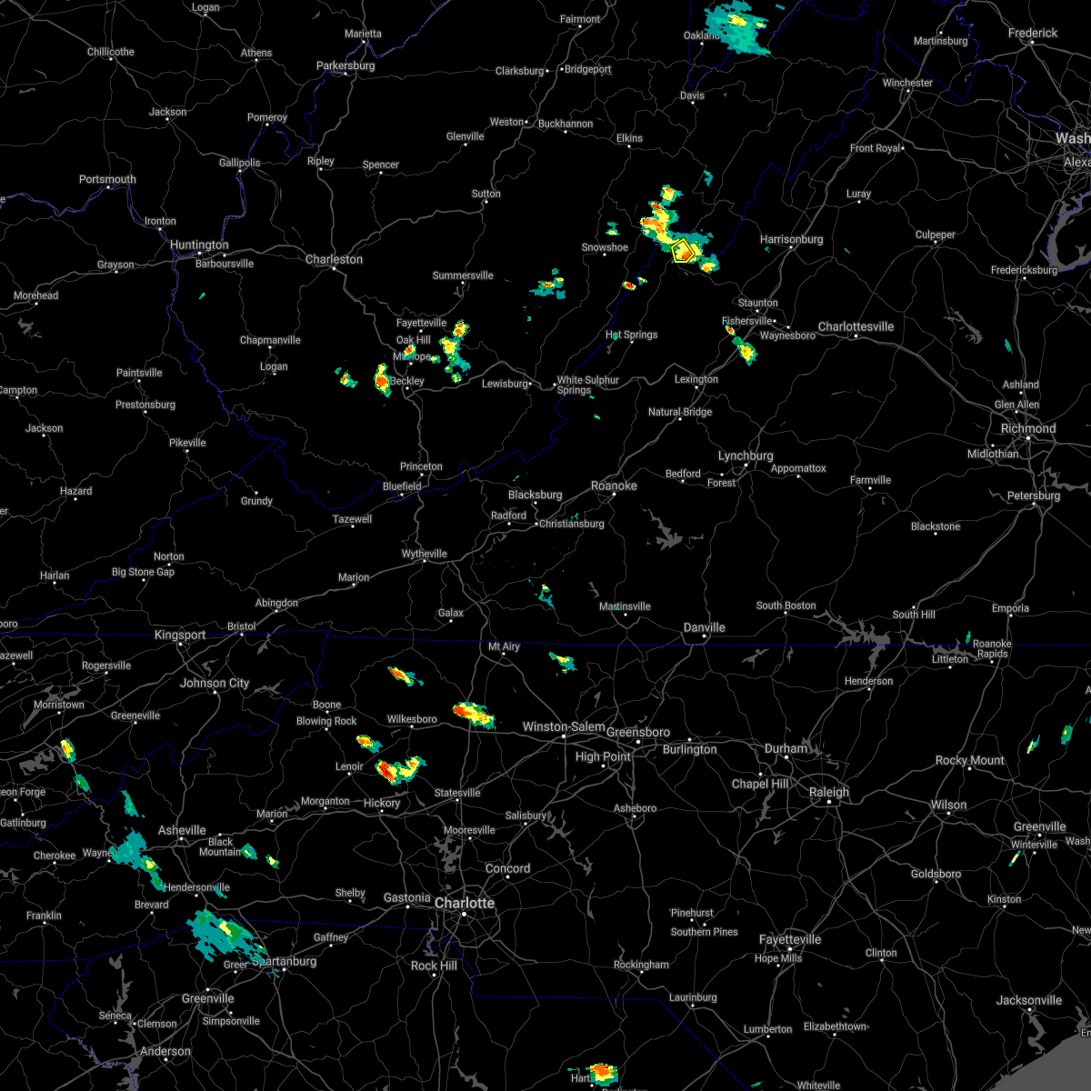
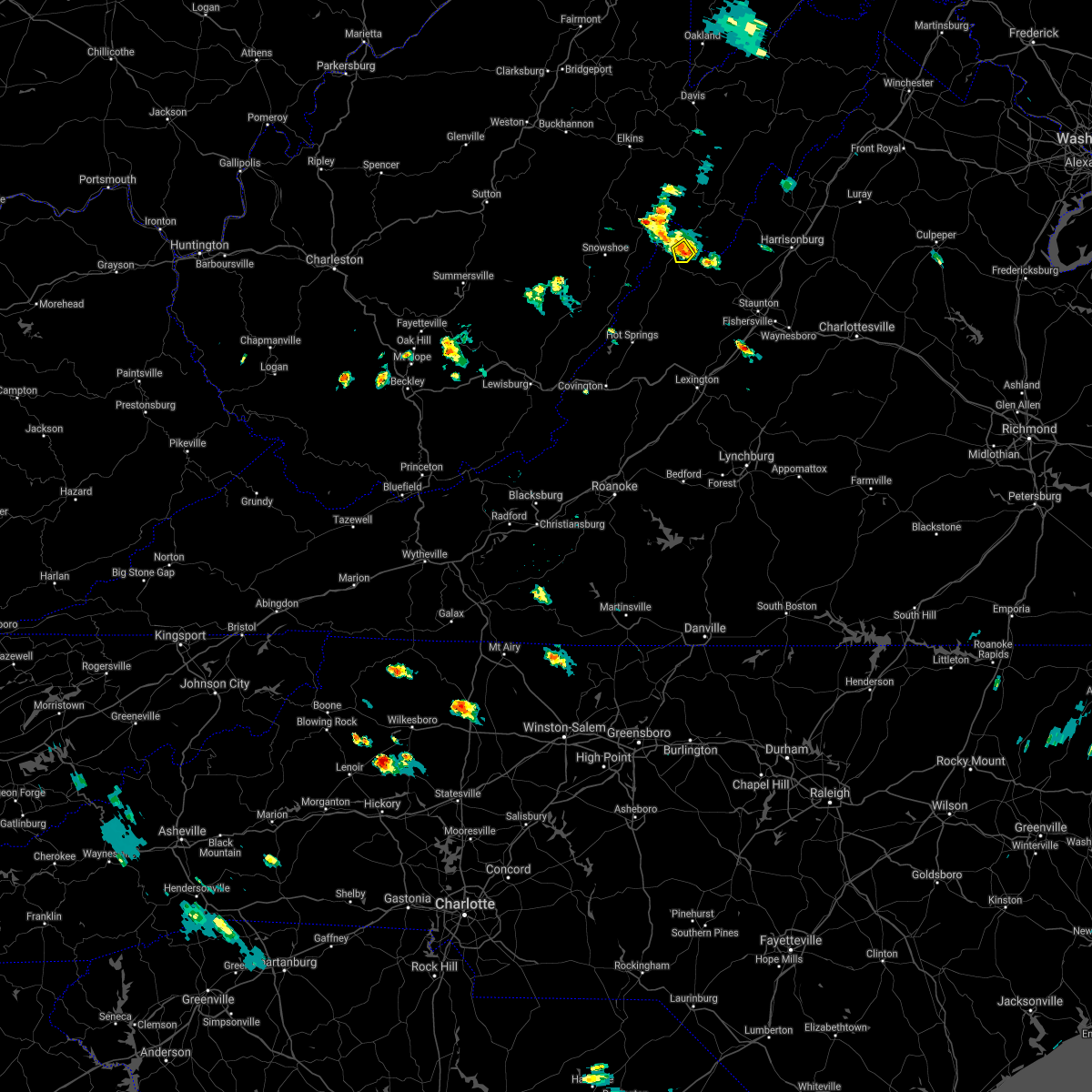
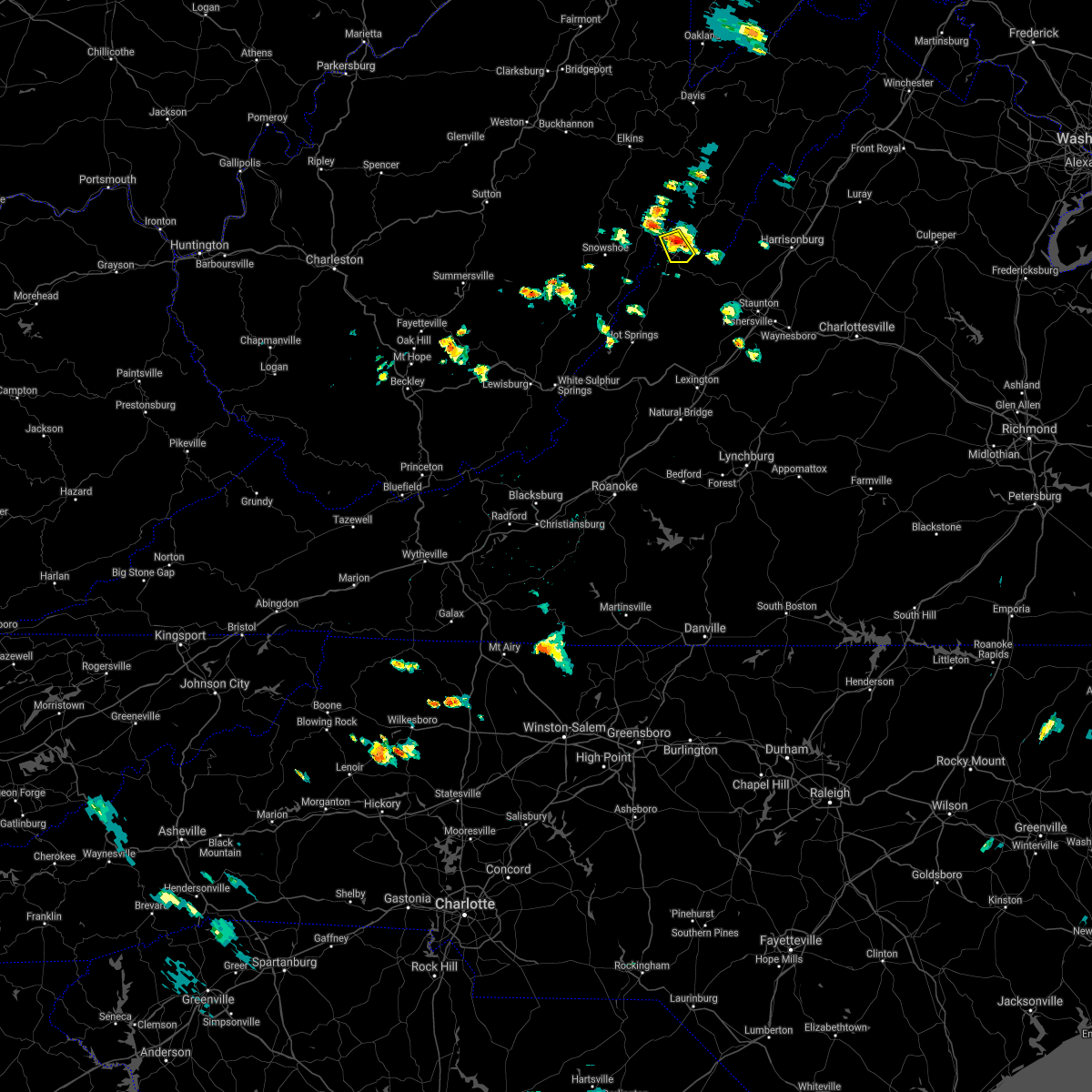
Hail Map for Monterey, VA
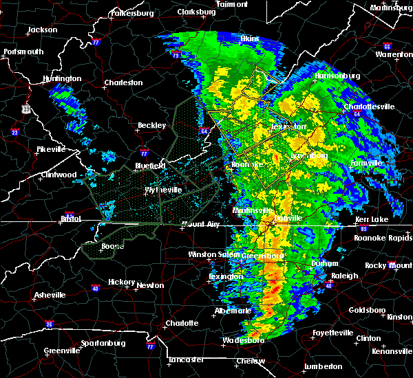
The Monterey, VA area has had 15 reports of on-the-ground hail by trained spotters, and has been under severe weather warnings 12 times during the past 12 months. Doppler radar has detected hail at or near Monterey, VA on 11 occasions, including 1 occasion during the past year.
| Name: | Monterey, VA |
| Where Located: | 38.1 miles SSE of Elkins, WV |
| Map: | Google Map for Monterey, VA |
| Population: | 147 |
| Housing Units: | 121 |
| More Info: | Search Google for Monterey, VA |
5
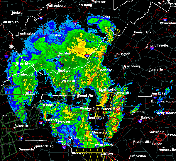
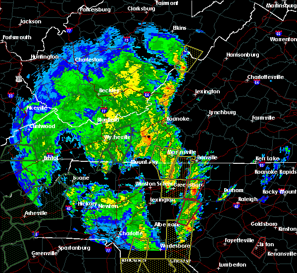
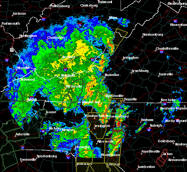
The Top Recent Hail Date for Monterey, VA is Monday, August 7, 2023 (1st out of 11)

Hail and Wind Damage Spotted near Monterey, VA
| Date / Time | Report Details |
|---|---|
| 4/2/2024 12:42 PM EDT | Tree blocking all lanes on bluegrass valley roa in highland county VA, 4.2 miles SSE of Monterey, VA |
| 4/2/2024 12:36 PM EDT | Trees reported down on the 3000 block of mill gap roa in highland county VA, 5.6 miles ENE of Monterey, VA |
| 4/2/2024 12:28 PM EDT |
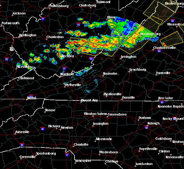
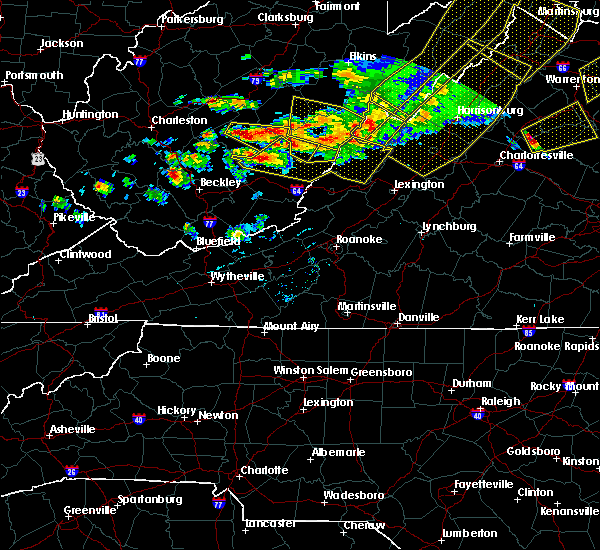
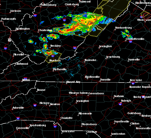
 At 1228 pm edt, severe thunderstorms were located along a line extending from 7 miles south of audra state park to 9 miles southeast of holly river state park to near snowshoe to 7 miles west of mountain grove, moving east at 75 mph (radar indicated). Hazards include 60 mph wind gusts. Damaging winds will cause some trees and large branches to fall. this could injure those outdoors, as well as damage homes and vehicles. roadways may become blocked by downed trees. localized power outages are possible. unsecured light objects may become projectiles. Locations impacted include, franklin, monterey, brandywine, upper tract, doe hill, head waters, brushy run, bolar, riverton, deer run, liberty, circleville, ruddle, williamsville, oak flat, vanderpool, sirons mill, hightown, onego, and clover creek. At 1228 pm edt, severe thunderstorms were located along a line extending from 7 miles south of audra state park to 9 miles southeast of holly river state park to near snowshoe to 7 miles west of mountain grove, moving east at 75 mph (radar indicated). Hazards include 60 mph wind gusts. Damaging winds will cause some trees and large branches to fall. this could injure those outdoors, as well as damage homes and vehicles. roadways may become blocked by downed trees. localized power outages are possible. unsecured light objects may become projectiles. Locations impacted include, franklin, monterey, brandywine, upper tract, doe hill, head waters, brushy run, bolar, riverton, deer run, liberty, circleville, ruddle, williamsville, oak flat, vanderpool, sirons mill, hightown, onego, and clover creek.
|
| 4/2/2024 12:09 PM EDT |
 Svrlwx the national weather service in sterling virginia has issued a * severe thunderstorm warning for, highland county in western virginia, pendleton county in eastern west virginia, south central grant county in eastern west virginia, * until 115 pm edt. * at 1208 pm edt, severe thunderstorms were located along a line extending from stonewall jackson to 8 miles west of holly river state park to near leonard, moving east at 75 mph (radar indicated). Hazards include 60 mph wind gusts. Damaging winds will cause some trees and large branches to fall. this could injure those outdoors, as well as damage homes and vehicles. roadways may become blocked by downed trees. localized power outages are possible. Unsecured light objects may become projectiles. Svrlwx the national weather service in sterling virginia has issued a * severe thunderstorm warning for, highland county in western virginia, pendleton county in eastern west virginia, south central grant county in eastern west virginia, * until 115 pm edt. * at 1208 pm edt, severe thunderstorms were located along a line extending from stonewall jackson to 8 miles west of holly river state park to near leonard, moving east at 75 mph (radar indicated). Hazards include 60 mph wind gusts. Damaging winds will cause some trees and large branches to fall. this could injure those outdoors, as well as damage homes and vehicles. roadways may become blocked by downed trees. localized power outages are possible. Unsecured light objects may become projectiles.
|
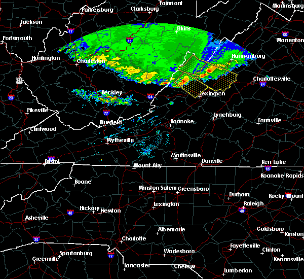
| 8/7/2023 2:55 PM EDT | Tennis Ball sized hail reported 7 miles NW of Monterey, VA, wdbj photo relayed of tennis ball sized hail. |
| 8/7/2023 2:47 PM EDT | Hen Egg sized hail reported 5.9 miles NNE of Monterey, VA, whsv photo of two inch hail. |
| 8/7/2023 2:45 PM EDT |
 At 244 pm edt, a severe thunderstorm capable of producing a tornado was located 7 miles south of monterey, moving east at 45 mph (radar indicated rotation). Hazards include tornado and golf ball size hail. For those in the direct path of a tornado touchdown, flying debris will be dangerous to those caught without shelter. damage to roofs, siding, and windows may occur. mobile homes may be damaged or destroyed. tree damage is likely. This tornadic thunderstorm will remain over mainly rural areas of northwestern augusta, central highland and south central pendleton counties, including the following locations, west augusta, palo alto, clover creek, mustoe, mcdowell, doe hill, head waters, vanderpool, sirons mill and liberty. At 244 pm edt, a severe thunderstorm capable of producing a tornado was located 7 miles south of monterey, moving east at 45 mph (radar indicated rotation). Hazards include tornado and golf ball size hail. For those in the direct path of a tornado touchdown, flying debris will be dangerous to those caught without shelter. damage to roofs, siding, and windows may occur. mobile homes may be damaged or destroyed. tree damage is likely. This tornadic thunderstorm will remain over mainly rural areas of northwestern augusta, central highland and south central pendleton counties, including the following locations, west augusta, palo alto, clover creek, mustoe, mcdowell, doe hill, head waters, vanderpool, sirons mill and liberty.
|
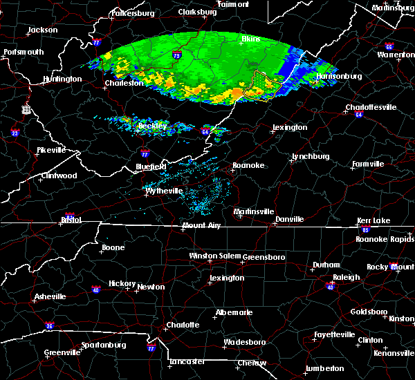
| 8/7/2023 2:22 PM EDT |
 At 222 pm edt, severe thunderstorms were located along a line extending from 13 miles southeast of dailey to 8 miles north of mountain grove, moving east at 35 mph (radar indicated). Hazards include 60 mph wind gusts and quarter size hail. Damaging winds will cause some trees and large branches to fall. this could injure those outdoors, as well as damage homes and vehicles. roadways may become blocked by downed trees. localized power outages are possible. Unsecured light objects may become projectiles. At 222 pm edt, severe thunderstorms were located along a line extending from 13 miles southeast of dailey to 8 miles north of mountain grove, moving east at 35 mph (radar indicated). Hazards include 60 mph wind gusts and quarter size hail. Damaging winds will cause some trees and large branches to fall. this could injure those outdoors, as well as damage homes and vehicles. roadways may become blocked by downed trees. localized power outages are possible. Unsecured light objects may become projectiles.
|
| 7/28/2023 5:50 PM EDT | Trees blew down in the 1400 block of us-220 jackson river roa in highland county VA, 0.9 miles NNE of Monterey, VA |
| 7/28/2023 5:45 PM EDT | Trees blew down in the 3500 block of va-84 mill gap roa in highland county VA, 6.4 miles NE of Monterey, VA |
| 7/28/2023 5:28 PM EDT |
 At 528 pm edt, severe thunderstorms were located along a line extending from near hendricks to 16 miles east of dailey to 6 miles east of greenbank, moving east at 35 mph (radar indicated). Hazards include 60 mph wind gusts and penny size hail. Damaging winds will cause some trees and large branches to fall. this could injure those outdoors, as well as damage homes and vehicles. roadways may become blocked by downed trees. localized power outages are possible. unsecured light objects may become projectiles. locations impacted include, franklin, monterey, rough run, brandywine, upper tract, landes, doe hill, head waters, brushy run, riverton, deer run, liberty, circleville, ruddle, williamsville, masonville, oak flat, vanderpool, sirons mill and hightown. hail threat, radar indicated max hail size, 0. 75 in wind threat, radar indicated max wind gust, 60 mph. At 528 pm edt, severe thunderstorms were located along a line extending from near hendricks to 16 miles east of dailey to 6 miles east of greenbank, moving east at 35 mph (radar indicated). Hazards include 60 mph wind gusts and penny size hail. Damaging winds will cause some trees and large branches to fall. this could injure those outdoors, as well as damage homes and vehicles. roadways may become blocked by downed trees. localized power outages are possible. unsecured light objects may become projectiles. locations impacted include, franklin, monterey, rough run, brandywine, upper tract, landes, doe hill, head waters, brushy run, riverton, deer run, liberty, circleville, ruddle, williamsville, masonville, oak flat, vanderpool, sirons mill and hightown. hail threat, radar indicated max hail size, 0. 75 in wind threat, radar indicated max wind gust, 60 mph.
|
| 7/28/2023 5:13 PM EDT |
 At 513 pm edt, severe thunderstorms were located along a line extending from 6 miles east of belington to 6 miles southeast of dailey to 8 miles north of greenbank, moving east at 35 mph (radar indicated). Hazards include 60 mph wind gusts. Damaging winds will cause some trees and large branches to fall. this could injure those outdoors, as well as damage homes and vehicles. roadways may become blocked by downed trees. localized power outages are possible. unsecured light objects may become projectiles. locations impacted include, franklin, monterey, rough run, brandywine, upper tract, landes, doe hill, head waters, brushy run, riverton, deer run, liberty, circleville, ruddle, williamsville, masonville, oak flat, vanderpool, sirons mill and hightown. hail threat, radar indicated max hail size, <. 75 in wind threat, radar indicated max wind gust, 60 mph. At 513 pm edt, severe thunderstorms were located along a line extending from 6 miles east of belington to 6 miles southeast of dailey to 8 miles north of greenbank, moving east at 35 mph (radar indicated). Hazards include 60 mph wind gusts. Damaging winds will cause some trees and large branches to fall. this could injure those outdoors, as well as damage homes and vehicles. roadways may become blocked by downed trees. localized power outages are possible. unsecured light objects may become projectiles. locations impacted include, franklin, monterey, rough run, brandywine, upper tract, landes, doe hill, head waters, brushy run, riverton, deer run, liberty, circleville, ruddle, williamsville, masonville, oak flat, vanderpool, sirons mill and hightown. hail threat, radar indicated max hail size, <. 75 in wind threat, radar indicated max wind gust, 60 mph.
|
| 7/28/2023 4:58 PM EDT |
 At 456 pm edt, severe thunderstorms were located along a line extending from belington to near dailey to 9 miles northwest of snowshoe, moving east at 30 mph (radar indicated). Hazards include 60 mph wind gusts. Damaging winds will cause some trees and large branches to fall. this could injure those outdoors, as well as damage homes and vehicles. roadways may become blocked by downed trees. localized power outages are possible. Unsecured light objects may become projectiles. At 456 pm edt, severe thunderstorms were located along a line extending from belington to near dailey to 9 miles northwest of snowshoe, moving east at 30 mph (radar indicated). Hazards include 60 mph wind gusts. Damaging winds will cause some trees and large branches to fall. this could injure those outdoors, as well as damage homes and vehicles. roadways may become blocked by downed trees. localized power outages are possible. Unsecured light objects may become projectiles.
|
| 7/1/2022 7:20 PM EDT | A few trees blew down and a swing set was overturned in a neighborhood near montere in highland county VA, 1.6 miles NNE of Monterey, VA |
| 6/17/2022 4:14 PM EDT |
 At 414 pm edt, a severe thunderstorm was located near monterey, moving southeast at 30 mph (radar indicated). Hazards include 60 mph wind gusts. Damaging winds will cause some trees and large branches to fall. this could injure those outdoors, as well as damage homes and vehicles. roadways may become blocked by downed trees. localized power outages are possible. Unsecured light objects may become projectiles. At 414 pm edt, a severe thunderstorm was located near monterey, moving southeast at 30 mph (radar indicated). Hazards include 60 mph wind gusts. Damaging winds will cause some trees and large branches to fall. this could injure those outdoors, as well as damage homes and vehicles. roadways may become blocked by downed trees. localized power outages are possible. Unsecured light objects may become projectiles.
|
| 6/14/2022 12:00 PM EDT | Tree limbs blew down onto the driveway of a residence near musto in highland county VA, 7.4 miles NNE of Monterey, VA |
| 8/28/2021 5:13 PM EDT | Tree down in the 5600 block of mountain turnpik in highland county VA, 3.8 miles ESE of Monterey, VA |
| 8/21/2021 5:43 PM EDT |
 The severe thunderstorm warning for central highland county will expire at 545 pm edt, the storm which prompted the warning has weakened below severe limits, and no longer poses an immediate threat to life or property. therefore, the warning will be allowed to expire. however heavy rain is still possible with this thunderstorm. to report severe weather, contact your nearest law enforcement agency. they will relay your report to the national weather service sterling virginia. The severe thunderstorm warning for central highland county will expire at 545 pm edt, the storm which prompted the warning has weakened below severe limits, and no longer poses an immediate threat to life or property. therefore, the warning will be allowed to expire. however heavy rain is still possible with this thunderstorm. to report severe weather, contact your nearest law enforcement agency. they will relay your report to the national weather service sterling virginia.
|
| 8/21/2021 5:33 PM EDT |
 At 533 pm edt, a severe thunderstorm was located near monterey, moving southeast at 15 mph (radar indicated). Hazards include 60 mph wind gusts. Damaging winds will cause some trees and large branches to fall. this could injure those outdoors, as well as damage homes and vehicles. roadways may become blocked by downed trees. localized power outages are possible. unsecured light objects may become projectiles. locations impacted include, monterey and possum trot. hail threat, radar indicated max hail size, <. 75 in wind threat, radar indicated max wind gust, 60 mph. At 533 pm edt, a severe thunderstorm was located near monterey, moving southeast at 15 mph (radar indicated). Hazards include 60 mph wind gusts. Damaging winds will cause some trees and large branches to fall. this could injure those outdoors, as well as damage homes and vehicles. roadways may become blocked by downed trees. localized power outages are possible. unsecured light objects may become projectiles. locations impacted include, monterey and possum trot. hail threat, radar indicated max hail size, <. 75 in wind threat, radar indicated max wind gust, 60 mph.
|
| 8/21/2021 5:15 PM EDT |
 At 515 pm edt, a severe thunderstorm was located near monterey, moving southeast at 15 mph (radar indicated). Hazards include 60 mph wind gusts. Damaging winds will cause some trees and large branches to fall. this could injure those outdoors, as well as damage homes and vehicles. roadways may become blocked by downed trees. localized power outages are possible. Unsecured light objects may become projectiles. At 515 pm edt, a severe thunderstorm was located near monterey, moving southeast at 15 mph (radar indicated). Hazards include 60 mph wind gusts. Damaging winds will cause some trees and large branches to fall. this could injure those outdoors, as well as damage homes and vehicles. roadways may become blocked by downed trees. localized power outages are possible. Unsecured light objects may become projectiles.
|
| 7/17/2021 5:12 PM EDT | Tree down on route 220 on the south side of musto in highland county VA, 7.4 miles NNE of Monterey, VA |
| 8/12/2020 6:22 PM EDT |
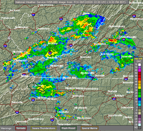 The severe thunderstorm warning for central highland and south central pendleton counties will expire at 630 pm edt, the storm which prompted the warning has weakened below severe limits, and no longer poses an immediate threat to life or property. therefore, the warning will be allowed to expire. however heavy rain is still possible with this thunderstorm. The severe thunderstorm warning for central highland and south central pendleton counties will expire at 630 pm edt, the storm which prompted the warning has weakened below severe limits, and no longer poses an immediate threat to life or property. therefore, the warning will be allowed to expire. however heavy rain is still possible with this thunderstorm.
|
| 8/12/2020 5:49 PM EDT |
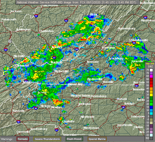 At 549 pm edt, a severe thunderstorm was located near monterey, moving north at 10 mph (radar indicated). Hazards include 60 mph wind gusts and quarter size hail. Damaging winds will cause some trees and large branches to fall. this could injure those outdoors, as well as damage homes and vehicles. roadways may become blocked by downed trees. localized power outages are possible. Unsecured light objects may become projectiles. At 549 pm edt, a severe thunderstorm was located near monterey, moving north at 10 mph (radar indicated). Hazards include 60 mph wind gusts and quarter size hail. Damaging winds will cause some trees and large branches to fall. this could injure those outdoors, as well as damage homes and vehicles. roadways may become blocked by downed trees. localized power outages are possible. Unsecured light objects may become projectiles.
|
| 7/10/2020 6:39 PM EDT |
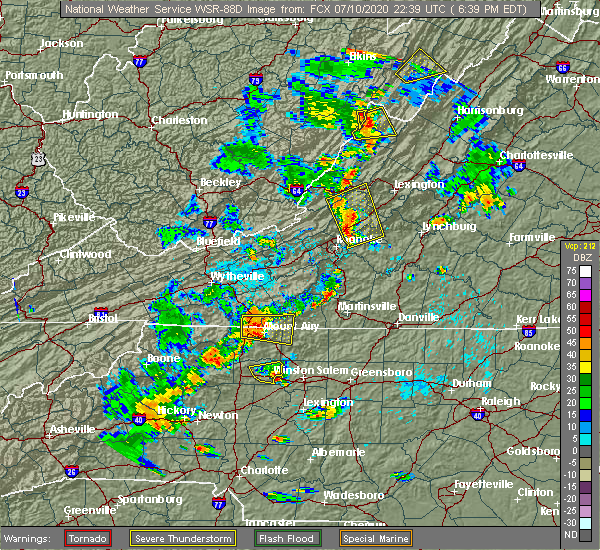 The severe thunderstorm warning for highland county will expire at 645 pm edt, the storm which prompted the warning has weakened below severe limits, and no longer poses an immediate threat to life or property. therefore, the warning will be allowed to expire. The severe thunderstorm warning for highland county will expire at 645 pm edt, the storm which prompted the warning has weakened below severe limits, and no longer poses an immediate threat to life or property. therefore, the warning will be allowed to expire.
|
| 7/10/2020 6:20 PM EDT |
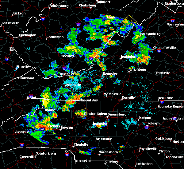 At 620 pm edt, a severe thunderstorm was located near greenbank, moving east at 20 mph (radar indicated). Hazards include 60 mph wind gusts and quarter size hail. Damaging winds will cause some trees and large branches to fall. this could injure those outdoors, as well as damage homes and vehicles. roadways may become blocked by downed trees. localized power outages are possible. Unsecured light objects may become projectiles. At 620 pm edt, a severe thunderstorm was located near greenbank, moving east at 20 mph (radar indicated). Hazards include 60 mph wind gusts and quarter size hail. Damaging winds will cause some trees and large branches to fall. this could injure those outdoors, as well as damage homes and vehicles. roadways may become blocked by downed trees. localized power outages are possible. Unsecured light objects may become projectiles.
|
| 4/9/2020 3:38 AM EDT |
 The severe thunderstorm warning for eastern highland and central pendleton counties will expire at 345 am edt, the storms which prompted the warning have moved out of the area. therefore, the warning will be allowed to expire. a severe thunderstorm watch remains in effect until 600 am edt for western virginia, and eastern west virginia. to report severe weather, contact your nearest law enforcement agency. they will relay your report to the national weather service sterling virginia. The severe thunderstorm warning for eastern highland and central pendleton counties will expire at 345 am edt, the storms which prompted the warning have moved out of the area. therefore, the warning will be allowed to expire. a severe thunderstorm watch remains in effect until 600 am edt for western virginia, and eastern west virginia. to report severe weather, contact your nearest law enforcement agency. they will relay your report to the national weather service sterling virginia.
|
| 4/9/2020 3:33 AM EDT |
 At 333 am edt, severe thunderstorms were located along a line extending from 7 miles southeast of upper tract to 16 miles east of monterey to bells valley, moving east at 55 mph (radar indicated). Hazards include 60 mph wind gusts. Damaging winds will cause some trees and large branches to fall. this could injure those outdoors, as well as damage homes and vehicles. roadways may become blocked by downed trees. localized power outages are possible. unsecured light objects may become projectiles. Locations impacted include, franklin, monterey, brandywine, upper tract, clover creek, doe hill, head waters, bolar, deer run, liberty, harper, ruddle, williamsville, palo alto, oak flat, mustoe, mcdowell, possum trot, moyers and sirons mill. At 333 am edt, severe thunderstorms were located along a line extending from 7 miles southeast of upper tract to 16 miles east of monterey to bells valley, moving east at 55 mph (radar indicated). Hazards include 60 mph wind gusts. Damaging winds will cause some trees and large branches to fall. this could injure those outdoors, as well as damage homes and vehicles. roadways may become blocked by downed trees. localized power outages are possible. unsecured light objects may become projectiles. Locations impacted include, franklin, monterey, brandywine, upper tract, clover creek, doe hill, head waters, bolar, deer run, liberty, harper, ruddle, williamsville, palo alto, oak flat, mustoe, mcdowell, possum trot, moyers and sirons mill.
|
| 4/9/2020 3:17 AM EDT |
 At 317 am edt, severe thunderstorms were located along a line extending from 7 miles northwest of franklin to near monterey to near warm springs, moving east at 50 mph (radar indicated). Hazards include 60 mph wind gusts. Damaging winds will cause some trees and large branches to fall. this could injure those outdoors, as well as damage homes and vehicles. roadways may become blocked by downed trees. localized power outages are possible. unsecured light objects may become projectiles. Locations impacted include, franklin, monterey, brandywine, upper tract, doe hill, head waters, brushy run, bolar, riverton, deer run, liberty, circleville, ruddle, williamsville, oak flat, vanderpool, sirons mill, hightown, onego and clover creek. At 317 am edt, severe thunderstorms were located along a line extending from 7 miles northwest of franklin to near monterey to near warm springs, moving east at 50 mph (radar indicated). Hazards include 60 mph wind gusts. Damaging winds will cause some trees and large branches to fall. this could injure those outdoors, as well as damage homes and vehicles. roadways may become blocked by downed trees. localized power outages are possible. unsecured light objects may become projectiles. Locations impacted include, franklin, monterey, brandywine, upper tract, doe hill, head waters, brushy run, bolar, riverton, deer run, liberty, circleville, ruddle, williamsville, oak flat, vanderpool, sirons mill, hightown, onego and clover creek.
|
| 4/9/2020 2:57 AM EDT |
 At 257 am edt, severe thunderstorms were located along a line extending from 10 miles east of dailey to near greenbank to 7 miles south of marlinton, moving east at 60 mph (radar indicated). Hazards include 60 mph wind gusts. Damaging winds will cause some trees and large branches to fall. this could injure those outdoors, as well as damage homes and vehicles. roadways may become blocked by downed trees. localized power outages are possible. unsecured light objects may become projectiles. Locations impacted include, franklin, monterey, brandywine, upper tract, doe hill, head waters, brushy run, bolar, riverton, deer run, liberty, circleville, ruddle, williamsville, oak flat, vanderpool, sirons mill, hightown, onego and clover creek. At 257 am edt, severe thunderstorms were located along a line extending from 10 miles east of dailey to near greenbank to 7 miles south of marlinton, moving east at 60 mph (radar indicated). Hazards include 60 mph wind gusts. Damaging winds will cause some trees and large branches to fall. this could injure those outdoors, as well as damage homes and vehicles. roadways may become blocked by downed trees. localized power outages are possible. unsecured light objects may become projectiles. Locations impacted include, franklin, monterey, brandywine, upper tract, doe hill, head waters, brushy run, bolar, riverton, deer run, liberty, circleville, ruddle, williamsville, oak flat, vanderpool, sirons mill, hightown, onego and clover creek.
|
| 4/9/2020 2:42 AM EDT |
 At 242 am edt, severe thunderstorms were located along a line extending from 9 miles northwest of mill creek to 9 miles west of snowshoe to near leonard, moving east at 55 mph (radar indicated). Hazards include 60 mph wind gusts and quarter size hail. Damaging winds will cause some trees and large branches to fall. this could injure those outdoors, as well as damage homes and vehicles. roadways may become blocked by downed trees. localized power outages are possible. Unsecured light objects may become projectiles. At 242 am edt, severe thunderstorms were located along a line extending from 9 miles northwest of mill creek to 9 miles west of snowshoe to near leonard, moving east at 55 mph (radar indicated). Hazards include 60 mph wind gusts and quarter size hail. Damaging winds will cause some trees and large branches to fall. this could injure those outdoors, as well as damage homes and vehicles. roadways may become blocked by downed trees. localized power outages are possible. Unsecured light objects may become projectiles.
|
| 4/8/2020 5:39 AM EDT |
 The severe thunderstorm warning for highland county will expire at 545 am edt, the storms which prompted the warning have moved out of the area. therefore, the warning will be allowed to expire. The severe thunderstorm warning for highland county will expire at 545 am edt, the storms which prompted the warning have moved out of the area. therefore, the warning will be allowed to expire.
|
| 4/8/2020 5:22 AM EDT |
 At 522 am edt, severe thunderstorms were located along a line extending from 15 miles south of franklin to 7 miles south of monterey to 6 miles northeast of marlinton, moving southeast at 80 mph (radar indicated). Hazards include 60 mph wind gusts and quarter size hail. Damaging winds will cause some trees and large branches to fall. this could injure those outdoors, as well as damage homes and vehicles. roadways may become blocked by downed trees. localized power outages are possible. unsecured light objects may become projectiles. Locations impacted include, monterey, hightown, clover creek, doe hill, head waters, mill gap, new hampden, liberty, williamsville, palo alto, mustoe, mcdowell, blue grass, possum trot, vanderpool, sirons mill and bolar. At 522 am edt, severe thunderstorms were located along a line extending from 15 miles south of franklin to 7 miles south of monterey to 6 miles northeast of marlinton, moving southeast at 80 mph (radar indicated). Hazards include 60 mph wind gusts and quarter size hail. Damaging winds will cause some trees and large branches to fall. this could injure those outdoors, as well as damage homes and vehicles. roadways may become blocked by downed trees. localized power outages are possible. unsecured light objects may become projectiles. Locations impacted include, monterey, hightown, clover creek, doe hill, head waters, mill gap, new hampden, liberty, williamsville, palo alto, mustoe, mcdowell, blue grass, possum trot, vanderpool, sirons mill and bolar.
|
| 4/8/2020 5:17 AM EDT | Tree reported down on thorny bottom lane near potomac river roa in highland county VA, 3.8 miles SW of Monterey, VA |
| 4/8/2020 5:03 AM EDT |
 At 503 am edt, severe thunderstorms were located along a line extending from 12 miles southeast of mill creek to near cass scenic railroad to 6 miles northeast of addison (webster springs), moving southeast at 55 mph (radar indicated). Hazards include 60 mph wind gusts and quarter size hail. Damaging winds will cause some trees and large branches to fall. this could injure those outdoors, as well as damage homes and vehicles. roadways may become blocked by downed trees. localized power outages are possible. Unsecured light objects may become projectiles. At 503 am edt, severe thunderstorms were located along a line extending from 12 miles southeast of mill creek to near cass scenic railroad to 6 miles northeast of addison (webster springs), moving southeast at 55 mph (radar indicated). Hazards include 60 mph wind gusts and quarter size hail. Damaging winds will cause some trees and large branches to fall. this could injure those outdoors, as well as damage homes and vehicles. roadways may become blocked by downed trees. localized power outages are possible. Unsecured light objects may become projectiles.
|
| 10/31/2019 4:59 PM EDT |
 At 459 pm edt, severe thunderstorms were located along a line extending from near franklin to 12 miles northeast of burnsville, moving northeast at 60 mph (radar indicated). Hazards include 60 mph wind gusts. Damaging winds will cause some trees and large branches to fall. this could injure those outdoors, as well as damage homes and vehicles. roadways may become blocked by downed trees. localized power outages are possible. unsecured light objects may become projectiles. Locations impacted include, franklin, monterey, brandywine, doe hill, head waters, bolar, deer run, liberty, circleville, ruddle, williamsville, oak flat, vanderpool, sirons mill, hightown, clover creek, mill gap, cherry grove, new hampden and harper. At 459 pm edt, severe thunderstorms were located along a line extending from near franklin to 12 miles northeast of burnsville, moving northeast at 60 mph (radar indicated). Hazards include 60 mph wind gusts. Damaging winds will cause some trees and large branches to fall. this could injure those outdoors, as well as damage homes and vehicles. roadways may become blocked by downed trees. localized power outages are possible. unsecured light objects may become projectiles. Locations impacted include, franklin, monterey, brandywine, doe hill, head waters, bolar, deer run, liberty, circleville, ruddle, williamsville, oak flat, vanderpool, sirons mill, hightown, clover creek, mill gap, cherry grove, new hampden and harper.
|
| 10/31/2019 4:41 PM EDT |
 The national weather service in sterling virginia has issued a * severe thunderstorm warning for. highland county in western virginia. pendleton county in eastern west virginia. until 530 pm edt. At 441 pm edt, severe thunderstorms were located along a line. The national weather service in sterling virginia has issued a * severe thunderstorm warning for. highland county in western virginia. pendleton county in eastern west virginia. until 530 pm edt. At 441 pm edt, severe thunderstorms were located along a line.
|
| 10/31/2019 4:41 PM EDT |
 At 441 pm edt, severe thunderstorms were located along a line extending from near monterey to near burnsville, moving northeast at 60 mph (radar indicated). Hazards include 60 mph wind gusts. Damaging winds will cause some trees and large branches to fall. this could injure those outdoors, as well as damage homes and vehicles. roadways may become blocked by downed trees. localized power outages are possible. Unsecured light objects may become projectiles. At 441 pm edt, severe thunderstorms were located along a line extending from near monterey to near burnsville, moving northeast at 60 mph (radar indicated). Hazards include 60 mph wind gusts. Damaging winds will cause some trees and large branches to fall. this could injure those outdoors, as well as damage homes and vehicles. roadways may become blocked by downed trees. localized power outages are possible. Unsecured light objects may become projectiles.
|
| 8/7/2019 8:44 AM EDT |
 The national weather service in sterling virginia has issued a * severe thunderstorm warning for. west central rockingham county in western virginia. north central augusta county in western virginia. east central highland county in western virginia. Southeastern pendleton county in eastern west virginia. The national weather service in sterling virginia has issued a * severe thunderstorm warning for. west central rockingham county in western virginia. north central augusta county in western virginia. east central highland county in western virginia. Southeastern pendleton county in eastern west virginia.
|
| 8/7/2019 8:44 AM EDT |
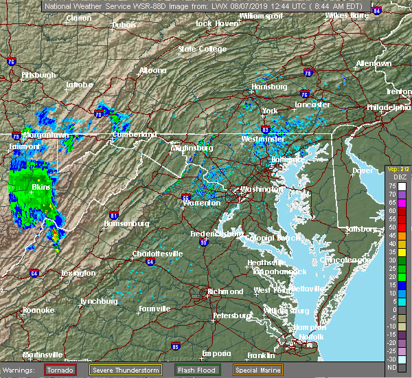 The national weather service in sterling virginia has issued a * severe thunderstorm warning for. west central rockingham county in western virginia. north central augusta county in western virginia. east central highland county in western virginia. Southeastern pendleton county in eastern west virginia. The national weather service in sterling virginia has issued a * severe thunderstorm warning for. west central rockingham county in western virginia. north central augusta county in western virginia. east central highland county in western virginia. Southeastern pendleton county in eastern west virginia.
|
| 7/21/2019 4:28 PM EDT | Tree down blocking one lane of bullpasture river r in highland county VA, 7.1 miles NW of Monterey, VA |
| 4/19/2019 3:36 PM EDT |
 The severe thunderstorm warning for central highland and southwestern pendleton counties will expire at 345 pm edt, the storms which prompted the warning have weakened below severe limits, and no longer pose an immediate threat to life or property. therefore, the warning will be allowed to expire. a tornado watch remains in effect until midnight edt for western virginia, and eastern west virginia. The severe thunderstorm warning for central highland and southwestern pendleton counties will expire at 345 pm edt, the storms which prompted the warning have weakened below severe limits, and no longer pose an immediate threat to life or property. therefore, the warning will be allowed to expire. a tornado watch remains in effect until midnight edt for western virginia, and eastern west virginia.
|
| 4/19/2019 3:34 PM EDT |
 At 333 pm edt, severe thunderstorms were located along a line extending from 12 miles northeast of greenbank to near monterey, moving northeast at 45 mph (radar indicated). Hazards include 60 mph wind gusts. Damaging winds will cause some trees and large branches to fall. this could injure those outdoors, as well as damage homes and vehicles. roadways may become blocked by downed trees. localized power outages are possible. unsecured light objects may become projectiles. Locations impacted include, monterey, hightown, clover creek, doe hill, cherry grove, new hampden, harper, mustoe, mcdowell, blue grass, possum trot, vanderpool, moyers and sirons mill. At 333 pm edt, severe thunderstorms were located along a line extending from 12 miles northeast of greenbank to near monterey, moving northeast at 45 mph (radar indicated). Hazards include 60 mph wind gusts. Damaging winds will cause some trees and large branches to fall. this could injure those outdoors, as well as damage homes and vehicles. roadways may become blocked by downed trees. localized power outages are possible. unsecured light objects may become projectiles. Locations impacted include, monterey, hightown, clover creek, doe hill, cherry grove, new hampden, harper, mustoe, mcdowell, blue grass, possum trot, vanderpool, moyers and sirons mill.
|
| 4/19/2019 3:21 PM EDT |
 At 321 pm edt, severe thunderstorms were located along a line extending from 7 miles southeast of greenbank to near burnsville, moving northeast at 50 mph (radar indicated). Hazards include 60 mph wind gusts. Damaging winds will cause some trees and large branches to fall. this could injure those outdoors, as well as damage homes and vehicles. roadways may become blocked by downed trees. localized power outages are possible. unsecured light objects may become projectiles. Locations impacted include, monterey, hightown, clover creek, doe hill, bolar, mill gap, cherry grove, new hampden, harper, mustoe, mcdowell, blue grass, possum trot, vanderpool, moyers and sirons mill. At 321 pm edt, severe thunderstorms were located along a line extending from 7 miles southeast of greenbank to near burnsville, moving northeast at 50 mph (radar indicated). Hazards include 60 mph wind gusts. Damaging winds will cause some trees and large branches to fall. this could injure those outdoors, as well as damage homes and vehicles. roadways may become blocked by downed trees. localized power outages are possible. unsecured light objects may become projectiles. Locations impacted include, monterey, hightown, clover creek, doe hill, bolar, mill gap, cherry grove, new hampden, harper, mustoe, mcdowell, blue grass, possum trot, vanderpool, moyers and sirons mill.
|
| 4/19/2019 3:09 PM EDT |
 At 309 pm edt, severe thunderstorms were located along a line extending from 10 miles northeast of mountain grove to near burnsville, moving northeast at 50 mph (radar indicated). Hazards include 60 mph wind gusts. Damaging winds will cause some trees and large branches to fall. this could injure those outdoors, as well as damage homes and vehicles. roadways may become blocked by downed trees. localized power outages are possible. Unsecured light objects may become projectiles. At 309 pm edt, severe thunderstorms were located along a line extending from 10 miles northeast of mountain grove to near burnsville, moving northeast at 50 mph (radar indicated). Hazards include 60 mph wind gusts. Damaging winds will cause some trees and large branches to fall. this could injure those outdoors, as well as damage homes and vehicles. roadways may become blocked by downed trees. localized power outages are possible. Unsecured light objects may become projectiles.
|
| 4/14/2019 10:12 PM EDT |
 At 1012 pm edt, severe thunderstorms were located along a line extending from 6 miles south of davis to near snowshoe, moving east at 50 mph. trees and wires were blown down in association with this line over greenbrier county west virginia (emergency management). Hazards include 60 mph wind gusts. Damaging winds will cause some trees and large branches to fall. this could injure those outdoors, as well as damage homes and vehicles. roadways may become blocked by downed trees. localized power outages are possible. unsecured light objects may become projectiles. Locations impacted include, moorefield, petersburg, franklin, monterey, rough run, brandywine, upper tract, arthur, brushy run, head waters, deer run, lahmansville, williamsville, cabins, oak flat, dorcas, kline gap, hightown, onego and mill gap. At 1012 pm edt, severe thunderstorms were located along a line extending from 6 miles south of davis to near snowshoe, moving east at 50 mph. trees and wires were blown down in association with this line over greenbrier county west virginia (emergency management). Hazards include 60 mph wind gusts. Damaging winds will cause some trees and large branches to fall. this could injure those outdoors, as well as damage homes and vehicles. roadways may become blocked by downed trees. localized power outages are possible. unsecured light objects may become projectiles. Locations impacted include, moorefield, petersburg, franklin, monterey, rough run, brandywine, upper tract, arthur, brushy run, head waters, deer run, lahmansville, williamsville, cabins, oak flat, dorcas, kline gap, hightown, onego and mill gap.
|
| 4/14/2019 10:09 PM EDT |
 At 1009 pm edt, severe thunderstorms were located along a line extending from 6 miles south of davis to near snowshoe, moving east at 50 mph (radar indicated). Hazards include 60 mph wind gusts. Damaging winds will cause some trees and large branches to fall. this could injure those outdoors, as well as damage homes and vehicles. roadways may become blocked by downed trees. localized power outages are possible. Unsecured light objects may become projectiles. At 1009 pm edt, severe thunderstorms were located along a line extending from 6 miles south of davis to near snowshoe, moving east at 50 mph (radar indicated). Hazards include 60 mph wind gusts. Damaging winds will cause some trees and large branches to fall. this could injure those outdoors, as well as damage homes and vehicles. roadways may become blocked by downed trees. localized power outages are possible. Unsecured light objects may become projectiles.
|
| 10/23/2017 8:40 PM EDT |
 The severe thunderstorm warning for highland and southwestern pendleton counties will expire at 845 pm edt, the storms which prompted the warning have weakened below severe limits, and no longer pose an immediate threat to life or property. therefore the warning will be allowed to expire. however heavy rain is still possible. The severe thunderstorm warning for highland and southwestern pendleton counties will expire at 845 pm edt, the storms which prompted the warning have weakened below severe limits, and no longer pose an immediate threat to life or property. therefore the warning will be allowed to expire. however heavy rain is still possible.
|
| 10/23/2017 8:25 PM EDT |
 At 824 pm edt, severe thunderstorms were located along a line extending from near greenbank to burnsville, moving northeast at 35 mph (radar indicated). Hazards include 60 mph wind gusts. Damaging winds will cause some trees and large branches to fall. this could injure those outdoors, as well as damage homes and vehicles. roadways may become blocked by downed trees. localized power outages are possible. unsecured light objects may become projectiles. Locations impacted include, monterey, hightown, clover creek, doe hill, bolar, mill gap, new hampden, harper, palo alto, mustoe, mcdowell, blue grass, possum trot, vanderpool and sirons mill. At 824 pm edt, severe thunderstorms were located along a line extending from near greenbank to burnsville, moving northeast at 35 mph (radar indicated). Hazards include 60 mph wind gusts. Damaging winds will cause some trees and large branches to fall. this could injure those outdoors, as well as damage homes and vehicles. roadways may become blocked by downed trees. localized power outages are possible. unsecured light objects may become projectiles. Locations impacted include, monterey, hightown, clover creek, doe hill, bolar, mill gap, new hampden, harper, palo alto, mustoe, mcdowell, blue grass, possum trot, vanderpool and sirons mill.
|
| 10/23/2017 7:59 PM EDT |
 At 757 pm edt, a severe thunderstorm was located 10 miles northwest of burnsville, or 11 miles south of greenbank, moving northeast at 50 mph (radar indicated). Hazards include 60 mph wind gusts. Damaging winds will cause some trees and large branches to fall. this could injure those outdoors, as well as damage homes and vehicles. roadways may become blocked by downed trees. localized power outages are possible. Unsecured light objects may become projectiles. At 757 pm edt, a severe thunderstorm was located 10 miles northwest of burnsville, or 11 miles south of greenbank, moving northeast at 50 mph (radar indicated). Hazards include 60 mph wind gusts. Damaging winds will cause some trees and large branches to fall. this could injure those outdoors, as well as damage homes and vehicles. roadways may become blocked by downed trees. localized power outages are possible. Unsecured light objects may become projectiles.
|
| 6/16/2016 7:20 PM EDT |
 The severe thunderstorm warning for highland and southwestern pendleton counties will expire at 730 pm edt, the storms which prompted the warning have weakened, and no longer pose an immediate threat to life or property. therefore the warning will be allowed to expire. a severe thunderstorm watch remains in effect until 1000 pm edt for western virginia, and eastern west virginia. The severe thunderstorm warning for highland and southwestern pendleton counties will expire at 730 pm edt, the storms which prompted the warning have weakened, and no longer pose an immediate threat to life or property. therefore the warning will be allowed to expire. a severe thunderstorm watch remains in effect until 1000 pm edt for western virginia, and eastern west virginia.
|
| 6/16/2016 7:08 PM EDT | Tree down blocking the roadway in the 6400 block of mill gap roa in highland county VA, 8.6 miles NE of Monterey, VA |
| 6/16/2016 7:07 PM EDT |
 At 706 pm edt, severe thunderstorms were located along a line extending from 15 miles southwest of brandywine to 7 miles north of burnsville, moving southeast at 30 mph (radar indicated). Hazards include 60 mph wind gusts and quarter size hail. Damaging winds will cause some trees and large branches to fall. this could injure those outdoors, as well as damage homes and vehicles. roadways may become blocked by downed trees. localized power outages are possible. unsecured light objects may become projectiles. Locations impacted include, monterey, doe hill, blue grass, head waters, new hampden, sirons mill, mill gap, vanderpool, bolar, mustoe, harper, clover creek, hightown, liberty, palo alto, possum trot, mcdowell and williamsville. At 706 pm edt, severe thunderstorms were located along a line extending from 15 miles southwest of brandywine to 7 miles north of burnsville, moving southeast at 30 mph (radar indicated). Hazards include 60 mph wind gusts and quarter size hail. Damaging winds will cause some trees and large branches to fall. this could injure those outdoors, as well as damage homes and vehicles. roadways may become blocked by downed trees. localized power outages are possible. unsecured light objects may become projectiles. Locations impacted include, monterey, doe hill, blue grass, head waters, new hampden, sirons mill, mill gap, vanderpool, bolar, mustoe, harper, clover creek, hightown, liberty, palo alto, possum trot, mcdowell and williamsville.
|
| 6/16/2016 6:23 PM EDT |
 At 623 pm edt, severe thunderstorms were located along a line extending from 13 miles southeast of mill creek to near cass scenic railroad, moving southeast at 65 mph (radar indicated). Hazards include 60 mph wind gusts and quarter size hail. Damaging winds will cause some trees and large branches to fall. this could injure those outdoors, as well as damage homes and vehicles. roadways may become blocked by downed trees. localized power outages are possible. Unsecured light objects may become projectiles. At 623 pm edt, severe thunderstorms were located along a line extending from 13 miles southeast of mill creek to near cass scenic railroad, moving southeast at 65 mph (radar indicated). Hazards include 60 mph wind gusts and quarter size hail. Damaging winds will cause some trees and large branches to fall. this could injure those outdoors, as well as damage homes and vehicles. roadways may become blocked by downed trees. localized power outages are possible. Unsecured light objects may become projectiles.
|
| 6/26/2015 11:08 PM EDT | At 1107 pm edt, doppler radar indicated a line of severe thunderstorms capable of producing damaging winds in excess of 60 mph. these storms were located along a line extending from cherry grove to hightown, moving east at 35 mph. locations impacted include, brandywine, monterey, doe hill, blue grass, new hampden, vanderpool, circleville, clover creek, harper, deer run, cherry grove, mcdowell, ruddle, oak flat, franklin, sirons mill, moyers, mill gap, riverton and mustoe. |
| 6/26/2015 11:08 PM EDT | At 1107 pm edt, doppler radar indicated a line of severe thunderstorms capable of producing damaging winds in excess of 60 mph. these storms were located along a line extending from cherry grove to hightown, moving east at 35 mph. locations impacted include, brandywine, monterey, doe hill, blue grass, new hampden, vanderpool, circleville, clover creek, harper, deer run, cherry grove, mcdowell, ruddle, oak flat, franklin, sirons mill, moyers, mill gap, riverton and mustoe. |
| 6/26/2015 10:42 PM EDT | At 1041 pm edt, doppler radar indicated a severe thunderstorm capable of producing damaging winds in excess of 60 mph. this storm was located near cass scenic railroad, and moving east at 25 mph. |
| 6/26/2015 10:42 PM EDT | At 1041 pm edt, doppler radar indicated a severe thunderstorm capable of producing damaging winds in excess of 60 mph. this storm was located near cass scenic railroad, and moving east at 25 mph. |
| 7/19/2013 3:06 PM EDT | Tree down on hwy 220 near rt 62 in highland county VA, 3.8 miles SW of Monterey, VA |
| 5/10/2013 5:44 PM EDT | Quarter sized hail reported 7 miles NW of Monterey, VA |
| 6/29/2012 8:39 PM EDT | Trees down countywide in highland county VA, 0.1 miles NNW of Monterey, VA |
| 6/29/2012 8:35 PM EDT | Multiple reports of trees and powerl lines down across the county in highland county VA, 0.1 miles NNW of Monterey, VA |
| 5/3/2012 8:36 PM EDT | Quarter sized hail reported 7.1 miles NW of Monterey, VA, relayed via postal service. |
| 5/3/2012 8:36 PM EDT | Quarter sized hail reported 5.7 miles NNW of Monterey, VA, relayed via postal service. |
| 3/28/2012 3:40 PM EDT | Quarter sized hail reported 7.8 miles SSW of Monterey, VA |
| 1/1/0001 12:00 AM | Quarter sized hail reported 3 miles ESE of Monterey, VA, quarter size hail in hightown virginia |
| 1/1/0001 12:00 AM | Quarter sized hail reported 9 miles NE of Monterey, VA |
| 1/1/0001 12:00 AM | Half Dollar sized hail reported 10.3 miles NE of Monterey, VA |
| 1/1/0001 12:00 AM | Half Dollar sized hail reported 11.2 miles NE of Monterey, VA |
| 1/1/0001 12:00 AM | Quarter sized hail reported 10.3 miles NE of Monterey, VA |
| 1/1/0001 12:00 AM | Half Dollar sized hail reported 11.2 miles NE of Monterey, VA |
| 1/1/0001 12:00 AM | Half Dollar sized hail reported 11.2 miles NE of Monterey, VA |
| 1/1/0001 12:00 AM | Ping Pong Ball sized hail reported 10.3 miles NE of Monterey, VA |
| 1/1/0001 12:00 AM | Quarter sized hail reported 7 miles NW of Monterey, VA |
| 1/1/0001 12:00 AM | Wind gust of 60 mph measured from thunderstorms in highland county VA, 1.3 miles NE of Monterey, VA |
Hail Maps for Monterey, VA


Connect with Interactive Hail Maps