

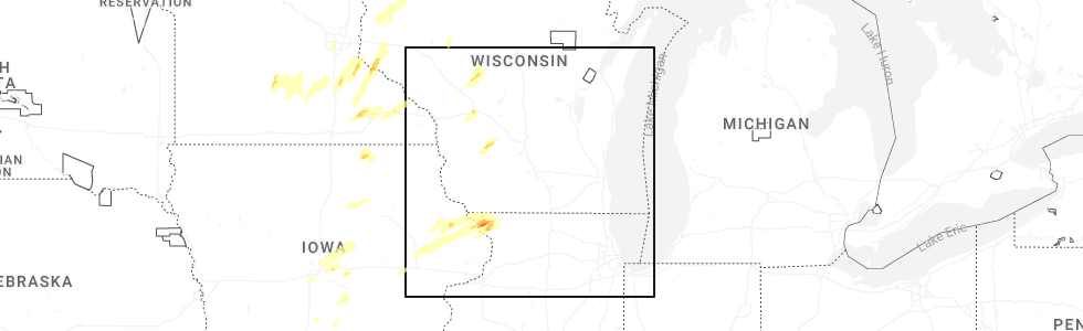
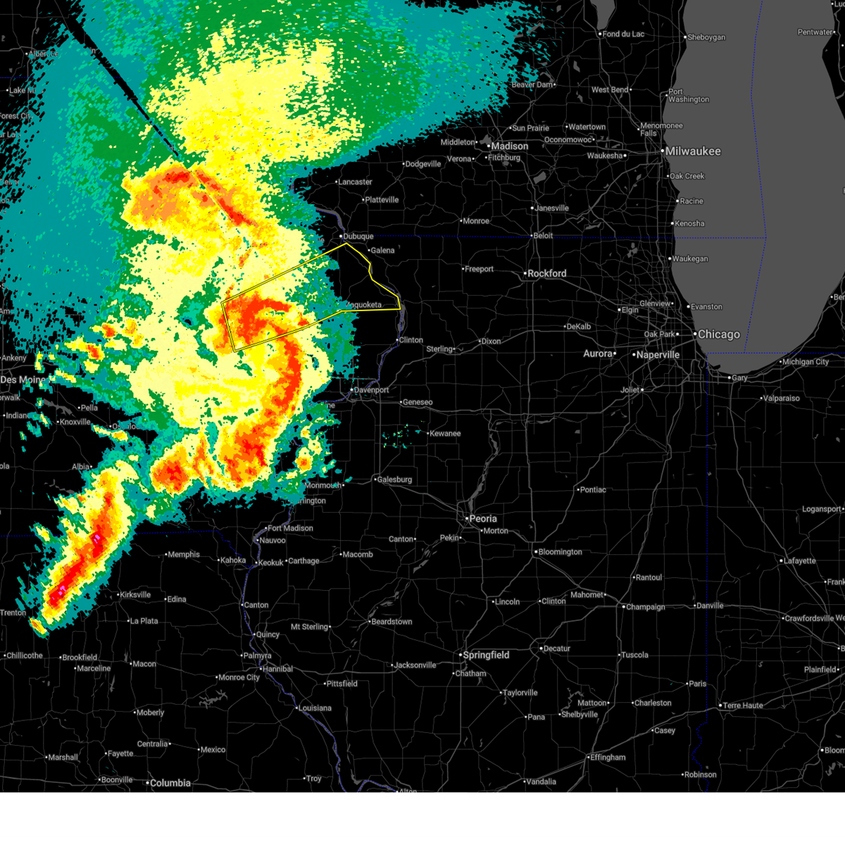
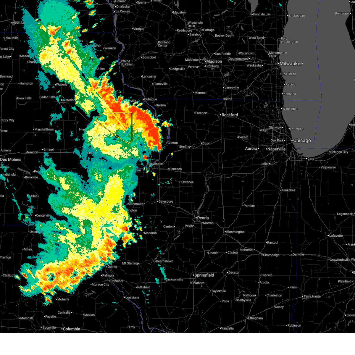
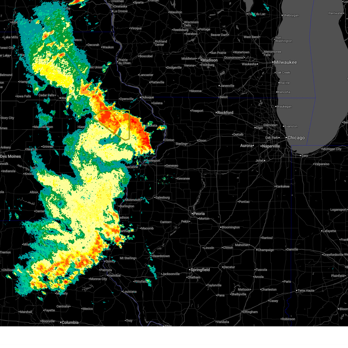
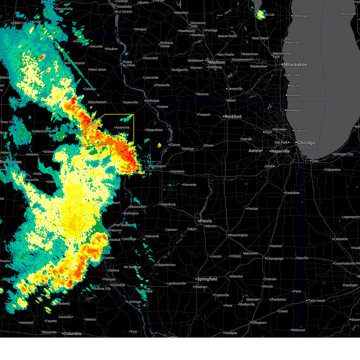
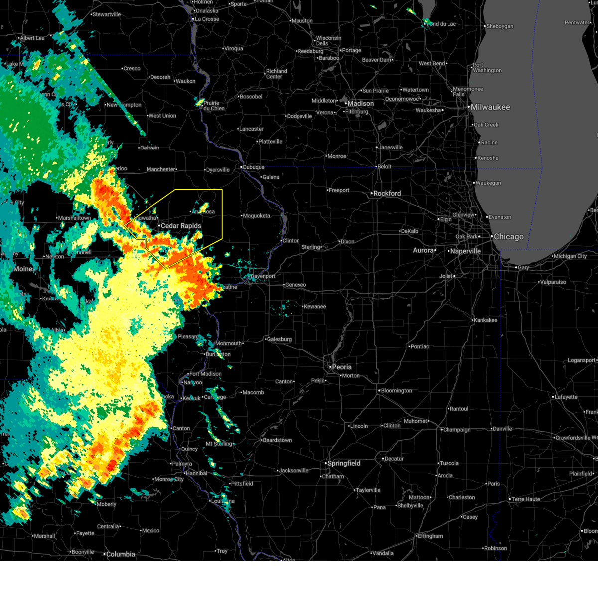
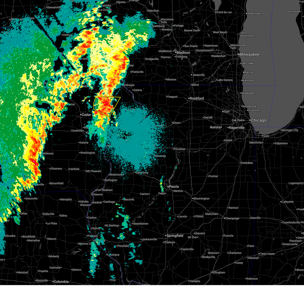
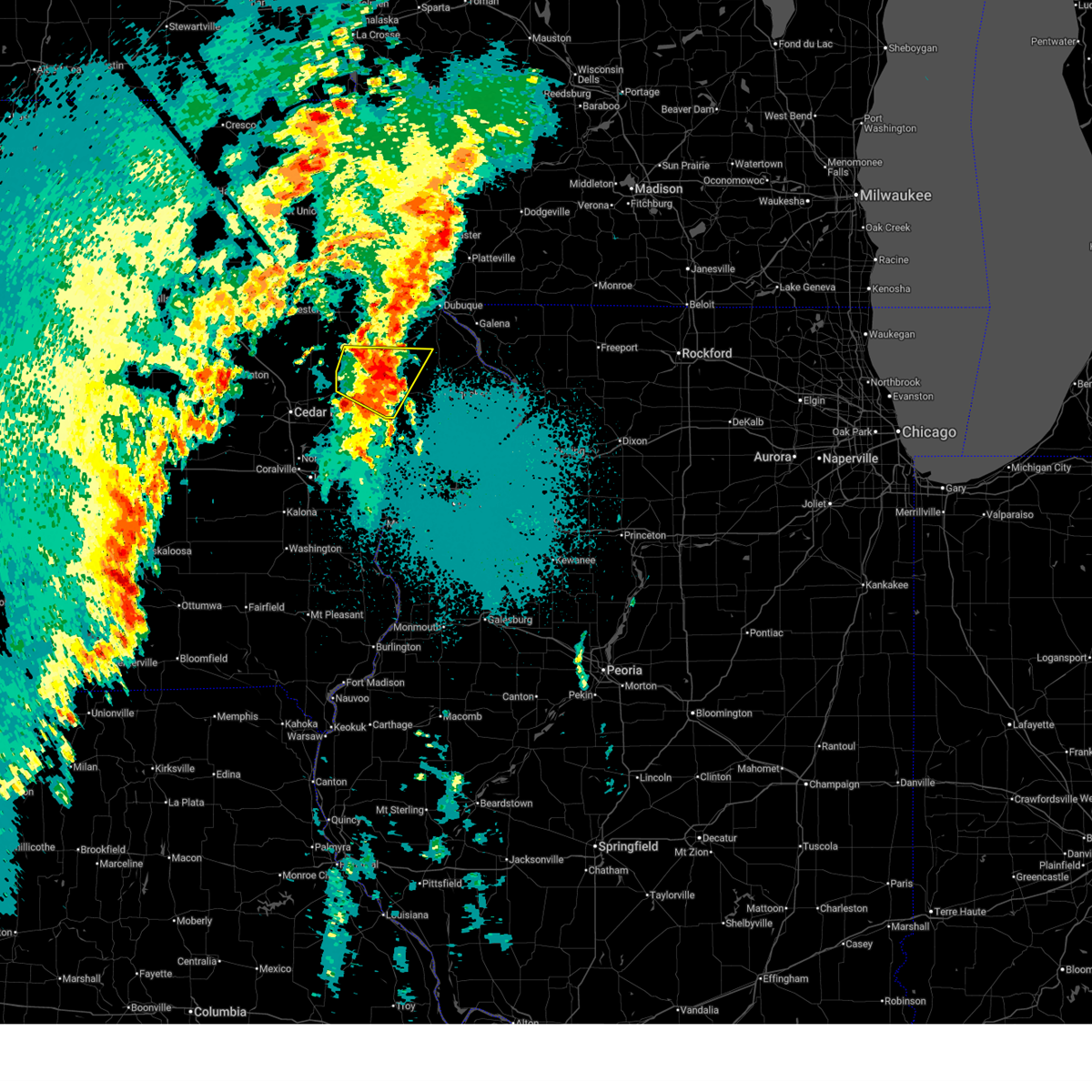
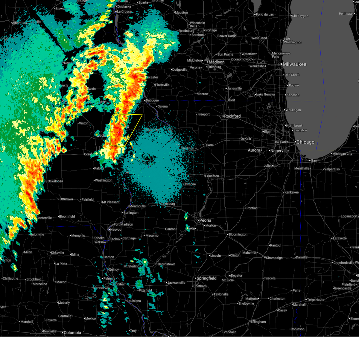
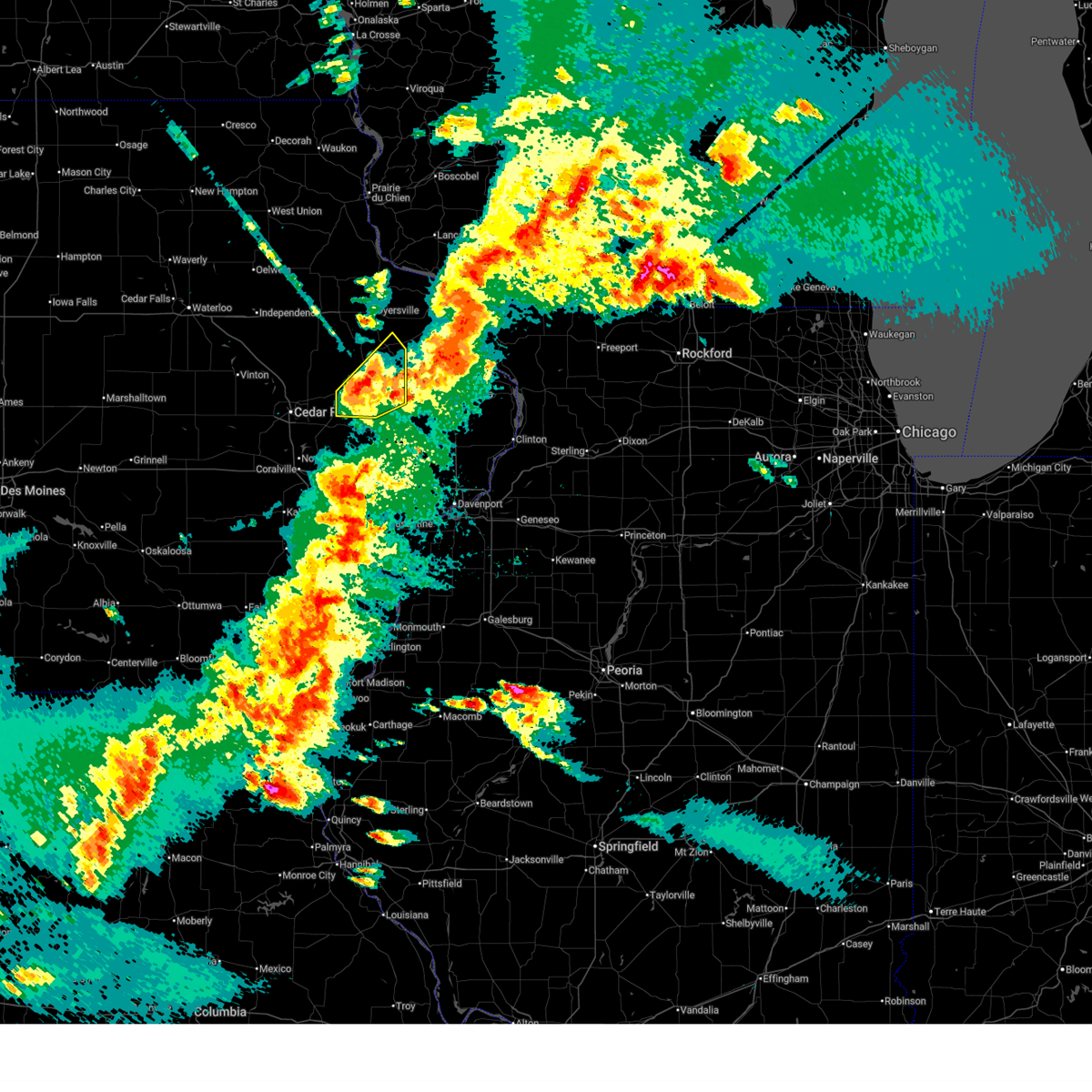
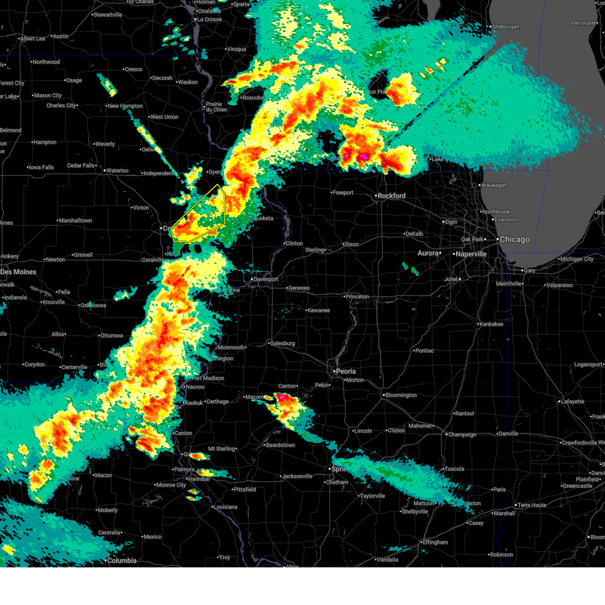
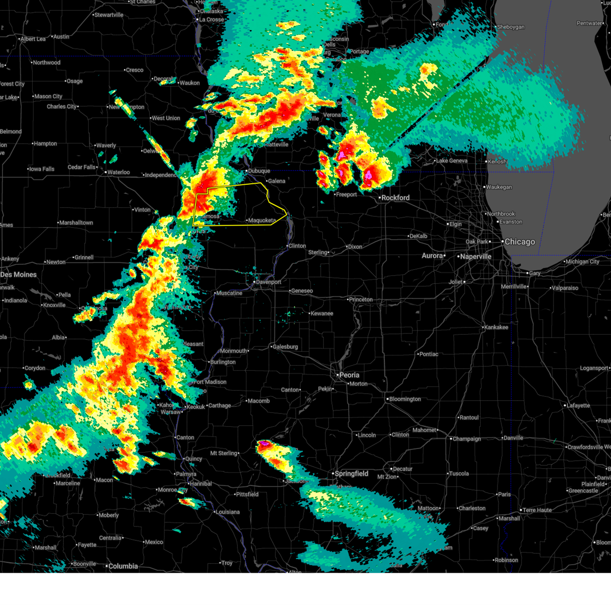
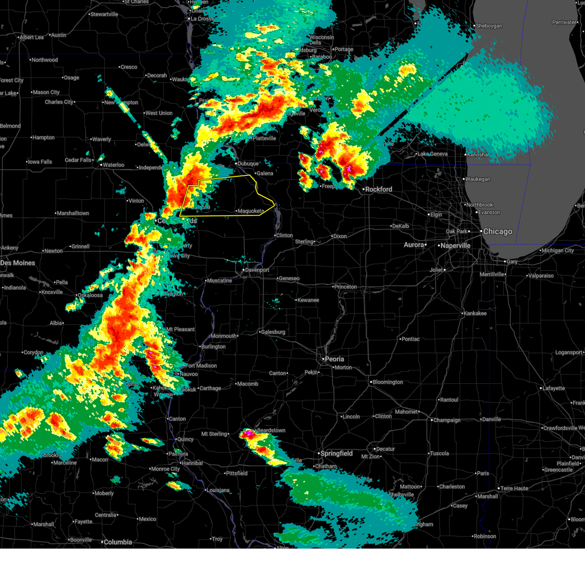
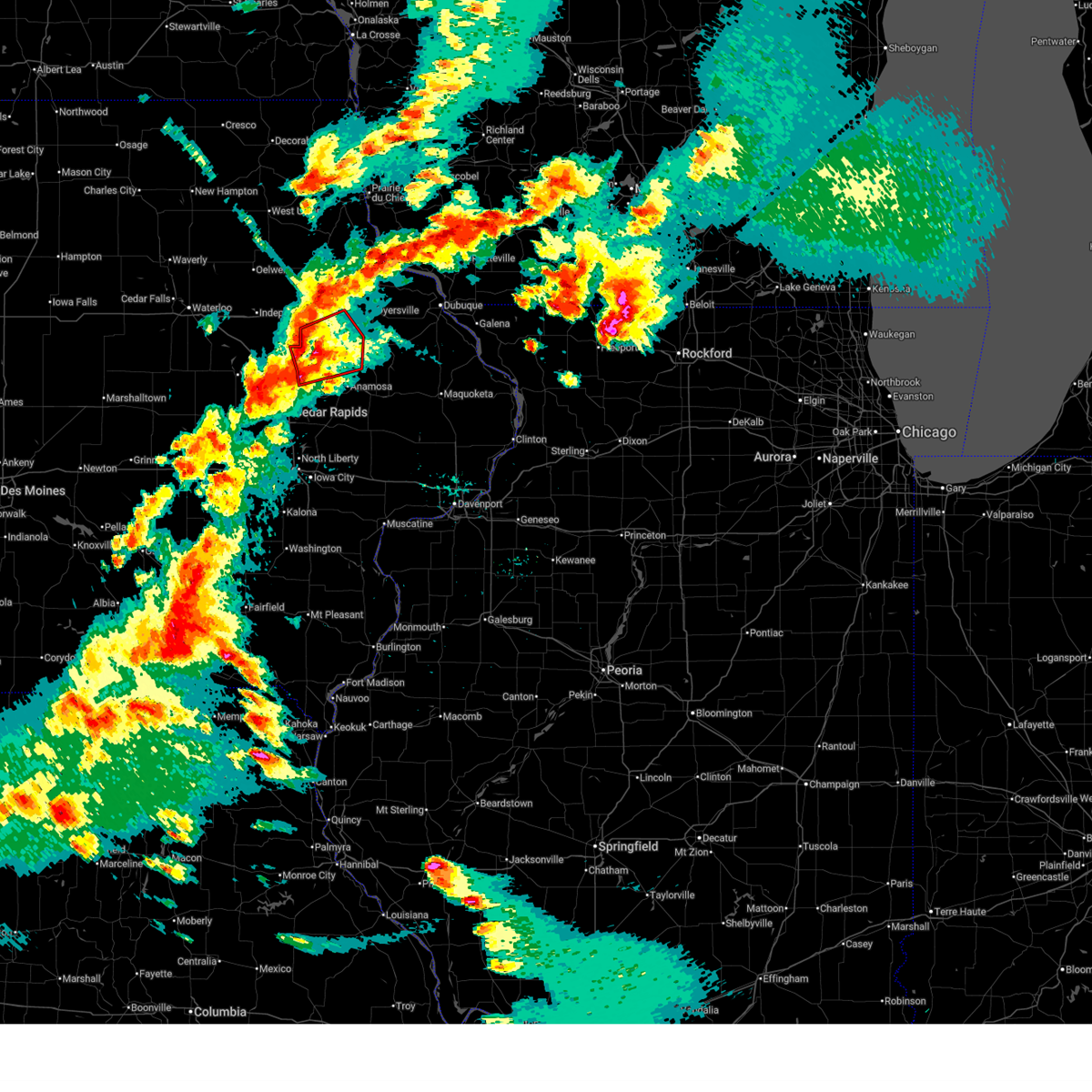
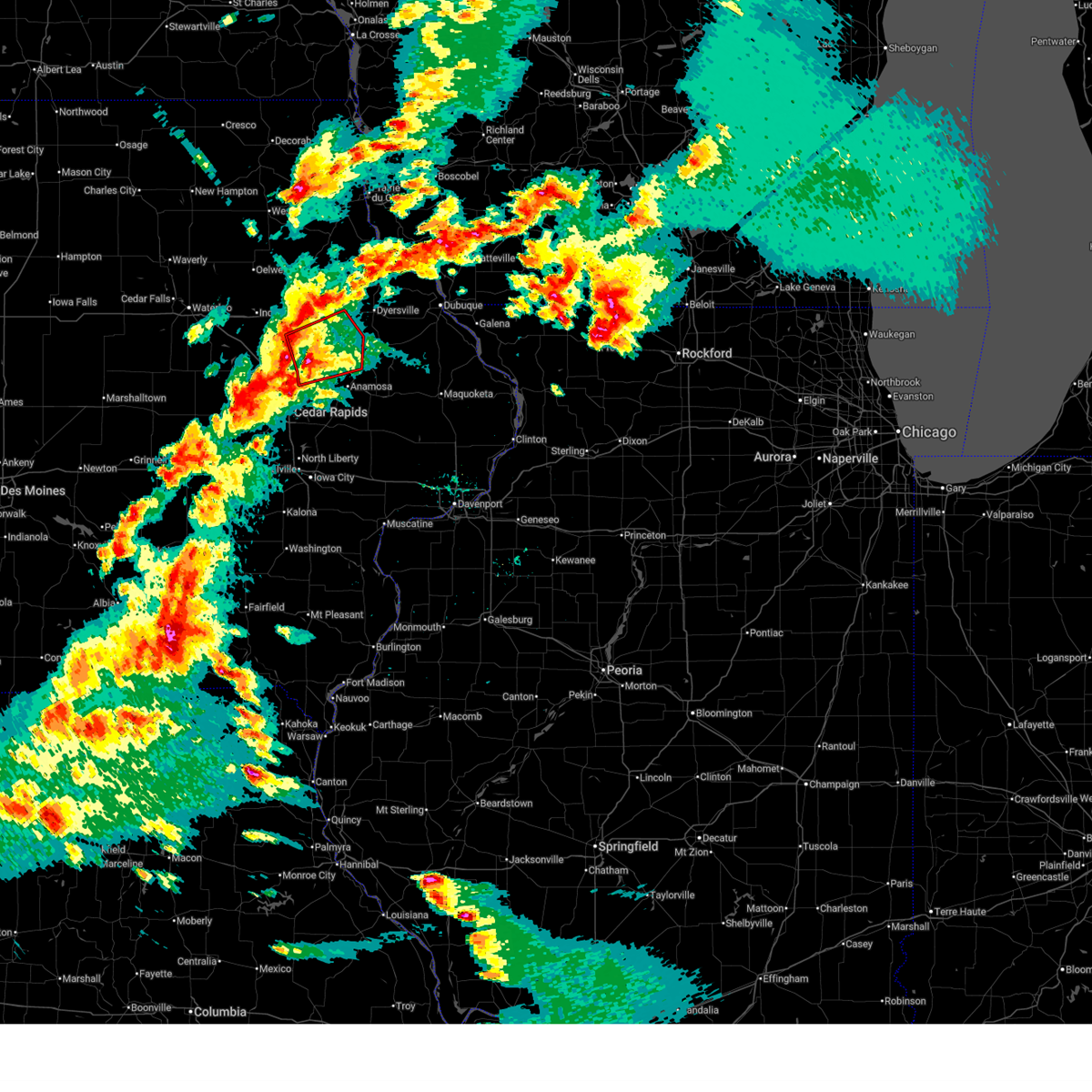
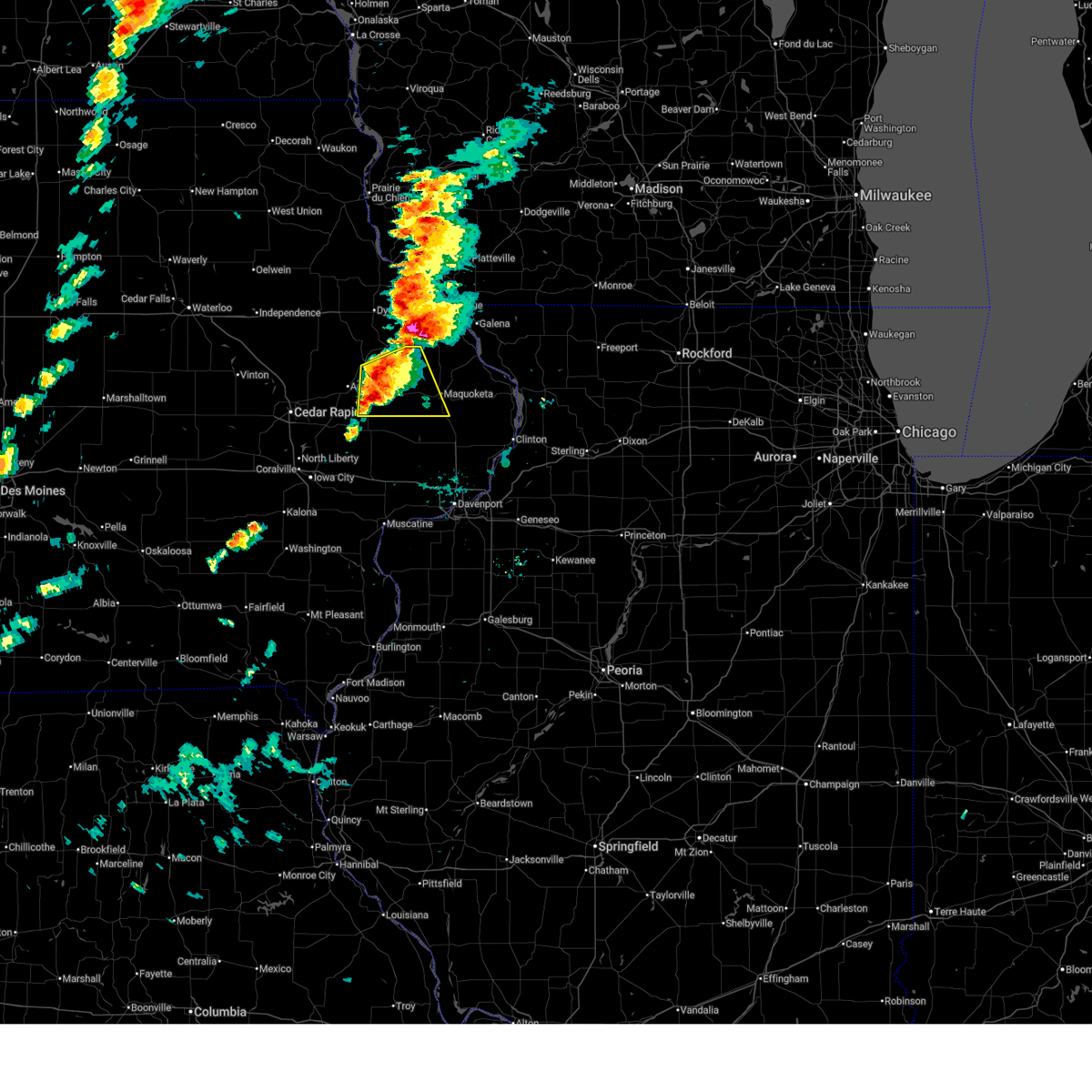
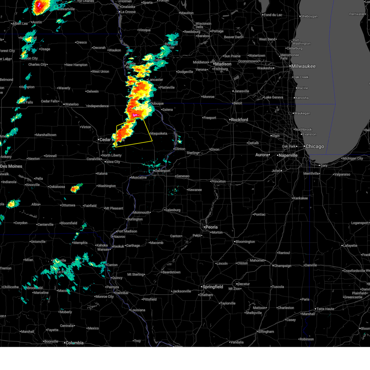
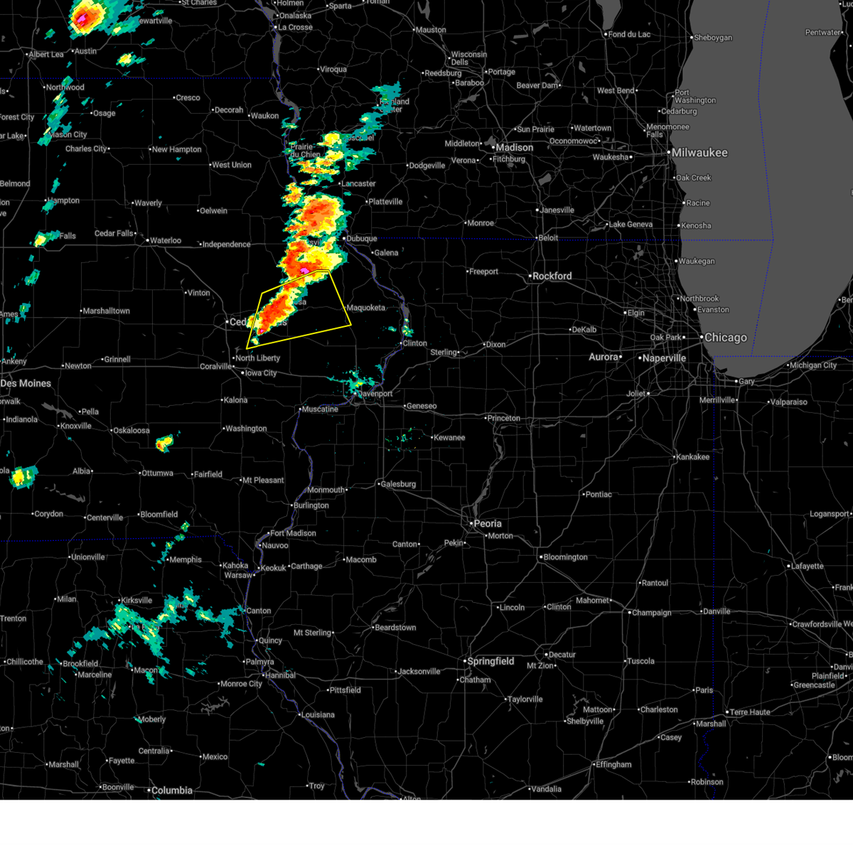
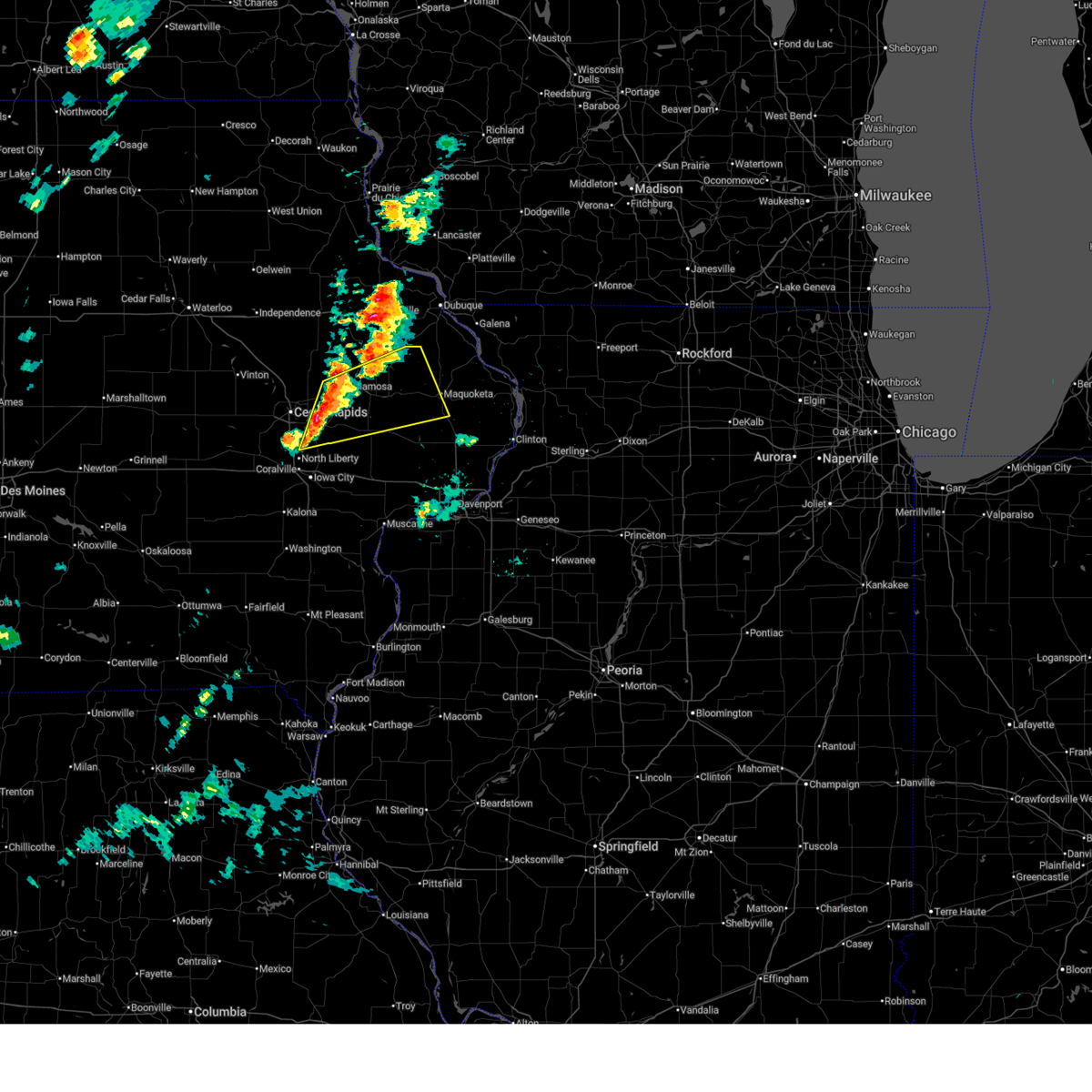
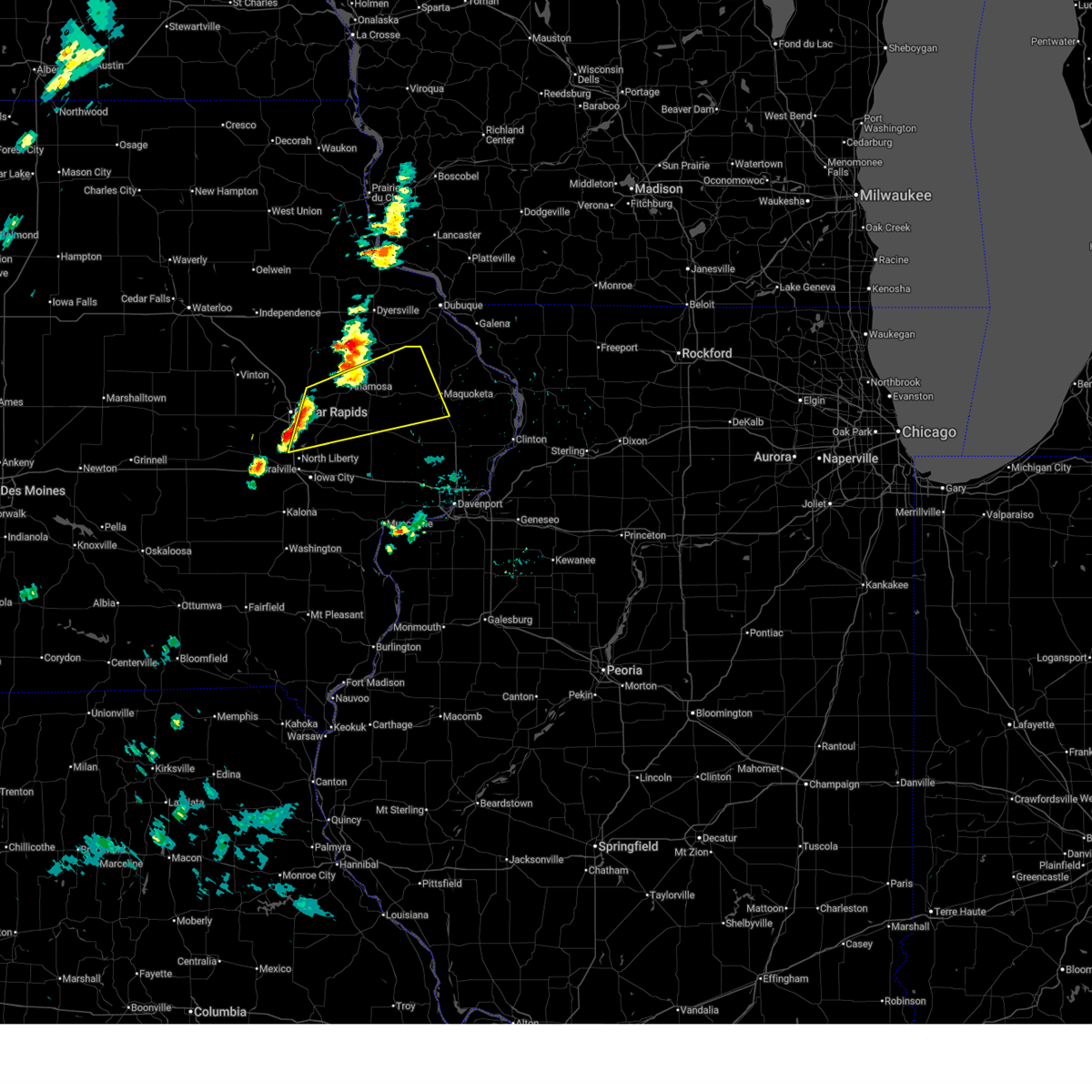
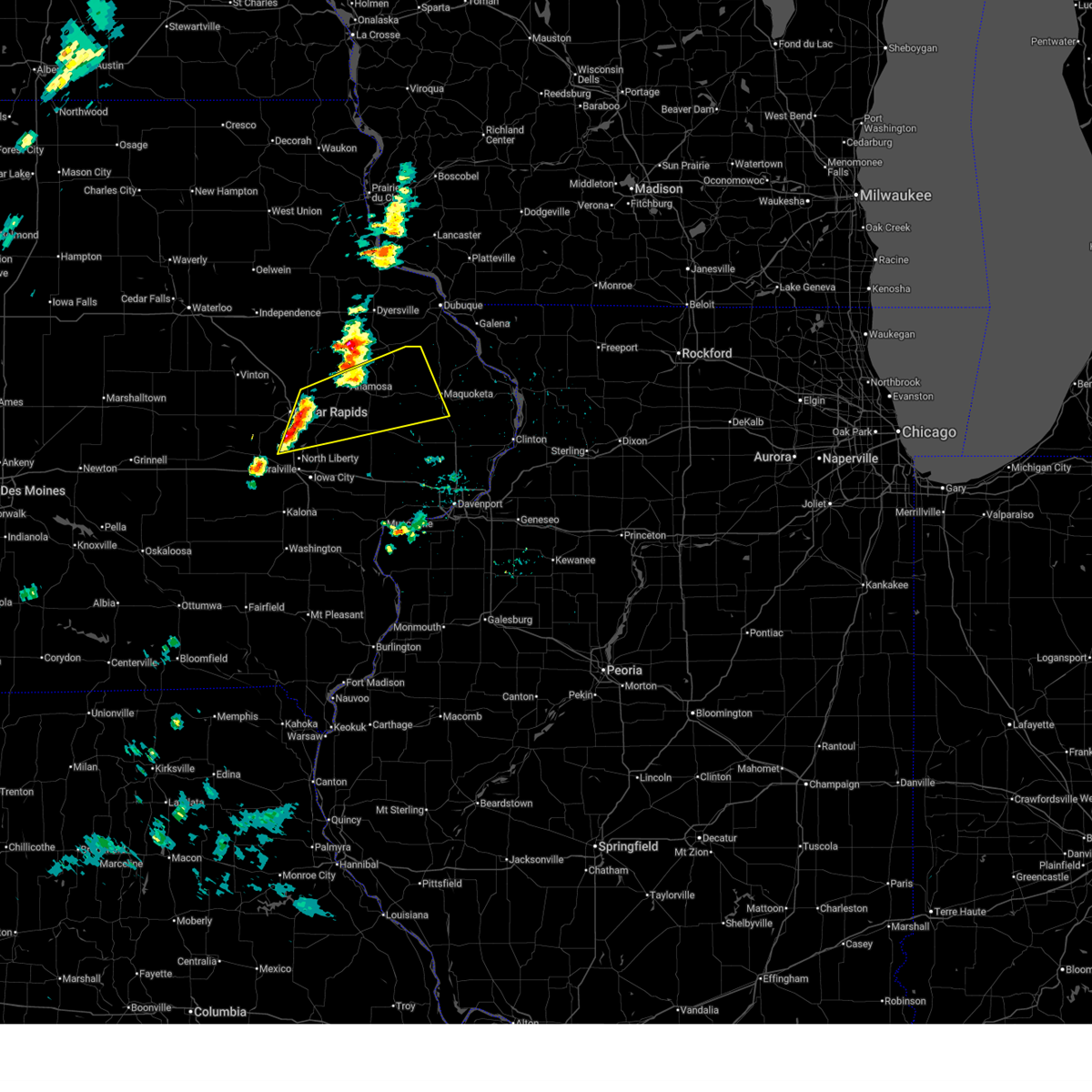
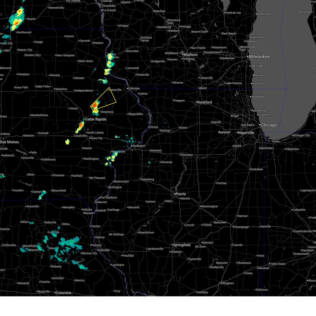
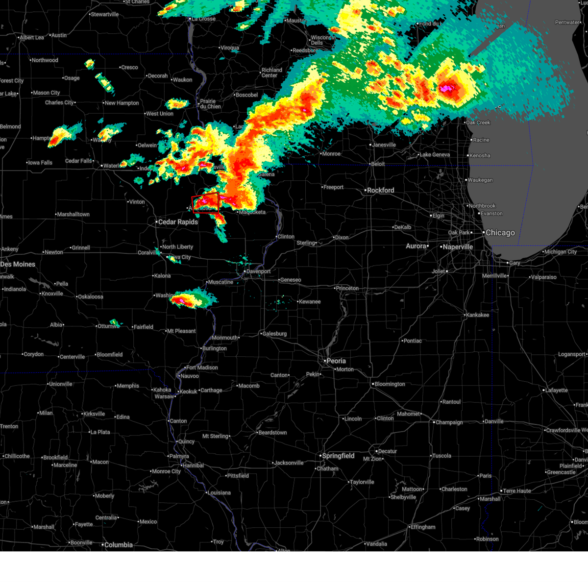
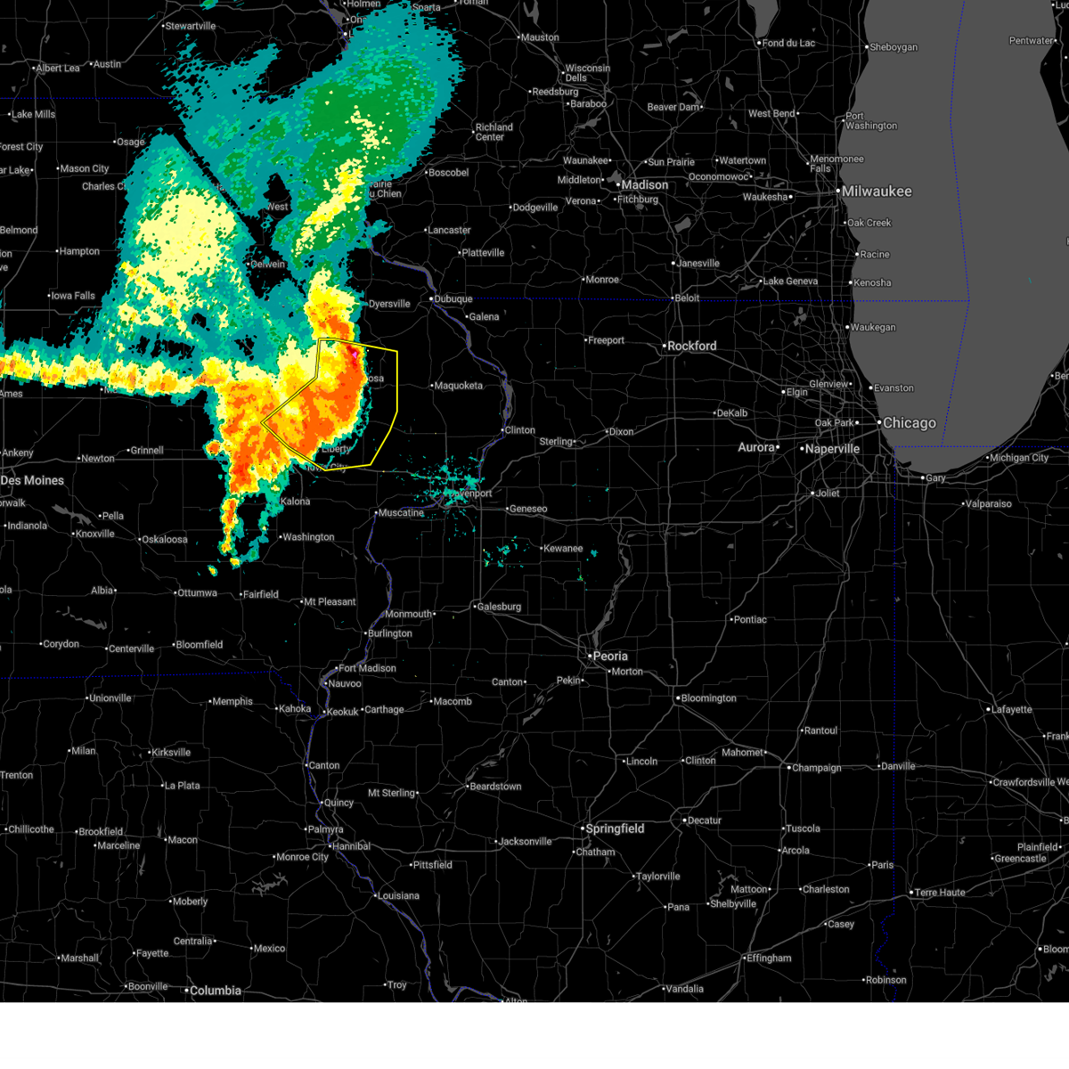
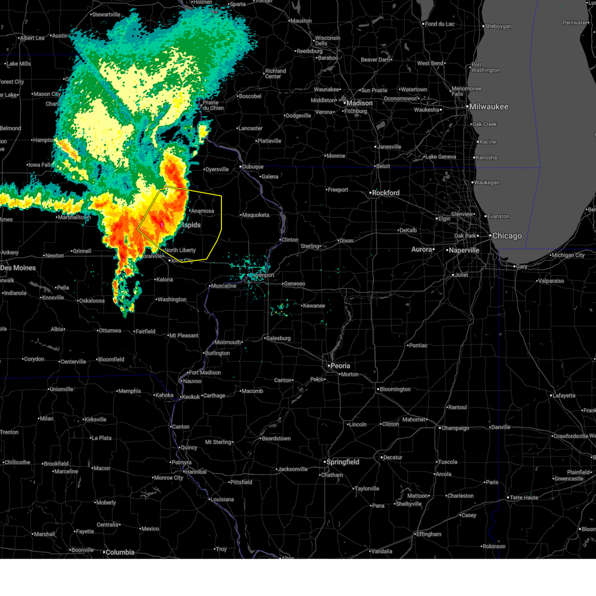
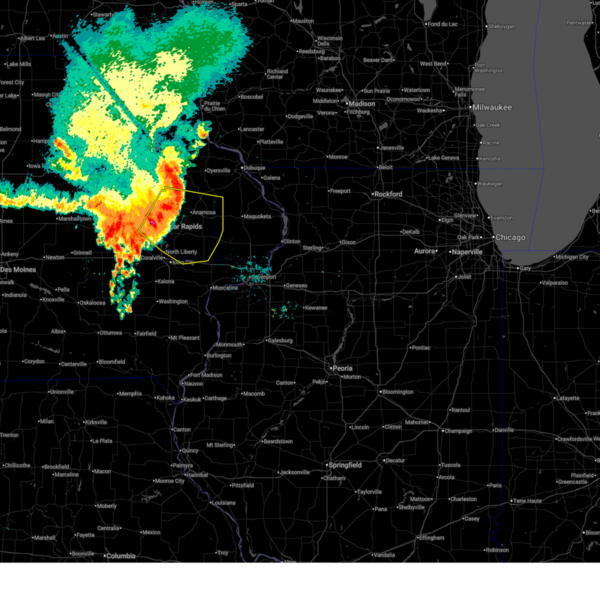
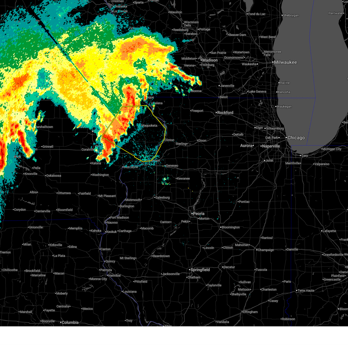
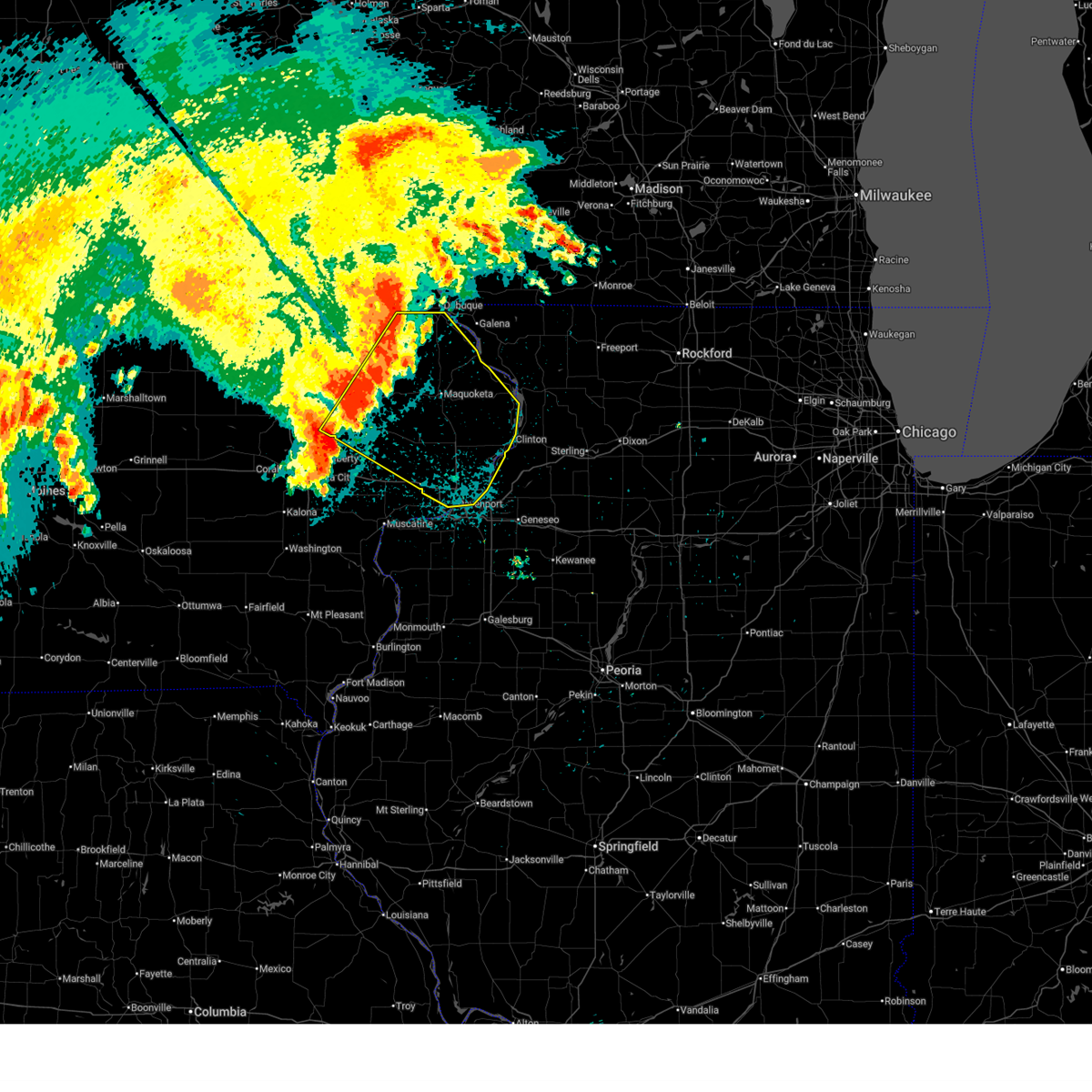
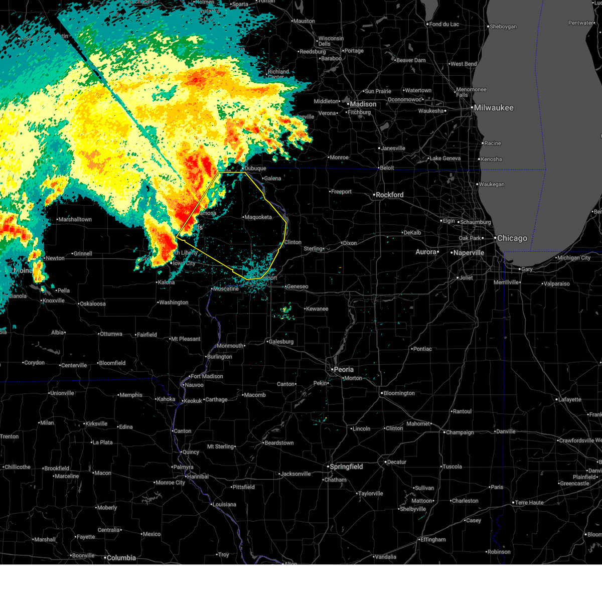
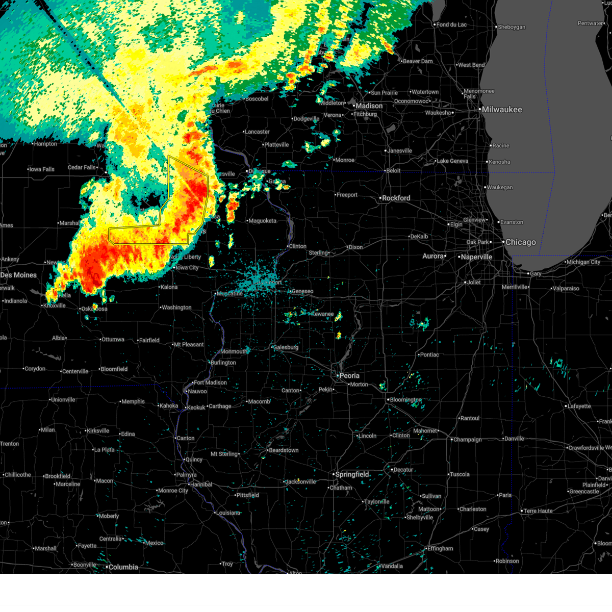
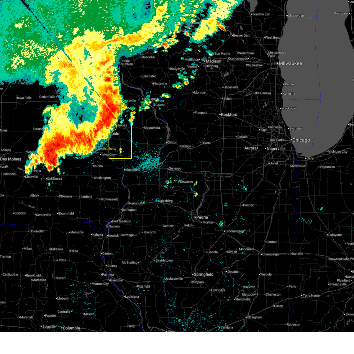
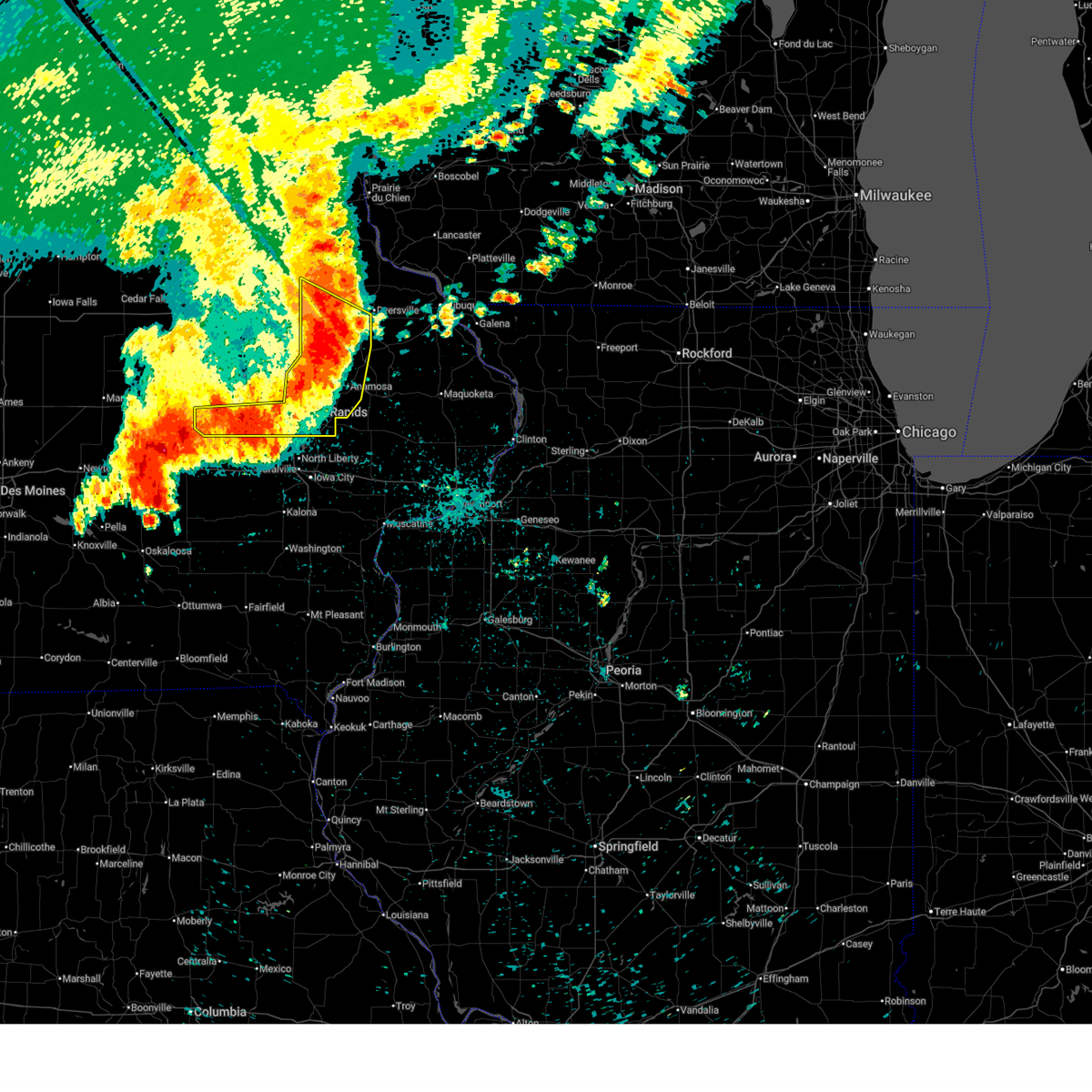
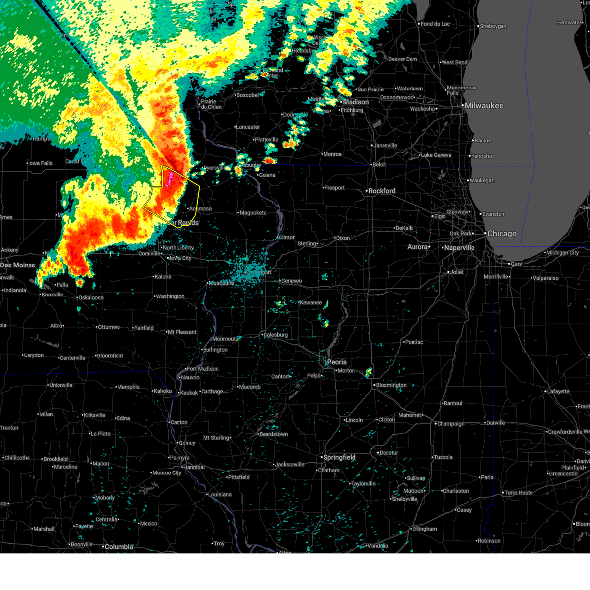
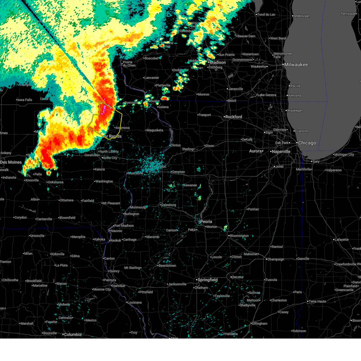
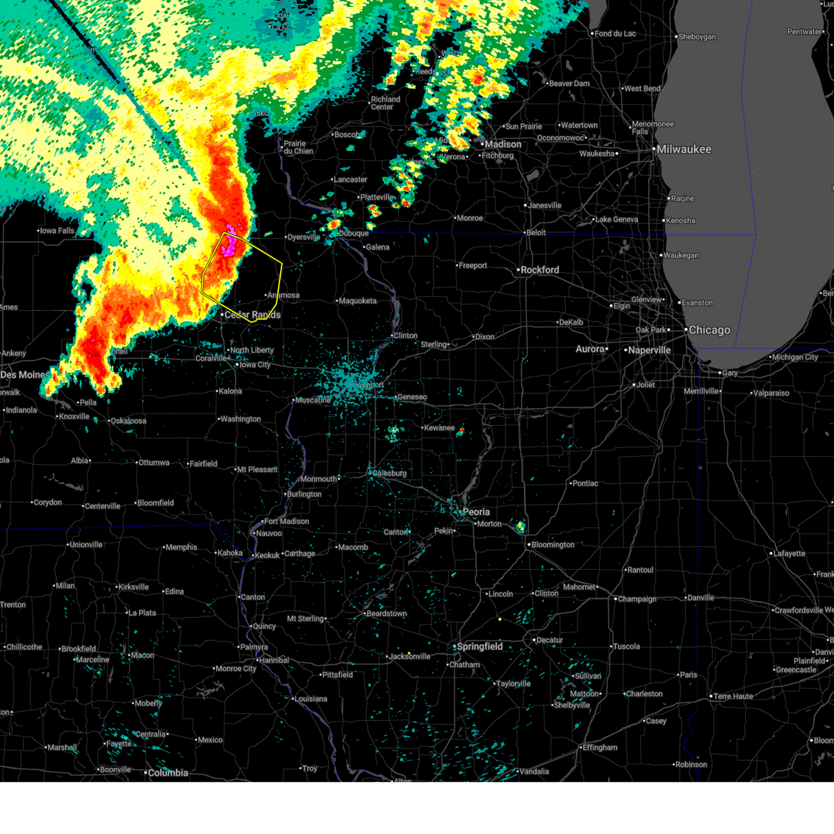
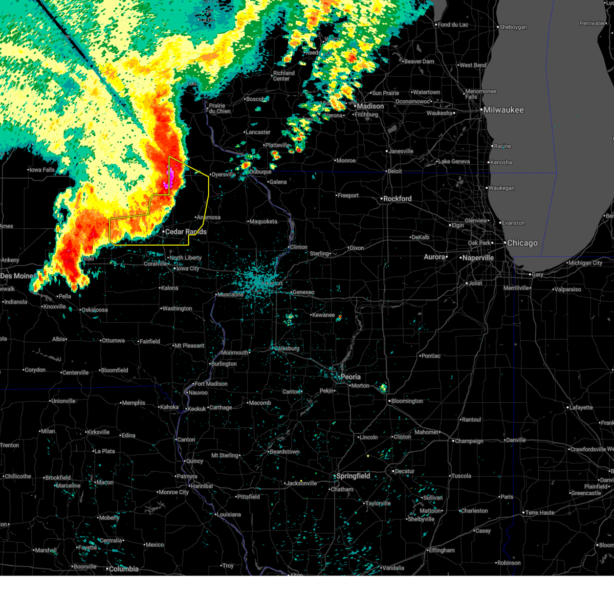
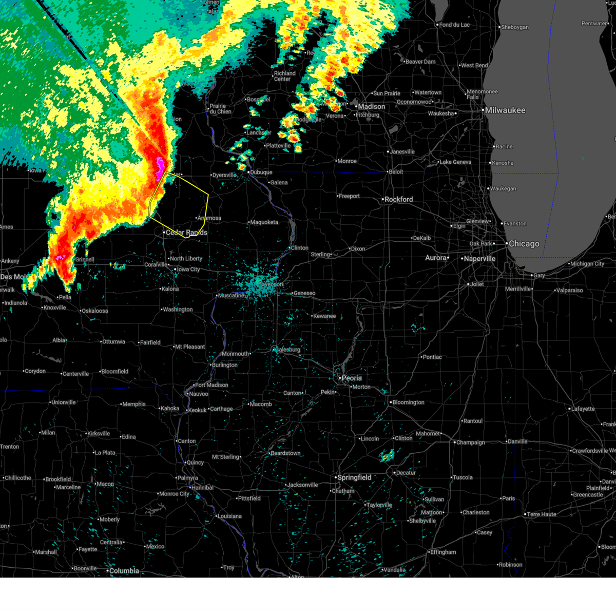
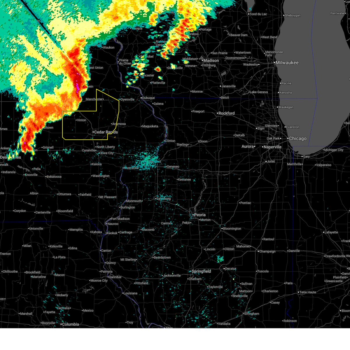
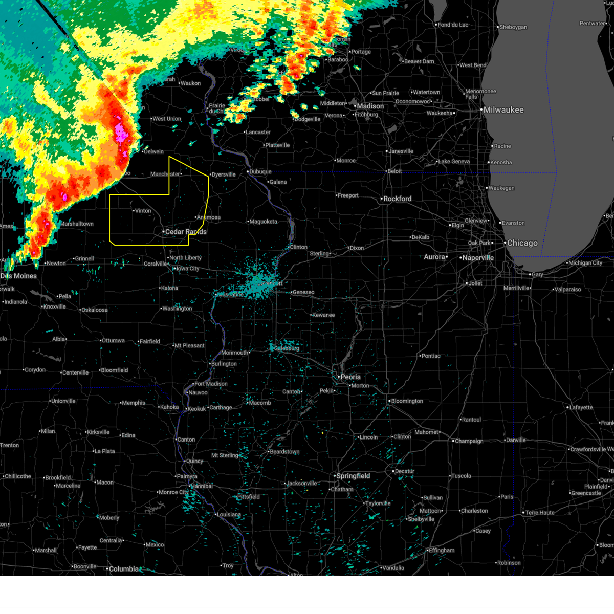
Hail Map for Monticello, IA
The Monticello, IA area has had 13 reports of on-the-ground hail by trained spotters, and has been under severe weather warnings 76 times during the past 12 months. Doppler radar has detected hail at or near Monticello, IA on 70 occasions, including 9 occasions during the past year.
| Name: | Monticello, IA |
| Where Located: | 30.7 miles NE of Cedar Rapids, IA |
| Map: | Google Map for Monticello, IA |
| Population: | 3796 |
| Housing Units: | 1839 |
| More Info: | Search Google for Monticello, IA |
1
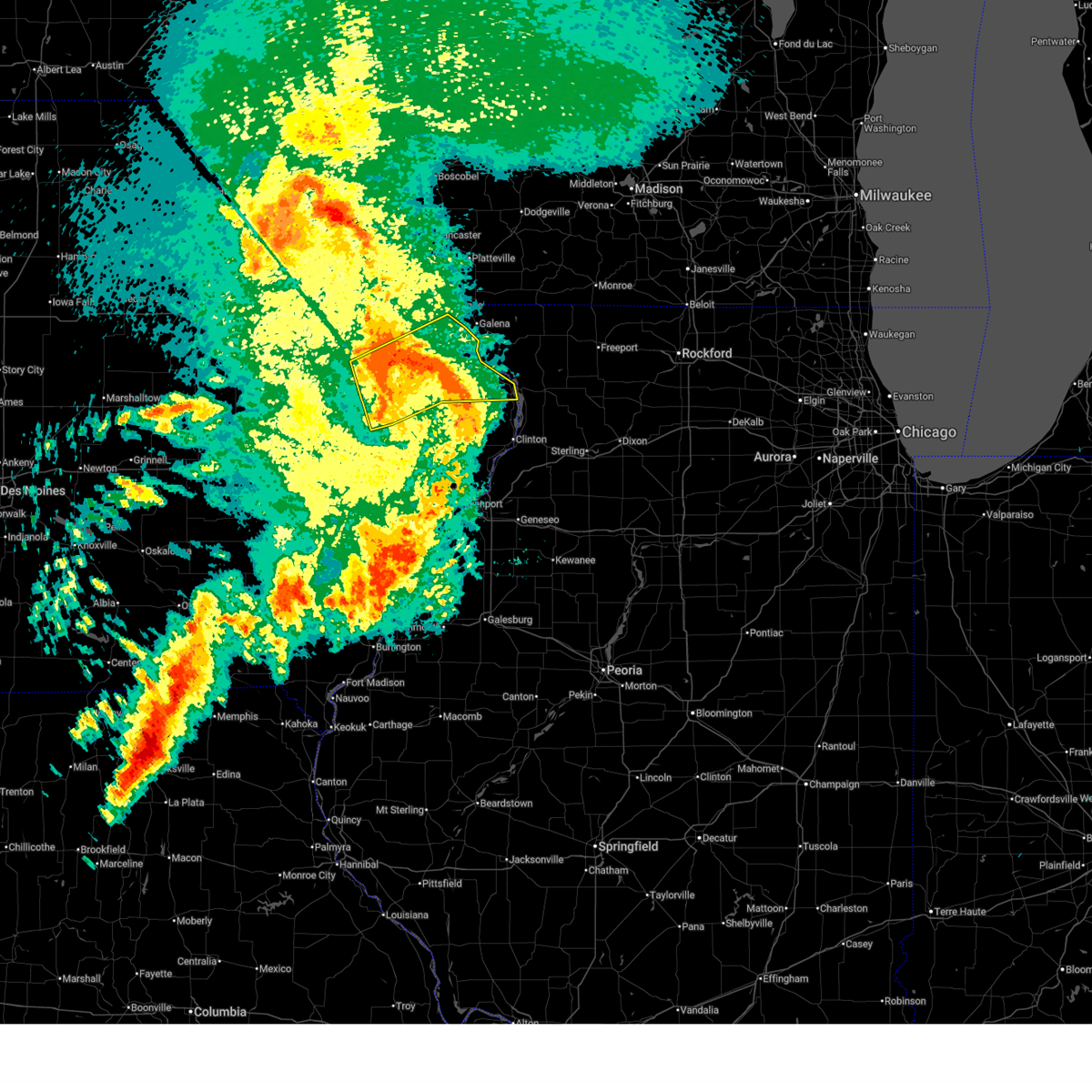
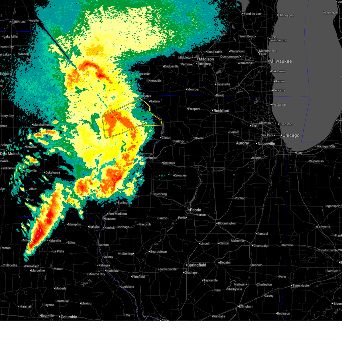
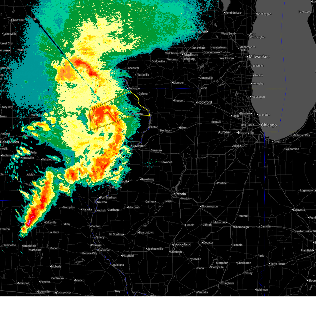
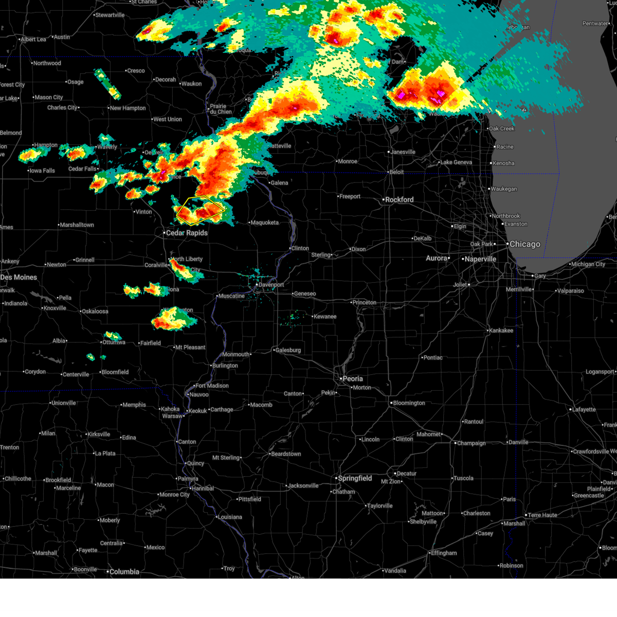
The Top Recent Hail Date for Monticello, IA is Friday, April 17, 2026 (6th out of 70)
Hail and Wind Damage Spotted near Monticello, IA
| Date / Time | Report Details |
|---|---|
| 6/11/2026 10:07 AM CDT |
 the severe thunderstorm warning has been cancelled and is no longer in effect the severe thunderstorm warning has been cancelled and is no longer in effect
|
| 6/11/2026 10:07 AM CDT |
 At 1007 am cdt, severe thunderstorms were located along a line extending from near cascade to near canton to near eden valley refuge, moving northeast at 55 mph (radar indicated). Hazards include 60 mph wind gusts and penny size hail. Expect damage to roofs, siding, and trees. locations impacted include, maquoketa, monticello, bellevue, cascade, preston, olin, sabula, wyoming, oxford junction, miles, andrew, la motte, onslow, monmouth, springbrook, st. Donatus, bernard, center junction, zwingle, and spragueville. At 1007 am cdt, severe thunderstorms were located along a line extending from near cascade to near canton to near eden valley refuge, moving northeast at 55 mph (radar indicated). Hazards include 60 mph wind gusts and penny size hail. Expect damage to roofs, siding, and trees. locations impacted include, maquoketa, monticello, bellevue, cascade, preston, olin, sabula, wyoming, oxford junction, miles, andrew, la motte, onslow, monmouth, springbrook, st. Donatus, bernard, center junction, zwingle, and spragueville.
|
| 6/11/2026 9:56 AM CDT |
 At 956 am cdt, severe thunderstorms were located along a line extending from monticello to center junction to oxford junction, moving east at 55 mph (radar indicated). Hazards include 60 mph wind gusts and penny size hail. Expect damage to roofs, siding, and trees. Locations impacted include, maquoketa, anamosa, mechanicsville, stanwood, monticello, bellevue, cascade, lisbon, preston, olin, sabula, wyoming, oxford junction, miles, andrew, la motte, martelle, onslow, monmouth, and springbrook. At 956 am cdt, severe thunderstorms were located along a line extending from monticello to center junction to oxford junction, moving east at 55 mph (radar indicated). Hazards include 60 mph wind gusts and penny size hail. Expect damage to roofs, siding, and trees. Locations impacted include, maquoketa, anamosa, mechanicsville, stanwood, monticello, bellevue, cascade, lisbon, preston, olin, sabula, wyoming, oxford junction, miles, andrew, la motte, martelle, onslow, monmouth, and springbrook.
|
| 6/11/2026 9:50 AM CDT |
 At 950 am cdt, severe thunderstorms were located along a line extending from near langworthy to near central park to near hale, moving east at 55 mph (radar indicated). Hazards include 60 mph wind gusts and penny size hail. Expect damage to roofs, siding, and trees. Locations impacted include, maquoketa, anamosa, mechanicsville, stanwood, mount vernon, monticello, bellevue, cascade, lisbon, solon, springville, preston, olin, sabula, wyoming, oxford junction, miles, andrew, la motte, and martelle. At 950 am cdt, severe thunderstorms were located along a line extending from near langworthy to near central park to near hale, moving east at 55 mph (radar indicated). Hazards include 60 mph wind gusts and penny size hail. Expect damage to roofs, siding, and trees. Locations impacted include, maquoketa, anamosa, mechanicsville, stanwood, mount vernon, monticello, bellevue, cascade, lisbon, solon, springville, preston, olin, sabula, wyoming, oxford junction, miles, andrew, la motte, and martelle.
|
| 6/11/2026 9:35 AM CDT |
 Svrdvn the national weather service in the quad cities has issued a * severe thunderstorm warning for, jackson county in east central iowa, northwestern cedar county in east central iowa, southeastern dubuque county in northeastern iowa, northeastern johnson county in east central iowa, jones county in east central iowa, southeastern linn county in east central iowa, northwestern clinton county in east central iowa, * until 1030 am cdt. * at 935 am cdt, severe thunderstorms were located along a line extending from whittier to near martelle to near mechanicsville, moving northeast at 55 mph (radar indicated). Hazards include 60 mph wind gusts and penny size hail. expect damage to roofs, siding, and trees Svrdvn the national weather service in the quad cities has issued a * severe thunderstorm warning for, jackson county in east central iowa, northwestern cedar county in east central iowa, southeastern dubuque county in northeastern iowa, northeastern johnson county in east central iowa, jones county in east central iowa, southeastern linn county in east central iowa, northwestern clinton county in east central iowa, * until 1030 am cdt. * at 935 am cdt, severe thunderstorms were located along a line extending from whittier to near martelle to near mechanicsville, moving northeast at 55 mph (radar indicated). Hazards include 60 mph wind gusts and penny size hail. expect damage to roofs, siding, and trees
|
| 6/10/2026 12:39 PM CDT |
 The storms which prompted the warning have moved out of the area. therefore, the warning will be allowed to expire. however, heavy rain is still possible with these thunderstorms. a severe thunderstorm watch remains in effect until 700 pm cdt for northeastern and east central iowa. to report severe weather, contact your nearest law enforcement agency. they will relay your report to the national weather service the quad cities. The storms which prompted the warning have moved out of the area. therefore, the warning will be allowed to expire. however, heavy rain is still possible with these thunderstorms. a severe thunderstorm watch remains in effect until 700 pm cdt for northeastern and east central iowa. to report severe weather, contact your nearest law enforcement agency. they will relay your report to the national weather service the quad cities.
|
| 6/10/2026 12:33 PM CDT | Storm damage reported in jones county IA, 4.3 miles WSW of Monticello, IA |
| 6/10/2026 12:21 PM CDT |
 At 1221 pm cdt, severe thunderstorms were located along a line extending from near ryan to near hale, moving northeast at 50 mph (radar indicated). Hazards include 60 mph wind gusts. Expect damage to roofs, siding, and trees. Locations impacted include, anamosa, monticello, cascade, central city, lowden, olin, coggon, wyoming, oxford junction, martelle, onslow, prairieburg, morley, center junction, waubeek, stone city, viola, whittier, langworthy, and paris. At 1221 pm cdt, severe thunderstorms were located along a line extending from near ryan to near hale, moving northeast at 50 mph (radar indicated). Hazards include 60 mph wind gusts. Expect damage to roofs, siding, and trees. Locations impacted include, anamosa, monticello, cascade, central city, lowden, olin, coggon, wyoming, oxford junction, martelle, onslow, prairieburg, morley, center junction, waubeek, stone city, viola, whittier, langworthy, and paris.
|
| 6/10/2026 12:02 PM CDT |
 At 1202 pm cdt, severe thunderstorms were located along a line extending from near paris to near mechanicsville, moving northeast at 50 mph (radar indicated). Hazards include 60 mph wind gusts. Expect damage to roofs, siding, and trees. locations impacted include, cedar rapids, anamosa, tipton, mechanicsville, stanwood, marion, hiawatha, mount vernon, monticello, robins, cascade, lisbon, central city, springville, palo, lowden, olin, alburnett, coggon, and wyoming. This includes interstate 380 between mile markers 23 and 34. At 1202 pm cdt, severe thunderstorms were located along a line extending from near paris to near mechanicsville, moving northeast at 50 mph (radar indicated). Hazards include 60 mph wind gusts. Expect damage to roofs, siding, and trees. locations impacted include, cedar rapids, anamosa, tipton, mechanicsville, stanwood, marion, hiawatha, mount vernon, monticello, robins, cascade, lisbon, central city, springville, palo, lowden, olin, alburnett, coggon, and wyoming. This includes interstate 380 between mile markers 23 and 34.
|
| 6/10/2026 11:55 AM CDT |
 At 1155 am cdt, severe thunderstorms were located along a line extending from near lafayette to near cedar bluff, moving northeast at 50 mph (radar indicated). Hazards include 60 mph wind gusts. Expect damage to roofs, siding, and trees. locations impacted include, cedar rapids, anamosa, tipton, west branch, mechanicsville, stanwood, marion, hiawatha, mount vernon, monticello, robins, cascade, lisbon, fairfax, ely, atkins, walford, central city, springville, and palo. This includes interstate 380 between mile markers 12 and 33. At 1155 am cdt, severe thunderstorms were located along a line extending from near lafayette to near cedar bluff, moving northeast at 50 mph (radar indicated). Hazards include 60 mph wind gusts. Expect damage to roofs, siding, and trees. locations impacted include, cedar rapids, anamosa, tipton, west branch, mechanicsville, stanwood, marion, hiawatha, mount vernon, monticello, robins, cascade, lisbon, fairfax, ely, atkins, walford, central city, springville, and palo. This includes interstate 380 between mile markers 12 and 33.
|
| 6/10/2026 11:38 AM CDT |
 Svrdvn the national weather service in the quad cities has issued a * severe thunderstorm warning for, northern cedar county in east central iowa, northern johnson county in east central iowa, southeastern benton county in east central iowa, jones county in east central iowa, linn county in east central iowa, * until 1245 pm cdt. * at 1138 am cdt, severe thunderstorms were located along a line extending from near newhall to near university of iowa, moving northeast at 50 mph (radar indicated). Hazards include 60 mph wind gusts. expect damage to roofs, siding, and trees Svrdvn the national weather service in the quad cities has issued a * severe thunderstorm warning for, northern cedar county in east central iowa, northern johnson county in east central iowa, southeastern benton county in east central iowa, jones county in east central iowa, linn county in east central iowa, * until 1245 pm cdt. * at 1138 am cdt, severe thunderstorms were located along a line extending from near newhall to near university of iowa, moving northeast at 50 mph (radar indicated). Hazards include 60 mph wind gusts. expect damage to roofs, siding, and trees
|
| 4/23/2026 10:03 PM CDT |
 the severe thunderstorm warning has been cancelled and is no longer in effect the severe thunderstorm warning has been cancelled and is no longer in effect
|
| 4/23/2026 10:03 PM CDT |
 At 1003 pm cdt, a severe thunderstorm was located near cascade, or 19 miles northeast of anamosa, moving northeast at 45 mph (radar indicated). Hazards include 60 mph wind gusts and penny size hail. Expect damage to roofs, siding, and trees. Locations impacted include, anamosa, monticello, cascade, olin, wyoming, oxford junction, onslow, monmouth, center junction, stone city, langworthy, canton, emeline, south gary owen, garry owen, monticello municipal airport, jones county fairgrounds, pictured rocks wildlife area, wapsipinicon state park, and hale. At 1003 pm cdt, a severe thunderstorm was located near cascade, or 19 miles northeast of anamosa, moving northeast at 45 mph (radar indicated). Hazards include 60 mph wind gusts and penny size hail. Expect damage to roofs, siding, and trees. Locations impacted include, anamosa, monticello, cascade, olin, wyoming, oxford junction, onslow, monmouth, center junction, stone city, langworthy, canton, emeline, south gary owen, garry owen, monticello municipal airport, jones county fairgrounds, pictured rocks wildlife area, wapsipinicon state park, and hale.
|
| 4/23/2026 9:48 PM CDT |
 At 947 pm cdt, a severe thunderstorm was located over langworthy, or 8 miles northeast of anamosa, moving northeast at 45 mph (radar indicated). Hazards include 60 mph wind gusts and penny size hail. Expect damage to roofs, siding, and trees. Locations impacted include, anamosa, mechanicsville, stanwood, monticello, cascade, olin, wyoming, oxford junction, martelle, onslow, monmouth, morley, center junction, stone city, langworthy, canton, clarence, emeline, south gary owen, and garry owen. At 947 pm cdt, a severe thunderstorm was located over langworthy, or 8 miles northeast of anamosa, moving northeast at 45 mph (radar indicated). Hazards include 60 mph wind gusts and penny size hail. Expect damage to roofs, siding, and trees. Locations impacted include, anamosa, mechanicsville, stanwood, monticello, cascade, olin, wyoming, oxford junction, martelle, onslow, monmouth, morley, center junction, stone city, langworthy, canton, clarence, emeline, south gary owen, and garry owen.
|
| 4/23/2026 9:38 PM CDT |
 At 938 pm cdt, a severe thunderstorm was located over anamosa, moving northeast at 45 mph (radar indicated). Hazards include 60 mph wind gusts and penny size hail. Expect damage to roofs, siding, and trees. Locations impacted include, anamosa, mechanicsville, stanwood, monticello, cascade, olin, wyoming, oxford junction, martelle, onslow, monmouth, morley, center junction, stone city, langworthy, canton, clarence, emeline, south gary owen, and garry owen. At 938 pm cdt, a severe thunderstorm was located over anamosa, moving northeast at 45 mph (radar indicated). Hazards include 60 mph wind gusts and penny size hail. Expect damage to roofs, siding, and trees. Locations impacted include, anamosa, mechanicsville, stanwood, monticello, cascade, olin, wyoming, oxford junction, martelle, onslow, monmouth, morley, center junction, stone city, langworthy, canton, clarence, emeline, south gary owen, and garry owen.
|
| 4/17/2026 5:36 PM CDT |
 At 536 pm cdt, a severe thunderstorm was located near central park, or near anamosa, moving northeast at 55 mph (radar indicated). Hazards include 60 mph wind gusts and quarter size hail. Hail damage to vehicles is expected. expect wind damage to roofs, siding, and trees. Locations impacted include, anamosa, monticello, cascade, olin, wyoming, martelle, onslow, morley, center junction, langworthy, canton, pictured rocks wildlife area, wapsipinicon state park, hale, camp courageous, scotch grove, central park, and temple hill. At 536 pm cdt, a severe thunderstorm was located near central park, or near anamosa, moving northeast at 55 mph (radar indicated). Hazards include 60 mph wind gusts and quarter size hail. Hail damage to vehicles is expected. expect wind damage to roofs, siding, and trees. Locations impacted include, anamosa, monticello, cascade, olin, wyoming, martelle, onslow, morley, center junction, langworthy, canton, pictured rocks wildlife area, wapsipinicon state park, hale, camp courageous, scotch grove, central park, and temple hill.
|
| 4/17/2026 5:26 PM CDT |
 Svrdvn the national weather service in the quad cities has issued a * severe thunderstorm warning for, northwestern cedar county in east central iowa, southern dubuque county in northeastern iowa, jones county in east central iowa, southeastern linn county in east central iowa, * until 615 pm cdt. * at 526 pm cdt, a severe thunderstorm was located over martelle, or 8 miles northwest of mechanicsville, moving northeast at 50 mph (radar indicated). Hazards include 60 mph wind gusts and quarter size hail. Hail damage to vehicles is expected. Expect wind damage to roofs, siding, and trees. Svrdvn the national weather service in the quad cities has issued a * severe thunderstorm warning for, northwestern cedar county in east central iowa, southern dubuque county in northeastern iowa, jones county in east central iowa, southeastern linn county in east central iowa, * until 615 pm cdt. * at 526 pm cdt, a severe thunderstorm was located over martelle, or 8 miles northwest of mechanicsville, moving northeast at 50 mph (radar indicated). Hazards include 60 mph wind gusts and quarter size hail. Hail damage to vehicles is expected. Expect wind damage to roofs, siding, and trees.
|
| 4/17/2026 5:00 PM CDT |
 At 500 pm cdt, severe thunderstorms were located along a line extending from near farley to near temple hill to near morley, moving east at 55 mph (radar indicated). Hazards include 70 mph wind gusts and quarter size hail. Hail damage to vehicles is expected. expect considerable tree damage. wind damage is also likely to mobile homes, roofs, and outbuildings. locations impacted include, maquoketa, anamosa, monticello, bellevue, cascade, preston, wyoming, andrew, la motte, onslow, monmouth, springbrook, st. Donatus, bernard, center junction, zwingle, spragueville, green island, nashville, and langworthy. At 500 pm cdt, severe thunderstorms were located along a line extending from near farley to near temple hill to near morley, moving east at 55 mph (radar indicated). Hazards include 70 mph wind gusts and quarter size hail. Hail damage to vehicles is expected. expect considerable tree damage. wind damage is also likely to mobile homes, roofs, and outbuildings. locations impacted include, maquoketa, anamosa, monticello, bellevue, cascade, preston, wyoming, andrew, la motte, onslow, monmouth, springbrook, st. Donatus, bernard, center junction, zwingle, spragueville, green island, nashville, and langworthy.
|
| 4/17/2026 4:58 PM CDT |
 Tordvn the national weather service in the quad cities has issued a * tornado warning for, central jackson county in east central iowa, south central dubuque county in northeastern iowa, northeastern jones county in east central iowa, * until 600 pm cdt. * at 458 pm cdt, a severe thunderstorm capable of producing a tornado was located near camp courageous, or 13 miles northeast of anamosa, moving east at 55 mph (radar indicated rotation). Hazards include tornado. Flying debris will be dangerous to those caught without shelter. mobile homes will be damaged or destroyed. damage to roofs, windows, and vehicles will occur. tree damage is likely. this dangerous storm will be near, bernard, canton, south gary owen, crab town, emeline, garry owen, and washington mills around 505 pm cdt. zwingle, otter creek, and ironhills around 510 pm cdt. la motte, fulton, and cottonville around 515 pm cdt. Other locations in the path of this tornadic thunderstorm include andrew, bellevue, springbrook, smiths, spruce creek park and bellevue state park. Tordvn the national weather service in the quad cities has issued a * tornado warning for, central jackson county in east central iowa, south central dubuque county in northeastern iowa, northeastern jones county in east central iowa, * until 600 pm cdt. * at 458 pm cdt, a severe thunderstorm capable of producing a tornado was located near camp courageous, or 13 miles northeast of anamosa, moving east at 55 mph (radar indicated rotation). Hazards include tornado. Flying debris will be dangerous to those caught without shelter. mobile homes will be damaged or destroyed. damage to roofs, windows, and vehicles will occur. tree damage is likely. this dangerous storm will be near, bernard, canton, south gary owen, crab town, emeline, garry owen, and washington mills around 505 pm cdt. zwingle, otter creek, and ironhills around 510 pm cdt. la motte, fulton, and cottonville around 515 pm cdt. Other locations in the path of this tornadic thunderstorm include andrew, bellevue, springbrook, smiths, spruce creek park and bellevue state park.
|
| 4/17/2026 4:48 PM CDT |
 Svrdvn the national weather service in the quad cities has issued a * severe thunderstorm warning for, jackson county in east central iowa, southern dubuque county in northeastern iowa, jones county in east central iowa, * until 545 pm cdt. * at 448 pm cdt, severe thunderstorms were located along a line extending from near worthington to langworthy to near paralta, moving east at 55 mph (radar indicated). Hazards include 70 mph wind gusts and quarter size hail. Hail damage to vehicles is expected. expect considerable tree damage. Wind damage is also likely to mobile homes, roofs, and outbuildings. Svrdvn the national weather service in the quad cities has issued a * severe thunderstorm warning for, jackson county in east central iowa, southern dubuque county in northeastern iowa, jones county in east central iowa, * until 545 pm cdt. * at 448 pm cdt, severe thunderstorms were located along a line extending from near worthington to langworthy to near paralta, moving east at 55 mph (radar indicated). Hazards include 70 mph wind gusts and quarter size hail. Hail damage to vehicles is expected. expect considerable tree damage. Wind damage is also likely to mobile homes, roofs, and outbuildings.
|
| 4/17/2026 4:24 PM CDT |
 At 424 pm cdt, a severe squall line capable of producing both tornadoes and extensive straight line wind damage was located along a line extending from robinson to central city to near marion airport, moving northeast at 30 mph (radar indicated rotation). Hazards include tornado. Flying debris will be dangerous to those caught without shelter. mobile homes will be damaged or destroyed. damage to roofs, windows, and vehicles will occur. tree damage is likely. these dangerous storms will be near, ryan, prairieburg, waubeek, and howard h cherry scout reservation around 430 pm cdt. buck creek around 435 pm cdt. Other locations in the path of these tornadic storms include baileys ford park, turtle creek park, hopkinton, delhi and delaware. At 424 pm cdt, a severe squall line capable of producing both tornadoes and extensive straight line wind damage was located along a line extending from robinson to central city to near marion airport, moving northeast at 30 mph (radar indicated rotation). Hazards include tornado. Flying debris will be dangerous to those caught without shelter. mobile homes will be damaged or destroyed. damage to roofs, windows, and vehicles will occur. tree damage is likely. these dangerous storms will be near, ryan, prairieburg, waubeek, and howard h cherry scout reservation around 430 pm cdt. buck creek around 435 pm cdt. Other locations in the path of these tornadic storms include baileys ford park, turtle creek park, hopkinton, delhi and delaware.
|
| 4/17/2026 4:18 PM CDT |
 Tordvn the national weather service in the quad cities has issued a * tornado warning for, southeastern buchanan county in northeastern iowa, northwestern jones county in east central iowa, southern delaware county in northeastern iowa, northeastern linn county in east central iowa, * until 500 pm cdt. * at 417 pm cdt, severe thunderstorms capable of producing both tornadoes and extensive straight line wind damage were located along a line extending from near robinson to pinicon ridge park to marion, moving northeast at 30 mph (radar indicated rotation). Hazards include tornado. Flying debris will be dangerous to those caught without shelter. mobile homes will be damaged or destroyed. damage to roofs, windows, and vehicles will occur. tree damage is likely. these dangerous storms will be near, central city, coggon, ryan, prairieburg, waubeek, robinson, howard h cherry scout reservation, and buffalo creek park around 425 pm cdt. buck creek around 435 pm cdt. Other locations in the path of these tornadic storms include delhi, baileys ford park, turtle creek park, hopkinton and delaware. Tordvn the national weather service in the quad cities has issued a * tornado warning for, southeastern buchanan county in northeastern iowa, northwestern jones county in east central iowa, southern delaware county in northeastern iowa, northeastern linn county in east central iowa, * until 500 pm cdt. * at 417 pm cdt, severe thunderstorms capable of producing both tornadoes and extensive straight line wind damage were located along a line extending from near robinson to pinicon ridge park to marion, moving northeast at 30 mph (radar indicated rotation). Hazards include tornado. Flying debris will be dangerous to those caught without shelter. mobile homes will be damaged or destroyed. damage to roofs, windows, and vehicles will occur. tree damage is likely. these dangerous storms will be near, central city, coggon, ryan, prairieburg, waubeek, robinson, howard h cherry scout reservation, and buffalo creek park around 425 pm cdt. buck creek around 435 pm cdt. Other locations in the path of these tornadic storms include delhi, baileys ford park, turtle creek park, hopkinton and delaware.
|
| 4/17/2026 1:51 PM CDT |
 At 150 pm cdt, severe thunderstorms were located along a line extending from south gary owen to near oxford junction, moving east at 50 mph (radar indicated). Hazards include 60 mph wind gusts and quarter size hail. Hail damage to vehicles is expected. expect wind damage to roofs, siding, and trees. Locations impacted include, maquoketa, olin, wyoming, oxford junction, lost nation, onslow, monmouth, center junction, nashville, canton, baldwin, emeline, south gary owen, garry owen, maquoketa caves state park, buckhorn, ironhills, elwood, oxford mills, and pictured rocks wildlife area. At 150 pm cdt, severe thunderstorms were located along a line extending from south gary owen to near oxford junction, moving east at 50 mph (radar indicated). Hazards include 60 mph wind gusts and quarter size hail. Hail damage to vehicles is expected. expect wind damage to roofs, siding, and trees. Locations impacted include, maquoketa, olin, wyoming, oxford junction, lost nation, onslow, monmouth, center junction, nashville, canton, baldwin, emeline, south gary owen, garry owen, maquoketa caves state park, buckhorn, ironhills, elwood, oxford mills, and pictured rocks wildlife area.
|
| 4/17/2026 1:39 PM CDT |
 At 139 pm cdt, severe thunderstorms were located along a line extending from near temple hill to near olin, moving east at 50 mph (radar indicated). Hazards include 60 mph wind gusts and quarter size hail. Hail damage to vehicles is expected. expect wind damage to roofs, siding, and trees. Locations impacted include, maquoketa, anamosa, mechanicsville, stanwood, olin, wyoming, oxford junction, lost nation, onslow, monmouth, morley, center junction, nashville, langworthy, canton, baldwin, emeline, south gary owen, garry owen, and maquoketa caves state park. At 139 pm cdt, severe thunderstorms were located along a line extending from near temple hill to near olin, moving east at 50 mph (radar indicated). Hazards include 60 mph wind gusts and quarter size hail. Hail damage to vehicles is expected. expect wind damage to roofs, siding, and trees. Locations impacted include, maquoketa, anamosa, mechanicsville, stanwood, olin, wyoming, oxford junction, lost nation, onslow, monmouth, morley, center junction, nashville, langworthy, canton, baldwin, emeline, south gary owen, garry owen, and maquoketa caves state park.
|
| 4/17/2026 1:39 PM CDT |
 The storm which prompted the warning has moved out of the area. therefore, the warning will be allowed to expire. a tornado watch remains in effect until 800 pm cdt for northeastern and east central iowa. remember, a severe thunderstorm warning still remains in effect for dubuque and jones counties. The storm which prompted the warning has moved out of the area. therefore, the warning will be allowed to expire. a tornado watch remains in effect until 800 pm cdt for northeastern and east central iowa. remember, a severe thunderstorm warning still remains in effect for dubuque and jones counties.
|
| 4/17/2026 1:30 PM CDT |
 At 129 pm cdt, a severe thunderstorm was located over cascade, or 19 miles northeast of anamosa, moving northeast at 35 mph. another line of storms extends from holy cross to worthington with quarter sized hail also moving northeast (radar indicated). Hazards include golf ball size hail and 60 mph wind gusts. People and animals outdoors will be injured. expect hail damage to roofs, siding, windows, and vehicles. expect wind damage to roofs, siding, and trees. Locations impacted include, dubuque, galena, asbury, dyersville, monticello, cascade, epworth, east dubuque, farley, peosta, earlville, new vienna, colesburg, worthington, holy cross, menominee, luxemburg, rickardsville, sherrill, and council hill. At 129 pm cdt, a severe thunderstorm was located over cascade, or 19 miles northeast of anamosa, moving northeast at 35 mph. another line of storms extends from holy cross to worthington with quarter sized hail also moving northeast (radar indicated). Hazards include golf ball size hail and 60 mph wind gusts. People and animals outdoors will be injured. expect hail damage to roofs, siding, windows, and vehicles. expect wind damage to roofs, siding, and trees. Locations impacted include, dubuque, galena, asbury, dyersville, monticello, cascade, epworth, east dubuque, farley, peosta, earlville, new vienna, colesburg, worthington, holy cross, menominee, luxemburg, rickardsville, sherrill, and council hill.
|
| 4/17/2026 1:28 PM CDT |
 At 127 pm cdt, severe thunderstorms were located along a line extending from central park to near mechanicsville, moving northeast at 50 mph (radar indicated). Hazards include 60 mph wind gusts and quarter size hail. Hail damage to vehicles is expected. expect wind damage to roofs, siding, and trees. Locations impacted include, maquoketa, anamosa, mechanicsville, stanwood, mount vernon, lisbon, solon, olin, wyoming, oxford junction, lost nation, martelle, onslow, monmouth, morley, center junction, stone city, viola, nashville, and langworthy. At 127 pm cdt, severe thunderstorms were located along a line extending from central park to near mechanicsville, moving northeast at 50 mph (radar indicated). Hazards include 60 mph wind gusts and quarter size hail. Hail damage to vehicles is expected. expect wind damage to roofs, siding, and trees. Locations impacted include, maquoketa, anamosa, mechanicsville, stanwood, mount vernon, lisbon, solon, olin, wyoming, oxford junction, lost nation, martelle, onslow, monmouth, morley, center junction, stone city, viola, nashville, and langworthy.
|
| 4/17/2026 1:27 PM CDT |
 At 127 pm cdt, a severe thunderstorm was located over cascade, or 19 miles northeast of anamosa, moving northeast at 45 mph (public). Hazards include golf ball size hail and 60 mph wind gusts. People and animals outdoors will be injured. expect hail damage to roofs, siding, windows, and vehicles. expect wind damage to roofs, siding, and trees. Locations impacted include, dyersville, monticello, cascade, hopkinton, worthington, jones county fairgrounds, and monticello municipal airport. At 127 pm cdt, a severe thunderstorm was located over cascade, or 19 miles northeast of anamosa, moving northeast at 45 mph (public). Hazards include golf ball size hail and 60 mph wind gusts. People and animals outdoors will be injured. expect hail damage to roofs, siding, windows, and vehicles. expect wind damage to roofs, siding, and trees. Locations impacted include, dyersville, monticello, cascade, hopkinton, worthington, jones county fairgrounds, and monticello municipal airport.
|
| 4/17/2026 1:17 PM CDT |
 At 117 pm cdt, severe thunderstorms were located along a line extending from near anamosa to near lisbon, moving east at 50 mph (radar indicated). Hazards include 60 mph wind gusts and quarter size hail. Hail damage to vehicles is expected. expect wind damage to roofs, siding, and trees. Locations impacted include, maquoketa, anamosa, mechanicsville, stanwood, mount vernon, lisbon, solon, ely, springville, olin, wyoming, oxford junction, lost nation, bertram, martelle, onslow, monmouth, morley, center junction, and stone city. At 117 pm cdt, severe thunderstorms were located along a line extending from near anamosa to near lisbon, moving east at 50 mph (radar indicated). Hazards include 60 mph wind gusts and quarter size hail. Hail damage to vehicles is expected. expect wind damage to roofs, siding, and trees. Locations impacted include, maquoketa, anamosa, mechanicsville, stanwood, mount vernon, lisbon, solon, ely, springville, olin, wyoming, oxford junction, lost nation, bertram, martelle, onslow, monmouth, morley, center junction, and stone city.
|
| 4/17/2026 1:15 PM CDT |
 At 115 pm cdt, severe thunderstorms were located along a line extending from near new vienna to near temple hill, moving northeast at 30 mph (radar indicated). Hazards include 60 mph wind gusts and half dollar size hail. Hail damage to vehicles is expected. expect wind damage to roofs, siding, and trees. Locations impacted include, dubuque, galena, asbury, dyersville, monticello, cascade, epworth, east dubuque, farley, peosta, earlville, new vienna, colesburg, worthington, holy cross, menominee, luxemburg, rickardsville, sherrill, and council hill. At 115 pm cdt, severe thunderstorms were located along a line extending from near new vienna to near temple hill, moving northeast at 30 mph (radar indicated). Hazards include 60 mph wind gusts and half dollar size hail. Hail damage to vehicles is expected. expect wind damage to roofs, siding, and trees. Locations impacted include, dubuque, galena, asbury, dyersville, monticello, cascade, epworth, east dubuque, farley, peosta, earlville, new vienna, colesburg, worthington, holy cross, menominee, luxemburg, rickardsville, sherrill, and council hill.
|
| 4/17/2026 1:13 PM CDT |
 At 112 pm cdt, severe thunderstorms were located along a line extending from near dyersville to near pictured rocks wildlife area, moving northeast at 25 mph. an additional strengthening storm was also located south of prairieburg, which will move back into northwest jones county within the next 15 minutes (public). Hazards include ping pong ball size hail and 60 mph wind gusts. People and animals outdoors will be injured. expect hail damage to roofs, siding, windows, and vehicles. expect wind damage to roofs, siding, and trees. Locations impacted include, dyersville, monticello, cascade, hopkinton, worthington, jones county fairgrounds, and monticello municipal airport. At 112 pm cdt, severe thunderstorms were located along a line extending from near dyersville to near pictured rocks wildlife area, moving northeast at 25 mph. an additional strengthening storm was also located south of prairieburg, which will move back into northwest jones county within the next 15 minutes (public). Hazards include ping pong ball size hail and 60 mph wind gusts. People and animals outdoors will be injured. expect hail damage to roofs, siding, windows, and vehicles. expect wind damage to roofs, siding, and trees. Locations impacted include, dyersville, monticello, cascade, hopkinton, worthington, jones county fairgrounds, and monticello municipal airport.
|
| 4/17/2026 1:10 PM CDT |
 Svrdvn the national weather service in the quad cities has issued a * severe thunderstorm warning for, northwestern jo daviess county in northwestern illinois, northwestern jackson county in east central iowa, dubuque county in northeastern iowa, northeastern jones county in east central iowa, eastern delaware county in northeastern iowa, * until 215 pm cdt. * at 110 pm cdt, severe thunderstorms were located along a line extending from near dyersville to camp courageous, moving northeast at 50 mph (radar indicated). Hazards include ping pong ball size hail and 60 mph wind gusts. People and animals outdoors will be injured. expect hail damage to roofs, siding, windows, and vehicles. Expect wind damage to roofs, siding, and trees. Svrdvn the national weather service in the quad cities has issued a * severe thunderstorm warning for, northwestern jo daviess county in northwestern illinois, northwestern jackson county in east central iowa, dubuque county in northeastern iowa, northeastern jones county in east central iowa, eastern delaware county in northeastern iowa, * until 215 pm cdt. * at 110 pm cdt, severe thunderstorms were located along a line extending from near dyersville to camp courageous, moving northeast at 50 mph (radar indicated). Hazards include ping pong ball size hail and 60 mph wind gusts. People and animals outdoors will be injured. expect hail damage to roofs, siding, windows, and vehicles. Expect wind damage to roofs, siding, and trees.
|
| 4/17/2026 1:07 PM CDT |
 At 106 pm cdt, severe thunderstorms were located along a line extending from viola to near twin view heights, moving east at 50 mph (radar indicated). Hazards include 60 mph wind gusts and quarter size hail. Hail damage to vehicles is expected. expect wind damage to roofs, siding, and trees. locations impacted include, cedar rapids, maquoketa, anamosa, mechanicsville, stanwood, marion, mount vernon, lisbon, solon, ely, springville, olin, shueyville, wyoming, oxford junction, lost nation, bertram, martelle, onslow, and monmouth. This includes interstate 380 between mile markers 7 and 9. At 106 pm cdt, severe thunderstorms were located along a line extending from viola to near twin view heights, moving east at 50 mph (radar indicated). Hazards include 60 mph wind gusts and quarter size hail. Hail damage to vehicles is expected. expect wind damage to roofs, siding, and trees. locations impacted include, cedar rapids, maquoketa, anamosa, mechanicsville, stanwood, marion, mount vernon, lisbon, solon, ely, springville, olin, shueyville, wyoming, oxford junction, lost nation, bertram, martelle, onslow, and monmouth. This includes interstate 380 between mile markers 7 and 9.
|
| 4/17/2026 12:59 PM CDT |
 Svrdvn the national weather service in the quad cities has issued a * severe thunderstorm warning for, southwestern jackson county in east central iowa, northern cedar county in east central iowa, northern johnson county in east central iowa, jones county in east central iowa, southeastern linn county in east central iowa, northwestern clinton county in east central iowa, * until 200 pm cdt. * at 1258 pm cdt, severe thunderstorms were located along a line extending from paralta to cou falls, moving east at 50 mph (radar indicated). Hazards include 60 mph wind gusts and quarter size hail. Hail damage to vehicles is expected. Expect wind damage to roofs, siding, and trees. Svrdvn the national weather service in the quad cities has issued a * severe thunderstorm warning for, southwestern jackson county in east central iowa, northern cedar county in east central iowa, northern johnson county in east central iowa, jones county in east central iowa, southeastern linn county in east central iowa, northwestern clinton county in east central iowa, * until 200 pm cdt. * at 1258 pm cdt, severe thunderstorms were located along a line extending from paralta to cou falls, moving east at 50 mph (radar indicated). Hazards include 60 mph wind gusts and quarter size hail. Hail damage to vehicles is expected. Expect wind damage to roofs, siding, and trees.
|
| 4/17/2026 12:57 PM CDT |
 At 1257 pm cdt, a severe thunderstorm was located over hopkinton, or 14 miles southeast of manchester, moving northeast at 35 mph (public reported quarter sized hail northeast of prairieburg). Hazards include ping pong ball size hail and 60 mph wind gusts. People and animals outdoors will be injured. expect hail damage to roofs, siding, windows, and vehicles. expect wind damage to roofs, siding, and trees. Locations impacted include, dyersville, monticello, cascade, hopkinton, worthington, jones county fairgrounds, and monticello municipal airport. At 1257 pm cdt, a severe thunderstorm was located over hopkinton, or 14 miles southeast of manchester, moving northeast at 35 mph (public reported quarter sized hail northeast of prairieburg). Hazards include ping pong ball size hail and 60 mph wind gusts. People and animals outdoors will be injured. expect hail damage to roofs, siding, windows, and vehicles. expect wind damage to roofs, siding, and trees. Locations impacted include, dyersville, monticello, cascade, hopkinton, worthington, jones county fairgrounds, and monticello municipal airport.
|
| 4/17/2026 12:53 PM CDT |
 At 1253 pm cdt, a severe thunderstorm was located near buck creek, or 12 miles north of anamosa, moving northeast at 35 mph (radar indicated). Hazards include ping pong ball size hail and 60 mph wind gusts. People and animals outdoors will be injured. expect hail damage to roofs, siding, windows, and vehicles. expect wind damage to roofs, siding, and trees. Locations impacted include, dyersville, monticello, cascade, hopkinton, worthington, jones county fairgrounds, and monticello municipal airport. At 1253 pm cdt, a severe thunderstorm was located near buck creek, or 12 miles north of anamosa, moving northeast at 35 mph (radar indicated). Hazards include ping pong ball size hail and 60 mph wind gusts. People and animals outdoors will be injured. expect hail damage to roofs, siding, windows, and vehicles. expect wind damage to roofs, siding, and trees. Locations impacted include, dyersville, monticello, cascade, hopkinton, worthington, jones county fairgrounds, and monticello municipal airport.
|
| 4/17/2026 12:49 PM CDT | Quarter sized hail reported 10.1 miles E of Monticello, IA, report from mping: quarter (1.00 in.). |
| 4/17/2026 12:47 PM CDT |
 Svrdvn the national weather service in the quad cities has issued a * severe thunderstorm warning for, southwestern dubuque county in northeastern iowa, northern jones county in east central iowa, southeastern delaware county in northeastern iowa, northeastern linn county in east central iowa, * until 145 pm cdt. * at 1247 pm cdt, a severe thunderstorm was located over prairieburg, or 9 miles northwest of anamosa, moving northeast at 25 mph (radar indicated). Hazards include ping pong ball size hail and 60 mph wind gusts. People and animals outdoors will be injured. expect hail damage to roofs, siding, windows, and vehicles. Expect wind damage to roofs, siding, and trees. Svrdvn the national weather service in the quad cities has issued a * severe thunderstorm warning for, southwestern dubuque county in northeastern iowa, northern jones county in east central iowa, southeastern delaware county in northeastern iowa, northeastern linn county in east central iowa, * until 145 pm cdt. * at 1247 pm cdt, a severe thunderstorm was located over prairieburg, or 9 miles northwest of anamosa, moving northeast at 25 mph (radar indicated). Hazards include ping pong ball size hail and 60 mph wind gusts. People and animals outdoors will be injured. expect hail damage to roofs, siding, windows, and vehicles. Expect wind damage to roofs, siding, and trees.
|
| 4/15/2026 6:27 PM CDT |
 At 627 pm cdt, a severe thunderstorm was located near worthington, or 17 miles southeast of manchester, moving east at 45 mph (radar indicated). Hazards include quarter size hail. Damage to vehicles is expected. Locations impacted include, dyersville, monticello, central city, earlville, hopkinton, delhi, prairieburg, delaware, jones county fairgrounds, howard h cherry scout reservation, linn county fairgrounds, buck creek, baileys ford park, turtle creek park, and pinicon ridge park. At 627 pm cdt, a severe thunderstorm was located near worthington, or 17 miles southeast of manchester, moving east at 45 mph (radar indicated). Hazards include quarter size hail. Damage to vehicles is expected. Locations impacted include, dyersville, monticello, central city, earlville, hopkinton, delhi, prairieburg, delaware, jones county fairgrounds, howard h cherry scout reservation, linn county fairgrounds, buck creek, baileys ford park, turtle creek park, and pinicon ridge park.
|
| 4/15/2026 6:15 PM CDT |
 At 615 pm cdt, severe thunderstorms were located along a line extending from delhi to buck creek to howard h cherry scout reservation, moving northeast at 45 mph (radar indicated). Hazards include quarter size hail. Damage to vehicles is expected. Locations impacted include, dyersville, monticello, central city, earlville, coggon, hopkinton, delhi, ryan, prairieburg, delaware, jones county fairgrounds, buffalo creek park, howard h cherry scout reservation, linn county fairgrounds, pinicon ridge park, buck creek, baileys ford park, and turtle creek park. At 615 pm cdt, severe thunderstorms were located along a line extending from delhi to buck creek to howard h cherry scout reservation, moving northeast at 45 mph (radar indicated). Hazards include quarter size hail. Damage to vehicles is expected. Locations impacted include, dyersville, monticello, central city, earlville, coggon, hopkinton, delhi, ryan, prairieburg, delaware, jones county fairgrounds, buffalo creek park, howard h cherry scout reservation, linn county fairgrounds, pinicon ridge park, buck creek, baileys ford park, and turtle creek park.
|
| 4/14/2026 6:55 PM CDT |
 At 653 pm cdt, a severe thunderstorm capable of producing a tornado was located near canton, or 16 miles east of anamosa, moving east at 35 mph (radar indicated rotation. however, at 653 pm cdt, hail the size of ping pong balls was reported north of onslow). Hazards include tornado and ping pong ball size hail. Flying debris will be dangerous to those caught without shelter. mobile homes will be damaged or destroyed. damage to roofs, windows, and vehicles will occur. tree damage is likely. This dangerous storm will be near, canton around 700 pm cdt. At 653 pm cdt, a severe thunderstorm capable of producing a tornado was located near canton, or 16 miles east of anamosa, moving east at 35 mph (radar indicated rotation. however, at 653 pm cdt, hail the size of ping pong balls was reported north of onslow). Hazards include tornado and ping pong ball size hail. Flying debris will be dangerous to those caught without shelter. mobile homes will be damaged or destroyed. damage to roofs, windows, and vehicles will occur. tree damage is likely. This dangerous storm will be near, canton around 700 pm cdt.
|
| 4/14/2026 6:42 PM CDT |
 Tordvn the national weather service in the quad cities has issued a * tornado warning for, northeastern jones county in east central iowa, * until 715 pm cdt. * at 642 pm cdt, a severe thunderstorm capable of producing a tornado was located over scotch grove, or 9 miles east of anamosa, moving east at 35 mph (radar indicated rotation). Hazards include tornado and ping pong ball size hail. Flying debris will be dangerous to those caught without shelter. mobile homes will be damaged or destroyed. damage to roofs, windows, and vehicles will occur. tree damage is likely. This dangerous storm will be near, wyoming, onslow, canton, and temple hill around 650 pm cdt. Tordvn the national weather service in the quad cities has issued a * tornado warning for, northeastern jones county in east central iowa, * until 715 pm cdt. * at 642 pm cdt, a severe thunderstorm capable of producing a tornado was located over scotch grove, or 9 miles east of anamosa, moving east at 35 mph (radar indicated rotation). Hazards include tornado and ping pong ball size hail. Flying debris will be dangerous to those caught without shelter. mobile homes will be damaged or destroyed. damage to roofs, windows, and vehicles will occur. tree damage is likely. This dangerous storm will be near, wyoming, onslow, canton, and temple hill around 650 pm cdt.
|
| 4/14/2026 6:35 PM CDT |
 At 635 pm cdt, a severe thunderstorm was located near langworthy, or near anamosa, moving east at 30 mph (radar indicated). Hazards include quarter size hail. Damage to vehicles is expected. Locations impacted include, monticello, central park, camp courageous, monticello municipal airport, scotch grove and pictured rocks wildlife area. At 635 pm cdt, a severe thunderstorm was located near langworthy, or near anamosa, moving east at 30 mph (radar indicated). Hazards include quarter size hail. Damage to vehicles is expected. Locations impacted include, monticello, central park, camp courageous, monticello municipal airport, scotch grove and pictured rocks wildlife area.
|
| 4/14/2026 6:21 PM CDT | Quarter sized hail reported 6.8 miles NNW of Monticello, IA |
| 4/14/2026 6:19 PM CDT |
 At 618 pm cdt, a severe thunderstorm was located over stone city, or near anamosa, moving east at 50 mph (radar indicated). Hazards include quarter size hail. Damage to vehicles is expected. Locations impacted include, anamosa, monticello, langworthy, central park, camp courageous, monticello municipal airport, scotch grove, pictured rocks wildlife area and jones county fairgrounds. At 618 pm cdt, a severe thunderstorm was located over stone city, or near anamosa, moving east at 50 mph (radar indicated). Hazards include quarter size hail. Damage to vehicles is expected. Locations impacted include, anamosa, monticello, langworthy, central park, camp courageous, monticello municipal airport, scotch grove, pictured rocks wildlife area and jones county fairgrounds.
|
| 4/14/2026 6:17 PM CDT | Quarter sized hail reported 4.2 miles NNE of Monticello, IA |
| 4/14/2026 5:50 PM CDT |
 At 549 pm cdt, a severe thunderstorm was located over springville, or 10 miles west of anamosa, moving northeast at 40 mph (trained weather spotters. at 546 pm cdt, trained spotters reported half dollar size hail in marion). Hazards include half dollar size hail. Damage to vehicles is expected. this severe storm will be near, anamosa, waubeek, viola, stone city, howard h cherry scout reservation, wapsipinicon state park, and matsell bridge natural area around 555 pm cdt. prairieburg and langworthy around 600 pm cdt. monticello, monticello municipal airport, and jones county fairgrounds around 605 pm cdt. Other locations in the path of this severe thunderstorm include central park, camp courageous, scotch grove and pictured rocks wildlife area. At 549 pm cdt, a severe thunderstorm was located over springville, or 10 miles west of anamosa, moving northeast at 40 mph (trained weather spotters. at 546 pm cdt, trained spotters reported half dollar size hail in marion). Hazards include half dollar size hail. Damage to vehicles is expected. this severe storm will be near, anamosa, waubeek, viola, stone city, howard h cherry scout reservation, wapsipinicon state park, and matsell bridge natural area around 555 pm cdt. prairieburg and langworthy around 600 pm cdt. monticello, monticello municipal airport, and jones county fairgrounds around 605 pm cdt. Other locations in the path of this severe thunderstorm include central park, camp courageous, scotch grove and pictured rocks wildlife area.
|
| 3/10/2026 8:05 PM CDT |
 the severe thunderstorm warning has been cancelled and is no longer in effect the severe thunderstorm warning has been cancelled and is no longer in effect
|
| 3/10/2026 7:39 PM CDT |
 At 739 pm cdt, a severe thunderstorm was located over monticello municipal airport, or 10 miles northeast of anamosa, moving northeast at 45 mph (radar indicated). Hazards include quarter size hail. Damage to vehicles is expected. Locations impacted include, anamosa, monticello, cascade, langworthy, camp courageous, scotch grove, central park, jones county fairgrounds, fillmore, pictured rocks wildlife area, temple hill, and monticello municipal airport. At 739 pm cdt, a severe thunderstorm was located over monticello municipal airport, or 10 miles northeast of anamosa, moving northeast at 45 mph (radar indicated). Hazards include quarter size hail. Damage to vehicles is expected. Locations impacted include, anamosa, monticello, cascade, langworthy, camp courageous, scotch grove, central park, jones county fairgrounds, fillmore, pictured rocks wildlife area, temple hill, and monticello municipal airport.
|
| 3/10/2026 7:39 PM CDT |
 the severe thunderstorm warning has been cancelled and is no longer in effect the severe thunderstorm warning has been cancelled and is no longer in effect
|
| 3/10/2026 7:26 PM CDT |
 Svrdvn the national weather service in the quad cities has issued a * severe thunderstorm warning for, west central jackson county in east central iowa, southwestern dubuque county in northeastern iowa, northern jones county in east central iowa, southeastern delaware county in northeastern iowa, east central linn county in east central iowa, * until 830 pm cdt. * at 725 pm cdt, a severe thunderstorm was located over stone city, or over anamosa, moving northeast at 45 mph (radar indicated). Hazards include half dollar size hail. damage to vehicles is expected Svrdvn the national weather service in the quad cities has issued a * severe thunderstorm warning for, west central jackson county in east central iowa, southwestern dubuque county in northeastern iowa, northern jones county in east central iowa, southeastern delaware county in northeastern iowa, east central linn county in east central iowa, * until 830 pm cdt. * at 725 pm cdt, a severe thunderstorm was located over stone city, or over anamosa, moving northeast at 45 mph (radar indicated). Hazards include half dollar size hail. damage to vehicles is expected
|
| 3/10/2026 6:36 PM CDT | Half Dollar sized hail reported 8.7 miles ESE of Monticello, IA |
| 8/15/2025 6:29 PM CDT |
 At 629 pm cdt, severe thunderstorms were located along a line extending from near temple hill to clarence to near herbert hoover national historic site, moving southeast at 30 mph (radar indicated). Hazards include 60 mph wind gusts and penny size hail. Expect damage to roofs, siding, and trees. locations impacted include, cedar rapids, iowa city, anamosa, tipton, west branch, mechanicsville, stanwood, marion, north liberty, mount vernon, monticello, lisbon, solon, ely, springville, swisher, olin, shueyville, wyoming, and oxford junction. this includes the following highways, interstate 80 in iowa between mile markers 248 and 262. Interstate 380 between mile markers 5 and 19. At 629 pm cdt, severe thunderstorms were located along a line extending from near temple hill to clarence to near herbert hoover national historic site, moving southeast at 30 mph (radar indicated). Hazards include 60 mph wind gusts and penny size hail. Expect damage to roofs, siding, and trees. locations impacted include, cedar rapids, iowa city, anamosa, tipton, west branch, mechanicsville, stanwood, marion, north liberty, mount vernon, monticello, lisbon, solon, ely, springville, swisher, olin, shueyville, wyoming, and oxford junction. this includes the following highways, interstate 80 in iowa between mile markers 248 and 262. Interstate 380 between mile markers 5 and 19.
|
| 8/15/2025 6:15 PM CDT |
 At 615 pm cdt, severe thunderstorms were located along a line extending from near pictured rocks wildlife area to near stanwood to elmira, moving east at 30 mph (trained weather spotters). Hazards include 70 mph wind gusts and quarter size hail. Hail damage to vehicles is expected. expect considerable tree damage. wind damage is also likely to mobile homes, roofs, and outbuildings. locations impacted include, cedar rapids, iowa city, anamosa, tipton, west branch, mechanicsville, stanwood, marion, north liberty, mount vernon, monticello, lisbon, solon, ely, springville, swisher, olin, shueyville, wyoming, and oxford junction. this includes the following highways, interstate 80 in iowa between mile markers 248 and 262. Interstate 380 between mile markers 5 and 19. At 615 pm cdt, severe thunderstorms were located along a line extending from near pictured rocks wildlife area to near stanwood to elmira, moving east at 30 mph (trained weather spotters). Hazards include 70 mph wind gusts and quarter size hail. Hail damage to vehicles is expected. expect considerable tree damage. wind damage is also likely to mobile homes, roofs, and outbuildings. locations impacted include, cedar rapids, iowa city, anamosa, tipton, west branch, mechanicsville, stanwood, marion, north liberty, mount vernon, monticello, lisbon, solon, ely, springville, swisher, olin, shueyville, wyoming, and oxford junction. this includes the following highways, interstate 80 in iowa between mile markers 248 and 262. Interstate 380 between mile markers 5 and 19.
|
| 8/15/2025 6:15 PM CDT |
 the severe thunderstorm warning has been cancelled and is no longer in effect the severe thunderstorm warning has been cancelled and is no longer in effect
|
| 8/15/2025 5:53 PM CDT |
 At 553 pm cdt, severe thunderstorms were located along a line extending from hopkinton to near martelle to sandy beach camp ground, moving southeast at 55 mph (trained weather spotters). Hazards include 70 mph wind gusts and quarter size hail. Hail damage to vehicles is expected. expect considerable tree damage. wind damage is also likely to mobile homes, roofs, and outbuildings. locations impacted include, cedar rapids, iowa city, anamosa, tipton, west branch, mechanicsville, stanwood, marion, north liberty, hiawatha, mount vernon, monticello, robins, lisbon, fairfax, solon, ely, atkins, walford, and central city. this includes the following highways, interstate 80 in iowa between mile markers 248 and 262. Interstate 380 between mile markers 5 and 34. At 553 pm cdt, severe thunderstorms were located along a line extending from hopkinton to near martelle to sandy beach camp ground, moving southeast at 55 mph (trained weather spotters). Hazards include 70 mph wind gusts and quarter size hail. Hail damage to vehicles is expected. expect considerable tree damage. wind damage is also likely to mobile homes, roofs, and outbuildings. locations impacted include, cedar rapids, iowa city, anamosa, tipton, west branch, mechanicsville, stanwood, marion, north liberty, hiawatha, mount vernon, monticello, robins, lisbon, fairfax, solon, ely, atkins, walford, and central city. this includes the following highways, interstate 80 in iowa between mile markers 248 and 262. Interstate 380 between mile markers 5 and 34.
|
| 8/15/2025 5:44 PM CDT |
 Svrdvn the national weather service in the quad cities has issued a * severe thunderstorm warning for, cedar county in east central iowa, northeastern johnson county in east central iowa, southeastern benton county in east central iowa, jones county in east central iowa, southwestern delaware county in northeastern iowa, linn county in east central iowa, * until 645 pm cdt. * at 544 pm cdt, severe thunderstorms were located along a line extending from near prairieburg to near ely, moving southeast at 35 mph (trained weather spotters). Hazards include 70 mph wind gusts and quarter size hail. Hail damage to vehicles is expected. expect considerable tree damage. Wind damage is also likely to mobile homes, roofs, and outbuildings. Svrdvn the national weather service in the quad cities has issued a * severe thunderstorm warning for, cedar county in east central iowa, northeastern johnson county in east central iowa, southeastern benton county in east central iowa, jones county in east central iowa, southwestern delaware county in northeastern iowa, linn county in east central iowa, * until 645 pm cdt. * at 544 pm cdt, severe thunderstorms were located along a line extending from near prairieburg to near ely, moving southeast at 35 mph (trained weather spotters). Hazards include 70 mph wind gusts and quarter size hail. Hail damage to vehicles is expected. expect considerable tree damage. Wind damage is also likely to mobile homes, roofs, and outbuildings.
|
| 7/30/2025 3:27 AM CDT |
 At 327 am cdt, severe thunderstorms were located along a line extending from otter creek to near bennett, moving southeast at 45 mph (radar indicated). Hazards include 60 mph wind gusts. Expect damage to roofs, siding, and trees. locations impacted include, davenport, bettendorf, clinton, east moline, maquoketa, anamosa, tipton, mechanicsville, stanwood, eldridge, dewitt, mount vernon, camanche, monticello, le claire, bellevue, cascade, lisbon, hampton, and port byron. this includes the following highways, interstate 74 in iowa between mile markers 1 and 5. interstate 80 in iowa between mile markers 279 and 306. Interstate 280 between mile markers 1 and 5. At 327 am cdt, severe thunderstorms were located along a line extending from otter creek to near bennett, moving southeast at 45 mph (radar indicated). Hazards include 60 mph wind gusts. Expect damage to roofs, siding, and trees. locations impacted include, davenport, bettendorf, clinton, east moline, maquoketa, anamosa, tipton, mechanicsville, stanwood, eldridge, dewitt, mount vernon, camanche, monticello, le claire, bellevue, cascade, lisbon, hampton, and port byron. this includes the following highways, interstate 74 in iowa between mile markers 1 and 5. interstate 80 in iowa between mile markers 279 and 306. Interstate 280 between mile markers 1 and 5.
|
| 7/30/2025 3:13 AM CDT |
 At 313 am cdt, severe thunderstorms were located along a line extending from bernard to cedar county fairgrounds, moving southeast at 50 mph (radar indicated). Hazards include 60 mph wind gusts. Expect damage to roofs, siding, and trees. locations impacted include, davenport, dubuque, bettendorf, clinton, east moline, maquoketa, anamosa, tipton, mechanicsville, stanwood, eldridge, dewitt, mount vernon, camanche, monticello, le claire, bellevue, cascade, lisbon, and hampton. this includes the following highways, interstate 74 in iowa between mile markers 1 and 5. interstate 80 in iowa between mile markers 279 and 306. Interstate 280 between mile markers 1 and 5. At 313 am cdt, severe thunderstorms were located along a line extending from bernard to cedar county fairgrounds, moving southeast at 50 mph (radar indicated). Hazards include 60 mph wind gusts. Expect damage to roofs, siding, and trees. locations impacted include, davenport, dubuque, bettendorf, clinton, east moline, maquoketa, anamosa, tipton, mechanicsville, stanwood, eldridge, dewitt, mount vernon, camanche, monticello, le claire, bellevue, cascade, lisbon, and hampton. this includes the following highways, interstate 74 in iowa between mile markers 1 and 5. interstate 80 in iowa between mile markers 279 and 306. Interstate 280 between mile markers 1 and 5.
|
| 7/30/2025 3:06 AM CDT |
 Svrdvn the national weather service in the quad cities has issued a * severe thunderstorm warning for, northeastern rock island county in northwestern illinois, jackson county in east central iowa, northern cedar county in east central iowa, scott county in east central iowa, southern dubuque county in northeastern iowa, jones county in east central iowa, southeastern linn county in east central iowa, clinton county in east central iowa, * until 400 am cdt. * at 305 am cdt, severe thunderstorms were located along a line extending from near fillmore recreation area to near cedar bluff, moving southeast at 50 mph (radar indicated). Hazards include 60 mph wind gusts. expect damage to roofs, siding, and trees Svrdvn the national weather service in the quad cities has issued a * severe thunderstorm warning for, northeastern rock island county in northwestern illinois, jackson county in east central iowa, northern cedar county in east central iowa, scott county in east central iowa, southern dubuque county in northeastern iowa, jones county in east central iowa, southeastern linn county in east central iowa, clinton county in east central iowa, * until 400 am cdt. * at 305 am cdt, severe thunderstorms were located along a line extending from near fillmore recreation area to near cedar bluff, moving southeast at 50 mph (radar indicated). Hazards include 60 mph wind gusts. expect damage to roofs, siding, and trees
|
| 7/29/2025 2:41 AM CDT | Pw in jones county IA, 4.4 miles W of Monticello, IA |
| 7/29/2025 2:41 AM CDT |
 The storms which prompted the warning have moved out of the area. therefore, the warning will be allowed to expire. however, gusty winds and heavy rain are still possible with these thunderstorms. a severe thunderstorm watch remains in effect until 400 am cdt for northeastern and east central iowa. to report severe weather, contact your nearest law enforcement agency. they will relay your report to the national weather service the quad cities. The storms which prompted the warning have moved out of the area. therefore, the warning will be allowed to expire. however, gusty winds and heavy rain are still possible with these thunderstorms. a severe thunderstorm watch remains in effect until 400 am cdt for northeastern and east central iowa. to report severe weather, contact your nearest law enforcement agency. they will relay your report to the national weather service the quad cities.
|
| 7/29/2025 2:35 AM CDT |
 The storms which prompted the warning have moved out of the area. therefore, the warning will be allowed to expire. however, gusty winds are still possible with these thunderstorms. a severe thunderstorm watch remains in effect until 400 am cdt for northeastern and east central iowa. to report severe weather, contact your nearest law enforcement agency. they will relay your report to the national weather service the quad cities. The storms which prompted the warning have moved out of the area. therefore, the warning will be allowed to expire. however, gusty winds are still possible with these thunderstorms. a severe thunderstorm watch remains in effect until 400 am cdt for northeastern and east central iowa. to report severe weather, contact your nearest law enforcement agency. they will relay your report to the national weather service the quad cities.
|
| 7/29/2025 2:31 AM CDT |
 Svrdvn the national weather service in the quad cities has issued a * severe thunderstorm warning for, cedar county in east central iowa, southwestern dubuque county in northeastern iowa, jones county in east central iowa, * until 315 am cdt. * at 231 am cdt, severe thunderstorms were located along a line extending from near worthington to anamosa to solon to oxford, moving southeast at 50 mph (radar indicated). Hazards include 70 mph wind gusts. Expect considerable tree damage. Damage is likely to mobile homes, roofs, and outbuildings. Svrdvn the national weather service in the quad cities has issued a * severe thunderstorm warning for, cedar county in east central iowa, southwestern dubuque county in northeastern iowa, jones county in east central iowa, * until 315 am cdt. * at 231 am cdt, severe thunderstorms were located along a line extending from near worthington to anamosa to solon to oxford, moving southeast at 50 mph (radar indicated). Hazards include 70 mph wind gusts. Expect considerable tree damage. Damage is likely to mobile homes, roofs, and outbuildings.
|
| 7/29/2025 2:30 AM CDT |
 At 223 am cdt, severe thunderstorms were located along a line extending from near hopkinton to paralta to amana, moving southeast at 55 mph (emergency management). Hazards include 70 mph wind gusts. Expect considerable tree damage. damage is likely to mobile homes, roofs, and outbuildings. locations impacted include, cedar rapids, anamosa, manchester, marion, hiawatha, mount vernon, monticello, robins, belle plaine, lisbon, fairfax, ely, atkins, walford, central city, springville, newhall, earlville, blairstown, and van horne. This includes interstate 380 between mile markers 12 and 28. At 223 am cdt, severe thunderstorms were located along a line extending from near hopkinton to paralta to amana, moving southeast at 55 mph (emergency management). Hazards include 70 mph wind gusts. Expect considerable tree damage. damage is likely to mobile homes, roofs, and outbuildings. locations impacted include, cedar rapids, anamosa, manchester, marion, hiawatha, mount vernon, monticello, robins, belle plaine, lisbon, fairfax, ely, atkins, walford, central city, springville, newhall, earlville, blairstown, and van horne. This includes interstate 380 between mile markers 12 and 28.
|
| 7/29/2025 2:22 AM CDT |
 the severe thunderstorm warning has been cancelled and is no longer in effect the severe thunderstorm warning has been cancelled and is no longer in effect
|
| 7/29/2025 2:22 AM CDT |
 At 220 am cdt, severe thunderstorms were located along a line extending from delhi to viola to marion airport, moving southeast at 55 mph. these are destructive storms for central city and anamosa. (emergency management). Hazards include 80 mph wind gusts and quarter size hail. Flying debris will be dangerous to those caught without shelter. mobile homes will be heavily damaged. expect considerable damage to roofs, windows, and vehicles. extensive tree damage and power outages are likely. locations impacted include, cedar rapids, anamosa, marion, hiawatha, mount vernon, monticello, robins, center point, central city, springville, alburnett, coggon, hopkinton, ryan, martelle, prairieburg, masonville, morley, toddville, and troy mills. This includes interstate 380 between mile markers 27 and 35. At 220 am cdt, severe thunderstorms were located along a line extending from delhi to viola to marion airport, moving southeast at 55 mph. these are destructive storms for central city and anamosa. (emergency management). Hazards include 80 mph wind gusts and quarter size hail. Flying debris will be dangerous to those caught without shelter. mobile homes will be heavily damaged. expect considerable damage to roofs, windows, and vehicles. extensive tree damage and power outages are likely. locations impacted include, cedar rapids, anamosa, marion, hiawatha, mount vernon, monticello, robins, center point, central city, springville, alburnett, coggon, hopkinton, ryan, martelle, prairieburg, masonville, morley, toddville, and troy mills. This includes interstate 380 between mile markers 27 and 35.
|
| 7/29/2025 2:10 AM CDT |
 At 209 am cdt, severe thunderstorms were located along a line extending from dundee to paris to near lafayette, moving southeast at 40 mph. these are destructive storms for ryan, coggon, central city and anamosa (emergency management). Hazards include 90 mph wind gusts and quarter size hail. You are in a life-threatening situation. flying debris may be deadly to those caught without shelter. mobile homes will be heavily damaged or destroyed. homes and businesses will have substantial roof and window damage. expect extensive tree damage and power outages. locations impacted include, cedar rapids, anamosa, marion, hiawatha, mount vernon, monticello, robins, center point, central city, springville, walker, alburnett, coggon, hopkinton, ryan, martelle, prairieburg, masonville, morley, and toddville. This includes interstate 380 between mile markers 27 and 39. At 209 am cdt, severe thunderstorms were located along a line extending from dundee to paris to near lafayette, moving southeast at 40 mph. these are destructive storms for ryan, coggon, central city and anamosa (emergency management). Hazards include 90 mph wind gusts and quarter size hail. You are in a life-threatening situation. flying debris may be deadly to those caught without shelter. mobile homes will be heavily damaged or destroyed. homes and businesses will have substantial roof and window damage. expect extensive tree damage and power outages. locations impacted include, cedar rapids, anamosa, marion, hiawatha, mount vernon, monticello, robins, center point, central city, springville, walker, alburnett, coggon, hopkinton, ryan, martelle, prairieburg, masonville, morley, and toddville. This includes interstate 380 between mile markers 27 and 39.
|
| 7/29/2025 2:08 AM CDT |
 At 207 am cdt, severe thunderstorms were located along a line extending from delaware county fairgrounds to alburnett to near van horne, moving east at 55 mph (emergency management). Hazards include 70 mph wind gusts. Expect considerable tree damage. damage is likely to mobile homes, roofs, and outbuildings. locations impacted include, cedar rapids, anamosa, manchester, marion, hiawatha, mount vernon, monticello, robins, belle plaine, center point, lisbon, fairfax, ely, atkins, walford, central city, springville, palo, shellsburg, and newhall. This includes interstate 380 between mile markers 12 and 39. At 207 am cdt, severe thunderstorms were located along a line extending from delaware county fairgrounds to alburnett to near van horne, moving east at 55 mph (emergency management). Hazards include 70 mph wind gusts. Expect considerable tree damage. damage is likely to mobile homes, roofs, and outbuildings. locations impacted include, cedar rapids, anamosa, manchester, marion, hiawatha, mount vernon, monticello, robins, belle plaine, center point, lisbon, fairfax, ely, atkins, walford, central city, springville, palo, shellsburg, and newhall. This includes interstate 380 between mile markers 12 and 39.
|
| 7/29/2025 2:05 AM CDT |
 Svrdvn the national weather service in the quad cities has issued a * severe thunderstorm warning for, southeastern buchanan county in northeastern iowa, western jones county in east central iowa, southern delaware county in northeastern iowa, linn county in east central iowa, * until 245 am cdt. * at 201 am cdt, severe thunderstorms were located along a line extending from backbone state park to troy mills to center point, moving southeast at 40 mph. these are destructive storms for coggon, central city, anamosa, (radar and emergency management. at 150 am cdt a wind gust of 77 mph was reported in independence. widespread reports of trees down in buchanan county have been reported as well). Hazards include 80 mph wind gusts and quarter size hail. Flying debris will be dangerous to those caught without shelter. mobile homes will be heavily damaged. expect considerable damage to roofs, windows, and vehicles. Extensive tree damage and power outages are likely. Svrdvn the national weather service in the quad cities has issued a * severe thunderstorm warning for, southeastern buchanan county in northeastern iowa, western jones county in east central iowa, southern delaware county in northeastern iowa, linn county in east central iowa, * until 245 am cdt. * at 201 am cdt, severe thunderstorms were located along a line extending from backbone state park to troy mills to center point, moving southeast at 40 mph. these are destructive storms for coggon, central city, anamosa, (radar and emergency management. at 150 am cdt a wind gust of 77 mph was reported in independence. widespread reports of trees down in buchanan county have been reported as well). Hazards include 80 mph wind gusts and quarter size hail. Flying debris will be dangerous to those caught without shelter. mobile homes will be heavily damaged. expect considerable damage to roofs, windows, and vehicles. Extensive tree damage and power outages are likely.
|
| 7/29/2025 1:50 AM CDT |
 At 149 am cdt, severe thunderstorms were located along a line extending from aurora to urbana to near elberon, moving southeast at 55 mph (radar and emergency manager). Hazards include 70 mph wind gusts. Expect considerable tree damage. damage is likely to mobile homes, roofs, and outbuildings. locations impacted include, cedar rapids, anamosa, vinton, manchester, marion, hiawatha, mount vernon, monticello, robins, belle plaine, center point, lisbon, fairfax, ely, atkins, walford, urbana, dysart, central city, and springville. This includes interstate 380 between mile markers 12 and 48. At 149 am cdt, severe thunderstorms were located along a line extending from aurora to urbana to near elberon, moving southeast at 55 mph (radar and emergency manager). Hazards include 70 mph wind gusts. Expect considerable tree damage. damage is likely to mobile homes, roofs, and outbuildings. locations impacted include, cedar rapids, anamosa, vinton, manchester, marion, hiawatha, mount vernon, monticello, robins, belle plaine, center point, lisbon, fairfax, ely, atkins, walford, urbana, dysart, central city, and springville. This includes interstate 380 between mile markers 12 and 48.
|
| 7/29/2025 1:38 AM CDT |
 At 138 am cdt, severe thunderstorms were located along a line extending from near fontana county park to near lime creek county park to near traer, moving southeast at 55 mph (radar indicated). Hazards include 70 mph wind gusts. Expect considerable tree damage. damage is likely to mobile homes, roofs, and outbuildings. locations impacted include, cedar rapids, anamosa, vinton, manchester, marion, hiawatha, mount vernon, monticello, robins, belle plaine, center point, lisbon, fairfax, ely, atkins, walford, urbana, dysart, central city, and springville. This includes interstate 380 between mile markers 12 and 48. At 138 am cdt, severe thunderstorms were located along a line extending from near fontana county park to near lime creek county park to near traer, moving southeast at 55 mph (radar indicated). Hazards include 70 mph wind gusts. Expect considerable tree damage. damage is likely to mobile homes, roofs, and outbuildings. locations impacted include, cedar rapids, anamosa, vinton, manchester, marion, hiawatha, mount vernon, monticello, robins, belle plaine, center point, lisbon, fairfax, ely, atkins, walford, urbana, dysart, central city, and springville. This includes interstate 380 between mile markers 12 and 48.
|
| 7/29/2025 1:27 AM CDT |
 Svrdvn the national weather service in the quad cities has issued a * severe thunderstorm warning for, benton county in east central iowa, western jones county in east central iowa, delaware county in northeastern iowa, linn county in east central iowa, * until 245 am cdt. * at 127 am cdt, severe thunderstorms were located along a line extending from near fairbank to near jesup to near gladbrook, moving southeast at 55 mph (radar indicated). Hazards include 70 mph wind gusts. Expect considerable tree damage. Damage is likely to mobile homes, roofs, and outbuildings. Svrdvn the national weather service in the quad cities has issued a * severe thunderstorm warning for, benton county in east central iowa, western jones county in east central iowa, delaware county in northeastern iowa, linn county in east central iowa, * until 245 am cdt. * at 127 am cdt, severe thunderstorms were located along a line extending from near fairbank to near jesup to near gladbrook, moving southeast at 55 mph (radar indicated). Hazards include 70 mph wind gusts. Expect considerable tree damage. Damage is likely to mobile homes, roofs, and outbuildings.
|
| 7/11/2025 4:18 PM CDT |
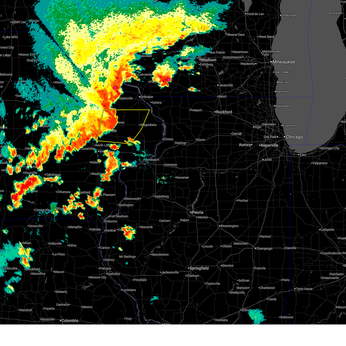 At 418 pm cdt, severe thunderstorms were located along a line extending from near cascade to near morley to near solon, moving east at 50 mph (trained weather spotters). Hazards include 70 mph wind gusts and penny size hail. Expect considerable tree damage. damage is likely to mobile homes, roofs, and outbuildings. Locations impacted include, maquoketa, anamosa, mechanicsville, stanwood, mount vernon, monticello, cascade, lisbon, solon, springville, lowden, wheatland, olin, wyoming, oxford junction, lost nation, andrew, la motte, martelle, and onslow. At 418 pm cdt, severe thunderstorms were located along a line extending from near cascade to near morley to near solon, moving east at 50 mph (trained weather spotters). Hazards include 70 mph wind gusts and penny size hail. Expect considerable tree damage. damage is likely to mobile homes, roofs, and outbuildings. Locations impacted include, maquoketa, anamosa, mechanicsville, stanwood, mount vernon, monticello, cascade, lisbon, solon, springville, lowden, wheatland, olin, wyoming, oxford junction, lost nation, andrew, la motte, martelle, and onslow.
|
| 7/11/2025 4:16 PM CDT |
 the tornado warning has been cancelled and is no longer in effect the tornado warning has been cancelled and is no longer in effect
|
| 7/11/2025 4:16 PM CDT |
 At 416 pm cdt, a severe thunderstorm capable of producing a tornado was located over langworthy, or near anamosa, moving east at 50 mph (radar indicated rotation). Hazards include tornado. Flying debris will be dangerous to those caught without shelter. mobile homes will be damaged or destroyed. damage to roofs, windows, and vehicles will occur. tree damage is likely. this dangerous storm will be near, monticello, camp courageous, monticello municipal airport, scotch grove, pictured rocks wildlife area, temple hill, and jones county fairgrounds around 420 pm cdt. cascade and onslow around 425 pm cdt. Other locations in the path of this tornadic thunderstorm include canton, emeline, bernard, south gary owen, crab town, garry owen, fillmore, ironhills, maquoketa caves state park and washington mills. At 416 pm cdt, a severe thunderstorm capable of producing a tornado was located over langworthy, or near anamosa, moving east at 50 mph (radar indicated rotation). Hazards include tornado. Flying debris will be dangerous to those caught without shelter. mobile homes will be damaged or destroyed. damage to roofs, windows, and vehicles will occur. tree damage is likely. this dangerous storm will be near, monticello, camp courageous, monticello municipal airport, scotch grove, pictured rocks wildlife area, temple hill, and jones county fairgrounds around 420 pm cdt. cascade and onslow around 425 pm cdt. Other locations in the path of this tornadic thunderstorm include canton, emeline, bernard, south gary owen, crab town, garry owen, fillmore, ironhills, maquoketa caves state park and washington mills.
|
| 7/11/2025 4:14 PM CDT |
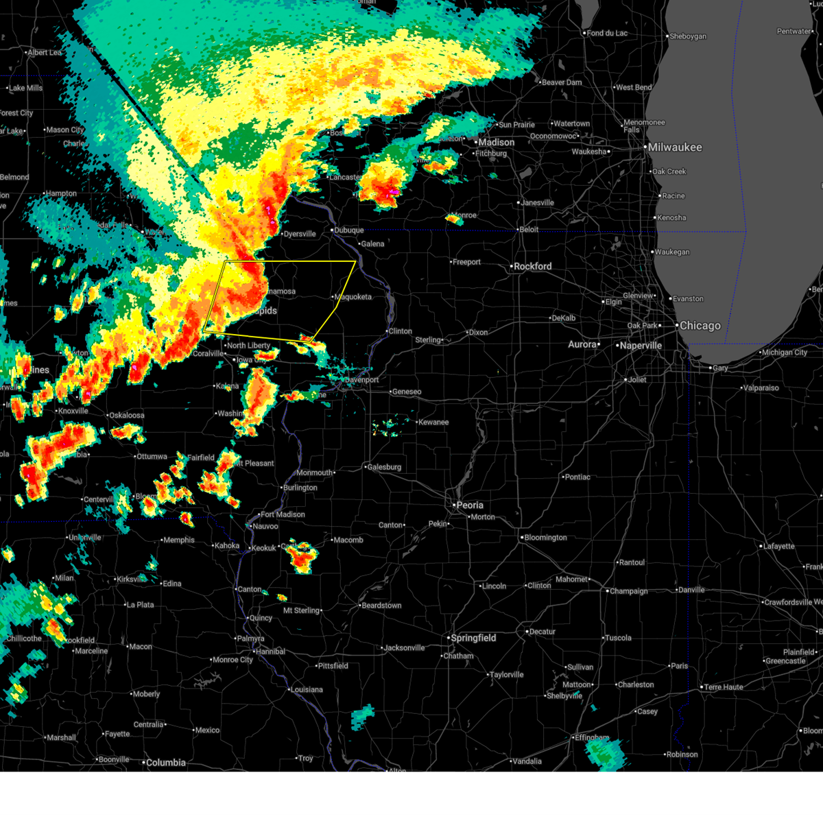 At 414 pm cdt, severe thunderstorms were located along a line extending from near worthington to near morley to solon, moving east at 50 mph (trained weather spotters). Hazards include 70 mph wind gusts and penny size hail. Expect considerable tree damage. damage is likely to mobile homes, roofs, and outbuildings. locations impacted include, cedar rapids, maquoketa, anamosa, mechanicsville, stanwood, marion, hiawatha, mount vernon, monticello, robins, cascade, lisbon, solon, ely, central city, springville, swisher, lowden, wheatland, and olin. This includes interstate 380 between mile markers 10 and 27. At 414 pm cdt, severe thunderstorms were located along a line extending from near worthington to near morley to solon, moving east at 50 mph (trained weather spotters). Hazards include 70 mph wind gusts and penny size hail. Expect considerable tree damage. damage is likely to mobile homes, roofs, and outbuildings. locations impacted include, cedar rapids, maquoketa, anamosa, mechanicsville, stanwood, marion, hiawatha, mount vernon, monticello, robins, cascade, lisbon, solon, ely, central city, springville, swisher, lowden, wheatland, and olin. This includes interstate 380 between mile markers 10 and 27.
|
| 7/11/2025 4:09 PM CDT |
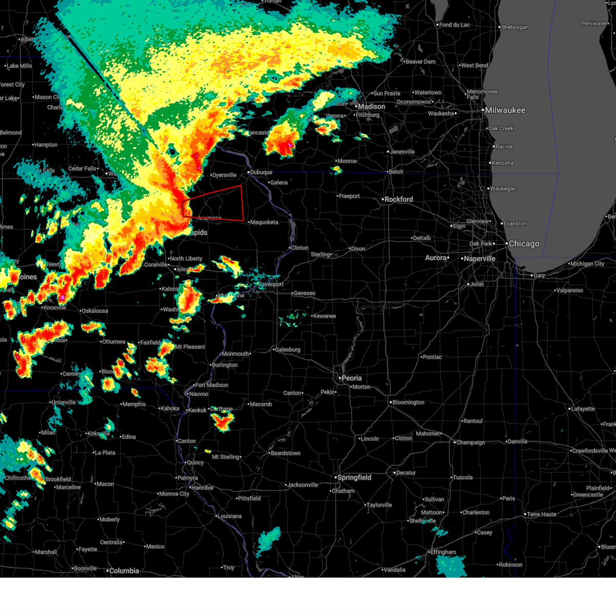 Tordvn the national weather service in the quad cities has issued a * tornado warning for, southwestern jackson county in east central iowa, southwestern dubuque county in northeastern iowa, northern jones county in east central iowa, southeastern delaware county in northeastern iowa, northeastern linn county in east central iowa, * until 500 pm cdt. * at 409 pm cdt, a severe thunderstorm capable of producing a tornado was located near matsell bridge natural area, or near anamosa, moving east at 50 mph (radar indicated rotation). Hazards include tornado. Flying debris will be dangerous to those caught without shelter. mobile homes will be damaged or destroyed. damage to roofs, windows, and vehicles will occur. tree damage is likely. this dangerous storm will be near, anamosa, monticello, langworthy, central park, camp courageous, monticello municipal airport, scotch grove, pictured rocks wildlife area, and jones county fairgrounds around 415 pm cdt. center junction around 420 pm cdt. cascade, onslow, and temple hill around 425 pm cdt. Other locations in the path of this tornadic thunderstorm include canton, south gary owen, crab town, emeline, garry owen, ironhills, bernard, maquoketa caves state park and washington mills. Tordvn the national weather service in the quad cities has issued a * tornado warning for, southwestern jackson county in east central iowa, southwestern dubuque county in northeastern iowa, northern jones county in east central iowa, southeastern delaware county in northeastern iowa, northeastern linn county in east central iowa, * until 500 pm cdt. * at 409 pm cdt, a severe thunderstorm capable of producing a tornado was located near matsell bridge natural area, or near anamosa, moving east at 50 mph (radar indicated rotation). Hazards include tornado. Flying debris will be dangerous to those caught without shelter. mobile homes will be damaged or destroyed. damage to roofs, windows, and vehicles will occur. tree damage is likely. this dangerous storm will be near, anamosa, monticello, langworthy, central park, camp courageous, monticello municipal airport, scotch grove, pictured rocks wildlife area, and jones county fairgrounds around 415 pm cdt. center junction around 420 pm cdt. cascade, onslow, and temple hill around 425 pm cdt. Other locations in the path of this tornadic thunderstorm include canton, south gary owen, crab town, emeline, garry owen, ironhills, bernard, maquoketa caves state park and washington mills.
|
| 7/11/2025 4:00 PM CDT |
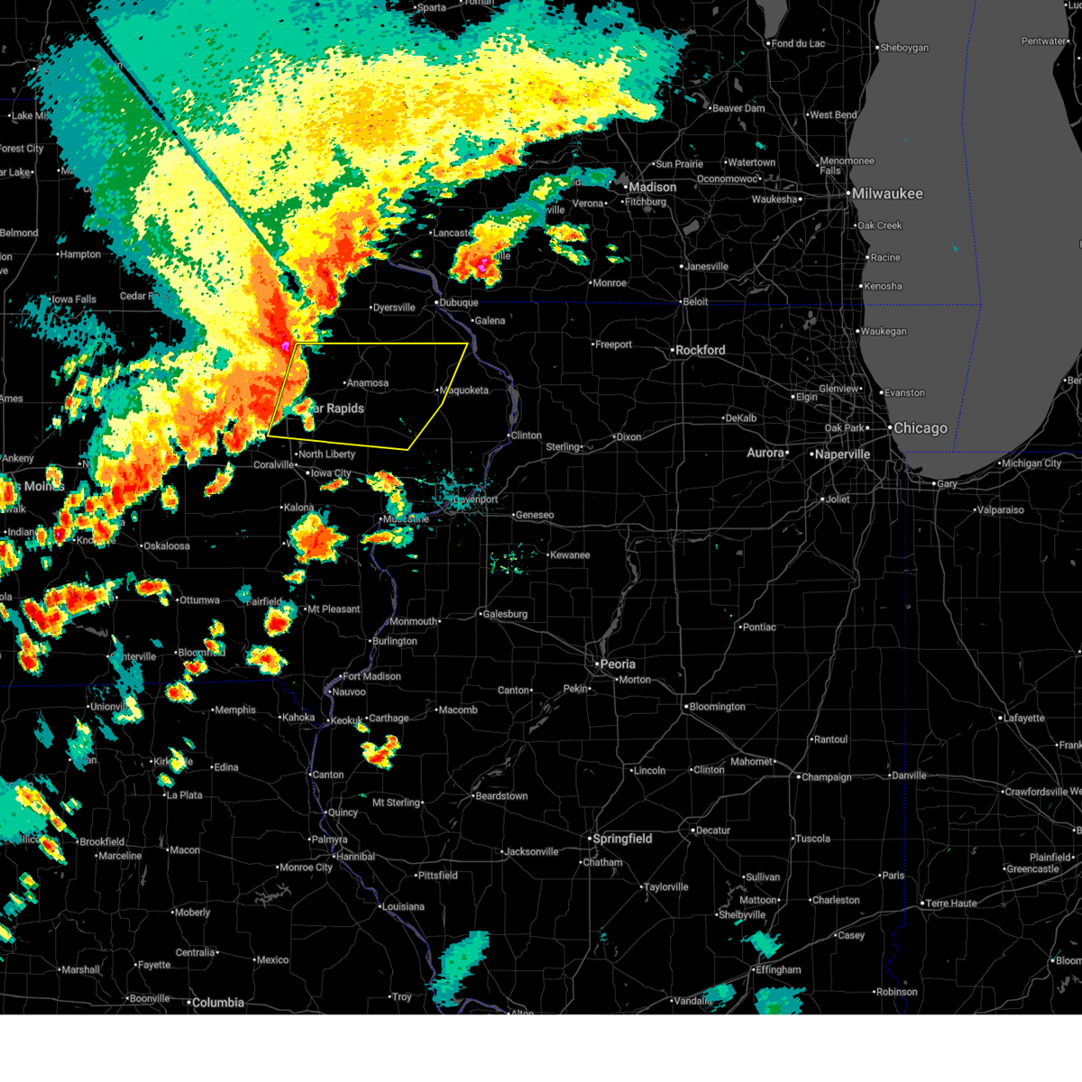 At 359 pm cdt, severe thunderstorms were located along a line extending from buck creek to springville to swisher, moving east at 50 mph (emergency management). Hazards include 70 mph wind gusts and penny size hail. Expect considerable tree damage. damage is likely to mobile homes, roofs, and outbuildings. locations impacted include, cedar rapids, maquoketa, anamosa, mechanicsville, stanwood, marion, hiawatha, mount vernon, monticello, robins, cascade, lisbon, solon, ely, central city, springville, swisher, lowden, wheatland, and olin. This includes interstate 380 between mile markers 10 and 27. At 359 pm cdt, severe thunderstorms were located along a line extending from buck creek to springville to swisher, moving east at 50 mph (emergency management). Hazards include 70 mph wind gusts and penny size hail. Expect considerable tree damage. damage is likely to mobile homes, roofs, and outbuildings. locations impacted include, cedar rapids, maquoketa, anamosa, mechanicsville, stanwood, marion, hiawatha, mount vernon, monticello, robins, cascade, lisbon, solon, ely, central city, springville, swisher, lowden, wheatland, and olin. This includes interstate 380 between mile markers 10 and 27.
|
| 7/11/2025 3:54 PM CDT |
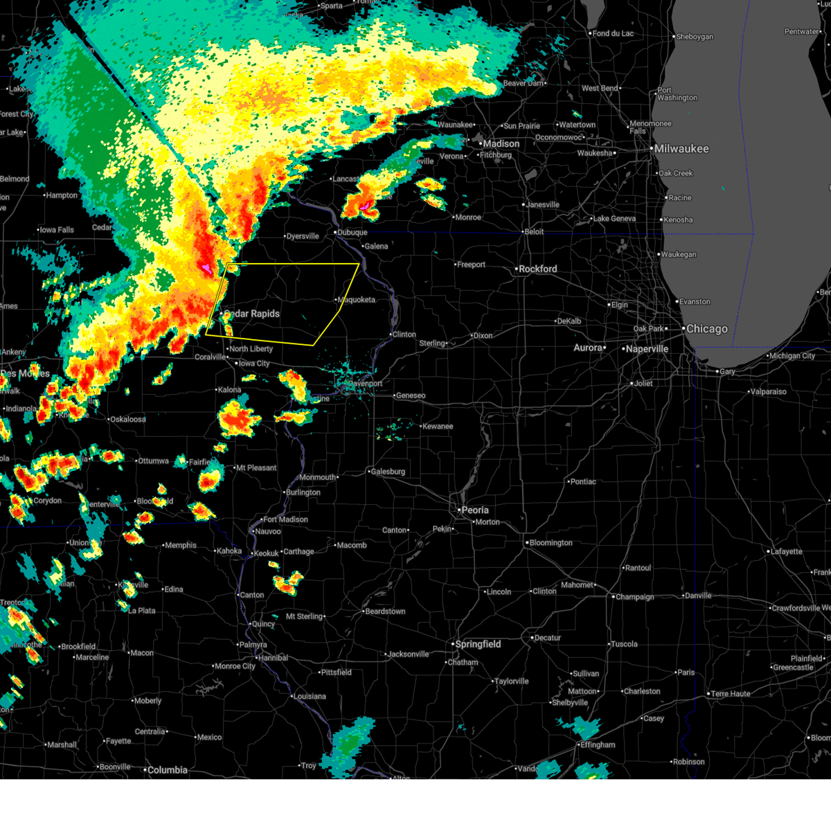 Svrdvn the national weather service in the quad cities has issued a * severe thunderstorm warning for, southwestern jackson county in east central iowa, northern cedar county in east central iowa, southwestern dubuque county in northeastern iowa, northeastern johnson county in east central iowa, jones county in east central iowa, southeastern delaware county in northeastern iowa, linn county in east central iowa, northwestern clinton county in east central iowa, * until 500 pm cdt. * at 353 pm cdt, severe thunderstorms were located along a line extending from near ryan to marion to near walford, moving east at 50 mph (emergency management). Hazards include 60 mph wind gusts and nickel size hail. expect damage to roofs, siding, and trees Svrdvn the national weather service in the quad cities has issued a * severe thunderstorm warning for, southwestern jackson county in east central iowa, northern cedar county in east central iowa, southwestern dubuque county in northeastern iowa, northeastern johnson county in east central iowa, jones county in east central iowa, southeastern delaware county in northeastern iowa, linn county in east central iowa, northwestern clinton county in east central iowa, * until 500 pm cdt. * at 353 pm cdt, severe thunderstorms were located along a line extending from near ryan to marion to near walford, moving east at 50 mph (emergency management). Hazards include 60 mph wind gusts and nickel size hail. expect damage to roofs, siding, and trees
|
| 7/10/2025 6:18 PM CDT |
 At 618 pm cdt, a severe thunderstorm capable of producing a tornado was located over temple hill, or 14 miles northeast of anamosa, moving east at 20 mph (radar indicated rotation). Hazards include tornado and quarter size hail. Flying debris will be dangerous to those caught without shelter. mobile homes will be damaged or destroyed. damage to roofs, windows, and vehicles will occur. tree damage is likely. Locations impacted include, canton, garry owen, pictured rocks wildlife area, camp courageous, scotch grove, and temple hill. At 618 pm cdt, a severe thunderstorm capable of producing a tornado was located over temple hill, or 14 miles northeast of anamosa, moving east at 20 mph (radar indicated rotation). Hazards include tornado and quarter size hail. Flying debris will be dangerous to those caught without shelter. mobile homes will be damaged or destroyed. damage to roofs, windows, and vehicles will occur. tree damage is likely. Locations impacted include, canton, garry owen, pictured rocks wildlife area, camp courageous, scotch grove, and temple hill.
|
| 7/10/2025 6:09 PM CDT |
 Tordvn the national weather service in the quad cities has issued a * tornado warning for, west central jackson county in east central iowa, northeastern jones county in east central iowa, * until 700 pm cdt. * at 609 pm cdt, a severe thunderstorm capable of producing a tornado was located over pictured rocks wildlife area, or 11 miles northeast of anamosa, moving east at 20 mph (radar indicated rotation). Hazards include tornado and quarter size hail. Flying debris will be dangerous to those caught without shelter. mobile homes will be damaged or destroyed. damage to roofs, windows, and vehicles will occur. Tree damage is likely. Tordvn the national weather service in the quad cities has issued a * tornado warning for, west central jackson county in east central iowa, northeastern jones county in east central iowa, * until 700 pm cdt. * at 609 pm cdt, a severe thunderstorm capable of producing a tornado was located over pictured rocks wildlife area, or 11 miles northeast of anamosa, moving east at 20 mph (radar indicated rotation). Hazards include tornado and quarter size hail. Flying debris will be dangerous to those caught without shelter. mobile homes will be damaged or destroyed. damage to roofs, windows, and vehicles will occur. Tree damage is likely.
|
| 6/11/2025 9:34 PM CDT |
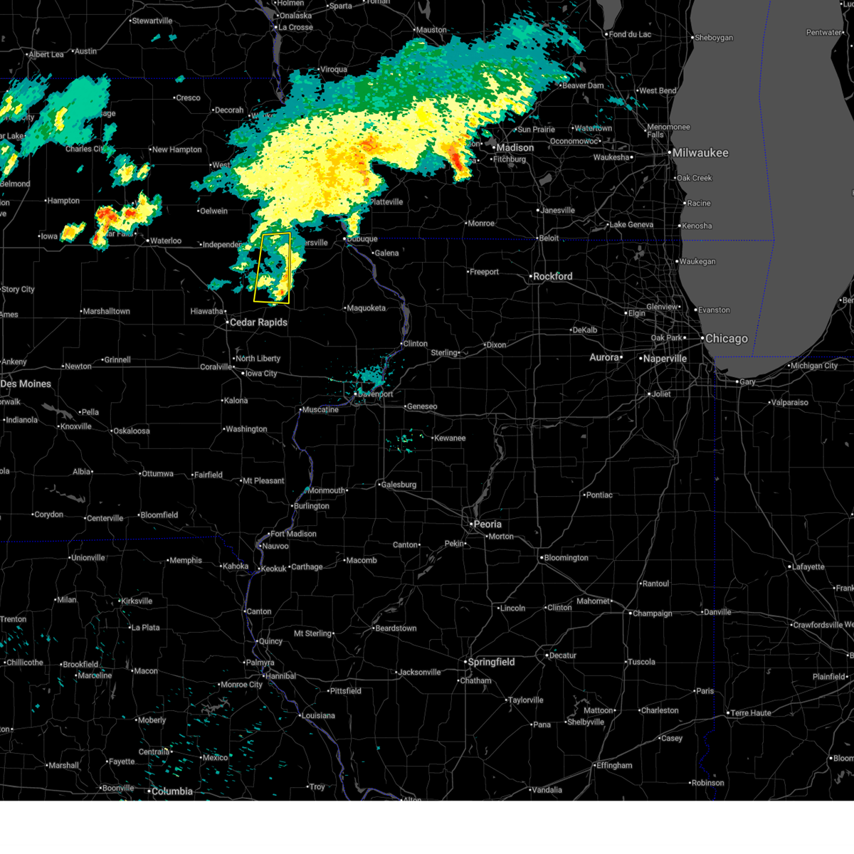 the severe thunderstorm warning has been cancelled and is no longer in effect the severe thunderstorm warning has been cancelled and is no longer in effect
|
| 6/11/2025 9:26 PM CDT |
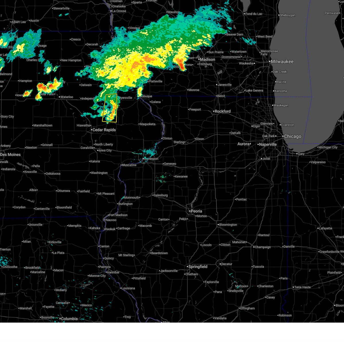 At 926 pm cdt, severe thunderstorms were located along a line extending from dyersville to near jones county fairgrounds to stone city, moving east at 40 mph (radar indicated). Hazards include 60 mph wind gusts. Expect damage to roofs, siding, and trees. Locations impacted include, anamosa, dyersville, monticello, earlville, hopkinton, delhi, delaware, langworthy, stone city, matsell bridge natural area, jones county fairgrounds, buck creek, turtle creek park, and monticello municipal airport. At 926 pm cdt, severe thunderstorms were located along a line extending from dyersville to near jones county fairgrounds to stone city, moving east at 40 mph (radar indicated). Hazards include 60 mph wind gusts. Expect damage to roofs, siding, and trees. Locations impacted include, anamosa, dyersville, monticello, earlville, hopkinton, delhi, delaware, langworthy, stone city, matsell bridge natural area, jones county fairgrounds, buck creek, turtle creek park, and monticello municipal airport.
|
| 6/11/2025 9:11 PM CDT |
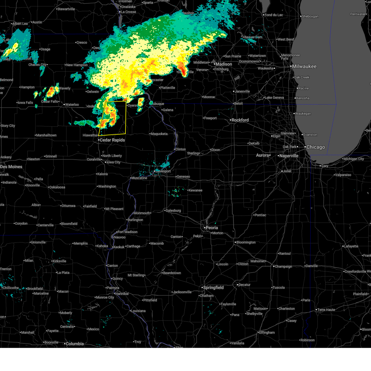 At 911 pm cdt, severe thunderstorms were located along a line extending from earlville to near buck creek to near whittier, moving east at 40 mph (radar indicated). Hazards include 60 mph wind gusts. Expect damage to roofs, siding, and trees. Locations impacted include, cedar rapids, anamosa, manchester, marion, hiawatha, dyersville, monticello, robins, central city, springville, earlville, alburnett, coggon, hopkinton, delhi, ryan, prairieburg, delaware, waubeek, and stone city. At 911 pm cdt, severe thunderstorms were located along a line extending from earlville to near buck creek to near whittier, moving east at 40 mph (radar indicated). Hazards include 60 mph wind gusts. Expect damage to roofs, siding, and trees. Locations impacted include, cedar rapids, anamosa, manchester, marion, hiawatha, dyersville, monticello, robins, central city, springville, earlville, alburnett, coggon, hopkinton, delhi, ryan, prairieburg, delaware, waubeek, and stone city.
|
| 6/11/2025 9:11 PM CDT |
 the severe thunderstorm warning has been cancelled and is no longer in effect the severe thunderstorm warning has been cancelled and is no longer in effect
|
| 6/11/2025 9:03 PM CDT |
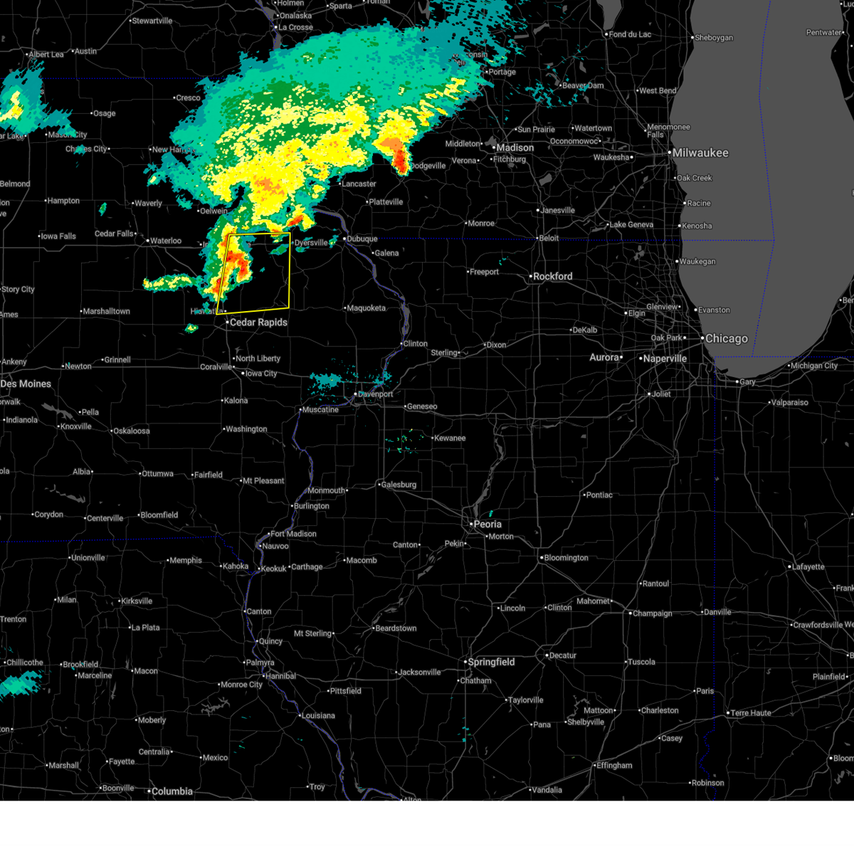 At 903 pm cdt, severe thunderstorms were located along a line extending from delaware to near buck creek to near alburnett, moving east at 45 mph (radar indicated). Hazards include 60 mph wind gusts. Expect damage to roofs, siding, and trees. locations impacted include, cedar rapids, anamosa, manchester, marion, hiawatha, dyersville, monticello, robins, central city, springville, earlville, alburnett, coggon, hopkinton, delhi, ryan, prairieburg, delaware, masonville, and toddville. This includes interstate 380 between mile markers 25 and 32. At 903 pm cdt, severe thunderstorms were located along a line extending from delaware to near buck creek to near alburnett, moving east at 45 mph (radar indicated). Hazards include 60 mph wind gusts. Expect damage to roofs, siding, and trees. locations impacted include, cedar rapids, anamosa, manchester, marion, hiawatha, dyersville, monticello, robins, central city, springville, earlville, alburnett, coggon, hopkinton, delhi, ryan, prairieburg, delaware, masonville, and toddville. This includes interstate 380 between mile markers 25 and 32.
|
| 6/11/2025 8:43 PM CDT |
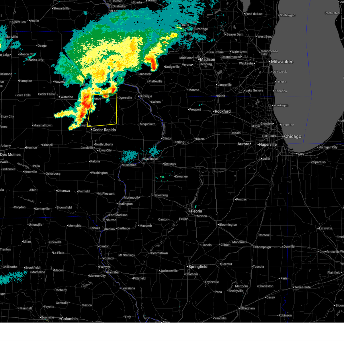 Svrdvn the national weather service in the quad cities has issued a * severe thunderstorm warning for, southeastern buchanan county in northeastern iowa, northwestern jones county in east central iowa, delaware county in northeastern iowa, northern linn county in east central iowa, * until 945 pm cdt. * at 843 pm cdt, severe thunderstorms were located along a line extending from masonville to pleasant creek state recreation area, moving east at 40 mph (trained weather spotters). Hazards include 60 mph wind gusts. expect damage to roofs, siding, and trees Svrdvn the national weather service in the quad cities has issued a * severe thunderstorm warning for, southeastern buchanan county in northeastern iowa, northwestern jones county in east central iowa, delaware county in northeastern iowa, northern linn county in east central iowa, * until 945 pm cdt. * at 843 pm cdt, severe thunderstorms were located along a line extending from masonville to pleasant creek state recreation area, moving east at 40 mph (trained weather spotters). Hazards include 60 mph wind gusts. expect damage to roofs, siding, and trees
|
| 3/14/2025 9:36 PM CDT |
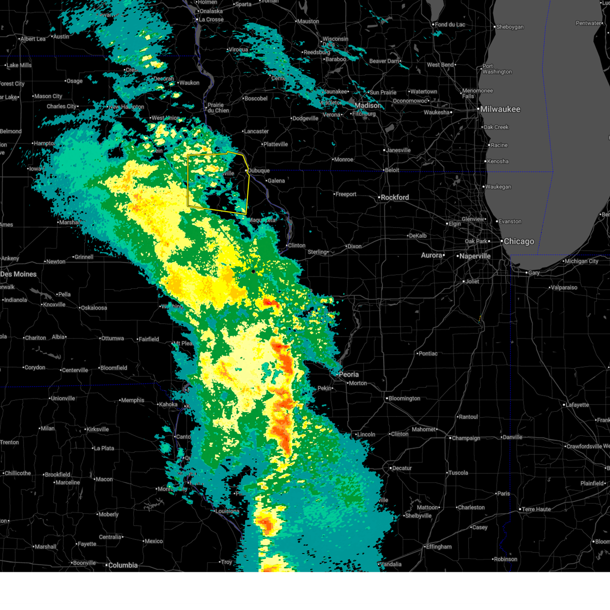 the severe thunderstorm warning has been cancelled and is no longer in effect the severe thunderstorm warning has been cancelled and is no longer in effect
|
| 3/14/2025 9:36 PM CDT |
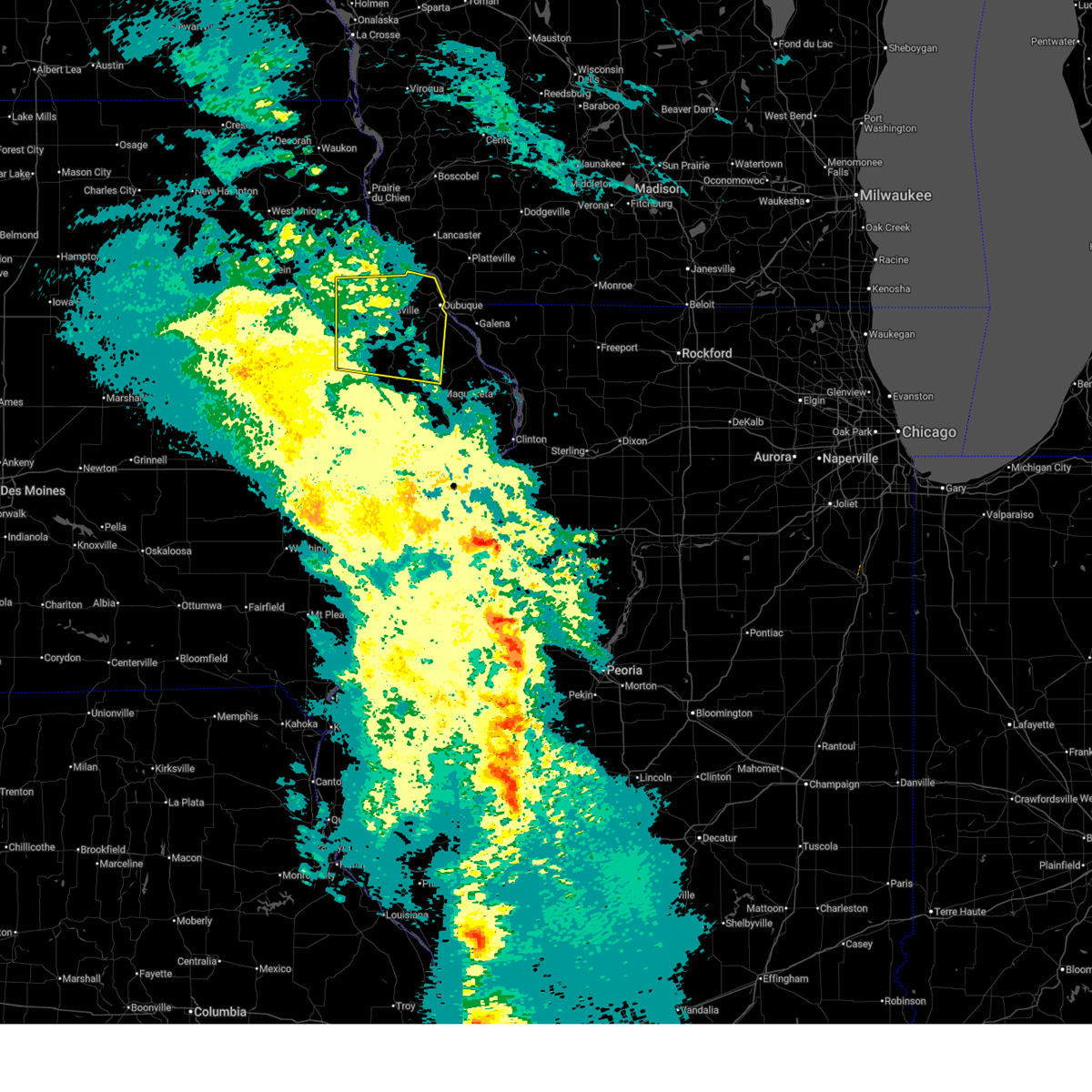 At 936 pm cdt, severe thunderstorms were located along a line extending from colesburg to rickardsville to near otter creek, moving north at 50 mph (trained weather spotters). Hazards include 60 mph wind gusts. Expect damage to roofs, siding, and trees. Locations impacted include, otter creek, new vienna, south gary owen, sherrill, bankston park, fillmore, balltown, waupeton, lattnerville, buck creek, petersburg, east rickardsville, dubuque county fairgrounds, dubuque, worthington, washington mills, monticello municipal airport, camp little cloud, swiss valley park, and peosta. At 936 pm cdt, severe thunderstorms were located along a line extending from colesburg to rickardsville to near otter creek, moving north at 50 mph (trained weather spotters). Hazards include 60 mph wind gusts. Expect damage to roofs, siding, and trees. Locations impacted include, otter creek, new vienna, south gary owen, sherrill, bankston park, fillmore, balltown, waupeton, lattnerville, buck creek, petersburg, east rickardsville, dubuque county fairgrounds, dubuque, worthington, washington mills, monticello municipal airport, camp little cloud, swiss valley park, and peosta.
|
| 3/14/2025 9:13 PM CDT |
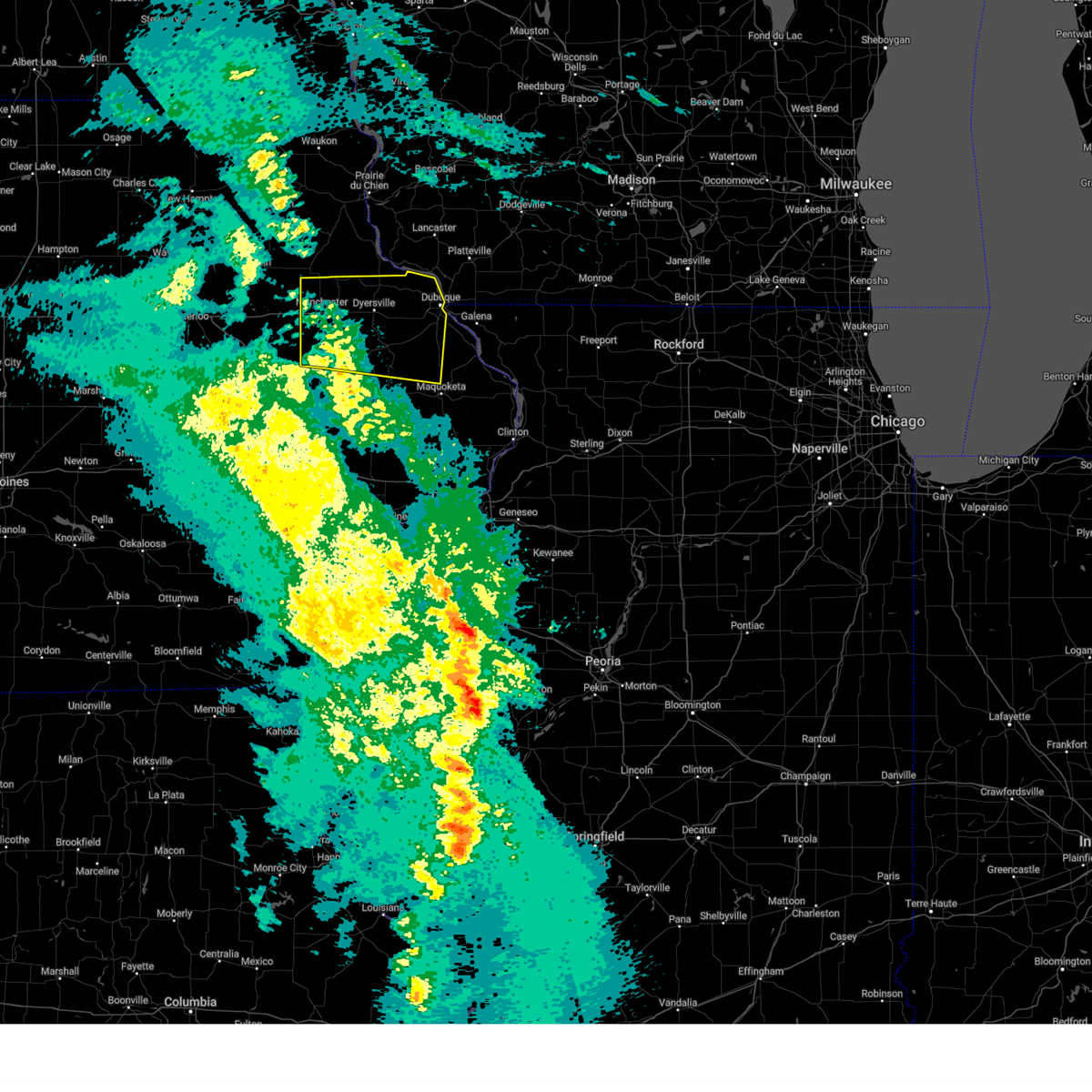 At 912 pm cdt, severe thunderstorms were located along a line extending from edgewood to near dyersville to near scotch grove, moving east at 45 mph (trained weather spotters). Hazards include 60 mph wind gusts. Expect damage to roofs, siding, and trees. Locations impacted include, otter creek, new vienna, south gary owen, sherrill, bankston park, fillmore, central city, balltown, waupeton, lattnerville, pinicon ridge park, buck creek, baileys ford park, petersburg, east rickardsville, dubuque county fairgrounds, dubuque, worthington, washington mills, and monticello municipal airport. At 912 pm cdt, severe thunderstorms were located along a line extending from edgewood to near dyersville to near scotch grove, moving east at 45 mph (trained weather spotters). Hazards include 60 mph wind gusts. Expect damage to roofs, siding, and trees. Locations impacted include, otter creek, new vienna, south gary owen, sherrill, bankston park, fillmore, central city, balltown, waupeton, lattnerville, pinicon ridge park, buck creek, baileys ford park, petersburg, east rickardsville, dubuque county fairgrounds, dubuque, worthington, washington mills, and monticello municipal airport.
|
| 3/14/2025 8:58 PM CDT |
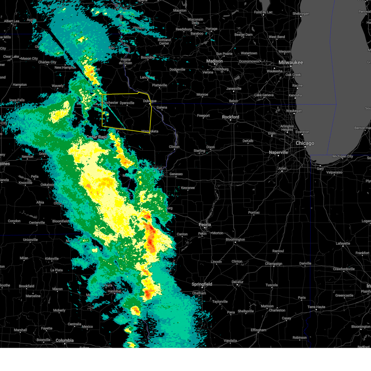 Svrdvn the national weather service in the quad cities has issued a * severe thunderstorm warning for, western jackson county in east central iowa, dubuque county in northeastern iowa, northern jones county in east central iowa, delaware county in northeastern iowa, northeastern linn county in east central iowa, * until 1000 pm cdt. * at 858 pm cdt, severe thunderstorms were located along a line extending from near backbone state park to delhi to langworthy, moving northeast at 45 mph (trained weather spotters). Hazards include 60 mph wind gusts. expect damage to roofs, siding, and trees Svrdvn the national weather service in the quad cities has issued a * severe thunderstorm warning for, western jackson county in east central iowa, dubuque county in northeastern iowa, northern jones county in east central iowa, delaware county in northeastern iowa, northeastern linn county in east central iowa, * until 1000 pm cdt. * at 858 pm cdt, severe thunderstorms were located along a line extending from near backbone state park to delhi to langworthy, moving northeast at 45 mph (trained weather spotters). Hazards include 60 mph wind gusts. expect damage to roofs, siding, and trees
|
| 7/23/2024 3:12 PM CDT |
 The storms which prompted the warning have weakened below severe limits, and no longer pose an immediate threat to life or property. therefore, the warning will be allowed to expire. however, gusty winds and heavy rain are still possible with these thunderstorms. The storms which prompted the warning have weakened below severe limits, and no longer pose an immediate threat to life or property. therefore, the warning will be allowed to expire. however, gusty winds and heavy rain are still possible with these thunderstorms.
|
| 7/23/2024 2:57 PM CDT |
 At 256 pm cdt, a severe thunderstorm was located over hale, or 10 miles northeast of stanwood, moving southeast at 25 mph. additional strong thunderstorms were developing in jones county (radar indicated). Hazards include 60 mph wind gusts. Expect damage to roofs, siding, and trees. Locations impacted include, anamosa, olin, wyoming, oxford junction, martelle, onslow, morley, center junction, langworthy, stone city, oxford mills, wapsipinicon state park, hale, scotch grove, and central park. At 256 pm cdt, a severe thunderstorm was located over hale, or 10 miles northeast of stanwood, moving southeast at 25 mph. additional strong thunderstorms were developing in jones county (radar indicated). Hazards include 60 mph wind gusts. Expect damage to roofs, siding, and trees. Locations impacted include, anamosa, olin, wyoming, oxford junction, martelle, onslow, morley, center junction, langworthy, stone city, oxford mills, wapsipinicon state park, hale, scotch grove, and central park.
|
| 7/23/2024 2:43 PM CDT |
 At 242 pm cdt, a severe thunderstorm was located 5 miles east of anamosa, moving southeast at 25 mph. other strong storms were also developing over jones county (radar indicated). Hazards include 60 mph wind gusts and penny size hail. Expect damage to roofs, siding, and trees. Locations impacted include, anamosa, olin, wyoming, oxford junction, martelle, onslow, morley, center junction, langworthy, stone city, oxford mills, wapsipinicon state park, hale, scotch grove, and central park. At 242 pm cdt, a severe thunderstorm was located 5 miles east of anamosa, moving southeast at 25 mph. other strong storms were also developing over jones county (radar indicated). Hazards include 60 mph wind gusts and penny size hail. Expect damage to roofs, siding, and trees. Locations impacted include, anamosa, olin, wyoming, oxford junction, martelle, onslow, morley, center junction, langworthy, stone city, oxford mills, wapsipinicon state park, hale, scotch grove, and central park.
|
| 7/23/2024 2:30 PM CDT |
 Svrdvn the national weather service in the quad cities has issued a * severe thunderstorm warning for, jones county in east central iowa, * until 315 pm cdt. * at 229 pm cdt, a severe thunderstorm was located over anamosa, moving southeast at 25 mph (radar indicated). Hazards include 60 mph wind gusts and quarter size hail. Hail damage to vehicles is expected. Expect wind damage to roofs, siding, and trees. Svrdvn the national weather service in the quad cities has issued a * severe thunderstorm warning for, jones county in east central iowa, * until 315 pm cdt. * at 229 pm cdt, a severe thunderstorm was located over anamosa, moving southeast at 25 mph (radar indicated). Hazards include 60 mph wind gusts and quarter size hail. Hail damage to vehicles is expected. Expect wind damage to roofs, siding, and trees.
|
| 7/15/2024 6:21 PM CDT |
 the severe thunderstorm warning has been cancelled and is no longer in effect the severe thunderstorm warning has been cancelled and is no longer in effect
|
| 7/15/2024 6:21 PM CDT |
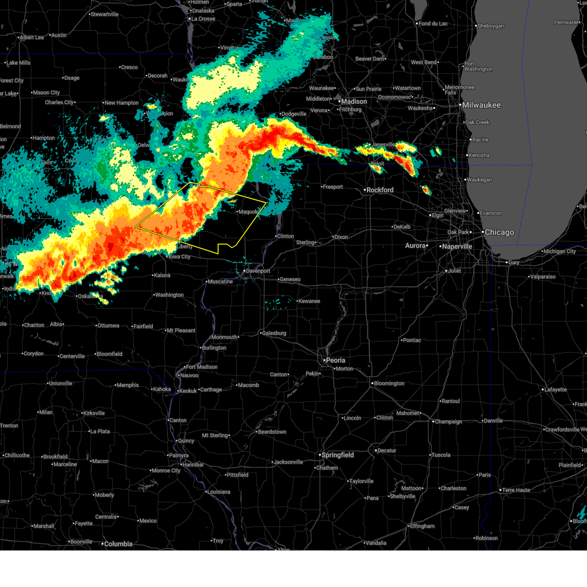 At 619 pm cdt, severe thunderstorms were located along a line extending from near scotch grove to ely, moving east at 15 mph. these are destructive storms for tipton, wheatland, and maquoketa (radar indicated). Hazards include 80 mph wind gusts. Flying debris will be dangerous to those caught without shelter. mobile homes will be heavily damaged. expect considerable damage to roofs, windows, and vehicles. extensive tree damage and power outages are likely. locations impacted include, cedar rapids, maquoketa, anamosa, tipton, mechanicsville, stanwood, marion, hiawatha, mount vernon, monticello, robins, cascade, lisbon, fairfax, ely, springville, preston, lowden, wheatland, and olin. This includes interstate 380 between mile markers 13 and 26. At 619 pm cdt, severe thunderstorms were located along a line extending from near scotch grove to ely, moving east at 15 mph. these are destructive storms for tipton, wheatland, and maquoketa (radar indicated). Hazards include 80 mph wind gusts. Flying debris will be dangerous to those caught without shelter. mobile homes will be heavily damaged. expect considerable damage to roofs, windows, and vehicles. extensive tree damage and power outages are likely. locations impacted include, cedar rapids, maquoketa, anamosa, tipton, mechanicsville, stanwood, marion, hiawatha, mount vernon, monticello, robins, cascade, lisbon, fairfax, ely, springville, preston, lowden, wheatland, and olin. This includes interstate 380 between mile markers 13 and 26.
|
| 7/15/2024 5:59 PM CDT |
 At 559 pm cdt, severe thunderstorms were located along a line extending from near luxemburg to near cedar rapids municipal airport, moving east at 25 mph (radar indicated). Hazards include 70 mph wind gusts and penny size hail. Expect considerable tree damage. damage is likely to mobile homes, roofs, and outbuildings. locations impacted include, cedar rapids, anamosa, vinton, manchester, mechanicsville, marion, hiawatha, mount vernon, dyersville, monticello, robins, belle plaine, center point, cascade, lisbon, fairfax, solon, epworth, ely, and atkins. This includes interstate 380 between mile markers 8 and 45. At 559 pm cdt, severe thunderstorms were located along a line extending from near luxemburg to near cedar rapids municipal airport, moving east at 25 mph (radar indicated). Hazards include 70 mph wind gusts and penny size hail. Expect considerable tree damage. damage is likely to mobile homes, roofs, and outbuildings. locations impacted include, cedar rapids, anamosa, vinton, manchester, mechanicsville, marion, hiawatha, mount vernon, dyersville, monticello, robins, belle plaine, center point, cascade, lisbon, fairfax, solon, epworth, ely, and atkins. This includes interstate 380 between mile markers 8 and 45.
|
| 7/15/2024 5:54 PM CDT |
 Svrdvn the national weather service in the quad cities has issued a * severe thunderstorm warning for, southern jackson county in east central iowa, northern cedar county in east central iowa, southwestern dubuque county in northeastern iowa, northeastern johnson county in east central iowa, southeastern benton county in east central iowa, jones county in east central iowa, southeastern delaware county in northeastern iowa, linn county in east central iowa, western clinton county in east central iowa, * until 700 pm cdt. * at 554 pm cdt, severe thunderstorms were located along a line extending from near langworthy to near cedar rapids municipal airport, moving east at 15 mph (radar indicated). Hazards include 80 mph wind gusts. Flying debris will be dangerous to those caught without shelter. mobile homes will be heavily damaged. expect considerable damage to roofs, windows, and vehicles. Extensive tree damage and power outages are likely. Svrdvn the national weather service in the quad cities has issued a * severe thunderstorm warning for, southern jackson county in east central iowa, northern cedar county in east central iowa, southwestern dubuque county in northeastern iowa, northeastern johnson county in east central iowa, southeastern benton county in east central iowa, jones county in east central iowa, southeastern delaware county in northeastern iowa, linn county in east central iowa, western clinton county in east central iowa, * until 700 pm cdt. * at 554 pm cdt, severe thunderstorms were located along a line extending from near langworthy to near cedar rapids municipal airport, moving east at 15 mph (radar indicated). Hazards include 80 mph wind gusts. Flying debris will be dangerous to those caught without shelter. mobile homes will be heavily damaged. expect considerable damage to roofs, windows, and vehicles. Extensive tree damage and power outages are likely.
|
| 7/15/2024 5:40 PM CDT |
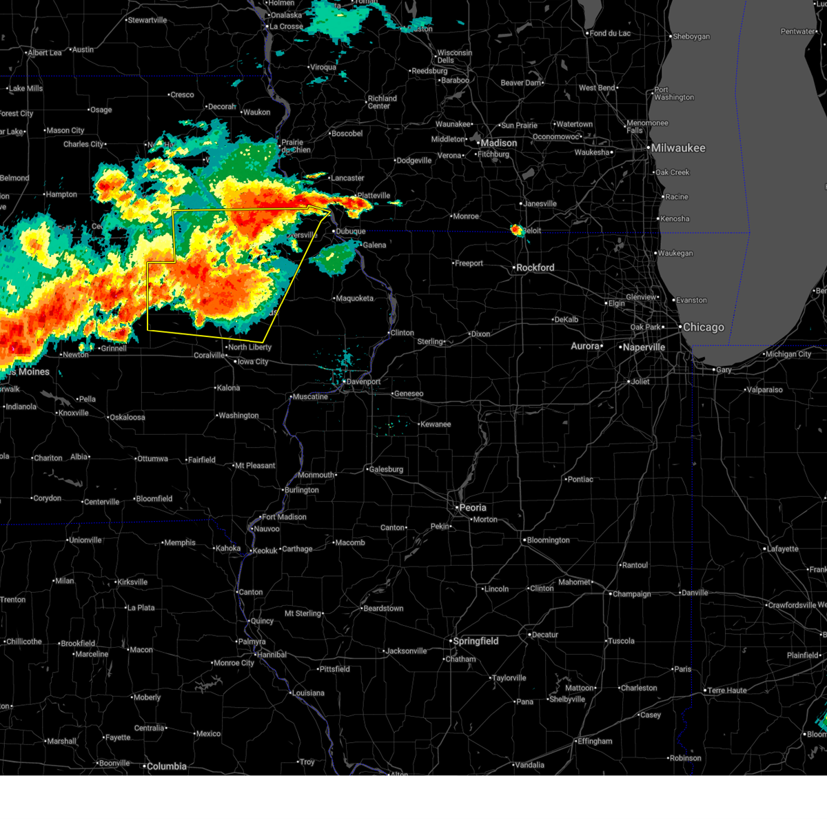 At 539 pm cdt, severe thunderstorms were located along a line extending from near twin bridges park to near fairfax, moving east at 25 mph (radar indicated). Hazards include 70 mph wind gusts and penny size hail. Expect considerable tree damage. damage is likely to mobile homes, roofs, and outbuildings. locations impacted include, cedar rapids, independence, anamosa, vinton, manchester, mechanicsville, marion, hiawatha, mount vernon, dyersville, monticello, robins, belle plaine, jesup, center point, cascade, lisbon, fairfax, solon, and epworth. This includes interstate 380 between mile markers 8 and 55. At 539 pm cdt, severe thunderstorms were located along a line extending from near twin bridges park to near fairfax, moving east at 25 mph (radar indicated). Hazards include 70 mph wind gusts and penny size hail. Expect considerable tree damage. damage is likely to mobile homes, roofs, and outbuildings. locations impacted include, cedar rapids, independence, anamosa, vinton, manchester, mechanicsville, marion, hiawatha, mount vernon, dyersville, monticello, robins, belle plaine, jesup, center point, cascade, lisbon, fairfax, solon, and epworth. This includes interstate 380 between mile markers 8 and 55.
|
| 7/15/2024 5:20 PM CDT | Svrdvn the national weather service in the quad cities has issued a * severe thunderstorm warning for, buchanan county in northeastern iowa, northwestern cedar county in east central iowa, western dubuque county in northeastern iowa, northern johnson county in east central iowa, benton county in east central iowa, jones county in east central iowa, delaware county in northeastern iowa, linn county in east central iowa, northeastern iowa county in east central iowa, * until 630 pm cdt. * at 520 pm cdt, severe thunderstorms were located along a line extending from edgewood to near norway, moving east at 25 mph (radar indicated). Hazards include 70 mph wind gusts and quarter size hail. Hail damage to vehicles is expected. expect considerable tree damage. Wind damage is also likely to mobile homes, roofs, and outbuildings. |
| 7/2/2024 6:36 PM CDT |
 At 636 pm cdt, a severe thunderstorm was located near pictured rocks wildlife area, or 13 miles northeast of anamosa, moving east at 35 mph (radar indicated). Hazards include 60 mph wind gusts. Expect damage to roofs, siding, and trees. this severe storm will be near, cascade, fillmore, temple hill, and fillmore recreation area around 640 pm cdt. bernard and garry owen around 645 pm cdt. Other locations in the path of this severe thunderstorm include south gary owen, washington mills, zwingle, crab town, dubuque regional airport, otter creek and la motte. At 636 pm cdt, a severe thunderstorm was located near pictured rocks wildlife area, or 13 miles northeast of anamosa, moving east at 35 mph (radar indicated). Hazards include 60 mph wind gusts. Expect damage to roofs, siding, and trees. this severe storm will be near, cascade, fillmore, temple hill, and fillmore recreation area around 640 pm cdt. bernard and garry owen around 645 pm cdt. Other locations in the path of this severe thunderstorm include south gary owen, washington mills, zwingle, crab town, dubuque regional airport, otter creek and la motte.
|
| 7/2/2024 6:33 PM CDT |
 At 633 pm cdt, a severe thunderstorm capable of producing a tornado was located over pictured rocks wildlife area, or 12 miles northeast of anamosa, moving east at 35 mph (radar indicated rotation). Hazards include tornado. Flying debris will be dangerous to those caught without shelter. mobile homes will be damaged or destroyed. damage to roofs, windows, and vehicles will occur. tree damage is likely. this dangerous storm will be near, cascade, canton, fillmore, temple hill, and fillmore recreation area around 640 pm cdt. Other locations in the path of this tornadic thunderstorm include bernard, south gary owen, garry owen, crab town, emeline, washington mills, zwingle, otter creek, ironhills and fulton. At 633 pm cdt, a severe thunderstorm capable of producing a tornado was located over pictured rocks wildlife area, or 12 miles northeast of anamosa, moving east at 35 mph (radar indicated rotation). Hazards include tornado. Flying debris will be dangerous to those caught without shelter. mobile homes will be damaged or destroyed. damage to roofs, windows, and vehicles will occur. tree damage is likely. this dangerous storm will be near, cascade, canton, fillmore, temple hill, and fillmore recreation area around 640 pm cdt. Other locations in the path of this tornadic thunderstorm include bernard, south gary owen, garry owen, crab town, emeline, washington mills, zwingle, otter creek, ironhills and fulton.
|
| 7/2/2024 6:26 PM CDT |
 Svrdvn the national weather service in the quad cities has issued a * severe thunderstorm warning for, northwestern jackson county in east central iowa, southwestern dubuque county in northeastern iowa, northern jones county in east central iowa, southeastern delaware county in northeastern iowa, * until 715 pm cdt. * at 625 pm cdt, a severe thunderstorm was located over monticello, or 9 miles north of anamosa, moving east at 35 mph (radar indicated). Hazards include 60 mph wind gusts. Expect damage to roofs, siding, and trees. this severe thunderstorm will be near, monticello, cascade, camp courageous, monticello municipal airport, scotch grove, pictured rocks wildlife area, and jones county fairgrounds around 630 pm cdt. temple hill around 635 pm cdt. fillmore and fillmore recreation area around 640 pm cdt. bernard and garry owen around 645 pm cdt. Other locations in the path of this severe thunderstorm include south gary owen, washington mills, crab town, zwingle, dubuque regional airport, otter creek and la motte. Svrdvn the national weather service in the quad cities has issued a * severe thunderstorm warning for, northwestern jackson county in east central iowa, southwestern dubuque county in northeastern iowa, northern jones county in east central iowa, southeastern delaware county in northeastern iowa, * until 715 pm cdt. * at 625 pm cdt, a severe thunderstorm was located over monticello, or 9 miles north of anamosa, moving east at 35 mph (radar indicated). Hazards include 60 mph wind gusts. Expect damage to roofs, siding, and trees. this severe thunderstorm will be near, monticello, cascade, camp courageous, monticello municipal airport, scotch grove, pictured rocks wildlife area, and jones county fairgrounds around 630 pm cdt. temple hill around 635 pm cdt. fillmore and fillmore recreation area around 640 pm cdt. bernard and garry owen around 645 pm cdt. Other locations in the path of this severe thunderstorm include south gary owen, washington mills, crab town, zwingle, dubuque regional airport, otter creek and la motte.
|
| 7/2/2024 6:24 PM CDT |
 Tordvn the national weather service in the quad cities has issued a * tornado warning for, west central jackson county in east central iowa, southwestern dubuque county in northeastern iowa, northern jones county in east central iowa, southeastern delaware county in northeastern iowa, * until 715 pm cdt. * at 624 pm cdt, a severe thunderstorm capable of producing a tornado was located over monticello, or 8 miles northeast of anamosa, moving east at 40 mph (radar indicated rotation). Hazards include tornado. Flying debris will be dangerous to those caught without shelter. mobile homes will be damaged or destroyed. damage to roofs, windows, and vehicles will occur. tree damage is likely. this dangerous storm will be near, cascade, camp courageous, scotch grove, pictured rocks wildlife area, and temple hill around 630 pm cdt. canton around 635 pm cdt. south gary owen, garry owen, fillmore, and fillmore recreation area around 640 pm cdt. Other locations in the path of this tornadic thunderstorm include bernard, crab town, emeline, washington mills, otter creek, ironhills, zwingle and fulton. Tordvn the national weather service in the quad cities has issued a * tornado warning for, west central jackson county in east central iowa, southwestern dubuque county in northeastern iowa, northern jones county in east central iowa, southeastern delaware county in northeastern iowa, * until 715 pm cdt. * at 624 pm cdt, a severe thunderstorm capable of producing a tornado was located over monticello, or 8 miles northeast of anamosa, moving east at 40 mph (radar indicated rotation). Hazards include tornado. Flying debris will be dangerous to those caught without shelter. mobile homes will be damaged or destroyed. damage to roofs, windows, and vehicles will occur. tree damage is likely. this dangerous storm will be near, cascade, camp courageous, scotch grove, pictured rocks wildlife area, and temple hill around 630 pm cdt. canton around 635 pm cdt. south gary owen, garry owen, fillmore, and fillmore recreation area around 640 pm cdt. Other locations in the path of this tornadic thunderstorm include bernard, crab town, emeline, washington mills, otter creek, ironhills, zwingle and fulton.
|
| 5/27/2024 5:17 PM CDT |
 the severe thunderstorm warning has been cancelled and is no longer in effect the severe thunderstorm warning has been cancelled and is no longer in effect
|
| 5/27/2024 5:17 PM CDT |
 At 517 pm cdt, a severe thunderstorm was located near temple hill, or 14 miles northeast of anamosa, moving east at 45 mph (radar indicated). Hazards include 60 mph wind gusts and quarter size hail. Hail damage to vehicles is expected. expect wind damage to roofs, siding, and trees. Locations impacted include, monticello, cascade, hopkinton, onslow, center junction, langworthy, canton, jones county fairgrounds, pictured rocks wildlife area, camp courageous, scotch grove, central park, temple hill, and monticello municipal airport. At 517 pm cdt, a severe thunderstorm was located near temple hill, or 14 miles northeast of anamosa, moving east at 45 mph (radar indicated). Hazards include 60 mph wind gusts and quarter size hail. Hail damage to vehicles is expected. expect wind damage to roofs, siding, and trees. Locations impacted include, monticello, cascade, hopkinton, onslow, center junction, langworthy, canton, jones county fairgrounds, pictured rocks wildlife area, camp courageous, scotch grove, central park, temple hill, and monticello municipal airport.
|
| 5/27/2024 5:12 PM CDT |
 At 512 pm cdt, a severe thunderstorm was located over pictured rocks wildlife area, or 11 miles northeast of anamosa, moving east at 45 mph (radar indicated). Hazards include 60 mph wind gusts and quarter size hail. Hail damage to vehicles is expected. expect wind damage to roofs, siding, and trees. Locations impacted include, monticello, cascade, hopkinton, worthington, onslow, bernard, center junction, langworthy, canton, jones county fairgrounds, fillmore, pictured rocks wildlife area, fillmore recreation area, buck creek, camp courageous, scotch grove, central park, temple hill, and monticello municipal airport. At 512 pm cdt, a severe thunderstorm was located over pictured rocks wildlife area, or 11 miles northeast of anamosa, moving east at 45 mph (radar indicated). Hazards include 60 mph wind gusts and quarter size hail. Hail damage to vehicles is expected. expect wind damage to roofs, siding, and trees. Locations impacted include, monticello, cascade, hopkinton, worthington, onslow, bernard, center junction, langworthy, canton, jones county fairgrounds, fillmore, pictured rocks wildlife area, fillmore recreation area, buck creek, camp courageous, scotch grove, central park, temple hill, and monticello municipal airport.
|
| 5/27/2024 5:06 PM CDT |
 At 505 pm cdt, a severe thunderstorm was located over jones county fairgrounds, or 12 miles north of anamosa, moving east at 45 mph (public. at 455 pm, 61 mph winds was reported at prairieburg). Hazards include 60 mph wind gusts and quarter size hail. Hail damage to vehicles is expected. expect wind damage to roofs, siding, and trees. Locations impacted include, monticello, cascade, farley, hopkinton, delhi, worthington, onslow, prairieburg, bernard, center junction, langworthy, canton, jones county fairgrounds, fillmore, pictured rocks wildlife area, howard h cherry scout reservation, fillmore recreation area, buck creek, camp courageous, and scotch grove. At 505 pm cdt, a severe thunderstorm was located over jones county fairgrounds, or 12 miles north of anamosa, moving east at 45 mph (public. at 455 pm, 61 mph winds was reported at prairieburg). Hazards include 60 mph wind gusts and quarter size hail. Hail damage to vehicles is expected. expect wind damage to roofs, siding, and trees. Locations impacted include, monticello, cascade, farley, hopkinton, delhi, worthington, onslow, prairieburg, bernard, center junction, langworthy, canton, jones county fairgrounds, fillmore, pictured rocks wildlife area, howard h cherry scout reservation, fillmore recreation area, buck creek, camp courageous, and scotch grove.
|
| 5/27/2024 5:02 PM CDT |
 At 502 pm cdt, a severe thunderstorm was located near jones county fairgrounds, or 12 miles north of anamosa, moving east at 45 mph (radar indicated). Hazards include 60 mph wind gusts and quarter size hail. Hail damage to vehicles is expected. expect wind damage to roofs, siding, and trees. Locations impacted include, monticello, cascade, farley, hopkinton, delhi, worthington, onslow, prairieburg, bernard, center junction, langworthy, canton, jones county fairgrounds, fillmore, pictured rocks wildlife area, howard h cherry scout reservation, fillmore recreation area, buck creek, camp courageous, and scotch grove. At 502 pm cdt, a severe thunderstorm was located near jones county fairgrounds, or 12 miles north of anamosa, moving east at 45 mph (radar indicated). Hazards include 60 mph wind gusts and quarter size hail. Hail damage to vehicles is expected. expect wind damage to roofs, siding, and trees. Locations impacted include, monticello, cascade, farley, hopkinton, delhi, worthington, onslow, prairieburg, bernard, center junction, langworthy, canton, jones county fairgrounds, fillmore, pictured rocks wildlife area, howard h cherry scout reservation, fillmore recreation area, buck creek, camp courageous, and scotch grove.
|
| 5/27/2024 4:58 PM CDT |
 At 458 pm cdt, a severe thunderstorm was located near buck creek, or 12 miles north of anamosa, moving east at 45 mph (radar indicated). Hazards include 60 mph wind gusts and quarter size hail. Hail damage to vehicles is expected. expect wind damage to roofs, siding, and trees. Locations impacted include, dyersville, monticello, cascade, epworth, farley, peosta, central city, earlville, coggon, hopkinton, delhi, worthington, ryan, onslow, prairieburg, delaware, bernard, center junction, langworthy, and canton. At 458 pm cdt, a severe thunderstorm was located near buck creek, or 12 miles north of anamosa, moving east at 45 mph (radar indicated). Hazards include 60 mph wind gusts and quarter size hail. Hail damage to vehicles is expected. expect wind damage to roofs, siding, and trees. Locations impacted include, dyersville, monticello, cascade, epworth, farley, peosta, central city, earlville, coggon, hopkinton, delhi, worthington, ryan, onslow, prairieburg, delaware, bernard, center junction, langworthy, and canton.
|
| 5/27/2024 4:53 PM CDT |
 At 452 pm cdt, a severe thunderstorm was located near buck creek, or 13 miles south of manchester, moving east at 45 mph (radar indicated). Hazards include 60 mph wind gusts and quarter size hail. Hail damage to vehicles is expected. expect wind damage to roofs, siding, and trees. Locations impacted include, manchester, dyersville, monticello, cascade, epworth, farley, peosta, central city, earlville, coggon, hopkinton, delhi, worthington, ryan, onslow, prairieburg, delaware, bernard, center junction, and waubeek. At 452 pm cdt, a severe thunderstorm was located near buck creek, or 13 miles south of manchester, moving east at 45 mph (radar indicated). Hazards include 60 mph wind gusts and quarter size hail. Hail damage to vehicles is expected. expect wind damage to roofs, siding, and trees. Locations impacted include, manchester, dyersville, monticello, cascade, epworth, farley, peosta, central city, earlville, coggon, hopkinton, delhi, worthington, ryan, onslow, prairieburg, delaware, bernard, center junction, and waubeek.
|
| 5/27/2024 4:41 PM CDT |
 Svrdvn the national weather service in the quad cities has issued a * severe thunderstorm warning for, southwestern dubuque county in northeastern iowa, northern jones county in east central iowa, southern delaware county in northeastern iowa, northeastern linn county in east central iowa, * until 530 pm cdt. * at 441 pm cdt, a severe thunderstorm was located over robinson, or 12 miles southwest of manchester, moving east at 45 mph (radar indicated). Hazards include 60 mph wind gusts and quarter size hail. Hail damage to vehicles is expected. Expect wind damage to roofs, siding, and trees. Svrdvn the national weather service in the quad cities has issued a * severe thunderstorm warning for, southwestern dubuque county in northeastern iowa, northern jones county in east central iowa, southern delaware county in northeastern iowa, northeastern linn county in east central iowa, * until 530 pm cdt. * at 441 pm cdt, a severe thunderstorm was located over robinson, or 12 miles southwest of manchester, moving east at 45 mph (radar indicated). Hazards include 60 mph wind gusts and quarter size hail. Hail damage to vehicles is expected. Expect wind damage to roofs, siding, and trees.
|
| 5/24/2024 7:52 AM CDT |
 At 752 am cdt, severe thunderstorms were located along a line extending from north buena vista to washington mills to near lowden, moving east at 50 mph (radar indicated). Hazards include 60 mph wind gusts and penny size hail. Expect damage to roofs, siding, and trees. Locations impacted include, dubuque, clinton, maquoketa, anamosa, galena, mechanicsville, stanwood, asbury, dyersville, monticello, savanna, bellevue, cascade, epworth, east dubuque, farley, peosta, preston, hanover, and earlville. At 752 am cdt, severe thunderstorms were located along a line extending from north buena vista to washington mills to near lowden, moving east at 50 mph (radar indicated). Hazards include 60 mph wind gusts and penny size hail. Expect damage to roofs, siding, and trees. Locations impacted include, dubuque, clinton, maquoketa, anamosa, galena, mechanicsville, stanwood, asbury, dyersville, monticello, savanna, bellevue, cascade, epworth, east dubuque, farley, peosta, preston, hanover, and earlville.
|
| 5/24/2024 7:39 AM CDT |
 Svrdvn the national weather service in the quad cities has issued a * severe thunderstorm warning for, jo daviess county in northwestern illinois, northwestern carroll county in northwestern illinois, jackson county in east central iowa, northern cedar county in east central iowa, dubuque county in northeastern iowa, jones county in east central iowa, eastern delaware county in northeastern iowa, clinton county in east central iowa, * until 845 am cdt. * at 739 am cdt, severe thunderstorms were located along a line extending from colesburg to near cascade to near stanwood, moving east at 50 mph (radar indicated). Hazards include 60 mph wind gusts and penny size hail. expect damage to roofs, siding, and trees Svrdvn the national weather service in the quad cities has issued a * severe thunderstorm warning for, jo daviess county in northwestern illinois, northwestern carroll county in northwestern illinois, jackson county in east central iowa, northern cedar county in east central iowa, dubuque county in northeastern iowa, jones county in east central iowa, eastern delaware county in northeastern iowa, clinton county in east central iowa, * until 845 am cdt. * at 739 am cdt, severe thunderstorms were located along a line extending from colesburg to near cascade to near stanwood, moving east at 50 mph (radar indicated). Hazards include 60 mph wind gusts and penny size hail. expect damage to roofs, siding, and trees
|
| 5/24/2024 7:34 AM CDT |
 the severe thunderstorm warning has been cancelled and is no longer in effect the severe thunderstorm warning has been cancelled and is no longer in effect
|
| 5/24/2024 7:34 AM CDT |
 At 733 am cdt, severe thunderstorms were located along a line extending from wood to near scotch grove to near cedar county fairgrounds, moving east at 40 mph (radar indicated). Hazards include 70 mph wind gusts and nickel size hail. Expect considerable tree damage. damage is likely to mobile homes, roofs, and outbuildings. Locations impacted include, anamosa, manchester, mechanicsville, stanwood, marion, mount vernon, dyersville, monticello, lisbon, ely, springville, edgewood, earlville, olin, hopkinton, delhi, colesburg, worthington, ryan, and bertram. At 733 am cdt, severe thunderstorms were located along a line extending from wood to near scotch grove to near cedar county fairgrounds, moving east at 40 mph (radar indicated). Hazards include 70 mph wind gusts and nickel size hail. Expect considerable tree damage. damage is likely to mobile homes, roofs, and outbuildings. Locations impacted include, anamosa, manchester, mechanicsville, stanwood, marion, mount vernon, dyersville, monticello, lisbon, ely, springville, edgewood, earlville, olin, hopkinton, delhi, colesburg, worthington, ryan, and bertram.
|
| 5/24/2024 7:26 AM CDT |
 At 726 am cdt, a severe squall line capable of producing both tornadoes and extensive straight line wind damage was located along a line extending from delhi to hopkinton to near langworthy, moving northeast at 45 mph (radar indicated rotation). Hazards include tornado and quarter size hail. Flying debris will be dangerous to those caught without shelter. mobile homes will be damaged or destroyed. damage to roofs, windows, and vehicles will occur. tree damage is likely. Locations impacted include, dyersville, monticello, earlville, hopkinton, worthington, langworthy, camp courageous, monticello municipal airport, scotch grove, pictured rocks wildlife area, cascade, new vienna, petersburg, new wine park, farley, luxemburg, temple hill, epworth, holy cross, bankston, fillmore, camp little cloud, fillmore recreation area and bankston park. At 726 am cdt, a severe squall line capable of producing both tornadoes and extensive straight line wind damage was located along a line extending from delhi to hopkinton to near langworthy, moving northeast at 45 mph (radar indicated rotation). Hazards include tornado and quarter size hail. Flying debris will be dangerous to those caught without shelter. mobile homes will be damaged or destroyed. damage to roofs, windows, and vehicles will occur. tree damage is likely. Locations impacted include, dyersville, monticello, earlville, hopkinton, worthington, langworthy, camp courageous, monticello municipal airport, scotch grove, pictured rocks wildlife area, cascade, new vienna, petersburg, new wine park, farley, luxemburg, temple hill, epworth, holy cross, bankston, fillmore, camp little cloud, fillmore recreation area and bankston park.
|
| 5/24/2024 7:21 AM CDT |
 the severe thunderstorm warning has been cancelled and is no longer in effect the severe thunderstorm warning has been cancelled and is no longer in effect
|
| 5/24/2024 7:21 AM CDT |
 At 721 am cdt, severe thunderstorms were located along a line extending from near edgewood to near stone city to sutliff, moving east at 40 mph (radar indicated). Hazards include 70 mph wind gusts and nickel size hail. Expect considerable tree damage. damage is likely to mobile homes, roofs, and outbuildings. locations impacted include, cedar rapids, anamosa, manchester, mechanicsville, stanwood, marion, hiawatha, mount vernon, dyersville, monticello, robins, lisbon, fairfax, ely, walford, central city, springville, edgewood, earlville, and olin. This includes interstate 380 between mile markers 12 and 27. At 721 am cdt, severe thunderstorms were located along a line extending from near edgewood to near stone city to sutliff, moving east at 40 mph (radar indicated). Hazards include 70 mph wind gusts and nickel size hail. Expect considerable tree damage. damage is likely to mobile homes, roofs, and outbuildings. locations impacted include, cedar rapids, anamosa, manchester, mechanicsville, stanwood, marion, hiawatha, mount vernon, dyersville, monticello, robins, lisbon, fairfax, ely, walford, central city, springville, edgewood, earlville, and olin. This includes interstate 380 between mile markers 12 and 27.
|
| 5/24/2024 7:10 AM CDT |
 At 710 am cdt, severe thunderstorms were located along a line extending from near lamont to waubeek to solon, moving east at 40 mph (radar indicated). Hazards include 70 mph wind gusts and nickel size hail. Expect considerable tree damage. damage is likely to mobile homes, roofs, and outbuildings. locations impacted include, cedar rapids, anamosa, manchester, mechanicsville, stanwood, marion, hiawatha, mount vernon, dyersville, monticello, robins, center point, lisbon, fairfax, ely, atkins, walford, central city, springville, and palo. This includes interstate 380 between mile markers 12 and 36. At 710 am cdt, severe thunderstorms were located along a line extending from near lamont to waubeek to solon, moving east at 40 mph (radar indicated). Hazards include 70 mph wind gusts and nickel size hail. Expect considerable tree damage. damage is likely to mobile homes, roofs, and outbuildings. locations impacted include, cedar rapids, anamosa, manchester, mechanicsville, stanwood, marion, hiawatha, mount vernon, dyersville, monticello, robins, center point, lisbon, fairfax, ely, atkins, walford, central city, springville, and palo. This includes interstate 380 between mile markers 12 and 36.
|
| 5/24/2024 7:08 AM CDT |
 Tordvn the national weather service in the quad cities has issued a * tornado warning for, western dubuque county in northeastern iowa, northern jones county in east central iowa, delaware county in northeastern iowa, northeastern linn county in east central iowa, * until 800 am cdt. * at 708 am cdt, severe thunderstorms capable of producing both tornadoes and extensive straight line wind damage were located along a line extending from near ryan to near prairieburg to whittier, moving northeast at 45 mph (radar indicated rotation). Hazards include tornado. Flying debris will be dangerous to those caught without shelter. mobile homes will be damaged or destroyed. damage to roofs, windows, and vehicles will occur. tree damage is likely. these dangerous storms will be near, anamosa, delhi, prairieburg, viola, stone city, baileys ford park, buck creek, turtle creek park, and matsell bridge natural area around 715 am cdt. monticello, hopkinton, delaware, langworthy, and jones county fairgrounds around 720 am cdt. earlville and monticello municipal airport around 725 am cdt. Other locations in the path of these tornadic storms include dyersville, worthington, petersburg, camp courageous, scotch grove, pictured rocks wildlife area, cascade, farley, new vienna, new wine park, epworth, luxemburg, bankston, temple hill, holy cross, fillmore, camp little cloud, fillmore recreation area and bankston park. Tordvn the national weather service in the quad cities has issued a * tornado warning for, western dubuque county in northeastern iowa, northern jones county in east central iowa, delaware county in northeastern iowa, northeastern linn county in east central iowa, * until 800 am cdt. * at 708 am cdt, severe thunderstorms capable of producing both tornadoes and extensive straight line wind damage were located along a line extending from near ryan to near prairieburg to whittier, moving northeast at 45 mph (radar indicated rotation). Hazards include tornado. Flying debris will be dangerous to those caught without shelter. mobile homes will be damaged or destroyed. damage to roofs, windows, and vehicles will occur. tree damage is likely. these dangerous storms will be near, anamosa, delhi, prairieburg, viola, stone city, baileys ford park, buck creek, turtle creek park, and matsell bridge natural area around 715 am cdt. monticello, hopkinton, delaware, langworthy, and jones county fairgrounds around 720 am cdt. earlville and monticello municipal airport around 725 am cdt. Other locations in the path of these tornadic storms include dyersville, worthington, petersburg, camp courageous, scotch grove, pictured rocks wildlife area, cascade, farley, new vienna, new wine park, epworth, luxemburg, bankston, temple hill, holy cross, fillmore, camp little cloud, fillmore recreation area and bankston park.
|
| 5/24/2024 6:54 AM CDT |
 At 654 am cdt, severe thunderstorms were located along a line extending from stanley to lafayette to near swisher, moving east at 40 mph (radar indicated). Hazards include 70 mph wind gusts and quarter size hail. Hail damage to vehicles is expected. expect considerable tree damage. wind damage is also likely to mobile homes, roofs, and outbuildings. locations impacted include, cedar rapids, independence, anamosa, manchester, mechanicsville, stanwood, marion, hiawatha, mount vernon, dyersville, monticello, robins, center point, lisbon, fairfax, ely, atkins, walford, urbana, and central city. This includes interstate 380 between mile markers 12 and 48. At 654 am cdt, severe thunderstorms were located along a line extending from stanley to lafayette to near swisher, moving east at 40 mph (radar indicated). Hazards include 70 mph wind gusts and quarter size hail. Hail damage to vehicles is expected. expect considerable tree damage. wind damage is also likely to mobile homes, roofs, and outbuildings. locations impacted include, cedar rapids, independence, anamosa, manchester, mechanicsville, stanwood, marion, hiawatha, mount vernon, dyersville, monticello, robins, center point, lisbon, fairfax, ely, atkins, walford, urbana, and central city. This includes interstate 380 between mile markers 12 and 48.
|
| 5/24/2024 6:45 AM CDT |
 Svrdvn the national weather service in the quad cities has issued a * severe thunderstorm warning for, buchanan county in northeastern iowa, northwestern cedar county in east central iowa, southwestern dubuque county in northeastern iowa, eastern benton county in east central iowa, jones county in east central iowa, delaware county in northeastern iowa, linn county in east central iowa, * until 745 am cdt. * at 645 am cdt, severe thunderstorms were located along a line extending from hazleton to near center point to near east amana, moving east at 40 mph (radar indicated). Hazards include 60 mph wind gusts and quarter size hail. Hail damage to vehicles is expected. Expect wind damage to roofs, siding, and trees. Svrdvn the national weather service in the quad cities has issued a * severe thunderstorm warning for, buchanan county in northeastern iowa, northwestern cedar county in east central iowa, southwestern dubuque county in northeastern iowa, eastern benton county in east central iowa, jones county in east central iowa, delaware county in northeastern iowa, linn county in east central iowa, * until 745 am cdt. * at 645 am cdt, severe thunderstorms were located along a line extending from hazleton to near center point to near east amana, moving east at 40 mph (radar indicated). Hazards include 60 mph wind gusts and quarter size hail. Hail damage to vehicles is expected. Expect wind damage to roofs, siding, and trees.
|
| 5/24/2024 5:35 AM CDT |
 The storm which prompted the warning has weakened below severe limits, and no longer poses an immediate threat to life or property. therefore, the warning will be allowed to expire. a severe thunderstorm watch remains in effect until 1000 am cdt for northeastern and east central iowa. to report severe weather, contact your nearest law enforcement agency. they will relay your report to the national weather service the quad cities. The storm which prompted the warning has weakened below severe limits, and no longer poses an immediate threat to life or property. therefore, the warning will be allowed to expire. a severe thunderstorm watch remains in effect until 1000 am cdt for northeastern and east central iowa. to report severe weather, contact your nearest law enforcement agency. they will relay your report to the national weather service the quad cities.
|
| 5/24/2024 5:33 AM CDT |
 At 533 am cdt, a severe thunderstorm was located over jones county fairgrounds, or 11 miles north of anamosa, moving northeast at 40 mph (radar indicated). Hazards include 60 mph wind gusts and nickel size hail. Expect damage to roofs, siding, and trees. Locations impacted include, anamosa, monticello, cascade, prairieburg, langworthy, camp courageous, scotch grove, jones county fairgrounds, pictured rocks wildlife area, temple hill, and monticello municipal airport. At 533 am cdt, a severe thunderstorm was located over jones county fairgrounds, or 11 miles north of anamosa, moving northeast at 40 mph (radar indicated). Hazards include 60 mph wind gusts and nickel size hail. Expect damage to roofs, siding, and trees. Locations impacted include, anamosa, monticello, cascade, prairieburg, langworthy, camp courageous, scotch grove, jones county fairgrounds, pictured rocks wildlife area, temple hill, and monticello municipal airport.
|
| 5/24/2024 5:26 AM CDT |
 At 526 am cdt, a severe thunderstorm was located near langworthy, or near anamosa, moving northeast at 40 mph (radar indicated). Hazards include 60 mph wind gusts and quarter size hail. Hail damage to vehicles is expected. expect wind damage to roofs, siding, and trees. Locations impacted include, anamosa, monticello, cascade, prairieburg, langworthy, stone city, waubeek, matsell bridge natural area, jones county fairgrounds, pictured rocks wildlife area, howard h cherry scout reservation, wapsipinicon state park, camp courageous, scotch grove, central park, temple hill, and monticello municipal airport. At 526 am cdt, a severe thunderstorm was located near langworthy, or near anamosa, moving northeast at 40 mph (radar indicated). Hazards include 60 mph wind gusts and quarter size hail. Hail damage to vehicles is expected. expect wind damage to roofs, siding, and trees. Locations impacted include, anamosa, monticello, cascade, prairieburg, langworthy, stone city, waubeek, matsell bridge natural area, jones county fairgrounds, pictured rocks wildlife area, howard h cherry scout reservation, wapsipinicon state park, camp courageous, scotch grove, central park, temple hill, and monticello municipal airport.
|
| 5/24/2024 5:20 AM CDT |
 At 520 am cdt, a severe thunderstorm was located near langworthy, or near anamosa, moving northeast at 55 mph (radar indicated). Hazards include 60 mph wind gusts and quarter size hail. Hail damage to vehicles is expected. expect wind damage to roofs, siding, and trees. Locations impacted include, anamosa, monticello, cascade, springville, martelle, prairieburg, whittier, waubeek, langworthy, stone city, viola, matsell bridge natural area, jones county fairgrounds, pictured rocks wildlife area, howard h cherry scout reservation, wapsipinicon state park, camp courageous, scotch grove, central park, and paralta. At 520 am cdt, a severe thunderstorm was located near langworthy, or near anamosa, moving northeast at 55 mph (radar indicated). Hazards include 60 mph wind gusts and quarter size hail. Hail damage to vehicles is expected. expect wind damage to roofs, siding, and trees. Locations impacted include, anamosa, monticello, cascade, springville, martelle, prairieburg, whittier, waubeek, langworthy, stone city, viola, matsell bridge natural area, jones county fairgrounds, pictured rocks wildlife area, howard h cherry scout reservation, wapsipinicon state park, camp courageous, scotch grove, central park, and paralta.
|
| 5/24/2024 5:13 AM CDT |
 At 513 am cdt, a severe thunderstorm was located over viola, or near anamosa, moving northeast at 40 mph (radar indicated). Hazards include 60 mph wind gusts and quarter size hail. Hail damage to vehicles is expected. expect wind damage to roofs, siding, and trees. Locations impacted include, anamosa, marion, mount vernon, monticello, cascade, lisbon, springville, martelle, prairieburg, waubeek, stone city, viola, whittier, langworthy, squaw creek park, marion airport, monticello municipal airport, matsell bridge natural area, jones county fairgrounds, and pictured rocks wildlife area. At 513 am cdt, a severe thunderstorm was located over viola, or near anamosa, moving northeast at 40 mph (radar indicated). Hazards include 60 mph wind gusts and quarter size hail. Hail damage to vehicles is expected. expect wind damage to roofs, siding, and trees. Locations impacted include, anamosa, marion, mount vernon, monticello, cascade, lisbon, springville, martelle, prairieburg, waubeek, stone city, viola, whittier, langworthy, squaw creek park, marion airport, monticello municipal airport, matsell bridge natural area, jones county fairgrounds, and pictured rocks wildlife area.
|
| 5/24/2024 5:01 AM CDT |
 Svrdvn the national weather service in the quad cities has issued a * severe thunderstorm warning for, northwestern jones county in east central iowa, eastern linn county in east central iowa, * until 545 am cdt. * at 501 am cdt, a severe thunderstorm was located over bertram, or 9 miles east of cedar rapids, moving northeast at 55 mph (radar indicated). Hazards include 60 mph wind gusts and quarter size hail. Hail damage to vehicles is expected. Expect wind damage to roofs, siding, and trees. Svrdvn the national weather service in the quad cities has issued a * severe thunderstorm warning for, northwestern jones county in east central iowa, eastern linn county in east central iowa, * until 545 am cdt. * at 501 am cdt, a severe thunderstorm was located over bertram, or 9 miles east of cedar rapids, moving northeast at 55 mph (radar indicated). Hazards include 60 mph wind gusts and quarter size hail. Hail damage to vehicles is expected. Expect wind damage to roofs, siding, and trees.
|
| 5/21/2024 7:50 PM CDT |
 The storm which prompted the warning has moved out of the area. therefore, the warning will be allowed to expire. however, gusty winds are still possible with this thunderstorm. a tornado watch remains in effect until 900 pm cdt for northeastern and east central iowa. The storm which prompted the warning has moved out of the area. therefore, the warning will be allowed to expire. however, gusty winds are still possible with this thunderstorm. a tornado watch remains in effect until 900 pm cdt for northeastern and east central iowa.
|
| 5/21/2024 7:46 PM CDT |
 At 746 pm cdt, a severe thunderstorm was located over cascade, or 19 miles northeast of anamosa, moving northeast at 75 mph (radar indicated). Hazards include 70 mph wind gusts and quarter size hail. Hail damage to vehicles is expected. expect considerable tree damage. wind damage is also likely to mobile homes, roofs, and outbuildings. Locations impacted include, monticello, cascade, langworthy, camp courageous, jones county fairgrounds, pictured rocks wildlife area, and monticello municipal airport. At 746 pm cdt, a severe thunderstorm was located over cascade, or 19 miles northeast of anamosa, moving northeast at 75 mph (radar indicated). Hazards include 70 mph wind gusts and quarter size hail. Hail damage to vehicles is expected. expect considerable tree damage. wind damage is also likely to mobile homes, roofs, and outbuildings. Locations impacted include, monticello, cascade, langworthy, camp courageous, jones county fairgrounds, pictured rocks wildlife area, and monticello municipal airport.
|
| 5/21/2024 7:42 PM CDT |
 At 742 pm cdt, a severe thunderstorm was located over monticello, or 8 miles northeast of anamosa, moving northeast at 55 mph (radar indicated). Hazards include 70 mph wind gusts and quarter size hail. Hail damage to vehicles is expected. expect considerable tree damage. wind damage is also likely to mobile homes, roofs, and outbuildings. Locations impacted include, monticello, cascade, langworthy, camp courageous, jones county fairgrounds, pictured rocks wildlife area, and monticello municipal airport. At 742 pm cdt, a severe thunderstorm was located over monticello, or 8 miles northeast of anamosa, moving northeast at 55 mph (radar indicated). Hazards include 70 mph wind gusts and quarter size hail. Hail damage to vehicles is expected. expect considerable tree damage. wind damage is also likely to mobile homes, roofs, and outbuildings. Locations impacted include, monticello, cascade, langworthy, camp courageous, jones county fairgrounds, pictured rocks wildlife area, and monticello municipal airport.
|
| 5/21/2024 7:42 PM CDT |
 the severe thunderstorm warning has been cancelled and is no longer in effect the severe thunderstorm warning has been cancelled and is no longer in effect
|
| 5/21/2024 7:30 PM CDT |
 the severe thunderstorm warning has been cancelled and is no longer in effect the severe thunderstorm warning has been cancelled and is no longer in effect
|
| 5/21/2024 7:30 PM CDT |
 At 729 pm cdt, a severe thunderstorm was located near martelle, or near anamosa, moving northeast at 45 mph (radar indicated). Hazards include 70 mph wind gusts and half dollar size hail. Hail damage to vehicles is expected. expect considerable tree damage. wind damage is also likely to mobile homes, roofs, and outbuildings. Locations impacted include, anamosa, monticello, cascade, springville, martelle, morley, center junction, langworthy, stone city, viola, matsell bridge natural area, jones county fairgrounds, fillmore, pictured rocks wildlife area, wapsipinicon state park, camp courageous, scotch grove, central park, paralta, and temple hill. At 729 pm cdt, a severe thunderstorm was located near martelle, or near anamosa, moving northeast at 45 mph (radar indicated). Hazards include 70 mph wind gusts and half dollar size hail. Hail damage to vehicles is expected. expect considerable tree damage. wind damage is also likely to mobile homes, roofs, and outbuildings. Locations impacted include, anamosa, monticello, cascade, springville, martelle, morley, center junction, langworthy, stone city, viola, matsell bridge natural area, jones county fairgrounds, fillmore, pictured rocks wildlife area, wapsipinicon state park, camp courageous, scotch grove, central park, paralta, and temple hill.
|
| 5/21/2024 7:22 PM CDT |
 At 721 pm cdt, a severe thunderstorm was located near martelle, or 8 miles northwest of mechanicsville, moving northeast at 65 mph (radar indicated). Hazards include 70 mph wind gusts and half dollar size hail. Hail damage to vehicles is expected. expect considerable tree damage. wind damage is also likely to mobile homes, roofs, and outbuildings. Locations impacted include, anamosa, mechanicsville, stanwood, mount vernon, monticello, cascade, lisbon, springville, olin, wyoming, bertram, martelle, onslow, monmouth, morley, center junction, stone city, viola, langworthy, and canton. At 721 pm cdt, a severe thunderstorm was located near martelle, or 8 miles northwest of mechanicsville, moving northeast at 65 mph (radar indicated). Hazards include 70 mph wind gusts and half dollar size hail. Hail damage to vehicles is expected. expect considerable tree damage. wind damage is also likely to mobile homes, roofs, and outbuildings. Locations impacted include, anamosa, mechanicsville, stanwood, mount vernon, monticello, cascade, lisbon, springville, olin, wyoming, bertram, martelle, onslow, monmouth, morley, center junction, stone city, viola, langworthy, and canton.
|
| 5/21/2024 7:20 PM CDT |
 At 720 pm cdt, a severe thunderstorm was located near sutliff, or 8 miles west of mechanicsville, moving northeast at 55 mph (radar indicated). Hazards include 60 mph wind gusts and quarter size hail. Hail damage to vehicles is expected. expect wind damage to roofs, siding, and trees. Locations impacted include, cedar rapids, anamosa, mechanicsville, stanwood, mount vernon, monticello, cascade, lisbon, solon, ely, springville, olin, wyoming, bertram, martelle, onslow, monmouth, morley, center junction, and stone city. At 720 pm cdt, a severe thunderstorm was located near sutliff, or 8 miles west of mechanicsville, moving northeast at 55 mph (radar indicated). Hazards include 60 mph wind gusts and quarter size hail. Hail damage to vehicles is expected. expect wind damage to roofs, siding, and trees. Locations impacted include, cedar rapids, anamosa, mechanicsville, stanwood, mount vernon, monticello, cascade, lisbon, solon, ely, springville, olin, wyoming, bertram, martelle, onslow, monmouth, morley, center junction, and stone city.
|
| 5/21/2024 7:11 PM CDT |
 Svrdvn the national weather service in the quad cities has issued a * severe thunderstorm warning for, west central jackson county in east central iowa, northwestern cedar county in east central iowa, southwestern dubuque county in northeastern iowa, northeastern johnson county in east central iowa, jones county in east central iowa, southeastern delaware county in northeastern iowa, southeastern linn county in east central iowa, * until 800 pm cdt. * at 711 pm cdt, a severe thunderstorm was located over coralville, or near iowa city, moving northeast at 55 mph (trained weather spotters). Hazards include 60 mph wind gusts and quarter size hail. Hail damage to vehicles is expected. Expect wind damage to roofs, siding, and trees. Svrdvn the national weather service in the quad cities has issued a * severe thunderstorm warning for, west central jackson county in east central iowa, northwestern cedar county in east central iowa, southwestern dubuque county in northeastern iowa, northeastern johnson county in east central iowa, jones county in east central iowa, southeastern delaware county in northeastern iowa, southeastern linn county in east central iowa, * until 800 pm cdt. * at 711 pm cdt, a severe thunderstorm was located over coralville, or near iowa city, moving northeast at 55 mph (trained weather spotters). Hazards include 60 mph wind gusts and quarter size hail. Hail damage to vehicles is expected. Expect wind damage to roofs, siding, and trees.
|
| 5/21/2024 6:04 PM CDT |
 At 604 pm cdt, a severe thunderstorm was located over camp courageous, or 11 miles northeast of anamosa, moving northeast at 60 mph (radar indicated). Hazards include 60 mph wind gusts and half dollar size hail. Hail damage to vehicles is expected. expect wind damage to roofs, siding, and trees. Locations impacted include, dubuque, asbury, dyersville, monticello, cascade, epworth, farley, peosta, olin, new vienna, worthington, holy cross, luxemburg, rickardsville, sherrill, centralia, sageville, center junction, balltown, and bankston. At 604 pm cdt, a severe thunderstorm was located over camp courageous, or 11 miles northeast of anamosa, moving northeast at 60 mph (radar indicated). Hazards include 60 mph wind gusts and half dollar size hail. Hail damage to vehicles is expected. expect wind damage to roofs, siding, and trees. Locations impacted include, dubuque, asbury, dyersville, monticello, cascade, epworth, farley, peosta, olin, new vienna, worthington, holy cross, luxemburg, rickardsville, sherrill, centralia, sageville, center junction, balltown, and bankston.
|
| 5/21/2024 5:54 PM CDT |
 Svrdvn the national weather service in the quad cities has issued a * severe thunderstorm warning for, dubuque county in northeastern iowa, central jones county in east central iowa, southeastern delaware county in northeastern iowa, * until 645 pm cdt. * at 554 pm cdt, a severe thunderstorm was located near wapsipinicon state park, or near anamosa, moving northeast at 60 mph (radar indicated). Hazards include ping pong ball size hail and 60 mph wind gusts. People and animals outdoors will be injured. expect hail damage to roofs, siding, windows, and vehicles. Expect wind damage to roofs, siding, and trees. Svrdvn the national weather service in the quad cities has issued a * severe thunderstorm warning for, dubuque county in northeastern iowa, central jones county in east central iowa, southeastern delaware county in northeastern iowa, * until 645 pm cdt. * at 554 pm cdt, a severe thunderstorm was located near wapsipinicon state park, or near anamosa, moving northeast at 60 mph (radar indicated). Hazards include ping pong ball size hail and 60 mph wind gusts. People and animals outdoors will be injured. expect hail damage to roofs, siding, windows, and vehicles. Expect wind damage to roofs, siding, and trees.
|
| 5/21/2024 3:12 PM CDT |
 At 312 pm cdt, a severe thunderstorm was located near jones county fairgrounds, or 13 miles northeast of anamosa, moving northeast at 25 mph (radar indicated). Hazards include 60 mph wind gusts and quarter size hail. Hail damage to vehicles is expected. expect wind damage to roofs, siding, and trees. this severe storm will be near, cascade and worthington around 315 pm cdt. Other locations in the path of this severe thunderstorm include farley and fillmore recreation area. At 312 pm cdt, a severe thunderstorm was located near jones county fairgrounds, or 13 miles northeast of anamosa, moving northeast at 25 mph (radar indicated). Hazards include 60 mph wind gusts and quarter size hail. Hail damage to vehicles is expected. expect wind damage to roofs, siding, and trees. this severe storm will be near, cascade and worthington around 315 pm cdt. Other locations in the path of this severe thunderstorm include farley and fillmore recreation area.
|
| 5/21/2024 3:02 PM CDT |
 At 301 pm cdt, a severe thunderstorm was located over jones county fairgrounds, or 12 miles northeast of anamosa, moving northeast at 40 mph (radar indicated). Hazards include 60 mph wind gusts and quarter size hail. Hail damage to vehicles is expected. expect wind damage to roofs, siding, and trees. this severe storm will be near, cascade, hopkinton, and worthington around 305 pm cdt. Other locations in the path of this severe thunderstorm include dyersville, farley, fillmore and fillmore recreation area. At 301 pm cdt, a severe thunderstorm was located over jones county fairgrounds, or 12 miles northeast of anamosa, moving northeast at 40 mph (radar indicated). Hazards include 60 mph wind gusts and quarter size hail. Hail damage to vehicles is expected. expect wind damage to roofs, siding, and trees. this severe storm will be near, cascade, hopkinton, and worthington around 305 pm cdt. Other locations in the path of this severe thunderstorm include dyersville, farley, fillmore and fillmore recreation area.
|
| 5/21/2024 2:52 PM CDT |
 Svrdvn the national weather service in the quad cities has issued a * severe thunderstorm warning for, southwestern dubuque county in northeastern iowa, northern jones county in east central iowa, southeastern delaware county in northeastern iowa, * until 345 pm cdt. * at 252 pm cdt, a severe thunderstorm was located near langworthy, or near anamosa, moving northeast at 40 mph (radar indicated). Hazards include 60 mph wind gusts and quarter size hail. Hail damage to vehicles is expected. expect wind damage to roofs, siding, and trees. this severe thunderstorm will be near, monticello, hopkinton, camp courageous, monticello municipal airport, pictured rocks wildlife area, and jones county fairgrounds around 300 pm cdt. cascade and worthington around 305 pm cdt. Other locations in the path of this severe thunderstorm include dyersville, farley, fillmore and fillmore recreation area. Svrdvn the national weather service in the quad cities has issued a * severe thunderstorm warning for, southwestern dubuque county in northeastern iowa, northern jones county in east central iowa, southeastern delaware county in northeastern iowa, * until 345 pm cdt. * at 252 pm cdt, a severe thunderstorm was located near langworthy, or near anamosa, moving northeast at 40 mph (radar indicated). Hazards include 60 mph wind gusts and quarter size hail. Hail damage to vehicles is expected. expect wind damage to roofs, siding, and trees. this severe thunderstorm will be near, monticello, hopkinton, camp courageous, monticello municipal airport, pictured rocks wildlife area, and jones county fairgrounds around 300 pm cdt. cascade and worthington around 305 pm cdt. Other locations in the path of this severe thunderstorm include dyersville, farley, fillmore and fillmore recreation area.
|
| 5/20/2024 1:46 AM CDT |
 the severe thunderstorm warning has been cancelled and is no longer in effect the severe thunderstorm warning has been cancelled and is no longer in effect
|
| 5/20/2024 1:44 AM CDT |
 At 144 am cdt, severe thunderstorms were located along a line extending from scotch grove to near hale to near clarence, moving northeast at 45 mph (radar indicated). Hazards include 60 mph wind gusts and quarter size hail. Hail damage to vehicles is expected. expect wind damage to roofs, siding, and trees. Locations impacted include, mechanicsville, stanwood, monticello, cascade, olin, wyoming, onslow, morley, center junction, langworthy, clarence, jones county fairgrounds, pictured rocks wildlife area, hale, camp courageous, scotch grove, central park, temple hill, and monticello municipal airport. At 144 am cdt, severe thunderstorms were located along a line extending from scotch grove to near hale to near clarence, moving northeast at 45 mph (radar indicated). Hazards include 60 mph wind gusts and quarter size hail. Hail damage to vehicles is expected. expect wind damage to roofs, siding, and trees. Locations impacted include, mechanicsville, stanwood, monticello, cascade, olin, wyoming, onslow, morley, center junction, langworthy, clarence, jones county fairgrounds, pictured rocks wildlife area, hale, camp courageous, scotch grove, central park, temple hill, and monticello municipal airport.
|
| 5/20/2024 1:34 AM CDT |
 the severe thunderstorm warning has been cancelled and is no longer in effect the severe thunderstorm warning has been cancelled and is no longer in effect
|
| 5/20/2024 1:34 AM CDT |
 At 134 am cdt, severe thunderstorms were located along a line extending from near morley to near stanwood to near cedar county fairgrounds, moving northeast at 35 mph (radar indicated). Hazards include 60 mph wind gusts and quarter size hail. Hail damage to vehicles is expected. expect wind damage to roofs, siding, and trees. Locations impacted include, anamosa, mechanicsville, stanwood, monticello, cascade, olin, wyoming, onslow, morley, center junction, langworthy, clarence, jones county fairgrounds, pictured rocks wildlife area, wapsipinicon state park, hale, camp courageous, scotch grove, central park, and temple hill. At 134 am cdt, severe thunderstorms were located along a line extending from near morley to near stanwood to near cedar county fairgrounds, moving northeast at 35 mph (radar indicated). Hazards include 60 mph wind gusts and quarter size hail. Hail damage to vehicles is expected. expect wind damage to roofs, siding, and trees. Locations impacted include, anamosa, mechanicsville, stanwood, monticello, cascade, olin, wyoming, onslow, morley, center junction, langworthy, clarence, jones county fairgrounds, pictured rocks wildlife area, wapsipinicon state park, hale, camp courageous, scotch grove, central park, and temple hill.
|
| 5/20/2024 1:33 AM CDT |
 the severe thunderstorm warning has been cancelled and is no longer in effect the severe thunderstorm warning has been cancelled and is no longer in effect
|
| 5/20/2024 1:33 AM CDT |
 At 132 am cdt, severe thunderstorms were located along a line extending from near morley to near stanwood to near cedar county fairgrounds, moving northeast at 50 mph (radar indicated). Hazards include 60 mph wind gusts and quarter size hail. Hail damage to vehicles is expected. expect wind damage to roofs, siding, and trees. Locations impacted include, anamosa, mechanicsville, stanwood, monticello, cascade, olin, wyoming, martelle, onslow, morley, center junction, langworthy, stone city, clarence, jones county fairgrounds, pictured rocks wildlife area, wapsipinicon state park, hale, camp courageous, and scotch grove. At 132 am cdt, severe thunderstorms were located along a line extending from near morley to near stanwood to near cedar county fairgrounds, moving northeast at 50 mph (radar indicated). Hazards include 60 mph wind gusts and quarter size hail. Hail damage to vehicles is expected. expect wind damage to roofs, siding, and trees. Locations impacted include, anamosa, mechanicsville, stanwood, monticello, cascade, olin, wyoming, martelle, onslow, morley, center junction, langworthy, stone city, clarence, jones county fairgrounds, pictured rocks wildlife area, wapsipinicon state park, hale, camp courageous, and scotch grove.
|
| 5/20/2024 1:22 AM CDT |
 At 122 am cdt, severe thunderstorms were located along a line extending from palisades-kepler state park to sutliff to near hills access, moving northeast at 35 mph (radar indicated). Hazards include 60 mph wind gusts and quarter size hail. Hail damage to vehicles is expected. expect wind damage to roofs, siding, and trees. locations impacted include, iowa city, anamosa, west branch, mechanicsville, stanwood, coralville, mount vernon, monticello, cascade, lisbon, solon, olin, wyoming, martelle, onslow, morley, center junction, stone city, viola, and langworthy. This includes interstate 80 in iowa between mile markers 244 and 254. At 122 am cdt, severe thunderstorms were located along a line extending from palisades-kepler state park to sutliff to near hills access, moving northeast at 35 mph (radar indicated). Hazards include 60 mph wind gusts and quarter size hail. Hail damage to vehicles is expected. expect wind damage to roofs, siding, and trees. locations impacted include, iowa city, anamosa, west branch, mechanicsville, stanwood, coralville, mount vernon, monticello, cascade, lisbon, solon, olin, wyoming, martelle, onslow, morley, center junction, stone city, viola, and langworthy. This includes interstate 80 in iowa between mile markers 244 and 254.
|
| 5/20/2024 1:11 AM CDT |
 Svrdvn the national weather service in the quad cities has issued a * severe thunderstorm warning for, northwestern cedar county in east central iowa, eastern johnson county in east central iowa, jones county in east central iowa, southeastern linn county in east central iowa, * until 200 am cdt. * at 111 am cdt, severe thunderstorms were located along a line extending from ely to near morse to near riverside, moving northeast at 35 mph (radar indicated). Hazards include 60 mph wind gusts and quarter size hail. Hail damage to vehicles is expected. Expect wind damage to roofs, siding, and trees. Svrdvn the national weather service in the quad cities has issued a * severe thunderstorm warning for, northwestern cedar county in east central iowa, eastern johnson county in east central iowa, jones county in east central iowa, southeastern linn county in east central iowa, * until 200 am cdt. * at 111 am cdt, severe thunderstorms were located along a line extending from ely to near morse to near riverside, moving northeast at 35 mph (radar indicated). Hazards include 60 mph wind gusts and quarter size hail. Hail damage to vehicles is expected. Expect wind damage to roofs, siding, and trees.
|
| 4/16/2024 5:02 PM CDT |
 Svrdvn the national weather service in the quad cities has issued a * severe thunderstorm warning for, northwestern jo daviess county in northwestern illinois, northwestern jackson county in east central iowa, dubuque county in northeastern iowa, northeastern jones county in east central iowa, eastern delaware county in northeastern iowa, * until 545 pm cdt. * at 502 pm cdt, severe thunderstorms were located along a line extending from littleport to near dyersville to near onslow, moving east at 45 mph (radar indicated). Hazards include 60 mph wind gusts. expect damage to roofs, siding, and trees Svrdvn the national weather service in the quad cities has issued a * severe thunderstorm warning for, northwestern jo daviess county in northwestern illinois, northwestern jackson county in east central iowa, dubuque county in northeastern iowa, northeastern jones county in east central iowa, eastern delaware county in northeastern iowa, * until 545 pm cdt. * at 502 pm cdt, severe thunderstorms were located along a line extending from littleport to near dyersville to near onslow, moving east at 45 mph (radar indicated). Hazards include 60 mph wind gusts. expect damage to roofs, siding, and trees
|
| 4/16/2024 4:39 PM CDT |
 At 439 pm cdt, severe thunderstorms were located along a line extending from near prairieburg to near morley to near rochester, moving east at 50 mph (radar indicated). Hazards include 60 mph wind gusts and quarter size hail. Hail damage to vehicles is expected. expect wind damage to roofs, siding, and trees. locations impacted include, iowa city, anamosa, tipton, west branch, durant, mechanicsville, stanwood, marion, mount vernon, monticello, west liberty, wilton, cascade, lisbon, solon, walcott, farley, central city, springville, and lowden. This includes interstate 80 in iowa between mile markers 246 and 285. At 439 pm cdt, severe thunderstorms were located along a line extending from near prairieburg to near morley to near rochester, moving east at 50 mph (radar indicated). Hazards include 60 mph wind gusts and quarter size hail. Hail damage to vehicles is expected. expect wind damage to roofs, siding, and trees. locations impacted include, iowa city, anamosa, tipton, west branch, durant, mechanicsville, stanwood, marion, mount vernon, monticello, west liberty, wilton, cascade, lisbon, solon, walcott, farley, central city, springville, and lowden. This includes interstate 80 in iowa between mile markers 246 and 285.
|
| 4/16/2024 4:39 PM CDT |
 the severe thunderstorm warning has been cancelled and is no longer in effect the severe thunderstorm warning has been cancelled and is no longer in effect
|
| 4/16/2024 4:32 PM CDT |
 At 431 pm cdt, severe thunderstorms were located along a line extending from howard h cherry scout reservation to near lisbon to springdale, moving east at 50 mph (radar indicated). Hazards include 60 mph wind gusts and quarter size hail. Hail damage to vehicles is expected. expect wind damage to roofs, siding, and trees. locations impacted include, cedar rapids, iowa city, anamosa, tipton, west branch, durant, mechanicsville, stanwood, marion, coralville, mount vernon, monticello, west liberty, wilton, cascade, lisbon, solon, walcott, farley, and central city. This includes interstate 80 in iowa between mile markers 243 and 285. At 431 pm cdt, severe thunderstorms were located along a line extending from howard h cherry scout reservation to near lisbon to springdale, moving east at 50 mph (radar indicated). Hazards include 60 mph wind gusts and quarter size hail. Hail damage to vehicles is expected. expect wind damage to roofs, siding, and trees. locations impacted include, cedar rapids, iowa city, anamosa, tipton, west branch, durant, mechanicsville, stanwood, marion, coralville, mount vernon, monticello, west liberty, wilton, cascade, lisbon, solon, walcott, farley, and central city. This includes interstate 80 in iowa between mile markers 243 and 285.
|
| 4/16/2024 4:23 PM CDT |
 Svrdvn the national weather service in the quad cities has issued a * severe thunderstorm warning for, southwestern jackson county in east central iowa, cedar county in east central iowa, northwestern scott county in east central iowa, southwestern dubuque county in northeastern iowa, eastern johnson county in east central iowa, northeastern washington county in southeastern iowa, jones county in east central iowa, southeastern delaware county in northeastern iowa, northern muscatine county in east central iowa, eastern linn county in east central iowa, western clinton county in east central iowa, * until 515 pm cdt. * at 423 pm cdt, severe thunderstorms were located along a line extending from alburnett to mount vernon to near west branch, moving east at 50 mph (radar indicated). Hazards include 60 mph wind gusts and quarter size hail. Hail damage to vehicles is expected. Expect wind damage to roofs, siding, and trees. Svrdvn the national weather service in the quad cities has issued a * severe thunderstorm warning for, southwestern jackson county in east central iowa, cedar county in east central iowa, northwestern scott county in east central iowa, southwestern dubuque county in northeastern iowa, eastern johnson county in east central iowa, northeastern washington county in southeastern iowa, jones county in east central iowa, southeastern delaware county in northeastern iowa, northern muscatine county in east central iowa, eastern linn county in east central iowa, western clinton county in east central iowa, * until 515 pm cdt. * at 423 pm cdt, severe thunderstorms were located along a line extending from alburnett to mount vernon to near west branch, moving east at 50 mph (radar indicated). Hazards include 60 mph wind gusts and quarter size hail. Hail damage to vehicles is expected. Expect wind damage to roofs, siding, and trees.
|
| 4/16/2024 3:53 PM CDT |
 The storms which prompted the warning have weakened below severe limits, and no longer pose an immediate threat to life or property. therefore, the warning will be allowed to expire. however, gusty winds are still possible with these thunderstorms. a tornado watch remains in effect until 800 pm cdt for northeastern and east central iowa. The storms which prompted the warning have weakened below severe limits, and no longer pose an immediate threat to life or property. therefore, the warning will be allowed to expire. however, gusty winds are still possible with these thunderstorms. a tornado watch remains in effect until 800 pm cdt for northeastern and east central iowa.
|
| 4/16/2024 3:48 PM CDT |
 The storm which prompted the warning has weakened below severe limits, and no longer appears capable of producing a tornado. therefore, the warning has been allowed to expire. a tornado watch remains in effect until 800 pm cdt for northeastern and east central iowa. remember, a severe thunderstorm warning still remains in effect. The storm which prompted the warning has weakened below severe limits, and no longer appears capable of producing a tornado. therefore, the warning has been allowed to expire. a tornado watch remains in effect until 800 pm cdt for northeastern and east central iowa. remember, a severe thunderstorm warning still remains in effect.
|
| 4/16/2024 3:45 PM CDT |
 At 345 pm cdt, severe thunderstorms were located along a line extending from near highway 56 and county w 70 to camp courageous, moving northeast at 50 mph (radar indicated). Hazards include 60 mph wind gusts. Expect damage to roofs, siding, and trees. Locations impacted include, anamosa, manchester, dyersville, monticello, epworth, farley, edgewood, earlville, coggon, hopkinton, lamont, delhi, new vienna, colesburg, worthington, ryan, greeley, luxemburg, aurora, and prairieburg. At 345 pm cdt, severe thunderstorms were located along a line extending from near highway 56 and county w 70 to camp courageous, moving northeast at 50 mph (radar indicated). Hazards include 60 mph wind gusts. Expect damage to roofs, siding, and trees. Locations impacted include, anamosa, manchester, dyersville, monticello, epworth, farley, edgewood, earlville, coggon, hopkinton, lamont, delhi, new vienna, colesburg, worthington, ryan, greeley, luxemburg, aurora, and prairieburg.
|
| 4/16/2024 3:41 PM CDT |
 The storms which prompted the warning have weakened below severe limits, and no longer pose an immediate threat to life or property. therefore, the warning will be allowed to expire. however, gusty winds are still possible with these thunderstorms. a tornado watch remains in effect until 800 pm cdt for east central iowa. The storms which prompted the warning have weakened below severe limits, and no longer pose an immediate threat to life or property. therefore, the warning will be allowed to expire. however, gusty winds are still possible with these thunderstorms. a tornado watch remains in effect until 800 pm cdt for east central iowa.
|
| 4/16/2024 3:33 PM CDT |
 the tornado warning has been cancelled and is no longer in effect the tornado warning has been cancelled and is no longer in effect
|
| 4/16/2024 3:33 PM CDT |
 At 332 pm cdt, a severe thunderstorm capable of producing a tornado was located over langworthy, or near anamosa, moving east at 70 mph (radar indicated rotation). Hazards include tornado. Flying debris will be dangerous to those caught without shelter. mobile homes will be damaged or destroyed. damage to roofs, windows, and vehicles will occur. tree damage is likely. This dangerous storm will be near, monticello, monticello municipal airport, and pictured rocks wildlife area around 340 pm cdt. At 332 pm cdt, a severe thunderstorm capable of producing a tornado was located over langworthy, or near anamosa, moving east at 70 mph (radar indicated rotation). Hazards include tornado. Flying debris will be dangerous to those caught without shelter. mobile homes will be damaged or destroyed. damage to roofs, windows, and vehicles will occur. tree damage is likely. This dangerous storm will be near, monticello, monticello municipal airport, and pictured rocks wildlife area around 340 pm cdt.
|
| 4/16/2024 3:31 PM CDT |
 At 330 pm cdt, severe thunderstorms were located along a line extending from near wadena to wapsipinicon state park, moving northeast at 50 mph (radar indicated). Hazards include 60 mph wind gusts. Expect damage to roofs, siding, and trees. Locations impacted include, anamosa, manchester, dyersville, monticello, epworth, farley, central city, springville, edgewood, winthrop, earlville, coggon, hopkinton, lamont, delhi, new vienna, colesburg, worthington, ryan, and greeley. At 330 pm cdt, severe thunderstorms were located along a line extending from near wadena to wapsipinicon state park, moving northeast at 50 mph (radar indicated). Hazards include 60 mph wind gusts. Expect damage to roofs, siding, and trees. Locations impacted include, anamosa, manchester, dyersville, monticello, epworth, farley, central city, springville, edgewood, winthrop, earlville, coggon, hopkinton, lamont, delhi, new vienna, colesburg, worthington, ryan, and greeley.
|
| 4/16/2024 3:31 PM CDT |
 the severe thunderstorm warning has been cancelled and is no longer in effect the severe thunderstorm warning has been cancelled and is no longer in effect
|
| 4/16/2024 3:25 PM CDT |
 At 325 pm cdt, severe thunderstorms were located along a line extending from stone city to near cedar county fairgrounds, moving northeast at 50 mph (radar indicated). Hazards include 60 mph wind gusts. Expect damage to roofs, siding, and trees. locations impacted include, anamosa, tipton, mechanicsville, stanwood, monticello, lisbon, olin, martelle, morley, center junction, langworthy, buchanan, clarence, springdale, cedar valley, cedar bluff, wapsipinicon state park, hale, cedar valley park, and central park. This includes interstate 80 in iowa between mile markers 258 and 259. At 325 pm cdt, severe thunderstorms were located along a line extending from stone city to near cedar county fairgrounds, moving northeast at 50 mph (radar indicated). Hazards include 60 mph wind gusts. Expect damage to roofs, siding, and trees. locations impacted include, anamosa, tipton, mechanicsville, stanwood, monticello, lisbon, olin, martelle, morley, center junction, langworthy, buchanan, clarence, springdale, cedar valley, cedar bluff, wapsipinicon state park, hale, cedar valley park, and central park. This includes interstate 80 in iowa between mile markers 258 and 259.
|
| 4/16/2024 3:25 PM CDT |
 the severe thunderstorm warning has been cancelled and is no longer in effect the severe thunderstorm warning has been cancelled and is no longer in effect
|
| 4/16/2024 3:20 PM CDT |
 Tordvn the national weather service in the quad cities has issued a * tornado warning for, northwestern cedar county in east central iowa, southwestern dubuque county in northeastern iowa, western jones county in east central iowa, southeastern delaware county in northeastern iowa, eastern linn county in east central iowa, * until 345 pm cdt. * at 320 pm cdt, a severe thunderstorm capable of producing a tornado was located over martelle, or 8 miles southwest of anamosa, moving north at 70 mph (radar indicated rotation). Hazards include tornado. Flying debris will be dangerous to those caught without shelter. mobile homes will be damaged or destroyed. damage to roofs, windows, and vehicles will occur. tree damage is likely. this dangerous storm will be near, anamosa, springville, langworthy, viola, stone city, wapsipinicon state park, and matsell bridge natural area around 325 pm cdt. monticello, prairieburg, monticello municipal airport, and jones county fairgrounds around 330 pm cdt. hopkinton and buck creek around 335 pm cdt. Turtle creek park around 340 pm cdt. Tordvn the national weather service in the quad cities has issued a * tornado warning for, northwestern cedar county in east central iowa, southwestern dubuque county in northeastern iowa, western jones county in east central iowa, southeastern delaware county in northeastern iowa, eastern linn county in east central iowa, * until 345 pm cdt. * at 320 pm cdt, a severe thunderstorm capable of producing a tornado was located over martelle, or 8 miles southwest of anamosa, moving north at 70 mph (radar indicated rotation). Hazards include tornado. Flying debris will be dangerous to those caught without shelter. mobile homes will be damaged or destroyed. damage to roofs, windows, and vehicles will occur. tree damage is likely. this dangerous storm will be near, anamosa, springville, langworthy, viola, stone city, wapsipinicon state park, and matsell bridge natural area around 325 pm cdt. monticello, prairieburg, monticello municipal airport, and jones county fairgrounds around 330 pm cdt. hopkinton and buck creek around 335 pm cdt. Turtle creek park around 340 pm cdt.
|
| 4/16/2024 3:15 PM CDT |
 Svrdvn the national weather service in the quad cities has issued a * severe thunderstorm warning for, buchanan county in northeastern iowa, western dubuque county in northeastern iowa, northern johnson county in east central iowa, northwestern jones county in east central iowa, delaware county in northeastern iowa, linn county in east central iowa, * until 400 pm cdt. * at 314 pm cdt, severe thunderstorms were located along a line extending from near oelwein to near marion airport, moving northeast at 50 mph (radar indicated). Hazards include 70 mph wind gusts. Expect considerable tree damage. Damage is likely to mobile homes, roofs, and outbuildings. Svrdvn the national weather service in the quad cities has issued a * severe thunderstorm warning for, buchanan county in northeastern iowa, western dubuque county in northeastern iowa, northern johnson county in east central iowa, northwestern jones county in east central iowa, delaware county in northeastern iowa, linn county in east central iowa, * until 400 pm cdt. * at 314 pm cdt, severe thunderstorms were located along a line extending from near oelwein to near marion airport, moving northeast at 50 mph (radar indicated). Hazards include 70 mph wind gusts. Expect considerable tree damage. Damage is likely to mobile homes, roofs, and outbuildings.
|
| 4/16/2024 3:11 PM CDT |
 At 311 pm cdt, severe thunderstorms were located along a line extending from near mount vernon to near herbert hoover national historic site, moving northeast at 50 mph (radar indicated). Hazards include 60 mph wind gusts. Expect damage to roofs, siding, and trees. locations impacted include, anamosa, tipton, west branch, mechanicsville, stanwood, mount vernon, monticello, lisbon, solon, olin, martelle, morley, center junction, stone city, viola, langworthy, buchanan, clarence, cedar valley, and sutliff. This includes interstate 80 in iowa between mile markers 251 and 259. At 311 pm cdt, severe thunderstorms were located along a line extending from near mount vernon to near herbert hoover national historic site, moving northeast at 50 mph (radar indicated). Hazards include 60 mph wind gusts. Expect damage to roofs, siding, and trees. locations impacted include, anamosa, tipton, west branch, mechanicsville, stanwood, mount vernon, monticello, lisbon, solon, olin, martelle, morley, center junction, stone city, viola, langworthy, buchanan, clarence, cedar valley, and sutliff. This includes interstate 80 in iowa between mile markers 251 and 259.
|
| 4/16/2024 2:58 PM CDT |
 Svrdvn the national weather service in the quad cities has issued a * severe thunderstorm warning for, northwestern cedar county in east central iowa, northeastern johnson county in east central iowa, western jones county in east central iowa, southeastern linn county in east central iowa, * until 345 pm cdt. * at 258 pm cdt, severe thunderstorms were located along a line extending from twin view heights to near hills access, moving northeast at 50 mph (radar indicated). Hazards include 60 mph wind gusts. expect damage to roofs, siding, and trees Svrdvn the national weather service in the quad cities has issued a * severe thunderstorm warning for, northwestern cedar county in east central iowa, northeastern johnson county in east central iowa, western jones county in east central iowa, southeastern linn county in east central iowa, * until 345 pm cdt. * at 258 pm cdt, severe thunderstorms were located along a line extending from twin view heights to near hills access, moving northeast at 50 mph (radar indicated). Hazards include 60 mph wind gusts. expect damage to roofs, siding, and trees
|
| 7/28/2023 9:41 PM CDT | Trees down throughout tow in jones county IA, 0.7 miles SSE of Monticello, IA |
| 7/28/2023 8:17 PM CDT |
 At 817 pm cdt, severe thunderstorms were located along a line extending from near buck creek to squaw creek park, moving east at 65 mph. these are destructive storms for portions of eastern iowa (trained weather spotters). Hazards include 100 mph wind gusts and quarter size hail. You are in a life-threatening situation. flying debris may be deadly to those caught without shelter. mobile homes will be destroyed. expect considerable damage to homes and businesses. expect extensive tree damage and power outages. locations impacted include, cedar rapids, anamosa, mechanicsville, stanwood, marion, hiawatha, mount vernon, monticello, robins, center point, cascade, lisbon, fairfax, ely, walford, central city, springville, palo, lowden and olin. thunderstorm damage threat, destructive hail threat, radar indicated max hail size, 1. 00 in wind threat, observed max wind gust, 100 mph. At 817 pm cdt, severe thunderstorms were located along a line extending from near buck creek to squaw creek park, moving east at 65 mph. these are destructive storms for portions of eastern iowa (trained weather spotters). Hazards include 100 mph wind gusts and quarter size hail. You are in a life-threatening situation. flying debris may be deadly to those caught without shelter. mobile homes will be destroyed. expect considerable damage to homes and businesses. expect extensive tree damage and power outages. locations impacted include, cedar rapids, anamosa, mechanicsville, stanwood, marion, hiawatha, mount vernon, monticello, robins, center point, cascade, lisbon, fairfax, ely, walford, central city, springville, palo, lowden and olin. thunderstorm damage threat, destructive hail threat, radar indicated max hail size, 1. 00 in wind threat, observed max wind gust, 100 mph.
|
| 7/28/2023 8:08 PM CDT |
 At 807 pm cdt, severe thunderstorms were located along a line extending from near troy mills to fairfax, moving east at 50 mph. these are destructive storms for portions of eastern iowa (radar indicated). Hazards include 80 mph wind gusts and quarter size hail. Flying debris will be dangerous to those caught without shelter. mobile homes will be heavily damaged. expect considerable damage to roofs, windows, and vehicles. Extensive tree damage and power outages are likely. At 807 pm cdt, severe thunderstorms were located along a line extending from near troy mills to fairfax, moving east at 50 mph. these are destructive storms for portions of eastern iowa (radar indicated). Hazards include 80 mph wind gusts and quarter size hail. Flying debris will be dangerous to those caught without shelter. mobile homes will be heavily damaged. expect considerable damage to roofs, windows, and vehicles. Extensive tree damage and power outages are likely.
|
| 7/28/2023 7:59 PM CDT |
 At 757 pm cdt, severe thunderstorms were located along a line extending from near troy mills to near atkins, moving east at 55 mph (radar indicated). Hazards include 70 mph wind gusts and quarter size hail. Hail damage to vehicles is expected. expect considerable tree damage. Wind damage is also likely to mobile homes, roofs, and outbuildings. At 757 pm cdt, severe thunderstorms were located along a line extending from near troy mills to near atkins, moving east at 55 mph (radar indicated). Hazards include 70 mph wind gusts and quarter size hail. Hail damage to vehicles is expected. expect considerable tree damage. Wind damage is also likely to mobile homes, roofs, and outbuildings.
|
| 7/14/2023 4:26 PM CDT |
 At 425 pm cdt, a severe thunderstorm was located over temple hill, or 17 miles east of anamosa, moving southeast at 15 mph (radar indicated). Hazards include 60 mph wind gusts and quarter size hail. Hail damage to vehicles is expected. expect wind damage to roofs, siding, and trees. locations impacted include, monticello, cascade, onslow, monmouth, bernard, center junction, canton, baldwin, emeline, south gary owen, garry owen, fillmore, pictured rocks wildlife area, eden valley refuge, fillmore recreation area, camp courageous, crab town, scotch grove, washington mills and temple hill. hail threat, radar indicated max hail size, 1. 00 in wind threat, radar indicated max wind gust, 60 mph. At 425 pm cdt, a severe thunderstorm was located over temple hill, or 17 miles east of anamosa, moving southeast at 15 mph (radar indicated). Hazards include 60 mph wind gusts and quarter size hail. Hail damage to vehicles is expected. expect wind damage to roofs, siding, and trees. locations impacted include, monticello, cascade, onslow, monmouth, bernard, center junction, canton, baldwin, emeline, south gary owen, garry owen, fillmore, pictured rocks wildlife area, eden valley refuge, fillmore recreation area, camp courageous, crab town, scotch grove, washington mills and temple hill. hail threat, radar indicated max hail size, 1. 00 in wind threat, radar indicated max wind gust, 60 mph.
|
| 7/14/2023 4:12 PM CDT |
 At 411 pm cdt, a severe thunderstorm was located over pictured rocks wildlife area, or 13 miles northeast of anamosa, moving east at 10 mph (radar indicated). Hazards include 60 mph wind gusts and quarter size hail. Hail damage to vehicles is expected. Expect wind damage to roofs, siding, and trees. At 411 pm cdt, a severe thunderstorm was located over pictured rocks wildlife area, or 13 miles northeast of anamosa, moving east at 10 mph (radar indicated). Hazards include 60 mph wind gusts and quarter size hail. Hail damage to vehicles is expected. Expect wind damage to roofs, siding, and trees.
|
| 7/14/2023 4:03 PM CDT |
 At 403 pm cdt, a severe thunderstorm was located over cascade, or 16 miles northeast of anamosa, moving east at 15 mph (radar indicated). Hazards include 60 mph wind gusts and quarter size hail. Hail damage to vehicles is expected. expect wind damage to roofs, siding, and trees. Locations impacted include, monticello, cascade, hopkinton, camp courageous, jones county fairgrounds, fillmore, pictured rocks wildlife area, temple hill, fillmore recreation area and monticello municipal airport. At 403 pm cdt, a severe thunderstorm was located over cascade, or 16 miles northeast of anamosa, moving east at 15 mph (radar indicated). Hazards include 60 mph wind gusts and quarter size hail. Hail damage to vehicles is expected. expect wind damage to roofs, siding, and trees. Locations impacted include, monticello, cascade, hopkinton, camp courageous, jones county fairgrounds, fillmore, pictured rocks wildlife area, temple hill, fillmore recreation area and monticello municipal airport.
|
| 7/14/2023 3:49 PM CDT |
 At 348 pm cdt, a severe thunderstorm was located near pictured rocks wildlife area, or 14 miles northeast of anamosa, moving east at 15 mph (radar indicated). Hazards include 60 mph wind gusts and quarter size hail. Hail damage to vehicles is expected. expect wind damage to roofs, siding, and trees. Locations impacted include, monticello, cascade, hopkinton, langworthy, canton, jones county fairgrounds, fillmore, pictured rocks wildlife area, fillmore recreation area, camp courageous, scotch grove, temple hill and monticello municipal airport. At 348 pm cdt, a severe thunderstorm was located near pictured rocks wildlife area, or 14 miles northeast of anamosa, moving east at 15 mph (radar indicated). Hazards include 60 mph wind gusts and quarter size hail. Hail damage to vehicles is expected. expect wind damage to roofs, siding, and trees. Locations impacted include, monticello, cascade, hopkinton, langworthy, canton, jones county fairgrounds, fillmore, pictured rocks wildlife area, fillmore recreation area, camp courageous, scotch grove, temple hill and monticello municipal airport.
|
| 7/14/2023 3:40 PM CDT |
 At 340 pm cdt, a severe thunderstorm was located over monticello municipal airport, or 12 miles northeast of anamosa, moving east at 15 mph (radar indicated). Hazards include 60 mph wind gusts and quarter size hail. Hail damage to vehicles is expected. expect wind damage to roofs, siding, and trees. locations impacted include, monticello, cascade, hopkinton, langworthy, canton, jones county fairgrounds, fillmore, pictured rocks wildlife area, fillmore recreation area, camp courageous, scotch grove, temple hill and monticello municipal airport. hail threat, radar indicated max hail size, 1. 00 in wind threat, radar indicated max wind gust, 60 mph. At 340 pm cdt, a severe thunderstorm was located over monticello municipal airport, or 12 miles northeast of anamosa, moving east at 15 mph (radar indicated). Hazards include 60 mph wind gusts and quarter size hail. Hail damage to vehicles is expected. expect wind damage to roofs, siding, and trees. locations impacted include, monticello, cascade, hopkinton, langworthy, canton, jones county fairgrounds, fillmore, pictured rocks wildlife area, fillmore recreation area, camp courageous, scotch grove, temple hill and monticello municipal airport. hail threat, radar indicated max hail size, 1. 00 in wind threat, radar indicated max wind gust, 60 mph.
|
| 7/14/2023 3:25 PM CDT |
 At 325 pm cdt, a severe thunderstorm was located over jones county fairgrounds, or 10 miles north of anamosa, moving east at 15 mph (radar indicated). Hazards include 60 mph wind gusts and quarter size hail. Hail damage to vehicles is expected. Expect wind damage to roofs, siding, and trees. At 325 pm cdt, a severe thunderstorm was located over jones county fairgrounds, or 10 miles north of anamosa, moving east at 15 mph (radar indicated). Hazards include 60 mph wind gusts and quarter size hail. Hail damage to vehicles is expected. Expect wind damage to roofs, siding, and trees.
|
| 7/14/2023 3:15 PM CDT |
 At 314 pm cdt, a severe thunderstorm was located over robinson, or 14 miles southwest of manchester, moving east at 15 mph (radar indicated). Hazards include 60 mph wind gusts and quarter size hail. Hail damage to vehicles is expected. Expect wind damage to roofs, siding, and trees. At 314 pm cdt, a severe thunderstorm was located over robinson, or 14 miles southwest of manchester, moving east at 15 mph (radar indicated). Hazards include 60 mph wind gusts and quarter size hail. Hail damage to vehicles is expected. Expect wind damage to roofs, siding, and trees.
|
| 6/24/2023 9:07 PM CDT |
 At 905 pm cdt, severe thunderstorms were located along a line extending from near sinsinawa to near la motte to emeline, moving east at 50 mph. dubuque 911 dispatch has reported numerous trees and powerlines downed in dubuque county (law enforcement). Hazards include 60 mph wind gusts. Expect damage to roofs, siding, and trees. these severe storms will be near, galena and st. donatus around 910 pm cdt. bellevue, council hill, guilford, rice, spruce creek park, smiths, blanding landing, blanding, aiken and bellevue state park around 915 pm cdt. scales mound and rodden around 920 pm cdt. springbrook around 925 pm cdt. other locations impacted by these severe thunderstorms include emeline, otter creek, south gary owen, dubuque regional airport, garry owen, fillmore, aiken, rockdale, maquoketa caves state park and jackson county fairgrounds. hail threat, radar indicated max hail size, <. 75 in wind threat, radar indicated max wind gust, 60 mph. At 905 pm cdt, severe thunderstorms were located along a line extending from near sinsinawa to near la motte to emeline, moving east at 50 mph. dubuque 911 dispatch has reported numerous trees and powerlines downed in dubuque county (law enforcement). Hazards include 60 mph wind gusts. Expect damage to roofs, siding, and trees. these severe storms will be near, galena and st. donatus around 910 pm cdt. bellevue, council hill, guilford, rice, spruce creek park, smiths, blanding landing, blanding, aiken and bellevue state park around 915 pm cdt. scales mound and rodden around 920 pm cdt. springbrook around 925 pm cdt. other locations impacted by these severe thunderstorms include emeline, otter creek, south gary owen, dubuque regional airport, garry owen, fillmore, aiken, rockdale, maquoketa caves state park and jackson county fairgrounds. hail threat, radar indicated max hail size, <. 75 in wind threat, radar indicated max wind gust, 60 mph.
|
| 6/24/2023 9:05 PM CDT |
 At 905 pm cdt, severe thunderstorms were located along a line extending from near sinsinawa to near la motte to emeline, moving east at 50 mph. dubuque 911 dispatch has reported numerous trees and powerlines downed in dubuque county (law enforcement). Hazards include 60 mph wind gusts. Expect damage to roofs, siding, and trees. these severe storms will be near, galena and st. donatus around 910 pm cdt. bellevue, council hill, guilford, rice, spruce creek park, smiths, blanding landing, blanding, aiken and bellevue state park around 915 pm cdt. scales mound and rodden around 920 pm cdt. springbrook around 925 pm cdt. other locations impacted by these severe thunderstorms include emeline, otter creek, south gary owen, dubuque regional airport, garry owen, fillmore, aiken, rockdale, maquoketa caves state park and jackson county fairgrounds. hail threat, radar indicated max hail size, <. 75 in wind threat, radar indicated max wind gust, 60 mph. At 905 pm cdt, severe thunderstorms were located along a line extending from near sinsinawa to near la motte to emeline, moving east at 50 mph. dubuque 911 dispatch has reported numerous trees and powerlines downed in dubuque county (law enforcement). Hazards include 60 mph wind gusts. Expect damage to roofs, siding, and trees. these severe storms will be near, galena and st. donatus around 910 pm cdt. bellevue, council hill, guilford, rice, spruce creek park, smiths, blanding landing, blanding, aiken and bellevue state park around 915 pm cdt. scales mound and rodden around 920 pm cdt. springbrook around 925 pm cdt. other locations impacted by these severe thunderstorms include emeline, otter creek, south gary owen, dubuque regional airport, garry owen, fillmore, aiken, rockdale, maquoketa caves state park and jackson county fairgrounds. hail threat, radar indicated max hail size, <. 75 in wind threat, radar indicated max wind gust, 60 mph.
|
| 6/24/2023 8:52 PM CDT |
 At 851 pm cdt, severe thunderstorms were located along a line extending from dubuque to washington mills to near temple hill, moving east at 50 mph (radar indicated). Hazards include 60 mph wind gusts. Expect damage to roofs, siding, and trees. these severe storms will be near, east dubuque, zwingle, mines of spain, rockdale, dubuque regional airport, key west and swiss valley park around 855 pm cdt. la motte, menominee, monmouth and massey around 900 pm cdt. galena, st. donatus, baldwin, crab town, ironhills and maquoketa caves state park around 905 pm cdt. hurstville around 910 pm cdt. maquoketa, bellevue, council hill, fulton, rice, aiken, smiths, spruce creek park, otter creek and blanding landing around 915 pm cdt. andrew, scales mound, guilford, rodden, cottonville and galena territory around 920 pm cdt. springbrook around 925 pm cdt. bellevue state park and blanding around 930 pm cdt. other locations impacted by these severe thunderstorms include emeline, otter creek, south gary owen, dubuque regional airport, garry owen, fillmore, aiken, rockdale, maquoketa caves state park and jackson county fairgrounds. hail threat, radar indicated max hail size, <. 75 in wind threat, radar indicated max wind gust, 60 mph. At 851 pm cdt, severe thunderstorms were located along a line extending from dubuque to washington mills to near temple hill, moving east at 50 mph (radar indicated). Hazards include 60 mph wind gusts. Expect damage to roofs, siding, and trees. these severe storms will be near, east dubuque, zwingle, mines of spain, rockdale, dubuque regional airport, key west and swiss valley park around 855 pm cdt. la motte, menominee, monmouth and massey around 900 pm cdt. galena, st. donatus, baldwin, crab town, ironhills and maquoketa caves state park around 905 pm cdt. hurstville around 910 pm cdt. maquoketa, bellevue, council hill, fulton, rice, aiken, smiths, spruce creek park, otter creek and blanding landing around 915 pm cdt. andrew, scales mound, guilford, rodden, cottonville and galena territory around 920 pm cdt. springbrook around 925 pm cdt. bellevue state park and blanding around 930 pm cdt. other locations impacted by these severe thunderstorms include emeline, otter creek, south gary owen, dubuque regional airport, garry owen, fillmore, aiken, rockdale, maquoketa caves state park and jackson county fairgrounds. hail threat, radar indicated max hail size, <. 75 in wind threat, radar indicated max wind gust, 60 mph.
|
| 6/24/2023 8:40 PM CDT |
 The severe thunderstorm warning for southwestern dubuque, northwestern jones, southeastern delaware and northeastern linn counties will expire at 845 pm cdt, the storm which prompted the warning has moved out of the area. therefore, the warning will be allowed to expire. however heavy rain is still possible with this thunderstorm. a severe thunderstorm watch remains in effect until 200 am cdt for northeastern and east central iowa. The severe thunderstorm warning for southwestern dubuque, northwestern jones, southeastern delaware and northeastern linn counties will expire at 845 pm cdt, the storm which prompted the warning has moved out of the area. therefore, the warning will be allowed to expire. however heavy rain is still possible with this thunderstorm. a severe thunderstorm watch remains in effect until 200 am cdt for northeastern and east central iowa.
|
| 6/24/2023 8:36 PM CDT |
 At 836 pm cdt, severe thunderstorms were located along a line extending from bankston to cascade to near langworthy, moving east at 50 mph (radar indicated). Hazards include 60 mph wind gusts. Expect damage to roofs, siding, and trees. severe thunderstorms will be near, cascade, epworth, peosta and temple hill around 840 pm cdt. dubuque, centralia, fillmore recreation area and fillmore around 845 pm cdt. onslow, bernard, washington mills, rockdale, garry owen, key west, swiss valley park, south gary owen and dubuque regional airport around 850 pm cdt. east dubuque, wyoming, zwingle and mines of spain around 855 pm cdt. la motte, menominee, monmouth, canton, emeline, massey, otter creek and eden valley refuge around 900 pm cdt. galena, st. donatus, nashville, baldwin, maquoketa caves state park, ironhills, crab town and cottonville around 905 pm cdt. bellevue, springbrook, council hill, hurstville, fulton, spruce creek park, smiths, buckhorn, maquoketa municipal airport and aiken around 910 pm cdt. maquoketa, andrew, scales mound, guilford, rice, blanding, blanding landing, bellevue state park, jackson county fairgrounds and galena territory around 915 pm cdt. other locations impacted by these severe thunderstorms include emeline, otter creek, south gary owen, dubuque regional airport, garry owen, fillmore, aiken, rockdale, maquoketa caves state park and jackson county fairgrounds. hail threat, radar indicated max hail size, <. 75 in wind threat, radar indicated max wind gust, 60 mph. At 836 pm cdt, severe thunderstorms were located along a line extending from bankston to cascade to near langworthy, moving east at 50 mph (radar indicated). Hazards include 60 mph wind gusts. Expect damage to roofs, siding, and trees. severe thunderstorms will be near, cascade, epworth, peosta and temple hill around 840 pm cdt. dubuque, centralia, fillmore recreation area and fillmore around 845 pm cdt. onslow, bernard, washington mills, rockdale, garry owen, key west, swiss valley park, south gary owen and dubuque regional airport around 850 pm cdt. east dubuque, wyoming, zwingle and mines of spain around 855 pm cdt. la motte, menominee, monmouth, canton, emeline, massey, otter creek and eden valley refuge around 900 pm cdt. galena, st. donatus, nashville, baldwin, maquoketa caves state park, ironhills, crab town and cottonville around 905 pm cdt. bellevue, springbrook, council hill, hurstville, fulton, spruce creek park, smiths, buckhorn, maquoketa municipal airport and aiken around 910 pm cdt. maquoketa, andrew, scales mound, guilford, rice, blanding, blanding landing, bellevue state park, jackson county fairgrounds and galena territory around 915 pm cdt. other locations impacted by these severe thunderstorms include emeline, otter creek, south gary owen, dubuque regional airport, garry owen, fillmore, aiken, rockdale, maquoketa caves state park and jackson county fairgrounds. hail threat, radar indicated max hail size, <. 75 in wind threat, radar indicated max wind gust, 60 mph.
|
| 6/24/2023 8:31 PM CDT |
 At 831 pm cdt, a severe thunderstorm was located over wapsipinicon state park, or over anamosa, moving east at 45 mph (radar indicated). Hazards include 60 mph wind gusts. Expect damage to roofs, siding, and trees. this severe storm will be near, olin, center junction, central park and scotch grove around 840 pm cdt. onslow and hale around 845 pm cdt. other locations impacted by this severe thunderstorm include hale, howard h cherry scout reservation, scotch grove, wapsipinicon state park, matsell bridge natural area and central park. hail threat, radar indicated max hail size, <. 75 in wind threat, radar indicated max wind gust, 60 mph. At 831 pm cdt, a severe thunderstorm was located over wapsipinicon state park, or over anamosa, moving east at 45 mph (radar indicated). Hazards include 60 mph wind gusts. Expect damage to roofs, siding, and trees. this severe storm will be near, olin, center junction, central park and scotch grove around 840 pm cdt. onslow and hale around 845 pm cdt. other locations impacted by this severe thunderstorm include hale, howard h cherry scout reservation, scotch grove, wapsipinicon state park, matsell bridge natural area and central park. hail threat, radar indicated max hail size, <. 75 in wind threat, radar indicated max wind gust, 60 mph.
|
| 6/24/2023 8:30 PM CDT |
 At 830 pm cdt, a severe thunderstorm was located over hopkinton, or 13 miles southeast of manchester, moving east at 20 mph (radar indicated). Hazards include 60 mph wind gusts. Expect damage to roofs, siding, and trees. this severe storm will be near, hopkinton around 840 pm cdt. monticello around 845 pm cdt. jones county fairgrounds around 850 pm cdt. monticello municipal airport around 855 pm cdt. worthington and pictured rocks wildlife area around 900 pm cdt. camp courageous around 905 pm cdt. other locations impacted by this severe thunderstorm include pictured rocks wildlife area, buck creek, camp courageous, jones county fairgrounds and monticello municipal airport. hail threat, radar indicated max hail size, <. 75 in wind threat, radar indicated max wind gust, 60 mph. At 830 pm cdt, a severe thunderstorm was located over hopkinton, or 13 miles southeast of manchester, moving east at 20 mph (radar indicated). Hazards include 60 mph wind gusts. Expect damage to roofs, siding, and trees. this severe storm will be near, hopkinton around 840 pm cdt. monticello around 845 pm cdt. jones county fairgrounds around 850 pm cdt. monticello municipal airport around 855 pm cdt. worthington and pictured rocks wildlife area around 900 pm cdt. camp courageous around 905 pm cdt. other locations impacted by this severe thunderstorm include pictured rocks wildlife area, buck creek, camp courageous, jones county fairgrounds and monticello municipal airport. hail threat, radar indicated max hail size, <. 75 in wind threat, radar indicated max wind gust, 60 mph.
|
| 6/24/2023 8:25 PM CDT |
 At 825 pm cdt, a severe thunderstorm was located over stone city, or near anamosa, moving east at 45 mph (radar indicated). Hazards include 60 mph wind gusts. Expect damage to roofs, siding, and trees. this severe storm will be near, anamosa, langworthy and wapsipinicon state park around 830 pm cdt. morley around 835 pm cdt. olin, center junction, central park and scotch grove around 840 pm cdt. onslow and hale around 845 pm cdt. other locations impacted by this severe thunderstorm include hale, pinicon ridge park, scotch grove, matsell bridge natural area, central park, howard h cherry scout reservation, wapsipinicon state park and linn county fairgrounds. hail threat, radar indicated max hail size, <. 75 in wind threat, radar indicated max wind gust, 60 mph. At 825 pm cdt, a severe thunderstorm was located over stone city, or near anamosa, moving east at 45 mph (radar indicated). Hazards include 60 mph wind gusts. Expect damage to roofs, siding, and trees. this severe storm will be near, anamosa, langworthy and wapsipinicon state park around 830 pm cdt. morley around 835 pm cdt. olin, center junction, central park and scotch grove around 840 pm cdt. onslow and hale around 845 pm cdt. other locations impacted by this severe thunderstorm include hale, pinicon ridge park, scotch grove, matsell bridge natural area, central park, howard h cherry scout reservation, wapsipinicon state park and linn county fairgrounds. hail threat, radar indicated max hail size, <. 75 in wind threat, radar indicated max wind gust, 60 mph.
|
| 6/24/2023 8:22 PM CDT |
 At 822 pm cdt, a severe thunderstorm was located over buck creek, or 11 miles southeast of manchester, moving east at 20 mph (radar indicated). Hazards include 60 mph wind gusts. Expect damage to roofs, siding, and trees. this severe storm will be near, hopkinton around 840 pm cdt. monticello around 845 pm cdt. jones county fairgrounds around 850 pm cdt. monticello municipal airport around 855 pm cdt. worthington, pictured rocks wildlife area and camp courageous around 900 pm cdt. other locations impacted by this severe thunderstorm include buck creek, camp courageous, baileys ford park, jones county fairgrounds, pictured rocks wildlife area, turtle creek park and monticello municipal airport. hail threat, radar indicated max hail size, <. 75 in wind threat, radar indicated max wind gust, 60 mph. At 822 pm cdt, a severe thunderstorm was located over buck creek, or 11 miles southeast of manchester, moving east at 20 mph (radar indicated). Hazards include 60 mph wind gusts. Expect damage to roofs, siding, and trees. this severe storm will be near, hopkinton around 840 pm cdt. monticello around 845 pm cdt. jones county fairgrounds around 850 pm cdt. monticello municipal airport around 855 pm cdt. worthington, pictured rocks wildlife area and camp courageous around 900 pm cdt. other locations impacted by this severe thunderstorm include buck creek, camp courageous, baileys ford park, jones county fairgrounds, pictured rocks wildlife area, turtle creek park and monticello municipal airport. hail threat, radar indicated max hail size, <. 75 in wind threat, radar indicated max wind gust, 60 mph.
|
| 6/24/2023 8:12 PM CDT |
 At 811 pm cdt, a severe thunderstorm was located over linn county fairgrounds, or 14 miles northeast of cedar rapids, moving east at 45 mph (radar indicated). Hazards include 60 mph wind gusts. Expect damage to roofs, siding, and trees. this severe thunderstorm will be near, prairieburg, waubeek and howard h cherry scout reservation around 815 pm cdt. springville and whittier around 820 pm cdt. stone city, viola and matsell bridge natural area around 825 pm cdt. anamosa, martelle and wapsipinicon state park around 830 pm cdt. morley and langworthy around 835 pm cdt. center junction and central park around 840 pm cdt. olin, onslow and hale around 845 pm cdt. other locations impacted by this severe thunderstorm include hale, pinicon ridge park, scotch grove, matsell bridge natural area, central park, buffalo creek park, howard h cherry scout reservation, wapsipinicon state park and linn county fairgrounds. hail threat, radar indicated max hail size, <. 75 in wind threat, radar indicated max wind gust, 60 mph. At 811 pm cdt, a severe thunderstorm was located over linn county fairgrounds, or 14 miles northeast of cedar rapids, moving east at 45 mph (radar indicated). Hazards include 60 mph wind gusts. Expect damage to roofs, siding, and trees. this severe thunderstorm will be near, prairieburg, waubeek and howard h cherry scout reservation around 815 pm cdt. springville and whittier around 820 pm cdt. stone city, viola and matsell bridge natural area around 825 pm cdt. anamosa, martelle and wapsipinicon state park around 830 pm cdt. morley and langworthy around 835 pm cdt. center junction and central park around 840 pm cdt. olin, onslow and hale around 845 pm cdt. other locations impacted by this severe thunderstorm include hale, pinicon ridge park, scotch grove, matsell bridge natural area, central park, buffalo creek park, howard h cherry scout reservation, wapsipinicon state park and linn county fairgrounds. hail threat, radar indicated max hail size, <. 75 in wind threat, radar indicated max wind gust, 60 mph.
|
| 6/24/2023 8:06 PM CDT |
 At 805 pm cdt, a severe thunderstorm was located over ryan, or 9 miles south of manchester, moving east at 20 mph. wind gusts of 50 to 60 mph were reported in ryan around 8 pm this evening from local fire officials (public). Hazards include 60 mph wind gusts. Expect damage to roofs, siding, and trees. this severe thunderstorm will be near, baileys ford park around 810 pm cdt. delhi and turtle creek park around 820 pm cdt. buck creek around 825 pm cdt. hopkinton around 840 pm cdt. monticello, worthington, jones county fairgrounds and monticello municipal airport around 845 pm cdt. other locations impacted by this severe thunderstorm include buck creek, camp courageous, baileys ford park, jones county fairgrounds, pictured rocks wildlife area, turtle creek park and monticello municipal airport. hail threat, radar indicated max hail size, <. 75 in wind threat, radar indicated max wind gust, 60 mph. At 805 pm cdt, a severe thunderstorm was located over ryan, or 9 miles south of manchester, moving east at 20 mph. wind gusts of 50 to 60 mph were reported in ryan around 8 pm this evening from local fire officials (public). Hazards include 60 mph wind gusts. Expect damage to roofs, siding, and trees. this severe thunderstorm will be near, baileys ford park around 810 pm cdt. delhi and turtle creek park around 820 pm cdt. buck creek around 825 pm cdt. hopkinton around 840 pm cdt. monticello, worthington, jones county fairgrounds and monticello municipal airport around 845 pm cdt. other locations impacted by this severe thunderstorm include buck creek, camp courageous, baileys ford park, jones county fairgrounds, pictured rocks wildlife area, turtle creek park and monticello municipal airport. hail threat, radar indicated max hail size, <. 75 in wind threat, radar indicated max wind gust, 60 mph.
|
| 4/19/2023 10:41 AM CDT | Quarter sized hail reported 4.1 miles WNW of Monticello, IA, hail falling last 10 minutes. mostly around nickel size with a couple around 1 inch. |
| 4/19/2023 10:40 AM CDT |
 At 1040 am cdt, severe thunderstorms were located along a line extending from cascade to near camp courageous, moving northeast at 40 mph (trained weather spotters). Hazards include 60 mph wind gusts and quarter size hail. Hail damage to vehicles is expected. expect wind damage to roofs, siding, and trees. these severe storms will be near, fillmore recreation area around 1050 am cdt. other locations in the path of these severe thunderstorms include fillmore, peosta, bernard, garry owen and south gary owen. hail threat, radar indicated max hail size, 1. 00 in wind threat, radar indicated max wind gust, 60 mph. At 1040 am cdt, severe thunderstorms were located along a line extending from cascade to near camp courageous, moving northeast at 40 mph (trained weather spotters). Hazards include 60 mph wind gusts and quarter size hail. Hail damage to vehicles is expected. expect wind damage to roofs, siding, and trees. these severe storms will be near, fillmore recreation area around 1050 am cdt. other locations in the path of these severe thunderstorms include fillmore, peosta, bernard, garry owen and south gary owen. hail threat, radar indicated max hail size, 1. 00 in wind threat, radar indicated max wind gust, 60 mph.
|
| 4/19/2023 10:30 AM CDT |
 At 1030 am cdt, severe thunderstorms were located along a line extending from pictured rocks wildlife area to near langworthy, moving northeast at 40 mph. Hazards include 60 mph wind gusts and quarter size hail. **! source, trained weather spotters. Hail damage to vehicles is expected. expect wind damage to roofs, siding, and trees. severe thunderstorms will be near, cascade around 1040 am cdt. temple hill around 1045 am cdt. other locations in the path of these severe thunderstorms include fillmore, fillmore recreation area, south gary owen, peosta, bernard and garry owen. hail threat, radar indicated max hail size, 1. 00 in wind threat, radar indicated max wind gust, 60 mph. At 1030 am cdt, severe thunderstorms were located along a line extending from pictured rocks wildlife area to near langworthy, moving northeast at 40 mph. Hazards include 60 mph wind gusts and quarter size hail. **! source, trained weather spotters. Hail damage to vehicles is expected. expect wind damage to roofs, siding, and trees. severe thunderstorms will be near, cascade around 1040 am cdt. temple hill around 1045 am cdt. other locations in the path of these severe thunderstorms include fillmore, fillmore recreation area, south gary owen, peosta, bernard and garry owen. hail threat, radar indicated max hail size, 1. 00 in wind threat, radar indicated max wind gust, 60 mph.
|
| 4/19/2023 10:26 AM CDT |
 At 1026 am cdt, a severe thunderstorm was located over monticello municipal airport, or 8 miles northeast of anamosa, moving northeast at 35 mph (trained weather spotters). Hazards include quarter size hail. Damage to vehicles is expected. locations impacted include, anamosa, monticello, langworthy, camp courageous, scotch grove, central park, jones county fairgrounds, pictured rocks wildlife area, wapsipinicon state park and monticello municipal airport. hail threat, radar indicated max hail size, 1. 00 in wind threat, radar indicated max wind gust, <50 mph. At 1026 am cdt, a severe thunderstorm was located over monticello municipal airport, or 8 miles northeast of anamosa, moving northeast at 35 mph (trained weather spotters). Hazards include quarter size hail. Damage to vehicles is expected. locations impacted include, anamosa, monticello, langworthy, camp courageous, scotch grove, central park, jones county fairgrounds, pictured rocks wildlife area, wapsipinicon state park and monticello municipal airport. hail threat, radar indicated max hail size, 1. 00 in wind threat, radar indicated max wind gust, <50 mph.
|
| 4/19/2023 10:24 AM CDT |
 At 1024 am cdt, a severe thunderstorm was located over langworthy, or 7 miles northeast of anamosa, moving northeast at 35 mph (radar indicated). Hazards include quarter size hail. Damage to vehicles is expected. locations impacted include, pictured rocks wildlife area and camp courageous. hail threat, radar indicated max hail size, 1. 00 in wind threat, radar indicated max wind gust, <50 mph. At 1024 am cdt, a severe thunderstorm was located over langworthy, or 7 miles northeast of anamosa, moving northeast at 35 mph (radar indicated). Hazards include quarter size hail. Damage to vehicles is expected. locations impacted include, pictured rocks wildlife area and camp courageous. hail threat, radar indicated max hail size, 1. 00 in wind threat, radar indicated max wind gust, <50 mph.
|
| 4/19/2023 10:08 AM CDT |
 At 1007 am cdt, a severe thunderstorm was located over matsell bridge natural area, or near anamosa, moving northeast at 35 mph (radar indicated). Hazards include quarter size hail. Damage to vehicles is expected. this severe thunderstorm will be near, langworthy around 1020 am cdt. monticello, center junction, jones county fairgrounds and central park around 1025 am cdt. other locations in the path of this severe thunderstorm include pictured rocks wildlife area, camp courageous, monticello municipal airport and scotch grove. hail threat, radar indicated max hail size, 1. 00 in wind threat, radar indicated max wind gust, <50 mph. At 1007 am cdt, a severe thunderstorm was located over matsell bridge natural area, or near anamosa, moving northeast at 35 mph (radar indicated). Hazards include quarter size hail. Damage to vehicles is expected. this severe thunderstorm will be near, langworthy around 1020 am cdt. monticello, center junction, jones county fairgrounds and central park around 1025 am cdt. other locations in the path of this severe thunderstorm include pictured rocks wildlife area, camp courageous, monticello municipal airport and scotch grove. hail threat, radar indicated max hail size, 1. 00 in wind threat, radar indicated max wind gust, <50 mph.
|
| 8/20/2022 12:20 PM CDT | Em relayed possible tornado touchdown... damage to crops. will investigate furthe in jones county IA, 4.7 miles NW of Monticello, IA |
| 8/20/2022 12:19 PM CDT |
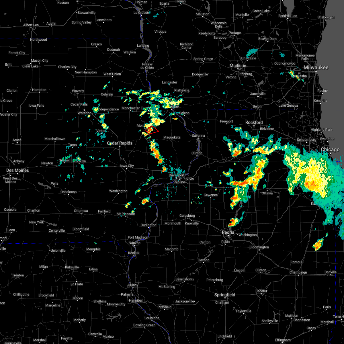 At 1218 pm cdt, a severe thunderstorm capable of producing a tornado was located over scotch grove, or 11 miles northeast of anamosa, moving northeast at 10 mph (radar indicated rotation). Hazards include tornado. Flying debris will be dangerous to those caught without shelter. mobile homes will be damaged or destroyed. damage to roofs, windows, and vehicles will occur. tree damage is likely. This tornadic thunderstorm will remain over mainly rural areas of northeastern jones county, including the following locations, scotch grove, pictured rocks wildlife area and camp courageous. At 1218 pm cdt, a severe thunderstorm capable of producing a tornado was located over scotch grove, or 11 miles northeast of anamosa, moving northeast at 10 mph (radar indicated rotation). Hazards include tornado. Flying debris will be dangerous to those caught without shelter. mobile homes will be damaged or destroyed. damage to roofs, windows, and vehicles will occur. tree damage is likely. This tornadic thunderstorm will remain over mainly rural areas of northeastern jones county, including the following locations, scotch grove, pictured rocks wildlife area and camp courageous.
|
| 8/20/2022 12:10 PM CDT |
 At 1209 pm cdt, a severe thunderstorm capable of producing a tornado was located over scotch grove, or 10 miles northeast of anamosa, moving northeast at 10 mph (emergency management reported a funnel cloud near to the ground around 1205 pm). Hazards include tornado. Flying debris will be dangerous to those caught without shelter. mobile homes will be damaged or destroyed. damage to roofs, windows, and vehicles will occur. tree damage is likely. This dangerous storm will be near, camp courageous and pictured rocks wildlife area around 1220 pm cdt. At 1209 pm cdt, a severe thunderstorm capable of producing a tornado was located over scotch grove, or 10 miles northeast of anamosa, moving northeast at 10 mph (emergency management reported a funnel cloud near to the ground around 1205 pm). Hazards include tornado. Flying debris will be dangerous to those caught without shelter. mobile homes will be damaged or destroyed. damage to roofs, windows, and vehicles will occur. tree damage is likely. This dangerous storm will be near, camp courageous and pictured rocks wildlife area around 1220 pm cdt.
|
| 8/20/2022 12:07 PM CDT |
 At 1207 pm cdt, a severe thunderstorm capable of producing a tornado was located over scotch grove, or 9 miles northeast of anamosa, moving northeast at 10 mph (radar indicated rotation). Hazards include tornado. Flying debris will be dangerous to those caught without shelter. mobile homes will be damaged or destroyed. damage to roofs, windows, and vehicles will occur. tree damage is likely. This dangerous storm will be near, camp courageous and pictured rocks wildlife area around 1220 pm cdt. At 1207 pm cdt, a severe thunderstorm capable of producing a tornado was located over scotch grove, or 9 miles northeast of anamosa, moving northeast at 10 mph (radar indicated rotation). Hazards include tornado. Flying debris will be dangerous to those caught without shelter. mobile homes will be damaged or destroyed. damage to roofs, windows, and vehicles will occur. tree damage is likely. This dangerous storm will be near, camp courageous and pictured rocks wildlife area around 1220 pm cdt.
|
| 8/19/2022 9:11 PM CDT |
 At 911 pm cdt, severe thunderstorms were located along a line extending from new wine park to cascade, moving northeast at 35 mph (radar indicated). Hazards include 60 mph wind gusts and quarter size hail. Hail damage to vehicles is expected. expect wind damage to roofs, siding, and trees. these severe storms will be near, new vienna and new wine park around 915 pm cdt. fillmore recreation area and fillmore around 920 pm cdt. other locations in the path of these severe thunderstorms include farley, luxemburg, bernard, bankston, bankston park, epworth, holy cross, cottage hill, peosta, rickardsville, graf, lattnerville, camp little cloud, east rickardsville, dubuque, centralia, balltown, waupeton, dubuque county fairgrounds, swiss valley park, dubuque regional airport, five points, asbury, sherrill, durango, center grove, finley`s landing park, rockdale, key west and mines of spain. hail threat, radar indicated max hail size, 1. 00 in wind threat, radar indicated max wind gust, 60 mph. At 911 pm cdt, severe thunderstorms were located along a line extending from new wine park to cascade, moving northeast at 35 mph (radar indicated). Hazards include 60 mph wind gusts and quarter size hail. Hail damage to vehicles is expected. expect wind damage to roofs, siding, and trees. these severe storms will be near, new vienna and new wine park around 915 pm cdt. fillmore recreation area and fillmore around 920 pm cdt. other locations in the path of these severe thunderstorms include farley, luxemburg, bernard, bankston, bankston park, epworth, holy cross, cottage hill, peosta, rickardsville, graf, lattnerville, camp little cloud, east rickardsville, dubuque, centralia, balltown, waupeton, dubuque county fairgrounds, swiss valley park, dubuque regional airport, five points, asbury, sherrill, durango, center grove, finley`s landing park, rockdale, key west and mines of spain. hail threat, radar indicated max hail size, 1. 00 in wind threat, radar indicated max wind gust, 60 mph.
|
| 8/19/2022 9:04 PM CDT |
 At 904 pm cdt, severe thunderstorms were located along a line extending from near dyersville to near cascade, moving northeast at 35 mph (radar indicated). Hazards include 60 mph wind gusts and quarter size hail. Hail damage to vehicles is expected. expect wind damage to roofs, siding, and trees. severe thunderstorms will be near, dyersville and new wine park around 910 pm cdt. new vienna around 915 pm cdt. farley, luxemburg, fillmore recreation area and fillmore around 920 pm cdt. other locations in the path of these severe thunderstorms include holy cross, bernard, bankston, bankston park, epworth, cottage hill, five points, peosta, rickardsville, graf, lattnerville, camp little cloud, east rickardsville, dubuque, sherrill, centralia, balltown, waupeton, dubuque county fairgrounds, swiss valley park, dubuque regional airport, asbury, durango, center grove, rockdale, finley`s landing park, key west and mines of spain. hail threat, radar indicated max hail size, 1. 00 in wind threat, radar indicated max wind gust, 60 mph. At 904 pm cdt, severe thunderstorms were located along a line extending from near dyersville to near cascade, moving northeast at 35 mph (radar indicated). Hazards include 60 mph wind gusts and quarter size hail. Hail damage to vehicles is expected. expect wind damage to roofs, siding, and trees. severe thunderstorms will be near, dyersville and new wine park around 910 pm cdt. new vienna around 915 pm cdt. farley, luxemburg, fillmore recreation area and fillmore around 920 pm cdt. other locations in the path of these severe thunderstorms include holy cross, bernard, bankston, bankston park, epworth, cottage hill, five points, peosta, rickardsville, graf, lattnerville, camp little cloud, east rickardsville, dubuque, sherrill, centralia, balltown, waupeton, dubuque county fairgrounds, swiss valley park, dubuque regional airport, asbury, durango, center grove, rockdale, finley`s landing park, key west and mines of spain. hail threat, radar indicated max hail size, 1. 00 in wind threat, radar indicated max wind gust, 60 mph.
|
| 8/19/2022 8:54 PM CDT |
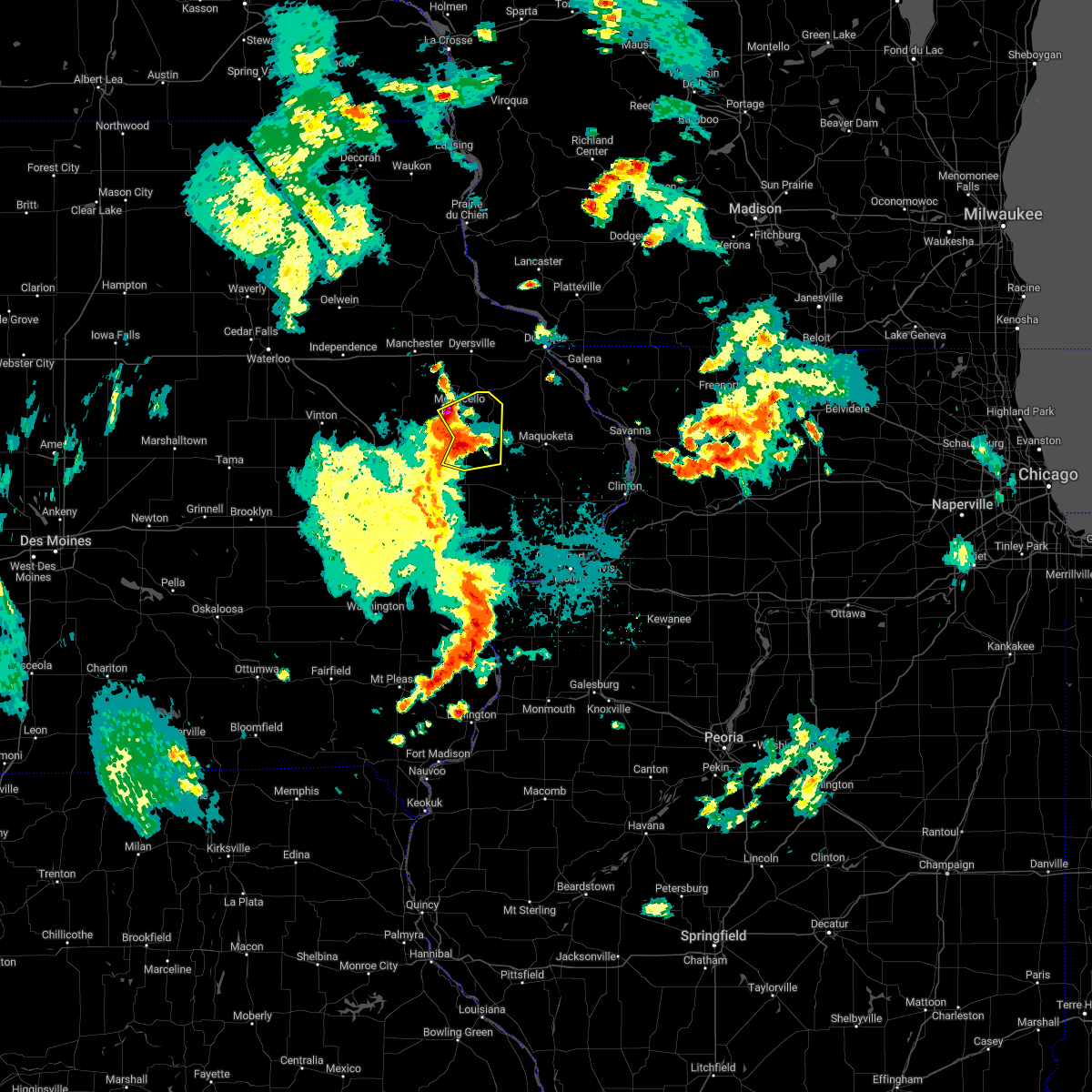 At 854 pm cdt, severe thunderstorms were located along a line extending from monticello to central park to olin, moving northeast at 30 mph (radar indicated). Hazards include 60 mph wind gusts and quarter size hail. Hail damage to vehicles is expected. expect wind damage to roofs, siding, and trees. these severe storms will be near, center junction, monticello municipal airport, scotch grove, pictured rocks wildlife area and camp courageous around 900 pm cdt. onslow around 905 pm cdt. other locations in the path of these severe thunderstorms include wyoming, oxford junction, temple hill and cascade. hail threat, radar indicated max hail size, 1. 00 in wind threat, radar indicated max wind gust, 60 mph. At 854 pm cdt, severe thunderstorms were located along a line extending from monticello to central park to olin, moving northeast at 30 mph (radar indicated). Hazards include 60 mph wind gusts and quarter size hail. Hail damage to vehicles is expected. expect wind damage to roofs, siding, and trees. these severe storms will be near, center junction, monticello municipal airport, scotch grove, pictured rocks wildlife area and camp courageous around 900 pm cdt. onslow around 905 pm cdt. other locations in the path of these severe thunderstorms include wyoming, oxford junction, temple hill and cascade. hail threat, radar indicated max hail size, 1. 00 in wind threat, radar indicated max wind gust, 60 mph.
|
| 8/19/2022 8:46 PM CDT |
 At 845 pm cdt, severe thunderstorms were located along a line extending from near langworthy to near central park to near morley, moving northeast at 25 mph (fire department). Hazards include 60 mph wind gusts and quarter size hail. Hail damage to vehicles is expected. expect wind damage to roofs, siding, and trees. severe thunderstorms will be near, langworthy and central park around 850 pm cdt. monticello, center junction, jones county fairgrounds and monticello municipal airport around 855 pm cdt. scotch grove, pictured rocks wildlife area and camp courageous around 900 pm cdt. onslow and hale around 905 pm cdt. other locations in the path of these severe thunderstorms include cascade, wyoming, oxford junction and temple hill. hail threat, radar indicated max hail size, 1. 00 in wind threat, radar indicated max wind gust, 60 mph. At 845 pm cdt, severe thunderstorms were located along a line extending from near langworthy to near central park to near morley, moving northeast at 25 mph (fire department). Hazards include 60 mph wind gusts and quarter size hail. Hail damage to vehicles is expected. expect wind damage to roofs, siding, and trees. severe thunderstorms will be near, langworthy and central park around 850 pm cdt. monticello, center junction, jones county fairgrounds and monticello municipal airport around 855 pm cdt. scotch grove, pictured rocks wildlife area and camp courageous around 900 pm cdt. onslow and hale around 905 pm cdt. other locations in the path of these severe thunderstorms include cascade, wyoming, oxford junction and temple hill. hail threat, radar indicated max hail size, 1. 00 in wind threat, radar indicated max wind gust, 60 mph.
|
| 7/24/2022 12:25 AM CDT |
 At 1225 am cdt, severe thunderstorms were located along a line extending from near luxemburg to langworthy, moving east at 45 mph (radar indicated). Hazards include 60 mph wind gusts. expect damage to roofs, siding, and trees At 1225 am cdt, severe thunderstorms were located along a line extending from near luxemburg to langworthy, moving east at 45 mph (radar indicated). Hazards include 60 mph wind gusts. expect damage to roofs, siding, and trees
|
| 7/24/2022 12:22 AM CDT |
 At 1222 am cdt, a severe thunderstorm was located near hopkinton, or 11 miles southeast of manchester, moving east at 50 mph (radar indicated). Hazards include 60 mph wind gusts. Expect damage to roofs, siding, and trees. locations impacted include, monticello, central city, hopkinton, delhi, ryan, prairieburg, waubeek, langworthy, jones county fairgrounds, howard h cherry scout reservation, buck creek, baileys ford park, turtle creek park and monticello municipal airport. hail threat, radar indicated max hail size, <. 75 in wind threat, radar indicated max wind gust, 60 mph. At 1222 am cdt, a severe thunderstorm was located near hopkinton, or 11 miles southeast of manchester, moving east at 50 mph (radar indicated). Hazards include 60 mph wind gusts. Expect damage to roofs, siding, and trees. locations impacted include, monticello, central city, hopkinton, delhi, ryan, prairieburg, waubeek, langworthy, jones county fairgrounds, howard h cherry scout reservation, buck creek, baileys ford park, turtle creek park and monticello municipal airport. hail threat, radar indicated max hail size, <. 75 in wind threat, radar indicated max wind gust, 60 mph.
|
| 7/24/2022 12:06 AM CDT |
 At 1206 am cdt, a severe thunderstorm was located over ryan, or 11 miles south of manchester, moving east at 50 mph (radar indicated). Hazards include 60 mph wind gusts. expect damage to roofs, siding, and trees At 1206 am cdt, a severe thunderstorm was located over ryan, or 11 miles south of manchester, moving east at 50 mph (radar indicated). Hazards include 60 mph wind gusts. expect damage to roofs, siding, and trees
|
| 7/23/2022 2:44 AM CDT |
 At 244 am cdt, a severe thunderstorm was located over camp courageous, or 12 miles northeast of anamosa, moving east at 30 mph (radar indicated). Hazards include 60 mph wind gusts and quarter size hail. Hail damage to vehicles is expected. expect wind damage to roofs, siding, and trees. locations impacted include, monticello, cascade, onslow, monmouth, bernard, center junction, nashville, canton, baldwin, emeline, south gary owen, garry owen, fillmore, pictured rocks wildlife area, fillmore recreation area, maquoketa caves state park, camp courageous, crab town, scotch grove and central park. hail threat, radar indicated max hail size, 1. 00 in wind threat, radar indicated max wind gust, 60 mph. At 244 am cdt, a severe thunderstorm was located over camp courageous, or 12 miles northeast of anamosa, moving east at 30 mph (radar indicated). Hazards include 60 mph wind gusts and quarter size hail. Hail damage to vehicles is expected. expect wind damage to roofs, siding, and trees. locations impacted include, monticello, cascade, onslow, monmouth, bernard, center junction, nashville, canton, baldwin, emeline, south gary owen, garry owen, fillmore, pictured rocks wildlife area, fillmore recreation area, maquoketa caves state park, camp courageous, crab town, scotch grove and central park. hail threat, radar indicated max hail size, 1. 00 in wind threat, radar indicated max wind gust, 60 mph.
|
| 7/23/2022 2:31 AM CDT |
 At 230 am cdt, a severe thunderstorm was located over langworthy, or near anamosa, moving east at 30 mph (radar indicated). Hazards include 60 mph wind gusts and quarter size hail. Hail damage to vehicles is expected. Expect wind damage to roofs, siding, and trees. At 230 am cdt, a severe thunderstorm was located over langworthy, or near anamosa, moving east at 30 mph (radar indicated). Hazards include 60 mph wind gusts and quarter size hail. Hail damage to vehicles is expected. Expect wind damage to roofs, siding, and trees.
|
| 7/5/2022 9:51 PM CDT |
 At 951 pm cdt, a severe thunderstorm was located over center junction, or 11 miles east of anamosa, moving east at 40 mph (trained weather spotters). Hazards include 60 mph wind gusts. Expect damage to roofs, siding, and trees. locations impacted include, anamosa, olin, wyoming, onslow, morley, center junction, hale, scotch grove and central park. hail threat, radar indicated max hail size, <. 75 in wind threat, observed max wind gust, 60 mph. At 951 pm cdt, a severe thunderstorm was located over center junction, or 11 miles east of anamosa, moving east at 40 mph (trained weather spotters). Hazards include 60 mph wind gusts. Expect damage to roofs, siding, and trees. locations impacted include, anamosa, olin, wyoming, onslow, morley, center junction, hale, scotch grove and central park. hail threat, radar indicated max hail size, <. 75 in wind threat, observed max wind gust, 60 mph.
|
| 7/5/2022 9:45 PM CDT |
 At 945 pm cdt, a severe thunderstorm was located over scotch grove, or 8 miles east of anamosa, moving east at 40 mph (trained weather spotters). Hazards include 70 mph wind gusts. Expect considerable tree damage. damage is likely to mobile homes, roofs, and outbuildings. locations impacted include, anamosa, mount vernon, monticello, lisbon, springville, olin, wyoming, martelle, onslow, prairieburg, morley, center junction, whittier, langworthy, stone city, viola, matsell bridge natural area, howard h cherry scout reservation, wapsipinicon state park and hale. thunderstorm damage threat, considerable hail threat, radar indicated max hail size, <. 75 in wind threat, observed max wind gust, 70 mph. At 945 pm cdt, a severe thunderstorm was located over scotch grove, or 8 miles east of anamosa, moving east at 40 mph (trained weather spotters). Hazards include 70 mph wind gusts. Expect considerable tree damage. damage is likely to mobile homes, roofs, and outbuildings. locations impacted include, anamosa, mount vernon, monticello, lisbon, springville, olin, wyoming, martelle, onslow, prairieburg, morley, center junction, whittier, langworthy, stone city, viola, matsell bridge natural area, howard h cherry scout reservation, wapsipinicon state park and hale. thunderstorm damage threat, considerable hail threat, radar indicated max hail size, <. 75 in wind threat, observed max wind gust, 70 mph.
|
| 7/5/2022 9:43 PM CDT |
 At 943 pm cdt, a severe thunderstorm was located over scotch grove, or 7 miles northeast of anamosa, moving east at 40 mph (trained weather spotters). Hazards include 70 mph wind gusts. Expect considerable tree damage. damage is likely to mobile homes, roofs, and outbuildings. locations impacted include, anamosa, mount vernon, monticello, lisbon, springville, olin, hopkinton, wyoming, martelle, onslow, prairieburg, morley, center junction, stone city, viola, whittier, langworthy, monticello municipal airport, matsell bridge natural area and jones county fairgrounds. thunderstorm damage threat, considerable hail threat, radar indicated max hail size, <. 75 in wind threat, observed max wind gust, 70 mph. At 943 pm cdt, a severe thunderstorm was located over scotch grove, or 7 miles northeast of anamosa, moving east at 40 mph (trained weather spotters). Hazards include 70 mph wind gusts. Expect considerable tree damage. damage is likely to mobile homes, roofs, and outbuildings. locations impacted include, anamosa, mount vernon, monticello, lisbon, springville, olin, hopkinton, wyoming, martelle, onslow, prairieburg, morley, center junction, stone city, viola, whittier, langworthy, monticello municipal airport, matsell bridge natural area and jones county fairgrounds. thunderstorm damage threat, considerable hail threat, radar indicated max hail size, <. 75 in wind threat, observed max wind gust, 70 mph.
|
| 7/5/2022 9:38 PM CDT |
 At 938 pm cdt, a severe thunderstorm was located over langworthy, or near anamosa, moving east at 40 mph (trained weather spotters). Hazards include 70 mph wind gusts. Expect considerable tree damage. damage is likely to mobile homes, roofs, and outbuildings. locations impacted include, anamosa, marion, mount vernon, monticello, lisbon, springville, olin, hopkinton, wyoming, bertram, martelle, onslow, prairieburg, morley, center junction, waubeek, stone city, viola, whittier and langworthy. thunderstorm damage threat, considerable hail threat, radar indicated max hail size, <. 75 in wind threat, observed max wind gust, 70 mph. At 938 pm cdt, a severe thunderstorm was located over langworthy, or near anamosa, moving east at 40 mph (trained weather spotters). Hazards include 70 mph wind gusts. Expect considerable tree damage. damage is likely to mobile homes, roofs, and outbuildings. locations impacted include, anamosa, marion, mount vernon, monticello, lisbon, springville, olin, hopkinton, wyoming, bertram, martelle, onslow, prairieburg, morley, center junction, waubeek, stone city, viola, whittier and langworthy. thunderstorm damage threat, considerable hail threat, radar indicated max hail size, <. 75 in wind threat, observed max wind gust, 70 mph.
|
| 7/5/2022 9:34 PM CDT |
 At 934 pm cdt, a severe thunderstorm was located near langworthy, or near anamosa, moving east at 40 mph (trained weather spotters). Hazards include 70 mph wind gusts. Expect considerable tree damage. damage is likely to mobile homes, roofs, and outbuildings. locations impacted include, cedar rapids, anamosa, marion, mount vernon, monticello, lisbon, central city, springville, olin, coggon, hopkinton, wyoming, ryan, bertram, martelle, onslow, prairieburg, masonville, morley and center junction. thunderstorm damage threat, considerable hail threat, radar indicated max hail size, <. 75 in wind threat, observed max wind gust, 70 mph. At 934 pm cdt, a severe thunderstorm was located near langworthy, or near anamosa, moving east at 40 mph (trained weather spotters). Hazards include 70 mph wind gusts. Expect considerable tree damage. damage is likely to mobile homes, roofs, and outbuildings. locations impacted include, cedar rapids, anamosa, marion, mount vernon, monticello, lisbon, central city, springville, olin, coggon, hopkinton, wyoming, ryan, bertram, martelle, onslow, prairieburg, masonville, morley and center junction. thunderstorm damage threat, considerable hail threat, radar indicated max hail size, <. 75 in wind threat, observed max wind gust, 70 mph.
|
| 7/5/2022 9:27 PM CDT |
 At 927 pm cdt, a severe thunderstorm was located near prairieburg, or 8 miles northwest of anamosa, moving east at 40 mph (trained weather spotters). Hazards include 70 mph wind gusts. Expect considerable tree damage. damage is likely to mobile homes, roofs, and outbuildings. Locations impacted include, cedar rapids, anamosa, marion, hiawatha, mount vernon, monticello, robins, lisbon, central city, springville, olin, alburnett, coggon, hopkinton, wyoming, ryan, bertram, martelle, onslow and prairieburg. At 927 pm cdt, a severe thunderstorm was located near prairieburg, or 8 miles northwest of anamosa, moving east at 40 mph (trained weather spotters). Hazards include 70 mph wind gusts. Expect considerable tree damage. damage is likely to mobile homes, roofs, and outbuildings. Locations impacted include, cedar rapids, anamosa, marion, hiawatha, mount vernon, monticello, robins, lisbon, central city, springville, olin, alburnett, coggon, hopkinton, wyoming, ryan, bertram, martelle, onslow and prairieburg.
|
| 7/5/2022 9:21 PM CDT |
 A severe thunderstorm warning remains in effect until 1000 pm cdt for jones. southern delaware and linn counties. at 921 pm cdt, a severe thunderstorm was located over prairieburg, or 11 miles northwest of anamosa, moving east at 40 mph. hazard. 70 mph wind gusts. source. Trained weather spotters. A severe thunderstorm warning remains in effect until 1000 pm cdt for jones. southern delaware and linn counties. at 921 pm cdt, a severe thunderstorm was located over prairieburg, or 11 miles northwest of anamosa, moving east at 40 mph. hazard. 70 mph wind gusts. source. Trained weather spotters.
|
| 7/5/2022 9:08 PM CDT |
 At 908 pm cdt, a severe thunderstorm was located near buffalo creek park, or 16 miles southwest of manchester, moving east at 40 mph (trained weather spotters). Hazards include 70 mph wind gusts. Expect considerable tree damage. damage is likely to mobile homes, roofs, and outbuildings. Locations impacted include, cedar rapids, anamosa, marion, hiawatha, mount vernon, monticello, robins, center point, lisbon, urbana, central city, springville, walker, olin, alburnett, coggon, hopkinton, wyoming, ryan and bertram. At 908 pm cdt, a severe thunderstorm was located near buffalo creek park, or 16 miles southwest of manchester, moving east at 40 mph (trained weather spotters). Hazards include 70 mph wind gusts. Expect considerable tree damage. damage is likely to mobile homes, roofs, and outbuildings. Locations impacted include, cedar rapids, anamosa, marion, hiawatha, mount vernon, monticello, robins, center point, lisbon, urbana, central city, springville, walker, olin, alburnett, coggon, hopkinton, wyoming, ryan and bertram.
|
| 7/5/2022 9:00 PM CDT |
 At 900 pm cdt, a severe thunderstorm was located over troy mills, or 14 miles southeast of independence, moving east at 40 mph (radar indicated). Hazards include 60 mph wind gusts. expect damage to roofs, siding, and trees At 900 pm cdt, a severe thunderstorm was located over troy mills, or 14 miles southeast of independence, moving east at 40 mph (radar indicated). Hazards include 60 mph wind gusts. expect damage to roofs, siding, and trees
|
| 6/15/2022 4:12 PM CDT |
 At 412 pm cdt, a severe thunderstorm was located over jones county fairgrounds, or 13 miles north of anamosa, moving northeast at 45 mph (radar indicated). Hazards include 60 mph wind gusts and quarter size hail. Hail damage to vehicles is expected. expect wind damage to roofs, siding, and trees. locations impacted include, worthington, dyersville, farley, epworth, peosta, bankston, graf, camp little cloud, bankston park, lattnerville, dubuque, holy cross, centralia, five points, cottage hill, asbury, rickardsville, durango, east rickardsville, sherrill, sageville, balltown, finley`s landing park, waupeton and mud lake park. hail threat, radar indicated max hail size, 1. 00 in wind threat, radar indicated max wind gust, 60 mph. At 412 pm cdt, a severe thunderstorm was located over jones county fairgrounds, or 13 miles north of anamosa, moving northeast at 45 mph (radar indicated). Hazards include 60 mph wind gusts and quarter size hail. Hail damage to vehicles is expected. expect wind damage to roofs, siding, and trees. locations impacted include, worthington, dyersville, farley, epworth, peosta, bankston, graf, camp little cloud, bankston park, lattnerville, dubuque, holy cross, centralia, five points, cottage hill, asbury, rickardsville, durango, east rickardsville, sherrill, sageville, balltown, finley`s landing park, waupeton and mud lake park. hail threat, radar indicated max hail size, 1. 00 in wind threat, radar indicated max wind gust, 60 mph.
|
| 6/15/2022 4:02 PM CDT |
 At 402 pm cdt, a severe thunderstorm was located near langworthy, or 8 miles north of anamosa, moving northeast at 45 mph (radar indicated). Hazards include 60 mph wind gusts and quarter size hail. Hail damage to vehicles is expected. expect wind damage to roofs, siding, and trees. this severe storm will be near, monticello, jones county fairgrounds and monticello municipal airport around 410 pm cdt. hopkinton around 415 pm cdt. other locations in the path of this severe thunderstorm include worthington, dyersville, farley, new vienna, new wine park, epworth, peosta, bankston, camp little cloud, lattnerville, dubuque, holy cross, centralia, graf, bankston park, cottage hill, five points, rickardsville, durango, east rickardsville, sherrill, sageville, balltown, finley`s landing park and waupeton. hail threat, radar indicated max hail size, 1. 00 in wind threat, radar indicated max wind gust, 60 mph. At 402 pm cdt, a severe thunderstorm was located near langworthy, or 8 miles north of anamosa, moving northeast at 45 mph (radar indicated). Hazards include 60 mph wind gusts and quarter size hail. Hail damage to vehicles is expected. expect wind damage to roofs, siding, and trees. this severe storm will be near, monticello, jones county fairgrounds and monticello municipal airport around 410 pm cdt. hopkinton around 415 pm cdt. other locations in the path of this severe thunderstorm include worthington, dyersville, farley, new vienna, new wine park, epworth, peosta, bankston, camp little cloud, lattnerville, dubuque, holy cross, centralia, graf, bankston park, cottage hill, five points, rickardsville, durango, east rickardsville, sherrill, sageville, balltown, finley`s landing park and waupeton. hail threat, radar indicated max hail size, 1. 00 in wind threat, radar indicated max wind gust, 60 mph.
|
| 6/15/2022 3:57 PM CDT |
 At 357 pm cdt, a severe thunderstorm was located near matsell bridge natural area, or near anamosa, moving northeast at 45 mph (radar indicated). Hazards include 60 mph wind gusts and quarter size hail. Hail damage to vehicles is expected. expect wind damage to roofs, siding, and trees. this severe storm will be near, langworthy around 400 pm cdt. buck creek around 405 pm cdt. monticello, jones county fairgrounds and monticello municipal airport around 410 pm cdt. other locations in the path of this severe thunderstorm include hopkinton, worthington, dyersville, farley, new vienna, new wine park, epworth, peosta, bankston, camp little cloud, lattnerville, dubuque, holy cross, centralia, graf, bankston park, cottage hill and five points. hail threat, radar indicated max hail size, 1. 00 in wind threat, radar indicated max wind gust, 60 mph. At 357 pm cdt, a severe thunderstorm was located near matsell bridge natural area, or near anamosa, moving northeast at 45 mph (radar indicated). Hazards include 60 mph wind gusts and quarter size hail. Hail damage to vehicles is expected. expect wind damage to roofs, siding, and trees. this severe storm will be near, langworthy around 400 pm cdt. buck creek around 405 pm cdt. monticello, jones county fairgrounds and monticello municipal airport around 410 pm cdt. other locations in the path of this severe thunderstorm include hopkinton, worthington, dyersville, farley, new vienna, new wine park, epworth, peosta, bankston, camp little cloud, lattnerville, dubuque, holy cross, centralia, graf, bankston park, cottage hill and five points. hail threat, radar indicated max hail size, 1. 00 in wind threat, radar indicated max wind gust, 60 mph.
|
| 6/15/2022 3:51 PM CDT |
 At 350 pm cdt, a severe thunderstorm was located over matsell bridge natural area, or near anamosa, moving northeast at 50 mph (radar indicated). Hazards include 60 mph wind gusts and quarter size hail. Hail damage to vehicles is expected. expect wind damage to roofs, siding, and trees. this severe thunderstorm will be near, anamosa and prairieburg around 355 pm cdt. langworthy around 400 pm cdt. monticello, jones county fairgrounds, monticello municipal airport and buck creek around 405 pm cdt. hopkinton around 410 pm cdt. other locations in the path of this severe thunderstorm include worthington, dyersville, farley, epworth, new vienna, new wine park, holy cross, luxemburg, bankston, graf, bankston park, camp little cloud and lattnerville. hail threat, radar indicated max hail size, 1. 00 in wind threat, radar indicated max wind gust, 60 mph. At 350 pm cdt, a severe thunderstorm was located over matsell bridge natural area, or near anamosa, moving northeast at 50 mph (radar indicated). Hazards include 60 mph wind gusts and quarter size hail. Hail damage to vehicles is expected. expect wind damage to roofs, siding, and trees. this severe thunderstorm will be near, anamosa and prairieburg around 355 pm cdt. langworthy around 400 pm cdt. monticello, jones county fairgrounds, monticello municipal airport and buck creek around 405 pm cdt. hopkinton around 410 pm cdt. other locations in the path of this severe thunderstorm include worthington, dyersville, farley, epworth, new vienna, new wine park, holy cross, luxemburg, bankston, graf, bankston park, camp little cloud and lattnerville. hail threat, radar indicated max hail size, 1. 00 in wind threat, radar indicated max wind gust, 60 mph.
|
| 3/5/2022 8:08 PM CST |
 At 808 pm cst, severe thunderstorms were located along a line extending from balltown to olin, moving east at 55 mph (radar indicated). Hazards include 60 mph wind gusts and quarter size hail. Hail damage to vehicles is expected. expect wind damage to roofs, siding, and trees. these severe storms will be near, sherrill, sageville, balltown and durango around 815 pm cst. other locations in the path of these severe thunderstorms include monmouth, hurstville, fulton and andrew. hail threat, radar indicated max hail size, 1. 00 in wind threat, radar indicated max wind gust, 60 mph. At 808 pm cst, severe thunderstorms were located along a line extending from balltown to olin, moving east at 55 mph (radar indicated). Hazards include 60 mph wind gusts and quarter size hail. Hail damage to vehicles is expected. expect wind damage to roofs, siding, and trees. these severe storms will be near, sherrill, sageville, balltown and durango around 815 pm cst. other locations in the path of these severe thunderstorms include monmouth, hurstville, fulton and andrew. hail threat, radar indicated max hail size, 1. 00 in wind threat, radar indicated max wind gust, 60 mph.
|
| 3/5/2022 7:59 PM CST |
 At 759 pm cst, severe thunderstorms were located along a line extending from farley to near morley, moving east at 55 mph (trained weather spotters). Hazards include 60 mph wind gusts and quarter size hail. Hail damage to vehicles is expected. expect wind damage to roofs, siding, and trees. severe thunderstorms will be near, epworth, farley and bankston around 805 pm cst. dubuque, peosta and centralia around 810 pm cst. asbury, wyoming and durango around 815 pm cst. other locations in the path of these severe thunderstorms include east dubuque, monmouth, sageville, menominee, hurstville and fulton. hail threat, observed max hail size, 1. 00 in wind threat, radar indicated max wind gust, 60 mph. At 759 pm cst, severe thunderstorms were located along a line extending from farley to near morley, moving east at 55 mph (trained weather spotters). Hazards include 60 mph wind gusts and quarter size hail. Hail damage to vehicles is expected. expect wind damage to roofs, siding, and trees. severe thunderstorms will be near, epworth, farley and bankston around 805 pm cst. dubuque, peosta and centralia around 810 pm cst. asbury, wyoming and durango around 815 pm cst. other locations in the path of these severe thunderstorms include east dubuque, monmouth, sageville, menominee, hurstville and fulton. hail threat, observed max hail size, 1. 00 in wind threat, radar indicated max wind gust, 60 mph.
|
| 3/5/2022 7:53 PM CST | Quarter sized hail reported 0.7 miles SSE of Monticello, IA |
| 3/5/2022 7:43 PM CST |
 At 742 pm cst, a severe thunderstorm was located over langworthy, or 8 miles north of anamosa, moving northeast at 60 mph (radar indicated). Hazards include 60 mph wind gusts and penny size hail. Expect damage to roofs, siding, and trees. Locations impacted include, anamosa, monticello, springville, hopkinton, bertram, martelle, whittier, langworthy, stone city, viola, matsell bridge natural area, jones county fairgrounds, pictured rocks wildlife area, wapsipinicon state park, camp courageous, scotch grove, paralta, temple hill and monticello municipal airport. At 742 pm cst, a severe thunderstorm was located over langworthy, or 8 miles north of anamosa, moving northeast at 60 mph (radar indicated). Hazards include 60 mph wind gusts and penny size hail. Expect damage to roofs, siding, and trees. Locations impacted include, anamosa, monticello, springville, hopkinton, bertram, martelle, whittier, langworthy, stone city, viola, matsell bridge natural area, jones county fairgrounds, pictured rocks wildlife area, wapsipinicon state park, camp courageous, scotch grove, paralta, temple hill and monticello municipal airport.
|
| 3/5/2022 7:34 PM CST |
 At 734 pm cst, a severe thunderstorm was located over stone city, or near anamosa, moving northeast at 60 mph (radar indicated). Hazards include 60 mph wind gusts and penny size hail. Expect damage to roofs, siding, and trees. Locations impacted include, anamosa, marion, monticello, springville, hopkinton, bertram, martelle, prairieburg, waubeek, stone city, viola, whittier, langworthy, squaw creek park, marion airport, monticello municipal airport, matsell bridge natural area, jones county fairgrounds, pictured rocks wildlife area and howard h cherry scout reservation. At 734 pm cst, a severe thunderstorm was located over stone city, or near anamosa, moving northeast at 60 mph (radar indicated). Hazards include 60 mph wind gusts and penny size hail. Expect damage to roofs, siding, and trees. Locations impacted include, anamosa, marion, monticello, springville, hopkinton, bertram, martelle, prairieburg, waubeek, stone city, viola, whittier, langworthy, squaw creek park, marion airport, monticello municipal airport, matsell bridge natural area, jones county fairgrounds, pictured rocks wildlife area and howard h cherry scout reservation.
|
| 3/5/2022 7:26 PM CST |
 At 726 pm cst, a severe thunderstorm was located over springville, or 10 miles west of anamosa, moving northeast at 60 mph (trained weather spotters). Hazards include 60 mph wind gusts and penny size hail. expect damage to roofs, siding, and trees At 726 pm cst, a severe thunderstorm was located over springville, or 10 miles west of anamosa, moving northeast at 60 mph (trained weather spotters). Hazards include 60 mph wind gusts and penny size hail. expect damage to roofs, siding, and trees
|
| 12/15/2021 9:00 PM CST |
 At 900 pm cst, severe thunderstorms were located along a line extending from near colesburg to near morley, moving northeast at 55 mph (radar indicated). Hazards include 70 mph wind gusts. Expect considerable tree damage. damage is likely to mobile homes, roofs, and outbuildings. Locations impacted include, anamosa, dyersville, monticello, cascade, epworth, farley, earlville, olin, hopkinton, wyoming, oxford junction, delhi, new vienna, colesburg, worthington, holy cross, greeley, martelle, luxemburg and onslow. At 900 pm cst, severe thunderstorms were located along a line extending from near colesburg to near morley, moving northeast at 55 mph (radar indicated). Hazards include 70 mph wind gusts. Expect considerable tree damage. damage is likely to mobile homes, roofs, and outbuildings. Locations impacted include, anamosa, dyersville, monticello, cascade, epworth, farley, earlville, olin, hopkinton, wyoming, oxford junction, delhi, new vienna, colesburg, worthington, holy cross, greeley, martelle, luxemburg and onslow.
|
| 8/24/2021 3:25 PM CDT |
 At 325 pm cdt, severe thunderstorms were located along a line extending from near ryan to near troy mills to near center point, moving east at 45 mph (radar indicated). Hazards include 60 mph wind gusts. Expect damage to roofs, siding, and trees. these severe storms will be near, coggon, ryan and paris around 330 pm cdt. central city and prairieburg around 335 pm cdt. other locations in the path of these severe thunderstorms include waubeek, hopkinton, monticello, stone city, anamosa and langworthy. hail threat, radar indicated max hail size, <. 75 in wind threat, observed max wind gust, 60 mph. At 325 pm cdt, severe thunderstorms were located along a line extending from near ryan to near troy mills to near center point, moving east at 45 mph (radar indicated). Hazards include 60 mph wind gusts. Expect damage to roofs, siding, and trees. these severe storms will be near, coggon, ryan and paris around 330 pm cdt. central city and prairieburg around 335 pm cdt. other locations in the path of these severe thunderstorms include waubeek, hopkinton, monticello, stone city, anamosa and langworthy. hail threat, radar indicated max hail size, <. 75 in wind threat, observed max wind gust, 60 mph.
|
| 8/24/2021 3:19 PM CDT |
 At 319 pm cdt, severe thunderstorms were located along a line extending from near troy mills to near center point to near vinton, moving east at 45 mph (radar indicated). Hazards include 60 mph wind gusts. Expect damage to roofs, siding, and trees. these severe storms will be near, troy mills around 325 pm cdt. other locations in the path of these severe thunderstorms include alburnett, coggon, ryan, paris, central city, prairieburg, waubeek, anamosa, monticello, stone city and langworthy. hail threat, radar indicated max hail size, <. 75 in wind threat, observed max wind gust, 60 mph. At 319 pm cdt, severe thunderstorms were located along a line extending from near troy mills to near center point to near vinton, moving east at 45 mph (radar indicated). Hazards include 60 mph wind gusts. Expect damage to roofs, siding, and trees. these severe storms will be near, troy mills around 325 pm cdt. other locations in the path of these severe thunderstorms include alburnett, coggon, ryan, paris, central city, prairieburg, waubeek, anamosa, monticello, stone city and langworthy. hail threat, radar indicated max hail size, <. 75 in wind threat, observed max wind gust, 60 mph.
|
| 8/24/2021 3:06 PM CDT |
 At 306 pm cdt, severe thunderstorms were located along a line extending from rowley to near urbana to near garrison, moving southeast at 45 mph (radar indicated). Hazards include 60 mph wind gusts. Expect damage to roofs, siding, and trees. these severe storms will be near, urbana, walker, quasqueton and rowley around 310 pm cdt. other locations in the path of these severe thunderstorms include center point, troy mills, paris, alburnett, coggon, ryan, central city, prairieburg, waubeek, anamosa, monticello, stone city and langworthy. hail threat, radar indicated max hail size, <. 75 in wind threat, observed max wind gust, 60 mph. At 306 pm cdt, severe thunderstorms were located along a line extending from rowley to near urbana to near garrison, moving southeast at 45 mph (radar indicated). Hazards include 60 mph wind gusts. Expect damage to roofs, siding, and trees. these severe storms will be near, urbana, walker, quasqueton and rowley around 310 pm cdt. other locations in the path of these severe thunderstorms include center point, troy mills, paris, alburnett, coggon, ryan, central city, prairieburg, waubeek, anamosa, monticello, stone city and langworthy. hail threat, radar indicated max hail size, <. 75 in wind threat, observed max wind gust, 60 mph.
|
| 8/24/2021 2:54 PM CDT |
 At 254 pm cdt, severe thunderstorms were located along a line extending from near stanley to near independence to near dysart, moving east at 45 mph (trained weather spotters). Hazards include 70 mph wind gusts. Expect considerable tree damage. damage is likely to mobile homes, roofs, and outbuildings. these severe storms will be near, independence, winthrop, aurora and stanley around 300 pm cdt. quasqueton around 305 pm cdt. other locations in the path of these severe thunderstorms include vinton, lamont, masonville, dundee, manchester, urbana, edgewood, ryan, center point, delaware, delhi, greeley, oneida, earlville, hopkinton and colesburg. thunderstorm damage threat, considerable hail threat, radar indicated max hail size, <. 75 in wind threat, observed max wind gust, 70 mph. At 254 pm cdt, severe thunderstorms were located along a line extending from near stanley to near independence to near dysart, moving east at 45 mph (trained weather spotters). Hazards include 70 mph wind gusts. Expect considerable tree damage. damage is likely to mobile homes, roofs, and outbuildings. these severe storms will be near, independence, winthrop, aurora and stanley around 300 pm cdt. quasqueton around 305 pm cdt. other locations in the path of these severe thunderstorms include vinton, lamont, masonville, dundee, manchester, urbana, edgewood, ryan, center point, delaware, delhi, greeley, oneida, earlville, hopkinton and colesburg. thunderstorm damage threat, considerable hail threat, radar indicated max hail size, <. 75 in wind threat, observed max wind gust, 70 mph.
|
| 8/24/2021 2:49 PM CDT |
 At 249 pm cdt, severe thunderstorms were located along a line extending from near oelwein to near independence to la porte city, moving east at 45 mph (trained weather spotters). Hazards include 70 mph wind gusts. Expect considerable tree damage. damage is likely to mobile homes, roofs, and outbuildings. severe thunderstorms will be near, stanley around 255 pm cdt. vinton, winthrop, quasqueton and aurora around 300 pm cdt. lamont around 305 pm cdt. other locations in the path of these severe thunderstorms include urbana, masonville, manchester, center point, walker, dundee, edgewood, ryan, troy mills, alburnett, delhi, greeley, delaware, oneida, paris, central city, earlville, coggon and colesburg. thunderstorm damage threat, considerable hail threat, radar indicated max hail size, <. 75 in wind threat, observed max wind gust, 70 mph. At 249 pm cdt, severe thunderstorms were located along a line extending from near oelwein to near independence to la porte city, moving east at 45 mph (trained weather spotters). Hazards include 70 mph wind gusts. Expect considerable tree damage. damage is likely to mobile homes, roofs, and outbuildings. severe thunderstorms will be near, stanley around 255 pm cdt. vinton, winthrop, quasqueton and aurora around 300 pm cdt. lamont around 305 pm cdt. other locations in the path of these severe thunderstorms include urbana, masonville, manchester, center point, walker, dundee, edgewood, ryan, troy mills, alburnett, delhi, greeley, delaware, oneida, paris, central city, earlville, coggon and colesburg. thunderstorm damage threat, considerable hail threat, radar indicated max hail size, <. 75 in wind threat, observed max wind gust, 70 mph.
|
| 8/10/2021 4:42 PM CDT |
 At 442 pm cdt, severe thunderstorms were located along a line extending from menominee to near zwingle to center junction, moving east at 35 mph (trained weather spotters). Hazards include 60 mph wind gusts. Expect damage to roofs, siding, and trees. locations impacted include, dubuque, galena, asbury, monticello, cascade, epworth, east dubuque, farley, peosta, central city, alburnett, coggon, hopkinton, worthington, ryan, la motte, menominee, prairieburg, st. donatus and centralia. hail threat, radar indicated max hail size, <. 75 in wind threat, radar indicated max wind gust, 60 mph. At 442 pm cdt, severe thunderstorms were located along a line extending from menominee to near zwingle to center junction, moving east at 35 mph (trained weather spotters). Hazards include 60 mph wind gusts. Expect damage to roofs, siding, and trees. locations impacted include, dubuque, galena, asbury, monticello, cascade, epworth, east dubuque, farley, peosta, central city, alburnett, coggon, hopkinton, worthington, ryan, la motte, menominee, prairieburg, st. donatus and centralia. hail threat, radar indicated max hail size, <. 75 in wind threat, radar indicated max wind gust, 60 mph.
|
| 8/10/2021 4:18 PM CDT |
 At 417 pm cdt, severe thunderstorms were located along a line extending from durango to near cascade to near stone city, moving east at 40 mph (radar indicated). Hazards include 60 mph wind gusts. Expect damage to roofs, siding, and trees. locations impacted include, dubuque, asbury, east dubuque, sherrill, sageville, bernard, durango, menominee, zwingle, galena, la motte, st. donatus and canton. hail threat, radar indicated max hail size, <. 75 in wind threat, radar indicated max wind gust, 60 mph. At 417 pm cdt, severe thunderstorms were located along a line extending from durango to near cascade to near stone city, moving east at 40 mph (radar indicated). Hazards include 60 mph wind gusts. Expect damage to roofs, siding, and trees. locations impacted include, dubuque, asbury, east dubuque, sherrill, sageville, bernard, durango, menominee, zwingle, galena, la motte, st. donatus and canton. hail threat, radar indicated max hail size, <. 75 in wind threat, radar indicated max wind gust, 60 mph.
|
| 8/10/2021 4:04 PM CDT |
 At 403 pm cdt, severe thunderstorms were located along a line extending from sherrill to near monticello, moving east at 35 mph (radar indicated). Hazards include 60 mph wind gusts. Expect damage to roofs, siding, and trees. severe thunderstorms will be near, dubuque, asbury, rickardsville, sherrill, sageville and durango around 410 pm cdt. east dubuque around 420 pm cdt. other locations in the path of these severe thunderstorms include cascade, menominee, bernard, canton, zwingle and la motte. hail threat, radar indicated max hail size, <. 75 in wind threat, radar indicated max wind gust, 60 mph. At 403 pm cdt, severe thunderstorms were located along a line extending from sherrill to near monticello, moving east at 35 mph (radar indicated). Hazards include 60 mph wind gusts. Expect damage to roofs, siding, and trees. severe thunderstorms will be near, dubuque, asbury, rickardsville, sherrill, sageville and durango around 410 pm cdt. east dubuque around 420 pm cdt. other locations in the path of these severe thunderstorms include cascade, menominee, bernard, canton, zwingle and la motte. hail threat, radar indicated max hail size, <. 75 in wind threat, radar indicated max wind gust, 60 mph.
|
| 7/14/2021 10:07 PM CDT |
 At 1007 pm cdt, a confirmed tornado was located near monticello, or 12 miles northeast of anamosa, moving east at 30 mph (radar confirmed tornado). Hazards include damaging tornado. Flying debris will be dangerous to those caught without shelter. mobile homes will be damaged or destroyed. damage to roofs, windows, and vehicles will occur. tree damage is likely. this tornado will be near, cascade around 1020 pm cdt. Other locations in the path of this tornadic thunderstorm include canton. At 1007 pm cdt, a confirmed tornado was located near monticello, or 12 miles northeast of anamosa, moving east at 30 mph (radar confirmed tornado). Hazards include damaging tornado. Flying debris will be dangerous to those caught without shelter. mobile homes will be damaged or destroyed. damage to roofs, windows, and vehicles will occur. tree damage is likely. this tornado will be near, cascade around 1020 pm cdt. Other locations in the path of this tornadic thunderstorm include canton.
|
| 7/14/2021 10:02 PM CDT |
 At 1002 pm cdt, a severe thunderstorm capable of producing a tornado was located near monticello, or 10 miles northeast of anamosa, moving east at 30 mph (radar indicated rotation). Hazards include tornado. Flying debris will be dangerous to those caught without shelter. mobile homes will be damaged or destroyed. damage to roofs, windows, and vehicles will occur. tree damage is likely. this dangerous storm will be near, cascade around 1015 pm cdt. Other locations in the path of this tornadic thunderstorm include canton. At 1002 pm cdt, a severe thunderstorm capable of producing a tornado was located near monticello, or 10 miles northeast of anamosa, moving east at 30 mph (radar indicated rotation). Hazards include tornado. Flying debris will be dangerous to those caught without shelter. mobile homes will be damaged or destroyed. damage to roofs, windows, and vehicles will occur. tree damage is likely. this dangerous storm will be near, cascade around 1015 pm cdt. Other locations in the path of this tornadic thunderstorm include canton.
|
| 7/14/2021 9:55 PM CDT |
 At 954 pm cdt, a severe thunderstorm capable of producing a tornado was located over monticello, or 9 miles northeast of anamosa, moving east at 30 mph (radar indicated rotation). Hazards include tornado. Flying debris will be dangerous to those caught without shelter. mobile homes will be damaged or destroyed. damage to roofs, windows, and vehicles will occur. tree damage is likely. Locations impacted include, monticello, jones county fairgrounds and monticello municipal airport. At 954 pm cdt, a severe thunderstorm capable of producing a tornado was located over monticello, or 9 miles northeast of anamosa, moving east at 30 mph (radar indicated rotation). Hazards include tornado. Flying debris will be dangerous to those caught without shelter. mobile homes will be damaged or destroyed. damage to roofs, windows, and vehicles will occur. tree damage is likely. Locations impacted include, monticello, jones county fairgrounds and monticello municipal airport.
|
| 7/14/2021 9:52 PM CDT |
 At 952 pm cdt, a severe thunderstorm capable of producing a tornado was located over monticello, or 8 miles north of anamosa, moving east at 30 mph (radar indicated rotation). Hazards include tornado. Flying debris will be dangerous to those caught without shelter. mobile homes will be damaged or destroyed. damage to roofs, windows, and vehicles will occur. tree damage is likely. Locations impacted include, monticello, langworthy, jones county fairgrounds and monticello municipal airport. At 952 pm cdt, a severe thunderstorm capable of producing a tornado was located over monticello, or 8 miles north of anamosa, moving east at 30 mph (radar indicated rotation). Hazards include tornado. Flying debris will be dangerous to those caught without shelter. mobile homes will be damaged or destroyed. damage to roofs, windows, and vehicles will occur. tree damage is likely. Locations impacted include, monticello, langworthy, jones county fairgrounds and monticello municipal airport.
|
| 7/14/2021 9:50 PM CDT | Damage to home and machine shed. report relayed by em. possible tornado. time estimated from rada in jones county IA, 4.4 miles E of Monticello, IA |
| 7/14/2021 9:46 PM CDT |
 At 946 pm cdt, a severe thunderstorm capable of producing a tornado was located over langworthy, or 7 miles north of anamosa, moving east at 30 mph (radar indicated rotation). Hazards include tornado. Flying debris will be dangerous to those caught without shelter. mobile homes will be damaged or destroyed. damage to roofs, windows, and vehicles will occur. tree damage is likely. Locations impacted include, langworthy and monticello. At 946 pm cdt, a severe thunderstorm capable of producing a tornado was located over langworthy, or 7 miles north of anamosa, moving east at 30 mph (radar indicated rotation). Hazards include tornado. Flying debris will be dangerous to those caught without shelter. mobile homes will be damaged or destroyed. damage to roofs, windows, and vehicles will occur. tree damage is likely. Locations impacted include, langworthy and monticello.
|
| 7/14/2021 9:29 PM CDT |
 At 929 pm cdt, a severe thunderstorm capable of producing a tornado was located over prairieburg, or 12 miles northwest of anamosa, moving east at 30 mph (radar indicated rotation). Hazards include tornado. Flying debris will be dangerous to those caught without shelter. mobile homes will be damaged or destroyed. damage to roofs, windows, and vehicles will occur. tree damage is likely. this dangerous storm will be near, hopkinton around 945 pm cdt. Other locations in the path of this tornadic thunderstorm include monticello and langworthy. At 929 pm cdt, a severe thunderstorm capable of producing a tornado was located over prairieburg, or 12 miles northwest of anamosa, moving east at 30 mph (radar indicated rotation). Hazards include tornado. Flying debris will be dangerous to those caught without shelter. mobile homes will be damaged or destroyed. damage to roofs, windows, and vehicles will occur. tree damage is likely. this dangerous storm will be near, hopkinton around 945 pm cdt. Other locations in the path of this tornadic thunderstorm include monticello and langworthy.
|
| 6/20/2021 7:56 PM CDT |
 At 755 pm cdt, a severe thunderstorm capable of producing a tornado was located over cascade, or 20 miles northeast of anamosa, moving southeast at 35 mph (radar indicated rotation). Hazards include tornado. Flying debris will be dangerous to those caught without shelter. mobile homes will be damaged or destroyed. damage to roofs, windows, and vehicles will occur. tree damage is likely. this dangerous storm will be near, bernard around 805 pm cdt. canton around 810 pm cdt. zwingle around 820 pm cdt. la motte and fulton around 825 pm cdt. other locations impacted by this tornadic thunderstorm include emeline, otter creek, crab town, south gary owen, ironhills, fillmore, garry owen, washington mills, temple hill and fillmore recreation area. This storm may also produce damaging straight line winds around 70 mph. At 755 pm cdt, a severe thunderstorm capable of producing a tornado was located over cascade, or 20 miles northeast of anamosa, moving southeast at 35 mph (radar indicated rotation). Hazards include tornado. Flying debris will be dangerous to those caught without shelter. mobile homes will be damaged or destroyed. damage to roofs, windows, and vehicles will occur. tree damage is likely. this dangerous storm will be near, bernard around 805 pm cdt. canton around 810 pm cdt. zwingle around 820 pm cdt. la motte and fulton around 825 pm cdt. other locations impacted by this tornadic thunderstorm include emeline, otter creek, crab town, south gary owen, ironhills, fillmore, garry owen, washington mills, temple hill and fillmore recreation area. This storm may also produce damaging straight line winds around 70 mph.
|
| 6/20/2021 7:48 PM CDT |
 At 747 pm cdt, a severe thunderstorm capable of producing a tornado was located near cascade, or 18 miles northeast of anamosa, moving southeast at 35 mph (radar indicated rotation). Hazards include tornado. Flying debris will be dangerous to those caught without shelter. mobile homes will be damaged or destroyed. damage to roofs, windows, and vehicles will occur. tree damage is likely. this dangerous storm will be near, bernard and canton around 810 pm cdt. zwingle around 820 pm cdt. la motte and fulton around 825 pm cdt. Other locations impacted by this tornadic thunderstorm include emeline, otter creek, crab town, south gary owen, ironhills, fillmore, garry owen, washington mills, temple hill and fillmore recreation area. At 747 pm cdt, a severe thunderstorm capable of producing a tornado was located near cascade, or 18 miles northeast of anamosa, moving southeast at 35 mph (radar indicated rotation). Hazards include tornado. Flying debris will be dangerous to those caught without shelter. mobile homes will be damaged or destroyed. damage to roofs, windows, and vehicles will occur. tree damage is likely. this dangerous storm will be near, bernard and canton around 810 pm cdt. zwingle around 820 pm cdt. la motte and fulton around 825 pm cdt. Other locations impacted by this tornadic thunderstorm include emeline, otter creek, crab town, south gary owen, ironhills, fillmore, garry owen, washington mills, temple hill and fillmore recreation area.
|
| 6/20/2021 7:43 PM CDT |
 At 743 pm cdt, a severe thunderstorm was located near worthington, or 16 miles northeast of anamosa, moving east at 35 mph (radar indicated). Hazards include 70 mph wind gusts and penny size hail. Expect considerable tree damage. damage is likely to mobile homes, roofs, and outbuildings. this severe storm will be near, cascade around 755 pm cdt. Other locations impacted by this severe thunderstorm include buck creek, camp courageous, robinson, scotch grove, jones county fairgrounds, pictured rocks wildlife area, buffalo creek park, turtle creek park and monticello municipal airport. At 743 pm cdt, a severe thunderstorm was located near worthington, or 16 miles northeast of anamosa, moving east at 35 mph (radar indicated). Hazards include 70 mph wind gusts and penny size hail. Expect considerable tree damage. damage is likely to mobile homes, roofs, and outbuildings. this severe storm will be near, cascade around 755 pm cdt. Other locations impacted by this severe thunderstorm include buck creek, camp courageous, robinson, scotch grove, jones county fairgrounds, pictured rocks wildlife area, buffalo creek park, turtle creek park and monticello municipal airport.
|
| 6/20/2021 7:32 PM CDT |
 At 731 pm cdt, a severe thunderstorm was located over hopkinton, or 14 miles southeast of manchester, moving southeast at 35 mph (radar indicated). Hazards include 60 mph wind gusts and quarter size hail. Hail damage to vehicles is expected. expect wind damage to roofs, siding, and trees. this severe storm will be near, monticello and worthington around 740 pm cdt. cascade around 750 pm cdt. Other locations impacted by this severe thunderstorm include robinson, jones county fairgrounds, pictured rocks wildlife area, buffalo creek park, new wine park, lattnerville, buck creek, camp courageous, baileys ford park and petersburg. At 731 pm cdt, a severe thunderstorm was located over hopkinton, or 14 miles southeast of manchester, moving southeast at 35 mph (radar indicated). Hazards include 60 mph wind gusts and quarter size hail. Hail damage to vehicles is expected. expect wind damage to roofs, siding, and trees. this severe storm will be near, monticello and worthington around 740 pm cdt. cascade around 750 pm cdt. Other locations impacted by this severe thunderstorm include robinson, jones county fairgrounds, pictured rocks wildlife area, buffalo creek park, new wine park, lattnerville, buck creek, camp courageous, baileys ford park and petersburg.
|
| 6/20/2021 7:20 PM CDT |
 At 720 pm cdt, a severe thunderstorm was located over delhi, or 9 miles southeast of manchester, moving southeast at 35 mph (radar indicated). Hazards include 60 mph wind gusts and quarter size hail. Hail damage to vehicles is expected. expect wind damage to roofs, siding, and trees. Locations impacted include, hopkinton, monticello, worthington and cascade. At 720 pm cdt, a severe thunderstorm was located over delhi, or 9 miles southeast of manchester, moving southeast at 35 mph (radar indicated). Hazards include 60 mph wind gusts and quarter size hail. Hail damage to vehicles is expected. expect wind damage to roofs, siding, and trees. Locations impacted include, hopkinton, monticello, worthington and cascade.
|
| 6/20/2021 7:08 PM CDT |
 At 708 pm cdt, a severe thunderstorm was located over manchester, moving southeast at 35 mph (radar indicated). Hazards include 60 mph wind gusts and quarter size hail. Hail damage to vehicles is expected. expect wind damage to roofs, siding, and trees. this severe thunderstorm will be near, delhi and delaware around 715 pm cdt. earlville around 720 pm cdt. Other locations in the path of this severe thunderstorm include hopkinton, monticello, worthington and cascade. At 708 pm cdt, a severe thunderstorm was located over manchester, moving southeast at 35 mph (radar indicated). Hazards include 60 mph wind gusts and quarter size hail. Hail damage to vehicles is expected. expect wind damage to roofs, siding, and trees. this severe thunderstorm will be near, delhi and delaware around 715 pm cdt. earlville around 720 pm cdt. Other locations in the path of this severe thunderstorm include hopkinton, monticello, worthington and cascade.
|
| 9/6/2020 5:12 AM CDT |
 The severe thunderstorm warning for northern cedar, jones and southeastern linn counties will expire at 515 am cdt, the storms which prompted the warning have weakened below severe limits, and no longer pose an immediate threat to life or property. therefore, the warning will be allowed to expire. however small hail, gusty winds and heavy rain are still possible with these thunderstorms. a severe thunderstorm watch remains in effect until 900 am cdt for northeastern and east central iowa. The severe thunderstorm warning for northern cedar, jones and southeastern linn counties will expire at 515 am cdt, the storms which prompted the warning have weakened below severe limits, and no longer pose an immediate threat to life or property. therefore, the warning will be allowed to expire. however small hail, gusty winds and heavy rain are still possible with these thunderstorms. a severe thunderstorm watch remains in effect until 900 am cdt for northeastern and east central iowa.
|
| 9/6/2020 4:54 AM CDT |
 At 454 am cdt, severe thunderstorms were located along a line extending from near onslow to near mount vernon, moving southeast at 40 mph (radar indicated). Hazards include 60 mph wind gusts and penny size hail. Expect damage to roofs, siding, and trees. Locations impacted include, anamosa, mechanicsville, stanwood, marion, mount vernon, monticello, lisbon, springville, olin, wyoming, oxford junction, martelle, onslow, morley, center junction, stone city, viola, whittier, langworthy and canton. At 454 am cdt, severe thunderstorms were located along a line extending from near onslow to near mount vernon, moving southeast at 40 mph (radar indicated). Hazards include 60 mph wind gusts and penny size hail. Expect damage to roofs, siding, and trees. Locations impacted include, anamosa, mechanicsville, stanwood, marion, mount vernon, monticello, lisbon, springville, olin, wyoming, oxford junction, martelle, onslow, morley, center junction, stone city, viola, whittier, langworthy and canton.
|
| 9/6/2020 4:41 AM CDT |
 At 441 am cdt, severe thunderstorms were located along a line extending from near langworthy to springville, moving southeast at 45 mph (radar indicated). Hazards include 60 mph wind gusts and penny size hail. Expect damage to roofs, siding, and trees. locations impacted include, anamosa, mechanicsville, stanwood, marion, mount vernon, monticello, robins, center point, lisbon, central city, springville, olin, alburnett, coggon, wyoming, oxford junction, ryan, martelle, onslow and prairieburg. This includes interstate 380 between mile markers 30 and 35. At 441 am cdt, severe thunderstorms were located along a line extending from near langworthy to springville, moving southeast at 45 mph (radar indicated). Hazards include 60 mph wind gusts and penny size hail. Expect damage to roofs, siding, and trees. locations impacted include, anamosa, mechanicsville, stanwood, marion, mount vernon, monticello, robins, center point, lisbon, central city, springville, olin, alburnett, coggon, wyoming, oxford junction, ryan, martelle, onslow and prairieburg. This includes interstate 380 between mile markers 30 and 35.
|
| 9/6/2020 4:28 AM CDT |
 At 428 am cdt, severe thunderstorms were located along a line extending from near prairieburg to near robins, moving southeast at 45 mph (radar indicated). Hazards include 60 mph wind gusts and penny size hail. expect damage to roofs, siding, and trees At 428 am cdt, severe thunderstorms were located along a line extending from near prairieburg to near robins, moving southeast at 45 mph (radar indicated). Hazards include 60 mph wind gusts and penny size hail. expect damage to roofs, siding, and trees
|
| 9/6/2020 3:35 AM CDT |
 At 335 am cdt, severe thunderstorms were located along a line extending from holy cross to near delhi, moving southeast at 40 mph (radar indicated). Hazards include 60 mph wind gusts and quarter size hail. Hail damage to vehicles is expected. expect wind damage to roofs, siding, and trees. Locations impacted include, dubuque, manchester, asbury, dyersville, monticello, cascade, epworth, east dubuque, farley, peosta, edgewood, earlville, hopkinton, delhi, new vienna, colesburg, worthington, holy cross, greeley and luxemburg. At 335 am cdt, severe thunderstorms were located along a line extending from holy cross to near delhi, moving southeast at 40 mph (radar indicated). Hazards include 60 mph wind gusts and quarter size hail. Hail damage to vehicles is expected. expect wind damage to roofs, siding, and trees. Locations impacted include, dubuque, manchester, asbury, dyersville, monticello, cascade, epworth, east dubuque, farley, peosta, edgewood, earlville, hopkinton, delhi, new vienna, colesburg, worthington, holy cross, greeley and luxemburg.
|
| 9/6/2020 3:23 AM CDT |
 At 323 am cdt, severe thunderstorms were located along a line extending from near colesburg to manchester, moving southeast at 45 mph (radar indicated). Hazards include 60 mph wind gusts and penny size hail. Expect damage to roofs, siding, and trees. Locations impacted include, dubuque, manchester, asbury, dyersville, monticello, cascade, epworth, east dubuque, farley, peosta, edgewood, earlville, hopkinton, delhi, new vienna, colesburg, worthington, holy cross, greeley and luxemburg. At 323 am cdt, severe thunderstorms were located along a line extending from near colesburg to manchester, moving southeast at 45 mph (radar indicated). Hazards include 60 mph wind gusts and penny size hail. Expect damage to roofs, siding, and trees. Locations impacted include, dubuque, manchester, asbury, dyersville, monticello, cascade, epworth, east dubuque, farley, peosta, edgewood, earlville, hopkinton, delhi, new vienna, colesburg, worthington, holy cross, greeley and luxemburg.
|
| 9/6/2020 3:14 AM CDT |
 At 313 am cdt, severe thunderstorms were located along a line extending from 6 miles south of garnavillo to near dundee, moving southeast at 45 mph (radar indicated). Hazards include 60 mph wind gusts and penny size hail. expect damage to roofs, siding, and trees At 313 am cdt, severe thunderstorms were located along a line extending from 6 miles south of garnavillo to near dundee, moving southeast at 45 mph (radar indicated). Hazards include 60 mph wind gusts and penny size hail. expect damage to roofs, siding, and trees
|
| 9/6/2020 3:04 AM CDT |
 At 304 am cdt, severe thunderstorms were located along a line extending from near epworth to center junction, moving southeast at 30 mph (radar indicated). Hazards include 60 mph wind gusts and quarter size hail. Hail damage to vehicles is expected. expect wind damage to roofs, siding, and trees. Locations impacted include, manchester, monticello, cascade, farley, earlville, coggon, hopkinton, delhi, worthington, ryan, onslow, prairieburg, delaware, center junction, langworthy, canton, fillmore, manchester airport, buck creek and baileys ford park. At 304 am cdt, severe thunderstorms were located along a line extending from near epworth to center junction, moving southeast at 30 mph (radar indicated). Hazards include 60 mph wind gusts and quarter size hail. Hail damage to vehicles is expected. expect wind damage to roofs, siding, and trees. Locations impacted include, manchester, monticello, cascade, farley, earlville, coggon, hopkinton, delhi, worthington, ryan, onslow, prairieburg, delaware, center junction, langworthy, canton, fillmore, manchester airport, buck creek and baileys ford park.
|
| 9/6/2020 2:47 AM CDT |
 At 247 am cdt, severe thunderstorms were located along a line extending from near worthington to near langworthy, moving southeast at 30 mph (trained weather spotters). Hazards include 60 mph wind gusts. Expect damage to roofs, siding, and trees. Locations impacted include, manchester, monticello, cascade, farley, earlville, coggon, hopkinton, delhi, worthington, ryan, onslow, prairieburg, delaware, center junction, langworthy, canton, fillmore, manchester airport, buck creek and baileys ford park. At 247 am cdt, severe thunderstorms were located along a line extending from near worthington to near langworthy, moving southeast at 30 mph (trained weather spotters). Hazards include 60 mph wind gusts. Expect damage to roofs, siding, and trees. Locations impacted include, manchester, monticello, cascade, farley, earlville, coggon, hopkinton, delhi, worthington, ryan, onslow, prairieburg, delaware, center junction, langworthy, canton, fillmore, manchester airport, buck creek and baileys ford park.
|
| 9/6/2020 2:30 AM CDT |
 At 230 am cdt, severe thunderstorms were located along a line extending from near earlville to near prairieburg, moving southeast at 35 mph (radar indicated). Hazards include 60 mph wind gusts and quarter size hail. Hail damage to vehicles is expected. expect wind damage to roofs, siding, and trees. Locations impacted include, manchester, monticello, cascade, farley, earlville, coggon, hopkinton, delhi, worthington, ryan, onslow, prairieburg, delaware, center junction, langworthy, canton, fillmore, manchester airport, buck creek and baileys ford park. At 230 am cdt, severe thunderstorms were located along a line extending from near earlville to near prairieburg, moving southeast at 35 mph (radar indicated). Hazards include 60 mph wind gusts and quarter size hail. Hail damage to vehicles is expected. expect wind damage to roofs, siding, and trees. Locations impacted include, manchester, monticello, cascade, farley, earlville, coggon, hopkinton, delhi, worthington, ryan, onslow, prairieburg, delaware, center junction, langworthy, canton, fillmore, manchester airport, buck creek and baileys ford park.
|
| 9/6/2020 2:17 AM CDT |
 At 216 am cdt, a severe thunderstorm was located near delhi, or 8 miles southeast of manchester, moving southeast at 30 mph (radar indicated). Hazards include 60 mph wind gusts and quarter size hail. Hail damage to vehicles is expected. Expect wind damage to roofs, siding, and trees. At 216 am cdt, a severe thunderstorm was located near delhi, or 8 miles southeast of manchester, moving southeast at 30 mph (radar indicated). Hazards include 60 mph wind gusts and quarter size hail. Hail damage to vehicles is expected. Expect wind damage to roofs, siding, and trees.
|
| 8/28/2020 4:48 PM CDT |
 At 448 pm cdt, severe thunderstorms were located along a line extending from near bernard to near monticello, moving southeast at 35 mph (radar indicated). Hazards include 60 mph wind gusts and quarter size hail. Hail damage to vehicles is expected. expect wind damage to roofs, siding, and trees. Locations impacted include, monticello, cascade, camp courageous, scotch grove, jones county fairgrounds, south gary owen, fillmore, garry owen, pictured rocks wildlife area, temple hill, fillmore recreation area and monticello municipal airport. At 448 pm cdt, severe thunderstorms were located along a line extending from near bernard to near monticello, moving southeast at 35 mph (radar indicated). Hazards include 60 mph wind gusts and quarter size hail. Hail damage to vehicles is expected. expect wind damage to roofs, siding, and trees. Locations impacted include, monticello, cascade, camp courageous, scotch grove, jones county fairgrounds, south gary owen, fillmore, garry owen, pictured rocks wildlife area, temple hill, fillmore recreation area and monticello municipal airport.
|
| 8/28/2020 4:33 PM CDT |
 At 433 pm cdt, severe thunderstorms were located along a line extending from near cascade to near hopkinton, moving southeast at 35 mph (radar indicated). Hazards include 60 mph wind gusts and quarter size hail. Hail damage to vehicles is expected. expect wind damage to roofs, siding, and trees. Locations impacted include, monticello, cascade, hopkinton, jones county fairgrounds, south gary owen, fillmore, garry owen, pictured rocks wildlife area, fillmore recreation area, buck creek, camp courageous, scotch grove, temple hill and monticello municipal airport. At 433 pm cdt, severe thunderstorms were located along a line extending from near cascade to near hopkinton, moving southeast at 35 mph (radar indicated). Hazards include 60 mph wind gusts and quarter size hail. Hail damage to vehicles is expected. expect wind damage to roofs, siding, and trees. Locations impacted include, monticello, cascade, hopkinton, jones county fairgrounds, south gary owen, fillmore, garry owen, pictured rocks wildlife area, fillmore recreation area, buck creek, camp courageous, scotch grove, temple hill and monticello municipal airport.
|
| 8/28/2020 4:27 PM CDT |
 At 426 pm cdt, severe thunderstorms were located along a line extending from near worthington to near prairieburg, moving southeast at 35 mph (radar indicated). Hazards include 60 mph wind gusts and quarter size hail. Hail damage to vehicles is expected. Expect wind damage to roofs, siding, and trees. At 426 pm cdt, severe thunderstorms were located along a line extending from near worthington to near prairieburg, moving southeast at 35 mph (radar indicated). Hazards include 60 mph wind gusts and quarter size hail. Hail damage to vehicles is expected. Expect wind damage to roofs, siding, and trees.
|
| 8/10/2020 12:54 PM CDT |
 At 1254 pm cdt, a severe thunderstorm was located over cascade, or 19 miles southwest of dubuque, moving east at 50 mph (radar indicated). Hazards include 60 mph wind gusts and quarter size hail. Hail damage to vehicles is expected. expect wind damage to roofs, siding, and trees. Locations impacted include, dubuque, monticello, cascade, epworth, peosta, hopkinton, worthington, bernard, zwingle, swiss valley park, otter creek, jones county fairgrounds, south gary owen, dubuque regional airport, fillmore, garry owen, pictured rocks wildlife area, fillmore recreation area, buck creek and camp courageous. At 1254 pm cdt, a severe thunderstorm was located over cascade, or 19 miles southwest of dubuque, moving east at 50 mph (radar indicated). Hazards include 60 mph wind gusts and quarter size hail. Hail damage to vehicles is expected. expect wind damage to roofs, siding, and trees. Locations impacted include, dubuque, monticello, cascade, epworth, peosta, hopkinton, worthington, bernard, zwingle, swiss valley park, otter creek, jones county fairgrounds, south gary owen, dubuque regional airport, fillmore, garry owen, pictured rocks wildlife area, fillmore recreation area, buck creek and camp courageous.
|
| 8/10/2020 12:50 PM CDT |
 At 1249 pm cdt, severe thunderstorms were located along a line extending from waubeek to mechanicsville to lone tree, moving east at 70 mph. these are very dangerous storms (trained weather spotters. this line of storms has a history of producing up to 80 to 100 mph wind gusts and significant tree damage). Hazards include 90 mph wind gusts. You are in a life-threatening situation. flying debris may be deadly to those caught without shelter. mobile homes will be heavily damaged or destroyed. homes and businesses will have substantial roof and window damage. expect extensive tree damage and power outages. locations impacted include, cedar rapids, davenport, iowa city, moline, rock island, bettendorf, clinton, muscatine, east moline, maquoketa, anamosa, tipton, west branch, durant, mechanicsville, stanwood, marion, coralville, north liberty and silvis. this includes the following highways, interstate 74 in iowa between mile markers 1 and 5. interstate 80 in iowa between mile markers 235 and 306. interstate 380 between mile markers 1 and 30. interstate 80 in illinois between mile markers 1 and 4. interstate 74 in illinois between mile markers 1 and 7. interstate 88 between mile markers 1 and 13. Interstate 280 between mile markers 1 and 18. At 1249 pm cdt, severe thunderstorms were located along a line extending from waubeek to mechanicsville to lone tree, moving east at 70 mph. these are very dangerous storms (trained weather spotters. this line of storms has a history of producing up to 80 to 100 mph wind gusts and significant tree damage). Hazards include 90 mph wind gusts. You are in a life-threatening situation. flying debris may be deadly to those caught without shelter. mobile homes will be heavily damaged or destroyed. homes and businesses will have substantial roof and window damage. expect extensive tree damage and power outages. locations impacted include, cedar rapids, davenport, iowa city, moline, rock island, bettendorf, clinton, muscatine, east moline, maquoketa, anamosa, tipton, west branch, durant, mechanicsville, stanwood, marion, coralville, north liberty and silvis. this includes the following highways, interstate 74 in iowa between mile markers 1 and 5. interstate 80 in iowa between mile markers 235 and 306. interstate 380 between mile markers 1 and 30. interstate 80 in illinois between mile markers 1 and 4. interstate 74 in illinois between mile markers 1 and 7. interstate 88 between mile markers 1 and 13. Interstate 280 between mile markers 1 and 18.
|
| 8/10/2020 12:38 PM CDT |
 The national weather service in the quad cities has issued a * severe thunderstorm warning for. west central jackson county in east central iowa. southwestern dubuque county in northeastern iowa. northern jones county in east central iowa. Southeastern delaware county in northeastern iowa. The national weather service in the quad cities has issued a * severe thunderstorm warning for. west central jackson county in east central iowa. southwestern dubuque county in northeastern iowa. northern jones county in east central iowa. Southeastern delaware county in northeastern iowa.
|
| 8/10/2020 12:34 PM CDT |
 At 1233 pm cdt, severe thunderstorms were located along a line extending from near center point to ely to near wellman, moving east at 70 mph. these are very dangerous storms! (trained weather spotters. this line of storms has a history of producing 70 to 90 mph winds and significant tree damage). Hazards include 80 mph wind gusts. Flying debris will be dangerous to those caught without shelter. mobile homes will be heavily damaged. expect considerable damage to roofs, windows, and vehicles. Extensive tree damage and power outages are likely. At 1233 pm cdt, severe thunderstorms were located along a line extending from near center point to ely to near wellman, moving east at 70 mph. these are very dangerous storms! (trained weather spotters. this line of storms has a history of producing 70 to 90 mph winds and significant tree damage). Hazards include 80 mph wind gusts. Flying debris will be dangerous to those caught without shelter. mobile homes will be heavily damaged. expect considerable damage to roofs, windows, and vehicles. Extensive tree damage and power outages are likely.
|
| 7/11/2020 6:18 PM CDT | Large tree down in field. time estimated from rada in jones county IA, 4.2 miles NNE of Monticello, IA |
| 7/11/2020 6:07 PM CDT |
 At 606 pm cdt, severe thunderstorms were located along a line extending from near stone city to near mount vernon to swisher, moving southeast at 50 mph (radar indicated). Hazards include 70 mph wind gusts. Expect considerable tree damage. Damage is likely to mobile homes, roofs, and outbuildings. At 606 pm cdt, severe thunderstorms were located along a line extending from near stone city to near mount vernon to swisher, moving southeast at 50 mph (radar indicated). Hazards include 70 mph wind gusts. Expect considerable tree damage. Damage is likely to mobile homes, roofs, and outbuildings.
|
| 7/9/2020 4:54 PM CDT |
 The severe thunderstorm warning for northwestern cedar and jones counties will expire at 500 pm cdt, the storm which prompted the warning has moved out of the area. therefore, the warning will be allowed to expire. however gusty winds and heavy rain are still possible with this thunderstorm. a severe thunderstorm watch remains in effect until 700 pm cdt for east central iowa. The severe thunderstorm warning for northwestern cedar and jones counties will expire at 500 pm cdt, the storm which prompted the warning has moved out of the area. therefore, the warning will be allowed to expire. however gusty winds and heavy rain are still possible with this thunderstorm. a severe thunderstorm watch remains in effect until 700 pm cdt for east central iowa.
|
| 7/9/2020 4:42 PM CDT |
 At 441 pm cdt, a severe thunderstorm was located near morley, or near anamosa, moving northeast at 20 mph (radar indicated). Hazards include 60 mph wind gusts and quarter size hail. Hail damage to vehicles is expected. expect wind damage to roofs, siding, and trees. Locations impacted include, anamosa, olin, wyoming, martelle, onslow, morley, center junction, pictured rocks wildlife area, wapsipinicon state park, hale, camp courageous, scotch grove and central park. At 441 pm cdt, a severe thunderstorm was located near morley, or near anamosa, moving northeast at 20 mph (radar indicated). Hazards include 60 mph wind gusts and quarter size hail. Hail damage to vehicles is expected. expect wind damage to roofs, siding, and trees. Locations impacted include, anamosa, olin, wyoming, martelle, onslow, morley, center junction, pictured rocks wildlife area, wapsipinicon state park, hale, camp courageous, scotch grove and central park.
|
| 7/9/2020 4:24 PM CDT |
 At 424 pm cdt, a severe thunderstorm was located over morley, or near mechanicsville, moving northeast at 20 mph (radar indicated). Hazards include 60 mph wind gusts and quarter size hail. Hail damage to vehicles is expected. Expect wind damage to roofs, siding, and trees. At 424 pm cdt, a severe thunderstorm was located over morley, or near mechanicsville, moving northeast at 20 mph (radar indicated). Hazards include 60 mph wind gusts and quarter size hail. Hail damage to vehicles is expected. Expect wind damage to roofs, siding, and trees.
|
| 7/9/2020 3:40 PM CDT |
 At 339 pm cdt, a severe thunderstorm was located near stone city, or near anamosa, moving east at 25 mph (radar indicated). Hazards include 60 mph wind gusts and quarter size hail. Hail damage to vehicles is expected. expect wind damage to roofs, siding, and trees. Locations impacted include, monticello, prairieburg, langworthy, stone city, camp courageous, matsell bridge natural area, jones county fairgrounds, pictured rocks wildlife area and monticello municipal airport. At 339 pm cdt, a severe thunderstorm was located near stone city, or near anamosa, moving east at 25 mph (radar indicated). Hazards include 60 mph wind gusts and quarter size hail. Hail damage to vehicles is expected. expect wind damage to roofs, siding, and trees. Locations impacted include, monticello, prairieburg, langworthy, stone city, camp courageous, matsell bridge natural area, jones county fairgrounds, pictured rocks wildlife area and monticello municipal airport.
|
| 7/9/2020 3:29 PM CDT |
 At 329 pm cdt, a severe thunderstorm was located over prairieburg, or 9 miles northwest of anamosa, moving northeast at 30 mph (radar indicated). Hazards include 60 mph wind gusts and quarter size hail. Hail damage to vehicles is expected. Expect wind damage to roofs, siding, and trees. At 329 pm cdt, a severe thunderstorm was located over prairieburg, or 9 miles northwest of anamosa, moving northeast at 30 mph (radar indicated). Hazards include 60 mph wind gusts and quarter size hail. Hail damage to vehicles is expected. Expect wind damage to roofs, siding, and trees.
|
| 7/7/2020 5:47 PM CDT |
 At 547 pm cdt, severe thunderstorms were located along a line extending from near cascade to amber to near bertram, moving east at 25 mph (radar indicated). Hazards include 60 mph wind gusts and quarter size hail. Hail damage to vehicles is expected. Expect wind damage to roofs, siding, and trees. At 547 pm cdt, severe thunderstorms were located along a line extending from near cascade to amber to near bertram, moving east at 25 mph (radar indicated). Hazards include 60 mph wind gusts and quarter size hail. Hail damage to vehicles is expected. Expect wind damage to roofs, siding, and trees.
|
| 7/7/2020 5:40 PM CDT | Delayed report via social media. corn flattened in a field from a probable downburs in jones county IA, 1.6 miles NNE of Monticello, IA |
| 7/7/2020 5:31 PM CDT | Several 3-5 inch diameter tree limbs that are dow in jones county IA, 4.2 miles NNE of Monticello, IA |
| 7/7/2020 5:31 PM CDT |
 At 531 pm cdt, severe thunderstorms were located along a line extending from near cascade to near anamosa to springville, moving east at 25 mph (radar indicated). Hazards include 60 mph wind gusts and quarter size hail. Hail damage to vehicles is expected. expect wind damage to roofs, siding, and trees. Locations impacted include, anamosa, monticello, springville, center junction, langworthy, stone city, viola, jones county fairgrounds, pictured rocks wildlife area, wapsipinicon state park, camp courageous, scotch grove, central park, paralta, temple hill, monticello municipal airport and matsell bridge natural area. At 531 pm cdt, severe thunderstorms were located along a line extending from near cascade to near anamosa to springville, moving east at 25 mph (radar indicated). Hazards include 60 mph wind gusts and quarter size hail. Hail damage to vehicles is expected. expect wind damage to roofs, siding, and trees. Locations impacted include, anamosa, monticello, springville, center junction, langworthy, stone city, viola, jones county fairgrounds, pictured rocks wildlife area, wapsipinicon state park, camp courageous, scotch grove, central park, paralta, temple hill, monticello municipal airport and matsell bridge natural area.
|
| 7/7/2020 5:19 PM CDT |
 At 518 pm cdt, severe thunderstorms were located along a line extending from monticello to stone city to near springville, moving east at 25 mph (radar indicated). Hazards include 60 mph wind gusts and quarter size hail. Hail damage to vehicles is expected. Expect wind damage to roofs, siding, and trees. At 518 pm cdt, severe thunderstorms were located along a line extending from monticello to stone city to near springville, moving east at 25 mph (radar indicated). Hazards include 60 mph wind gusts and quarter size hail. Hail damage to vehicles is expected. Expect wind damage to roofs, siding, and trees.
|
| 5/23/2020 1:38 PM CDT |
 At 138 pm cdt, a severe thunderstorm capable of producing a tornado was located near amber, or near anamosa, moving northeast at 25 mph (radar indicated rotation). Hazards include tornado. Flying debris will be dangerous to those caught without shelter. mobile homes will be damaged or destroyed. damage to roofs, windows, and vehicles will occur. tree damage is likely. this dangerous storm will be near, center junction around 150 pm cdt. onslow around 155 pm cdt. Other locations impacted by this tornadic thunderstorm include pictured rocks wildlife area, camp courageous, scotch grove and central park. At 138 pm cdt, a severe thunderstorm capable of producing a tornado was located near amber, or near anamosa, moving northeast at 25 mph (radar indicated rotation). Hazards include tornado. Flying debris will be dangerous to those caught without shelter. mobile homes will be damaged or destroyed. damage to roofs, windows, and vehicles will occur. tree damage is likely. this dangerous storm will be near, center junction around 150 pm cdt. onslow around 155 pm cdt. Other locations impacted by this tornadic thunderstorm include pictured rocks wildlife area, camp courageous, scotch grove and central park.
|
| 5/23/2020 1:29 PM CDT |
 At 128 pm cdt, a severe thunderstorm capable of producing a tornado was located over morley, or near anamosa, moving northeast at 25 mph (radar indicated rotation). Hazards include tornado. Flying debris will be dangerous to those caught without shelter. mobile homes will be damaged or destroyed. damage to roofs, windows, and vehicles will occur. tree damage is likely. this dangerous storm will be near, center junction around 150 pm cdt. onslow around 155 pm cdt. Other locations impacted by this tornadic thunderstorm include pictured rocks wildlife area, camp courageous, scotch grove and central park. At 128 pm cdt, a severe thunderstorm capable of producing a tornado was located over morley, or near anamosa, moving northeast at 25 mph (radar indicated rotation). Hazards include tornado. Flying debris will be dangerous to those caught without shelter. mobile homes will be damaged or destroyed. damage to roofs, windows, and vehicles will occur. tree damage is likely. this dangerous storm will be near, center junction around 150 pm cdt. onslow around 155 pm cdt. Other locations impacted by this tornadic thunderstorm include pictured rocks wildlife area, camp courageous, scotch grove and central park.
|
| 4/7/2020 6:51 PM CDT |
 The severe thunderstorm warning for northeastern jones county will expire at 700 pm cdt, the severe thunderstorm which prompted the warning has weakened. therefore, the warning will be allowed to expire. however small hail is still possible with this thunderstorm. The severe thunderstorm warning for northeastern jones county will expire at 700 pm cdt, the severe thunderstorm which prompted the warning has weakened. therefore, the warning will be allowed to expire. however small hail is still possible with this thunderstorm.
|
| 4/7/2020 6:48 PM CDT |
 At 648 pm cdt, a severe thunderstorm was located near onslow, or 14 miles northeast of anamosa, moving east at 55 mph (radar indicated). Hazards include quarter size hail. Damage to vehicles is expected. Locations impacted include, monticello, onslow, center junction, camp courageous, scotch grove, pictured rocks wildlife area, temple hill and monticello municipal airport. At 648 pm cdt, a severe thunderstorm was located near onslow, or 14 miles northeast of anamosa, moving east at 55 mph (radar indicated). Hazards include quarter size hail. Damage to vehicles is expected. Locations impacted include, monticello, onslow, center junction, camp courageous, scotch grove, pictured rocks wildlife area, temple hill and monticello municipal airport.
|
| 4/7/2020 6:32 PM CDT |
 At 631 pm cdt, a severe thunderstorm was located over amber, or near anamosa, moving east at 45 mph (trained weather spotters reported near quarter size hail near anamosa). Hazards include 60 mph wind gusts and quarter size hail. Hail damage to vehicles is expected. expect wind damage to roofs, siding, and trees. Locations impacted include, anamosa, monticello, wyoming, onslow, center junction, langworthy, stone city, jones county fairgrounds, pictured rocks wildlife area, wapsipinicon state park, camp courageous, scotch grove, central park, temple hill and monticello municipal airport. At 631 pm cdt, a severe thunderstorm was located over amber, or near anamosa, moving east at 45 mph (trained weather spotters reported near quarter size hail near anamosa). Hazards include 60 mph wind gusts and quarter size hail. Hail damage to vehicles is expected. expect wind damage to roofs, siding, and trees. Locations impacted include, anamosa, monticello, wyoming, onslow, center junction, langworthy, stone city, jones county fairgrounds, pictured rocks wildlife area, wapsipinicon state park, camp courageous, scotch grove, central park, temple hill and monticello municipal airport.
|
| 4/7/2020 6:21 PM CDT |
 At 621 pm cdt, a severe thunderstorm was located over stone city, or near anamosa, moving east at 45 mph (radar indicated). Hazards include 60 mph wind gusts and quarter size hail. Hail damage to vehicles is expected. expect wind damage to roofs, siding, and trees. Locations impacted include, anamosa, monticello, springville, olin, wyoming, oxford junction, onslow, center junction, waubeek, stone city, viola, whittier, langworthy, monticello municipal airport, matsell bridge natural area, jones county fairgrounds, oxford mills, pictured rocks wildlife area, howard h cherry scout reservation and wapsipinicon state park. At 621 pm cdt, a severe thunderstorm was located over stone city, or near anamosa, moving east at 45 mph (radar indicated). Hazards include 60 mph wind gusts and quarter size hail. Hail damage to vehicles is expected. expect wind damage to roofs, siding, and trees. Locations impacted include, anamosa, monticello, springville, olin, wyoming, oxford junction, onslow, center junction, waubeek, stone city, viola, whittier, langworthy, monticello municipal airport, matsell bridge natural area, jones county fairgrounds, oxford mills, pictured rocks wildlife area, howard h cherry scout reservation and wapsipinicon state park.
|
| 4/7/2020 6:16 PM CDT |
 At 616 pm cdt, a severe thunderstorm was located over viola, or 7 miles west of anamosa, moving east at 45 mph (radar indicated). Hazards include 60 mph wind gusts and quarter size hail. Hail damage to vehicles is expected. expect wind damage to roofs, siding, and trees. Locations impacted include, anamosa, monticello, central city, springville, olin, wyoming, oxford junction, onslow, prairieburg, center junction, waubeek, stone city, viola, whittier, langworthy, linn county fairgrounds, pinicon ridge park, monticello municipal airport, matsell bridge natural area and jones county fairgrounds. At 616 pm cdt, a severe thunderstorm was located over viola, or 7 miles west of anamosa, moving east at 45 mph (radar indicated). Hazards include 60 mph wind gusts and quarter size hail. Hail damage to vehicles is expected. expect wind damage to roofs, siding, and trees. Locations impacted include, anamosa, monticello, central city, springville, olin, wyoming, oxford junction, onslow, prairieburg, center junction, waubeek, stone city, viola, whittier, langworthy, linn county fairgrounds, pinicon ridge park, monticello municipal airport, matsell bridge natural area and jones county fairgrounds.
|
| 4/7/2020 6:08 PM CDT |
 At 608 pm cdt, a severe thunderstorm was located near alburnett, or 11 miles northeast of cedar rapids, moving east at 45 mph (radar indicated). Hazards include 60 mph wind gusts and quarter size hail. Hail damage to vehicles is expected. expect wind damage to roofs, siding, and trees. locations impacted include, cedar rapids, anamosa, marion, hiawatha, monticello, robins, central city, springville, olin, alburnett, wyoming, oxford junction, martelle, onslow, prairieburg, morley, center junction, waubeek, stone city and viola. This includes interstate 380 near mile marker 26. At 608 pm cdt, a severe thunderstorm was located near alburnett, or 11 miles northeast of cedar rapids, moving east at 45 mph (radar indicated). Hazards include 60 mph wind gusts and quarter size hail. Hail damage to vehicles is expected. expect wind damage to roofs, siding, and trees. locations impacted include, cedar rapids, anamosa, marion, hiawatha, monticello, robins, central city, springville, olin, alburnett, wyoming, oxford junction, martelle, onslow, prairieburg, morley, center junction, waubeek, stone city and viola. This includes interstate 380 near mile marker 26.
|
| 4/7/2020 6:01 PM CDT |
 At 601 pm cdt, a severe thunderstorm was located over alburnett, or 10 miles north of cedar rapids, moving east at 45 mph (radar indicated). Hazards include 60 mph wind gusts and quarter size hail. Hail damage to vehicles is expected. Expect wind damage to roofs, siding, and trees. At 601 pm cdt, a severe thunderstorm was located over alburnett, or 10 miles north of cedar rapids, moving east at 45 mph (radar indicated). Hazards include 60 mph wind gusts and quarter size hail. Hail damage to vehicles is expected. Expect wind damage to roofs, siding, and trees.
|
| 3/28/2020 7:49 PM CDT |
 At 749 pm cdt, a severe thunderstorm capable of producing a tornado was located over monticello, or 12 miles northeast of anamosa, moving northeast at 45 mph (radar indicated rotation). Hazards include tornado. Flying debris will be dangerous to those caught without shelter. mobile homes will be damaged or destroyed. damage to roofs, windows, and vehicles will occur. tree damage is likely. this dangerous storm will be near, worthington around 800 pm cdt. epworth and farley around 810 pm cdt. dubuque, peosta, holy cross, rickardsville, centralia and bankston around 815 pm cdt. Other locations impacted by this tornadic thunderstorm include waupeton, lattnerville, graf, five points, east rickardsville, bankston park, mud lake park, cottage hill, finley`s landing park and camp little cloud. At 749 pm cdt, a severe thunderstorm capable of producing a tornado was located over monticello, or 12 miles northeast of anamosa, moving northeast at 45 mph (radar indicated rotation). Hazards include tornado. Flying debris will be dangerous to those caught without shelter. mobile homes will be damaged or destroyed. damage to roofs, windows, and vehicles will occur. tree damage is likely. this dangerous storm will be near, worthington around 800 pm cdt. epworth and farley around 810 pm cdt. dubuque, peosta, holy cross, rickardsville, centralia and bankston around 815 pm cdt. Other locations impacted by this tornadic thunderstorm include waupeton, lattnerville, graf, five points, east rickardsville, bankston park, mud lake park, cottage hill, finley`s landing park and camp little cloud.
|
| 3/28/2020 7:37 PM CDT |
 The tornado warning for central jones county will expire at 745 pm cdt, the storm which prompted the warning has weakened below severe limits, and no longer appears capable of producing a tornado. therefore, the warning will be allowed to expire. however gusty winds are still possible with this thunderstorm. a tornado watch remains in effect until 900 pm cdt for northeastern and east central iowa. The tornado warning for central jones county will expire at 745 pm cdt, the storm which prompted the warning has weakened below severe limits, and no longer appears capable of producing a tornado. therefore, the warning will be allowed to expire. however gusty winds are still possible with this thunderstorm. a tornado watch remains in effect until 900 pm cdt for northeastern and east central iowa.
|
| 3/28/2020 7:31 PM CDT |
 At 730 pm cdt, a severe thunderstorm capable of producing a tornado was located over anamosa, moving northeast at 40 mph (radar indicated rotation. a rotating wall cloud was seen by spotters just west of anamosa at 730 pm). Hazards include tornado. Flying debris will be dangerous to those caught without shelter. mobile homes will be damaged or destroyed. damage to roofs, windows, and vehicles will occur. tree damage is likely. this dangerous storm will be near, center junction and langworthy around 740 pm cdt. monticello around 745 pm cdt. Other locations impacted by this tornadic thunderstorm include camp courageous, scotch grove, central park, pictured rocks wildlife area, wapsipinicon state park, temple hill and monticello municipal airport. At 730 pm cdt, a severe thunderstorm capable of producing a tornado was located over anamosa, moving northeast at 40 mph (radar indicated rotation. a rotating wall cloud was seen by spotters just west of anamosa at 730 pm). Hazards include tornado. Flying debris will be dangerous to those caught without shelter. mobile homes will be damaged or destroyed. damage to roofs, windows, and vehicles will occur. tree damage is likely. this dangerous storm will be near, center junction and langworthy around 740 pm cdt. monticello around 745 pm cdt. Other locations impacted by this tornadic thunderstorm include camp courageous, scotch grove, central park, pictured rocks wildlife area, wapsipinicon state park, temple hill and monticello municipal airport.
|
| 3/28/2020 7:20 PM CDT |
 At 720 pm cdt, a severe thunderstorm capable of producing a tornado was located over martelle, or 7 miles southwest of anamosa, moving northeast at 45 mph (radar indicated rotation). Hazards include tornado. Flying debris will be dangerous to those caught without shelter. mobile homes will be damaged or destroyed. damage to roofs, windows, and vehicles will occur. tree damage is likely. this dangerous storm will be near, morley around 725 pm cdt. anamosa around 730 pm cdt. center junction and langworthy around 740 pm cdt. monticello around 745 pm cdt. Other locations impacted by this tornadic thunderstorm include camp courageous, scotch grove, central park, pictured rocks wildlife area, wapsipinicon state park, temple hill and monticello municipal airport. At 720 pm cdt, a severe thunderstorm capable of producing a tornado was located over martelle, or 7 miles southwest of anamosa, moving northeast at 45 mph (radar indicated rotation). Hazards include tornado. Flying debris will be dangerous to those caught without shelter. mobile homes will be damaged or destroyed. damage to roofs, windows, and vehicles will occur. tree damage is likely. this dangerous storm will be near, morley around 725 pm cdt. anamosa around 730 pm cdt. center junction and langworthy around 740 pm cdt. monticello around 745 pm cdt. Other locations impacted by this tornadic thunderstorm include camp courageous, scotch grove, central park, pictured rocks wildlife area, wapsipinicon state park, temple hill and monticello municipal airport.
|
| 9/12/2019 6:55 PM CDT |
 The severe thunderstorm warning for jones county will expire at 700 pm cdt. the storm which prompted the warning has weakened below severe limits, and no longer poses an immediate threat to life or property. therefore, the warning will be allowed to expire. However gusty winds are still possible with this thunderstorm. The severe thunderstorm warning for jones county will expire at 700 pm cdt. the storm which prompted the warning has weakened below severe limits, and no longer poses an immediate threat to life or property. therefore, the warning will be allowed to expire. However gusty winds are still possible with this thunderstorm.
|
| 9/12/2019 6:43 PM CDT |
 At 643 pm cdt, a severe thunderstorm was located near amber, or 7 miles east of anamosa, moving northeast at 50 mph (radar indicated). Hazards include 60 mph wind gusts and penny size hail. Expect damage to roofs, siding, and trees. Locations impacted include, anamosa, monticello, olin, wyoming, martelle, onslow, morley, center junction, langworthy, canton, jones county fairgrounds, pictured rocks wildlife area, wapsipinicon state park, hale, camp courageous, scotch grove, central park, temple hill and monticello municipal airport. At 643 pm cdt, a severe thunderstorm was located near amber, or 7 miles east of anamosa, moving northeast at 50 mph (radar indicated). Hazards include 60 mph wind gusts and penny size hail. Expect damage to roofs, siding, and trees. Locations impacted include, anamosa, monticello, olin, wyoming, martelle, onslow, morley, center junction, langworthy, canton, jones county fairgrounds, pictured rocks wildlife area, wapsipinicon state park, hale, camp courageous, scotch grove, central park, temple hill and monticello municipal airport.
|
| 9/12/2019 6:28 PM CDT |
 At 627 pm cdt, a severe thunderstorm was located near mechanicsville, moving northeast at 50 mph (radar indicated). Hazards include 60 mph wind gusts and penny size hail. Expect damage to roofs, siding, and trees. Locations impacted include, anamosa, mechanicsville, stanwood, mount vernon, monticello, lisbon, olin, wyoming, martelle, onslow, morley, center junction, langworthy, canton, jones county fairgrounds, pictured rocks wildlife area, wapsipinicon state park, hale, camp courageous and scotch grove. At 627 pm cdt, a severe thunderstorm was located near mechanicsville, moving northeast at 50 mph (radar indicated). Hazards include 60 mph wind gusts and penny size hail. Expect damage to roofs, siding, and trees. Locations impacted include, anamosa, mechanicsville, stanwood, mount vernon, monticello, lisbon, olin, wyoming, martelle, onslow, morley, center junction, langworthy, canton, jones county fairgrounds, pictured rocks wildlife area, wapsipinicon state park, hale, camp courageous and scotch grove.
|
| 9/12/2019 6:19 PM CDT |
 At 618 pm cdt, a severe thunderstorm was located near lisbon, or 8 miles southwest of mechanicsville, moving northeast at 50 mph (radar indicated). Hazards include 60 mph wind gusts and penny size hail. expect damage to roofs, siding, and trees At 618 pm cdt, a severe thunderstorm was located near lisbon, or 8 miles southwest of mechanicsville, moving northeast at 50 mph (radar indicated). Hazards include 60 mph wind gusts and penny size hail. expect damage to roofs, siding, and trees
|
| 6/30/2019 6:13 PM CDT | Widespread thunderstorm wind damage across jones county with numerous tree downs and limbs throught the county. a roof blown off a shed in oli in jones county IA, 0.7 miles SSE of Monticello, IA |
| 6/30/2019 6:03 PM CDT |
 At 602 pm cdt, severe thunderstorms were located along a line extending from springbrook to stanwood to newhall, moving south at 45 mph (trained weather spotters). Hazards include 70 mph wind gusts. Expect considerable tree damage. damage is likely to mobile homes, roofs, and outbuildings. locations impacted include, cedar rapids, dubuque, maquoketa, anamosa, galena, mechanicsville, stanwood, marion, hiawatha, mount vernon, robins, bellevue, cascade, lisbon, fairfax, ely, east dubuque, atkins, walford and springville. If you are at j and p cycles in anamosa you should seek safe shelter immediately! this includes interstate 380 between mile markers 13 and 32. At 602 pm cdt, severe thunderstorms were located along a line extending from springbrook to stanwood to newhall, moving south at 45 mph (trained weather spotters). Hazards include 70 mph wind gusts. Expect considerable tree damage. damage is likely to mobile homes, roofs, and outbuildings. locations impacted include, cedar rapids, dubuque, maquoketa, anamosa, galena, mechanicsville, stanwood, marion, hiawatha, mount vernon, robins, bellevue, cascade, lisbon, fairfax, ely, east dubuque, atkins, walford and springville. If you are at j and p cycles in anamosa you should seek safe shelter immediately! this includes interstate 380 between mile markers 13 and 32.
|
| 6/30/2019 5:55 PM CDT |
 At 555 pm cdt, severe thunderstorms were located along a line extending from near bellevue to olin to near shellsburg, moving southeast at 40 mph (trained weather spotters). Hazards include 70 mph wind gusts and quarter size hail. Hail damage to vehicles is expected. expect considerable tree damage. wind damage is also likely to mobile homes, roofs, and outbuildings. locations impacted include, cedar rapids, dubuque, maquoketa, anamosa, vinton, galena, mechanicsville, stanwood, marion, hiawatha, mount vernon, monticello, robins, center point, bellevue, cascade, lisbon, fairfax, ely and east dubuque. If you are at j and p cycles in anamosa you should seek safe shelter immediately! this includes interstate 380 between mile markers 13 and 47. At 555 pm cdt, severe thunderstorms were located along a line extending from near bellevue to olin to near shellsburg, moving southeast at 40 mph (trained weather spotters). Hazards include 70 mph wind gusts and quarter size hail. Hail damage to vehicles is expected. expect considerable tree damage. wind damage is also likely to mobile homes, roofs, and outbuildings. locations impacted include, cedar rapids, dubuque, maquoketa, anamosa, vinton, galena, mechanicsville, stanwood, marion, hiawatha, mount vernon, monticello, robins, center point, bellevue, cascade, lisbon, fairfax, ely and east dubuque. If you are at j and p cycles in anamosa you should seek safe shelter immediately! this includes interstate 380 between mile markers 13 and 47.
|
| 6/30/2019 5:47 PM CDT |
 At 546 pm cdt, severe thunderstorms were located along a line extending from st. donatus to near morley to near vinton, moving southeast at 40 mph (trained weather spotters). Hazards include 70 mph wind gusts and quarter size hail. Hail damage to vehicles is expected. expect considerable tree damage. wind damage is also likely to mobile homes, roofs, and outbuildings. locations impacted include, cedar rapids, dubuque, maquoketa, anamosa, vinton, galena, mechanicsville, stanwood, marion, hiawatha, mount vernon, monticello, robins, center point, bellevue, cascade, lisbon, fairfax, ely and east dubuque. If you are at j and p cycles in anamosa you should seek safe shelter immediately! this includes interstate 380 between mile markers 13 and 47. At 546 pm cdt, severe thunderstorms were located along a line extending from st. donatus to near morley to near vinton, moving southeast at 40 mph (trained weather spotters). Hazards include 70 mph wind gusts and quarter size hail. Hail damage to vehicles is expected. expect considerable tree damage. wind damage is also likely to mobile homes, roofs, and outbuildings. locations impacted include, cedar rapids, dubuque, maquoketa, anamosa, vinton, galena, mechanicsville, stanwood, marion, hiawatha, mount vernon, monticello, robins, center point, bellevue, cascade, lisbon, fairfax, ely and east dubuque. If you are at j and p cycles in anamosa you should seek safe shelter immediately! this includes interstate 380 between mile markers 13 and 47.
|
| 6/30/2019 5:40 PM CDT |
 At 539 pm cdt, severe thunderstorms were located along a line extending from east dubuque to near langworthy to mount auburn, moving south at 30 mph (radar indicated). Hazards include 70 mph wind gusts and quarter size hail. Hail damage to vehicles is expected. expect considerable tree damage. wind damage is also likely to mobile homes, roofs, and outbuildings. locations impacted include, cedar rapids, dubuque, maquoketa, anamosa, vinton, galena, mechanicsville, stanwood, marion, hiawatha, mount vernon, monticello, robins, center point, bellevue, cascade, lisbon, fairfax, ely and east dubuque. If you are at j and p cycles in anamosa you should seek safe shelter immediately! this includes interstate 380 between mile markers 13 and 47. At 539 pm cdt, severe thunderstorms were located along a line extending from east dubuque to near langworthy to mount auburn, moving south at 30 mph (radar indicated). Hazards include 70 mph wind gusts and quarter size hail. Hail damage to vehicles is expected. expect considerable tree damage. wind damage is also likely to mobile homes, roofs, and outbuildings. locations impacted include, cedar rapids, dubuque, maquoketa, anamosa, vinton, galena, mechanicsville, stanwood, marion, hiawatha, mount vernon, monticello, robins, center point, bellevue, cascade, lisbon, fairfax, ely and east dubuque. If you are at j and p cycles in anamosa you should seek safe shelter immediately! this includes interstate 380 between mile markers 13 and 47.
|
| 6/30/2019 5:31 PM CDT |
 At 530 pm cdt, severe thunderstorms were located along a line extending from near dickeyville to near hopkinton to near la porte city, moving south at 45 mph (radar indicated). Hazards include 70 mph wind gusts and quarter size hail. Hail damage to vehicles is expected. expect considerable tree damage. Wind damage is also likely to mobile homes, roofs, and outbuildings. At 530 pm cdt, severe thunderstorms were located along a line extending from near dickeyville to near hopkinton to near la porte city, moving south at 45 mph (radar indicated). Hazards include 70 mph wind gusts and quarter size hail. Hail damage to vehicles is expected. expect considerable tree damage. Wind damage is also likely to mobile homes, roofs, and outbuildings.
|
| 6/27/2019 4:25 PM CDT |
 The severe thunderstorm warning for northern jones county will expire at 430 pm cdt, the storm which prompted the warning has weakened below severe limits, and no longer poses an immediate threat to life or property. therefore, the warning will be allowed to expire. however small hail, gusty winds and heavy rain are still possible with this thunderstorm. a severe thunderstorm watch remains in effect until 700 pm cdt for east central iowa. The severe thunderstorm warning for northern jones county will expire at 430 pm cdt, the storm which prompted the warning has weakened below severe limits, and no longer poses an immediate threat to life or property. therefore, the warning will be allowed to expire. however small hail, gusty winds and heavy rain are still possible with this thunderstorm. a severe thunderstorm watch remains in effect until 700 pm cdt for east central iowa.
|
| 6/27/2019 4:18 PM CDT |
 At 418 pm cdt, a severe thunderstorm was located over center junction, or 10 miles east of anamosa, moving east at 15 mph (radar indicated). Hazards include 60 mph wind gusts and quarter size hail. Hail damage to vehicles is expected. expect wind damage to roofs, siding, and trees. Locations impacted include, onslow, center junction, camp courageous, scotch grove, central park, pictured rocks wildlife area and temple hill. At 418 pm cdt, a severe thunderstorm was located over center junction, or 10 miles east of anamosa, moving east at 15 mph (radar indicated). Hazards include 60 mph wind gusts and quarter size hail. Hail damage to vehicles is expected. expect wind damage to roofs, siding, and trees. Locations impacted include, onslow, center junction, camp courageous, scotch grove, central park, pictured rocks wildlife area and temple hill.
|
| 6/27/2019 4:07 PM CDT |
 At 407 pm cdt, a severe thunderstorm was located over amber, or near anamosa, moving east at 15 mph (trained weather spotters). Hazards include 60 mph wind gusts and quarter size hail. Hail damage to vehicles is expected. expect wind damage to roofs, siding, and trees. Locations impacted include, anamosa, monticello, onslow, center junction, langworthy, jones county fairgrounds, pictured rocks wildlife area, wapsipinicon state park, camp courageous, scotch grove, central park, temple hill and monticello municipal airport. At 407 pm cdt, a severe thunderstorm was located over amber, or near anamosa, moving east at 15 mph (trained weather spotters). Hazards include 60 mph wind gusts and quarter size hail. Hail damage to vehicles is expected. expect wind damage to roofs, siding, and trees. Locations impacted include, anamosa, monticello, onslow, center junction, langworthy, jones county fairgrounds, pictured rocks wildlife area, wapsipinicon state park, camp courageous, scotch grove, central park, temple hill and monticello municipal airport.
|
| 6/27/2019 3:57 PM CDT |
 At 357 pm cdt, a severe thunderstorm was located over amber, or near anamosa, moving east at 15 mph (radar indicated). Hazards include 60 mph wind gusts and quarter size hail. Hail damage to vehicles is expected. expect wind damage to roofs, siding, and trees. Locations impacted include, anamosa, monticello, onslow, center junction, langworthy, jones county fairgrounds, pictured rocks wildlife area, wapsipinicon state park, camp courageous, scotch grove, central park, temple hill and monticello municipal airport. At 357 pm cdt, a severe thunderstorm was located over amber, or near anamosa, moving east at 15 mph (radar indicated). Hazards include 60 mph wind gusts and quarter size hail. Hail damage to vehicles is expected. expect wind damage to roofs, siding, and trees. Locations impacted include, anamosa, monticello, onslow, center junction, langworthy, jones county fairgrounds, pictured rocks wildlife area, wapsipinicon state park, camp courageous, scotch grove, central park, temple hill and monticello municipal airport.
|
| 6/27/2019 3:45 PM CDT | Ping Pong Ball sized hail reported 2.4 miles ESE of Monticello, IA |
| 6/27/2019 3:45 PM CDT |
 The national weather service in the quad cities has issued a * severe thunderstorm warning for. central jones county in east central iowa. until 430 pm cdt. At 345 pm cdt, a severe thunderstorm was located over langworthy, or near anamosa, moving northeast at 10 mph. The national weather service in the quad cities has issued a * severe thunderstorm warning for. central jones county in east central iowa. until 430 pm cdt. At 345 pm cdt, a severe thunderstorm was located over langworthy, or near anamosa, moving northeast at 10 mph.
|
| 6/27/2019 3:35 PM CDT | 1-2 inch tree limbs blown dow in jones county IA, 1 miles SE of Monticello, IA |
| 6/9/2019 5:30 PM CDT |
 At 529 pm cdt, a severe thunderstorm capable of producing a tornado was located near olin, or 7 miles southeast of anamosa, moving southeast at 25 mph (radar indicated rotation). Hazards include tornado. Expect damage to mobile homes, roofs, and vehicles. this dangerous storm will be near, olin and center junction around 535 pm cdt. wyoming around 550 pm cdt. oxford junction around 600 pm cdt. Other locations impacted by this tornadic thunderstorm include hale, camp courageous, scotch grove, central park, massillon park, oxford mills, pictured rocks wildlife area, wapsipinicon state park and temple hill. At 529 pm cdt, a severe thunderstorm capable of producing a tornado was located near olin, or 7 miles southeast of anamosa, moving southeast at 25 mph (radar indicated rotation). Hazards include tornado. Expect damage to mobile homes, roofs, and vehicles. this dangerous storm will be near, olin and center junction around 535 pm cdt. wyoming around 550 pm cdt. oxford junction around 600 pm cdt. Other locations impacted by this tornadic thunderstorm include hale, camp courageous, scotch grove, central park, massillon park, oxford mills, pictured rocks wildlife area, wapsipinicon state park and temple hill.
|
| 6/9/2019 5:24 PM CDT |
 At 518 pm cdt, a severe thunderstorm capable of producing a tornado was located over amber, or near anamosa, moving southeast at 30 mph (radar indicated rotation). Hazards include tornado. Expect damage to mobile homes, roofs, and vehicles. this dangerous storm will be near, olin and center junction around 530 pm cdt. onslow around 535 pm cdt. wyoming around 540 pm cdt. oxford junction around 550 pm cdt. Other locations impacted by this tornadic thunderstorm include hale, camp courageous, scotch grove, central park, massillon park, jones county fairgrounds, oxford mills, pictured rocks wildlife area, wapsipinicon state park and temple hill. At 518 pm cdt, a severe thunderstorm capable of producing a tornado was located over amber, or near anamosa, moving southeast at 30 mph (radar indicated rotation). Hazards include tornado. Expect damage to mobile homes, roofs, and vehicles. this dangerous storm will be near, olin and center junction around 530 pm cdt. onslow around 535 pm cdt. wyoming around 540 pm cdt. oxford junction around 550 pm cdt. Other locations impacted by this tornadic thunderstorm include hale, camp courageous, scotch grove, central park, massillon park, jones county fairgrounds, oxford mills, pictured rocks wildlife area, wapsipinicon state park and temple hill.
|
| 6/9/2019 5:18 PM CDT |
 At 518 pm cdt, a severe thunderstorm capable of producing a tornado was located over amber, or near anamosa, moving southeast at 30 mph (radar indicated rotation). Hazards include tornado. Expect damage to mobile homes, roofs, and vehicles. this dangerous storm will be near, olin and center junction around 530 pm cdt. onslow around 535 pm cdt. wyoming around 540 pm cdt. oxford junction around 550 pm cdt. Other locations impacted by this tornadic thunderstorm include hale, camp courageous, scotch grove, central park, massillon park, jones county fairgrounds, oxford mills, pictured rocks wildlife area, wapsipinicon state park and temple hill. At 518 pm cdt, a severe thunderstorm capable of producing a tornado was located over amber, or near anamosa, moving southeast at 30 mph (radar indicated rotation). Hazards include tornado. Expect damage to mobile homes, roofs, and vehicles. this dangerous storm will be near, olin and center junction around 530 pm cdt. onslow around 535 pm cdt. wyoming around 540 pm cdt. oxford junction around 550 pm cdt. Other locations impacted by this tornadic thunderstorm include hale, camp courageous, scotch grove, central park, massillon park, jones county fairgrounds, oxford mills, pictured rocks wildlife area, wapsipinicon state park and temple hill.
|
| 6/9/2019 5:11 PM CDT |
 At 505 pm cdt, a severe thunderstorm capable of producing a tornado was located over anamosa, moving east at 25 mph (radar indicated rotation. this storm has a history of producing a tornado. a wall cloud continues to be reported with this storm). Hazards include tornado. Expect damage to mobile homes, roofs, and vehicles. this dangerous storm will be near, langworthy around 510 pm cdt. olin and center junction around 530 pm cdt. onslow around 540 pm cdt. wyoming around 545 pm cdt. canton around 550 pm cdt. oxford junction around 555 pm cdt. Other locations impacted by this tornadic thunderstorm include hale, camp courageous, scotch grove, central park, massillon park, jones county fairgrounds, oxford mills, pictured rocks wildlife area, wapsipinicon state park and temple hill. At 505 pm cdt, a severe thunderstorm capable of producing a tornado was located over anamosa, moving east at 25 mph (radar indicated rotation. this storm has a history of producing a tornado. a wall cloud continues to be reported with this storm). Hazards include tornado. Expect damage to mobile homes, roofs, and vehicles. this dangerous storm will be near, langworthy around 510 pm cdt. olin and center junction around 530 pm cdt. onslow around 540 pm cdt. wyoming around 545 pm cdt. canton around 550 pm cdt. oxford junction around 555 pm cdt. Other locations impacted by this tornadic thunderstorm include hale, camp courageous, scotch grove, central park, massillon park, jones county fairgrounds, oxford mills, pictured rocks wildlife area, wapsipinicon state park and temple hill.
|
| 6/9/2019 5:09 PM CDT |
 At 509 pm cdt, a severe thunderstorm capable of producing a tornado was located near anamosa, moving east at 35 mph (radar indicated rotation). Hazards include tornado. Expect damage to mobile homes, roofs, and vehicles. This tornadic thunderstorm will remain over mainly rural areas of northwestern jones county, including the following locations, pictured rocks wildlife area, camp courageous, scotch grove, central park, jones county fairgrounds and monticello municipal airport. At 509 pm cdt, a severe thunderstorm capable of producing a tornado was located near anamosa, moving east at 35 mph (radar indicated rotation). Hazards include tornado. Expect damage to mobile homes, roofs, and vehicles. This tornadic thunderstorm will remain over mainly rural areas of northwestern jones county, including the following locations, pictured rocks wildlife area, camp courageous, scotch grove, central park, jones county fairgrounds and monticello municipal airport.
|
| 6/9/2019 5:06 PM CDT |
 At 505 pm cdt, a severe thunderstorm capable of producing a tornado was located over anamosa, moving east at 25 mph (radar indicated rotation. this storm has a history of producing a tornado. a wall cloud continues to be reported with this storm). Hazards include tornado. Expect damage to mobile homes, roofs, and vehicles. this dangerous storm will be near, langworthy around 510 pm cdt. olin and center junction around 530 pm cdt. onslow around 540 pm cdt. wyoming around 545 pm cdt. canton around 550 pm cdt. oxford junction around 555 pm cdt. Other locations impacted by this tornadic thunderstorm include hale, camp courageous, scotch grove, central park, massillon park, jones county fairgrounds, oxford mills, pictured rocks wildlife area, wapsipinicon state park and temple hill. At 505 pm cdt, a severe thunderstorm capable of producing a tornado was located over anamosa, moving east at 25 mph (radar indicated rotation. this storm has a history of producing a tornado. a wall cloud continues to be reported with this storm). Hazards include tornado. Expect damage to mobile homes, roofs, and vehicles. this dangerous storm will be near, langworthy around 510 pm cdt. olin and center junction around 530 pm cdt. onslow around 540 pm cdt. wyoming around 545 pm cdt. canton around 550 pm cdt. oxford junction around 555 pm cdt. Other locations impacted by this tornadic thunderstorm include hale, camp courageous, scotch grove, central park, massillon park, jones county fairgrounds, oxford mills, pictured rocks wildlife area, wapsipinicon state park and temple hill.
|
| 6/9/2019 5:03 PM CDT |
 At 503 pm cdt, a severe thunderstorm capable of producing a tornado was located near anamosa, moving east at 25 mph (radar indicated rotation). Hazards include tornado. Expect damage to mobile homes, roofs, and vehicles. this dangerous storm will be near, langworthy around 510 pm cdt. center junction around 515 pm cdt. Other locations impacted by this tornadic thunderstorm include pictured rocks wildlife area, camp courageous, scotch grove, central park, jones county fairgrounds and monticello municipal airport. At 503 pm cdt, a severe thunderstorm capable of producing a tornado was located near anamosa, moving east at 25 mph (radar indicated rotation). Hazards include tornado. Expect damage to mobile homes, roofs, and vehicles. this dangerous storm will be near, langworthy around 510 pm cdt. center junction around 515 pm cdt. Other locations impacted by this tornadic thunderstorm include pictured rocks wildlife area, camp courageous, scotch grove, central park, jones county fairgrounds and monticello municipal airport.
|
| 6/9/2019 4:59 PM CDT |
 At 458 pm cdt, a severe thunderstorm capable of producing a tornado was located near stone city, or near anamosa, moving east at 25 mph. spotters indicate a wall cloud, northwest of anamosa at 558 pm (radar indicated rotation). Hazards include tornado. Expect damage to mobile homes, roofs, and vehicles. this dangerous storm will be near, monticello and langworthy around 510 pm cdt. center junction around 515 pm cdt. Other locations impacted by this tornadic thunderstorm include buck creek, camp courageous, scotch grove, central park, jones county fairgrounds, pictured rocks wildlife area, turtle creek park and monticello municipal airport. At 458 pm cdt, a severe thunderstorm capable of producing a tornado was located near stone city, or near anamosa, moving east at 25 mph. spotters indicate a wall cloud, northwest of anamosa at 558 pm (radar indicated rotation). Hazards include tornado. Expect damage to mobile homes, roofs, and vehicles. this dangerous storm will be near, monticello and langworthy around 510 pm cdt. center junction around 515 pm cdt. Other locations impacted by this tornadic thunderstorm include buck creek, camp courageous, scotch grove, central park, jones county fairgrounds, pictured rocks wildlife area, turtle creek park and monticello municipal airport.
|
| 6/9/2019 4:52 PM CDT |
 At 448 pm cdt, a severe thunderstorm capable of producing a tornado was located near prairieburg, or 8 miles northwest of anamosa, moving east at 20 mph (radar indicated rotation). Hazards include tornado. Expect damage to mobile homes, roofs, and vehicles. this dangerous storm will be near, monticello around 510 pm cdt. center junction and langworthy around 515 pm cdt. Other locations impacted by this tornadic thunderstorm include buck creek, camp courageous, baileys ford park, scotch grove, central park, jones county fairgrounds, pictured rocks wildlife area, howard h cherry scout reservation, turtle creek park and monticello municipal airport. At 448 pm cdt, a severe thunderstorm capable of producing a tornado was located near prairieburg, or 8 miles northwest of anamosa, moving east at 20 mph (radar indicated rotation). Hazards include tornado. Expect damage to mobile homes, roofs, and vehicles. this dangerous storm will be near, monticello around 510 pm cdt. center junction and langworthy around 515 pm cdt. Other locations impacted by this tornadic thunderstorm include buck creek, camp courageous, baileys ford park, scotch grove, central park, jones county fairgrounds, pictured rocks wildlife area, howard h cherry scout reservation, turtle creek park and monticello municipal airport.
|
| 6/9/2019 4:48 PM CDT |
 At 442 pm cdt, a confirmed tornado was located over prairieburg, or 9 miles northwest of anamosa, moving east at 20 mph (weather spotters confirmed tornado just east of central city around 435 pm). Hazards include tornado. Expect damage to mobile homes, roofs, and vehicles. this tornado will be near, monticello around 505 pm cdt. langworthy around 510 pm cdt. center junction around 515 pm cdt. Other locations impacted by this tornadic thunderstorm include buck creek, camp courageous, baileys ford park, scotch grove, central park, jones county fairgrounds, pictured rocks wildlife area, howard h cherry scout reservation, turtle creek park and monticello municipal airport. At 442 pm cdt, a confirmed tornado was located over prairieburg, or 9 miles northwest of anamosa, moving east at 20 mph (weather spotters confirmed tornado just east of central city around 435 pm). Hazards include tornado. Expect damage to mobile homes, roofs, and vehicles. this tornado will be near, monticello around 505 pm cdt. langworthy around 510 pm cdt. center junction around 515 pm cdt. Other locations impacted by this tornadic thunderstorm include buck creek, camp courageous, baileys ford park, scotch grove, central park, jones county fairgrounds, pictured rocks wildlife area, howard h cherry scout reservation, turtle creek park and monticello municipal airport.
|
| 6/9/2019 4:43 PM CDT |
 At 442 pm cdt, a confirmed tornado was located over prairieburg, or 9 miles northwest of anamosa, moving east at 20 mph (weather spotters confirmed tornado just east of central city around 435 pm). Hazards include tornado. Expect damage to mobile homes, roofs, and vehicles. this tornado will be near, monticello around 505 pm cdt. langworthy around 510 pm cdt. center junction around 515 pm cdt. Other locations impacted by this tornadic thunderstorm include buck creek, camp courageous, baileys ford park, scotch grove, central park, jones county fairgrounds, pictured rocks wildlife area, howard h cherry scout reservation, turtle creek park and monticello municipal airport. At 442 pm cdt, a confirmed tornado was located over prairieburg, or 9 miles northwest of anamosa, moving east at 20 mph (weather spotters confirmed tornado just east of central city around 435 pm). Hazards include tornado. Expect damage to mobile homes, roofs, and vehicles. this tornado will be near, monticello around 505 pm cdt. langworthy around 510 pm cdt. center junction around 515 pm cdt. Other locations impacted by this tornadic thunderstorm include buck creek, camp courageous, baileys ford park, scotch grove, central park, jones county fairgrounds, pictured rocks wildlife area, howard h cherry scout reservation, turtle creek park and monticello municipal airport.
|
| 6/9/2019 4:38 PM CDT |
 At 438 pm cdt, a confirmed tornado was located over prairieburg, or 11 miles northwest of anamosa, moving east at 20 mph (weather spotters confirmed tornado at 434 pm, just east of central city). Hazards include tornado. Expect damage to mobile homes, roofs, and vehicles. this tornado will be near, monticello around 505 pm cdt. langworthy around 510 pm cdt. center junction around 515 pm cdt. Other locations impacted by this tornadic thunderstorm include robinson, jones county fairgrounds, pictured rocks wildlife area, buffalo creek park, howard h cherry scout reservation, linn county fairgrounds, pinicon ridge park, buck creek, camp courageous and baileys ford park. At 438 pm cdt, a confirmed tornado was located over prairieburg, or 11 miles northwest of anamosa, moving east at 20 mph (weather spotters confirmed tornado at 434 pm, just east of central city). Hazards include tornado. Expect damage to mobile homes, roofs, and vehicles. this tornado will be near, monticello around 505 pm cdt. langworthy around 510 pm cdt. center junction around 515 pm cdt. Other locations impacted by this tornadic thunderstorm include robinson, jones county fairgrounds, pictured rocks wildlife area, buffalo creek park, howard h cherry scout reservation, linn county fairgrounds, pinicon ridge park, buck creek, camp courageous and baileys ford park.
|
| 6/9/2019 4:34 PM CDT |
 At 434 pm cdt, a confirmed tornado was located over prairieburg, or 11 miles northwest of anamosa, moving east at 35 mph (weather spotters confirmed tornado). Hazards include damaging tornado. Flying debris will be dangerous to those caught without shelter. mobile homes will be damaged or destroyed. damage to roofs, windows, and vehicles will occur. tree damage is likely. the tornado will be near, monticello and langworthy around 450 pm cdt. center junction around 505 pm cdt. Other locations impacted by this tornadic thunderstorm include robinson, jones county fairgrounds, pictured rocks wildlife area, buffalo creek park, howard h cherry scout reservation, linn county fairgrounds, pinicon ridge park, buck creek, camp courageous and baileys ford park. At 434 pm cdt, a confirmed tornado was located over prairieburg, or 11 miles northwest of anamosa, moving east at 35 mph (weather spotters confirmed tornado). Hazards include damaging tornado. Flying debris will be dangerous to those caught without shelter. mobile homes will be damaged or destroyed. damage to roofs, windows, and vehicles will occur. tree damage is likely. the tornado will be near, monticello and langworthy around 450 pm cdt. center junction around 505 pm cdt. Other locations impacted by this tornadic thunderstorm include robinson, jones county fairgrounds, pictured rocks wildlife area, buffalo creek park, howard h cherry scout reservation, linn county fairgrounds, pinicon ridge park, buck creek, camp courageous and baileys ford park.
|
| 5/24/2019 9:18 AM CDT | Three locations along e17 and 150th ave about 3 miles southeast of langworthy had trees blown down and large branches blown down. time estimated. relayed by emergency m in jones county IA, 4.9 miles N of Monticello, IA |
| 9/25/2018 2:07 PM CDT |
 The tornado warning for northwestern jones county will expire at 215 pm cdt, the storms which prompted the warning have moved out of the warned area. therefore, the warning will be allowed to expire. however gusty winds and heavy rain are still possible with these thunderstorms. a severe thunderstorm watch remains in effect until 1000 pm cdt for northeastern and east central iowa. to report severe weather, contact your nearest law enforcement agency. they will relay your report to the national weather service the quad cities. remember, a tornado warning still remains in effect for southern jones county until 245 pm cdt. The tornado warning for northwestern jones county will expire at 215 pm cdt, the storms which prompted the warning have moved out of the warned area. therefore, the warning will be allowed to expire. however gusty winds and heavy rain are still possible with these thunderstorms. a severe thunderstorm watch remains in effect until 1000 pm cdt for northeastern and east central iowa. to report severe weather, contact your nearest law enforcement agency. they will relay your report to the national weather service the quad cities. remember, a tornado warning still remains in effect for southern jones county until 245 pm cdt.
|
| 9/25/2018 1:57 PM CDT |
 At 157 pm cdt, severe thunderstorms capable of producing tornadoes were located along a line extending from near prairieburg to near langworthy to near stone city, moving east at 40 mph (radar indicated rotation). Hazards include tornado. Flying debris will be dangerous to those caught without shelter. mobile homes will be damaged or destroyed. damage to roofs, windows, and vehicles will occur. tree damage is likely. these dangerous storms will be near, monticello and langworthy around 205 pm cdt. Other locations impacted by these tornadic storms include pictured rocks wildlife area, camp courageous, jones county fairgrounds and monticello municipal airport. At 157 pm cdt, severe thunderstorms capable of producing tornadoes were located along a line extending from near prairieburg to near langworthy to near stone city, moving east at 40 mph (radar indicated rotation). Hazards include tornado. Flying debris will be dangerous to those caught without shelter. mobile homes will be damaged or destroyed. damage to roofs, windows, and vehicles will occur. tree damage is likely. these dangerous storms will be near, monticello and langworthy around 205 pm cdt. Other locations impacted by these tornadic storms include pictured rocks wildlife area, camp courageous, jones county fairgrounds and monticello municipal airport.
|
| 9/25/2018 1:55 PM CDT |
 At 155 pm cdt, severe thunderstorms were located along a line extending from near hopkinton to near olin to near west branch, moving east at 50 mph (radar indicated). Hazards include 60 mph wind gusts. Expect damage to roofs, siding, and trees. Locations impacted include, maquoketa, anamosa, tipton, mechanicsville, stanwood, monticello, lisbon, lowden, wheatland, olin, grand mound, wyoming, oxford junction, lost nation, calamus, bennett, donahue, onslow, prairieburg and monmouth. At 155 pm cdt, severe thunderstorms were located along a line extending from near hopkinton to near olin to near west branch, moving east at 50 mph (radar indicated). Hazards include 60 mph wind gusts. Expect damage to roofs, siding, and trees. Locations impacted include, maquoketa, anamosa, tipton, mechanicsville, stanwood, monticello, lisbon, lowden, wheatland, olin, grand mound, wyoming, oxford junction, lost nation, calamus, bennett, donahue, onslow, prairieburg and monmouth.
|
| 9/25/2018 1:49 PM CDT |
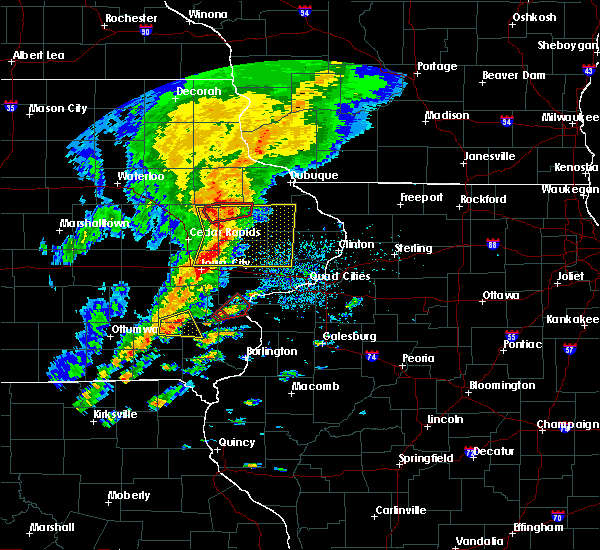 At 148 pm cdt, severe thunderstorms capable of producing tornadoes were located along a line extending from near coggon to prairieburg to near waubeek, moving east at 40 mph (radar indicated rotation). Hazards include tornado. Flying debris will be dangerous to those caught without shelter. mobile homes will be damaged or destroyed. damage to roofs, windows, and vehicles will occur. tree damage is likely. these dangerous storms will be near, monticello and langworthy around 205 pm cdt. Other locations impacted by these tornadic storms include pictured rocks wildlife area, camp courageous, howard h cherry scout reservation, matsell bridge natural area, jones county fairgrounds and monticello municipal airport. At 148 pm cdt, severe thunderstorms capable of producing tornadoes were located along a line extending from near coggon to prairieburg to near waubeek, moving east at 40 mph (radar indicated rotation). Hazards include tornado. Flying debris will be dangerous to those caught without shelter. mobile homes will be damaged or destroyed. damage to roofs, windows, and vehicles will occur. tree damage is likely. these dangerous storms will be near, monticello and langworthy around 205 pm cdt. Other locations impacted by these tornadic storms include pictured rocks wildlife area, camp courageous, howard h cherry scout reservation, matsell bridge natural area, jones county fairgrounds and monticello municipal airport.
|
| 9/25/2018 1:47 PM CDT |
 At 147 pm cdt, severe thunderstorms were located along a line extending from near hopkinton to near morley to near solon, moving east at 50 mph (radar indicated). Hazards include 60 mph wind gusts. Expect damage to roofs, siding, and trees. Locations impacted include, maquoketa, anamosa, tipton, mechanicsville, stanwood, coralville, north liberty, mount vernon, monticello, lisbon, solon, central city, springville, lowden, wheatland, olin, coggon, grand mound, wyoming and oxford junction. At 147 pm cdt, severe thunderstorms were located along a line extending from near hopkinton to near morley to near solon, moving east at 50 mph (radar indicated). Hazards include 60 mph wind gusts. Expect damage to roofs, siding, and trees. Locations impacted include, maquoketa, anamosa, tipton, mechanicsville, stanwood, coralville, north liberty, mount vernon, monticello, lisbon, solon, central city, springville, lowden, wheatland, olin, coggon, grand mound, wyoming and oxford junction.
|
| 9/25/2018 1:43 PM CDT |
 At 143 pm cdt, severe thunderstorms capable of producing tornadoes were located along a line extending from central city to waubeek to viola, moving east at 40 mph (radar indicated rotation). Hazards include tornado. Flying debris will be dangerous to those caught without shelter. mobile homes will be damaged or destroyed. damage to roofs, windows, and vehicles will occur. tree damage is likely. these dangerous storms will be near, stone city around 150 pm cdt. anamosa and langworthy around 200 pm cdt. monticello around 205 pm cdt. Other locations impacted by these tornadic storms include pinicon ridge park, camp courageous, scotch grove, matsell bridge natural area, jones county fairgrounds, pictured rocks wildlife area, howard h cherry scout reservation, monticello municipal airport, linn county fairgrounds and central park. At 143 pm cdt, severe thunderstorms capable of producing tornadoes were located along a line extending from central city to waubeek to viola, moving east at 40 mph (radar indicated rotation). Hazards include tornado. Flying debris will be dangerous to those caught without shelter. mobile homes will be damaged or destroyed. damage to roofs, windows, and vehicles will occur. tree damage is likely. these dangerous storms will be near, stone city around 150 pm cdt. anamosa and langworthy around 200 pm cdt. monticello around 205 pm cdt. Other locations impacted by these tornadic storms include pinicon ridge park, camp courageous, scotch grove, matsell bridge natural area, jones county fairgrounds, pictured rocks wildlife area, howard h cherry scout reservation, monticello municipal airport, linn county fairgrounds and central park.
|
| 9/25/2018 1:39 PM CDT |
 At 139 pm cdt, severe thunderstorms were located along a line extending from near prairieburg to near lisbon to near oakdale, moving east at 50 mph (radar indicated). Hazards include 60 mph wind gusts. Expect damage to roofs, siding, and trees. locations impacted include, cedar rapids, iowa city, maquoketa, anamosa, tipton, mechanicsville, stanwood, marion, coralville, north liberty, hiawatha, mount vernon, monticello, robins, lisbon, solon, tiffin, ely, central city and springville. this includes the following highways, interstate 80 in iowa between mile markers 236 and 241. Interstate 380 between mile markers 1 and 14, and mile marker 21 and near mile marker 23. At 139 pm cdt, severe thunderstorms were located along a line extending from near prairieburg to near lisbon to near oakdale, moving east at 50 mph (radar indicated). Hazards include 60 mph wind gusts. Expect damage to roofs, siding, and trees. locations impacted include, cedar rapids, iowa city, maquoketa, anamosa, tipton, mechanicsville, stanwood, marion, coralville, north liberty, hiawatha, mount vernon, monticello, robins, lisbon, solon, tiffin, ely, central city and springville. this includes the following highways, interstate 80 in iowa between mile markers 236 and 241. Interstate 380 between mile markers 1 and 14, and mile marker 21 and near mile marker 23.
|
| 9/25/2018 1:34 PM CDT |
 At 134 pm cdt, severe thunderstorms capable of producing tornadoes were located along a line extending from alburnett to near whittier to marion, moving east at 45 mph (radar indicated rotation). Hazards include tornado. Flying debris will be dangerous to those caught without shelter. mobile homes will be damaged or destroyed. damage to roofs, windows, and vehicles will occur. tree damage is likely. these dangerous storms will be near, central city and waubeek around 140 pm cdt. springville, martelle, whittier and viola around 145 pm cdt. prairieburg and stone city around 150 pm cdt. anamosa around 155 pm cdt. monticello and langworthy around 200 pm cdt. center junction around 205 pm cdt. Other locations impacted by these tornadic storms include matsell bridge natural area, jones county fairgrounds, pictured rocks wildlife area, howard h cherry scout reservation, wapsipinicon state park, squaw creek park, linn county fairgrounds, pinicon ridge park, camp courageous and marion airport. At 134 pm cdt, severe thunderstorms capable of producing tornadoes were located along a line extending from alburnett to near whittier to marion, moving east at 45 mph (radar indicated rotation). Hazards include tornado. Flying debris will be dangerous to those caught without shelter. mobile homes will be damaged or destroyed. damage to roofs, windows, and vehicles will occur. tree damage is likely. these dangerous storms will be near, central city and waubeek around 140 pm cdt. springville, martelle, whittier and viola around 145 pm cdt. prairieburg and stone city around 150 pm cdt. anamosa around 155 pm cdt. monticello and langworthy around 200 pm cdt. center junction around 205 pm cdt. Other locations impacted by these tornadic storms include matsell bridge natural area, jones county fairgrounds, pictured rocks wildlife area, howard h cherry scout reservation, wapsipinicon state park, squaw creek park, linn county fairgrounds, pinicon ridge park, camp courageous and marion airport.
|
| 9/25/2018 1:34 PM CDT |
 At 134 pm cdt, severe thunderstorms were located along a line extending from prairieburg to near bertram to oakdale, moving east at 50 mph (radar indicated). Hazards include 60 mph wind gusts. Expect damage to roofs, siding, and trees. locations impacted include, cedar rapids, iowa city, maquoketa, anamosa, tipton, west branch, mechanicsville, stanwood, marion, coralville, north liberty, hiawatha, mount vernon, monticello, robins, center point, lisbon, fairfax, solon and tiffin. this includes the following highways, interstate 80 in iowa between mile markers 230 and 247. Interstate 380 between mile markers 1 and 36. At 134 pm cdt, severe thunderstorms were located along a line extending from prairieburg to near bertram to oakdale, moving east at 50 mph (radar indicated). Hazards include 60 mph wind gusts. Expect damage to roofs, siding, and trees. locations impacted include, cedar rapids, iowa city, maquoketa, anamosa, tipton, west branch, mechanicsville, stanwood, marion, coralville, north liberty, hiawatha, mount vernon, monticello, robins, center point, lisbon, fairfax, solon and tiffin. this includes the following highways, interstate 80 in iowa between mile markers 230 and 247. Interstate 380 between mile markers 1 and 36.
|
| 9/25/2018 1:28 PM CDT |
 At 128 pm cdt, severe thunderstorms capable of producing a tornado were located along a line extending from alburnett to near hiawatha, moving east at 40 mph (radar indicated rotation). Hazards include tornado. Flying debris will be dangerous to those caught without shelter. mobile homes will be damaged or destroyed. damage to roofs, windows, and vehicles will occur. tree damage is likely. these dangerous storms will be near, paris around 135 pm cdt. central city, coggon and waubeek around 140 pm cdt. springville, prairieburg and whittier around 145 pm cdt. martelle, viola and stone city around 150 pm cdt. morley around 155 pm cdt. anamosa around 200 pm cdt. monticello and langworthy around 205 pm cdt. center junction around 210 pm cdt. other locations impacted by these tornadic storms include matsell bridge natural area, jones county fairgrounds, pictured rocks wildlife area, howard h cherry scout reservation, wapsipinicon state park, squaw creek park, linn county fairgrounds, pinicon ridge park, camp courageous and marion airport. This includes interstate 380 between mile markers 17 and 33. At 128 pm cdt, severe thunderstorms capable of producing a tornado were located along a line extending from alburnett to near hiawatha, moving east at 40 mph (radar indicated rotation). Hazards include tornado. Flying debris will be dangerous to those caught without shelter. mobile homes will be damaged or destroyed. damage to roofs, windows, and vehicles will occur. tree damage is likely. these dangerous storms will be near, paris around 135 pm cdt. central city, coggon and waubeek around 140 pm cdt. springville, prairieburg and whittier around 145 pm cdt. martelle, viola and stone city around 150 pm cdt. morley around 155 pm cdt. anamosa around 200 pm cdt. monticello and langworthy around 205 pm cdt. center junction around 210 pm cdt. other locations impacted by these tornadic storms include matsell bridge natural area, jones county fairgrounds, pictured rocks wildlife area, howard h cherry scout reservation, wapsipinicon state park, squaw creek park, linn county fairgrounds, pinicon ridge park, camp courageous and marion airport. This includes interstate 380 between mile markers 17 and 33.
|
| 9/25/2018 1:28 PM CDT |
 At 127 pm cdt, severe thunderstorms were located along a line extending from paris to bertram to oxford, moving east at 50 mph (trained weather spotters). Hazards include 60 mph wind gusts. expect damage to roofs, siding, and trees At 127 pm cdt, severe thunderstorms were located along a line extending from paris to bertram to oxford, moving east at 50 mph (trained weather spotters). Hazards include 60 mph wind gusts. expect damage to roofs, siding, and trees
|
| 9/3/2018 6:32 PM CDT |
 At 631 pm cdt, a severe thunderstorm capable of producing a tornado was located near monticello, or 11 miles north of anamosa, moving east at 25 mph (radar indicated rotation). Hazards include tornado. Flying debris will be dangerous to those caught without shelter. mobile homes will be damaged or destroyed. damage to roofs, windows, and vehicles will occur. tree damage is likely. this dangerous storm will be near, monticello and hopkinton around 635 pm cdt. cascade and worthington around 645 pm cdt. Other locations impacted by this tornadic thunderstorm include pictured rocks wildlife area, camp courageous, jones county fairgrounds, temple hill and monticello municipal airport. At 631 pm cdt, a severe thunderstorm capable of producing a tornado was located near monticello, or 11 miles north of anamosa, moving east at 25 mph (radar indicated rotation). Hazards include tornado. Flying debris will be dangerous to those caught without shelter. mobile homes will be damaged or destroyed. damage to roofs, windows, and vehicles will occur. tree damage is likely. this dangerous storm will be near, monticello and hopkinton around 635 pm cdt. cascade and worthington around 645 pm cdt. Other locations impacted by this tornadic thunderstorm include pictured rocks wildlife area, camp courageous, jones county fairgrounds, temple hill and monticello municipal airport.
|
| 9/3/2018 6:17 PM CDT |
 At 616 pm cdt, a severe thunderstorm capable of producing a tornado was located near prairieburg, or 10 miles northwest of anamosa, moving east at 25 mph (radar indicated rotation). Hazards include tornado. Flying debris will be dangerous to those caught without shelter. mobile homes will be damaged or destroyed. damage to roofs, windows, and vehicles will occur. tree damage is likely. this dangerous storm will be near, langworthy around 630 pm cdt. monticello around 635 pm cdt. hopkinton around 640 pm cdt. cascade and worthington around 645 pm cdt. a tornado touched down 2 miles southwest of prairieburg at 608 pm cdt. Other locations impacted by this tornadic thunderstorm include pictured rocks wildlife area, buck creek, camp courageous, jones county fairgrounds, temple hill and monticello municipal airport. At 616 pm cdt, a severe thunderstorm capable of producing a tornado was located near prairieburg, or 10 miles northwest of anamosa, moving east at 25 mph (radar indicated rotation). Hazards include tornado. Flying debris will be dangerous to those caught without shelter. mobile homes will be damaged or destroyed. damage to roofs, windows, and vehicles will occur. tree damage is likely. this dangerous storm will be near, langworthy around 630 pm cdt. monticello around 635 pm cdt. hopkinton around 640 pm cdt. cascade and worthington around 645 pm cdt. a tornado touched down 2 miles southwest of prairieburg at 608 pm cdt. Other locations impacted by this tornadic thunderstorm include pictured rocks wildlife area, buck creek, camp courageous, jones county fairgrounds, temple hill and monticello municipal airport.
|
| 9/3/2018 6:05 PM CDT |
 At 604 pm cdt, a severe thunderstorm capable of producing a tornado was located over prairieburg, or 11 miles northwest of anamosa, moving east at 25 mph (radar indicated rotation). Hazards include tornado. Flying debris will be dangerous to those caught without shelter. mobile homes will be damaged or destroyed. damage to roofs, windows, and vehicles will occur. tree damage is likely. this dangerous storm will be near, langworthy around 635 pm cdt. monticello and hopkinton around 640 pm cdt. worthington around 645 pm cdt. Other locations impacted by this tornadic thunderstorm include pinicon ridge park, buck creek, camp courageous, jones county fairgrounds, pictured rocks wildlife area, buffalo creek park, howard h cherry scout reservation, temple hill and monticello municipal airport. At 604 pm cdt, a severe thunderstorm capable of producing a tornado was located over prairieburg, or 11 miles northwest of anamosa, moving east at 25 mph (radar indicated rotation). Hazards include tornado. Flying debris will be dangerous to those caught without shelter. mobile homes will be damaged or destroyed. damage to roofs, windows, and vehicles will occur. tree damage is likely. this dangerous storm will be near, langworthy around 635 pm cdt. monticello and hopkinton around 640 pm cdt. worthington around 645 pm cdt. Other locations impacted by this tornadic thunderstorm include pinicon ridge park, buck creek, camp courageous, jones county fairgrounds, pictured rocks wildlife area, buffalo creek park, howard h cherry scout reservation, temple hill and monticello municipal airport.
|
| 8/5/2018 6:00 PM CDT | Delayed report. large tree branch snapped... fell on home in monticello. time estimated based on rada in jones county IA, 0.7 miles SSE of Monticello, IA |
| 8/5/2018 5:34 PM CDT |
 At 533 pm cdt, a severe thunderstorm was located over ryan, or 7 miles south of manchester, moving quickly east at 50 mph (radar indicated). Hazards include 60 mph wind gusts and penny size hail. Expect damage to roofs, siding, and trees. Locations impacted include, manchester, dyersville, monticello, edgewood, winthrop, earlville, walker, coggon, hopkinton, quasqueton, lamont, delhi, colesburg, ryan, greeley, aurora, prairieburg, dundee, delaware and masonville. At 533 pm cdt, a severe thunderstorm was located over ryan, or 7 miles south of manchester, moving quickly east at 50 mph (radar indicated). Hazards include 60 mph wind gusts and penny size hail. Expect damage to roofs, siding, and trees. Locations impacted include, manchester, dyersville, monticello, edgewood, winthrop, earlville, walker, coggon, hopkinton, quasqueton, lamont, delhi, colesburg, ryan, greeley, aurora, prairieburg, dundee, delaware and masonville.
|
| 8/5/2018 5:07 PM CDT |
 The national weather service in the quad cities has issued a * severe thunderstorm warning for. buchanan county in northeastern iowa. northeastern benton county in east central iowa. northwestern jones county in east central iowa. Delaware county in northeastern iowa. The national weather service in the quad cities has issued a * severe thunderstorm warning for. buchanan county in northeastern iowa. northeastern benton county in east central iowa. northwestern jones county in east central iowa. Delaware county in northeastern iowa.
|
| 7/13/2018 6:24 PM CDT |
 At 623 pm cdt, a severe thunderstorm was located over amber, or near anamosa, moving east at 30 mph (trained weather spotters). Hazards include 60 mph wind gusts. Expect damage to roofs, siding, and trees. Locations impacted include, anamosa, monticello, cascade, olin, wyoming, oxford junction, martelle, onslow, morley, center junction, langworthy, stone city, canton, jones county fairgrounds, oxford mills, pictured rocks wildlife area, wapsipinicon state park, hale, camp courageous and scotch grove. At 623 pm cdt, a severe thunderstorm was located over amber, or near anamosa, moving east at 30 mph (trained weather spotters). Hazards include 60 mph wind gusts. Expect damage to roofs, siding, and trees. Locations impacted include, anamosa, monticello, cascade, olin, wyoming, oxford junction, martelle, onslow, morley, center junction, langworthy, stone city, canton, jones county fairgrounds, oxford mills, pictured rocks wildlife area, wapsipinicon state park, hale, camp courageous and scotch grove.
|
| 7/13/2018 6:12 PM CDT |
 At 609 pm cdt, a severe thunderstorm was located over viola, or near anamosa, moving east at 35 mph (trained weather spotters reported that these storms produced 60 mph winds at 544 pm in hiawatha). Hazards include 60 mph wind gusts. Expect damage to roofs, siding, and trees. Locations impacted include, anamosa, marion, monticello, cascade, central city, springville, olin, coggon, wyoming, oxford junction, bertram, martelle, onslow, prairieburg, morley, center junction, waubeek, stone city, viola and whittier. At 609 pm cdt, a severe thunderstorm was located over viola, or near anamosa, moving east at 35 mph (trained weather spotters reported that these storms produced 60 mph winds at 544 pm in hiawatha). Hazards include 60 mph wind gusts. Expect damage to roofs, siding, and trees. Locations impacted include, anamosa, marion, monticello, cascade, central city, springville, olin, coggon, wyoming, oxford junction, bertram, martelle, onslow, prairieburg, morley, center junction, waubeek, stone city, viola and whittier.
|
| 7/13/2018 5:58 PM CDT |
 At 558 pm cdt, a severe thunderstorm was located near whittier, or 9 miles northeast of cedar rapids, moving east at 35 mph (trained weather spotters). Hazards include 60 mph wind gusts. expect damage to roofs, siding, and trees At 558 pm cdt, a severe thunderstorm was located near whittier, or 9 miles northeast of cedar rapids, moving east at 35 mph (trained weather spotters). Hazards include 60 mph wind gusts. expect damage to roofs, siding, and trees
|
| 6/20/2018 5:07 PM CDT |
 At 502 pm cdt, a severe thunderstorm was located near prairieburg, or 10 miles north of anamosa, moving northeast at 30 mph (radar indicated). Hazards include 60 mph wind gusts. Expect damage to roofs, siding, and trees. locations impacted include, anamosa, monticello, cascade, central city, springville, hopkinton, ryan, prairieburg, waubeek, stone city, viola, whittier, langworthy, linn county fairgrounds, pinicon ridge park, buck creek, monticello municipal airport, matsell bridge natural area, jones county fairgrounds and pictured rocks wildlife area. A tornado watch remains in effect until 700 pm cdt for northeastern and east central iowa. At 502 pm cdt, a severe thunderstorm was located near prairieburg, or 10 miles north of anamosa, moving northeast at 30 mph (radar indicated). Hazards include 60 mph wind gusts. Expect damage to roofs, siding, and trees. locations impacted include, anamosa, monticello, cascade, central city, springville, hopkinton, ryan, prairieburg, waubeek, stone city, viola, whittier, langworthy, linn county fairgrounds, pinicon ridge park, buck creek, monticello municipal airport, matsell bridge natural area, jones county fairgrounds and pictured rocks wildlife area. A tornado watch remains in effect until 700 pm cdt for northeastern and east central iowa.
|
| 6/20/2018 5:02 PM CDT |
 At 502 pm cdt, a severe thunderstorm was located near prairieburg, or 10 miles north of anamosa, moving northeast at 30 mph (radar indicated). Hazards include 60 mph wind gusts. Expect damage to roofs, siding, and trees. locations impacted include, anamosa, monticello, cascade, central city, springville, hopkinton, ryan, prairieburg, waubeek, stone city, viola, whittier, langworthy, linn county fairgrounds, pinicon ridge park, buck creek, monticello municipal airport, matsell bridge natural area, jones county fairgrounds and pictured rocks wildlife area. A tornado watch remains in effect until 700 pm cdt for northeastern and east central iowa. At 502 pm cdt, a severe thunderstorm was located near prairieburg, or 10 miles north of anamosa, moving northeast at 30 mph (radar indicated). Hazards include 60 mph wind gusts. Expect damage to roofs, siding, and trees. locations impacted include, anamosa, monticello, cascade, central city, springville, hopkinton, ryan, prairieburg, waubeek, stone city, viola, whittier, langworthy, linn county fairgrounds, pinicon ridge park, buck creek, monticello municipal airport, matsell bridge natural area, jones county fairgrounds and pictured rocks wildlife area. A tornado watch remains in effect until 700 pm cdt for northeastern and east central iowa.
|
| 6/20/2018 4:50 PM CDT |
 At 450 pm cdt, a severe thunderstorm was located near prairieburg, or 9 miles north of anamosa, moving northeast at 35 mph (radar indicated). Hazards include 60 mph wind gusts. Expect damage to roofs, siding, and trees. locations impacted include, anamosa, manchester, monticello, cascade, central city, springville, hopkinton, delhi, worthington, ryan, martelle, prairieburg, delaware, waubeek, stone city, viola, whittier, langworthy, fillmore and linn county fairgrounds. A tornado watch remains in effect until 700 pm cdt for northeastern and east central iowa. At 450 pm cdt, a severe thunderstorm was located near prairieburg, or 9 miles north of anamosa, moving northeast at 35 mph (radar indicated). Hazards include 60 mph wind gusts. Expect damage to roofs, siding, and trees. locations impacted include, anamosa, manchester, monticello, cascade, central city, springville, hopkinton, delhi, worthington, ryan, martelle, prairieburg, delaware, waubeek, stone city, viola, whittier, langworthy, fillmore and linn county fairgrounds. A tornado watch remains in effect until 700 pm cdt for northeastern and east central iowa.
|
| 6/20/2018 4:33 PM CDT |
 At 433 pm cdt, a severe thunderstorm was located over stone city, or near anamosa, moving northeast at 30 mph (radar indicated). Hazards include 60 mph wind gusts. expect damage to roofs, siding, and trees At 433 pm cdt, a severe thunderstorm was located over stone city, or near anamosa, moving northeast at 30 mph (radar indicated). Hazards include 60 mph wind gusts. expect damage to roofs, siding, and trees
|
| 6/9/2018 11:17 PM CDT |
 At 1117 pm cdt, severe thunderstorms were located along a line extending from near canton to near stanwood to near mount vernon, moving east at 30 mph (radar indicated). Hazards include 60 mph wind gusts and quarter size hail. Hail damage to vehicles is expected. expect wind damage to roofs, siding, and trees. Locations impacted include, anamosa, monticello, olin, wyoming, onslow, morley, center junction, canton, pictured rocks wildlife area, hale, camp courageous, scotch grove, central park and temple hill. At 1117 pm cdt, severe thunderstorms were located along a line extending from near canton to near stanwood to near mount vernon, moving east at 30 mph (radar indicated). Hazards include 60 mph wind gusts and quarter size hail. Hail damage to vehicles is expected. expect wind damage to roofs, siding, and trees. Locations impacted include, anamosa, monticello, olin, wyoming, onslow, morley, center junction, canton, pictured rocks wildlife area, hale, camp courageous, scotch grove, central park and temple hill.
|
| 6/9/2018 11:06 PM CDT |
 At 1106 pm cdt, severe thunderstorms were located along a line extending from near canton to near mechanicsville to near ely, moving east at 25 mph (radar indicated). Hazards include 60 mph wind gusts and quarter size hail. Hail damage to vehicles is expected. expect wind damage to roofs, siding, and trees. locations impacted include, cedar rapids, anamosa, marion, hiawatha, mount vernon, monticello, robins, cascade, lisbon, fairfax, ely, springville, palo, olin, wyoming, bertram, martelle, onslow, morley and center junction. This includes interstate 380 between mile markers 13 and 31. At 1106 pm cdt, severe thunderstorms were located along a line extending from near canton to near mechanicsville to near ely, moving east at 25 mph (radar indicated). Hazards include 60 mph wind gusts and quarter size hail. Hail damage to vehicles is expected. expect wind damage to roofs, siding, and trees. locations impacted include, cedar rapids, anamosa, marion, hiawatha, mount vernon, monticello, robins, cascade, lisbon, fairfax, ely, springville, palo, olin, wyoming, bertram, martelle, onslow, morley and center junction. This includes interstate 380 between mile markers 13 and 31.
|
| 6/9/2018 10:52 PM CDT |
 At 1052 pm cdt, severe thunderstorms were located along a line extending from near monticello to near marion to near atkins, moving east at 30 mph (public). Hazards include 70 mph wind gusts and quarter size hail. Hail damage to vehicles is expected. expect considerable tree damage. wind damage is also likely to mobile homes, roofs, and outbuildings. locations impacted include, cedar rapids, anamosa, marion, hiawatha, mount vernon, monticello, robins, center point, lisbon, fairfax, ely, central city, springville, palo, olin, alburnett, coggon, wyoming, bertram and martelle. This includes interstate 380 between mile markers 13 and 36. At 1052 pm cdt, severe thunderstorms were located along a line extending from near monticello to near marion to near atkins, moving east at 30 mph (public). Hazards include 70 mph wind gusts and quarter size hail. Hail damage to vehicles is expected. expect considerable tree damage. wind damage is also likely to mobile homes, roofs, and outbuildings. locations impacted include, cedar rapids, anamosa, marion, hiawatha, mount vernon, monticello, robins, center point, lisbon, fairfax, ely, central city, springville, palo, olin, alburnett, coggon, wyoming, bertram and martelle. This includes interstate 380 between mile markers 13 and 36.
|
| 6/9/2018 10:42 PM CDT |
 At 1041 pm cdt, severe thunderstorms were located along a line extending from near prairieburg to robins to near atkins, moving east at 35 mph (radar indicated). Hazards include 60 mph wind gusts. expect damage to roofs, siding, and trees At 1041 pm cdt, severe thunderstorms were located along a line extending from near prairieburg to robins to near atkins, moving east at 35 mph (radar indicated). Hazards include 60 mph wind gusts. expect damage to roofs, siding, and trees
|
| 6/9/2018 10:05 PM CDT |
 At 1004 pm cdt, severe thunderstorms were located along a line extending from lamont to near coggon to near mount auburn, moving east at 40 mph. at 1000 pm cdt, a trained spotter estimated winds at 65 mph in masonville (trained weather spotters). Hazards include 70 mph wind gusts and half dollar size hail. Hail damage to vehicles is expected. expect considerable tree damage. wind damage is also likely to mobile homes, roofs, and outbuildings. locations impacted include, independence, manchester, dyersville, monticello, center point, urbana, central city, winthrop, earlville, walker, alburnett, coggon, hopkinton, quasqueton, delhi, ryan, brandon, rowley, prairieburg and dundee. This includes interstate 380 between mile markers 36 and 55. At 1004 pm cdt, severe thunderstorms were located along a line extending from lamont to near coggon to near mount auburn, moving east at 40 mph. at 1000 pm cdt, a trained spotter estimated winds at 65 mph in masonville (trained weather spotters). Hazards include 70 mph wind gusts and half dollar size hail. Hail damage to vehicles is expected. expect considerable tree damage. wind damage is also likely to mobile homes, roofs, and outbuildings. locations impacted include, independence, manchester, dyersville, monticello, center point, urbana, central city, winthrop, earlville, walker, alburnett, coggon, hopkinton, quasqueton, delhi, ryan, brandon, rowley, prairieburg and dundee. This includes interstate 380 between mile markers 36 and 55.
|
| 6/9/2018 9:59 PM CDT |
 At 958 pm cdt, severe thunderstorms were located along a line extending from aurora to near coggon to near vinton, moving east at 40 mph. at 950 pm cdt, a trained spotter reported a measured wind gust of 60 mph in winthrop (trained weather spotters). Hazards include 70 mph wind gusts and half dollar size hail. Hail damage to vehicles is expected. expect considerable tree damage. wind damage is also likely to mobile homes, roofs, and outbuildings. locations impacted include, independence, manchester, dyersville, monticello, center point, urbana, central city, winthrop, earlville, walker, alburnett, coggon, hopkinton, quasqueton, delhi, ryan, brandon, rowley, prairieburg and dundee. This includes interstate 380 between mile markers 36 and 55. At 958 pm cdt, severe thunderstorms were located along a line extending from aurora to near coggon to near vinton, moving east at 40 mph. at 950 pm cdt, a trained spotter reported a measured wind gust of 60 mph in winthrop (trained weather spotters). Hazards include 70 mph wind gusts and half dollar size hail. Hail damage to vehicles is expected. expect considerable tree damage. wind damage is also likely to mobile homes, roofs, and outbuildings. locations impacted include, independence, manchester, dyersville, monticello, center point, urbana, central city, winthrop, earlville, walker, alburnett, coggon, hopkinton, quasqueton, delhi, ryan, brandon, rowley, prairieburg and dundee. This includes interstate 380 between mile markers 36 and 55.
|
| 6/9/2018 9:45 PM CDT |
 At 944 pm cdt, severe thunderstorms were located along a line extending from near hazleton to near quasqueton to near dysart, moving east at 40 mph (radar indicated). Hazards include 70 mph wind gusts and half dollar size hail. Hail damage to vehicles is expected. expect considerable tree damage. Wind damage is also likely to mobile homes, roofs, and outbuildings. At 944 pm cdt, severe thunderstorms were located along a line extending from near hazleton to near quasqueton to near dysart, moving east at 40 mph (radar indicated). Hazards include 70 mph wind gusts and half dollar size hail. Hail damage to vehicles is expected. expect considerable tree damage. Wind damage is also likely to mobile homes, roofs, and outbuildings.
|
| 8/10/2017 2:02 PM CDT | Tree down in center of town... time estimated on radar in jones county IA, 0.7 miles SSE of Monticello, IA |
| 7/22/2017 12:12 AM CDT |
 The severe thunderstorm warning for jo daviess, carroll, southwestern stephenson, jackson, northeastern buchanan, dubuque, northern jones, delaware and northern clinton counties will expire at 1215 am cdt, the storms which prompted the warning have weakened below severe limits, and no longer pose an immediate threat to life or property. therefore, the warning will be allowed to expire. however gusty winds over 40 mph and heavy rain are still possible with these thunderstorms. a severe thunderstorm watch remains in effect until 200 am cdt for northwestern illinois, and northeastern and east central iowa. The severe thunderstorm warning for jo daviess, carroll, southwestern stephenson, jackson, northeastern buchanan, dubuque, northern jones, delaware and northern clinton counties will expire at 1215 am cdt, the storms which prompted the warning have weakened below severe limits, and no longer pose an immediate threat to life or property. therefore, the warning will be allowed to expire. however gusty winds over 40 mph and heavy rain are still possible with these thunderstorms. a severe thunderstorm watch remains in effect until 200 am cdt for northwestern illinois, and northeastern and east central iowa.
|
| 7/22/2017 12:03 AM CDT |
 At 1201 am cdt, severe thunderstorms were located along a line extending from near elizabeth to near prairieburg, moving southeast at 40 mph (law enforcement in dubuque county reports trees are down and power lines also down from this storm). Hazards include 70 mph wind gusts and penny size hail. Expect considerable tree damage. damage is likely to mobile homes, roofs, and outbuildings. locations impacted include, dubuque, maquoketa, manchester, galena, mount carroll, asbury, dyersville, monticello, savanna, bellevue, cascade, stockton, epworth, east dubuque, farley, lanark, peosta, milledgeville, preston and fairhaven. If you are at monticello fairgrounds you should seek safe shelter immediately!. At 1201 am cdt, severe thunderstorms were located along a line extending from near elizabeth to near prairieburg, moving southeast at 40 mph (law enforcement in dubuque county reports trees are down and power lines also down from this storm). Hazards include 70 mph wind gusts and penny size hail. Expect considerable tree damage. damage is likely to mobile homes, roofs, and outbuildings. locations impacted include, dubuque, maquoketa, manchester, galena, mount carroll, asbury, dyersville, monticello, savanna, bellevue, cascade, stockton, epworth, east dubuque, farley, lanark, peosta, milledgeville, preston and fairhaven. If you are at monticello fairgrounds you should seek safe shelter immediately!.
|
| 7/21/2017 11:53 PM CDT |
 At 1153 pm cdt, severe thunderstorms were located roughly along a line extending from near schapville to near ryan, moving southeast at 40 mph (radar indicated). Hazards include 70 mph wind gusts and penny size hail. Expect considerable tree damage. damage is likely to mobile homes, roofs, and outbuildings. locations impacted include, dubuque, maquoketa, manchester, galena, mount carroll, asbury, dyersville, monticello, savanna, bellevue, cascade, stockton, epworth, east dubuque, farley, lanark, peosta, milledgeville, preston and fairhaven. If you are at monticello fairgrounds you should seek safe shelter immediately!. At 1153 pm cdt, severe thunderstorms were located roughly along a line extending from near schapville to near ryan, moving southeast at 40 mph (radar indicated). Hazards include 70 mph wind gusts and penny size hail. Expect considerable tree damage. damage is likely to mobile homes, roofs, and outbuildings. locations impacted include, dubuque, maquoketa, manchester, galena, mount carroll, asbury, dyersville, monticello, savanna, bellevue, cascade, stockton, epworth, east dubuque, farley, lanark, peosta, milledgeville, preston and fairhaven. If you are at monticello fairgrounds you should seek safe shelter immediately!.
|
| 7/21/2017 11:36 PM CDT |
 At 1136 pm cdt, severe thunderstorms were located along a line extending from near council hill to near masonville, moving southeast at 40 mph (radar indicated). Hazards include 70 mph wind gusts and penny size hail. Expect considerable tree damage. damage is likely to mobile homes, roofs, and outbuildings. locations impacted include, dubuque, maquoketa, manchester, galena, mount carroll, asbury, dyersville, monticello, savanna, bellevue, cascade, stockton, epworth, east dubuque, farley, lanark, peosta, milledgeville, preston and fairhaven. If you are at monticello fairgrounds you should seek safe shelter immediately!. At 1136 pm cdt, severe thunderstorms were located along a line extending from near council hill to near masonville, moving southeast at 40 mph (radar indicated). Hazards include 70 mph wind gusts and penny size hail. Expect considerable tree damage. damage is likely to mobile homes, roofs, and outbuildings. locations impacted include, dubuque, maquoketa, manchester, galena, mount carroll, asbury, dyersville, monticello, savanna, bellevue, cascade, stockton, epworth, east dubuque, farley, lanark, peosta, milledgeville, preston and fairhaven. If you are at monticello fairgrounds you should seek safe shelter immediately!.
|
| 7/21/2017 11:22 PM CDT |
 At 1121 pm cdt, severe thunderstorms were located along a line extending from near menominee to winthrop, moving southeast at 40 mph (radar indicated). Hazards include 70 mph wind gusts and penny size hail. Expect considerable tree damage. damage is likely to mobile homes, roofs, and outbuildings. locations impacted include, dubuque, maquoketa, manchester, galena, mount carroll, asbury, dyersville, monticello, savanna, bellevue, cascade, stockton, epworth, east dubuque, farley, lanark, peosta, milledgeville, preston and fairhaven. If you are at monticello fairgrounds you should seek safe shelter immediately!. At 1121 pm cdt, severe thunderstorms were located along a line extending from near menominee to winthrop, moving southeast at 40 mph (radar indicated). Hazards include 70 mph wind gusts and penny size hail. Expect considerable tree damage. damage is likely to mobile homes, roofs, and outbuildings. locations impacted include, dubuque, maquoketa, manchester, galena, mount carroll, asbury, dyersville, monticello, savanna, bellevue, cascade, stockton, epworth, east dubuque, farley, lanark, peosta, milledgeville, preston and fairhaven. If you are at monticello fairgrounds you should seek safe shelter immediately!.
|
| 7/21/2017 11:10 PM CDT |
 At 1109 pm cdt, severe thunderstorms were located along a line extending from near sageville to 6 miles south of stanley, moving southeast at 40 mph (radar indicated). Hazards include 60 mph wind gusts and penny size hail. expect damage to roofs, siding, and trees At 1109 pm cdt, severe thunderstorms were located along a line extending from near sageville to 6 miles south of stanley, moving southeast at 40 mph (radar indicated). Hazards include 60 mph wind gusts and penny size hail. expect damage to roofs, siding, and trees
|
| 7/21/2017 11:10 PM CDT |
 The national weather service in the quad cities has issued a * severe thunderstorm warning for. jo daviess county in northwestern illinois. carroll county in northwestern illinois. southwestern stephenson county in northwestern illinois. Jackson county in east central iowa. The national weather service in the quad cities has issued a * severe thunderstorm warning for. jo daviess county in northwestern illinois. carroll county in northwestern illinois. southwestern stephenson county in northwestern illinois. Jackson county in east central iowa.
|
| 7/21/2017 5:15 PM CDT |
 At 514 pm cdt, severe thunderstorms were located along a line extending from near marion to morley, moving northeast at 40 mph (radar indicated). Hazards include 60 mph wind gusts and penny size hail. Expect damage to roofs, siding, and trees. locations impacted include, cedar rapids, anamosa, mechanicsville, marion, mount vernon, monticello, lisbon, ely, springville, olin, shueyville, bertram, martelle, prairieburg, morley, center junction, waubeek, stone city, viola and whittier. If you are at monticello fairgrounds you should seek safe shelter immediately! this includes interstate 380 between mile markers 12 and 13. At 514 pm cdt, severe thunderstorms were located along a line extending from near marion to morley, moving northeast at 40 mph (radar indicated). Hazards include 60 mph wind gusts and penny size hail. Expect damage to roofs, siding, and trees. locations impacted include, cedar rapids, anamosa, mechanicsville, marion, mount vernon, monticello, lisbon, ely, springville, olin, shueyville, bertram, martelle, prairieburg, morley, center junction, waubeek, stone city, viola and whittier. If you are at monticello fairgrounds you should seek safe shelter immediately! this includes interstate 380 between mile markers 12 and 13.
|
| 7/21/2017 5:01 PM CDT |
 The national weather service in the quad cities has issued a * severe thunderstorm warning for. northwestern cedar county in east central iowa. jones county in east central iowa. eastern linn county in east central iowa. Until 600 pm cdt. The national weather service in the quad cities has issued a * severe thunderstorm warning for. northwestern cedar county in east central iowa. jones county in east central iowa. eastern linn county in east central iowa. Until 600 pm cdt.
|
| 7/19/2017 7:33 PM CDT |
 At 733 pm cdt, severe thunderstorms were located along a line extending from near la motte to near canton to 6 miles north of center junction, moving south at 30 mph (radar indicated). Hazards include 60 mph wind gusts. Expect damage to roofs, siding, and trees. locations impacted include, dubuque, maquoketa, monticello, cascade, epworth, farley, peosta, olin, wyoming, oxford junction, andrew, worthington, la motte, onslow, monmouth, bernard, center junction, zwingle, nashville and fulton. If you are at monticello fairgrounds you should seek safe shelter immediately!. At 733 pm cdt, severe thunderstorms were located along a line extending from near la motte to near canton to 6 miles north of center junction, moving south at 30 mph (radar indicated). Hazards include 60 mph wind gusts. Expect damage to roofs, siding, and trees. locations impacted include, dubuque, maquoketa, monticello, cascade, epworth, farley, peosta, olin, wyoming, oxford junction, andrew, worthington, la motte, onslow, monmouth, bernard, center junction, zwingle, nashville and fulton. If you are at monticello fairgrounds you should seek safe shelter immediately!.
|
| 7/19/2017 7:26 PM CDT |
 At 725 pm cdt, severe thunderstorms were located along a line extending from near la motte to near canton to langworthy, moving south at 35 mph (radar indicated). Hazards include 60 mph wind gusts. Expect damage to roofs, siding, and trees. locations impacted include, dubuque, maquoketa, anamosa, manchester, dyersville, monticello, cascade, epworth, farley, peosta, earlville, olin, hopkinton, wyoming, oxford junction, delhi, andrew, worthington, la motte and martelle. If you are at monticello fairgrounds you should seek safe shelter immediately!. At 725 pm cdt, severe thunderstorms were located along a line extending from near la motte to near canton to langworthy, moving south at 35 mph (radar indicated). Hazards include 60 mph wind gusts. Expect damage to roofs, siding, and trees. locations impacted include, dubuque, maquoketa, anamosa, manchester, dyersville, monticello, cascade, epworth, farley, peosta, earlville, olin, hopkinton, wyoming, oxford junction, delhi, andrew, worthington, la motte and martelle. If you are at monticello fairgrounds you should seek safe shelter immediately!.
|
| 7/19/2017 7:19 PM CDT |
 At 719 pm cdt, severe thunderstorms were located along a line extending from la motte to near cascade to near prairieburg, moving south at 30 mph (radar indicated). Hazards include 60 mph wind gusts. Expect damage to roofs, siding, and trees. locations impacted include, dubuque, maquoketa, anamosa, manchester, asbury, dyersville, monticello, cascade, epworth, farley, peosta, earlville, olin, hopkinton, wyoming, oxford junction, delhi, andrew, new vienna and worthington. If you are at monticello fairgrounds you should seek safe shelter immediately!. At 719 pm cdt, severe thunderstorms were located along a line extending from la motte to near cascade to near prairieburg, moving south at 30 mph (radar indicated). Hazards include 60 mph wind gusts. Expect damage to roofs, siding, and trees. locations impacted include, dubuque, maquoketa, anamosa, manchester, asbury, dyersville, monticello, cascade, epworth, farley, peosta, earlville, olin, hopkinton, wyoming, oxford junction, delhi, andrew, new vienna and worthington. If you are at monticello fairgrounds you should seek safe shelter immediately!.
|
| 7/19/2017 7:03 PM CDT |
 The national weather service in the quad cities has issued a * severe thunderstorm warning for. jackson county in east central iowa. dubuque county in northeastern iowa. jones county in east central iowa. Southeastern delaware county in northeastern iowa. The national weather service in the quad cities has issued a * severe thunderstorm warning for. jackson county in east central iowa. dubuque county in northeastern iowa. jones county in east central iowa. Southeastern delaware county in northeastern iowa.
|
| 7/10/2017 2:42 AM CDT |
 At 242 am cdt, severe thunderstorms were located along a line extending from near rickardsville to stone city, moving east at 45 mph (radar indicated). Hazards include 60 mph wind gusts. expect damage to roofs, siding, and trees At 242 am cdt, severe thunderstorms were located along a line extending from near rickardsville to stone city, moving east at 45 mph (radar indicated). Hazards include 60 mph wind gusts. expect damage to roofs, siding, and trees
|
| 7/5/2017 9:35 PM CDT |
 The severe thunderstorm warning for southwestern jones county will expire at 945 pm cdt, the severe thunderstorm which prompted the warning has weakened. therefore the warning will be allowed to expire. The severe thunderstorm warning for southwestern jones county will expire at 945 pm cdt, the severe thunderstorm which prompted the warning has weakened. therefore the warning will be allowed to expire.
|
| 7/5/2017 9:22 PM CDT |
 At 922 pm cdt, a severe thunderstorm was located over morley, or near anamosa, moving southwest at 25 mph (radar indicated). Hazards include 60 mph wind gusts. Expect damage to roofs, siding, and trees. Locations impacted include, anamosa, olin, morley, center junction, langworthy, scotch grove, central park and wapsipinicon state park. At 922 pm cdt, a severe thunderstorm was located over morley, or near anamosa, moving southwest at 25 mph (radar indicated). Hazards include 60 mph wind gusts. Expect damage to roofs, siding, and trees. Locations impacted include, anamosa, olin, morley, center junction, langworthy, scotch grove, central park and wapsipinicon state park.
|
| 7/5/2017 9:07 PM CDT |
 At 906 pm cdt, a severe thunderstorm was located over amber, or over anamosa, moving south at 20 mph (trained weather spotters. at 855 pm cdt...a wind gust of 66 mph was measured at the monticello municipal airport). Hazards include 60 mph wind gusts. Expect damage to roofs, siding, and trees. Locations impacted include, anamosa, olin, morley, center junction, langworthy, scotch grove, central park and wapsipinicon state park. At 906 pm cdt, a severe thunderstorm was located over amber, or over anamosa, moving south at 20 mph (trained weather spotters. at 855 pm cdt...a wind gust of 66 mph was measured at the monticello municipal airport). Hazards include 60 mph wind gusts. Expect damage to roofs, siding, and trees. Locations impacted include, anamosa, olin, morley, center junction, langworthy, scotch grove, central park and wapsipinicon state park.
|
| 7/5/2017 9:01 PM CDT |
 At 901 pm cdt, a severe thunderstorm was located over amber, or near anamosa, moving southwest at 20 mph (radar indicated). Hazards include 60 mph wind gusts. expect damage to roofs, siding, and trees At 901 pm cdt, a severe thunderstorm was located over amber, or near anamosa, moving southwest at 20 mph (radar indicated). Hazards include 60 mph wind gusts. expect damage to roofs, siding, and trees
|
| 7/5/2017 8:55 PM CDT | Storm damage reported in jones county IA, 0.7 miles W of Monticello, IA |
| 6/28/2017 7:07 PM CDT | Damage to barns and other structures... possible tornad in jones county IA, 4.4 miles E of Monticello, IA |
| 6/28/2017 6:55 PM CDT | Structural damage... possible tornad in jones county IA, 9.1 miles ESE of Monticello, IA |
| 6/28/2017 3:14 PM CDT |
 At 814 pm cdt, a severe thunderstorm was located near monticello, or 10 miles northeast of anamosa, moving east at 60 mph (radar indicated). Hazards include 60 mph wind gusts and quarter size hail. Hail damage to vehicles is expected. expect wind damage to roofs, siding, and trees. locations impacted include, anamosa, monticello, cascade, onslow, prairieburg, center junction, langworthy, stone city, canton, matsell bridge natural area, jones county fairgrounds, pictured rocks wildlife area, howard h cherry scout reservation, wapsipinicon state park, camp courageous, scotch grove, central park, temple hill and monticello municipal airport. A tornado watch remains in effect until 1000 pm cdt for northeastern and east central iowa. At 814 pm cdt, a severe thunderstorm was located near monticello, or 10 miles northeast of anamosa, moving east at 60 mph (radar indicated). Hazards include 60 mph wind gusts and quarter size hail. Hail damage to vehicles is expected. expect wind damage to roofs, siding, and trees. locations impacted include, anamosa, monticello, cascade, onslow, prairieburg, center junction, langworthy, stone city, canton, matsell bridge natural area, jones county fairgrounds, pictured rocks wildlife area, howard h cherry scout reservation, wapsipinicon state park, camp courageous, scotch grove, central park, temple hill and monticello municipal airport. A tornado watch remains in effect until 1000 pm cdt for northeastern and east central iowa.
|
| 6/28/2017 3:01 PM CDT |
 At 800 pm cdt, a severe thunderstorm was located over waubeek, or 10 miles northwest of anamosa, moving east at 50 mph (radar indicated). Hazards include 60 mph wind gusts and quarter size hail. Hail damage to vehicles is expected. Expect wind damage to roofs, siding, and trees. At 800 pm cdt, a severe thunderstorm was located over waubeek, or 10 miles northwest of anamosa, moving east at 50 mph (radar indicated). Hazards include 60 mph wind gusts and quarter size hail. Hail damage to vehicles is expected. Expect wind damage to roofs, siding, and trees.
|
| 6/28/2017 2:12 PM CDT |
 At 712 pm cdt, a severe thunderstorm capable of producing a tornado was located near monticello, or 12 miles north of anamosa, moving east at 25 mph (radar indicated rotation). Hazards include tornado and quarter size hail. Flying debris will be dangerous to those caught without shelter. mobile homes will be damaged or destroyed. damage to roofs, windows, and vehicles will occur. tree damage is likely. Locations impacted include, dyersville, cascade, hopkinton, worthington and buck creek. At 712 pm cdt, a severe thunderstorm capable of producing a tornado was located near monticello, or 12 miles north of anamosa, moving east at 25 mph (radar indicated rotation). Hazards include tornado and quarter size hail. Flying debris will be dangerous to those caught without shelter. mobile homes will be damaged or destroyed. damage to roofs, windows, and vehicles will occur. tree damage is likely. Locations impacted include, dyersville, cascade, hopkinton, worthington and buck creek.
|
| 6/28/2017 2:06 PM CDT |
 At 706 pm cdt, a confirmed large and extremely dangerous tornado was located near hopkinton, or 13 miles north of anamosa, moving northeast at 25 mph. this is a particularly dangerous situation. take cover now! (weather spotters confirmed tornado moved through prairiesburg around 649 pm). Hazards include damaging tornado. You are in a life-threatening situation. flying debris may be deadly to those caught without shelter. mobile homes will be destroyed. considerable damage to homes, businesses, and vehicles is likely and complete destruction is possible. Locations impacted include, dyersville, cascade, hopkinton, worthington and buck creek. At 706 pm cdt, a confirmed large and extremely dangerous tornado was located near hopkinton, or 13 miles north of anamosa, moving northeast at 25 mph. this is a particularly dangerous situation. take cover now! (weather spotters confirmed tornado moved through prairiesburg around 649 pm). Hazards include damaging tornado. You are in a life-threatening situation. flying debris may be deadly to those caught without shelter. mobile homes will be destroyed. considerable damage to homes, businesses, and vehicles is likely and complete destruction is possible. Locations impacted include, dyersville, cascade, hopkinton, worthington and buck creek.
|
| 6/28/2017 2:03 PM CDT |
 At 702 pm cdt, a confirmed large and extremely dangerous tornado was located near hopkinton, or 12 miles north of anamosa, moving northeast at 25 mph. this is a particularly dangerous situation. take cover now! (law enforcement confirmed tornado). Hazards include damaging tornado. You are in a life-threatening situation. flying debris may be deadly to those caught without shelter. mobile homes will be destroyed. considerable damage to homes, businesses, and vehicles is likely and complete destruction is possible. Locations impacted include, north of monticello. At 702 pm cdt, a confirmed large and extremely dangerous tornado was located near hopkinton, or 12 miles north of anamosa, moving northeast at 25 mph. this is a particularly dangerous situation. take cover now! (law enforcement confirmed tornado). Hazards include damaging tornado. You are in a life-threatening situation. flying debris may be deadly to those caught without shelter. mobile homes will be destroyed. considerable damage to homes, businesses, and vehicles is likely and complete destruction is possible. Locations impacted include, north of monticello.
|
| 6/28/2017 1:56 PM CDT |
 At 656 pm cdt, a confirmed large and extremely dangerous tornado was located near prairieburg, or 12 miles north of anamosa, moving northeast at 25 mph. this is a particularly dangerous situation. take cover now! (weather spotters confirmed tornado). Hazards include damaging tornado. You are in a life-threatening situation. flying debris may be deadly to those caught without shelter. mobile homes will be destroyed. considerable damage to homes, businesses, and vehicles is likely and complete destruction is possible. the tornado will be near, hopkinton around 715 pm cdt. worthington around 735 pm cdt. cascade around 740 pm cdt. dyersville around 745 pm cdt. Other locations impacted by this tornadic thunderstorm include buck creek. At 656 pm cdt, a confirmed large and extremely dangerous tornado was located near prairieburg, or 12 miles north of anamosa, moving northeast at 25 mph. this is a particularly dangerous situation. take cover now! (weather spotters confirmed tornado). Hazards include damaging tornado. You are in a life-threatening situation. flying debris may be deadly to those caught without shelter. mobile homes will be destroyed. considerable damage to homes, businesses, and vehicles is likely and complete destruction is possible. the tornado will be near, hopkinton around 715 pm cdt. worthington around 735 pm cdt. cascade around 740 pm cdt. dyersville around 745 pm cdt. Other locations impacted by this tornadic thunderstorm include buck creek.
|
| 6/28/2017 1:48 PM CDT |
 At 647 pm cdt, a confirmed large and extremely dangerous tornado was located in prairiesburg, moving east at 45 mph. this is a particularly dangerous situation. take cover now! (law enforcement confirmed tornado). Hazards include damaging tornado. You are in a life-threatening situation. flying debris may be deadly to those caught without shelter. mobile homes will be destroyed. considerable damage to homes, businesses, and vehicles is likely and complete destruction is possible. This tornadic thunderstorm will remain over mainly rural areas of northwestern jones, southeastern delaware and northeastern linn counties, including the following locations: camp courageous, scotch grove, matsell bridge natural area, jones county fairgrounds, pictured rocks wildlife area, howard h cherry scout reservation and monticello municipal airport. At 647 pm cdt, a confirmed large and extremely dangerous tornado was located in prairiesburg, moving east at 45 mph. this is a particularly dangerous situation. take cover now! (law enforcement confirmed tornado). Hazards include damaging tornado. You are in a life-threatening situation. flying debris may be deadly to those caught without shelter. mobile homes will be destroyed. considerable damage to homes, businesses, and vehicles is likely and complete destruction is possible. This tornadic thunderstorm will remain over mainly rural areas of northwestern jones, southeastern delaware and northeastern linn counties, including the following locations: camp courageous, scotch grove, matsell bridge natural area, jones county fairgrounds, pictured rocks wildlife area, howard h cherry scout reservation and monticello municipal airport.
|
| 6/28/2017 1:42 PM CDT |
 At 642 pm cdt, a confirmed large and extremely dangerous tornado was located over waubeek, or 11 miles northwest of anamosa, moving east at 35 mph. this is a particularly dangerous situation. take cover now! (law enforcement confirmed tornado). Hazards include damaging tornado. You are in a life-threatening situation. flying debris may be deadly to those caught without shelter. mobile homes will be destroyed. considerable damage to homes, businesses, and vehicles is likely and complete destruction is possible. the tornado will be near, prairieburg around 645 pm cdt. stone city around 650 pm cdt. anamosa around 655 pm cdt. monticello and langworthy around 705 pm cdt. Other locations impacted by this tornadic thunderstorm include pinicon ridge park, camp courageous, scotch grove, matsell bridge natural area, jones county fairgrounds, pictured rocks wildlife area, howard h cherry scout reservation, monticello municipal airport and linn county fairgrounds. At 642 pm cdt, a confirmed large and extremely dangerous tornado was located over waubeek, or 11 miles northwest of anamosa, moving east at 35 mph. this is a particularly dangerous situation. take cover now! (law enforcement confirmed tornado). Hazards include damaging tornado. You are in a life-threatening situation. flying debris may be deadly to those caught without shelter. mobile homes will be destroyed. considerable damage to homes, businesses, and vehicles is likely and complete destruction is possible. the tornado will be near, prairieburg around 645 pm cdt. stone city around 650 pm cdt. anamosa around 655 pm cdt. monticello and langworthy around 705 pm cdt. Other locations impacted by this tornadic thunderstorm include pinicon ridge park, camp courageous, scotch grove, matsell bridge natural area, jones county fairgrounds, pictured rocks wildlife area, howard h cherry scout reservation, monticello municipal airport and linn county fairgrounds.
|
| 6/28/2017 1:36 PM CDT |
 At 635 pm cdt, a severe thunderstorm capable of producing a tornado was located over central city, or 14 miles west of anamosa, moving east at 35 mph (radar indicated rotation). Hazards include tornado and half dollar size hail. Flying debris will be dangerous to those caught without shelter. mobile homes will be damaged or destroyed. damage to roofs, windows, and vehicles will occur. tree damage is likely. this dangerous storm will be near, waubeek around 640 pm cdt. prairieburg around 645 pm cdt. stone city around 650 pm cdt. anamosa around 655 pm cdt. monticello and langworthy around 705 pm cdt. Other locations impacted by this tornadic thunderstorm include pinicon ridge park, camp courageous, scotch grove, matsell bridge natural area, jones county fairgrounds, pictured rocks wildlife area, buffalo creek park, howard h cherry scout reservation, monticello municipal airport and linn county fairgrounds. At 635 pm cdt, a severe thunderstorm capable of producing a tornado was located over central city, or 14 miles west of anamosa, moving east at 35 mph (radar indicated rotation). Hazards include tornado and half dollar size hail. Flying debris will be dangerous to those caught without shelter. mobile homes will be damaged or destroyed. damage to roofs, windows, and vehicles will occur. tree damage is likely. this dangerous storm will be near, waubeek around 640 pm cdt. prairieburg around 645 pm cdt. stone city around 650 pm cdt. anamosa around 655 pm cdt. monticello and langworthy around 705 pm cdt. Other locations impacted by this tornadic thunderstorm include pinicon ridge park, camp courageous, scotch grove, matsell bridge natural area, jones county fairgrounds, pictured rocks wildlife area, buffalo creek park, howard h cherry scout reservation, monticello municipal airport and linn county fairgrounds.
|
| 6/28/2017 1:34 PM CDT |
 At 634 pm cdt, a severe thunderstorm was located over paris, or 16 miles north of cedar rapids, moving northeast at 30 mph (radar indicated). Hazards include 60 mph wind gusts and half dollar size hail. Hail damage to vehicles is expected. Expect wind damage to roofs, siding, and trees. At 634 pm cdt, a severe thunderstorm was located over paris, or 16 miles north of cedar rapids, moving northeast at 30 mph (radar indicated). Hazards include 60 mph wind gusts and half dollar size hail. Hail damage to vehicles is expected. Expect wind damage to roofs, siding, and trees.
|
| 6/15/2017 11:01 PM CDT |
 The national weather service in the quad cities has issued a * severe thunderstorm warning for. southwestern jackson county in east central iowa. northeastern jones county in east central iowa. Until 1145 pm cdt * at 1101 pm cdt, a severe thunderstorm was located near monticello,. The national weather service in the quad cities has issued a * severe thunderstorm warning for. southwestern jackson county in east central iowa. northeastern jones county in east central iowa. Until 1145 pm cdt * at 1101 pm cdt, a severe thunderstorm was located near monticello,.
|
| 6/15/2017 8:55 PM CDT |
 The severe thunderstorm warning for southwestern dubuque, northern jones and southeastern delaware counties will expire at 900 pm cdt, the severe thunderstorm which prompted the warning weakened. moved out of the warned area. therefore, the warning will be allowed to expire. however gusty winds and heavy rain are still possible with this thunderstorm. remember, a severe thunderstorm warning still remains in effect for southwest jones county through 930 pm. The severe thunderstorm warning for southwestern dubuque, northern jones and southeastern delaware counties will expire at 900 pm cdt, the severe thunderstorm which prompted the warning weakened. moved out of the warned area. therefore, the warning will be allowed to expire. however gusty winds and heavy rain are still possible with this thunderstorm. remember, a severe thunderstorm warning still remains in effect for southwest jones county through 930 pm.
|
| 6/15/2017 8:48 PM CDT |
 At 848 pm cdt, a severe thunderstorm was located near cascade, or 15 miles northeast of anamosa, moving east at 40 mph (radar indicated). Hazards include 60 mph wind gusts and penny size hail. Expect damage to roofs, siding, and trees. Locations impacted include, monticello, cascade, jones county fairgrounds and monticello municipal airport. At 848 pm cdt, a severe thunderstorm was located near cascade, or 15 miles northeast of anamosa, moving east at 40 mph (radar indicated). Hazards include 60 mph wind gusts and penny size hail. Expect damage to roofs, siding, and trees. Locations impacted include, monticello, cascade, jones county fairgrounds and monticello municipal airport.
|
| 6/15/2017 8:34 PM CDT |
 At 833 pm cdt, a severe thunderstorm was located near monticello, or 9 miles north of anamosa, moving east at 25 mph (radar indicated). Hazards include 60 mph wind gusts and quarter size hail. Hail damage to vehicles is expected. expect wind damage to roofs, siding, and trees. Locations impacted include, monticello, cascade, jones county fairgrounds and monticello municipal airport. At 833 pm cdt, a severe thunderstorm was located near monticello, or 9 miles north of anamosa, moving east at 25 mph (radar indicated). Hazards include 60 mph wind gusts and quarter size hail. Hail damage to vehicles is expected. expect wind damage to roofs, siding, and trees. Locations impacted include, monticello, cascade, jones county fairgrounds and monticello municipal airport.
|
| 6/15/2017 8:11 PM CDT |
 At 810 pm cdt, a severe thunderstorm was located near prairieburg, or 8 miles northwest of anamosa, moving east at 40 mph (radar indicated). Hazards include 60 mph wind gusts and quarter size hail. Hail damage to vehicles is expected. Expect wind damage to roofs, siding, and trees. At 810 pm cdt, a severe thunderstorm was located near prairieburg, or 8 miles northwest of anamosa, moving east at 40 mph (radar indicated). Hazards include 60 mph wind gusts and quarter size hail. Hail damage to vehicles is expected. Expect wind damage to roofs, siding, and trees.
|
| 5/17/2017 7:04 PM CDT |
 At 703 pm cdt, severe thunderstorms were located along a line extending from near volga to near colesburg to near cascade to near west liberty, moving northeast at 55 mph (trained weather spotters). Hazards include 70 mph wind gusts. Expect considerable tree damage. damage is likely to mobile homes, roofs, and outbuildings. locations impacted include, iowa city, dubuque, muscatine, anamosa, tipton, west branch, mechanicsville, stanwood, mount vernon, asbury, dyersville, monticello, west liberty, wilton, cascade, lisbon, solon, epworth, farley and peosta. this includes interstate 80 in iowa between mile markers 245 and 274. A tornado watch remains in effect until 1100 pm cdt for northwestern illinois, and southeastern, northeastern and east central iowa. At 703 pm cdt, severe thunderstorms were located along a line extending from near volga to near colesburg to near cascade to near west liberty, moving northeast at 55 mph (trained weather spotters). Hazards include 70 mph wind gusts. Expect considerable tree damage. damage is likely to mobile homes, roofs, and outbuildings. locations impacted include, iowa city, dubuque, muscatine, anamosa, tipton, west branch, mechanicsville, stanwood, mount vernon, asbury, dyersville, monticello, west liberty, wilton, cascade, lisbon, solon, epworth, farley and peosta. this includes interstate 80 in iowa between mile markers 245 and 274. A tornado watch remains in effect until 1100 pm cdt for northwestern illinois, and southeastern, northeastern and east central iowa.
|
| 5/17/2017 6:58 PM CDT |
 At 657 pm cdt, severe thunderstorms were located along a line extending from arlington to near colesburg to near cascade to near nichols, moving northeast at 55 mph (trained weather spotters). Hazards include 70 mph wind gusts. Expect considerable tree damage. damage is likely to mobile homes, roofs, and outbuildings. locations impacted include, iowa city, dubuque, muscatine, anamosa, manchester, tipton, west branch, mechanicsville, stanwood, coralville, north liberty, mount vernon, asbury, dyersville, monticello, west liberty, wilton, cascade, lisbon and solon. this includes interstate 80 in iowa between mile markers 239 and 274. A tornado watch remains in effect until 1100 pm cdt for northwestern illinois, and southeastern, northeastern and east central iowa. At 657 pm cdt, severe thunderstorms were located along a line extending from arlington to near colesburg to near cascade to near nichols, moving northeast at 55 mph (trained weather spotters). Hazards include 70 mph wind gusts. Expect considerable tree damage. damage is likely to mobile homes, roofs, and outbuildings. locations impacted include, iowa city, dubuque, muscatine, anamosa, manchester, tipton, west branch, mechanicsville, stanwood, coralville, north liberty, mount vernon, asbury, dyersville, monticello, west liberty, wilton, cascade, lisbon and solon. this includes interstate 80 in iowa between mile markers 239 and 274. A tornado watch remains in effect until 1100 pm cdt for northwestern illinois, and southeastern, northeastern and east central iowa.
|
| 5/17/2017 6:47 PM CDT |
 At 646 pm cdt, severe thunderstorms were located along a line extending from near aurora to near manchester to morley to near lone tree, moving northeast at 35 mph (trained weather spotters). Hazards include 70 mph wind gusts. Expect considerable tree damage. damage is likely to mobile homes, roofs, and outbuildings. locations impacted include, iowa city, dubuque, muscatine, anamosa, manchester, tipton, west branch, mechanicsville, stanwood, marion, coralville, north liberty, mount vernon, asbury, dyersville, monticello, west liberty, wilton, cascade and lisbon. this includes interstate 80 in iowa between mile markers 239 and 274. A tornado watch remains in effect until 1100 pm cdt for northwestern illinois, and southeastern, northeastern and east central iowa. At 646 pm cdt, severe thunderstorms were located along a line extending from near aurora to near manchester to morley to near lone tree, moving northeast at 35 mph (trained weather spotters). Hazards include 70 mph wind gusts. Expect considerable tree damage. damage is likely to mobile homes, roofs, and outbuildings. locations impacted include, iowa city, dubuque, muscatine, anamosa, manchester, tipton, west branch, mechanicsville, stanwood, marion, coralville, north liberty, mount vernon, asbury, dyersville, monticello, west liberty, wilton, cascade and lisbon. this includes interstate 80 in iowa between mile markers 239 and 274. A tornado watch remains in effect until 1100 pm cdt for northwestern illinois, and southeastern, northeastern and east central iowa.
|
| 5/17/2017 6:41 PM CDT |
 At 640 pm cdt, severe thunderstorms were located along a line extending from hazleton to masonville to near prairieburg to near riverside, moving northeast at 45 mph (trained weather spotters). Hazards include 70 mph wind gusts. Expect considerable tree damage. damage is likely to mobile homes, roofs, and outbuildings. locations impacted include, cedar rapids, iowa city, dubuque, muscatine, independence, anamosa, manchester, tipton, west branch, mechanicsville, stanwood, marion, coralville, north liberty, mount vernon, asbury, dyersville, monticello, west liberty and wilton. this includes the following highways, interstate 80 in iowa between mile markers 239 and 274. interstate 380 between mile markers 1 and 6. A tornado watch remains in effect until 1100 pm cdt for northwestern illinois, and southeastern, northeastern and east central iowa. At 640 pm cdt, severe thunderstorms were located along a line extending from hazleton to masonville to near prairieburg to near riverside, moving northeast at 45 mph (trained weather spotters). Hazards include 70 mph wind gusts. Expect considerable tree damage. damage is likely to mobile homes, roofs, and outbuildings. locations impacted include, cedar rapids, iowa city, dubuque, muscatine, independence, anamosa, manchester, tipton, west branch, mechanicsville, stanwood, marion, coralville, north liberty, mount vernon, asbury, dyersville, monticello, west liberty and wilton. this includes the following highways, interstate 80 in iowa between mile markers 239 and 274. interstate 380 between mile markers 1 and 6. A tornado watch remains in effect until 1100 pm cdt for northwestern illinois, and southeastern, northeastern and east central iowa.
|
| 5/17/2017 6:31 PM CDT |
 At 630 pm cdt, severe thunderstorms were located along a line extending from near fairbank to near quasqueton to near springville to near hills, moving northeast at 40 mph (trained weather spotters). Hazards include 70 mph wind gusts. Expect considerable tree damage. Damage is likely to mobile homes, roofs, and outbuildings. At 630 pm cdt, severe thunderstorms were located along a line extending from near fairbank to near quasqueton to near springville to near hills, moving northeast at 40 mph (trained weather spotters). Hazards include 70 mph wind gusts. Expect considerable tree damage. Damage is likely to mobile homes, roofs, and outbuildings.
|
| 5/17/2017 4:06 PM CDT |
 At 406 pm cdt, a severe thunderstorm was located over hopkinton, or 12 miles southeast of manchester, moving north at 50 mph (radar indicated). Hazards include 60 mph wind gusts and quarter size hail. Hail damage to vehicles is expected. expect wind damage to roofs, siding, and trees. locations impacted include, dyersville, monticello, farley, earlville, hopkinton, delhi, new vienna, colesburg, worthington, holy cross, greeley, luxemburg, prairieburg, delaware, balltown, bankston, oneida, bankston park, cottage hill and new wine park. A tornado watch remains in effect until 1100 pm cdt for northeastern and east central iowa. At 406 pm cdt, a severe thunderstorm was located over hopkinton, or 12 miles southeast of manchester, moving north at 50 mph (radar indicated). Hazards include 60 mph wind gusts and quarter size hail. Hail damage to vehicles is expected. expect wind damage to roofs, siding, and trees. locations impacted include, dyersville, monticello, farley, earlville, hopkinton, delhi, new vienna, colesburg, worthington, holy cross, greeley, luxemburg, prairieburg, delaware, balltown, bankston, oneida, bankston park, cottage hill and new wine park. A tornado watch remains in effect until 1100 pm cdt for northeastern and east central iowa.
|
| 5/17/2017 4:00 PM CDT |
 At 400 pm cdt, a severe thunderstorm was located over hopkinton, or 14 miles north of anamosa, moving north at 50 mph (radar indicated). Hazards include 60 mph wind gusts and quarter size hail. Hail damage to vehicles is expected. expect wind damage to roofs, siding, and trees. locations impacted include, dyersville, monticello, farley, earlville, hopkinton, delhi, new vienna, colesburg, worthington, holy cross, greeley, luxemburg, prairieburg, delaware, balltown, bankston, oneida, bankston park, cottage hill and new wine park. A tornado watch remains in effect until 1100 pm cdt for northeastern and east central iowa. At 400 pm cdt, a severe thunderstorm was located over hopkinton, or 14 miles north of anamosa, moving north at 50 mph (radar indicated). Hazards include 60 mph wind gusts and quarter size hail. Hail damage to vehicles is expected. expect wind damage to roofs, siding, and trees. locations impacted include, dyersville, monticello, farley, earlville, hopkinton, delhi, new vienna, colesburg, worthington, holy cross, greeley, luxemburg, prairieburg, delaware, balltown, bankston, oneida, bankston park, cottage hill and new wine park. A tornado watch remains in effect until 1100 pm cdt for northeastern and east central iowa.
|
| 5/17/2017 3:55 PM CDT |
 At 354 pm cdt, a severe thunderstorm was located near hopkinton, or 11 miles north of anamosa, moving north at 50 mph (radar indicated). Hazards include 60 mph wind gusts and quarter size hail. Hail damage to vehicles is expected. expect wind damage to roofs, siding, and trees. locations impacted include, dyersville, monticello, farley, springville, earlville, hopkinton, delhi, new vienna, colesburg, worthington, holy cross, greeley, luxemburg, prairieburg, delaware, balltown, bankston, stone city, oneida and langworthy. A tornado watch remains in effect until 1100 pm cdt for northeastern and east central iowa. At 354 pm cdt, a severe thunderstorm was located near hopkinton, or 11 miles north of anamosa, moving north at 50 mph (radar indicated). Hazards include 60 mph wind gusts and quarter size hail. Hail damage to vehicles is expected. expect wind damage to roofs, siding, and trees. locations impacted include, dyersville, monticello, farley, springville, earlville, hopkinton, delhi, new vienna, colesburg, worthington, holy cross, greeley, luxemburg, prairieburg, delaware, balltown, bankston, stone city, oneida and langworthy. A tornado watch remains in effect until 1100 pm cdt for northeastern and east central iowa.
|
| 5/17/2017 3:46 PM CDT |
 At 345 pm cdt, a severe thunderstorm was located near stone city, or near anamosa, moving north at 50 mph (radar indicated). Hazards include 60 mph wind gusts and quarter size hail. Hail damage to vehicles is expected. expect wind damage to roofs, siding, and trees. locations impacted include, anamosa, dyersville, monticello, farley, springville, earlville, hopkinton, delhi, new vienna, colesburg, worthington, holy cross, greeley, luxemburg, rickardsville, prairieburg, delaware, balltown, bankston and stone city. A tornado watch remains in effect until 1100 pm cdt for northeastern and east central iowa. At 345 pm cdt, a severe thunderstorm was located near stone city, or near anamosa, moving north at 50 mph (radar indicated). Hazards include 60 mph wind gusts and quarter size hail. Hail damage to vehicles is expected. expect wind damage to roofs, siding, and trees. locations impacted include, anamosa, dyersville, monticello, farley, springville, earlville, hopkinton, delhi, new vienna, colesburg, worthington, holy cross, greeley, luxemburg, rickardsville, prairieburg, delaware, balltown, bankston and stone city. A tornado watch remains in effect until 1100 pm cdt for northeastern and east central iowa.
|
| 5/17/2017 3:42 PM CDT |
 At 335 pm cdt, a severe thunderstorm was located over martelle, or near anamosa, moving north at 50 mph (radar indicated). Hazards include 60 mph wind gusts and quarter size hail. Hail damage to vehicles is expected. Expect wind damage to roofs, siding, and trees. At 335 pm cdt, a severe thunderstorm was located over martelle, or near anamosa, moving north at 50 mph (radar indicated). Hazards include 60 mph wind gusts and quarter size hail. Hail damage to vehicles is expected. Expect wind damage to roofs, siding, and trees.
|
| 5/17/2017 3:36 PM CDT |
 At 335 pm cdt, a severe thunderstorm was located over martelle, or near anamosa, moving north at 50 mph (radar indicated). Hazards include 60 mph wind gusts and quarter size hail. Hail damage to vehicles is expected. Expect wind damage to roofs, siding, and trees. At 335 pm cdt, a severe thunderstorm was located over martelle, or near anamosa, moving north at 50 mph (radar indicated). Hazards include 60 mph wind gusts and quarter size hail. Hail damage to vehicles is expected. Expect wind damage to roofs, siding, and trees.
|
| 4/15/2017 9:10 PM CDT |
 At 909 pm cdt, a severe thunderstorm was located over monmouth, or 12 miles west of maquoketa, moving east at 50 mph (radar indicated). Hazards include 70 mph wind gusts. Expect considerable tree damage. damage is likely to mobile homes, roofs, and outbuildings. Locations impacted include, maquoketa, anamosa, bellevue, preston, olin, sabula, delmar, wyoming, oxford junction, lost nation, miles, andrew, charlotte, onslow, monmouth, springbrook, morley, center junction, andover and spragueville. At 909 pm cdt, a severe thunderstorm was located over monmouth, or 12 miles west of maquoketa, moving east at 50 mph (radar indicated). Hazards include 70 mph wind gusts. Expect considerable tree damage. damage is likely to mobile homes, roofs, and outbuildings. Locations impacted include, maquoketa, anamosa, bellevue, preston, olin, sabula, delmar, wyoming, oxford junction, lost nation, miles, andrew, charlotte, onslow, monmouth, springbrook, morley, center junction, andover and spragueville.
|
| 4/15/2017 9:04 PM CDT |
 At 903 pm cdt, a severe thunderstorm was located over onslow, or 15 miles east of anamosa, moving east at 60 mph (radar indicated). Hazards include 70 mph wind gusts. Expect considerable tree damage. damage is likely to mobile homes, roofs, and outbuildings. Locations impacted include, maquoketa, anamosa, monticello, bellevue, preston, olin, sabula, delmar, wyoming, oxford junction, lost nation, miles, andrew, charlotte, martelle, onslow, monmouth, springbrook, morley and center junction. At 903 pm cdt, a severe thunderstorm was located over onslow, or 15 miles east of anamosa, moving east at 60 mph (radar indicated). Hazards include 70 mph wind gusts. Expect considerable tree damage. damage is likely to mobile homes, roofs, and outbuildings. Locations impacted include, maquoketa, anamosa, monticello, bellevue, preston, olin, sabula, delmar, wyoming, oxford junction, lost nation, miles, andrew, charlotte, martelle, onslow, monmouth, springbrook, morley and center junction.
|
| 4/15/2017 8:58 PM CDT |
 At 858 pm cdt, a severe thunderstorm was located over onslow, or 12 miles east of anamosa, moving east at 60 mph (trained weather spotters). Hazards include 60 mph wind gusts. expect damage to roofs, siding, and trees At 858 pm cdt, a severe thunderstorm was located over onslow, or 12 miles east of anamosa, moving east at 60 mph (trained weather spotters). Hazards include 60 mph wind gusts. expect damage to roofs, siding, and trees
|
| 4/15/2017 8:54 PM CDT | Farm damage at one residence of 1 shed destroyed... 2 other buildings metal roofing off. tree damage and powerline damage in same location. metal roofing from this resi in jones county IA, 5.6 miles N of Monticello, IA |
| 3/6/2017 9:39 PM CST |
 At 939 pm cst, a severe thunderstorm capable of producing a tornado was located over cascade, or 20 miles northeast of anamosa, moving northeast at 65 mph. a second area of rotation was being detected southwest of temple hill moving northeast (radar indicated rotation). Hazards include tornado. Flying debris will be dangerous to those caught without shelter. mobile homes will be damaged or destroyed. damage to roofs, windows, and vehicles will occur. tree damage is likely. this dangerous storm will be near, bernard around 945 pm cst. peosta around 950 pm cst. dubuque around 955 pm cst. Other locations impacted by this tornadic thunderstorm include swiss valley park, key west, smiths, jones county fairgrounds, dubuque regional airport, garry owen, fillmore, pictured rocks wildlife area, rockdale and mines of spain. At 939 pm cst, a severe thunderstorm capable of producing a tornado was located over cascade, or 20 miles northeast of anamosa, moving northeast at 65 mph. a second area of rotation was being detected southwest of temple hill moving northeast (radar indicated rotation). Hazards include tornado. Flying debris will be dangerous to those caught without shelter. mobile homes will be damaged or destroyed. damage to roofs, windows, and vehicles will occur. tree damage is likely. this dangerous storm will be near, bernard around 945 pm cst. peosta around 950 pm cst. dubuque around 955 pm cst. Other locations impacted by this tornadic thunderstorm include swiss valley park, key west, smiths, jones county fairgrounds, dubuque regional airport, garry owen, fillmore, pictured rocks wildlife area, rockdale and mines of spain.
|
| 3/6/2017 9:36 PM CST |
 At 936 pm cst, severe thunderstorms were located along a line extending from near worthington to cascade to near center junction to near olin to 8 miles north of west branch to near iowa city, moving northeast at 60 mph (trained weather spotters). Hazards include 70 mph wind gusts. Expect considerable tree damage. damage is likely to mobile homes, roofs, and outbuildings. locations impacted include, anamosa, tipton, west branch, durant, mechanicsville, stanwood, monticello, cascade, lowden, olin, wyoming, oxford junction, bennett, martelle, onslow, morley, center junction, stone city, rochester and langworthy. this includes interstate 80 in iowa between mile markers 254 and 278. a tornado watch remains in effect until 1000 pm cst for northeastern and east central iowa. A tornado watch also remains in effect until 400 am cst for northeastern and east central iowa. At 936 pm cst, severe thunderstorms were located along a line extending from near worthington to cascade to near center junction to near olin to 8 miles north of west branch to near iowa city, moving northeast at 60 mph (trained weather spotters). Hazards include 70 mph wind gusts. Expect considerable tree damage. damage is likely to mobile homes, roofs, and outbuildings. locations impacted include, anamosa, tipton, west branch, durant, mechanicsville, stanwood, monticello, cascade, lowden, olin, wyoming, oxford junction, bennett, martelle, onslow, morley, center junction, stone city, rochester and langworthy. this includes interstate 80 in iowa between mile markers 254 and 278. a tornado watch remains in effect until 1000 pm cst for northeastern and east central iowa. A tornado watch also remains in effect until 400 am cst for northeastern and east central iowa.
|
| 3/6/2017 9:35 PM CST | Storm damage reported in jones county IA, 0.7 miles SSE of Monticello, IA |
| 3/6/2017 9:31 PM CST |
 At 930 pm cst, a severe thunderstorm capable of producing a tornado was located over monticello, or 11 miles northeast of anamosa, moving northeast at 65 mph (radar indicated rotation). Hazards include tornado. Flying debris will be dangerous to those caught without shelter. mobile homes will be damaged or destroyed. damage to roofs, windows, and vehicles will occur. tree damage is likely. this dangerous storm will be near, cascade around 940 pm cst. bernard around 945 pm cst. la motte and zwingle around 955 pm cst. st. donatus around 1000 pm cst. Other locations impacted by this tornadic thunderstorm include swiss valley park, key west, smiths, jones county fairgrounds, dubuque regional airport, garry owen, fillmore, pictured rocks wildlife area, rockdale and mines of spain. At 930 pm cst, a severe thunderstorm capable of producing a tornado was located over monticello, or 11 miles northeast of anamosa, moving northeast at 65 mph (radar indicated rotation). Hazards include tornado. Flying debris will be dangerous to those caught without shelter. mobile homes will be damaged or destroyed. damage to roofs, windows, and vehicles will occur. tree damage is likely. this dangerous storm will be near, cascade around 940 pm cst. bernard around 945 pm cst. la motte and zwingle around 955 pm cst. st. donatus around 1000 pm cst. Other locations impacted by this tornadic thunderstorm include swiss valley park, key west, smiths, jones county fairgrounds, dubuque regional airport, garry owen, fillmore, pictured rocks wildlife area, rockdale and mines of spain.
|
| 3/6/2017 9:28 PM CST |
 At 928 pm cst, a severe thunderstorm capable of producing a tornado was located over langworthy, or 7 miles northeast of anamosa, moving northeast at 65 mph (radar indicated rotation). Hazards include tornado and quarter size hail. Flying debris will be dangerous to those caught without shelter. mobile homes will be damaged or destroyed. damage to roofs, windows, and vehicles will occur. tree damage is likely. This tornadic thunderstorm will remain over mainly rural areas of northwestern jones county. At 928 pm cst, a severe thunderstorm capable of producing a tornado was located over langworthy, or 7 miles northeast of anamosa, moving northeast at 65 mph (radar indicated rotation). Hazards include tornado and quarter size hail. Flying debris will be dangerous to those caught without shelter. mobile homes will be damaged or destroyed. damage to roofs, windows, and vehicles will occur. tree damage is likely. This tornadic thunderstorm will remain over mainly rural areas of northwestern jones county.
|
| 3/6/2017 9:22 PM CST |
 At 922 pm cst, a severe thunderstorm capable of producing a tornado was located over anamosa, moving east at 65 mph (radar indicated rotation). Hazards include tornado and quarter size hail. Flying debris will be dangerous to those caught without shelter. mobile homes will be damaged or destroyed. damage to roofs, windows, and vehicles will occur. tree damage is likely. this dangerous storm will be near, langworthy around 925 pm cst. Other locations impacted by this tornadic thunderstorm include wapsipinicon state park and central park. At 922 pm cst, a severe thunderstorm capable of producing a tornado was located over anamosa, moving east at 65 mph (radar indicated rotation). Hazards include tornado and quarter size hail. Flying debris will be dangerous to those caught without shelter. mobile homes will be damaged or destroyed. damage to roofs, windows, and vehicles will occur. tree damage is likely. this dangerous storm will be near, langworthy around 925 pm cst. Other locations impacted by this tornadic thunderstorm include wapsipinicon state park and central park.
|
| 3/6/2017 9:17 PM CST |
 At 917 pm cst, a severe thunderstorm capable of producing a tornado was located over viola, or near anamosa, moving east at 65 mph (radar indicated rotation). Hazards include tornado and quarter size hail. Flying debris will be dangerous to those caught without shelter. mobile homes will be damaged or destroyed. damage to roofs, windows, and vehicles will occur. tree damage is likely. this dangerous storm will be near, morley and stone city around 920 pm cst. anamosa around 925 pm cst. langworthy around 930 pm cst. Other locations impacted by this tornadic thunderstorm include wapsipinicon state park, matsell bridge natural area and central park. At 917 pm cst, a severe thunderstorm capable of producing a tornado was located over viola, or near anamosa, moving east at 65 mph (radar indicated rotation). Hazards include tornado and quarter size hail. Flying debris will be dangerous to those caught without shelter. mobile homes will be damaged or destroyed. damage to roofs, windows, and vehicles will occur. tree damage is likely. this dangerous storm will be near, morley and stone city around 920 pm cst. anamosa around 925 pm cst. langworthy around 930 pm cst. Other locations impacted by this tornadic thunderstorm include wapsipinicon state park, matsell bridge natural area and central park.
|
| 3/6/2017 9:12 PM CST |
 At 912 pm cst, a severe thunderstorm capable of producing a tornado was located near springville, or 9 miles northeast of cedar rapids, moving northeast at 60 mph (radar indicated rotation). Hazards include tornado and quarter size hail. Flying debris will be dangerous to those caught without shelter. mobile homes will be damaged or destroyed. damage to roofs, windows, and vehicles will occur. tree damage is likely. this dangerous storm will be near, stone city around 920 pm cst. anamosa and morley around 925 pm cst. langworthy around 930 pm cst. monticello around 935 pm cst. Other locations impacted by this tornadic thunderstorm include marion airport, wapsipinicon state park, matsell bridge natural area, central park and paralta. At 912 pm cst, a severe thunderstorm capable of producing a tornado was located near springville, or 9 miles northeast of cedar rapids, moving northeast at 60 mph (radar indicated rotation). Hazards include tornado and quarter size hail. Flying debris will be dangerous to those caught without shelter. mobile homes will be damaged or destroyed. damage to roofs, windows, and vehicles will occur. tree damage is likely. this dangerous storm will be near, stone city around 920 pm cst. anamosa and morley around 925 pm cst. langworthy around 930 pm cst. monticello around 935 pm cst. Other locations impacted by this tornadic thunderstorm include marion airport, wapsipinicon state park, matsell bridge natural area, central park and paralta.
|
| 3/6/2017 9:07 PM CST |
 At 907 pm cst, a severe thunderstorm capable of producing a tornado was located over bertram, or 7 miles east of cedar rapids, moving east at 65 mph (radar indicated rotation). Hazards include tornado and quarter size hail. Flying debris will be dangerous to those caught without shelter. mobile homes will be damaged or destroyed. damage to roofs, windows, and vehicles will occur. tree damage is likely. this dangerous storm will be near, mount vernon around 910 pm cst. springville, martelle, viola and whittier around 915 pm cst. anamosa, morley and stone city around 920 pm cst. langworthy around 925 pm cst. Other locations impacted by this tornadic thunderstorm include marion airport, matsell bridge natural area, central park, paralta, palisades-kepler state park, wapsipinicon state park and squaw creek park. At 907 pm cst, a severe thunderstorm capable of producing a tornado was located over bertram, or 7 miles east of cedar rapids, moving east at 65 mph (radar indicated rotation). Hazards include tornado and quarter size hail. Flying debris will be dangerous to those caught without shelter. mobile homes will be damaged or destroyed. damage to roofs, windows, and vehicles will occur. tree damage is likely. this dangerous storm will be near, mount vernon around 910 pm cst. springville, martelle, viola and whittier around 915 pm cst. anamosa, morley and stone city around 920 pm cst. langworthy around 925 pm cst. Other locations impacted by this tornadic thunderstorm include marion airport, matsell bridge natural area, central park, paralta, palisades-kepler state park, wapsipinicon state park and squaw creek park.
|
| 3/6/2017 9:05 PM CST |
 At 903 pm cst, severe thunderstorms were located along a line extending from troy mills to near alburnett to near marion to near bertram to near oxford to 7 miles north of kalona, moving east at 65 mph (radar indicated). Hazards include 70 mph wind gusts. Expect considerable tree damage. Damage is likely to mobile homes, roofs, and outbuildings. At 903 pm cst, severe thunderstorms were located along a line extending from troy mills to near alburnett to near marion to near bertram to near oxford to 7 miles north of kalona, moving east at 65 mph (radar indicated). Hazards include 70 mph wind gusts. Expect considerable tree damage. Damage is likely to mobile homes, roofs, and outbuildings.
|
| 8/4/2016 8:04 PM CDT |
 At 803 pm cdt, severe thunderstorms were located along a line extending from near prairieburg to springville to near walford, moving east at 40 mph (this storm has a history of producing wind damage in linn county with downed trees and power lines). Hazards include 70 mph wind gusts. Expect considerable tree damage. Damage is likely to mobile homes, roofs, and outbuildings. At 803 pm cdt, severe thunderstorms were located along a line extending from near prairieburg to springville to near walford, moving east at 40 mph (this storm has a history of producing wind damage in linn county with downed trees and power lines). Hazards include 70 mph wind gusts. Expect considerable tree damage. Damage is likely to mobile homes, roofs, and outbuildings.
|
| 7/23/2016 5:09 PM CDT |
 At 509 pm cdt, a severe thunderstorm was located over center junction, or 11 miles east of anamosa, moving east at 35 mph (radar indicated). Hazards include 70 mph wind gusts. Expect considerable tree damage. damage is likely to mobile homes, roofs, and outbuildings. Locations impacted include, monticello, cascade, wyoming, andrew, onslow, monmouth, center junction, hurstville, fulton, canton, nashville, baldwin, cottonville, scotch grove, garry owen, emeline, otter creek, eden valley refuge, maquoketa caves state park and ironhills. At 509 pm cdt, a severe thunderstorm was located over center junction, or 11 miles east of anamosa, moving east at 35 mph (radar indicated). Hazards include 70 mph wind gusts. Expect considerable tree damage. damage is likely to mobile homes, roofs, and outbuildings. Locations impacted include, monticello, cascade, wyoming, andrew, onslow, monmouth, center junction, hurstville, fulton, canton, nashville, baldwin, cottonville, scotch grove, garry owen, emeline, otter creek, eden valley refuge, maquoketa caves state park and ironhills.
|
| 7/23/2016 4:38 PM CDT |
 At 438 pm cdt, severe thunderstorms were located along a line extending from near hopkinton to langworthy to stone city, moving east at 40 mph (radar indicated). Hazards include 70 mph wind gusts. Expect considerable tree damage. Damage is likely to mobile homes, roofs, and outbuildings. At 438 pm cdt, severe thunderstorms were located along a line extending from near hopkinton to langworthy to stone city, moving east at 40 mph (radar indicated). Hazards include 70 mph wind gusts. Expect considerable tree damage. Damage is likely to mobile homes, roofs, and outbuildings.
|
| 7/23/2016 4:25 PM CDT |
 At 424 pm cdt, severe thunderstorms were located along a line extending from near earlville to near hopkinton to near central city, moving east at 40 mph. these are very dangerous storms (radar indicated. this storm has a history of significant wind damage with whole trees being blown down). Hazards include 80 mph wind gusts. Flying debris will be dangerous to those caught without shelter. mobile homes will be heavily damaged. expect considerable damage to roofs, windows, and vehicles. extensive tree damage and power outages are likely. Locations impacted include, anamosa, manchester, dyersville, monticello, central city, earlville, coggon, hopkinton, delhi, worthington, ryan, prairieburg, delaware, oneida, langworthy, paris, buffalo creek park, delaware county fairgrounds, buck creek and baileys ford park. At 424 pm cdt, severe thunderstorms were located along a line extending from near earlville to near hopkinton to near central city, moving east at 40 mph. these are very dangerous storms (radar indicated. this storm has a history of significant wind damage with whole trees being blown down). Hazards include 80 mph wind gusts. Flying debris will be dangerous to those caught without shelter. mobile homes will be heavily damaged. expect considerable damage to roofs, windows, and vehicles. extensive tree damage and power outages are likely. Locations impacted include, anamosa, manchester, dyersville, monticello, central city, earlville, coggon, hopkinton, delhi, worthington, ryan, prairieburg, delaware, oneida, langworthy, paris, buffalo creek park, delaware county fairgrounds, buck creek and baileys ford park.
|
| 7/23/2016 4:11 PM CDT |
 At 409 pm cdt, severe thunderstorms were located along a line extending from near oneida to near ryan to near paris, moving east at 40 mph. these are very dangerous storms (radar indicated. this storm has a history of significant wind damage with whole trees being blown down). Hazards include 80 mph wind gusts. Flying debris will be dangerous to those caught without shelter. mobile homes will be heavily damaged. expect considerable damage to roofs, windows, and vehicles. extensive tree damage and power outages are likely. Locations impacted include, anamosa, manchester, dyersville, monticello, central city, earlville, walker, coggon, hopkinton, delhi, worthington, ryan, prairieburg, dundee, delaware, masonville, oneida, troy mills, langworthy and paris. At 409 pm cdt, severe thunderstorms were located along a line extending from near oneida to near ryan to near paris, moving east at 40 mph. these are very dangerous storms (radar indicated. this storm has a history of significant wind damage with whole trees being blown down). Hazards include 80 mph wind gusts. Flying debris will be dangerous to those caught without shelter. mobile homes will be heavily damaged. expect considerable damage to roofs, windows, and vehicles. extensive tree damage and power outages are likely. Locations impacted include, anamosa, manchester, dyersville, monticello, central city, earlville, walker, coggon, hopkinton, delhi, worthington, ryan, prairieburg, dundee, delaware, masonville, oneida, troy mills, langworthy and paris.
|
| 7/23/2016 3:52 PM CDT |
 At 351 pm cdt, severe thunderstorms were located along a line extending from dundee to near ryan to near center point, moving east at 35 mph (radar indicated). Hazards include 70 mph wind gusts. Expect considerable tree damage. Damage is likely to mobile homes, roofs, and outbuildings. At 351 pm cdt, severe thunderstorms were located along a line extending from dundee to near ryan to near center point, moving east at 35 mph (radar indicated). Hazards include 70 mph wind gusts. Expect considerable tree damage. Damage is likely to mobile homes, roofs, and outbuildings.
|
| 7/6/2016 3:15 AM CDT |
 At 315 am cdt, a severe thunderstorm was located near la motte, or 13 miles north of maquoketa, moving east at 60 mph (radar indicated). Hazards include 70 mph wind gusts. Expect considerable tree damage. damage is likely to mobile homes, roofs, and outbuildings. locations impacted include, dubuque, galena, asbury, dyersville, monticello, cascade, epworth, east dubuque, farley, peosta, central city, hopkinton, andrew, worthington, la motte, menominee, prairieburg, st. Donatus, centralia and bernard. At 315 am cdt, a severe thunderstorm was located near la motte, or 13 miles north of maquoketa, moving east at 60 mph (radar indicated). Hazards include 70 mph wind gusts. Expect considerable tree damage. damage is likely to mobile homes, roofs, and outbuildings. locations impacted include, dubuque, galena, asbury, dyersville, monticello, cascade, epworth, east dubuque, farley, peosta, central city, hopkinton, andrew, worthington, la motte, menominee, prairieburg, st. Donatus, centralia and bernard.
|
| 7/6/2016 2:55 AM CDT | Several tree limbs down within town...one large tree north of town on hwy 38 broke off at ground level...relayed by kcr in jones county IA, 0.7 miles SSE of Monticello, IA |
| 7/6/2016 2:53 AM CDT |
 At 253 am cdt, a severe thunderstorm was located over monticello, or 11 miles northeast of anamosa, moving east at 60 mph (radar indicated). Hazards include 70 mph wind gusts. Expect considerable tree damage. damage is likely to mobile homes, roofs, and outbuildings. Locations impacted include, dubuque, manchester, galena, asbury, dyersville, monticello, cascade, epworth, east dubuque, farley, peosta, central city, earlville, coggon, hopkinton, delhi, andrew, new vienna, colesburg and worthington. At 253 am cdt, a severe thunderstorm was located over monticello, or 11 miles northeast of anamosa, moving east at 60 mph (radar indicated). Hazards include 70 mph wind gusts. Expect considerable tree damage. damage is likely to mobile homes, roofs, and outbuildings. Locations impacted include, dubuque, manchester, galena, asbury, dyersville, monticello, cascade, epworth, east dubuque, farley, peosta, central city, earlville, coggon, hopkinton, delhi, andrew, new vienna, colesburg and worthington.
|
| 7/6/2016 2:46 AM CDT |
 At 246 am cdt, a severe thunderstorm was located near prairieburg, or 10 miles north of anamosa, moving east at 70 mph (radar indicated). Hazards include 70 mph wind gusts and penny size hail. Expect considerable tree damage. Damage is likely to mobile homes, roofs, and outbuildings. At 246 am cdt, a severe thunderstorm was located near prairieburg, or 10 miles north of anamosa, moving east at 70 mph (radar indicated). Hazards include 70 mph wind gusts and penny size hail. Expect considerable tree damage. Damage is likely to mobile homes, roofs, and outbuildings.
|
| 7/6/2016 1:29 AM CDT |
 At 128 am cdt, a severe thunderstorm was located over center junction, or 10 miles east of anamosa, moving east at 40 mph (radar indicated). Hazards include 60 mph wind gusts. Expect damage to roofs. siding. And trees. At 128 am cdt, a severe thunderstorm was located over center junction, or 10 miles east of anamosa, moving east at 40 mph (radar indicated). Hazards include 60 mph wind gusts. Expect damage to roofs. siding. And trees.
|
| 6/14/2016 8:55 PM CDT | Large tree down in monticell in jones county IA, 0.7 miles SSE of Monticello, IA |
| 5/28/2016 3:12 PM CDT |
 At 311 pm cdt, a severe thunderstorm was located over cascade, or 16 miles northeast of anamosa, moving northeast at 40 mph (radar indicated). Hazards include 60 mph wind gusts and quarter size hail. Hail damage to vehicles is expected. expect wind damage to roofs, siding, and trees. Locations impacted include, dyersville, monticello, cascade, epworth, farley, hopkinton, worthington, onslow, bernard, center junction, langworthy, scotch grove, fillmore recreation area, pictured rocks wildlife area, fillmore, temple hill, camp courageous, jones county fairgrounds, monticello municipal airport and central park. At 311 pm cdt, a severe thunderstorm was located over cascade, or 16 miles northeast of anamosa, moving northeast at 40 mph (radar indicated). Hazards include 60 mph wind gusts and quarter size hail. Hail damage to vehicles is expected. expect wind damage to roofs, siding, and trees. Locations impacted include, dyersville, monticello, cascade, epworth, farley, hopkinton, worthington, onslow, bernard, center junction, langworthy, scotch grove, fillmore recreation area, pictured rocks wildlife area, fillmore, temple hill, camp courageous, jones county fairgrounds, monticello municipal airport and central park.
|
| 5/28/2016 3:02 PM CDT |
 At 301 pm cdt, a severe thunderstorm was located near center junction, or 10 miles northeast of anamosa, moving northeast at 35 mph (radar indicated). Hazards include 60 mph wind gusts and quarter size hail. Hail damage to vehicles is expected. expect wind damage to roofs, siding, and trees. Locations impacted include, dyersville, monticello, cascade, epworth, farley, hopkinton, worthington, onslow, bernard, center junction, langworthy, scotch grove, fillmore recreation area, pictured rocks wildlife area, fillmore, temple hill, camp courageous, jones county fairgrounds, monticello municipal airport and central park. At 301 pm cdt, a severe thunderstorm was located near center junction, or 10 miles northeast of anamosa, moving northeast at 35 mph (radar indicated). Hazards include 60 mph wind gusts and quarter size hail. Hail damage to vehicles is expected. expect wind damage to roofs, siding, and trees. Locations impacted include, dyersville, monticello, cascade, epworth, farley, hopkinton, worthington, onslow, bernard, center junction, langworthy, scotch grove, fillmore recreation area, pictured rocks wildlife area, fillmore, temple hill, camp courageous, jones county fairgrounds, monticello municipal airport and central park.
|
| 5/28/2016 2:50 PM CDT |
 At 250 pm cdt, a severe thunderstorm was located over amber, or near anamosa, moving northeast at 40 mph (radar indicated). Hazards include quarter size hail. Damage to vehicles is expected. Locations impacted include, anamosa, mechanicsville, stanwood, dyersville, monticello, cascade, epworth, farley, olin, hopkinton, worthington, martelle, onslow, morley, bernard, center junction, langworthy, scotch grove, fillmore recreation area and fillmore. At 250 pm cdt, a severe thunderstorm was located over amber, or near anamosa, moving northeast at 40 mph (radar indicated). Hazards include quarter size hail. Damage to vehicles is expected. Locations impacted include, anamosa, mechanicsville, stanwood, dyersville, monticello, cascade, epworth, farley, olin, hopkinton, worthington, martelle, onslow, morley, bernard, center junction, langworthy, scotch grove, fillmore recreation area and fillmore.
|
| 5/28/2016 2:40 PM CDT |
 At 240 pm cdt, a severe thunderstorm was located over morley, or 7 miles southeast of anamosa, moving northeast at 40 mph (radar indicated). Hazards include quarter size hail. damage to vehicles is expected At 240 pm cdt, a severe thunderstorm was located over morley, or 7 miles southeast of anamosa, moving northeast at 40 mph (radar indicated). Hazards include quarter size hail. damage to vehicles is expected
|
| 11/11/2015 5:56 PM CST |
 At 556 pm cst, a severe thunderstorm was located over monticello, or 10 miles northeast of anamosa, moving northeast at 50 mph (radar indicated). Hazards include 60 mph wind gusts. Expect damage to roofs. siding and trees. locations impacted include, dubuque, asbury, dyersville, monticello, cascade, epworth, east dubuque, farley, peosta, earlville, hopkinton, wyoming, new vienna, colesburg, worthington, holy cross, luxemburg, onslow, rickardsville and sherrill. A tornado watch remains in effect until 900 pm cst for northeastern iowa. At 556 pm cst, a severe thunderstorm was located over monticello, or 10 miles northeast of anamosa, moving northeast at 50 mph (radar indicated). Hazards include 60 mph wind gusts. Expect damage to roofs. siding and trees. locations impacted include, dubuque, asbury, dyersville, monticello, cascade, epworth, east dubuque, farley, peosta, earlville, hopkinton, wyoming, new vienna, colesburg, worthington, holy cross, luxemburg, onslow, rickardsville and sherrill. A tornado watch remains in effect until 900 pm cst for northeastern iowa.
|
| 11/11/2015 5:55 PM CST |
 At 555 pm cst, a severe thunderstorm was located over monticello, or 9 miles northeast of anamosa, moving northeast at 50 mph (radar indicated). Hazards include 60 mph wind gusts. Expect damage to roofs. Siding and trees. At 555 pm cst, a severe thunderstorm was located over monticello, or 9 miles northeast of anamosa, moving northeast at 50 mph (radar indicated). Hazards include 60 mph wind gusts. Expect damage to roofs. Siding and trees.
|
| 8/18/2015 3:16 PM CDT |
 At 316 pm cdt, a confirmed tornado was located over morley, or 7 miles north of mechanicsville, and is nearly stationary (weather spotters confirmed tornado). Hazards include damaging tornado. Flying debris will be dangerous to those caught without shelter. mobile homes will be damaged or destroyed. damage to roofs, windows and vehicles will occur. tree damage is likely. this tornado will be near, wyoming, center junction and langworthy around 335 pm cdt. onslow around 340 pm cdt. monticello around 345 pm cdt. Other locations impacted by this tornadic thunderstorm include scotch grove, temple hill, hale, camp courageous, pictured rocks wildlife area, jones county fairgrounds, monticello municipal airport and central park. At 316 pm cdt, a confirmed tornado was located over morley, or 7 miles north of mechanicsville, and is nearly stationary (weather spotters confirmed tornado). Hazards include damaging tornado. Flying debris will be dangerous to those caught without shelter. mobile homes will be damaged or destroyed. damage to roofs, windows and vehicles will occur. tree damage is likely. this tornado will be near, wyoming, center junction and langworthy around 335 pm cdt. onslow around 340 pm cdt. monticello around 345 pm cdt. Other locations impacted by this tornadic thunderstorm include scotch grove, temple hill, hale, camp courageous, pictured rocks wildlife area, jones county fairgrounds, monticello municipal airport and central park.
|
| 6/22/2015 1:38 PM CDT |
 At 137 pm cdt, severe thunderstorms were located along a line extending from monmouth to near mechanicsville, moving east at 50 mph (radar indicated). Hazards include golf ball size hail. People and animals outdoors will be injured. expect damage to roofs, siding, windows and vehicles. locations impacted include, mount vernon, lisbon, wyoming, oxford junction, and martelle. This includes interstate 380 between mile markers 12 and 32. At 137 pm cdt, severe thunderstorms were located along a line extending from monmouth to near mechanicsville, moving east at 50 mph (radar indicated). Hazards include golf ball size hail. People and animals outdoors will be injured. expect damage to roofs, siding, windows and vehicles. locations impacted include, mount vernon, lisbon, wyoming, oxford junction, and martelle. This includes interstate 380 between mile markers 12 and 32.
|
| 6/22/2015 1:29 PM CDT |
 At 128 pm cdt, severe thunderstorms were located along a line extending from near wyoming to mount vernon, moving east at 50 mph (trained weather spotters). Hazards include two inch hail. People and animals outdoors will be injured. expect damage to roofs, siding, windows and vehicles. locations impacted include, mount vernon, lisbon, fairfax, ely, olin, alburnett, oxford junction, bertram and martelle. This includes interstate 380 between mile markers 12 and 32. At 128 pm cdt, severe thunderstorms were located along a line extending from near wyoming to mount vernon, moving east at 50 mph (trained weather spotters). Hazards include two inch hail. People and animals outdoors will be injured. expect damage to roofs, siding, windows and vehicles. locations impacted include, mount vernon, lisbon, fairfax, ely, olin, alburnett, oxford junction, bertram and martelle. This includes interstate 380 between mile markers 12 and 32.
|
| 6/22/2015 1:18 PM CDT |
 At 117 pm cdt, severe thunderstorms were located along a line extending from near amber to bertram, moving east at 50 mph (trained weather spotters). Hazards include two inch hail. People and animals outdoors will be injured. expect damage to roofs, siding, windows and vehicles. locations impacted include, mount vernon, lisbon, fairfax, ely, walford, springville, alburnett. wyoming, oxford junction, bertram and martelle. This includes interstate 380 between mile markers 12 and 32. At 117 pm cdt, severe thunderstorms were located along a line extending from near amber to bertram, moving east at 50 mph (trained weather spotters). Hazards include two inch hail. People and animals outdoors will be injured. expect damage to roofs, siding, windows and vehicles. locations impacted include, mount vernon, lisbon, fairfax, ely, walford, springville, alburnett. wyoming, oxford junction, bertram and martelle. This includes interstate 380 between mile markers 12 and 32.
|
| 6/22/2015 1:09 PM CDT |
 At 108 pm cdt, severe thunderstorms were located along a line extending from near anamosa to near cedar rapids, moving east at 50 mph (trained weather spotters). Hazards include two inch hail. People and animals outdoors will be injured. expect damage to roofs, siding, windows and vehicles. locations impacted include, cedar rapids, anamosa, mount vernon, monticello, lisbon, fairfax, springville, palo, wyoming, oxford junction, bertram and martelle. This includes interstate 380 between mile markers 12 and 32. At 108 pm cdt, severe thunderstorms were located along a line extending from near anamosa to near cedar rapids, moving east at 50 mph (trained weather spotters). Hazards include two inch hail. People and animals outdoors will be injured. expect damage to roofs, siding, windows and vehicles. locations impacted include, cedar rapids, anamosa, mount vernon, monticello, lisbon, fairfax, springville, palo, wyoming, oxford junction, bertram and martelle. This includes interstate 380 between mile markers 12 and 32.
|
| 6/22/2015 1:02 PM CDT |
 At 100 pm cdt, severe thunderstorms were located along a line extending from near martelle to near cedar rapids, moving east at 50 mph. a new storm was near atkins and will be moving into southwest linn county (trained weather spotters). Hazards include two inch hail. People and animals outdoors will be injured. expect damage to roofs, siding, windows and vehicles. locations impacted include, cedar rapids, anamosa, marion, hiawatha, mount vernon, monticello, lisbon, fairfax, walford, springville, alburnett, oxford junction, bertram and martelle. This includes interstate 380 between mile markers 12 and 32. At 100 pm cdt, severe thunderstorms were located along a line extending from near martelle to near cedar rapids, moving east at 50 mph. a new storm was near atkins and will be moving into southwest linn county (trained weather spotters). Hazards include two inch hail. People and animals outdoors will be injured. expect damage to roofs, siding, windows and vehicles. locations impacted include, cedar rapids, anamosa, marion, hiawatha, mount vernon, monticello, lisbon, fairfax, walford, springville, alburnett, oxford junction, bertram and martelle. This includes interstate 380 between mile markers 12 and 32.
|
| 6/22/2015 12:55 PM CDT |
 At 1254 pm cdt, severe thunderstorms were located along a line extending from near martelle to near fairfax, moving east at 50 mph (trained weather spotters). Hazards include two inch hail. People and animals outdoors will be injured. expect damage to roofs, siding, windows and vehicles. locations impacted include, cedar rapids, anamosa, marion, hiawatha, mount vernon, monticello, walford, springville, olin, alburnett, wyoming, oxford junction, bertram and martelle. This includes interstate 380 between mile markers 12 and 32. At 1254 pm cdt, severe thunderstorms were located along a line extending from near martelle to near fairfax, moving east at 50 mph (trained weather spotters). Hazards include two inch hail. People and animals outdoors will be injured. expect damage to roofs, siding, windows and vehicles. locations impacted include, cedar rapids, anamosa, marion, hiawatha, mount vernon, monticello, walford, springville, olin, alburnett, wyoming, oxford junction, bertram and martelle. This includes interstate 380 between mile markers 12 and 32.
|
| 6/22/2015 12:49 PM CDT |
 At 1246 pm cdt, severe thunderstorms were located along a line extending from near martelle to near fairfax, moving east at 50 mph. these are very dangerous storms (trained weather spotters). Hazards include baseball size hail. People and animals outdoors will be severely injured. expect shattered windows, extensive damage to roofs, siding and vehicles. locations impacted include, cedar rapids, anamosa, marion, hiawatha, mount vernon, monticello, walford, springville, wyoming, oxford junction, bertram and martelle. This includes interstate 380 between mile markers 12 and 32. At 1246 pm cdt, severe thunderstorms were located along a line extending from near martelle to near fairfax, moving east at 50 mph. these are very dangerous storms (trained weather spotters). Hazards include baseball size hail. People and animals outdoors will be severely injured. expect shattered windows, extensive damage to roofs, siding and vehicles. locations impacted include, cedar rapids, anamosa, marion, hiawatha, mount vernon, monticello, walford, springville, wyoming, oxford junction, bertram and martelle. This includes interstate 380 between mile markers 12 and 32.
|
| 6/22/2015 12:41 PM CDT |
 At 1241 pm cdt, severe thunderstorms were located along a line extending from springville to fairfax, moving east at 50 mph (radar indicated). Hazards include golf ball size hail and 60 mph wind gusts. People and animals outdoors will be injured. expect hail damage to roofs, siding, windows and vehicles. Expect wind damage to roofs, siding and trees. At 1241 pm cdt, severe thunderstorms were located along a line extending from springville to fairfax, moving east at 50 mph (radar indicated). Hazards include golf ball size hail and 60 mph wind gusts. People and animals outdoors will be injured. expect hail damage to roofs, siding, windows and vehicles. Expect wind damage to roofs, siding and trees.
|
| 6/22/2015 9:29 AM CDT |
 At 927 am cdt, severe thunderstorms were located along a line extending from near shullsburg to near council hill to near canton to morley, moving east at 70 mph. these are very dangerous storms (trained weather spotters). Hazards include 80 mph wind gusts. Flying debris will be dangerous to those caught without shelter. mobile homes will be heavily damaged. expect considerable damage to roofs, windows and vehicles. extensive tree damage and power outages are likely. Locations impacted include, dubuque, maquoketa, anamosa, galena, mount carroll, asbury, monticello, savanna, bellevue, cascade, stockton, east dubuque, warren, peosta, preston, hanover, elizabeth, olin, woodbine and sabula. At 927 am cdt, severe thunderstorms were located along a line extending from near shullsburg to near council hill to near canton to morley, moving east at 70 mph. these are very dangerous storms (trained weather spotters). Hazards include 80 mph wind gusts. Flying debris will be dangerous to those caught without shelter. mobile homes will be heavily damaged. expect considerable damage to roofs, windows and vehicles. extensive tree damage and power outages are likely. Locations impacted include, dubuque, maquoketa, anamosa, galena, mount carroll, asbury, monticello, savanna, bellevue, cascade, stockton, east dubuque, warren, peosta, preston, hanover, elizabeth, olin, woodbine and sabula.
|
| 6/22/2015 9:10 AM CDT |
 At 909 am cdt, severe thunderstorms were located along a line extending from near cuba city to langworthy to stone city, moving east at 70 mph. these are very dangerous storms (trained weather spotters). Hazards include 80 mph wind gusts. Flying debris will be dangerous to those caught without shelter. mobile homes will be heavily damaged. expect considerable damage to roofs, windows and vehicles. extensive tree damage and power outages are likely. Locations impacted include, dubuque, maquoketa, anamosa, galena, mount carroll, asbury, monticello, savanna, bellevue, cascade, stockton, east dubuque, warren, peosta, preston, hanover, elizabeth, olin, woodbine and sabula. At 909 am cdt, severe thunderstorms were located along a line extending from near cuba city to langworthy to stone city, moving east at 70 mph. these are very dangerous storms (trained weather spotters). Hazards include 80 mph wind gusts. Flying debris will be dangerous to those caught without shelter. mobile homes will be heavily damaged. expect considerable damage to roofs, windows and vehicles. extensive tree damage and power outages are likely. Locations impacted include, dubuque, maquoketa, anamosa, galena, mount carroll, asbury, monticello, savanna, bellevue, cascade, stockton, east dubuque, warren, peosta, preston, hanover, elizabeth, olin, woodbine and sabula.
|
| 6/22/2015 9:00 AM CDT |
 At 859 am cdt, severe thunderstorms were located along a line extending from near sherrill to near whittier, moving east at 70 mph. these are very dangerous storms (radar indicated). Hazards include 80 mph wind gusts. Flying debris will be dangerous to those caught without shelter. mobile homes will be heavily damaged. expect considerable damage to roofs, windows and vehicles. Extensive tree damage and power outages are likely. At 859 am cdt, severe thunderstorms were located along a line extending from near sherrill to near whittier, moving east at 70 mph. these are very dangerous storms (radar indicated). Hazards include 80 mph wind gusts. Flying debris will be dangerous to those caught without shelter. mobile homes will be heavily damaged. expect considerable damage to roofs, windows and vehicles. Extensive tree damage and power outages are likely.
|
| 5/3/2015 10:56 PM CDT | The severe thunderstorm warning for southwestern dubuque, northern jones and southeastern delaware counties will expire at 1100 pm cdt, the storm which prompted the warning has weakened below severe limits, and no longer pose an immediate threat to life or property. therefore the warning will be allowed to expire. however gusty winds are still possible with this thunderstorm. |
| 5/3/2015 10:49 PM CDT | At 1048 pm cdt, a severe thunderstorm was located near worthington, or 16 miles southeast of manchester, moving east at 45 mph (radar indicated). Hazards include 60 mph wind gusts and penny size hail. Expect damage to roofs. siding and trees. locations impacted include, dyersville, monticello, cascade, farley, hopkinton, delhi, worthington, camp courageous, pictured rocks wildlife area, monticello municipal airport and buck creek. 0. 75in. |
| 5/3/2015 10:40 PM CDT | At 1039 pm cdt, a severe thunderstorm was located near hopkinton, or 10 miles southeast of manchester, moving east at 45 mph (radar indicated). Hazards include 60 mph wind gusts and penny size hail. Expect damage to roofs. siding and trees. locations impacted include, dyersville, monticello, cascade, farley, hopkinton, delhi, worthington, prairieburg, turtle creek park, buck creek, pictured rocks wildlife area, baileys ford park, camp courageous and monticello municipal airport. 0. 75in. |
| 5/3/2015 10:25 PM CDT | At 1024 pm cdt, a severe thunderstorm was located near ryan, or 9 miles southwest of manchester, moving east at 45 mph (radar indicated). Hazards include 60 mph wind gusts and penny size hail. Expect damage to roofs. Siding and trees. |
| 6/29/2014 10:10 PM CDT | Quarter sized hail reported 6.4 miles NNE of Monticello, IA |
| 5/31/2014 8:55 PM CDT | At the airpor in jones county IA, 0.7 miles SSE of Monticello, IA |
| 5/20/2014 6:35 PM CDT | Ping Pong Ball sized hail reported 1.6 miles SSE of Monticello, IA, quarter to ping pong ball size hail. |
| 5/20/2014 6:33 PM CDT | Quarter sized hail reported 2.4 miles ESE of Monticello, IA |
| 5/20/2014 6:32 PM CDT | Golf Ball sized hail reported 0.7 miles SSE of Monticello, IA, golf ball size hail broke windshield of a squad car. |
| 5/20/2014 6:30 PM CDT | Half Dollar sized hail reported 3.3 miles SSW of Monticello, IA, penny to half dollar size hail |
| 5/30/2013 5:15 PM CDT | Storm damage reported in jones county IA, 0.7 miles SSE of Monticello, IA |
| 5/19/2013 11:15 PM CDT | 2 trees down in tow in jones county IA, 0.7 miles SSE of Monticello, IA |
| 1/1/0001 12:00 AM | Occasional gusts up to 60 mph between 1000 and 1015 pm at the jones county fair ground in jones county IA, 0.7 miles SSE of Monticello, IA |
| 1/1/0001 12:00 AM | At jones county in jones county IA, 0.7 miles SSE of Monticello, IA |
| 1/1/0001 12:00 AM | Storm damage reported in jones county IA, 0.7 miles W of Monticello, IA |
| 1/1/0001 12:00 AM | At county fairground in jones county IA, 0.7 miles SSE of Monticello, IA |
| 1/1/0001 12:00 AM | 3 to 5 inch tree limbs down in town. one tree partially dow in jones county IA, 0.7 miles SSE of Monticello, IA |
| 1/1/0001 12:00 AM | Tree fell on house. powerlines and branches down across tow in jones county IA, 0.7 miles SSE of Monticello, IA |
| 1/1/0001 12:00 AM | Storm damage reported in jones county IA, 0.7 miles W of Monticello, IA |
| 1/1/0001 12:00 AM | Golf Ball sized hail reported 4.1 miles WNW of Monticello, IA, at least golfballs. hail 2 plus inches deep. hail broke visor on truck. |
Hail Maps for Monticello, IA


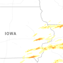
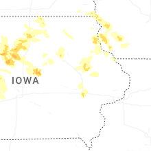
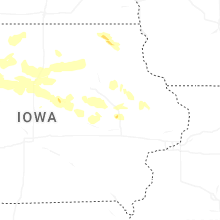

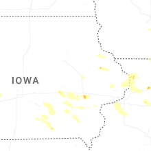
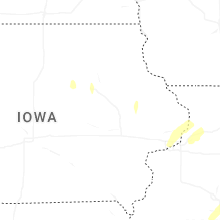


Connect with Interactive Hail Maps