

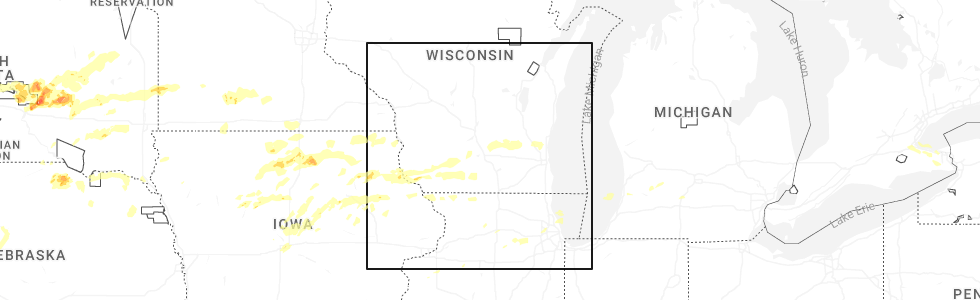
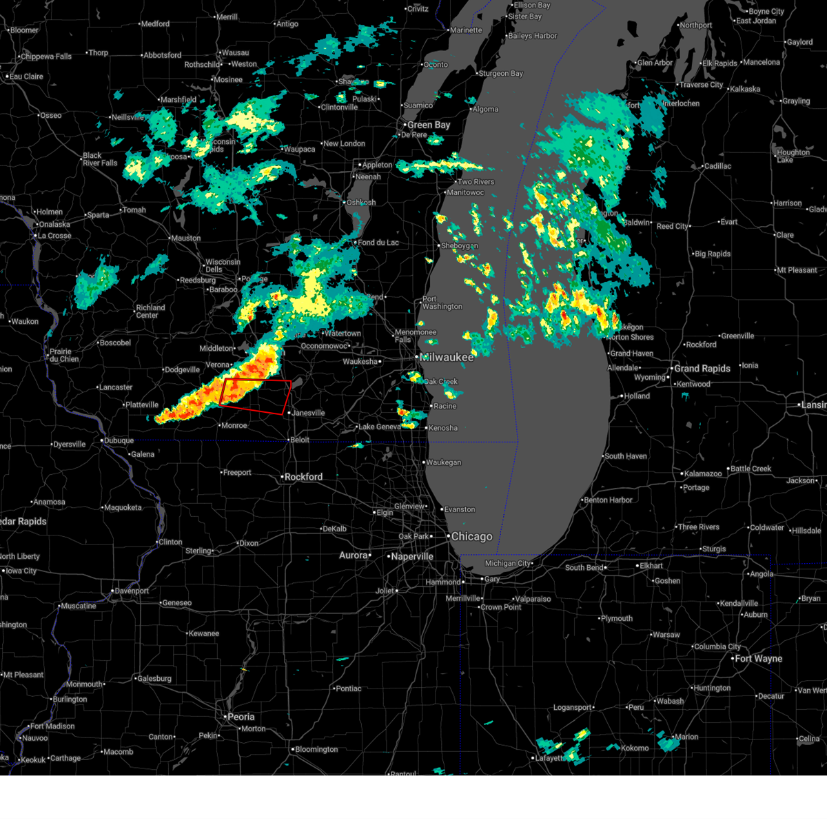
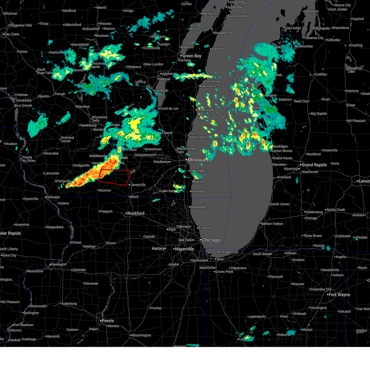
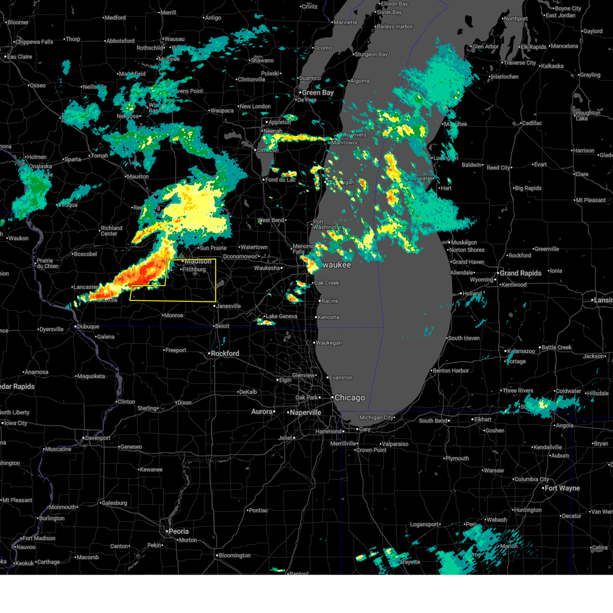
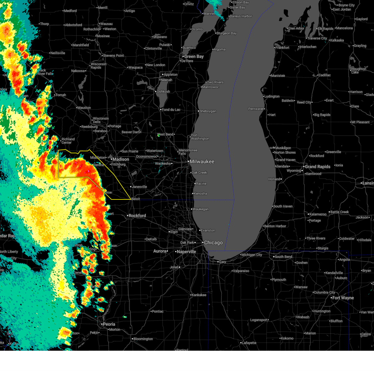
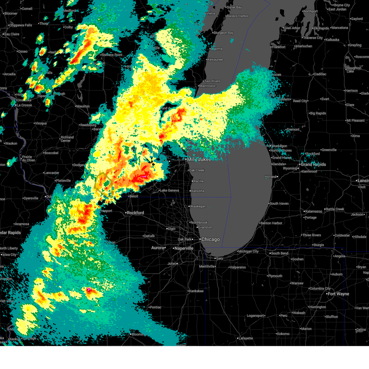
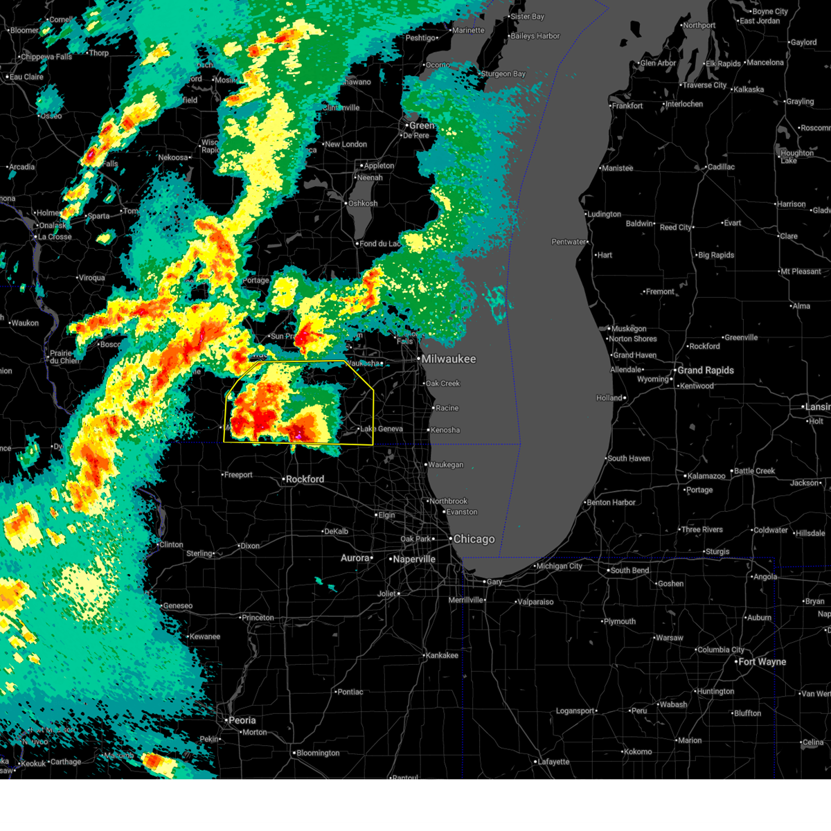
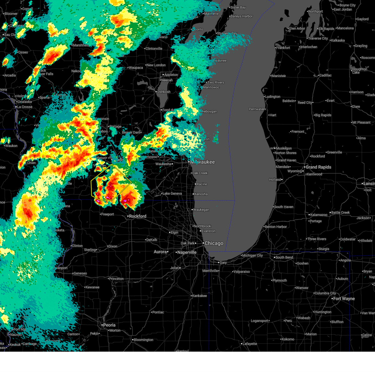
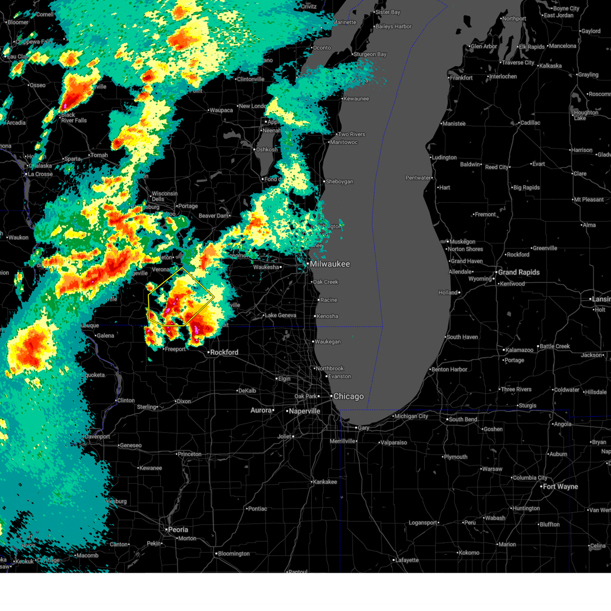
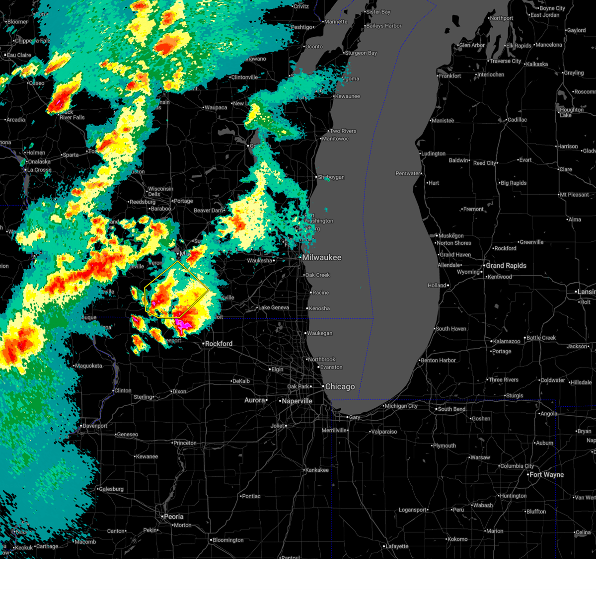
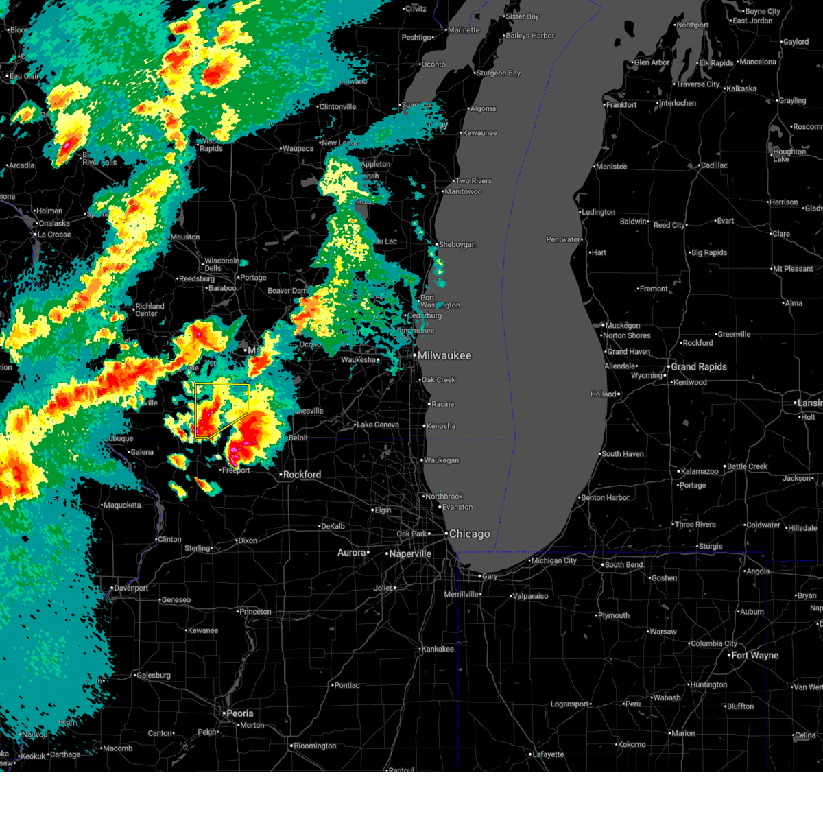
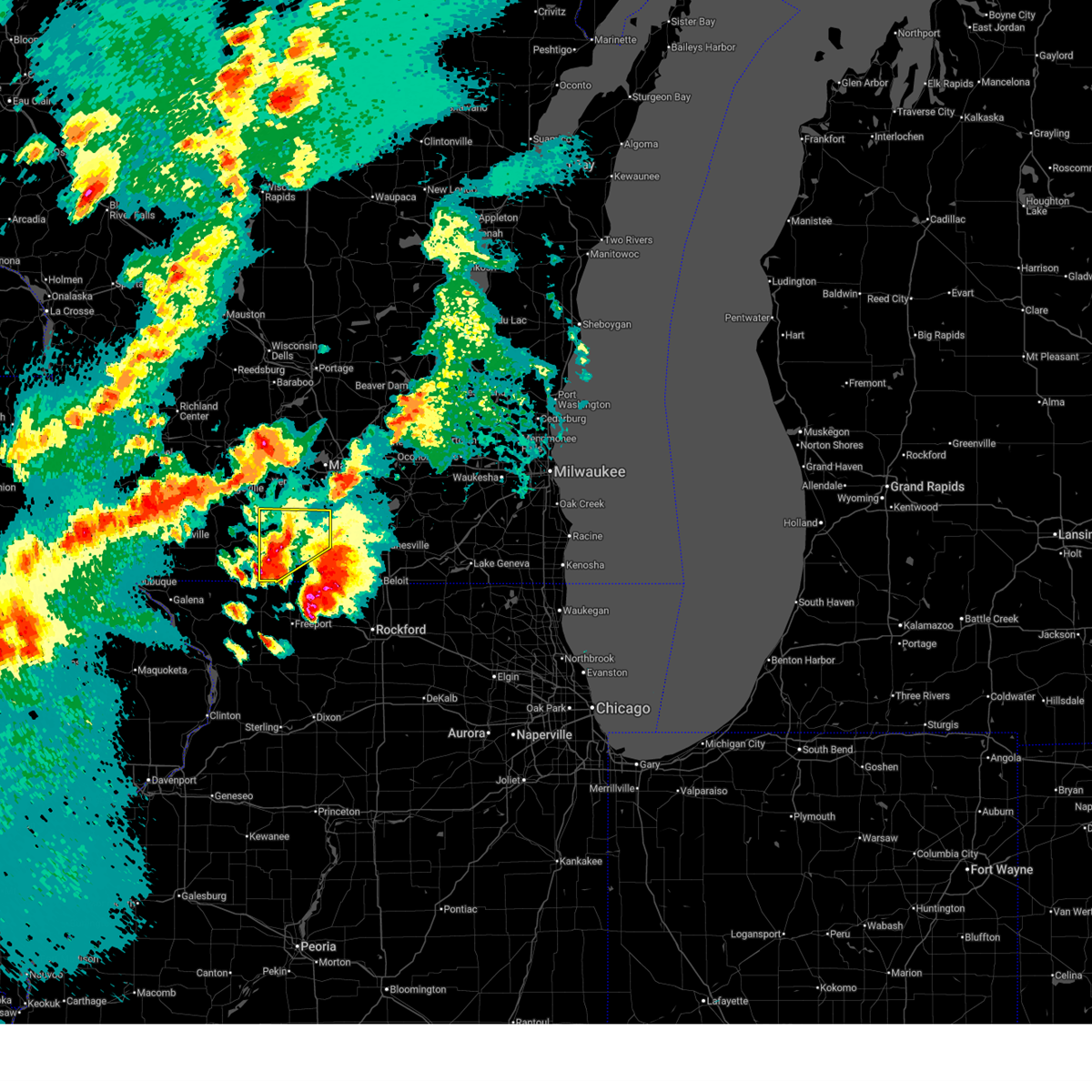
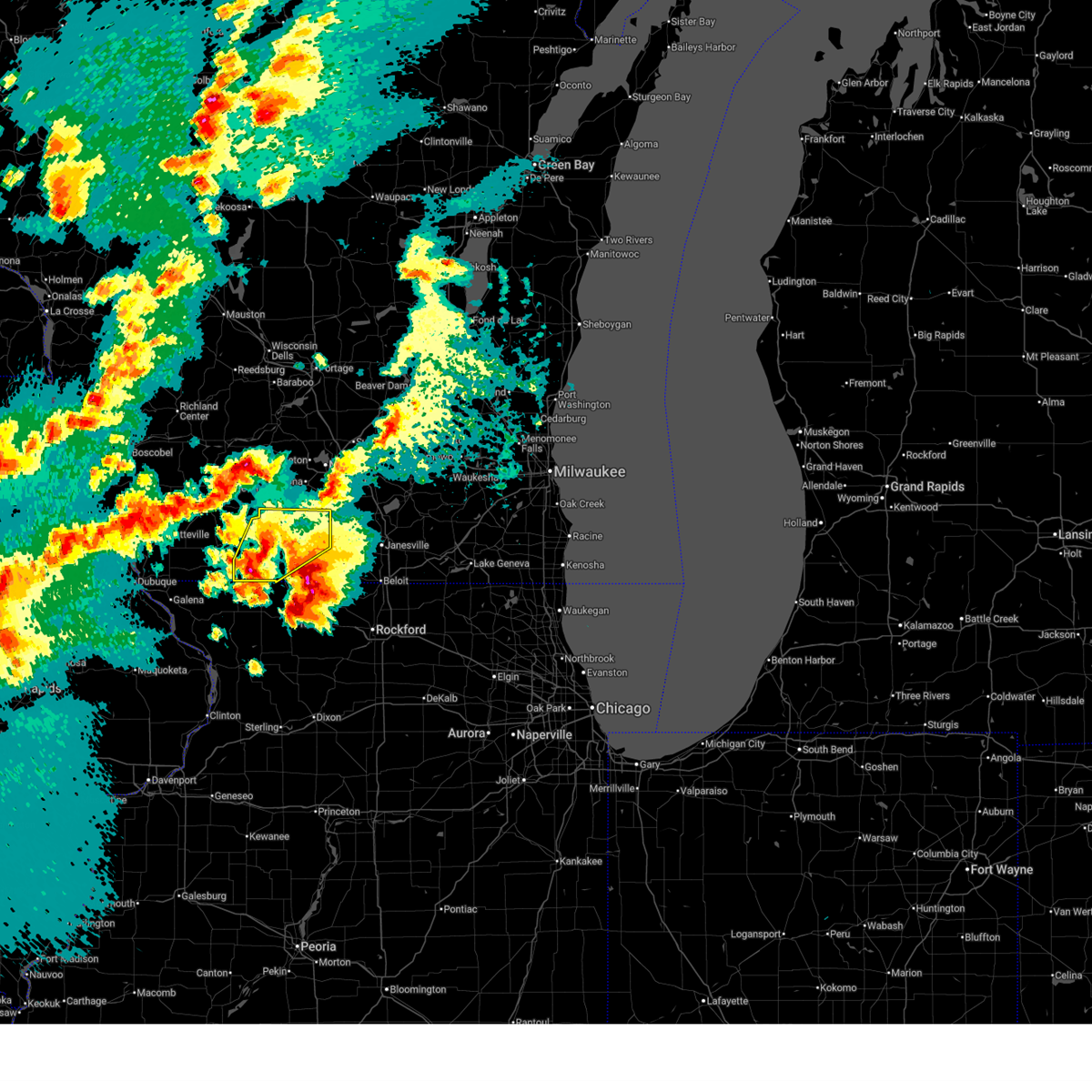
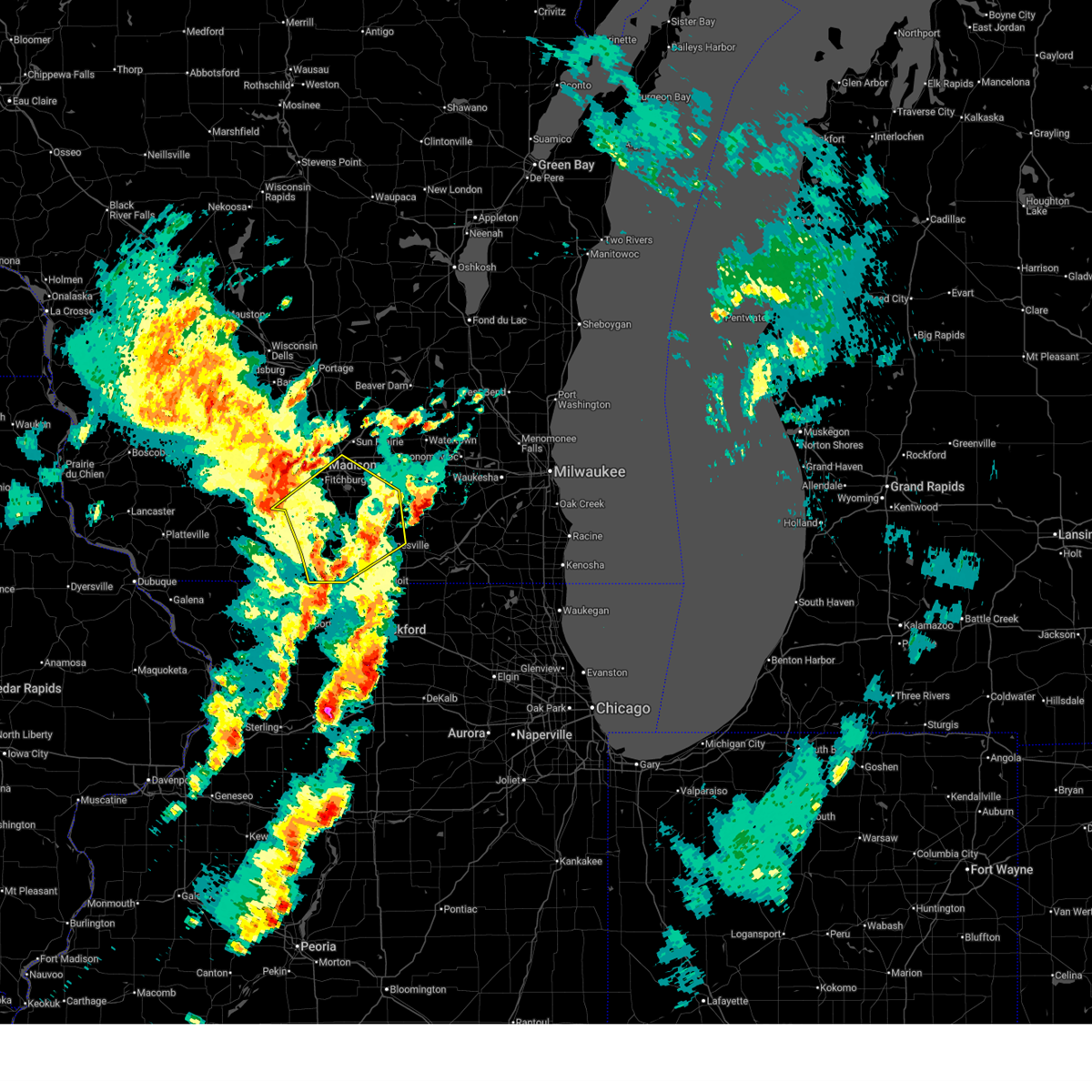
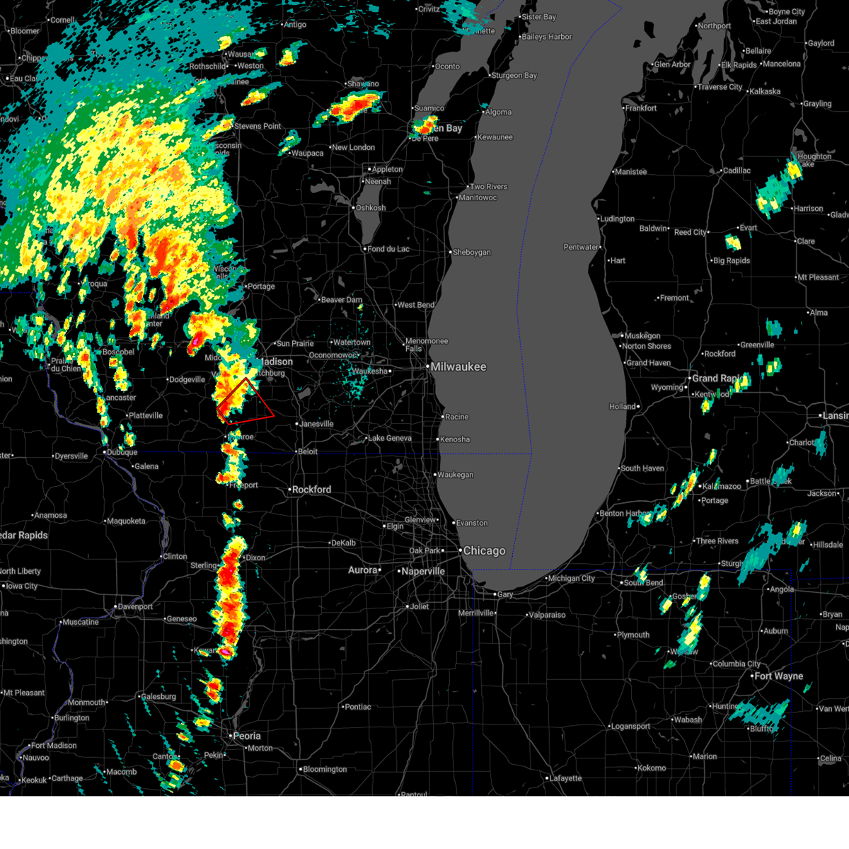
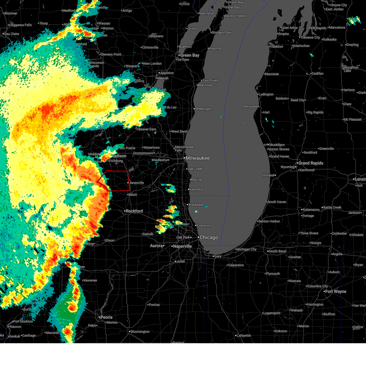
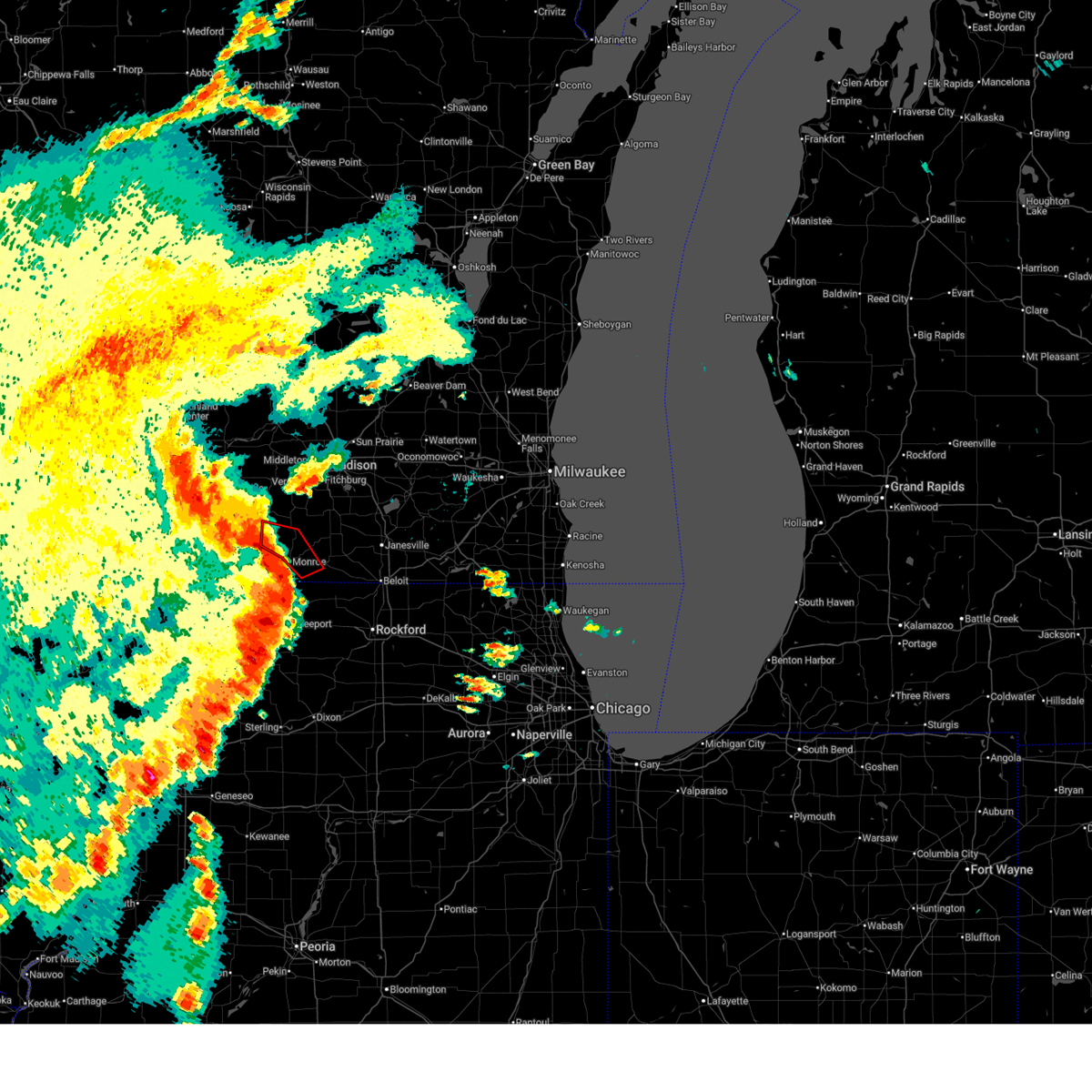
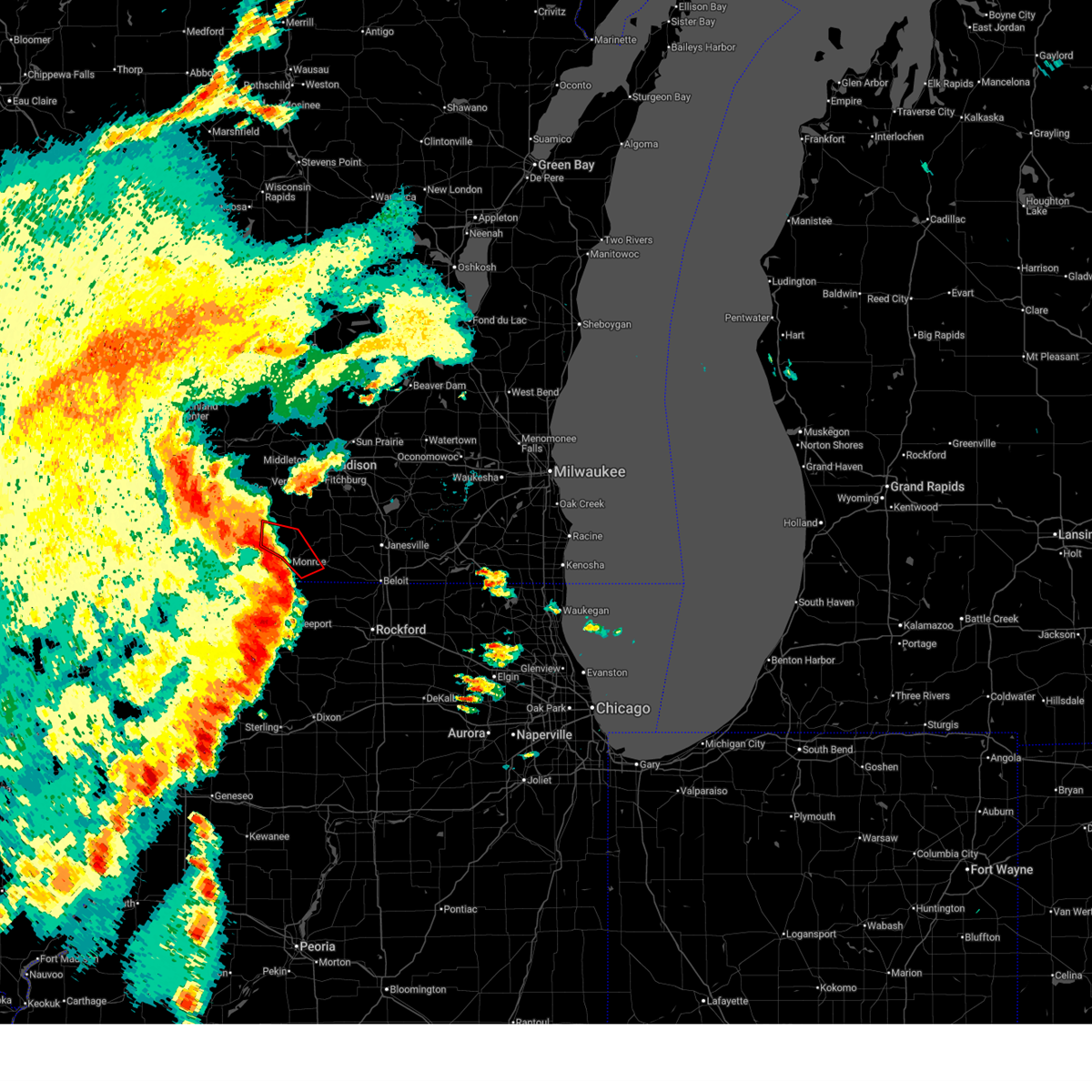
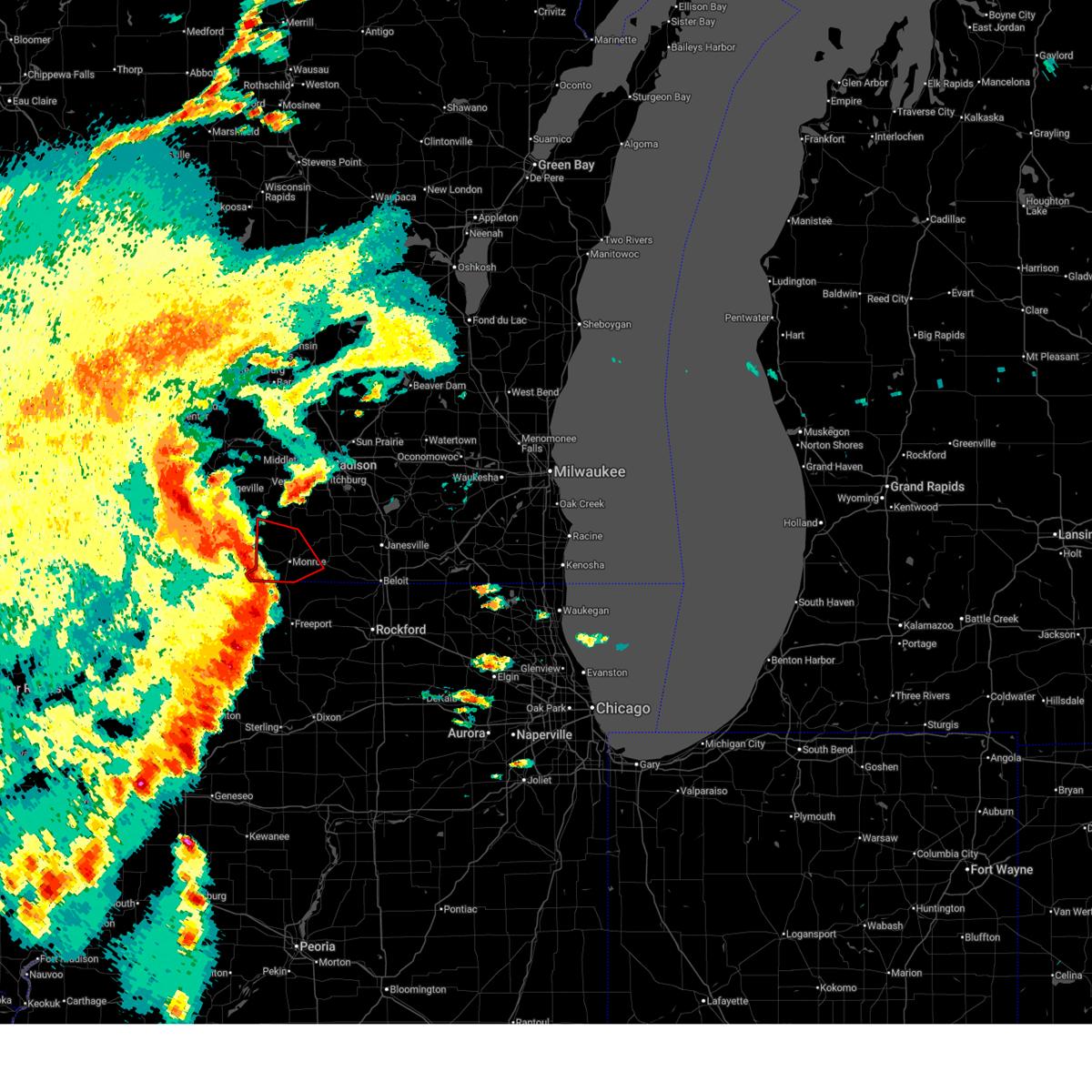
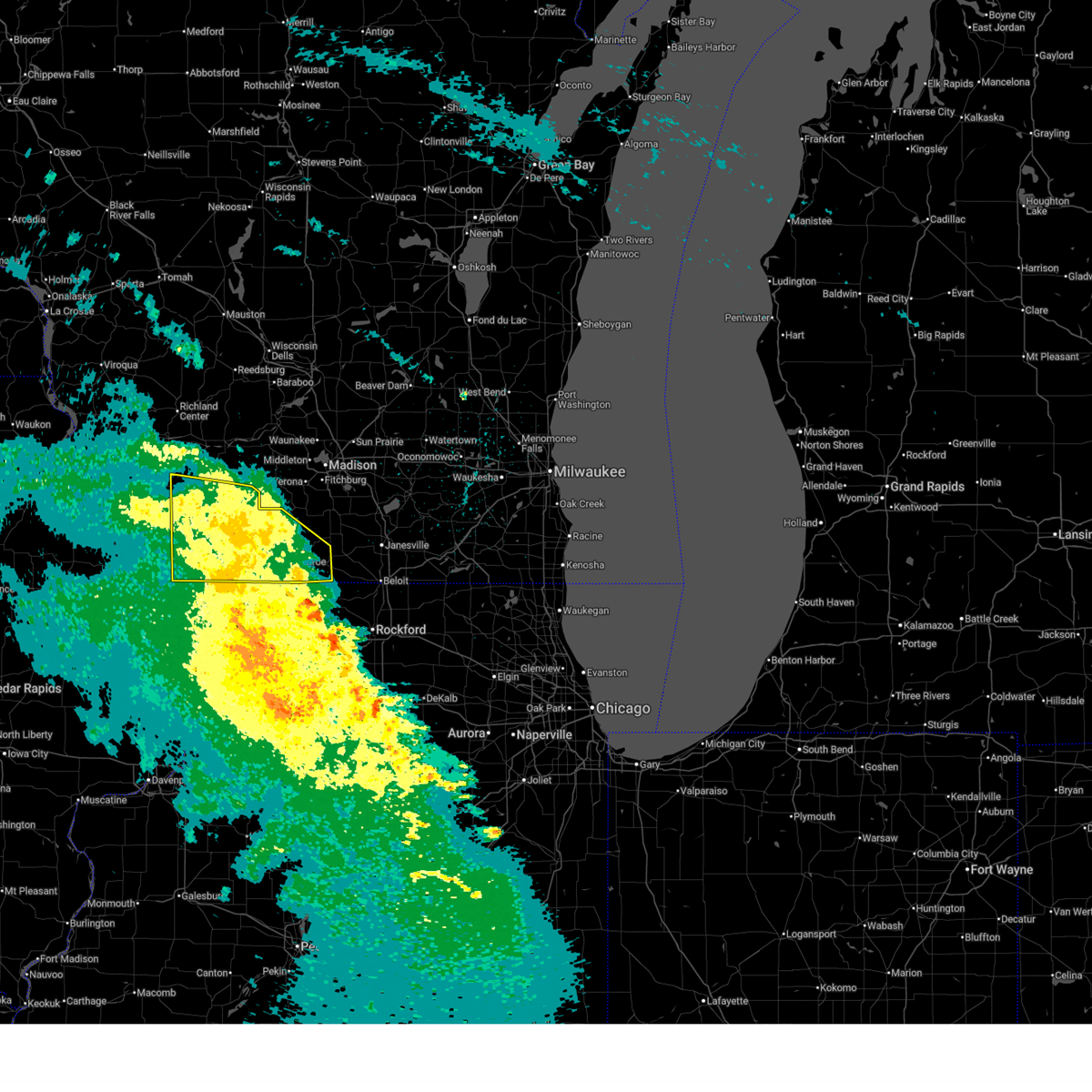
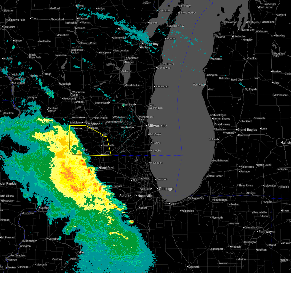
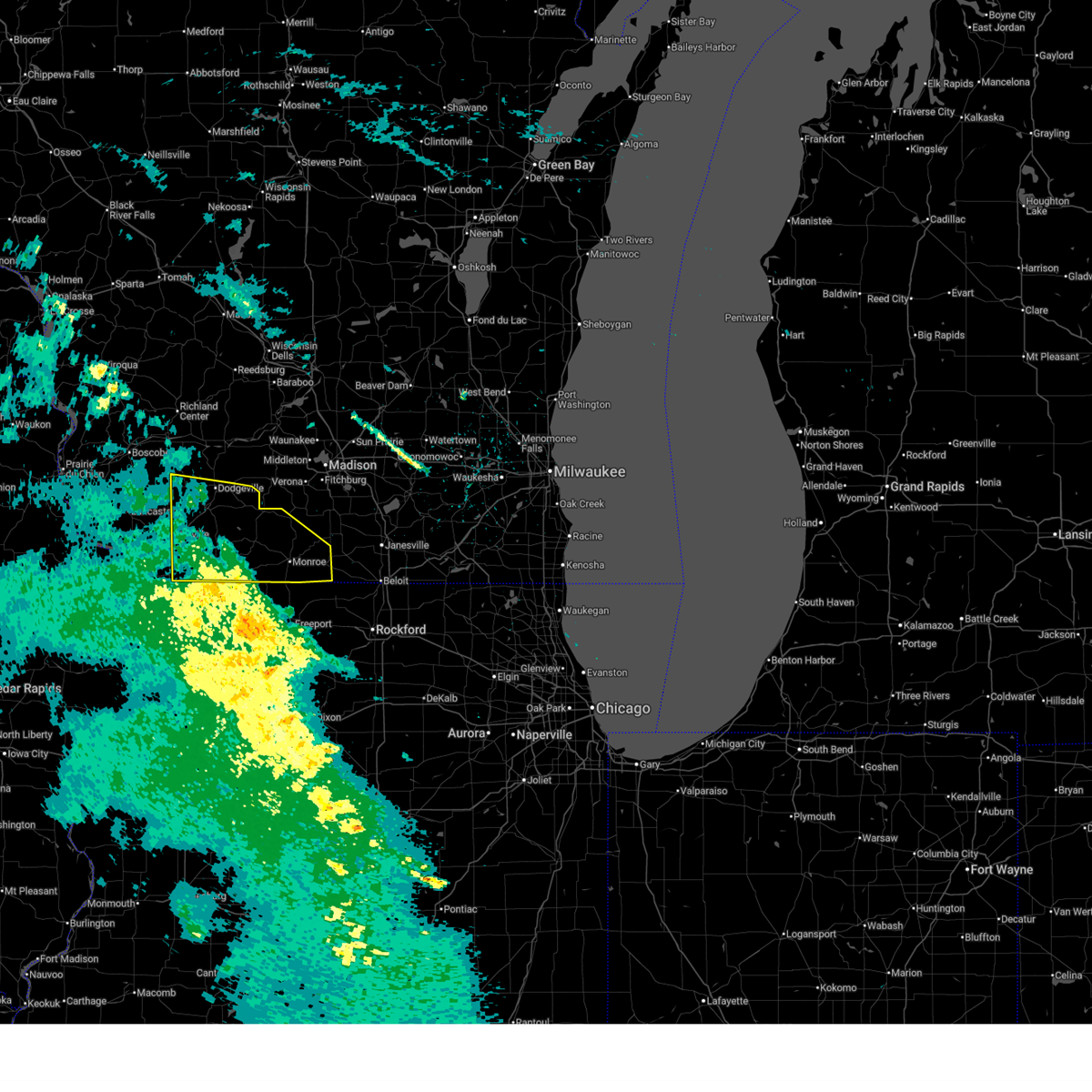
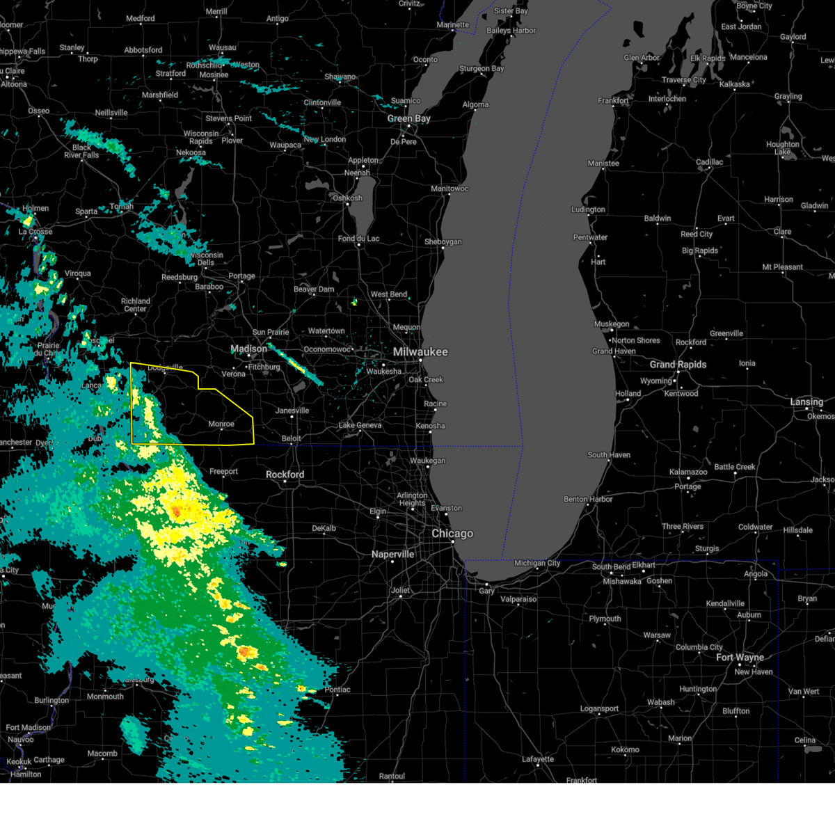
Hail Map for Monticello, WI
The Monticello, WI area has had 2 reports of on-the-ground hail by trained spotters, and has been under severe weather warnings 42 times during the past 12 months. Doppler radar has detected hail at or near Monticello, WI on 61 occasions, including 6 occasions during the past year.
| Name: | Monticello, WI |
| Where Located: | 24.8 miles SSW of Madison, WI |
| Map: | Google Map for Monticello, WI |
| Population: | 1217 |
| Housing Units: | 566 |
| More Info: | Search Google for Monticello, WI |
3
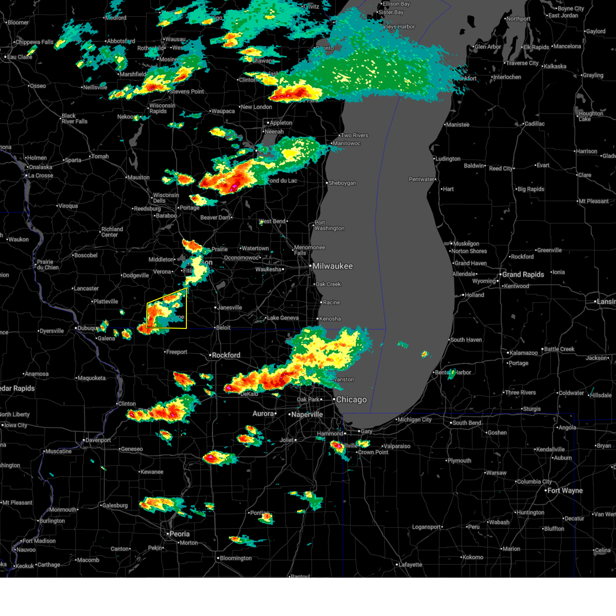
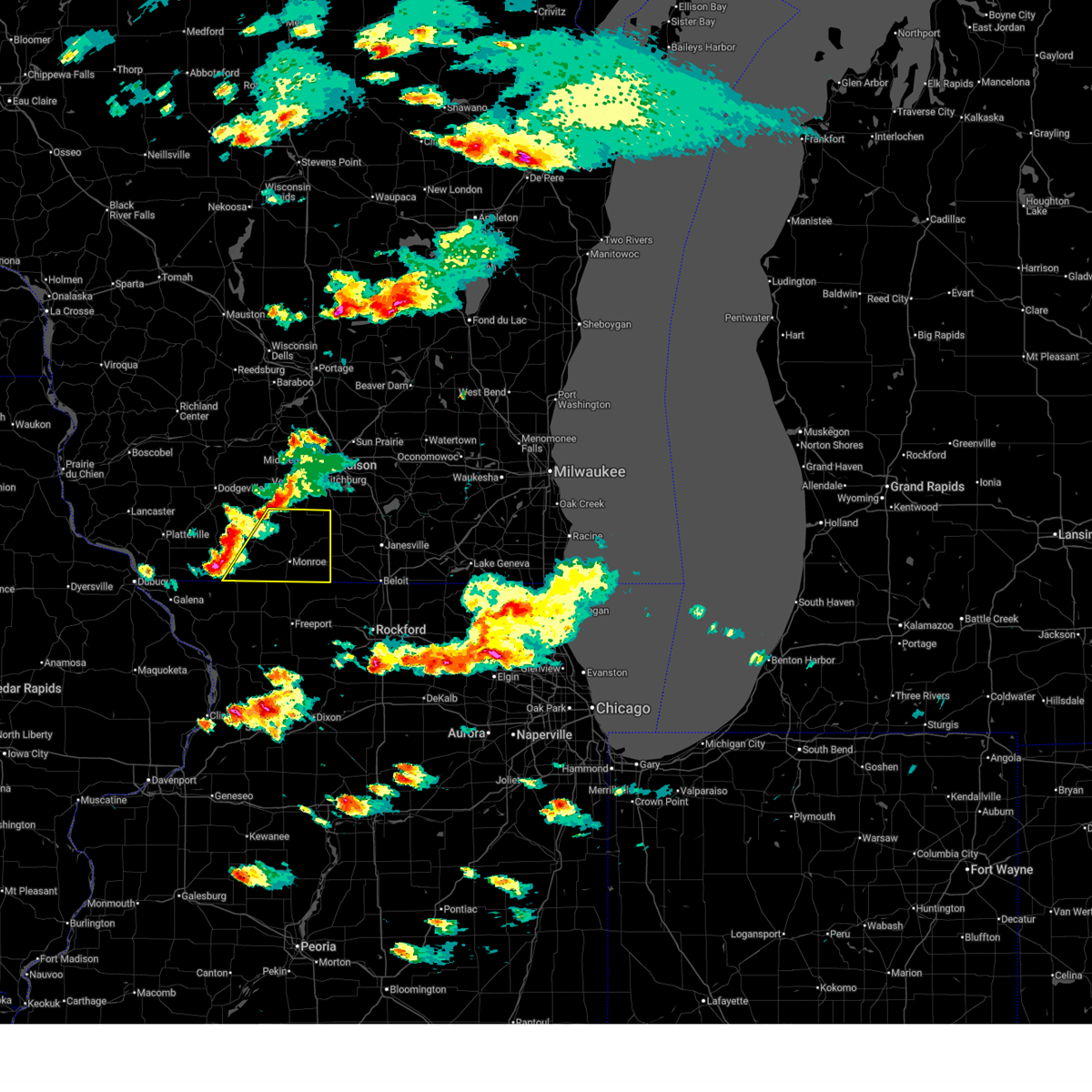
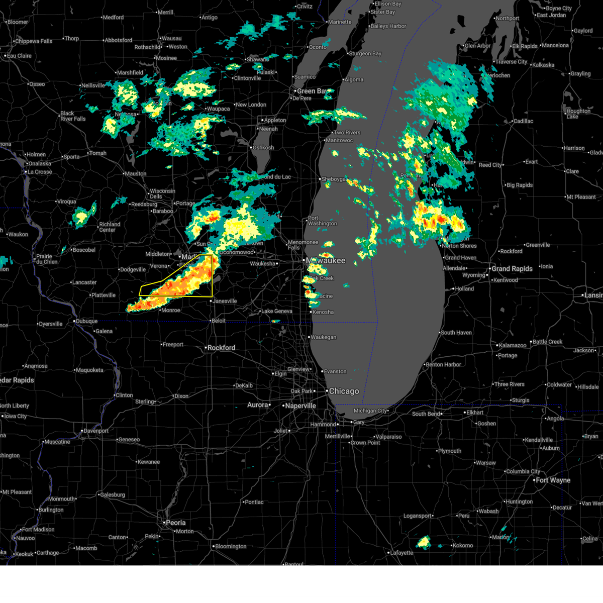
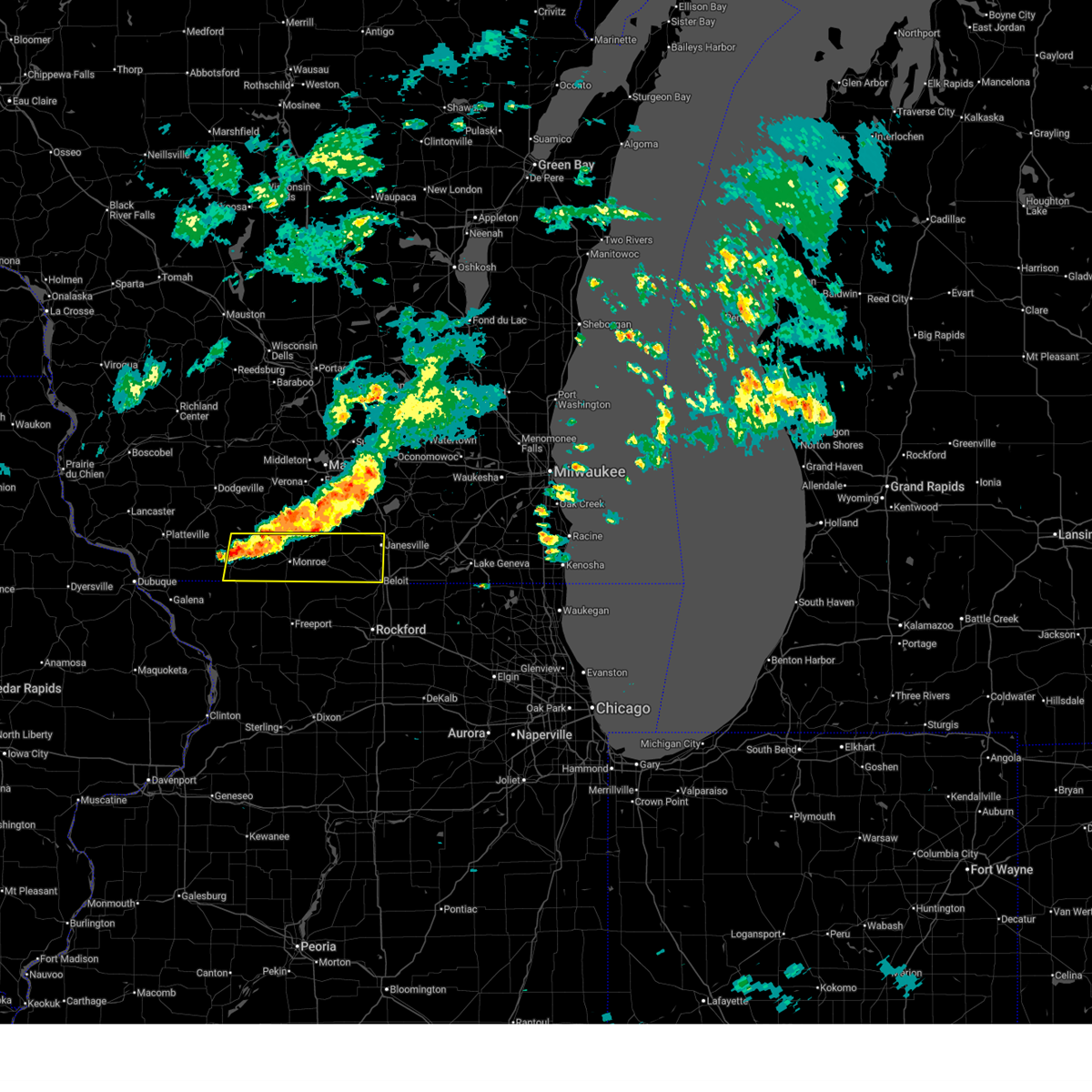
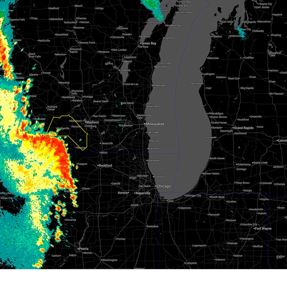
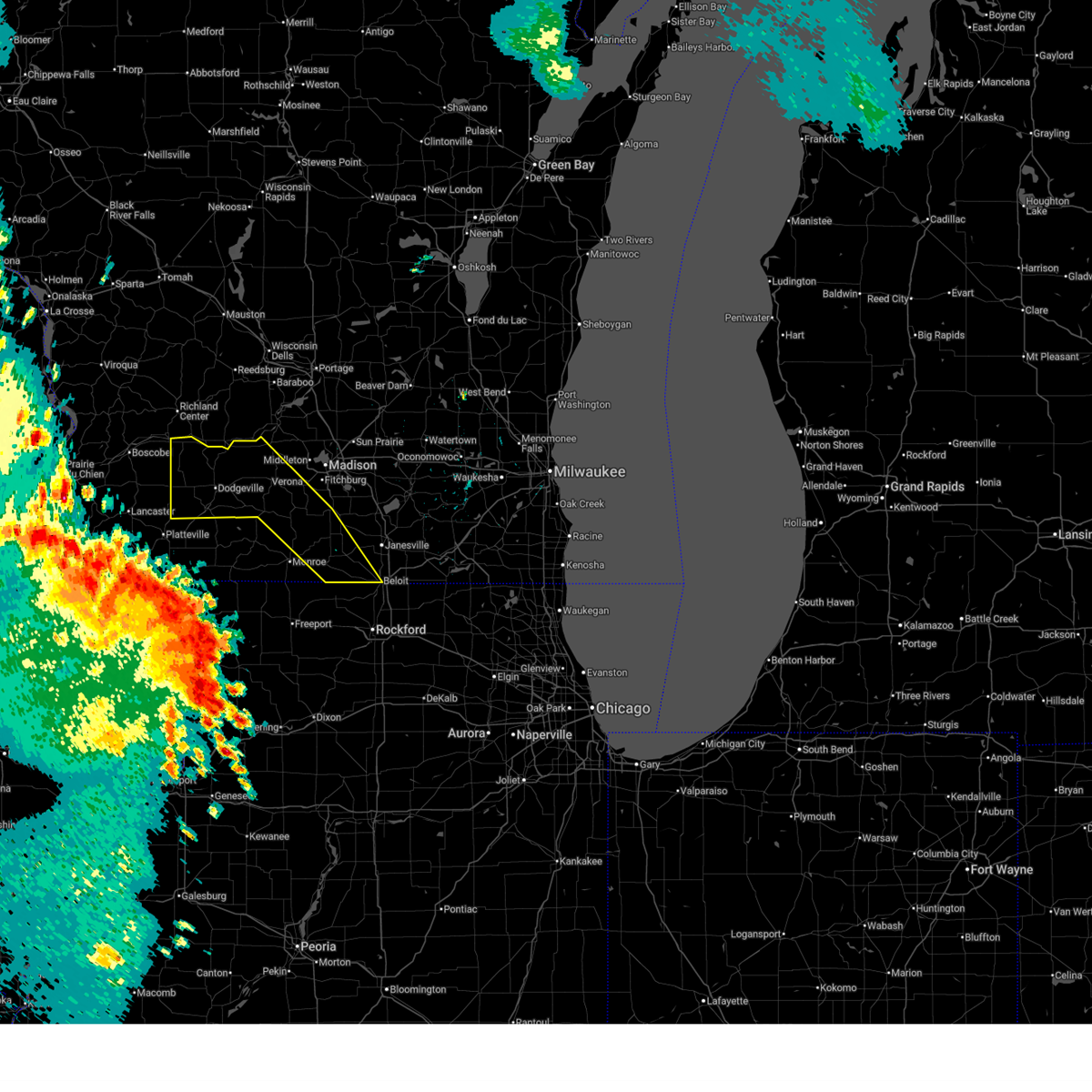
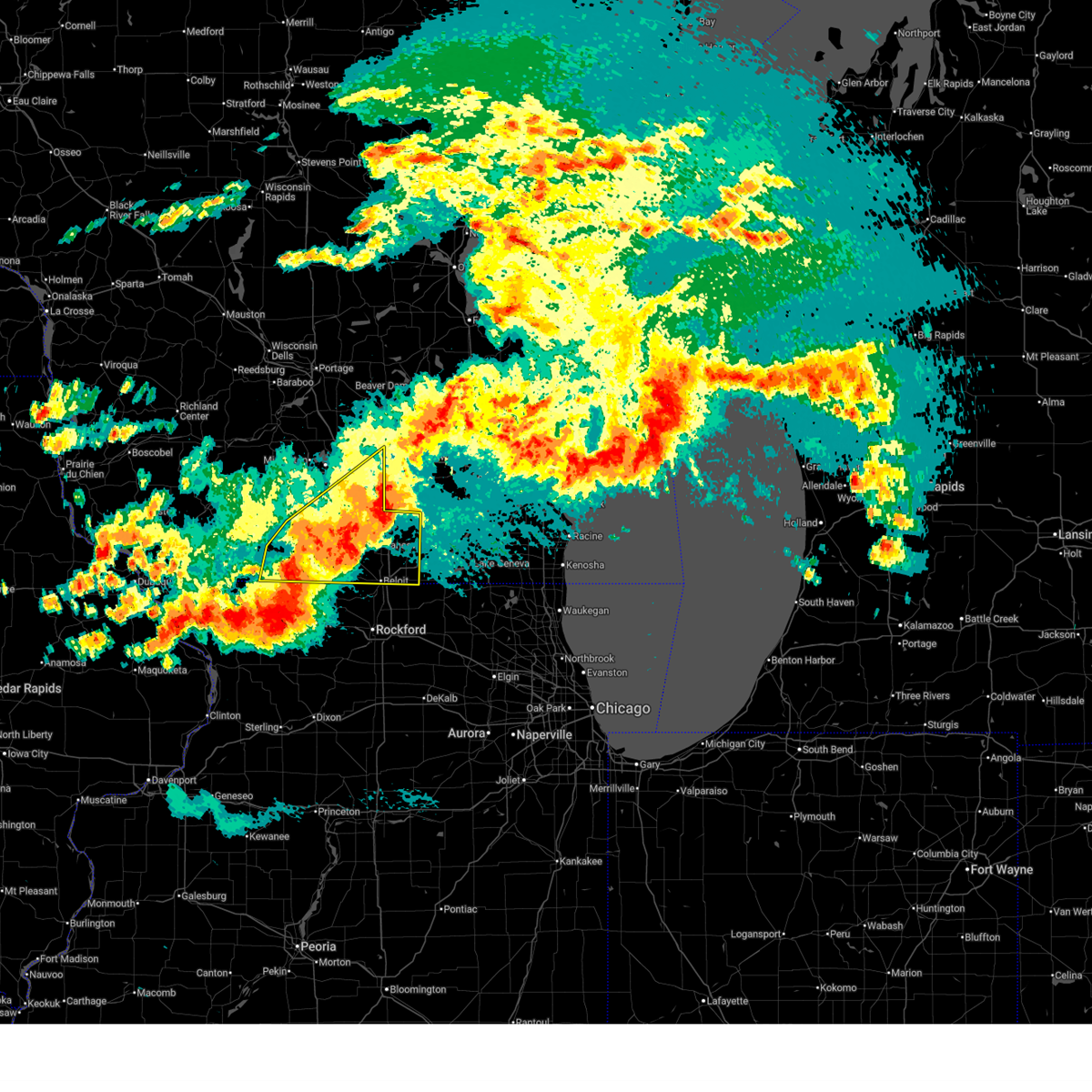
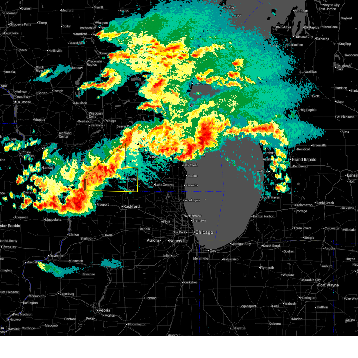
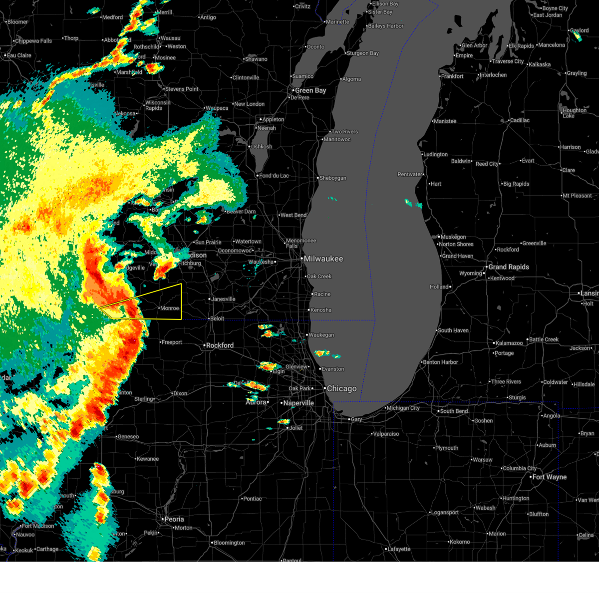
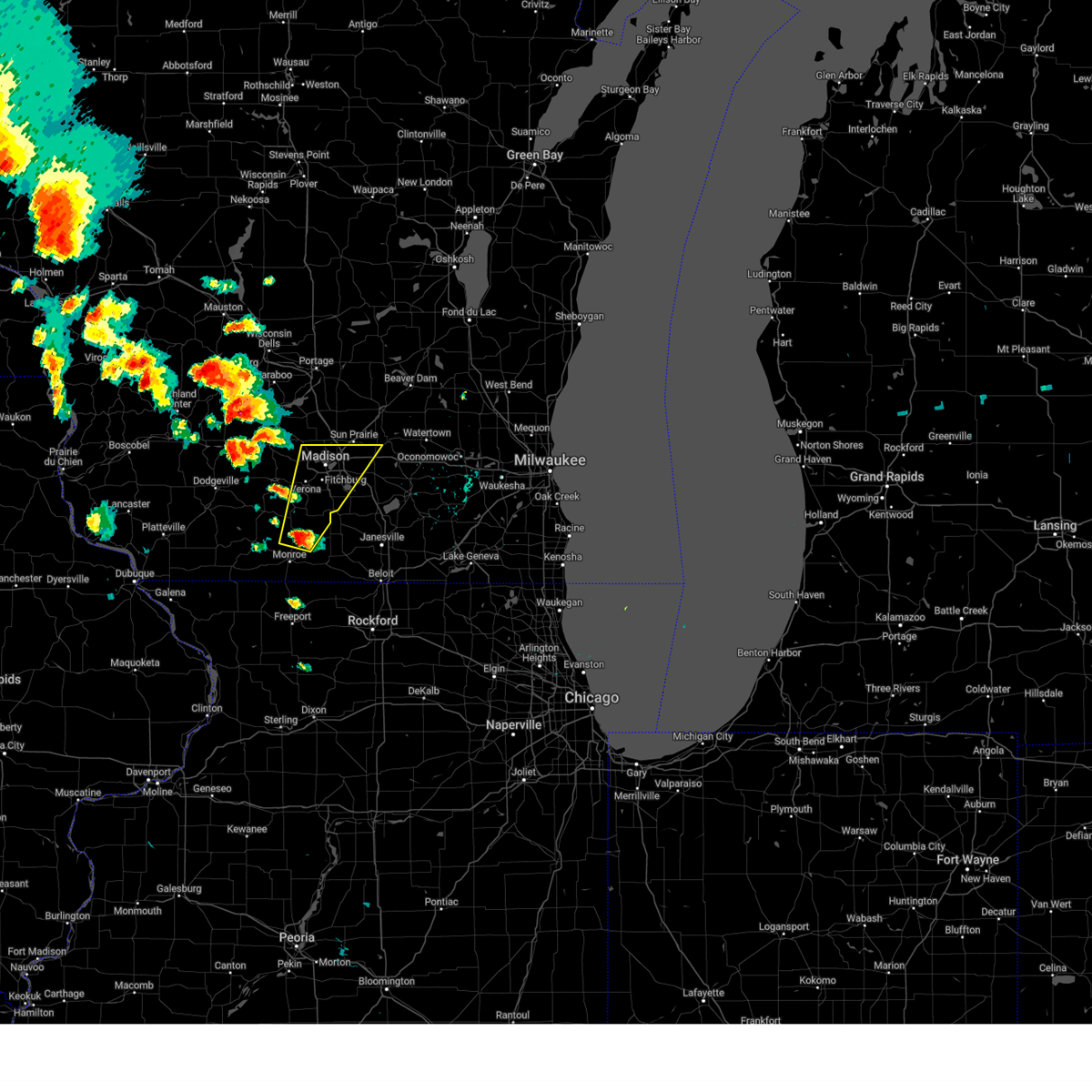
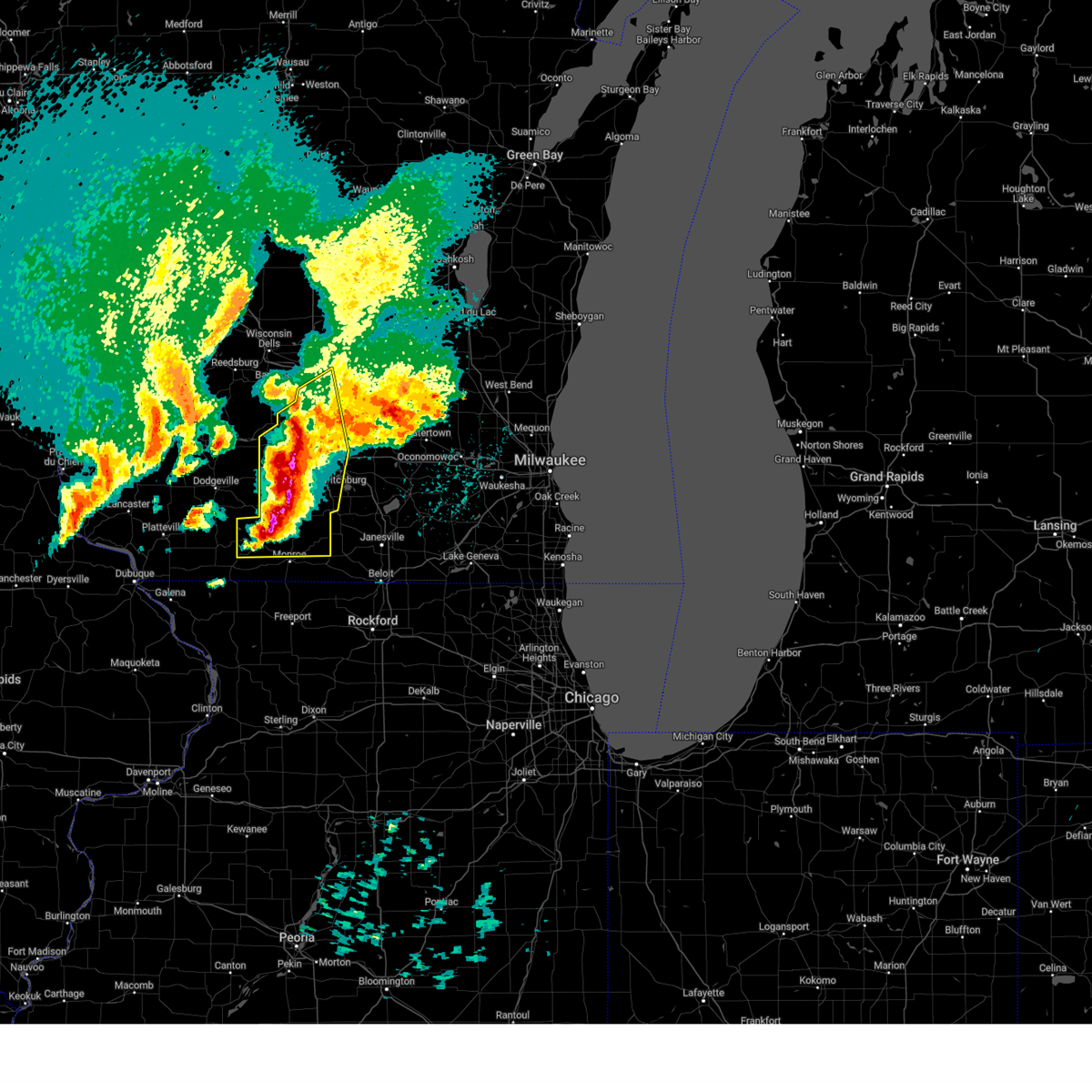
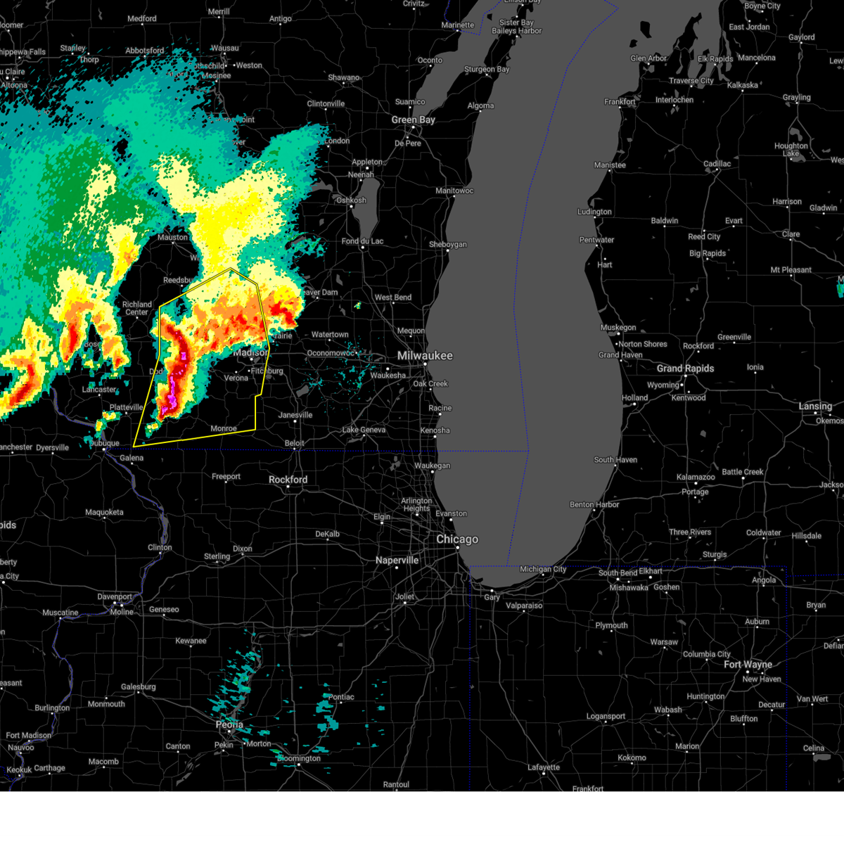
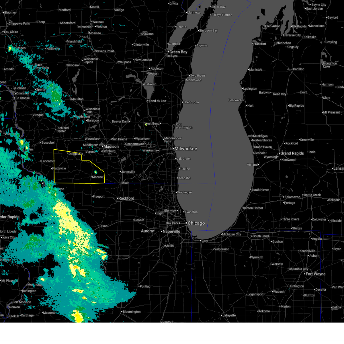
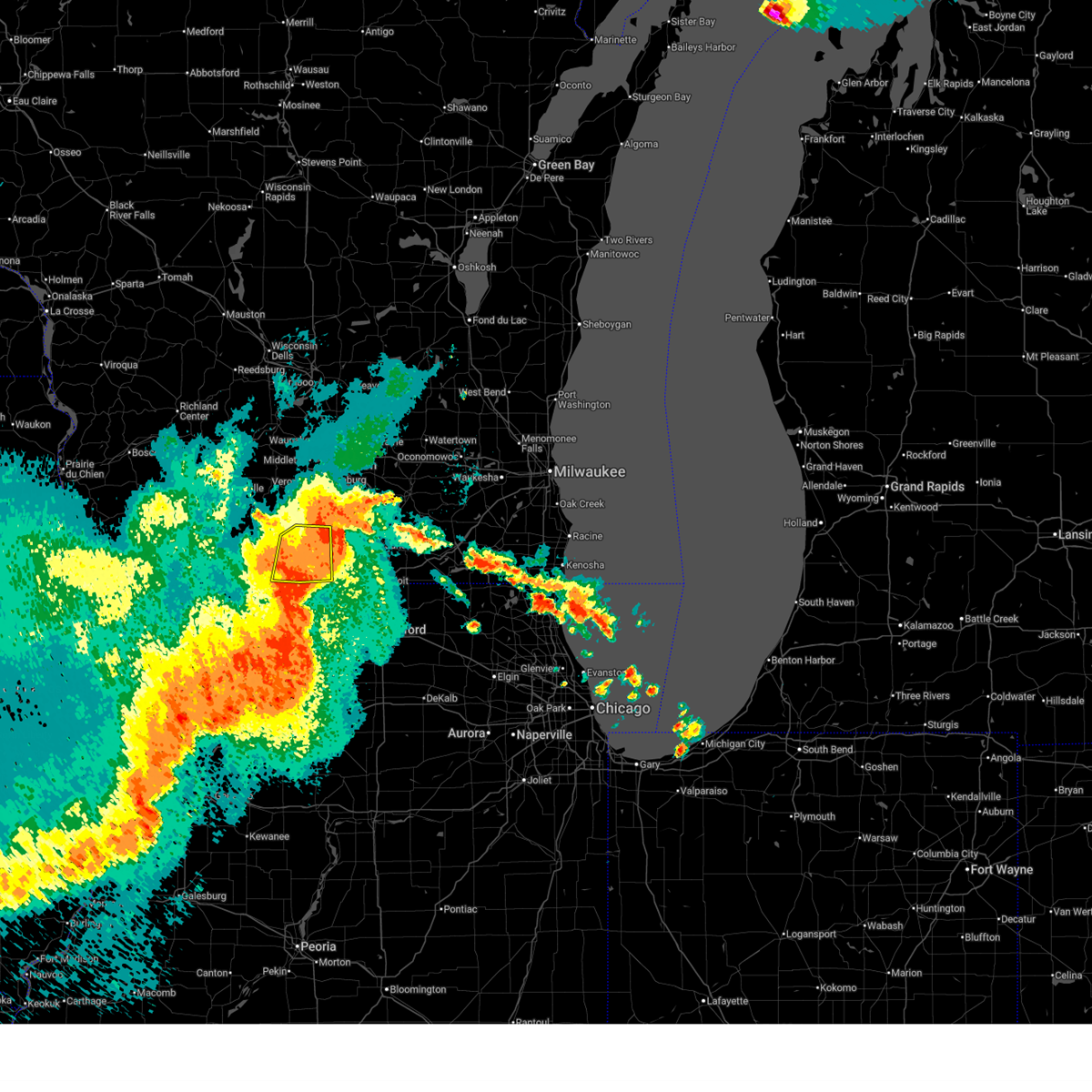
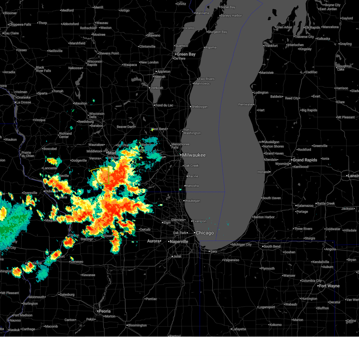
The Top Recent Hail Date for Monticello, WI is Thursday, July 2, 2026 (17th out of 61)
Hail and Wind Damage Spotted near Monticello, WI
| Date / Time | Report Details |
|---|---|
| 7/2/2026 5:48 PM CDT |
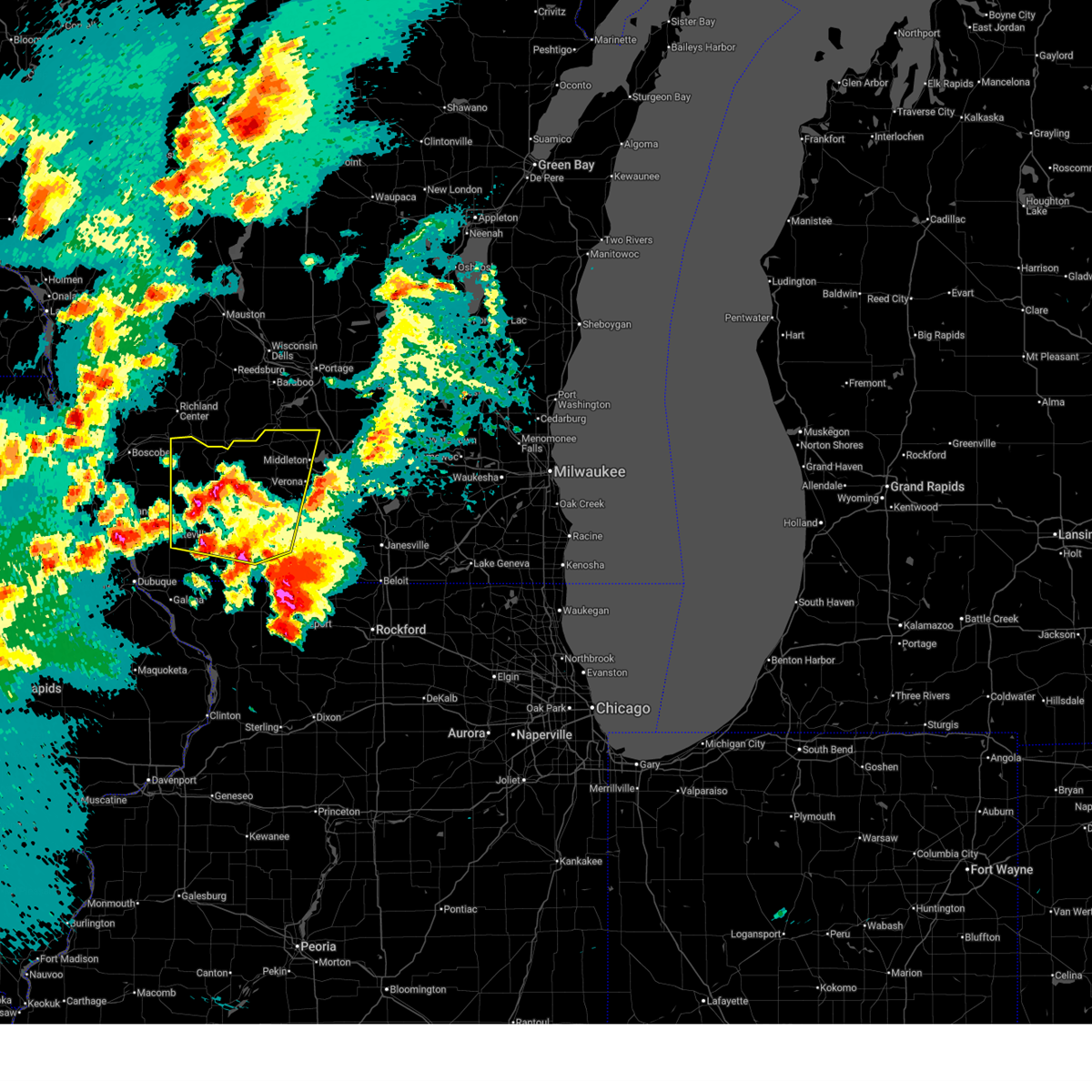
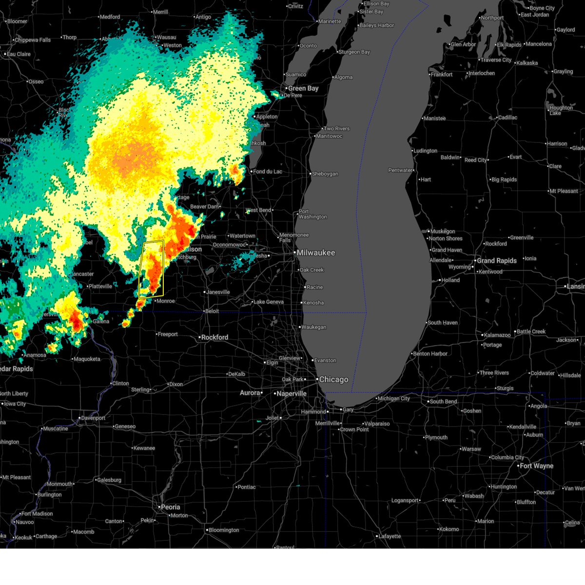 At 547 pm cdt, severe thunderstorms were located along a line extending from madison to near monroe, moving east at 40 mph (radar indicated). Hazards include 70 mph wind gusts and penny size hail. Expect considerable tree damage. damage is likely to mobile homes, roofs, and outbuildings. Locations impacted include, western madison, middleton, verona, mount horeb, cross plains, belleville, new glarus, black earth, monticello, pine bluff, mount vernon, and jordan center. At 547 pm cdt, severe thunderstorms were located along a line extending from madison to near monroe, moving east at 40 mph (radar indicated). Hazards include 70 mph wind gusts and penny size hail. Expect considerable tree damage. damage is likely to mobile homes, roofs, and outbuildings. Locations impacted include, western madison, middleton, verona, mount horeb, cross plains, belleville, new glarus, black earth, monticello, pine bluff, mount vernon, and jordan center.
|
| 7/2/2026 5:11 PM CDT |
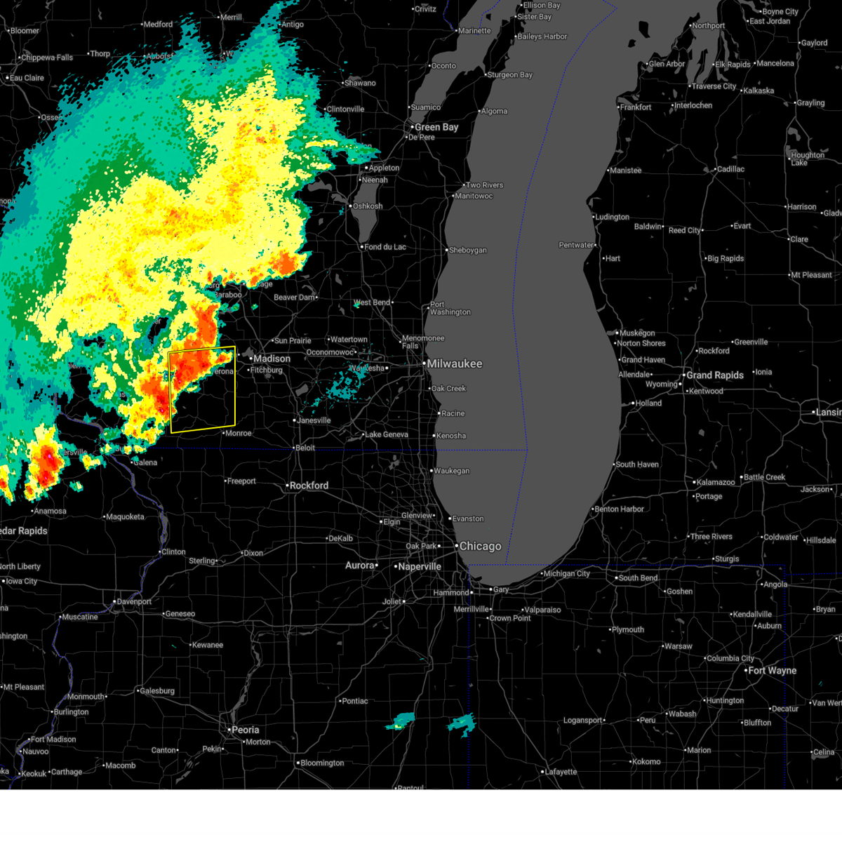 At 511 pm cdt, severe thunderstorms were located along a line extending from 8 miles west of mount horeb to 6 miles north of darlington, moving east at 40 mph (personal weather stations and airport observations confirm 60 to 70 mph wind gusts. hail threat is radar indicated). Hazards include 70 mph wind gusts and quarter size hail. Hail damage to vehicles is expected. expect considerable tree damage. wind damage is also likely to mobile homes, roofs, and outbuildings. Locations impacted include, western madison, middleton, verona, mount horeb, cross plains, belleville, new glarus, black earth, monticello, argyle, blanchardville, barneveld, wiota, blue mounds, ridgeway, waldwick, fayette, lamont, hollandale, and mount vernon. At 511 pm cdt, severe thunderstorms were located along a line extending from 8 miles west of mount horeb to 6 miles north of darlington, moving east at 40 mph (personal weather stations and airport observations confirm 60 to 70 mph wind gusts. hail threat is radar indicated). Hazards include 70 mph wind gusts and quarter size hail. Hail damage to vehicles is expected. expect considerable tree damage. wind damage is also likely to mobile homes, roofs, and outbuildings. Locations impacted include, western madison, middleton, verona, mount horeb, cross plains, belleville, new glarus, black earth, monticello, argyle, blanchardville, barneveld, wiota, blue mounds, ridgeway, waldwick, fayette, lamont, hollandale, and mount vernon.
|
| 7/2/2026 4:55 PM CDT |
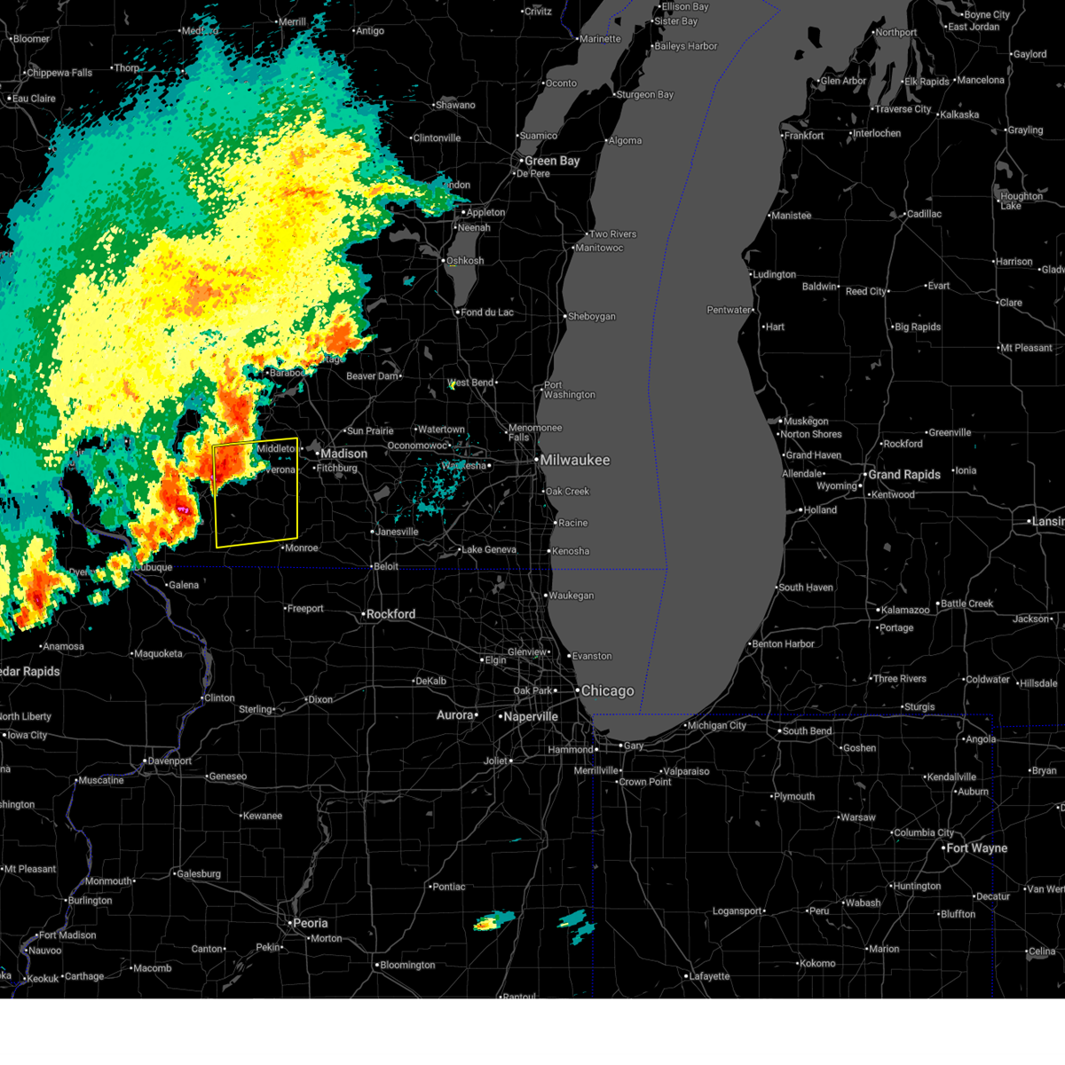 Svrmkx the national weather service in milwaukee/sullivan has issued a * severe thunderstorm warning for, northeastern lafayette county in south central wisconsin, northwestern green county in south central wisconsin, southeastern iowa county in south central wisconsin, southwestern dane county in south central wisconsin, * until 600 pm cdt. * at 454 pm cdt, severe thunderstorms were located along a line extending from dodgeville to near belmont, moving east at 40 mph (radar indicated). Hazards include 70 mph wind gusts and quarter size hail. Hail damage to vehicles is expected. expect considerable tree damage. Wind damage is also likely to mobile homes, roofs, and outbuildings. Svrmkx the national weather service in milwaukee/sullivan has issued a * severe thunderstorm warning for, northeastern lafayette county in south central wisconsin, northwestern green county in south central wisconsin, southeastern iowa county in south central wisconsin, southwestern dane county in south central wisconsin, * until 600 pm cdt. * at 454 pm cdt, severe thunderstorms were located along a line extending from dodgeville to near belmont, moving east at 40 mph (radar indicated). Hazards include 70 mph wind gusts and quarter size hail. Hail damage to vehicles is expected. expect considerable tree damage. Wind damage is also likely to mobile homes, roofs, and outbuildings.
|
| 6/24/2026 6:27 PM CDT |
 At 627 pm cdt, severe thunderstorms were located along a line extending from near albany to near cedarville, moving east at 50 mph (radar indicated). Hazards include 60 mph wind gusts and quarter size hail. Hail damage to vehicles is expected. expect wind damage to roofs, siding, and trees. Locations impacted include, monroe, brodhead, brooklyn, monticello, albany, browntown, attica, juda, and jordan center. At 627 pm cdt, severe thunderstorms were located along a line extending from near albany to near cedarville, moving east at 50 mph (radar indicated). Hazards include 60 mph wind gusts and quarter size hail. Hail damage to vehicles is expected. expect wind damage to roofs, siding, and trees. Locations impacted include, monroe, brodhead, brooklyn, monticello, albany, browntown, attica, juda, and jordan center.
|
| 6/24/2026 6:06 PM CDT |
 Svrmkx the national weather service in milwaukee/sullivan has issued a * severe thunderstorm warning for, southeastern lafayette county in south central wisconsin, green county in south central wisconsin, * until 700 pm cdt. * at 605 pm cdt, severe thunderstorms were located along a line extending from near new glarus to warren, moving east at 50 mph (radar indicated). Hazards include 60 mph wind gusts and quarter size hail. Hail damage to vehicles is expected. Expect wind damage to roofs, siding, and trees. Svrmkx the national weather service in milwaukee/sullivan has issued a * severe thunderstorm warning for, southeastern lafayette county in south central wisconsin, green county in south central wisconsin, * until 700 pm cdt. * at 605 pm cdt, severe thunderstorms were located along a line extending from near new glarus to warren, moving east at 50 mph (radar indicated). Hazards include 60 mph wind gusts and quarter size hail. Hail damage to vehicles is expected. Expect wind damage to roofs, siding, and trees.
|
| 6/17/2026 7:27 PM CDT |
 At 726 pm cdt, severe thunderstorms were located along a line extending from near cottage grove to near evansville, moving east at 45 mph (radar indicated). Hazards include 60 mph wind gusts. Expect damage to roofs, siding, and trees. Locations impacted include, eastern madison, janesville, fitchburg, stoughton, oregon, mcfarland, edgerton, evansville, cottage grove, belleville, deerfield, new glarus, cambridge, brooklyn, monticello, blanchardville, lake koshkonong, fulton, albion, and dayton. At 726 pm cdt, severe thunderstorms were located along a line extending from near cottage grove to near evansville, moving east at 45 mph (radar indicated). Hazards include 60 mph wind gusts. Expect damage to roofs, siding, and trees. Locations impacted include, eastern madison, janesville, fitchburg, stoughton, oregon, mcfarland, edgerton, evansville, cottage grove, belleville, deerfield, new glarus, cambridge, brooklyn, monticello, blanchardville, lake koshkonong, fulton, albion, and dayton.
|
| 6/17/2026 7:27 PM CDT |
 the severe thunderstorm warning has been cancelled and is no longer in effect the severe thunderstorm warning has been cancelled and is no longer in effect
|
| 6/17/2026 7:19 PM CDT |
 Svrmkx the national weather service in milwaukee/sullivan has issued a * severe thunderstorm warning for, southeastern lafayette county in south central wisconsin, green county in south central wisconsin, southwestern rock county in south central wisconsin, * until 815 pm cdt. * at 719 pm cdt, severe thunderstorms were located along a line extending from 7 miles west of monticello to near argyle to near darlington, moving east at 50 mph (radar indicated). Hazards include 60 mph wind gusts. expect damage to roofs, siding, and trees Svrmkx the national weather service in milwaukee/sullivan has issued a * severe thunderstorm warning for, southeastern lafayette county in south central wisconsin, green county in south central wisconsin, southwestern rock county in south central wisconsin, * until 815 pm cdt. * at 719 pm cdt, severe thunderstorms were located along a line extending from 7 miles west of monticello to near argyle to near darlington, moving east at 50 mph (radar indicated). Hazards include 60 mph wind gusts. expect damage to roofs, siding, and trees
|
| 6/17/2026 7:14 PM CDT |
 At 714 pm cdt, tornado producing storms were located along a line extending from belleville to near monticello, moving east at 35 mph (radar confirmed tornado near belleville). Hazards include damaging tornado. Flying debris will be dangerous to those caught without shelter. mobile homes will be damaged or destroyed. damage to roofs, windows, and vehicles will occur. tree damage is likely. these tornadic storms will be near, evansville, brooklyn, and albany around 720 pm cdt. edgerton around 740 pm cdt. Other locations impacted by these tornadic storms include fulton, indianford, attica, leyden, cooksville, albion, magnolia, and dayton. At 714 pm cdt, tornado producing storms were located along a line extending from belleville to near monticello, moving east at 35 mph (radar confirmed tornado near belleville). Hazards include damaging tornado. Flying debris will be dangerous to those caught without shelter. mobile homes will be damaged or destroyed. damage to roofs, windows, and vehicles will occur. tree damage is likely. these tornadic storms will be near, evansville, brooklyn, and albany around 720 pm cdt. edgerton around 740 pm cdt. Other locations impacted by these tornadic storms include fulton, indianford, attica, leyden, cooksville, albion, magnolia, and dayton.
|
| 6/17/2026 7:10 PM CDT |
 Tormkx the national weather service in milwaukee/sullivan has issued a * tornado warning for, northeastern green county in south central wisconsin, northwestern rock county in south central wisconsin, southeastern dane county in south central wisconsin, * until 800 pm cdt. * at 710 pm cdt, severe thunderstorms capable of producing a tornado were located along a line extending from belleville to near monticello, moving east at 40 mph (radar indicated rotation). Hazards include tornado. Flying debris will be dangerous to those caught without shelter. mobile homes will be damaged or destroyed. damage to roofs, windows, and vehicles will occur. tree damage is likely. these dangerous storms will be near, belleville, brooklyn, and albany around 715 pm cdt. evansville around 720 pm cdt. edgerton around 735 pm cdt. lake koshkonong around 740 pm cdt. Other locations impacted by these tornadic storms include fulton, indianford, attica, leyden, cooksville, albion, magnolia, and dayton. Tormkx the national weather service in milwaukee/sullivan has issued a * tornado warning for, northeastern green county in south central wisconsin, northwestern rock county in south central wisconsin, southeastern dane county in south central wisconsin, * until 800 pm cdt. * at 710 pm cdt, severe thunderstorms capable of producing a tornado were located along a line extending from belleville to near monticello, moving east at 40 mph (radar indicated rotation). Hazards include tornado. Flying debris will be dangerous to those caught without shelter. mobile homes will be damaged or destroyed. damage to roofs, windows, and vehicles will occur. tree damage is likely. these dangerous storms will be near, belleville, brooklyn, and albany around 715 pm cdt. evansville around 720 pm cdt. edgerton around 735 pm cdt. lake koshkonong around 740 pm cdt. Other locations impacted by these tornadic storms include fulton, indianford, attica, leyden, cooksville, albion, magnolia, and dayton.
|
| 6/17/2026 6:46 PM CDT |
 Svrmkx the national weather service in milwaukee/sullivan has issued a * severe thunderstorm warning for, northeastern lafayette county in south central wisconsin, northern green county in south central wisconsin, southeastern iowa county in south central wisconsin, northwestern rock county in south central wisconsin, southern dane county in south central wisconsin, * until 745 pm cdt. * at 645 pm cdt, severe thunderstorms were located along a line extending from near mount horeb to near blanchardville, moving east at 45 mph (radar indicated). Hazards include 60 mph wind gusts. expect damage to roofs, siding, and trees Svrmkx the national weather service in milwaukee/sullivan has issued a * severe thunderstorm warning for, northeastern lafayette county in south central wisconsin, northern green county in south central wisconsin, southeastern iowa county in south central wisconsin, northwestern rock county in south central wisconsin, southern dane county in south central wisconsin, * until 745 pm cdt. * at 645 pm cdt, severe thunderstorms were located along a line extending from near mount horeb to near blanchardville, moving east at 45 mph (radar indicated). Hazards include 60 mph wind gusts. expect damage to roofs, siding, and trees
|
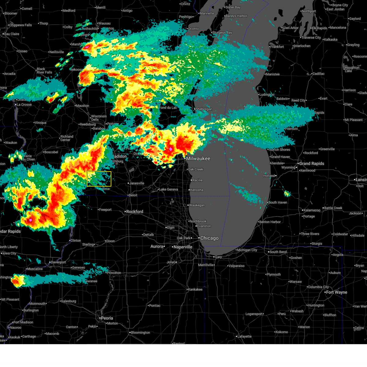
| 6/10/2026 1:42 PM CDT |
 At 141 pm cdt, severe thunderstorms were located along a line extending from 6 miles northeast of boscobel to blanchardville to near freeport, moving northeast at 45 mph. these are destructive storms for iowa, southwest dane, northeast green, and southwestern rock counties (radar indicated). Hazards include 80 mph wind gusts and penny size hail. Flying debris will be dangerous to those caught without shelter. mobile homes will be heavily damaged. expect considerable damage to roofs, windows, and vehicles. extensive tree damage and power outages are likely. Locations impacted include, beloit, verona, mount horeb, evansville, dodgeville, brodhead, mineral point, belleville, new glarus, mazomanie, orfordville, brooklyn, black earth, monticello, albany, footville, newark, barneveld, blue mounds, and highland. At 141 pm cdt, severe thunderstorms were located along a line extending from 6 miles northeast of boscobel to blanchardville to near freeport, moving northeast at 45 mph. these are destructive storms for iowa, southwest dane, northeast green, and southwestern rock counties (radar indicated). Hazards include 80 mph wind gusts and penny size hail. Flying debris will be dangerous to those caught without shelter. mobile homes will be heavily damaged. expect considerable damage to roofs, windows, and vehicles. extensive tree damage and power outages are likely. Locations impacted include, beloit, verona, mount horeb, evansville, dodgeville, brodhead, mineral point, belleville, new glarus, mazomanie, orfordville, brooklyn, black earth, monticello, albany, footville, newark, barneveld, blue mounds, and highland.
|
| 6/10/2026 1:40 PM CDT | Report of large tree branch down on home... time estimated from rada in green county WI, 0.2 miles SW of Monticello, WI |
| 6/10/2026 1:15 PM CDT |
 Svrmkx the national weather service in milwaukee/sullivan has issued a * severe thunderstorm warning for, northeastern green county in south central wisconsin, iowa county in south central wisconsin, southwestern dane county in south central wisconsin, * until 215 pm cdt. * at 114 pm cdt, severe thunderstorms were located along a line extending from near belmont to lena, moving northeast at 55 mph. these are destructive storms for eastern iowa, southwestern dane, and northeast green counties (radar indicated). Hazards include 80 mph wind gusts and penny size hail. Flying debris will be dangerous to those caught without shelter. mobile homes will be heavily damaged. expect considerable damage to roofs, windows, and vehicles. Extensive tree damage and power outages are likely. Svrmkx the national weather service in milwaukee/sullivan has issued a * severe thunderstorm warning for, northeastern green county in south central wisconsin, iowa county in south central wisconsin, southwestern dane county in south central wisconsin, * until 215 pm cdt. * at 114 pm cdt, severe thunderstorms were located along a line extending from near belmont to lena, moving northeast at 55 mph. these are destructive storms for eastern iowa, southwestern dane, and northeast green counties (radar indicated). Hazards include 80 mph wind gusts and penny size hail. Flying debris will be dangerous to those caught without shelter. mobile homes will be heavily damaged. expect considerable damage to roofs, windows, and vehicles. Extensive tree damage and power outages are likely.
|
| 6/10/2026 12:55 PM CDT |
 Svrmkx the national weather service in milwaukee/sullivan has issued a * severe thunderstorm warning for, central green county in south central wisconsin, iowa county in south central wisconsin, western rock county in south central wisconsin, southwestern dane county in south central wisconsin, * until 230 pm cdt. * at 1254 pm cdt, severe thunderstorms were located along a line extending from near guttenberg to near council hill to near fulton, moving northeast at 45 mph (radar indicated). Hazards include 70 mph wind gusts and penny size hail. Expect considerable tree damage. Damage is likely to mobile homes, roofs, and outbuildings. Svrmkx the national weather service in milwaukee/sullivan has issued a * severe thunderstorm warning for, central green county in south central wisconsin, iowa county in south central wisconsin, western rock county in south central wisconsin, southwestern dane county in south central wisconsin, * until 230 pm cdt. * at 1254 pm cdt, severe thunderstorms were located along a line extending from near guttenberg to near council hill to near fulton, moving northeast at 45 mph (radar indicated). Hazards include 70 mph wind gusts and penny size hail. Expect considerable tree damage. Damage is likely to mobile homes, roofs, and outbuildings.
|
| 5/16/2026 12:55 AM CDT |
 At 1253 am cdt, severe thunderstorms were located along a line extending from near deforest to near rock city, moving east at 50 mph (radar indicated. at 1228 am, the sensor near dodgeville measured 58 mph wind gusts). Hazards include 60 mph wind gusts. Expect damage to roofs, siding, and trees. Locations impacted include, madison, janesville, beloit, sun prairie, fitchburg, middleton, stoughton, waunakee, monroe, verona, oregon, mcfarland, monona, mount horeb, windsor, edgerton, evansville, prairie du sac, marshall, and sauk city. At 1253 am cdt, severe thunderstorms were located along a line extending from near deforest to near rock city, moving east at 50 mph (radar indicated. at 1228 am, the sensor near dodgeville measured 58 mph wind gusts). Hazards include 60 mph wind gusts. Expect damage to roofs, siding, and trees. Locations impacted include, madison, janesville, beloit, sun prairie, fitchburg, middleton, stoughton, waunakee, monroe, verona, oregon, mcfarland, monona, mount horeb, windsor, edgerton, evansville, prairie du sac, marshall, and sauk city.
|
| 5/16/2026 12:24 AM CDT |
 Svrmkx the national weather service in milwaukee/sullivan has issued a * severe thunderstorm warning for, green county in south central wisconsin, rock county in south central wisconsin, dane county in south central wisconsin, * until 130 am cdt. * at 1224 am cdt, severe thunderstorms were located along a line extending from 6 miles west of sauk city to near winslow, moving east at 60 mph (radar indicated). Hazards include 60 mph wind gusts and penny size hail. expect damage to roofs, siding, and trees Svrmkx the national weather service in milwaukee/sullivan has issued a * severe thunderstorm warning for, green county in south central wisconsin, rock county in south central wisconsin, dane county in south central wisconsin, * until 130 am cdt. * at 1224 am cdt, severe thunderstorms were located along a line extending from 6 miles west of sauk city to near winslow, moving east at 60 mph (radar indicated). Hazards include 60 mph wind gusts and penny size hail. expect damage to roofs, siding, and trees
|
| 4/17/2026 6:28 PM CDT |
 Svrmkx the national weather service in milwaukee/sullivan has issued a * severe thunderstorm warning for, eastern green county in south central wisconsin, * until 715 pm cdt. * at 628 pm cdt, severe thunderstorms were located along a line extending from near brooklyn to near monroe to 6 miles northeast of winslow, moving east at 40 mph (radar indicated). Hazards include 60 mph wind gusts and quarter size hail. Hail damage to vehicles is expected. Expect wind damage to roofs, siding, and trees. Svrmkx the national weather service in milwaukee/sullivan has issued a * severe thunderstorm warning for, eastern green county in south central wisconsin, * until 715 pm cdt. * at 628 pm cdt, severe thunderstorms were located along a line extending from near brooklyn to near monroe to 6 miles northeast of winslow, moving east at 40 mph (radar indicated). Hazards include 60 mph wind gusts and quarter size hail. Hail damage to vehicles is expected. Expect wind damage to roofs, siding, and trees.
|
| 4/17/2026 5:25 PM CDT |
 Svrmkx the national weather service in milwaukee/sullivan has issued a * severe thunderstorm warning for, eastern green county in south central wisconsin, walworth county in southeastern wisconsin, rock county in south central wisconsin, southwestern waukesha county in southeastern wisconsin, southeastern dane county in south central wisconsin, southern jefferson county in southeastern wisconsin, * until 630 pm cdt. * at 525 pm cdt, severe thunderstorms were located along a line extending from near clinton to near footville to albany, moving northeast at 55 mph (public. ping-pong sized hail reported in monroe). Hazards include 70 mph wind gusts and ping pong ball size hail. People and animals outdoors will be injured. expect hail damage to roofs, siding, windows, and vehicles. expect considerable tree damage. Wind damage is also likely to mobile homes, roofs, and outbuildings. Svrmkx the national weather service in milwaukee/sullivan has issued a * severe thunderstorm warning for, eastern green county in south central wisconsin, walworth county in southeastern wisconsin, rock county in south central wisconsin, southwestern waukesha county in southeastern wisconsin, southeastern dane county in south central wisconsin, southern jefferson county in southeastern wisconsin, * until 630 pm cdt. * at 525 pm cdt, severe thunderstorms were located along a line extending from near clinton to near footville to albany, moving northeast at 55 mph (public. ping-pong sized hail reported in monroe). Hazards include 70 mph wind gusts and ping pong ball size hail. People and animals outdoors will be injured. expect hail damage to roofs, siding, windows, and vehicles. expect considerable tree damage. Wind damage is also likely to mobile homes, roofs, and outbuildings.
|
| 4/17/2026 5:06 PM CDT |
 At 505 pm cdt, a severe thunderstorm was located near evansville, moving northeast at 45 mph (radar indicated). Hazards include golf ball size hail and 70 mph wind gusts. People and animals outdoors will be injured. expect hail damage to roofs, siding, windows, and vehicles. expect considerable tree damage. wind damage is also likely to mobile homes, roofs, and outbuildings. Locations impacted include, fitchburg, monroe, oregon, evansville, brodhead, belleville, new glarus, orfordville, brooklyn, monticello, albany, footville, fulton, magnolia, dayton, browntown, attica, cooksville, juda, and avon. At 505 pm cdt, a severe thunderstorm was located near evansville, moving northeast at 45 mph (radar indicated). Hazards include golf ball size hail and 70 mph wind gusts. People and animals outdoors will be injured. expect hail damage to roofs, siding, windows, and vehicles. expect considerable tree damage. wind damage is also likely to mobile homes, roofs, and outbuildings. Locations impacted include, fitchburg, monroe, oregon, evansville, brodhead, belleville, new glarus, orfordville, brooklyn, monticello, albany, footville, fulton, magnolia, dayton, browntown, attica, cooksville, juda, and avon.
|
| 4/17/2026 4:53 PM CDT |
 At 453 pm cdt, a severe thunderstorm was located near monticello, or 8 miles northeast of monroe, moving northeast at 45 mph (radar indicated). Hazards include golf ball size hail and 60 mph wind gusts. People and animals outdoors will be injured. expect hail damage to roofs, siding, windows, and vehicles. expect wind damage to roofs, siding, and trees. Locations impacted include, fitchburg, monroe, oregon, evansville, brodhead, belleville, new glarus, orfordville, brooklyn, monticello, albany, footville, fulton, magnolia, dayton, browntown, attica, cooksville, juda, and avon. At 453 pm cdt, a severe thunderstorm was located near monticello, or 8 miles northeast of monroe, moving northeast at 45 mph (radar indicated). Hazards include golf ball size hail and 60 mph wind gusts. People and animals outdoors will be injured. expect hail damage to roofs, siding, windows, and vehicles. expect wind damage to roofs, siding, and trees. Locations impacted include, fitchburg, monroe, oregon, evansville, brodhead, belleville, new glarus, orfordville, brooklyn, monticello, albany, footville, fulton, magnolia, dayton, browntown, attica, cooksville, juda, and avon.
|
| 4/17/2026 4:40 PM CDT |
 Svrmkx the national weather service in milwaukee/sullivan has issued a * severe thunderstorm warning for, green county in south central wisconsin, northwestern rock county in south central wisconsin, south central dane county in south central wisconsin, * until 530 pm cdt. * at 440 pm cdt, a severe thunderstorm was located near monroe, moving northeast at 45 mph (radar indicated). Hazards include ping pong ball size hail and 60 mph wind gusts. People and animals outdoors will be injured. expect hail damage to roofs, siding, windows, and vehicles. Expect wind damage to roofs, siding, and trees. Svrmkx the national weather service in milwaukee/sullivan has issued a * severe thunderstorm warning for, green county in south central wisconsin, northwestern rock county in south central wisconsin, south central dane county in south central wisconsin, * until 530 pm cdt. * at 440 pm cdt, a severe thunderstorm was located near monroe, moving northeast at 45 mph (radar indicated). Hazards include ping pong ball size hail and 60 mph wind gusts. People and animals outdoors will be injured. expect hail damage to roofs, siding, windows, and vehicles. Expect wind damage to roofs, siding, and trees.
|
| 4/17/2026 4:33 PM CDT |
 At 432 pm cdt, a severe thunderstorm was located near argyle, or 10 miles northwest of monroe, moving northeast at 50 mph (radar indicated). Hazards include 60 mph wind gusts and half dollar size hail. Hail damage to vehicles is expected. expect wind damage to roofs, siding, and trees. Locations impacted include, monroe, new glarus, brooklyn, monticello, albany, dayton, browntown, attica, and jordan center. At 432 pm cdt, a severe thunderstorm was located near argyle, or 10 miles northwest of monroe, moving northeast at 50 mph (radar indicated). Hazards include 60 mph wind gusts and half dollar size hail. Hail damage to vehicles is expected. expect wind damage to roofs, siding, and trees. Locations impacted include, monroe, new glarus, brooklyn, monticello, albany, dayton, browntown, attica, and jordan center.
|
| 4/17/2026 4:33 PM CDT |
 the severe thunderstorm warning has been cancelled and is no longer in effect the severe thunderstorm warning has been cancelled and is no longer in effect
|
| 4/17/2026 4:16 PM CDT |
 Svrmkx the national weather service in milwaukee/sullivan has issued a * severe thunderstorm warning for, eastern lafayette county in south central wisconsin, green county in south central wisconsin, * until 445 pm cdt. * at 416 pm cdt, a severe thunderstorm was located near warren, or 13 miles west of monroe, moving northeast at 50 mph (radar indicated). Hazards include 60 mph wind gusts and half dollar size hail. Hail damage to vehicles is expected. Expect wind damage to roofs, siding, and trees. Svrmkx the national weather service in milwaukee/sullivan has issued a * severe thunderstorm warning for, eastern lafayette county in south central wisconsin, green county in south central wisconsin, * until 445 pm cdt. * at 416 pm cdt, a severe thunderstorm was located near warren, or 13 miles west of monroe, moving northeast at 50 mph (radar indicated). Hazards include 60 mph wind gusts and half dollar size hail. Hail damage to vehicles is expected. Expect wind damage to roofs, siding, and trees.
|
| 4/17/2026 4:07 PM CDT |
 Svrmkx the national weather service in milwaukee/sullivan has issued a * severe thunderstorm warning for, lafayette county in south central wisconsin, northwestern green county in south central wisconsin, iowa county in south central wisconsin, western dane county in south central wisconsin, * until 445 pm cdt. * at 407 pm cdt, severe thunderstorms were located along a line extending from near mineral point to near dodgeville to 8 miles north of blanchardville, moving northeast at 55 mph (radar indicated). Hazards include 60 mph wind gusts and half dollar size hail. Hail damage to vehicles is expected. Expect wind damage to roofs, siding, and trees. Svrmkx the national weather service in milwaukee/sullivan has issued a * severe thunderstorm warning for, lafayette county in south central wisconsin, northwestern green county in south central wisconsin, iowa county in south central wisconsin, western dane county in south central wisconsin, * until 445 pm cdt. * at 407 pm cdt, severe thunderstorms were located along a line extending from near mineral point to near dodgeville to 8 miles north of blanchardville, moving northeast at 55 mph (radar indicated). Hazards include 60 mph wind gusts and half dollar size hail. Hail damage to vehicles is expected. Expect wind damage to roofs, siding, and trees.
|
| 4/14/2026 7:54 PM CDT |
 At 754 pm cdt, severe thunderstorms were located along a line extending from near fort atkinson to near janesville to 7 miles southwest of brodhead, moving east at 40 mph (radar indicated). Hazards include 70 mph wind gusts and quarter size hail. Hail damage to vehicles is expected. expect considerable tree damage. wind damage is also likely to mobile homes, roofs, and outbuildings. Locations impacted include, janesville, beloit, fitchburg, stoughton, monroe, oregon, south beloit, mcfarland, milton, edgerton, evansville, brodhead, belleville, deerfield, new glarus, clinton, cambridge, orfordville, brooklyn, and monticello. At 754 pm cdt, severe thunderstorms were located along a line extending from near fort atkinson to near janesville to 7 miles southwest of brodhead, moving east at 40 mph (radar indicated). Hazards include 70 mph wind gusts and quarter size hail. Hail damage to vehicles is expected. expect considerable tree damage. wind damage is also likely to mobile homes, roofs, and outbuildings. Locations impacted include, janesville, beloit, fitchburg, stoughton, monroe, oregon, south beloit, mcfarland, milton, edgerton, evansville, brodhead, belleville, deerfield, new glarus, clinton, cambridge, orfordville, brooklyn, and monticello.
|
| 4/14/2026 7:39 PM CDT |
 Svrmkx the national weather service in milwaukee/sullivan has issued a * severe thunderstorm warning for, green county in south central wisconsin, rock county in south central wisconsin, southeastern dane county in south central wisconsin, * until 830 pm cdt. * at 738 pm cdt, severe thunderstorms were located along a line extending from near lake koshkonong to footville to near monroe, moving east at 40 mph (radar indicated). Hazards include 60 mph wind gusts and quarter size hail. Hail damage to vehicles is expected. Expect wind damage to roofs, siding, and trees. Svrmkx the national weather service in milwaukee/sullivan has issued a * severe thunderstorm warning for, green county in south central wisconsin, rock county in south central wisconsin, southeastern dane county in south central wisconsin, * until 830 pm cdt. * at 738 pm cdt, severe thunderstorms were located along a line extending from near lake koshkonong to footville to near monroe, moving east at 40 mph (radar indicated). Hazards include 60 mph wind gusts and quarter size hail. Hail damage to vehicles is expected. Expect wind damage to roofs, siding, and trees.
|
| 4/14/2026 6:59 PM CDT |
 Svrmkx the national weather service in milwaukee/sullivan has issued a * severe thunderstorm warning for, green county in south central wisconsin, * until 745 pm cdt. * at 658 pm cdt, severe thunderstorms were located along a line extending from near belleville to near new glarus to near argyle, moving east at 40 mph (radar indicated). Hazards include 60 mph wind gusts and quarter size hail. Hail damage to vehicles is expected. Expect wind damage to roofs, siding, and trees. Svrmkx the national weather service in milwaukee/sullivan has issued a * severe thunderstorm warning for, green county in south central wisconsin, * until 745 pm cdt. * at 658 pm cdt, severe thunderstorms were located along a line extending from near belleville to near new glarus to near argyle, moving east at 40 mph (radar indicated). Hazards include 60 mph wind gusts and quarter size hail. Hail damage to vehicles is expected. Expect wind damage to roofs, siding, and trees.
|
| 4/2/2026 6:43 PM CDT |
 Svrmkx the national weather service in milwaukee/sullivan has issued a * severe thunderstorm warning for, eastern green county in south central wisconsin, rock county in south central wisconsin, southeastern dane county in south central wisconsin, southwestern jefferson county in southeastern wisconsin, * until 715 pm cdt. * at 643 pm cdt, severe thunderstorms were located along a line extending from new glarus to albany to near lake summerset, moving northeast at 65 mph (radar indicated). Hazards include 70 mph wind gusts and nickel size hail. Expect considerable tree damage. Damage is likely to mobile homes, roofs, and outbuildings. Svrmkx the national weather service in milwaukee/sullivan has issued a * severe thunderstorm warning for, eastern green county in south central wisconsin, rock county in south central wisconsin, southeastern dane county in south central wisconsin, southwestern jefferson county in southeastern wisconsin, * until 715 pm cdt. * at 643 pm cdt, severe thunderstorms were located along a line extending from new glarus to albany to near lake summerset, moving northeast at 65 mph (radar indicated). Hazards include 70 mph wind gusts and nickel size hail. Expect considerable tree damage. Damage is likely to mobile homes, roofs, and outbuildings.
|
| 4/2/2026 6:24 PM CDT |
 At 624 pm cdt, severe thunderstorms were located along a line extending from 6 miles northeast of warren to near winslow to near cedarville to near freeport, moving northeast at 60 mph (radar indicated). Hazards include 70 mph wind gusts. Expect considerable tree damage. damage is likely to mobile homes, roofs, and outbuildings. Locations impacted include, monroe, brodhead, monticello, argyle, south wayne, browntown, juda, woodford, and jordan center. At 624 pm cdt, severe thunderstorms were located along a line extending from 6 miles northeast of warren to near winslow to near cedarville to near freeport, moving northeast at 60 mph (radar indicated). Hazards include 70 mph wind gusts. Expect considerable tree damage. damage is likely to mobile homes, roofs, and outbuildings. Locations impacted include, monroe, brodhead, monticello, argyle, south wayne, browntown, juda, woodford, and jordan center.
|
| 4/2/2026 6:15 PM CDT |
 Svrmkx the national weather service in milwaukee/sullivan has issued a * severe thunderstorm warning for, southeastern lafayette county in south central wisconsin, green county in south central wisconsin, * until 645 pm cdt. * at 615 pm cdt, severe thunderstorms were located along a line extending from near warren to near nora to near pearl city to near shannon, moving northeast at 60 mph (radar indicated). Hazards include 70 mph wind gusts. Expect considerable tree damage. Damage is likely to mobile homes, roofs, and outbuildings. Svrmkx the national weather service in milwaukee/sullivan has issued a * severe thunderstorm warning for, southeastern lafayette county in south central wisconsin, green county in south central wisconsin, * until 645 pm cdt. * at 615 pm cdt, severe thunderstorms were located along a line extending from near warren to near nora to near pearl city to near shannon, moving northeast at 60 mph (radar indicated). Hazards include 70 mph wind gusts. Expect considerable tree damage. Damage is likely to mobile homes, roofs, and outbuildings.
|
| 8/16/2025 2:25 PM CDT |
 Svrmkx the national weather service in milwaukee/sullivan has issued a * severe thunderstorm warning for, eastern green county in south central wisconsin, western rock county in south central wisconsin, * until 315 pm cdt. * at 225 pm cdt, severe thunderstorms were located along a line extending from near stoughton to near albany to near monticello, moving southeast at 25 mph (radar indicated). Hazards include 60 mph wind gusts and quarter size hail. Hail damage to vehicles is expected. Expect wind damage to roofs, siding, and trees. Svrmkx the national weather service in milwaukee/sullivan has issued a * severe thunderstorm warning for, eastern green county in south central wisconsin, western rock county in south central wisconsin, * until 315 pm cdt. * at 225 pm cdt, severe thunderstorms were located along a line extending from near stoughton to near albany to near monticello, moving southeast at 25 mph (radar indicated). Hazards include 60 mph wind gusts and quarter size hail. Hail damage to vehicles is expected. Expect wind damage to roofs, siding, and trees.
|
| 7/16/2025 12:59 PM CDT |
 Tormkx the national weather service in milwaukee/sullivan has issued a * tornado warning for, northeastern green county in south central wisconsin, northwestern rock county in south central wisconsin, south central dane county in south central wisconsin, * until 145 pm cdt. * at 1258 pm cdt, a severe thunderstorm capable of producing a tornado was located over monticello, or 9 miles north of monroe, moving northeast at 30 mph (radar indicated rotation). Hazards include tornado. Flying debris will be dangerous to those caught without shelter. mobile homes will be damaged or destroyed. damage to roofs, windows, and vehicles will occur. Tree damage is likely. Tormkx the national weather service in milwaukee/sullivan has issued a * tornado warning for, northeastern green county in south central wisconsin, northwestern rock county in south central wisconsin, south central dane county in south central wisconsin, * until 145 pm cdt. * at 1258 pm cdt, a severe thunderstorm capable of producing a tornado was located over monticello, or 9 miles north of monroe, moving northeast at 30 mph (radar indicated rotation). Hazards include tornado. Flying debris will be dangerous to those caught without shelter. mobile homes will be damaged or destroyed. damage to roofs, windows, and vehicles will occur. Tree damage is likely.
|
| 7/11/2025 7:01 PM CDT |
 the severe thunderstorm warning has been cancelled and is no longer in effect the severe thunderstorm warning has been cancelled and is no longer in effect
|
| 7/11/2025 6:54 PM CDT |
 At 653 pm cdt, severe thunderstorms were located along a line extending from near evansville to janesville to near south beloit, moving east at 35 mph (radar indicated). Hazards include 60 mph wind gusts and quarter size hail. Hail damage to vehicles is expected. expect wind damage to roofs, siding, and trees. Locations impacted include, brodhead, monticello, albany, juda, and attica. At 653 pm cdt, severe thunderstorms were located along a line extending from near evansville to janesville to near south beloit, moving east at 35 mph (radar indicated). Hazards include 60 mph wind gusts and quarter size hail. Hail damage to vehicles is expected. expect wind damage to roofs, siding, and trees. Locations impacted include, brodhead, monticello, albany, juda, and attica.
|
| 7/11/2025 6:27 PM CDT |
 The tornadic thunderstorm which prompted the warning has moved out of the warned area. therefore, the warning will be allowed to expire. a tornado watch remains in effect until 1100 pm cdt for south central wisconsin. The tornadic thunderstorm which prompted the warning has moved out of the warned area. therefore, the warning will be allowed to expire. a tornado watch remains in effect until 1100 pm cdt for south central wisconsin.
|
| 7/11/2025 6:23 PM CDT |
 Svrmkx the national weather service in milwaukee/sullivan has issued a * severe thunderstorm warning for, eastern green county in south central wisconsin, * until 715 pm cdt. * at 622 pm cdt, severe thunderstorms were located along a line extending from monticello to brodhead to durand, moving east at 35 mph. these are destructive storms for brodhead, albany, monticello (radar indicated). Hazards include 80 mph wind gusts and quarter size hail. Flying debris will be dangerous to those caught without shelter. mobile homes will be heavily damaged. expect considerable damage to roofs, windows, and vehicles. Extensive tree damage and power outages are likely. Svrmkx the national weather service in milwaukee/sullivan has issued a * severe thunderstorm warning for, eastern green county in south central wisconsin, * until 715 pm cdt. * at 622 pm cdt, severe thunderstorms were located along a line extending from monticello to brodhead to durand, moving east at 35 mph. these are destructive storms for brodhead, albany, monticello (radar indicated). Hazards include 80 mph wind gusts and quarter size hail. Flying debris will be dangerous to those caught without shelter. mobile homes will be heavily damaged. expect considerable damage to roofs, windows, and vehicles. Extensive tree damage and power outages are likely.
|
| 7/11/2025 6:16 PM CDT |
 Tormkx the national weather service in milwaukee/sullivan has issued a * tornado warning for, northeastern green county in south central wisconsin, western rock county in south central wisconsin, * until 645 pm cdt. * at 616 pm cdt, severe thunderstorms capable of producing both tornadoes and extensive straight line wind damage were located along a line extending from near monticello to near brodhead to 7 miles north of lake summerset, moving east at 45 mph (radar indicated rotation). Hazards include tornado and quarter size hail. Flying debris will be dangerous to those caught without shelter. mobile homes will be damaged or destroyed. damage to roofs, windows, and vehicles will occur. Tree damage is likely. Tormkx the national weather service in milwaukee/sullivan has issued a * tornado warning for, northeastern green county in south central wisconsin, western rock county in south central wisconsin, * until 645 pm cdt. * at 616 pm cdt, severe thunderstorms capable of producing both tornadoes and extensive straight line wind damage were located along a line extending from near monticello to near brodhead to 7 miles north of lake summerset, moving east at 45 mph (radar indicated rotation). Hazards include tornado and quarter size hail. Flying debris will be dangerous to those caught without shelter. mobile homes will be damaged or destroyed. damage to roofs, windows, and vehicles will occur. Tree damage is likely.
|
| 7/11/2025 6:09 PM CDT |
 At 608 pm cdt, a severe squall line capable of producing both tornadoes and extensive straight line wind damage was located over monroe, moving northeast at 35 mph (radar indicated rotation). Hazards include tornado and quarter size hail. Flying debris will be dangerous to those caught without shelter. mobile homes will be damaged or destroyed. damage to roofs, windows, and vehicles will occur. tree damage is likely. Locations impacted include, monroe, monticello, juda, and jordan center. At 608 pm cdt, a severe squall line capable of producing both tornadoes and extensive straight line wind damage was located over monroe, moving northeast at 35 mph (radar indicated rotation). Hazards include tornado and quarter size hail. Flying debris will be dangerous to those caught without shelter. mobile homes will be damaged or destroyed. damage to roofs, windows, and vehicles will occur. tree damage is likely. Locations impacted include, monroe, monticello, juda, and jordan center.
|
| 7/11/2025 6:09 PM CDT |
 the tornado warning has been cancelled and is no longer in effect the tornado warning has been cancelled and is no longer in effect
|
| 7/11/2025 5:47 PM CDT |
 Tormkx the national weather service in milwaukee/sullivan has issued a * tornado warning for, southeastern lafayette county in south central wisconsin, southwestern green county in south central wisconsin, * until 630 pm cdt. * at 547 pm cdt, severe thunderstorms capable of producing both tornadoes and extensive straight line wind damage were located near winslow, or 11 miles southwest of monroe, moving northeast at 35 mph (radar indicated rotation). Hazards include tornado and quarter size hail. Flying debris will be dangerous to those caught without shelter. mobile homes will be damaged or destroyed. damage to roofs, windows, and vehicles will occur. Tree damage is likely. Tormkx the national weather service in milwaukee/sullivan has issued a * tornado warning for, southeastern lafayette county in south central wisconsin, southwestern green county in south central wisconsin, * until 630 pm cdt. * at 547 pm cdt, severe thunderstorms capable of producing both tornadoes and extensive straight line wind damage were located near winslow, or 11 miles southwest of monroe, moving northeast at 35 mph (radar indicated rotation). Hazards include tornado and quarter size hail. Flying debris will be dangerous to those caught without shelter. mobile homes will be damaged or destroyed. damage to roofs, windows, and vehicles will occur. Tree damage is likely.
|
| 7/11/2025 5:41 PM CDT |
 Svrmkx the national weather service in milwaukee/sullivan has issued a * severe thunderstorm warning for, southern lafayette county in south central wisconsin, green county in south central wisconsin, * until 630 pm cdt. * at 541 pm cdt, severe thunderstorms were located along a line extending from near argyle to 6 miles northwest of winslow to near pearl city, moving northeast at 45 mph. these are destructive storms for gratiot, south wayne, monroe, and monticello (radar indicated). Hazards include 80 mph wind gusts and quarter size hail. Flying debris will be dangerous to those caught without shelter. mobile homes will be heavily damaged. expect considerable damage to roofs, windows, and vehicles. Extensive tree damage and power outages are likely. Svrmkx the national weather service in milwaukee/sullivan has issued a * severe thunderstorm warning for, southern lafayette county in south central wisconsin, green county in south central wisconsin, * until 630 pm cdt. * at 541 pm cdt, severe thunderstorms were located along a line extending from near argyle to 6 miles northwest of winslow to near pearl city, moving northeast at 45 mph. these are destructive storms for gratiot, south wayne, monroe, and monticello (radar indicated). Hazards include 80 mph wind gusts and quarter size hail. Flying debris will be dangerous to those caught without shelter. mobile homes will be heavily damaged. expect considerable damage to roofs, windows, and vehicles. Extensive tree damage and power outages are likely.
|
| 5/15/2025 3:44 PM CDT |
 Svrmkx the national weather service in milwaukee/sullivan has issued a * severe thunderstorm warning for, northeastern green county in south central wisconsin, central dane county in south central wisconsin, * until 430 pm cdt. * at 343 pm cdt, a severe thunderstorm was located over monticello, or 10 miles northeast of monroe, moving northeast at 50 mph (radar indicated). Hazards include 60 mph wind gusts and quarter size hail. Hail damage to vehicles is expected. Expect wind damage to roofs, siding, and trees. Svrmkx the national weather service in milwaukee/sullivan has issued a * severe thunderstorm warning for, northeastern green county in south central wisconsin, central dane county in south central wisconsin, * until 430 pm cdt. * at 343 pm cdt, a severe thunderstorm was located over monticello, or 10 miles northeast of monroe, moving northeast at 50 mph (radar indicated). Hazards include 60 mph wind gusts and quarter size hail. Hail damage to vehicles is expected. Expect wind damage to roofs, siding, and trees.
|
| 4/18/2025 6:45 AM CDT |
 Svrmkx the national weather service in milwaukee/sullivan has issued a * severe thunderstorm warning for, northern green county in south central wisconsin, northern rock county in south central wisconsin, southeastern columbia county in south central wisconsin, dane county in south central wisconsin, jefferson county in southeastern wisconsin, southwestern dodge county in southeastern wisconsin, * until 730 am cdt. * at 644 am cdt, severe thunderstorms were located along a line extending from near poynette to near maple bluff to brooklyn to near monticello, moving east at 60 mph. ping pong ball size hail was reported in new glarus by a trained spotter at 641 am cdt (trained weather spotters). Hazards include two inch hail and 60 mph wind gusts. People and animals outdoors will be injured. expect hail damage to roofs, siding, windows, and vehicles. Expect wind damage to roofs, siding, and trees. Svrmkx the national weather service in milwaukee/sullivan has issued a * severe thunderstorm warning for, northern green county in south central wisconsin, northern rock county in south central wisconsin, southeastern columbia county in south central wisconsin, dane county in south central wisconsin, jefferson county in southeastern wisconsin, southwestern dodge county in southeastern wisconsin, * until 730 am cdt. * at 644 am cdt, severe thunderstorms were located along a line extending from near poynette to near maple bluff to brooklyn to near monticello, moving east at 60 mph. ping pong ball size hail was reported in new glarus by a trained spotter at 641 am cdt (trained weather spotters). Hazards include two inch hail and 60 mph wind gusts. People and animals outdoors will be injured. expect hail damage to roofs, siding, windows, and vehicles. Expect wind damage to roofs, siding, and trees.
|
| 4/18/2025 6:40 AM CDT | Golf Ball sized hail reported 0.2 miles SW of Monticello, WI |
| 4/18/2025 6:32 AM CDT |
 At 632 am cdt, severe thunderstorms were located along a line extending from near lake wisconsin to near waunakee to belleville to near argyle, moving east at 70 mph (radar indicated). Hazards include two inch hail and 60 mph wind gusts. People and animals outdoors will be injured. expect hail damage to roofs, siding, windows, and vehicles. expect wind damage to roofs, siding, and trees. Locations impacted include, harmony grove, lake wisconsin, shorewood hills, wiota, token creek, mount vernon, henry vilas zoo, mazomanie, arlington, blue mounds, albany, camp randall stadium, monticello, jordan center, new glarus, pine bluff, dane, interstate 90/94 interchange, okee, and poynette. At 632 am cdt, severe thunderstorms were located along a line extending from near lake wisconsin to near waunakee to belleville to near argyle, moving east at 70 mph (radar indicated). Hazards include two inch hail and 60 mph wind gusts. People and animals outdoors will be injured. expect hail damage to roofs, siding, windows, and vehicles. expect wind damage to roofs, siding, and trees. Locations impacted include, harmony grove, lake wisconsin, shorewood hills, wiota, token creek, mount vernon, henry vilas zoo, mazomanie, arlington, blue mounds, albany, camp randall stadium, monticello, jordan center, new glarus, pine bluff, dane, interstate 90/94 interchange, okee, and poynette.
|
| 4/18/2025 6:32 AM CDT |
 the severe thunderstorm warning has been cancelled and is no longer in effect the severe thunderstorm warning has been cancelled and is no longer in effect
|
| 4/18/2025 6:15 AM CDT |
 Svrmkx the national weather service in milwaukee/sullivan has issued a * severe thunderstorm warning for, lafayette county in south central wisconsin, green county in south central wisconsin, iowa county in south central wisconsin, western columbia county in south central wisconsin, dane county in south central wisconsin, sauk county in south central wisconsin, * until 700 am cdt. * at 614 am cdt, severe thunderstorms were located along a line extending from 11 miles southwest of reedsburg to near mazomanie to near blanchardville to near darlington, moving northeast at 70 mph (radar indicated). Hazards include two inch hail and 60 mph wind gusts. People and animals outdoors will be injured. expect hail damage to roofs, siding, windows, and vehicles. Expect wind damage to roofs, siding, and trees. Svrmkx the national weather service in milwaukee/sullivan has issued a * severe thunderstorm warning for, lafayette county in south central wisconsin, green county in south central wisconsin, iowa county in south central wisconsin, western columbia county in south central wisconsin, dane county in south central wisconsin, sauk county in south central wisconsin, * until 700 am cdt. * at 614 am cdt, severe thunderstorms were located along a line extending from 11 miles southwest of reedsburg to near mazomanie to near blanchardville to near darlington, moving northeast at 70 mph (radar indicated). Hazards include two inch hail and 60 mph wind gusts. People and animals outdoors will be injured. expect hail damage to roofs, siding, windows, and vehicles. Expect wind damage to roofs, siding, and trees.
|
| 3/14/2025 11:13 PM CDT |
 The storms which prompted the warning have weakened below severe limits. therefore, the warning will be allowed to expire. a severe thunderstorm watch remains in effect until 400 am cdt for south central wisconsin. remember, a severe thunderstorm warning still remains in effect for green county. The storms which prompted the warning have weakened below severe limits. therefore, the warning will be allowed to expire. a severe thunderstorm watch remains in effect until 400 am cdt for south central wisconsin. remember, a severe thunderstorm warning still remains in effect for green county.
|
| 3/14/2025 11:11 PM CDT |
 Svrmkx the national weather service in milwaukee/sullivan has issued a * severe thunderstorm warning for, green county in south central wisconsin, rock county in south central wisconsin, southern dane county in south central wisconsin, * until 1215 am cdt. * at 1111 pm cdt, severe thunderstorms were located along a line extending from 6 miles northeast of blanchardville to near albany to near durand, moving northeast at 25 mph (radar indicated). Hazards include 60 mph wind gusts. these storms have a history of producing 50 to 60 mph wind gusts. expect damage to roofs, siding, and trees Svrmkx the national weather service in milwaukee/sullivan has issued a * severe thunderstorm warning for, green county in south central wisconsin, rock county in south central wisconsin, southern dane county in south central wisconsin, * until 1215 am cdt. * at 1111 pm cdt, severe thunderstorms were located along a line extending from 6 miles northeast of blanchardville to near albany to near durand, moving northeast at 25 mph (radar indicated). Hazards include 60 mph wind gusts. these storms have a history of producing 50 to 60 mph wind gusts. expect damage to roofs, siding, and trees
|
| 3/14/2025 10:38 PM CDT |
 Svrmkx the national weather service in milwaukee/sullivan has issued a * severe thunderstorm warning for, lafayette county in south central wisconsin, green county in south central wisconsin, southern iowa county in south central wisconsin, * until 1115 pm cdt. * at 1037 pm cdt, severe thunderstorms were located along a line extending from 11 miles east of fennimore to near darlington to near winslow, moving northeast at 25 mph (radar indicated). Hazards include 60 mph wind gusts. these storms have a history of producing 50 to 60 mph winds. expect damage to roofs, siding, and trees Svrmkx the national weather service in milwaukee/sullivan has issued a * severe thunderstorm warning for, lafayette county in south central wisconsin, green county in south central wisconsin, southern iowa county in south central wisconsin, * until 1115 pm cdt. * at 1037 pm cdt, severe thunderstorms were located along a line extending from 11 miles east of fennimore to near darlington to near winslow, moving northeast at 25 mph (radar indicated). Hazards include 60 mph wind gusts. these storms have a history of producing 50 to 60 mph winds. expect damage to roofs, siding, and trees
|
| 3/14/2025 10:27 PM CDT |
 At 1026 pm cdt, severe thunderstorms were located along a line extending from 10 miles east of fennimore to darlington to near lena, moving northeast at 50 mph (trained weather spotters 5 miles north-northwest of platteville measured 59 mph wind gusts). Hazards include 60 mph wind gusts. Expect damage to roofs, siding, and trees. Locations impacted include, calamine, lamont, belmont, darlington, brodhead, rewey, juda, fayette, wiota, yellowstone lake st park, linden, waldwick, new diggings, argyle, albany, gratiot, platte mounds, lead mine, monroe, and benton. At 1026 pm cdt, severe thunderstorms were located along a line extending from 10 miles east of fennimore to darlington to near lena, moving northeast at 50 mph (trained weather spotters 5 miles north-northwest of platteville measured 59 mph wind gusts). Hazards include 60 mph wind gusts. Expect damage to roofs, siding, and trees. Locations impacted include, calamine, lamont, belmont, darlington, brodhead, rewey, juda, fayette, wiota, yellowstone lake st park, linden, waldwick, new diggings, argyle, albany, gratiot, platte mounds, lead mine, monroe, and benton.
|
| 3/14/2025 10:04 PM CDT |
 Svrmkx the national weather service in milwaukee/sullivan has issued a * severe thunderstorm warning for, lafayette county in south central wisconsin, green county in south central wisconsin, southern iowa county in south central wisconsin, * until 1045 pm cdt. * at 1003 pm cdt, severe thunderstorms were located along a line extending from peosta to near galena to mount carroll, moving northeast at 65 mph (radar indicated. these storms have a history of producing 50 to 60 mph). Hazards include 60 mph wind gusts. expect damage to roofs, siding, and trees Svrmkx the national weather service in milwaukee/sullivan has issued a * severe thunderstorm warning for, lafayette county in south central wisconsin, green county in south central wisconsin, southern iowa county in south central wisconsin, * until 1045 pm cdt. * at 1003 pm cdt, severe thunderstorms were located along a line extending from peosta to near galena to mount carroll, moving northeast at 65 mph (radar indicated. these storms have a history of producing 50 to 60 mph). Hazards include 60 mph wind gusts. expect damage to roofs, siding, and trees
|
| 7/15/2024 7:35 PM CDT |
 At 735 pm cdt, severe thunderstorms were located along a line extending from near evansville to near albany to near argyle to near winslow, moving east at 25 mph (radar indicated). Hazards include 70 mph wind gusts. Expect considerable tree damage. damage is likely to mobile homes, roofs, and outbuildings. Locations impacted include, monroe, brodhead, monticello, albany, juda, and attica. At 735 pm cdt, severe thunderstorms were located along a line extending from near evansville to near albany to near argyle to near winslow, moving east at 25 mph (radar indicated). Hazards include 70 mph wind gusts. Expect considerable tree damage. damage is likely to mobile homes, roofs, and outbuildings. Locations impacted include, monroe, brodhead, monticello, albany, juda, and attica.
|
| 7/15/2024 7:02 PM CDT |
 Tormkx the national weather service in milwaukee/sullivan has issued a * tornado warning for, southeastern lafayette county in south central wisconsin, southern green county in south central wisconsin, * until 730 pm cdt. * at 701 pm cdt, severe thunderstorms capable of producing both tornadoes and extensive straight line wind damage were located near warren, or 13 miles southeast of darlington, moving east at 40 mph (radar indicated rotation). Hazards include tornado. Flying debris will be dangerous to those caught without shelter. mobile homes will be damaged or destroyed. damage to roofs, windows, and vehicles will occur. Tree damage is likely. Tormkx the national weather service in milwaukee/sullivan has issued a * tornado warning for, southeastern lafayette county in south central wisconsin, southern green county in south central wisconsin, * until 730 pm cdt. * at 701 pm cdt, severe thunderstorms capable of producing both tornadoes and extensive straight line wind damage were located near warren, or 13 miles southeast of darlington, moving east at 40 mph (radar indicated rotation). Hazards include tornado. Flying debris will be dangerous to those caught without shelter. mobile homes will be damaged or destroyed. damage to roofs, windows, and vehicles will occur. Tree damage is likely.
|
| 7/15/2024 6:55 PM CDT |
 At 654 pm cdt, severe thunderstorms were located along a line extending from near monticello to orfordville to near beloit, moving east at 45 mph (spotters report an inch and a quarter hail 3 miles southwest of belleville). Hazards include 60 mph wind gusts and half dollar size hail. Hail damage to vehicles is expected. expect wind damage to roofs, siding, and trees. Locations impacted include, new glarus, brooklyn, monticello, albany, dayton, and attica. At 654 pm cdt, severe thunderstorms were located along a line extending from near monticello to orfordville to near beloit, moving east at 45 mph (spotters report an inch and a quarter hail 3 miles southwest of belleville). Hazards include 60 mph wind gusts and half dollar size hail. Hail damage to vehicles is expected. expect wind damage to roofs, siding, and trees. Locations impacted include, new glarus, brooklyn, monticello, albany, dayton, and attica.
|
| 7/15/2024 6:51 PM CDT |
 Svrmkx the national weather service in milwaukee/sullivan has issued a * severe thunderstorm warning for, green county in south central wisconsin, * until 800 pm cdt. * at 650 pm cdt, severe thunderstorms were located along a line extending from 7 miles southwest of new glarus to argyle to darlington to near apple river, moving east at 25 mph (radar indicated). Hazards include 70 mph wind gusts and quarter size hail. Hail damage to vehicles is expected. expect considerable tree damage. Wind damage is also likely to mobile homes, roofs, and outbuildings. Svrmkx the national weather service in milwaukee/sullivan has issued a * severe thunderstorm warning for, green county in south central wisconsin, * until 800 pm cdt. * at 650 pm cdt, severe thunderstorms were located along a line extending from 7 miles southwest of new glarus to argyle to darlington to near apple river, moving east at 25 mph (radar indicated). Hazards include 70 mph wind gusts and quarter size hail. Hail damage to vehicles is expected. expect considerable tree damage. Wind damage is also likely to mobile homes, roofs, and outbuildings.
|
| 7/15/2024 6:38 PM CDT |
 Svrmkx the national weather service in milwaukee/sullivan has issued a * severe thunderstorm warning for, northern green county in south central wisconsin, * until 730 pm cdt. * at 638 pm cdt, severe thunderstorms were located along a line extending from near blanchardville to near albany to near orfordville, moving east at 45 mph (radar indicated). Hazards include 60 mph wind gusts and half dollar size hail. Hail damage to vehicles is expected. Expect wind damage to roofs, siding, and trees. Svrmkx the national weather service in milwaukee/sullivan has issued a * severe thunderstorm warning for, northern green county in south central wisconsin, * until 730 pm cdt. * at 638 pm cdt, severe thunderstorms were located along a line extending from near blanchardville to near albany to near orfordville, moving east at 45 mph (radar indicated). Hazards include 60 mph wind gusts and half dollar size hail. Hail damage to vehicles is expected. Expect wind damage to roofs, siding, and trees.
|
| 7/14/2024 8:37 PM CDT |
 The storm which prompted the warning has moved mostly out of the area. therefore, the warning will be allowed to expire. however, heavy rain and frequent lightning is still possible with this thunderstorm. a severe thunderstorm watch remains in effect until 100 am cdt for south central wisconsin. The storm which prompted the warning has moved mostly out of the area. therefore, the warning will be allowed to expire. however, heavy rain and frequent lightning is still possible with this thunderstorm. a severe thunderstorm watch remains in effect until 100 am cdt for south central wisconsin.
|
| 7/14/2024 8:24 PM CDT |
 At 824 pm cdt, a severe thunderstorm was located near brooklyn, or 8 miles west of evansville, moving northeast at 30 mph (radar indicated). Hazards include 60 mph wind gusts and nickel size hail. Expect damage to roofs, siding, and trees. locations impacted include, brodhead, new glarus, brooklyn, monticello, albany, dayton, and attica. People attending monticello homecoming should seek safe shelter immediately!. At 824 pm cdt, a severe thunderstorm was located near brooklyn, or 8 miles west of evansville, moving northeast at 30 mph (radar indicated). Hazards include 60 mph wind gusts and nickel size hail. Expect damage to roofs, siding, and trees. locations impacted include, brodhead, new glarus, brooklyn, monticello, albany, dayton, and attica. People attending monticello homecoming should seek safe shelter immediately!.
|
| 7/14/2024 8:05 PM CDT |
 Svrmkx the national weather service in milwaukee/sullivan has issued a * severe thunderstorm warning for, green county in south central wisconsin, * until 845 pm cdt. * at 805 pm cdt, a severe thunderstorm was located over monticello, or 8 miles north of monroe, moving northeast at 30 mph (radar indicated). Hazards include 60 mph wind gusts and nickel size hail. expect damage to roofs, siding, and trees Svrmkx the national weather service in milwaukee/sullivan has issued a * severe thunderstorm warning for, green county in south central wisconsin, * until 845 pm cdt. * at 805 pm cdt, a severe thunderstorm was located over monticello, or 8 miles north of monroe, moving northeast at 30 mph (radar indicated). Hazards include 60 mph wind gusts and nickel size hail. expect damage to roofs, siding, and trees
|
| 7/13/2024 9:07 PM CDT |
 Svrmkx the national weather service in milwaukee/sullivan has issued a * severe thunderstorm warning for, northern green county in south central wisconsin, southwestern dane county in south central wisconsin, * until 930 pm cdt. * at 907 pm cdt, a severe thunderstorm was located near blanchardville, or 13 miles south of mount horeb, moving east at 20 mph (radar indicated). Hazards include 60 mph wind gusts and quarter size hail. Hail damage to vehicles is expected. Expect wind damage to roofs, siding, and trees. Svrmkx the national weather service in milwaukee/sullivan has issued a * severe thunderstorm warning for, northern green county in south central wisconsin, southwestern dane county in south central wisconsin, * until 930 pm cdt. * at 907 pm cdt, a severe thunderstorm was located near blanchardville, or 13 miles south of mount horeb, moving east at 20 mph (radar indicated). Hazards include 60 mph wind gusts and quarter size hail. Hail damage to vehicles is expected. Expect wind damage to roofs, siding, and trees.
|
| 6/22/2024 7:35 PM CDT |
 the severe thunderstorm warning has been cancelled and is no longer in effect the severe thunderstorm warning has been cancelled and is no longer in effect
|
| 6/22/2024 7:35 PM CDT |
 At 734 pm cdt, severe thunderstorms were located along a line extending from near columbus to near mount horeb, moving east at 45 mph (radar indicated). Hazards include 60 mph wind gusts and quarter size hail. Hail damage to vehicles is expected. expect wind damage to roofs, siding, and trees. Locations impacted include, stoughton, edgerton, evansville, belleville, new glarus, brooklyn, monticello, albany, lake koshkonong, fulton, albion, magnolia, dayton, utica, rockdale, busseyville, attica, cooksville, indianford, and leyden. At 734 pm cdt, severe thunderstorms were located along a line extending from near columbus to near mount horeb, moving east at 45 mph (radar indicated). Hazards include 60 mph wind gusts and quarter size hail. Hail damage to vehicles is expected. expect wind damage to roofs, siding, and trees. Locations impacted include, stoughton, edgerton, evansville, belleville, new glarus, brooklyn, monticello, albany, lake koshkonong, fulton, albion, magnolia, dayton, utica, rockdale, busseyville, attica, cooksville, indianford, and leyden.
|
| 6/22/2024 7:24 PM CDT |
 Svrmkx the national weather service in milwaukee/sullivan has issued a * severe thunderstorm warning for, northeastern green county in south central wisconsin, western walworth county in southeastern wisconsin, rock county in south central wisconsin, * until 815 pm cdt. * at 724 pm cdt, severe thunderstorms were located along a line extending from near evansville to brodhead, moving east at 55 mph (radar indicated). Hazards include ping pong ball size hail and 60 mph wind gusts. People and animals outdoors will be injured. expect hail damage to roofs, siding, windows, and vehicles. Expect wind damage to roofs, siding, and trees. Svrmkx the national weather service in milwaukee/sullivan has issued a * severe thunderstorm warning for, northeastern green county in south central wisconsin, western walworth county in southeastern wisconsin, rock county in south central wisconsin, * until 815 pm cdt. * at 724 pm cdt, severe thunderstorms were located along a line extending from near evansville to brodhead, moving east at 55 mph (radar indicated). Hazards include ping pong ball size hail and 60 mph wind gusts. People and animals outdoors will be injured. expect hail damage to roofs, siding, windows, and vehicles. Expect wind damage to roofs, siding, and trees.
|
| 6/22/2024 7:19 PM CDT |
 At 719 pm cdt, severe thunderstorms were located along a line extending from near windsor to 6 miles southeast of dodgeville, moving east at 45 mph (radar indicated). Hazards include 60 mph wind gusts and quarter size hail. Hail damage to vehicles is expected. expect wind damage to roofs, siding, and trees. locations impacted include, madison, fitchburg, stoughton, verona, oregon, mcfarland, monona, edgerton, evansville, belleville, new glarus, shorewood hills, brooklyn, maple bluff, monticello, albany, blanchardville, lake koshkonong, fulton, and albion. People attending oregons summer fest in kiser firemans park, and breese stevens field should seek safe shelter immediately!. At 719 pm cdt, severe thunderstorms were located along a line extending from near windsor to 6 miles southeast of dodgeville, moving east at 45 mph (radar indicated). Hazards include 60 mph wind gusts and quarter size hail. Hail damage to vehicles is expected. expect wind damage to roofs, siding, and trees. locations impacted include, madison, fitchburg, stoughton, verona, oregon, mcfarland, monona, edgerton, evansville, belleville, new glarus, shorewood hills, brooklyn, maple bluff, monticello, albany, blanchardville, lake koshkonong, fulton, and albion. People attending oregons summer fest in kiser firemans park, and breese stevens field should seek safe shelter immediately!.
|
| 6/22/2024 7:17 PM CDT |
 the tornado warning has been cancelled and is no longer in effect the tornado warning has been cancelled and is no longer in effect
|
| 6/22/2024 7:09 PM CDT |
 At 709 pm cdt, severe thunderstorms capable of producing tornadoes were located along a line extending from near monticello to near albany, moving east at 40 mph (radar indicated rotation). Hazards include tornado and golf ball size hail. Flying debris will be dangerous to those caught without shelter. mobile homes will be damaged or destroyed. damage to roofs, windows, and vehicles will occur. tree damage is likely. Locations impacted include, brodhead, new glarus, monticello, albany, and attica. At 709 pm cdt, severe thunderstorms capable of producing tornadoes were located along a line extending from near monticello to near albany, moving east at 40 mph (radar indicated rotation). Hazards include tornado and golf ball size hail. Flying debris will be dangerous to those caught without shelter. mobile homes will be damaged or destroyed. damage to roofs, windows, and vehicles will occur. tree damage is likely. Locations impacted include, brodhead, new glarus, monticello, albany, and attica.
|
| 6/22/2024 7:04 PM CDT |
 Tormkx the national weather service in milwaukee/sullivan has issued a * tornado warning for, northeastern green county in south central wisconsin, * until 730 pm cdt. * at 704 pm cdt, severe thunderstorms capable of producing a tornado were located along a line extending from monticello to 6 miles north of monroe, moving east at 40 mph (radar indicated rotation). Hazards include tornado and quarter size hail. Flying debris will be dangerous to those caught without shelter. mobile homes will be damaged or destroyed. damage to roofs, windows, and vehicles will occur. Tree damage is likely. Tormkx the national weather service in milwaukee/sullivan has issued a * tornado warning for, northeastern green county in south central wisconsin, * until 730 pm cdt. * at 704 pm cdt, severe thunderstorms capable of producing a tornado were located along a line extending from monticello to 6 miles north of monroe, moving east at 40 mph (radar indicated rotation). Hazards include tornado and quarter size hail. Flying debris will be dangerous to those caught without shelter. mobile homes will be damaged or destroyed. damage to roofs, windows, and vehicles will occur. Tree damage is likely.
|
| 6/22/2024 7:00 PM CDT |
 the tornado warning has been cancelled and is no longer in effect the tornado warning has been cancelled and is no longer in effect
|
| 6/22/2024 7:00 PM CDT |
 At 700 pm cdt, a severe thunderstorm capable of producing a tornado was located near monticello, or 8 miles north of monroe, moving east at 45 mph (radar indicated rotation). Hazards include tornado and quarter size hail. Flying debris will be dangerous to those caught without shelter. mobile homes will be damaged or destroyed. damage to roofs, windows, and vehicles will occur. tree damage is likely. Locations impacted include, new glarus, monticello, and jordan center. At 700 pm cdt, a severe thunderstorm capable of producing a tornado was located near monticello, or 8 miles north of monroe, moving east at 45 mph (radar indicated rotation). Hazards include tornado and quarter size hail. Flying debris will be dangerous to those caught without shelter. mobile homes will be damaged or destroyed. damage to roofs, windows, and vehicles will occur. tree damage is likely. Locations impacted include, new glarus, monticello, and jordan center.
|
| 6/22/2024 6:53 PM CDT |
 Svrmkx the national weather service in milwaukee/sullivan has issued a * severe thunderstorm warning for, northern lafayette county in south central wisconsin, northern green county in south central wisconsin, iowa county in south central wisconsin, northwestern rock county in south central wisconsin, dane county in south central wisconsin, western jefferson county in southeastern wisconsin, * until 745 pm cdt. * at 652 pm cdt, severe thunderstorms were located along a line extending from cross plains to near belmont, moving east at 45 mph (radar indicated). Hazards include 60 mph wind gusts and nickel size hail. expect damage to roofs, siding, and trees Svrmkx the national weather service in milwaukee/sullivan has issued a * severe thunderstorm warning for, northern lafayette county in south central wisconsin, northern green county in south central wisconsin, iowa county in south central wisconsin, northwestern rock county in south central wisconsin, dane county in south central wisconsin, western jefferson county in southeastern wisconsin, * until 745 pm cdt. * at 652 pm cdt, severe thunderstorms were located along a line extending from cross plains to near belmont, moving east at 45 mph (radar indicated). Hazards include 60 mph wind gusts and nickel size hail. expect damage to roofs, siding, and trees
|
| 6/22/2024 6:41 PM CDT |
 At 641 pm cdt, a confirmed large and extremely dangerous tornado was located over argyle, or 11 miles east of darlington, moving east at 30 mph. this is a particularly dangerous situation. take cover now! (radar confirmed tornado). Hazards include damaging tornado. You are in a life-threatening situation. flying debris may be deadly to those caught without shelter. mobile homes will be destroyed. considerable damage to homes, businesses, and vehicles is likely and complete destruction is possible. Locations impacted include, new glarus, monticello, argyle, lamont, yellowstone lake st park, and jordan center. At 641 pm cdt, a confirmed large and extremely dangerous tornado was located over argyle, or 11 miles east of darlington, moving east at 30 mph. this is a particularly dangerous situation. take cover now! (radar confirmed tornado). Hazards include damaging tornado. You are in a life-threatening situation. flying debris may be deadly to those caught without shelter. mobile homes will be destroyed. considerable damage to homes, businesses, and vehicles is likely and complete destruction is possible. Locations impacted include, new glarus, monticello, argyle, lamont, yellowstone lake st park, and jordan center.
|
| 6/22/2024 6:40 PM CDT |
 At 639 pm cdt, severe thunderstorms were located along a line extending from near blanchardville to argyle, moving east at 45 mph (radar indicated). Hazards include 60 mph wind gusts and quarter size hail. Hail damage to vehicles is expected. expect wind damage to roofs, siding, and trees. Locations impacted include, monroe, belleville, new glarus, monticello, argyle, blanchardville, wiota, fayette, lamont, yellowstone lake st park, woodford, and jordan center. At 639 pm cdt, severe thunderstorms were located along a line extending from near blanchardville to argyle, moving east at 45 mph (radar indicated). Hazards include 60 mph wind gusts and quarter size hail. Hail damage to vehicles is expected. expect wind damage to roofs, siding, and trees. Locations impacted include, monroe, belleville, new glarus, monticello, argyle, blanchardville, wiota, fayette, lamont, yellowstone lake st park, woodford, and jordan center.
|
| 6/22/2024 6:33 PM CDT |
 Tormkx the national weather service in milwaukee/sullivan has issued a * tornado warning for, northeastern lafayette county in south central wisconsin, northwestern green county in south central wisconsin, * until 715 pm cdt. * at 633 pm cdt, a severe thunderstorm capable of producing a tornado was located near argyle, or 7 miles east of darlington, moving east at 30 mph (radar indicated rotation). Hazards include tornado and quarter size hail. Flying debris will be dangerous to those caught without shelter. mobile homes will be damaged or destroyed. damage to roofs, windows, and vehicles will occur. Tree damage is likely. Tormkx the national weather service in milwaukee/sullivan has issued a * tornado warning for, northeastern lafayette county in south central wisconsin, northwestern green county in south central wisconsin, * until 715 pm cdt. * at 633 pm cdt, a severe thunderstorm capable of producing a tornado was located near argyle, or 7 miles east of darlington, moving east at 30 mph (radar indicated rotation). Hazards include tornado and quarter size hail. Flying debris will be dangerous to those caught without shelter. mobile homes will be damaged or destroyed. damage to roofs, windows, and vehicles will occur. Tree damage is likely.
|
| 6/22/2024 6:22 PM CDT |
 Svrmkx the national weather service in milwaukee/sullivan has issued a * severe thunderstorm warning for, northern lafayette county in south central wisconsin, northwestern green county in south central wisconsin, southwestern dane county in south central wisconsin, * until 700 pm cdt. * at 622 pm cdt, severe thunderstorms were located along a line extending from 8 miles west of blanchardville to near darlington, moving east at 45 mph (radar indicated). Hazards include 60 mph wind gusts and quarter size hail. Hail damage to vehicles is expected. Expect wind damage to roofs, siding, and trees. Svrmkx the national weather service in milwaukee/sullivan has issued a * severe thunderstorm warning for, northern lafayette county in south central wisconsin, northwestern green county in south central wisconsin, southwestern dane county in south central wisconsin, * until 700 pm cdt. * at 622 pm cdt, severe thunderstorms were located along a line extending from 8 miles west of blanchardville to near darlington, moving east at 45 mph (radar indicated). Hazards include 60 mph wind gusts and quarter size hail. Hail damage to vehicles is expected. Expect wind damage to roofs, siding, and trees.
|
| 6/12/2024 5:38 PM CDT |
 the severe thunderstorm warning has been cancelled and is no longer in effect the severe thunderstorm warning has been cancelled and is no longer in effect
|
| 6/12/2024 5:30 PM CDT |
 the severe thunderstorm warning has been cancelled and is no longer in effect the severe thunderstorm warning has been cancelled and is no longer in effect
|
| 6/12/2024 5:30 PM CDT |
 At 529 pm cdt, severe thunderstorms were located along a line extending from near mazomanie to near blanchardville to near woodbine, moving east at 25 mph (emergency management. several trees were reported down in dodgeville, with estimated wind gusts of 60 mph). Hazards include 60 mph wind gusts and quarter size hail. Hail damage to vehicles is expected. expect wind damage to roofs, siding, and trees. Locations impacted include, western madison, middleton, waunakee, monroe, verona, mount horeb, darlington, cross plains, belleville, new glarus, mazomanie, shorewood hills, black earth, shullsburg, monticello, argyle, blanchardville, apple river, barneveld, and wiota. At 529 pm cdt, severe thunderstorms were located along a line extending from near mazomanie to near blanchardville to near woodbine, moving east at 25 mph (emergency management. several trees were reported down in dodgeville, with estimated wind gusts of 60 mph). Hazards include 60 mph wind gusts and quarter size hail. Hail damage to vehicles is expected. expect wind damage to roofs, siding, and trees. Locations impacted include, western madison, middleton, waunakee, monroe, verona, mount horeb, darlington, cross plains, belleville, new glarus, mazomanie, shorewood hills, black earth, shullsburg, monticello, argyle, blanchardville, apple river, barneveld, and wiota.
|
| 6/12/2024 5:07 PM CDT |
 Svrmkx the national weather service in milwaukee/sullivan has issued a * severe thunderstorm warning for, lafayette county in south central wisconsin, western green county in south central wisconsin, eastern iowa county in south central wisconsin, western dane county in south central wisconsin, southeastern sauk county in south central wisconsin, * until 600 pm cdt. * at 506 pm cdt, severe thunderstorms were located along a line extending from near spring green to near mineral point to near schapville, moving east at 25 mph (trained weather spotters. these storms have a history of producing tree and power line damage, along with numerous measured gusts of 55 to 65 mph). Hazards include 60 mph wind gusts and quarter size hail. Hail damage to vehicles is expected. Expect wind damage to roofs, siding, and trees. Svrmkx the national weather service in milwaukee/sullivan has issued a * severe thunderstorm warning for, lafayette county in south central wisconsin, western green county in south central wisconsin, eastern iowa county in south central wisconsin, western dane county in south central wisconsin, southeastern sauk county in south central wisconsin, * until 600 pm cdt. * at 506 pm cdt, severe thunderstorms were located along a line extending from near spring green to near mineral point to near schapville, moving east at 25 mph (trained weather spotters. these storms have a history of producing tree and power line damage, along with numerous measured gusts of 55 to 65 mph). Hazards include 60 mph wind gusts and quarter size hail. Hail damage to vehicles is expected. Expect wind damage to roofs, siding, and trees.
|
| 5/21/2024 9:28 PM CDT |
 Svrmkx the national weather service in milwaukee/sullivan has issued a * severe thunderstorm warning for, central green county in south central wisconsin, dane county in south central wisconsin, * until 1015 pm cdt. * at 928 pm cdt, a severe thunderstorm was located over monticello, or 10 miles north of monroe, moving northeast at 55 mph (radar indicated). Hazards include 60 mph wind gusts. expect damage to roofs, siding, and trees Svrmkx the national weather service in milwaukee/sullivan has issued a * severe thunderstorm warning for, central green county in south central wisconsin, dane county in south central wisconsin, * until 1015 pm cdt. * at 928 pm cdt, a severe thunderstorm was located over monticello, or 10 miles north of monroe, moving northeast at 55 mph (radar indicated). Hazards include 60 mph wind gusts. expect damage to roofs, siding, and trees
|
| 5/21/2024 8:44 PM CDT |
 Svrmkx the national weather service in milwaukee/sullivan has issued a * severe thunderstorm warning for, lafayette county in south central wisconsin, green county in south central wisconsin, iowa county in south central wisconsin, southwestern dane county in south central wisconsin, * until 930 pm cdt. * at 843 pm cdt, severe thunderstorms were located along a line extending from near cuba city to near monroe, moving northeast at 55 mph (radar indicated). Hazards include 60 mph wind gusts. expect damage to roofs, siding, and trees Svrmkx the national weather service in milwaukee/sullivan has issued a * severe thunderstorm warning for, lafayette county in south central wisconsin, green county in south central wisconsin, iowa county in south central wisconsin, southwestern dane county in south central wisconsin, * until 930 pm cdt. * at 843 pm cdt, severe thunderstorms were located along a line extending from near cuba city to near monroe, moving northeast at 55 mph (radar indicated). Hazards include 60 mph wind gusts. expect damage to roofs, siding, and trees
|
| 5/21/2024 8:10 PM CDT |
 the tornado warning has been cancelled and is no longer in effect the tornado warning has been cancelled and is no longer in effect
|
| 5/21/2024 8:10 PM CDT |
 At 809 pm cdt, a severe thunderstorm capable of producing a tornado was located over argyle, or 12 miles northwest of monroe, moving northeast at 65 mph (radar indicated rotation). Hazards include tornado. Flying debris will be dangerous to those caught without shelter. mobile homes will be damaged or destroyed. damage to roofs, windows, and vehicles will occur. tree damage is likely. Locations impacted include, new glarus, monticello, dayton, browntown, and jordan center. At 809 pm cdt, a severe thunderstorm capable of producing a tornado was located over argyle, or 12 miles northwest of monroe, moving northeast at 65 mph (radar indicated rotation). Hazards include tornado. Flying debris will be dangerous to those caught without shelter. mobile homes will be damaged or destroyed. damage to roofs, windows, and vehicles will occur. tree damage is likely. Locations impacted include, new glarus, monticello, dayton, browntown, and jordan center.
|
| 5/21/2024 8:01 PM CDT |
 At 800 pm cdt, severe thunderstorms were located along a line extending from near cross plains to near verona to near blanchardville to warren, moving northeast at 65 mph. these are destructive storms for eastern lafayette and western green county (radar indicated). Hazards include 80 mph wind gusts and quarter size hail. Flying debris will be dangerous to those caught without shelter. mobile homes will be heavily damaged. expect considerable damage to roofs, windows, and vehicles. extensive tree damage and power outages are likely. locations impacted include, madison, sun prairie, fitchburg, middleton, stoughton, waunakee, monroe, verona, oregon, mcfarland, monona, mount horeb, windsor, brodhead, darlington, deforest, cross plains, belleville, new glarus, and shorewood hills. People attending bratfest in madison should seek safe shelter immediately!. At 800 pm cdt, severe thunderstorms were located along a line extending from near cross plains to near verona to near blanchardville to warren, moving northeast at 65 mph. these are destructive storms for eastern lafayette and western green county (radar indicated). Hazards include 80 mph wind gusts and quarter size hail. Flying debris will be dangerous to those caught without shelter. mobile homes will be heavily damaged. expect considerable damage to roofs, windows, and vehicles. extensive tree damage and power outages are likely. locations impacted include, madison, sun prairie, fitchburg, middleton, stoughton, waunakee, monroe, verona, oregon, mcfarland, monona, mount horeb, windsor, brodhead, darlington, deforest, cross plains, belleville, new glarus, and shorewood hills. People attending bratfest in madison should seek safe shelter immediately!.
|
| 5/21/2024 7:56 PM CDT |
 Tormkx the national weather service in milwaukee/sullivan has issued a * tornado warning for, eastern lafayette county in south central wisconsin, northwestern green county in south central wisconsin, * until 830 pm cdt. * at 756 pm cdt, a severe thunderstorm capable of producing a tornado was located near warren, or 11 miles southeast of darlington, moving northeast at 65 mph (radar indicated rotation). Hazards include tornado. Flying debris will be dangerous to those caught without shelter. mobile homes will be damaged or destroyed. damage to roofs, windows, and vehicles will occur. Tree damage is likely. Tormkx the national weather service in milwaukee/sullivan has issued a * tornado warning for, eastern lafayette county in south central wisconsin, northwestern green county in south central wisconsin, * until 830 pm cdt. * at 756 pm cdt, a severe thunderstorm capable of producing a tornado was located near warren, or 11 miles southeast of darlington, moving northeast at 65 mph (radar indicated rotation). Hazards include tornado. Flying debris will be dangerous to those caught without shelter. mobile homes will be damaged or destroyed. damage to roofs, windows, and vehicles will occur. Tree damage is likely.
|
| 5/21/2024 7:41 PM CDT |
 Svrmkx the national weather service in milwaukee/sullivan has issued a * severe thunderstorm warning for, eastern lafayette county in south central wisconsin, green county in south central wisconsin, southeastern iowa county in south central wisconsin, dane county in south central wisconsin, * until 845 pm cdt. * at 741 pm cdt, severe thunderstorms were located along a line extending from 8 miles southwest of mount horeb to near blanchardville to near warren to near massbach, moving northeast at 65 mph (radar indicated). Hazards include 70 mph wind gusts and quarter size hail. Hail damage to vehicles is expected. expect considerable tree damage. Wind damage is also likely to mobile homes, roofs, and outbuildings. Svrmkx the national weather service in milwaukee/sullivan has issued a * severe thunderstorm warning for, eastern lafayette county in south central wisconsin, green county in south central wisconsin, southeastern iowa county in south central wisconsin, dane county in south central wisconsin, * until 845 pm cdt. * at 741 pm cdt, severe thunderstorms were located along a line extending from 8 miles southwest of mount horeb to near blanchardville to near warren to near massbach, moving northeast at 65 mph (radar indicated). Hazards include 70 mph wind gusts and quarter size hail. Hail damage to vehicles is expected. expect considerable tree damage. Wind damage is also likely to mobile homes, roofs, and outbuildings.
|
| 5/21/2024 7:23 PM CDT |
 At 722 pm cdt, severe thunderstorms were located along a line extending from near baraboo to near monticello, moving northeast at 40 mph (radar indicated). Hazards include 70 mph wind gusts and quarter size hail. Hail damage to vehicles is expected. expect considerable tree damage. wind damage is also likely to mobile homes, roofs, and outbuildings. Locations impacted include, madison, sun prairie, fitchburg, middleton, stoughton, waunakee, baraboo, monroe, verona, portage, oregon, mcfarland, monona, mount horeb, windsor, prairie du sac, sauk city, wisconsin dells, lake wisconsin, and deforest. At 722 pm cdt, severe thunderstorms were located along a line extending from near baraboo to near monticello, moving northeast at 40 mph (radar indicated). Hazards include 70 mph wind gusts and quarter size hail. Hail damage to vehicles is expected. expect considerable tree damage. wind damage is also likely to mobile homes, roofs, and outbuildings. Locations impacted include, madison, sun prairie, fitchburg, middleton, stoughton, waunakee, baraboo, monroe, verona, portage, oregon, mcfarland, monona, mount horeb, windsor, prairie du sac, sauk city, wisconsin dells, lake wisconsin, and deforest.
|
| 5/21/2024 7:04 PM CDT |
 Svrmkx the national weather service in milwaukee/sullivan has issued a * severe thunderstorm warning for, green county in south central wisconsin, columbia county in south central wisconsin, dane county in south central wisconsin, eastern sauk county in south central wisconsin, * until 800 pm cdt. * at 704 pm cdt, severe thunderstorms were located along a line extending from 8 miles southwest of west baraboo to near argyle, moving northeast at 35 mph (radar indicated). Hazards include 60 mph wind gusts and quarter size hail. Hail damage to vehicles is expected. Expect wind damage to roofs, siding, and trees. Svrmkx the national weather service in milwaukee/sullivan has issued a * severe thunderstorm warning for, green county in south central wisconsin, columbia county in south central wisconsin, dane county in south central wisconsin, eastern sauk county in south central wisconsin, * until 800 pm cdt. * at 704 pm cdt, severe thunderstorms were located along a line extending from 8 miles southwest of west baraboo to near argyle, moving northeast at 35 mph (radar indicated). Hazards include 60 mph wind gusts and quarter size hail. Hail damage to vehicles is expected. Expect wind damage to roofs, siding, and trees.
|
| 4/27/2024 7:13 PM CDT |
 At 713 pm cdt, a severe thunderstorm was located near albany, or 9 miles west of evansville, moving east at 40 mph (radar indicated). Hazards include 60 mph wind gusts and quarter size hail. Hail damage to vehicles is expected. expect wind damage to roofs, siding, and trees. Locations impacted include, new glarus, brooklyn, monticello, albany, dayton, and attica. At 713 pm cdt, a severe thunderstorm was located near albany, or 9 miles west of evansville, moving east at 40 mph (radar indicated). Hazards include 60 mph wind gusts and quarter size hail. Hail damage to vehicles is expected. expect wind damage to roofs, siding, and trees. Locations impacted include, new glarus, brooklyn, monticello, albany, dayton, and attica.
|
| 4/27/2024 6:56 PM CDT |
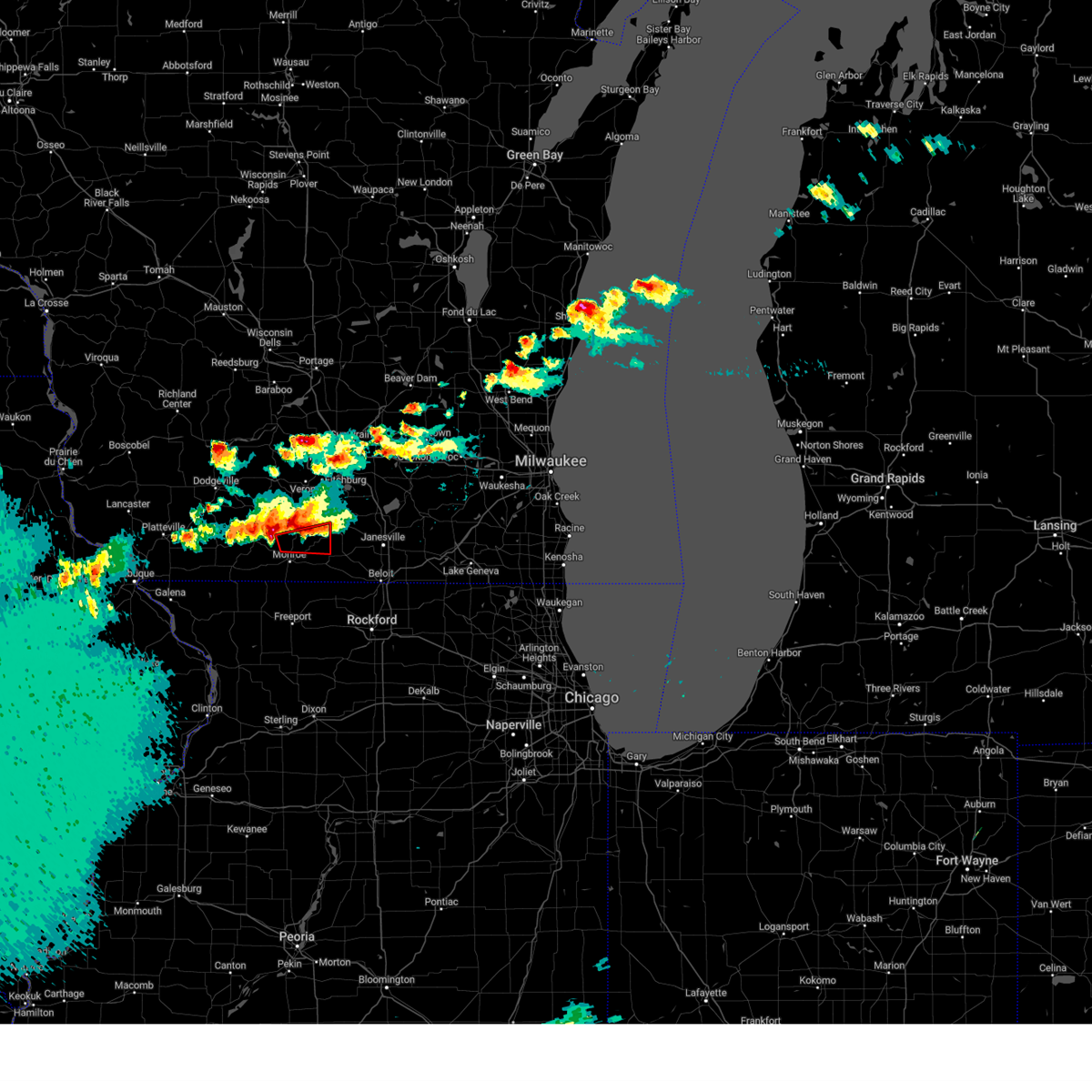 the tornado warning has been cancelled and is no longer in effect the tornado warning has been cancelled and is no longer in effect
|
| 4/27/2024 6:54 PM CDT |
 Svrmkx the national weather service in milwaukee/sullivan has issued a * severe thunderstorm warning for, northern green county in south central wisconsin, * until 745 pm cdt. * at 654 pm cdt, a severe thunderstorm was located near new glarus, or 10 miles northwest of monroe, moving east at 40 mph (radar indicated). Hazards include 60 mph wind gusts and quarter size hail. Hail damage to vehicles is expected. Expect wind damage to roofs, siding, and trees. Svrmkx the national weather service in milwaukee/sullivan has issued a * severe thunderstorm warning for, northern green county in south central wisconsin, * until 745 pm cdt. * at 654 pm cdt, a severe thunderstorm was located near new glarus, or 10 miles northwest of monroe, moving east at 40 mph (radar indicated). Hazards include 60 mph wind gusts and quarter size hail. Hail damage to vehicles is expected. Expect wind damage to roofs, siding, and trees.
|
| 4/27/2024 6:51 PM CDT | Quarter sized hail reported 0.2 miles SW of Monticello, WI |
| 4/27/2024 6:40 PM CDT |
 Tormkx the national weather service in milwaukee/sullivan has issued a * tornado warning for, east central green county in south central wisconsin, * until 715 pm cdt. * at 639 pm cdt, a severe thunderstorm capable of producing a tornado was located near monticello, or near monroe, moving east at 35 mph (radar indicated rotation). Hazards include tornado and half dollar size hail. Flying debris will be dangerous to those caught without shelter. mobile homes will be damaged or destroyed. damage to roofs, windows, and vehicles will occur. Tree damage is likely. Tormkx the national weather service in milwaukee/sullivan has issued a * tornado warning for, east central green county in south central wisconsin, * until 715 pm cdt. * at 639 pm cdt, a severe thunderstorm capable of producing a tornado was located near monticello, or near monroe, moving east at 35 mph (radar indicated rotation). Hazards include tornado and half dollar size hail. Flying debris will be dangerous to those caught without shelter. mobile homes will be damaged or destroyed. damage to roofs, windows, and vehicles will occur. Tree damage is likely.
|
| 4/27/2024 6:36 PM CDT |
 At 636 pm cdt, a severe thunderstorm was located near new glarus, or 13 miles north of monroe, moving east at 25 mph (radar indicated). Hazards include 60 mph wind gusts and half dollar size hail. Hail damage to vehicles is expected. expect wind damage to roofs, siding, and trees. Locations impacted include, new glarus, monticello, dayton, jordan center, and attica. At 636 pm cdt, a severe thunderstorm was located near new glarus, or 13 miles north of monroe, moving east at 25 mph (radar indicated). Hazards include 60 mph wind gusts and half dollar size hail. Hail damage to vehicles is expected. expect wind damage to roofs, siding, and trees. Locations impacted include, new glarus, monticello, dayton, jordan center, and attica.
|
| 4/27/2024 6:31 PM CDT |
 the severe thunderstorm warning has been cancelled and is no longer in effect the severe thunderstorm warning has been cancelled and is no longer in effect
|
| 4/27/2024 6:31 PM CDT |
 At 630 pm cdt, a severe thunderstorm was located near blanchardville, or 13 miles northwest of monroe, moving east at 25 mph (radar indicated). Hazards include 60 mph wind gusts and quarter size hail. Hail damage to vehicles is expected. expect wind damage to roofs, siding, and trees. Locations impacted include, new glarus, monticello, dayton, jordan center, and attica. At 630 pm cdt, a severe thunderstorm was located near blanchardville, or 13 miles northwest of monroe, moving east at 25 mph (radar indicated). Hazards include 60 mph wind gusts and quarter size hail. Hail damage to vehicles is expected. expect wind damage to roofs, siding, and trees. Locations impacted include, new glarus, monticello, dayton, jordan center, and attica.
|
| 4/27/2024 6:07 PM CDT |
 Svrmkx the national weather service in milwaukee/sullivan has issued a * severe thunderstorm warning for, northeastern lafayette county in south central wisconsin, northern green county in south central wisconsin, * until 700 pm cdt. * at 607 pm cdt, a severe thunderstorm was located near argyle, or 8 miles east of darlington, moving east at 25 mph (radar indicated). Hazards include 60 mph wind gusts and quarter size hail. Hail damage to vehicles is expected. Expect wind damage to roofs, siding, and trees. Svrmkx the national weather service in milwaukee/sullivan has issued a * severe thunderstorm warning for, northeastern lafayette county in south central wisconsin, northern green county in south central wisconsin, * until 700 pm cdt. * at 607 pm cdt, a severe thunderstorm was located near argyle, or 8 miles east of darlington, moving east at 25 mph (radar indicated). Hazards include 60 mph wind gusts and quarter size hail. Hail damage to vehicles is expected. Expect wind damage to roofs, siding, and trees.
|
| 4/16/2024 8:20 PM CDT |
 the severe thunderstorm warning has been cancelled and is no longer in effect the severe thunderstorm warning has been cancelled and is no longer in effect
|
| 4/16/2024 8:20 PM CDT |
 At 819 pm cdt, severe thunderstorms were located along a line extending from near mount horeb to 6 miles west of monroe, moving northeast at 25 mph (radar indicated). Hazards include 60 mph wind gusts. Expect damage to roofs, siding, and trees. Locations impacted include, monroe, verona, mount horeb, belleville, new glarus, monticello, blue mounds, browntown, mount vernon, and jordan center. At 819 pm cdt, severe thunderstorms were located along a line extending from near mount horeb to 6 miles west of monroe, moving northeast at 25 mph (radar indicated). Hazards include 60 mph wind gusts. Expect damage to roofs, siding, and trees. Locations impacted include, monroe, verona, mount horeb, belleville, new glarus, monticello, blue mounds, browntown, mount vernon, and jordan center.
|
| 4/16/2024 8:02 PM CDT |
 Svrmkx the national weather service in milwaukee/sullivan has issued a * severe thunderstorm warning for, eastern green county in south central wisconsin, western rock county in south central wisconsin, * until 845 pm cdt. * at 802 pm cdt, severe thunderstorms were located along a line extending from near winslow to 7 miles south of monroe to cedarville to near freeport, moving northeast at 50 mph (radar indicated). Hazards include 60 mph wind gusts. expect damage to roofs, siding, and trees Svrmkx the national weather service in milwaukee/sullivan has issued a * severe thunderstorm warning for, eastern green county in south central wisconsin, western rock county in south central wisconsin, * until 845 pm cdt. * at 802 pm cdt, severe thunderstorms were located along a line extending from near winslow to 7 miles south of monroe to cedarville to near freeport, moving northeast at 50 mph (radar indicated). Hazards include 60 mph wind gusts. expect damage to roofs, siding, and trees
|
| 4/16/2024 7:47 PM CDT |
 Svrmkx the national weather service in milwaukee/sullivan has issued a * severe thunderstorm warning for, green county in south central wisconsin, southeastern iowa county in south central wisconsin, southwestern dane county in south central wisconsin, * until 845 pm cdt. * at 747 pm cdt, severe thunderstorms were located along a line extending from 7 miles northwest of blanchardville to near nora, moving northeast at 25 mph (radar indicated). Hazards include 60 mph wind gusts. expect damage to roofs, siding, and trees Svrmkx the national weather service in milwaukee/sullivan has issued a * severe thunderstorm warning for, green county in south central wisconsin, southeastern iowa county in south central wisconsin, southwestern dane county in south central wisconsin, * until 845 pm cdt. * at 747 pm cdt, severe thunderstorms were located along a line extending from 7 miles northwest of blanchardville to near nora, moving northeast at 25 mph (radar indicated). Hazards include 60 mph wind gusts. expect damage to roofs, siding, and trees
|
| 2/8/2024 6:02 PM CST |
 At 602 pm cst, severe thunderstorms were located along a line extending from stoughton to near cambridge, moving northeast at 45 mph (radar indicated). Hazards include quarter size hail. Damage to vehicles is expected. Locations impacted include, fitchburg, stoughton, oregon, mcfarland, edgerton, evansville, brodhead, belleville, cambridge, orfordville, brooklyn, monticello, albany, footville, fulton, albion, magnolia, dayton, utica, and rockdale. At 602 pm cst, severe thunderstorms were located along a line extending from stoughton to near cambridge, moving northeast at 45 mph (radar indicated). Hazards include quarter size hail. Damage to vehicles is expected. Locations impacted include, fitchburg, stoughton, oregon, mcfarland, edgerton, evansville, brodhead, belleville, cambridge, orfordville, brooklyn, monticello, albany, footville, fulton, albion, magnolia, dayton, utica, and rockdale.
|
| 2/8/2024 5:31 PM CST |
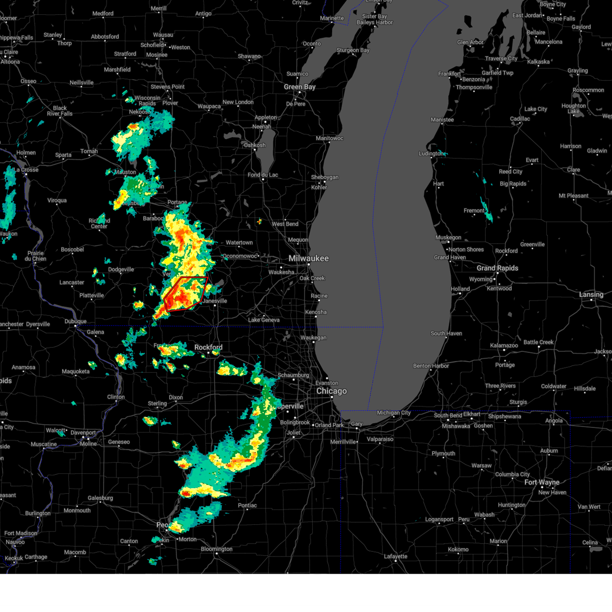 At 531 pm cst, a severe thunderstorm capable of producing a tornado was located over albany, or 8 miles northwest of brodhead, moving northeast at 40 mph (radar indicated rotation). Hazards include tornado and half dollar size hail. Flying debris will be dangerous to those caught without shelter. mobile homes will be damaged or destroyed. damage to roofs, windows, and vehicles will occur. Tree damage is likely. At 531 pm cst, a severe thunderstorm capable of producing a tornado was located over albany, or 8 miles northwest of brodhead, moving northeast at 40 mph (radar indicated rotation). Hazards include tornado and half dollar size hail. Flying debris will be dangerous to those caught without shelter. mobile homes will be damaged or destroyed. damage to roofs, windows, and vehicles will occur. Tree damage is likely.
|
| 2/8/2024 5:28 PM CST |
 At 527 pm cst, severe thunderstorms were located along a line extending from monticello to near albany, moving northeast at 45 mph (radar indicated). Hazards include quarter size hail. damage to vehicles is expected At 527 pm cst, severe thunderstorms were located along a line extending from monticello to near albany, moving northeast at 45 mph (radar indicated). Hazards include quarter size hail. damage to vehicles is expected
|
| 2/8/2024 5:19 PM CST |
 At 518 pm cst, severe thunderstorms were located along a line extending from near monticello to near albany, moving northeast at 45 mph (radar indicated). Hazards include half dollar size hail. Damage to vehicles is expected. Locations impacted include, monroe, brodhead, belleville, new glarus, brooklyn, monticello, albany, dayton, browntown, attica, juda, and jordan center. At 518 pm cst, severe thunderstorms were located along a line extending from near monticello to near albany, moving northeast at 45 mph (radar indicated). Hazards include half dollar size hail. Damage to vehicles is expected. Locations impacted include, monroe, brodhead, belleville, new glarus, brooklyn, monticello, albany, dayton, browntown, attica, juda, and jordan center.
|
| 2/8/2024 5:16 PM CST |
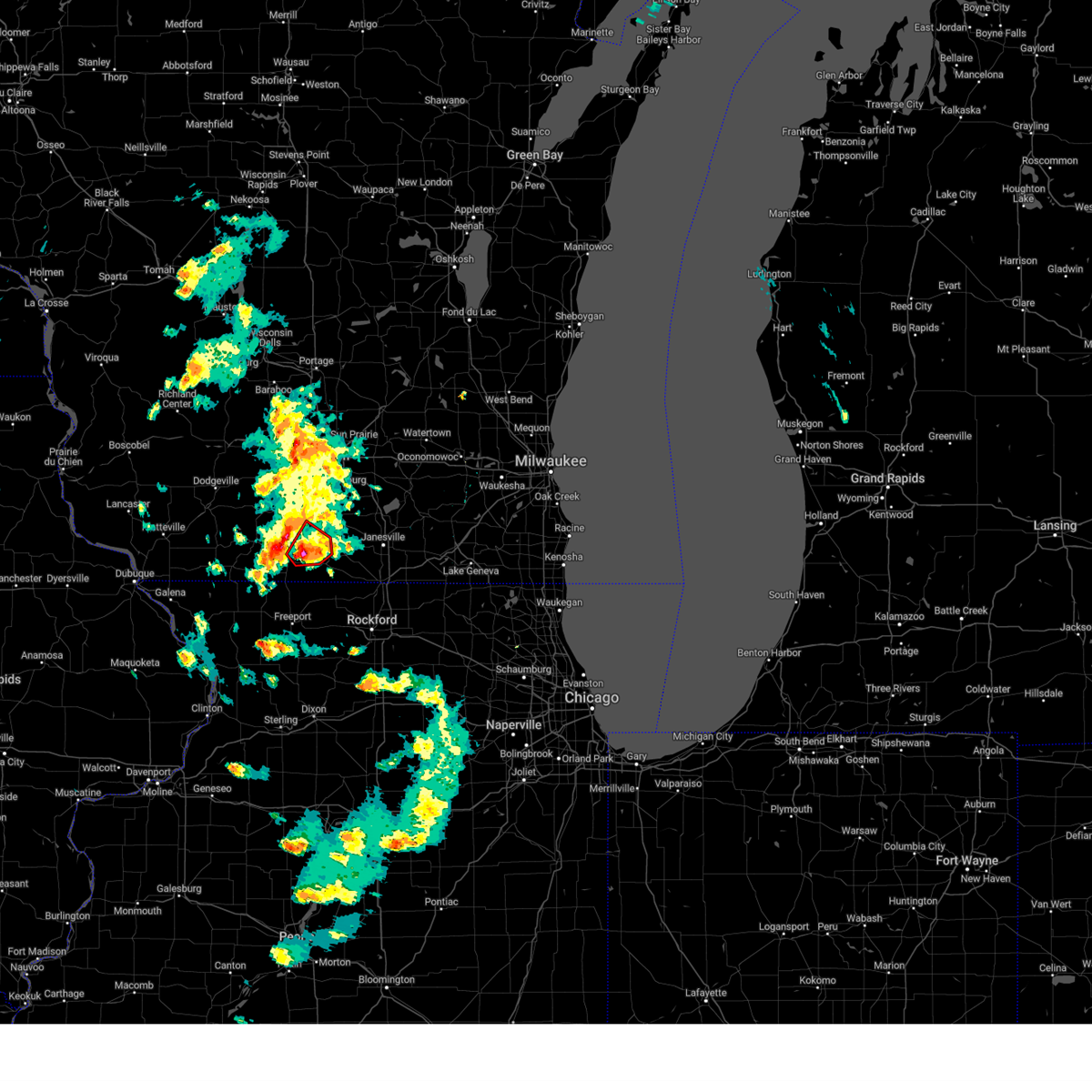 At 516 pm cst, a severe thunderstorm capable of producing a tornado was located near monroe, moving northeast at 40 mph (radar indicated rotation). Hazards include tornado and half dollar size hail. Flying debris will be dangerous to those caught without shelter. mobile homes will be damaged or destroyed. damage to roofs, windows, and vehicles will occur. tree damage is likely. Locations impacted include, monroe, brodhead, monticello, albany, juda, and attica. At 516 pm cst, a severe thunderstorm capable of producing a tornado was located near monroe, moving northeast at 40 mph (radar indicated rotation). Hazards include tornado and half dollar size hail. Flying debris will be dangerous to those caught without shelter. mobile homes will be damaged or destroyed. damage to roofs, windows, and vehicles will occur. tree damage is likely. Locations impacted include, monroe, brodhead, monticello, albany, juda, and attica.
|
| 2/8/2024 5:15 PM CST |
 At 514 pm cst, a severe thunderstorm capable of producing a tornado was located near monroe, moving northeast at 45 mph (radar indicated rotation). Hazards include tornado and quarter size hail. Flying debris will be dangerous to those caught without shelter. mobile homes will be damaged or destroyed. damage to roofs, windows, and vehicles will occur. tree damage is likely. Locations impacted include, new glarus, monticello, browntown, and jordan center. At 514 pm cst, a severe thunderstorm capable of producing a tornado was located near monroe, moving northeast at 45 mph (radar indicated rotation). Hazards include tornado and quarter size hail. Flying debris will be dangerous to those caught without shelter. mobile homes will be damaged or destroyed. damage to roofs, windows, and vehicles will occur. tree damage is likely. Locations impacted include, new glarus, monticello, browntown, and jordan center.
|
| 2/8/2024 5:07 PM CST |
 At 507 pm cst, a severe thunderstorm capable of producing a tornado was located near winslow, or 10 miles west of monroe, moving northeast at 40 mph (radar indicated rotation). Hazards include tornado and quarter size hail. Flying debris will be dangerous to those caught without shelter. mobile homes will be damaged or destroyed. damage to roofs, windows, and vehicles will occur. Tree damage is likely. At 507 pm cst, a severe thunderstorm capable of producing a tornado was located near winslow, or 10 miles west of monroe, moving northeast at 40 mph (radar indicated rotation). Hazards include tornado and quarter size hail. Flying debris will be dangerous to those caught without shelter. mobile homes will be damaged or destroyed. damage to roofs, windows, and vehicles will occur. Tree damage is likely.
|
| 2/8/2024 5:04 PM CST |
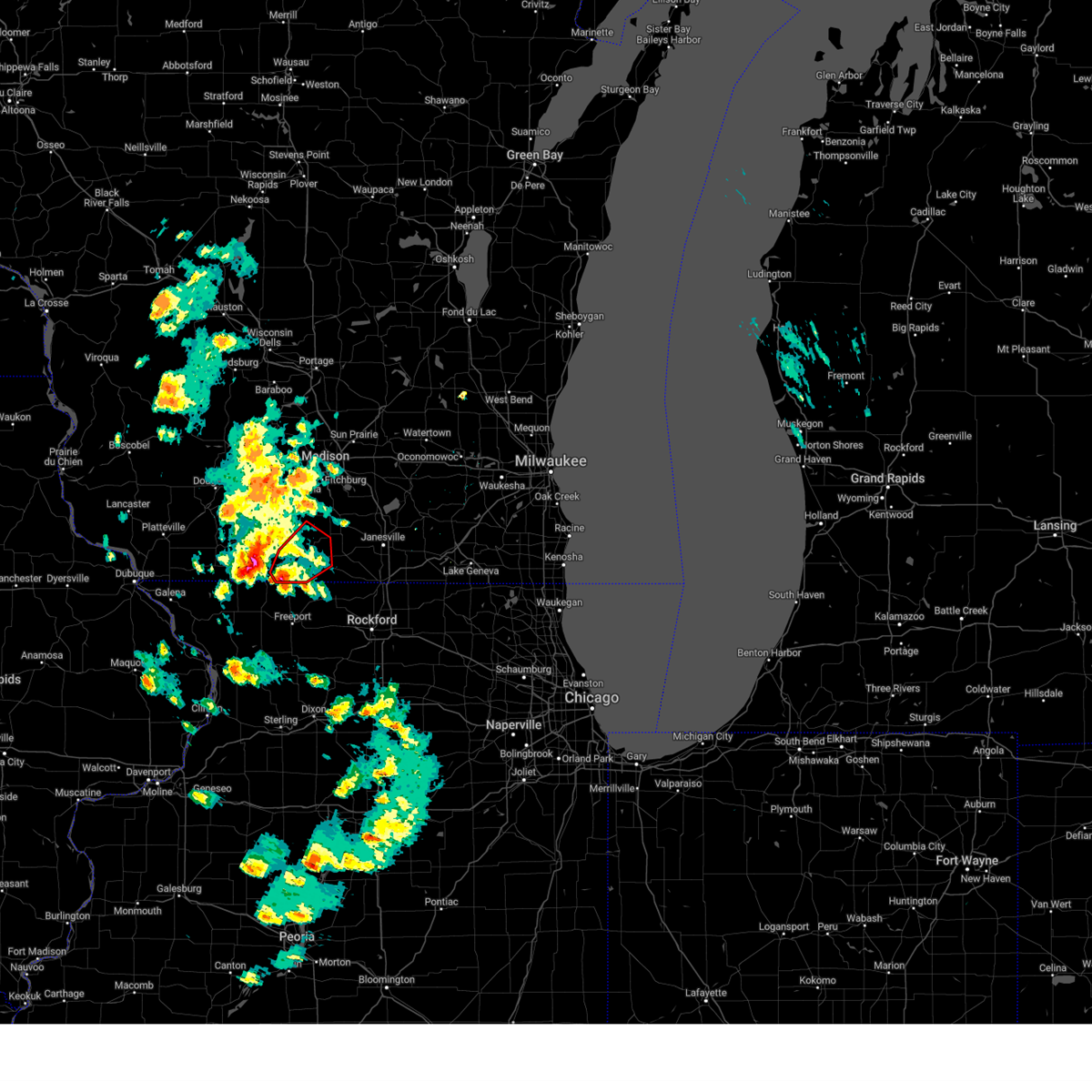 At 504 pm cst, a severe thunderstorm capable of producing a tornado was located near monroe, moving northeast at 40 mph (radar indicated rotation). Hazards include tornado and quarter size hail. Flying debris will be dangerous to those caught without shelter. mobile homes will be damaged or destroyed. damage to roofs, windows, and vehicles will occur. Tree damage is likely. At 504 pm cst, a severe thunderstorm capable of producing a tornado was located near monroe, moving northeast at 40 mph (radar indicated rotation). Hazards include tornado and quarter size hail. Flying debris will be dangerous to those caught without shelter. mobile homes will be damaged or destroyed. damage to roofs, windows, and vehicles will occur. Tree damage is likely.
|
| 2/8/2024 4:53 PM CST |
 At 452 pm cst, severe thunderstorms were located along a line extending from near warren to near winslow, moving northeast at 40 mph (radar indicated). Hazards include quarter size hail. Damage to vehicles is expected. Locations impacted include, monroe, brodhead, belleville, new glarus, brooklyn, monticello, albany, argyle, wiota, dayton, south wayne, browntown, attica, juda, jordan center, and woodford. At 452 pm cst, severe thunderstorms were located along a line extending from near warren to near winslow, moving northeast at 40 mph (radar indicated). Hazards include quarter size hail. Damage to vehicles is expected. Locations impacted include, monroe, brodhead, belleville, new glarus, brooklyn, monticello, albany, argyle, wiota, dayton, south wayne, browntown, attica, juda, jordan center, and woodford.
|
| 2/8/2024 4:50 PM CST |
 At 450 pm cst, severe thunderstorms were located along a line extending from near warren to near winslow, moving northeast at 40 mph (radar indicated). Hazards include quarter size hail. damage to vehicles is expected At 450 pm cst, severe thunderstorms were located along a line extending from near warren to near winslow, moving northeast at 40 mph (radar indicated). Hazards include quarter size hail. damage to vehicles is expected
|
| 8/11/2023 10:46 PM CDT |
 At 1045 pm cdt, a severe thunderstorm was located near albany, or near evansville, moving southeast at 50 mph (radar indicated). Hazards include 60 mph wind gusts and quarter size hail. Hail damage to vehicles is expected. expect wind damage to roofs, siding, and trees. locations impacted include, monroe, belleville, brooklyn, monticello, dayton, and attica. hail threat, radar indicated max hail size, 1. 00 in wind threat, radar indicated max wind gust, 60 mph. At 1045 pm cdt, a severe thunderstorm was located near albany, or near evansville, moving southeast at 50 mph (radar indicated). Hazards include 60 mph wind gusts and quarter size hail. Hail damage to vehicles is expected. expect wind damage to roofs, siding, and trees. locations impacted include, monroe, belleville, brooklyn, monticello, dayton, and attica. hail threat, radar indicated max hail size, 1. 00 in wind threat, radar indicated max wind gust, 60 mph.
|
| 8/11/2023 10:44 PM CDT |
 At 1044 pm cdt, a severe thunderstorm was located near albany, or 10 miles west of evansville, moving southeast at 50 mph (radar indicated). Hazards include 60 mph wind gusts and quarter size hail. Hail damage to vehicles is expected. Expect wind damage to roofs, siding, and trees. At 1044 pm cdt, a severe thunderstorm was located near albany, or 10 miles west of evansville, moving southeast at 50 mph (radar indicated). Hazards include 60 mph wind gusts and quarter size hail. Hail damage to vehicles is expected. Expect wind damage to roofs, siding, and trees.
|
| 8/11/2023 10:32 PM CDT |
 At 1032 pm cdt, a severe thunderstorm was located near new glarus, or 9 miles southwest of verona, moving east at 50 mph (radar indicated). Hazards include 60 mph wind gusts and quarter size hail. Hail damage to vehicles is expected. expect wind damage to roofs, siding, and trees. locations impacted include, western madison, fitchburg, monroe, verona, oregon, mcfarland, mount horeb, belleville, new glarus, brooklyn, monticello, blue mounds, dayton, attica, paoli, pine bluff, and mount vernon. people attending the belleville community picnic should seek safe shelter immediately! hail threat, radar indicated max hail size, 1. 00 in wind threat, radar indicated max wind gust, 60 mph. At 1032 pm cdt, a severe thunderstorm was located near new glarus, or 9 miles southwest of verona, moving east at 50 mph (radar indicated). Hazards include 60 mph wind gusts and quarter size hail. Hail damage to vehicles is expected. expect wind damage to roofs, siding, and trees. locations impacted include, western madison, fitchburg, monroe, verona, oregon, mcfarland, mount horeb, belleville, new glarus, brooklyn, monticello, blue mounds, dayton, attica, paoli, pine bluff, and mount vernon. people attending the belleville community picnic should seek safe shelter immediately! hail threat, radar indicated max hail size, 1. 00 in wind threat, radar indicated max wind gust, 60 mph.
|
| 8/11/2023 10:17 PM CDT |
 At 1017 pm cdt, a severe thunderstorm was located 7 miles southwest of mount horeb, moving southeast at 50 mph (radar indicated). Hazards include 60 mph wind gusts and quarter size hail. Hail damage to vehicles is expected. Expect wind damage to roofs, siding, and trees. At 1017 pm cdt, a severe thunderstorm was located 7 miles southwest of mount horeb, moving southeast at 50 mph (radar indicated). Hazards include 60 mph wind gusts and quarter size hail. Hail damage to vehicles is expected. Expect wind damage to roofs, siding, and trees.
|
| 7/28/2023 9:59 PM CDT |
 At 958 pm cdt, severe thunderstorms were located along a line extending from near ripon to 7 miles southeast of columbus to near deerfield to new glarus, moving southeast at 60 mph (radar indicated). Hazards include 70 mph wind gusts and penny size hail. Expect considerable tree damage. Damage is likely to mobile homes, roofs, and outbuildings. At 958 pm cdt, severe thunderstorms were located along a line extending from near ripon to 7 miles southeast of columbus to near deerfield to new glarus, moving southeast at 60 mph (radar indicated). Hazards include 70 mph wind gusts and penny size hail. Expect considerable tree damage. Damage is likely to mobile homes, roofs, and outbuildings.
|
| 7/26/2023 11:07 AM CDT |
 The severe thunderstorm warning for central green and south central dane counties will expire at 1115 am cdt, the storms which prompted the warning have weakened below severe limits, and have exited the warned area. therefore, the warning will be allowed to expire. however, gusty winds below severe limits are still possible with these thunderstorms. The severe thunderstorm warning for central green and south central dane counties will expire at 1115 am cdt, the storms which prompted the warning have weakened below severe limits, and have exited the warned area. therefore, the warning will be allowed to expire. however, gusty winds below severe limits are still possible with these thunderstorms.
|
| 7/26/2023 11:00 AM CDT |
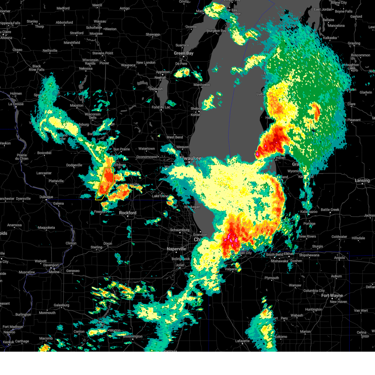 At 1100 am cdt, severe thunderstorms were located along a line extending from oregon to near albany to near winslow, moving east at 35 mph (radar indicated). Hazards include 60 mph wind gusts and penny size hail. Expect damage to roofs, siding, and trees. locations impacted include, fitchburg, monroe, oregon, belleville, brooklyn, monticello, albany, dayton, attica, and paoli. hail threat, radar indicated max hail size, 0. 75 in wind threat, radar indicated max wind gust, 60 mph. At 1100 am cdt, severe thunderstorms were located along a line extending from oregon to near albany to near winslow, moving east at 35 mph (radar indicated). Hazards include 60 mph wind gusts and penny size hail. Expect damage to roofs, siding, and trees. locations impacted include, fitchburg, monroe, oregon, belleville, brooklyn, monticello, albany, dayton, attica, and paoli. hail threat, radar indicated max hail size, 0. 75 in wind threat, radar indicated max wind gust, 60 mph.
|
| 7/26/2023 10:31 AM CDT |
 At 1031 am cdt, severe thunderstorms were located along a line extending from near mount horeb to near argyle to near apple river, moving east at 35 mph (radar indicated). Hazards include 60 mph wind gusts and penny size hail. expect damage to roofs, siding, and trees At 1031 am cdt, severe thunderstorms were located along a line extending from near mount horeb to near argyle to near apple river, moving east at 35 mph (radar indicated). Hazards include 60 mph wind gusts and penny size hail. expect damage to roofs, siding, and trees
|
| 4/5/2023 5:41 AM CDT |
 The severe thunderstorm warning for northern green and southwestern dane counties will expire at 545 am cdt, the storm which prompted the warning has moved out of the area. therefore, the warning will be allowed to expire. The severe thunderstorm warning for northern green and southwestern dane counties will expire at 545 am cdt, the storm which prompted the warning has moved out of the area. therefore, the warning will be allowed to expire.
|
| 4/5/2023 5:20 AM CDT |
 At 519 am cdt, a severe thunderstorm was located near browntown, moving northeast at 50 mph (radar indicated). Hazards include ping pong ball size hail. People and animals outdoors will be injured. expect damage to roofs, siding, windows, and vehicles. locations impacted include, monroe, brodhead, albany, browntown, juda, and jordan center. hail threat, radar indicated max hail size, 1. 50 in wind threat, radar indicated max wind gust, <50 mph. At 519 am cdt, a severe thunderstorm was located near browntown, moving northeast at 50 mph (radar indicated). Hazards include ping pong ball size hail. People and animals outdoors will be injured. expect damage to roofs, siding, windows, and vehicles. locations impacted include, monroe, brodhead, albany, browntown, juda, and jordan center. hail threat, radar indicated max hail size, 1. 50 in wind threat, radar indicated max wind gust, <50 mph.
|
| 4/5/2023 5:18 AM CDT |
 At 518 am cdt, a severe thunderstorm was located near mount horeb, moving northeast at 55 mph (radar indicated). Hazards include quarter size hail. Damage to vehicles is expected. locations impacted include, western madison, fitchburg, middleton, verona, oregon, mount horeb, cross plains, belleville, new glarus, brooklyn, monticello, blue mounds, dayton, attica, paoli, pine bluff, and mount vernon. hail threat, radar indicated max hail size, 1. 00 in wind threat, radar indicated max wind gust, <50 mph. At 518 am cdt, a severe thunderstorm was located near mount horeb, moving northeast at 55 mph (radar indicated). Hazards include quarter size hail. Damage to vehicles is expected. locations impacted include, western madison, fitchburg, middleton, verona, oregon, mount horeb, cross plains, belleville, new glarus, brooklyn, monticello, blue mounds, dayton, attica, paoli, pine bluff, and mount vernon. hail threat, radar indicated max hail size, 1. 00 in wind threat, radar indicated max wind gust, <50 mph.
|
| 4/5/2023 5:10 AM CDT |
 At 510 am cdt, a severe thunderstorm was located over winslow, or 12 miles southwest of monroe, moving northeast at 50 mph (radar indicated). Hazards include quarter size hail. damage to vehicles is expected At 510 am cdt, a severe thunderstorm was located over winslow, or 12 miles southwest of monroe, moving northeast at 50 mph (radar indicated). Hazards include quarter size hail. damage to vehicles is expected
|
| 4/5/2023 5:01 AM CDT |
 At 500 am cdt, a severe thunderstorm was located near blanchardville, or 12 miles northeast of darlington, moving northeast at 55 mph (radar indicated). Hazards include quarter size hail. damage to vehicles is expected At 500 am cdt, a severe thunderstorm was located near blanchardville, or 12 miles northeast of darlington, moving northeast at 55 mph (radar indicated). Hazards include quarter size hail. damage to vehicles is expected
|
| 4/4/2023 10:26 PM CDT |
 The severe thunderstorm warning for eastern green and northwestern rock counties will expire at 1030 pm cdt, the storm which prompted the warning has moved out of the area. therefore, the warning will be allowed to expire. a severe thunderstorm watch remains in effect until 100 am cdt for south central wisconsin. The severe thunderstorm warning for eastern green and northwestern rock counties will expire at 1030 pm cdt, the storm which prompted the warning has moved out of the area. therefore, the warning will be allowed to expire. a severe thunderstorm watch remains in effect until 100 am cdt for south central wisconsin.
|
| 4/4/2023 9:59 PM CDT |
 At 958 pm cdt, a severe thunderstorm was located near brodhead, moving northeast at 50 mph (trained weather spotters. large hail was reported just across the state line in wisconsin, south of monroe). Hazards include ping pong ball size hail and 60 mph wind gusts. People and animals outdoors will be injured. expect hail damage to roofs, siding, windows, and vehicles. expect wind damage to roofs, siding, and trees. locations impacted include, monroe, edgerton, evansville, brodhead, orfordville, brooklyn, monticello, albany, footville, fulton, magnolia, dayton, attica, cooksville, juda, indianford, and leyden. hail threat, observed max hail size, 1. 50 in wind threat, radar indicated max wind gust, 60 mph. At 958 pm cdt, a severe thunderstorm was located near brodhead, moving northeast at 50 mph (trained weather spotters. large hail was reported just across the state line in wisconsin, south of monroe). Hazards include ping pong ball size hail and 60 mph wind gusts. People and animals outdoors will be injured. expect hail damage to roofs, siding, windows, and vehicles. expect wind damage to roofs, siding, and trees. locations impacted include, monroe, edgerton, evansville, brodhead, orfordville, brooklyn, monticello, albany, footville, fulton, magnolia, dayton, attica, cooksville, juda, indianford, and leyden. hail threat, observed max hail size, 1. 50 in wind threat, radar indicated max wind gust, 60 mph.
|
| 4/4/2023 9:45 PM CDT |
 At 944 pm cdt, a severe thunderstorm was located near cedarville, or 8 miles south of monroe, moving northeast at 50 mph (trained weather spotters. several reports of ping pong ball to golf ball sized hail were received from stephenson county). Hazards include ping pong ball size hail and 60 mph wind gusts. People and animals outdoors will be injured. expect hail damage to roofs, siding, windows, and vehicles. Expect wind damage to roofs, siding, and trees. At 944 pm cdt, a severe thunderstorm was located near cedarville, or 8 miles south of monroe, moving northeast at 50 mph (trained weather spotters. several reports of ping pong ball to golf ball sized hail were received from stephenson county). Hazards include ping pong ball size hail and 60 mph wind gusts. People and animals outdoors will be injured. expect hail damage to roofs, siding, windows, and vehicles. Expect wind damage to roofs, siding, and trees.
|
| 11/5/2022 10:35 AM CDT |
 At 1035 am cdt, severe thunderstorms were located along a line extending from 6 miles northwest of mount horeb to near new glarus to near monroe, moving northeast at 50 mph (radar indicated). Hazards include 60 mph wind gusts. Expect damage to roofs, siding, and trees. Locations impacted include, monroe, brodhead, belleville, new glarus, brooklyn, monticello, albany, dayton, attica and juda. At 1035 am cdt, severe thunderstorms were located along a line extending from 6 miles northwest of mount horeb to near new glarus to near monroe, moving northeast at 50 mph (radar indicated). Hazards include 60 mph wind gusts. Expect damage to roofs, siding, and trees. Locations impacted include, monroe, brodhead, belleville, new glarus, brooklyn, monticello, albany, dayton, attica and juda.
|
| 11/5/2022 10:27 AM CDT |
 At 1026 am cdt, severe thunderstorms were located along a line extending from 7 miles west of mount horeb to near blanchardville to near monroe, moving northeast at 55 mph (radar indicated). Hazards include 70 mph wind gusts. Expect considerable tree damage. damage is likely to mobile homes, roofs, and outbuildings. Locations impacted include, monroe, brodhead, belleville, new glarus, brooklyn, monticello, albany, blanchardville, dayton, browntown, attica, juda and jordan center. At 1026 am cdt, severe thunderstorms were located along a line extending from 7 miles west of mount horeb to near blanchardville to near monroe, moving northeast at 55 mph (radar indicated). Hazards include 70 mph wind gusts. Expect considerable tree damage. damage is likely to mobile homes, roofs, and outbuildings. Locations impacted include, monroe, brodhead, belleville, new glarus, brooklyn, monticello, albany, blanchardville, dayton, browntown, attica, juda and jordan center.
|
| 11/5/2022 10:07 AM CDT |
 At 1006 am cdt, severe thunderstorms were located along a line extending from 7 miles north of darlington to near warren to near lena, moving northeast at 50 mph (radar indicated). Hazards include 70 mph wind gusts. Expect considerable tree damage. Damage is likely to mobile homes, roofs, and outbuildings. At 1006 am cdt, severe thunderstorms were located along a line extending from 7 miles north of darlington to near warren to near lena, moving northeast at 50 mph (radar indicated). Hazards include 70 mph wind gusts. Expect considerable tree damage. Damage is likely to mobile homes, roofs, and outbuildings.
|
| 11/4/2022 2:07 PM CDT |
 At 207 pm cdt, severe thunderstorms were located along a line extending from near blanchardville to near monroe, moving northeast at 65 mph (radar indicated). Hazards include 60 mph wind gusts and quarter size hail. Hail damage to vehicles is expected. expect wind damage to roofs, siding, and trees. locations impacted include, new glarus, monticello, albany, jordan center and attica. hail threat, radar indicated max hail size, 1. 00 in wind threat, radar indicated max wind gust, 60 mph. At 207 pm cdt, severe thunderstorms were located along a line extending from near blanchardville to near monroe, moving northeast at 65 mph (radar indicated). Hazards include 60 mph wind gusts and quarter size hail. Hail damage to vehicles is expected. expect wind damage to roofs, siding, and trees. locations impacted include, new glarus, monticello, albany, jordan center and attica. hail threat, radar indicated max hail size, 1. 00 in wind threat, radar indicated max wind gust, 60 mph.
|
| 11/4/2022 1:58 PM CDT |
 At 158 pm cdt, severe thunderstorms were located along a line extending from near argyle to 7 miles northwest of winslow, moving northeast at 60 mph (radar indicated). Hazards include 60 mph wind gusts and quarter size hail. Hail damage to vehicles is expected. expect wind damage to roofs, siding, and trees. locations impacted include, monroe, new glarus, monticello, albany, argyle, blanchardville, wiota, south wayne, lamont, browntown, attica, jordan center and woodford. hail threat, radar indicated max hail size, 1. 00 in wind threat, radar indicated max wind gust, 60 mph. At 158 pm cdt, severe thunderstorms were located along a line extending from near argyle to 7 miles northwest of winslow, moving northeast at 60 mph (radar indicated). Hazards include 60 mph wind gusts and quarter size hail. Hail damage to vehicles is expected. expect wind damage to roofs, siding, and trees. locations impacted include, monroe, new glarus, monticello, albany, argyle, blanchardville, wiota, south wayne, lamont, browntown, attica, jordan center and woodford. hail threat, radar indicated max hail size, 1. 00 in wind threat, radar indicated max wind gust, 60 mph.
|
| 11/4/2022 1:47 PM CDT |
 At 147 pm cdt, severe thunderstorms were located along a line extending from near darlington to near apple river, moving northeast at 65 mph (radar indicated). Hazards include 60 mph wind gusts and quarter size hail. Hail damage to vehicles is expected. Expect wind damage to roofs, siding, and trees. At 147 pm cdt, severe thunderstorms were located along a line extending from near darlington to near apple river, moving northeast at 65 mph (radar indicated). Hazards include 60 mph wind gusts and quarter size hail. Hail damage to vehicles is expected. Expect wind damage to roofs, siding, and trees.
|
| 8/28/2022 2:53 PM CDT | At 252 pm cdt, severe thunderstorms were located along a line extending from near new glarus to near monticello to near lake summerset, moving northeast at 50 mph (radar indicated). Hazards include 60 mph wind gusts and nickel size hail. expect damage to roofs, siding, and trees |
| 8/28/2022 2:37 PM CDT | At 237 pm cdt, severe thunderstorms were located along a line extending from 6 miles northwest of argyle to near albany, moving northeast at 50 mph (radar indicated). Hazards include 60 mph wind gusts and nickel size hail. Expect damage to roofs, siding, and trees. Locations impacted include, monroe, brodhead, darlington, new glarus, brooklyn, monticello, albany, argyle, blanchardville, wiota, dayton, south wayne, fayette, lamont, browntown, attica, juda, jordan center, yellowstone lake st park and woodford. |
| 8/28/2022 2:17 PM CDT | At 216 pm cdt, severe thunderstorms were located along a line extending from apple river to near dakota, moving northeast at 50 mph (radar indicated). Hazards include 60 mph wind gusts and nickel size hail. expect damage to roofs, siding, and trees |
| 7/24/2022 1:53 AM CDT |
 At 153 am cdt, severe thunderstorms were located along a line extending from near belleville to 7 miles southwest of brodhead, moving east at 40 mph (radar indicated). Hazards include 60 mph wind gusts. Expect damage to roofs, siding, and trees. locations impacted include, monroe, evansville, brodhead, belleville, orfordville, brooklyn, monticello, albany, footville, newark, magnolia, dayton, attica, cooksville, juda and avon. hail threat, radar indicated max hail size, <. 75 in wind threat, radar indicated max wind gust, 60 mph. At 153 am cdt, severe thunderstorms were located along a line extending from near belleville to 7 miles southwest of brodhead, moving east at 40 mph (radar indicated). Hazards include 60 mph wind gusts. Expect damage to roofs, siding, and trees. locations impacted include, monroe, evansville, brodhead, belleville, orfordville, brooklyn, monticello, albany, footville, newark, magnolia, dayton, attica, cooksville, juda and avon. hail threat, radar indicated max hail size, <. 75 in wind threat, radar indicated max wind gust, 60 mph.
|
| 7/24/2022 1:35 AM CDT |
 At 135 am cdt, severe thunderstorms were located along a line extending from near new glarus to near winslow, moving east at 40 mph (radar indicated). Hazards include 60 mph wind gusts. expect damage to roofs, siding, and trees At 135 am cdt, severe thunderstorms were located along a line extending from near new glarus to near winslow, moving east at 40 mph (radar indicated). Hazards include 60 mph wind gusts. expect damage to roofs, siding, and trees
|
| 7/5/2022 6:10 PM CDT |
 The severe thunderstorm warning for central green and southwestern rock counties will expire at 615 pm cdt, the storm which prompted the warning has weakened below severe limits, and no longer poses an immediate threat to life or property. therefore, the warning will be allowed to expire. however heavy rain is still possible with this thunderstorm. a severe thunderstorm watch remains in effect until midnight cdt for south central wisconsin. The severe thunderstorm warning for central green and southwestern rock counties will expire at 615 pm cdt, the storm which prompted the warning has weakened below severe limits, and no longer poses an immediate threat to life or property. therefore, the warning will be allowed to expire. however heavy rain is still possible with this thunderstorm. a severe thunderstorm watch remains in effect until midnight cdt for south central wisconsin.
|
| 7/5/2022 6:02 PM CDT |
 At 602 pm cdt, a severe thunderstorm was located near brodhead, moving southeast at 25 mph (radar indicated). Hazards include 60 mph wind gusts and quarter size hail. Hail damage to vehicles is expected. expect wind damage to roofs, siding, and trees. locations impacted include, monroe, brodhead, new glarus, monticello, newark, juda and avon. hail threat, radar indicated max hail size, 1. 00 in wind threat, radar indicated max wind gust, 60 mph. At 602 pm cdt, a severe thunderstorm was located near brodhead, moving southeast at 25 mph (radar indicated). Hazards include 60 mph wind gusts and quarter size hail. Hail damage to vehicles is expected. expect wind damage to roofs, siding, and trees. locations impacted include, monroe, brodhead, new glarus, monticello, newark, juda and avon. hail threat, radar indicated max hail size, 1. 00 in wind threat, radar indicated max wind gust, 60 mph.
|
| 7/5/2022 5:51 PM CDT |
 At 551 pm cdt, a severe thunderstorm was located near monroe, moving southeast at 25 mph (radar indicated). Hazards include 60 mph wind gusts and quarter size hail. Hail damage to vehicles is expected. expect wind damage to roofs, siding, and trees. locations impacted include, monroe, brodhead, new glarus, monticello, newark, juda and avon. hail threat, radar indicated max hail size, 1. 00 in wind threat, radar indicated max wind gust, 60 mph. At 551 pm cdt, a severe thunderstorm was located near monroe, moving southeast at 25 mph (radar indicated). Hazards include 60 mph wind gusts and quarter size hail. Hail damage to vehicles is expected. expect wind damage to roofs, siding, and trees. locations impacted include, monroe, brodhead, new glarus, monticello, newark, juda and avon. hail threat, radar indicated max hail size, 1. 00 in wind threat, radar indicated max wind gust, 60 mph.
|
| 7/5/2022 5:33 PM CDT |
 At 533 pm cdt, a severe thunderstorm was located near monticello, or 7 miles north of monroe, moving southeast at 25 mph (radar indicated). Hazards include 60 mph wind gusts and quarter size hail. Hail damage to vehicles is expected. Expect wind damage to roofs, siding, and trees. At 533 pm cdt, a severe thunderstorm was located near monticello, or 7 miles north of monroe, moving southeast at 25 mph (radar indicated). Hazards include 60 mph wind gusts and quarter size hail. Hail damage to vehicles is expected. Expect wind damage to roofs, siding, and trees.
|
| 7/4/2022 9:35 PM CDT |
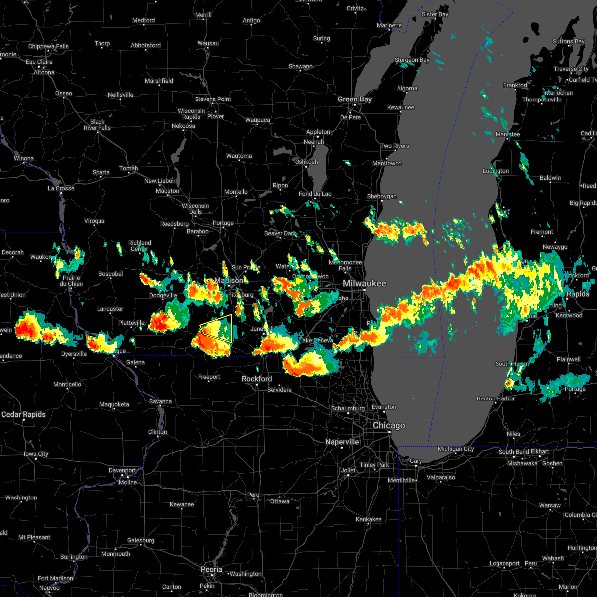 At 935 pm cdt, a severe thunderstorm was located near monticello, or near monroe, moving east at 40 mph (radar indicated). Hazards include 60 mph wind gusts and quarter size hail. Hail damage to vehicles is expected. Expect wind damage to roofs, siding, and trees. At 935 pm cdt, a severe thunderstorm was located near monticello, or near monroe, moving east at 40 mph (radar indicated). Hazards include 60 mph wind gusts and quarter size hail. Hail damage to vehicles is expected. Expect wind damage to roofs, siding, and trees.
|
| 7/4/2022 8:22 PM CDT |
 At 822 pm cdt, a severe thunderstorm was located near albany, or 10 miles northwest of brodhead, moving east at 35 mph (radar indicated). Hazards include 60 mph wind gusts and quarter size hail. Hail damage to vehicles is expected. expect wind damage to roofs, siding, and trees. locations impacted include, belleville, brooklyn, monticello, albany, dayton and attica. hail threat, radar indicated max hail size, 1. 00 in wind threat, radar indicated max wind gust, 60 mph. At 822 pm cdt, a severe thunderstorm was located near albany, or 10 miles northwest of brodhead, moving east at 35 mph (radar indicated). Hazards include 60 mph wind gusts and quarter size hail. Hail damage to vehicles is expected. expect wind damage to roofs, siding, and trees. locations impacted include, belleville, brooklyn, monticello, albany, dayton and attica. hail threat, radar indicated max hail size, 1. 00 in wind threat, radar indicated max wind gust, 60 mph.
|
| 7/4/2022 8:10 PM CDT |
 At 810 pm cdt, a severe thunderstorm was located over monticello, or 11 miles north of monroe, moving east at 35 mph (radar indicated). Hazards include 60 mph wind gusts and quarter size hail. Hail damage to vehicles is expected. expect wind damage to roofs, siding, and trees. locations impacted include, belleville, new glarus, brooklyn, monticello, albany, dayton and attica. hail threat, radar indicated max hail size, 1. 00 in wind threat, radar indicated max wind gust, 60 mph. At 810 pm cdt, a severe thunderstorm was located over monticello, or 11 miles north of monroe, moving east at 35 mph (radar indicated). Hazards include 60 mph wind gusts and quarter size hail. Hail damage to vehicles is expected. expect wind damage to roofs, siding, and trees. locations impacted include, belleville, new glarus, brooklyn, monticello, albany, dayton and attica. hail threat, radar indicated max hail size, 1. 00 in wind threat, radar indicated max wind gust, 60 mph.
|
| 7/4/2022 7:58 PM CDT |
 At 758 pm cdt, a severe thunderstorm was located near blanchardville, or 14 miles south of mount horeb, moving east at 35 mph (radar indicated). Hazards include 60 mph wind gusts and quarter size hail. Hail damage to vehicles is expected. Expect wind damage to roofs, siding, and trees. At 758 pm cdt, a severe thunderstorm was located near blanchardville, or 14 miles south of mount horeb, moving east at 35 mph (radar indicated). Hazards include 60 mph wind gusts and quarter size hail. Hail damage to vehicles is expected. Expect wind damage to roofs, siding, and trees.
|
| 7/4/2022 2:46 PM CDT |
 At 246 pm cdt, severe thunderstorms were located along a line extending from near albany to stockton, moving southeast at 35 mph (law enforcement reports trees down). Hazards include 60 mph wind gusts. Expect damage to roofs, siding, and trees. locations impacted include, monroe, brodhead, monticello, south wayne, browntown, juda, avon and jordan center. hail threat, radar indicated max hail size, <. 75 in wind threat, radar indicated max wind gust, 60 mph. At 246 pm cdt, severe thunderstorms were located along a line extending from near albany to stockton, moving southeast at 35 mph (law enforcement reports trees down). Hazards include 60 mph wind gusts. Expect damage to roofs, siding, and trees. locations impacted include, monroe, brodhead, monticello, south wayne, browntown, juda, avon and jordan center. hail threat, radar indicated max hail size, <. 75 in wind threat, radar indicated max wind gust, 60 mph.
|
| 7/4/2022 2:26 PM CDT |
 At 226 pm cdt, severe thunderstorms were located along a line extending from near monticello to near apple river, moving southeast at 35 mph (law enforcement). Hazards include 60 mph wind gusts. expect damage to roofs, siding, and trees At 226 pm cdt, severe thunderstorms were located along a line extending from near monticello to near apple river, moving southeast at 35 mph (law enforcement). Hazards include 60 mph wind gusts. expect damage to roofs, siding, and trees
|
| 7/4/2022 2:16 PM CDT |
 At 216 pm cdt, severe thunderstorms were located along a line extending from near new glarus to shullsburg, moving southeast at 35 mph (radar indicated). Hazards include 60 mph wind gusts. Expect damage to roofs, siding, and trees. locations impacted include, monroe, brodhead, darlington, new glarus, shullsburg, monticello, albany, benton, argyle, blanchardville, apple river, wiota, new diggings, south wayne, waldwick, fayette, lamont, hollandale, browntown and gratiot. hail threat, radar indicated max hail size, <. 75 in wind threat, radar indicated max wind gust, 60 mph. At 216 pm cdt, severe thunderstorms were located along a line extending from near new glarus to shullsburg, moving southeast at 35 mph (radar indicated). Hazards include 60 mph wind gusts. Expect damage to roofs, siding, and trees. locations impacted include, monroe, brodhead, darlington, new glarus, shullsburg, monticello, albany, benton, argyle, blanchardville, apple river, wiota, new diggings, south wayne, waldwick, fayette, lamont, hollandale, browntown and gratiot. hail threat, radar indicated max hail size, <. 75 in wind threat, radar indicated max wind gust, 60 mph.
|
| 7/4/2022 1:58 PM CDT |
 At 157 pm cdt, severe thunderstorms were located along a line extending from near mount horeb to near cuba city, moving southeast at 35 mph (radar indicated). Hazards include 60 mph wind gusts. expect damage to roofs, siding, and trees At 157 pm cdt, severe thunderstorms were located along a line extending from near mount horeb to near cuba city, moving southeast at 35 mph (radar indicated). Hazards include 60 mph wind gusts. expect damage to roofs, siding, and trees
|
| 6/13/2022 11:41 AM CDT |
 At 1141 am cdt, a severe thunderstorm was located over monticello, or 7 miles north of monroe, moving northeast at 50 mph (radar indicated). Hazards include quarter size hail. Damage to vehicles is expected. locations impacted include, monroe, brooklyn, monticello, albany, dayton and attica. hail threat, radar indicated max hail size, 1. 00 in wind threat, radar indicated max wind gust, <50 mph. At 1141 am cdt, a severe thunderstorm was located over monticello, or 7 miles north of monroe, moving northeast at 50 mph (radar indicated). Hazards include quarter size hail. Damage to vehicles is expected. locations impacted include, monroe, brooklyn, monticello, albany, dayton and attica. hail threat, radar indicated max hail size, 1. 00 in wind threat, radar indicated max wind gust, <50 mph.
|
| 6/13/2022 11:31 AM CDT |
 At 1131 am cdt, a severe thunderstorm was located near monroe, moving northeast at 50 mph (radar indicated). Hazards include quarter size hail. damage to vehicles is expected At 1131 am cdt, a severe thunderstorm was located near monroe, moving northeast at 50 mph (radar indicated). Hazards include quarter size hail. damage to vehicles is expected
|
| 9/20/2021 9:56 PM CDT |
 The severe thunderstorm warning for northwestern green, eastern iowa and southwestern dane counties will expire at 1000 pm cdt, the storm which prompted the warning has weakened below severe limits, and no longer poses an immediate threat to life or property. therefore, the warning will be allowed to expire. however gusty winds are still possible with this thunderstorm. The severe thunderstorm warning for northwestern green, eastern iowa and southwestern dane counties will expire at 1000 pm cdt, the storm which prompted the warning has weakened below severe limits, and no longer poses an immediate threat to life or property. therefore, the warning will be allowed to expire. however gusty winds are still possible with this thunderstorm.
|
| 9/20/2021 9:50 PM CDT |
 At 949 pm cdt, a severe thunderstorm was located near blanchardville, or 10 miles south of mount horeb, moving northeast at 40 mph (radar indicated). Hazards include 60 mph wind gusts. Expect damage to roofs, siding, and trees. Locations impacted include, mount horeb, new glarus and monticello. At 949 pm cdt, a severe thunderstorm was located near blanchardville, or 10 miles south of mount horeb, moving northeast at 40 mph (radar indicated). Hazards include 60 mph wind gusts. Expect damage to roofs, siding, and trees. Locations impacted include, mount horeb, new glarus and monticello.
|
| 9/20/2021 9:35 PM CDT |
 At 935 pm cdt, a severe thunderstorm was located near blanchardville, or 11 miles northeast of darlington, moving northeast at 40 mph (radar indicated). Hazards include 60 mph wind gusts. Expect damage to roofs, siding, and trees. Locations impacted include, mount horeb, new glarus, argyle, blanchardville, waldwick, fayette, lamont, hollandale and yellowstone lake st park. At 935 pm cdt, a severe thunderstorm was located near blanchardville, or 11 miles northeast of darlington, moving northeast at 40 mph (radar indicated). Hazards include 60 mph wind gusts. Expect damage to roofs, siding, and trees. Locations impacted include, mount horeb, new glarus, argyle, blanchardville, waldwick, fayette, lamont, hollandale and yellowstone lake st park.
|
| 9/20/2021 9:22 PM CDT |
 At 921 pm cdt, a severe thunderstorm was located over darlington, moving northeast at 40 mph (radar indicated). Hazards include 60 mph wind gusts. expect damage to roofs, siding, and trees At 921 pm cdt, a severe thunderstorm was located over darlington, moving northeast at 40 mph (radar indicated). Hazards include 60 mph wind gusts. expect damage to roofs, siding, and trees
|
| 8/10/2021 5:56 PM CDT |
 At 556 pm cdt, severe thunderstorms were located along a line extending from near princeton to near oregon to monroe, moving east at 35 mph (trees were reported down in madison). Hazards include 60 mph wind gusts. Expect damage to roofs, siding, and trees. locations impacted include, madison, sun prairie, fitchburg, middleton, stoughton, waunakee, baraboo, monroe, verona, portage, oregon, reedsburg, mcfarland, monona, mount horeb, windsor, columbus, prairie du sac, marshall and sauk city. hail threat, radar indicated max hail size, <. 75 in wind threat, observed max wind gust, 60 mph. At 556 pm cdt, severe thunderstorms were located along a line extending from near princeton to near oregon to monroe, moving east at 35 mph (trees were reported down in madison). Hazards include 60 mph wind gusts. Expect damage to roofs, siding, and trees. locations impacted include, madison, sun prairie, fitchburg, middleton, stoughton, waunakee, baraboo, monroe, verona, portage, oregon, reedsburg, mcfarland, monona, mount horeb, windsor, columbus, prairie du sac, marshall and sauk city. hail threat, radar indicated max hail size, <. 75 in wind threat, observed max wind gust, 60 mph.
|
| 8/10/2021 5:47 PM CDT |
 At 546 pm cdt, severe thunderstorms were located along a line extending from near montello to near brooklyn to near monroe, moving south at 80 mph (radar indicated). Hazards include 60 mph wind gusts. Expect damage to roofs, siding, and trees. locations impacted include, madison, sun prairie, fitchburg, middleton, stoughton, waunakee, baraboo, monroe, verona, portage, oregon, reedsburg, mcfarland, monona, mount horeb, windsor, columbus, prairie du sac, marshall and sauk city. hail threat, radar indicated max hail size, <. 75 in wind threat, radar indicated max wind gust, 60 mph. At 546 pm cdt, severe thunderstorms were located along a line extending from near montello to near brooklyn to near monroe, moving south at 80 mph (radar indicated). Hazards include 60 mph wind gusts. Expect damage to roofs, siding, and trees. locations impacted include, madison, sun prairie, fitchburg, middleton, stoughton, waunakee, baraboo, monroe, verona, portage, oregon, reedsburg, mcfarland, monona, mount horeb, windsor, columbus, prairie du sac, marshall and sauk city. hail threat, radar indicated max hail size, <. 75 in wind threat, radar indicated max wind gust, 60 mph.
|
| 8/10/2021 5:28 PM CDT |
 At 527 pm cdt, severe thunderstorms were located along a line extending from 9 miles north of portage to near lodi to near warren, moving east at 20 mph (radar indicated). Hazards include 60 mph wind gusts. Expect damage to roofs, siding, and trees. locations impacted include, madison, sun prairie, fitchburg, middleton, stoughton, waunakee, baraboo, monroe, verona, portage, oregon, reedsburg, mcfarland, monona, mount horeb, windsor, columbus, dodgeville, prairie du sac and marshall. hail threat, radar indicated max hail size, <. 75 in wind threat, radar indicated max wind gust, 60 mph. At 527 pm cdt, severe thunderstorms were located along a line extending from 9 miles north of portage to near lodi to near warren, moving east at 20 mph (radar indicated). Hazards include 60 mph wind gusts. Expect damage to roofs, siding, and trees. locations impacted include, madison, sun prairie, fitchburg, middleton, stoughton, waunakee, baraboo, monroe, verona, portage, oregon, reedsburg, mcfarland, monona, mount horeb, windsor, columbus, dodgeville, prairie du sac and marshall. hail threat, radar indicated max hail size, <. 75 in wind threat, radar indicated max wind gust, 60 mph.
|
| 8/10/2021 5:08 PM CDT |
 At 507 pm cdt, severe thunderstorms were located along a line extending from 10 miles north of portage to near sauk city to near apple river, moving northeast at 35 mph (radar indicated). Hazards include 60 mph wind gusts. expect damage to roofs, siding, and trees At 507 pm cdt, severe thunderstorms were located along a line extending from 10 miles north of portage to near sauk city to near apple river, moving northeast at 35 mph (radar indicated). Hazards include 60 mph wind gusts. expect damage to roofs, siding, and trees
|
| 7/29/2021 1:07 AM CDT |
 At 106 am cdt, severe thunderstorms were located along a line extending from oregon to near new glarus to 8 miles southeast of fennimore, moving southeast at 50 mph (radar indicated). Hazards include 60 mph wind gusts. expect damage to roofs, siding, and trees At 106 am cdt, severe thunderstorms were located along a line extending from oregon to near new glarus to 8 miles southeast of fennimore, moving southeast at 50 mph (radar indicated). Hazards include 60 mph wind gusts. expect damage to roofs, siding, and trees
|
| 7/14/2021 1:15 PM CDT |
 At 115 pm cdt, severe thunderstorms were located along a line extending from near blanchardville to near winslow, moving east at 40 mph (radar indicated). Hazards include 60 mph wind gusts and penny size hail. expect damage to roofs, siding, and trees At 115 pm cdt, severe thunderstorms were located along a line extending from near blanchardville to near winslow, moving east at 40 mph (radar indicated). Hazards include 60 mph wind gusts and penny size hail. expect damage to roofs, siding, and trees
|
| 8/10/2020 2:35 PM CDT |
 At 233 pm cdt, severe thunderstorms were located along a line extending from near brooklyn to near davis, moving east at 30 mph (trained weather spotters. a 62 mph wind gust was measured at the monroe airport in green county). Hazards include 60 mph wind gusts and quarter size hail. Hail damage to vehicles is expected. Expect wind damage to roofs, siding, and trees. At 233 pm cdt, severe thunderstorms were located along a line extending from near brooklyn to near davis, moving east at 30 mph (trained weather spotters. a 62 mph wind gust was measured at the monroe airport in green county). Hazards include 60 mph wind gusts and quarter size hail. Hail damage to vehicles is expected. Expect wind damage to roofs, siding, and trees.
|
| 8/10/2020 2:29 PM CDT |
 At 229 pm cdt, severe thunderstorms were located along a line extending from near belleville to near rock city, moving east at 30 mph (radar indicated). Hazards include 60 mph wind gusts and quarter size hail. Hail damage to vehicles is expected. Expect wind damage to roofs, siding, and trees. At 229 pm cdt, severe thunderstorms were located along a line extending from near belleville to near rock city, moving east at 30 mph (radar indicated). Hazards include 60 mph wind gusts and quarter size hail. Hail damage to vehicles is expected. Expect wind damage to roofs, siding, and trees.
|
| 8/10/2020 2:07 PM CDT |
 At 207 pm cdt, severe thunderstorms were located along a line extending from near new glarus to near winslow, moving east at 30 mph (radar indicated). Hazards include 60 mph wind gusts and nickel size hail. Expect damage to roofs, siding, and trees. Locations impacted include, monroe, brodhead, new glarus, monticello, albany, argyle, blanchardville, wiota, dayton, south wayne, fayette, lamont, browntown, gratiot, attica, juda, jordan center, yellowstone lake st park and woodford. At 207 pm cdt, severe thunderstorms were located along a line extending from near new glarus to near winslow, moving east at 30 mph (radar indicated). Hazards include 60 mph wind gusts and nickel size hail. Expect damage to roofs, siding, and trees. Locations impacted include, monroe, brodhead, new glarus, monticello, albany, argyle, blanchardville, wiota, dayton, south wayne, fayette, lamont, browntown, gratiot, attica, juda, jordan center, yellowstone lake st park and woodford.
|
| 8/10/2020 2:00 PM CDT |
 At 145 pm cdt, severe thunderstorms were located along a line extending from 9 miles west of mount horeb to near nora, moving east at 35 mph (radar indicated). Hazards include 60 mph wind gusts and quarter size hail. Hail damage to vehicles is expected. expect wind damage to roofs, siding, and trees. Locations impacted include, madison, fitchburg, middleton, monroe, verona, oregon, mount horeb, dodgeville, brodhead, mineral point, darlington, belleville, new glarus, shorewood hills, brooklyn, maple bluff, monticello, albany, argyle and blanchardville. At 145 pm cdt, severe thunderstorms were located along a line extending from 9 miles west of mount horeb to near nora, moving east at 35 mph (radar indicated). Hazards include 60 mph wind gusts and quarter size hail. Hail damage to vehicles is expected. expect wind damage to roofs, siding, and trees. Locations impacted include, madison, fitchburg, middleton, monroe, verona, oregon, mount horeb, dodgeville, brodhead, mineral point, darlington, belleville, new glarus, shorewood hills, brooklyn, maple bluff, monticello, albany, argyle and blanchardville.
|
| 8/10/2020 1:45 PM CDT |
 At 145 pm cdt, severe thunderstorms were located along a line extending from 9 miles west of mount horeb to near nora, moving east at 35 mph (radar indicated). Hazards include 60 mph wind gusts and quarter size hail. Hail damage to vehicles is expected. expect wind damage to roofs, siding, and trees. Locations impacted include, madison, fitchburg, middleton, monroe, verona, oregon, mount horeb, dodgeville, brodhead, mineral point, darlington, belleville, new glarus, shorewood hills, brooklyn, maple bluff, monticello, albany, argyle and blanchardville. At 145 pm cdt, severe thunderstorms were located along a line extending from 9 miles west of mount horeb to near nora, moving east at 35 mph (radar indicated). Hazards include 60 mph wind gusts and quarter size hail. Hail damage to vehicles is expected. expect wind damage to roofs, siding, and trees. Locations impacted include, madison, fitchburg, middleton, monroe, verona, oregon, mount horeb, dodgeville, brodhead, mineral point, darlington, belleville, new glarus, shorewood hills, brooklyn, maple bluff, monticello, albany, argyle and blanchardville.
|
| 8/10/2020 1:33 PM CDT |
 At 133 pm cdt, a severe thunderstorm capable of producing a tornado was located over darlington, moving east at 25 mph (radar indicated rotation). Hazards include tornado and quarter size hail. Flying debris will be dangerous to those caught without shelter. mobile homes will be damaged or destroyed. damage to roofs, windows, and vehicles will occur. tree damage is likely. Locations impacted include, monroe, darlington, new glarus, monticello, albany, argyle, wiota, dayton, fayette, lamont, gratiot, attica, calamine, jordan center, yellowstone lake st park and woodford. At 133 pm cdt, a severe thunderstorm capable of producing a tornado was located over darlington, moving east at 25 mph (radar indicated rotation). Hazards include tornado and quarter size hail. Flying debris will be dangerous to those caught without shelter. mobile homes will be damaged or destroyed. damage to roofs, windows, and vehicles will occur. tree damage is likely. Locations impacted include, monroe, darlington, new glarus, monticello, albany, argyle, wiota, dayton, fayette, lamont, gratiot, attica, calamine, jordan center, yellowstone lake st park and woodford.
|
| 8/10/2020 1:26 PM CDT |
 At 125 pm cdt, severe thunderstorms were located along a line extending from near dodgeville to near woodbine, moving northeast at 40 mph (trained weather spotters. these storms have a history of producing wind damage and power outages). Hazards include 70 mph wind gusts and quarter size hail. Hail damage to vehicles is expected. expect considerable tree damage. Wind damage is also likely to mobile homes, roofs, and outbuildings. At 125 pm cdt, severe thunderstorms were located along a line extending from near dodgeville to near woodbine, moving northeast at 40 mph (trained weather spotters. these storms have a history of producing wind damage and power outages). Hazards include 70 mph wind gusts and quarter size hail. Hail damage to vehicles is expected. expect considerable tree damage. Wind damage is also likely to mobile homes, roofs, and outbuildings.
|
| 8/10/2020 1:23 PM CDT |
 At 122 pm cdt, a severe thunderstorm capable of producing a tornado was located over darlington, moving east at 40 mph (radar indicated rotation). Hazards include tornado and quarter size hail. Flying debris will be dangerous to those caught without shelter. mobile homes will be damaged or destroyed. damage to roofs, windows, and vehicles will occur. tree damage is likely. this dangerous storm will be near, argyle and blanchardville around 145 pm cdt. new glarus and monticello around 200 pm cdt. Other locations impacted by this tornadic thunderstorm include wiota, yellowstone lake st park, attica, calamine, lamont, woodford, jordan center, fayette, dayton and gratiot. At 122 pm cdt, a severe thunderstorm capable of producing a tornado was located over darlington, moving east at 40 mph (radar indicated rotation). Hazards include tornado and quarter size hail. Flying debris will be dangerous to those caught without shelter. mobile homes will be damaged or destroyed. damage to roofs, windows, and vehicles will occur. tree damage is likely. this dangerous storm will be near, argyle and blanchardville around 145 pm cdt. new glarus and monticello around 200 pm cdt. Other locations impacted by this tornadic thunderstorm include wiota, yellowstone lake st park, attica, calamine, lamont, woodford, jordan center, fayette, dayton and gratiot.
|
| 7/15/2020 1:43 AM CDT |
 At 143 am cdt, a severe thunderstorm was located near argyle, or near monroe, moving east at 25 mph (radar indicated). Hazards include 60 mph wind gusts and penny size hail. expect damage to roofs, siding, and trees At 143 am cdt, a severe thunderstorm was located near argyle, or near monroe, moving east at 25 mph (radar indicated). Hazards include 60 mph wind gusts and penny size hail. expect damage to roofs, siding, and trees
|
| 5/26/2020 7:22 PM CDT |
 At 721 pm cdt, a severe thunderstorm was located near blanchardville, or 14 miles northwest of monroe, moving north at 40 mph (law enforcement reported multiple trees down in southern green county). Hazards include 60 mph wind gusts. Expect damage to roofs, siding, and trees. Locations impacted include, new glarus, brooklyn, monticello, albany, dayton and jordan center. At 721 pm cdt, a severe thunderstorm was located near blanchardville, or 14 miles northwest of monroe, moving north at 40 mph (law enforcement reported multiple trees down in southern green county). Hazards include 60 mph wind gusts. Expect damage to roofs, siding, and trees. Locations impacted include, new glarus, brooklyn, monticello, albany, dayton and jordan center.
|
| 5/26/2020 7:13 PM CDT |
 At 712 pm cdt, a severe thunderstorm was located near monroe, moving north at 40 mph (reports of wind damage in northern illinois). Hazards include 60 mph wind gusts and penny size hail. Expect damage to roofs, siding, and trees. Locations impacted include, monroe, new glarus, brooklyn, monticello, albany, dayton, browntown, juda and jordan center. At 712 pm cdt, a severe thunderstorm was located near monroe, moving north at 40 mph (reports of wind damage in northern illinois). Hazards include 60 mph wind gusts and penny size hail. Expect damage to roofs, siding, and trees. Locations impacted include, monroe, new glarus, brooklyn, monticello, albany, dayton, browntown, juda and jordan center.
|
| 5/26/2020 6:50 PM CDT |
 At 650 pm cdt, a severe thunderstorm was located near winslow, or 8 miles south of monroe, moving north at 50 mph (reports of damage in northern illinois). Hazards include 60 mph wind gusts and penny size hail. expect damage to roofs, siding, and trees At 650 pm cdt, a severe thunderstorm was located near winslow, or 8 miles south of monroe, moving north at 50 mph (reports of damage in northern illinois). Hazards include 60 mph wind gusts and penny size hail. expect damage to roofs, siding, and trees
|
| 9/12/2019 8:57 PM CDT |
 The severe thunderstorm warning for northeastern lafayette, northern green, southeastern iowa and southwestern dane counties will expire at 900 pm cdt, the storm which prompted the warning has weakened below severe limits, and no longer poses an immediate threat to life or property. therefore, the warning will be allowed to expire. however gusty winds, frequent lightning, and heavy rain are still possible with this thunderstorm. a severe thunderstorm watch remains in effect until 200 am cdt for south central wisconsin. to report severe weather, contact your nearest law enforcement agency. they will relay your report to the national weather service milwaukee/sullivan. The severe thunderstorm warning for northeastern lafayette, northern green, southeastern iowa and southwestern dane counties will expire at 900 pm cdt, the storm which prompted the warning has weakened below severe limits, and no longer poses an immediate threat to life or property. therefore, the warning will be allowed to expire. however gusty winds, frequent lightning, and heavy rain are still possible with this thunderstorm. a severe thunderstorm watch remains in effect until 200 am cdt for south central wisconsin. to report severe weather, contact your nearest law enforcement agency. they will relay your report to the national weather service milwaukee/sullivan.
|
| 9/12/2019 8:33 PM CDT |
 At 833 pm cdt, a severe thunderstorm was located near blanchardville, or 10 miles southwest of mount horeb, moving northeast at 40 mph (radar indicated). Hazards include 60 mph wind gusts. Expect damage to roofs, siding, and trees. Locations impacted include, mount horeb, darlington, belleville, new glarus, monticello, argyle, blanchardville, blue mounds, dayton, lamont, hollandale, mount vernon and yellowstone lake st park. At 833 pm cdt, a severe thunderstorm was located near blanchardville, or 10 miles southwest of mount horeb, moving northeast at 40 mph (radar indicated). Hazards include 60 mph wind gusts. Expect damage to roofs, siding, and trees. Locations impacted include, mount horeb, darlington, belleville, new glarus, monticello, argyle, blanchardville, blue mounds, dayton, lamont, hollandale, mount vernon and yellowstone lake st park.
|
| 9/12/2019 8:14 PM CDT |
 At 813 pm cdt, a severe thunderstorm was located 7 miles southwest of blanchardville, or 8 miles northeast of darlington, moving northeast at 45 mph (radar indicated). Hazards include 60 mph wind gusts. expect damage to roofs, siding, and trees At 813 pm cdt, a severe thunderstorm was located 7 miles southwest of blanchardville, or 8 miles northeast of darlington, moving northeast at 45 mph (radar indicated). Hazards include 60 mph wind gusts. expect damage to roofs, siding, and trees
|
| 8/18/2019 6:05 AM CDT |
 The severe thunderstorm warning for northern green and southwestern dane counties will expire at 615 am cdt, the storm which prompted the warning has weakened below severe limits, and no longer poses an immediate threat to life or property. therefore, the warning will be allowed to expire. however gusty winds are still possible with this thunderstorm. The severe thunderstorm warning for northern green and southwestern dane counties will expire at 615 am cdt, the storm which prompted the warning has weakened below severe limits, and no longer poses an immediate threat to life or property. therefore, the warning will be allowed to expire. however gusty winds are still possible with this thunderstorm.
|
| 8/18/2019 5:54 AM CDT |
 At 552 am cdt, a severe thunderstorm was located over new glarus, or 11 miles south of mount horeb, moving east at 40 mph (radar indicated). Hazards include 60 mph wind gusts and nickel size hail. Expect damage to roofs, siding, and trees. Locations impacted include, fitchburg, verona, oregon, belleville, new glarus, brooklyn, monticello, dayton, mount vernon and paoli. At 552 am cdt, a severe thunderstorm was located over new glarus, or 11 miles south of mount horeb, moving east at 40 mph (radar indicated). Hazards include 60 mph wind gusts and nickel size hail. Expect damage to roofs, siding, and trees. Locations impacted include, fitchburg, verona, oregon, belleville, new glarus, brooklyn, monticello, dayton, mount vernon and paoli.
|
| 8/18/2019 5:39 AM CDT |
 At 539 am cdt, a severe thunderstorm was located over blanchardville, or 13 miles southwest of mount horeb, moving east at 40 mph (radar indicated). Hazards include 60 mph wind gusts and quarter size hail. Hail damage to vehicles is expected. Expect wind damage to roofs, siding, and trees. At 539 am cdt, a severe thunderstorm was located over blanchardville, or 13 miles southwest of mount horeb, moving east at 40 mph (radar indicated). Hazards include 60 mph wind gusts and quarter size hail. Hail damage to vehicles is expected. Expect wind damage to roofs, siding, and trees.
|
| 7/20/2019 2:55 PM CDT |
 The severe thunderstorm warning for northeastern lafayette, green, eastern iowa and dane counties will expire at 300 pm cdt, the storms which prompted the warning have weakened below severe limits, and no longer pose an immediate threat to life or property. therefore, the warning will be allowed to expire. however gusty winds and heavy rain are still possible with these thunderstorms. a severe thunderstorm watch remains in effect until 400 pm cdt for south central wisconsin. a severe thunderstorm watch also remains in effect until 900 pm cdt for south central wisconsin. The severe thunderstorm warning for northeastern lafayette, green, eastern iowa and dane counties will expire at 300 pm cdt, the storms which prompted the warning have weakened below severe limits, and no longer pose an immediate threat to life or property. therefore, the warning will be allowed to expire. however gusty winds and heavy rain are still possible with these thunderstorms. a severe thunderstorm watch remains in effect until 400 pm cdt for south central wisconsin. a severe thunderstorm watch also remains in effect until 900 pm cdt for south central wisconsin.
|
| 7/20/2019 2:33 PM CDT |
 At 233 pm cdt, severe thunderstorms were located along a line extending from waunakee to near argyle, moving east at 55 mph (radar indicated). Hazards include 60 mph wind gusts. Expect damage to roofs, siding, and trees. locations impacted include, madison, fitchburg, middleton, waunakee, verona, oregon, monona, mount horeb, windsor, sauk city, brodhead, darlington, deforest, cross plains, belleville, new glarus, mazomanie, shorewood hills, brooklyn and black earth. People attending the dane county fair in madison should seek safe shelter immediately!. At 233 pm cdt, severe thunderstorms were located along a line extending from waunakee to near argyle, moving east at 55 mph (radar indicated). Hazards include 60 mph wind gusts. Expect damage to roofs, siding, and trees. locations impacted include, madison, fitchburg, middleton, waunakee, verona, oregon, monona, mount horeb, windsor, sauk city, brodhead, darlington, deforest, cross plains, belleville, new glarus, mazomanie, shorewood hills, brooklyn and black earth. People attending the dane county fair in madison should seek safe shelter immediately!.
|
| 7/20/2019 2:10 PM CDT |
 At 209 pm cdt, severe thunderstorms were located along a line extending from near mazomanie to 6 miles northwest of darlington, moving east at 45 mph (emergency management. a 60 mph wind gust was reported in the dodgeville area). Hazards include 60 mph wind gusts. expect damage to roofs, siding, and trees At 209 pm cdt, severe thunderstorms were located along a line extending from near mazomanie to 6 miles northwest of darlington, moving east at 45 mph (emergency management. a 60 mph wind gust was reported in the dodgeville area). Hazards include 60 mph wind gusts. expect damage to roofs, siding, and trees
|
| 6/27/2019 4:38 PM CDT |
 The severe thunderstorm warning for green county will expire at 445 pm cdt, the storms which prompted the warning have moved out of the area. therefore, the warning will be allowed to expire. a severe thunderstorm watch remains in effect until 700 pm cdt for south central wisconsin. The severe thunderstorm warning for green county will expire at 445 pm cdt, the storms which prompted the warning have moved out of the area. therefore, the warning will be allowed to expire. a severe thunderstorm watch remains in effect until 700 pm cdt for south central wisconsin.
|
| 6/27/2019 4:12 PM CDT |
 At 411 pm cdt, severe thunderstorms were located along a line extending from near stoughton to near lake summerset, moving east at 45 mph (radar indicated). Hazards include 60 mph wind gusts and penny size hail. Expect damage to roofs, siding, and trees. Locations impacted include, monroe, brodhead, new glarus, brooklyn, monticello, albany, dayton and juda. At 411 pm cdt, severe thunderstorms were located along a line extending from near stoughton to near lake summerset, moving east at 45 mph (radar indicated). Hazards include 60 mph wind gusts and penny size hail. Expect damage to roofs, siding, and trees. Locations impacted include, monroe, brodhead, new glarus, brooklyn, monticello, albany, dayton and juda.
|
| 6/27/2019 3:47 PM CDT |
 At 347 pm cdt, severe thunderstorms were located along a line extending from near blanchardville to warren, moving east at 35 mph (radar indicated). Hazards include 60 mph wind gusts and penny size hail. expect damage to roofs, siding, and trees At 347 pm cdt, severe thunderstorms were located along a line extending from near blanchardville to warren, moving east at 35 mph (radar indicated). Hazards include 60 mph wind gusts and penny size hail. expect damage to roofs, siding, and trees
|
| 6/1/2019 2:42 PM CDT |
 At 241 pm cdt, a severe thunderstorm was located over brooklyn, or near evansville, moving east at 25 mph (radar indicated). Hazards include 60 mph wind gusts and quarter size hail. Hail damage to vehicles is expected. expect wind damage to roofs, siding, and trees. Locations impacted include, evansville, belleville, brooklyn, monticello, albany and dayton. At 241 pm cdt, a severe thunderstorm was located over brooklyn, or near evansville, moving east at 25 mph (radar indicated). Hazards include 60 mph wind gusts and quarter size hail. Hail damage to vehicles is expected. expect wind damage to roofs, siding, and trees. Locations impacted include, evansville, belleville, brooklyn, monticello, albany and dayton.
|
| 6/1/2019 2:26 PM CDT |
 At 226 pm cdt, a severe thunderstorm was located over belleville, or 9 miles southwest of oregon, moving east at 25 mph (radar indicated). Hazards include 60 mph wind gusts and quarter size hail. Hail damage to vehicles is expected. expect wind damage to roofs, siding, and trees. Locations impacted include, fitchburg, oregon, evansville, belleville, new glarus, brooklyn, monticello, albany, dayton and paoli. At 226 pm cdt, a severe thunderstorm was located over belleville, or 9 miles southwest of oregon, moving east at 25 mph (radar indicated). Hazards include 60 mph wind gusts and quarter size hail. Hail damage to vehicles is expected. expect wind damage to roofs, siding, and trees. Locations impacted include, fitchburg, oregon, evansville, belleville, new glarus, brooklyn, monticello, albany, dayton and paoli.
|
| 6/1/2019 2:14 PM CDT |
 At 213 pm cdt, a severe thunderstorm was located over new glarus, or 11 miles southwest of verona, moving east at 25 mph (radar indicated). Hazards include 60 mph wind gusts and quarter size hail. Hail damage to vehicles is expected. Expect wind damage to roofs, siding, and trees. At 213 pm cdt, a severe thunderstorm was located over new glarus, or 11 miles southwest of verona, moving east at 25 mph (radar indicated). Hazards include 60 mph wind gusts and quarter size hail. Hail damage to vehicles is expected. Expect wind damage to roofs, siding, and trees.
|
| 5/16/2019 11:36 AM CDT |
 The severe thunderstorm warning for northwestern green county will expire at 1145 am cdt, the storm which prompted the warning has moved out of the area. therefore, the warning will be allowed to expire. The severe thunderstorm warning for northwestern green county will expire at 1145 am cdt, the storm which prompted the warning has moved out of the area. therefore, the warning will be allowed to expire.
|
| 5/16/2019 11:25 AM CDT |
 At 1125 am cdt, a severe thunderstorm was located near new glarus, or 12 miles north of monroe, moving east at 40 mph (radar indicated). Hazards include quarter size hail. Damage to vehicles is expected. Locations impacted include, monticello. At 1125 am cdt, a severe thunderstorm was located near new glarus, or 12 miles north of monroe, moving east at 40 mph (radar indicated). Hazards include quarter size hail. Damage to vehicles is expected. Locations impacted include, monticello.
|
| 5/16/2019 11:09 AM CDT |
 A severe thunderstorm warning remains in effect until 1145 am cdt for northeastern lafayette. northwestern green and southeastern iowa counties. At 1108 am cdt, a severe thunderstorm was located over blanchardville, or 14 miles northeast of darlington, moving east at 35 mph. A severe thunderstorm warning remains in effect until 1145 am cdt for northeastern lafayette. northwestern green and southeastern iowa counties. At 1108 am cdt, a severe thunderstorm was located over blanchardville, or 14 miles northeast of darlington, moving east at 35 mph.
|
| 5/16/2019 10:56 AM CDT |
 At 1055 am cdt, a severe thunderstorm was located 7 miles east of mineral point, moving east at 40 mph (radar indicated). Hazards include quarter size hail. damage to vehicles is expected At 1055 am cdt, a severe thunderstorm was located 7 miles east of mineral point, moving east at 40 mph (radar indicated). Hazards include quarter size hail. damage to vehicles is expected
|
| 8/5/2018 7:28 PM CDT |
 At 712 pm cdt, a severe thunderstorm was located near warren, or 11 miles southeast of darlington, moving east at 20 mph (radar indicated). Hazards include 60 mph wind gusts and quarter size hail. Hail damage to vehicles is expected. Expect wind damage to roofs, siding, and trees. At 712 pm cdt, a severe thunderstorm was located near warren, or 11 miles southeast of darlington, moving east at 20 mph (radar indicated). Hazards include 60 mph wind gusts and quarter size hail. Hail damage to vehicles is expected. Expect wind damage to roofs, siding, and trees.
|
| 8/5/2018 7:12 PM CDT |
 At 712 pm cdt, a severe thunderstorm was located near warren, or 11 miles southeast of darlington, moving east at 20 mph (radar indicated). Hazards include 60 mph wind gusts and quarter size hail. Hail damage to vehicles is expected. Expect wind damage to roofs, siding, and trees. At 712 pm cdt, a severe thunderstorm was located near warren, or 11 miles southeast of darlington, moving east at 20 mph (radar indicated). Hazards include 60 mph wind gusts and quarter size hail. Hail damage to vehicles is expected. Expect wind damage to roofs, siding, and trees.
|
| 7/13/2018 7:50 PM CDT |
 At 748 pm cdt, severe thunderstorms were located along a line extending from oregon to near evansville to near footville to 7 miles east of orfordville to near south beloit, moving east at 50 mph (law enforcement. there are numerous reports of trees and power lines down from lafayette county into greene county). Hazards include 70 mph wind gusts and quarter size hail. Hail damage to vehicles is expected. expect considerable tree damage. wind damage is also likely to mobile homes, roofs, and outbuildings. Locations impacted include, janesville, beloit, stoughton, monroe, oregon, milton, edgerton, evansville, brodhead, belleville, new glarus, clinton, orfordville, brooklyn, monticello, albany, footville, fulton, albion and newark. At 748 pm cdt, severe thunderstorms were located along a line extending from oregon to near evansville to near footville to 7 miles east of orfordville to near south beloit, moving east at 50 mph (law enforcement. there are numerous reports of trees and power lines down from lafayette county into greene county). Hazards include 70 mph wind gusts and quarter size hail. Hail damage to vehicles is expected. expect considerable tree damage. wind damage is also likely to mobile homes, roofs, and outbuildings. Locations impacted include, janesville, beloit, stoughton, monroe, oregon, milton, edgerton, evansville, brodhead, belleville, new glarus, clinton, orfordville, brooklyn, monticello, albany, footville, fulton, albion and newark.
|
| 7/13/2018 7:29 PM CDT |
 At 729 pm cdt, severe thunderstorms were located along a line extending from near new glarus to lake summerset, moving east at 50 mph (radar indicated). Hazards include 70 mph wind gusts and quarter size hail. Hail damage to vehicles is expected. expect considerable tree damage. Wind damage is also likely to mobile homes, roofs, and outbuildings. At 729 pm cdt, severe thunderstorms were located along a line extending from near new glarus to lake summerset, moving east at 50 mph (radar indicated). Hazards include 70 mph wind gusts and quarter size hail. Hail damage to vehicles is expected. expect considerable tree damage. Wind damage is also likely to mobile homes, roofs, and outbuildings.
|
| 7/13/2018 7:24 PM CDT |
 At 723 pm cdt, severe thunderstorms were located along a line extending from near blanchardville to 7 miles southwest of new glarus to near monroe to 9 miles southwest of brodhead, moving northeast at 60 mph (law enforcement. at 710 pm cdt 70 mph winds were estimated in south wayne). Hazards include 70 mph wind gusts and quarter size hail. Hail damage to vehicles is expected. expect considerable tree damage. wind damage is also likely to mobile homes, roofs, and outbuildings. Locations impacted include, monroe, brodhead, new glarus, brooklyn, monticello, albany, dayton, browntown, juda and jordan center. At 723 pm cdt, severe thunderstorms were located along a line extending from near blanchardville to 7 miles southwest of new glarus to near monroe to 9 miles southwest of brodhead, moving northeast at 60 mph (law enforcement. at 710 pm cdt 70 mph winds were estimated in south wayne). Hazards include 70 mph wind gusts and quarter size hail. Hail damage to vehicles is expected. expect considerable tree damage. wind damage is also likely to mobile homes, roofs, and outbuildings. Locations impacted include, monroe, brodhead, new glarus, brooklyn, monticello, albany, dayton, browntown, juda and jordan center.
|
| 7/13/2018 7:04 PM CDT |
 At 703 pm cdt, severe thunderstorms were located along a line extending from darlington to lena, moving northeast at 60 mph (radar indicated). Hazards include 60 mph wind gusts and quarter size hail. Hail damage to vehicles is expected. Expect wind damage to roofs, siding, and trees. At 703 pm cdt, severe thunderstorms were located along a line extending from darlington to lena, moving northeast at 60 mph (radar indicated). Hazards include 60 mph wind gusts and quarter size hail. Hail damage to vehicles is expected. Expect wind damage to roofs, siding, and trees.
|
| 6/26/2018 3:26 PM CDT |
 At 325 pm cdt, a severe thunderstorm capable of producing a tornado was located over monticello, or 12 miles north of monroe, moving north at 20 mph (radar indicated rotation). Hazards include tornado. Flying debris will be dangerous to those caught without shelter. mobile homes will be damaged or destroyed. damage to roofs, windows, and vehicles will occur. Tree damage is likely. At 325 pm cdt, a severe thunderstorm capable of producing a tornado was located over monticello, or 12 miles north of monroe, moving north at 20 mph (radar indicated rotation). Hazards include tornado. Flying debris will be dangerous to those caught without shelter. mobile homes will be damaged or destroyed. damage to roofs, windows, and vehicles will occur. Tree damage is likely.
|
| 5/2/2018 7:44 PM CDT |
 At 744 pm cdt, a severe thunderstorm was located near monticello, or 10 miles west of evansville, moving east at 45 mph (radar indicated). Hazards include 60 mph wind gusts and quarter size hail. Hail damage to vehicles is expected. Expect wind damage to roofs, siding, and trees. At 744 pm cdt, a severe thunderstorm was located near monticello, or 10 miles west of evansville, moving east at 45 mph (radar indicated). Hazards include 60 mph wind gusts and quarter size hail. Hail damage to vehicles is expected. Expect wind damage to roofs, siding, and trees.
|
| 8/10/2017 2:38 PM CDT |
 At 238 pm cdt, a severe thunderstorm was located near monroe, moving east at 35 mph (radar indicated). Hazards include 60 mph wind gusts and quarter size hail. Hail damage to vehicles is expected. expect wind damage to roofs, siding, and trees. Locations impacted include, new glarus, monticello and dayton. At 238 pm cdt, a severe thunderstorm was located near monroe, moving east at 35 mph (radar indicated). Hazards include 60 mph wind gusts and quarter size hail. Hail damage to vehicles is expected. expect wind damage to roofs, siding, and trees. Locations impacted include, new glarus, monticello and dayton.
|
| 8/10/2017 2:26 PM CDT |
 At 225 pm cdt, a severe thunderstorm was located near jordan center, or about 6 miles northwest of monroe, moving east at 35 mph (radar indicated). Hazards include ping pong ball size hail and 60 mph wind gusts. People and animals outdoors will be injured. expect hail damage to roofs, siding, windows, and vehicles. expect wind damage to roofs, siding, and trees. Locations impacted include, new glarus, monticello, dayton and jordan center. At 225 pm cdt, a severe thunderstorm was located near jordan center, or about 6 miles northwest of monroe, moving east at 35 mph (radar indicated). Hazards include ping pong ball size hail and 60 mph wind gusts. People and animals outdoors will be injured. expect hail damage to roofs, siding, windows, and vehicles. expect wind damage to roofs, siding, and trees. Locations impacted include, new glarus, monticello, dayton and jordan center.
|
| 8/10/2017 2:17 PM CDT |
 At 216 pm cdt, a severe thunderstorm was located over argyle, or 12 miles northwest of monroe, moving east at 35 mph (radar indicated). Hazards include ping pong ball size hail and 60 mph wind gusts. People and animals outdoors will be injured. expect hail damage to roofs, siding, windows, and vehicles. expect wind damage to roofs, siding, and trees. Locations impacted include, new glarus, monticello, argyle, blanchardville, dayton, jordan center and woodford. At 216 pm cdt, a severe thunderstorm was located over argyle, or 12 miles northwest of monroe, moving east at 35 mph (radar indicated). Hazards include ping pong ball size hail and 60 mph wind gusts. People and animals outdoors will be injured. expect hail damage to roofs, siding, windows, and vehicles. expect wind damage to roofs, siding, and trees. Locations impacted include, new glarus, monticello, argyle, blanchardville, dayton, jordan center and woodford.
|
| 8/10/2017 2:11 PM CDT |
 At 211 pm cdt, a severe thunderstorm was located over argyle, or 12 miles east of darlington, moving east at 35 mph (radar indicated). Hazards include 60 mph wind gusts and quarter size hail. Hail damage to vehicles is expected. expect wind damage to roofs, siding, and trees. Locations impacted include, new glarus, monticello, argyle, blanchardville, dayton, lamont, jordan center and yellowstone lake st park. At 211 pm cdt, a severe thunderstorm was located over argyle, or 12 miles east of darlington, moving east at 35 mph (radar indicated). Hazards include 60 mph wind gusts and quarter size hail. Hail damage to vehicles is expected. expect wind damage to roofs, siding, and trees. Locations impacted include, new glarus, monticello, argyle, blanchardville, dayton, lamont, jordan center and yellowstone lake st park.
|
| 8/10/2017 2:02 PM CDT |
 At 202 pm cdt, a severe thunderstorm was located near argyle, or 7 miles northeast of darlington, moving east at 35 mph (radar indicated). Hazards include 60 mph wind gusts and quarter size hail. Hail damage to vehicles is expected. Expect wind damage to roofs, siding, and trees. At 202 pm cdt, a severe thunderstorm was located near argyle, or 7 miles northeast of darlington, moving east at 35 mph (radar indicated). Hazards include 60 mph wind gusts and quarter size hail. Hail damage to vehicles is expected. Expect wind damage to roofs, siding, and trees.
|
| 7/19/2017 7:48 PM CDT |
 At 748 pm cdt, severe thunderstorms capable of producing both tornadoes and extensive straight line wind damage were located near albany, or 8 miles west of evansville, moving east at 45 mph (radar indicated rotation). Hazards include tornado. Flying debris will be dangerous to those caught without shelter. mobile homes will be damaged or destroyed. damage to roofs, windows, and vehicles will occur. tree damage is likely. these dangerous storms will be near, evansville around 800 pm cdt. edgerton around 815 pm cdt. lake koshkonong around 830 pm cdt. Other locations impacted by this tornadic thunderstorm include fulton, indianford, mount vernon, cooksville, albion, magnolia, utica, rockdale, paoli and dayton. At 748 pm cdt, severe thunderstorms capable of producing both tornadoes and extensive straight line wind damage were located near albany, or 8 miles west of evansville, moving east at 45 mph (radar indicated rotation). Hazards include tornado. Flying debris will be dangerous to those caught without shelter. mobile homes will be damaged or destroyed. damage to roofs, windows, and vehicles will occur. tree damage is likely. these dangerous storms will be near, evansville around 800 pm cdt. edgerton around 815 pm cdt. lake koshkonong around 830 pm cdt. Other locations impacted by this tornadic thunderstorm include fulton, indianford, mount vernon, cooksville, albion, magnolia, utica, rockdale, paoli and dayton.
|
| 7/19/2017 7:10 PM CDT |
 At 710 pm cdt, a severe thunderstorm was located near mineral point, moving east at 50 mph. this thunderstorm has a history of producing damaging wind. seek shelter now! (radar indicated). Hazards include 70 mph wind gusts. Expect considerable tree damage. Damage is likely to mobile homes, roofs, and outbuildings. At 710 pm cdt, a severe thunderstorm was located near mineral point, moving east at 50 mph. this thunderstorm has a history of producing damaging wind. seek shelter now! (radar indicated). Hazards include 70 mph wind gusts. Expect considerable tree damage. Damage is likely to mobile homes, roofs, and outbuildings.
|
| 7/12/2017 7:41 AM CDT |
 The severe thunderstorm warning for northern green, northwestern rock, southern dane and western jefferson counties will expire at 745 am cdt, the storms which prompted the warning have weakened below severe limits, and no longer pose an immediate threat to life or property. therefore the warning will be allowed to expire. however small hail and wind gusts in excess of 40 mph are still possible with these thunderstorms. The severe thunderstorm warning for northern green, northwestern rock, southern dane and western jefferson counties will expire at 745 am cdt, the storms which prompted the warning have weakened below severe limits, and no longer pose an immediate threat to life or property. therefore the warning will be allowed to expire. however small hail and wind gusts in excess of 40 mph are still possible with these thunderstorms.
|
| 7/12/2017 7:32 AM CDT |
 At 732 am cdt, severe thunderstorms were located along a line extending from near deerfield to near oregon to near new glarus, moving southeast at 60 mph (radar indicated). Hazards include 60 mph wind gusts and penny size hail. Expect damage to roofs, siding, and trees. Locations impacted include, eastern madison, fitchburg, stoughton, fort atkinson, verona, oregon, jefferson, mcfarland, monona, lake mills, edgerton, evansville, marshall, waterloo, cottage grove, johnson creek, belleville, deerfield, new glarus and cambridge. At 732 am cdt, severe thunderstorms were located along a line extending from near deerfield to near oregon to near new glarus, moving southeast at 60 mph (radar indicated). Hazards include 60 mph wind gusts and penny size hail. Expect damage to roofs, siding, and trees. Locations impacted include, eastern madison, fitchburg, stoughton, fort atkinson, verona, oregon, jefferson, mcfarland, monona, lake mills, edgerton, evansville, marshall, waterloo, cottage grove, johnson creek, belleville, deerfield, new glarus and cambridge.
|
| 7/12/2017 7:18 AM CDT |
 At 718 am cdt, severe thunderstorms were located along a line extending from near sun prairie to madison to 8 miles west of mount horeb, moving southeast at 50 mph (radar indicated). Hazards include 60 mph wind gusts and penny size hail. expect damage to roofs, siding, and trees At 718 am cdt, severe thunderstorms were located along a line extending from near sun prairie to madison to 8 miles west of mount horeb, moving southeast at 50 mph (radar indicated). Hazards include 60 mph wind gusts and penny size hail. expect damage to roofs, siding, and trees
|
| 6/28/2017 6:24 PM CDT |
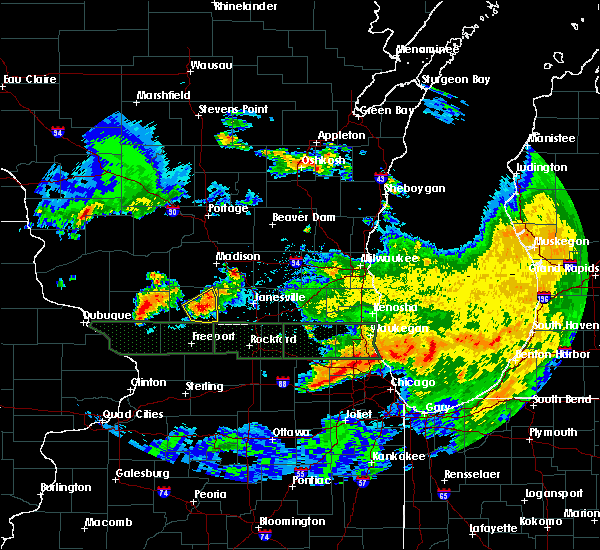 At 1124 pm cdt, a severe thunderstorm was located near brodhead, moving east at 40 mph (radar indicated). Hazards include 60 mph wind gusts and quarter size hail. Hail damage to vehicles is expected. expect wind damage to roofs, siding, and trees. Locations impacted include, monroe, brodhead, monticello, albany and juda. At 1124 pm cdt, a severe thunderstorm was located near brodhead, moving east at 40 mph (radar indicated). Hazards include 60 mph wind gusts and quarter size hail. Hail damage to vehicles is expected. expect wind damage to roofs, siding, and trees. Locations impacted include, monroe, brodhead, monticello, albany and juda.
|
| 6/28/2017 6:13 PM CDT |
 At 1112 pm cdt, a severe thunderstorm was located over monroe, moving east at 40 mph (radar indicated). Hazards include 60 mph wind gusts and quarter size hail. Hail damage to vehicles is expected. Expect wind damage to roofs, siding, and trees. At 1112 pm cdt, a severe thunderstorm was located over monroe, moving east at 40 mph (radar indicated). Hazards include 60 mph wind gusts and quarter size hail. Hail damage to vehicles is expected. Expect wind damage to roofs, siding, and trees.
|
| 6/28/2017 1:58 PM CDT |
 At 657 pm cdt, a severe squall line capable of producing both tornadoes and extensive straight line wind damage was located along a line extending from near verona to near monticello to near monroe, moving east at 45 mph (radar indicated rotation). Hazards include tornado and quarter size hail. Flying debris will be dangerous to those caught without shelter. mobile homes will be damaged or destroyed. damage to roofs, windows, and vehicles will occur. tree damage is likely. Locations impacted include, fitchburg, verona, oregon, mount horeb, belleville, new glarus, brooklyn, monticello, albany, argyle, blanchardville, barneveld, dayton, lamont, hollandale, mount vernon, yellowstone lake st park, jordan center and paoli. At 657 pm cdt, a severe squall line capable of producing both tornadoes and extensive straight line wind damage was located along a line extending from near verona to near monticello to near monroe, moving east at 45 mph (radar indicated rotation). Hazards include tornado and quarter size hail. Flying debris will be dangerous to those caught without shelter. mobile homes will be damaged or destroyed. damage to roofs, windows, and vehicles will occur. tree damage is likely. Locations impacted include, fitchburg, verona, oregon, mount horeb, belleville, new glarus, brooklyn, monticello, albany, argyle, blanchardville, barneveld, dayton, lamont, hollandale, mount vernon, yellowstone lake st park, jordan center and paoli.
|
| 6/28/2017 1:57 PM CDT |
 At 656 pm cdt, a severe thunderstorm was located near brodhead, moving east at 50 mph (radar indicated). Hazards include 60 mph wind gusts and penny size hail. expect damage to roofs, siding, and trees At 656 pm cdt, a severe thunderstorm was located near brodhead, moving east at 50 mph (radar indicated). Hazards include 60 mph wind gusts and penny size hail. expect damage to roofs, siding, and trees
|
| 6/28/2017 1:41 PM CDT |
 At 640 pm cdt, a severe squall line capable of producing both tornadoes and extensive straight line wind damage was located along a line extending from near mount horeb to near blanchardville to near argyle, moving east at 45 mph (radar indicated rotation). Hazards include tornado and quarter size hail. Flying debris will be dangerous to those caught without shelter. mobile homes will be damaged or destroyed. damage to roofs, windows, and vehicles will occur. tree damage is likely. Locations impacted include, fitchburg, verona, oregon, mount horeb, belleville, new glarus, brooklyn, monticello, albany, argyle, blanchardville, barneveld, dayton, lamont, hollandale, mount vernon, yellowstone lake st park, jordan center and paoli. At 640 pm cdt, a severe squall line capable of producing both tornadoes and extensive straight line wind damage was located along a line extending from near mount horeb to near blanchardville to near argyle, moving east at 45 mph (radar indicated rotation). Hazards include tornado and quarter size hail. Flying debris will be dangerous to those caught without shelter. mobile homes will be damaged or destroyed. damage to roofs, windows, and vehicles will occur. tree damage is likely. Locations impacted include, fitchburg, verona, oregon, mount horeb, belleville, new glarus, brooklyn, monticello, albany, argyle, blanchardville, barneveld, dayton, lamont, hollandale, mount vernon, yellowstone lake st park, jordan center and paoli.
|
| 6/28/2017 1:33 PM CDT |
 At 632 pm cdt, severe thunderstorms capable of producing both tornadoes and extensive straight line wind damage were located near blanchardville, or 14 miles northeast of darlington, moving east at 55 mph (radar indicated rotation). Hazards include tornado and quarter size hail. Flying debris will be dangerous to those caught without shelter. mobile homes will be damaged or destroyed. damage to roofs, windows, and vehicles will occur. tree damage is likely. these dangerous storms will be near, new glarus and monticello around 645 pm cdt. albany around 655 pm cdt. Other locations impacted by this tornadic thunderstorm include mount vernon, yellowstone lake st park, lamont, hollandale, jordan center, paoli, dayton and barneveld. At 632 pm cdt, severe thunderstorms capable of producing both tornadoes and extensive straight line wind damage were located near blanchardville, or 14 miles northeast of darlington, moving east at 55 mph (radar indicated rotation). Hazards include tornado and quarter size hail. Flying debris will be dangerous to those caught without shelter. mobile homes will be damaged or destroyed. damage to roofs, windows, and vehicles will occur. tree damage is likely. these dangerous storms will be near, new glarus and monticello around 645 pm cdt. albany around 655 pm cdt. Other locations impacted by this tornadic thunderstorm include mount vernon, yellowstone lake st park, lamont, hollandale, jordan center, paoli, dayton and barneveld.
|
| 6/28/2017 1:14 PM CDT |
 At 613 pm cdt, severe thunderstorms were located along a line extending from 6 miles south of spring green to near shullsburg, moving east at 60 mph. these are very dangerous storms (radar indicated). Hazards include 80 mph wind gusts and quarter size hail. Flying debris will be dangerous to those caught without shelter. mobile homes will be heavily damaged. expect considerable damage to roofs, windows, and vehicles. Extensive tree damage and power outages are likely. At 613 pm cdt, severe thunderstorms were located along a line extending from 6 miles south of spring green to near shullsburg, moving east at 60 mph. these are very dangerous storms (radar indicated). Hazards include 80 mph wind gusts and quarter size hail. Flying debris will be dangerous to those caught without shelter. mobile homes will be heavily damaged. expect considerable damage to roofs, windows, and vehicles. Extensive tree damage and power outages are likely.
|
| 6/14/2017 2:17 PM CDT |
 At 217 pm cdt, severe thunderstorms were located along a line extending from near black earth to near belleville, moving northeast at 55 mph (radar indicated). Hazards include 70 mph wind gusts and ping pong ball size hail. People and animals outdoors will be injured. expect hail damage to roofs, siding, windows, and vehicles. expect considerable tree damage. wind damage is also likely to mobile homes, roofs, and outbuildings. Locations impacted include, madison, fitchburg, middleton, verona, monona, mount horeb, cross plains, belleville, new glarus, shorewood hills, black earth, maple bluff, monticello, barneveld, blue mounds, dayton, camp randall stadium, paoli, pine bluff and blue mound st park. At 217 pm cdt, severe thunderstorms were located along a line extending from near black earth to near belleville, moving northeast at 55 mph (radar indicated). Hazards include 70 mph wind gusts and ping pong ball size hail. People and animals outdoors will be injured. expect hail damage to roofs, siding, windows, and vehicles. expect considerable tree damage. wind damage is also likely to mobile homes, roofs, and outbuildings. Locations impacted include, madison, fitchburg, middleton, verona, monona, mount horeb, cross plains, belleville, new glarus, shorewood hills, black earth, maple bluff, monticello, barneveld, blue mounds, dayton, camp randall stadium, paoli, pine bluff and blue mound st park.
|
| 6/14/2017 2:03 PM CDT |
 At 202 pm cdt, a severe thunderstorm was located over blanchardville, or 14 miles southwest of mount horeb, moving northeast at 45 mph (radar indicated). Hazards include 70 mph wind gusts and ping pong ball size hail. People and animals outdoors will be injured. expect hail damage to roofs, siding, windows, and vehicles. expect considerable tree damage. Wind damage is also likely to mobile homes, roofs, and outbuildings. At 202 pm cdt, a severe thunderstorm was located over blanchardville, or 14 miles southwest of mount horeb, moving northeast at 45 mph (radar indicated). Hazards include 70 mph wind gusts and ping pong ball size hail. People and animals outdoors will be injured. expect hail damage to roofs, siding, windows, and vehicles. expect considerable tree damage. Wind damage is also likely to mobile homes, roofs, and outbuildings.
|
| 5/17/2017 9:17 PM CDT |
 At 916 pm cdt, severe thunderstorms were located along a line extending from 6 miles southwest of columbus to stoughton to 6 miles northwest of lake summerset, moving east at 35 mph (law enforcement. at 834pm, trees were reported down 3 miles east of argyle). Hazards include 60 mph wind gusts and penny size hail. Expect damage to roofs, siding, and trees. locations impacted include, madison, janesville, beloit, sun prairie, fitchburg, watertown, middleton, stoughton, fort atkinson, waunakee, monroe, verona, oregon, jefferson, mcfarland, monona, windsor, lake mills, milton and edgerton. A tornado watch remains in effect until 100 am cdt for south central and southeastern wisconsin. At 916 pm cdt, severe thunderstorms were located along a line extending from 6 miles southwest of columbus to stoughton to 6 miles northwest of lake summerset, moving east at 35 mph (law enforcement. at 834pm, trees were reported down 3 miles east of argyle). Hazards include 60 mph wind gusts and penny size hail. Expect damage to roofs, siding, and trees. locations impacted include, madison, janesville, beloit, sun prairie, fitchburg, watertown, middleton, stoughton, fort atkinson, waunakee, monroe, verona, oregon, jefferson, mcfarland, monona, windsor, lake mills, milton and edgerton. A tornado watch remains in effect until 100 am cdt for south central and southeastern wisconsin.
|
| 5/17/2017 9:10 PM CDT |
 At 909 pm cdt, severe thunderstorms were located along a line extending from 6 miles north of sun prairie to near stoughton to 7 miles southeast of monroe, moving east at 35 mph (trained weather spotters. at 903 pm, 55 mph winds were reported in madison). Hazards include 60 mph wind gusts and penny size hail. Expect damage to roofs, siding, and trees. locations impacted include, madison, janesville, beloit, sun prairie, fitchburg, watertown, middleton, stoughton, fort atkinson, waunakee, monroe, verona, oregon, jefferson, mcfarland, monona, windsor, lake mills, milton and edgerton. A tornado watch remains in effect until 100 am cdt for south central and southeastern wisconsin. At 909 pm cdt, severe thunderstorms were located along a line extending from 6 miles north of sun prairie to near stoughton to 7 miles southeast of monroe, moving east at 35 mph (trained weather spotters. at 903 pm, 55 mph winds were reported in madison). Hazards include 60 mph wind gusts and penny size hail. Expect damage to roofs, siding, and trees. locations impacted include, madison, janesville, beloit, sun prairie, fitchburg, watertown, middleton, stoughton, fort atkinson, waunakee, monroe, verona, oregon, jefferson, mcfarland, monona, windsor, lake mills, milton and edgerton. A tornado watch remains in effect until 100 am cdt for south central and southeastern wisconsin.
|
| 5/17/2017 8:53 PM CDT |
 At 852 pm cdt, severe thunderstorms were located along a line extending from near waunakee to near belleville to near winslow, moving east at 35 mph (radar indicated). Hazards include 60 mph wind gusts and penny size hail. expect damage to roofs, siding, and trees At 852 pm cdt, severe thunderstorms were located along a line extending from near waunakee to near belleville to near winslow, moving east at 35 mph (radar indicated). Hazards include 60 mph wind gusts and penny size hail. expect damage to roofs, siding, and trees
|
| 5/17/2017 8:52 PM CDT |
 At 852 pm cdt, severe thunderstorms were located along a line extending from near lodi to near fitchburg to near monroe, moving east at 35 mph (radar indicated). Hazards include 60 mph wind gusts and nickel size hail. Expect damage to roofs, siding, and trees. locations impacted include, madison, sun prairie, fitchburg, middleton, stoughton, waunakee, monroe, verona, oregon, mcfarland, monona, mount horeb, windsor, evansville, sauk city, brodhead, deforest, cross plains, belleville and new glarus. A tornado watch remains in effect until 100 am cdt for south central wisconsin. At 852 pm cdt, severe thunderstorms were located along a line extending from near lodi to near fitchburg to near monroe, moving east at 35 mph (radar indicated). Hazards include 60 mph wind gusts and nickel size hail. Expect damage to roofs, siding, and trees. locations impacted include, madison, sun prairie, fitchburg, middleton, stoughton, waunakee, monroe, verona, oregon, mcfarland, monona, mount horeb, windsor, evansville, sauk city, brodhead, deforest, cross plains, belleville and new glarus. A tornado watch remains in effect until 100 am cdt for south central wisconsin.
|
| 5/17/2017 8:41 PM CDT |
 At 840 pm cdt, severe thunderstorms were located along a line extending from near sauk city to near verona to near monroe, moving east at 40 mph (law enforcement. at 756 pm, damaging winds were reported in darlington and mineral point). Hazards include 70 mph wind gusts and quarter size hail. Hail damage to vehicles is expected. expect considerable tree damage. wind damage is also likely to mobile homes, roofs, and outbuildings. locations impacted include, madison, sun prairie, fitchburg, middleton, stoughton, waunakee, monroe, verona, oregon, mcfarland, monona, mount horeb, windsor, evansville, sauk city, brodhead, darlington, deforest, cross plains and belleville. A tornado watch remains in effect until 1100 pm cdt for south central wisconsin. At 840 pm cdt, severe thunderstorms were located along a line extending from near sauk city to near verona to near monroe, moving east at 40 mph (law enforcement. at 756 pm, damaging winds were reported in darlington and mineral point). Hazards include 70 mph wind gusts and quarter size hail. Hail damage to vehicles is expected. expect considerable tree damage. wind damage is also likely to mobile homes, roofs, and outbuildings. locations impacted include, madison, sun prairie, fitchburg, middleton, stoughton, waunakee, monroe, verona, oregon, mcfarland, monona, mount horeb, windsor, evansville, sauk city, brodhead, darlington, deforest, cross plains and belleville. A tornado watch remains in effect until 1100 pm cdt for south central wisconsin.
|
| 5/17/2017 8:30 PM CDT |
 At 829 pm cdt, severe thunderstorms were located along a line extending from near mazomanie to 6 miles northeast of blanchardville to near nora, moving east at 35 mph (law enforcement. trees and powerlines were down in dodgeville and mineral point at 756 pm). Hazards include 60 mph wind gusts and quarter size hail. Hail damage to vehicles is expected. expect wind damage to roofs, siding, and trees. locations impacted include, madison, sun prairie, fitchburg, middleton, stoughton, waunakee, monroe, verona, oregon, mcfarland, monona, mount horeb, windsor, evansville, sauk city, brodhead, darlington, deforest, cross plains and belleville. A tornado watch remains in effect until 1100 pm cdt for south central wisconsin. At 829 pm cdt, severe thunderstorms were located along a line extending from near mazomanie to 6 miles northeast of blanchardville to near nora, moving east at 35 mph (law enforcement. trees and powerlines were down in dodgeville and mineral point at 756 pm). Hazards include 60 mph wind gusts and quarter size hail. Hail damage to vehicles is expected. expect wind damage to roofs, siding, and trees. locations impacted include, madison, sun prairie, fitchburg, middleton, stoughton, waunakee, monroe, verona, oregon, mcfarland, monona, mount horeb, windsor, evansville, sauk city, brodhead, darlington, deforest, cross plains and belleville. A tornado watch remains in effect until 1100 pm cdt for south central wisconsin.
|
| 5/17/2017 8:20 PM CDT |
 At 819 pm cdt, severe thunderstorms were located along a line extending from 7 miles northeast of spring green to near blanchardville to warren, moving east at 35 mph (radar indicated). Hazards include 60 mph wind gusts and quarter size hail. Hail damage to vehicles is expected. Expect wind damage to roofs, siding, and trees. At 819 pm cdt, severe thunderstorms were located along a line extending from 7 miles northeast of spring green to near blanchardville to warren, moving east at 35 mph (radar indicated). Hazards include 60 mph wind gusts and quarter size hail. Hail damage to vehicles is expected. Expect wind damage to roofs, siding, and trees.
|
| 5/17/2017 8:16 PM CDT |
 At 815 pm cdt, severe thunderstorms were located along a line extending from near cashton to near wonewoc to 11 miles south of reedsburg to 8 miles southwest of mazomanie to 6 miles southeast of darlington, moving northeast at 55 mph (law enforcement. tree damage was reported in belmont at 753 pm). Hazards include 60 mph wind gusts and quarter size hail. Hail damage to vehicles is expected. expect wind damage to roofs, siding, and trees. locations impacted include, western madison, middleton, baraboo, monroe, verona, reedsburg, mount horeb, dodgeville, prairie du sac, sauk city, wisconsin dells, mineral point, darlington, lake wisconsin, cross plains, lodi, lake delton, belleville, new glarus and mazomanie. A tornado watch remains in effect until 1100 pm cdt for south central wisconsin. At 815 pm cdt, severe thunderstorms were located along a line extending from near cashton to near wonewoc to 11 miles south of reedsburg to 8 miles southwest of mazomanie to 6 miles southeast of darlington, moving northeast at 55 mph (law enforcement. tree damage was reported in belmont at 753 pm). Hazards include 60 mph wind gusts and quarter size hail. Hail damage to vehicles is expected. expect wind damage to roofs, siding, and trees. locations impacted include, western madison, middleton, baraboo, monroe, verona, reedsburg, mount horeb, dodgeville, prairie du sac, sauk city, wisconsin dells, mineral point, darlington, lake wisconsin, cross plains, lodi, lake delton, belleville, new glarus and mazomanie. A tornado watch remains in effect until 1100 pm cdt for south central wisconsin.
|
| 5/17/2017 8:07 PM CDT |
 At 806 pm cdt, severe thunderstorms were located along a line extending from westby to 10 miles south of hillsboro to 10 miles east of richland center to near dodgeville to near apple river, moving northeast at 55 mph (law enforcement reporting trees down in lafayette county). Hazards include 60 mph wind gusts and quarter size hail. Hail damage to vehicles is expected. expect wind damage to roofs, siding, and trees. locations impacted include, western madison, middleton, baraboo, monroe, verona, reedsburg, mount horeb, dodgeville, prairie du sac, sauk city, wisconsin dells, mineral point, darlington, lake wisconsin, cross plains, lodi, lake delton, belleville, new glarus and mazomanie. A tornado watch remains in effect until 1100 pm cdt for south central wisconsin. At 806 pm cdt, severe thunderstorms were located along a line extending from westby to 10 miles south of hillsboro to 10 miles east of richland center to near dodgeville to near apple river, moving northeast at 55 mph (law enforcement reporting trees down in lafayette county). Hazards include 60 mph wind gusts and quarter size hail. Hail damage to vehicles is expected. expect wind damage to roofs, siding, and trees. locations impacted include, western madison, middleton, baraboo, monroe, verona, reedsburg, mount horeb, dodgeville, prairie du sac, sauk city, wisconsin dells, mineral point, darlington, lake wisconsin, cross plains, lodi, lake delton, belleville, new glarus and mazomanie. A tornado watch remains in effect until 1100 pm cdt for south central wisconsin.
|
| 5/17/2017 7:54 PM CDT |
 At 752 pm cdt, severe thunderstorms were located along a line extending from 8 miles west of viroqua to near muscoda to council hill, moving northeast at 65 mph (radar indicated). Hazards include 60 mph wind gusts and quarter size hail. Hail damage to vehicles is expected. Expect wind damage to roofs, siding, and trees. At 752 pm cdt, severe thunderstorms were located along a line extending from 8 miles west of viroqua to near muscoda to council hill, moving northeast at 65 mph (radar indicated). Hazards include 60 mph wind gusts and quarter size hail. Hail damage to vehicles is expected. Expect wind damage to roofs, siding, and trees.
|
| 5/15/2017 9:22 PM CDT |
 At 921 pm cdt, a severe thunderstorm was located over albany, or near brodhead, moving east at 40 mph (law enforcement). Hazards include 60 mph wind gusts. Expect damage to roofs, siding, and trees. Locations impacted include, monroe, brodhead, monticello, albany, browntown, juda and jordan center. At 921 pm cdt, a severe thunderstorm was located over albany, or near brodhead, moving east at 40 mph (law enforcement). Hazards include 60 mph wind gusts. Expect damage to roofs, siding, and trees. Locations impacted include, monroe, brodhead, monticello, albany, browntown, juda and jordan center.
|
| 5/15/2017 9:14 PM CDT |
 At 912 pm cdt, a severe thunderstorm was located near monticello, or 7 miles northeast of monroe, moving east at 40 mph (law enforcement. power lines and trees were reported down across lafayette county, in particular in darlington and argyle). Hazards include 60 mph wind gusts. Expect damage to roofs, siding, and trees. Locations impacted include, monroe, brodhead, darlington, monticello, albany, argyle, somers, wiota, south wayne, lamont, browntown, gratiot, juda, yellowstone lake st park, jordan center and woodford. At 912 pm cdt, a severe thunderstorm was located near monticello, or 7 miles northeast of monroe, moving east at 40 mph (law enforcement. power lines and trees were reported down across lafayette county, in particular in darlington and argyle). Hazards include 60 mph wind gusts. Expect damage to roofs, siding, and trees. Locations impacted include, monroe, brodhead, darlington, monticello, albany, argyle, somers, wiota, south wayne, lamont, browntown, gratiot, juda, yellowstone lake st park, jordan center and woodford.
|
| 5/15/2017 9:06 PM CDT |
 At 906 pm cdt, a severe thunderstorm was located near monticello, or near monroe, moving east at 50 mph (radar indicated). Hazards include 60 mph wind gusts. Expect damage to roofs, siding, and trees. Locations impacted include, monroe, brodhead, darlington, monticello, albany, argyle, somers, wiota, south wayne, lamont, browntown, gratiot, juda, yellowstone lake st park, jordan center and woodford. At 906 pm cdt, a severe thunderstorm was located near monticello, or near monroe, moving east at 50 mph (radar indicated). Hazards include 60 mph wind gusts. Expect damage to roofs, siding, and trees. Locations impacted include, monroe, brodhead, darlington, monticello, albany, argyle, somers, wiota, south wayne, lamont, browntown, gratiot, juda, yellowstone lake st park, jordan center and woodford.
|
| 5/15/2017 8:47 PM CDT |
 At 847 pm cdt, a severe thunderstorm was located near darlington, moving east at 40 mph. at 841 pm cdt, a 64 mph gust was reported with this storm near darlington. seek shelter now! (public). Hazards include 60 mph wind gusts. expect damage to roofs, siding, and trees At 847 pm cdt, a severe thunderstorm was located near darlington, moving east at 40 mph. at 841 pm cdt, a 64 mph gust was reported with this storm near darlington. seek shelter now! (public). Hazards include 60 mph wind gusts. expect damage to roofs, siding, and trees
|
| 4/10/2017 2:49 PM CDT |
 At 249 pm cdt, a severe thunderstorm was located over albany, or near evansville, moving northeast at 50 mph (radar indicated). Hazards include quarter size hail. Damage to vehicles is expected. Locations impacted include, new glarus, brooklyn, monticello, albany and dayton. At 249 pm cdt, a severe thunderstorm was located over albany, or near evansville, moving northeast at 50 mph (radar indicated). Hazards include quarter size hail. Damage to vehicles is expected. Locations impacted include, new glarus, brooklyn, monticello, albany and dayton.
|
| 4/10/2017 2:43 PM CDT |
 At 242 pm cdt, a severe thunderstorm was located near albany, or 9 miles northwest of brodhead, moving northeast at 55 mph (radar indicated). Hazards include quarter size hail. damage to vehicles is expected At 242 pm cdt, a severe thunderstorm was located near albany, or 9 miles northwest of brodhead, moving northeast at 55 mph (radar indicated). Hazards include quarter size hail. damage to vehicles is expected
|
| 4/10/2017 2:34 PM CDT |
 At 233 pm cdt, a severe thunderstorm was located near monroe, moving northeast at 50 mph (radar indicated). Hazards include quarter size hail. Damage to vehicles is expected. Locations impacted include, monroe, new glarus, brooklyn, monticello, albany, dayton, browntown, juda and jordan center. At 233 pm cdt, a severe thunderstorm was located near monroe, moving northeast at 50 mph (radar indicated). Hazards include quarter size hail. Damage to vehicles is expected. Locations impacted include, monroe, new glarus, brooklyn, monticello, albany, dayton, browntown, juda and jordan center.
|
| 4/10/2017 2:21 PM CDT |
 At 220 pm cdt, a severe thunderstorm was located 7 miles southeast of argyle, or 8 miles west of monroe, moving northeast at 55 mph (radar indicated). Hazards include quarter size hail. damage to vehicles is expected At 220 pm cdt, a severe thunderstorm was located 7 miles southeast of argyle, or 8 miles west of monroe, moving northeast at 55 mph (radar indicated). Hazards include quarter size hail. damage to vehicles is expected
|
| 3/23/2017 6:20 PM CDT |
 At 620 pm cdt, a severe thunderstorm was located near albany, or near brodhead, moving east at 50 mph (radar indicated). Hazards include quarter size hail. Damage to vehicles is expected. Locations impacted include, monroe, brodhead, belleville, new glarus, brooklyn, monticello, albany, dayton, juda and jordan center. At 620 pm cdt, a severe thunderstorm was located near albany, or near brodhead, moving east at 50 mph (radar indicated). Hazards include quarter size hail. Damage to vehicles is expected. Locations impacted include, monroe, brodhead, belleville, new glarus, brooklyn, monticello, albany, dayton, juda and jordan center.
|
| 3/23/2017 6:05 PM CDT |
 At 604 pm cdt, a severe thunderstorm was located near monroe, moving east at 50 mph (radar indicated). Hazards include quarter size hail. Damage to vehicles is expected. Locations impacted include, monroe, brodhead, belleville, new glarus, brooklyn, monticello, albany, argyle, blanchardville, somers, wiota, dayton, south wayne, lamont, browntown, juda, yellowstone lake st park, jordan center and woodford. At 604 pm cdt, a severe thunderstorm was located near monroe, moving east at 50 mph (radar indicated). Hazards include quarter size hail. Damage to vehicles is expected. Locations impacted include, monroe, brodhead, belleville, new glarus, brooklyn, monticello, albany, argyle, blanchardville, somers, wiota, dayton, south wayne, lamont, browntown, juda, yellowstone lake st park, jordan center and woodford.
|
| 3/23/2017 5:48 PM CDT |
 At 548 pm cdt, a severe thunderstorm was located near argyle, or 10 miles east of darlington, moving east at 50 mph (radar indicated). Hazards include quarter size hail. damage to vehicles is expected At 548 pm cdt, a severe thunderstorm was located near argyle, or 10 miles east of darlington, moving east at 50 mph (radar indicated). Hazards include quarter size hail. damage to vehicles is expected
|
| 3/6/2017 11:38 PM CST |
 At 1138 pm cst, severe thunderstorms were located along a line extending from 6 miles north of marshall to near brodhead, moving northeast at 55 mph (radar indicated). Hazards include 60 mph wind gusts and penny size hail. Expect damage to roofs, siding, and trees. Locations impacted include, madison, janesville, sun prairie, fitchburg, middleton, stoughton, waunakee, verona, oregon, mcfarland, monona, windsor, milton, edgerton, evansville, marshall, brodhead, deforest, cottage grove and belleville. At 1138 pm cst, severe thunderstorms were located along a line extending from 6 miles north of marshall to near brodhead, moving northeast at 55 mph (radar indicated). Hazards include 60 mph wind gusts and penny size hail. Expect damage to roofs, siding, and trees. Locations impacted include, madison, janesville, sun prairie, fitchburg, middleton, stoughton, waunakee, verona, oregon, mcfarland, monona, windsor, milton, edgerton, evansville, marshall, brodhead, deforest, cottage grove and belleville.
|
| 3/6/2017 11:34 PM CST |
 At 1132 pm cst, severe thunderstorms were located along a line extending from sun prairie to near brodhead, moving northeast at 55 mph. at 1125 pm cst, a 58 mph wind gust was reported in monroe (radar indicated). Hazards include 60 mph wind gusts and penny size hail. Expect damage to roofs, siding, and trees. Locations impacted include, madison, janesville, sun prairie, fitchburg, middleton, stoughton, waunakee, monroe, verona, oregon, mcfarland, monona, windsor, milton, edgerton, evansville, marshall, brodhead, deforest and cottage grove. At 1132 pm cst, severe thunderstorms were located along a line extending from sun prairie to near brodhead, moving northeast at 55 mph. at 1125 pm cst, a 58 mph wind gust was reported in monroe (radar indicated). Hazards include 60 mph wind gusts and penny size hail. Expect damage to roofs, siding, and trees. Locations impacted include, madison, janesville, sun prairie, fitchburg, middleton, stoughton, waunakee, monroe, verona, oregon, mcfarland, monona, windsor, milton, edgerton, evansville, marshall, brodhead, deforest and cottage grove.
|
| 3/6/2017 11:13 PM CST |
 At 1113 pm cst, severe thunderstorms were located along a line extending from near belleville to near lena, moving northeast at 85 mph (radar indicated). Hazards include 60 mph wind gusts and penny size hail. expect damage to roofs, siding, and trees At 1113 pm cst, severe thunderstorms were located along a line extending from near belleville to near lena, moving northeast at 85 mph (radar indicated). Hazards include 60 mph wind gusts and penny size hail. expect damage to roofs, siding, and trees
|
| 3/6/2017 11:00 PM CST |
 At 1100 pm cst, severe thunderstorms were located along a line extending from near mount horeb to monticello, moving northeast at 55 mph (radar indicated). Hazards include 60 mph wind gusts and penny size hail. Expect damage to roofs, siding, and trees. Locations impacted include, western madison, fitchburg, middleton, monroe, verona, oregon, mount horeb, cross plains, belleville, new glarus, shorewood hills, brooklyn, monticello, albany, argyle, blanchardville, somers, barneveld, wiota and blue mounds. At 1100 pm cst, severe thunderstorms were located along a line extending from near mount horeb to monticello, moving northeast at 55 mph (radar indicated). Hazards include 60 mph wind gusts and penny size hail. Expect damage to roofs, siding, and trees. Locations impacted include, western madison, fitchburg, middleton, monroe, verona, oregon, mount horeb, cross plains, belleville, new glarus, shorewood hills, brooklyn, monticello, albany, argyle, blanchardville, somers, barneveld, wiota and blue mounds.
|
| 3/6/2017 10:42 PM CST |
 At 1041 pm cst, severe thunderstorms were located along a line extending from 6 miles northwest of blanchardville to near argyle, moving northeast at 65 mph (law enforcement). Hazards include 60 mph wind gusts and penny size hail. expect damage to roofs, siding, and trees At 1041 pm cst, severe thunderstorms were located along a line extending from 6 miles northwest of blanchardville to near argyle, moving northeast at 65 mph (law enforcement). Hazards include 60 mph wind gusts and penny size hail. expect damage to roofs, siding, and trees
|
| 8/4/2016 7:29 PM CDT |
 At 728 pm cdt, severe thunderstorms were located along a line extending from 6 miles south of mount horeb to near blanchardville, moving east at 30 mph (law enforcement). Hazards include 60 mph wind gusts. Expect damage to roofs. siding. and trees. Locations impacted include, oregon, belleville, new glarus, brooklyn, monticello, albany, dayton and paoli. At 728 pm cdt, severe thunderstorms were located along a line extending from 6 miles south of mount horeb to near blanchardville, moving east at 30 mph (law enforcement). Hazards include 60 mph wind gusts. Expect damage to roofs. siding. and trees. Locations impacted include, oregon, belleville, new glarus, brooklyn, monticello, albany, dayton and paoli.
|
| 8/4/2016 7:19 PM CDT |
 At 718 pm cdt, severe thunderstorms were located along a line extending from 6 miles southwest of mount horeb to near blanchardville, moving east at 30 mph (law enforcement). Hazards include 60 mph wind gusts. law enforcement reported several trees down across iowa county. Expect damage to roofs. siding. and trees. Locations impacted include, oregon, belleville, new glarus, brooklyn, monticello, albany, blanchardville, dayton, hollandale and paoli. At 718 pm cdt, severe thunderstorms were located along a line extending from 6 miles southwest of mount horeb to near blanchardville, moving east at 30 mph (law enforcement). Hazards include 60 mph wind gusts. law enforcement reported several trees down across iowa county. Expect damage to roofs. siding. and trees. Locations impacted include, oregon, belleville, new glarus, brooklyn, monticello, albany, blanchardville, dayton, hollandale and paoli.
|
| 8/4/2016 7:04 PM CDT |
 At 703 pm cdt, severe thunderstorms were located along a line extending from 7 miles southwest of mount horeb to near blanchardville, moving east at 30 mph (radar indicated). Hazards include 60 mph wind gusts. Expect damage to roofs. siding. And trees. At 703 pm cdt, severe thunderstorms were located along a line extending from 7 miles southwest of mount horeb to near blanchardville, moving east at 30 mph (radar indicated). Hazards include 60 mph wind gusts. Expect damage to roofs. siding. And trees.
|
| 7/23/2016 6:20 PM CDT |
 At 620 pm cdt, a severe thunderstorm was located near browntown, moving east at 40 mph (radar indicated). Hazards include 70 mph wind gusts. Expect considerable tree damage. damage is likely to mobile homes, roofs, and outbuildings. locations impacted include, monroe, brodhead, albany, somers, south wayne, browntown, jordan center, juda and woodford. People attending the green county fair should seek safe shelter immediately!. At 620 pm cdt, a severe thunderstorm was located near browntown, moving east at 40 mph (radar indicated). Hazards include 70 mph wind gusts. Expect considerable tree damage. damage is likely to mobile homes, roofs, and outbuildings. locations impacted include, monroe, brodhead, albany, somers, south wayne, browntown, jordan center, juda and woodford. People attending the green county fair should seek safe shelter immediately!.
|
| 7/23/2016 6:15 PM CDT |
 At 614 pm cdt, a severe thunderstorm was located near south wayne, moving east at 50 mph (radar indicated). Hazards include 70 mph wind gusts. Expect considerable tree damage. damage is likely to mobile homes, roofs, and outbuildings. locations impacted include, monroe, brodhead, albany, somers, wiota, south wayne, browntown, gratiot, jordan center, juda and woodford. People attending the green county fair should seek safe shelter immediately!. At 614 pm cdt, a severe thunderstorm was located near south wayne, moving east at 50 mph (radar indicated). Hazards include 70 mph wind gusts. Expect considerable tree damage. damage is likely to mobile homes, roofs, and outbuildings. locations impacted include, monroe, brodhead, albany, somers, wiota, south wayne, browntown, gratiot, jordan center, juda and woodford. People attending the green county fair should seek safe shelter immediately!.
|
| 7/6/2016 12:53 AM CDT |
 At 1252 am cdt, severe thunderstorms were located along a line extending from near lake koshkonong to near durand, moving southeast at 65 mph (radar indicated). Hazards include 60 mph wind gusts. Expect damage to roofs. siding. and trees. Locations impacted include, fitchburg, stoughton, verona, oregon, edgerton, evansville, brodhead, belleville, new glarus, brooklyn, monticello, albany, fulton, albion, magnolia, dayton, jordan center, mount vernon, cooksville and paoli. At 1252 am cdt, severe thunderstorms were located along a line extending from near lake koshkonong to near durand, moving southeast at 65 mph (radar indicated). Hazards include 60 mph wind gusts. Expect damage to roofs. siding. and trees. Locations impacted include, fitchburg, stoughton, verona, oregon, edgerton, evansville, brodhead, belleville, new glarus, brooklyn, monticello, albany, fulton, albion, magnolia, dayton, jordan center, mount vernon, cooksville and paoli.
|
| 7/6/2016 12:22 AM CDT |
 At 1219 am cdt, severe thunderstorms were located along a line extending from madison to near argyle, moving east at 40 mph (radar indicated). Hazards include 60 mph wind gusts. Expect damage to roofs. siding. and trees. Locations impacted include, fitchburg, stoughton, verona, oregon, mount horeb, edgerton, evansville, brodhead, mineral point, belleville, new glarus, brooklyn, monticello, albany, argyle, blanchardville, fulton, albion, barneveld and blue mounds. At 1219 am cdt, severe thunderstorms were located along a line extending from madison to near argyle, moving east at 40 mph (radar indicated). Hazards include 60 mph wind gusts. Expect damage to roofs. siding. and trees. Locations impacted include, fitchburg, stoughton, verona, oregon, mount horeb, edgerton, evansville, brodhead, mineral point, belleville, new glarus, brooklyn, monticello, albany, argyle, blanchardville, fulton, albion, barneveld and blue mounds.
|
| 7/5/2016 11:54 PM CDT |
 At 1153 pm cdt, a severe thunderstorm was located 9 miles northwest of blanchardville, or 9 miles east of dodgeville, moving southeast at 65 mph (radar indicated). Hazards include 60 mph wind gusts. Expect damage to roofs. siding. And trees. At 1153 pm cdt, a severe thunderstorm was located 9 miles northwest of blanchardville, or 9 miles east of dodgeville, moving southeast at 65 mph (radar indicated). Hazards include 60 mph wind gusts. Expect damage to roofs. siding. And trees.
|
| 6/9/2016 8:41 PM CDT |
 At 840 pm cdt, a severe thunderstorm was located near albany, or near evansville, moving east at 25 mph. an additional severe thunderstorm was located near broadhead, and was also moving east at 25 mph (radar indicated). Hazards include 60 mph wind gusts and half dollar size hail. Hail damage to vehicles is expected. expect wind damage to roofs, siding, and trees. Locations impacted include, janesville, evansville, brodhead, orfordville, monticello, albany, footville, magnolia and hanover. At 840 pm cdt, a severe thunderstorm was located near albany, or near evansville, moving east at 25 mph. an additional severe thunderstorm was located near broadhead, and was also moving east at 25 mph (radar indicated). Hazards include 60 mph wind gusts and half dollar size hail. Hail damage to vehicles is expected. expect wind damage to roofs, siding, and trees. Locations impacted include, janesville, evansville, brodhead, orfordville, monticello, albany, footville, magnolia and hanover.
|
| 6/9/2016 8:30 PM CDT |
 At 828 pm cdt, a severe thunderstorm was located over albany, or 8 miles southwest of evansville, moving east at 25 mph. an additional severe thunderstorm was located near broadhead (radar indicated). Hazards include half dollar size hail. Damage to vehicles is expected. Locations impacted include, janesville, evansville, brodhead, orfordville, monticello, albany, footville, magnolia, dayton and hanover. At 828 pm cdt, a severe thunderstorm was located over albany, or 8 miles southwest of evansville, moving east at 25 mph. an additional severe thunderstorm was located near broadhead (radar indicated). Hazards include half dollar size hail. Damage to vehicles is expected. Locations impacted include, janesville, evansville, brodhead, orfordville, monticello, albany, footville, magnolia, dayton and hanover.
|
| 6/9/2016 8:18 PM CDT |
 At 818 pm cdt, a severe thunderstorm was located over monticello, or 11 miles northeast of monroe, moving east at 25 mph (radar indicated). Hazards include quarter size hail. damage to vehicles is expected At 818 pm cdt, a severe thunderstorm was located over monticello, or 11 miles northeast of monroe, moving east at 25 mph (radar indicated). Hazards include quarter size hail. damage to vehicles is expected
|
| 11/11/2015 7:32 PM CST |
 At 731 pm cst, a severe thunderstorm was located near monticello, or near monroe, moving northeast at 55 mph (radar indicated). Hazards include 60 mph wind gusts. Expect damage to roofs. siding and trees. Locations impacted include, monroe, brodhead, new glarus, monticello, albany, jordan center and juda. At 731 pm cst, a severe thunderstorm was located near monticello, or near monroe, moving northeast at 55 mph (radar indicated). Hazards include 60 mph wind gusts. Expect damage to roofs. siding and trees. Locations impacted include, monroe, brodhead, new glarus, monticello, albany, jordan center and juda.
|
| 11/11/2015 7:20 PM CST |
 At 720 pm cst, a severe thunderstorm was located near winslow, or 8 miles west of monroe, moving northeast at 55 mph (radar indicated). Hazards include 60 mph wind gusts. Expect damage to roofs. siding and trees. Locations impacted include, monroe, brodhead, new glarus, monticello, albany, browntown, jordan center and juda. At 720 pm cst, a severe thunderstorm was located near winslow, or 8 miles west of monroe, moving northeast at 55 mph (radar indicated). Hazards include 60 mph wind gusts. Expect damage to roofs. siding and trees. Locations impacted include, monroe, brodhead, new glarus, monticello, albany, browntown, jordan center and juda.
|
| 11/11/2015 7:05 PM CST |
 At 703 pm cst, a line of severe thunderstorms was located near nora, or 19 miles northwest of freeport, moving northeast at 55 mph (radar indicated). Hazards include 60 mph wind gusts. Expect damage to roofs. Siding and trees. At 703 pm cst, a line of severe thunderstorms was located near nora, or 19 miles northwest of freeport, moving northeast at 55 mph (radar indicated). Hazards include 60 mph wind gusts. Expect damage to roofs. Siding and trees.
|
| 9/17/2015 8:20 PM CDT |
 At 818 pm cdt, a cluster of severe thunderstorms was located in eastern lafayette and northwestern green counties, moving northeast at 35 mph (radar indicated). Hazards include 60 mph wind gusts and nickel size hail. Expect damage to roofs. Siding and trees. At 818 pm cdt, a cluster of severe thunderstorms was located in eastern lafayette and northwestern green counties, moving northeast at 35 mph (radar indicated). Hazards include 60 mph wind gusts and nickel size hail. Expect damage to roofs. Siding and trees.
|
| 7/18/2015 2:20 PM CDT |
 At 220 pm cdt, severe thunderstorms were located along a line extending from near oconomowoc to orfordville, moving east at 45 mph (radar indicated). Hazards include 60 mph wind gusts and quarter size hail. Hail damage to vehicles is expected. expect wind damage to roofs, siding and trees. these severe thunderstorms will remain over mainly rural areas of jefferson, southeastern dane, rock and green counties, including the following locations, lake lac la belle, dayton, johnstown center, magnolia, pipersville, emerald grove, rockdale, albion, ixonia and milford. A tornado watch remains in effect until 1000 pm cdt for southeastern wisconsin. At 220 pm cdt, severe thunderstorms were located along a line extending from near oconomowoc to orfordville, moving east at 45 mph (radar indicated). Hazards include 60 mph wind gusts and quarter size hail. Hail damage to vehicles is expected. expect wind damage to roofs, siding and trees. these severe thunderstorms will remain over mainly rural areas of jefferson, southeastern dane, rock and green counties, including the following locations, lake lac la belle, dayton, johnstown center, magnolia, pipersville, emerald grove, rockdale, albion, ixonia and milford. A tornado watch remains in effect until 1000 pm cdt for southeastern wisconsin.
|
| 7/18/2015 1:59 PM CDT |
 At 158 pm cdt, a severe thunderstorm was located near edgerton, moving east at 75 mph (radar indicated). Hazards include 60 mph wind gusts and quarter size hail. Hail damage to vehicles is expected. Expect wind damage to roofs, siding and trees. At 158 pm cdt, a severe thunderstorm was located near edgerton, moving east at 75 mph (radar indicated). Hazards include 60 mph wind gusts and quarter size hail. Hail damage to vehicles is expected. Expect wind damage to roofs, siding and trees.
|
| 7/18/2015 1:44 PM CDT |
 At 144 pm cdt, a severe thunderstorm was located near belleville, or near oregon, moving east at 45 mph (radar indicated). Hazards include 60 mph wind gusts and quarter size hail. Hail damage to vehicles is expected. expect wind damage to roofs, siding and trees. this severe storm will be near, stoughton around 200 pm cdt. other locations impacted by this severe thunderstorm include hanover, union, dayton, magnolia and cooksville. A tornado watch remains in effect until 1000 pm cdt for south central wisconsin. At 144 pm cdt, a severe thunderstorm was located near belleville, or near oregon, moving east at 45 mph (radar indicated). Hazards include 60 mph wind gusts and quarter size hail. Hail damage to vehicles is expected. expect wind damage to roofs, siding and trees. this severe storm will be near, stoughton around 200 pm cdt. other locations impacted by this severe thunderstorm include hanover, union, dayton, magnolia and cooksville. A tornado watch remains in effect until 1000 pm cdt for south central wisconsin.
|
| 7/18/2015 1:26 PM CDT |
 At 125 pm cdt, a severe thunderstorm was located near new glarus, or 11 miles north of monroe, moving east at 40 mph (radar indicated). Hazards include 60 mph wind gusts and quarter size hail. Hail damage to vehicles is expected. Expect wind damage to roofs, siding and trees. At 125 pm cdt, a severe thunderstorm was located near new glarus, or 11 miles north of monroe, moving east at 40 mph (radar indicated). Hazards include 60 mph wind gusts and quarter size hail. Hail damage to vehicles is expected. Expect wind damage to roofs, siding and trees.
|
| 7/13/2015 7:26 PM CDT |
 At 725 pm cdt, a severe thunderstorm was located over new glarus, or 13 miles north of monroe, moving southeast at 50 mph (radar indicated). Hazards include 60 mph wind gusts and quarter size hail. Hail damage to vehicles is expected. expect wind damage to roofs, siding and trees. Locations impacted include, mount horeb, belleville, new glarus, brooklyn, monticello, albany, blue mounds, dayton, mount vernon, juda and paoli. At 725 pm cdt, a severe thunderstorm was located over new glarus, or 13 miles north of monroe, moving southeast at 50 mph (radar indicated). Hazards include 60 mph wind gusts and quarter size hail. Hail damage to vehicles is expected. expect wind damage to roofs, siding and trees. Locations impacted include, mount horeb, belleville, new glarus, brooklyn, monticello, albany, blue mounds, dayton, mount vernon, juda and paoli.
|
| 7/13/2015 7:11 PM CDT |
 At 711 pm cdt, a severe thunderstorm was located near blanchardville, or 8 miles southwest of mount horeb, moving southeast at 50 mph (radar indicated). Hazards include 60 mph wind gusts and quarter size hail. Hail damage to vehicles is expected. Expect wind damage to roofs, siding and trees. At 711 pm cdt, a severe thunderstorm was located near blanchardville, or 8 miles southwest of mount horeb, moving southeast at 50 mph (radar indicated). Hazards include 60 mph wind gusts and quarter size hail. Hail damage to vehicles is expected. Expect wind damage to roofs, siding and trees.
|
| 7/13/2015 5:28 AM CDT | The severe thunderstorm warning for walworth, lafayette, rock and green counties will expire at 530 am cdt, the storms which prompted the warning have moved out of the area. therefore the warning will be allowed to expire. a severe thunderstorm watch remains in effect until 1000 am cdt for southeastern wisconsin. |
| 7/13/2015 5:24 AM CDT |
 At 524 am cdt, severe thunderstorms were located along a line extending from fox river valley gardens to near fairhaven, moving southeast at 70 mph. these storms have a history of producing widespread wind damage. this is a dangerous situation, take cover now! (law enforcement). Hazards include 70 mph wind gusts. Expect considerable tree damage. damage is likely to mobile homes, roofs and outbuildings. Locations impacted include, janesville, beloit, whitewater, monroe, elkhorn, lake geneva, milton, evansville, east troy, brodhead, williams bay, darlington, delavan lake, walworth, clinton, fontana-on-geneva lake, darien, orfordville, shullsburg and monticello. At 524 am cdt, severe thunderstorms were located along a line extending from fox river valley gardens to near fairhaven, moving southeast at 70 mph. these storms have a history of producing widespread wind damage. this is a dangerous situation, take cover now! (law enforcement). Hazards include 70 mph wind gusts. Expect considerable tree damage. damage is likely to mobile homes, roofs and outbuildings. Locations impacted include, janesville, beloit, whitewater, monroe, elkhorn, lake geneva, milton, evansville, east troy, brodhead, williams bay, darlington, delavan lake, walworth, clinton, fontana-on-geneva lake, darien, orfordville, shullsburg and monticello.
|
| 7/13/2015 4:58 AM CDT |
 At 457 am cdt, severe thunderstorms were located along a line extending from near como to woodbine, moving southeast at 70 mph. there have been multiple reports of trees down with these storms (law enforcement). Hazards include 60 mph wind gusts. Expect damage to roofs. siding and trees. Locations impacted include, janesville, beloit, whitewater, monroe, elkhorn, lake geneva, milton, evansville, east troy, brodhead, williams bay, darlington, delavan lake, walworth, clinton, fontana-on-geneva lake, darien, orfordville, shullsburg and monticello. At 457 am cdt, severe thunderstorms were located along a line extending from near como to woodbine, moving southeast at 70 mph. there have been multiple reports of trees down with these storms (law enforcement). Hazards include 60 mph wind gusts. Expect damage to roofs. siding and trees. Locations impacted include, janesville, beloit, whitewater, monroe, elkhorn, lake geneva, milton, evansville, east troy, brodhead, williams bay, darlington, delavan lake, walworth, clinton, fontana-on-geneva lake, darien, orfordville, shullsburg and monticello.
|
| 7/13/2015 4:45 AM CDT |
 At 444 am cdt, severe thunderstorms were located along a line extending from near palmyra to near scales mound, moving southeast at 70 mph (law enforcement). Hazards include 60 mph wind gusts. Expect damage to roofs. Siding and trees. At 444 am cdt, severe thunderstorms were located along a line extending from near palmyra to near scales mound, moving southeast at 70 mph (law enforcement). Hazards include 60 mph wind gusts. Expect damage to roofs. Siding and trees.
|
| 7/13/2015 4:31 AM CDT |
 At 429 am cdt, severe thunderstorms were located along a line extending from near watertown to cambridge to near mineral point, moving southeast at 45 mph. at 415 am, many trees were reported down in mount horeb. this is a dangerous situation, seek shelter now! (public). Hazards include 70 mph wind gusts. Expect considerable tree damage. damage is likely to mobile homes, roofs and outbuildings. locations impacted include, madison, janesville, fitchburg, watertown, middleton, whitewater, hartford, stoughton, fort atkinson, monroe, verona, oregon, jefferson, mcfarland, monona, mount horeb, lake mills, milton, edgerton and mayville. People attending the jefferson county fair should seek safe shelter immediately!. At 429 am cdt, severe thunderstorms were located along a line extending from near watertown to cambridge to near mineral point, moving southeast at 45 mph. at 415 am, many trees were reported down in mount horeb. this is a dangerous situation, seek shelter now! (public). Hazards include 70 mph wind gusts. Expect considerable tree damage. damage is likely to mobile homes, roofs and outbuildings. locations impacted include, madison, janesville, fitchburg, watertown, middleton, whitewater, hartford, stoughton, fort atkinson, monroe, verona, oregon, jefferson, mcfarland, monona, mount horeb, lake mills, milton, edgerton and mayville. People attending the jefferson county fair should seek safe shelter immediately!.
|
| 7/13/2015 4:21 AM CDT |
 At 420 am cdt, severe thunderstorms were located along a line extending from near waterloo to deerfield to 7 miles north of belmont, moving southeast at 45 mph. at 334 am, lone rock reported a wind gust of 68 mph (radar indicated). Hazards include 70 mph wind gusts. Expect considerable tree damage. damage is likely to mobile homes, roofs and outbuildings. locations impacted include, madison, janesville, fitchburg, watertown, middleton, whitewater, hartford, stoughton, fort atkinson, monroe, verona, oregon, jefferson, mcfarland, monona, mount horeb, lake mills, milton, edgerton and mayville. People attending the jefferson county fair should seek safe shelter immediately!. At 420 am cdt, severe thunderstorms were located along a line extending from near waterloo to deerfield to 7 miles north of belmont, moving southeast at 45 mph. at 334 am, lone rock reported a wind gust of 68 mph (radar indicated). Hazards include 70 mph wind gusts. Expect considerable tree damage. damage is likely to mobile homes, roofs and outbuildings. locations impacted include, madison, janesville, fitchburg, watertown, middleton, whitewater, hartford, stoughton, fort atkinson, monroe, verona, oregon, jefferson, mcfarland, monona, mount horeb, lake mills, milton, edgerton and mayville. People attending the jefferson county fair should seek safe shelter immediately!.
|
| 7/13/2015 4:06 AM CDT |
 At 404 am cdt, severe thunderstorms were located along a line extending from near columbus to near sun prairie to 8 miles southeast of fennimore, moving southeast at 45 mph. at 334 am, a wind gust of 68 mph was reported at lone rock (radar indicated). Hazards include 70 mph wind gusts. Expect considerable tree damage. damage is likely to mobile homes, roofs and outbuildings. locations impacted include, madison, janesville, fitchburg, watertown, middleton, whitewater, hartford, stoughton, fort atkinson, monroe, verona, oregon, jefferson, mcfarland, monona, mount horeb, lake mills, milton, edgerton and mayville. People attending the jefferson county fair should seek safe shelter immediately!. At 404 am cdt, severe thunderstorms were located along a line extending from near columbus to near sun prairie to 8 miles southeast of fennimore, moving southeast at 45 mph. at 334 am, a wind gust of 68 mph was reported at lone rock (radar indicated). Hazards include 70 mph wind gusts. Expect considerable tree damage. damage is likely to mobile homes, roofs and outbuildings. locations impacted include, madison, janesville, fitchburg, watertown, middleton, whitewater, hartford, stoughton, fort atkinson, monroe, verona, oregon, jefferson, mcfarland, monona, mount horeb, lake mills, milton, edgerton and mayville. People attending the jefferson county fair should seek safe shelter immediately!.
|
| 7/13/2015 3:52 AM CDT |
 At 352 am cdt, severe thunderstorms were located along a line extending from near rio to near waunakee to fennimore, moving southeast at 45 mph (radar indicated). Hazards include 70 mph wind gusts. Expect considerable tree damage. Damage is likely to mobile homes, roofs and outbuildings. At 352 am cdt, severe thunderstorms were located along a line extending from near rio to near waunakee to fennimore, moving southeast at 45 mph (radar indicated). Hazards include 70 mph wind gusts. Expect considerable tree damage. Damage is likely to mobile homes, roofs and outbuildings.
|
| 6/22/2015 10:31 AM CDT |
 At 1028 am cdt, severe thunderstorms were located along a line extending from near markesan to waterloo to 6 miles south of whitewater to near pecatonica, moving east at 60 mph. this storm has a history of producing widespread tree and power line damage, including hollandale and blanchardville (radar indicated). Hazards include 70 mph wind gusts. Expect considerable tree damage. damage is likely to mobile homes, roofs and outbuildings. these severe storms will be near, watertown, elkhorn and johnson creek around 1040 am cdt. waupun and lac la belle around 1050 am cdt. Other locations impacted by these severe thunderstorms include east bristol, shopiere, millard, lake lac la belle, johnstown center, fox lake, magnolia, merrimac, burnett and paoli. At 1028 am cdt, severe thunderstorms were located along a line extending from near markesan to waterloo to 6 miles south of whitewater to near pecatonica, moving east at 60 mph. this storm has a history of producing widespread tree and power line damage, including hollandale and blanchardville (radar indicated). Hazards include 70 mph wind gusts. Expect considerable tree damage. damage is likely to mobile homes, roofs and outbuildings. these severe storms will be near, watertown, elkhorn and johnson creek around 1040 am cdt. waupun and lac la belle around 1050 am cdt. Other locations impacted by these severe thunderstorms include east bristol, shopiere, millard, lake lac la belle, johnstown center, fox lake, magnolia, merrimac, burnett and paoli.
|
| 6/22/2015 10:16 AM CDT |
 At 1013 am cdt, severe thunderstorms were located along a line extending from montello to near sun prairie to 6 miles south of edgerton to near forreston, moving east at 60 mph. widespread tree and power line damage was reported in iowa and lafayette counties (radar indicated). Hazards include 70 mph wind gusts and quarter size hail. Expect considerable tree damage. wind damage is also likely to mobile homes, roofs and outbuildings. these severe storms will be near, milton and edgerton around 1020 am cdt. marshall and waterloo around 1025 am cdt. lake mills around 1030 am cdt. whitewater around 1035 am cdt. watertown and palmyra around 1040 am cdt. lac la belle around 1050 am cdt. Other locations impacted by these severe thunderstorms include east bristol, mount vernon, shopiere, pine bluff, millard, lake lac la belle, johnstown center, fox lake, magnolia and merrimac. At 1013 am cdt, severe thunderstorms were located along a line extending from montello to near sun prairie to 6 miles south of edgerton to near forreston, moving east at 60 mph. widespread tree and power line damage was reported in iowa and lafayette counties (radar indicated). Hazards include 70 mph wind gusts and quarter size hail. Expect considerable tree damage. wind damage is also likely to mobile homes, roofs and outbuildings. these severe storms will be near, milton and edgerton around 1020 am cdt. marshall and waterloo around 1025 am cdt. lake mills around 1030 am cdt. whitewater around 1035 am cdt. watertown and palmyra around 1040 am cdt. lac la belle around 1050 am cdt. Other locations impacted by these severe thunderstorms include east bristol, mount vernon, shopiere, pine bluff, millard, lake lac la belle, johnstown center, fox lake, magnolia and merrimac.
|
| 6/22/2015 9:58 AM CDT |
 At 958 am cdt, severe thunderstorms were located along a line extending from 8 miles south of plainfield to near belleville to near pearl city, moving east at 65 mph (radar indicated). Hazards include 70 mph wind gusts. Expect considerable tree damage. damage is likely to mobile homes, roofs and outbuildings. severe thunderstorms will be near, brooklyn around 1005 am cdt. evansville around 1010 am cdt. edgerton around 1020 am cdt. milton around 1025 am cdt. lake koshkonong around 1030 am cdt. whitewater around 1035 am cdt. palmyra around 1040 am cdt. Other locations impacted by these severe thunderstorms include east bristol, mount vernon, shopiere, pine bluff, millard, lake lac la belle, johnstown center, fox lake, magnolia and merrimac. At 958 am cdt, severe thunderstorms were located along a line extending from 8 miles south of plainfield to near belleville to near pearl city, moving east at 65 mph (radar indicated). Hazards include 70 mph wind gusts. Expect considerable tree damage. damage is likely to mobile homes, roofs and outbuildings. severe thunderstorms will be near, brooklyn around 1005 am cdt. evansville around 1010 am cdt. edgerton around 1020 am cdt. milton around 1025 am cdt. lake koshkonong around 1030 am cdt. whitewater around 1035 am cdt. palmyra around 1040 am cdt. Other locations impacted by these severe thunderstorms include east bristol, mount vernon, shopiere, pine bluff, millard, lake lac la belle, johnstown center, fox lake, magnolia and merrimac.
|
| 6/22/2015 9:56 AM CDT |
 At 954 am cdt, severe thunderstorms were located along a line extending from 9 miles southwest of westfield to near waunakee to 6 miles east of monroe to near pearl city, moving east at 60 mph. reports of widespread trees and power lines down in iowa and lafayette counties have been reported (radar indicated). Hazards include 70 mph wind gusts and quarter size hail. Hail damage to vehicles is expected. expect considerable tree damage. wind damage is also likely to mobile homes, roofs and outbuildings. widespread trees and power lines down in iowa and lafayette counites have been reported. these severe storms will be near, waunakee, windsor, brodhead, deforest, maple bluff and albany around 1000 am cdt. Other locations impacted by these severe thunderstorms include east bristol, mount vernon, pine bluff, magnolia, merrimac, somers, plain, paoli, arena and leland. At 954 am cdt, severe thunderstorms were located along a line extending from 9 miles southwest of westfield to near waunakee to 6 miles east of monroe to near pearl city, moving east at 60 mph. reports of widespread trees and power lines down in iowa and lafayette counties have been reported (radar indicated). Hazards include 70 mph wind gusts and quarter size hail. Hail damage to vehicles is expected. expect considerable tree damage. wind damage is also likely to mobile homes, roofs and outbuildings. widespread trees and power lines down in iowa and lafayette counites have been reported. these severe storms will be near, waunakee, windsor, brodhead, deforest, maple bluff and albany around 1000 am cdt. Other locations impacted by these severe thunderstorms include east bristol, mount vernon, pine bluff, magnolia, merrimac, somers, plain, paoli, arena and leland.
|
| 6/22/2015 9:47 AM CDT |
 At 945 am cdt, severe thunderstorms were located along a line extending from 6 miles north of wisconsin dells to mazomanie to near winslow to near massbach, moving east at 50 mph. the mineral point airport reported winds of 51 miles per hour at 941 am cdt (radar indicated). Hazards include 70 mph wind gusts and quarter size hail. Hail damage to vehicles is expected. expect considerable tree damage. wind damage is also likely to mobile homes, roofs and outbuildings. these severe storms will be near, cross plains around 955 am cdt. madison, middleton, waunakee and shorewood hills around 1000 am cdt. Other locations impacted by these severe thunderstorms include east bristol, mount vernon, pine bluff, magnolia, merrimac, somers, plain, paoli, arena and leland. At 945 am cdt, severe thunderstorms were located along a line extending from 6 miles north of wisconsin dells to mazomanie to near winslow to near massbach, moving east at 50 mph. the mineral point airport reported winds of 51 miles per hour at 941 am cdt (radar indicated). Hazards include 70 mph wind gusts and quarter size hail. Hail damage to vehicles is expected. expect considerable tree damage. wind damage is also likely to mobile homes, roofs and outbuildings. these severe storms will be near, cross plains around 955 am cdt. madison, middleton, waunakee and shorewood hills around 1000 am cdt. Other locations impacted by these severe thunderstorms include east bristol, mount vernon, pine bluff, magnolia, merrimac, somers, plain, paoli, arena and leland.
|
| 6/22/2015 9:38 AM CDT |
 At 937 am cdt, severe thunderstorms were located along a line extending from 9 miles southeast of mauston to near mazomanie to 7 miles southwest of argyle to near hanover, moving east at 50 mph (radar indicated). Hazards include 70 mph wind gusts and quarter size hail. Hail damage to vehicles is expected. expect considerable tree damage. wind damage is also likely to mobile homes, roofs and outbuildings. these severe storms will be near, argyle around 940 am cdt. wisconsin dells, mazomanie and black earth around 945 am cdt. lake delton around 950 am cdt. monroe and cross plains around 955 am cdt. madison, fitchburg, middleton, verona, portage and shorewood hills around 1000 am cdt. Other locations impacted by these severe thunderstorms include east bristol, mount vernon, pine bluff, magnolia, merrimac, somers, plain, paoli, arena and leland. At 937 am cdt, severe thunderstorms were located along a line extending from 9 miles southeast of mauston to near mazomanie to 7 miles southwest of argyle to near hanover, moving east at 50 mph (radar indicated). Hazards include 70 mph wind gusts and quarter size hail. Hail damage to vehicles is expected. expect considerable tree damage. wind damage is also likely to mobile homes, roofs and outbuildings. these severe storms will be near, argyle around 940 am cdt. wisconsin dells, mazomanie and black earth around 945 am cdt. lake delton around 950 am cdt. monroe and cross plains around 955 am cdt. madison, fitchburg, middleton, verona, portage and shorewood hills around 1000 am cdt. Other locations impacted by these severe thunderstorms include east bristol, mount vernon, pine bluff, magnolia, merrimac, somers, plain, paoli, arena and leland.
|
| 6/22/2015 9:24 AM CDT |
 At 923 am cdt, severe thunderstorms were located along a line extending from near mauston to near spring green to near belmont to springbrook, moving east at 50 mph (radar indicated). Hazards include 70 mph wind gusts and quarter size hail. Hail damage to vehicles is expected. expect considerable tree damage. wind damage is also likely to mobile homes, roofs and outbuildings. these severe storms will be near, darlington around 930 am cdt. wisconsin dells, mazomanie and black earth around 940 am cdt. lake delton and argyle around 945 am cdt. cross plains around 950 am cdt. waunakee and verona around 955 am cdt. madison, fitchburg, middleton, monroe, portage, monona, shorewood hills and maple bluff around 1000 am cdt. Other locations impacted by these severe thunderstorms include east bristol, mount vernon, pine bluff, magnolia, merrimac, somers, plain, paoli, arena and leland. At 923 am cdt, severe thunderstorms were located along a line extending from near mauston to near spring green to near belmont to springbrook, moving east at 50 mph (radar indicated). Hazards include 70 mph wind gusts and quarter size hail. Hail damage to vehicles is expected. expect considerable tree damage. wind damage is also likely to mobile homes, roofs and outbuildings. these severe storms will be near, darlington around 930 am cdt. wisconsin dells, mazomanie and black earth around 940 am cdt. lake delton and argyle around 945 am cdt. cross plains around 950 am cdt. waunakee and verona around 955 am cdt. madison, fitchburg, middleton, monroe, portage, monona, shorewood hills and maple bluff around 1000 am cdt. Other locations impacted by these severe thunderstorms include east bristol, mount vernon, pine bluff, magnolia, merrimac, somers, plain, paoli, arena and leland.
|
| 6/22/2015 9:00 AM CDT |
 At 900 am cdt, severe thunderstorms were located along a line extending from near hillsboro to near cascade, moving east at 70 mph (radar indicated). Hazards include 60 mph wind gusts and quarter size hail. Hail damage to vehicles is expected. expect wind damage to roofs, siding and trees. severe thunderstorms will be near, wisconsin dells around 920 am cdt. lake delton around 925 am cdt. Other locations impacted by these severe thunderstorms include east bristol, mount vernon, pine bluff, magnolia, merrimac, somers, plain, paoli, arena and leland. At 900 am cdt, severe thunderstorms were located along a line extending from near hillsboro to near cascade, moving east at 70 mph (radar indicated). Hazards include 60 mph wind gusts and quarter size hail. Hail damage to vehicles is expected. expect wind damage to roofs, siding and trees. severe thunderstorms will be near, wisconsin dells around 920 am cdt. lake delton around 925 am cdt. Other locations impacted by these severe thunderstorms include east bristol, mount vernon, pine bluff, magnolia, merrimac, somers, plain, paoli, arena and leland.
|
Hail Maps for Monticello, WI


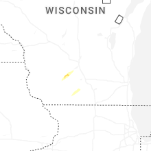
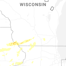

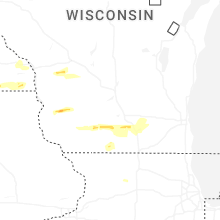


Connect with Interactive Hail Maps