

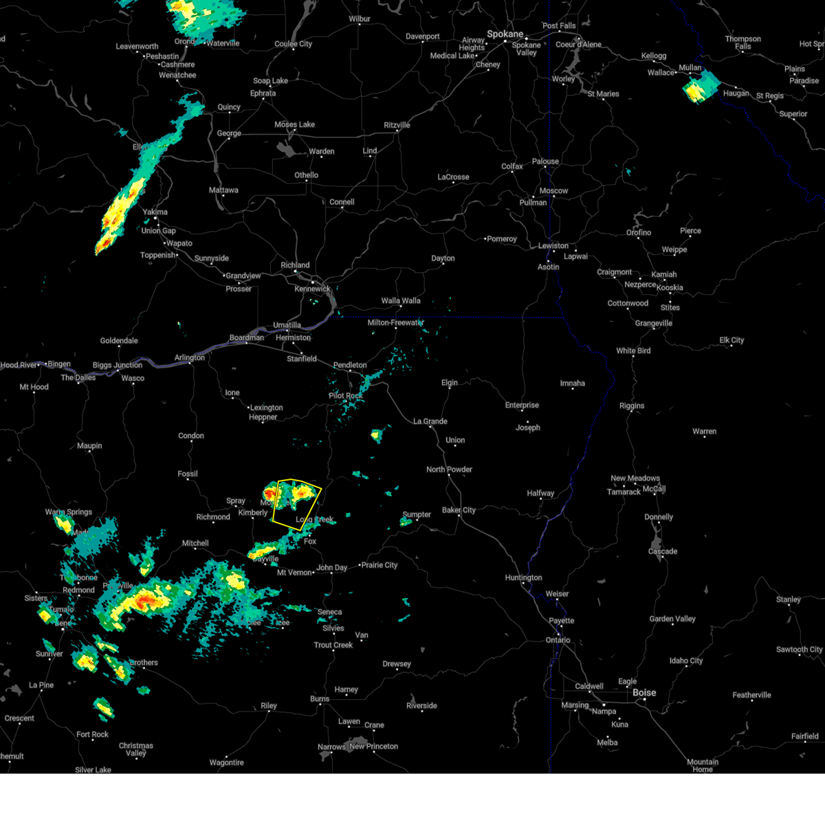
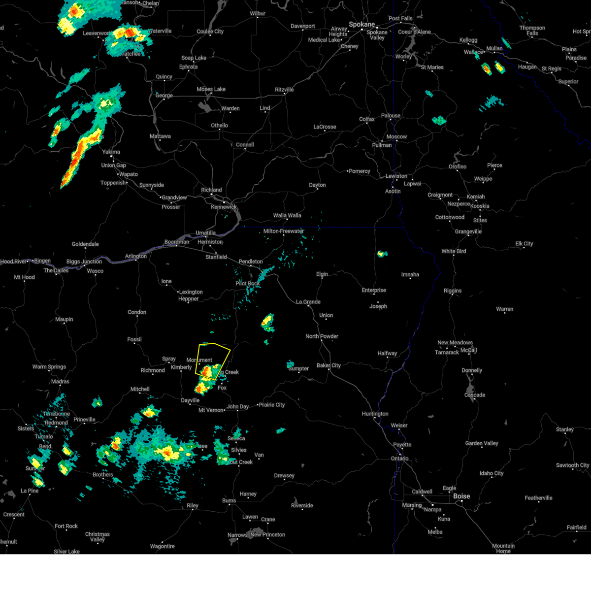
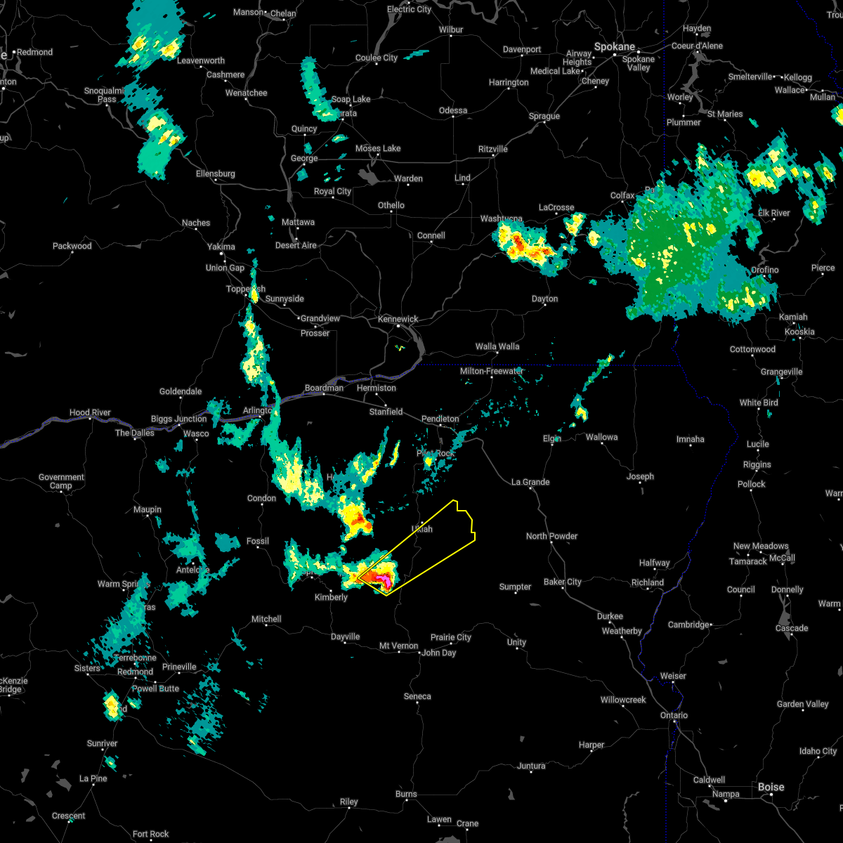
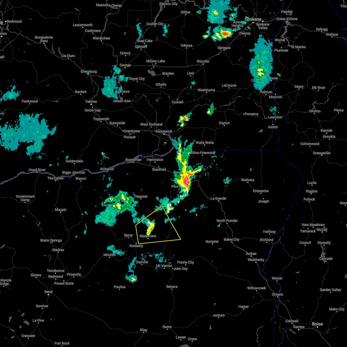
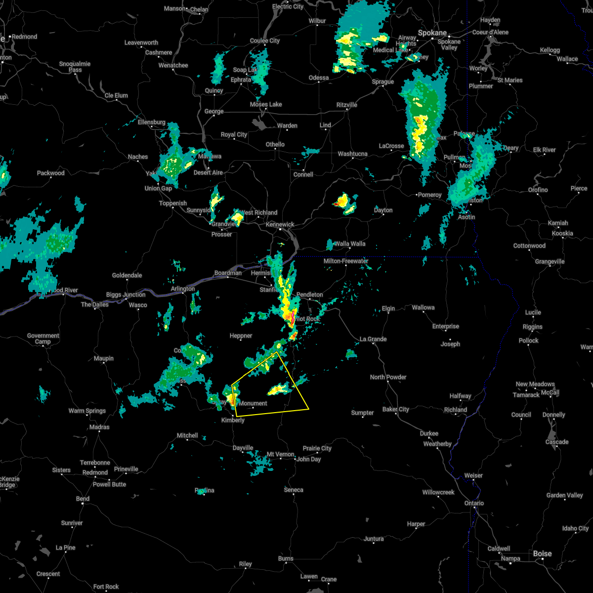
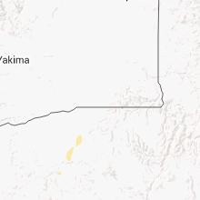
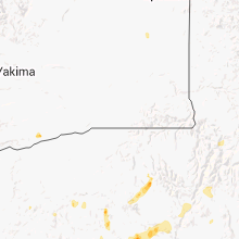
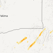
Hail Map for Monument, OR
The Monument, OR area has had 3 reports of on-the-ground hail by trained spotters, and has been under severe weather warnings 4 times during the past 12 months. Doppler radar has detected hail at or near Monument, OR on 8 occasions.
| Name: | Monument, OR |
| Where Located: | 78.9 miles ENE of Bend, OR |
| Map: | Google Map for Monument, OR |
| Population: | 128 |
| Housing Units: | 82 |
| More Info: | Search Google for Monument, OR |
0
The Top Recent Hail Date for Monument, OR is Saturday, May 20, 2023 (8th out of 8)

Hail and Wind Damage Spotted near Monument, OR
| Date / Time | Report Details |
|---|---|
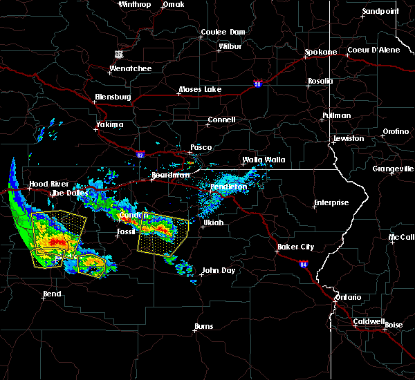
| 5/28/2026 5:33 PM PDT |
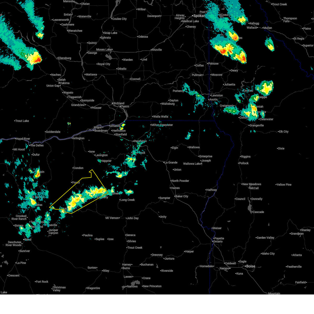 At 532 pm pdt, a severe thunderstorm was located 8 miles west of service creek, or 11 miles south of fossil, moving northwest at 25 mph (radar indicated). Hazards include two inch hail and 60 mph wind gusts. People and animals outdoors will be injured. expect hail damage to roofs, siding, windows, and vehicles. expect wind damage to roofs, siding, and trees. locations impacted include, mitchell, spray, monument, kinzua, kimberly, and service creek. This includes highway 26 between mile markers 52 and 71. At 532 pm pdt, a severe thunderstorm was located 8 miles west of service creek, or 11 miles south of fossil, moving northwest at 25 mph (radar indicated). Hazards include two inch hail and 60 mph wind gusts. People and animals outdoors will be injured. expect hail damage to roofs, siding, windows, and vehicles. expect wind damage to roofs, siding, and trees. locations impacted include, mitchell, spray, monument, kinzua, kimberly, and service creek. This includes highway 26 between mile markers 52 and 71.
|
| 5/28/2026 4:55 PM PDT |
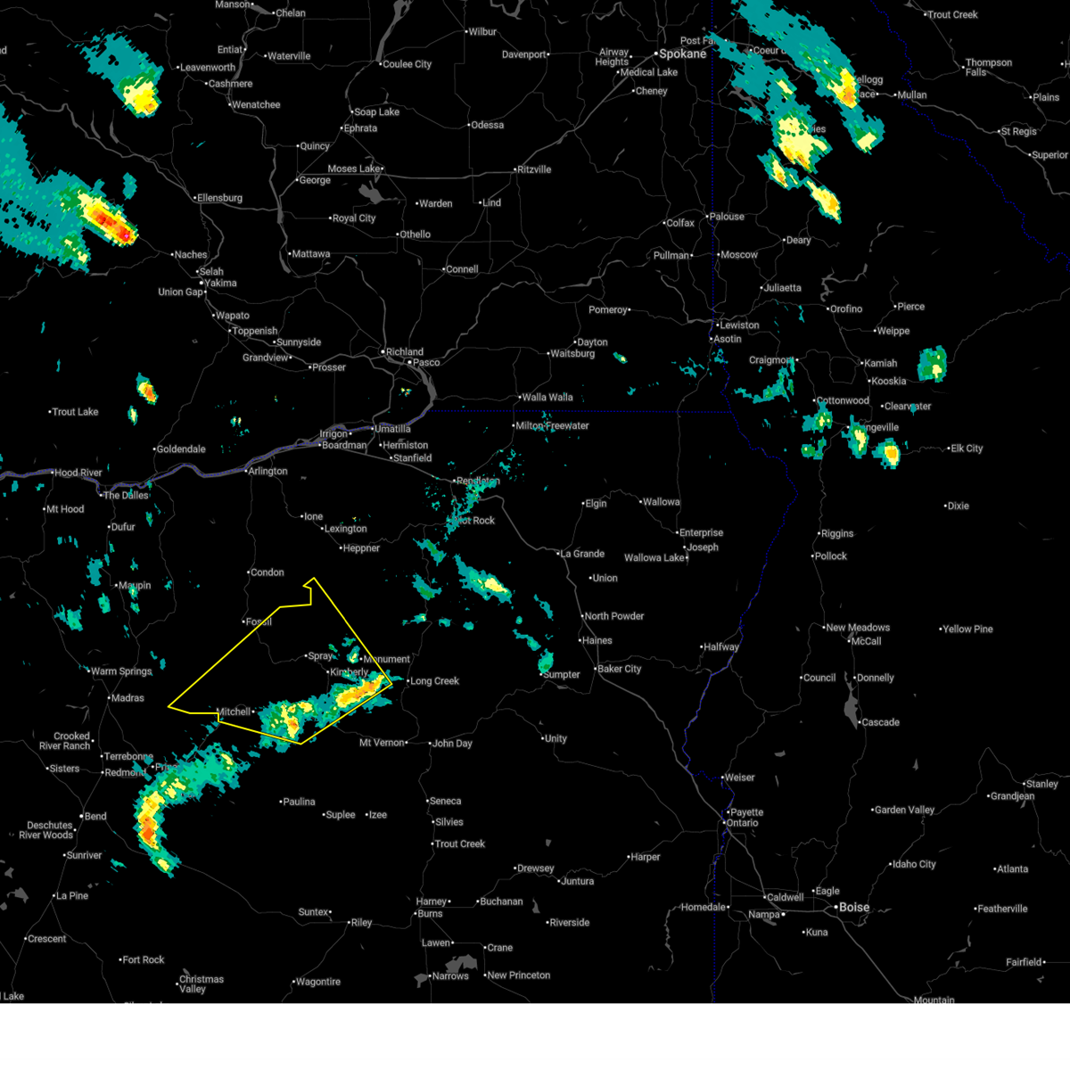 Svrpdt the national weather service in pendleton oregon has issued a * severe thunderstorm warning for, south central morrow county in northeastern oregon, wheeler county in northeastern oregon, east central jefferson county in central oregon, northwestern grant county in central oregon, * until 600 pm pdt. * at 455 pm pdt, a severe thunderstorm was located 9 miles southeast of service creek, or 14 miles northeast of mitchell, moving northwest at 25 mph (radar indicated). Hazards include two inch hail and 60 mph wind gusts. People and animals outdoors will be injured. expect hail damage to roofs, siding, windows, and vehicles. Expect wind damage to roofs, siding, and trees. Svrpdt the national weather service in pendleton oregon has issued a * severe thunderstorm warning for, south central morrow county in northeastern oregon, wheeler county in northeastern oregon, east central jefferson county in central oregon, northwestern grant county in central oregon, * until 600 pm pdt. * at 455 pm pdt, a severe thunderstorm was located 9 miles southeast of service creek, or 14 miles northeast of mitchell, moving northwest at 25 mph (radar indicated). Hazards include two inch hail and 60 mph wind gusts. People and animals outdoors will be injured. expect hail damage to roofs, siding, windows, and vehicles. Expect wind damage to roofs, siding, and trees.
|
| 5/28/2026 4:36 PM PDT |
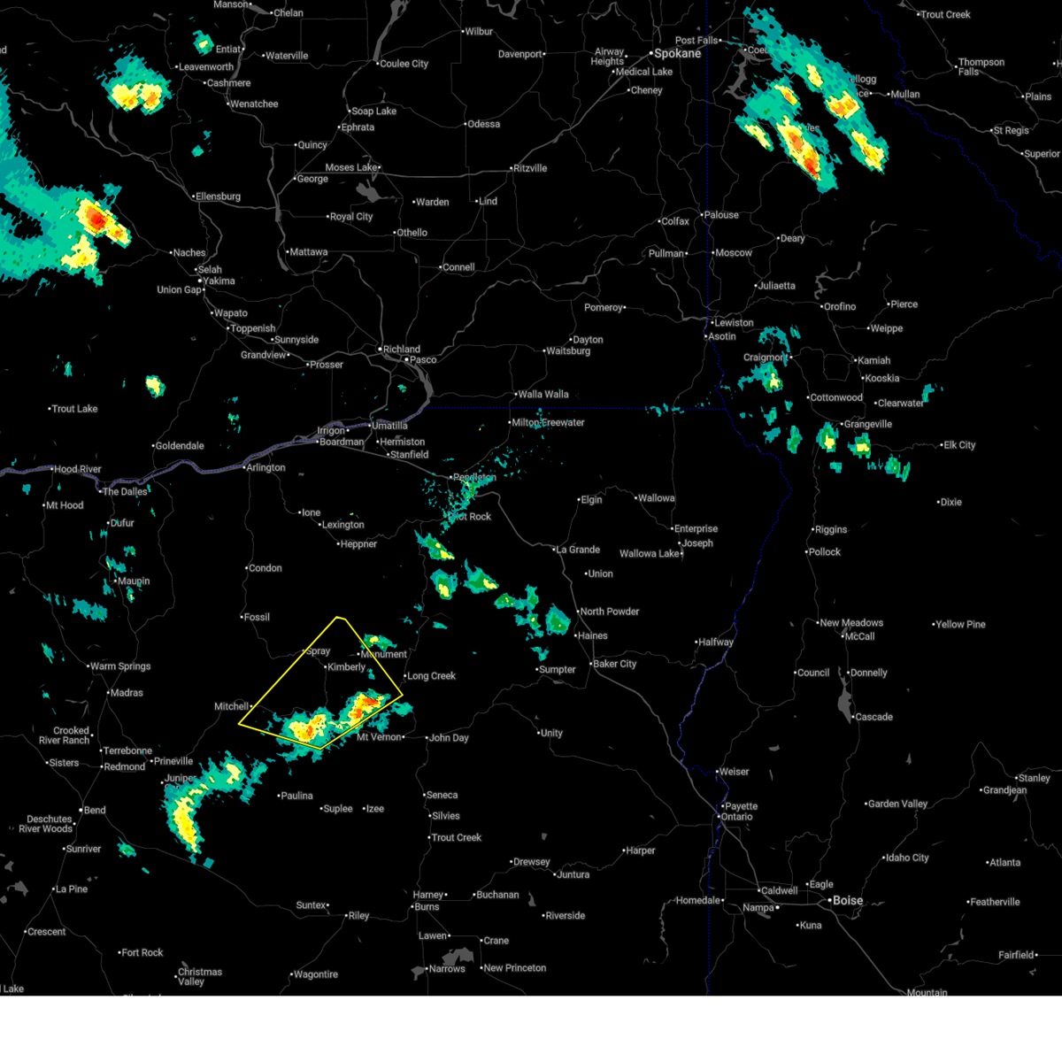 At 436 pm pdt, a severe thunderstorm was located 7 miles northeast of antone, or 21 miles east of mitchell, moving northwest at 45 mph (radar indicated). Hazards include 70 mph wind gusts and ping pong ball size hail. People and animals outdoors will be injured. expect hail damage to roofs, siding, windows, and vehicles. expect considerable tree damage. wind damage is also likely to mobile homes, roofs, and outbuildings. locations impacted include, dayville, monument, antone, kimberly, and hamilton. this includes the following highways, highway 26 between mile markers 125 and 135, and between mile markers 68 and 98. Highway 395 between mile markers 99 and 101. At 436 pm pdt, a severe thunderstorm was located 7 miles northeast of antone, or 21 miles east of mitchell, moving northwest at 45 mph (radar indicated). Hazards include 70 mph wind gusts and ping pong ball size hail. People and animals outdoors will be injured. expect hail damage to roofs, siding, windows, and vehicles. expect considerable tree damage. wind damage is also likely to mobile homes, roofs, and outbuildings. locations impacted include, dayville, monument, antone, kimberly, and hamilton. this includes the following highways, highway 26 between mile markers 125 and 135, and between mile markers 68 and 98. Highway 395 between mile markers 99 and 101.
|
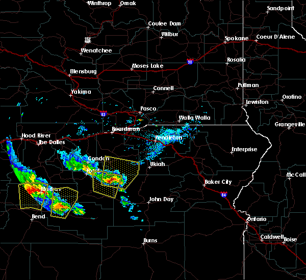
| 5/28/2026 4:04 PM PDT |
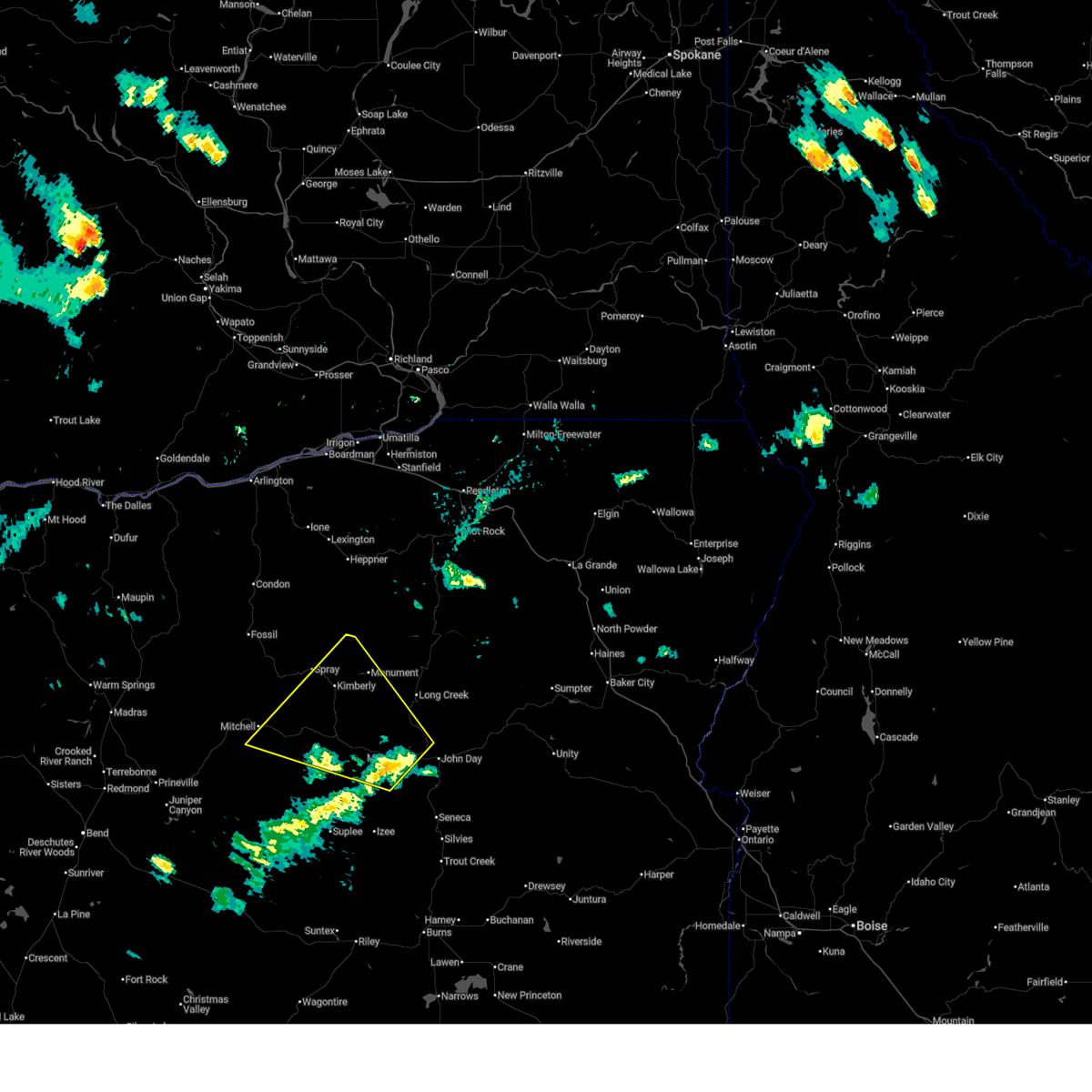 Svrpdt the national weather service in pendleton oregon has issued a * severe thunderstorm warning for, southeastern wheeler county in northeastern oregon, northwestern grant county in central oregon, * until 500 pm pdt. * at 404 pm pdt, a severe thunderstorm was located 7 miles east of dayville, or 21 miles west of john day, moving northwest at 35 mph (radar indicated). Hazards include 70 mph wind gusts and half dollar size hail. Hail damage to vehicles is expected. expect considerable tree damage. Wind damage is also likely to mobile homes, roofs, and outbuildings. Svrpdt the national weather service in pendleton oregon has issued a * severe thunderstorm warning for, southeastern wheeler county in northeastern oregon, northwestern grant county in central oregon, * until 500 pm pdt. * at 404 pm pdt, a severe thunderstorm was located 7 miles east of dayville, or 21 miles west of john day, moving northwest at 35 mph (radar indicated). Hazards include 70 mph wind gusts and half dollar size hail. Hail damage to vehicles is expected. expect considerable tree damage. Wind damage is also likely to mobile homes, roofs, and outbuildings.
|
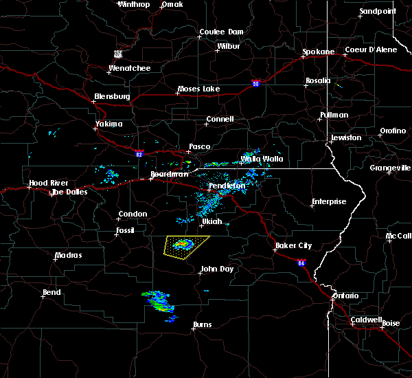
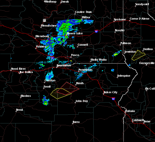
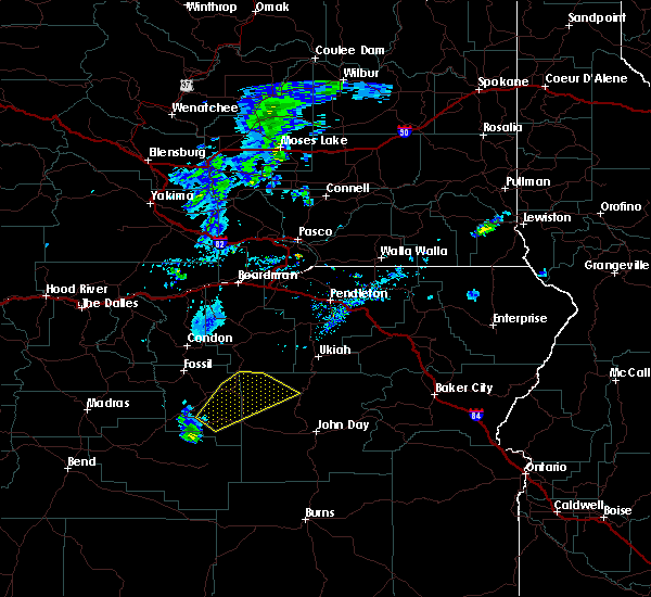
| 5/20/2023 6:37 PM PDT |
 At 636 pm pdt, a severe thunderstorm was located 8 miles northwest of ritter, or 29 miles southeast of heppner, moving north at 20 mph (radar indicated). Hazards include quarter size hail. damage to vehicles is expected At 636 pm pdt, a severe thunderstorm was located 8 miles northwest of ritter, or 29 miles southeast of heppner, moving north at 20 mph (radar indicated). Hazards include quarter size hail. damage to vehicles is expected
|
| 5/20/2023 5:52 PM PDT |
 At 552 pm pdt, a severe thunderstorm was located near hamilton, or 32 miles northwest of john day, moving north at 20 mph (radar indicated). Hazards include 60 mph wind gusts and quarter size hail. Hail damage to vehicles is expected. Expect wind damage to roofs, siding, and trees. At 552 pm pdt, a severe thunderstorm was located near hamilton, or 32 miles northwest of john day, moving north at 20 mph (radar indicated). Hazards include 60 mph wind gusts and quarter size hail. Hail damage to vehicles is expected. Expect wind damage to roofs, siding, and trees.
|
| 7/2/2022 6:18 PM PDT |
 At 618 pm pdt, a severe thunderstorm was located near ritter, or 32 miles northwest of john day, moving northeast at 35 mph (radar indicated). Hazards include 60 mph wind gusts and half dollar size hail. Hail damage to vehicles is expected. Expect wind damage to roofs, siding, and trees. At 618 pm pdt, a severe thunderstorm was located near ritter, or 32 miles northwest of john day, moving northeast at 35 mph (radar indicated). Hazards include 60 mph wind gusts and half dollar size hail. Hail damage to vehicles is expected. Expect wind damage to roofs, siding, and trees.
|
| 5/6/2022 6:38 PM PDT |
 At 637 pm pdt, a severe thunderstorm was located 7 miles north of ritter, or 30 miles southeast of heppner, moving east at 45 mph (radar indicated). Hazards include 60 mph wind gusts and quarter size hail. Hail damage to vehicles is expected. expect wind damage to roofs, siding, and trees. locations impacted include, monument, dale and ritter. hail threat, radar indicated max hail size, 1. 00 in wind threat, radar indicated max wind gust, 60 mph. At 637 pm pdt, a severe thunderstorm was located 7 miles north of ritter, or 30 miles southeast of heppner, moving east at 45 mph (radar indicated). Hazards include 60 mph wind gusts and quarter size hail. Hail damage to vehicles is expected. expect wind damage to roofs, siding, and trees. locations impacted include, monument, dale and ritter. hail threat, radar indicated max hail size, 1. 00 in wind threat, radar indicated max wind gust, 60 mph.
|
| 5/6/2022 6:20 PM PDT |
 At 618 pm pdt, a severe thunderstorm was located 7 miles north of monument, or 30 miles south of heppner, moving east at 45 mph (radar indicated). Hazards include 60 mph wind gusts and quarter size hail. Hail damage to vehicles is expected. expect wind damage to roofs, siding, and trees. At 610 pm pdt a trained storm spotter reported hail to the size of a nickel in spray. At 618 pm pdt, a severe thunderstorm was located 7 miles north of monument, or 30 miles south of heppner, moving east at 45 mph (radar indicated). Hazards include 60 mph wind gusts and quarter size hail. Hail damage to vehicles is expected. expect wind damage to roofs, siding, and trees. At 610 pm pdt a trained storm spotter reported hail to the size of a nickel in spray.
|
| 5/30/2020 3:07 PM PDT |
 At 306 pm pdt, a severe thunderstorm was located 13 miles east of heppner, moving northeast at 45 mph (radar indicated). Hazards include two inch hail and 70 mph wind gusts. People and animals outdoors will be injured. expect hail damage to roofs, siding, windows, and vehicles. expect considerable tree damage. wind damage is also likely to mobile homes, roofs, and outbuildings. Locations impacted include, monument, ruggs and hardman. At 306 pm pdt, a severe thunderstorm was located 13 miles east of heppner, moving northeast at 45 mph (radar indicated). Hazards include two inch hail and 70 mph wind gusts. People and animals outdoors will be injured. expect hail damage to roofs, siding, windows, and vehicles. expect considerable tree damage. wind damage is also likely to mobile homes, roofs, and outbuildings. Locations impacted include, monument, ruggs and hardman.
|
| 5/30/2020 3:05 PM PDT | Golf Ball sized hail reported 0.7 miles S of Monument, OR |
| 5/30/2020 2:50 PM PDT | Hen Egg sized hail reported 10.2 miles SE of Monument, OR |
| 5/30/2020 2:41 PM PDT |
 At 240 pm pdt, a severe thunderstorm was located 8 miles northwest of monument, or 30 miles south of heppner, moving northeast at 45 mph (radar indicated). Hazards include two inch hail and 70 mph wind gusts. People and animals outdoors will be injured. expect hail damage to roofs, siding, windows, and vehicles. expect considerable tree damage. Wind damage is also likely to mobile homes, roofs, and outbuildings. At 240 pm pdt, a severe thunderstorm was located 8 miles northwest of monument, or 30 miles south of heppner, moving northeast at 45 mph (radar indicated). Hazards include two inch hail and 70 mph wind gusts. People and animals outdoors will be injured. expect hail damage to roofs, siding, windows, and vehicles. expect considerable tree damage. Wind damage is also likely to mobile homes, roofs, and outbuildings.
|
| 5/28/2020 7:47 PM PDT |
 At 747 pm pdt, a severe thunderstorm was located over ritter, or 34 miles north of john day, moving northeast at 30 mph (radar indicated). Hazards include 60 mph wind gusts and quarter size hail. Hail damage to vehicles is expected. expect wind damage to roofs, siding, and trees. Locations impacted include, monument, dale, ritter and hamilton. At 747 pm pdt, a severe thunderstorm was located over ritter, or 34 miles north of john day, moving northeast at 30 mph (radar indicated). Hazards include 60 mph wind gusts and quarter size hail. Hail damage to vehicles is expected. expect wind damage to roofs, siding, and trees. Locations impacted include, monument, dale, ritter and hamilton.
|
| 5/28/2020 7:29 PM PDT |
 At 729 pm pdt, a severe thunderstorm was located near hamilton, or 30 miles northwest of john day, moving northeast at 30 mph (radar indicated). Hazards include 60 mph wind gusts and quarter size hail. Hail damage to vehicles is expected. Expect wind damage to roofs, siding, and trees. At 729 pm pdt, a severe thunderstorm was located near hamilton, or 30 miles northwest of john day, moving northeast at 30 mph (radar indicated). Hazards include 60 mph wind gusts and quarter size hail. Hail damage to vehicles is expected. Expect wind damage to roofs, siding, and trees.
|
| 5/28/2020 7:07 PM PDT |
 At 706 pm pdt, a severe thunderstorm was located 7 miles southwest of hamilton, or 27 miles northwest of john day, moving northeast at 30 mph (radar indicated). Hazards include 60 mph wind gusts and quarter size hail. Hail damage to vehicles is expected. Expect wind damage to roofs, siding, and trees. At 706 pm pdt, a severe thunderstorm was located 7 miles southwest of hamilton, or 27 miles northwest of john day, moving northeast at 30 mph (radar indicated). Hazards include 60 mph wind gusts and quarter size hail. Hail damage to vehicles is expected. Expect wind damage to roofs, siding, and trees.
|
| 6/26/2017 3:04 PM PDT |
 At 304 pm pdt, severe thunderstorms were located along a line extending from 7 miles northwest of lonerock to 6 miles south of kimberly, moving northeast at 35 mph (radar indicated). Hazards include 60 mph wind gusts and quarter size hail. Hail damage to vehicles is expected. Expect wind damage to roofs, siding, and trees. At 304 pm pdt, severe thunderstorms were located along a line extending from 7 miles northwest of lonerock to 6 miles south of kimberly, moving northeast at 35 mph (radar indicated). Hazards include 60 mph wind gusts and quarter size hail. Hail damage to vehicles is expected. Expect wind damage to roofs, siding, and trees.
|
| 6/8/2016 2:13 PM PDT |
 At 211 pm pdt, doppler radar indicated a severe thunderstorm capable of producing a tornado. this dangerous storm was located 9 miles northeast of monument, or 30 miles south of heppner, moving northeast at 45 mph. in addition, at 210 pm pdt golfball size hail was reported in monument. this storm could also produce winds in excess of 60 mph. locations impacted include, monument, ritter and dale. At 211 pm pdt, doppler radar indicated a severe thunderstorm capable of producing a tornado. this dangerous storm was located 9 miles northeast of monument, or 30 miles south of heppner, moving northeast at 45 mph. in addition, at 210 pm pdt golfball size hail was reported in monument. this storm could also produce winds in excess of 60 mph. locations impacted include, monument, ritter and dale.
|
| 6/8/2016 2:02 PM PDT | Golf Ball sized hail reported 1.5 miles SSW of Monument, OR |
| 6/8/2016 1:54 PM PDT |
 At 154 pm pdt, doppler radar indicated a severe thunderstorm capable of producing a tornado. this dangerous storm was located near monument, or 35 miles northeast of mitchell, and moving northeast at 45 mph. At 154 pm pdt, doppler radar indicated a severe thunderstorm capable of producing a tornado. this dangerous storm was located near monument, or 35 miles northeast of mitchell, and moving northeast at 45 mph.
|
| 6/8/2016 1:51 PM PDT |
 At 151 pm pdt, doppler radar indicated a severe thunderstorm capable of producing large damaging hail up to golf ball size and destructive winds in excess of 70 mph. this storm was located over kimberly, or 29 miles northeast of mitchell, moving northeast at 45 mph. locations impacted include, spray, monument, hamilton and kimberly. At 151 pm pdt, doppler radar indicated a severe thunderstorm capable of producing large damaging hail up to golf ball size and destructive winds in excess of 70 mph. this storm was located over kimberly, or 29 miles northeast of mitchell, moving northeast at 45 mph. locations impacted include, spray, monument, hamilton and kimberly.
|
| 6/8/2016 1:27 PM PDT |
 At 126 pm pdt, doppler radar indicated a severe thunderstorm capable of producing half dollar size hail and damaging winds in excess of 60 mph. this storm was located 7 miles northwest of antone, or 12 miles east of mitchell, and moving northeast at 45 mph. At 126 pm pdt, doppler radar indicated a severe thunderstorm capable of producing half dollar size hail and damaging winds in excess of 60 mph. this storm was located 7 miles northwest of antone, or 12 miles east of mitchell, and moving northeast at 45 mph.
|
Hail Maps for Monument, OR


Connect with Interactive Hail Maps