

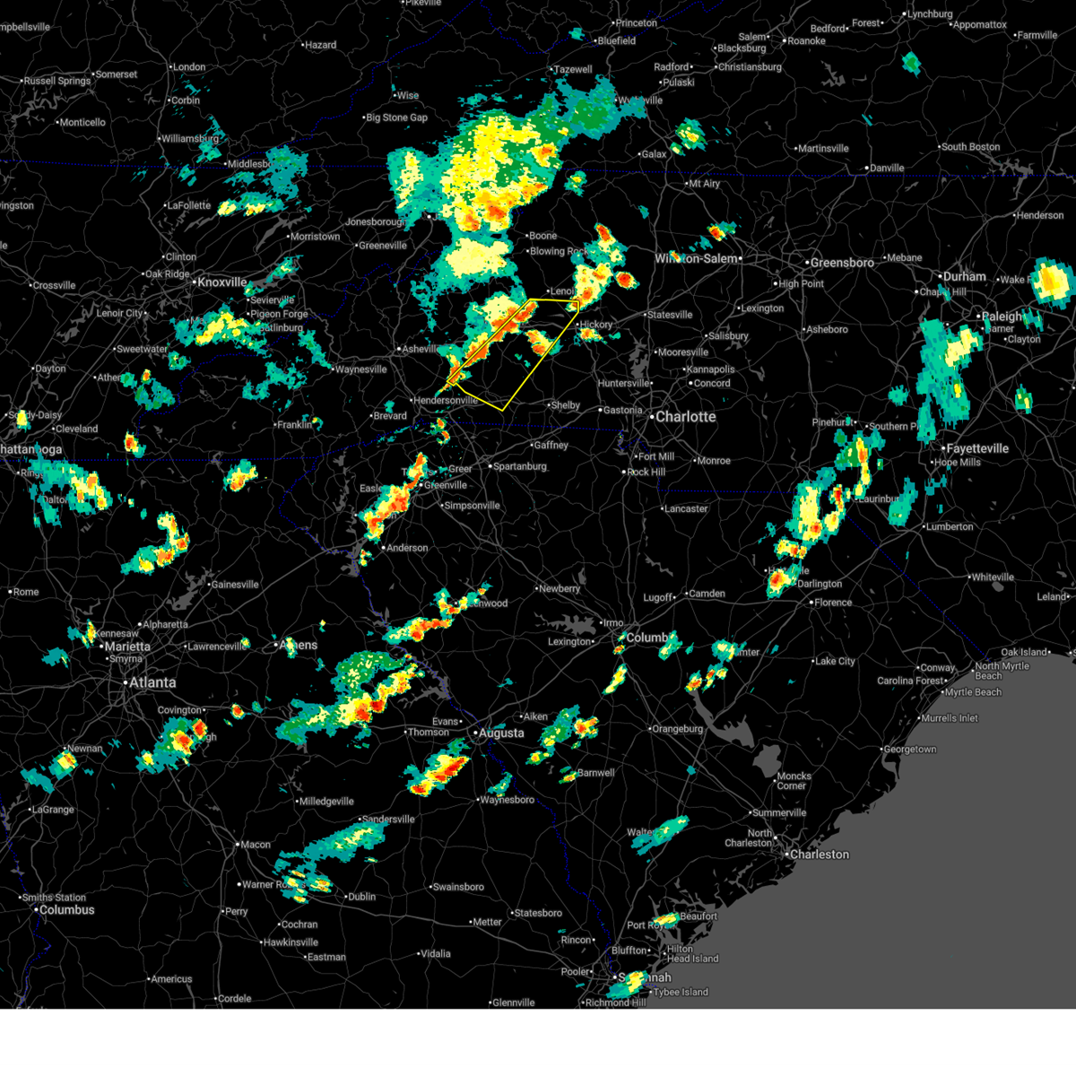
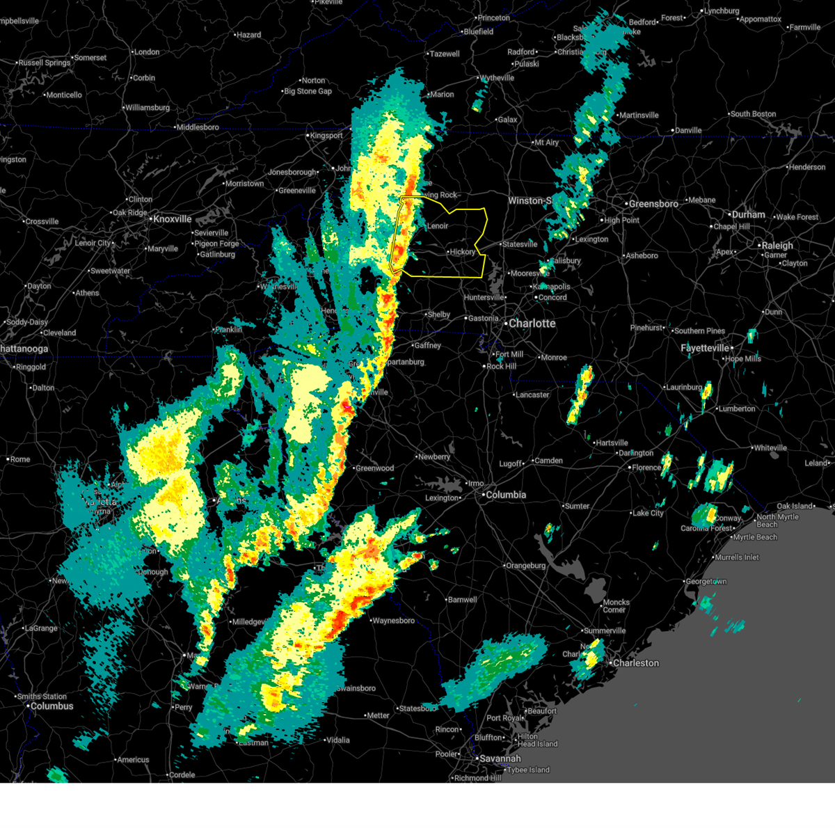
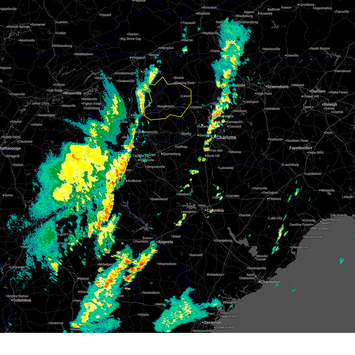
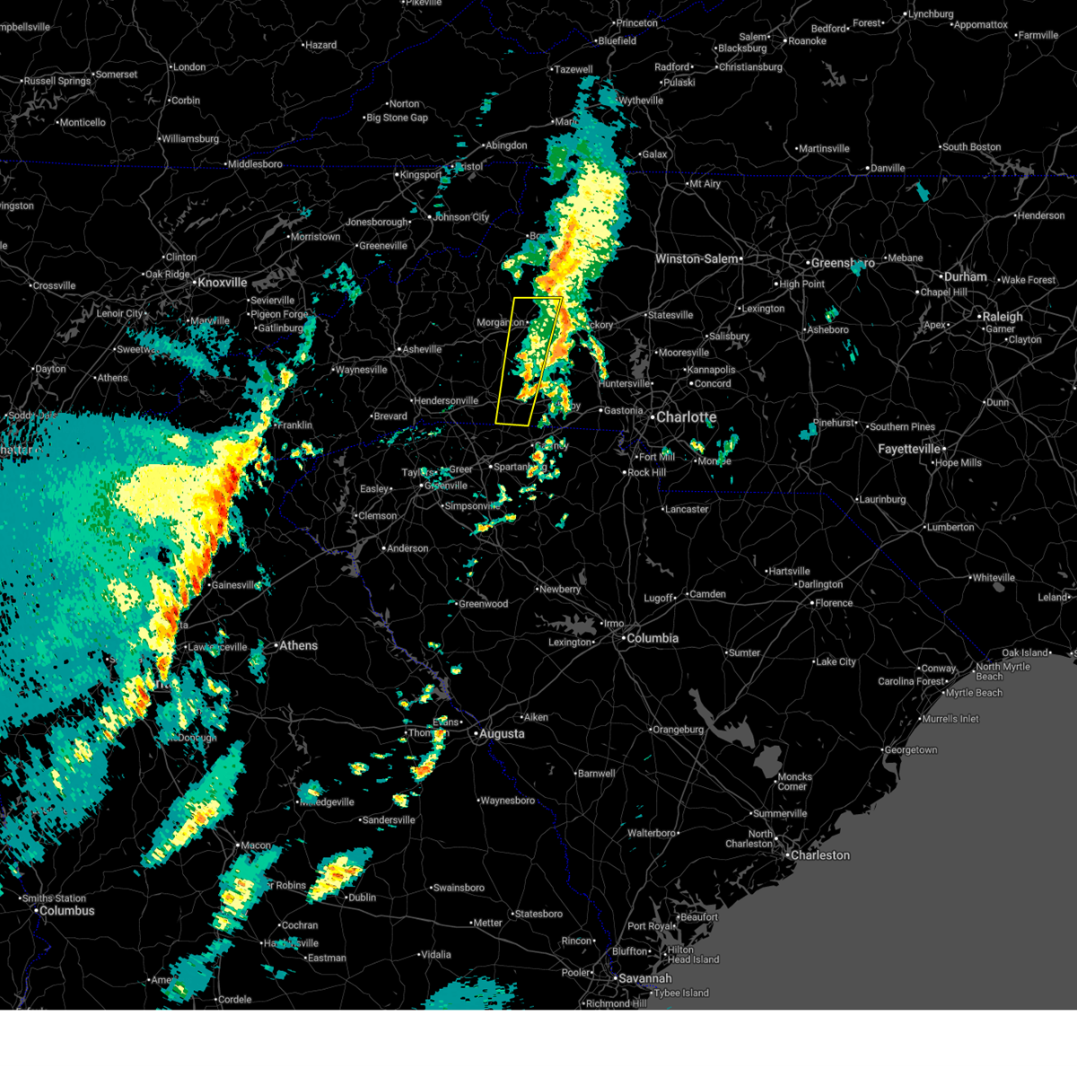
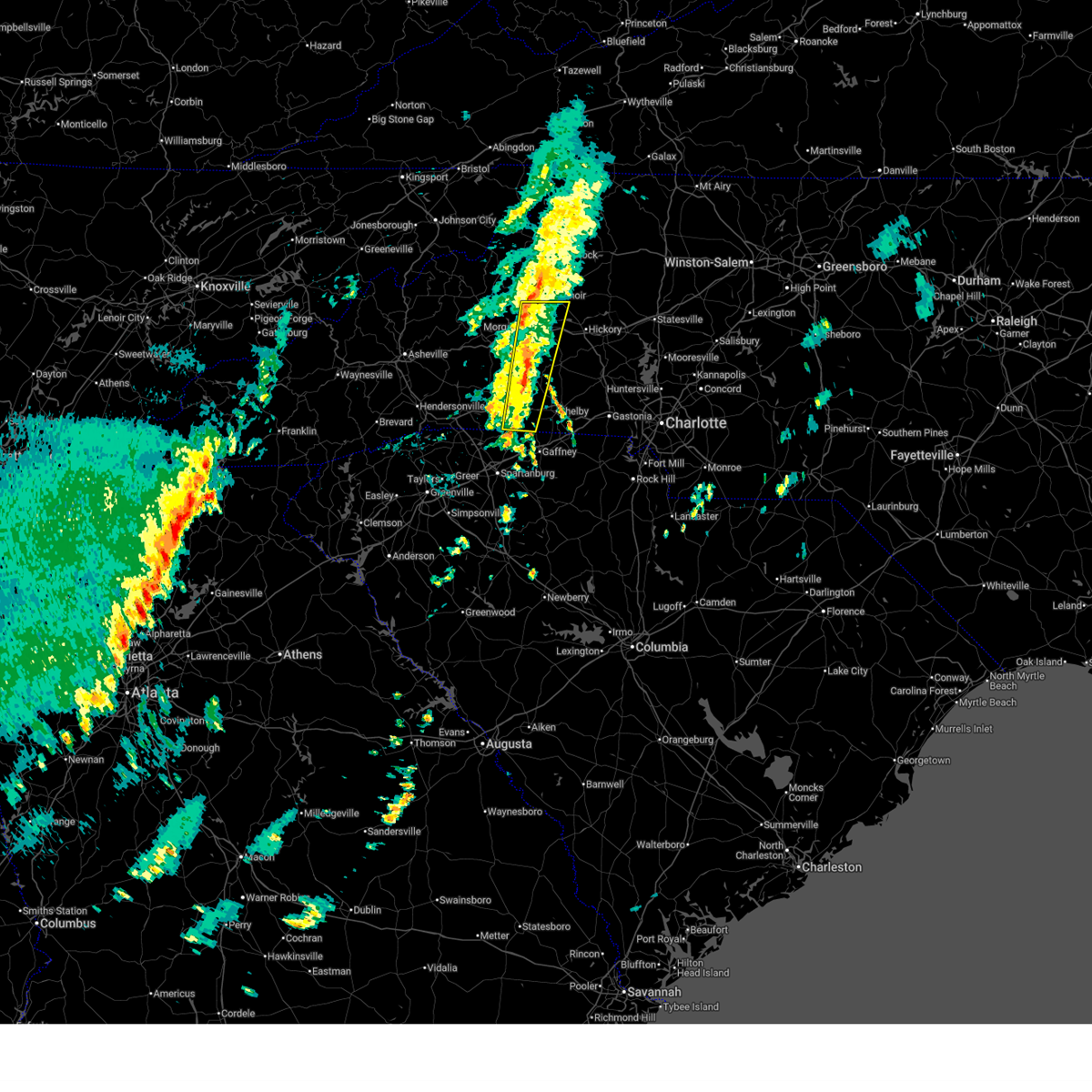
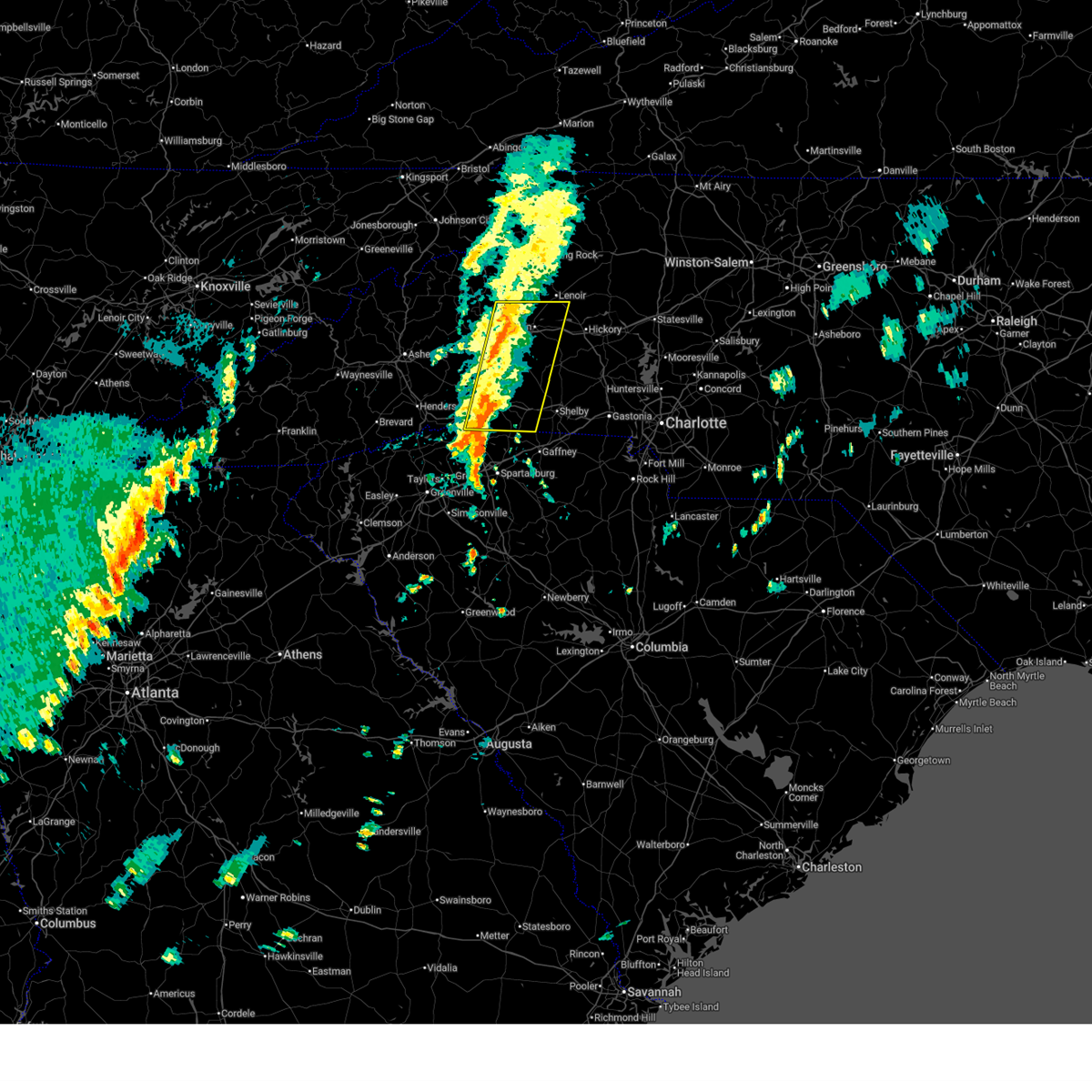
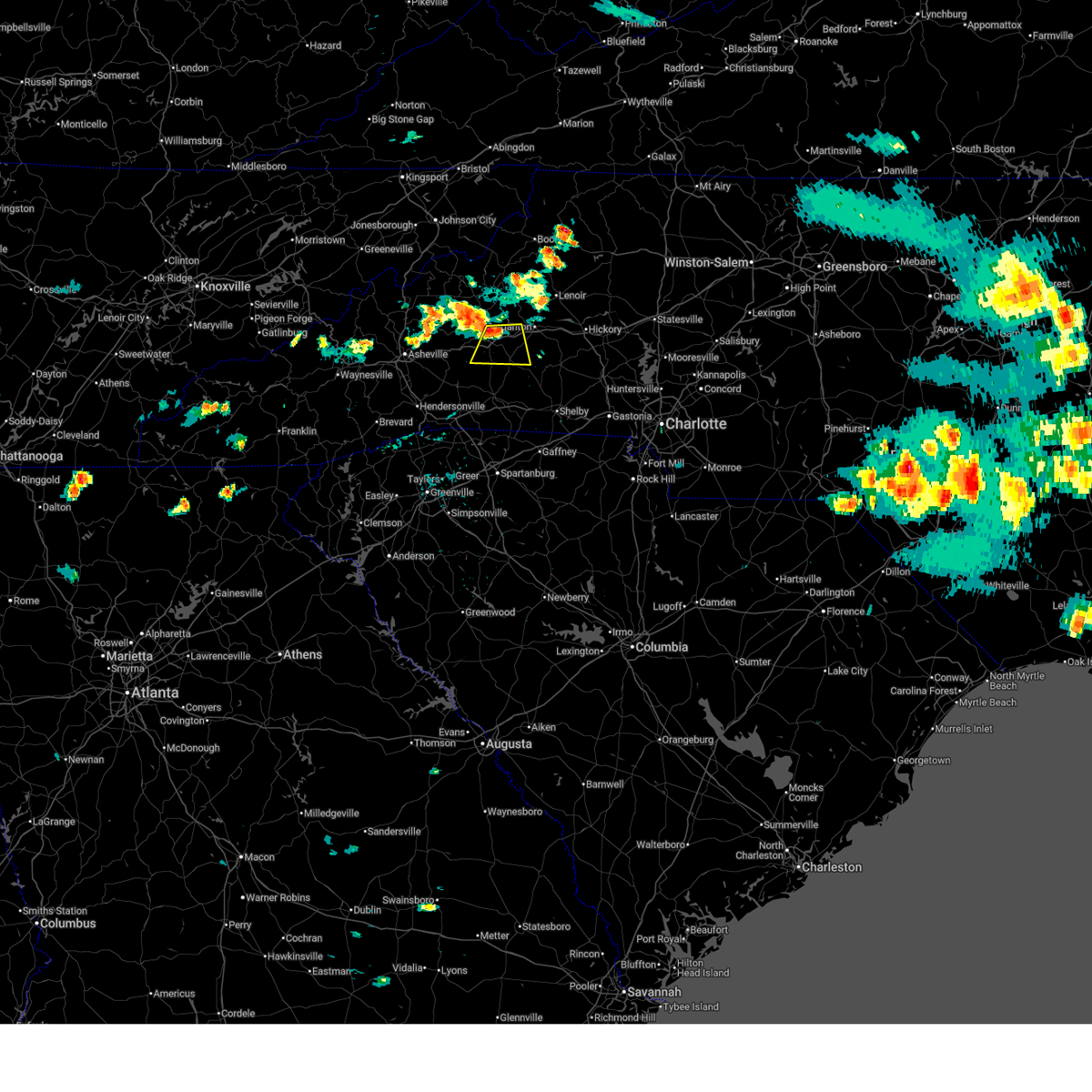
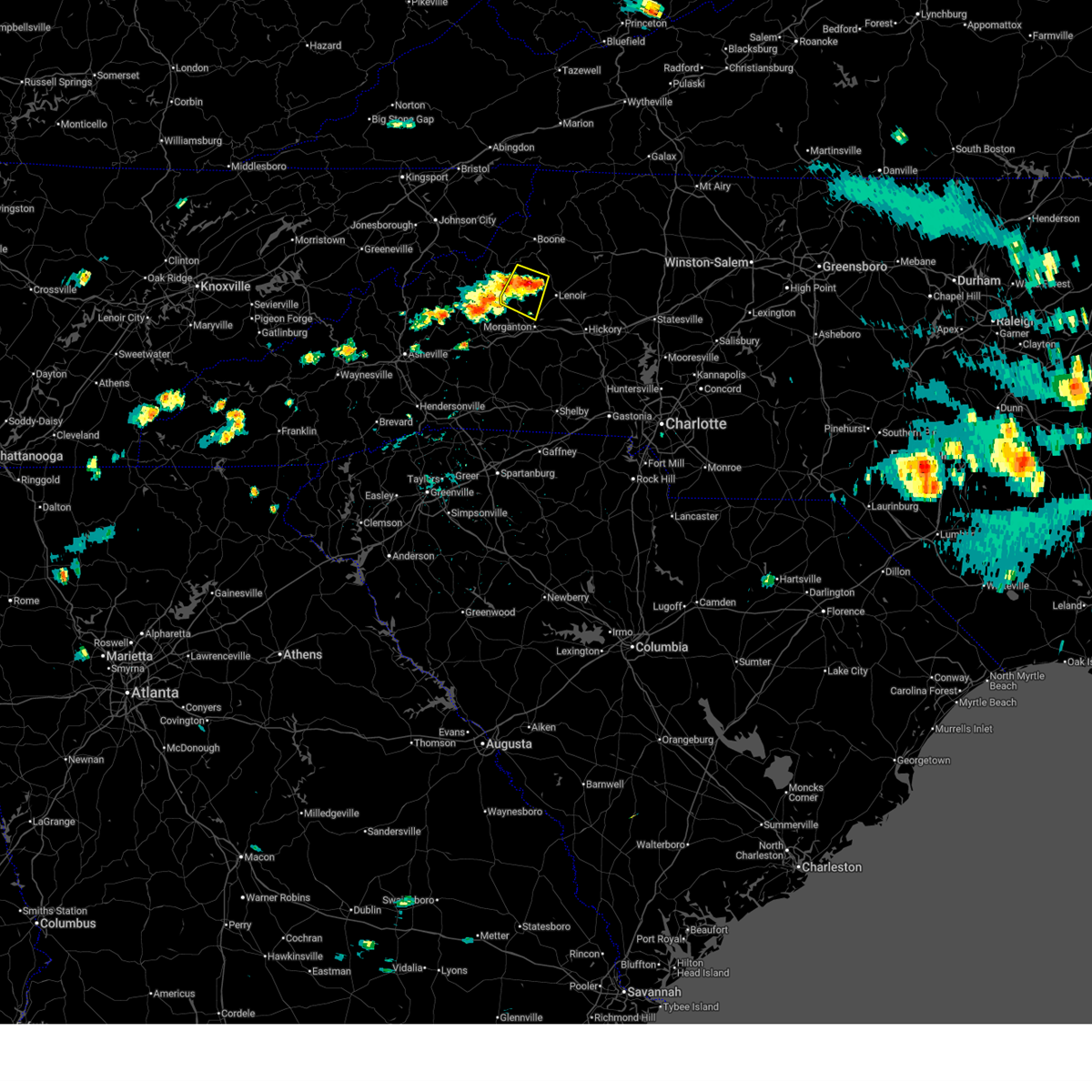
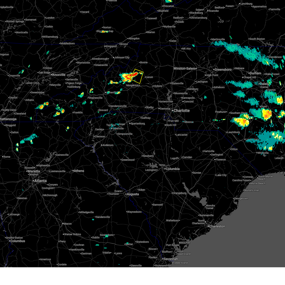
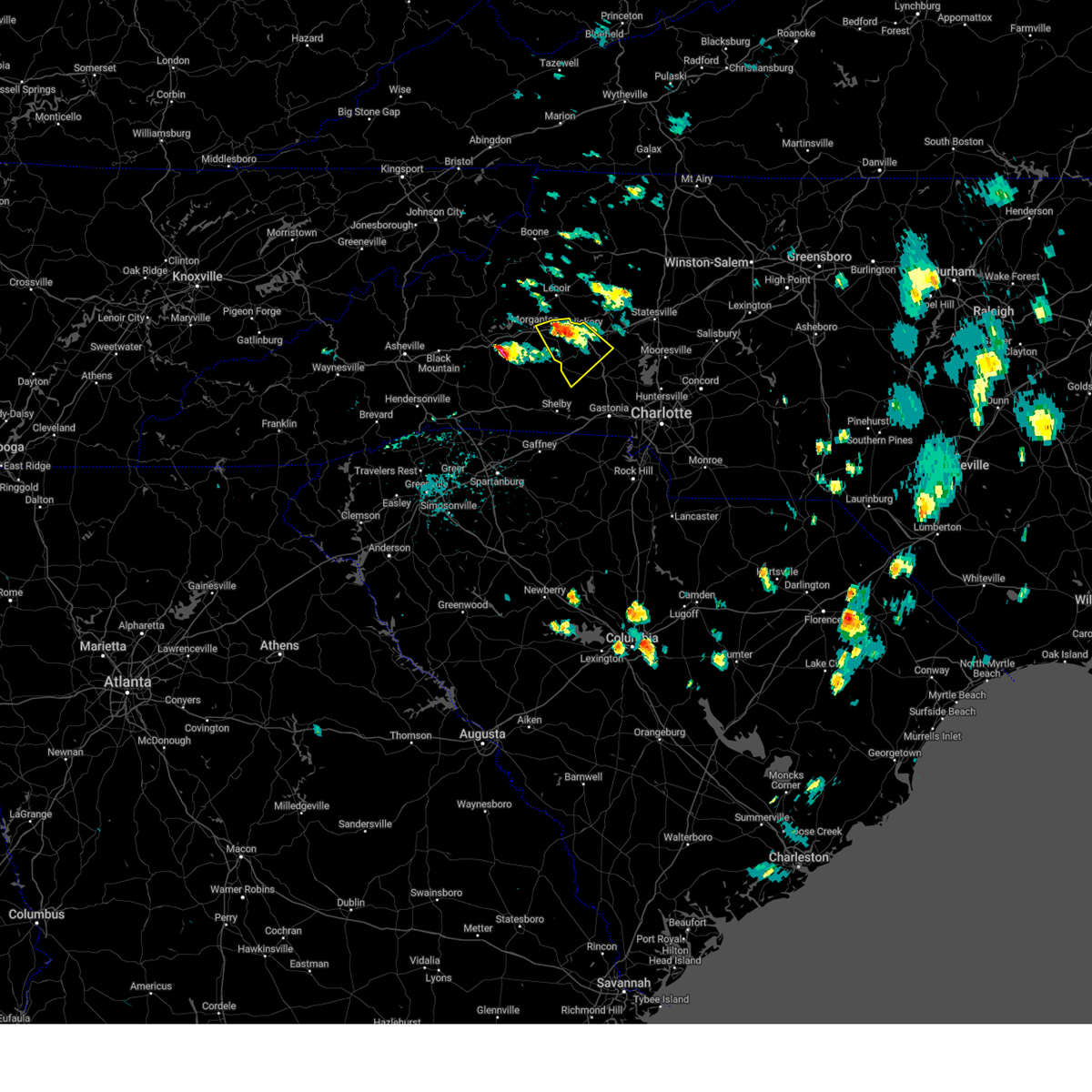
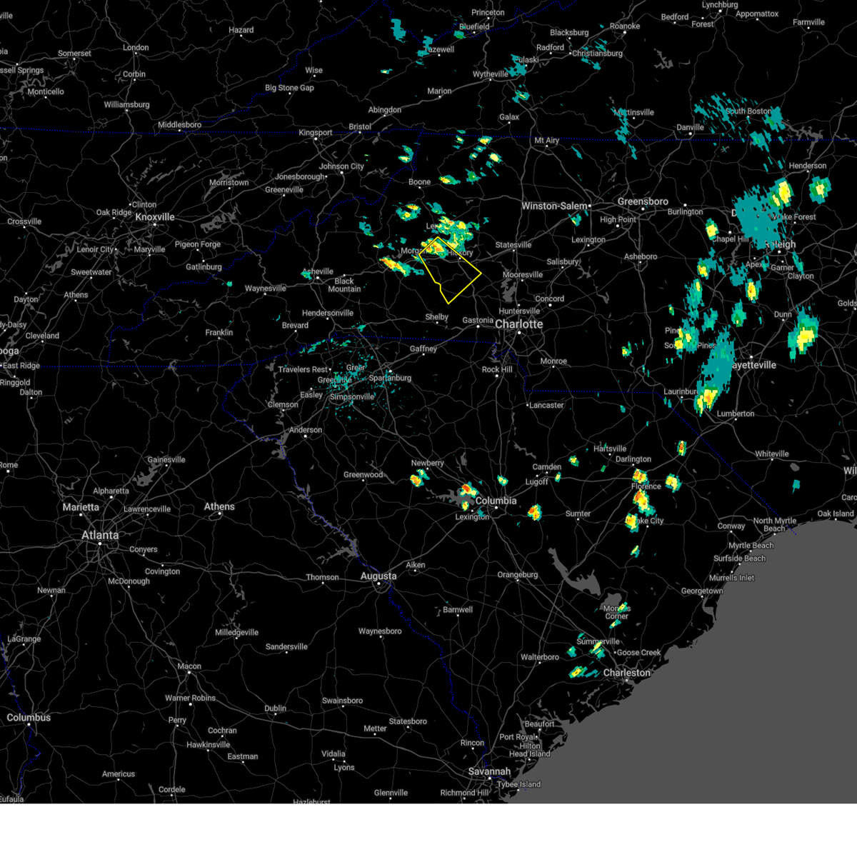
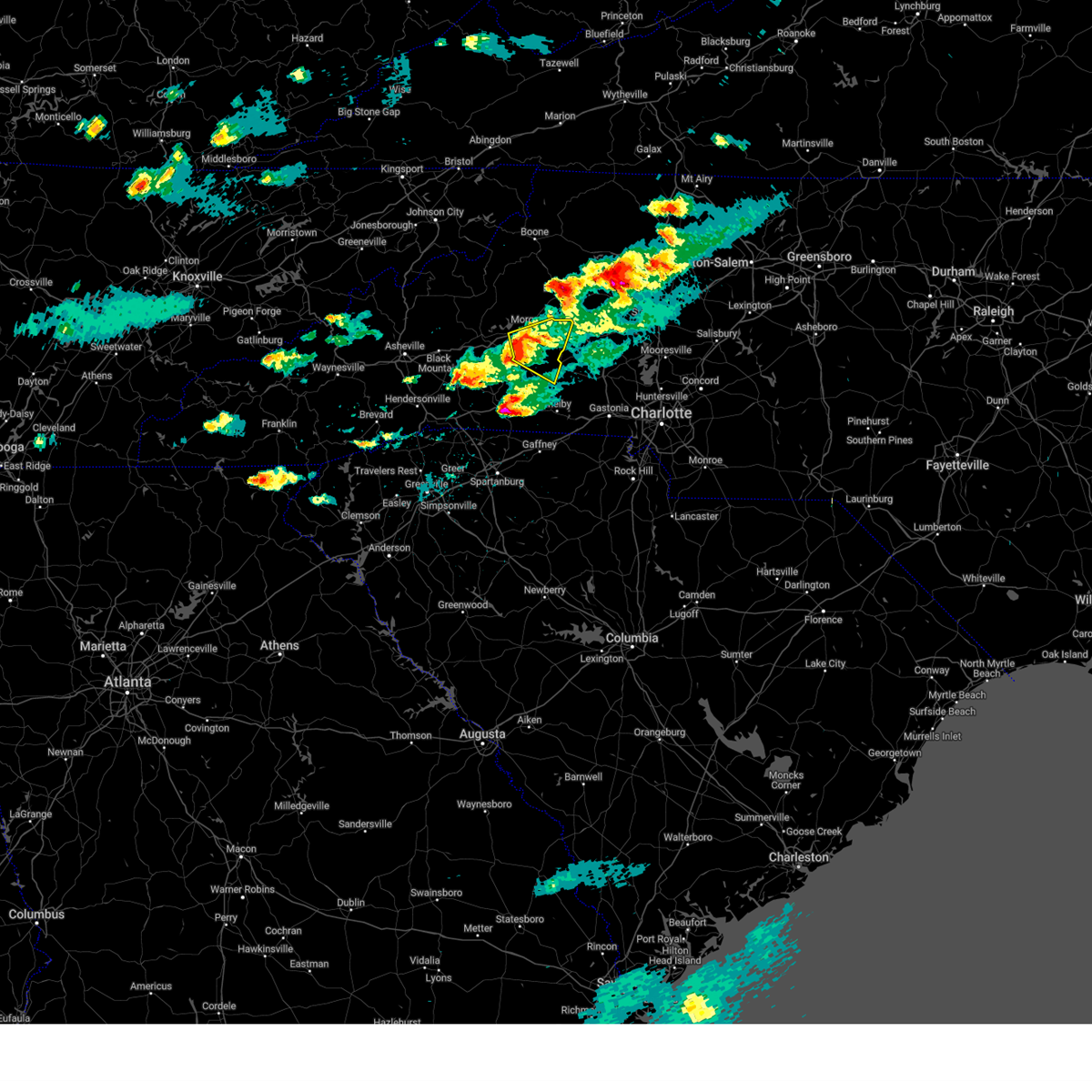
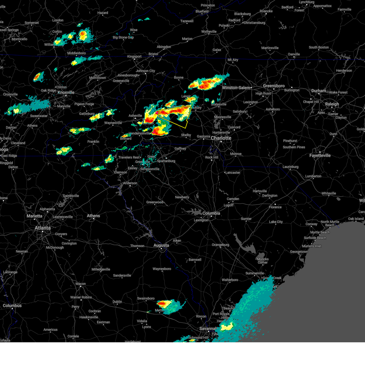
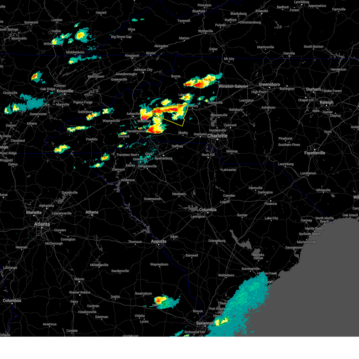
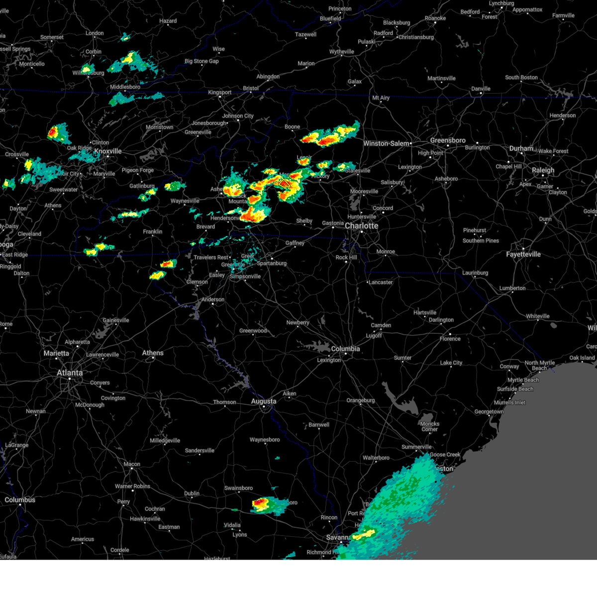
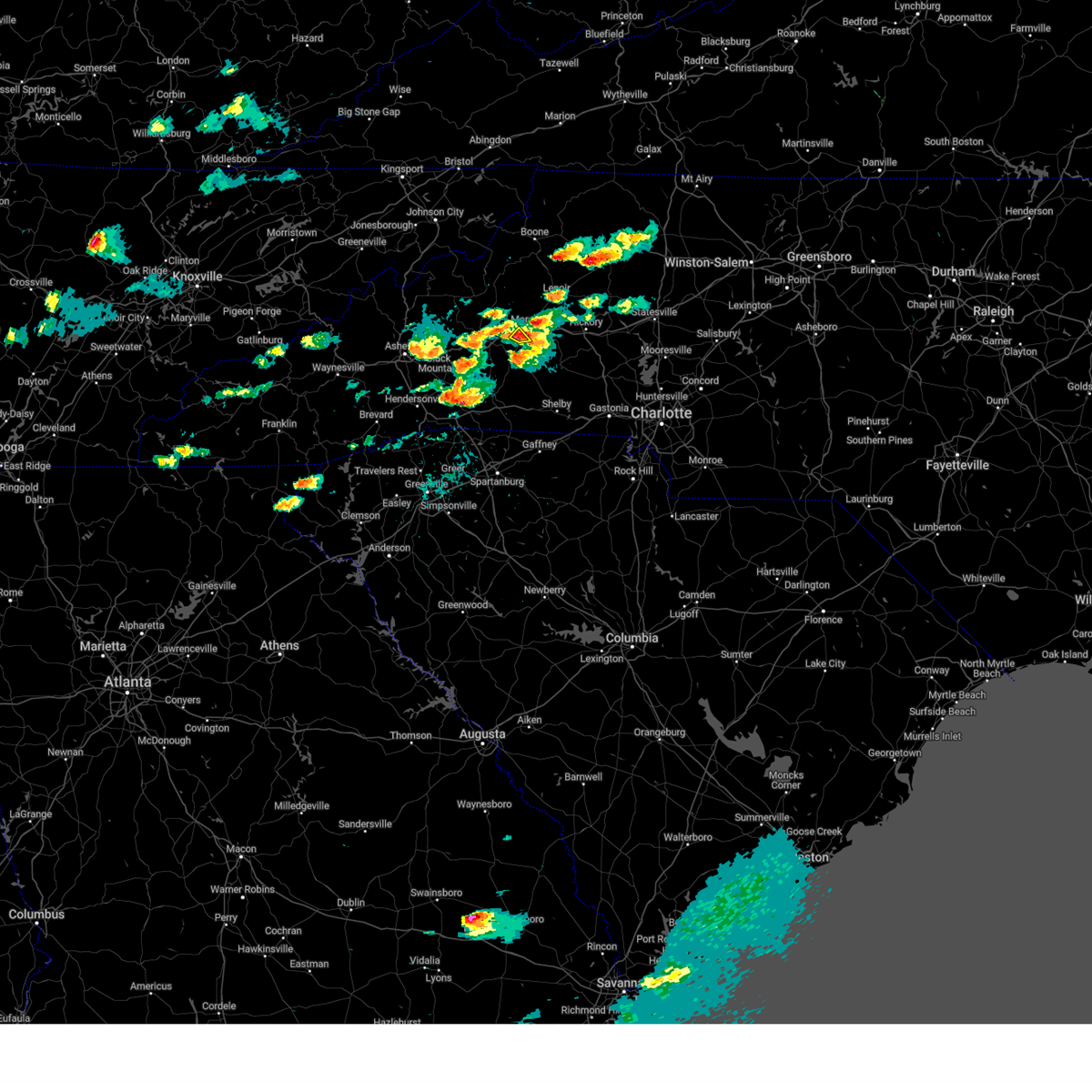
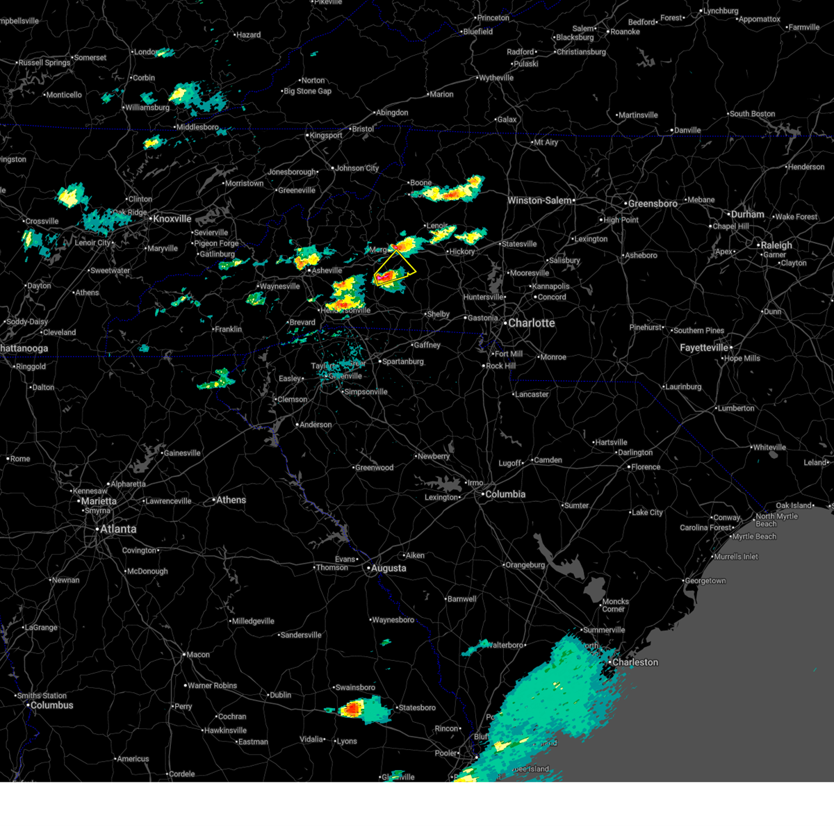
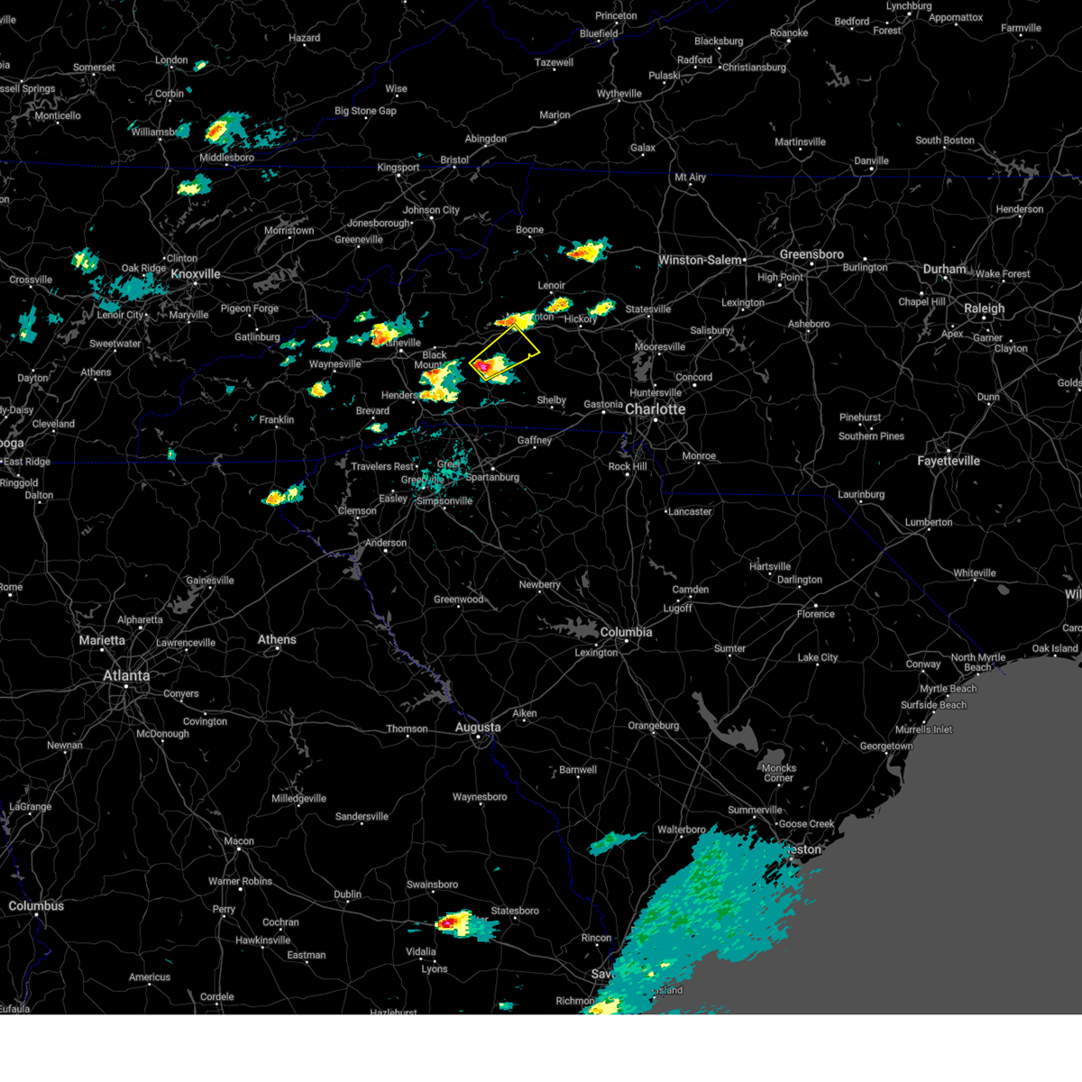
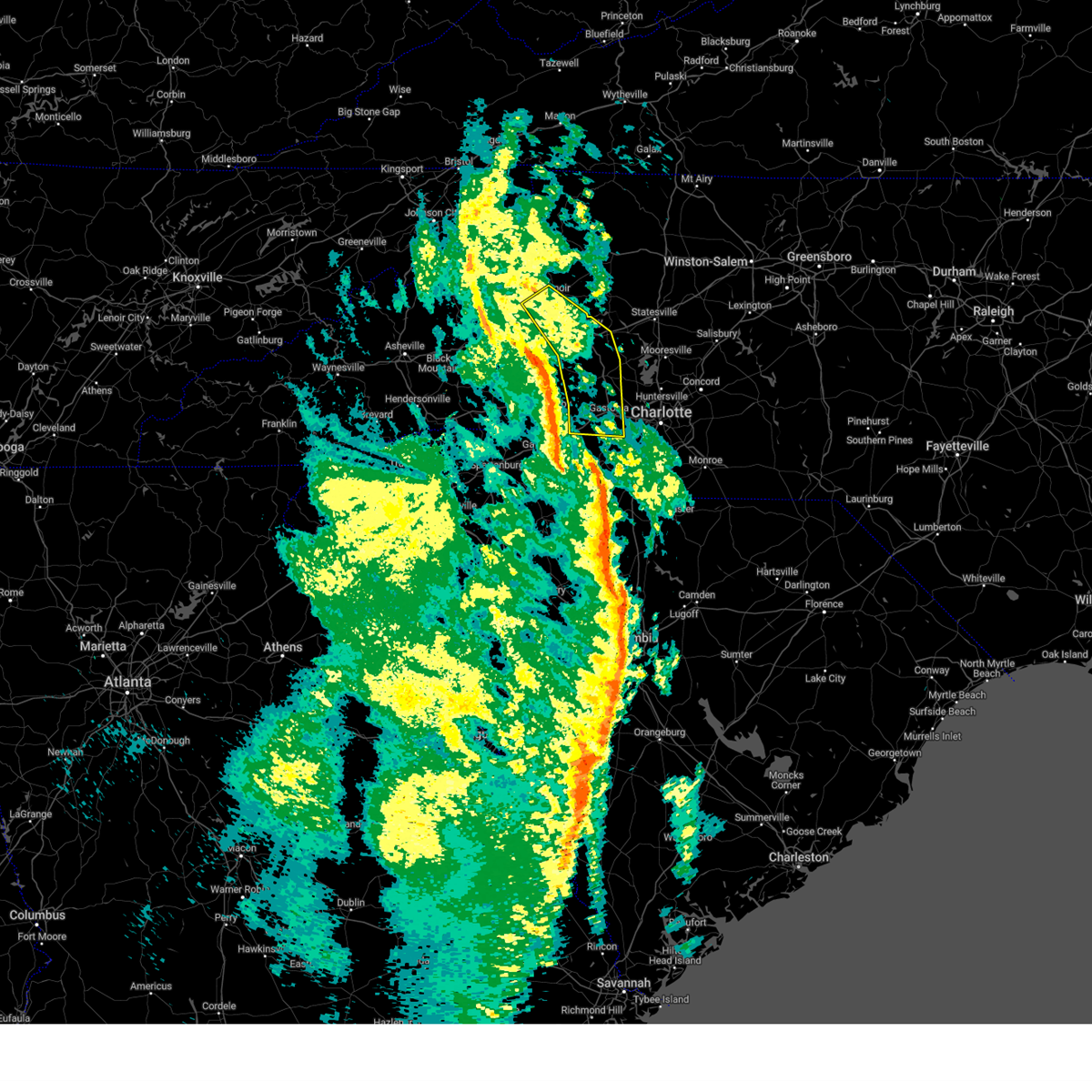
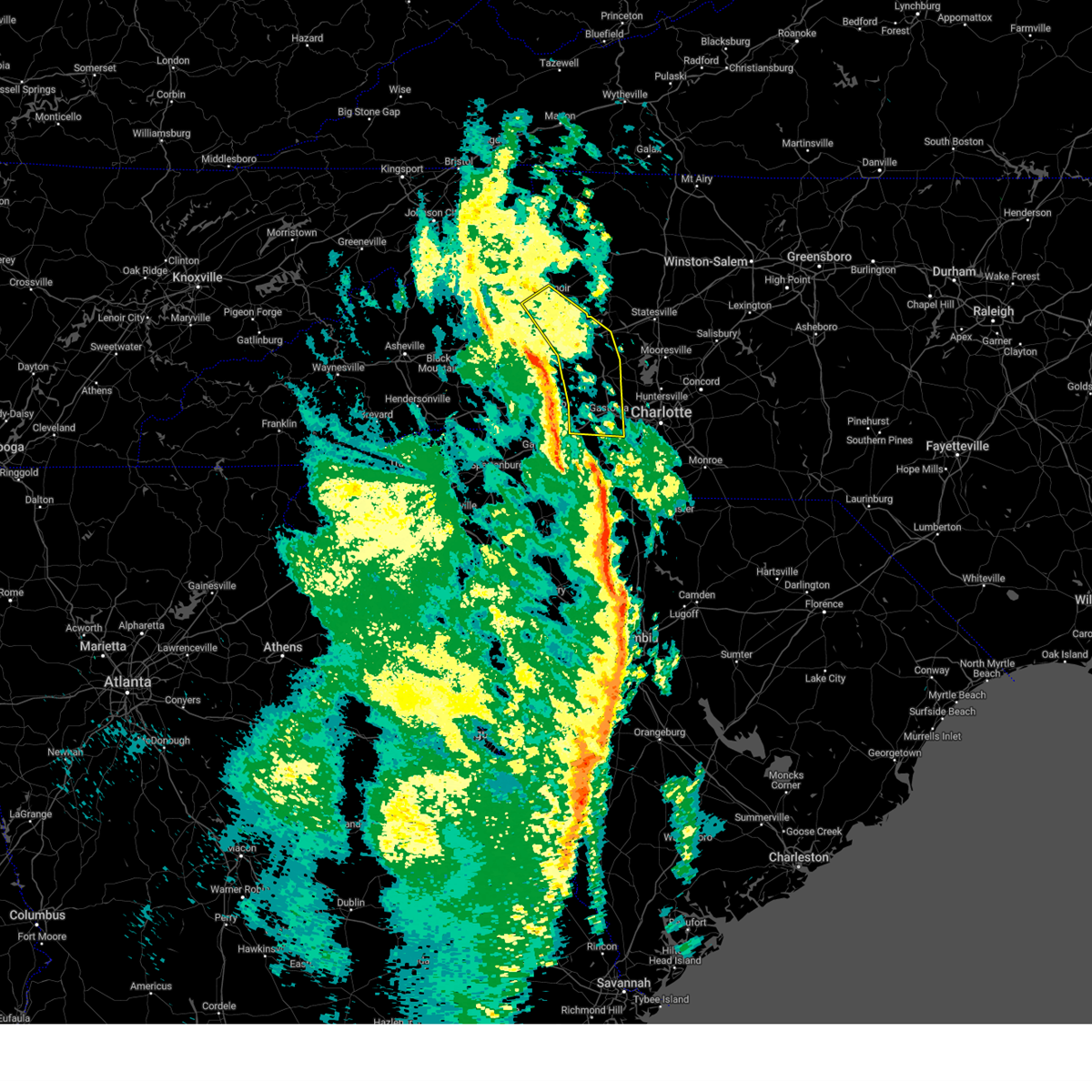
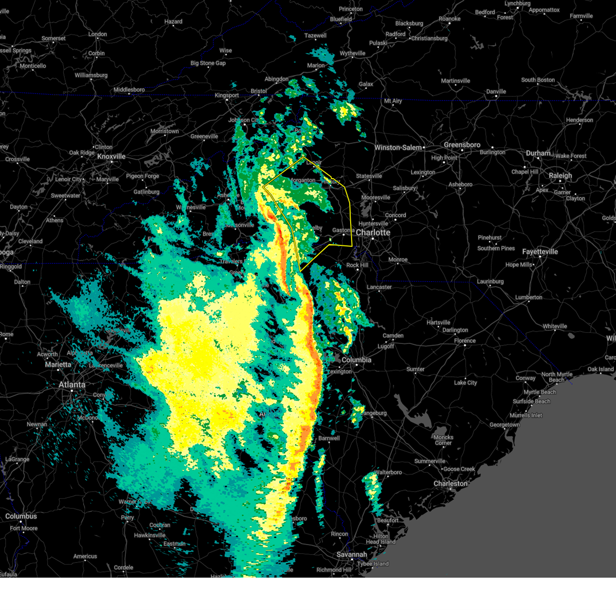
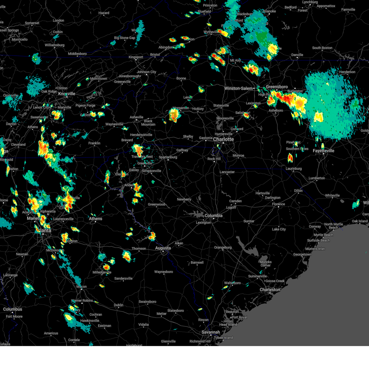
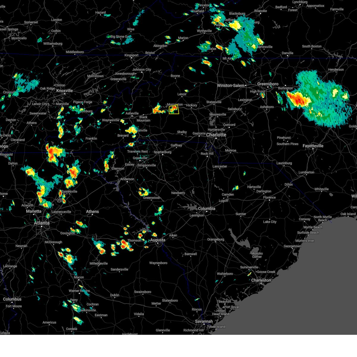
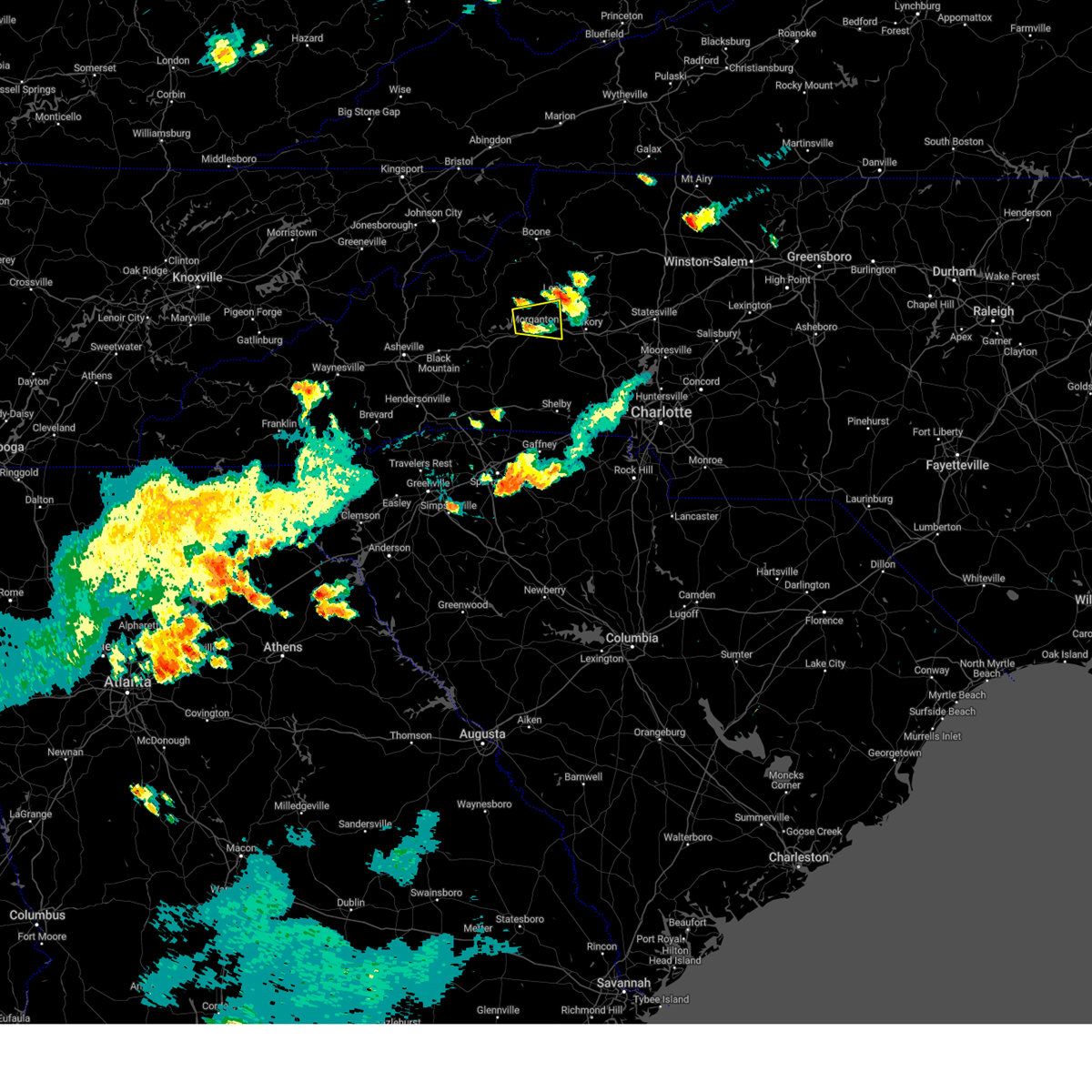
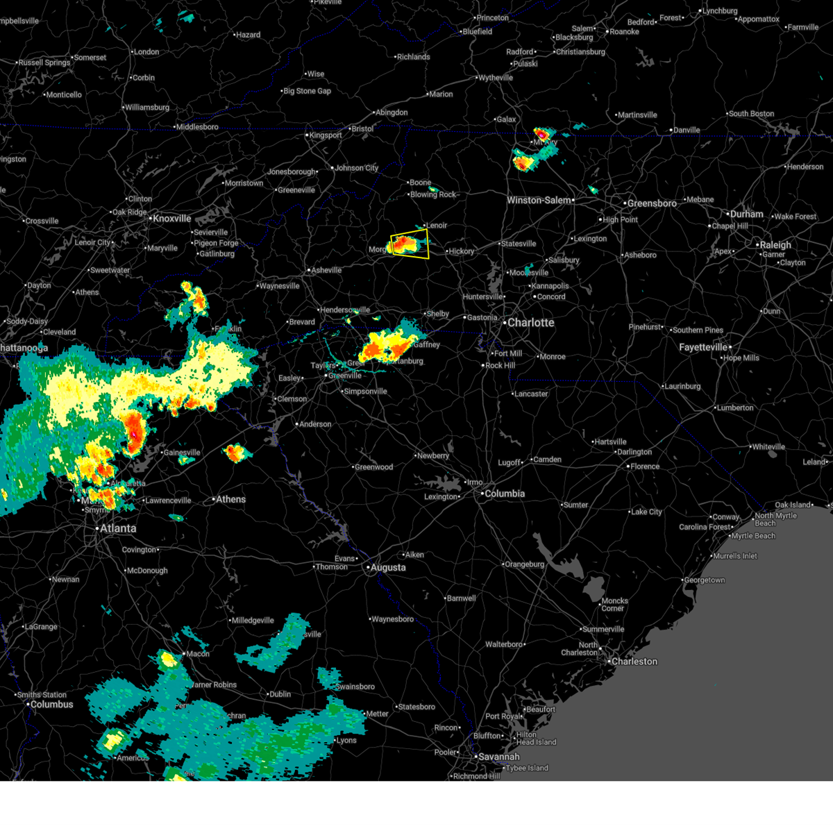
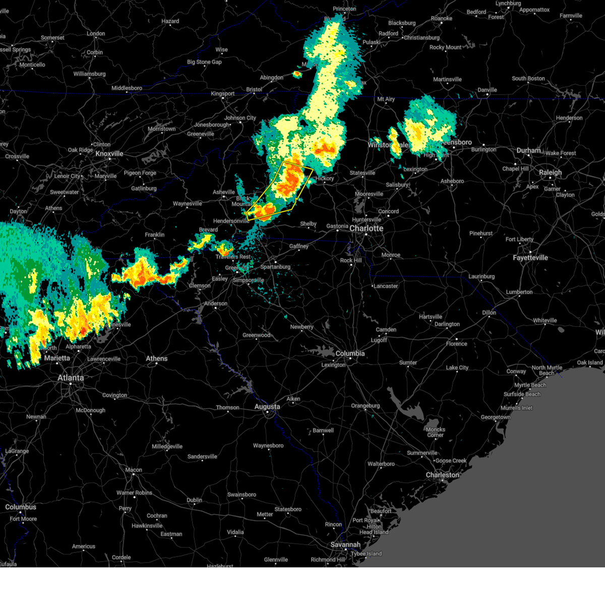
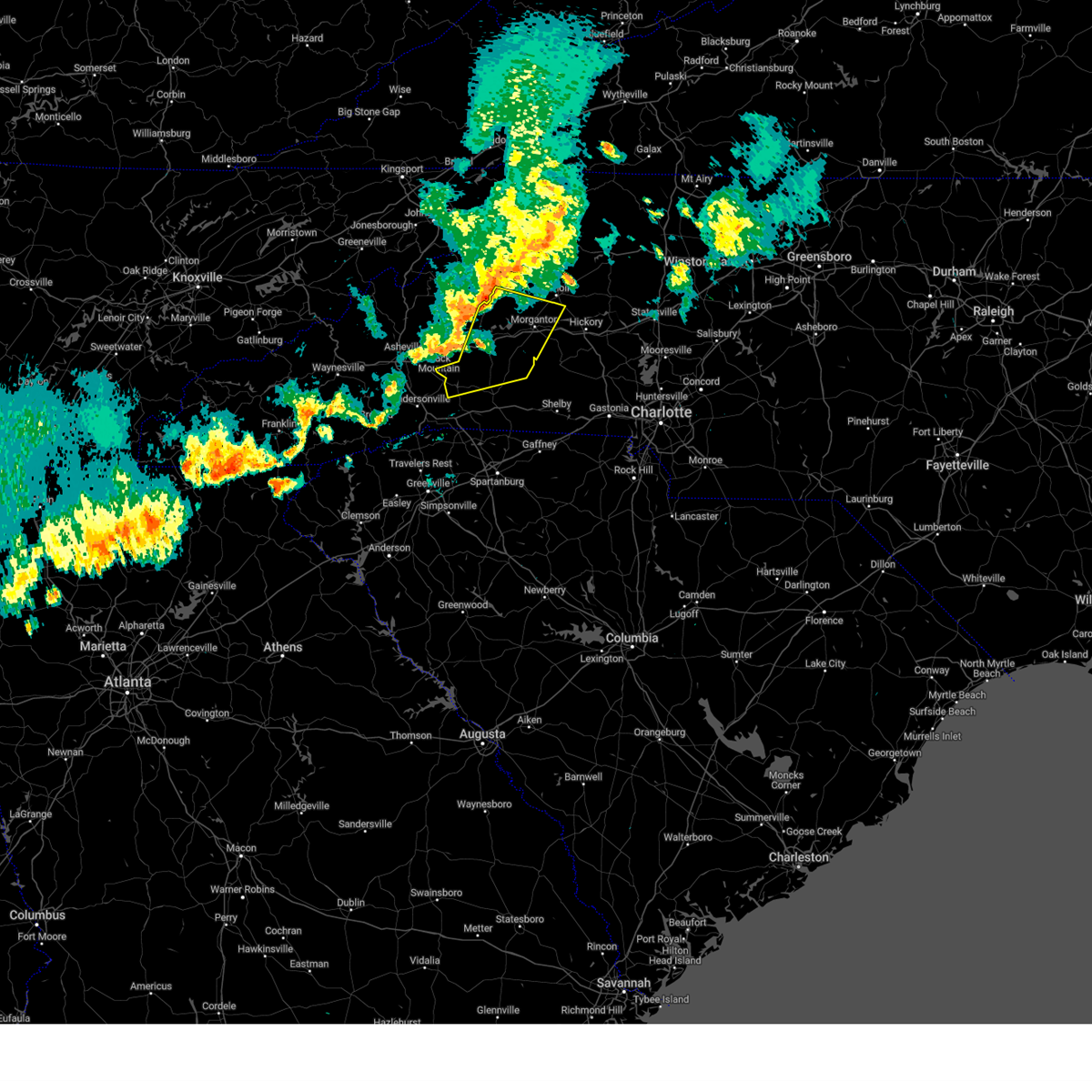
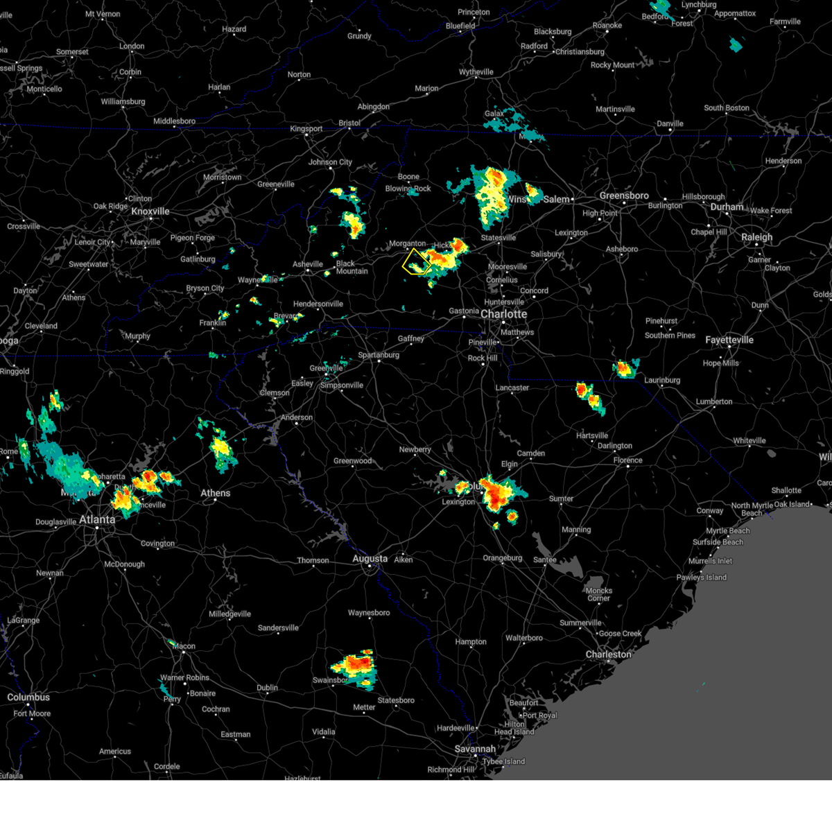
Hail Map for Morganton, NC
The Morganton, NC area has had 60 reports of on-the-ground hail by trained spotters, and has been under severe weather warnings 9 times during the past 12 months. Doppler radar has detected hail at or near Morganton, NC on 48 occasions.
| Name: | Morganton, NC |
| Where Located: | 60.5 miles NW of Charlotte, NC |
| Map: | Google Map for Morganton, NC |
| Population: | 16918 |
| Housing Units: | 7618 |
| More Info: | Search Google for Morganton, NC |
1
The Top Recent Hail Date for Morganton, NC is Thursday, May 8, 2025 (9th out of 48)

Hail and Wind Damage Spotted near Morganton, NC
| Date / Time | Report Details |
|---|---|
| 6/27/2026 3:25 PM EDT | Extensive tree damage at powell rd and north main street in drexe in burke county NC, 5.8 miles WSW of Morganton, NC |
| 6/27/2026 3:19 PM EDT |
 Svrgsp the national weather service in greenville-spartanburg has issued a * severe thunderstorm warning for, southeastern mcdowell county in western north carolina, rutherford county in western north carolina, southeastern caldwell county in western north carolina, northwestern cleveland county in the piedmont of north carolina, burke county in western north carolina, * until 415 pm edt. * at 318 pm edt, severe thunderstorms were located along a line extending from 5 miles southwest of lenoir to 10 miles west of rutherfordton, moving east at 30 mph (radar indicated). Hazards include 60 mph wind gusts. expect damage to trees and power lines Svrgsp the national weather service in greenville-spartanburg has issued a * severe thunderstorm warning for, southeastern mcdowell county in western north carolina, rutherford county in western north carolina, southeastern caldwell county in western north carolina, northwestern cleveland county in the piedmont of north carolina, burke county in western north carolina, * until 415 pm edt. * at 318 pm edt, severe thunderstorms were located along a line extending from 5 miles southwest of lenoir to 10 miles west of rutherfordton, moving east at 30 mph (radar indicated). Hazards include 60 mph wind gusts. expect damage to trees and power lines
|
| 3/16/2026 8:20 AM EDT | Trees downed along us 70. location approximat in burke county NC, 0.4 miles S of Morganton, NC |
| 3/16/2026 8:20 AM EDT |
 Svrgsp the national weather service in greenville-spartanburg has issued a * severe thunderstorm warning for, catawba county in the piedmont of north carolina, alexander county in the piedmont of north carolina, caldwell county in western north carolina, burke county in western north carolina, * until 915 am edt. * at 819 am edt, severe thunderstorms were located along a line extending from near blowing rock to 11 miles southwest of morganton, moving east at 30 mph (radar indicated). Hazards include 60 mph wind gusts. expect damage to trees and power lines Svrgsp the national weather service in greenville-spartanburg has issued a * severe thunderstorm warning for, catawba county in the piedmont of north carolina, alexander county in the piedmont of north carolina, caldwell county in western north carolina, burke county in western north carolina, * until 915 am edt. * at 819 am edt, severe thunderstorms were located along a line extending from near blowing rock to 11 miles southwest of morganton, moving east at 30 mph (radar indicated). Hazards include 60 mph wind gusts. expect damage to trees and power lines
|
| 3/16/2026 8:03 AM EDT | At 802 am edt, severe thunderstorms were located along a line extending from 3 miles southeast of beech mountain to 9 miles south of marion, moving east at 35 mph (radar indicated). Hazards include 60 mph wind gusts. Expect damage to trees and power lines. Locations impacted include, lenoir, morganton, sawmills, granite falls, valdese, gamewell, hudson, icard, cajah's mountain, and drexel. |
| 3/16/2026 8:03 AM EDT | the severe thunderstorm warning has been cancelled and is no longer in effect |
| 3/16/2026 7:31 AM EDT |
 Svrgsp the national weather service in greenville-spartanburg has issued a * severe thunderstorm warning for, mcdowell county in western north carolina, mitchell county in western north carolina, caldwell county in western north carolina, avery county in western north carolina, burke county in western north carolina, * until 830 am edt. * at 731 am edt, severe thunderstorms were located along a line extending from 9 miles east of erwin to 14 miles east of downtown asheville, moving east at 55 mph (radar indicated). Hazards include 60 mph wind gusts. expect damage to trees and power lines Svrgsp the national weather service in greenville-spartanburg has issued a * severe thunderstorm warning for, mcdowell county in western north carolina, mitchell county in western north carolina, caldwell county in western north carolina, avery county in western north carolina, burke county in western north carolina, * until 830 am edt. * at 731 am edt, severe thunderstorms were located along a line extending from 9 miles east of erwin to 14 miles east of downtown asheville, moving east at 55 mph (radar indicated). Hazards include 60 mph wind gusts. expect damage to trees and power lines
|
| 3/16/2026 6:07 AM EDT |
 The storms which prompted the warning have weakened below severe limits, and have exited the warned area. therefore, the warning will be allowed to expire. a severe thunderstorm watch remains in effect until 1100 am edt for western and the piedmont of north carolina. to report severe weather to the national weather service greenville-spartanburg, call toll free, 1, 800, 2 6 7, 8 1 0 1, or post on our facebook page, or post it to x using hashtag nwsgsp. your message should describe the event and the specific location where it occurred. The storms which prompted the warning have weakened below severe limits, and have exited the warned area. therefore, the warning will be allowed to expire. a severe thunderstorm watch remains in effect until 1100 am edt for western and the piedmont of north carolina. to report severe weather to the national weather service greenville-spartanburg, call toll free, 1, 800, 2 6 7, 8 1 0 1, or post on our facebook page, or post it to x using hashtag nwsgsp. your message should describe the event and the specific location where it occurred.
|
| 3/16/2026 5:47 AM EDT |
 the severe thunderstorm warning has been cancelled and is no longer in effect the severe thunderstorm warning has been cancelled and is no longer in effect
|
| 3/16/2026 5:47 AM EDT |
 At 546 am edt, severe thunderstorms were located along a line extending from 5 miles north of morganton to 9 miles south of forest city, moving east at 40 mph (radar indicated). Hazards include 60 mph wind gusts. Expect damage to trees and power lines. Locations impacted include, morganton, forest city, sawmills, valdese, gamewell, boiling springs nc, hudson, cajah's mountain, drexel, and connelly springs. At 546 am edt, severe thunderstorms were located along a line extending from 5 miles north of morganton to 9 miles south of forest city, moving east at 40 mph (radar indicated). Hazards include 60 mph wind gusts. Expect damage to trees and power lines. Locations impacted include, morganton, forest city, sawmills, valdese, gamewell, boiling springs nc, hudson, cajah's mountain, drexel, and connelly springs.
|
| 3/16/2026 5:24 AM EDT |
 Svrgsp the national weather service in greenville-spartanburg has issued a * severe thunderstorm warning for, eastern mcdowell county in western north carolina, rutherford county in western north carolina, eastern polk county in western north carolina, southwestern caldwell county in western north carolina, western cleveland county in the piedmont of north carolina, burke county in western north carolina, * until 615 am edt. * at 523 am edt, severe thunderstorms were located along a line extending from 11 miles northwest of morganton to 7 miles east of columbus, moving east at 25 mph (radar indicated). Hazards include 60 mph wind gusts. expect damage to trees and power lines Svrgsp the national weather service in greenville-spartanburg has issued a * severe thunderstorm warning for, eastern mcdowell county in western north carolina, rutherford county in western north carolina, eastern polk county in western north carolina, southwestern caldwell county in western north carolina, western cleveland county in the piedmont of north carolina, burke county in western north carolina, * until 615 am edt. * at 523 am edt, severe thunderstorms were located along a line extending from 11 miles northwest of morganton to 7 miles east of columbus, moving east at 25 mph (radar indicated). Hazards include 60 mph wind gusts. expect damage to trees and power lines
|
| 7/11/2025 4:50 PM EDT | Several large trees down from summers road to burke memorial park road to ramblewoods driv in burke county NC, 4.5 miles W of Morganton, NC |
| 6/25/2025 4:01 PM EDT |
 Svrgsp the national weather service in greenville-spartanburg has issued a * severe thunderstorm warning for, southeastern mcdowell county in western north carolina, northeastern rutherford county in western north carolina, southwestern burke county in western north carolina, * until 500 pm edt. * at 400 pm edt, a severe thunderstorm was located 4 miles northeast of marion, or near lake james state park, and is nearly stationary (radar indicated). Hazards include 60 mph wind gusts and quarter size hail. Minor hail damage to vehicles is expected. Expect wind damage to trees and power lines. Svrgsp the national weather service in greenville-spartanburg has issued a * severe thunderstorm warning for, southeastern mcdowell county in western north carolina, northeastern rutherford county in western north carolina, southwestern burke county in western north carolina, * until 500 pm edt. * at 400 pm edt, a severe thunderstorm was located 4 miles northeast of marion, or near lake james state park, and is nearly stationary (radar indicated). Hazards include 60 mph wind gusts and quarter size hail. Minor hail damage to vehicles is expected. Expect wind damage to trees and power lines.
|
| 6/25/2025 3:24 PM EDT |
 At 323 pm edt, a severe thunderstorm was located 12 miles southeast of newland, or 7 miles north of table rock, and is nearly stationary (radar indicated). Hazards include 60 mph wind gusts and quarter size hail. Minor hail damage to vehicles is expected. expect wind damage to trees and power lines. Locations impacted include, edgemont, collettsville, and globe. At 323 pm edt, a severe thunderstorm was located 12 miles southeast of newland, or 7 miles north of table rock, and is nearly stationary (radar indicated). Hazards include 60 mph wind gusts and quarter size hail. Minor hail damage to vehicles is expected. expect wind damage to trees and power lines. Locations impacted include, edgemont, collettsville, and globe.
|
| 6/25/2025 3:04 PM EDT |
 Svrgsp the national weather service in greenville-spartanburg has issued a * severe thunderstorm warning for, northwestern caldwell county in western north carolina, southeastern avery county in western north carolina, northwestern burke county in western north carolina, * until 345 pm edt. * at 303 pm edt, a severe thunderstorm was located 11 miles southeast of newland, or 7 miles southeast of the b.r. parkway between linville falls and grandfather, and is nearly stationary (radar indicated). Hazards include 60 mph wind gusts and quarter size hail. Minor hail damage to vehicles is expected. Expect wind damage to trees and power lines. Svrgsp the national weather service in greenville-spartanburg has issued a * severe thunderstorm warning for, northwestern caldwell county in western north carolina, southeastern avery county in western north carolina, northwestern burke county in western north carolina, * until 345 pm edt. * at 303 pm edt, a severe thunderstorm was located 11 miles southeast of newland, or 7 miles southeast of the b.r. parkway between linville falls and grandfather, and is nearly stationary (radar indicated). Hazards include 60 mph wind gusts and quarter size hail. Minor hail damage to vehicles is expected. Expect wind damage to trees and power lines.
|
| 6/17/2025 10:36 PM EDT |
 The storms which prompted the warning have weakened below severe limits, and no longer pose an immediate threat to life or property. therefore, the warning will be allowed to expire. however, gusty winds are still possible with these thunderstorms. The storms which prompted the warning have weakened below severe limits, and no longer pose an immediate threat to life or property. therefore, the warning will be allowed to expire. however, gusty winds are still possible with these thunderstorms.
|
| 6/17/2025 10:24 PM EDT |
 At 1024 pm edt, severe thunderstorms were located along a line extending from 7 miles east of morganton to 6 miles southwest of newton to 8 miles southwest of gastonia to near chester, moving northeast at 45 mph (radar indicated). Hazards include 60 mph wind gusts. Expect damage to trees and power lines. locations impacted include, gastonia, rock hill, hickory, morganton, newton, lincolnton, york, chester, mt holly, and st. Stephens. At 1024 pm edt, severe thunderstorms were located along a line extending from 7 miles east of morganton to 6 miles southwest of newton to 8 miles southwest of gastonia to near chester, moving northeast at 45 mph (radar indicated). Hazards include 60 mph wind gusts. Expect damage to trees and power lines. locations impacted include, gastonia, rock hill, hickory, morganton, newton, lincolnton, york, chester, mt holly, and st. Stephens.
|
| 6/17/2025 10:24 PM EDT |
 the severe thunderstorm warning has been cancelled and is no longer in effect the severe thunderstorm warning has been cancelled and is no longer in effect
|
| 6/17/2025 10:18 PM EDT |
 At 1018 pm edt, severe thunderstorms were located along a line extending from 4 miles southeast of morganton to 9 miles northwest of lincolnton to 9 miles northwest of york to 5 miles west of chester, moving east at 50 mph (radar indicated). Hazards include 60 mph wind gusts. Expect damage to trees and power lines. Locations impacted include, gastonia, rock hill, hickory, shelby, morganton, newton, gaffney, lincolnton, union, and york. At 1018 pm edt, severe thunderstorms were located along a line extending from 4 miles southeast of morganton to 9 miles northwest of lincolnton to 9 miles northwest of york to 5 miles west of chester, moving east at 50 mph (radar indicated). Hazards include 60 mph wind gusts. Expect damage to trees and power lines. Locations impacted include, gastonia, rock hill, hickory, shelby, morganton, newton, gaffney, lincolnton, union, and york.
|
| 6/17/2025 10:02 PM EDT |
 the severe thunderstorm warning has been cancelled and is no longer in effect the severe thunderstorm warning has been cancelled and is no longer in effect
|
| 6/17/2025 10:02 PM EDT |
 At 1002 pm edt, severe thunderstorms were located along a line extending from 9 miles southwest of morganton to 14 miles north of shelby to 11 miles east of gaffney to 11 miles southeast of union, moving east at 50 mph (radar indicated). Hazards include 60 mph wind gusts. Expect damage to trees and power lines. Locations impacted include, gastonia, rock hill, hickory, shelby, morganton, newton, gaffney, lincolnton, union, and york. At 1002 pm edt, severe thunderstorms were located along a line extending from 9 miles southwest of morganton to 14 miles north of shelby to 11 miles east of gaffney to 11 miles southeast of union, moving east at 50 mph (radar indicated). Hazards include 60 mph wind gusts. Expect damage to trees and power lines. Locations impacted include, gastonia, rock hill, hickory, shelby, morganton, newton, gaffney, lincolnton, union, and york.
|
| 6/17/2025 9:43 PM EDT |
 Svrgsp the national weather service in greenville-spartanburg has issued a * severe thunderstorm warning for, catawba county in the piedmont of north carolina, rutherford county in western north carolina, lincoln county in the piedmont of north carolina, gaston county in the piedmont of north carolina, southeastern mcdowell county in western north carolina, cleveland county in the piedmont of north carolina, southern burke county in western north carolina, southeastern laurens county in upstate south carolina, union county in upstate south carolina, chester county in upstate south carolina, york county in upstate south carolina, eastern spartanburg county in upstate south carolina, cherokee county in upstate south carolina, * until 1045 pm edt. * at 943 pm edt, severe thunderstorms were located along a line extending from 10 miles north of rutherfordton to 10 miles east of forest city to 9 miles south of gaffney to 13 miles south of union, moving northeast at 50 mph (radar indicated). Hazards include 60 mph wind gusts. expect damage to trees and power lines Svrgsp the national weather service in greenville-spartanburg has issued a * severe thunderstorm warning for, catawba county in the piedmont of north carolina, rutherford county in western north carolina, lincoln county in the piedmont of north carolina, gaston county in the piedmont of north carolina, southeastern mcdowell county in western north carolina, cleveland county in the piedmont of north carolina, southern burke county in western north carolina, southeastern laurens county in upstate south carolina, union county in upstate south carolina, chester county in upstate south carolina, york county in upstate south carolina, eastern spartanburg county in upstate south carolina, cherokee county in upstate south carolina, * until 1045 pm edt. * at 943 pm edt, severe thunderstorms were located along a line extending from 10 miles north of rutherfordton to 10 miles east of forest city to 9 miles south of gaffney to 13 miles south of union, moving northeast at 50 mph (radar indicated). Hazards include 60 mph wind gusts. expect damage to trees and power lines
|
| 5/14/2025 3:12 PM EDT |
 The storm which prompted the warning has weakened below severe limits, and no longer poses an immediate threat to life or property. therefore, the warning will be allowed to expire. however, small hail and gusty winds are still possible with this thunderstorm. The storm which prompted the warning has weakened below severe limits, and no longer poses an immediate threat to life or property. therefore, the warning will be allowed to expire. however, small hail and gusty winds are still possible with this thunderstorm.
|
| 5/14/2025 2:51 PM EDT |
 At 250 pm edt, a severe thunderstorm was located 8 miles west of hickory, or near icard, moving southeast at 15 mph (radar indicated). Hazards include 60 mph wind gusts and quarter size hail. Minor hail damage to vehicles is expected. expect wind damage to trees and power lines. Locations impacted include, lake rhodhiss, longview, cooksville, icard, valdese, vale, hickory regional airport, newton, pleasant grove, and startown. At 250 pm edt, a severe thunderstorm was located 8 miles west of hickory, or near icard, moving southeast at 15 mph (radar indicated). Hazards include 60 mph wind gusts and quarter size hail. Minor hail damage to vehicles is expected. expect wind damage to trees and power lines. Locations impacted include, lake rhodhiss, longview, cooksville, icard, valdese, vale, hickory regional airport, newton, pleasant grove, and startown.
|
| 5/14/2025 2:51 PM EDT |
 the severe thunderstorm warning has been cancelled and is no longer in effect the severe thunderstorm warning has been cancelled and is no longer in effect
|
| 5/14/2025 2:21 PM EDT |
 Svrgsp the national weather service in greenville-spartanburg has issued a * severe thunderstorm warning for, southwestern catawba county in the piedmont of north carolina, western lincoln county in the piedmont of north carolina, south central caldwell county in western north carolina, southeastern burke county in western north carolina, * until 315 pm edt. * at 221 pm edt, a severe thunderstorm was located 8 miles east of morganton, or near lake rhodhiss, moving southeast at 15 mph (radar indicated). Hazards include 60 mph wind gusts and quarter size hail. Minor hail damage to vehicles is expected. Expect wind damage to trees and power lines. Svrgsp the national weather service in greenville-spartanburg has issued a * severe thunderstorm warning for, southwestern catawba county in the piedmont of north carolina, western lincoln county in the piedmont of north carolina, south central caldwell county in western north carolina, southeastern burke county in western north carolina, * until 315 pm edt. * at 221 pm edt, a severe thunderstorm was located 8 miles east of morganton, or near lake rhodhiss, moving southeast at 15 mph (radar indicated). Hazards include 60 mph wind gusts and quarter size hail. Minor hail damage to vehicles is expected. Expect wind damage to trees and power lines.
|
| 5/8/2025 5:36 PM EDT |
 the severe thunderstorm warning has been cancelled and is no longer in effect the severe thunderstorm warning has been cancelled and is no longer in effect
|
| 5/8/2025 5:36 PM EDT |
 At 535 pm edt, a severe thunderstorm was located 7 miles southwest of morganton, or 6 miles south of glen alpine, moving east at 20 mph (radar indicated). Hazards include 60 mph wind gusts and penny size hail. Expect damage to trees and power lines. Locations impacted include, morganton, lake rhodhiss, rhodhiss, icard, valdese, glen alpine, pleasant grove, connelly springs, drexel, and south mountains state park. At 535 pm edt, a severe thunderstorm was located 7 miles southwest of morganton, or 6 miles south of glen alpine, moving east at 20 mph (radar indicated). Hazards include 60 mph wind gusts and penny size hail. Expect damage to trees and power lines. Locations impacted include, morganton, lake rhodhiss, rhodhiss, icard, valdese, glen alpine, pleasant grove, connelly springs, drexel, and south mountains state park.
|
| 5/8/2025 5:29 PM EDT | Multiple trees dow in burke county NC, 1.2 miles SSW of Morganton, NC |
| 5/8/2025 4:55 PM EDT |
 At 454 pm edt, a severe thunderstorm was located 6 miles east of marion, or near lake james state park, moving east at 25 mph (radar indicated). Hazards include 60 mph wind gusts and half dollar size hail. Minor hail damage to vehicles is expected. expect wind damage to trees and power lines. Locations impacted include, nebo, lake james state park, morganton, lake rhodhiss, pleasant gardens, glenwood, rhodhiss, icard, valdese, and glen alpine. At 454 pm edt, a severe thunderstorm was located 6 miles east of marion, or near lake james state park, moving east at 25 mph (radar indicated). Hazards include 60 mph wind gusts and half dollar size hail. Minor hail damage to vehicles is expected. expect wind damage to trees and power lines. Locations impacted include, nebo, lake james state park, morganton, lake rhodhiss, pleasant gardens, glenwood, rhodhiss, icard, valdese, and glen alpine.
|
| 5/8/2025 4:39 PM EDT |
 Svrgsp the national weather service in greenville-spartanburg has issued a * severe thunderstorm warning for, southeastern mcdowell county in western north carolina, northeastern rutherford county in western north carolina, northwestern cleveland county in the piedmont of north carolina, southern burke county in western north carolina, * until 600 pm edt. * at 439 pm edt, multiple severe thunderstorm were located over the north carolina foothills, one near marion, and another near morganton, both moving east at 25 mph (radar indicated). Hazards include ping pong ball size hail and 60 mph wind gusts. People and animals outdoors will be injured. expect hail damage to roofs, siding, windows, and vehicles. Expect wind damage to trees and power lines. Svrgsp the national weather service in greenville-spartanburg has issued a * severe thunderstorm warning for, southeastern mcdowell county in western north carolina, northeastern rutherford county in western north carolina, northwestern cleveland county in the piedmont of north carolina, southern burke county in western north carolina, * until 600 pm edt. * at 439 pm edt, multiple severe thunderstorm were located over the north carolina foothills, one near marion, and another near morganton, both moving east at 25 mph (radar indicated). Hazards include ping pong ball size hail and 60 mph wind gusts. People and animals outdoors will be injured. expect hail damage to roofs, siding, windows, and vehicles. Expect wind damage to trees and power lines.
|
| 5/8/2025 4:30 PM EDT |
 the severe thunderstorm warning has been cancelled and is no longer in effect the severe thunderstorm warning has been cancelled and is no longer in effect
|
| 5/8/2025 4:30 PM EDT |
 At 430 pm edt, a severe thunderstorm was located 4 miles west of morganton, or over glen alpine, moving northeast at 30 mph (radar indicated). Hazards include ping pong ball size hail and 60 mph wind gusts. People and animals outdoors will be injured. expect hail damage to roofs, siding, windows, and vehicles. expect wind damage to trees and power lines. Locations impacted include, glen alpine. At 430 pm edt, a severe thunderstorm was located 4 miles west of morganton, or over glen alpine, moving northeast at 30 mph (radar indicated). Hazards include ping pong ball size hail and 60 mph wind gusts. People and animals outdoors will be injured. expect hail damage to roofs, siding, windows, and vehicles. expect wind damage to trees and power lines. Locations impacted include, glen alpine.
|
| 5/8/2025 4:20 PM EDT | Quarter sized hail reported 0.7 miles SW of Morganton, NC |
| 5/8/2025 4:19 PM EDT |
 At 419 pm edt, a severe thunderstorm was located 11 miles southeast of marion, or 10 miles south of lake james state park, moving northeast at 20 mph (radar indicated). Hazards include 60 mph wind gusts and quarter size hail. Minor hail damage to vehicles is expected. expect wind damage to trees and power lines. Locations impacted include, south mountains state park, dysartsville, glen alpine, fero, and thermal city. At 419 pm edt, a severe thunderstorm was located 11 miles southeast of marion, or 10 miles south of lake james state park, moving northeast at 20 mph (radar indicated). Hazards include 60 mph wind gusts and quarter size hail. Minor hail damage to vehicles is expected. expect wind damage to trees and power lines. Locations impacted include, south mountains state park, dysartsville, glen alpine, fero, and thermal city.
|
| 5/8/2025 4:04 PM EDT |
 Svrgsp the national weather service in greenville-spartanburg has issued a * severe thunderstorm warning for, southeastern mcdowell county in western north carolina, northeastern rutherford county in western north carolina, southwestern burke county in western north carolina, * until 445 pm edt. * at 404 pm edt, a severe thunderstorm was located 10 miles north of rutherfordton, moving northeast at 20 mph (radar indicated). Hazards include 60 mph wind gusts and quarter size hail. Minor hail damage to vehicles is expected. Expect wind damage to trees and power lines. Svrgsp the national weather service in greenville-spartanburg has issued a * severe thunderstorm warning for, southeastern mcdowell county in western north carolina, northeastern rutherford county in western north carolina, southwestern burke county in western north carolina, * until 445 pm edt. * at 404 pm edt, a severe thunderstorm was located 10 miles north of rutherfordton, moving northeast at 20 mph (radar indicated). Hazards include 60 mph wind gusts and quarter size hail. Minor hail damage to vehicles is expected. Expect wind damage to trees and power lines.
|
| 12/29/2024 9:06 AM EST |
 At 906 am est, severe thunderstorms were located along a line extending from 7 miles southwest of lenoir to 9 miles south of hickory to 10 miles southwest of lincolnton to 10 miles northwest of york, moving northeast at 50 mph (radar indicated). Hazards include 60 mph wind gusts. Expect damage to trees and power lines. locations impacted include, gastonia, hickory, lenoir, newton, lincolnton, kings mountain, st. Stephens, conover, cherryville, and bessemer city. At 906 am est, severe thunderstorms were located along a line extending from 7 miles southwest of lenoir to 9 miles south of hickory to 10 miles southwest of lincolnton to 10 miles northwest of york, moving northeast at 50 mph (radar indicated). Hazards include 60 mph wind gusts. Expect damage to trees and power lines. locations impacted include, gastonia, hickory, lenoir, newton, lincolnton, kings mountain, st. Stephens, conover, cherryville, and bessemer city.
|
| 12/29/2024 9:06 AM EST |
 the severe thunderstorm warning has been cancelled and is no longer in effect the severe thunderstorm warning has been cancelled and is no longer in effect
|
| 12/29/2024 8:53 AM EST |
 At 853 am est, severe thunderstorms were located along a line extending from 8 miles northwest of morganton to 15 miles southwest of hickory to 4 miles northeast of shelby to 9 miles northeast of gaffney, moving northeast at 55 mph (radar indicated). Hazards include 60 mph wind gusts. Expect damage to trees and power lines. locations impacted include, gastonia, hickory, shelby, lenoir, morganton, newton, lincolnton, kings mountain, st. Stephens, and conover. At 853 am est, severe thunderstorms were located along a line extending from 8 miles northwest of morganton to 15 miles southwest of hickory to 4 miles northeast of shelby to 9 miles northeast of gaffney, moving northeast at 55 mph (radar indicated). Hazards include 60 mph wind gusts. Expect damage to trees and power lines. locations impacted include, gastonia, hickory, shelby, lenoir, morganton, newton, lincolnton, kings mountain, st. Stephens, and conover.
|
| 12/29/2024 8:25 AM EST |
 Svrgsp the national weather service in greenville-spartanburg has issued a * severe thunderstorm warning for, western catawba county in the piedmont of north carolina, southeastern mcdowell county in western north carolina, eastern rutherford county in western north carolina, lincoln county in the piedmont of north carolina, southern caldwell county in western north carolina, cleveland county in the piedmont of north carolina, gaston county in the piedmont of north carolina, burke county in western north carolina, eastern cherokee county in upstate south carolina, * until 945 am est. * at 824 am est, severe thunderstorms were located along a line extending from 10 miles southwest of marion to near forest city to 9 miles west of gaffney to 8 miles southeast of spartanburg, moving northeast at 55 mph (radar indicated). Hazards include 60 mph wind gusts. expect damage to trees and power lines Svrgsp the national weather service in greenville-spartanburg has issued a * severe thunderstorm warning for, western catawba county in the piedmont of north carolina, southeastern mcdowell county in western north carolina, eastern rutherford county in western north carolina, lincoln county in the piedmont of north carolina, southern caldwell county in western north carolina, cleveland county in the piedmont of north carolina, gaston county in the piedmont of north carolina, burke county in western north carolina, eastern cherokee county in upstate south carolina, * until 945 am est. * at 824 am est, severe thunderstorms were located along a line extending from 10 miles southwest of marion to near forest city to 9 miles west of gaffney to 8 miles southeast of spartanburg, moving northeast at 55 mph (radar indicated). Hazards include 60 mph wind gusts. expect damage to trees and power lines
|
| 8/30/2024 4:24 PM EDT |
 the severe thunderstorm warning has been cancelled and is no longer in effect the severe thunderstorm warning has been cancelled and is no longer in effect
|
| 8/30/2024 4:23 PM EDT |
 the severe thunderstorm warning has been cancelled and is no longer in effect the severe thunderstorm warning has been cancelled and is no longer in effect
|
| 8/30/2024 4:13 PM EDT |
 At 413 pm edt, a severe thunderstorm was located 9 miles east of marion, or 6 miles southeast of lake james state park, and is nearly stationary (radar indicated). Hazards include 60 mph wind gusts. Expect damage to trees and power lines. Locations impacted include, dysartsville. At 413 pm edt, a severe thunderstorm was located 9 miles east of marion, or 6 miles southeast of lake james state park, and is nearly stationary (radar indicated). Hazards include 60 mph wind gusts. Expect damage to trees and power lines. Locations impacted include, dysartsville.
|
| 8/30/2024 4:03 PM EDT | Several trees reported down in western burke count in burke county NC, 7.6 miles NE of Morganton, NC |
| 8/30/2024 4:01 PM EDT |
 At 401 pm edt, a severe thunderstorm was located 4 miles south of morganton, and is nearly stationary (radar indicated). Hazards include 60 mph wind gusts. Expect damage to trees and power lines. Locations impacted include, south mountains state park. At 401 pm edt, a severe thunderstorm was located 4 miles south of morganton, and is nearly stationary (radar indicated). Hazards include 60 mph wind gusts. Expect damage to trees and power lines. Locations impacted include, south mountains state park.
|
| 8/30/2024 3:52 PM EDT |
 Svrgsp the national weather service in greenville-spartanburg has issued a * severe thunderstorm warning for, southeastern mcdowell county in western north carolina, southwestern burke county in western north carolina, * until 500 pm edt. * at 352 pm edt, a severe thunderstorm was located 8 miles east of marion, or 5 miles southeast of lake james state park, and is nearly stationary (radar indicated). Hazards include 60 mph wind gusts and nickel size hail. expect damage to trees and power lines Svrgsp the national weather service in greenville-spartanburg has issued a * severe thunderstorm warning for, southeastern mcdowell county in western north carolina, southwestern burke county in western north carolina, * until 500 pm edt. * at 352 pm edt, a severe thunderstorm was located 8 miles east of marion, or 5 miles southeast of lake james state park, and is nearly stationary (radar indicated). Hazards include 60 mph wind gusts and nickel size hail. expect damage to trees and power lines
|
| 8/30/2024 3:45 PM EDT | Social media report of trees down in the hwy 64 area on the south side of morganto in burke county NC, 1.6 miles N of Morganton, NC |
| 8/30/2024 3:38 PM EDT |
 Svrgsp the national weather service in greenville-spartanburg has issued a * severe thunderstorm warning for, south central burke county in western north carolina, * until 445 pm edt. * at 338 pm edt, a severe thunderstorm was located near morganton, and is nearly stationary (radar indicated). Hazards include 60 mph wind gusts and penny size hail. expect damage to trees and power lines Svrgsp the national weather service in greenville-spartanburg has issued a * severe thunderstorm warning for, south central burke county in western north carolina, * until 445 pm edt. * at 338 pm edt, a severe thunderstorm was located near morganton, and is nearly stationary (radar indicated). Hazards include 60 mph wind gusts and penny size hail. expect damage to trees and power lines
|
| 8/17/2024 6:53 PM EDT |
 The storm which prompted the warning has weakened below severe limits, and no longer poses an immediate threat to life or property. therefore, the warning will be allowed to expire. to report severe weather to the national weather service greenville-spartanburg, call toll free, 1, 800, 2 6 7, 8 1 0 1, or post on our facebook page, or tweet it using hashtag nwsgsp. your message should describe the event and the specific location where it occurred. The storm which prompted the warning has weakened below severe limits, and no longer poses an immediate threat to life or property. therefore, the warning will be allowed to expire. to report severe weather to the national weather service greenville-spartanburg, call toll free, 1, 800, 2 6 7, 8 1 0 1, or post on our facebook page, or tweet it using hashtag nwsgsp. your message should describe the event and the specific location where it occurred.
|
| 8/17/2024 6:22 PM EDT |
 Svrgsp the national weather service in greenville-spartanburg has issued a * severe thunderstorm warning for, south central caldwell county in western north carolina, central burke county in western north carolina, * until 700 pm edt. * at 622 pm edt, a severe thunderstorm was located near morganton, moving east at 15 mph (radar indicated). Hazards include 60 mph wind gusts and quarter size hail. Minor hail damage to vehicles is expected. Expect wind damage to trees and power lines. Svrgsp the national weather service in greenville-spartanburg has issued a * severe thunderstorm warning for, south central caldwell county in western north carolina, central burke county in western north carolina, * until 700 pm edt. * at 622 pm edt, a severe thunderstorm was located near morganton, moving east at 15 mph (radar indicated). Hazards include 60 mph wind gusts and quarter size hail. Minor hail damage to vehicles is expected. Expect wind damage to trees and power lines.
|
| 8/16/2024 8:25 PM EDT |
 the severe thunderstorm warning has been cancelled and is no longer in effect the severe thunderstorm warning has been cancelled and is no longer in effect
|
| 8/16/2024 8:25 PM EDT |
 At 825 pm edt, severe thunderstorms were located along a line extending from 4 miles north of morganton to 12 miles northeast of rutherfordton to 16 miles southwest of marion, moving southeast at 30 mph (radar indicated). Hazards include 60 mph wind gusts and penny size hail. Expect damage to trees and power lines. Locations impacted include, morganton, marion, valdese, gamewell, cajah's mountain, drexel, glen alpine, lake lure, chimney rock village, and lake james state park. At 825 pm edt, severe thunderstorms were located along a line extending from 4 miles north of morganton to 12 miles northeast of rutherfordton to 16 miles southwest of marion, moving southeast at 30 mph (radar indicated). Hazards include 60 mph wind gusts and penny size hail. Expect damage to trees and power lines. Locations impacted include, morganton, marion, valdese, gamewell, cajah's mountain, drexel, glen alpine, lake lure, chimney rock village, and lake james state park.
|
| 8/16/2024 8:15 PM EDT | Scattered reports of tree limbs down across the count in burke county NC, 1.5 miles SW of Morganton, NC |
| 8/16/2024 7:43 PM EDT |
 Svrgsp the national weather service in greenville-spartanburg has issued a * severe thunderstorm warning for, mcdowell county in western north carolina, northern rutherford county in western north carolina, north central polk county in western north carolina, southwestern caldwell county in western north carolina, southeastern buncombe county in western north carolina, burke county in western north carolina, * until 845 pm edt. * at 743 pm edt, severe thunderstorms were located along a line extending from 6 miles east of spruce pine to 8 miles southwest of marion to 6 miles east of downtown asheville, moving southeast at 30 mph (radar indicated). Hazards include 60 mph wind gusts and penny size hail. expect damage to trees and power lines Svrgsp the national weather service in greenville-spartanburg has issued a * severe thunderstorm warning for, mcdowell county in western north carolina, northern rutherford county in western north carolina, north central polk county in western north carolina, southwestern caldwell county in western north carolina, southeastern buncombe county in western north carolina, burke county in western north carolina, * until 845 pm edt. * at 743 pm edt, severe thunderstorms were located along a line extending from 6 miles east of spruce pine to 8 miles southwest of marion to 6 miles east of downtown asheville, moving southeast at 30 mph (radar indicated). Hazards include 60 mph wind gusts and penny size hail. expect damage to trees and power lines
|
| 8/2/2024 1:44 PM EDT |
 Svrgsp the national weather service in greenville-spartanburg has issued a * severe thunderstorm warning for, east central mcdowell county in western north carolina, west central burke county in western north carolina, * until 245 pm edt. * at 143 pm edt, a severe thunderstorm was located 5 miles northeast of marion, or near lake james state park, moving northeast at 10 mph (radar indicated). Hazards include 60 mph wind gusts. expect damage to trees and power lines Svrgsp the national weather service in greenville-spartanburg has issued a * severe thunderstorm warning for, east central mcdowell county in western north carolina, west central burke county in western north carolina, * until 245 pm edt. * at 143 pm edt, a severe thunderstorm was located 5 miles northeast of marion, or near lake james state park, moving northeast at 10 mph (radar indicated). Hazards include 60 mph wind gusts. expect damage to trees and power lines
|
| 7/29/2024 4:04 PM EDT |
 Svrgsp the national weather service in greenville-spartanburg has issued a * severe thunderstorm warning for, southwestern catawba county in the piedmont of north carolina, northwestern lincoln county in the piedmont of north carolina, north central cleveland county in the piedmont of north carolina, southeastern burke county in western north carolina, * until 445 pm edt. * at 404 pm edt, a severe thunderstorm was located 9 miles east of morganton, or near valdese, moving southeast at 20 mph (radar indicated). Hazards include 60 mph wind gusts. expect damage to trees and power lines Svrgsp the national weather service in greenville-spartanburg has issued a * severe thunderstorm warning for, southwestern catawba county in the piedmont of north carolina, northwestern lincoln county in the piedmont of north carolina, north central cleveland county in the piedmont of north carolina, southeastern burke county in western north carolina, * until 445 pm edt. * at 404 pm edt, a severe thunderstorm was located 9 miles east of morganton, or near valdese, moving southeast at 20 mph (radar indicated). Hazards include 60 mph wind gusts. expect damage to trees and power lines
|
| 7/16/2024 6:15 PM EDT | Trees down around the chesterfield are in burke county NC, 5.7 miles SSW of Morganton, NC |
| 7/5/2024 5:27 PM EDT |
 The storm which prompted the warning has weakened below severe limits, and has exited the warned area. therefore, the warning will be allowed to expire. however, gusty winds and heavy rain are still possible with this thunderstorm. The storm which prompted the warning has weakened below severe limits, and has exited the warned area. therefore, the warning will be allowed to expire. however, gusty winds and heavy rain are still possible with this thunderstorm.
|
| 7/5/2024 5:05 PM EDT | Trees and power lines down across the city of morganton... including on ervin rd and burkemont av in burke county NC, 1.9 miles SSW of Morganton, NC |
| 7/5/2024 4:48 PM EDT | Trees down in 5000 block of patton rd and in 4800 block of elmore dr... both southwest of morganton. time estimate in burke county NC, 8.5 miles NE of Morganton, NC |
| 7/5/2024 4:47 PM EDT |
 Svrgsp the national weather service in greenville-spartanburg has issued a * severe thunderstorm warning for, southeastern caldwell county in western north carolina, burke county in western north carolina, * until 530 pm edt. * at 447 pm edt, a severe thunderstorm was located 6 miles southwest of morganton, or 4 miles south of glen alpine, moving northeast at 25 mph (radar indicated). Hazards include 60 mph wind gusts and nickel size hail. expect damage to trees and power lines Svrgsp the national weather service in greenville-spartanburg has issued a * severe thunderstorm warning for, southeastern caldwell county in western north carolina, burke county in western north carolina, * until 530 pm edt. * at 447 pm edt, a severe thunderstorm was located 6 miles southwest of morganton, or 4 miles south of glen alpine, moving northeast at 25 mph (radar indicated). Hazards include 60 mph wind gusts and nickel size hail. expect damage to trees and power lines
|
| 6/30/2024 4:30 PM EDT | Lots of trees downed from morganton to chesterfield and worry crossroad in burke county NC, 1.5 miles SW of Morganton, NC |
| 6/30/2024 4:30 PM EDT |
 Svrgsp the national weather service in greenville-spartanburg has issued a * severe thunderstorm warning for, southeastern burke county in western north carolina, * until 530 pm edt. * at 430 pm edt, a severe thunderstorm was located near morganton, moving southeast at 15 mph (radar indicated). Hazards include 60 mph wind gusts and penny size hail. expect damage to trees and power lines Svrgsp the national weather service in greenville-spartanburg has issued a * severe thunderstorm warning for, southeastern burke county in western north carolina, * until 530 pm edt. * at 430 pm edt, a severe thunderstorm was located near morganton, moving southeast at 15 mph (radar indicated). Hazards include 60 mph wind gusts and penny size hail. expect damage to trees and power lines
|
| 5/26/2024 8:26 PM EDT |
 the severe thunderstorm warning has been cancelled and is no longer in effect the severe thunderstorm warning has been cancelled and is no longer in effect
|
| 5/26/2024 8:26 PM EDT |
 At 825 pm edt, severe thunderstorms were located along a line extending from 3 miles south of morganton to 8 miles west of rutherfordton, moving southeast at 35 mph (radar indicated). Hazards include 60 mph wind gusts and quarter size hail. Minor hail damage to vehicles is expected. expect wind damage to trees and power lines. Locations impacted include, hickory, morganton, newton, forest city, marion, rutherfordton, conover, longview, valdese, and spindale. At 825 pm edt, severe thunderstorms were located along a line extending from 3 miles south of morganton to 8 miles west of rutherfordton, moving southeast at 35 mph (radar indicated). Hazards include 60 mph wind gusts and quarter size hail. Minor hail damage to vehicles is expected. expect wind damage to trees and power lines. Locations impacted include, hickory, morganton, newton, forest city, marion, rutherfordton, conover, longview, valdese, and spindale.
|
| 5/26/2024 8:10 PM EDT | Multiple trees down around morganto in burke county NC, 1.5 miles SW of Morganton, NC |
| 5/26/2024 8:00 PM EDT |
 Svrgsp the national weather service in greenville-spartanburg has issued a * severe thunderstorm warning for, southwestern catawba county in the piedmont of north carolina, mcdowell county in western north carolina, rutherford county in western north carolina, northeastern polk county in western north carolina, western lincoln county in the piedmont of north carolina, southwestern caldwell county in western north carolina, east central buncombe county in western north carolina, western cleveland county in the piedmont of north carolina, burke county in western north carolina, * until 900 pm edt. * at 759 pm edt, severe thunderstorms were located along a line extending from 9 miles northwest of morganton to 16 miles east of downtown asheville, moving southeast at 35 mph (radar indicated). Hazards include 60 mph wind gusts and quarter size hail. Minor hail damage to vehicles is expected. Expect wind damage to trees and power lines. Svrgsp the national weather service in greenville-spartanburg has issued a * severe thunderstorm warning for, southwestern catawba county in the piedmont of north carolina, mcdowell county in western north carolina, rutherford county in western north carolina, northeastern polk county in western north carolina, western lincoln county in the piedmont of north carolina, southwestern caldwell county in western north carolina, east central buncombe county in western north carolina, western cleveland county in the piedmont of north carolina, burke county in western north carolina, * until 900 pm edt. * at 759 pm edt, severe thunderstorms were located along a line extending from 9 miles northwest of morganton to 16 miles east of downtown asheville, moving southeast at 35 mph (radar indicated). Hazards include 60 mph wind gusts and quarter size hail. Minor hail damage to vehicles is expected. Expect wind damage to trees and power lines.
|
| 5/15/2024 3:27 PM EDT |
 the severe thunderstorm warning has been cancelled and is no longer in effect the severe thunderstorm warning has been cancelled and is no longer in effect
|
| 5/15/2024 3:27 PM EDT |
 At 326 pm edt, severe thunderstorms were located along a line extending from near hickory to 8 miles southeast of morganton to 9 miles southeast of marion, moving southeast at 15 mph (radar indicated). Hazards include 60 mph wind gusts and quarter size hail. Minor hail damage to vehicles is expected. expect wind damage to trees and power lines. locations impacted include, hickory, newton, st. Stephens, conover, longview, icard, hildebran, claremont, casar, and hickory regional airport. At 326 pm edt, severe thunderstorms were located along a line extending from near hickory to 8 miles southeast of morganton to 9 miles southeast of marion, moving southeast at 15 mph (radar indicated). Hazards include 60 mph wind gusts and quarter size hail. Minor hail damage to vehicles is expected. expect wind damage to trees and power lines. locations impacted include, hickory, newton, st. Stephens, conover, longview, icard, hildebran, claremont, casar, and hickory regional airport.
|
| 5/15/2024 2:59 PM EDT |
 Svrgsp the national weather service in greenville-spartanburg has issued a * severe thunderstorm warning for, central catawba county in the piedmont of north carolina, southeastern mcdowell county in western north carolina, northeastern rutherford county in western north carolina, northwestern lincoln county in the piedmont of north carolina, southeastern caldwell county in western north carolina, northwestern cleveland county in the piedmont of north carolina, burke county in western north carolina, * until 345 pm edt. * at 258 pm edt, severe thunderstorms were located along a line extending from 6 miles northwest of hickory to near morganton to 4 miles east of marion, moving southeast at 15 mph (radar indicated). Hazards include 60 mph wind gusts and quarter size hail. Minor hail damage to vehicles is expected. Expect wind damage to trees and power lines. Svrgsp the national weather service in greenville-spartanburg has issued a * severe thunderstorm warning for, central catawba county in the piedmont of north carolina, southeastern mcdowell county in western north carolina, northeastern rutherford county in western north carolina, northwestern lincoln county in the piedmont of north carolina, southeastern caldwell county in western north carolina, northwestern cleveland county in the piedmont of north carolina, burke county in western north carolina, * until 345 pm edt. * at 258 pm edt, severe thunderstorms were located along a line extending from 6 miles northwest of hickory to near morganton to 4 miles east of marion, moving southeast at 15 mph (radar indicated). Hazards include 60 mph wind gusts and quarter size hail. Minor hail damage to vehicles is expected. Expect wind damage to trees and power lines.
|
| 5/8/2024 2:26 PM EDT |
 Svrgsp the national weather service in greenville-spartanburg has issued a * severe thunderstorm warning for, southwestern catawba county in the piedmont of north carolina, northeastern rutherford county in western north carolina, western lincoln county in the piedmont of north carolina, cleveland county in the piedmont of north carolina, northwestern gaston county in the piedmont of north carolina, southeastern burke county in western north carolina, * until 345 pm edt. * at 226 pm edt, severe thunderstorms were located along a line extending from 5 miles northwest of morganton to 12 miles north of forest city to 6 miles west of rutherfordton, moving east at 35 mph (radar indicated). Hazards include 70 mph wind gusts and quarter size hail. Minor hail damage to vehicles is expected. expect considerable tree damage. Wind damage is also likely to mobile homes, roofs, and outbuildings. Svrgsp the national weather service in greenville-spartanburg has issued a * severe thunderstorm warning for, southwestern catawba county in the piedmont of north carolina, northeastern rutherford county in western north carolina, western lincoln county in the piedmont of north carolina, cleveland county in the piedmont of north carolina, northwestern gaston county in the piedmont of north carolina, southeastern burke county in western north carolina, * until 345 pm edt. * at 226 pm edt, severe thunderstorms were located along a line extending from 5 miles northwest of morganton to 12 miles north of forest city to 6 miles west of rutherfordton, moving east at 35 mph (radar indicated). Hazards include 70 mph wind gusts and quarter size hail. Minor hail damage to vehicles is expected. expect considerable tree damage. Wind damage is also likely to mobile homes, roofs, and outbuildings.
|
| 5/8/2024 2:08 PM EDT |
 At 208 pm edt, a severe thunderstorm was located near marion, moving east at 35 mph (radar indicated). Hazards include 70 mph wind gusts and ping pong ball size hail. People and animals outdoors will be injured. expect hail damage to roofs, siding, windows, and vehicles. expect considerable tree damage. wind damage is also likely to mobile homes, roofs, and outbuildings. Locations impacted include, marion, glen alpine, old fort, lake james state park, lake james, nebo, sugar hill, pleasant gardens, glenwood, and fero. At 208 pm edt, a severe thunderstorm was located near marion, moving east at 35 mph (radar indicated). Hazards include 70 mph wind gusts and ping pong ball size hail. People and animals outdoors will be injured. expect hail damage to roofs, siding, windows, and vehicles. expect considerable tree damage. wind damage is also likely to mobile homes, roofs, and outbuildings. Locations impacted include, marion, glen alpine, old fort, lake james state park, lake james, nebo, sugar hill, pleasant gardens, glenwood, and fero.
|
| 5/8/2024 1:57 PM EDT |
 At 157 pm edt, a severe thunderstorm was located 8 miles west of marion, or near old fort, moving east at 40 mph (radar indicated). Hazards include golf ball size hail and 70 mph wind gusts. People and animals outdoors will be injured. expect hail damage to roofs, siding, windows, and vehicles. expect considerable tree damage. wind damage is also likely to mobile homes, roofs, and outbuildings. locations impacted include, marion, glen alpine, old fort, lake james state park, lake james, b. r. Parkway-craggy to little switzerland, nebo, pleasant gardens, glenwood, and woodlawn. At 157 pm edt, a severe thunderstorm was located 8 miles west of marion, or near old fort, moving east at 40 mph (radar indicated). Hazards include golf ball size hail and 70 mph wind gusts. People and animals outdoors will be injured. expect hail damage to roofs, siding, windows, and vehicles. expect considerable tree damage. wind damage is also likely to mobile homes, roofs, and outbuildings. locations impacted include, marion, glen alpine, old fort, lake james state park, lake james, b. r. Parkway-craggy to little switzerland, nebo, pleasant gardens, glenwood, and woodlawn.
|
| 5/8/2024 1:43 PM EDT |
 Svrgsp the national weather service in greenville-spartanburg has issued a * severe thunderstorm warning for, mcdowell county in western north carolina, southwestern burke county in western north carolina, * until 245 pm edt. * at 142 pm edt, a severe thunderstorm was located 12 miles northwest of marion, or near b.r. parkway-little switzerland to linville, moving east at 35 mph (radar indicated). Hazards include 60 mph wind gusts and half dollar size hail. Minor hail damage to vehicles is expected. Expect wind damage to trees and power lines. Svrgsp the national weather service in greenville-spartanburg has issued a * severe thunderstorm warning for, mcdowell county in western north carolina, southwestern burke county in western north carolina, * until 245 pm edt. * at 142 pm edt, a severe thunderstorm was located 12 miles northwest of marion, or near b.r. parkway-little switzerland to linville, moving east at 35 mph (radar indicated). Hazards include 60 mph wind gusts and half dollar size hail. Minor hail damage to vehicles is expected. Expect wind damage to trees and power lines.
|
| 4/11/2024 6:23 PM EDT |
 Svrgsp the national weather service in greenville-spartanburg has issued a * severe thunderstorm warning for, caldwell county in western north carolina, east central burke county in western north carolina, * until 715 pm edt. * at 622 pm edt, a severe thunderstorm was located 6 miles north of lenoir, or 5 miles northwest of cedar rock, moving north at 55 mph (radar indicated). Hazards include 60 mph wind gusts and nickel size hail. expect damage to trees and power lines Svrgsp the national weather service in greenville-spartanburg has issued a * severe thunderstorm warning for, caldwell county in western north carolina, east central burke county in western north carolina, * until 715 pm edt. * at 622 pm edt, a severe thunderstorm was located 6 miles north of lenoir, or 5 miles northwest of cedar rock, moving north at 55 mph (radar indicated). Hazards include 60 mph wind gusts and nickel size hail. expect damage to trees and power lines
|
| 4/11/2024 6:10 PM EDT | Trees and powerlines down on ronnie fox r in burke county NC, 6.7 miles NW of Morganton, NC |
| 4/11/2024 5:57 PM EDT | Trees down on shuffler roa in burke county NC, 3.2 miles S of Morganton, NC |
| 8/7/2023 4:24 PM EDT | Quarter sized hail reported 9.2 miles SSE of Morganton, NC, small branches down as well. |
| 8/7/2023 4:24 PM EDT |
 At 424 pm edt, severe thunderstorms were located along a line extending from 5 miles southwest of taylorsville to 6 miles south of hickory to 15 miles southeast of morganton, moving east at 45 mph (radar indicated). Hazards include 70 mph wind gusts. Expect considerable tree damage. damage is likely to mobile homes, roofs, and outbuildings. locations impacted include, hickory, lenoir, morganton, taylorsville, st. stephens, conover, longview, sawmills, granite falls and valdese. thunderstorm damage threat, considerable hail threat, radar indicated max hail size, <. 75 in wind threat, radar indicated max wind gust, 70 mph. At 424 pm edt, severe thunderstorms were located along a line extending from 5 miles southwest of taylorsville to 6 miles south of hickory to 15 miles southeast of morganton, moving east at 45 mph (radar indicated). Hazards include 70 mph wind gusts. Expect considerable tree damage. damage is likely to mobile homes, roofs, and outbuildings. locations impacted include, hickory, lenoir, morganton, taylorsville, st. stephens, conover, longview, sawmills, granite falls and valdese. thunderstorm damage threat, considerable hail threat, radar indicated max hail size, <. 75 in wind threat, radar indicated max wind gust, 70 mph.
|
| 8/7/2023 4:07 PM EDT | Numerous reports of trees down across the morganton area. time estimated from rada in burke county NC, 1.5 miles SW of Morganton, NC |
| 8/7/2023 4:04 PM EDT |
 At 404 pm edt, severe thunderstorms were located along a line extending from 4 miles northwest of lenoir to near morganton to 7 miles southeast of marion, moving east at 45 mph (radar indicated). Hazards include 70 mph wind gusts. Expect considerable tree damage. Damage is likely to mobile homes, roofs, and outbuildings. At 404 pm edt, severe thunderstorms were located along a line extending from 4 miles northwest of lenoir to near morganton to 7 miles southeast of marion, moving east at 45 mph (radar indicated). Hazards include 70 mph wind gusts. Expect considerable tree damage. Damage is likely to mobile homes, roofs, and outbuildings.
|
| 8/7/2023 4:00 PM EDT | Large tree down on outbuildin in burke county NC, 3.3 miles ENE of Morganton, NC |
| 8/7/2023 3:56 PM EDT |
 At 356 pm edt, severe thunderstorms were located along a line extending from 6 miles south of blowing rock to 7 miles west of lenoir to 7 miles east of marion, moving east at 45 mph (radar indicated). Hazards include 70 mph wind gusts and quarter size hail. Minor hail damage to vehicles is expected. expect considerable tree damage. wind damage is also likely to mobile homes, roofs, and outbuildings. Locations impacted include, lenoir, spruce pine, burnsville, newland, gamewell, cajah`s mountain, glen alpine, banner elk, elk park and bakersville. At 356 pm edt, severe thunderstorms were located along a line extending from 6 miles south of blowing rock to 7 miles west of lenoir to 7 miles east of marion, moving east at 45 mph (radar indicated). Hazards include 70 mph wind gusts and quarter size hail. Minor hail damage to vehicles is expected. expect considerable tree damage. wind damage is also likely to mobile homes, roofs, and outbuildings. Locations impacted include, lenoir, spruce pine, burnsville, newland, gamewell, cajah`s mountain, glen alpine, banner elk, elk park and bakersville.
|
| 8/7/2023 3:54 PM EDT | Trees down on roadwa in burke county NC, 3.6 miles ESE of Morganton, NC |
| 8/7/2023 3:25 PM EDT |
 At 325 pm edt, severe thunderstorms were located along a line extending from 4 miles southwest of foscoe to 4 miles northeast of spruce pine to 8 miles southwest of burnsville, moving east at 40 mph (radar indicated). Hazards include 70 mph wind gusts and quarter size hail. Minor hail damage to vehicles is expected. expect considerable tree damage. Wind damage is also likely to mobile homes, roofs, and outbuildings. At 325 pm edt, severe thunderstorms were located along a line extending from 4 miles southwest of foscoe to 4 miles northeast of spruce pine to 8 miles southwest of burnsville, moving east at 40 mph (radar indicated). Hazards include 70 mph wind gusts and quarter size hail. Minor hail damage to vehicles is expected. expect considerable tree damage. Wind damage is also likely to mobile homes, roofs, and outbuildings.
|
| 7/29/2023 7:05 PM EDT | Corrects previous tstm wnd dmg report from 3 nnw drexel. trees and power lines down on antioch r in burke county NC, 6.4 miles SW of Morganton, NC |
| 7/29/2023 6:58 PM EDT | Trees and power lines down on antioch r in burke county NC, 6.4 miles SW of Morganton, NC |
| 7/29/2023 6:50 PM EDT |
 At 650 pm edt, severe thunderstorms were located along a line extending from near lenoir to near marion, moving east at 30 mph (radar indicated). Hazards include 60 mph wind gusts and nickel size hail. expect damage to trees and power lines At 650 pm edt, severe thunderstorms were located along a line extending from near lenoir to near marion, moving east at 30 mph (radar indicated). Hazards include 60 mph wind gusts and nickel size hail. expect damage to trees and power lines
|
| 7/29/2023 6:46 PM EDT |
 At 645 pm edt, severe thunderstorms were located along a line extending from 9 miles northeast of lenoir to near marion to 8 miles southwest of downtown asheville, moving east at 40 mph (radar indicated). Hazards include 60 mph wind gusts. Expect damage to trees and power lines. locations impacted include, lenoir, marion, black mountain, gamewell, fairview in buncombe county, biltmore forest, bent creek, glen alpine, old fort and cedar rock. hail threat, radar indicated max hail size, <. 75 in wind threat, radar indicated max wind gust, 60 mph. At 645 pm edt, severe thunderstorms were located along a line extending from 9 miles northeast of lenoir to near marion to 8 miles southwest of downtown asheville, moving east at 40 mph (radar indicated). Hazards include 60 mph wind gusts. Expect damage to trees and power lines. locations impacted include, lenoir, marion, black mountain, gamewell, fairview in buncombe county, biltmore forest, bent creek, glen alpine, old fort and cedar rock. hail threat, radar indicated max hail size, <. 75 in wind threat, radar indicated max wind gust, 60 mph.
|
| 7/29/2023 6:35 PM EDT | Trees down blocking the roadway on settlemyre r in burke county NC, 5.8 miles WSW of Morganton, NC |
| 7/29/2023 6:11 PM EDT |
 At 610 pm edt, severe thunderstorms were located along a line extending from 4 miles northeast of newland to 9 miles southwest of burnsville to 7 miles north of waynesville, moving east at 35 mph (radar indicated). Hazards include 60 mph wind gusts. expect damage to trees and power lines At 610 pm edt, severe thunderstorms were located along a line extending from 4 miles northeast of newland to 9 miles southwest of burnsville to 7 miles north of waynesville, moving east at 35 mph (radar indicated). Hazards include 60 mph wind gusts. expect damage to trees and power lines
|
| 7/29/2023 6:05 PM EDT | Tress down blocking roadway at the intersection of north drexel rd and butler hill r in burke county NC, 6.1 miles WSW of Morganton, NC |
| 7/29/2023 6:05 PM EDT | Corrects previous tstm wnd dmg report from 3 nnw drexel. corrects previous tstm wnd dmg report from 3 nnw drexel. trees and power lines down on antioch r in burke county NC, 6.4 miles SW of Morganton, NC |
| 7/28/2023 4:10 PM EDT |
 At 410 pm edt, a severe thunderstorm was located 7 miles southwest of lenoir, or near gamewell, moving east at 10 mph (radar indicated). Hazards include 60 mph wind gusts and nickel size hail. expect damage to trees and power lines At 410 pm edt, a severe thunderstorm was located 7 miles southwest of lenoir, or near gamewell, moving east at 10 mph (radar indicated). Hazards include 60 mph wind gusts and nickel size hail. expect damage to trees and power lines
|
| 7/28/2023 4:00 PM EDT | Trees and powerlines down on antioch rd. time estimate in burke county NC, 7.8 miles SW of Morganton, NC |
| 7/13/2023 7:06 PM EDT |
 The severe thunderstorm warning for south central burke county will expire at 715 pm edt, the storm which prompted the warning has weakened below severe limits, and has exited the warned area. therefore, the warning will be allowed to expire. remember, a severe thunderstorm warning still remains in effect for both burke and catawba counties until 730 pm edt. The severe thunderstorm warning for south central burke county will expire at 715 pm edt, the storm which prompted the warning has weakened below severe limits, and has exited the warned area. therefore, the warning will be allowed to expire. remember, a severe thunderstorm warning still remains in effect for both burke and catawba counties until 730 pm edt.
|
| 7/13/2023 6:52 PM EDT |
 At 651 pm edt, a severe thunderstorm was located 10 miles southeast of morganton, or 5 miles south of rutherford college, moving northeast at 15 mph (radar indicated). Hazards include 60 mph wind gusts and quarter size hail. Minor hail damage to vehicles is expected. expect wind damage to trees and power lines. locations impacted include, south mountains state park and pleasant grove. hail threat, radar indicated max hail size, 1. 00 in wind threat, radar indicated max wind gust, 60 mph. At 651 pm edt, a severe thunderstorm was located 10 miles southeast of morganton, or 5 miles south of rutherford college, moving northeast at 15 mph (radar indicated). Hazards include 60 mph wind gusts and quarter size hail. Minor hail damage to vehicles is expected. expect wind damage to trees and power lines. locations impacted include, south mountains state park and pleasant grove. hail threat, radar indicated max hail size, 1. 00 in wind threat, radar indicated max wind gust, 60 mph.
|
| 7/13/2023 6:23 PM EDT |
 At 623 pm edt, a severe thunderstorm was located 10 miles south of morganton, or near south mountains state park, moving northeast at 15 mph (radar indicated). Hazards include 60 mph wind gusts and quarter size hail. Minor hail damage to vehicles is expected. Expect wind damage to trees and power lines. At 623 pm edt, a severe thunderstorm was located 10 miles south of morganton, or near south mountains state park, moving northeast at 15 mph (radar indicated). Hazards include 60 mph wind gusts and quarter size hail. Minor hail damage to vehicles is expected. Expect wind damage to trees and power lines.
|
| 7/3/2023 5:06 PM EDT |
 At 505 pm edt, a severe thunderstorm was located 7 miles northwest of morganton, or near table rock, moving east at 25 mph (radar indicated). Hazards include 60 mph wind gusts and quarter size hail. Minor hail damage to vehicles is expected. Expect wind damage to trees and power lines. At 505 pm edt, a severe thunderstorm was located 7 miles northwest of morganton, or near table rock, moving east at 25 mph (radar indicated). Hazards include 60 mph wind gusts and quarter size hail. Minor hail damage to vehicles is expected. Expect wind damage to trees and power lines.
|
| 6/26/2023 5:20 PM EDT |
 At 519 pm edt, a severe thunderstorm was located 5 miles southwest of morganton, or 4 miles southeast of glen alpine, moving east at 20 mph (radar indicated). Hazards include 60 mph wind gusts and penny size hail. Expect damage to trees and power lines. locations impacted include, drexel, south mountains state park, pleasant grove, valdese and morganton. hail threat, radar indicated max hail size, 0. 75 in wind threat, radar indicated max wind gust, 60 mph. At 519 pm edt, a severe thunderstorm was located 5 miles southwest of morganton, or 4 miles southeast of glen alpine, moving east at 20 mph (radar indicated). Hazards include 60 mph wind gusts and penny size hail. Expect damage to trees and power lines. locations impacted include, drexel, south mountains state park, pleasant grove, valdese and morganton. hail threat, radar indicated max hail size, 0. 75 in wind threat, radar indicated max wind gust, 60 mph.
|
| 6/26/2023 5:08 PM EDT | Quarter sized hail reported 7.2 miles NE of Morganton, NC, social media report of nickel to quarter size hail along mount olive church road. |
| 6/26/2023 5:01 PM EDT |
 At 500 pm edt, a severe thunderstorm was located 9 miles east of marion, or 5 miles southeast of lake james state park, moving east at 20 mph (radar indicated). Hazards include 60 mph wind gusts and quarter size hail. Minor hail damage to vehicles is expected. Expect wind damage to trees and power lines. At 500 pm edt, a severe thunderstorm was located 9 miles east of marion, or 5 miles southeast of lake james state park, moving east at 20 mph (radar indicated). Hazards include 60 mph wind gusts and quarter size hail. Minor hail damage to vehicles is expected. Expect wind damage to trees and power lines.
|
| 1/12/2023 4:37 PM EST |
 At 437 pm est, a severe thunderstorm was located 4 miles east of morganton, or near drexel, moving northeast at 55 mph (radar indicated). Hazards include 60 mph wind gusts and quarter size hail. Minor hail damage to vehicles is expected. Expect wind damage to trees and power lines. At 437 pm est, a severe thunderstorm was located 4 miles east of morganton, or near drexel, moving northeast at 55 mph (radar indicated). Hazards include 60 mph wind gusts and quarter size hail. Minor hail damage to vehicles is expected. Expect wind damage to trees and power lines.
|
| 8/15/2022 3:53 PM EDT |
 At 352 pm edt, severe thunderstorms were located along a line extending from 10 miles southwest of hickory to 6 miles southwest of morganton to 8 miles south of marion, moving southeast at 20 mph (radar indicated). Hazards include 60 mph wind gusts and quarter size hail. Minor hail damage to vehicles is expected. expect wind damage to trees and power lines. Locations impacted include, valdese, spindale, maiden, icard, hildebran, connelly springs, rutherford college, belwood, bostic and casar. At 352 pm edt, severe thunderstorms were located along a line extending from 10 miles southwest of hickory to 6 miles southwest of morganton to 8 miles south of marion, moving southeast at 20 mph (radar indicated). Hazards include 60 mph wind gusts and quarter size hail. Minor hail damage to vehicles is expected. expect wind damage to trees and power lines. Locations impacted include, valdese, spindale, maiden, icard, hildebran, connelly springs, rutherford college, belwood, bostic and casar.
|
| 8/15/2022 3:42 PM EDT | Two trees down near intersection of hayes water rd and conley rd in burke county NC, 5.6 miles NE of Morganton, NC |
| 8/15/2022 3:36 PM EDT |
 At 336 pm edt, severe thunderstorms were located along a line extending from 11 miles west of hickory to 6 miles west of morganton to 5 miles south of marion, moving southeast at 20 mph (radar indicated). Hazards include 60 mph wind gusts and quarter size hail. Minor hail damage to vehicles is expected. Expect wind damage to trees and power lines. At 336 pm edt, severe thunderstorms were located along a line extending from 11 miles west of hickory to 6 miles west of morganton to 5 miles south of marion, moving southeast at 20 mph (radar indicated). Hazards include 60 mph wind gusts and quarter size hail. Minor hail damage to vehicles is expected. Expect wind damage to trees and power lines.
|
| 7/25/2022 3:45 PM EDT |
 At 344 pm edt, severe thunderstorms were located along a line extending from 9 miles south of lenoir to 10 miles southeast of morganton to 20 miles northeast of forest city, moving southeast at 25 mph (radar indicated). Hazards include 60 mph wind gusts and penny size hail. Expect damage to trees and power lines. locations impacted include, hickory, morganton, st. stephens, longview, valdese, icard, drexel, hildebran, connelly springs and rutherford college. hail threat, radar indicated max hail size, 0. 75 in wind threat, radar indicated max wind gust, 60 mph. At 344 pm edt, severe thunderstorms were located along a line extending from 9 miles south of lenoir to 10 miles southeast of morganton to 20 miles northeast of forest city, moving southeast at 25 mph (radar indicated). Hazards include 60 mph wind gusts and penny size hail. Expect damage to trees and power lines. locations impacted include, hickory, morganton, st. stephens, longview, valdese, icard, drexel, hildebran, connelly springs and rutherford college. hail threat, radar indicated max hail size, 0. 75 in wind threat, radar indicated max wind gust, 60 mph.
|
| 7/25/2022 3:29 PM EDT |
 At 329 pm edt, a severe thunderstorm was located near morganton, moving east at 25 mph (radar indicated). Hazards include 60 mph wind gusts and penny size hail. expect damage to trees and power lines At 329 pm edt, a severe thunderstorm was located near morganton, moving east at 25 mph (radar indicated). Hazards include 60 mph wind gusts and penny size hail. expect damage to trees and power lines
|
| 7/23/2022 11:00 PM EDT |
 At 1059 pm edt, a severe thunderstorm was located 9 miles southeast of marion, or 7 miles south of lake james state park, moving south at 10 mph (radar indicated). Hazards include 60 mph wind gusts and quarter size hail. Minor hail damage to vehicles is expected. Expect wind damage to trees and power lines. At 1059 pm edt, a severe thunderstorm was located 9 miles southeast of marion, or 7 miles south of lake james state park, moving south at 10 mph (radar indicated). Hazards include 60 mph wind gusts and quarter size hail. Minor hail damage to vehicles is expected. Expect wind damage to trees and power lines.
|
| 7/23/2022 10:56 PM EDT |
 The severe thunderstorm warning for southeastern mcdowell and southwestern burke counties will expire at 1100 pm edt, the storm which prompted the warning has weakened below severe limits, and no longer poses an immediate threat to life or property. therefore, the warning will be allowed to expire. however, gusty winds and heavy rain are still possible with this thunderstorm. The severe thunderstorm warning for southeastern mcdowell and southwestern burke counties will expire at 1100 pm edt, the storm which prompted the warning has weakened below severe limits, and no longer poses an immediate threat to life or property. therefore, the warning will be allowed to expire. however, gusty winds and heavy rain are still possible with this thunderstorm.
|
| 7/23/2022 10:35 PM EDT |
 At 1035 pm edt, a severe thunderstorm was located 5 miles northeast of marion, or near lake james state park, moving south at 5 mph (radar indicated). Hazards include 60 mph wind gusts and quarter size hail. Minor hail damage to vehicles is expected. expect wind damage to trees and power lines. locations impacted include, glen alpine, lake james state park, lake james, nebo, dysartsville, marion, oak hill, glenwood, morganton and south mountains state park. hail threat, radar indicated max hail size, 1. 00 in wind threat, radar indicated max wind gust, 60 mph. At 1035 pm edt, a severe thunderstorm was located 5 miles northeast of marion, or near lake james state park, moving south at 5 mph (radar indicated). Hazards include 60 mph wind gusts and quarter size hail. Minor hail damage to vehicles is expected. expect wind damage to trees and power lines. locations impacted include, glen alpine, lake james state park, lake james, nebo, dysartsville, marion, oak hill, glenwood, morganton and south mountains state park. hail threat, radar indicated max hail size, 1. 00 in wind threat, radar indicated max wind gust, 60 mph.
|
| 7/23/2022 10:17 PM EDT |
 At 1017 pm edt, a severe thunderstorm was located 7 miles northeast of marion, or over lake james, moving southeast at 5 mph (radar indicated). Hazards include 60 mph wind gusts and quarter size hail. Minor hail damage to vehicles is expected. Expect wind damage to trees and power lines. At 1017 pm edt, a severe thunderstorm was located 7 miles northeast of marion, or over lake james, moving southeast at 5 mph (radar indicated). Hazards include 60 mph wind gusts and quarter size hail. Minor hail damage to vehicles is expected. Expect wind damage to trees and power lines.
|
| 7/20/2022 4:38 PM EDT |
 At 436 pm edt, severe thunderstorms were located along a line extending from 7 miles southwest of morganton to 8 miles north of forest city to 6 miles north of columbus, moving east at 30 mph (radar indicated). Hazards include 60 mph wind gusts and quarter size hail. Minor hail damage to vehicles is expected. expect wind damage to trees and power lines. locations impacted include, forest city, rutherfordton, spindale, polkville, ellenboro, lattimore, mooresboro, bostic, casar and kingstown. hail threat, radar indicated max hail size, 1. 00 in wind threat, radar indicated max wind gust, 60 mph. At 436 pm edt, severe thunderstorms were located along a line extending from 7 miles southwest of morganton to 8 miles north of forest city to 6 miles north of columbus, moving east at 30 mph (radar indicated). Hazards include 60 mph wind gusts and quarter size hail. Minor hail damage to vehicles is expected. expect wind damage to trees and power lines. locations impacted include, forest city, rutherfordton, spindale, polkville, ellenboro, lattimore, mooresboro, bostic, casar and kingstown. hail threat, radar indicated max hail size, 1. 00 in wind threat, radar indicated max wind gust, 60 mph.
|
| 7/20/2022 4:15 PM EDT |
 At 414 pm edt, severe thunderstorms were located along a line extending from 3 miles east of marion to 10 miles north of rutherfordton to 9 miles northeast of hendersonville, moving east at 20 mph (radar indicated). Hazards include 60 mph wind gusts and quarter size hail. Minor hail damage to vehicles is expected. Expect wind damage to trees and power lines. At 414 pm edt, severe thunderstorms were located along a line extending from 3 miles east of marion to 10 miles north of rutherfordton to 9 miles northeast of hendersonville, moving east at 20 mph (radar indicated). Hazards include 60 mph wind gusts and quarter size hail. Minor hail damage to vehicles is expected. Expect wind damage to trees and power lines.
|
| 7/5/2022 6:56 PM EDT | Trees down near the intersection of enola rd and hwy 18 in morganto in burke county NC, 1.1 miles WNW of Morganton, NC |
| 6/15/2022 6:39 PM EDT |
 The severe thunderstorm warning for southeastern mcdowell, northeastern rutherford and southwestern burke counties will expire at 645 pm edt, the storms which prompted the warning have weakened below severe limits, and no longer pose an immediate threat to life or property. therefore, the warning will be allowed to expire. however gusty winds are still possible with these thunderstorms. The severe thunderstorm warning for southeastern mcdowell, northeastern rutherford and southwestern burke counties will expire at 645 pm edt, the storms which prompted the warning have weakened below severe limits, and no longer pose an immediate threat to life or property. therefore, the warning will be allowed to expire. however gusty winds are still possible with these thunderstorms.
|
| 6/15/2022 6:27 PM EDT |
 At 627 pm edt, severe thunderstorms were located along a line extending from near marion to 9 miles southwest of morganton, moving south at 10 mph (radar indicated). Hazards include 60 mph wind gusts and quarter size hail. Minor hail damage to vehicles is expected. expect wind damage to trees and power lines. locations impacted include, marion, glen alpine, lake james state park, lake james, nebo, sugar hill, thermal city, glenwood, fero and dysartsville. hail threat, radar indicated max hail size, 1. 00 in wind threat, radar indicated max wind gust, 60 mph. At 627 pm edt, severe thunderstorms were located along a line extending from near marion to 9 miles southwest of morganton, moving south at 10 mph (radar indicated). Hazards include 60 mph wind gusts and quarter size hail. Minor hail damage to vehicles is expected. expect wind damage to trees and power lines. locations impacted include, marion, glen alpine, lake james state park, lake james, nebo, sugar hill, thermal city, glenwood, fero and dysartsville. hail threat, radar indicated max hail size, 1. 00 in wind threat, radar indicated max wind gust, 60 mph.
|
| 6/15/2022 6:01 PM EDT |
 At 601 pm edt, a severe thunderstorm was located 6 miles east of marion, or near lake james state park, moving south at 10 mph (radar indicated). Hazards include 60 mph wind gusts and quarter size hail. Minor hail damage to vehicles is expected. Expect wind damage to trees and power lines. At 601 pm edt, a severe thunderstorm was located 6 miles east of marion, or near lake james state park, moving south at 10 mph (radar indicated). Hazards include 60 mph wind gusts and quarter size hail. Minor hail damage to vehicles is expected. Expect wind damage to trees and power lines.
|
| 6/14/2022 7:46 AM EDT |
 At 746 am edt, severe thunderstorms were located along a line extending from 7 miles west of morganton to 9 miles southwest of spruce pine, moving southwest at 15 mph (radar indicated). Hazards include 60 mph wind gusts and nickel size hail. expect damage to trees and power lines At 746 am edt, severe thunderstorms were located along a line extending from 7 miles west of morganton to 9 miles southwest of spruce pine, moving southwest at 15 mph (radar indicated). Hazards include 60 mph wind gusts and nickel size hail. expect damage to trees and power lines
|
| 6/14/2022 7:28 AM EDT |
 At 726 am edt, severe thunderstorms were located along a line extending from 8 miles northwest of burnsville to 13 miles southwest of hickory to near downtown concord, moving south at 20 mph (radar indicated). Hazards include 60 mph wind gusts and quarter size hail. Minor hail damage to vehicles is expected. expect wind damage to trees and power lines. locations impacted include, charlotte, huntersville, kannapolis, concord, morganton, lincolnton, marion, spruce pine, and burnsville. hail threat, radar indicated max hail size, 1. 00 in wind threat, radar indicated max wind gust, 60 mph. At 726 am edt, severe thunderstorms were located along a line extending from 8 miles northwest of burnsville to 13 miles southwest of hickory to near downtown concord, moving south at 20 mph (radar indicated). Hazards include 60 mph wind gusts and quarter size hail. Minor hail damage to vehicles is expected. expect wind damage to trees and power lines. locations impacted include, charlotte, huntersville, kannapolis, concord, morganton, lincolnton, marion, spruce pine, and burnsville. hail threat, radar indicated max hail size, 1. 00 in wind threat, radar indicated max wind gust, 60 mph.
|
| 6/14/2022 6:55 AM EDT |
 At 655 am edt, severe thunderstorms were located along a line extending from 6 miles southeast of erwin to 12 miles north of morganton to 4 miles southwest of kannapolis, moving south at 25 mph (radar indicated). Hazards include 60 mph wind gusts. expect damage to trees and power lines At 655 am edt, severe thunderstorms were located along a line extending from 6 miles southeast of erwin to 12 miles north of morganton to 4 miles southwest of kannapolis, moving south at 25 mph (radar indicated). Hazards include 60 mph wind gusts. expect damage to trees and power lines
|
| 6/14/2022 6:37 AM EDT |
 At 637 am edt, severe thunderstorms were located along a line extending from 8 miles southeast of taylorsville to 7 miles west of lenoir to near newland to 9 miles north of burnsville, moving south at 30 mph (radar indicated). Hazards include 60 mph wind gusts. Expect damage to trees and power lines. locations impacted include, hickory, lenoir, morganton, spruce pine, taylorsville, burnsville, newland, st. stephens, longview and sawmills. hail threat, radar indicated max hail size, <. 75 in wind threat, radar indicated max wind gust, 60 mph. At 637 am edt, severe thunderstorms were located along a line extending from 8 miles southeast of taylorsville to 7 miles west of lenoir to near newland to 9 miles north of burnsville, moving south at 30 mph (radar indicated). Hazards include 60 mph wind gusts. Expect damage to trees and power lines. locations impacted include, hickory, lenoir, morganton, spruce pine, taylorsville, burnsville, newland, st. stephens, longview and sawmills. hail threat, radar indicated max hail size, <. 75 in wind threat, radar indicated max wind gust, 60 mph.
|
| 6/14/2022 6:09 AM EDT |
 At 608 am edt, severe thunderstorms were located along a line extending from 3 miles southeast of traphill to 9 miles southeast of deep gap to 3 miles southwest of beech mountain to 4 miles north of elizabethton, moving south at 35 mph (radar indicated). Hazards include 60 mph wind gusts. expect damage to trees and power lines At 608 am edt, severe thunderstorms were located along a line extending from 3 miles southeast of traphill to 9 miles southeast of deep gap to 3 miles southwest of beech mountain to 4 miles north of elizabethton, moving south at 35 mph (radar indicated). Hazards include 60 mph wind gusts. expect damage to trees and power lines
|
| 6/13/2022 8:57 PM EDT |
 At 857 pm edt, a severe thunderstorm was located 7 miles northeast of marion, or over lake james, moving east at 20 mph (radar indicated). Hazards include 60 mph wind gusts and quarter size hail. Minor hail damage to vehicles is expected. Expect wind damage to trees and power lines. At 857 pm edt, a severe thunderstorm was located 7 miles northeast of marion, or over lake james, moving east at 20 mph (radar indicated). Hazards include 60 mph wind gusts and quarter size hail. Minor hail damage to vehicles is expected. Expect wind damage to trees and power lines.
|
| 6/2/2022 6:45 PM EDT | Large oak tree down in burke county NC, 3.4 miles SE of Morganton, NC |
| 6/2/2022 6:41 PM EDT |
 At 641 pm edt, a severe thunderstorm was located near morganton, or near drexel, moving east at 15 mph (radar indicated). Hazards include quarter size hail. Minor damage to vehicles is expected. locations impacted include, lenoir, morganton, sawmills, valdese, gamewell, hudson, icard, cajah`s mountain, drexel and connelly springs. hail threat, radar indicated max hail size, 1. 00 in wind threat, radar indicated max wind gust, <50 mph. At 641 pm edt, a severe thunderstorm was located near morganton, or near drexel, moving east at 15 mph (radar indicated). Hazards include quarter size hail. Minor damage to vehicles is expected. locations impacted include, lenoir, morganton, sawmills, valdese, gamewell, hudson, icard, cajah`s mountain, drexel and connelly springs. hail threat, radar indicated max hail size, 1. 00 in wind threat, radar indicated max wind gust, <50 mph.
|
| 6/2/2022 6:30 PM EDT | Quarter sized hail reported 3.9 miles SE of Morganton, NC, quarter size hail on spainhour rd in oak hill community |
| 6/2/2022 6:24 PM EDT | Multiple trees down on jay clark rd in burke county NC, 6.2 miles SSW of Morganton, NC |
| 6/2/2022 6:21 PM EDT |
 At 620 pm edt, a severe thunderstorm was located near morganton, moving east at 15 mph (radar indicated). Hazards include 60 mph wind gusts and quarter size hail. Minor hail damage to vehicles is expected. Expect wind damage to trees and power lines. At 620 pm edt, a severe thunderstorm was located near morganton, moving east at 15 mph (radar indicated). Hazards include 60 mph wind gusts and quarter size hail. Minor hail damage to vehicles is expected. Expect wind damage to trees and power lines.
|
| 6/2/2022 4:31 PM EDT | Trees and powerlines down on piedmont rd near nc 18 in burke county NC, 3.4 miles SSW of Morganton, NC |
| 6/2/2022 4:29 PM EDT | Trees and powerlines down at the steele creek and daniel boone campground in burke county NC, 11.1 miles SSE of Morganton, NC |
| 6/2/2022 4:24 PM EDT |
 At 423 pm edt, a severe thunderstorm was located 4 miles north of morganton, moving east at 10 mph (radar indicated). Hazards include 60 mph wind gusts and penny size hail. Expect damage to trees and power lines. locations impacted include, lenoir, gamewell, cajah`s mountain, connelly springs, lake rhodhiss, oak hill, drexel, rutherford college, valdese and sawmills. hail threat, radar indicated max hail size, 0. 75 in wind threat, radar indicated max wind gust, 60 mph. At 423 pm edt, a severe thunderstorm was located 4 miles north of morganton, moving east at 10 mph (radar indicated). Hazards include 60 mph wind gusts and penny size hail. Expect damage to trees and power lines. locations impacted include, lenoir, gamewell, cajah`s mountain, connelly springs, lake rhodhiss, oak hill, drexel, rutherford college, valdese and sawmills. hail threat, radar indicated max hail size, 0. 75 in wind threat, radar indicated max wind gust, 60 mph.
|
| 6/2/2022 4:04 PM EDT | Quarter sized hail reported 6.7 miles S of Morganton, NC, nickel to quarter size hail near intersection of henderson mill and piedmont roads. time estimated from radar. |
| 6/2/2022 4:02 PM EDT |
 At 401 pm edt, a severe thunderstorm was located 4 miles northwest of morganton, moving east at 10 mph (radar indicated). Hazards include 60 mph wind gusts and quarter size hail. Minor hail damage to vehicles is expected. Expect wind damage to trees and power lines. At 401 pm edt, a severe thunderstorm was located 4 miles northwest of morganton, moving east at 10 mph (radar indicated). Hazards include 60 mph wind gusts and quarter size hail. Minor hail damage to vehicles is expected. Expect wind damage to trees and power lines.
|
| 5/21/2022 10:52 PM EDT |
 The severe thunderstorm warning for southeastern mcdowell and southwestern burke counties will expire at 1100 pm edt, the storm which prompted the warning has weakened below severe limits, and no longer poses an immediate threat to life or property. therefore, the warning will be allowed to expire. however heavy rain is still possible with this thunderstorm. to report severe weather to the national weather service greenville-spartanburg, call toll free, 1, 800, 2 6 7, 8 1 0 1, or post on our facebook page, or tweet it using hashtag nwsgsp. your message should describe the event and the specific location where it occurred. The severe thunderstorm warning for southeastern mcdowell and southwestern burke counties will expire at 1100 pm edt, the storm which prompted the warning has weakened below severe limits, and no longer poses an immediate threat to life or property. therefore, the warning will be allowed to expire. however heavy rain is still possible with this thunderstorm. to report severe weather to the national weather service greenville-spartanburg, call toll free, 1, 800, 2 6 7, 8 1 0 1, or post on our facebook page, or tweet it using hashtag nwsgsp. your message should describe the event and the specific location where it occurred.
|
| 5/21/2022 10:36 PM EDT |
 At 1036 pm edt, a severe thunderstorm was located 4 miles southeast of marion, moving north at 5 mph (radar indicated). Hazards include 60 mph wind gusts and penny size hail. Expect damage to trees and power lines. locations impacted include, marion, lake james state park, lake james, nebo, glenwood, fero, dysartsville, sugar hill, woodlawn and glen alpine. hail threat, radar indicated max hail size, 0. 75 in wind threat, radar indicated max wind gust, 60 mph. At 1036 pm edt, a severe thunderstorm was located 4 miles southeast of marion, moving north at 5 mph (radar indicated). Hazards include 60 mph wind gusts and penny size hail. Expect damage to trees and power lines. locations impacted include, marion, lake james state park, lake james, nebo, glenwood, fero, dysartsville, sugar hill, woodlawn and glen alpine. hail threat, radar indicated max hail size, 0. 75 in wind threat, radar indicated max wind gust, 60 mph.
|
| 5/21/2022 10:17 PM EDT |
 At 1015 pm edt, a severe thunderstorm was located 5 miles southeast of marion, moving north at 10 mph (radar indicated). Hazards include 60 mph wind gusts and quarter size hail. Minor hail damage to vehicles is expected. Expect wind damage to trees and power lines. At 1015 pm edt, a severe thunderstorm was located 5 miles southeast of marion, moving north at 10 mph (radar indicated). Hazards include 60 mph wind gusts and quarter size hail. Minor hail damage to vehicles is expected. Expect wind damage to trees and power lines.
|
| 5/6/2022 7:36 PM EDT |
 The severe thunderstorm warning for east central mcdowell, caldwell and western burke counties will expire at 745 pm edt, the storms which prompted the warning have weakened below severe limits, and no longer pose an immediate threat to life or property. therefore, the warning will be allowed to expire. however gusty winds are still possible with these thunderstorms. a tornado watch remains in effect until 800 pm edt for western north carolina. to report severe weather to the national weather service greenville-spartanburg, call toll free, 1, 800, 2 6 7, 8 1 0 1, or post on our facebook page, or tweet it using hashtag nwsgsp. your message should describe the event and the specific location where it occurred. The severe thunderstorm warning for east central mcdowell, caldwell and western burke counties will expire at 745 pm edt, the storms which prompted the warning have weakened below severe limits, and no longer pose an immediate threat to life or property. therefore, the warning will be allowed to expire. however gusty winds are still possible with these thunderstorms. a tornado watch remains in effect until 800 pm edt for western north carolina. to report severe weather to the national weather service greenville-spartanburg, call toll free, 1, 800, 2 6 7, 8 1 0 1, or post on our facebook page, or tweet it using hashtag nwsgsp. your message should describe the event and the specific location where it occurred.
|
| 5/6/2022 7:24 PM EDT |
 At 724 pm edt, severe thunderstorms were located along a line extending from near deep gap to 7 miles east of marion, moving east at 30 mph (radar indicated). Hazards include 60 mph wind gusts. Expect damage to trees and power lines. locations impacted include, lenoir, morganton, marion, gamewell, blowing rock in caldwell county, glen alpine, lake james state park, table rock, lake james and nebo. hail threat, radar indicated max hail size, <. 75 in wind threat, radar indicated max wind gust, 60 mph. At 724 pm edt, severe thunderstorms were located along a line extending from near deep gap to 7 miles east of marion, moving east at 30 mph (radar indicated). Hazards include 60 mph wind gusts. Expect damage to trees and power lines. locations impacted include, lenoir, morganton, marion, gamewell, blowing rock in caldwell county, glen alpine, lake james state park, table rock, lake james and nebo. hail threat, radar indicated max hail size, <. 75 in wind threat, radar indicated max wind gust, 60 mph.
|
| 5/6/2022 6:55 PM EDT |
 At 655 pm edt, severe thunderstorms were located along a line extending from near sugar grove to 8 miles west of marion, moving east at 30 mph (radar indicated). Hazards include 60 mph wind gusts. expect damage to trees and power lines At 655 pm edt, severe thunderstorms were located along a line extending from near sugar grove to 8 miles west of marion, moving east at 30 mph (radar indicated). Hazards include 60 mph wind gusts. expect damage to trees and power lines
|
| 5/1/2022 2:44 PM EDT |
 At 243 pm edt, a severe thunderstorm was located 6 miles southwest of morganton, or 4 miles south of glen alpine, moving east at 10 mph (radar indicated). Hazards include 60 mph wind gusts and quarter size hail. Minor hail damage to vehicles is expected. Expect wind damage to trees and power lines. At 243 pm edt, a severe thunderstorm was located 6 miles southwest of morganton, or 4 miles south of glen alpine, moving east at 10 mph (radar indicated). Hazards include 60 mph wind gusts and quarter size hail. Minor hail damage to vehicles is expected. Expect wind damage to trees and power lines.
|
| 5/1/2022 2:32 PM EDT |
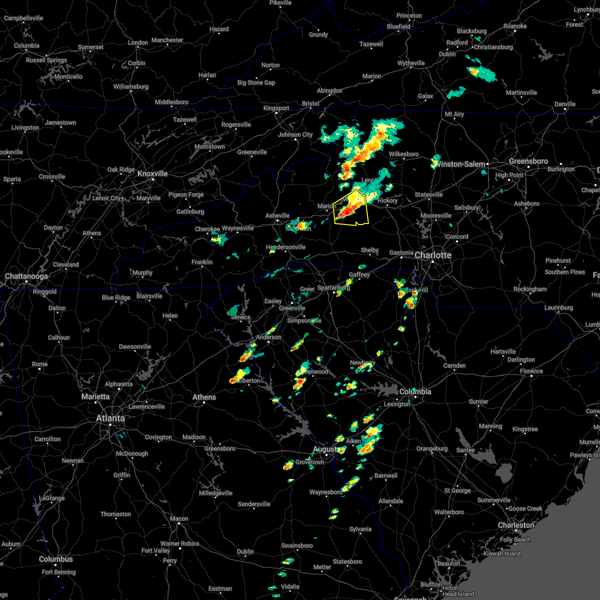 At 231 pm edt, a severe thunderstorm was located 4 miles southwest of morganton, or near glen alpine, moving east at 15 mph (radar indicated). Hazards include 60 mph wind gusts and quarter size hail. Minor hail damage to vehicles is expected. expect wind damage to trees and power lines. locations impacted include, morganton, drexel, glen alpine, lake james state park, south mountains state park, lake james, nebo, pleasant grove, oak hill and dysartsville. hail threat, observed max hail size, 1. 00 in wind threat, radar indicated max wind gust, 60 mph. At 231 pm edt, a severe thunderstorm was located 4 miles southwest of morganton, or near glen alpine, moving east at 15 mph (radar indicated). Hazards include 60 mph wind gusts and quarter size hail. Minor hail damage to vehicles is expected. expect wind damage to trees and power lines. locations impacted include, morganton, drexel, glen alpine, lake james state park, south mountains state park, lake james, nebo, pleasant grove, oak hill and dysartsville. hail threat, observed max hail size, 1. 00 in wind threat, radar indicated max wind gust, 60 mph.
|
| 5/1/2022 2:10 PM EDT | Quarter sized hail reported 8.3 miles ENE of Morganton, NC, a few reports of hail up to quarter sized along interstate 40 near the burke and mcdowell county border and along causby road in far western burke county. |
| 5/1/2022 1:57 PM EDT |
 The severe thunderstorm warning for southeastern mcdowell and southwestern burke counties will expire at 200 pm edt, the storm which prompted the warning has moved out of the area. therefore, the warning will be allowed to expire. however small hail and heavy rain are still possible with this thunderstorm. a severe thunderstorm watch remains in effect until 900 pm edt for western north carolina. The severe thunderstorm warning for southeastern mcdowell and southwestern burke counties will expire at 200 pm edt, the storm which prompted the warning has moved out of the area. therefore, the warning will be allowed to expire. however small hail and heavy rain are still possible with this thunderstorm. a severe thunderstorm watch remains in effect until 900 pm edt for western north carolina.
|
| 5/1/2022 1:56 PM EDT |
 At 155 pm edt, a severe thunderstorm was located 6 miles east of marion, or near lake james state park, moving east at 15 mph (radar indicated). Hazards include 60 mph wind gusts and quarter size hail. Minor hail damage to vehicles is expected. Expect wind damage to trees and power lines. At 155 pm edt, a severe thunderstorm was located 6 miles east of marion, or near lake james state park, moving east at 15 mph (radar indicated). Hazards include 60 mph wind gusts and quarter size hail. Minor hail damage to vehicles is expected. Expect wind damage to trees and power lines.
|
| 5/1/2022 1:22 PM EDT |
 At 121 pm edt, a severe thunderstorm was located near marion, moving east at 15 mph (radar indicated). Hazards include 60 mph wind gusts and quarter size hail. Minor hail damage to vehicles is expected. Expect wind damage to trees and power lines. At 121 pm edt, a severe thunderstorm was located near marion, moving east at 15 mph (radar indicated). Hazards include 60 mph wind gusts and quarter size hail. Minor hail damage to vehicles is expected. Expect wind damage to trees and power lines.
|
| 3/23/2022 11:09 PM EDT |
 The tornado warning for northwestern alexander, caldwell and central burke counties will expire at 1115 pm edt, the storm which prompted the warning has weakened below severe limits, and has exited the warned area. therefore, the warning will be allowed to expire. a tornado watch remains in effect until midnight edt for western and the piedmont of north carolina. The tornado warning for northwestern alexander, caldwell and central burke counties will expire at 1115 pm edt, the storm which prompted the warning has weakened below severe limits, and has exited the warned area. therefore, the warning will be allowed to expire. a tornado watch remains in effect until midnight edt for western and the piedmont of north carolina.
|
| 3/23/2022 11:04 PM EDT |
 At 1104 pm edt, a severe thunderstorm capable of producing a tornado was located 6 miles southeast of morganton, or 5 miles north of south mountains state park, moving northeast at 45 mph (radar indicated rotation). Hazards include tornado. Flying debris will be dangerous to those caught without shelter. mobile homes will be damaged or destroyed. damage to roofs, windows, and vehicles will occur. tree damage is likely. this dangerous storm will be near, drexel, connelly springs and valdese around 1110 pm edt. lenoir, lake rhodhiss, rhodhiss, granite falls and icard around 1120 pm edt. st. stephens around 1130 pm edt. lake hickory around 1140 pm edt. Other locations impacted by this dangerous thunderstorm include northlakes and pleasant grove. At 1104 pm edt, a severe thunderstorm capable of producing a tornado was located 6 miles southeast of morganton, or 5 miles north of south mountains state park, moving northeast at 45 mph (radar indicated rotation). Hazards include tornado. Flying debris will be dangerous to those caught without shelter. mobile homes will be damaged or destroyed. damage to roofs, windows, and vehicles will occur. tree damage is likely. this dangerous storm will be near, drexel, connelly springs and valdese around 1110 pm edt. lenoir, lake rhodhiss, rhodhiss, granite falls and icard around 1120 pm edt. st. stephens around 1130 pm edt. lake hickory around 1140 pm edt. Other locations impacted by this dangerous thunderstorm include northlakes and pleasant grove.
|
| 3/23/2022 10:55 PM EDT |
 The tornado warning for southeastern mcdowell, southern caldwell and central burke counties will expire at 1100 pm edt, the storm which prompted the warning has weakened below severe limits, and has exited the warned area. therefore, the warning will be allowed to expire. a tornado watch remains in effect until midnight edt for western north carolina. The tornado warning for southeastern mcdowell, southern caldwell and central burke counties will expire at 1100 pm edt, the storm which prompted the warning has weakened below severe limits, and has exited the warned area. therefore, the warning will be allowed to expire. a tornado watch remains in effect until midnight edt for western north carolina.
|
| 3/23/2022 10:36 PM EDT |
 At 1036 pm edt, a severe thunderstorm capable of producing a tornado was located over lenoir, moving northeast at 35 mph (radar indicated rotation). Hazards include tornado. Flying debris will be dangerous to those caught without shelter. mobile homes will be damaged or destroyed. damage to roofs, windows, and vehicles will occur. tree damage is likely. this dangerous storm will be near, cedar rock around 1050 pm edt. Other locations impacted by this dangerous thunderstorm include kings creek and patterson. At 1036 pm edt, a severe thunderstorm capable of producing a tornado was located over lenoir, moving northeast at 35 mph (radar indicated rotation). Hazards include tornado. Flying debris will be dangerous to those caught without shelter. mobile homes will be damaged or destroyed. damage to roofs, windows, and vehicles will occur. tree damage is likely. this dangerous storm will be near, cedar rock around 1050 pm edt. Other locations impacted by this dangerous thunderstorm include kings creek and patterson.
|
| 3/23/2022 10:30 PM EDT | 911 call center reported power lines down on lenoir r in burke county NC, 2.1 miles SSW of Morganton, NC |
| 3/23/2022 10:25 PM EDT | 911 call center reported a tree brought down powerlines on the intersection of sanford dr and tate s in burke county NC, 2.1 miles SSW of Morganton, NC |
| 3/23/2022 10:10 PM EDT |
 At 1010 pm edt, a severe thunderstorm capable of producing a tornado was located 9 miles east of marion, or 7 miles southeast of lake james state park, moving northeast at 35 mph (radar indicated rotation). Hazards include tornado. Flying debris will be dangerous to those caught without shelter. mobile homes will be damaged or destroyed. damage to roofs, windows, and vehicles will occur. tree damage is likely. this dangerous storm will be near, glen alpine and south mountains state park around 1020 pm edt. morganton around 1030 pm edt. valdese, drexel, rutherford college and connelly springs around 1040 pm edt. lenoir, cajah`s mountain, gamewell, sawmills and hudson around 1050 pm edt. Other locations impacted by this dangerous thunderstorm include collettsville, oak hill and dysartsville. At 1010 pm edt, a severe thunderstorm capable of producing a tornado was located 9 miles east of marion, or 7 miles southeast of lake james state park, moving northeast at 35 mph (radar indicated rotation). Hazards include tornado. Flying debris will be dangerous to those caught without shelter. mobile homes will be damaged or destroyed. damage to roofs, windows, and vehicles will occur. tree damage is likely. this dangerous storm will be near, glen alpine and south mountains state park around 1020 pm edt. morganton around 1030 pm edt. valdese, drexel, rutherford college and connelly springs around 1040 pm edt. lenoir, cajah`s mountain, gamewell, sawmills and hudson around 1050 pm edt. Other locations impacted by this dangerous thunderstorm include collettsville, oak hill and dysartsville.
|
| 9/8/2021 2:37 PM EDT |
 The severe thunderstorm warning for central burke county will expire at 245 pm edt, the storm which prompted the warning has weakened below severe limits, and no longer poses an immediate threat to life or property. therefore, the warning will be allowed to expire. however small hail is still possible with this thunderstorm. The severe thunderstorm warning for central burke county will expire at 245 pm edt, the storm which prompted the warning has weakened below severe limits, and no longer poses an immediate threat to life or property. therefore, the warning will be allowed to expire. however small hail is still possible with this thunderstorm.
|
| 9/8/2021 2:25 PM EDT |
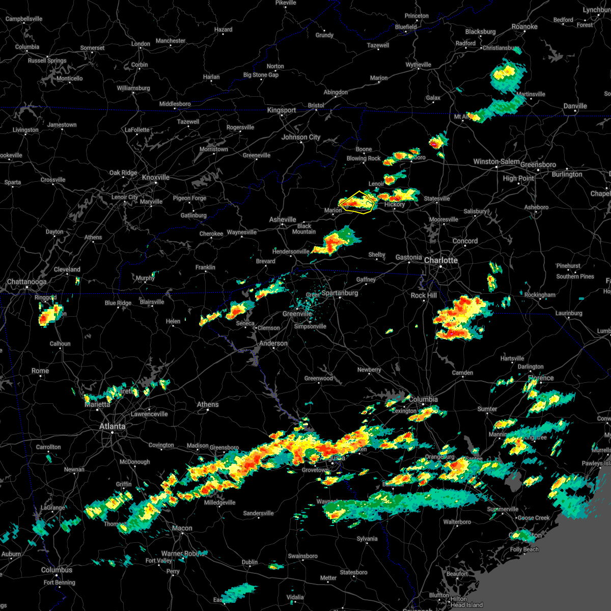 At 225 pm edt, a severe thunderstorm was located 5 miles west of morganton, or near glen alpine, moving east at 15 mph (radar indicated). Hazards include 60 mph wind gusts and quarter size hail. Minor hail damage to vehicles is expected. expect wind damage to trees and power lines. locations impacted include, morganton, drexel, glen alpine, table rock, oak hill, lake james, lake james state park and lake rhodhiss. hail threat, radar indicated max hail size, 1. 00 in wind threat, radar indicated max wind gust, 60 mph. At 225 pm edt, a severe thunderstorm was located 5 miles west of morganton, or near glen alpine, moving east at 15 mph (radar indicated). Hazards include 60 mph wind gusts and quarter size hail. Minor hail damage to vehicles is expected. expect wind damage to trees and power lines. locations impacted include, morganton, drexel, glen alpine, table rock, oak hill, lake james, lake james state park and lake rhodhiss. hail threat, radar indicated max hail size, 1. 00 in wind threat, radar indicated max wind gust, 60 mph.
|
| 9/8/2021 2:03 PM EDT |
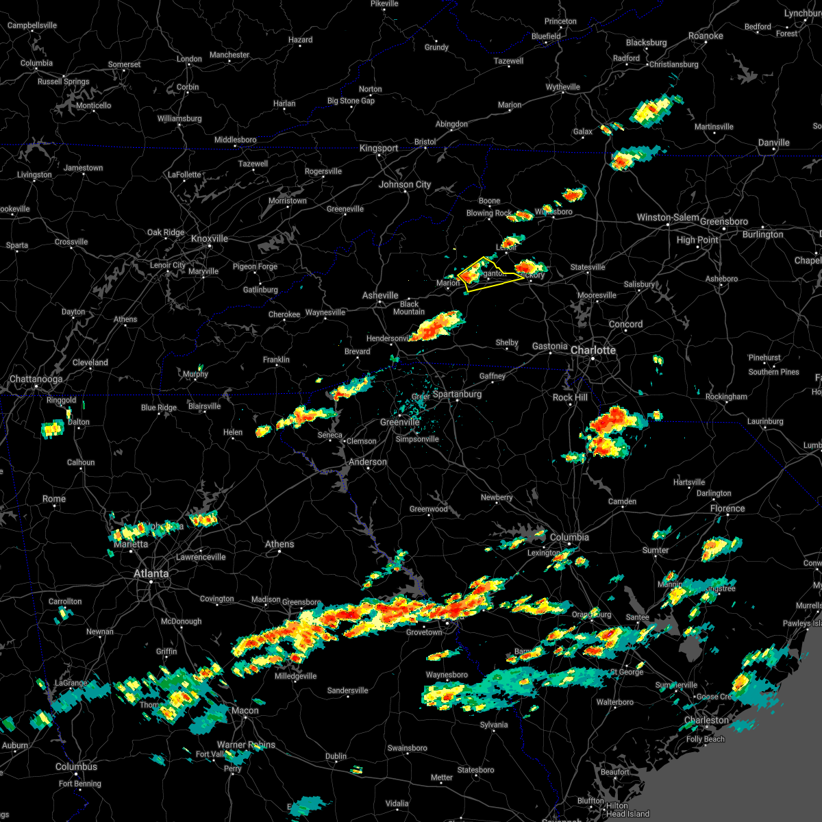 At 203 pm edt, a severe thunderstorm was located 8 miles west of morganton, or near lake james, moving east at 10 mph (radar indicated). Hazards include 60 mph wind gusts and quarter size hail. Minor hail damage to vehicles is expected. Expect wind damage to trees and power lines. At 203 pm edt, a severe thunderstorm was located 8 miles west of morganton, or near lake james, moving east at 10 mph (radar indicated). Hazards include 60 mph wind gusts and quarter size hail. Minor hail damage to vehicles is expected. Expect wind damage to trees and power lines.
|
| 8/31/2021 5:50 PM EDT | Multiple trees down near bethel park... on bethel roa in burke county NC, 2.8 miles W of Morganton, NC |
| 8/31/2021 5:45 PM EDT | 911 call center reported tree down on lytle dr in burke county NC, 4.8 miles ENE of Morganton, NC |
| 8/31/2021 5:41 PM EDT |
 At 540 pm edt, severe thunderstorms were located along a line extending from 9 miles southwest of spruce pine to 9 miles east of morganton, moving north at 50 mph (radar indicated). Hazards include 60 mph wind gusts. expect damage to trees and power lines At 540 pm edt, severe thunderstorms were located along a line extending from 9 miles southwest of spruce pine to 9 miles east of morganton, moving north at 50 mph (radar indicated). Hazards include 60 mph wind gusts. expect damage to trees and power lines
|
| 8/31/2021 5:36 PM EDT |
 At 535 pm edt, severe thunderstorms were located along a line extending from near marion to 9 miles south of morganton, moving north at 50 mph (radar indicated). Hazards include 60 mph wind gusts. Expect damage to trees and power lines. locations impacted include, morganton, marion, valdese, drexel, glen alpine, lake james state park, lake rhodhiss, table rock, south mountains state park and lake james. hail threat, radar indicated max hail size, <. 75 in wind threat, radar indicated max wind gust, 60 mph. At 535 pm edt, severe thunderstorms were located along a line extending from near marion to 9 miles south of morganton, moving north at 50 mph (radar indicated). Hazards include 60 mph wind gusts. Expect damage to trees and power lines. locations impacted include, morganton, marion, valdese, drexel, glen alpine, lake james state park, lake rhodhiss, table rock, south mountains state park and lake james. hail threat, radar indicated max hail size, <. 75 in wind threat, radar indicated max wind gust, 60 mph.
|
| 8/31/2021 5:22 PM EDT |
 At 522 pm edt, severe thunderstorms were located along a line extending from 7 miles southwest of marion to 13 miles northeast of forest city, moving north at 40 mph (radar indicated). Hazards include 60 mph wind gusts. Expect damage to trees and power lines. locations impacted include, morganton, marion, valdese, drexel, glen alpine, lake rhodhiss, lake james state park, table rock, south mountains state park and lake james. hail threat, radar indicated max hail size, <. 75 in wind threat, radar indicated max wind gust, 60 mph. At 522 pm edt, severe thunderstorms were located along a line extending from 7 miles southwest of marion to 13 miles northeast of forest city, moving north at 40 mph (radar indicated). Hazards include 60 mph wind gusts. Expect damage to trees and power lines. locations impacted include, morganton, marion, valdese, drexel, glen alpine, lake rhodhiss, lake james state park, table rock, south mountains state park and lake james. hail threat, radar indicated max hail size, <. 75 in wind threat, radar indicated max wind gust, 60 mph.
|
| 8/31/2021 5:06 PM EDT |
 At 506 pm edt, severe thunderstorms were located along a line extending from 12 miles west of rutherfordton to near forest city, moving north at 45 mph (radar indicated). Hazards include 60 mph wind gusts. expect damage to trees and power lines At 506 pm edt, severe thunderstorms were located along a line extending from 12 miles west of rutherfordton to near forest city, moving north at 45 mph (radar indicated). Hazards include 60 mph wind gusts. expect damage to trees and power lines
|
| 8/26/2021 5:20 PM EDT |
 The severe thunderstorm warning for central burke county will expire at 530 pm edt, the storm which prompted the warning has weakened below severe limits, and no longer poses an immediate threat to life or property. therefore, the warning will be allowed to expire. to report severe weather to the national weather service greenville-spartanburg, call toll free, 1, 800, 2 6 7, 8 1 0 1, or post on our facebook page, or tweet it using hashtag nwsgsp. your message should describe the event and the specific location where it occurred. The severe thunderstorm warning for central burke county will expire at 530 pm edt, the storm which prompted the warning has weakened below severe limits, and no longer poses an immediate threat to life or property. therefore, the warning will be allowed to expire. to report severe weather to the national weather service greenville-spartanburg, call toll free, 1, 800, 2 6 7, 8 1 0 1, or post on our facebook page, or tweet it using hashtag nwsgsp. your message should describe the event and the specific location where it occurred.
|
| 8/26/2021 4:44 PM EDT | Tree down on i40 at mm10 in burke county NC, 1 miles N of Morganton, NC |
| 8/26/2021 4:44 PM EDT | Several trees down in and around morganto in burke county NC, 0.7 miles SW of Morganton, NC |
| 8/26/2021 4:39 PM EDT |
 At 439 pm edt, a severe thunderstorm was located near morganton, moving north at 10 mph (radar indicated). Hazards include 60 mph wind gusts and quarter size hail. Minor hail damage to vehicles is expected. Expect wind damage to trees and power lines. At 439 pm edt, a severe thunderstorm was located near morganton, moving north at 10 mph (radar indicated). Hazards include 60 mph wind gusts and quarter size hail. Minor hail damage to vehicles is expected. Expect wind damage to trees and power lines.
|
| 8/17/2021 2:46 PM EDT |
 At 245 pm edt, a severe thunderstorm capable of producing a tornado was located 7 miles northeast of morganton, or near gamewell, moving north at 30 mph (radar indicated rotation). Hazards include tornado. Flying debris will be dangerous to those caught without shelter. mobile homes will be damaged or destroyed. damage to roofs, windows, and vehicles will occur. tree damage is likely. This tornadic thunderstorm will remain over mainly rural areas of western caldwell and north central burke counties, including the following locations, edgemont, collettsville and patterson. At 245 pm edt, a severe thunderstorm capable of producing a tornado was located 7 miles northeast of morganton, or near gamewell, moving north at 30 mph (radar indicated rotation). Hazards include tornado. Flying debris will be dangerous to those caught without shelter. mobile homes will be damaged or destroyed. damage to roofs, windows, and vehicles will occur. tree damage is likely. This tornadic thunderstorm will remain over mainly rural areas of western caldwell and north central burke counties, including the following locations, edgemont, collettsville and patterson.
|
| 8/14/2021 5:09 PM EDT |
 The severe thunderstorm warning for southwestern caldwell and central burke counties will expire at 515 pm edt, the storm which prompted the warning has weakened below severe limits, and no longer poses an immediate threat to life or property. therefore, the warning will be allowed to expire. however, gusty winds and heavy rain are still possible with this thunderstorm. The severe thunderstorm warning for southwestern caldwell and central burke counties will expire at 515 pm edt, the storm which prompted the warning has weakened below severe limits, and no longer poses an immediate threat to life or property. therefore, the warning will be allowed to expire. however, gusty winds and heavy rain are still possible with this thunderstorm.
|
| 8/14/2021 4:57 PM EDT |
 At 457 pm edt, a severe thunderstorm was located 5 miles south of lenoir, or near cajah`s mountain, and is nearly stationary (radar indicated). Hazards include 60 mph wind gusts and quarter size hail. Minor hail damage to vehicles is expected. expect wind damage to trees and power lines. locations impacted include, morganton, sawmills, valdese, gamewell, hudson, icard, cajah`s mountain, drexel, connelly springs and rutherford college. hail threat, radar indicated max hail size, 1. 00 in wind threat, radar indicated max wind gust, 60 mph. At 457 pm edt, a severe thunderstorm was located 5 miles south of lenoir, or near cajah`s mountain, and is nearly stationary (radar indicated). Hazards include 60 mph wind gusts and quarter size hail. Minor hail damage to vehicles is expected. expect wind damage to trees and power lines. locations impacted include, morganton, sawmills, valdese, gamewell, hudson, icard, cajah`s mountain, drexel, connelly springs and rutherford college. hail threat, radar indicated max hail size, 1. 00 in wind threat, radar indicated max wind gust, 60 mph.
|
| 8/14/2021 4:35 PM EDT | Broadcast media reported multiple trees and powerlines down along frank whisnant r in burke county NC, 4.3 miles SE of Morganton, NC |
| 8/14/2021 4:25 PM EDT |
 At 424 pm edt, a severe thunderstorm was located near morganton, moving east at 5 mph (radar indicated). Hazards include 60 mph wind gusts and quarter size hail. Minor hail damage to vehicles is expected. Expect wind damage to trees and power lines. At 424 pm edt, a severe thunderstorm was located near morganton, moving east at 5 mph (radar indicated). Hazards include 60 mph wind gusts and quarter size hail. Minor hail damage to vehicles is expected. Expect wind damage to trees and power lines.
|
| 8/12/2021 5:24 PM EDT | Public reported large tree limbs/branches down in table roc in burke county NC, 9.3 miles SE of Morganton, NC |
| 8/11/2021 3:38 PM EDT |
 The severe thunderstorm warning for western catawba and southeastern burke counties will expire at 345 pm edt, the storm which prompted the warning has weakened below severe limits, and no longer poses an immediate threat to life or property. therefore, the warning will be allowed to expire. however heavy rain and lightning are still possible with this thunderstorm. The severe thunderstorm warning for western catawba and southeastern burke counties will expire at 345 pm edt, the storm which prompted the warning has weakened below severe limits, and no longer poses an immediate threat to life or property. therefore, the warning will be allowed to expire. however heavy rain and lightning are still possible with this thunderstorm.
|
| 8/11/2021 3:04 PM EDT | Public reported trees down on powerlines on hillside ln causing power outag in burke county NC, 0.7 miles SW of Morganton, NC |
| 8/11/2021 3:01 PM EDT |
 At 300 pm edt, a severe thunderstorm was located near morganton, or near drexel, moving east at 10 mph (radar indicated). Hazards include 60 mph wind gusts and penny size hail. expect damage to trees and power lines At 300 pm edt, a severe thunderstorm was located near morganton, or near drexel, moving east at 10 mph (radar indicated). Hazards include 60 mph wind gusts and penny size hail. expect damage to trees and power lines
|
| 7/27/2021 7:14 PM EDT |
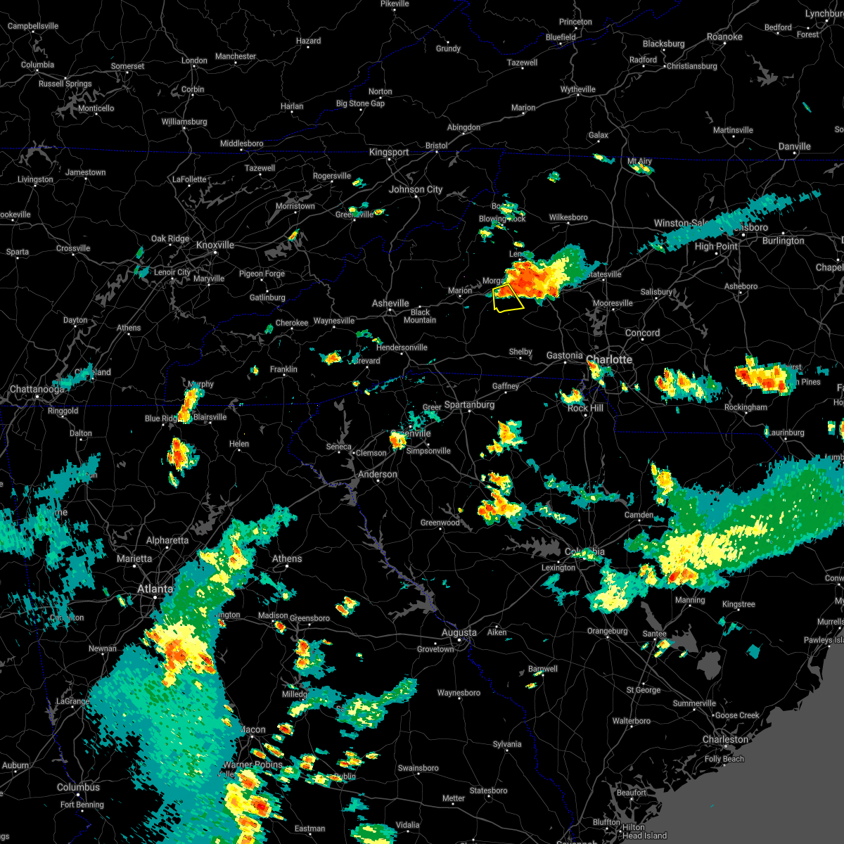 At 714 pm edt, a severe thunderstorm was located 4 miles southeast of morganton, moving south at 10 mph (radar indicated). Hazards include 60 mph wind gusts and quarter size hail. Minor hail damage to vehicles is expected. expect wind damage to trees and power lines. Locations impacted include, morganton, south mountains state park and pleasant grove. At 714 pm edt, a severe thunderstorm was located 4 miles southeast of morganton, moving south at 10 mph (radar indicated). Hazards include 60 mph wind gusts and quarter size hail. Minor hail damage to vehicles is expected. expect wind damage to trees and power lines. Locations impacted include, morganton, south mountains state park and pleasant grove.
|
| 7/27/2021 7:06 PM EDT | Tree on 3 cars. time estimated from rada in burke county NC, 1.1 miles WNW of Morganton, NC |
| 7/27/2021 7:01 PM EDT | Tree on hous in burke county NC, 2.1 miles SSW of Morganton, NC |
| 7/27/2021 7:00 PM EDT |
 At 700 pm edt, a severe thunderstorm was located near morganton, moving south at 15 mph (radar indicated). Hazards include 60 mph wind gusts and quarter size hail. Minor hail damage to vehicles is expected. Expect wind damage to trees and power lines. At 700 pm edt, a severe thunderstorm was located near morganton, moving south at 15 mph (radar indicated). Hazards include 60 mph wind gusts and quarter size hail. Minor hail damage to vehicles is expected. Expect wind damage to trees and power lines.
|
| 4/10/2021 8:30 PM EDT | Broadcast media reported numerous trees down on hwy 181 at bowman ave in burke county NC, 4.8 miles SE of Morganton, NC |
| 4/10/2021 8:15 PM EDT |
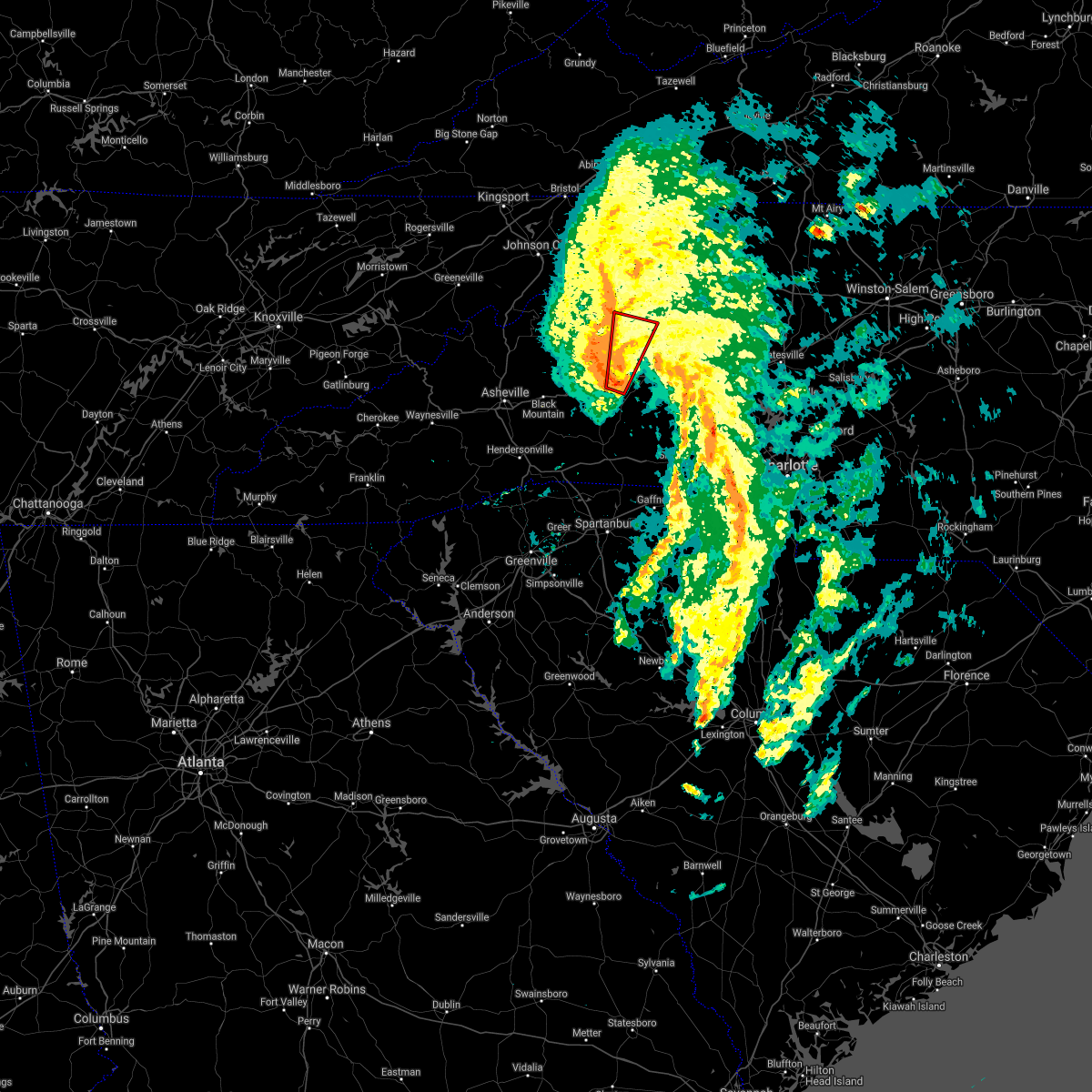 At 815 pm edt, a severe thunderstorm capable of producing a tornado was located 8 miles east of marion, or near lake james state park, moving north at 30 mph (radar indicated rotation). Hazards include tornado. Flying debris will be dangerous to those caught without shelter. mobile homes will be damaged or destroyed. damage to roofs, windows, and vehicles will occur. tree damage is likely. this dangerous storm will be near, glen alpine around 820 pm edt. table rock around 840 pm edt. b. r. parkway-linville falls to grandfather around 900 pm edt. Other locations impacted by this dangerous thunderstorm include nebo, edgemont, collettsville, oak hill and jonas ridge. At 815 pm edt, a severe thunderstorm capable of producing a tornado was located 8 miles east of marion, or near lake james state park, moving north at 30 mph (radar indicated rotation). Hazards include tornado. Flying debris will be dangerous to those caught without shelter. mobile homes will be damaged or destroyed. damage to roofs, windows, and vehicles will occur. tree damage is likely. this dangerous storm will be near, glen alpine around 820 pm edt. table rock around 840 pm edt. b. r. parkway-linville falls to grandfather around 900 pm edt. Other locations impacted by this dangerous thunderstorm include nebo, edgemont, collettsville, oak hill and jonas ridge.
|
| 4/10/2021 8:05 PM EDT | Broadcast media reported trees and power lines down on us-64 n of morganton in burke county NC, 1.5 miles SW of Morganton, NC |
| 4/10/2021 8:04 PM EDT |
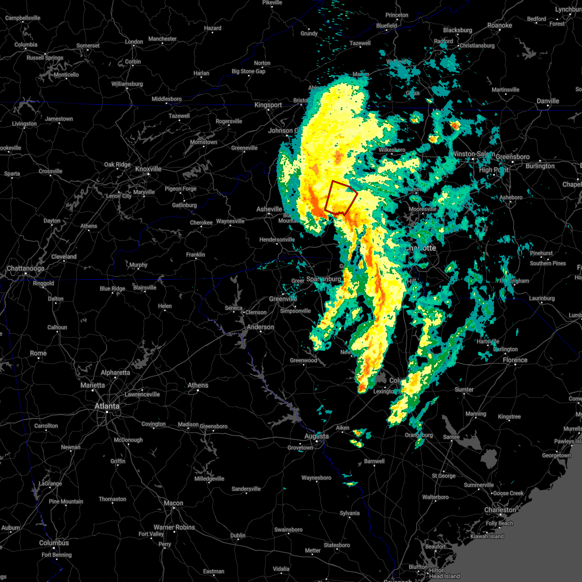 At 803 pm edt, a severe thunderstorm capable of producing a tornado was located 6 miles southwest of morganton, or 4 miles south of glen alpine, moving northeast at 40 mph (radar indicated rotation). Hazards include tornado. Flying debris will be dangerous to those caught without shelter. mobile homes will be damaged or destroyed. damage to roofs, windows, and vehicles will occur. tree damage is likely. this dangerous storm will be near, morganton around 810 pm edt. table rock and drexel around 820 pm edt. Other locations impacted by this dangerous storm include oak hill. At 803 pm edt, a severe thunderstorm capable of producing a tornado was located 6 miles southwest of morganton, or 4 miles south of glen alpine, moving northeast at 40 mph (radar indicated rotation). Hazards include tornado. Flying debris will be dangerous to those caught without shelter. mobile homes will be damaged or destroyed. damage to roofs, windows, and vehicles will occur. tree damage is likely. this dangerous storm will be near, morganton around 810 pm edt. table rock and drexel around 820 pm edt. Other locations impacted by this dangerous storm include oak hill.
|
| 4/10/2021 7:37 PM EDT |
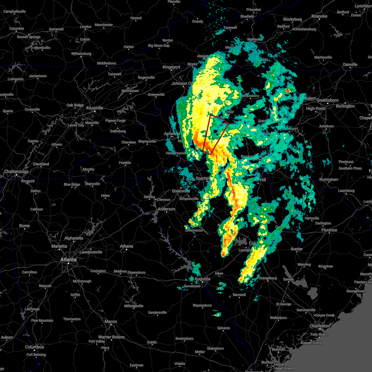 At 736 pm edt, a severe thunderstorm capable of producing a tornado was located 7 miles northeast of rutherfordton, or 7 miles north of spindale, moving north at 45 mph (radar indicated rotation). Hazards include tornado. Flying debris will be dangerous to those caught without shelter. mobile homes will be damaged or destroyed. damage to roofs, windows, and vehicles will occur. tree damage is likely. this dangerous storm will be near, morganton, glen alpine, salem, lake james state park and lake james around 800 pm edt. table rock around 810 pm edt. Other locations impacted by this dangerous thunderstorm include sunshine, oak hill, dysartsville and union mills. At 736 pm edt, a severe thunderstorm capable of producing a tornado was located 7 miles northeast of rutherfordton, or 7 miles north of spindale, moving north at 45 mph (radar indicated rotation). Hazards include tornado. Flying debris will be dangerous to those caught without shelter. mobile homes will be damaged or destroyed. damage to roofs, windows, and vehicles will occur. tree damage is likely. this dangerous storm will be near, morganton, glen alpine, salem, lake james state park and lake james around 800 pm edt. table rock around 810 pm edt. Other locations impacted by this dangerous thunderstorm include sunshine, oak hill, dysartsville and union mills.
|
| 3/27/2021 2:41 PM EDT |
 At 241 pm edt, a severe thunderstorm was located 6 miles south of taylorsville, or 4 miles northeast of bethlehem, moving east at 50 mph (radar indicated). Hazards include 60 mph wind gusts and quarter size hail. Minor hail damage to vehicles is expected. expect wind damage to trees and power lines. Locations impacted include, morganton, sawmills, granite falls, valdese, gamewell, hudson, icard, cajah`s mountain, drexel and hildebran. At 241 pm edt, a severe thunderstorm was located 6 miles south of taylorsville, or 4 miles northeast of bethlehem, moving east at 50 mph (radar indicated). Hazards include 60 mph wind gusts and quarter size hail. Minor hail damage to vehicles is expected. expect wind damage to trees and power lines. Locations impacted include, morganton, sawmills, granite falls, valdese, gamewell, hudson, icard, cajah`s mountain, drexel and hildebran.
|
| 3/27/2021 2:25 PM EDT | A few large limbs blown dow in burke county NC, 0.7 miles SW of Morganton, NC |
| 3/27/2021 1:53 PM EDT |
 At 153 pm edt, a severe thunderstorm was located 9 miles southeast of spruce pine, or 6 miles north of lake james, moving east at 40 mph (radar indicated). Hazards include 60 mph wind gusts and quarter size hail. Minor hail damage to vehicles is expected. Expect wind damage to trees and power lines. At 153 pm edt, a severe thunderstorm was located 9 miles southeast of spruce pine, or 6 miles north of lake james, moving east at 40 mph (radar indicated). Hazards include 60 mph wind gusts and quarter size hail. Minor hail damage to vehicles is expected. Expect wind damage to trees and power lines.
|
| 7/31/2020 8:54 PM EDT |
 At 853 pm edt, a severe thunderstorm was located 5 miles west of lenoir, or near gamewell, moving east at 20 mph (radar indicated). Hazards include 60 mph wind gusts and nickel size hail. Expect damage to trees and power lines. Locations impacted include, lenoir, sawmills, granite falls, valdese, gamewell, hudson, cajah`s mountain, drexel, rutherford college and rhodhiss. At 853 pm edt, a severe thunderstorm was located 5 miles west of lenoir, or near gamewell, moving east at 20 mph (radar indicated). Hazards include 60 mph wind gusts and nickel size hail. Expect damage to trees and power lines. Locations impacted include, lenoir, sawmills, granite falls, valdese, gamewell, hudson, cajah`s mountain, drexel, rutherford college and rhodhiss.
|
| 7/31/2020 8:32 PM EDT |
 At 831 pm edt, a severe thunderstorm was located 8 miles north of morganton, or near table rock, moving east at 20 mph (radar indicated). Hazards include 60 mph wind gusts and nickel size hail. expect damage to trees and power lines At 831 pm edt, a severe thunderstorm was located 8 miles north of morganton, or near table rock, moving east at 20 mph (radar indicated). Hazards include 60 mph wind gusts and nickel size hail. expect damage to trees and power lines
|
| 7/31/2020 8:10 PM EDT |
 At 810 pm edt, a severe thunderstorm was located 8 miles north of marion, or 6 miles northwest of lake james, moving northeast at 30 mph (radar indicated). Hazards include 60 mph wind gusts and penny size hail. Expect damage to trees and power lines. locations impacted include, morganton, marion, spruce pine, glen alpine, bakersville, linville falls, b. r. parkway-craggy to little switzerland, lake james state park, b. r. Parkway-little switzerland to linville and table rock. At 810 pm edt, a severe thunderstorm was located 8 miles north of marion, or 6 miles northwest of lake james, moving northeast at 30 mph (radar indicated). Hazards include 60 mph wind gusts and penny size hail. Expect damage to trees and power lines. locations impacted include, morganton, marion, spruce pine, glen alpine, bakersville, linville falls, b. r. parkway-craggy to little switzerland, lake james state park, b. r. Parkway-little switzerland to linville and table rock.
|
| 7/31/2020 7:37 PM EDT |
 At 737 pm edt, a severe thunderstorm was located 9 miles west of marion, or near old fort, moving northeast at 30 mph (radar indicated). Hazards include 60 mph wind gusts and quarter size hail. Minor hail damage to vehicles is expected. Expect wind damage to trees and power lines. At 737 pm edt, a severe thunderstorm was located 9 miles west of marion, or near old fort, moving northeast at 30 mph (radar indicated). Hazards include 60 mph wind gusts and quarter size hail. Minor hail damage to vehicles is expected. Expect wind damage to trees and power lines.
|
| 7/23/2020 2:32 PM EDT |
 At 232 pm edt, a severe thunderstorm was located 7 miles southwest of lenoir, or near gamewell, moving northeast at 10 mph (radar indicated). Hazards include 60 mph wind gusts and penny size hail. Expect damage to trees and power lines. Locations impacted include, lenoir, sawmills, granite falls, valdese, gamewell, hudson, cajah`s mountain, drexel, connelly springs and rutherford college. At 232 pm edt, a severe thunderstorm was located 7 miles southwest of lenoir, or near gamewell, moving northeast at 10 mph (radar indicated). Hazards include 60 mph wind gusts and penny size hail. Expect damage to trees and power lines. Locations impacted include, lenoir, sawmills, granite falls, valdese, gamewell, hudson, cajah`s mountain, drexel, connelly springs and rutherford college.
|
| 7/23/2020 2:28 PM EDT | 911 call center reported trees down on smokey creek roa in burke county NC, 6.3 miles SW of Morganton, NC |
| 7/23/2020 2:13 PM EDT |
 At 213 pm edt, a severe thunderstorm was located 5 miles northeast of morganton, or near drexel, moving northeast at 10 mph (radar indicated). Hazards include 60 mph wind gusts and penny size hail. expect damage to trees and power lines At 213 pm edt, a severe thunderstorm was located 5 miles northeast of morganton, or near drexel, moving northeast at 10 mph (radar indicated). Hazards include 60 mph wind gusts and penny size hail. expect damage to trees and power lines
|
| 7/22/2020 3:01 PM EDT |
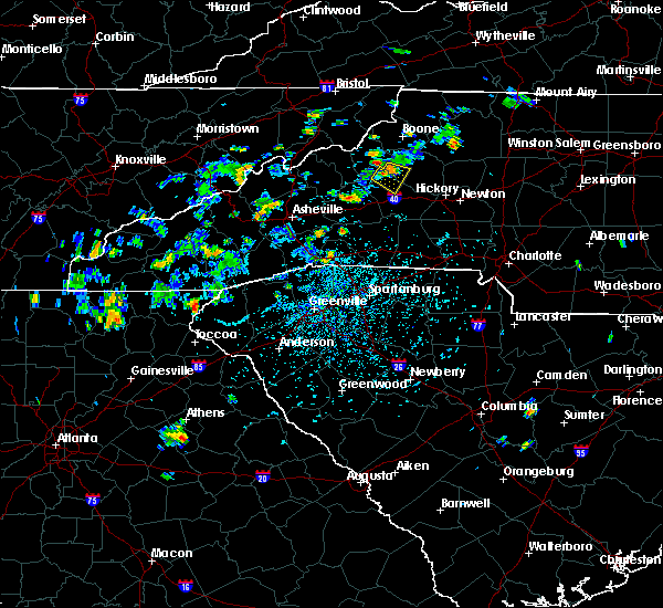 At 301 pm edt, a severe thunderstorm was located 12 miles northwest of morganton, or 5 miles north of table rock, moving southeast at 10 mph (radar indicated). Hazards include 60 mph wind gusts and quarter size hail. Minor hail damage to vehicles is expected. expect wind damage to trees and power lines. Locations impacted include, table rock, edgemont, collettsville and oak hill. At 301 pm edt, a severe thunderstorm was located 12 miles northwest of morganton, or 5 miles north of table rock, moving southeast at 10 mph (radar indicated). Hazards include 60 mph wind gusts and quarter size hail. Minor hail damage to vehicles is expected. expect wind damage to trees and power lines. Locations impacted include, table rock, edgemont, collettsville and oak hill.
|
| 7/22/2020 2:45 PM EDT |
 At 245 pm edt, a severe thunderstorm was located 12 miles southeast of newland, or 6 miles north of table rock, moving southeast at 5 mph (radar indicated). Hazards include 60 mph wind gusts and quarter size hail. Minor hail damage to vehicles is expected. Expect wind damage to trees and power lines. At 245 pm edt, a severe thunderstorm was located 12 miles southeast of newland, or 6 miles north of table rock, moving southeast at 5 mph (radar indicated). Hazards include 60 mph wind gusts and quarter size hail. Minor hail damage to vehicles is expected. Expect wind damage to trees and power lines.
|
| 7/21/2020 5:18 PM EDT |
 At 456 pm edt, a severe thunderstorm was located near morganton, or near drexel, moving east at 15 mph (radar indicated). Hazards include 60 mph wind gusts and quarter size hail. Minor hail damage to vehicles is expected. Expect wind damage to trees and power lines. At 456 pm edt, a severe thunderstorm was located near morganton, or near drexel, moving east at 15 mph (radar indicated). Hazards include 60 mph wind gusts and quarter size hail. Minor hail damage to vehicles is expected. Expect wind damage to trees and power lines.
|
| 7/21/2020 5:15 PM EDT | Quarter sized hail reported 4 miles WSW of Morganton, NC, trained spotter reported quarter (1.00") size hail on e t camp rd |
| 7/21/2020 5:15 PM EDT | Quarter sized hail reported 4.6 miles S of Morganton, NC, trained spotter reported quarter (1.00") size hail on piedmont rd |
| 7/21/2020 5:00 PM EDT | Quarter sized hail reported 5.1 miles SSW of Morganton, NC, trained spotter reported quarter (1.00") size hail on johns river loop |
| 7/21/2020 5:00 PM EDT | Trained spotter reported trees down along nc-18 & us-64 in chesterfield nc us in burke county NC, 5.9 miles SSW of Morganton, NC |
| 7/21/2020 4:56 PM EDT |
 At 456 pm edt, a severe thunderstorm was located near morganton, or near drexel, moving east at 15 mph (radar indicated). Hazards include 60 mph wind gusts and quarter size hail. Minor hail damage to vehicles is expected. Expect wind damage to trees and power lines. At 456 pm edt, a severe thunderstorm was located near morganton, or near drexel, moving east at 15 mph (radar indicated). Hazards include 60 mph wind gusts and quarter size hail. Minor hail damage to vehicles is expected. Expect wind damage to trees and power lines.
|
| 7/18/2020 2:31 PM EDT |
 At 231 pm edt, a severe thunderstorm was located 6 miles southeast of marion, or 6 miles south of lake james state park, moving southeast at 15 mph (radar indicated). Hazards include 60 mph wind gusts and penny size hail. Expect damage to trees and power lines. Locations impacted include, glen alpine, lake james state park, lake james, nebo and marion. At 231 pm edt, a severe thunderstorm was located 6 miles southeast of marion, or 6 miles south of lake james state park, moving southeast at 15 mph (radar indicated). Hazards include 60 mph wind gusts and penny size hail. Expect damage to trees and power lines. Locations impacted include, glen alpine, lake james state park, lake james, nebo and marion.
|
| 7/18/2020 2:27 PM EDT | Multiple trees blown down off dysartsville rd... sw of glen alpin in burke county NC, 8.3 miles ENE of Morganton, NC |
| 7/18/2020 2:05 PM EDT |
 At 204 pm edt, a severe thunderstorm was located 8 miles southeast of spruce pine, or 6 miles northwest of lake james, moving southeast at 5 mph (radar indicated). Hazards include 60 mph wind gusts and penny size hail. expect damage to trees and power lines At 204 pm edt, a severe thunderstorm was located 8 miles southeast of spruce pine, or 6 miles northwest of lake james, moving southeast at 5 mph (radar indicated). Hazards include 60 mph wind gusts and penny size hail. expect damage to trees and power lines
|
| 7/10/2020 6:12 PM EDT |
 The severe thunderstorm warning for southeastern burke county will expire at 615 pm edt, the storm which prompted the warning has weakened below severe limits, and no longer poses an immediate threat to life or property. therefore the warning will be allowed to expire. however small hail, gusty winds and heavy rain are still possible with this thunderstorm. The severe thunderstorm warning for southeastern burke county will expire at 615 pm edt, the storm which prompted the warning has weakened below severe limits, and no longer poses an immediate threat to life or property. therefore the warning will be allowed to expire. however small hail, gusty winds and heavy rain are still possible with this thunderstorm.
|
| 7/10/2020 6:05 PM EDT | Law enforcement reported trees and powerlines down near intersection of piedmont rd and belvidere ln in burke county NC, 4.6 miles S of Morganton, NC |
| 7/10/2020 6:05 PM EDT | At least two trees down in the chesterfield community. time estimated from rada in burke county NC, 5.9 miles SSW of Morganton, NC |
| 7/10/2020 6:01 PM EDT | Broadcast media reported one tree down near intersection of valley view st and hwy 18 in burke county NC, 3.4 miles SSW of Morganton, NC |
| 7/10/2020 6:01 PM EDT | Quarter sized hail reported 3.4 miles SSW of Morganton, NC, broadcast media reported quarter (1.00") size hail |
| 7/10/2020 5:59 PM EDT |
 A severe thunderstorm warning remains in effect until 615 pm edt for southeastern burke county. at 559 pm edt, a severe thunderstorm was located near morganton, moving southeast at 10 mph. hazard. 60 mph wind gusts and quarter size hail. source. Radar indicated. A severe thunderstorm warning remains in effect until 615 pm edt for southeastern burke county. at 559 pm edt, a severe thunderstorm was located near morganton, moving southeast at 10 mph. hazard. 60 mph wind gusts and quarter size hail. source. Radar indicated.
|
| 7/10/2020 5:47 PM EDT |
 At 546 pm edt, a severe thunderstorm was located near morganton, moving southeast at 10 mph (radar indicated). Hazards include 60 mph wind gusts and quarter size hail. Minor hail damage to vehicles is expected. Expect wind damage to trees and power lines. At 546 pm edt, a severe thunderstorm was located near morganton, moving southeast at 10 mph (radar indicated). Hazards include 60 mph wind gusts and quarter size hail. Minor hail damage to vehicles is expected. Expect wind damage to trees and power lines.
|
| 7/10/2020 4:01 PM EDT | Broadcast media reported one tree down near intersection of valley view st and hwy 18 in burke county NC, 3.4 miles SSW of Morganton, NC |
| 6/21/2020 8:55 PM EDT |
 At 855 pm edt, severe thunderstorms were located along a line extending from 7 miles southeast of spruce pine to 5 miles southwest of morganton, moving northeast at 15 mph (radar indicated). Hazards include 60 mph wind gusts and quarter size hail. Minor hail damage to vehicles is expected. expect wind damage to trees and power lines. Locations impacted include, lenoir, morganton, sawmills, granite falls, valdese, gamewell, hudson, cajah`s mountain, drexel and connelly springs. At 855 pm edt, severe thunderstorms were located along a line extending from 7 miles southeast of spruce pine to 5 miles southwest of morganton, moving northeast at 15 mph (radar indicated). Hazards include 60 mph wind gusts and quarter size hail. Minor hail damage to vehicles is expected. expect wind damage to trees and power lines. Locations impacted include, lenoir, morganton, sawmills, granite falls, valdese, gamewell, hudson, cajah`s mountain, drexel and connelly springs.
|
| 6/21/2020 8:25 PM EDT |
 At 825 pm edt, severe thunderstorms were located along a line extending from 4 miles north of marion to 10 miles southwest of morganton, moving northeast at 30 mph (radar indicated). Hazards include 60 mph wind gusts and quarter size hail. Minor hail damage to vehicles is expected. Expect wind damage to trees and power lines. At 825 pm edt, severe thunderstorms were located along a line extending from 4 miles north of marion to 10 miles southwest of morganton, moving northeast at 30 mph (radar indicated). Hazards include 60 mph wind gusts and quarter size hail. Minor hail damage to vehicles is expected. Expect wind damage to trees and power lines.
|
| 4/25/2020 9:36 PM EDT |
 At 936 pm edt, a severe thunderstorm was located 5 miles south of lenoir, or near cajah`s mountain, moving east at 30 mph (radar indicated). Hazards include 60 mph wind gusts and quarter size hail. Minor hail damage to vehicles is expected. expect wind damage to trees and power lines. Locations impacted include, lenoir, sawmills, granite falls, gamewell, hudson, cajah`s mountain, drexel, rhodhiss, cedar rock and lake rhodhiss. At 936 pm edt, a severe thunderstorm was located 5 miles south of lenoir, or near cajah`s mountain, moving east at 30 mph (radar indicated). Hazards include 60 mph wind gusts and quarter size hail. Minor hail damage to vehicles is expected. expect wind damage to trees and power lines. Locations impacted include, lenoir, sawmills, granite falls, gamewell, hudson, cajah`s mountain, drexel, rhodhiss, cedar rock and lake rhodhiss.
|
| 4/25/2020 9:16 PM EDT |
 At 916 pm edt, a severe thunderstorm was located 5 miles northwest of morganton, or near table rock, moving east at 30 mph (radar indicated). Hazards include 60 mph wind gusts and quarter size hail. Minor hail damage to vehicles is expected. Expect wind damage to trees and power lines. At 916 pm edt, a severe thunderstorm was located 5 miles northwest of morganton, or near table rock, moving east at 30 mph (radar indicated). Hazards include 60 mph wind gusts and quarter size hail. Minor hail damage to vehicles is expected. Expect wind damage to trees and power lines.
|
| 4/25/2020 9:15 PM EDT | Quarter sized hail reported 6.6 miles SSE of Morganton, NC, broadcast media reported nickel to quarter size hail in the oak hill community. |
| 4/13/2020 3:23 AM EDT |
 At 321 am edt, heavy rain with embedded thunderstorms were located across the north carolina foothills, from 4 miles northwest of laurel springs to 8 miles southeast of forest city, moving northeast at 60 mph. additional thundrestorms will move through the area early this morning. scattered damaging wind gusts will occur with these storms (radar indicated). Hazards include 60 mph wind gusts. expect damage to trees and power lines At 321 am edt, heavy rain with embedded thunderstorms were located across the north carolina foothills, from 4 miles northwest of laurel springs to 8 miles southeast of forest city, moving northeast at 60 mph. additional thundrestorms will move through the area early this morning. scattered damaging wind gusts will occur with these storms (radar indicated). Hazards include 60 mph wind gusts. expect damage to trees and power lines
|
| 1/11/2020 8:40 PM EST | Trees and powerlines down on pax hill r in burke county NC, 6.7 miles S of Morganton, NC |
| 1/11/2020 8:22 PM EST | Trees down on mountain home church r in burke county NC, 3.7 miles WNW of Morganton, NC |
| 1/11/2020 8:22 PM EST |
 At 822 pm est, severe thunderstorms were located along a line extending from near blowing rock to 8 miles southwest of morganton to 10 miles east of columbus, moving northeast at 50 mph (radar indicated). Hazards include 60 mph wind gusts. expect damage to trees and power lines At 822 pm est, severe thunderstorms were located along a line extending from near blowing rock to 8 miles southwest of morganton to 10 miles east of columbus, moving northeast at 50 mph (radar indicated). Hazards include 60 mph wind gusts. expect damage to trees and power lines
|
| 10/31/2019 4:37 PM EDT |
 At 437 pm edt, rain showers capable of producing damaging winds were located along a line extending from 6 miles southwest of lenoir to 11 miles south of morganton, moving northeast at 45 mph (radar indicated). Hazards include 60 mph wind gusts. Expect damage to trees and power lines. locations impacted include, lenoir, sawmills, granite falls, valdese, gamewell, hudson, icard, cajah`s mountain, drexel and hildebran. A tornado watch remains in effect until 1100 pm edt for western and the piedmont of north carolina. At 437 pm edt, rain showers capable of producing damaging winds were located along a line extending from 6 miles southwest of lenoir to 11 miles south of morganton, moving northeast at 45 mph (radar indicated). Hazards include 60 mph wind gusts. Expect damage to trees and power lines. locations impacted include, lenoir, sawmills, granite falls, valdese, gamewell, hudson, icard, cajah`s mountain, drexel and hildebran. A tornado watch remains in effect until 1100 pm edt for western and the piedmont of north carolina.
|
| 10/31/2019 4:16 PM EDT | Multiple trees down in morganto in burke county NC, 0.7 miles SW of Morganton, NC |
| 10/31/2019 4:04 PM EDT |
 At 403 pm edt, rain showers capable of producing damaging winds were located along a line extending from 7 miles east of marion to 7 miles northwest of rutherfordton, moving northeast at 45 mph (radar indicated). Hazards include 60 mph wind gusts. expect damage to trees and power lines At 403 pm edt, rain showers capable of producing damaging winds were located along a line extending from 7 miles east of marion to 7 miles northwest of rutherfordton, moving northeast at 45 mph (radar indicated). Hazards include 60 mph wind gusts. expect damage to trees and power lines
|
| 10/31/2019 3:33 PM EDT |
 At 332 pm edt, rain showers capable of producing damaging winds were located along a line extending from 11 miles east of erwin to near spruce pine to 12 miles west of marion, moving northeast at 65 mph (radar indicated). Hazards include 60 mph wind gusts. expect damage to trees and power lines At 332 pm edt, rain showers capable of producing damaging winds were located along a line extending from 11 miles east of erwin to near spruce pine to 12 miles west of marion, moving northeast at 65 mph (radar indicated). Hazards include 60 mph wind gusts. expect damage to trees and power lines
|
| 9/29/2019 5:35 PM EDT |
 At 535 pm edt, a severe thunderstorm was located near morganton, and is nearly stationary (radar indicated). Hazards include 60 mph wind gusts and nickel size hail. expect damage to trees and power lines At 535 pm edt, a severe thunderstorm was located near morganton, and is nearly stationary (radar indicated). Hazards include 60 mph wind gusts and nickel size hail. expect damage to trees and power lines
|
| 9/13/2019 5:25 PM EDT | Trees down with a few across highway 181 in northern burke count in burke county NC, 15.8 miles SSE of Morganton, NC |
| 8/22/2019 2:45 PM EDT |
 At 245 pm edt, severe thunderstorms were located along a line extending from 6 miles southeast of lenoir to 15 miles south of morganton to near forest city, moving east at 15 mph (radar indicated). Hazards include 60 mph wind gusts and quarter size hail. Minor hail damage to vehicles is expected. Expect wind damage to trees and power lines. At 245 pm edt, severe thunderstorms were located along a line extending from 6 miles southeast of lenoir to 15 miles south of morganton to near forest city, moving east at 15 mph (radar indicated). Hazards include 60 mph wind gusts and quarter size hail. Minor hail damage to vehicles is expected. Expect wind damage to trees and power lines.
|
| 8/22/2019 2:34 PM EDT |
 At 233 pm edt, severe thunderstorms were located along a line extending from 4 miles northeast of morganton to 12 miles southeast of marion to 11 miles north of forest city to 9 miles northwest of rutherfordton, moving east at 15 mph (radar indicated). Hazards include 60 mph wind gusts and quarter size hail. Minor hail damage to vehicles is expected. expect wind damage to trees and power lines. Locations impacted include, morganton, marion, valdese, drexel, glen alpine, lake lure, old fort, chimney rock village, lake james state park and chimney rock state park. At 233 pm edt, severe thunderstorms were located along a line extending from 4 miles northeast of morganton to 12 miles southeast of marion to 11 miles north of forest city to 9 miles northwest of rutherfordton, moving east at 15 mph (radar indicated). Hazards include 60 mph wind gusts and quarter size hail. Minor hail damage to vehicles is expected. expect wind damage to trees and power lines. Locations impacted include, morganton, marion, valdese, drexel, glen alpine, lake lure, old fort, chimney rock village, lake james state park and chimney rock state park.
|
| 8/22/2019 2:18 PM EDT |
 At 156 pm edt, severe thunderstorms were located along a line extending from 12 miles east of spruce pine to 8 miles east of marion to 15 miles northwest of rutherfordton to near hendersonville, moving east at 10 mph (radar indicated). Hazards include 60 mph wind gusts and quarter size hail. Minor hail damage to vehicles is expected. Expect wind damage to trees and power lines. At 156 pm edt, severe thunderstorms were located along a line extending from 12 miles east of spruce pine to 8 miles east of marion to 15 miles northwest of rutherfordton to near hendersonville, moving east at 10 mph (radar indicated). Hazards include 60 mph wind gusts and quarter size hail. Minor hail damage to vehicles is expected. Expect wind damage to trees and power lines.
|
| 8/22/2019 1:56 PM EDT |
 At 156 pm edt, severe thunderstorms were located along a line extending from 12 miles east of spruce pine to 8 miles east of marion to 15 miles northwest of rutherfordton to near hendersonville, moving east at 10 mph (radar indicated). Hazards include 60 mph wind gusts and quarter size hail. Minor hail damage to vehicles is expected. Expect wind damage to trees and power lines. At 156 pm edt, severe thunderstorms were located along a line extending from 12 miles east of spruce pine to 8 miles east of marion to 15 miles northwest of rutherfordton to near hendersonville, moving east at 10 mph (radar indicated). Hazards include 60 mph wind gusts and quarter size hail. Minor hail damage to vehicles is expected. Expect wind damage to trees and power lines.
|
| 8/21/2019 3:25 PM EDT |
 At 325 pm edt, a severe thunderstorm was located 11 miles north of rutherfordton, moving northeast at 20 mph (radar indicated). Hazards include 60 mph wind gusts and quarter size hail. Minor hail damage to vehicles is expected. Expect wind damage to trees and power lines. At 325 pm edt, a severe thunderstorm was located 11 miles north of rutherfordton, moving northeast at 20 mph (radar indicated). Hazards include 60 mph wind gusts and quarter size hail. Minor hail damage to vehicles is expected. Expect wind damage to trees and power lines.
|
| 8/13/2019 3:43 PM EDT |
 A severe thunderstorm warning remains in effect until 400 pm edt for northwestern catawba. alexander. northern iredell. southeastern caldwell and east central burke counties. At 342 pm edt, severe thunderstorms were located along a line extending from 11 miles south of ronda to 4 miles southeast of morganton, moving southeast at 30 mph. A severe thunderstorm warning remains in effect until 400 pm edt for northwestern catawba. alexander. northern iredell. southeastern caldwell and east central burke counties. At 342 pm edt, severe thunderstorms were located along a line extending from 11 miles south of ronda to 4 miles southeast of morganton, moving southeast at 30 mph.
|
| 8/13/2019 3:29 PM EDT | Trained spotter reported trees down on valley view st in burke county NC, 3.4 miles SSW of Morganton, NC |
| 8/13/2019 3:29 PM EDT | Quarter sized hail reported 3.4 miles SSW of Morganton, NC, trained spotter reported quarter (1.00') size hail on valley view st |
| 8/13/2019 3:10 PM EDT |
 The national weather service in greenville-spartanburg has issued a * severe thunderstorm warning for. northwestern catawba county in the piedmont of north carolina. alexander county in the piedmont of north carolina. northern iredell county in the piedmont of north carolina. Caldwell county in western north carolina. The national weather service in greenville-spartanburg has issued a * severe thunderstorm warning for. northwestern catawba county in the piedmont of north carolina. alexander county in the piedmont of north carolina. northern iredell county in the piedmont of north carolina. Caldwell county in western north carolina.
|
| 8/7/2019 5:55 PM EDT | Trees fell along e parker rd and bethel rd including one on a vehicl in burke county NC, 3.3 miles W of Morganton, NC |
| 7/20/2019 1:15 PM EDT | Trained spotter reported trees down on la foret d in burke county NC, 2.6 miles ESE of Morganton, NC |
| 7/20/2019 1:15 PM EDT | Tree down on normandy dr in morganto in burke county NC, 1.8 miles ESE of Morganton, NC |
| 7/20/2019 1:15 PM EDT | Numerous trees down on jamestown rd in burke county NC, 5.1 miles ENE of Morganton, NC |
| 7/20/2019 1:15 PM EDT | The wind damage in this area was due to a microburst spreading out from the jamestown flea market where the roof was blown off. tree damage was extensive around the fle in burke county NC, 2 miles ENE of Morganton, NC |
| 7/11/2019 4:14 PM EDT |
 At 400 pm edt, a severe thunderstorm was located 10 miles north of rutherfordton, moving northeast at 15 mph (radar indicated). Hazards include 60 mph wind gusts and quarter size hail. Minor hail damage to vehicles is expected. Expect wind damage to trees and power lines. At 400 pm edt, a severe thunderstorm was located 10 miles north of rutherfordton, moving northeast at 15 mph (radar indicated). Hazards include 60 mph wind gusts and quarter size hail. Minor hail damage to vehicles is expected. Expect wind damage to trees and power lines.
|
| 7/11/2019 4:00 PM EDT |
 At 400 pm edt, a severe thunderstorm was located 10 miles north of rutherfordton, moving northeast at 15 mph (radar indicated). Hazards include 60 mph wind gusts and quarter size hail. Minor hail damage to vehicles is expected. Expect wind damage to trees and power lines. At 400 pm edt, a severe thunderstorm was located 10 miles north of rutherfordton, moving northeast at 15 mph (radar indicated). Hazards include 60 mph wind gusts and quarter size hail. Minor hail damage to vehicles is expected. Expect wind damage to trees and power lines.
|
| 7/11/2019 3:34 PM EDT |
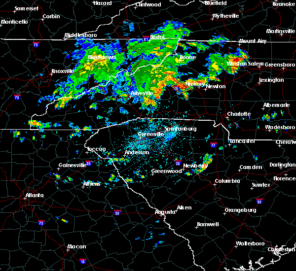 At 334 pm edt, a severe thunderstorm was located 5 miles east of morganton, or over drexel, moving northeast at 15 mph (radar indicated). Hazards include 60 mph wind gusts and quarter size hail. Minor hail damage to vehicles is expected. expect wind damage to trees and power lines. Locations impacted include, morganton, valdese, drexel, rutherford college, connelly springs, oak hill, icard and lake rhodhiss. At 334 pm edt, a severe thunderstorm was located 5 miles east of morganton, or over drexel, moving northeast at 15 mph (radar indicated). Hazards include 60 mph wind gusts and quarter size hail. Minor hail damage to vehicles is expected. expect wind damage to trees and power lines. Locations impacted include, morganton, valdese, drexel, rutherford college, connelly springs, oak hill, icard and lake rhodhiss.
|
| 7/11/2019 3:25 PM EDT | Back window was blown out of a garage at a home in morganto in burke county NC, 0.7 miles SW of Morganton, NC |
| 7/11/2019 3:19 PM EDT |
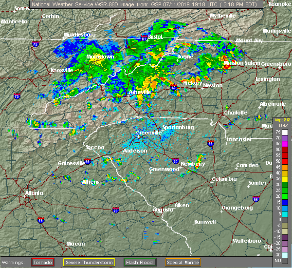 At 319 pm edt, a severe thunderstorm was located near morganton, moving northeast at 15 mph (radar indicated). Hazards include 60 mph wind gusts and quarter size hail. Minor hail damage to vehicles is expected. Expect wind damage to trees and power lines. At 319 pm edt, a severe thunderstorm was located near morganton, moving northeast at 15 mph (radar indicated). Hazards include 60 mph wind gusts and quarter size hail. Minor hail damage to vehicles is expected. Expect wind damage to trees and power lines.
|
| 7/11/2019 3:02 PM EDT | A tree blown down near the intersection of pitts st and old lumber yard r in burke county NC, 2.9 miles E of Morganton, NC |
| 7/8/2019 4:39 PM EDT |
 The severe thunderstorm warning for central caldwell and central burke counties will expire at 445 pm edt, the storm which prompted the warning has weakened below severe limits, and no longer poses an immediate threat to life or property. therefore, the warning will be allowed to expire on schedule at 445 pm. however, gusty winds and heavy rain are still possible with this thunderstorm. The severe thunderstorm warning for central caldwell and central burke counties will expire at 445 pm edt, the storm which prompted the warning has weakened below severe limits, and no longer poses an immediate threat to life or property. therefore, the warning will be allowed to expire on schedule at 445 pm. however, gusty winds and heavy rain are still possible with this thunderstorm.
|
| 7/8/2019 4:23 PM EDT |
 At 421 pm edt, a severe thunderstorm was located near lenoir, moving southeast at 15 mph (radar indicated). Hazards include 60 mph wind gusts and quarter size hail. Minor hail damage to vehicles is expected. expect wind damage to trees and power lines. this storm has a history of recently blowing down trees and power lines. Locations impacted include, lenoir, gamewell, hudson, cajah`s mountain, cedar rock, collettsville, patterson, drexel, sawmills and lake rhodhiss. At 421 pm edt, a severe thunderstorm was located near lenoir, moving southeast at 15 mph (radar indicated). Hazards include 60 mph wind gusts and quarter size hail. Minor hail damage to vehicles is expected. expect wind damage to trees and power lines. this storm has a history of recently blowing down trees and power lines. Locations impacted include, lenoir, gamewell, hudson, cajah`s mountain, cedar rock, collettsville, patterson, drexel, sawmills and lake rhodhiss.
|
| 7/8/2019 4:05 PM EDT |
 At 405 pm edt, a severe thunderstorm was located 6 miles northwest of lenoir, moving southeast at 10 mph (radar indicated). Hazards include 60 mph wind gusts and quarter size hail. Minor hail damage to vehicles is expected. Expect wind damage to trees and power lines. At 405 pm edt, a severe thunderstorm was located 6 miles northwest of lenoir, moving southeast at 10 mph (radar indicated). Hazards include 60 mph wind gusts and quarter size hail. Minor hail damage to vehicles is expected. Expect wind damage to trees and power lines.
|
| 5/4/2019 3:54 PM EDT |
 At 354 pm edt, a severe thunderstorm was located 8 miles south of morganton, or near south mountains state park, moving east at 20 mph (radar indicated). Hazards include 60 mph wind gusts and half dollar size hail. Minor hail damage to vehicles is expected. Expect wind damage to trees and power lines. At 354 pm edt, a severe thunderstorm was located 8 miles south of morganton, or near south mountains state park, moving east at 20 mph (radar indicated). Hazards include 60 mph wind gusts and half dollar size hail. Minor hail damage to vehicles is expected. Expect wind damage to trees and power lines.
|
| 4/19/2019 10:07 AM EDT |
 At 1007 am edt, a severe thunderstorm was located 8 miles northwest of rutherfordton, moving northeast at 40 mph (radar indicated). Hazards include 60 mph wind gusts. expect damage to trees and power lines At 1007 am edt, a severe thunderstorm was located 8 miles northwest of rutherfordton, moving northeast at 40 mph (radar indicated). Hazards include 60 mph wind gusts. expect damage to trees and power lines
|
| 4/14/2019 10:30 PM EDT | 911 call center reported trees down near the intersection of watershed rd and enola rd. time estimated from rada in burke county NC, 6.1 miles NNW of Morganton, NC |
| 4/14/2019 10:21 PM EDT |
 At 1021 pm edt, a severe thunderstorm was located 8 miles south of morganton, or over south mountains state park, moving northeast at 55 mph (radar indicated). Hazards include 70 mph wind gusts. Expect considerable tree damage. Damage is likely to mobile homes, roofs, and outbuildings. At 1021 pm edt, a severe thunderstorm was located 8 miles south of morganton, or over south mountains state park, moving northeast at 55 mph (radar indicated). Hazards include 70 mph wind gusts. Expect considerable tree damage. Damage is likely to mobile homes, roofs, and outbuildings.
|
| 4/14/2019 4:05 PM EDT |
 The severe thunderstorm warning for eastern mcdowell, northeastern rutherford, southwestern caldwell, northwestern cleveland and burke counties will expire at 415 pm edt, the storm which prompted the warning has moved out of the area. therefore the warning will be allowed to expire. however gusty winds are still possible with this thunderstorm. a tornado watch remains in effect until 800 pm edt for western and the piedmont of north carolina. The severe thunderstorm warning for eastern mcdowell, northeastern rutherford, southwestern caldwell, northwestern cleveland and burke counties will expire at 415 pm edt, the storm which prompted the warning has moved out of the area. therefore the warning will be allowed to expire. however gusty winds are still possible with this thunderstorm. a tornado watch remains in effect until 800 pm edt for western and the piedmont of north carolina.
|
| 4/14/2019 4:00 PM EDT | Trees and powerlines down along antioch roa in burke county NC, 7.7 miles SSW of Morganton, NC |
| 4/14/2019 3:58 PM EDT | Trees and powerlines down along west fleming drive at morganton heights shopping cente in burke county NC, 0.6 miles WNW of Morganton, NC |
| 4/14/2019 3:57 PM EDT | 911 call center reported numerous trees and powerlines down countywide. exact locations unavailable at this tim in burke county NC, 1.5 miles SW of Morganton, NC |
| 4/14/2019 3:55 PM EDT | County reports a large group of trees and power lines and poles down along king street in downtown morganto in burke county NC, 1.1 miles WSW of Morganton, NC |
| 4/14/2019 3:52 PM EDT |
 At 352 pm edt, a severe thunderstorm was located 6 miles north of morganton, or 5 miles east of table rock, moving northeast at 50 mph (radar indicated). Hazards include 60 mph wind gusts. Expect damage to trees and power lines. locations impacted include, morganton, drexel, glen alpine, table rock, south mountains state park, collettsville, pleasant grove, oak hill, dysartsville and sunshine. A tornado watch remains in effect until 800 pm edt for western and the piedmont of north carolina. At 352 pm edt, a severe thunderstorm was located 6 miles north of morganton, or 5 miles east of table rock, moving northeast at 50 mph (radar indicated). Hazards include 60 mph wind gusts. Expect damage to trees and power lines. locations impacted include, morganton, drexel, glen alpine, table rock, south mountains state park, collettsville, pleasant grove, oak hill, dysartsville and sunshine. A tornado watch remains in effect until 800 pm edt for western and the piedmont of north carolina.
|
| 4/14/2019 3:50 PM EDT | 911 call center reported multiple trees and powerlines down on river meadows ln at the intersection of river rd. time estimated from rada in burke county NC, 8 miles NW of Morganton, NC |
| 4/14/2019 3:49 PM EDT |
 At 349 pm edt, a severe thunderstorm capable of producing a tornado was located 4 miles south of morganton, or 4 miles southeast of glen alpine, moving northeast at 50 mph (radar indicated rotation). Hazards include tornado. Flying debris will be dangerous to those caught without shelter. mobile homes will be damaged or destroyed. damage to roofs, windows, and vehicles will occur. tree damage is likely. this dangerous storm will be near, glen alpine around 350 pm edt. morganton, drexel, valdese, rutherford college and connelly springs around 400 pm edt. Other locations impacted by this dangerous storm include oak hill. At 349 pm edt, a severe thunderstorm capable of producing a tornado was located 4 miles south of morganton, or 4 miles southeast of glen alpine, moving northeast at 50 mph (radar indicated rotation). Hazards include tornado. Flying debris will be dangerous to those caught without shelter. mobile homes will be damaged or destroyed. damage to roofs, windows, and vehicles will occur. tree damage is likely. this dangerous storm will be near, glen alpine around 350 pm edt. morganton, drexel, valdese, rutherford college and connelly springs around 400 pm edt. Other locations impacted by this dangerous storm include oak hill.
|
| 4/14/2019 3:33 PM EDT |
 At 333 pm edt, a severe thunderstorm capable of producing a tornado was located 11 miles northeast of rutherfordton, or 10 miles north of bostic, moving northeast at 45 mph (radar indicated rotation). Hazards include tornado. Flying debris will be dangerous to those caught without shelter. mobile homes will be damaged or destroyed. damage to roofs, windows, and vehicles will occur. tree damage is likely. this dangerous storm will be near, salem, south mountains state park and glen alpine around 350 pm edt. morganton, drexel, valdese, rutherford college and connelly springs around 400 pm edt. Other locations impacted by this dangerous thunderstorm include sunshine, thermal city, oak hill, dysartsville and union mills. At 333 pm edt, a severe thunderstorm capable of producing a tornado was located 11 miles northeast of rutherfordton, or 10 miles north of bostic, moving northeast at 45 mph (radar indicated rotation). Hazards include tornado. Flying debris will be dangerous to those caught without shelter. mobile homes will be damaged or destroyed. damage to roofs, windows, and vehicles will occur. tree damage is likely. this dangerous storm will be near, salem, south mountains state park and glen alpine around 350 pm edt. morganton, drexel, valdese, rutherford college and connelly springs around 400 pm edt. Other locations impacted by this dangerous thunderstorm include sunshine, thermal city, oak hill, dysartsville and union mills.
|
| 4/14/2019 3:31 PM EDT |
 At 331 pm edt, a severe thunderstorm was located 8 miles southeast of marion, moving northeast at 45 mph (radar indicated). Hazards include 60 mph wind gusts. expect damage to trees and power lines At 331 pm edt, a severe thunderstorm was located 8 miles southeast of marion, moving northeast at 45 mph (radar indicated). Hazards include 60 mph wind gusts. expect damage to trees and power lines
|
| 4/13/2019 3:23 PM EDT |
 At 322 pm edt, a severe thunderstorm capable of producing a tornado was located 5 miles east of morganton, or over drexel, moving east at 20 mph (weather spotters reported a funnel cloud east of morganton). Hazards include tornado and quarter size hail. Flying debris will be dangerous to those caught without shelter. mobile homes will be damaged or destroyed. damage to roofs, windows, and vehicles will occur. tree damage is likely. this dangerous storm will be near, valdese and rutherford college around 330 pm edt. Connelly springs, lake rhodhiss, icard and sawmills around 340 pm edt. At 322 pm edt, a severe thunderstorm capable of producing a tornado was located 5 miles east of morganton, or over drexel, moving east at 20 mph (weather spotters reported a funnel cloud east of morganton). Hazards include tornado and quarter size hail. Flying debris will be dangerous to those caught without shelter. mobile homes will be damaged or destroyed. damage to roofs, windows, and vehicles will occur. tree damage is likely. this dangerous storm will be near, valdese and rutherford college around 330 pm edt. Connelly springs, lake rhodhiss, icard and sawmills around 340 pm edt.
|
| 4/13/2019 3:20 PM EDT | 911 call center reported trees down on 487 mountain view dr. time estimated from rada in burke county NC, 5.1 miles WSW of Morganton, NC |
| 4/13/2019 3:15 PM EDT | Half Dollar sized hail reported 3.4 miles SSW of Morganton, NC, mping user reported half dollar size hail |
| 4/13/2019 3:09 PM EDT |
 At 309 pm edt, a severe thunderstorm capable of producing a tornado was located over morganton, moving east at 25 mph (radar indicated rotation). Hazards include tornado and half dollar size hail. Flying debris will be dangerous to those caught without shelter. mobile homes will be damaged or destroyed. damage to roofs, windows, and vehicles will occur. tree damage is likely. this dangerous storm will be near, drexel around 320 pm edt. valdese and rutherford college around 330 pm edt. Connelly springs, icard, lake rhodhiss and sawmills around 340 pm edt. At 309 pm edt, a severe thunderstorm capable of producing a tornado was located over morganton, moving east at 25 mph (radar indicated rotation). Hazards include tornado and half dollar size hail. Flying debris will be dangerous to those caught without shelter. mobile homes will be damaged or destroyed. damage to roofs, windows, and vehicles will occur. tree damage is likely. this dangerous storm will be near, drexel around 320 pm edt. valdese and rutherford college around 330 pm edt. Connelly springs, icard, lake rhodhiss and sawmills around 340 pm edt.
|
| 4/13/2019 3:08 PM EDT | Half Dollar sized hail reported 1.9 miles SSW of Morganton, NC, half dollar-sized hail reported just north of morganton...nc. |
| 4/13/2019 3:05 PM EDT | 911 call center reported trees down at 1377 nc-126 in morganton. time estimated from rada in burke county NC, 3.4 miles ESE of Morganton, NC |
| 4/13/2019 3:02 PM EDT |
 At 302 pm edt, a severe thunderstorm was located near morganton, moving east at 25 mph (radar indicated). Hazards include 70 mph wind gusts and ping pong ball size hail. People and animals outdoors will be injured. expect hail damage to roofs, siding, windows, and vehicles. expect considerable tree damage. wind damage is also likely to mobile homes, roofs, and outbuildings. Locations impacted include, morganton, valdese, gamewell, cajah`s mountain, drexel, connelly springs, rutherford college, glen alpine, lake rhodhiss and oak hill. At 302 pm edt, a severe thunderstorm was located near morganton, moving east at 25 mph (radar indicated). Hazards include 70 mph wind gusts and ping pong ball size hail. People and animals outdoors will be injured. expect hail damage to roofs, siding, windows, and vehicles. expect considerable tree damage. wind damage is also likely to mobile homes, roofs, and outbuildings. Locations impacted include, morganton, valdese, gamewell, cajah`s mountain, drexel, connelly springs, rutherford college, glen alpine, lake rhodhiss and oak hill.
|
| 4/13/2019 2:58 PM EDT | Quarter sized hail reported 3.8 miles SE of Morganton, NC, quarter-sized hail reported in oak hill... nc. |
| 4/13/2019 2:53 PM EDT |
 At 253 pm edt, a severe thunderstorm was located 5 miles west of morganton, or near glen alpine, moving east at 25 mph (radar indicated). Hazards include 70 mph wind gusts and ping pong ball size hail. People and animals outdoors will be injured. expect hail damage to roofs, siding, windows, and vehicles. expect considerable tree damage. wind damage is also likely to mobile homes, roofs, and outbuildings. Locations impacted include, morganton, valdese, gamewell, icard, cajah`s mountain, drexel, connelly springs, rutherford college, glen alpine and lake rhodhiss. At 253 pm edt, a severe thunderstorm was located 5 miles west of morganton, or near glen alpine, moving east at 25 mph (radar indicated). Hazards include 70 mph wind gusts and ping pong ball size hail. People and animals outdoors will be injured. expect hail damage to roofs, siding, windows, and vehicles. expect considerable tree damage. wind damage is also likely to mobile homes, roofs, and outbuildings. Locations impacted include, morganton, valdese, gamewell, icard, cajah`s mountain, drexel, connelly springs, rutherford college, glen alpine and lake rhodhiss.
|
| 4/13/2019 2:43 PM EDT |
 At 243 pm edt, a severe thunderstorm was located 8 miles west of morganton, or near lake james state park, moving east at 25 mph (radar indicated). Hazards include 60 mph wind gusts and quarter size hail. Minor hail damage to vehicles is expected. Expect wind damage to trees and power lines. At 243 pm edt, a severe thunderstorm was located 8 miles west of morganton, or near lake james state park, moving east at 25 mph (radar indicated). Hazards include 60 mph wind gusts and quarter size hail. Minor hail damage to vehicles is expected. Expect wind damage to trees and power lines.
|
| 9/27/2018 8:18 PM EDT |
 At 816 pm edt, severe thunderstorms were located along a line extending from near rutherfordton to 5 miles southeast of forest city and across cherokee county south carolina, moving northeast at 50 mph (law enforcement has reported damage along this line of thunderstorms). Hazards include 60 mph wind gusts and penny size hail. Expect damage to trees and power lines. Locations impacted include, gastonia, shelby, lincolnton, forest city, rutherfordton, kings mountain, cherryville, bessemer city, south gastonia and longview. At 816 pm edt, severe thunderstorms were located along a line extending from near rutherfordton to 5 miles southeast of forest city and across cherokee county south carolina, moving northeast at 50 mph (law enforcement has reported damage along this line of thunderstorms). Hazards include 60 mph wind gusts and penny size hail. Expect damage to trees and power lines. Locations impacted include, gastonia, shelby, lincolnton, forest city, rutherfordton, kings mountain, cherryville, bessemer city, south gastonia and longview.
|
| 9/27/2018 7:51 PM EDT |
 At 749 pm edt, severe thunderstorms were located along a line extending from 12 miles southwest of columbus to near inman to spartanburg to near pauline, moving northeast at 55 mph (law enforcement). Hazards include 60 mph wind gusts and penny size hail. expect damage to trees and power lines At 749 pm edt, severe thunderstorms were located along a line extending from 12 miles southwest of columbus to near inman to spartanburg to near pauline, moving northeast at 55 mph (law enforcement). Hazards include 60 mph wind gusts and penny size hail. expect damage to trees and power lines
|
| 9/2/2018 5:03 PM EDT |
 At 503 pm edt, a severe thunderstorm was located near morganton, or near glen alpine, moving southwest at 10 mph (radar indicated). Hazards include 60 mph wind gusts and quarter size hail. Minor hail damage to vehicles is expected. expect wind damage to trees and power lines. Locations impacted include, morganton, glen alpine, oak hill, lake james, lake james state park and south mountains state park. At 503 pm edt, a severe thunderstorm was located near morganton, or near glen alpine, moving southwest at 10 mph (radar indicated). Hazards include 60 mph wind gusts and quarter size hail. Minor hail damage to vehicles is expected. expect wind damage to trees and power lines. Locations impacted include, morganton, glen alpine, oak hill, lake james, lake james state park and south mountains state park.
|
| 9/2/2018 4:57 PM EDT | Trees down near intersection of highway 64 and hopewell road. tree down on a house and took down a power line on mount home church avenue. more trees down scattered aro in burke county NC, 0.6 miles WNW of Morganton, NC |
| 9/2/2018 4:46 PM EDT |
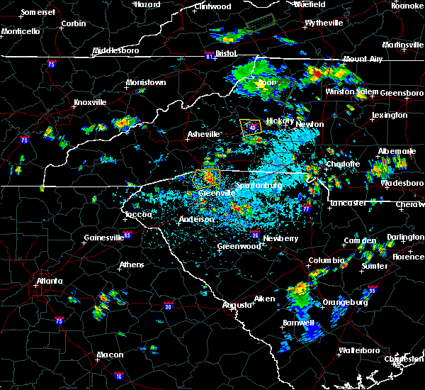 At 446 pm edt, a severe thunderstorm was located near morganton, and is nearly stationary (radar indicated). Hazards include 60 mph wind gusts and quarter size hail. Minor hail damage to vehicles is expected. Expect wind damage to trees and power lines. At 446 pm edt, a severe thunderstorm was located near morganton, and is nearly stationary (radar indicated). Hazards include 60 mph wind gusts and quarter size hail. Minor hail damage to vehicles is expected. Expect wind damage to trees and power lines.
|
| 9/1/2018 9:21 PM EDT | Quarter sized hail reported 6.8 miles E of Morganton, NC, nickel to quarter sized hail covering the ground at powerhouse road and rr white drive. quarter sized hail reported to conley bumgarner road. |
| 9/1/2018 9:21 PM EDT | Multiple trees down on powerhouse roa in burke county NC, 6.8 miles E of Morganton, NC |
| 9/1/2018 9:09 PM EDT |
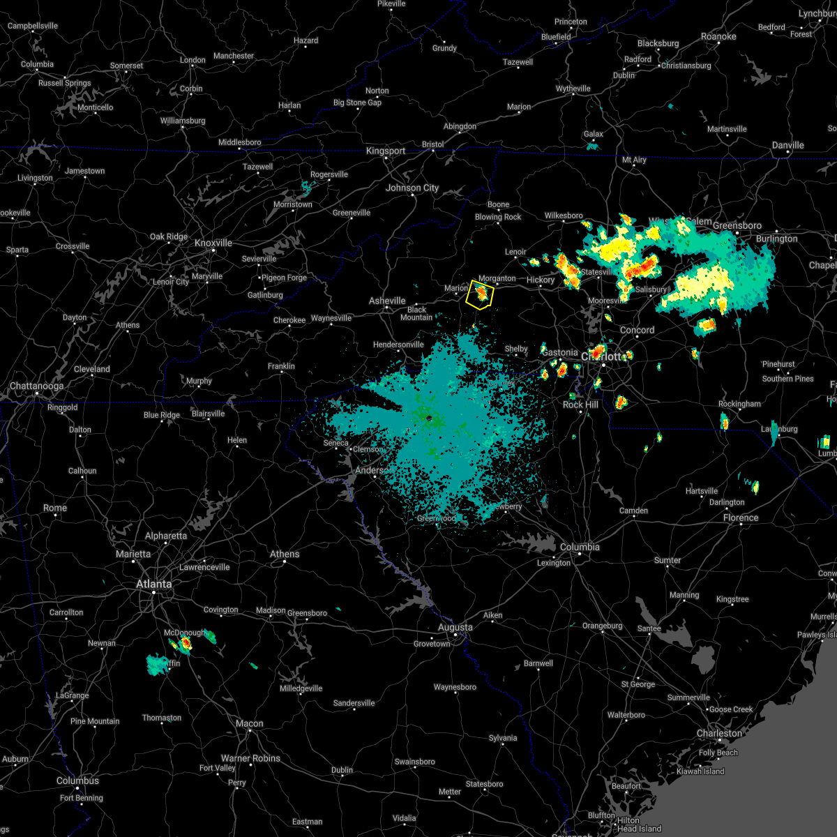 At 909 pm edt, a severe thunderstorm was located 7 miles southwest of morganton, or near glen alpine, and is nearly stationary (radar indicated). Hazards include 60 mph wind gusts and quarter size hail. Minor hail damage to vehicles is expected. expect wind damage to trees and power lines. Locations impacted include, glen alpine, dysartsville, lake james state park, lake james, morganton and south mountains state park. At 909 pm edt, a severe thunderstorm was located 7 miles southwest of morganton, or near glen alpine, and is nearly stationary (radar indicated). Hazards include 60 mph wind gusts and quarter size hail. Minor hail damage to vehicles is expected. expect wind damage to trees and power lines. Locations impacted include, glen alpine, dysartsville, lake james state park, lake james, morganton and south mountains state park.
|
| 9/1/2018 8:55 PM EDT |
 At 854 pm edt, a severe thunderstorm was located 7 miles southwest of morganton, or 4 miles south of glen alpine, and is nearly stationary (radar indicated). Hazards include 60 mph wind gusts and quarter size hail. Minor hail damage to vehicles is expected. Expect wind damage to trees and power lines. At 854 pm edt, a severe thunderstorm was located 7 miles southwest of morganton, or 4 miles south of glen alpine, and is nearly stationary (radar indicated). Hazards include 60 mph wind gusts and quarter size hail. Minor hail damage to vehicles is expected. Expect wind damage to trees and power lines.
|
| 8/8/2018 4:53 PM EDT |
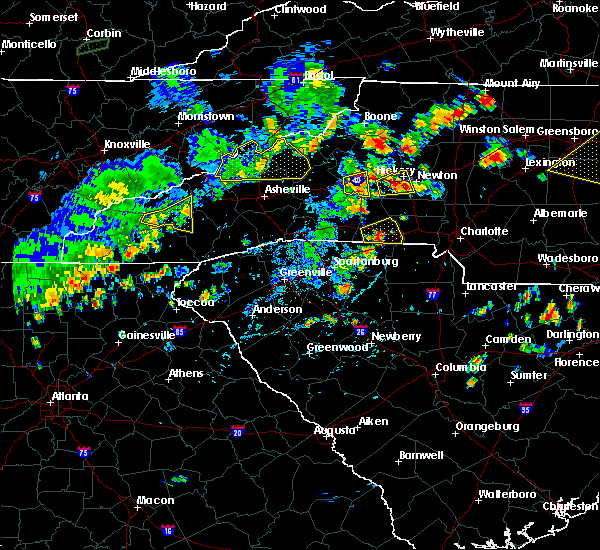 At 453 pm edt, a severe thunderstorm was located 5 miles southwest of morganton, or 4 miles southeast of glen alpine, moving east at 20 mph (radar indicated). Hazards include 60 mph wind gusts and nickel size hail. Expect damage to trees and power lines. Locations impacted include, morganton, glen alpine and south mountains state park. At 453 pm edt, a severe thunderstorm was located 5 miles southwest of morganton, or 4 miles southeast of glen alpine, moving east at 20 mph (radar indicated). Hazards include 60 mph wind gusts and nickel size hail. Expect damage to trees and power lines. Locations impacted include, morganton, glen alpine and south mountains state park.
|
| 8/8/2018 4:45 PM EDT | Trained spotter reported trees down along jenkins r in burke county NC, 6.2 miles NNE of Morganton, NC |
| 8/8/2018 4:29 PM EDT |
 At 429 pm edt, a severe thunderstorm was located 7 miles east of marion, or 4 miles southeast of lake james state park, moving east at 10 mph (radar indicated). Hazards include 60 mph wind gusts and half dollar size hail. Minor hail damage to vehicles is expected. Expect wind damage to trees and power lines. At 429 pm edt, a severe thunderstorm was located 7 miles east of marion, or 4 miles southeast of lake james state park, moving east at 10 mph (radar indicated). Hazards include 60 mph wind gusts and half dollar size hail. Minor hail damage to vehicles is expected. Expect wind damage to trees and power lines.
|
| 7/21/2018 6:38 PM EDT |
 At 638 pm edt, a severe thunderstorm was located 4 miles north of hickory, or near lake hickory, moving southeast at 10 mph (radar indicated). Hazards include golf ball size hail and 60 mph wind gusts. People and animals outdoors will be injured. expect hail damage to roofs, siding, windows, and vehicles. Expect wind damage to trees and power lines. At 638 pm edt, a severe thunderstorm was located 4 miles north of hickory, or near lake hickory, moving southeast at 10 mph (radar indicated). Hazards include golf ball size hail and 60 mph wind gusts. People and animals outdoors will be injured. expect hail damage to roofs, siding, windows, and vehicles. Expect wind damage to trees and power lines.
|
| 7/21/2018 6:06 PM EDT | Quarter sized hail reported 2 miles SW of Morganton, NC, trained spotter reported quarter size hail in morganton. |
| 7/21/2018 5:54 PM EDT |
 At 554 pm edt, a severe thunderstorm was located near morganton, or near glen alpine, moving east at 30 mph (radar indicated). Hazards include 60 mph wind gusts and quarter size hail. Minor hail damage to vehicles is expected. Expect wind damage to trees and power lines. At 554 pm edt, a severe thunderstorm was located near morganton, or near glen alpine, moving east at 30 mph (radar indicated). Hazards include 60 mph wind gusts and quarter size hail. Minor hail damage to vehicles is expected. Expect wind damage to trees and power lines.
|
| 7/11/2018 6:40 PM EDT | Broadcast media reported the tops blown out of a couple of trees on henderson mill roa in burke county NC, 6.9 miles SSE of Morganton, NC |
| 7/6/2018 3:15 PM EDT | Siding damage and an overturned sign at shady grove churc in burke county NC, 11 miles NW of Morganton, NC |
| 7/5/2018 8:41 PM EDT |
 The severe thunderstorm warning for southwestern caldwell and central burke counties will expire at 845 pm edt, the storm which prompted the warning has weakened below severe limits, and no longer poses an immediate threat to life or property. therefore the warning will be allowed to expire. however heavy rain is still possible with this thunderstorm. if you observed large hail or wind damage, please report it to the national weather service greenville-spartanburg by calling toll free, 1, 800, 2 6 7, 8 1 0 1, or by posting on our facebook page, or tweet it using hashtag nwsgsp. your message should describe the event and the specific location where it occurred. The severe thunderstorm warning for southwestern caldwell and central burke counties will expire at 845 pm edt, the storm which prompted the warning has weakened below severe limits, and no longer poses an immediate threat to life or property. therefore the warning will be allowed to expire. however heavy rain is still possible with this thunderstorm. if you observed large hail or wind damage, please report it to the national weather service greenville-spartanburg by calling toll free, 1, 800, 2 6 7, 8 1 0 1, or by posting on our facebook page, or tweet it using hashtag nwsgsp. your message should describe the event and the specific location where it occurred.
|
| 7/5/2018 8:26 PM EDT |
 At 826 pm edt, a severe thunderstorm was located 8 miles north of morganton, or 5 miles east of table rock, moving west at 10 mph (radar indicated). Hazards include 60 mph wind gusts and penny size hail. Expect damage to trees and power lines. Locations impacted include, oak hill, table rock and collettsville. At 826 pm edt, a severe thunderstorm was located 8 miles north of morganton, or 5 miles east of table rock, moving west at 10 mph (radar indicated). Hazards include 60 mph wind gusts and penny size hail. Expect damage to trees and power lines. Locations impacted include, oak hill, table rock and collettsville.
|
| 7/5/2018 8:07 PM EDT |
 At 807 pm edt, a severe thunderstorm was located 7 miles southwest of lenoir, or near gamewell, moving west at 10 mph (radar indicated). Hazards include 60 mph wind gusts and quarter size hail. Minor hail damage to vehicles is expected. Expect wind damage to trees and power lines. At 807 pm edt, a severe thunderstorm was located 7 miles southwest of lenoir, or near gamewell, moving west at 10 mph (radar indicated). Hazards include 60 mph wind gusts and quarter size hail. Minor hail damage to vehicles is expected. Expect wind damage to trees and power lines.
|
| 6/27/2018 2:20 PM EDT | Broadcast media reported a tree down across carbon city r in burke county NC, 0.8 miles SE of Morganton, NC |
| 6/25/2018 5:22 PM EDT |
 At 521 pm edt, severe thunderstorms were located along a line extending from 7 miles northeast of taylorsville to 5 miles north of forest city, moving east at 30 mph (radar indicated). Hazards include 60 mph wind gusts and quarter size hail. Minor hail damage to vehicles is expected. Expect wind damage to trees and power lines. At 521 pm edt, severe thunderstorms were located along a line extending from 7 miles northeast of taylorsville to 5 miles north of forest city, moving east at 30 mph (radar indicated). Hazards include 60 mph wind gusts and quarter size hail. Minor hail damage to vehicles is expected. Expect wind damage to trees and power lines.
|
| 6/25/2018 5:00 PM EDT | Amateur radio reported several trees down at the intersection of nc 18 and antioch r in burke county NC, 7.7 miles SSW of Morganton, NC |
| 6/25/2018 4:59 PM EDT |
 At 459 pm edt, severe thunderstorms were located along a line extending from 3 miles northwest of north wilkesboro to 6 miles east of morganton to 6 miles south of marion, moving east at 45 mph (radar indicated). Hazards include 60 mph wind gusts and quarter size hail. Minor hail damage to vehicles is expected. expect wind damage to trees and power lines. Locations impacted include, lenoir, morganton, marion, sawmills, granite falls, valdese, gamewell, hudson, icard and cajah`s mountain. At 459 pm edt, severe thunderstorms were located along a line extending from 3 miles northwest of north wilkesboro to 6 miles east of morganton to 6 miles south of marion, moving east at 45 mph (radar indicated). Hazards include 60 mph wind gusts and quarter size hail. Minor hail damage to vehicles is expected. expect wind damage to trees and power lines. Locations impacted include, lenoir, morganton, marion, sawmills, granite falls, valdese, gamewell, hudson, icard and cajah`s mountain.
|
| 6/25/2018 4:57 PM EDT | Broadcast media reported several trees down at the j iverson riddle center off of enola rd. time estimated from rada in burke county NC, 2.3 miles NW of Morganton, NC |
| 6/25/2018 4:55 PM EDT | Broadcast media reported a tree down on conley rd. at i-40 and a tree down on jamestown rd. near reep dr. time estimated from rada in burke county NC, 3.8 miles ENE of Morganton, NC |
| 6/25/2018 4:50 PM EDT | Broadcast media reported widespread damage in morganton along the catawba river. sanford drive is closed due to damage. time estimated from rada in burke county NC, 1.2 miles SSW of Morganton, NC |
| 6/25/2018 4:38 PM EDT |
 At 437 pm edt, severe thunderstorms were located along a line extending from 5 miles southeast of deep gap to 8 miles east of marion to 15 miles east of downtown asheville, moving east at 45 mph (radar indicated). Hazards include 60 mph wind gusts and quarter size hail. Minor hail damage to vehicles is expected. Expect wind damage to trees and power lines. At 437 pm edt, severe thunderstorms were located along a line extending from 5 miles southeast of deep gap to 8 miles east of marion to 15 miles east of downtown asheville, moving east at 45 mph (radar indicated). Hazards include 60 mph wind gusts and quarter size hail. Minor hail damage to vehicles is expected. Expect wind damage to trees and power lines.
|
| 6/25/2018 4:30 PM EDT | Trained spotter reported numerous trees and powerlines down in western burke county with widespread damage. time estimated from rada in burke county NC, 9.6 miles ESE of Morganton, NC |
| 6/11/2018 8:28 PM EDT | Multiple trees and powerlines down in the oak hill are in burke county NC, 4.8 miles SE of Morganton, NC |
| 6/3/2018 7:02 PM EDT |
 At 701 pm edt, a severe thunderstorm was located 13 miles south of morganton, or near south mountains state park, moving southeast at 25 mph. another severe thunderstorm was located near cooksville, also moving southeast at 25 mph (radar indicated). Hazards include ping pong ball size hail and 60 mph wind gusts. People and animals outdoors will be injured. expect hail damage to roofs, siding, windows, and vehicles. expect wind damage to trees and power lines. Locations impacted include, hickory, newton, conover, longview, valdese, icard, drexel, hildebran, connelly springs and rutherford college. At 701 pm edt, a severe thunderstorm was located 13 miles south of morganton, or near south mountains state park, moving southeast at 25 mph. another severe thunderstorm was located near cooksville, also moving southeast at 25 mph (radar indicated). Hazards include ping pong ball size hail and 60 mph wind gusts. People and animals outdoors will be injured. expect hail damage to roofs, siding, windows, and vehicles. expect wind damage to trees and power lines. Locations impacted include, hickory, newton, conover, longview, valdese, icard, drexel, hildebran, connelly springs and rutherford college.
|
| 6/3/2018 6:46 PM EDT | Trees blown down on jenkins r in burke county NC, 4.6 miles NNE of Morganton, NC |
| 6/3/2018 6:46 PM EDT | Quarter sized hail reported 4.6 miles NNE of Morganton, NC, quarter size hail on jenkins rd. |
| 6/3/2018 6:43 PM EDT | Quarter sized hail reported 6.3 miles NE of Morganton, NC, reports of quarter size hail on bennett rd and scott rd. |
| 6/3/2018 6:43 PM EDT |
 At 642 pm edt, a severe thunderstorm was located 8 miles south of morganton, or near south mountains state park, moving southeast at 30 mph. another severe thunderstorm was located 2 miles south of valdese, also moving southeast at 30 mph (radar indicated). Hazards include ping pong ball size hail and 60 mph wind gusts. People and animals outdoors will be injured. expect hail damage to roofs, siding, windows, and vehicles. Expect wind damage to trees and power lines. At 642 pm edt, a severe thunderstorm was located 8 miles south of morganton, or near south mountains state park, moving southeast at 30 mph. another severe thunderstorm was located 2 miles south of valdese, also moving southeast at 30 mph (radar indicated). Hazards include ping pong ball size hail and 60 mph wind gusts. People and animals outdoors will be injured. expect hail damage to roofs, siding, windows, and vehicles. Expect wind damage to trees and power lines.
|
| 6/3/2018 6:28 PM EDT |
 At 627 pm edt, a severe thunderstorm was located near morganton, moving southeast at 40 mph (radar indicated). Hazards include 60 mph wind gusts and quarter size hail. Minor hail damage to vehicles is expected. expect wind damage to trees and power lines. Locations impacted include, morganton, valdese, icard, drexel, hildebran, connelly springs, rutherford college, glen alpine, lake rhodhiss and table rock. At 627 pm edt, a severe thunderstorm was located near morganton, moving southeast at 40 mph (radar indicated). Hazards include 60 mph wind gusts and quarter size hail. Minor hail damage to vehicles is expected. expect wind damage to trees and power lines. Locations impacted include, morganton, valdese, icard, drexel, hildebran, connelly springs, rutherford college, glen alpine, lake rhodhiss and table rock.
|
| 6/3/2018 6:12 PM EDT |
 At 612 pm edt, a severe thunderstorm was located 12 miles southeast of spruce pine, or 4 miles west of table rock, moving southeast at 40 mph (radar indicated). Hazards include 60 mph wind gusts and quarter size hail. Minor hail damage to vehicles is expected. Expect wind damage to trees and power lines. At 612 pm edt, a severe thunderstorm was located 12 miles southeast of spruce pine, or 4 miles west of table rock, moving southeast at 40 mph (radar indicated). Hazards include 60 mph wind gusts and quarter size hail. Minor hail damage to vehicles is expected. Expect wind damage to trees and power lines.
|
| 5/10/2018 2:05 PM EDT | Quarter sized hail reported 3.1 miles N of Morganton, NC, nickel to quarter size hail at salem elementary school |
| 4/15/2018 1:13 PM EDT |
 At 113 pm edt, severe thunderstorms were located along a line extending from 5 miles east of morganton to 12 miles southwest of hickory to 13 miles north of shelby, moving northeast at 40 mph (radar indicated). Hazards include 60 mph wind gusts and quarter size hail. Minor hail damage to vehicles is expected. Expect wind damage to trees and power lines. At 113 pm edt, severe thunderstorms were located along a line extending from 5 miles east of morganton to 12 miles southwest of hickory to 13 miles north of shelby, moving northeast at 40 mph (radar indicated). Hazards include 60 mph wind gusts and quarter size hail. Minor hail damage to vehicles is expected. Expect wind damage to trees and power lines.
|
| 4/15/2018 12:59 PM EDT |
 At 1246 pm edt, severe thunderstorms were located along a line extending from 10 miles northeast of forest city to 6 miles southwest of shelby, moving northeast at 55 mph (radar indicated). Hazards include 60 mph wind gusts and quarter size hail. Minor hail damage to vehicles is expected. Expect wind damage to trees and power lines. At 1246 pm edt, severe thunderstorms were located along a line extending from 10 miles northeast of forest city to 6 miles southwest of shelby, moving northeast at 55 mph (radar indicated). Hazards include 60 mph wind gusts and quarter size hail. Minor hail damage to vehicles is expected. Expect wind damage to trees and power lines.
|
| 4/15/2018 12:47 PM EDT |
 At 1246 pm edt, severe thunderstorms were located along a line extending from 10 miles northeast of forest city to 6 miles southwest of shelby, moving northeast at 55 mph (radar indicated). Hazards include 60 mph wind gusts and quarter size hail. Minor hail damage to vehicles is expected. Expect wind damage to trees and power lines. At 1246 pm edt, severe thunderstorms were located along a line extending from 10 miles northeast of forest city to 6 miles southwest of shelby, moving northeast at 55 mph (radar indicated). Hazards include 60 mph wind gusts and quarter size hail. Minor hail damage to vehicles is expected. Expect wind damage to trees and power lines.
|
| 4/15/2018 12:39 PM EDT |
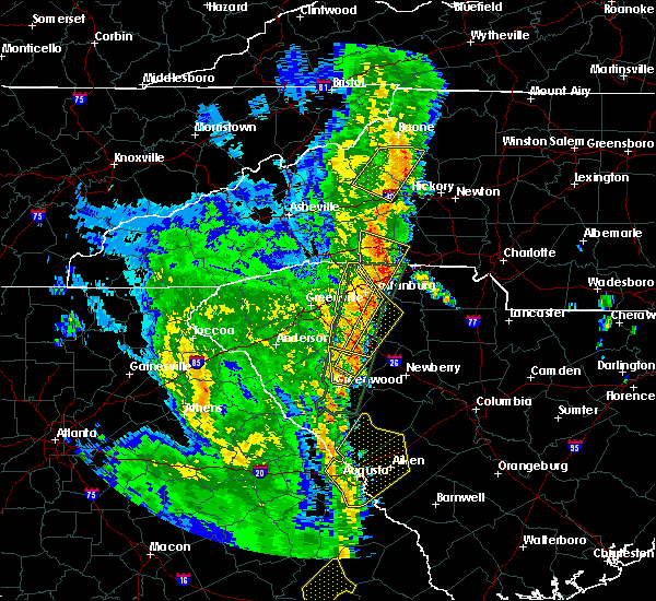 The severe thunderstorm warning for northeastern mcdowell, western caldwell, southeastern avery and northwestern burke counties will expire at 1245 pm edt, the storm which prompted the warning has weakened below severe limits, and no longer poses an immediate threat to life or property. therefore the warning will be allowed to expire. however gusty winds and heavy rain are still possible with this thunderstorm. a tornado watch remains in effect until 700 pm edt for western north carolina. The severe thunderstorm warning for northeastern mcdowell, western caldwell, southeastern avery and northwestern burke counties will expire at 1245 pm edt, the storm which prompted the warning has weakened below severe limits, and no longer poses an immediate threat to life or property. therefore the warning will be allowed to expire. however gusty winds and heavy rain are still possible with this thunderstorm. a tornado watch remains in effect until 700 pm edt for western north carolina.
|
| 4/15/2018 12:30 PM EDT | Trees and powerlines down on lions hill st. in morganton. time estimated from rada in burke county NC, 3.3 miles ENE of Morganton, NC |
| 4/15/2018 12:25 PM EDT |
 At 1224 pm edt, a severe thunderstorm was located near deep gap, or near rutherwood, moving northeast at 50 mph (radar indicated). Hazards include 60 mph wind gusts and penny size hail. Expect damage to trees and power lines. locations impacted include, morganton, gamewell, blowing rock in caldwell county, glen alpine, table rock, edgemont, collettsville, ashford, patterson and jonas ridge. A tornado watch remains in effect until 700 pm edt for western north carolina. At 1224 pm edt, a severe thunderstorm was located near deep gap, or near rutherwood, moving northeast at 50 mph (radar indicated). Hazards include 60 mph wind gusts and penny size hail. Expect damage to trees and power lines. locations impacted include, morganton, gamewell, blowing rock in caldwell county, glen alpine, table rock, edgemont, collettsville, ashford, patterson and jonas ridge. A tornado watch remains in effect until 700 pm edt for western north carolina.
|
| 4/15/2018 12:00 PM EDT |
 At 1159 am edt, a severe thunderstorm was located 10 miles northwest of morganton, or near table rock, moving northeast at 45 mph (radar indicated). Hazards include 60 mph wind gusts and penny size hail. expect damage to trees and power lines At 1159 am edt, a severe thunderstorm was located 10 miles northwest of morganton, or near table rock, moving northeast at 45 mph (radar indicated). Hazards include 60 mph wind gusts and penny size hail. expect damage to trees and power lines
|
| 10/23/2017 4:14 PM EDT |
 At 414 pm edt, a severe thunderstorm capable of producing a tornado was located 15 miles southeast of morganton, or 4 miles northeast of casar, moving northeast at 80 mph (radar indicated rotation). Hazards include tornado. Flying debris will be dangerous to those caught without shelter. mobile homes will be damaged or destroyed. damage to roofs, windows, and vehicles will occur. tree damage is likely. This dangerous storm will remain over mainly rural areas of southwestern catawba, western lincoln, northwestern cleveland and southeastern burke counties, including the following locations: cooksville, vale and pleasant grove. At 414 pm edt, a severe thunderstorm capable of producing a tornado was located 15 miles southeast of morganton, or 4 miles northeast of casar, moving northeast at 80 mph (radar indicated rotation). Hazards include tornado. Flying debris will be dangerous to those caught without shelter. mobile homes will be damaged or destroyed. damage to roofs, windows, and vehicles will occur. tree damage is likely. This dangerous storm will remain over mainly rural areas of southwestern catawba, western lincoln, northwestern cleveland and southeastern burke counties, including the following locations: cooksville, vale and pleasant grove.
|
| 10/23/2017 3:59 PM EDT |
 At 359 pm edt, a severe thunderstorm capable of producing a tornado was located 9 miles northwest of shelby, or near polkville, moving northeast at 45 mph (radar indicated rotation). Hazards include tornado. Flying debris will be dangerous to those caught without shelter. mobile homes will be damaged or destroyed. damage to roofs, windows, and vehicles will occur. tree damage is likely. this dangerous storm will be near, polkville and lawndale around 400 pm edt. casar, belwood and fallston around 410 pm edt. Other locations impacted by this dangerous thunderstorm include cooksville, sunshine, pleasant grove and vale. At 359 pm edt, a severe thunderstorm capable of producing a tornado was located 9 miles northwest of shelby, or near polkville, moving northeast at 45 mph (radar indicated rotation). Hazards include tornado. Flying debris will be dangerous to those caught without shelter. mobile homes will be damaged or destroyed. damage to roofs, windows, and vehicles will occur. tree damage is likely. this dangerous storm will be near, polkville and lawndale around 400 pm edt. casar, belwood and fallston around 410 pm edt. Other locations impacted by this dangerous thunderstorm include cooksville, sunshine, pleasant grove and vale.
|
| 7/23/2017 1:51 PM EDT |
 At 151 pm edt, severe thunderstorms were located along a line extending from 5 miles west of hickory to 3 miles south of marion, moving east at 35 mph (radar indicated). Hazards include 60 mph wind gusts and quarter size hail. Minor hail damage to vehicles is expected. expect wind damage to trees and power lines. Locations impacted include, hickory, morganton, newton, marion, conover, longview, sawmills, granite falls, valdese and icard. At 151 pm edt, severe thunderstorms were located along a line extending from 5 miles west of hickory to 3 miles south of marion, moving east at 35 mph (radar indicated). Hazards include 60 mph wind gusts and quarter size hail. Minor hail damage to vehicles is expected. expect wind damage to trees and power lines. Locations impacted include, hickory, morganton, newton, marion, conover, longview, sawmills, granite falls, valdese and icard.
|
| 7/23/2017 1:27 PM EDT |
 At 126 pm edt, a cluster of locally severe thunderstorms was oriented along a line extending from 6 miles south of lenoir to 9 miles west of marion, moving east at 35 mph (radar indicated). Hazards include 60 mph wind gusts and quarter size hail. Minor hail damage to vehicles is expected. Expect wind damage to trees and power lines. At 126 pm edt, a cluster of locally severe thunderstorms was oriented along a line extending from 6 miles south of lenoir to 9 miles west of marion, moving east at 35 mph (radar indicated). Hazards include 60 mph wind gusts and quarter size hail. Minor hail damage to vehicles is expected. Expect wind damage to trees and power lines.
|
| 7/23/2017 1:18 PM EDT | Quarter sized hail reported 5.9 miles SSW of Morganton, NC, quarter sized hail at chesterfield fire department. |
| 7/23/2017 1:16 PM EDT | Trees down at antioch road and highway 1 in burke county NC, 7.7 miles SSW of Morganton, NC |
| 7/23/2017 1:12 PM EDT | Numerous trees and powerlines down along pax hill roa in burke county NC, 7.4 miles S of Morganton, NC |
| 7/23/2017 1:03 PM EDT |
 At 103 pm edt, a severe thunderstorm was located 7 miles north of morganton, or 4 miles east of table rock, moving southeast at 10 mph (radar indicated). Hazards include 60 mph wind gusts and penny size hail. expect damage to trees and power lines At 103 pm edt, a severe thunderstorm was located 7 miles north of morganton, or 4 miles east of table rock, moving southeast at 10 mph (radar indicated). Hazards include 60 mph wind gusts and penny size hail. expect damage to trees and power lines
|
| 7/22/2017 3:42 PM EDT |
 The severe thunderstorm warning for southern caldwell and central burke counties will expire at 345 pm edt, the storm which prompted the warning has weakened below severe limits, and no longer poses an immediate threat to life or property. therefore the warning will be allowed to expire. The severe thunderstorm warning for southern caldwell and central burke counties will expire at 345 pm edt, the storm which prompted the warning has weakened below severe limits, and no longer poses an immediate threat to life or property. therefore the warning will be allowed to expire.
|
| 7/22/2017 3:30 PM EDT |
 At 329 pm edt, a severe thunderstorm was located 5 miles southwest of lenoir, or near cajah`s mountain, moving southeast at 20 mph. while storm has weakened, some severe winds will be possible for another 15 minutes (radar indicated). Hazards include 60 mph wind gusts. Expect damage to trees and power lines. Locations impacted include, lenoir, sawmills, valdese, gamewell, hudson, cajah`s mountain, drexel, rutherford college, lake rhodhiss and collettsville. At 329 pm edt, a severe thunderstorm was located 5 miles southwest of lenoir, or near cajah`s mountain, moving southeast at 20 mph. while storm has weakened, some severe winds will be possible for another 15 minutes (radar indicated). Hazards include 60 mph wind gusts. Expect damage to trees and power lines. Locations impacted include, lenoir, sawmills, valdese, gamewell, hudson, cajah`s mountain, drexel, rutherford college, lake rhodhiss and collettsville.
|
| 7/22/2017 3:01 PM EDT |
 At 300 pm edt, a severe thunderstorm was located 10 miles west of lenoir, or 7 miles northeast of table rock, moving southeast at 20 mph (radar indicated). Hazards include 60 mph wind gusts and penny size hail. expect damage to trees and power lines At 300 pm edt, a severe thunderstorm was located 10 miles west of lenoir, or 7 miles northeast of table rock, moving southeast at 20 mph (radar indicated). Hazards include 60 mph wind gusts and penny size hail. expect damage to trees and power lines
|
| 7/17/2017 7:20 PM EDT |
 The severe thunderstorm warning for southeastern caldwell and burke counties will expire at 730 pm edt, the storm which prompted the warning has weakened below severe limits, and no longer poses an immediate threat to life or property. therefore the warning will be allowed to expire. The severe thunderstorm warning for southeastern caldwell and burke counties will expire at 730 pm edt, the storm which prompted the warning has weakened below severe limits, and no longer poses an immediate threat to life or property. therefore the warning will be allowed to expire.
|
| 7/17/2017 6:43 PM EDT |
 At 643 pm edt, a severe thunderstorm was located 9 miles east of morganton, or over rutherford college, moving west at 15 mph (radar indicated). Hazards include 60 mph wind gusts and quarter size hail. Minor hail damage to vehicles is expected. Expect wind damage to trees and power lines. At 643 pm edt, a severe thunderstorm was located 9 miles east of morganton, or over rutherford college, moving west at 15 mph (radar indicated). Hazards include 60 mph wind gusts and quarter size hail. Minor hail damage to vehicles is expected. Expect wind damage to trees and power lines.
|
| 7/17/2017 6:31 PM EDT |
 At 631 pm edt, a severe thunderstorm was located 6 miles west of hickory, or near icard, moving southwest at 15 mph (radar indicated). Hazards include 60 mph wind gusts and half dollar size hail. Minor hail damage to vehicles is expected. expect wind damage to trees and power lines. Locations impacted include, sawmills, granite falls, valdese, icard, drexel, hildebran, connelly springs, rutherford college, rhodhiss and lake rhodhiss. At 631 pm edt, a severe thunderstorm was located 6 miles west of hickory, or near icard, moving southwest at 15 mph (radar indicated). Hazards include 60 mph wind gusts and half dollar size hail. Minor hail damage to vehicles is expected. expect wind damage to trees and power lines. Locations impacted include, sawmills, granite falls, valdese, icard, drexel, hildebran, connelly springs, rutherford college, rhodhiss and lake rhodhiss.
|
| 7/17/2017 6:02 PM EDT |
 At 602 pm edt, a severe thunderstorm was located near hickory, or near lake hickory, moving west at 10 mph (radar indicated). Hazards include 60 mph wind gusts and quarter size hail. Minor hail damage to vehicles is expected. Expect wind damage to trees and power lines. At 602 pm edt, a severe thunderstorm was located near hickory, or near lake hickory, moving west at 10 mph (radar indicated). Hazards include 60 mph wind gusts and quarter size hail. Minor hail damage to vehicles is expected. Expect wind damage to trees and power lines.
|
| 7/17/2017 5:36 PM EDT |
 The severe thunderstorm warning for northeastern mcdowell, west central caldwell and western burke counties will expire at 545 pm edt, the storm which prompted the warning has weakened below severe limits, and no longer poses an immediate threat to life or property. therefore the warning will be allowed to expire. The severe thunderstorm warning for northeastern mcdowell, west central caldwell and western burke counties will expire at 545 pm edt, the storm which prompted the warning has weakened below severe limits, and no longer poses an immediate threat to life or property. therefore the warning will be allowed to expire.
|
| 7/17/2017 4:54 PM EDT |
 At 454 pm edt, a severe thunderstorm was located 7 miles northeast of marion, or over lake james, moving north at 15 mph (radar indicated). Hazards include 60 mph wind gusts and quarter size hail. Minor hail damage to vehicles is expected. Expect wind damage to trees and power lines. At 454 pm edt, a severe thunderstorm was located 7 miles northeast of marion, or over lake james, moving north at 15 mph (radar indicated). Hazards include 60 mph wind gusts and quarter size hail. Minor hail damage to vehicles is expected. Expect wind damage to trees and power lines.
|
| 7/15/2017 3:40 PM EDT |
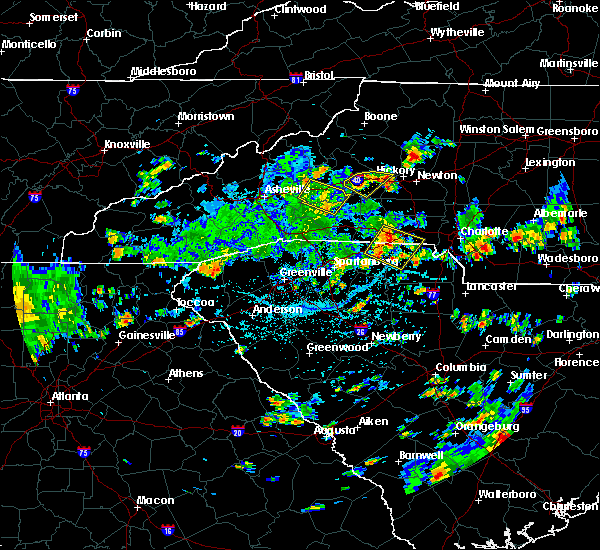 At 340 pm edt, a severe thunderstorm was located 4 miles south of morganton, moving southeast at 10 mph (radar indicated). Hazards include 60 mph wind gusts. Expect damage to trees and power lines. Locations impacted include, morganton, valdese, icard, drexel, connelly springs, rutherford college, glen alpine, lake rhodhiss, south mountains state park and pleasant grove. At 340 pm edt, a severe thunderstorm was located 4 miles south of morganton, moving southeast at 10 mph (radar indicated). Hazards include 60 mph wind gusts. Expect damage to trees and power lines. Locations impacted include, morganton, valdese, icard, drexel, connelly springs, rutherford college, glen alpine, lake rhodhiss, south mountains state park and pleasant grove.
|
| 7/15/2017 3:22 PM EDT | 911 call center reported a cluster of trees down on interstate 40 near mile marker 9 in burke county NC, 3.8 miles ENE of Morganton, NC |
| 7/15/2017 3:22 PM EDT |
 At 322 pm edt, a severe thunderstorm was located near morganton, or near glen alpine, moving southeast at 10 mph (radar indicated). Hazards include 60 mph wind gusts and quarter size hail. Minor hail damage to vehicles is expected. Expect wind damage to trees and power lines. At 322 pm edt, a severe thunderstorm was located near morganton, or near glen alpine, moving southeast at 10 mph (radar indicated). Hazards include 60 mph wind gusts and quarter size hail. Minor hail damage to vehicles is expected. Expect wind damage to trees and power lines.
|
| 7/14/2017 5:44 PM EDT |
 At 544 pm edt, a severe thunderstorm was located 6 miles south of morganton, or near south mountains state park, moving southeast at 20 mph (radar indicated). Hazards include 60 mph wind gusts. Expect damage to trees and power lines. Locations impacted include, morganton, valdese, icard, drexel, hildebran, connelly springs, rutherford college, lake rhodhiss, hickory regional airport and glenwood. At 544 pm edt, a severe thunderstorm was located 6 miles south of morganton, or near south mountains state park, moving southeast at 20 mph (radar indicated). Hazards include 60 mph wind gusts. Expect damage to trees and power lines. Locations impacted include, morganton, valdese, icard, drexel, hildebran, connelly springs, rutherford college, lake rhodhiss, hickory regional airport and glenwood.
|
| 7/14/2017 5:35 PM EDT | Tree down on saint marys church rd. time estimated from rada in burke county NC, 2.6 miles SSE of Morganton, NC |
| 7/14/2017 5:33 PM EDT |
 At 532 pm edt, a severe thunderstorm was located 7 miles northeast of morganton, or near gamewell, moving east at 10 mph (radar indicated). Hazards include 60 mph wind gusts. Expect damage to trees and power lines. Locations impacted include, lenoir, morganton, sawmills, granite falls, valdese, gamewell, hudson, icard, cajah`s mountain and drexel. At 532 pm edt, a severe thunderstorm was located 7 miles northeast of morganton, or near gamewell, moving east at 10 mph (radar indicated). Hazards include 60 mph wind gusts. Expect damage to trees and power lines. Locations impacted include, lenoir, morganton, sawmills, granite falls, valdese, gamewell, hudson, icard, cajah`s mountain and drexel.
|
| 7/14/2017 5:15 PM EDT |
 At 514 pm edt, a severe thunderstorm was located 8 miles northwest of morganton, or near table rock, moving east at 10 mph. other strong thunderstorms in the warned area may become severe at any time, including near gamewell and near marion (radar indicated). Hazards include 60 mph wind gusts and quarter size hail. Minor hail damage to vehicles is expected. Expect wind damage to trees and power lines. At 514 pm edt, a severe thunderstorm was located 8 miles northwest of morganton, or near table rock, moving east at 10 mph. other strong thunderstorms in the warned area may become severe at any time, including near gamewell and near marion (radar indicated). Hazards include 60 mph wind gusts and quarter size hail. Minor hail damage to vehicles is expected. Expect wind damage to trees and power lines.
|
| 7/13/2017 6:07 PM EDT |
 At 607 pm edt, a severe thunderstorm was located 4 miles east of marion, or near lake james state park, moving southeast at 5 mph (radar indicated). Hazards include 60 mph wind gusts and penny size hail. Expect damage to trees and power lines. Locations impacted include, marion, lake james state park, lake james, nebo, pleasant gardens and glen alpine. At 607 pm edt, a severe thunderstorm was located 4 miles east of marion, or near lake james state park, moving southeast at 5 mph (radar indicated). Hazards include 60 mph wind gusts and penny size hail. Expect damage to trees and power lines. Locations impacted include, marion, lake james state park, lake james, nebo, pleasant gardens and glen alpine.
|
| 7/13/2017 5:33 PM EDT |
 At 533 pm edt, a severe thunderstorm was located 4 miles northeast of marion, or near lake james state park, moving east at 15 mph (radar indicated). Hazards include 60 mph wind gusts and penny size hail. expect damage to trees and power lines At 533 pm edt, a severe thunderstorm was located 4 miles northeast of marion, or near lake james state park, moving east at 15 mph (radar indicated). Hazards include 60 mph wind gusts and penny size hail. expect damage to trees and power lines
|
| 7/13/2017 4:50 PM EDT | Trees and powerlines down along perkins rd in burke county NC, 5.2 miles SE of Morganton, NC |
| 7/13/2017 4:50 PM EDT | County official reported multiple trees and utility poles down near the intersection of nc 126 and silvers s in burke county NC, 4.7 miles ESE of Morganton, NC |
| 7/8/2017 4:40 PM EDT | Broadcast media reported a tree down across gold mine road at highway 64 in burke county NC, 11.1 miles NE of Morganton, NC |
| 7/5/2017 4:58 PM EDT | Tree on house at piney rd and greenlee d in burke county NC, 8.2 miles SSW of Morganton, NC |
| 7/5/2017 4:36 PM EDT | Numerous large limbs down at nc hwy 126 and la foret d in burke county NC, 2.6 miles ESE of Morganton, NC |
| 6/15/2017 4:00 PM EDT | Trees and powerlines down at bedford ave and bedford s in burke county NC, 3.7 miles NE of Morganton, NC |
| 6/13/2017 3:06 PM EDT |
 At 305 pm edt, a severe thunderstorm was located 6 miles south of lenoir, or near sawmills, and is nearly stationary (radar indicated). Hazards include 60 mph wind gusts and quarter size hail. Minor hail damage to vehicles is expected. Expect wind damage to trees and power lines. At 305 pm edt, a severe thunderstorm was located 6 miles south of lenoir, or near sawmills, and is nearly stationary (radar indicated). Hazards include 60 mph wind gusts and quarter size hail. Minor hail damage to vehicles is expected. Expect wind damage to trees and power lines.
|
| 5/28/2017 1:31 AM EDT |
 At 130 am edt, severe thunderstorms were located along a line extending from 5 miles southwest of wilbar to 15 miles south of morganton, moving east at 35 mph (radar indicated). Hazards include 60 mph wind gusts and penny size hail. Expect damage to trees and power lines. Locations impacted include, lenoir, sawmills, granite falls, valdese, gamewell, hudson, icard, cajah`s mountain, drexel and hildebran. At 130 am edt, severe thunderstorms were located along a line extending from 5 miles southwest of wilbar to 15 miles south of morganton, moving east at 35 mph (radar indicated). Hazards include 60 mph wind gusts and penny size hail. Expect damage to trees and power lines. Locations impacted include, lenoir, sawmills, granite falls, valdese, gamewell, hudson, icard, cajah`s mountain, drexel and hildebran.
|
| 5/28/2017 1:15 AM EDT | County reports scattered trees and power lines down around count in burke county NC, 0.7 miles SW of Morganton, NC |
| 5/28/2017 12:55 AM EDT |
 At 1255 am edt, severe thunderstorms were located along a line extending from near sugar grove to 8 miles southwest of marion, moving east at 40 mph (radar indicated). Hazards include 60 mph wind gusts and penny size hail. expect damage to trees and power lines At 1255 am edt, severe thunderstorms were located along a line extending from near sugar grove to 8 miles southwest of marion, moving east at 40 mph (radar indicated). Hazards include 60 mph wind gusts and penny size hail. expect damage to trees and power lines
|
| 5/28/2017 12:49 AM EDT |
 At 1249 am edt, severe thunderstorms were located along a line extending from 8 miles west of beech mountain to 15 miles southwest of marion, moving east at 30 mph (radar indicated). Hazards include 60 mph wind gusts and penny size hail. Expect damage to trees and power lines. Locations impacted include, marion, spruce pine, newland, glen alpine, banner elk, elk park, bakersville, beech mountain in avery county, crossnore and sugar mountain. At 1249 am edt, severe thunderstorms were located along a line extending from 8 miles west of beech mountain to 15 miles southwest of marion, moving east at 30 mph (radar indicated). Hazards include 60 mph wind gusts and penny size hail. Expect damage to trees and power lines. Locations impacted include, marion, spruce pine, newland, glen alpine, banner elk, elk park, bakersville, beech mountain in avery county, crossnore and sugar mountain.
|
| 5/28/2017 12:21 AM EDT |
 At 1221 am edt, severe thunderstorms were located along a line extending from 5 miles south of elizabethton to 5 miles east of downtown asheville, moving east at 45 mph (radar indicated). Hazards include 60 mph wind gusts and penny size hail. expect damage to trees and power lines At 1221 am edt, severe thunderstorms were located along a line extending from 5 miles south of elizabethton to 5 miles east of downtown asheville, moving east at 45 mph (radar indicated). Hazards include 60 mph wind gusts and penny size hail. expect damage to trees and power lines
|
| 5/24/2017 4:44 PM EDT |
 At 444 pm edt, a severe thunderstorm capable of producing a tornado was located 9 miles east of marion, or 5 miles southwest of glen alpine, moving northeast at 15 mph (radar indicated rotation). Hazards include tornado. Flying debris will be dangerous to those caught without shelter. mobile homes will be damaged or destroyed. damage to roofs, windows, and vehicles will occur. tree damage is likely. This dangerous storm will be near, morganton and glen alpine around 500 pm edt. At 444 pm edt, a severe thunderstorm capable of producing a tornado was located 9 miles east of marion, or 5 miles southwest of glen alpine, moving northeast at 15 mph (radar indicated rotation). Hazards include tornado. Flying debris will be dangerous to those caught without shelter. mobile homes will be damaged or destroyed. damage to roofs, windows, and vehicles will occur. tree damage is likely. This dangerous storm will be near, morganton and glen alpine around 500 pm edt.
|
| 5/24/2017 4:23 PM EDT |
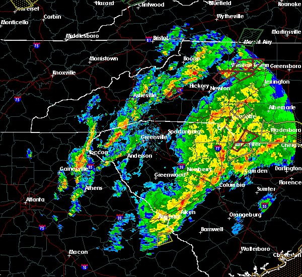 At 423 pm edt, a severe thunderstorm capable of producing a tornado was located 7 miles southeast of marion, moving northeast at 15 mph (radar indicated rotation). Hazards include tornado. Flying debris will be dangerous to those caught without shelter. mobile homes will be damaged or destroyed. damage to roofs, windows, and vehicles will occur. tree damage is likely. this dangerous storm will be near, morganton, glen alpine and salem around 500 pm edt. Other locations impacted by this dangerous thunderstorm include dysartsville. At 423 pm edt, a severe thunderstorm capable of producing a tornado was located 7 miles southeast of marion, moving northeast at 15 mph (radar indicated rotation). Hazards include tornado. Flying debris will be dangerous to those caught without shelter. mobile homes will be damaged or destroyed. damage to roofs, windows, and vehicles will occur. tree damage is likely. this dangerous storm will be near, morganton, glen alpine and salem around 500 pm edt. Other locations impacted by this dangerous thunderstorm include dysartsville.
|
| 5/5/2017 3:07 AM EDT |
 The severe thunderstorm warning for central burke county will expire at 315 am edt, the storm which prompted the warning has weakened below severe limits, and has exited the warned area. therefore the warning will be allowed to expire. The severe thunderstorm warning for central burke county will expire at 315 am edt, the storm which prompted the warning has weakened below severe limits, and has exited the warned area. therefore the warning will be allowed to expire.
|
| 5/5/2017 2:46 AM EDT |
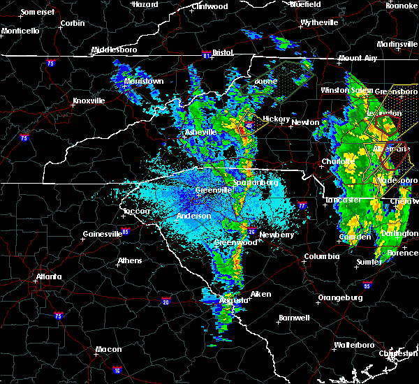 At 246 am edt, a severe thunderstorm was located 5 miles southwest of morganton, or near glen alpine, moving northeast at 55 mph (radar indicated). Hazards include 60 mph wind gusts. Expect damage to trees and power lines. Locations impacted include, morganton, valdese, drexel, connelly springs, rutherford college, glen alpine, lake rhodhiss, oak hill, table rock and south mountains state park. At 246 am edt, a severe thunderstorm was located 5 miles southwest of morganton, or near glen alpine, moving northeast at 55 mph (radar indicated). Hazards include 60 mph wind gusts. Expect damage to trees and power lines. Locations impacted include, morganton, valdese, drexel, connelly springs, rutherford college, glen alpine, lake rhodhiss, oak hill, table rock and south mountains state park.
|
| 5/5/2017 2:33 AM EDT |
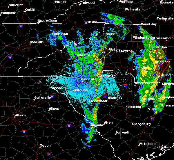 At 233 am edt, a severe thunderstorm was located 12 miles southeast of marion, or 12 miles north of bostic, moving northeast at 45 mph (radar indicated). Hazards include 60 mph wind gusts. expect damage to trees and power lines At 233 am edt, a severe thunderstorm was located 12 miles southeast of marion, or 12 miles north of bostic, moving northeast at 45 mph (radar indicated). Hazards include 60 mph wind gusts. expect damage to trees and power lines
|
| 4/6/2017 12:37 AM EDT | Quarter sized hail reported 5.6 miles WSW of Morganton, NC, broadcast media reported quarter (1") size hail on amherst rd and zion rd in morganton. |
| 4/6/2017 12:30 AM EDT |
 At 1230 am edt, severe thunderstorms were located along a line extending from 5 miles west of morganton to 13 miles northeast of rutherfordton to 5 miles southwest of forest city, moving northeast at 70 mph (radar indicated). Hazards include 60 mph wind gusts and quarter size hail. Hail damage to vehicles is expected. Expect wind damage to roofs, siding, and trees. At 1230 am edt, severe thunderstorms were located along a line extending from 5 miles west of morganton to 13 miles northeast of rutherfordton to 5 miles southwest of forest city, moving northeast at 70 mph (radar indicated). Hazards include 60 mph wind gusts and quarter size hail. Hail damage to vehicles is expected. Expect wind damage to roofs, siding, and trees.
|
| 3/31/2017 5:47 AM EDT | Broadcast media reported trees and power lines down on conley road. trees also down on i-40 near mm 99 and on hodges st in icar in burke county NC, 4.1 miles NE of Morganton, NC |
| 3/1/2017 4:51 PM EST |
 At 451 pm est, a severe thunderstorm capable of producing a tornado was located 7 miles southeast of morganton, or 4 miles southwest of valdese, moving east at 50 mph (radar indicated rotation). Hazards include tornado and quarter size hail. Flying debris will be dangerous to those caught without shelter. mobile homes will be damaged or destroyed. damage to roofs, windows and vehicles will occur. tree damage is likely. this dangerous storm will be near, icard and rhodhiss around 500 pm est. hickory, mountain view, hickory regional airport, longview and hildebran around 510 pm est. Other locations impacted by this dangerous storm include propst and pleasant grove. At 451 pm est, a severe thunderstorm capable of producing a tornado was located 7 miles southeast of morganton, or 4 miles southwest of valdese, moving east at 50 mph (radar indicated rotation). Hazards include tornado and quarter size hail. Flying debris will be dangerous to those caught without shelter. mobile homes will be damaged or destroyed. damage to roofs, windows and vehicles will occur. tree damage is likely. this dangerous storm will be near, icard and rhodhiss around 500 pm est. hickory, mountain view, hickory regional airport, longview and hildebran around 510 pm est. Other locations impacted by this dangerous storm include propst and pleasant grove.
|
| 3/1/2017 4:42 PM EST |
 At 442 pm est, a severe thunderstorm was located near morganton, moving east at 50 mph (radar indicated). Hazards include 60 mph wind gusts and quarter size hail. Hail damage to vehicles is expected. expect wind damage to roofs, siding and trees. Locations impacted include, hickory, morganton, longview, sawmills, granite falls, valdese, hudson, icard, drexel and hildebran. At 442 pm est, a severe thunderstorm was located near morganton, moving east at 50 mph (radar indicated). Hazards include 60 mph wind gusts and quarter size hail. Hail damage to vehicles is expected. expect wind damage to roofs, siding and trees. Locations impacted include, hickory, morganton, longview, sawmills, granite falls, valdese, hudson, icard, drexel and hildebran.
|
| 3/1/2017 4:40 PM EST |
 At 440 pm est, a severe thunderstorm capable of producing a tornado was located 6 miles southwest of morganton, or 5 miles south of glen alpine, moving east at 45 mph (radar indicated rotation). Hazards include tornado. Flying debris will be dangerous to those caught without shelter. mobile homes will be damaged or destroyed. damage to roofs, windows and vehicles will occur. tree damage is likely. this dangerous storm will be near, drexel around 450 pm est. connelly springs, rutherford college, valdese and lake rhodhiss around 500 pm est. hickory, hildebran, mountain view, longview and hickory regional airport around 510 pm est. Other locations impacted by this dangerous thunderstorm include propst and pleasant grove. At 440 pm est, a severe thunderstorm capable of producing a tornado was located 6 miles southwest of morganton, or 5 miles south of glen alpine, moving east at 45 mph (radar indicated rotation). Hazards include tornado. Flying debris will be dangerous to those caught without shelter. mobile homes will be damaged or destroyed. damage to roofs, windows and vehicles will occur. tree damage is likely. this dangerous storm will be near, drexel around 450 pm est. connelly springs, rutherford college, valdese and lake rhodhiss around 500 pm est. hickory, hildebran, mountain view, longview and hickory regional airport around 510 pm est. Other locations impacted by this dangerous thunderstorm include propst and pleasant grove.
|
| 3/1/2017 4:34 PM EST |
 At 433 pm est, a severe thunderstorm was located 8 miles east of marion, or 5 miles southeast of lake james state park, moving east at 50 mph (radar indicated). Hazards include 60 mph wind gusts and nickel size hail. Expect damage to roofs. Siding and trees. At 433 pm est, a severe thunderstorm was located 8 miles east of marion, or 5 miles southeast of lake james state park, moving east at 50 mph (radar indicated). Hazards include 60 mph wind gusts and nickel size hail. Expect damage to roofs. Siding and trees.
|
| 11/30/2016 5:26 PM EST |
 At 526 pm est, severe thunderstorms were located along a line extending from 8 miles east of taylorsville to 14 miles north of shelby to 8 miles southeast of forest city to 5 miles south of union to 8 miles west of newberry, moving northeast at 55 mph (radar indicated). Hazards include 60 mph wind gusts. Expect damage to roofs. Siding and trees. At 526 pm est, severe thunderstorms were located along a line extending from 8 miles east of taylorsville to 14 miles north of shelby to 8 miles southeast of forest city to 5 miles south of union to 8 miles west of newberry, moving northeast at 55 mph (radar indicated). Hazards include 60 mph wind gusts. Expect damage to roofs. Siding and trees.
|
| 7/21/2016 9:36 PM EDT |
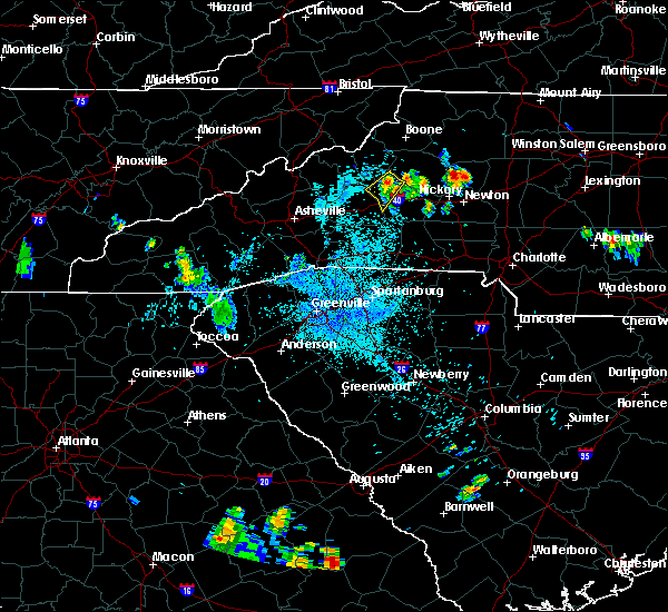 The severe thunderstorm warning for western burke county will expire at 945 pm edt, the storm which prompted the warning has weakened below severe limits, and no longer poses an immediate threat to life or property. therefore the warning will be allowed to expire. however gusty winds and heavy rain are still possible with this thunderstorm. The severe thunderstorm warning for western burke county will expire at 945 pm edt, the storm which prompted the warning has weakened below severe limits, and no longer poses an immediate threat to life or property. therefore the warning will be allowed to expire. however gusty winds and heavy rain are still possible with this thunderstorm.
|
| 7/21/2016 9:30 PM EDT |
 At 929 pm edt, a severe thunderstorm was located 5 miles west of morganton, or near glen alpine, moving southwest at 15 mph (radar indicated). Hazards include 60 mph wind gusts. Expect damage to roofs. siding and trees. Locations impacted include, glen alpine, table rock, oak hill, lake james, lake james state park and morganton. At 929 pm edt, a severe thunderstorm was located 5 miles west of morganton, or near glen alpine, moving southwest at 15 mph (radar indicated). Hazards include 60 mph wind gusts. Expect damage to roofs. siding and trees. Locations impacted include, glen alpine, table rock, oak hill, lake james, lake james state park and morganton.
|
| 7/21/2016 8:59 PM EDT |
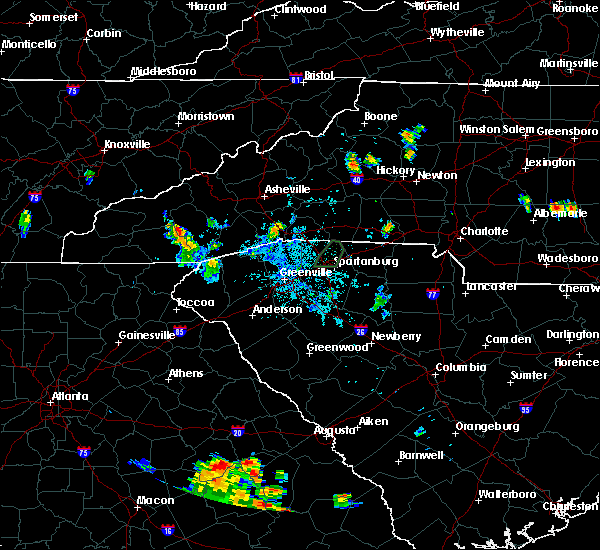 At 858 pm edt, a severe thunderstorm was located 8 miles northwest of morganton, or near table rock, moving southwest at 15 mph (radar indicated). Hazards include 60 mph wind gusts. Expect damage to roofs. Siding and trees. At 858 pm edt, a severe thunderstorm was located 8 miles northwest of morganton, or near table rock, moving southwest at 15 mph (radar indicated). Hazards include 60 mph wind gusts. Expect damage to roofs. Siding and trees.
|
| 7/16/2016 2:30 PM EDT |
 At 230 pm edt, a severe thunderstorm was located 4 miles south of lenoir, or near cajah`s mountain, moving east at 15 mph (radar indicated). Hazards include 60 mph wind gusts and penny size hail. Expect damage to roofs. siding and trees. Locations impacted include, sawmills, granite falls, valdese, gamewell, hudson, icard, cajah`s mountain, drexel, hildebran and connelly springs. At 230 pm edt, a severe thunderstorm was located 4 miles south of lenoir, or near cajah`s mountain, moving east at 15 mph (radar indicated). Hazards include 60 mph wind gusts and penny size hail. Expect damage to roofs. siding and trees. Locations impacted include, sawmills, granite falls, valdese, gamewell, hudson, icard, cajah`s mountain, drexel, hildebran and connelly springs.
|
| 7/16/2016 2:12 PM EDT |
 At 212 pm edt, a severe thunderstorm was located 7 miles northeast of morganton, or near gamewell, moving east at 15 mph (radar indicated). Hazards include 60 mph wind gusts and penny size hail. Expect damage to roofs. Siding and trees. At 212 pm edt, a severe thunderstorm was located 7 miles northeast of morganton, or near gamewell, moving east at 15 mph (radar indicated). Hazards include 60 mph wind gusts and penny size hail. Expect damage to roofs. Siding and trees.
|
| 7/8/2016 7:52 PM EDT |
 The severe thunderstorm warning for caldwell, burke, eastern mitchell, northwestern catawba, southern yancey, avery, central mcdowell and alexander counties will expire at 800 pm edt, the storms which prompted the warning have weakened below severe limits, and have exited the warned area. therefore the warning will be allowed to expire. however gusty winds are still possible with these thunderstorms. a severe thunderstorm watch remains in effect until midnight edt for the piedmont of and western north carolina. The severe thunderstorm warning for caldwell, burke, eastern mitchell, northwestern catawba, southern yancey, avery, central mcdowell and alexander counties will expire at 800 pm edt, the storms which prompted the warning have weakened below severe limits, and have exited the warned area. therefore the warning will be allowed to expire. however gusty winds are still possible with these thunderstorms. a severe thunderstorm watch remains in effect until midnight edt for the piedmont of and western north carolina.
|
| 7/8/2016 7:18 PM EDT |
 At 718 pm edt, severe thunderstorms were located along a line extending from 5 miles north of beech mountain to 6 miles north of spruce pine to 3 miles west of burnsville, moving east at 55 mph (radar indicated). Hazards include 70 mph wind gusts. Expect considerable tree damage. Damage is likely to mobile homes, roofs and outbuildings. At 718 pm edt, severe thunderstorms were located along a line extending from 5 miles north of beech mountain to 6 miles north of spruce pine to 3 miles west of burnsville, moving east at 55 mph (radar indicated). Hazards include 70 mph wind gusts. Expect considerable tree damage. Damage is likely to mobile homes, roofs and outbuildings.
|
| 7/5/2016 2:57 PM EDT |
 At 257 pm edt, severe thunderstorms were located along a line extending from 9 miles east of morganton to 9 miles northeast of forest city, moving east at 35 mph (trained weather spotters and emergency management officials). Hazards include 60 mph wind gusts. Expect damage to roofs. siding and trees. Locations impacted include, hickory, longview, valdese, icard, drexel, hildebran, connelly springs, rutherford college, belwood and lawndale. At 257 pm edt, severe thunderstorms were located along a line extending from 9 miles east of morganton to 9 miles northeast of forest city, moving east at 35 mph (trained weather spotters and emergency management officials). Hazards include 60 mph wind gusts. Expect damage to roofs. siding and trees. Locations impacted include, hickory, longview, valdese, icard, drexel, hildebran, connelly springs, rutherford college, belwood and lawndale.
|
| 7/5/2016 2:53 PM EDT |
 At 252 pm edt, a severe thunderstorm was located 7 miles south of lenoir, or near lake rhodhiss, moving east at 35 mph (radar indicated). Hazards include 60 mph wind gusts and penny size hail. Expect damage to roofs. Siding and trees. At 252 pm edt, a severe thunderstorm was located 7 miles south of lenoir, or near lake rhodhiss, moving east at 35 mph (radar indicated). Hazards include 60 mph wind gusts and penny size hail. Expect damage to roofs. Siding and trees.
|
| 7/5/2016 2:40 PM EDT | Over 20 downed trees reported on the campus of the j iverson riddle developmental center off of enola rd. some of the trees fell on parked cars and two trees fell on bu in burke county NC, 2.4 miles WNW of Morganton, NC |
| 7/5/2016 2:40 PM EDT | Multiple trees down at intersection of mount olive church road at jamestown roa in burke county NC, 6.8 miles ENE of Morganton, NC |
| 7/5/2016 2:40 PM EDT | Unoccupied home blown off foundation in burke county NC, 6.9 miles ENE of Morganton, NC |
| 7/5/2016 2:40 PM EDT | Several downed and snapped trees on e parker rd. near grace hospita in burke county NC, 2.8 miles W of Morganton, NC |
| 7/5/2016 2:39 PM EDT | Tree down on home along snowhill church roa in burke county NC, 6.9 miles E of Morganton, NC |
| 7/5/2016 2:38 PM EDT | A large oak tree blown down in a yar in burke county NC, 0.3 miles NNE of Morganton, NC |
| 7/5/2016 2:28 PM EDT |
 At 228 pm edt, severe thunderstorms were located along a line extending from 9 miles west of morganton to 5 miles northwest of rutherfordton, moving east at 40 mph (emergency management). Hazards include 60 mph wind gusts and nickel size hail. Expect damage to roofs. Siding and trees. At 228 pm edt, severe thunderstorms were located along a line extending from 9 miles west of morganton to 5 miles northwest of rutherfordton, moving east at 40 mph (emergency management). Hazards include 60 mph wind gusts and nickel size hail. Expect damage to roofs. Siding and trees.
|
| 6/29/2016 3:26 PM EDT | Media reports trees down at jenkins rd and emily r in burke county NC, 3.7 miles N of Morganton, NC |
| 6/29/2016 3:22 PM EDT | Quarter sized hail reported 2.3 miles N of Morganton, NC, media reports hail covering the ground on hwy 64. |
| 6/29/2016 3:19 PM EDT | Media reports trees and powerlines down near hwy 64 and pine crest d in burke county NC, 3.1 miles NNE of Morganton, NC |
| 6/29/2016 3:15 PM EDT | Ping Pong Ball sized hail reported 0.7 miles SW of Morganton, NC, public reports ping pong ball sized hail currently falling. |
| 6/29/2016 3:03 PM EDT |
 At 302 pm edt, a severe thunderstorm was located 4 miles southwest of morganton, or near glen alpine, moving east at 15 mph (radar indicated). Hazards include 60 mph wind gusts and half dollar size hail. Hail damage to vehicles is expected. Expect wind damage to roofs, siding and trees. At 302 pm edt, a severe thunderstorm was located 4 miles southwest of morganton, or near glen alpine, moving east at 15 mph (radar indicated). Hazards include 60 mph wind gusts and half dollar size hail. Hail damage to vehicles is expected. Expect wind damage to roofs, siding and trees.
|
| 5/2/2016 3:41 PM EDT |
 At 341 pm edt, a severe thunderstorm was located 6 miles southwest of morganton, or near glen alpine, moving east at 30 mph (radar indicated). Hazards include 60 mph wind gusts and quarter size hail. Hail damage to vehicles is expected. expect wind damage to roofs, siding and trees. Locations impacted include, morganton, glen alpine, oak hill, lake james, lake james state park and south mountains state park. At 341 pm edt, a severe thunderstorm was located 6 miles southwest of morganton, or near glen alpine, moving east at 30 mph (radar indicated). Hazards include 60 mph wind gusts and quarter size hail. Hail damage to vehicles is expected. expect wind damage to roofs, siding and trees. Locations impacted include, morganton, glen alpine, oak hill, lake james, lake james state park and south mountains state park.
|
| 5/2/2016 3:11 PM EDT |
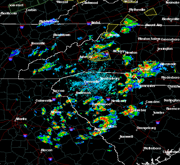 At 310 pm edt, a severe thunderstorm was located 5 miles south of marion, moving east at 20 mph (radar indicated. this storm has a history of producing large hail up to the size of golf balls. take shelter now!). Hazards include 60 mph wind gusts and quarter size hail. Hail damage to vehicles is expected. Expect wind damage to roofs, siding and trees. At 310 pm edt, a severe thunderstorm was located 5 miles south of marion, moving east at 20 mph (radar indicated. this storm has a history of producing large hail up to the size of golf balls. take shelter now!). Hazards include 60 mph wind gusts and quarter size hail. Hail damage to vehicles is expected. Expect wind damage to roofs, siding and trees.
|
| 9/4/2015 9:30 PM EDT |
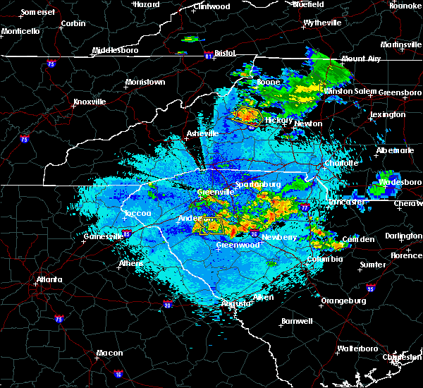 At 930 pm edt, the public reported a severe thunderstorm producing quarter size hail and damaging winds in excess of 60 mph. this storm was located 9 miles northwest of morganton, or over table rock, moving south at 5 mph. locations impacted include, morganton, table rock, oak hill and lake james. At 930 pm edt, the public reported a severe thunderstorm producing quarter size hail and damaging winds in excess of 60 mph. this storm was located 9 miles northwest of morganton, or over table rock, moving south at 5 mph. locations impacted include, morganton, table rock, oak hill and lake james.
|
| 9/4/2015 9:04 PM EDT |
 At 904 pm edt, doppler radar indicated a severe thunderstorm capable of producing quarter size hail and damaging winds in excess of 60 mph. this storm was located 11 miles northwest of morganton, or near table rock, and moving south at 5 mph. * locations in the warning include, morganton, table rock, oak hill, collettsville, gamewell and lake james. At 904 pm edt, doppler radar indicated a severe thunderstorm capable of producing quarter size hail and damaging winds in excess of 60 mph. this storm was located 11 miles northwest of morganton, or near table rock, and moving south at 5 mph. * locations in the warning include, morganton, table rock, oak hill, collettsville, gamewell and lake james.
|
| 9/4/2015 4:50 PM EDT | Trees and powerlines down on enola roa in burke county NC, 0.7 miles SW of Morganton, NC |
| 9/4/2015 4:45 PM EDT | Trees down at walker road and burkemont avenue...us highway 64 and salem road...and i-40 at enola road in burke county NC, 0.7 miles SW of Morganton, NC |
| 8/14/2015 5:36 PM EDT |
 At 536 pm edt, doppler radar indicated a severe thunderstorm capable of producing damaging winds in excess of 60 mph. this storm was located near morganton, or near glen alpine, moving southwest at 10 mph. locations impacted include, morganton and glen alpine. At 536 pm edt, doppler radar indicated a severe thunderstorm capable of producing damaging winds in excess of 60 mph. this storm was located near morganton, or near glen alpine, moving southwest at 10 mph. locations impacted include, morganton and glen alpine.
|
| 8/14/2015 5:17 PM EDT | Tree fell on residence on 2nd st in morganto in burke county NC, 1.5 miles SW of Morganton, NC |
| 8/14/2015 5:15 PM EDT | Quarter sized hail reported 3.4 miles SSW of Morganton, NC, spotter reports nickel to quarter size hail at piedmont rd and hwy 18 n in morganton |
| 8/14/2015 5:00 PM EDT |
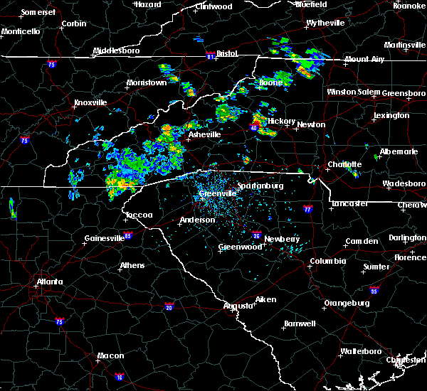 At 500 pm edt, doppler radar indicated a severe thunderstorm capable of producing damaging winds in excess of 60 mph. this storm was located near morganton, and moving southwest at 10 mph. nickel size hail may also accompany the damaging winds. * locations in the warning include, morganton, glen alpine, oak hill, lake james, lake james state park and south mountains state park. At 500 pm edt, doppler radar indicated a severe thunderstorm capable of producing damaging winds in excess of 60 mph. this storm was located near morganton, and moving southwest at 10 mph. nickel size hail may also accompany the damaging winds. * locations in the warning include, morganton, glen alpine, oak hill, lake james, lake james state park and south mountains state park.
|
| 7/13/2015 8:36 PM EDT |
 The severe thunderstorm warning for southeastern caldwell, burke, northeastern rutherford, western catawba, northwestern iredell, southern mcdowell and alexander counties will expire at 845 pm edt, the line of storms which prompted the warning have moved out of the area. therefore the warning will be allowed to expire. The severe thunderstorm warning for southeastern caldwell, burke, northeastern rutherford, western catawba, northwestern iredell, southern mcdowell and alexander counties will expire at 845 pm edt, the line of storms which prompted the warning have moved out of the area. therefore the warning will be allowed to expire.
|
| 7/13/2015 8:06 PM EDT |
 At 805 pm edt, doppler radar indicated a line of showers and thunderstorms with a history of producing damaging winds in excess of 60 mph. these storms were located along a line extending from 5 miles north of north wilkesboro to 5 miles north of morganton to 9 miles west of downtown asheville, and moving southeast at 25 mph. At 805 pm edt, doppler radar indicated a line of showers and thunderstorms with a history of producing damaging winds in excess of 60 mph. these storms were located along a line extending from 5 miles north of north wilkesboro to 5 miles north of morganton to 9 miles west of downtown asheville, and moving southeast at 25 mph.
|
| 7/13/2015 7:35 PM EDT |
 At 734 pm edt, doppler radar indicated a line of severe thunderstorms with a history of producing damaging winds in excess of 60 mph. these storms were located along a line extending from 4 miles south of deep gap to 3 miles northeast of spruce pine to 6 miles west of marshall, moving southeast at 40 mph. penny size hail may also accompany the damaging winds. locations impacted include, lenoir, spruce pine, burnsville, marshall, newland, beech mountain, gamewell, cajah`s mountain, mars hill and banner elk. At 734 pm edt, doppler radar indicated a line of severe thunderstorms with a history of producing damaging winds in excess of 60 mph. these storms were located along a line extending from 4 miles south of deep gap to 3 miles northeast of spruce pine to 6 miles west of marshall, moving southeast at 40 mph. penny size hail may also accompany the damaging winds. locations impacted include, lenoir, spruce pine, burnsville, marshall, newland, beech mountain, gamewell, cajah`s mountain, mars hill and banner elk.
|
| 7/13/2015 6:59 PM EDT |
 At 657 pm edt, doppler radar indicated a line of severe thunderstorms capable of producing damaging winds in excess of 60 mph. these storms were located along a line extending from near whitetop to 9 miles northwest of beech mountain to 11 miles east of morristown, and moving southeast at 30 mph. nickel size hail may also accompany the damaging winds. At 657 pm edt, doppler radar indicated a line of severe thunderstorms capable of producing damaging winds in excess of 60 mph. these storms were located along a line extending from near whitetop to 9 miles northwest of beech mountain to 11 miles east of morristown, and moving southeast at 30 mph. nickel size hail may also accompany the damaging winds.
|
| 6/18/2015 4:32 PM EDT | At 432 pm edt, doppler radar indicated a severe thunderstorm capable of producing quarter size hail and damaging winds in excess of 60 mph. this storm was located 8 miles southwest of morganton, or 6 miles west of south mountains state park, moving east at 15 mph. locations impacted include, morganton, glen alpine, south mountains state park, pleasant grove, drexel and valdese. |
| 6/18/2015 4:24 PM EDT | At 424 pm edt, doppler radar indicated a severe thunderstorm capable of producing quarter size hail and damaging winds in excess of 60 mph. this storm was located 7 miles southwest of morganton, or 5 miles south of glen alpine, moving east at 15 mph. locations impacted include, morganton, valdese, drexel, rutherford college, glen alpine, lake rhodhiss, lake james, south mountains state park, lake james state park and dysartsville. |
| 6/18/2015 4:17 PM EDT | A tree that was a foot in diameter fell near the intersection of valley trail road and jamestown roa in burke county NC, 6.4 miles ENE of Morganton, NC |
| 6/18/2015 4:15 PM EDT | Multiple trees down at the intersection of morning star church road and tallent roa in burke county NC, 8.1 miles ENE of Morganton, NC |
| 6/18/2015 4:10 PM EDT | Several large limbs blown down at silver creek plantation golf course. radar velocity image gave the tim in burke county NC, 5.5 miles ENE of Morganton, NC |
| 6/18/2015 4:00 PM EDT | At 400 pm edt, doppler radar indicated a severe thunderstorm capable of producing large damaging hail up to golf ball size and damaging winds in excess of 60 mph. this storm was located 9 miles southwest of morganton, or 4 miles southeast of lake james state park, and moving east at 15 mph. |
| 6/17/2015 3:45 PM EDT |
 At 345 pm edt, doppler radar indicated a severe thunderstorm capable of producing damaging winds in excess of 60 mph. this storm was located 4 miles west of morganton, or near glen alpine, moving east at 15 mph. penny size hail may also accompany the damaging winds. locations impacted include, morganton, valdese, drexel, connelly springs, rutherford college, glen alpine, lake james, south mountains state park, lake james state park and table rock. At 345 pm edt, doppler radar indicated a severe thunderstorm capable of producing damaging winds in excess of 60 mph. this storm was located 4 miles west of morganton, or near glen alpine, moving east at 15 mph. penny size hail may also accompany the damaging winds. locations impacted include, morganton, valdese, drexel, connelly springs, rutherford college, glen alpine, lake james, south mountains state park, lake james state park and table rock.
|
| 6/17/2015 3:32 PM EDT |
 At 332 pm edt, doppler radar indicated a severe thunderstorm capable of producing damaging winds in excess of 60 mph. this storm was located 8 miles west of morganton, or near lake james, and moving southeast at 15 mph. penny size hail may also accompany the damaging winds. At 332 pm edt, doppler radar indicated a severe thunderstorm capable of producing damaging winds in excess of 60 mph. this storm was located 8 miles west of morganton, or near lake james, and moving southeast at 15 mph. penny size hail may also accompany the damaging winds.
|
| 4/9/2015 4:02 PM EDT | A severe thunderstorm warning remains in effect until 430 pm edt for caldwell and northwestern burke counties. at 402 pm edt. doppler radar indicated a severe thunderstorm capable of producing quarter size hail and damaging winds in excess of 60 mph. this storm was located 11 miles northwest of morganton. or 8 miles southeast of linville falls. Moving northeast at 20 mph. |
| 4/9/2015 3:38 PM EDT | The national weather service in greenville-spartanburg has issued a * severe thunderstorm warning for. caldwell county in western north carolina. northwestern burke county in western north carolina. until 430 pm edt * at 338 pm edt. Doppler radar indicated a severe thunderstorm. |
| 10/10/2014 6:20 PM EDT | Quarter sized hail reported 7.3 miles S of Morganton, NC, report of nickel to quarter sized hail in the chesterfield area of burke county near johns river rd and paxs hill rd. |
| 9/1/2014 4:36 PM EDT | An 18 inch diameter hickory tree uprooted with numerous large limbs down on the same property. this is near the intersection of trestlewood lane off of conley roa in burke county NC, 5.1 miles NE of Morganton, NC |
| 9/1/2014 4:36 PM EDT | A large tree reported down on scott road. minor property damage and a power line down near the intersection of highway 64 and mt. olive. large limbs down on conley road in burke county NC, 5.9 miles NE of Morganton, NC |
| 7/24/2014 7:15 PM EDT | Tree down on a powerline in the salem area in burke county NC, 0.7 miles SW of Morganton, NC |
| 7/24/2014 7:10 PM EDT | Tree down along burkemont ave in burke county NC, 1.1 miles WSW of Morganton, NC |
| 7/24/2014 5:44 PM EDT | Trees and powerlines down...one tree on a vehicle. west union st and burkemont ave in burke county NC, 0.7 miles SW of Morganton, NC |
| 7/24/2014 5:10 PM EDT | Quarter sized hail reported 3.9 miles W of Morganton, NC, quarter size hail along summers rd near drexel. time estimated from radar. |
| 6/20/2014 7:02 PM EDT | Tree on a house on amherst road with people inside the house. do not know if injuries have occurre in burke county NC, 2.8 miles SW of Morganton, NC |
| 6/20/2014 7:01 PM EDT | Quarter sized hail reported 0.7 miles SW of Morganton, NC, quarter sized hail reported near intersection of highways 18 and 64 in morganton. |
| 6/20/2014 7:00 PM EDT | Trees and power lines down on the north side of morganton especially on putnam stree in burke county NC, 1.9 miles SSW of Morganton, NC |
| 6/19/2014 5:00 PM EDT | Half Dollar sized hail reported 15.3 miles SE of Morganton, NC, media relayed report of half dollar size hail at the table rock parking lot. |
| 6/19/2014 3:15 PM EDT | Quarter sized hail reported 5.5 miles SW of Morganton, NC, media relayed report of quarter size hail on antioch rd. |
| 6/19/2014 3:10 PM EDT | Media reports a few trees blown down on bost r in burke county NC, 3.2 miles S of Morganton, NC |
| 6/11/2014 3:07 PM EDT | Roof blown off barn on hayes waters roa in burke county NC, 6.1 miles NE of Morganton, NC |
| 6/11/2014 3:00 PM EDT | Quarter sized hail reported 7.9 miles NE of Morganton, NC, one inch hail reported at hwy 64 and conley rd. |
| 6/10/2014 10:38 PM EDT | Numerous trees blown down ne of morganton... n in burke county NC, 3.7 miles SW of Morganton, NC |
| 6/10/2014 10:30 PM EDT | Trees down off bethel rd in morganto in burke county NC, 0.7 miles SW of Morganton, NC |
| 5/29/2014 5:10 PM EDT | Trees and power lines down on nc hwy 18 near johns rive in burke county NC, 4.2 miles SSW of Morganton, NC |
| 9/1/2013 4:00 PM EDT | Trees blown down on piedmont road and bethel roa in burke county NC, 0.7 miles SW of Morganton, NC |
| 7/17/2013 4:56 PM EDT | Oak hill area has multiple trees down at intersection of highway 181 and spainhour road. highway 181 close in burke county NC, 4.3 miles SE of Morganton, NC |
| 7/12/2013 10:33 PM EDT | Quarter sized hail reported 4.6 miles NNE of Morganton, NC, observed along jenkins road |
| 7/12/2013 10:20 PM EDT | Quarter sized hail reported 0.7 miles SW of Morganton, NC, public report of quarter size hail. |
| 7/12/2013 10:05 PM EDT | Spotter relayed reports of multiple trees down on eastern half of byrd road from last friday evenings storm and a few trees fell on homes along the roa in burke county NC, 2.9 miles NE of Morganton, NC |
| 7/12/2013 10:05 PM EDT | Quarter sized hail reported 4.3 miles ENE of Morganton, NC, observed along causby road in glen alpine |
| 7/12/2013 9:52 PM EDT | Trees and powerlines down along kathy roa in burke county NC, 6.1 miles ENE of Morganton, NC |
| 7/12/2013 9:52 PM EDT | Half Dollar sized hail reported 6.1 miles ENE of Morganton, NC, observed along kathy road. |
| 7/12/2013 3:15 PM EDT | Quarter sized hail reported 1.8 miles E of Morganton, NC |
| 7/5/2013 5:03 PM EDT | Trees down on a family care center on henderson mill roa in burke county NC, 5.7 miles SSE of Morganton, NC |
| 7/5/2013 5:03 PM EDT | Media relayed public report of one tree down on highway 181 in the oak hill communit in burke county NC, 4.8 miles SE of Morganton, NC |
| 7/5/2013 4:58 PM EDT | Trees down in the oak hill communit in burke county NC, 4.3 miles SE of Morganton, NC |
| 7/5/2013 4:54 PM EDT | Trees down at w.a. young elementary school at 325 conley roa in burke county NC, 3.6 miles ENE of Morganton, NC |
| 6/13/2013 3:39 PM EDT | Quarter sized hail reported 5.8 miles WSW of Morganton, NC, 1 inch hail and strong wind gusts reported in drexel. |
| 6/13/2013 3:30 PM EDT | Trees down off st marys church rd and hwy 18 in burke county NC, 3 miles SE of Morganton, NC |
| 5/21/2013 6:45 PM EDT | Golf Ball sized hail reported 14.7 miles SSE of Morganton, NC, hail dented vehicle and cracked the windshield. |
| 5/11/2013 6:15 PM EDT | Branches from oak tree blown dow in burke county NC, 3.2 miles S of Morganton, NC |
| 5/11/2013 6:15 PM EDT | Quarter sized hail reported 3.4 miles SSW of Morganton, NC |
| 5/11/2013 6:15 PM EDT | Two pine trees blown down along with several large branche in burke county NC, 3.4 miles SSW of Morganton, NC |
| 8/9/2012 6:59 PM EDT | Trees and power lines down on spainhour rd and along 18 in burke county NC, 0.7 miles SW of Morganton, NC |
| 8/8/2012 3:10 PM EDT | Quarter sized hail reported 2.9 miles SE of Morganton, NC |
| 8/6/2012 3:15 PM EDT | One tree blown over on davis drive. time is approximate based on estimated time from observer and rada in burke county NC, 0.8 miles SE of Morganton, NC |
| 7/27/2012 4:16 PM EDT | Two trees dow in burke county NC, 9.1 miles NNE of Morganton, NC |
| 7/25/2012 3:55 PM EDT | Quarter sized hail reported 2.8 miles W of Morganton, NC |
| 7/5/2012 5:05 PM EDT | Tree on house in burke county NC, 2.4 miles WNW of Morganton, NC |
| 7/3/2012 3:05 PM EDT | Tree down near chesterfield community and another down on forest service land in northern part of count in burke county NC, 5.3 miles S of Morganton, NC |
| 5/1/2012 4:12 PM EDT | Quarter sized hail reported 7.7 miles SE of Morganton, NC |
| 5/1/2012 3:44 PM EDT | Quarter sized hail reported 2.4 miles WNW of Morganton, NC, quarter size hail reported at exit 105 on i-40. |
| 5/1/2012 3:43 PM EDT | Quarter sized hail reported 3.6 miles NW of Morganton, NC |
| 5/1/2012 3:40 PM EDT | Half Dollar sized hail reported 3 miles N of Morganton, NC |
| 5/1/2012 3:33 PM EDT | Quarter sized hail reported 1.8 miles E of Morganton, NC, observed off of jamestown rd and dixie blvd |
| 3/20/2012 2:52 PM EDT | Quarter sized hail reported 0.7 miles SW of Morganton, NC |
| 1/1/0001 12:00 AM | Three trees down near the intersection of nc-181 and frank whisnant road in the oak hill communit in burke county NC, 4.8 miles SE of Morganton, NC |
| 1/1/0001 12:00 AM | Trees down at nc 18 and bethel roa in burke county NC, 0.7 miles SW of Morganton, NC |
| 1/1/0001 12:00 AM | Storm damage reported in burke county NC, 3.2 miles NW of Morganton, NC |
| 1/1/0001 12:00 AM | Storm damage reported in burke county NC, 3.6 miles NW of Morganton, NC |
| 1/1/0001 12:00 AM | Trees and powerlines down in burke county NC, 9.6 miles SSE of Morganton, NC |
| 1/1/0001 12:00 AM | Trees and powerlines down on brown mtn beach rd in burke county NC, 9.6 miles SSE of Morganton, NC |
| 1/1/0001 12:00 AM | Quarter sized hail reported 3.2 miles NNE of Morganton, NC, quarter sized hail fell at salem elementary school wednesday afternoon. |
| 1/1/0001 12:00 AM | Ping Pong Ball sized hail reported 3.3 miles NE of Morganton, NC, at clyde valley airport...a report of hail up to the diameter of a silver dollar which we are estimating to be about ping pong ball sized. most of the hail was thin but |
| 1/1/0001 12:00 AM | Multiple trees and powerlines down. road was closed in this are in burke county NC, 5.9 miles SSW of Morganton, NC |
| 1/1/0001 12:00 AM | Many trees down across the cit in burke county NC, 0.7 miles SW of Morganton, NC |
| 1/1/0001 12:00 AM | Many trees and powerlines dow in burke county NC, 8 miles E of Morganton, NC |
| 1/1/0001 12:00 AM | Quarter sized hail reported 8.1 miles SW of Morganton, NC |
| 1/1/0001 12:00 AM | 10 inch diameter trees down near the intersection of hw-18 and sugar loaf roa in burke county NC, 7.1 miles NW of Morganton, NC |
| 1/1/0001 12:00 AM | Half Dollar sized hail reported 2.4 miles NNW of Morganton, NC, salem community |
| 1/1/0001 12:00 AM | Golf Ball sized hail reported 2.4 miles NNW of Morganton, NC, salem community |
| 1/1/0001 12:00 AM | Quarter sized hail reported 0.7 miles SW of Morganton, NC |
| 1/1/0001 12:00 AM | Ping Pong Ball sized hail reported 3.9 miles NNE of Morganton, NC, hail covered the ground. very little rain. |
| 1/1/0001 12:00 AM | County communications reports two or three trees down along highway 181 in the brown mountain are in burke county NC, 10.6 miles SSE of Morganton, NC |
| 1/1/0001 12:00 AM | Several trees blown down at broughton hospita in burke county NC, 0.7 miles SW of Morganton, NC |
| 4/9/2011 7:10 PM EDT | Hen Egg sized hail reported 0.7 miles SW of Morganton, NC |
| 1/1/0001 12:00 AM | Half Dollar sized hail reported 1.1 miles WNW of Morganton, NC, on south sterling street in morganton. |
| 4/9/2011 6:15 PM EDT | Ping Pong Ball sized hail reported 0.7 miles SW of Morganton, NC |
| 1/1/0001 12:00 AM | Quarter sized hail reported 1.1 miles WNW of Morganton, NC, on old shelby road. |
| 1/1/0001 12:00 AM | Half Dollar sized hail reported 1.9 miles SSE of Morganton, NC |
| 4/9/2011 6:10 PM EDT | Golf Ball sized hail reported 0.7 miles SW of Morganton, NC |
| 1/1/0001 12:00 AM | Media reports several trees blown down on bethel rd...some on home in burke county NC, 2.2 miles W of Morganton, NC |
Hail Maps for Morganton, NC


Connect with Interactive Hail Maps