

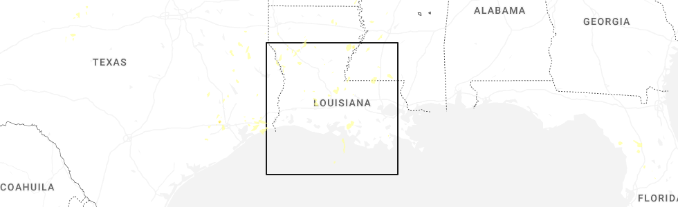
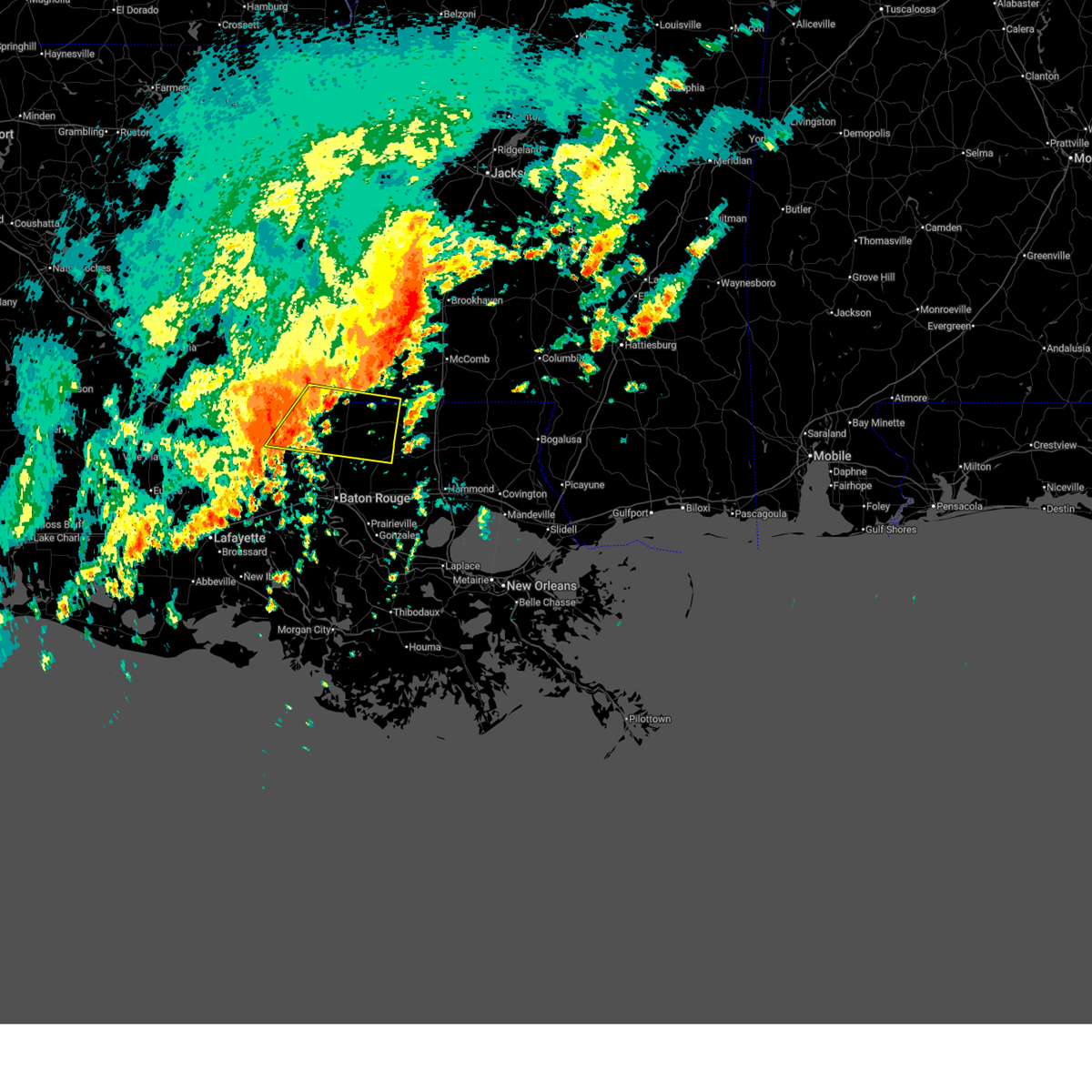
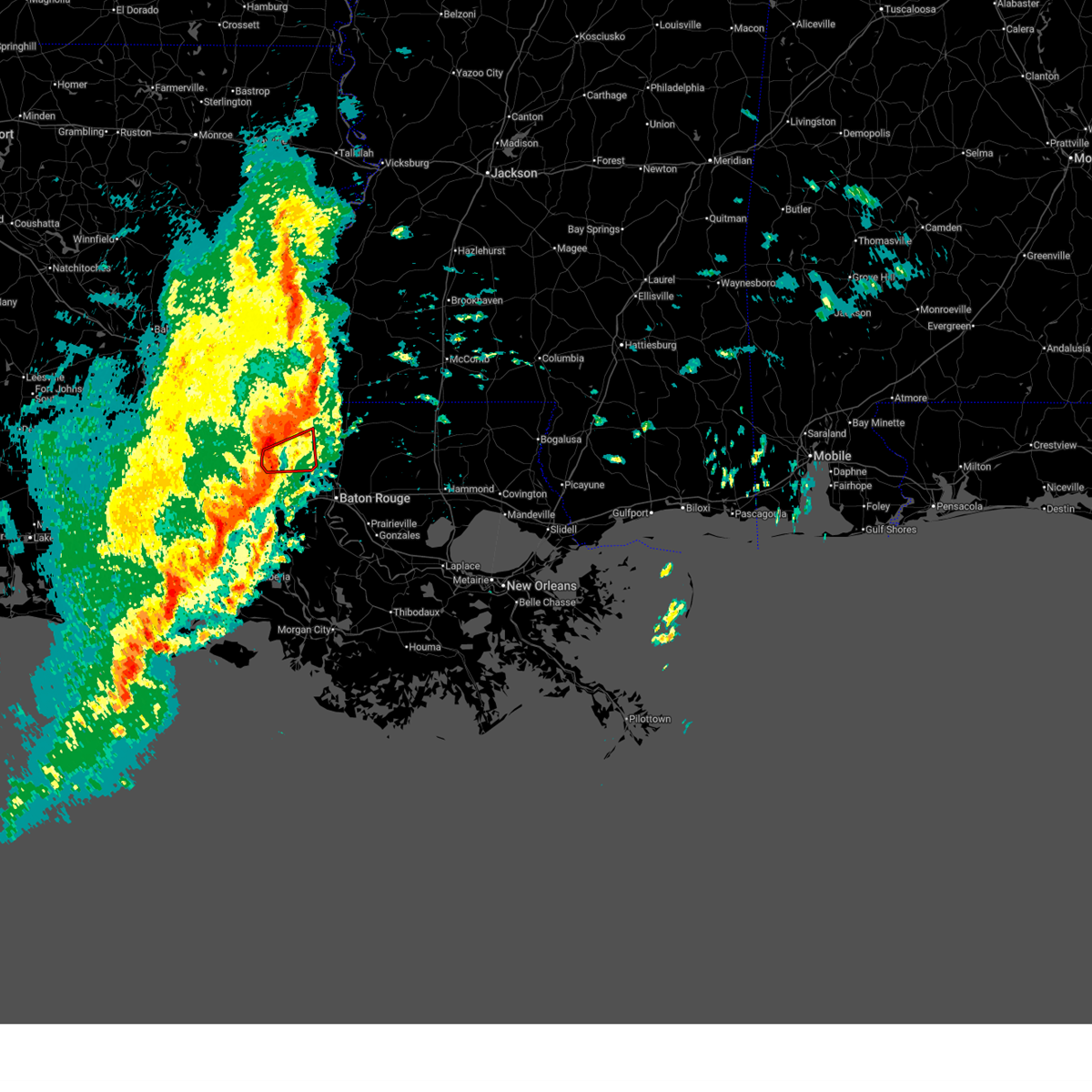
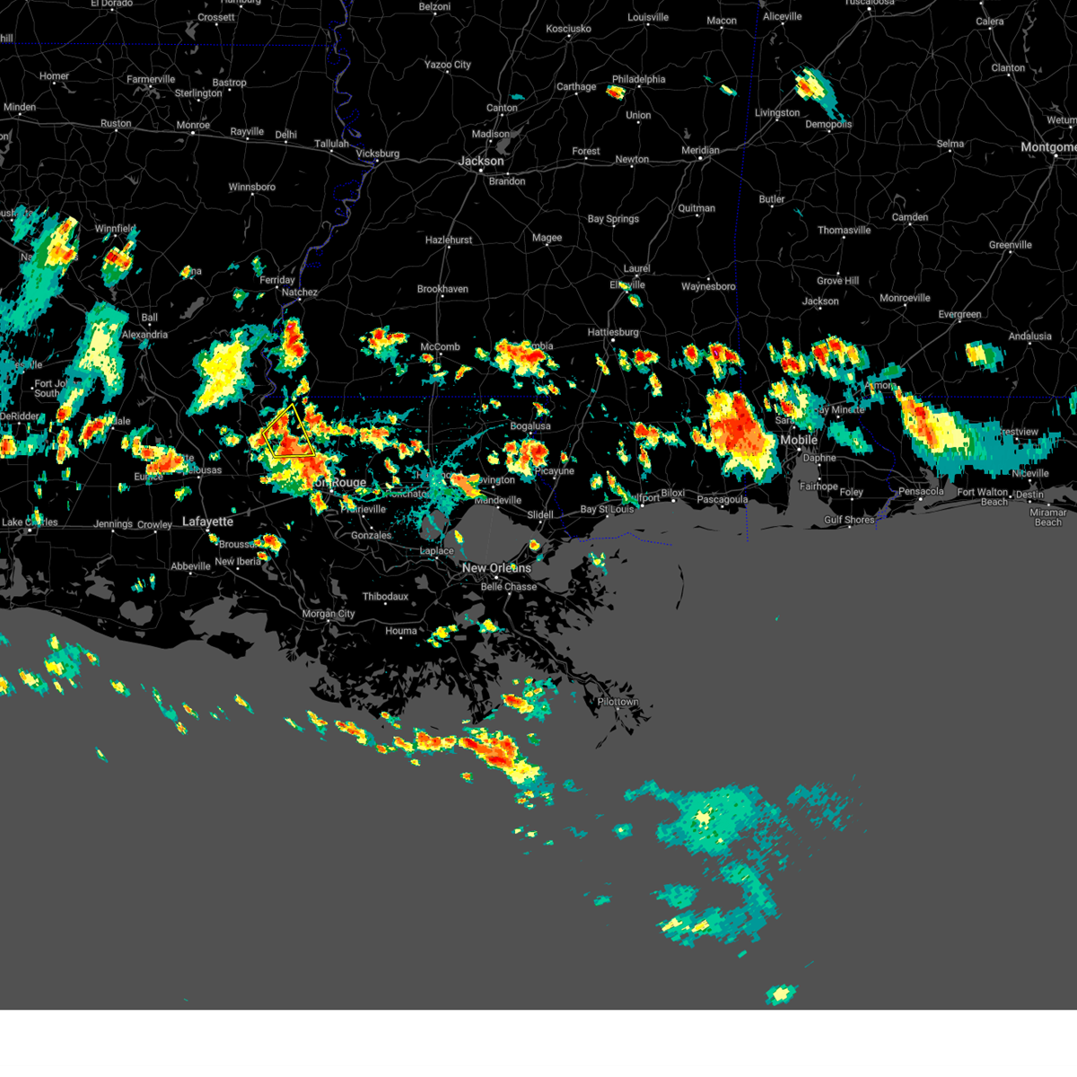
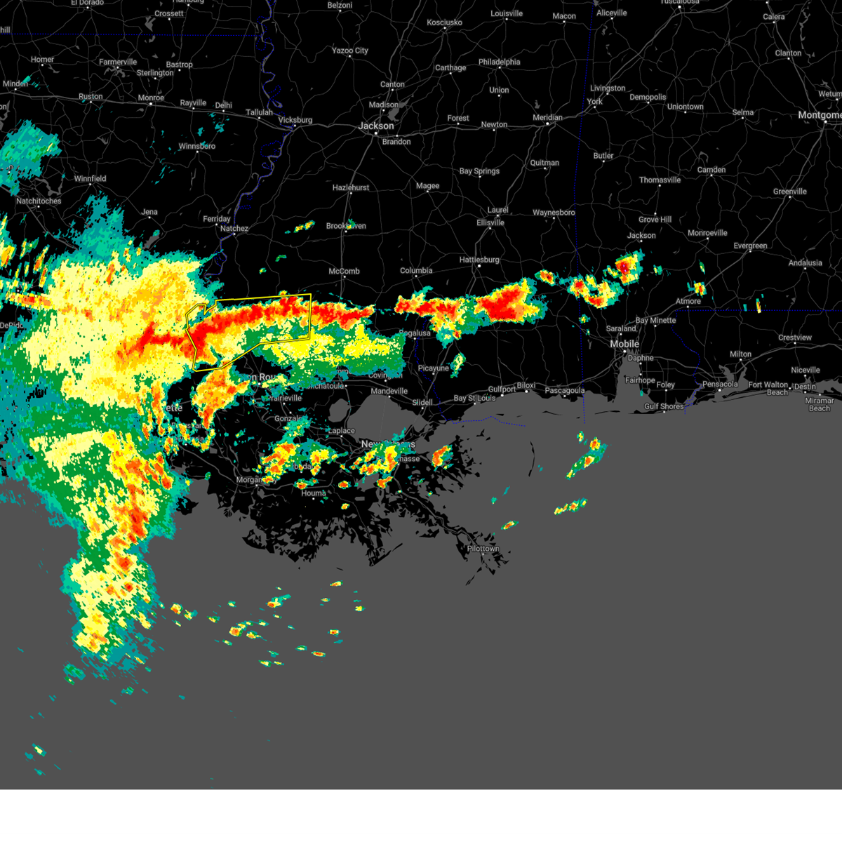
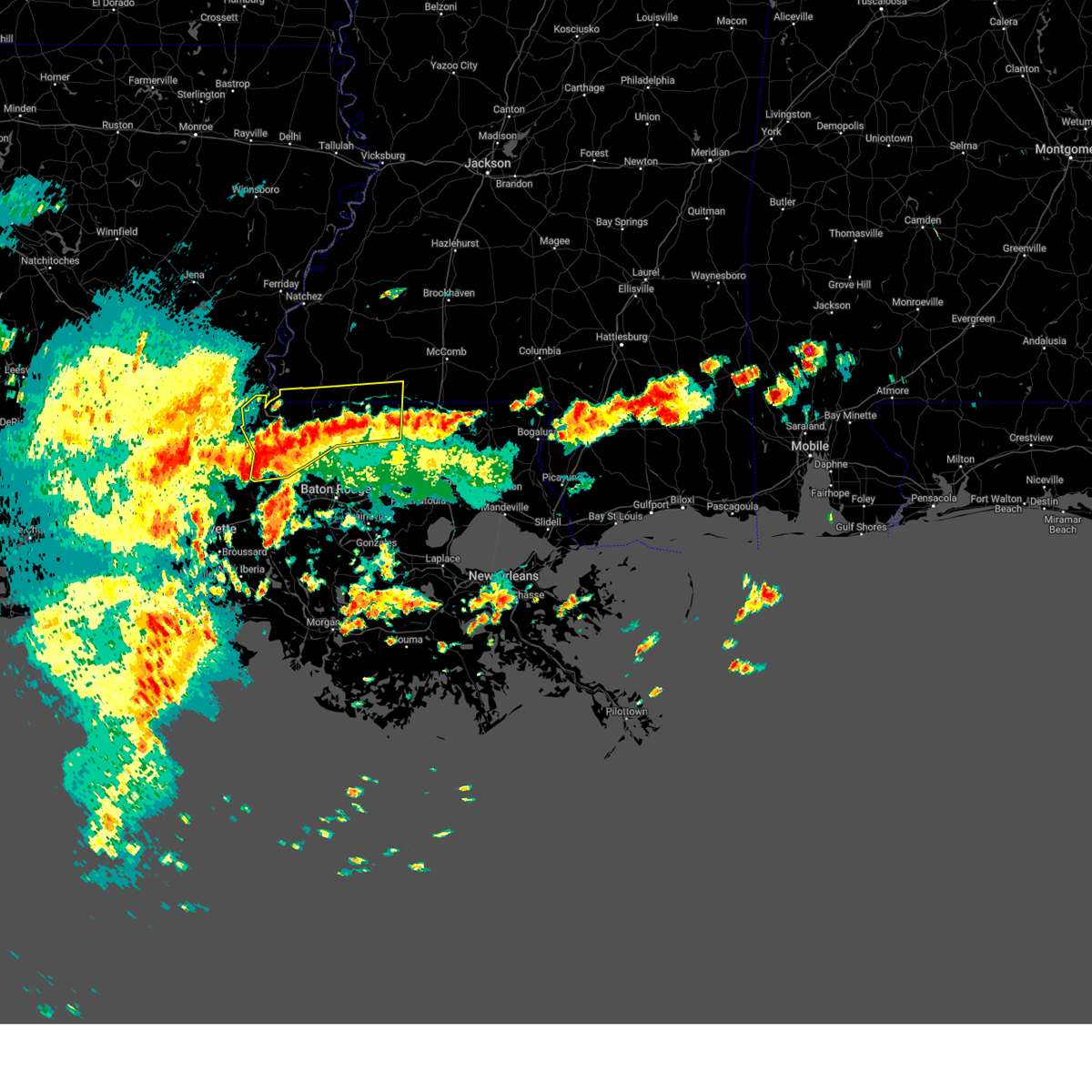
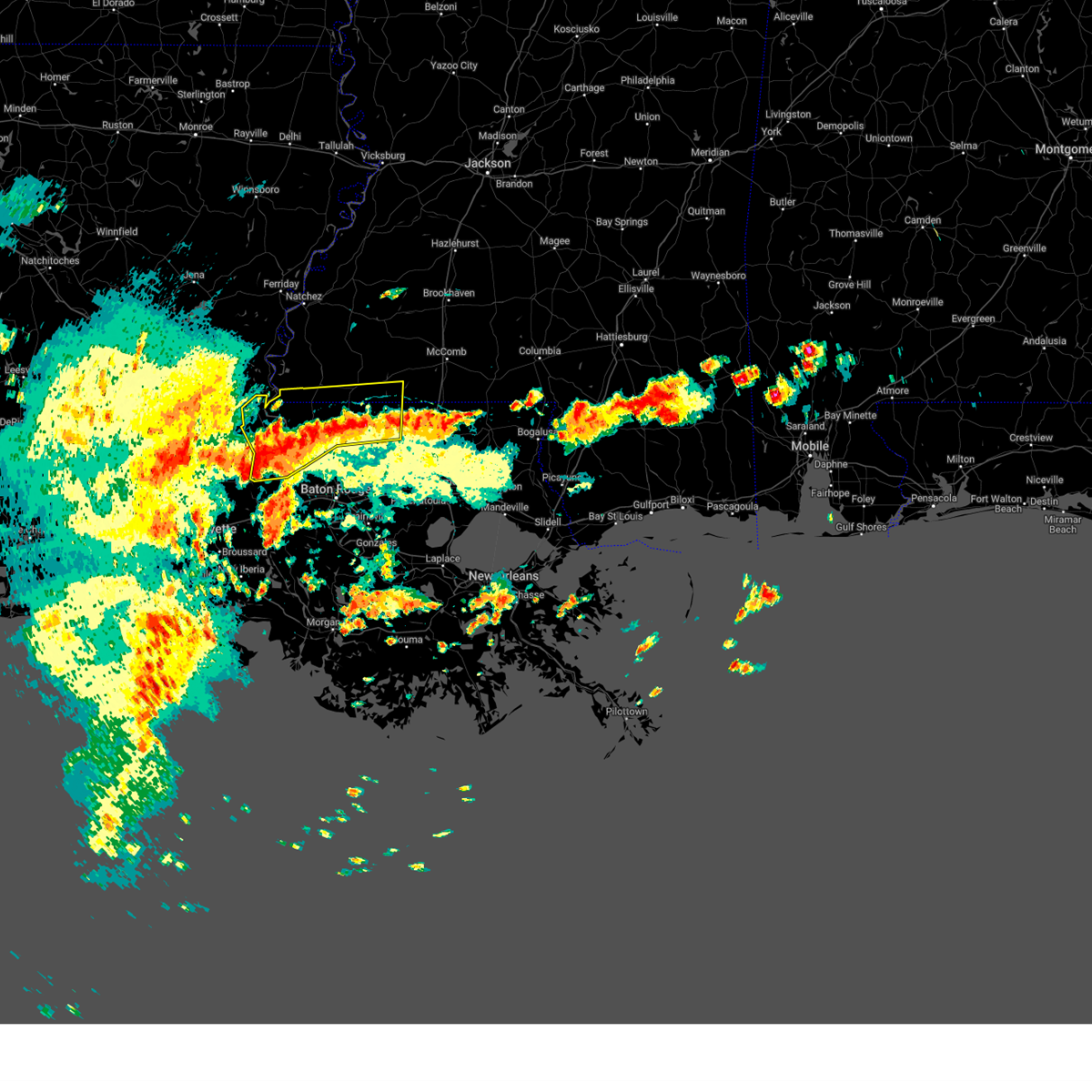
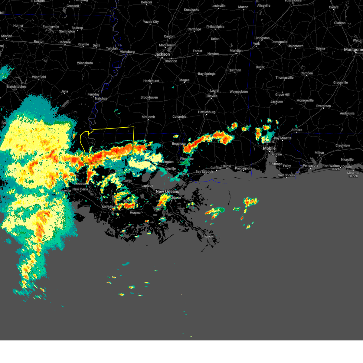
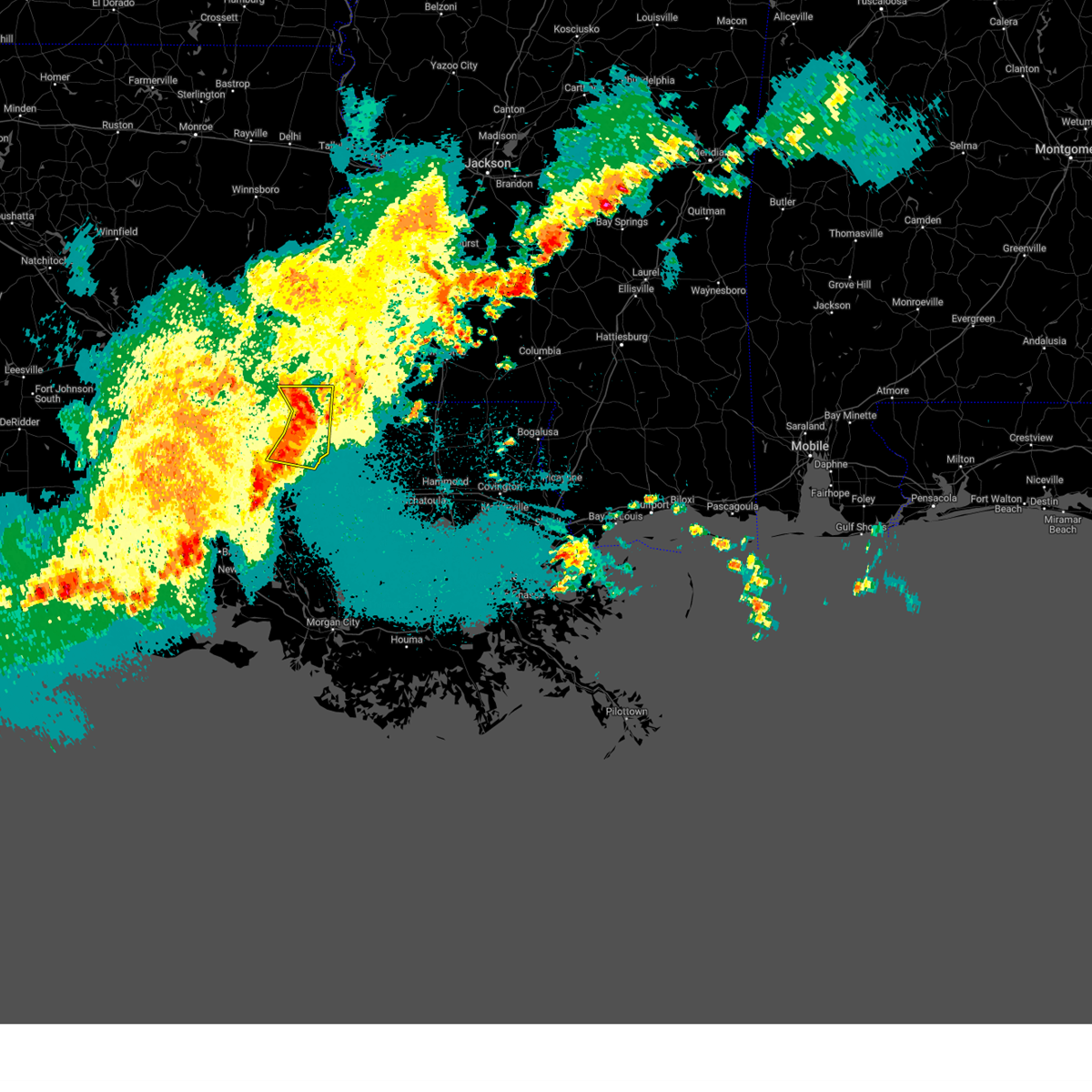
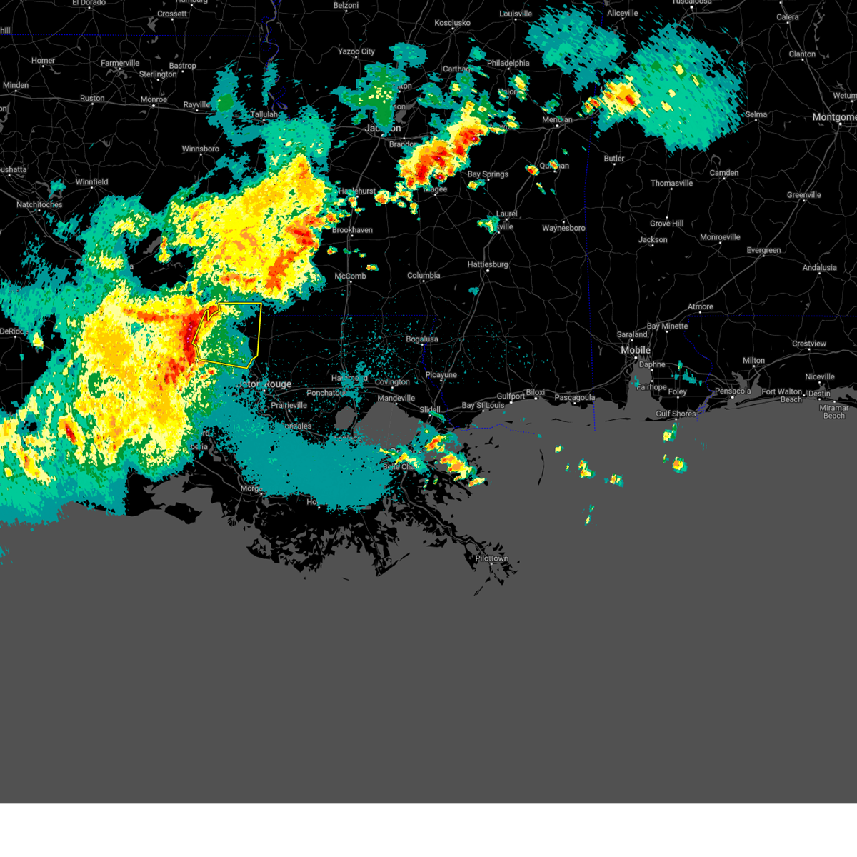
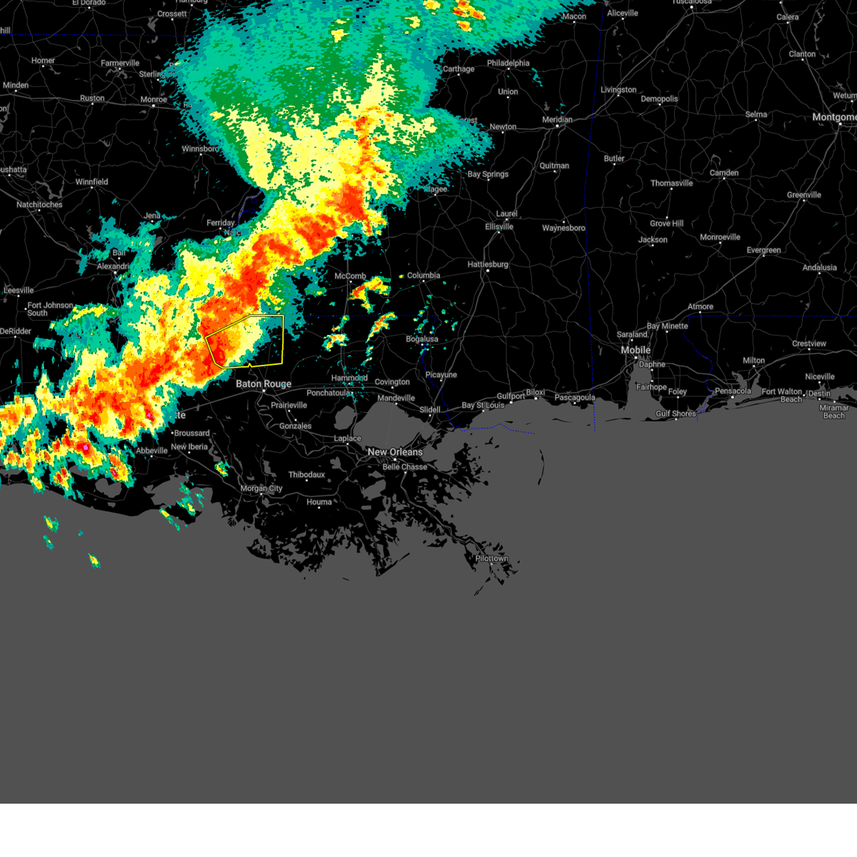
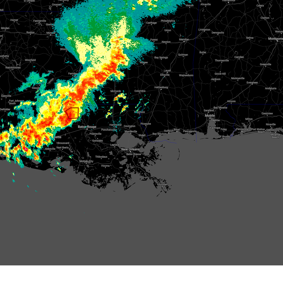
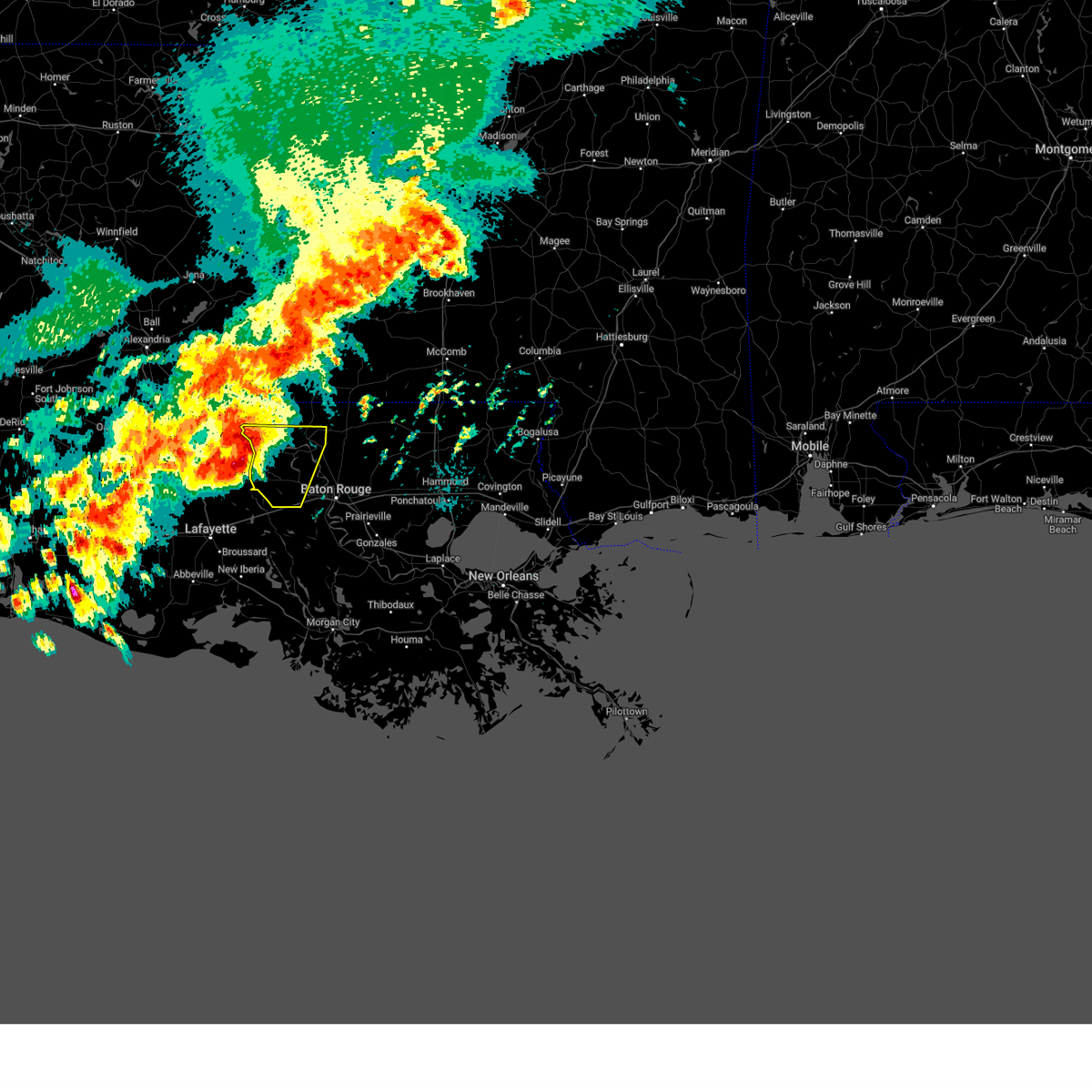
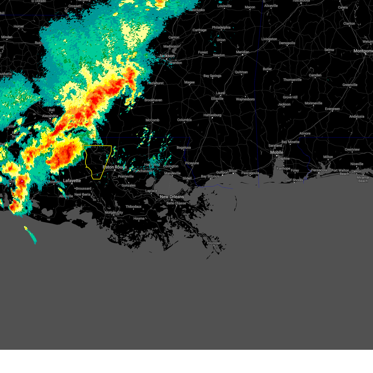
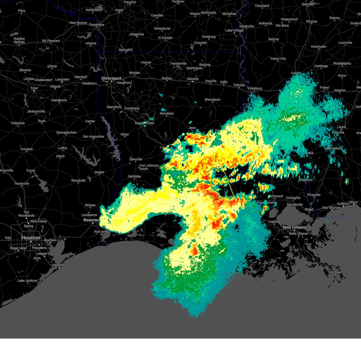
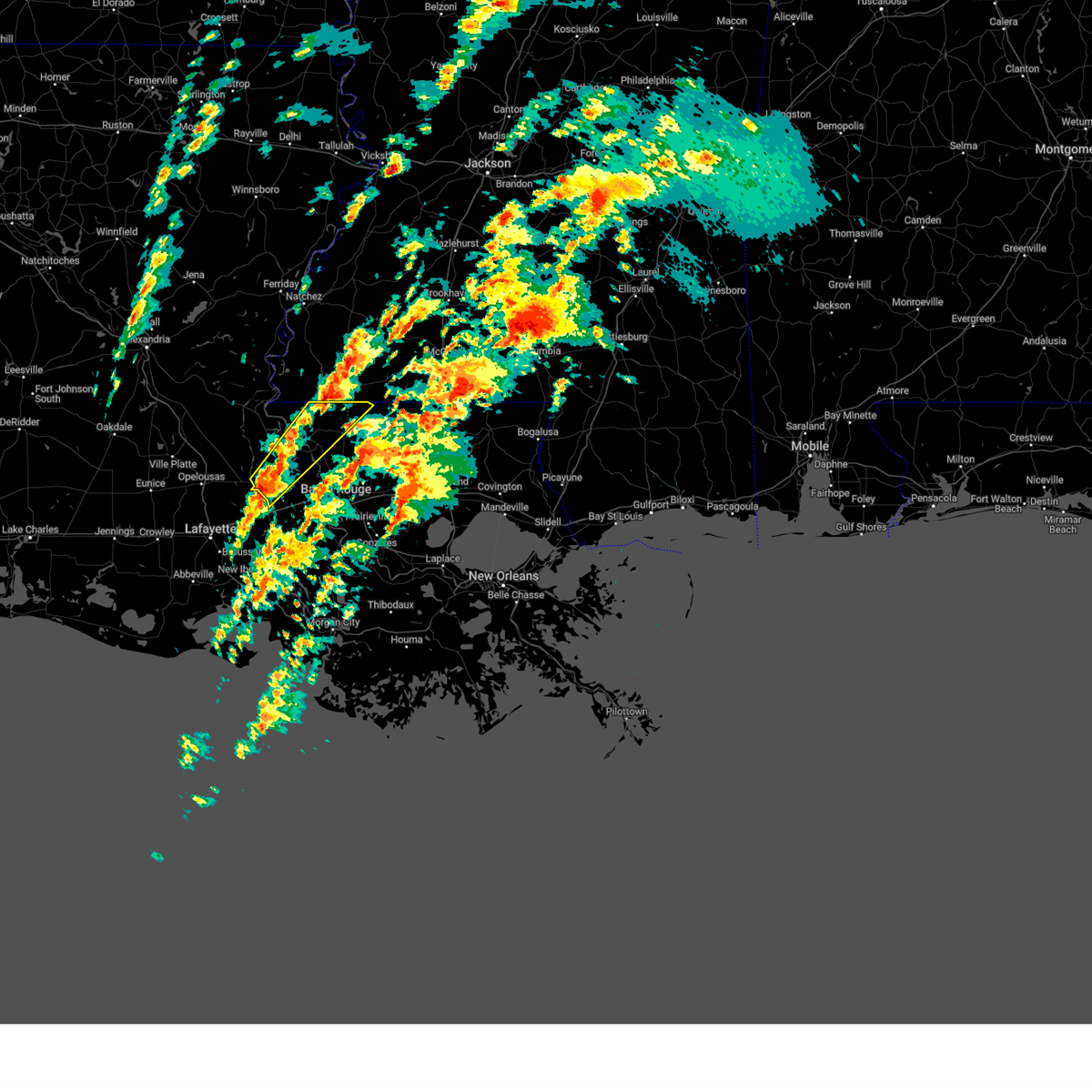
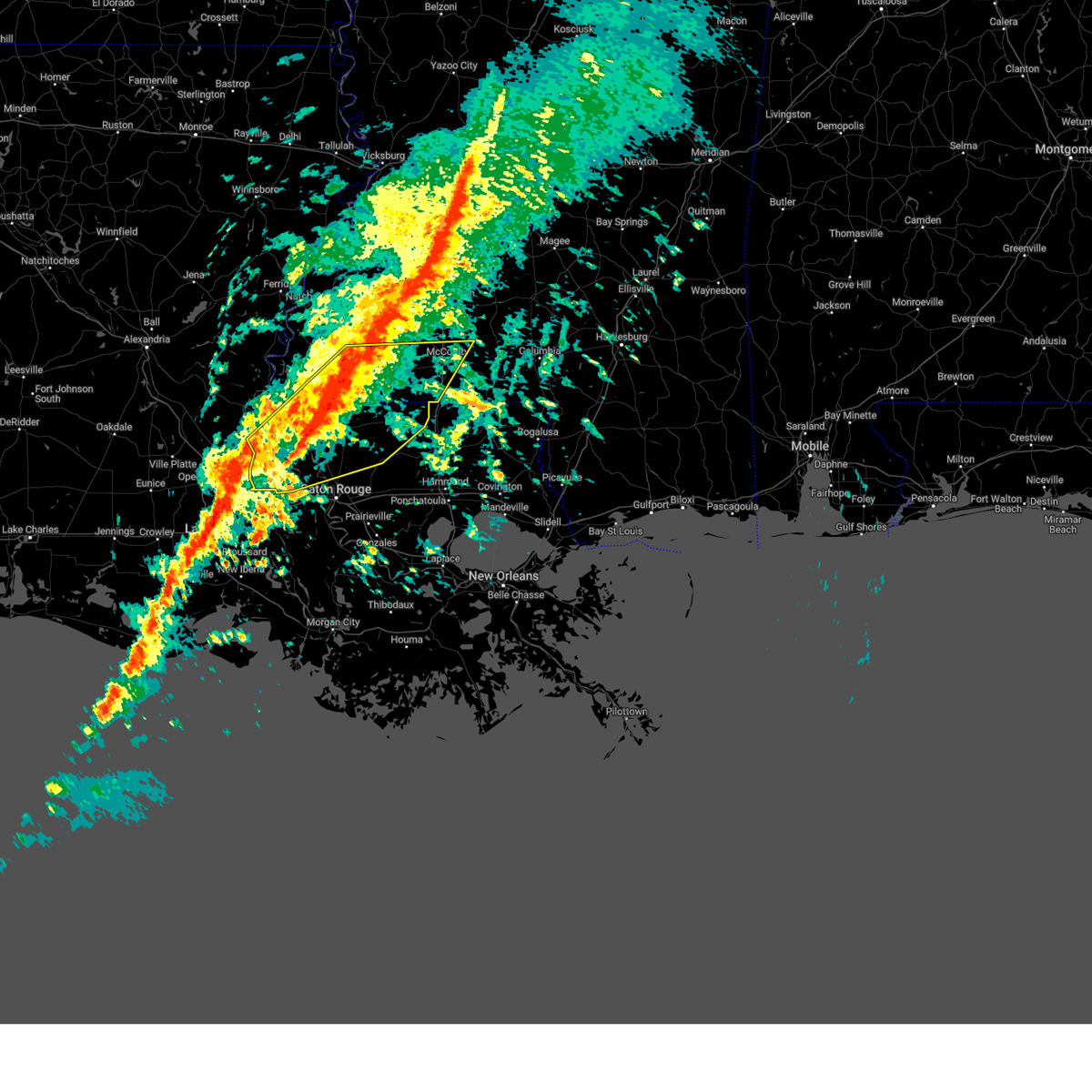
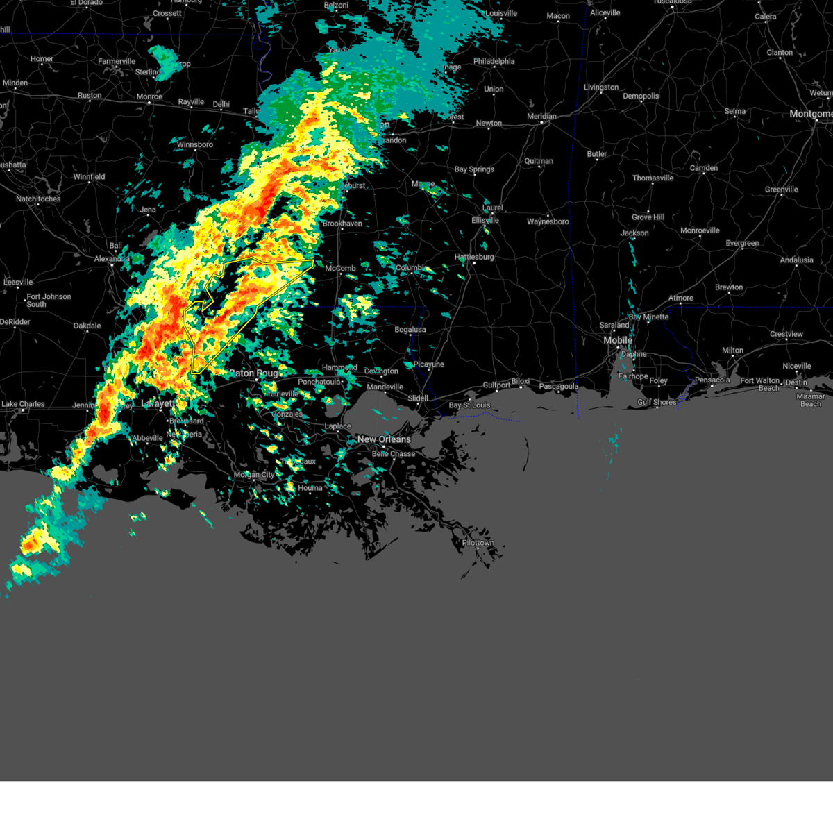
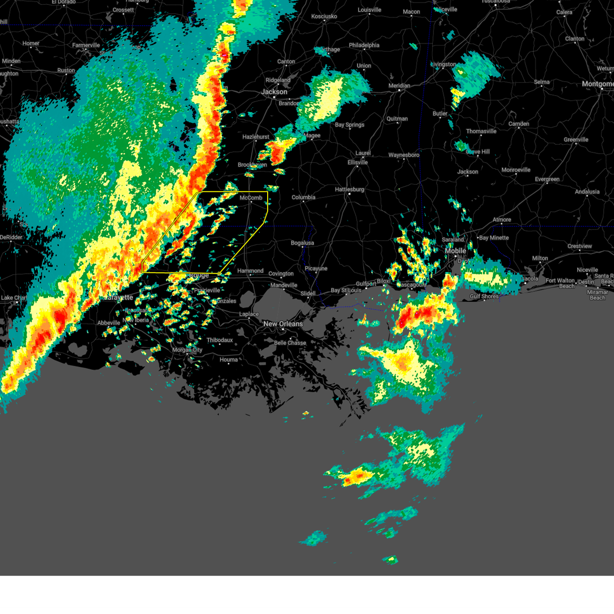
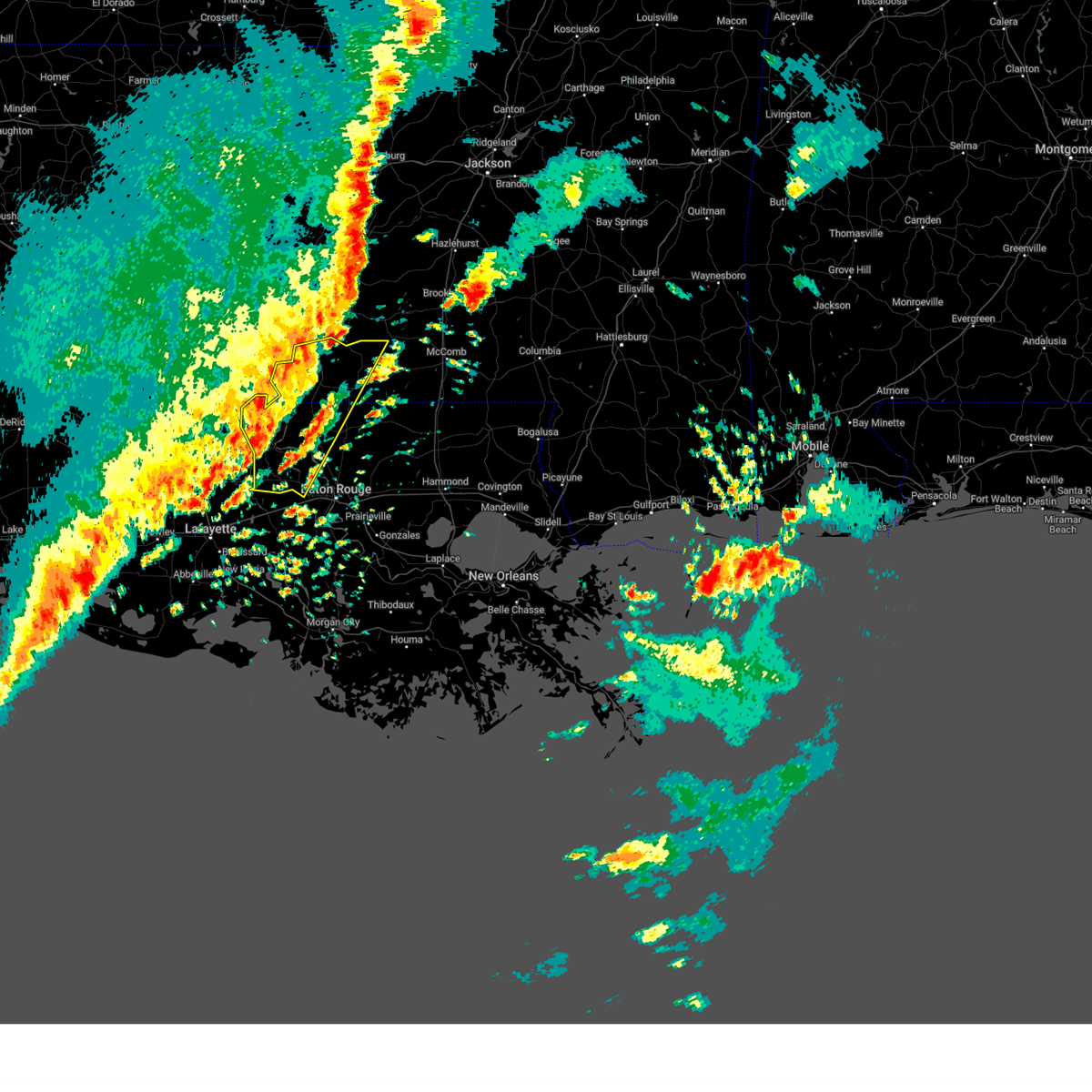
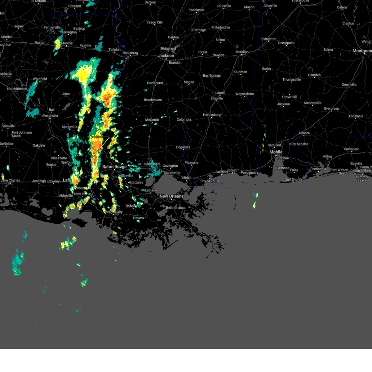
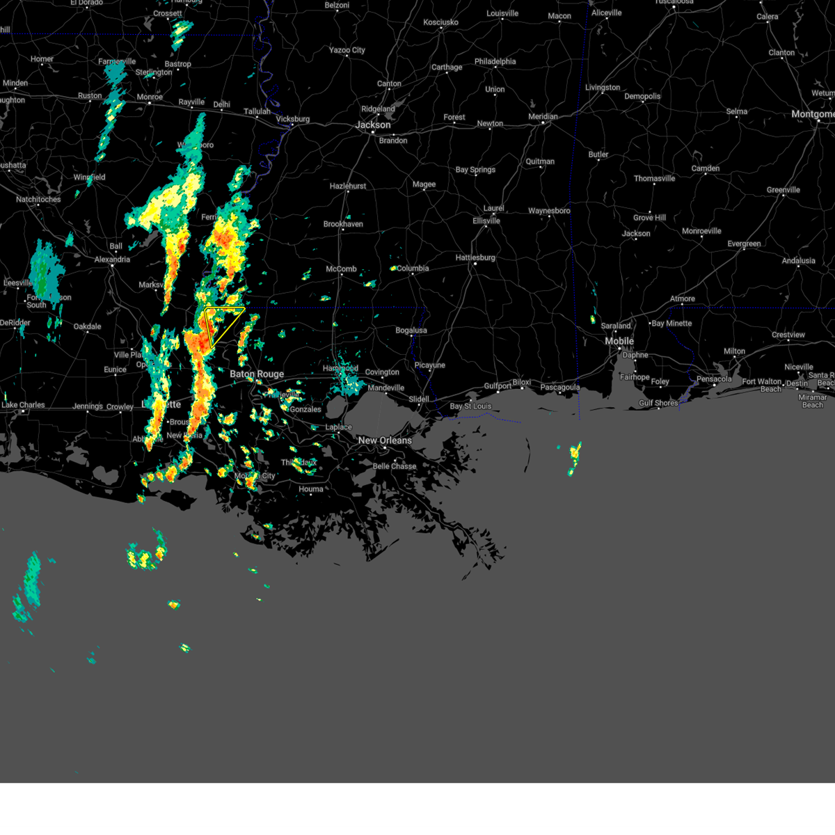
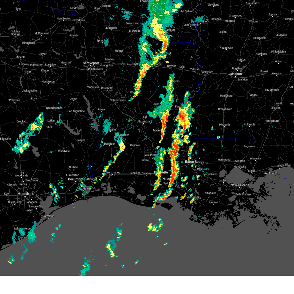
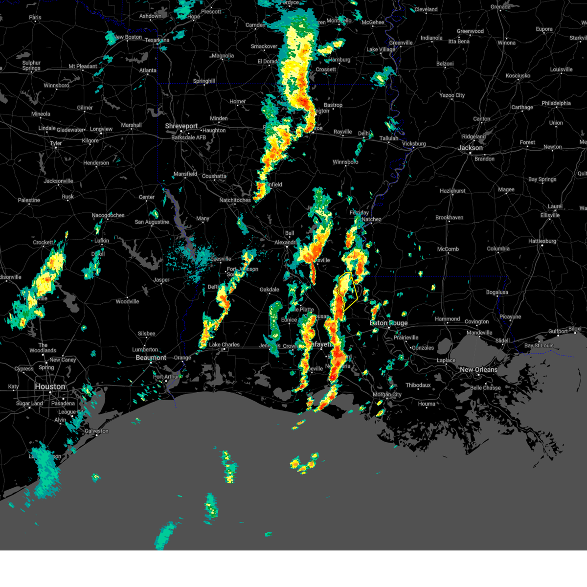
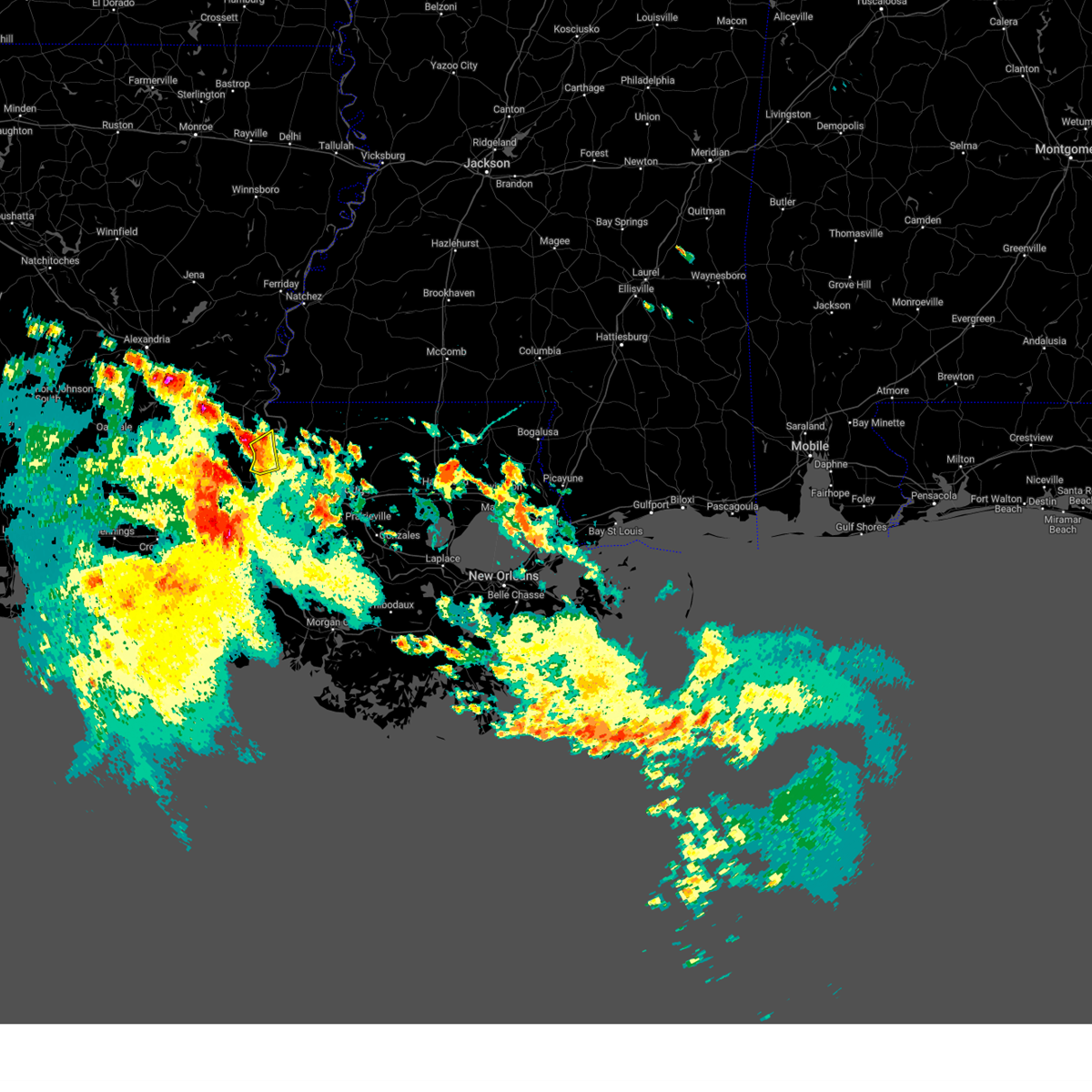
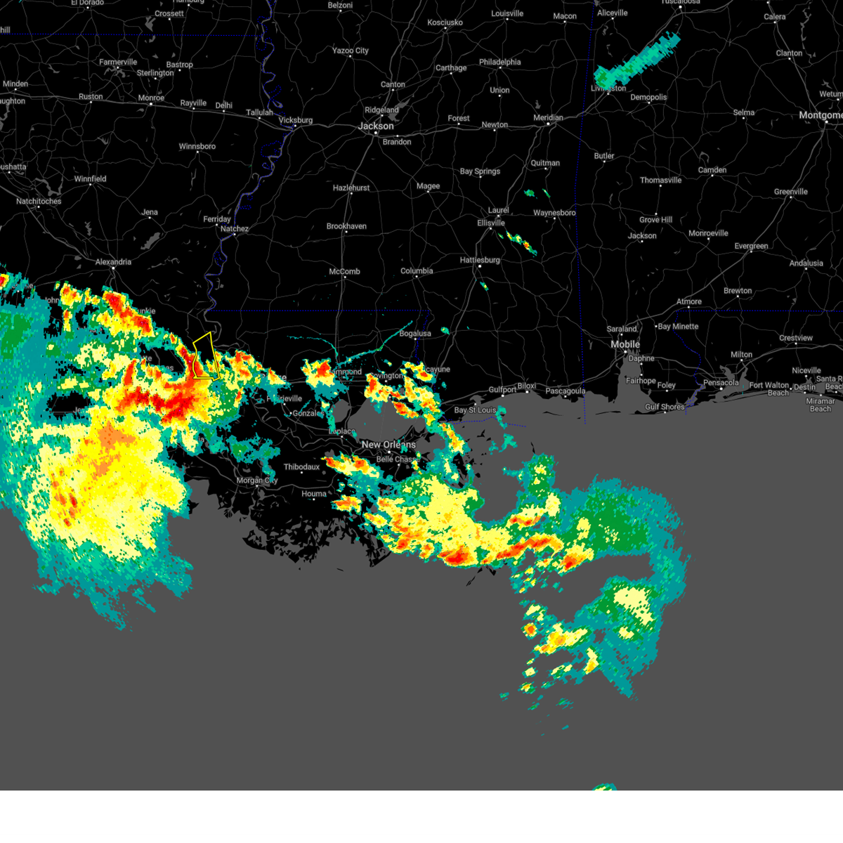
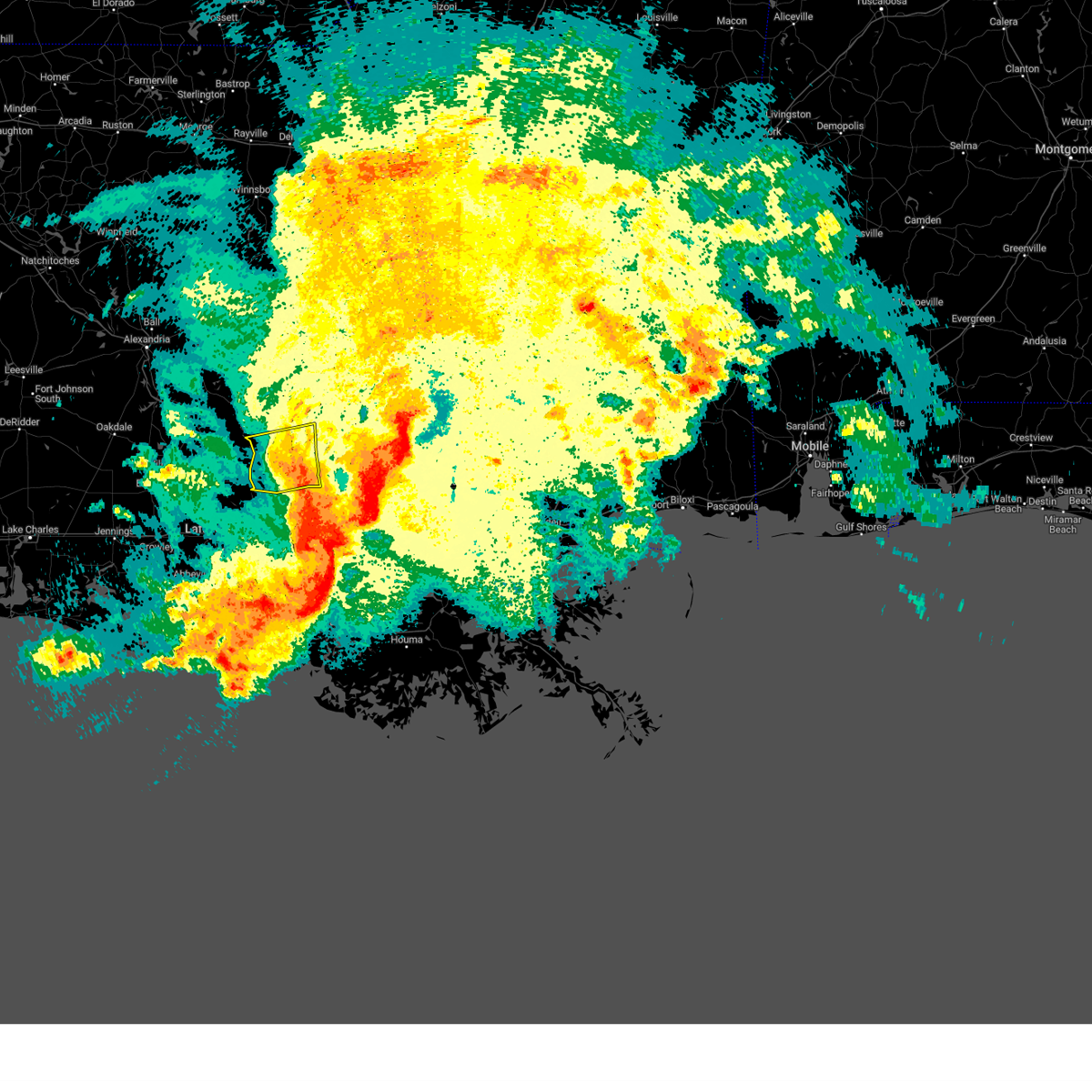
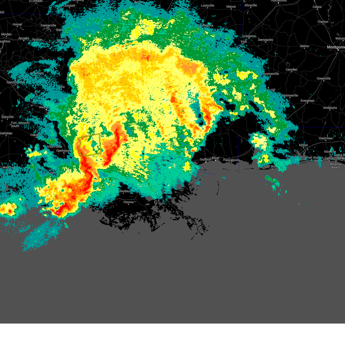
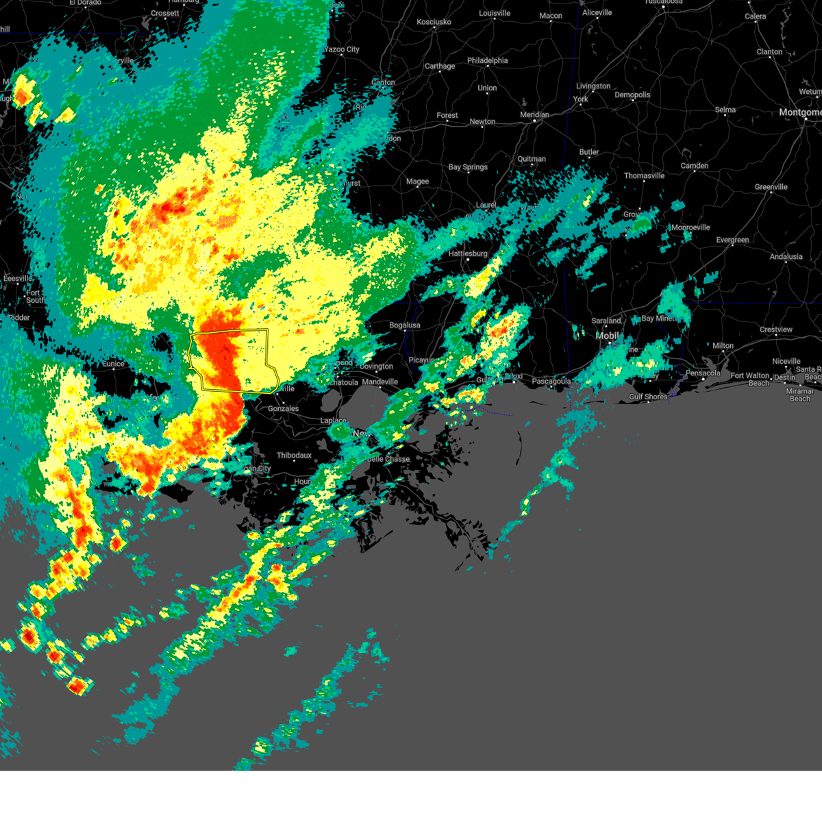
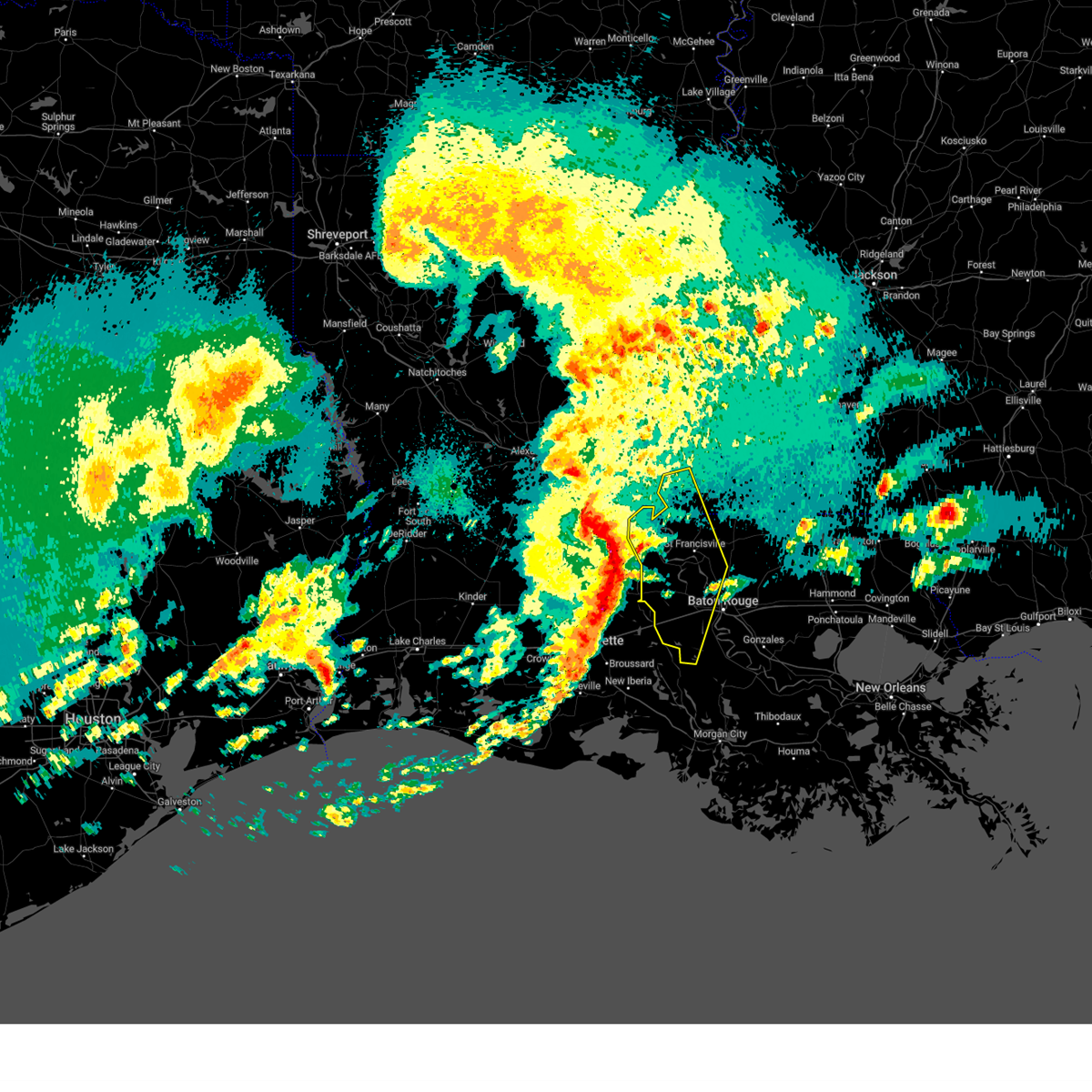
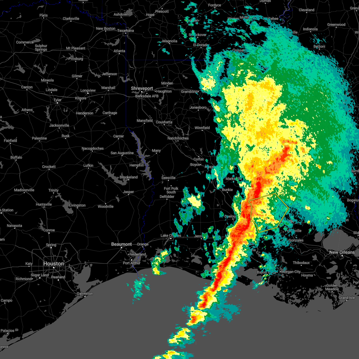
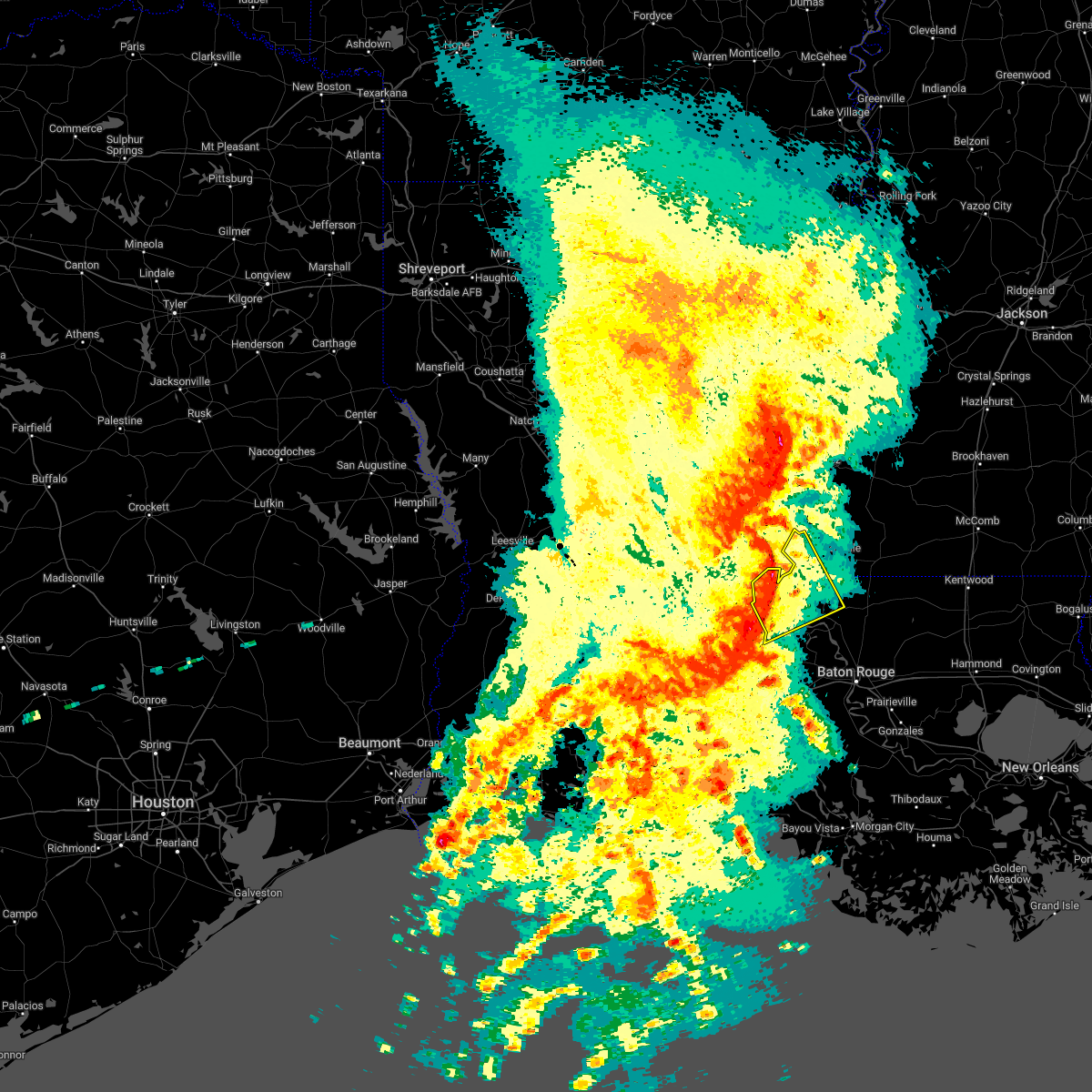
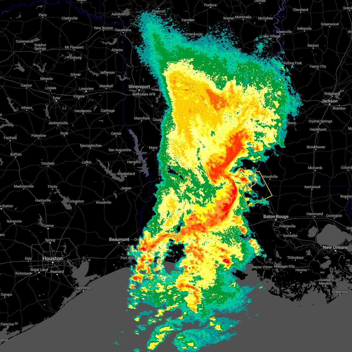
Hail Map for Morganza, LA
The Morganza, LA area has had 3 reports of on-the-ground hail by trained spotters, and has been under severe weather warnings 11 times during the past 12 months. Doppler radar has detected hail at or near Morganza, LA on 54 occasions, including 2 occasions during the past year.
| Name: | Morganza, LA |
| Where Located: | 43.7 miles NE of Lafayette, LA |
| Map: | Google Map for Morganza, LA |
| Population: | 610 |
| Housing Units: | 304 |
| More Info: | Search Google for Morganza, LA |
1
The Top Recent Hail Date for Morganza, LA is Monday, August 18, 2025 (22nd out of 54)
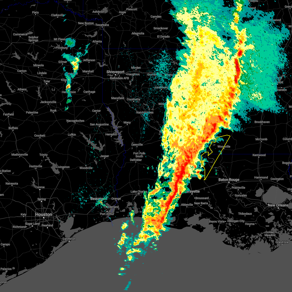
Hail and Wind Damage Spotted near Morganza, LA
| Date / Time | Report Details |
|---|---|
| 5/8/2026 8:50 AM CDT | Ping Pong Ball sized hail reported 8.2 miles SSE of Morganza, LA, video and picture of hail estimated around ping pong ball sized. |
| 5/8/2026 8:48 AM CDT | Trees down in batchelo in pointe coupee county LA, 8.2 miles SSE of Morganza, LA |
| 5/8/2026 8:40 AM CDT |
 At 840 am cdt, a severe thunderstorm was located near lettsworth, or near simmesport, moving east at 40 mph (radar indicated). Hazards include tennis ball size hail and 60 mph wind gusts. People and animals outdoors will be injured. expect hail damage to roofs, siding, windows, and vehicles. expect wind damage to roofs, siding, and trees. locations impacted include, st. Francisville, morganza, wakefield, spillman, lettsworth, and batchelor. At 840 am cdt, a severe thunderstorm was located near lettsworth, or near simmesport, moving east at 40 mph (radar indicated). Hazards include tennis ball size hail and 60 mph wind gusts. People and animals outdoors will be injured. expect hail damage to roofs, siding, windows, and vehicles. expect wind damage to roofs, siding, and trees. locations impacted include, st. Francisville, morganza, wakefield, spillman, lettsworth, and batchelor.
|
| 5/8/2026 8:34 AM CDT |
 Svrlix the national weather service in new orleans has issued a * severe thunderstorm warning for, west feliciana parish in southeastern louisiana, northern pointe coupee parish in southeastern louisiana, * until 915 am cdt. * at 833 am cdt, a severe thunderstorm was located near simmesport, moving east at 40 mph (radar indicated). Hazards include ping pong ball size hail and 60 mph wind gusts. People and animals outdoors will be injured. expect hail damage to roofs, siding, windows, and vehicles. Expect wind damage to roofs, siding, and trees. Svrlix the national weather service in new orleans has issued a * severe thunderstorm warning for, west feliciana parish in southeastern louisiana, northern pointe coupee parish in southeastern louisiana, * until 915 am cdt. * at 833 am cdt, a severe thunderstorm was located near simmesport, moving east at 40 mph (radar indicated). Hazards include ping pong ball size hail and 60 mph wind gusts. People and animals outdoors will be injured. expect hail damage to roofs, siding, windows, and vehicles. Expect wind damage to roofs, siding, and trees.
|
| 3/11/2026 7:49 PM CDT |
 At 749 pm cdt, severe thunderstorms were located along a line extending from near norwood to near new roads, moving east at 25 mph (radar indicated). Hazards include 60 mph wind gusts. Expect damage to roofs, siding, and trees. locations impacted include, zachary, jackson, st. Francisville, clinton, slaughter, morganza, wilson, norwood, wakefield, spillman, pride, and felps. At 749 pm cdt, severe thunderstorms were located along a line extending from near norwood to near new roads, moving east at 25 mph (radar indicated). Hazards include 60 mph wind gusts. Expect damage to roofs, siding, and trees. locations impacted include, zachary, jackson, st. Francisville, clinton, slaughter, morganza, wilson, norwood, wakefield, spillman, pride, and felps.
|
| 3/11/2026 7:32 PM CDT |
 Svrlix the national weather service in new orleans has issued a * severe thunderstorm warning for, western st. helena parish in southeastern louisiana, west feliciana parish in southeastern louisiana, central pointe coupee parish in southeastern louisiana, east feliciana parish in southeastern louisiana, northeastern east baton rouge parish in southeastern louisiana, southeastern wilkinson county in southern mississippi, southwestern amite county in southern mississippi, * until 815 pm cdt. * at 732 pm cdt, severe thunderstorms were located along a line extending from near norwood to near morganza, moving east at 25 mph (radar indicated). Hazards include 60 mph wind gusts. expect damage to roofs, siding, and trees Svrlix the national weather service in new orleans has issued a * severe thunderstorm warning for, western st. helena parish in southeastern louisiana, west feliciana parish in southeastern louisiana, central pointe coupee parish in southeastern louisiana, east feliciana parish in southeastern louisiana, northeastern east baton rouge parish in southeastern louisiana, southeastern wilkinson county in southern mississippi, southwestern amite county in southern mississippi, * until 815 pm cdt. * at 732 pm cdt, severe thunderstorms were located along a line extending from near norwood to near morganza, moving east at 25 mph (radar indicated). Hazards include 60 mph wind gusts. expect damage to roofs, siding, and trees
|
| 3/11/2026 7:29 PM CDT |
 At 729 pm cdt, severe thunderstorms capable of producing both tornadoes and straight line wind damage were located over morganza, or 8 miles northwest of new roads, moving southeast at 30 mph (radar indicated rotation). Hazards include tornado. Flying debris will be dangerous to those caught without shelter. mobile homes will be damaged or destroyed. damage to roofs, windows, and vehicles will occur. tree damage is likely. This tornadic thunderstorm will remain over mainly rural areas of south central west feliciana and central pointe coupee parishes. At 729 pm cdt, severe thunderstorms capable of producing both tornadoes and straight line wind damage were located over morganza, or 8 miles northwest of new roads, moving southeast at 30 mph (radar indicated rotation). Hazards include tornado. Flying debris will be dangerous to those caught without shelter. mobile homes will be damaged or destroyed. damage to roofs, windows, and vehicles will occur. tree damage is likely. This tornadic thunderstorm will remain over mainly rural areas of south central west feliciana and central pointe coupee parishes.
|
| 3/11/2026 7:21 PM CDT |
 At 721 pm cdt, severe thunderstorms capable of producing both tornadoes and straight line wind damage were located near batchelor, or 9 miles northeast of melville, moving southeast at 30 mph (radar indicated rotation). Hazards include tornado. Flying debris will be dangerous to those caught without shelter. mobile homes will be damaged or destroyed. damage to roofs, windows, and vehicles will occur. tree damage is likely. These dangerous storms will be near, morganza around 725 pm cdt. At 721 pm cdt, severe thunderstorms capable of producing both tornadoes and straight line wind damage were located near batchelor, or 9 miles northeast of melville, moving southeast at 30 mph (radar indicated rotation). Hazards include tornado. Flying debris will be dangerous to those caught without shelter. mobile homes will be damaged or destroyed. damage to roofs, windows, and vehicles will occur. tree damage is likely. These dangerous storms will be near, morganza around 725 pm cdt.
|
| 3/11/2026 7:15 PM CDT |
 Torlix the national weather service in new orleans has issued a * tornado warning for, southwestern west feliciana parish in southeastern louisiana, northwestern pointe coupee parish in southeastern louisiana, * until 745 pm cdt. * at 715 pm cdt, severe thunderstorms capable of producing both tornadoes and straight line wind damage were located over batchelor, or 8 miles east of bayou current, moving southeast at 30 mph (radar indicated rotation). Hazards include tornado. Flying debris will be dangerous to those caught without shelter. mobile homes will be damaged or destroyed. damage to roofs, windows, and vehicles will occur. tree damage is likely. This dangerous storm will be near, morganza around 720 pm cdt. Torlix the national weather service in new orleans has issued a * tornado warning for, southwestern west feliciana parish in southeastern louisiana, northwestern pointe coupee parish in southeastern louisiana, * until 745 pm cdt. * at 715 pm cdt, severe thunderstorms capable of producing both tornadoes and straight line wind damage were located over batchelor, or 8 miles east of bayou current, moving southeast at 30 mph (radar indicated rotation). Hazards include tornado. Flying debris will be dangerous to those caught without shelter. mobile homes will be damaged or destroyed. damage to roofs, windows, and vehicles will occur. tree damage is likely. This dangerous storm will be near, morganza around 720 pm cdt.
|
| 2/14/2026 10:47 PM CST |
 At 1046 pm cst, severe thunderstorms were located along a line extending from 6 miles east of dolorosa to wakefield to near new roads, moving east at 50 mph (radar indicated). Hazards include 60 mph wind gusts and penny size hail. Expect damage to roofs, siding, and trees. locations impacted include, zachary, new roads, jackson, st. Francisville, livonia, maringouin, woodville, fordoche, morganza, norwood, wakefield, spillman, batchelor, erwinville, lottie, and crosby. At 1046 pm cst, severe thunderstorms were located along a line extending from 6 miles east of dolorosa to wakefield to near new roads, moving east at 50 mph (radar indicated). Hazards include 60 mph wind gusts and penny size hail. Expect damage to roofs, siding, and trees. locations impacted include, zachary, new roads, jackson, st. Francisville, livonia, maringouin, woodville, fordoche, morganza, norwood, wakefield, spillman, batchelor, erwinville, lottie, and crosby.
|
| 2/14/2026 10:41 PM CST |
 At 1041 pm cst, severe thunderstorms capable of producing both tornadoes and straight line wind damage were located near morganza, or 8 miles east of melville, moving east at 45 mph (radar indicated rotation). Hazards include tornado. Flying debris will be dangerous to those caught without shelter. mobile homes will be damaged or destroyed. damage to roofs, windows, and vehicles will occur. tree damage is likely. These dangerous storms will be near, new roads and morganza around 1045 pm cst. At 1041 pm cst, severe thunderstorms capable of producing both tornadoes and straight line wind damage were located near morganza, or 8 miles east of melville, moving east at 45 mph (radar indicated rotation). Hazards include tornado. Flying debris will be dangerous to those caught without shelter. mobile homes will be damaged or destroyed. damage to roofs, windows, and vehicles will occur. tree damage is likely. These dangerous storms will be near, new roads and morganza around 1045 pm cst.
|
| 2/14/2026 10:21 PM CST |
 Torlix the national weather service in new orleans has issued a * tornado warning for, south central west feliciana parish in southeastern louisiana, southern pointe coupee parish in southeastern louisiana, * until 1100 pm cst. * at 1020 pm cst, severe thunderstorms capable of producing both tornadoes and straight line wind damage were located near palmetto, moving east at 40 mph (radar indicated rotation). Hazards include tornado. Flying debris will be dangerous to those caught without shelter. mobile homes will be damaged or destroyed. damage to roofs, windows, and vehicles will occur. tree damage is likely. this dangerous storm will be near, morganza around 1040 pm cst. New roads around 1045 pm cst. Torlix the national weather service in new orleans has issued a * tornado warning for, south central west feliciana parish in southeastern louisiana, southern pointe coupee parish in southeastern louisiana, * until 1100 pm cst. * at 1020 pm cst, severe thunderstorms capable of producing both tornadoes and straight line wind damage were located near palmetto, moving east at 40 mph (radar indicated rotation). Hazards include tornado. Flying debris will be dangerous to those caught without shelter. mobile homes will be damaged or destroyed. damage to roofs, windows, and vehicles will occur. tree damage is likely. this dangerous storm will be near, morganza around 1040 pm cst. New roads around 1045 pm cst.
|
| 2/14/2026 9:56 PM CST |
 Svrlix the national weather service in new orleans has issued a * severe thunderstorm warning for, northern west baton rouge parish in southeastern louisiana, west feliciana parish in southeastern louisiana, pointe coupee parish in southeastern louisiana, western east feliciana parish in southeastern louisiana, northwestern east baton rouge parish in southeastern louisiana, wilkinson county in southern mississippi, * until 1115 pm cst. * at 956 pm cst, severe thunderstorms were located along a line extending from lake ophelia national wildlife refuge to prairie ronde, moving east at 45 mph (radar indicated). Hazards include 60 mph wind gusts and penny size hail. expect damage to roofs, siding, and trees Svrlix the national weather service in new orleans has issued a * severe thunderstorm warning for, northern west baton rouge parish in southeastern louisiana, west feliciana parish in southeastern louisiana, pointe coupee parish in southeastern louisiana, western east feliciana parish in southeastern louisiana, northwestern east baton rouge parish in southeastern louisiana, wilkinson county in southern mississippi, * until 1115 pm cst. * at 956 pm cst, severe thunderstorms were located along a line extending from lake ophelia national wildlife refuge to prairie ronde, moving east at 45 mph (radar indicated). Hazards include 60 mph wind gusts and penny size hail. expect damage to roofs, siding, and trees
|
| 6/11/2025 6:37 PM CDT |
 Svrlix the national weather service in new orleans has issued a * severe thunderstorm warning for, west feliciana parish in southeastern louisiana, pointe coupee parish in southeastern louisiana, northwestern east feliciana parish in southeastern louisiana, northwestern iberville parish in southeastern louisiana, wilkinson county in southern mississippi, western amite county in southern mississippi, * until 730 pm cdt. * at 637 pm cdt, a severe thunderstorm was located near st. francisville, moving north at 25 mph (radar indicated). Hazards include 60 mph wind gusts and quarter size hail. Hail damage to vehicles is expected. Expect wind damage to roofs, siding, and trees. Svrlix the national weather service in new orleans has issued a * severe thunderstorm warning for, west feliciana parish in southeastern louisiana, pointe coupee parish in southeastern louisiana, northwestern east feliciana parish in southeastern louisiana, northwestern iberville parish in southeastern louisiana, wilkinson county in southern mississippi, western amite county in southern mississippi, * until 730 pm cdt. * at 637 pm cdt, a severe thunderstorm was located near st. francisville, moving north at 25 mph (radar indicated). Hazards include 60 mph wind gusts and quarter size hail. Hail damage to vehicles is expected. Expect wind damage to roofs, siding, and trees.
|
| 6/10/2025 2:25 PM CDT |
 Svrlix the national weather service in new orleans has issued a * severe thunderstorm warning for, central west feliciana parish in southeastern louisiana, central pointe coupee parish in southeastern louisiana, * until 315 pm cdt. * at 225 pm cdt, a severe thunderstorm was located near new roads, moving northeast at 10 mph (radar indicated). Hazards include 60 mph wind gusts and quarter size hail. Hail damage to vehicles is expected. Expect wind damage to roofs, siding, and trees. Svrlix the national weather service in new orleans has issued a * severe thunderstorm warning for, central west feliciana parish in southeastern louisiana, central pointe coupee parish in southeastern louisiana, * until 315 pm cdt. * at 225 pm cdt, a severe thunderstorm was located near new roads, moving northeast at 10 mph (radar indicated). Hazards include 60 mph wind gusts and quarter size hail. Hail damage to vehicles is expected. Expect wind damage to roofs, siding, and trees.
|
| 6/8/2025 5:06 PM CDT |
 the severe thunderstorm warning has been cancelled and is no longer in effect the severe thunderstorm warning has been cancelled and is no longer in effect
|
| 6/8/2025 4:57 PM CDT |
 At 456 pm cdt, a severe thunderstorm was located over batchelor, or 10 miles east of bayou current, moving east at 20 mph (radar indicated). Hazards include 60 mph wind gusts and quarter size hail. Hail damage to vehicles is expected. expect wind damage to roofs, siding, and trees. Locations impacted include, morganza and batchelor. At 456 pm cdt, a severe thunderstorm was located over batchelor, or 10 miles east of bayou current, moving east at 20 mph (radar indicated). Hazards include 60 mph wind gusts and quarter size hail. Hail damage to vehicles is expected. expect wind damage to roofs, siding, and trees. Locations impacted include, morganza and batchelor.
|
| 6/8/2025 4:52 PM CDT |
 At 451 pm cdt, a severe thunderstorm was located over batchelor, or 9 miles east of bayou current, moving east at 25 mph (radar indicated). Hazards include golf ball size hail and 60 mph wind gusts. People and animals outdoors will be injured. expect hail damage to roofs, siding, windows, and vehicles. expect wind damage to roofs, siding, and trees. Locations impacted include, morganza, lettsworth, and batchelor. At 451 pm cdt, a severe thunderstorm was located over batchelor, or 9 miles east of bayou current, moving east at 25 mph (radar indicated). Hazards include golf ball size hail and 60 mph wind gusts. People and animals outdoors will be injured. expect hail damage to roofs, siding, windows, and vehicles. expect wind damage to roofs, siding, and trees. Locations impacted include, morganza, lettsworth, and batchelor.
|
| 6/8/2025 4:41 PM CDT |
 At 441 pm cdt, a severe thunderstorm was located near batchelor, or near bayou current, moving east at 20 mph (radar indicated). Hazards include golf ball size hail and 60 mph wind gusts. People and animals outdoors will be injured. expect hail damage to roofs, siding, windows, and vehicles. expect wind damage to roofs, siding, and trees. Locations impacted include, morganza, lettsworth, and batchelor. At 441 pm cdt, a severe thunderstorm was located near batchelor, or near bayou current, moving east at 20 mph (radar indicated). Hazards include golf ball size hail and 60 mph wind gusts. People and animals outdoors will be injured. expect hail damage to roofs, siding, windows, and vehicles. expect wind damage to roofs, siding, and trees. Locations impacted include, morganza, lettsworth, and batchelor.
|
| 6/8/2025 4:40 PM CDT |
 Svrlix the national weather service in new orleans has issued a * severe thunderstorm warning for, southwestern west feliciana parish in southeastern louisiana, northwestern pointe coupee parish in southeastern louisiana, * until 530 pm cdt. * at 439 pm cdt, a severe thunderstorm was located near lettsworth, or near bayou current, moving east at 20 mph (radar indicated). Hazards include 60 mph wind gusts and quarter size hail. Hail damage to vehicles is expected. Expect wind damage to roofs, siding, and trees. Svrlix the national weather service in new orleans has issued a * severe thunderstorm warning for, southwestern west feliciana parish in southeastern louisiana, northwestern pointe coupee parish in southeastern louisiana, * until 530 pm cdt. * at 439 pm cdt, a severe thunderstorm was located near lettsworth, or near bayou current, moving east at 20 mph (radar indicated). Hazards include 60 mph wind gusts and quarter size hail. Hail damage to vehicles is expected. Expect wind damage to roofs, siding, and trees.
|
| 5/28/2025 4:41 PM CDT |
 The storms which prompted the warning have weakened below severe limits, and have exited the warned area. therefore, the warning will be allowed to expire. a severe thunderstorm watch remains in effect until 900 pm cdt for southeastern louisiana, and southern mississippi. The storms which prompted the warning have weakened below severe limits, and have exited the warned area. therefore, the warning will be allowed to expire. a severe thunderstorm watch remains in effect until 900 pm cdt for southeastern louisiana, and southern mississippi.
|
| 5/28/2025 4:20 PM CDT |
 At 420 pm cdt, severe thunderstorms were located along a line extending from melville to near darlington, moving north at 30 mph (radar indicated). Hazards include 60 mph wind gusts and quarter size hail. Hail damage to vehicles is expected. expect wind damage to roofs, siding, and trees. locations impacted include, wakefield, spillman, centreville, morganza, batchelor, wilson, darlington, jackson, clinton, fordoche, norwood, lettsworth, felps, st. Francisville, new roads, and livonia. At 420 pm cdt, severe thunderstorms were located along a line extending from melville to near darlington, moving north at 30 mph (radar indicated). Hazards include 60 mph wind gusts and quarter size hail. Hail damage to vehicles is expected. expect wind damage to roofs, siding, and trees. locations impacted include, wakefield, spillman, centreville, morganza, batchelor, wilson, darlington, jackson, clinton, fordoche, norwood, lettsworth, felps, st. Francisville, new roads, and livonia.
|
| 5/28/2025 4:20 PM CDT |
 the severe thunderstorm warning has been cancelled and is no longer in effect the severe thunderstorm warning has been cancelled and is no longer in effect
|
| 5/28/2025 4:00 PM CDT |
 Svrlix the national weather service in new orleans has issued a * severe thunderstorm warning for, north central west baton rouge parish in southeastern louisiana, western st. helena parish in southeastern louisiana, west feliciana parish in southeastern louisiana, pointe coupee parish in southeastern louisiana, northern livingston parish in southeastern louisiana, east feliciana parish in southeastern louisiana, northern east baton rouge parish in southeastern louisiana, southern wilkinson county in southern mississippi, southwestern amite county in southern mississippi, * until 445 pm cdt. * at 359 pm cdt, severe thunderstorms were located along a line extending from krotz springs to 8 miles south of darlington, moving north at 30 mph (radar indicated). Hazards include 60 mph wind gusts and quarter size hail. Hail damage to vehicles is expected. Expect wind damage to roofs, siding, and trees. Svrlix the national weather service in new orleans has issued a * severe thunderstorm warning for, north central west baton rouge parish in southeastern louisiana, western st. helena parish in southeastern louisiana, west feliciana parish in southeastern louisiana, pointe coupee parish in southeastern louisiana, northern livingston parish in southeastern louisiana, east feliciana parish in southeastern louisiana, northern east baton rouge parish in southeastern louisiana, southern wilkinson county in southern mississippi, southwestern amite county in southern mississippi, * until 445 pm cdt. * at 359 pm cdt, severe thunderstorms were located along a line extending from krotz springs to 8 miles south of darlington, moving north at 30 mph (radar indicated). Hazards include 60 mph wind gusts and quarter size hail. Hail damage to vehicles is expected. Expect wind damage to roofs, siding, and trees.
|
| 5/2/2025 9:32 PM CDT |
 At 932 pm cdt, severe thunderstorms were located along a line extending from 6 miles north of woodville to 7 miles northwest of st. francisville, moving northeast at 30 mph (radar indicated). Hazards include 60 mph wind gusts and penny size hail. Expect damage to roofs, siding, and trees. locations impacted include, wakefield, fort adams, st. Francisville, spillman, new roads, and morganza. At 932 pm cdt, severe thunderstorms were located along a line extending from 6 miles north of woodville to 7 miles northwest of st. francisville, moving northeast at 30 mph (radar indicated). Hazards include 60 mph wind gusts and penny size hail. Expect damage to roofs, siding, and trees. locations impacted include, wakefield, fort adams, st. Francisville, spillman, new roads, and morganza.
|
| 5/2/2025 8:53 PM CDT |
 Svrlix the national weather service in new orleans has issued a * severe thunderstorm warning for, west feliciana parish in southeastern louisiana, central pointe coupee parish in southeastern louisiana, southwestern east feliciana parish in southeastern louisiana, southwestern wilkinson county in southern mississippi, * until 945 pm cdt. * at 852 pm cdt, severe thunderstorms were located along a line extending from near fort adams to melville, moving northeast at 30 mph (radar indicated). Hazards include 60 mph wind gusts and penny size hail. expect damage to roofs, siding, and trees Svrlix the national weather service in new orleans has issued a * severe thunderstorm warning for, west feliciana parish in southeastern louisiana, central pointe coupee parish in southeastern louisiana, southwestern east feliciana parish in southeastern louisiana, southwestern wilkinson county in southern mississippi, * until 945 pm cdt. * at 852 pm cdt, severe thunderstorms were located along a line extending from near fort adams to melville, moving northeast at 30 mph (radar indicated). Hazards include 60 mph wind gusts and penny size hail. expect damage to roofs, siding, and trees
|
| 3/31/2025 5:24 AM CDT |
 Svrlix the national weather service in new orleans has issued a * severe thunderstorm warning for, west feliciana parish in southeastern louisiana, central pointe coupee parish in southeastern louisiana, central east feliciana parish in southeastern louisiana, northwestern east baton rouge parish in southeastern louisiana, * until 615 am cdt. * at 523 am cdt, severe thunderstorms were located along a line extending from near batchelor to near livonia, moving east at 40 mph. these are destructive storms for st francisville, new roads, wakefield, jackson, zachary and norwood (radar indicated). Hazards include 80 mph wind gusts and half dollar size hail. Flying debris will be dangerous to those caught without shelter. mobile homes will be heavily damaged. expect considerable damage to roofs, windows, and vehicles. Extensive tree damage and power outages are likely. Svrlix the national weather service in new orleans has issued a * severe thunderstorm warning for, west feliciana parish in southeastern louisiana, central pointe coupee parish in southeastern louisiana, central east feliciana parish in southeastern louisiana, northwestern east baton rouge parish in southeastern louisiana, * until 615 am cdt. * at 523 am cdt, severe thunderstorms were located along a line extending from near batchelor to near livonia, moving east at 40 mph. these are destructive storms for st francisville, new roads, wakefield, jackson, zachary and norwood (radar indicated). Hazards include 80 mph wind gusts and half dollar size hail. Flying debris will be dangerous to those caught without shelter. mobile homes will be heavily damaged. expect considerable damage to roofs, windows, and vehicles. Extensive tree damage and power outages are likely.
|
| 3/31/2025 5:20 AM CDT |
 At 518 am cdt, severe thunderstorms capable of producing both tornadoes and straight line wind damageis located over morganza, or 7 miles northwest of new roads, moving east at 35 mph (radar indicated rotation). Hazards include tornado and ping pong ball size hail. Flying debris will be dangerous to those caught without shelter. mobile homes will be damaged or destroyed. damage to roofs, windows, and vehicles will occur. tree damage is likely. This tornado will be near, new roads around 525 am cdt. At 518 am cdt, severe thunderstorms capable of producing both tornadoes and straight line wind damageis located over morganza, or 7 miles northwest of new roads, moving east at 35 mph (radar indicated rotation). Hazards include tornado and ping pong ball size hail. Flying debris will be dangerous to those caught without shelter. mobile homes will be damaged or destroyed. damage to roofs, windows, and vehicles will occur. tree damage is likely. This tornado will be near, new roads around 525 am cdt.
|
| 3/31/2025 4:58 AM CDT |
 At 457 am cdt, severe thunderstorms were located along a line extending from batchelor to near leonville, moving east at 40 mph (radar indicated). Hazards include 70 mph wind gusts and ping pong ball size hail. People and animals outdoors will be injured. expect hail damage to roofs, siding, windows, and vehicles. expect considerable tree damage. wind damage is also likely to mobile homes, roofs, and outbuildings. locations impacted include, maringouin, grosse tete, ramah, morganza, batchelor, erwinville, st. francisville, livonia, rosedale, new roads, lottie, and fordoche. This includes interstate 10 in louisiana between mile markers 136 and 141. At 457 am cdt, severe thunderstorms were located along a line extending from batchelor to near leonville, moving east at 40 mph (radar indicated). Hazards include 70 mph wind gusts and ping pong ball size hail. People and animals outdoors will be injured. expect hail damage to roofs, siding, windows, and vehicles. expect considerable tree damage. wind damage is also likely to mobile homes, roofs, and outbuildings. locations impacted include, maringouin, grosse tete, ramah, morganza, batchelor, erwinville, st. francisville, livonia, rosedale, new roads, lottie, and fordoche. This includes interstate 10 in louisiana between mile markers 136 and 141.
|
| 3/31/2025 4:56 AM CDT |
 Torlix the national weather service in new orleans has issued a * tornado warning for, central west feliciana parish in southeastern louisiana, northern pointe coupee parish in southeastern louisiana, * until 545 am cdt. * at 456 am cdt, severe thunderstorms capable of producing both tornadoes and straight line wind damage were located near bayou current, moving east at 35 mph (radar indicated rotation). Hazards include tornado and ping pong ball size hail. Flying debris will be dangerous to those caught without shelter. mobile homes will be damaged or destroyed. damage to roofs, windows, and vehicles will occur. tree damage is likely. This dangerous storm will be near, morganza around 510 am cdt. Torlix the national weather service in new orleans has issued a * tornado warning for, central west feliciana parish in southeastern louisiana, northern pointe coupee parish in southeastern louisiana, * until 545 am cdt. * at 456 am cdt, severe thunderstorms capable of producing both tornadoes and straight line wind damage were located near bayou current, moving east at 35 mph (radar indicated rotation). Hazards include tornado and ping pong ball size hail. Flying debris will be dangerous to those caught without shelter. mobile homes will be damaged or destroyed. damage to roofs, windows, and vehicles will occur. tree damage is likely. This dangerous storm will be near, morganza around 510 am cdt.
|
| 3/31/2025 4:35 AM CDT |
 Svrlix the national weather service in new orleans has issued a * severe thunderstorm warning for, northwestern west baton rouge parish in southeastern louisiana, southern west feliciana parish in southeastern louisiana, pointe coupee parish in southeastern louisiana, western east feliciana parish in southeastern louisiana, northwestern iberville parish in southeastern louisiana, * until 530 am cdt. * at 434 am cdt, severe thunderstorms were located along a line extending from near big cane to near swords, moving east at 40 mph (radar indicated). Hazards include 70 mph wind gusts and ping pong ball size hail. People and animals outdoors will be injured. expect hail damage to roofs, siding, windows, and vehicles. expect considerable tree damage. Wind damage is also likely to mobile homes, roofs, and outbuildings. Svrlix the national weather service in new orleans has issued a * severe thunderstorm warning for, northwestern west baton rouge parish in southeastern louisiana, southern west feliciana parish in southeastern louisiana, pointe coupee parish in southeastern louisiana, western east feliciana parish in southeastern louisiana, northwestern iberville parish in southeastern louisiana, * until 530 am cdt. * at 434 am cdt, severe thunderstorms were located along a line extending from near big cane to near swords, moving east at 40 mph (radar indicated). Hazards include 70 mph wind gusts and ping pong ball size hail. People and animals outdoors will be injured. expect hail damage to roofs, siding, windows, and vehicles. expect considerable tree damage. Wind damage is also likely to mobile homes, roofs, and outbuildings.
|
| 3/24/2025 7:06 AM CDT |
 Svrlix the national weather service in new orleans has issued a * severe thunderstorm warning for, western west feliciana parish in southeastern louisiana, north central west baton rouge parish in southeastern louisiana, pointe coupee parish in southeastern louisiana, * until 745 am cdt. * at 705 am cdt, severe thunderstorms were located along a line extending from bayou current to near lottie, moving northeast at 35 mph (radar indicated). Hazards include 60 mph wind gusts and quarter size hail. Hail damage to vehicles is expected. Expect wind damage to roofs, siding, and trees. Svrlix the national weather service in new orleans has issued a * severe thunderstorm warning for, western west feliciana parish in southeastern louisiana, north central west baton rouge parish in southeastern louisiana, pointe coupee parish in southeastern louisiana, * until 745 am cdt. * at 705 am cdt, severe thunderstorms were located along a line extending from bayou current to near lottie, moving northeast at 35 mph (radar indicated). Hazards include 60 mph wind gusts and quarter size hail. Hail damage to vehicles is expected. Expect wind damage to roofs, siding, and trees.
|
| 3/15/2025 1:08 PM CDT |
 Svrlix the national weather service in new orleans has issued a * severe thunderstorm warning for, west feliciana parish in southeastern louisiana, southern pointe coupee parish in southeastern louisiana, northwestern east feliciana parish in southeastern louisiana, northwestern iberville parish in southeastern louisiana, * until 200 pm cdt. * at 108 pm cdt, a severe thunderstorm was located near krotz springs, moving northeast at 55 mph (radar indicated). Hazards include 60 mph wind gusts and quarter size hail. Hail damage to vehicles is expected. Expect wind damage to roofs, siding, and trees. Svrlix the national weather service in new orleans has issued a * severe thunderstorm warning for, west feliciana parish in southeastern louisiana, southern pointe coupee parish in southeastern louisiana, northwestern east feliciana parish in southeastern louisiana, northwestern iberville parish in southeastern louisiana, * until 200 pm cdt. * at 108 pm cdt, a severe thunderstorm was located near krotz springs, moving northeast at 55 mph (radar indicated). Hazards include 60 mph wind gusts and quarter size hail. Hail damage to vehicles is expected. Expect wind damage to roofs, siding, and trees.
|
| 3/4/2025 2:45 PM CST |
 Svrlix the national weather service in new orleans has issued a * severe thunderstorm warning for, west feliciana parish in southeastern louisiana, northwestern west baton rouge parish in southeastern louisiana, st. helena parish in southeastern louisiana, pointe coupee parish in southeastern louisiana, east feliciana parish in southeastern louisiana, northern east baton rouge parish in southeastern louisiana, northwestern pike county in southern mississippi, southeastern wilkinson county in southern mississippi, amite county in southern mississippi, * until 345 pm cst. * at 244 pm cst, severe thunderstorms were located along a line extending from 8 miles north of gloster to near st. francisville, moving east at 30 mph with individual storms along the line moving upwards of 60 mph (radar indicated). Hazards include 70 mph wind gusts. Expect considerable tree damage. Damage is likely to mobile homes, roofs, and outbuildings. Svrlix the national weather service in new orleans has issued a * severe thunderstorm warning for, west feliciana parish in southeastern louisiana, northwestern west baton rouge parish in southeastern louisiana, st. helena parish in southeastern louisiana, pointe coupee parish in southeastern louisiana, east feliciana parish in southeastern louisiana, northern east baton rouge parish in southeastern louisiana, northwestern pike county in southern mississippi, southeastern wilkinson county in southern mississippi, amite county in southern mississippi, * until 345 pm cst. * at 244 pm cst, severe thunderstorms were located along a line extending from 8 miles north of gloster to near st. francisville, moving east at 30 mph with individual storms along the line moving upwards of 60 mph (radar indicated). Hazards include 70 mph wind gusts. Expect considerable tree damage. Damage is likely to mobile homes, roofs, and outbuildings.
|
| 3/4/2025 2:31 PM CST |
 At 230 pm cst, severe thunderstorms were located along a line extending from 6 miles southeast of garden city to near morganza, moving northeast at 80 mph. these are destructive storms for areas from crosby to gloster to spillman (radar indicated). Hazards include 80 mph wind gusts. Flying debris will be dangerous to those caught without shelter. mobile homes will be heavily damaged. expect considerable damage to roofs, windows, and vehicles. extensive tree damage and power outages are likely. locations impacted include, wakefield, gloster, spillman, centreville, morganza, crosby, batchelor, woodville, fordoche, lettsworth, fort adams, st. Francisville, dolorosa, lottie, and new roads. At 230 pm cst, severe thunderstorms were located along a line extending from 6 miles southeast of garden city to near morganza, moving northeast at 80 mph. these are destructive storms for areas from crosby to gloster to spillman (radar indicated). Hazards include 80 mph wind gusts. Flying debris will be dangerous to those caught without shelter. mobile homes will be heavily damaged. expect considerable damage to roofs, windows, and vehicles. extensive tree damage and power outages are likely. locations impacted include, wakefield, gloster, spillman, centreville, morganza, crosby, batchelor, woodville, fordoche, lettsworth, fort adams, st. Francisville, dolorosa, lottie, and new roads.
|
| 3/4/2025 2:04 PM CST |
 Svrlix the national weather service in new orleans has issued a * severe thunderstorm warning for, west feliciana parish in southeastern louisiana, pointe coupee parish in southeastern louisiana, wilkinson county in southern mississippi, northwestern amite county in southern mississippi, * until 245 pm cst. * at 203 pm cst, a severe thunderstorm was located near lettsworth, or near simmesport, moving northeast at 80 mph. this is a destructive storm for locations between batchelor to simmesport (radar indicated). Hazards include 80 mph wind gusts. Flying debris will be dangerous to those caught without shelter. mobile homes will be heavily damaged. expect considerable damage to roofs, windows, and vehicles. Extensive tree damage and power outages are likely. Svrlix the national weather service in new orleans has issued a * severe thunderstorm warning for, west feliciana parish in southeastern louisiana, pointe coupee parish in southeastern louisiana, wilkinson county in southern mississippi, northwestern amite county in southern mississippi, * until 245 pm cst. * at 203 pm cst, a severe thunderstorm was located near lettsworth, or near simmesport, moving northeast at 80 mph. this is a destructive storm for locations between batchelor to simmesport (radar indicated). Hazards include 80 mph wind gusts. Flying debris will be dangerous to those caught without shelter. mobile homes will be heavily damaged. expect considerable damage to roofs, windows, and vehicles. Extensive tree damage and power outages are likely.
|
| 12/28/2024 6:07 PM CST |
 Svrlix the national weather service in new orleans has issued a * severe thunderstorm warning for, west feliciana parish in southeastern louisiana, north central west baton rouge parish in southeastern louisiana, st. helena parish in southeastern louisiana, southern pointe coupee parish in southeastern louisiana, northwestern livingston parish in southeastern louisiana, east feliciana parish in southeastern louisiana, northwestern tangipahoa parish in southeastern louisiana, northern east baton rouge parish in southeastern louisiana, pike county in southern mississippi, southeastern wilkinson county in southern mississippi, amite county in southern mississippi, * until 645 pm cst. * at 606 pm cst, severe thunderstorms were located along a line extending from 6 miles east of garden city to 6 miles northwest of norwood to near krotz springs, moving east at 60 mph (radar indicated). Hazards include 70 mph wind gusts and penny size hail. Expect considerable tree damage. Damage is likely to mobile homes, roofs, and outbuildings. Svrlix the national weather service in new orleans has issued a * severe thunderstorm warning for, west feliciana parish in southeastern louisiana, north central west baton rouge parish in southeastern louisiana, st. helena parish in southeastern louisiana, southern pointe coupee parish in southeastern louisiana, northwestern livingston parish in southeastern louisiana, east feliciana parish in southeastern louisiana, northwestern tangipahoa parish in southeastern louisiana, northern east baton rouge parish in southeastern louisiana, pike county in southern mississippi, southeastern wilkinson county in southern mississippi, amite county in southern mississippi, * until 645 pm cst. * at 606 pm cst, severe thunderstorms were located along a line extending from 6 miles east of garden city to 6 miles northwest of norwood to near krotz springs, moving east at 60 mph (radar indicated). Hazards include 70 mph wind gusts and penny size hail. Expect considerable tree damage. Damage is likely to mobile homes, roofs, and outbuildings.
|
| 12/28/2024 5:56 PM CST |
 At 555 pm cst, severe thunderstorms were located along a line extending from 7 miles south of dolorosa to near melville, moving east at 50 mph (radar indicated). Hazards include 70 mph wind gusts and penny size hail. Expect considerable tree damage. damage is likely to mobile homes, roofs, and outbuildings. locations impacted include, new roads, jackson, st. Francisville, centreville, livonia, maringouin, woodville, gloster, fordoche, morganza, wilson, norwood, wakefield, spillman, batchelor, erwinville, lettsworth, fort adams, dolorosa, and lottie. At 555 pm cst, severe thunderstorms were located along a line extending from 7 miles south of dolorosa to near melville, moving east at 50 mph (radar indicated). Hazards include 70 mph wind gusts and penny size hail. Expect considerable tree damage. damage is likely to mobile homes, roofs, and outbuildings. locations impacted include, new roads, jackson, st. Francisville, centreville, livonia, maringouin, woodville, gloster, fordoche, morganza, wilson, norwood, wakefield, spillman, batchelor, erwinville, lettsworth, fort adams, dolorosa, and lottie.
|
| 12/28/2024 5:28 PM CST |
 Svrlix the national weather service in new orleans has issued a * severe thunderstorm warning for, west feliciana parish in southeastern louisiana, northwestern west baton rouge parish in southeastern louisiana, pointe coupee parish in southeastern louisiana, western east feliciana parish in southeastern louisiana, wilkinson county in southern mississippi, western amite county in southern mississippi, * until 615 pm cst. * at 527 pm cst, severe thunderstorms were located along a line extending from 7 miles southeast of acme to near grand prairie, moving east at 50 mph (radar indicated). Hazards include 60 mph wind gusts and penny size hail. expect damage to roofs, siding, and trees Svrlix the national weather service in new orleans has issued a * severe thunderstorm warning for, west feliciana parish in southeastern louisiana, northwestern west baton rouge parish in southeastern louisiana, pointe coupee parish in southeastern louisiana, western east feliciana parish in southeastern louisiana, wilkinson county in southern mississippi, western amite county in southern mississippi, * until 615 pm cst. * at 527 pm cst, severe thunderstorms were located along a line extending from 7 miles southeast of acme to near grand prairie, moving east at 50 mph (radar indicated). Hazards include 60 mph wind gusts and penny size hail. expect damage to roofs, siding, and trees
|
| 11/5/2024 12:44 PM CST |
 the severe thunderstorm warning has been cancelled and is no longer in effect the severe thunderstorm warning has been cancelled and is no longer in effect
|
| 11/5/2024 12:17 PM CST |
 Svrlix the national weather service in new orleans has issued a * severe thunderstorm warning for, western west feliciana parish in southeastern louisiana, north central pointe coupee parish in southeastern louisiana, * until 100 pm cst. * at 1217 pm cst, a severe thunderstorm was located over batchelor, or 10 miles northeast of bayou current, moving northeast at 20 mph (radar indicated). Hazards include 60 mph wind gusts. expect damage to roofs, siding, and trees Svrlix the national weather service in new orleans has issued a * severe thunderstorm warning for, western west feliciana parish in southeastern louisiana, north central pointe coupee parish in southeastern louisiana, * until 100 pm cst. * at 1217 pm cst, a severe thunderstorm was located over batchelor, or 10 miles northeast of bayou current, moving northeast at 20 mph (radar indicated). Hazards include 60 mph wind gusts. expect damage to roofs, siding, and trees
|
| 11/5/2024 12:13 PM CST |
 At 1213 pm cst, a severe thunderstorm was located over batchelor, or 9 miles east of bayou current, moving northeast at 20 mph (radar indicated). Hazards include 60 mph wind gusts. Expect damage to roofs, siding, and trees. Locations impacted include, morganza, lettsworth, and batchelor. At 1213 pm cst, a severe thunderstorm was located over batchelor, or 9 miles east of bayou current, moving northeast at 20 mph (radar indicated). Hazards include 60 mph wind gusts. Expect damage to roofs, siding, and trees. Locations impacted include, morganza, lettsworth, and batchelor.
|
| 11/5/2024 11:39 AM CST |
 Svrlix the national weather service in new orleans has issued a * severe thunderstorm warning for, northwestern west feliciana parish in southeastern louisiana, northwestern pointe coupee parish in southeastern louisiana, * until 1245 pm cst. * at 1139 am cst, a severe thunderstorm was located near melville, moving northeast at 20 mph (radar indicated). Hazards include 60 mph wind gusts. expect damage to roofs, siding, and trees Svrlix the national weather service in new orleans has issued a * severe thunderstorm warning for, northwestern west feliciana parish in southeastern louisiana, northwestern pointe coupee parish in southeastern louisiana, * until 1245 pm cst. * at 1139 am cst, a severe thunderstorm was located near melville, moving northeast at 20 mph (radar indicated). Hazards include 60 mph wind gusts. expect damage to roofs, siding, and trees
|
| 6/4/2024 3:56 PM CDT |
 Svrlix the national weather service in new orleans has issued a * severe thunderstorm warning for, west feliciana parish in southeastern louisiana, northern west baton rouge parish in southeastern louisiana, central pointe coupee parish in southeastern louisiana, east feliciana parish in southeastern louisiana, northwestern east baton rouge parish in southeastern louisiana, southern wilkinson county in southern mississippi, southwestern amite county in southern mississippi, * until 445 pm cdt. * at 355 pm cdt, severe thunderstorms were located along a line extending from near woodville to 8 miles west of wakefield to near batchelor, moving southeast at 45 mph (radar indicated). Hazards include 60 mph wind gusts and penny size hail. expect damage to roofs, siding, and trees Svrlix the national weather service in new orleans has issued a * severe thunderstorm warning for, west feliciana parish in southeastern louisiana, northern west baton rouge parish in southeastern louisiana, central pointe coupee parish in southeastern louisiana, east feliciana parish in southeastern louisiana, northwestern east baton rouge parish in southeastern louisiana, southern wilkinson county in southern mississippi, southwestern amite county in southern mississippi, * until 445 pm cdt. * at 355 pm cdt, severe thunderstorms were located along a line extending from near woodville to 8 miles west of wakefield to near batchelor, moving southeast at 45 mph (radar indicated). Hazards include 60 mph wind gusts and penny size hail. expect damage to roofs, siding, and trees
|
| 6/1/2024 5:19 PM CDT |
 At 519 pm cdt, a severe thunderstorm was located near melville, moving northeast at 20 mph (radar indicated). Hazards include 60 mph wind gusts and quarter size hail. Hail damage to vehicles is expected. expect wind damage to roofs, siding, and trees. Locations impacted include, fordoche and morganza. At 519 pm cdt, a severe thunderstorm was located near melville, moving northeast at 20 mph (radar indicated). Hazards include 60 mph wind gusts and quarter size hail. Hail damage to vehicles is expected. expect wind damage to roofs, siding, and trees. Locations impacted include, fordoche and morganza.
|
| 6/1/2024 5:05 PM CDT |
 Svrlix the national weather service in new orleans has issued a * severe thunderstorm warning for, southwestern pointe coupee parish in southeastern louisiana, * until 600 pm cdt. * at 504 pm cdt, a severe thunderstorm was located near melville, moving east at 15 mph (radar indicated). Hazards include 60 mph wind gusts and quarter size hail. Hail damage to vehicles is expected. Expect wind damage to roofs, siding, and trees. Svrlix the national weather service in new orleans has issued a * severe thunderstorm warning for, southwestern pointe coupee parish in southeastern louisiana, * until 600 pm cdt. * at 504 pm cdt, a severe thunderstorm was located near melville, moving east at 15 mph (radar indicated). Hazards include 60 mph wind gusts and quarter size hail. Hail damage to vehicles is expected. Expect wind damage to roofs, siding, and trees.
|
| 5/30/2024 11:29 PM CDT |
 Svrlix the national weather service in new orleans has issued a * severe thunderstorm warning for, west feliciana parish in southeastern louisiana, central west baton rouge parish in southeastern louisiana, pointe coupee parish in southeastern louisiana, western east feliciana parish in southeastern louisiana, northwestern iberville parish in southeastern louisiana, northwestern east baton rouge parish in southeastern louisiana, wilkinson county in southern mississippi, * until 1215 am cdt. * at 1129 pm cdt, severe thunderstorms were located along a line extending from near slocum to near ramah, moving east at 40 mph (radar indicated). Hazards include 60 mph wind gusts and penny size hail. expect damage to roofs, siding, and trees Svrlix the national weather service in new orleans has issued a * severe thunderstorm warning for, west feliciana parish in southeastern louisiana, central west baton rouge parish in southeastern louisiana, pointe coupee parish in southeastern louisiana, western east feliciana parish in southeastern louisiana, northwestern iberville parish in southeastern louisiana, northwestern east baton rouge parish in southeastern louisiana, wilkinson county in southern mississippi, * until 1215 am cdt. * at 1129 pm cdt, severe thunderstorms were located along a line extending from near slocum to near ramah, moving east at 40 mph (radar indicated). Hazards include 60 mph wind gusts and penny size hail. expect damage to roofs, siding, and trees
|
| 5/30/2024 10:43 PM CDT |
 Svrlix the national weather service in new orleans has issued a * severe thunderstorm warning for, west feliciana parish in southeastern louisiana, western west baton rouge parish in southeastern louisiana, pointe coupee parish in southeastern louisiana, northwestern iberville parish in southeastern louisiana, central wilkinson county in southern mississippi, * until 1130 pm cdt. * at 1042 pm cdt, severe thunderstorms were located along a line extending from near lake ophelia national wildlife refuge to arnaudville, moving east at 40 mph (radar indicated). Hazards include 60 mph wind gusts. expect damage to roofs, siding, and trees Svrlix the national weather service in new orleans has issued a * severe thunderstorm warning for, west feliciana parish in southeastern louisiana, western west baton rouge parish in southeastern louisiana, pointe coupee parish in southeastern louisiana, northwestern iberville parish in southeastern louisiana, central wilkinson county in southern mississippi, * until 1130 pm cdt. * at 1042 pm cdt, severe thunderstorms were located along a line extending from near lake ophelia national wildlife refuge to arnaudville, moving east at 40 mph (radar indicated). Hazards include 60 mph wind gusts. expect damage to roofs, siding, and trees
|
| 5/16/2024 10:27 PM CDT |
 the severe thunderstorm warning has been cancelled and is no longer in effect the severe thunderstorm warning has been cancelled and is no longer in effect
|
| 5/16/2024 10:07 PM CDT |
 Svrlix the national weather service in new orleans has issued a * severe thunderstorm warning for, south central west feliciana parish in southeastern louisiana, northwestern west baton rouge parish in southeastern louisiana, pointe coupee parish in southeastern louisiana, northwestern iberville parish in southeastern louisiana, * until 1045 pm cdt. * at 1006 pm cdt, severe thunderstorms were located along a line extending from near melville to near krotz springs, moving east at 35 mph (radar indicated). Hazards include 60 mph wind gusts. expect damage to roofs, siding, and trees Svrlix the national weather service in new orleans has issued a * severe thunderstorm warning for, south central west feliciana parish in southeastern louisiana, northwestern west baton rouge parish in southeastern louisiana, pointe coupee parish in southeastern louisiana, northwestern iberville parish in southeastern louisiana, * until 1045 pm cdt. * at 1006 pm cdt, severe thunderstorms were located along a line extending from near melville to near krotz springs, moving east at 35 mph (radar indicated). Hazards include 60 mph wind gusts. expect damage to roofs, siding, and trees
|
| 5/13/2024 6:57 PM CDT |
 At 656 pm cdt, severe thunderstorms were located along a line extending from near woodville to near port allen, moving east at 45 mph. these are destructive storms for the baton rouge metro area (radar indicated). Hazards include 80 mph wind gusts and quarter size hail. Flying debris will be dangerous to those caught without shelter. mobile homes will be heavily damaged. expect considerable damage to roofs, windows, and vehicles. extensive tree damage and power outages are likely. locations impacted include, baton rouge, zachary, baker, denham springs, port allen, new roads, st. francisville, oak hills place, addis, brusly, livonia, maringouin, slaughter, fordoche, rosedale, grosse tete, morganza, westminster, erwinville, and ramah. this includes the following interstates, interstate 10 in louisiana between mile markers 128 and 168. interstate 12 between mile markers 1 and 9. Interstate 110 in louisiana between mile markers 1 and 8. At 656 pm cdt, severe thunderstorms were located along a line extending from near woodville to near port allen, moving east at 45 mph. these are destructive storms for the baton rouge metro area (radar indicated). Hazards include 80 mph wind gusts and quarter size hail. Flying debris will be dangerous to those caught without shelter. mobile homes will be heavily damaged. expect considerable damage to roofs, windows, and vehicles. extensive tree damage and power outages are likely. locations impacted include, baton rouge, zachary, baker, denham springs, port allen, new roads, st. francisville, oak hills place, addis, brusly, livonia, maringouin, slaughter, fordoche, rosedale, grosse tete, morganza, westminster, erwinville, and ramah. this includes the following interstates, interstate 10 in louisiana between mile markers 128 and 168. interstate 12 between mile markers 1 and 9. Interstate 110 in louisiana between mile markers 1 and 8.
|
| 5/13/2024 6:25 PM CDT |
 Svrlix the national weather service in new orleans has issued a * severe thunderstorm warning for, west feliciana parish in southeastern louisiana, west baton rouge parish in southeastern louisiana, pointe coupee parish in southeastern louisiana, western east feliciana parish in southeastern louisiana, northern iberville parish in southeastern louisiana, east baton rouge parish in southeastern louisiana, * until 715 pm cdt. * at 624 pm cdt, severe thunderstorms were located along a line extending from near fort adams to near atchafalaya national wildlife refuge, moving east at 45 mph (radar indicated). Hazards include 60 mph wind gusts and penny size hail. expect damage to roofs, siding, and trees Svrlix the national weather service in new orleans has issued a * severe thunderstorm warning for, west feliciana parish in southeastern louisiana, west baton rouge parish in southeastern louisiana, pointe coupee parish in southeastern louisiana, western east feliciana parish in southeastern louisiana, northern iberville parish in southeastern louisiana, east baton rouge parish in southeastern louisiana, * until 715 pm cdt. * at 624 pm cdt, severe thunderstorms were located along a line extending from near fort adams to near atchafalaya national wildlife refuge, moving east at 45 mph (radar indicated). Hazards include 60 mph wind gusts and penny size hail. expect damage to roofs, siding, and trees
|
| 4/10/2024 8:09 AM CDT |
 At 809 am cdt, severe thunderstorms were located along a line extending from 8 miles west of wakefield to near st. francisville to near new roads to near erwinville to maringouin, moving east at 70 mph. these are destructive storms for hurricane force winds! (radar indicated). Hazards include 80 mph wind gusts. Flying debris will be dangerous to those caught without shelter. mobile homes will be heavily damaged. expect considerable damage to roofs, windows, and vehicles. extensive tree damage and power outages are likely. locations impacted include, baton rouge, zachary, baker, denham springs, port allen, new roads, jackson, st. francisville, clinton, oak hills place, st. gabriel, addis, brusly, livonia, maringouin, slaughter, fordoche, rosedale, grosse tete, and morganza. this includes the following interstates, interstate 10 in louisiana between mile markers 128 and 168. interstate 12 between mile markers 1 and 9. Interstate 110 in louisiana between mile markers 1 and 8. At 809 am cdt, severe thunderstorms were located along a line extending from 8 miles west of wakefield to near st. francisville to near new roads to near erwinville to maringouin, moving east at 70 mph. these are destructive storms for hurricane force winds! (radar indicated). Hazards include 80 mph wind gusts. Flying debris will be dangerous to those caught without shelter. mobile homes will be heavily damaged. expect considerable damage to roofs, windows, and vehicles. extensive tree damage and power outages are likely. locations impacted include, baton rouge, zachary, baker, denham springs, port allen, new roads, jackson, st. francisville, clinton, oak hills place, st. gabriel, addis, brusly, livonia, maringouin, slaughter, fordoche, rosedale, grosse tete, and morganza. this includes the following interstates, interstate 10 in louisiana between mile markers 128 and 168. interstate 12 between mile markers 1 and 9. Interstate 110 in louisiana between mile markers 1 and 8.
|
| 4/10/2024 8:07 AM CDT | Numerous trees and power lines/poles down on hwy 1 west of new road in pointe coupee county LA, 2.8 miles WNW of Morganza, LA |
| 4/10/2024 7:55 AM CDT |
 At 753 am cdt, severe thunderstorms were located along a line extending from near bayou current to near melville to near lottie to near krotz springs to near atchafalaya welcome center, moving east at 75 mph. these are destructive storms for hurricane force winds (radar indicated). Hazards include 80 mph wind gusts. Flying debris will be dangerous to those caught without shelter. mobile homes will be heavily damaged. expect considerable damage to roofs, windows, and vehicles. extensive tree damage and power outages are likely. locations impacted include, baton rouge, zachary, baker, denham springs, port allen, new roads, jackson, st. francisville, clinton, oak hills place, st. gabriel, addis, brusly, livonia, maringouin, slaughter, fordoche, rosedale, grosse tete, and morganza. this includes the following interstates, interstate 10 in louisiana between mile markers 128 and 168. interstate 12 between mile markers 1 and 9. Interstate 110 in louisiana between mile markers 1 and 8. At 753 am cdt, severe thunderstorms were located along a line extending from near bayou current to near melville to near lottie to near krotz springs to near atchafalaya welcome center, moving east at 75 mph. these are destructive storms for hurricane force winds (radar indicated). Hazards include 80 mph wind gusts. Flying debris will be dangerous to those caught without shelter. mobile homes will be heavily damaged. expect considerable damage to roofs, windows, and vehicles. extensive tree damage and power outages are likely. locations impacted include, baton rouge, zachary, baker, denham springs, port allen, new roads, jackson, st. francisville, clinton, oak hills place, st. gabriel, addis, brusly, livonia, maringouin, slaughter, fordoche, rosedale, grosse tete, and morganza. this includes the following interstates, interstate 10 in louisiana between mile markers 128 and 168. interstate 12 between mile markers 1 and 9. Interstate 110 in louisiana between mile markers 1 and 8.
|
| 4/10/2024 7:45 AM CDT |
 Svrlix the national weather service in new orleans has issued a * severe thunderstorm warning for, west feliciana parish in southeastern louisiana, west baton rouge parish in southeastern louisiana, pointe coupee parish in southeastern louisiana, east feliciana parish in southeastern louisiana, northern iberville parish in southeastern louisiana, east baton rouge parish in southeastern louisiana, * until 845 am cdt. * at 745 am cdt, severe thunderstorms were located along a line extending from palmetto to 6 miles southwest of melville to near krotz springs to 7 miles west of atchafalaya national wildlife refuge to near cecilia, moving east at 75 mph (radar indicated). Hazards include 70 mph wind gusts. Expect considerable tree damage. Damage is likely to mobile homes, roofs, and outbuildings. Svrlix the national weather service in new orleans has issued a * severe thunderstorm warning for, west feliciana parish in southeastern louisiana, west baton rouge parish in southeastern louisiana, pointe coupee parish in southeastern louisiana, east feliciana parish in southeastern louisiana, northern iberville parish in southeastern louisiana, east baton rouge parish in southeastern louisiana, * until 845 am cdt. * at 745 am cdt, severe thunderstorms were located along a line extending from palmetto to 6 miles southwest of melville to near krotz springs to 7 miles west of atchafalaya national wildlife refuge to near cecilia, moving east at 75 mph (radar indicated). Hazards include 70 mph wind gusts. Expect considerable tree damage. Damage is likely to mobile homes, roofs, and outbuildings.
|
| 4/27/2023 3:39 AM CDT |
 At 339 am cdt, severe thunderstorms were located along a line extending from cottonport to near palmetto to near carencro, moving east at 35 mph (radar indicated). Hazards include 60 mph wind gusts and quarter size hail. Hail damage to vehicles is expected. Expect wind damage to roofs, siding, and trees. At 339 am cdt, severe thunderstorms were located along a line extending from cottonport to near palmetto to near carencro, moving east at 35 mph (radar indicated). Hazards include 60 mph wind gusts and quarter size hail. Hail damage to vehicles is expected. Expect wind damage to roofs, siding, and trees.
|
| 4/15/2023 10:41 AM CDT |
 At 1040 am cdt, severe thunderstorms were located along a line extending from near morganza to near butte la rose, moving east at 40 mph (radar indicated). Hazards include 60 mph wind gusts and quarter size hail. Hail damage to vehicles is expected. Expect wind damage to roofs, siding, and trees. At 1040 am cdt, severe thunderstorms were located along a line extending from near morganza to near butte la rose, moving east at 40 mph (radar indicated). Hazards include 60 mph wind gusts and quarter size hail. Hail damage to vehicles is expected. Expect wind damage to roofs, siding, and trees.
|
| 1/24/2023 7:08 PM CST |
 At 708 pm cst, a severe thunderstorm was located over lottie, or near krotz springs, moving northeast at 50 mph (radar indicated). Hazards include 60 mph wind gusts. expect damage to roofs, siding, and trees At 708 pm cst, a severe thunderstorm was located over lottie, or near krotz springs, moving northeast at 50 mph (radar indicated). Hazards include 60 mph wind gusts. expect damage to roofs, siding, and trees
|
| 12/30/2022 5:22 AM CST |
 At 522 am cst, a severe thunderstorm was located near black hawk, or 14 miles northeast of simmesport, moving northeast at 50 mph (radar indicated). Hazards include 60 mph wind gusts and penny size hail. Expect damage to roofs, siding, and trees. locations impacted include, st. francisville, morganza, wakefield, fort adams, lettsworth and batchelor. hail threat, radar indicated max hail size, 0. 75 in wind threat, radar indicated max wind gust, 60 mph. At 522 am cst, a severe thunderstorm was located near black hawk, or 14 miles northeast of simmesport, moving northeast at 50 mph (radar indicated). Hazards include 60 mph wind gusts and penny size hail. Expect damage to roofs, siding, and trees. locations impacted include, st. francisville, morganza, wakefield, fort adams, lettsworth and batchelor. hail threat, radar indicated max hail size, 0. 75 in wind threat, radar indicated max wind gust, 60 mph.
|
| 12/30/2022 5:00 AM CST |
 At 456 am cst, a severe thunderstorm was located over dupont, or 7 miles south of moreauville, moving northeast at 50 mph (radar indicated). Hazards include 60 mph wind gusts and penny size hail. expect damage to roofs, siding, and trees At 456 am cst, a severe thunderstorm was located over dupont, or 7 miles south of moreauville, moving northeast at 50 mph (radar indicated). Hazards include 60 mph wind gusts and penny size hail. expect damage to roofs, siding, and trees
|
| 5/25/2022 8:40 AM CDT | Broadcast media reports several snapped trees and tree limbs down in batchelo in pointe coupee county LA, 8.2 miles SSE of Morganza, LA |
| 4/13/2022 8:39 PM CDT |
 The severe thunderstorm warning for west feliciana, northern pointe coupee and western east feliciana parishes will expire at 845 pm cdt, the storm which prompted the warning has weakened below severe limits, and no longer poses an immediate threat to life or property. therefore, the warning will be allowed to expire. however small hail and gusty winds are still possible with this thunderstorm. a tornado watch remains in effect until midnight cdt for southeastern louisiana, and southern mississippi. The severe thunderstorm warning for west feliciana, northern pointe coupee and western east feliciana parishes will expire at 845 pm cdt, the storm which prompted the warning has weakened below severe limits, and no longer poses an immediate threat to life or property. therefore, the warning will be allowed to expire. however small hail and gusty winds are still possible with this thunderstorm. a tornado watch remains in effect until midnight cdt for southeastern louisiana, and southern mississippi.
|
| 4/13/2022 8:16 PM CDT |
 At 816 pm cdt, a severe thunderstorm was located near simmesport, moving east at 35 mph (radar indicated). Hazards include 60 mph wind gusts and quarter size hail. Hail damage to vehicles is expected. Expect wind damage to roofs, siding, and trees. At 816 pm cdt, a severe thunderstorm was located near simmesport, moving east at 35 mph (radar indicated). Hazards include 60 mph wind gusts and quarter size hail. Hail damage to vehicles is expected. Expect wind damage to roofs, siding, and trees.
|
| 3/30/2022 4:52 PM CDT |
 The severe thunderstorm warning for west feliciana, southern pointe coupee, western east feliciana parishes in southeastern louisiana and southeastern wilkinson counties will expire at 500 pm cdt, the storm which prompted the warning has weakened below severe limits, and no longer poses an immediate threat to life or property. therefore, the warning will be allowed to expire. however gusty winds and heavy rain are still possible with this thunderstorm. a tornado watch remains in effect until 900 pm cdt for southeastern louisiana, and southern mississippi. The severe thunderstorm warning for west feliciana, southern pointe coupee, western east feliciana parishes in southeastern louisiana and southeastern wilkinson counties will expire at 500 pm cdt, the storm which prompted the warning has weakened below severe limits, and no longer poses an immediate threat to life or property. therefore, the warning will be allowed to expire. however gusty winds and heavy rain are still possible with this thunderstorm. a tornado watch remains in effect until 900 pm cdt for southeastern louisiana, and southern mississippi.
|
| 3/30/2022 4:35 PM CDT |
 At 435 pm cdt, a severe thunderstorm was located near wakefield, or 12 miles north of st. francisville, moving northeast at 55 mph (radar indicated). Hazards include 60 mph wind gusts. Expect damage to roofs, siding, and trees. locations impacted include, new roads, jackson, st. Francisville, centreville, livonia, woodville, slaughter, fordoche, morganza, wilson, norwood, wakefield, spillman and lottie. At 435 pm cdt, a severe thunderstorm was located near wakefield, or 12 miles north of st. francisville, moving northeast at 55 mph (radar indicated). Hazards include 60 mph wind gusts. Expect damage to roofs, siding, and trees. locations impacted include, new roads, jackson, st. Francisville, centreville, livonia, woodville, slaughter, fordoche, morganza, wilson, norwood, wakefield, spillman and lottie.
|
| 3/30/2022 4:13 PM CDT |
 At 412 pm cdt, a severe thunderstorm was located near morganza, or 7 miles northeast of melville, moving northeast at 55 mph (radar indicated). Hazards include 60 mph wind gusts. expect damage to roofs, siding, and trees At 412 pm cdt, a severe thunderstorm was located near morganza, or 7 miles northeast of melville, moving northeast at 55 mph (radar indicated). Hazards include 60 mph wind gusts. expect damage to roofs, siding, and trees
|
| 3/30/2022 3:09 PM CDT |
 At 308 pm cdt, severe thunderstorms were located along a line extending from near monterey to near whiteville, moving east at 25 mph (radar indicated). Hazards include 60 mph wind gusts. expect damage to roofs, siding, and trees At 308 pm cdt, severe thunderstorms were located along a line extending from near monterey to near whiteville, moving east at 25 mph (radar indicated). Hazards include 60 mph wind gusts. expect damage to roofs, siding, and trees
|
| 3/22/2022 2:04 PM CDT |
 At 204 pm cdt, a severe thunderstorm was located near batchelor, or 12 miles northeast of bayou current, moving northeast at 60 mph (radar indicated). Hazards include 60 mph wind gusts and penny size hail. expect damage to roofs, siding, and trees At 204 pm cdt, a severe thunderstorm was located near batchelor, or 12 miles northeast of bayou current, moving northeast at 60 mph (radar indicated). Hazards include 60 mph wind gusts and penny size hail. expect damage to roofs, siding, and trees
|
| 10/27/2021 3:10 PM CDT |
 At 309 pm cdt, severe thunderstorms were located along a line extending from 7 miles southwest of woodville to near st. francisville to near lottie, moving northeast at 45 mph (radar indicated). Hazards include 60 mph wind gusts. expect damage to roofs, siding, and trees At 309 pm cdt, severe thunderstorms were located along a line extending from 7 miles southwest of woodville to near st. francisville to near lottie, moving northeast at 45 mph (radar indicated). Hazards include 60 mph wind gusts. expect damage to roofs, siding, and trees
|
| 10/27/2021 2:50 PM CDT |
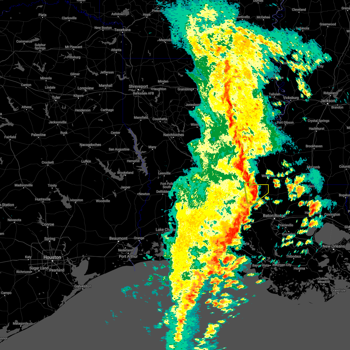 At 249 pm cdt, severe thunderstorms were located along a line extending from near lettsworth to near morganza, moving northeast at 45 mph (radar indicated). Hazards include 60 mph wind gusts. Expect damage to roofs, siding, and trees. Locations impacted include, morganza, wakefield, lettsworth and batchelor. At 249 pm cdt, severe thunderstorms were located along a line extending from near lettsworth to near morganza, moving northeast at 45 mph (radar indicated). Hazards include 60 mph wind gusts. Expect damage to roofs, siding, and trees. Locations impacted include, morganza, wakefield, lettsworth and batchelor.
|
| 10/27/2021 2:16 PM CDT |
 At 216 pm cdt, severe thunderstorms were located along a line extending from cottonport to near port barre to near duson, moving northeast at 45 mph (radar indicated). Hazards include 60 mph wind gusts. expect damage to roofs, siding, and trees At 216 pm cdt, severe thunderstorms were located along a line extending from cottonport to near port barre to near duson, moving northeast at 45 mph (radar indicated). Hazards include 60 mph wind gusts. expect damage to roofs, siding, and trees
|
| 5/4/2021 2:26 PM CDT |
 At 226 pm cdt, severe thunderstorms were located along a line extending from sibley to near bayou current, moving northeast at 35 mph (radar indicated). Hazards include 60 mph wind gusts and quarter size hail. Hail damage to vehicles is expected. Expect wind damage to roofs, siding, and trees. At 226 pm cdt, severe thunderstorms were located along a line extending from sibley to near bayou current, moving northeast at 35 mph (radar indicated). Hazards include 60 mph wind gusts and quarter size hail. Hail damage to vehicles is expected. Expect wind damage to roofs, siding, and trees.
|
| 4/14/2021 8:06 AM CDT |
 The severe thunderstorm warning for west feliciana and central pointe coupee parishes will expire at 815 am cdt, the storm which prompted the warning has weakened below severe limits, and no longer poses an immediate threat to life or property. therefore, the warning will be allowed to expire. however small hail is still possible with this thunderstorm. The severe thunderstorm warning for west feliciana and central pointe coupee parishes will expire at 815 am cdt, the storm which prompted the warning has weakened below severe limits, and no longer poses an immediate threat to life or property. therefore, the warning will be allowed to expire. however small hail is still possible with this thunderstorm.
|
| 4/14/2021 7:57 AM CDT |
 At 757 am cdt, a severe thunderstorm was located near wakefield, or 7 miles northwest of st. francisville, moving northeast at 55 mph (radar indicated). Hazards include 60 mph wind gusts and quarter size hail. Hail damage to vehicles is expected. expect wind damage to roofs, siding, and trees. locations impacted include, new roads, st. Francisville, morganza, wakefield and spillman. At 757 am cdt, a severe thunderstorm was located near wakefield, or 7 miles northwest of st. francisville, moving northeast at 55 mph (radar indicated). Hazards include 60 mph wind gusts and quarter size hail. Hail damage to vehicles is expected. expect wind damage to roofs, siding, and trees. locations impacted include, new roads, st. Francisville, morganza, wakefield and spillman.
|
| 4/14/2021 7:34 AM CDT |
 At 734 am cdt, a severe thunderstorm was located over melville, moving northeast at 55 mph (radar indicated). Hazards include 60 mph wind gusts and quarter size hail. Hail damage to vehicles is expected. Expect wind damage to roofs, siding, and trees. At 734 am cdt, a severe thunderstorm was located over melville, moving northeast at 55 mph (radar indicated). Hazards include 60 mph wind gusts and quarter size hail. Hail damage to vehicles is expected. Expect wind damage to roofs, siding, and trees.
|
| 4/13/2021 9:18 AM CDT |
 At 918 am cdt, a severe thunderstorm was located near lottie, or near krotz springs, moving north at 20 mph (radar indicated). Hazards include 60 mph wind gusts and quarter size hail. Hail damage to vehicles is expected. Expect wind damage to roofs, siding, and trees. At 918 am cdt, a severe thunderstorm was located near lottie, or near krotz springs, moving north at 20 mph (radar indicated). Hazards include 60 mph wind gusts and quarter size hail. Hail damage to vehicles is expected. Expect wind damage to roofs, siding, and trees.
|
| 4/10/2021 3:20 AM CDT |
 At 320 am cdt, severe thunderstorms were located along a line extending from 7 miles southwest of woodville to near melville, moving northeast at 40 mph (radar indicated). Hazards include 60 mph wind gusts and nickel size hail. expect damage to roofs, siding, and trees At 320 am cdt, severe thunderstorms were located along a line extending from 7 miles southwest of woodville to near melville, moving northeast at 40 mph (radar indicated). Hazards include 60 mph wind gusts and nickel size hail. expect damage to roofs, siding, and trees
|
| 4/10/2021 3:08 AM CDT |
 The severe thunderstorm warning for central west feliciana and northwestern pointe coupee parishes will expire at 315 am cdt, the storm which prompted the warning has weakened below severe limits, and no longer poses an immediate threat to life or property. therefore, the warning will be allowed to expire. however gusty winds in excess of 30 to 40 mph will still be possible with this thunderstorm. a tornado watch remains in effect until 700 am cdt for southeastern louisiana, and southern mississippi. The severe thunderstorm warning for central west feliciana and northwestern pointe coupee parishes will expire at 315 am cdt, the storm which prompted the warning has weakened below severe limits, and no longer poses an immediate threat to life or property. therefore, the warning will be allowed to expire. however gusty winds in excess of 30 to 40 mph will still be possible with this thunderstorm. a tornado watch remains in effect until 700 am cdt for southeastern louisiana, and southern mississippi.
|
| 4/10/2021 2:28 AM CDT |
 At 228 am cdt, a severe thunderstorm was located over bayou current, moving northeast at 30 mph (radar indicated). Hazards include 60 mph wind gusts and nickel size hail. expect damage to roofs, siding, and trees At 228 am cdt, a severe thunderstorm was located over bayou current, moving northeast at 30 mph (radar indicated). Hazards include 60 mph wind gusts and nickel size hail. expect damage to roofs, siding, and trees
|
| 3/23/2021 7:09 AM CDT |
 At 708 am cdt, a severe thunderstorm was located near morganza, or near new roads, moving east at 45 mph (radar indicated). Hazards include 60 mph wind gusts and quarter size hail. Hail damage to vehicles is expected. Expect wind damage to roofs, siding, and trees. At 708 am cdt, a severe thunderstorm was located near morganza, or near new roads, moving east at 45 mph (radar indicated). Hazards include 60 mph wind gusts and quarter size hail. Hail damage to vehicles is expected. Expect wind damage to roofs, siding, and trees.
|
| 3/23/2021 6:40 AM CDT |
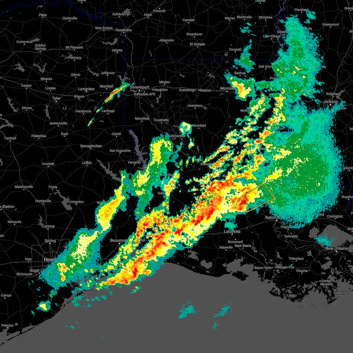 At 639 am cdt, a severe thunderstorm was located near melville, moving northeast at 35 mph (radar indicated). Hazards include 60 mph wind gusts and quarter size hail. Hail damage to vehicles is expected. Expect wind damage to roofs, siding, and trees. At 639 am cdt, a severe thunderstorm was located near melville, moving northeast at 35 mph (radar indicated). Hazards include 60 mph wind gusts and quarter size hail. Hail damage to vehicles is expected. Expect wind damage to roofs, siding, and trees.
|
| 1/1/0001 12:00 AM | Tree reported blown down on crescent road in tunica. the tree is completely blocking the roadway and power is out in the area. event time approximat in west feliciana county LA, 13.5 miles S of Morganza, LA |
| 8/26/2020 3:38 PM CDT |
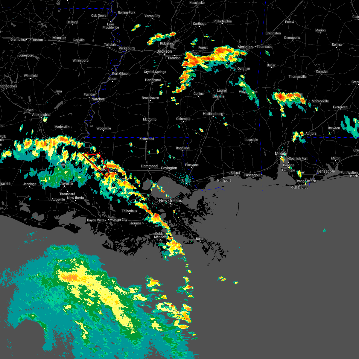 At 338 pm cdt, a severe thunderstorm capable of producing a tornado was located over brusly, or near port allen, moving northwest at 50 mph (radar indicated rotation). Hazards include tornado. Flying debris will be dangerous to those caught without shelter. mobile homes will be damaged or destroyed. damage to roofs, windows, and vehicles will occur. tree damage is likely. this dangerous storm will be near, erwinville around 350 pm cdt. new roads around 405 pm cdt. Morganza around 415 pm cdt. At 338 pm cdt, a severe thunderstorm capable of producing a tornado was located over brusly, or near port allen, moving northwest at 50 mph (radar indicated rotation). Hazards include tornado. Flying debris will be dangerous to those caught without shelter. mobile homes will be damaged or destroyed. damage to roofs, windows, and vehicles will occur. tree damage is likely. this dangerous storm will be near, erwinville around 350 pm cdt. new roads around 405 pm cdt. Morganza around 415 pm cdt.
|
| 8/26/2020 3:05 PM CDT |
 At 305 pm cdt, a severe thunderstorm capable of producing a tornado was located over new roads, moving northwest at 40 mph (radar indicated rotation). Hazards include tornado. Flying debris will be dangerous to those caught without shelter. mobile homes will be damaged or destroyed. damage to roofs, windows, and vehicles will occur. tree damage is likely. This dangerous storm will be near, morganza around 320 pm cdt. At 305 pm cdt, a severe thunderstorm capable of producing a tornado was located over new roads, moving northwest at 40 mph (radar indicated rotation). Hazards include tornado. Flying debris will be dangerous to those caught without shelter. mobile homes will be damaged or destroyed. damage to roofs, windows, and vehicles will occur. tree damage is likely. This dangerous storm will be near, morganza around 320 pm cdt.
|
| 8/26/2020 2:49 PM CDT |
 At 249 pm cdt, a severe thunderstorm capable of producing a tornado was located 7 miles east of erwinville, or 8 miles west of baker, moving northwest at 35 mph (radar indicated rotation). Hazards include tornado. Flying debris will be dangerous to those caught without shelter. mobile homes will be damaged or destroyed. damage to roofs, windows, and vehicles will occur. tree damage is likely. this dangerous storm will be near, new roads around 310 pm cdt. Morganza around 315 pm cdt. At 249 pm cdt, a severe thunderstorm capable of producing a tornado was located 7 miles east of erwinville, or 8 miles west of baker, moving northwest at 35 mph (radar indicated rotation). Hazards include tornado. Flying debris will be dangerous to those caught without shelter. mobile homes will be damaged or destroyed. damage to roofs, windows, and vehicles will occur. tree damage is likely. this dangerous storm will be near, new roads around 310 pm cdt. Morganza around 315 pm cdt.
|
| 8/26/2020 2:36 PM CDT |
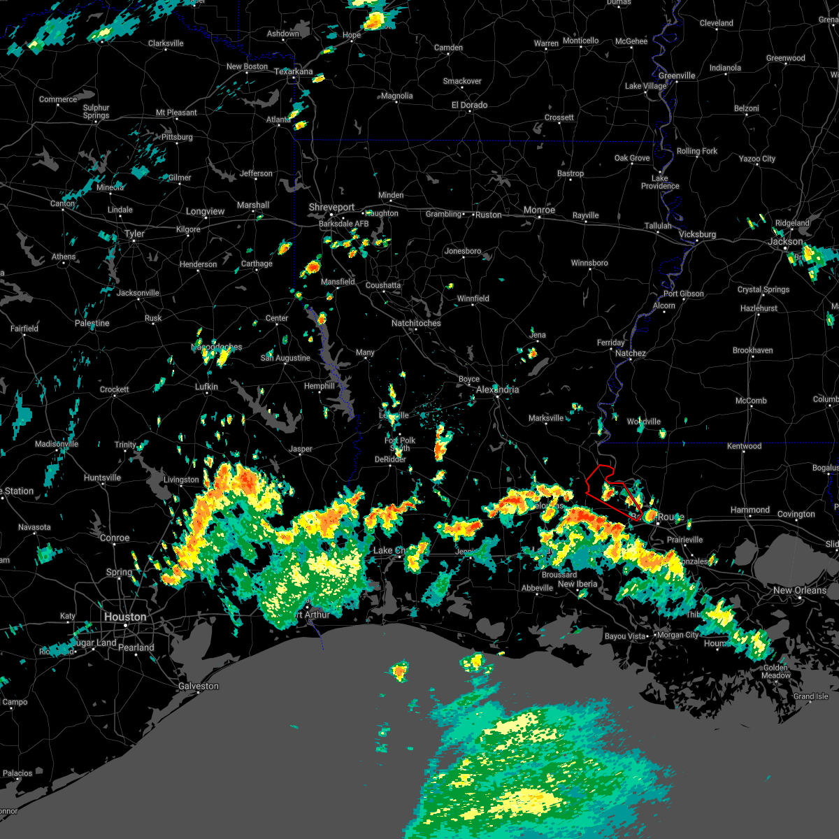 The tornado warning for central west baton rouge and southern pointe coupee parishes will expire at 245 pm cdt, the storm which prompted the warning has weakened below severe limits, and no longer appears capable of producing a tornado. therefore, the warning will be allowed to expire. however gusty winds are still possible with this thunderstorm. The tornado warning for central west baton rouge and southern pointe coupee parishes will expire at 245 pm cdt, the storm which prompted the warning has weakened below severe limits, and no longer appears capable of producing a tornado. therefore, the warning will be allowed to expire. however gusty winds are still possible with this thunderstorm.
|
| 8/26/2020 2:14 PM CDT |
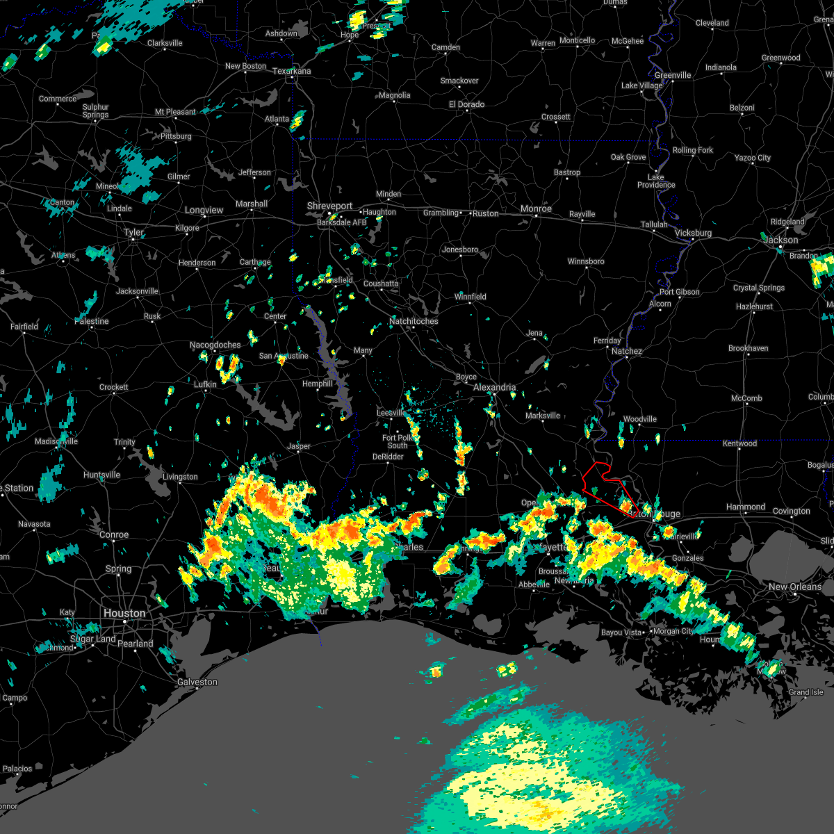 At 214 pm cdt, a severe thunderstorm capable of producing a tornado was located near erwinville, or 9 miles northwest of port allen, moving northwest at 35 mph (radar indicated rotation). Hazards include tornado. Flying debris will be dangerous to those caught without shelter. mobile homes will be damaged or destroyed. damage to roofs, windows, and vehicles will occur. tree damage is likely. this dangerous storm will be near, erwinville around 220 pm cdt. new roads and livonia around 235 pm cdt. Fordoche and morganza around 245 pm cdt. At 214 pm cdt, a severe thunderstorm capable of producing a tornado was located near erwinville, or 9 miles northwest of port allen, moving northwest at 35 mph (radar indicated rotation). Hazards include tornado. Flying debris will be dangerous to those caught without shelter. mobile homes will be damaged or destroyed. damage to roofs, windows, and vehicles will occur. tree damage is likely. this dangerous storm will be near, erwinville around 220 pm cdt. new roads and livonia around 235 pm cdt. Fordoche and morganza around 245 pm cdt.
|
| 6/25/2020 2:49 PM CDT |
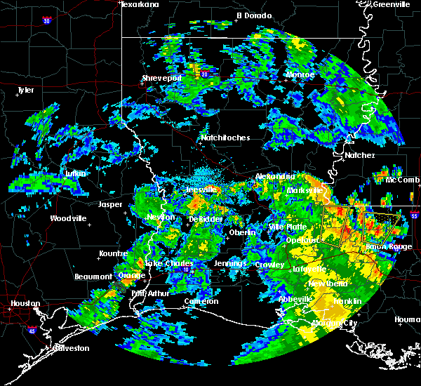 At 248 pm cdt, a severe thunderstorm was located 8 miles west of wakefield, or 9 miles northwest of st. francisville, moving north at 40 mph (radar indicated). Hazards include 60 mph wind gusts and penny size hail. Expect damage to roofs, siding, and trees. locations impacted include, new roads, st. Francisville, morganza and wakefield. At 248 pm cdt, a severe thunderstorm was located 8 miles west of wakefield, or 9 miles northwest of st. francisville, moving north at 40 mph (radar indicated). Hazards include 60 mph wind gusts and penny size hail. Expect damage to roofs, siding, and trees. locations impacted include, new roads, st. Francisville, morganza and wakefield.
|
| 6/25/2020 2:37 PM CDT |
 At 236 pm cdt, a severe thunderstorm was located near morganza, or near new roads, moving north at 40 mph (radar indicated). Hazards include 60 mph wind gusts and penny size hail. Expect damage to roofs, siding, and trees. locations impacted include, new roads, st. Francisville, livonia, fordoche, morganza and wakefield. At 236 pm cdt, a severe thunderstorm was located near morganza, or near new roads, moving north at 40 mph (radar indicated). Hazards include 60 mph wind gusts and penny size hail. Expect damage to roofs, siding, and trees. locations impacted include, new roads, st. Francisville, livonia, fordoche, morganza and wakefield.
|
| 6/25/2020 2:25 PM CDT |
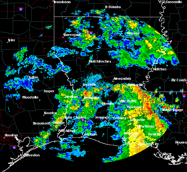 At 225 pm cdt, a severe thunderstorm was located near fordoche, or near new roads, moving north at 40 mph (radar indicated). Hazards include 60 mph wind gusts and penny size hail. Expect damage to roofs, siding, and trees. locations impacted include, new roads, st. Francisville, livonia, maringouin, fordoche, rosedale, morganza, wakefield and lottie. At 225 pm cdt, a severe thunderstorm was located near fordoche, or near new roads, moving north at 40 mph (radar indicated). Hazards include 60 mph wind gusts and penny size hail. Expect damage to roofs, siding, and trees. locations impacted include, new roads, st. Francisville, livonia, maringouin, fordoche, rosedale, morganza, wakefield and lottie.
|
| 6/25/2020 2:10 PM CDT |
 At 210 pm cdt, a severe thunderstorm was located near maringouin, or 11 miles east of krotz springs, moving north at 40 mph (radar indicated). Hazards include 60 mph wind gusts and penny size hail. expect damage to roofs, siding, and trees At 210 pm cdt, a severe thunderstorm was located near maringouin, or 11 miles east of krotz springs, moving north at 40 mph (radar indicated). Hazards include 60 mph wind gusts and penny size hail. expect damage to roofs, siding, and trees
|
| 4/19/2020 5:04 PM CDT |
 At 503 pm cdt, a severe thunderstorm was located over morganza, or 8 miles west of new roads, moving northeast at 50 mph (radar indicated). Hazards include 60 mph wind gusts and half dollar size hail. Hail damage to vehicles is expected. expect wind damage to roofs, siding, and trees. locations impacted include, new roads, st. Francisville, fordoche, morganza, wakefield, spillman and batchelor. At 503 pm cdt, a severe thunderstorm was located over morganza, or 8 miles west of new roads, moving northeast at 50 mph (radar indicated). Hazards include 60 mph wind gusts and half dollar size hail. Hail damage to vehicles is expected. expect wind damage to roofs, siding, and trees. locations impacted include, new roads, st. Francisville, fordoche, morganza, wakefield, spillman and batchelor.
|
| 4/19/2020 4:54 PM CDT |
 At 454 pm cdt, a severe thunderstorm was located over melville, moving northeast at 60 mph (radar indicated). Hazards include quarter size hail. damage to vehicles is expected At 454 pm cdt, a severe thunderstorm was located over melville, moving northeast at 60 mph (radar indicated). Hazards include quarter size hail. damage to vehicles is expected
|
| 4/18/2020 7:56 PM CDT | Quarter sized hail reported 8.2 miles SSE of Morganza, LA, hail around 1 inch reported at the la express food store on la 1. |
| 4/18/2020 6:56 PM CDT | Quarter sized hail reported 8.2 miles SSE of Morganza, LA, hail around 1 inch reported at the la express food store on la 1. |
| 2/6/2020 12:40 AM CST |
 The severe thunderstorm warning for central west feliciana and western pointe coupee parishes will expire at 1245 am cst, the storm which prompted the warning has weakened below severe limits, and no longer poses an immediate threat to life or property. therefore, the warning will be allowed to expire. however small hail is still possible with this thunderstorm. The severe thunderstorm warning for central west feliciana and western pointe coupee parishes will expire at 1245 am cst, the storm which prompted the warning has weakened below severe limits, and no longer poses an immediate threat to life or property. therefore, the warning will be allowed to expire. however small hail is still possible with this thunderstorm.
|
| 2/6/2020 12:21 AM CST |
 At 1220 am cst, a severe thunderstorm was located near melville, moving northeast at 70 mph (radar indicated). Hazards include quarter size hail. damage to vehicles is expected At 1220 am cst, a severe thunderstorm was located near melville, moving northeast at 70 mph (radar indicated). Hazards include quarter size hail. damage to vehicles is expected
|
| 1/11/2020 6:56 AM CST |
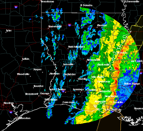 The severe thunderstorm warning for west feliciana parish will expire at 700 am cst, the storm which prompted the warning has weakened below severe limits, and no longer poses an immediate threat to life or property. therefore, the warning will be allowed to expire. however gusty winds are still possible with this thunderstorm. a tornado watch remains in effect until noon cst for southeastern louisiana, and southern mississippi. The severe thunderstorm warning for west feliciana parish will expire at 700 am cst, the storm which prompted the warning has weakened below severe limits, and no longer poses an immediate threat to life or property. therefore, the warning will be allowed to expire. however gusty winds are still possible with this thunderstorm. a tornado watch remains in effect until noon cst for southeastern louisiana, and southern mississippi.
|
| 1/11/2020 6:45 AM CST |
 At 645 am cst, a severe thunderstorm was located near wakefield, or near st. francisville, moving northeast at 55 mph (radar indicated). Hazards include 60 mph wind gusts. Expect damage to roofs, siding, and trees. locations impacted include, st. Francisville, morganza, wakefield and spillman. At 645 am cst, a severe thunderstorm was located near wakefield, or near st. francisville, moving northeast at 55 mph (radar indicated). Hazards include 60 mph wind gusts. Expect damage to roofs, siding, and trees. locations impacted include, st. Francisville, morganza, wakefield and spillman.
|
| 1/11/2020 6:33 AM CST |
 At 633 am cst, a severe thunderstorm was located near morganza, or near new roads, moving northeast at 55 mph (radar indicated). Hazards include 60 mph wind gusts. expect damage to roofs, siding, and trees At 633 am cst, a severe thunderstorm was located near morganza, or near new roads, moving northeast at 55 mph (radar indicated). Hazards include 60 mph wind gusts. expect damage to roofs, siding, and trees
|
| 1/11/2020 6:24 AM CST |
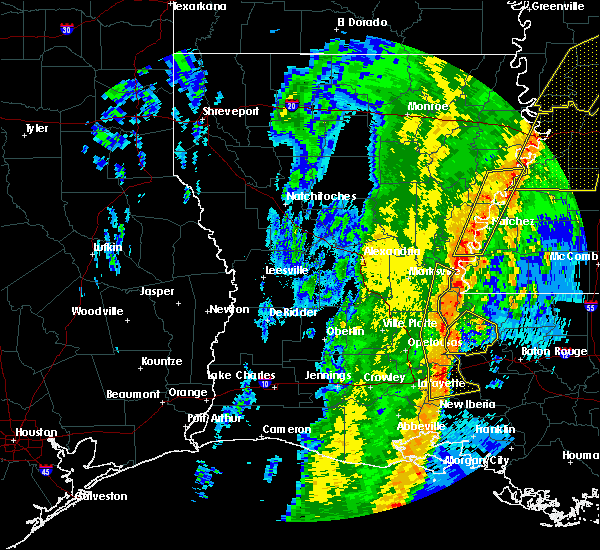 At 623 am cst, a severe thunderstorm was located near fordoche, or 8 miles west of new roads, moving northeast at 55 mph (radar indicated). Hazards include 60 mph wind gusts. Expect damage to roofs, siding, and trees. Locations impacted include, new roads, livonia, maringouin, fordoche, morganza and lottie. At 623 am cst, a severe thunderstorm was located near fordoche, or 8 miles west of new roads, moving northeast at 55 mph (radar indicated). Hazards include 60 mph wind gusts. Expect damage to roofs, siding, and trees. Locations impacted include, new roads, livonia, maringouin, fordoche, morganza and lottie.
|
| 1/11/2020 6:07 AM CST |
 At 606 am cst, a severe thunderstorm was located near krotz springs, moving northeast at 55 mph (radar indicated). Hazards include 60 mph wind gusts. expect damage to roofs, siding, and trees At 606 am cst, a severe thunderstorm was located near krotz springs, moving northeast at 55 mph (radar indicated). Hazards include 60 mph wind gusts. expect damage to roofs, siding, and trees
|
| 5/19/2019 7:01 AM CDT |
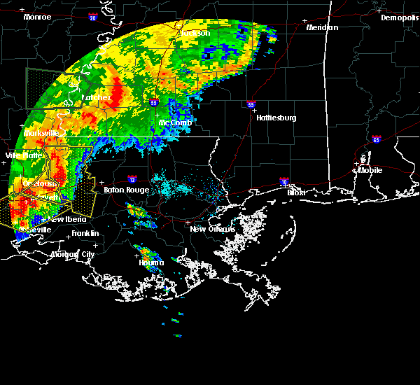 At 701 am cdt, severe thunderstorms were located along a line extending from near morganza to maringouin to near atchafalaya national wildlife refuge, moving east at 35 mph (radar indicated). Hazards include 60 mph wind gusts. Expect damage to roofs, siding, and trees. these severe storms will be near, maringouin around 705 am cdt. livonia, rosedale, grosse tete, ramah and erwinville around 715 am cdt. new roads around 725 am cdt. Port allen, addis and brusly around 730 am cdt. At 701 am cdt, severe thunderstorms were located along a line extending from near morganza to maringouin to near atchafalaya national wildlife refuge, moving east at 35 mph (radar indicated). Hazards include 60 mph wind gusts. Expect damage to roofs, siding, and trees. these severe storms will be near, maringouin around 705 am cdt. livonia, rosedale, grosse tete, ramah and erwinville around 715 am cdt. new roads around 725 am cdt. Port allen, addis and brusly around 730 am cdt.
|
| 5/19/2019 6:45 AM CDT |
 At 645 am cdt, severe thunderstorms were located along a line extending from near bayou current to near lottie to near breaux bridge, moving east at 40 mph (radar indicated). Hazards include 60 mph wind gusts. Expect damage to roofs, siding, and trees. these severe storms will be near, fordoche and lottie around 650 am cdt. livonia around 655 am cdt. maringouin, morganza and ramah around 700 am cdt. rosedale and grosse tete around 705 am cdt. erwinville around 710 am cdt. new roads and st. francisville around 715 am cdt. addis and brusly around 725 am cdt. Port allen and bayou sorrel around 730 am cdt. At 645 am cdt, severe thunderstorms were located along a line extending from near bayou current to near lottie to near breaux bridge, moving east at 40 mph (radar indicated). Hazards include 60 mph wind gusts. Expect damage to roofs, siding, and trees. these severe storms will be near, fordoche and lottie around 650 am cdt. livonia around 655 am cdt. maringouin, morganza and ramah around 700 am cdt. rosedale and grosse tete around 705 am cdt. erwinville around 710 am cdt. new roads and st. francisville around 715 am cdt. addis and brusly around 725 am cdt. Port allen and bayou sorrel around 730 am cdt.
|
| 5/19/2019 6:28 AM CDT |
 At 627 am cdt, severe thunderstorms were located along a line extending from near big cane to near port barre to near carencro, moving east at 40 mph (radar indicated). Hazards include 60 mph wind gusts. expect damage to roofs, siding, and trees At 627 am cdt, severe thunderstorms were located along a line extending from near big cane to near port barre to near carencro, moving east at 40 mph (radar indicated). Hazards include 60 mph wind gusts. expect damage to roofs, siding, and trees
|
| 4/18/2019 1:09 PM CDT |
 The severe thunderstorm warning for west feliciana, pointe coupee parishes in southeastern louisiana and wilkinson counties will expire at 115 pm cdt, the storm which prompted the warning has weakened below severe limits, and no longer poses an immediate threat to life or property. therefore, the warning will be allowed to expire. however, gusty winds are still possible with this thunderstorm. a tornado watch remains in effect until 700 pm cdt for southeastern louisiana, and southern mississippi. The severe thunderstorm warning for west feliciana, pointe coupee parishes in southeastern louisiana and wilkinson counties will expire at 115 pm cdt, the storm which prompted the warning has weakened below severe limits, and no longer poses an immediate threat to life or property. therefore, the warning will be allowed to expire. however, gusty winds are still possible with this thunderstorm. a tornado watch remains in effect until 700 pm cdt for southeastern louisiana, and southern mississippi.
|
| 4/18/2019 12:45 PM CDT |
 At 1244 pm cdt, a large cluster of severe thunderstorm was located over pointe coupee, moving northeast at 55 mph (radar indicated). Hazards include 60 mph wind gusts. expect damage to roofs, siding, and trees At 1244 pm cdt, a large cluster of severe thunderstorm was located over pointe coupee, moving northeast at 55 mph (radar indicated). Hazards include 60 mph wind gusts. expect damage to roofs, siding, and trees
|
| 12/27/2018 11:36 AM CST |
 At 1135 am cst, severe thunderstorms were located along a line extending from near melville to krotz springs to near henderson, moving northeast at 40 mph (radar indicated). Hazards include 60 mph wind gusts. expect damage to roofs, siding, and trees At 1135 am cst, severe thunderstorms were located along a line extending from near melville to krotz springs to near henderson, moving northeast at 40 mph (radar indicated). Hazards include 60 mph wind gusts. expect damage to roofs, siding, and trees
|
| 4/14/2018 7:18 AM CDT |
 At 718 am cdt, severe thunderstorms were located along a line extending from 6 miles north of gloster to near jackson to near livonia to catahoula, moving east at 30 mph (radar indicated). Hazards include 60 mph wind gusts. Expect damage to roofs, siding, and trees. locations impacted include, baton rouge, zachary, baker, port allen, new roads, jackson, st. francisville, clinton, liberty, addis, brusly, centreville, livonia, maringouin, woodville, slaughter, gloster, fordoche, rosedale and grosse tete. A tornado watch remains in effect until 200 pm cdt for southeastern louisiana, and southern mississippi. At 718 am cdt, severe thunderstorms were located along a line extending from 6 miles north of gloster to near jackson to near livonia to catahoula, moving east at 30 mph (radar indicated). Hazards include 60 mph wind gusts. Expect damage to roofs, siding, and trees. locations impacted include, baton rouge, zachary, baker, port allen, new roads, jackson, st. francisville, clinton, liberty, addis, brusly, centreville, livonia, maringouin, woodville, slaughter, gloster, fordoche, rosedale and grosse tete. A tornado watch remains in effect until 200 pm cdt for southeastern louisiana, and southern mississippi.
|
| 4/14/2018 6:36 AM CDT |
 At 636 am cdt, severe thunderstorms were located along a line extending from near dolorosa to 6 miles southwest of fort adams to near palmetto to near mire, moving south at 20 mph (radar indicated). Hazards include 60 mph wind gusts. expect damage to roofs, siding, and trees At 636 am cdt, severe thunderstorms were located along a line extending from near dolorosa to 6 miles southwest of fort adams to near palmetto to near mire, moving south at 20 mph (radar indicated). Hazards include 60 mph wind gusts. expect damage to roofs, siding, and trees
|
| 3/11/2018 9:29 AM CDT |
 At 929 am cdt, a severe thunderstorm was located over new roads, moving southeast at 40 mph (radar indicated). Hazards include 60 mph wind gusts and penny size hail. Expect damage to roofs, siding, and trees. locations impacted include, new roads, st. Francisville, livonia, fordoche, morganza, wakefield and lottie. At 929 am cdt, a severe thunderstorm was located over new roads, moving southeast at 40 mph (radar indicated). Hazards include 60 mph wind gusts and penny size hail. Expect damage to roofs, siding, and trees. locations impacted include, new roads, st. Francisville, livonia, fordoche, morganza, wakefield and lottie.
|
| 3/11/2018 9:23 AM CDT |
 At 921 am cdt, a severe thunderstorm was located over morganza, or 7 miles northwest of new roads, moving southeast at 30 mph (radar indicated). Hazards include 60 mph wind gusts and penny size hail. Expect damage to roofs, siding, and trees. locations impacted include, new roads, st. francisville, livonia, fordoche, morganza, wakefield and lottie. This storm has produced some wind damage near and to the southeast of alexandria. At 921 am cdt, a severe thunderstorm was located over morganza, or 7 miles northwest of new roads, moving southeast at 30 mph (radar indicated). Hazards include 60 mph wind gusts and penny size hail. Expect damage to roofs, siding, and trees. locations impacted include, new roads, st. francisville, livonia, fordoche, morganza, wakefield and lottie. This storm has produced some wind damage near and to the southeast of alexandria.
|
| 3/11/2018 9:07 AM CDT |
 At 907 am cdt, a severe thunderstorm was located over batchelor, or 7 miles east of bayou current, moving southeast at 30 mph (radar indicated). Hazards include 60 mph wind gusts and penny size hail. expect damage to roofs, siding, and trees At 907 am cdt, a severe thunderstorm was located over batchelor, or 7 miles east of bayou current, moving southeast at 30 mph (radar indicated). Hazards include 60 mph wind gusts and penny size hail. expect damage to roofs, siding, and trees
|
| 5/3/2017 6:46 PM CDT |
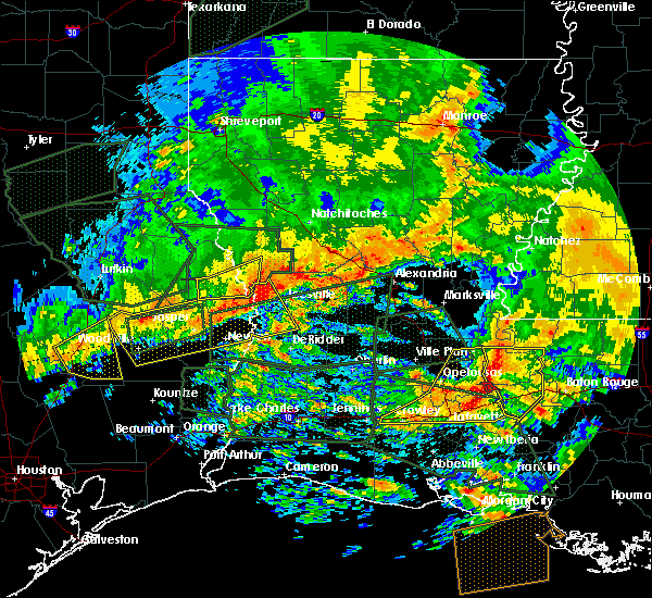 At 644 pm cdt, severe thunderstorms were located along a line extending from near morganza to near fordoche to krotz springs to cecilia, moving east at 60 mph (radar indicated). Hazards include 60 mph wind gusts. Expect damage to roofs, siding, and trees. locations impacted include, new roads, st. francisville, livonia, maringouin, fordoche, rosedale, grosse tete, morganza, ramah, erwinville and lottie. Strongest winds could be near krotz springs and approaching lottie and livonia. At 644 pm cdt, severe thunderstorms were located along a line extending from near morganza to near fordoche to krotz springs to cecilia, moving east at 60 mph (radar indicated). Hazards include 60 mph wind gusts. Expect damage to roofs, siding, and trees. locations impacted include, new roads, st. francisville, livonia, maringouin, fordoche, rosedale, grosse tete, morganza, ramah, erwinville and lottie. Strongest winds could be near krotz springs and approaching lottie and livonia.
|
| 5/3/2017 6:37 PM CDT |
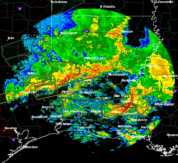 At 636 pm cdt, severe thunderstorms were located along a line extending from near bayou current to near arnaudville to scott, moving east at 40 mph (radar indicated). Hazards include 60 mph wind gusts. expect damage to roofs, siding, and trees At 636 pm cdt, severe thunderstorms were located along a line extending from near bayou current to near arnaudville to scott, moving east at 40 mph (radar indicated). Hazards include 60 mph wind gusts. expect damage to roofs, siding, and trees
|
| 4/30/2017 5:38 AM CDT |
 At 537 am cdt, severe thunderstorms were located along a line extending from near fort adams to 6 miles southwest of ramah, moving east at 30 mph (radar indicated). Hazards include 60 mph wind gusts and quarter size hail. Hail damage to vehicles is expected. expect wind damage to roofs, siding, and trees. locations impacted include, new roads, st. francisville, livonia, maringouin, woodville, fordoche, morganza, wakefield, batchelor, lettsworth, fort adams, dolorosa and lottie. A tornado watch remains in effect until 900 am cdt for southeastern louisiana, and southern mississippi. At 537 am cdt, severe thunderstorms were located along a line extending from near fort adams to 6 miles southwest of ramah, moving east at 30 mph (radar indicated). Hazards include 60 mph wind gusts and quarter size hail. Hail damage to vehicles is expected. expect wind damage to roofs, siding, and trees. locations impacted include, new roads, st. francisville, livonia, maringouin, woodville, fordoche, morganza, wakefield, batchelor, lettsworth, fort adams, dolorosa and lottie. A tornado watch remains in effect until 900 am cdt for southeastern louisiana, and southern mississippi.
|
| 4/30/2017 5:06 AM CDT |
 At 505 am cdt, severe thunderstorms were located along a line extending from big bend to cecilia, moving east at 30 mph (radar indicated). Hazards include 60 mph wind gusts and quarter size hail. Hail damage to vehicles is expected. Expect wind damage to roofs, siding, and trees. At 505 am cdt, severe thunderstorms were located along a line extending from big bend to cecilia, moving east at 30 mph (radar indicated). Hazards include 60 mph wind gusts and quarter size hail. Hail damage to vehicles is expected. Expect wind damage to roofs, siding, and trees.
|
| 4/2/2017 10:59 AM CDT | At 1058 am cdt, a severe thunderstorm was located near morganza, or near new roads, moving northeast at 25 mph (radar indicated). Hazards include 60 mph wind gusts and penny size hail. expect damage to roofs, siding, and trees |
| 4/2/2017 10:39 AM CDT | At 1039 am cdt, a severe thunderstorm was located over fordoche, or 9 miles east of krotz springs, moving northeast at 30 mph (radar indicated). Hazards include 60 mph wind gusts and half dollar size hail. Hail damage to vehicles is expected. expect wind damage to roofs, siding, and trees. Locations impacted include, new roads, livonia, fordoche, morganza and lottie. |
| 4/2/2017 10:08 AM CDT | At 1008 am cdt, a severe thunderstorm was located over atchafalaya national wildlife refuge, or near krotz springs, moving northeast at 50 mph (radar indicated). Hazards include 60 mph wind gusts and half dollar size hail. Hail damage to vehicles is expected. Expect wind damage to roofs, siding, and trees. |
| 2/7/2017 10:50 AM CST |
 At 1050 am cst, a severe thunderstorm capable of producing a tornado was located near st. francisville, moving east at 30 mph (radar indicated rotation). Hazards include tornado and half dollar size hail. Flying debris will be dangerous to those caught without shelter. mobile homes will be damaged or destroyed. damage to roofs, windows, and vehicles will occur. tree damage is likely. locations impacted include, zachary, new roads, jackson, st. Francisville and morganza. At 1050 am cst, a severe thunderstorm capable of producing a tornado was located near st. francisville, moving east at 30 mph (radar indicated rotation). Hazards include tornado and half dollar size hail. Flying debris will be dangerous to those caught without shelter. mobile homes will be damaged or destroyed. damage to roofs, windows, and vehicles will occur. tree damage is likely. locations impacted include, zachary, new roads, jackson, st. Francisville and morganza.
|
| 2/7/2017 10:36 AM CST |
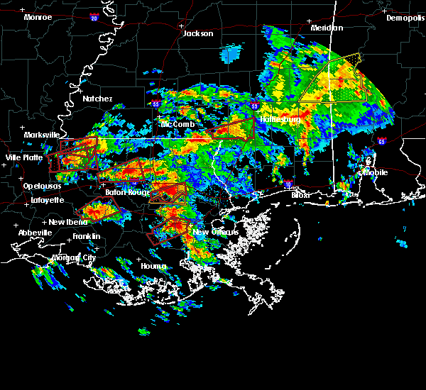 At 1035 am cst, a severe thunderstorm capable of producing a tornado was located over morganza, or near new roads, moving east at 30 mph (radar indicated rotation). Hazards include tornado and half dollar size hail. Flying debris will be dangerous to those caught without shelter. mobile homes will be damaged or destroyed. damage to roofs, windows, and vehicles will occur. Tree damage is likely. At 1035 am cst, a severe thunderstorm capable of producing a tornado was located over morganza, or near new roads, moving east at 30 mph (radar indicated rotation). Hazards include tornado and half dollar size hail. Flying debris will be dangerous to those caught without shelter. mobile homes will be damaged or destroyed. damage to roofs, windows, and vehicles will occur. Tree damage is likely.
|
| 2/7/2017 10:16 AM CST |
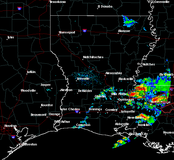 At 1015 am cst, a severe thunderstorm capable of producing a tornado was located over melville, moving east at 40 mph (radar indicated rotation). Hazards include tornado. Flying debris will be dangerous to those caught without shelter. mobile homes will be damaged or destroyed. damage to roofs, windows, and vehicles will occur. Tree damage is likely. At 1015 am cst, a severe thunderstorm capable of producing a tornado was located over melville, moving east at 40 mph (radar indicated rotation). Hazards include tornado. Flying debris will be dangerous to those caught without shelter. mobile homes will be damaged or destroyed. damage to roofs, windows, and vehicles will occur. Tree damage is likely.
|
| 2/7/2017 7:56 AM CST |
 At 756 am cst, a severe thunderstorm capable of producing a tornado was located near wakefield, or 7 miles north of st. francisville, moving northeast at 40 mph (radar indicated rotation). Hazards include tornado. Flying debris will be dangerous to those caught without shelter. mobile homes will be damaged or destroyed. damage to roofs, windows, and vehicles will occur. tree damage is likely. this dangerous storm will be near, wakefield around 800 am cst. spillman around 810 am cst. woodville around 820 am cst. centreville around 830 am cst. Other locations impacted by this tornadic thunderstorm include crosby. At 756 am cst, a severe thunderstorm capable of producing a tornado was located near wakefield, or 7 miles north of st. francisville, moving northeast at 40 mph (radar indicated rotation). Hazards include tornado. Flying debris will be dangerous to those caught without shelter. mobile homes will be damaged or destroyed. damage to roofs, windows, and vehicles will occur. tree damage is likely. this dangerous storm will be near, wakefield around 800 am cst. spillman around 810 am cst. woodville around 820 am cst. centreville around 830 am cst. Other locations impacted by this tornadic thunderstorm include crosby.
|
| 2/7/2017 7:35 AM CST |
 At 734 am cst, a severe thunderstorm capable of producing a tornado was located near batchelor, or 11 miles northwest of new roads, moving northeast at 50 mph (radar indicated rotation). Hazards include tornado. Flying debris will be dangerous to those caught without shelter. mobile homes will be damaged or destroyed. damage to roofs, windows, and vehicles will occur. tree damage is likely. this dangerous storm will be near, wakefield around 750 am cst. spillman around 800 am cst. woodville around 805 am cst. centreville around 820 am cst. Other locations impacted by this tornadic thunderstorm include crosby. At 734 am cst, a severe thunderstorm capable of producing a tornado was located near batchelor, or 11 miles northwest of new roads, moving northeast at 50 mph (radar indicated rotation). Hazards include tornado. Flying debris will be dangerous to those caught without shelter. mobile homes will be damaged or destroyed. damage to roofs, windows, and vehicles will occur. tree damage is likely. this dangerous storm will be near, wakefield around 750 am cst. spillman around 800 am cst. woodville around 805 am cst. centreville around 820 am cst. Other locations impacted by this tornadic thunderstorm include crosby.
|
| 1/21/2017 1:41 AM CST |
 At 140 am cst, severe thunderstorms were located along a line extending from bayou current to near melville to near leonville, moving northeast at 45 mph (radar indicated). Hazards include 60 mph wind gusts and quarter size hail. Hail damage to vehicles is expected. Expect wind damage to roofs, siding, and trees. At 140 am cst, severe thunderstorms were located along a line extending from bayou current to near melville to near leonville, moving northeast at 45 mph (radar indicated). Hazards include 60 mph wind gusts and quarter size hail. Hail damage to vehicles is expected. Expect wind damage to roofs, siding, and trees.
|
| 1/21/2017 1:41 AM CST |
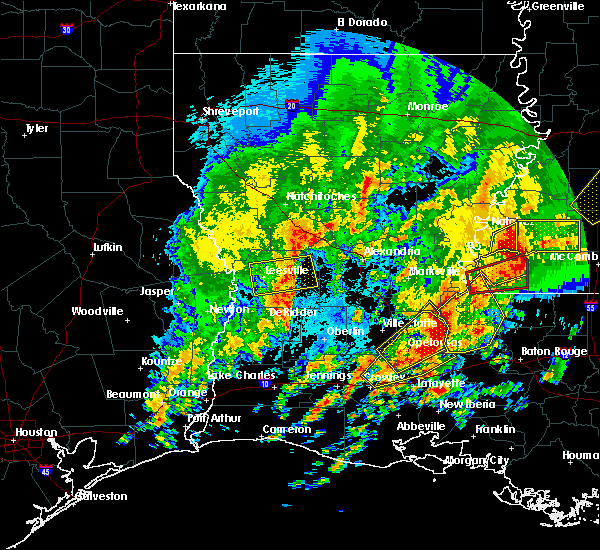 At 140 am cst, severe thunderstorms were located along a line extending from bayou current to near melville to near leonville, moving northeast at 45 mph (radar indicated). Hazards include 60 mph wind gusts and quarter size hail. Hail damage to vehicles is expected. Expect wind damage to roofs, siding, and trees. At 140 am cst, severe thunderstorms were located along a line extending from bayou current to near melville to near leonville, moving northeast at 45 mph (radar indicated). Hazards include 60 mph wind gusts and quarter size hail. Hail damage to vehicles is expected. Expect wind damage to roofs, siding, and trees.
|
| 1/2/2017 12:30 PM CST | Roof damage home and shed reported on social medi in pointe coupee county LA, 8.2 miles SSE of Morganza, LA |
| 4/30/2016 12:16 PM CDT |
 At 1215 pm cdt, severe thunderstorms were located along a line extending from 9 miles south of fort adams to near lottie, moving east at 25 mph (radar indicated). Hazards include 60 mph wind gusts. Expect damage to roofs. siding. And trees. At 1215 pm cdt, severe thunderstorms were located along a line extending from 9 miles south of fort adams to near lottie, moving east at 25 mph (radar indicated). Hazards include 60 mph wind gusts. Expect damage to roofs. siding. And trees.
|
| 4/30/2016 12:16 PM CDT |
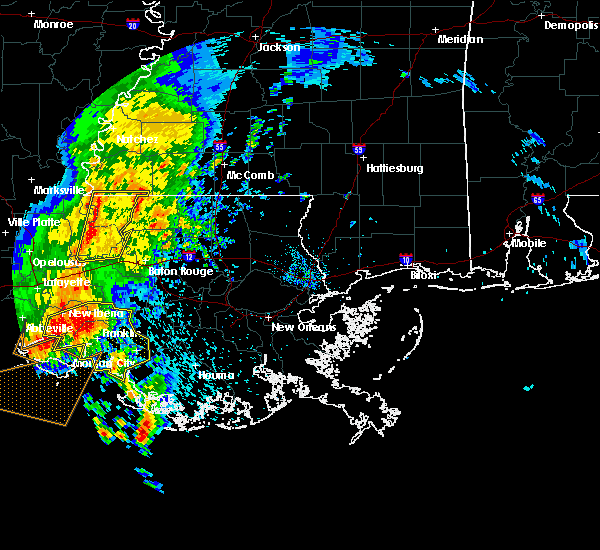 At 1215 pm cdt, severe thunderstorms were located along a line extending from 9 miles south of fort adams to near lottie, moving east at 25 mph (radar indicated). Hazards include 60 mph wind gusts. Expect damage to roofs. siding. And trees. At 1215 pm cdt, severe thunderstorms were located along a line extending from 9 miles south of fort adams to near lottie, moving east at 25 mph (radar indicated). Hazards include 60 mph wind gusts. Expect damage to roofs. siding. And trees.
|
| 3/17/2016 1:48 PM CDT |
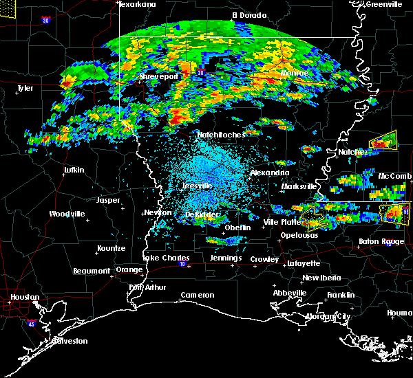 At 147 pm cdt, a severe thunderstorm was located near melville, moving northeast at 15 mph (radar indicated). Hazards include quarter size hail. damage to vehicles is expected At 147 pm cdt, a severe thunderstorm was located near melville, moving northeast at 15 mph (radar indicated). Hazards include quarter size hail. damage to vehicles is expected
|
| 3/17/2016 12:36 PM CDT |
 At 1236 pm cdt, a severe thunderstorm was located near morganza, or 7 miles east of melville, moving northeast at 10 mph (radar indicated). Hazards include half dollar size hail. damage to vehicles is expected At 1236 pm cdt, a severe thunderstorm was located near morganza, or 7 miles east of melville, moving northeast at 10 mph (radar indicated). Hazards include half dollar size hail. damage to vehicles is expected
|
| 2/15/2016 12:06 PM CST |
 At 1205 pm cst, a severe thunderstorm capable of producing a tornado was located near fordoche, or 8 miles southwest of new roads, moving northeast at 35 mph (radar indicated rotation). Hazards include tornado and quarter size hail. Flying debris will be dangerous to those caught without shelter. mobile homes will be damaged or destroyed. damage to roofs, windows and vehicles will occur. tree damage is likely. this dangerous storm will be near, new roads around 1220 pm cst. st. Francisville around 1230 pm cst. At 1205 pm cst, a severe thunderstorm capable of producing a tornado was located near fordoche, or 8 miles southwest of new roads, moving northeast at 35 mph (radar indicated rotation). Hazards include tornado and quarter size hail. Flying debris will be dangerous to those caught without shelter. mobile homes will be damaged or destroyed. damage to roofs, windows and vehicles will occur. tree damage is likely. this dangerous storm will be near, new roads around 1220 pm cst. st. Francisville around 1230 pm cst.
|
| 1/21/2016 4:41 PM CST | A severe thunderstorm warning remains in effect until 500 pm cst for central west feliciana and central pointe coupee parishes. at 441 pm cst. a severe thunderstorm was located near wakefield. or near st. francisville. moving northeast at 40 mph. hazard. 60 mph wind gusts and half dollar size hail. source. Radar indicated. |
| 1/21/2016 4:22 PM CST | The national weather service in new orleans has issued a * tornado warning for. central west feliciana parish in southeastern louisiana. central pointe coupee parish in southeastern louisiana. until 500 pm cst * at 422 pm cst. A severe thunderstorm capable of producing a. |
| 1/21/2016 4:18 PM CST | The national weather service in new orleans has issued a * severe thunderstorm warning for. central west feliciana parish in southeastern louisiana. central pointe coupee parish in southeastern louisiana. until 500 pm cst * at 418 pm cst. A severe thunderstorm was located near batchelor. |
| 10/31/2015 12:39 PM CDT |
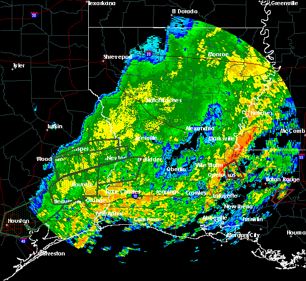 At 1239 pm cdt, a severe thunderstorm capable of producing a tornado was located near melville, moving northeast at 45 mph (radar indicated rotation). Hazards include tornado. Flying debris will be dangerous to those caught without shelter. mobile homes will be damaged or destroyed. damage to roofs, windows and vehicles will occur. tree damage is likely. this dangerous storm will be near, fordoche around 1250 pm cdt. Morganza around 100 pm cdt. At 1239 pm cdt, a severe thunderstorm capable of producing a tornado was located near melville, moving northeast at 45 mph (radar indicated rotation). Hazards include tornado. Flying debris will be dangerous to those caught without shelter. mobile homes will be damaged or destroyed. damage to roofs, windows and vehicles will occur. tree damage is likely. this dangerous storm will be near, fordoche around 1250 pm cdt. Morganza around 100 pm cdt.
|
| 7/30/2015 3:20 PM CDT |
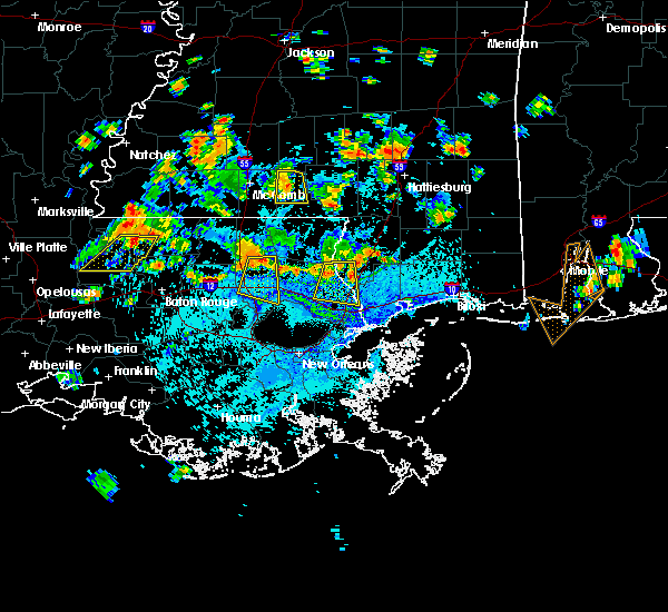 At 319 pm cdt, doppler radar indicated a severe thunderstorm capable of producing damaging winds in excess of 60 mph. this storm was located over st. francisville, and moving southwest at 20 mph. At 319 pm cdt, doppler radar indicated a severe thunderstorm capable of producing damaging winds in excess of 60 mph. this storm was located over st. francisville, and moving southwest at 20 mph.
|
| 7/5/2015 3:23 PM CDT |
 At 323 pm cdt, doppler radar indicated a line of severe thunderstorms capable of producing quarter size hail and damaging winds in excess of 60 mph. these storms were located along a line extending from near fort adams to near new roads, and moving northeast at 35 mph. At 323 pm cdt, doppler radar indicated a line of severe thunderstorms capable of producing quarter size hail and damaging winds in excess of 60 mph. these storms were located along a line extending from near fort adams to near new roads, and moving northeast at 35 mph.
|
| 7/5/2015 3:00 PM CDT |
 At 300 pm cdt, doppler radar indicated a line of severe thunderstorms capable of producing damaging winds in excess of 60 mph. these storms were located along a line extending from big bend to morganza, and moving northeast at 25 mph. At 300 pm cdt, doppler radar indicated a line of severe thunderstorms capable of producing damaging winds in excess of 60 mph. these storms were located along a line extending from big bend to morganza, and moving northeast at 25 mph.
|
| 7/5/2015 3:00 PM CDT |
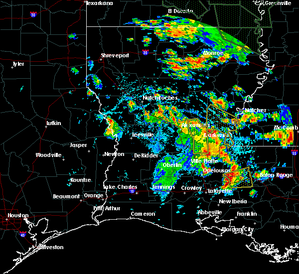 At 300 pm cdt, doppler radar indicated a line of severe thunderstorms capable of producing damaging winds in excess of 60 mph. these storms were located along a line extending from big bend to morganza, and moving northeast at 25 mph. At 300 pm cdt, doppler radar indicated a line of severe thunderstorms capable of producing damaging winds in excess of 60 mph. these storms were located along a line extending from big bend to morganza, and moving northeast at 25 mph.
|
| 5/26/2015 12:23 AM CDT | At 1222 am cdt, doppler radar indicated a severe thunderstorm capable of producing quarter size hail and damaging winds in excess of 60 mph. this storm was located near atchafalaya national wildlife refuge, or 8 miles southeast of krotz springs, and moving northeast at 15 mph. |
| 4/27/2015 4:58 PM CDT | The national weather service in new orleans has issued a * severe thunderstorm warning for. northwestern west baton rouge parish in southeastern louisiana. central west feliciana parish in southeastern louisiana. northwestern iberville parish in southeastern louisiana. Pointe coupee parish in southeastern louisiana. |
| 4/27/2015 4:27 PM CDT | At 426 pm cdt, doppler radar indicated a severe thunderstorm capable of producing quarter size hail. this storm was located near batchelor, or 12 miles east of bayou current, moving east at 55 mph. locations impacted include, new roads, st. francisville, morganza and batchelor. |
| 4/27/2015 4:03 PM CDT | At 403 pm cdt, doppler radar indicated a severe thunderstorm capable of producing quarter size hail. this storm was located near big cane, or near palmetto, and moving east at 35 mph. |
| 4/27/2015 8:48 AM CDT | At 847 am cdt, doppler radar indicated a severe thunderstorm capable of producing a tornado. this dangerous storm was located near fordoche, or 7 miles southwest of new roads, and moving east at 65 mph. |
| 4/27/2015 8:36 AM CDT | At 836 am cdt, doppler radar indicated a severe thunderstorm capable of producing a tornado. this dangerous storm was located near melville, and moving east at 40 mph. |
| 4/27/2015 8:28 AM CDT | At 824 am cdt, doppler radar indicated a line of severe thunderstorms capable of producing quarter size hail and damaging winds in excess of 60 mph. these storms were located along a line extending from near simmesport to near port barre to near maurice, moving east at 60 mph. the strongest winds will be approaching pointe coupee parish. winds could be in excess of 70 mph. there is a tornado watch in effect and this area has showed signs of rotation. a tornado warning may be needed for pointe coupee parish if this rotation persists. locations impacted include, baton rouge, zachary, plaquemine, port allen, new roads, jackson, st. francisville, addis, brusly, livonia, maringouin, woodville, fordoche, rosedale, grosse tete, morganza, wakefield, ramah, lettsworth and erwinville. a tornado watch remains in effect until 100 pm cdt for southeastern louisiana and southern mississippi. |
| 4/27/2015 8:28 AM CDT | At 824 am cdt, doppler radar indicated a line of severe thunderstorms capable of producing quarter size hail and damaging winds in excess of 60 mph. these storms were located along a line extending from near simmesport to near port barre to near maurice, moving east at 60 mph. the strongest winds will be approaching pointe coupee parish. winds could be in excess of 70 mph. there is a tornado watch in effect and this area has showed signs of rotation. a tornado warning may be needed for pointe coupee parish if this rotation persists. locations impacted include, baton rouge, zachary, plaquemine, port allen, new roads, jackson, st. francisville, addis, brusly, livonia, maringouin, woodville, fordoche, rosedale, grosse tete, morganza, wakefield, ramah, lettsworth and erwinville. a tornado watch remains in effect until 100 pm cdt for southeastern louisiana and southern mississippi. |
| 4/27/2015 8:13 AM CDT | At 812 am cdt, doppler radar indicated a line of severe thunderstorms capable of producing quarter size hail and damaging winds in excess of 60 mph. these storms were located along a line extending from mansura to washington to near lyons point, and moving east at 60 mph. |
| 4/27/2015 8:13 AM CDT | At 812 am cdt, doppler radar indicated a line of severe thunderstorms capable of producing quarter size hail and damaging winds in excess of 60 mph. these storms were located along a line extending from mansura to washington to near lyons point, and moving east at 60 mph. |
| 4/25/2015 10:58 AM CDT | At 1057 am cdt, doppler radar indicated a line of severe thunderstorms capable of producing damaging winds in excess of 60 mph. these storms were located along a line extending from near krotz springs to near henderson to near breaux bridge, and moving northeast at 40 mph. |
| 6/24/2014 2:53 PM CDT | Tree fell on a house and a rood was blown off a mobile home in inni in pointe coupee county LA, 10.3 miles SSE of Morganza, LA |
| 6/10/2014 7:15 AM CDT | Tree down and minor damage to metal roo in pointe coupee county LA, 8.2 miles SSE of Morganza, LA |
Hail Maps for Morganza, LA

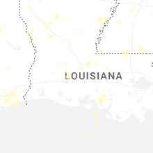

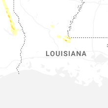


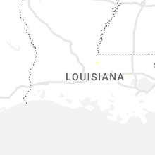


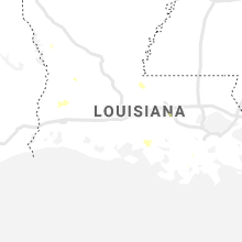


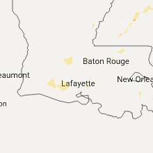


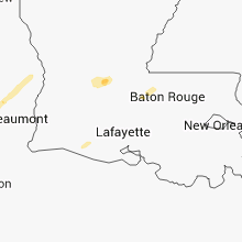


Connect with Interactive Hail Maps