

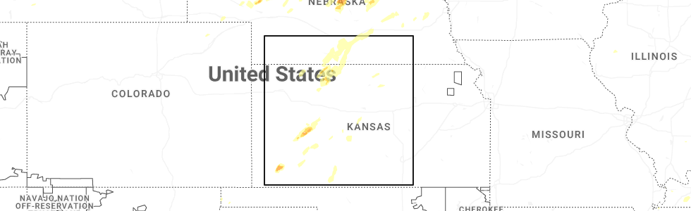
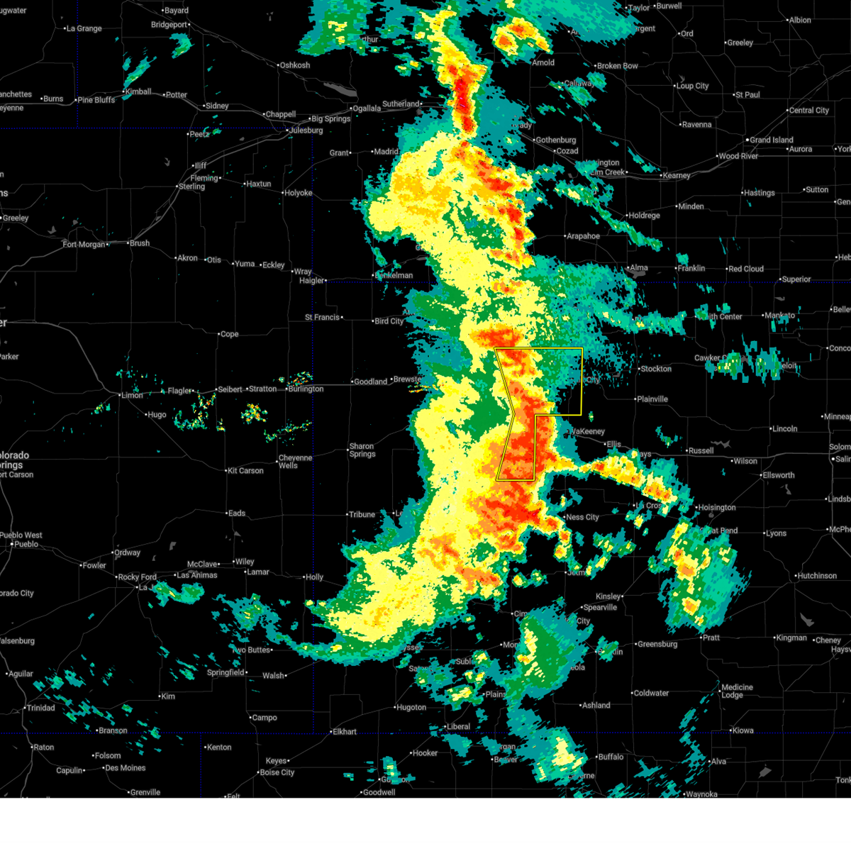
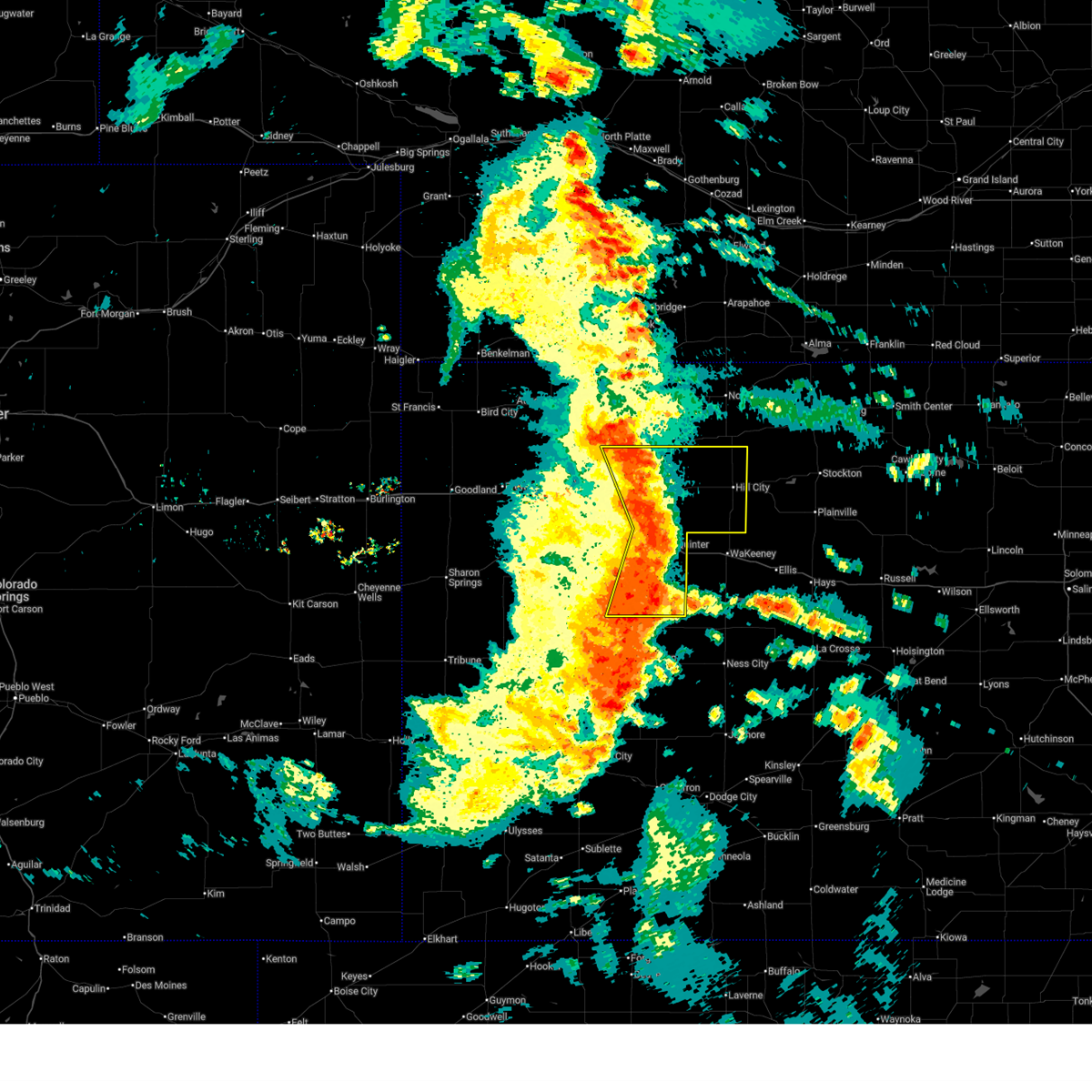
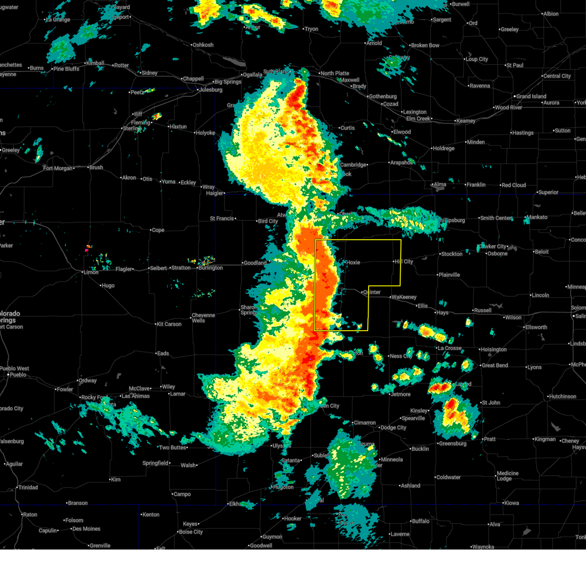
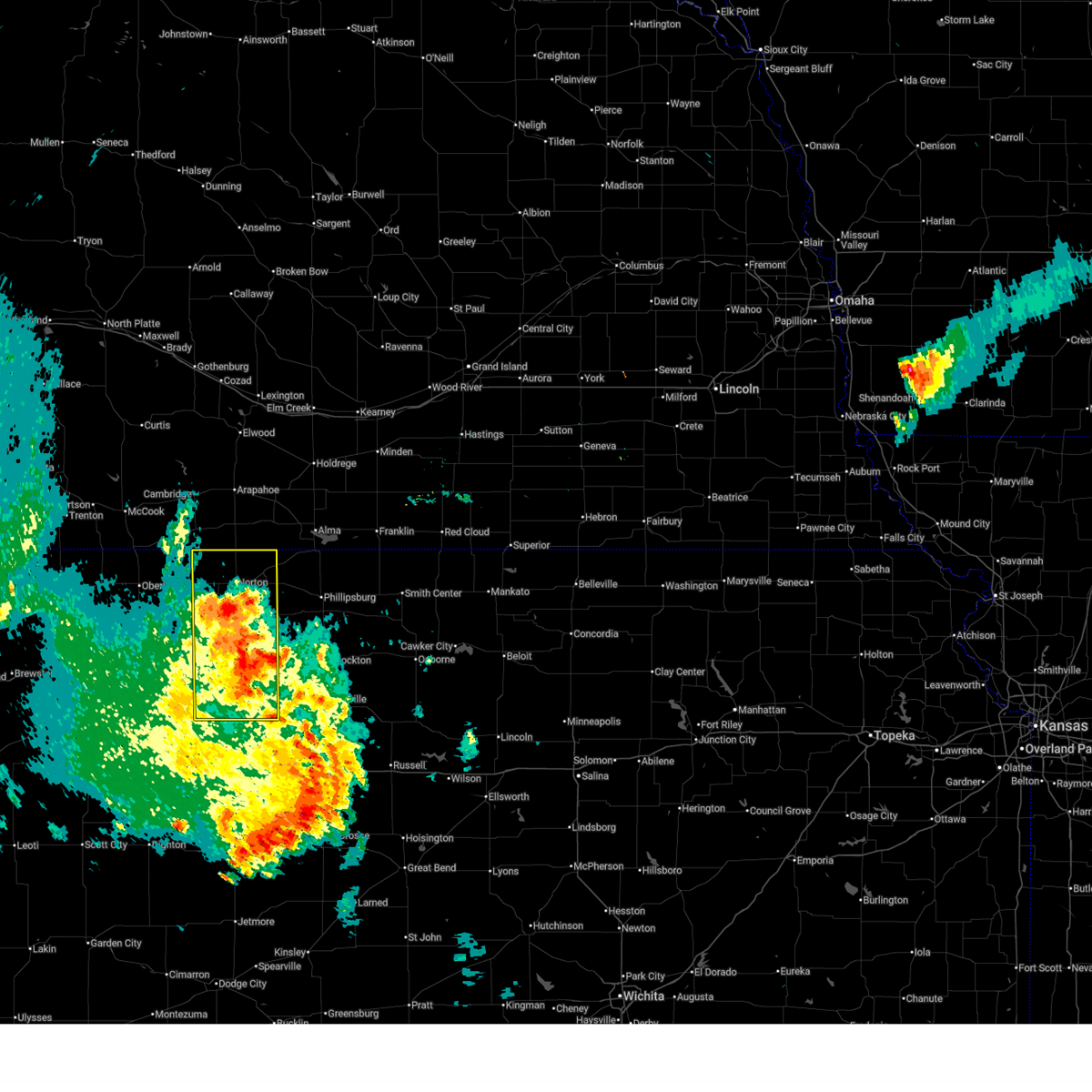
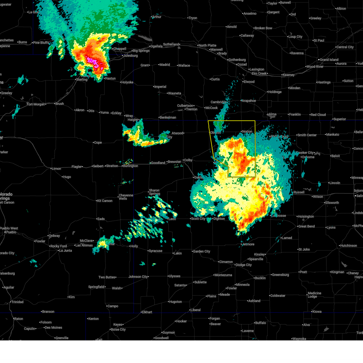
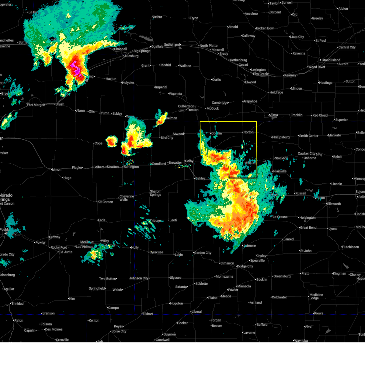
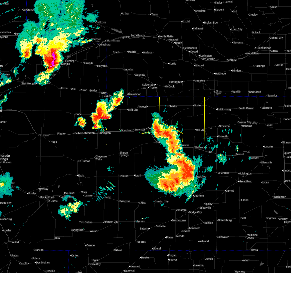
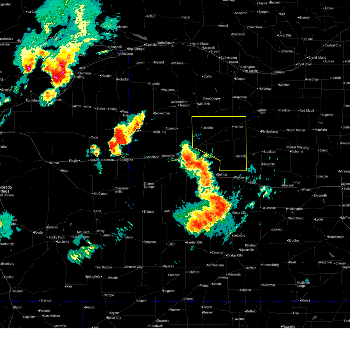
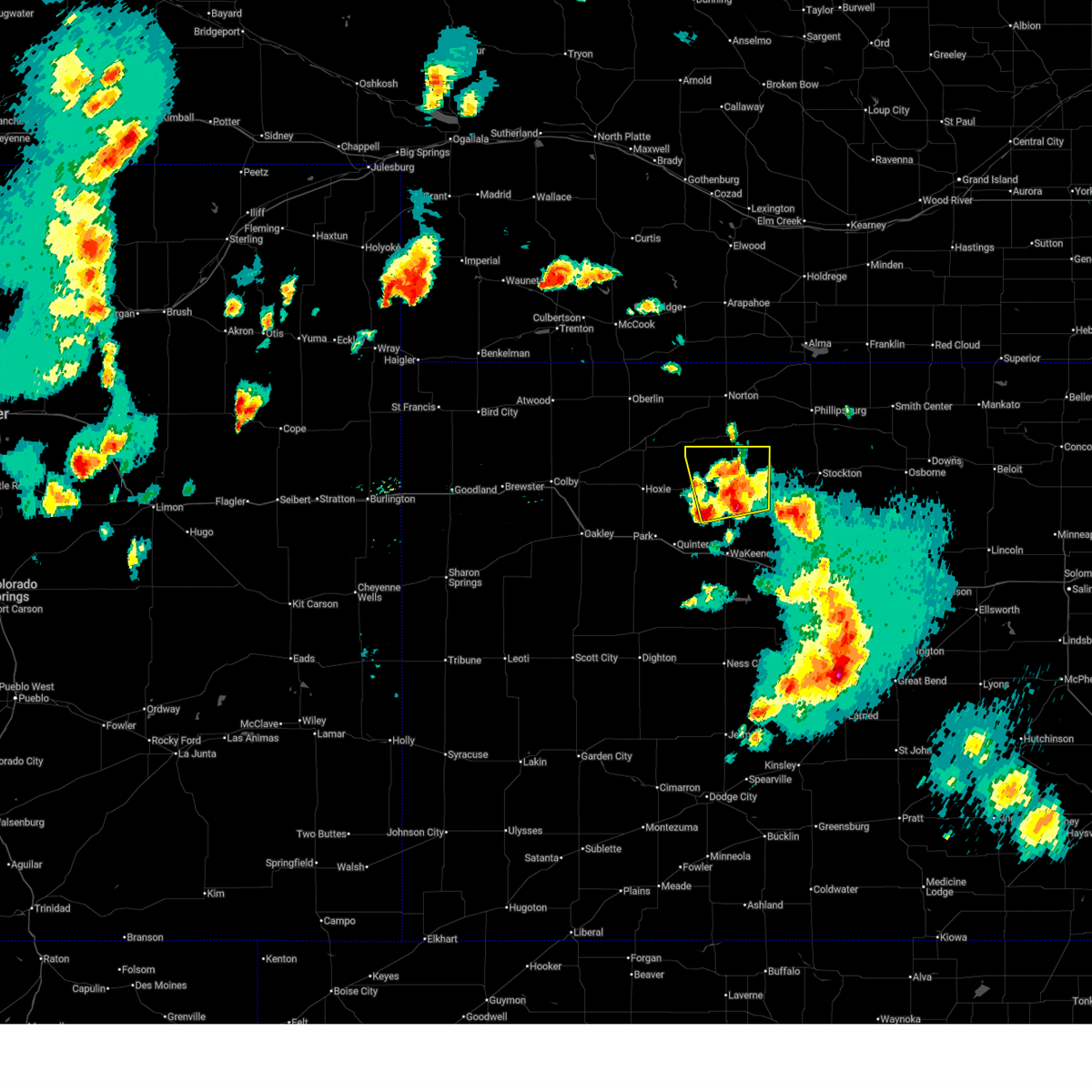
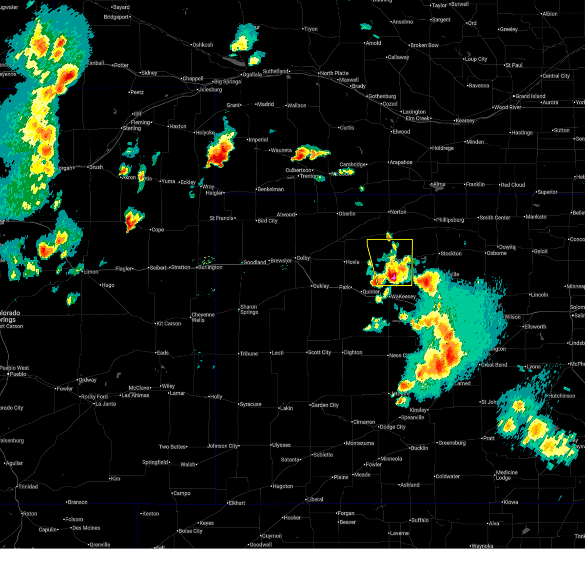
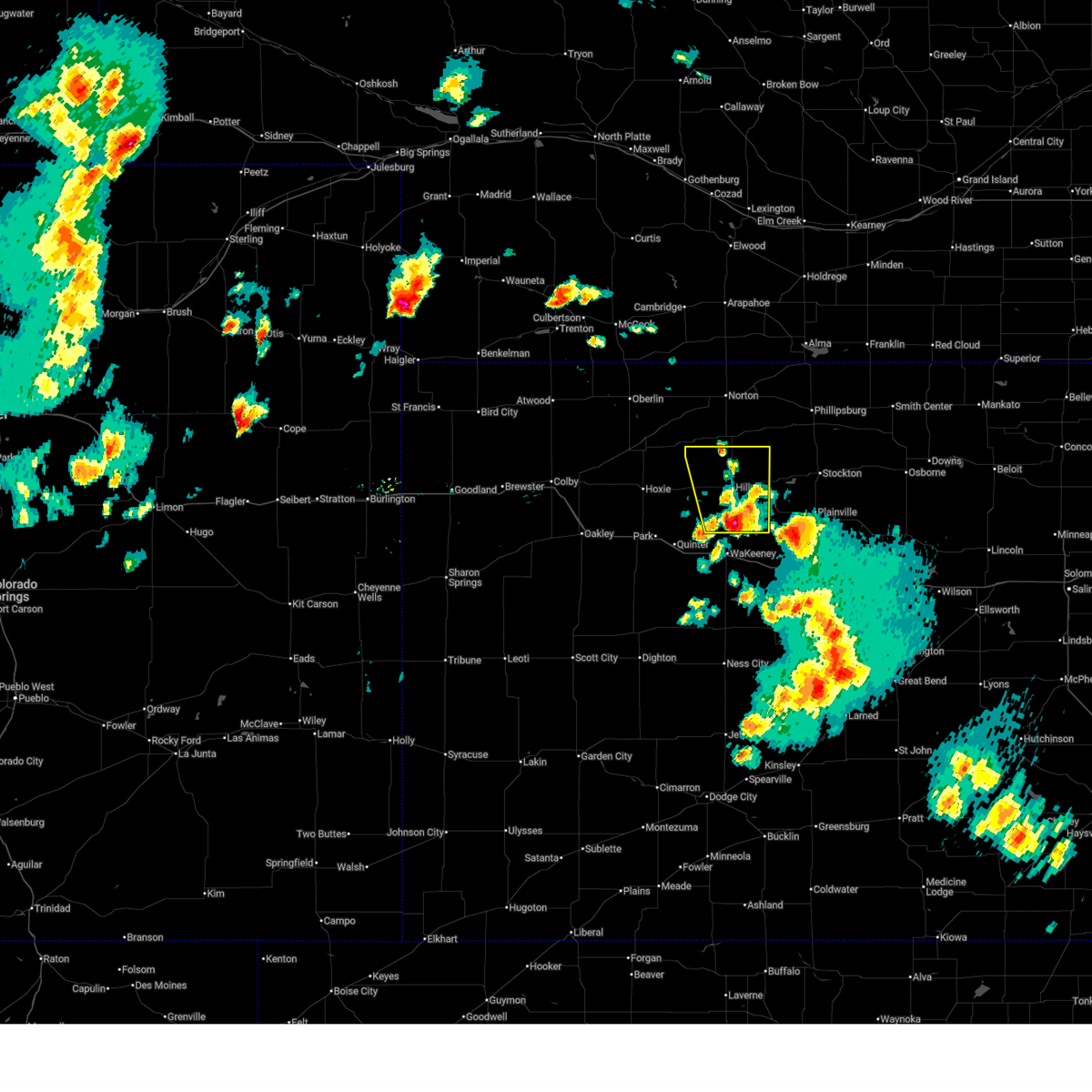
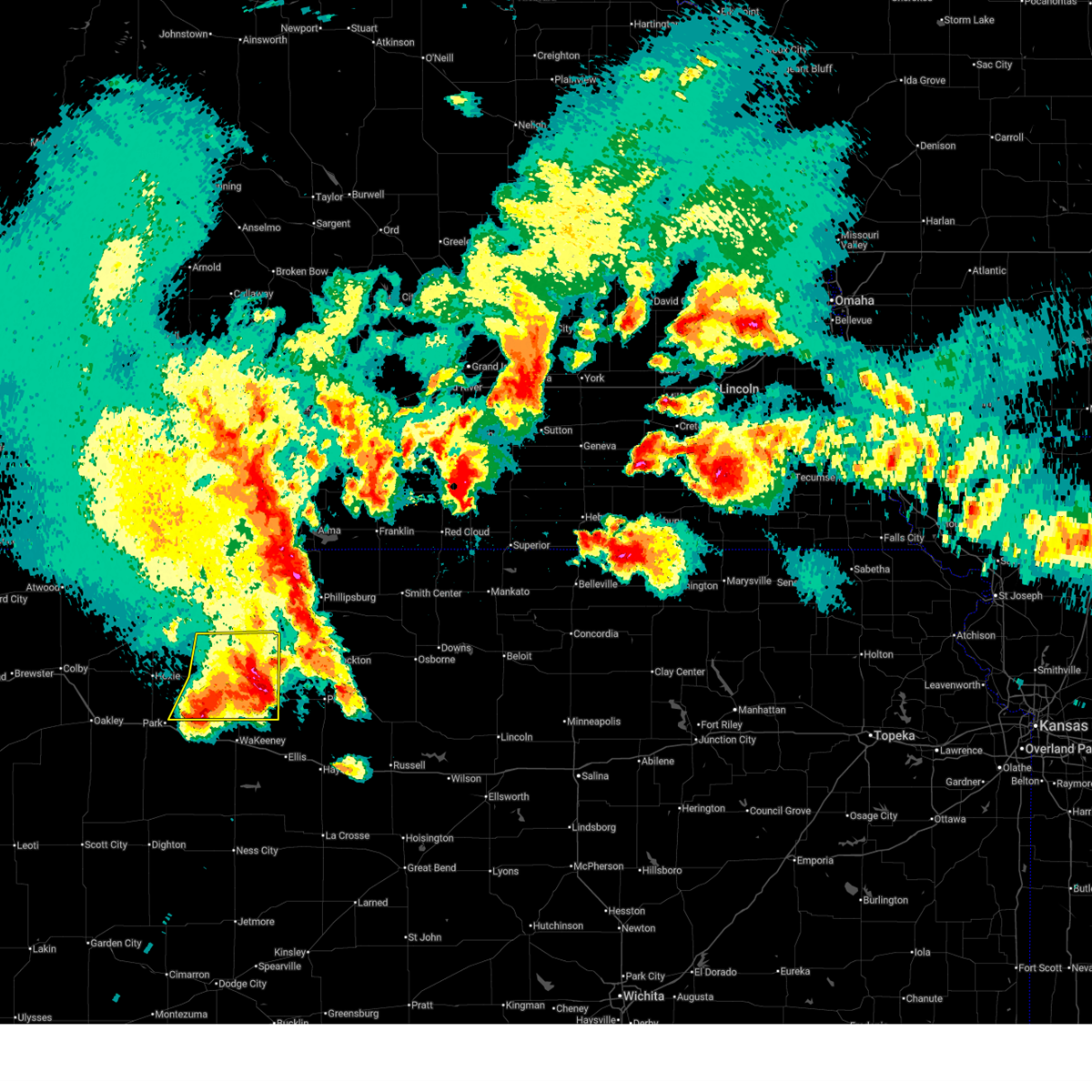
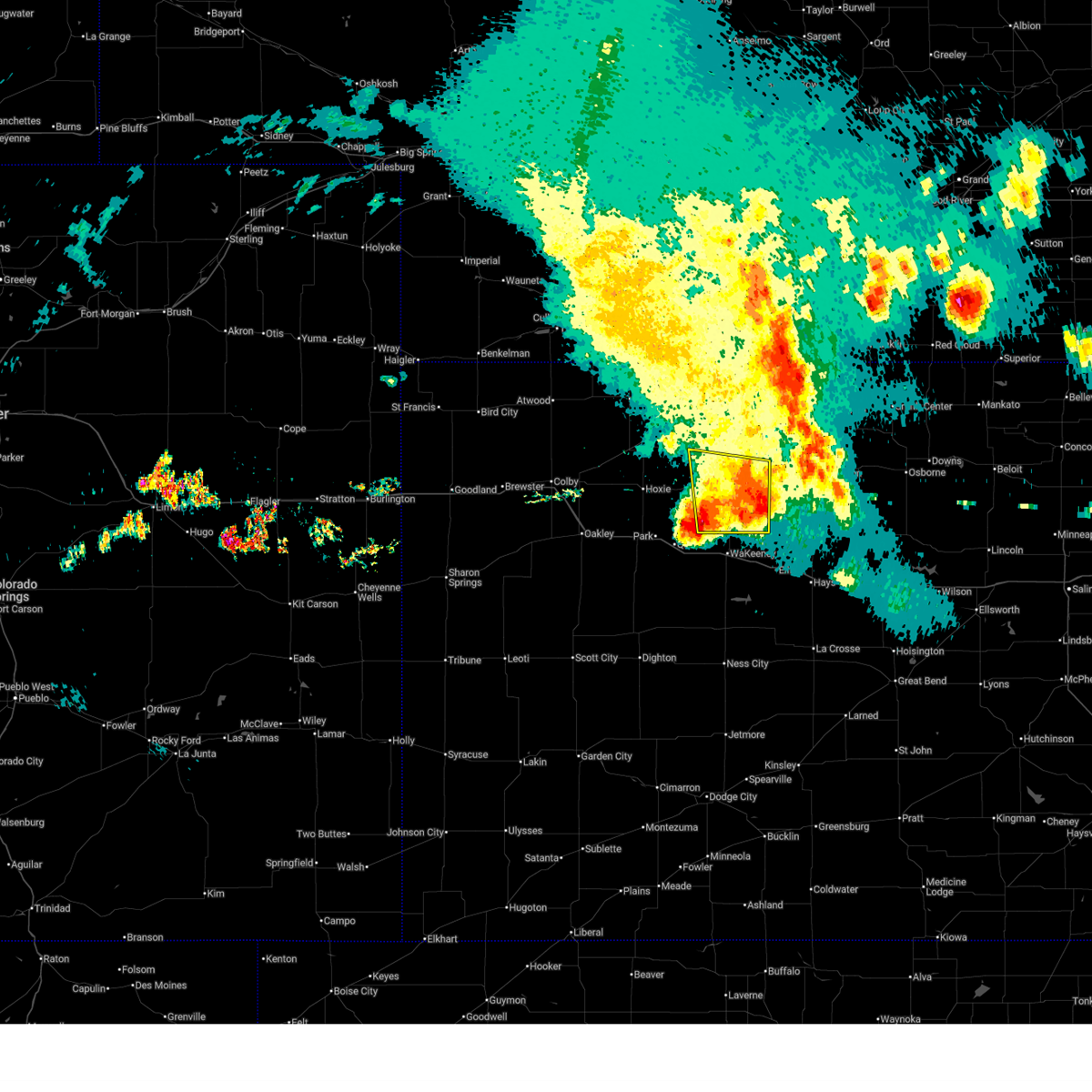
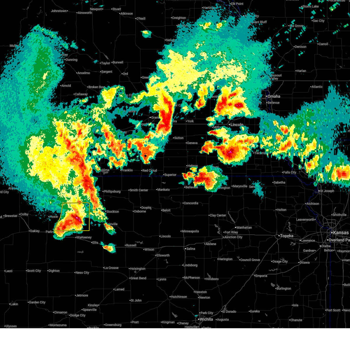
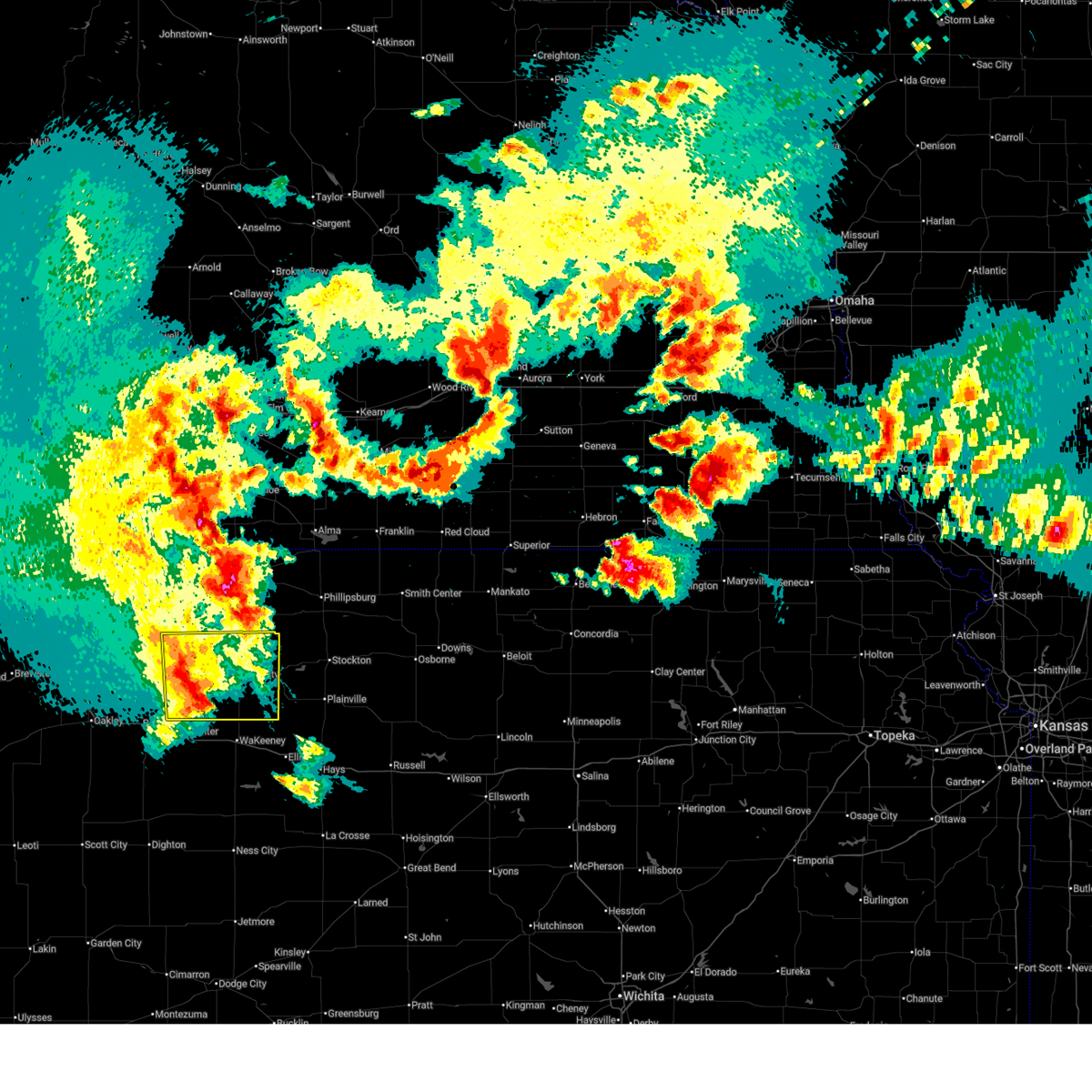
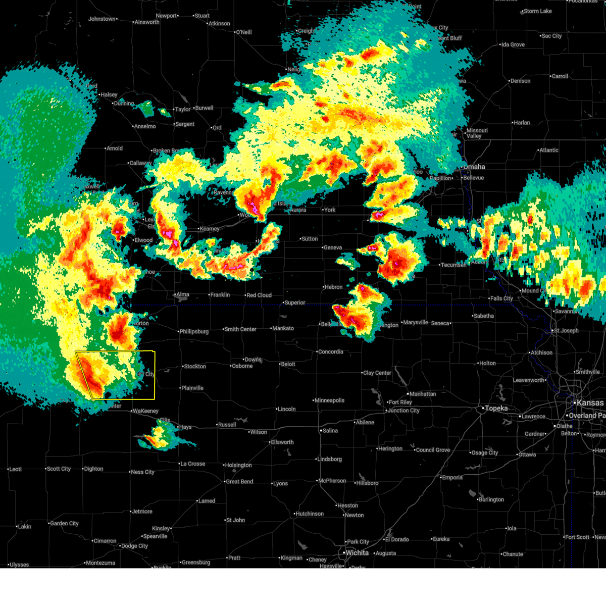
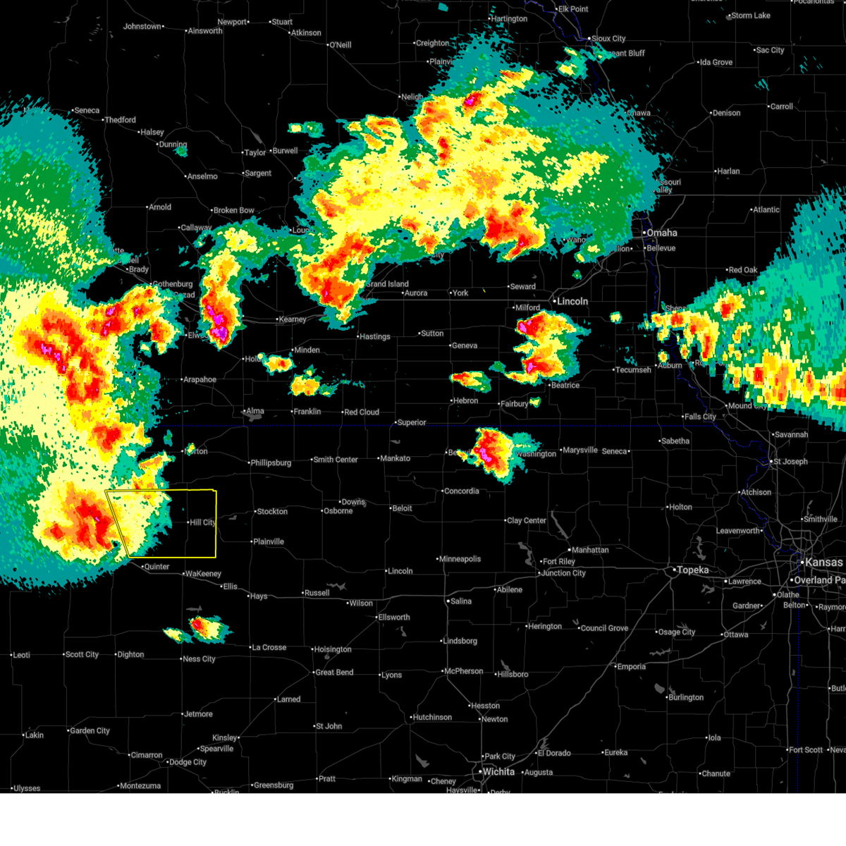
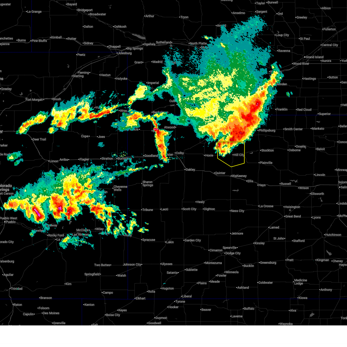
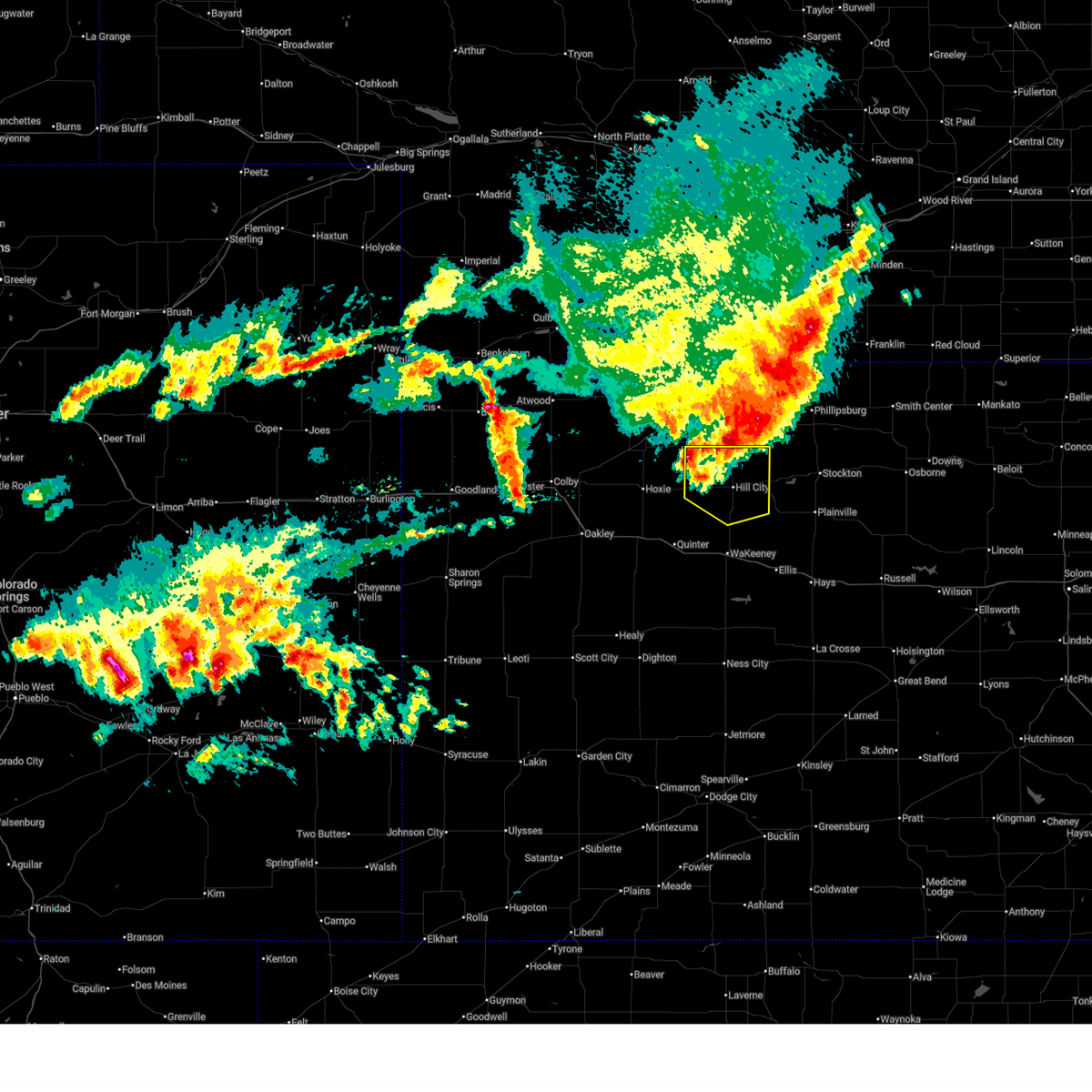
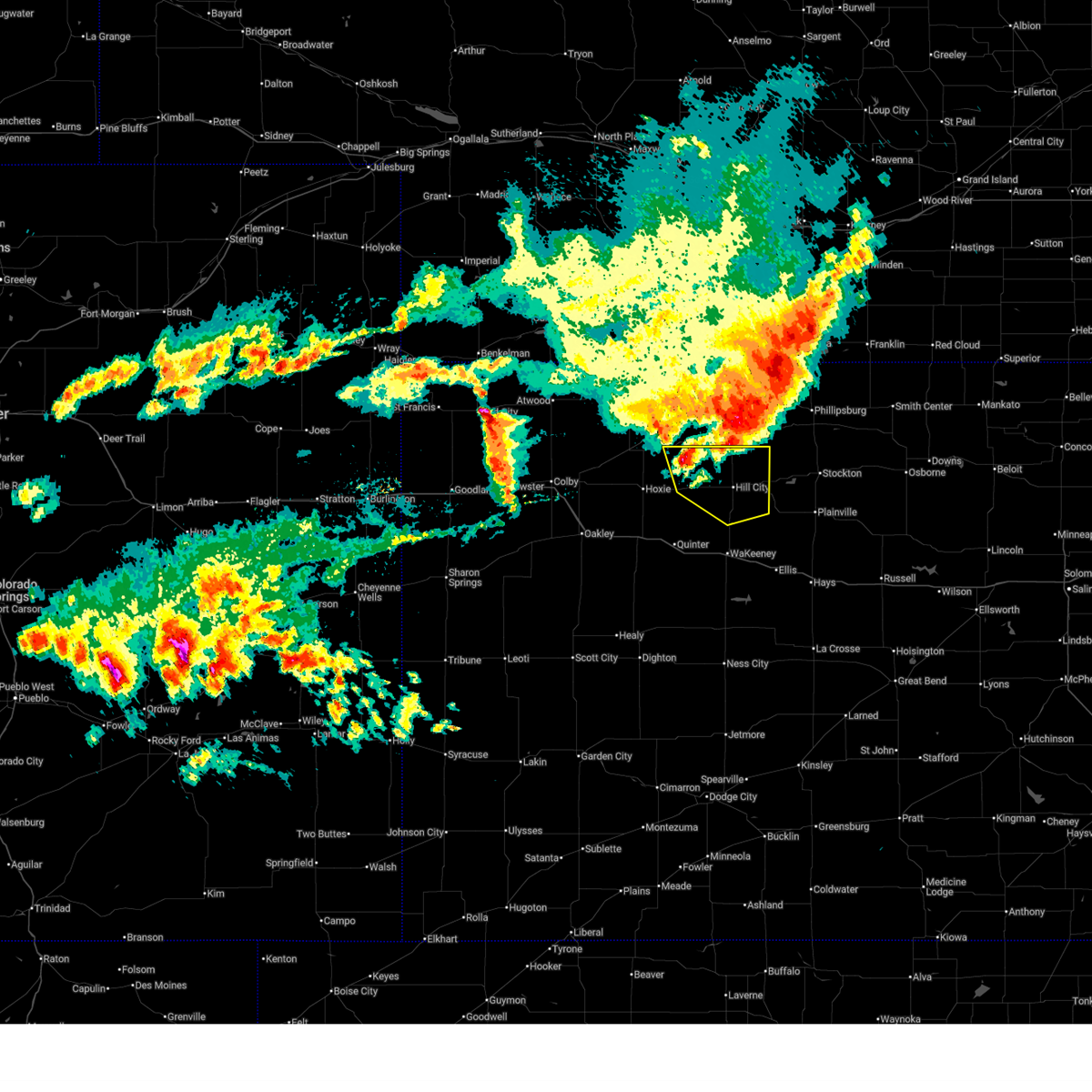
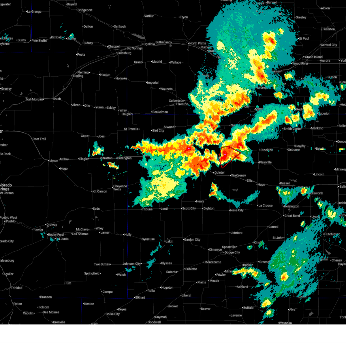
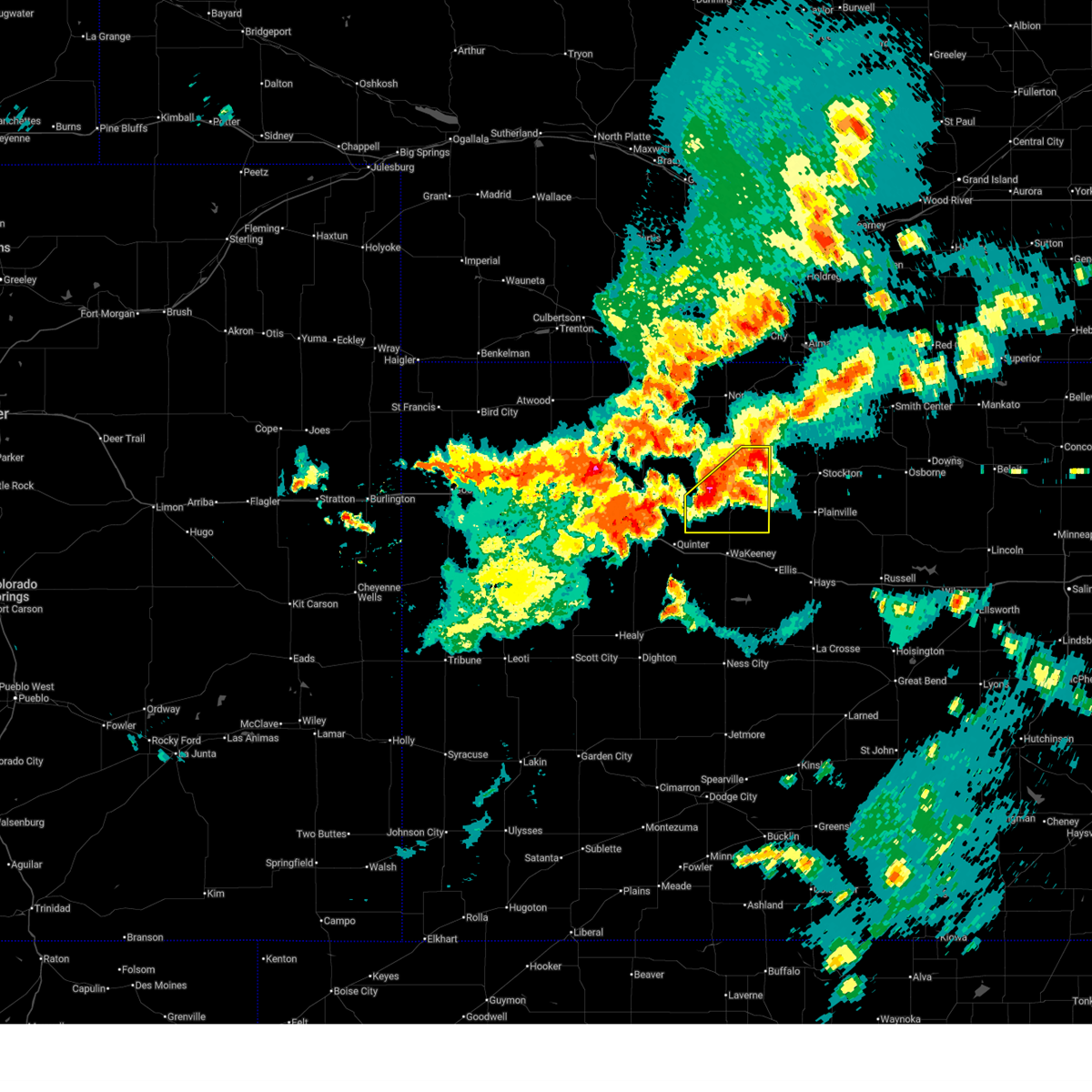
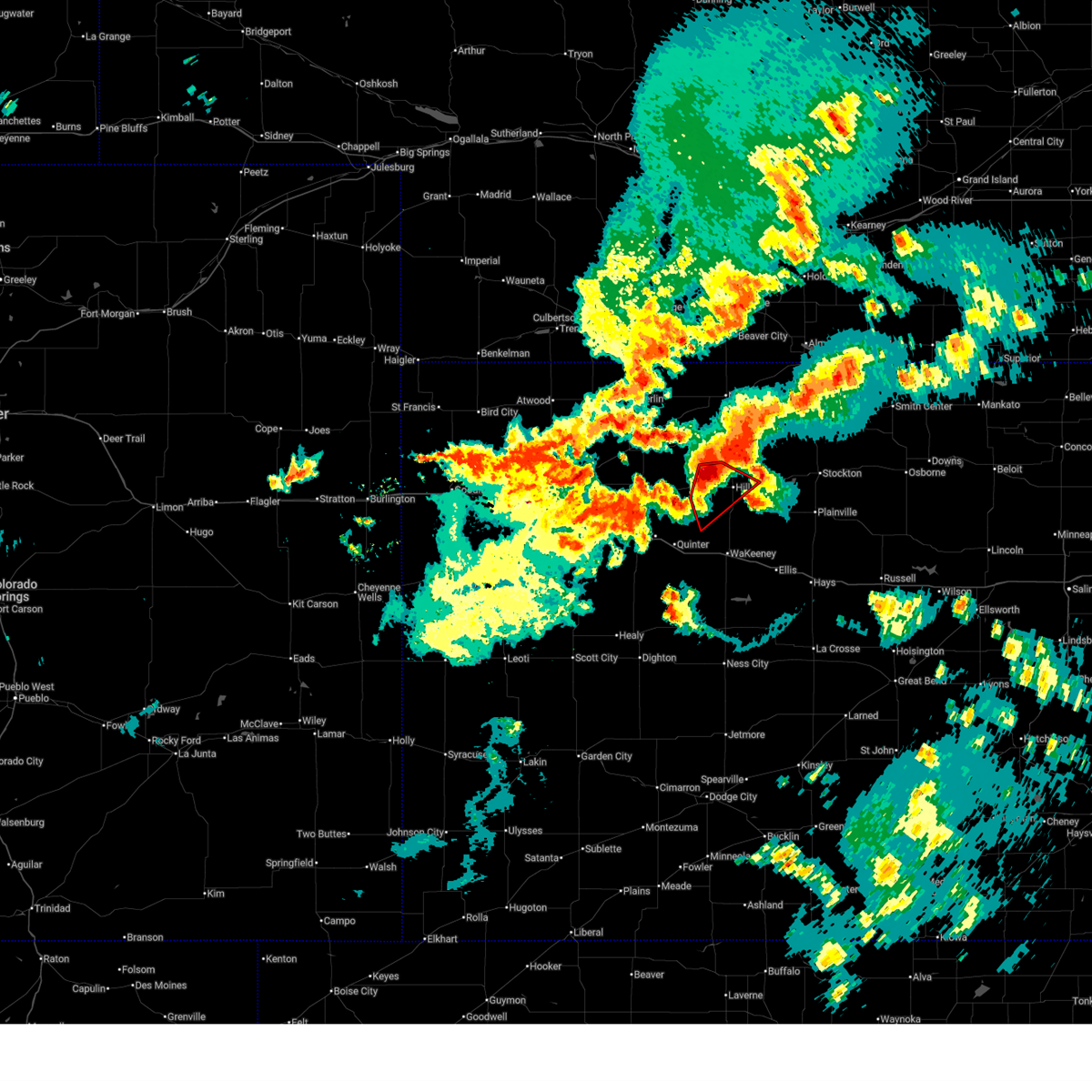
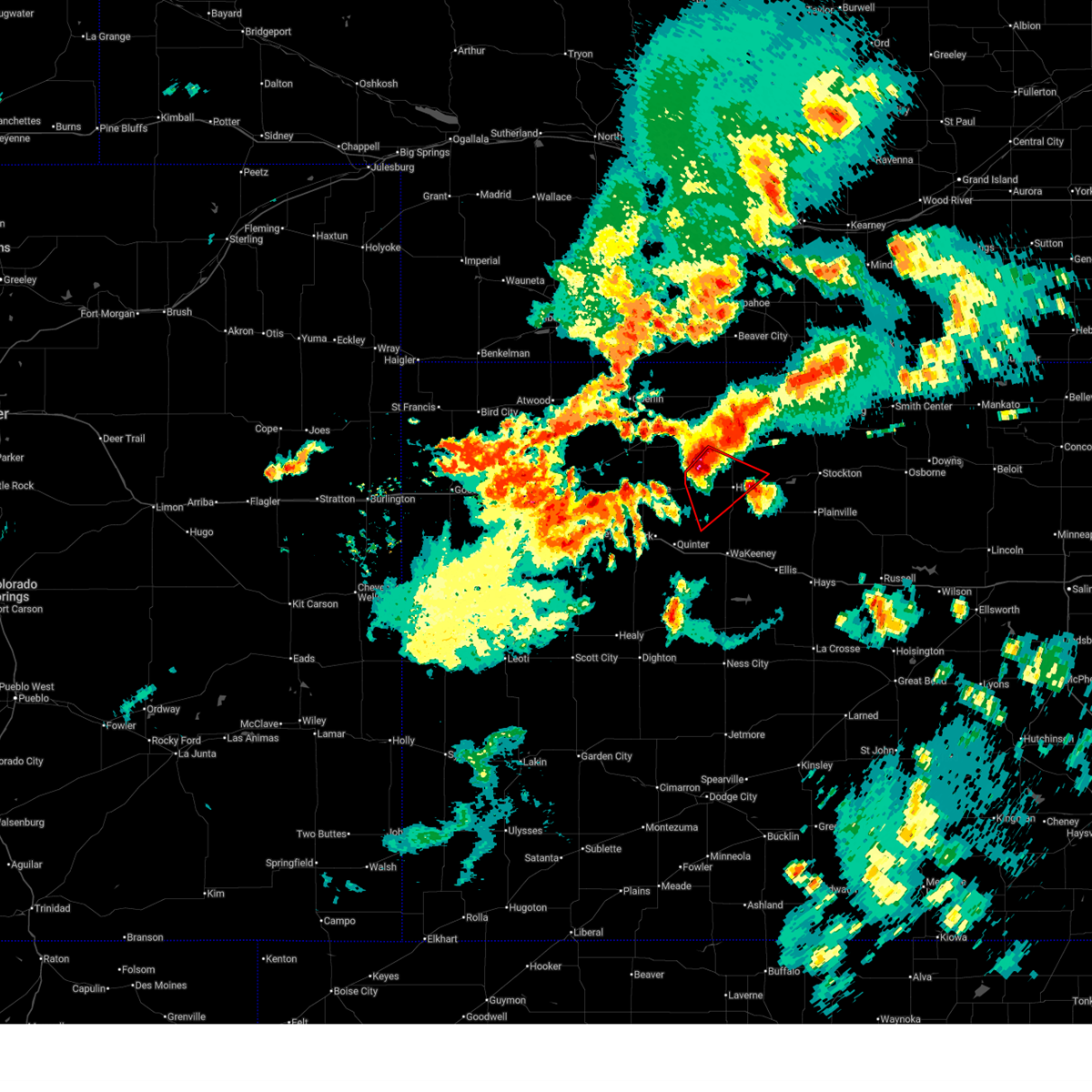
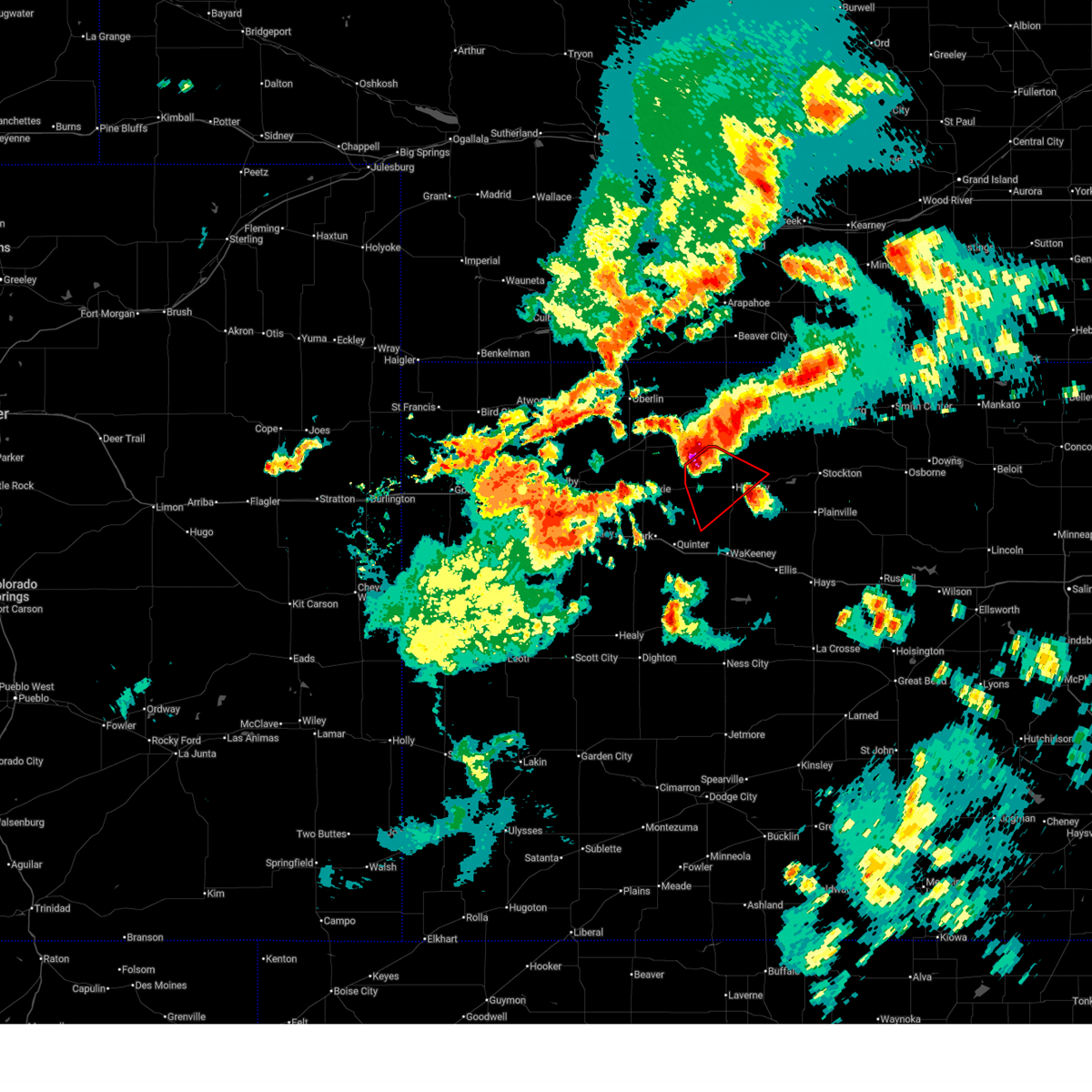
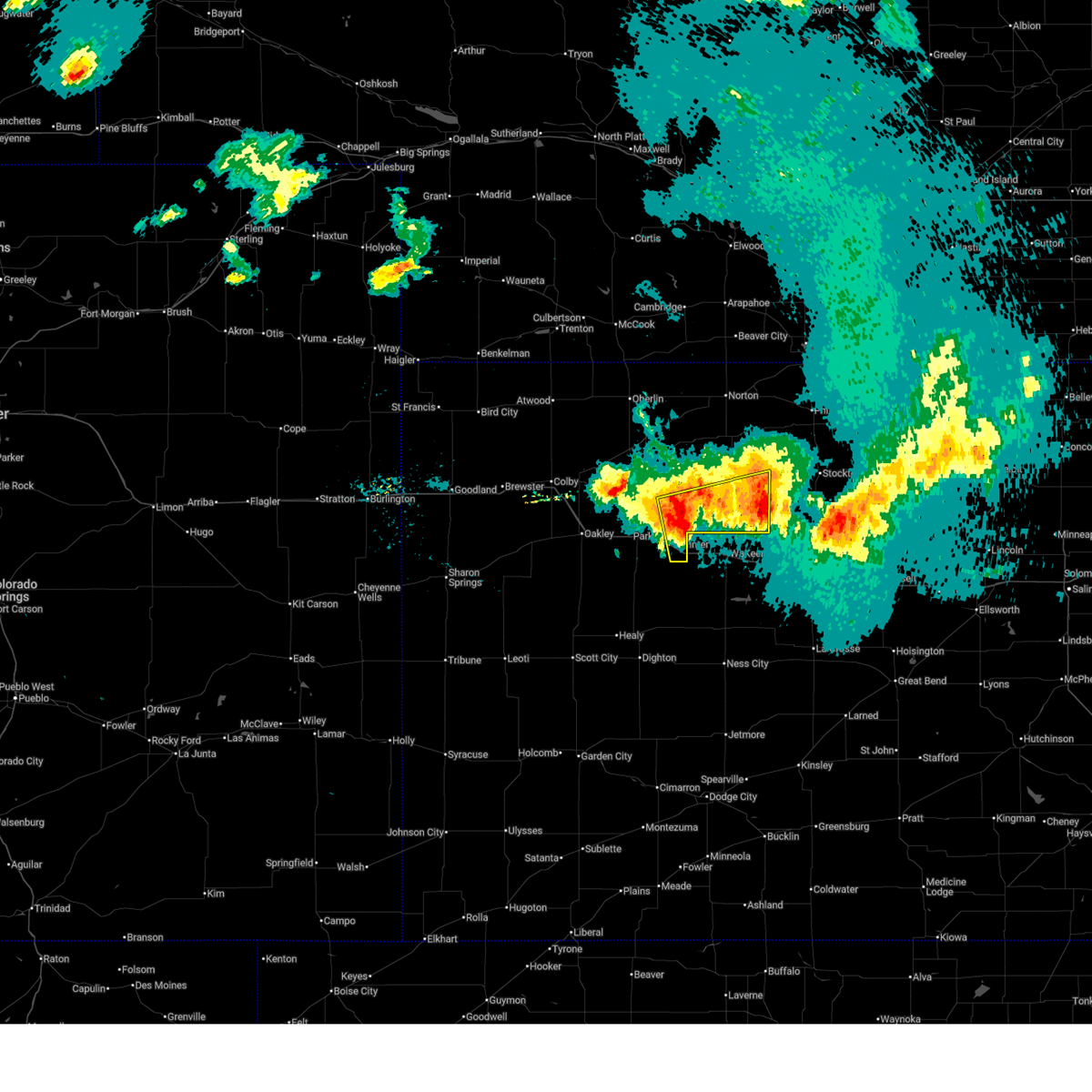
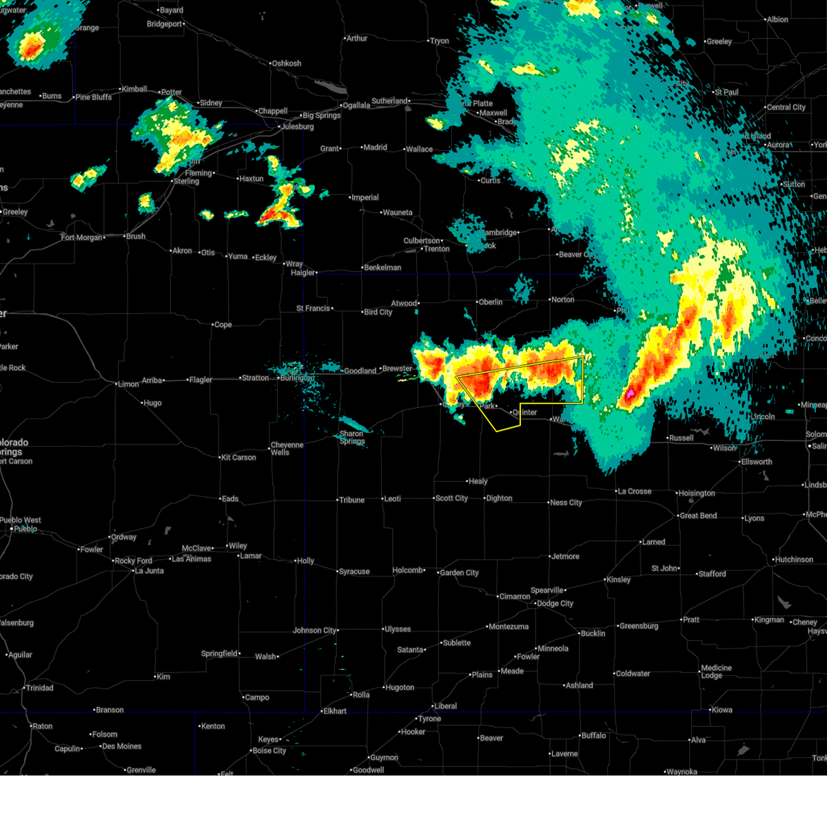
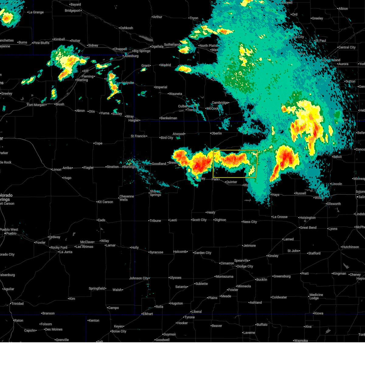
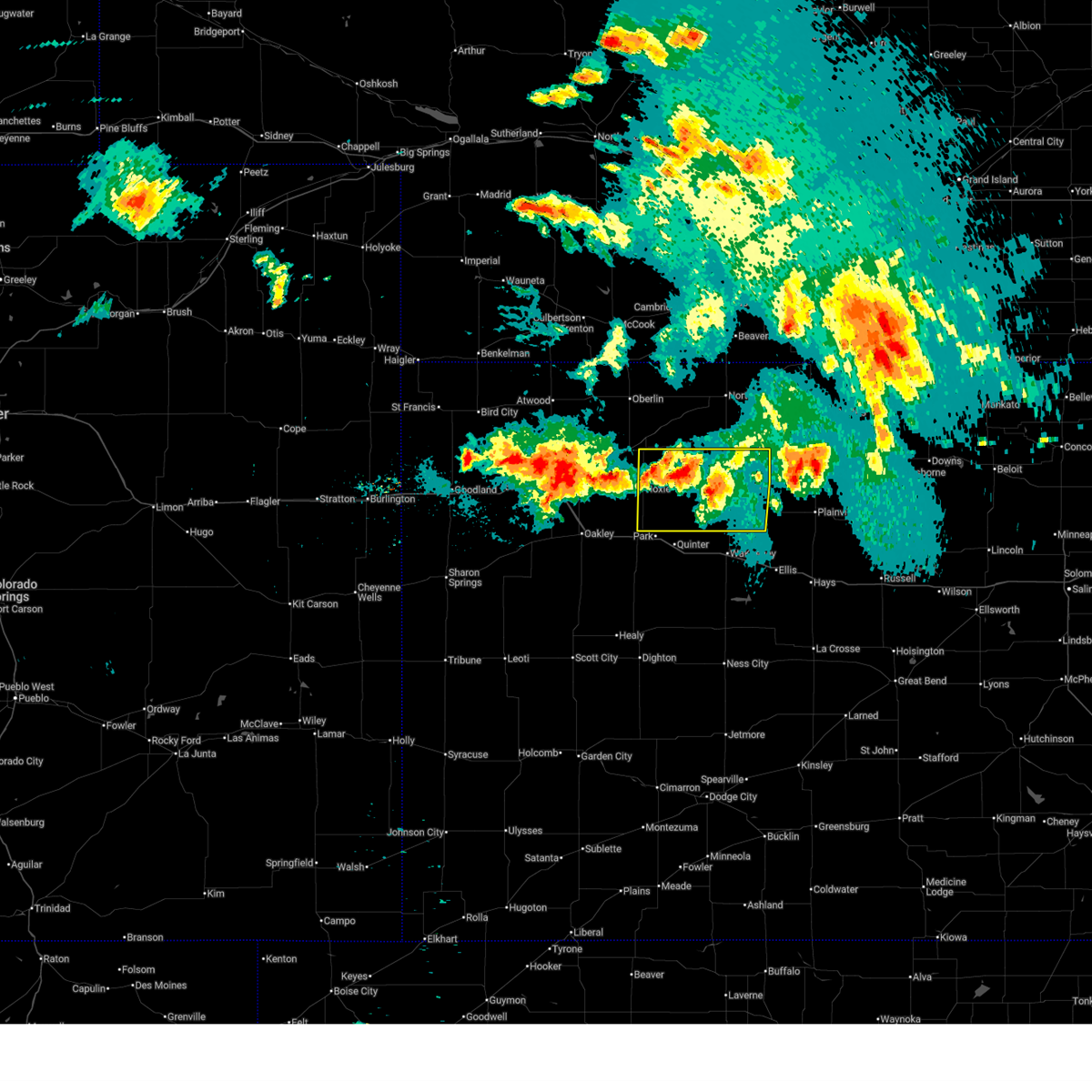
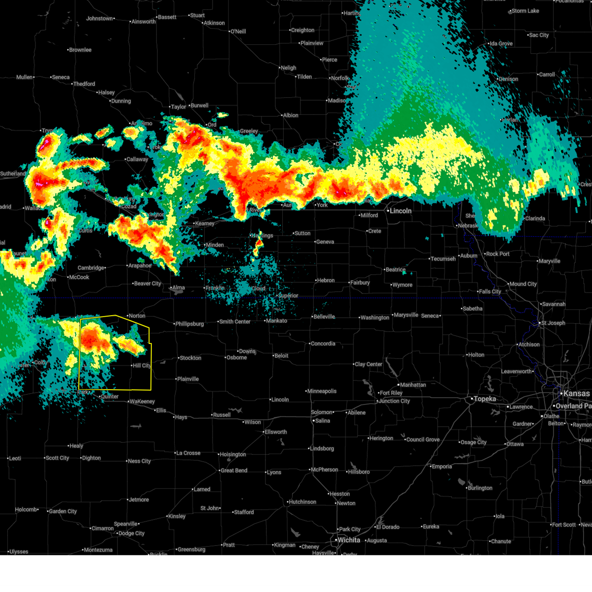
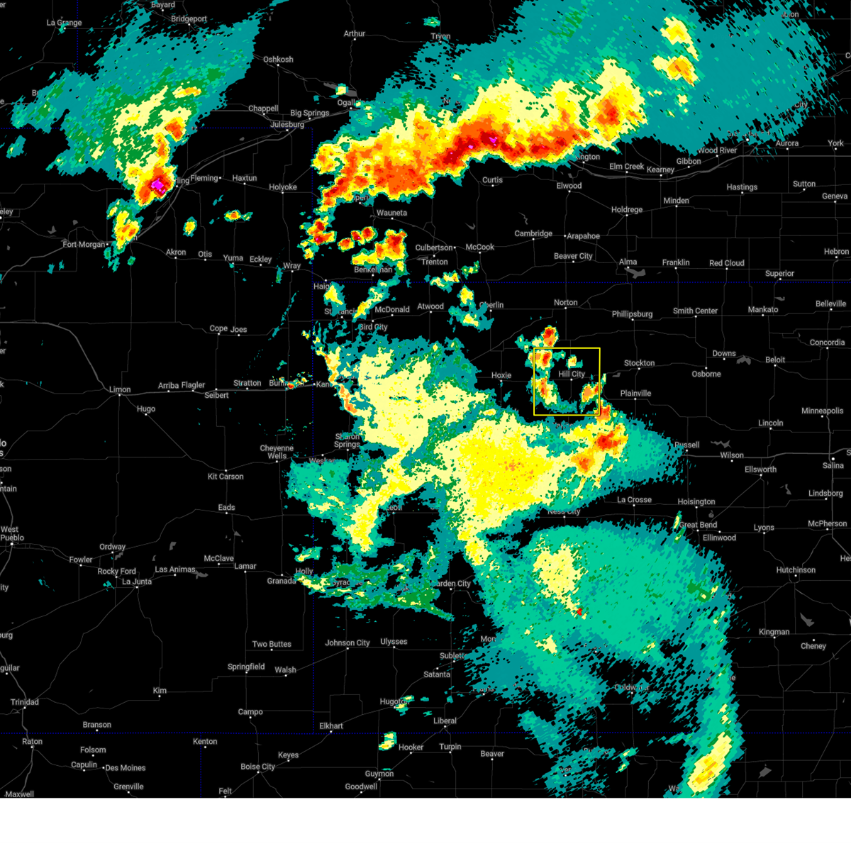
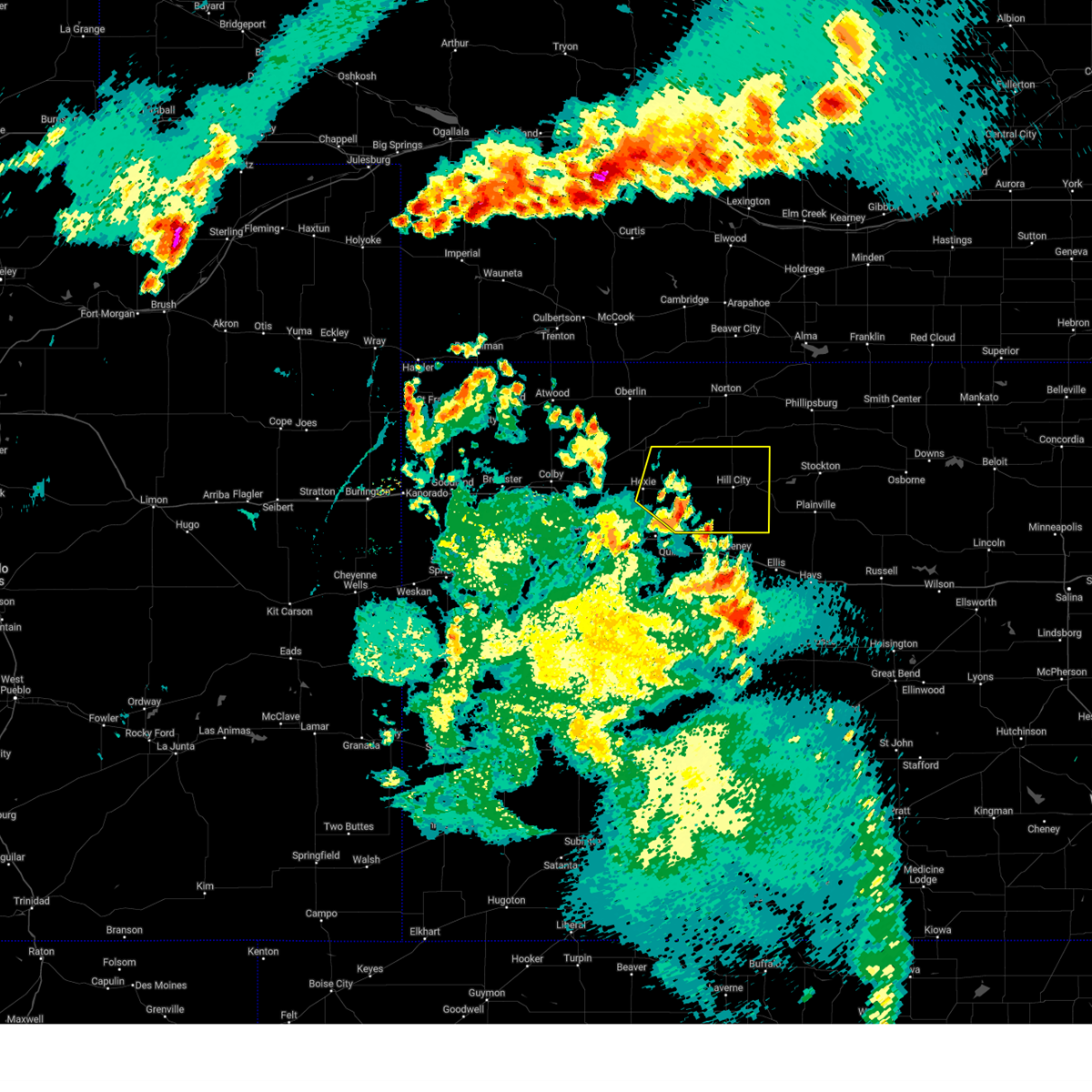
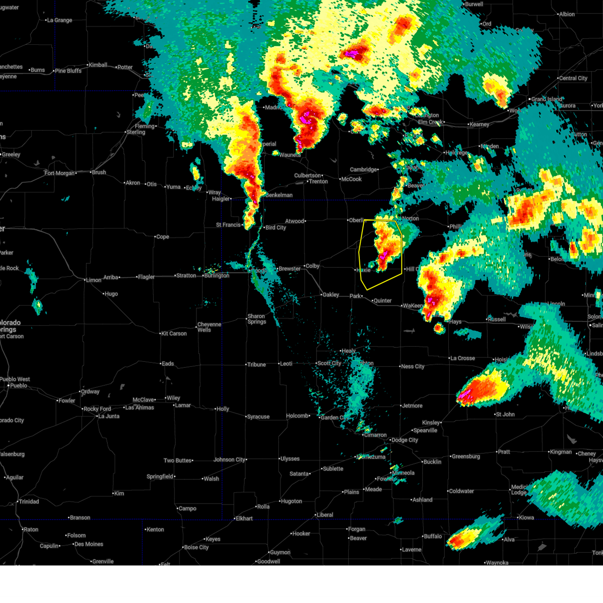
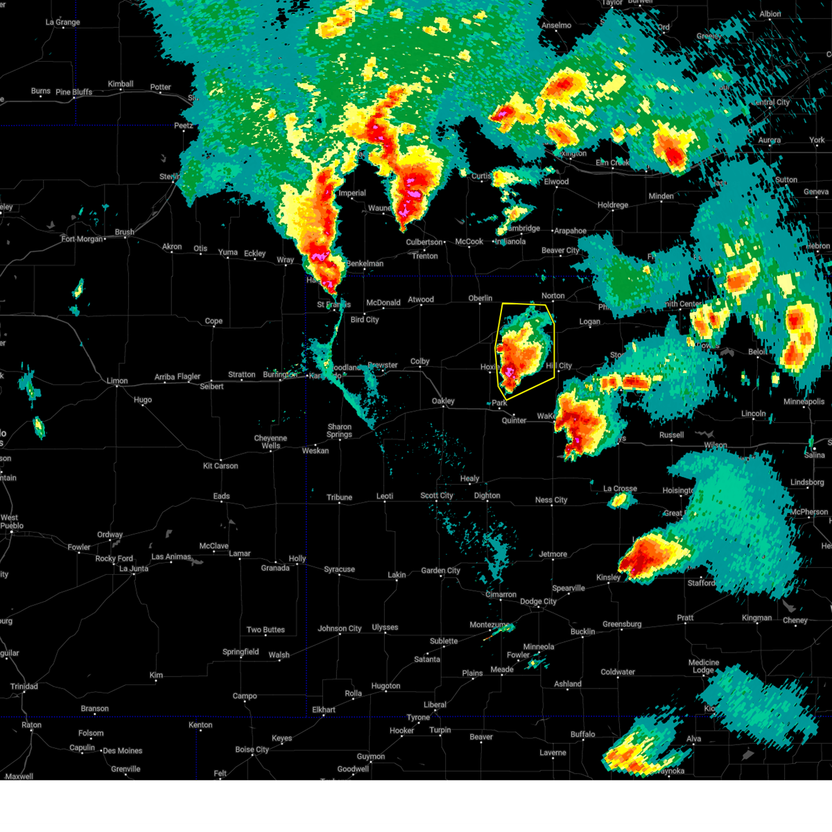
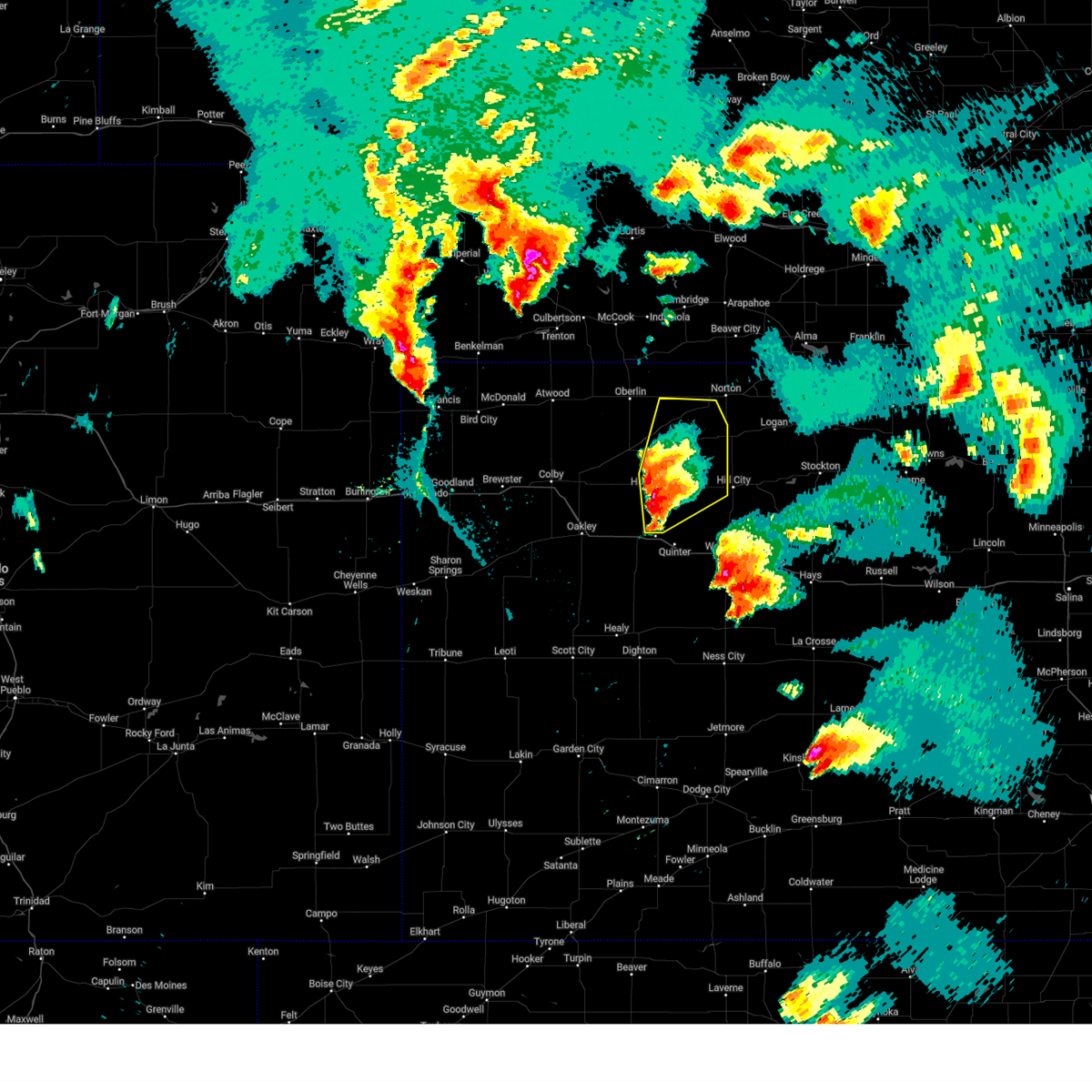
Hail Map for Morland, KS
The Morland, KS area has had 24 reports of on-the-ground hail by trained spotters, and has been under severe weather warnings 27 times during the past 12 months. Doppler radar has detected hail at or near Morland, KS on 113 occasions, including 4 occasions during the past year.
| Name: | Morland, KS |
| Where Located: | 51.8 miles NW of Hays, KS |
| Map: | Google Map for Morland, KS |
| Population: | 154 |
| Housing Units: | 89 |
| More Info: | Search Google for Morland, KS |
0
The Top Recent Hail Date for Morland, KS is Tuesday, June 9, 2026 (113th out of 113)
Hail and Wind Damage Spotted near Morland, KS
| Date / Time | Report Details |
|---|---|
| 7/27/2026 9:01 PM CDT |
 At 901 pm cdt, severe thunderstorms were located along a line extending from 9 miles southwest of lenora to 7 miles west of morland, moving east at 25 mph (radar indicated). Hazards include 60 mph wind gusts. Expect damage to roofs, siding, and trees. Locations impacted include, morland, penokee, studley, and tasco. At 901 pm cdt, severe thunderstorms were located along a line extending from 9 miles southwest of lenora to 7 miles west of morland, moving east at 25 mph (radar indicated). Hazards include 60 mph wind gusts. Expect damage to roofs, siding, and trees. Locations impacted include, morland, penokee, studley, and tasco.
|
| 7/27/2026 8:44 PM CDT |
 Svrgld the national weather service in goodland has issued a * severe thunderstorm warning for, northeastern sheridan county in northwestern kansas, northwestern graham county in northwestern kansas, * until 915 pm cdt. * at 844 pm cdt, severe thunderstorms were located along a line extending from 7 miles southeast of dresden to 12 miles northwest of morland to 4 miles east of hoxie, moving east at 35 mph (radar indicated). Hazards include 60 mph wind gusts. expect damage to roofs, siding, and trees Svrgld the national weather service in goodland has issued a * severe thunderstorm warning for, northeastern sheridan county in northwestern kansas, northwestern graham county in northwestern kansas, * until 915 pm cdt. * at 844 pm cdt, severe thunderstorms were located along a line extending from 7 miles southeast of dresden to 12 miles northwest of morland to 4 miles east of hoxie, moving east at 35 mph (radar indicated). Hazards include 60 mph wind gusts. expect damage to roofs, siding, and trees
|
| 7/9/2026 11:25 PM CDT |
 The storms which prompted the warning have weakened below severe limits, and no longer pose an immediate threat to life or property. therefore, the warning will be allowed to expire. a severe thunderstorm watch remains in effect until 300 am cdt for northwestern and west central kansas. The storms which prompted the warning have weakened below severe limits, and no longer pose an immediate threat to life or property. therefore, the warning will be allowed to expire. a severe thunderstorm watch remains in effect until 300 am cdt for northwestern and west central kansas.
|
| 7/9/2026 11:06 PM CDT |
 At 1105 pm cdt, severe thunderstorms were located along a line extending from 12 miles northwest of morland to 5 miles northwest of voda to 3 miles southwest of utica, moving east at 35 mph (radar indicated). Hazards include 60 mph wind gusts and quarter size hail. Hail damage to vehicles is expected. expect wind damage to roofs, siding, and trees. these severe storms will be near, morland around 1110 pm cdt. hill city around 1130 pm cdt. other locations impacted by these severe thunderstorms include penokee, saint peter, tasco, and studley. This includes interstate 70 in kansas between mile markers 102 and 112. At 1105 pm cdt, severe thunderstorms were located along a line extending from 12 miles northwest of morland to 5 miles northwest of voda to 3 miles southwest of utica, moving east at 35 mph (radar indicated). Hazards include 60 mph wind gusts and quarter size hail. Hail damage to vehicles is expected. expect wind damage to roofs, siding, and trees. these severe storms will be near, morland around 1110 pm cdt. hill city around 1130 pm cdt. other locations impacted by these severe thunderstorms include penokee, saint peter, tasco, and studley. This includes interstate 70 in kansas between mile markers 102 and 112.
|
| 7/9/2026 10:47 PM CDT |
 At 1046 pm cdt, severe thunderstorms were located along a line extending from 7 miles east of selden to 5 miles north of quinter to near pendennis, moving east at 35 mph (at 10:30 pm ct 1 mile northwest of rexford a 61 mph gust was recorded). Hazards include 60 mph wind gusts and quarter size hail. Hail damage to vehicles is expected. expect wind damage to roofs, siding, and trees. these severe storms will be near, quinter around 1050 pm cdt. morland around 1105 pm cdt. hill city around 1125 pm cdt. other locations impacted by these severe thunderstorms include penokee, saint peter, tasco, seguin, and studley. This includes interstate 70 in kansas between mile markers 92 and 112. At 1046 pm cdt, severe thunderstorms were located along a line extending from 7 miles east of selden to 5 miles north of quinter to near pendennis, moving east at 35 mph (at 10:30 pm ct 1 mile northwest of rexford a 61 mph gust was recorded). Hazards include 60 mph wind gusts and quarter size hail. Hail damage to vehicles is expected. expect wind damage to roofs, siding, and trees. these severe storms will be near, quinter around 1050 pm cdt. morland around 1105 pm cdt. hill city around 1125 pm cdt. other locations impacted by these severe thunderstorms include penokee, saint peter, tasco, seguin, and studley. This includes interstate 70 in kansas between mile markers 92 and 112.
|
| 7/9/2026 10:24 PM CDT |
 Svrgld the national weather service in goodland has issued a * severe thunderstorm warning for, eastern thomas county in northwestern kansas, sheridan county in northwestern kansas, graham county in northwestern kansas, gove county in west central kansas, * until 1130 pm cdt. * at 1024 pm cdt, severe thunderstorms were located along a line extending from 5 miles west of selden to 5 miles north of grainfield to 5 miles north of healy, moving east at 35 mph (radar indicated). Hazards include 60 mph wind gusts and quarter size hail. Hail damage to vehicles is expected. expect wind damage to roofs, siding, and trees. severe thunderstorms will be near, hoxie, grainfield, gove, selden, and park around 1030 pm cdt. quinter around 1040 pm cdt. other locations in the path of these severe thunderstorms include morland. This includes interstate 70 in kansas between mile markers 76 and 112. Svrgld the national weather service in goodland has issued a * severe thunderstorm warning for, eastern thomas county in northwestern kansas, sheridan county in northwestern kansas, graham county in northwestern kansas, gove county in west central kansas, * until 1130 pm cdt. * at 1024 pm cdt, severe thunderstorms were located along a line extending from 5 miles west of selden to 5 miles north of grainfield to 5 miles north of healy, moving east at 35 mph (radar indicated). Hazards include 60 mph wind gusts and quarter size hail. Hail damage to vehicles is expected. expect wind damage to roofs, siding, and trees. severe thunderstorms will be near, hoxie, grainfield, gove, selden, and park around 1030 pm cdt. quinter around 1040 pm cdt. other locations in the path of these severe thunderstorms include morland. This includes interstate 70 in kansas between mile markers 76 and 112.
|
| 6/30/2026 9:26 PM CDT |
 At 926 pm cdt, severe thunderstorms were located along a line extending from 7 miles north of norcatur to 5 miles northwest of edmond to 5 miles west of palco, moving northeast at 50 mph (radar indicated). Hazards include 60 mph wind gusts and quarter size hail. Hail damage to vehicles is expected. expect wind damage to roofs, siding, and trees. these severe storms will be near, norton, bogue, and edmond around 930 pm cdt. almena around 940 pm cdt. Other locations impacted by these severe thunderstorms include new almelo, studley, densmore, penokee, saint peter, reager, and calvert. At 926 pm cdt, severe thunderstorms were located along a line extending from 7 miles north of norcatur to 5 miles northwest of edmond to 5 miles west of palco, moving northeast at 50 mph (radar indicated). Hazards include 60 mph wind gusts and quarter size hail. Hail damage to vehicles is expected. expect wind damage to roofs, siding, and trees. these severe storms will be near, norton, bogue, and edmond around 930 pm cdt. almena around 940 pm cdt. Other locations impacted by these severe thunderstorms include new almelo, studley, densmore, penokee, saint peter, reager, and calvert.
|
| 6/30/2026 9:13 PM CDT |
 At 913 pm cdt, severe thunderstorms were located along a line extending from 3 miles southeast of danbury to 4 miles east of lenora to 9 miles southwest of palco, moving northeast at 50 mph (radar indicated). Hazards include 60 mph wind gusts and penny size hail. Expect damage to roofs, siding, and trees. these severe storms will be near, norton, bogue, and edmond around 920 pm cdt. almena around 935 pm cdt. Other locations impacted by these severe thunderstorms include leoville, new almelo, studley, densmore, penokee, kanona, and saint peter. At 913 pm cdt, severe thunderstorms were located along a line extending from 3 miles southeast of danbury to 4 miles east of lenora to 9 miles southwest of palco, moving northeast at 50 mph (radar indicated). Hazards include 60 mph wind gusts and penny size hail. Expect damage to roofs, siding, and trees. these severe storms will be near, norton, bogue, and edmond around 920 pm cdt. almena around 935 pm cdt. Other locations impacted by these severe thunderstorms include leoville, new almelo, studley, densmore, penokee, kanona, and saint peter.
|
| 6/30/2026 8:56 PM CDT |
 At 856 pm cdt, severe thunderstorms were located along a line extending from 6 miles east of herndon to 9 miles west of lenora to 8 miles northeast of voda, moving northeast at 50 mph (radar indicated). Hazards include 60 mph wind gusts and penny size hail. Expect damage to roofs, siding, and trees. these severe storms will be near, oberlin, jennings, and clayton around 900 pm cdt. hill city, lenora, and norcatur around 905 pm cdt. bogue and edmond around 915 pm cdt. norton around 920 pm cdt. almena around 930 pm cdt. Other locations impacted by these severe thunderstorms include leoville, traer, new almelo, studley, densmore, cedar bluffs, and penokee. At 856 pm cdt, severe thunderstorms were located along a line extending from 6 miles east of herndon to 9 miles west of lenora to 8 miles northeast of voda, moving northeast at 50 mph (radar indicated). Hazards include 60 mph wind gusts and penny size hail. Expect damage to roofs, siding, and trees. these severe storms will be near, oberlin, jennings, and clayton around 900 pm cdt. hill city, lenora, and norcatur around 905 pm cdt. bogue and edmond around 915 pm cdt. norton around 920 pm cdt. almena around 930 pm cdt. Other locations impacted by these severe thunderstorms include leoville, traer, new almelo, studley, densmore, cedar bluffs, and penokee.
|
| 6/30/2026 8:33 PM CDT |
 At 832 pm cdt, severe thunderstorms were located along a line extending from 13 miles north of rexford to near hoxie to 8 miles south of quinter, moving northeast at 55 mph (mesonet. a 59 mph wind gust was recorded around 2 miles west of hoxie). Hazards include 60 mph wind gusts and quarter size hail. Hail damage to vehicles is expected. expect wind damage to roofs, siding, and trees. these severe storms will be near, selden around 835 pm cdt. dresden around 840 pm cdt. oberlin around 845 pm cdt. morland and jennings around 850 pm cdt. lenora, norcatur, and clayton around 900 pm cdt. hill city around 905 pm cdt. norton, bogue, and edmond around 915 pm cdt. almena around 930 pm cdt. Other locations impacted by these severe thunderstorms include leoville, traer, new almelo, studley, densmore, cedar bluffs, and penokee. At 832 pm cdt, severe thunderstorms were located along a line extending from 13 miles north of rexford to near hoxie to 8 miles south of quinter, moving northeast at 55 mph (mesonet. a 59 mph wind gust was recorded around 2 miles west of hoxie). Hazards include 60 mph wind gusts and quarter size hail. Hail damage to vehicles is expected. expect wind damage to roofs, siding, and trees. these severe storms will be near, selden around 835 pm cdt. dresden around 840 pm cdt. oberlin around 845 pm cdt. morland and jennings around 850 pm cdt. lenora, norcatur, and clayton around 900 pm cdt. hill city around 905 pm cdt. norton, bogue, and edmond around 915 pm cdt. almena around 930 pm cdt. Other locations impacted by these severe thunderstorms include leoville, traer, new almelo, studley, densmore, cedar bluffs, and penokee.
|
| 6/30/2026 8:22 PM CDT |
 Svrgld the national weather service in goodland has issued a * severe thunderstorm warning for, norton county in northwestern kansas, northern sheridan county in northwestern kansas, decatur county in northwestern kansas, graham county in northwestern kansas, * until 945 pm cdt. * at 821 pm cdt, severe thunderstorms were located along a line extending from 10 miles northwest of rexford to 7 miles southwest of hoxie to 11 miles southeast of gove, moving northeast at 55 mph (public. numerous 55-70 mph wind gusts have been reported with this cluster of storms). Hazards include 60 mph wind gusts and quarter size hail. Hail damage to vehicles is expected. expect wind damage to roofs, siding, and trees. severe thunderstorms will be near, selden around 830 pm cdt. dresden around 840 pm cdt. Other locations in the path of these severe thunderstorms include oberlin, morland, jennings, clayton, lenora, norcatur, hill city and edmond. Svrgld the national weather service in goodland has issued a * severe thunderstorm warning for, norton county in northwestern kansas, northern sheridan county in northwestern kansas, decatur county in northwestern kansas, graham county in northwestern kansas, * until 945 pm cdt. * at 821 pm cdt, severe thunderstorms were located along a line extending from 10 miles northwest of rexford to 7 miles southwest of hoxie to 11 miles southeast of gove, moving northeast at 55 mph (public. numerous 55-70 mph wind gusts have been reported with this cluster of storms). Hazards include 60 mph wind gusts and quarter size hail. Hail damage to vehicles is expected. expect wind damage to roofs, siding, and trees. severe thunderstorms will be near, selden around 830 pm cdt. dresden around 840 pm cdt. Other locations in the path of these severe thunderstorms include oberlin, morland, jennings, clayton, lenora, norcatur, hill city and edmond.
|
| 6/3/2026 4:15 PM CDT | Social media video of live a tree branch downed... roughly 4-8 inches. 3 mile sw of penoke in graham county KS, 4.1 miles WNW of Morland, KS |
| 5/30/2026 5:36 PM CDT |
 At 536 pm cdt, severe thunderstorms were located along a line extending from 6 miles south of morland to 4 miles southeast of hill city, moving north at 35 mph (radar indicated). Hazards include 60 mph wind gusts and half dollar size hail. Hail damage to vehicles is expected. expect wind damage to roofs, siding, and trees. Locations impacted include, hill city, morland, bogue, nicodemus, and penokee. At 536 pm cdt, severe thunderstorms were located along a line extending from 6 miles south of morland to 4 miles southeast of hill city, moving north at 35 mph (radar indicated). Hazards include 60 mph wind gusts and half dollar size hail. Hail damage to vehicles is expected. expect wind damage to roofs, siding, and trees. Locations impacted include, hill city, morland, bogue, nicodemus, and penokee.
|
| 5/30/2026 5:21 PM CDT |
 At 521 pm cdt, a severe thunderstorm was located 11 miles south of hill city, moving north at 30 mph (radar indicated). Hazards include ping pong ball size hail and 60 mph wind gusts. People and animals outdoors will be injured. expect hail damage to roofs, siding, windows, and vehicles. expect wind damage to roofs, siding, and trees. Locations impacted include, hill city, morland, bogue, nicodemus, and penokee. At 521 pm cdt, a severe thunderstorm was located 11 miles south of hill city, moving north at 30 mph (radar indicated). Hazards include ping pong ball size hail and 60 mph wind gusts. People and animals outdoors will be injured. expect hail damage to roofs, siding, windows, and vehicles. expect wind damage to roofs, siding, and trees. Locations impacted include, hill city, morland, bogue, nicodemus, and penokee.
|
| 5/30/2026 5:14 PM CDT |
 Svrgld the national weather service in goodland has issued a * severe thunderstorm warning for, graham county in northwestern kansas, * until 615 pm cdt. * at 514 pm cdt, a severe thunderstorm was located 9 miles north of wakeeney, moving north at 35 mph (radar indicated). Hazards include 60 mph wind gusts and quarter size hail. Hail damage to vehicles is expected. Expect wind damage to roofs, siding, and trees. Svrgld the national weather service in goodland has issued a * severe thunderstorm warning for, graham county in northwestern kansas, * until 615 pm cdt. * at 514 pm cdt, a severe thunderstorm was located 9 miles north of wakeeney, moving north at 35 mph (radar indicated). Hazards include 60 mph wind gusts and quarter size hail. Hail damage to vehicles is expected. Expect wind damage to roofs, siding, and trees.
|
| 5/16/2026 9:30 PM CDT |
 The severe thunderstorm warning that was previously in effect has been reissued for graham county and is in effect until 1015pm. please refer to that bulletin for the latest severe weather information. a severe thunderstorm watch remains in effect until 1100 pm cdt for northwestern and west central kansas. The severe thunderstorm warning that was previously in effect has been reissued for graham county and is in effect until 1015pm. please refer to that bulletin for the latest severe weather information. a severe thunderstorm watch remains in effect until 1100 pm cdt for northwestern and west central kansas.
|
| 5/16/2026 9:30 PM CDT |
 Svrgld the national weather service in goodland has issued a * severe thunderstorm warning for, graham county in northwestern kansas, * until 1015 pm cdt. * at 930 pm cdt, a severe thunderstorm was located near hill city, moving east at 50 mph (public. multiple reports of 65-80 mph wind gusts). Hazards include 70 mph wind gusts and quarter size hail. Hail damage to vehicles is expected. expect considerable tree damage. wind damage is also likely to mobile homes, roofs, and outbuildings. this severe thunderstorm will be near, bogue around 935 pm cdt. Nicodemus around 940 pm cdt. Svrgld the national weather service in goodland has issued a * severe thunderstorm warning for, graham county in northwestern kansas, * until 1015 pm cdt. * at 930 pm cdt, a severe thunderstorm was located near hill city, moving east at 50 mph (public. multiple reports of 65-80 mph wind gusts). Hazards include 70 mph wind gusts and quarter size hail. Hail damage to vehicles is expected. expect considerable tree damage. wind damage is also likely to mobile homes, roofs, and outbuildings. this severe thunderstorm will be near, bogue around 935 pm cdt. Nicodemus around 940 pm cdt.
|
| 5/16/2026 9:21 PM CDT |
 At 921 pm cdt, severe thunderstorms were located along a line extending from 8 miles southeast of edmond to 3 miles west of damar to 8 miles southwest of palco, moving east at 55 mph (public. 68 to 82 mph wind gusts have been reported at the hill city airport). Hazards include 70 mph wind gusts and quarter size hail. Hail damage to vehicles is expected. expect considerable tree damage. wind damage is also likely to mobile homes, roofs, and outbuildings. these severe storms will be near, nicodemus around 925 pm cdt. Other locations impacted by these severe thunderstorms include saint peter, studley, and penokee. At 921 pm cdt, severe thunderstorms were located along a line extending from 8 miles southeast of edmond to 3 miles west of damar to 8 miles southwest of palco, moving east at 55 mph (public. 68 to 82 mph wind gusts have been reported at the hill city airport). Hazards include 70 mph wind gusts and quarter size hail. Hail damage to vehicles is expected. expect considerable tree damage. wind damage is also likely to mobile homes, roofs, and outbuildings. these severe storms will be near, nicodemus around 925 pm cdt. Other locations impacted by these severe thunderstorms include saint peter, studley, and penokee.
|
| 5/16/2026 9:04 PM CDT |
 At 903 pm cdt, severe thunderstorms were located along a line extending from 4 miles south of lenora to 4 miles southwest of hill city to 8 miles north of wakeeney, moving east at 45 mph (public. a mesonet site in northwest graham county reported a 59 mph wind gustat 855 pm). Hazards include 70 mph wind gusts and quarter size hail. Hail damage to vehicles is expected. expect considerable tree damage. wind damage is also likely to mobile homes, roofs, and outbuildings. these severe storms will be near, hill city around 910 pm cdt. bogue around 915 pm cdt. nicodemus around 920 pm cdt. Other locations impacted by these severe thunderstorms include penokee, saint peter, tasco, and studley. At 903 pm cdt, severe thunderstorms were located along a line extending from 4 miles south of lenora to 4 miles southwest of hill city to 8 miles north of wakeeney, moving east at 45 mph (public. a mesonet site in northwest graham county reported a 59 mph wind gustat 855 pm). Hazards include 70 mph wind gusts and quarter size hail. Hail damage to vehicles is expected. expect considerable tree damage. wind damage is also likely to mobile homes, roofs, and outbuildings. these severe storms will be near, hill city around 910 pm cdt. bogue around 915 pm cdt. nicodemus around 920 pm cdt. Other locations impacted by these severe thunderstorms include penokee, saint peter, tasco, and studley.
|
| 5/16/2026 8:44 PM CDT |
 At 844 pm cdt, severe thunderstorms were located along a line extending from 6 miles southeast of dresden to near morland to 9 miles north of collyer, moving east at 60 mph (public. numerous reports of 60-75 mph wind gusts across sheridan county). Hazards include 70 mph wind gusts and quarter size hail. Hail damage to vehicles is expected. expect considerable tree damage. wind damage is also likely to mobile homes, roofs, and outbuildings. these severe storms will be near, hill city around 855 pm cdt. bogue around 905 pm cdt. nicodemus around 910 pm cdt. Other locations impacted by these severe thunderstorms include penokee, saint peter, tasco, and studley. At 844 pm cdt, severe thunderstorms were located along a line extending from 6 miles southeast of dresden to near morland to 9 miles north of collyer, moving east at 60 mph (public. numerous reports of 60-75 mph wind gusts across sheridan county). Hazards include 70 mph wind gusts and quarter size hail. Hail damage to vehicles is expected. expect considerable tree damage. wind damage is also likely to mobile homes, roofs, and outbuildings. these severe storms will be near, hill city around 855 pm cdt. bogue around 905 pm cdt. nicodemus around 910 pm cdt. Other locations impacted by these severe thunderstorms include penokee, saint peter, tasco, and studley.
|
| 5/16/2026 8:17 PM CDT |
 Svrgld the national weather service in goodland has issued a * severe thunderstorm warning for, southern norton county in northwestern kansas, eastern sheridan county in northwestern kansas, graham county in northwestern kansas, * until 930 pm cdt. * at 816 pm cdt, severe thunderstorms were located along a line extending from 3 miles northeast of selden to 4 miles north of park, moving east at 60 mph (public. a 75 mph wind gust reported 7 miles north- northeast of angelus). Hazards include 70 mph wind gusts and quarter size hail. Hail damage to vehicles is expected. expect considerable tree damage. wind damage is also likely to mobile homes, roofs, and outbuildings. severe thunderstorms will be near, morland around 830 pm cdt. Other locations in the path of these severe thunderstorms include hill city, bogue and nicodemus. Svrgld the national weather service in goodland has issued a * severe thunderstorm warning for, southern norton county in northwestern kansas, eastern sheridan county in northwestern kansas, graham county in northwestern kansas, * until 930 pm cdt. * at 816 pm cdt, severe thunderstorms were located along a line extending from 3 miles northeast of selden to 4 miles north of park, moving east at 60 mph (public. a 75 mph wind gust reported 7 miles north- northeast of angelus). Hazards include 70 mph wind gusts and quarter size hail. Hail damage to vehicles is expected. expect considerable tree damage. wind damage is also likely to mobile homes, roofs, and outbuildings. severe thunderstorms will be near, morland around 830 pm cdt. Other locations in the path of these severe thunderstorms include hill city, bogue and nicodemus.
|
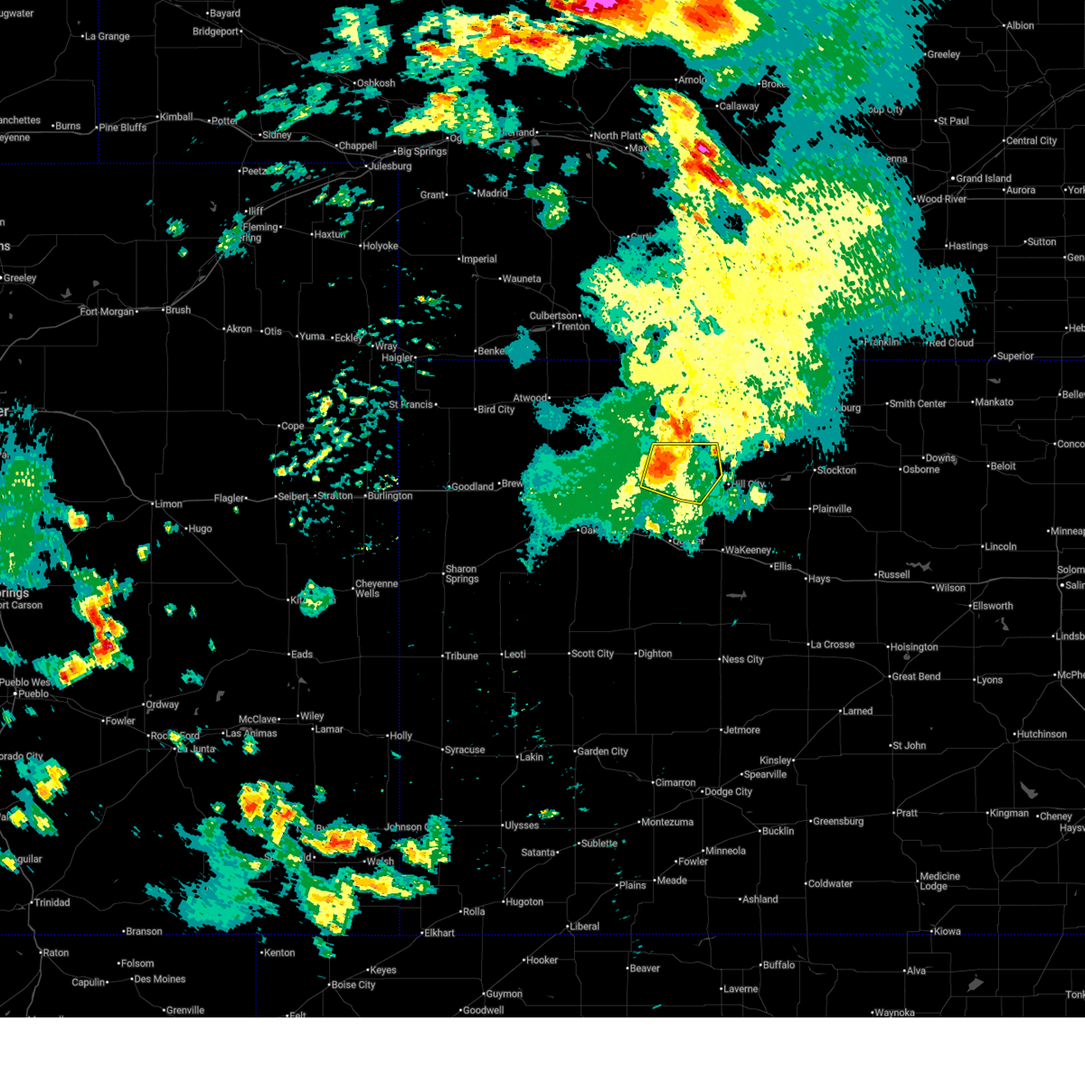
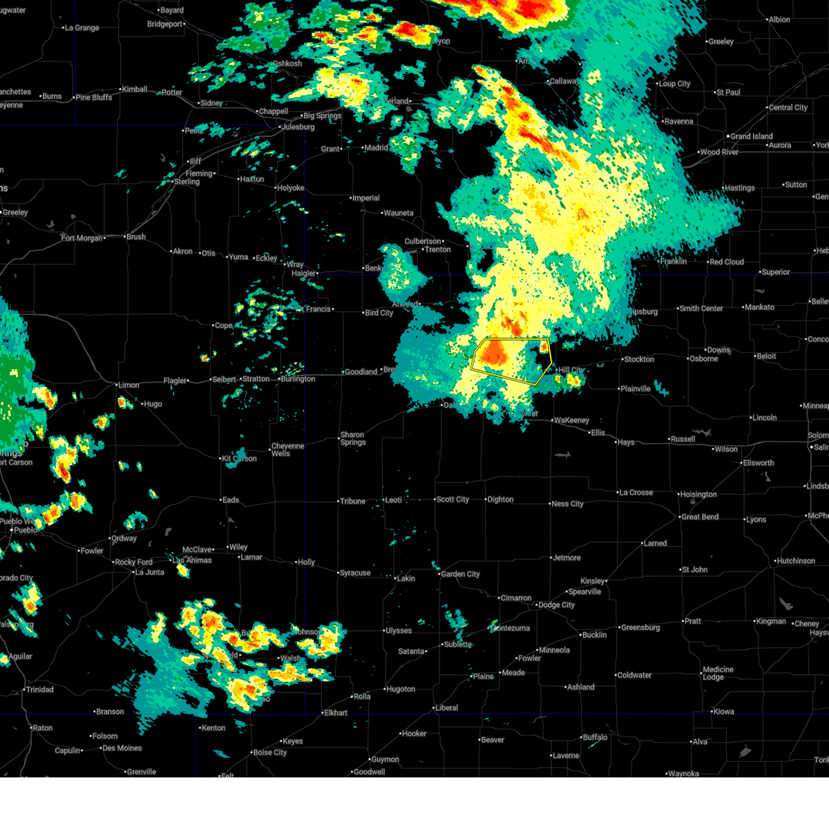
| 9/19/2025 5:21 PM CDT | At 521 pm cdt, a severe thunderstorm was located 8 miles southwest of morland, or 13 miles north of quinter, moving south at 20 mph (public). Hazards include two inch hail and 60 mph wind gusts. People and animals outdoors will be injured. expect hail damage to roofs, siding, windows, and vehicles. expect wind damage to roofs, siding, and trees. locations impacted include, quinter, morland, saint peter, and studley. This includes interstate 70 in kansas between mile markers 103 and 108. |
| 9/19/2025 5:09 PM CDT | Svrgld the national weather service in goodland has issued a * severe thunderstorm warning for, southeastern sheridan county in northwestern kansas, northeastern gove county in west central kansas, southwestern graham county in northwestern kansas, * until 600 pm cdt. * at 509 pm cdt, a severe thunderstorm was located 6 miles west of morland, or 13 miles east of hoxie, moving south at 20 mph (radar indicated). Hazards include golf ball size hail and 60 mph wind gusts. People and animals outdoors will be injured. expect hail damage to roofs, siding, windows, and vehicles. expect wind damage to roofs, siding, and trees. this severe thunderstorm will remain over mainly rural areas of southeastern sheridan, northeastern gove and southwestern graham counties, including the following locations, saint peter, studley, and tasco. This includes interstate 70 in kansas between mile markers 103 and 108. |
| 9/19/2025 4:51 PM CDT | At 451 pm cdt, a severe thunderstorm was located 8 miles northwest of morland, or 13 miles east of hoxie, moving south at 15 mph (radar indicated). Hazards include golf ball size hail and 60 mph wind gusts. People and animals outdoors will be injured. expect hail damage to roofs, siding, windows, and vehicles. expect wind damage to roofs, siding, and trees. Locations impacted include, morland, studley, and tasco. |
| 9/19/2025 4:31 PM CDT | Svrgld the national weather service in goodland has issued a * severe thunderstorm warning for, northeastern sheridan county in northwestern kansas, northwestern graham county in northwestern kansas, * until 515 pm cdt. * at 431 pm cdt, a severe thunderstorm was located 11 miles southeast of dresden, or 14 miles northeast of hoxie, moving south at 15 mph (radar indicated). Hazards include ping pong ball size hail and 60 mph wind gusts. People and animals outdoors will be injured. expect hail damage to roofs, siding, windows, and vehicles. expect wind damage to roofs, siding, and trees. This severe thunderstorm will remain over mainly rural areas of northeastern sheridan and northwestern graham counties, including the following locations, studley and tasco. |
| 8/9/2025 11:03 PM CDT |
 the severe thunderstorm warning has been cancelled and is no longer in effect the severe thunderstorm warning has been cancelled and is no longer in effect
|
| 8/9/2025 11:03 PM CDT |
 At 1103 pm cdt, severe thunderstorms were located along a line extending from 4 miles south of logan to near morland, moving east at 35 mph (radar indicated). Hazards include 60 mph wind gusts and quarter size hail. Hail damage to vehicles is expected. expect wind damage to roofs, siding, and trees. these severe storms will be near, hill city and morland around 1110 pm cdt. bogue and nicodemus around 1120 pm cdt. Other locations impacted by these severe thunderstorms include penokee and studley. At 1103 pm cdt, severe thunderstorms were located along a line extending from 4 miles south of logan to near morland, moving east at 35 mph (radar indicated). Hazards include 60 mph wind gusts and quarter size hail. Hail damage to vehicles is expected. expect wind damage to roofs, siding, and trees. these severe storms will be near, hill city and morland around 1110 pm cdt. bogue and nicodemus around 1120 pm cdt. Other locations impacted by these severe thunderstorms include penokee and studley.
|
| 8/9/2025 10:53 PM CDT |
 Svrgld the national weather service in goodland has issued a * severe thunderstorm warning for, northeastern sheridan county in northwestern kansas, graham county in northwestern kansas, * until 1130 pm cdt. * at 1053 pm cdt, severe thunderstorms were located along a line extending from 5 miles southwest of logan to 7 miles west of morland, moving east at 35 mph (radar indicated). Hazards include 60 mph wind gusts and quarter size hail. Hail damage to vehicles is expected. expect wind damage to roofs, siding, and trees. severe thunderstorms will be near, morland around 1100 pm cdt. hill city around 1105 pm cdt. Other locations in the path of these severe thunderstorms include bogue and nicodemus. Svrgld the national weather service in goodland has issued a * severe thunderstorm warning for, northeastern sheridan county in northwestern kansas, graham county in northwestern kansas, * until 1130 pm cdt. * at 1053 pm cdt, severe thunderstorms were located along a line extending from 5 miles southwest of logan to 7 miles west of morland, moving east at 35 mph (radar indicated). Hazards include 60 mph wind gusts and quarter size hail. Hail damage to vehicles is expected. expect wind damage to roofs, siding, and trees. severe thunderstorms will be near, morland around 1100 pm cdt. hill city around 1105 pm cdt. Other locations in the path of these severe thunderstorms include bogue and nicodemus.
|
| 6/30/2025 2:57 AM CDT |
 the tornado warning has been cancelled and is no longer in effect the tornado warning has been cancelled and is no longer in effect
|
| 6/30/2025 2:57 AM CDT |
 Svrgld the national weather service in goodland has issued a * severe thunderstorm warning for, graham county in northwestern kansas, * until 400 am cdt. * at 256 am cdt, severe thunderstorms were located along a line extending from 9 miles southeast of edmond to 6 miles east of morland to 12 miles northeast of quinter, moving southeast at 35 mph (automated weather station in hill city reported 59 mph gust at 3:55 am. hail threat is radar indicated). Hazards include ping pong ball size hail and 60 mph wind gusts. People and animals outdoors will be injured. expect hail damage to roofs, siding, windows, and vehicles. expect wind damage to roofs, siding, and trees. severe thunderstorms will be near, hill city around 300 am cdt. Bogue and nicodemus around 305 am cdt. Svrgld the national weather service in goodland has issued a * severe thunderstorm warning for, graham county in northwestern kansas, * until 400 am cdt. * at 256 am cdt, severe thunderstorms were located along a line extending from 9 miles southeast of edmond to 6 miles east of morland to 12 miles northeast of quinter, moving southeast at 35 mph (automated weather station in hill city reported 59 mph gust at 3:55 am. hail threat is radar indicated). Hazards include ping pong ball size hail and 60 mph wind gusts. People and animals outdoors will be injured. expect hail damage to roofs, siding, windows, and vehicles. expect wind damage to roofs, siding, and trees. severe thunderstorms will be near, hill city around 300 am cdt. Bogue and nicodemus around 305 am cdt.
|
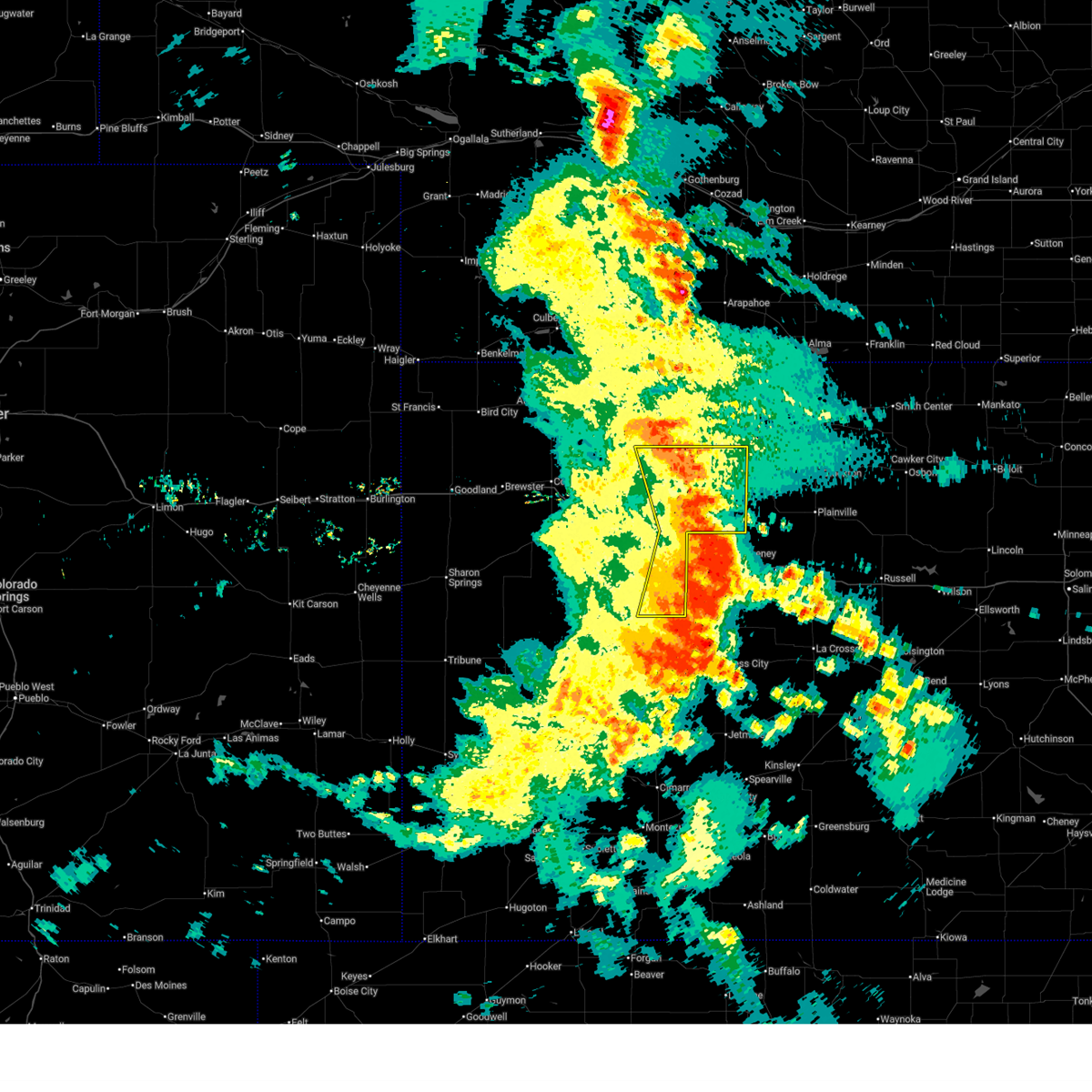
| 6/30/2025 2:46 AM CDT |
 At 246 am cdt, a severe thunderstorm capable of producing a tornado was located 6 miles east of morland, or 6 miles west of hill city, moving southeast at 20 mph (radar indicated rotation). Hazards include tornado and golf ball size hail. Flying debris will be dangerous to those caught without shelter. mobile homes will be damaged or destroyed. damage to roofs, windows, and vehicles will occur. tree damage is likely. Locations impacted include, hill city, morland, and penokee. At 246 am cdt, a severe thunderstorm capable of producing a tornado was located 6 miles east of morland, or 6 miles west of hill city, moving southeast at 20 mph (radar indicated rotation). Hazards include tornado and golf ball size hail. Flying debris will be dangerous to those caught without shelter. mobile homes will be damaged or destroyed. damage to roofs, windows, and vehicles will occur. tree damage is likely. Locations impacted include, hill city, morland, and penokee.
|
| 6/30/2025 2:35 AM CDT |
 At 235 am cdt, a severe thunderstorm capable of producing a tornado was located 6 miles northeast of morland, or 8 miles northwest of hill city, moving southeast at 25 mph (radar indicated rotation). Hazards include tornado and tennis ball size hail. Flying debris will be dangerous to those caught without shelter. mobile homes will be damaged or destroyed. damage to roofs, windows, and vehicles will occur. tree damage is likely. Locations impacted include, hill city. At 235 am cdt, a severe thunderstorm capable of producing a tornado was located 6 miles northeast of morland, or 8 miles northwest of hill city, moving southeast at 25 mph (radar indicated rotation). Hazards include tornado and tennis ball size hail. Flying debris will be dangerous to those caught without shelter. mobile homes will be damaged or destroyed. damage to roofs, windows, and vehicles will occur. tree damage is likely. Locations impacted include, hill city.
|
| 6/30/2025 2:25 AM CDT |
 Torgld the national weather service in goodland has issued a * tornado warning for, central graham county in northwestern kansas, * until 315 am cdt. * at 225 am cdt, a severe thunderstorm capable of producing a tornado was located 8 miles south of lenora, or 12 miles northwest of hill city, moving southeast at 25 mph (radar indicated rotation). Hazards include tornado and hail up to two inches in diameter. Flying debris will be dangerous to those caught without shelter. mobile homes will be damaged or destroyed. damage to roofs, windows, and vehicles will occur. tree damage is likely. This dangerous storm will be near, hill city around 245 am cdt. Torgld the national weather service in goodland has issued a * tornado warning for, central graham county in northwestern kansas, * until 315 am cdt. * at 225 am cdt, a severe thunderstorm capable of producing a tornado was located 8 miles south of lenora, or 12 miles northwest of hill city, moving southeast at 25 mph (radar indicated rotation). Hazards include tornado and hail up to two inches in diameter. Flying debris will be dangerous to those caught without shelter. mobile homes will be damaged or destroyed. damage to roofs, windows, and vehicles will occur. tree damage is likely. This dangerous storm will be near, hill city around 245 am cdt.
|
| 6/17/2025 12:36 AM CDT |
 At 1236 am cdt, severe thunderstorms were located along a line extending from 3 miles west of palco to near quinter, moving southeast at 35 mph (radar indicated). Hazards include 60 mph wind gusts and quarter size hail. Hail damage to vehicles is expected. expect wind damage to roofs, siding, and trees. These severe thunderstorms will remain over mainly rural areas of southeastern sheridan, northeastern gove and graham counties, including the following locations, saint peter and penokee. At 1236 am cdt, severe thunderstorms were located along a line extending from 3 miles west of palco to near quinter, moving southeast at 35 mph (radar indicated). Hazards include 60 mph wind gusts and quarter size hail. Hail damage to vehicles is expected. expect wind damage to roofs, siding, and trees. These severe thunderstorms will remain over mainly rural areas of southeastern sheridan, northeastern gove and graham counties, including the following locations, saint peter and penokee.
|
| 6/17/2025 12:14 AM CDT |
 Svrgld the national weather service in goodland has issued a * severe thunderstorm warning for, southern sheridan county in northwestern kansas, northeastern gove county in west central kansas, graham county in northwestern kansas, * until 115 am cdt. * at 1214 am cdt, severe thunderstorms were located along a line extending from near bogue to near grinnell, moving southeast at 35 mph (radar indicated). Hazards include 60 mph wind gusts and quarter size hail. Hail damage to vehicles is expected. expect wind damage to roofs, siding, and trees. severe thunderstorms will be near, grainfield and park around 1220 am cdt. Quinter around 1230 am cdt. Svrgld the national weather service in goodland has issued a * severe thunderstorm warning for, southern sheridan county in northwestern kansas, northeastern gove county in west central kansas, graham county in northwestern kansas, * until 115 am cdt. * at 1214 am cdt, severe thunderstorms were located along a line extending from near bogue to near grinnell, moving southeast at 35 mph (radar indicated). Hazards include 60 mph wind gusts and quarter size hail. Hail damage to vehicles is expected. expect wind damage to roofs, siding, and trees. severe thunderstorms will be near, grainfield and park around 1220 am cdt. Quinter around 1230 am cdt.
|
| 6/16/2025 11:56 PM CDT |
 At 1155 pm cdt, a severe thunderstorm was located near hill city, moving east at 20 mph (radar indicated). Hazards include 60 mph wind gusts and quarter size hail. Hail damage to vehicles is expected. expect wind damage to roofs, siding, and trees. Locations impacted include, hill city, bogue and nicodemus. At 1155 pm cdt, a severe thunderstorm was located near hill city, moving east at 20 mph (radar indicated). Hazards include 60 mph wind gusts and quarter size hail. Hail damage to vehicles is expected. expect wind damage to roofs, siding, and trees. Locations impacted include, hill city, bogue and nicodemus.
|
| 6/16/2025 11:20 PM CDT |
 Svrgld the national weather service in goodland has issued a * severe thunderstorm warning for, eastern sheridan county in northwestern kansas, graham county in northwestern kansas, * until 1215 am cdt. * at 1120 pm cdt, a severe thunderstorm was located 6 miles northwest of morland, or 15 miles east of hoxie, moving east at 20 mph (radar indicated). Hazards include 60 mph wind gusts and quarter size hail. Hail damage to vehicles is expected. expect wind damage to roofs, siding, and trees. this severe thunderstorm will be near, morland around 1125 pm cdt. Other locations in the path of this severe thunderstorm include hill city. Svrgld the national weather service in goodland has issued a * severe thunderstorm warning for, eastern sheridan county in northwestern kansas, graham county in northwestern kansas, * until 1215 am cdt. * at 1120 pm cdt, a severe thunderstorm was located 6 miles northwest of morland, or 15 miles east of hoxie, moving east at 20 mph (radar indicated). Hazards include 60 mph wind gusts and quarter size hail. Hail damage to vehicles is expected. expect wind damage to roofs, siding, and trees. this severe thunderstorm will be near, morland around 1125 pm cdt. Other locations in the path of this severe thunderstorm include hill city.
|
| 6/16/2025 10:19 PM CDT |
 Svrgld the national weather service in goodland has issued a * severe thunderstorm warning for, southern norton county in northwestern kansas, eastern sheridan county in northwestern kansas, southeastern decatur county in northwestern kansas, graham county in northwestern kansas, * until 1115 pm cdt. * at 1019 pm cdt, a severe thunderstorm was located 10 miles southwest of lenora, or 16 miles northwest of hill city, moving east at 40 mph (radar indicated). Hazards include 60 mph wind gusts. Expect damage to roofs, siding, and trees. this severe thunderstorm will be near, hill city around 1030 pm cdt. Other locations in the path of this severe thunderstorm include bogue and nicodemus. Svrgld the national weather service in goodland has issued a * severe thunderstorm warning for, southern norton county in northwestern kansas, eastern sheridan county in northwestern kansas, southeastern decatur county in northwestern kansas, graham county in northwestern kansas, * until 1115 pm cdt. * at 1019 pm cdt, a severe thunderstorm was located 10 miles southwest of lenora, or 16 miles northwest of hill city, moving east at 40 mph (radar indicated). Hazards include 60 mph wind gusts. Expect damage to roofs, siding, and trees. this severe thunderstorm will be near, hill city around 1030 pm cdt. Other locations in the path of this severe thunderstorm include bogue and nicodemus.
|
| 6/2/2025 8:47 PM CDT |
 At 847 pm cdt, a severe thunderstorm was located near lenora, or 15 miles northwest of hill city, moving north at 40 mph (radar indicated). Hazards include 60 mph wind gusts and penny size hail. Expect damage to roofs, siding, and trees. This severe thunderstorm will remain over mainly rural areas of graham county, including the following locations, saint peter, penokee, and studley. At 847 pm cdt, a severe thunderstorm was located near lenora, or 15 miles northwest of hill city, moving north at 40 mph (radar indicated). Hazards include 60 mph wind gusts and penny size hail. Expect damage to roofs, siding, and trees. This severe thunderstorm will remain over mainly rural areas of graham county, including the following locations, saint peter, penokee, and studley.
|
| 6/2/2025 8:47 PM CDT |
 the severe thunderstorm warning has been cancelled and is no longer in effect the severe thunderstorm warning has been cancelled and is no longer in effect
|
| 6/2/2025 8:21 PM CDT |
 Svrgld the national weather service in goodland has issued a * severe thunderstorm warning for, eastern sheridan county in northwestern kansas, graham county in northwestern kansas, * until 900 pm cdt. * at 821 pm cdt, a severe thunderstorm was located near morland, or 12 miles west of hill city, moving north at 40 mph (radar indicated). Hazards include 60 mph wind gusts and penny size hail. Expect damage to roofs, siding, and trees. This severe thunderstorm will be near, morland around 825 pm cdt. Svrgld the national weather service in goodland has issued a * severe thunderstorm warning for, eastern sheridan county in northwestern kansas, graham county in northwestern kansas, * until 900 pm cdt. * at 821 pm cdt, a severe thunderstorm was located near morland, or 12 miles west of hill city, moving north at 40 mph (radar indicated). Hazards include 60 mph wind gusts and penny size hail. Expect damage to roofs, siding, and trees. This severe thunderstorm will be near, morland around 825 pm cdt.
|
| 5/18/2025 8:10 PM CDT |
 The storms which prompted the warning is continuing and a new warning has been issued. the old warning will be allowed to expire. a tornado watch remains in effect until 900 pm cdt for northwestern kansas. to report severe weather, contact your nearest law enforcement agency. they will relay your report to the national weather service goodland. remember, a severe thunderstorm warning still remains in effect for norton and graham counties. The storms which prompted the warning is continuing and a new warning has been issued. the old warning will be allowed to expire. a tornado watch remains in effect until 900 pm cdt for northwestern kansas. to report severe weather, contact your nearest law enforcement agency. they will relay your report to the national weather service goodland. remember, a severe thunderstorm warning still remains in effect for norton and graham counties.
|
| 5/18/2025 8:07 PM CDT | Quarter sized hail reported 9.7 miles S of Morland, KS |
| 5/18/2025 7:48 PM CDT |
 At 748 pm cdt, severe thunderstorms were located along a line extending from 9 miles south of dresden to 7 miles east of hoxie to 9 miles north of park, moving northeast at 40 mph (trained weather spotters in hoxie reported 1.25 inch hail). Hazards include golf ball size hail and 60 mph wind gusts. People and animals outdoors will be injured. expect hail damage to roofs, siding, windows, and vehicles. expect wind damage to roofs, siding, and trees. Locations impacted include, lenora, morland, jennings, clayton, new almelo, studley, and penokee. At 748 pm cdt, severe thunderstorms were located along a line extending from 9 miles south of dresden to 7 miles east of hoxie to 9 miles north of park, moving northeast at 40 mph (trained weather spotters in hoxie reported 1.25 inch hail). Hazards include golf ball size hail and 60 mph wind gusts. People and animals outdoors will be injured. expect hail damage to roofs, siding, windows, and vehicles. expect wind damage to roofs, siding, and trees. Locations impacted include, lenora, morland, jennings, clayton, new almelo, studley, and penokee.
|
| 5/18/2025 7:38 PM CDT |
 At 738 pm cdt, severe thunderstorms were located along a line extending from 4 miles north of hoxie to 14 miles northeast of grainfield to 4 miles north of park, moving northeast at 50 mph (trained weather spotters in hoxie reported 1.25 inch hail). Hazards include golf ball size hail and 60 mph wind gusts. People and animals outdoors will be injured. expect hail damage to roofs, siding, windows, and vehicles. expect wind damage to roofs, siding, and trees. Locations impacted include, hoxie, lenora, morland, jennings, clayton, new almelo, and studley. At 738 pm cdt, severe thunderstorms were located along a line extending from 4 miles north of hoxie to 14 miles northeast of grainfield to 4 miles north of park, moving northeast at 50 mph (trained weather spotters in hoxie reported 1.25 inch hail). Hazards include golf ball size hail and 60 mph wind gusts. People and animals outdoors will be injured. expect hail damage to roofs, siding, windows, and vehicles. expect wind damage to roofs, siding, and trees. Locations impacted include, hoxie, lenora, morland, jennings, clayton, new almelo, and studley.
|
| 5/18/2025 7:35 PM CDT |
 Svrgld the national weather service in goodland has issued a * severe thunderstorm warning for, southwestern norton county in northwestern kansas, eastern sheridan county in northwestern kansas, southeastern decatur county in northwestern kansas, northwestern graham county in northwestern kansas, * until 815 pm cdt. * at 735 pm cdt, severe thunderstorms were located along a line extending from 4 miles north of hoxie to 14 miles northeast of grainfield to 4 miles north of park, moving northeast at 50 mph (radar indicated). Hazards include 60 mph wind gusts and half dollar size hail. Hail damage to vehicles is expected. Expect wind damage to roofs, siding, and trees. Svrgld the national weather service in goodland has issued a * severe thunderstorm warning for, southwestern norton county in northwestern kansas, eastern sheridan county in northwestern kansas, southeastern decatur county in northwestern kansas, northwestern graham county in northwestern kansas, * until 815 pm cdt. * at 735 pm cdt, severe thunderstorms were located along a line extending from 4 miles north of hoxie to 14 miles northeast of grainfield to 4 miles north of park, moving northeast at 50 mph (radar indicated). Hazards include 60 mph wind gusts and half dollar size hail. Hail damage to vehicles is expected. Expect wind damage to roofs, siding, and trees.
|
| 9/16/2024 7:35 PM CDT | Spotter estimated 50-60 mph winds at the estimated report tim in graham county KS, 0.3 miles W of Morland, KS |
| 7/19/2024 6:14 PM CDT |
 The storm which prompted the warning has weakened below severe limits, and no longer poses an immediate threat to life or property. therefore, the warning will be allowed to expire. however, gusty winds and heavy rain are still possible with this thunderstorm. a severe thunderstorm watch remains in effect until 1000 pm cdt for northwestern kansas. to report severe weather, contact your nearest law enforcement agency. they will relay your report to the national weather service goodland. The storm which prompted the warning has weakened below severe limits, and no longer poses an immediate threat to life or property. therefore, the warning will be allowed to expire. however, gusty winds and heavy rain are still possible with this thunderstorm. a severe thunderstorm watch remains in effect until 1000 pm cdt for northwestern kansas. to report severe weather, contact your nearest law enforcement agency. they will relay your report to the national weather service goodland.
|
| 7/19/2024 5:57 PM CDT |
 the severe thunderstorm warning has been cancelled and is no longer in effect the severe thunderstorm warning has been cancelled and is no longer in effect
|
| 7/19/2024 5:57 PM CDT |
 At 557 pm cdt, a severe thunderstorm was located 4 miles northwest of hill city, moving south at 10 mph (radar indicated). Hazards include 60 mph wind gusts. Expect damage to roofs, siding, and trees. Locations impacted include, hill city, morland, bogue, nicodemus, and penokee. At 557 pm cdt, a severe thunderstorm was located 4 miles northwest of hill city, moving south at 10 mph (radar indicated). Hazards include 60 mph wind gusts. Expect damage to roofs, siding, and trees. Locations impacted include, hill city, morland, bogue, nicodemus, and penokee.
|
| 7/19/2024 5:13 PM CDT |
 Svrgld the national weather service in goodland has issued a * severe thunderstorm warning for, southern norton county in northwestern kansas, graham county in northwestern kansas, * until 615 pm cdt. * at 512 pm cdt, a severe thunderstorm was located 5 miles southwest of edmond, or 14 miles north of hill city, moving south at 20 mph (radar indicated). Hazards include 60 mph wind gusts. expect damage to roofs, siding, and trees Svrgld the national weather service in goodland has issued a * severe thunderstorm warning for, southern norton county in northwestern kansas, graham county in northwestern kansas, * until 615 pm cdt. * at 512 pm cdt, a severe thunderstorm was located 5 miles southwest of edmond, or 14 miles north of hill city, moving south at 20 mph (radar indicated). Hazards include 60 mph wind gusts. expect damage to roofs, siding, and trees
|
| 6/7/2024 8:03 PM CDT |
 At 802 pm cdt, severe thunderstorms were located along a line extending from 8 miles south of edmond to near park, moving east at 40 mph (public). Hazards include tennis ball size hail and 60 mph wind gusts. People and animals outdoors will be injured. expect hail damage to roofs, siding, windows, and vehicles. expect wind damage to roofs, siding, and trees. these severe storms will be near, hill city and quinter around 810 pm cdt. bogue around 815 pm cdt. other locations impacted by these severe thunderstorms include saint peter, studley, and penokee. This includes interstate 70 in kansas between mile markers 83 and 113. At 802 pm cdt, severe thunderstorms were located along a line extending from 8 miles south of edmond to near park, moving east at 40 mph (public). Hazards include tennis ball size hail and 60 mph wind gusts. People and animals outdoors will be injured. expect hail damage to roofs, siding, windows, and vehicles. expect wind damage to roofs, siding, and trees. these severe storms will be near, hill city and quinter around 810 pm cdt. bogue around 815 pm cdt. other locations impacted by these severe thunderstorms include saint peter, studley, and penokee. This includes interstate 70 in kansas between mile markers 83 and 113.
|
| 6/7/2024 7:53 PM CDT |
 the severe thunderstorm warning has been cancelled and is no longer in effect the severe thunderstorm warning has been cancelled and is no longer in effect
|
| 6/7/2024 7:53 PM CDT |
 At 753 pm cdt, severe thunderstorms were located along a line extending from 8 miles southwest of edmond to near grainfield, moving east at 40 mph (public). Hazards include tennis ball size hail and 60 mph wind gusts. People and animals outdoors will be injured. expect hail damage to roofs, siding, windows, and vehicles. expect wind damage to roofs, siding, and trees. these severe storms will be near, grainfield, morland, and park around 800 pm cdt. hill city around 805 pm cdt. quinter around 810 pm cdt. bogue around 815 pm cdt. nicodemus around 820 pm cdt. other locations impacted by these severe thunderstorms include penokee, saint peter, tasco, and studley. This includes interstate 70 in kansas between mile markers 76 and 113. At 753 pm cdt, severe thunderstorms were located along a line extending from 8 miles southwest of edmond to near grainfield, moving east at 40 mph (public). Hazards include tennis ball size hail and 60 mph wind gusts. People and animals outdoors will be injured. expect hail damage to roofs, siding, windows, and vehicles. expect wind damage to roofs, siding, and trees. these severe storms will be near, grainfield, morland, and park around 800 pm cdt. hill city around 805 pm cdt. quinter around 810 pm cdt. bogue around 815 pm cdt. nicodemus around 820 pm cdt. other locations impacted by these severe thunderstorms include penokee, saint peter, tasco, and studley. This includes interstate 70 in kansas between mile markers 76 and 113.
|
| 6/7/2024 7:35 PM CDT |
 Svrgld the national weather service in goodland has issued a * severe thunderstorm warning for, southeastern thomas county in northwestern kansas, southeastern sheridan county in northwestern kansas, northern gove county in west central kansas, graham county in northwestern kansas, * until 830 pm cdt. * at 735 pm cdt, severe thunderstorms were located along a line extending from 5 miles southwest of lenora to 4 miles west of grinnell, moving east at 40 mph (public). Hazards include tennis ball size hail and 60 mph wind gusts. People and animals outdoors will be injured. expect hail damage to roofs, siding, windows, and vehicles. expect wind damage to roofs, siding, and trees. severe thunderstorms will be near, grinnell around 740 pm cdt. grainfield around 745 pm cdt. morland around 750 pm cdt. park around 755 pm cdt. other locations in the path of these severe thunderstorms include hill city, quinter, bogue and nicodemus. This includes interstate 70 in kansas between mile markers 75 and 113. Svrgld the national weather service in goodland has issued a * severe thunderstorm warning for, southeastern thomas county in northwestern kansas, southeastern sheridan county in northwestern kansas, northern gove county in west central kansas, graham county in northwestern kansas, * until 830 pm cdt. * at 735 pm cdt, severe thunderstorms were located along a line extending from 5 miles southwest of lenora to 4 miles west of grinnell, moving east at 40 mph (public). Hazards include tennis ball size hail and 60 mph wind gusts. People and animals outdoors will be injured. expect hail damage to roofs, siding, windows, and vehicles. expect wind damage to roofs, siding, and trees. severe thunderstorms will be near, grinnell around 740 pm cdt. grainfield around 745 pm cdt. morland around 750 pm cdt. park around 755 pm cdt. other locations in the path of these severe thunderstorms include hill city, quinter, bogue and nicodemus. This includes interstate 70 in kansas between mile markers 75 and 113.
|
| 6/7/2024 7:23 PM CDT |
 the severe thunderstorm warning has been cancelled and is no longer in effect the severe thunderstorm warning has been cancelled and is no longer in effect
|
| 6/7/2024 7:23 PM CDT |
 At 723 pm cdt, severe thunderstorms were located along a line extending from 10 miles south of hendley to 4 miles southwest of morland, moving east at 35 mph. these are destructive storms for areas near hoxie and tasco (public reports of baseball sized hail breaking windows in homes around hoxie). Hazards include three inch hail and 60 mph wind gusts. People and animals outdoors will be severely injured. expect shattered windows, extensive damage to roofs, siding, and vehicles. these severe storms will be near, morland around 730 pm cdt. Other locations impacted by these severe thunderstorms include tasco, studley, and penokee. At 723 pm cdt, severe thunderstorms were located along a line extending from 10 miles south of hendley to 4 miles southwest of morland, moving east at 35 mph. these are destructive storms for areas near hoxie and tasco (public reports of baseball sized hail breaking windows in homes around hoxie). Hazards include three inch hail and 60 mph wind gusts. People and animals outdoors will be severely injured. expect shattered windows, extensive damage to roofs, siding, and vehicles. these severe storms will be near, morland around 730 pm cdt. Other locations impacted by these severe thunderstorms include tasco, studley, and penokee.
|
| 6/7/2024 7:13 PM CDT |
 At 712 pm cdt, severe thunderstorms were located along a line extending from 9 miles south of wilsonville to 9 miles west of morland, moving east at 35 mph. these are destructive storms for areas near hoxie and tasco (public reports of baseball sized hail breaking windows in homes around hoxie). Hazards include three inch hail and 60 mph wind gusts. People and animals outdoors will be severely injured. expect shattered windows, extensive damage to roofs, siding, and vehicles. these severe storms will be near, morland around 720 pm cdt. Other locations impacted by these severe thunderstorms include tasco, studley, and penokee. At 712 pm cdt, severe thunderstorms were located along a line extending from 9 miles south of wilsonville to 9 miles west of morland, moving east at 35 mph. these are destructive storms for areas near hoxie and tasco (public reports of baseball sized hail breaking windows in homes around hoxie). Hazards include three inch hail and 60 mph wind gusts. People and animals outdoors will be severely injured. expect shattered windows, extensive damage to roofs, siding, and vehicles. these severe storms will be near, morland around 720 pm cdt. Other locations impacted by these severe thunderstorms include tasco, studley, and penokee.
|
| 6/7/2024 7:08 PM CDT |
 At 706 pm cdt, severe thunderstorms were located along a line extending from 8 miles southeast of lebanon to 7 miles southeast of hoxie, moving east at 35 mph. these are destructive storms for areas near hoxie and tasco (public reports of baseball sized hail breaking windows in homes around hoxie). Hazards include three inch hail and 60 mph wind gusts. People and animals outdoors will be severely injured. expect shattered windows, extensive damage to roofs, siding, and vehicles. these severe storms will be near, morland around 720 pm cdt. Other locations impacted by these severe thunderstorms include penokee, kanona, leoville, tasco, and studley. At 706 pm cdt, severe thunderstorms were located along a line extending from 8 miles southeast of lebanon to 7 miles southeast of hoxie, moving east at 35 mph. these are destructive storms for areas near hoxie and tasco (public reports of baseball sized hail breaking windows in homes around hoxie). Hazards include three inch hail and 60 mph wind gusts. People and animals outdoors will be severely injured. expect shattered windows, extensive damage to roofs, siding, and vehicles. these severe storms will be near, morland around 720 pm cdt. Other locations impacted by these severe thunderstorms include penokee, kanona, leoville, tasco, and studley.
|
| 6/7/2024 6:57 PM CDT |
 At 657 pm cdt, severe thunderstorms were located along a line extending from 5 miles southeast of lebanon to 3 miles southeast of hoxie, moving east at 35 mph (public). Hazards include ping pong ball size hail and 60 mph wind gusts. People and animals outdoors will be injured. expect hail damage to roofs, siding, windows, and vehicles. expect wind damage to roofs, siding, and trees. these severe storms will be near, jennings around 700 pm cdt. morland around 720 pm cdt. Other locations impacted by these severe thunderstorms include penokee, kanona, leoville, tasco, and studley. At 657 pm cdt, severe thunderstorms were located along a line extending from 5 miles southeast of lebanon to 3 miles southeast of hoxie, moving east at 35 mph (public). Hazards include ping pong ball size hail and 60 mph wind gusts. People and animals outdoors will be injured. expect hail damage to roofs, siding, windows, and vehicles. expect wind damage to roofs, siding, and trees. these severe storms will be near, jennings around 700 pm cdt. morland around 720 pm cdt. Other locations impacted by these severe thunderstorms include penokee, kanona, leoville, tasco, and studley.
|
| 6/7/2024 6:44 PM CDT |
 Svrgld the national weather service in goodland has issued a * severe thunderstorm warning for, central sheridan county in northwestern kansas, central decatur county in northwestern kansas, western graham county in northwestern kansas, * until 745 pm cdt. * at 643 pm cdt, severe thunderstorms were located along a line extending from 4 miles southeast of danbury to 7 miles southwest of hoxie, moving east at 35 mph (public reports up to ping pong sized hail with these storms). Hazards include ping pong ball size hail and 60 mph wind gusts. People and animals outdoors will be injured. expect hail damage to roofs, siding, windows, and vehicles. expect wind damage to roofs, siding, and trees. severe thunderstorms will be near, hoxie, jennings, and dresden around 650 pm cdt. Other locations in the path of these severe thunderstorms include morland. Svrgld the national weather service in goodland has issued a * severe thunderstorm warning for, central sheridan county in northwestern kansas, central decatur county in northwestern kansas, western graham county in northwestern kansas, * until 745 pm cdt. * at 643 pm cdt, severe thunderstorms were located along a line extending from 4 miles southeast of danbury to 7 miles southwest of hoxie, moving east at 35 mph (public reports up to ping pong sized hail with these storms). Hazards include ping pong ball size hail and 60 mph wind gusts. People and animals outdoors will be injured. expect hail damage to roofs, siding, windows, and vehicles. expect wind damage to roofs, siding, and trees. severe thunderstorms will be near, hoxie, jennings, and dresden around 650 pm cdt. Other locations in the path of these severe thunderstorms include morland.
|
| 6/2/2024 9:41 PM CDT |
 the severe thunderstorm warning has been cancelled and is no longer in effect the severe thunderstorm warning has been cancelled and is no longer in effect
|
| 6/2/2024 9:33 PM CDT |
 At 932 pm cdt, severe thunderstorms were located along a line extending from 8 miles south of woodruff to 7 miles south of edmond to 9 miles southeast of hoxie, moving east at 40 mph (radar indicated). Hazards include 60 mph wind gusts and nickel size hail. Expect damage to roofs, siding, and trees. these severe storms will be near, hill city and morland around 940 pm cdt. bogue around 955 pm cdt. other locations impacted by these severe thunderstorms include leoville, new almelo, seguin, studley, densmore, angelus, and penokee. This includes interstate 70 in kansas between mile markers 83 and 113. At 932 pm cdt, severe thunderstorms were located along a line extending from 8 miles south of woodruff to 7 miles south of edmond to 9 miles southeast of hoxie, moving east at 40 mph (radar indicated). Hazards include 60 mph wind gusts and nickel size hail. Expect damage to roofs, siding, and trees. these severe storms will be near, hill city and morland around 940 pm cdt. bogue around 955 pm cdt. other locations impacted by these severe thunderstorms include leoville, new almelo, seguin, studley, densmore, angelus, and penokee. This includes interstate 70 in kansas between mile markers 83 and 113.
|
| 6/2/2024 9:33 PM CDT |
 the severe thunderstorm warning has been cancelled and is no longer in effect the severe thunderstorm warning has been cancelled and is no longer in effect
|
| 6/2/2024 9:14 PM CDT |
 Svrgld the national weather service in goodland has issued a * severe thunderstorm warning for, northeastern thomas county in northwestern kansas, norton county in northwestern kansas, sheridan county in northwestern kansas, southeastern rawlins county in northwestern kansas, decatur county in northwestern kansas, eastern gove county in west central kansas, graham county in northwestern kansas, * until 1000 pm cdt. * at 913 pm cdt, severe thunderstorms were located along a line extending from 3 miles southeast of almena to 6 miles south of lenora to 9 miles southwest of hoxie, moving southeast at 40 mph (mesonet. at 0908 pm cdt, a 58 mph wind gust was reported near new almelo). Hazards include 60 mph wind gusts and quarter size hail. Hail damage to vehicles is expected. expect wind damage to roofs, siding, and trees. severe thunderstorms will be near, morland and edmond around 920 pm cdt. hill city and park around 925 pm cdt. quinter and bogue around 935 pm cdt. other locations impacted by these severe thunderstorms include new almelo, halford, seguin, studley, kanona, reager, and calvert. This includes interstate 70 in kansas between mile markers 83 and 113. Svrgld the national weather service in goodland has issued a * severe thunderstorm warning for, northeastern thomas county in northwestern kansas, norton county in northwestern kansas, sheridan county in northwestern kansas, southeastern rawlins county in northwestern kansas, decatur county in northwestern kansas, eastern gove county in west central kansas, graham county in northwestern kansas, * until 1000 pm cdt. * at 913 pm cdt, severe thunderstorms were located along a line extending from 3 miles southeast of almena to 6 miles south of lenora to 9 miles southwest of hoxie, moving southeast at 40 mph (mesonet. at 0908 pm cdt, a 58 mph wind gust was reported near new almelo). Hazards include 60 mph wind gusts and quarter size hail. Hail damage to vehicles is expected. expect wind damage to roofs, siding, and trees. severe thunderstorms will be near, morland and edmond around 920 pm cdt. hill city and park around 925 pm cdt. quinter and bogue around 935 pm cdt. other locations impacted by these severe thunderstorms include new almelo, halford, seguin, studley, kanona, reager, and calvert. This includes interstate 70 in kansas between mile markers 83 and 113.
|
| 5/6/2024 12:14 PM CDT |
 The storms which prompted the warning have weakened below severe limits, and no longer pose an immediate threat to life or property. therefore, the warning will be allowed to expire. however, small hail, gusty winds and heavy rain are still possible with these thunderstorms. a tornado watch remains in effect until 700 pm cdt for northwestern kansas. to report severe weather, contact your nearest law enforcement agency. they will relay your report to the national weather service goodland. The storms which prompted the warning have weakened below severe limits, and no longer pose an immediate threat to life or property. therefore, the warning will be allowed to expire. however, small hail, gusty winds and heavy rain are still possible with these thunderstorms. a tornado watch remains in effect until 700 pm cdt for northwestern kansas. to report severe weather, contact your nearest law enforcement agency. they will relay your report to the national weather service goodland.
|
| 5/6/2024 12:05 PM CDT |
 the severe thunderstorm warning has been cancelled and is no longer in effect the severe thunderstorm warning has been cancelled and is no longer in effect
|
| 5/6/2024 12:05 PM CDT |
 At 1205 pm cdt, severe thunderstorms were located along a line extending from 5 miles north of lenora to 3 miles southeast of morland to near collyer, moving east at 20 mph (radar indicated). Hazards include 60 mph wind gusts and quarter size hail. Hail damage to vehicles is expected. expect wind damage to roofs, siding, and trees. these severe storms will be near, lenora around 1210 pm cdt. hill city around 1220 pm cdt. edmond around 1225 pm cdt. bogue around 1245 pm cdt. nicodemus around 1255 pm cdt. Other locations impacted by these severe thunderstorms include densmore, penokee, saint peter, new almelo, and studley. At 1205 pm cdt, severe thunderstorms were located along a line extending from 5 miles north of lenora to 3 miles southeast of morland to near collyer, moving east at 20 mph (radar indicated). Hazards include 60 mph wind gusts and quarter size hail. Hail damage to vehicles is expected. expect wind damage to roofs, siding, and trees. these severe storms will be near, lenora around 1210 pm cdt. hill city around 1220 pm cdt. edmond around 1225 pm cdt. bogue around 1245 pm cdt. nicodemus around 1255 pm cdt. Other locations impacted by these severe thunderstorms include densmore, penokee, saint peter, new almelo, and studley.
|
| 5/6/2024 11:47 AM CDT |
 At 1147 am cdt, severe thunderstorms were located along a line extending from 4 miles southeast of clayton to 4 miles southwest of morland to 3 miles south of quinter, moving east at 20 mph (radar indicated). Hazards include 60 mph wind gusts and half dollar size hail. Hail damage to vehicles is expected. expect wind damage to roofs, siding, and trees. these severe storms will be near, morland around 1150 am cdt. lenora around 1155 am cdt. hill city and edmond around 1220 pm cdt. bogue around 1245 pm cdt. other locations impacted by these severe thunderstorms include densmore, penokee, saint peter, new almelo, tasco, and studley. This includes interstate 70 in kansas between mile markers 103 and 113. At 1147 am cdt, severe thunderstorms were located along a line extending from 4 miles southeast of clayton to 4 miles southwest of morland to 3 miles south of quinter, moving east at 20 mph (radar indicated). Hazards include 60 mph wind gusts and half dollar size hail. Hail damage to vehicles is expected. expect wind damage to roofs, siding, and trees. these severe storms will be near, morland around 1150 am cdt. lenora around 1155 am cdt. hill city and edmond around 1220 pm cdt. bogue around 1245 pm cdt. other locations impacted by these severe thunderstorms include densmore, penokee, saint peter, new almelo, tasco, and studley. This includes interstate 70 in kansas between mile markers 103 and 113.
|
| 5/6/2024 11:34 AM CDT |
 At 1134 am cdt, severe thunderstorms were located along a line extending from 4 miles east of jennings to 8 miles southwest of morland to 6 miles southwest of quinter, moving east at 35 mph (radar indicated). Hazards include 60 mph wind gusts and half dollar size hail. Hail damage to vehicles is expected. expect wind damage to roofs, siding, and trees. these severe storms will be near, quinter and morland around 1140 am cdt. lenora around 1145 am cdt. hill city around 1200 pm cdt. edmond around 1205 pm cdt. bogue around 1215 pm cdt. nicodemus around 1225 pm cdt. other locations impacted by these severe thunderstorms include densmore, penokee, saint peter, new almelo, tasco, and studley. This includes interstate 70 in kansas between mile markers 98 and 113. At 1134 am cdt, severe thunderstorms were located along a line extending from 4 miles east of jennings to 8 miles southwest of morland to 6 miles southwest of quinter, moving east at 35 mph (radar indicated). Hazards include 60 mph wind gusts and half dollar size hail. Hail damage to vehicles is expected. expect wind damage to roofs, siding, and trees. these severe storms will be near, quinter and morland around 1140 am cdt. lenora around 1145 am cdt. hill city around 1200 pm cdt. edmond around 1205 pm cdt. bogue around 1215 pm cdt. nicodemus around 1225 pm cdt. other locations impacted by these severe thunderstorms include densmore, penokee, saint peter, new almelo, tasco, and studley. This includes interstate 70 in kansas between mile markers 98 and 113.
|
| 5/6/2024 11:20 AM CDT |
 At 1120 am cdt, severe thunderstorms were located along a line extending from 3 miles east of dresden to 6 miles southeast of hoxie to 4 miles southeast of grainfield, moving east at 25 mph (radar indicated). Hazards include 60 mph wind gusts and half dollar size hail. Hail damage to vehicles is expected. expect wind damage to roofs, siding, and trees. these severe storms will be near, park around 1125 am cdt. quinter around 1135 am cdt. morland around 1155 am cdt. lenora around 1200 pm cdt. other locations impacted by these severe thunderstorms include leoville, new almelo, studley, densmore, penokee, saint peter, and tasco. This includes interstate 70 in kansas between mile markers 95 and 113. At 1120 am cdt, severe thunderstorms were located along a line extending from 3 miles east of dresden to 6 miles southeast of hoxie to 4 miles southeast of grainfield, moving east at 25 mph (radar indicated). Hazards include 60 mph wind gusts and half dollar size hail. Hail damage to vehicles is expected. expect wind damage to roofs, siding, and trees. these severe storms will be near, park around 1125 am cdt. quinter around 1135 am cdt. morland around 1155 am cdt. lenora around 1200 pm cdt. other locations impacted by these severe thunderstorms include leoville, new almelo, studley, densmore, penokee, saint peter, and tasco. This includes interstate 70 in kansas between mile markers 95 and 113.
|
| 5/6/2024 10:59 AM CDT |
 Svrgld the national weather service in goodland has issued a * severe thunderstorm warning for, southern norton county in northwestern kansas, sheridan county in northwestern kansas, southeastern decatur county in northwestern kansas, northeastern gove county in west central kansas, graham county in northwestern kansas, * until 1215 pm cdt. * at 1058 am cdt, severe thunderstorms were located along a line extending from 5 miles southeast of selden to 8 miles southwest of hoxie to 6 miles northwest of gove, moving east at 20 mph (radar indicated). Hazards include 60 mph wind gusts and half dollar size hail. Hail damage to vehicles is expected. expect wind damage to roofs, siding, and trees. severe thunderstorms will be near, hoxie and grainfield around 1105 am cdt. park around 1115 am cdt. other locations in the path of these severe thunderstorms include quinter and morland. This includes interstate 70 in kansas between mile markers 87 and 113. Svrgld the national weather service in goodland has issued a * severe thunderstorm warning for, southern norton county in northwestern kansas, sheridan county in northwestern kansas, southeastern decatur county in northwestern kansas, northeastern gove county in west central kansas, graham county in northwestern kansas, * until 1215 pm cdt. * at 1058 am cdt, severe thunderstorms were located along a line extending from 5 miles southeast of selden to 8 miles southwest of hoxie to 6 miles northwest of gove, moving east at 20 mph (radar indicated). Hazards include 60 mph wind gusts and half dollar size hail. Hail damage to vehicles is expected. expect wind damage to roofs, siding, and trees. severe thunderstorms will be near, hoxie and grainfield around 1105 am cdt. park around 1115 am cdt. other locations in the path of these severe thunderstorms include quinter and morland. This includes interstate 70 in kansas between mile markers 87 and 113.
|
| 5/3/2024 10:12 PM CDT |
 The storms which prompted the warning have moved out of the area. therefore, the warning will be allowed to expire. however, gusty winds are still possible with these thunderstorms. a severe thunderstorm watch remains in effect until midnight cdt for northwestern kansas. to report severe weather, contact your nearest law enforcement agency. they will relay your report to the national weather service goodland. The storms which prompted the warning have moved out of the area. therefore, the warning will be allowed to expire. however, gusty winds are still possible with these thunderstorms. a severe thunderstorm watch remains in effect until midnight cdt for northwestern kansas. to report severe weather, contact your nearest law enforcement agency. they will relay your report to the national weather service goodland.
|
| 5/3/2024 9:44 PM CDT |
 At 944 pm cdt, severe thunderstorms were located along a line extending from near almena to 7 miles south of lenora to 9 miles southeast of hoxie, moving east at 25 mph (radar indicated). Hazards include 60 mph wind gusts and penny size hail. Expect damage to roofs, siding, and trees. these severe storms will be near, morland and edmond around 950 pm cdt. hill city around 1005 pm cdt. bogue around 1020 pm cdt. nicodemus around 1025 pm cdt. Other locations impacted by these severe thunderstorms include new almelo, studley, densmore, penokee, reager, saint peter, and calvert. At 944 pm cdt, severe thunderstorms were located along a line extending from near almena to 7 miles south of lenora to 9 miles southeast of hoxie, moving east at 25 mph (radar indicated). Hazards include 60 mph wind gusts and penny size hail. Expect damage to roofs, siding, and trees. these severe storms will be near, morland and edmond around 950 pm cdt. hill city around 1005 pm cdt. bogue around 1020 pm cdt. nicodemus around 1025 pm cdt. Other locations impacted by these severe thunderstorms include new almelo, studley, densmore, penokee, reager, saint peter, and calvert.
|
| 5/3/2024 9:44 PM CDT |
 the severe thunderstorm warning has been cancelled and is no longer in effect the severe thunderstorm warning has been cancelled and is no longer in effect
|
| 5/3/2024 9:29 PM CDT |
 At 929 pm cdt, severe thunderstorms were located along a line extending from 5 miles southwest of orleans to near edmond to 5 miles northwest of morland, moving east at 60 mph (radar indicated). Hazards include 60 mph wind gusts and quarter size hail. Hail damage to vehicles is expected. expect wind damage to roofs, siding, and trees. these severe storms will be near, edmond around 935 pm cdt. hill city around 940 pm cdt. bogue around 950 pm cdt. nicodemus around 955 pm cdt. Other locations impacted by these severe thunderstorms include leoville, new almelo, studley, densmore, penokee, reager, and saint peter. At 929 pm cdt, severe thunderstorms were located along a line extending from 5 miles southwest of orleans to near edmond to 5 miles northwest of morland, moving east at 60 mph (radar indicated). Hazards include 60 mph wind gusts and quarter size hail. Hail damage to vehicles is expected. expect wind damage to roofs, siding, and trees. these severe storms will be near, edmond around 935 pm cdt. hill city around 940 pm cdt. bogue around 950 pm cdt. nicodemus around 955 pm cdt. Other locations impacted by these severe thunderstorms include leoville, new almelo, studley, densmore, penokee, reager, and saint peter.
|
| 5/3/2024 9:08 PM CDT |
 Svrgld the national weather service in goodland has issued a * severe thunderstorm warning for, norton county in northwestern kansas, sheridan county in northwestern kansas, decatur county in northwestern kansas, graham county in northwestern kansas, * until 1015 pm cdt. * at 908 pm cdt, severe thunderstorms were located along a line extending from 8 miles south of beaver city to 8 miles southeast of jennings to near hoxie, moving east at 60 mph (radar indicated). Hazards include 60 mph wind gusts and quarter size hail. Hail damage to vehicles is expected. expect wind damage to roofs, siding, and trees. severe thunderstorms will be near, norton and lenora around 915 pm cdt. almena around 920 pm cdt. Edmond around 925 pm cdt. Svrgld the national weather service in goodland has issued a * severe thunderstorm warning for, norton county in northwestern kansas, sheridan county in northwestern kansas, decatur county in northwestern kansas, graham county in northwestern kansas, * until 1015 pm cdt. * at 908 pm cdt, severe thunderstorms were located along a line extending from 8 miles south of beaver city to 8 miles southeast of jennings to near hoxie, moving east at 60 mph (radar indicated). Hazards include 60 mph wind gusts and quarter size hail. Hail damage to vehicles is expected. expect wind damage to roofs, siding, and trees. severe thunderstorms will be near, norton and lenora around 915 pm cdt. almena around 920 pm cdt. Edmond around 925 pm cdt.
|
| 5/1/2024 11:41 PM CDT |
 The storms which prompted the warning have moved out of the area. therefore, the warning will be allowed to expire. however, small hail, gusty winds and heavy rain are still possible with these thunderstorms. a tornado watch remains in effect until midnight cdt for west central kansas. a severe thunderstorm watch remains in effect until 200 am cdt for northwestern kansas. to report severe weather, contact your nearest law enforcement agency. they will relay your report to the national weather service goodland. remember, a severe thunderstorm warning still remains in effect for norton and graham counties until 12 am ct. The storms which prompted the warning have moved out of the area. therefore, the warning will be allowed to expire. however, small hail, gusty winds and heavy rain are still possible with these thunderstorms. a tornado watch remains in effect until midnight cdt for west central kansas. a severe thunderstorm watch remains in effect until 200 am cdt for northwestern kansas. to report severe weather, contact your nearest law enforcement agency. they will relay your report to the national weather service goodland. remember, a severe thunderstorm warning still remains in effect for norton and graham counties until 12 am ct.
|
| 5/1/2024 11:03 PM CDT |
 At 1102 pm cdt, severe thunderstorms were located along a line extending from 3 miles southeast of clayton to 4 miles southwest of lenora to near morland, moving northeast at 50 mph (automated weather station near lenora reported a 63 mph gust at 11 pm ct). Hazards include 70 mph wind gusts and ping pong ball size hail. People and animals outdoors will be injured. expect hail damage to roofs, siding, windows, and vehicles. expect considerable tree damage. wind damage is also likely to mobile homes, roofs, and outbuildings. these severe storms will be near, lenora and morland around 1105 pm cdt. hill city and edmond around 1115 pm cdt. norton around 1120 pm cdt. Other locations impacted by these severe thunderstorms include new almelo, studley, densmore, penokee, reager, saint peter, and tasco. At 1102 pm cdt, severe thunderstorms were located along a line extending from 3 miles southeast of clayton to 4 miles southwest of lenora to near morland, moving northeast at 50 mph (automated weather station near lenora reported a 63 mph gust at 11 pm ct). Hazards include 70 mph wind gusts and ping pong ball size hail. People and animals outdoors will be injured. expect hail damage to roofs, siding, windows, and vehicles. expect considerable tree damage. wind damage is also likely to mobile homes, roofs, and outbuildings. these severe storms will be near, lenora and morland around 1105 pm cdt. hill city and edmond around 1115 pm cdt. norton around 1120 pm cdt. Other locations impacted by these severe thunderstorms include new almelo, studley, densmore, penokee, reager, saint peter, and tasco.
|
| 5/1/2024 10:40 PM CDT |
 Svrgld the national weather service in goodland has issued a * severe thunderstorm warning for, norton county in northwestern kansas, eastern sheridan county in northwestern kansas, eastern decatur county in northwestern kansas, western graham county in northwestern kansas, * until 1145 pm cdt. * at 1039 pm cdt, severe thunderstorms were located along a line extending from near dresden to 8 miles northeast of hoxie to 8 miles north of park, moving northeast at 35 mph (automated weather stations near tasco have reported 70 mph wind gusts). Hazards include 70 mph wind gusts and ping pong ball size hail. People and animals outdoors will be injured. expect hail damage to roofs, siding, windows, and vehicles. expect considerable tree damage. wind damage is also likely to mobile homes, roofs, and outbuildings. severe thunderstorms will be near, dresden around 1045 pm cdt. jennings around 1050 pm cdt. Other locations in the path of these severe thunderstorms include clayton, morland, lenora, norton and edmond. Svrgld the national weather service in goodland has issued a * severe thunderstorm warning for, norton county in northwestern kansas, eastern sheridan county in northwestern kansas, eastern decatur county in northwestern kansas, western graham county in northwestern kansas, * until 1145 pm cdt. * at 1039 pm cdt, severe thunderstorms were located along a line extending from near dresden to 8 miles northeast of hoxie to 8 miles north of park, moving northeast at 35 mph (automated weather stations near tasco have reported 70 mph wind gusts). Hazards include 70 mph wind gusts and ping pong ball size hail. People and animals outdoors will be injured. expect hail damage to roofs, siding, windows, and vehicles. expect considerable tree damage. wind damage is also likely to mobile homes, roofs, and outbuildings. severe thunderstorms will be near, dresden around 1045 pm cdt. jennings around 1050 pm cdt. Other locations in the path of these severe thunderstorms include clayton, morland, lenora, norton and edmond.
|
| 4/27/2024 8:11 PM CDT |
 The storm which prompted the warning has weakened below severe limits, and no longer poses an immediate threat to life or property. therefore, the warning will be allowed to expire. however, small hail and heavy rain are still possible with this thunderstorm. a severe thunderstorm watch remains in effect until 900 pm cdt for northwestern and west central kansas. The storm which prompted the warning has weakened below severe limits, and no longer poses an immediate threat to life or property. therefore, the warning will be allowed to expire. however, small hail and heavy rain are still possible with this thunderstorm. a severe thunderstorm watch remains in effect until 900 pm cdt for northwestern and west central kansas.
|
| 4/27/2024 8:10 PM CDT | Half Dollar sized hail reported 4.6 miles E of Morland, KS, delayed public report of silver dollar coin sized hail in studley. |
| 4/27/2024 8:02 PM CDT |
 At 802 pm cdt, a severe thunderstorm was located 7 miles west of morland, or 12 miles east of hoxie, moving northeast at 45 mph (radar indicated). Hazards include 60 mph wind gusts and half dollar size hail. Hail damage to vehicles is expected. expect wind damage to roofs, siding, and trees. Locations impacted include, morland, penokee, tasco, and studley. At 802 pm cdt, a severe thunderstorm was located 7 miles west of morland, or 12 miles east of hoxie, moving northeast at 45 mph (radar indicated). Hazards include 60 mph wind gusts and half dollar size hail. Hail damage to vehicles is expected. expect wind damage to roofs, siding, and trees. Locations impacted include, morland, penokee, tasco, and studley.
|
| 4/27/2024 7:53 PM CDT |
 At 752 pm cdt, a severe thunderstorm was located 8 miles east of hoxie, moving northeast at 45 mph (radar indicated). Hazards include 60 mph wind gusts and half dollar size hail. Hail damage to vehicles is expected. expect wind damage to roofs, siding, and trees. Locations impacted include, morland, penokee, tasco, and studley. At 752 pm cdt, a severe thunderstorm was located 8 miles east of hoxie, moving northeast at 45 mph (radar indicated). Hazards include 60 mph wind gusts and half dollar size hail. Hail damage to vehicles is expected. expect wind damage to roofs, siding, and trees. Locations impacted include, morland, penokee, tasco, and studley.
|
| 4/27/2024 7:41 PM CDT |
 Svrgld the national weather service in goodland has issued a * severe thunderstorm warning for, eastern sheridan county in northwestern kansas, west central graham county in northwestern kansas, * until 815 pm cdt. * at 741 pm cdt, a severe thunderstorm was located 8 miles south of hoxie, moving northeast at 45 mph (radar indicated). Hazards include ping pong ball size hail and 60 mph wind gusts. People and animals outdoors will be injured. expect hail damage to roofs, siding, windows, and vehicles. expect wind damage to roofs, siding, and trees. This severe thunderstorm will remain over mainly rural areas of eastern sheridan and west central graham counties, including the following locations, tasco, studley, and penokee. Svrgld the national weather service in goodland has issued a * severe thunderstorm warning for, eastern sheridan county in northwestern kansas, west central graham county in northwestern kansas, * until 815 pm cdt. * at 741 pm cdt, a severe thunderstorm was located 8 miles south of hoxie, moving northeast at 45 mph (radar indicated). Hazards include ping pong ball size hail and 60 mph wind gusts. People and animals outdoors will be injured. expect hail damage to roofs, siding, windows, and vehicles. expect wind damage to roofs, siding, and trees. This severe thunderstorm will remain over mainly rural areas of eastern sheridan and west central graham counties, including the following locations, tasco, studley, and penokee.
|
| 4/25/2024 8:58 PM CDT | Golf Ball sized hail reported 0.3 miles W of Morland, KS, report via social media (x) of quarter to intermediate golf ball size hail near morland. |
| 4/25/2024 8:40 PM CDT |
 At 839 pm cdt, a severe thunderstorm was located near hoxie, moving north at 45 mph (numerous report of golf ball to 2 inch hail with this storm was reported in grainfield). Hazards include two inch hail and 60 mph wind gusts. People and animals outdoors will be injured. expect hail damage to roofs, siding, windows, and vehicles. expect wind damage to roofs, siding, and trees. This severe thunderstorm will remain over mainly rural areas of eastern sheridan and west central graham counties, including the following locations, tasco and studley. At 839 pm cdt, a severe thunderstorm was located near hoxie, moving north at 45 mph (numerous report of golf ball to 2 inch hail with this storm was reported in grainfield). Hazards include two inch hail and 60 mph wind gusts. People and animals outdoors will be injured. expect hail damage to roofs, siding, windows, and vehicles. expect wind damage to roofs, siding, and trees. This severe thunderstorm will remain over mainly rural areas of eastern sheridan and west central graham counties, including the following locations, tasco and studley.
|
| 4/25/2024 8:40 PM CDT |
 the severe thunderstorm warning has been cancelled and is no longer in effect the severe thunderstorm warning has been cancelled and is no longer in effect
|
| 4/25/2024 8:30 PM CDT |
 At 829 pm cdt, a severe thunderstorm was located 6 miles north of grainfield, moving north at 45 mph (public reported 2 inch hail near grainfield). Hazards include two inch hail and 60 mph wind gusts. People and animals outdoors will be injured. expect hail damage to roofs, siding, windows, and vehicles. expect wind damage to roofs, siding, and trees. this severe storm will be near, hoxie around 840 pm cdt. other locations impacted by this severe thunderstorm include tasco and studley. This includes interstate 70 in kansas between mile markers 88 and 103. At 829 pm cdt, a severe thunderstorm was located 6 miles north of grainfield, moving north at 45 mph (public reported 2 inch hail near grainfield). Hazards include two inch hail and 60 mph wind gusts. People and animals outdoors will be injured. expect hail damage to roofs, siding, windows, and vehicles. expect wind damage to roofs, siding, and trees. this severe storm will be near, hoxie around 840 pm cdt. other locations impacted by this severe thunderstorm include tasco and studley. This includes interstate 70 in kansas between mile markers 88 and 103.
|
| 4/25/2024 8:27 PM CDT |
 At 827 pm cdt, a severe thunderstorm was located 4 miles north of grainfield, moving northeast at 40 mph (public reported quarter size hail in grainfield). Hazards include golf ball size hail and 60 mph wind gusts. People and animals outdoors will be injured. expect hail damage to roofs, siding, windows, and vehicles. expect wind damage to roofs, siding, and trees. this severe storm will be near, hoxie around 840 pm cdt. other locations impacted by this severe thunderstorm include tasco and studley. This includes interstate 70 in kansas between mile markers 88 and 103. At 827 pm cdt, a severe thunderstorm was located 4 miles north of grainfield, moving northeast at 40 mph (public reported quarter size hail in grainfield). Hazards include golf ball size hail and 60 mph wind gusts. People and animals outdoors will be injured. expect hail damage to roofs, siding, windows, and vehicles. expect wind damage to roofs, siding, and trees. this severe storm will be near, hoxie around 840 pm cdt. other locations impacted by this severe thunderstorm include tasco and studley. This includes interstate 70 in kansas between mile markers 88 and 103.
|
| 4/25/2024 8:10 PM CDT |
 Svrgld the national weather service in goodland has issued a * severe thunderstorm warning for, sheridan county in northwestern kansas, northwestern gove county in west central kansas, west central graham county in northwestern kansas, * until 900 pm cdt. * at 810 pm cdt, a severe thunderstorm was located 5 miles southwest of grainfield, moving north at 45 mph (radar indicated). Hazards include golf ball size hail and 60 mph wind gusts. People and animals outdoors will be injured. expect hail damage to roofs, siding, windows, and vehicles. expect wind damage to roofs, siding, and trees. this severe thunderstorm will be near, grainfield around 815 pm cdt. other locations in the path of this severe thunderstorm include hoxie. This includes interstate 70 in kansas between mile markers 85 and 103. Svrgld the national weather service in goodland has issued a * severe thunderstorm warning for, sheridan county in northwestern kansas, northwestern gove county in west central kansas, west central graham county in northwestern kansas, * until 900 pm cdt. * at 810 pm cdt, a severe thunderstorm was located 5 miles southwest of grainfield, moving north at 45 mph (radar indicated). Hazards include golf ball size hail and 60 mph wind gusts. People and animals outdoors will be injured. expect hail damage to roofs, siding, windows, and vehicles. expect wind damage to roofs, siding, and trees. this severe thunderstorm will be near, grainfield around 815 pm cdt. other locations in the path of this severe thunderstorm include hoxie. This includes interstate 70 in kansas between mile markers 85 and 103.
|
| 4/16/2024 12:10 AM CDT |
 The storm which prompted the warning has weakened below severe limits, and no longer poses an immediate threat to life or property. therefore, the warning will be allowed to expire. however, small hail and gusty winds are still possible with this thunderstorm. a tornado watch remains in effect until 300 am cdt for northwestern kansas. The storm which prompted the warning has weakened below severe limits, and no longer poses an immediate threat to life or property. therefore, the warning will be allowed to expire. however, small hail and gusty winds are still possible with this thunderstorm. a tornado watch remains in effect until 300 am cdt for northwestern kansas.
|
| 4/15/2024 11:56 PM CDT |
 the severe thunderstorm warning has been cancelled and is no longer in effect the severe thunderstorm warning has been cancelled and is no longer in effect
|
| 4/15/2024 11:56 PM CDT |
 At 1155 pm cdt, a severe thunderstorm was located near morland, or 13 miles west of hill city, moving north at 40 mph (radar indicated). Hazards include 60 mph wind gusts and quarter size hail. Hail damage to vehicles is expected. expect wind damage to roofs, siding, and trees. This severe thunderstorm will remain over mainly rural areas of southwestern norton and western graham counties, including the following locations, penokee, saint peter, new almelo, and studley. At 1155 pm cdt, a severe thunderstorm was located near morland, or 13 miles west of hill city, moving north at 40 mph (radar indicated). Hazards include 60 mph wind gusts and quarter size hail. Hail damage to vehicles is expected. expect wind damage to roofs, siding, and trees. This severe thunderstorm will remain over mainly rural areas of southwestern norton and western graham counties, including the following locations, penokee, saint peter, new almelo, and studley.
|
| 4/15/2024 11:38 PM CDT |
 Svrgld the national weather service in goodland has issued a * severe thunderstorm warning for, southwestern norton county in northwestern kansas, northeastern sheridan county in northwestern kansas, western graham county in northwestern kansas, * until 1215 am cdt. * at 1138 pm cdt, a severe thunderstorm was located 8 miles south of morland, or 12 miles northeast of quinter, moving north at 50 mph (radar indicated). Hazards include 60 mph wind gusts and quarter size hail. Hail damage to vehicles is expected. expect wind damage to roofs, siding, and trees. This severe thunderstorm will be near, morland around 1145 pm cdt. Svrgld the national weather service in goodland has issued a * severe thunderstorm warning for, southwestern norton county in northwestern kansas, northeastern sheridan county in northwestern kansas, western graham county in northwestern kansas, * until 1215 am cdt. * at 1138 pm cdt, a severe thunderstorm was located 8 miles south of morland, or 12 miles northeast of quinter, moving north at 50 mph (radar indicated). Hazards include 60 mph wind gusts and quarter size hail. Hail damage to vehicles is expected. expect wind damage to roofs, siding, and trees. This severe thunderstorm will be near, morland around 1145 pm cdt.
|
| 8/9/2023 12:46 PM CDT |
 At 1246 pm cdt, a severe thunderstorm was located near morland, or 10 miles west of hill city, moving southeast at 15 mph (radar indicated). Hazards include quarter size hail. Damage to vehicles is expected. this severe thunderstorm will remain over mainly rural areas of southern graham county, including the following locations, penokee. hail threat, radar indicated max hail size, 1. 00 in wind threat, radar indicated max wind gust, <50 mph. At 1246 pm cdt, a severe thunderstorm was located near morland, or 10 miles west of hill city, moving southeast at 15 mph (radar indicated). Hazards include quarter size hail. Damage to vehicles is expected. this severe thunderstorm will remain over mainly rural areas of southern graham county, including the following locations, penokee. hail threat, radar indicated max hail size, 1. 00 in wind threat, radar indicated max wind gust, <50 mph.
|
| 8/5/2023 8:53 PM CDT |
 The severe thunderstorm warning for graham county will expire at 900 pm cdt, the storm which prompted the warning has weakened below severe limits, and has exited the warned area. therefore, the warning will be allowed to expire. however gusty winds and heavy rain are still possible with this thunderstorm. a severe thunderstorm watch remains in effect until 100 am cdt for northwestern and west central kansas. The severe thunderstorm warning for graham county will expire at 900 pm cdt, the storm which prompted the warning has weakened below severe limits, and has exited the warned area. therefore, the warning will be allowed to expire. however gusty winds and heavy rain are still possible with this thunderstorm. a severe thunderstorm watch remains in effect until 100 am cdt for northwestern and west central kansas.
|
| 8/5/2023 8:33 PM CDT |
 At 833 pm cdt, a severe thunderstorm was located over bogue, or 8 miles east of hill city, moving east at 35 mph (radar indicated). Hazards include 70 mph wind gusts and quarter size hail. Hail damage to vehicles is expected. expect considerable tree damage. wind damage is also likely to mobile homes, roofs, and outbuildings. locations impacted include, hill city, morland, bogue, nicodemus, penokee and saint peter. thunderstorm damage threat, considerable hail threat, radar indicated max hail size, 1. 00 in wind threat, radar indicated max wind gust, 70 mph. At 833 pm cdt, a severe thunderstorm was located over bogue, or 8 miles east of hill city, moving east at 35 mph (radar indicated). Hazards include 70 mph wind gusts and quarter size hail. Hail damage to vehicles is expected. expect considerable tree damage. wind damage is also likely to mobile homes, roofs, and outbuildings. locations impacted include, hill city, morland, bogue, nicodemus, penokee and saint peter. thunderstorm damage threat, considerable hail threat, radar indicated max hail size, 1. 00 in wind threat, radar indicated max wind gust, 70 mph.
|
| 8/5/2023 8:22 PM CDT | Storm damage reported in graham county KS, 5.6 miles W of Morland, KS |
| 8/5/2023 8:16 PM CDT |
 At 816 pm cdt, a severe thunderstorm was located 4 miles west of hill city, moving east at 50 mph (radar indicated). Hazards include 60 mph wind gusts and quarter size hail. Hail damage to vehicles is expected. expect wind damage to roofs, siding, and trees. locations impacted include, hill city, hoxie, morland, bogue, nicodemus, studley and penokee. hail threat, radar indicated max hail size, 1. 00 in wind threat, radar indicated max wind gust, 60 mph. At 816 pm cdt, a severe thunderstorm was located 4 miles west of hill city, moving east at 50 mph (radar indicated). Hazards include 60 mph wind gusts and quarter size hail. Hail damage to vehicles is expected. expect wind damage to roofs, siding, and trees. locations impacted include, hill city, hoxie, morland, bogue, nicodemus, studley and penokee. hail threat, radar indicated max hail size, 1. 00 in wind threat, radar indicated max wind gust, 60 mph.
|
| 8/5/2023 7:57 PM CDT |
 At 757 pm cdt, a severe thunderstorm was located 9 miles northeast of hoxie, moving east at 35 mph (radar indicated). Hazards include 60 mph wind gusts and quarter size hail. Hail damage to vehicles is expected. Expect wind damage to roofs, siding, and trees. At 757 pm cdt, a severe thunderstorm was located 9 miles northeast of hoxie, moving east at 35 mph (radar indicated). Hazards include 60 mph wind gusts and quarter size hail. Hail damage to vehicles is expected. Expect wind damage to roofs, siding, and trees.
|
| 8/5/2023 1:57 AM CDT |
 The severe thunderstorm warning for southern norton, northeastern sheridan, southeastern decatur and northern graham counties will expire at 200 am cdt, the storms which prompted the warning have weakened below severe limits, and no longer pose an immediate threat to life or property. therefore, the warning will be allowed to expire. however gusty winds are still possible with these thunderstorms. The severe thunderstorm warning for southern norton, northeastern sheridan, southeastern decatur and northern graham counties will expire at 200 am cdt, the storms which prompted the warning have weakened below severe limits, and no longer pose an immediate threat to life or property. therefore, the warning will be allowed to expire. however gusty winds are still possible with these thunderstorms.
|
| 8/5/2023 1:35 AM CDT |
 At 135 am cdt, severe thunderstorms were located along a line extending from near logan to 8 miles west of lenora to 7 miles north of selden, moving southeast at 30 mph (radar indicated). Hazards include 60 mph wind gusts and penny size hail. Expect damage to roofs, siding, and trees. locations impacted include, hill city, lenora, morland, bogue, jennings, clayton and nicodemus. hail threat, radar indicated max hail size, 0. 75 in wind threat, radar indicated max wind gust, 60 mph. At 135 am cdt, severe thunderstorms were located along a line extending from near logan to 8 miles west of lenora to 7 miles north of selden, moving southeast at 30 mph (radar indicated). Hazards include 60 mph wind gusts and penny size hail. Expect damage to roofs, siding, and trees. locations impacted include, hill city, lenora, morland, bogue, jennings, clayton and nicodemus. hail threat, radar indicated max hail size, 0. 75 in wind threat, radar indicated max wind gust, 60 mph.
|
| 8/5/2023 1:19 AM CDT |
 At 118 am cdt, severe thunderstorms were located along a line extending from 6 miles southwest of prairie view to 3 miles northeast of jennings to 8 miles southwest of oberlin, moving southeast at 30 mph (radar indicated. at 1259 am cdt, a wind gust of 64 mph was measured norton municipal airport). Hazards include 60 mph wind gusts and penny size hail. expect damage to roofs, siding, and trees At 118 am cdt, severe thunderstorms were located along a line extending from 6 miles southwest of prairie view to 3 miles northeast of jennings to 8 miles southwest of oberlin, moving southeast at 30 mph (radar indicated. at 1259 am cdt, a wind gust of 64 mph was measured norton municipal airport). Hazards include 60 mph wind gusts and penny size hail. expect damage to roofs, siding, and trees
|
| 7/22/2023 7:46 PM CDT |
 At 746 pm cdt, a severe thunderstorm was located 8 miles northeast of park, or 9 miles north of quinter, moving south at 25 mph (radar indicated). Hazards include tennis ball size hail and 70 mph wind gusts. People and animals outdoors will be injured. expect hail damage to roofs, siding, windows, and vehicles. expect considerable tree damage. wind damage is also likely to mobile homes, roofs, and outbuildings. locations impacted include, morland and studley. thunderstorm damage threat, considerable hail threat, radar indicated max hail size, 2. 50 in wind threat, radar indicated max wind gust, 70 mph. At 746 pm cdt, a severe thunderstorm was located 8 miles northeast of park, or 9 miles north of quinter, moving south at 25 mph (radar indicated). Hazards include tennis ball size hail and 70 mph wind gusts. People and animals outdoors will be injured. expect hail damage to roofs, siding, windows, and vehicles. expect considerable tree damage. wind damage is also likely to mobile homes, roofs, and outbuildings. locations impacted include, morland and studley. thunderstorm damage threat, considerable hail threat, radar indicated max hail size, 2. 50 in wind threat, radar indicated max wind gust, 70 mph.
|
| 7/22/2023 7:36 PM CDT |
 At 736 pm cdt, a severe thunderstorm was located 10 miles southeast of hoxie, moving south at 40 mph (radar indicated). Hazards include tennis ball size hail and 70 mph wind gusts. People and animals outdoors will be injured. expect hail damage to roofs, siding, windows, and vehicles. expect considerable tree damage. wind damage is also likely to mobile homes, roofs, and outbuildings. locations impacted include, hoxie, morland, tasco and studley. thunderstorm damage threat, considerable hail threat, radar indicated max hail size, 2. 50 in wind threat, radar indicated max wind gust, 70 mph. At 736 pm cdt, a severe thunderstorm was located 10 miles southeast of hoxie, moving south at 40 mph (radar indicated). Hazards include tennis ball size hail and 70 mph wind gusts. People and animals outdoors will be injured. expect hail damage to roofs, siding, windows, and vehicles. expect considerable tree damage. wind damage is also likely to mobile homes, roofs, and outbuildings. locations impacted include, hoxie, morland, tasco and studley. thunderstorm damage threat, considerable hail threat, radar indicated max hail size, 2. 50 in wind threat, radar indicated max wind gust, 70 mph.
|
| 7/22/2023 7:16 PM CDT |
 At 715 pm cdt, a severe thunderstorm was located 10 miles northwest of morland, or 12 miles northeast of hoxie, moving south at 25 mph (mesonet. an automated site northeast of hoxie reported a 71 mph wind gust). Hazards include golf ball size hail and 70 mph wind gusts. People and animals outdoors will be injured. expect hail damage to roofs, siding, windows, and vehicles. expect considerable tree damage. wind damage is also likely to mobile homes, roofs, and outbuildings. locations impacted include, hoxie, morland, penokee, tasco and studley. thunderstorm damage threat, considerable hail threat, radar indicated max hail size, 1. 75 in wind threat, radar indicated max wind gust, 70 mph. At 715 pm cdt, a severe thunderstorm was located 10 miles northwest of morland, or 12 miles northeast of hoxie, moving south at 25 mph (mesonet. an automated site northeast of hoxie reported a 71 mph wind gust). Hazards include golf ball size hail and 70 mph wind gusts. People and animals outdoors will be injured. expect hail damage to roofs, siding, windows, and vehicles. expect considerable tree damage. wind damage is also likely to mobile homes, roofs, and outbuildings. locations impacted include, hoxie, morland, penokee, tasco and studley. thunderstorm damage threat, considerable hail threat, radar indicated max hail size, 1. 75 in wind threat, radar indicated max wind gust, 70 mph.
|
| 7/22/2023 7:08 PM CDT |
 At 707 pm cdt, a severe thunderstorm was located 12 miles southeast of dresden, or 13 miles northeast of hoxie, moving south at 25 mph (radar indicated). Hazards include golf ball size hail. People and animals outdoors will be injured. Expect damage to roofs, siding, windows, and vehicles. At 707 pm cdt, a severe thunderstorm was located 12 miles southeast of dresden, or 13 miles northeast of hoxie, moving south at 25 mph (radar indicated). Hazards include golf ball size hail. People and animals outdoors will be injured. Expect damage to roofs, siding, windows, and vehicles.
|
| 7/22/2023 4:39 PM CDT |
 At 439 pm cdt, a severe thunderstorm was located 6 miles south of edmond, or 12 miles north of hill city, moving south at 25 mph (radar indicated). Hazards include golf ball size hail and 60 mph wind gusts. People and animals outdoors will be injured. expect hail damage to roofs, siding, windows, and vehicles. Expect wind damage to roofs, siding, and trees. At 439 pm cdt, a severe thunderstorm was located 6 miles south of edmond, or 12 miles north of hill city, moving south at 25 mph (radar indicated). Hazards include golf ball size hail and 60 mph wind gusts. People and animals outdoors will be injured. expect hail damage to roofs, siding, windows, and vehicles. Expect wind damage to roofs, siding, and trees.
|
| 7/19/2023 9:26 PM CDT |
 At 926 pm cdt, a severe thunderstorm was located 10 miles south of hill city, moving southeast at 25 mph (radar indicated). Hazards include 60 mph wind gusts and quarter size hail. Hail damage to vehicles is expected. expect wind damage to roofs, siding, and trees. locations impacted include, hill city, morland, penokee, saint peter and studley. hail threat, radar indicated max hail size, 1. 00 in wind threat, radar indicated max wind gust, 60 mph. At 926 pm cdt, a severe thunderstorm was located 10 miles south of hill city, moving southeast at 25 mph (radar indicated). Hazards include 60 mph wind gusts and quarter size hail. Hail damage to vehicles is expected. expect wind damage to roofs, siding, and trees. locations impacted include, hill city, morland, penokee, saint peter and studley. hail threat, radar indicated max hail size, 1. 00 in wind threat, radar indicated max wind gust, 60 mph.
|
| 7/19/2023 9:13 PM CDT |
 At 913 pm cdt, a severe thunderstorm was located near hill city, moving southeast at 20 mph (radar indicated). Hazards include 60 mph wind gusts and quarter size hail. Hail damage to vehicles is expected. expect wind damage to roofs, siding, and trees. locations impacted include, bogue. hail threat, radar indicated max hail size, 1. 00 in wind threat, radar indicated max wind gust, 60 mph. At 913 pm cdt, a severe thunderstorm was located near hill city, moving southeast at 20 mph (radar indicated). Hazards include 60 mph wind gusts and quarter size hail. Hail damage to vehicles is expected. expect wind damage to roofs, siding, and trees. locations impacted include, bogue. hail threat, radar indicated max hail size, 1. 00 in wind threat, radar indicated max wind gust, 60 mph.
|
| 7/19/2023 8:59 PM CDT |
 At 859 pm cdt, a severe thunderstorm was located 4 miles east of morland, or 7 miles west of hill city, moving southeast at 20 mph (radar indicated). Hazards include 70 mph wind gusts and quarter size hail. Hail damage to vehicles is expected. expect considerable tree damage. wind damage is also likely to mobile homes, roofs, and outbuildings. this severe thunderstorm will be near, hill city around 915 pm cdt. thunderstorm damage threat, considerable hail threat, radar indicated max hail size, 1. 00 in wind threat, radar indicated max wind gust, 70 mph. At 859 pm cdt, a severe thunderstorm was located 4 miles east of morland, or 7 miles west of hill city, moving southeast at 20 mph (radar indicated). Hazards include 70 mph wind gusts and quarter size hail. Hail damage to vehicles is expected. expect considerable tree damage. wind damage is also likely to mobile homes, roofs, and outbuildings. this severe thunderstorm will be near, hill city around 915 pm cdt. thunderstorm damage threat, considerable hail threat, radar indicated max hail size, 1. 00 in wind threat, radar indicated max wind gust, 70 mph.
|
| 7/14/2023 12:55 PM CDT |
 At 1255 pm cdt, a severe thunderstorm was located 5 miles southeast of hill city, moving east at 40 mph (radar indicated). Hazards include 60 mph wind gusts and half dollar size hail. Hail damage to vehicles is expected. expect wind damage to roofs, siding, and trees. locations impacted include, bogue. hail threat, radar indicated max hail size, 1. 25 in wind threat, radar indicated max wind gust, 60 mph. At 1255 pm cdt, a severe thunderstorm was located 5 miles southeast of hill city, moving east at 40 mph (radar indicated). Hazards include 60 mph wind gusts and half dollar size hail. Hail damage to vehicles is expected. expect wind damage to roofs, siding, and trees. locations impacted include, bogue. hail threat, radar indicated max hail size, 1. 25 in wind threat, radar indicated max wind gust, 60 mph.
|
| 7/14/2023 12:35 PM CDT |
 At 1234 pm cdt, a severe thunderstorm was located over morland, or 11 miles west of hill city, moving east at 40 mph (radar indicated). Hazards include 60 mph wind gusts and quarter size hail. Hail damage to vehicles is expected. expect wind damage to roofs, siding, and trees. this severe thunderstorm will be near, hill city around 1250 pm cdt. other locations in the path of this severe thunderstorm include bogue. hail threat, radar indicated max hail size, 1. 00 in wind threat, radar indicated max wind gust, 60 mph. At 1234 pm cdt, a severe thunderstorm was located over morland, or 11 miles west of hill city, moving east at 40 mph (radar indicated). Hazards include 60 mph wind gusts and quarter size hail. Hail damage to vehicles is expected. expect wind damage to roofs, siding, and trees. this severe thunderstorm will be near, hill city around 1250 pm cdt. other locations in the path of this severe thunderstorm include bogue. hail threat, radar indicated max hail size, 1. 00 in wind threat, radar indicated max wind gust, 60 mph.
|
| 7/4/2023 6:30 PM CDT | Half Dollar sized hail reported 9.6 miles S of Morland, KS, hail up to 1.25 inches reported at location. time is radar estimated. |
| 7/4/2023 6:22 PM CDT |
 At 622 pm cdt, a severe thunderstorm was located 5 miles west of hoxie, moving northeast at 5 mph (radar indicated). Hazards include two inch hail and 60 mph wind gusts. People and animals outdoors will be injured. expect hail damage to roofs, siding, windows, and vehicles. expect wind damage to roofs, siding, and trees. locations impacted include, hoxie, morland, tasco, seguin and studley. thunderstorm damage threat, considerable hail threat, radar indicated max hail size, 2. 00 in wind threat, radar indicated max wind gust, 60 mph. At 622 pm cdt, a severe thunderstorm was located 5 miles west of hoxie, moving northeast at 5 mph (radar indicated). Hazards include two inch hail and 60 mph wind gusts. People and animals outdoors will be injured. expect hail damage to roofs, siding, windows, and vehicles. expect wind damage to roofs, siding, and trees. locations impacted include, hoxie, morland, tasco, seguin and studley. thunderstorm damage threat, considerable hail threat, radar indicated max hail size, 2. 00 in wind threat, radar indicated max wind gust, 60 mph.
|
| 7/4/2023 5:46 PM CDT |
 At 545 pm cdt, a severe thunderstorm was located 7 miles west of hoxie, moving northeast at 5 mph (public reported 2 inch hail in tasco at 530pm ct). Hazards include two inch hail and 60 mph wind gusts. People and animals outdoors will be injured. expect hail damage to roofs, siding, windows, and vehicles. expect wind damage to roofs, siding, and trees. locations impacted include, hoxie, lenora, selden, morland, dresden, leoville and new almelo. thunderstorm damage threat, considerable hail threat, radar indicated max hail size, 2. 00 in wind threat, radar indicated max wind gust, 60 mph. At 545 pm cdt, a severe thunderstorm was located 7 miles west of hoxie, moving northeast at 5 mph (public reported 2 inch hail in tasco at 530pm ct). Hazards include two inch hail and 60 mph wind gusts. People and animals outdoors will be injured. expect hail damage to roofs, siding, windows, and vehicles. expect wind damage to roofs, siding, and trees. locations impacted include, hoxie, lenora, selden, morland, dresden, leoville and new almelo. thunderstorm damage threat, considerable hail threat, radar indicated max hail size, 2. 00 in wind threat, radar indicated max wind gust, 60 mph.
|
| 7/4/2023 5:43 PM CDT |
 At 542 pm cdt, a severe thunderstorm was located 7 miles west of hoxie, moving northeast at 5 mph. an additional severe storm was located near tasco moving northeast at 5 mph (radar indicated). Hazards include ping pong ball size hail and 60 mph wind gusts. People and animals outdoors will be injured. expect hail damage to roofs, siding, windows, and vehicles. Expect wind damage to roofs, siding, and trees. At 542 pm cdt, a severe thunderstorm was located 7 miles west of hoxie, moving northeast at 5 mph. an additional severe storm was located near tasco moving northeast at 5 mph (radar indicated). Hazards include ping pong ball size hail and 60 mph wind gusts. People and animals outdoors will be injured. expect hail damage to roofs, siding, windows, and vehicles. Expect wind damage to roofs, siding, and trees.
|
| 7/4/2023 5:24 PM CDT |
 At 523 pm cdt, a severe thunderstorm was located 6 miles southeast of hoxie, moving northeast at 10 mph (public reported ongoing ping pong ball size hail south of tasco). Hazards include golf ball size hail and 60 mph wind gusts. People and animals outdoors will be injured. expect hail damage to roofs, siding, windows, and vehicles. expect wind damage to roofs, siding, and trees. locations impacted include, hoxie, morland, tasco and studley. thunderstorm damage threat, considerable hail threat, radar indicated max hail size, 1. 75 in wind threat, radar indicated max wind gust, 60 mph. At 523 pm cdt, a severe thunderstorm was located 6 miles southeast of hoxie, moving northeast at 10 mph (public reported ongoing ping pong ball size hail south of tasco). Hazards include golf ball size hail and 60 mph wind gusts. People and animals outdoors will be injured. expect hail damage to roofs, siding, windows, and vehicles. expect wind damage to roofs, siding, and trees. locations impacted include, hoxie, morland, tasco and studley. thunderstorm damage threat, considerable hail threat, radar indicated max hail size, 1. 75 in wind threat, radar indicated max wind gust, 60 mph.
|
| 7/4/2023 5:06 PM CDT |
 At 506 pm cdt, a severe thunderstorm was located 6 miles south of hoxie, and is nearly stationary (radar indicated). Hazards include 60 mph wind gusts and half dollar size hail. Hail damage to vehicles is expected. Expect wind damage to roofs, siding, and trees. At 506 pm cdt, a severe thunderstorm was located 6 miles south of hoxie, and is nearly stationary (radar indicated). Hazards include 60 mph wind gusts and half dollar size hail. Hail damage to vehicles is expected. Expect wind damage to roofs, siding, and trees.
|
| 6/30/2023 6:40 PM CDT |
 At 640 pm cdt, a severe thunderstorm was located 9 miles west of morland, or 10 miles east of hoxie, moving east at 30 mph (radar indicated). Hazards include 60 mph wind gusts and half dollar size hail. Hail damage to vehicles is expected. expect wind damage to roofs, siding, and trees. locations impacted include, norton, lenora, morland, norcatur, jennings, clayton and new almelo. hail threat, radar indicated max hail size, 1. 25 in wind threat, radar indicated max wind gust, 60 mph. At 640 pm cdt, a severe thunderstorm was located 9 miles west of morland, or 10 miles east of hoxie, moving east at 30 mph (radar indicated). Hazards include 60 mph wind gusts and half dollar size hail. Hail damage to vehicles is expected. expect wind damage to roofs, siding, and trees. locations impacted include, norton, lenora, morland, norcatur, jennings, clayton and new almelo. hail threat, radar indicated max hail size, 1. 25 in wind threat, radar indicated max wind gust, 60 mph.
|
| 6/30/2023 6:28 PM CDT |
 At 628 pm cdt, a severe thunderstorm was located 4 miles east of hoxie, moving east at 30 mph (radar indicated). Hazards include 60 mph wind gusts and half dollar size hail. Hail damage to vehicles is expected. expect wind damage to roofs, siding, and trees. locations impacted include, norton, oberlin, hoxie, lenora, selden, morland and norcatur. hail threat, radar indicated max hail size, 1. 25 in wind threat, radar indicated max wind gust, 60 mph. At 628 pm cdt, a severe thunderstorm was located 4 miles east of hoxie, moving east at 30 mph (radar indicated). Hazards include 60 mph wind gusts and half dollar size hail. Hail damage to vehicles is expected. expect wind damage to roofs, siding, and trees. locations impacted include, norton, oberlin, hoxie, lenora, selden, morland and norcatur. hail threat, radar indicated max hail size, 1. 25 in wind threat, radar indicated max wind gust, 60 mph.
|
| 6/30/2023 6:25 PM CDT |
 At 624 pm cdt, a severe thunderstorm was located near morland, or 12 miles west of hill city, moving east at 55 mph (radar indicated). Hazards include 60 mph wind gusts and half dollar size hail. Hail damage to vehicles is expected. expect wind damage to roofs, siding, and trees. this severe thunderstorm will be near, hill city around 640 pm cdt. other locations in the path of this severe thunderstorm include bogue. hail threat, radar indicated max hail size, 1. 25 in wind threat, radar indicated max wind gust, 60 mph. At 624 pm cdt, a severe thunderstorm was located near morland, or 12 miles west of hill city, moving east at 55 mph (radar indicated). Hazards include 60 mph wind gusts and half dollar size hail. Hail damage to vehicles is expected. expect wind damage to roofs, siding, and trees. this severe thunderstorm will be near, hill city around 640 pm cdt. other locations in the path of this severe thunderstorm include bogue. hail threat, radar indicated max hail size, 1. 25 in wind threat, radar indicated max wind gust, 60 mph.
|
| 6/30/2023 6:09 PM CDT |
 At 609 pm cdt, a severe thunderstorm was located 4 miles west of hoxie, moving east at 30 mph (radar indicated). Hazards include 70 mph wind gusts and ping pong ball size hail. People and animals outdoors will be injured. expect hail damage to roofs, siding, windows, and vehicles. expect considerable tree damage. wind damage is also likely to mobile homes, roofs, and outbuildings. locations impacted include, norton, oberlin, hoxie, grainfield, grinnell, lenora and selden. this includes interstate 70 in kansas between mile markers 81 and 103. thunderstorm damage threat, considerable hail threat, radar indicated max hail size, 1. 50 in wind threat, radar indicated max wind gust, 70 mph. At 609 pm cdt, a severe thunderstorm was located 4 miles west of hoxie, moving east at 30 mph (radar indicated). Hazards include 70 mph wind gusts and ping pong ball size hail. People and animals outdoors will be injured. expect hail damage to roofs, siding, windows, and vehicles. expect considerable tree damage. wind damage is also likely to mobile homes, roofs, and outbuildings. locations impacted include, norton, oberlin, hoxie, grainfield, grinnell, lenora and selden. this includes interstate 70 in kansas between mile markers 81 and 103. thunderstorm damage threat, considerable hail threat, radar indicated max hail size, 1. 50 in wind threat, radar indicated max wind gust, 70 mph.
|
| 6/30/2023 5:50 PM CDT |
 At 549 pm cdt, a severe thunderstorm was located over menlo, or 14 miles west of hoxie, moving east at 30 mph. an additional severe storm was located south of oberlin (radar indicated). Hazards include golf ball size hail and 70 mph wind gusts. People and animals outdoors will be injured. expect hail damage to roofs, siding, windows, and vehicles. expect considerable tree damage. Wind damage is also likely to mobile homes, roofs, and outbuildings. At 549 pm cdt, a severe thunderstorm was located over menlo, or 14 miles west of hoxie, moving east at 30 mph. an additional severe storm was located south of oberlin (radar indicated). Hazards include golf ball size hail and 70 mph wind gusts. People and animals outdoors will be injured. expect hail damage to roofs, siding, windows, and vehicles. expect considerable tree damage. Wind damage is also likely to mobile homes, roofs, and outbuildings.
|
| 6/16/2023 11:11 PM CDT |
 At 1110 pm cdt, a severe thunderstorm was located 11 miles northeast of park, or 11 miles north of quinter, moving northeast at 5 mph (radar indicated). Hazards include ping pong ball size hail. People and animals outdoors will be injured. Expect damage to roofs, siding, windows, and vehicles. At 1110 pm cdt, a severe thunderstorm was located 11 miles northeast of park, or 11 miles north of quinter, moving northeast at 5 mph (radar indicated). Hazards include ping pong ball size hail. People and animals outdoors will be injured. Expect damage to roofs, siding, windows, and vehicles.
|
| 6/16/2023 6:24 PM CDT |
 The severe thunderstorm warning for northeastern sheridan and northwestern graham counties will expire at 630 pm cdt, the storm which prompted the warning has weakened below severe limits, and no longer poses an immediate threat to life or property. therefore, the warning will be allowed to expire. however heavy rain is still possible with this thunderstorm. The severe thunderstorm warning for northeastern sheridan and northwestern graham counties will expire at 630 pm cdt, the storm which prompted the warning has weakened below severe limits, and no longer poses an immediate threat to life or property. therefore, the warning will be allowed to expire. however heavy rain is still possible with this thunderstorm.
|
| 6/16/2023 6:02 PM CDT |
 At 602 pm cdt, a severe thunderstorm was located 10 miles north of morland, or 18 miles northeast of hoxie, moving northeast at 15 mph (radar indicated). Hazards include 60 mph wind gusts and quarter size hail. Hail damage to vehicles is expected. expect wind damage to roofs, siding, and trees. locations impacted include, studley. hail threat, radar indicated max hail size, 1. 00 in wind threat, radar indicated max wind gust, 60 mph. At 602 pm cdt, a severe thunderstorm was located 10 miles north of morland, or 18 miles northeast of hoxie, moving northeast at 15 mph (radar indicated). Hazards include 60 mph wind gusts and quarter size hail. Hail damage to vehicles is expected. expect wind damage to roofs, siding, and trees. locations impacted include, studley. hail threat, radar indicated max hail size, 1. 00 in wind threat, radar indicated max wind gust, 60 mph.
|
| 6/16/2023 5:39 PM CDT |
 At 538 pm cdt, a severe thunderstorm was located 11 miles northwest of morland, or 12 miles northeast of hoxie, and is nearly stationary (radar indicated). Hazards include 60 mph wind gusts and half dollar size hail. Hail damage to vehicles is expected. expect wind damage to roofs, siding, and trees. this severe thunderstorm will remain over mainly rural areas of northeastern sheridan and northwestern graham counties, including the following locations, studley. hail threat, radar indicated max hail size, 1. 25 in wind threat, radar indicated max wind gust, 60 mph. At 538 pm cdt, a severe thunderstorm was located 11 miles northwest of morland, or 12 miles northeast of hoxie, and is nearly stationary (radar indicated). Hazards include 60 mph wind gusts and half dollar size hail. Hail damage to vehicles is expected. expect wind damage to roofs, siding, and trees. this severe thunderstorm will remain over mainly rural areas of northeastern sheridan and northwestern graham counties, including the following locations, studley. hail threat, radar indicated max hail size, 1. 25 in wind threat, radar indicated max wind gust, 60 mph.
|
| 6/10/2023 11:32 PM CDT |
 At 1131 pm cdt, severe thunderstorms were located along a line extending from 10 miles southwest of lenora to 10 miles north of voda to 14 miles southeast of gove, moving east at 50 mph (radar indicated). Hazards include 60 mph wind gusts. Expect damage to roofs, siding, and trees. locations impacted include, hill city, hoxie, quinter, grainfield, grinnell, gove and selden. this includes interstate 70 in kansas between mile markers 81 and 112. hail threat, radar indicated max hail size, <. 75 in wind threat, radar indicated max wind gust, 60 mph. At 1131 pm cdt, severe thunderstorms were located along a line extending from 10 miles southwest of lenora to 10 miles north of voda to 14 miles southeast of gove, moving east at 50 mph (radar indicated). Hazards include 60 mph wind gusts. Expect damage to roofs, siding, and trees. locations impacted include, hill city, hoxie, quinter, grainfield, grinnell, gove and selden. this includes interstate 70 in kansas between mile markers 81 and 112. hail threat, radar indicated max hail size, <. 75 in wind threat, radar indicated max wind gust, 60 mph.
|
| 6/10/2023 11:18 PM CDT |
 At 1118 pm cdt, severe thunderstorms were located along a line extending from 8 miles southeast of dresden to 8 miles northeast of park to 6 miles southeast of gove, moving east at 50 mph (public reported 55-60 mph winds in gem, kansas). Hazards include 60 mph wind gusts. Expect damage to roofs, siding, and trees. locations impacted include, hill city, bogue and nicodemus. this includes interstate 70 in kansas between mile markers 71 and 112. hail threat, radar indicated max hail size, <. 75 in wind threat, radar indicated max wind gust, 60 mph. At 1118 pm cdt, severe thunderstorms were located along a line extending from 8 miles southeast of dresden to 8 miles northeast of park to 6 miles southeast of gove, moving east at 50 mph (public reported 55-60 mph winds in gem, kansas). Hazards include 60 mph wind gusts. Expect damage to roofs, siding, and trees. locations impacted include, hill city, bogue and nicodemus. this includes interstate 70 in kansas between mile markers 71 and 112. hail threat, radar indicated max hail size, <. 75 in wind threat, radar indicated max wind gust, 60 mph.
|
| 6/10/2023 10:57 PM CDT |
 At 1057 pm cdt, severe thunderstorms were located along a line extending from 3 miles northwest of selden to 8 miles northeast of grinnell to 14 miles west of gove, moving east at 50 mph (radar indicated). Hazards include 60 mph wind gusts. Expect damage to roofs, siding, and trees. severe thunderstorms will be near, grainfield around 1105 pm cdt. gove and park around 1115 pm cdt. this includes interstate 70 in kansas between mile markers 71 and 112. hail threat, radar indicated max hail size, <. 75 in wind threat, radar indicated max wind gust, 60 mph. At 1057 pm cdt, severe thunderstorms were located along a line extending from 3 miles northwest of selden to 8 miles northeast of grinnell to 14 miles west of gove, moving east at 50 mph (radar indicated). Hazards include 60 mph wind gusts. Expect damage to roofs, siding, and trees. severe thunderstorms will be near, grainfield around 1105 pm cdt. gove and park around 1115 pm cdt. this includes interstate 70 in kansas between mile markers 71 and 112. hail threat, radar indicated max hail size, <. 75 in wind threat, radar indicated max wind gust, 60 mph.
|
| 5/30/2023 5:30 PM CDT |
 At 530 pm cdt, a severe thunderstorm was located 8 miles southwest of morland, or 12 miles north of quinter, moving southwest at 10 mph (radar indicated). Hazards include 60 mph wind gusts and quarter size hail. Hail damage to vehicles is expected. expect wind damage to roofs, siding, and trees. locations impacted include, morland, penokee, saint peter and studley. hail threat, radar indicated max hail size, 1. 00 in wind threat, radar indicated max wind gust, 60 mph. At 530 pm cdt, a severe thunderstorm was located 8 miles southwest of morland, or 12 miles north of quinter, moving southwest at 10 mph (radar indicated). Hazards include 60 mph wind gusts and quarter size hail. Hail damage to vehicles is expected. expect wind damage to roofs, siding, and trees. locations impacted include, morland, penokee, saint peter and studley. hail threat, radar indicated max hail size, 1. 00 in wind threat, radar indicated max wind gust, 60 mph.
|
| 5/30/2023 5:18 PM CDT |
 At 518 pm cdt, severe thunderstorms were located along a line extending from 6 miles south of morland to 11 miles north of voda, and are nearly stationary (radar indicated). Hazards include 60 mph wind gusts and quarter size hail. Hail damage to vehicles is expected. expect wind damage to roofs, siding, and trees. locations impacted include, morland, penokee, saint peter and studley. hail threat, radar indicated max hail size, 1. 00 in wind threat, radar indicated max wind gust, 60 mph. At 518 pm cdt, severe thunderstorms were located along a line extending from 6 miles south of morland to 11 miles north of voda, and are nearly stationary (radar indicated). Hazards include 60 mph wind gusts and quarter size hail. Hail damage to vehicles is expected. expect wind damage to roofs, siding, and trees. locations impacted include, morland, penokee, saint peter and studley. hail threat, radar indicated max hail size, 1. 00 in wind threat, radar indicated max wind gust, 60 mph.
|
| 5/30/2023 4:59 PM CDT |
 At 458 pm cdt, a severe thunderstorm was located 7 miles south of morland, or 14 miles southwest of hill city, moving north at 15 mph (radar indicated). Hazards include 60 mph wind gusts and quarter size hail. Hail damage to vehicles is expected. expect wind damage to roofs, siding, and trees. locations impacted include, morland, penokee, saint peter and studley. hail threat, radar indicated max hail size, 1. 00 in wind threat, radar indicated max wind gust, 60 mph. At 458 pm cdt, a severe thunderstorm was located 7 miles south of morland, or 14 miles southwest of hill city, moving north at 15 mph (radar indicated). Hazards include 60 mph wind gusts and quarter size hail. Hail damage to vehicles is expected. expect wind damage to roofs, siding, and trees. locations impacted include, morland, penokee, saint peter and studley. hail threat, radar indicated max hail size, 1. 00 in wind threat, radar indicated max wind gust, 60 mph.
|
| 5/30/2023 4:42 PM CDT |
 At 442 pm cdt, a severe thunderstorm was located 7 miles south of morland, or 14 miles north of voda, moving north at 20 mph (radar indicated). Hazards include ping pong ball size hail and 60 mph wind gusts. People and animals outdoors will be injured. expect hail damage to roofs, siding, windows, and vehicles. Expect wind damage to roofs, siding, and trees. At 442 pm cdt, a severe thunderstorm was located 7 miles south of morland, or 14 miles north of voda, moving north at 20 mph (radar indicated). Hazards include ping pong ball size hail and 60 mph wind gusts. People and animals outdoors will be injured. expect hail damage to roofs, siding, windows, and vehicles. Expect wind damage to roofs, siding, and trees.
|
| 5/9/2023 10:33 AM CDT |
 At 1033 am cdt, a severe thunderstorm was located near morland, or 10 miles west of hill city, moving southeast at 25 mph (radar indicated). Hazards include 60 mph wind gusts and quarter size hail. Hail damage to vehicles is expected. expect wind damage to roofs, siding, and trees. Locations impacted include, hill city, morland, bogue, nicodemus and penokee. At 1033 am cdt, a severe thunderstorm was located near morland, or 10 miles west of hill city, moving southeast at 25 mph (radar indicated). Hazards include 60 mph wind gusts and quarter size hail. Hail damage to vehicles is expected. expect wind damage to roofs, siding, and trees. Locations impacted include, hill city, morland, bogue, nicodemus and penokee.
|
| 5/9/2023 10:26 AM CDT |
 At 1026 am cdt, a severe thunderstorm was located over morland, or 12 miles west of hill city, moving southeast at 25 mph (radar indicated). Hazards include 70 mph wind gusts and quarter size hail. Hail damage to vehicles is expected. expect considerable tree damage. wind damage is also likely to mobile homes, roofs, and outbuildings. Locations impacted include, hill city, morland, bogue, nicodemus, studley, penokee and tasco. At 1026 am cdt, a severe thunderstorm was located over morland, or 12 miles west of hill city, moving southeast at 25 mph (radar indicated). Hazards include 70 mph wind gusts and quarter size hail. Hail damage to vehicles is expected. expect considerable tree damage. wind damage is also likely to mobile homes, roofs, and outbuildings. Locations impacted include, hill city, morland, bogue, nicodemus, studley, penokee and tasco.
|
| 5/9/2023 10:04 AM CDT |
 At 1004 am cdt, a severe thunderstorm was located 8 miles northwest of morland, or 15 miles northeast of hoxie, moving southeast at 25 mph (radar indicated). Hazards include 70 mph wind gusts and quarter size hail. Hail damage to vehicles is expected. expect considerable tree damage. wind damage is also likely to mobile homes, roofs, and outbuildings. Locations impacted include, hill city, morland, bogue, nicodemus, studley, penokee and tasco. At 1004 am cdt, a severe thunderstorm was located 8 miles northwest of morland, or 15 miles northeast of hoxie, moving southeast at 25 mph (radar indicated). Hazards include 70 mph wind gusts and quarter size hail. Hail damage to vehicles is expected. expect considerable tree damage. wind damage is also likely to mobile homes, roofs, and outbuildings. Locations impacted include, hill city, morland, bogue, nicodemus, studley, penokee and tasco.
|
| 5/9/2023 9:50 AM CDT |
 At 949 am cdt, a severe thunderstorm was located 11 miles southeast of dresden, or 14 miles northeast of hoxie, moving southeast at 30 mph (trained weather spotters reported a 65 mph wind gust in norton). Hazards include 70 mph wind gusts and quarter size hail. Hail damage to vehicles is expected. expect considerable tree damage. wind damage is also likely to mobile homes, roofs, and outbuildings. locations impacted include, hill city, hoxie, selden, morland, bogue, nicodemus and seguin. thunderstorm damage threat, considerable hail threat, radar indicated max hail size, 1. 00 in wind threat, radar indicated max wind gust, 70 mph. At 949 am cdt, a severe thunderstorm was located 11 miles southeast of dresden, or 14 miles northeast of hoxie, moving southeast at 30 mph (trained weather spotters reported a 65 mph wind gust in norton). Hazards include 70 mph wind gusts and quarter size hail. Hail damage to vehicles is expected. expect considerable tree damage. wind damage is also likely to mobile homes, roofs, and outbuildings. locations impacted include, hill city, hoxie, selden, morland, bogue, nicodemus and seguin. thunderstorm damage threat, considerable hail threat, radar indicated max hail size, 1. 00 in wind threat, radar indicated max wind gust, 70 mph.
|
| 5/9/2023 9:27 AM CDT |
 At 926 am cdt, a large area of severe thunderstorms was located over dresden, or 15 miles south of oberlin, moving southeast at 25 mph (radar indicated). Hazards include ping pong ball size hail and 60 mph wind gusts. People and animals outdoors will be injured. expect hail damage to roofs, siding, windows, and vehicles. Expect wind damage to roofs, siding, and trees. At 926 am cdt, a large area of severe thunderstorms was located over dresden, or 15 miles south of oberlin, moving southeast at 25 mph (radar indicated). Hazards include ping pong ball size hail and 60 mph wind gusts. People and animals outdoors will be injured. expect hail damage to roofs, siding, windows, and vehicles. Expect wind damage to roofs, siding, and trees.
|
| 5/7/2023 6:57 PM CDT |
 At 656 pm cdt, a severe thunderstorm was located 7 miles southeast of edmond, or 12 miles north of hill city, moving east at 45 mph (radar indicated). Hazards include golf ball size hail and 60 mph wind gusts. People and animals outdoors will be injured. expect hail damage to roofs, siding, windows, and vehicles. expect wind damage to roofs, siding, and trees. locations impacted include, norton, hill city, almena, lenora, morland, bogue and nicodemus. thunderstorm damage threat, considerable hail threat, radar indicated max hail size, 1. 75 in wind threat, radar indicated max wind gust, 60 mph. At 656 pm cdt, a severe thunderstorm was located 7 miles southeast of edmond, or 12 miles north of hill city, moving east at 45 mph (radar indicated). Hazards include golf ball size hail and 60 mph wind gusts. People and animals outdoors will be injured. expect hail damage to roofs, siding, windows, and vehicles. expect wind damage to roofs, siding, and trees. locations impacted include, norton, hill city, almena, lenora, morland, bogue and nicodemus. thunderstorm damage threat, considerable hail threat, radar indicated max hail size, 1. 75 in wind threat, radar indicated max wind gust, 60 mph.
|
| 5/7/2023 6:39 PM CDT |
 At 639 pm cdt, a severe thunderstorm was located 4 miles south of lenora, or 14 miles northwest of hill city, moving east at 45 mph (radar indicated). Hazards include two inch hail and 70 mph wind gusts. People and animals outdoors will be injured. expect hail damage to roofs, siding, windows, and vehicles. expect considerable tree damage. wind damage is also likely to mobile homes, roofs, and outbuildings. locations impacted include, edmond. thunderstorm damage threat, considerable hail threat, radar indicated max hail size, 2. 00 in wind threat, radar indicated max wind gust, 70 mph. At 639 pm cdt, a severe thunderstorm was located 4 miles south of lenora, or 14 miles northwest of hill city, moving east at 45 mph (radar indicated). Hazards include two inch hail and 70 mph wind gusts. People and animals outdoors will be injured. expect hail damage to roofs, siding, windows, and vehicles. expect considerable tree damage. wind damage is also likely to mobile homes, roofs, and outbuildings. locations impacted include, edmond. thunderstorm damage threat, considerable hail threat, radar indicated max hail size, 2. 00 in wind threat, radar indicated max wind gust, 70 mph.
|
| 5/7/2023 6:35 PM CDT | Public report via social media with photo/video of accumulating pea to nickel size hail... winds 60+ mph... and blowing dust with visibility about 30 feet at times... t in graham county KS, 11.8 miles S of Morland, KS |
| 5/7/2023 6:21 PM CDT |
 At 620 pm cdt, a severe thunderstorm was located 8 miles south of jennings, or 17 miles northeast of hoxie, moving east at 45 mph (radar indicated). Hazards include 70 mph wind gusts and ping pong ball size hail. People and animals outdoors will be injured. expect hail damage to roofs, siding, windows, and vehicles. expect considerable tree damage. wind damage is also likely to mobile homes, roofs, and outbuildings. this severe thunderstorm will be near, lenora around 640 pm cdt. other locations in the path of this severe thunderstorm include edmond. thunderstorm damage threat, considerable hail threat, radar indicated max hail size, 1. 50 in wind threat, radar indicated max wind gust, 70 mph. At 620 pm cdt, a severe thunderstorm was located 8 miles south of jennings, or 17 miles northeast of hoxie, moving east at 45 mph (radar indicated). Hazards include 70 mph wind gusts and ping pong ball size hail. People and animals outdoors will be injured. expect hail damage to roofs, siding, windows, and vehicles. expect considerable tree damage. wind damage is also likely to mobile homes, roofs, and outbuildings. this severe thunderstorm will be near, lenora around 640 pm cdt. other locations in the path of this severe thunderstorm include edmond. thunderstorm damage threat, considerable hail threat, radar indicated max hail size, 1. 50 in wind threat, radar indicated max wind gust, 70 mph.
|
| 9/2/2022 7:08 PM CDT |
 At 708 pm cdt, severe thunderstorms were located along a line extending from 3 miles southwest of damar to 10 miles north of wakeeney to near park, moving southeast at 30 mph (radar indicated). Hazards include 60 mph wind gusts and nickel size hail. Expect damage to roofs, siding, and trees. locations impacted include, hill city, morland, bogue, nicodemus, penokee and saint peter. hail threat, radar indicated max hail size, 0. 88 in wind threat, radar indicated max wind gust, 60 mph. At 708 pm cdt, severe thunderstorms were located along a line extending from 3 miles southwest of damar to 10 miles north of wakeeney to near park, moving southeast at 30 mph (radar indicated). Hazards include 60 mph wind gusts and nickel size hail. Expect damage to roofs, siding, and trees. locations impacted include, hill city, morland, bogue, nicodemus, penokee and saint peter. hail threat, radar indicated max hail size, 0. 88 in wind threat, radar indicated max wind gust, 60 mph.
|
| 9/2/2022 6:56 PM CDT |
 At 656 pm cdt, severe thunderstorms were located along a line extending from near bogue to 9 miles southeast of morland to 8 miles north of park, moving southeast at 30 mph (radar indicated). Hazards include 60 mph wind gusts and quarter size hail. Hail damage to vehicles is expected. expect wind damage to roofs, siding, and trees. locations impacted include, bogue and nicodemus. hail threat, radar indicated max hail size, 1. 00 in wind threat, radar indicated max wind gust, 60 mph. At 656 pm cdt, severe thunderstorms were located along a line extending from near bogue to 9 miles southeast of morland to 8 miles north of park, moving southeast at 30 mph (radar indicated). Hazards include 60 mph wind gusts and quarter size hail. Hail damage to vehicles is expected. expect wind damage to roofs, siding, and trees. locations impacted include, bogue and nicodemus. hail threat, radar indicated max hail size, 1. 00 in wind threat, radar indicated max wind gust, 60 mph.
|
| 9/2/2022 6:44 PM CDT | Storm damage reported in graham county KS, 5.6 miles W of Morland, KS |
| 9/2/2022 6:36 PM CDT | Approximately a foot in diameter tree limb was blown down from a cottonwood. in addition two small tents were damag in graham county KS, 2.8 miles SE of Morland, KS |
| 9/2/2022 6:33 PM CDT |
 At 632 pm cdt, severe thunderstorms were located along a line extending from 7 miles south of edmond to 4 miles northeast of morland to near hoxie, moving southeast at 30 mph (radar indicated). Hazards include 60 mph wind gusts and quarter size hail. Hail damage to vehicles is expected. expect wind damage to roofs, siding, and trees. severe thunderstorms will be near, morland around 640 pm cdt. hill city around 650 pm cdt. other locations in the path of these severe thunderstorms include bogue and nicodemus. hail threat, radar indicated max hail size, 1. 00 in wind threat, radar indicated max wind gust, 60 mph. At 632 pm cdt, severe thunderstorms were located along a line extending from 7 miles south of edmond to 4 miles northeast of morland to near hoxie, moving southeast at 30 mph (radar indicated). Hazards include 60 mph wind gusts and quarter size hail. Hail damage to vehicles is expected. expect wind damage to roofs, siding, and trees. severe thunderstorms will be near, morland around 640 pm cdt. hill city around 650 pm cdt. other locations in the path of these severe thunderstorms include bogue and nicodemus. hail threat, radar indicated max hail size, 1. 00 in wind threat, radar indicated max wind gust, 60 mph.
|
| 7/22/2022 8:58 PM CDT |
 At 857 pm cdt, a severe thunderstorm was located 4 miles west of hill city, moving southeast at 15 mph. this is a destructive storm for central graham county (radar indicated. at 0849 pm cdt, a 82 mph wind gust was reported at the hill city municipal airport). Hazards include 80 mph wind gusts and quarter size hail. Flying debris will be dangerous to those caught without shelter. mobile homes will be heavily damaged. expect considerable damage to roofs, windows, and vehicles. extensive tree damage and power outages are likely. this severe storm will be near, hill city around 915 pm cdt. bogue around 940 pm cdt. other locations impacted by this severe thunderstorm include penokee. thunderstorm damage threat, destructive hail threat, radar indicated max hail size, 1. 00 in wind threat, observed max wind gust, 80 mph. At 857 pm cdt, a severe thunderstorm was located 4 miles west of hill city, moving southeast at 15 mph. this is a destructive storm for central graham county (radar indicated. at 0849 pm cdt, a 82 mph wind gust was reported at the hill city municipal airport). Hazards include 80 mph wind gusts and quarter size hail. Flying debris will be dangerous to those caught without shelter. mobile homes will be heavily damaged. expect considerable damage to roofs, windows, and vehicles. extensive tree damage and power outages are likely. this severe storm will be near, hill city around 915 pm cdt. bogue around 940 pm cdt. other locations impacted by this severe thunderstorm include penokee. thunderstorm damage threat, destructive hail threat, radar indicated max hail size, 1. 00 in wind threat, observed max wind gust, 80 mph.
|
| 7/22/2022 8:55 PM CDT | Videos sent in via social media showing multiple... healthy tree branches broken off due to thunderstorm winds. branches look to be about 4 inches in diameter. time and in graham county KS, 5.7 miles W of Morland, KS |
| 7/22/2022 8:42 PM CDT |
 At 841 pm cdt, a severe thunderstorm was located 6 miles northeast of morland, or 8 miles northwest of hill city, moving southeast at 15 mph (radar indicated). Hazards include 70 mph wind gusts and quarter size hail. Hail damage to vehicles is expected. expect considerable tree damage. Wind damage is also likely to mobile homes, roofs, and outbuildings. At 841 pm cdt, a severe thunderstorm was located 6 miles northeast of morland, or 8 miles northwest of hill city, moving southeast at 15 mph (radar indicated). Hazards include 70 mph wind gusts and quarter size hail. Hail damage to vehicles is expected. expect considerable tree damage. Wind damage is also likely to mobile homes, roofs, and outbuildings.
|
| 6/12/2022 10:11 PM CDT |
 At 1011 pm cdt, a severe thunderstorm was located 11 miles southwest of palco, or 12 miles north of ogallah, moving northeast at 40 mph (radar indicated). Hazards include 60 mph wind gusts and quarter size hail. Hail damage to vehicles is expected. expect wind damage to roofs, siding, and trees. locations impacted include, hill city, quinter, grainfield, morland, park, studley and penokee. this includes interstate 70 in kansas between mile markers 95 and 112. hail threat, radar indicated max hail size, 1. 00 in wind threat, radar indicated max wind gust, 60 mph. At 1011 pm cdt, a severe thunderstorm was located 11 miles southwest of palco, or 12 miles north of ogallah, moving northeast at 40 mph (radar indicated). Hazards include 60 mph wind gusts and quarter size hail. Hail damage to vehicles is expected. expect wind damage to roofs, siding, and trees. locations impacted include, hill city, quinter, grainfield, morland, park, studley and penokee. this includes interstate 70 in kansas between mile markers 95 and 112. hail threat, radar indicated max hail size, 1. 00 in wind threat, radar indicated max wind gust, 60 mph.
|
| 6/12/2022 9:55 PM CDT |
 At 955 pm cdt, a severe thunderstorm was located 5 miles south of voda, moving northeast at 55 mph (radar indicated). Hazards include 60 mph wind gusts and penny size hail. Expect damage to roofs, siding, and trees. locations impacted include, hill city, quinter, grainfield, morland, park, studley and penokee. this includes interstate 70 in kansas between mile markers 95 and 112. hail threat, radar indicated max hail size, 0. 75 in wind threat, radar indicated max wind gust, 60 mph. At 955 pm cdt, a severe thunderstorm was located 5 miles south of voda, moving northeast at 55 mph (radar indicated). Hazards include 60 mph wind gusts and penny size hail. Expect damage to roofs, siding, and trees. locations impacted include, hill city, quinter, grainfield, morland, park, studley and penokee. this includes interstate 70 in kansas between mile markers 95 and 112. hail threat, radar indicated max hail size, 0. 75 in wind threat, radar indicated max wind gust, 60 mph.
|
| 6/12/2022 9:46 PM CDT |
 At 945 pm cdt, a severe thunderstorm was located 11 miles west of trego center, moving northeast at 55 mph (radar indicated). Hazards include 60 mph wind gusts and quarter size hail. Hail damage to vehicles is expected. expect wind damage to roofs, siding, and trees. this severe thunderstorm will remain over mainly rural areas of southeastern sheridan, northeastern gove and graham counties, including the following locations, saint peter, studley and penokee. this includes interstate 70 in kansas between mile markers 95 and 112. hail threat, radar indicated max hail size, 1. 00 in wind threat, radar indicated max wind gust, 60 mph. At 945 pm cdt, a severe thunderstorm was located 11 miles west of trego center, moving northeast at 55 mph (radar indicated). Hazards include 60 mph wind gusts and quarter size hail. Hail damage to vehicles is expected. expect wind damage to roofs, siding, and trees. this severe thunderstorm will remain over mainly rural areas of southeastern sheridan, northeastern gove and graham counties, including the following locations, saint peter, studley and penokee. this includes interstate 70 in kansas between mile markers 95 and 112. hail threat, radar indicated max hail size, 1. 00 in wind threat, radar indicated max wind gust, 60 mph.
|
| 6/7/2022 9:38 PM CDT |
 At 938 pm cdt, severe thunderstorms were located along a line extending from 3 miles north of lenora to 12 miles north of morland, moving southeast at 30 mph (radar indicated. at 915 pm cdt...tennis ball size hail was reported 2 miles north of jennings). Hazards include golf ball size hail and 70 mph wind gusts. People and animals outdoors will be injured. expect hail damage to roofs, siding, windows, and vehicles. expect considerable tree damage. wind damage is also likely to mobile homes, roofs, and outbuildings. locations impacted include, hill city, lenora, morland, norcatur, bogue, jennings and clayton. thunderstorm damage threat, considerable hail threat, radar indicated max hail size, 1. 75 in wind threat, radar indicated max wind gust, 70 mph. At 938 pm cdt, severe thunderstorms were located along a line extending from 3 miles north of lenora to 12 miles north of morland, moving southeast at 30 mph (radar indicated. at 915 pm cdt...tennis ball size hail was reported 2 miles north of jennings). Hazards include golf ball size hail and 70 mph wind gusts. People and animals outdoors will be injured. expect hail damage to roofs, siding, windows, and vehicles. expect considerable tree damage. wind damage is also likely to mobile homes, roofs, and outbuildings. locations impacted include, hill city, lenora, morland, norcatur, bogue, jennings and clayton. thunderstorm damage threat, considerable hail threat, radar indicated max hail size, 1. 75 in wind threat, radar indicated max wind gust, 70 mph.
|
| 6/7/2022 9:18 PM CDT |
 At 917 pm cdt, severe thunderstorms were located along a line extending from 3 miles southwest of norcatur to 6 miles south of jennings, moving southeast at 50 mph (trained weather spotters. at 915 pm cdt...tennis ball size hail was reported 2 miles north of jennings). Hazards include tennis ball size hail and 70 mph wind gusts. People and animals outdoors will be injured. expect hail damage to roofs, siding, windows, and vehicles. expect considerable tree damage. wind damage is also likely to mobile homes, roofs, and outbuildings. Locations impacted include, lenora, hill city, edmond, bogue and nicodemus. At 917 pm cdt, severe thunderstorms were located along a line extending from 3 miles southwest of norcatur to 6 miles south of jennings, moving southeast at 50 mph (trained weather spotters. at 915 pm cdt...tennis ball size hail was reported 2 miles north of jennings). Hazards include tennis ball size hail and 70 mph wind gusts. People and animals outdoors will be injured. expect hail damage to roofs, siding, windows, and vehicles. expect considerable tree damage. wind damage is also likely to mobile homes, roofs, and outbuildings. Locations impacted include, lenora, hill city, edmond, bogue and nicodemus.
|
| 6/7/2022 9:10 PM CDT |
 At 909 pm cdt, severe thunderstorms were located along a line extending from 6 miles west of norcatur to 3 miles southwest of jennings, moving southeast at 50 mph (trained weather spotters. at 855 pm mdt...golf ball size hail was reported in oberlin. in addition, a 69 mph wind gust was reported 7 miles northeast of oberlin. blowing dust has been reported as well in southeast decatur county). Hazards include tennis ball size hail and 70 mph wind gusts. People and animals outdoors will be injured. expect hail damage to roofs, siding, windows, and vehicles. expect considerable tree damage. wind damage is also likely to mobile homes, roofs, and outbuildings. severe thunderstorms will be near, clayton around 920 pm cdt. Other locations in the path of these severe thunderstorms include lenora, edmond, hill city, bogue and nicodemus. At 909 pm cdt, severe thunderstorms were located along a line extending from 6 miles west of norcatur to 3 miles southwest of jennings, moving southeast at 50 mph (trained weather spotters. at 855 pm mdt...golf ball size hail was reported in oberlin. in addition, a 69 mph wind gust was reported 7 miles northeast of oberlin. blowing dust has been reported as well in southeast decatur county). Hazards include tennis ball size hail and 70 mph wind gusts. People and animals outdoors will be injured. expect hail damage to roofs, siding, windows, and vehicles. expect considerable tree damage. wind damage is also likely to mobile homes, roofs, and outbuildings. severe thunderstorms will be near, clayton around 920 pm cdt. Other locations in the path of these severe thunderstorms include lenora, edmond, hill city, bogue and nicodemus.
|
| 6/7/2022 9:07 PM CDT |
 At 907 pm cdt, severe thunderstorms were located along a line extending from 7 miles west of norcatur to 3 miles east of dresden, moving southeast at 50 mph (trained weather spotters. at 855 pm mdt...golf ball size hai was reported in oberlin. in addition, a 69 mph wind gust was reported 7 miles northeast of oberlin. blowing dust has been reported as well in southeast decatur county). Hazards include tennis ball size hail and 70 mph wind gusts. People and animals outdoors will be injured. expect hail damage to roofs, siding, windows, and vehicles. expect considerable tree damage. wind damage is also likely to mobile homes, roofs, and outbuildings. severe thunderstorms will be near, jennings around 910 pm cdt. norcatur around 915 pm cdt. clayton around 920 pm cdt. Other locations in the path of these severe thunderstorms include lenora, morland, edmond, hill city, bogue and nicodemus. At 907 pm cdt, severe thunderstorms were located along a line extending from 7 miles west of norcatur to 3 miles east of dresden, moving southeast at 50 mph (trained weather spotters. at 855 pm mdt...golf ball size hai was reported in oberlin. in addition, a 69 mph wind gust was reported 7 miles northeast of oberlin. blowing dust has been reported as well in southeast decatur county). Hazards include tennis ball size hail and 70 mph wind gusts. People and animals outdoors will be injured. expect hail damage to roofs, siding, windows, and vehicles. expect considerable tree damage. wind damage is also likely to mobile homes, roofs, and outbuildings. severe thunderstorms will be near, jennings around 910 pm cdt. norcatur around 915 pm cdt. clayton around 920 pm cdt. Other locations in the path of these severe thunderstorms include lenora, morland, edmond, hill city, bogue and nicodemus.
|
| 6/4/2022 10:25 PM CDT |
 The severe thunderstorm warning for southern norton, sheridan, southeastern decatur, northeastern gove and graham counties will expire at 1030 pm cdt, the storms which prompted the warning have weakened below severe limits, and no longer pose an immediate threat to life or property. therefore, the warning will be allowed to expire. however gusty winds and heavy rain are still possible with these thunderstorms. a severe thunderstorm watch remains in effect until 100 am cdt for northwestern and west central kansas. to report severe weather, contact your nearest law enforcement agency. they will relay your report to the national weather service goodland. The severe thunderstorm warning for southern norton, sheridan, southeastern decatur, northeastern gove and graham counties will expire at 1030 pm cdt, the storms which prompted the warning have weakened below severe limits, and no longer pose an immediate threat to life or property. therefore, the warning will be allowed to expire. however gusty winds and heavy rain are still possible with these thunderstorms. a severe thunderstorm watch remains in effect until 100 am cdt for northwestern and west central kansas. to report severe weather, contact your nearest law enforcement agency. they will relay your report to the national weather service goodland.
|
| 6/4/2022 10:12 PM CDT |
 At 1012 pm cdt, severe thunderstorms were located along a line extending from 4 miles northwest of edmond to 8 miles southeast of hoxie to 4 miles west of grainfield, moving east at 40 mph (radar indicated). Hazards include 70 mph wind gusts and ping pong ball size hail. People and animals outdoors will be injured. expect hail damage to roofs, siding, windows, and vehicles. expect considerable tree damage. wind damage is also likely to mobile homes, roofs, and outbuildings. locations impacted include, hill city, hoxie, quinter, grainfield, grinnell, gove and lenora. This includes interstate 70 in kansas between mile markers 84 and 111. At 1012 pm cdt, severe thunderstorms were located along a line extending from 4 miles northwest of edmond to 8 miles southeast of hoxie to 4 miles west of grainfield, moving east at 40 mph (radar indicated). Hazards include 70 mph wind gusts and ping pong ball size hail. People and animals outdoors will be injured. expect hail damage to roofs, siding, windows, and vehicles. expect considerable tree damage. wind damage is also likely to mobile homes, roofs, and outbuildings. locations impacted include, hill city, hoxie, quinter, grainfield, grinnell, gove and lenora. This includes interstate 70 in kansas between mile markers 84 and 111.
|
| 6/4/2022 10:10 PM CDT |
 At 1009 pm cdt, severe thunderstorms were located along a line extending from 4 miles northwest of edmond to 8 miles southeast of hoxie to 4 miles west of grainfield, moving southeast at 40 mph (mesonet. at 959pm cdt a new almeno weather station gusted to 65 mph). Hazards include 70 mph wind gusts and ping pong ball size hail. People and animals outdoors will be injured. expect hail damage to roofs, siding, windows, and vehicles. expect considerable tree damage. wind damage is also likely to mobile homes, roofs, and outbuildings. locations impacted include, hill city, hoxie, quinter, grainfield, grinnell, gove and lenora. This includes interstate 70 in kansas between mile markers 84 and 111. At 1009 pm cdt, severe thunderstorms were located along a line extending from 4 miles northwest of edmond to 8 miles southeast of hoxie to 4 miles west of grainfield, moving southeast at 40 mph (mesonet. at 959pm cdt a new almeno weather station gusted to 65 mph). Hazards include 70 mph wind gusts and ping pong ball size hail. People and animals outdoors will be injured. expect hail damage to roofs, siding, windows, and vehicles. expect considerable tree damage. wind damage is also likely to mobile homes, roofs, and outbuildings. locations impacted include, hill city, hoxie, quinter, grainfield, grinnell, gove and lenora. This includes interstate 70 in kansas between mile markers 84 and 111.
|
| 6/4/2022 10:01 PM CDT |
 At 1001 pm cdt, severe thunderstorms were located along a line extending from 6 miles northeast of lenora to 5 miles southeast of hoxie to near grinnell, moving southeast at 40 mph (radar indicated). Hazards include 70 mph wind gusts and ping pong ball size hail. People and animals outdoors will be injured. expect hail damage to roofs, siding, windows, and vehicles. expect considerable tree damage. wind damage is also likely to mobile homes, roofs, and outbuildings. locations impacted include, hill city, hoxie, quinter, grainfield, grinnell, gove and lenora. This includes interstate 70 in kansas between mile markers 84 and 111. At 1001 pm cdt, severe thunderstorms were located along a line extending from 6 miles northeast of lenora to 5 miles southeast of hoxie to near grinnell, moving southeast at 40 mph (radar indicated). Hazards include 70 mph wind gusts and ping pong ball size hail. People and animals outdoors will be injured. expect hail damage to roofs, siding, windows, and vehicles. expect considerable tree damage. wind damage is also likely to mobile homes, roofs, and outbuildings. locations impacted include, hill city, hoxie, quinter, grainfield, grinnell, gove and lenora. This includes interstate 70 in kansas between mile markers 84 and 111.
|
| 6/4/2022 9:55 PM CDT |
 At 955 pm cdt, severe thunderstorms were located along a line extending from 7 miles north of lenora to near hoxie to 3 miles north of grinnell, moving southeast at 40 mph (radar indicated). Hazards include 70 mph wind gusts and ping pong ball size hail. People and animals outdoors will be injured. expect hail damage to roofs, siding, windows, and vehicles. expect considerable tree damage. wind damage is also likely to mobile homes, roofs, and outbuildings. locations impacted include, lenora, grainfield, edmond, gove, park and nicodemus. this includes interstate 70 in kansas between mile markers 84 and 111. thunderstorm damage threat, considerable hail threat, radar indicated max hail size, 1. 50 in wind threat, radar indicated max wind gust, 70 mph. At 955 pm cdt, severe thunderstorms were located along a line extending from 7 miles north of lenora to near hoxie to 3 miles north of grinnell, moving southeast at 40 mph (radar indicated). Hazards include 70 mph wind gusts and ping pong ball size hail. People and animals outdoors will be injured. expect hail damage to roofs, siding, windows, and vehicles. expect considerable tree damage. wind damage is also likely to mobile homes, roofs, and outbuildings. locations impacted include, lenora, grainfield, edmond, gove, park and nicodemus. this includes interstate 70 in kansas between mile markers 84 and 111. thunderstorm damage threat, considerable hail threat, radar indicated max hail size, 1. 50 in wind threat, radar indicated max wind gust, 70 mph.
|
| 6/4/2022 9:28 PM CDT |
 At 928 pm cdt, severe thunderstorms were located along a line extending from 3 miles northwest of norcatur to 4 miles southwest of selden to 6 miles south of gem, moving southeast at 35 mph (radar indicated). Hazards include golf ball size hail and 70 mph wind gusts. People and animals outdoors will be injured. expect hail damage to roofs, siding, windows, and vehicles. expect considerable tree damage. wind damage is also likely to mobile homes, roofs, and outbuildings. severe thunderstorms will be near, clayton around 940 pm cdt. other locations in the path of these severe thunderstorms include hoxie, grinnell, lenora, grainfield, edmond, gove and park. this includes interstate 70 in kansas between mile markers 58 and 111. thunderstorm damage threat, considerable hail threat, radar indicated max hail size, 1. 75 in wind threat, radar indicated max wind gust, 70 mph. At 928 pm cdt, severe thunderstorms were located along a line extending from 3 miles northwest of norcatur to 4 miles southwest of selden to 6 miles south of gem, moving southeast at 35 mph (radar indicated). Hazards include golf ball size hail and 70 mph wind gusts. People and animals outdoors will be injured. expect hail damage to roofs, siding, windows, and vehicles. expect considerable tree damage. wind damage is also likely to mobile homes, roofs, and outbuildings. severe thunderstorms will be near, clayton around 940 pm cdt. other locations in the path of these severe thunderstorms include hoxie, grinnell, lenora, grainfield, edmond, gove and park. this includes interstate 70 in kansas between mile markers 58 and 111. thunderstorm damage threat, considerable hail threat, radar indicated max hail size, 1. 75 in wind threat, radar indicated max wind gust, 70 mph.
|
| 4/29/2022 6:42 PM CDT |
 The severe thunderstorm warning for graham county will expire at 645 pm cdt, the storms which prompted the warning have moved out of the area. therefore, the warning will be allowed to expire. a tornado watch remains in effect until 900 pm cdt for northwestern kansas. The severe thunderstorm warning for graham county will expire at 645 pm cdt, the storms which prompted the warning have moved out of the area. therefore, the warning will be allowed to expire. a tornado watch remains in effect until 900 pm cdt for northwestern kansas.
|
| 4/29/2022 6:31 PM CDT |
 At 629 pm cdt, severe thunderstorms were located along a line extending from 5 miles north of codell to 4 miles west of webster state park to 7 miles northwest of hill city, moving east at 55 mph (law enforcement. at 610pm cdt law enforcement reported penny to quarter size hail covering the ground at road g and highway 283 in southern graham county was reported). Hazards include 70 mph wind gusts and quarter size hail. Hail damage to vehicles is expected. expect considerable tree damage. wind damage is also likely to mobile homes, roofs, and outbuildings. locations impacted include, hill city, morland, bogue, nicodemus, penokee, saint peter and studley. thunderstorm damage threat, considerable hail threat, observed max hail size, 1. 00 in wind threat, radar indicated max wind gust, 70 mph. At 629 pm cdt, severe thunderstorms were located along a line extending from 5 miles north of codell to 4 miles west of webster state park to 7 miles northwest of hill city, moving east at 55 mph (law enforcement. at 610pm cdt law enforcement reported penny to quarter size hail covering the ground at road g and highway 283 in southern graham county was reported). Hazards include 70 mph wind gusts and quarter size hail. Hail damage to vehicles is expected. expect considerable tree damage. wind damage is also likely to mobile homes, roofs, and outbuildings. locations impacted include, hill city, morland, bogue, nicodemus, penokee, saint peter and studley. thunderstorm damage threat, considerable hail threat, observed max hail size, 1. 00 in wind threat, radar indicated max wind gust, 70 mph.
|
| 4/29/2022 6:15 PM CDT |
 At 613 pm cdt, severe thunderstorms were located along a line extending from 5 miles south of zurich to 4 miles southwest of bogue to 3 miles west of morland, moving east at 55 mph (mesonet. at 611 pm cdt... a 59 mph wind gust was reported at hill city airport). Hazards include 70 mph wind gusts and penny size hail. Expect considerable tree damage. damage is likely to mobile homes, roofs, and outbuildings. locations impacted include, hill city, morland, bogue, nicodemus, penokee, saint peter and studley. thunderstorm damage threat, considerable hail threat, radar indicated max hail size, 0. 75 in wind threat, observed max wind gust, 70 mph. At 613 pm cdt, severe thunderstorms were located along a line extending from 5 miles south of zurich to 4 miles southwest of bogue to 3 miles west of morland, moving east at 55 mph (mesonet. at 611 pm cdt... a 59 mph wind gust was reported at hill city airport). Hazards include 70 mph wind gusts and penny size hail. Expect considerable tree damage. damage is likely to mobile homes, roofs, and outbuildings. locations impacted include, hill city, morland, bogue, nicodemus, penokee, saint peter and studley. thunderstorm damage threat, considerable hail threat, radar indicated max hail size, 0. 75 in wind threat, observed max wind gust, 70 mph.
|
| 4/29/2022 6:11 PM CDT |
 At 610 pm cdt, severe thunderstorms were located along a line extending from 6 miles south of zurich to 6 miles southwest of bogue to 5 miles west of morland, moving northeast at 55 mph (radar indicated). Hazards include 70 mph wind gusts and penny size hail. Expect considerable tree damage. damage is likely to mobile homes, roofs, and outbuildings. locations impacted include, hill city, morland, bogue, nicodemus, penokee, saint peter and studley. a tornado watch remains in effect until 900 pm cdt for northwestern kansas. thunderstorm damage threat, considerable hail threat, radar indicated max hail size, 0. 75 in wind threat, radar indicated max wind gust, 70 mph. At 610 pm cdt, severe thunderstorms were located along a line extending from 6 miles south of zurich to 6 miles southwest of bogue to 5 miles west of morland, moving northeast at 55 mph (radar indicated). Hazards include 70 mph wind gusts and penny size hail. Expect considerable tree damage. damage is likely to mobile homes, roofs, and outbuildings. locations impacted include, hill city, morland, bogue, nicodemus, penokee, saint peter and studley. a tornado watch remains in effect until 900 pm cdt for northwestern kansas. thunderstorm damage threat, considerable hail threat, radar indicated max hail size, 0. 75 in wind threat, radar indicated max wind gust, 70 mph.
|
| 4/29/2022 5:49 PM CDT |
 At 549 pm cdt, severe thunderstorms were located along a line extending from near ogallah to 7 miles north of voda to 5 miles north of grainfield, moving northeast at 55 mph (radar indicated). Hazards include 60 mph wind gusts and penny size hail. expect damage to roofs, siding, and trees At 549 pm cdt, severe thunderstorms were located along a line extending from near ogallah to 7 miles north of voda to 5 miles north of grainfield, moving northeast at 55 mph (radar indicated). Hazards include 60 mph wind gusts and penny size hail. expect damage to roofs, siding, and trees
|
| 4/23/2022 2:09 AM CDT |
 At 209 am cdt, severe thunderstorms were located along a line extending from 8 miles southwest of norton to 3 miles south of morland to 7 miles north of pendennis, moving east at 50 mph (radar indicated). Hazards include 70 mph wind gusts and quarter size hail. Hail damage to vehicles is expected. expect considerable tree damage. wind damage is also likely to mobile homes, roofs, and outbuildings. locations impacted include, norton, edmond, hill city and bogue. This includes interstate 70 in kansas between mile markers 96 and 112. At 209 am cdt, severe thunderstorms were located along a line extending from 8 miles southwest of norton to 3 miles south of morland to 7 miles north of pendennis, moving east at 50 mph (radar indicated). Hazards include 70 mph wind gusts and quarter size hail. Hail damage to vehicles is expected. expect considerable tree damage. wind damage is also likely to mobile homes, roofs, and outbuildings. locations impacted include, norton, edmond, hill city and bogue. This includes interstate 70 in kansas between mile markers 96 and 112.
|
| 4/23/2022 2:06 AM CDT |
 At 206 am cdt, a severe squall line capable of producing both tornadoes and extensive straight line wind damage was located 6 miles south of lenora, or 12 miles northwest of hill city, moving northeast at 60 mph (radar indicated rotation). Hazards include tornado and quarter size hail. Flying debris will be dangerous to those caught without shelter. mobile homes will be damaged or destroyed. damage to roofs, windows, and vehicles will occur. tree damage is likely. This tornadic thunderstorm will remain over mainly rural areas of west central graham county, including the following locations, penokee and studley. At 206 am cdt, a severe squall line capable of producing both tornadoes and extensive straight line wind damage was located 6 miles south of lenora, or 12 miles northwest of hill city, moving northeast at 60 mph (radar indicated rotation). Hazards include tornado and quarter size hail. Flying debris will be dangerous to those caught without shelter. mobile homes will be damaged or destroyed. damage to roofs, windows, and vehicles will occur. tree damage is likely. This tornadic thunderstorm will remain over mainly rural areas of west central graham county, including the following locations, penokee and studley.
|
| 4/23/2022 1:59 AM CDT |
 At 159 am cdt, a severe squall line capable of producing both tornadoes and extensive straight line wind damage was located 6 miles north of morland, or 13 miles west of hill city, moving northeast at 60 mph (radar indicated rotation). Hazards include tornado and quarter size hail. Flying debris will be dangerous to those caught without shelter. mobile homes will be damaged or destroyed. damage to roofs, windows, and vehicles will occur. tree damage is likely. This tornadic thunderstorm will remain over mainly rural areas of northeastern sheridan and west central graham counties, including the following locations, studley and penokee. At 159 am cdt, a severe squall line capable of producing both tornadoes and extensive straight line wind damage was located 6 miles north of morland, or 13 miles west of hill city, moving northeast at 60 mph (radar indicated rotation). Hazards include tornado and quarter size hail. Flying debris will be dangerous to those caught without shelter. mobile homes will be damaged or destroyed. damage to roofs, windows, and vehicles will occur. tree damage is likely. This tornadic thunderstorm will remain over mainly rural areas of northeastern sheridan and west central graham counties, including the following locations, studley and penokee.
|
| 4/23/2022 1:46 AM CDT |
 At 145 am cdt, a severe squall line capable of producing both tornadoes and extensive straight line wind damage was located 8 miles east of hoxie, moving northeast at 60 mph (radar indicated rotation). Hazards include tornado and quarter size hail. Flying debris will be dangerous to those caught without shelter. mobile homes will be damaged or destroyed. damage to roofs, windows, and vehicles will occur. tree damage is likely. these dangerous storms will be near, morland around 155 am cdt. Other locations impacted by this tornadic thunderstorm include tasco, studley and penokee. At 145 am cdt, a severe squall line capable of producing both tornadoes and extensive straight line wind damage was located 8 miles east of hoxie, moving northeast at 60 mph (radar indicated rotation). Hazards include tornado and quarter size hail. Flying debris will be dangerous to those caught without shelter. mobile homes will be damaged or destroyed. damage to roofs, windows, and vehicles will occur. tree damage is likely. these dangerous storms will be near, morland around 155 am cdt. Other locations impacted by this tornadic thunderstorm include tasco, studley and penokee.
|
| 4/23/2022 1:41 AM CDT |
 At 141 am cdt, severe thunderstorms were located along a line extending from 3 miles northeast of jennings to 6 miles southeast of hoxie to 9 miles north of healy, moving east at 70 mph (radar indicated). Hazards include 70 mph wind gusts and quarter size hail. Hail damage to vehicles is expected. expect considerable tree damage. wind damage is also likely to mobile homes, roofs, and outbuildings. severe thunderstorms will be near, norcatur, jennings and clayton around 145 am cdt. lenora and morland around 155 am cdt. edmond around 200 am cdt. This includes interstate 70 in kansas between mile markers 89 and 112. At 141 am cdt, severe thunderstorms were located along a line extending from 3 miles northeast of jennings to 6 miles southeast of hoxie to 9 miles north of healy, moving east at 70 mph (radar indicated). Hazards include 70 mph wind gusts and quarter size hail. Hail damage to vehicles is expected. expect considerable tree damage. wind damage is also likely to mobile homes, roofs, and outbuildings. severe thunderstorms will be near, norcatur, jennings and clayton around 145 am cdt. lenora and morland around 155 am cdt. edmond around 200 am cdt. This includes interstate 70 in kansas between mile markers 89 and 112.
|
| 4/23/2022 1:38 AM CDT |
 At 137 am cdt, severe thunderstorms capable of producing both tornadoes and extensive straight line wind damage were located 6 miles north of park, or 7 miles northeast of grainfield, moving northeast at 60 mph (radar indicated rotation). Hazards include tornado and half dollar size hail. Flying debris will be dangerous to those caught without shelter. mobile homes will be damaged or destroyed. damage to roofs, windows, and vehicles will occur. tree damage is likely. these dangerous storms will be near, morland around 155 am cdt. This includes interstate 70 in kansas near mile marker 97. At 137 am cdt, severe thunderstorms capable of producing both tornadoes and extensive straight line wind damage were located 6 miles north of park, or 7 miles northeast of grainfield, moving northeast at 60 mph (radar indicated rotation). Hazards include tornado and half dollar size hail. Flying debris will be dangerous to those caught without shelter. mobile homes will be damaged or destroyed. damage to roofs, windows, and vehicles will occur. tree damage is likely. these dangerous storms will be near, morland around 155 am cdt. This includes interstate 70 in kansas near mile marker 97.
|
| 10/26/2021 8:52 PM CDT |
 At 851 pm cdt, severe thunderstorms were located along a line extending from 7 miles south of beaver city to 3 miles southeast of edmond to 8 miles southwest of palco, moving east at 65 mph (weather instrument at hill city airport). Hazards include 70 mph wind gusts and quarter size hail. Hail damage to vehicles is expected. expect considerable tree damage. wind damage is also likely to mobile homes, roofs, and outbuildings. locations impacted include, norton, hill city, almena, lenora, morland, bogue and edmond. a tornado watch remains in effect until 100 am cdt for northwestern kansas in graham and norton counties. thunderstorm damage threat, considerable hail threat, radar indicated max hail size, 1. 00 in wind threat, observed max wind gust, 70 mph. At 851 pm cdt, severe thunderstorms were located along a line extending from 7 miles south of beaver city to 3 miles southeast of edmond to 8 miles southwest of palco, moving east at 65 mph (weather instrument at hill city airport). Hazards include 70 mph wind gusts and quarter size hail. Hail damage to vehicles is expected. expect considerable tree damage. wind damage is also likely to mobile homes, roofs, and outbuildings. locations impacted include, norton, hill city, almena, lenora, morland, bogue and edmond. a tornado watch remains in effect until 100 am cdt for northwestern kansas in graham and norton counties. thunderstorm damage threat, considerable hail threat, radar indicated max hail size, 1. 00 in wind threat, observed max wind gust, 70 mph.
|
| 10/26/2021 8:46 PM CDT |
 At 846 pm cdt, severe thunderstorms were located along a line extending from 9 miles south of hendley to 3 miles southwest of edmond to 10 miles northeast of wakeeney, moving east at 65 mph (radar indicated). Hazards include 70 mph wind gusts. Expect considerable tree damage. damage is likely to mobile homes, roofs, and outbuildings. these severe thunderstorms will remain over mainly rural areas of norton and graham counties, including the following locations, densmore, penokee, saint peter, reager, new almelo and calvert. thunderstorm damage threat, considerable hail threat, radar indicated max hail size, <. 75 in wind threat, radar indicated max wind gust, 70 mph. At 846 pm cdt, severe thunderstorms were located along a line extending from 9 miles south of hendley to 3 miles southwest of edmond to 10 miles northeast of wakeeney, moving east at 65 mph (radar indicated). Hazards include 70 mph wind gusts. Expect considerable tree damage. damage is likely to mobile homes, roofs, and outbuildings. these severe thunderstorms will remain over mainly rural areas of norton and graham counties, including the following locations, densmore, penokee, saint peter, reager, new almelo and calvert. thunderstorm damage threat, considerable hail threat, radar indicated max hail size, <. 75 in wind threat, radar indicated max wind gust, 70 mph.
|
| 7/10/2021 3:38 AM CDT |
 The severe thunderstorm warning for southeastern norton, southeastern sheridan, eastern gove and graham counties will expire at 345 am cdt, the storms which prompted the warning have weakened below severe limits, and no longer pose an immediate threat to life or property. therefore, the warning will be allowed to expire. however gusty winds are still possible with these thunderstorms. The severe thunderstorm warning for southeastern norton, southeastern sheridan, eastern gove and graham counties will expire at 345 am cdt, the storms which prompted the warning have weakened below severe limits, and no longer pose an immediate threat to life or property. therefore, the warning will be allowed to expire. however gusty winds are still possible with these thunderstorms.
|
| 7/10/2021 3:31 AM CDT |
 At 330 am cdt, severe thunderstorms were located along a line extending from near nicodemus to near park, moving southeast at 10 mph (hill city asos has reported 60 mph gusts with outflow. the outflow is spawning other convection). Hazards include 60 mph wind gusts. Expect damage to roofs, siding, and trees. locations impacted include, bogue, nicodemus and quinter. This includes interstate 70 in kansas between mile markers 98 and 112. At 330 am cdt, severe thunderstorms were located along a line extending from near nicodemus to near park, moving southeast at 10 mph (hill city asos has reported 60 mph gusts with outflow. the outflow is spawning other convection). Hazards include 60 mph wind gusts. Expect damage to roofs, siding, and trees. locations impacted include, bogue, nicodemus and quinter. This includes interstate 70 in kansas between mile markers 98 and 112.
|
| 7/10/2021 3:12 AM CDT |
 At 311 am cdt, severe thunderstorms were located along a line extending from 4 miles northwest of nicodemus to near park, moving southeast at 10 mph (hill city asos reporting 60 mph gusts with outflow. the outflow is spawning other convection). Hazards include 60 mph wind gusts. Expect damage to roofs, siding, and trees. severe thunderstorms will be near, bogue around 330 am cdt. other locations in the path of these severe thunderstorms include nicodemus and quinter. This includes interstate 70 in kansas between mile markers 98 and 112. At 311 am cdt, severe thunderstorms were located along a line extending from 4 miles northwest of nicodemus to near park, moving southeast at 10 mph (hill city asos reporting 60 mph gusts with outflow. the outflow is spawning other convection). Hazards include 60 mph wind gusts. Expect damage to roofs, siding, and trees. severe thunderstorms will be near, bogue around 330 am cdt. other locations in the path of these severe thunderstorms include nicodemus and quinter. This includes interstate 70 in kansas between mile markers 98 and 112.
|
| 7/4/2021 4:58 PM CDT |
 At 457 pm cdt, a severe thunderstorm was located 9 miles east of hoxie, moving southwest at 10 mph (radar indicated). Hazards include ping pong ball size hail and 60 mph wind gusts. People and animals outdoors will be injured. expect hail damage to roofs, siding, windows, and vehicles. expect wind damage to roofs, siding, and trees. This severe thunderstorm will remain over mainly rural areas of northeastern sheridan and western graham counties, including the following locations, tasco and studley. At 457 pm cdt, a severe thunderstorm was located 9 miles east of hoxie, moving southwest at 10 mph (radar indicated). Hazards include ping pong ball size hail and 60 mph wind gusts. People and animals outdoors will be injured. expect hail damage to roofs, siding, windows, and vehicles. expect wind damage to roofs, siding, and trees. This severe thunderstorm will remain over mainly rural areas of northeastern sheridan and western graham counties, including the following locations, tasco and studley.
|
| 6/19/2021 9:13 PM CDT | Site keith spraying reports 59mph wind gus in graham county KS, 5.1 miles W of Morland, KS |
| 6/19/2021 9:09 PM CDT | Site kksmorla in graham county KS, 0.3 miles E of Morland, KS |
| 6/19/2021 9:03 PM CDT |
 At 902 pm cdt, severe thunderstorms were located along a line extending from 5 miles south of dresden to 8 miles north of healy, moving east at 40 mph. at 848 pm cdt, a wind gust of 83 mph was observed 5 miles south of hoxie. these are very dangerous storms (weather instrument). Hazards include 80 mph wind gusts. Flying debris will be dangerous to those caught without shelter. mobile homes will be heavily damaged. expect considerable damage to roofs, windows, and vehicles. Extensive tree damage and power outages are likely. At 902 pm cdt, severe thunderstorms were located along a line extending from 5 miles south of dresden to 8 miles north of healy, moving east at 40 mph. at 848 pm cdt, a wind gust of 83 mph was observed 5 miles south of hoxie. these are very dangerous storms (weather instrument). Hazards include 80 mph wind gusts. Flying debris will be dangerous to those caught without shelter. mobile homes will be heavily damaged. expect considerable damage to roofs, windows, and vehicles. Extensive tree damage and power outages are likely.
|
| 6/19/2021 9:01 PM CDT |
 At 901 pm cdt, severe thunderstorms were located along a line extending from 5 miles south of dresden to 8 miles north of healy, moving east at 40 mph. these are very dangerous storms (radar indicated). Hazards include 80 mph wind gusts. Flying debris will be dangerous to those caught without shelter. mobile homes will be heavily damaged. expect considerable damage to roofs, windows, and vehicles. extensive tree damage and power outages are likely. these severe thunderstorms will remain over mainly rural areas of sheridan, gove and graham counties, including the following locations, the monument rocks, seguin, studley, angelus, penokee, saint peter and tasco. This includes interstate 70 in kansas between mile markers 76 and 112. At 901 pm cdt, severe thunderstorms were located along a line extending from 5 miles south of dresden to 8 miles north of healy, moving east at 40 mph. these are very dangerous storms (radar indicated). Hazards include 80 mph wind gusts. Flying debris will be dangerous to those caught without shelter. mobile homes will be heavily damaged. expect considerable damage to roofs, windows, and vehicles. extensive tree damage and power outages are likely. these severe thunderstorms will remain over mainly rural areas of sheridan, gove and graham counties, including the following locations, the monument rocks, seguin, studley, angelus, penokee, saint peter and tasco. This includes interstate 70 in kansas between mile markers 76 and 112.
|
| 5/16/2021 7:07 PM CDT |
 At 707 pm cdt, a severe thunderstorm was located 4 miles south of morland, or 13 miles southwest of hill city, moving south at 10 mph (trained weather spotter in moreland reported quarter to half dollar hail). Hazards include 60 mph wind gusts and half dollar size hail. Hail damage to vehicles is expected. expect wind damage to roofs, siding, and trees. Locations impacted include, morland and saint peter. At 707 pm cdt, a severe thunderstorm was located 4 miles south of morland, or 13 miles southwest of hill city, moving south at 10 mph (trained weather spotter in moreland reported quarter to half dollar hail). Hazards include 60 mph wind gusts and half dollar size hail. Hail damage to vehicles is expected. expect wind damage to roofs, siding, and trees. Locations impacted include, morland and saint peter.
|
| 5/16/2021 7:00 PM CDT |
 At 700 pm cdt, a severe thunderstorm was located near morland, or 13 miles west of hill city, moving south at 10 mph (radar indicated). Hazards include 60 mph wind gusts and half dollar size hail. Hail damage to vehicles is expected. expect wind damage to roofs, siding, and trees. Locations impacted include, morland and saint peter. At 700 pm cdt, a severe thunderstorm was located near morland, or 13 miles west of hill city, moving south at 10 mph (radar indicated). Hazards include 60 mph wind gusts and half dollar size hail. Hail damage to vehicles is expected. expect wind damage to roofs, siding, and trees. Locations impacted include, morland and saint peter.
|
| 5/16/2021 6:49 PM CDT |
 At 649 pm cdt, a severe thunderstorm was located over morland, or 13 miles west of hill city, moving south at 10 mph (radar indicated). Hazards include 60 mph wind gusts and half dollar size hail. Hail damage to vehicles is expected. expect wind damage to roofs, siding, and trees. This severe thunderstorm will remain over mainly rural areas of southeastern sheridan and southwestern graham counties, including the following locations, saint peter, studley and penokee. At 649 pm cdt, a severe thunderstorm was located over morland, or 13 miles west of hill city, moving south at 10 mph (radar indicated). Hazards include 60 mph wind gusts and half dollar size hail. Hail damage to vehicles is expected. expect wind damage to roofs, siding, and trees. This severe thunderstorm will remain over mainly rural areas of southeastern sheridan and southwestern graham counties, including the following locations, saint peter, studley and penokee.
|
| 5/16/2021 6:46 PM CDT | Golf Ball sized hail reported 0.3 miles E of Morland, KS, relayed via social media. image of golf ball size hail in the town of morland. time estimated by radar. |
| 5/16/2021 6:20 PM CDT | Half Dollar sized hail reported 0.3 miles E of Morland, KS, delayed report. spotter reported quarter to half-dollar sized hail that lasted a duration of 25 minutes. start time estimated by spotter and radar. |
| 5/14/2021 8:07 PM CDT |
 The severe thunderstorm warning for east central sheridan and west central graham counties will expire at 815 pm cdt, this warning has been replaced by a new severe thunderstorm warning for southwest graham and extreme southeast sheridan counties. a severe thunderstorm watch remains in effect until 1100 pm cdt for northwestern kansas. to report severe weather, contact your nearest law enforcement agency. they will relay your report to the national weather service goodland. remember, a severe thunderstorm warning still remains in effect for southwest graham and southeast sheridan county. The severe thunderstorm warning for east central sheridan and west central graham counties will expire at 815 pm cdt, this warning has been replaced by a new severe thunderstorm warning for southwest graham and extreme southeast sheridan counties. a severe thunderstorm watch remains in effect until 1100 pm cdt for northwestern kansas. to report severe weather, contact your nearest law enforcement agency. they will relay your report to the national weather service goodland. remember, a severe thunderstorm warning still remains in effect for southwest graham and southeast sheridan county.
|
| 5/14/2021 8:04 PM CDT | Ping Pong Ball sized hail reported 5.6 miles N of Morland, KS, report of variety of hail sizes with ping pong ball being the largest. hail is covering ground. |
| 5/14/2021 8:01 PM CDT |
 At 801 pm cdt, a severe thunderstorm was located 9 miles south of morland, or 12 miles northeast of quinter, moving south at 25 mph (trained weather spotters. this storm has a history of producing hail 2 inches in diameter). Hazards include tennis ball size hail and 70 mph wind gusts. People and animals outdoors will be injured. expect hail damage to roofs, siding, windows, and vehicles. expect considerable tree damage. wind damage is also likely to mobile homes, roofs, and outbuildings. Locations impacted include, morland, saint peter and penokee. At 801 pm cdt, a severe thunderstorm was located 9 miles south of morland, or 12 miles northeast of quinter, moving south at 25 mph (trained weather spotters. this storm has a history of producing hail 2 inches in diameter). Hazards include tennis ball size hail and 70 mph wind gusts. People and animals outdoors will be injured. expect hail damage to roofs, siding, windows, and vehicles. expect considerable tree damage. wind damage is also likely to mobile homes, roofs, and outbuildings. Locations impacted include, morland, saint peter and penokee.
|
| 5/14/2021 8:00 PM CDT |
 At 800 pm cdt, a severe thunderstorm was located 6 miles south of morland, or 14 miles northeast of quinter, moving southeast at 20 mph (trained weather spotters. this storm has a history of producing hail 2 inches in diameter). Hazards include tennis ball size hail and 70 mph wind gusts. People and animals outdoors will be injured. expect hail damage to roofs, siding, windows, and vehicles. expect considerable tree damage. wind damage is also likely to mobile homes, roofs, and outbuildings. Locations impacted include, morland, studley and penokee. At 800 pm cdt, a severe thunderstorm was located 6 miles south of morland, or 14 miles northeast of quinter, moving southeast at 20 mph (trained weather spotters. this storm has a history of producing hail 2 inches in diameter). Hazards include tennis ball size hail and 70 mph wind gusts. People and animals outdoors will be injured. expect hail damage to roofs, siding, windows, and vehicles. expect considerable tree damage. wind damage is also likely to mobile homes, roofs, and outbuildings. Locations impacted include, morland, studley and penokee.
|
| 5/14/2021 7:52 PM CDT |
 At 752 pm cdt, a severe thunderstorm was located 6 miles southwest of morland, or 15 miles north of quinter, moving south at 25 mph (trained weather spotters). Hazards include two inch hail and 60 mph wind gusts. People and animals outdoors will be injured. expect hail damage to roofs, siding, windows, and vehicles. expect wind damage to roofs, siding, and trees. This severe thunderstorm will remain over mainly rural areas of southeastern sheridan, northeastern gove and southwestern graham counties, including the following locations, saint peter and penokee. At 752 pm cdt, a severe thunderstorm was located 6 miles southwest of morland, or 15 miles north of quinter, moving south at 25 mph (trained weather spotters). Hazards include two inch hail and 60 mph wind gusts. People and animals outdoors will be injured. expect hail damage to roofs, siding, windows, and vehicles. expect wind damage to roofs, siding, and trees. This severe thunderstorm will remain over mainly rural areas of southeastern sheridan, northeastern gove and southwestern graham counties, including the following locations, saint peter and penokee.
|
| 5/14/2021 7:45 PM CDT |
 At 744 pm cdt, a severe thunderstorm was located 5 miles southwest of morland, or 15 miles east of hoxie, moving south at 25 mph (trained weather spotters. at 743 pm cdt, trained spotters reported two inch diameter hail 1 mile north of studley). Hazards include two inch hail and 70 mph wind gusts. People and animals outdoors will be injured. expect hail damage to roofs, siding, windows, and vehicles. expect considerable tree damage. wind damage is also likely to mobile homes, roofs, and outbuildings. Locations impacted include, morland, penokee, tasco and studley. At 744 pm cdt, a severe thunderstorm was located 5 miles southwest of morland, or 15 miles east of hoxie, moving south at 25 mph (trained weather spotters. at 743 pm cdt, trained spotters reported two inch diameter hail 1 mile north of studley). Hazards include two inch hail and 70 mph wind gusts. People and animals outdoors will be injured. expect hail damage to roofs, siding, windows, and vehicles. expect considerable tree damage. wind damage is also likely to mobile homes, roofs, and outbuildings. Locations impacted include, morland, penokee, tasco and studley.
|
| 5/14/2021 7:43 PM CDT | Hen Egg sized hail reported 4.7 miles ESE of Morland, KS, trained spotter reported 2 inch hail that cracked their windshield. |
| 5/14/2021 7:42 PM CDT | Hen Egg sized hail reported 4.6 miles E of Morland, KS, sheriff relayed report of 2 inch hail in studley... ks with multiple vehicles damaged. |
| 5/14/2021 7:40 PM CDT | Quarter sized hail reported 0.3 miles W of Morland, KS, up to quarter size hail reported in morland. reported via social media. |
| 5/14/2021 7:36 PM CDT |
 At 734 pm cdt, a severe thunderstorm was located 6 miles west of morland, or 13 miles east of hoxie, moving south at 20 mph (public. at 730 am cdt the public reported a large amount of quarter sized hail had fallen 8 miles north of tasco). Hazards include two inch hail and 70 mph wind gusts. People and animals outdoors will be injured. expect hail damage to roofs, siding, windows, and vehicles. expect considerable tree damage. wind damage is also likely to mobile homes, roofs, and outbuildings. Locations impacted include, morland, penokee, tasco and studley. At 734 pm cdt, a severe thunderstorm was located 6 miles west of morland, or 13 miles east of hoxie, moving south at 20 mph (public. at 730 am cdt the public reported a large amount of quarter sized hail had fallen 8 miles north of tasco). Hazards include two inch hail and 70 mph wind gusts. People and animals outdoors will be injured. expect hail damage to roofs, siding, windows, and vehicles. expect considerable tree damage. wind damage is also likely to mobile homes, roofs, and outbuildings. Locations impacted include, morland, penokee, tasco and studley.
|
| 5/14/2021 7:30 PM CDT |
 At 730 pm cdt, a severe thunderstorm was located 7 miles northwest of morland, or 13 miles east of hoxie, moving south at 20 mph (radar indicated). Hazards include two inch hail and 70 mph wind gusts. People and animals outdoors will be injured. expect hail damage to roofs, siding, windows, and vehicles. expect considerable tree damage. wind damage is also likely to mobile homes, roofs, and outbuildings. Locations impacted include, morland, penokee, tasco and studley. At 730 pm cdt, a severe thunderstorm was located 7 miles northwest of morland, or 13 miles east of hoxie, moving south at 20 mph (radar indicated). Hazards include two inch hail and 70 mph wind gusts. People and animals outdoors will be injured. expect hail damage to roofs, siding, windows, and vehicles. expect considerable tree damage. wind damage is also likely to mobile homes, roofs, and outbuildings. Locations impacted include, morland, penokee, tasco and studley.
|
| 5/14/2021 7:20 PM CDT |
 At 720 pm cdt, a severe thunderstorm was located 10 miles northwest of morland, or 13 miles northeast of hoxie, moving south at 20 mph (radar indicated). Hazards include two inch hail and 60 mph wind gusts. People and animals outdoors will be injured. expect hail damage to roofs, siding, windows, and vehicles. expect wind damage to roofs, siding, and trees. Locations impacted include, morland, penokee, tasco and studley. At 720 pm cdt, a severe thunderstorm was located 10 miles northwest of morland, or 13 miles northeast of hoxie, moving south at 20 mph (radar indicated). Hazards include two inch hail and 60 mph wind gusts. People and animals outdoors will be injured. expect hail damage to roofs, siding, windows, and vehicles. expect wind damage to roofs, siding, and trees. Locations impacted include, morland, penokee, tasco and studley.
|
| 5/14/2021 7:08 PM CDT |
 At 708 pm cdt, a severe thunderstorm was located 13 miles northwest of morland, or 13 miles northeast of hoxie, moving southeast at 20 mph (radar indicated). Hazards include ping pong ball size hail and 60 mph wind gusts. People and animals outdoors will be injured. expect hail damage to roofs, siding, windows, and vehicles. Expect wind damage to roofs, siding, and trees. At 708 pm cdt, a severe thunderstorm was located 13 miles northwest of morland, or 13 miles northeast of hoxie, moving southeast at 20 mph (radar indicated). Hazards include ping pong ball size hail and 60 mph wind gusts. People and animals outdoors will be injured. expect hail damage to roofs, siding, windows, and vehicles. Expect wind damage to roofs, siding, and trees.
|
| 5/2/2021 9:49 PM CDT |
 At 949 pm cdt, severe thunderstorms were located along a line extending from near cedar bluff to plainville, moving east at 35 mph (radar indicated). Hazards include 60 mph wind gusts behind line of stronger storms. Expect damage to roofs, siding, and trees. These severe thunderstorms will remain over mainly rural areas of graham county, including the following locations, saint peter, studley and penokee. At 949 pm cdt, severe thunderstorms were located along a line extending from near cedar bluff to plainville, moving east at 35 mph (radar indicated). Hazards include 60 mph wind gusts behind line of stronger storms. Expect damage to roofs, siding, and trees. These severe thunderstorms will remain over mainly rural areas of graham county, including the following locations, saint peter, studley and penokee.
|
| 5/2/2021 9:23 PM CDT |
 At 922 pm cdt, severe thunderstorms were located along a line extending from 4 miles north of voda to nicodemus, moving east at 15 mph (weather instrument at hill city). Hazards include 60 mph wind gusts. Expect damage to roofs, siding, and trees. Severe thunderstorms will be near, bogue and nicodemus around 930 pm cdt. At 922 pm cdt, severe thunderstorms were located along a line extending from 4 miles north of voda to nicodemus, moving east at 15 mph (weather instrument at hill city). Hazards include 60 mph wind gusts. Expect damage to roofs, siding, and trees. Severe thunderstorms will be near, bogue and nicodemus around 930 pm cdt.
|
| 5/2/2021 9:05 PM CDT |
 At 905 pm cdt, severe thunderstorms were located along a line extending from 4 miles north of bogue to 7 miles north of voda, moving east at 30 mph (weather instrument at hill city). Hazards include 60 mph wind gusts. Expect damage to roofs, siding, and trees. Locations impacted include, hill city, morland, bogue, nicodemus, penokee and saint peter. At 905 pm cdt, severe thunderstorms were located along a line extending from 4 miles north of bogue to 7 miles north of voda, moving east at 30 mph (weather instrument at hill city). Hazards include 60 mph wind gusts. Expect damage to roofs, siding, and trees. Locations impacted include, hill city, morland, bogue, nicodemus, penokee and saint peter.
|
| 5/2/2021 8:49 PM CDT |
 At 849 pm cdt, severe thunderstorms were located along a line extending from 6 miles southwest of logan to 7 miles northeast of quinter, moving east at 35 mph (weather instrument at hill city). Hazards include 64 mph wind gusts. Expect damage to roofs, siding, and trees. Locations impacted include, hill city, morland, bogue, nicodemus, penokee, saint peter and studley. At 849 pm cdt, severe thunderstorms were located along a line extending from 6 miles southwest of logan to 7 miles northeast of quinter, moving east at 35 mph (weather instrument at hill city). Hazards include 64 mph wind gusts. Expect damage to roofs, siding, and trees. Locations impacted include, hill city, morland, bogue, nicodemus, penokee, saint peter and studley.
|
| 5/2/2021 8:26 PM CDT |
 At 825 pm cdt, severe thunderstorms were located along a line extending from 3 miles east of lenora to 6 miles north of park, moving east at 30 mph (radar indicated). Hazards include 70 mph wind gusts. Expect considerable tree damage. damage is likely to mobile homes, roofs, and outbuildings. Locations impacted include, hill city, morland, bogue, nicodemus, penokee, saint peter and studley. At 825 pm cdt, severe thunderstorms were located along a line extending from 3 miles east of lenora to 6 miles north of park, moving east at 30 mph (radar indicated). Hazards include 70 mph wind gusts. Expect considerable tree damage. damage is likely to mobile homes, roofs, and outbuildings. Locations impacted include, hill city, morland, bogue, nicodemus, penokee, saint peter and studley.
|
| 5/2/2021 7:54 PM CDT |
 At 754 pm cdt, severe thunderstorms were located along a line extending from 7 miles southeast of dresden to 7 miles southeast of oakley, moving east at 40 mph (radar indicated). Hazards include 70 mph wind gusts. Expect considerable tree damage. damage is likely to mobile homes, roofs, and outbuildings. These severe thunderstorms will remain over mainly rural areas of graham county, including the following locations, saint peter, penokee and studley. At 754 pm cdt, severe thunderstorms were located along a line extending from 7 miles southeast of dresden to 7 miles southeast of oakley, moving east at 40 mph (radar indicated). Hazards include 70 mph wind gusts. Expect considerable tree damage. damage is likely to mobile homes, roofs, and outbuildings. These severe thunderstorms will remain over mainly rural areas of graham county, including the following locations, saint peter, penokee and studley.
|
| 8/16/2020 7:11 PM CDT |
 At 609 pm mdt/709 pm cdt/, severe thunderstorms were located along a line extending from 13 miles east of cope to 8 miles south of bonny reservoir to 5 miles south of goodland to 10 miles south of brewster to near grinnell to 9 miles north of wakeeney, moving south at 25 mph (these storms have a history of producing wind gusts up to 70 mph. an automated weather observation site in st. francis reported a 67 mph wind gust at 535 pm mdt). Hazards include 70 mph wind gusts and penny size hail. Expect considerable tree damage. damage is likely to mobile homes, roofs, and outbuildings. locations impacted include, colby, goodland, burlington, yuma, wray, hill city and st. francis. this includes the following highways, interstate 70 in kansas between mile markers 0 and 74. interstate 70 in colorado between mile markers 423 and 450. Highway 385 between mile markers 170 and 258. At 609 pm mdt/709 pm cdt/, severe thunderstorms were located along a line extending from 13 miles east of cope to 8 miles south of bonny reservoir to 5 miles south of goodland to 10 miles south of brewster to near grinnell to 9 miles north of wakeeney, moving south at 25 mph (these storms have a history of producing wind gusts up to 70 mph. an automated weather observation site in st. francis reported a 67 mph wind gust at 535 pm mdt). Hazards include 70 mph wind gusts and penny size hail. Expect considerable tree damage. damage is likely to mobile homes, roofs, and outbuildings. locations impacted include, colby, goodland, burlington, yuma, wray, hill city and st. francis. this includes the following highways, interstate 70 in kansas between mile markers 0 and 74. interstate 70 in colorado between mile markers 423 and 450. Highway 385 between mile markers 170 and 258.
|
| 8/16/2020 7:09 PM CDT | Public report of 50-60mph wind in graham county KS, 0.7 miles SSW of Morland, KS |
| 8/16/2020 6:54 PM CDT |
 At 552 pm mdt/652 pm cdt/, severe thunderstorms were located along a line extending from 15 miles southwest of eckley to 3 miles north of bonny reservoir to 6 miles north of goodland to near brewster to 7 miles east of menlo to 3 miles southwest of hill city, moving south at 20 mph (these storms have a history of producing wind gusts up to 70 mph. an automated weather observation site in st. francis reported a 67 mph wind gust at 535 pm mdt). Hazards include quarter size hail and 70 mph wind gusts. People and animals outdoors will be injured. expect hail damage to roofs, siding, windows, and vehicles. expect considerable tree damage. wind damage is also likely to mobile homes, roofs, and outbuildings. locations impacted include, colby, goodland, burlington, yuma, wray, oberlin and hill city. this includes the following highways, interstate 70 in kansas between mile markers 0 and 74. interstate 70 in colorado between mile markers 391 and 450. Highway 385 between mile markers 170 and 269. At 552 pm mdt/652 pm cdt/, severe thunderstorms were located along a line extending from 15 miles southwest of eckley to 3 miles north of bonny reservoir to 6 miles north of goodland to near brewster to 7 miles east of menlo to 3 miles southwest of hill city, moving south at 20 mph (these storms have a history of producing wind gusts up to 70 mph. an automated weather observation site in st. francis reported a 67 mph wind gust at 535 pm mdt). Hazards include quarter size hail and 70 mph wind gusts. People and animals outdoors will be injured. expect hail damage to roofs, siding, windows, and vehicles. expect considerable tree damage. wind damage is also likely to mobile homes, roofs, and outbuildings. locations impacted include, colby, goodland, burlington, yuma, wray, oberlin and hill city. this includes the following highways, interstate 70 in kansas between mile markers 0 and 74. interstate 70 in colorado between mile markers 391 and 450. Highway 385 between mile markers 170 and 269.
|
| 8/16/2020 6:43 PM CDT |
 At 540 pm mdt/640 pm cdt/, severe thunderstorms were located along a line extending from 8 miles south of yuma to 10 miles north of bonny reservoir to 14 miles north of goodland to 9 miles north of brewster to 6 miles southeast of rexford to 6 miles northwest of hill city, moving south at 20 to 30 mph. the strongest storm within the line was progressing southward from cheyenne county, kansas into sherman county, kansas (these storms have a history of producing quarter to golf ball size hail and wind gusts up to 65 mph). Hazards include quarter to golf ball size hail and 70 mph wind gusts. People and animals outdoors will be injured. expect hail damage to roofs, siding, windows, and vehicles. expect considerable tree damage. wind damage is also likely to mobile homes, roofs, and outbuildings. locations impacted include, colby, goodland, burlington, yuma, norton, wray and oberlin. this includes the following highways, interstate 70 in kansas between mile markers 0 and 74. interstate 70 in colorado between mile markers 391 and 450. Highway 385 between mile markers 170 and 269. At 540 pm mdt/640 pm cdt/, severe thunderstorms were located along a line extending from 8 miles south of yuma to 10 miles north of bonny reservoir to 14 miles north of goodland to 9 miles north of brewster to 6 miles southeast of rexford to 6 miles northwest of hill city, moving south at 20 to 30 mph. the strongest storm within the line was progressing southward from cheyenne county, kansas into sherman county, kansas (these storms have a history of producing quarter to golf ball size hail and wind gusts up to 65 mph). Hazards include quarter to golf ball size hail and 70 mph wind gusts. People and animals outdoors will be injured. expect hail damage to roofs, siding, windows, and vehicles. expect considerable tree damage. wind damage is also likely to mobile homes, roofs, and outbuildings. locations impacted include, colby, goodland, burlington, yuma, norton, wray and oberlin. this includes the following highways, interstate 70 in kansas between mile markers 0 and 74. interstate 70 in colorado between mile markers 391 and 450. Highway 385 between mile markers 170 and 269.
|
| 8/16/2020 6:28 PM CDT |
 At 523 pm mdt/623 pm cdt/, severe thunderstorms were located along a line extending from 8 miles southwest of eckley to 12 miles south of bird city to 9 miles southeast of lenora, moving south at 25 mph. the strongest storm within the line was located in southern cheyenne county kansas, moving southward into sherman county, kansas (these storms have a history of producing quarter to golf ball size hail and wind gusts up to 65 mph). Hazards include quarter to golf ball size hail and 70 mph wind gusts. People and animals outdoors will be injured. expect hail damage to roofs, siding, windows, and vehicles. expect considerable tree damage. wind damage is also likely to mobile homes, roofs, and outbuildings. locations impacted include, colby, goodland, burlington, yuma, norton, wray and oberlin. this includes the following highways, interstate 70 in kansas between mile markers 0 and 74. interstate 70 in colorado between mile markers 391 and 450. Highway 385 between mile markers 170 and 269. At 523 pm mdt/623 pm cdt/, severe thunderstorms were located along a line extending from 8 miles southwest of eckley to 12 miles south of bird city to 9 miles southeast of lenora, moving south at 25 mph. the strongest storm within the line was located in southern cheyenne county kansas, moving southward into sherman county, kansas (these storms have a history of producing quarter to golf ball size hail and wind gusts up to 65 mph). Hazards include quarter to golf ball size hail and 70 mph wind gusts. People and animals outdoors will be injured. expect hail damage to roofs, siding, windows, and vehicles. expect considerable tree damage. wind damage is also likely to mobile homes, roofs, and outbuildings. locations impacted include, colby, goodland, burlington, yuma, norton, wray and oberlin. this includes the following highways, interstate 70 in kansas between mile markers 0 and 74. interstate 70 in colorado between mile markers 391 and 450. Highway 385 between mile markers 170 and 269.
|
| 8/16/2020 6:11 PM CDT |
 At 507 pm mdt/607 pm cdt/, severe thunderstorms were located along a line extending from 7 miles southeast of yuma to 11 miles south of bird city to 3 miles southwest of edmond, moving south at 15 mph. the strongest storm within the line was located in central cheyenne county, kansas moving south toward sherman county, kansas (these storms have a history of producing quarter to golf ball size hail and wind gusts up to 65 mph). Hazards include quarter to golf ball size hail and 70 mph wind gusts. People and animals outdoors will be injured. expect hail damage to roofs, siding, windows, and vehicles. expect considerable tree damage. wind damage is also likely to mobile homes, roofs, and outbuildings. locations impacted include, colby, goodland, burlington, yuma, norton, wray and oberlin. this includes the following highways, interstate 70 in kansas between mile markers 0 and 74. interstate 70 in colorado between mile markers 391 and 450. Highway 385 between mile markers 170 and 269. At 507 pm mdt/607 pm cdt/, severe thunderstorms were located along a line extending from 7 miles southeast of yuma to 11 miles south of bird city to 3 miles southwest of edmond, moving south at 15 mph. the strongest storm within the line was located in central cheyenne county, kansas moving south toward sherman county, kansas (these storms have a history of producing quarter to golf ball size hail and wind gusts up to 65 mph). Hazards include quarter to golf ball size hail and 70 mph wind gusts. People and animals outdoors will be injured. expect hail damage to roofs, siding, windows, and vehicles. expect considerable tree damage. wind damage is also likely to mobile homes, roofs, and outbuildings. locations impacted include, colby, goodland, burlington, yuma, norton, wray and oberlin. this includes the following highways, interstate 70 in kansas between mile markers 0 and 74. interstate 70 in colorado between mile markers 391 and 450. Highway 385 between mile markers 170 and 269.
|
| 8/16/2020 5:54 PM CDT |
 At 453 pm mdt/553 pm cdt/, severe thunderstorms were located along a line extending from 9 miles east of bonny reservoir to 6 miles west of logan, moving south at 15 mph (radar indicated). Hazards include two inch hail and 70 mph wind gusts. People and animals outdoors will be injured. expect hail damage to roofs, siding, windows, and vehicles. expect considerable tree damage. Wind damage is also likely to mobile homes, roofs, and outbuildings. At 453 pm mdt/553 pm cdt/, severe thunderstorms were located along a line extending from 9 miles east of bonny reservoir to 6 miles west of logan, moving south at 15 mph (radar indicated). Hazards include two inch hail and 70 mph wind gusts. People and animals outdoors will be injured. expect hail damage to roofs, siding, windows, and vehicles. expect considerable tree damage. Wind damage is also likely to mobile homes, roofs, and outbuildings.
|
| 7/30/2020 12:11 AM CDT |
 The severe thunderstorm warning for eastern sheridan and graham counties will expire at 1215 am cdt, the storms which prompted the warning have moved out of the area. therefore, the warning will be allowed to expire. however gusty winds and heavy rain are still possible with these thunderstorms. remember, a severe thunderstorm warning still remains in effect for eastern graham county until 1245 am cdt. The severe thunderstorm warning for eastern sheridan and graham counties will expire at 1215 am cdt, the storms which prompted the warning have moved out of the area. therefore, the warning will be allowed to expire. however gusty winds and heavy rain are still possible with these thunderstorms. remember, a severe thunderstorm warning still remains in effect for eastern graham county until 1245 am cdt.
|
| 7/29/2020 11:55 PM CDT |
 At 1155 pm cdt, severe thunderstorms were located along a line extending from 4 miles south of lenora to 9 miles northwest of hill city to 3 miles southeast of morland to 7 miles northeast of quinter, moving east at 50 mph (radar indicated). Hazards include 60 mph wind gusts. Expect damage to roofs, siding, and trees. Locations impacted include, hill city, morland, penokee, saint peter, tasco and studley. At 1155 pm cdt, severe thunderstorms were located along a line extending from 4 miles south of lenora to 9 miles northwest of hill city to 3 miles southeast of morland to 7 miles northeast of quinter, moving east at 50 mph (radar indicated). Hazards include 60 mph wind gusts. Expect damage to roofs, siding, and trees. Locations impacted include, hill city, morland, penokee, saint peter, tasco and studley.
|
| 7/29/2020 11:45 PM CDT |
 At 1145 pm cdt, severe thunderstorms were located along a line extending from 13 miles southwest of lenora to 5 miles west of morland to 9 miles northeast of park, moving east at 50 mph (radar indicated). Hazards include 60 mph wind gusts. Expect damage to roofs, siding, and trees. Locations impacted include, hill city, hoxie, morland, studley, penokee, saint peter and tasco. At 1145 pm cdt, severe thunderstorms were located along a line extending from 13 miles southwest of lenora to 5 miles west of morland to 9 miles northeast of park, moving east at 50 mph (radar indicated). Hazards include 60 mph wind gusts. Expect damage to roofs, siding, and trees. Locations impacted include, hill city, hoxie, morland, studley, penokee, saint peter and tasco.
|
| 7/29/2020 11:33 PM CDT |
 At 1132 pm cdt, severe thunderstorms were located along a line extending from 6 miles south of dresden to 3 miles east of hoxie to 9 miles north of grainfield, moving east at 50 mph (radar indicated). Hazards include 60 mph wind gusts and quarter size hail. Hail damage to vehicles is expected. expect wind damage to roofs, siding, and trees. Locations impacted include, hill city, hoxie, selden, morland, seguin, studley and penokee. At 1132 pm cdt, severe thunderstorms were located along a line extending from 6 miles south of dresden to 3 miles east of hoxie to 9 miles north of grainfield, moving east at 50 mph (radar indicated). Hazards include 60 mph wind gusts and quarter size hail. Hail damage to vehicles is expected. expect wind damage to roofs, siding, and trees. Locations impacted include, hill city, hoxie, selden, morland, seguin, studley and penokee.
|
| 7/29/2020 11:20 PM CDT |
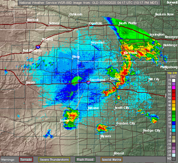 At 1120 pm cdt, severe thunderstorms were located along a line extending from near selden to 7 miles west of hoxie to 8 miles southeast of menlo, moving east at 35 mph (radar indicated). Hazards include 60 mph wind gusts and quarter size hail. Hail damage to vehicles is expected. Expect wind damage to roofs, siding, and trees. At 1120 pm cdt, severe thunderstorms were located along a line extending from near selden to 7 miles west of hoxie to 8 miles southeast of menlo, moving east at 35 mph (radar indicated). Hazards include 60 mph wind gusts and quarter size hail. Hail damage to vehicles is expected. Expect wind damage to roofs, siding, and trees.
|
| 7/29/2020 5:57 PM CDT |
 At 537 pm cdt, a severe thunderstorm was located 5 miles south of morland, or 15 miles southwest of hill city, moving south at 20 mph (radar indicated). Hazards include 70 mph wind gusts and ping pong ball size hail. People and animals outdoors will be injured. expect hail damage to roofs, siding, windows, and vehicles. expect considerable tree damage. Wind damage is also likely to mobile homes, roofs, and outbuildings. At 537 pm cdt, a severe thunderstorm was located 5 miles south of morland, or 15 miles southwest of hill city, moving south at 20 mph (radar indicated). Hazards include 70 mph wind gusts and ping pong ball size hail. People and animals outdoors will be injured. expect hail damage to roofs, siding, windows, and vehicles. expect considerable tree damage. Wind damage is also likely to mobile homes, roofs, and outbuildings.
|
| 7/29/2020 5:38 PM CDT |
 At 537 pm cdt, a severe thunderstorm was located 5 miles south of morland, or 15 miles southwest of hill city, moving south at 20 mph (radar indicated). Hazards include 70 mph wind gusts and ping pong ball size hail. People and animals outdoors will be injured. expect hail damage to roofs, siding, windows, and vehicles. expect considerable tree damage. Wind damage is also likely to mobile homes, roofs, and outbuildings. At 537 pm cdt, a severe thunderstorm was located 5 miles south of morland, or 15 miles southwest of hill city, moving south at 20 mph (radar indicated). Hazards include 70 mph wind gusts and ping pong ball size hail. People and animals outdoors will be injured. expect hail damage to roofs, siding, windows, and vehicles. expect considerable tree damage. Wind damage is also likely to mobile homes, roofs, and outbuildings.
|
| 7/18/2020 7:33 PM CDT |
 At 733 pm cdt, a severe thunderstorm was located 8 miles south of lenora, or 12 miles northwest of hill city, moving northeast at 45 mph (radar indicated). Hazards include 60 mph wind gusts and half dollar size hail. Hail damage to vehicles is expected. expect wind damage to roofs, siding, and trees. Locations impacted include, morland, penokee and studley. At 733 pm cdt, a severe thunderstorm was located 8 miles south of lenora, or 12 miles northwest of hill city, moving northeast at 45 mph (radar indicated). Hazards include 60 mph wind gusts and half dollar size hail. Hail damage to vehicles is expected. expect wind damage to roofs, siding, and trees. Locations impacted include, morland, penokee and studley.
|
| 7/18/2020 7:22 PM CDT |
 At 722 pm cdt, a severe thunderstorm was located 7 miles northwest of morland, or 16 miles east of hoxie, moving northeast at 25 mph (radar indicated). Hazards include 60 mph wind gusts and quarter size hail. Hail damage to vehicles is expected. expect wind damage to roofs, siding, and trees. Locations impacted include, morland, penokee and studley. At 722 pm cdt, a severe thunderstorm was located 7 miles northwest of morland, or 16 miles east of hoxie, moving northeast at 25 mph (radar indicated). Hazards include 60 mph wind gusts and quarter size hail. Hail damage to vehicles is expected. expect wind damage to roofs, siding, and trees. Locations impacted include, morland, penokee and studley.
|
| 7/18/2020 7:11 PM CDT |
 At 711 pm cdt, a severe thunderstorm was located 8 miles west of morland, or 11 miles east of hoxie, moving northeast at 25 mph (radar indicated). Hazards include 60 mph wind gusts and half dollar size hail. Hail damage to vehicles is expected. Expect wind damage to roofs, siding, and trees. At 711 pm cdt, a severe thunderstorm was located 8 miles west of morland, or 11 miles east of hoxie, moving northeast at 25 mph (radar indicated). Hazards include 60 mph wind gusts and half dollar size hail. Hail damage to vehicles is expected. Expect wind damage to roofs, siding, and trees.
|
| 7/2/2020 8:06 PM CDT |
 At 806 pm cdt, severe thunderstorms were located along a line extending from almena to 4 miles west of bogue, moving east at 50 mph. these are very dangerous storms (trained weather spotters). Hazards include 90 mph wind gusts and quarter size hail. You are in a life-threatening situation. flying debris may be deadly to those caught without shelter. mobile homes will be heavily damaged or destroyed. homes and businesses will have substantial roof and window damage. expect extensive tree damage and power outages. Locations impacted include, norton, hill city, almena, lenora, morland, bogue and clayton. At 806 pm cdt, severe thunderstorms were located along a line extending from almena to 4 miles west of bogue, moving east at 50 mph. these are very dangerous storms (trained weather spotters). Hazards include 90 mph wind gusts and quarter size hail. You are in a life-threatening situation. flying debris may be deadly to those caught without shelter. mobile homes will be heavily damaged or destroyed. homes and businesses will have substantial roof and window damage. expect extensive tree damage and power outages. Locations impacted include, norton, hill city, almena, lenora, morland, bogue and clayton.
|
| 7/2/2020 8:00 PM CDT |
 At 800 pm cdt, severe thunderstorms were located along a line extending from 5 miles west of almena to hill city, moving east at 50 mph (trained weather spotters). Hazards include 70 mph wind gusts and quarter size hail. Hail damage to vehicles is expected. expect considerable tree damage. wind damage is also likely to mobile homes, roofs, and outbuildings. Locations impacted include, norton, hill city, almena, lenora, morland, bogue and clayton. At 800 pm cdt, severe thunderstorms were located along a line extending from 5 miles west of almena to hill city, moving east at 50 mph (trained weather spotters). Hazards include 70 mph wind gusts and quarter size hail. Hail damage to vehicles is expected. expect considerable tree damage. wind damage is also likely to mobile homes, roofs, and outbuildings. Locations impacted include, norton, hill city, almena, lenora, morland, bogue and clayton.
|
| 7/2/2020 7:44 PM CDT | Storm damage reported in graham county KS, 0.3 miles E of Morland, KS |
| 7/2/2020 7:30 PM CDT | Storm damage reported in graham county KS, 11.5 miles SSE of Morland, KS |
| 7/2/2020 7:24 PM CDT |
 At 724 pm cdt, severe thunderstorms were located along a line extending from oberlin to 7 miles west of hoxie, moving east at 40 mph (radar indicated). Hazards include 70 mph wind gusts and quarter size hail. Hail damage to vehicles is expected. expect considerable tree damage. Wind damage is also likely to mobile homes, roofs, and outbuildings. At 724 pm cdt, severe thunderstorms were located along a line extending from oberlin to 7 miles west of hoxie, moving east at 40 mph (radar indicated). Hazards include 70 mph wind gusts and quarter size hail. Hail damage to vehicles is expected. expect considerable tree damage. Wind damage is also likely to mobile homes, roofs, and outbuildings.
|
| 6/27/2020 11:45 PM CDT |
 At 1145 pm cdt, severe thunderstorms were located along a line extending from 6 miles northeast of morland to 6 miles north of voda, moving east at 35 mph (radar indicated). Hazards include 60 mph wind gusts and nickel size hail. Expect damage to roofs, siding, and trees. Locations impacted include, morland, saint peter and penokee. At 1145 pm cdt, severe thunderstorms were located along a line extending from 6 miles northeast of morland to 6 miles north of voda, moving east at 35 mph (radar indicated). Hazards include 60 mph wind gusts and nickel size hail. Expect damage to roofs, siding, and trees. Locations impacted include, morland, saint peter and penokee.
|
| 6/27/2020 11:30 PM CDT |
 At 1129 pm cdt, severe thunderstorms were located along a line extending from 5 miles northwest of morland to 5 miles northeast of quinter, moving east at 40 mph (radar indicated). Hazards include 60 mph wind gusts and nickel size hail. Expect damage to roofs, siding, and trees. Locations impacted include, morland, penokee, saint peter, tasco and studley. At 1129 pm cdt, severe thunderstorms were located along a line extending from 5 miles northwest of morland to 5 miles northeast of quinter, moving east at 40 mph (radar indicated). Hazards include 60 mph wind gusts and nickel size hail. Expect damage to roofs, siding, and trees. Locations impacted include, morland, penokee, saint peter, tasco and studley.
|
| 6/27/2020 11:09 PM CDT |
 At 1109 pm cdt, severe thunderstorms were located along a line extending from near hoxie to 3 miles southwest of park, moving east at 35 mph (radar indicated). Hazards include 60 mph wind gusts and quarter size hail. Hail damage to vehicles is expected. Expect wind damage to roofs, siding, and trees. At 1109 pm cdt, severe thunderstorms were located along a line extending from near hoxie to 3 miles southwest of park, moving east at 35 mph (radar indicated). Hazards include 60 mph wind gusts and quarter size hail. Hail damage to vehicles is expected. Expect wind damage to roofs, siding, and trees.
|
| 6/21/2020 3:48 PM CDT |
 At 348 pm cdt, a severe thunderstorm was located near hill city, moving east at 20 mph (radar indicated). Hazards include 60 mph wind gusts and quarter size hail. brief landspout tornadoes are also possible in association with this storm. Hail damage to vehicles is expected. expect wind damage to roofs, siding, and trees. Locations impacted include, hill city, lenora, morland, bogue, nicodemus, edmond and new almelo. At 348 pm cdt, a severe thunderstorm was located near hill city, moving east at 20 mph (radar indicated). Hazards include 60 mph wind gusts and quarter size hail. brief landspout tornadoes are also possible in association with this storm. Hail damage to vehicles is expected. expect wind damage to roofs, siding, and trees. Locations impacted include, hill city, lenora, morland, bogue, nicodemus, edmond and new almelo.
|
| 6/21/2020 3:37 PM CDT |
 At 336 pm cdt, a severe thunderstorm was located 5 miles southeast of morland, or 8 miles southwest of hill city, moving east at 15 mph (radar indicated). Hazards include 70 mph wind gusts and half dollar size hail. brief landspout tornadoes are also possible in association with this storm. Hail damage to vehicles is expected. expect considerable tree damage. wind damage is also likely to mobile homes, roofs, and outbuildings. Locations impacted include, hill city, hoxie, lenora, morland, bogue, nicodemus and edmond. At 336 pm cdt, a severe thunderstorm was located 5 miles southeast of morland, or 8 miles southwest of hill city, moving east at 15 mph (radar indicated). Hazards include 70 mph wind gusts and half dollar size hail. brief landspout tornadoes are also possible in association with this storm. Hail damage to vehicles is expected. expect considerable tree damage. wind damage is also likely to mobile homes, roofs, and outbuildings. Locations impacted include, hill city, hoxie, lenora, morland, bogue, nicodemus and edmond.
|
| 6/21/2020 3:14 PM CDT |
 At 313 pm cdt, a severe thunderstorm was located 8 miles east of hoxie, moving east at 25 mph (radar indicated). Hazards include 70 mph wind gusts and half dollar size hail. brief landspout tornadoes are also possible with this storm. Hail damage to vehicles is expected. expect considerable tree damage. wind damage is also likely to mobile homes, roofs, and outbuildings. Locations impacted include, hill city, hoxie, lenora, selden, morland, bogue and nicodemus. At 313 pm cdt, a severe thunderstorm was located 8 miles east of hoxie, moving east at 25 mph (radar indicated). Hazards include 70 mph wind gusts and half dollar size hail. brief landspout tornadoes are also possible with this storm. Hail damage to vehicles is expected. expect considerable tree damage. wind damage is also likely to mobile homes, roofs, and outbuildings. Locations impacted include, hill city, hoxie, lenora, selden, morland, bogue and nicodemus.
|
| 6/21/2020 2:58 PM CDT |
 At 257 pm cdt, a severe thunderstorm was located near hoxie, moving east at 10 mph (radar indicated). Hazards include 70 mph wind gusts and half dollar size hail. Hail damage to vehicles is expected. expect considerable tree damage. Wind damage is also likely to mobile homes, roofs, and outbuildings. At 257 pm cdt, a severe thunderstorm was located near hoxie, moving east at 10 mph (radar indicated). Hazards include 70 mph wind gusts and half dollar size hail. Hail damage to vehicles is expected. expect considerable tree damage. Wind damage is also likely to mobile homes, roofs, and outbuildings.
|
| 6/4/2020 9:06 PM CDT |
 At 905 pm cdt, severe thunderstorms were located along a line extending from 8 miles north of almena to 4 miles southeast of edmond to 8 miles north of wakeeney, moving east at 30 mph (automated observing equipment at the hill city airport reported a 67 mph wind gust). Hazards include 70 mph wind gusts. Expect considerable tree damage. damage is likely to mobile homes, roofs, and outbuildings. Locations impacted include, norton, hill city, almena, lenora, morland, bogue and edmond. At 905 pm cdt, severe thunderstorms were located along a line extending from 8 miles north of almena to 4 miles southeast of edmond to 8 miles north of wakeeney, moving east at 30 mph (automated observing equipment at the hill city airport reported a 67 mph wind gust). Hazards include 70 mph wind gusts. Expect considerable tree damage. damage is likely to mobile homes, roofs, and outbuildings. Locations impacted include, norton, hill city, almena, lenora, morland, bogue and edmond.
|
| 6/4/2020 8:40 PM CDT |
 At 839 pm cdt, severe thunderstorms were located along a line extending from 9 miles south of hendley to near lenora to 7 miles north of collyer, moving east at 30 mph (radar indicated). Hazards include 60 mph wind gusts and penny size hail. expect damage to roofs, siding, and trees At 839 pm cdt, severe thunderstorms were located along a line extending from 9 miles south of hendley to near lenora to 7 miles north of collyer, moving east at 30 mph (radar indicated). Hazards include 60 mph wind gusts and penny size hail. expect damage to roofs, siding, and trees
|
| 6/4/2020 8:30 PM CDT |
 At 830 pm cdt, severe thunderstorms were located along a line extending from 10 miles southeast of jennings to 6 miles west of morland to 4 miles east of park, moving east at 40 mph (radar indicated). Hazards include 60 mph wind gusts. Expect damage to roofs, siding, and trees. Locations impacted include, morland, penokee, saint peter, tasco and studley. At 830 pm cdt, severe thunderstorms were located along a line extending from 10 miles southeast of jennings to 6 miles west of morland to 4 miles east of park, moving east at 40 mph (radar indicated). Hazards include 60 mph wind gusts. Expect damage to roofs, siding, and trees. Locations impacted include, morland, penokee, saint peter, tasco and studley.
|
| 6/4/2020 8:01 PM CDT |
 At 801 pm cdt, severe thunderstorms were located along a line extending from 3 miles east of selden to 3 miles southwest of hoxie to near grinnell, moving east at 35 mph (radar indicated). Hazards include 60 mph wind gusts. expect damage to roofs, siding, and trees At 801 pm cdt, severe thunderstorms were located along a line extending from 3 miles east of selden to 3 miles southwest of hoxie to near grinnell, moving east at 35 mph (radar indicated). Hazards include 60 mph wind gusts. expect damage to roofs, siding, and trees
|
| 9/9/2019 8:50 PM CDT |
 At 850 pm cdt, a severe thunderstorm was located 6 miles northeast of morland, or 9 miles northwest of hill city, moving northeast at 30 mph (radar indicated). Hazards include 60 mph wind gusts and quarter size hail. Hail damage to vehicles is expected. Expect wind damage to roofs, siding, and trees. At 850 pm cdt, a severe thunderstorm was located 6 miles northeast of morland, or 9 miles northwest of hill city, moving northeast at 30 mph (radar indicated). Hazards include 60 mph wind gusts and quarter size hail. Hail damage to vehicles is expected. Expect wind damage to roofs, siding, and trees.
|
| 8/29/2019 9:13 PM CDT |
 The severe thunderstorm warning for graham county will expire at 915 pm cdt, the storms which prompted the warning have moved out of the warned area. therefore, the warning will be allowed to expire. however gusty winds and heavy rain are still possible with these thunderstorms. a severe thunderstorm watch remains in effect until 1000 pm cdt for northwestern and west central kansas. The severe thunderstorm warning for graham county will expire at 915 pm cdt, the storms which prompted the warning have moved out of the warned area. therefore, the warning will be allowed to expire. however gusty winds and heavy rain are still possible with these thunderstorms. a severe thunderstorm watch remains in effect until 1000 pm cdt for northwestern and west central kansas.
|
| 8/29/2019 9:09 PM CDT |
 A severe thunderstorm warning remains in effect until 915 pm cdt for graham county. at 908 pm cdt, severe thunderstorms were located along a line extending from 4 miles south of webster state park to 9 miles southwest of palco to near voda, moving east at 45 mph. These are very dangerous storms. A severe thunderstorm warning remains in effect until 915 pm cdt for graham county. at 908 pm cdt, severe thunderstorms were located along a line extending from 4 miles south of webster state park to 9 miles southwest of palco to near voda, moving east at 45 mph. These are very dangerous storms.
|
| 8/29/2019 8:59 PM CDT |
 At 844 pm cdt, a severe thunderstorm was located 7 miles southeast of hill city, moving southeast at 40 mph. this is a very dangerous storm (winds measured at the hill city airport). Hazards include 80 mph wind gusts and two inch hail. Flying debris will be dangerous to those caught without shelter. mobile homes will be heavily damaged. expect considerable damage to roofs, windows, and vehicles. extensive tree damage and power outages are likely. locations impacted include, hill city, quinter, morland, bogue, nicodemus, studley and penokee. This includes interstate 70 in kansas between mile markers 104 and 113. At 844 pm cdt, a severe thunderstorm was located 7 miles southeast of hill city, moving southeast at 40 mph. this is a very dangerous storm (winds measured at the hill city airport). Hazards include 80 mph wind gusts and two inch hail. Flying debris will be dangerous to those caught without shelter. mobile homes will be heavily damaged. expect considerable damage to roofs, windows, and vehicles. extensive tree damage and power outages are likely. locations impacted include, hill city, quinter, morland, bogue, nicodemus, studley and penokee. This includes interstate 70 in kansas between mile markers 104 and 113.
|
| 8/29/2019 8:45 PM CDT |
 At 844 pm cdt, a severe thunderstorm was located 7 miles southeast of hill city, moving southeast at 40 mph. this is a very dangerous storm (winds measured at the hill city airport). Hazards include 80 mph wind gusts and two inch hail. Flying debris will be dangerous to those caught without shelter. mobile homes will be heavily damaged. expect considerable damage to roofs, windows, and vehicles. extensive tree damage and power outages are likely. locations impacted include, hill city, quinter, morland, bogue, nicodemus, studley and penokee. This includes interstate 70 in kansas between mile markers 104 and 113. At 844 pm cdt, a severe thunderstorm was located 7 miles southeast of hill city, moving southeast at 40 mph. this is a very dangerous storm (winds measured at the hill city airport). Hazards include 80 mph wind gusts and two inch hail. Flying debris will be dangerous to those caught without shelter. mobile homes will be heavily damaged. expect considerable damage to roofs, windows, and vehicles. extensive tree damage and power outages are likely. locations impacted include, hill city, quinter, morland, bogue, nicodemus, studley and penokee. This includes interstate 70 in kansas between mile markers 104 and 113.
|
| 8/29/2019 8:38 PM CDT |
 At 837 pm cdt, a severe thunderstorm was located near hill city, moving southeast at 45 mph. this is a very dangerous storm (radar indicated). Hazards include 80 mph wind gusts and two inch hail. Flying debris will be dangerous to those caught without shelter. mobile homes will be heavily damaged. expect considerable damage to roofs, windows, and vehicles. extensive tree damage and power outages are likely. locations impacted include, hill city, quinter, morland, bogue, nicodemus, studley and penokee. This includes interstate 70 in kansas between mile markers 104 and 113. At 837 pm cdt, a severe thunderstorm was located near hill city, moving southeast at 45 mph. this is a very dangerous storm (radar indicated). Hazards include 80 mph wind gusts and two inch hail. Flying debris will be dangerous to those caught without shelter. mobile homes will be heavily damaged. expect considerable damage to roofs, windows, and vehicles. extensive tree damage and power outages are likely. locations impacted include, hill city, quinter, morland, bogue, nicodemus, studley and penokee. This includes interstate 70 in kansas between mile markers 104 and 113.
|
| 8/29/2019 8:19 PM CDT |
 At 818 pm cdt, severe thunderstorms were located along a line extending from near edmond to 6 miles southeast of lenora to 3 miles north of morland to 4 miles west of hoxie, moving southeast at 50 mph. these are very dangerous storms (radar indicated). Hazards include 80 mph wind gusts and tennis ball size hail. Flying debris will be dangerous to those caught without shelter. mobile homes will be heavily damaged. expect considerable damage to roofs, windows, and vehicles. extensive tree damage and power outages are likely. Locations impacted include, hoxie, lenora, selden, new almelo, seguin, studley and tasco. At 818 pm cdt, severe thunderstorms were located along a line extending from near edmond to 6 miles southeast of lenora to 3 miles north of morland to 4 miles west of hoxie, moving southeast at 50 mph. these are very dangerous storms (radar indicated). Hazards include 80 mph wind gusts and tennis ball size hail. Flying debris will be dangerous to those caught without shelter. mobile homes will be heavily damaged. expect considerable damage to roofs, windows, and vehicles. extensive tree damage and power outages are likely. Locations impacted include, hoxie, lenora, selden, new almelo, seguin, studley and tasco.
|
| 8/29/2019 8:06 PM CDT |
 A severe thunderstorm warning remains in effect until 845 pm cdt for northeastern thomas. southwestern norton. sheridan and northwestern graham counties. At 804 pm cdt, severe thunderstorms were located along a line extending from 7 miles east of clayton to 8 miles southeast of jennings to 10 miles northeast of hoxie to 6 miles east of menlo,. A severe thunderstorm warning remains in effect until 845 pm cdt for northeastern thomas. southwestern norton. sheridan and northwestern graham counties. At 804 pm cdt, severe thunderstorms were located along a line extending from 7 miles east of clayton to 8 miles southeast of jennings to 10 miles northeast of hoxie to 6 miles east of menlo,.
|
| 8/29/2019 7:58 PM CDT |
 At 758 pm cdt, a severe thunderstorm was located 8 miles southwest of lenora, or 18 miles northwest of hill city, moving southeast at 40 mph (radar indicated). Hazards include tennis ball size hail and 70 mph wind gusts. People and animals outdoors will be injured. expect hail damage to roofs, siding, windows, and vehicles. expect considerable tree damage. Wind damage is also likely to mobile homes, roofs, and outbuildings. At 758 pm cdt, a severe thunderstorm was located 8 miles southwest of lenora, or 18 miles northwest of hill city, moving southeast at 40 mph (radar indicated). Hazards include tennis ball size hail and 70 mph wind gusts. People and animals outdoors will be injured. expect hail damage to roofs, siding, windows, and vehicles. expect considerable tree damage. Wind damage is also likely to mobile homes, roofs, and outbuildings.
|
| 8/29/2019 7:47 PM CDT |
 At 746 pm cdt, severe thunderstorms were located along a line extending from 4 miles northeast of clayton to near jennings to 6 miles south of dresden to 4 miles north of menlo, moving southeast at 35 mph (radar indicated). Hazards include tennis ball size hail and 70 mph wind gusts. People and animals outdoors will be injured. expect hail damage to roofs, siding, windows, and vehicles. expect considerable tree damage. wind damage is also likely to mobile homes, roofs, and outbuildings. Locations impacted include, oberlin, hoxie, lenora, rexford, selden, norcatur and jennings. At 746 pm cdt, severe thunderstorms were located along a line extending from 4 miles northeast of clayton to near jennings to 6 miles south of dresden to 4 miles north of menlo, moving southeast at 35 mph (radar indicated). Hazards include tennis ball size hail and 70 mph wind gusts. People and animals outdoors will be injured. expect hail damage to roofs, siding, windows, and vehicles. expect considerable tree damage. wind damage is also likely to mobile homes, roofs, and outbuildings. Locations impacted include, oberlin, hoxie, lenora, rexford, selden, norcatur and jennings.
|
| 8/29/2019 7:36 PM CDT |
 At 734 pm cdt, severe thunderstorms were located along a line extending from near norcatur to 3 miles northwest of jennings to 3 miles southwest of dresden to near rexford, moving southeast at 20 mph (radar indicated. at 725 pm cdt 68 mph wind gusts were measured in oberlin. quarter size hail and torrential rainfall were also reported in oberlin). Hazards include two inch hail and 70 mph wind gusts. People and animals outdoors will be injured. expect hail damage to roofs, siding, windows, and vehicles. expect considerable tree damage. wind damage is also likely to mobile homes, roofs, and outbuildings. Locations impacted include, oberlin, hoxie, lenora, rexford, selden, norcatur and jennings. At 734 pm cdt, severe thunderstorms were located along a line extending from near norcatur to 3 miles northwest of jennings to 3 miles southwest of dresden to near rexford, moving southeast at 20 mph (radar indicated. at 725 pm cdt 68 mph wind gusts were measured in oberlin. quarter size hail and torrential rainfall were also reported in oberlin). Hazards include two inch hail and 70 mph wind gusts. People and animals outdoors will be injured. expect hail damage to roofs, siding, windows, and vehicles. expect considerable tree damage. wind damage is also likely to mobile homes, roofs, and outbuildings. Locations impacted include, oberlin, hoxie, lenora, rexford, selden, norcatur and jennings.
|
| 8/29/2019 7:27 PM CDT |
 At 727 pm cdt, severe thunderstorms were located along a line extending from 4 miles northwest of norcatur to 6 miles northwest of jennings to 4 miles west of dresden to 4 miles northwest of rexford, moving southeast at 20 mph (radar indicated. at 725 pm cdt spotters measured 68 mph winds in oberlin). Hazards include two inch hail and 70 mph wind gusts. People and animals outdoors will be injured. expect hail damage to roofs, siding, windows, and vehicles. expect considerable tree damage. Wind damage is also likely to mobile homes, roofs, and outbuildings. At 727 pm cdt, severe thunderstorms were located along a line extending from 4 miles northwest of norcatur to 6 miles northwest of jennings to 4 miles west of dresden to 4 miles northwest of rexford, moving southeast at 20 mph (radar indicated. at 725 pm cdt spotters measured 68 mph winds in oberlin). Hazards include two inch hail and 70 mph wind gusts. People and animals outdoors will be injured. expect hail damage to roofs, siding, windows, and vehicles. expect considerable tree damage. Wind damage is also likely to mobile homes, roofs, and outbuildings.
|
| 8/24/2019 10:16 PM CDT |
 At 1015 pm cdt, severe thunderstorms were located along a line extending from 10 miles north of quinter to 9 miles south of morland, moving southeast at 25 mph (radar indicated). Hazards include two inch hail and 70 mph wind gusts. People and animals outdoors will be injured. expect hail damage to roofs, siding, windows, and vehicles. expect considerable tree damage. wind damage is also likely to mobile homes, roofs, and outbuildings. locations impacted include, quinter, morland, penokee and saint peter. this includes interstate 70 in kansas between mile markers 104 and 113. A tornado watch remains in effect until midnight cdt for northwestern and west central kansas. At 1015 pm cdt, severe thunderstorms were located along a line extending from 10 miles north of quinter to 9 miles south of morland, moving southeast at 25 mph (radar indicated). Hazards include two inch hail and 70 mph wind gusts. People and animals outdoors will be injured. expect hail damage to roofs, siding, windows, and vehicles. expect considerable tree damage. wind damage is also likely to mobile homes, roofs, and outbuildings. locations impacted include, quinter, morland, penokee and saint peter. this includes interstate 70 in kansas between mile markers 104 and 113. A tornado watch remains in effect until midnight cdt for northwestern and west central kansas.
|
| 8/24/2019 10:11 PM CDT |
 At 1011 pm cdt, severe thunderstorms were located along a line extending from 10 miles north of quinter to 8 miles south of morland, moving southeast at 30 mph (radar indicated). Hazards include two inch hail and 70 mph wind gusts. People and animals outdoors will be injured. expect hail damage to roofs, siding, windows, and vehicles. expect considerable tree damage. wind damage is also likely to mobile homes, roofs, and outbuildings. locations impacted include, quinter, morland, penokee, saint peter and studley. this includes interstate 70 in kansas between mile markers 103 and 113. A tornado watch remains in effect until midnight cdt for northwestern and west central kansas. At 1011 pm cdt, severe thunderstorms were located along a line extending from 10 miles north of quinter to 8 miles south of morland, moving southeast at 30 mph (radar indicated). Hazards include two inch hail and 70 mph wind gusts. People and animals outdoors will be injured. expect hail damage to roofs, siding, windows, and vehicles. expect considerable tree damage. wind damage is also likely to mobile homes, roofs, and outbuildings. locations impacted include, quinter, morland, penokee, saint peter and studley. this includes interstate 70 in kansas between mile markers 103 and 113. A tornado watch remains in effect until midnight cdt for northwestern and west central kansas.
|
| 8/24/2019 10:00 PM CDT |
 At 959 pm cdt, severe thunderstorms were located along a line extending from 10 miles southeast of hoxie to 3 miles south of morland, moving southeast at 30 mph (radar indicated). Hazards include golf ball size hail and 60 mph wind gusts. People and animals outdoors will be injured. expect hail damage to roofs, siding, windows, and vehicles. Expect wind damage to roofs, siding, and trees. At 959 pm cdt, severe thunderstorms were located along a line extending from 10 miles southeast of hoxie to 3 miles south of morland, moving southeast at 30 mph (radar indicated). Hazards include golf ball size hail and 60 mph wind gusts. People and animals outdoors will be injured. expect hail damage to roofs, siding, windows, and vehicles. Expect wind damage to roofs, siding, and trees.
|
| 8/24/2019 9:34 PM CDT |
 At 933 pm cdt, a severe thunderstorm was located 8 miles northwest of morland, or 14 miles northeast of hoxie, moving east at 15 mph (radar indicated). Hazards include ping pong ball size hail. People and animals outdoors will be injured. expect damage to roofs, siding, windows, and vehicles. locations impacted include, hill city, morland and penokee. A tornado watch remains in effect until midnight cdt for northwestern kansas. At 933 pm cdt, a severe thunderstorm was located 8 miles northwest of morland, or 14 miles northeast of hoxie, moving east at 15 mph (radar indicated). Hazards include ping pong ball size hail. People and animals outdoors will be injured. expect damage to roofs, siding, windows, and vehicles. locations impacted include, hill city, morland and penokee. A tornado watch remains in effect until midnight cdt for northwestern kansas.
|
| 8/24/2019 9:21 PM CDT |
 At 921 pm cdt, severe thunderstorms were located along a line extending from 5 miles south of edmond to 5 miles east of morland, moving east at 25 mph (radar indicated). Hazards include half dollar size hail. Damage to vehicles is expected. locations impacted include, hill city, morland and penokee. A tornado watch remains in effect until midnight cdt for northwestern kansas. At 921 pm cdt, severe thunderstorms were located along a line extending from 5 miles south of edmond to 5 miles east of morland, moving east at 25 mph (radar indicated). Hazards include half dollar size hail. Damage to vehicles is expected. locations impacted include, hill city, morland and penokee. A tornado watch remains in effect until midnight cdt for northwestern kansas.
|
| 8/24/2019 9:08 PM CDT |
 At 908 pm cdt, a severe thunderstorm was located 4 miles east of morland, or 7 miles west of hill city, moving southeast at 15 mph (trained weather spotters in morland). Hazards include golf ball size hail. People and animals outdoors will be injured. expect damage to roofs, siding, windows, and vehicles. locations impacted include, hill city, morland and penokee. A tornado watch remains in effect until midnight cdt for northwestern kansas. At 908 pm cdt, a severe thunderstorm was located 4 miles east of morland, or 7 miles west of hill city, moving southeast at 15 mph (trained weather spotters in morland). Hazards include golf ball size hail. People and animals outdoors will be injured. expect damage to roofs, siding, windows, and vehicles. locations impacted include, hill city, morland and penokee. A tornado watch remains in effect until midnight cdt for northwestern kansas.
|
| 8/24/2019 9:06 PM CDT | Golf Ball sized hail reported 0.3 miles W of Morland, KS |
| 8/24/2019 9:05 PM CDT | Ping Pong Ball sized hail reported 0.3 miles W of Morland, KS |
| 8/24/2019 9:02 PM CDT |
 At 901 pm cdt, a severe thunderstorm was located 6 miles northeast of morland, or 8 miles northwest of hill city, moving east at 10 mph (radar indicated). Hazards include golf ball size hail and 60 mph wind gusts. People and animals outdoors will be injured. expect hail damage to roofs, siding, windows, and vehicles. Expect wind damage to roofs, siding, and trees. At 901 pm cdt, a severe thunderstorm was located 6 miles northeast of morland, or 8 miles northwest of hill city, moving east at 10 mph (radar indicated). Hazards include golf ball size hail and 60 mph wind gusts. People and animals outdoors will be injured. expect hail damage to roofs, siding, windows, and vehicles. Expect wind damage to roofs, siding, and trees.
|
| 8/20/2019 6:39 PM CDT |
 At 638 pm cdt, a severe thunderstorm was located 4 miles southwest of park, or 4 miles southeast of grainfield, moving north at 15 mph (radar indicated). Hazards include two inch hail and 60 mph wind gusts. People and animals outdoors will be injured. expect hail damage to roofs, siding, windows, and vehicles. expect wind damage to roofs, siding, and trees. locations impacted include, quinter, grainfield, gove, morland, park, studley and tasco. This includes interstate 70 in kansas between mile markers 93 and 108. At 638 pm cdt, a severe thunderstorm was located 4 miles southwest of park, or 4 miles southeast of grainfield, moving north at 15 mph (radar indicated). Hazards include two inch hail and 60 mph wind gusts. People and animals outdoors will be injured. expect hail damage to roofs, siding, windows, and vehicles. expect wind damage to roofs, siding, and trees. locations impacted include, quinter, grainfield, gove, morland, park, studley and tasco. This includes interstate 70 in kansas between mile markers 93 and 108.
|
| 8/20/2019 6:29 PM CDT |
 At 609 pm cdt, a severe thunderstorm was located near gove, moving northeast at 20 mph (radar indicated). Hazards include golf ball size hail and 60 mph wind gusts. People and animals outdoors will be injured. expect hail damage to roofs, siding, windows, and vehicles. Expect wind damage to roofs, siding, and trees. At 609 pm cdt, a severe thunderstorm was located near gove, moving northeast at 20 mph (radar indicated). Hazards include golf ball size hail and 60 mph wind gusts. People and animals outdoors will be injured. expect hail damage to roofs, siding, windows, and vehicles. Expect wind damage to roofs, siding, and trees.
|
| 8/20/2019 6:19 PM CDT |
 A severe thunderstorm warning remains in effect until 700 pm cdt for southeastern sheridan. northeastern gove and west central graham counties. at 619 pm cdt, a severe thunderstorm was located near gove, moving north at 10 mph. hazard. Two inch hail and 60 mph wind gusts. A severe thunderstorm warning remains in effect until 700 pm cdt for southeastern sheridan. northeastern gove and west central graham counties. at 619 pm cdt, a severe thunderstorm was located near gove, moving north at 10 mph. hazard. Two inch hail and 60 mph wind gusts.
|
| 8/20/2019 6:09 PM CDT |
 At 609 pm cdt, a severe thunderstorm was located near gove, moving northeast at 20 mph (radar indicated). Hazards include golf ball size hail and 60 mph wind gusts. People and animals outdoors will be injured. expect hail damage to roofs, siding, windows, and vehicles. Expect wind damage to roofs, siding, and trees. At 609 pm cdt, a severe thunderstorm was located near gove, moving northeast at 20 mph (radar indicated). Hazards include golf ball size hail and 60 mph wind gusts. People and animals outdoors will be injured. expect hail damage to roofs, siding, windows, and vehicles. Expect wind damage to roofs, siding, and trees.
|
| 8/13/2019 7:40 PM CDT |
 The severe thunderstorm warning for graham county will expire at 745 pm cdt, the storm which prompted the warning has weakened below severe limits, and no longer poses an immediate threat to life or property. therefore, the warning will be allowed to expire. however gusty winds are still possible with this thunderstorm. a tornado watch remains in effect until 800 pm cdt for northwestern and west central kansas. The severe thunderstorm warning for graham county will expire at 745 pm cdt, the storm which prompted the warning has weakened below severe limits, and no longer poses an immediate threat to life or property. therefore, the warning will be allowed to expire. however gusty winds are still possible with this thunderstorm. a tornado watch remains in effect until 800 pm cdt for northwestern and west central kansas.
|
| 8/13/2019 6:56 PM CDT |
 At 656 pm cdt, a severe thunderstorm was located 11 miles west of palco, or 12 miles south of hill city, moving southeast at 40 mph (trained weather spotters). Hazards include 70 mph wind gusts and quarter size hail. Hail damage to vehicles is expected. expect considerable tree damage. Wind damage is also likely to mobile homes, roofs, and outbuildings. At 656 pm cdt, a severe thunderstorm was located 11 miles west of palco, or 12 miles south of hill city, moving southeast at 40 mph (trained weather spotters). Hazards include 70 mph wind gusts and quarter size hail. Hail damage to vehicles is expected. expect considerable tree damage. Wind damage is also likely to mobile homes, roofs, and outbuildings.
|
| 8/13/2019 6:50 PM CDT |
 At 649 pm cdt, severe thunderstorms were located along a line extending from near hill city to 16 miles southwest of russell springs, moving southeast at 35 mph (radar indicated). Hazards include 70 mph wind gusts and half dollar size hail. Hail damage to vehicles is expected. expect considerable tree damage. wind damage is also likely to mobile homes, roofs, and outbuildings. locations impacted include, hill city, hoxie, selden, morland, bogue, nicodemus and seguin. A tornado watch remains in effect until 800 pm cdt for northwestern kansas. At 649 pm cdt, severe thunderstorms were located along a line extending from near hill city to 16 miles southwest of russell springs, moving southeast at 35 mph (radar indicated). Hazards include 70 mph wind gusts and half dollar size hail. Hail damage to vehicles is expected. expect considerable tree damage. wind damage is also likely to mobile homes, roofs, and outbuildings. locations impacted include, hill city, hoxie, selden, morland, bogue, nicodemus and seguin. A tornado watch remains in effect until 800 pm cdt for northwestern kansas.
|
| 8/13/2019 6:12 PM CDT |
 At 612 pm cdt, severe thunderstorms were located along a line extending from near lenora to wallace, moving south at 20 mph (radar indicated). Hazards include 70 mph wind gusts and half dollar size hail. Hail damage to vehicles is expected. expect considerable tree damage. Wind damage is also likely to mobile homes, roofs, and outbuildings. At 612 pm cdt, severe thunderstorms were located along a line extending from near lenora to wallace, moving south at 20 mph (radar indicated). Hazards include 70 mph wind gusts and half dollar size hail. Hail damage to vehicles is expected. expect considerable tree damage. Wind damage is also likely to mobile homes, roofs, and outbuildings.
|
| 8/13/2019 5:41 PM CDT |
 At 541 pm cdt, severe thunderstorms were located along a line extending from 6 miles west of lenora to near menlo, moving southeast at 25 mph (radar indicated). Hazards include 70 mph wind gusts and half dollar size hail. Hail damage to vehicles is expected. expect considerable tree damage. Wind damage is also likely to mobile homes, roofs, and outbuildings. At 541 pm cdt, severe thunderstorms were located along a line extending from 6 miles west of lenora to near menlo, moving southeast at 25 mph (radar indicated). Hazards include 70 mph wind gusts and half dollar size hail. Hail damage to vehicles is expected. expect considerable tree damage. Wind damage is also likely to mobile homes, roofs, and outbuildings.
|
| 8/11/2019 11:59 PM CDT |
 At 1159 pm cdt, severe thunderstorms were located along a line extending from near danbury to near grainfield, moving east at 10 mph (radar indicated). Hazards include 60 mph wind gusts and quarter size hail. Hail damage to vehicles is expected. expect wind damage to roofs, siding, and trees. Locations impacted include, norton, hill city, almena, lenora, morland, norcatur and bogue. At 1159 pm cdt, severe thunderstorms were located along a line extending from near danbury to near grainfield, moving east at 10 mph (radar indicated). Hazards include 60 mph wind gusts and quarter size hail. Hail damage to vehicles is expected. expect wind damage to roofs, siding, and trees. Locations impacted include, norton, hill city, almena, lenora, morland, norcatur and bogue.
|
| 8/11/2019 11:29 PM CDT |
 At 1129 pm cdt, severe thunderstorms were located along a line extending from 6 miles west of danbury to near grainfield, moving east at 10 mph (radar indicated). Hazards include 60 mph wind gusts and quarter size hail. Hail damage to vehicles is expected. Expect wind damage to roofs, siding, and trees. At 1129 pm cdt, severe thunderstorms were located along a line extending from 6 miles west of danbury to near grainfield, moving east at 10 mph (radar indicated). Hazards include 60 mph wind gusts and quarter size hail. Hail damage to vehicles is expected. Expect wind damage to roofs, siding, and trees.
|
| 8/11/2019 10:03 PM CDT |
 At 1002 pm cdt, severe thunderstorms were located along a line extending from 5 miles north of danbury to 4 miles northeast of gove, moving east at 25 mph (radar indicated). Hazards include 70 mph wind gusts and quarter size hail. Hail damage to vehicles is expected. expect considerable tree damage. Wind damage is also likely to mobile homes, roofs, and outbuildings. At 1002 pm cdt, severe thunderstorms were located along a line extending from 5 miles north of danbury to 4 miles northeast of gove, moving east at 25 mph (radar indicated). Hazards include 70 mph wind gusts and quarter size hail. Hail damage to vehicles is expected. expect considerable tree damage. Wind damage is also likely to mobile homes, roofs, and outbuildings.
|
| 8/11/2019 12:26 AM CDT |
 The severe thunderstorm warning for southwestern norton, sheridan, southern decatur and western graham counties will expire at 1230 am cdt, the storm which prompted the warning has moved out of the area. therefore, the warning will be allowed to expire. however heavy rain is still possible with this thunderstorm. The severe thunderstorm warning for southwestern norton, sheridan, southern decatur and western graham counties will expire at 1230 am cdt, the storm which prompted the warning has moved out of the area. therefore, the warning will be allowed to expire. however heavy rain is still possible with this thunderstorm.
|
| 8/11/2019 12:22 AM CDT |
 At 1221 am cdt, severe thunderstorms were located along a line extending from 7 miles southeast of lebanon to 7 miles northeast of wakeeney, moving east at 40 mph (radar indicated). Hazards include 60 mph wind gusts and penny size hail. Expect damage to roofs, siding, and trees. Locations impacted include, norton, oberlin, hill city, almena, lenora, morland and norcatur. At 1221 am cdt, severe thunderstorms were located along a line extending from 7 miles southeast of lebanon to 7 miles northeast of wakeeney, moving east at 40 mph (radar indicated). Hazards include 60 mph wind gusts and penny size hail. Expect damage to roofs, siding, and trees. Locations impacted include, norton, oberlin, hill city, almena, lenora, morland and norcatur.
|
| 8/11/2019 12:06 AM CDT |
 At 1206 am cdt, severe thunderstorms were located along a line extending from 4 miles south of lebanon to 3 miles northwest of wakeeney, moving east at 45 mph (radar indicated). Hazards include 60 mph wind gusts and quarter size hail. Hail damage to vehicles is expected. Expect wind damage to roofs, siding, and trees. At 1206 am cdt, severe thunderstorms were located along a line extending from 4 miles south of lebanon to 3 miles northwest of wakeeney, moving east at 45 mph (radar indicated). Hazards include 60 mph wind gusts and quarter size hail. Hail damage to vehicles is expected. Expect wind damage to roofs, siding, and trees.
|
| 8/10/2019 11:54 PM CDT |
 At 1153 pm cdt, a severe thunderstorm was located 8 miles northeast of hoxie, moving east at 30 mph. this is a very dangerous storm (radar indicated). Hazards include 80 mph wind gusts and quarter size hail. Flying debris will be dangerous to those caught without shelter. mobile homes will be heavily damaged. expect considerable damage to roofs, windows, and vehicles. extensive tree damage and power outages are likely. Locations impacted include, hoxie, grinnell, selden, morland, dresden, leoville and new almelo. At 1153 pm cdt, a severe thunderstorm was located 8 miles northeast of hoxie, moving east at 30 mph. this is a very dangerous storm (radar indicated). Hazards include 80 mph wind gusts and quarter size hail. Flying debris will be dangerous to those caught without shelter. mobile homes will be heavily damaged. expect considerable damage to roofs, windows, and vehicles. extensive tree damage and power outages are likely. Locations impacted include, hoxie, grinnell, selden, morland, dresden, leoville and new almelo.
|
| 8/10/2019 11:30 PM CDT |
 At 1129 pm cdt, a severe thunderstorm was located near hoxie, moving east at 20 mph. this is a very dangerous storm (radar indicated). Hazards include 80 mph wind gusts and quarter size hail. Flying debris will be dangerous to those caught without shelter. mobile homes will be heavily damaged. expect considerable damage to roofs, windows, and vehicles. Extensive tree damage and power outages are likely. At 1129 pm cdt, a severe thunderstorm was located near hoxie, moving east at 20 mph. this is a very dangerous storm (radar indicated). Hazards include 80 mph wind gusts and quarter size hail. Flying debris will be dangerous to those caught without shelter. mobile homes will be heavily damaged. expect considerable damage to roofs, windows, and vehicles. Extensive tree damage and power outages are likely.
|
| 6/9/2019 12:23 AM CDT |
 At 1223 am cdt, severe thunderstorms were located along a line extending from 8 miles north of morland to 3 miles northwest of voda, moving east at 25 mph (radar indicated). Hazards include 70 mph wind gusts and quarter size hail. Hail damage to vehicles is expected. expect considerable tree damage. Wind damage is also likely to mobile homes, roofs, and outbuildings. At 1223 am cdt, severe thunderstorms were located along a line extending from 8 miles north of morland to 3 miles northwest of voda, moving east at 25 mph (radar indicated). Hazards include 70 mph wind gusts and quarter size hail. Hail damage to vehicles is expected. expect considerable tree damage. Wind damage is also likely to mobile homes, roofs, and outbuildings.
|
| 6/8/2019 11:37 PM CDT |
 At 1136 pm cdt, a severe thunderstorm was located 4 miles east of hoxie, moving east at 25 mph (radar indicated). Hazards include 70 mph wind gusts and quarter size hail. Hail damage to vehicles is expected. expect considerable tree damage. Wind damage is also likely to mobile homes, roofs, and outbuildings. At 1136 pm cdt, a severe thunderstorm was located 4 miles east of hoxie, moving east at 25 mph (radar indicated). Hazards include 70 mph wind gusts and quarter size hail. Hail damage to vehicles is expected. expect considerable tree damage. Wind damage is also likely to mobile homes, roofs, and outbuildings.
|
| 6/3/2019 11:27 PM CDT |
 The severe thunderstorm warning for norton and graham counties will expire at 1130 pm cdt, the storms which prompted the warning have weakened below severe limits, and no longer pose an immediate threat to life or property. therefore, the warning will be allowed to expire. The severe thunderstorm warning for norton and graham counties will expire at 1130 pm cdt, the storms which prompted the warning have weakened below severe limits, and no longer pose an immediate threat to life or property. therefore, the warning will be allowed to expire.
|
| 6/3/2019 11:16 PM CDT |
 At 1115 pm cdt, severe thunderstorms were located along a line extending from 4 miles west of long island to 10 miles south of hill city, moving east at 35 mph (radar indicated). Hazards include 60 mph wind gusts and penny size hail. Expect damage to roofs, siding, and trees. Locations impacted include, norton, hill city, almena, lenora, morland, bogue and edmond. At 1115 pm cdt, severe thunderstorms were located along a line extending from 4 miles west of long island to 10 miles south of hill city, moving east at 35 mph (radar indicated). Hazards include 60 mph wind gusts and penny size hail. Expect damage to roofs, siding, and trees. Locations impacted include, norton, hill city, almena, lenora, morland, bogue and edmond.
|
| 6/3/2019 10:58 PM CDT |
 At 1058 pm cdt, severe thunderstorms were located along a line extending from 4 miles northwest of almena to 7 miles southeast of morland, moving east at 40 mph (radar indicated). Hazards include 60 mph wind gusts and half dollar size hail. Hail damage to vehicles is expected. expect wind damage to roofs, siding, and trees. Locations impacted include, norton, hill city, almena, lenora, morland, norcatur and bogue. At 1058 pm cdt, severe thunderstorms were located along a line extending from 4 miles northwest of almena to 7 miles southeast of morland, moving east at 40 mph (radar indicated). Hazards include 60 mph wind gusts and half dollar size hail. Hail damage to vehicles is expected. expect wind damage to roofs, siding, and trees. Locations impacted include, norton, hill city, almena, lenora, morland, norcatur and bogue.
|
| 6/3/2019 10:41 PM CDT |
 At 1041 pm cdt, severe thunderstorms were located along a line extending from 8 miles northeast of norcatur to 8 miles northeast of park, moving east at 35 mph (radar indicated). Hazards include 60 mph wind gusts and penny size hail. expect damage to roofs, siding, and trees At 1041 pm cdt, severe thunderstorms were located along a line extending from 8 miles northeast of norcatur to 8 miles northeast of park, moving east at 35 mph (radar indicated). Hazards include 60 mph wind gusts and penny size hail. expect damage to roofs, siding, and trees
|
| 5/18/2019 8:36 PM CDT |
 At 836 pm cdt, a severe thunderstorm was located 9 miles northeast of hoxie, moving southeast at 15 mph (radar indicated). Hazards include 60 mph wind gusts and quarter size hail. Hail damage to vehicles is expected. expect wind damage to roofs, siding, and trees. Locations impacted include, hoxie, morland, tasco and studley. At 836 pm cdt, a severe thunderstorm was located 9 miles northeast of hoxie, moving southeast at 15 mph (radar indicated). Hazards include 60 mph wind gusts and quarter size hail. Hail damage to vehicles is expected. expect wind damage to roofs, siding, and trees. Locations impacted include, hoxie, morland, tasco and studley.
|
| 5/18/2019 8:17 PM CDT |
 At 817 pm cdt, a severe thunderstorm was located 7 miles northeast of hoxie, moving southeast at 15 mph (radar indicated). Hazards include 60 mph wind gusts and quarter size hail. Hail damage to vehicles is expected. expect wind damage to roofs, siding, and trees. Locations impacted include, hoxie, lenora, selden, morland, dresden, leoville and new almelo. At 817 pm cdt, a severe thunderstorm was located 7 miles northeast of hoxie, moving southeast at 15 mph (radar indicated). Hazards include 60 mph wind gusts and quarter size hail. Hail damage to vehicles is expected. expect wind damage to roofs, siding, and trees. Locations impacted include, hoxie, lenora, selden, morland, dresden, leoville and new almelo.
|
| 5/18/2019 7:56 PM CDT |
 At 755 pm cdt, a severe thunderstorm was located 6 miles southeast of selden, or 8 miles north of hoxie, moving southeast at 15 mph (radar indicated). Hazards include ping pong ball size hail and 60 mph wind gusts. People and animals outdoors will be injured. expect hail damage to roofs, siding, windows, and vehicles. expect wind damage to roofs, siding, and trees. Locations impacted include, lenora, selden, morland, jennings, dresden, leoville and new almelo. At 755 pm cdt, a severe thunderstorm was located 6 miles southeast of selden, or 8 miles north of hoxie, moving southeast at 15 mph (radar indicated). Hazards include ping pong ball size hail and 60 mph wind gusts. People and animals outdoors will be injured. expect hail damage to roofs, siding, windows, and vehicles. expect wind damage to roofs, siding, and trees. Locations impacted include, lenora, selden, morland, jennings, dresden, leoville and new almelo.
|
| 5/18/2019 7:41 PM CDT |
 At 741 pm cdt, a severe thunderstorm was located near selden, or 11 miles northwest of hoxie, moving southeast at 15 mph (radar indicated). Hazards include 60 mph wind gusts and quarter size hail. Hail damage to vehicles is expected. Expect wind damage to roofs, siding, and trees. At 741 pm cdt, a severe thunderstorm was located near selden, or 11 miles northwest of hoxie, moving southeast at 15 mph (radar indicated). Hazards include 60 mph wind gusts and quarter size hail. Hail damage to vehicles is expected. Expect wind damage to roofs, siding, and trees.
|
| 4/21/2019 6:57 PM CDT |
 At 657 pm cdt, a severe thunderstorm was located 9 miles north of collyer, moving northeast at 30 mph (radar indicated). Hazards include 60 mph wind gusts and quarter size hail. Expect wind damage to roofs, siding, and trees. locations impacted include, hill city, quinter, morland, penokee, saint peter and studley. This includes interstate 70 in kansas between mile markers 101 and 113. At 657 pm cdt, a severe thunderstorm was located 9 miles north of collyer, moving northeast at 30 mph (radar indicated). Hazards include 60 mph wind gusts and quarter size hail. Expect wind damage to roofs, siding, and trees. locations impacted include, hill city, quinter, morland, penokee, saint peter and studley. This includes interstate 70 in kansas between mile markers 101 and 113.
|
| 4/21/2019 6:41 PM CDT |
 At 641 pm cdt, a severe thunderstorm was located near quinter, moving northeast at 30 mph (radar indicated). Hazards include 60 mph wind gusts and quarter size hail. Expect wind damage to roofs, siding, and trees. hail damage to vehicles will be possible. locations impacted include, hill city, quinter, grainfield, gove, morland, park and studley. This includes interstate 70 in kansas between mile markers 94 and 112. At 641 pm cdt, a severe thunderstorm was located near quinter, moving northeast at 30 mph (radar indicated). Hazards include 60 mph wind gusts and quarter size hail. Expect wind damage to roofs, siding, and trees. hail damage to vehicles will be possible. locations impacted include, hill city, quinter, grainfield, gove, morland, park and studley. This includes interstate 70 in kansas between mile markers 94 and 112.
|
| 4/21/2019 6:12 PM CDT |
 At 611 pm cdt, a severe thunderstorm was located near gove, moving northeast at 35 mph (radar indicated). Hazards include 60 mph wind gusts and quarter size hail. Expect wind damage to roofs, siding, and trees. Hail damage to vehicles will be possible. At 611 pm cdt, a severe thunderstorm was located near gove, moving northeast at 35 mph (radar indicated). Hazards include 60 mph wind gusts and quarter size hail. Expect wind damage to roofs, siding, and trees. Hail damage to vehicles will be possible.
|
| 7/26/2018 8:48 PM CDT |
 At 848 pm cdt, a severe thunderstorm was located near hill city, moving southeast at 45 mph (radar indicated). Hazards include 70 mph wind gusts and half dollar size hail. Hail damage to vehicles is expected. expect considerable tree damage. wind damage is also likely to mobile homes, roofs, and outbuildings. Locations impacted include, lenora, morland, penokee and new almelo. At 848 pm cdt, a severe thunderstorm was located near hill city, moving southeast at 45 mph (radar indicated). Hazards include 70 mph wind gusts and half dollar size hail. Hail damage to vehicles is expected. expect considerable tree damage. wind damage is also likely to mobile homes, roofs, and outbuildings. Locations impacted include, lenora, morland, penokee and new almelo.
|
| 7/26/2018 8:39 PM CDT |
 At 839 pm cdt, a severe thunderstorm was located 9 miles northwest of hill city, moving southeast at 45 mph (radar indicated). Hazards include 70 mph wind gusts and half dollar size hail. Hail damage to vehicles is expected. expect considerable tree damage. wind damage is also likely to mobile homes, roofs, and outbuildings. Locations impacted include, lenora, morland, penokee and new almelo. At 839 pm cdt, a severe thunderstorm was located 9 miles northwest of hill city, moving southeast at 45 mph (radar indicated). Hazards include 70 mph wind gusts and half dollar size hail. Hail damage to vehicles is expected. expect considerable tree damage. wind damage is also likely to mobile homes, roofs, and outbuildings. Locations impacted include, lenora, morland, penokee and new almelo.
|
| 7/26/2018 8:23 PM CDT |
 At 822 pm cdt, a severe thunderstorm was located 4 miles west of lenora, or 18 miles southwest of norton, moving southeast at 40 mph (radar indicated). Hazards include 70 mph wind gusts and half dollar size hail. Hail damage to vehicles is expected. expect considerable tree damage. Wind damage is also likely to mobile homes, roofs, and outbuildings. At 822 pm cdt, a severe thunderstorm was located 4 miles west of lenora, or 18 miles southwest of norton, moving southeast at 40 mph (radar indicated). Hazards include 70 mph wind gusts and half dollar size hail. Hail damage to vehicles is expected. expect considerable tree damage. Wind damage is also likely to mobile homes, roofs, and outbuildings.
|
| 6/30/2018 10:18 PM CDT |
 At 1018 pm cdt, severe thunderstorms were located along a line extending from 5 miles east of edmond to 7 miles north of voda, moving east at 55 mph (radar indicated). Hazards include 60 mph wind gusts. Expect damage to roofs, siding, and trees. Locations impacted include, hill city, morland, bogue, nicodemus, penokee and saint peter. At 1018 pm cdt, severe thunderstorms were located along a line extending from 5 miles east of edmond to 7 miles north of voda, moving east at 55 mph (radar indicated). Hazards include 60 mph wind gusts. Expect damage to roofs, siding, and trees. Locations impacted include, hill city, morland, bogue, nicodemus, penokee and saint peter.
|
| 6/30/2018 9:41 PM CDT |
 At 941 pm cdt, a severe thunderstorm was located over hoxie, moving northeast at 35 mph (public). Hazards include 70 mph wind gusts. Expect considerable tree damage. Damage is likely to mobile homes, roofs, and outbuildings. At 941 pm cdt, a severe thunderstorm was located over hoxie, moving northeast at 35 mph (public). Hazards include 70 mph wind gusts. Expect considerable tree damage. Damage is likely to mobile homes, roofs, and outbuildings.
|
| 6/30/2018 8:07 PM CDT |
 At 807 pm cdt, a severe thunderstorm capable of producing a tornado was located near hill city, moving northeast at 15 mph (radar indicated rotation). Hazards include tornado and two inch hail. Flying debris will be dangerous to those caught without shelter. mobile homes will be damaged or destroyed. damage to roofs, windows, and vehicles will occur. tree damage is likely. Locations impacted include, hill city, morland and penokee. At 807 pm cdt, a severe thunderstorm capable of producing a tornado was located near hill city, moving northeast at 15 mph (radar indicated rotation). Hazards include tornado and two inch hail. Flying debris will be dangerous to those caught without shelter. mobile homes will be damaged or destroyed. damage to roofs, windows, and vehicles will occur. tree damage is likely. Locations impacted include, hill city, morland and penokee.
|
| 6/30/2018 7:55 PM CDT |
 At 754 pm cdt, a severe thunderstorm capable of producing a tornado was located 4 miles west of hill city, moving northeast at 15 mph (weather spotters reported funnel cloud near penokee). Hazards include tornado and hail up to two inches in diameter. Flying debris will be dangerous to those caught without shelter. mobile homes will be damaged or destroyed. damage to roofs, windows, and vehicles will occur. Tree damage is likely. At 754 pm cdt, a severe thunderstorm capable of producing a tornado was located 4 miles west of hill city, moving northeast at 15 mph (weather spotters reported funnel cloud near penokee). Hazards include tornado and hail up to two inches in diameter. Flying debris will be dangerous to those caught without shelter. mobile homes will be damaged or destroyed. damage to roofs, windows, and vehicles will occur. Tree damage is likely.
|
| 6/30/2018 7:28 PM CDT |
 At 728 pm cdt, a severe thunderstorm was located 8 miles west of morland, or 11 miles east of hoxie, moving north at 15 mph (radar indicated). Hazards include 60 mph wind gusts and quarter size hail. Hail damage to vehicles is expected. Expect wind damage to roofs, siding, and trees. At 728 pm cdt, a severe thunderstorm was located 8 miles west of morland, or 11 miles east of hoxie, moving north at 15 mph (radar indicated). Hazards include 60 mph wind gusts and quarter size hail. Hail damage to vehicles is expected. Expect wind damage to roofs, siding, and trees.
|
| 6/30/2018 7:23 PM CDT |
 The severe thunderstorm warning for southwestern norton, northeastern sheridan, southeastern decatur and northwestern graham counties will expire at 730 pm cdt, the storm which prompted the warning has weakened below severe limits, and no longer poses an immediate threat to life or property. therefore, the warning will be allowed to expire. however gusty winds and heavy rain are still possible with this thunderstorm. a severe thunderstorm watch remains in effect until midnight cdt for northwestern kansas. The severe thunderstorm warning for southwestern norton, northeastern sheridan, southeastern decatur and northwestern graham counties will expire at 730 pm cdt, the storm which prompted the warning has weakened below severe limits, and no longer poses an immediate threat to life or property. therefore, the warning will be allowed to expire. however gusty winds and heavy rain are still possible with this thunderstorm. a severe thunderstorm watch remains in effect until midnight cdt for northwestern kansas.
|
| 6/30/2018 7:03 PM CDT |
 At 703 pm cdt, a severe thunderstorm was located 8 miles northwest of morland, or 15 miles northeast of hoxie, moving northeast at 5 mph (radar indicated). Hazards include 60 mph wind gusts and quarter size hail. Hail damage to vehicles is expected. expect wind damage to roofs, siding, and trees. Locations impacted include, lenora, morland, jennings, new almelo, tasco and studley. At 703 pm cdt, a severe thunderstorm was located 8 miles northwest of morland, or 15 miles northeast of hoxie, moving northeast at 5 mph (radar indicated). Hazards include 60 mph wind gusts and quarter size hail. Hail damage to vehicles is expected. expect wind damage to roofs, siding, and trees. Locations impacted include, lenora, morland, jennings, new almelo, tasco and studley.
|
| 6/30/2018 6:44 PM CDT |
 At 644 pm cdt, a severe thunderstorm was located 7 miles northwest of morland, or 12 miles east of hoxie, moving north at 5 mph (radar indicated). Hazards include 60 mph wind gusts and quarter size hail. Hail damage to vehicles is expected. Expect wind damage to roofs, siding, and trees. At 644 pm cdt, a severe thunderstorm was located 7 miles northwest of morland, or 12 miles east of hoxie, moving north at 5 mph (radar indicated). Hazards include 60 mph wind gusts and quarter size hail. Hail damage to vehicles is expected. Expect wind damage to roofs, siding, and trees.
|
| 6/24/2018 8:41 PM CDT |
 The severe thunderstorm warning for norton and graham counties will expire at 845 pm cdt, the storms which prompted the warning have weakened. therefore, the warning will be allowed to expire. however gusty winds and heavy rain are still possible with these thunderstorms. The severe thunderstorm warning for norton and graham counties will expire at 845 pm cdt, the storms which prompted the warning have weakened. therefore, the warning will be allowed to expire. however gusty winds and heavy rain are still possible with these thunderstorms.
|
| 6/24/2018 8:24 PM CDT |
 At 824 pm cdt, severe thunderstorms were located along a line extending from long island to 3 miles southwest of bogue to 4 miles northeast of ransom, moving east at 55 mph (radar indicated). Hazards include 60 mph wind gusts. Expect damage to roofs, siding, and trees. Locations impacted include, norton, hill city, almena, lenora, morland, bogue and edmond. At 824 pm cdt, severe thunderstorms were located along a line extending from long island to 3 miles southwest of bogue to 4 miles northeast of ransom, moving east at 55 mph (radar indicated). Hazards include 60 mph wind gusts. Expect damage to roofs, siding, and trees. Locations impacted include, norton, hill city, almena, lenora, morland, bogue and edmond.
|
| 6/24/2018 8:15 PM CDT |
 At 814 pm cdt, severe thunderstorms were located along a line extending from 4 miles north of almena to 4 miles southwest of hill city to 3 miles north of arnold, moving east at 55 mph (radar indicated). Hazards include 60 mph wind gusts. Expect damage to roofs, siding, and trees. locations impacted include, norton, hill city, quinter, almena, lenora, morland and norcatur. This includes interstate 70 in kansas between mile markers 102 and 112. At 814 pm cdt, severe thunderstorms were located along a line extending from 4 miles north of almena to 4 miles southwest of hill city to 3 miles north of arnold, moving east at 55 mph (radar indicated). Hazards include 60 mph wind gusts. Expect damage to roofs, siding, and trees. locations impacted include, norton, hill city, quinter, almena, lenora, morland and norcatur. This includes interstate 70 in kansas between mile markers 102 and 112.
|
| 6/24/2018 7:53 PM CDT |
 At 753 pm cdt, severe thunderstorms were located along a line extending from 10 miles north of norton to near morland to 5 miles northeast of pendennis, moving east at 35 mph (radar indicated). Hazards include 70 mph wind gusts. Expect considerable tree damage. Damage is likely to mobile homes, roofs, and outbuildings. At 753 pm cdt, severe thunderstorms were located along a line extending from 10 miles north of norton to near morland to 5 miles northeast of pendennis, moving east at 35 mph (radar indicated). Hazards include 70 mph wind gusts. Expect considerable tree damage. Damage is likely to mobile homes, roofs, and outbuildings.
|
| 6/24/2018 7:40 PM CDT |
 At 739 pm cdt, severe thunderstorms were located along a line extending from 5 miles northeast of norcatur to 9 miles east of hoxie to 4 miles east of gove, moving east at 35 mph (radar indicated). Hazards include 70 mph wind gusts. Expect considerable tree damage. damage is likely to mobile homes, roofs, and outbuildings. locations impacted include, norton, hill city, hoxie, quinter, grainfield, grinnell and gove. This includes interstate 70 in kansas between mile markers 85 and 113. At 739 pm cdt, severe thunderstorms were located along a line extending from 5 miles northeast of norcatur to 9 miles east of hoxie to 4 miles east of gove, moving east at 35 mph (radar indicated). Hazards include 70 mph wind gusts. Expect considerable tree damage. damage is likely to mobile homes, roofs, and outbuildings. locations impacted include, norton, hill city, hoxie, quinter, grainfield, grinnell and gove. This includes interstate 70 in kansas between mile markers 85 and 113.
|
| 6/24/2018 7:25 PM CDT |
 At 725 pm cdt, severe thunderstorms were located along a line extending from 6 miles northwest of norcatur to near hoxie to 4 miles west of gove, moving east at 35 mph (radar indicated). Hazards include 70 mph wind gusts and quarter size hail. Hail damage to vehicles is expected. expect considerable tree damage. wind damage is also likely to mobile homes, roofs, and outbuildings. locations impacted include, norton, oakley, oberlin, hill city, hoxie, quinter and grainfield. This includes interstate 70 in kansas between mile markers 73 and 113. At 725 pm cdt, severe thunderstorms were located along a line extending from 6 miles northwest of norcatur to near hoxie to 4 miles west of gove, moving east at 35 mph (radar indicated). Hazards include 70 mph wind gusts and quarter size hail. Hail damage to vehicles is expected. expect considerable tree damage. wind damage is also likely to mobile homes, roofs, and outbuildings. locations impacted include, norton, oakley, oberlin, hill city, hoxie, quinter and grainfield. This includes interstate 70 in kansas between mile markers 73 and 113.
|
| 6/24/2018 7:12 PM CDT |
 At 711 pm cdt, severe thunderstorms were located along a line extending from 6 miles north of oberlin to near menlo to 10 miles south of oakley, moving east at 45 mph (radar indicated). Hazards include 70 mph wind gusts and quarter size hail. Hail damage to vehicles is expected. expect considerable tree damage. wind damage is also likely to mobile homes, roofs, and outbuildings. locations impacted include, norton, oakley, oberlin, hill city, hoxie, quinter and grainfield. This includes interstate 70 in kansas between mile markers 73 and 113. At 711 pm cdt, severe thunderstorms were located along a line extending from 6 miles north of oberlin to near menlo to 10 miles south of oakley, moving east at 45 mph (radar indicated). Hazards include 70 mph wind gusts and quarter size hail. Hail damage to vehicles is expected. expect considerable tree damage. wind damage is also likely to mobile homes, roofs, and outbuildings. locations impacted include, norton, oakley, oberlin, hill city, hoxie, quinter and grainfield. This includes interstate 70 in kansas between mile markers 73 and 113.
|
| 6/24/2018 7:00 PM CDT |
 At 659 pm cdt, severe thunderstorms were located along a line extending from 6 miles north of oberlin to near menlo to 9 miles south of oakley, moving east at 50 mph (radar indicated). Hazards include 60 mph wind gusts and quarter size hail. Hail damage to vehicles is expected. Expect wind damage to roofs, siding, and trees. At 659 pm cdt, severe thunderstorms were located along a line extending from 6 miles north of oberlin to near menlo to 9 miles south of oakley, moving east at 50 mph (radar indicated). Hazards include 60 mph wind gusts and quarter size hail. Hail damage to vehicles is expected. Expect wind damage to roofs, siding, and trees.
|
| 6/22/2018 5:49 PM CDT |
 At 549 pm cdt, severe thunderstorms were located along a line extending from 8 miles northeast of morland to 10 miles northeast of wakeeney to 7 miles north of utica, moving east at 45 mph (radar indicated). Hazards include 60 mph wind gusts and penny size hail. Expect damage to roofs, siding, and trees. Locations impacted include, hill city, morland and penokee. At 549 pm cdt, severe thunderstorms were located along a line extending from 8 miles northeast of morland to 10 miles northeast of wakeeney to 7 miles north of utica, moving east at 45 mph (radar indicated). Hazards include 60 mph wind gusts and penny size hail. Expect damage to roofs, siding, and trees. Locations impacted include, hill city, morland and penokee.
|
| 6/22/2018 5:38 PM CDT |
 At 538 pm cdt, severe thunderstorms were located along a line extending from 6 miles north of morland to 8 miles north of wakeeney to 8 miles northwest of utica, moving east at 45 mph (radar indicated). Hazards include 60 mph wind gusts and penny size hail. Expect damage to roofs, siding, and trees. locations impacted include, hill city, morland, penokee, saint peter and studley. This includes interstate 70 in kansas between mile markers 110 and 112. At 538 pm cdt, severe thunderstorms were located along a line extending from 6 miles north of morland to 8 miles north of wakeeney to 8 miles northwest of utica, moving east at 45 mph (radar indicated). Hazards include 60 mph wind gusts and penny size hail. Expect damage to roofs, siding, and trees. locations impacted include, hill city, morland, penokee, saint peter and studley. This includes interstate 70 in kansas between mile markers 110 and 112.
|
| 6/22/2018 5:21 PM CDT |
 At 520 pm cdt, severe thunderstorms were located along a line extending from 8 miles northeast of hoxie to 7 miles north of collyer to 9 miles north of shields, moving east at 40 mph (trained weather spotters. at 502 pm cdt...65 mph winds were reported in hoxie). Hazards include 70 mph wind gusts and quarter size hail. Hail damage to vehicles is expected. expect considerable tree damage. wind damage is also likely to mobile homes, roofs, and outbuildings. locations impacted include, hill city, hoxie, quinter, gove, morland, park and the monument rocks. This includes interstate 70 in kansas between mile markers 100 and 113. At 520 pm cdt, severe thunderstorms were located along a line extending from 8 miles northeast of hoxie to 7 miles north of collyer to 9 miles north of shields, moving east at 40 mph (trained weather spotters. at 502 pm cdt...65 mph winds were reported in hoxie). Hazards include 70 mph wind gusts and quarter size hail. Hail damage to vehicles is expected. expect considerable tree damage. wind damage is also likely to mobile homes, roofs, and outbuildings. locations impacted include, hill city, hoxie, quinter, gove, morland, park and the monument rocks. This includes interstate 70 in kansas between mile markers 100 and 113.
|
| 6/22/2018 5:11 PM CDT |
 At 508 pm cdt, severe thunderstorms were located along a line extending from 5 miles southeast of selden to 6 miles northeast of park to 14 miles southwest of gove, moving east at 45 mph (emergency management. at 453 pm cdt...65 mph wind gusts were reported in grinnell. in addition, brown out conditions were reported in gove at 502 pm mdt). Hazards include 70 mph wind gusts and quarter size hail. Hail damage to vehicles is expected. expect considerable tree damage. wind damage is also likely to mobile homes, roofs, and outbuildings. locations impacted include, hill city, hoxie, quinter, grainfield, gove, morland and park. This includes interstate 70 in kansas between mile markers 92 and 113. At 508 pm cdt, severe thunderstorms were located along a line extending from 5 miles southeast of selden to 6 miles northeast of park to 14 miles southwest of gove, moving east at 45 mph (emergency management. at 453 pm cdt...65 mph wind gusts were reported in grinnell. in addition, brown out conditions were reported in gove at 502 pm mdt). Hazards include 70 mph wind gusts and quarter size hail. Hail damage to vehicles is expected. expect considerable tree damage. wind damage is also likely to mobile homes, roofs, and outbuildings. locations impacted include, hill city, hoxie, quinter, grainfield, gove, morland and park. This includes interstate 70 in kansas between mile markers 92 and 113.
|
| 6/22/2018 4:55 PM CDT |
 At 454 pm cdt, severe thunderstorms were located along a line extending from near rexford to 3 miles north of grainfield to 10 miles north of scott state lake, moving east at 45 mph (emergency management. at 453 pm cdt...dime sized hail and wind gusts estimated to 65 mph was reported in grinnell). Hazards include 70 mph wind gusts and quarter size hail. Hail damage to vehicles is expected. expect considerable tree damage. Wind damage is also likely to mobile homes, roofs, and outbuildings. At 454 pm cdt, severe thunderstorms were located along a line extending from near rexford to 3 miles north of grainfield to 10 miles north of scott state lake, moving east at 45 mph (emergency management. at 453 pm cdt...dime sized hail and wind gusts estimated to 65 mph was reported in grinnell). Hazards include 70 mph wind gusts and quarter size hail. Hail damage to vehicles is expected. expect considerable tree damage. Wind damage is also likely to mobile homes, roofs, and outbuildings.
|
| 6/7/2018 2:29 AM CDT |
 At 229 am cdt, a severe thunderstorm was located near morland, or 15 miles west of hill city, moving east at 30 mph. this is a very dangerous storm (radar indicated). Hazards include 80 mph wind gusts and quarter size hail. Flying debris will be dangerous to those caught without shelter. mobile homes will be heavily damaged. expect considerable damage to roofs, windows, and vehicles. extensive tree damage and power outages are likely. Locations impacted include, hill city, morland, bogue, nicodemus and penokee. At 229 am cdt, a severe thunderstorm was located near morland, or 15 miles west of hill city, moving east at 30 mph. this is a very dangerous storm (radar indicated). Hazards include 80 mph wind gusts and quarter size hail. Flying debris will be dangerous to those caught without shelter. mobile homes will be heavily damaged. expect considerable damage to roofs, windows, and vehicles. extensive tree damage and power outages are likely. Locations impacted include, hill city, morland, bogue, nicodemus and penokee.
|
| 6/7/2018 2:12 AM CDT |
 At 212 am cdt, a severe thunderstorm was located 8 miles southeast of hoxie, moving east at 30 mph. this is a very dangerous storm (radar indicated). Hazards include 80 mph wind gusts and half dollar size hail. Flying debris will be dangerous to those caught without shelter. mobile homes will be heavily damaged. expect considerable damage to roofs, windows, and vehicles. Extensive tree damage and power outages are likely. At 212 am cdt, a severe thunderstorm was located 8 miles southeast of hoxie, moving east at 30 mph. this is a very dangerous storm (radar indicated). Hazards include 80 mph wind gusts and half dollar size hail. Flying debris will be dangerous to those caught without shelter. mobile homes will be heavily damaged. expect considerable damage to roofs, windows, and vehicles. Extensive tree damage and power outages are likely.
|
| 5/28/2018 4:15 PM CDT |
 At 415 pm cdt, a severe thunderstorm was located near collyer, moving northeast at 15 mph (radar indicated). Hazards include 60 mph wind gusts and quarter size hail. Hail damage to vehicles is expected. expect wind damage to roofs, siding, and trees. locations impacted include, quinter, morland, park, tasco and studley. this includes interstate 70 in kansas between mile markers 98 and 113. A tornado watch remains in effect until 1000 pm cdt for northwestern and west central kansas. At 415 pm cdt, a severe thunderstorm was located near collyer, moving northeast at 15 mph (radar indicated). Hazards include 60 mph wind gusts and quarter size hail. Hail damage to vehicles is expected. expect wind damage to roofs, siding, and trees. locations impacted include, quinter, morland, park, tasco and studley. this includes interstate 70 in kansas between mile markers 98 and 113. A tornado watch remains in effect until 1000 pm cdt for northwestern and west central kansas.
|
| 5/28/2018 4:13 PM CDT |
 At 413 pm cdt, a severe thunderstorm was located near collyer, moving northeast at 15 mph (radar indicated). Hazards include 60 mph wind gusts and quarter size hail. Hail damage to vehicles is expected. expect wind damage to roofs, siding, and trees. locations impacted include, quinter, morland, park, tasco and studley. this includes interstate 70 in kansas between mile markers 98 and 113. A tornado watch remains in effect until 1000 pm cdt for northwestern and west central kansas. At 413 pm cdt, a severe thunderstorm was located near collyer, moving northeast at 15 mph (radar indicated). Hazards include 60 mph wind gusts and quarter size hail. Hail damage to vehicles is expected. expect wind damage to roofs, siding, and trees. locations impacted include, quinter, morland, park, tasco and studley. this includes interstate 70 in kansas between mile markers 98 and 113. A tornado watch remains in effect until 1000 pm cdt for northwestern and west central kansas.
|
| 5/28/2018 3:58 PM CDT |
 At 358 pm cdt, a severe thunderstorm was located near quinter, moving north at 25 mph (radar indicated). Hazards include 60 mph wind gusts and quarter size hail. Hail damage to vehicles is expected. Expect wind damage to roofs, siding, and trees. At 358 pm cdt, a severe thunderstorm was located near quinter, moving north at 25 mph (radar indicated). Hazards include 60 mph wind gusts and quarter size hail. Hail damage to vehicles is expected. Expect wind damage to roofs, siding, and trees.
|
| 5/28/2018 3:40 PM CDT |
 The severe thunderstorm warning for southeastern sheridan, northeastern gove and southwestern graham counties will expire at 345 pm cdt, the storm which prompted the warning has weakened below severe limits, and no longer poses an immediate threat to life or property. therefore the warning will be allowed to expire. however small hail, gusty winds and heavy rain are still possible with this thunderstorm. a tornado watch remains in effect until 1000 pm cdt for northwestern and west central kansas. The severe thunderstorm warning for southeastern sheridan, northeastern gove and southwestern graham counties will expire at 345 pm cdt, the storm which prompted the warning has weakened below severe limits, and no longer poses an immediate threat to life or property. therefore the warning will be allowed to expire. however small hail, gusty winds and heavy rain are still possible with this thunderstorm. a tornado watch remains in effect until 1000 pm cdt for northwestern and west central kansas.
|
| 5/28/2018 3:31 PM CDT |
 At 331 pm cdt, a severe thunderstorm was located 7 miles north of collyer, moving northeast at 20 mph (radar indicated). Hazards include ping pong ball size hail and 60 mph wind gusts. People and animals outdoors will be injured. expect hail damage to roofs, siding, windows, and vehicles. expect wind damage to roofs, siding, and trees. locations impacted include, quinter, morland, penokee and saint peter. this includes interstate 70 in kansas between mile markers 107 and 113. A tornado watch remains in effect until 1000 pm cdt for northwestern and west central kansas. At 331 pm cdt, a severe thunderstorm was located 7 miles north of collyer, moving northeast at 20 mph (radar indicated). Hazards include ping pong ball size hail and 60 mph wind gusts. People and animals outdoors will be injured. expect hail damage to roofs, siding, windows, and vehicles. expect wind damage to roofs, siding, and trees. locations impacted include, quinter, morland, penokee and saint peter. this includes interstate 70 in kansas between mile markers 107 and 113. A tornado watch remains in effect until 1000 pm cdt for northwestern and west central kansas.
|
| 5/28/2018 3:18 PM CDT |
 At 318 pm cdt, a severe thunderstorm was located 10 miles north of collyer, moving northeast at 20 mph (radar indicated). Hazards include ping pong ball size hail and 60 mph wind gusts. People and animals outdoors will be injured. expect hail damage to roofs, siding, windows, and vehicles. expect wind damage to roofs, siding, and trees. locations impacted include, quinter, morland, penokee and saint peter. this includes interstate 70 in kansas between mile markers 107 and 113. A tornado watch remains in effect until 1000 pm cdt for northwestern and west central kansas. At 318 pm cdt, a severe thunderstorm was located 10 miles north of collyer, moving northeast at 20 mph (radar indicated). Hazards include ping pong ball size hail and 60 mph wind gusts. People and animals outdoors will be injured. expect hail damage to roofs, siding, windows, and vehicles. expect wind damage to roofs, siding, and trees. locations impacted include, quinter, morland, penokee and saint peter. this includes interstate 70 in kansas between mile markers 107 and 113. A tornado watch remains in effect until 1000 pm cdt for northwestern and west central kansas.
|
| 5/28/2018 3:16 PM CDT |
 At 316 pm cdt, a severe thunderstorm was located 10 miles south of morland, or 10 miles north of voda, moving northeast at 20 mph (radar indicated). Hazards include ping pong ball size hail and 60 mph wind gusts. People and animals outdoors will be injured. expect hail damage to roofs, siding, windows, and vehicles. expect wind damage to roofs, siding, and trees. locations impacted include, quinter, morland, penokee and saint peter. this includes interstate 70 in kansas between mile markers 107 and 113. A tornado watch remains in effect until 1000 pm cdt for northwestern and west central kansas. At 316 pm cdt, a severe thunderstorm was located 10 miles south of morland, or 10 miles north of voda, moving northeast at 20 mph (radar indicated). Hazards include ping pong ball size hail and 60 mph wind gusts. People and animals outdoors will be injured. expect hail damage to roofs, siding, windows, and vehicles. expect wind damage to roofs, siding, and trees. locations impacted include, quinter, morland, penokee and saint peter. this includes interstate 70 in kansas between mile markers 107 and 113. A tornado watch remains in effect until 1000 pm cdt for northwestern and west central kansas.
|
| 5/28/2018 3:12 PM CDT | Ping Pong Ball sized hail reported 11.1 miles N of Morland, KS, ping pong sized hail measured by spotter. |
| 5/28/2018 2:54 PM CDT |
 At 254 pm cdt, a severe thunderstorm was located 7 miles north of collyer, moving northeast at 20 mph (radar indicated). Hazards include golf ball size hail and 60 mph wind gusts. People and animals outdoors will be injured. expect hail damage to roofs, siding, windows, and vehicles. Expect wind damage to roofs, siding, and trees. At 254 pm cdt, a severe thunderstorm was located 7 miles north of collyer, moving northeast at 20 mph (radar indicated). Hazards include golf ball size hail and 60 mph wind gusts. People and animals outdoors will be injured. expect hail damage to roofs, siding, windows, and vehicles. Expect wind damage to roofs, siding, and trees.
|
| 5/28/2018 1:58 PM CDT |
 At 157 pm cdt, a severe thunderstorm was located 11 miles south of hill city, moving north at 15 mph (radar indicated). Hazards include 60 mph wind gusts and quarter size hail. Hail damage to vehicles is expected. expect wind damage to roofs, siding, and trees. Locations impacted include, morland and saint peter. At 157 pm cdt, a severe thunderstorm was located 11 miles south of hill city, moving north at 15 mph (radar indicated). Hazards include 60 mph wind gusts and quarter size hail. Hail damage to vehicles is expected. expect wind damage to roofs, siding, and trees. Locations impacted include, morland and saint peter.
|
| 5/28/2018 1:49 PM CDT |
 At 149 pm cdt, a severe thunderstorm was located 10 miles northeast of voda, moving northwest at 20 mph (radar indicated). Hazards include 60 mph wind gusts and quarter size hail. Hail damage to vehicles is expected. Expect wind damage to roofs, siding, and trees. At 149 pm cdt, a severe thunderstorm was located 10 miles northeast of voda, moving northwest at 20 mph (radar indicated). Hazards include 60 mph wind gusts and quarter size hail. Hail damage to vehicles is expected. Expect wind damage to roofs, siding, and trees.
|
| 5/28/2018 11:05 AM CDT |
 At 1105 am cdt, a severe thunderstorm was located near morland, or 13 miles west of hill city, moving northeast at 25 mph. this is a very dangerous storm (radar indicated). Hazards include 80 mph wind gusts and ping pong ball size hail. Flying debris will be dangerous to those caught without shelter. mobile homes will be heavily damaged. expect considerable damage to roofs, windows, and vehicles. Extensive tree damage and power outages are likely. At 1105 am cdt, a severe thunderstorm was located near morland, or 13 miles west of hill city, moving northeast at 25 mph. this is a very dangerous storm (radar indicated). Hazards include 80 mph wind gusts and ping pong ball size hail. Flying debris will be dangerous to those caught without shelter. mobile homes will be heavily damaged. expect considerable damage to roofs, windows, and vehicles. Extensive tree damage and power outages are likely.
|
| 10/2/2017 10:05 PM CDT |
 At 1005 pm cdt, a severe thunderstorm was located 4 miles east of kearney, moving northeast at 60 mph (radar indicated). Hazards include two inch hail and 70 mph wind gusts. People and animals outdoors will be injured. expect hail damage to roofs, siding, windows, and vehicles. expect considerable tree damage. wind damage is also likely to mobile homes, roofs, and outbuildings. locations impacted include, hill city, quinter, gove, morland, bogue, park and nicodemus. this includes interstate 70 in kansas between mile markers 97 and 111. A tornado watch remains in effect until 1100 pm cdt for northwestern and west central kansas. At 1005 pm cdt, a severe thunderstorm was located 4 miles east of kearney, moving northeast at 60 mph (radar indicated). Hazards include two inch hail and 70 mph wind gusts. People and animals outdoors will be injured. expect hail damage to roofs, siding, windows, and vehicles. expect considerable tree damage. wind damage is also likely to mobile homes, roofs, and outbuildings. locations impacted include, hill city, quinter, gove, morland, bogue, park and nicodemus. this includes interstate 70 in kansas between mile markers 97 and 111. A tornado watch remains in effect until 1100 pm cdt for northwestern and west central kansas.
|
| 10/2/2017 9:30 PM CDT |
 At 930 pm cdt, a severe thunderstorm was located 6 miles southeast of atlanta, or 10 miles south of holdrege, moving northeast at 60 mph (radar indicated). Hazards include two inch hail and 70 mph wind gusts. People and animals outdoors will be injured. expect hail damage to roofs, siding, windows, and vehicles. expect considerable tree damage. Wind damage is also likely to mobile homes, roofs, and outbuildings. At 930 pm cdt, a severe thunderstorm was located 6 miles southeast of atlanta, or 10 miles south of holdrege, moving northeast at 60 mph (radar indicated). Hazards include two inch hail and 70 mph wind gusts. People and animals outdoors will be injured. expect hail damage to roofs, siding, windows, and vehicles. expect considerable tree damage. Wind damage is also likely to mobile homes, roofs, and outbuildings.
|
| 10/2/2017 8:56 PM CDT |
 At 856 pm cdt, a severe thunderstorm was located 10 miles southeast of morland, or 11 miles north of voda, moving northeast at 50 mph (radar indicated). Hazards include 70 mph wind gusts and ping pong ball size hail. People and animals outdoors will be injured. expect hail damage to roofs, siding, windows, and vehicles. expect considerable tree damage. Wind damage is also likely to mobile homes, roofs, and outbuildings. At 856 pm cdt, a severe thunderstorm was located 10 miles southeast of morland, or 11 miles north of voda, moving northeast at 50 mph (radar indicated). Hazards include 70 mph wind gusts and ping pong ball size hail. People and animals outdoors will be injured. expect hail damage to roofs, siding, windows, and vehicles. expect considerable tree damage. Wind damage is also likely to mobile homes, roofs, and outbuildings.
|
| 10/2/2017 8:32 PM CDT |
 At 832 pm cdt, a severe thunderstorm was located 4 miles northwest of lenora, or 16 miles southwest of norton, moving northeast at 60 mph (radar indicated). Hazards include golf ball size hail and 60 mph wind gusts. People and animals outdoors will be injured. expect hail damage to roofs, siding, windows, and vehicles. Expect wind damage to roofs, siding, and trees. At 832 pm cdt, a severe thunderstorm was located 4 miles northwest of lenora, or 16 miles southwest of norton, moving northeast at 60 mph (radar indicated). Hazards include golf ball size hail and 60 mph wind gusts. People and animals outdoors will be injured. expect hail damage to roofs, siding, windows, and vehicles. Expect wind damage to roofs, siding, and trees.
|
| 10/2/2017 7:54 PM CDT |
 At 753 pm cdt, a severe thunderstorm was located 6 miles northwest of grainfield, moving northeast at 40 mph (radar indicated). Hazards include ping pong ball size hail and 60 mph wind gusts. People and animals outdoors will be injured. expect hail damage to roofs, siding, windows, and vehicles. expect wind damage to roofs, siding, and trees. locations impacted include, oakley, hoxie, quinter, grainfield, grinnell, gove and morland. this includes interstate 70 in kansas between mile markers 74 and 111. A tornado watch remains in effect until 1100 pm cdt for northwestern and west central kansas. At 753 pm cdt, a severe thunderstorm was located 6 miles northwest of grainfield, moving northeast at 40 mph (radar indicated). Hazards include ping pong ball size hail and 60 mph wind gusts. People and animals outdoors will be injured. expect hail damage to roofs, siding, windows, and vehicles. expect wind damage to roofs, siding, and trees. locations impacted include, oakley, hoxie, quinter, grainfield, grinnell, gove and morland. this includes interstate 70 in kansas between mile markers 74 and 111. A tornado watch remains in effect until 1100 pm cdt for northwestern and west central kansas.
|
| 10/2/2017 7:52 PM CDT |
 At 751 pm cdt, a severe thunderstorm was located 7 miles west of gove, moving northeast at 60 mph (radar indicated). Hazards include ping pong ball size hail and 60 mph wind gusts. People and animals outdoors will be injured. expect hail damage to roofs, siding, windows, and vehicles. Expect wind damage to roofs, siding, and trees. At 751 pm cdt, a severe thunderstorm was located 7 miles west of gove, moving northeast at 60 mph (radar indicated). Hazards include ping pong ball size hail and 60 mph wind gusts. People and animals outdoors will be injured. expect hail damage to roofs, siding, windows, and vehicles. Expect wind damage to roofs, siding, and trees.
|
| 10/1/2017 10:13 PM CDT |
 The severe thunderstorm warning for norton, sheridan, southeastern decatur and northwestern graham counties will expire at 1015 pm cdt, the storms which prompted the warning have weakened below severe limits, and no longer pose an immediate threat to life or property. therefore the warning will be allowed to expire. however gusty winds and heavy rain are still possible with these thunderstorms. a tornado watch remains in effect until 1100 pm cdt for northwestern and west central kansas. The severe thunderstorm warning for norton, sheridan, southeastern decatur and northwestern graham counties will expire at 1015 pm cdt, the storms which prompted the warning have weakened below severe limits, and no longer pose an immediate threat to life or property. therefore the warning will be allowed to expire. however gusty winds and heavy rain are still possible with these thunderstorms. a tornado watch remains in effect until 1100 pm cdt for northwestern and west central kansas.
|
| 10/1/2017 9:57 PM CDT |
 A severe thunderstorm warning remains in effect until 1015 pm cdt for norton. sheridan. southeastern decatur and northwestern graham counties. At 956 pm cdt, severe thunderstorms were located along a line extending from near norton to 11 miles northeast of hoxie to 6 miles east of menlo, moving east at 35 mph. A severe thunderstorm warning remains in effect until 1015 pm cdt for norton. sheridan. southeastern decatur and northwestern graham counties. At 956 pm cdt, severe thunderstorms were located along a line extending from near norton to 11 miles northeast of hoxie to 6 miles east of menlo, moving east at 35 mph.
|
| 10/1/2017 9:36 PM CDT |
 At 935 pm cdt, severe thunderstorms were located along a line extending from near norcatur to 4 miles southeast of selden to 5 miles southwest of menlo, moving east at 40 mph (radar indicated). Hazards include 60 mph wind gusts and half dollar size hail. Hail damage to vehicles is expected. Expect wind damage to roofs, siding, and trees. At 935 pm cdt, severe thunderstorms were located along a line extending from near norcatur to 4 miles southeast of selden to 5 miles southwest of menlo, moving east at 40 mph (radar indicated). Hazards include 60 mph wind gusts and half dollar size hail. Hail damage to vehicles is expected. Expect wind damage to roofs, siding, and trees.
|
| 10/1/2017 6:01 PM CDT |
 At 600 pm cdt, a severe thunderstorm capable of producing a tornado was located 9 miles northwest of morland, or 17 miles northeast of hoxie, moving northeast at 30 mph (radar indicated rotation). Hazards include tornado and three inch hail. Flying debris will be dangerous to those caught without shelter. mobile homes will be damaged or destroyed. damage to roofs, windows, and vehicles will occur. tree damage is likely. Locations impacted include, morland and new almelo. At 600 pm cdt, a severe thunderstorm capable of producing a tornado was located 9 miles northwest of morland, or 17 miles northeast of hoxie, moving northeast at 30 mph (radar indicated rotation). Hazards include tornado and three inch hail. Flying debris will be dangerous to those caught without shelter. mobile homes will be damaged or destroyed. damage to roofs, windows, and vehicles will occur. tree damage is likely. Locations impacted include, morland and new almelo.
|
| 10/1/2017 5:43 PM CDT |
 At 543 pm cdt, a severe thunderstorm capable of producing a tornado was located 8 miles east of hoxie, moving northeast at 30 mph (radar indicated rotation). Hazards include tornado and tennis ball size hail. Flying debris will be dangerous to those caught without shelter. mobile homes will be damaged or destroyed. damage to roofs, windows, and vehicles will occur. Tree damage is likely. At 543 pm cdt, a severe thunderstorm capable of producing a tornado was located 8 miles east of hoxie, moving northeast at 30 mph (radar indicated rotation). Hazards include tornado and tennis ball size hail. Flying debris will be dangerous to those caught without shelter. mobile homes will be damaged or destroyed. damage to roofs, windows, and vehicles will occur. Tree damage is likely.
|
| 10/1/2017 5:21 PM CDT |
 At 520 pm cdt, a severe thunderstorm was located 12 miles northeast of hoxie, moving northeast at 35 mph (trained weather spotters). Hazards include golf ball size hail and 60 mph wind gusts. People and animals outdoors will be injured. expect hail damage to roofs, siding, windows, and vehicles. expect wind damage to roofs, siding, and trees. locations impacted include, hoxie, morland, studley and tasco. A tornado watch remains in effect until 1100 pm cdt for northwestern kansas. At 520 pm cdt, a severe thunderstorm was located 12 miles northeast of hoxie, moving northeast at 35 mph (trained weather spotters). Hazards include golf ball size hail and 60 mph wind gusts. People and animals outdoors will be injured. expect hail damage to roofs, siding, windows, and vehicles. expect wind damage to roofs, siding, and trees. locations impacted include, hoxie, morland, studley and tasco. A tornado watch remains in effect until 1100 pm cdt for northwestern kansas.
|
| 10/1/2017 4:56 PM CDT |
 At 456 pm cdt, a severe thunderstorm was located near hoxie, moving northeast at 35 mph (radar indicated). Hazards include ping pong ball size hail and 60 mph wind gusts. People and animals outdoors will be injured. expect hail damage to roofs, siding, windows, and vehicles. Expect wind damage to roofs, siding, and trees. At 456 pm cdt, a severe thunderstorm was located near hoxie, moving northeast at 35 mph (radar indicated). Hazards include ping pong ball size hail and 60 mph wind gusts. People and animals outdoors will be injured. expect hail damage to roofs, siding, windows, and vehicles. Expect wind damage to roofs, siding, and trees.
|
| 10/1/2017 4:15 PM CDT |
 At 415 pm cdt, a severe thunderstorm was located 8 miles northwest of grainfield, moving northeast at 30 mph (radar indicated). Hazards include ping pong ball size hail and 60 mph wind gusts. People and animals outdoors will be injured. expect hail damage to roofs, siding, windows, and vehicles. Expect wind damage to roofs, siding, and trees. At 415 pm cdt, a severe thunderstorm was located 8 miles northwest of grainfield, moving northeast at 30 mph (radar indicated). Hazards include ping pong ball size hail and 60 mph wind gusts. People and animals outdoors will be injured. expect hail damage to roofs, siding, windows, and vehicles. Expect wind damage to roofs, siding, and trees.
|
| 8/10/2017 2:20 PM CDT | Golf Ball sized hail reported 11.1 miles N of Morland, KS |
| 7/22/2017 4:25 PM CDT |
 At 425 pm cdt, severe thunderstorms were located along a line extending from 11 miles north of wakeeney to 9 miles north of collyer, and are nearly stationary (radar indicated). Hazards include two inch hail and 60 mph wind gusts. People and animals outdoors will be injured. expect hail damage to roofs, siding, windows, and vehicles. expect wind damage to roofs, siding, and trees. Locations impacted include, hill city, bogue, nicodemus, penokee and saint peter. At 425 pm cdt, severe thunderstorms were located along a line extending from 11 miles north of wakeeney to 9 miles north of collyer, and are nearly stationary (radar indicated). Hazards include two inch hail and 60 mph wind gusts. People and animals outdoors will be injured. expect hail damage to roofs, siding, windows, and vehicles. expect wind damage to roofs, siding, and trees. Locations impacted include, hill city, bogue, nicodemus, penokee and saint peter.
|
| 7/22/2017 4:18 PM CDT |
 At 417 pm cdt, severe thunderstorms were located along a line extending from 11 miles north of wakeeney to 9 miles north of collyer, and are nearly stationary (radar indicated). Hazards include ping pong ball size hail and 60 mph wind gusts. People and animals outdoors will be injured. expect hail damage to roofs, siding, windows, and vehicles. expect wind damage to roofs, siding, and trees. Locations impacted include, hill city, bogue, nicodemus, penokee and saint peter. At 417 pm cdt, severe thunderstorms were located along a line extending from 11 miles north of wakeeney to 9 miles north of collyer, and are nearly stationary (radar indicated). Hazards include ping pong ball size hail and 60 mph wind gusts. People and animals outdoors will be injured. expect hail damage to roofs, siding, windows, and vehicles. expect wind damage to roofs, siding, and trees. Locations impacted include, hill city, bogue, nicodemus, penokee and saint peter.
|
| 7/22/2017 4:06 PM CDT |
 At 406 pm cdt, severe thunderstorms were located along a line extending from 11 miles south of hill city to 10 miles north of collyer, and are nearly stationary (radar indicated). Hazards include ping pong ball size hail and 60 mph wind gusts. People and animals outdoors will be injured. expect hail damage to roofs, siding, windows, and vehicles. Expect wind damage to roofs, siding, and trees. At 406 pm cdt, severe thunderstorms were located along a line extending from 11 miles south of hill city to 10 miles north of collyer, and are nearly stationary (radar indicated). Hazards include ping pong ball size hail and 60 mph wind gusts. People and animals outdoors will be injured. expect hail damage to roofs, siding, windows, and vehicles. Expect wind damage to roofs, siding, and trees.
|
| 7/3/2017 12:24 AM CDT |
 The severe thunderstorm warning for graham county will expire at 1230 am cdt, the storm which prompted the warning has weakened below severe limits, and no longer poses an immediate threat to life or property. therefore the warning will be allowed to expire. however gusty winds and heavy rain are still possible with this thunderstorm. The severe thunderstorm warning for graham county will expire at 1230 am cdt, the storm which prompted the warning has weakened below severe limits, and no longer poses an immediate threat to life or property. therefore the warning will be allowed to expire. however gusty winds and heavy rain are still possible with this thunderstorm.
|
| 7/2/2017 11:45 PM CDT |
 At 1145 pm cdt, a severe thunderstorm was located 7 miles southeast of hill city, moving southeast at 20 mph (radar indicated). Hazards include 60 mph wind gusts and quarter size hail. Hail damage to vehicles is expected. Expect wind damage to roofs, siding, and trees. At 1145 pm cdt, a severe thunderstorm was located 7 miles southeast of hill city, moving southeast at 20 mph (radar indicated). Hazards include 60 mph wind gusts and quarter size hail. Hail damage to vehicles is expected. Expect wind damage to roofs, siding, and trees.
|
| 7/2/2017 11:31 PM CDT |
 At 1127 pm cdt, severe thunderstorms were located along a line extending from 7 miles southeast of woodruff to 8 miles south of hill city to 4 miles northwest of grainfield, moving southeast at 35 mph (radar indicated. at 1059 pm cdt, the automated station at norton reported a 64 mph gust). Hazards include 70 mph wind gusts and quarter size hail. Hail damage to vehicles is expected. expect considerable tree damage. wind damage is also likely to mobile homes, roofs, and outbuildings. locations impacted include, norton, hill city, hoxie, quinter, grainfield, gove and almena. This includes interstate 70 in kansas between mile markers 90 and 113. At 1127 pm cdt, severe thunderstorms were located along a line extending from 7 miles southeast of woodruff to 8 miles south of hill city to 4 miles northwest of grainfield, moving southeast at 35 mph (radar indicated. at 1059 pm cdt, the automated station at norton reported a 64 mph gust). Hazards include 70 mph wind gusts and quarter size hail. Hail damage to vehicles is expected. expect considerable tree damage. wind damage is also likely to mobile homes, roofs, and outbuildings. locations impacted include, norton, hill city, hoxie, quinter, grainfield, gove and almena. This includes interstate 70 in kansas between mile markers 90 and 113.
|
| 7/2/2017 11:00 PM CDT |
 At 1100 pm cdt, severe thunderstorms were located along a line extending from near long island to 7 miles northwest of hill city to 4 miles west of hoxie, moving east at 35 mph (radar indicated). Hazards include 70 mph wind gusts and quarter size hail. Hail damage to vehicles is expected. expect considerable tree damage. Wind damage is also likely to mobile homes, roofs, and outbuildings. At 1100 pm cdt, severe thunderstorms were located along a line extending from near long island to 7 miles northwest of hill city to 4 miles west of hoxie, moving east at 35 mph (radar indicated). Hazards include 70 mph wind gusts and quarter size hail. Hail damage to vehicles is expected. expect considerable tree damage. Wind damage is also likely to mobile homes, roofs, and outbuildings.
|
| 7/2/2017 10:47 PM CDT |
 At 1046 pm cdt, severe thunderstorms were located along a line extending from near long island to 6 miles south of lenora to 7 miles east of menlo, moving southeast at 45 mph. these are very dangerous storms (radar indicated). Hazards include 80 mph wind gusts and quarter size hail. Flying debris will be dangerous to those caught without shelter. mobile homes will be heavily damaged. expect considerable damage to roofs, windows, and vehicles. extensive tree damage and power outages are likely. Locations impacted include, norton, oberlin, hill city, hoxie, almena, lenora and rexford. At 1046 pm cdt, severe thunderstorms were located along a line extending from near long island to 6 miles south of lenora to 7 miles east of menlo, moving southeast at 45 mph. these are very dangerous storms (radar indicated). Hazards include 80 mph wind gusts and quarter size hail. Flying debris will be dangerous to those caught without shelter. mobile homes will be heavily damaged. expect considerable damage to roofs, windows, and vehicles. extensive tree damage and power outages are likely. Locations impacted include, norton, oberlin, hill city, hoxie, almena, lenora and rexford.
|
| 7/2/2017 9:58 PM CDT |
 At 957 pm cdt, severe thunderstorms were located along a line extending from near beaver city to 7 miles south of danbury to near ludell, moving southeast at 45 mph. these are very dangerous storms (radar indicated). Hazards include 80 mph wind gusts and quarter size hail. Flying debris will be dangerous to those caught without shelter. mobile homes will be heavily damaged. expect considerable damage to roofs, windows, and vehicles. Extensive tree damage and power outages are likely. At 957 pm cdt, severe thunderstorms were located along a line extending from near beaver city to 7 miles south of danbury to near ludell, moving southeast at 45 mph. these are very dangerous storms (radar indicated). Hazards include 80 mph wind gusts and quarter size hail. Flying debris will be dangerous to those caught without shelter. mobile homes will be heavily damaged. expect considerable damage to roofs, windows, and vehicles. Extensive tree damage and power outages are likely.
|
| 6/28/2017 11:05 PM CDT |
 At 404 am cdt, a severe thunderstorm was located 4 miles southeast of edmond, or 14 miles north of hill city, moving north at 35 mph (radar indicated). Hazards include ping pong ball size hail and 60 mph wind gusts. People and animals outdoors will be injured. expect hail damage to roofs, siding, windows, and vehicles. Expect wind damage to roofs, siding, and trees. At 404 am cdt, a severe thunderstorm was located 4 miles southeast of edmond, or 14 miles north of hill city, moving north at 35 mph (radar indicated). Hazards include ping pong ball size hail and 60 mph wind gusts. People and animals outdoors will be injured. expect hail damage to roofs, siding, windows, and vehicles. Expect wind damage to roofs, siding, and trees.
|
| 6/28/2017 10:32 PM CDT |
 At 332 am cdt, a severe thunderstorm was located 4 miles southwest of hill city, moving north at 25 mph (radar indicated). Hazards include 60 mph wind gusts and quarter size hail. Hail damage to vehicles is expected. Expect wind damage to roofs, siding, and trees. At 332 am cdt, a severe thunderstorm was located 4 miles southwest of hill city, moving north at 25 mph (radar indicated). Hazards include 60 mph wind gusts and quarter size hail. Hail damage to vehicles is expected. Expect wind damage to roofs, siding, and trees.
|
| 6/20/2017 7:23 PM CDT |
 At 722 pm cdt, a severe thunderstorm was located 9 miles northwest of morland, or 13 miles northeast of hoxie, moving southeast at 20 mph (radar indicated). Hazards include 60 mph wind gusts and half dollar size hail. Hail damage to vehicles is expected. Expect wind damage to roofs, siding, and trees. At 722 pm cdt, a severe thunderstorm was located 9 miles northwest of morland, or 13 miles northeast of hoxie, moving southeast at 20 mph (radar indicated). Hazards include 60 mph wind gusts and half dollar size hail. Hail damage to vehicles is expected. Expect wind damage to roofs, siding, and trees.
|
| 6/20/2017 4:25 PM CDT |
 At 424 pm cdt, a severe thunderstorm was located 9 miles southwest of morland, or 12 miles northeast of quinter, moving southeast at 45 mph (radar indicated). Hazards include ping pong ball size hail and 60 mph wind gusts. People and animals outdoors will be injured. expect hail damage to roofs, siding, windows, and vehicles. expect wind damage to roofs, siding, and trees. Locations impacted include, morland and studley. At 424 pm cdt, a severe thunderstorm was located 9 miles southwest of morland, or 12 miles northeast of quinter, moving southeast at 45 mph (radar indicated). Hazards include ping pong ball size hail and 60 mph wind gusts. People and animals outdoors will be injured. expect hail damage to roofs, siding, windows, and vehicles. expect wind damage to roofs, siding, and trees. Locations impacted include, morland and studley.
|
| 6/20/2017 4:16 PM CDT |
 At 415 pm cdt, a severe thunderstorm was located 9 miles southwest of morland, or 12 miles southeast of hoxie, moving southeast at 25 mph (radar indicated). Hazards include two inch hail and 60 mph wind gusts. People and animals outdoors will be injured. expect hail damage to roofs, siding, windows, and vehicles. expect wind damage to roofs, siding, and trees. Locations impacted include, hill city, morland, bogue, nicodemus, studley, penokee and tasco. At 415 pm cdt, a severe thunderstorm was located 9 miles southwest of morland, or 12 miles southeast of hoxie, moving southeast at 25 mph (radar indicated). Hazards include two inch hail and 60 mph wind gusts. People and animals outdoors will be injured. expect hail damage to roofs, siding, windows, and vehicles. expect wind damage to roofs, siding, and trees. Locations impacted include, hill city, morland, bogue, nicodemus, studley, penokee and tasco.
|
| 6/20/2017 4:01 PM CDT |
 At 401 pm cdt, a severe thunderstorm was located 7 miles northwest of morland, or 16 miles west of hill city, moving east at 30 mph (radar indicated). Hazards include golf ball size hail and 60 mph wind gusts. People and animals outdoors will be injured. expect hail damage to roofs, siding, windows, and vehicles. expect wind damage to roofs, siding, and trees. Locations impacted include, hill city, morland, bogue, nicodemus, studley, penokee and tasco. At 401 pm cdt, a severe thunderstorm was located 7 miles northwest of morland, or 16 miles west of hill city, moving east at 30 mph (radar indicated). Hazards include golf ball size hail and 60 mph wind gusts. People and animals outdoors will be injured. expect hail damage to roofs, siding, windows, and vehicles. expect wind damage to roofs, siding, and trees. Locations impacted include, hill city, morland, bogue, nicodemus, studley, penokee and tasco.
|
| 6/20/2017 4:00 PM CDT | Quarter sized hail reported 11.1 miles N of Morland, KS |
| 5/27/2017 1:41 AM CDT |
 At 141 am cdt, severe thunderstorms were located along a line extending from near lenora to near bogue to near voda, moving east at 45 mph (radar indicated). Hazards include 60 mph wind gusts and half dollar size hail. Hail damage to vehicles is expected. Expect wind damage to roofs, siding, and trees. At 141 am cdt, severe thunderstorms were located along a line extending from near lenora to near bogue to near voda, moving east at 45 mph (radar indicated). Hazards include 60 mph wind gusts and half dollar size hail. Hail damage to vehicles is expected. Expect wind damage to roofs, siding, and trees.
|
| 5/27/2017 1:37 AM CDT |
 At 137 am cdt, severe thunderstorms were located along a line extending from 5 miles southeast of lenora to 4 miles west of bogue to 3 miles northwest of voda, moving east at 45 mph (radar indicated). Hazards include 60 mph wind gusts and half dollar size hail. Hail damage to vehicles is expected. expect wind damage to roofs, siding, and trees. Locations impacted include, hill city, morland, bogue, nicodemus, penokee, saint peter and studley. At 137 am cdt, severe thunderstorms were located along a line extending from 5 miles southeast of lenora to 4 miles west of bogue to 3 miles northwest of voda, moving east at 45 mph (radar indicated). Hazards include 60 mph wind gusts and half dollar size hail. Hail damage to vehicles is expected. expect wind damage to roofs, siding, and trees. Locations impacted include, hill city, morland, bogue, nicodemus, penokee, saint peter and studley.
|
| 5/27/2017 1:26 AM CDT |
 At 125 am cdt, severe thunderstorms were located along a line extending from 6 miles southwest of lenora to 3 miles west of hill city to near collyer, moving east at 45 mph (radar indicated). Hazards include 70 mph wind gusts and half dollar size hail. Hail damage to vehicles is expected. expect considerable tree damage. wind damage is also likely to mobile homes, roofs, and outbuildings. locations impacted include, hill city, quinter, morland, bogue, nicodemus, studley and penokee. This includes interstate 70 in kansas between mile markers 102 and 110. At 125 am cdt, severe thunderstorms were located along a line extending from 6 miles southwest of lenora to 3 miles west of hill city to near collyer, moving east at 45 mph (radar indicated). Hazards include 70 mph wind gusts and half dollar size hail. Hail damage to vehicles is expected. expect considerable tree damage. wind damage is also likely to mobile homes, roofs, and outbuildings. locations impacted include, hill city, quinter, morland, bogue, nicodemus, studley and penokee. This includes interstate 70 in kansas between mile markers 102 and 110.
|
| 5/27/2017 1:12 AM CDT |
 At 112 am cdt, severe thunderstorms were located along a line extending from 10 miles south of jennings to morland to 3 miles west of quinter, moving east at 45 mph (radar indicated). Hazards include 70 mph wind gusts and half dollar size hail. Hail damage to vehicles is expected. expect considerable tree damage. wind damage is also likely to mobile homes, roofs, and outbuildings. locations impacted include, hill city, hoxie, quinter, morland, bogue, park and nicodemus. This includes interstate 70 in kansas between mile markers 97 and 110. At 112 am cdt, severe thunderstorms were located along a line extending from 10 miles south of jennings to morland to 3 miles west of quinter, moving east at 45 mph (radar indicated). Hazards include 70 mph wind gusts and half dollar size hail. Hail damage to vehicles is expected. expect considerable tree damage. wind damage is also likely to mobile homes, roofs, and outbuildings. locations impacted include, hill city, hoxie, quinter, morland, bogue, park and nicodemus. This includes interstate 70 in kansas between mile markers 97 and 110.
|
| 5/27/2017 12:47 AM CDT |
 At 1247 am cdt, severe thunderstorms were located along a line extending from near selden to 3 miles southeast of hoxie to near grinnell, moving east at 40 mph (radar indicated). Hazards include 70 mph wind gusts and ping pong ball size hail. People and animals outdoors will be injured. expect hail damage to roofs, siding, windows, and vehicles. expect considerable tree damage. Wind damage is also likely to mobile homes, roofs, and outbuildings. At 1247 am cdt, severe thunderstorms were located along a line extending from near selden to 3 miles southeast of hoxie to near grinnell, moving east at 40 mph (radar indicated). Hazards include 70 mph wind gusts and ping pong ball size hail. People and animals outdoors will be injured. expect hail damage to roofs, siding, windows, and vehicles. expect considerable tree damage. Wind damage is also likely to mobile homes, roofs, and outbuildings.
|
| 5/25/2017 8:25 PM CDT | Grain bin was report blown over and in the middle of the road south of morland. also... reports of watrer crossing the road in the same are in graham county KS, 6.3 miles N of Morland, KS |
| 5/25/2017 7:54 PM CDT |
 At 754 pm cdt, a severe thunderstorm was located 9 miles southwest of hill city, moving east at 40 mph (radar indicated). Hazards include 60 mph wind gusts and quarter size hail. Hail damage to vehicles is expected. expect wind damage to roofs, siding, and trees. Locations impacted include, hill city, morland, penokee, saint peter and studley. At 754 pm cdt, a severe thunderstorm was located 9 miles southwest of hill city, moving east at 40 mph (radar indicated). Hazards include 60 mph wind gusts and quarter size hail. Hail damage to vehicles is expected. expect wind damage to roofs, siding, and trees. Locations impacted include, hill city, morland, penokee, saint peter and studley.
|
| 5/25/2017 7:44 PM CDT |
 At 744 pm cdt, a severe thunderstorm was located 7 miles south of morland, or 13 miles north of voda, moving east at 40 mph (radar indicated). Hazards include 60 mph wind gusts and quarter size hail. Hail damage to vehicles is expected. expect wind damage to roofs, siding, and trees. Locations impacted include, hill city, morland, penokee, saint peter and studley. At 744 pm cdt, a severe thunderstorm was located 7 miles south of morland, or 13 miles north of voda, moving east at 40 mph (radar indicated). Hazards include 60 mph wind gusts and quarter size hail. Hail damage to vehicles is expected. expect wind damage to roofs, siding, and trees. Locations impacted include, hill city, morland, penokee, saint peter and studley.
|
| 5/25/2017 7:23 PM CDT |
 At 723 pm cdt, a severe thunderstorm was located 10 miles north of park, or 10 miles southeast of hoxie, moving east at 40 mph (radar indicated). Hazards include 60 mph wind gusts and half dollar size hail. Hail damage to vehicles is expected. Expect wind damage to roofs, siding, and trees. At 723 pm cdt, a severe thunderstorm was located 10 miles north of park, or 10 miles southeast of hoxie, moving east at 40 mph (radar indicated). Hazards include 60 mph wind gusts and half dollar size hail. Hail damage to vehicles is expected. Expect wind damage to roofs, siding, and trees.
|
| 9/15/2016 9:14 PM CDT |
 At 913 pm cdt, a severe thunderstorm was located near hill city, moving east at 35 mph (radar indicated). Hazards include 60 mph wind gusts and half dollar size hail. Hail damage to vehicles is expected. expect wind damage to roofs, siding, and trees. Locations impacted include, hill city, morland, bogue, nicodemus, edmond, densmore and penokee. At 913 pm cdt, a severe thunderstorm was located near hill city, moving east at 35 mph (radar indicated). Hazards include 60 mph wind gusts and half dollar size hail. Hail damage to vehicles is expected. expect wind damage to roofs, siding, and trees. Locations impacted include, hill city, morland, bogue, nicodemus, edmond, densmore and penokee.
|
| 9/15/2016 9:04 PM CDT |
 At 904 pm cdt, a severe thunderstorm was located 7 miles northwest of hill city, moving east at 40 mph (radar indicated). Hazards include 70 mph wind gusts and ping pong ball size hail. People and animals outdoors will be injured. expect hail damage to roofs, siding, windows, and vehicles. expect considerable tree damage. wind damage is also likely to mobile homes, roofs, and outbuildings. Locations impacted include, hill city, lenora, morland, bogue, nicodemus, edmond and densmore. At 904 pm cdt, a severe thunderstorm was located 7 miles northwest of hill city, moving east at 40 mph (radar indicated). Hazards include 70 mph wind gusts and ping pong ball size hail. People and animals outdoors will be injured. expect hail damage to roofs, siding, windows, and vehicles. expect considerable tree damage. wind damage is also likely to mobile homes, roofs, and outbuildings. Locations impacted include, hill city, lenora, morland, bogue, nicodemus, edmond and densmore.
|
| 9/15/2016 8:50 PM CDT |
 At 850 pm cdt, a severe thunderstorm was located 8 miles north of morland, or 15 miles northwest of hill city, moving east at 45 mph (radar indicated). Hazards include 70 mph wind gusts and ping pong ball size hail. People and animals outdoors will be injured. expect hail damage to roofs, siding, windows, and vehicles. expect considerable tree damage. wind damage is also likely to mobile homes, roofs, and outbuildings. Locations impacted include, hill city, hoxie, lenora, morland, bogue, jennings and clayton. At 850 pm cdt, a severe thunderstorm was located 8 miles north of morland, or 15 miles northwest of hill city, moving east at 45 mph (radar indicated). Hazards include 70 mph wind gusts and ping pong ball size hail. People and animals outdoors will be injured. expect hail damage to roofs, siding, windows, and vehicles. expect considerable tree damage. wind damage is also likely to mobile homes, roofs, and outbuildings. Locations impacted include, hill city, hoxie, lenora, morland, bogue, jennings and clayton.
|
| 9/15/2016 8:35 PM CDT |
 At 835 pm cdt, a severe thunderstorm was located 8 miles northeast of hoxie, moving east at 45 mph (radar indicated). Hazards include 70 mph wind gusts and ping pong ball size hail. People and animals outdoors will be injured. expect hail damage to roofs, siding, windows, and vehicles. expect considerable tree damage. Wind damage is also likely to mobile homes, roofs, and outbuildings. At 835 pm cdt, a severe thunderstorm was located 8 miles northeast of hoxie, moving east at 45 mph (radar indicated). Hazards include 70 mph wind gusts and ping pong ball size hail. People and animals outdoors will be injured. expect hail damage to roofs, siding, windows, and vehicles. expect considerable tree damage. Wind damage is also likely to mobile homes, roofs, and outbuildings.
|
| 9/3/2016 7:13 PM CDT |
 At 713 pm cdt, a severe thunderstorm capable of producing a tornado was located 4 miles north of morland, or 13 miles west of hill city, moving northeast at 10 mph (radar indicated rotation). Hazards include tornado and hail up to two inches in diameter. Flying debris will be dangerous to those caught without shelter. mobile homes will be damaged or destroyed. damage to roofs, windows, and vehicles will occur. Tree damage is likely. At 713 pm cdt, a severe thunderstorm capable of producing a tornado was located 4 miles north of morland, or 13 miles west of hill city, moving northeast at 10 mph (radar indicated rotation). Hazards include tornado and hail up to two inches in diameter. Flying debris will be dangerous to those caught without shelter. mobile homes will be damaged or destroyed. damage to roofs, windows, and vehicles will occur. Tree damage is likely.
|
| 9/3/2016 6:52 PM CDT |
 At 652 pm cdt, a severe thunderstorm was located near morland, or 13 miles west of hill city, moving northeast at 20 mph (radar indicated). Hazards include 60 mph wind gusts and half dollar size hail. Hail damage to vehicles is expected. expect wind damage to roofs, siding, and trees. Locations impacted include, morland and studley. At 652 pm cdt, a severe thunderstorm was located near morland, or 13 miles west of hill city, moving northeast at 20 mph (radar indicated). Hazards include 60 mph wind gusts and half dollar size hail. Hail damage to vehicles is expected. expect wind damage to roofs, siding, and trees. Locations impacted include, morland and studley.
|
| 9/3/2016 6:38 PM CDT |
 At 638 pm cdt, a severe thunderstorm was located 6 miles west of morland, or 13 miles east of hoxie, moving northeast at 15 mph (radar indicated). Hazards include 60 mph wind gusts and quarter size hail. Hail damage to vehicles is expected. Expect wind damage to roofs, siding, and trees. At 638 pm cdt, a severe thunderstorm was located 6 miles west of morland, or 13 miles east of hoxie, moving northeast at 15 mph (radar indicated). Hazards include 60 mph wind gusts and quarter size hail. Hail damage to vehicles is expected. Expect wind damage to roofs, siding, and trees.
|
| 7/13/2016 4:59 AM CDT |
 At 459 am cdt, a severe thunderstorm was located 6 miles southwest of bogue, or 6 miles southeast of hill city, moving east at 40 mph (radar indicated). Hazards include ping pong ball size hail and 60 mph wind gusts. People and animals outdoors will be injured. expect hail damage to roofs, siding, windows, and vehicles. expect wind damage to roofs, siding, and trees. Locations impacted include, hill city, morland, bogue, nicodemus, saint peter and penokee. At 459 am cdt, a severe thunderstorm was located 6 miles southwest of bogue, or 6 miles southeast of hill city, moving east at 40 mph (radar indicated). Hazards include ping pong ball size hail and 60 mph wind gusts. People and animals outdoors will be injured. expect hail damage to roofs, siding, windows, and vehicles. expect wind damage to roofs, siding, and trees. Locations impacted include, hill city, morland, bogue, nicodemus, saint peter and penokee.
|
| 7/13/2016 4:44 AM CDT |
 At 443 am cdt, a severe thunderstorm was located near hill city, moving east at 20 mph (radar indicated). Hazards include ping pong ball size hail and 60 mph wind gusts. People and animals outdoors will be injured. expect hail damage to roofs, siding, windows, and vehicles. Expect wind damage to roofs, siding, and trees. At 443 am cdt, a severe thunderstorm was located near hill city, moving east at 20 mph (radar indicated). Hazards include ping pong ball size hail and 60 mph wind gusts. People and animals outdoors will be injured. expect hail damage to roofs, siding, windows, and vehicles. Expect wind damage to roofs, siding, and trees.
|
| 7/13/2016 4:35 AM CDT |
 At 435 am cdt, a severe thunderstorm was located 6 miles west of hill city, moving east at 20 mph (radar indicated). Hazards include two inch hail and 60 mph wind gusts. People and animals outdoors will be injured. expect hail damage to roofs, siding, windows, and vehicles. expect wind damage to roofs, siding, and trees. Locations impacted include, hill city, morland, penokee and studley. At 435 am cdt, a severe thunderstorm was located 6 miles west of hill city, moving east at 20 mph (radar indicated). Hazards include two inch hail and 60 mph wind gusts. People and animals outdoors will be injured. expect hail damage to roofs, siding, windows, and vehicles. expect wind damage to roofs, siding, and trees. Locations impacted include, hill city, morland, penokee and studley.
|
| 7/13/2016 4:30 AM CDT | 2 power poles down causing a power outag in graham county KS, 0.3 miles W of Morland, KS |
| 7/13/2016 4:23 AM CDT |
 At 422 am cdt, a severe thunderstorm was located near morland, or 10 miles west of hill city, moving east at 20 mph (radar indicated). Hazards include tennis ball size hail and 60 mph wind gusts. People and animals outdoors will be injured. expect hail damage to roofs, siding, windows, and vehicles. expect wind damage to roofs, siding, and trees. Locations impacted include, hill city, morland, tasco, penokee and studley. At 422 am cdt, a severe thunderstorm was located near morland, or 10 miles west of hill city, moving east at 20 mph (radar indicated). Hazards include tennis ball size hail and 60 mph wind gusts. People and animals outdoors will be injured. expect hail damage to roofs, siding, windows, and vehicles. expect wind damage to roofs, siding, and trees. Locations impacted include, hill city, morland, tasco, penokee and studley.
|
| 7/13/2016 4:20 AM CDT | Estimated wind gusts of 50-60 mp in graham county KS, 0.3 miles W of Morland, KS |
| 7/13/2016 4:20 AM CDT | Quarter sized hail reported 0.3 miles W of Morland, KS, very strong winds accompanied the hail. no estimate on the speed of the wind. |
| 7/13/2016 4:10 AM CDT |
 At 410 am cdt, a severe thunderstorm was located near morland, or 14 miles west of hill city, moving east at 20 mph (radar indicated). Hazards include tennis ball size hail and 60 mph wind gusts. People and animals outdoors will be injured. expect hail damage to roofs, siding, windows, and vehicles. expect wind damage to roofs, siding, and trees. Locations impacted include, hill city, morland, tasco, penokee and studley. At 410 am cdt, a severe thunderstorm was located near morland, or 14 miles west of hill city, moving east at 20 mph (radar indicated). Hazards include tennis ball size hail and 60 mph wind gusts. People and animals outdoors will be injured. expect hail damage to roofs, siding, windows, and vehicles. expect wind damage to roofs, siding, and trees. Locations impacted include, hill city, morland, tasco, penokee and studley.
|
| 7/13/2016 4:07 AM CDT |
 At 407 am cdt, a severe thunderstorm was located near morland, or 15 miles west of hill city, moving east at 20 mph (radar indicated). Hazards include two inch hail and 60 mph wind gusts. People and animals outdoors will be injured. expect hail damage to roofs, siding, windows, and vehicles. expect wind damage to roofs, siding, and trees. Locations impacted include, hill city, morland, tasco, penokee and studley. At 407 am cdt, a severe thunderstorm was located near morland, or 15 miles west of hill city, moving east at 20 mph (radar indicated). Hazards include two inch hail and 60 mph wind gusts. People and animals outdoors will be injured. expect hail damage to roofs, siding, windows, and vehicles. expect wind damage to roofs, siding, and trees. Locations impacted include, hill city, morland, tasco, penokee and studley.
|
| 7/13/2016 3:58 AM CDT |
 At 357 am cdt, a severe thunderstorm was located 7 miles west of morland, or 12 miles east of hoxie, moving east at 20 mph (radar indicated). Hazards include two inch hail and 60 mph wind gusts. People and animals outdoors will be injured. expect hail damage to roofs, siding, windows, and vehicles. Expect wind damage to roofs, siding, and trees. At 357 am cdt, a severe thunderstorm was located 7 miles west of morland, or 12 miles east of hoxie, moving east at 20 mph (radar indicated). Hazards include two inch hail and 60 mph wind gusts. People and animals outdoors will be injured. expect hail damage to roofs, siding, windows, and vehicles. Expect wind damage to roofs, siding, and trees.
|
| 7/5/2016 8:25 PM CDT |
 At 825 pm cdt, a severe thunderstorm was located 4 miles south of morland, or 12 miles southwest of hill city, moving southeast at 35 mph. this is a very dangerous storm (radar indicated). Hazards include baseball size hail and 70 mph wind gusts. People and animals outdoors will be severely injured. expect shattered windows, extensive damage to roofs, siding, and vehicles. Locations impacted include, hill city, morland, bogue, nicodemus, tasco, saint peter and penokee. At 825 pm cdt, a severe thunderstorm was located 4 miles south of morland, or 12 miles southwest of hill city, moving southeast at 35 mph. this is a very dangerous storm (radar indicated). Hazards include baseball size hail and 70 mph wind gusts. People and animals outdoors will be severely injured. expect shattered windows, extensive damage to roofs, siding, and vehicles. Locations impacted include, hill city, morland, bogue, nicodemus, tasco, saint peter and penokee.
|
| 7/5/2016 8:20 PM CDT |
 At 820 pm cdt, severe thunderstorms were located along a line extending from 8 miles northwest of hill city to 8 miles southwest of morland, moving east at 40 mph (radar indicated). Hazards include two inch hail and 60 mph wind gusts. People and animals outdoors will be injured. expect hail damage to roofs, siding, windows, and vehicles. Expect wind damage to roofs, siding, and trees. At 820 pm cdt, severe thunderstorms were located along a line extending from 8 miles northwest of hill city to 8 miles southwest of morland, moving east at 40 mph (radar indicated). Hazards include two inch hail and 60 mph wind gusts. People and animals outdoors will be injured. expect hail damage to roofs, siding, windows, and vehicles. Expect wind damage to roofs, siding, and trees.
|
| 7/5/2016 7:59 PM CDT |
 At 758 pm cdt, severe thunderstorms were located along a line extending from 5 miles southwest of lenora to 6 miles northwest of morland to 4 miles northeast of hoxie to 3 miles south of selden, moving southeast at 15 mph (radar indicated). Hazards include two inch hail and 70 mph wind gusts. People and animals outdoors will be injured. expect hail damage to roofs, siding, windows, and vehicles. expect considerable tree damage. wind damage is also likely to mobile homes, roofs, and outbuildings. Locations impacted include, hoxie, selden, morland, tasco, seguin, studley and penokee. At 758 pm cdt, severe thunderstorms were located along a line extending from 5 miles southwest of lenora to 6 miles northwest of morland to 4 miles northeast of hoxie to 3 miles south of selden, moving southeast at 15 mph (radar indicated). Hazards include two inch hail and 70 mph wind gusts. People and animals outdoors will be injured. expect hail damage to roofs, siding, windows, and vehicles. expect considerable tree damage. wind damage is also likely to mobile homes, roofs, and outbuildings. Locations impacted include, hoxie, selden, morland, tasco, seguin, studley and penokee.
|
| 7/5/2016 7:42 PM CDT |
 At 742 pm cdt, severe thunderstorms were located along a line extending from 6 miles west of lenora to 5 miles southeast of selden, moving southeast at 10 mph (radar indicated). Hazards include golf ball size hail and 70 mph wind gusts. People and animals outdoors will be injured. expect hail damage to roofs, siding, windows, and vehicles. expect considerable tree damage. Wind damage is also likely to mobile homes, roofs, and outbuildings. At 742 pm cdt, severe thunderstorms were located along a line extending from 6 miles west of lenora to 5 miles southeast of selden, moving southeast at 10 mph (radar indicated). Hazards include golf ball size hail and 70 mph wind gusts. People and animals outdoors will be injured. expect hail damage to roofs, siding, windows, and vehicles. expect considerable tree damage. Wind damage is also likely to mobile homes, roofs, and outbuildings.
|
| 6/17/2016 6:00 PM CDT |
 At 559 pm cdt, a severe thunderstorm was located 7 miles northwest of hill city, moving west at 10 mph (radar indicated). Hazards include golf ball size hail and 60 mph wind gusts. People and animals outdoors will be injured. expect hail damage to roofs, siding, windows, and vehicles. expect wind damage to roofs, siding, and trees. Locations impacted include, morland, studley and penokee. At 559 pm cdt, a severe thunderstorm was located 7 miles northwest of hill city, moving west at 10 mph (radar indicated). Hazards include golf ball size hail and 60 mph wind gusts. People and animals outdoors will be injured. expect hail damage to roofs, siding, windows, and vehicles. expect wind damage to roofs, siding, and trees. Locations impacted include, morland, studley and penokee.
|
| 6/17/2016 5:47 PM CDT |
 At 547 pm cdt, a severe thunderstorm was located 9 miles northwest of hill city, moving west at 10 mph (trained weather spotters). Hazards include golf ball size hail and 60 mph wind gusts. People and animals outdoors will be injured. expect hail damage to roofs, siding, windows, and vehicles. Expect wind damage to roofs, siding, and trees. At 547 pm cdt, a severe thunderstorm was located 9 miles northwest of hill city, moving west at 10 mph (trained weather spotters). Hazards include golf ball size hail and 60 mph wind gusts. People and animals outdoors will be injured. expect hail damage to roofs, siding, windows, and vehicles. Expect wind damage to roofs, siding, and trees.
|
| 5/29/2016 3:23 PM CDT |
 At 323 pm cdt, a severe thunderstorm was located 7 miles southwest of morland, or 14 miles east of hoxie, moving northeast at 20 mph (radar indicated). Hazards include 60 mph wind gusts and quarter size hail. Hail damage to vehicles is expected. expect wind damage to roofs, siding, and trees. Locations impacted include, morland, tasco, penokee and studley. At 323 pm cdt, a severe thunderstorm was located 7 miles southwest of morland, or 14 miles east of hoxie, moving northeast at 20 mph (radar indicated). Hazards include 60 mph wind gusts and quarter size hail. Hail damage to vehicles is expected. expect wind damage to roofs, siding, and trees. Locations impacted include, morland, tasco, penokee and studley.
|
| 5/29/2016 3:11 PM CDT |
 At 310 pm cdt, a severe thunderstorm was located 11 miles southwest of morland, or 11 miles north of quinter, moving northeast at 30 mph (radar indicated). Hazards include 60 mph wind gusts and quarter size hail. Hail damage to vehicles is expected. expect wind damage to roofs, siding, and trees. Locations impacted include, morland, saint peter, tasco, penokee and studley. At 310 pm cdt, a severe thunderstorm was located 11 miles southwest of morland, or 11 miles north of quinter, moving northeast at 30 mph (radar indicated). Hazards include 60 mph wind gusts and quarter size hail. Hail damage to vehicles is expected. expect wind damage to roofs, siding, and trees. Locations impacted include, morland, saint peter, tasco, penokee and studley.
|
| 5/29/2016 2:54 PM CDT |
 At 254 pm cdt, a severe thunderstorm was located 5 miles northeast of park, or 6 miles north of quinter, moving northeast at 30 mph (radar indicated). Hazards include golf ball size hail and 60 mph wind gusts. People and animals outdoors will be injured. expect hail damage to roofs, siding, windows, and vehicles. Expect wind damage to roofs, siding, and trees. At 254 pm cdt, a severe thunderstorm was located 5 miles northeast of park, or 6 miles north of quinter, moving northeast at 30 mph (radar indicated). Hazards include golf ball size hail and 60 mph wind gusts. People and animals outdoors will be injured. expect hail damage to roofs, siding, windows, and vehicles. Expect wind damage to roofs, siding, and trees.
|
| 5/26/2016 10:10 PM CDT |
 The severe thunderstorm warning for graham, eastern decatur and norton counties will expire at 1015 pm cdt, the storms which prompted the warning have weakened below severe limits, and no longer pose an immediate threat to life or property. therefore the warning will be allowed to expire. however heavy rain and gusty winds of up to 50 mph are still possible with these thunderstorms. The severe thunderstorm warning for graham, eastern decatur and norton counties will expire at 1015 pm cdt, the storms which prompted the warning have weakened below severe limits, and no longer pose an immediate threat to life or property. therefore the warning will be allowed to expire. however heavy rain and gusty winds of up to 50 mph are still possible with these thunderstorms.
|
| 5/26/2016 9:27 PM CDT |
 At 927 pm cdt, severe thunderstorms were located along a line extending from 8 miles southeast of danbury to near lenora to near morland, moving east at 45 mph (radar indicated). Hazards include 60 mph wind gusts. Expect damage to roofs. siding. And trees. At 927 pm cdt, severe thunderstorms were located along a line extending from 8 miles southeast of danbury to near lenora to near morland, moving east at 45 mph (radar indicated). Hazards include 60 mph wind gusts. Expect damage to roofs. siding. And trees.
|
| 5/26/2016 9:20 PM CDT | Relayed by graham county sherif in graham county KS, 0.3 miles W of Morland, KS |
| 5/26/2016 8:39 PM CDT |
 At 838 pm cdt, severe thunderstorms were located along a line extending from 8 miles east of oberlin to near park, moving northeast at 30 mph (radar indicated). Hazards include 70 mph wind gusts. Expect considerable tree damage. Damage is likely to mobile homes, roofs, and outbuildings. At 838 pm cdt, severe thunderstorms were located along a line extending from 8 miles east of oberlin to near park, moving northeast at 30 mph (radar indicated). Hazards include 70 mph wind gusts. Expect considerable tree damage. Damage is likely to mobile homes, roofs, and outbuildings.
|
| 5/24/2016 12:16 AM CDT | The national weather service in goodland has issued a * severe thunderstorm warning for. northeastern gove county in west central kansas. southwestern graham county in northwestern kansas. southeastern sheridan county in northwestern kansas. Until 100 am cdt. |
| 5/7/2016 9:54 PM CDT |
 At 954 pm cdt, a severe thunderstorm was located 7 miles west of morland, or 13 miles east of hoxie, moving northeast at 55 mph (radar indicated). Hazards include ping pong ball size hail and 60 mph wind gusts. People and animals outdoors will be injured. expect hail damage to roofs, siding, windows, and vehicles. expect wind damage to roofs, siding, and trees. Locations impacted include, morland, tasco and studley. At 954 pm cdt, a severe thunderstorm was located 7 miles west of morland, or 13 miles east of hoxie, moving northeast at 55 mph (radar indicated). Hazards include ping pong ball size hail and 60 mph wind gusts. People and animals outdoors will be injured. expect hail damage to roofs, siding, windows, and vehicles. expect wind damage to roofs, siding, and trees. Locations impacted include, morland, tasco and studley.
|
| 5/7/2016 9:45 PM CDT |
 At 945 pm cdt, a severe thunderstorm was located 11 miles southeast of hoxie, moving northeast at 55 mph (trained weather spotters. at 932 pm cdt...golf ball size hail was reported 3 miles south of park). Hazards include two inch hail and 60 mph wind gusts. People and animals outdoors will be injured. expect hail damage to roofs, siding, windows, and vehicles. expect wind damage to roofs, siding, and trees. Locations impacted include, morland, tasco and studley. At 945 pm cdt, a severe thunderstorm was located 11 miles southeast of hoxie, moving northeast at 55 mph (trained weather spotters. at 932 pm cdt...golf ball size hail was reported 3 miles south of park). Hazards include two inch hail and 60 mph wind gusts. People and animals outdoors will be injured. expect hail damage to roofs, siding, windows, and vehicles. expect wind damage to roofs, siding, and trees. Locations impacted include, morland, tasco and studley.
|
| 5/7/2016 9:35 PM CDT |
 At 935 pm cdt, a severe thunderstorm was located near park, or 7 miles east of grainfield, moving northeast at 55 mph (trained weather spotters. at 932 pm cdt...golf ball size hail was reported 3 miles south of park). Hazards include tennis ball size hail and 60 mph wind gusts. People and animals outdoors will be injured. expect hail damage to roofs, siding, windows, and vehicles. expect wind damage to roofs, siding, and trees. locations impacted include, grainfield, morland, park, tasco and studley. This includes interstate 70 in kansas between mile markers 93 and 96. At 935 pm cdt, a severe thunderstorm was located near park, or 7 miles east of grainfield, moving northeast at 55 mph (trained weather spotters. at 932 pm cdt...golf ball size hail was reported 3 miles south of park). Hazards include tennis ball size hail and 60 mph wind gusts. People and animals outdoors will be injured. expect hail damage to roofs, siding, windows, and vehicles. expect wind damage to roofs, siding, and trees. locations impacted include, grainfield, morland, park, tasco and studley. This includes interstate 70 in kansas between mile markers 93 and 96.
|
| 5/7/2016 9:27 PM CDT |
 At 927 pm cdt, a severe thunderstorm was located 5 miles south of park, or 6 miles southeast of grainfield, moving northeast at 55 mph. this is a very dangerous storm (radar indicated). Hazards include baseball size hail and 60 mph wind gusts. People and animals outdoors will be severely injured. Expect shattered windows, extensive damage to roofs, siding, and vehicles. At 927 pm cdt, a severe thunderstorm was located 5 miles south of park, or 6 miles southeast of grainfield, moving northeast at 55 mph. this is a very dangerous storm (radar indicated). Hazards include baseball size hail and 60 mph wind gusts. People and animals outdoors will be severely injured. Expect shattered windows, extensive damage to roofs, siding, and vehicles.
|
| 11/16/2015 8:26 PM CST |
 The severe thunderstorm warning for western graham and southeastern sheridan counties will expire at 830 pm cst, the storms which prompted the warning have weakened below severe limits, and exited the warned area. therefore the warning will be allowed to expire. however small hail and gusty winds are still possible with these thunderstorms. a tornado watch remains in effect until 1000 pm cst for northwestern kansas. The severe thunderstorm warning for western graham and southeastern sheridan counties will expire at 830 pm cst, the storms which prompted the warning have weakened below severe limits, and exited the warned area. therefore the warning will be allowed to expire. however small hail and gusty winds are still possible with these thunderstorms. a tornado watch remains in effect until 1000 pm cst for northwestern kansas.
|
| 11/16/2015 8:00 PM CST |
 At 800 pm cst, severe thunderstorms were located along a line extending from 8 miles southeast of hoxie to near park, moving northeast at 40 mph (radar indicated). Hazards include 60 mph wind gusts and quarter size hail. Hail damage to vehicles is expected. Expect wind damage to roofs, siding and trees. At 800 pm cst, severe thunderstorms were located along a line extending from 8 miles southeast of hoxie to near park, moving northeast at 40 mph (radar indicated). Hazards include 60 mph wind gusts and quarter size hail. Hail damage to vehicles is expected. Expect wind damage to roofs, siding and trees.
|
| 11/16/2015 6:08 PM CST |
 At 607 pm cst, a severe thunderstorm capable of producing a tornado was located 7 miles west of morland, or 12 miles east of hoxie, moving northeast at 40 mph (radar indicated rotation. at 602 pm cst...golf ball size hail was reported just west of tasco). Hazards include tornado and golf ball size hail. Flying debris will be dangerous to those caught without shelter. mobile homes will be damaged or destroyed. damage to roofs, windows and vehicles will occur. Tree damage is likely. At 607 pm cst, a severe thunderstorm capable of producing a tornado was located 7 miles west of morland, or 12 miles east of hoxie, moving northeast at 40 mph (radar indicated rotation. at 602 pm cst...golf ball size hail was reported just west of tasco). Hazards include tornado and golf ball size hail. Flying debris will be dangerous to those caught without shelter. mobile homes will be damaged or destroyed. damage to roofs, windows and vehicles will occur. Tree damage is likely.
|
| 8/14/2015 1:07 AM CDT |
 At 106 am cdt, a severe thunderstorm was located over morland, or 14 miles west of hill city, moving southeast at 30 mph (radar indicated). Hazards include 60 mph wind gusts and quarter size hail. Hail damage to vehicles is expected. expect wind damage to roofs, siding and trees. Locations impacted include, morland, saint peter, tasco and studley. At 106 am cdt, a severe thunderstorm was located over morland, or 14 miles west of hill city, moving southeast at 30 mph (radar indicated). Hazards include 60 mph wind gusts and quarter size hail. Hail damage to vehicles is expected. expect wind damage to roofs, siding and trees. Locations impacted include, morland, saint peter, tasco and studley.
|
| 8/14/2015 12:44 AM CDT |
 At 1244 am cdt, a severe thunderstorm was located 12 miles northwest of morland, or 13 miles northeast of hoxie, moving southeast at 20 mph (radar indicated). Hazards include 60 mph wind gusts and quarter size hail. Hail damage to vehicles is expected. expect wind damage to roofs, siding and trees. Locations impacted include, morland, dresden, saint peter, tasco, leoville and studley. At 1244 am cdt, a severe thunderstorm was located 12 miles northwest of morland, or 13 miles northeast of hoxie, moving southeast at 20 mph (radar indicated). Hazards include 60 mph wind gusts and quarter size hail. Hail damage to vehicles is expected. expect wind damage to roofs, siding and trees. Locations impacted include, morland, dresden, saint peter, tasco, leoville and studley.
|
| 8/14/2015 12:29 AM CDT |
 At 1228 am cdt, a severe thunderstorm was located 5 miles southeast of dresden, or 16 miles north of hoxie, moving southeast at 35 mph (radar indicated). Hazards include 60 mph wind gusts and quarter size hail. Hail damage to vehicles is expected. expect wind damage to roofs, siding and trees. Locations impacted include, hoxie, selden, morland, dresden, tasco, saint peter, leoville and studley. At 1228 am cdt, a severe thunderstorm was located 5 miles southeast of dresden, or 16 miles north of hoxie, moving southeast at 35 mph (radar indicated). Hazards include 60 mph wind gusts and quarter size hail. Hail damage to vehicles is expected. expect wind damage to roofs, siding and trees. Locations impacted include, hoxie, selden, morland, dresden, tasco, saint peter, leoville and studley.
|
| 8/14/2015 12:16 AM CDT |
 At 1216 am cdt, a severe thunderstorm was located over dresden, or 16 miles south of oberlin, moving southeast at 65 mph (radar indicated). Hazards include 60 mph wind gusts and quarter size hail. Hail damage to vehicles is expected. Expect wind damage to roofs, siding and trees. At 1216 am cdt, a severe thunderstorm was located over dresden, or 16 miles south of oberlin, moving southeast at 65 mph (radar indicated). Hazards include 60 mph wind gusts and quarter size hail. Hail damage to vehicles is expected. Expect wind damage to roofs, siding and trees.
|
| 8/7/2015 10:04 PM CDT |
 At 1004 pm cdt, severe thunderstorms were located along a line extending from 10 miles north of norton to 3 miles northeast of voda, moving east at 35 mph (radar indicated). Hazards include 70 mph wind gusts and quarter size hail. Hail damage to vehicles is expected. expect considerable tree damage. Wind damage is also likely to mobile homes, roofs and outbuildings. At 1004 pm cdt, severe thunderstorms were located along a line extending from 10 miles north of norton to 3 miles northeast of voda, moving east at 35 mph (radar indicated). Hazards include 70 mph wind gusts and quarter size hail. Hail damage to vehicles is expected. expect considerable tree damage. Wind damage is also likely to mobile homes, roofs and outbuildings.
|
| 8/7/2015 9:27 PM CDT |
 At 927 pm cdt, severe thunderstorms were located along a line extending from 5 miles northeast of herndon to 5 miles northeast of park, moving north at 25 mph (radar indicated). Hazards include 70 mph wind gusts and quarter size hail. Hail damage to vehicles is expected. expect considerable tree damage. wind damage is also likely to mobile homes, roofs and outbuildings. locations impacted include, norton, oberlin, hill city, hoxie, quinter, grainfield, lenora, selden, morland and norcatur. This includes interstate 70 in kansas between mile markers 95 and 113. At 927 pm cdt, severe thunderstorms were located along a line extending from 5 miles northeast of herndon to 5 miles northeast of park, moving north at 25 mph (radar indicated). Hazards include 70 mph wind gusts and quarter size hail. Hail damage to vehicles is expected. expect considerable tree damage. wind damage is also likely to mobile homes, roofs and outbuildings. locations impacted include, norton, oberlin, hill city, hoxie, quinter, grainfield, lenora, selden, morland and norcatur. This includes interstate 70 in kansas between mile markers 95 and 113.
|
| 8/7/2015 9:09 PM CDT |
 At 908 pm cdt, severe thunderstorms were located along a line extending from 6 miles south of herndon to 7 miles southwest of quinter, moving northeast at 30 mph (radar indicated). Hazards include 70 mph wind gusts and quarter size hail. Hail damage to vehicles is expected. expect considerable tree damage. Wind damage is also likely to mobile homes, roofs and outbuildings. At 908 pm cdt, severe thunderstorms were located along a line extending from 6 miles south of herndon to 7 miles southwest of quinter, moving northeast at 30 mph (radar indicated). Hazards include 70 mph wind gusts and quarter size hail. Hail damage to vehicles is expected. expect considerable tree damage. Wind damage is also likely to mobile homes, roofs and outbuildings.
|
| 8/4/2015 5:27 PM CDT |
 At 526 pm cdt, severe thunderstorms were located along a line extending from 7 miles northwest of almena to 10 miles north of voda, moving east at 20 mph (radar indicated). Hazards include 60 mph wind gusts and quarter size hail. Hail damage to vehicles is expected. expect wind damage to roofs, siding and trees. Locations impacted include, hill city, lenora, morland, bogue, nicodemus, new almelo, saint peter, penokee and studley. At 526 pm cdt, severe thunderstorms were located along a line extending from 7 miles northwest of almena to 10 miles north of voda, moving east at 20 mph (radar indicated). Hazards include 60 mph wind gusts and quarter size hail. Hail damage to vehicles is expected. expect wind damage to roofs, siding and trees. Locations impacted include, hill city, lenora, morland, bogue, nicodemus, new almelo, saint peter, penokee and studley.
|
| 8/4/2015 5:10 PM CDT |
 At 510 pm cdt, severe thunderstorms were located along a line extending from 5 miles north of norton to 5 miles north of voda, moving east at 15 mph (radar indicated). Hazards include 60 mph wind gusts and quarter size hail. Hail damage to vehicles is expected. Expect wind damage to roofs, siding and trees. At 510 pm cdt, severe thunderstorms were located along a line extending from 5 miles north of norton to 5 miles north of voda, moving east at 15 mph (radar indicated). Hazards include 60 mph wind gusts and quarter size hail. Hail damage to vehicles is expected. Expect wind damage to roofs, siding and trees.
|
| 8/4/2015 4:41 PM CDT |
 At 440 pm cdt, a severe thunderstorm was located 4 miles south of bogue, or 10 miles southeast of hill city, moving east at 30 mph (radar indicated). Hazards include 60 mph wind gusts and quarter size hail. Hail damage to vehicles is expected. expect wind damage to roofs, siding and trees. Locations impacted include, hill city, morland, bogue, nicodemus, saint peter, penokee and studley. At 440 pm cdt, a severe thunderstorm was located 4 miles south of bogue, or 10 miles southeast of hill city, moving east at 30 mph (radar indicated). Hazards include 60 mph wind gusts and quarter size hail. Hail damage to vehicles is expected. expect wind damage to roofs, siding and trees. Locations impacted include, hill city, morland, bogue, nicodemus, saint peter, penokee and studley.
|
| 8/4/2015 4:16 PM CDT |
 At 416 pm cdt, a severe thunderstorm was located 7 miles southwest of hill city, moving east at 35 mph (radar indicated). Hazards include 60 mph wind gusts and quarter size hail. Hail damage to vehicles is expected. Expect wind damage to roofs, siding and trees. At 416 pm cdt, a severe thunderstorm was located 7 miles southwest of hill city, moving east at 35 mph (radar indicated). Hazards include 60 mph wind gusts and quarter size hail. Hail damage to vehicles is expected. Expect wind damage to roofs, siding and trees.
|
| 5/29/2015 6:08 PM CDT | The severe thunderstorm warning for northwestern graham and northeastern sheridan counties will expire at 615 pm cdt, the storm which prompted the warning has weakened below severe limits and exited the warned area. therefore the warning will be allowed to expire. however gusty winds 50 to 55 mph are still possible with this thunderstorm. |
| 5/29/2015 5:47 PM CDT | At 546 pm cdt, a severe thunderstorm was located 9 miles northwest of morland, or 14 miles northeast of hoxie, moving east at 30 mph (radar indicated). Hazards include 60 mph wind gusts and penny size hail. Expect damage to roofs. siding and trees. Locations impacted include, morland, tasco and studley. |
| 5/29/2015 5:24 PM CDT | At 524 pm cdt, a severe thunderstorm was located 8 miles south of dresden, or 10 miles north of hoxie, moving east at 30 mph (radar indicated). Hazards include 60 mph wind gusts and quarter size hail. Hail damage to vehicles is expected. Expect wind damage to roofs, siding and trees. |
| 5/9/2015 7:59 PM CDT | At 759 pm cdt, a confirmed tornado was located 9 miles northeast of quinter, moving north at 15 mph (weather spotters confirmed tornado). Hazards include damaging tornado and half dollar size hail. Flying debris will be dangerous to those caught without shelter. mobile homes will be damaged or destroyed. damage to roofs, windows and vehicles will occur. tree damage is likely. locations impacted include, morland, saint peter, studley and tasco. Observed. |
| 5/9/2015 7:56 PM CDT | At 756 pm cdt, a severe thunderstorm capable of producing a tornado was located 9 miles northeast of quinter, moving north at 15 mph (radar indicated rotation). Hazards include tornado and quarter size hail. Flying debris will be dangerous to those caught without shelter. mobile homes will be damaged or destroyed. damage to roofs, windows and vehicles will occur. Tree damage is likely. |
| 4/2/2015 9:12 PM CDT | A severe thunderstorm warning remains in effect until 945 pm cdt for southern graham and southeastern sheridan counties. at 911 pm cdt. a severe thunderstorm was located 10 miles south of morland. or 10 miles north of voda. moving east at 40 mph. hazard. 60 mph wind gusts and quarter size hail. Blowing dust with near zero visibility possible. |
| 4/2/2015 8:57 PM CDT | A severe thunderstorm warning remains in effect until 945 pm cdt for southern graham and southeastern sheridan counties. at 856 pm cdt. a severe thunderstorm was located 8 miles northeast of park. moving east at 40 mph. hazard. 60 mph wind gusts and quarter size hail. Blowing dust creating near zero visibility. |
| 4/2/2015 8:44 PM CDT | The national weather service in goodland has issued a * severe thunderstorm warning for. southern graham county in northwestern kansas. southeastern sheridan county in northwestern kansas. until 945 pm cdt * at 844 pm cdt. A severe thunderstorm was located near grinnell. |
| 7/10/2014 12:49 AM CDT | Quarter sized hail reported 4.2 miles WSW of Morland, KS, time estimated by radar. |
| 4/23/2014 7:31 PM CDT | Quarter sized hail reported 0.3 miles W of Morland, KS, largest hail was quarter size most hail was smaller |
| 7/9/2013 7:00 PM CDT | Lots of tree limbs down in morland. most were 3 to 5 inches in diameter but a few were up to 12 inches in diameter. pea size hail and a grass fire due to a lightning st in graham county KS, 0.3 miles W of Morland, KS |
| 7/9/2013 6:50 PM CDT | Late report. roof blown off of a grainery and metal feeders damaged. large tree limbs down. power poles and power lines down. time estimate in graham county KS, 5.7 miles SE of Morland, KS |
| 5/29/2013 7:40 PM CDT | Spotter estimated 75-80 mph wind in graham county KS, 4.1 miles WNW of Morland, KS |
| 3/29/2013 9:02 PM CDT | Golf Ball sized hail reported 5.9 miles SE of Morland, KS, estimated a few golf ball size hail stones |
| 5/24/2012 12:00 AM CDT | Strong thunderstorm outflow winds broke 50-60 utility poles across central and northern graham county. six irrigation pivots were overturned...two outbuildings were dam in graham county KS, 7.6 miles S of Morland, KS |
| 4/14/2012 8:04 PM CDT | Quarter sized hail reported 5.6 miles W of Morland, KS, ground white with hail. |
| 1/1/0001 12:00 AM | Quarter sized hail reported 0.3 miles W of Morland, KS |
| 1/1/0001 12:00 AM | Storm damage reported in sheridan county KS, 10.4 miles ESE of Morland, KS |
| 1/1/0001 12:00 AM | Baseball sized hail reported 0.3 miles W of Morland, KS, baseball size hail largest size in yard. mostly golfball size hail. hail storm lasted for 10 min. |
| 1/1/0001 12:00 AM | Baseball sized hail reported 0.3 miles W of Morland, KS, baseball size hail mixed with golfballs. hail storm persisted for 10 min. |
| 1/1/0001 12:00 AM | Tennis Ball sized hail reported 0.3 miles W of Morland, KS |
Hail Maps for Morland, KS
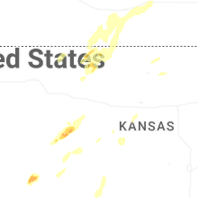
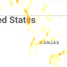

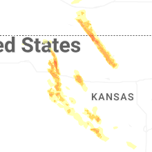
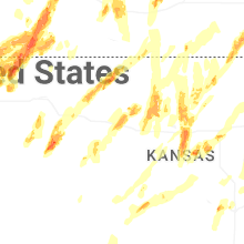


Connect with Interactive Hail Maps