

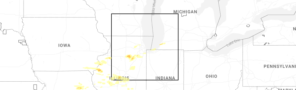
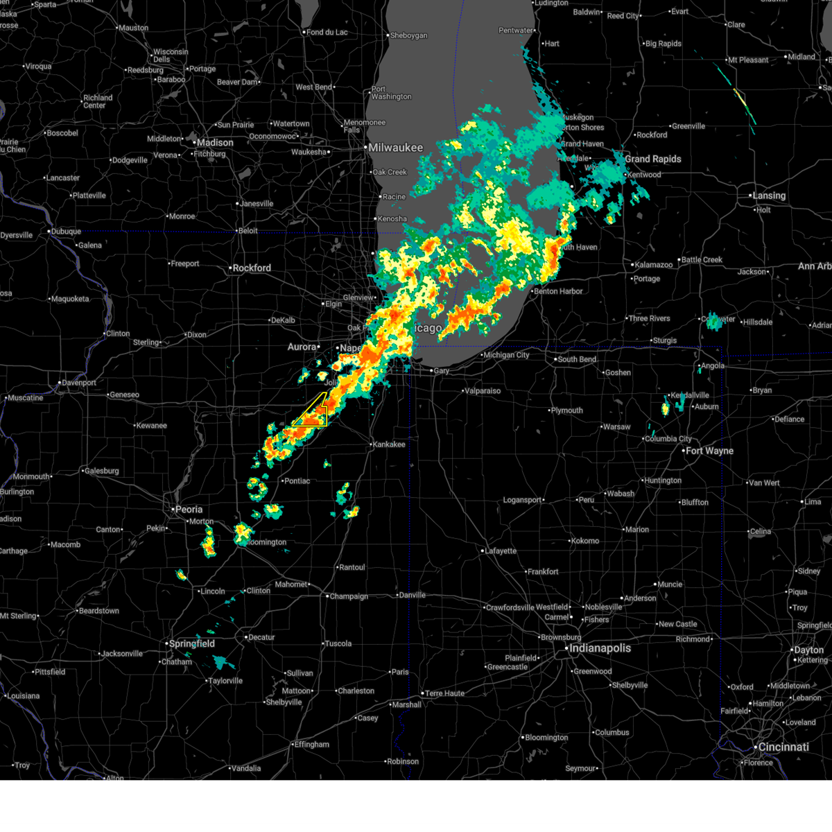
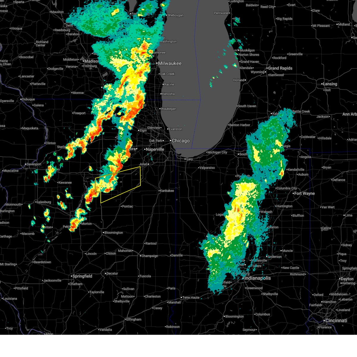
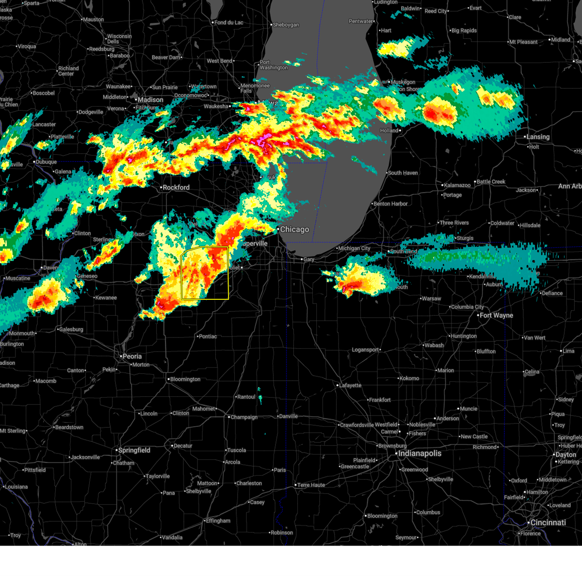
Hail Map for Morris, IL
The Morris, IL area has had 8 reports of on-the-ground hail by trained spotters, and has been under severe weather warnings 49 times during the past 12 months. Doppler radar has detected hail at or near Morris, IL on 73 occasions, including 8 occasions during the past year.
| Name: | Morris, IL |
| Where Located: | 54.5 miles SW of Chicago, IL |
| Map: | Google Map for Morris, IL |
| Population: | 13636 |
| Housing Units: | 6010 |
| More Info: | Search Google for Morris, IL |
2
The Top Recent Hail Date for Morris, IL is Monday, May 4, 2026 (7th out of 73)
Hail and Wind Damage Spotted near Morris, IL
| Date / Time | Report Details |
|---|---|
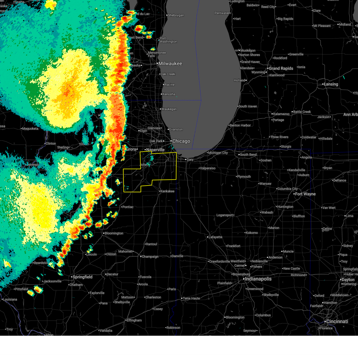
| 6/24/2026 8:09 PM CDT |
 The storm which prompted the warning has weakened below severe limits, and no longer poses an immediate threat to life or property. therefore, the warning will be allowed to expire. however, gusty winds and heavy rain are still possible with this thunderstorm. a severe thunderstorm watch remains in effect until 1000 pm cdt for northeastern illinois. The storm which prompted the warning has weakened below severe limits, and no longer poses an immediate threat to life or property. therefore, the warning will be allowed to expire. however, gusty winds and heavy rain are still possible with this thunderstorm. a severe thunderstorm watch remains in effect until 1000 pm cdt for northeastern illinois.
|
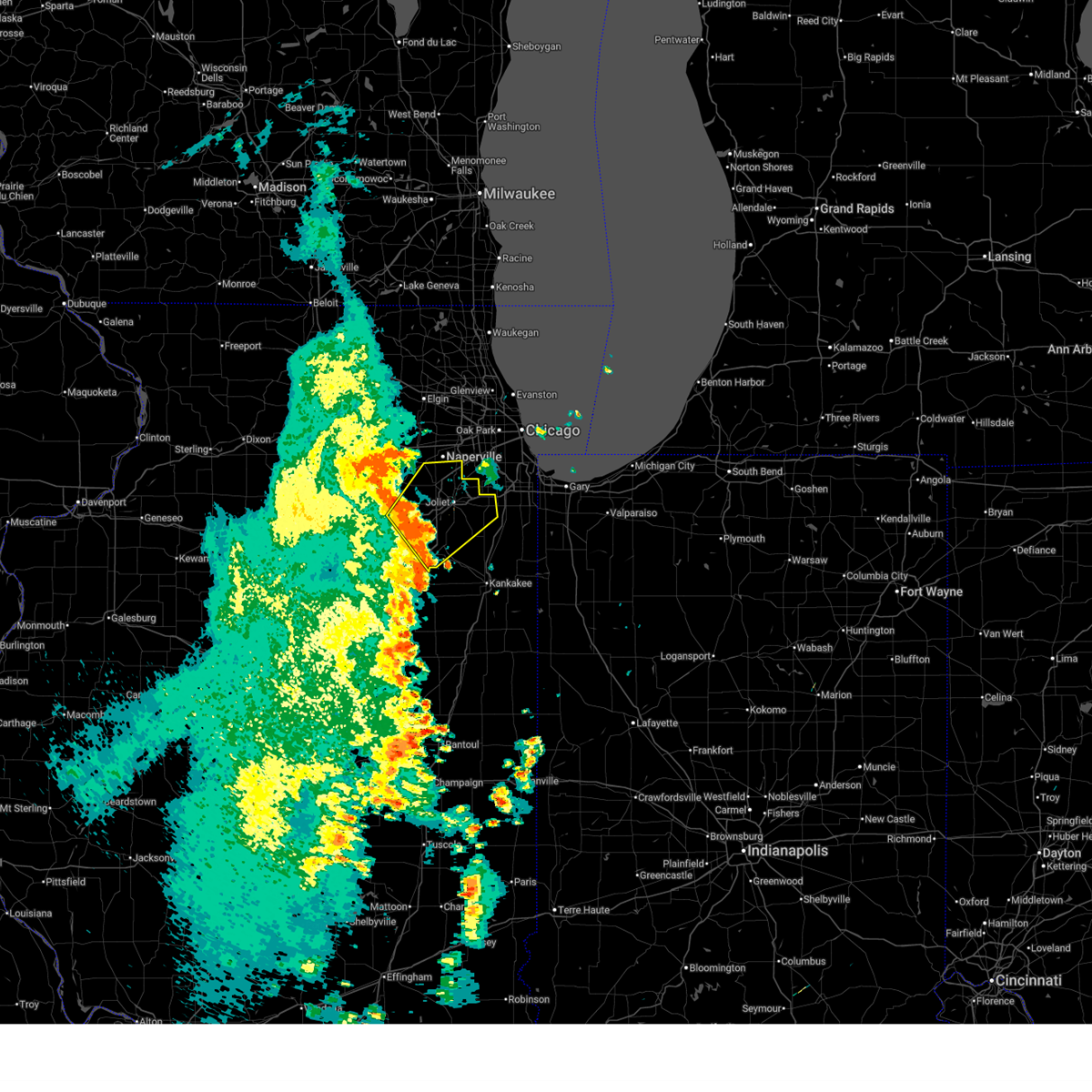
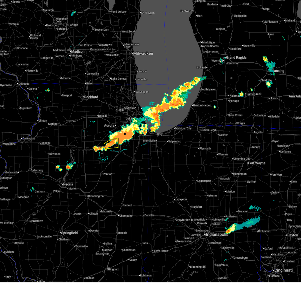
| 6/24/2026 7:48 PM CDT |
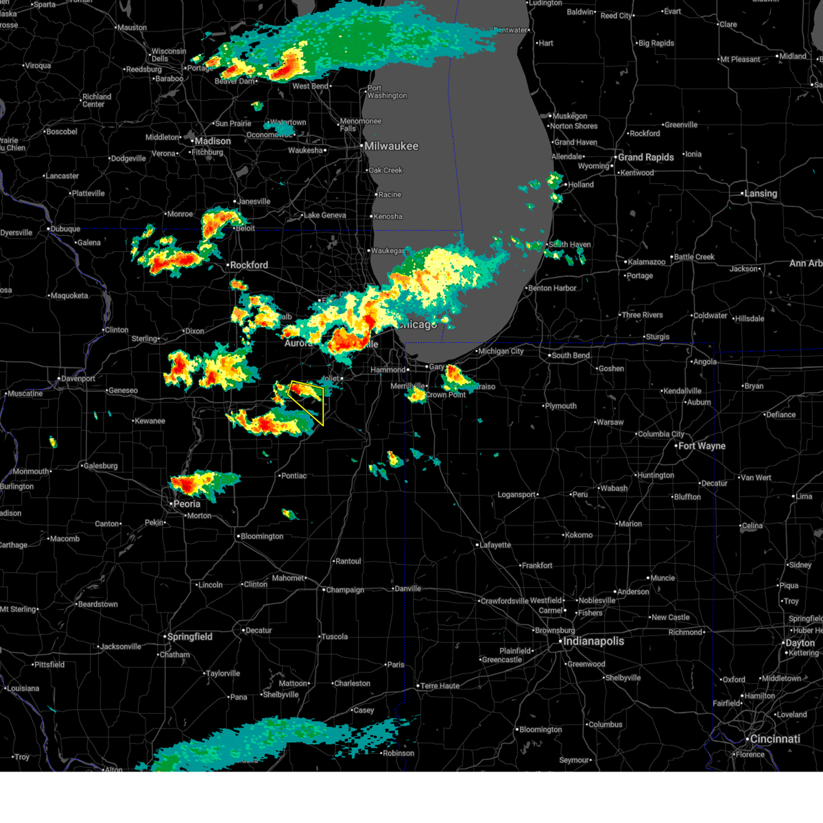
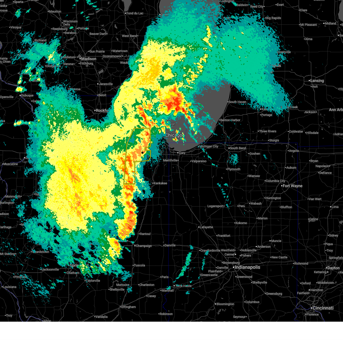
 At 748 pm cdt, a severe thunderstorm was located near morris, moving southeast at 15 mph (radar indicated). Hazards include 60 mph wind gusts and quarter size hail. Hail damage to vehicles is expected. expect wind damage to roofs, siding, and trees. this severe storm will be near, channahon and minooka around 755 pm cdt. coal city around 800 pm cdt. diamond around 805 pm cdt. Other locations impacted by this severe thunderstorm include carbon hill. At 748 pm cdt, a severe thunderstorm was located near morris, moving southeast at 15 mph (radar indicated). Hazards include 60 mph wind gusts and quarter size hail. Hail damage to vehicles is expected. expect wind damage to roofs, siding, and trees. this severe storm will be near, channahon and minooka around 755 pm cdt. coal city around 800 pm cdt. diamond around 805 pm cdt. Other locations impacted by this severe thunderstorm include carbon hill.
|
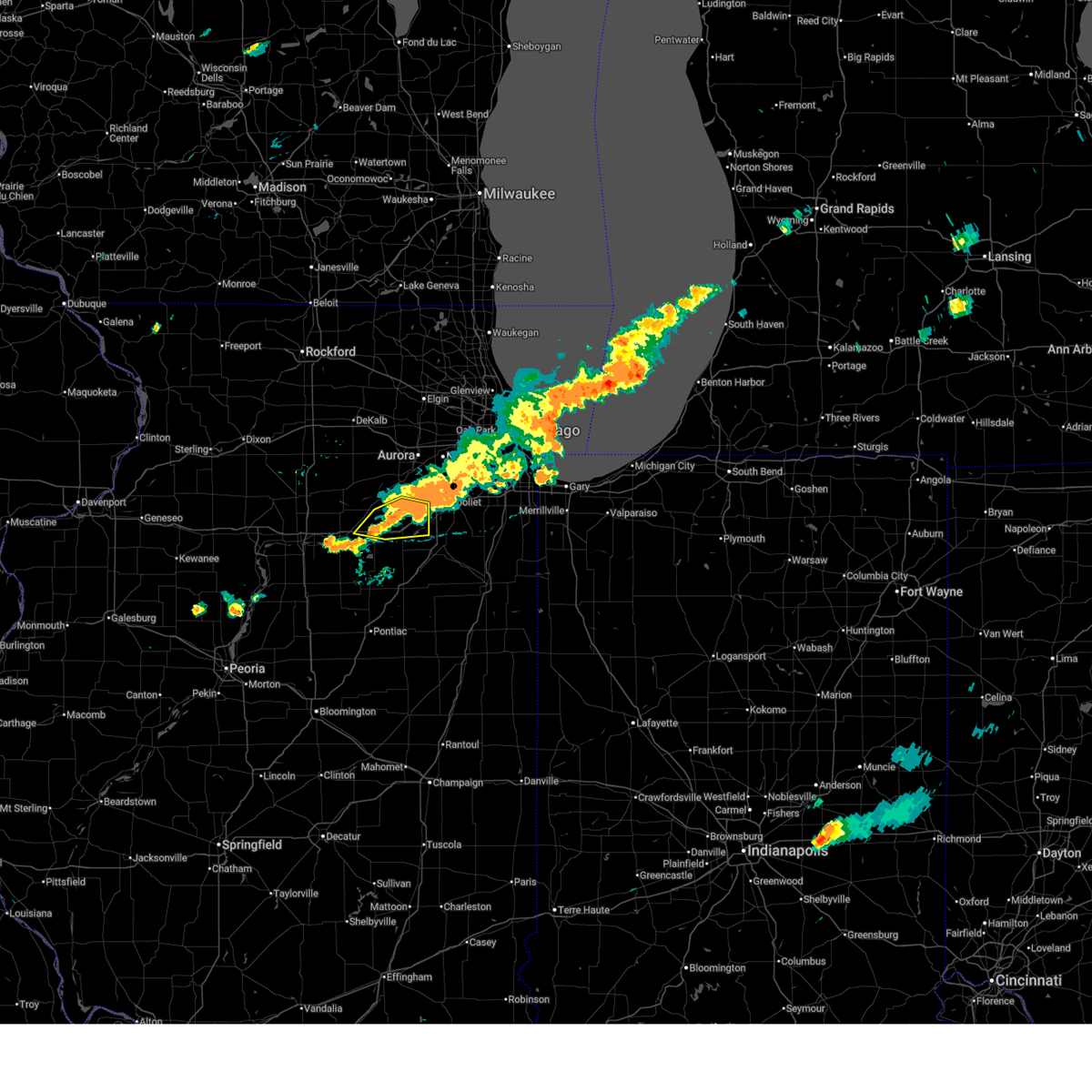
| 6/24/2026 7:33 PM CDT |
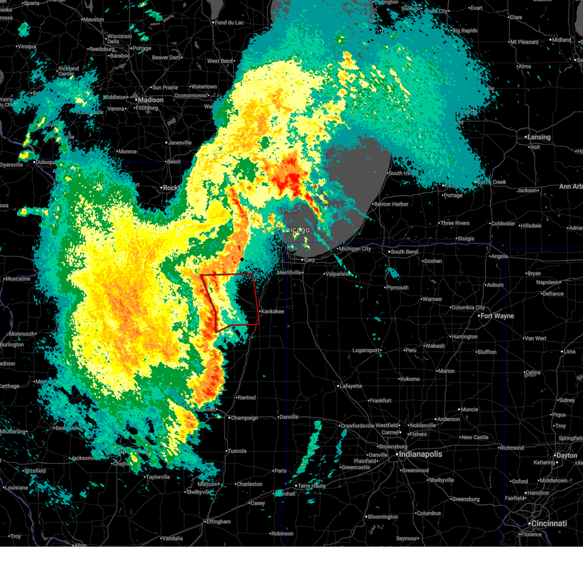
 At 733 pm cdt, a severe thunderstorm was located near morris, moving southeast at 20 mph (radar indicated). Hazards include 60 mph wind gusts and quarter size hail. Hail damage to vehicles is expected. expect wind damage to roofs, siding, and trees. this severe storm will be near, morris, channahon, and minooka around 740 pm cdt. coal city around 800 pm cdt. Other locations impacted by this severe thunderstorm include carbon hill. At 733 pm cdt, a severe thunderstorm was located near morris, moving southeast at 20 mph (radar indicated). Hazards include 60 mph wind gusts and quarter size hail. Hail damage to vehicles is expected. expect wind damage to roofs, siding, and trees. this severe storm will be near, morris, channahon, and minooka around 740 pm cdt. coal city around 800 pm cdt. Other locations impacted by this severe thunderstorm include carbon hill.
|
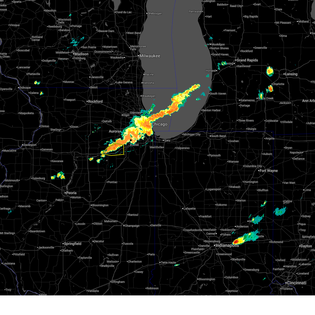
| 6/24/2026 7:19 PM CDT |
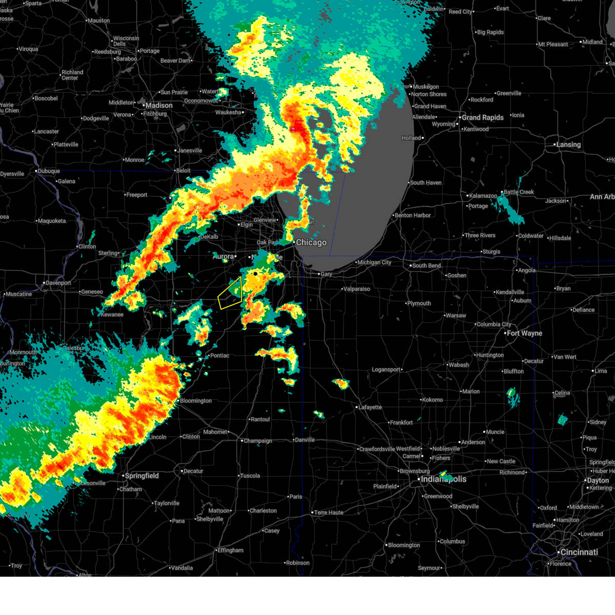
 Svrlot the national weather service in chicago has issued a * severe thunderstorm warning for, south central kendall county in northeastern illinois, northern grundy county in northeastern illinois, * until 815 pm cdt. * at 718 pm cdt, a severe thunderstorm was located near morris, moving southeast at 20 mph (radar indicated). Hazards include 60 mph wind gusts and quarter size hail. Hail damage to vehicles is expected. expect wind damage to roofs, siding, and trees. this severe thunderstorm will be near, morris around 725 pm cdt. channahon and minooka around 735 pm cdt. Other locations impacted by this severe thunderstorm include carbon hill, lisbon, and godley. Svrlot the national weather service in chicago has issued a * severe thunderstorm warning for, south central kendall county in northeastern illinois, northern grundy county in northeastern illinois, * until 815 pm cdt. * at 718 pm cdt, a severe thunderstorm was located near morris, moving southeast at 20 mph (radar indicated). Hazards include 60 mph wind gusts and quarter size hail. Hail damage to vehicles is expected. expect wind damage to roofs, siding, and trees. this severe thunderstorm will be near, morris around 725 pm cdt. channahon and minooka around 735 pm cdt. Other locations impacted by this severe thunderstorm include carbon hill, lisbon, and godley.
|
| 6/11/2026 6:35 PM CDT |
 The storm which prompted the warning has moved out of the area. therefore, the warning will be allowed to expire. however, gusty winds are still possible with this thunderstorm. a tornado watch remains in effect until 900 pm cdt for northeastern illinois. The storm which prompted the warning has moved out of the area. therefore, the warning will be allowed to expire. however, gusty winds are still possible with this thunderstorm. a tornado watch remains in effect until 900 pm cdt for northeastern illinois.
|
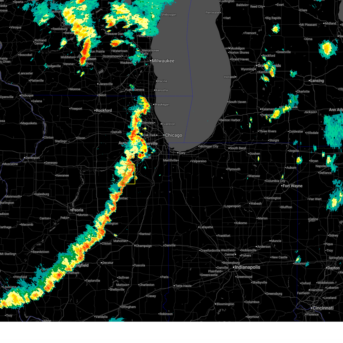
| 6/11/2026 6:17 PM CDT |
 Svrlot the national weather service in chicago has issued a * severe thunderstorm warning for, southeastern kendall county in northeastern illinois, northern grundy county in northeastern illinois, * until 645 pm cdt. * at 617 pm cdt, a severe thunderstorm was located over morris, moving northeast at 45 mph (radar indicated). Hazards include 60 mph wind gusts and nickel size hail. expect damage to roofs, siding, and trees Svrlot the national weather service in chicago has issued a * severe thunderstorm warning for, southeastern kendall county in northeastern illinois, northern grundy county in northeastern illinois, * until 645 pm cdt. * at 617 pm cdt, a severe thunderstorm was located over morris, moving northeast at 45 mph (radar indicated). Hazards include 60 mph wind gusts and nickel size hail. expect damage to roofs, siding, and trees
|
| 6/10/2026 3:22 PM CDT |
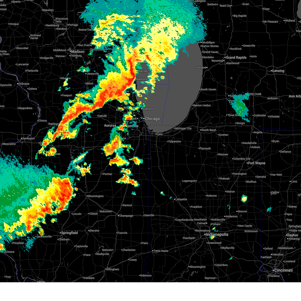
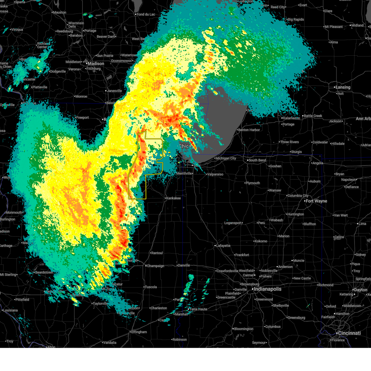
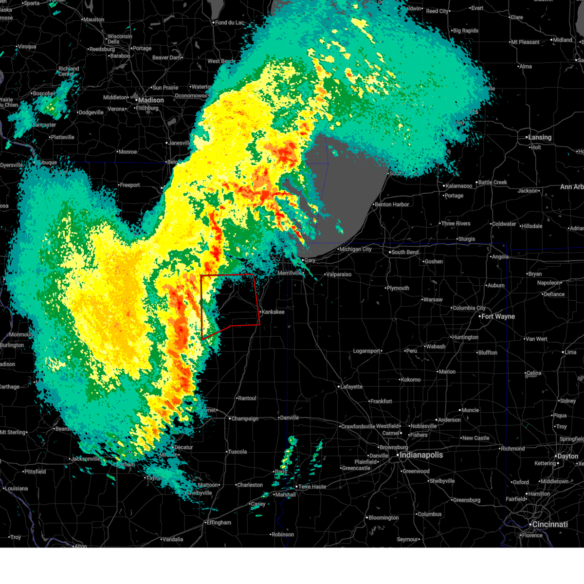
 Torlot the national weather service in chicago has issued a * tornado warning for, southeastern kendall county in northeastern illinois, west central will county in northeastern illinois, northeastern grundy county in northeastern illinois, * until 345 pm cdt. * at 321 pm cdt, a severe thunderstorm capable of producing a tornado was located near morris, moving east at 50 mph (radar indicated rotation). Hazards include tornado. Flying debris will be dangerous to those caught without shelter. mobile homes will be damaged or destroyed. damage to roofs, windows, and vehicles will occur. tree damage is likely. this dangerous storm will be near, minooka around 325 pm cdt. joliet, channahon, and shorewood around 330 pm cdt. crest hill around 335 pm cdt. Other locations impacted by this tornadic thunderstorm include crystal lawns, rockdale, and preston heights. Torlot the national weather service in chicago has issued a * tornado warning for, southeastern kendall county in northeastern illinois, west central will county in northeastern illinois, northeastern grundy county in northeastern illinois, * until 345 pm cdt. * at 321 pm cdt, a severe thunderstorm capable of producing a tornado was located near morris, moving east at 50 mph (radar indicated rotation). Hazards include tornado. Flying debris will be dangerous to those caught without shelter. mobile homes will be damaged or destroyed. damage to roofs, windows, and vehicles will occur. tree damage is likely. this dangerous storm will be near, minooka around 325 pm cdt. joliet, channahon, and shorewood around 330 pm cdt. crest hill around 335 pm cdt. Other locations impacted by this tornadic thunderstorm include crystal lawns, rockdale, and preston heights.
|
| 6/10/2026 3:20 PM CDT |
 At 319 pm cdt, severe thunderstorms were located along a line extending from 6 miles east of newark to near mazon, moving east at 60 mph (radar indicated). Hazards include 70 mph wind gusts. Expect considerable tree damage. damage is likely to mobile homes, roofs, and outbuildings. Locations impacted include, joliet, morris, channahon, minooka, braidwood, coal city, diamond, gardner, braceville, romeoville, plainfield, wilmington, shorewood, lakewood shores, bolingbrook, lockport, crest hill, elwood, woodridge, new lenox, homer glen, lemont, manhattan, ingalls park, orland park, mokena, frankfort, tinley park, palos hills, peotone, palos heights, worth, frankfort square, chicago, oak lawn, oak forest, park forest, alsip, matteson, country club hills, midlothian, chicago ridge, hazel crest, chicago heights, roseland, harvey, blue island, dolton, homewood, steger, south holland, riverdale and glenwood. At 319 pm cdt, severe thunderstorms were located along a line extending from 6 miles east of newark to near mazon, moving east at 60 mph (radar indicated). Hazards include 70 mph wind gusts. Expect considerable tree damage. damage is likely to mobile homes, roofs, and outbuildings. Locations impacted include, joliet, morris, channahon, minooka, braidwood, coal city, diamond, gardner, braceville, romeoville, plainfield, wilmington, shorewood, lakewood shores, bolingbrook, lockport, crest hill, elwood, woodridge, new lenox, homer glen, lemont, manhattan, ingalls park, orland park, mokena, frankfort, tinley park, palos hills, peotone, palos heights, worth, frankfort square, chicago, oak lawn, oak forest, park forest, alsip, matteson, country club hills, midlothian, chicago ridge, hazel crest, chicago heights, roseland, harvey, blue island, dolton, homewood, steger, south holland, riverdale and glenwood.
|
| 6/10/2026 3:19 PM CDT | Roof blown off of an outbuilding. time estimated from rada in grundy county IL, 5 miles SSE of Morris, IL |
| 6/10/2026 3:04 PM CDT |
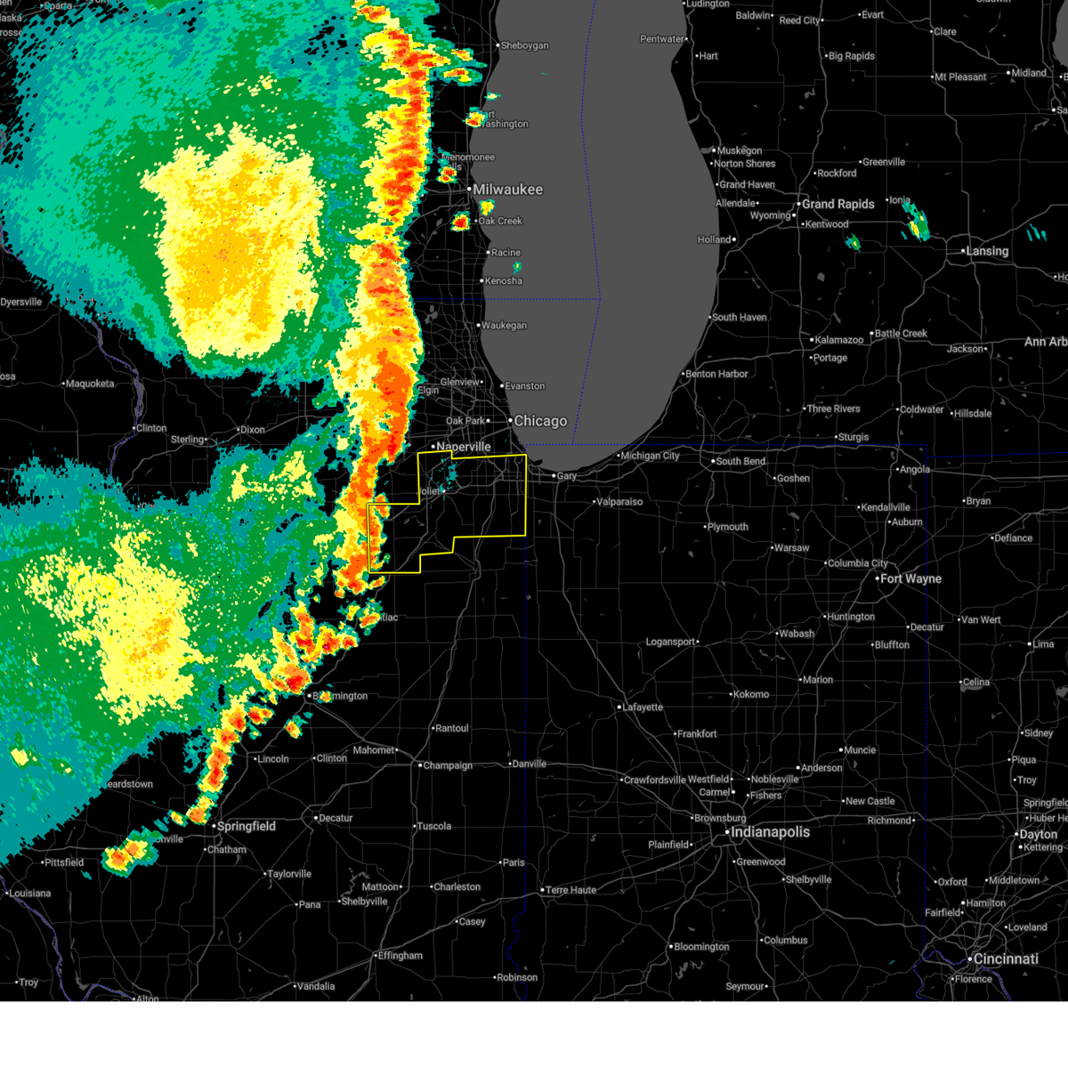
 Svrlot the national weather service in chicago has issued a * severe thunderstorm warning for, will county in northeastern illinois, grundy county in northeastern illinois, southeastern cook county in northeastern illinois, * until 415 pm cdt. * at 304 pm cdt, severe thunderstorms were located along a line extending from near serena to near south streator, moving northeast at 65 mph (radar indicated). Hazards include 70 mph wind gusts. Expect considerable tree damage. damage is likely to mobile homes, roofs, and outbuildings. severe thunderstorms will be near, seneca around 310 pm cdt. morris and mazon around 315 pm cdt. joliet, channahon, minooka, braidwood, coal city, diamond, gardner, and braceville around 325 pm cdt. naperville, bolingbrook, romeoville, plainfield, wilmington, shorewood, and lakewood shores around 330 pm cdt. lockport, crest hill, ingalls park, and elwood around 335 pm cdt. woodridge, new lenox, homer glen, lemont, and manhattan around 340 pm cdt. orland park, tinley park, mokena, and frankfort around 345 pm cdt. Oak lawn, oak forest, alsip, matteson, palos hills, midlothian, chicago ridge, richton park, palos heights, and crestwood around 350 pm cdt. Svrlot the national weather service in chicago has issued a * severe thunderstorm warning for, will county in northeastern illinois, grundy county in northeastern illinois, southeastern cook county in northeastern illinois, * until 415 pm cdt. * at 304 pm cdt, severe thunderstorms were located along a line extending from near serena to near south streator, moving northeast at 65 mph (radar indicated). Hazards include 70 mph wind gusts. Expect considerable tree damage. damage is likely to mobile homes, roofs, and outbuildings. severe thunderstorms will be near, seneca around 310 pm cdt. morris and mazon around 315 pm cdt. joliet, channahon, minooka, braidwood, coal city, diamond, gardner, and braceville around 325 pm cdt. naperville, bolingbrook, romeoville, plainfield, wilmington, shorewood, and lakewood shores around 330 pm cdt. lockport, crest hill, ingalls park, and elwood around 335 pm cdt. woodridge, new lenox, homer glen, lemont, and manhattan around 340 pm cdt. orland park, tinley park, mokena, and frankfort around 345 pm cdt. Oak lawn, oak forest, alsip, matteson, palos hills, midlothian, chicago ridge, richton park, palos heights, and crestwood around 350 pm cdt.
|
| 5/18/2026 10:13 AM CDT |
 Svrlot the national weather service in chicago has issued a * severe thunderstorm warning for, eastern kendall county in northeastern illinois, will county in northeastern illinois, northeastern grundy county in northeastern illinois, * until 1100 am cdt. * at 1012 am cdt, severe thunderstorms were located along a line extending from 7 miles southeast of newark to braidwood, moving northeast at 55 mph (radar indicated). Hazards include 60 mph wind gusts. expect damage to roofs, siding, and trees Svrlot the national weather service in chicago has issued a * severe thunderstorm warning for, eastern kendall county in northeastern illinois, will county in northeastern illinois, northeastern grundy county in northeastern illinois, * until 1100 am cdt. * at 1012 am cdt, severe thunderstorms were located along a line extending from 7 miles southeast of newark to braidwood, moving northeast at 55 mph (radar indicated). Hazards include 60 mph wind gusts. expect damage to roofs, siding, and trees
|
| 5/4/2026 7:31 PM CDT |
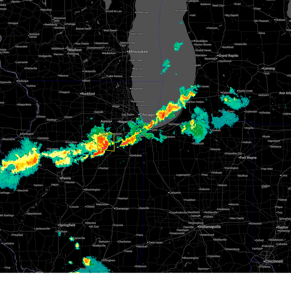 At 731 pm cdt, severe thunderstorms were located along a line extending from 6 miles southeast of serena to near seneca, moving east at 45 mph (radar indicated). Hazards include 60 mph wind gusts and penny size hail. Expect damage to roofs, siding, and trees. Locations impacted include, morris, channahon, minooka, coal city, marseilles, diamond, seneca, mazon, braceville, godley, carbon hill, and lisbon. At 731 pm cdt, severe thunderstorms were located along a line extending from 6 miles southeast of serena to near seneca, moving east at 45 mph (radar indicated). Hazards include 60 mph wind gusts and penny size hail. Expect damage to roofs, siding, and trees. Locations impacted include, morris, channahon, minooka, coal city, marseilles, diamond, seneca, mazon, braceville, godley, carbon hill, and lisbon.
|
| 5/4/2026 7:13 PM CDT |
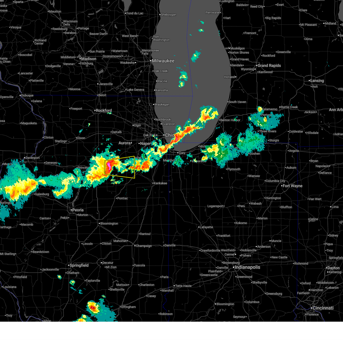 Svrlot the national weather service in chicago has issued a * severe thunderstorm warning for, southern kendall county in northeastern illinois, northeastern la salle county in north central illinois, grundy county in northeastern illinois, * until 800 pm cdt. * at 713 pm cdt, a severe thunderstorm was located near ottawa, moving east at 45 mph (radar indicated). Hazards include 60 mph wind gusts and penny size hail. expect damage to roofs, siding, and trees Svrlot the national weather service in chicago has issued a * severe thunderstorm warning for, southern kendall county in northeastern illinois, northeastern la salle county in north central illinois, grundy county in northeastern illinois, * until 800 pm cdt. * at 713 pm cdt, a severe thunderstorm was located near ottawa, moving east at 45 mph (radar indicated). Hazards include 60 mph wind gusts and penny size hail. expect damage to roofs, siding, and trees
|
| 4/17/2026 9:40 PM CDT |
 At 940 pm cdt, severe thunderstorms were located along a line extending from near inverness to addison to downers grove to near wilmington, moving east at 50 mph (radar indicated). Hazards include 60 mph wind gusts. Expect damage to roofs, siding, and trees. These severe storms will be near, joliet, downers grove, elmhurst, addison, elk grove village, woodridge, lockport, new lenox, homer glen, and mokena around 945 pm cdt. At 940 pm cdt, severe thunderstorms were located along a line extending from near inverness to addison to downers grove to near wilmington, moving east at 50 mph (radar indicated). Hazards include 60 mph wind gusts. Expect damage to roofs, siding, and trees. These severe storms will be near, joliet, downers grove, elmhurst, addison, elk grove village, woodridge, lockport, new lenox, homer glen, and mokena around 945 pm cdt.
|
| 4/17/2026 9:37 PM CDT |
 At 937 pm cdt, a severe squall line capable of producing both tornadoes and extensive straight line wind damage was located along a line extending from near seneca to dwight to saunemin, moving east at 55 mph (radar indicated rotation). Hazards include tornado. Flying debris will be dangerous to those caught without shelter. mobile homes will be damaged or destroyed. damage to roofs, windows, and vehicles will occur. tree damage is likely. these dangerous storms will be near, morris, gardner, and mazon around 940 pm cdt. Other locations in the path of these tornadic storms include braidwood, coal city, diamond, braceville, channahon, minooka, wilmington, herscher, lakewood shores, joliet, elwood, limestone, chebanse, kankakee, bourbonnais and manhattan. At 937 pm cdt, a severe squall line capable of producing both tornadoes and extensive straight line wind damage was located along a line extending from near seneca to dwight to saunemin, moving east at 55 mph (radar indicated rotation). Hazards include tornado. Flying debris will be dangerous to those caught without shelter. mobile homes will be damaged or destroyed. damage to roofs, windows, and vehicles will occur. tree damage is likely. these dangerous storms will be near, morris, gardner, and mazon around 940 pm cdt. Other locations in the path of these tornadic storms include braidwood, coal city, diamond, braceville, channahon, minooka, wilmington, herscher, lakewood shores, joliet, elwood, limestone, chebanse, kankakee, bourbonnais and manhattan.
|
| 4/17/2026 9:28 PM CDT |
 At 928 pm cdt, severe thunderstorms were located along a line extending from sleepy hollow to near west chicago to near naperville to near coal city, moving east at 55 mph (radar indicated). Hazards include 60 mph wind gusts. Expect damage to roofs, siding, and trees. these severe storms will be near, joliet, naperville, bolingbrook, wheaton, downers grove, lombard, bartlett, carol stream, romeoville, and plainfield around 935 pm cdt. Other locations in the path of these severe thunderstorms include elmhurst, elk grove village, new lenox, hinsdale, burr ridge, bensenville, wood dale, northlake, hillside, willow springs and mokena. At 928 pm cdt, severe thunderstorms were located along a line extending from sleepy hollow to near west chicago to near naperville to near coal city, moving east at 55 mph (radar indicated). Hazards include 60 mph wind gusts. Expect damage to roofs, siding, and trees. these severe storms will be near, joliet, naperville, bolingbrook, wheaton, downers grove, lombard, bartlett, carol stream, romeoville, and plainfield around 935 pm cdt. Other locations in the path of these severe thunderstorms include elmhurst, elk grove village, new lenox, hinsdale, burr ridge, bensenville, wood dale, northlake, hillside, willow springs and mokena.
|
| 4/17/2026 9:23 PM CDT |
 Torlot the national weather service in chicago has issued a * tornado warning for, southeastern kendall county in northeastern illinois, northeastern livingston county in central illinois, southwestern will county in northeastern illinois, grundy county in northeastern illinois, western kankakee county in northeastern illinois, * until 1015 pm cdt. * at 923 pm cdt, severe thunderstorms capable of producing tornadoes were located along a line extending from near seneca to near odell to near pontiac, moving east at 55 mph (radar indicated rotation). Hazards include tornado. Flying debris will be dangerous to those caught without shelter. mobile homes will be damaged or destroyed. damage to roofs, windows, and vehicles will occur. tree damage is likely. these dangerous storms will be near, dwight, odell, and mazon around 930 pm cdt. gardner around 935 pm cdt. morris, coal city, diamond, and braceville around 940 pm cdt. Other locations in the path of these tornadic storms include channahon, braidwood, wilmington, herscher, lakewood shores, elwood, limestone, kankakee, bourbonnais, manhattan and chebanse. Torlot the national weather service in chicago has issued a * tornado warning for, southeastern kendall county in northeastern illinois, northeastern livingston county in central illinois, southwestern will county in northeastern illinois, grundy county in northeastern illinois, western kankakee county in northeastern illinois, * until 1015 pm cdt. * at 923 pm cdt, severe thunderstorms capable of producing tornadoes were located along a line extending from near seneca to near odell to near pontiac, moving east at 55 mph (radar indicated rotation). Hazards include tornado. Flying debris will be dangerous to those caught without shelter. mobile homes will be damaged or destroyed. damage to roofs, windows, and vehicles will occur. tree damage is likely. these dangerous storms will be near, dwight, odell, and mazon around 930 pm cdt. gardner around 935 pm cdt. morris, coal city, diamond, and braceville around 940 pm cdt. Other locations in the path of these tornadic storms include channahon, braidwood, wilmington, herscher, lakewood shores, elwood, limestone, kankakee, bourbonnais, manhattan and chebanse.
|
| 4/17/2026 9:17 PM CDT |
 At 917 pm cdt, severe thunderstorms were located along a line extending from near pingree grove to north aurora to oswego to near mazon, moving east at 45 mph (radar indicated). Hazards include 70 mph wind gusts. Expect considerable tree damage. damage is likely to mobile homes, roofs, and outbuildings. these severe storms will be near, aurora, joliet, naperville, elgin, bolingbrook, bartlett, plainfield, st. charles, oswego, and west chicago around 920 pm cdt. Other locations in the path of these severe thunderstorms include wheaton, carol stream, romeoville, hanover park, coal city, lisle, crest hill, winfield, west dundee, sleepy hollow, downers grove, lombard, glendale heights, woodridge, glen ellyn, lockport, braidwood, roselle, darien, bloomingdale, addison, new lenox, homer glen, hinsdale, lemont, burr ridge, oak brook, westmont, villa park, itasca, elmhurst, elk grove village, bensenville, wood dale, northlake, hillside, willow springs and mokena. At 917 pm cdt, severe thunderstorms were located along a line extending from near pingree grove to north aurora to oswego to near mazon, moving east at 45 mph (radar indicated). Hazards include 70 mph wind gusts. Expect considerable tree damage. damage is likely to mobile homes, roofs, and outbuildings. these severe storms will be near, aurora, joliet, naperville, elgin, bolingbrook, bartlett, plainfield, st. charles, oswego, and west chicago around 920 pm cdt. Other locations in the path of these severe thunderstorms include wheaton, carol stream, romeoville, hanover park, coal city, lisle, crest hill, winfield, west dundee, sleepy hollow, downers grove, lombard, glendale heights, woodridge, glen ellyn, lockport, braidwood, roselle, darien, bloomingdale, addison, new lenox, homer glen, hinsdale, lemont, burr ridge, oak brook, westmont, villa park, itasca, elmhurst, elk grove village, bensenville, wood dale, northlake, hillside, willow springs and mokena.
|
| 4/17/2026 9:03 PM CDT |
 At 903 pm cdt, severe thunderstorms were located along a line extending from near sycamore to near sugar grove to near yorkville to near seneca, moving east at 45 mph (radar indicated). Hazards include 70 mph wind gusts. Expect considerable tree damage. damage is likely to mobile homes, roofs, and outbuildings. these severe storms will be near, aurora, st. charles, oswego, batavia, geneva, yorkville, morris, campton hills, montgomery, and north aurora around 910 pm cdt. joliet, naperville, elgin, plainfield, south elgin, wayne, valley view, and mazon around 915 pm cdt. bolingbrook, bartlett, west chicago, channahon, minooka, coal city, shorewood, warrenville, west dundee, and sleepy hollow around 920 pm cdt. wheaton, carol stream, romeoville, hanover park, woodridge, lisle, bloomingdale, crest hill, winfield, and east dundee around 925 pm cdt. downers grove, lombard, addison, glendale heights, glen ellyn, lockport, roselle, and darien around 930 pm cdt. elmhurst, homer glen, hinsdale, lemont, burr ridge, oak brook, westmont, villa park, wood dale, and itasca around 935 pm cdt. elk grove village, new lenox, bensenville, northlake, hillside, and willow springs around 940 pm cdt. Mokena around 945 pm cdt. At 903 pm cdt, severe thunderstorms were located along a line extending from near sycamore to near sugar grove to near yorkville to near seneca, moving east at 45 mph (radar indicated). Hazards include 70 mph wind gusts. Expect considerable tree damage. damage is likely to mobile homes, roofs, and outbuildings. these severe storms will be near, aurora, st. charles, oswego, batavia, geneva, yorkville, morris, campton hills, montgomery, and north aurora around 910 pm cdt. joliet, naperville, elgin, plainfield, south elgin, wayne, valley view, and mazon around 915 pm cdt. bolingbrook, bartlett, west chicago, channahon, minooka, coal city, shorewood, warrenville, west dundee, and sleepy hollow around 920 pm cdt. wheaton, carol stream, romeoville, hanover park, woodridge, lisle, bloomingdale, crest hill, winfield, and east dundee around 925 pm cdt. downers grove, lombard, addison, glendale heights, glen ellyn, lockport, roselle, and darien around 930 pm cdt. elmhurst, homer glen, hinsdale, lemont, burr ridge, oak brook, westmont, villa park, wood dale, and itasca around 935 pm cdt. elk grove village, new lenox, bensenville, northlake, hillside, and willow springs around 940 pm cdt. Mokena around 945 pm cdt.
|
| 4/17/2026 8:47 PM CDT |
 Svrlot the national weather service in chicago has issued a * severe thunderstorm warning for, kendall county in northeastern illinois, western will county in northeastern illinois, grundy county in northeastern illinois, kane county in northeastern illinois, dupage county in northeastern illinois, * until 1000 pm cdt. * at 846 pm cdt, severe thunderstorms were located along a line extending from near malta to near somonauk to near sheridan to near streator, moving northeast at 50 mph (radar indicated). Hazards include 70 mph wind gusts. Expect considerable tree damage. damage is likely to mobile homes, roofs, and outbuildings. severe thunderstorms will be near, plano, sandwich, and newark around 850 pm cdt. yorkville around 855 pm cdt. montgomery, sugar grove, and maple park around 900 pm cdt. aurora, oswego, morris, north aurora, boulder hill, elburn, and lily lake around 905 pm cdt. plainfield, st. charles, batavia, geneva, campton hills, and mazon around 910 pm cdt. joliet, naperville, elgin, west chicago, minooka, south elgin, shorewood, warrenville, wayne, and valley view around 915 pm cdt. bolingbrook, wheaton, bartlett, carol stream, romeoville, channahon, coal city, lisle, winfield, and west dundee around 920 pm cdt. Downers grove, lombard, hanover park, glendale heights, woodridge, glen ellyn, roselle, darien, bloomingdale, and crest hill around 925 pm cdt. Svrlot the national weather service in chicago has issued a * severe thunderstorm warning for, kendall county in northeastern illinois, western will county in northeastern illinois, grundy county in northeastern illinois, kane county in northeastern illinois, dupage county in northeastern illinois, * until 1000 pm cdt. * at 846 pm cdt, severe thunderstorms were located along a line extending from near malta to near somonauk to near sheridan to near streator, moving northeast at 50 mph (radar indicated). Hazards include 70 mph wind gusts. Expect considerable tree damage. damage is likely to mobile homes, roofs, and outbuildings. severe thunderstorms will be near, plano, sandwich, and newark around 850 pm cdt. yorkville around 855 pm cdt. montgomery, sugar grove, and maple park around 900 pm cdt. aurora, oswego, morris, north aurora, boulder hill, elburn, and lily lake around 905 pm cdt. plainfield, st. charles, batavia, geneva, campton hills, and mazon around 910 pm cdt. joliet, naperville, elgin, west chicago, minooka, south elgin, shorewood, warrenville, wayne, and valley view around 915 pm cdt. bolingbrook, wheaton, bartlett, carol stream, romeoville, channahon, coal city, lisle, winfield, and west dundee around 920 pm cdt. Downers grove, lombard, hanover park, glendale heights, woodridge, glen ellyn, roselle, darien, bloomingdale, and crest hill around 925 pm cdt.
|
| 4/2/2026 10:42 PM CDT |
 The storms which prompted the warning have weakened below severe limits, and no longer pose an immediate threat to life or property. therefore, the warning will be allowed to expire. however, small hail, gusty winds and heavy rain are still possible with these thunderstorms. The storms which prompted the warning have weakened below severe limits, and no longer pose an immediate threat to life or property. therefore, the warning will be allowed to expire. however, small hail, gusty winds and heavy rain are still possible with these thunderstorms.
|
| 4/2/2026 10:33 PM CDT |
 At 1033 pm cdt, severe thunderstorms were located along a line extending from channahon to mazon, moving east at 25 mph (radar indicated). Hazards include 60 mph wind gusts and nickel size hail. Expect damage to roofs, siding, and trees. these severe storms will be near, channahon, coal city, and diamond around 1040 pm cdt. Other locations impacted by these severe thunderstorms include carbon hill and godley. At 1033 pm cdt, severe thunderstorms were located along a line extending from channahon to mazon, moving east at 25 mph (radar indicated). Hazards include 60 mph wind gusts and nickel size hail. Expect damage to roofs, siding, and trees. these severe storms will be near, channahon, coal city, and diamond around 1040 pm cdt. Other locations impacted by these severe thunderstorms include carbon hill and godley.
|
| 4/2/2026 10:20 PM CDT |
 Svrlot the national weather service in chicago has issued a * severe thunderstorm warning for, central grundy county in northeastern illinois, * until 1045 pm cdt. * at 1020 pm cdt, severe thunderstorms were located along a line extending from near minooka to near seneca, moving east at 25 mph (radar indicated). Hazards include 70 mph wind gusts and quarter size hail. Hail damage to vehicles is expected. expect considerable tree damage. wind damage is also likely to mobile homes, roofs, and outbuildings. Severe thunderstorms will be near, morris, channahon, minooka, and mazon around 1025 pm cdt. Svrlot the national weather service in chicago has issued a * severe thunderstorm warning for, central grundy county in northeastern illinois, * until 1045 pm cdt. * at 1020 pm cdt, severe thunderstorms were located along a line extending from near minooka to near seneca, moving east at 25 mph (radar indicated). Hazards include 70 mph wind gusts and quarter size hail. Hail damage to vehicles is expected. expect considerable tree damage. wind damage is also likely to mobile homes, roofs, and outbuildings. Severe thunderstorms will be near, morris, channahon, minooka, and mazon around 1025 pm cdt.
|
| 4/2/2026 8:27 PM CDT |
 At 827 pm cdt, severe thunderstorms were located along a line extending from plainfield to near coal city to near streator, moving east at 45 mph (radar indicated). Hazards include 60 mph wind gusts and quarter size hail. Hail damage to vehicles is expected. expect wind damage to roofs, siding, and trees. Locations impacted include, streator, morris, channahon, minooka, braidwood, coal city, marseilles, diamond, seneca, gardner, mazon, braceville, godley, ransom, carbon hill, verona, and kinsman. At 827 pm cdt, severe thunderstorms were located along a line extending from plainfield to near coal city to near streator, moving east at 45 mph (radar indicated). Hazards include 60 mph wind gusts and quarter size hail. Hail damage to vehicles is expected. expect wind damage to roofs, siding, and trees. Locations impacted include, streator, morris, channahon, minooka, braidwood, coal city, marseilles, diamond, seneca, gardner, mazon, braceville, godley, ransom, carbon hill, verona, and kinsman.
|
| 4/2/2026 8:14 PM CDT |
 At 814 pm cdt, severe thunderstorms were located along a line extending from 6 miles northwest of minooka to near mazon to near south streator, moving east at 45 mph (radar indicated). Hazards include 70 mph wind gusts and quarter size hail. Hail damage to vehicles is expected. expect considerable tree damage. wind damage is also likely to mobile homes, roofs, and outbuildings. Locations impacted include, streator, morris, channahon, minooka, braidwood, coal city, marseilles, diamond, seneca, gardner, wenona, mazon, south streator, braceville, grand ridge, godley, ransom, carbon hill, rutland, kangley, long point, verona, and kinsman. At 814 pm cdt, severe thunderstorms were located along a line extending from 6 miles northwest of minooka to near mazon to near south streator, moving east at 45 mph (radar indicated). Hazards include 70 mph wind gusts and quarter size hail. Hail damage to vehicles is expected. expect considerable tree damage. wind damage is also likely to mobile homes, roofs, and outbuildings. Locations impacted include, streator, morris, channahon, minooka, braidwood, coal city, marseilles, diamond, seneca, gardner, wenona, mazon, south streator, braceville, grand ridge, godley, ransom, carbon hill, rutland, kangley, long point, verona, and kinsman.
|
| 4/2/2026 7:43 PM CDT |
 Svrlot the national weather service in chicago has issued a * severe thunderstorm warning for, southeastern kendall county in northeastern illinois, northwestern livingston county in central illinois, central la salle county in north central illinois, grundy county in northeastern illinois, * until 845 pm cdt. * at 743 pm cdt, severe thunderstorms were located along a line extending from near marseilles to near streator to near washburn, moving northeast at 45 mph (radar indicated). Hazards include 70 mph wind gusts and quarter size hail. Hail damage to vehicles is expected. expect considerable tree damage. Wind damage is also likely to mobile homes, roofs, and outbuildings. Svrlot the national weather service in chicago has issued a * severe thunderstorm warning for, southeastern kendall county in northeastern illinois, northwestern livingston county in central illinois, central la salle county in north central illinois, grundy county in northeastern illinois, * until 845 pm cdt. * at 743 pm cdt, severe thunderstorms were located along a line extending from near marseilles to near streator to near washburn, moving northeast at 45 mph (radar indicated). Hazards include 70 mph wind gusts and quarter size hail. Hail damage to vehicles is expected. expect considerable tree damage. Wind damage is also likely to mobile homes, roofs, and outbuildings.
|
| 3/31/2026 9:29 AM CDT |
 At 929 am cdt, multiple severe thunderstorms were located from morris to shorewood to new lenox. all were moving east at 40 to 60 mph (trained weather spotters. golfball size hail was reported in joliet with this storm). Hazards include golf ball size hail and 60 mph wind gusts. the largest hail will fall in new lenox. People and animals outdoors will be injured. expect hail damage to roofs, siding, windows, and vehicles. expect wind damage to roofs, siding, and trees. Locations impacted include, joliet, orland park, romeoville, plainfield, lockport, new lenox, homer glen, mokena, bourbonnais, morris, channahon, minooka, braidwood, wilmington, coal city, dwight, crest hill, shorewood, manhattan, ingalls park, diamond, seneca, elwood, gardner, and lakewood shores. At 929 am cdt, multiple severe thunderstorms were located from morris to shorewood to new lenox. all were moving east at 40 to 60 mph (trained weather spotters. golfball size hail was reported in joliet with this storm). Hazards include golf ball size hail and 60 mph wind gusts. the largest hail will fall in new lenox. People and animals outdoors will be injured. expect hail damage to roofs, siding, windows, and vehicles. expect wind damage to roofs, siding, and trees. Locations impacted include, joliet, orland park, romeoville, plainfield, lockport, new lenox, homer glen, mokena, bourbonnais, morris, channahon, minooka, braidwood, wilmington, coal city, dwight, crest hill, shorewood, manhattan, ingalls park, diamond, seneca, elwood, gardner, and lakewood shores.
|
| 3/31/2026 9:20 AM CDT |
 At 919 am cdt, a severe thunderstorm was located over seneca, or near marseilles, moving east at 50 mph. a second severe thunderstorm was located over shorewood, moving northeast at 35 mph (radar indicated). Hazards include golf ball size hail and 60 mph wind gusts. the largest hail will impact will county. People and animals outdoors will be injured. expect hail damage to roofs, siding, windows, and vehicles. expect wind damage to roofs, siding, and trees. Locations impacted include, joliet, orland park, romeoville, plainfield, lockport, new lenox, homer glen, mokena, bourbonnais, morris, channahon, minooka, braidwood, wilmington, coal city, dwight, crest hill, shorewood, manhattan, ingalls park, diamond, seneca, elwood, gardner, and lakewood shores. At 919 am cdt, a severe thunderstorm was located over seneca, or near marseilles, moving east at 50 mph. a second severe thunderstorm was located over shorewood, moving northeast at 35 mph (radar indicated). Hazards include golf ball size hail and 60 mph wind gusts. the largest hail will impact will county. People and animals outdoors will be injured. expect hail damage to roofs, siding, windows, and vehicles. expect wind damage to roofs, siding, and trees. Locations impacted include, joliet, orland park, romeoville, plainfield, lockport, new lenox, homer glen, mokena, bourbonnais, morris, channahon, minooka, braidwood, wilmington, coal city, dwight, crest hill, shorewood, manhattan, ingalls park, diamond, seneca, elwood, gardner, and lakewood shores.
|
| 3/31/2026 9:09 AM CDT |
 Svrlot the national weather service in chicago has issued a * severe thunderstorm warning for, southern kendall county in northeastern illinois, western will county in northeastern illinois, grundy county in northeastern illinois, northwestern kankakee county in northeastern illinois, * until 1030 am cdt. * at 909 am cdt, a severe thunderstorm was located near ottawa, moving east at 50 mph. a second severe thunderstorm was located near shorewood, and was moving northeast at 35 mph (radar indicated). Hazards include 60 mph wind gusts and quarter size hail. Hail damage to vehicles is expected. Expect wind damage to roofs, siding, and trees. Svrlot the national weather service in chicago has issued a * severe thunderstorm warning for, southern kendall county in northeastern illinois, western will county in northeastern illinois, grundy county in northeastern illinois, northwestern kankakee county in northeastern illinois, * until 1030 am cdt. * at 909 am cdt, a severe thunderstorm was located near ottawa, moving east at 50 mph. a second severe thunderstorm was located near shorewood, and was moving northeast at 35 mph (radar indicated). Hazards include 60 mph wind gusts and quarter size hail. Hail damage to vehicles is expected. Expect wind damage to roofs, siding, and trees.
|
| 3/10/2026 9:00 PM CDT |
 The storms which prompted the warning have moved out of the area. therefore, the warning will be allowed to expire. however, small hail and heavy rain are still possible with these thunderstorms. a tornado watch remains in effect until 1100 pm cdt for north central and northeastern illinois. a severe thunderstorm watch remains in effect until midnight cdt for north central and northeastern illinois. The storms which prompted the warning have moved out of the area. therefore, the warning will be allowed to expire. however, small hail and heavy rain are still possible with these thunderstorms. a tornado watch remains in effect until 1100 pm cdt for north central and northeastern illinois. a severe thunderstorm watch remains in effect until midnight cdt for north central and northeastern illinois.
|
| 3/10/2026 8:36 PM CDT |
 At 836 pm cdt, severe thunderstorms were located along a line extending from aurora to near morris, moving east at 35 mph (radar indicated). Hazards include 60 mph wind gusts and quarter size hail. Hail damage to vehicles is expected. expect wind damage to roofs, siding, and trees. Locations impacted include, aurora, joliet, plainfield, oswego, ottawa, yorkville, morris, channahon, minooka, plano, sandwich, coal city, marseilles, sheridan, montgomery, boulder hill, lake holiday, diamond, seneca, somonauk, serena, mazon, newark, leland, and braceville. At 836 pm cdt, severe thunderstorms were located along a line extending from aurora to near morris, moving east at 35 mph (radar indicated). Hazards include 60 mph wind gusts and quarter size hail. Hail damage to vehicles is expected. expect wind damage to roofs, siding, and trees. Locations impacted include, aurora, joliet, plainfield, oswego, ottawa, yorkville, morris, channahon, minooka, plano, sandwich, coal city, marseilles, sheridan, montgomery, boulder hill, lake holiday, diamond, seneca, somonauk, serena, mazon, newark, leland, and braceville.
|
| 3/10/2026 7:57 PM CDT |
 Svrlot the national weather service in chicago has issued a * severe thunderstorm warning for, kendall county in northeastern illinois, northeastern la salle county in north central illinois, southeastern de kalb county in north central illinois, grundy county in northeastern illinois, * until 900 pm cdt. * at 756 pm cdt, a line of severe thunderstorms was located from sandwich to leland, wedron, and dayton, moving east at 35 mph (radar indicated). Hazards include 60 mph wind gusts and quarter size hail. Hail damage to vehicles is expected. Expect wind damage to roofs, siding, and trees. Svrlot the national weather service in chicago has issued a * severe thunderstorm warning for, kendall county in northeastern illinois, northeastern la salle county in north central illinois, southeastern de kalb county in north central illinois, grundy county in northeastern illinois, * until 900 pm cdt. * at 756 pm cdt, a line of severe thunderstorms was located from sandwich to leland, wedron, and dayton, moving east at 35 mph (radar indicated). Hazards include 60 mph wind gusts and quarter size hail. Hail damage to vehicles is expected. Expect wind damage to roofs, siding, and trees.
|
| 3/10/2026 4:32 PM CDT |
 Svrlot the national weather service in chicago has issued a * severe thunderstorm warning for, southern kendall county in northeastern illinois, east central la salle county in north central illinois, northern grundy county in northeastern illinois, * until 515 pm cdt. * at 432 pm cdt, a severe thunderstorm was located near newark, or 7 miles southeast of sheridan, moving northeast at 40 mph (radar indicated). Hazards include half dollar size hail. damage to vehicles is expected Svrlot the national weather service in chicago has issued a * severe thunderstorm warning for, southern kendall county in northeastern illinois, east central la salle county in north central illinois, northern grundy county in northeastern illinois, * until 515 pm cdt. * at 432 pm cdt, a severe thunderstorm was located near newark, or 7 miles southeast of sheridan, moving northeast at 40 mph (radar indicated). Hazards include half dollar size hail. damage to vehicles is expected
|
| 7/24/2025 3:57 PM CDT |
 The storms which prompted the warning have weakened below severe limits, and no longer pose an immediate threat to life or property. therefore, the warning will be allowed to expire. however, heavy rain and gusty winds are still possible with these thunderstorms. a severe thunderstorm watch remains in effect until 900 pm cdt for northeastern illinois. The storms which prompted the warning have weakened below severe limits, and no longer pose an immediate threat to life or property. therefore, the warning will be allowed to expire. however, heavy rain and gusty winds are still possible with these thunderstorms. a severe thunderstorm watch remains in effect until 900 pm cdt for northeastern illinois.
|
| 7/24/2025 3:41 PM CDT |
 the severe thunderstorm warning has been cancelled and is no longer in effect the severe thunderstorm warning has been cancelled and is no longer in effect
|
| 7/24/2025 3:41 PM CDT |
 At 341 pm cdt, severe thunderstorms were located along a line extending from near minooka to near seneca, moving east at 25 mph (radar indicated). Hazards include 60 mph wind gusts. Expect damage to roofs, siding, and trees. these severe storms will be near, minooka, channahon, and morris around 345 pm cdt. Other locations impacted by these severe thunderstorms include lisbon. At 341 pm cdt, severe thunderstorms were located along a line extending from near minooka to near seneca, moving east at 25 mph (radar indicated). Hazards include 60 mph wind gusts. Expect damage to roofs, siding, and trees. these severe storms will be near, minooka, channahon, and morris around 345 pm cdt. Other locations impacted by these severe thunderstorms include lisbon.
|
| 7/24/2025 3:32 PM CDT |
 At 331 pm cdt, severe thunderstorms were located along a line extending from shorewood to 6 miles west of morris, moving east at 25 mph (radar indicated). Hazards include 60 mph wind gusts. Expect damage to roofs, siding, and trees. these severe storms will be near, minooka and morris around 335 pm cdt. channahon around 340 pm cdt. Other locations impacted by these severe thunderstorms include plattville and lisbon. At 331 pm cdt, severe thunderstorms were located along a line extending from shorewood to 6 miles west of morris, moving east at 25 mph (radar indicated). Hazards include 60 mph wind gusts. Expect damage to roofs, siding, and trees. these severe storms will be near, minooka and morris around 335 pm cdt. channahon around 340 pm cdt. Other locations impacted by these severe thunderstorms include plattville and lisbon.
|
| 7/24/2025 3:15 PM CDT |
 Svrlot the national weather service in chicago has issued a * severe thunderstorm warning for, southern kendall county in northeastern illinois, east central la salle county in north central illinois, northern grundy county in northeastern illinois, * until 400 pm cdt. * at 315 pm cdt, severe thunderstorms were located along a line extending from 7 miles northwest of minooka to near marseilles, moving east at 25 mph (radar indicated). Hazards include 60 mph wind gusts. Expect damage to roofs, siding, and trees. severe thunderstorms will be near, minooka around 320 pm cdt. morris around 325 pm cdt. channahon around 340 pm cdt. Other locations impacted by these severe thunderstorms include plattville and lisbon. Svrlot the national weather service in chicago has issued a * severe thunderstorm warning for, southern kendall county in northeastern illinois, east central la salle county in north central illinois, northern grundy county in northeastern illinois, * until 400 pm cdt. * at 315 pm cdt, severe thunderstorms were located along a line extending from 7 miles northwest of minooka to near marseilles, moving east at 25 mph (radar indicated). Hazards include 60 mph wind gusts. Expect damage to roofs, siding, and trees. severe thunderstorms will be near, minooka around 320 pm cdt. morris around 325 pm cdt. channahon around 340 pm cdt. Other locations impacted by these severe thunderstorms include plattville and lisbon.
|
| 7/16/2025 3:16 PM CDT |
 the severe thunderstorm warning has been cancelled and is no longer in effect the severe thunderstorm warning has been cancelled and is no longer in effect
|
| 7/16/2025 3:16 PM CDT |
 At 316 pm cdt, severe thunderstorms were located along a line extending from near channahon to braidwood to near dwight, moving east at 35 mph (radar indicated). Hazards include 60 mph wind gusts. Expect damage to roofs, siding, and trees. Locations impacted include, coal city, diamond, mazon, braceville, south wilmington, godley, east brooklyn, gardner, carbon hill, morris, dwight, braidwood, and channahon. At 316 pm cdt, severe thunderstorms were located along a line extending from near channahon to braidwood to near dwight, moving east at 35 mph (radar indicated). Hazards include 60 mph wind gusts. Expect damage to roofs, siding, and trees. Locations impacted include, coal city, diamond, mazon, braceville, south wilmington, godley, east brooklyn, gardner, carbon hill, morris, dwight, braidwood, and channahon.
|
| 7/16/2025 3:15 PM CDT |
 The storms which prompted the warning have moved out of the area. therefore, the warning has been allowed to expire. a severe thunderstorm watch remains in effect until 800 pm cdt for northeastern illinois. The storms which prompted the warning have moved out of the area. therefore, the warning has been allowed to expire. a severe thunderstorm watch remains in effect until 800 pm cdt for northeastern illinois.
|
| 7/16/2025 3:04 PM CDT |
 At 304 pm cdt, severe thunderstorms were located along a line extending from near morris to near mazon to near dwight, moving east at 40 mph (radar indicated). Hazards include 60 mph wind gusts. Expect damage to roofs, siding, and trees. Locations impacted include, coal city, diamond, mazon, braceville, south wilmington, kinsman, godley, east brooklyn, gardner, morris, verona, carbon hill, dwight, braidwood, and channahon. At 304 pm cdt, severe thunderstorms were located along a line extending from near morris to near mazon to near dwight, moving east at 40 mph (radar indicated). Hazards include 60 mph wind gusts. Expect damage to roofs, siding, and trees. Locations impacted include, coal city, diamond, mazon, braceville, south wilmington, kinsman, godley, east brooklyn, gardner, morris, verona, carbon hill, dwight, braidwood, and channahon.
|
| 7/16/2025 3:02 PM CDT |
 the severe thunderstorm warning has been cancelled and is no longer in effect the severe thunderstorm warning has been cancelled and is no longer in effect
|
| 7/16/2025 3:02 PM CDT |
 At 302 pm cdt, severe thunderstorms were located along a line extending from near naperville to plainfield to near shorewood, moving east at 45 mph (radar indicated). Hazards include 60 mph wind gusts. Expect damage to roofs, siding, and trees. Locations impacted include, oswego, minooka, lisbon, boulder hill, plattville, bristol, yorkville, montgomery, channahon, morris, plainfield, aurora, and joliet. At 302 pm cdt, severe thunderstorms were located along a line extending from near naperville to plainfield to near shorewood, moving east at 45 mph (radar indicated). Hazards include 60 mph wind gusts. Expect damage to roofs, siding, and trees. Locations impacted include, oswego, minooka, lisbon, boulder hill, plattville, bristol, yorkville, montgomery, channahon, morris, plainfield, aurora, and joliet.
|
| 7/16/2025 2:48 PM CDT |
 the severe thunderstorm warning has been cancelled and is no longer in effect the severe thunderstorm warning has been cancelled and is no longer in effect
|
| 7/16/2025 2:48 PM CDT |
 At 247 pm cdt, severe thunderstorms were located along a line extending from near oswego to near yorkville to 7 miles north of morris, moving east at 45 mph (radar indicated). Hazards include 60 mph wind gusts. Expect damage to roofs, siding, and trees. Locations impacted include, oswego, minooka, lisbon, millbrook, boulder hill, plattville, bristol, yorkville, millington, newark, little rock, plano, montgomery, sandwich, channahon, morris, plainfield, aurora, and joliet. At 247 pm cdt, severe thunderstorms were located along a line extending from near oswego to near yorkville to 7 miles north of morris, moving east at 45 mph (radar indicated). Hazards include 60 mph wind gusts. Expect damage to roofs, siding, and trees. Locations impacted include, oswego, minooka, lisbon, millbrook, boulder hill, plattville, bristol, yorkville, millington, newark, little rock, plano, montgomery, sandwich, channahon, morris, plainfield, aurora, and joliet.
|
| 7/16/2025 2:46 PM CDT |
 At 246 pm cdt, severe thunderstorms were located along a line extending from seneca to 8 miles southeast of marseilles to 6 miles east of south streator, moving east at 35 mph (radar indicated). Hazards include 60 mph wind gusts and penny size hail. Expect damage to roofs, siding, and trees. Locations impacted include, coal city, seneca, diamond, ransom, marseilles, mazon, braceville, south wilmington, kinsman, streator, godley, east brooklyn, gardner, morris, verona, carbon hill, dwight, braidwood, and channahon. At 246 pm cdt, severe thunderstorms were located along a line extending from seneca to 8 miles southeast of marseilles to 6 miles east of south streator, moving east at 35 mph (radar indicated). Hazards include 60 mph wind gusts and penny size hail. Expect damage to roofs, siding, and trees. Locations impacted include, coal city, seneca, diamond, ransom, marseilles, mazon, braceville, south wilmington, kinsman, streator, godley, east brooklyn, gardner, morris, verona, carbon hill, dwight, braidwood, and channahon.
|
| 7/16/2025 2:38 PM CDT |
 Svrlot the national weather service in chicago has issued a * severe thunderstorm warning for, east central la salle county in north central illinois, grundy county in northeastern illinois, * until 400 pm cdt. * at 238 pm cdt, a severe thunderstorm was located near streator, moving east at 35 mph (radar indicated). Hazards include 60 mph wind gusts and penny size hail. expect damage to roofs, siding, and trees Svrlot the national weather service in chicago has issued a * severe thunderstorm warning for, east central la salle county in north central illinois, grundy county in northeastern illinois, * until 400 pm cdt. * at 238 pm cdt, a severe thunderstorm was located near streator, moving east at 35 mph (radar indicated). Hazards include 60 mph wind gusts and penny size hail. expect damage to roofs, siding, and trees
|
| 7/16/2025 2:34 PM CDT |
 At 234 pm cdt, severe thunderstorms were located along a line extending from near sandwich to newark to 6 miles southeast of serena, moving east at 45 mph (radar indicated). Hazards include 60 mph wind gusts. Expect damage to roofs, siding, and trees. Locations impacted include, somonauk, minooka, millbrook, boulder hill, lake holiday, dayton, bristol, millington, plano, oswego, lisbon, wedron, sheridan, sandwich, plattville, norway, yorkville, newark, little rock, serena, montgomery, channahon, morris, plainfield, and aurora. At 234 pm cdt, severe thunderstorms were located along a line extending from near sandwich to newark to 6 miles southeast of serena, moving east at 45 mph (radar indicated). Hazards include 60 mph wind gusts. Expect damage to roofs, siding, and trees. Locations impacted include, somonauk, minooka, millbrook, boulder hill, lake holiday, dayton, bristol, millington, plano, oswego, lisbon, wedron, sheridan, sandwich, plattville, norway, yorkville, newark, little rock, serena, montgomery, channahon, morris, plainfield, and aurora.
|
| 7/16/2025 2:21 PM CDT |
 Svrlot the national weather service in chicago has issued a * severe thunderstorm warning for, kendall county in northeastern illinois, northeastern la salle county in north central illinois, southeastern de kalb county in north central illinois, northern grundy county in northeastern illinois, * until 315 pm cdt. * at 220 pm cdt, severe thunderstorms were located along a line extending from leland to near serena to near ottawa, moving northeast at 45 mph (radar indicated). Hazards include 60 mph wind gusts. expect damage to roofs, siding, and trees Svrlot the national weather service in chicago has issued a * severe thunderstorm warning for, kendall county in northeastern illinois, northeastern la salle county in north central illinois, southeastern de kalb county in north central illinois, northern grundy county in northeastern illinois, * until 315 pm cdt. * at 220 pm cdt, severe thunderstorms were located along a line extending from leland to near serena to near ottawa, moving northeast at 45 mph (radar indicated). Hazards include 60 mph wind gusts. expect damage to roofs, siding, and trees
|
| 5/15/2025 7:35 PM CDT |
 Svrlot the national weather service in chicago has issued a * severe thunderstorm warning for, northeastern livingston county in central illinois, southwestern will county in northeastern illinois, grundy county in northeastern illinois, northwestern kankakee county in northeastern illinois, * until 845 pm cdt. * at 734 pm cdt, a severe thunderstorm was located near odell, or near dwight, moving northeast at 45 mph (radar indicated). Hazards include 60 mph wind gusts and quarter size hail. Hail damage to vehicles is expected. Expect wind damage to roofs, siding, and trees. Svrlot the national weather service in chicago has issued a * severe thunderstorm warning for, northeastern livingston county in central illinois, southwestern will county in northeastern illinois, grundy county in northeastern illinois, northwestern kankakee county in northeastern illinois, * until 845 pm cdt. * at 734 pm cdt, a severe thunderstorm was located near odell, or near dwight, moving northeast at 45 mph (radar indicated). Hazards include 60 mph wind gusts and quarter size hail. Hail damage to vehicles is expected. Expect wind damage to roofs, siding, and trees.
|
| 3/19/2025 4:51 PM CDT |
 Svrlot the national weather service in chicago has issued a * severe thunderstorm warning for, northeastern livingston county in central illinois, southwestern will county in northeastern illinois, grundy county in northeastern illinois, western kankakee county in northeastern illinois, north central ford county in east central illinois, northwestern iroquois county in east central illinois, * until 530 pm cdt. * at 450 pm cdt, severe thunderstorms were located along a line extending from 6 miles east of south streator to near saunemin, moving northeast at 55 mph (radar indicated). Hazards include 60 mph wind gusts. expect damage to roofs, siding, and trees Svrlot the national weather service in chicago has issued a * severe thunderstorm warning for, northeastern livingston county in central illinois, southwestern will county in northeastern illinois, grundy county in northeastern illinois, western kankakee county in northeastern illinois, north central ford county in east central illinois, northwestern iroquois county in east central illinois, * until 530 pm cdt. * at 450 pm cdt, severe thunderstorms were located along a line extending from 6 miles east of south streator to near saunemin, moving northeast at 55 mph (radar indicated). Hazards include 60 mph wind gusts. expect damage to roofs, siding, and trees
|
| 3/19/2025 4:42 PM CDT |
 At 441 pm cdt, severe thunderstorms were located along a line extending from near yorkville to near morris to near gardner, moving east at 40 mph (radar indicated). Hazards include 60 mph wind gusts. Expect damage to roofs, siding, and trees. Locations impacted include, preston heights, joliet, minooka, plainfield, crest hill, ransom, rockdale, mazon, channahon, braceville, kinsman, south wilmington, crystal lawns, east brooklyn, fairmont, morris, ingalls park, wilmington, elwood, carbon hill, coal city, lisbon, symerton, diamond, and bolingbrook. At 441 pm cdt, severe thunderstorms were located along a line extending from near yorkville to near morris to near gardner, moving east at 40 mph (radar indicated). Hazards include 60 mph wind gusts. Expect damage to roofs, siding, and trees. Locations impacted include, preston heights, joliet, minooka, plainfield, crest hill, ransom, rockdale, mazon, channahon, braceville, kinsman, south wilmington, crystal lawns, east brooklyn, fairmont, morris, ingalls park, wilmington, elwood, carbon hill, coal city, lisbon, symerton, diamond, and bolingbrook.
|
| 3/19/2025 4:24 PM CDT |
 Svrlot the national weather service in chicago has issued a * severe thunderstorm warning for, kendall county in northeastern illinois, northeastern la salle county in north central illinois, western will county in northeastern illinois, grundy county in northeastern illinois, * until 515 pm cdt. * at 422 pm cdt, severe thunderstorms were located along a line extending from near serena to near seneca to 7 miles southwest of mazon, moving east at 45 mph (law enforcement. at 410 pm cdt damage to power lines was reported in streator due to strong winds). Hazards include 60 mph wind gusts and penny size hail. expect damage to roofs, siding, and trees Svrlot the national weather service in chicago has issued a * severe thunderstorm warning for, kendall county in northeastern illinois, northeastern la salle county in north central illinois, western will county in northeastern illinois, grundy county in northeastern illinois, * until 515 pm cdt. * at 422 pm cdt, severe thunderstorms were located along a line extending from near serena to near seneca to 7 miles southwest of mazon, moving east at 45 mph (law enforcement. at 410 pm cdt damage to power lines was reported in streator due to strong winds). Hazards include 60 mph wind gusts and penny size hail. expect damage to roofs, siding, and trees
|
| 3/14/2025 11:39 PM CDT |
 At 1139 pm cdt, severe thunderstorms were located along a line extending from near sugar grove to 6 miles south of yorkville to near morris to 6 miles east of colfax, moving east at 50 mph (radar indicated). Hazards include 70 mph wind gusts. Expect considerable tree damage. damage is likely to mobile homes, roofs, and outbuildings. Locations impacted include, buckley, preston heights, plainfield, crest hill, millbrook, limestone, cullom, piper city, cabery, channahon, bristol, kempton, odell, dwight, morris, wilmington, elwood, bonfield, union hill, campus, coal city, thawville, forrest, lisbon, and symerton. At 1139 pm cdt, severe thunderstorms were located along a line extending from near sugar grove to 6 miles south of yorkville to near morris to 6 miles east of colfax, moving east at 50 mph (radar indicated). Hazards include 70 mph wind gusts. Expect considerable tree damage. damage is likely to mobile homes, roofs, and outbuildings. Locations impacted include, buckley, preston heights, plainfield, crest hill, millbrook, limestone, cullom, piper city, cabery, channahon, bristol, kempton, odell, dwight, morris, wilmington, elwood, bonfield, union hill, campus, coal city, thawville, forrest, lisbon, and symerton.
|
| 3/14/2025 11:13 PM CDT |
 Svrlot the national weather service in chicago has issued a * severe thunderstorm warning for, eastern livingston county in central illinois, kendall county in northeastern illinois, will county in northeastern illinois, grundy county in northeastern illinois, western kankakee county in northeastern illinois, ford county in east central illinois, western iroquois county in east central illinois, * until 1230 am cdt. * at 1111 pm cdt, severe thunderstorms were located along a line extending from near leland to near grand ridge to near downs, moving east at 40 mph. a 70 mph wind gust was reported with this line of storms at streator 1105 pm cdt (radar indicated). Hazards include 70 mph wind gusts. Expect considerable tree damage. Damage is likely to mobile homes, roofs, and outbuildings. Svrlot the national weather service in chicago has issued a * severe thunderstorm warning for, eastern livingston county in central illinois, kendall county in northeastern illinois, will county in northeastern illinois, grundy county in northeastern illinois, western kankakee county in northeastern illinois, ford county in east central illinois, western iroquois county in east central illinois, * until 1230 am cdt. * at 1111 pm cdt, severe thunderstorms were located along a line extending from near leland to near grand ridge to near downs, moving east at 40 mph. a 70 mph wind gust was reported with this line of storms at streator 1105 pm cdt (radar indicated). Hazards include 70 mph wind gusts. Expect considerable tree damage. Damage is likely to mobile homes, roofs, and outbuildings.
|
| 7/15/2024 9:43 PM CDT |
 The most dangerous part of the storms which prompted the warning have moved out of the area. herefore, the warning will be allowed to expire. however, gusty winds and heavy rain are still possible with these thunderstorms. a tornado watch remains in effect until 100 am cdt for central, north central, northeastern and east central illinois. The most dangerous part of the storms which prompted the warning have moved out of the area. herefore, the warning will be allowed to expire. however, gusty winds and heavy rain are still possible with these thunderstorms. a tornado watch remains in effect until 100 am cdt for central, north central, northeastern and east central illinois.
|
| 7/15/2024 9:16 PM CDT | High tension line down in dresden lock are in grundy county IL, 8.5 miles W of Morris, IL |
| 7/15/2024 9:09 PM CDT |
 At 908 pm cdt, severe thunderstorms were located along a line extending from 6 miles north of morris to near south streator to near chenoa, moving east at 70 mph (radar indicated). Hazards include 70 mph wind gusts. Expect considerable tree damage. damage is likely to mobile homes, roofs, and outbuildings. Locations impacted include, streator, morris, channahon, pontiac, minooka, braidwood, coal city, marseilles, dwight, fairbury, chatsworth, diamond, seneca, gardner, gridley, forrest, flanagan, wenona, odell, mazon, south streator, braceville, grand ridge, cullom, and cornell. At 908 pm cdt, severe thunderstorms were located along a line extending from 6 miles north of morris to near south streator to near chenoa, moving east at 70 mph (radar indicated). Hazards include 70 mph wind gusts. Expect considerable tree damage. damage is likely to mobile homes, roofs, and outbuildings. Locations impacted include, streator, morris, channahon, pontiac, minooka, braidwood, coal city, marseilles, dwight, fairbury, chatsworth, diamond, seneca, gardner, gridley, forrest, flanagan, wenona, odell, mazon, south streator, braceville, grand ridge, cullom, and cornell.
|
| 7/15/2024 9:08 PM CDT | Multiple reports received of possible tree damage just north of morris near i-55. relayed via mping. time estimated by rada in grundy county IL, 1.6 miles SSW of Morris, IL |
| 7/15/2024 9:07 PM CDT | Measured at an ambient personal weather statio in grundy county IL, 3 miles ESE of Morris, IL |
| 7/15/2024 8:43 PM CDT |
 Svrlot the national weather service in chicago has issued a * severe thunderstorm warning for, livingston county in central illinois, southeastern kendall county in northeastern illinois, central la salle county in north central illinois, grundy county in northeastern illinois, central ford county in east central illinois, * until 945 pm cdt. * at 843 pm cdt, severe thunderstorms were located along a line extending from peru to near washburn to near pekin, moving east at 60 mph (radar indicated). Hazards include 70 mph wind gusts. Expect considerable tree damage. Damage is likely to mobile homes, roofs, and outbuildings. Svrlot the national weather service in chicago has issued a * severe thunderstorm warning for, livingston county in central illinois, southeastern kendall county in northeastern illinois, central la salle county in north central illinois, grundy county in northeastern illinois, central ford county in east central illinois, * until 945 pm cdt. * at 843 pm cdt, severe thunderstorms were located along a line extending from peru to near washburn to near pekin, moving east at 60 mph (radar indicated). Hazards include 70 mph wind gusts. Expect considerable tree damage. Damage is likely to mobile homes, roofs, and outbuildings.
|
| 7/15/2024 12:31 AM CDT |
 The storms which prompted the warning have moved out of portions of the area. therefore, the warning has been allowed to expire. however, gusty winds and heavy rain are still possible with these thunderstorms. a severe thunderstorm watch remains in effect until 100 am cdt for central, north central and northeastern illinois. remember, a severe thunderstorm warning still remains in effect for grundy county and southern will county. The storms which prompted the warning have moved out of portions of the area. therefore, the warning has been allowed to expire. however, gusty winds and heavy rain are still possible with these thunderstorms. a severe thunderstorm watch remains in effect until 100 am cdt for central, north central and northeastern illinois. remember, a severe thunderstorm warning still remains in effect for grundy county and southern will county.
|
| 7/15/2024 12:28 AM CDT |
 Svrlot the national weather service in chicago has issued a * severe thunderstorm warning for, livingston county in central illinois, east central la salle county in north central illinois, southern will county in northeastern illinois, grundy county in northeastern illinois, kankakee county in northeastern illinois, ford county in east central illinois, iroquois county in east central illinois, * until 145 am cdt. * at 1227 am cdt, severe thunderstorms were located along a line extending from near gardner to near pontiac, moving southeast at 45 mph (radar indicated). Hazards include 60 mph wind gusts. expect damage to roofs, siding, and trees Svrlot the national weather service in chicago has issued a * severe thunderstorm warning for, livingston county in central illinois, east central la salle county in north central illinois, southern will county in northeastern illinois, grundy county in northeastern illinois, kankakee county in northeastern illinois, ford county in east central illinois, iroquois county in east central illinois, * until 145 am cdt. * at 1227 am cdt, severe thunderstorms were located along a line extending from near gardner to near pontiac, moving southeast at 45 mph (radar indicated). Hazards include 60 mph wind gusts. expect damage to roofs, siding, and trees
|
| 7/15/2024 12:14 AM CDT |
 At 1214 am cdt, severe thunderstorms were located along a line extending from near morris to 6 miles east of grand ridge, moving east at 45 mph (mesonet). Hazards include 60 mph wind gusts. Expect damage to roofs, siding, and trees. Locations impacted include, morris, braidwood, wilmington, coal city, marseilles, dwight, diamond, seneca, gardner, lakewood shores, mazon, braceville, grand ridge, south wilmington, godley, ransom, carbon hill, verona, east brooklyn, and kinsman. At 1214 am cdt, severe thunderstorms were located along a line extending from near morris to 6 miles east of grand ridge, moving east at 45 mph (mesonet). Hazards include 60 mph wind gusts. Expect damage to roofs, siding, and trees. Locations impacted include, morris, braidwood, wilmington, coal city, marseilles, dwight, diamond, seneca, gardner, lakewood shores, mazon, braceville, grand ridge, south wilmington, godley, ransom, carbon hill, verona, east brooklyn, and kinsman.
|
| 7/14/2024 11:54 PM CDT |
 At 1153 pm cdt, severe thunderstorms were located along a line extending from near serena to near north utica, moving southeast at 40 mph (radar indicated). Hazards include 60 mph wind gusts. Expect damage to roofs, siding, and trees. Locations impacted include, ottawa, morris, la salle, braidwood, wilmington, coal city, marseilles, dwight, diamond, seneca, gardner, north utica, lakewood shores, mazon, braceville, grand ridge, naplate, south wilmington, godley, dayton, ransom, carbon hill, verona, east brooklyn, and kinsman. At 1153 pm cdt, severe thunderstorms were located along a line extending from near serena to near north utica, moving southeast at 40 mph (radar indicated). Hazards include 60 mph wind gusts. Expect damage to roofs, siding, and trees. Locations impacted include, ottawa, morris, la salle, braidwood, wilmington, coal city, marseilles, dwight, diamond, seneca, gardner, north utica, lakewood shores, mazon, braceville, grand ridge, naplate, south wilmington, godley, dayton, ransom, carbon hill, verona, east brooklyn, and kinsman.
|
| 7/14/2024 11:54 PM CDT |
 the severe thunderstorm warning has been cancelled and is no longer in effect the severe thunderstorm warning has been cancelled and is no longer in effect
|
| 7/14/2024 11:33 PM CDT |
 At 1132 pm cdt, severe thunderstorms were located along a line extending from peotone to near channahon to near ottawa, moving southeast at 25 mph (radar indicated). Hazards include 60 mph wind gusts. Expect damage to roofs, siding, and trees. Locations impacted include, joliet, new lenox, park forest, ottawa, frankfort, morris, channahon, minooka, peru, la salle, steger, mendota, braidwood, wilmington, coal city, marseilles, dwight, peotone, sheridan, shorewood, crete, university park, manhattan, monee, and lake holiday. At 1132 pm cdt, severe thunderstorms were located along a line extending from peotone to near channahon to near ottawa, moving southeast at 25 mph (radar indicated). Hazards include 60 mph wind gusts. Expect damage to roofs, siding, and trees. Locations impacted include, joliet, new lenox, park forest, ottawa, frankfort, morris, channahon, minooka, peru, la salle, steger, mendota, braidwood, wilmington, coal city, marseilles, dwight, peotone, sheridan, shorewood, crete, university park, manhattan, monee, and lake holiday.
|
| 7/14/2024 11:10 PM CDT |
 Svrlot the national weather service in chicago has issued a * severe thunderstorm warning for, southern kendall county in northeastern illinois, la salle county in north central illinois, will county in northeastern illinois, grundy county in northeastern illinois, * until 1230 am cdt. * at 1110 pm cdt, severe thunderstorms were located along a line extending from 7 miles east of newark to near naplate, moving southeast at 35 mph (radar indicated). Hazards include 60 mph wind gusts. expect damage to roofs, siding, and trees Svrlot the national weather service in chicago has issued a * severe thunderstorm warning for, southern kendall county in northeastern illinois, la salle county in north central illinois, will county in northeastern illinois, grundy county in northeastern illinois, * until 1230 am cdt. * at 1110 pm cdt, severe thunderstorms were located along a line extending from 7 miles east of newark to near naplate, moving southeast at 35 mph (radar indicated). Hazards include 60 mph wind gusts. expect damage to roofs, siding, and trees
|
| 6/16/2024 5:19 PM CDT |
 At 518 pm cdt, strong to severe outflow winds from weakening thunderstorms were located along a line extending from near wadsworth to niles to near homer glen to near elwood, moving east at 40 mph. this strong surge of outflow winds will produce gusts of 50 to locally 60 mph, strong enough to down some trees and powerlines. these strong winds will be accompanied by little or no rain. do not wait for lightning, thunder, or rain to seek shelter (radar indicated). Hazards include 60 mph wind gusts. Expect damage to roofs, siding, and trees. these severe storms will be near, chicago, joliet, waukegan, cicero, evanston, skokie, orland park, tinley park, oak lawn, and berwyn around 525 pm cdt. chicago lawn, bridgeport, chicago loop, blue island, new city, auburn gresham, near north side, evergreen park, midlothian, and frankfort square around 530 pm cdt. roseland, englewood, harvey, matteson, navy pier, chatham, hyde park, country club hills, hazel crest, and richton park around 535 pm cdt. South shore and south deering around 540 pm cdt. At 518 pm cdt, strong to severe outflow winds from weakening thunderstorms were located along a line extending from near wadsworth to niles to near homer glen to near elwood, moving east at 40 mph. this strong surge of outflow winds will produce gusts of 50 to locally 60 mph, strong enough to down some trees and powerlines. these strong winds will be accompanied by little or no rain. do not wait for lightning, thunder, or rain to seek shelter (radar indicated). Hazards include 60 mph wind gusts. Expect damage to roofs, siding, and trees. these severe storms will be near, chicago, joliet, waukegan, cicero, evanston, skokie, orland park, tinley park, oak lawn, and berwyn around 525 pm cdt. chicago lawn, bridgeport, chicago loop, blue island, new city, auburn gresham, near north side, evergreen park, midlothian, and frankfort square around 530 pm cdt. roseland, englewood, harvey, matteson, navy pier, chatham, hyde park, country club hills, hazel crest, and richton park around 535 pm cdt. South shore and south deering around 540 pm cdt.
|
| 6/16/2024 5:04 PM CDT |
 Svrlot the national weather service in chicago has issued a * severe thunderstorm warning for, southeastern kendall county in northeastern illinois, lake county in northeastern illinois, will county in northeastern illinois, northeastern grundy county in northeastern illinois, northeastern mchenry county in northeastern illinois, dupage county in northeastern illinois, cook county in northeastern illinois, * until 545 pm cdt. * at 502 pm cdt, severe outflow winds from thunderstorms were located along a line extending from channel lake to elk grove village to near romeoville to near morris, moving east at 35 mph. this strong surge of outflow winds from weakening thunderstorms will produce wind gusts of 50 to locally 60 mph, strong enough to down some trees and powerlines. these strong winds will be accompanied by little or no rain (radar indicated). Hazards include 60 mph wind gusts. Expect damage to roofs, siding, and trees. severe thunderstorms will be near, chicago, joliet, waukegan, arlington heights, bolingbrook, des plaines, mount prospect, downers grove, glenview, and elmhurst around 510 pm cdt. skokie, orland park, berwyn, oak park, austin, highland park, wilmette, zion, brookfield, and justice around 515 pm cdt. Cicero, evanston, oak lawn, irving park, west ridge, burbank, mokena, palos hills, logan square, and humboldt park around 520 pm cdt. Svrlot the national weather service in chicago has issued a * severe thunderstorm warning for, southeastern kendall county in northeastern illinois, lake county in northeastern illinois, will county in northeastern illinois, northeastern grundy county in northeastern illinois, northeastern mchenry county in northeastern illinois, dupage county in northeastern illinois, cook county in northeastern illinois, * until 545 pm cdt. * at 502 pm cdt, severe outflow winds from thunderstorms were located along a line extending from channel lake to elk grove village to near romeoville to near morris, moving east at 35 mph. this strong surge of outflow winds from weakening thunderstorms will produce wind gusts of 50 to locally 60 mph, strong enough to down some trees and powerlines. these strong winds will be accompanied by little or no rain (radar indicated). Hazards include 60 mph wind gusts. Expect damage to roofs, siding, and trees. severe thunderstorms will be near, chicago, joliet, waukegan, arlington heights, bolingbrook, des plaines, mount prospect, downers grove, glenview, and elmhurst around 510 pm cdt. skokie, orland park, berwyn, oak park, austin, highland park, wilmette, zion, brookfield, and justice around 515 pm cdt. Cicero, evanston, oak lawn, irving park, west ridge, burbank, mokena, palos hills, logan square, and humboldt park around 520 pm cdt.
|
| 5/7/2024 1:56 PM CDT |
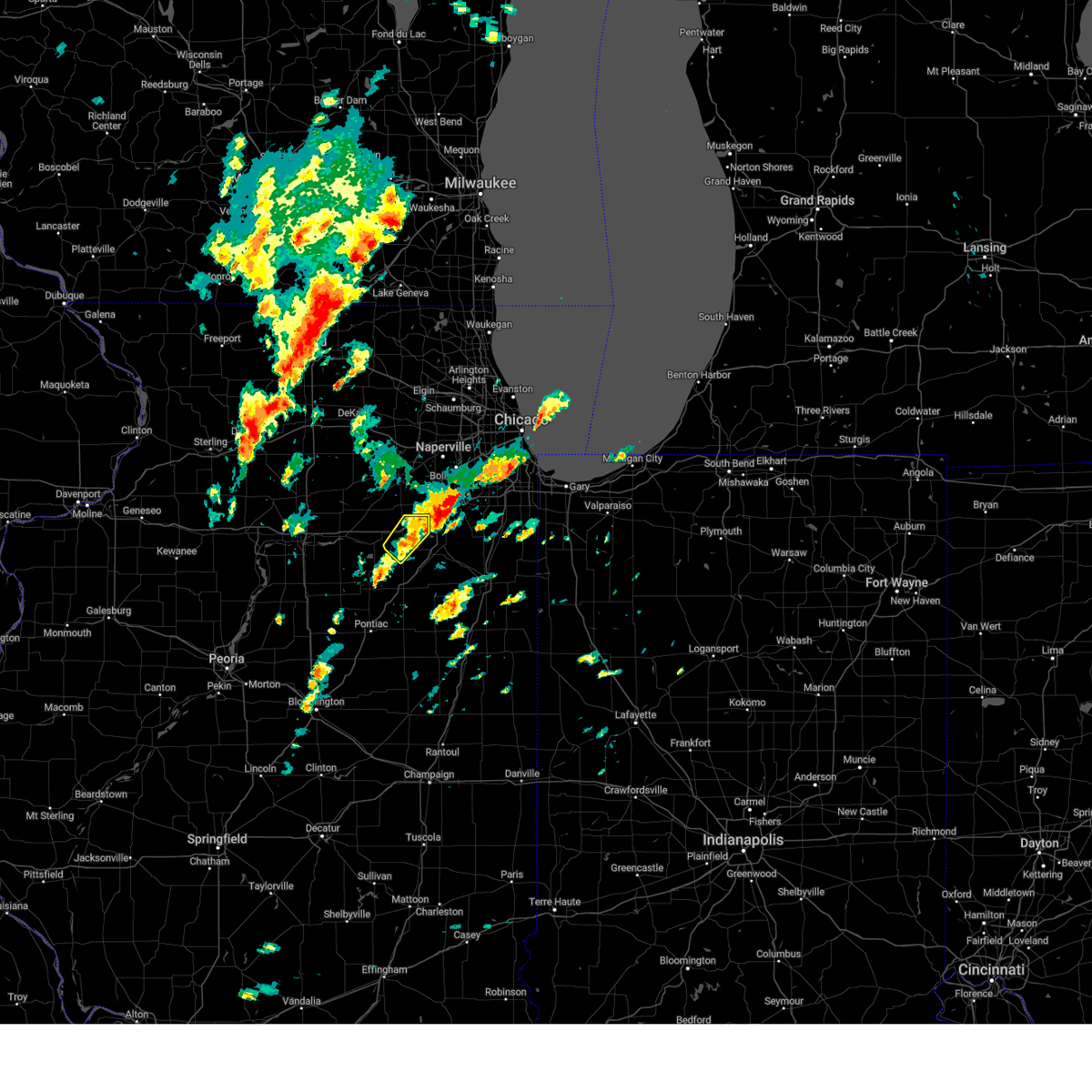 The storm which prompted the warning has moved out of the area. therefore, the warning will be allowed to expire. a tornado watch remains in effect until 800 pm cdt for northeastern illinois. The storm which prompted the warning has moved out of the area. therefore, the warning will be allowed to expire. a tornado watch remains in effect until 800 pm cdt for northeastern illinois.
|
| 5/7/2024 1:41 PM CDT |
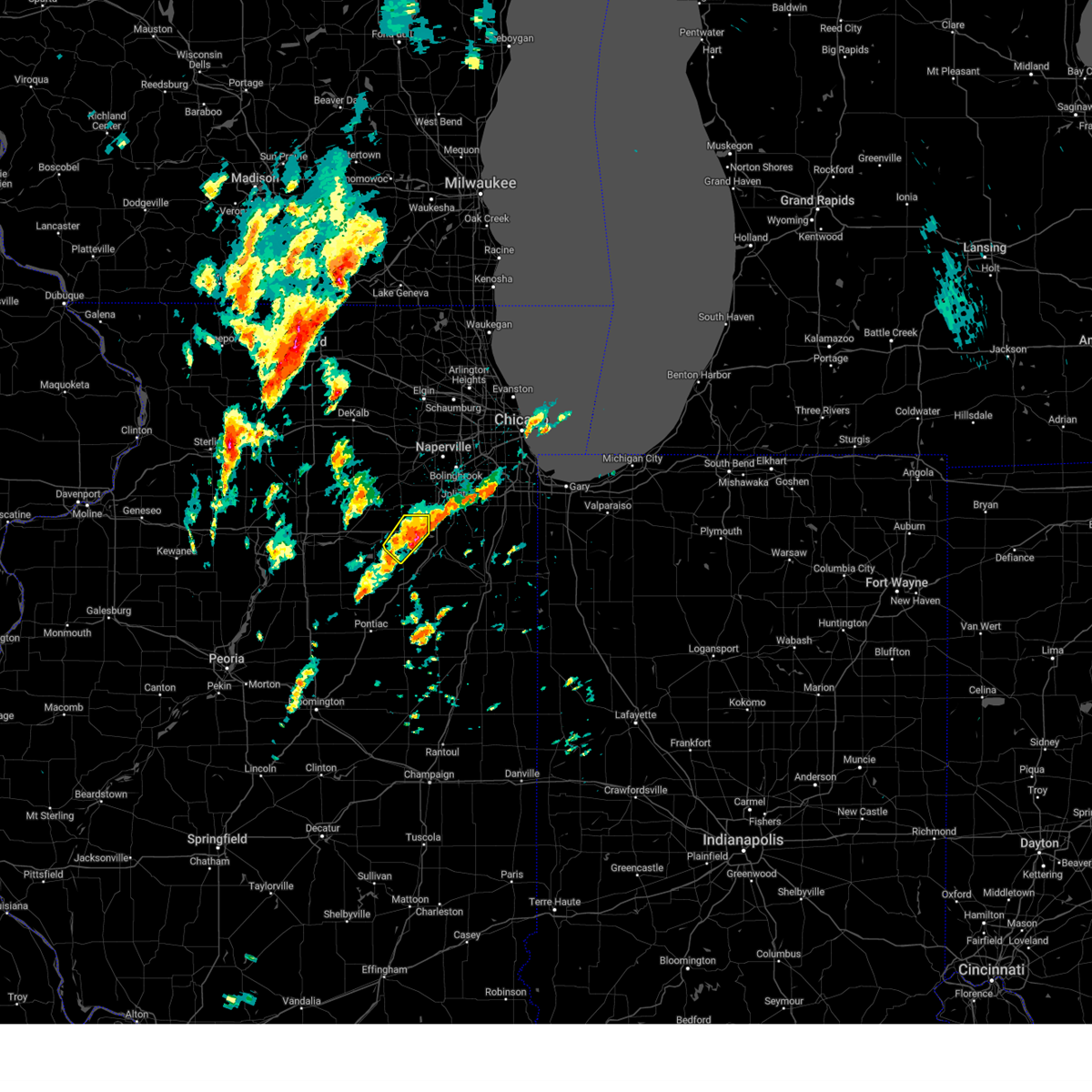 At 141 pm cdt, a severe thunderstorm was located near channahon, moving northeast at 45 mph. another thunderstorm was developing near mazon, also moving northeast at 45 mph (radar indicated). Hazards include 60 mph wind gusts and quarter size hail. Hail damage to vehicles is expected. expect wind damage to roofs, siding, and trees. Locations impacted include, morris, channahon, minooka, and mazon. At 141 pm cdt, a severe thunderstorm was located near channahon, moving northeast at 45 mph. another thunderstorm was developing near mazon, also moving northeast at 45 mph (radar indicated). Hazards include 60 mph wind gusts and quarter size hail. Hail damage to vehicles is expected. expect wind damage to roofs, siding, and trees. Locations impacted include, morris, channahon, minooka, and mazon.
|
| 5/7/2024 1:22 PM CDT |
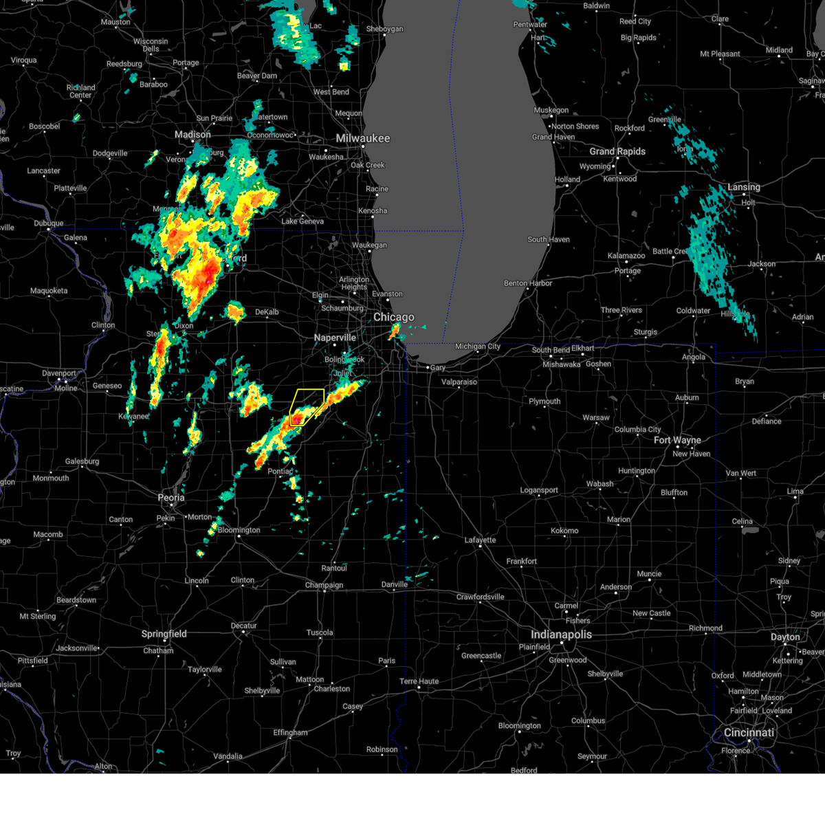 Svrlot the national weather service in chicago has issued a * severe thunderstorm warning for, northern grundy county in northeastern illinois, * until 200 pm cdt. * at 122 pm cdt, a severe thunderstorm was located near mazon, or near morris, moving northeast at 55 mph (radar indicated). Hazards include 60 mph wind gusts and quarter size hail. Hail damage to vehicles is expected. Expect wind damage to roofs, siding, and trees. Svrlot the national weather service in chicago has issued a * severe thunderstorm warning for, northern grundy county in northeastern illinois, * until 200 pm cdt. * at 122 pm cdt, a severe thunderstorm was located near mazon, or near morris, moving northeast at 55 mph (radar indicated). Hazards include 60 mph wind gusts and quarter size hail. Hail damage to vehicles is expected. Expect wind damage to roofs, siding, and trees.
|
| 7/28/2023 10:39 PM CDT |
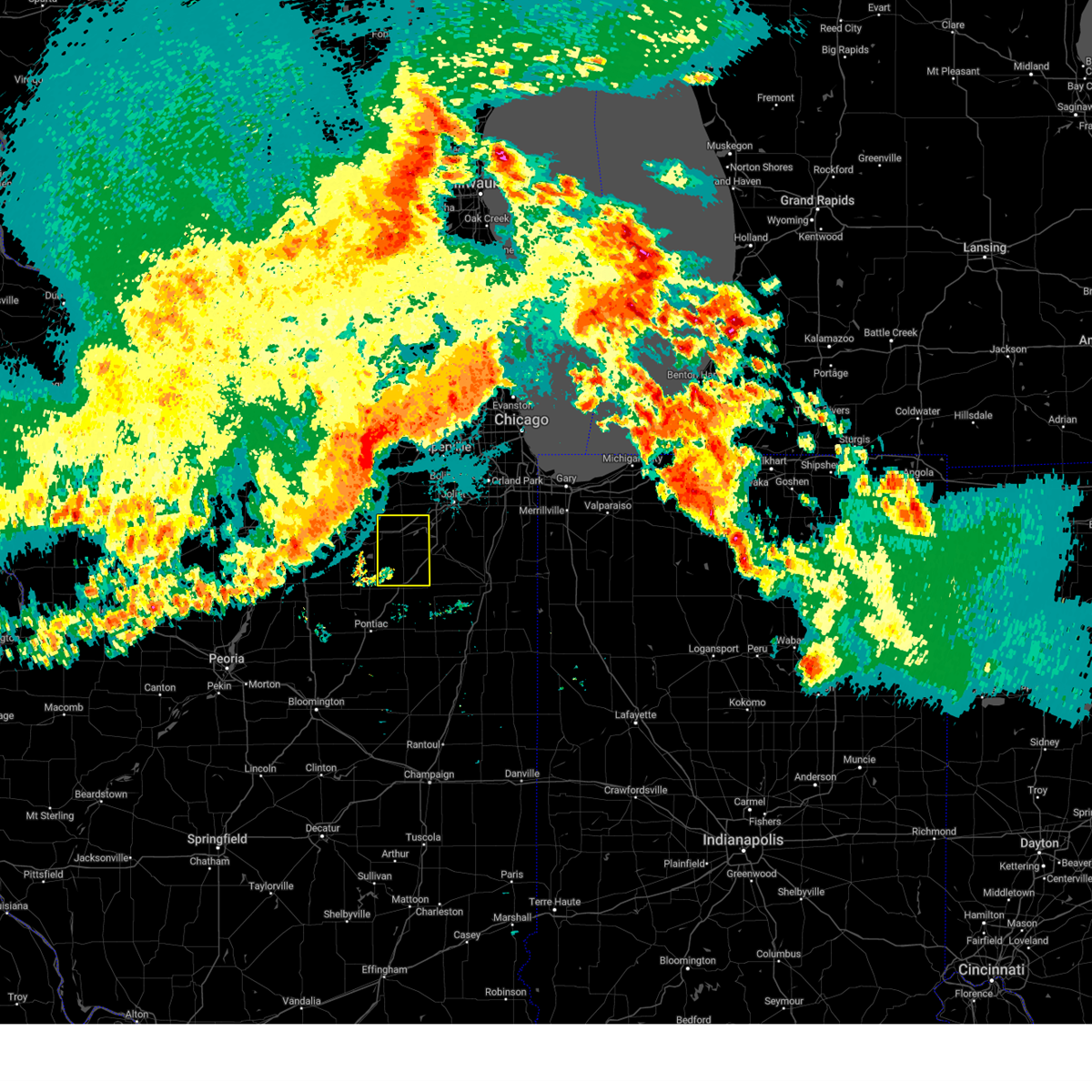 At 1038 pm cdt, severe thunderstorms were located along a line extending from near hinckley to serena to near oglesby, moving east-southeast 65 mph (radar indicated). Hazards include 60 mph wind gusts. expect damage to roofs, siding, and trees At 1038 pm cdt, severe thunderstorms were located along a line extending from near hinckley to serena to near oglesby, moving east-southeast 65 mph (radar indicated). Hazards include 60 mph wind gusts. expect damage to roofs, siding, and trees
|
| 6/29/2023 1:25 PM CDT | At 125 pm cdt, severe thunderstorms were located along a line extending from granville to tonica to 7 miles northeast of cornell, moving northeast at 35 mph (radar indicated). Hazards include 60 mph wind gusts. Expect damage to roofs, siding, and trees. locations impacted include, ottawa, streator, morris, channahon, minooka, peru, la salle, braidwood, coal city, marseilles, dwight, spring valley, oglesby, diamond, seneca, gardner, north utica, mazon, braceville and tonica. this includes, buffalo rock state park, gebhard woods state park, grundy county speedway and fairgrounds, illini state park, illinois valley community college, matthiessen state park, starved rock state park, and william g stratton state park. including the following interstates, i-39 between mile markers 41 and 65. i-55 between mile markers 220 and 233. i-80 between mile markers 73 and 120. hail threat, radar indicated max hail size, <. 75 in wind threat, radar indicated max wind gust, 60 mph. |
| 6/29/2023 1:09 PM CDT |
 At 108 pm cdt, severe thunderstorms were located along a line extending from tiskilwa to near south streator, moving northeast at 35 to 40 mph (radar indicated). Hazards include 60 mph wind gusts. Expect damage to roofs, siding, and trees. locations impacted include, ottawa, streator, morris, channahon, minooka, peru, la salle, braidwood, coal city, marseilles, dwight, spring valley, oglesby, diamond, seneca, gardner, north utica, mazon, braceville and tonica. this includes, buffalo rock state park, gebhard woods state park, grundy county speedway and fairgrounds, illini state park, illinois valley community college, matthiessen state park, starved rock state park, and william g stratton state park. including the following interstates, i-39 between mile markers 41 and 65. i-55 between mile markers 220 and 233. i-80 between mile markers 73 and 120. hail threat, radar indicated max hail size, <. 75 in wind threat, radar indicated max wind gust, 60 mph. At 108 pm cdt, severe thunderstorms were located along a line extending from tiskilwa to near south streator, moving northeast at 35 to 40 mph (radar indicated). Hazards include 60 mph wind gusts. Expect damage to roofs, siding, and trees. locations impacted include, ottawa, streator, morris, channahon, minooka, peru, la salle, braidwood, coal city, marseilles, dwight, spring valley, oglesby, diamond, seneca, gardner, north utica, mazon, braceville and tonica. this includes, buffalo rock state park, gebhard woods state park, grundy county speedway and fairgrounds, illini state park, illinois valley community college, matthiessen state park, starved rock state park, and william g stratton state park. including the following interstates, i-39 between mile markers 41 and 65. i-55 between mile markers 220 and 233. i-80 between mile markers 73 and 120. hail threat, radar indicated max hail size, <. 75 in wind threat, radar indicated max wind gust, 60 mph.
|
| 6/29/2023 12:54 PM CDT |
 At 1253 pm cdt, severe thunderstorms were located along a line extending from near bradford to toluca, moving northeast at 35 mph (radar indicated). Hazards include 60 mph wind gusts. expect damage to roofs, siding, and trees At 1253 pm cdt, severe thunderstorms were located along a line extending from near bradford to toluca, moving northeast at 35 mph (radar indicated). Hazards include 60 mph wind gusts. expect damage to roofs, siding, and trees
|
| 5/7/2023 9:10 PM CDT |
 The severe thunderstorm warning for southwestern will and northeastern grundy counties will expire at 915 pm cdt, the storm which prompted the warning has weakened below severe limits, and no longer poses an immediate threat to life or property. therefore, the warning will be allowed to expire. however small hail, gusty winds and heavy rain are still possible with this thunderstorm. a severe thunderstorm watch remains in effect until midnight cdt for northeastern illinois. The severe thunderstorm warning for southwestern will and northeastern grundy counties will expire at 915 pm cdt, the storm which prompted the warning has weakened below severe limits, and no longer poses an immediate threat to life or property. therefore, the warning will be allowed to expire. however small hail, gusty winds and heavy rain are still possible with this thunderstorm. a severe thunderstorm watch remains in effect until midnight cdt for northeastern illinois.
|
| 5/7/2023 9:01 PM CDT |
 At 901 pm cdt, severe thunderstorms were located along a line extending from near morris to odell to chenoa, moving southeast at 40 mph (radar indicated). Hazards include 60 mph wind gusts. Expect damage to roofs, siding, and trees. these severe storms will be near, fairbury, gardner and saunemin around 915 pm cdt. braceville around 920 pm cdt. forrest and cullom around 925 pm cdt. other locations impacted by these severe thunderstorms include campus, ransom, dana, south wilmington, kinsman, norway, reddick, east brooklyn, verona and emington. this includes, illini state park. including the following interstates, i-55 between mile markers 188 and 232. i-80 between mile markers 97 and 111. hail threat, radar indicated max hail size, <. 75 in wind threat, radar indicated max wind gust, 60 mph. At 901 pm cdt, severe thunderstorms were located along a line extending from near morris to odell to chenoa, moving southeast at 40 mph (radar indicated). Hazards include 60 mph wind gusts. Expect damage to roofs, siding, and trees. these severe storms will be near, fairbury, gardner and saunemin around 915 pm cdt. braceville around 920 pm cdt. forrest and cullom around 925 pm cdt. other locations impacted by these severe thunderstorms include campus, ransom, dana, south wilmington, kinsman, norway, reddick, east brooklyn, verona and emington. this includes, illini state park. including the following interstates, i-55 between mile markers 188 and 232. i-80 between mile markers 97 and 111. hail threat, radar indicated max hail size, <. 75 in wind threat, radar indicated max wind gust, 60 mph.
|
| 5/7/2023 8:49 PM CDT |
 At 848 pm cdt, a severe thunderstorm was located near wilmington, moving east at 10 mph (radar indicated). Hazards include 60 mph wind gusts and quarter size hail. Hail damage to vehicles is expected. expect wind damage to roofs, siding, and trees. locations impacted include, channahon, minooka, braidwood, wilmington, coal city, diamond, elwood, lakewood shores and carbon hill. this includes, channahon state park. including the following interstates, i-55 between mile markers 233 and 248. i-80 near mile marker 123. hail threat, radar indicated max hail size, 1. 00 in wind threat, radar indicated max wind gust, 60 mph. At 848 pm cdt, a severe thunderstorm was located near wilmington, moving east at 10 mph (radar indicated). Hazards include 60 mph wind gusts and quarter size hail. Hail damage to vehicles is expected. expect wind damage to roofs, siding, and trees. locations impacted include, channahon, minooka, braidwood, wilmington, coal city, diamond, elwood, lakewood shores and carbon hill. this includes, channahon state park. including the following interstates, i-55 between mile markers 233 and 248. i-80 near mile marker 123. hail threat, radar indicated max hail size, 1. 00 in wind threat, radar indicated max wind gust, 60 mph.
|
| 5/7/2023 8:42 PM CDT |
 At 841 pm cdt, severe thunderstorms were located along a line extending from 6 miles northeast of marseilles to near cornell to near minonk, moving southeast at 35 mph (radar indicated). Hazards include 60 mph wind gusts. Expect damage to roofs, siding, and trees. severe thunderstorms will be near, cornell around 845 pm cdt. gridley around 855 pm cdt. morris and odell around 900 pm cdt. other locations in the path of these severe thunderstorms include mazon, gardner, braceville, saunemin, fairbury, cullom and chatsworth. including the following interstates, i-55 between mile markers 188 and 232. i-80 between mile markers 97 and 111. hail threat, radar indicated max hail size, <. 75 in wind threat, radar indicated max wind gust, 60 mph. At 841 pm cdt, severe thunderstorms were located along a line extending from 6 miles northeast of marseilles to near cornell to near minonk, moving southeast at 35 mph (radar indicated). Hazards include 60 mph wind gusts. Expect damage to roofs, siding, and trees. severe thunderstorms will be near, cornell around 845 pm cdt. gridley around 855 pm cdt. morris and odell around 900 pm cdt. other locations in the path of these severe thunderstorms include mazon, gardner, braceville, saunemin, fairbury, cullom and chatsworth. including the following interstates, i-55 between mile markers 188 and 232. i-80 between mile markers 97 and 111. hail threat, radar indicated max hail size, <. 75 in wind threat, radar indicated max wind gust, 60 mph.
|
| 5/7/2023 8:29 PM CDT |
 At 828 pm cdt, a severe thunderstorm was located near channahon, and is nearly stationary and developing slowly south and east (radar indicated). Hazards include 60 mph wind gusts and quarter size hail. Hail damage to vehicles is expected. Expect wind damage to roofs, siding, and trees. At 828 pm cdt, a severe thunderstorm was located near channahon, and is nearly stationary and developing slowly south and east (radar indicated). Hazards include 60 mph wind gusts and quarter size hail. Hail damage to vehicles is expected. Expect wind damage to roofs, siding, and trees.
|
| 5/7/2023 7:58 PM CDT |
 The severe thunderstorm warning for southern kendall, northern la salle, southern will, northern grundy and northeastern kankakee counties will expire at 800 pm cdt, the storms which prompted the warning have weakened below severe limits. therefore, the warning will be allowed to expire. however small hail, gusty winds and heavy rain are still possible with these thunderstorms. a severe thunderstorm watch remains in effect until midnight cdt for north central and northeastern illinois. in addition, flash flood warnings are also in effect for much of this area. The severe thunderstorm warning for southern kendall, northern la salle, southern will, northern grundy and northeastern kankakee counties will expire at 800 pm cdt, the storms which prompted the warning have weakened below severe limits. therefore, the warning will be allowed to expire. however small hail, gusty winds and heavy rain are still possible with these thunderstorms. a severe thunderstorm watch remains in effect until midnight cdt for north central and northeastern illinois. in addition, flash flood warnings are also in effect for much of this area.
|
| 5/7/2023 7:40 PM CDT |
 At 739 pm cdt, severe thunderstorms were located along a line extending from mendota to near minooka to near grant park, and are nearly stationary (radar indicated). Hazards include 60 mph wind gusts and quarter size hail. Hail damage to vehicles is expected. expect wind damage to roofs, siding, and trees. locations impacted include, joliet, ottawa, bourbonnais, bradley, morris, channahon, minooka, manteno, mendota, braidwood, wilmington, coal city, marseilles, peotone, momence, sheridan, shorewood, manhattan, monee and beecher. including the following interstates, i-39 between mile markers 62 and 76. i-55 between mile markers 232 and 252. i-57 between mile markers 315 and 332. I-80 between mile markers 87 and 129. At 739 pm cdt, severe thunderstorms were located along a line extending from mendota to near minooka to near grant park, and are nearly stationary (radar indicated). Hazards include 60 mph wind gusts and quarter size hail. Hail damage to vehicles is expected. expect wind damage to roofs, siding, and trees. locations impacted include, joliet, ottawa, bourbonnais, bradley, morris, channahon, minooka, manteno, mendota, braidwood, wilmington, coal city, marseilles, peotone, momence, sheridan, shorewood, manhattan, monee and beecher. including the following interstates, i-39 between mile markers 62 and 76. i-55 between mile markers 232 and 252. i-57 between mile markers 315 and 332. I-80 between mile markers 87 and 129.
|
| 5/7/2023 7:32 PM CDT | Golf Ball sized hail reported 6.8 miles SSE of Morris, IL, photo shared on social media. location estimated. time based on phone timestamp. |
| 5/7/2023 7:24 PM CDT |
 At 723 pm cdt, severe thunderstorms were located along a line extending from near mendota to near grant park, and are nearly stationary (radar indicated). Hazards include 60 mph wind gusts and quarter size hail. Hail damage to vehicles is expected. expect wind damage to roofs, siding, and trees. locations impacted include, joliet, ottawa, bourbonnais, bradley, morris, channahon, minooka, manteno, mendota, braidwood, wilmington, coal city, marseilles, peotone, momence, sheridan, shorewood, manhattan, monee and beecher. including the following interstates, i-39 between mile markers 62 and 76. i-55 between mile markers 232 and 252. i-57 between mile markers 315 and 332. I-80 between mile markers 87 and 129. At 723 pm cdt, severe thunderstorms were located along a line extending from near mendota to near grant park, and are nearly stationary (radar indicated). Hazards include 60 mph wind gusts and quarter size hail. Hail damage to vehicles is expected. expect wind damage to roofs, siding, and trees. locations impacted include, joliet, ottawa, bourbonnais, bradley, morris, channahon, minooka, manteno, mendota, braidwood, wilmington, coal city, marseilles, peotone, momence, sheridan, shorewood, manhattan, monee and beecher. including the following interstates, i-39 between mile markers 62 and 76. i-55 between mile markers 232 and 252. i-57 between mile markers 315 and 332. I-80 between mile markers 87 and 129.
|
| 5/7/2023 7:10 PM CDT |
 At 710 pm cdt, severe thunderstorms were located along a line extending from near mendota to near grant park, and are nearly stationary (radar indicated). Hazards include 60 mph wind gusts and quarter size hail. Hail damage to vehicles is expected. expect wind damage to roofs, siding, and trees. locations impacted include, joliet, ottawa, bourbonnais, bradley, morris, channahon, minooka, manteno, mendota, braidwood, wilmington, coal city, marseilles, peotone, momence, sheridan, shorewood, manhattan, monee and beecher. including the following interstates, i-39 between mile markers 62 and 76. i-55 between mile markers 232 and 252. i-57 between mile markers 315 and 332. i-80 between mile markers 87 and 129. hail threat, radar indicated max hail size, 1. 00 in wind threat, radar indicated max wind gust, 60 mph. At 710 pm cdt, severe thunderstorms were located along a line extending from near mendota to near grant park, and are nearly stationary (radar indicated). Hazards include 60 mph wind gusts and quarter size hail. Hail damage to vehicles is expected. expect wind damage to roofs, siding, and trees. locations impacted include, joliet, ottawa, bourbonnais, bradley, morris, channahon, minooka, manteno, mendota, braidwood, wilmington, coal city, marseilles, peotone, momence, sheridan, shorewood, manhattan, monee and beecher. including the following interstates, i-39 between mile markers 62 and 76. i-55 between mile markers 232 and 252. i-57 between mile markers 315 and 332. i-80 between mile markers 87 and 129. hail threat, radar indicated max hail size, 1. 00 in wind threat, radar indicated max wind gust, 60 mph.
|
| 5/7/2023 6:54 PM CDT |
 At 654 pm cdt, severe thunderstorms were located along a line extending from near mendota to near grant park, and are nearly stationary (radar indicated). Hazards include quarter size hail. damage to vehicles is expected At 654 pm cdt, severe thunderstorms were located along a line extending from near mendota to near grant park, and are nearly stationary (radar indicated). Hazards include quarter size hail. damage to vehicles is expected
|
| 4/20/2023 6:06 PM CDT |
 At 605 pm cdt, a severe thunderstorm was located 7 miles west of dwight, moving northeast at 50 mph (radar indicated). Hazards include 60 mph wind gusts and quarter size hail. Hail damage to vehicles is expected. Expect wind damage to roofs, siding, and trees. At 605 pm cdt, a severe thunderstorm was located 7 miles west of dwight, moving northeast at 50 mph (radar indicated). Hazards include 60 mph wind gusts and quarter size hail. Hail damage to vehicles is expected. Expect wind damage to roofs, siding, and trees.
|
| 3/31/2023 8:15 PM CDT | At kc09 morris airport awos statio in grundy county IL, 5 miles S of Morris, IL |
| 3/26/2023 4:13 PM CDT |
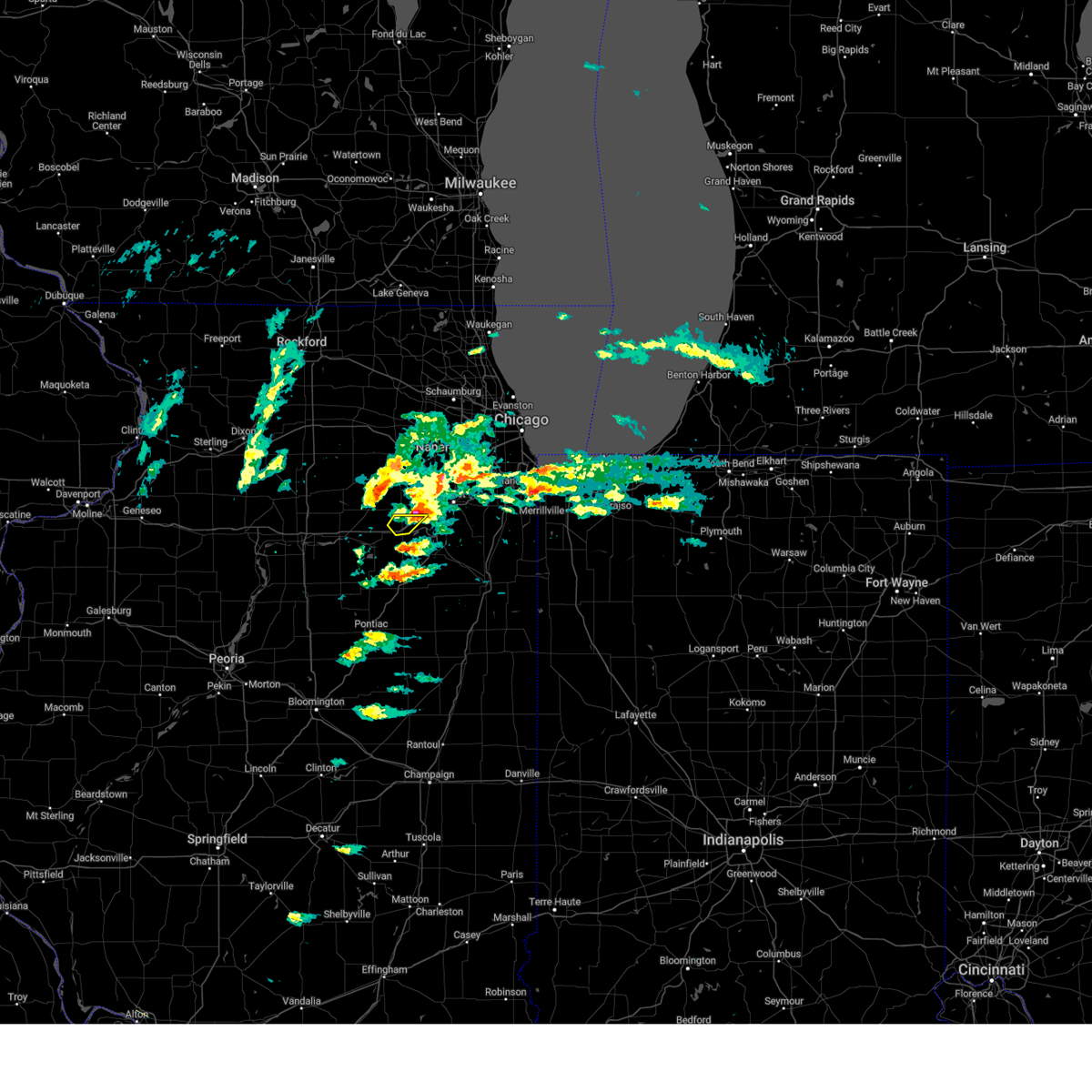 The severe thunderstorm warning for north central grundy county will expire at 415 pm cdt, the storm which prompted the warning has weakened below severe limits, and has exited the warned area. therefore, the warning will be allowed to expire. The severe thunderstorm warning for north central grundy county will expire at 415 pm cdt, the storm which prompted the warning has weakened below severe limits, and has exited the warned area. therefore, the warning will be allowed to expire.
|
| 3/26/2023 3:54 PM CDT |
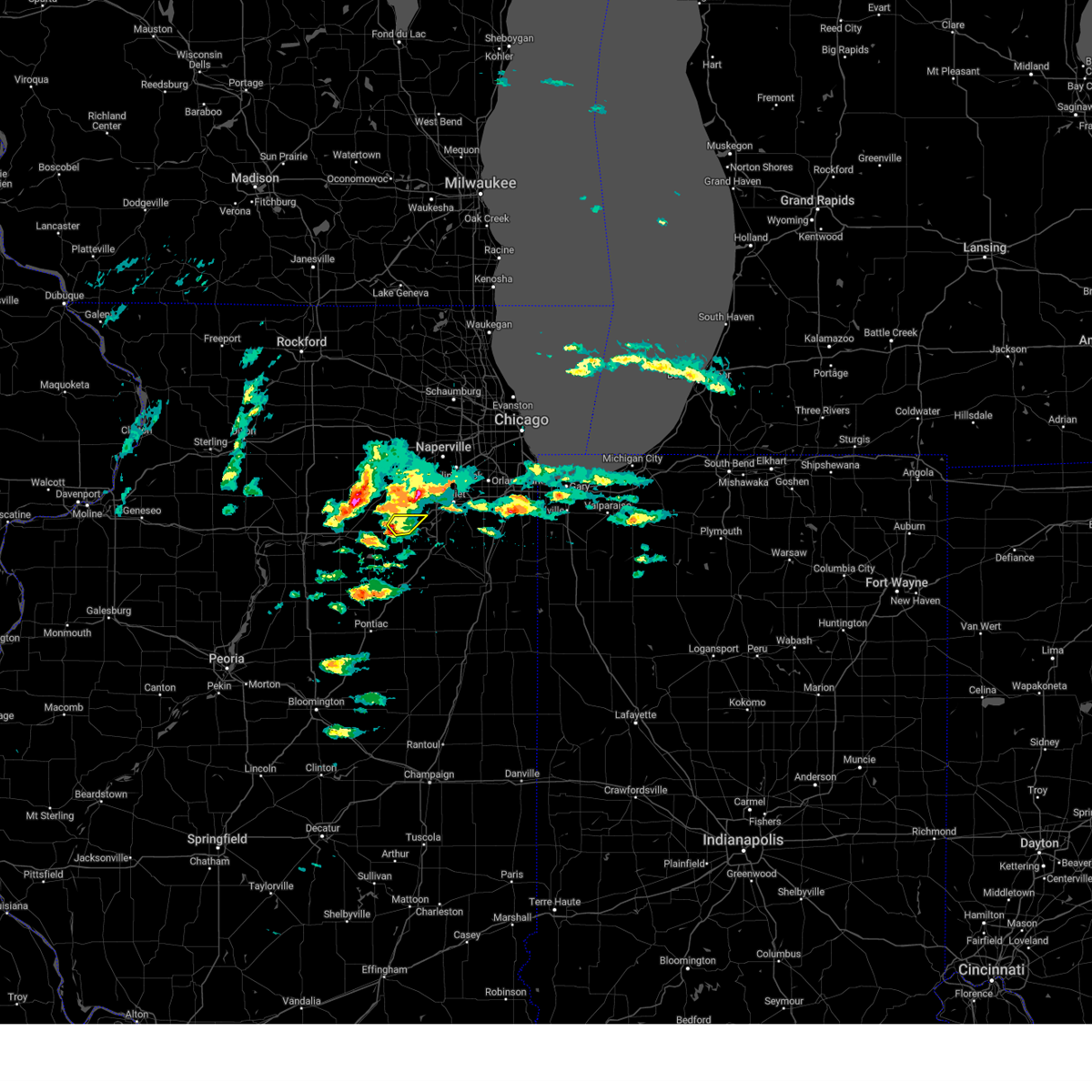 At 353 pm cdt, a severe thunderstorm was located near newark, or 8 miles north of morris, moving northeast at 30 mph (radar indicated). Hazards include quarter size hail. Damage to vehicles is expected. locations impacted include, morris and minooka. this includes, grundy county speedway and fairgrounds. including the following interstate, i-80 between mile markers 109 and 120. hail threat, radar indicated max hail size, 1. 00 in wind threat, radar indicated max wind gust, <50 mph. At 353 pm cdt, a severe thunderstorm was located near newark, or 8 miles north of morris, moving northeast at 30 mph (radar indicated). Hazards include quarter size hail. Damage to vehicles is expected. locations impacted include, morris and minooka. this includes, grundy county speedway and fairgrounds. including the following interstate, i-80 between mile markers 109 and 120. hail threat, radar indicated max hail size, 1. 00 in wind threat, radar indicated max wind gust, <50 mph.
|
| 3/26/2023 3:41 PM CDT |
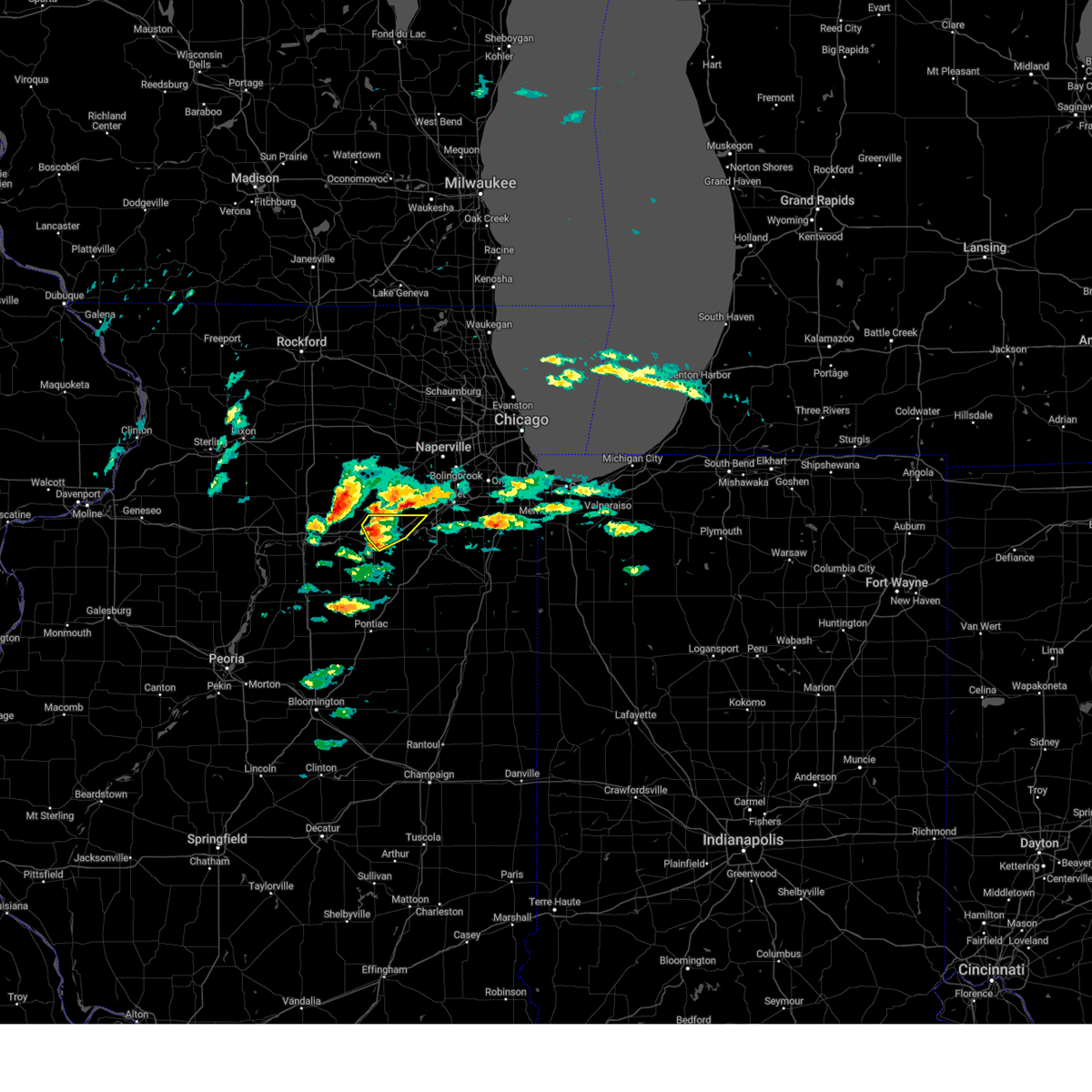 At 340 pm cdt, a severe thunderstorm was located 7 miles south of newark, or 8 miles northeast of marseilles, moving northeast at 40 mph (radar indicated. at 330 pm, dime size hail was reported in marseilles). Hazards include quarter size hail. Damage to vehicles is expected. locations impacted include, morris, minooka and seneca. this includes, gebhard woods state park, grundy county speedway and fairgrounds, and william g stratton state park. including the following interstate, i-80 between mile markers 99 and 120. hail threat, radar indicated max hail size, 1. 00 in wind threat, radar indicated max wind gust, <50 mph. At 340 pm cdt, a severe thunderstorm was located 7 miles south of newark, or 8 miles northeast of marseilles, moving northeast at 40 mph (radar indicated. at 330 pm, dime size hail was reported in marseilles). Hazards include quarter size hail. Damage to vehicles is expected. locations impacted include, morris, minooka and seneca. this includes, gebhard woods state park, grundy county speedway and fairgrounds, and william g stratton state park. including the following interstate, i-80 between mile markers 99 and 120. hail threat, radar indicated max hail size, 1. 00 in wind threat, radar indicated max wind gust, <50 mph.
|
| 3/26/2023 3:23 PM CDT |
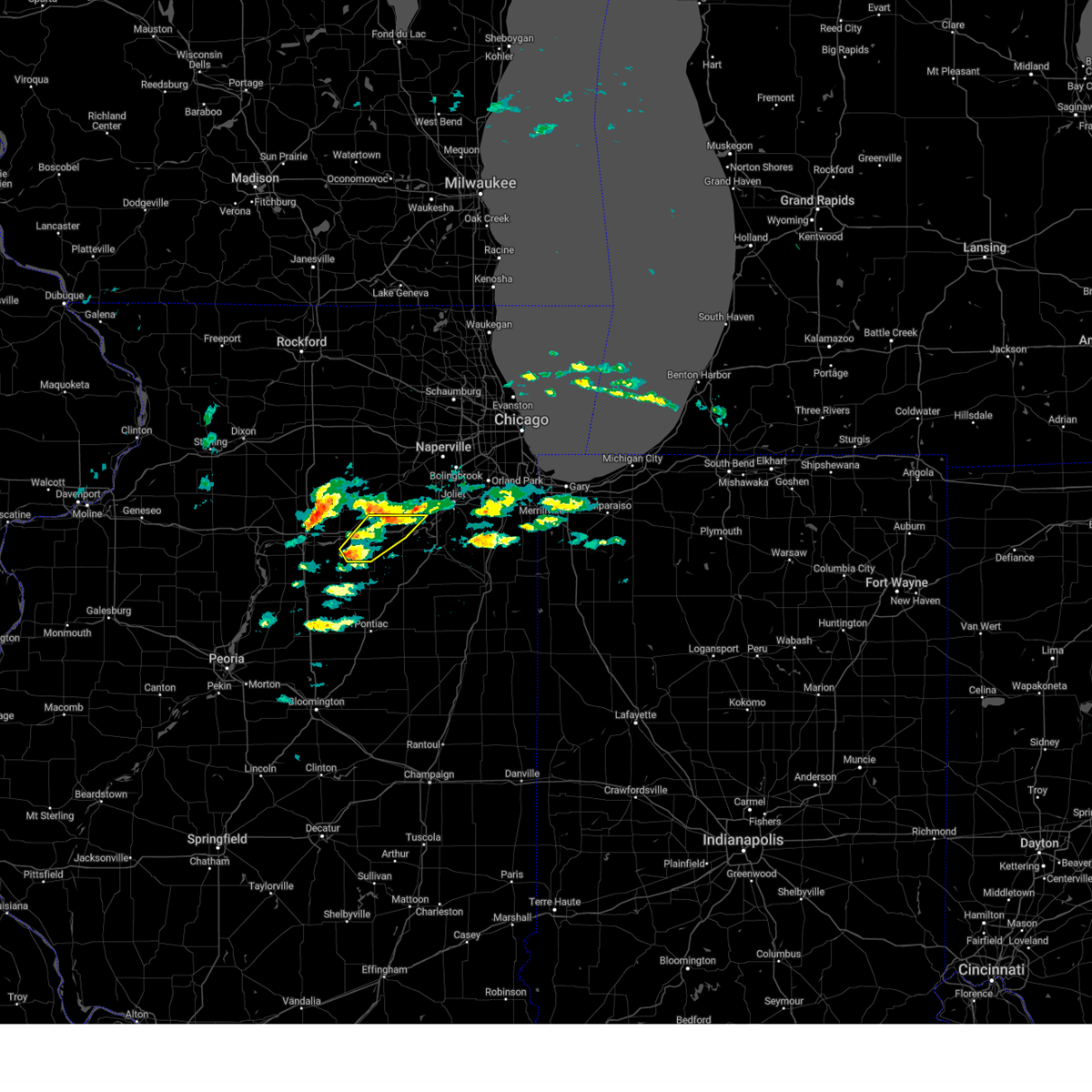 At 323 pm cdt, a severe thunderstorm was located near grand ridge, or near marseilles, moving northeast at 30 mph (radar indicated). Hazards include quarter size hail. damage to vehicles is expected At 323 pm cdt, a severe thunderstorm was located near grand ridge, or near marseilles, moving northeast at 30 mph (radar indicated). Hazards include quarter size hail. damage to vehicles is expected
|
| 11/5/2022 10:52 AM CDT |
 At 1052 am cdt, severe thunderstorms were located along a line extending from near cherry valley to near waterman to near marseilles to near odell, moving east at 40 mph (radar indicated). Hazards include 60 mph wind gusts. expect damage to roofs, siding, and trees At 1052 am cdt, severe thunderstorms were located along a line extending from near cherry valley to near waterman to near marseilles to near odell, moving east at 40 mph (radar indicated). Hazards include 60 mph wind gusts. expect damage to roofs, siding, and trees
|
| 8/29/2022 1:10 PM CDT | At 110 pm cdt, severe thunderstorms were located along a line extending from near new lenox to near saunemin, moving east at 50 mph (radar indicated). Hazards include 60 mph wind gusts and nickel size hail. Expect damage to roofs, siding, and trees. locations impacted include, joliet, orland park, tinley park, romeoville, plainfield, calumet city, chicago heights, lansing, oak forest, kankakee, harvey, lockport, new lenox, homer glen, dolton, park forest, homewood, matteson, mokena and bourbonnais. this includes, university of st. Francis, channahon state park, chicagoland speedway route 66 raceway, first midwest bank amphitheatre, governors state university, joliet junior college, joliet slammers baseball, kankakee community college, kankakee county fairgrounds and speedway, kankakee river state park, lewis university, olivet nazarine university, prairie state college, south suburban college, will county fairgrounds, and north central college. |
| 8/29/2022 12:59 PM CDT | At 1259 pm cdt, severe thunderstorms were located along a line extending from near shorewood to near odell, moving east at 50 mph (radar indicated). Hazards include 60 mph wind gusts and nickel size hail. Expect damage to roofs, siding, and trees. locations impacted include, joliet, orland park, tinley park, romeoville, plainfield, calumet city, chicago heights, lansing, oak forest, kankakee, harvey, lockport, new lenox, homer glen, dolton, park forest, homewood, matteson, mokena and bourbonnais. this includes, university of st. Francis, channahon state park, chicagoland speedway route 66 raceway, first midwest bank amphitheatre, governors state university, joliet junior college, joliet slammers baseball, kankakee community college, kankakee county fairgrounds and speedway, kankakee river state park, lewis university, olivet nazarine university, prairie state college, south suburban college, will county fairgrounds, and north central college. |
| 8/29/2022 12:54 PM CDT | At 1254 pm cdt, severe thunderstorms were located along a line extending from 7 miles southeast of yorkville to near seneca, moving east at 45 mph. these storms have produced a 51 mph gust at morris (radar indicated). Hazards include 60 mph wind gusts and nickel size hail. Expect damage to roofs, siding, and trees. locations impacted include, yorkville, morris, marseilles, seneca, newark, millington, millbrook, lisbon, plattville and norway. this includes, gebhard woods state park, grundy county speedway and fairgrounds, and william g stratton state park. Including the following interstate, i-80 between mile markers 96 and 114. |
| 8/29/2022 12:51 PM CDT | 911 call center relayed a large tree branch was downed and blocked both directions of sand ridge road. time estimated by rada in grundy county IL, 6.3 miles SW of Morris, IL |
| 8/29/2022 12:44 PM CDT | At 1243 pm cdt, severe thunderstorms were located along a line extending from near yorkville to near cornell, moving east at 50 mph (radar indicated). Hazards include 60 mph wind gusts and nickel size hail. expect damage to roofs, siding, and trees |
| 8/29/2022 12:38 PM CDT | At 1238 pm cdt, severe thunderstorms were located along a line extending from near newark to marseilles, moving east at 50 mph (radar indicated). Hazards include 60 mph wind gusts and nickel size hail. Expect damage to roofs, siding, and trees. locations impacted include, ottawa, yorkville, morris, peru, la salle, marseilles, sheridan, lake holiday, seneca, somonauk, earlville, north utica, serena, newark, leland, naplate, millington, dayton, millbrook and lisbon. this includes, buffalo rock state park, gebhard woods state park, grundy county speedway and fairgrounds, illini state park, and william g stratton state park. including the following interstates, i-39 between mile markers 57 and 61. I-80 between mile markers 78 and 114. |
| 8/29/2022 12:24 PM CDT | At 1223 pm cdt, severe thunderstorms were located along a line extending from near leland to naplate, moving east at 50 mph. strong winds will persist behind the leading edge of the storms for a period (radar indicated). Hazards include 60 mph wind gusts and nickel size hail. Expect damage to roofs, siding, and trees. locations impacted include, ottawa, yorkville, morris, peru, la salle, mendota, marseilles, sheridan, lake holiday, seneca, somonauk, earlville, north utica, serena, newark, leland, naplate, millington, dayton and millbrook. this includes, buffalo rock state park, gebhard woods state park, grundy county speedway and fairgrounds, illini state park, tri-county fairgrounds, and william g stratton state park. including the following interstates, i-39 between mile markers 57 and 77. I-80 between mile markers 74 and 114. |
| 8/29/2022 12:19 PM CDT | At 1218 pm cdt, severe thunderstorms were located along a line extending from near earlville to near north utica, moving east at 45 mph (radar indicated). Hazards include 60 mph wind gusts and nickel size hail. expect damage to roofs, siding, and trees |
| 4/30/2022 7:13 PM CDT |
 The severe thunderstorm warning for southeastern kendall and grundy counties will expire at 715 pm cdt, the storms which prompted the warning have weakened and moved out of the warned area. therefore, the warning will be allowed to expire. a tornado watch remains in effect until 800 pm cdt for northeastern illinois. The severe thunderstorm warning for southeastern kendall and grundy counties will expire at 715 pm cdt, the storms which prompted the warning have weakened and moved out of the warned area. therefore, the warning will be allowed to expire. a tornado watch remains in effect until 800 pm cdt for northeastern illinois.
|
| 4/30/2022 7:00 PM CDT |
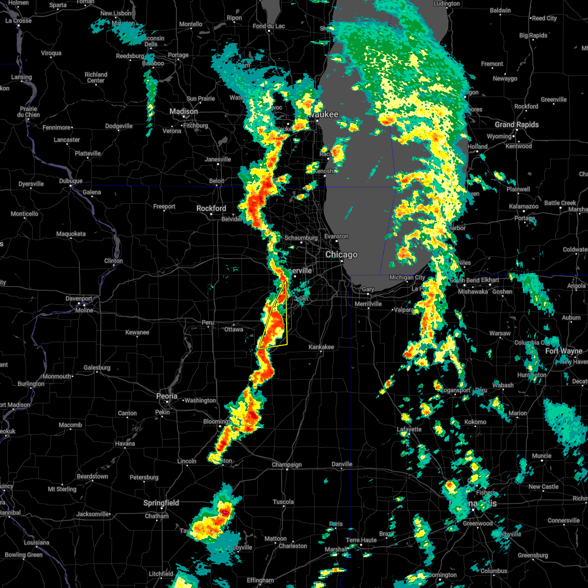 At 659 pm cdt, severe thunderstorms were located along a line extending from near plainfield to near mazon, moving northeast at 30 mph (radar indicated). Hazards include 60 mph wind gusts and nickel size hail. Expect damage to roofs, siding, and trees. locations impacted include, joliet, plainfield, morris, channahon, minooka, braidwood, coal city, diamond, gardner, mazon, braceville, south wilmington, godley, carbon hill and verona. this includes, gebhard woods state park, grundy county speedway and fairgrounds, and william g stratton state park. including the following interstates, i-55 between mile markers 226 and 234. I-80 between mile markers 111 and 122. At 659 pm cdt, severe thunderstorms were located along a line extending from near plainfield to near mazon, moving northeast at 30 mph (radar indicated). Hazards include 60 mph wind gusts and nickel size hail. Expect damage to roofs, siding, and trees. locations impacted include, joliet, plainfield, morris, channahon, minooka, braidwood, coal city, diamond, gardner, mazon, braceville, south wilmington, godley, carbon hill and verona. this includes, gebhard woods state park, grundy county speedway and fairgrounds, and william g stratton state park. including the following interstates, i-55 between mile markers 226 and 234. I-80 between mile markers 111 and 122.
|
| 4/30/2022 6:44 PM CDT |
 At 643 pm cdt, severe thunderstorms were located along a line extending from yorkville to south of mazon, moving northeast at 40 mph (radar indicated). Hazards include 60 mph wind gusts and quarter size hail. Hail damage to vehicles is expected. expect wind damage to roofs, siding, and trees. locations impacted include, aurora, joliet, plainfield, oswego, yorkville, morris, channahon, minooka, braidwood, coal city, montgomery, boulder hill, diamond, gardner, mazon, braceville, south wilmington, godley, carbon hill and plattville. this includes, gebhard woods state park, grundy county speedway and fairgrounds, and william g stratton state park. including the following interstates, i-55 between mile markers 226 and 234. I-80 between mile markers 107 and 122. At 643 pm cdt, severe thunderstorms were located along a line extending from yorkville to south of mazon, moving northeast at 40 mph (radar indicated). Hazards include 60 mph wind gusts and quarter size hail. Hail damage to vehicles is expected. expect wind damage to roofs, siding, and trees. locations impacted include, aurora, joliet, plainfield, oswego, yorkville, morris, channahon, minooka, braidwood, coal city, montgomery, boulder hill, diamond, gardner, mazon, braceville, south wilmington, godley, carbon hill and plattville. this includes, gebhard woods state park, grundy county speedway and fairgrounds, and william g stratton state park. including the following interstates, i-55 between mile markers 226 and 234. I-80 between mile markers 107 and 122.
|
| 4/30/2022 6:25 PM CDT |
 At 624 pm cdt, severe thunderstorms were located along a line extending from 6 miles south of newark to near cornell, moving northeast at 40 mph (radar indicated). Hazards include 60 mph wind gusts and quarter size hail. Hail damage to vehicles is expected. Expect wind damage to roofs, siding, and trees. At 624 pm cdt, severe thunderstorms were located along a line extending from 6 miles south of newark to near cornell, moving northeast at 40 mph (radar indicated). Hazards include 60 mph wind gusts and quarter size hail. Hail damage to vehicles is expected. Expect wind damage to roofs, siding, and trees.
|
| 4/30/2022 4:16 PM CDT |
 At 416 pm cdt, a severe thunderstorm was located near coal city, moving northeast at 45 mph (radar indicated). Hazards include 60 mph wind gusts and quarter size hail. Hail damage to vehicles is expected. expect wind damage to roofs, siding, and trees. this severe storm will be near, channahon and minooka around 425 pm cdt. elwood around 430 pm cdt. other locations impacted by this severe thunderstorm include carbon hill. this includes, channahon state park and william g stratton state park. including the following interstates, i-55 between mile markers 234 and 248. I-80 between mile markers 114 and 119. At 416 pm cdt, a severe thunderstorm was located near coal city, moving northeast at 45 mph (radar indicated). Hazards include 60 mph wind gusts and quarter size hail. Hail damage to vehicles is expected. expect wind damage to roofs, siding, and trees. this severe storm will be near, channahon and minooka around 425 pm cdt. elwood around 430 pm cdt. other locations impacted by this severe thunderstorm include carbon hill. this includes, channahon state park and william g stratton state park. including the following interstates, i-55 between mile markers 234 and 248. I-80 between mile markers 114 and 119.
|
| 4/30/2022 4:01 PM CDT |
 At 400 pm cdt, a severe thunderstorm was located over mazon, or 8 miles north of dwight, moving northeast at 50 mph (radar indicated). Hazards include 60 mph wind gusts and quarter size hail. Hail damage to vehicles is expected. expect wind damage to roofs, siding, and trees. this severe storm will be near, gardner around 405 pm cdt. morris, braidwood, coal city and diamond around 415 pm cdt. channahon and minooka around 425 pm cdt. elwood around 430 pm cdt. other locations impacted by this severe thunderstorm include verona, kinsman, carbon hill and godley. this includes, channahon state park, gebhard woods state park, grundy county speedway and fairgrounds, and william g stratton state park. including the following interstates, i-55 between mile markers 219 and 248. I-80 between mile markers 110 and 120. At 400 pm cdt, a severe thunderstorm was located over mazon, or 8 miles north of dwight, moving northeast at 50 mph (radar indicated). Hazards include 60 mph wind gusts and quarter size hail. Hail damage to vehicles is expected. expect wind damage to roofs, siding, and trees. this severe storm will be near, gardner around 405 pm cdt. morris, braidwood, coal city and diamond around 415 pm cdt. channahon and minooka around 425 pm cdt. elwood around 430 pm cdt. other locations impacted by this severe thunderstorm include verona, kinsman, carbon hill and godley. this includes, channahon state park, gebhard woods state park, grundy county speedway and fairgrounds, and william g stratton state park. including the following interstates, i-55 between mile markers 219 and 248. I-80 between mile markers 110 and 120.
|
| 4/30/2022 3:49 PM CDT |
 At 348 pm cdt, a severe thunderstorm was located 7 miles west of dwight, moving northeast at 50 mph (radar indicated). Hazards include 60 mph wind gusts and quarter size hail. Hail damage to vehicles is expected. expect wind damage to roofs, siding, and trees. this severe thunderstorm will be near, mazon around 400 pm cdt. morris, coal city and diamond around 410 pm cdt. channahon and minooka around 420 pm cdt. elwood around 425 pm cdt. other locations impacted by this severe thunderstorm include verona, kinsman, carbon hill and godley. including the following interstates, i-55 between mile markers 216 and 248. I-80 between mile markers 110 and 120. At 348 pm cdt, a severe thunderstorm was located 7 miles west of dwight, moving northeast at 50 mph (radar indicated). Hazards include 60 mph wind gusts and quarter size hail. Hail damage to vehicles is expected. expect wind damage to roofs, siding, and trees. this severe thunderstorm will be near, mazon around 400 pm cdt. morris, coal city and diamond around 410 pm cdt. channahon and minooka around 420 pm cdt. elwood around 425 pm cdt. other locations impacted by this severe thunderstorm include verona, kinsman, carbon hill and godley. including the following interstates, i-55 between mile markers 216 and 248. I-80 between mile markers 110 and 120.
|
| 3/5/2022 11:26 PM CST |
 The severe thunderstorm warning for kendall, east central la salle, grundy and southern kane counties will expire at 1130 pm cst, the storms which prompted the warning have moved out of the area. therefore, the warning will be allowed to expire. a severe thunderstorm watch remains in effect until 200 am cst for north central and northeastern illinois. The severe thunderstorm warning for kendall, east central la salle, grundy and southern kane counties will expire at 1130 pm cst, the storms which prompted the warning have moved out of the area. therefore, the warning will be allowed to expire. a severe thunderstorm watch remains in effect until 200 am cst for north central and northeastern illinois.
|
| 3/5/2022 11:11 PM CST |
 At 1110 pm cst, severe thunderstorms were located along a line extending from near oswego to 8 miles south of seneca, moving east at 45 mph (radar indicated). Hazards include 70 mph wind gusts. Expect considerable tree damage. damage is likely to mobile homes, roofs, and outbuildings. these severe storms will be near, plainfield and boulder hill around 1115 pm cst. dwight and mazon around 1125 pm cst. gardner around 1135 pm cst. coal city, diamond and braceville around 1140 pm cst. including the following interstates, i-55 between mile markers 221 and 233. i-80 between mile markers 97 and 122. i-88 between mile markers 111 and 119. thunderstorm damage threat, considerable hail threat, radar indicated max hail size, <. 75 in wind threat, radar indicated max wind gust, 70 mph. At 1110 pm cst, severe thunderstorms were located along a line extending from near oswego to 8 miles south of seneca, moving east at 45 mph (radar indicated). Hazards include 70 mph wind gusts. Expect considerable tree damage. damage is likely to mobile homes, roofs, and outbuildings. these severe storms will be near, plainfield and boulder hill around 1115 pm cst. dwight and mazon around 1125 pm cst. gardner around 1135 pm cst. coal city, diamond and braceville around 1140 pm cst. including the following interstates, i-55 between mile markers 221 and 233. i-80 between mile markers 97 and 122. i-88 between mile markers 111 and 119. thunderstorm damage threat, considerable hail threat, radar indicated max hail size, <. 75 in wind threat, radar indicated max wind gust, 70 mph.
|
| 3/5/2022 10:54 PM CST |
 At 1053 pm cst, severe thunderstorms were located along a line extending from near montgomery to near south streator, moving east at 55 mph (radar indicated). Hazards include 70 mph wind gusts. Expect considerable tree damage. damage is likely to mobile homes, roofs, and outbuildings. these severe storms will be near, aurora, batavia, montgomery, north aurora and boulder hill around 1100 pm cst. dwight around 1120 pm cst. mazon around 1125 pm cst. gardner and braceville around 1130 pm cst. coal city and diamond around 1135 pm cst. including the following interstates, i-39 between mile markers 41 and 50. i-55 between mile markers 220 and 233. i-80 between mile markers 81 and 122. i-88 between mile markers 111 and 119. thunderstorm damage threat, considerable hail threat, radar indicated max hail size, <. 75 in wind threat, radar indicated max wind gust, 70 mph. At 1053 pm cst, severe thunderstorms were located along a line extending from near montgomery to near south streator, moving east at 55 mph (radar indicated). Hazards include 70 mph wind gusts. Expect considerable tree damage. damage is likely to mobile homes, roofs, and outbuildings. these severe storms will be near, aurora, batavia, montgomery, north aurora and boulder hill around 1100 pm cst. dwight around 1120 pm cst. mazon around 1125 pm cst. gardner and braceville around 1130 pm cst. coal city and diamond around 1135 pm cst. including the following interstates, i-39 between mile markers 41 and 50. i-55 between mile markers 220 and 233. i-80 between mile markers 81 and 122. i-88 between mile markers 111 and 119. thunderstorm damage threat, considerable hail threat, radar indicated max hail size, <. 75 in wind threat, radar indicated max wind gust, 70 mph.
|
| 3/5/2022 10:34 PM CST |
 At 1033 pm cst, severe thunderstorms were located along a line extending from near somonauk to varna, moving east at 65 mph (radar indicated. at 1031 pm cst the illinois valley regional airport measured a 64 mph wind gust). Hazards include 70 mph wind gusts. Expect considerable tree damage. damage is likely to mobile homes, roofs, and outbuildings. these severe storms will be near, sandwich and somonauk around 1040 pm cst. yorkville and plano around 1045 pm cst. oswego, streator and sugar grove around 1050 pm cst. aurora, montgomery, north aurora and boulder hill around 1055 pm cst. plainfield and batavia around 1100 pm cst. dwight around 1110 pm cst. mazon around 1115 pm cst. gardner and braceville around 1120 pm cst. including the following interstates, i-39 between mile markers 41 and 77. i-55 between mile markers 220 and 233. i-80 between mile markers 74 and 122. i-88 between mile markers 111 and 119. thunderstorm damage threat, considerable hail threat, radar indicated max hail size, <. 75 in wind threat, radar indicated max wind gust, 70 mph. At 1033 pm cst, severe thunderstorms were located along a line extending from near somonauk to varna, moving east at 65 mph (radar indicated. at 1031 pm cst the illinois valley regional airport measured a 64 mph wind gust). Hazards include 70 mph wind gusts. Expect considerable tree damage. damage is likely to mobile homes, roofs, and outbuildings. these severe storms will be near, sandwich and somonauk around 1040 pm cst. yorkville and plano around 1045 pm cst. oswego, streator and sugar grove around 1050 pm cst. aurora, montgomery, north aurora and boulder hill around 1055 pm cst. plainfield and batavia around 1100 pm cst. dwight around 1110 pm cst. mazon around 1115 pm cst. gardner and braceville around 1120 pm cst. including the following interstates, i-39 between mile markers 41 and 77. i-55 between mile markers 220 and 233. i-80 between mile markers 74 and 122. i-88 between mile markers 111 and 119. thunderstorm damage threat, considerable hail threat, radar indicated max hail size, <. 75 in wind threat, radar indicated max wind gust, 70 mph.
|
| 3/5/2022 10:14 PM CST |
 At 1014 pm cst, severe thunderstorms were located along a line extending from near mendota to near camp grove, moving east at 55 mph (radar indicated). Hazards include 70 mph wind gusts. Expect considerable tree damage. damage is likely to mobile homes, roofs, and outbuildings. severe thunderstorms will be near, mendota around 1020 pm cst. earlville around 1025 pm cst. leland around 1030 pm cst. sandwich, lake holiday and somonauk around 1040 pm cst. plano and tonica around 1045 pm cst. yorkville around 1050 pm cst. oswego and sugar grove around 1055 pm cst. aurora, streator, montgomery, boulder hill and grand ridge around 1100 pm cst. other locations impacted by these severe thunderstorms include millbrook, triumph, ransom, harding, dayton, prairie center, kinsman, south wilmington, bristol and east brooklyn. including the following interstates, i-39 between mile markers 41 and 77. i-55 between mile markers 220 and 233. i-80 between mile markers 74 and 122. i-88 between mile markers 111 and 119. thunderstorm damage threat, considerable hail threat, radar indicated max hail size, <. 75 in wind threat, radar indicated max wind gust, 70 mph. At 1014 pm cst, severe thunderstorms were located along a line extending from near mendota to near camp grove, moving east at 55 mph (radar indicated). Hazards include 70 mph wind gusts. Expect considerable tree damage. damage is likely to mobile homes, roofs, and outbuildings. severe thunderstorms will be near, mendota around 1020 pm cst. earlville around 1025 pm cst. leland around 1030 pm cst. sandwich, lake holiday and somonauk around 1040 pm cst. plano and tonica around 1045 pm cst. yorkville around 1050 pm cst. oswego and sugar grove around 1055 pm cst. aurora, streator, montgomery, boulder hill and grand ridge around 1100 pm cst. other locations impacted by these severe thunderstorms include millbrook, triumph, ransom, harding, dayton, prairie center, kinsman, south wilmington, bristol and east brooklyn. including the following interstates, i-39 between mile markers 41 and 77. i-55 between mile markers 220 and 233. i-80 between mile markers 74 and 122. i-88 between mile markers 111 and 119. thunderstorm damage threat, considerable hail threat, radar indicated max hail size, <. 75 in wind threat, radar indicated max wind gust, 70 mph.
|
| 9/7/2021 3:40 PM CDT |
 At 340 pm cdt, severe thunderstorms were located along a line extending from frankfort to near peotone to lakewood shores to near mazon, moving east at 40 mph (radar indicated). Hazards include 60 mph wind gusts and quarter size hail. Hail damage to vehicles is expected. expect wind damage to roofs, siding, and trees. locations impacted include, joliet, orland park, tinley park, kankakee, new lenox, homer glen, park forest, mokena, bourbonnais, frankfort, bradley, morris, channahon, minooka, manteno, braidwood, wilmington, coal city, peotone and frankfort square. hail threat, radar indicated max hail size, 1. 00 in wind threat, radar indicated max wind gust, 60 mph. At 340 pm cdt, severe thunderstorms were located along a line extending from frankfort to near peotone to lakewood shores to near mazon, moving east at 40 mph (radar indicated). Hazards include 60 mph wind gusts and quarter size hail. Hail damage to vehicles is expected. expect wind damage to roofs, siding, and trees. locations impacted include, joliet, orland park, tinley park, kankakee, new lenox, homer glen, park forest, mokena, bourbonnais, frankfort, bradley, morris, channahon, minooka, manteno, braidwood, wilmington, coal city, peotone and frankfort square. hail threat, radar indicated max hail size, 1. 00 in wind threat, radar indicated max wind gust, 60 mph.
|
| 9/7/2021 3:20 PM CDT |
 At 319 pm cdt, severe thunderstorms were located along a line extending from near manhattan to near lakewood shores to near gardner, moving east at 55 mph (trained weather spotters). Hazards include 70 mph wind gusts and quarter size hail. Hail damage to vehicles is expected. expect considerable tree damage. wind damage is also likely to mobile homes, roofs, and outbuildings. Locations impacted include, joliet, orland park, tinley park, plainfield, kankakee, lockport, new lenox, homer glen, park forest, mokena, bourbonnais, frankfort, bradley, morris, channahon, minooka, manteno, braidwood, wilmington and coal city. At 319 pm cdt, severe thunderstorms were located along a line extending from near manhattan to near lakewood shores to near gardner, moving east at 55 mph (trained weather spotters). Hazards include 70 mph wind gusts and quarter size hail. Hail damage to vehicles is expected. expect considerable tree damage. wind damage is also likely to mobile homes, roofs, and outbuildings. Locations impacted include, joliet, orland park, tinley park, plainfield, kankakee, lockport, new lenox, homer glen, park forest, mokena, bourbonnais, frankfort, bradley, morris, channahon, minooka, manteno, braidwood, wilmington and coal city.
|
| 9/7/2021 3:00 PM CDT |
 At 259 pm cdt, severe thunderstorms were located along a line extending from near minooka to near morris to near seneca, moving southeast at 55 mph (trained weather spotters). Hazards include 70 mph wind gusts and ping pong ball size hail. People and animals outdoors will be injured. expect hail damage to roofs, siding, windows, and vehicles. expect considerable tree damage. wind damage is also likely to mobile homes, roofs, and outbuildings. locations impacted include, joliet, orland park, tinley park, plainfield, kankakee, lockport, new lenox, homer glen, park forest, mokena, bourbonnais, frankfort, bradley, morris, channahon, minooka, manteno, braidwood, wilmington and coal city. including the following interstates, i-55 between mile markers 226 and 256. i-57 near mile marker 307, and between mile markers 311 and 338. I-80 between mile markers 96 and 149. At 259 pm cdt, severe thunderstorms were located along a line extending from near minooka to near morris to near seneca, moving southeast at 55 mph (trained weather spotters). Hazards include 70 mph wind gusts and ping pong ball size hail. People and animals outdoors will be injured. expect hail damage to roofs, siding, windows, and vehicles. expect considerable tree damage. wind damage is also likely to mobile homes, roofs, and outbuildings. locations impacted include, joliet, orland park, tinley park, plainfield, kankakee, lockport, new lenox, homer glen, park forest, mokena, bourbonnais, frankfort, bradley, morris, channahon, minooka, manteno, braidwood, wilmington and coal city. including the following interstates, i-55 between mile markers 226 and 256. i-57 near mile marker 307, and between mile markers 311 and 338. I-80 between mile markers 96 and 149.
|
| 9/7/2021 2:57 PM CDT |
 The national weather service in chicago has issued a * severe thunderstorm warning for. southeastern kendall county in northeastern illinois. east central la salle county in north central illinois. will county in northeastern illinois. Grundy county in northeastern illinois. The national weather service in chicago has issued a * severe thunderstorm warning for. southeastern kendall county in northeastern illinois. east central la salle county in north central illinois. will county in northeastern illinois. Grundy county in northeastern illinois.
|
| 9/7/2021 2:55 PM CDT | Numerous trees and wires downed in and around morris. time estimated from rada in grundy county IL, 0.8 miles NW of Morris, IL |
| 9/7/2021 2:55 PM CDT | Wind gust of 61 mph (53 kts) reported by c09 aso in grundy county IL, 4.3 miles S of Morris, IL |
| 9/7/2021 2:54 PM CDT | Numerous trees downed and one snapped in half along us route 6 between morris and seneca. power pole also damaged. time estimated from rada in grundy county IL, 5.2 miles E of Morris, IL |
| 9/7/2021 2:38 PM CDT |
 At 236 pm cdt, severe thunderstorms were located along a line extending from near sandwich to near mendota, moving southeast at 35 mph. the most intense part of this storm is located southeast of earlville (trained weather spotters reported golf ball sized hail near compton). Hazards include tennis ball size hail and 70 mph wind gusts. People and animals outdoors will be injured. expect hail damage to roofs, siding, windows, and vehicles. expect considerable tree damage. wind damage is also likely to mobile homes, roofs, and outbuildings. locations impacted include, aurora, joliet, plainfield, oswego, ottawa, yorkville, morris, channahon, minooka, plano, sandwich, mendota, sheridan, montgomery, boulder hill, lake holiday, somonauk, earlville, serena and newark. thunderstorm damage threat, considerable hail threat, observed max hail size, 2. 50 in wind threat, radar indicated max wind gust, 70 mph. At 236 pm cdt, severe thunderstorms were located along a line extending from near sandwich to near mendota, moving southeast at 35 mph. the most intense part of this storm is located southeast of earlville (trained weather spotters reported golf ball sized hail near compton). Hazards include tennis ball size hail and 70 mph wind gusts. People and animals outdoors will be injured. expect hail damage to roofs, siding, windows, and vehicles. expect considerable tree damage. wind damage is also likely to mobile homes, roofs, and outbuildings. locations impacted include, aurora, joliet, plainfield, oswego, ottawa, yorkville, morris, channahon, minooka, plano, sandwich, mendota, sheridan, montgomery, boulder hill, lake holiday, somonauk, earlville, serena and newark. thunderstorm damage threat, considerable hail threat, observed max hail size, 2. 50 in wind threat, radar indicated max wind gust, 70 mph.
|
| 9/7/2021 2:20 PM CDT |
 At 218 pm cdt, severe thunderstorms were located along a line extending from near leland to near mendota, moving southeast at 35 mph (trained weather spotters reported golf ball sized hail near compton). Hazards include two inch hail and 70 mph wind gusts. People and animals outdoors will be injured. expect hail damage to roofs, siding, windows, and vehicles. expect considerable tree damage. wind damage is also likely to mobile homes, roofs, and outbuildings. locations impacted include, aurora, joliet, plainfield, oswego, ottawa, yorkville, morris, channahon, minooka, plano, sandwich, mendota, sheridan, montgomery, boulder hill, lake holiday, somonauk, earlville, serena and newark. thunderstorm damage threat, considerable hail threat, observed max hail size, 2. 00 in wind threat, radar indicated max wind gust, 70 mph. At 218 pm cdt, severe thunderstorms were located along a line extending from near leland to near mendota, moving southeast at 35 mph (trained weather spotters reported golf ball sized hail near compton). Hazards include two inch hail and 70 mph wind gusts. People and animals outdoors will be injured. expect hail damage to roofs, siding, windows, and vehicles. expect considerable tree damage. wind damage is also likely to mobile homes, roofs, and outbuildings. locations impacted include, aurora, joliet, plainfield, oswego, ottawa, yorkville, morris, channahon, minooka, plano, sandwich, mendota, sheridan, montgomery, boulder hill, lake holiday, somonauk, earlville, serena and newark. thunderstorm damage threat, considerable hail threat, observed max hail size, 2. 00 in wind threat, radar indicated max wind gust, 70 mph.
|
| 9/7/2021 2:03 PM CDT |
 At 203 pm cdt, severe thunderstorms were located along a line extending from near shabbona to near sublette, moving southeast at 35 mph (trained weather spotters). Hazards include golf ball size hail and 60 mph wind gusts. People and animals outdoors will be injured. expect hail damage to roofs, siding, windows, and vehicles. Expect wind damage to roofs, siding, and trees. At 203 pm cdt, severe thunderstorms were located along a line extending from near shabbona to near sublette, moving southeast at 35 mph (trained weather spotters). Hazards include golf ball size hail and 60 mph wind gusts. People and animals outdoors will be injured. expect hail damage to roofs, siding, windows, and vehicles. Expect wind damage to roofs, siding, and trees.
|
| 8/11/2021 10:26 AM CDT |
 The severe thunderstorm warning for kendall, northern grundy and southern kane counties will expire at 1030 am cdt, the storm which prompted the warning has moved out of the area. therefore, the warning will be allowed to expire. a severe thunderstorm watch remains in effect until 100 pm cdt for north central and northeastern illinois. to report severe weather, contact your nearest law enforcement agency. they will relay your report to the national weather service chicago. The severe thunderstorm warning for kendall, northern grundy and southern kane counties will expire at 1030 am cdt, the storm which prompted the warning has moved out of the area. therefore, the warning will be allowed to expire. a severe thunderstorm watch remains in effect until 100 pm cdt for north central and northeastern illinois. to report severe weather, contact your nearest law enforcement agency. they will relay your report to the national weather service chicago.
|
| 8/11/2021 10:18 AM CDT |
 At 1018 am cdt, a severe thunderstorm was located near gary, moving east at 65 mph (trained weather spotters). Hazards include 60 mph wind gusts. Expect damage to roofs, siding, and trees. locations impacted include, aurora, joliet, plainfield, oswego, batavia, yorkville, morris, channahon, minooka, plano, sandwich, coal city, montgomery, north aurora, sugar grove, boulder hill, diamond, newark, millington and big rock. hail threat, radar indicated max hail size, <. 75 in wind threat, observed max wind gust, 60 mph. At 1018 am cdt, a severe thunderstorm was located near gary, moving east at 65 mph (trained weather spotters). Hazards include 60 mph wind gusts. Expect damage to roofs, siding, and trees. locations impacted include, aurora, joliet, plainfield, oswego, batavia, yorkville, morris, channahon, minooka, plano, sandwich, coal city, montgomery, north aurora, sugar grove, boulder hill, diamond, newark, millington and big rock. hail threat, radar indicated max hail size, <. 75 in wind threat, observed max wind gust, 60 mph.
|
| 8/11/2021 9:55 AM CDT |
 At 955 am cdt, a severe thunderstorm was located over orland park, moving east at 65 mph (trained weather spotters). Hazards include 60 mph wind gusts. Expect damage to roofs, siding, and trees. locations impacted include, aurora, joliet, plainfield, oswego, batavia, yorkville, morris, channahon, minooka, plano, sandwich, coal city, montgomery, north aurora, sugar grove, boulder hill, diamond, newark, millington and big rock. hail threat, radar indicated max hail size, <. 75 in wind threat, observed max wind gust, 60 mph. At 955 am cdt, a severe thunderstorm was located over orland park, moving east at 65 mph (trained weather spotters). Hazards include 60 mph wind gusts. Expect damage to roofs, siding, and trees. locations impacted include, aurora, joliet, plainfield, oswego, batavia, yorkville, morris, channahon, minooka, plano, sandwich, coal city, montgomery, north aurora, sugar grove, boulder hill, diamond, newark, millington and big rock. hail threat, radar indicated max hail size, <. 75 in wind threat, observed max wind gust, 60 mph.
|
| 8/11/2021 9:50 AM CDT |
 At 949 am cdt, a severe thunderstorm was located over homer glen, moving east at 65 mph (trained weather spotters). Hazards include 70 mph wind gusts. Expect considerable tree damage. Damage is likely to mobile homes, roofs, and outbuildings. At 949 am cdt, a severe thunderstorm was located over homer glen, moving east at 65 mph (trained weather spotters). Hazards include 70 mph wind gusts. Expect considerable tree damage. Damage is likely to mobile homes, roofs, and outbuildings.
|
| 8/11/2021 9:38 AM CDT |
 At 937 am cdt, a severe thunderstorm was located near crest hill, or near plainfield, moving east at 65 mph (trained spotters). Hazards include 70 mph wind gusts. this storm is producing widespread wind damage!. Expect considerable tree damage. damage is likely to mobile homes, roofs, and outbuildings. locations impacted include, aurora, joliet, plainfield, oswego, batavia, yorkville, morris, channahon, minooka, plano, sandwich, coal city, montgomery, north aurora, sugar grove, boulder hill, diamond, newark, millington and big rock. thunderstorm damage threat, considerable hail threat, radar indicated max hail size, <. 75 in wind threat, observed max wind gust, 70 mph. At 937 am cdt, a severe thunderstorm was located near crest hill, or near plainfield, moving east at 65 mph (trained spotters). Hazards include 70 mph wind gusts. this storm is producing widespread wind damage!. Expect considerable tree damage. damage is likely to mobile homes, roofs, and outbuildings. locations impacted include, aurora, joliet, plainfield, oswego, batavia, yorkville, morris, channahon, minooka, plano, sandwich, coal city, montgomery, north aurora, sugar grove, boulder hill, diamond, newark, millington and big rock. thunderstorm damage threat, considerable hail threat, radar indicated max hail size, <. 75 in wind threat, observed max wind gust, 70 mph.
|
| 8/11/2021 9:22 AM CDT |
 At 922 am cdt, a severe thunderstorm was located near yorkville, moving east at 65 mph (radar indicated). Hazards include 70 mph wind gusts. the damaging winds may last longer than 30 minutes!. Expect considerable tree damage. damage is likely to mobile homes, roofs, and outbuildings. locations impacted include, aurora, joliet, plainfield, oswego, batavia, yorkville, morris, channahon, minooka, plano, sandwich, coal city, montgomery, north aurora, sugar grove, boulder hill, diamond, newark, millington and big rock. thunderstorm damage threat, considerable hail threat, radar indicated max hail size, <. 75 in wind threat, radar indicated max wind gust, 70 mph. At 922 am cdt, a severe thunderstorm was located near yorkville, moving east at 65 mph (radar indicated). Hazards include 70 mph wind gusts. the damaging winds may last longer than 30 minutes!. Expect considerable tree damage. damage is likely to mobile homes, roofs, and outbuildings. locations impacted include, aurora, joliet, plainfield, oswego, batavia, yorkville, morris, channahon, minooka, plano, sandwich, coal city, montgomery, north aurora, sugar grove, boulder hill, diamond, newark, millington and big rock. thunderstorm damage threat, considerable hail threat, radar indicated max hail size, <. 75 in wind threat, radar indicated max wind gust, 70 mph.
|
| 8/11/2021 9:05 AM CDT |
 At 905 am cdt, a severe thunderstorm was located near earlville, or 8 miles west of sheridan, moving east at 65 mph (radar indicated). Hazards include 70 mph wind gusts. the strongest winds will move into kendall county!. Expect considerable tree damage. Damage is likely to mobile homes, roofs, and outbuildings. At 905 am cdt, a severe thunderstorm was located near earlville, or 8 miles west of sheridan, moving east at 65 mph (radar indicated). Hazards include 70 mph wind gusts. the strongest winds will move into kendall county!. Expect considerable tree damage. Damage is likely to mobile homes, roofs, and outbuildings.
|
| 8/10/2021 7:44 PM CDT |
 At 744 pm cdt, severe thunderstorms were located along a line extending from near warrenville to near morris, moving east at 55 mph (trained weather spotters). Hazards include 70 mph wind gusts and quarter size hail. Hail damage to vehicles is expected. expect considerable tree damage. wind damage is also likely to mobile homes, roofs, and outbuildings. locations impacted include, aurora, joliet, plainfield, oswego, west chicago, batavia, geneva, yorkville, morris, channahon, minooka, plano, sandwich, montgomery, north aurora, sugar grove, boulder hill, elburn, newark and big rock. thunderstorm damage threat, considerable hail threat, radar indicated max hail size, 1. 00 in wind threat, radar indicated max wind gust, 70 mph. At 744 pm cdt, severe thunderstorms were located along a line extending from near warrenville to near morris, moving east at 55 mph (trained weather spotters). Hazards include 70 mph wind gusts and quarter size hail. Hail damage to vehicles is expected. expect considerable tree damage. wind damage is also likely to mobile homes, roofs, and outbuildings. locations impacted include, aurora, joliet, plainfield, oswego, west chicago, batavia, geneva, yorkville, morris, channahon, minooka, plano, sandwich, montgomery, north aurora, sugar grove, boulder hill, elburn, newark and big rock. thunderstorm damage threat, considerable hail threat, radar indicated max hail size, 1. 00 in wind threat, radar indicated max wind gust, 70 mph.
|
| 8/10/2021 7:25 PM CDT |
 At 725 pm cdt, severe thunderstorms were located along a line extending from geneva to 6 miles southeast of serena, moving east at 55 mph. these storms have a history of producing wind damage (trained weather spotters). Hazards include 70 mph wind gusts and quarter size hail. Hail damage to vehicles is expected. expect considerable tree damage. wind damage is also likely to mobile homes, roofs, and outbuildings. locations impacted include, aurora, joliet, plainfield, oswego, west chicago, batavia, geneva, yorkville, morris, channahon, minooka, plano, sandwich, montgomery, north aurora, sugar grove, boulder hill, elburn, newark and big rock. thunderstorm damage threat, considerable hail threat, radar indicated max hail size, 1. 00 in wind threat, radar indicated max wind gust, 70 mph. At 725 pm cdt, severe thunderstorms were located along a line extending from geneva to 6 miles southeast of serena, moving east at 55 mph. these storms have a history of producing wind damage (trained weather spotters). Hazards include 70 mph wind gusts and quarter size hail. Hail damage to vehicles is expected. expect considerable tree damage. wind damage is also likely to mobile homes, roofs, and outbuildings. locations impacted include, aurora, joliet, plainfield, oswego, west chicago, batavia, geneva, yorkville, morris, channahon, minooka, plano, sandwich, montgomery, north aurora, sugar grove, boulder hill, elburn, newark and big rock. thunderstorm damage threat, considerable hail threat, radar indicated max hail size, 1. 00 in wind threat, radar indicated max wind gust, 70 mph.
|
| 8/10/2021 6:57 PM CDT |
 At 656 pm cdt, severe thunderstorms were located along a line extending from near maple park to near seneca, moving east at 35 mph. these storms have strong winds out ahead of them as well, having produced a 58 mph gust at aurora airport in sugar grove (trained weather spotters). Hazards include 70 mph wind gusts and quarter size hail. Hail damage to vehicles is expected. expect considerable tree damage. wind damage is also likely to mobile homes, roofs, and outbuildings. locations impacted include, aurora, joliet, plainfield, oswego, west chicago, batavia, geneva, yorkville, morris, channahon, minooka, plano, sandwich, montgomery, north aurora, sugar grove, boulder hill, elburn, newark and big rock. thunderstorm damage threat, considerable hail threat, radar indicated max hail size, 1. 00 in wind threat, radar indicated max wind gust, 70 mph. At 656 pm cdt, severe thunderstorms were located along a line extending from near maple park to near seneca, moving east at 35 mph. these storms have strong winds out ahead of them as well, having produced a 58 mph gust at aurora airport in sugar grove (trained weather spotters). Hazards include 70 mph wind gusts and quarter size hail. Hail damage to vehicles is expected. expect considerable tree damage. wind damage is also likely to mobile homes, roofs, and outbuildings. locations impacted include, aurora, joliet, plainfield, oswego, west chicago, batavia, geneva, yorkville, morris, channahon, minooka, plano, sandwich, montgomery, north aurora, sugar grove, boulder hill, elburn, newark and big rock. thunderstorm damage threat, considerable hail threat, radar indicated max hail size, 1. 00 in wind threat, radar indicated max wind gust, 70 mph.
|
| 8/10/2021 6:38 PM CDT |
 At 638 pm cdt, severe thunderstorms were located along a line extending from near waterman to near marseilles, moving east at 30 mph (radar indicated). Hazards include 60 mph wind gusts. expect damage to roofs, siding, and trees At 638 pm cdt, severe thunderstorms were located along a line extending from near waterman to near marseilles, moving east at 30 mph (radar indicated). Hazards include 60 mph wind gusts. expect damage to roofs, siding, and trees
|
| 7/29/2021 3:55 AM CDT |
 At 354 am cdt, severe thunderstorms were located along a line extending from near mazon to near peotone to near merrillville, moving south at 45 mph (emergency management). Hazards include 60 mph wind gusts. Expect damage to roofs, siding, and trees. locations impacted include, gary, portage, merrillville, schererville, hobart, crown point, morris, channahon, cedar lake, braidwood, wilmington, coal city, peotone, griffith, dyer, st. John, lake station, crete and university park. At 354 am cdt, severe thunderstorms were located along a line extending from near mazon to near peotone to near merrillville, moving south at 45 mph (emergency management). Hazards include 60 mph wind gusts. Expect damage to roofs, siding, and trees. locations impacted include, gary, portage, merrillville, schererville, hobart, crown point, morris, channahon, cedar lake, braidwood, wilmington, coal city, peotone, griffith, dyer, st. John, lake station, crete and university park.
|
| 7/29/2021 3:47 AM CDT |
 At 346 am cdt, severe thunderstorms were located along a line extending from morris to near manhattan to near gary, moving south at 45 mph (emergency management). Hazards include 70 mph wind gusts. Expect considerable tree damage. damage is likely to mobile homes, roofs, and outbuildings. Locations impacted include, joliet, hammond, gary, tinley park, calumet city, portage, merrillville, chicago heights, east chicago, schererville, hobart, lansing, crown point, new lenox, highland, munster, park forest, homewood, matteson and mokena. At 346 am cdt, severe thunderstorms were located along a line extending from morris to near manhattan to near gary, moving south at 45 mph (emergency management). Hazards include 70 mph wind gusts. Expect considerable tree damage. damage is likely to mobile homes, roofs, and outbuildings. Locations impacted include, joliet, hammond, gary, tinley park, calumet city, portage, merrillville, chicago heights, east chicago, schererville, hobart, lansing, crown point, new lenox, highland, munster, park forest, homewood, matteson and mokena.
|
| 7/29/2021 3:22 AM CDT |
 At 320 am cdt, severe thunderstorms were located along a line extending from plano to romeoville to downtown chicago, moving southeast at 40 mph (emergency management. this line of storms has a history of producing wind damage across the chicago metro). Hazards include 70 mph wind gusts. Expect considerable tree damage. damage is likely to mobile homes, roofs, and outbuildings. Locations impacted include, joliet, hammond, gary, bolingbrook, orland park, tinley park, romeoville, plainfield, calumet city, portage, merrillville, woodridge, oswego, chicago heights, east chicago, schererville, hobart and lansing. At 320 am cdt, severe thunderstorms were located along a line extending from plano to romeoville to downtown chicago, moving southeast at 40 mph (emergency management. this line of storms has a history of producing wind damage across the chicago metro). Hazards include 70 mph wind gusts. Expect considerable tree damage. damage is likely to mobile homes, roofs, and outbuildings. Locations impacted include, joliet, hammond, gary, bolingbrook, orland park, tinley park, romeoville, plainfield, calumet city, portage, merrillville, woodridge, oswego, chicago heights, east chicago, schererville, hobart and lansing.
|
| 7/29/2021 2:58 AM CDT |
 The national weather service in chicago has issued a * severe thunderstorm warning for. kendall county in northeastern illinois. will county in northeastern illinois. northern grundy county in northeastern illinois. Southeastern cook county in northeastern illinois. The national weather service in chicago has issued a * severe thunderstorm warning for. kendall county in northeastern illinois. will county in northeastern illinois. northern grundy county in northeastern illinois. Southeastern cook county in northeastern illinois.
|
| 6/20/2021 11:33 PM CDT |
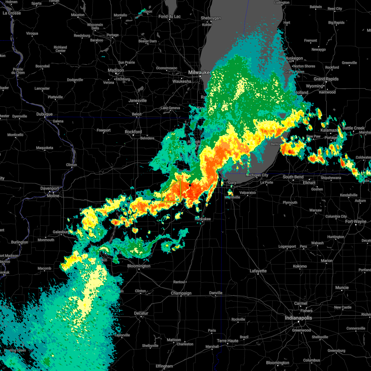 At 1132 pm cdt, a severe thunderstorm was located over minooka, moving east at 50 mph (radar indicated). Hazards include 60 mph wind gusts and nickel size hail. Expect damage to roofs, siding, and trees. Locations impacted include, joliet, plainfield, morris, channahon, minooka, lisbon and plattville. At 1132 pm cdt, a severe thunderstorm was located over minooka, moving east at 50 mph (radar indicated). Hazards include 60 mph wind gusts and nickel size hail. Expect damage to roofs, siding, and trees. Locations impacted include, joliet, plainfield, morris, channahon, minooka, lisbon and plattville.
|
| 6/20/2021 11:11 PM CDT |
 At 1111 pm cdt, a severe thunderstorm was located over leland, or near sheridan, moving east at 40 mph (radar indicated). Hazards include 70 mph wind gusts and quarter size hail. Hail damage to vehicles is expected. expect considerable tree damage. wind damage is also likely to mobile homes, roofs, and outbuildings. Locations impacted include, aurora, joliet, plainfield, oswego, ottawa, yorkville, morris, channahon, minooka, plano, sandwich, sheridan, montgomery, boulder hill, lake holiday, somonauk, earlville, serena, newark and leland. At 1111 pm cdt, a severe thunderstorm was located over leland, or near sheridan, moving east at 40 mph (radar indicated). Hazards include 70 mph wind gusts and quarter size hail. Hail damage to vehicles is expected. expect considerable tree damage. wind damage is also likely to mobile homes, roofs, and outbuildings. Locations impacted include, aurora, joliet, plainfield, oswego, ottawa, yorkville, morris, channahon, minooka, plano, sandwich, sheridan, montgomery, boulder hill, lake holiday, somonauk, earlville, serena, newark and leland.
|
| 6/20/2021 10:50 PM CDT |
 At 1050 pm cdt, a severe thunderstorm was located near mendota, moving east at 40 mph. more severe storms were moving across southern dekalb county into kendall county (radar indicated). Hazards include 70 mph wind gusts and quarter size hail. Hail damage to vehicles is expected. expect considerable tree damage. Wind damage is also likely to mobile homes, roofs, and outbuildings. At 1050 pm cdt, a severe thunderstorm was located near mendota, moving east at 40 mph. more severe storms were moving across southern dekalb county into kendall county (radar indicated). Hazards include 70 mph wind gusts and quarter size hail. Hail damage to vehicles is expected. expect considerable tree damage. Wind damage is also likely to mobile homes, roofs, and outbuildings.
|
| 11/10/2020 5:38 PM CST |
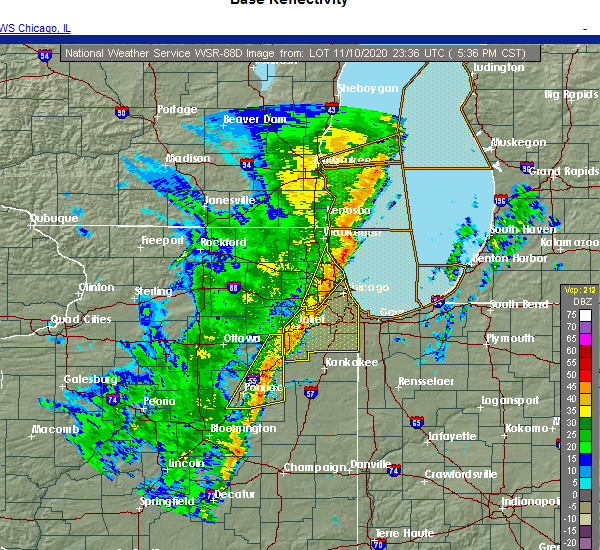 The severe thunderstorm warning for northern livingston and grundy counties will expire at 545 pm cst, the storms which prompted the warning have weakened below severe limits, and no longer pose an immediate threat to life or property. therefore, the warning will be allowed to expire. however gusty winds and heavy rain are still possible with these thunderstorms. a tornado watch remains in effect until 800 pm cst for central, north central, northeastern and east central illinois. The severe thunderstorm warning for northern livingston and grundy counties will expire at 545 pm cst, the storms which prompted the warning have weakened below severe limits, and no longer pose an immediate threat to life or property. therefore, the warning will be allowed to expire. however gusty winds and heavy rain are still possible with these thunderstorms. a tornado watch remains in effect until 800 pm cst for central, north central, northeastern and east central illinois.
|
| 11/10/2020 5:24 PM CST |
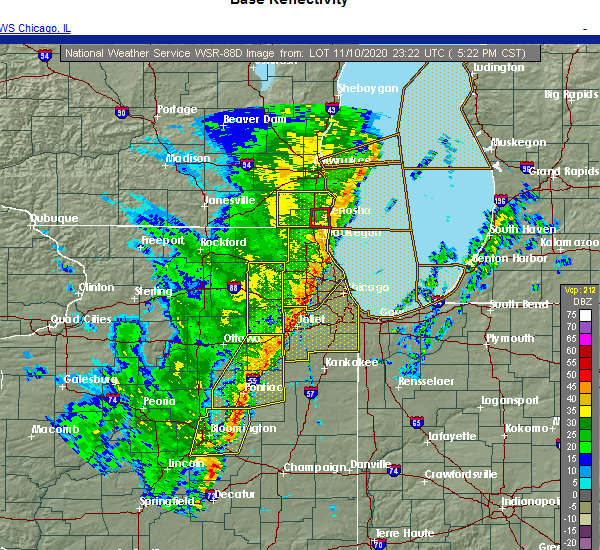 At 523 pm cst, severe thunderstorms were located along a line extending from channahon to near dwight to near chenoa, moving northeast at 40 mph (radar indicated). Hazards include 70 mph wind gusts. Expect considerable tree damage. damage is likely to mobile homes, roofs, and outbuildings. Locations impacted include, morris, channahon, pontiac, minooka, coal city, dwight, diamond, chenoa, gardner, odell, mazon, braceville, cullom, saunemin, south wilmington, godley, carbon hill, verona, campus and reddick. At 523 pm cst, severe thunderstorms were located along a line extending from channahon to near dwight to near chenoa, moving northeast at 40 mph (radar indicated). Hazards include 70 mph wind gusts. Expect considerable tree damage. damage is likely to mobile homes, roofs, and outbuildings. Locations impacted include, morris, channahon, pontiac, minooka, coal city, dwight, diamond, chenoa, gardner, odell, mazon, braceville, cullom, saunemin, south wilmington, godley, carbon hill, verona, campus and reddick.
|
| 11/10/2020 4:58 PM CST |
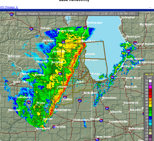 At 457 pm cst, severe thunderstorms were located along a line extending from near morris to cornell to near gridley, moving east at 40 mph. these storms have a history of producing wind damage and measured severe wind gusts (radar indicated). Hazards include 70 mph wind gusts. Expect considerable tree damage. damage is likely to mobile homes, roofs, and outbuildings. Locations impacted include, streator, morris, channahon, pontiac, minooka, coal city, marseilles, dwight, diamond, seneca, chenoa, gardner, gridley, flanagan, odell, mazon, braceville, cullom, cornell and saunemin. At 457 pm cst, severe thunderstorms were located along a line extending from near morris to cornell to near gridley, moving east at 40 mph. these storms have a history of producing wind damage and measured severe wind gusts (radar indicated). Hazards include 70 mph wind gusts. Expect considerable tree damage. damage is likely to mobile homes, roofs, and outbuildings. Locations impacted include, streator, morris, channahon, pontiac, minooka, coal city, marseilles, dwight, diamond, seneca, chenoa, gardner, gridley, flanagan, odell, mazon, braceville, cullom, cornell and saunemin.
|
| 11/10/2020 4:34 PM CST |
 At 434 pm cst, severe thunderstorms were located along a line extending from ottawa to near minonk to near minier, moving east at 40 mph. these storms have a history of producing wind damage (radar indicated). Hazards include 70 mph wind gusts. Expect considerable tree damage. Damage is likely to mobile homes, roofs, and outbuildings. At 434 pm cst, severe thunderstorms were located along a line extending from ottawa to near minonk to near minier, moving east at 40 mph. these storms have a history of producing wind damage (radar indicated). Hazards include 70 mph wind gusts. Expect considerable tree damage. Damage is likely to mobile homes, roofs, and outbuildings.
|
| 8/10/2020 3:35 PM CDT | Kc09 morris airpor in grundy county IL, 4.3 miles S of Morris, IL |
| 8/10/2020 3:30 PM CDT | Golf Ball sized hail reported 0.8 miles S of Morris, IL, law enforcement reports golfball sized hail near i-80 and lisbon road. |
| 8/10/2020 3:27 PM CDT | Quarter sized hail reported 0.8 miles NW of Morris, IL, time estimated by radar. |
| 8/10/2020 3:04 PM CDT |
 At 304 pm cdt, severe thunderstorms were located along a line extending from near orfordville to near marengo to near serena to near washburn, moving east at 65 mph. these are very dangerous storms! (emergency management). Hazards include 80 mph wind gusts and quarter size hail. Flying debris will be dangerous to those caught without shelter. mobile homes will be heavily damaged. expect considerable damage to roofs, windows, and vehicles. extensive tree damage and power outages are likely. locations impacted include, aurora, joliet, elgin, bartlett, crystal lake, plainfield, carpentersville, st. Charles, oswego, algonquin, lake in the hills, west chicago, mchenry, batavia, woodstock, huntley, geneva, yorkville, morris and channahon. At 304 pm cdt, severe thunderstorms were located along a line extending from near orfordville to near marengo to near serena to near washburn, moving east at 65 mph. these are very dangerous storms! (emergency management). Hazards include 80 mph wind gusts and quarter size hail. Flying debris will be dangerous to those caught without shelter. mobile homes will be heavily damaged. expect considerable damage to roofs, windows, and vehicles. extensive tree damage and power outages are likely. locations impacted include, aurora, joliet, elgin, bartlett, crystal lake, plainfield, carpentersville, st. Charles, oswego, algonquin, lake in the hills, west chicago, mchenry, batavia, woodstock, huntley, geneva, yorkville, morris and channahon.
|
| 8/10/2020 2:44 PM CDT |
 At 244 pm cdt, severe thunderstorms were located along a line extending from near monroe to rockford airport to near la salle to near chillicothe, moving east at 65 mph. these are very dangerous storms! (emergency management. this storm has a history of producing high-end wind damage across ogle county. this is very dangerous situation!). Hazards include 80 mph wind gusts and quarter size hail. the winds may last longer than 30 minutes!. Flying debris will be dangerous to those caught without shelter. mobile homes will be heavily damaged. expect considerable damage to roofs, windows, and vehicles. extensive tree damage and power outages are likely. locations impacted include, aurora, joliet, elgin, bartlett, crystal lake, plainfield, carpentersville, st. Charles, oswego, algonquin, lake in the hills, west chicago, mchenry, batavia, woodstock, huntley, geneva, yorkville, morris and channahon. At 244 pm cdt, severe thunderstorms were located along a line extending from near monroe to rockford airport to near la salle to near chillicothe, moving east at 65 mph. these are very dangerous storms! (emergency management. this storm has a history of producing high-end wind damage across ogle county. this is very dangerous situation!). Hazards include 80 mph wind gusts and quarter size hail. the winds may last longer than 30 minutes!. Flying debris will be dangerous to those caught without shelter. mobile homes will be heavily damaged. expect considerable damage to roofs, windows, and vehicles. extensive tree damage and power outages are likely. locations impacted include, aurora, joliet, elgin, bartlett, crystal lake, plainfield, carpentersville, st. Charles, oswego, algonquin, lake in the hills, west chicago, mchenry, batavia, woodstock, huntley, geneva, yorkville, morris and channahon.
|
| 8/10/2020 2:24 PM CDT |
 At 224 pm cdt, severe thunderstorms were located along a line extending from warren to near german valley to near princeton to near williamsfield, moving east at 65 mph. these are very dangerous storms (automated wind measurements. this storm has a history of producing measured wind gusts in excess of 80 mph!). Hazards include 80 mph wind gusts and quarter size hail. Flying debris will be dangerous to those caught without shelter. mobile homes will be heavily damaged. expect considerable damage to roofs, windows, and vehicles. Extensive tree damage and power outages are likely. At 224 pm cdt, severe thunderstorms were located along a line extending from warren to near german valley to near princeton to near williamsfield, moving east at 65 mph. these are very dangerous storms (automated wind measurements. this storm has a history of producing measured wind gusts in excess of 80 mph!). Hazards include 80 mph wind gusts and quarter size hail. Flying debris will be dangerous to those caught without shelter. mobile homes will be heavily damaged. expect considerable damage to roofs, windows, and vehicles. Extensive tree damage and power outages are likely.
|
| 7/19/2020 11:11 AM CDT |
 The severe thunderstorm warning for kendall and eastern grundy counties will expire at 1115 am cdt, the strongest part of the storms which prompted the warning moved east of the warned therefore, the warning will be allowed to expire. a severe thunderstorm watch remains in effect until 600 pm cdt for northeastern illinois. The severe thunderstorm warning for kendall and eastern grundy counties will expire at 1115 am cdt, the strongest part of the storms which prompted the warning moved east of the warned therefore, the warning will be allowed to expire. a severe thunderstorm watch remains in effect until 600 pm cdt for northeastern illinois.
|
| 7/19/2020 11:05 AM CDT |
 At 1105 am cdt, severe thunderstorms were located along a line extending from near plainfield to near braceville extending west to millbrook , moving east at 60 mph (trained weather spotters). Hazards include 60 mph wind gusts. Expect damage to roofs, siding, and trees. Locations impacted include, aurora, joliet, plainfield, oswego, yorkville, morris, channahon, minooka, plano, sandwich, braidwood, coal city, montgomery, boulder hill, diamond, gardner, mazon, braceville, south wilmington and godley. At 1105 am cdt, severe thunderstorms were located along a line extending from near plainfield to near braceville extending west to millbrook , moving east at 60 mph (trained weather spotters). Hazards include 60 mph wind gusts. Expect damage to roofs, siding, and trees. Locations impacted include, aurora, joliet, plainfield, oswego, yorkville, morris, channahon, minooka, plano, sandwich, braidwood, coal city, montgomery, boulder hill, diamond, gardner, mazon, braceville, south wilmington and godley.
|
| 7/19/2020 10:50 AM CDT | Powerlines down across the boat launch at stratton park. relayed by grundy county so. time estimated based on rada in grundy county IL, 0.8 miles NW of Morris, IL |
| 7/19/2020 10:48 AM CDT | Trees and powerlines down. relayed by grundy county so. time estimated based on rada in grundy county IL, 0.8 miles NW of Morris, IL |
| 7/19/2020 10:45 AM CDT |
 At 1045 am cdt, severe thunderstorms were located along a line extending from near newark to 7 miles north of odell, moving east at 60 mph (trained weather spotters). Hazards include 60 mph wind gusts. Expect damage to roofs, siding, and trees. Locations impacted include, aurora, joliet, plainfield, oswego, yorkville, morris, channahon, minooka, plano, sandwich, braidwood, coal city, dwight, montgomery, boulder hill, diamond, gardner, mazon, newark and braceville. At 1045 am cdt, severe thunderstorms were located along a line extending from near newark to 7 miles north of odell, moving east at 60 mph (trained weather spotters). Hazards include 60 mph wind gusts. Expect damage to roofs, siding, and trees. Locations impacted include, aurora, joliet, plainfield, oswego, yorkville, morris, channahon, minooka, plano, sandwich, braidwood, coal city, dwight, montgomery, boulder hill, diamond, gardner, mazon, newark and braceville.
|
| 7/19/2020 10:35 AM CDT |
 At 1035 am cdt, a severe thunderstorm was located near serena, or near marseilles, moving east at 60 mph (radar indicated). Hazards include 60 mph wind gusts. expect damage to roofs, siding, and trees At 1035 am cdt, a severe thunderstorm was located near serena, or near marseilles, moving east at 60 mph (radar indicated). Hazards include 60 mph wind gusts. expect damage to roofs, siding, and trees
|
| 7/11/2020 10:11 PM CDT |
 The severe thunderstorm warning for kendall and grundy counties will expire at 1015 pm cdt, the storms which prompted the warning have moved out of the area. therefore, the warning will be allowed to expire. a severe thunderstorm watch remains in effect until midnight cdt for northeastern illinois. The severe thunderstorm warning for kendall and grundy counties will expire at 1015 pm cdt, the storms which prompted the warning have moved out of the area. therefore, the warning will be allowed to expire. a severe thunderstorm watch remains in effect until midnight cdt for northeastern illinois.
|
| 7/11/2020 9:50 PM CDT |
 At 950 pm cdt, severe thunderstorms were located along a line extending from near sandwich to 6 miles east of newark to near minooka to near wilmington to near braceville to near dwight, moving east at 35 mph (radar indicated). Hazards include 60 mph wind gusts. Expect damage to roofs, siding, and trees. Locations impacted include, aurora, joliet, plainfield, oswego, yorkville, morris, channahon, minooka, plano, sandwich, braidwood, coal city, dwight, montgomery, boulder hill, diamond, seneca, gardner, mazon and newark. At 950 pm cdt, severe thunderstorms were located along a line extending from near sandwich to 6 miles east of newark to near minooka to near wilmington to near braceville to near dwight, moving east at 35 mph (radar indicated). Hazards include 60 mph wind gusts. Expect damage to roofs, siding, and trees. Locations impacted include, aurora, joliet, plainfield, oswego, yorkville, morris, channahon, minooka, plano, sandwich, braidwood, coal city, dwight, montgomery, boulder hill, diamond, seneca, gardner, mazon and newark.
|
| 7/11/2020 9:31 PM CDT |
 At 931 pm cdt, severe thunderstorms were located along a line extending from sheridan to near morris to near mazon to near cornell, moving east at 45 mph (radar indicated). Hazards include 60 mph wind gusts. Expect damage to roofs, siding, and trees. Locations impacted include, aurora, joliet, plainfield, oswego, yorkville, morris, channahon, minooka, plano, sandwich, braidwood, coal city, dwight, montgomery, boulder hill, diamond, seneca, gardner, mazon and newark. At 931 pm cdt, severe thunderstorms were located along a line extending from sheridan to near morris to near mazon to near cornell, moving east at 45 mph (radar indicated). Hazards include 60 mph wind gusts. Expect damage to roofs, siding, and trees. Locations impacted include, aurora, joliet, plainfield, oswego, yorkville, morris, channahon, minooka, plano, sandwich, braidwood, coal city, dwight, montgomery, boulder hill, diamond, seneca, gardner, mazon and newark.
|
| 7/11/2020 9:15 PM CDT |
 At 915 pm cdt, severe thunderstorms were located along a line extending from earlville to near marseilles to near seneca to 6 miles south of south streator, moving east at 45 mph (radar indicated). Hazards include 60 mph wind gusts. expect damage to roofs, siding, and trees At 915 pm cdt, severe thunderstorms were located along a line extending from earlville to near marseilles to near seneca to 6 miles south of south streator, moving east at 45 mph (radar indicated). Hazards include 60 mph wind gusts. expect damage to roofs, siding, and trees
|
| 6/26/2020 8:15 PM CDT | Measured gust to 71 mph at the morris airpor in grundy county IL, 4.3 miles S of Morris, IL |
| 5/23/2020 3:06 PM CDT |
 The severe thunderstorm warning for southwestern kendall and northwestern grundy counties will expire at 315 pm cdt, , a severe thunderstorm warning remains in effect until 3:30 pm cdt for northeastern grundy and eastern kendall counties, the storms which prompted the warning have moved western kendall and western grundy counties. The severe thunderstorm warning for southwestern kendall and northwestern grundy counties will expire at 315 pm cdt, , a severe thunderstorm warning remains in effect until 3:30 pm cdt for northeastern grundy and eastern kendall counties, the storms which prompted the warning have moved western kendall and western grundy counties.
|
| 5/23/2020 2:42 PM CDT |
 At 241 pm cdt, severe thunderstorms were located along a line extending from near yorkville to near morris, moving northeast at 35 mph (radar indicated). Hazards include 60 mph wind gusts and quarter size hail. Hail damage to vehicles is expected. expect wind damage to roofs, siding, and trees. these severe storms will be near, yorkville around 245 pm cdt. Other locations impacted by these severe thunderstorms include lisbon. At 241 pm cdt, severe thunderstorms were located along a line extending from near yorkville to near morris, moving northeast at 35 mph (radar indicated). Hazards include 60 mph wind gusts and quarter size hail. Hail damage to vehicles is expected. expect wind damage to roofs, siding, and trees. these severe storms will be near, yorkville around 245 pm cdt. Other locations impacted by these severe thunderstorms include lisbon.
|
| 5/23/2020 2:24 PM CDT |
 At 223 pm cdt, a severe thunderstorm was located near seneca, moving east at 35 mph (radar indicated). Hazards include 60 mph wind gusts and quarter size hail. Hail damage to vehicles is expected. expect wind damage to roofs, siding, and trees. this severe storm will be near, morris around 235 pm cdt. Other locations impacted by this severe thunderstorm include lisbon. At 223 pm cdt, a severe thunderstorm was located near seneca, moving east at 35 mph (radar indicated). Hazards include 60 mph wind gusts and quarter size hail. Hail damage to vehicles is expected. expect wind damage to roofs, siding, and trees. this severe storm will be near, morris around 235 pm cdt. Other locations impacted by this severe thunderstorm include lisbon.
|
| 5/23/2020 2:08 PM CDT |
 At 208 pm cdt, a severe thunderstorm was located near ottawa, moving northeast at 35 mph (radar indicated). Hazards include 60 mph wind gusts and quarter size hail. Hail damage to vehicles is expected. expect wind damage to roofs, siding, and trees. this severe thunderstorm will be near, seneca and serena around 220 pm cdt. sheridan around 230 pm cdt. morris and newark around 240 pm cdt. other locations impacted by this severe thunderstorm include millington and lisbon. including the following interstate, i-80 between mile markers 90 and 117. A tornado watch remains in effect until 800 pm cdt for north central and northeastern illinois. At 208 pm cdt, a severe thunderstorm was located near ottawa, moving northeast at 35 mph (radar indicated). Hazards include 60 mph wind gusts and quarter size hail. Hail damage to vehicles is expected. expect wind damage to roofs, siding, and trees. this severe thunderstorm will be near, seneca and serena around 220 pm cdt. sheridan around 230 pm cdt. morris and newark around 240 pm cdt. other locations impacted by this severe thunderstorm include millington and lisbon. including the following interstate, i-80 between mile markers 90 and 117. A tornado watch remains in effect until 800 pm cdt for north central and northeastern illinois.
|
| 11/27/2019 1:03 AM CST |
 At 102 am cst, severe thunderstorms were located along a line extending from near earlville to near naplate, moving northeast at 55 mph (radar indicated). Hazards include 60 mph wind gusts. expect damage to roofs, siding, and trees At 102 am cst, severe thunderstorms were located along a line extending from near earlville to near naplate, moving northeast at 55 mph (radar indicated). Hazards include 60 mph wind gusts. expect damage to roofs, siding, and trees
|
| 6/30/2019 2:46 PM CDT |
 At 246 pm cdt, severe thunderstorms were located along a line extending from oglesby to 9 miles east of streator to near coal city, moving southeast at 25 mph (radar indicated). Hazards include 60 mph wind gusts. Expect damage to roofs, siding, and trees. Locations impacted include, ottawa, streator, morris, channahon, minooka, peru, marseilles, dwight, oglesby, seneca, la salle, coal city, diamond, utica, gardner, north utica, wenona, odell, mazon and braceville. At 246 pm cdt, severe thunderstorms were located along a line extending from oglesby to 9 miles east of streator to near coal city, moving southeast at 25 mph (radar indicated). Hazards include 60 mph wind gusts. Expect damage to roofs, siding, and trees. Locations impacted include, ottawa, streator, morris, channahon, minooka, peru, marseilles, dwight, oglesby, seneca, la salle, coal city, diamond, utica, gardner, north utica, wenona, odell, mazon and braceville.
|
| 6/30/2019 2:28 PM CDT |
 At 228 pm cdt, severe thunderstorms were located along a line extending from near granville to near streator to 6 miles west of herscher, moving south at 45 mph (radar indicated). Hazards include 60 mph wind gusts. expect damage to roofs, siding, and trees At 228 pm cdt, severe thunderstorms were located along a line extending from near granville to near streator to 6 miles west of herscher, moving south at 45 mph (radar indicated). Hazards include 60 mph wind gusts. expect damage to roofs, siding, and trees
|
| 6/30/2019 2:25 PM CDT | Report of numerous trees down in morris relayed by grundy county so. time estimated based on rada in grundy county IL, 0.8 miles NW of Morris, IL |
| 6/30/2019 2:03 PM CDT |
 At 201 pm cdt, a cluster of severe thunderstorms was located over diamond, or near wilmington, and other areas of northern grundy county, generally moving east at 25 mph (radar indicated). Hazards include 60 mph wind gusts and quarter size hail. Hail damage to vehicles is expected. expect wind damage to roofs, siding, and trees. Locations impacted include, morris, channahon, minooka, dwight, seneca, wilmington, braidwood, coal city, diamond, gardner, mazon, braceville, lakewood shores, essex, south wilmington, godley, carbon hill, verona, east brooklyn and kinsman. At 201 pm cdt, a cluster of severe thunderstorms was located over diamond, or near wilmington, and other areas of northern grundy county, generally moving east at 25 mph (radar indicated). Hazards include 60 mph wind gusts and quarter size hail. Hail damage to vehicles is expected. expect wind damage to roofs, siding, and trees. Locations impacted include, morris, channahon, minooka, dwight, seneca, wilmington, braidwood, coal city, diamond, gardner, mazon, braceville, lakewood shores, essex, south wilmington, godley, carbon hill, verona, east brooklyn and kinsman.
|
| 6/30/2019 1:46 PM CDT |
 At 145 pm cdt, a severe thunderstorm was located near coal city, or near morris, moving east at 20 mph (radar indicated). Hazards include 60 mph wind gusts and quarter size hail. Hail damage to vehicles is expected. Expect wind damage to roofs, siding, and trees. At 145 pm cdt, a severe thunderstorm was located near coal city, or near morris, moving east at 20 mph (radar indicated). Hazards include 60 mph wind gusts and quarter size hail. Hail damage to vehicles is expected. Expect wind damage to roofs, siding, and trees.
|
| 5/16/2019 12:41 PM CDT |
 The national weather service in chicago has issued a * severe thunderstorm warning for. northern livingston county in central illinois. east central la salle county in north central illinois. grundy county in northeastern illinois. Until 145 pm cdt. The national weather service in chicago has issued a * severe thunderstorm warning for. northern livingston county in central illinois. east central la salle county in north central illinois. grundy county in northeastern illinois. Until 145 pm cdt.
|
| 3/14/2019 11:45 AM CDT |
 At 1145 am cdt, a severe thunderstorm was located over morris, moving northeast at 45 mph (public). Hazards include 60 mph wind gusts and quarter size hail. Hail damage to vehicles is expected. expect wind damage to roofs, siding, and trees. Locations impacted include, morris, channahon and minooka. At 1145 am cdt, a severe thunderstorm was located over morris, moving northeast at 45 mph (public). Hazards include 60 mph wind gusts and quarter size hail. Hail damage to vehicles is expected. expect wind damage to roofs, siding, and trees. Locations impacted include, morris, channahon and minooka.
|
| 3/14/2019 11:32 AM CDT |
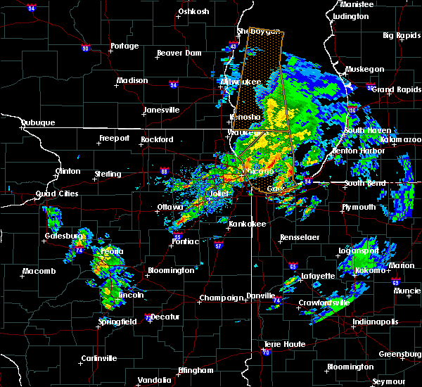 At 1131 am cdt, a severe thunderstorm was located near mazon, or 7 miles southeast of seneca, moving northeast at 55 mph (radar indicated). Hazards include 60 mph wind gusts and quarter size hail. Hail damage to vehicles is expected. Expect wind damage to roofs, siding, and trees. At 1131 am cdt, a severe thunderstorm was located near mazon, or 7 miles southeast of seneca, moving northeast at 55 mph (radar indicated). Hazards include 60 mph wind gusts and quarter size hail. Hail damage to vehicles is expected. Expect wind damage to roofs, siding, and trees.
|
| 6/19/2018 5:06 PM CDT |
 At 505 pm cdt, severe thunderstorms were located along a line extending from near grand ridge to 10 miles northwest of odell to near pontiac, moving east at 40 mph (radar indicated). Hazards include 60 mph wind gusts. Expect damage to roofs, siding, and trees. Locations impacted include, ottawa, streator, morris, pontiac, marseilles, dwight, seneca, gardner, odell, mazon, grand ridge, cullom, south wilmington, cornell, saunemin, ransom, verona, campus, reddick and emington. At 505 pm cdt, severe thunderstorms were located along a line extending from near grand ridge to 10 miles northwest of odell to near pontiac, moving east at 40 mph (radar indicated). Hazards include 60 mph wind gusts. Expect damage to roofs, siding, and trees. Locations impacted include, ottawa, streator, morris, pontiac, marseilles, dwight, seneca, gardner, odell, mazon, grand ridge, cullom, south wilmington, cornell, saunemin, ransom, verona, campus, reddick and emington.
|
| 6/19/2018 4:50 PM CDT |
 The national weather service in chicago has issued a * severe thunderstorm warning for. northern livingston county in central illinois. central la salle county in north central illinois. southern grundy county in northeastern illinois. Until 545 pm cdt. The national weather service in chicago has issued a * severe thunderstorm warning for. northern livingston county in central illinois. central la salle county in north central illinois. southern grundy county in northeastern illinois. Until 545 pm cdt.
|
| 7/19/2017 9:56 PM CDT |
 At 955 pm cdt, severe thunderstorms were located along a line extending from near harwood heights to country club hills to 6 miles east of lakewood shores, moving southeast at 50 mph (radar indicated). Hazards include 60 mph wind gusts. Expect damage to roofs, siding, and trees. Locations impacted include, chicago, joliet, cicero, evanston, bolingbrook, skokie, des plaines, orland park, tinley park, oak lawn, berwyn, mount prospect, oak park, downers grove, elmhurst, lombard, romeoville, park ridge, addison and lockport. At 955 pm cdt, severe thunderstorms were located along a line extending from near harwood heights to country club hills to 6 miles east of lakewood shores, moving southeast at 50 mph (radar indicated). Hazards include 60 mph wind gusts. Expect damage to roofs, siding, and trees. Locations impacted include, chicago, joliet, cicero, evanston, bolingbrook, skokie, des plaines, orland park, tinley park, oak lawn, berwyn, mount prospect, oak park, downers grove, elmhurst, lombard, romeoville, park ridge, addison and lockport.
|
| 7/19/2017 9:40 PM CDT |
 At 940 pm cdt, severe thunderstorms were located along a line extending from elk grove village to lemont to near diamond, moving east at 50 mph (radar indicated). Hazards include 60 mph wind gusts. Expect damage to roofs, siding, and trees. Locations impacted include, chicago, aurora, joliet, naperville, cicero, arlington heights, evanston, schaumburg, bolingbrook, skokie, des plaines, orland park, tinley park, oak lawn, berwyn, mount prospect, wheaton, oak park, downers grove and elmhurst. At 940 pm cdt, severe thunderstorms were located along a line extending from elk grove village to lemont to near diamond, moving east at 50 mph (radar indicated). Hazards include 60 mph wind gusts. Expect damage to roofs, siding, and trees. Locations impacted include, chicago, aurora, joliet, naperville, cicero, arlington heights, evanston, schaumburg, bolingbrook, skokie, des plaines, orland park, tinley park, oak lawn, berwyn, mount prospect, wheaton, oak park, downers grove and elmhurst.
|
| 7/19/2017 9:23 PM CDT |
 At 922 pm cdt, severe thunderstorms were located along a line extending from near carol stream to near plainfield to 6 miles northwest of morris, moving southeast at 50 mph (radar indicated). Hazards include 60 mph wind gusts. Expect damage to roofs, siding, and trees. Locations impacted include, chicago, aurora, joliet, naperville, cicero, arlington heights, evanston, schaumburg, bolingbrook, skokie, des plaines, orland park, tinley park, oak lawn, berwyn, mount prospect, wheaton, oak park, downers grove and elmhurst. At 922 pm cdt, severe thunderstorms were located along a line extending from near carol stream to near plainfield to 6 miles northwest of morris, moving southeast at 50 mph (radar indicated). Hazards include 60 mph wind gusts. Expect damage to roofs, siding, and trees. Locations impacted include, chicago, aurora, joliet, naperville, cicero, arlington heights, evanston, schaumburg, bolingbrook, skokie, des plaines, orland park, tinley park, oak lawn, berwyn, mount prospect, wheaton, oak park, downers grove and elmhurst.
|
| 7/19/2017 9:08 PM CDT |
 At 908 pm cdt, severe thunderstorms were located along a line extending from near elgin to near montgomery to sheridan, moving southeast at 50 mph (radar indicated). Hazards include 60 mph wind gusts. expect damage to roofs, siding, and trees At 908 pm cdt, severe thunderstorms were located along a line extending from near elgin to near montgomery to sheridan, moving southeast at 50 mph (radar indicated). Hazards include 60 mph wind gusts. expect damage to roofs, siding, and trees
|
| 7/10/2017 9:48 PM CDT |
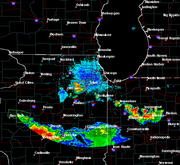 At 948 pm cdt, a severe thunderstorm was located 7 miles east of newark, or 8 miles south of yorkville, moving east at 30 mph (radar indicated). Hazards include 60 mph wind gusts and quarter size hail. Hail damage to vehicles is expected. expect wind damage to roofs, siding, and trees. Locations impacted include, joliet, yorkville, morris, channahon, minooka and lisbon. At 948 pm cdt, a severe thunderstorm was located 7 miles east of newark, or 8 miles south of yorkville, moving east at 30 mph (radar indicated). Hazards include 60 mph wind gusts and quarter size hail. Hail damage to vehicles is expected. expect wind damage to roofs, siding, and trees. Locations impacted include, joliet, yorkville, morris, channahon, minooka and lisbon.
|
| 7/10/2017 9:34 PM CDT |
 At 933 pm cdt, a severe thunderstorm was located near newark moving east at 30 mph (radar indicated). Hazards include 60 mph wind gusts and half dollar size hail. Hail damage to vehicles is expected. Expect wind damage to roofs, siding, and trees. At 933 pm cdt, a severe thunderstorm was located near newark moving east at 30 mph (radar indicated). Hazards include 60 mph wind gusts and half dollar size hail. Hail damage to vehicles is expected. Expect wind damage to roofs, siding, and trees.
|
| 6/14/2017 5:12 PM CDT |
 The severe thunderstorm warning for kendall, northeastern livingston, northeastern la salle, western will, grundy and western kankakee counties will expire at 515 pm cdt, the leading edge of the storms which prompted the warning have shifted northeast of the warned area. therefore, the warning will be allowed to expire.however gusty winds to 55 mph are still possible behind the leading edge of thunderstorms, and some tree damage is still possible. a severe thunderstorm watch remains in effect until 800 pm cdt for central, north central and northeastern illinois. The severe thunderstorm warning for kendall, northeastern livingston, northeastern la salle, western will, grundy and western kankakee counties will expire at 515 pm cdt, the leading edge of the storms which prompted the warning have shifted northeast of the warned area. therefore, the warning will be allowed to expire.however gusty winds to 55 mph are still possible behind the leading edge of thunderstorms, and some tree damage is still possible. a severe thunderstorm watch remains in effect until 800 pm cdt for central, north central and northeastern illinois.
|
| 6/14/2017 4:54 PM CDT |
 At 453 pm cdt, severe thunderstorms were located along a line extending from yorkville to near coal city to odell, moving east at 55 mph (trained weather spotters). Hazards include 60 mph wind gusts and penny size hail. Expect damage to roofs, siding, and trees. Locations impacted include, joliet, bolingbrook, romeoville, plainfield, lockport, new lenox, yorkville, morris, channahon, minooka, marseilles, dwight, seneca, wilmington, ingalls park, shorewood, manhattan, braidwood, coal city and diamond. At 453 pm cdt, severe thunderstorms were located along a line extending from yorkville to near coal city to odell, moving east at 55 mph (trained weather spotters). Hazards include 60 mph wind gusts and penny size hail. Expect damage to roofs, siding, and trees. Locations impacted include, joliet, bolingbrook, romeoville, plainfield, lockport, new lenox, yorkville, morris, channahon, minooka, marseilles, dwight, seneca, wilmington, ingalls park, shorewood, manhattan, braidwood, coal city and diamond.
|
| 6/14/2017 4:45 PM CDT | 2 block area in morris with widespread tree damage... trees blown down... and shingles off roofs. delayed report... estimated time was 445 p in grundy county IL, 0.1 miles S of Morris, IL |
| 6/14/2017 4:39 PM CDT |
 At 437 pm cdt, severe thunderstorms were located along a line extending from near leland to near seneca to near flanagan, moving east at 60 mph (trained spotters reported). Hazards include 60 mph wind gusts and quarter size hail. Expect wind damage to roofs, siding, and trees. Large hail is also possible. At 437 pm cdt, severe thunderstorms were located along a line extending from near leland to near seneca to near flanagan, moving east at 60 mph (trained spotters reported). Hazards include 60 mph wind gusts and quarter size hail. Expect wind damage to roofs, siding, and trees. Large hail is also possible.
|
| 5/18/2017 12:13 AM CDT |
 At 1213 am cdt, severe thunderstorms were located along a line extending from downers grove to near romeoville to minooka, moving northeast at 50 mph (radar indicated). Hazards include 60 mph wind gusts. Expect damage to roofs, siding, and trees. locations impacted include, aurora, joliet, naperville, bolingbrook, downers grove, romeoville, plainfield, lockport, lisle, morris, channahon, minooka, seneca, woodridge, shorewood, rockdale, crest hill, glenbard south and crystal lawns. A tornado watch remains in effect until 100 am cdt for north central and northeastern illinois. At 1213 am cdt, severe thunderstorms were located along a line extending from downers grove to near romeoville to minooka, moving northeast at 50 mph (radar indicated). Hazards include 60 mph wind gusts. Expect damage to roofs, siding, and trees. locations impacted include, aurora, joliet, naperville, bolingbrook, downers grove, romeoville, plainfield, lockport, lisle, morris, channahon, minooka, seneca, woodridge, shorewood, rockdale, crest hill, glenbard south and crystal lawns. A tornado watch remains in effect until 100 am cdt for north central and northeastern illinois.
|
| 5/18/2017 12:05 AM CDT |
 At 1204 am cdt, severe thunderstorms were located along a line extending from naperville to plainfield to near minooka, moving northeast at 55 mph. the strongest winds are headed towards plainfield (radar indicated). Hazards include 70 mph wind gusts. Expect considerable tree damage. damage is likely to mobile homes, roofs, and outbuildings. locations impacted include, aurora, joliet, naperville, bolingbrook, wheaton, downers grove, romeoville, plainfield, oswego, glen ellyn, lockport, lisle, yorkville, morris, channahon, minooka, seneca, woodridge, montgomery and shorewood. A tornado watch remains in effect until 100 am cdt for north central and northeastern illinois. At 1204 am cdt, severe thunderstorms were located along a line extending from naperville to plainfield to near minooka, moving northeast at 55 mph. the strongest winds are headed towards plainfield (radar indicated). Hazards include 70 mph wind gusts. Expect considerable tree damage. damage is likely to mobile homes, roofs, and outbuildings. locations impacted include, aurora, joliet, naperville, bolingbrook, wheaton, downers grove, romeoville, plainfield, oswego, glen ellyn, lockport, lisle, yorkville, morris, channahon, minooka, seneca, woodridge, montgomery and shorewood. A tornado watch remains in effect until 100 am cdt for north central and northeastern illinois.
|
| 5/17/2017 11:50 PM CDT |
 At 1150 pm cdt, severe thunderstorms were located along a line extending from oswego to 7 miles east of newark to near seneca, moving northeast at 55 mph (radar indicated). Hazards include 70 mph wind gusts. Expect considerable tree damage. Damage is likely to mobile homes, roofs, and outbuildings. At 1150 pm cdt, severe thunderstorms were located along a line extending from oswego to 7 miles east of newark to near seneca, moving northeast at 55 mph (radar indicated). Hazards include 70 mph wind gusts. Expect considerable tree damage. Damage is likely to mobile homes, roofs, and outbuildings.
|
| 3/7/2017 1:03 AM CST |
 At 102 am cst, severe thunderstorms were located along a line extending from east dundee to near aurora to near dwight, moving east at 60 mph (radar indicated). Hazards include 60 mph wind gusts and quarter size hail. Hail damage to vehicles is expected. expect wind damage to roofs, siding, and trees. these severe storms will be near, naperville, elgin, and warrenville around 105 am cst. bolingbrook, wheaton, romeoville, streamwood, and inverness around 110 am cst. schaumburg, downers grove, westmont, rolling meadows, york center, and darien around 115 am cst. arlington heights, des plaines, mount prospect, wheeling, hinsdale, oak brook, willow springs and palos hills around 120 am cst. skokie, northbrook, maywood, morton grove, brookfield, and justice around 125 am cst. cicero, wilmette, bourbonnais, bradley, winnetka, and stickney around 130 am cst. Chatham, navy pier, lincoln park, hyde park and lakeview around 135 am cst. At 102 am cst, severe thunderstorms were located along a line extending from east dundee to near aurora to near dwight, moving east at 60 mph (radar indicated). Hazards include 60 mph wind gusts and quarter size hail. Hail damage to vehicles is expected. expect wind damage to roofs, siding, and trees. these severe storms will be near, naperville, elgin, and warrenville around 105 am cst. bolingbrook, wheaton, romeoville, streamwood, and inverness around 110 am cst. schaumburg, downers grove, westmont, rolling meadows, york center, and darien around 115 am cst. arlington heights, des plaines, mount prospect, wheeling, hinsdale, oak brook, willow springs and palos hills around 120 am cst. skokie, northbrook, maywood, morton grove, brookfield, and justice around 125 am cst. cicero, wilmette, bourbonnais, bradley, winnetka, and stickney around 130 am cst. Chatham, navy pier, lincoln park, hyde park and lakeview around 135 am cst.
|
| 3/7/2017 12:43 AM CST |
 At 1242 am cst, severe thunderstorms were located along a line extending from sycamore to near newark to near flanagan, moving northeast at 80 mph (radar indicated). Hazards include 60 mph wind gusts. Expect damage to roofs, siding, and trees. severe thunderstorms will be near, maple park, newark and virgil around 1245 am cst. yorkville, plano and lily lake around 1250 am cst. elgin and oswego around 1255 am cst. aurora, naperville, west dundee and odell around 100 am cst. hoffman estates, romeoville, dwight, and inverness around 105 am cst. bolingbrook, palatine, wheaton, downers grove, glen ellyn, lisle, woodridge, darien and gardner around 110 am cst. Cicero, westchester, forest park and river forest around 120 am cst. At 1242 am cst, severe thunderstorms were located along a line extending from sycamore to near newark to near flanagan, moving northeast at 80 mph (radar indicated). Hazards include 60 mph wind gusts. Expect damage to roofs, siding, and trees. severe thunderstorms will be near, maple park, newark and virgil around 1245 am cst. yorkville, plano and lily lake around 1250 am cst. elgin and oswego around 1255 am cst. aurora, naperville, west dundee and odell around 100 am cst. hoffman estates, romeoville, dwight, and inverness around 105 am cst. bolingbrook, palatine, wheaton, downers grove, glen ellyn, lisle, woodridge, darien and gardner around 110 am cst. Cicero, westchester, forest park and river forest around 120 am cst.
|
| 2/28/2017 10:31 PM CST |
 At 1030 pm cst, severe thunderstorms were located along a line extending from near sugar grove to near plainfield to near minooka, moving northeast at 60 mph (radar indicated). Hazards include 60 mph wind gusts and penny size hail. Expect damage to roofs, siding, and trees. these severe storms will be near, joliet and naperville around 1035 pm cst. bolingbrook, romeoville, batavia, warrenville and rockdale around 1040 pm cst. wheaton, lockport and winfield around 1045 pm cst. other locations impacted by these severe thunderstorms include preston heights, crystal lawns, lisbon, crest hill, boulder hill, millington and fairmont. A tornado watch remains in effect until 400 am cst for northeastern illinois. At 1030 pm cst, severe thunderstorms were located along a line extending from near sugar grove to near plainfield to near minooka, moving northeast at 60 mph (radar indicated). Hazards include 60 mph wind gusts and penny size hail. Expect damage to roofs, siding, and trees. these severe storms will be near, joliet and naperville around 1035 pm cst. bolingbrook, romeoville, batavia, warrenville and rockdale around 1040 pm cst. wheaton, lockport and winfield around 1045 pm cst. other locations impacted by these severe thunderstorms include preston heights, crystal lawns, lisbon, crest hill, boulder hill, millington and fairmont. A tornado watch remains in effect until 400 am cst for northeastern illinois.
|
| 2/28/2017 10:18 PM CST |
 At 1017 pm cst, severe thunderstorms were located along a line extending from near little rock to near yorkville to near morris, moving northeast at 65 mph (radar indicated). Hazards include 60 mph wind gusts and quarter size hail. Hail damage to vehicles is expected. expect wind damage to roofs, siding, and trees. severe thunderstorms will be near, oswego around 1025 pm cst. aurora, naperville, minooka, montgomery and sugar grove around 1030 pm cst. joliet, plainfield, channahon, north aurora and shorewood around 1035 pm cst. bolingbrook, romeoville, west chicago, batavia, warrenville and rockdale around 1040 pm cst. wheaton, lockport and winfield around 1045 pm cst. A tornado watch remains in effect until 400 am cst for north central and northeastern illinois. At 1017 pm cst, severe thunderstorms were located along a line extending from near little rock to near yorkville to near morris, moving northeast at 65 mph (radar indicated). Hazards include 60 mph wind gusts and quarter size hail. Hail damage to vehicles is expected. expect wind damage to roofs, siding, and trees. severe thunderstorms will be near, oswego around 1025 pm cst. aurora, naperville, minooka, montgomery and sugar grove around 1030 pm cst. joliet, plainfield, channahon, north aurora and shorewood around 1035 pm cst. bolingbrook, romeoville, west chicago, batavia, warrenville and rockdale around 1040 pm cst. wheaton, lockport and winfield around 1045 pm cst. A tornado watch remains in effect until 400 am cst for north central and northeastern illinois.
|
| 2/28/2017 8:26 PM CST |
 The severe thunderstorm warning for northern grundy county will expire at 830 pm cst, the storm which prompted the warning has weakened below severe limits, and has exited the warned area. therefore, the warning will be allowed to expire. a tornado watch remains in effect until 1000 pm cst for northeastern illinois. The severe thunderstorm warning for northern grundy county will expire at 830 pm cst, the storm which prompted the warning has weakened below severe limits, and has exited the warned area. therefore, the warning will be allowed to expire. a tornado watch remains in effect until 1000 pm cst for northeastern illinois.
|
| 2/28/2017 8:13 PM CST |
 At 812 pm cst, a severe thunderstorm was located over morris, moving east at 50 mph (radar indicated). Hazards include 60 mph wind gusts and half dollar size hail. Hail damage to vehicles is expected. expect wind damage to roofs, siding, and trees. locations impacted include, morris, channahon and minooka. A tornado watch remains in effect until 1000 pm cst for northeastern illinois. At 812 pm cst, a severe thunderstorm was located over morris, moving east at 50 mph (radar indicated). Hazards include 60 mph wind gusts and half dollar size hail. Hail damage to vehicles is expected. expect wind damage to roofs, siding, and trees. locations impacted include, morris, channahon and minooka. A tornado watch remains in effect until 1000 pm cst for northeastern illinois.
|
| 2/28/2017 8:04 PM CST |
 At 804 pm cst, a severe thunderstorm was located near seneca, moving east at 50 mph (radar indicated). Hazards include 60 mph wind gusts and half dollar size hail. Hail damage to vehicles is expected. Expect wind damage to roofs, siding, and trees. At 804 pm cst, a severe thunderstorm was located near seneca, moving east at 50 mph (radar indicated). Hazards include 60 mph wind gusts and half dollar size hail. Hail damage to vehicles is expected. Expect wind damage to roofs, siding, and trees.
|
| 2/28/2017 7:17 PM CST |
 At 717 pm cst, a severe thunderstorm was located over morris, moving east at 45 mph (radar indicated). Hazards include 60 mph wind gusts and quarter size hail. Hail damage to vehicles is expected. expect wind damage to roofs, siding, and trees. locations impacted include, joliet, plainfield, morris, channahon, minooka, seneca, shorewood, elwood, rockdale, crest hill, lisbon and crystal lawns. A tornado watch remains in effect until 1000 pm cst for north central and northeastern illinois. At 717 pm cst, a severe thunderstorm was located over morris, moving east at 45 mph (radar indicated). Hazards include 60 mph wind gusts and quarter size hail. Hail damage to vehicles is expected. expect wind damage to roofs, siding, and trees. locations impacted include, joliet, plainfield, morris, channahon, minooka, seneca, shorewood, elwood, rockdale, crest hill, lisbon and crystal lawns. A tornado watch remains in effect until 1000 pm cst for north central and northeastern illinois.
|
| 2/28/2017 7:04 PM CST |
 At 704 pm cst, a severe thunderstorm was located near seneca, moving east at 45 mph (radar indicated). Hazards include 60 mph wind gusts and quarter size hail. Hail damage to vehicles is expected. Expect wind damage to roofs, siding, and trees. At 704 pm cst, a severe thunderstorm was located near seneca, moving east at 45 mph (radar indicated). Hazards include 60 mph wind gusts and quarter size hail. Hail damage to vehicles is expected. Expect wind damage to roofs, siding, and trees.
|
| 2/28/2017 6:19 PM CST |
 At 619 pm cst, severe thunderstorms were located along a line extending from near dolton to morris, moving east at 35 mph (radar indicated). Hazards include golf ball size hail and 60 mph wind gusts. People and animals outdoors will be injured. expect hail damage to roofs, siding, windows, and vehicles. expect wind damage to roofs, siding, and trees. locations impacted include, chicago, joliet, hammond, orland park, tinley park, oak lawn, romeoville, calumet city, chicago heights, lansing, lockport, new lenox, homer glen, blue island, munster, dolton, park forest, alsip, matteson and mokena. A tornado watch remains in effect until 1000 pm cst for northeastern illinois, and northwestern indiana. At 619 pm cst, severe thunderstorms were located along a line extending from near dolton to morris, moving east at 35 mph (radar indicated). Hazards include golf ball size hail and 60 mph wind gusts. People and animals outdoors will be injured. expect hail damage to roofs, siding, windows, and vehicles. expect wind damage to roofs, siding, and trees. locations impacted include, chicago, joliet, hammond, orland park, tinley park, oak lawn, romeoville, calumet city, chicago heights, lansing, lockport, new lenox, homer glen, blue island, munster, dolton, park forest, alsip, matteson and mokena. A tornado watch remains in effect until 1000 pm cst for northeastern illinois, and northwestern indiana.
|
| 2/28/2017 6:00 PM CST |
 At 559 pm cst, three severe thunderstorms were located along a line extending from orland park to near morris, moving east at 50 mph (radar indicated). Hazards include golf ball size hail and 60 mph wind gusts. People and animals outdoors will be injured. expect hail damage to roofs, siding, windows, and vehicles. Expect wind damage to roofs, siding, and trees. At 559 pm cst, three severe thunderstorms were located along a line extending from orland park to near morris, moving east at 50 mph (radar indicated). Hazards include golf ball size hail and 60 mph wind gusts. People and animals outdoors will be injured. expect hail damage to roofs, siding, windows, and vehicles. Expect wind damage to roofs, siding, and trees.
|
| 2/28/2017 5:50 PM CST |
 At 550 pm cst, two severe thunderstorms were located along a line extending from near minooka to near ingalls park, moving east at 45 mph (radar indicated). Hazards include golf ball size hail. People and animals outdoors will be injured. expect damage to roofs, siding, windows, and vehicles. locations impacted include, joliet, romeoville, plainfield, lockport, new lenox, homer glen, mokena, frankfort, morris, channahon, minooka, ingalls park, shorewood, manhattan, elwood, rockdale, goodings grove, crest hill, preston heights and crystal lawns. A tornado watch remains in effect until 1000 pm cst for northeastern illinois. At 550 pm cst, two severe thunderstorms were located along a line extending from near minooka to near ingalls park, moving east at 45 mph (radar indicated). Hazards include golf ball size hail. People and animals outdoors will be injured. expect damage to roofs, siding, windows, and vehicles. locations impacted include, joliet, romeoville, plainfield, lockport, new lenox, homer glen, mokena, frankfort, morris, channahon, minooka, ingalls park, shorewood, manhattan, elwood, rockdale, goodings grove, crest hill, preston heights and crystal lawns. A tornado watch remains in effect until 1000 pm cst for northeastern illinois.
|
| 2/28/2017 5:28 PM CST |
 At 527 pm cst, a severe thunderstorm was located near minooka, moving east at 40 mph (radar indicated). Hazards include golf ball size hail. People and animals outdoors will be injured. Expect damage to roofs, siding, windows, and vehicles. At 527 pm cst, a severe thunderstorm was located near minooka, moving east at 40 mph (radar indicated). Hazards include golf ball size hail. People and animals outdoors will be injured. Expect damage to roofs, siding, windows, and vehicles.
|
| 2/28/2017 5:18 PM CST |
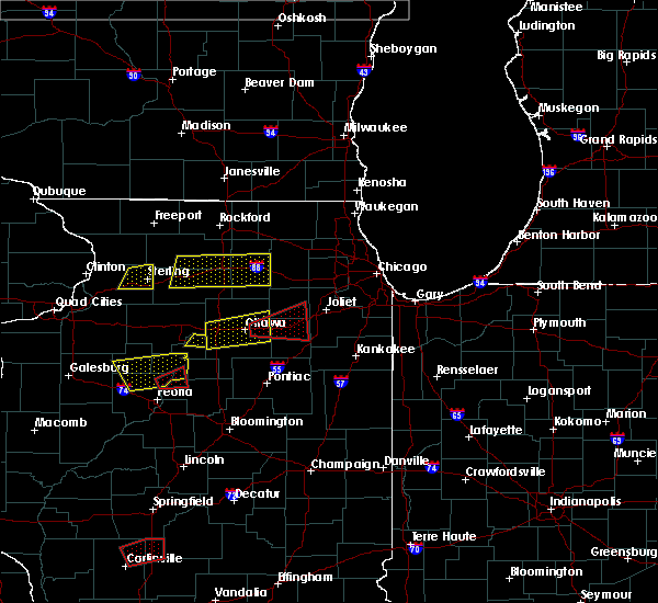 At 517 pm cst, a confirmed large and extremely dangerous tornado was located north of morris, moving east at 45 mph. this is a particularly dangerous situation. take cover now! (weather spotters confirmed tornado). Hazards include damaging tornado. You are in a life-threatening situation. flying debris may be deadly to those caught without shelter. mobile homes will be destroyed. considerable damage to homes, businesses, and vehicles is likely and complete destruction is possible. the tornado will be near, morris around 520 pm cst. channahon and minooka around 530 pm cst. Other locations impacted by this tornadic thunderstorm include lisbon. At 517 pm cst, a confirmed large and extremely dangerous tornado was located north of morris, moving east at 45 mph. this is a particularly dangerous situation. take cover now! (weather spotters confirmed tornado). Hazards include damaging tornado. You are in a life-threatening situation. flying debris may be deadly to those caught without shelter. mobile homes will be destroyed. considerable damage to homes, businesses, and vehicles is likely and complete destruction is possible. the tornado will be near, morris around 520 pm cst. channahon and minooka around 530 pm cst. Other locations impacted by this tornadic thunderstorm include lisbon.
|
| 2/28/2017 5:04 PM CST |
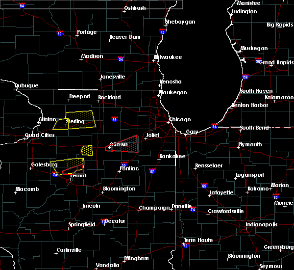 At 504 pm cst, a confirmed large and extremely dangerous tornado was located over marseilles, moving east at 35 mph. this is a particularly dangerous situation. take cover now! (weather spotters confirmed tornado). Hazards include damaging tornado. You are in a life-threatening situation. flying debris may be deadly to those caught without shelter. mobile homes will be destroyed. considerable damage to homes, businesses, and vehicles is likely and complete destruction is possible. the tornado will be near, morris around 525 pm cst. minooka around 530 pm cst. Other locations impacted by this tornadic thunderstorm include carbon hill and lisbon. At 504 pm cst, a confirmed large and extremely dangerous tornado was located over marseilles, moving east at 35 mph. this is a particularly dangerous situation. take cover now! (weather spotters confirmed tornado). Hazards include damaging tornado. You are in a life-threatening situation. flying debris may be deadly to those caught without shelter. mobile homes will be destroyed. considerable damage to homes, businesses, and vehicles is likely and complete destruction is possible. the tornado will be near, morris around 525 pm cst. minooka around 530 pm cst. Other locations impacted by this tornadic thunderstorm include carbon hill and lisbon.
|
| 2/28/2017 4:51 PM CST |
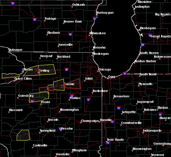 At 450 pm cst, a confirmed large and extremely dangerous tornado was located over ottawa, moving east at 45 mph. this is a particularly dangerous situation. take cover now! (weather spotters confirmed tornado). Hazards include damaging tornado. You are in a life-threatening situation. flying debris may be deadly to those caught without shelter. mobile homes will be destroyed. considerable damage to homes, businesses, and vehicles is likely and complete destruction is possible. the tornado will be near, marseilles around 455 pm cst. seneca around 505 pm cst. morris around 520 pm cst. channahon and minooka around 530 pm cst. other locations impacted by this tornadic thunderstorm include carbon hill and lisbon. this includes, gebhard woods state park, grundy county speedway and fairgrounds, illini state park, and william g stratton state park. Including the following interstate, i-80 between mile markers 93 and 121. At 450 pm cst, a confirmed large and extremely dangerous tornado was located over ottawa, moving east at 45 mph. this is a particularly dangerous situation. take cover now! (weather spotters confirmed tornado). Hazards include damaging tornado. You are in a life-threatening situation. flying debris may be deadly to those caught without shelter. mobile homes will be destroyed. considerable damage to homes, businesses, and vehicles is likely and complete destruction is possible. the tornado will be near, marseilles around 455 pm cst. seneca around 505 pm cst. morris around 520 pm cst. channahon and minooka around 530 pm cst. other locations impacted by this tornadic thunderstorm include carbon hill and lisbon. this includes, gebhard woods state park, grundy county speedway and fairgrounds, illini state park, and william g stratton state park. Including the following interstate, i-80 between mile markers 93 and 121.
|
| 7/24/2016 6:56 PM CDT |
 The severe thunderstorm warning for northeastern la salle, southwestern kendall and northwestern grundy counties will expire at 700 pm cdt, the storm which prompted the warning has weakened below severe limits, and no longer poses an immediate threat to life or property. therefore the warning will be allowed to expire. The severe thunderstorm warning for northeastern la salle, southwestern kendall and northwestern grundy counties will expire at 700 pm cdt, the storm which prompted the warning has weakened below severe limits, and no longer poses an immediate threat to life or property. therefore the warning will be allowed to expire.
|
| 7/24/2016 6:44 PM CDT |
 At 643 pm cdt, a severe thunderstorm was located near newark, or 8 miles northwest of morris, moving east at 20 mph (radar indicated). Hazards include 60 mph wind gusts and quarter size hail. Hail damage to vehicles is expected. expect wind damage to roofs, siding, and trees. locations impacted include, marseilles, serena, sheridan, newark, millington and lisbon. Including the following interstate, i-80 between mile markers 96 and 110. At 643 pm cdt, a severe thunderstorm was located near newark, or 8 miles northwest of morris, moving east at 20 mph (radar indicated). Hazards include 60 mph wind gusts and quarter size hail. Hail damage to vehicles is expected. expect wind damage to roofs, siding, and trees. locations impacted include, marseilles, serena, sheridan, newark, millington and lisbon. Including the following interstate, i-80 between mile markers 96 and 110.
|
| 7/24/2016 6:30 PM CDT |
 At 629 pm cdt, a severe thunderstorm was located near serena, moving east at 20 mph (radar indicated). Hazards include 60 mph wind gusts and quarter size hail. Hail damage to vehicles is expected. Expect wind damage to roofs, siding, and trees. At 629 pm cdt, a severe thunderstorm was located near serena, moving east at 20 mph (radar indicated). Hazards include 60 mph wind gusts and quarter size hail. Hail damage to vehicles is expected. Expect wind damage to roofs, siding, and trees.
|
| 7/17/2016 10:36 PM CDT |
 At 1036 pm cdt, a severe thunderstorm was located near mazon, or near seneca, moving northeast at 40 mph (radar indicated). Hazards include 60 mph wind gusts. Expect damage to roofs. siding. and trees. this severe thunderstorm will be near, mazon around 1040 pm cdt. morris around 1050 pm cdt. braidwood, coal city and diamond around 1055 pm cdt. channahon and minooka around 1100 pm cdt. other locations impacted by this severe thunderstorm include godley, east brooklyn, verona, ransom, south wilmington, carbon hill and kinsman. including the following interstates, i-55 between mile markers 220 and 233. I-80 between mile markers 109 and 116. At 1036 pm cdt, a severe thunderstorm was located near mazon, or near seneca, moving northeast at 40 mph (radar indicated). Hazards include 60 mph wind gusts. Expect damage to roofs. siding. and trees. this severe thunderstorm will be near, mazon around 1040 pm cdt. morris around 1050 pm cdt. braidwood, coal city and diamond around 1055 pm cdt. channahon and minooka around 1100 pm cdt. other locations impacted by this severe thunderstorm include godley, east brooklyn, verona, ransom, south wilmington, carbon hill and kinsman. including the following interstates, i-55 between mile markers 220 and 233. I-80 between mile markers 109 and 116.
|
| 7/13/2016 6:42 PM CDT |
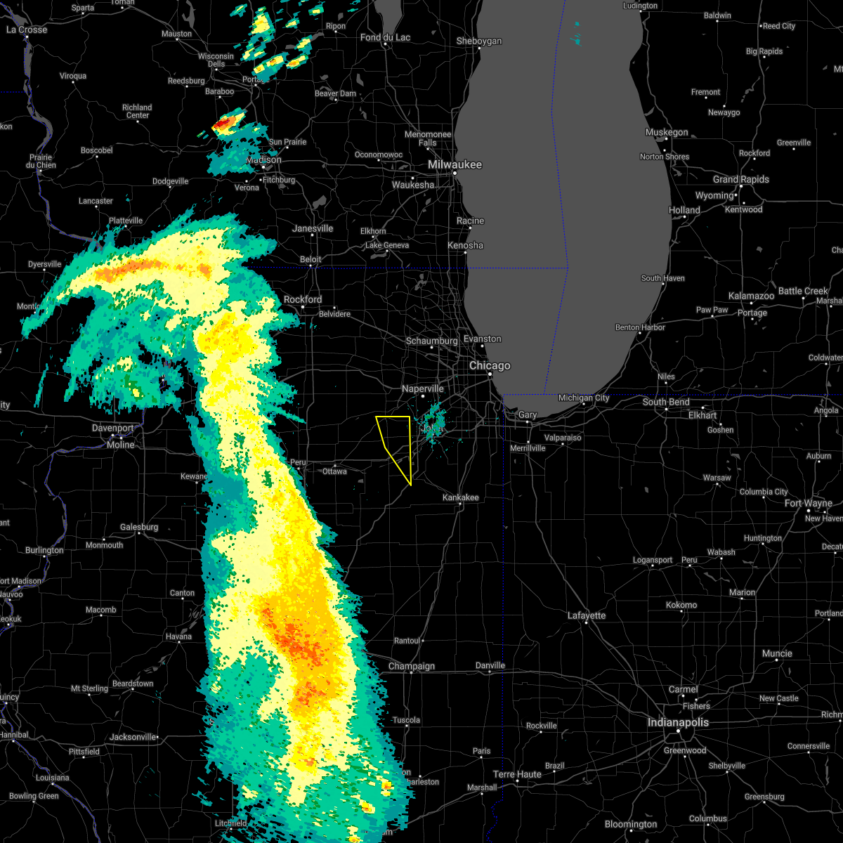 The severe thunderstorm warning for southeastern kendall and northeastern grundy counties will expire at 645 pm cdt. the storms which prompted the warning have moved out of the area. therefore the warning will be allowed to expire. however gusty winds and heavy rain are still possible with these thunderstorms. A severe thunderstorm watch remains in effect until 900 pm cdt for. The severe thunderstorm warning for southeastern kendall and northeastern grundy counties will expire at 645 pm cdt. the storms which prompted the warning have moved out of the area. therefore the warning will be allowed to expire. however gusty winds and heavy rain are still possible with these thunderstorms. A severe thunderstorm watch remains in effect until 900 pm cdt for.
|
| 7/13/2016 6:36 PM CDT |
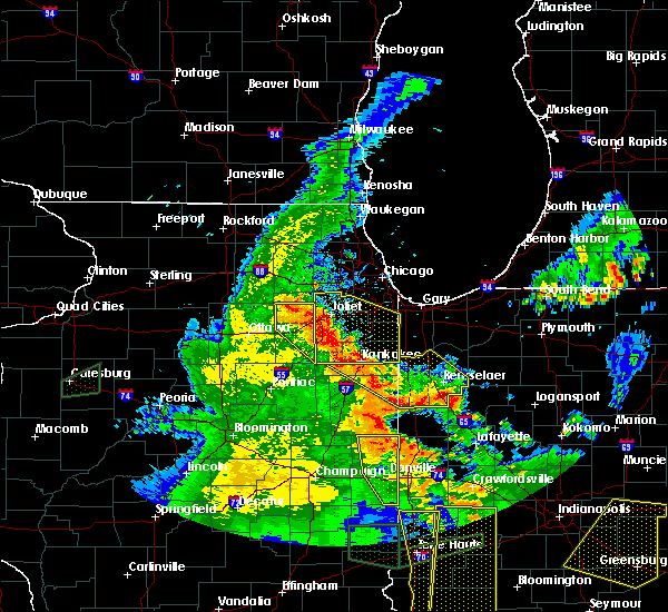 At 635 pm cdt, severe thunderstorms were located along a line extending from 5 miles southeast of yorkville to kankakee, moving east at 45 mph. winds of 65 mph were measured by trained storm spotters near the community of newark at 615 pm cdt with these storms (trained weather spotters). Hazards include 70 mph wind gusts and quarter size hail. Hail damage to vehicles is expected. expect considerable tree damage. wind damage is also likely to mobile homes, roofs, and outbuildings. locations impacted include, joliet, yorkville, morris, channahon, minooka, coal city, diamond, godley and carbon hill. including the following interstates, i-55 near mile marker 232. I-80 between mile markers 114 and 122. At 635 pm cdt, severe thunderstorms were located along a line extending from 5 miles southeast of yorkville to kankakee, moving east at 45 mph. winds of 65 mph were measured by trained storm spotters near the community of newark at 615 pm cdt with these storms (trained weather spotters). Hazards include 70 mph wind gusts and quarter size hail. Hail damage to vehicles is expected. expect considerable tree damage. wind damage is also likely to mobile homes, roofs, and outbuildings. locations impacted include, joliet, yorkville, morris, channahon, minooka, coal city, diamond, godley and carbon hill. including the following interstates, i-55 near mile marker 232. I-80 between mile markers 114 and 122.
|
| 7/13/2016 6:24 PM CDT |
 At 623 pm cdt, severe thunderstorms were located along a line extending from 5 miles south of yorkville to near gardner, moving east at 35 mph. winds of 65 mph were measured by trained storm spotters near the community of newark at 615 pm cdt with these storms (trained weather spotters). Hazards include 70 mph wind gusts and quarter size hail. Hail damage to vehicles is expected. expect considerable tree damage. wind damage is also likely to mobile homes, roofs, and outbuildings. locations impacted include, joliet, yorkville, morris, channahon, minooka, coal city, diamond, gardner, newark, braceville, south wilmington, millington, godley, carbon hill, lisbon and east brooklyn. this includes, gebhard woods state park, grundy county speedway and fairgrounds, and william g stratton state park. including the following interstates, i-55 between mile markers 227 and 232. I-80 between mile markers 105 and 122. At 623 pm cdt, severe thunderstorms were located along a line extending from 5 miles south of yorkville to near gardner, moving east at 35 mph. winds of 65 mph were measured by trained storm spotters near the community of newark at 615 pm cdt with these storms (trained weather spotters). Hazards include 70 mph wind gusts and quarter size hail. Hail damage to vehicles is expected. expect considerable tree damage. wind damage is also likely to mobile homes, roofs, and outbuildings. locations impacted include, joliet, yorkville, morris, channahon, minooka, coal city, diamond, gardner, newark, braceville, south wilmington, millington, godley, carbon hill, lisbon and east brooklyn. this includes, gebhard woods state park, grundy county speedway and fairgrounds, and william g stratton state park. including the following interstates, i-55 between mile markers 227 and 232. I-80 between mile markers 105 and 122.
|
| 7/13/2016 6:17 PM CDT |
 At 617 pm cdt, severe thunderstorms were located along a line extending from 5 miles south of yorkville to near gardner, moving east at 35 mph (radar indicated). Hazards include 70 mph wind gusts and quarter size hail. Hail damage to vehicles is expected. expect considerable tree damage. wind damage is also likely to mobile homes, roofs, and outbuildings. locations impacted include, joliet, yorkville, morris, channahon, minooka, dwight, seneca, coal city, diamond, gardner, mazon, newark, braceville, south wilmington, millington, godley, carbon hill, lisbon and east brooklyn. this includes, gebhard woods state park, grundy county speedway and fairgrounds, and william g stratton state park. including the following interstates, i-55 between mile markers 220 and 232. I-80 between mile markers 104 and 122. At 617 pm cdt, severe thunderstorms were located along a line extending from 5 miles south of yorkville to near gardner, moving east at 35 mph (radar indicated). Hazards include 70 mph wind gusts and quarter size hail. Hail damage to vehicles is expected. expect considerable tree damage. wind damage is also likely to mobile homes, roofs, and outbuildings. locations impacted include, joliet, yorkville, morris, channahon, minooka, dwight, seneca, coal city, diamond, gardner, mazon, newark, braceville, south wilmington, millington, godley, carbon hill, lisbon and east brooklyn. this includes, gebhard woods state park, grundy county speedway and fairgrounds, and william g stratton state park. including the following interstates, i-55 between mile markers 220 and 232. I-80 between mile markers 104 and 122.
|
| 7/13/2016 5:55 PM CDT |
 At 553 pm cdt, severe thunderstorms were located along a line extending from near sheridan to 7 miles northeast of streator, moving east at 35 mph. these storms have a history of producing gusts in excess of 60 mph (radar indicated). Hazards include 60 mph wind gusts and quarter size hail. Hail damage to vehicles is expected. Expect wind damage to roofs, siding, and trees. At 553 pm cdt, severe thunderstorms were located along a line extending from near sheridan to 7 miles northeast of streator, moving east at 35 mph. these storms have a history of producing gusts in excess of 60 mph (radar indicated). Hazards include 60 mph wind gusts and quarter size hail. Hail damage to vehicles is expected. Expect wind damage to roofs, siding, and trees.
|
| 3/15/2016 10:21 PM CDT |
 The severe thunderstorm warning for southeastern kendall, central grundy and southwestern will counties will expire at 1030 pm cdt, the storm which prompted the warning has weakened below severe limits, and no longer poses an immediate threat to life or property. therefore the warning will be allowed to expire. a severe thunderstorm watch remains in effect until 300 am cdt for northeastern illinois. The severe thunderstorm warning for southeastern kendall, central grundy and southwestern will counties will expire at 1030 pm cdt, the storm which prompted the warning has weakened below severe limits, and no longer poses an immediate threat to life or property. therefore the warning will be allowed to expire. a severe thunderstorm watch remains in effect until 300 am cdt for northeastern illinois.
|
| 3/15/2016 10:06 PM CDT |
 At 1006 pm cdt, a severe thunderstorm was located near morris, moving northeast at 50 mph (radar indicated). Hazards include 60 mph wind gusts and quarter size hail. Hail damage to vehicles is expected. expect wind damage to roofs, siding, and trees. locations impacted include, joliet, plainfield, morris, channahon, minooka, wilmington, shorewood, braidwood, coal city, diamond, elwood, rockdale, mazon, braceville, lakewood shores, crest hill, godley, carbon hill, symerton and crystal lawns. this includes, channahon state park, gebhard woods state park, grundy county speedway and fairgrounds, joliet junior college, and william g stratton state park. including the following interstates, i-55 between mile markers 230 and 257. I-80 between mile markers 108 and 131. At 1006 pm cdt, a severe thunderstorm was located near morris, moving northeast at 50 mph (radar indicated). Hazards include 60 mph wind gusts and quarter size hail. Hail damage to vehicles is expected. expect wind damage to roofs, siding, and trees. locations impacted include, joliet, plainfield, morris, channahon, minooka, wilmington, shorewood, braidwood, coal city, diamond, elwood, rockdale, mazon, braceville, lakewood shores, crest hill, godley, carbon hill, symerton and crystal lawns. this includes, channahon state park, gebhard woods state park, grundy county speedway and fairgrounds, joliet junior college, and william g stratton state park. including the following interstates, i-55 between mile markers 230 and 257. I-80 between mile markers 108 and 131.
|
| 3/15/2016 9:54 PM CDT |
 At 953 pm cdt, a severe thunderstorm was located near seneca, moving northeast at 50 mph (radar indicated). Hazards include 60 mph wind gusts and quarter size hail. Hail damage to vehicles is expected. Expect wind damage to roofs, siding, and trees. At 953 pm cdt, a severe thunderstorm was located near seneca, moving northeast at 50 mph (radar indicated). Hazards include 60 mph wind gusts and quarter size hail. Hail damage to vehicles is expected. Expect wind damage to roofs, siding, and trees.
|
| 11/11/2015 9:10 PM CST |
 The severe thunderstorm warning for east central la salle, kendall, northwestern livingston, grundy and southeastern kane counties will expire at 915 pm cst, the storms which prompted the warning have weakened below severe limits, and exited the warning area. therefore the warning has been allowed to expire. gusts of 40 to 45 mph will remain possible through the remainder of the evening, while gusts in excess of 50 mph are possible overnight. to report severe weather, contact your nearest law enforcement agency. they will relay your report to the national weather service chicago. The severe thunderstorm warning for east central la salle, kendall, northwestern livingston, grundy and southeastern kane counties will expire at 915 pm cst, the storms which prompted the warning have weakened below severe limits, and exited the warning area. therefore the warning has been allowed to expire. gusts of 40 to 45 mph will remain possible through the remainder of the evening, while gusts in excess of 50 mph are possible overnight. to report severe weather, contact your nearest law enforcement agency. they will relay your report to the national weather service chicago.
|
| 11/11/2015 9:00 PM CST |
 At 859 pm cst, strong to severe thunderstorms were located along a line extending from east dundee to near seneca, moving northeast at 55 mph. higher winds to 60 mph will likely be isolated in nature (radar indicated). Hazards include 60 mph wind gusts. Expect damage to roofs. siding and trees. Locations impacted include, aurora, joliet, oswego, west chicago, batavia, geneva, yorkville, morris, channahon, pontiac, minooka, dwight, seneca, montgomery, north aurora, odell, mazon, cornell, ransom and lisbon. At 859 pm cst, strong to severe thunderstorms were located along a line extending from east dundee to near seneca, moving northeast at 55 mph. higher winds to 60 mph will likely be isolated in nature (radar indicated). Hazards include 60 mph wind gusts. Expect damage to roofs. siding and trees. Locations impacted include, aurora, joliet, oswego, west chicago, batavia, geneva, yorkville, morris, channahon, pontiac, minooka, dwight, seneca, montgomery, north aurora, odell, mazon, cornell, ransom and lisbon.
|
| 11/11/2015 8:44 PM CST |
 At 843 pm cst, severe thunderstorms were located along a line extending from lily lake to 10 miles south of streator, moving northeast at 65 mph (radar indicated). Hazards include 60 mph wind gusts. Expect damage to roofs. siding and trees. locations impacted include, aurora, joliet, elgin, carpentersville, st. Charles, oswego, algonquin, west chicago, batavia, geneva, yorkville, streator, morris, channahon, pontiac, minooka, plano, marseilles, dwight and sleepy hollow. At 843 pm cst, severe thunderstorms were located along a line extending from lily lake to 10 miles south of streator, moving northeast at 65 mph (radar indicated). Hazards include 60 mph wind gusts. Expect damage to roofs. siding and trees. locations impacted include, aurora, joliet, elgin, carpentersville, st. Charles, oswego, algonquin, west chicago, batavia, geneva, yorkville, streator, morris, channahon, pontiac, minooka, plano, marseilles, dwight and sleepy hollow.
|
| 11/11/2015 8:30 PM CST |
 At 828 pm cst, severe thunderstorms were located along a line extending from near hinckley to 5 miles east of wenona, moving northeast at 55 mph. while the severe winds do not extend the entire length of this line of storms, there are scattered areas of likely severe winds based on radar, including in northern kane county, and entering kendall county (radar indicated). Hazards include 60 mph wind gusts. Expect damage to roofs. Siding and trees. At 828 pm cst, severe thunderstorms were located along a line extending from near hinckley to 5 miles east of wenona, moving northeast at 55 mph. while the severe winds do not extend the entire length of this line of storms, there are scattered areas of likely severe winds based on radar, including in northern kane county, and entering kendall county (radar indicated). Hazards include 60 mph wind gusts. Expect damage to roofs. Siding and trees.
|
| 9/19/2015 12:07 AM CDT |
 At 1207 am cdt, severe thunderstorms were located along a line extending from northlake to near romeoville to morris, moving east at 45 mph (radar indicated). Hazards include 60 mph wind gusts. Expect damage to roofs. siding and trees. locations impacted include, chicago, aurora, joliet, naperville, cicero, arlington heights, evanston, schaumburg, bolingbrook, skokie, des plaines, orland park, tinley park, oak lawn, berwyn, mount prospect, wheaton, hoffman estates, oak park and downers grove. this includes, argonne national laboratory, brookfield zoo, lincoln park zoo, loyola university, oakton community college, toyota park, triton college, university of chicago, university of st. francis, windy city thunderbolts baseball, benedictine university, channahon state park, chicagoland speedway route 66 raceway, college of dupage, dupage county fairgrounds, first midwest bank amphitheatre, gebhard woods state park, grundy county speedway and fairgrounds, hawthorne park, joliet junior college, joliet slammers baseball, lewis university, moraine valley community college, morton arboretum, northeastern illinois university, northwestern university, university of illinois chicago, us cellular field, il institute of technology, wheaton college, william g stratton state park, wrigley field, the loop, and museum of science and industry. including the following interstates, i-55 between mile markers 241 and 293. i-57 between mile markers 330 and 358. i-80 between mile markers 106 and 155. i-88 between mile markers 121 and 140. i-94 between mile markers 36 and 68. i-290 between mile markers 1 and 29. i-294 between mile markers 36 and 68. I-355 between mile markers 1 and 30. At 1207 am cdt, severe thunderstorms were located along a line extending from northlake to near romeoville to morris, moving east at 45 mph (radar indicated). Hazards include 60 mph wind gusts. Expect damage to roofs. siding and trees. locations impacted include, chicago, aurora, joliet, naperville, cicero, arlington heights, evanston, schaumburg, bolingbrook, skokie, des plaines, orland park, tinley park, oak lawn, berwyn, mount prospect, wheaton, hoffman estates, oak park and downers grove. this includes, argonne national laboratory, brookfield zoo, lincoln park zoo, loyola university, oakton community college, toyota park, triton college, university of chicago, university of st. francis, windy city thunderbolts baseball, benedictine university, channahon state park, chicagoland speedway route 66 raceway, college of dupage, dupage county fairgrounds, first midwest bank amphitheatre, gebhard woods state park, grundy county speedway and fairgrounds, hawthorne park, joliet junior college, joliet slammers baseball, lewis university, moraine valley community college, morton arboretum, northeastern illinois university, northwestern university, university of illinois chicago, us cellular field, il institute of technology, wheaton college, william g stratton state park, wrigley field, the loop, and museum of science and industry. including the following interstates, i-55 between mile markers 241 and 293. i-57 between mile markers 330 and 358. i-80 between mile markers 106 and 155. i-88 between mile markers 121 and 140. i-94 between mile markers 36 and 68. i-290 between mile markers 1 and 29. i-294 between mile markers 36 and 68. I-355 between mile markers 1 and 30.
|
| 9/18/2015 11:54 PM CDT |
 At 1154 pm cdt, severe thunderstorms were located along a line extending from wheaton to near oswego to near seneca, moving east at 45 mph (radar indicated). Hazards include 60 mph wind gusts. Expect damage to roofs. Siding and trees. At 1154 pm cdt, severe thunderstorms were located along a line extending from wheaton to near oswego to near seneca, moving east at 45 mph (radar indicated). Hazards include 60 mph wind gusts. Expect damage to roofs. Siding and trees.
|
| 8/18/2015 7:44 PM CDT |
 At 743 pm cdt, severe thunderstorms were located along a line extending from minooka to near channahon to near lakewood shores, moving northeast at 65 mph (radar indicated). Hazards include 70 mph wind gusts. Expect considerable tree damage. damage is likely to mobile homes, roofs and outbuildings. locations impacted include, joliet, romeoville, lockport, new lenox, mokena, frankfort, morris, channahon, minooka, manteno, wilmington, ingalls park, shorewood, manhattan, braidwood, coal city, diamond, elwood, rockdale and braceville. this includes, university of st. francis, channahon state park, chicagoland speedway route 66 raceway, joliet junior college, joliet slammers baseball, and kankakee river state park. including the following interstates, i-55 between mile markers 230 and 254. i-57 between mile markers 323 and 324. i-80 between mile markers 114 and 143. i-355 between mile markers 1 and 7. A tornado watch remains in effect until 1000 pm cdt for northeastern illinois. At 743 pm cdt, severe thunderstorms were located along a line extending from minooka to near channahon to near lakewood shores, moving northeast at 65 mph (radar indicated). Hazards include 70 mph wind gusts. Expect considerable tree damage. damage is likely to mobile homes, roofs and outbuildings. locations impacted include, joliet, romeoville, lockport, new lenox, mokena, frankfort, morris, channahon, minooka, manteno, wilmington, ingalls park, shorewood, manhattan, braidwood, coal city, diamond, elwood, rockdale and braceville. this includes, university of st. francis, channahon state park, chicagoland speedway route 66 raceway, joliet junior college, joliet slammers baseball, and kankakee river state park. including the following interstates, i-55 between mile markers 230 and 254. i-57 between mile markers 323 and 324. i-80 between mile markers 114 and 143. i-355 between mile markers 1 and 7. A tornado watch remains in effect until 1000 pm cdt for northeastern illinois.
|
| 8/18/2015 7:36 PM CDT |
 At 736 pm cdt, severe thunderstorms were located along a line extending from near morris to diamond to 7 miles northwest of herscher, moving northeast at 45 mph (radar indicated). Hazards include 60 mph wind gusts. Expect damage to roofs. Siding and trees. At 736 pm cdt, severe thunderstorms were located along a line extending from near morris to diamond to 7 miles northwest of herscher, moving northeast at 45 mph (radar indicated). Hazards include 60 mph wind gusts. Expect damage to roofs. Siding and trees.
|
| 7/13/2015 6:07 PM CDT |
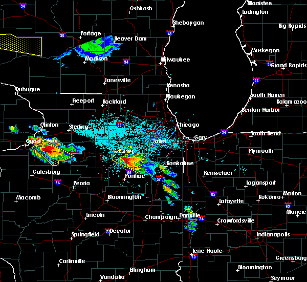 At 606 pm cdt, a severe thunderstorm was located near seneca, moving southeast at 35 mph (radar indicated). Hazards include two inch hail and 70 mph wind gusts. People and animals outdoors will be injured. expect hail damage to roofs, siding, windows and vehicles. expect considerable tree damage. wind damage is also likely to mobile homes, roofs and outbuildings. this severe storm will be near, mazon around 620 pm cdt. dwight around 625 pm cdt. gardner and braceville around 630 pm cdt. this includes, gebhard woods state park and william g stratton state park. this storm has a history of baseball sized hail! including the following interstates, i-55 between mile markers 214 and 229. i-80 between mile markers 98 and 107. A tornado watch remains in effect until 1100 pm cdt for northeastern illinois. At 606 pm cdt, a severe thunderstorm was located near seneca, moving southeast at 35 mph (radar indicated). Hazards include two inch hail and 70 mph wind gusts. People and animals outdoors will be injured. expect hail damage to roofs, siding, windows and vehicles. expect considerable tree damage. wind damage is also likely to mobile homes, roofs and outbuildings. this severe storm will be near, mazon around 620 pm cdt. dwight around 625 pm cdt. gardner and braceville around 630 pm cdt. this includes, gebhard woods state park and william g stratton state park. this storm has a history of baseball sized hail! including the following interstates, i-55 between mile markers 214 and 229. i-80 between mile markers 98 and 107. A tornado watch remains in effect until 1100 pm cdt for northeastern illinois.
|
| 7/13/2015 5:51 PM CDT |
 At 549 pm cdt, a severe thunderstorm was located over marseilles, moving southeast at 30 mph. this is a very dangerous storm (radar indicated). Hazards include baseball size hail and 70 mph wind gusts. People and animals outdoors will be severely injured. expect shattered windows, extensive damage to roofs, siding and vehicles. this severe storm will be near, mazon around 615 pm cdt. dwight around 625 pm cdt. gardner and braceville around 630 pm cdt. at 5:48pm, golf ball size hail was reported in marseilles. there have been several other reports of golf ball sized hail with this storm! includes, gebhard woods state park, illini state park, and william g stratton state park. including the following interstates, i-55 between mile markers 214 and 229. i-80 between mile markers 91 and 107. A tornado watch remains in effect until 1100 pm cdt for northeastern illinois. At 549 pm cdt, a severe thunderstorm was located over marseilles, moving southeast at 30 mph. this is a very dangerous storm (radar indicated). Hazards include baseball size hail and 70 mph wind gusts. People and animals outdoors will be severely injured. expect shattered windows, extensive damage to roofs, siding and vehicles. this severe storm will be near, mazon around 615 pm cdt. dwight around 625 pm cdt. gardner and braceville around 630 pm cdt. at 5:48pm, golf ball size hail was reported in marseilles. there have been several other reports of golf ball sized hail with this storm! includes, gebhard woods state park, illini state park, and william g stratton state park. including the following interstates, i-55 between mile markers 214 and 229. i-80 between mile markers 91 and 107. A tornado watch remains in effect until 1100 pm cdt for northeastern illinois.
|
| 7/13/2015 5:37 PM CDT |
 At 536 pm cdt, a severe thunderstorm was located near marseilles, moving southeast at 35 mph (radar indicated). Hazards include tennis ball size hail and 70 mph wind gusts. People and animals outdoors will be injured. expect hail damage to roofs, siding, windows and vehicles. expect considerable tree damage. Wind damage is also likely to mobile homes, roofs and outbuildings. At 536 pm cdt, a severe thunderstorm was located near marseilles, moving southeast at 35 mph (radar indicated). Hazards include tennis ball size hail and 70 mph wind gusts. People and animals outdoors will be injured. expect hail damage to roofs, siding, windows and vehicles. expect considerable tree damage. Wind damage is also likely to mobile homes, roofs and outbuildings.
|
| 6/22/2015 10:11 PM CDT |
 The tornado warning for eastern grundy county will expire at 1015 pm cdt, the storm which prompted the warning has moved out of the area. therefore the warning will be allowed to expire. however gusty winds are still possible with this thunderstorm. The tornado warning for eastern grundy county will expire at 1015 pm cdt, the storm which prompted the warning has moved out of the area. therefore the warning will be allowed to expire. however gusty winds are still possible with this thunderstorm.
|
| 6/22/2015 9:45 PM CDT |
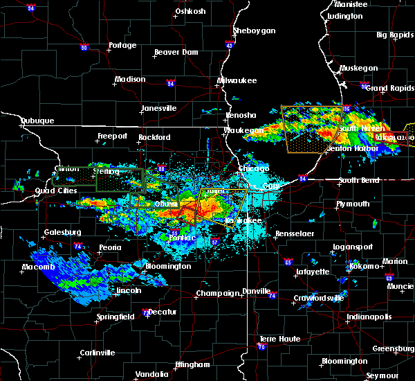 At 944 pm cdt, a confirmed tornado was located near mazon, or near morris, moving southeast at 25 mph (radar confirmed tornado). Hazards include damaging tornado and quarter size hail. Flying debris will be dangerous to those caught without shelter. mobile homes will be damaged or destroyed. damage to roofs, windows and vehicles will occur. tree damage is likely. this tornado will be near, coal city and diamond around 1000 pm cdt. gardner and braceville around 1005 pm cdt. other locations impacted by this tornadic thunderstorm include south wilmington, carbon hill, east brooklyn, verona and godley. this includes, william g stratton state park. Including the following interstate, i-55 between mile markers 224 and 232. At 944 pm cdt, a confirmed tornado was located near mazon, or near morris, moving southeast at 25 mph (radar confirmed tornado). Hazards include damaging tornado and quarter size hail. Flying debris will be dangerous to those caught without shelter. mobile homes will be damaged or destroyed. damage to roofs, windows and vehicles will occur. tree damage is likely. this tornado will be near, coal city and diamond around 1000 pm cdt. gardner and braceville around 1005 pm cdt. other locations impacted by this tornadic thunderstorm include south wilmington, carbon hill, east brooklyn, verona and godley. this includes, william g stratton state park. Including the following interstate, i-55 between mile markers 224 and 232.
|
| 6/22/2015 9:43 PM CDT | The tornado warning for east central la salle and northwestern grundy counties will expire at 945 pm cdt, another tornado warning has been issued for grundy county and is in effect until 1015 pm cdt and is an extension of the previous tornado warning. |
| 6/22/2015 9:31 PM CDT |
 At 930 pm cdt, a severe thunderstorm capable of producing a tornado was located near seneca, moving southeast at 30 mph (radar indicated rotation). Hazards include tornado and quarter size hail. Flying debris will be dangerous to those caught without shelter. mobile homes will be damaged or destroyed. damage to roofs, windows and vehicles will occur. tree damage is likely. this dangerous storm will be near, morris around 935 pm cdt. other locations impacted by this tornadic thunderstorm include verona. this includes, gebhard woods state park and grundy county speedway and fairgrounds. Including the following interstate, i-80 between mile markers 102 and 112. At 930 pm cdt, a severe thunderstorm capable of producing a tornado was located near seneca, moving southeast at 30 mph (radar indicated rotation). Hazards include tornado and quarter size hail. Flying debris will be dangerous to those caught without shelter. mobile homes will be damaged or destroyed. damage to roofs, windows and vehicles will occur. tree damage is likely. this dangerous storm will be near, morris around 935 pm cdt. other locations impacted by this tornadic thunderstorm include verona. this includes, gebhard woods state park and grundy county speedway and fairgrounds. Including the following interstate, i-80 between mile markers 102 and 112.
|
| 6/22/2015 9:28 PM CDT |
 At 928 pm cdt, a severe thunderstorm capable of producing a tornado was located near seneca, moving southeast at 30 mph (radar indicated rotation). Hazards include tornado and quarter size hail. Flying debris will be dangerous to those caught without shelter. mobile homes will be damaged or destroyed. damage to roofs, windows and vehicles will occur. tree damage is likely. this dangerous storm will be near, morris around 935 pm cdt. mazon around 945 pm cdt. coal city, diamond and gardner around 955 pm cdt. braceville around 1000 pm cdt. other locations impacted by this tornadic thunderstorm include south wilmington, carbon hill, east brooklyn, verona and godley. this includes, gebhard woods state park and william g stratton state park. including the following interstates, i-55 between mile markers 224 and 232. I-80 between mile markers 111 and 112. At 928 pm cdt, a severe thunderstorm capable of producing a tornado was located near seneca, moving southeast at 30 mph (radar indicated rotation). Hazards include tornado and quarter size hail. Flying debris will be dangerous to those caught without shelter. mobile homes will be damaged or destroyed. damage to roofs, windows and vehicles will occur. tree damage is likely. this dangerous storm will be near, morris around 935 pm cdt. mazon around 945 pm cdt. coal city, diamond and gardner around 955 pm cdt. braceville around 1000 pm cdt. other locations impacted by this tornadic thunderstorm include south wilmington, carbon hill, east brooklyn, verona and godley. this includes, gebhard woods state park and william g stratton state park. including the following interstates, i-55 between mile markers 224 and 232. I-80 between mile markers 111 and 112.
|
| 6/22/2015 9:18 PM CDT |
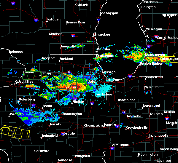 At 917 pm cdt, a severe thunderstorm capable of producing a tornado was located near seneca, moving southeast at 35 mph (radar indicated rotation). Hazards include tornado and quarter size hail. Flying debris will be dangerous to those caught without shelter. mobile homes will be damaged or destroyed. damage to roofs, windows and vehicles will occur. tree damage is likely. this dangerous storm will be near, morris around 930 pm cdt. other locations impacted by this tornadic thunderstorm include verona. this includes, gebhard woods state park, grundy county speedway and fairgrounds, and illini state park. Including the following interstate, i-80 between mile markers 98 and 112. At 917 pm cdt, a severe thunderstorm capable of producing a tornado was located near seneca, moving southeast at 35 mph (radar indicated rotation). Hazards include tornado and quarter size hail. Flying debris will be dangerous to those caught without shelter. mobile homes will be damaged or destroyed. damage to roofs, windows and vehicles will occur. tree damage is likely. this dangerous storm will be near, morris around 930 pm cdt. other locations impacted by this tornadic thunderstorm include verona. this includes, gebhard woods state park, grundy county speedway and fairgrounds, and illini state park. Including the following interstate, i-80 between mile markers 98 and 112.
|
| 6/22/2015 9:06 PM CDT |
 At 906 pm cdt, a tornado producing storm was located near serena, moving east at 25 mph (radar confirmed tornado). Hazards include damaging tornado and quarter size hail. Flying debris will be dangerous to those caught without shelter. mobile homes will be damaged or destroyed. damage to roofs, windows and vehicles will occur. tree damage is likely. this tornadic storm will be near, marseilles around 915 pm cdt. seneca around 930 pm cdt. morris around 945 pm cdt. other locations impacted by this tornadic thunderstorm include verona. this includes, gebhard woods state park, grundy county speedway and fairgrounds, and illini state park. Including the following interstate, i-80 between mile markers 96 and 112. At 906 pm cdt, a tornado producing storm was located near serena, moving east at 25 mph (radar confirmed tornado). Hazards include damaging tornado and quarter size hail. Flying debris will be dangerous to those caught without shelter. mobile homes will be damaged or destroyed. damage to roofs, windows and vehicles will occur. tree damage is likely. this tornadic storm will be near, marseilles around 915 pm cdt. seneca around 930 pm cdt. morris around 945 pm cdt. other locations impacted by this tornadic thunderstorm include verona. this includes, gebhard woods state park, grundy county speedway and fairgrounds, and illini state park. Including the following interstate, i-80 between mile markers 96 and 112.
|
| 6/13/2015 5:55 PM CDT |
 The severe thunderstorm warning for northeastern la salle, southwestern kendall and northwestern grundy counties will expire at 600 pm cdt, the storm which prompted the warning has weakened below severe limits, and no longer pose an immediate threat to life or property. therefore the warning will be allowed to expire. however gusty winds and heavy rain are still possible with this thunderstorm and additional thunderstorms moving in from the southwest. a severe thunderstorm watch remains in effect until 1100 pm cdt for northeastern illinois. The severe thunderstorm warning for northeastern la salle, southwestern kendall and northwestern grundy counties will expire at 600 pm cdt, the storm which prompted the warning has weakened below severe limits, and no longer pose an immediate threat to life or property. therefore the warning will be allowed to expire. however gusty winds and heavy rain are still possible with this thunderstorm and additional thunderstorms moving in from the southwest. a severe thunderstorm watch remains in effect until 1100 pm cdt for northeastern illinois.
|
| 6/13/2015 5:29 PM CDT |
 At 528 pm cdt, a severe thunderstorm was located near serena, moving east at 35 mph (spotters reported tree limbs down in lasalle with this storm). Hazards include 60 mph wind gusts and penny size hail. Expect damage to roofs. siding and trees. locations impacted include, ottawa, morris, marseilles, seneca, serena, sheridan, newark, millington and lisbon. this includes, illini state park. Including the following interstate, i-80 between mile markers 92 and 110. At 528 pm cdt, a severe thunderstorm was located near serena, moving east at 35 mph (spotters reported tree limbs down in lasalle with this storm). Hazards include 60 mph wind gusts and penny size hail. Expect damage to roofs. siding and trees. locations impacted include, ottawa, morris, marseilles, seneca, serena, sheridan, newark, millington and lisbon. this includes, illini state park. Including the following interstate, i-80 between mile markers 92 and 110.
|
| 6/13/2015 5:11 PM CDT |
 At 510 pm cdt, a severe thunderstorm was located near ottawa, moving east at 40 mph (radar indicated). Hazards include 60 mph wind gusts and nickel size hail. Expect damage to roofs. Siding and trees. At 510 pm cdt, a severe thunderstorm was located near ottawa, moving east at 40 mph (radar indicated). Hazards include 60 mph wind gusts and nickel size hail. Expect damage to roofs. Siding and trees.
|
| 6/10/2015 7:55 PM CDT |
 At 754 pm cdt, a severe thunderstorm was located near channahon, moving southeast at 15 mph. this is a very dangerous storm (trained spotters. trained spotters reported baseball sized hail at 750 pm cdt in minooka). Hazards include baseball size hail and 60 mph wind gusts. People and animals outdoors will be severely injured. expect shattered windows, extensive damage to roofs, siding and vehicles. this severe storm will be near, diamond and elwood around 805 pm cdt. braidwood around 810 pm cdt. wilmington around 815 pm cdt. lakewood shores around 820 pm cdt. other locations impacted by this severe thunderstorm include lisbon, carbon hill, symerton and godley. this includes, channahon state park, grundy county speedway and fairgrounds, and william g stratton state park. including the following interstates, i-55 between mile markers 232 and 250. I-80 between mile markers 112 and 126. At 754 pm cdt, a severe thunderstorm was located near channahon, moving southeast at 15 mph. this is a very dangerous storm (trained spotters. trained spotters reported baseball sized hail at 750 pm cdt in minooka). Hazards include baseball size hail and 60 mph wind gusts. People and animals outdoors will be severely injured. expect shattered windows, extensive damage to roofs, siding and vehicles. this severe storm will be near, diamond and elwood around 805 pm cdt. braidwood around 810 pm cdt. wilmington around 815 pm cdt. lakewood shores around 820 pm cdt. other locations impacted by this severe thunderstorm include lisbon, carbon hill, symerton and godley. this includes, channahon state park, grundy county speedway and fairgrounds, and william g stratton state park. including the following interstates, i-55 between mile markers 232 and 250. I-80 between mile markers 112 and 126.
|
| 6/10/2015 7:45 PM CDT |
 At 745 pm cdt, a severe thunderstorm was located near channahon, moving southeast at 15 mph (radar indicated). Hazards include two inch hail and 60 mph wind gusts. People and animals outdoors will be injured. expect hail damage to roofs, siding, windows and vehicles. Expect wind damage to roofs, siding and trees. At 745 pm cdt, a severe thunderstorm was located near channahon, moving southeast at 15 mph (radar indicated). Hazards include two inch hail and 60 mph wind gusts. People and animals outdoors will be injured. expect hail damage to roofs, siding, windows and vehicles. Expect wind damage to roofs, siding and trees.
|
| 6/10/2015 7:36 PM CDT |
 At 736 pm cdt, a severe thunderstorm was located over minooka, moving southeast at 15 mph (trained weather spotters). Hazards include two inch hail and 60 mph wind gusts. People and animals outdoors will be injured. expect hail damage to roofs, siding, windows and vehicles. expect wind damage to roofs, siding and trees. this severe storm will be near, channahon around 740 pm cdt. coal city and diamond around 745 pm cdt. other locations impacted by this severe thunderstorm include carbon hill and godley. this includes, channahon state park. including the following interstates, i-55 between mile markers 232 and 249. I-80 between mile markers 115 and 126. At 736 pm cdt, a severe thunderstorm was located over minooka, moving southeast at 15 mph (trained weather spotters). Hazards include two inch hail and 60 mph wind gusts. People and animals outdoors will be injured. expect hail damage to roofs, siding, windows and vehicles. expect wind damage to roofs, siding and trees. this severe storm will be near, channahon around 740 pm cdt. coal city and diamond around 745 pm cdt. other locations impacted by this severe thunderstorm include carbon hill and godley. this includes, channahon state park. including the following interstates, i-55 between mile markers 232 and 249. I-80 between mile markers 115 and 126.
|
| 6/10/2015 7:21 PM CDT |
 At 719 pm cdt, a severe thunderstorm was located near elwood, or near channahon, moving southeast at 25 mph (emergency management reported. at 716 pm cdt...emergency management reported golf ball sized hail in minooka). Hazards include golf ball size hail and 60 mph wind gusts. People and animals outdoors will be injured. expect hail damage to roofs, siding, windows and vehicles. expect wind damage to roofs, siding and trees. this severe storm will be near, wilmington and braidwood around 730 pm cdt. lakewood shores around 735 pm cdt. other locations impacted by this severe thunderstorm include carbon hill and godley. this includes, channahon state park. including the following interstates, i-55 between mile markers 232 and 249. I-80 between mile markers 115 and 126. At 719 pm cdt, a severe thunderstorm was located near elwood, or near channahon, moving southeast at 25 mph (emergency management reported. at 716 pm cdt...emergency management reported golf ball sized hail in minooka). Hazards include golf ball size hail and 60 mph wind gusts. People and animals outdoors will be injured. expect hail damage to roofs, siding, windows and vehicles. expect wind damage to roofs, siding and trees. this severe storm will be near, wilmington and braidwood around 730 pm cdt. lakewood shores around 735 pm cdt. other locations impacted by this severe thunderstorm include carbon hill and godley. this includes, channahon state park. including the following interstates, i-55 between mile markers 232 and 249. I-80 between mile markers 115 and 126.
|
| 6/10/2015 7:05 PM CDT |
 At 705 pm cdt, a severe thunderstorm was located over channahon, moving southeast at 25 mph (radar indicated). Hazards include 60 mph wind gusts and quarter size hail. Hail damage to vehicles is expected. expect wind damage to roofs, siding and trees. this severe thunderstorm will be near, coal city and diamond around 725 pm cdt. wilmington and braidwood around 730 pm cdt. lakewood shores around 735 pm cdt. other locations impacted by this severe thunderstorm include carbon hill and godley. including the following interstates, i-55 between mile markers 232 and 249. i-80 between mile markers 115 and 126. This includes, channahon state park. At 705 pm cdt, a severe thunderstorm was located over channahon, moving southeast at 25 mph (radar indicated). Hazards include 60 mph wind gusts and quarter size hail. Hail damage to vehicles is expected. expect wind damage to roofs, siding and trees. this severe thunderstorm will be near, coal city and diamond around 725 pm cdt. wilmington and braidwood around 730 pm cdt. lakewood shores around 735 pm cdt. other locations impacted by this severe thunderstorm include carbon hill and godley. including the following interstates, i-55 between mile markers 232 and 249. i-80 between mile markers 115 and 126. This includes, channahon state park.
|
| 5/8/2015 3:43 PM CDT | At 342 pm cdt, severe thunderstorms were located along a line extending from near newark to minooka to near elwood, moving northeast at 35 mph (radar indicated). Hazards include 60 mph wind gusts. Expect damage to roofs. siding and trees. these severe storms will be near, manhattan and elwood around 350 pm cdt. joliet, new lenox, ingalls park, shorewood and rockdale around 355 pm cdt. plainfield around 400 pm cdt. lockport around 405 pm cdt. romeoville around 415 pm cdt. other locations impacted by these severe thunderstorms include fairmont, lisbon, crest hill, godley, crystal lawns, carbon hill and preston heights. including the following interstates, i-55 between mile markers 232 and 257. i-80 between mile markers 103 and 140. i-355 near mile marker 1. 75in. |
| 5/8/2015 3:28 PM CDT | At 328 pm cdt, severe thunderstorms were located along a line extending from seneca to near coal city to wilmington, moving northeast at 35 mph (radar indicated). Hazards include 60 mph wind gusts. Expect damage to roofs. siding and trees. severe thunderstorms will be near, wilmington and lakewood shores around 335 pm cdt. minooka, manhattan and elwood around 345 pm cdt. channahon around 350 pm cdt. joliet, new lenox, ingalls park, shorewood and rockdale around 355 pm cdt. plainfield around 400 pm cdt. lockport around 410 pm cdt. romeoville around 415 pm cdt. other locations impacted by these severe thunderstorms include fairmont, lisbon, crest hill, east brooklyn, godley, verona, crystal lawns, south wilmington, carbon hill and preston heights. 75in. |
| 4/9/2015 9:03 PM CDT | A severe thunderstorm warning remains in effect until 915 pm cdt for southwestern will. southeastern kendall and grundy counties. at 902 pm cdt. severe thunderstorms were located along a line extending from near shorewood to wilmington. moving northeast at 45 mph. hazard. 70 mph wind gusts and quarter size hail. |
| 4/9/2015 8:40 PM CDT | The national weather service in chicago has issued a * severe thunderstorm warning for. east central la salle county in north central illinois. western will county in northeastern illinois. kendall county in northeastern illinois. Grundy county in northeastern illinois. |
| 4/8/2015 11:32 PM CDT | A severe thunderstorm warning remains in effect until midnight cdt for west central will and northeastern grundy counties. at 1131 pm cdt. a severe thunderstorm was located near channahon. moving northeast at 20 mph. hazard. half dollar size hail. source. Radar indicated. |
| 4/8/2015 11:20 PM CDT | Half Dollar sized hail reported 0.1 miles S of Morris, IL, time estimated. |
| 4/8/2015 11:13 PM CDT | The national weather service in chicago has issued a * severe thunderstorm warning for. west central will county in northeastern illinois. northeastern grundy county in northeastern illinois. until midnight cdt * at 1112 pm cdt. A severe thunderstorm was located near morris. |
| 6/30/2014 9:50 PM CDT | Lots of trees down in a yard along gun club road. also saw power flashes. wind lasted about 5 minute in grundy county IL, 2.1 miles W of Morris, IL |
| 6/30/2014 9:50 PM CDT | Numerous trees down in tow in grundy county IL, 0.1 miles S of Morris, IL |
| 6/30/2014 9:48 PM CDT | 200 to 300 trees down in morris... some on houses... which caused some damage. 85 to 90 percent of the city without power. some roads blocked by trees and power line in grundy county IL, 0.1 miles S of Morris, IL |
| 11/17/2013 12:25 PM CST | Quarter sized hail reported 7 miles WNW of Morris, IL, shredded leaves. |
| 6/24/2013 5:34 PM CDT | 2 inch diameter branches down. wind estimated at 70 mp in grundy county IL, 0.1 miles S of Morris, IL |
| 6/12/2013 8:07 PM CDT | Rod and gun club road. 16 inch diameter tree uproote in grundy county IL, 0.1 miles S of Morris, IL |
| 6/12/2013 6:20 PM CDT | Quarter sized hail reported 5.9 miles SW of Morris, IL, i-80 east bound rest area |
| 8/4/2012 3:15 PM CDT | 600 freemont avenue. 26 inch diameter tree fell on house. one other tree split in hal in grundy county IL, 0.1 miles S of Morris, IL |
| 8/4/2012 3:14 PM CDT | Trees down and trees on houses in grundy county IL, 0.1 miles S of Morris, IL |
| 7/24/2012 6:25 AM CDT | Meaured at dresden nuclear power station. outflow winds from nearby thunderstorm in grundy county IL, 0.1 miles S of Morris, IL |
| 5/20/2012 6:09 PM CDT | Quarter sized hail reported 0.1 miles S of Morris, IL, union and rt 6 |
| 1/1/0001 12:00 AM | 8 power poles blown down at ashton road and i-8 in grundy county IL, 1.7 miles ESE of Morris, IL |
| 1/1/0001 12:00 AM | Ping Pong Ball sized hail reported 0.1 miles S of Morris, IL, 2690 airport road. just north of morris. |
Hail Maps for Morris, IL


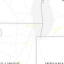
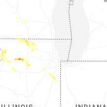


Connect with Interactive Hail Maps