

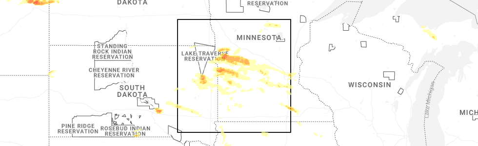
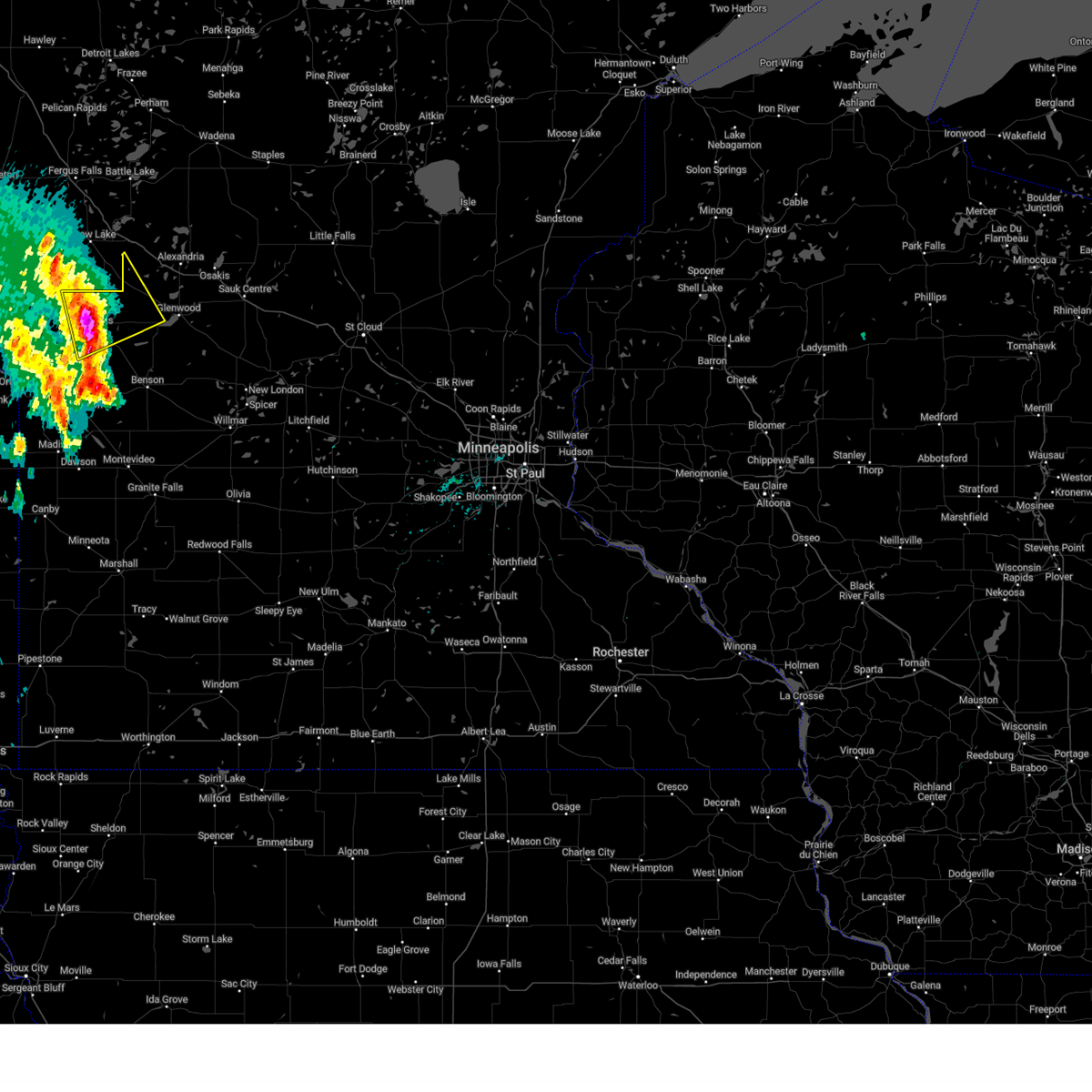
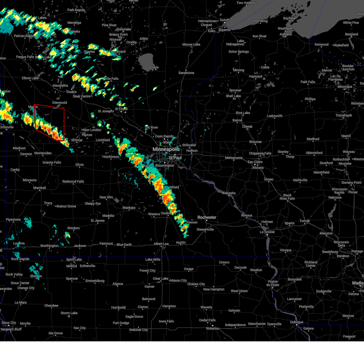
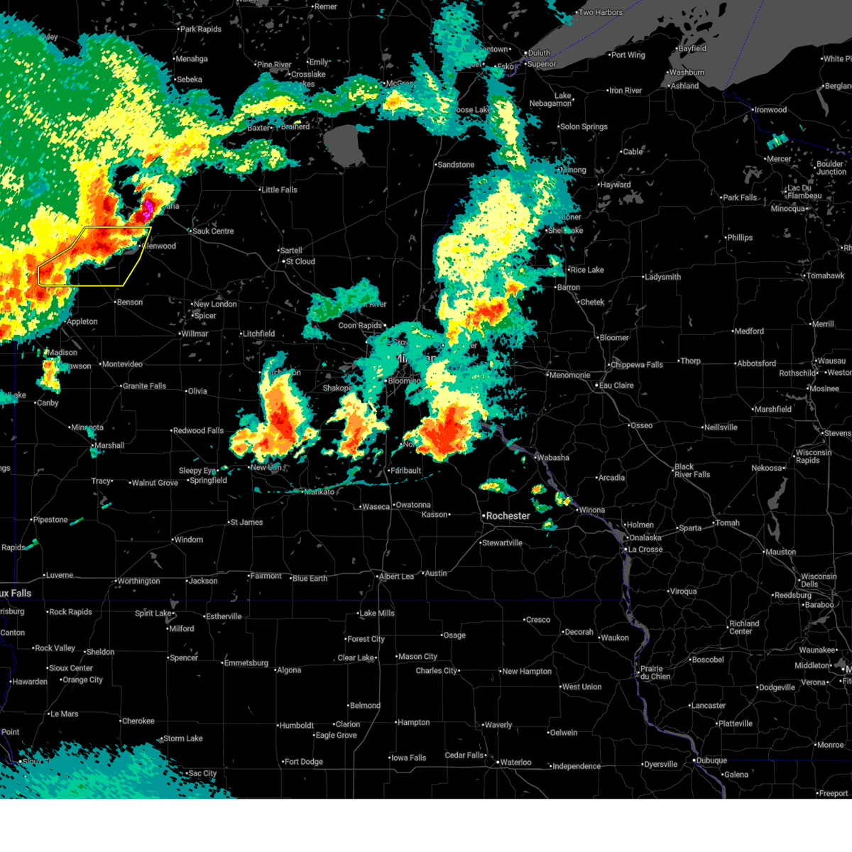
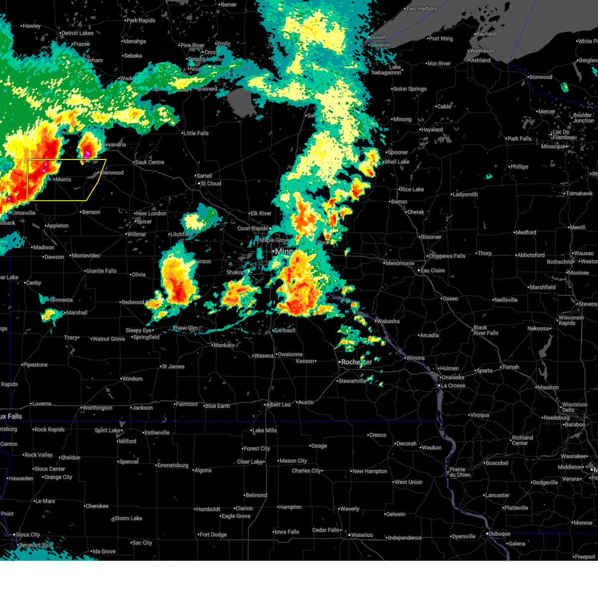
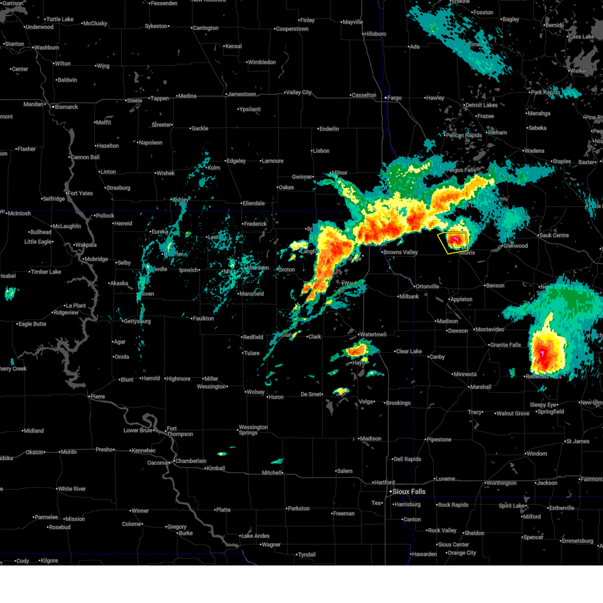
Hail Map for Morris, MN
The Morris, MN area has had 12 reports of on-the-ground hail by trained spotters, and has been under severe weather warnings 14 times during the past 12 months. Doppler radar has detected hail at or near Morris, MN on 65 occasions, including 8 occasions during the past year.
| Name: | Morris, MN |
| Where Located: | 44.6 miles NNW of Montevideo, MN |
| Map: | Google Map for Morris, MN |
| Population: | 5286 |
| Housing Units: | 2199 |
| More Info: | Search Google for Morris, MN |
3
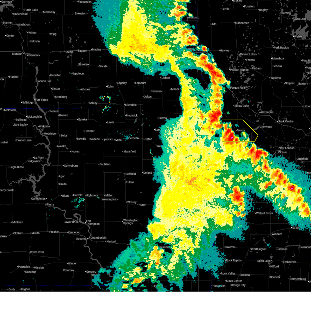
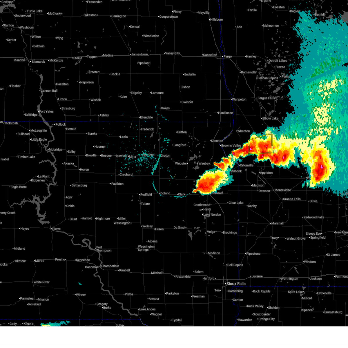
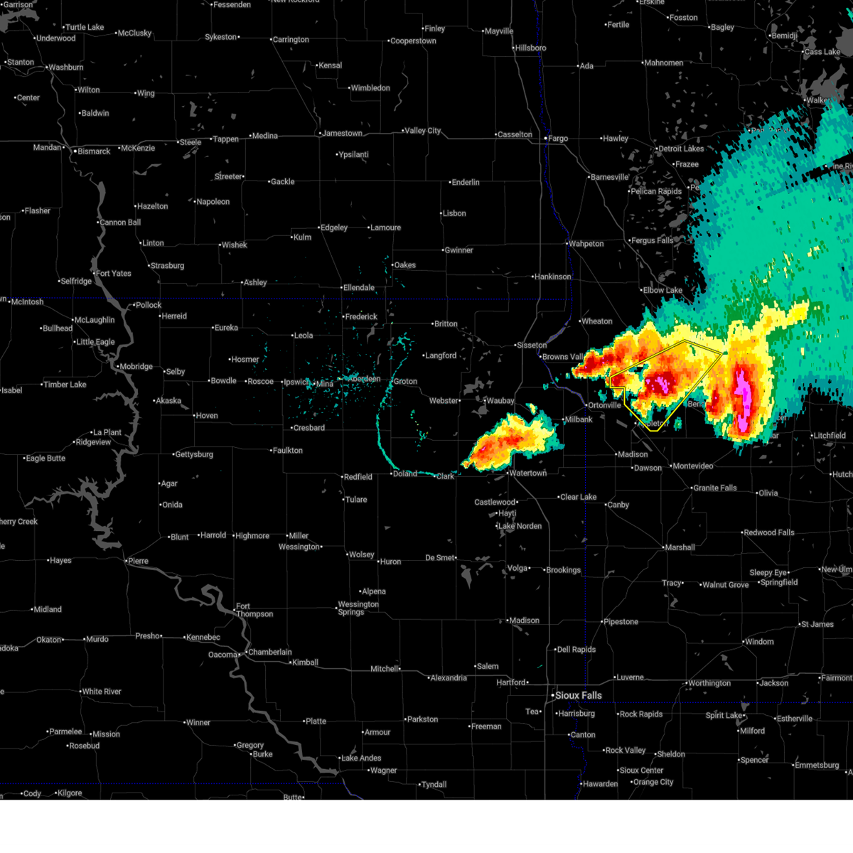
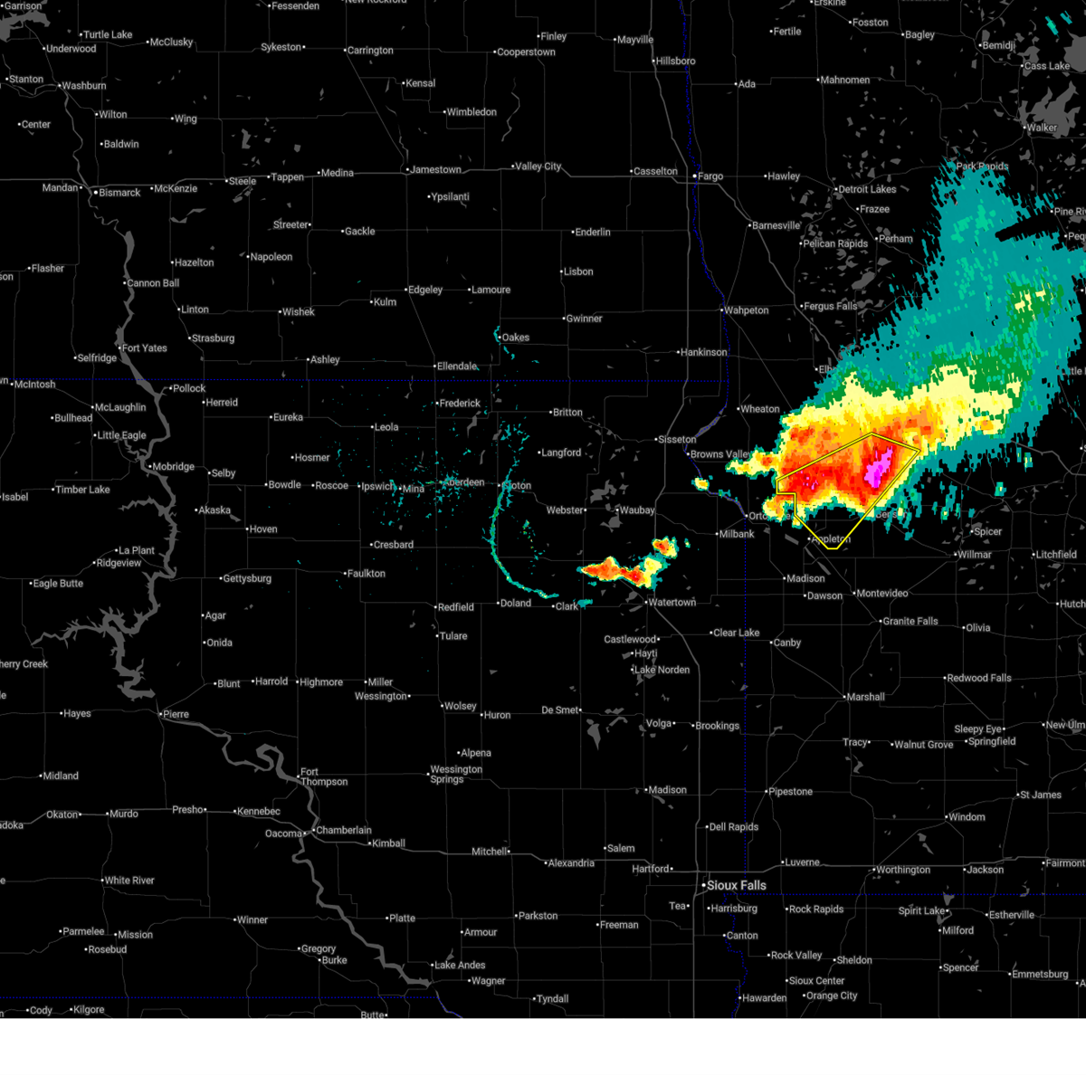
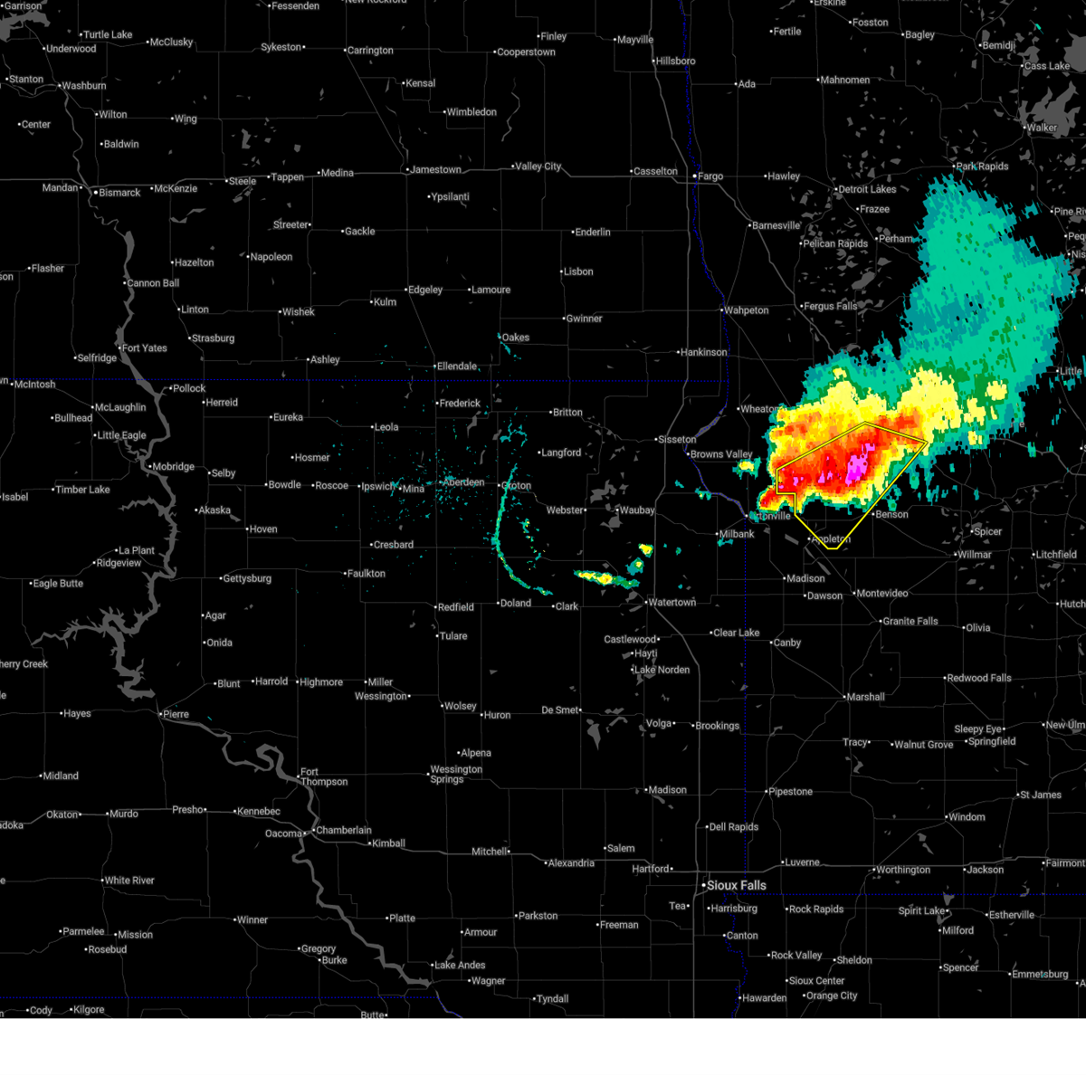
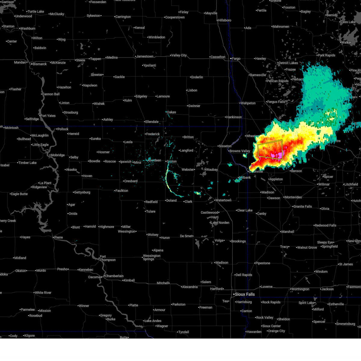
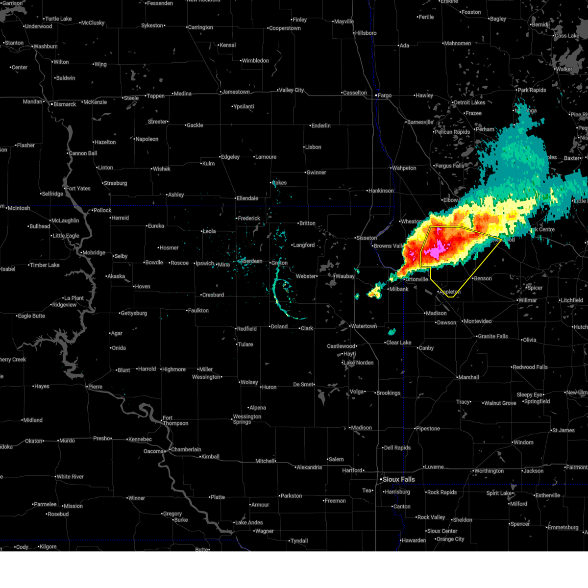
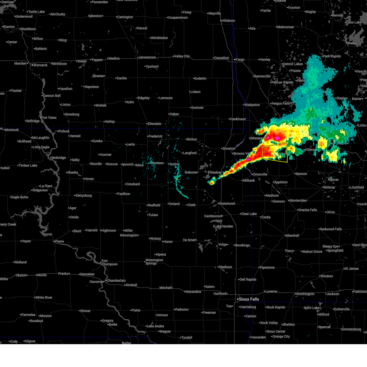
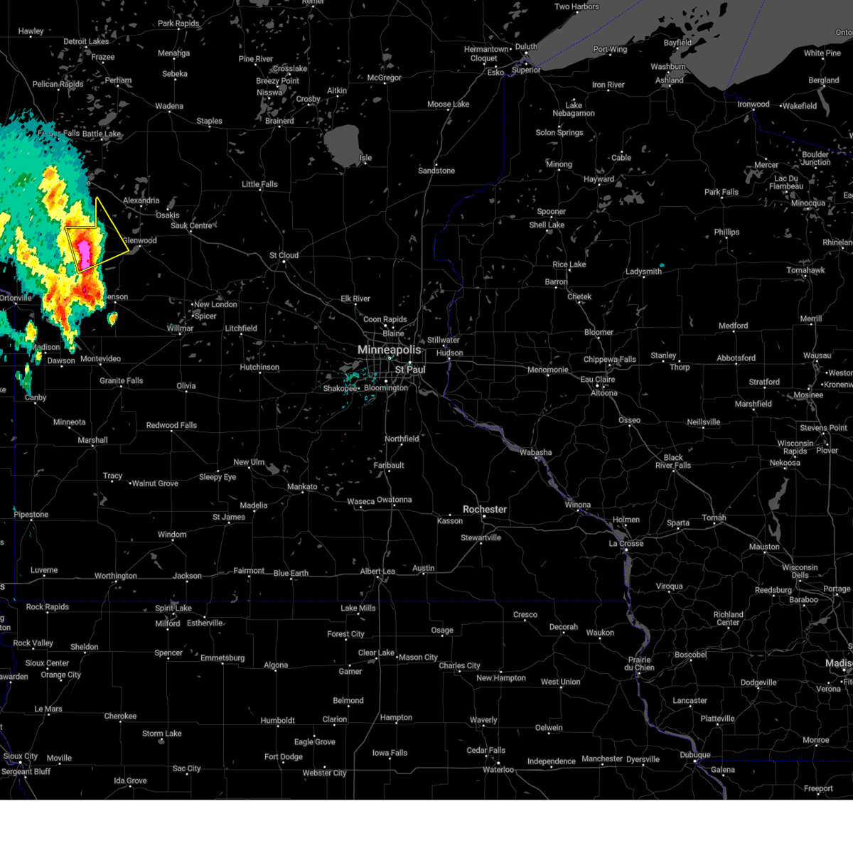
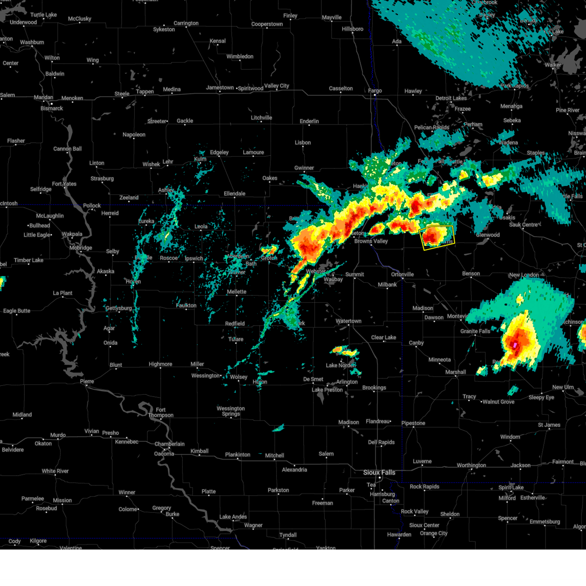
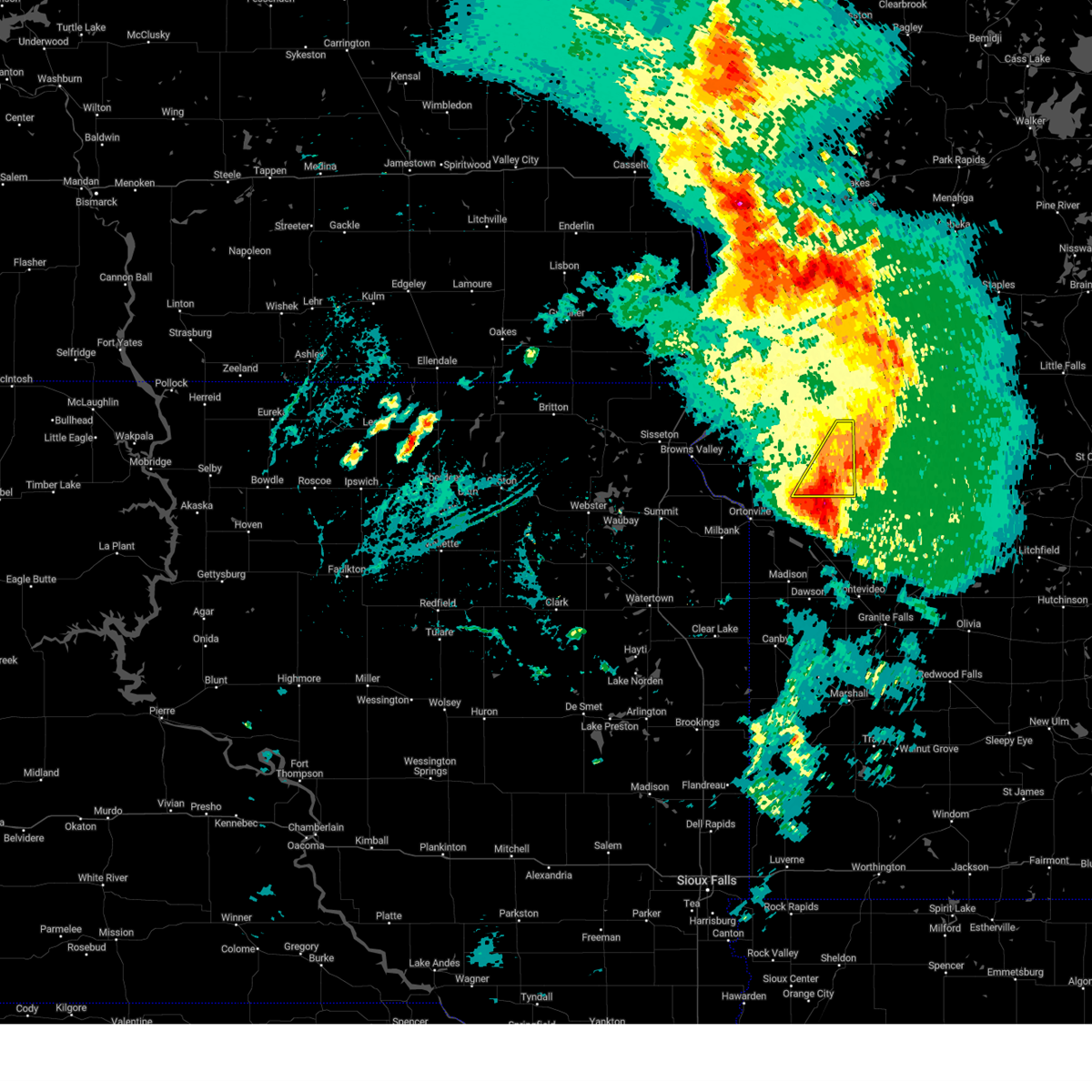
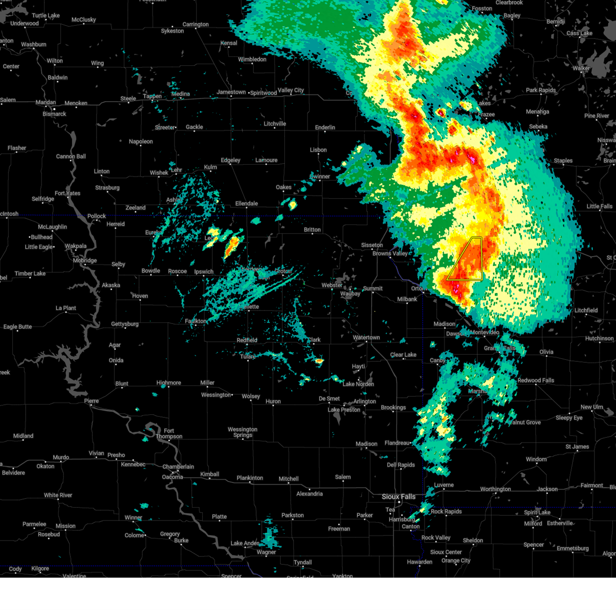
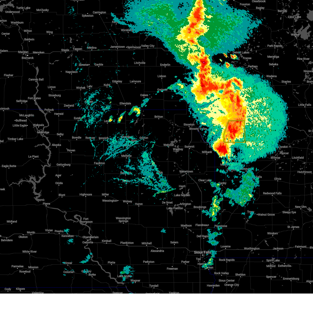
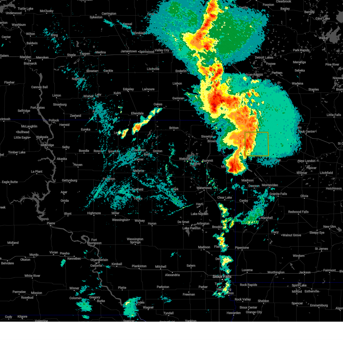
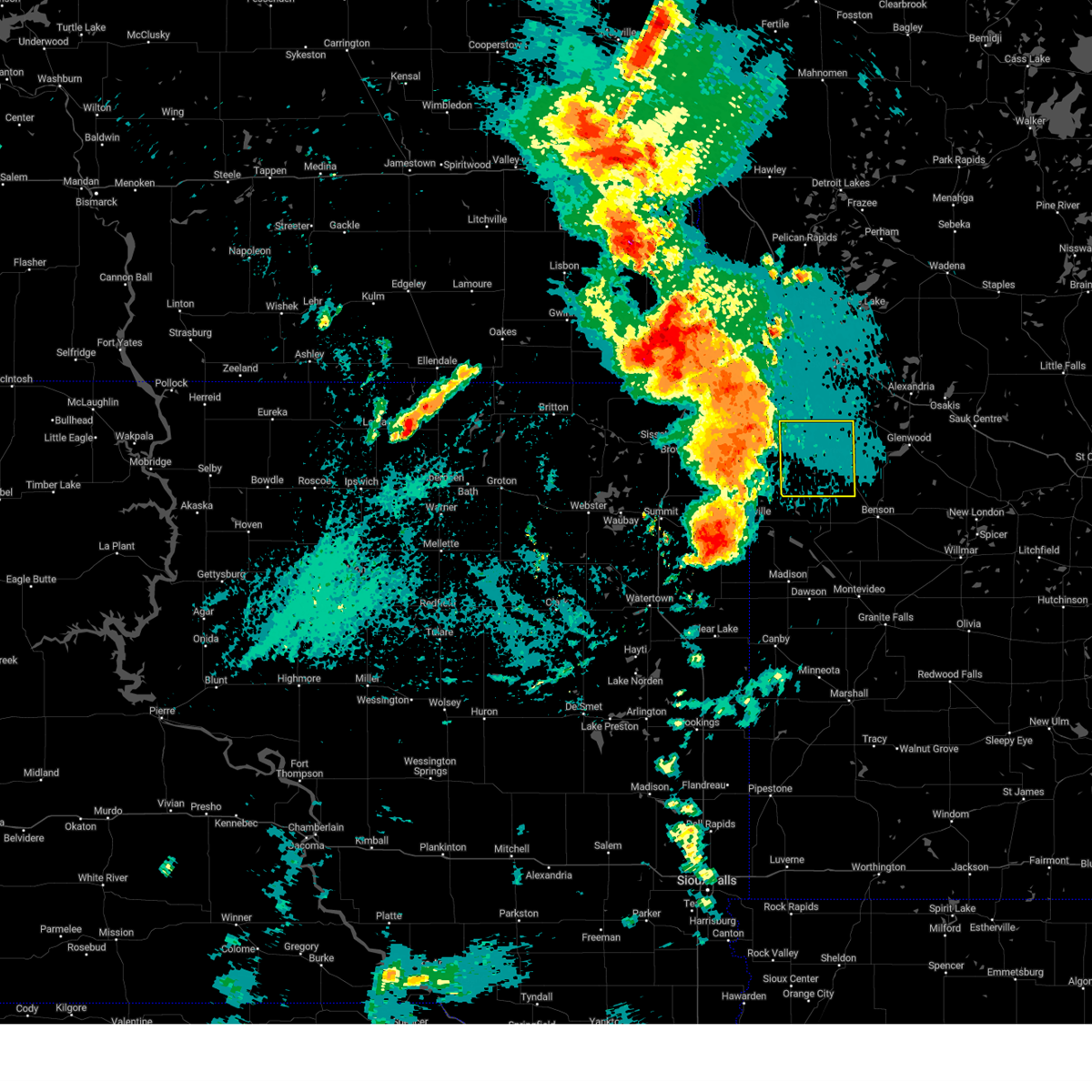
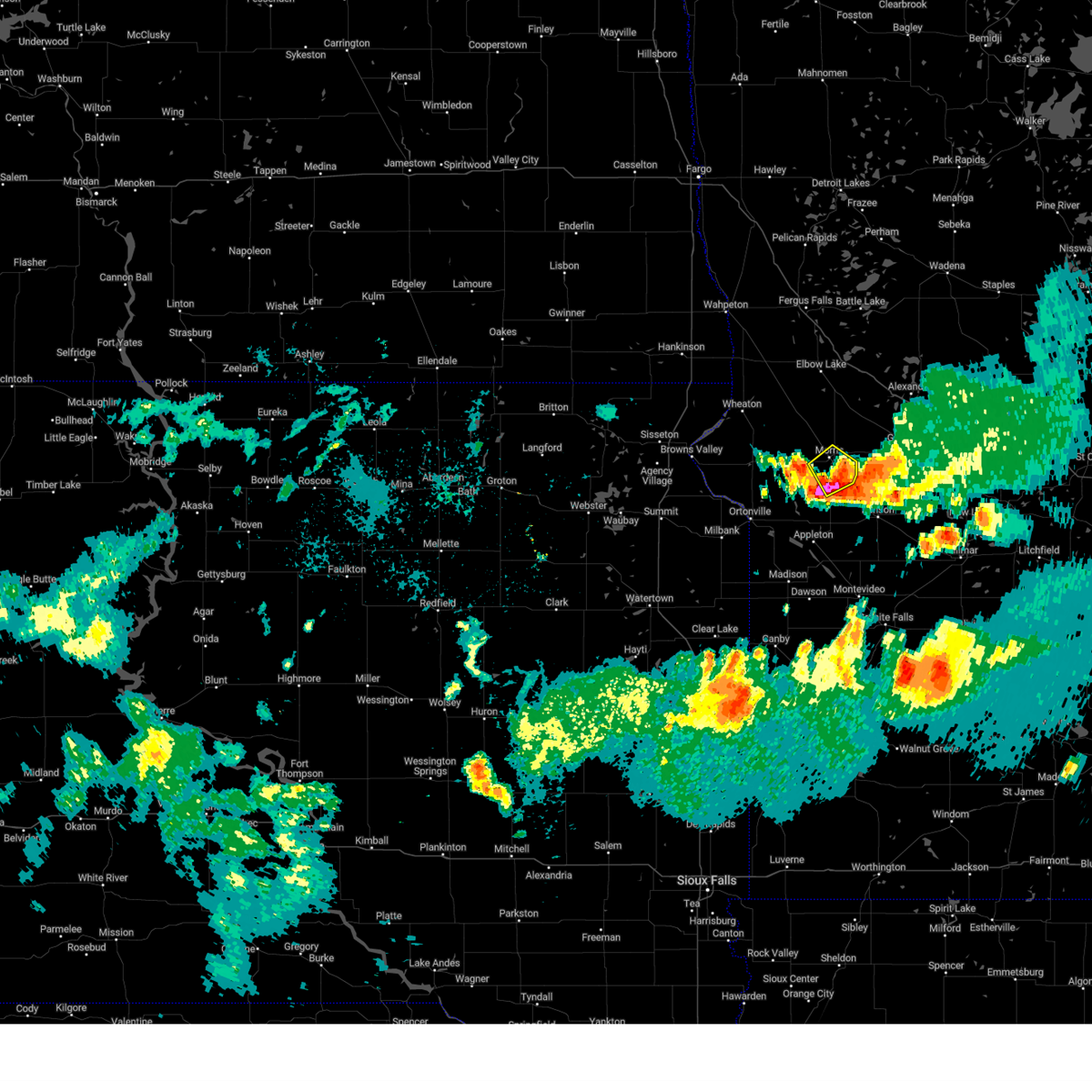
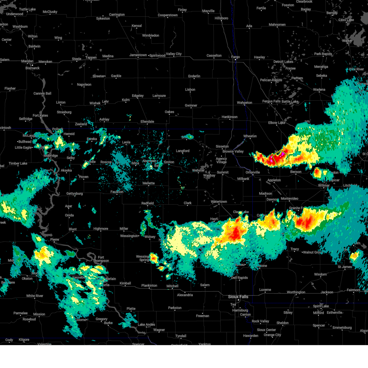
The Top Recent Hail Date for Morris, MN is Sunday, July 27, 2025 (3rd out of 65)
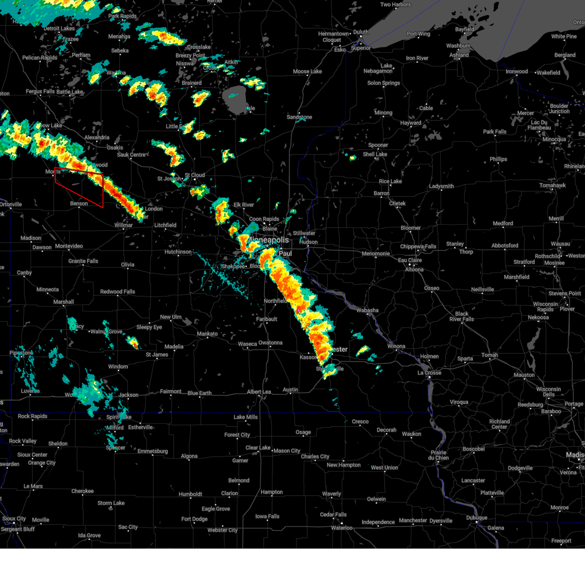
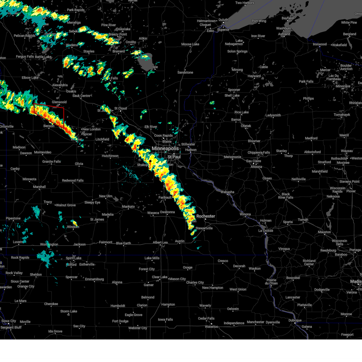
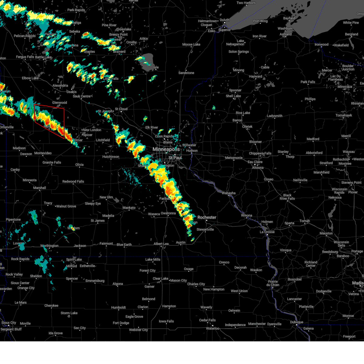
Hail and Wind Damage Spotted near Morris, MN
| Date / Time | Report Details |
|---|---|
| 6/10/2026 2:00 AM CDT | Awos station kmox morris a in stevens county MN, 3.6 miles ENE of Morris, MN |
| 6/10/2026 1:47 AM CDT |
 At 147 am cdt, a severe thunderstorm was located near lake hattie, or 7 miles southwest of morris, moving northeast at 45 mph (emergency management reported). Hazards include 70 mph wind gusts and quarter size hail. Hail damage to vehicles is expected. expect considerable tree damage. wind damage is also likely to mobile homes, roofs, and outbuildings. Locations impacted include, lake hattie, chokio, alberta, morris airport, hancock, fish lake, morris, lake emily, donnelly, cyrus and glacial lakes state park. At 147 am cdt, a severe thunderstorm was located near lake hattie, or 7 miles southwest of morris, moving northeast at 45 mph (emergency management reported). Hazards include 70 mph wind gusts and quarter size hail. Hail damage to vehicles is expected. expect considerable tree damage. wind damage is also likely to mobile homes, roofs, and outbuildings. Locations impacted include, lake hattie, chokio, alberta, morris airport, hancock, fish lake, morris, lake emily, donnelly, cyrus and glacial lakes state park.
|
| 6/10/2026 1:40 AM CDT |
 Svrmpx the national weather service in the twin cities has issued a * severe thunderstorm warning for, western pope county in west central minnesota, stevens county in west central minnesota, * until 230 am cdt. * at 140 am cdt, a severe thunderstorm was located 6 miles north of lake oliver, or 13 miles southwest of morris, moving northeast at 45 mph (radar indicated). Hazards include 70 mph wind gusts and small hail. Expect considerable tree damage. Damage is likely to mobile homes, roofs, and outbuildings. Svrmpx the national weather service in the twin cities has issued a * severe thunderstorm warning for, western pope county in west central minnesota, stevens county in west central minnesota, * until 230 am cdt. * at 140 am cdt, a severe thunderstorm was located 6 miles north of lake oliver, or 13 miles southwest of morris, moving northeast at 45 mph (radar indicated). Hazards include 70 mph wind gusts and small hail. Expect considerable tree damage. Damage is likely to mobile homes, roofs, and outbuildings.
|
| 8/11/2025 9:41 PM CDT |
 The storm which prompted the warning has moved out of the area. therefore, the warning will be allowed to expire. however, small hail, gusty winds, and heavy rain are still possible with this thunderstorm. The storm which prompted the warning has moved out of the area. therefore, the warning will be allowed to expire. however, small hail, gusty winds, and heavy rain are still possible with this thunderstorm.
|
| 8/11/2025 9:30 PM CDT |
 At 930 pm cdt, a severe thunderstorm was located 6 miles north of morris, moving east at 20 mph (trained spotters reported). Hazards include quarter size hail. Damage to vehicles is expected. This severe thunderstorm will be near, morris around 935 pm cdt. At 930 pm cdt, a severe thunderstorm was located 6 miles north of morris, moving east at 20 mph (trained spotters reported). Hazards include quarter size hail. Damage to vehicles is expected. This severe thunderstorm will be near, morris around 935 pm cdt.
|
| 8/11/2025 9:22 PM CDT |
 At 922 pm cdt, a severe thunderstorm was located over donnelly, or 7 miles northwest of morris, moving east at 20 mph (trained spotters reported). Hazards include ping pong ball size hail. People and animals outdoors will be injured. expect damage to roofs, siding, windows, and vehicles. this severe thunderstorm will be near, donnelly around 925 pm cdt. Morris around 935 pm cdt. At 922 pm cdt, a severe thunderstorm was located over donnelly, or 7 miles northwest of morris, moving east at 20 mph (trained spotters reported). Hazards include ping pong ball size hail. People and animals outdoors will be injured. expect damage to roofs, siding, windows, and vehicles. this severe thunderstorm will be near, donnelly around 925 pm cdt. Morris around 935 pm cdt.
|
| 8/11/2025 9:01 PM CDT |
 Svrmpx the national weather service in the twin cities has issued a * severe thunderstorm warning for, northern stevens county in west central minnesota, * until 945 pm cdt. * at 901 pm cdt, a severe thunderstorm was located near donnelly, or 13 miles northwest of morris, moving east at 30 mph (trained spotters reported). Hazards include ping pong ball size hail. People and animals outdoors will be injured. expect damage to roofs, siding, windows, and vehicles. this severe thunderstorm will be near, donnelly around 910 pm cdt. morris around 925 pm cdt. Other locations impacted by the severe thunderstorm include fish lake. Svrmpx the national weather service in the twin cities has issued a * severe thunderstorm warning for, northern stevens county in west central minnesota, * until 945 pm cdt. * at 901 pm cdt, a severe thunderstorm was located near donnelly, or 13 miles northwest of morris, moving east at 30 mph (trained spotters reported). Hazards include ping pong ball size hail. People and animals outdoors will be injured. expect damage to roofs, siding, windows, and vehicles. this severe thunderstorm will be near, donnelly around 910 pm cdt. morris around 925 pm cdt. Other locations impacted by the severe thunderstorm include fish lake.
|
| 7/27/2025 6:43 PM CDT |
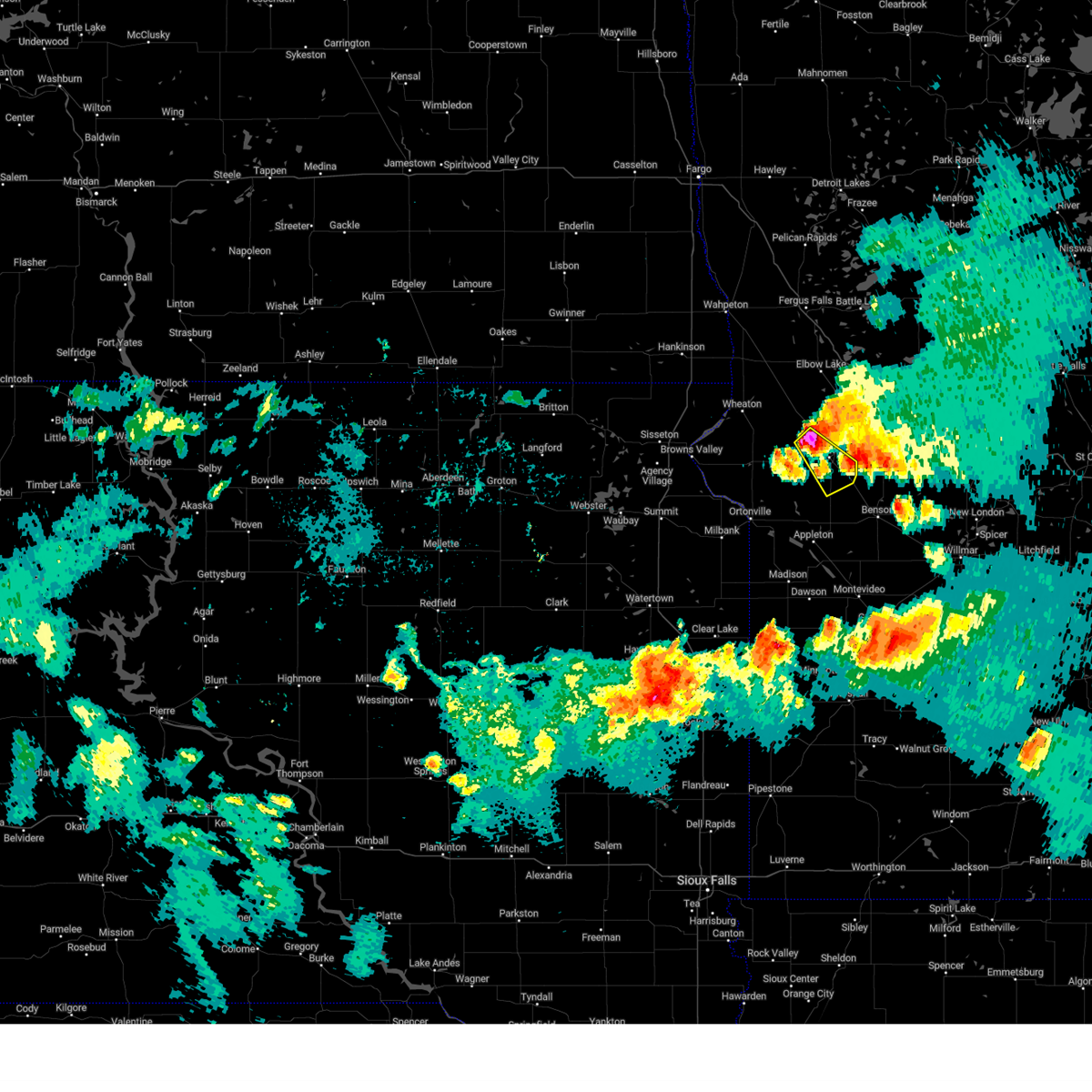
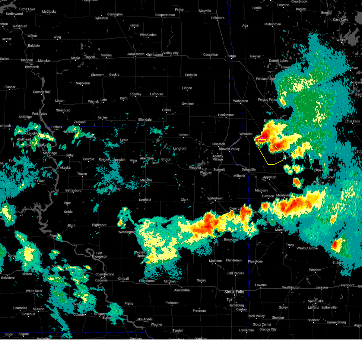
 At 643 pm cdt, severe thunderstorms were located along a line from near chokio to near lake hattie, or along a line from 17 miles west of morris to 7 miles southwest of morris, moving east at 30 mph (radar indicated). Hazards include 60 mph wind gusts and quarter size hail. Hail damage to vehicles is expected. expect wind damage to roofs, siding, and trees. Locations impacted include, morris, hancock, chokio, lake hattie, alberta and morris airport. At 643 pm cdt, severe thunderstorms were located along a line from near chokio to near lake hattie, or along a line from 17 miles west of morris to 7 miles southwest of morris, moving east at 30 mph (radar indicated). Hazards include 60 mph wind gusts and quarter size hail. Hail damage to vehicles is expected. expect wind damage to roofs, siding, and trees. Locations impacted include, morris, hancock, chokio, lake hattie, alberta and morris airport.
|
| 7/27/2025 6:11 PM CDT |
 Svrmpx the national weather service in the twin cities has issued a * severe thunderstorm warning for, stevens county in west central minnesota, * until 700 pm cdt. * at 611 pm cdt, a severe thunderstorm was located over chokio, or 13 miles west of morris, moving east at 30 mph (radar indicated). Hazards include 60 mph wind gusts and quarter size hail. Hail damage to vehicles is expected. Expect wind damage to roofs, siding, and trees. Svrmpx the national weather service in the twin cities has issued a * severe thunderstorm warning for, stevens county in west central minnesota, * until 700 pm cdt. * at 611 pm cdt, a severe thunderstorm was located over chokio, or 13 miles west of morris, moving east at 30 mph (radar indicated). Hazards include 60 mph wind gusts and quarter size hail. Hail damage to vehicles is expected. Expect wind damage to roofs, siding, and trees.
|
| 7/27/2025 5:46 PM CDT |
 The storm which prompted the warning has weakened below severe limits, and has exited the warned area. therefore, the warning has been allowed to expire. a severe thunderstorm warning still remains in effect for eastern swift and southeastern pope counties until 600 pm cdt. a severe thunderstorm watch remains in effect until 1200 am cdt monday for a portion of west central minnesota. The storm which prompted the warning has weakened below severe limits, and has exited the warned area. therefore, the warning has been allowed to expire. a severe thunderstorm warning still remains in effect for eastern swift and southeastern pope counties until 600 pm cdt. a severe thunderstorm watch remains in effect until 1200 am cdt monday for a portion of west central minnesota.
|
| 7/27/2025 5:17 PM CDT |
 At 517 pm cdt, a severe thunderstorm was located near hancock, or 12 miles southeast of morris, moving southeast at 30 mph (radar indicated). Hazards include 70 mph wind gusts and half dollar size hail. Hail damage to vehicles is expected. expect considerable tree damage. wind damage is also likely to mobile homes, roofs, and outbuildings. Locations impacted include, morris, glenwood, starbuck, hancock, cyrus, lake hassel, lake oliver, clontarf, danvers, holloway, lake emily, benson airport, glacial lakes state park, appleton airport, lake minnewaska and long beach. At 517 pm cdt, a severe thunderstorm was located near hancock, or 12 miles southeast of morris, moving southeast at 30 mph (radar indicated). Hazards include 70 mph wind gusts and half dollar size hail. Hail damage to vehicles is expected. expect considerable tree damage. wind damage is also likely to mobile homes, roofs, and outbuildings. Locations impacted include, morris, glenwood, starbuck, hancock, cyrus, lake hassel, lake oliver, clontarf, danvers, holloway, lake emily, benson airport, glacial lakes state park, appleton airport, lake minnewaska and long beach.
|
| 7/27/2025 5:10 PM CDT |
 At 510 pm cdt, a severe thunderstorm was located over hancock, or 9 miles southeast of morris, moving southeast at 30 mph (radar indicated). Hazards include 70 mph wind gusts and half dollar size hail. Hail damage to vehicles is expected. expect considerable tree damage. wind damage is also likely to mobile homes, roofs, and outbuildings. Locations impacted include, morris, glenwood, starbuck, hancock, lowry, cyrus, lake hattie, lake hassel, lake oliver, clontarf, alberta, danvers, holloway, lake emily, benson airport, morris airport, glacial lakes state park, appleton airport, lake minnewaska and long beach. At 510 pm cdt, a severe thunderstorm was located over hancock, or 9 miles southeast of morris, moving southeast at 30 mph (radar indicated). Hazards include 70 mph wind gusts and half dollar size hail. Hail damage to vehicles is expected. expect considerable tree damage. wind damage is also likely to mobile homes, roofs, and outbuildings. Locations impacted include, morris, glenwood, starbuck, hancock, lowry, cyrus, lake hattie, lake hassel, lake oliver, clontarf, alberta, danvers, holloway, lake emily, benson airport, morris airport, glacial lakes state park, appleton airport, lake minnewaska and long beach.
|
| 7/27/2025 5:03 PM CDT |
 The severe thunderstorm warning that was previously in effect has been reissued for stevens county and is in effect until 545 pm cdt. please refer to that bulletin for the latest severe weather information. The severe thunderstorm warning that was previously in effect has been reissued for stevens county and is in effect until 545 pm cdt. please refer to that bulletin for the latest severe weather information.
|
| 7/27/2025 4:57 PM CDT | Half Dollar sized hail reported 0.6 miles ESE of Morris, MN |
| 7/27/2025 4:51 PM CDT |
 Svrmpx the national weather service in the twin cities has issued a * severe thunderstorm warning for, pope county in west central minnesota, stevens county in west central minnesota, western swift county in west central minnesota, * until 545 pm cdt. * at 451 pm cdt, a severe thunderstorm was located near morris, moving southeast at 30 mph (radar indicated). Hazards include 70 mph wind gusts and half dollar size hail. Hail damage to vehicles is expected. expect considerable tree damage. Wind damage is also likely to mobile homes, roofs, and outbuildings. Svrmpx the national weather service in the twin cities has issued a * severe thunderstorm warning for, pope county in west central minnesota, stevens county in west central minnesota, western swift county in west central minnesota, * until 545 pm cdt. * at 451 pm cdt, a severe thunderstorm was located near morris, moving southeast at 30 mph (radar indicated). Hazards include 70 mph wind gusts and half dollar size hail. Hail damage to vehicles is expected. expect considerable tree damage. Wind damage is also likely to mobile homes, roofs, and outbuildings.
|
| 7/27/2025 4:46 PM CDT | Measured at morris municipal airpor in stevens county MN, 3.8 miles ENE of Morris, MN |
| 7/27/2025 4:24 PM CDT |
 Svrmpx the national weather service in the twin cities has issued a * severe thunderstorm warning for, stevens county in west central minnesota, * until 500 pm cdt. * at 424 pm cdt, a severe thunderstorm was located over chokio, or 11 miles west of morris, moving east at 40 mph (radar indicated). Hazards include 60 mph wind gusts and half dollar size hail. Hail damage to vehicles is expected. Expect wind damage to roofs, siding, and trees. Svrmpx the national weather service in the twin cities has issued a * severe thunderstorm warning for, stevens county in west central minnesota, * until 500 pm cdt. * at 424 pm cdt, a severe thunderstorm was located over chokio, or 11 miles west of morris, moving east at 40 mph (radar indicated). Hazards include 60 mph wind gusts and half dollar size hail. Hail damage to vehicles is expected. Expect wind damage to roofs, siding, and trees.
|
| 6/2/2025 2:01 PM CDT |
 At 201 pm cdt, a severe thunderstorm was located over cyrus, or 7 miles northeast of morris, moving northeast at 40 mph (radar indicated). Hazards include 60 mph wind gusts and quarter size hail. Hail damage to vehicles is expected. expect wind damage to roofs, siding, and trees. Locations impacted include, morris, starbuck, kensington, cyrus, donnelly and farwell. At 201 pm cdt, a severe thunderstorm was located over cyrus, or 7 miles northeast of morris, moving northeast at 40 mph (radar indicated). Hazards include 60 mph wind gusts and quarter size hail. Hail damage to vehicles is expected. expect wind damage to roofs, siding, and trees. Locations impacted include, morris, starbuck, kensington, cyrus, donnelly and farwell.
|
| 6/2/2025 1:55 PM CDT | Ten to 16 inch diameter trees and various limbs snapped off at a residence north of morris along hwy 59. time estimated based on rada in stevens county MN, 1.7 miles S of Morris, MN |
| 6/2/2025 1:49 PM CDT |
 Svrmpx the national weather service in the twin cities has issued a * severe thunderstorm warning for, southwestern douglas county in west central minnesota, northwestern pope county in west central minnesota, central stevens county in west central minnesota, * until 230 pm cdt. * at 149 pm cdt, a severe thunderstorm was located near morris, moving northeast at 40 mph (radar indicated). Hazards include 60 mph wind gusts and quarter size hail. Hail damage to vehicles is expected. Expect wind damage to roofs, siding, and trees. Svrmpx the national weather service in the twin cities has issued a * severe thunderstorm warning for, southwestern douglas county in west central minnesota, northwestern pope county in west central minnesota, central stevens county in west central minnesota, * until 230 pm cdt. * at 149 pm cdt, a severe thunderstorm was located near morris, moving northeast at 40 mph (radar indicated). Hazards include 60 mph wind gusts and quarter size hail. Hail damage to vehicles is expected. Expect wind damage to roofs, siding, and trees.
|
| 5/15/2025 2:15 PM CDT |
 The storm which prompted the warning has moved out of the area. therefore, the warning has been allowed to expire. a tornado watch remains in effect until 800 pm cdt thursday for a portion of west central minnesota. The storm which prompted the warning has moved out of the area. therefore, the warning has been allowed to expire. a tornado watch remains in effect until 800 pm cdt thursday for a portion of west central minnesota.
|
| 5/15/2025 1:57 PM CDT |
 At 157 pm cdt, a severe thunderstorm capable of producing a tornado was located 8 miles southwest of starbuck, or 16 miles east of morris, moving north at 55 mph (radar indicated rotation). Hazards include tornado. Flying debris will be dangerous to those caught without shelter. mobile homes will be damaged or destroyed. damage to roofs, windows and vehicles will occur. tree damage is likely. Locations impacted include, morris, starbuck, hancock, cyrus, gilchrist, glacial lakes state park, lake emily, lake minnewaska and swift falls. At 157 pm cdt, a severe thunderstorm capable of producing a tornado was located 8 miles southwest of starbuck, or 16 miles east of morris, moving north at 55 mph (radar indicated rotation). Hazards include tornado. Flying debris will be dangerous to those caught without shelter. mobile homes will be damaged or destroyed. damage to roofs, windows and vehicles will occur. tree damage is likely. Locations impacted include, morris, starbuck, hancock, cyrus, gilchrist, glacial lakes state park, lake emily, lake minnewaska and swift falls.
|
| 5/15/2025 1:46 PM CDT |
 At 146 pm cdt, a confirmed tornado was located over lake hassel, or 22 miles southeast of morris, moving north at 50 mph (two trained spotter reports confirmed tornado with debris west, north, and east of benson). Hazards include damaging tornado. Flying debris will be dangerous to those caught without shelter. mobile homes will be damaged or destroyed. damage to roofs, windows and vehicles will occur. tree damage is likely. Locations impacted include, morris, benson, starbuck, hancock, kerkhoven, cyrus, murdock, lake hassel, gilchrist, clontarf, de graff, lake emily, glacial lakes state park, swift falls, benson airport and lake minnewaska. At 146 pm cdt, a confirmed tornado was located over lake hassel, or 22 miles southeast of morris, moving north at 50 mph (two trained spotter reports confirmed tornado with debris west, north, and east of benson). Hazards include damaging tornado. Flying debris will be dangerous to those caught without shelter. mobile homes will be damaged or destroyed. damage to roofs, windows and vehicles will occur. tree damage is likely. Locations impacted include, morris, benson, starbuck, hancock, kerkhoven, cyrus, murdock, lake hassel, gilchrist, clontarf, de graff, lake emily, glacial lakes state park, swift falls, benson airport and lake minnewaska.
|
| 5/15/2025 1:37 PM CDT |
 Tormpx the national weather service in the twin cities has issued a * tornado warning for, southwestern pope county in west central minnesota, southeastern stevens county in west central minnesota, eastern swift county in west central minnesota, * until 215 pm cdt. * at 137 pm cdt, a severe thunderstorm capable of producing a tornado was located near benson, or 24 miles northeast of montevideo, moving north at 40 mph (radar indicated rotation). Hazards include tornado. Flying debris will be dangerous to those caught without shelter. mobile homes will be damaged or destroyed. damage to roofs, windows and vehicles will occur. Tree damage is likely. Tormpx the national weather service in the twin cities has issued a * tornado warning for, southwestern pope county in west central minnesota, southeastern stevens county in west central minnesota, eastern swift county in west central minnesota, * until 215 pm cdt. * at 137 pm cdt, a severe thunderstorm capable of producing a tornado was located near benson, or 24 miles northeast of montevideo, moving north at 40 mph (radar indicated rotation). Hazards include tornado. Flying debris will be dangerous to those caught without shelter. mobile homes will be damaged or destroyed. damage to roofs, windows and vehicles will occur. Tree damage is likely.
|
| 7/31/2024 6:34 PM CDT |
 At 634 pm cdt, severe thunderstorms were located along a line extending from kensington to near cyrus to lake hattie, moving east at 35 mph (radar indicated). Hazards include 60 mph wind gusts and nickel size hail. Expect damage to roofs, siding, and trees. these severe storms will be near, morris, hancock, lowry, and cyrus around 640 pm cdt. starbuck around 645 pm cdt. glenwood around 655 pm cdt. Other locations impacted by these severe thunderstorms include lake emily, alberta, long beach, farwell, lake minnewaska, morris airport, and glacial lakes state park. At 634 pm cdt, severe thunderstorms were located along a line extending from kensington to near cyrus to lake hattie, moving east at 35 mph (radar indicated). Hazards include 60 mph wind gusts and nickel size hail. Expect damage to roofs, siding, and trees. these severe storms will be near, morris, hancock, lowry, and cyrus around 640 pm cdt. starbuck around 645 pm cdt. glenwood around 655 pm cdt. Other locations impacted by these severe thunderstorms include lake emily, alberta, long beach, farwell, lake minnewaska, morris airport, and glacial lakes state park.
|
| 7/31/2024 6:05 PM CDT |
 Svrmpx the national weather service in the twin cities has issued a * severe thunderstorm warning for, western pope county in west central minnesota, stevens county in west central minnesota, * until 700 pm cdt. * at 605 pm cdt, severe thunderstorms were located along a line extending from 6 miles northeast of donnelly to near lake hattie to near artichoke, moving east at 40 mph (radar indicated). Hazards include 60 mph wind gusts and nickel size hail. Expect damage to roofs, siding, and trees. severe thunderstorms will be near, morris, donnelly, and lake hattie around 610 pm cdt. cyrus around 620 pm cdt. hancock around 625 pm cdt. lowry around 630 pm cdt. starbuck around 635 pm cdt. Glenwood around 640 pm cdt. Svrmpx the national weather service in the twin cities has issued a * severe thunderstorm warning for, western pope county in west central minnesota, stevens county in west central minnesota, * until 700 pm cdt. * at 605 pm cdt, severe thunderstorms were located along a line extending from 6 miles northeast of donnelly to near lake hattie to near artichoke, moving east at 40 mph (radar indicated). Hazards include 60 mph wind gusts and nickel size hail. Expect damage to roofs, siding, and trees. severe thunderstorms will be near, morris, donnelly, and lake hattie around 610 pm cdt. cyrus around 620 pm cdt. hancock around 625 pm cdt. lowry around 630 pm cdt. starbuck around 635 pm cdt. Glenwood around 640 pm cdt.
|
| 7/31/2024 5:40 PM CDT |
 The storm which prompted the warning has weakened below severe limits, and has exited the warned area. therefore, the warning will be allowed to expire. however, small hail and heavy rain are still possible with this thunderstorm. a severe thunderstorm watch remains in effect until 700 pm cdt for west central minnesota. The storm which prompted the warning has weakened below severe limits, and has exited the warned area. therefore, the warning will be allowed to expire. however, small hail and heavy rain are still possible with this thunderstorm. a severe thunderstorm watch remains in effect until 700 pm cdt for west central minnesota.
|
| 7/31/2024 5:38 PM CDT | Half Dollar sized hail reported 11.7 miles SSW of Morris, MN, report from mping: half dollar (1.25 in.). |
| 7/31/2024 5:24 PM CDT |
 At 522 pm cdt, a severe thunderstorm was located over donnelly, or 7 miles northwest of morris, moving east at 20 mph. this is a destructive storm for donnelly (law enforcement). Hazards include baseball size hail. People and animals outdoors will be severely injured. expect shattered windows, extensive damage to roofs, siding, and vehicles. This severe thunderstorm will remain over mainly rural areas of northeastern stevens county. At 522 pm cdt, a severe thunderstorm was located over donnelly, or 7 miles northwest of morris, moving east at 20 mph. this is a destructive storm for donnelly (law enforcement). Hazards include baseball size hail. People and animals outdoors will be severely injured. expect shattered windows, extensive damage to roofs, siding, and vehicles. This severe thunderstorm will remain over mainly rural areas of northeastern stevens county.
|
| 7/31/2024 5:07 PM CDT |
 Svrmpx the national weather service in the twin cities has issued a * severe thunderstorm warning for, northern stevens county in west central minnesota, * until 545 pm cdt. * at 507 pm cdt, a severe thunderstorm was located near donnelly, or 10 miles northwest of morris, moving east at 20 mph. this is a destructive storm for donnelly (law enforcement). Hazards include baseball size hail. People and animals outdoors will be severely injured. expect shattered windows, extensive damage to roofs, siding, and vehicles. this severe thunderstorm will be near, donnelly around 510 pm cdt. other locations impacted by this severe thunderstorm include alberta and fish lake. this includes u. s. Highway 59 between mile markers 168 and 177. Svrmpx the national weather service in the twin cities has issued a * severe thunderstorm warning for, northern stevens county in west central minnesota, * until 545 pm cdt. * at 507 pm cdt, a severe thunderstorm was located near donnelly, or 10 miles northwest of morris, moving east at 20 mph. this is a destructive storm for donnelly (law enforcement). Hazards include baseball size hail. People and animals outdoors will be severely injured. expect shattered windows, extensive damage to roofs, siding, and vehicles. this severe thunderstorm will be near, donnelly around 510 pm cdt. other locations impacted by this severe thunderstorm include alberta and fish lake. this includes u. s. Highway 59 between mile markers 168 and 177.
|
| 7/31/2024 1:58 PM CDT |
 The storms which prompted the warning have moved out of the area. therefore, the warning will be allowed to expire. however, gusty winds and heavy rain are still possible with these thunderstorms. a severe thunderstorm watch remains in effect until 700 pm cdt for west central minnesota. The storms which prompted the warning have moved out of the area. therefore, the warning will be allowed to expire. however, gusty winds and heavy rain are still possible with these thunderstorms. a severe thunderstorm watch remains in effect until 700 pm cdt for west central minnesota.
|
| 7/31/2024 1:50 PM CDT |
 At 150 pm cdt, severe thunderstorms were located along a line extending from 8 miles southwest of alexandria to near hancock, moving east at 30 mph (radar indicated). Hazards include 60 mph wind gusts. Expect damage to roofs, siding, and trees. Locations impacted include, morris, hancock, lake hattie, and morris airport. At 150 pm cdt, severe thunderstorms were located along a line extending from 8 miles southwest of alexandria to near hancock, moving east at 30 mph (radar indicated). Hazards include 60 mph wind gusts. Expect damage to roofs, siding, and trees. Locations impacted include, morris, hancock, lake hattie, and morris airport.
|
| 7/31/2024 1:31 PM CDT |
 At 131 pm cdt, severe thunderstorms were located along a line extending from near kensington to 6 miles southwest of hancock, moving east at 40 mph (radar indicated). Hazards include 60 mph wind gusts. Expect damage to roofs, siding, and trees. these severe storms will be near, hancock around 135 pm cdt. Other locations impacted by these severe thunderstorms include alberta, fish lake, and morris airport. At 131 pm cdt, severe thunderstorms were located along a line extending from near kensington to 6 miles southwest of hancock, moving east at 40 mph (radar indicated). Hazards include 60 mph wind gusts. Expect damage to roofs, siding, and trees. these severe storms will be near, hancock around 135 pm cdt. Other locations impacted by these severe thunderstorms include alberta, fish lake, and morris airport.
|
| 7/31/2024 1:15 PM CDT |
 At 115 pm cdt, severe thunderstorms were located along a line extending from 5 miles east of herman to near lake hattie, moving east at 45 mph (radar indicated). Hazards include 60 mph wind gusts. Expect damage to roofs, siding, and trees. these severe storms will be near, morris, donnelly, and lake hattie around 120 pm cdt. hancock around 130 pm cdt. Other locations impacted by these severe thunderstorms include alberta, fish lake, and morris airport. At 115 pm cdt, severe thunderstorms were located along a line extending from 5 miles east of herman to near lake hattie, moving east at 45 mph (radar indicated). Hazards include 60 mph wind gusts. Expect damage to roofs, siding, and trees. these severe storms will be near, morris, donnelly, and lake hattie around 120 pm cdt. hancock around 130 pm cdt. Other locations impacted by these severe thunderstorms include alberta, fish lake, and morris airport.
|
| 7/31/2024 1:01 PM CDT |
 Svrmpx the national weather service in the twin cities has issued a * severe thunderstorm warning for, stevens county in west central minnesota, * until 200 pm cdt. * at 100 pm cdt, severe thunderstorms were located along a line extending from 7 miles northeast of dumont to near clinton, moving east at 35 mph (radar indicated). Hazards include 60 mph wind gusts and penny size hail. expect damage to roofs, siding, and trees Svrmpx the national weather service in the twin cities has issued a * severe thunderstorm warning for, stevens county in west central minnesota, * until 200 pm cdt. * at 100 pm cdt, severe thunderstorms were located along a line extending from 7 miles northeast of dumont to near clinton, moving east at 35 mph (radar indicated). Hazards include 60 mph wind gusts and penny size hail. expect damage to roofs, siding, and trees
|
| 7/15/2024 6:20 AM CDT |
 The storm which prompted the warning has weakened below severe limits, and has exited the warned area. therefore, the warning will be allowed to expire. The storm which prompted the warning has weakened below severe limits, and has exited the warned area. therefore, the warning will be allowed to expire.
|
| 7/15/2024 6:10 AM CDT |
 At 610 am cdt, a severe thunderstorm was located near hancock, or 7 miles south of morris, moving southeast at 50 mph (radar indicated). Hazards include 60 mph wind gusts and quarter size hail. Hail damage to vehicles is expected. expect wind damage to roofs, siding, and trees. Locations impacted include, morris, hancock, and morris airport. At 610 am cdt, a severe thunderstorm was located near hancock, or 7 miles south of morris, moving southeast at 50 mph (radar indicated). Hazards include 60 mph wind gusts and quarter size hail. Hail damage to vehicles is expected. expect wind damage to roofs, siding, and trees. Locations impacted include, morris, hancock, and morris airport.
|
| 7/15/2024 6:00 AM CDT |
 At 600 am cdt, a severe thunderstorm was located near lake hattie, or 6 miles west of morris, moving southeast at 50 mph (radar indicated). Hazards include 60 mph wind gusts and quarter size hail. Hail damage to vehicles is expected. expect wind damage to roofs, siding, and trees. Locations impacted include, morris, hancock, donnelly, fish lake, alberta, and morris airport. At 600 am cdt, a severe thunderstorm was located near lake hattie, or 6 miles west of morris, moving southeast at 50 mph (radar indicated). Hazards include 60 mph wind gusts and quarter size hail. Hail damage to vehicles is expected. expect wind damage to roofs, siding, and trees. Locations impacted include, morris, hancock, donnelly, fish lake, alberta, and morris airport.
|
| 7/15/2024 5:44 AM CDT |
 Svrmpx the national weather service in the twin cities has issued a * severe thunderstorm warning for, stevens county in west central minnesota, * until 630 am cdt. * at 544 am cdt, a severe thunderstorm was located 6 miles southwest of herman, or 14 miles east of wheaton, moving southeast at 50 mph (radar indicated). Hazards include 60 mph wind gusts and quarter size hail. Hail damage to vehicles is expected. Expect wind damage to roofs, siding, and trees. Svrmpx the national weather service in the twin cities has issued a * severe thunderstorm warning for, stevens county in west central minnesota, * until 630 am cdt. * at 544 am cdt, a severe thunderstorm was located 6 miles southwest of herman, or 14 miles east of wheaton, moving southeast at 50 mph (radar indicated). Hazards include 60 mph wind gusts and quarter size hail. Hail damage to vehicles is expected. Expect wind damage to roofs, siding, and trees.
|
| 7/25/2023 10:40 PM CDT |
 The severe thunderstorm warning for eastern stevens and western swift counties will expire at 1045 pm cdt, the storm which prompted the warning has moved out of the area. therefore, the warning will be allowed to expire. however gusty winds are still possible with this thunderstorm. a severe thunderstorm watch remains in effect until 400 am cdt for west central minnesota. The severe thunderstorm warning for eastern stevens and western swift counties will expire at 1045 pm cdt, the storm which prompted the warning has moved out of the area. therefore, the warning will be allowed to expire. however gusty winds are still possible with this thunderstorm. a severe thunderstorm watch remains in effect until 400 am cdt for west central minnesota.
|
| 7/25/2023 10:18 PM CDT |
 At 1018 pm cdt, a severe thunderstorm was located 6 miles southeast of hancock, or 14 miles southeast of morris, moving southeast at 55 mph (morris airport measured 60 mph winds). Hazards include 60 mph wind gusts and quarter size hail. Hail damage to vehicles is expected. expect wind damage to roofs, siding, and trees. locations impacted include, morris, appleton, hancock, lake oliver, artichoke lake, hagen, danders, holloway and appleton airport. hail threat, radar indicated max hail size, 1. 00 in wind threat, radar indicated max wind gust, 60 mph. At 1018 pm cdt, a severe thunderstorm was located 6 miles southeast of hancock, or 14 miles southeast of morris, moving southeast at 55 mph (morris airport measured 60 mph winds). Hazards include 60 mph wind gusts and quarter size hail. Hail damage to vehicles is expected. expect wind damage to roofs, siding, and trees. locations impacted include, morris, appleton, hancock, lake oliver, artichoke lake, hagen, danders, holloway and appleton airport. hail threat, radar indicated max hail size, 1. 00 in wind threat, radar indicated max wind gust, 60 mph.
|
| 7/25/2023 10:10 PM CDT | Several trees down in town with power out. an appartment building in town had a window blow out. also several trees down across the count in stevens county MN, 0.6 miles NE of Morris, MN |
| 7/25/2023 10:08 PM CDT | Awos station kmox morris a in stevens county MN, 3.6 miles ENE of Morris, MN |
| 7/25/2023 10:05 PM CDT |
 At 1005 pm cdt, a severe thunderstorm was located over morris, moving southeast at 35 mph (law enforcement). Hazards include 60 mph wind gusts and quarter size hail. Hail damage to vehicles is expected. expect wind damage to roofs, siding, and trees. this severe thunderstorm will remain over mainly rural areas of central stevens county, including the following locations, alberta and morris airport. hail threat, radar indicated max hail size, 1. 00 in wind threat, radar indicated max wind gust, 60 mph. At 1005 pm cdt, a severe thunderstorm was located over morris, moving southeast at 35 mph (law enforcement). Hazards include 60 mph wind gusts and quarter size hail. Hail damage to vehicles is expected. expect wind damage to roofs, siding, and trees. this severe thunderstorm will remain over mainly rural areas of central stevens county, including the following locations, alberta and morris airport. hail threat, radar indicated max hail size, 1. 00 in wind threat, radar indicated max wind gust, 60 mph.
|
| 7/25/2023 9:59 PM CDT |
 At 959 pm cdt, a severe thunderstorm was located 7 miles southwest of hancock, or 9 miles south of morris, moving southeast at 50 mph (radar indicated). Hazards include 60 mph wind gusts and quarter size hail. Hail damage to vehicles is expected. expect wind damage to roofs, siding, and trees. this severe thunderstorm will remain over mainly rural areas of southeastern stevens and western swift counties, including the following locations, danvers, hagen, appleton airport and holloway. hail threat, radar indicated max hail size, 1. 00 in wind threat, radar indicated max wind gust, 60 mph. At 959 pm cdt, a severe thunderstorm was located 7 miles southwest of hancock, or 9 miles south of morris, moving southeast at 50 mph (radar indicated). Hazards include 60 mph wind gusts and quarter size hail. Hail damage to vehicles is expected. expect wind damage to roofs, siding, and trees. this severe thunderstorm will remain over mainly rural areas of southeastern stevens and western swift counties, including the following locations, danvers, hagen, appleton airport and holloway. hail threat, radar indicated max hail size, 1. 00 in wind threat, radar indicated max wind gust, 60 mph.
|
| 7/25/2023 9:33 PM CDT |
 At 933 pm cdt, a severe thunderstorm was located near trinity lutheran country church, or 15 miles southeast of wheaton, moving southeast at 35 mph (radar indicated). Hazards include 60 mph wind gusts and quarter size hail. Hail damage to vehicles is expected. expect wind damage to roofs, siding, and trees. this severe thunderstorm will be near, chokio and donnelly around 945 pm cdt. lake hattie around 950 pm cdt. other locations in the path of this severe thunderstorm include morris. hail threat, radar indicated max hail size, 1. 00 in wind threat, radar indicated max wind gust, 60 mph. At 933 pm cdt, a severe thunderstorm was located near trinity lutheran country church, or 15 miles southeast of wheaton, moving southeast at 35 mph (radar indicated). Hazards include 60 mph wind gusts and quarter size hail. Hail damage to vehicles is expected. expect wind damage to roofs, siding, and trees. this severe thunderstorm will be near, chokio and donnelly around 945 pm cdt. lake hattie around 950 pm cdt. other locations in the path of this severe thunderstorm include morris. hail threat, radar indicated max hail size, 1. 00 in wind threat, radar indicated max wind gust, 60 mph.
|
| 7/20/2022 10:04 PM CDT |
 At 1004 pm cdt, a severe thunderstorm was located near morris, moving east at 45 mph (radar indicated). Hazards include 60 mph wind gusts and half dollar size hail. Hail damage to vehicles is expected. expect wind damage to roofs, siding, and trees. this severe thunderstorm will be near, cyrus around 1015 pm cdt. other locations in the path of this severe thunderstorm include starbuck. hail threat, radar indicated max hail size, 1. 25 in wind threat, radar indicated max wind gust, 60 mph. At 1004 pm cdt, a severe thunderstorm was located near morris, moving east at 45 mph (radar indicated). Hazards include 60 mph wind gusts and half dollar size hail. Hail damage to vehicles is expected. expect wind damage to roofs, siding, and trees. this severe thunderstorm will be near, cyrus around 1015 pm cdt. other locations in the path of this severe thunderstorm include starbuck. hail threat, radar indicated max hail size, 1. 25 in wind threat, radar indicated max wind gust, 60 mph.
|
| 6/20/2022 10:54 PM CDT |
 At 1053 pm cdt, severe thunderstorms were located along a line extending from wheaton to near artichoke lake, moving east at 65 mph (radar indicated). Hazards include 60 mph wind gusts. Expect damage to roofs, siding, and trees. severe thunderstorms will be near, hancock around 1110 pm cdt. other locations impacted by these severe thunderstorms include alberta, fish lake and morris airport. hail threat, radar indicated max hail size, <. 75 in wind threat, radar indicated max wind gust, 60 mph. At 1053 pm cdt, severe thunderstorms were located along a line extending from wheaton to near artichoke lake, moving east at 65 mph (radar indicated). Hazards include 60 mph wind gusts. Expect damage to roofs, siding, and trees. severe thunderstorms will be near, hancock around 1110 pm cdt. other locations impacted by these severe thunderstorms include alberta, fish lake and morris airport. hail threat, radar indicated max hail size, <. 75 in wind threat, radar indicated max wind gust, 60 mph.
|
| 5/30/2022 4:12 PM CDT |
 The tornado warning for stevens county will expire at 415 pm cdt, the storms which prompted the warning have moved out of the area. therefore, the warning will be allowed to expire. a tornado watch remains in effect until 1000 pm cdt for west central minnesota. to report severe weather, contact your nearest law enforcement agency. they will relay your report to the national weather service the twin cities. The tornado warning for stevens county will expire at 415 pm cdt, the storms which prompted the warning have moved out of the area. therefore, the warning will be allowed to expire. a tornado watch remains in effect until 1000 pm cdt for west central minnesota. to report severe weather, contact your nearest law enforcement agency. they will relay your report to the national weather service the twin cities.
|
| 5/30/2022 4:01 PM CDT | Shed rolled and destroyed. video on facebook. time estimated from rada in stevens county MN, 0.6 miles ESE of Morris, MN |
| 5/30/2022 3:57 PM CDT |
 At 357 pm cdt, severe thunderstorms capable of producing tornadoes were located along a line extending from 5 miles north of chokio to 5 miles west of morris to 5 miles west of hancock, moving north at 95 mph (radar indicated rotation). Hazards include tornado and quarter size hail. Flying debris will be dangerous to those caught without shelter. mobile homes will be damaged or destroyed. damage to roofs, windows, and vehicles will occur. tree damage is likely. these dangerous storms will be near, donnelly around 400 pm cdt. Other locations impacted by these tornadic storms include alberta, fish lake and morris airport. At 357 pm cdt, severe thunderstorms capable of producing tornadoes were located along a line extending from 5 miles north of chokio to 5 miles west of morris to 5 miles west of hancock, moving north at 95 mph (radar indicated rotation). Hazards include tornado and quarter size hail. Flying debris will be dangerous to those caught without shelter. mobile homes will be damaged or destroyed. damage to roofs, windows, and vehicles will occur. tree damage is likely. these dangerous storms will be near, donnelly around 400 pm cdt. Other locations impacted by these tornadic storms include alberta, fish lake and morris airport.
|
| 5/30/2022 3:56 PM CDT | Reported at morris airpor in stevens county MN, 0.6 miles ESE of Morris, MN |
| 5/30/2022 3:47 PM CDT |
 At 347 pm cdt, severe thunderstorms capable of producing a tornado were located along a line extending from near artichoke to near lake oliver to 6 miles north of appleton, moving north at 75 mph (radar indicated rotation). Hazards include tornado and quarter size hail. Flying debris will be dangerous to those caught without shelter. mobile homes will be damaged or destroyed. damage to roofs, windows, and vehicles will occur. tree damage is likely. these dangerous storms will be near, chokio and lake hattie around 355 pm cdt. hancock around 400 pm cdt. morris and donnelly around 405 pm cdt. Other locations impacted by these tornadic storms include danvers, fish lake, alberta, holloway and morris airport. At 347 pm cdt, severe thunderstorms capable of producing a tornado were located along a line extending from near artichoke to near lake oliver to 6 miles north of appleton, moving north at 75 mph (radar indicated rotation). Hazards include tornado and quarter size hail. Flying debris will be dangerous to those caught without shelter. mobile homes will be damaged or destroyed. damage to roofs, windows, and vehicles will occur. tree damage is likely. these dangerous storms will be near, chokio and lake hattie around 355 pm cdt. hancock around 400 pm cdt. morris and donnelly around 405 pm cdt. Other locations impacted by these tornadic storms include danvers, fish lake, alberta, holloway and morris airport.
|
| 5/12/2022 7:01 PM CDT | Quarter sized hail reported 0.6 miles NE of Morris, MN, time estimated by radar. |
| 5/12/2022 7:00 PM CDT | Large trees uprooted. photos provided via twitter. time estimated by rada in stevens county MN, 2 miles SSW of Morris, MN |
| 5/12/2022 7:00 PM CDT | Small to medium trees blown over. time estimated by rada in stevens county MN, 0.6 miles ESE of Morris, MN |
| 5/12/2022 7:00 PM CDT |
 At 659 pm cdt, severe thunderstorms were located along a line extending from 6 miles west of herman to near kensington to near glenwood to near cosmos, moving northeast at 70 mph. these are destructive storms for alexandria and willmar (radar indicated). Hazards include 80 mph wind gusts. Flying debris will be dangerous to those caught without shelter. mobile homes will be heavily damaged. expect considerable damage to roofs, windows, and vehicles. extensive tree damage and power outages are likely. severe thunderstorms will be near, glenwood and kensington around 705 pm cdt. alexandria around 710 pm cdt. evansville and brandon around 715 pm cdt. other locations impacted by these severe thunderstorms include glenwood airport, swift falls, alberta, garfield, willmar airport, villard, blomkest, fish lake, miltona and holmes city. thunderstorm damage threat, destructive hail threat, radar indicated max hail size, <. 75 in wind threat, radar indicated max wind gust, 80 mph. At 659 pm cdt, severe thunderstorms were located along a line extending from 6 miles west of herman to near kensington to near glenwood to near cosmos, moving northeast at 70 mph. these are destructive storms for alexandria and willmar (radar indicated). Hazards include 80 mph wind gusts. Flying debris will be dangerous to those caught without shelter. mobile homes will be heavily damaged. expect considerable damage to roofs, windows, and vehicles. extensive tree damage and power outages are likely. severe thunderstorms will be near, glenwood and kensington around 705 pm cdt. alexandria around 710 pm cdt. evansville and brandon around 715 pm cdt. other locations impacted by these severe thunderstorms include glenwood airport, swift falls, alberta, garfield, willmar airport, villard, blomkest, fish lake, miltona and holmes city. thunderstorm damage threat, destructive hail threat, radar indicated max hail size, <. 75 in wind threat, radar indicated max wind gust, 80 mph.
|
| 5/12/2022 6:48 PM CDT | Hangers blown in and wall collapsed as well as antennas down at morris municipal airpor in stevens county MN, 3.6 miles ENE of Morris, MN |
| 5/12/2022 6:45 PM CDT | Power poles and 7 trees down. reported via twitter. photos included. time estimated by rada in stevens county MN, 2.4 miles S of Morris, MN |
| 5/12/2022 6:40 PM CDT | Large storage shed destroyed. large tree down. time estimated by rada in stevens county MN, 6.1 miles ENE of Morris, MN |
| 5/12/2022 6:36 PM CDT |
 At 635 pm cdt, severe thunderstorms were located along a line extending from near johnson to 5 miles southwest of hancock to 5 miles west of raymond, moving north at 75 mph. these are destructive storms for benson and morris (radar indicated). Hazards include 90 mph wind gusts. You are in a life-threatening situation. flying debris may be deadly to those caught without shelter. mobile homes will be heavily damaged or destroyed. homes and businesses will have substantial roof and window damage. expect extensive tree damage and power outages. these severe storms will be near, hancock and chokio around 640 pm cdt. morris, cyrus and murdock around 645 pm cdt. donnelly around 650 pm cdt. brooten around 700 pm cdt. thunderstorm damage threat, destructive hail threat, radar indicated max hail size, <. 75 in wind threat, radar indicated max wind gust, 90 mph. At 635 pm cdt, severe thunderstorms were located along a line extending from near johnson to 5 miles southwest of hancock to 5 miles west of raymond, moving north at 75 mph. these are destructive storms for benson and morris (radar indicated). Hazards include 90 mph wind gusts. You are in a life-threatening situation. flying debris may be deadly to those caught without shelter. mobile homes will be heavily damaged or destroyed. homes and businesses will have substantial roof and window damage. expect extensive tree damage and power outages. these severe storms will be near, hancock and chokio around 640 pm cdt. morris, cyrus and murdock around 645 pm cdt. donnelly around 650 pm cdt. brooten around 700 pm cdt. thunderstorm damage threat, destructive hail threat, radar indicated max hail size, <. 75 in wind threat, radar indicated max wind gust, 90 mph.
|
| 5/12/2022 6:16 PM CDT |
 At 615 pm cdt, severe thunderstorms were located along a line extending from near milbank to 6 miles southwest of appleton to near hanley falls, moving northeast at 85 mph. these are destructive storms for appleton and benson (radar indicated. at 608 pm cdt, madison airport reported a gust of 94 mph). Hazards include 100 mph wind gusts. You are in a life-threatening situation. flying debris may be deadly to those caught without shelter. mobile homes will be destroyed. expect considerable damage to homes and businesses. expect extensive tree damage and power outages. severe thunderstorms will be near, granite falls and appleton around 620 pm cdt. maynard and lake oliver around 625 pm cdt. clara city around 630 pm cdt. hancock and raymond around 635 pm cdt. kerkhoven, chokio and cyrus around 640 pm cdt. thunderstorm damage threat, destructive hail threat, radar indicated max hail size, <. 75 in wind threat, observed max wind gust, 100 mph. At 615 pm cdt, severe thunderstorms were located along a line extending from near milbank to 6 miles southwest of appleton to near hanley falls, moving northeast at 85 mph. these are destructive storms for appleton and benson (radar indicated. at 608 pm cdt, madison airport reported a gust of 94 mph). Hazards include 100 mph wind gusts. You are in a life-threatening situation. flying debris may be deadly to those caught without shelter. mobile homes will be destroyed. expect considerable damage to homes and businesses. expect extensive tree damage and power outages. severe thunderstorms will be near, granite falls and appleton around 620 pm cdt. maynard and lake oliver around 625 pm cdt. clara city around 630 pm cdt. hancock and raymond around 635 pm cdt. kerkhoven, chokio and cyrus around 640 pm cdt. thunderstorm damage threat, destructive hail threat, radar indicated max hail size, <. 75 in wind threat, observed max wind gust, 100 mph.
|
| 10/9/2021 8:37 PM CDT |
 The severe thunderstorm warning for stevens and western swift counties will expire at 845 pm cdt, the storm which prompted the warning has weakened below severe limits, and no longer poses an immediate threat to life or property. therefore, the warning will be allowed to expire. however gusty winds and heavy rain are still possible with this thunderstorm. a severe thunderstorm watch remains in effect until 200 am cdt for west central minnesota. The severe thunderstorm warning for stevens and western swift counties will expire at 845 pm cdt, the storm which prompted the warning has weakened below severe limits, and no longer poses an immediate threat to life or property. therefore, the warning will be allowed to expire. however gusty winds and heavy rain are still possible with this thunderstorm. a severe thunderstorm watch remains in effect until 200 am cdt for west central minnesota.
|
| 10/9/2021 7:56 PM CDT |
 At 756 pm cdt, a severe thunderstorm was located over elbow lake, or 18 miles south of fergus falls, moving northeast at 50 mph (radar indicated). Hazards include 60 mph wind gusts and quarter size hail. Hail damage to vehicles is expected. expect wind damage to roofs, siding, and trees. This severe thunderstorm will remain over mainly rural areas of stevens and western swift counties, including the following locations, fish lake, appleton airport, alberta, holloway and morris airport. At 756 pm cdt, a severe thunderstorm was located over elbow lake, or 18 miles south of fergus falls, moving northeast at 50 mph (radar indicated). Hazards include 60 mph wind gusts and quarter size hail. Hail damage to vehicles is expected. expect wind damage to roofs, siding, and trees. This severe thunderstorm will remain over mainly rural areas of stevens and western swift counties, including the following locations, fish lake, appleton airport, alberta, holloway and morris airport.
|
| 10/9/2021 7:19 PM CDT |
 At 719 pm cdt, a severe thunderstorm was located over trinity lutheran country church, or 14 miles southeast of wheaton, moving northeast at 50 mph (radar indicated). Hazards include 60 mph wind gusts and quarter size hail. Hail damage to vehicles is expected. expect wind damage to roofs, siding, and trees. this severe thunderstorm will remain over mainly rural areas of stevens and western swift counties, including the following locations, fish lake, appleton airport, alberta, morris airport and holloway. hail threat, radar indicated max hail size, 1. 00 in wind threat, radar indicated max wind gust, 60 mph. At 719 pm cdt, a severe thunderstorm was located over trinity lutheran country church, or 14 miles southeast of wheaton, moving northeast at 50 mph (radar indicated). Hazards include 60 mph wind gusts and quarter size hail. Hail damage to vehicles is expected. expect wind damage to roofs, siding, and trees. this severe thunderstorm will remain over mainly rural areas of stevens and western swift counties, including the following locations, fish lake, appleton airport, alberta, morris airport and holloway. hail threat, radar indicated max hail size, 1. 00 in wind threat, radar indicated max wind gust, 60 mph.
|
| 8/24/2021 3:32 AM CDT |
 At 331 am cdt, a severe thunderstorm was located near chokio, or 8 miles west of morris, moving east at 45 mph (radar indicated). Hazards include 60 mph wind gusts and half dollar size hail. Hail damage to vehicles is expected. expect wind damage to roofs, siding, and trees. this severe thunderstorm will be near, donnelly around 335 am cdt. morris around 345 am cdt. cyrus around 350 am cdt. other locations in the path of this severe thunderstorm include kensington, starbuck and lowry. hail threat, radar indicated max hail size, 1. 25 in wind threat, radar indicated max wind gust, 60 mph. At 331 am cdt, a severe thunderstorm was located near chokio, or 8 miles west of morris, moving east at 45 mph (radar indicated). Hazards include 60 mph wind gusts and half dollar size hail. Hail damage to vehicles is expected. expect wind damage to roofs, siding, and trees. this severe thunderstorm will be near, donnelly around 335 am cdt. morris around 345 am cdt. cyrus around 350 am cdt. other locations in the path of this severe thunderstorm include kensington, starbuck and lowry. hail threat, radar indicated max hail size, 1. 25 in wind threat, radar indicated max wind gust, 60 mph.
|
| 7/28/2021 5:05 AM CDT |
 At 505 am cdt, a severe thunderstorm was located near cyrus, or near morris, moving southeast at 45 mph (radar indicated). Hazards include 60 mph wind gusts and quarter size hail. Hail damage to vehicles is expected. expect wind damage to roofs, siding, and trees. Locations impacted include, starbuck. At 505 am cdt, a severe thunderstorm was located near cyrus, or near morris, moving southeast at 45 mph (radar indicated). Hazards include 60 mph wind gusts and quarter size hail. Hail damage to vehicles is expected. expect wind damage to roofs, siding, and trees. Locations impacted include, starbuck.
|
| 7/28/2021 4:53 AM CDT |
 At 453 am cdt, a severe thunderstorm was located over donnelly, or 7 miles north of morris, moving east at 50 mph (radar indicated). Hazards include 60 mph wind gusts and half dollar size hail. Hail damage to vehicles is expected. expect wind damage to roofs, siding, and trees. this severe thunderstorm will be near, cyrus around 510 am cdt. Other locations in the path of this severe thunderstorm include starbuck. At 453 am cdt, a severe thunderstorm was located over donnelly, or 7 miles north of morris, moving east at 50 mph (radar indicated). Hazards include 60 mph wind gusts and half dollar size hail. Hail damage to vehicles is expected. expect wind damage to roofs, siding, and trees. this severe thunderstorm will be near, cyrus around 510 am cdt. Other locations in the path of this severe thunderstorm include starbuck.
|
| 6/11/2021 6:38 AM CDT |
 The severe thunderstorm warning for northwestern chippewa, stevens and western swift counties will expire at 645 am cdt, the storms which prompted the warning have weakened below severe limits, and no longer pose an immediate threat to life or property. therefore, the warning will be allowed to expire. however gusty winds are still possible with these thunderstorms. The severe thunderstorm warning for northwestern chippewa, stevens and western swift counties will expire at 645 am cdt, the storms which prompted the warning have weakened below severe limits, and no longer pose an immediate threat to life or property. therefore, the warning will be allowed to expire. however gusty winds are still possible with these thunderstorms.
|
| 6/11/2021 5:55 AM CDT |
 At 555 am cdt, severe thunderstorms were located along a line extending from near elbow lake to near milbank, moving east at 50 mph (radar indicated). Hazards include 60 mph wind gusts. expect damage to roofs, siding, and trees At 555 am cdt, severe thunderstorms were located along a line extending from near elbow lake to near milbank, moving east at 50 mph (radar indicated). Hazards include 60 mph wind gusts. expect damage to roofs, siding, and trees
|
| 8/24/2020 2:33 AM CDT |
 At 232 am cdt, a severe thunderstorm was located near hancock, or 10 miles south of morris, moving southeast at 40 mph (radar indicated. at 220 am, 63 mph winds weree reported at morris). Hazards include ping pong ball size hail and 60 mph wind gusts. People and animals outdoors will be injured. expect hail damage to roofs, siding, windows, and vehicles. expect wind damage to roofs, siding, and trees. Locations impacted include, morris and hancock. At 232 am cdt, a severe thunderstorm was located near hancock, or 10 miles south of morris, moving southeast at 40 mph (radar indicated. at 220 am, 63 mph winds weree reported at morris). Hazards include ping pong ball size hail and 60 mph wind gusts. People and animals outdoors will be injured. expect hail damage to roofs, siding, windows, and vehicles. expect wind damage to roofs, siding, and trees. Locations impacted include, morris and hancock.
|
| 8/24/2020 2:18 AM CDT | Measured at kmo in stevens county MN, 3.6 miles ENE of Morris, MN |
| 8/24/2020 2:18 AM CDT |
 At 218 am cdt, a severe thunderstorm was located over lake hattie, or 10 miles southwest of morris, moving southeast at 30 mph (radar indicated). Hazards include ping pong ball size hail. People and animals outdoors will be injured. expect damage to roofs, siding, windows, and vehicles. This severe thunderstorm will remain over mainly rural areas of southern stevens county, including the following locations, alberta and morris airport. At 218 am cdt, a severe thunderstorm was located over lake hattie, or 10 miles southwest of morris, moving southeast at 30 mph (radar indicated). Hazards include ping pong ball size hail. People and animals outdoors will be injured. expect damage to roofs, siding, windows, and vehicles. This severe thunderstorm will remain over mainly rural areas of southern stevens county, including the following locations, alberta and morris airport.
|
| 8/24/2020 1:58 AM CDT |
 At 157 am cdt, a severe thunderstorm was located over trinity lutheran country church, or 17 miles southeast of wheaton, moving southeast at 25 mph (radar indicated). Hazards include ping pong ball size hail. People and animals outdoors will be injured. expect damage to roofs, siding, windows, and vehicles. this severe thunderstorm will be near, chokio around 210 am cdt. lake hattie around 225 am cdt. hancock around 250 am cdt. Other locations impacted by this severe thunderstorm include alberta and fish lake. At 157 am cdt, a severe thunderstorm was located over trinity lutheran country church, or 17 miles southeast of wheaton, moving southeast at 25 mph (radar indicated). Hazards include ping pong ball size hail. People and animals outdoors will be injured. expect damage to roofs, siding, windows, and vehicles. this severe thunderstorm will be near, chokio around 210 am cdt. lake hattie around 225 am cdt. hancock around 250 am cdt. Other locations impacted by this severe thunderstorm include alberta and fish lake.
|
| 8/21/2020 7:09 PM CDT |
 At 707 pm cdt, a severe thunderstorm was located near benson, or 18 miles southeast of morris, moving east at 30 mph. several other storms, some severe, are located along the leading edge of the main thunderstorm complex that extended from morris, southward to danvers (radar indicated). Hazards include 70 mph wind gusts and quarter size hail. Hail damage to vehicles is expected. expect considerable tree damage. wind damage is also likely to mobile homes, roofs, and outbuildings. this severe storm will be near, benson around 715 pm cdt. lake hassel around 720 pm cdt. Other locations impacted by this severe thunderstorm include benson airport, danvers, swift falls, lake emily, appleton airport, clontarf, de graff, holloway and morris airport. At 707 pm cdt, a severe thunderstorm was located near benson, or 18 miles southeast of morris, moving east at 30 mph. several other storms, some severe, are located along the leading edge of the main thunderstorm complex that extended from morris, southward to danvers (radar indicated). Hazards include 70 mph wind gusts and quarter size hail. Hail damage to vehicles is expected. expect considerable tree damage. wind damage is also likely to mobile homes, roofs, and outbuildings. this severe storm will be near, benson around 715 pm cdt. lake hassel around 720 pm cdt. Other locations impacted by this severe thunderstorm include benson airport, danvers, swift falls, lake emily, appleton airport, clontarf, de graff, holloway and morris airport.
|
| 8/21/2020 6:53 PM CDT |
 At 645 pm cdt, a severe thunderstorm was located 7 miles southwest of hancock, or 11 miles south of morris, moving east at 35 mph (radar indicated). Hazards include 70 mph wind gusts and half dollar size hail. Hail damage to vehicles is expected. expect considerable tree damage. wind damage is also likely to mobile homes, roofs, and outbuildings. this severe storm will be near, hancock around 655 pm cdt. lake hassel around 715 pm cdt. Other locations impacted by this severe thunderstorm include benson airport, danvers, swift falls, lake emily, appleton airport, clontarf, de graff, holloway and morris airport. At 645 pm cdt, a severe thunderstorm was located 7 miles southwest of hancock, or 11 miles south of morris, moving east at 35 mph (radar indicated). Hazards include 70 mph wind gusts and half dollar size hail. Hail damage to vehicles is expected. expect considerable tree damage. wind damage is also likely to mobile homes, roofs, and outbuildings. this severe storm will be near, hancock around 655 pm cdt. lake hassel around 715 pm cdt. Other locations impacted by this severe thunderstorm include benson airport, danvers, swift falls, lake emily, appleton airport, clontarf, de graff, holloway and morris airport.
|
| 8/21/2020 6:45 PM CDT |
 At 645 pm cdt, a severe thunderstorm was located 7 miles southwest of hancock, or 11 miles south of morris, moving east at 35 mph (radar indicated). Hazards include 70 mph wind gusts and half dollar size hail. Hail damage to vehicles is expected. expect considerable tree damage. wind damage is also likely to mobile homes, roofs, and outbuildings. this severe storm will be near, hancock around 655 pm cdt. lake hassel around 715 pm cdt. Other locations impacted by this severe thunderstorm include benson airport, danvers, swift falls, lake emily, appleton airport, clontarf, de graff, holloway and morris airport. At 645 pm cdt, a severe thunderstorm was located 7 miles southwest of hancock, or 11 miles south of morris, moving east at 35 mph (radar indicated). Hazards include 70 mph wind gusts and half dollar size hail. Hail damage to vehicles is expected. expect considerable tree damage. wind damage is also likely to mobile homes, roofs, and outbuildings. this severe storm will be near, hancock around 655 pm cdt. lake hassel around 715 pm cdt. Other locations impacted by this severe thunderstorm include benson airport, danvers, swift falls, lake emily, appleton airport, clontarf, de graff, holloway and morris airport.
|
| 8/21/2020 6:39 PM CDT |
 At 639 pm cdt, a severe thunderstorm was located near lake oliver, or 12 miles south of morris, moving east at 35 mph (radar indicated). Hazards include 60 mph wind gusts and quarter size hail. Hail damage to vehicles is expected. expect wind damage to roofs, siding, and trees. this severe thunderstorm will be near, hancock around 655 pm cdt. benson and lake hassel around 710 pm cdt. Other locations impacted by this severe thunderstorm include benson airport, danvers, swift falls, lake emily, appleton airport, clontarf, de graff, holloway and morris airport. At 639 pm cdt, a severe thunderstorm was located near lake oliver, or 12 miles south of morris, moving east at 35 mph (radar indicated). Hazards include 60 mph wind gusts and quarter size hail. Hail damage to vehicles is expected. expect wind damage to roofs, siding, and trees. this severe thunderstorm will be near, hancock around 655 pm cdt. benson and lake hassel around 710 pm cdt. Other locations impacted by this severe thunderstorm include benson airport, danvers, swift falls, lake emily, appleton airport, clontarf, de graff, holloway and morris airport.
|
| 7/17/2020 11:40 PM CDT |
 At 1140 pm cdt, severe thunderstorms were located along a line extending from 10 miles southwest of sauk centre to near glenwood to near hancock, moving southeast at 35 mph (radar indicated). Hazards include 60 mph wind gusts. Expect damage to roofs, siding, and trees. these severe storms will be near, glenwood around 1145 pm cdt. Other locations impacted by these severe thunderstorms include glenwood airport, westport, lake emily, grove lake, long beach, villard, sedan, lake minnewaska, morris airport and forada. At 1140 pm cdt, severe thunderstorms were located along a line extending from 10 miles southwest of sauk centre to near glenwood to near hancock, moving southeast at 35 mph (radar indicated). Hazards include 60 mph wind gusts. Expect damage to roofs, siding, and trees. these severe storms will be near, glenwood around 1145 pm cdt. Other locations impacted by these severe thunderstorms include glenwood airport, westport, lake emily, grove lake, long beach, villard, sedan, lake minnewaska, morris airport and forada.
|
| 7/17/2020 11:35 PM CDT | Tree down across highwa in stevens county MN, 4.5 miles WSW of Morris, MN |
| 7/17/2020 11:13 PM CDT |
 At 1113 pm cdt, severe thunderstorms were located along a line extending from 7 miles east of lake osakis to lowry to near cyrus to johnson, moving southeast at 35 mph (radar indicated). Hazards include 60 mph wind gusts. Expect damage to roofs, siding, and trees. these severe storms will be near, lowry around 1120 pm cdt. glenwood and starbuck around 1130 pm cdt. hancock around 1150 pm cdt. Other locations impacted by these severe thunderstorms include alexandria airport, glenwood airport, westport, nelson, alberta, grove lake, villard, fish lake, holmes city and lake minnewaska. At 1113 pm cdt, severe thunderstorms were located along a line extending from 7 miles east of lake osakis to lowry to near cyrus to johnson, moving southeast at 35 mph (radar indicated). Hazards include 60 mph wind gusts. Expect damage to roofs, siding, and trees. these severe storms will be near, lowry around 1120 pm cdt. glenwood and starbuck around 1130 pm cdt. hancock around 1150 pm cdt. Other locations impacted by these severe thunderstorms include alexandria airport, glenwood airport, westport, nelson, alberta, grove lake, villard, fish lake, holmes city and lake minnewaska.
|
| 7/17/2020 10:54 PM CDT |
 At 1054 pm cdt, severe thunderstorms were located along a line extending from near lake osakis to kensington to near donnelly to collis, moving southeast at 45 mph (radar indicated). Hazards include 60 mph wind gusts. Expect damage to roofs, siding, and trees. severe thunderstorms will be near, kensington around 1100 pm cdt. lowry and cyrus around 1110 pm cdt. chokio around 1115 pm cdt. glenwood, starbuck and lake hattie around 1120 pm cdt. Other locations impacted by these severe thunderstorms include alexandria airport, glenwood airport, westport, nelson, alberta, grove lake, villard, fish lake, holmes city and lake minnewaska. At 1054 pm cdt, severe thunderstorms were located along a line extending from near lake osakis to kensington to near donnelly to collis, moving southeast at 45 mph (radar indicated). Hazards include 60 mph wind gusts. Expect damage to roofs, siding, and trees. severe thunderstorms will be near, kensington around 1100 pm cdt. lowry and cyrus around 1110 pm cdt. chokio around 1115 pm cdt. glenwood, starbuck and lake hattie around 1120 pm cdt. Other locations impacted by these severe thunderstorms include alexandria airport, glenwood airport, westport, nelson, alberta, grove lake, villard, fish lake, holmes city and lake minnewaska.
|
| 9/2/2019 7:53 PM CDT |
 At 752 pm cdt, severe thunderstorms were located along a line extending from near brandon to near morris to near graceville, moving east at 55 mph (radar indicated). Hazards include 70 mph wind gusts and penny size hail. Expect considerable tree damage. damage is likely to mobile homes, roofs, and outbuildings. Locations impacted include, alexandria, morris, glenwood, starbuck, hancock, evansville, brandon, chokio, lowry, kensington, cyrus and donnelly. At 752 pm cdt, severe thunderstorms were located along a line extending from near brandon to near morris to near graceville, moving east at 55 mph (radar indicated). Hazards include 70 mph wind gusts and penny size hail. Expect considerable tree damage. damage is likely to mobile homes, roofs, and outbuildings. Locations impacted include, alexandria, morris, glenwood, starbuck, hancock, evansville, brandon, chokio, lowry, kensington, cyrus and donnelly.
|
| 9/2/2019 7:37 PM CDT |
 At 737 pm cdt, severe thunderstorms were located along a line extending from near evansville to near donnelly to near beardsley, moving east at 55 mph (radar indicated). Hazards include 70 mph wind gusts and penny size hail. Expect considerable tree damage. Damage is likely to mobile homes, roofs, and outbuildings. At 737 pm cdt, severe thunderstorms were located along a line extending from near evansville to near donnelly to near beardsley, moving east at 55 mph (radar indicated). Hazards include 70 mph wind gusts and penny size hail. Expect considerable tree damage. Damage is likely to mobile homes, roofs, and outbuildings.
|
| 7/19/2019 11:54 AM CDT |
 At 1153 am cdt, a severe thunderstorm was located over donnelly, or 7 miles northwest of morris, moving east at 40 mph (emergency management reported golf ball size hail 8 miles north of chokio at 1145 am cdt). Hazards include two inch hail and 60 mph wind gusts. People and animals outdoors will be injured. expect hail damage to roofs, siding, windows, and vehicles. Expect wind damage to roofs, siding, and trees. At 1153 am cdt, a severe thunderstorm was located over donnelly, or 7 miles northwest of morris, moving east at 40 mph (emergency management reported golf ball size hail 8 miles north of chokio at 1145 am cdt). Hazards include two inch hail and 60 mph wind gusts. People and animals outdoors will be injured. expect hail damage to roofs, siding, windows, and vehicles. Expect wind damage to roofs, siding, and trees.
|
| 7/19/2019 11:44 AM CDT |
 At 1144 am cdt, a severe thunderstorm was located over donnelly, or 8 miles northwest of morris, moving east at 45 mph (emergency management reported golf ball size hail 8 miles north of chokio at 1140 am cdt). Hazards include two inch hail and 60 mph wind gusts. People and animals outdoors will be injured. expect hail damage to roofs, siding, windows, and vehicles. expect wind damage to roofs, siding, and trees. Locations impacted include, morris, chokio, donnelly, lake hattie, fish lake, alberta and morris airport. At 1144 am cdt, a severe thunderstorm was located over donnelly, or 8 miles northwest of morris, moving east at 45 mph (emergency management reported golf ball size hail 8 miles north of chokio at 1140 am cdt). Hazards include two inch hail and 60 mph wind gusts. People and animals outdoors will be injured. expect hail damage to roofs, siding, windows, and vehicles. expect wind damage to roofs, siding, and trees. Locations impacted include, morris, chokio, donnelly, lake hattie, fish lake, alberta and morris airport.
|
| 7/19/2019 11:33 AM CDT |
 At 1133 am cdt, a severe thunderstorm was located near chokio, or 13 miles northwest of morris, moving east at 45 mph (radar indicated). Hazards include two inch hail and 60 mph wind gusts. People and animals outdoors will be injured. expect hail damage to roofs, siding, windows, and vehicles. expect wind damage to roofs, siding, and trees. Locations impacted include, morris, chokio, donnelly, lake hattie, fish lake, alberta and morris airport. At 1133 am cdt, a severe thunderstorm was located near chokio, or 13 miles northwest of morris, moving east at 45 mph (radar indicated). Hazards include two inch hail and 60 mph wind gusts. People and animals outdoors will be injured. expect hail damage to roofs, siding, windows, and vehicles. expect wind damage to roofs, siding, and trees. Locations impacted include, morris, chokio, donnelly, lake hattie, fish lake, alberta and morris airport.
|
| 7/19/2019 11:16 AM CDT |
 At 1115 am cdt, a severe thunderstorm was located over collis, or 12 miles south of wheaton, moving east at 45 mph (radar indicated). Hazards include two inch hail and 60 mph wind gusts. People and animals outdoors will be injured. expect hail damage to roofs, siding, windows, and vehicles. Expect wind damage to roofs, siding, and trees. At 1115 am cdt, a severe thunderstorm was located over collis, or 12 miles south of wheaton, moving east at 45 mph (radar indicated). Hazards include two inch hail and 60 mph wind gusts. People and animals outdoors will be injured. expect hail damage to roofs, siding, windows, and vehicles. Expect wind damage to roofs, siding, and trees.
|
| 7/4/2018 6:00 AM CDT | 90 foot long portion of tin and wood roof from gas station/car wash blown off. power lines downed nearby. reported by morris police departmen in stevens county MN, 0.6 miles ESE of Morris, MN |
| 6/6/2018 2:45 AM CDT |
 At 244 am cdt, severe thunderstorms were located along a line extending from near lowry to hancock to appleton, moving east at 50 mph (radar indicated). Hazards include 60 mph wind gusts and penny size hail. Expect damage to roofs, siding, and trees. these severe storms will be near, lowry around 250 am cdt. starbuck around 300 am cdt. benson and glenwood around 310 am cdt. murdock around 315 am cdt. Other locations impacted by these severe thunderstorms include westport, swift falls, alberta, grove lake, de graff, villard, and lake minnewaska. At 244 am cdt, severe thunderstorms were located along a line extending from near lowry to hancock to appleton, moving east at 50 mph (radar indicated). Hazards include 60 mph wind gusts and penny size hail. Expect damage to roofs, siding, and trees. these severe storms will be near, lowry around 250 am cdt. starbuck around 300 am cdt. benson and glenwood around 310 am cdt. murdock around 315 am cdt. Other locations impacted by these severe thunderstorms include westport, swift falls, alberta, grove lake, de graff, villard, and lake minnewaska.
|
| 6/6/2018 2:18 AM CDT |
 At 217 am cdt, severe thunderstorms were located along a line extending from near donnelly to 7 miles northwest of artichoke to 6 miles southwest of big stone national wildlife refuge, moving east at 50 mph (radar indicated). Hazards include 60 mph wind gusts and penny size hail. Expect damage to roofs, siding, and trees. severe thunderstorms will be near, donnelly around 220 am cdt. chokio around 225 am cdt. lake hattie around 230 am cdt. morris and lowry around 240 am cdt. appleton and hancock around 245 am cdt. cyrus around 250 am cdt. Other locations impacted by these severe thunderstorms include westport, swift falls, alberta, grove lake, de graff, villard, fish lake and lake minnewaska. At 217 am cdt, severe thunderstorms were located along a line extending from near donnelly to 7 miles northwest of artichoke to 6 miles southwest of big stone national wildlife refuge, moving east at 50 mph (radar indicated). Hazards include 60 mph wind gusts and penny size hail. Expect damage to roofs, siding, and trees. severe thunderstorms will be near, donnelly around 220 am cdt. chokio around 225 am cdt. lake hattie around 230 am cdt. morris and lowry around 240 am cdt. appleton and hancock around 245 am cdt. cyrus around 250 am cdt. Other locations impacted by these severe thunderstorms include westport, swift falls, alberta, grove lake, de graff, villard, fish lake and lake minnewaska.
|
| 5/24/2018 7:27 PM CDT |
 At 726 pm cdt, severe thunderstorms were located along a line extending from hancock to near lake minnewaska, moving northeast at 30 mph (law enforcement). Hazards include 70 mph wind gusts. Expect considerable tree damage. damage is likely to mobile homes, roofs, and outbuildings. severe thunderstorms will be near, glenwood around 740 pm cdt. starbuck around 750 pm cdt. Lowry around 805 pm cdt. At 726 pm cdt, severe thunderstorms were located along a line extending from hancock to near lake minnewaska, moving northeast at 30 mph (law enforcement). Hazards include 70 mph wind gusts. Expect considerable tree damage. damage is likely to mobile homes, roofs, and outbuildings. severe thunderstorms will be near, glenwood around 740 pm cdt. starbuck around 750 pm cdt. Lowry around 805 pm cdt.
|
| 9/19/2017 11:52 PM CDT | Quarter sized hail reported 1 miles ESE of Morris, MN |
| 9/19/2017 11:44 PM CDT |
 At 1143 pm cdt, severe thunderstorms were located along a line extending from near fish lake to morris to near correll, moving northeast at 55 mph (radar indicated). Hazards include 60 mph wind gusts and nickel size hail. Expect damage to roofs, siding, and trees. these severe storms will be near, morris and donnelly around 1150 pm cdt. Other locations impacted by these severe thunderstorms include fish lake, alberta, and holloway. At 1143 pm cdt, severe thunderstorms were located along a line extending from near fish lake to morris to near correll, moving northeast at 55 mph (radar indicated). Hazards include 60 mph wind gusts and nickel size hail. Expect damage to roofs, siding, and trees. these severe storms will be near, morris and donnelly around 1150 pm cdt. Other locations impacted by these severe thunderstorms include fish lake, alberta, and holloway.
|
| 9/19/2017 11:24 PM CDT |
 At 1124 pm cdt, severe thunderstorms were located along a line extending from near johnson to near artichoke to near marietta, moving northeast at 55 mph (radar indicated). Hazards include 60 mph wind gusts and nickel size hail. Expect damage to roofs, siding, and trees. severe thunderstorms will be near, artichoke lake and lake oliver around 1130 pm cdt. chokio around 1135 pm cdt. lake hattie around 1140 pm cdt. appleton and donnelly around 1145 pm cdt. morris and hancock around 1150 pm cdt. Other locations impacted by these severe thunderstorms include fish lake, alberta, and holloway. At 1124 pm cdt, severe thunderstorms were located along a line extending from near johnson to near artichoke to near marietta, moving northeast at 55 mph (radar indicated). Hazards include 60 mph wind gusts and nickel size hail. Expect damage to roofs, siding, and trees. severe thunderstorms will be near, artichoke lake and lake oliver around 1130 pm cdt. chokio around 1135 pm cdt. lake hattie around 1140 pm cdt. appleton and donnelly around 1145 pm cdt. morris and hancock around 1150 pm cdt. Other locations impacted by these severe thunderstorms include fish lake, alberta, and holloway.
|
| 7/9/2017 7:35 PM CDT |
 At 734 pm cdt, a severe thunderstorm was located near chokio, or 14 miles southwest of morris, moving southeast at 50 mph (radar indicated). Hazards include ping pong ball size hail and 60 mph wind gusts. People and animals outdoors will be injured. expect hail damage to roofs, siding, windows, and vehicles. expect wind damage to roofs, siding, and trees. this severe thunderstorm will be near, lake hattie around 740 pm cdt. lake oliver around 750 pm cdt. other locations impacted by this severe thunderstorm include danvers, alberta, morris airport and holloway. this includes the following highways, u. s. highway 12 between mile markers 24 and 34. u. s. highway 59 between mile markers 143 and 168. A tornado watch remains in effect until 100 am cdt for west central minnesota. At 734 pm cdt, a severe thunderstorm was located near chokio, or 14 miles southwest of morris, moving southeast at 50 mph (radar indicated). Hazards include ping pong ball size hail and 60 mph wind gusts. People and animals outdoors will be injured. expect hail damage to roofs, siding, windows, and vehicles. expect wind damage to roofs, siding, and trees. this severe thunderstorm will be near, lake hattie around 740 pm cdt. lake oliver around 750 pm cdt. other locations impacted by this severe thunderstorm include danvers, alberta, morris airport and holloway. this includes the following highways, u. s. highway 12 between mile markers 24 and 34. u. s. highway 59 between mile markers 143 and 168. A tornado watch remains in effect until 100 am cdt for west central minnesota.
|
| 6/13/2017 9:09 PM CDT |
 The severe thunderstorm warning for stevens county will expire at 915 pm cdt, the storm which prompted the warning has moved out of the area. therefore the warning will be allowed to expire. a tornado watch remains in effect until 200 am cdt for west central minnesota. The severe thunderstorm warning for stevens county will expire at 915 pm cdt, the storm which prompted the warning has moved out of the area. therefore the warning will be allowed to expire. a tornado watch remains in effect until 200 am cdt for west central minnesota.
|
| 6/13/2017 8:50 PM CDT |
 At 849 pm cdt, a severe thunderstorm was located over fish lake, or 12 miles west of morris, moving north at 45 mph (radar indicated). Hazards include 60 mph wind gusts. Expect damage to roofs, siding, and trees. this severe storm will be near, donnelly around 855 pm cdt. other locations impacted by this severe thunderstorm include alberta, fish lake and morris airport. A tornado watch remains in effect until 200 am cdt for west central minnesota. At 849 pm cdt, a severe thunderstorm was located over fish lake, or 12 miles west of morris, moving north at 45 mph (radar indicated). Hazards include 60 mph wind gusts. Expect damage to roofs, siding, and trees. this severe storm will be near, donnelly around 855 pm cdt. other locations impacted by this severe thunderstorm include alberta, fish lake and morris airport. A tornado watch remains in effect until 200 am cdt for west central minnesota.
|
| 6/13/2017 8:38 PM CDT |
 At 838 pm cdt, severe thunderstorms were located along a line extending from near trinity lutheran country church to near lake hattie, moving northeast at 65 mph (radar indicated). Hazards include 60 mph wind gusts. Expect damage to roofs, siding, and trees. severe thunderstorms will be near, morris around 850 pm cdt. donnelly around 855 pm cdt. other locations impacted by these severe thunderstorms include alberta, fish lake and morris airport. this includes u. s. highway 59 between mile markers 169 and 177. A tornado watch remains in effect until 200 am cdt for west central minnesota. At 838 pm cdt, severe thunderstorms were located along a line extending from near trinity lutheran country church to near lake hattie, moving northeast at 65 mph (radar indicated). Hazards include 60 mph wind gusts. Expect damage to roofs, siding, and trees. severe thunderstorms will be near, morris around 850 pm cdt. donnelly around 855 pm cdt. other locations impacted by these severe thunderstorms include alberta, fish lake and morris airport. this includes u. s. highway 59 between mile markers 169 and 177. A tornado watch remains in effect until 200 am cdt for west central minnesota.
|
| 6/13/2017 7:30 PM CDT |
 At 730 pm cdt, severe thunderstorms were located along a line extending from near donnelly to near artichoke, moving north at 45 mph (radar indicated). Hazards include 60 mph wind gusts and half dollar size hail. Hail damage to vehicles is expected. expect wind damage to roofs, siding, and trees. severe thunderstorms will be near, morris around 745 pm cdt. donnelly around 750 pm cdt. other locations impacted by these severe thunderstorms include alberta, fish lake and morris airport. this includes u. s. highway 59 between mile markers 154 and 177. A tornado watch remains in effect until 200 am cdt for west central minnesota. At 730 pm cdt, severe thunderstorms were located along a line extending from near donnelly to near artichoke, moving north at 45 mph (radar indicated). Hazards include 60 mph wind gusts and half dollar size hail. Hail damage to vehicles is expected. expect wind damage to roofs, siding, and trees. severe thunderstorms will be near, morris around 745 pm cdt. donnelly around 750 pm cdt. other locations impacted by these severe thunderstorms include alberta, fish lake and morris airport. this includes u. s. highway 59 between mile markers 154 and 177. A tornado watch remains in effect until 200 am cdt for west central minnesota.
|
| 6/13/2017 7:18 PM CDT |
 At 718 pm cdt, a severe thunderstorm capable of producing a tornado was located over donnelly, or 7 miles northwest of morris, moving north at 25 mph (radar indicated rotation). Hazards include tornado and quarter size hail. Flying debris will be dangerous to those caught without shelter. mobile homes will be damaged or destroyed. damage to roofs, windows, and vehicles will occur. tree damage is likely. This tornadic thunderstorm will remain over mainly rural areas of northeastern stevens county, including the following locations: alberta and morris airport. At 718 pm cdt, a severe thunderstorm capable of producing a tornado was located over donnelly, or 7 miles northwest of morris, moving north at 25 mph (radar indicated rotation). Hazards include tornado and quarter size hail. Flying debris will be dangerous to those caught without shelter. mobile homes will be damaged or destroyed. damage to roofs, windows, and vehicles will occur. tree damage is likely. This tornadic thunderstorm will remain over mainly rural areas of northeastern stevens county, including the following locations: alberta and morris airport.
|
| 6/13/2017 7:16 PM CDT |
 At 715 pm cdt, a severe thunderstorm capable of producing a tornado was located near cyrus, or 9 miles northeast of morris, moving north at 30 mph (radar indicated rotation. tornadoes have been reported with this storm earlier). Hazards include tornado and two inch hail. Flying debris will be dangerous to those caught without shelter. mobile homes will be damaged or destroyed. damage to roofs, windows, and vehicles will occur. tree damage is likely. this dangerous storm will be near, kensington around 730 pm cdt. Other locations impacted by this tornadic thunderstorm include farwell and holmes city. At 715 pm cdt, a severe thunderstorm capable of producing a tornado was located near cyrus, or 9 miles northeast of morris, moving north at 30 mph (radar indicated rotation. tornadoes have been reported with this storm earlier). Hazards include tornado and two inch hail. Flying debris will be dangerous to those caught without shelter. mobile homes will be damaged or destroyed. damage to roofs, windows, and vehicles will occur. tree damage is likely. this dangerous storm will be near, kensington around 730 pm cdt. Other locations impacted by this tornadic thunderstorm include farwell and holmes city.
|
| 6/13/2017 7:02 PM CDT |
 At 702 pm cdt, a severe thunderstorm capable of producing a tornado was located over alberta, or near morris, moving north at 35 mph (radar indicated rotation). Hazards include tornado and two inch hail. Flying debris will be dangerous to those caught without shelter. mobile homes will be damaged or destroyed. damage to roofs, windows, and vehicles will occur. tree damage is likely. this dangerous storm will be near, donnelly around 715 pm cdt. Other locations impacted by this tornadic thunderstorm include alberta and morris airport. At 702 pm cdt, a severe thunderstorm capable of producing a tornado was located over alberta, or near morris, moving north at 35 mph (radar indicated rotation). Hazards include tornado and two inch hail. Flying debris will be dangerous to those caught without shelter. mobile homes will be damaged or destroyed. damage to roofs, windows, and vehicles will occur. tree damage is likely. this dangerous storm will be near, donnelly around 715 pm cdt. Other locations impacted by this tornadic thunderstorm include alberta and morris airport.
|
| 6/13/2017 6:59 PM CDT |
 At 659 pm cdt, a confirmed tornado was located near cyrus, or near morris, moving north at 35 mph (weather spotters confirmed tornado). Hazards include damaging tornado and hail up to two inches in diameter. Flying debris will be dangerous to those caught without shelter. mobile homes will be damaged or destroyed. damage to roofs, windows, and vehicles will occur. tree damage is likely. the tornado will be near, kensington around 725 pm cdt. other locations impacted by this tornadic thunderstorm include farwell and holmes city. this includes the following highways, interstate 94 in minnesota near mile marker 97. u. s. Highway 59 between mile markers 165 and 177. At 659 pm cdt, a confirmed tornado was located near cyrus, or near morris, moving north at 35 mph (weather spotters confirmed tornado). Hazards include damaging tornado and hail up to two inches in diameter. Flying debris will be dangerous to those caught without shelter. mobile homes will be damaged or destroyed. damage to roofs, windows, and vehicles will occur. tree damage is likely. the tornado will be near, kensington around 725 pm cdt. other locations impacted by this tornadic thunderstorm include farwell and holmes city. this includes the following highways, interstate 94 in minnesota near mile marker 97. u. s. Highway 59 between mile markers 165 and 177.
|
| 6/13/2017 6:52 PM CDT |
 At 652 pm cdt, a severe thunderstorm capable of producing a tornado was located over lake hattie, or 8 miles southwest of morris, moving north at 35 mph (radar indicated rotation). Hazards include tornado and quarter size hail. Flying debris will be dangerous to those caught without shelter. mobile homes will be damaged or destroyed. damage to roofs, windows, and vehicles will occur. tree damage is likely. this dangerous storm will be near, morris around 705 pm cdt. donnelly around 715 pm cdt. other locations impacted by this tornadic thunderstorm include alberta, fish lake and morris airport. this includes u. s. Highway 59 between mile markers 171 and 177. At 652 pm cdt, a severe thunderstorm capable of producing a tornado was located over lake hattie, or 8 miles southwest of morris, moving north at 35 mph (radar indicated rotation). Hazards include tornado and quarter size hail. Flying debris will be dangerous to those caught without shelter. mobile homes will be damaged or destroyed. damage to roofs, windows, and vehicles will occur. tree damage is likely. this dangerous storm will be near, morris around 705 pm cdt. donnelly around 715 pm cdt. other locations impacted by this tornadic thunderstorm include alberta, fish lake and morris airport. this includes u. s. Highway 59 between mile markers 171 and 177.
|
| 6/13/2017 6:46 PM CDT |
 At 645 pm cdt, a confirmed tornado was located near hancock, or near morris, moving north at 30 mph (weather spotters confirmed tornado). Hazards include damaging tornado and two inch hail. Flying debris will be dangerous to those caught without shelter. mobile homes will be damaged or destroyed. damage to roofs, windows, and vehicles will occur. tree damage is likely. this tornado will be near, morris around 655 pm cdt. Other locations impacted by this tornadic thunderstorm include morris airport. At 645 pm cdt, a confirmed tornado was located near hancock, or near morris, moving north at 30 mph (weather spotters confirmed tornado). Hazards include damaging tornado and two inch hail. Flying debris will be dangerous to those caught without shelter. mobile homes will be damaged or destroyed. damage to roofs, windows, and vehicles will occur. tree damage is likely. this tornado will be near, morris around 655 pm cdt. Other locations impacted by this tornadic thunderstorm include morris airport.
|
| 6/13/2017 6:36 PM CDT |
 At 635 pm cdt, a severe thunderstorm capable of producing a tornado was located near hancock, or 9 miles south of morris, moving north at 30 mph (radar indicated rotation. funnel clouds have been reported by weather spotters). Hazards include tornado and two inch hail. Flying debris will be dangerous to those caught without shelter. mobile homes will be damaged or destroyed. damage to roofs, windows, and vehicles will occur. tree damage is likely. this dangerous storm will be near, hancock around 645 pm cdt. morris and cyrus around 700 pm cdt. Other locations impacted by this tornadic thunderstorm include morris airport. At 635 pm cdt, a severe thunderstorm capable of producing a tornado was located near hancock, or 9 miles south of morris, moving north at 30 mph (radar indicated rotation. funnel clouds have been reported by weather spotters). Hazards include tornado and two inch hail. Flying debris will be dangerous to those caught without shelter. mobile homes will be damaged or destroyed. damage to roofs, windows, and vehicles will occur. tree damage is likely. this dangerous storm will be near, hancock around 645 pm cdt. morris and cyrus around 700 pm cdt. Other locations impacted by this tornadic thunderstorm include morris airport.
|
| 6/13/2017 6:18 PM CDT |
 The national weather service in the twin cities has issued a * tornado warning for. southwestern pope county in west central minnesota. southeastern stevens county in west central minnesota. northwestern swift county in west central minnesota. Until 715 pm cdt. The national weather service in the twin cities has issued a * tornado warning for. southwestern pope county in west central minnesota. southeastern stevens county in west central minnesota. northwestern swift county in west central minnesota. Until 715 pm cdt.
|
| 6/13/2017 7:15 AM CDT |
 At 714 am cdt, severe thunderstorms were located along a line extending from near ashby to 7 miles northeast of lake oliver, moving east at 35 mph (radar indicated). Hazards include 60 mph wind gusts and quarter size hail. Hail damage to vehicles is expected. expect wind damage to roofs, siding, and trees. these severe thunderstorms will remain over mainly rural areas of douglas, pope and eastern stevens counties, including the following locations: alexandria airport, forada, lake emily, garfield, long beach, melby, leaf valley, holmes city, farwell and millerville. this includes the following highways, interstate 94 in minnesota between mile markers 81 and 105. u. s. Highway 59 between mile markers 154 and 177. At 714 am cdt, severe thunderstorms were located along a line extending from near ashby to 7 miles northeast of lake oliver, moving east at 35 mph (radar indicated). Hazards include 60 mph wind gusts and quarter size hail. Hail damage to vehicles is expected. expect wind damage to roofs, siding, and trees. these severe thunderstorms will remain over mainly rural areas of douglas, pope and eastern stevens counties, including the following locations: alexandria airport, forada, lake emily, garfield, long beach, melby, leaf valley, holmes city, farwell and millerville. this includes the following highways, interstate 94 in minnesota between mile markers 81 and 105. u. s. Highway 59 between mile markers 154 and 177.
|
| 6/13/2017 6:51 AM CDT |
 At 650 am cdt, severe thunderstorms were located along a line extending from near wendell to near fish lake to near odessa, moving northeast at 50 mph (radar indicated). Hazards include 60 mph wind gusts and quarter size hail. Hail damage to vehicles is expected. expect wind damage to roofs, siding, and trees. severe thunderstorms will be near, donnelly around 655 am cdt. lake hattie around 715 am cdt. other locations impacted by these severe thunderstorms include alberta, fish lake and morris airport. this includes u. s. Highway 59 between mile markers 156 and 177. At 650 am cdt, severe thunderstorms were located along a line extending from near wendell to near fish lake to near odessa, moving northeast at 50 mph (radar indicated). Hazards include 60 mph wind gusts and quarter size hail. Hail damage to vehicles is expected. expect wind damage to roofs, siding, and trees. severe thunderstorms will be near, donnelly around 655 am cdt. lake hattie around 715 am cdt. other locations impacted by these severe thunderstorms include alberta, fish lake and morris airport. this includes u. s. Highway 59 between mile markers 156 and 177.
|
| 8/10/2016 4:56 AM CDT |
 The severe thunderstorm warning for southeastern stevens and northwestern swift counties will expire at 500 am cdt, the storm which prompted the warning has weakened below severe limits, and no longer pose an immediate threat to life or property. therefore the warning will be allowed to expire. however gusty winds and heavy rain are still possible with this thunderstorm. a severe thunderstorm watch remains in effect until 600 am cdt for west central minnesota. The severe thunderstorm warning for southeastern stevens and northwestern swift counties will expire at 500 am cdt, the storm which prompted the warning has weakened below severe limits, and no longer pose an immediate threat to life or property. therefore the warning will be allowed to expire. however gusty winds and heavy rain are still possible with this thunderstorm. a severe thunderstorm watch remains in effect until 600 am cdt for west central minnesota.
|
| 8/10/2016 4:28 AM CDT |
 At 428 am cdt, a severe thunderstorm was located near lake hattie, or 7 miles southwest of morris, moving east at 30 mph (radar indicated). Hazards include 60 mph wind gusts and quarter size hail. Hail damage to vehicles is expected. expect wind damage to roofs, siding, and trees. this severe thunderstorm will be near, hancock around 450 am cdt. other locations impacted by this severe thunderstorm include morris airport. this includes u. s. Highway 59 between mile markers 148 and 164. At 428 am cdt, a severe thunderstorm was located near lake hattie, or 7 miles southwest of morris, moving east at 30 mph (radar indicated). Hazards include 60 mph wind gusts and quarter size hail. Hail damage to vehicles is expected. expect wind damage to roofs, siding, and trees. this severe thunderstorm will be near, hancock around 450 am cdt. other locations impacted by this severe thunderstorm include morris airport. this includes u. s. Highway 59 between mile markers 148 and 164.
|
| 8/10/2016 4:16 AM CDT |
 At 416 am cdt, a severe thunderstorm was located over alberta, or 7 miles west of morris, moving east at 40 mph (radar indicated). Hazards include 60 mph wind gusts and nickel size hail. Expect damage to roofs. siding. and trees. this severe storm will be near, donnelly around 420 am cdt. morris around 430 am cdt. Other locations impacted by this severe thunderstorm include alberta, morris airport and fish lake. At 416 am cdt, a severe thunderstorm was located over alberta, or 7 miles west of morris, moving east at 40 mph (radar indicated). Hazards include 60 mph wind gusts and nickel size hail. Expect damage to roofs. siding. and trees. this severe storm will be near, donnelly around 420 am cdt. morris around 430 am cdt. Other locations impacted by this severe thunderstorm include alberta, morris airport and fish lake.
|
| 8/10/2016 3:46 AM CDT |
 At 345 am cdt, a severe thunderstorm was located over collis, or 9 miles south of wheaton, moving east at 45 mph (radar indicated). Hazards include 60 mph wind gusts and nickel size hail. Expect damage to roofs. siding. and trees. this severe thunderstorm will be near, chokio around 400 am cdt. donnelly around 410 am cdt. morris around 420 am cdt. other locations impacted by this severe thunderstorm include alberta, morris airport and fish lake. this includes u. s. Highway 59 between mile markers 158 and 177. At 345 am cdt, a severe thunderstorm was located over collis, or 9 miles south of wheaton, moving east at 45 mph (radar indicated). Hazards include 60 mph wind gusts and nickel size hail. Expect damage to roofs. siding. and trees. this severe thunderstorm will be near, chokio around 400 am cdt. donnelly around 410 am cdt. morris around 420 am cdt. other locations impacted by this severe thunderstorm include alberta, morris airport and fish lake. this includes u. s. Highway 59 between mile markers 158 and 177.
|
| 7/16/2016 9:51 PM CDT |
 At 950 pm cdt, a severe thunderstorm was located over chokio, or 12 miles west of morris, moving southeast at 30 mph (radar indicated). Hazards include 60 mph wind gusts and half dollar size hail. Hail damage to vehicles is expected. expect wind damage to roofs, siding, and trees. this severe storm will be near, lake hattie around 1000 pm cdt. Other locations impacted by this severe thunderstorm include alberta and morris airport. At 950 pm cdt, a severe thunderstorm was located over chokio, or 12 miles west of morris, moving southeast at 30 mph (radar indicated). Hazards include 60 mph wind gusts and half dollar size hail. Hail damage to vehicles is expected. expect wind damage to roofs, siding, and trees. this severe storm will be near, lake hattie around 1000 pm cdt. Other locations impacted by this severe thunderstorm include alberta and morris airport.
|
| 7/16/2016 9:38 PM CDT |
 At 938 pm cdt, a severe thunderstorm was located over johnson, or 18 miles west of morris, moving east at 20 mph (radar indicated). Hazards include 60 mph wind gusts and half dollar size hail. Hail damage to vehicles is expected. expect wind damage to roofs, siding, and trees. this severe thunderstorm will be near, chokio around 955 pm cdt. lake hattie around 1015 pm cdt. morris around 1035 pm cdt. other locations impacted by this severe thunderstorm include alberta and morris airport. this includes u. s. Highway 59 between mile markers 159 and 167. At 938 pm cdt, a severe thunderstorm was located over johnson, or 18 miles west of morris, moving east at 20 mph (radar indicated). Hazards include 60 mph wind gusts and half dollar size hail. Hail damage to vehicles is expected. expect wind damage to roofs, siding, and trees. this severe thunderstorm will be near, chokio around 955 pm cdt. lake hattie around 1015 pm cdt. morris around 1035 pm cdt. other locations impacted by this severe thunderstorm include alberta and morris airport. this includes u. s. Highway 59 between mile markers 159 and 167.
|
| 7/10/2016 2:12 AM CDT |
 The severe thunderstorm warning for northwestern stearns, southwestern todd, northeastern stevens, southeastern douglas and pope counties will expire at 215 am cdt, the storms which prompted the warning have weakened below severe limits, and no longer pose an immediate threat to life or property. therefore the warning will be allowed to expire. however heavy rain is still possible with these thunderstorms. a severe thunderstorm watch remains in effect until 500 am cdt for west central and central minnesota. to report severe weather, contact your nearest law enforcement agency. they will relay your report to the national weather service the twin cities. The severe thunderstorm warning for northwestern stearns, southwestern todd, northeastern stevens, southeastern douglas and pope counties will expire at 215 am cdt, the storms which prompted the warning have weakened below severe limits, and no longer pose an immediate threat to life or property. therefore the warning will be allowed to expire. however heavy rain is still possible with these thunderstorms. a severe thunderstorm watch remains in effect until 500 am cdt for west central and central minnesota. to report severe weather, contact your nearest law enforcement agency. they will relay your report to the national weather service the twin cities.
|
| 7/10/2016 1:55 AM CDT |
 At 155 am cdt, severe thunderstorms were located along a line extending from near belle river to near villard to near cyrus, moving southeast at 30 mph (radar indicated). Hazards include 60 mph wind gusts and quarter size hail. Hail damage to vehicles is expected. expect wind damage to roofs, siding, and trees. these severe storms will be near, glenwood around 200 am cdt. lake osakis around 205 am cdt. starbuck around 215 am cdt. Other locations impacted by these severe thunderstorms include glenwood airport, west union, nelson, clotho, rose city, long beach, grove lake, westport, villard and sedan. At 155 am cdt, severe thunderstorms were located along a line extending from near belle river to near villard to near cyrus, moving southeast at 30 mph (radar indicated). Hazards include 60 mph wind gusts and quarter size hail. Hail damage to vehicles is expected. expect wind damage to roofs, siding, and trees. these severe storms will be near, glenwood around 200 am cdt. lake osakis around 205 am cdt. starbuck around 215 am cdt. Other locations impacted by these severe thunderstorms include glenwood airport, west union, nelson, clotho, rose city, long beach, grove lake, westport, villard and sedan.
|
| 7/10/2016 1:33 AM CDT |
 At 133 am cdt, severe thunderstorms were located along a line extending from near leaf valley to holmes city to 6 miles south of hoffman, moving southeast at 30 mph (radar indicated). Hazards include 60 mph wind gusts and quarter size hail. Hail damage to vehicles is expected. expect wind damage to roofs, siding, and trees. severe thunderstorms will be near, alexandria around 140 am cdt. carlos and lowry around 145 am cdt. glenwood around 200 am cdt. starbuck and lake osakis around 205 am cdt. other locations impacted by these severe thunderstorms include glenwood airport, west union, nelson, clotho, alexandria airport, rose city, farwell, long beach, grove lake and westport. this includes the following highways, interstate 94 in minnesota between mile markers 97 and 121. u. s. Highway 59 between mile markers 167 and 177. At 133 am cdt, severe thunderstorms were located along a line extending from near leaf valley to holmes city to 6 miles south of hoffman, moving southeast at 30 mph (radar indicated). Hazards include 60 mph wind gusts and quarter size hail. Hail damage to vehicles is expected. expect wind damage to roofs, siding, and trees. severe thunderstorms will be near, alexandria around 140 am cdt. carlos and lowry around 145 am cdt. glenwood around 200 am cdt. starbuck and lake osakis around 205 am cdt. other locations impacted by these severe thunderstorms include glenwood airport, west union, nelson, clotho, alexandria airport, rose city, farwell, long beach, grove lake and westport. this includes the following highways, interstate 94 in minnesota between mile markers 97 and 121. u. s. Highway 59 between mile markers 167 and 177.
|
| 7/5/2016 2:31 PM CDT |
 At 231 pm cdt, a severe thunderstorm was located near morris, moving southeast at 30 mph (radar indicated). Hazards include 60 mph wind gusts and quarter size hail. Hail damage to vehicles is expected. expect wind damage to roofs, siding, and trees. this severe storm will be near, hancock around 245 pm cdt. other locations impacted by this severe thunderstorm include alberta and morris airport. A tornado watch remains in effect until 900 pm cdt for west central minnesota. At 231 pm cdt, a severe thunderstorm was located near morris, moving southeast at 30 mph (radar indicated). Hazards include 60 mph wind gusts and quarter size hail. Hail damage to vehicles is expected. expect wind damage to roofs, siding, and trees. this severe storm will be near, hancock around 245 pm cdt. other locations impacted by this severe thunderstorm include alberta and morris airport. A tornado watch remains in effect until 900 pm cdt for west central minnesota.
|
| 7/5/2016 2:19 PM CDT |
 At 219 pm cdt, a severe thunderstorm was located over morris airport, or near morris, moving east at 35 mph (radar indicated). Hazards include 60 mph wind gusts and quarter size hail. Hail damage to vehicles is expected. expect wind damage to roofs, siding, and trees. this severe storm will be near, morris around 230 pm cdt. hancock around 240 pm cdt. other locations impacted by this severe thunderstorm include alberta, morris airport and fish lake. A tornado watch remains in effect until 900 pm cdt for west central minnesota. At 219 pm cdt, a severe thunderstorm was located over morris airport, or near morris, moving east at 35 mph (radar indicated). Hazards include 60 mph wind gusts and quarter size hail. Hail damage to vehicles is expected. expect wind damage to roofs, siding, and trees. this severe storm will be near, morris around 230 pm cdt. hancock around 240 pm cdt. other locations impacted by this severe thunderstorm include alberta, morris airport and fish lake. A tornado watch remains in effect until 900 pm cdt for west central minnesota.
|
| 7/5/2016 2:08 PM CDT |
 At 207 pm cdt, a severe thunderstorm was located over alberta, or 8 miles west of morris, moving east at 45 mph (radar indicated). Hazards include 60 mph wind gusts and quarter size hail. Hail damage to vehicles is expected. expect wind damage to roofs, siding, and trees. this severe thunderstorm will be near, donnelly around 210 pm cdt. morris around 220 pm cdt. hancock around 230 pm cdt. other locations impacted by this severe thunderstorm include alberta, morris airport and fish lake. this includes u. s. highway 59 between mile markers 154 and 173. A tornado watch remains in effect until 900 pm cdt for west central minnesota. At 207 pm cdt, a severe thunderstorm was located over alberta, or 8 miles west of morris, moving east at 45 mph (radar indicated). Hazards include 60 mph wind gusts and quarter size hail. Hail damage to vehicles is expected. expect wind damage to roofs, siding, and trees. this severe thunderstorm will be near, donnelly around 210 pm cdt. morris around 220 pm cdt. hancock around 230 pm cdt. other locations impacted by this severe thunderstorm include alberta, morris airport and fish lake. this includes u. s. highway 59 between mile markers 154 and 173. A tornado watch remains in effect until 900 pm cdt for west central minnesota.
|
| 7/4/2016 11:32 PM CDT |
 At 1132 pm cdt, a severe thunderstorm was located near johnson, or 14 miles northeast of ortonville, moving east at 25 mph (radar indicated). Hazards include 60 mph wind gusts and half dollar size hail. Hail damage to vehicles is expected. expect wind damage to roofs, siding, and trees. this severe thunderstorm will be near, chokio around 1140 pm cdt. lake hattie around 1155 pm cdt. hancock around 1215 am cdt. other locations impacted by this severe thunderstorm include alberta. this includes the following highways, u. s. highway 12 between mile markers 18 and 19, and between mile markers 24 and 27. u. s. Highway 59 between mile markers 144 and 164. At 1132 pm cdt, a severe thunderstorm was located near johnson, or 14 miles northeast of ortonville, moving east at 25 mph (radar indicated). Hazards include 60 mph wind gusts and half dollar size hail. Hail damage to vehicles is expected. expect wind damage to roofs, siding, and trees. this severe thunderstorm will be near, chokio around 1140 pm cdt. lake hattie around 1155 pm cdt. hancock around 1215 am cdt. other locations impacted by this severe thunderstorm include alberta. this includes the following highways, u. s. highway 12 between mile markers 18 and 19, and between mile markers 24 and 27. u. s. Highway 59 between mile markers 144 and 164.
|
| 6/19/2016 6:15 PM CDT |
 At 615 pm cdt, severe thunderstorms were located along a line extending from near farwell to morris, moving east at 45 mph (radar indicated). Hazards include 60 mph wind gusts and half dollar size hail. Hail damage to vehicles is expected. expect wind damage to roofs, siding, and trees. these severe storms will be near, kensington around 620 pm cdt. lowry around 625 pm cdt. starbuck around 640 pm cdt. glenwood around 645 pm cdt. Other locations impacted by these severe thunderstorms include glenwood airport, farwell, long beach, holmes city and garfield. At 615 pm cdt, severe thunderstorms were located along a line extending from near farwell to morris, moving east at 45 mph (radar indicated). Hazards include 60 mph wind gusts and half dollar size hail. Hail damage to vehicles is expected. expect wind damage to roofs, siding, and trees. these severe storms will be near, kensington around 620 pm cdt. lowry around 625 pm cdt. starbuck around 640 pm cdt. glenwood around 645 pm cdt. Other locations impacted by these severe thunderstorms include glenwood airport, farwell, long beach, holmes city and garfield.
|
| 6/19/2016 5:57 PM CDT |
 At 557 pm cdt, a severe thunderstorm was located near donnelly, or near morris, moving east at 35 mph (radar indicated). Hazards include 60 mph wind gusts and half dollar size hail. Hail damage to vehicles is expected. expect wind damage to roofs, siding, and trees. this severe thunderstorm will be near, cyrus around 615 pm cdt. kensington around 625 pm cdt. lowry around 635 pm cdt. other locations impacted by this severe thunderstorm include glenwood airport, farwell, long beach, holmes city and garfield. this includes the following highways, interstate 94 in minnesota between mile markers 88 and 100. u. s. Highway 59 between mile markers 167 and 177. At 557 pm cdt, a severe thunderstorm was located near donnelly, or near morris, moving east at 35 mph (radar indicated). Hazards include 60 mph wind gusts and half dollar size hail. Hail damage to vehicles is expected. expect wind damage to roofs, siding, and trees. this severe thunderstorm will be near, cyrus around 615 pm cdt. kensington around 625 pm cdt. lowry around 635 pm cdt. other locations impacted by this severe thunderstorm include glenwood airport, farwell, long beach, holmes city and garfield. this includes the following highways, interstate 94 in minnesota between mile markers 88 and 100. u. s. Highway 59 between mile markers 167 and 177.
|
| 6/12/2016 3:44 PM CDT |
 At 344 pm cdt, severe thunderstorms were located along a line extending from fergus falls to near barrett to donnelly, moving east at 30 mph (radar indicated). Hazards include 60 mph wind gusts and nickel size hail. Expect damage to roofs. siding. and trees. These severe thunderstorms will remain over mainly rural areas of northern stevens county, including the following locations: fish lake. At 344 pm cdt, severe thunderstorms were located along a line extending from fergus falls to near barrett to donnelly, moving east at 30 mph (radar indicated). Hazards include 60 mph wind gusts and nickel size hail. Expect damage to roofs. siding. and trees. These severe thunderstorms will remain over mainly rural areas of northern stevens county, including the following locations: fish lake.
|
| 6/12/2016 3:23 PM CDT |
 At 321 pm cdt, severe thunderstorms were located along a line extending from near foxhome to near norcross to trinity lutheran country church, moving east at 25 mph (radar indicated. at 305 pm a 66 mph wind gust was observed near graceville). Hazards include 60 mph wind gusts and nickel size hail. Expect damage to roofs. siding. and trees. these severe storms will be near, donnelly around 350 pm cdt. morris around 400 pm cdt. Other locations impacted by these severe thunderstorms include alberta, fish lake and morris airport. At 321 pm cdt, severe thunderstorms were located along a line extending from near foxhome to near norcross to trinity lutheran country church, moving east at 25 mph (radar indicated. at 305 pm a 66 mph wind gust was observed near graceville). Hazards include 60 mph wind gusts and nickel size hail. Expect damage to roofs. siding. and trees. these severe storms will be near, donnelly around 350 pm cdt. morris around 400 pm cdt. Other locations impacted by these severe thunderstorms include alberta, fish lake and morris airport.
|
| 6/12/2016 3:11 PM CDT |
 At 311 pm cdt, severe thunderstorms were located along a line extending from near everdell to 6 miles southwest of norcross to near johnson, moving east at 25 mph (radar indicated). Hazards include 60 mph wind gusts and nickel size hail. Expect damage to roofs. siding. and trees. severe thunderstorms will be near, chokio around 330 pm cdt. donnelly around 350 pm cdt. morris around 400 pm cdt. other locations impacted by these severe thunderstorms include alberta, fish lake and morris airport. this includes u. s. Highway 59 between mile markers 167 and 177. At 311 pm cdt, severe thunderstorms were located along a line extending from near everdell to 6 miles southwest of norcross to near johnson, moving east at 25 mph (radar indicated). Hazards include 60 mph wind gusts and nickel size hail. Expect damage to roofs. siding. and trees. severe thunderstorms will be near, chokio around 330 pm cdt. donnelly around 350 pm cdt. morris around 400 pm cdt. other locations impacted by these severe thunderstorms include alberta, fish lake and morris airport. this includes u. s. Highway 59 between mile markers 167 and 177.
|
| 7/24/2015 2:46 AM CDT |
 At 246 am cdt, a severe thunderstorm was located near cyrus, or near morris, moving east at 45 mph (radar indicated). Hazards include 60 mph wind gusts and quarter size hail. Hail damage to vehicles is expected. expect wind damage to roofs, siding and trees. this severe storm will be near, cyrus around 250 am cdt. other locations impacted by this severe thunderstorm include alberta and morris airport. this includes u. s. Highway 59 between mile markers 163 and 177. At 246 am cdt, a severe thunderstorm was located near cyrus, or near morris, moving east at 45 mph (radar indicated). Hazards include 60 mph wind gusts and quarter size hail. Hail damage to vehicles is expected. expect wind damage to roofs, siding and trees. this severe storm will be near, cyrus around 250 am cdt. other locations impacted by this severe thunderstorm include alberta and morris airport. this includes u. s. Highway 59 between mile markers 163 and 177.
|
| 7/24/2015 2:25 AM CDT |
 At 225 am cdt, a severe thunderstorm was located over fish lake, or 11 miles northwest of morris, moving east at 40 mph (radar indicated). Hazards include 60 mph wind gusts and quarter size hail. Hail damage to vehicles is expected. expect wind damage to roofs, siding and trees. this severe thunderstorm will be near, donnelly around 235 am cdt. morris around 245 am cdt. cyrus around 255 am cdt. other locations impacted by this severe thunderstorm include alberta, morris airport and fish lake. this includes u. s. Highway 59 between mile markers 163 and 177. At 225 am cdt, a severe thunderstorm was located over fish lake, or 11 miles northwest of morris, moving east at 40 mph (radar indicated). Hazards include 60 mph wind gusts and quarter size hail. Hail damage to vehicles is expected. expect wind damage to roofs, siding and trees. this severe thunderstorm will be near, donnelly around 235 am cdt. morris around 245 am cdt. cyrus around 255 am cdt. other locations impacted by this severe thunderstorm include alberta, morris airport and fish lake. this includes u. s. Highway 59 between mile markers 163 and 177.
|
| 7/17/2015 10:00 PM CDT |
 At 1000 pm cdt, severe thunderstorms were located along a line extending from near lake emily to near lake hassel to near montevideo airport, moving east at 55 mph (radar indicated). Hazards include 70 mph wind gusts and quarter size hail. Hail damage to vehicles is expected. expect considerable tree damage. wind damage is also likely to mobile homes, roofs and outbuildings. these severe thunderstorms will remain over mainly rural areas of southeastern stevens, southwestern pope, northwestern chippewa and swift counties, including the following locations, glenwood airport, morris airport, benson airport, long beach, hagen, swift falls, danvers, clontarf, holloway and lake minnewaska. this includes the following highways, u. s. highway 12 between mile markers 18 and 52. u. s. Highway 59 between mile markers 136 and 172. At 1000 pm cdt, severe thunderstorms were located along a line extending from near lake emily to near lake hassel to near montevideo airport, moving east at 55 mph (radar indicated). Hazards include 70 mph wind gusts and quarter size hail. Hail damage to vehicles is expected. expect considerable tree damage. wind damage is also likely to mobile homes, roofs and outbuildings. these severe thunderstorms will remain over mainly rural areas of southeastern stevens, southwestern pope, northwestern chippewa and swift counties, including the following locations, glenwood airport, morris airport, benson airport, long beach, hagen, swift falls, danvers, clontarf, holloway and lake minnewaska. this includes the following highways, u. s. highway 12 between mile markers 18 and 52. u. s. Highway 59 between mile markers 136 and 172.
|
| 7/17/2015 9:50 PM CDT |
 At 949 pm cdt, severe thunderstorms were located along a line extending from near cyrus to clontarf to near milan, moving east at 55 mph (radar indicated). Hazards include 70 mph wind gusts and quarter size hail. Hail damage to vehicles is expected. expect considerable tree damage. wind damage is also likely to mobile homes, roofs and outbuildings. these severe storms will be near, benson and lake hassel around 955 pm cdt. starbuck around 1005 pm cdt. other locations impacted by these severe thunderstorms include glenwood airport, morris airport, benson airport, long beach, hagen, swift falls, danvers, clontarf, holloway and lake minnewaska. this includes the following highways, u. s. highway 12 between mile markers 18 and 52. u. s. Highway 59 between mile markers 136 and 172. At 949 pm cdt, severe thunderstorms were located along a line extending from near cyrus to clontarf to near milan, moving east at 55 mph (radar indicated). Hazards include 70 mph wind gusts and quarter size hail. Hail damage to vehicles is expected. expect considerable tree damage. wind damage is also likely to mobile homes, roofs and outbuildings. these severe storms will be near, benson and lake hassel around 955 pm cdt. starbuck around 1005 pm cdt. other locations impacted by these severe thunderstorms include glenwood airport, morris airport, benson airport, long beach, hagen, swift falls, danvers, clontarf, holloway and lake minnewaska. this includes the following highways, u. s. highway 12 between mile markers 18 and 52. u. s. Highway 59 between mile markers 136 and 172.
|
| 7/17/2015 9:28 PM CDT |
 At 927 pm cdt, severe thunderstorms were located along a line extending from morris to near cerro gordo, moving east at 45 mph (radar indicated). Hazards include 70 mph wind gusts and quarter size hail. Hail damage to vehicles is expected. expect considerable tree damage. wind damage is also likely to mobile homes, roofs and outbuildings. severe thunderstorms will be near, morris around 935 pm cdt. cyrus around 940 pm cdt. starbuck around 955 pm cdt. glenwood around 1005 pm cdt. other locations impacted by these severe thunderstorms include glenwood airport, morris airport, benson airport, long beach, hagen, swift falls, danvers, clontarf, holloway and lake minnewaska. this includes the following highways, u. s. highway 12 between mile markers 18 and 52. u. s. Highway 59 between mile markers 136 and 172. At 927 pm cdt, severe thunderstorms were located along a line extending from morris to near cerro gordo, moving east at 45 mph (radar indicated). Hazards include 70 mph wind gusts and quarter size hail. Hail damage to vehicles is expected. expect considerable tree damage. wind damage is also likely to mobile homes, roofs and outbuildings. severe thunderstorms will be near, morris around 935 pm cdt. cyrus around 940 pm cdt. starbuck around 955 pm cdt. glenwood around 1005 pm cdt. other locations impacted by these severe thunderstorms include glenwood airport, morris airport, benson airport, long beach, hagen, swift falls, danvers, clontarf, holloway and lake minnewaska. this includes the following highways, u. s. highway 12 between mile markers 18 and 52. u. s. Highway 59 between mile markers 136 and 172.
|
| 7/17/2015 9:06 PM CDT |
 At 906 pm cdt, a severe thunderstorm was located near johnson, or 14 miles northeast of ortonville, moving east at 25 mph (radar indicated). Hazards include 70 mph wind gusts and ping pong ball size hail. People and animals outdoors will be injured. expect hail damage to roofs, siding, windows and vehicles. expect considerable tree damage. wind damage is also likely to mobile homes, roofs and outbuildings. this severe storm will be near, chokio around 920 pm cdt. lake hattie around 930 pm cdt. other locations impacted by this severe thunderstorm include alberta and morris airport. this includes the following highways, u. s. highway 12 between mile markers 18 and 19, and between mile markers 23 and 26. u. s. Highway 59 between mile markers 154 and 165. At 906 pm cdt, a severe thunderstorm was located near johnson, or 14 miles northeast of ortonville, moving east at 25 mph (radar indicated). Hazards include 70 mph wind gusts and ping pong ball size hail. People and animals outdoors will be injured. expect hail damage to roofs, siding, windows and vehicles. expect considerable tree damage. wind damage is also likely to mobile homes, roofs and outbuildings. this severe storm will be near, chokio around 920 pm cdt. lake hattie around 930 pm cdt. other locations impacted by this severe thunderstorm include alberta and morris airport. this includes the following highways, u. s. highway 12 between mile markers 18 and 19, and between mile markers 23 and 26. u. s. Highway 59 between mile markers 154 and 165.
|
| 7/17/2015 8:57 PM CDT |
 At 857 pm cdt, a severe thunderstorm was located near clinton, or 14 miles north of ortonville, moving east at 15 mph (radar indicated). Hazards include golf ball size hail and 70 mph wind gusts. People and animals outdoors will be injured. expect hail damage to roofs, siding, windows and vehicles. expect considerable tree damage. wind damage is also likely to mobile homes, roofs and outbuildings. this severe thunderstorm will be near, chokio around 940 pm cdt. lake hattie around 1000 pm cdt. other locations impacted by this severe thunderstorm include alberta and morris airport. this includes the following highways, u. s. highway 12 between mile markers 18 and 19, and between mile markers 23 and 26. u. s. Highway 59 between mile markers 154 and 165. At 857 pm cdt, a severe thunderstorm was located near clinton, or 14 miles north of ortonville, moving east at 15 mph (radar indicated). Hazards include golf ball size hail and 70 mph wind gusts. People and animals outdoors will be injured. expect hail damage to roofs, siding, windows and vehicles. expect considerable tree damage. wind damage is also likely to mobile homes, roofs and outbuildings. this severe thunderstorm will be near, chokio around 940 pm cdt. lake hattie around 1000 pm cdt. other locations impacted by this severe thunderstorm include alberta and morris airport. this includes the following highways, u. s. highway 12 between mile markers 18 and 19, and between mile markers 23 and 26. u. s. Highway 59 between mile markers 154 and 165.
|
| 7/5/2015 8:12 PM CDT | The severe thunderstorm warning for northeastern stevens and northwestern pope counties will expire at 815 pm cdt, the storm which prompted the warning has weakened below severe limits, and no longer pose an immediate threat to life or property. therefore the warning will be allowed to expire. however small. |
| 7/5/2015 7:47 PM CDT |
 At 747 pm cdt, a severe thunderstorm was located near morris, moving southeast at 10 mph (radar indicated). Hazards include 60 mph wind gusts and quarter size hail. Hail damage to vehicles is expected. expect wind damage to roofs, siding and trees. this severe storm will be near, morris around 755 pm cdt. Cyrus around 815 pm cdt. At 747 pm cdt, a severe thunderstorm was located near morris, moving southeast at 10 mph (radar indicated). Hazards include 60 mph wind gusts and quarter size hail. Hail damage to vehicles is expected. expect wind damage to roofs, siding and trees. this severe storm will be near, morris around 755 pm cdt. Cyrus around 815 pm cdt.
|
| 7/5/2015 7:30 PM CDT |
 At 729 pm cdt, a severe thunderstorm was located near donnelly, or near morris, moving east at 30 mph (radar indicated). Hazards include 60 mph wind gusts and quarter size hail. Hail damage to vehicles is expected. expect wind damage to roofs, siding and trees. This severe thunderstorm will be near, cyrus around 745 pm cdt. At 729 pm cdt, a severe thunderstorm was located near donnelly, or near morris, moving east at 30 mph (radar indicated). Hazards include 60 mph wind gusts and quarter size hail. Hail damage to vehicles is expected. expect wind damage to roofs, siding and trees. This severe thunderstorm will be near, cyrus around 745 pm cdt.
|
| 6/9/2015 5:25 PM CDT |
 At 523 pm cdt, a severe thunderstorm was located 7 miles southwest of hancock, or 9 miles south of morris, moving east at 25 mph. another severe storm was located near starbuck, moving east at 25 mph (radar indicated). Hazards include 60 mph wind gusts and quarter size hail. Hail damage to vehicles is expected. expect wind damage to roofs, siding and trees. this severe storm will be near, hancock around 535 pm cdt. benson and lake hassel around 600 pm cdt. Other locations impacted by this severe thunderstorm include clontarf, morris airport, lake minnewaska, lake emily, benson airport, long beach, swift falls and alberta. At 523 pm cdt, a severe thunderstorm was located 7 miles southwest of hancock, or 9 miles south of morris, moving east at 25 mph. another severe storm was located near starbuck, moving east at 25 mph (radar indicated). Hazards include 60 mph wind gusts and quarter size hail. Hail damage to vehicles is expected. expect wind damage to roofs, siding and trees. this severe storm will be near, hancock around 535 pm cdt. benson and lake hassel around 600 pm cdt. Other locations impacted by this severe thunderstorm include clontarf, morris airport, lake minnewaska, lake emily, benson airport, long beach, swift falls and alberta.
|
| 6/9/2015 5:08 PM CDT |
 At 507 pm cdt, a severe thunderstorm was located over alberta, or near morris, moving east at 40 mph (radar indicated). Hazards include 60 mph wind gusts and quarter size hail. Hail damage to vehicles is expected. expect wind damage to roofs, siding and trees. this severe thunderstorm will be near, morris around 515 pm cdt. hancock and cyrus around 525 pm cdt. lake hassel around 545 pm cdt. Other locations impacted by this severe thunderstorm include clontarf, morris airport, lake minnewaska, lake emily, benson airport, long beach, swift falls and alberta. At 507 pm cdt, a severe thunderstorm was located over alberta, or near morris, moving east at 40 mph (radar indicated). Hazards include 60 mph wind gusts and quarter size hail. Hail damage to vehicles is expected. expect wind damage to roofs, siding and trees. this severe thunderstorm will be near, morris around 515 pm cdt. hancock and cyrus around 525 pm cdt. lake hassel around 545 pm cdt. Other locations impacted by this severe thunderstorm include clontarf, morris airport, lake minnewaska, lake emily, benson airport, long beach, swift falls and alberta.
|
| 6/9/2015 5:07 PM CDT | Quarter sized hail reported 5.4 miles E of Morris, MN |
| 6/9/2015 5:04 PM CDT |
 At 503 pm cdt, a severe thunderstorm was located over alberta, or 7 miles west of morris, moving east at 45 mph (law enforcement reported dime size hail). Hazards include 60 mph wind gusts and penny size hail. Expect damage to roofs. siding and trees. this severe storm will be near, morris and hancock around 515 pm cdt. Other locations impacted by this severe thunderstorm include alberta, morris airport and fish lake. At 503 pm cdt, a severe thunderstorm was located over alberta, or 7 miles west of morris, moving east at 45 mph (law enforcement reported dime size hail). Hazards include 60 mph wind gusts and penny size hail. Expect damage to roofs. siding and trees. this severe storm will be near, morris and hancock around 515 pm cdt. Other locations impacted by this severe thunderstorm include alberta, morris airport and fish lake.
|
| 6/9/2015 4:37 PM CDT |
 At 437 pm cdt, a severe thunderstorm was located 7 miles east of dumont, or 12 miles southeast of wheaton, moving east at 45 mph (radar indicated). Hazards include 60 mph wind gusts and quarter size hail. Hail damage to vehicles is expected. expect wind damage to roofs, siding and trees. this severe thunderstorm will be near, donnelly around 455 pm cdt. morris around 505 pm cdt. Other locations impacted by this severe thunderstorm include alberta, morris airport and fish lake. At 437 pm cdt, a severe thunderstorm was located 7 miles east of dumont, or 12 miles southeast of wheaton, moving east at 45 mph (radar indicated). Hazards include 60 mph wind gusts and quarter size hail. Hail damage to vehicles is expected. expect wind damage to roofs, siding and trees. this severe thunderstorm will be near, donnelly around 455 pm cdt. morris around 505 pm cdt. Other locations impacted by this severe thunderstorm include alberta, morris airport and fish lake.
|
| 8/6/2013 4:21 PM CDT | Tennis Ball sized hail reported 0.6 miles NE of Morris, MN |
| 8/6/2013 4:20 PM CDT | Golf Ball sized hail reported 8.3 miles SSW of Morris, MN |
| 8/6/2013 4:15 PM CDT | Golf Ball sized hail reported 0.4 miles N of Morris, MN |
| 8/6/2013 4:13 PM CDT | Hen Egg sized hail reported 5 miles ESE of Morris, MN |
| 8/6/2013 4:09 PM CDT | Ping Pong Ball sized hail reported 5 miles ESE of Morris, MN |
| 6/21/2013 12:46 AM CDT | Measured at morris municipal airport in stevens county MN, 3.6 miles ENE of Morris, MN |
| 8/15/2012 5:55 PM CDT | Quarter sized hail reported 0.6 miles ESE of Morris, MN |
| 8/15/2012 5:55 PM CDT | Half Dollar sized hail reported 0.3 miles S of Morris, MN |
| 1/1/0001 12:00 AM | 4 inch diameter branches down in tow in stevens county MN, 0.6 miles ESE of Morris, MN |
Hail Maps for Morris, MN
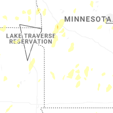
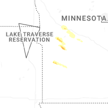
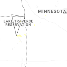
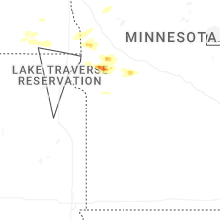
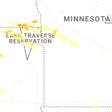
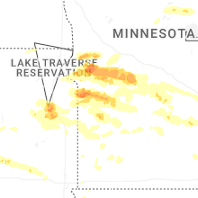

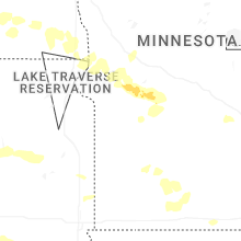


Connect with Interactive Hail Maps