

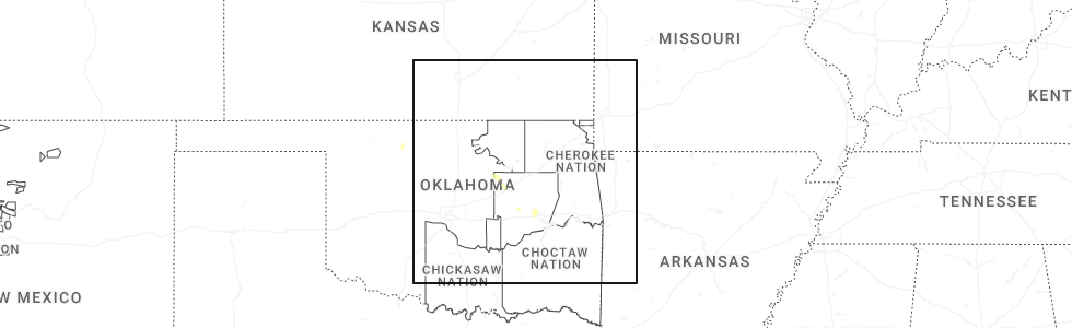
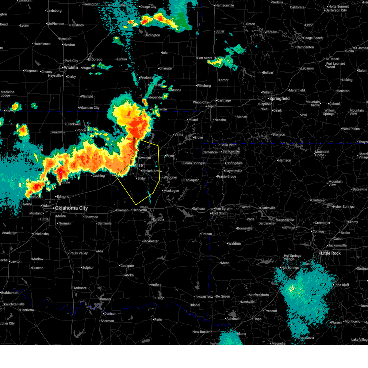
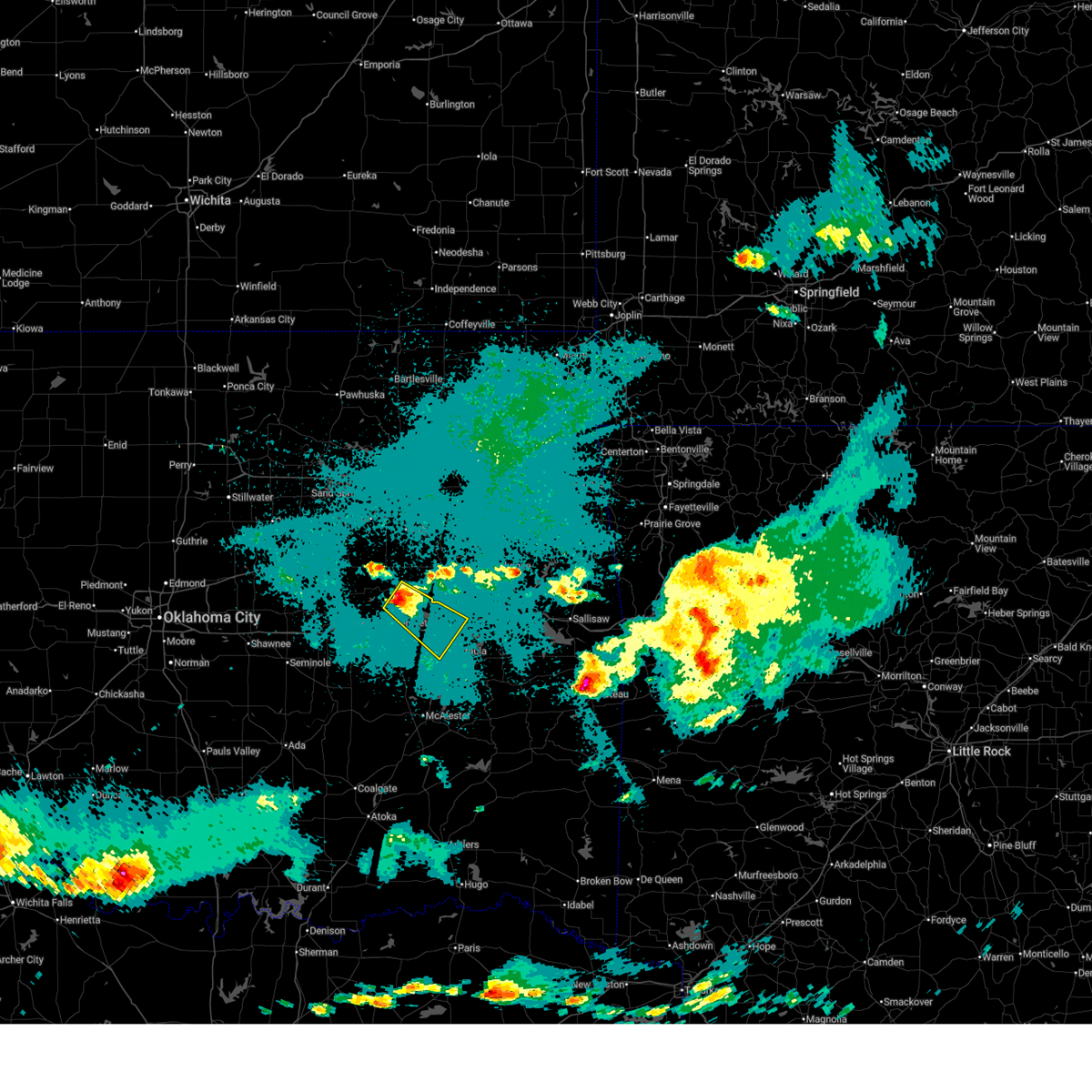
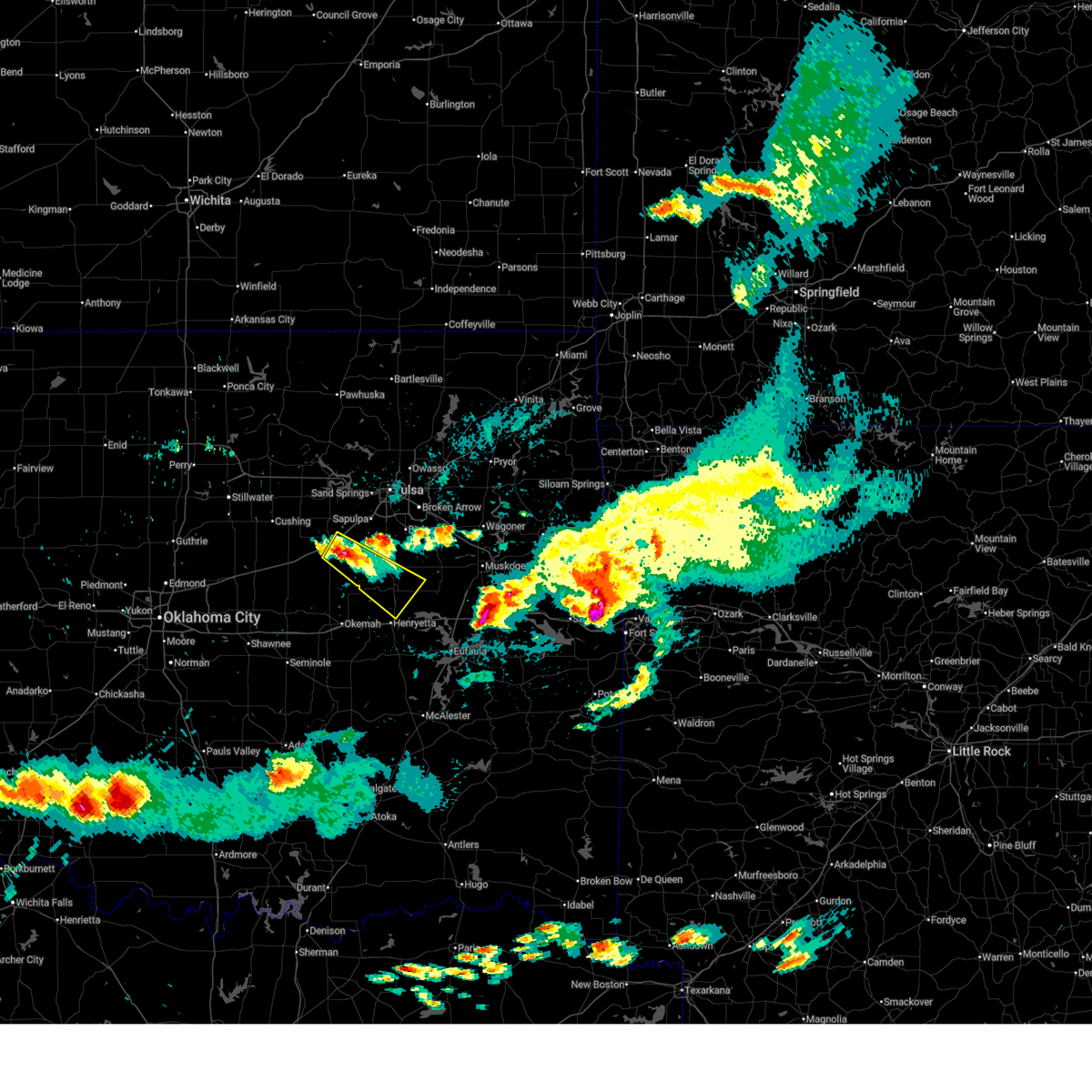
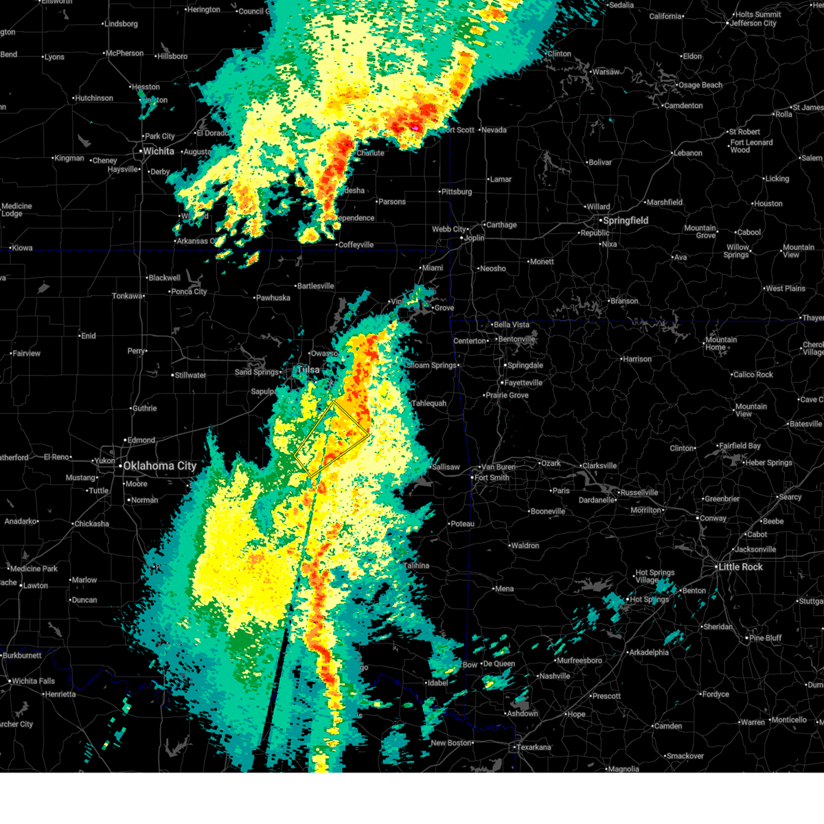
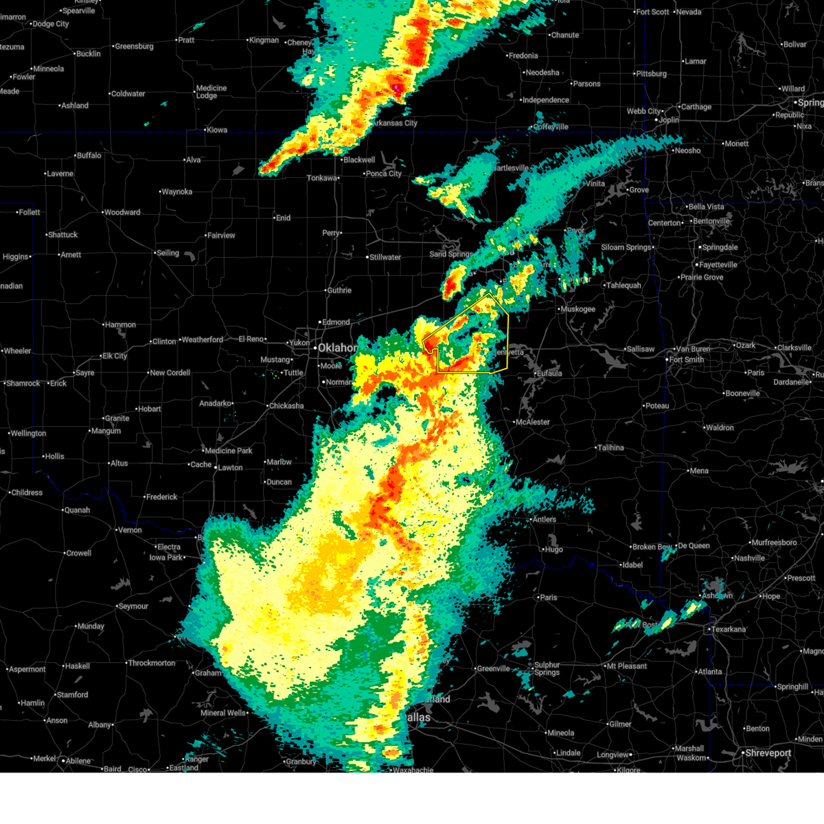
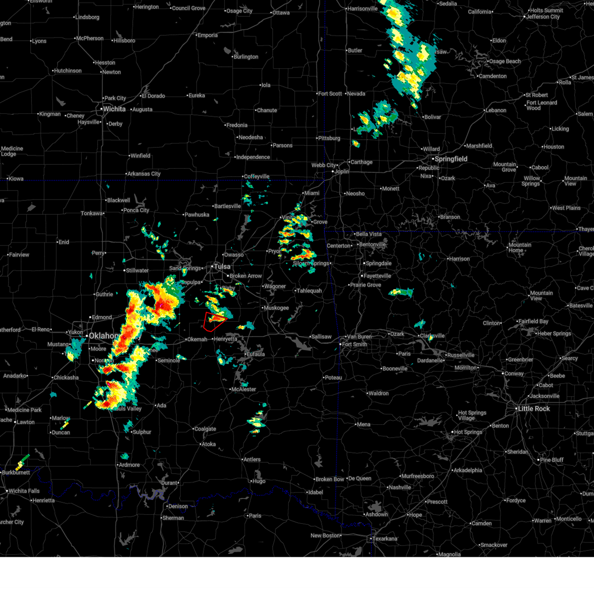
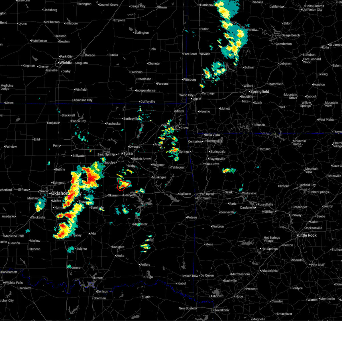
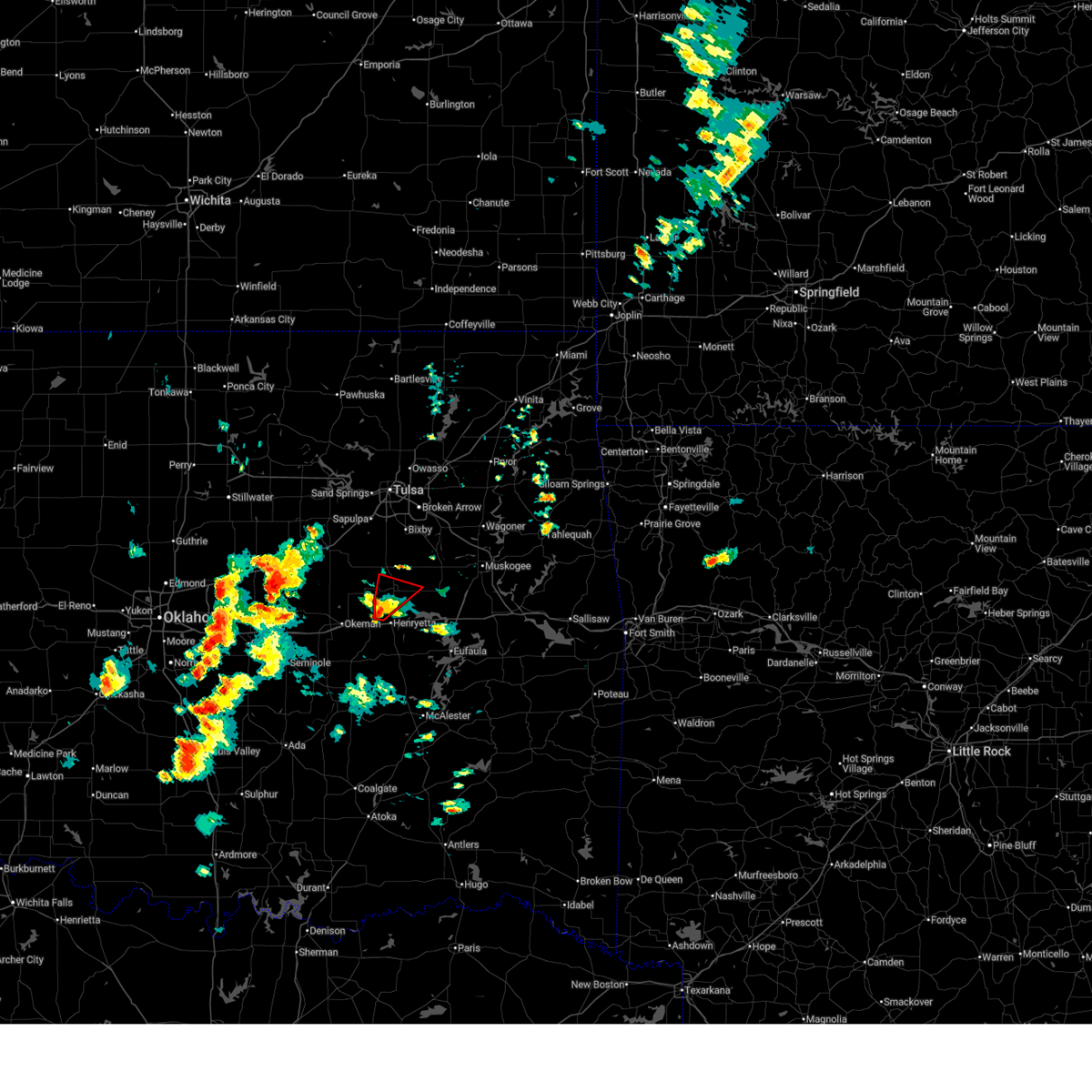
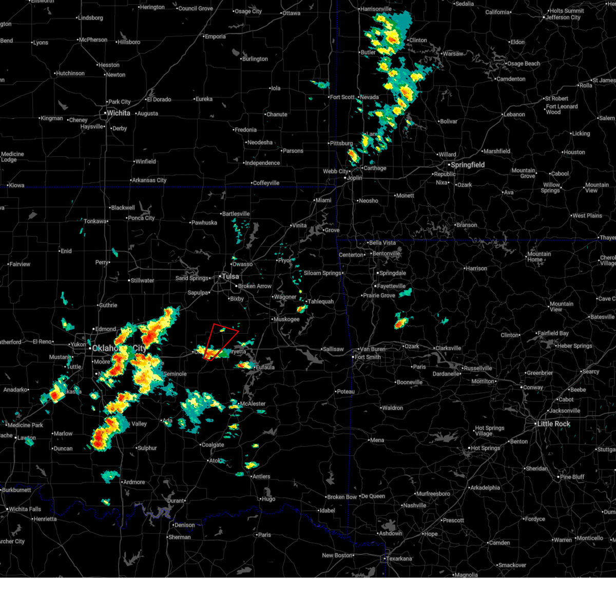
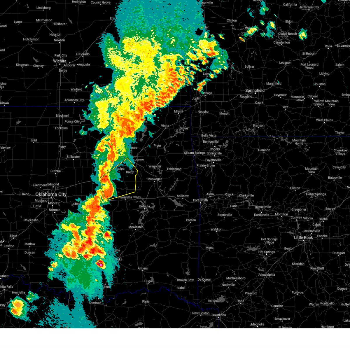
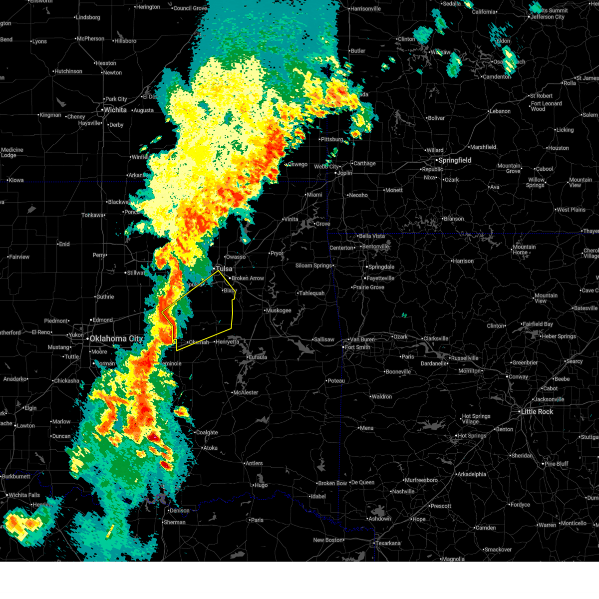
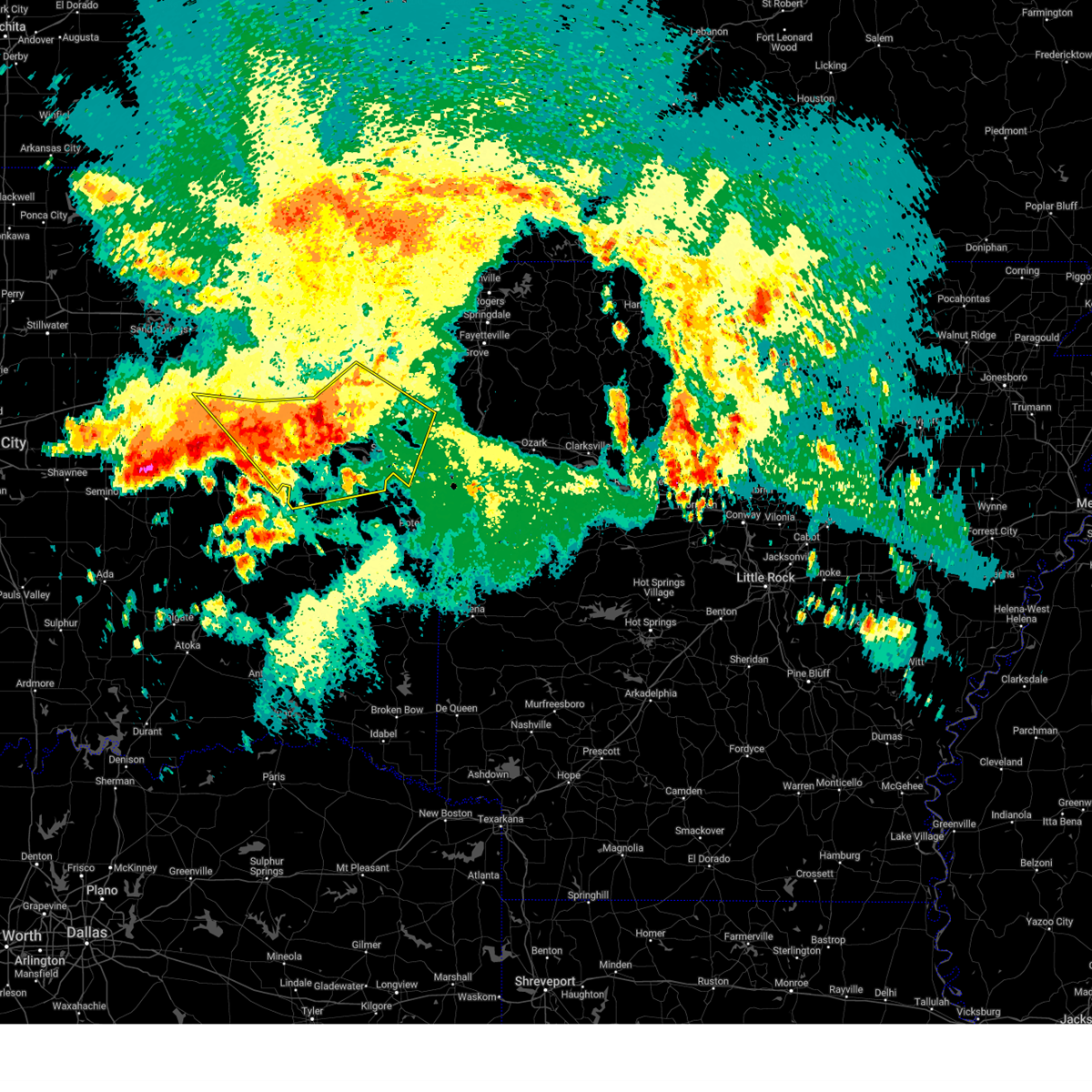
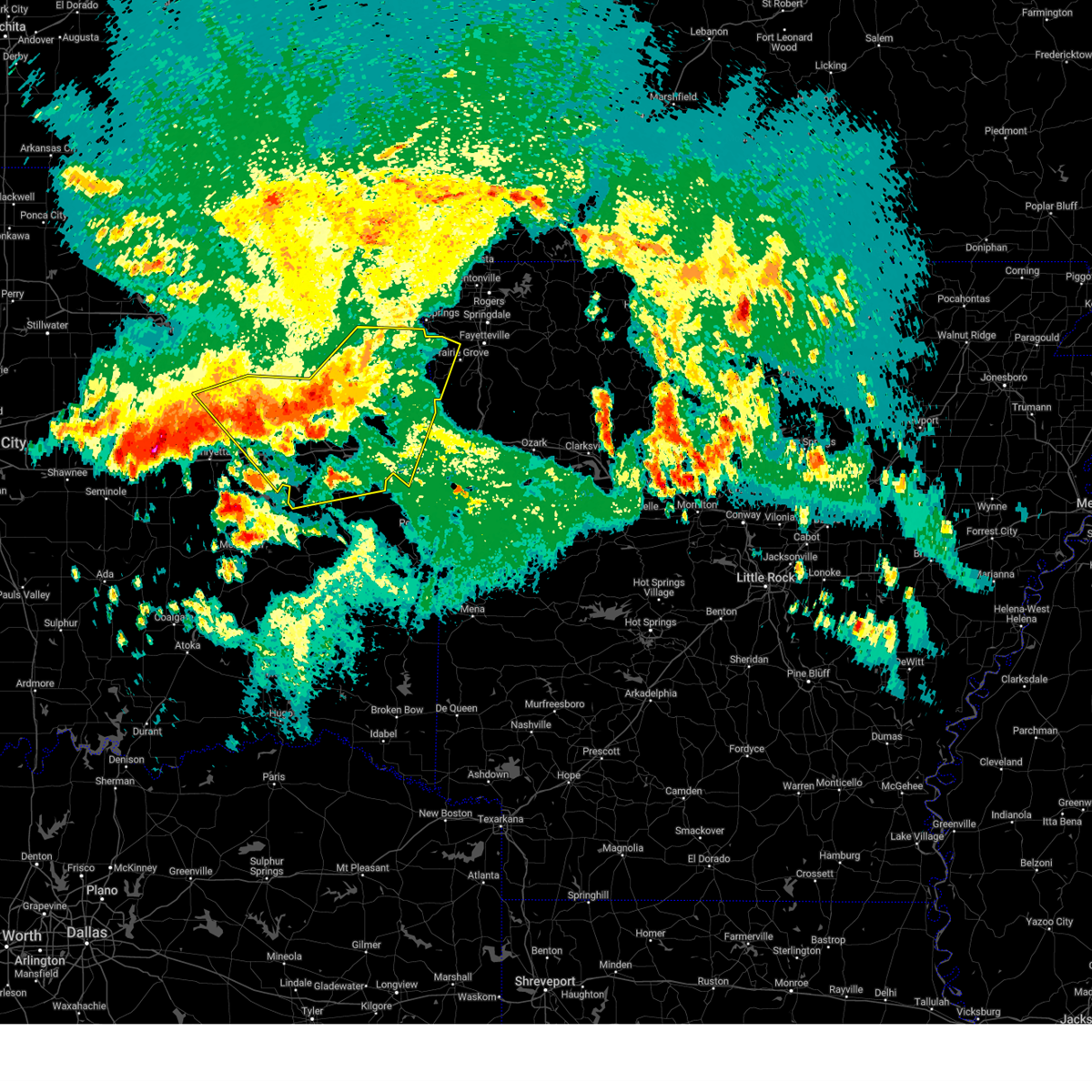
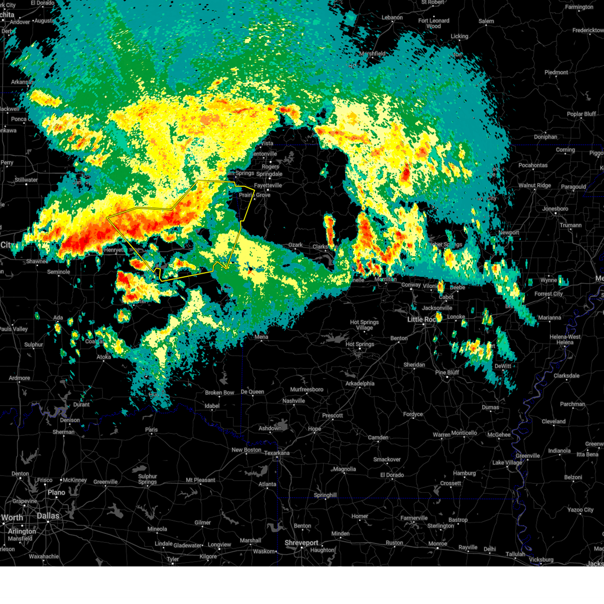
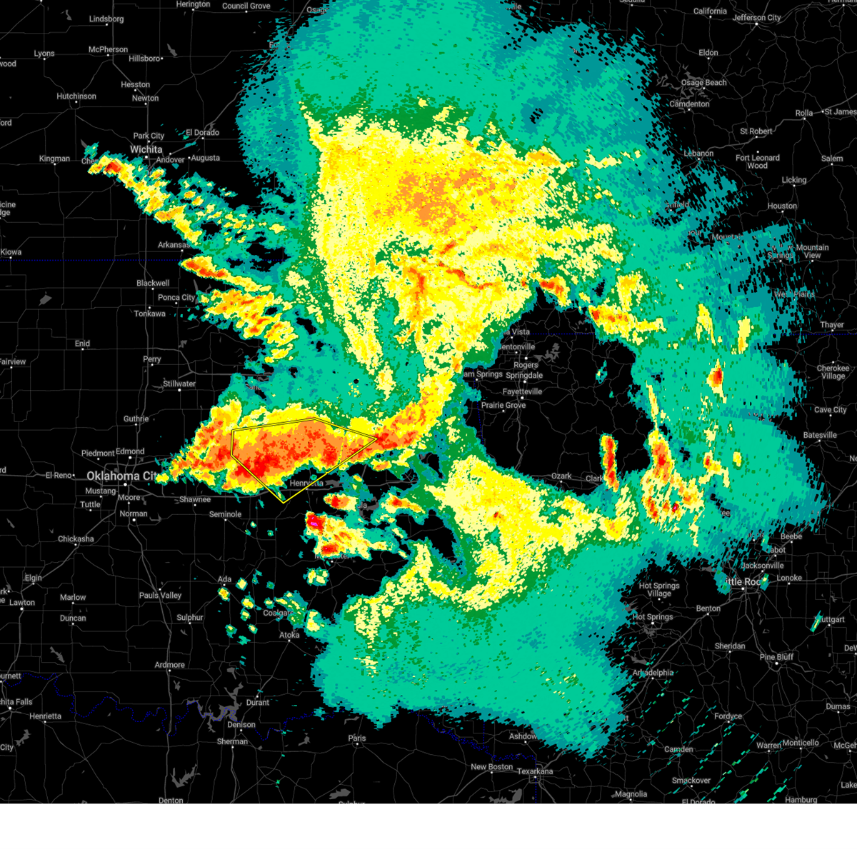
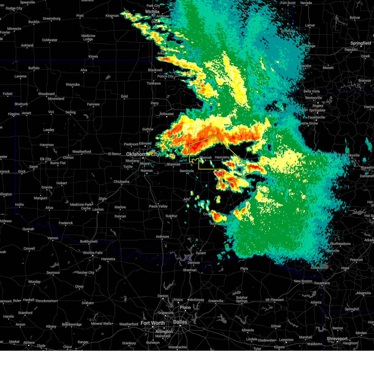
Hail Map for Morris, OK
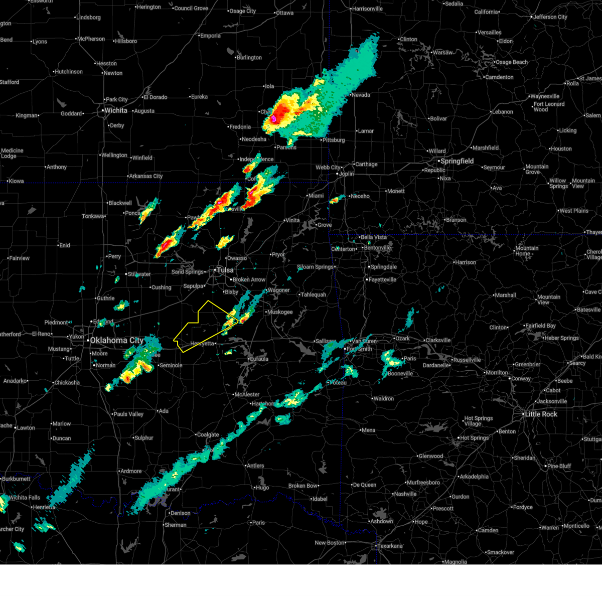
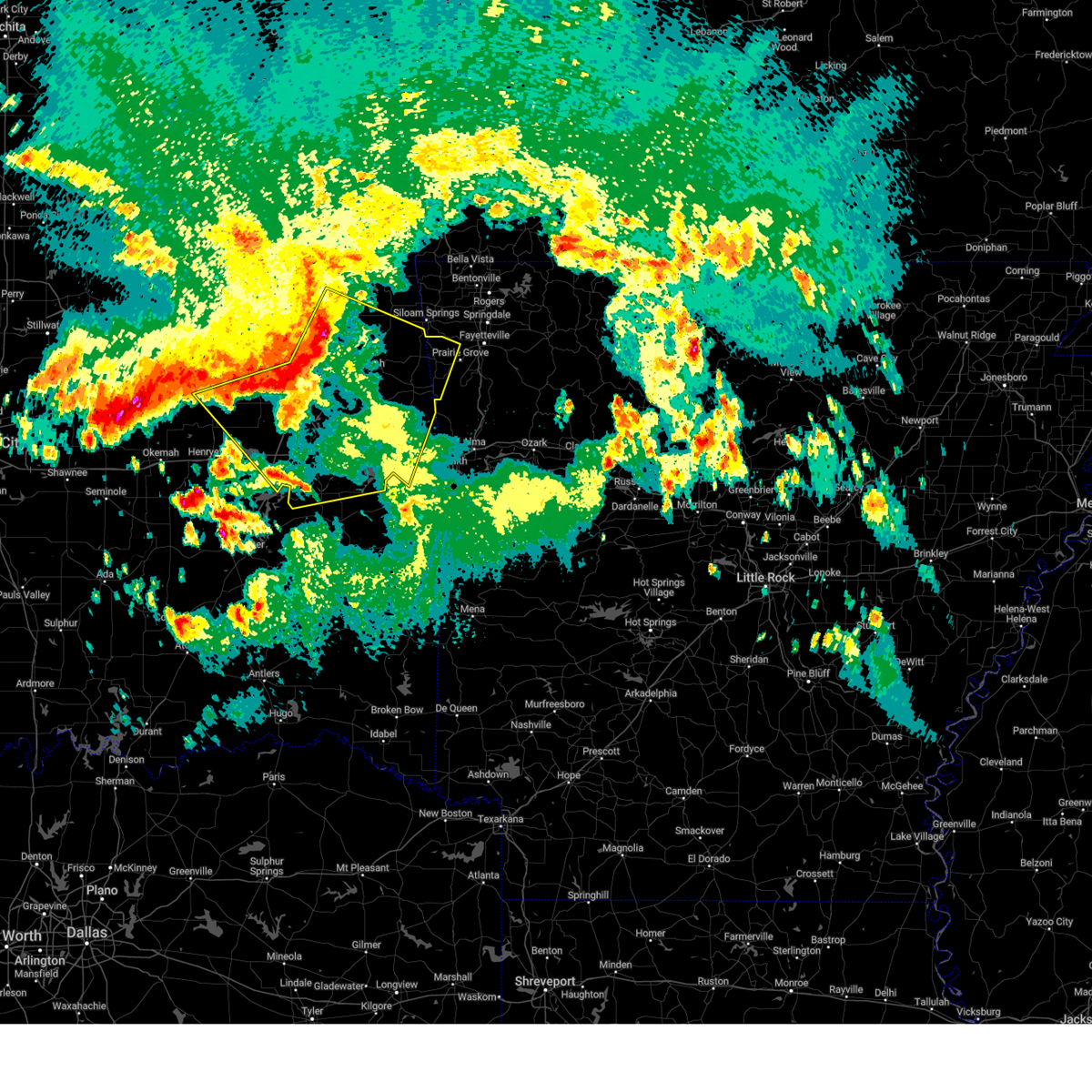
The Morris, OK area has had 1 report of on-the-ground hail by trained spotters, and has been under severe weather warnings 37 times during the past 12 months. Doppler radar has detected hail at or near Morris, OK on 71 occasions, including 4 occasions during the past year.
| Name: | Morris, OK |
| Where Located: | 37.7 miles S of Tulsa, OK |
| Map: | Google Map for Morris, OK |
| Population: | 1479 |
| Housing Units: | 576 |
| More Info: | Search Google for Morris, OK |
0
The Top Recent Hail Date for Morris, OK is Wednesday, June 24, 2026 (57th out of 71)
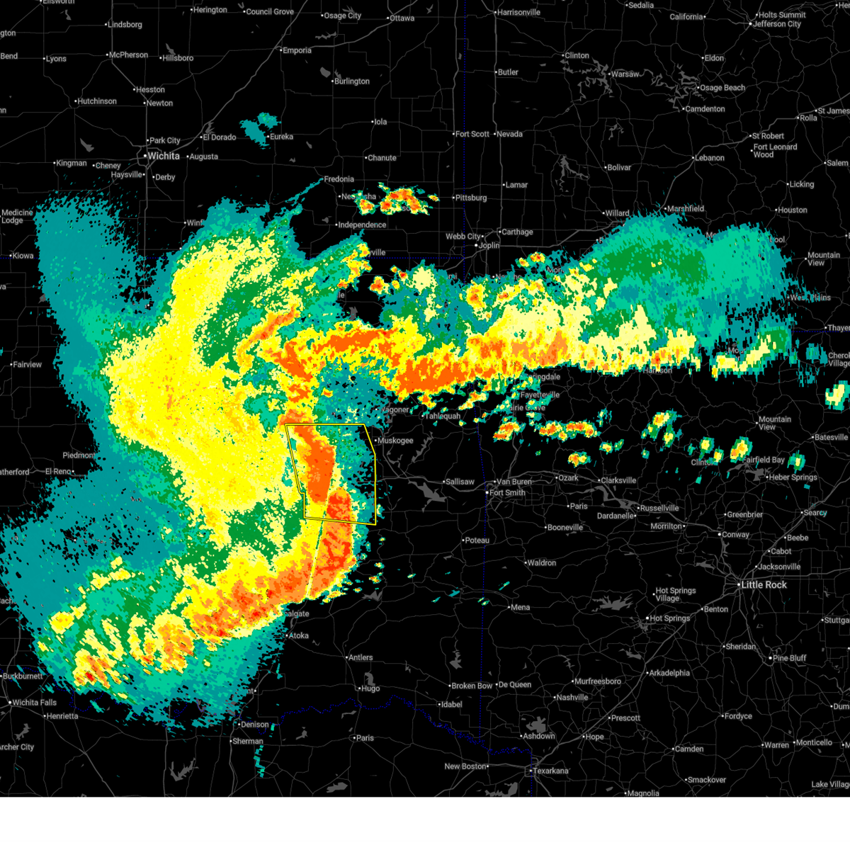
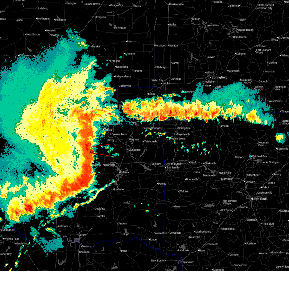
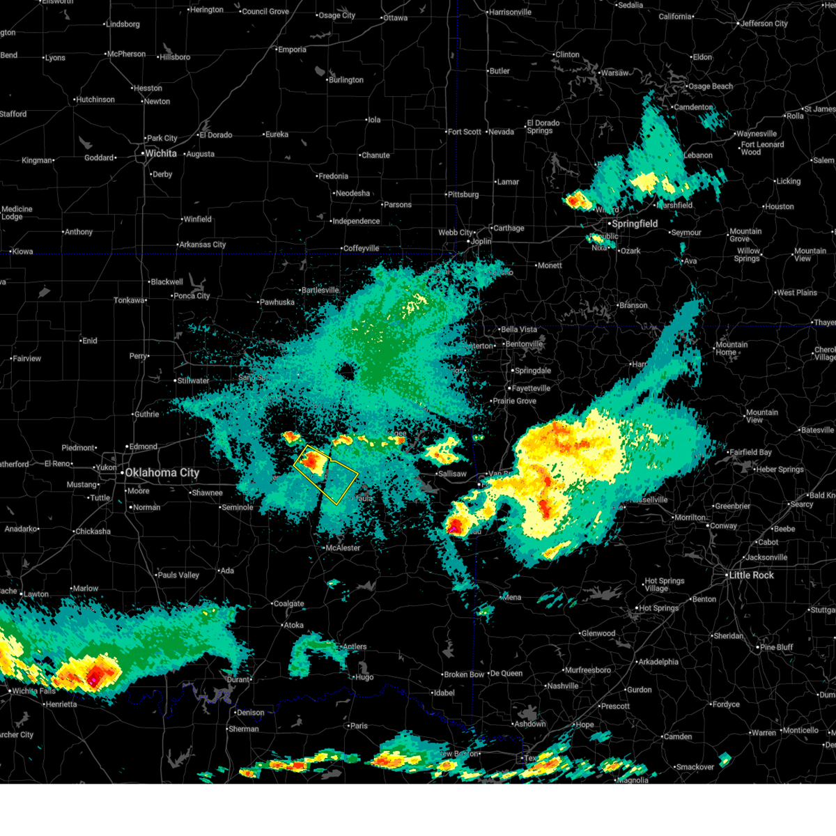
Hail and Wind Damage Spotted near Morris, OK
| Date / Time | Report Details |
|---|---|
| 7/4/2026 9:36 PM CDT |
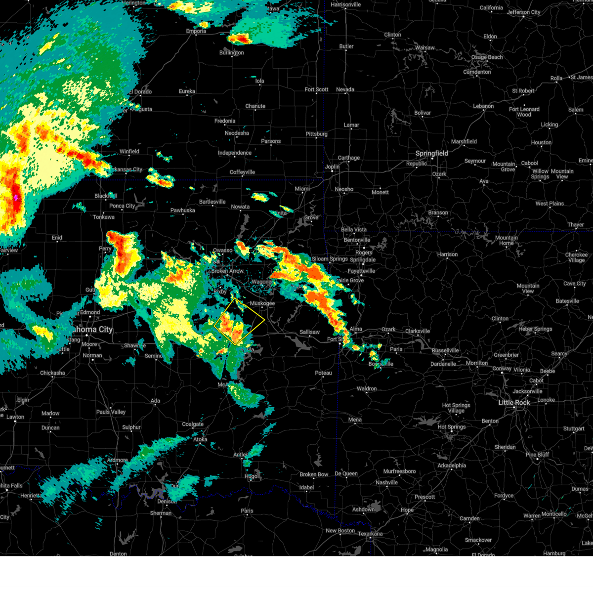
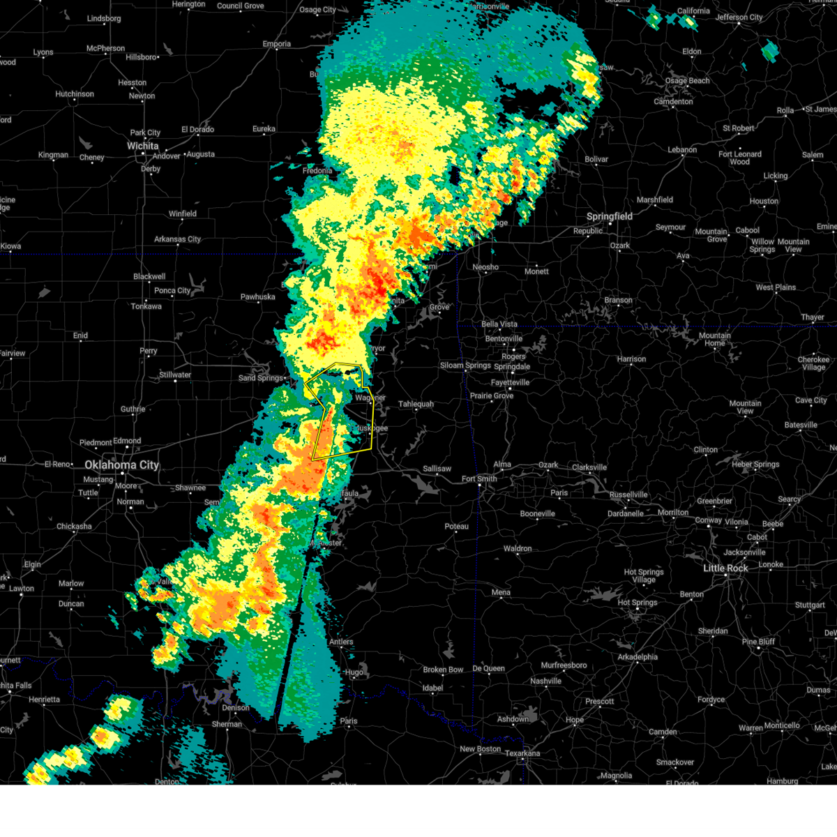
 Svrtsa the national weather service in tulsa has issued a * severe thunderstorm warning for, haskell county in southeastern oklahoma, mcintosh county in southeastern oklahoma, western sequoyah county in east central oklahoma, northwestern latimer county in southeastern oklahoma, southeastern wagoner county in northeastern oklahoma, southwestern cherokee county in east central oklahoma, northern pittsburg county in southeastern oklahoma, southern okmulgee county in northeastern oklahoma, muskogee county in east central oklahoma, okfuskee county in east central oklahoma, * until 1015 pm cdt. * at 936 pm cdt, severe thunderstorms were located along a line extending from 2 miles northwest of pumpkin center to 3 miles south of warner to near raiford to 5 miles east of wetumka to 4 miles southwest of castle, moving southeast at 35 mph (radar indicated). Hazards include 60 mph wind gusts and nickel size hail. Expect damage to roofs, siding, and trees. Locations in or near the path include, muskogee, mcalester, okmulgee, sallisaw, okemah, eufaula, stigler, okfuskee, henryetta, fort gibson, checotah, krebs, warner, morris, vian, boley, quinton, weleetka, gore, dewar, this includes interstate 40 in oklahoma between mile markers 212 and 306. Svrtsa the national weather service in tulsa has issued a * severe thunderstorm warning for, haskell county in southeastern oklahoma, mcintosh county in southeastern oklahoma, western sequoyah county in east central oklahoma, northwestern latimer county in southeastern oklahoma, southeastern wagoner county in northeastern oklahoma, southwestern cherokee county in east central oklahoma, northern pittsburg county in southeastern oklahoma, southern okmulgee county in northeastern oklahoma, muskogee county in east central oklahoma, okfuskee county in east central oklahoma, * until 1015 pm cdt. * at 936 pm cdt, severe thunderstorms were located along a line extending from 2 miles northwest of pumpkin center to 3 miles south of warner to near raiford to 5 miles east of wetumka to 4 miles southwest of castle, moving southeast at 35 mph (radar indicated). Hazards include 60 mph wind gusts and nickel size hail. Expect damage to roofs, siding, and trees. Locations in or near the path include, muskogee, mcalester, okmulgee, sallisaw, okemah, eufaula, stigler, okfuskee, henryetta, fort gibson, checotah, krebs, warner, morris, vian, boley, quinton, weleetka, gore, dewar, this includes interstate 40 in oklahoma between mile markers 212 and 306.
|
| 7/4/2026 9:08 PM CDT |
 At 908 pm cdt, severe thunderstorms were located along a line extending from 3 miles east of wagoner to 3 miles southwest of okay to 3 miles east of boynton to 4 miles east of morris, moving southeast at 35 mph (radar indicated). Hazards include 60 mph wind gusts and penny size hail. Expect damage to roofs, siding, and trees. Locations in or near the path include, muskogee, tahlequah, okmulgee, wagoner, fort gibson, checotah, haskell, warner, morris, vian, gore, porum, okay, webbers falls, hulbert, porter, oktaha, braggs, taft, boynton, this includes interstate 40 in oklahoma between mile markers 253 and 300. At 908 pm cdt, severe thunderstorms were located along a line extending from 3 miles east of wagoner to 3 miles southwest of okay to 3 miles east of boynton to 4 miles east of morris, moving southeast at 35 mph (radar indicated). Hazards include 60 mph wind gusts and penny size hail. Expect damage to roofs, siding, and trees. Locations in or near the path include, muskogee, tahlequah, okmulgee, wagoner, fort gibson, checotah, haskell, warner, morris, vian, gore, porum, okay, webbers falls, hulbert, porter, oktaha, braggs, taft, boynton, this includes interstate 40 in oklahoma between mile markers 253 and 300.
|
| 7/4/2026 9:05 PM CDT |
 Svrtsa the national weather service in tulsa has issued a * severe thunderstorm warning for, southwestern creek county in northeastern oklahoma, mcintosh county in southeastern oklahoma, northern pittsburg county in southeastern oklahoma, okmulgee county in northeastern oklahoma, okfuskee county in east central oklahoma, * until 945 pm cdt. * at 905 pm cdt, severe thunderstorms were located along a line extending from 5 miles northeast of hoffman to 4 miles north of pharoah to 4 miles north of paden, moving south at 55 mph (radar indicated). Hazards include 60 mph wind gusts and penny size hail. Expect damage to roofs, siding, and trees. locations in or near the path include, mcalester, okmulgee, okemah, eufaula, okfuskee, henryetta, morris, boley, quinton, weleetka, dewar, schulter, paden, crowder, canadian, indianola, grayson, hanna, bearden, hoffman, this includes the following highways, interstate 40 in oklahoma between mile markers 212 and 258. Interstate 44 between mile markers 178 and 181. Svrtsa the national weather service in tulsa has issued a * severe thunderstorm warning for, southwestern creek county in northeastern oklahoma, mcintosh county in southeastern oklahoma, northern pittsburg county in southeastern oklahoma, okmulgee county in northeastern oklahoma, okfuskee county in east central oklahoma, * until 945 pm cdt. * at 905 pm cdt, severe thunderstorms were located along a line extending from 5 miles northeast of hoffman to 4 miles north of pharoah to 4 miles north of paden, moving south at 55 mph (radar indicated). Hazards include 60 mph wind gusts and penny size hail. Expect damage to roofs, siding, and trees. locations in or near the path include, mcalester, okmulgee, okemah, eufaula, okfuskee, henryetta, morris, boley, quinton, weleetka, dewar, schulter, paden, crowder, canadian, indianola, grayson, hanna, bearden, hoffman, this includes the following highways, interstate 40 in oklahoma between mile markers 212 and 258. Interstate 44 between mile markers 178 and 181.
|
| 7/4/2026 8:55 PM CDT |
 Svrtsa the national weather service in tulsa has issued a * severe thunderstorm warning for, northeastern mcintosh county in southeastern oklahoma, northwestern sequoyah county in east central oklahoma, southeastern wagoner county in northeastern oklahoma, southern cherokee county in east central oklahoma, northeastern okmulgee county in northeastern oklahoma, muskogee county in east central oklahoma, * until 945 pm cdt. * at 855 pm cdt, severe thunderstorms were located along a line extending from 4 miles northwest of wagoner to tullahassee to 3 miles northwest of boynton to near morris, moving southeast at 40 mph (radar indicated). Hazards include 60 mph wind gusts. Expect damage to roofs, siding, and trees. Locations in or near the path include, muskogee, tahlequah, okmulgee, wagoner, fort gibson, checotah, haskell, warner, morris, vian, gore, porum, okay, webbers falls, hulbert, porter, oktaha, braggs, taft, boynton, this includes interstate 40 in oklahoma between mile markers 253 and 300. Svrtsa the national weather service in tulsa has issued a * severe thunderstorm warning for, northeastern mcintosh county in southeastern oklahoma, northwestern sequoyah county in east central oklahoma, southeastern wagoner county in northeastern oklahoma, southern cherokee county in east central oklahoma, northeastern okmulgee county in northeastern oklahoma, muskogee county in east central oklahoma, * until 945 pm cdt. * at 855 pm cdt, severe thunderstorms were located along a line extending from 4 miles northwest of wagoner to tullahassee to 3 miles northwest of boynton to near morris, moving southeast at 40 mph (radar indicated). Hazards include 60 mph wind gusts. Expect damage to roofs, siding, and trees. Locations in or near the path include, muskogee, tahlequah, okmulgee, wagoner, fort gibson, checotah, haskell, warner, morris, vian, gore, porum, okay, webbers falls, hulbert, porter, oktaha, braggs, taft, boynton, this includes interstate 40 in oklahoma between mile markers 253 and 300.
|
| 7/4/2026 8:45 PM CDT | At 843 pm cdt, severe thunderstorms were located along a line extending from 2 miles south of bald hill to 7 miles west of welty, moving southeast at 45 mph (radar indicated. at 8:42 pm, a 60 mph gust was reported at the okmulgee county eoc). Hazards include 60 mph wind gusts and quarter size hail. Hail damage to vehicles is expected. expect wind damage to roofs, siding, and trees. locations in or near the path include, okmulgee, bristow, okemah, okfuskee, glenpool, henryetta, kiefer, morris, beggs, boley, mounds, dewar, schulter, depew, paden, grayson, slick, hoffman, castle, clearview, this includes the following highways, interstate 40 in oklahoma between mile markers 212 and 260. Interstate 44 between mile markers 178 and 200. |
| 7/4/2026 8:26 PM CDT | Svrtsa the national weather service in tulsa has issued a * severe thunderstorm warning for, southern creek county in northeastern oklahoma, northwestern mcintosh county in southeastern oklahoma, okmulgee county in northeastern oklahoma, southern tulsa county in northeastern oklahoma, okfuskee county in east central oklahoma, * until 915 pm cdt. * at 826 pm cdt, severe thunderstorms were located along a line extending from 5 miles south of bixby to 3 miles west of depew, moving southeast at 40 mph (radar indicated). Hazards include 60 mph wind gusts and quarter size hail. Hail damage to vehicles is expected. expect wind damage to roofs, siding, and trees. locations in or near the path include, okmulgee, bristow, okemah, okfuskee, glenpool, henryetta, kiefer, morris, beggs, boley, mounds, dewar, schulter, depew, paden, grayson, slick, hoffman, castle, clearview, this includes the following highways, interstate 40 in oklahoma between mile markers 212 and 260. Interstate 44 between mile markers 178 and 200. |
| 7/4/2026 8:05 PM CDT |
 At 804 pm cdt, severe thunderstorms were located along a line extending from 2 miles northeast of collinsville to 2 miles northwest of catoosa to near jenks to 2 miles southwest of kiefer, moving southeast at 50 mph (radar indicated. at 8:00 pm, a 63 mph wind gust was reported at tulsa international airport). Hazards include 70 mph wind gusts and penny size hail. Expect considerable tree damage. damage is likely to mobile homes, roofs, and outbuildings. Locations in or near the path include, tulsa, broken arrow, sand springs, claremore, okmulgee, owasso, bixby, sapulpa, jenks, glenpool, coweta, skiatook, catoosa, collinsville, verdigris, haskell, inola, kiefer, morris, beggs, this includes interstate 44 between mile markers 202 and 258. At 804 pm cdt, severe thunderstorms were located along a line extending from 2 miles northeast of collinsville to 2 miles northwest of catoosa to near jenks to 2 miles southwest of kiefer, moving southeast at 50 mph (radar indicated. at 8:00 pm, a 63 mph wind gust was reported at tulsa international airport). Hazards include 70 mph wind gusts and penny size hail. Expect considerable tree damage. damage is likely to mobile homes, roofs, and outbuildings. Locations in or near the path include, tulsa, broken arrow, sand springs, claremore, okmulgee, owasso, bixby, sapulpa, jenks, glenpool, coweta, skiatook, catoosa, collinsville, verdigris, haskell, inola, kiefer, morris, beggs, this includes interstate 44 between mile markers 202 and 258.
|
| 7/4/2026 7:55 PM CDT |
 Svrtsa the national weather service in tulsa has issued a * severe thunderstorm warning for, rogers county in northeastern oklahoma, northeastern creek county in northeastern oklahoma, southern washington county in northeastern oklahoma, wagoner county in northeastern oklahoma, northern okmulgee county in northeastern oklahoma, northwestern muskogee county in east central oklahoma, tulsa county in northeastern oklahoma, * until 845 pm cdt. * at 755 pm cdt, severe thunderstorms were located along a line extending from 2 miles north of vera to 3 miles west of owasso to 4 miles northwest of jenks riverside airport to 3 miles west of sapulpa, moving southeast at 50 mph (radar indicated). Hazards include 70 mph wind gusts and penny size hail. Expect considerable tree damage. damage is likely to mobile homes, roofs, and outbuildings. Locations in or near the path include, tulsa, broken arrow, sand springs, claremore, okmulgee, owasso, bixby, sapulpa, jenks, glenpool, coweta, skiatook, catoosa, collinsville, verdigris, haskell, inola, kiefer, morris, beggs, this includes interstate 44 between mile markers 202 and 258. Svrtsa the national weather service in tulsa has issued a * severe thunderstorm warning for, rogers county in northeastern oklahoma, northeastern creek county in northeastern oklahoma, southern washington county in northeastern oklahoma, wagoner county in northeastern oklahoma, northern okmulgee county in northeastern oklahoma, northwestern muskogee county in east central oklahoma, tulsa county in northeastern oklahoma, * until 845 pm cdt. * at 755 pm cdt, severe thunderstorms were located along a line extending from 2 miles north of vera to 3 miles west of owasso to 4 miles northwest of jenks riverside airport to 3 miles west of sapulpa, moving southeast at 50 mph (radar indicated). Hazards include 70 mph wind gusts and penny size hail. Expect considerable tree damage. damage is likely to mobile homes, roofs, and outbuildings. Locations in or near the path include, tulsa, broken arrow, sand springs, claremore, okmulgee, owasso, bixby, sapulpa, jenks, glenpool, coweta, skiatook, catoosa, collinsville, verdigris, haskell, inola, kiefer, morris, beggs, this includes interstate 44 between mile markers 202 and 258.
|
| 6/22/2026 3:54 AM CDT |
 At 354 am cdt, severe thunderstorms were located along a line extending from 7 miles northwest of bald hill to 4 miles west of council hill to 2 miles northeast of canadian, moving east at 45 mph (radar indicated). Hazards include 70 mph wind gusts. Expect considerable tree damage. damage is likely to mobile homes, roofs, and outbuildings. Locations in or near the path include, muskogee, okmulgee, eufaula, henryetta, checotah, haskell, morris, beggs, dewar, schulter, oktaha, taft, boynton, grayson, council hill, hanna, rentiesville, hoffman, stidham, preston, this includes interstate 40 in oklahoma between mile markers 236 and 272. At 354 am cdt, severe thunderstorms were located along a line extending from 7 miles northwest of bald hill to 4 miles west of council hill to 2 miles northeast of canadian, moving east at 45 mph (radar indicated). Hazards include 70 mph wind gusts. Expect considerable tree damage. damage is likely to mobile homes, roofs, and outbuildings. Locations in or near the path include, muskogee, okmulgee, eufaula, henryetta, checotah, haskell, morris, beggs, dewar, schulter, oktaha, taft, boynton, grayson, council hill, hanna, rentiesville, hoffman, stidham, preston, this includes interstate 40 in oklahoma between mile markers 236 and 272.
|
| 6/22/2026 3:19 AM CDT |
 Svrtsa the national weather service in tulsa has issued a * severe thunderstorm warning for, west central haskell county in southeastern oklahoma, mcintosh county in southeastern oklahoma, southwestern wagoner county in northeastern oklahoma, northeastern pittsburg county in southeastern oklahoma, okmulgee county in northeastern oklahoma, northwestern muskogee county in east central oklahoma, eastern okfuskee county in east central oklahoma, * until 415 am cdt. * at 319 am cdt, severe thunderstorms were located along a line extending from 5 miles south of kellyville to 3 miles east of okfuskee to 3 miles east of wetumka, moving east at 40 mph (radar indicated). Hazards include 70 mph wind gusts. Expect considerable tree damage. damage is likely to mobile homes, roofs, and outbuildings. Locations in or near the path include, muskogee, okmulgee, eufaula, henryetta, checotah, haskell, morris, beggs, weleetka, dewar, schulter, oktaha, taft, boynton, grayson, council hill, hanna, rentiesville, hoffman, clearview, this includes interstate 40 in oklahoma between mile markers 222 and 272. Svrtsa the national weather service in tulsa has issued a * severe thunderstorm warning for, west central haskell county in southeastern oklahoma, mcintosh county in southeastern oklahoma, southwestern wagoner county in northeastern oklahoma, northeastern pittsburg county in southeastern oklahoma, okmulgee county in northeastern oklahoma, northwestern muskogee county in east central oklahoma, eastern okfuskee county in east central oklahoma, * until 415 am cdt. * at 319 am cdt, severe thunderstorms were located along a line extending from 5 miles south of kellyville to 3 miles east of okfuskee to 3 miles east of wetumka, moving east at 40 mph (radar indicated). Hazards include 70 mph wind gusts. Expect considerable tree damage. damage is likely to mobile homes, roofs, and outbuildings. Locations in or near the path include, muskogee, okmulgee, eufaula, henryetta, checotah, haskell, morris, beggs, weleetka, dewar, schulter, oktaha, taft, boynton, grayson, council hill, hanna, rentiesville, hoffman, clearview, this includes interstate 40 in oklahoma between mile markers 222 and 272.
|
| 6/22/2026 3:18 AM CDT |
 Tortsa the national weather service in tulsa has issued a * tornado warning for, south central creek county in northeastern oklahoma, northwestern okmulgee county in northeastern oklahoma, * until 400 am cdt. * at 317 am cdt, a severe squall line capable of producing tornadoes that may not be visible due to heavy rain was located 3 miles southeast of slick, moving east at 25 mph (radar indicated rotation). Hazards include tornado. Flying debris will be dangerous to those caught without shelter. mobile homes will be damaged or destroyed. damage to roofs, windows, and vehicles will occur. tree damage is likely. Locations in or near the path include, okmulgee, beggs, slick, bald hill, preston, hectorville,. Tortsa the national weather service in tulsa has issued a * tornado warning for, south central creek county in northeastern oklahoma, northwestern okmulgee county in northeastern oklahoma, * until 400 am cdt. * at 317 am cdt, a severe squall line capable of producing tornadoes that may not be visible due to heavy rain was located 3 miles southeast of slick, moving east at 25 mph (radar indicated rotation). Hazards include tornado. Flying debris will be dangerous to those caught without shelter. mobile homes will be damaged or destroyed. damage to roofs, windows, and vehicles will occur. tree damage is likely. Locations in or near the path include, okmulgee, beggs, slick, bald hill, preston, hectorville,.
|
| 5/8/2026 10:02 PM CDT |
 the severe thunderstorm warning has been cancelled and is no longer in effect the severe thunderstorm warning has been cancelled and is no longer in effect
|
| 5/8/2026 9:53 PM CDT |
 At 952 pm cdt, a severe thunderstorm was located 3 miles northwest of grayson, moving southeast at 30 mph (radar and emergency management indicated. at 949 pm, okmulgee county emergency management reported quarter size hail south of okmulgee). Hazards include quarter size hail. Damage to vehicles is expected. Locations in or near the path include, okmulgee, checotah, morris, dewar, schulter, grayson, hoffman, stidham, vivian, lake eufaula state park, hitchita, pierce, onapa, this includes interstate 40 in oklahoma between mile markers 242 and 266. At 952 pm cdt, a severe thunderstorm was located 3 miles northwest of grayson, moving southeast at 30 mph (radar and emergency management indicated. at 949 pm, okmulgee county emergency management reported quarter size hail south of okmulgee). Hazards include quarter size hail. Damage to vehicles is expected. Locations in or near the path include, okmulgee, checotah, morris, dewar, schulter, grayson, hoffman, stidham, vivian, lake eufaula state park, hitchita, pierce, onapa, this includes interstate 40 in oklahoma between mile markers 242 and 266.
|
| 5/8/2026 9:38 PM CDT |
 Svrtsa the national weather service in tulsa has issued a * severe thunderstorm warning for, northern mcintosh county in southeastern oklahoma, central okmulgee county in northeastern oklahoma, * until 1030 pm cdt. * at 938 pm cdt, a severe thunderstorm was located 3 miles east of okmulgee state park, moving southeast at 30 mph (radar indicated). Hazards include quarter size hail. Damage to vehicles is expected. Locations in or near the path include, okmulgee, henryetta, checotah, morris, dewar, schulter, grayson, hoffman, stidham, vivian, okmulgee state park, lake eufaula state park, hitchita, pierce, onapa, this includes interstate 40 in oklahoma between mile markers 240 and 266. Svrtsa the national weather service in tulsa has issued a * severe thunderstorm warning for, northern mcintosh county in southeastern oklahoma, central okmulgee county in northeastern oklahoma, * until 1030 pm cdt. * at 938 pm cdt, a severe thunderstorm was located 3 miles east of okmulgee state park, moving southeast at 30 mph (radar indicated). Hazards include quarter size hail. Damage to vehicles is expected. Locations in or near the path include, okmulgee, henryetta, checotah, morris, dewar, schulter, grayson, hoffman, stidham, vivian, okmulgee state park, lake eufaula state park, hitchita, pierce, onapa, this includes interstate 40 in oklahoma between mile markers 240 and 266.
|
| 5/8/2026 9:15 PM CDT |
 At 915 pm cdt, a severe thunderstorm was located 4 miles southwest of beggs, moving southeast at 25 mph (radar indicated). Hazards include quarter size hail. Damage to vehicles is expected. Locations in or near the path include, okmulgee, morris, beggs, schulter, preston, okmulgee state park,. At 915 pm cdt, a severe thunderstorm was located 4 miles southwest of beggs, moving southeast at 25 mph (radar indicated). Hazards include quarter size hail. Damage to vehicles is expected. Locations in or near the path include, okmulgee, morris, beggs, schulter, preston, okmulgee state park,.
|
| 5/8/2026 9:02 PM CDT |
 At 902 pm cdt, a severe thunderstorm was located 4 miles southeast of slick, moving southeast at 20 mph (radar indicated). Hazards include quarter size hail. Damage to vehicles is expected. Locations in or near the path include, okmulgee, morris, beggs, schulter, slick, preston, okmulgee state park,. At 902 pm cdt, a severe thunderstorm was located 4 miles southeast of slick, moving southeast at 20 mph (radar indicated). Hazards include quarter size hail. Damage to vehicles is expected. Locations in or near the path include, okmulgee, morris, beggs, schulter, slick, preston, okmulgee state park,.
|
| 5/8/2026 8:48 PM CDT |
 Svrtsa the national weather service in tulsa has issued a * severe thunderstorm warning for, south central creek county in northeastern oklahoma, central okmulgee county in northeastern oklahoma, * until 930 pm cdt. * at 848 pm cdt, a severe thunderstorm was located over slick, moving southeast at 25 mph (radar indicated). Hazards include 60 mph wind gusts and quarter size hail. Hail damage to vehicles is expected. expect wind damage to roofs, siding, and trees. Locations in or near the path include, okmulgee, bristow, morris, beggs, schulter, slick, preston, okmulgee state park, this includes interstate 44 between mile markers 191 and 198. Svrtsa the national weather service in tulsa has issued a * severe thunderstorm warning for, south central creek county in northeastern oklahoma, central okmulgee county in northeastern oklahoma, * until 930 pm cdt. * at 848 pm cdt, a severe thunderstorm was located over slick, moving southeast at 25 mph (radar indicated). Hazards include 60 mph wind gusts and quarter size hail. Hail damage to vehicles is expected. expect wind damage to roofs, siding, and trees. Locations in or near the path include, okmulgee, bristow, morris, beggs, schulter, slick, preston, okmulgee state park, this includes interstate 44 between mile markers 191 and 198.
|
| 5/8/2026 8:07 PM CDT |
 At 806 pm cdt, a severe thunderstorm was located 5 miles southeast of bald hill, moving southeast at 45 mph (radar indicated). Hazards include ping pong ball size hail and 60 mph wind gusts. People and animals outdoors will be injured. expect hail damage to roofs, siding, windows, and vehicles. expect wind damage to roofs, siding, and trees. Locations in or near the path include, checotah, haskell, morris, oktaha, boynton, council hill, rentiesville, bald hill, lake eufaula state park, wainwright, summit, hitchita, jamesville, eram, onapa, this includes interstate 40 in oklahoma between mile markers 254 and 265. At 806 pm cdt, a severe thunderstorm was located 5 miles southeast of bald hill, moving southeast at 45 mph (radar indicated). Hazards include ping pong ball size hail and 60 mph wind gusts. People and animals outdoors will be injured. expect hail damage to roofs, siding, windows, and vehicles. expect wind damage to roofs, siding, and trees. Locations in or near the path include, checotah, haskell, morris, oktaha, boynton, council hill, rentiesville, bald hill, lake eufaula state park, wainwright, summit, hitchita, jamesville, eram, onapa, this includes interstate 40 in oklahoma between mile markers 254 and 265.
|
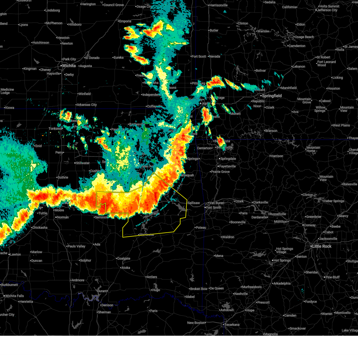
| 5/8/2026 8:00 PM CDT | Half Dollar sized hail reported 7.2 miles SW of Morris, OK, on 340 road just south of liberty road. stripped trees in the area. time estimated from radar. |
| 5/8/2026 7:55 PM CDT |
 Svrtsa the national weather service in tulsa has issued a * severe thunderstorm warning for, northeastern mcintosh county in southeastern oklahoma, northeastern okmulgee county in northeastern oklahoma, northwestern muskogee county in east central oklahoma, * until 845 pm cdt. * at 755 pm cdt, a severe thunderstorm was located 3 miles west of bald hill, moving southeast at 45 mph (radar indicated). Hazards include 60 mph wind gusts and quarter size hail. Hail damage to vehicles is expected. expect wind damage to roofs, siding, and trees. Locations in or near the path include, okmulgee, checotah, haskell, morris, oktaha, boynton, council hill, rentiesville, preston, bald hill, lake eufaula state park, liberty, wainwright, summit, hitchita, jamesville, hectorville, eram, onapa, this includes interstate 40 in oklahoma between mile markers 254 and 265. Svrtsa the national weather service in tulsa has issued a * severe thunderstorm warning for, northeastern mcintosh county in southeastern oklahoma, northeastern okmulgee county in northeastern oklahoma, northwestern muskogee county in east central oklahoma, * until 845 pm cdt. * at 755 pm cdt, a severe thunderstorm was located 3 miles west of bald hill, moving southeast at 45 mph (radar indicated). Hazards include 60 mph wind gusts and quarter size hail. Hail damage to vehicles is expected. expect wind damage to roofs, siding, and trees. Locations in or near the path include, okmulgee, checotah, haskell, morris, oktaha, boynton, council hill, rentiesville, preston, bald hill, lake eufaula state park, liberty, wainwright, summit, hitchita, jamesville, hectorville, eram, onapa, this includes interstate 40 in oklahoma between mile markers 254 and 265.
|
| 4/15/2026 4:14 PM CDT |
 At 414 pm cdt, a severe thunderstorm was located 4 miles southwest of okmulgee state park, moving northeast at 50 mph (radar indicated). Hazards include 60 mph wind gusts and quarter size hail. Hail damage to vehicles is expected. expect wind damage to roofs, siding, and trees. Locations in or near the path include, beggs, morris, preston, okmulgee, okmulgee state park, okfuskee,. At 414 pm cdt, a severe thunderstorm was located 4 miles southwest of okmulgee state park, moving northeast at 50 mph (radar indicated). Hazards include 60 mph wind gusts and quarter size hail. Hail damage to vehicles is expected. expect wind damage to roofs, siding, and trees. Locations in or near the path include, beggs, morris, preston, okmulgee, okmulgee state park, okfuskee,.
|
| 4/15/2026 3:58 PM CDT |
 Svrtsa the national weather service in tulsa has issued a * severe thunderstorm warning for, central okmulgee county in northeastern oklahoma, central okfuskee county in east central oklahoma, * until 445 pm cdt. * at 357 pm cdt, a severe thunderstorm was located near castle, moving northeast at 50 mph (radar indicated). Hazards include 60 mph wind gusts and quarter size hail. Hail damage to vehicles is expected. expect wind damage to roofs, siding, and trees. Locations in or near the path include, beggs, preston, mason, okmulgee, okmulgee state park, castle, okemah, morris, okfuskee, bearden, this includes interstate 40 in oklahoma between mile markers 214 and 225. Svrtsa the national weather service in tulsa has issued a * severe thunderstorm warning for, central okmulgee county in northeastern oklahoma, central okfuskee county in east central oklahoma, * until 445 pm cdt. * at 357 pm cdt, a severe thunderstorm was located near castle, moving northeast at 50 mph (radar indicated). Hazards include 60 mph wind gusts and quarter size hail. Hail damage to vehicles is expected. expect wind damage to roofs, siding, and trees. Locations in or near the path include, beggs, preston, mason, okmulgee, okmulgee state park, castle, okemah, morris, okfuskee, bearden, this includes interstate 40 in oklahoma between mile markers 214 and 225.
|
| 4/14/2026 10:17 PM CDT |
 Svrtsa the national weather service in tulsa has issued a * severe thunderstorm warning for, mcintosh county in southeastern oklahoma, southeastern wagoner county in northeastern oklahoma, northwestern pittsburg county in southeastern oklahoma, southeastern okmulgee county in northeastern oklahoma, northwestern muskogee county in east central oklahoma, southeastern okfuskee county in east central oklahoma, * until 1115 pm cdt. * at 1017 pm cdt, severe thunderstorms were located along a line extending from near schulter to 4 miles west of horntown, moving east at 50 mph (radar indicated). Hazards include 60 mph wind gusts. Expect damage to roofs, siding, and trees. Locations in or near the path include, canadian, raiford, weleetka, dewar, oktaha, summit, vivian, hanna, fort gibson, muskogee, okay, pierce, schulter, eram, checotah, lake eufaula state park, morris, grayson, bryant, wainwright, this includes interstate 40 in oklahoma between mile markers 231 and 268. Svrtsa the national weather service in tulsa has issued a * severe thunderstorm warning for, mcintosh county in southeastern oklahoma, southeastern wagoner county in northeastern oklahoma, northwestern pittsburg county in southeastern oklahoma, southeastern okmulgee county in northeastern oklahoma, northwestern muskogee county in east central oklahoma, southeastern okfuskee county in east central oklahoma, * until 1115 pm cdt. * at 1017 pm cdt, severe thunderstorms were located along a line extending from near schulter to 4 miles west of horntown, moving east at 50 mph (radar indicated). Hazards include 60 mph wind gusts. Expect damage to roofs, siding, and trees. Locations in or near the path include, canadian, raiford, weleetka, dewar, oktaha, summit, vivian, hanna, fort gibson, muskogee, okay, pierce, schulter, eram, checotah, lake eufaula state park, morris, grayson, bryant, wainwright, this includes interstate 40 in oklahoma between mile markers 231 and 268.
|
| 4/14/2026 9:49 PM CDT |
 At 949 pm cdt, severe thunderstorms were located along a line extending from 2 miles west of jenks riverside airport to 4 miles southeast of mounds to 2 miles southeast of okmulgee state park, moving northeast at 50 mph (radar indicated). Hazards include 60 mph wind gusts. Expect damage to roofs, siding, and trees. Locations in or near the path include, beggs, preston, okmulgee, sapulpa, jenks riverside airport, bald hill, liberty, mounds, okmulgee state park, hectorville, jenks, glenpool, bixby, kiefer, morris, broken arrow, tulsa, this includes interstate 44 between mile markers 223 and 227. At 949 pm cdt, severe thunderstorms were located along a line extending from 2 miles west of jenks riverside airport to 4 miles southeast of mounds to 2 miles southeast of okmulgee state park, moving northeast at 50 mph (radar indicated). Hazards include 60 mph wind gusts. Expect damage to roofs, siding, and trees. Locations in or near the path include, beggs, preston, okmulgee, sapulpa, jenks riverside airport, bald hill, liberty, mounds, okmulgee state park, hectorville, jenks, glenpool, bixby, kiefer, morris, broken arrow, tulsa, this includes interstate 44 between mile markers 223 and 227.
|
| 4/14/2026 9:31 PM CDT |
 Svrtsa the national weather service in tulsa has issued a * severe thunderstorm warning for, southeastern creek county in northeastern oklahoma, okmulgee county in northeastern oklahoma, southeastern tulsa county in northeastern oklahoma, northeastern okfuskee county in east central oklahoma, * until 1015 pm cdt. * at 931 pm cdt, severe thunderstorms were located along a line extending from 5 miles southwest of kellyville to 5 miles northeast of okemah, moving northeast at 35 mph (radar indicated). Hazards include 60 mph wind gusts. Expect damage to roofs, siding, and trees. Locations in or near the path include, beggs, preston, okmulgee, sapulpa, jenks riverside airport, bald hill, liberty, okfuskee, mounds, okmulgee state park, hectorville, jenks, glenpool, bixby, kellyville, kiefer, morris, slick, broken arrow, tulsa, this includes interstate 44 between mile markers 223 and 227. Svrtsa the national weather service in tulsa has issued a * severe thunderstorm warning for, southeastern creek county in northeastern oklahoma, okmulgee county in northeastern oklahoma, southeastern tulsa county in northeastern oklahoma, northeastern okfuskee county in east central oklahoma, * until 1015 pm cdt. * at 931 pm cdt, severe thunderstorms were located along a line extending from 5 miles southwest of kellyville to 5 miles northeast of okemah, moving northeast at 35 mph (radar indicated). Hazards include 60 mph wind gusts. Expect damage to roofs, siding, and trees. Locations in or near the path include, beggs, preston, okmulgee, sapulpa, jenks riverside airport, bald hill, liberty, okfuskee, mounds, okmulgee state park, hectorville, jenks, glenpool, bixby, kellyville, kiefer, morris, slick, broken arrow, tulsa, this includes interstate 44 between mile markers 223 and 227.
|
| 3/10/2026 11:40 PM CDT |
 the severe thunderstorm warning has been cancelled and is no longer in effect the severe thunderstorm warning has been cancelled and is no longer in effect
|
| 3/10/2026 11:12 PM CDT |
 Svrtsa the national weather service in tulsa has issued a * severe thunderstorm warning for, northwestern mcintosh county in southeastern oklahoma, southwestern wagoner county in northeastern oklahoma, southeastern okmulgee county in northeastern oklahoma, northwestern muskogee county in east central oklahoma, * until midnight cdt. * at 1112 pm cdt, a severe thunderstorm was located near grayson, moving northeast at 55 mph (radar indicated). Hazards include 60 mph wind gusts. Expect damage to roofs, siding, and trees. Locations in or near the path include, wainwright, hoffman, jamesville, hitchita, summit, redbird, council hill, boynton, schulter, eram, haskell, morris, taft, choska, grayson, muskogee, this includes interstate 40 in oklahoma between mile markers 244 and 251. Svrtsa the national weather service in tulsa has issued a * severe thunderstorm warning for, northwestern mcintosh county in southeastern oklahoma, southwestern wagoner county in northeastern oklahoma, southeastern okmulgee county in northeastern oklahoma, northwestern muskogee county in east central oklahoma, * until midnight cdt. * at 1112 pm cdt, a severe thunderstorm was located near grayson, moving northeast at 55 mph (radar indicated). Hazards include 60 mph wind gusts. Expect damage to roofs, siding, and trees. Locations in or near the path include, wainwright, hoffman, jamesville, hitchita, summit, redbird, council hill, boynton, schulter, eram, haskell, morris, taft, choska, grayson, muskogee, this includes interstate 40 in oklahoma between mile markers 244 and 251.
|
| 3/10/2026 10:50 PM CDT |
 the severe thunderstorm warning has been cancelled and is no longer in effect the severe thunderstorm warning has been cancelled and is no longer in effect
|
| 3/10/2026 10:50 PM CDT |
 At 1049 pm cdt, severe thunderstorms were located along a line extending from 4 miles west of beggs to 2 miles northeast of okmulgee state park to 2 miles northwest of schulter to 3 miles northeast of dustin, moving northeast at 45 mph (radar indicated). Hazards include 60 mph wind gusts. Expect damage to roofs, siding, and trees. Locations in or near the path include, bryant, beggs, preston, hoffman, okmulgee, weleetka, dewar, henryetta, schulter, okmulgee state park, morris, pharoah, grayson, liberty, this includes interstate 40 in oklahoma between mile markers 229 and 246. At 1049 pm cdt, severe thunderstorms were located along a line extending from 4 miles west of beggs to 2 miles northeast of okmulgee state park to 2 miles northwest of schulter to 3 miles northeast of dustin, moving northeast at 45 mph (radar indicated). Hazards include 60 mph wind gusts. Expect damage to roofs, siding, and trees. Locations in or near the path include, bryant, beggs, preston, hoffman, okmulgee, weleetka, dewar, henryetta, schulter, okmulgee state park, morris, pharoah, grayson, liberty, this includes interstate 40 in oklahoma between mile markers 229 and 246.
|
| 3/10/2026 10:34 PM CDT |
 At 1034 pm cdt, severe thunderstorms were located along a line extending from 3 miles southwest of okfuskee to 7 miles northeast of okemah to 4 miles west of weleetka, moving east at 40 mph (radar indicated). Hazards include 70 mph wind gusts and penny size hail. Expect considerable tree damage. damage is likely to mobile homes, roofs, and outbuildings. Locations in or near the path include, bryant, beggs, preston, hoffman, okmulgee, weleetka, okemah, dewar, okfuskee, henryetta, clearview, mason, schulter, okmulgee state park, castle, morris, pharoah, grayson, liberty, bearden, this includes interstate 40 in oklahoma between mile markers 216 and 246. At 1034 pm cdt, severe thunderstorms were located along a line extending from 3 miles southwest of okfuskee to 7 miles northeast of okemah to 4 miles west of weleetka, moving east at 40 mph (radar indicated). Hazards include 70 mph wind gusts and penny size hail. Expect considerable tree damage. damage is likely to mobile homes, roofs, and outbuildings. Locations in or near the path include, bryant, beggs, preston, hoffman, okmulgee, weleetka, okemah, dewar, okfuskee, henryetta, clearview, mason, schulter, okmulgee state park, castle, morris, pharoah, grayson, liberty, bearden, this includes interstate 40 in oklahoma between mile markers 216 and 246.
|
| 3/10/2026 10:20 PM CDT |
 Svrtsa the national weather service in tulsa has issued a * severe thunderstorm warning for, south central creek county in northeastern oklahoma, northwestern mcintosh county in southeastern oklahoma, okmulgee county in northeastern oklahoma, okfuskee county in east central oklahoma, * until 1100 pm cdt. * at 1020 pm cdt, severe thunderstorms were located along a line extending from 3 miles northeast of boley to near castle to 5 miles southeast of bearden, moving northeast at 40 mph (radar indicated). Hazards include 60 mph wind gusts and penny size hail. Expect damage to roofs, siding, and trees. Locations in or near the path include, bryant, beggs, preston, hoffman, okmulgee, boley, weleetka, okemah, dewar, okfuskee, henryetta, clearview, mason, schulter, okmulgee state park, castle, bearden, morris, pharoah, grayson, this includes interstate 40 in oklahoma between mile markers 212 and 246. Svrtsa the national weather service in tulsa has issued a * severe thunderstorm warning for, south central creek county in northeastern oklahoma, northwestern mcintosh county in southeastern oklahoma, okmulgee county in northeastern oklahoma, okfuskee county in east central oklahoma, * until 1100 pm cdt. * at 1020 pm cdt, severe thunderstorms were located along a line extending from 3 miles northeast of boley to near castle to 5 miles southeast of bearden, moving northeast at 40 mph (radar indicated). Hazards include 60 mph wind gusts and penny size hail. Expect damage to roofs, siding, and trees. Locations in or near the path include, bryant, beggs, preston, hoffman, okmulgee, boley, weleetka, okemah, dewar, okfuskee, henryetta, clearview, mason, schulter, okmulgee state park, castle, bearden, morris, pharoah, grayson, this includes interstate 40 in oklahoma between mile markers 212 and 246.
|
| 3/6/2026 4:50 PM CST |
 the tornado warning has been cancelled and is no longer in effect the tornado warning has been cancelled and is no longer in effect
|
| 3/6/2026 4:42 PM CST |
 At 442 pm cst, a severe thunderstorm capable of producing a tornado was located 4 miles northwest of schulter, moving northeast at 35 mph (radar indicated rotation). Hazards include tornado. Flying debris will be dangerous to those caught without shelter. mobile homes will be damaged or destroyed. damage to roofs, windows, and vehicles will occur. tree damage is likely. Locations in or near the path include, okmulgee, okmulgee state park, morris,. At 442 pm cst, a severe thunderstorm capable of producing a tornado was located 4 miles northwest of schulter, moving northeast at 35 mph (radar indicated rotation). Hazards include tornado. Flying debris will be dangerous to those caught without shelter. mobile homes will be damaged or destroyed. damage to roofs, windows, and vehicles will occur. tree damage is likely. Locations in or near the path include, okmulgee, okmulgee state park, morris,.
|
| 3/6/2026 4:33 PM CST |
 the tornado warning has been cancelled and is no longer in effect the tornado warning has been cancelled and is no longer in effect
|
| 3/6/2026 4:33 PM CST |
 At 433 pm cst, a severe thunderstorm capable of producing a tornado was located 4 miles northwest of henryetta, moving northeast at 35 mph (radar indicated rotation). Hazards include tornado. Flying debris will be dangerous to those caught without shelter. mobile homes will be damaged or destroyed. damage to roofs, windows, and vehicles will occur. tree damage is likely. Locations in or near the path include, morris, schulter, okmulgee, okmulgee state park,. At 433 pm cst, a severe thunderstorm capable of producing a tornado was located 4 miles northwest of henryetta, moving northeast at 35 mph (radar indicated rotation). Hazards include tornado. Flying debris will be dangerous to those caught without shelter. mobile homes will be damaged or destroyed. damage to roofs, windows, and vehicles will occur. tree damage is likely. Locations in or near the path include, morris, schulter, okmulgee, okmulgee state park,.
|
| 3/6/2026 4:22 PM CST |
 Tortsa the national weather service in tulsa has issued a * tornado warning for, central okmulgee county in northeastern oklahoma, southeastern okfuskee county in east central oklahoma, * until 515 pm cst. * at 422 pm cst, a severe thunderstorm capable of producing a tornado was located over pharoah, moving northeast at 40 mph (radar indicated rotation). Hazards include tornado. Flying debris will be dangerous to those caught without shelter. mobile homes will be damaged or destroyed. damage to roofs, windows, and vehicles will occur. tree damage is likely. Locations in or near the path include, bryant, henryetta, schulter, okmulgee, okmulgee state park, morris, pharoah, this includes interstate 40 in oklahoma between mile markers 228 and 236. Tortsa the national weather service in tulsa has issued a * tornado warning for, central okmulgee county in northeastern oklahoma, southeastern okfuskee county in east central oklahoma, * until 515 pm cst. * at 422 pm cst, a severe thunderstorm capable of producing a tornado was located over pharoah, moving northeast at 40 mph (radar indicated rotation). Hazards include tornado. Flying debris will be dangerous to those caught without shelter. mobile homes will be damaged or destroyed. damage to roofs, windows, and vehicles will occur. tree damage is likely. Locations in or near the path include, bryant, henryetta, schulter, okmulgee, okmulgee state park, morris, pharoah, this includes interstate 40 in oklahoma between mile markers 228 and 236.
|
| 1/8/2026 8:56 AM CST |
 Svrtsa the national weather service in tulsa has issued a * severe thunderstorm warning for, west central haskell county in southeastern oklahoma, mcintosh county in southeastern oklahoma, southern wagoner county in northeastern oklahoma, northern pittsburg county in southeastern oklahoma, okmulgee county in northeastern oklahoma, northwestern muskogee county in east central oklahoma, southeastern okfuskee county in east central oklahoma, * until 945 am cst. * at 856 am cst, severe thunderstorms were located along a line extending from 3 miles northeast of okmulgee state park to 2 miles southeast of weleetka to 2 miles southeast of calvin, moving northeast at 75 mph (radar indicated). Hazards include 70 mph wind gusts and quarter size hail. Hail damage to vehicles is expected. expect considerable tree damage. wind damage is also likely to mobile homes, roofs, and outbuildings. Locations in or near the path include, beggs, raiford, summit, fort gibson, okay, pierce, schulter, stonebluff, hectorville, eram, haskell, lake eufaula state park, morris, pharoah, keefeton, bryant, tullahassee, hoffman, okmulgee, hitchita, this includes interstate 40 in oklahoma between mile markers 229 and 275. Svrtsa the national weather service in tulsa has issued a * severe thunderstorm warning for, west central haskell county in southeastern oklahoma, mcintosh county in southeastern oklahoma, southern wagoner county in northeastern oklahoma, northern pittsburg county in southeastern oklahoma, okmulgee county in northeastern oklahoma, northwestern muskogee county in east central oklahoma, southeastern okfuskee county in east central oklahoma, * until 945 am cst. * at 856 am cst, severe thunderstorms were located along a line extending from 3 miles northeast of okmulgee state park to 2 miles southeast of weleetka to 2 miles southeast of calvin, moving northeast at 75 mph (radar indicated). Hazards include 70 mph wind gusts and quarter size hail. Hail damage to vehicles is expected. expect considerable tree damage. wind damage is also likely to mobile homes, roofs, and outbuildings. Locations in or near the path include, beggs, raiford, summit, fort gibson, okay, pierce, schulter, stonebluff, hectorville, eram, haskell, lake eufaula state park, morris, pharoah, keefeton, bryant, tullahassee, hoffman, okmulgee, hitchita, this includes interstate 40 in oklahoma between mile markers 229 and 275.
|
| 1/8/2026 7:47 AM CST |
 Svrtsa the national weather service in tulsa has issued a * severe thunderstorm warning for, okmulgee county in northeastern oklahoma, central okfuskee county in east central oklahoma, * until 830 am cst. * at 746 am cst, a severe thunderstorm was located near cromwell, moving northeast at 70 mph (radar indicated). Hazards include 60 mph wind gusts and quarter size hail. Hail damage to vehicles is expected. expect wind damage to roofs, siding, and trees. Locations in or near the path include, beggs, preston, okmulgee, okemah, okfuskee, clearview, mason, schulter, okmulgee state park, castle, bearden, morris, pharoah, henryetta, this includes interstate 40 in oklahoma between mile markers 212 and 234. Svrtsa the national weather service in tulsa has issued a * severe thunderstorm warning for, okmulgee county in northeastern oklahoma, central okfuskee county in east central oklahoma, * until 830 am cst. * at 746 am cst, a severe thunderstorm was located near cromwell, moving northeast at 70 mph (radar indicated). Hazards include 60 mph wind gusts and quarter size hail. Hail damage to vehicles is expected. expect wind damage to roofs, siding, and trees. Locations in or near the path include, beggs, preston, okmulgee, okemah, okfuskee, clearview, mason, schulter, okmulgee state park, castle, bearden, morris, pharoah, henryetta, this includes interstate 40 in oklahoma between mile markers 212 and 234.
|
| 6/7/2025 1:47 AM CDT |
 the severe thunderstorm warning has been cancelled and is no longer in effect the severe thunderstorm warning has been cancelled and is no longer in effect
|
| 6/7/2025 1:29 AM CDT |
 At 129 am cdt, a severe thunderstorm was located 5 miles northeast of hoffman, moving northeast at 40 mph (radar indicated). Hazards include 60 mph wind gusts and nickel size hail. Expect damage to roofs, siding, and trees. Locations in or near the path include, wainwright, hoffman, rentiesville, jamesville, hitchita, oktaha, summit, pierce, council hill, boynton, eram, morris, grayson, haskell, this includes interstate 40 in oklahoma between mile markers 249 and 261. At 129 am cdt, a severe thunderstorm was located 5 miles northeast of hoffman, moving northeast at 40 mph (radar indicated). Hazards include 60 mph wind gusts and nickel size hail. Expect damage to roofs, siding, and trees. Locations in or near the path include, wainwright, hoffman, rentiesville, jamesville, hitchita, oktaha, summit, pierce, council hill, boynton, eram, morris, grayson, haskell, this includes interstate 40 in oklahoma between mile markers 249 and 261.
|
| 6/7/2025 1:12 AM CDT |
 Svrtsa the national weather service in tulsa has issued a * severe thunderstorm warning for, northwestern mcintosh county in southeastern oklahoma, southeastern okmulgee county in northeastern oklahoma, northwestern muskogee county in east central oklahoma, * until 200 am cdt. * at 112 am cdt, a severe thunderstorm was located 3 miles southeast of dewar, moving northeast at 40 mph (radar indicated). Hazards include 60 mph wind gusts and nickel size hail. Expect damage to roofs, siding, and trees. Locations in or near the path include, wainwright, hoffman, rentiesville, jamesville, hitchita, dewar, oktaha, summit, henryetta, pierce, council hill, boynton, schulter, eram, morris, grayson, haskell, this includes interstate 40 in oklahoma between mile markers 234 and 260. Svrtsa the national weather service in tulsa has issued a * severe thunderstorm warning for, northwestern mcintosh county in southeastern oklahoma, southeastern okmulgee county in northeastern oklahoma, northwestern muskogee county in east central oklahoma, * until 200 am cdt. * at 112 am cdt, a severe thunderstorm was located 3 miles southeast of dewar, moving northeast at 40 mph (radar indicated). Hazards include 60 mph wind gusts and nickel size hail. Expect damage to roofs, siding, and trees. Locations in or near the path include, wainwright, hoffman, rentiesville, jamesville, hitchita, dewar, oktaha, summit, henryetta, pierce, council hill, boynton, schulter, eram, morris, grayson, haskell, this includes interstate 40 in oklahoma between mile markers 234 and 260.
|
| 6/6/2025 5:56 AM CDT |
 The storm which prompted the warning has weakened below severe limits, and has exited the warned area. therefore, the warning will be allowed to expire. a severe thunderstorm watch remains in effect until 800 am cdt for southeastern, northeastern and east central oklahoma. The storm which prompted the warning has weakened below severe limits, and has exited the warned area. therefore, the warning will be allowed to expire. a severe thunderstorm watch remains in effect until 800 am cdt for southeastern, northeastern and east central oklahoma.
|
| 6/6/2025 5:44 AM CDT |
 At 544 am cdt, a severe thunderstorm capable of producing a tornado was located 4 miles east of morris, moving east at 60 mph (radar indicated rotation). Hazards include tornado. Flying debris will be dangerous to those caught without shelter. mobile homes will be damaged or destroyed. damage to roofs, windows, and vehicles will occur. tree damage is likely. Locations in or near the path include, eram, morris,. At 544 am cdt, a severe thunderstorm capable of producing a tornado was located 4 miles east of morris, moving east at 60 mph (radar indicated rotation). Hazards include tornado. Flying debris will be dangerous to those caught without shelter. mobile homes will be damaged or destroyed. damage to roofs, windows, and vehicles will occur. tree damage is likely. Locations in or near the path include, eram, morris,.
|
| 6/6/2025 5:36 AM CDT |
 Tortsa the national weather service in tulsa has issued a * tornado warning for, northeastern okmulgee county in northeastern oklahoma, * until 600 am cdt. * at 536 am cdt, a severe thunderstorm capable of producing a tornado was located 3 miles north of morris, moving southeast at 35 mph (radar indicated rotation). Hazards include tornado. Flying debris will be dangerous to those caught without shelter. mobile homes will be damaged or destroyed. damage to roofs, windows, and vehicles will occur. tree damage is likely. Locations in or near the path include, eram, morris, bald hill, okmulgee,. Tortsa the national weather service in tulsa has issued a * tornado warning for, northeastern okmulgee county in northeastern oklahoma, * until 600 am cdt. * at 536 am cdt, a severe thunderstorm capable of producing a tornado was located 3 miles north of morris, moving southeast at 35 mph (radar indicated rotation). Hazards include tornado. Flying debris will be dangerous to those caught without shelter. mobile homes will be damaged or destroyed. damage to roofs, windows, and vehicles will occur. tree damage is likely. Locations in or near the path include, eram, morris, bald hill, okmulgee,.
|
| 6/3/2025 7:55 PM CDT |
 At 755 pm cdt, severe thunderstorms were located along a line extending from 4 miles south of catoosa to 3 miles east of coweta to 2 miles west of boynton, moving northeast at 45 mph (radar indicated). Hazards include 60 mph wind gusts. Expect damage to roofs, siding, and trees. Locations in or near the path include, wainwright, broken arrow, tullahassee, jamesville, inola, wagoner, summit, redbird, coweta, muskogee, boynton, stonebluff, eram, haskell, porter, taft, choska, oneta, catoosa, morris, this includes interstate 44 between mile markers 225 and 228, and between mile markers 233 and 243. At 755 pm cdt, severe thunderstorms were located along a line extending from 4 miles south of catoosa to 3 miles east of coweta to 2 miles west of boynton, moving northeast at 45 mph (radar indicated). Hazards include 60 mph wind gusts. Expect damage to roofs, siding, and trees. Locations in or near the path include, wainwright, broken arrow, tullahassee, jamesville, inola, wagoner, summit, redbird, coweta, muskogee, boynton, stonebluff, eram, haskell, porter, taft, choska, oneta, catoosa, morris, this includes interstate 44 between mile markers 225 and 228, and between mile markers 233 and 243.
|
| 6/3/2025 7:47 PM CDT |
 the severe thunderstorm warning has been cancelled and is no longer in effect the severe thunderstorm warning has been cancelled and is no longer in effect
|
| 6/3/2025 7:47 PM CDT |
 At 747 pm cdt, severe thunderstorms were located along a line extending from 5 miles northwest of broken arrow to near coweta to 5 miles east of morris, moving northeast at 40 mph (radar indicated). Hazards include 60 mph wind gusts. Expect damage to roofs, siding, and trees. Locations in or near the path include, broken arrow, inola, jenks riverside airport, summit, muskogee, stonebluff, eram, haskell, leonard, jenks, morris, bixby, porter, wainwright, tullahassee, jamesville, wagoner, bald hill, redbird, coweta, this includes interstate 44 between mile markers 224 and 226, and between mile markers 233 and 243. At 747 pm cdt, severe thunderstorms were located along a line extending from 5 miles northwest of broken arrow to near coweta to 5 miles east of morris, moving northeast at 40 mph (radar indicated). Hazards include 60 mph wind gusts. Expect damage to roofs, siding, and trees. Locations in or near the path include, broken arrow, inola, jenks riverside airport, summit, muskogee, stonebluff, eram, haskell, leonard, jenks, morris, bixby, porter, wainwright, tullahassee, jamesville, wagoner, bald hill, redbird, coweta, this includes interstate 44 between mile markers 224 and 226, and between mile markers 233 and 243.
|
| 6/3/2025 7:25 PM CDT |
 Svrtsa the national weather service in tulsa has issued a * severe thunderstorm warning for, southwestern rogers county in northeastern oklahoma, east central creek county in northeastern oklahoma, wagoner county in northeastern oklahoma, northeastern okmulgee county in northeastern oklahoma, northwestern muskogee county in east central oklahoma, southeastern tulsa county in northeastern oklahoma, * until 815 pm cdt. * at 725 pm cdt, severe thunderstorms were located along a line extending from near kiefer to 6 miles northwest of bald hill to 2 miles southeast of okmulgee, moving northeast at 45 mph (radar indicated). Hazards include 60 mph wind gusts. Expect damage to roofs, siding, and trees. Locations in or near the path include, broken arrow, inola, jenks riverside airport, summit, liberty, muskogee, mounds, stonebluff, hectorville, eram, haskell, leonard, jenks, morris, bixby, porter, wainwright, tullahassee, okmulgee, jamesville, this includes interstate 44 between mile markers 224 and 227, and between mile markers 233 and 243. Svrtsa the national weather service in tulsa has issued a * severe thunderstorm warning for, southwestern rogers county in northeastern oklahoma, east central creek county in northeastern oklahoma, wagoner county in northeastern oklahoma, northeastern okmulgee county in northeastern oklahoma, northwestern muskogee county in east central oklahoma, southeastern tulsa county in northeastern oklahoma, * until 815 pm cdt. * at 725 pm cdt, severe thunderstorms were located along a line extending from near kiefer to 6 miles northwest of bald hill to 2 miles southeast of okmulgee, moving northeast at 45 mph (radar indicated). Hazards include 60 mph wind gusts. Expect damage to roofs, siding, and trees. Locations in or near the path include, broken arrow, inola, jenks riverside airport, summit, liberty, muskogee, mounds, stonebluff, hectorville, eram, haskell, leonard, jenks, morris, bixby, porter, wainwright, tullahassee, okmulgee, jamesville, this includes interstate 44 between mile markers 224 and 227, and between mile markers 233 and 243.
|
| 6/3/2025 7:02 PM CDT |
 At 702 pm cdt, severe thunderstorms were located along a line extending from 5 miles northeast of bristow to 6 miles southeast of slick to 5 miles south of okfuskee, moving northeast at 45 mph (radar indicated). Hazards include 60 mph wind gusts. Expect damage to roofs, siding, and trees. Locations in or near the path include, beggs, preston, sapulpa, jenks riverside airport, liberty, mounds, stonebluff, hectorville, leonard, jenks, morris, bixby, bristow, okmulgee, bald hill, okfuskee, tulsa, mason, okmulgee state park, castle, this includes interstate 44 between mile markers 188 and 203, between mile markers 208 and 214, and between mile markers 220 and 226. At 702 pm cdt, severe thunderstorms were located along a line extending from 5 miles northeast of bristow to 6 miles southeast of slick to 5 miles south of okfuskee, moving northeast at 45 mph (radar indicated). Hazards include 60 mph wind gusts. Expect damage to roofs, siding, and trees. Locations in or near the path include, beggs, preston, sapulpa, jenks riverside airport, liberty, mounds, stonebluff, hectorville, leonard, jenks, morris, bixby, bristow, okmulgee, bald hill, okfuskee, tulsa, mason, okmulgee state park, castle, this includes interstate 44 between mile markers 188 and 203, between mile markers 208 and 214, and between mile markers 220 and 226.
|
| 6/3/2025 6:42 PM CDT |
 Svrtsa the national weather service in tulsa has issued a * severe thunderstorm warning for, southern creek county in northeastern oklahoma, west central wagoner county in northeastern oklahoma, okmulgee county in northeastern oklahoma, southeastern tulsa county in northeastern oklahoma, okfuskee county in east central oklahoma, * until 730 pm cdt. * at 642 pm cdt, severe thunderstorms were located along a line extending from 4 miles south of depew to welty to 2 miles southwest of castle, moving northeast at 50 mph (radar indicated). Hazards include 60 mph wind gusts. Expect damage to roofs, siding, and trees. locations in or near the path include, beggs, preston, boley, sapulpa, jenks riverside airport, liberty, mounds, schulter, stonebluff, hectorville, leonard, jenks, morris, bixby, bristow, okmulgee, okemah, bald hill, okfuskee, tulsa, this includes the following highways, interstate 40 in oklahoma between mile markers 212 and 225. Interstate 44 between mile markers 188 and 203, between mile markers 208 and 214, and between mile markers 220 and 226. Svrtsa the national weather service in tulsa has issued a * severe thunderstorm warning for, southern creek county in northeastern oklahoma, west central wagoner county in northeastern oklahoma, okmulgee county in northeastern oklahoma, southeastern tulsa county in northeastern oklahoma, okfuskee county in east central oklahoma, * until 730 pm cdt. * at 642 pm cdt, severe thunderstorms were located along a line extending from 4 miles south of depew to welty to 2 miles southwest of castle, moving northeast at 50 mph (radar indicated). Hazards include 60 mph wind gusts. Expect damage to roofs, siding, and trees. locations in or near the path include, beggs, preston, boley, sapulpa, jenks riverside airport, liberty, mounds, schulter, stonebluff, hectorville, leonard, jenks, morris, bixby, bristow, okmulgee, okemah, bald hill, okfuskee, tulsa, this includes the following highways, interstate 40 in oklahoma between mile markers 212 and 225. Interstate 44 between mile markers 188 and 203, between mile markers 208 and 214, and between mile markers 220 and 226.
|
| 5/24/2025 7:08 AM CDT |
 At 708 am cdt, severe thunderstorms were located along a line extending from 2 miles southeast of cherokee landing state park to 2 miles south of vian to 7 miles north of enterprise, moving southeast at 65 mph (trained weather spotters). Hazards include 70 mph wind gusts. Expect considerable tree damage. damage is likely to mobile homes, roofs, and outbuildings. Locations in or near the path include, kanima, brushy, preston, greenleaf state park, whitefield, marble city, oktaha, summit, pumpkin center, webbers falls, porum, muskogee, cookson, braggs, warner, brushy lake state park, stigler, cherokee landing state park, eram, checotah, this includes interstate 40 in oklahoma between mile markers 253 and 318. At 708 am cdt, severe thunderstorms were located along a line extending from 2 miles southeast of cherokee landing state park to 2 miles south of vian to 7 miles north of enterprise, moving southeast at 65 mph (trained weather spotters). Hazards include 70 mph wind gusts. Expect considerable tree damage. damage is likely to mobile homes, roofs, and outbuildings. Locations in or near the path include, kanima, brushy, preston, greenleaf state park, whitefield, marble city, oktaha, summit, pumpkin center, webbers falls, porum, muskogee, cookson, braggs, warner, brushy lake state park, stigler, cherokee landing state park, eram, checotah, this includes interstate 40 in oklahoma between mile markers 253 and 318.
|
| 5/24/2025 7:08 AM CDT |
 the severe thunderstorm warning has been cancelled and is no longer in effect the severe thunderstorm warning has been cancelled and is no longer in effect
|
| 5/24/2025 7:03 AM CDT |
 At 702 am cdt, severe thunderstorms were located along a line extending from 6 miles east of hoffman to 5 miles south of bearden, moving southeast at 65 mph (radar indicated). Hazards include 60 mph wind gusts and penny size hail. Expect damage to roofs, siding, and trees. Locations in or near the path include, beggs, preston, canadian, boley, paden, raiford, weleetka, dewar, vivian, hanna, pierce, clearview, schulter, lake eufaula state park, morris, pharoah, grayson, bryant, hoffman, okmulgee, this includes interstate 40 in oklahoma between mile markers 212 and 257. At 702 am cdt, severe thunderstorms were located along a line extending from 6 miles east of hoffman to 5 miles south of bearden, moving southeast at 65 mph (radar indicated). Hazards include 60 mph wind gusts and penny size hail. Expect damage to roofs, siding, and trees. Locations in or near the path include, beggs, preston, canadian, boley, paden, raiford, weleetka, dewar, vivian, hanna, pierce, clearview, schulter, lake eufaula state park, morris, pharoah, grayson, bryant, hoffman, okmulgee, this includes interstate 40 in oklahoma between mile markers 212 and 257.
|
| 5/24/2025 6:55 AM CDT |
 At 654 am cdt, severe thunderstorms were located along a line extending from 6 miles east of scraper to 3 miles east of pumpkin center to 4 miles west of council hill, moving southeast at 60 mph (trained weather spotters. at 644 am cdt, a 69 mph gust was measured at muskogee davis field). Hazards include 70 mph wind gusts. Expect considerable tree damage. damage is likely to mobile homes, roofs, and outbuildings. Locations in or near the path include, kanima, adair state park, brushy, whitefield, cincinnati, summit, pumpkin center, webbers falls, fort gibson, maryetta, porum, braggs, okay, wedington, stonebluff, scraper, stilwell, eram, haskell, lake eufaula state park, this includes interstate 40 in oklahoma between mile markers 253 and 318. At 654 am cdt, severe thunderstorms were located along a line extending from 6 miles east of scraper to 3 miles east of pumpkin center to 4 miles west of council hill, moving southeast at 60 mph (trained weather spotters. at 644 am cdt, a 69 mph gust was measured at muskogee davis field). Hazards include 70 mph wind gusts. Expect considerable tree damage. damage is likely to mobile homes, roofs, and outbuildings. Locations in or near the path include, kanima, adair state park, brushy, whitefield, cincinnati, summit, pumpkin center, webbers falls, fort gibson, maryetta, porum, braggs, okay, wedington, stonebluff, scraper, stilwell, eram, haskell, lake eufaula state park, this includes interstate 40 in oklahoma between mile markers 253 and 318.
|
| 5/24/2025 6:52 AM CDT |
 At 651 am cdt, severe thunderstorms were located along a line extending from 6 miles east of scraper to 3 miles east of pumpkin center to 4 miles west of council hill, moving east at 50 mph (trained weather spotters. multiple reports of wind damage, including downed trees and some roof damage, have been received). Hazards include 60 mph wind gusts. Expect damage to roofs, siding, and trees. Locations in or near the path include, kanima, adair state park, brushy, whitefield, cincinnati, summit, pumpkin center, webbers falls, fort gibson, maryetta, porum, braggs, okay, wedington, stonebluff, scraper, stilwell, eram, haskell, lake eufaula state park, this includes interstate 40 in oklahoma between mile markers 253 and 318. At 651 am cdt, severe thunderstorms were located along a line extending from 6 miles east of scraper to 3 miles east of pumpkin center to 4 miles west of council hill, moving east at 50 mph (trained weather spotters. multiple reports of wind damage, including downed trees and some roof damage, have been received). Hazards include 60 mph wind gusts. Expect damage to roofs, siding, and trees. Locations in or near the path include, kanima, adair state park, brushy, whitefield, cincinnati, summit, pumpkin center, webbers falls, fort gibson, maryetta, porum, braggs, okay, wedington, stonebluff, scraper, stilwell, eram, haskell, lake eufaula state park, this includes interstate 40 in oklahoma between mile markers 253 and 318.
|
| 5/24/2025 6:52 AM CDT |
 the severe thunderstorm warning has been cancelled and is no longer in effect the severe thunderstorm warning has been cancelled and is no longer in effect
|
| 5/24/2025 6:47 AM CDT |
 At 647 am cdt, severe thunderstorms were located along a line extending from 5 miles east of rentiesville to 3 miles south of hoffman to 2 miles southwest of okemah, moving southeast at 45 mph (trained weather spotters. multiple reports of trees down have been received from the tulsa metro area and into northern okmulgee county). Hazards include 60 mph wind gusts and penny size hail. Expect damage to roofs, siding, and trees. locations in or near the path include, beggs, preston, liberty, depew, mounds, clearview, schulter, hectorville, eram, haskell, morris, pharoah, bristow, okmulgee, jamesville, bald hill, okfuskee, milfay, boynton, mason, this includes the following highways, interstate 40 in oklahoma between mile markers 221 and 236. Interstate 44 between mile markers 178 and 194. At 647 am cdt, severe thunderstorms were located along a line extending from 5 miles east of rentiesville to 3 miles south of hoffman to 2 miles southwest of okemah, moving southeast at 45 mph (trained weather spotters. multiple reports of trees down have been received from the tulsa metro area and into northern okmulgee county). Hazards include 60 mph wind gusts and penny size hail. Expect damage to roofs, siding, and trees. locations in or near the path include, beggs, preston, liberty, depew, mounds, clearview, schulter, hectorville, eram, haskell, morris, pharoah, bristow, okmulgee, jamesville, bald hill, okfuskee, milfay, boynton, mason, this includes the following highways, interstate 40 in oklahoma between mile markers 221 and 236. Interstate 44 between mile markers 178 and 194.
|
| 5/24/2025 6:35 AM CDT |
 Svrtsa the national weather service in tulsa has issued a * severe thunderstorm warning for, southwestern creek county in northeastern oklahoma, mcintosh county in southeastern oklahoma, northwestern pittsburg county in southeastern oklahoma, southwestern okmulgee county in northeastern oklahoma, okfuskee county in east central oklahoma, * until 715 am cdt. * at 635 am cdt, severe thunderstorms were located along a line extending from 2 miles southeast of okmulgee to 6 miles northeast of little, moving southeast at 45 mph (radar indicated). Hazards include 60 mph wind gusts and penny size hail. Expect damage to roofs, siding, and trees. Locations in or near the path include, beggs, preston, canadian, boley, paden, raiford, weleetka, dewar, vivian, hanna, pierce, clearview, schulter, lake eufaula state park, morris, pharoah, grayson, bryant, hoffman, okmulgee, this includes interstate 40 in oklahoma between mile markers 212 and 257. Svrtsa the national weather service in tulsa has issued a * severe thunderstorm warning for, southwestern creek county in northeastern oklahoma, mcintosh county in southeastern oklahoma, northwestern pittsburg county in southeastern oklahoma, southwestern okmulgee county in northeastern oklahoma, okfuskee county in east central oklahoma, * until 715 am cdt. * at 635 am cdt, severe thunderstorms were located along a line extending from 2 miles southeast of okmulgee to 6 miles northeast of little, moving southeast at 45 mph (radar indicated). Hazards include 60 mph wind gusts and penny size hail. Expect damage to roofs, siding, and trees. Locations in or near the path include, beggs, preston, canadian, boley, paden, raiford, weleetka, dewar, vivian, hanna, pierce, clearview, schulter, lake eufaula state park, morris, pharoah, grayson, bryant, hoffman, okmulgee, this includes interstate 40 in oklahoma between mile markers 212 and 257.
|
| 5/24/2025 6:29 AM CDT |
 Svrtsa the national weather service in tulsa has issued a * severe thunderstorm warning for, southwestern washington county in northwestern arkansas, southwestern delaware county in northeastern oklahoma, central haskell county in southeastern oklahoma, northeastern mcintosh county in southeastern oklahoma, sequoyah county in east central oklahoma, southeastern mayes county in northeastern oklahoma, adair county in northeastern oklahoma, southeastern wagoner county in northeastern oklahoma, cherokee county in east central oklahoma, northeastern okmulgee county in northeastern oklahoma, muskogee county in east central oklahoma, * until 715 am cdt. * at 629 am cdt, severe thunderstorms were located along a line extending from 3 miles northwest of rose to 2 miles southeast of muskogee to 2 miles northwest of morris, moving southeast at 60 mph (radar indicated). Hazards include 70 mph wind gusts. Expect considerable tree damage. damage is likely to mobile homes, roofs, and outbuildings. Locations in or near the path include, kanima, adair state park, brushy, whitefield, cincinnati, summit, pumpkin center, webbers falls, locust grove, fort gibson, maryetta, porum, braggs, okay, leach, wedington, scraper, stilwell, eram, haskell, this includes interstate 40 in oklahoma between mile markers 253 and 318. Svrtsa the national weather service in tulsa has issued a * severe thunderstorm warning for, southwestern washington county in northwestern arkansas, southwestern delaware county in northeastern oklahoma, central haskell county in southeastern oklahoma, northeastern mcintosh county in southeastern oklahoma, sequoyah county in east central oklahoma, southeastern mayes county in northeastern oklahoma, adair county in northeastern oklahoma, southeastern wagoner county in northeastern oklahoma, cherokee county in east central oklahoma, northeastern okmulgee county in northeastern oklahoma, muskogee county in east central oklahoma, * until 715 am cdt. * at 629 am cdt, severe thunderstorms were located along a line extending from 3 miles northwest of rose to 2 miles southeast of muskogee to 2 miles northwest of morris, moving southeast at 60 mph (radar indicated). Hazards include 70 mph wind gusts. Expect considerable tree damage. damage is likely to mobile homes, roofs, and outbuildings. Locations in or near the path include, kanima, adair state park, brushy, whitefield, cincinnati, summit, pumpkin center, webbers falls, locust grove, fort gibson, maryetta, porum, braggs, okay, leach, wedington, scraper, stilwell, eram, haskell, this includes interstate 40 in oklahoma between mile markers 253 and 318.
|
| 5/24/2025 6:17 AM CDT |
 At 617 am cdt, severe thunderstorms were located along a line extending from 4 miles south of coweta to 3 miles west of preston to 7 miles west of welty, moving southeast at 50 mph (radar indicated). Hazards include 70 mph wind gusts and penny size hail. Expect considerable tree damage. damage is likely to mobile homes, roofs, and outbuildings. locations in or near the path include, beggs, sand springs, shamrock, preston, sapulpa, jenks riverside airport, liberty, depew, mounds, clearview, schulter, stonebluff, hectorville, eram, haskell, leonard, jenks, morris, pharoah, bixby, this includes the following highways, interstate 40 in oklahoma between mile markers 221 and 236. Interstate 44 between mile markers 178 and 223. At 617 am cdt, severe thunderstorms were located along a line extending from 4 miles south of coweta to 3 miles west of preston to 7 miles west of welty, moving southeast at 50 mph (radar indicated). Hazards include 70 mph wind gusts and penny size hail. Expect considerable tree damage. damage is likely to mobile homes, roofs, and outbuildings. locations in or near the path include, beggs, sand springs, shamrock, preston, sapulpa, jenks riverside airport, liberty, depew, mounds, clearview, schulter, stonebluff, hectorville, eram, haskell, leonard, jenks, morris, pharoah, bixby, this includes the following highways, interstate 40 in oklahoma between mile markers 221 and 236. Interstate 44 between mile markers 178 and 223.
|
| 5/24/2025 6:17 AM CDT |
 the severe thunderstorm warning has been cancelled and is no longer in effect the severe thunderstorm warning has been cancelled and is no longer in effect
|
| 5/24/2025 5:58 AM CDT |
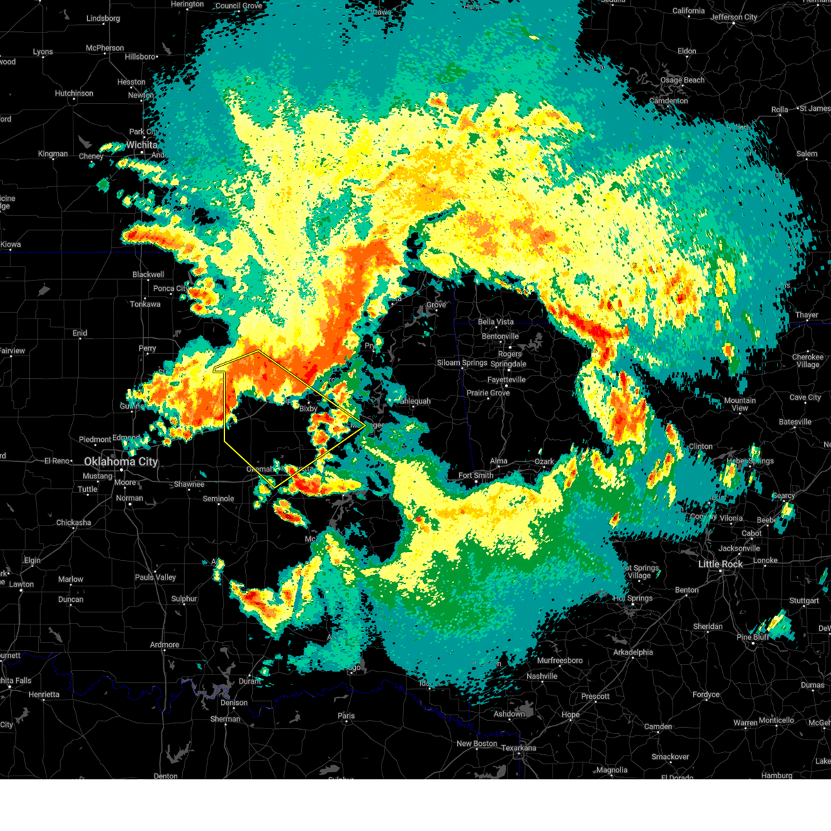 Svrtsa the national weather service in tulsa has issued a * severe thunderstorm warning for, south central osage county in northeastern oklahoma, creek county in northeastern oklahoma, southwestern wagoner county in northeastern oklahoma, okmulgee county in northeastern oklahoma, northwestern muskogee county in east central oklahoma, southeastern pawnee county in northeastern oklahoma, southern tulsa county in northeastern oklahoma, eastern okfuskee county in east central oklahoma, * until 700 am cdt. * at 558 am cdt, severe thunderstorms were located along a line extending from 4 miles northwest of broken arrow to 6 miles southwest of mannford to 2 miles south of shamrock, moving southeast at 45 mph (radar indicated). Hazards include 70 mph wind gusts and penny size hail. Expect considerable tree damage. damage is likely to mobile homes, roofs, and outbuildings. locations in or near the path include, beggs, sand springs, shamrock, sapulpa, jenks riverside airport, depew, mounds, clearview, schulter, stonebluff, hectorville, eram, haskell, leonard, morris, pharoah, keystone state park, okmulgee, oilton, okfuskee, this includes the following highways, interstate 40 in oklahoma between mile markers 221 and 236. Interstate 44 between mile markers 178 and 223. Svrtsa the national weather service in tulsa has issued a * severe thunderstorm warning for, south central osage county in northeastern oklahoma, creek county in northeastern oklahoma, southwestern wagoner county in northeastern oklahoma, okmulgee county in northeastern oklahoma, northwestern muskogee county in east central oklahoma, southeastern pawnee county in northeastern oklahoma, southern tulsa county in northeastern oklahoma, eastern okfuskee county in east central oklahoma, * until 700 am cdt. * at 558 am cdt, severe thunderstorms were located along a line extending from 4 miles northwest of broken arrow to 6 miles southwest of mannford to 2 miles south of shamrock, moving southeast at 45 mph (radar indicated). Hazards include 70 mph wind gusts and penny size hail. Expect considerable tree damage. damage is likely to mobile homes, roofs, and outbuildings. locations in or near the path include, beggs, sand springs, shamrock, sapulpa, jenks riverside airport, depew, mounds, clearview, schulter, stonebluff, hectorville, eram, haskell, leonard, morris, pharoah, keystone state park, okmulgee, oilton, okfuskee, this includes the following highways, interstate 40 in oklahoma between mile markers 221 and 236. Interstate 44 between mile markers 178 and 223.
|
| 5/19/2025 5:28 PM CDT |
 Svrtsa the national weather service in tulsa has issued a * severe thunderstorm warning for, southwestern wagoner county in northeastern oklahoma, eastern okmulgee county in northeastern oklahoma, northwestern muskogee county in east central oklahoma, * until 615 pm cdt. * at 528 pm cdt, a severe thunderstorm was located over morris, moving northeast at 45 mph (radar indicated). Hazards include 60 mph wind gusts and nickel size hail. Expect damage to roofs, siding, and trees. Locations in or near the path include, tullahassee, okmulgee, jamesville, bald hill, redbird, coweta, boynton, stonebluff, eram, haskell, morris, porter, taft, choska, grayson, hoffman,. Svrtsa the national weather service in tulsa has issued a * severe thunderstorm warning for, southwestern wagoner county in northeastern oklahoma, eastern okmulgee county in northeastern oklahoma, northwestern muskogee county in east central oklahoma, * until 615 pm cdt. * at 528 pm cdt, a severe thunderstorm was located over morris, moving northeast at 45 mph (radar indicated). Hazards include 60 mph wind gusts and nickel size hail. Expect damage to roofs, siding, and trees. Locations in or near the path include, tullahassee, okmulgee, jamesville, bald hill, redbird, coweta, boynton, stonebluff, eram, haskell, morris, porter, taft, choska, grayson, hoffman,.
|
| 5/19/2025 4:54 PM CDT |
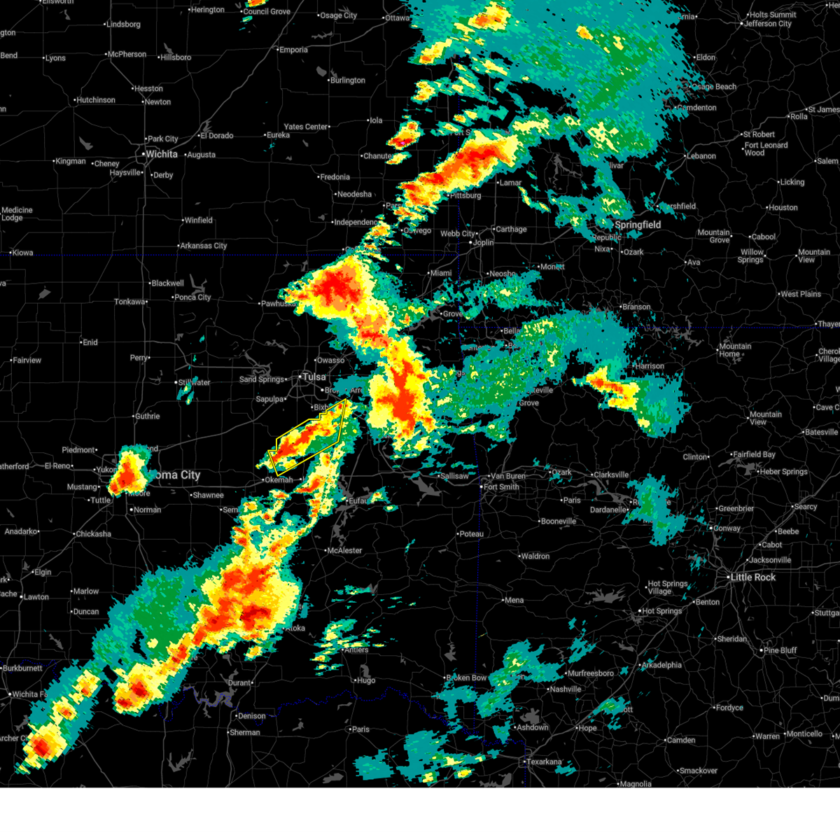 the severe thunderstorm warning has been cancelled and is no longer in effect the severe thunderstorm warning has been cancelled and is no longer in effect
|
| 5/19/2025 4:54 PM CDT |
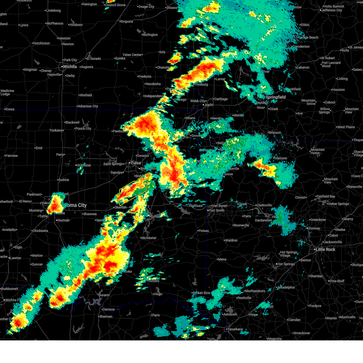 At 454 pm cdt, severe thunderstorms were located along a line extending from 2 miles northwest of haskell to okfuskee, moving northeast at 50 mph (radar indicated). Hazards include 60 mph wind gusts and quarter size hail. Hail damage to vehicles is expected. expect wind damage to roofs, siding, and trees. Locations in or near the path include, beggs, preston, okmulgee, stonebluff, okmulgee state park, hectorville, haskell, morris, bald hill, okfuskee, coweta,. At 454 pm cdt, severe thunderstorms were located along a line extending from 2 miles northwest of haskell to okfuskee, moving northeast at 50 mph (radar indicated). Hazards include 60 mph wind gusts and quarter size hail. Hail damage to vehicles is expected. expect wind damage to roofs, siding, and trees. Locations in or near the path include, beggs, preston, okmulgee, stonebluff, okmulgee state park, hectorville, haskell, morris, bald hill, okfuskee, coweta,.
|
| 5/19/2025 4:36 PM CDT |
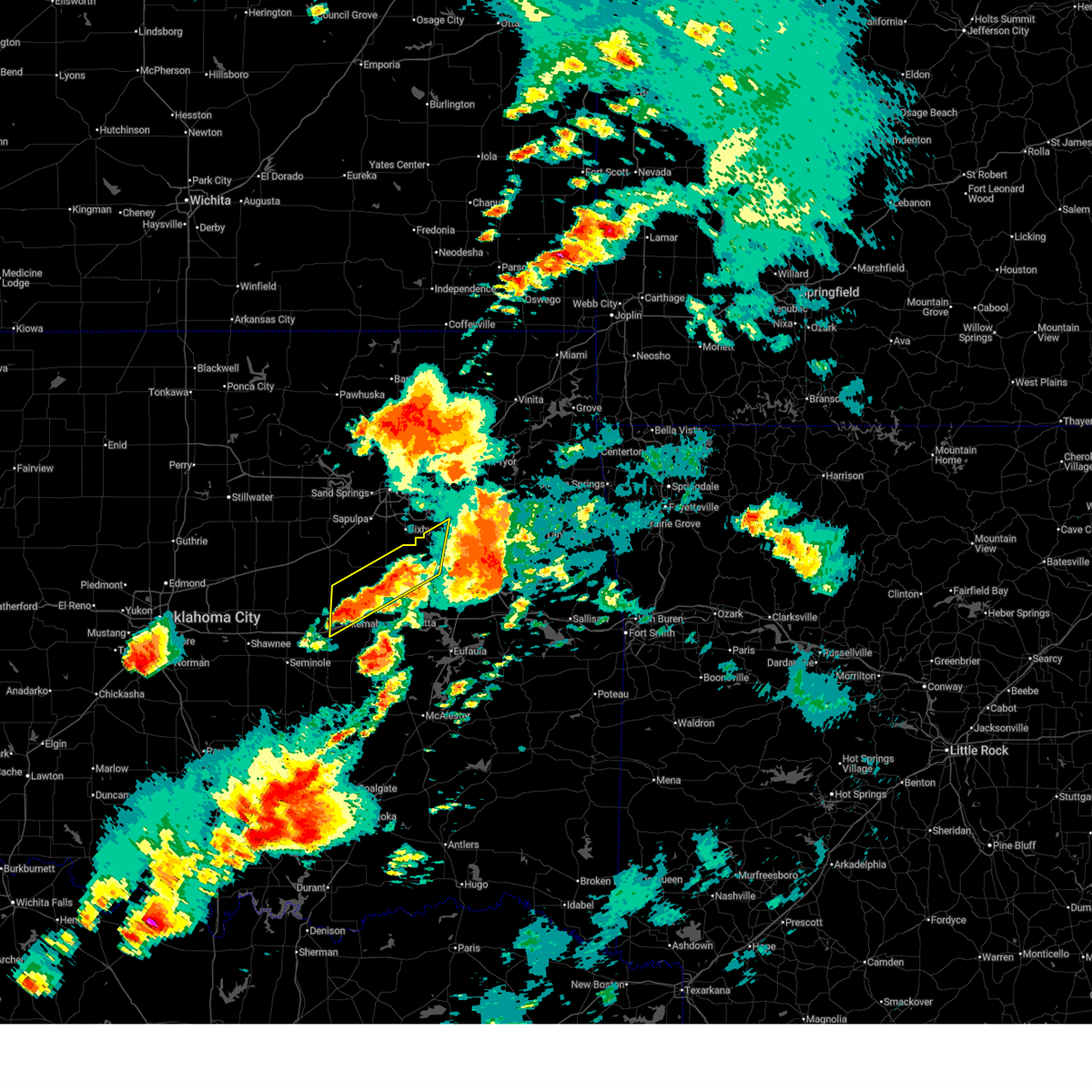 Svrtsa the national weather service in tulsa has issued a * severe thunderstorm warning for, south central creek county in northeastern oklahoma, southwestern wagoner county in northeastern oklahoma, northern okmulgee county in northeastern oklahoma, northwestern muskogee county in east central oklahoma, eastern okfuskee county in east central oklahoma, * until 515 pm cdt. * at 436 pm cdt, severe thunderstorms were located along a line extending from near bald hill to castle, moving northeast at 50 mph (radar indicated). Hazards include 60 mph wind gusts and quarter size hail. Hail damage to vehicles is expected. expect wind damage to roofs, siding, and trees. Locations in or near the path include, beggs, preston, okmulgee, okemah, bald hill, okfuskee, mason, stonebluff, okmulgee state park, hectorville, haskell, castle, morris, coweta, bearden, this includes interstate 40 in oklahoma between mile markers 215 and 222. Svrtsa the national weather service in tulsa has issued a * severe thunderstorm warning for, south central creek county in northeastern oklahoma, southwestern wagoner county in northeastern oklahoma, northern okmulgee county in northeastern oklahoma, northwestern muskogee county in east central oklahoma, eastern okfuskee county in east central oklahoma, * until 515 pm cdt. * at 436 pm cdt, severe thunderstorms were located along a line extending from near bald hill to castle, moving northeast at 50 mph (radar indicated). Hazards include 60 mph wind gusts and quarter size hail. Hail damage to vehicles is expected. expect wind damage to roofs, siding, and trees. Locations in or near the path include, beggs, preston, okmulgee, okemah, bald hill, okfuskee, mason, stonebluff, okmulgee state park, hectorville, haskell, castle, morris, coweta, bearden, this includes interstate 40 in oklahoma between mile markers 215 and 222.
|
| 5/19/2025 3:52 PM CDT |
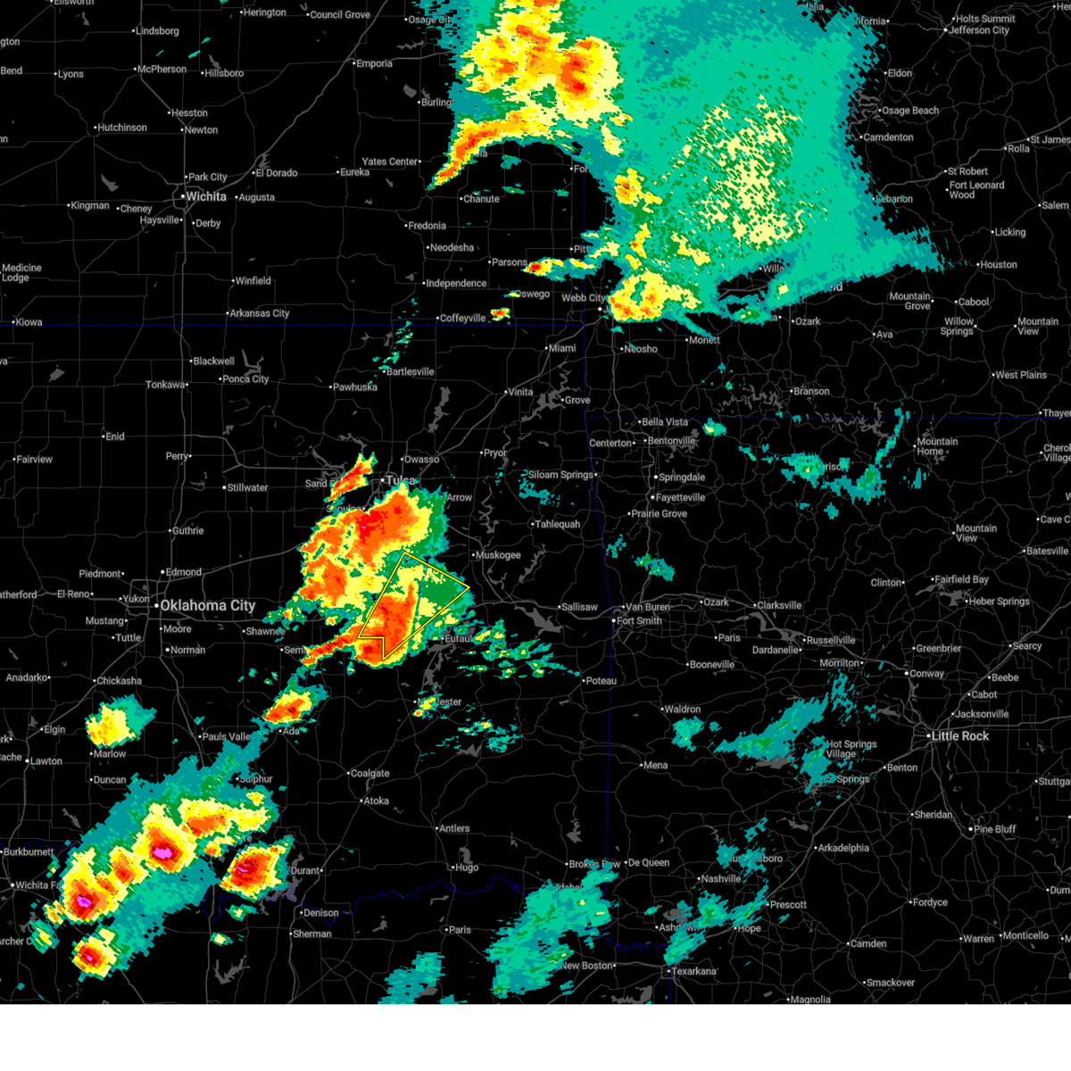 At 352 pm cdt, severe thunderstorms were located along a line extending from 2 miles north of grayson to 4 miles northwest of raiford to 6 miles south of dustin, moving northeast at 60 mph (radar indicated). Hazards include 60 mph wind gusts and quarter size hail. Hail damage to vehicles is expected. expect wind damage to roofs, siding, and trees. Locations in or near the path include, bryant, wainwright, hoffman, rentiesville, hitchita, dewar, oktaha, bald hill, vernon, henryetta, pierce, council hill, boynton, schulter, stidham, eram, morris, grayson, okmulgee, this includes interstate 40 in oklahoma between mile markers 234 and 261. At 352 pm cdt, severe thunderstorms were located along a line extending from 2 miles north of grayson to 4 miles northwest of raiford to 6 miles south of dustin, moving northeast at 60 mph (radar indicated). Hazards include 60 mph wind gusts and quarter size hail. Hail damage to vehicles is expected. expect wind damage to roofs, siding, and trees. Locations in or near the path include, bryant, wainwright, hoffman, rentiesville, hitchita, dewar, oktaha, bald hill, vernon, henryetta, pierce, council hill, boynton, schulter, stidham, eram, morris, grayson, okmulgee, this includes interstate 40 in oklahoma between mile markers 234 and 261.
|
| 5/19/2025 3:32 PM CDT |
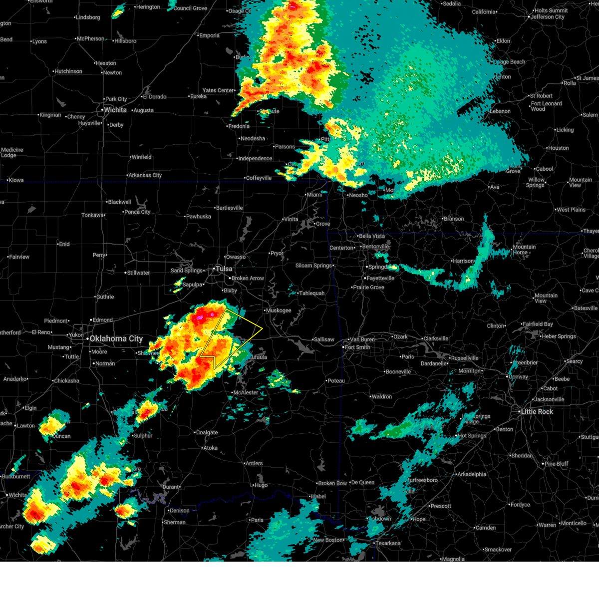 Svrtsa the national weather service in tulsa has issued a * severe thunderstorm warning for, northwestern mcintosh county in southeastern oklahoma, eastern okmulgee county in northeastern oklahoma, west central muskogee county in east central oklahoma, southeastern okfuskee county in east central oklahoma, * until 415 pm cdt. * at 332 pm cdt, a severe thunderstorm was located over dustin, moving northeast at 60 mph (radar indicated). Hazards include 60 mph wind gusts. Expect damage to roofs, siding, and trees. Locations in or near the path include, bryant, wainwright, hoffman, rentiesville, hitchita, dewar, oktaha, bald hill, vernon, henryetta, pierce, council hill, boynton, schulter, stidham, eram, morris, grayson, okmulgee, this includes interstate 40 in oklahoma between mile markers 234 and 261. Svrtsa the national weather service in tulsa has issued a * severe thunderstorm warning for, northwestern mcintosh county in southeastern oklahoma, eastern okmulgee county in northeastern oklahoma, west central muskogee county in east central oklahoma, southeastern okfuskee county in east central oklahoma, * until 415 pm cdt. * at 332 pm cdt, a severe thunderstorm was located over dustin, moving northeast at 60 mph (radar indicated). Hazards include 60 mph wind gusts. Expect damage to roofs, siding, and trees. Locations in or near the path include, bryant, wainwright, hoffman, rentiesville, hitchita, dewar, oktaha, bald hill, vernon, henryetta, pierce, council hill, boynton, schulter, stidham, eram, morris, grayson, okmulgee, this includes interstate 40 in oklahoma between mile markers 234 and 261.
|
| 5/19/2025 3:12 PM CDT |
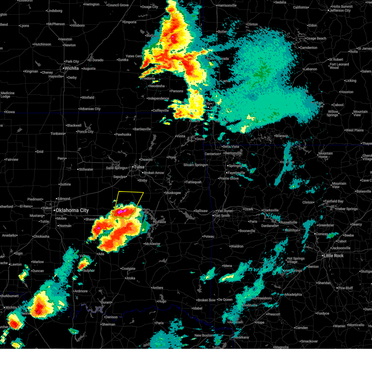 At 312 pm cdt, a severe thunderstorm was located 5 miles north of clearview, moving north at 55 mph (radar indicated). Hazards include two inch hail and 60 mph wind gusts. People and animals outdoors will be injured. expect hail damage to roofs, siding, windows, and vehicles. expect wind damage to roofs, siding, and trees. Locations in or near the path include, bryant, beggs, preston, okmulgee, weleetka, okemah, bald hill, okfuskee, henryetta, clearview, schulter, okmulgee state park, pharoah, morris, this includes interstate 40 in oklahoma between mile markers 217 and 237. At 312 pm cdt, a severe thunderstorm was located 5 miles north of clearview, moving north at 55 mph (radar indicated). Hazards include two inch hail and 60 mph wind gusts. People and animals outdoors will be injured. expect hail damage to roofs, siding, windows, and vehicles. expect wind damage to roofs, siding, and trees. Locations in or near the path include, bryant, beggs, preston, okmulgee, weleetka, okemah, bald hill, okfuskee, henryetta, clearview, schulter, okmulgee state park, pharoah, morris, this includes interstate 40 in oklahoma between mile markers 217 and 237.
|
| 5/19/2025 3:05 PM CDT |
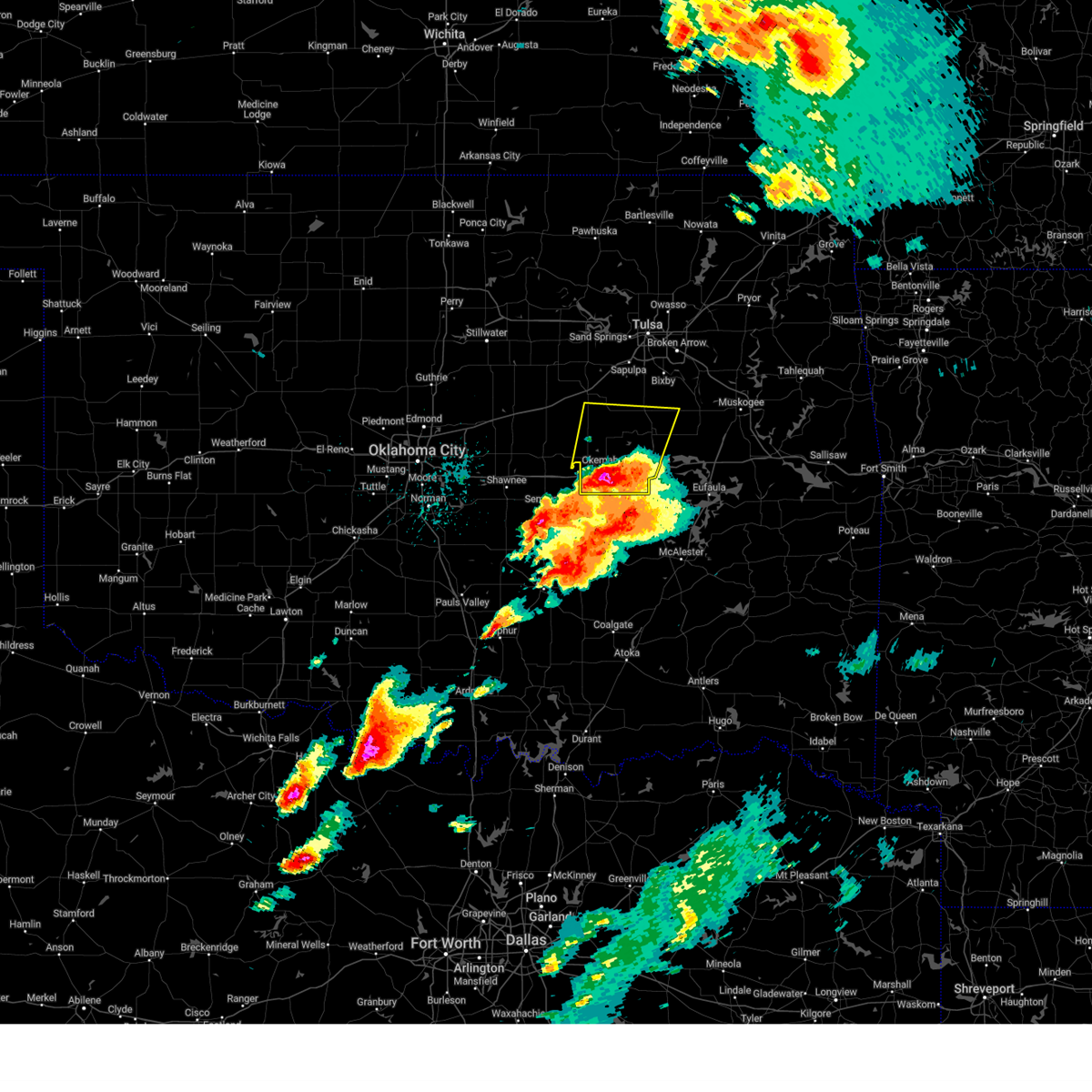 At 304 pm cdt, a severe thunderstorm was located 3 miles southwest of clearview, moving north at 50 mph (radar indicated). Hazards include two inch hail and 60 mph wind gusts. People and animals outdoors will be injured. expect hail damage to roofs, siding, windows, and vehicles. expect wind damage to roofs, siding, and trees. Locations in or near the path include, bryant, beggs, preston, okmulgee, boley, weleetka, okemah, dewar, bald hill, okfuskee, henryetta, clearview, mason, schulter, okmulgee state park, castle, bearden, morris, welty, pharoah, this includes interstate 40 in oklahoma between mile markers 212 and 241. At 304 pm cdt, a severe thunderstorm was located 3 miles southwest of clearview, moving north at 50 mph (radar indicated). Hazards include two inch hail and 60 mph wind gusts. People and animals outdoors will be injured. expect hail damage to roofs, siding, windows, and vehicles. expect wind damage to roofs, siding, and trees. Locations in or near the path include, bryant, beggs, preston, okmulgee, boley, weleetka, okemah, dewar, bald hill, okfuskee, henryetta, clearview, mason, schulter, okmulgee state park, castle, bearden, morris, welty, pharoah, this includes interstate 40 in oklahoma between mile markers 212 and 241.
|
| 5/19/2025 2:49 PM CDT |
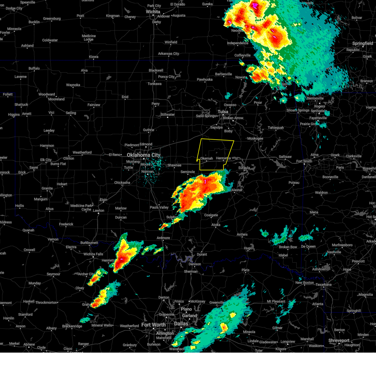 Svrtsa the national weather service in tulsa has issued a * severe thunderstorm warning for, south central creek county in northeastern oklahoma, okmulgee county in northeastern oklahoma, okfuskee county in east central oklahoma, * until 330 pm cdt. * at 249 pm cdt, a severe thunderstorm was located near yeager, moving north at 55 mph (radar indicated). Hazards include golf ball size hail and 60 mph wind gusts. People and animals outdoors will be injured. expect hail damage to roofs, siding, windows, and vehicles. expect wind damage to roofs, siding, and trees. Locations in or near the path include, bryant, beggs, preston, okmulgee, boley, weleetka, okemah, dewar, bald hill, okfuskee, henryetta, clearview, mason, schulter, okmulgee state park, castle, bearden, morris, welty, pharoah, this includes interstate 40 in oklahoma between mile markers 212 and 241. Svrtsa the national weather service in tulsa has issued a * severe thunderstorm warning for, south central creek county in northeastern oklahoma, okmulgee county in northeastern oklahoma, okfuskee county in east central oklahoma, * until 330 pm cdt. * at 249 pm cdt, a severe thunderstorm was located near yeager, moving north at 55 mph (radar indicated). Hazards include golf ball size hail and 60 mph wind gusts. People and animals outdoors will be injured. expect hail damage to roofs, siding, windows, and vehicles. expect wind damage to roofs, siding, and trees. Locations in or near the path include, bryant, beggs, preston, okmulgee, boley, weleetka, okemah, dewar, bald hill, okfuskee, henryetta, clearview, mason, schulter, okmulgee state park, castle, bearden, morris, welty, pharoah, this includes interstate 40 in oklahoma between mile markers 212 and 241.
|
| 5/19/2025 1:00 PM CDT |
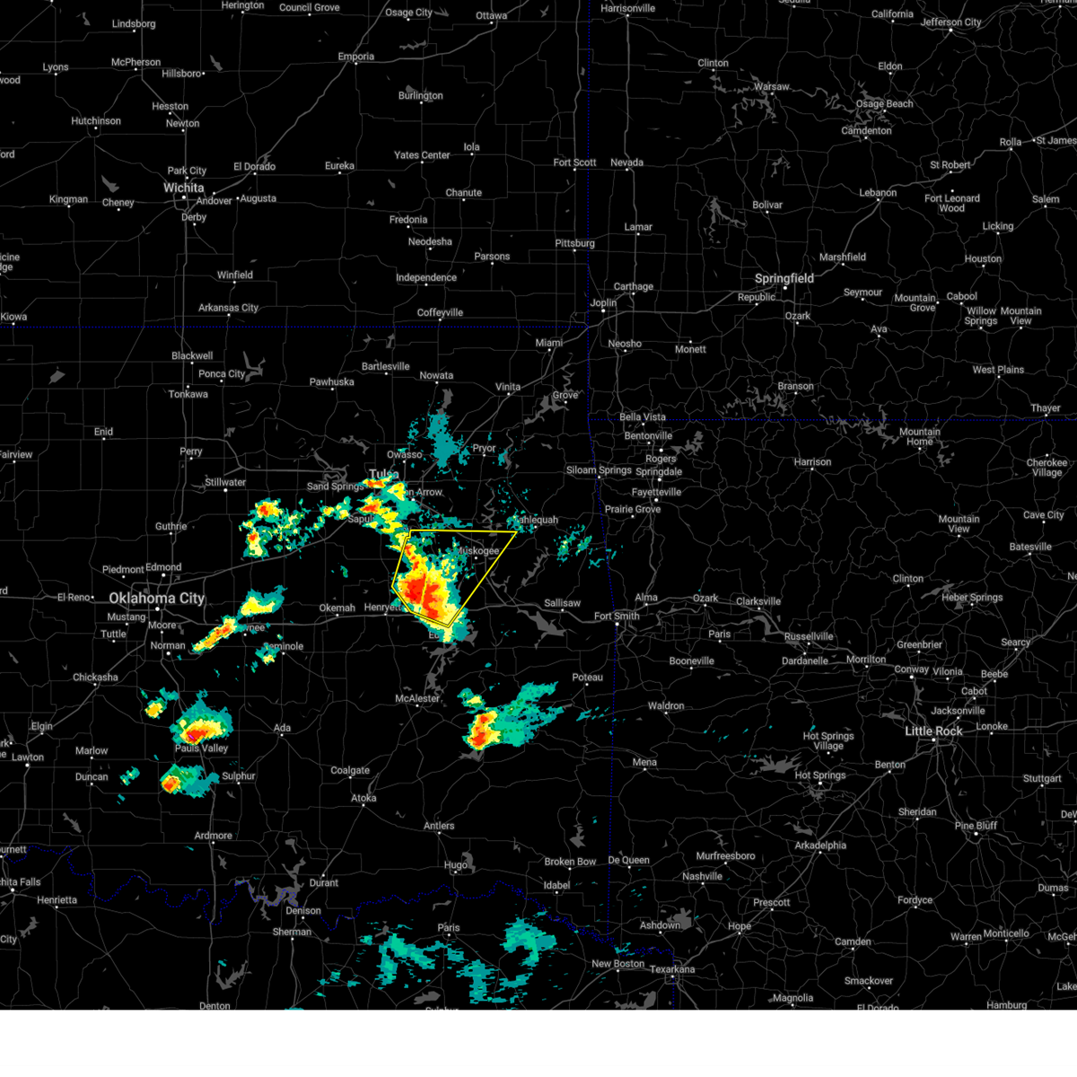 At 100 pm cdt, a severe thunderstorm was located near council hill, moving northeast at 60 mph (radar indicated). Hazards include 60 mph wind gusts and half dollar size hail. Hail damage to vehicles is expected. expect wind damage to roofs, siding, and trees. Locations in or near the path include, oktaha, summit, fort gibson, muskogee, okay, pierce, stonebluff, eram, checotah, haskell, lake eufaula state park, morris, porter, wainwright, tullahassee, hoffman, rentiesville, jamesville, hitchita, bald hill, this includes interstate 40 in oklahoma between mile markers 250 and 266. At 100 pm cdt, a severe thunderstorm was located near council hill, moving northeast at 60 mph (radar indicated). Hazards include 60 mph wind gusts and half dollar size hail. Hail damage to vehicles is expected. expect wind damage to roofs, siding, and trees. Locations in or near the path include, oktaha, summit, fort gibson, muskogee, okay, pierce, stonebluff, eram, checotah, haskell, lake eufaula state park, morris, porter, wainwright, tullahassee, hoffman, rentiesville, jamesville, hitchita, bald hill, this includes interstate 40 in oklahoma between mile markers 250 and 266.
|
| 5/19/2025 12:46 PM CDT |
 the severe thunderstorm warning has been cancelled and is no longer in effect the severe thunderstorm warning has been cancelled and is no longer in effect
|
| 5/19/2025 12:46 PM CDT |
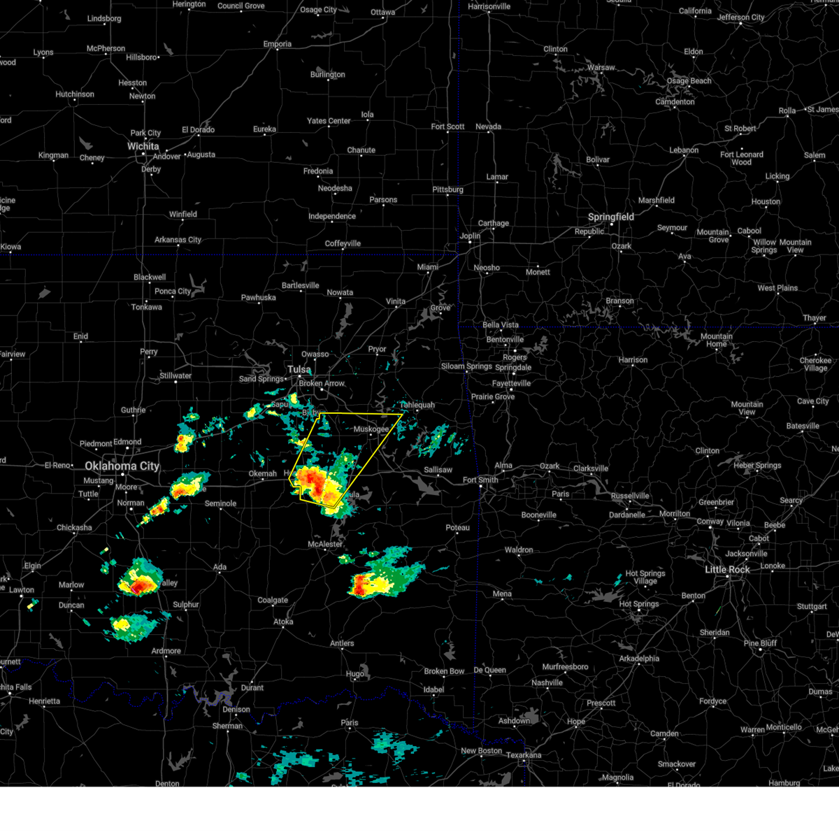 At 1246 pm cdt, a severe thunderstorm was located 4 miles southeast of hoffman, moving northeast at 60 mph (radar indicated). Hazards include 60 mph wind gusts and half dollar size hail. Hail damage to vehicles is expected. expect wind damage to roofs, siding, and trees. Locations in or near the path include, raiford, dewar, oktaha, summit, vivian, fort gibson, muskogee, okay, pierce, schulter, stonebluff, eram, checotah, haskell, lake eufaula state park, morris, porter, grayson, wainwright, tullahassee, this includes interstate 40 in oklahoma between mile markers 233 and 266. At 1246 pm cdt, a severe thunderstorm was located 4 miles southeast of hoffman, moving northeast at 60 mph (radar indicated). Hazards include 60 mph wind gusts and half dollar size hail. Hail damage to vehicles is expected. expect wind damage to roofs, siding, and trees. Locations in or near the path include, raiford, dewar, oktaha, summit, vivian, fort gibson, muskogee, okay, pierce, schulter, stonebluff, eram, checotah, haskell, lake eufaula state park, morris, porter, grayson, wainwright, tullahassee, this includes interstate 40 in oklahoma between mile markers 233 and 266.
|
| 5/19/2025 12:34 PM CDT |
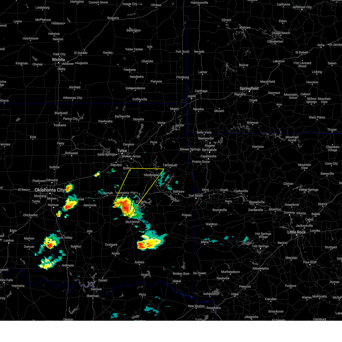 Svrtsa the national weather service in tulsa has issued a * severe thunderstorm warning for, mcintosh county in southeastern oklahoma, southern wagoner county in northeastern oklahoma, west central cherokee county in east central oklahoma, northwestern pittsburg county in southeastern oklahoma, central okmulgee county in northeastern oklahoma, northwestern muskogee county in east central oklahoma, southeastern okfuskee county in east central oklahoma, * until 130 pm cdt. * at 1233 pm cdt, a severe thunderstorm was located 5 miles east of dustin, moving northeast at 65 mph (radar indicated). Hazards include 60 mph wind gusts and quarter size hail. Hail damage to vehicles is expected. expect wind damage to roofs, siding, and trees. Locations in or near the path include, raiford, weleetka, dewar, oktaha, summit, vivian, hanna, fort gibson, muskogee, okay, pierce, schulter, stonebluff, eram, checotah, haskell, lake eufaula state park, morris, porter, grayson, this includes interstate 40 in oklahoma between mile markers 232 and 266. Svrtsa the national weather service in tulsa has issued a * severe thunderstorm warning for, mcintosh county in southeastern oklahoma, southern wagoner county in northeastern oklahoma, west central cherokee county in east central oklahoma, northwestern pittsburg county in southeastern oklahoma, central okmulgee county in northeastern oklahoma, northwestern muskogee county in east central oklahoma, southeastern okfuskee county in east central oklahoma, * until 130 pm cdt. * at 1233 pm cdt, a severe thunderstorm was located 5 miles east of dustin, moving northeast at 65 mph (radar indicated). Hazards include 60 mph wind gusts and quarter size hail. Hail damage to vehicles is expected. expect wind damage to roofs, siding, and trees. Locations in or near the path include, raiford, weleetka, dewar, oktaha, summit, vivian, hanna, fort gibson, muskogee, okay, pierce, schulter, stonebluff, eram, checotah, haskell, lake eufaula state park, morris, porter, grayson, this includes interstate 40 in oklahoma between mile markers 232 and 266.
|
| 5/18/2025 2:59 AM CDT |
 the severe thunderstorm warning has been cancelled and is no longer in effect the severe thunderstorm warning has been cancelled and is no longer in effect
|
| 5/18/2025 2:59 AM CDT |
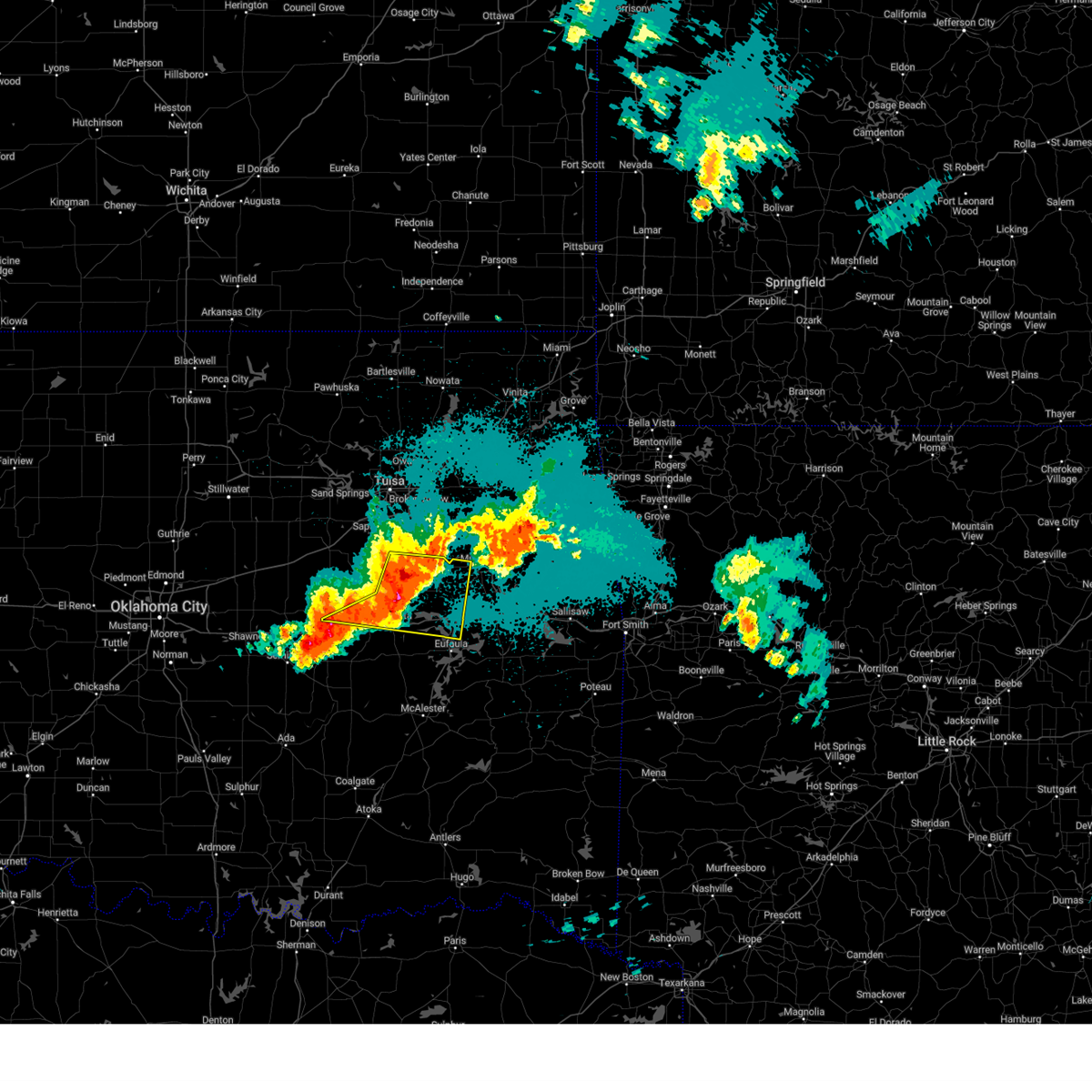 At 259 am cdt, a severe thunderstorm was located 5 miles northeast of hoffman, moving east at 55 mph (radar indicated). Hazards include 60 mph wind gusts and quarter size hail. Hail damage to vehicles is expected. expect wind damage to roofs, siding, and trees. Locations in or near the path include, preston, dewar, pierce, schulter, eram, checotah, lake eufaula state park, morris, pharoah, grayson, wainwright, hoffman, okmulgee, rentiesville, jamesville, hitchita, bald hill, henryetta, council hill, boynton, this includes interstate 40 in oklahoma between mile markers 224 and 265. At 259 am cdt, a severe thunderstorm was located 5 miles northeast of hoffman, moving east at 55 mph (radar indicated). Hazards include 60 mph wind gusts and quarter size hail. Hail damage to vehicles is expected. expect wind damage to roofs, siding, and trees. Locations in or near the path include, preston, dewar, pierce, schulter, eram, checotah, lake eufaula state park, morris, pharoah, grayson, wainwright, hoffman, okmulgee, rentiesville, jamesville, hitchita, bald hill, henryetta, council hill, boynton, this includes interstate 40 in oklahoma between mile markers 224 and 265.
|
| 5/18/2025 2:55 AM CDT | Storm damage reported in okmulgee county OK, 2.9 miles NE of Morris, OK |
| 5/18/2025 2:39 AM CDT |
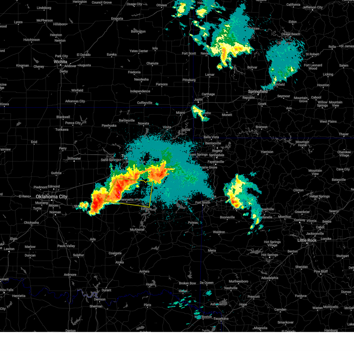 Svrtsa the national weather service in tulsa has issued a * severe thunderstorm warning for, south central creek county in northeastern oklahoma, northwestern mcintosh county in southeastern oklahoma, okmulgee county in northeastern oklahoma, northwestern muskogee county in east central oklahoma, central okfuskee county in east central oklahoma, * until 330 am cdt. * at 239 am cdt, a severe thunderstorm was located 3 miles southwest of okmulgee state park, moving east at 50 mph (radar indicated). Hazards include 60 mph wind gusts and quarter size hail. Hail damage to vehicles is expected. expect wind damage to roofs, siding, and trees. Locations in or near the path include, beggs, preston, dewar, pierce, schulter, eram, checotah, lake eufaula state park, morris, pharoah, grayson, wainwright, hoffman, okmulgee, rentiesville, jamesville, hitchita, bald hill, okfuskee, henryetta, this includes interstate 40 in oklahoma between mile markers 224 and 265. Svrtsa the national weather service in tulsa has issued a * severe thunderstorm warning for, south central creek county in northeastern oklahoma, northwestern mcintosh county in southeastern oklahoma, okmulgee county in northeastern oklahoma, northwestern muskogee county in east central oklahoma, central okfuskee county in east central oklahoma, * until 330 am cdt. * at 239 am cdt, a severe thunderstorm was located 3 miles southwest of okmulgee state park, moving east at 50 mph (radar indicated). Hazards include 60 mph wind gusts and quarter size hail. Hail damage to vehicles is expected. expect wind damage to roofs, siding, and trees. Locations in or near the path include, beggs, preston, dewar, pierce, schulter, eram, checotah, lake eufaula state park, morris, pharoah, grayson, wainwright, hoffman, okmulgee, rentiesville, jamesville, hitchita, bald hill, okfuskee, henryetta, this includes interstate 40 in oklahoma between mile markers 224 and 265.
|
| 5/2/2025 4:53 AM CDT |
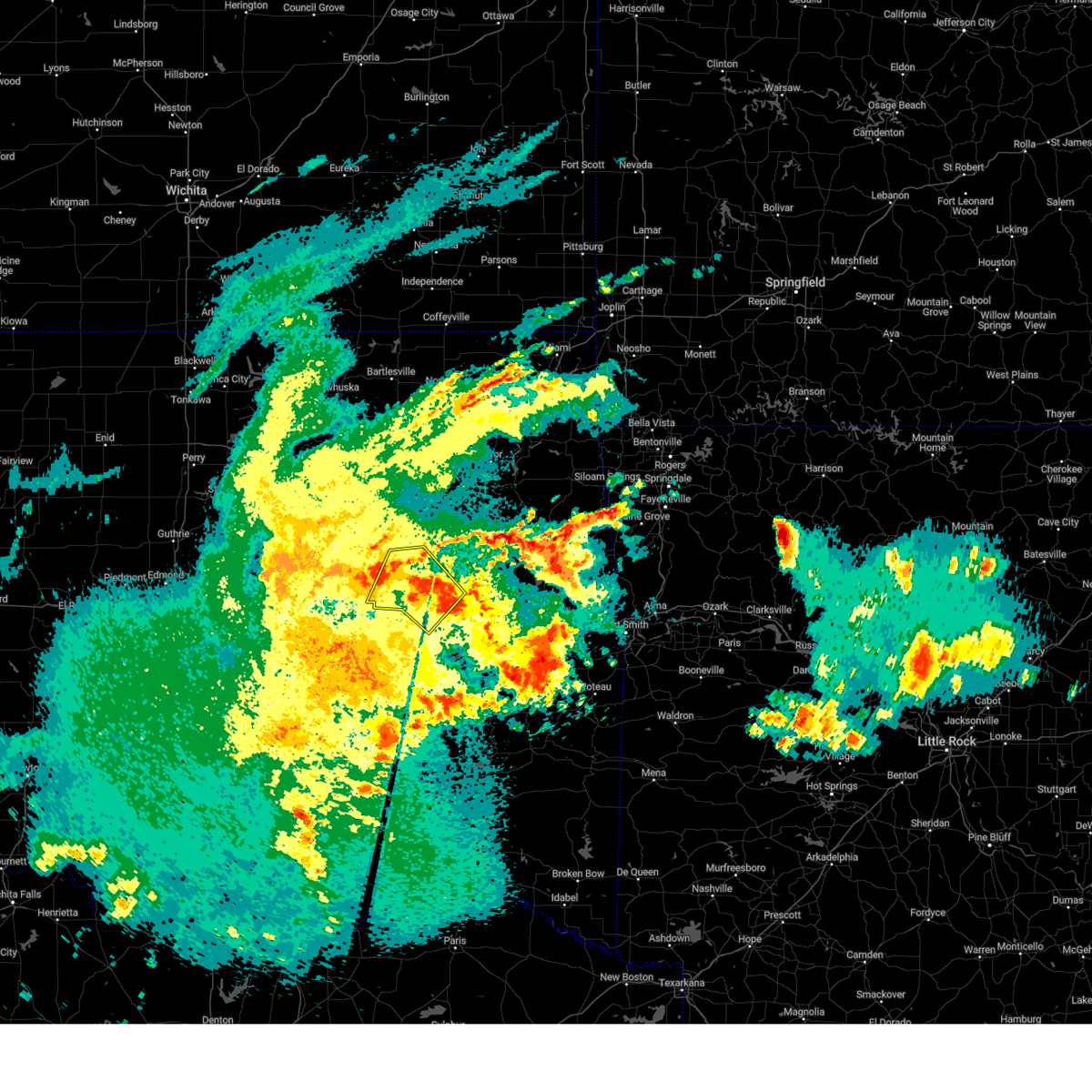 The storms which prompted the warning have weakened below severe limits, and no longer pose an immediate threat to life or property. therefore, the warning will be allowed to expire. however, gusty winds are still possible with these thunderstorms. a severe thunderstorm watch remains in effect until 700 am cdt for southeastern, northeastern and east central oklahoma. The storms which prompted the warning have weakened below severe limits, and no longer pose an immediate threat to life or property. therefore, the warning will be allowed to expire. however, gusty winds are still possible with these thunderstorms. a severe thunderstorm watch remains in effect until 700 am cdt for southeastern, northeastern and east central oklahoma.
|
| 5/2/2025 4:43 AM CDT |
 At 443 am cdt, severe thunderstorms were located along a line extending from near okmulgee state park to 5 miles east of morris to 3 miles northwest of checotah, moving northeast at 45 mph (radar indicated). Hazards include 60 mph wind gusts and penny size hail. Expect damage to roofs, siding, and trees. Locations in or near the path include, wainwright, preston, hoffman, okmulgee, hitchita, bald hill, pierce, council hill, boynton, schulter, okmulgee state park, eram, morris, grayson, this includes interstate 40 in oklahoma between mile markers 248 and 256. At 443 am cdt, severe thunderstorms were located along a line extending from near okmulgee state park to 5 miles east of morris to 3 miles northwest of checotah, moving northeast at 45 mph (radar indicated). Hazards include 60 mph wind gusts and penny size hail. Expect damage to roofs, siding, and trees. Locations in or near the path include, wainwright, preston, hoffman, okmulgee, hitchita, bald hill, pierce, council hill, boynton, schulter, okmulgee state park, eram, morris, grayson, this includes interstate 40 in oklahoma between mile markers 248 and 256.
|
| 5/2/2025 4:43 AM CDT |
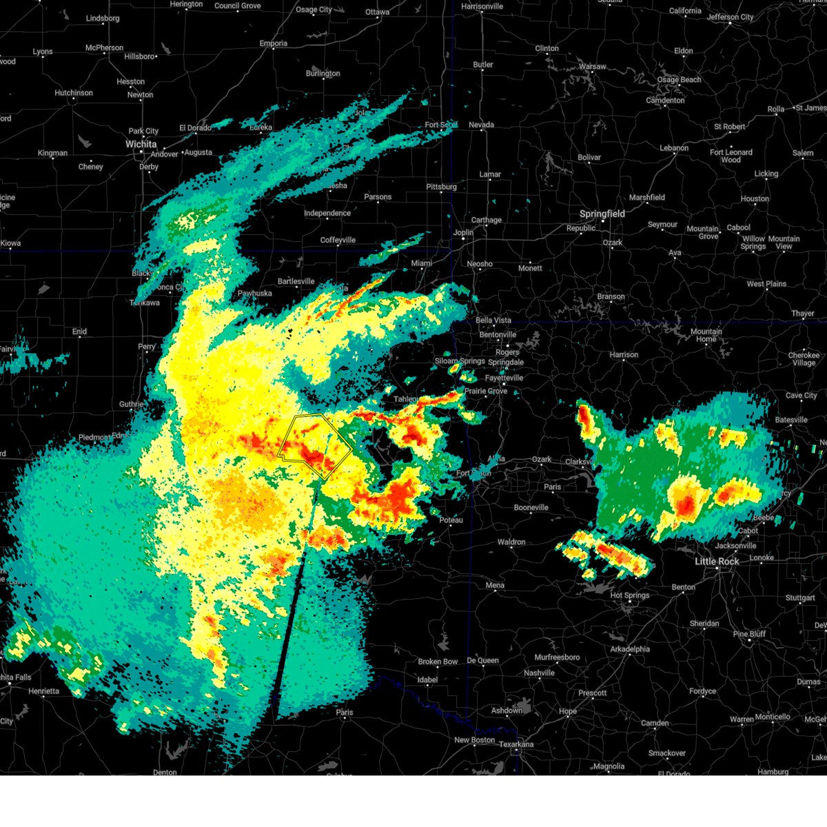 the severe thunderstorm warning has been cancelled and is no longer in effect the severe thunderstorm warning has been cancelled and is no longer in effect
|
| 5/2/2025 4:28 AM CDT |
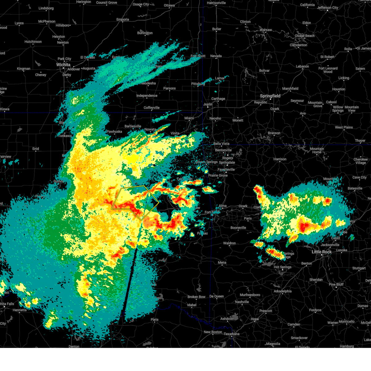 Svrtsa the national weather service in tulsa has issued a * severe thunderstorm warning for, south central creek county in northeastern oklahoma, northwestern mcintosh county in southeastern oklahoma, okmulgee county in northeastern oklahoma, west central muskogee county in east central oklahoma, northeastern okfuskee county in east central oklahoma, * until 500 am cdt. * at 428 am cdt, severe thunderstorms were located along a line extending from 5 miles southeast of welty to near okmulgee to 5 miles west of stidham, moving northeast at 30 mph (radar indicated). Hazards include 60 mph wind gusts. Expect damage to roofs, siding, and trees. Locations in or near the path include, wainwright, beggs, preston, hoffman, okmulgee, hitchita, dewar, oktaha, bald hill, okfuskee, henryetta, pierce, council hill, boynton, schulter, okmulgee state park, eram, morris, grayson, this includes interstate 40 in oklahoma between mile markers 238 and 258. Svrtsa the national weather service in tulsa has issued a * severe thunderstorm warning for, south central creek county in northeastern oklahoma, northwestern mcintosh county in southeastern oklahoma, okmulgee county in northeastern oklahoma, west central muskogee county in east central oklahoma, northeastern okfuskee county in east central oklahoma, * until 500 am cdt. * at 428 am cdt, severe thunderstorms were located along a line extending from 5 miles southeast of welty to near okmulgee to 5 miles west of stidham, moving northeast at 30 mph (radar indicated). Hazards include 60 mph wind gusts. Expect damage to roofs, siding, and trees. Locations in or near the path include, wainwright, beggs, preston, hoffman, okmulgee, hitchita, dewar, oktaha, bald hill, okfuskee, henryetta, pierce, council hill, boynton, schulter, okmulgee state park, eram, morris, grayson, this includes interstate 40 in oklahoma between mile markers 238 and 258.
|
| 4/30/2025 11:49 AM CDT |
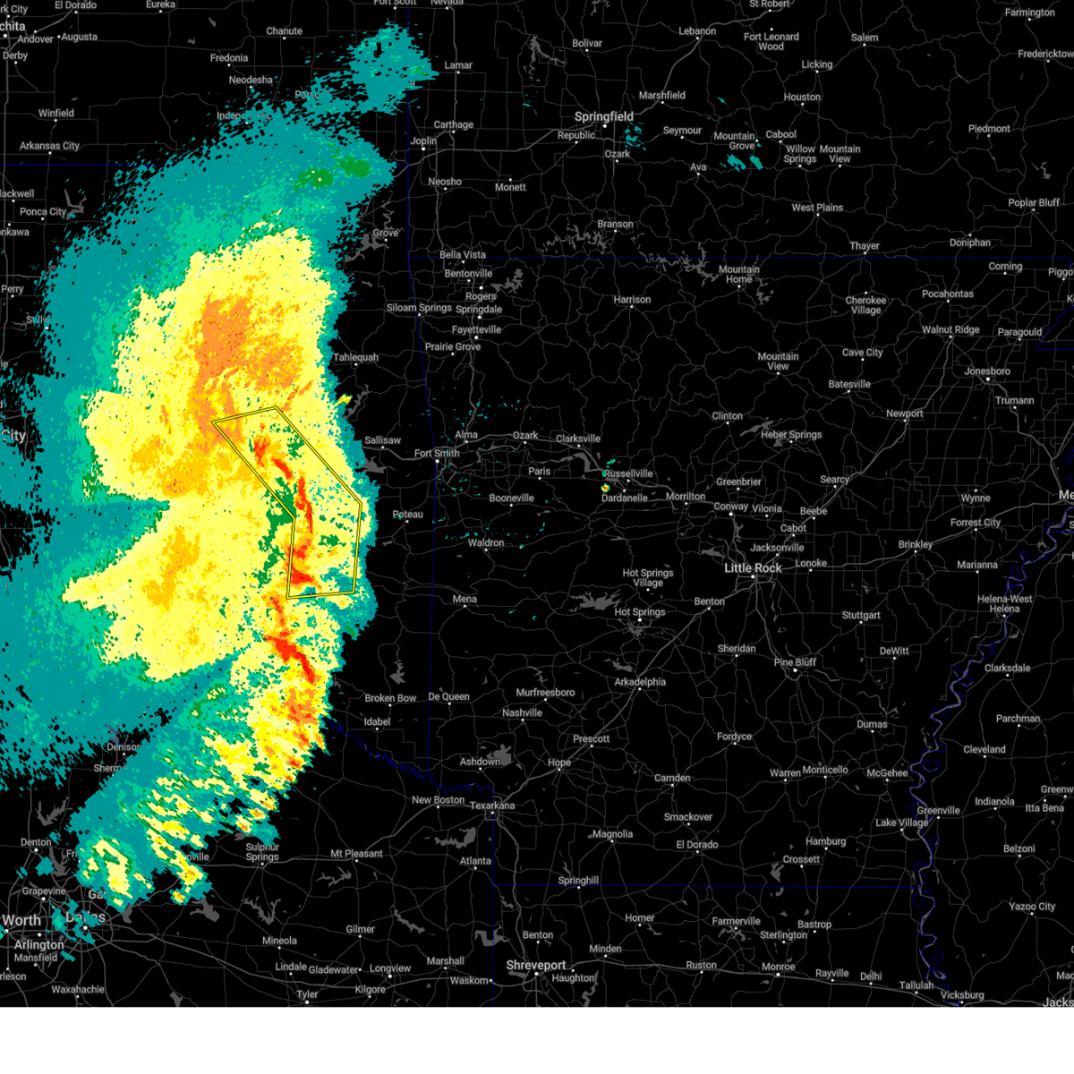 At 1149 am cdt, severe thunderstorms were located along a line extending from 5 miles north of lake eufaula state park to 2 miles southwest of kinta to 3 miles northwest of tuskahoma, moving east at 30 mph (radar indicated). Hazards include 60 mph wind gusts. Expect damage to roofs, siding, and trees. Locations in or near the path include, panola, whitefield, mccurtain, oktaha, kinta, mc curtain, porum, warner, pierce, stigler, checotah, eram, lake eufaula state park, morris, talihina, lequire, wainwright, red oak, sardis, damon, this includes interstate 40 in oklahoma between mile markers 250 and 277. At 1149 am cdt, severe thunderstorms were located along a line extending from 5 miles north of lake eufaula state park to 2 miles southwest of kinta to 3 miles northwest of tuskahoma, moving east at 30 mph (radar indicated). Hazards include 60 mph wind gusts. Expect damage to roofs, siding, and trees. Locations in or near the path include, panola, whitefield, mccurtain, oktaha, kinta, mc curtain, porum, warner, pierce, stigler, checotah, eram, lake eufaula state park, morris, talihina, lequire, wainwright, red oak, sardis, damon, this includes interstate 40 in oklahoma between mile markers 250 and 277.
|
| 4/30/2025 11:30 AM CDT |
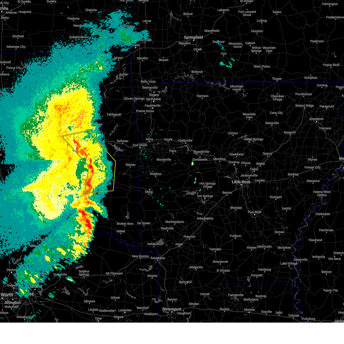 Svrtsa the national weather service in tulsa has issued a * severe thunderstorm warning for, northeastern pushmataha county in southeastern oklahoma, haskell county in southeastern oklahoma, mcintosh county in southeastern oklahoma, latimer county in southeastern oklahoma, west central le flore county in southeastern oklahoma, eastern pittsburg county in southeastern oklahoma, southeastern okmulgee county in northeastern oklahoma, central muskogee county in east central oklahoma, * until 1215 pm cdt. * at 1130 am cdt, severe thunderstorms were located along a line extending from 4 miles southeast of hoffman to 4 miles southwest of quinton to 6 miles northwest of clayton, moving east at 30 mph (radar indicated). Hazards include 60 mph wind gusts. Expect damage to roofs, siding, and trees. Locations in or near the path include, gowen, higgins, panola, whitefield, mccurtain, oktaha, vivian, kinta, mc curtain, porum, warner, pierce, schulter, featherston, stigler, kiamichi, checotah, eram, lake eufaula state park, morris, this includes interstate 40 in oklahoma between mile markers 243 and 277. Svrtsa the national weather service in tulsa has issued a * severe thunderstorm warning for, northeastern pushmataha county in southeastern oklahoma, haskell county in southeastern oklahoma, mcintosh county in southeastern oklahoma, latimer county in southeastern oklahoma, west central le flore county in southeastern oklahoma, eastern pittsburg county in southeastern oklahoma, southeastern okmulgee county in northeastern oklahoma, central muskogee county in east central oklahoma, * until 1215 pm cdt. * at 1130 am cdt, severe thunderstorms were located along a line extending from 4 miles southeast of hoffman to 4 miles southwest of quinton to 6 miles northwest of clayton, moving east at 30 mph (radar indicated). Hazards include 60 mph wind gusts. Expect damage to roofs, siding, and trees. Locations in or near the path include, gowen, higgins, panola, whitefield, mccurtain, oktaha, vivian, kinta, mc curtain, porum, warner, pierce, schulter, featherston, stigler, kiamichi, checotah, eram, lake eufaula state park, morris, this includes interstate 40 in oklahoma between mile markers 243 and 277.
|
| 4/29/2025 1:04 AM CDT |
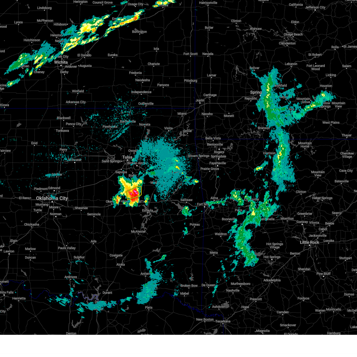 At 103 am cdt, a severe thunderstorm was located 4 miles southeast of bald hill, moving northeast at 45 mph (radar indicated). Hazards include 60 mph wind gusts and half dollar size hail. Hail damage to vehicles is expected. expect wind damage to roofs, siding, and trees. Locations in or near the path include, eram, morris, schulter, okmulgee,. At 103 am cdt, a severe thunderstorm was located 4 miles southeast of bald hill, moving northeast at 45 mph (radar indicated). Hazards include 60 mph wind gusts and half dollar size hail. Hail damage to vehicles is expected. expect wind damage to roofs, siding, and trees. Locations in or near the path include, eram, morris, schulter, okmulgee,.
|
| 4/29/2025 1:00 AM CDT |
 Svrtsa the national weather service in tulsa has issued a * severe thunderstorm warning for, northern mcintosh county in southeastern oklahoma, southeastern okmulgee county in northeastern oklahoma, northwestern muskogee county in east central oklahoma, * until 145 am cdt. * at 100 am cdt, a severe thunderstorm was located over grayson, moving east at 50 mph (radar indicated). Hazards include 60 mph wind gusts and half dollar size hail. Hail damage to vehicles is expected. expect wind damage to roofs, siding, and trees. Locations in or near the path include, wainwright, hoffman, okmulgee, rentiesville, hitchita, dewar, oktaha, summit, pierce, council hill, boynton, schulter, eram, checotah, morris, grayson, henryetta, muskogee, this includes interstate 40 in oklahoma between mile markers 238 and 273. Svrtsa the national weather service in tulsa has issued a * severe thunderstorm warning for, northern mcintosh county in southeastern oklahoma, southeastern okmulgee county in northeastern oklahoma, northwestern muskogee county in east central oklahoma, * until 145 am cdt. * at 100 am cdt, a severe thunderstorm was located over grayson, moving east at 50 mph (radar indicated). Hazards include 60 mph wind gusts and half dollar size hail. Hail damage to vehicles is expected. expect wind damage to roofs, siding, and trees. Locations in or near the path include, wainwright, hoffman, okmulgee, rentiesville, hitchita, dewar, oktaha, summit, pierce, council hill, boynton, schulter, eram, checotah, morris, grayson, henryetta, muskogee, this includes interstate 40 in oklahoma between mile markers 238 and 273.
|
| 4/29/2025 12:55 AM CDT |
 the severe thunderstorm warning has been cancelled and is no longer in effect the severe thunderstorm warning has been cancelled and is no longer in effect
|
| 4/29/2025 12:55 AM CDT |
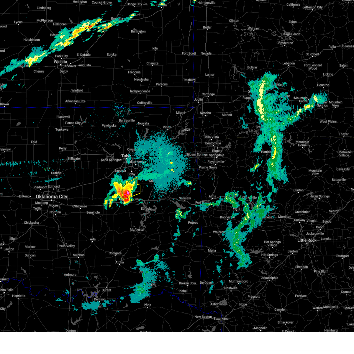 At 1254 am cdt, a severe thunderstorm was located 3 miles northeast of okmulgee, moving northeast at 45 mph (radar indicated). Hazards include 60 mph wind gusts and half dollar size hail. Hail damage to vehicles is expected. expect wind damage to roofs, siding, and trees. Locations in or near the path include, preston, schulter, okmulgee, okmulgee state park, eram, morris, bald hill,. At 1254 am cdt, a severe thunderstorm was located 3 miles northeast of okmulgee, moving northeast at 45 mph (radar indicated). Hazards include 60 mph wind gusts and half dollar size hail. Hail damage to vehicles is expected. expect wind damage to roofs, siding, and trees. Locations in or near the path include, preston, schulter, okmulgee, okmulgee state park, eram, morris, bald hill,.
|
| 4/29/2025 12:46 AM CDT |
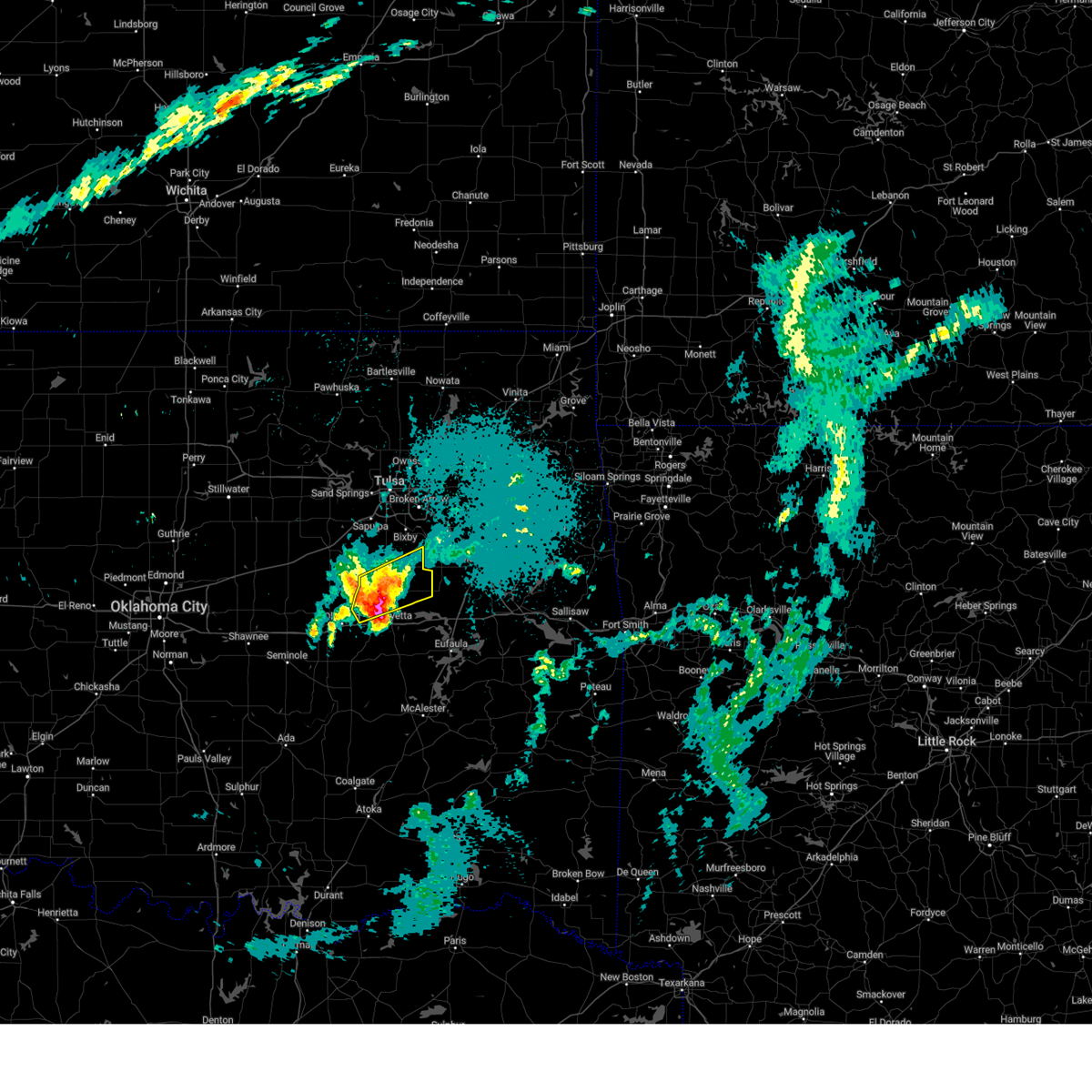 At 1245 am cdt, a severe thunderstorm was located near okmulgee state park, moving northeast at 45 mph (radar indicated). Hazards include golf ball size hail and 60 mph wind gusts. People and animals outdoors will be injured. expect hail damage to roofs, siding, windows, and vehicles. expect wind damage to roofs, siding, and trees. Locations in or near the path include, preston, schulter, okmulgee, okmulgee state park, eram, morris, bald hill,. At 1245 am cdt, a severe thunderstorm was located near okmulgee state park, moving northeast at 45 mph (radar indicated). Hazards include golf ball size hail and 60 mph wind gusts. People and animals outdoors will be injured. expect hail damage to roofs, siding, windows, and vehicles. expect wind damage to roofs, siding, and trees. Locations in or near the path include, preston, schulter, okmulgee, okmulgee state park, eram, morris, bald hill,.
|
| 4/29/2025 12:33 AM CDT |
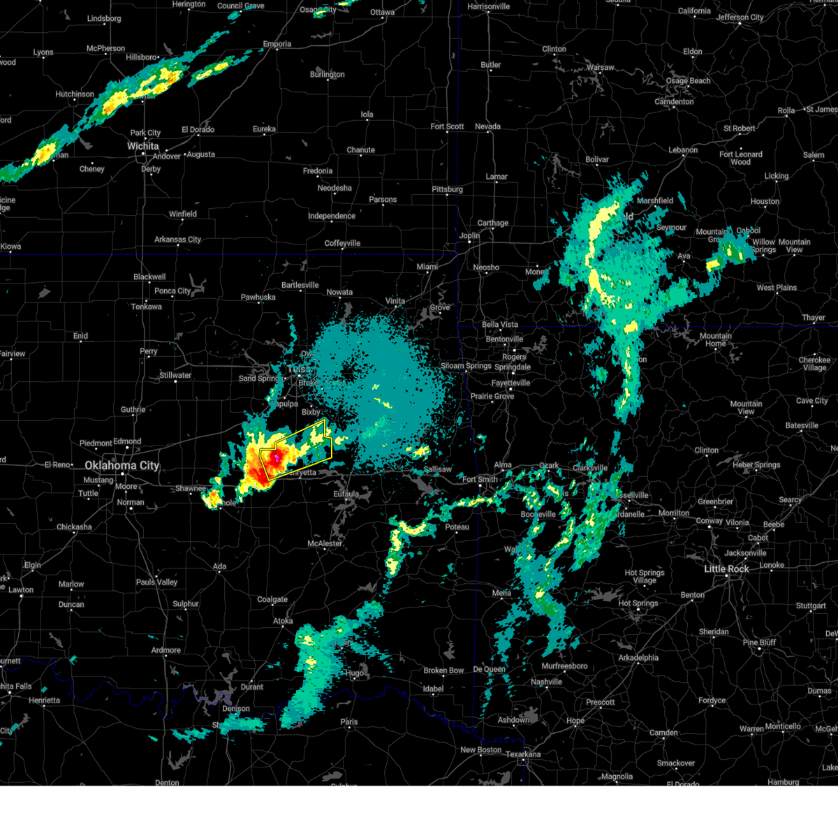 At 1233 am cdt, a severe thunderstorm was located 3 miles southeast of okfuskee, moving northeast at 45 mph (radar indicated). Hazards include golf ball size hail and 60 mph wind gusts. People and animals outdoors will be injured. expect hail damage to roofs, siding, windows, and vehicles. expect wind damage to roofs, siding, and trees. Locations in or near the path include, preston, schulter, okmulgee, okmulgee state park, eram, morris, bald hill, okfuskee, this includes interstate 40 in oklahoma between mile markers 223 and 224. At 1233 am cdt, a severe thunderstorm was located 3 miles southeast of okfuskee, moving northeast at 45 mph (radar indicated). Hazards include golf ball size hail and 60 mph wind gusts. People and animals outdoors will be injured. expect hail damage to roofs, siding, windows, and vehicles. expect wind damage to roofs, siding, and trees. Locations in or near the path include, preston, schulter, okmulgee, okmulgee state park, eram, morris, bald hill, okfuskee, this includes interstate 40 in oklahoma between mile markers 223 and 224.
|
| 4/29/2025 12:23 AM CDT |
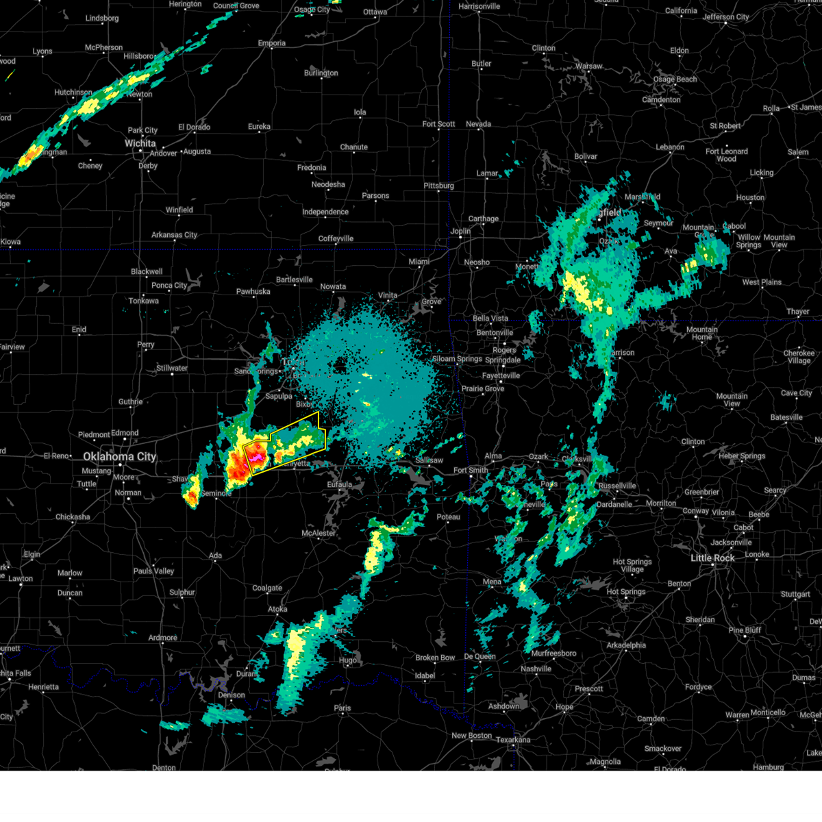 Svrtsa the national weather service in tulsa has issued a * severe thunderstorm warning for, okmulgee county in northeastern oklahoma, northeastern okfuskee county in east central oklahoma, * until 115 am cdt. * at 1222 am cdt, a severe thunderstorm was located 5 miles northeast of castle, moving northeast at 45 mph (radar indicated). Hazards include golf ball size hail and 60 mph wind gusts. People and animals outdoors will be injured. expect hail damage to roofs, siding, windows, and vehicles. expect wind damage to roofs, siding, and trees. Locations in or near the path include, preston, mason, schulter, okmulgee, okmulgee state park, eram, castle, okemah, morris, bald hill, okfuskee, this includes interstate 40 in oklahoma between mile markers 217 and 224. Svrtsa the national weather service in tulsa has issued a * severe thunderstorm warning for, okmulgee county in northeastern oklahoma, northeastern okfuskee county in east central oklahoma, * until 115 am cdt. * at 1222 am cdt, a severe thunderstorm was located 5 miles northeast of castle, moving northeast at 45 mph (radar indicated). Hazards include golf ball size hail and 60 mph wind gusts. People and animals outdoors will be injured. expect hail damage to roofs, siding, windows, and vehicles. expect wind damage to roofs, siding, and trees. Locations in or near the path include, preston, mason, schulter, okmulgee, okmulgee state park, eram, castle, okemah, morris, bald hill, okfuskee, this includes interstate 40 in oklahoma between mile markers 217 and 224.
|
| 4/20/2025 12:01 AM CDT |
 the tornado warning has been cancelled and is no longer in effect the tornado warning has been cancelled and is no longer in effect
|
| 4/19/2025 11:59 PM CDT |
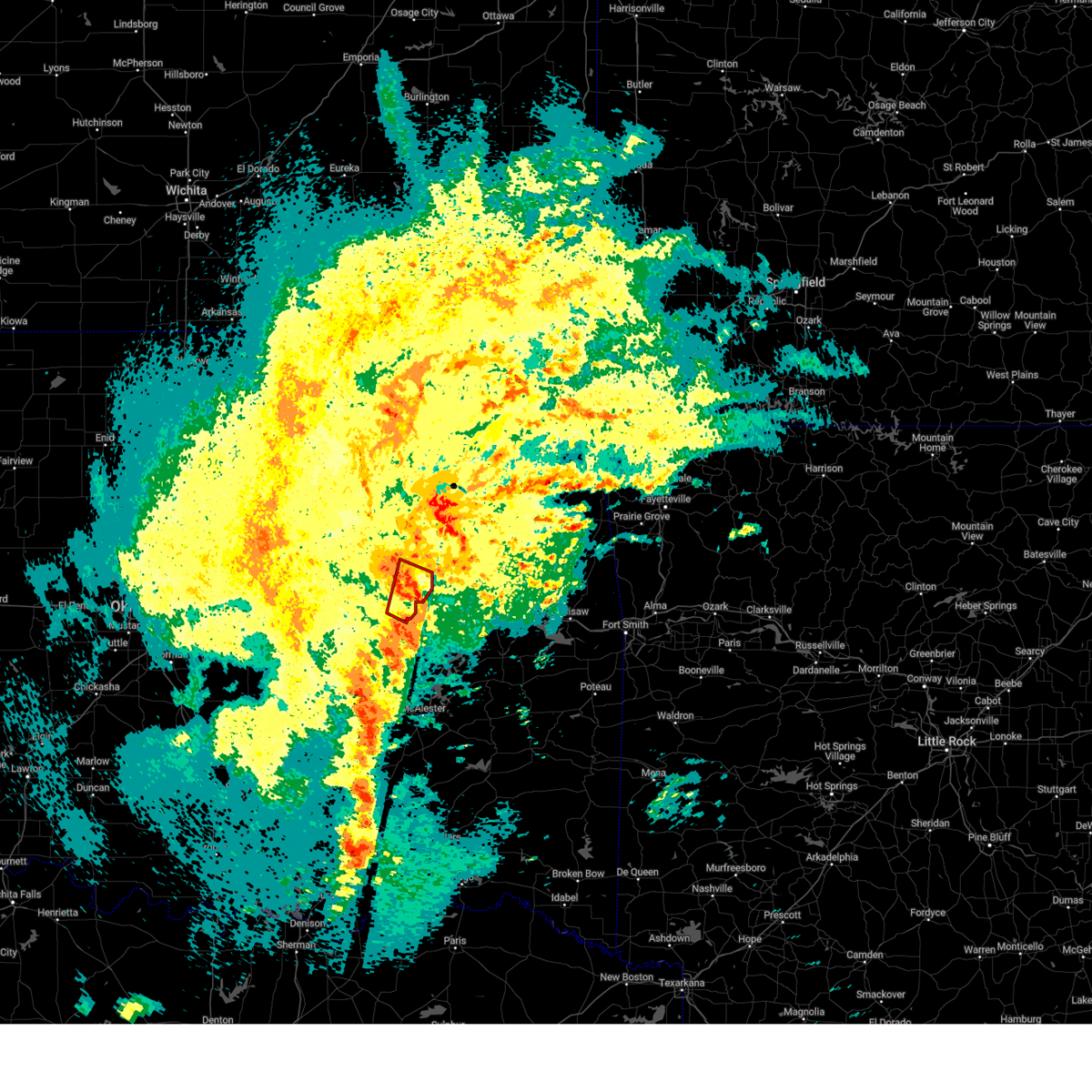 the tornado warning has been cancelled and is no longer in effect the tornado warning has been cancelled and is no longer in effect
|
| 4/19/2025 11:54 PM CDT |
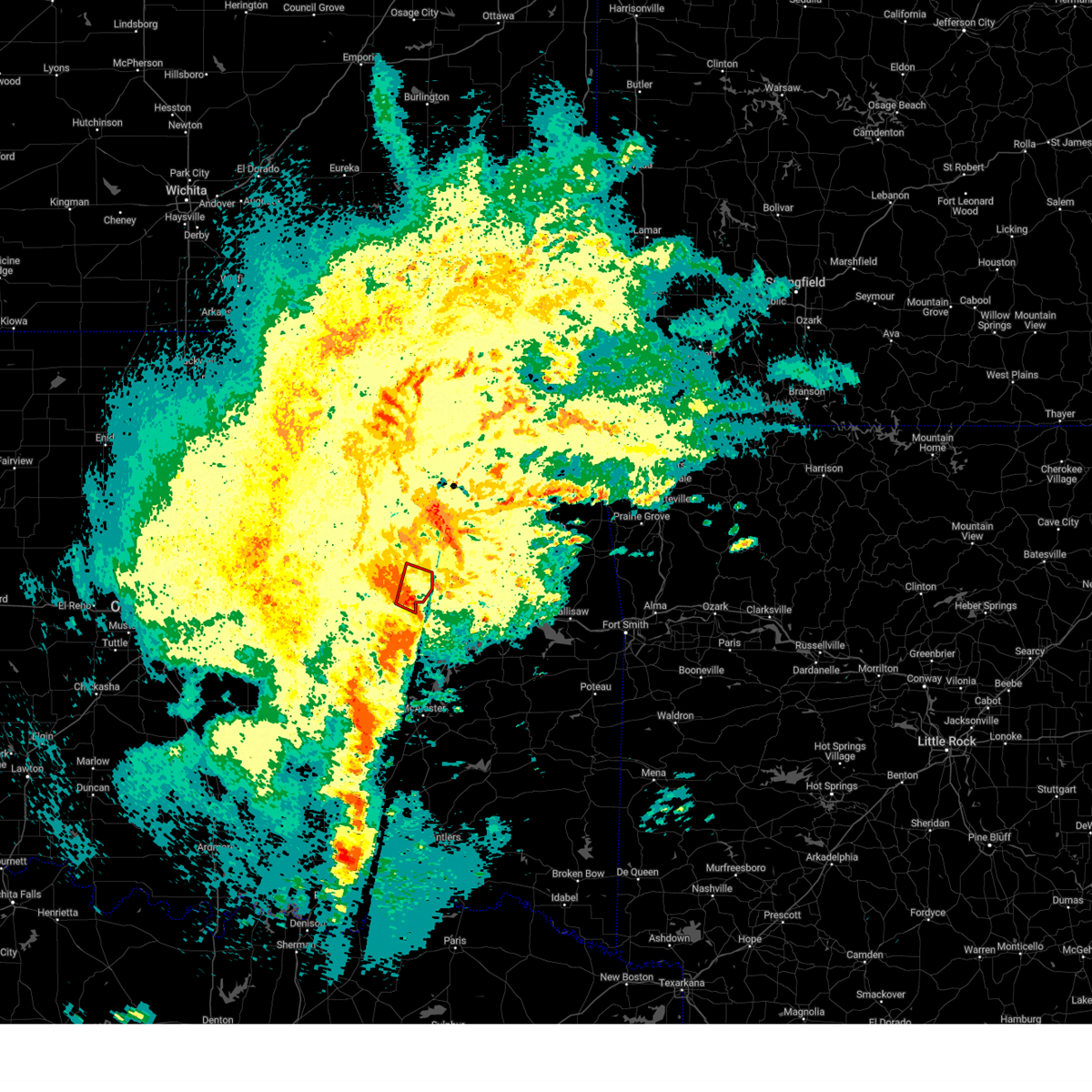 Tortsa the national weather service in tulsa has issued a * tornado warning for, northeastern okmulgee county in northeastern oklahoma, * until 1230 am cdt. * at 1154 pm cdt, a severe thunderstorm capable of producing a tornado was located near morris, moving northeast at 35 mph (radar indicated rotation). Hazards include tornado. Flying debris will be dangerous to those caught without shelter. mobile homes will be damaged or destroyed. damage to roofs, windows, and vehicles will occur. tree damage is likely. Locations in or near the path include, eram, morris, bald hill,. Tortsa the national weather service in tulsa has issued a * tornado warning for, northeastern okmulgee county in northeastern oklahoma, * until 1230 am cdt. * at 1154 pm cdt, a severe thunderstorm capable of producing a tornado was located near morris, moving northeast at 35 mph (radar indicated rotation). Hazards include tornado. Flying debris will be dangerous to those caught without shelter. mobile homes will be damaged or destroyed. damage to roofs, windows, and vehicles will occur. tree damage is likely. Locations in or near the path include, eram, morris, bald hill,.
|
| 4/19/2025 11:43 PM CDT |
 Tortsa the national weather service in tulsa has issued a * tornado warning for, eastern okmulgee county in northeastern oklahoma, * until 1215 am cdt. * at 1143 pm cdt, a severe thunderstorm capable of producing a tornado was located over schulter, moving northeast at 30 mph (radar indicated rotation). Hazards include tornado. Flying debris will be dangerous to those caught without shelter. mobile homes will be damaged or destroyed. damage to roofs, windows, and vehicles will occur. tree damage is likely. Locations in or near the path include, hoffman, schulter, okmulgee, eram, morris, bald hill, grayson,. Tortsa the national weather service in tulsa has issued a * tornado warning for, eastern okmulgee county in northeastern oklahoma, * until 1215 am cdt. * at 1143 pm cdt, a severe thunderstorm capable of producing a tornado was located over schulter, moving northeast at 30 mph (radar indicated rotation). Hazards include tornado. Flying debris will be dangerous to those caught without shelter. mobile homes will be damaged or destroyed. damage to roofs, windows, and vehicles will occur. tree damage is likely. Locations in or near the path include, hoffman, schulter, okmulgee, eram, morris, bald hill, grayson,.
|
| 4/19/2025 11:42 PM CDT |
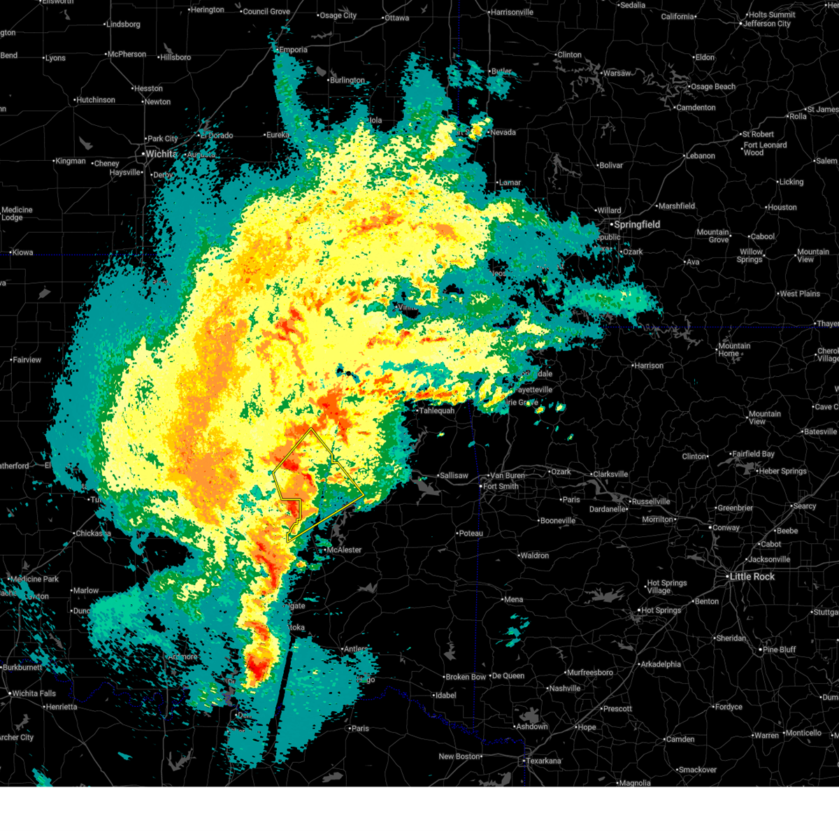 At 1142 pm cdt, a severe thunderstorm was located over hoffman, moving northeast at 45 mph (radar indicated). Hazards include 60 mph wind gusts. Expect damage to roofs, siding, and trees. Locations in or near the path include, bryant, hoffman, okmulgee, indianola, hitchita, raiford, weleetka, dewar, vivian, hanna, vernon, henryetta, pierce, schulter, okmulgee state park, stidham, eram, lake eufaula state park, morris, pharoah, this includes interstate 40 in oklahoma between mile markers 226 and 261. At 1142 pm cdt, a severe thunderstorm was located over hoffman, moving northeast at 45 mph (radar indicated). Hazards include 60 mph wind gusts. Expect damage to roofs, siding, and trees. Locations in or near the path include, bryant, hoffman, okmulgee, indianola, hitchita, raiford, weleetka, dewar, vivian, hanna, vernon, henryetta, pierce, schulter, okmulgee state park, stidham, eram, lake eufaula state park, morris, pharoah, this includes interstate 40 in oklahoma between mile markers 226 and 261.
|
| 4/19/2025 11:29 PM CDT |
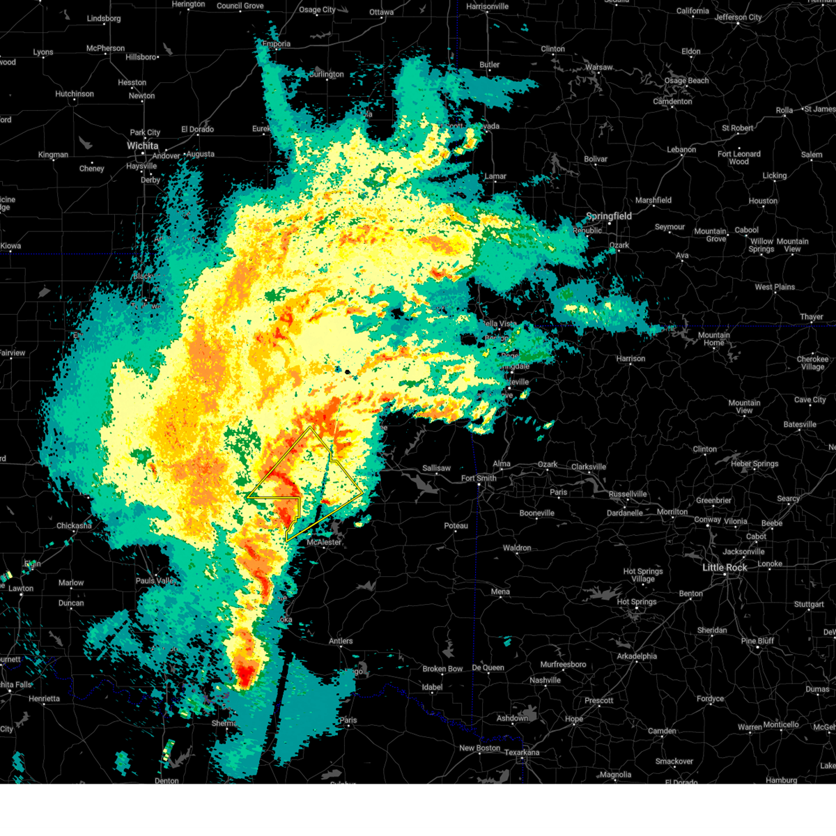 At 1128 pm cdt, a severe thunderstorm was located 5 miles south of henryetta, moving northeast at 40 mph (radar indicated). Hazards include 60 mph wind gusts. Expect damage to roofs, siding, and trees. Locations in or near the path include, raiford, weleetka, dewar, vivian, hanna, pierce, clearview, schulter, eram, lake eufaula state park, morris, pharoah, grayson, bryant, hoffman, okmulgee, indianola, hitchita, vernon, henryetta, this includes interstate 40 in oklahoma between mile markers 221 and 261. At 1128 pm cdt, a severe thunderstorm was located 5 miles south of henryetta, moving northeast at 40 mph (radar indicated). Hazards include 60 mph wind gusts. Expect damage to roofs, siding, and trees. Locations in or near the path include, raiford, weleetka, dewar, vivian, hanna, pierce, clearview, schulter, eram, lake eufaula state park, morris, pharoah, grayson, bryant, hoffman, okmulgee, indianola, hitchita, vernon, henryetta, this includes interstate 40 in oklahoma between mile markers 221 and 261.
|
| 4/19/2025 11:01 PM CDT |
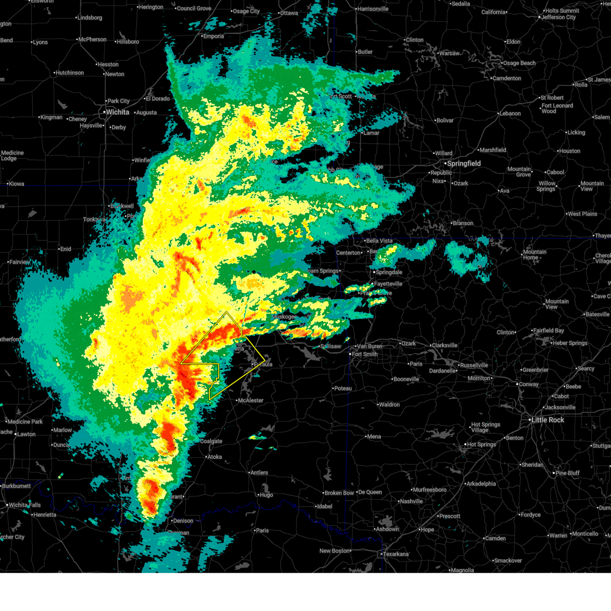 Svrtsa the national weather service in tulsa has issued a * severe thunderstorm warning for, mcintosh county in southeastern oklahoma, northwestern pittsburg county in southeastern oklahoma, central okmulgee county in northeastern oklahoma, southeastern okfuskee county in east central oklahoma, * until midnight cdt. * at 1101 pm cdt, a severe thunderstorm was located 4 miles south of wetumka, moving northeast at 40 mph (radar indicated). Hazards include 60 mph wind gusts and quarter size hail. Hail damage to vehicles is expected. expect wind damage to roofs, siding, and trees. Locations in or near the path include, raiford, weleetka, dewar, vivian, hanna, pierce, clearview, schulter, eram, lake eufaula state park, morris, pharoah, grayson, bryant, hoffman, okmulgee, indianola, hitchita, vernon, henryetta, this includes interstate 40 in oklahoma between mile markers 221 and 261. Svrtsa the national weather service in tulsa has issued a * severe thunderstorm warning for, mcintosh county in southeastern oklahoma, northwestern pittsburg county in southeastern oklahoma, central okmulgee county in northeastern oklahoma, southeastern okfuskee county in east central oklahoma, * until midnight cdt. * at 1101 pm cdt, a severe thunderstorm was located 4 miles south of wetumka, moving northeast at 40 mph (radar indicated). Hazards include 60 mph wind gusts and quarter size hail. Hail damage to vehicles is expected. expect wind damage to roofs, siding, and trees. Locations in or near the path include, raiford, weleetka, dewar, vivian, hanna, pierce, clearview, schulter, eram, lake eufaula state park, morris, pharoah, grayson, bryant, hoffman, okmulgee, indianola, hitchita, vernon, henryetta, this includes interstate 40 in oklahoma between mile markers 221 and 261.
|
| 4/18/2025 11:22 PM CDT |
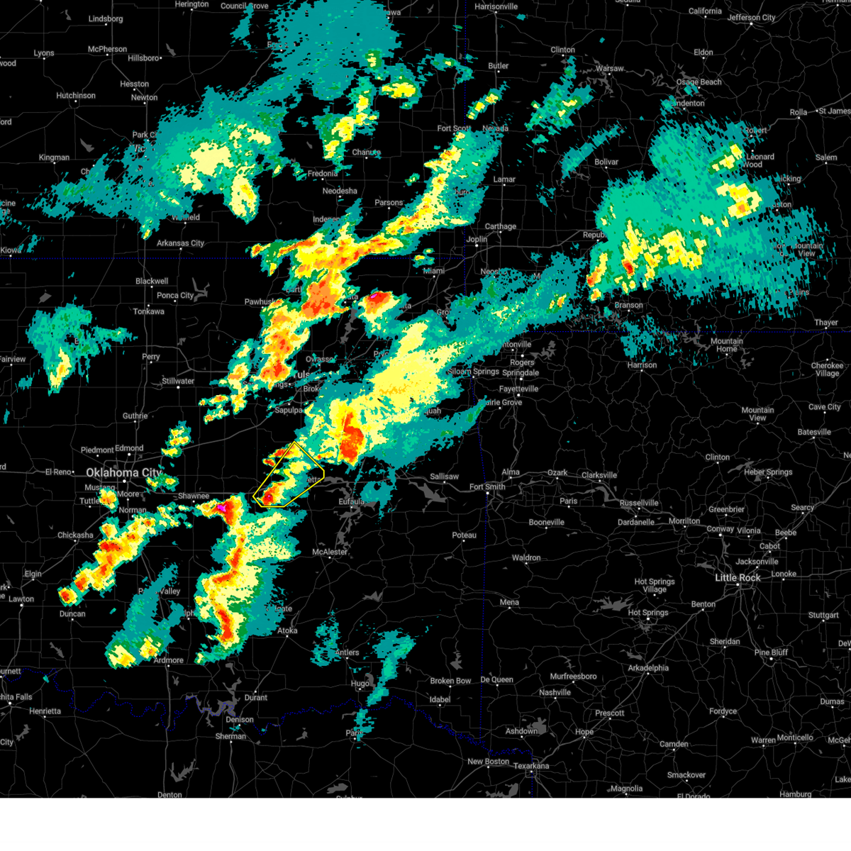 Svrtsa the national weather service in tulsa has issued a * severe thunderstorm warning for, southwestern okmulgee county in northeastern oklahoma, eastern okfuskee county in east central oklahoma, * until midnight cdt. * at 1122 pm cdt, a severe thunderstorm was located 5 miles south of okemah, moving northeast at 50 mph (radar indicated). Hazards include 60 mph wind gusts and penny size hail. Expect damage to roofs, siding, and trees. Locations in or near the path include, bryant, hoffman, okmulgee, weleetka, okemah, dewar, henryetta, clearview, schulter, okmulgee state park, bearden, pharoah, grayson, beggs, this includes interstate 40 in oklahoma between mile markers 215 and 241. Svrtsa the national weather service in tulsa has issued a * severe thunderstorm warning for, southwestern okmulgee county in northeastern oklahoma, eastern okfuskee county in east central oklahoma, * until midnight cdt. * at 1122 pm cdt, a severe thunderstorm was located 5 miles south of okemah, moving northeast at 50 mph (radar indicated). Hazards include 60 mph wind gusts and penny size hail. Expect damage to roofs, siding, and trees. Locations in or near the path include, bryant, hoffman, okmulgee, weleetka, okemah, dewar, henryetta, clearview, schulter, okmulgee state park, bearden, pharoah, grayson, beggs, this includes interstate 40 in oklahoma between mile markers 215 and 241.
|
| 4/18/2025 11:01 PM CDT |
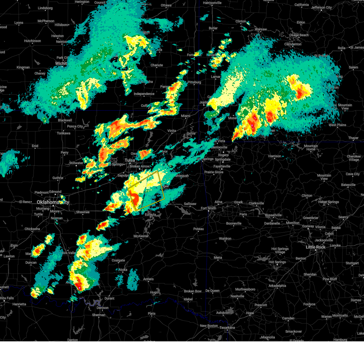 At 1101 pm cdt, severe thunderstorms were located along a line extending from 3 miles southeast of bald hill to 4 miles west of boynton to 4 miles east of hoffman, moving northeast at 55 mph (radar indicated). Hazards include 60 mph wind gusts. Expect damage to roofs, siding, and trees. Locations in or near the path include, wainwright, tullahassee, preston, hoffman, rentiesville, okmulgee, jamesville, hitchita, oktaha, summit, bald hill, redbird, muskogee, boynton, council hill, eram, haskell, morris, porter, taft, this includes interstate 40 in oklahoma between mile markers 244 and 255. At 1101 pm cdt, severe thunderstorms were located along a line extending from 3 miles southeast of bald hill to 4 miles west of boynton to 4 miles east of hoffman, moving northeast at 55 mph (radar indicated). Hazards include 60 mph wind gusts. Expect damage to roofs, siding, and trees. Locations in or near the path include, wainwright, tullahassee, preston, hoffman, rentiesville, okmulgee, jamesville, hitchita, oktaha, summit, bald hill, redbird, muskogee, boynton, council hill, eram, haskell, morris, porter, taft, this includes interstate 40 in oklahoma between mile markers 244 and 255.
|
| 4/18/2025 10:47 PM CDT |
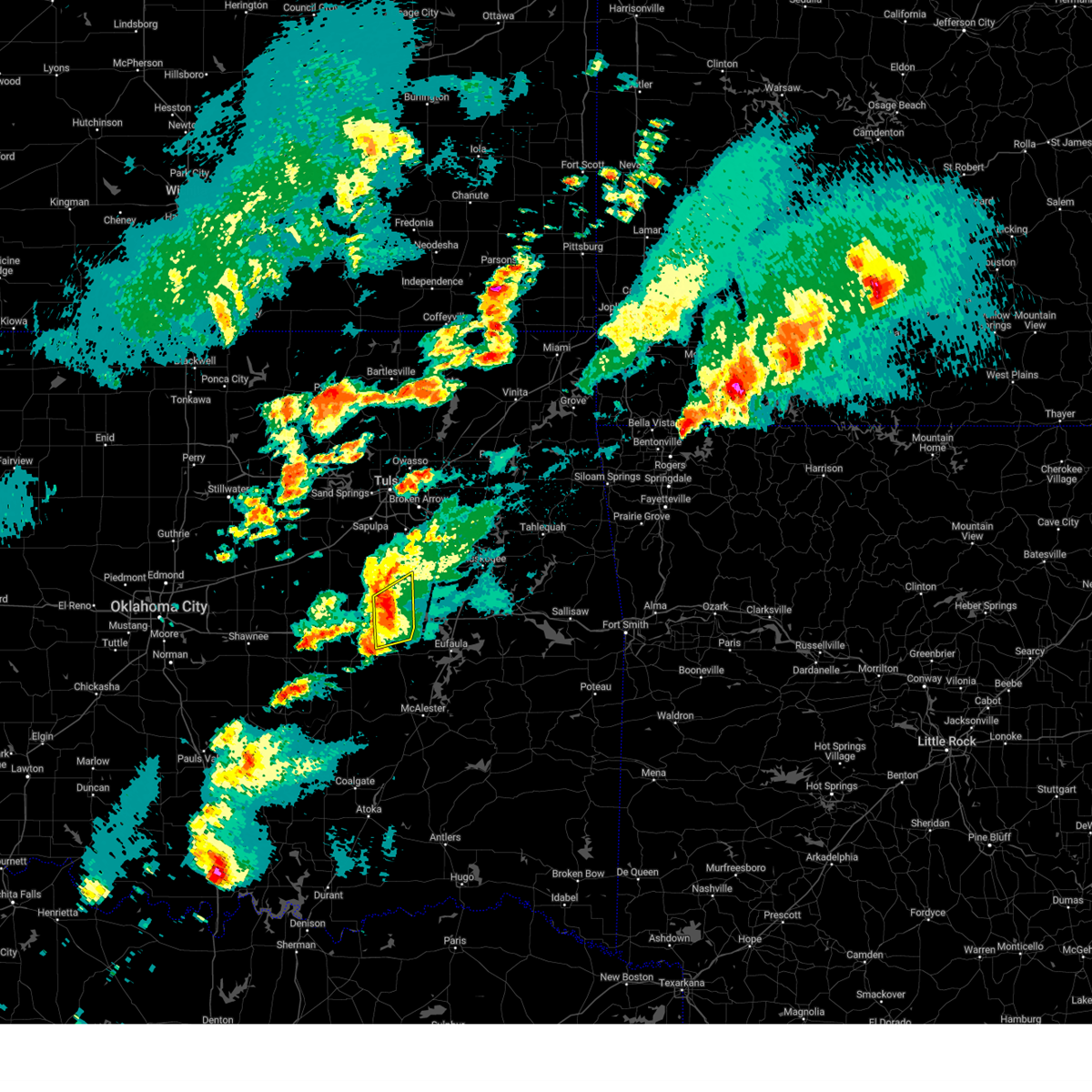 At 1047 pm cdt, severe thunderstorms were located along a line extending from near okmulgee to near grayson to 4 miles southeast of henryetta, moving northeast at 50 mph (radar indicated). Hazards include 60 mph wind gusts and penny size hail. Expect damage to roofs, siding, and trees. Locations in or near the path include, bryant, henryetta, hoffman, schulter, okmulgee, morris, dewar, grayson, this includes interstate 40 in oklahoma between mile markers 232 and 246. At 1047 pm cdt, severe thunderstorms were located along a line extending from near okmulgee to near grayson to 4 miles southeast of henryetta, moving northeast at 50 mph (radar indicated). Hazards include 60 mph wind gusts and penny size hail. Expect damage to roofs, siding, and trees. Locations in or near the path include, bryant, henryetta, hoffman, schulter, okmulgee, morris, dewar, grayson, this includes interstate 40 in oklahoma between mile markers 232 and 246.
|
| 4/18/2025 10:46 PM CDT |
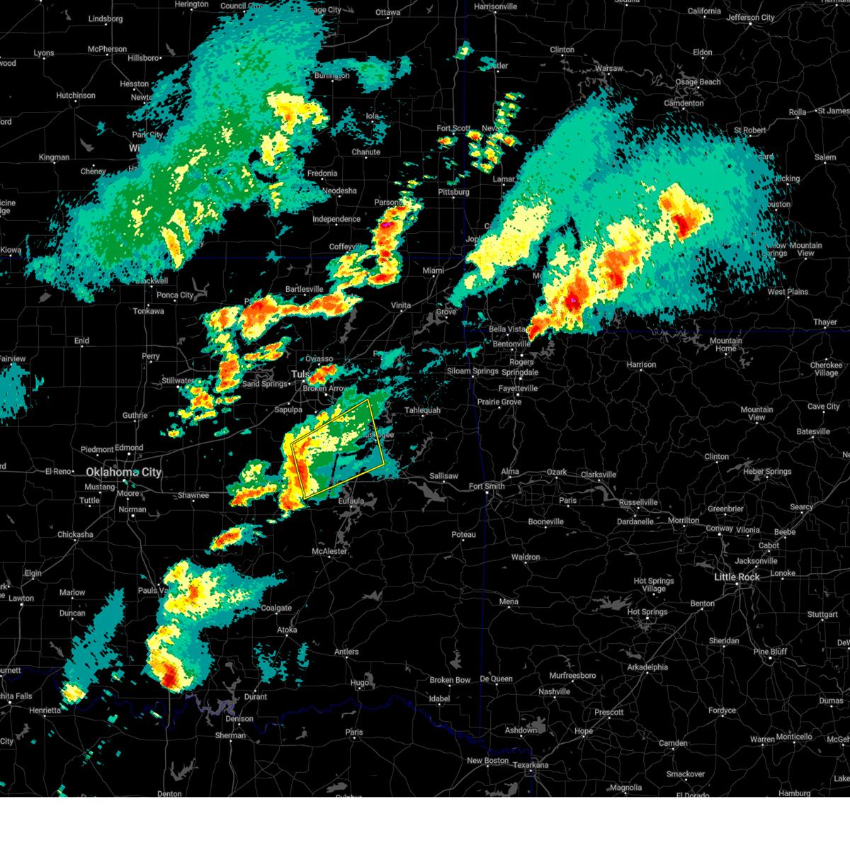 Svrtsa the national weather service in tulsa has issued a * severe thunderstorm warning for, northwestern mcintosh county in southeastern oklahoma, southwestern wagoner county in northeastern oklahoma, okmulgee county in northeastern oklahoma, northwestern muskogee county in east central oklahoma, * until 1130 pm cdt. * at 1046 pm cdt, severe thunderstorms were located along a line extending from near okmulgee to 3 miles northeast of schulter to 3 miles southeast of henryetta, moving northeast at 55 mph (radar indicated). Hazards include 60 mph wind gusts and penny size hail. Expect damage to roofs, siding, and trees. Locations in or near the path include, preston, oktaha, dewar, summit, muskogee, pierce, schulter, stonebluff, eram, haskell, morris, porter, keefeton, grayson, wainwright, tullahassee, hoffman, rentiesville, okmulgee, jamesville, this includes interstate 40 in oklahoma between mile markers 237 and 256. Svrtsa the national weather service in tulsa has issued a * severe thunderstorm warning for, northwestern mcintosh county in southeastern oklahoma, southwestern wagoner county in northeastern oklahoma, okmulgee county in northeastern oklahoma, northwestern muskogee county in east central oklahoma, * until 1130 pm cdt. * at 1046 pm cdt, severe thunderstorms were located along a line extending from near okmulgee to 3 miles northeast of schulter to 3 miles southeast of henryetta, moving northeast at 55 mph (radar indicated). Hazards include 60 mph wind gusts and penny size hail. Expect damage to roofs, siding, and trees. Locations in or near the path include, preston, oktaha, dewar, summit, muskogee, pierce, schulter, stonebluff, eram, haskell, morris, porter, keefeton, grayson, wainwright, tullahassee, hoffman, rentiesville, okmulgee, jamesville, this includes interstate 40 in oklahoma between mile markers 237 and 256.
|
| 4/18/2025 10:34 PM CDT |
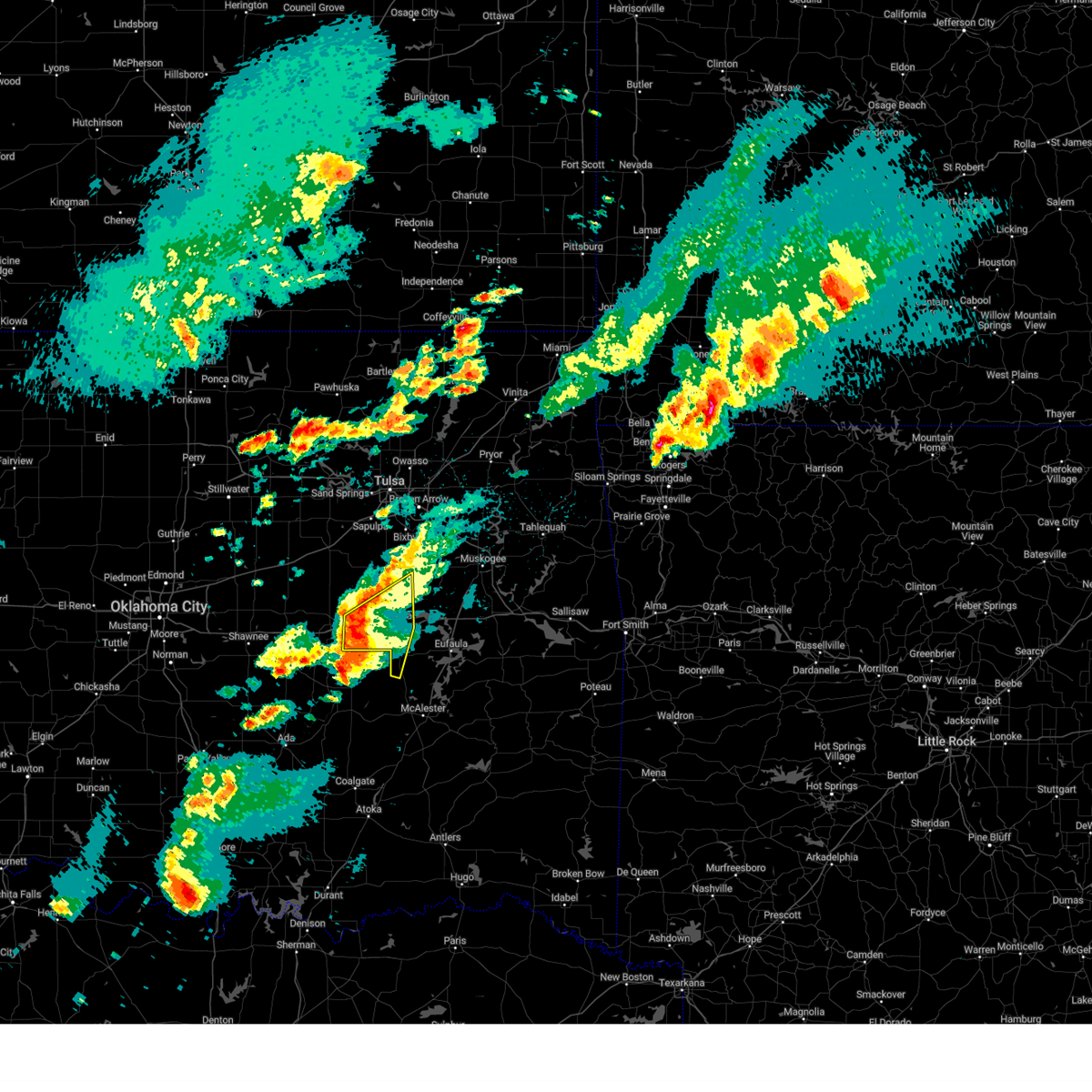 At 1034 pm cdt, severe thunderstorms were located along a line extending from 6 miles southwest of okmulgee state park to 4 miles northeast of weleetka to 4 miles northeast of horntown, moving northeast at 45 mph (radar indicated). Hazards include 60 mph wind gusts and penny size hail. Expect damage to roofs, siding, and trees. Locations in or near the path include, bryant, henryetta, clearview, hoffman, schulter, okmulgee, weleetka, morris, dewar, pharoah, grayson, vernon, this includes interstate 40 in oklahoma between mile markers 221 and 246. At 1034 pm cdt, severe thunderstorms were located along a line extending from 6 miles southwest of okmulgee state park to 4 miles northeast of weleetka to 4 miles northeast of horntown, moving northeast at 45 mph (radar indicated). Hazards include 60 mph wind gusts and penny size hail. Expect damage to roofs, siding, and trees. Locations in or near the path include, bryant, henryetta, clearview, hoffman, schulter, okmulgee, weleetka, morris, dewar, pharoah, grayson, vernon, this includes interstate 40 in oklahoma between mile markers 221 and 246.
|
| 4/18/2025 10:21 PM CDT |
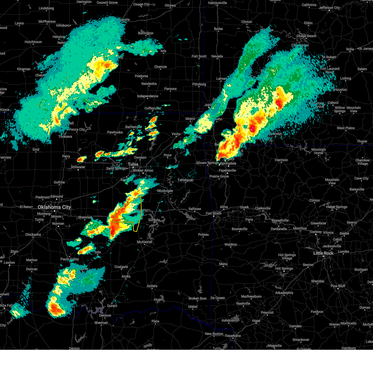 Svrtsa the national weather service in tulsa has issued a * severe thunderstorm warning for, western mcintosh county in southeastern oklahoma, southwestern okmulgee county in northeastern oklahoma, southeastern okfuskee county in east central oklahoma, * until 1100 pm cdt. * at 1021 pm cdt, severe thunderstorms were located along a line extending from 2 miles east of okemah to 2 miles northeast of wetumka to 3 miles east of holdenville, moving northeast at 35 mph (radar indicated). Hazards include 60 mph wind gusts and nickel size hail. Expect damage to roofs, siding, and trees. Locations in or near the path include, bryant, hoffman, okmulgee, weleetka, okemah, dewar, vernon, henryetta, clearview, schulter, morris, pharoah, grayson, this includes interstate 40 in oklahoma between mile markers 218 and 246. Svrtsa the national weather service in tulsa has issued a * severe thunderstorm warning for, western mcintosh county in southeastern oklahoma, southwestern okmulgee county in northeastern oklahoma, southeastern okfuskee county in east central oklahoma, * until 1100 pm cdt. * at 1021 pm cdt, severe thunderstorms were located along a line extending from 2 miles east of okemah to 2 miles northeast of wetumka to 3 miles east of holdenville, moving northeast at 35 mph (radar indicated). Hazards include 60 mph wind gusts and nickel size hail. Expect damage to roofs, siding, and trees. Locations in or near the path include, bryant, hoffman, okmulgee, weleetka, okemah, dewar, vernon, henryetta, clearview, schulter, morris, pharoah, grayson, this includes interstate 40 in oklahoma between mile markers 218 and 246.
|
| 4/5/2025 5:08 AM CDT |
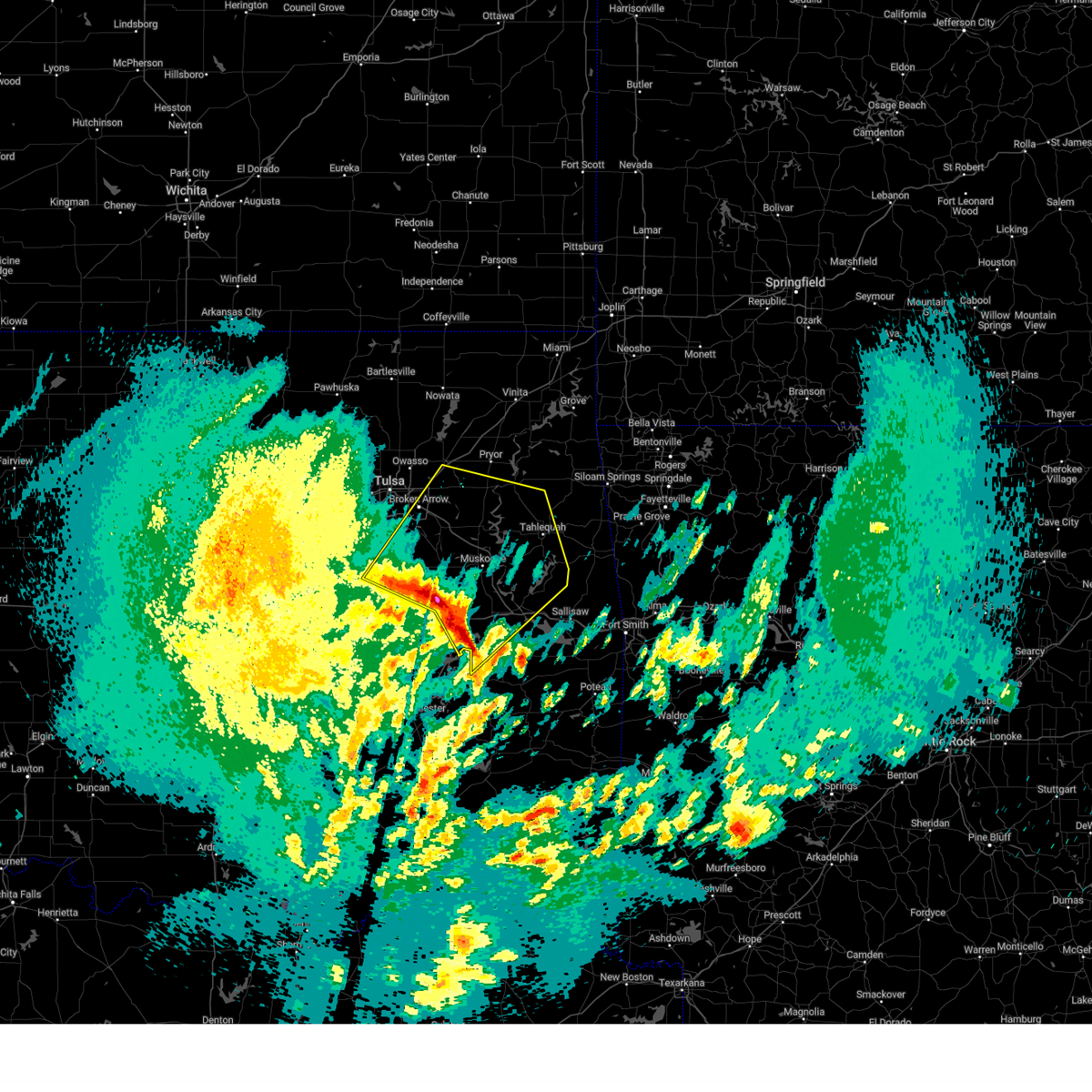 Svrtsa the national weather service in tulsa has issued a * severe thunderstorm warning for, southwestern rogers county in northeastern oklahoma, northwestern haskell county in southeastern oklahoma, northeastern mcintosh county in southeastern oklahoma, northwestern sequoyah county in east central oklahoma, southern mayes county in northeastern oklahoma, wagoner county in northeastern oklahoma, cherokee county in east central oklahoma, northern okmulgee county in northeastern oklahoma, muskogee county in east central oklahoma, southeastern tulsa county in northeastern oklahoma, * until 545 am cdt. * at 506 am cdt, severe thunderstorms were located along a line extending from 3 miles south of beggs to 2 miles northeast of council hill to 3 miles southwest of enterprise, moving northeast at 60 mph (radar indicated). Hazards include 60 mph wind gusts and quarter size hail. Hail damage to vehicles is expected. expect wind damage to roofs, siding, and trees. locations in or near the path include, beggs, inola, mazie, coweta pumpkin center, webbers falls, fort gibson, porum, braggs, okay, broken arrow hectorville, chouteau, checotah haskell, leonard, lake eufaula state park, morris, gore, muskogee, this includes the following highways, interstate 40 in oklahoma between mile markers 257 and 293. Interstate 44 between mile markers 238 and 247. Svrtsa the national weather service in tulsa has issued a * severe thunderstorm warning for, southwestern rogers county in northeastern oklahoma, northwestern haskell county in southeastern oklahoma, northeastern mcintosh county in southeastern oklahoma, northwestern sequoyah county in east central oklahoma, southern mayes county in northeastern oklahoma, wagoner county in northeastern oklahoma, cherokee county in east central oklahoma, northern okmulgee county in northeastern oklahoma, muskogee county in east central oklahoma, southeastern tulsa county in northeastern oklahoma, * until 545 am cdt. * at 506 am cdt, severe thunderstorms were located along a line extending from 3 miles south of beggs to 2 miles northeast of council hill to 3 miles southwest of enterprise, moving northeast at 60 mph (radar indicated). Hazards include 60 mph wind gusts and quarter size hail. Hail damage to vehicles is expected. expect wind damage to roofs, siding, and trees. locations in or near the path include, beggs, inola, mazie, coweta pumpkin center, webbers falls, fort gibson, porum, braggs, okay, broken arrow hectorville, chouteau, checotah haskell, leonard, lake eufaula state park, morris, gore, muskogee, this includes the following highways, interstate 40 in oklahoma between mile markers 257 and 293. Interstate 44 between mile markers 238 and 247.
|
| 4/5/2025 5:00 AM CDT |
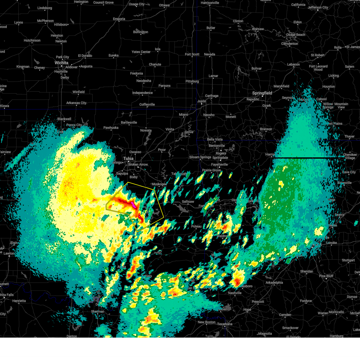 At 459 am cdt, severe thunderstorms were located along a line extending from 3 miles west of okmulgee state park to near hoffman to 3 miles southwest of eufaula, moving northeast at 50 mph (radar indicated). Hazards include 70 mph wind gusts and quarter size hail. Hail damage to vehicles is expected. expect considerable tree damage. wind damage is also likely to mobile homes, roofs, and outbuildings. Locations in or near the path include, beggs, preston, canadian, raiford, weleetka, oktaha, dewar, vivian, hanna, pierce, clearview, schulter, eram, checotah, lake eufaula state park, morris, pharoah, grayson, bryant, wainwright, this includes interstate 40 in oklahoma between mile markers 212 and 272. At 459 am cdt, severe thunderstorms were located along a line extending from 3 miles west of okmulgee state park to near hoffman to 3 miles southwest of eufaula, moving northeast at 50 mph (radar indicated). Hazards include 70 mph wind gusts and quarter size hail. Hail damage to vehicles is expected. expect considerable tree damage. wind damage is also likely to mobile homes, roofs, and outbuildings. Locations in or near the path include, beggs, preston, canadian, raiford, weleetka, oktaha, dewar, vivian, hanna, pierce, clearview, schulter, eram, checotah, lake eufaula state park, morris, pharoah, grayson, bryant, wainwright, this includes interstate 40 in oklahoma between mile markers 212 and 272.
|
| 4/5/2025 4:40 AM CDT |
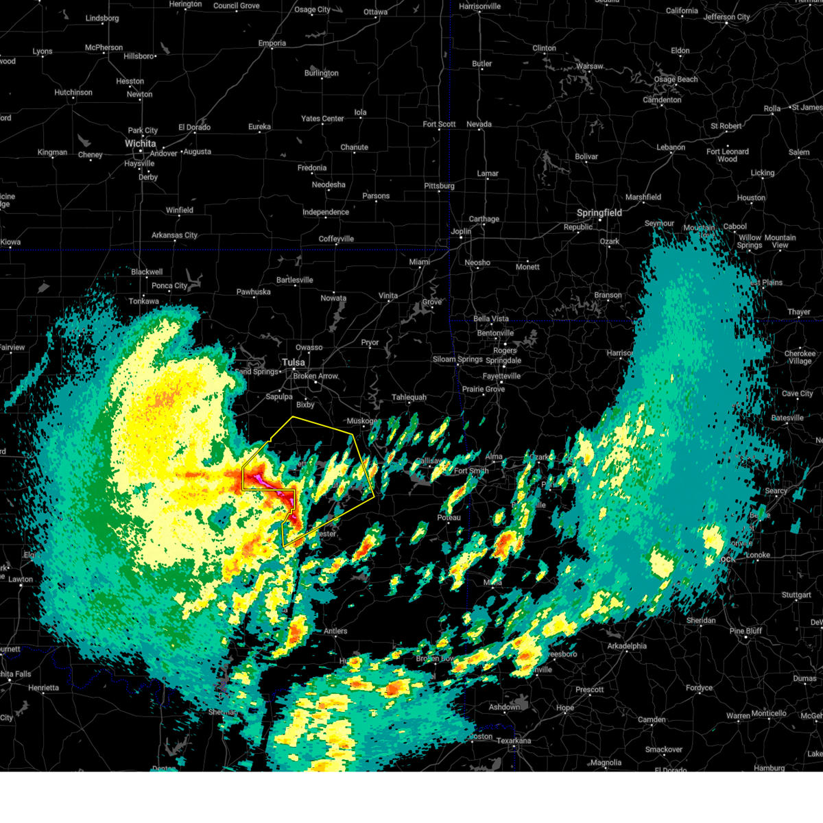 Svrtsa the national weather service in tulsa has issued a * severe thunderstorm warning for, west central haskell county in southeastern oklahoma, mcintosh county in southeastern oklahoma, northern pittsburg county in southeastern oklahoma, okmulgee county in northeastern oklahoma, central muskogee county in east central oklahoma, okfuskee county in east central oklahoma, * until 515 am cdt. * at 439 am cdt, severe thunderstorms were located along a line extending from 3 miles northeast of bearden to near dustin to 4 miles southeast of scipio, moving northeast at 65 mph (radar indicated). Hazards include 70 mph wind gusts and quarter size hail. Hail damage to vehicles is expected. expect considerable tree damage. wind damage is also likely to mobile homes, roofs, and outbuildings. Locations in or near the path include, arpelar, beggs, preston, canadian, raiford, weleetka, oktaha, dewar, vivian, hanna, pierce, clearview, schulter, eram, checotah, lake eufaula state park, morris, pharoah, grayson, bryant, this includes interstate 40 in oklahoma between mile markers 212 and 272. Svrtsa the national weather service in tulsa has issued a * severe thunderstorm warning for, west central haskell county in southeastern oklahoma, mcintosh county in southeastern oklahoma, northern pittsburg county in southeastern oklahoma, okmulgee county in northeastern oklahoma, central muskogee county in east central oklahoma, okfuskee county in east central oklahoma, * until 515 am cdt. * at 439 am cdt, severe thunderstorms were located along a line extending from 3 miles northeast of bearden to near dustin to 4 miles southeast of scipio, moving northeast at 65 mph (radar indicated). Hazards include 70 mph wind gusts and quarter size hail. Hail damage to vehicles is expected. expect considerable tree damage. wind damage is also likely to mobile homes, roofs, and outbuildings. Locations in or near the path include, arpelar, beggs, preston, canadian, raiford, weleetka, oktaha, dewar, vivian, hanna, pierce, clearview, schulter, eram, checotah, lake eufaula state park, morris, pharoah, grayson, bryant, this includes interstate 40 in oklahoma between mile markers 212 and 272.
|
| 4/4/2025 6:34 AM CDT |
 At 634 am cdt, severe thunderstorms were located along a line extending from 5 miles northeast of slick to 6 miles west of stonebluff to 3 miles north of boynton, moving northeast at 65 mph (radar indicated). Hazards include 60 mph wind gusts and half dollar size hail. Hail damage to vehicles is expected. expect wind damage to roofs, siding, and trees. Locations in or near the path include, beggs, sapulpa, inola, collinsville, mazie, jenks riverside airport, locust grove, mounds, strang, hoot owl, stonebluff, hectorville, chouteau, eram, haskell, leonard, morris, murphy, bushyhead, owasso, this includes interstate 44 between mile markers 202 and 272. At 634 am cdt, severe thunderstorms were located along a line extending from 5 miles northeast of slick to 6 miles west of stonebluff to 3 miles north of boynton, moving northeast at 65 mph (radar indicated). Hazards include 60 mph wind gusts and half dollar size hail. Hail damage to vehicles is expected. expect wind damage to roofs, siding, and trees. Locations in or near the path include, beggs, sapulpa, inola, collinsville, mazie, jenks riverside airport, locust grove, mounds, strang, hoot owl, stonebluff, hectorville, chouteau, eram, haskell, leonard, morris, murphy, bushyhead, owasso, this includes interstate 44 between mile markers 202 and 272.
|
| 4/4/2025 6:32 AM CDT |
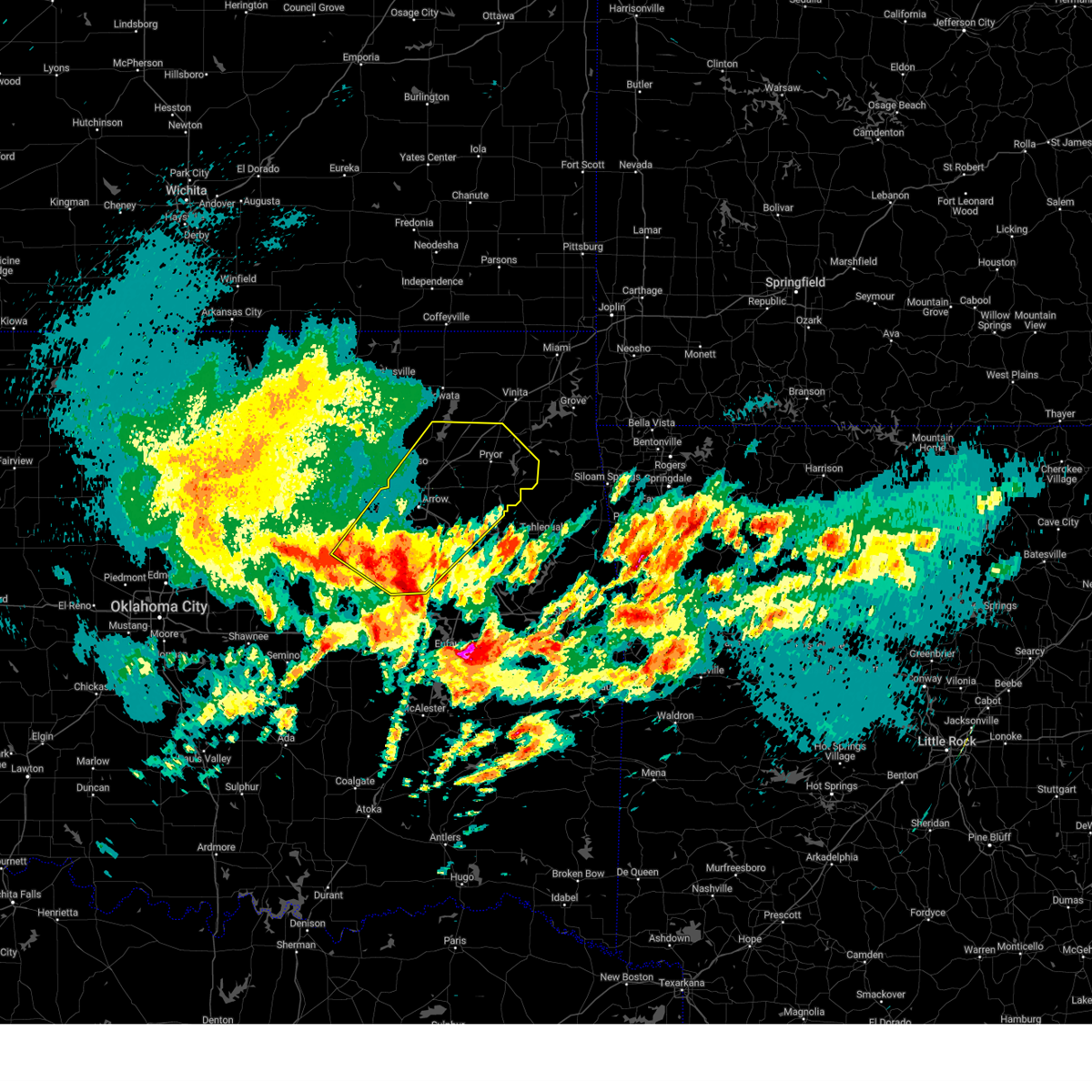 Svrtsa the national weather service in tulsa has issued a * severe thunderstorm warning for, rogers county in northeastern oklahoma, southeastern creek county in northeastern oklahoma, mayes county in northeastern oklahoma, wagoner county in northeastern oklahoma, northern okmulgee county in northeastern oklahoma, northwestern muskogee county in east central oklahoma, tulsa county in northeastern oklahoma, * until 715 am cdt. * at 631 am cdt, severe thunderstorms were located along a line extending from 3 miles north of slick to 6 miles north of bald hill to 2 miles northwest of boynton, moving northeast at 90 mph (radar indicated). Hazards include 60 mph wind gusts and half dollar size hail. Hail damage to vehicles is expected. expect wind damage to roofs, siding, and trees. Locations in or near the path include, beggs, sapulpa, inola, collinsville, mazie, jenks riverside airport, locust grove, mounds, strang, hoot owl, stonebluff, hectorville, chouteau, eram, haskell, leonard, morris, murphy, bushyhead, owasso, this includes interstate 44 between mile markers 202 and 272. Svrtsa the national weather service in tulsa has issued a * severe thunderstorm warning for, rogers county in northeastern oklahoma, southeastern creek county in northeastern oklahoma, mayes county in northeastern oklahoma, wagoner county in northeastern oklahoma, northern okmulgee county in northeastern oklahoma, northwestern muskogee county in east central oklahoma, tulsa county in northeastern oklahoma, * until 715 am cdt. * at 631 am cdt, severe thunderstorms were located along a line extending from 3 miles north of slick to 6 miles north of bald hill to 2 miles northwest of boynton, moving northeast at 90 mph (radar indicated). Hazards include 60 mph wind gusts and half dollar size hail. Hail damage to vehicles is expected. expect wind damage to roofs, siding, and trees. Locations in or near the path include, beggs, sapulpa, inola, collinsville, mazie, jenks riverside airport, locust grove, mounds, strang, hoot owl, stonebluff, hectorville, chouteau, eram, haskell, leonard, morris, murphy, bushyhead, owasso, this includes interstate 44 between mile markers 202 and 272.
|
| 4/4/2025 6:19 AM CDT |
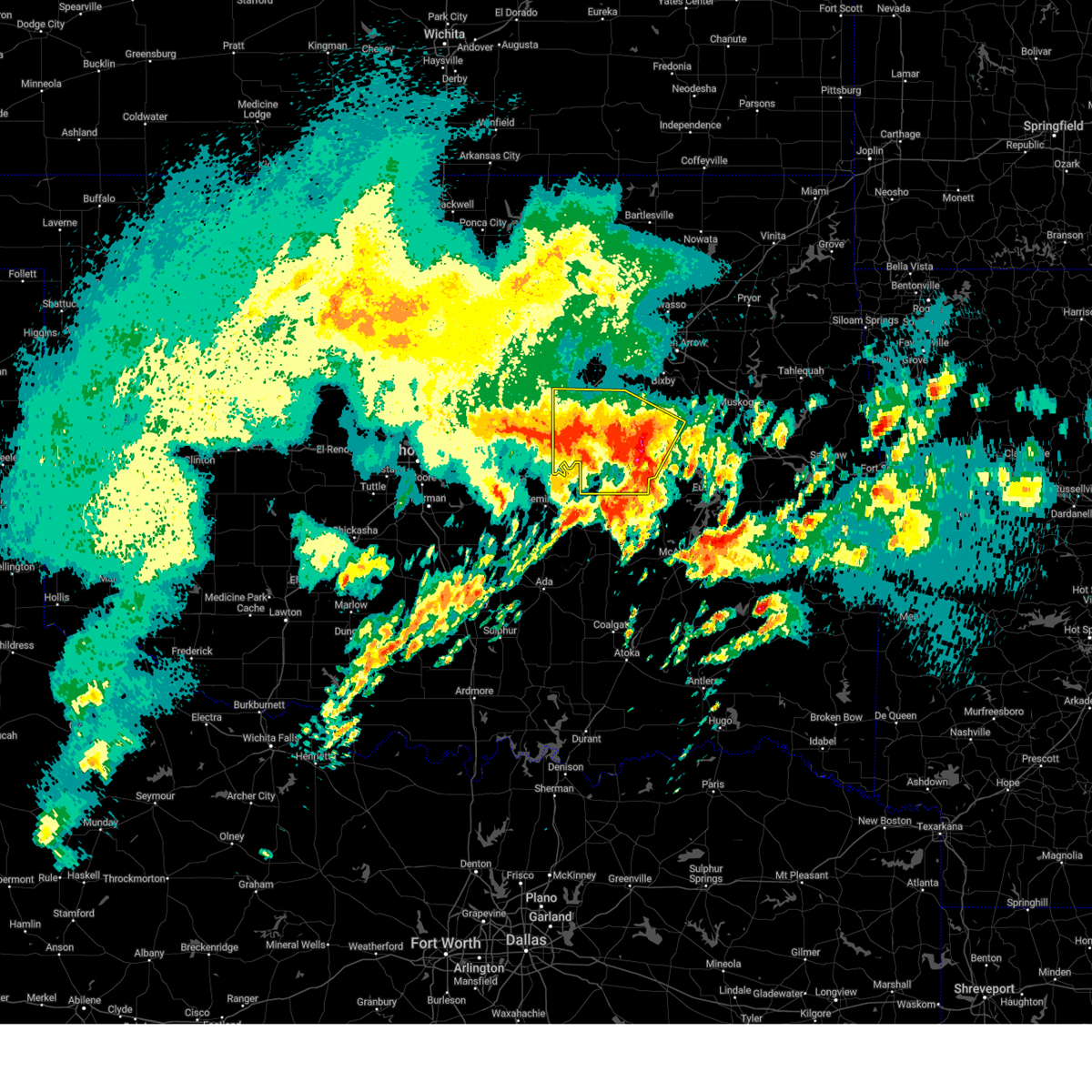 At 618 am cdt, severe thunderstorms were located along a line extending from 4 miles southeast of stroud to 6 miles southwest of beggs to 2 miles northwest of grayson, moving north at 60 mph. golf ball size hail was reported just to the west of henryetta (radar indicated). Hazards include golf ball size hail and 60 mph wind gusts. People and animals outdoors will be injured. expect hail damage to roofs, siding, windows, and vehicles. expect wind damage to roofs, siding, and trees. locations in or near the path include, beggs, preston, boley, paden, weleetka, dewar, depew, clearview, schulter, morris, pharoah, grayson, bryant, bristow, okmulgee, okemah, okfuskee, henryetta, milfay, mason, this includes the following highways, interstate 40 in oklahoma between mile markers 212 and 241. Interstate 44 between mile markers 178 and 192. At 618 am cdt, severe thunderstorms were located along a line extending from 4 miles southeast of stroud to 6 miles southwest of beggs to 2 miles northwest of grayson, moving north at 60 mph. golf ball size hail was reported just to the west of henryetta (radar indicated). Hazards include golf ball size hail and 60 mph wind gusts. People and animals outdoors will be injured. expect hail damage to roofs, siding, windows, and vehicles. expect wind damage to roofs, siding, and trees. locations in or near the path include, beggs, preston, boley, paden, weleetka, dewar, depew, clearview, schulter, morris, pharoah, grayson, bryant, bristow, okmulgee, okemah, okfuskee, henryetta, milfay, mason, this includes the following highways, interstate 40 in oklahoma between mile markers 212 and 241. Interstate 44 between mile markers 178 and 192.
|
| 4/4/2025 6:06 AM CDT |
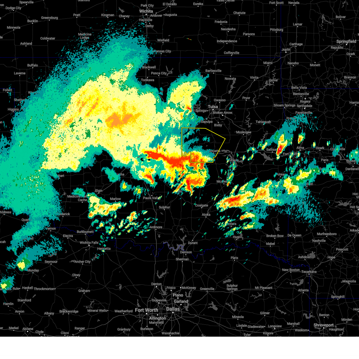 At 606 am cdt, severe thunderstorms were located along a line extending from 5 miles north of prague to 3 miles southwest of okfuskee to 2 miles west of henryetta, moving north at 60 mph (radar indicated). Hazards include 60 mph wind gusts and quarter size hail. Hail damage to vehicles is expected. expect wind damage to roofs, siding, and trees. locations in or near the path include, beggs, preston, boley, paden, weleetka, dewar, depew, clearview, schulter, morris, pharoah, grayson, bryant, bristow, okmulgee, okemah, okfuskee, henryetta, milfay, mason, this includes the following highways, interstate 40 in oklahoma between mile markers 212 and 241. Interstate 44 between mile markers 178 and 192. At 606 am cdt, severe thunderstorms were located along a line extending from 5 miles north of prague to 3 miles southwest of okfuskee to 2 miles west of henryetta, moving north at 60 mph (radar indicated). Hazards include 60 mph wind gusts and quarter size hail. Hail damage to vehicles is expected. expect wind damage to roofs, siding, and trees. locations in or near the path include, beggs, preston, boley, paden, weleetka, dewar, depew, clearview, schulter, morris, pharoah, grayson, bryant, bristow, okmulgee, okemah, okfuskee, henryetta, milfay, mason, this includes the following highways, interstate 40 in oklahoma between mile markers 212 and 241. Interstate 44 between mile markers 178 and 192.
|
| 4/4/2025 5:48 AM CDT |
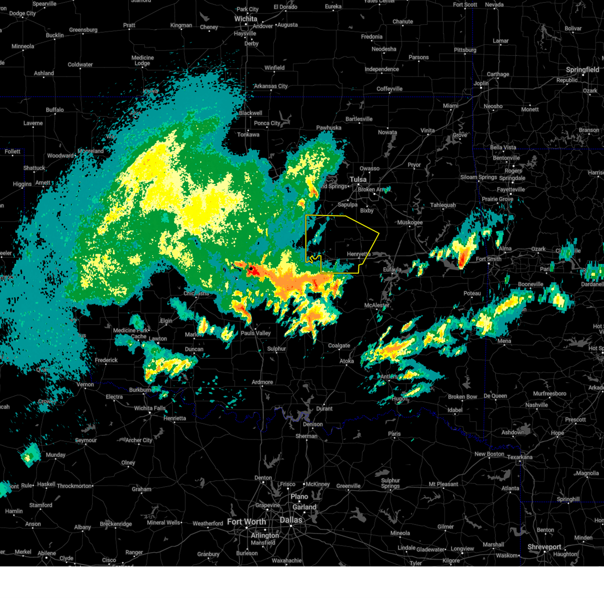 Svrtsa the national weather service in tulsa has issued a * severe thunderstorm warning for, southwestern creek county in northeastern oklahoma, okmulgee county in northeastern oklahoma, okfuskee county in east central oklahoma, * until 630 am cdt. * at 547 am cdt, severe thunderstorms were located along a line extending from 4 miles west of little to 4 miles southeast of bearden to 4 miles southeast of wetumka, moving north at 60 mph (radar indicated). Hazards include 60 mph wind gusts and quarter size hail. Hail damage to vehicles is expected. expect wind damage to roofs, siding, and trees. locations in or near the path include, beggs, preston, boley, paden, weleetka, dewar, depew, clearview, schulter, morris, pharoah, grayson, bryant, bristow, okmulgee, okemah, okfuskee, henryetta, milfay, mason, this includes the following highways, interstate 40 in oklahoma between mile markers 212 and 241. Interstate 44 between mile markers 178 and 192. Svrtsa the national weather service in tulsa has issued a * severe thunderstorm warning for, southwestern creek county in northeastern oklahoma, okmulgee county in northeastern oklahoma, okfuskee county in east central oklahoma, * until 630 am cdt. * at 547 am cdt, severe thunderstorms were located along a line extending from 4 miles west of little to 4 miles southeast of bearden to 4 miles southeast of wetumka, moving north at 60 mph (radar indicated). Hazards include 60 mph wind gusts and quarter size hail. Hail damage to vehicles is expected. expect wind damage to roofs, siding, and trees. locations in or near the path include, beggs, preston, boley, paden, weleetka, dewar, depew, clearview, schulter, morris, pharoah, grayson, bryant, bristow, okmulgee, okemah, okfuskee, henryetta, milfay, mason, this includes the following highways, interstate 40 in oklahoma between mile markers 212 and 241. Interstate 44 between mile markers 178 and 192.
|
| 4/2/2025 7:50 AM CDT |
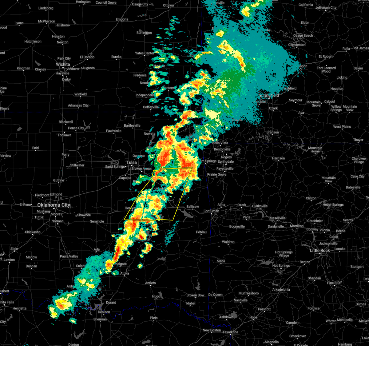 At 750 am cdt, severe thunderstorms were located along a line extending from 4 miles east of peggs to 6 miles northwest of enterprise, moving east at 55 mph (radar indicated). Hazards include 60 mph wind gusts and nickel size hail. Expect damage to roofs, siding, and trees. Locations in or near the path include, summit, pumpkin center, webbers falls, fort gibson, porum, braggs, okay, pierce, schulter, scraper, eram, haskell, lake eufaula state park, morris, gore, keefeton, bryant, tahlequah, tullahassee, hulbert, this includes interstate 40 in oklahoma between mile markers 235 and 289. At 750 am cdt, severe thunderstorms were located along a line extending from 4 miles east of peggs to 6 miles northwest of enterprise, moving east at 55 mph (radar indicated). Hazards include 60 mph wind gusts and nickel size hail. Expect damage to roofs, siding, and trees. Locations in or near the path include, summit, pumpkin center, webbers falls, fort gibson, porum, braggs, okay, pierce, schulter, scraper, eram, haskell, lake eufaula state park, morris, gore, keefeton, bryant, tahlequah, tullahassee, hulbert, this includes interstate 40 in oklahoma between mile markers 235 and 289.
|
| 4/2/2025 7:50 AM CDT |
 the severe thunderstorm warning has been cancelled and is no longer in effect the severe thunderstorm warning has been cancelled and is no longer in effect
|
| 4/2/2025 7:21 AM CDT |
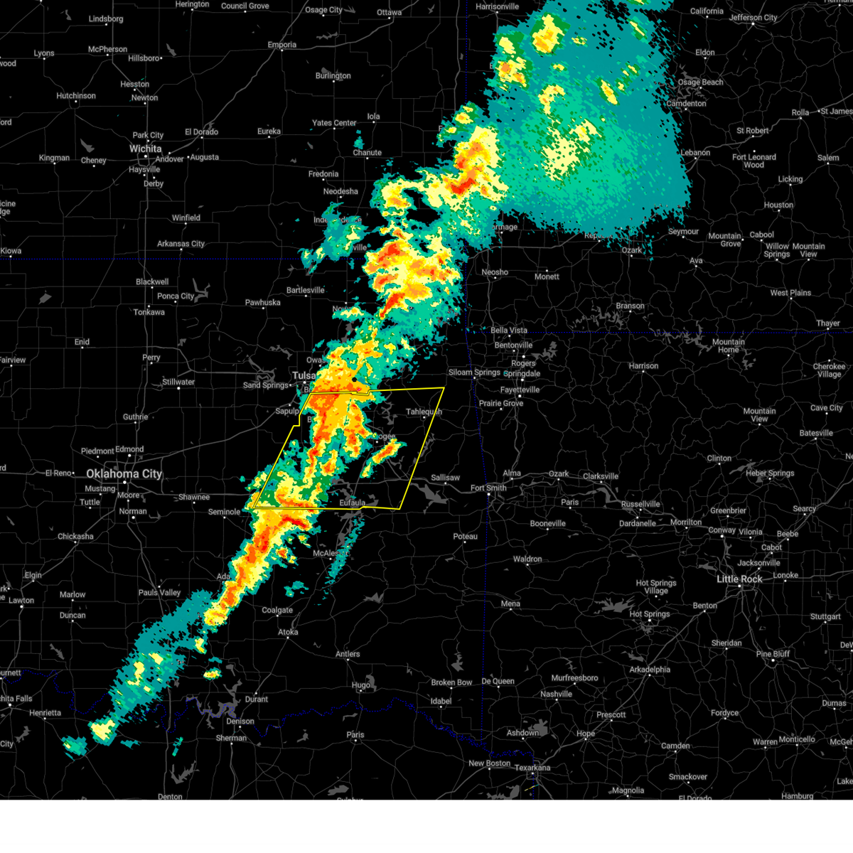 Svrtsa the national weather service in tulsa has issued a * severe thunderstorm warning for, northwestern haskell county in southeastern oklahoma, mcintosh county in southeastern oklahoma, northwestern sequoyah county in east central oklahoma, southwestern mayes county in northeastern oklahoma, wagoner county in northeastern oklahoma, cherokee county in east central oklahoma, okmulgee county in northeastern oklahoma, muskogee county in east central oklahoma, southeastern tulsa county in northeastern oklahoma, eastern okfuskee county in east central oklahoma, * until 800 am cdt. * at 720 am cdt, severe thunderstorms were located along a line extending from 3 miles southeast of inola to 7 miles northeast of dustin, moving east at 60 mph (radar indicated). Hazards include 60 mph wind gusts and quarter size hail. Hail damage to vehicles is expected. expect wind damage to roofs, siding, and trees. Locations in or near the path include, beggs, summit, pumpkin center, webbers falls, fort gibson, porum, braggs, okay, pierce, clearview, schulter, stonebluff, hectorville, scraper, eram, haskell, leonard, lake eufaula state park, morris, gore, this includes interstate 40 in oklahoma between mile markers 217 and 289. Svrtsa the national weather service in tulsa has issued a * severe thunderstorm warning for, northwestern haskell county in southeastern oklahoma, mcintosh county in southeastern oklahoma, northwestern sequoyah county in east central oklahoma, southwestern mayes county in northeastern oklahoma, wagoner county in northeastern oklahoma, cherokee county in east central oklahoma, okmulgee county in northeastern oklahoma, muskogee county in east central oklahoma, southeastern tulsa county in northeastern oklahoma, eastern okfuskee county in east central oklahoma, * until 800 am cdt. * at 720 am cdt, severe thunderstorms were located along a line extending from 3 miles southeast of inola to 7 miles northeast of dustin, moving east at 60 mph (radar indicated). Hazards include 60 mph wind gusts and quarter size hail. Hail damage to vehicles is expected. expect wind damage to roofs, siding, and trees. Locations in or near the path include, beggs, summit, pumpkin center, webbers falls, fort gibson, porum, braggs, okay, pierce, clearview, schulter, stonebluff, hectorville, scraper, eram, haskell, leonard, lake eufaula state park, morris, gore, this includes interstate 40 in oklahoma between mile markers 217 and 289.
|
| 4/2/2025 7:06 AM CDT |
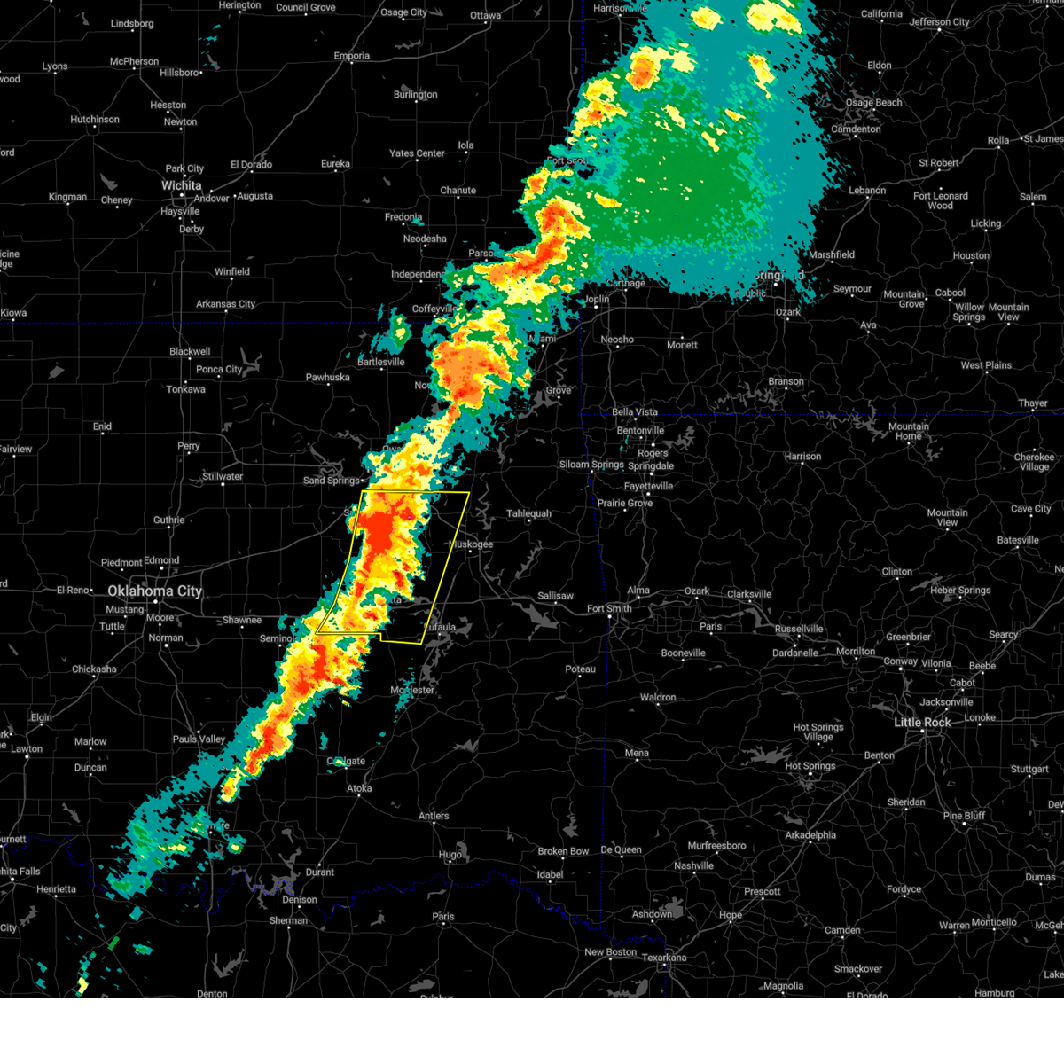 At 706 am cdt, severe thunderstorms were located along a line extending from 5 miles east of jenks riverside airport to 5 miles north of wetumka, moving east at 45 mph (radar indicated). Hazards include 60 mph wind gusts and quarter size hail. Hail damage to vehicles is expected. expect wind damage to roofs, siding, and trees. locations in or near the path include, beggs, broken arrow, preston, sapulpa, raiford, weleetka, dewar, jenks riverside airport, liberty, vivian, mounds, pierce, clearview, schulter, stonebluff, hectorville, eram, haskell, leonard, jenks, this includes the following highways, interstate 40 in oklahoma between mile markers 219 and 258. Interstate 44 between mile markers 211 and 216. At 706 am cdt, severe thunderstorms were located along a line extending from 5 miles east of jenks riverside airport to 5 miles north of wetumka, moving east at 45 mph (radar indicated). Hazards include 60 mph wind gusts and quarter size hail. Hail damage to vehicles is expected. expect wind damage to roofs, siding, and trees. locations in or near the path include, beggs, broken arrow, preston, sapulpa, raiford, weleetka, dewar, jenks riverside airport, liberty, vivian, mounds, pierce, clearview, schulter, stonebluff, hectorville, eram, haskell, leonard, jenks, this includes the following highways, interstate 40 in oklahoma between mile markers 219 and 258. Interstate 44 between mile markers 211 and 216.
|
| 4/2/2025 6:48 AM CDT |
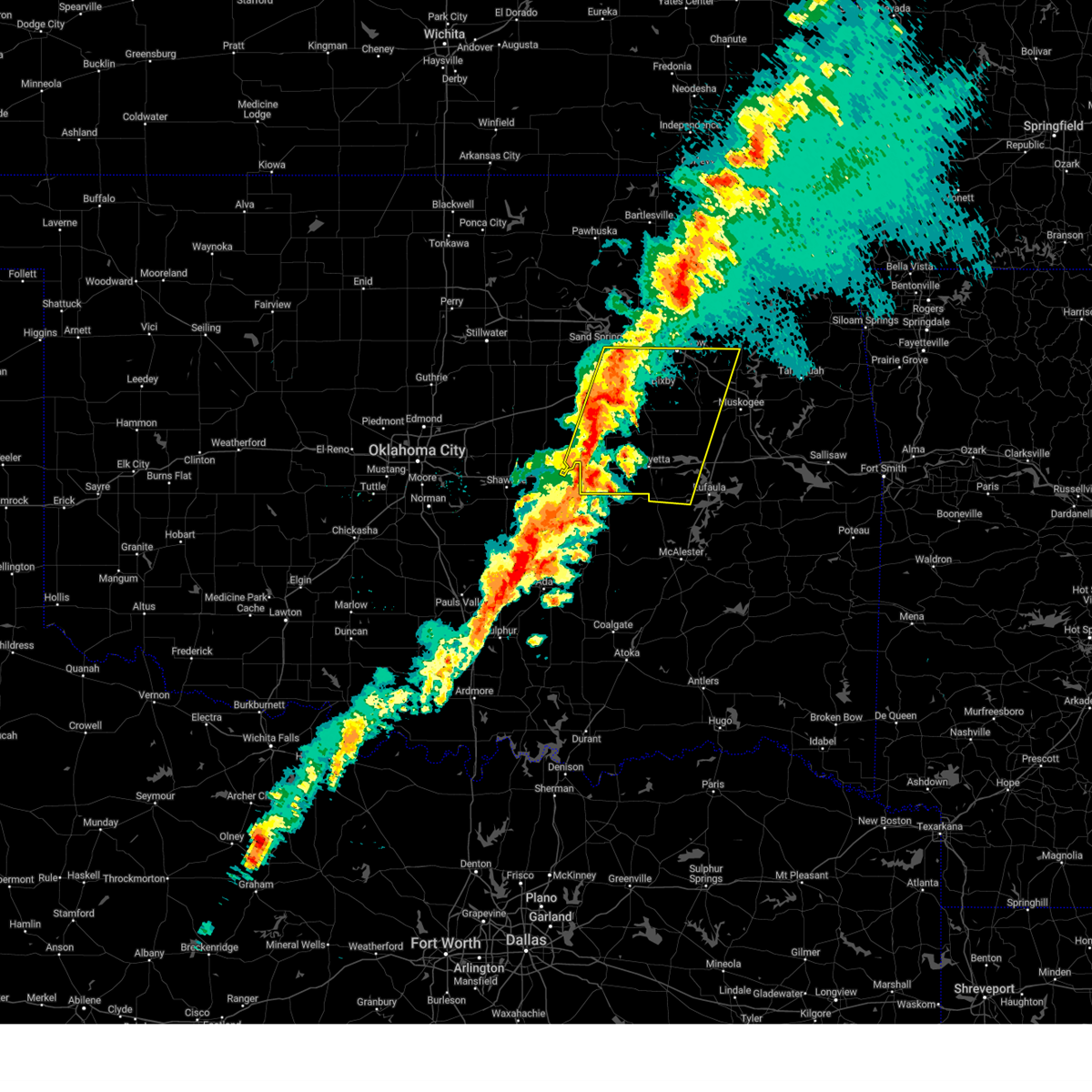 Svrtsa the national weather service in tulsa has issued a * severe thunderstorm warning for, eastern creek county in northeastern oklahoma, western mcintosh county in southeastern oklahoma, southwestern wagoner county in northeastern oklahoma, okmulgee county in northeastern oklahoma, northwestern muskogee county in east central oklahoma, southern tulsa county in northeastern oklahoma, okfuskee county in east central oklahoma, * until 745 am cdt. * at 648 am cdt, severe thunderstorms were located along a line extending from 2 miles north of sapulpa to 3 miles south of cromwell, moving east at 45 mph (radar indicated). Hazards include 60 mph wind gusts and quarter size hail. Hail damage to vehicles is expected. expect wind damage to roofs, siding, and trees. locations in or near the path include, beggs, sapulpa, raiford, jenks riverside airport, mounds, pierce, clearview, schulter, stonebluff, hectorville, eram, haskell, leonard, morris, pharoah, bryant, hoffman, okmulgee, hitchita, okemah, this includes the following highways, interstate 40 in oklahoma between mile markers 212 and 258. Interstate 44 between mile markers 193 and 216. Svrtsa the national weather service in tulsa has issued a * severe thunderstorm warning for, eastern creek county in northeastern oklahoma, western mcintosh county in southeastern oklahoma, southwestern wagoner county in northeastern oklahoma, okmulgee county in northeastern oklahoma, northwestern muskogee county in east central oklahoma, southern tulsa county in northeastern oklahoma, okfuskee county in east central oklahoma, * until 745 am cdt. * at 648 am cdt, severe thunderstorms were located along a line extending from 2 miles north of sapulpa to 3 miles south of cromwell, moving east at 45 mph (radar indicated). Hazards include 60 mph wind gusts and quarter size hail. Hail damage to vehicles is expected. expect wind damage to roofs, siding, and trees. locations in or near the path include, beggs, sapulpa, raiford, jenks riverside airport, mounds, pierce, clearview, schulter, stonebluff, hectorville, eram, haskell, leonard, morris, pharoah, bryant, hoffman, okmulgee, hitchita, okemah, this includes the following highways, interstate 40 in oklahoma between mile markers 212 and 258. Interstate 44 between mile markers 193 and 216.
|
| 3/30/2025 12:37 AM CDT |
 the severe thunderstorm warning has been cancelled and is no longer in effect the severe thunderstorm warning has been cancelled and is no longer in effect
|
| 3/30/2025 12:37 AM CDT |
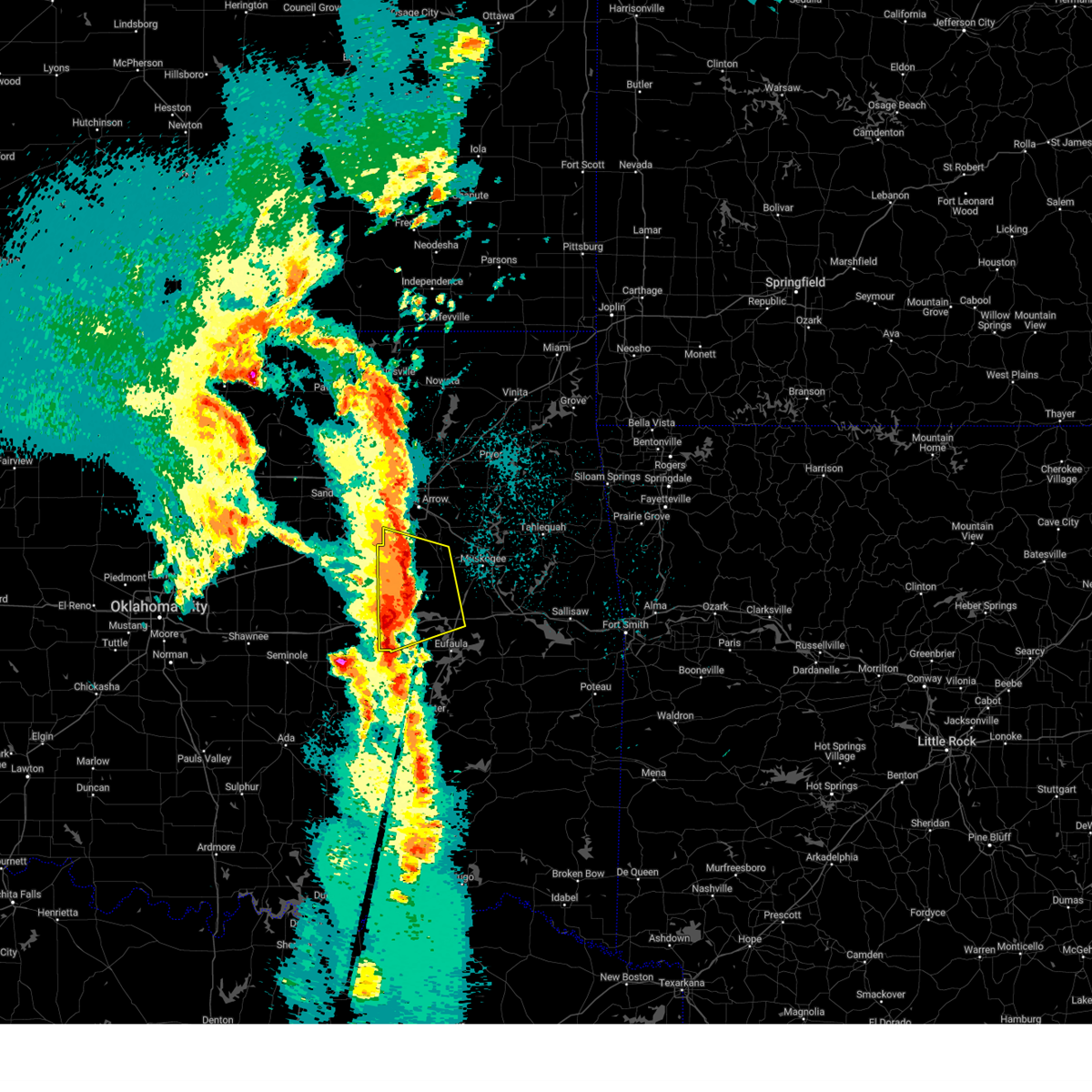 At 1236 am cdt, a severe thunderstorm was located 3 miles south of bald hill, moving northeast at 65 to 70 mph (radar indicated). Hazards include 60 mph wind gusts and quarter size hail. Hail damage to vehicles is expected. expect wind damage to roofs, siding, and trees. Locations in or near the path include, preston, dewar, liberty, pierce, schulter, hectorville, eram, checotah, haskell, lake eufaula state park, morris, grayson, wainwright, hoffman, okmulgee, jamesville, hitchita, bald hill, henryetta, boynton, this includes interstate 40 in oklahoma between mile markers 234 and 265. At 1236 am cdt, a severe thunderstorm was located 3 miles south of bald hill, moving northeast at 65 to 70 mph (radar indicated). Hazards include 60 mph wind gusts and quarter size hail. Hail damage to vehicles is expected. expect wind damage to roofs, siding, and trees. Locations in or near the path include, preston, dewar, liberty, pierce, schulter, hectorville, eram, checotah, haskell, lake eufaula state park, morris, grayson, wainwright, hoffman, okmulgee, jamesville, hitchita, bald hill, henryetta, boynton, this includes interstate 40 in oklahoma between mile markers 234 and 265.
|
| 3/30/2025 12:35 AM CDT | Roof of barn blown off and power lines dow in okmulgee county OK, 5.4 miles SSW of Morris, OK |
| 3/30/2025 12:35 AM CDT |
 Svrtsa the national weather service in tulsa has issued a * severe thunderstorm warning for, central rogers county in northeastern oklahoma, northwestern mcintosh county in southeastern oklahoma, mayes county in northeastern oklahoma, wagoner county in northeastern oklahoma, northwestern cherokee county in east central oklahoma, eastern okmulgee county in northeastern oklahoma, northern muskogee county in east central oklahoma, southeastern tulsa county in northeastern oklahoma, * until 115 am cdt. * at 1234 am cdt, severe thunderstorms were located along a line extending from 3 miles east of jenks riverside airport to 3 miles east of morris to 4 miles east of dustin, moving northeast at 70 mph (radar indicated). Hazards include 60 mph wind gusts and quarter size hail. Hail damage to vehicles is expected. expect wind damage to roofs, siding, and trees. locations in or near the path include, inola, mazie, summit, locust grove, fort gibson, okay, pierce, schulter, stonebluff, hectorville, chouteau, eram, chelsea, haskell, leonard, morris, murphy, bushyhead, tullahassee, hoffman, this includes the following highways, interstate 40 in oklahoma between mile markers 238 and 260. Interstate 44 between mile markers 224 and 272. Svrtsa the national weather service in tulsa has issued a * severe thunderstorm warning for, central rogers county in northeastern oklahoma, northwestern mcintosh county in southeastern oklahoma, mayes county in northeastern oklahoma, wagoner county in northeastern oklahoma, northwestern cherokee county in east central oklahoma, eastern okmulgee county in northeastern oklahoma, northern muskogee county in east central oklahoma, southeastern tulsa county in northeastern oklahoma, * until 115 am cdt. * at 1234 am cdt, severe thunderstorms were located along a line extending from 3 miles east of jenks riverside airport to 3 miles east of morris to 4 miles east of dustin, moving northeast at 70 mph (radar indicated). Hazards include 60 mph wind gusts and quarter size hail. Hail damage to vehicles is expected. expect wind damage to roofs, siding, and trees. locations in or near the path include, inola, mazie, summit, locust grove, fort gibson, okay, pierce, schulter, stonebluff, hectorville, chouteau, eram, chelsea, haskell, leonard, morris, murphy, bushyhead, tullahassee, hoffman, this includes the following highways, interstate 40 in oklahoma between mile markers 238 and 260. Interstate 44 between mile markers 224 and 272.
|
| 3/30/2025 12:20 AM CDT |
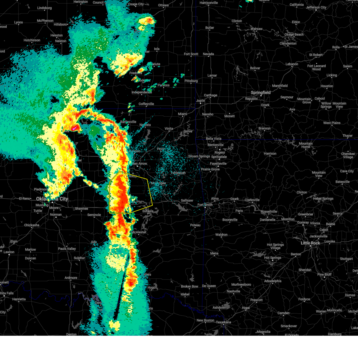 At 1219 am cdt, a severe thunderstorm was located 6 miles southwest of okmulgee state park, moving northeast at 55 mph (radar indicated). Hazards include 70 mph wind gusts and quarter size hail. Hail damage to vehicles is expected. expect considerable tree damage. wind damage is also likely to mobile homes, roofs, and outbuildings. Locations in or near the path include, beggs, preston, weleetka, dewar, liberty, mounds, pierce, clearview, schulter, hectorville, eram, checotah, haskell, lake eufaula state park, morris, pharoah, grayson, bryant, wainwright, hoffman, this includes interstate 40 in oklahoma between mile markers 217 and 265. At 1219 am cdt, a severe thunderstorm was located 6 miles southwest of okmulgee state park, moving northeast at 55 mph (radar indicated). Hazards include 70 mph wind gusts and quarter size hail. Hail damage to vehicles is expected. expect considerable tree damage. wind damage is also likely to mobile homes, roofs, and outbuildings. Locations in or near the path include, beggs, preston, weleetka, dewar, liberty, mounds, pierce, clearview, schulter, hectorville, eram, checotah, haskell, lake eufaula state park, morris, pharoah, grayson, bryant, wainwright, hoffman, this includes interstate 40 in oklahoma between mile markers 217 and 265.
|
| 3/30/2025 12:09 AM CDT |
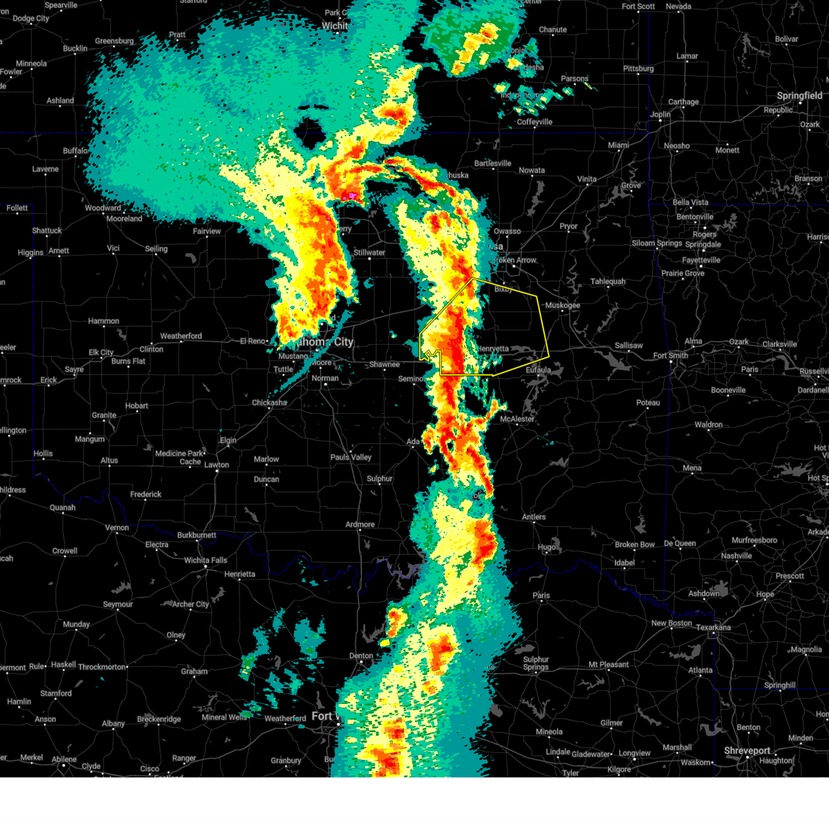 At 1209 am cdt, a severe thunderstorm was located 3 miles east of okemah, moving northeast at 60 mph (radar indicated). Hazards include 70 mph wind gusts and quarter size hail. Hail damage to vehicles is expected. expect considerable tree damage. wind damage is also likely to mobile homes, roofs, and outbuildings. Locations in or near the path include, beggs, preston, boley, paden, weleetka, dewar, liberty, mounds, pierce, clearview, schulter, hectorville, eram, checotah, haskell, lake eufaula state park, morris, pharoah, grayson, bryant, this includes interstate 40 in oklahoma between mile markers 212 and 265. At 1209 am cdt, a severe thunderstorm was located 3 miles east of okemah, moving northeast at 60 mph (radar indicated). Hazards include 70 mph wind gusts and quarter size hail. Hail damage to vehicles is expected. expect considerable tree damage. wind damage is also likely to mobile homes, roofs, and outbuildings. Locations in or near the path include, beggs, preston, boley, paden, weleetka, dewar, liberty, mounds, pierce, clearview, schulter, hectorville, eram, checotah, haskell, lake eufaula state park, morris, pharoah, grayson, bryant, this includes interstate 40 in oklahoma between mile markers 212 and 265.
|
| 3/30/2025 12:04 AM CDT |
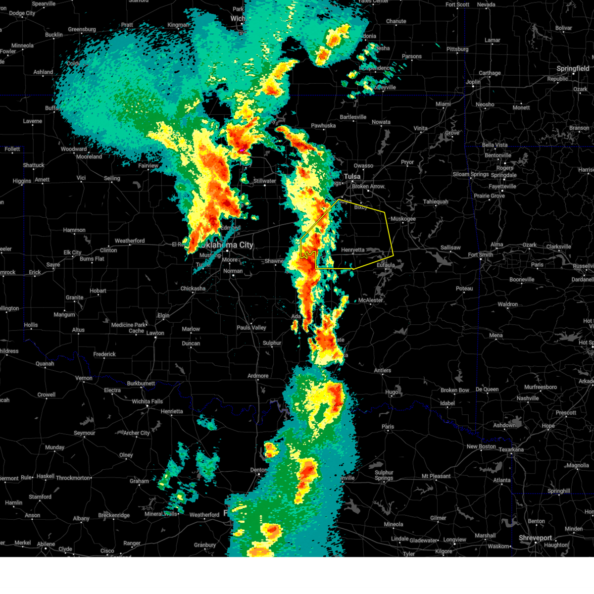 Svrtsa the national weather service in tulsa has issued a * severe thunderstorm warning for, southeastern creek county in northeastern oklahoma, northern mcintosh county in southeastern oklahoma, southwestern wagoner county in northeastern oklahoma, okmulgee county in northeastern oklahoma, northwestern muskogee county in east central oklahoma, south central tulsa county in northeastern oklahoma, okfuskee county in east central oklahoma, * until 1245 am cdt. * at 1203 am cdt, a severe thunderstorm was located over okemah, moving northeast at 65 mph (radar indicated). Hazards include 60 mph wind gusts and quarter size hail. Hail damage to vehicles is expected. expect wind damage to roofs, siding, and trees. Locations in or near the path include, beggs, preston, boley, paden, weleetka, dewar, liberty, mounds, pierce, clearview, schulter, hectorville, eram, checotah, haskell, lake eufaula state park, morris, pharoah, grayson, bryant, this includes interstate 40 in oklahoma between mile markers 212 and 265. Svrtsa the national weather service in tulsa has issued a * severe thunderstorm warning for, southeastern creek county in northeastern oklahoma, northern mcintosh county in southeastern oklahoma, southwestern wagoner county in northeastern oklahoma, okmulgee county in northeastern oklahoma, northwestern muskogee county in east central oklahoma, south central tulsa county in northeastern oklahoma, okfuskee county in east central oklahoma, * until 1245 am cdt. * at 1203 am cdt, a severe thunderstorm was located over okemah, moving northeast at 65 mph (radar indicated). Hazards include 60 mph wind gusts and quarter size hail. Hail damage to vehicles is expected. expect wind damage to roofs, siding, and trees. Locations in or near the path include, beggs, preston, boley, paden, weleetka, dewar, liberty, mounds, pierce, clearview, schulter, hectorville, eram, checotah, haskell, lake eufaula state park, morris, pharoah, grayson, bryant, this includes interstate 40 in oklahoma between mile markers 212 and 265.
|
| 3/4/2025 6:49 AM CST |
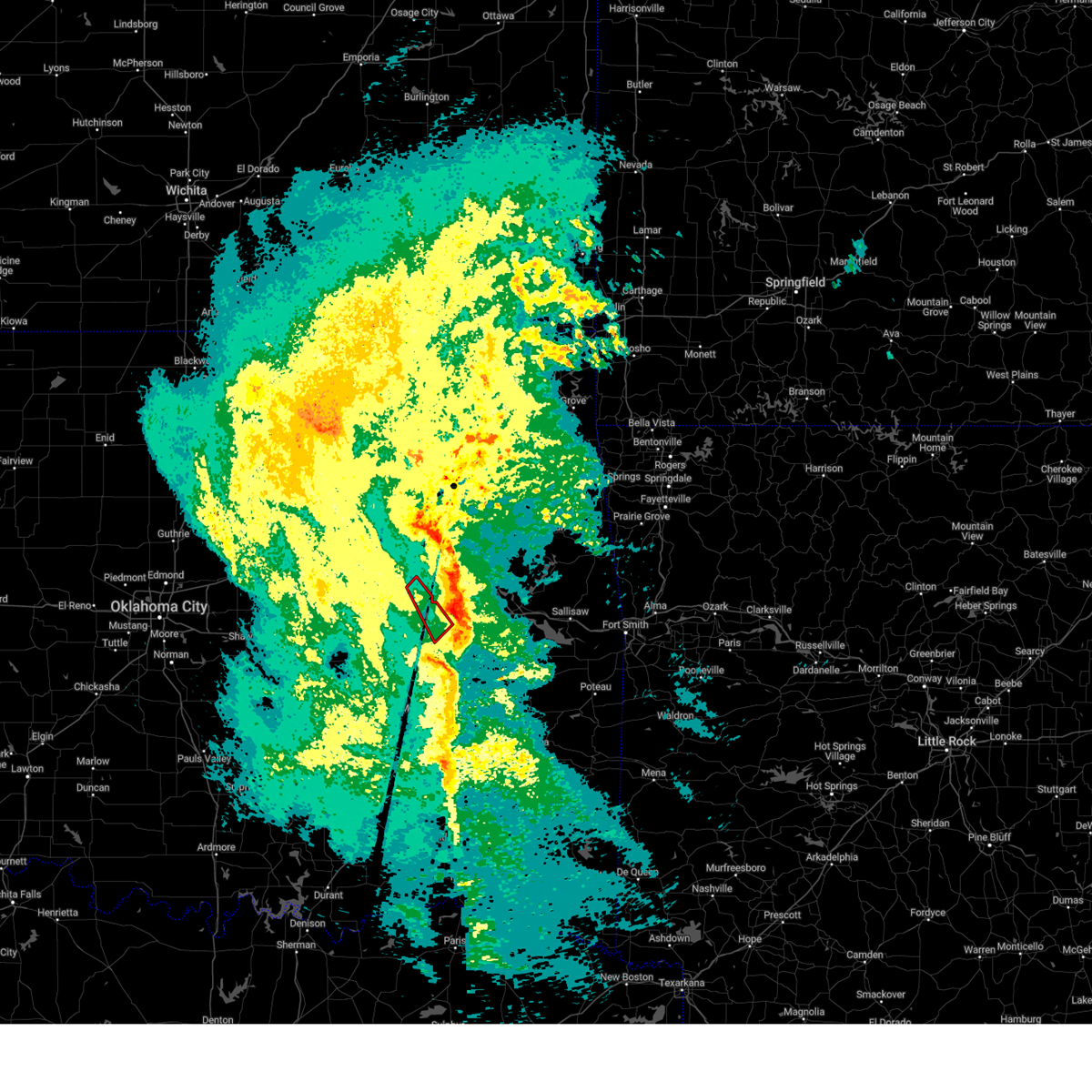 the tornado warning has been cancelled and is no longer in effect the tornado warning has been cancelled and is no longer in effect
|
| 3/4/2025 6:34 AM CST |
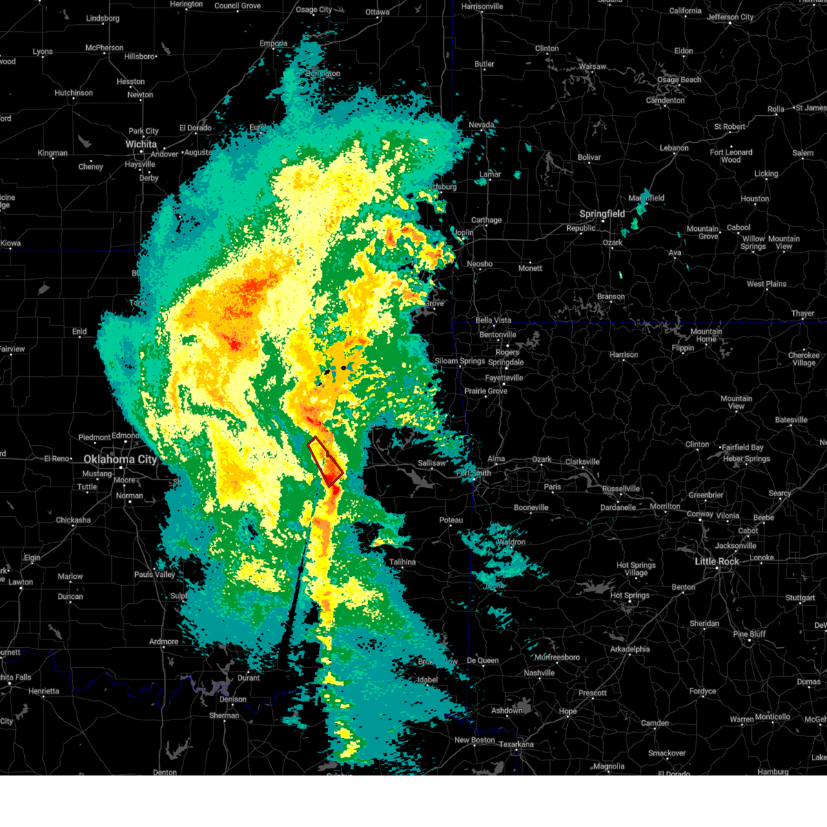 At 634 am cst, a severe squall line capable of producing tornadoes that may not be visible due to heavy rain was located along a line extending from 2 miles east of morris to 3 miles south of lake eufaula state park, moving northeast at 40 mph (radar indicated rotation). Hazards include tornado. Flying debris will be dangerous to those caught without shelter. mobile homes will be damaged or destroyed. damage to roofs, windows, and vehicles will occur. tree damage is likely. Locations in or near the path include, eram, morris, pierce, stidham, hitchita, lake eufaula state park, this includes interstate 40 in oklahoma between mile markers 251 and 260. At 634 am cst, a severe squall line capable of producing tornadoes that may not be visible due to heavy rain was located along a line extending from 2 miles east of morris to 3 miles south of lake eufaula state park, moving northeast at 40 mph (radar indicated rotation). Hazards include tornado. Flying debris will be dangerous to those caught without shelter. mobile homes will be damaged or destroyed. damage to roofs, windows, and vehicles will occur. tree damage is likely. Locations in or near the path include, eram, morris, pierce, stidham, hitchita, lake eufaula state park, this includes interstate 40 in oklahoma between mile markers 251 and 260.
|
| 3/4/2025 6:13 AM CST |
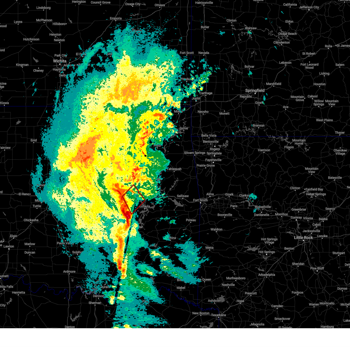 Tortsa the national weather service in tulsa has issued a * tornado warning for, western mcintosh county in southeastern oklahoma, southeastern okmulgee county in northeastern oklahoma, * until 700 am cst. * at 612 am cst, a severe squall line capable of producing tornadoes that may not be visible due to heavy rain was located along a line extending from near henryetta to 3 miles southwest of raiford, moving northeast at 40 mph (radar indicated rotation). Hazards include tornado. Flying debris will be dangerous to those caught without shelter. mobile homes will be damaged or destroyed. damage to roofs, windows, and vehicles will occur. tree damage is likely. Locations in or near the path include, henryetta, pierce, hoffman, schulter, stidham, hitchita, eram, raiford, lake eufaula state park, morris, dewar, grayson, this includes interstate 40 in oklahoma between mile markers 237 and 260. Tortsa the national weather service in tulsa has issued a * tornado warning for, western mcintosh county in southeastern oklahoma, southeastern okmulgee county in northeastern oklahoma, * until 700 am cst. * at 612 am cst, a severe squall line capable of producing tornadoes that may not be visible due to heavy rain was located along a line extending from near henryetta to 3 miles southwest of raiford, moving northeast at 40 mph (radar indicated rotation). Hazards include tornado. Flying debris will be dangerous to those caught without shelter. mobile homes will be damaged or destroyed. damage to roofs, windows, and vehicles will occur. tree damage is likely. Locations in or near the path include, henryetta, pierce, hoffman, schulter, stidham, hitchita, eram, raiford, lake eufaula state park, morris, dewar, grayson, this includes interstate 40 in oklahoma between mile markers 237 and 260.
|
| 3/4/2025 6:02 AM CST |
 At 601 am cst, severe thunderstorms were located along a line extending from 4 miles north of pharoah to 4 miles northwest of hanna to 3 miles west of haywood, moving northeast at 55 mph (radar indicated). Hazards include 70 mph wind gusts and quarter size hail. Hail damage to vehicles is expected. expect considerable tree damage. wind damage is also likely to mobile homes, roofs, and outbuildings. Locations in or near the path include, arpelar, canadian, raiford, weleetka, dewar, haywood, vivian, hanna, pierce, clearview, schulter, morris, pharoah, grayson, bryant, hoffman, okmulgee, indianola, crowder, hitchita, this includes interstate 40 in oklahoma between mile markers 227 and 258. At 601 am cst, severe thunderstorms were located along a line extending from 4 miles north of pharoah to 4 miles northwest of hanna to 3 miles west of haywood, moving northeast at 55 mph (radar indicated). Hazards include 70 mph wind gusts and quarter size hail. Hail damage to vehicles is expected. expect considerable tree damage. wind damage is also likely to mobile homes, roofs, and outbuildings. Locations in or near the path include, arpelar, canadian, raiford, weleetka, dewar, haywood, vivian, hanna, pierce, clearview, schulter, morris, pharoah, grayson, bryant, hoffman, okmulgee, indianola, crowder, hitchita, this includes interstate 40 in oklahoma between mile markers 227 and 258.
|
| 3/4/2025 5:39 AM CST |
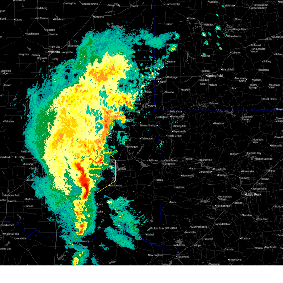 Svrtsa the national weather service in tulsa has issued a * severe thunderstorm warning for, western mcintosh county in southeastern oklahoma, northwestern pittsburg county in southeastern oklahoma, southern okmulgee county in northeastern oklahoma, southeastern okfuskee county in east central oklahoma, * until 630 am cst. * at 538 am cst, severe thunderstorms were located along a line extending from 5 miles south of bearden to 3 miles south of horntown to 5 miles northeast of centrahoma, moving northeast at 55 mph (radar indicated). Hazards include 70 mph wind gusts and quarter size hail. Hail damage to vehicles is expected. expect considerable tree damage. wind damage is also likely to mobile homes, roofs, and outbuildings. Locations in or near the path include, arpelar, canadian, raiford, weleetka, dewar, haywood, vivian, hanna, pierce, clearview, schulter, morris, pharoah, grayson, bryant, hoffman, okmulgee, indianola, crowder, hitchita, this includes interstate 40 in oklahoma between mile markers 227 and 258. Svrtsa the national weather service in tulsa has issued a * severe thunderstorm warning for, western mcintosh county in southeastern oklahoma, northwestern pittsburg county in southeastern oklahoma, southern okmulgee county in northeastern oklahoma, southeastern okfuskee county in east central oklahoma, * until 630 am cst. * at 538 am cst, severe thunderstorms were located along a line extending from 5 miles south of bearden to 3 miles south of horntown to 5 miles northeast of centrahoma, moving northeast at 55 mph (radar indicated). Hazards include 70 mph wind gusts and quarter size hail. Hail damage to vehicles is expected. expect considerable tree damage. wind damage is also likely to mobile homes, roofs, and outbuildings. Locations in or near the path include, arpelar, canadian, raiford, weleetka, dewar, haywood, vivian, hanna, pierce, clearview, schulter, morris, pharoah, grayson, bryant, hoffman, okmulgee, indianola, crowder, hitchita, this includes interstate 40 in oklahoma between mile markers 227 and 258.
|
| 11/4/2024 1:00 PM CST |
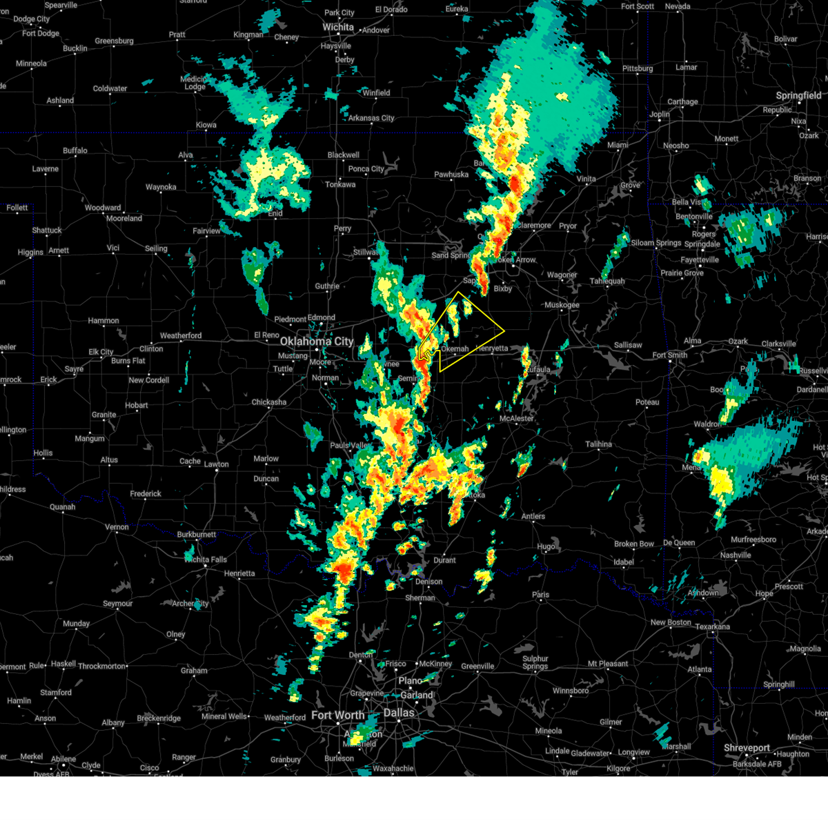 Svrtsa the national weather service in tulsa has issued a * severe thunderstorm warning for, south central creek county in northeastern oklahoma, west central okmulgee county in northeastern oklahoma, okfuskee county in east central oklahoma, * until 145 pm cst. * at 100 pm cst, a severe thunderstorm was located 6 miles northwest of cromwell, moving northeast at 50 mph (radar indicated). Hazards include 60 mph wind gusts and penny size hail. Expect damage to roofs, siding, and trees. Locations in or near the path include, okmulgee, okemah, okfuskee, beggs, boley, paden, bearden, slick, castle, okmulgee state park, welty, mason, this includes interstate 40 in oklahoma between mile markers 212 and 224. Svrtsa the national weather service in tulsa has issued a * severe thunderstorm warning for, south central creek county in northeastern oklahoma, west central okmulgee county in northeastern oklahoma, okfuskee county in east central oklahoma, * until 145 pm cst. * at 100 pm cst, a severe thunderstorm was located 6 miles northwest of cromwell, moving northeast at 50 mph (radar indicated). Hazards include 60 mph wind gusts and penny size hail. Expect damage to roofs, siding, and trees. Locations in or near the path include, okmulgee, okemah, okfuskee, beggs, boley, paden, bearden, slick, castle, okmulgee state park, welty, mason, this includes interstate 40 in oklahoma between mile markers 212 and 224.
|
| 11/3/2024 4:17 AM CST |
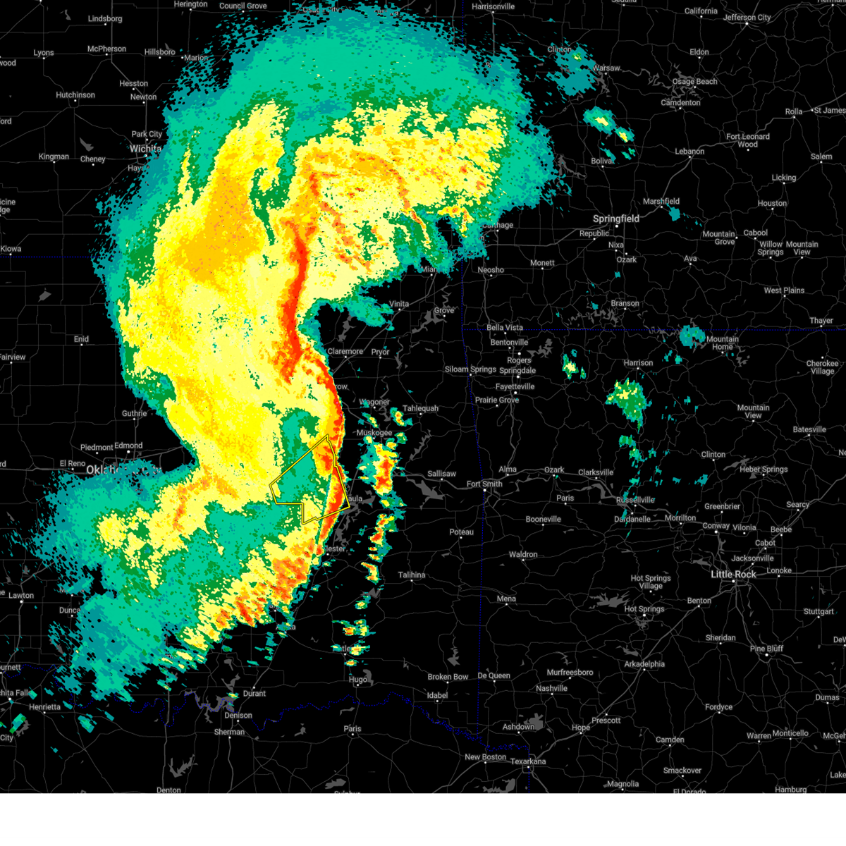 the severe thunderstorm warning has been cancelled and is no longer in effect the severe thunderstorm warning has been cancelled and is no longer in effect
|
| 11/3/2024 4:06 AM CST |
 the severe thunderstorm warning has been cancelled and is no longer in effect the severe thunderstorm warning has been cancelled and is no longer in effect
|
| 11/3/2024 4:06 AM CST |
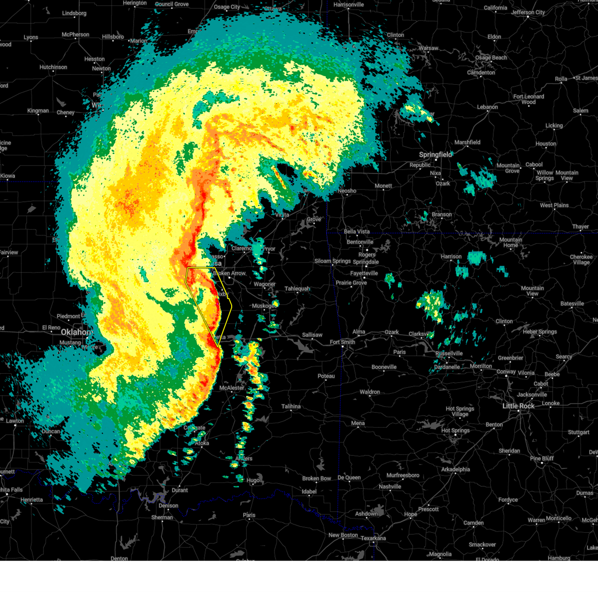 At 406 am cst, severe thunderstorms were located along a line extending from 2 miles west of tulsa to 4 miles west of haskell to 4 miles southeast of hoffman, moving east at 50 mph (radar indicated). Hazards include 70 mph wind gusts. Expect considerable tree damage. damage is likely to mobile homes, roofs, and outbuildings. locations in or near the path include, tulsa, sand springs, okmulgee, bixby, sapulpa, jenks, glenpool, henryetta, mannford, kiefer, morris, beggs, mounds, kellyville, dewar, schulter, keystone state park, preston, jenks riverside airport, bald hill, this includes the following highways, interstate 40 in oklahoma between mile markers 239 and 241. Interstate 44 between mile markers 201 and 223. At 406 am cst, severe thunderstorms were located along a line extending from 2 miles west of tulsa to 4 miles west of haskell to 4 miles southeast of hoffman, moving east at 50 mph (radar indicated). Hazards include 70 mph wind gusts. Expect considerable tree damage. damage is likely to mobile homes, roofs, and outbuildings. locations in or near the path include, tulsa, sand springs, okmulgee, bixby, sapulpa, jenks, glenpool, henryetta, mannford, kiefer, morris, beggs, mounds, kellyville, dewar, schulter, keystone state park, preston, jenks riverside airport, bald hill, this includes the following highways, interstate 40 in oklahoma between mile markers 239 and 241. Interstate 44 between mile markers 201 and 223.
|
| 11/3/2024 3:43 AM CST |
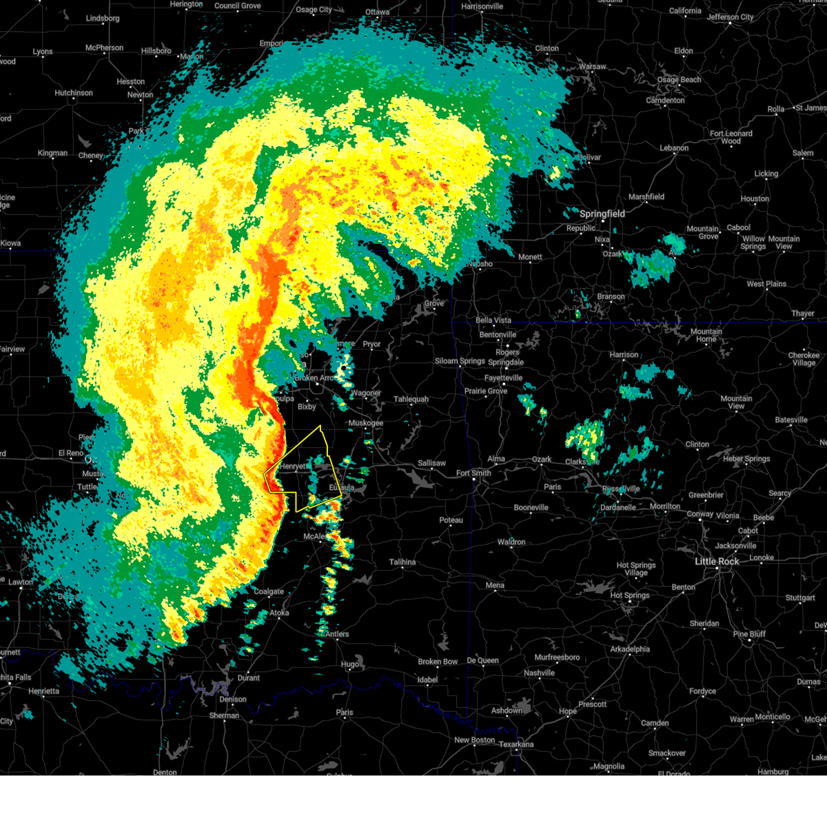 Svrtsa the national weather service in tulsa has issued a * severe thunderstorm warning for, western mcintosh county in southeastern oklahoma, southern okmulgee county in northeastern oklahoma, southeastern okfuskee county in east central oklahoma, * until 430 am cst. * at 343 am cst, severe thunderstorms were located along a line extending from 2 miles north of weleetka to 2 miles southwest of dustin to 2 miles southeast of lamar, moving east at 80 mph (radar indicated). Hazards include 70 mph wind gusts. Expect considerable tree damage. damage is likely to mobile homes, roofs, and outbuildings. Locations in or near the path include, okmulgee, eufaula, henryetta, morris, weleetka, dewar, schulter, grayson, hanna, hoffman, clearview, stidham, raiford, vivian, pharoah, hitchita, bryant, vernon, pierce, eram, this includes interstate 40 in oklahoma between mile markers 223 and 256. Svrtsa the national weather service in tulsa has issued a * severe thunderstorm warning for, western mcintosh county in southeastern oklahoma, southern okmulgee county in northeastern oklahoma, southeastern okfuskee county in east central oklahoma, * until 430 am cst. * at 343 am cst, severe thunderstorms were located along a line extending from 2 miles north of weleetka to 2 miles southwest of dustin to 2 miles southeast of lamar, moving east at 80 mph (radar indicated). Hazards include 70 mph wind gusts. Expect considerable tree damage. damage is likely to mobile homes, roofs, and outbuildings. Locations in or near the path include, okmulgee, eufaula, henryetta, morris, weleetka, dewar, schulter, grayson, hanna, hoffman, clearview, stidham, raiford, vivian, pharoah, hitchita, bryant, vernon, pierce, eram, this includes interstate 40 in oklahoma between mile markers 223 and 256.
|
| 11/3/2024 3:29 AM CST |
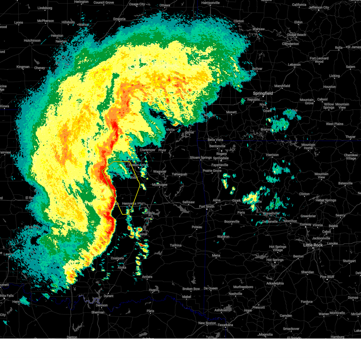 Svrtsa the national weather service in tulsa has issued a * severe thunderstorm warning for, central creek county in northeastern oklahoma, okmulgee county in northeastern oklahoma, southern tulsa county in northeastern oklahoma, eastern okfuskee county in east central oklahoma, * until 415 am cst. * at 329 am cst, severe thunderstorms were located along a line extending from 6 miles east of drumright to 6 miles northwest of okfuskee to 4 miles southeast of bearden, moving east at 50 mph (radar indicated). Hazards include 70 mph wind gusts. Expect considerable tree damage. damage is likely to mobile homes, roofs, and outbuildings. locations in or near the path include, tulsa, sand springs, okmulgee, bristow, bixby, sapulpa, jenks, okfuskee, glenpool, henryetta, mannford, kiefer, morris, beggs, mounds, kellyville, weleetka, dewar, schulter, slick, this includes the following highways, interstate 40 in oklahoma between mile markers 226 and 241. Interstate 44 between mile markers 190 and 223. Svrtsa the national weather service in tulsa has issued a * severe thunderstorm warning for, central creek county in northeastern oklahoma, okmulgee county in northeastern oklahoma, southern tulsa county in northeastern oklahoma, eastern okfuskee county in east central oklahoma, * until 415 am cst. * at 329 am cst, severe thunderstorms were located along a line extending from 6 miles east of drumright to 6 miles northwest of okfuskee to 4 miles southeast of bearden, moving east at 50 mph (radar indicated). Hazards include 70 mph wind gusts. Expect considerable tree damage. damage is likely to mobile homes, roofs, and outbuildings. locations in or near the path include, tulsa, sand springs, okmulgee, bristow, bixby, sapulpa, jenks, okfuskee, glenpool, henryetta, mannford, kiefer, morris, beggs, mounds, kellyville, weleetka, dewar, schulter, slick, this includes the following highways, interstate 40 in oklahoma between mile markers 226 and 241. Interstate 44 between mile markers 190 and 223.
|
| 9/24/2024 9:05 PM CDT |
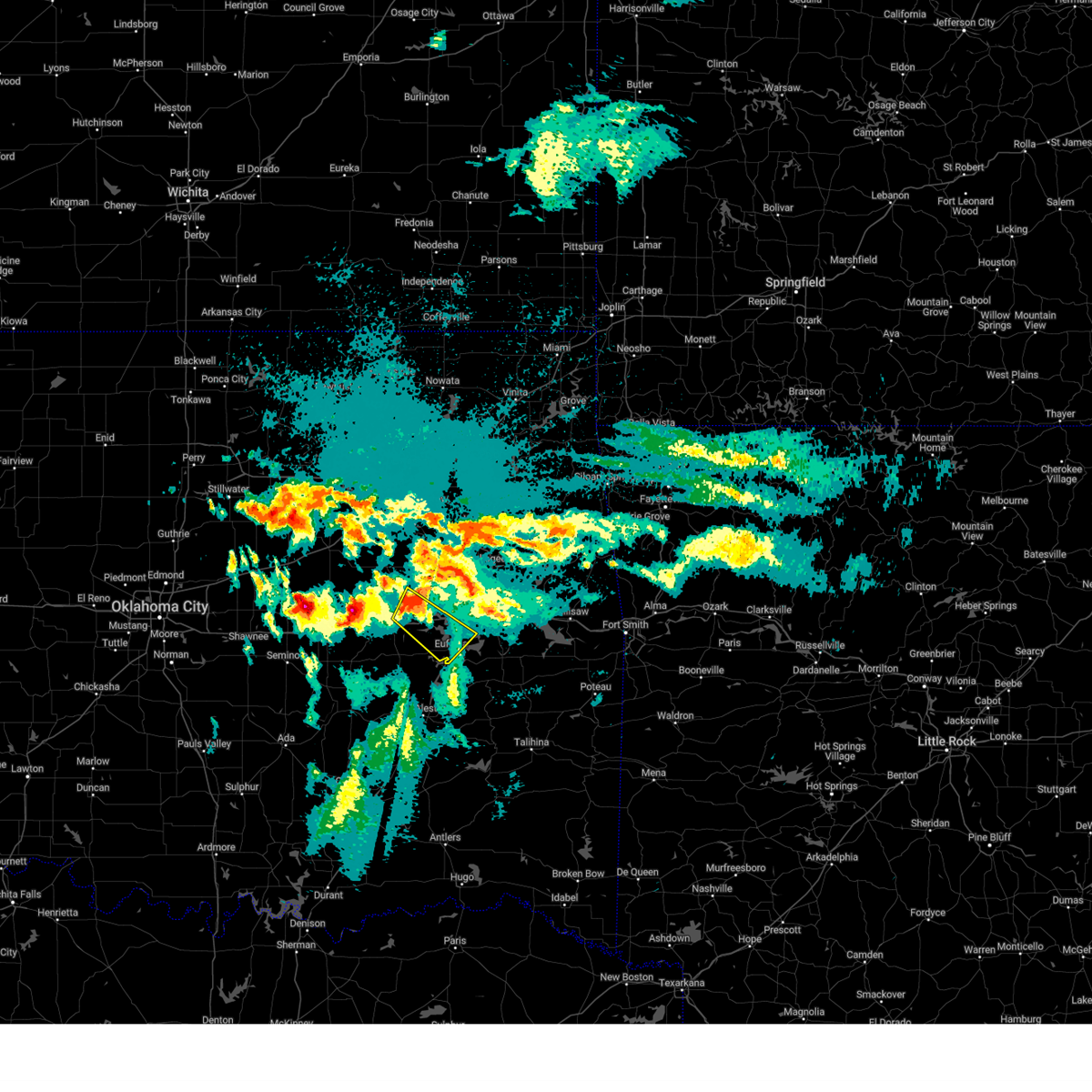 Svrtsa the national weather service in tulsa has issued a * severe thunderstorm warning for, central mcintosh county in southeastern oklahoma, southeastern okmulgee county in northeastern oklahoma, * until 945 pm cdt. * at 905 pm cdt, a severe thunderstorm was located over hoffman, moving southeast at 30 mph (radar indicated). Hazards include quarter size hail. Damage to vehicles is expected. Locations in or near the path include, eufaula, henryetta, morris, dewar, grayson, hoffman, stidham, lake eufaula state park, vivian, hitchita, pierce, onapa, this includes interstate 40 in oklahoma between mile markers 241 and 262. Svrtsa the national weather service in tulsa has issued a * severe thunderstorm warning for, central mcintosh county in southeastern oklahoma, southeastern okmulgee county in northeastern oklahoma, * until 945 pm cdt. * at 905 pm cdt, a severe thunderstorm was located over hoffman, moving southeast at 30 mph (radar indicated). Hazards include quarter size hail. Damage to vehicles is expected. Locations in or near the path include, eufaula, henryetta, morris, dewar, grayson, hoffman, stidham, lake eufaula state park, vivian, hitchita, pierce, onapa, this includes interstate 40 in oklahoma between mile markers 241 and 262.
|
| 8/16/2024 12:07 AM CDT |
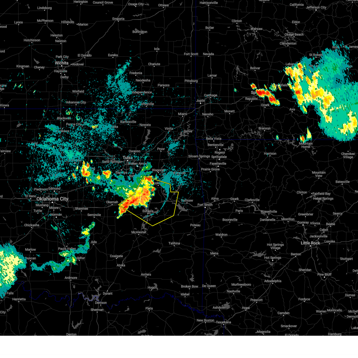 At 1207 am cdt, severe thunderstorms were located along a line extending from 4 miles southwest of council hill to 5 miles southeast of hoffman to 4 miles north of dustin, moving southeast at 30 mph (radar indicated). Hazards include 60 mph wind gusts. Expect damage to roofs, siding, and trees. Locations in or near the path include, muskogee, eufaula, stigler, henryetta, fort gibson, checotah, haskell, warner, morris, quinton, gore, dewar, porum, webbers falls, porter, schulter, whitefield, oktaha, braggs, taft, this includes interstate 40 in oklahoma between mile markers 227 and 294. At 1207 am cdt, severe thunderstorms were located along a line extending from 4 miles southwest of council hill to 5 miles southeast of hoffman to 4 miles north of dustin, moving southeast at 30 mph (radar indicated). Hazards include 60 mph wind gusts. Expect damage to roofs, siding, and trees. Locations in or near the path include, muskogee, eufaula, stigler, henryetta, fort gibson, checotah, haskell, warner, morris, quinton, gore, dewar, porum, webbers falls, porter, schulter, whitefield, oktaha, braggs, taft, this includes interstate 40 in oklahoma between mile markers 227 and 294.
|
| 8/15/2024 11:46 PM CDT |
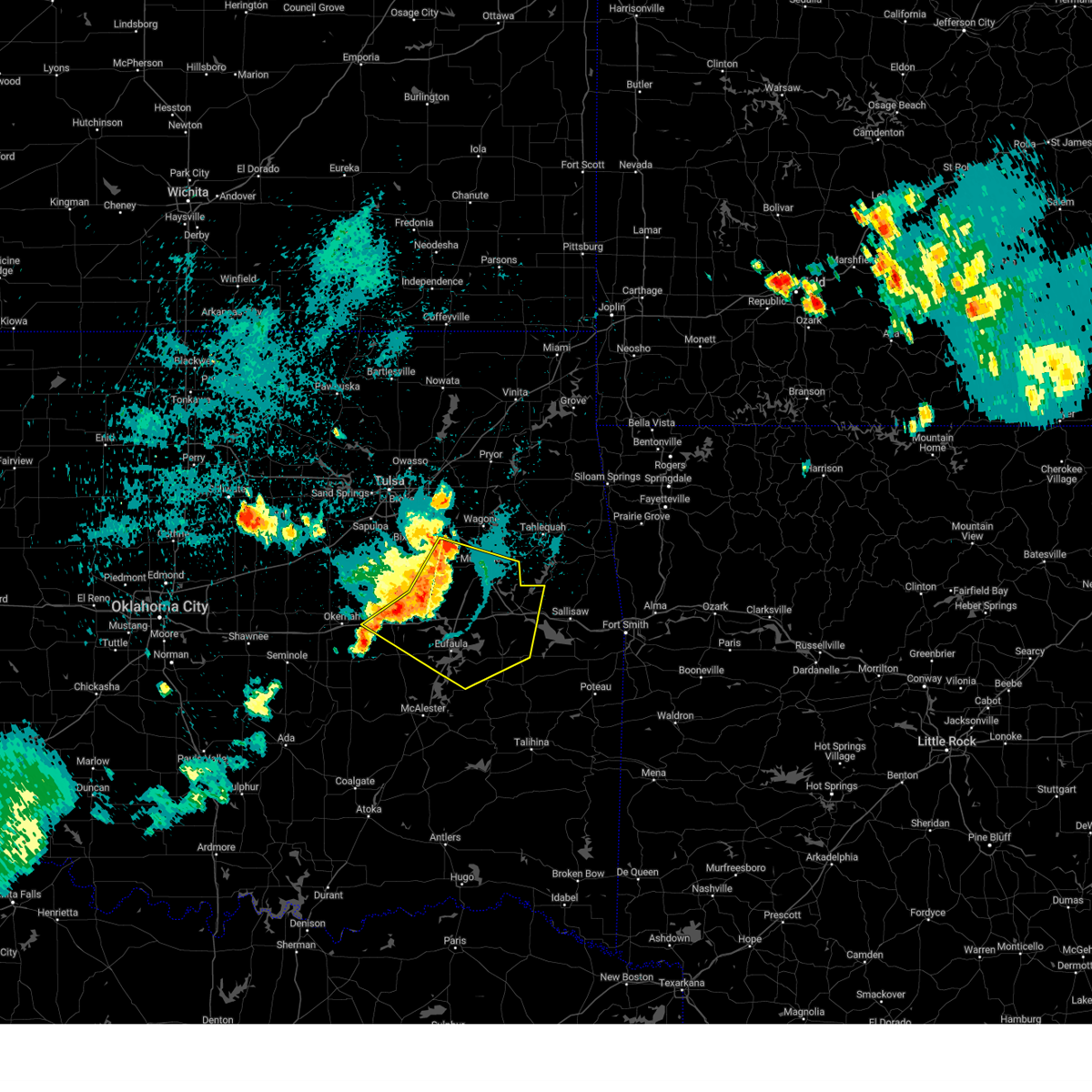 Svrtsa the national weather service in tulsa has issued a * severe thunderstorm warning for, northwestern haskell county in southeastern oklahoma, mcintosh county in southeastern oklahoma, northwestern sequoyah county in east central oklahoma, southwestern wagoner county in northeastern oklahoma, northeastern pittsburg county in southeastern oklahoma, muskogee county in east central oklahoma, southern okmulgee county in northeastern oklahoma, east central okfuskee county in east central oklahoma, * until 1245 am cdt. * at 1146 pm cdt, severe thunderstorms were located along a line extending from 3 miles northwest of taft to 2 miles southwest of council hill to 3 miles south of henryetta, moving southeast at 35 mph (radar indicated). Hazards include 60 mph wind gusts. Expect damage to roofs, siding, and trees. Locations in or near the path include, muskogee, eufaula, stigler, henryetta, fort gibson, checotah, haskell, warner, morris, quinton, gore, dewar, porum, webbers falls, porter, schulter, whitefield, oktaha, braggs, taft, this includes interstate 40 in oklahoma between mile markers 227 and 294. Svrtsa the national weather service in tulsa has issued a * severe thunderstorm warning for, northwestern haskell county in southeastern oklahoma, mcintosh county in southeastern oklahoma, northwestern sequoyah county in east central oklahoma, southwestern wagoner county in northeastern oklahoma, northeastern pittsburg county in southeastern oklahoma, muskogee county in east central oklahoma, southern okmulgee county in northeastern oklahoma, east central okfuskee county in east central oklahoma, * until 1245 am cdt. * at 1146 pm cdt, severe thunderstorms were located along a line extending from 3 miles northwest of taft to 2 miles southwest of council hill to 3 miles south of henryetta, moving southeast at 35 mph (radar indicated). Hazards include 60 mph wind gusts. Expect damage to roofs, siding, and trees. Locations in or near the path include, muskogee, eufaula, stigler, henryetta, fort gibson, checotah, haskell, warner, morris, quinton, gore, dewar, porum, webbers falls, porter, schulter, whitefield, oktaha, braggs, taft, this includes interstate 40 in oklahoma between mile markers 227 and 294.
|
| 8/15/2024 11:15 PM CDT | Multiple downed tree limbs across town... generally 1.5 in diameter or less. power outage for most of town. information relayed via phone cal in okmulgee county OK, 0.5 miles WNW of Morris, OK |
| 7/4/2024 7:15 PM CDT |
 The storm which prompted the warning has weakened below severe limits, and no longer poses an immediate threat to life or property. therefore, the warning will be allowed to expire. however, gusty winds and small hail are still possible with this thunderstorm. to report severe weather, contact your nearest law enforcement agency. they will relay your report to the national weather service tulsa. The storm which prompted the warning has weakened below severe limits, and no longer poses an immediate threat to life or property. therefore, the warning will be allowed to expire. however, gusty winds and small hail are still possible with this thunderstorm. to report severe weather, contact your nearest law enforcement agency. they will relay your report to the national weather service tulsa.
|
| 7/4/2024 7:05 PM CDT |
 At 704 pm cdt, a severe thunderstorm was located over morris, moving southeast at 15 mph (radar indicated). Hazards include 60 mph wind gusts and quarter size hail. Hail damage to vehicles is expected. expect wind damage to roofs, siding, and trees. Locations in or near the path include, okmulgee, morris, eram,. At 704 pm cdt, a severe thunderstorm was located over morris, moving southeast at 15 mph (radar indicated). Hazards include 60 mph wind gusts and quarter size hail. Hail damage to vehicles is expected. expect wind damage to roofs, siding, and trees. Locations in or near the path include, okmulgee, morris, eram,.
|
| 7/4/2024 7:05 PM CDT |
 the severe thunderstorm warning has been cancelled and is no longer in effect the severe thunderstorm warning has been cancelled and is no longer in effect
|
| 7/4/2024 6:44 PM CDT |
 At 643 pm cdt, a severe thunderstorm was located 4 miles south of bald hill, moving southeast at 25 mph (radar indicated). Hazards include 60 mph wind gusts and nickel size hail. Expect damage to roofs, siding, and trees. Locations in or near the path include, okmulgee, haskell, morris, preston, bald hill, jamesville, eram,. At 643 pm cdt, a severe thunderstorm was located 4 miles south of bald hill, moving southeast at 25 mph (radar indicated). Hazards include 60 mph wind gusts and nickel size hail. Expect damage to roofs, siding, and trees. Locations in or near the path include, okmulgee, haskell, morris, preston, bald hill, jamesville, eram,.
|
| 7/4/2024 6:27 PM CDT |
 Svrtsa the national weather service in tulsa has issued a * severe thunderstorm warning for, northwestern muskogee county in east central oklahoma, northern okmulgee county in northeastern oklahoma, * until 715 pm cdt. * at 627 pm cdt, a severe thunderstorm was located near preston, moving southeast at 15 mph (radar indicated). Hazards include 60 mph wind gusts and quarter size hail. Hail damage to vehicles is expected. expect wind damage to roofs, siding, and trees. Locations in or near the path include, okmulgee, haskell, morris, beggs, preston, bald hill, liberty, jamesville, hectorville, eram,. Svrtsa the national weather service in tulsa has issued a * severe thunderstorm warning for, northwestern muskogee county in east central oklahoma, northern okmulgee county in northeastern oklahoma, * until 715 pm cdt. * at 627 pm cdt, a severe thunderstorm was located near preston, moving southeast at 15 mph (radar indicated). Hazards include 60 mph wind gusts and quarter size hail. Hail damage to vehicles is expected. expect wind damage to roofs, siding, and trees. Locations in or near the path include, okmulgee, haskell, morris, beggs, preston, bald hill, liberty, jamesville, hectorville, eram,.
|
| 6/26/2024 8:36 AM CDT |
 the severe thunderstorm warning has been cancelled and is no longer in effect the severe thunderstorm warning has been cancelled and is no longer in effect
|
| 6/26/2024 8:36 AM CDT |
 At 836 am cdt, severe thunderstorms were located along a line extending from 4 miles northwest of wetumka to 3 miles east of dustin to 7 miles west of porum, moving south at 55 mph. these are destructive storms for portions of mcintosh county (radar indicated). Hazards include 80 mph wind gusts. Flying debris will be dangerous to those caught without shelter. mobile homes will be heavily damaged. expect considerable damage to roofs, windows, and vehicles. extensive tree damage and power outages are likely. Locations in or near the path include, okmulgee, eufaula, henryetta, checotah, morris, weleetka, dewar, schulter, oktaha, taft, boynton, grayson, council hill, hanna, rentiesville, hoffman, clearview, stidham, raiford, vivian, this includes interstate 40 in oklahoma between mile markers 224 and 271. At 836 am cdt, severe thunderstorms were located along a line extending from 4 miles northwest of wetumka to 3 miles east of dustin to 7 miles west of porum, moving south at 55 mph. these are destructive storms for portions of mcintosh county (radar indicated). Hazards include 80 mph wind gusts. Flying debris will be dangerous to those caught without shelter. mobile homes will be heavily damaged. expect considerable damage to roofs, windows, and vehicles. extensive tree damage and power outages are likely. Locations in or near the path include, okmulgee, eufaula, henryetta, checotah, morris, weleetka, dewar, schulter, oktaha, taft, boynton, grayson, council hill, hanna, rentiesville, hoffman, clearview, stidham, raiford, vivian, this includes interstate 40 in oklahoma between mile markers 224 and 271.
|
| 6/26/2024 8:23 AM CDT |
 At 823 am cdt, severe thunderstorms were located along a line extending from 4 miles southwest of welty to near henryetta to 4 miles northeast of council hill, moving south at 50 mph. these are destructive storms for portions of okmulgee, muskogee, and mcintosh counties (radar indicated). Hazards include 80 mph wind gusts. Flying debris will be dangerous to those caught without shelter. mobile homes will be heavily damaged. expect considerable damage to roofs, windows, and vehicles. extensive tree damage and power outages are likely. Locations in or near the path include, okmulgee, okemah, eufaula, okfuskee, henryetta, checotah, haskell, morris, beggs, boley, weleetka, dewar, schulter, paden, oktaha, taft, boynton, grayson, council hill, hanna, this includes interstate 40 in oklahoma between mile markers 212 and 271. At 823 am cdt, severe thunderstorms were located along a line extending from 4 miles southwest of welty to near henryetta to 4 miles northeast of council hill, moving south at 50 mph. these are destructive storms for portions of okmulgee, muskogee, and mcintosh counties (radar indicated). Hazards include 80 mph wind gusts. Flying debris will be dangerous to those caught without shelter. mobile homes will be heavily damaged. expect considerable damage to roofs, windows, and vehicles. extensive tree damage and power outages are likely. Locations in or near the path include, okmulgee, okemah, eufaula, okfuskee, henryetta, checotah, haskell, morris, beggs, boley, weleetka, dewar, schulter, paden, oktaha, taft, boynton, grayson, council hill, hanna, this includes interstate 40 in oklahoma between mile markers 212 and 271.
|
| 6/26/2024 8:20 AM CDT |
 At 819 am cdt, severe thunderstorms were located along a line extending from 5 miles southwest of welty to 5 miles northwest of henryetta, moving south at 50 mph (radar indicated). Hazards include 60 mph wind gusts. Expect damage to roofs, siding, and trees. Locations in or near the path include, tulsa, broken arrow, okmulgee, bixby, sapulpa, jenks, glenpool, kiefer, beggs, mounds, kellyville, preston, bald hill, liberty, hectorville, leonard, this includes interstate 44 between mile markers 200 and 212. At 819 am cdt, severe thunderstorms were located along a line extending from 5 miles southwest of welty to 5 miles northwest of henryetta, moving south at 50 mph (radar indicated). Hazards include 60 mph wind gusts. Expect damage to roofs, siding, and trees. Locations in or near the path include, tulsa, broken arrow, okmulgee, bixby, sapulpa, jenks, glenpool, kiefer, beggs, mounds, kellyville, preston, bald hill, liberty, hectorville, leonard, this includes interstate 44 between mile markers 200 and 212.
|
| 6/26/2024 8:20 AM CDT |
 the severe thunderstorm warning has been cancelled and is no longer in effect the severe thunderstorm warning has been cancelled and is no longer in effect
|
| 6/26/2024 8:05 AM CDT |
 Svrtsa the national weather service in tulsa has issued a * severe thunderstorm warning for, south central creek county in northeastern oklahoma, mcintosh county in southeastern oklahoma, south central wagoner county in northeastern oklahoma, northwestern muskogee county in east central oklahoma, okmulgee county in northeastern oklahoma, okfuskee county in east central oklahoma, * until 900 am cdt. * at 803 am cdt, severe thunderstorms were located along a line extending from 3 miles south of bristow to 2 miles south of preston to 2 miles north of taft, moving south at 50 mph. these are destructive storms for portions of okmulgee and muskogee counties (radar indicated). Hazards include 80 mph wind gusts. Flying debris will be dangerous to those caught without shelter. mobile homes will be heavily damaged. expect considerable damage to roofs, windows, and vehicles. extensive tree damage and power outages are likely. Locations in or near the path include, okmulgee, okemah, eufaula, okfuskee, henryetta, checotah, haskell, morris, beggs, boley, weleetka, dewar, schulter, paden, oktaha, taft, boynton, grayson, council hill, hanna, this includes interstate 40 in oklahoma between mile markers 212 and 271. Svrtsa the national weather service in tulsa has issued a * severe thunderstorm warning for, south central creek county in northeastern oklahoma, mcintosh county in southeastern oklahoma, south central wagoner county in northeastern oklahoma, northwestern muskogee county in east central oklahoma, okmulgee county in northeastern oklahoma, okfuskee county in east central oklahoma, * until 900 am cdt. * at 803 am cdt, severe thunderstorms were located along a line extending from 3 miles south of bristow to 2 miles south of preston to 2 miles north of taft, moving south at 50 mph. these are destructive storms for portions of okmulgee and muskogee counties (radar indicated). Hazards include 80 mph wind gusts. Flying debris will be dangerous to those caught without shelter. mobile homes will be heavily damaged. expect considerable damage to roofs, windows, and vehicles. extensive tree damage and power outages are likely. Locations in or near the path include, okmulgee, okemah, eufaula, okfuskee, henryetta, checotah, haskell, morris, beggs, boley, weleetka, dewar, schulter, paden, oktaha, taft, boynton, grayson, council hill, hanna, this includes interstate 40 in oklahoma between mile markers 212 and 271.
|
| 6/26/2024 8:00 AM CDT |
 At 800 am cdt, severe thunderstorms were located along a line extending from bristow to 2 miles northeast of preston, moving south at 35 mph (radar indicated). Hazards include 70 mph wind gusts. Expect considerable tree damage. damage is likely to mobile homes, roofs, and outbuildings. Locations in or near the path include, tulsa, broken arrow, sand springs, okmulgee, bristow, bixby, sapulpa, jenks, glenpool, catoosa, mannford, kiefer, beggs, mounds, kellyville, slick, preston, jenks riverside airport, keystone state park, bald hill, this includes interstate 44 between mile markers 188 and 237. At 800 am cdt, severe thunderstorms were located along a line extending from bristow to 2 miles northeast of preston, moving south at 35 mph (radar indicated). Hazards include 70 mph wind gusts. Expect considerable tree damage. damage is likely to mobile homes, roofs, and outbuildings. Locations in or near the path include, tulsa, broken arrow, sand springs, okmulgee, bristow, bixby, sapulpa, jenks, glenpool, catoosa, mannford, kiefer, beggs, mounds, kellyville, slick, preston, jenks riverside airport, keystone state park, bald hill, this includes interstate 44 between mile markers 188 and 237.
|
| 6/26/2024 8:00 AM CDT |
 the severe thunderstorm warning has been cancelled and is no longer in effect the severe thunderstorm warning has been cancelled and is no longer in effect
|
| 6/26/2024 7:32 AM CDT |
 Svrtsa the national weather service in tulsa has issued a * severe thunderstorm warning for, southwestern rogers county in northeastern oklahoma, southeastern osage county in northeastern oklahoma, central creek county in northeastern oklahoma, northwestern wagoner county in northeastern oklahoma, northern okmulgee county in northeastern oklahoma, southeastern pawnee county in northeastern oklahoma, tulsa county in northeastern oklahoma, * until 830 am cdt. * at 732 am cdt, severe thunderstorms were located along a line extending from near keystone state park to 3 miles northwest of broken arrow, moving south at 65 mph (radar indicated). Hazards include 70 mph wind gusts. Expect considerable tree damage. damage is likely to mobile homes, roofs, and outbuildings. Locations in or near the path include, tulsa, broken arrow, sand springs, okmulgee, bristow, owasso, bixby, sapulpa, jenks, glenpool, catoosa, mannford, kiefer, beggs, sperry, mounds, kellyville, westport, slick, shamrock, this includes interstate 44 between mile markers 188 and 237. Svrtsa the national weather service in tulsa has issued a * severe thunderstorm warning for, southwestern rogers county in northeastern oklahoma, southeastern osage county in northeastern oklahoma, central creek county in northeastern oklahoma, northwestern wagoner county in northeastern oklahoma, northern okmulgee county in northeastern oklahoma, southeastern pawnee county in northeastern oklahoma, tulsa county in northeastern oklahoma, * until 830 am cdt. * at 732 am cdt, severe thunderstorms were located along a line extending from near keystone state park to 3 miles northwest of broken arrow, moving south at 65 mph (radar indicated). Hazards include 70 mph wind gusts. Expect considerable tree damage. damage is likely to mobile homes, roofs, and outbuildings. Locations in or near the path include, tulsa, broken arrow, sand springs, okmulgee, bristow, owasso, bixby, sapulpa, jenks, glenpool, catoosa, mannford, kiefer, beggs, sperry, mounds, kellyville, westport, slick, shamrock, this includes interstate 44 between mile markers 188 and 237.
|
| 6/26/2024 7:30 AM CDT |
 Svrtsa the national weather service in tulsa has issued a * severe thunderstorm warning for, northeastern mcintosh county in southeastern oklahoma, northwestern sequoyah county in east central oklahoma, southern wagoner county in northeastern oklahoma, southwestern cherokee county in east central oklahoma, muskogee county in east central oklahoma, northeastern okmulgee county in northeastern oklahoma, * until 815 am cdt. * at 729 am cdt, severe thunderstorms were located along a line extending from 4 miles northwest of stonebluff to 2 miles northwest of porter to 4 miles northeast of hulbert, moving south at 40 mph (radar indicated). Hazards include 60 mph wind gusts. Expect damage to roofs, siding, and trees. Locations in or near the path include, muskogee, fort gibson, checotah, haskell, warner, morris, okay, hulbert, porter, oktaha, braggs, taft, boynton, council hill, rentiesville, tullahassee, greenleaf state park, pumpkin center, stonebluff, lake tenkiller state park,. Svrtsa the national weather service in tulsa has issued a * severe thunderstorm warning for, northeastern mcintosh county in southeastern oklahoma, northwestern sequoyah county in east central oklahoma, southern wagoner county in northeastern oklahoma, southwestern cherokee county in east central oklahoma, muskogee county in east central oklahoma, northeastern okmulgee county in northeastern oklahoma, * until 815 am cdt. * at 729 am cdt, severe thunderstorms were located along a line extending from 4 miles northwest of stonebluff to 2 miles northwest of porter to 4 miles northeast of hulbert, moving south at 40 mph (radar indicated). Hazards include 60 mph wind gusts. Expect damage to roofs, siding, and trees. Locations in or near the path include, muskogee, fort gibson, checotah, haskell, warner, morris, okay, hulbert, porter, oktaha, braggs, taft, boynton, council hill, rentiesville, tullahassee, greenleaf state park, pumpkin center, stonebluff, lake tenkiller state park,.
|
| 5/26/2024 12:40 AM CDT |
 Svrtsa the national weather service in tulsa has issued a * severe thunderstorm warning for, northern haskell county in southeastern oklahoma, mcintosh county in southeastern oklahoma, western sequoyah county in east central oklahoma, southwestern cherokee county in east central oklahoma, muskogee county in east central oklahoma, southeastern okmulgee county in northeastern oklahoma, * until 145 am cdt. * at 1239 am cdt, a severe thunderstorm was located 3 miles west of stidham, moving east at 50 mph. another severe thunderstorm was located near hitchita (radar indicated). Hazards include 60 mph wind gusts and quarter size hail. Hail damage to vehicles is expected. expect wind damage to roofs, siding, and trees. Locations in or near the path include, muskogee, sallisaw, eufaula, fort gibson, checotah, warner, morris, vian, gore, porum, webbers falls, oktaha, braggs, boynton, tamaha, grayson, council hill, rentiesville, hoffman, stidham, this includes interstate 40 in oklahoma between mile markers 243 and 304. Svrtsa the national weather service in tulsa has issued a * severe thunderstorm warning for, northern haskell county in southeastern oklahoma, mcintosh county in southeastern oklahoma, western sequoyah county in east central oklahoma, southwestern cherokee county in east central oklahoma, muskogee county in east central oklahoma, southeastern okmulgee county in northeastern oklahoma, * until 145 am cdt. * at 1239 am cdt, a severe thunderstorm was located 3 miles west of stidham, moving east at 50 mph. another severe thunderstorm was located near hitchita (radar indicated). Hazards include 60 mph wind gusts and quarter size hail. Hail damage to vehicles is expected. expect wind damage to roofs, siding, and trees. Locations in or near the path include, muskogee, sallisaw, eufaula, fort gibson, checotah, warner, morris, vian, gore, porum, webbers falls, oktaha, braggs, boynton, tamaha, grayson, council hill, rentiesville, hoffman, stidham, this includes interstate 40 in oklahoma between mile markers 243 and 304.
|
| 5/21/2024 7:28 PM CDT |
 The storm which prompted the warning has weakened below severe limits, and no longer poses an immediate threat to life or property. therefore, the warning will be allowed to expire. however, small hail, gusty winds and heavy rain are still possible with this thunderstorm. a tornado watch remains in effect until 1000 pm cdt for northeastern and east central oklahoma. The storm which prompted the warning has weakened below severe limits, and no longer poses an immediate threat to life or property. therefore, the warning will be allowed to expire. however, small hail, gusty winds and heavy rain are still possible with this thunderstorm. a tornado watch remains in effect until 1000 pm cdt for northeastern and east central oklahoma.
|
| 5/21/2024 7:17 PM CDT |
 At 717 pm cdt, a severe thunderstorm was located near boynton, moving east at 25 mph (radar indicated). Hazards include 60 mph wind gusts and quarter size hail. Hail damage to vehicles is expected. expect wind damage to roofs, siding, and trees. Locations in or near the path include, morris, taft, boynton, eram, jamesville,. At 717 pm cdt, a severe thunderstorm was located near boynton, moving east at 25 mph (radar indicated). Hazards include 60 mph wind gusts and quarter size hail. Hail damage to vehicles is expected. expect wind damage to roofs, siding, and trees. Locations in or near the path include, morris, taft, boynton, eram, jamesville,.
|
| 5/21/2024 6:57 PM CDT |
 Svrtsa the national weather service in tulsa has issued a * severe thunderstorm warning for, northwestern muskogee county in east central oklahoma, northeastern okmulgee county in northeastern oklahoma, * until 730 pm cdt. * at 657 pm cdt, a severe thunderstorm was located 5 miles southeast of bald hill, moving east at 30 mph (radar indicated). Hazards include 60 mph wind gusts and quarter size hail. Hail damage to vehicles is expected. expect wind damage to roofs, siding, and trees. Locations in or near the path include, morris, taft, boynton, bald hill, wainwright, jamesville, eram,. Svrtsa the national weather service in tulsa has issued a * severe thunderstorm warning for, northwestern muskogee county in east central oklahoma, northeastern okmulgee county in northeastern oklahoma, * until 730 pm cdt. * at 657 pm cdt, a severe thunderstorm was located 5 miles southeast of bald hill, moving east at 30 mph (radar indicated). Hazards include 60 mph wind gusts and quarter size hail. Hail damage to vehicles is expected. expect wind damage to roofs, siding, and trees. Locations in or near the path include, morris, taft, boynton, bald hill, wainwright, jamesville, eram,.
|
| 5/21/2024 6:51 PM CDT |
 At 650 pm cdt, a severe thunderstorm was located 4 miles south of bald hill, moving east at 35 mph (radar indicated). Hazards include 60 mph wind gusts and quarter size hail. Hail damage to vehicles is expected. expect wind damage to roofs, siding, and trees. Locations in or near the path include, okmulgee, morris, taft, boynton, bald hill, wainwright, jamesville, eram,. At 650 pm cdt, a severe thunderstorm was located 4 miles south of bald hill, moving east at 35 mph (radar indicated). Hazards include 60 mph wind gusts and quarter size hail. Hail damage to vehicles is expected. expect wind damage to roofs, siding, and trees. Locations in or near the path include, okmulgee, morris, taft, boynton, bald hill, wainwright, jamesville, eram,.
|
| 5/21/2024 6:47 PM CDT |
 At 647 pm cdt, a severe thunderstorm was located 4 miles northeast of okmulgee, moving east at 35 mph (radar indicated). Hazards include 60 mph wind gusts and quarter size hail. Hail damage to vehicles is expected. expect wind damage to roofs, siding, and trees. Locations in or near the path include, okmulgee, preston,. At 647 pm cdt, a severe thunderstorm was located 4 miles northeast of okmulgee, moving east at 35 mph (radar indicated). Hazards include 60 mph wind gusts and quarter size hail. Hail damage to vehicles is expected. expect wind damage to roofs, siding, and trees. Locations in or near the path include, okmulgee, preston,.
|
| 5/21/2024 6:34 PM CDT |
 Svrtsa the national weather service in tulsa has issued a * severe thunderstorm warning for, northwestern muskogee county in east central oklahoma, central okmulgee county in northeastern oklahoma, * until 700 pm cdt. * at 633 pm cdt, a severe thunderstorm was located near preston, moving east at 35 mph (radar indicated). Hazards include 60 mph wind gusts and half dollar size hail. Hail damage to vehicles is expected. expect wind damage to roofs, siding, and trees. Locations in or near the path include, okmulgee, morris, beggs, taft, boynton, council hill, preston, okmulgee state park, bald hill, wainwright, jamesville, eram,. Svrtsa the national weather service in tulsa has issued a * severe thunderstorm warning for, northwestern muskogee county in east central oklahoma, central okmulgee county in northeastern oklahoma, * until 700 pm cdt. * at 633 pm cdt, a severe thunderstorm was located near preston, moving east at 35 mph (radar indicated). Hazards include 60 mph wind gusts and half dollar size hail. Hail damage to vehicles is expected. expect wind damage to roofs, siding, and trees. Locations in or near the path include, okmulgee, morris, beggs, taft, boynton, council hill, preston, okmulgee state park, bald hill, wainwright, jamesville, eram,.
|
| 5/21/2024 6:30 PM CDT |
 At 629 pm cdt, a severe thunderstorm was located 4 miles north of okmulgee state park, moving east at 25 mph (radar indicated). Hazards include ping pong ball size hail and 60 mph wind gusts. People and animals outdoors will be injured. expect hail damage to roofs, siding, windows, and vehicles. expect wind damage to roofs, siding, and trees. Locations in or near the path include, okmulgee, beggs, preston, okmulgee state park,. At 629 pm cdt, a severe thunderstorm was located 4 miles north of okmulgee state park, moving east at 25 mph (radar indicated). Hazards include ping pong ball size hail and 60 mph wind gusts. People and animals outdoors will be injured. expect hail damage to roofs, siding, windows, and vehicles. expect wind damage to roofs, siding, and trees. Locations in or near the path include, okmulgee, beggs, preston, okmulgee state park,.
|
| 5/21/2024 6:30 PM CDT |
 the severe thunderstorm warning has been cancelled and is no longer in effect the severe thunderstorm warning has been cancelled and is no longer in effect
|
| 5/21/2024 6:23 PM CDT |
 At 622 pm cdt, a severe thunderstorm was located 6 miles northeast of okfuskee, moving east at 25 mph (radar indicated). Hazards include 60 mph wind gusts and half dollar size hail. Hail damage to vehicles is expected. expect wind damage to roofs, siding, and trees. Locations in or near the path include, okmulgee, beggs, preston, okmulgee state park,. At 622 pm cdt, a severe thunderstorm was located 6 miles northeast of okfuskee, moving east at 25 mph (radar indicated). Hazards include 60 mph wind gusts and half dollar size hail. Hail damage to vehicles is expected. expect wind damage to roofs, siding, and trees. Locations in or near the path include, okmulgee, beggs, preston, okmulgee state park,.
|
| 5/21/2024 6:23 PM CDT |
 the severe thunderstorm warning has been cancelled and is no longer in effect the severe thunderstorm warning has been cancelled and is no longer in effect
|
| 5/21/2024 6:09 PM CDT |
 Svrtsa the national weather service in tulsa has issued a * severe thunderstorm warning for, south central creek county in northeastern oklahoma, western okmulgee county in northeastern oklahoma, northeastern okfuskee county in east central oklahoma, * until 700 pm cdt. * at 608 pm cdt, a severe thunderstorm was located 6 miles northeast of welty, moving east at 20 mph (radar indicated). Hazards include 60 mph wind gusts and quarter size hail. Hail damage to vehicles is expected. expect wind damage to roofs, siding, and trees. Locations in or near the path include, okmulgee, okfuskee, beggs, schulter, preston, okmulgee state park, welty,. Svrtsa the national weather service in tulsa has issued a * severe thunderstorm warning for, south central creek county in northeastern oklahoma, western okmulgee county in northeastern oklahoma, northeastern okfuskee county in east central oklahoma, * until 700 pm cdt. * at 608 pm cdt, a severe thunderstorm was located 6 miles northeast of welty, moving east at 20 mph (radar indicated). Hazards include 60 mph wind gusts and quarter size hail. Hail damage to vehicles is expected. expect wind damage to roofs, siding, and trees. Locations in or near the path include, okmulgee, okfuskee, beggs, schulter, preston, okmulgee state park, welty,.
|
| 5/7/2024 12:53 AM CDT |
 The storm which prompted the warning has moved out of the area. therefore, the warning will be allowed to expire. a tornado watch remains in effect until 300 am cdt for northeastern oklahoma. The storm which prompted the warning has moved out of the area. therefore, the warning will be allowed to expire. a tornado watch remains in effect until 300 am cdt for northeastern oklahoma.
|
| 5/7/2024 12:38 AM CDT |
 Svrtsa the national weather service in tulsa has issued a * severe thunderstorm warning for, northwestern muskogee county in east central oklahoma, northeastern okmulgee county in northeastern oklahoma, * until 130 am cdt. * at 1238 am cdt, a severe thunderstorm was located 3 miles north of morris, moving east at 35 mph (radar indicated). Hazards include 60 mph wind gusts and half dollar size hail. Hail damage to vehicles is expected. expect wind damage to roofs, siding, and trees. Locations in or near the path include, muskogee, okmulgee, morris, oktaha, taft, boynton, council hill, bald hill, keefeton, wainwright, summit, jamesville, eram,. Svrtsa the national weather service in tulsa has issued a * severe thunderstorm warning for, northwestern muskogee county in east central oklahoma, northeastern okmulgee county in northeastern oklahoma, * until 130 am cdt. * at 1238 am cdt, a severe thunderstorm was located 3 miles north of morris, moving east at 35 mph (radar indicated). Hazards include 60 mph wind gusts and half dollar size hail. Hail damage to vehicles is expected. expect wind damage to roofs, siding, and trees. Locations in or near the path include, muskogee, okmulgee, morris, oktaha, taft, boynton, council hill, bald hill, keefeton, wainwright, summit, jamesville, eram,.
|
| 5/7/2024 12:36 AM CDT |
 At 1236 am cdt, a severe thunderstorm capable of producing a tornado was located over bald hill, moving east at 40 mph (radar indicated rotation). Hazards include tornado and half dollar size hail. Flying debris will be dangerous to those caught without shelter. mobile homes will be damaged or destroyed. damage to roofs, windows, and vehicles will occur. tree damage is likely. Locations in or near the path include, okmulgee, morris, bald hill,. At 1236 am cdt, a severe thunderstorm capable of producing a tornado was located over bald hill, moving east at 40 mph (radar indicated rotation). Hazards include tornado and half dollar size hail. Flying debris will be dangerous to those caught without shelter. mobile homes will be damaged or destroyed. damage to roofs, windows, and vehicles will occur. tree damage is likely. Locations in or near the path include, okmulgee, morris, bald hill,.
|
| 5/7/2024 12:18 AM CDT |
 At 1217 am cdt, a severe thunderstorm was located near okmulgee state park, moving east at 40 mph (radar indicated). Hazards include golf ball size hail and 70 mph wind gusts. People and animals outdoors will be injured. expect hail damage to roofs, siding, windows, and vehicles. expect considerable tree damage. wind damage is also likely to mobile homes, roofs, and outbuildings. Locations in or near the path include, okmulgee, morris, beggs, schulter, grayson, preston, okmulgee state park, bald hill,. At 1217 am cdt, a severe thunderstorm was located near okmulgee state park, moving east at 40 mph (radar indicated). Hazards include golf ball size hail and 70 mph wind gusts. People and animals outdoors will be injured. expect hail damage to roofs, siding, windows, and vehicles. expect considerable tree damage. wind damage is also likely to mobile homes, roofs, and outbuildings. Locations in or near the path include, okmulgee, morris, beggs, schulter, grayson, preston, okmulgee state park, bald hill,.
|
| 5/7/2024 12:18 AM CDT |
 the severe thunderstorm warning has been cancelled and is no longer in effect the severe thunderstorm warning has been cancelled and is no longer in effect
|
| 5/7/2024 12:14 AM CDT |
 At 1214 am cdt, a severe thunderstorm capable of producing a tornado was located 4 miles southwest of beggs, moving east at 35 mph (radar indicated rotation). Hazards include tornado and golf ball size hail. Flying debris will be dangerous to those caught without shelter. mobile homes will be damaged or destroyed. damage to roofs, windows, and vehicles will occur. tree damage is likely. Locations in or near the path include, okmulgee, morris, beggs, bald hill, preston, okmulgee state park,. At 1214 am cdt, a severe thunderstorm capable of producing a tornado was located 4 miles southwest of beggs, moving east at 35 mph (radar indicated rotation). Hazards include tornado and golf ball size hail. Flying debris will be dangerous to those caught without shelter. mobile homes will be damaged or destroyed. damage to roofs, windows, and vehicles will occur. tree damage is likely. Locations in or near the path include, okmulgee, morris, beggs, bald hill, preston, okmulgee state park,.
|
| 5/7/2024 12:14 AM CDT |
 the tornado warning has been cancelled and is no longer in effect the tornado warning has been cancelled and is no longer in effect
|
| 5/7/2024 12:08 AM CDT |
 Tortsa the national weather service in tulsa has issued a * tornado warning for, south central creek county in northeastern oklahoma, northern okmulgee county in northeastern oklahoma, * until 100 am cdt. * at 1208 am cdt, a severe thunderstorm capable of producing a tornado was located 6 miles north of okfuskee, moving east at 35 mph (radar indicated rotation). Hazards include tornado and golf ball size hail. Flying debris will be dangerous to those caught without shelter. mobile homes will be damaged or destroyed. damage to roofs, windows, and vehicles will occur. tree damage is likely. Locations in or near the path include, okmulgee, morris, beggs, slick, preston, okmulgee state park, bald hill,. Tortsa the national weather service in tulsa has issued a * tornado warning for, south central creek county in northeastern oklahoma, northern okmulgee county in northeastern oklahoma, * until 100 am cdt. * at 1208 am cdt, a severe thunderstorm capable of producing a tornado was located 6 miles north of okfuskee, moving east at 35 mph (radar indicated rotation). Hazards include tornado and golf ball size hail. Flying debris will be dangerous to those caught without shelter. mobile homes will be damaged or destroyed. damage to roofs, windows, and vehicles will occur. tree damage is likely. Locations in or near the path include, okmulgee, morris, beggs, slick, preston, okmulgee state park, bald hill,.
|
| 5/6/2024 11:55 PM CDT |
 Svrtsa the national weather service in tulsa has issued a * severe thunderstorm warning for, south central creek county in northeastern oklahoma, okmulgee county in northeastern oklahoma, northeastern okfuskee county in east central oklahoma, * until 1245 am cdt. * at 1154 pm cdt, a severe thunderstorm was located 6 miles northeast of welty, moving east at 40 mph (radar indicated). Hazards include golf ball size hail and 70 mph wind gusts. People and animals outdoors will be injured. expect hail damage to roofs, siding, windows, and vehicles. expect considerable tree damage. wind damage is also likely to mobile homes, roofs, and outbuildings. Locations in or near the path include, okmulgee, okfuskee, morris, beggs, schulter, grayson, slick, preston, okmulgee state park, welty, bald hill, mason,. Svrtsa the national weather service in tulsa has issued a * severe thunderstorm warning for, south central creek county in northeastern oklahoma, okmulgee county in northeastern oklahoma, northeastern okfuskee county in east central oklahoma, * until 1245 am cdt. * at 1154 pm cdt, a severe thunderstorm was located 6 miles northeast of welty, moving east at 40 mph (radar indicated). Hazards include golf ball size hail and 70 mph wind gusts. People and animals outdoors will be injured. expect hail damage to roofs, siding, windows, and vehicles. expect considerable tree damage. wind damage is also likely to mobile homes, roofs, and outbuildings. Locations in or near the path include, okmulgee, okfuskee, morris, beggs, schulter, grayson, slick, preston, okmulgee state park, welty, bald hill, mason,.
|
| 4/28/2024 12:12 AM CDT |
 At 1212 am cdt, a confirmed tornado was located over morris, moving northeast at 30 mph (emergency management confirmed tornado). Hazards include damaging tornado. Flying debris will be dangerous to those caught without shelter. mobile homes will be damaged or destroyed. damage to roofs, windows, and vehicles will occur. tree damage is likely. Locations in or near the path include, okmulgee, morris, dewar, schulter, boynton, grayson, hoffman, bald hill, eram,. At 1212 am cdt, a confirmed tornado was located over morris, moving northeast at 30 mph (emergency management confirmed tornado). Hazards include damaging tornado. Flying debris will be dangerous to those caught without shelter. mobile homes will be damaged or destroyed. damage to roofs, windows, and vehicles will occur. tree damage is likely. Locations in or near the path include, okmulgee, morris, dewar, schulter, boynton, grayson, hoffman, bald hill, eram,.
|
| 4/28/2024 12:11 AM CDT | Quite a bit of tree damage...power lines down...minor structural damage...time estimated by rada in okmulgee county OK, 0.5 miles WNW of Morris, OK |
| 4/28/2024 12:10 AM CDT |
 the tornado warning has been cancelled and is no longer in effect the tornado warning has been cancelled and is no longer in effect
|
| 4/28/2024 12:10 AM CDT |
 At 1209 am cdt, a severe squall line capable of producing tornadoes that may not be visible due to heavy rain was located 3 miles southwest of morris, moving northeast at 40 mph (radar indicated rotation). Hazards include tornado. Flying debris will be dangerous to those caught without shelter. mobile homes will be damaged or destroyed. damage to roofs, windows, and vehicles will occur. tree damage is likely. Locations in or near the path include, okmulgee, morris, dewar, schulter, boynton, grayson, hoffman, bald hill, eram,. At 1209 am cdt, a severe squall line capable of producing tornadoes that may not be visible due to heavy rain was located 3 miles southwest of morris, moving northeast at 40 mph (radar indicated rotation). Hazards include tornado. Flying debris will be dangerous to those caught without shelter. mobile homes will be damaged or destroyed. damage to roofs, windows, and vehicles will occur. tree damage is likely. Locations in or near the path include, okmulgee, morris, dewar, schulter, boynton, grayson, hoffman, bald hill, eram,.
|
| 4/28/2024 12:01 AM CDT |
 Tortsa the national weather service in tulsa has issued a * tornado warning for, northwestern mcintosh county in southeastern oklahoma, west central muskogee county in east central oklahoma, central okmulgee county in northeastern oklahoma, * until 1245 am cdt. * at 1201 am cdt, a severe thunderstorm capable of producing a tornado was located near schulter, moving northeast at 30 mph (radar indicated rotation). Hazards include tornado. Flying debris will be dangerous to those caught without shelter. mobile homes will be damaged or destroyed. damage to roofs, windows, and vehicles will occur. tree damage is likely. Locations in or near the path include, okmulgee, henryetta, morris, dewar, schulter, boynton, grayson, council hill, hoffman, bald hill, hitchita, eram, this includes interstate 40 in oklahoma between mile markers 235 and 240. Tortsa the national weather service in tulsa has issued a * tornado warning for, northwestern mcintosh county in southeastern oklahoma, west central muskogee county in east central oklahoma, central okmulgee county in northeastern oklahoma, * until 1245 am cdt. * at 1201 am cdt, a severe thunderstorm capable of producing a tornado was located near schulter, moving northeast at 30 mph (radar indicated rotation). Hazards include tornado. Flying debris will be dangerous to those caught without shelter. mobile homes will be damaged or destroyed. damage to roofs, windows, and vehicles will occur. tree damage is likely. Locations in or near the path include, okmulgee, henryetta, morris, dewar, schulter, boynton, grayson, council hill, hoffman, bald hill, hitchita, eram, this includes interstate 40 in oklahoma between mile markers 235 and 240.
|
| 4/27/2024 11:49 PM CDT |
 Svrtsa the national weather service in tulsa has issued a * severe thunderstorm warning for, western mcintosh county in southeastern oklahoma, western wagoner county in northeastern oklahoma, northwestern muskogee county in east central oklahoma, okmulgee county in northeastern oklahoma, southeastern tulsa county in northeastern oklahoma, southeastern okfuskee county in east central oklahoma, * until 1245 am cdt. * at 1149 pm cdt, severe thunderstorms were located along a line extending from near broken arrow to 4 miles west of dustin, moving northeast at 30 mph (radar indicated). Hazards include 60 mph wind gusts and penny size hail. Expect damage to roofs, siding, and trees. Locations in or near the path include, tulsa, broken arrow, okmulgee, bixby, jenks, coweta, henryetta, haskell, morris, dewar, schulter, boynton, grayson, hanna, hoffman, preston, raiford, stonebluff, bald hill, oneta, this includes interstate 40 in oklahoma between mile markers 233 and 253. Svrtsa the national weather service in tulsa has issued a * severe thunderstorm warning for, western mcintosh county in southeastern oklahoma, western wagoner county in northeastern oklahoma, northwestern muskogee county in east central oklahoma, okmulgee county in northeastern oklahoma, southeastern tulsa county in northeastern oklahoma, southeastern okfuskee county in east central oklahoma, * until 1245 am cdt. * at 1149 pm cdt, severe thunderstorms were located along a line extending from near broken arrow to 4 miles west of dustin, moving northeast at 30 mph (radar indicated). Hazards include 60 mph wind gusts and penny size hail. Expect damage to roofs, siding, and trees. Locations in or near the path include, tulsa, broken arrow, okmulgee, bixby, jenks, coweta, henryetta, haskell, morris, dewar, schulter, boynton, grayson, hanna, hoffman, preston, raiford, stonebluff, bald hill, oneta, this includes interstate 40 in oklahoma between mile markers 233 and 253.
|
| 4/27/2024 11:43 PM CDT |
 At 1142 pm cdt, severe thunderstorms were located along a line extending from 4 miles southeast of mounds to 3 miles northeast of wetumka, moving east at 35 mph. a tornado warning also remain in effect for portions of okfuskee, okmulgee and creek counties (radar indicated). Hazards include 60 mph wind gusts and nickel size hail. Expect damage to roofs, siding, and trees. Locations in or near the path include, okmulgee, okemah, okfuskee, henryetta, beggs, weleetka, dewar, schulter, bearden, castle, clearview, preston, okmulgee state park, pharoah, bryant, mason, hectorville, this includes interstate 40 in oklahoma between mile markers 212 and 239. At 1142 pm cdt, severe thunderstorms were located along a line extending from 4 miles southeast of mounds to 3 miles northeast of wetumka, moving east at 35 mph. a tornado warning also remain in effect for portions of okfuskee, okmulgee and creek counties (radar indicated). Hazards include 60 mph wind gusts and nickel size hail. Expect damage to roofs, siding, and trees. Locations in or near the path include, okmulgee, okemah, okfuskee, henryetta, beggs, weleetka, dewar, schulter, bearden, castle, clearview, preston, okmulgee state park, pharoah, bryant, mason, hectorville, this includes interstate 40 in oklahoma between mile markers 212 and 239.
|
| 4/27/2024 11:16 PM CDT |
 Svrtsa the national weather service in tulsa has issued a * severe thunderstorm warning for, south central creek county in northeastern oklahoma, okmulgee county in northeastern oklahoma, okfuskee county in east central oklahoma, * until midnight cdt. * at 1116 pm cdt, severe thunderstorms were located along a line extending from slick to 2 miles northeast of wewoka, moving northeast at 30 mph. also, an ongoing tornado continues across southwestern okfuskee couonty (radar indicated). Hazards include 60 mph wind gusts and nickel size hail. Expect damage to roofs, siding, and trees. Locations in or near the path include, okmulgee, okemah, okfuskee, henryetta, beggs, weleetka, dewar, schulter, bearden, castle, clearview, preston, okmulgee state park, pharoah, bryant, mason, hectorville, this includes interstate 40 in oklahoma between mile markers 212 and 239. Svrtsa the national weather service in tulsa has issued a * severe thunderstorm warning for, south central creek county in northeastern oklahoma, okmulgee county in northeastern oklahoma, okfuskee county in east central oklahoma, * until midnight cdt. * at 1116 pm cdt, severe thunderstorms were located along a line extending from slick to 2 miles northeast of wewoka, moving northeast at 30 mph. also, an ongoing tornado continues across southwestern okfuskee couonty (radar indicated). Hazards include 60 mph wind gusts and nickel size hail. Expect damage to roofs, siding, and trees. Locations in or near the path include, okmulgee, okemah, okfuskee, henryetta, beggs, weleetka, dewar, schulter, bearden, castle, clearview, preston, okmulgee state park, pharoah, bryant, mason, hectorville, this includes interstate 40 in oklahoma between mile markers 212 and 239.
|
| 4/26/2024 6:16 AM CDT |
 Svrtsa the national weather service in tulsa has issued a * severe thunderstorm warning for, western rogers county in northeastern oklahoma, southeastern osage county in northeastern oklahoma, northeastern creek county in northeastern oklahoma, southern washington county in northeastern oklahoma, wagoner county in northeastern oklahoma, northwestern muskogee county in east central oklahoma, okmulgee county in northeastern oklahoma, southeastern pawnee county in northeastern oklahoma, tulsa county in northeastern oklahoma, * until 700 am cdt. * at 615 am cdt, severe thunderstorms were located along a line extending from mannford to 4 miles north of kellyville to 3 miles southwest of okmulgee, moving northeast at 55 mph (radar indicated). Hazards include 70 mph wind gusts. Expect considerable tree damage. damage is likely to mobile homes, roofs, and outbuildings. Locations in or near the path include, tulsa, broken arrow, sand springs, claremore, okmulgee, wagoner, owasso, bixby, sapulpa, jenks, glenpool, coweta, skiatook, catoosa, collinsville, verdigris, mannford, haskell, inola, kiefer, this includes interstate 44 between mile markers 201 and 250. Svrtsa the national weather service in tulsa has issued a * severe thunderstorm warning for, western rogers county in northeastern oklahoma, southeastern osage county in northeastern oklahoma, northeastern creek county in northeastern oklahoma, southern washington county in northeastern oklahoma, wagoner county in northeastern oklahoma, northwestern muskogee county in east central oklahoma, okmulgee county in northeastern oklahoma, southeastern pawnee county in northeastern oklahoma, tulsa county in northeastern oklahoma, * until 700 am cdt. * at 615 am cdt, severe thunderstorms were located along a line extending from mannford to 4 miles north of kellyville to 3 miles southwest of okmulgee, moving northeast at 55 mph (radar indicated). Hazards include 70 mph wind gusts. Expect considerable tree damage. damage is likely to mobile homes, roofs, and outbuildings. Locations in or near the path include, tulsa, broken arrow, sand springs, claremore, okmulgee, wagoner, owasso, bixby, sapulpa, jenks, glenpool, coweta, skiatook, catoosa, collinsville, verdigris, mannford, haskell, inola, kiefer, this includes interstate 44 between mile markers 201 and 250.
|
| 4/26/2024 6:04 AM CDT |
 Svrtsa the national weather service in tulsa has issued a * severe thunderstorm warning for, western mcintosh county in southeastern oklahoma, southern okmulgee county in northeastern oklahoma, southeastern okfuskee county in east central oklahoma, * until 645 am cdt. * at 603 am cdt, severe thunderstorms were located along a line extending from 4 miles southeast of okfuskee to pharoah to 4 miles southwest of weleetka, moving east at 40 mph (radar indicated). Hazards include 70 mph wind gusts and penny size hail. Expect considerable tree damage. damage is likely to mobile homes, roofs, and outbuildings. Locations in or near the path include, okmulgee, henryetta, morris, weleetka, dewar, schulter, grayson, hoffman, clearview, raiford, pharoah, hitchita, bryant, eram, this includes interstate 40 in oklahoma between mile markers 226 and 252. Svrtsa the national weather service in tulsa has issued a * severe thunderstorm warning for, western mcintosh county in southeastern oklahoma, southern okmulgee county in northeastern oklahoma, southeastern okfuskee county in east central oklahoma, * until 645 am cdt. * at 603 am cdt, severe thunderstorms were located along a line extending from 4 miles southeast of okfuskee to pharoah to 4 miles southwest of weleetka, moving east at 40 mph (radar indicated). Hazards include 70 mph wind gusts and penny size hail. Expect considerable tree damage. damage is likely to mobile homes, roofs, and outbuildings. Locations in or near the path include, okmulgee, henryetta, morris, weleetka, dewar, schulter, grayson, hoffman, clearview, raiford, pharoah, hitchita, bryant, eram, this includes interstate 40 in oklahoma between mile markers 226 and 252.
|
| 3/14/2024 1:12 PM CDT |
 Svrtsa the national weather service in tulsa has issued a * severe thunderstorm warning for, southwestern wagoner county in northeastern oklahoma, northeastern okmulgee county in northeastern oklahoma, northwestern muskogee county in east central oklahoma, * until 145 pm cdt. * at 110 pm cdt, a severe thunderstorm was located 5 miles east of bald hill, moving northeast at 50 mph (trained weather spotters. at 104 pm, 1.50 inch hail was reported 9 ene of morris). Hazards include golf ball size hail and 60 mph wind gusts. People and animals outdoors will be injured. expect hail damage to roofs, siding, windows, and vehicles. expect wind damage to roofs, siding, and trees. Locations in or near the path include, muskogee, coweta, haskell, morris, porter, taft, boynton, tullahassee, bald hill, stonebluff, redbird, jamesville, eram, choska,. Svrtsa the national weather service in tulsa has issued a * severe thunderstorm warning for, southwestern wagoner county in northeastern oklahoma, northeastern okmulgee county in northeastern oklahoma, northwestern muskogee county in east central oklahoma, * until 145 pm cdt. * at 110 pm cdt, a severe thunderstorm was located 5 miles east of bald hill, moving northeast at 50 mph (trained weather spotters. at 104 pm, 1.50 inch hail was reported 9 ene of morris). Hazards include golf ball size hail and 60 mph wind gusts. People and animals outdoors will be injured. expect hail damage to roofs, siding, windows, and vehicles. expect wind damage to roofs, siding, and trees. Locations in or near the path include, muskogee, coweta, haskell, morris, porter, taft, boynton, tullahassee, bald hill, stonebluff, redbird, jamesville, eram, choska,.
|
| 3/14/2024 12:58 PM CDT |
 At 1257 pm cdt, a severe thunderstorm was located over morris, moving northeast at 50 mph (trained weather spotters). Hazards include two inch hail and 60 mph wind gusts. People and animals outdoors will be injured. expect hail damage to roofs, siding, windows, and vehicles. expect wind damage to roofs, siding, and trees. Locations in or near the path include, okmulgee, henryetta, haskell, morris, schulter, boynton, grayson, stonebluff, okmulgee state park, bald hill, jamesville, eram,. At 1257 pm cdt, a severe thunderstorm was located over morris, moving northeast at 50 mph (trained weather spotters). Hazards include two inch hail and 60 mph wind gusts. People and animals outdoors will be injured. expect hail damage to roofs, siding, windows, and vehicles. expect wind damage to roofs, siding, and trees. Locations in or near the path include, okmulgee, henryetta, haskell, morris, schulter, boynton, grayson, stonebluff, okmulgee state park, bald hill, jamesville, eram,.
|
| 3/14/2024 12:54 PM CDT |
 At 1253 pm cdt, a severe thunderstorm was located near morris, moving northeast at 50 mph (trained weather spotters). Hazards include two inch hail and 60 mph wind gusts. People and animals outdoors will be injured. expect hail damage to roofs, siding, windows, and vehicles. expect wind damage to roofs, siding, and trees. Locations in or near the path include, okmulgee, henryetta, haskell, morris, schulter, boynton, grayson, stonebluff, okmulgee state park, bald hill, jamesville, eram,. At 1253 pm cdt, a severe thunderstorm was located near morris, moving northeast at 50 mph (trained weather spotters). Hazards include two inch hail and 60 mph wind gusts. People and animals outdoors will be injured. expect hail damage to roofs, siding, windows, and vehicles. expect wind damage to roofs, siding, and trees. Locations in or near the path include, okmulgee, henryetta, haskell, morris, schulter, boynton, grayson, stonebluff, okmulgee state park, bald hill, jamesville, eram,.
|
| 3/14/2024 12:54 PM CDT |
 the severe thunderstorm warning has been cancelled and is no longer in effect the severe thunderstorm warning has been cancelled and is no longer in effect
|
| 3/14/2024 12:44 PM CDT |
 Svrtsa the national weather service in tulsa has issued a * severe thunderstorm warning for, southwestern wagoner county in northeastern oklahoma, central okmulgee county in northeastern oklahoma, northwestern muskogee county in east central oklahoma, east central okfuskee county in east central oklahoma, * until 115 pm cdt. * at 1244 pm cdt, a severe thunderstorm was located 3 miles west of schulter, moving northeast at 50 mph (radar indicated). Hazards include two inch hail and 60 mph wind gusts. People and animals outdoors will be injured. expect hail damage to roofs, siding, windows, and vehicles. expect wind damage to roofs, siding, and trees. Locations in or near the path include, okmulgee, henryetta, haskell, morris, dewar, schulter, boynton, grayson, bald hill, stonebluff, okmulgee state park, jamesville, eram, this includes interstate 40 in oklahoma between mile markers 232 and 239. Svrtsa the national weather service in tulsa has issued a * severe thunderstorm warning for, southwestern wagoner county in northeastern oklahoma, central okmulgee county in northeastern oklahoma, northwestern muskogee county in east central oklahoma, east central okfuskee county in east central oklahoma, * until 115 pm cdt. * at 1244 pm cdt, a severe thunderstorm was located 3 miles west of schulter, moving northeast at 50 mph (radar indicated). Hazards include two inch hail and 60 mph wind gusts. People and animals outdoors will be injured. expect hail damage to roofs, siding, windows, and vehicles. expect wind damage to roofs, siding, and trees. Locations in or near the path include, okmulgee, henryetta, haskell, morris, dewar, schulter, boynton, grayson, bald hill, stonebluff, okmulgee state park, jamesville, eram, this includes interstate 40 in oklahoma between mile markers 232 and 239.
|
| 3/14/2024 12:38 PM CDT |
 At 1237 pm cdt, a severe thunderstorm was located near pharoah, moving northeast at 45 mph (doppler radar indicated). Hazards include two inch hail and 60 mph wind gusts. People and animals outdoors will be injured. expect hail damage to roofs, siding, windows, and vehicles. expect wind damage to roofs, siding, and trees. Locations in or near the path include, okmulgee, okemah, henryetta, morris, weleetka, dewar, schulter, grayson, hoffman, clearview, okmulgee state park, pharoah, bryant, eram, this includes interstate 40 in oklahoma between mile markers 219 and 240. At 1237 pm cdt, a severe thunderstorm was located near pharoah, moving northeast at 45 mph (doppler radar indicated). Hazards include two inch hail and 60 mph wind gusts. People and animals outdoors will be injured. expect hail damage to roofs, siding, windows, and vehicles. expect wind damage to roofs, siding, and trees. Locations in or near the path include, okmulgee, okemah, henryetta, morris, weleetka, dewar, schulter, grayson, hoffman, clearview, okmulgee state park, pharoah, bryant, eram, this includes interstate 40 in oklahoma between mile markers 219 and 240.
|
| 3/14/2024 12:37 PM CDT |
 At 1237 pm cdt, a severe thunderstorm was located near pharoah, moving northeast at 45 mph (broadcast media). Hazards include two inch hail and 60 mph wind gusts. People and animals outdoors will be injured. expect hail damage to roofs, siding, windows, and vehicles. expect wind damage to roofs, siding, and trees. Locations in or near the path include, okmulgee, okemah, henryetta, morris, weleetka, dewar, schulter, grayson, hoffman, clearview, okmulgee state park, pharoah, bryant, eram, this includes interstate 40 in oklahoma between mile markers 219 and 240. At 1237 pm cdt, a severe thunderstorm was located near pharoah, moving northeast at 45 mph (broadcast media). Hazards include two inch hail and 60 mph wind gusts. People and animals outdoors will be injured. expect hail damage to roofs, siding, windows, and vehicles. expect wind damage to roofs, siding, and trees. Locations in or near the path include, okmulgee, okemah, henryetta, morris, weleetka, dewar, schulter, grayson, hoffman, clearview, okmulgee state park, pharoah, bryant, eram, this includes interstate 40 in oklahoma between mile markers 219 and 240.
|
| 3/14/2024 12:33 PM CDT |
 At 1233 pm cdt, a severe thunderstorm was located 3 miles northwest of pharoah, moving northeast at 45 mph (radar indicated). Hazards include 60 mph wind gusts and half dollar size hail. Hail damage to vehicles is expected. expect wind damage to roofs, siding, and trees. Locations in or near the path include, okmulgee, okemah, henryetta, morris, weleetka, dewar, schulter, grayson, hoffman, clearview, okmulgee state park, pharoah, bryant, eram, this includes interstate 40 in oklahoma between mile markers 219 and 240. At 1233 pm cdt, a severe thunderstorm was located 3 miles northwest of pharoah, moving northeast at 45 mph (radar indicated). Hazards include 60 mph wind gusts and half dollar size hail. Hail damage to vehicles is expected. expect wind damage to roofs, siding, and trees. Locations in or near the path include, okmulgee, okemah, henryetta, morris, weleetka, dewar, schulter, grayson, hoffman, clearview, okmulgee state park, pharoah, bryant, eram, this includes interstate 40 in oklahoma between mile markers 219 and 240.
|
| 3/14/2024 12:22 PM CDT |
 Svrtsa the national weather service in tulsa has issued a * severe thunderstorm warning for, southern okmulgee county in northeastern oklahoma, southeastern okfuskee county in east central oklahoma, * until 1245 pm cdt. * at 1221 pm cdt, a severe thunderstorm was located 4 miles south of okemah, moving northeast at 45 mph (radar indicated). Hazards include 60 mph wind gusts and quarter size hail. Hail damage to vehicles is expected. expect wind damage to roofs, siding, and trees. Locations in or near the path include, okmulgee, okemah, henryetta, morris, weleetka, dewar, schulter, grayson, bearden, hoffman, clearview, okmulgee state park, pharoah, bryant, eram, this includes interstate 40 in oklahoma between mile markers 217 and 241. Svrtsa the national weather service in tulsa has issued a * severe thunderstorm warning for, southern okmulgee county in northeastern oklahoma, southeastern okfuskee county in east central oklahoma, * until 1245 pm cdt. * at 1221 pm cdt, a severe thunderstorm was located 4 miles south of okemah, moving northeast at 45 mph (radar indicated). Hazards include 60 mph wind gusts and quarter size hail. Hail damage to vehicles is expected. expect wind damage to roofs, siding, and trees. Locations in or near the path include, okmulgee, okemah, henryetta, morris, weleetka, dewar, schulter, grayson, bearden, hoffman, clearview, okmulgee state park, pharoah, bryant, eram, this includes interstate 40 in oklahoma between mile markers 217 and 241.
|
| 9/23/2023 11:27 PM CDT |
 At 1127 pm cdt, a severe thunderstorm was located 5 miles west of boynton, moving southeast at 30 mph (radar indicated). Hazards include 60 mph wind gusts and quarter size hail. Hail damage to vehicles is expected. expect wind damage to roofs, siding, and trees. locations in or near the path include, okmulgee, checotah, haskell, warner, morris, oktaha, taft, boynton, council hill, rentiesville, bald hill, lake eufaula state park, keefeton, wainwright, summit, hitchita, jamesville, pierce, eram, choska, this includes interstate 40 in oklahoma between mile markers 252 and 276. hail threat, radar indicated max hail size, 1. 00 in wind threat, radar indicated max wind gust, 60 mph. At 1127 pm cdt, a severe thunderstorm was located 5 miles west of boynton, moving southeast at 30 mph (radar indicated). Hazards include 60 mph wind gusts and quarter size hail. Hail damage to vehicles is expected. expect wind damage to roofs, siding, and trees. locations in or near the path include, okmulgee, checotah, haskell, warner, morris, oktaha, taft, boynton, council hill, rentiesville, bald hill, lake eufaula state park, keefeton, wainwright, summit, hitchita, jamesville, pierce, eram, choska, this includes interstate 40 in oklahoma between mile markers 252 and 276. hail threat, radar indicated max hail size, 1. 00 in wind threat, radar indicated max wind gust, 60 mph.
|
| 9/23/2023 9:17 PM CDT |
 At 917 pm cdt, severe thunderstorms were located along a line extending from 4 miles southeast of morris to 2 miles northeast of dewar to 2 miles west of okmulgee state park, moving southeast at 20 mph (radar indicated). Hazards include 60 mph wind gusts and penny size hail. Expect damage to roofs, siding, and trees. locations in or near the path include, okmulgee, henryetta, morris, dewar, schulter, grayson, council hill, hoffman, preston, okmulgee state park, hitchita, pierce, eram, this includes interstate 40 in oklahoma between mile markers 232 and 262. hail threat, radar indicated max hail size, 0. 75 in wind threat, radar indicated max wind gust, 60 mph. At 917 pm cdt, severe thunderstorms were located along a line extending from 4 miles southeast of morris to 2 miles northeast of dewar to 2 miles west of okmulgee state park, moving southeast at 20 mph (radar indicated). Hazards include 60 mph wind gusts and penny size hail. Expect damage to roofs, siding, and trees. locations in or near the path include, okmulgee, henryetta, morris, dewar, schulter, grayson, council hill, hoffman, preston, okmulgee state park, hitchita, pierce, eram, this includes interstate 40 in oklahoma between mile markers 232 and 262. hail threat, radar indicated max hail size, 0. 75 in wind threat, radar indicated max wind gust, 60 mph.
|
| 9/23/2023 9:03 PM CDT |
 At 903 pm cdt, severe thunderstorms were located along a line extending from 5 miles west of boynton to 2 miles northwest of schulter to near okfuskee, moving southeast at 15 mph (radar indicated). Hazards include 60 mph wind gusts and penny size hail. Expect damage to roofs, siding, and trees. locations in or near the path include, okmulgee, henryetta, morris, dewar, schulter, grayson, council hill, hoffman, preston, okmulgee state park, hitchita, pierce, eram, this includes interstate 40 in oklahoma between mile markers 232 and 262. hail threat, radar indicated max hail size, 0. 75 in wind threat, radar indicated max wind gust, 60 mph. At 903 pm cdt, severe thunderstorms were located along a line extending from 5 miles west of boynton to 2 miles northwest of schulter to near okfuskee, moving southeast at 15 mph (radar indicated). Hazards include 60 mph wind gusts and penny size hail. Expect damage to roofs, siding, and trees. locations in or near the path include, okmulgee, henryetta, morris, dewar, schulter, grayson, council hill, hoffman, preston, okmulgee state park, hitchita, pierce, eram, this includes interstate 40 in oklahoma between mile markers 232 and 262. hail threat, radar indicated max hail size, 0. 75 in wind threat, radar indicated max wind gust, 60 mph.
|
| 9/23/2023 8:15 PM CDT |
 At 814 pm cdt, a severe thunderstorm was located near dustin, moving east at 20 mph (radar indicated). Hazards include 60 mph wind gusts and quarter size hail. Hail damage to vehicles is expected. expect wind damage to roofs, siding, and trees. locations in or near the path include, henryetta, morris, dewar, schulter, grayson, hoffman, stidham, vivian, lake eufaula state park, hitchita, bryant, pierce, eram, this includes interstate 40 in oklahoma between mile markers 232 and 257. hail threat, radar indicated max hail size, 1. 00 in wind threat, radar indicated max wind gust, 60 mph. At 814 pm cdt, a severe thunderstorm was located near dustin, moving east at 20 mph (radar indicated). Hazards include 60 mph wind gusts and quarter size hail. Hail damage to vehicles is expected. expect wind damage to roofs, siding, and trees. locations in or near the path include, henryetta, morris, dewar, schulter, grayson, hoffman, stidham, vivian, lake eufaula state park, hitchita, bryant, pierce, eram, this includes interstate 40 in oklahoma between mile markers 232 and 257. hail threat, radar indicated max hail size, 1. 00 in wind threat, radar indicated max wind gust, 60 mph.
|
| 9/23/2023 8:11 PM CDT |
 At 810 pm cdt, a severe thunderstorm was located near morris, moving east at 20 mph (radar indicated). Hazards include 60 mph wind gusts and quarter size hail. Hail damage to vehicles is expected. expect wind damage to roofs, siding, and trees. locations in or near the path include, okmulgee, morris, boynton, council hill, wainwright, jamesville, eram, hail threat, radar indicated max hail size, 1. 00 in wind threat, radar indicated max wind gust, 60 mph. At 810 pm cdt, a severe thunderstorm was located near morris, moving east at 20 mph (radar indicated). Hazards include 60 mph wind gusts and quarter size hail. Hail damage to vehicles is expected. expect wind damage to roofs, siding, and trees. locations in or near the path include, okmulgee, morris, boynton, council hill, wainwright, jamesville, eram, hail threat, radar indicated max hail size, 1. 00 in wind threat, radar indicated max wind gust, 60 mph.
|
| 9/23/2023 8:02 PM CDT |
 At 802 pm cdt, a severe thunderstorm was located near weleetka, moving east at 25 mph (radar indicated). Hazards include 60 mph wind gusts and quarter size hail. Hail damage to vehicles is expected. expect wind damage to roofs, siding, and trees. locations in or near the path include, henryetta, morris, weleetka, dewar, schulter, grayson, hoffman, stidham, vivian, lake eufaula state park, pharoah, hitchita, bryant, pierce, eram, this includes interstate 40 in oklahoma between mile markers 228 and 257. hail threat, radar indicated max hail size, 1. 00 in wind threat, radar indicated max wind gust, 60 mph. At 802 pm cdt, a severe thunderstorm was located near weleetka, moving east at 25 mph (radar indicated). Hazards include 60 mph wind gusts and quarter size hail. Hail damage to vehicles is expected. expect wind damage to roofs, siding, and trees. locations in or near the path include, henryetta, morris, weleetka, dewar, schulter, grayson, hoffman, stidham, vivian, lake eufaula state park, pharoah, hitchita, bryant, pierce, eram, this includes interstate 40 in oklahoma between mile markers 228 and 257. hail threat, radar indicated max hail size, 1. 00 in wind threat, radar indicated max wind gust, 60 mph.
|
| 9/23/2023 7:52 PM CDT |
 At 752 pm cdt, a severe thunderstorm was located over bald hill, moving east at 20 mph (radar indicated). Hazards include 60 mph wind gusts and quarter size hail. Hail damage to vehicles is expected. expect wind damage to roofs, siding, and trees. locations in or near the path include, okmulgee, morris, preston, bald hill, liberty, hectorville, eram, hail threat, radar indicated max hail size, 1. 00 in wind threat, radar indicated max wind gust, 60 mph. At 752 pm cdt, a severe thunderstorm was located over bald hill, moving east at 20 mph (radar indicated). Hazards include 60 mph wind gusts and quarter size hail. Hail damage to vehicles is expected. expect wind damage to roofs, siding, and trees. locations in or near the path include, okmulgee, morris, preston, bald hill, liberty, hectorville, eram, hail threat, radar indicated max hail size, 1. 00 in wind threat, radar indicated max wind gust, 60 mph.
|
| 9/23/2023 7:45 PM CDT |
 At 745 pm cdt, a severe thunderstorm was located over weleetka, moving east at 20 mph (radar indicated). Hazards include ping pong ball size hail and 60 mph wind gusts. People and animals outdoors will be injured. expect hail damage to roofs, siding, windows, and vehicles. expect wind damage to roofs, siding, and trees. locations in or near the path include, henryetta, morris, weleetka, dewar, schulter, grayson, hoffman, clearview, stidham, vivian, lake eufaula state park, pharoah, hitchita, bryant, pierce, eram, this includes interstate 40 in oklahoma between mile markers 222 and 257. hail threat, radar indicated max hail size, 1. 50 in wind threat, radar indicated max wind gust, 60 mph. At 745 pm cdt, a severe thunderstorm was located over weleetka, moving east at 20 mph (radar indicated). Hazards include ping pong ball size hail and 60 mph wind gusts. People and animals outdoors will be injured. expect hail damage to roofs, siding, windows, and vehicles. expect wind damage to roofs, siding, and trees. locations in or near the path include, henryetta, morris, weleetka, dewar, schulter, grayson, hoffman, clearview, stidham, vivian, lake eufaula state park, pharoah, hitchita, bryant, pierce, eram, this includes interstate 40 in oklahoma between mile markers 222 and 257. hail threat, radar indicated max hail size, 1. 50 in wind threat, radar indicated max wind gust, 60 mph.
|
| 9/23/2023 7:34 PM CDT |
 At 734 pm cdt, a severe thunderstorm was located 3 miles east of preston, moving east at 20 mph (radar indicated). Hazards include two inch hail and 60 mph wind gusts. People and animals outdoors will be injured. expect hail damage to roofs, siding, windows, and vehicles. expect wind damage to roofs, siding, and trees. locations in or near the path include, okmulgee, morris, preston, bald hill, liberty, hectorville, eram, thunderstorm damage threat, considerable hail threat, radar indicated max hail size, 2. 00 in wind threat, radar indicated max wind gust, 60 mph. At 734 pm cdt, a severe thunderstorm was located 3 miles east of preston, moving east at 20 mph (radar indicated). Hazards include two inch hail and 60 mph wind gusts. People and animals outdoors will be injured. expect hail damage to roofs, siding, windows, and vehicles. expect wind damage to roofs, siding, and trees. locations in or near the path include, okmulgee, morris, preston, bald hill, liberty, hectorville, eram, thunderstorm damage threat, considerable hail threat, radar indicated max hail size, 2. 00 in wind threat, radar indicated max wind gust, 60 mph.
|
| 9/23/2023 7:20 PM CDT |
 At 720 pm cdt, a severe thunderstorm was located over clearview, moving northeast at 35 mph (radar indicated). Hazards include 60 mph wind gusts and quarter size hail. Hail damage to vehicles is expected. expect wind damage to roofs, siding, and trees. locations in or near the path include, okmulgee, okemah, henryetta, weleetka, dewar, schulter, grayson, castle, clearview, okmulgee state park, pharoah, bryant, this includes interstate 40 in oklahoma between mile markers 216 and 245. hail threat, radar indicated max hail size, 1. 00 in wind threat, radar indicated max wind gust, 60 mph. At 720 pm cdt, a severe thunderstorm was located over clearview, moving northeast at 35 mph (radar indicated). Hazards include 60 mph wind gusts and quarter size hail. Hail damage to vehicles is expected. expect wind damage to roofs, siding, and trees. locations in or near the path include, okmulgee, okemah, henryetta, weleetka, dewar, schulter, grayson, castle, clearview, okmulgee state park, pharoah, bryant, this includes interstate 40 in oklahoma between mile markers 216 and 245. hail threat, radar indicated max hail size, 1. 00 in wind threat, radar indicated max wind gust, 60 mph.
|
| 9/23/2023 6:48 PM CDT |
 At 647 pm cdt, a severe thunderstorm was located 3 miles southwest of cromwell, moving east at 40 mph (radar indicated). Hazards include 60 mph wind gusts and quarter size hail. Hail damage to vehicles is expected. expect wind damage to roofs, siding, and trees. locations in or near the path include, okmulgee, okemah, henryetta, weleetka, dewar, schulter, grayson, bearden, castle, clearview, okmulgee state park, pharoah, bryant, this includes interstate 40 in oklahoma between mile markers 212 and 245. hail threat, radar indicated max hail size, 1. 00 in wind threat, radar indicated max wind gust, 60 mph. At 647 pm cdt, a severe thunderstorm was located 3 miles southwest of cromwell, moving east at 40 mph (radar indicated). Hazards include 60 mph wind gusts and quarter size hail. Hail damage to vehicles is expected. expect wind damage to roofs, siding, and trees. locations in or near the path include, okmulgee, okemah, henryetta, weleetka, dewar, schulter, grayson, bearden, castle, clearview, okmulgee state park, pharoah, bryant, this includes interstate 40 in oklahoma between mile markers 212 and 245. hail threat, radar indicated max hail size, 1. 00 in wind threat, radar indicated max wind gust, 60 mph.
|
| 9/23/2023 3:22 PM CDT |
 At 321 pm cdt, a severe thunderstorm was located 3 miles north of pharoah, moving southeast at 20 mph (radar indicated). Hazards include golf ball size hail and 60 mph wind gusts. People and animals outdoors will be injured. expect hail damage to roofs, siding, windows, and vehicles. expect wind damage to roofs, siding, and trees. locations in or near the path include, okmulgee, henryetta, dewar, schulter, okmulgee state park, this includes interstate 40 in oklahoma between mile markers 232 and 239. thunderstorm damage threat, considerable hail threat, radar indicated max hail size, 1. 75 in wind threat, radar indicated max wind gust, 60 mph. At 321 pm cdt, a severe thunderstorm was located 3 miles north of pharoah, moving southeast at 20 mph (radar indicated). Hazards include golf ball size hail and 60 mph wind gusts. People and animals outdoors will be injured. expect hail damage to roofs, siding, windows, and vehicles. expect wind damage to roofs, siding, and trees. locations in or near the path include, okmulgee, henryetta, dewar, schulter, okmulgee state park, this includes interstate 40 in oklahoma between mile markers 232 and 239. thunderstorm damage threat, considerable hail threat, radar indicated max hail size, 1. 75 in wind threat, radar indicated max wind gust, 60 mph.
|
| 9/23/2023 2:59 PM CDT |
 At 258 pm cdt, a severe thunderstorm was located near okfuskee, moving east at 20 mph (radar indicated). Hazards include golf ball size hail and 60 mph wind gusts. People and animals outdoors will be injured. expect hail damage to roofs, siding, windows, and vehicles. expect wind damage to roofs, siding, and trees. locations in or near the path include, okmulgee, okfuskee, henryetta, dewar, schulter, okmulgee state park, this includes interstate 40 in oklahoma between mile markers 232 and 239. thunderstorm damage threat, considerable hail threat, radar indicated max hail size, 1. 75 in wind threat, radar indicated max wind gust, 60 mph. At 258 pm cdt, a severe thunderstorm was located near okfuskee, moving east at 20 mph (radar indicated). Hazards include golf ball size hail and 60 mph wind gusts. People and animals outdoors will be injured. expect hail damage to roofs, siding, windows, and vehicles. expect wind damage to roofs, siding, and trees. locations in or near the path include, okmulgee, okfuskee, henryetta, dewar, schulter, okmulgee state park, this includes interstate 40 in oklahoma between mile markers 232 and 239. thunderstorm damage threat, considerable hail threat, radar indicated max hail size, 1. 75 in wind threat, radar indicated max wind gust, 60 mph.
|
| 9/22/2023 4:09 AM CDT |
 At 409 am cdt, a severe thunderstorm was located over okmulgee, moving east at 35 mph (radar indicated). Hazards include 60 mph wind gusts and quarter size hail. Hail damage to vehicles is expected. expect wind damage to roofs, siding, and trees. locations in or near the path include, okmulgee, morris, okmulgee state park, hail threat, radar indicated max hail size, 1. 00 in wind threat, radar indicated max wind gust, 60 mph. At 409 am cdt, a severe thunderstorm was located over okmulgee, moving east at 35 mph (radar indicated). Hazards include 60 mph wind gusts and quarter size hail. Hail damage to vehicles is expected. expect wind damage to roofs, siding, and trees. locations in or near the path include, okmulgee, morris, okmulgee state park, hail threat, radar indicated max hail size, 1. 00 in wind threat, radar indicated max wind gust, 60 mph.
|
| 9/22/2023 3:53 AM CDT |
 At 353 am cdt, a severe thunderstorm was located 4 miles east of okfuskee, moving northeast at 35 mph (radar indicated). Hazards include quarter size hail. Damage to vehicles is expected. locations in or near the path include, okmulgee, okfuskee, morris, beggs, preston, okmulgee state park, bald hill, hail threat, radar indicated max hail size, 1. 00 in wind threat, radar indicated max wind gust, <50 mph. At 353 am cdt, a severe thunderstorm was located 4 miles east of okfuskee, moving northeast at 35 mph (radar indicated). Hazards include quarter size hail. Damage to vehicles is expected. locations in or near the path include, okmulgee, okfuskee, morris, beggs, preston, okmulgee state park, bald hill, hail threat, radar indicated max hail size, 1. 00 in wind threat, radar indicated max wind gust, <50 mph.
|
| 9/22/2023 3:40 AM CDT |
 At 340 am cdt, a severe thunderstorm was located 5 miles northeast of castle, moving northeast at 30 mph (radar indicated). Hazards include quarter size hail. Damage to vehicles is expected. locations in or near the path include, okmulgee, okemah, okfuskee, morris, beggs, castle, preston, okmulgee state park, bald hill, mason, this includes interstate 40 in oklahoma between mile markers 216 and 219. hail threat, radar indicated max hail size, 1. 00 in wind threat, radar indicated max wind gust, <50 mph. At 340 am cdt, a severe thunderstorm was located 5 miles northeast of castle, moving northeast at 30 mph (radar indicated). Hazards include quarter size hail. Damage to vehicles is expected. locations in or near the path include, okmulgee, okemah, okfuskee, morris, beggs, castle, preston, okmulgee state park, bald hill, mason, this includes interstate 40 in oklahoma between mile markers 216 and 219. hail threat, radar indicated max hail size, 1. 00 in wind threat, radar indicated max wind gust, <50 mph.
|
| 8/11/2023 1:35 AM CDT |
 At 135 am cdt, a severe thunderstorm was located 4 miles north of castle, moving east at 30 mph (radar indicated). Hazards include ping pong ball size hail and 60 mph wind gusts. People and animals outdoors will be injured. expect hail damage to roofs, siding, windows, and vehicles. expect wind damage to roofs, siding, and trees. locations in or near the path include, okmulgee, okfuskee, henryetta, morris, dewar, schulter, grayson, hoffman, castle, okmulgee state park, mason, hail threat, radar indicated max hail size, 1. 50 in wind threat, radar indicated max wind gust, 60 mph. At 135 am cdt, a severe thunderstorm was located 4 miles north of castle, moving east at 30 mph (radar indicated). Hazards include ping pong ball size hail and 60 mph wind gusts. People and animals outdoors will be injured. expect hail damage to roofs, siding, windows, and vehicles. expect wind damage to roofs, siding, and trees. locations in or near the path include, okmulgee, okfuskee, henryetta, morris, dewar, schulter, grayson, hoffman, castle, okmulgee state park, mason, hail threat, radar indicated max hail size, 1. 50 in wind threat, radar indicated max wind gust, 60 mph.
|
| 8/7/2023 4:09 AM CDT |
 The severe thunderstorm warning for central okmulgee county will expire at 415 am cdt, the storm which prompted the warning has weakened below severe limits, and no longer poses an immediate threat to life or property. therefore, the warning will be allowed to expire. however small hail and gusty winds are still possible with this thunderstorm. The severe thunderstorm warning for central okmulgee county will expire at 415 am cdt, the storm which prompted the warning has weakened below severe limits, and no longer poses an immediate threat to life or property. therefore, the warning will be allowed to expire. however small hail and gusty winds are still possible with this thunderstorm.
|
| 8/7/2023 3:52 AM CDT |
 At 352 am cdt, a severe thunderstorm was located near okmulgee, moving east at 30 mph (radar indicated). Hazards include 60 mph wind gusts and quarter size hail. Hail damage to vehicles is expected. expect wind damage to roofs, siding, and trees. locations in or near the path include, okmulgee, morris, grayson, hoffman, preston, bald hill, eram, hail threat, radar indicated max hail size, 1. 00 in wind threat, radar indicated max wind gust, 60 mph. At 352 am cdt, a severe thunderstorm was located near okmulgee, moving east at 30 mph (radar indicated). Hazards include 60 mph wind gusts and quarter size hail. Hail damage to vehicles is expected. expect wind damage to roofs, siding, and trees. locations in or near the path include, okmulgee, morris, grayson, hoffman, preston, bald hill, eram, hail threat, radar indicated max hail size, 1. 00 in wind threat, radar indicated max wind gust, 60 mph.
|
| 8/7/2023 3:37 AM CDT |
 At 336 am cdt, a severe thunderstorm was located 3 miles north of okmulgee state park, moving east at 30 mph (radar indicated). Hazards include 60 mph wind gusts and quarter size hail. Hail damage to vehicles is expected. expect wind damage to roofs, siding, and trees. locations in or near the path include, okmulgee, morris, beggs, schulter, grayson, hoffman, preston, okmulgee state park, bald hill, eram, hail threat, radar indicated max hail size, 1. 00 in wind threat, radar indicated max wind gust, 60 mph. At 336 am cdt, a severe thunderstorm was located 3 miles north of okmulgee state park, moving east at 30 mph (radar indicated). Hazards include 60 mph wind gusts and quarter size hail. Hail damage to vehicles is expected. expect wind damage to roofs, siding, and trees. locations in or near the path include, okmulgee, morris, beggs, schulter, grayson, hoffman, preston, okmulgee state park, bald hill, eram, hail threat, radar indicated max hail size, 1. 00 in wind threat, radar indicated max wind gust, 60 mph.
|
| 8/7/2023 3:24 AM CDT |
 At 324 am cdt, a severe thunderstorm was located 6 miles southwest of beggs, moving east at 35 mph (radar indicated). Hazards include 60 mph wind gusts and half dollar size hail. Hail damage to vehicles is expected. expect wind damage to roofs, siding, and trees. locations in or near the path include, okmulgee, morris, beggs, dewar, schulter, grayson, hoffman, preston, okmulgee state park, eram, hail threat, radar indicated max hail size, 1. 25 in wind threat, radar indicated max wind gust, 60 mph. At 324 am cdt, a severe thunderstorm was located 6 miles southwest of beggs, moving east at 35 mph (radar indicated). Hazards include 60 mph wind gusts and half dollar size hail. Hail damage to vehicles is expected. expect wind damage to roofs, siding, and trees. locations in or near the path include, okmulgee, morris, beggs, dewar, schulter, grayson, hoffman, preston, okmulgee state park, eram, hail threat, radar indicated max hail size, 1. 25 in wind threat, radar indicated max wind gust, 60 mph.
|
| 8/7/2023 2:42 AM CDT |
 At 242 am cdt, a severe thunderstorm was located 4 miles northeast of preston, moving southeast at 40 mph (radar indicated). Hazards include ping pong ball size hail and 60 mph wind gusts. People and animals outdoors will be injured. expect hail damage to roofs, siding, windows, and vehicles. expect wind damage to roofs, siding, and trees. locations in or near the path include, muskogee, okmulgee, checotah, morris, oktaha, taft, boynton, council hill, rentiesville, preston, bald hill, liberty, wainwright, summit, hitchita, jamesville, hectorville, eram, this includes interstate 40 in oklahoma between mile markers 258 and 263. hail threat, radar indicated max hail size, 1. 50 in wind threat, radar indicated max wind gust, 60 mph. At 242 am cdt, a severe thunderstorm was located 4 miles northeast of preston, moving southeast at 40 mph (radar indicated). Hazards include ping pong ball size hail and 60 mph wind gusts. People and animals outdoors will be injured. expect hail damage to roofs, siding, windows, and vehicles. expect wind damage to roofs, siding, and trees. locations in or near the path include, muskogee, okmulgee, checotah, morris, oktaha, taft, boynton, council hill, rentiesville, preston, bald hill, liberty, wainwright, summit, hitchita, jamesville, hectorville, eram, this includes interstate 40 in oklahoma between mile markers 258 and 263. hail threat, radar indicated max hail size, 1. 50 in wind threat, radar indicated max wind gust, 60 mph.
|
| 7/14/2023 8:16 PM CDT |
 At 816 pm cdt, severe thunderstorms were located along a line extending from 7 miles northeast of wagoner to 3 miles northeast of porter to 3 miles north of bald hill, moving south at 55 mph (radar indicated). Hazards include 70 mph wind gusts. Expect considerable tree damage. damage is likely to mobile homes, roofs, and outbuildings. locations in or near the path include, tulsa, broken arrow, muskogee, tahlequah, wagoner, bixby, jenks, glenpool, coweta, fort gibson, haskell, morris, locust grove, okay, hulbert, porter, oaks, taft, boynton, tullahassee, thunderstorm damage threat, considerable hail threat, radar indicated max hail size, <. 75 in wind threat, radar indicated max wind gust, 70 mph. At 816 pm cdt, severe thunderstorms were located along a line extending from 7 miles northeast of wagoner to 3 miles northeast of porter to 3 miles north of bald hill, moving south at 55 mph (radar indicated). Hazards include 70 mph wind gusts. Expect considerable tree damage. damage is likely to mobile homes, roofs, and outbuildings. locations in or near the path include, tulsa, broken arrow, muskogee, tahlequah, wagoner, bixby, jenks, glenpool, coweta, fort gibson, haskell, morris, locust grove, okay, hulbert, porter, oaks, taft, boynton, tullahassee, thunderstorm damage threat, considerable hail threat, radar indicated max hail size, <. 75 in wind threat, radar indicated max wind gust, 70 mph.
|
| 7/14/2023 8:00 PM CDT |
 At 800 pm cdt, severe thunderstorms were located along a line extending from 2 miles south of spavinaw state park to inola to jenks, moving southeast at 40 mph (radar indicated). Hazards include 60 mph wind gusts and penny size hail. Expect damage to roofs, siding, and trees. locations in or near the path include, tulsa, broken arrow, muskogee, tahlequah, wagoner, bixby, jenks, glenpool, coweta, pryor creek, fort gibson, chouteau, haskell, inola, morris, locust grove, salina, okay, hulbert, porter, this includes interstate 44 near mile marker 217, and between mile markers 220 and 226. hail threat, radar indicated max hail size, 0. 75 in wind threat, radar indicated max wind gust, 60 mph. At 800 pm cdt, severe thunderstorms were located along a line extending from 2 miles south of spavinaw state park to inola to jenks, moving southeast at 40 mph (radar indicated). Hazards include 60 mph wind gusts and penny size hail. Expect damage to roofs, siding, and trees. locations in or near the path include, tulsa, broken arrow, muskogee, tahlequah, wagoner, bixby, jenks, glenpool, coweta, pryor creek, fort gibson, chouteau, haskell, inola, morris, locust grove, salina, okay, hulbert, porter, this includes interstate 44 near mile marker 217, and between mile markers 220 and 226. hail threat, radar indicated max hail size, 0. 75 in wind threat, radar indicated max wind gust, 60 mph.
|
| 6/27/2023 9:50 AM CDT |
 At 949 am cdt, severe thunderstorms were located along a line extending from 5 miles northwest of council hill to 5 miles southeast of wetumka, moving east at 50 mph (radar indicated). Hazards include 60 mph wind gusts and penny size hail. Expect damage to roofs, siding, and trees. locations in or near the path include, okmulgee, eufaula, henryetta, checotah, warner, morris, weleetka, dewar, webbers falls, schulter, crowder, oktaha, boynton, canadian, indianola, grayson, council hill, hanna, rentiesville, hoffman, this includes interstate 40 in oklahoma between mile markers 231 and 283. hail threat, radar indicated max hail size, 0. 75 in wind threat, radar indicated max wind gust, 60 mph. At 949 am cdt, severe thunderstorms were located along a line extending from 5 miles northwest of council hill to 5 miles southeast of wetumka, moving east at 50 mph (radar indicated). Hazards include 60 mph wind gusts and penny size hail. Expect damage to roofs, siding, and trees. locations in or near the path include, okmulgee, eufaula, henryetta, checotah, warner, morris, weleetka, dewar, webbers falls, schulter, crowder, oktaha, boynton, canadian, indianola, grayson, council hill, hanna, rentiesville, hoffman, this includes interstate 40 in oklahoma between mile markers 231 and 283. hail threat, radar indicated max hail size, 0. 75 in wind threat, radar indicated max wind gust, 60 mph.
|
| 6/27/2023 9:34 AM CDT |
 At 933 am cdt, severe thunderstorms were located along a line extending from sapulpa to 2 miles southwest of preston to 3 miles northeast of wetumka, moving east at 45 mph (radar indicated). Hazards include 60 mph wind gusts and penny size hail. Expect damage to roofs, siding, and trees. locations in or near the path include, tulsa, broken arrow, okmulgee, bristow, okemah, bixby, sapulpa, jenks, okfuskee, glenpool, henryetta, kiefer, morris, beggs, mounds, kellyville, weleetka, dewar, schulter, grayson, this includes the following highways, interstate 40 in oklahoma between mile markers 212 and 246. interstate 44 between mile markers 190 and 216. hail threat, radar indicated max hail size, 0. 75 in wind threat, radar indicated max wind gust, 60 mph. At 933 am cdt, severe thunderstorms were located along a line extending from sapulpa to 2 miles southwest of preston to 3 miles northeast of wetumka, moving east at 45 mph (radar indicated). Hazards include 60 mph wind gusts and penny size hail. Expect damage to roofs, siding, and trees. locations in or near the path include, tulsa, broken arrow, okmulgee, bristow, okemah, bixby, sapulpa, jenks, okfuskee, glenpool, henryetta, kiefer, morris, beggs, mounds, kellyville, weleetka, dewar, schulter, grayson, this includes the following highways, interstate 40 in oklahoma between mile markers 212 and 246. interstate 44 between mile markers 190 and 216. hail threat, radar indicated max hail size, 0. 75 in wind threat, radar indicated max wind gust, 60 mph.
|
| 6/27/2023 9:17 AM CDT |
 At 917 am cdt, severe thunderstorms were located along a line extending from 6 miles south of mannford to 3 miles southeast of slick to near bearden, moving east at 45 mph (radar indicated). Hazards include 60 mph wind gusts and nickel size hail. Expect damage to roofs, siding, and trees. locations in or near the path include, tulsa, broken arrow, okmulgee, bristow, okemah, bixby, sapulpa, jenks, okfuskee, glenpool, henryetta, kiefer, morris, beggs, mounds, kellyville, weleetka, dewar, schulter, grayson, this includes the following highways, interstate 40 in oklahoma between mile markers 212 and 246. interstate 44 between mile markers 190 and 216. hail threat, radar indicated max hail size, 0. 88 in wind threat, radar indicated max wind gust, 60 mph. At 917 am cdt, severe thunderstorms were located along a line extending from 6 miles south of mannford to 3 miles southeast of slick to near bearden, moving east at 45 mph (radar indicated). Hazards include 60 mph wind gusts and nickel size hail. Expect damage to roofs, siding, and trees. locations in or near the path include, tulsa, broken arrow, okmulgee, bristow, okemah, bixby, sapulpa, jenks, okfuskee, glenpool, henryetta, kiefer, morris, beggs, mounds, kellyville, weleetka, dewar, schulter, grayson, this includes the following highways, interstate 40 in oklahoma between mile markers 212 and 246. interstate 44 between mile markers 190 and 216. hail threat, radar indicated max hail size, 0. 88 in wind threat, radar indicated max wind gust, 60 mph.
|
| 6/18/2023 12:44 AM CDT |
 At 1244 am cdt, severe thunderstorms were located along a line extending from 2 miles west of taft to 3 miles southeast of dustin, moving east at 45 mph (radar indicated). Hazards include 70 mph wind gusts and nickel size hail. Expect considerable tree damage. damage is likely to mobile homes, roofs, and outbuildings. locations in or near the path include, muskogee, okmulgee, eufaula, henryetta, checotah, warner, morris, dewar, porum, schulter, oktaha, braggs, boynton, canadian, indianola, grayson, council hill, hanna, rentiesville, hoffman, this includes interstate 40 in oklahoma between mile markers 234 and 282. thunderstorm damage threat, considerable hail threat, radar indicated max hail size, 0. 88 in wind threat, radar indicated max wind gust, 70 mph. At 1244 am cdt, severe thunderstorms were located along a line extending from 2 miles west of taft to 3 miles southeast of dustin, moving east at 45 mph (radar indicated). Hazards include 70 mph wind gusts and nickel size hail. Expect considerable tree damage. damage is likely to mobile homes, roofs, and outbuildings. locations in or near the path include, muskogee, okmulgee, eufaula, henryetta, checotah, warner, morris, dewar, porum, schulter, oktaha, braggs, boynton, canadian, indianola, grayson, council hill, hanna, rentiesville, hoffman, this includes interstate 40 in oklahoma between mile markers 234 and 282. thunderstorm damage threat, considerable hail threat, radar indicated max hail size, 0. 88 in wind threat, radar indicated max wind gust, 70 mph.
|
| 6/18/2023 12:15 AM CDT |
 At 1214 am cdt, severe thunderstorms were located along a line extending from near preston to 4 miles northwest of yeager, moving east at 50 mph (radar indicated). Hazards include 70 mph wind gusts and nickel size hail. Expect considerable tree damage. damage is likely to mobile homes, roofs, and outbuildings. locations in or near the path include, muskogee, mcalester, okmulgee, eufaula, henryetta, checotah, warner, morris, quinton, dewar, porum, schulter, crowder, oktaha, braggs, boynton, canadian, indianola, grayson, council hill, this includes interstate 40 in oklahoma between mile markers 234 and 282. thunderstorm damage threat, considerable hail threat, radar indicated max hail size, 0. 88 in wind threat, radar indicated max wind gust, 70 mph. At 1214 am cdt, severe thunderstorms were located along a line extending from near preston to 4 miles northwest of yeager, moving east at 50 mph (radar indicated). Hazards include 70 mph wind gusts and nickel size hail. Expect considerable tree damage. damage is likely to mobile homes, roofs, and outbuildings. locations in or near the path include, muskogee, mcalester, okmulgee, eufaula, henryetta, checotah, warner, morris, quinton, dewar, porum, schulter, crowder, oktaha, braggs, boynton, canadian, indianola, grayson, council hill, this includes interstate 40 in oklahoma between mile markers 234 and 282. thunderstorm damage threat, considerable hail threat, radar indicated max hail size, 0. 88 in wind threat, radar indicated max wind gust, 70 mph.
|
| 6/17/2023 11:46 PM CDT |
 At 1146 pm cdt, severe thunderstorms were located along a line extending from 5 miles east of stroud to 2 miles west of earlsboro, moving east at 55 mph (radar indicated). Hazards include 70 mph wind gusts and quarter size hail. Hail damage to vehicles is expected. expect considerable tree damage. wind damage is also likely to mobile homes, roofs, and outbuildings. locations in or near the path include, okmulgee, okemah, okfuskee, henryetta, morris, beggs, boley, weleetka, dewar, schulter, paden, grayson, bearden, hoffman, castle, clearview, preston, bald hill, okmulgee state park, welty, this includes interstate 40 in oklahoma between mile markers 212 and 243. thunderstorm damage threat, considerable hail threat, radar indicated max hail size, 1. 00 in wind threat, radar indicated max wind gust, 70 mph. At 1146 pm cdt, severe thunderstorms were located along a line extending from 5 miles east of stroud to 2 miles west of earlsboro, moving east at 55 mph (radar indicated). Hazards include 70 mph wind gusts and quarter size hail. Hail damage to vehicles is expected. expect considerable tree damage. wind damage is also likely to mobile homes, roofs, and outbuildings. locations in or near the path include, okmulgee, okemah, okfuskee, henryetta, morris, beggs, boley, weleetka, dewar, schulter, paden, grayson, bearden, hoffman, castle, clearview, preston, bald hill, okmulgee state park, welty, this includes interstate 40 in oklahoma between mile markers 212 and 243. thunderstorm damage threat, considerable hail threat, radar indicated max hail size, 1. 00 in wind threat, radar indicated max wind gust, 70 mph.
|
| 4/20/2023 12:20 AM CDT |
 At 1220 am cdt, a severe thunderstorm was located near okmulgee, moving northeast at 30 mph (radar indicated). Hazards include ping pong ball size hail and 60 mph wind gusts. People and animals outdoors will be injured. expect hail damage to roofs, siding, windows, and vehicles. expect wind damage to roofs, siding, and trees. locations in or near the path include, okmulgee, haskell, morris, schulter, boynton, bald hill, jamesville, eram, hail threat, radar indicated max hail size, 1. 50 in wind threat, radar indicated max wind gust, 60 mph. At 1220 am cdt, a severe thunderstorm was located near okmulgee, moving northeast at 30 mph (radar indicated). Hazards include ping pong ball size hail and 60 mph wind gusts. People and animals outdoors will be injured. expect hail damage to roofs, siding, windows, and vehicles. expect wind damage to roofs, siding, and trees. locations in or near the path include, okmulgee, haskell, morris, schulter, boynton, bald hill, jamesville, eram, hail threat, radar indicated max hail size, 1. 50 in wind threat, radar indicated max wind gust, 60 mph.
|
| 4/20/2023 12:11 AM CDT |
 At 1210 am cdt, a severe thunderstorm was located 4 miles northwest of schulter, moving east at 30 mph (radar indicated). Hazards include 70 mph wind gusts and ping pong ball size hail. People and animals outdoors will be injured. expect hail damage to roofs, siding, windows, and vehicles. expect considerable tree damage. wind damage is also likely to mobile homes, roofs, and outbuildings. Locations in or near the path include, okmulgee, henryetta, morris, dewar, schulter, grayson, hoffman, okmulgee state park, this includes interstate 40 in oklahoma between mile markers 234 and 243. At 1210 am cdt, a severe thunderstorm was located 4 miles northwest of schulter, moving east at 30 mph (radar indicated). Hazards include 70 mph wind gusts and ping pong ball size hail. People and animals outdoors will be injured. expect hail damage to roofs, siding, windows, and vehicles. expect considerable tree damage. wind damage is also likely to mobile homes, roofs, and outbuildings. Locations in or near the path include, okmulgee, henryetta, morris, dewar, schulter, grayson, hoffman, okmulgee state park, this includes interstate 40 in oklahoma between mile markers 234 and 243.
|
| 4/19/2023 11:51 PM CDT |
 At 1151 pm cdt, a severe thunderstorm was located 6 miles south of okfuskee, moving east at 25 mph (radar indicated). Hazards include two inch hail and 70 mph wind gusts. People and animals outdoors will be injured. expect hail damage to roofs, siding, windows, and vehicles. expect considerable tree damage. wind damage is also likely to mobile homes, roofs, and outbuildings. Locations in or near the path include, okmulgee, okemah, okfuskee, henryetta, morris, dewar, schulter, grayson, hoffman, clearview, okmulgee state park, pharoah, bryant, this includes interstate 40 in oklahoma between mile markers 219 and 243. At 1151 pm cdt, a severe thunderstorm was located 6 miles south of okfuskee, moving east at 25 mph (radar indicated). Hazards include two inch hail and 70 mph wind gusts. People and animals outdoors will be injured. expect hail damage to roofs, siding, windows, and vehicles. expect considerable tree damage. wind damage is also likely to mobile homes, roofs, and outbuildings. Locations in or near the path include, okmulgee, okemah, okfuskee, henryetta, morris, dewar, schulter, grayson, hoffman, clearview, okmulgee state park, pharoah, bryant, this includes interstate 40 in oklahoma between mile markers 219 and 243.
|
| 3/23/2023 4:25 PM CDT |
 At 425 pm cdt, a severe thunderstorm was located 4 miles west of boynton, moving northeast at 50 mph (radar indicated). Hazards include ping pong ball size hail and 60 mph wind gusts. People and animals outdoors will be injured. expect hail damage to roofs, siding, windows, and vehicles. expect wind damage to roofs, siding, and trees. locations in or near the path include, muskogee, wagoner, fort gibson, haskell, morris, okay, porter, oktaha, braggs, taft, boynton, council hill, tullahassee, pumpkin center, sequoyah state park, keefeton, wainwright, summit, hitchita, jamesville, hail threat, radar indicated max hail size, 1. 50 in wind threat, radar indicated max wind gust, 60 mph. At 425 pm cdt, a severe thunderstorm was located 4 miles west of boynton, moving northeast at 50 mph (radar indicated). Hazards include ping pong ball size hail and 60 mph wind gusts. People and animals outdoors will be injured. expect hail damage to roofs, siding, windows, and vehicles. expect wind damage to roofs, siding, and trees. locations in or near the path include, muskogee, wagoner, fort gibson, haskell, morris, okay, porter, oktaha, braggs, taft, boynton, council hill, tullahassee, pumpkin center, sequoyah state park, keefeton, wainwright, summit, hitchita, jamesville, hail threat, radar indicated max hail size, 1. 50 in wind threat, radar indicated max wind gust, 60 mph.
|
| 3/23/2023 4:20 PM CDT |
 At 420 pm cdt, a severe thunderstorm was located over morris, moving northeast at 45 mph (radar indicated). Hazards include golf ball size hail and 60 mph wind gusts. People and animals outdoors will be injured. expect hail damage to roofs, siding, windows, and vehicles. expect wind damage to roofs, siding, and trees. locations in or near the path include, okmulgee, morris, grayson, hoffman, bald hill, hitchita, eram, this includes interstate 40 in oklahoma near mile marker 243. thunderstorm damage threat, considerable hail threat, observed max hail size, 1. 75 in wind threat, radar indicated max wind gust, 60 mph. At 420 pm cdt, a severe thunderstorm was located over morris, moving northeast at 45 mph (radar indicated). Hazards include golf ball size hail and 60 mph wind gusts. People and animals outdoors will be injured. expect hail damage to roofs, siding, windows, and vehicles. expect wind damage to roofs, siding, and trees. locations in or near the path include, okmulgee, morris, grayson, hoffman, bald hill, hitchita, eram, this includes interstate 40 in oklahoma near mile marker 243. thunderstorm damage threat, considerable hail threat, observed max hail size, 1. 75 in wind threat, radar indicated max wind gust, 60 mph.
|
| 3/23/2023 4:07 PM CDT |
 At 406 pm cdt, a severe thunderstorm was located 3 miles west of schulter, moving northeast at 45 mph (radar indicated). Hazards include golf ball size hail and 60 mph wind gusts. People and animals outdoors will be injured. expect hail damage to roofs, siding, windows, and vehicles. expect wind damage to roofs, siding, and trees. locations in or near the path include, okmulgee, henryetta, morris, dewar, schulter, grayson, hoffman, okmulgee state park, bald hill, hitchita, bryant, eram, this includes interstate 40 in oklahoma between mile markers 232 and 243. thunderstorm damage threat, considerable hail threat, observed max hail size, 1. 75 in wind threat, radar indicated max wind gust, 60 mph. At 406 pm cdt, a severe thunderstorm was located 3 miles west of schulter, moving northeast at 45 mph (radar indicated). Hazards include golf ball size hail and 60 mph wind gusts. People and animals outdoors will be injured. expect hail damage to roofs, siding, windows, and vehicles. expect wind damage to roofs, siding, and trees. locations in or near the path include, okmulgee, henryetta, morris, dewar, schulter, grayson, hoffman, okmulgee state park, bald hill, hitchita, bryant, eram, this includes interstate 40 in oklahoma between mile markers 232 and 243. thunderstorm damage threat, considerable hail threat, observed max hail size, 1. 75 in wind threat, radar indicated max wind gust, 60 mph.
|
| 3/23/2023 3:54 PM CDT |
 At 353 pm cdt, a severe thunderstorm was located 4 miles northwest of pharoah, moving northeast at 40 mph (public). Hazards include golf ball size hail and 60 mph wind gusts. People and animals outdoors will be injured. expect hail damage to roofs, siding, windows, and vehicles. expect wind damage to roofs, siding, and trees. locations in or near the path include, okmulgee, okemah, henryetta, morris, weleetka, dewar, schulter, grayson, hoffman, clearview, bald hill, okmulgee state park, pharoah, hitchita, bryant, eram, this includes interstate 40 in oklahoma between mile markers 219 and 243. thunderstorm damage threat, considerable hail threat, observed max hail size, 1. 75 in wind threat, radar indicated max wind gust, 60 mph. At 353 pm cdt, a severe thunderstorm was located 4 miles northwest of pharoah, moving northeast at 40 mph (public). Hazards include golf ball size hail and 60 mph wind gusts. People and animals outdoors will be injured. expect hail damage to roofs, siding, windows, and vehicles. expect wind damage to roofs, siding, and trees. locations in or near the path include, okmulgee, okemah, henryetta, morris, weleetka, dewar, schulter, grayson, hoffman, clearview, bald hill, okmulgee state park, pharoah, hitchita, bryant, eram, this includes interstate 40 in oklahoma between mile markers 219 and 243. thunderstorm damage threat, considerable hail threat, observed max hail size, 1. 75 in wind threat, radar indicated max wind gust, 60 mph.
|
| 2/26/2023 11:05 PM CST |
 At 1104 pm cst, a severe thunderstorm was located 4 miles east of pryor creek, moving northeast at 70 mph (radar indicated). Hazards include 70 mph wind gusts and penny size hail. Expect considerable tree damage. damage is likely to mobile homes, roofs, and outbuildings. Locations in or near the path include, tulsa, broken arrow, muskogee, okmulgee, wagoner, bixby, jenks, coweta, catoosa, haskell, inola, morris, okay, porter, taft, boynton, tullahassee, stonebluff, bald hill, oneta, this includes interstate 44 between mile markers 222 and 243. At 1104 pm cst, a severe thunderstorm was located 4 miles east of pryor creek, moving northeast at 70 mph (radar indicated). Hazards include 70 mph wind gusts and penny size hail. Expect considerable tree damage. damage is likely to mobile homes, roofs, and outbuildings. Locations in or near the path include, tulsa, broken arrow, muskogee, okmulgee, wagoner, bixby, jenks, coweta, catoosa, haskell, inola, morris, okay, porter, taft, boynton, tullahassee, stonebluff, bald hill, oneta, this includes interstate 44 between mile markers 222 and 243.
|
| 2/26/2023 10:43 PM CST |
 At 1043 pm cst, a severe thunderstorm was located 3 miles southeast of broken arrow, moving northeast at 105 mph (radar indicated). Hazards include 70 mph wind gusts and penny size hail. Expect considerable tree damage. damage is likely to mobile homes, roofs, and outbuildings. Locations in or near the path include, tulsa, broken arrow, muskogee, okmulgee, wagoner, bixby, sapulpa, jenks, glenpool, coweta, catoosa, haskell, inola, kiefer, morris, beggs, mounds, kellyville, okay, porter, this includes interstate 44 between mile markers 211 and 212, between mile markers 223 and 230, and between mile markers 233 and 243. At 1043 pm cst, a severe thunderstorm was located 3 miles southeast of broken arrow, moving northeast at 105 mph (radar indicated). Hazards include 70 mph wind gusts and penny size hail. Expect considerable tree damage. damage is likely to mobile homes, roofs, and outbuildings. Locations in or near the path include, tulsa, broken arrow, muskogee, okmulgee, wagoner, bixby, sapulpa, jenks, glenpool, coweta, catoosa, haskell, inola, kiefer, morris, beggs, mounds, kellyville, okay, porter, this includes interstate 44 between mile markers 211 and 212, between mile markers 223 and 230, and between mile markers 233 and 243.
|
| 2/26/2023 10:27 PM CST |
 At 1026 pm cst, a severe thunderstorm was located 6 miles southeast of slick, moving northeast at 105 mph (radar indicated). Hazards include 70 mph wind gusts and penny size hail. Expect considerable tree damage. damage is likely to mobile homes, roofs, and outbuildings. this storm ha a history of producing wind damage and tornadoes. Locations in or near the path include, tulsa, broken arrow, muskogee, sand springs, claremore, okmulgee, wagoner, bristow, okemah, owasso, bixby, sapulpa, jenks, okfuskee, glenpool, coweta, skiatook, catoosa, collinsville, verdigris, this includes interstate 44 between mile markers 179 and 247. At 1026 pm cst, a severe thunderstorm was located 6 miles southeast of slick, moving northeast at 105 mph (radar indicated). Hazards include 70 mph wind gusts and penny size hail. Expect considerable tree damage. damage is likely to mobile homes, roofs, and outbuildings. this storm ha a history of producing wind damage and tornadoes. Locations in or near the path include, tulsa, broken arrow, muskogee, sand springs, claremore, okmulgee, wagoner, bristow, okemah, owasso, bixby, sapulpa, jenks, okfuskee, glenpool, coweta, skiatook, catoosa, collinsville, verdigris, this includes interstate 44 between mile markers 179 and 247.
|
| 6/10/2022 5:36 AM CDT |
 At 535 am cdt, severe thunderstorms were located along a line extending from 4 miles southeast of mounds to 3 miles west of okmulgee state park to 2 miles southwest of castle, moving southeast at 60 mph (radar indicated). Hazards include 60 mph wind gusts and penny size hail. Expect damage to roofs, siding, and trees. locations in or near the path include, okmulgee, okemah, okfuskee, henryetta, checotah, morris, beggs, boley, weleetka, dewar, schulter, grayson, bearden, hoffman, castle, clearview, stidham, preston, lake eufaula state park, pharoah, this includes interstate 40 in oklahoma between mile markers 212 and 264. hail threat, radar indicated max hail size, 0. 75 in wind threat, radar indicated max wind gust, 60 mph. At 535 am cdt, severe thunderstorms were located along a line extending from 4 miles southeast of mounds to 3 miles west of okmulgee state park to 2 miles southwest of castle, moving southeast at 60 mph (radar indicated). Hazards include 60 mph wind gusts and penny size hail. Expect damage to roofs, siding, and trees. locations in or near the path include, okmulgee, okemah, okfuskee, henryetta, checotah, morris, beggs, boley, weleetka, dewar, schulter, grayson, bearden, hoffman, castle, clearview, stidham, preston, lake eufaula state park, pharoah, this includes interstate 40 in oklahoma between mile markers 212 and 264. hail threat, radar indicated max hail size, 0. 75 in wind threat, radar indicated max wind gust, 60 mph.
|
| 6/10/2022 5:23 AM CDT |
 At 523 am cdt, severe thunderstorms were located along a line extending from 2 miles southwest of mounds to 6 miles southwest of slick to 7 miles southeast of davenport, moving southeast at 50 mph (radar indicated). Hazards include 60 mph wind gusts and penny size hail. Expect damage to roofs, siding, and trees. locations in or near the path include, okmulgee, okemah, okfuskee, henryetta, checotah, morris, beggs, boley, mounds, weleetka, dewar, schulter, paden, grayson, bearden, slick, hoffman, castle, clearview, stidham, this includes interstate 40 in oklahoma between mile markers 212 and 264. hail threat, radar indicated max hail size, 0. 75 in wind threat, radar indicated max wind gust, 60 mph. At 523 am cdt, severe thunderstorms were located along a line extending from 2 miles southwest of mounds to 6 miles southwest of slick to 7 miles southeast of davenport, moving southeast at 50 mph (radar indicated). Hazards include 60 mph wind gusts and penny size hail. Expect damage to roofs, siding, and trees. locations in or near the path include, okmulgee, okemah, okfuskee, henryetta, checotah, morris, beggs, boley, mounds, weleetka, dewar, schulter, paden, grayson, bearden, slick, hoffman, castle, clearview, stidham, this includes interstate 40 in oklahoma between mile markers 212 and 264. hail threat, radar indicated max hail size, 0. 75 in wind threat, radar indicated max wind gust, 60 mph.
|
| 5/15/2022 4:46 PM CDT |
 At 445 pm cdt, a severe thunderstorm was located near okmulgee state park, moving southeast at 25 mph (radar indicated). Hazards include 60 mph wind gusts and quarter size hail. Hail damage to vehicles is expected. expect wind damage to roofs, siding, and trees. locations in or near the path include, okmulgee, morris, schulter, grayson, okmulgee state park, hail threat, radar indicated max hail size, 1. 00 in wind threat, radar indicated max wind gust, 60 mph. At 445 pm cdt, a severe thunderstorm was located near okmulgee state park, moving southeast at 25 mph (radar indicated). Hazards include 60 mph wind gusts and quarter size hail. Hail damage to vehicles is expected. expect wind damage to roofs, siding, and trees. locations in or near the path include, okmulgee, morris, schulter, grayson, okmulgee state park, hail threat, radar indicated max hail size, 1. 00 in wind threat, radar indicated max wind gust, 60 mph.
|
| 5/5/2022 12:22 PM CDT |
 At 1222 pm cdt, a severe thunderstorm was located over okmulgee, moving east at 50 mph (radar indicated). Hazards include 60 mph wind gusts and quarter size hail. Hail damage to vehicles is expected. expect wind damage to roofs, siding, and trees. locations in or near the path include, muskogee, okmulgee, haskell, morris, porter, oktaha, taft, boynton, council hill, tullahassee, preston, bald hill, wainwright, summit, jamesville, eram, choska, hail threat, radar indicated max hail size, 1. 00 in wind threat, radar indicated max wind gust, 60 mph. At 1222 pm cdt, a severe thunderstorm was located over okmulgee, moving east at 50 mph (radar indicated). Hazards include 60 mph wind gusts and quarter size hail. Hail damage to vehicles is expected. expect wind damage to roofs, siding, and trees. locations in or near the path include, muskogee, okmulgee, haskell, morris, porter, oktaha, taft, boynton, council hill, tullahassee, preston, bald hill, wainwright, summit, jamesville, eram, choska, hail threat, radar indicated max hail size, 1. 00 in wind threat, radar indicated max wind gust, 60 mph.
|
| 5/5/2022 12:31 AM CDT |
 At 1231 am cdt, severe thunderstorms were located along a line extending from okfuskee to 3 miles southwest of haskell, moving northeast at 35 mph (radar indicated). Hazards include 60 mph wind gusts and nickel size hail. Expect damage to roofs, siding, and trees. locations in or near the path include, okmulgee, bristow, okemah, okfuskee, haskell, morris, beggs, boley, mounds, kellyville, paden, taft, bearden, slick, castle, clearview, preston, bald hill, okmulgee state park, welty, this includes the following highways, interstate 40 in oklahoma between mile markers 212 and 229. interstate 44 between mile markers 193 and 205. hail threat, radar indicated max hail size, 0. 88 in wind threat, radar indicated max wind gust, 60 mph. At 1231 am cdt, severe thunderstorms were located along a line extending from okfuskee to 3 miles southwest of haskell, moving northeast at 35 mph (radar indicated). Hazards include 60 mph wind gusts and nickel size hail. Expect damage to roofs, siding, and trees. locations in or near the path include, okmulgee, bristow, okemah, okfuskee, haskell, morris, beggs, boley, mounds, kellyville, paden, taft, bearden, slick, castle, clearview, preston, bald hill, okmulgee state park, welty, this includes the following highways, interstate 40 in oklahoma between mile markers 212 and 229. interstate 44 between mile markers 193 and 205. hail threat, radar indicated max hail size, 0. 88 in wind threat, radar indicated max wind gust, 60 mph.
|
| 5/4/2022 11:57 PM CDT |
 At 1157 pm cdt, severe thunderstorms were located along a line extending from 5 miles southeast of welty to bald hill, moving northeast at 35 mph (radar indicated). Hazards include 60 mph wind gusts and quarter size hail. Hail damage to vehicles is expected. expect wind damage to roofs, siding, and trees. locations in or near the path include, okmulgee, bristow, okemah, okfuskee, haskell, morris, beggs, boley, mounds, kellyville, paden, taft, bearden, slick, castle, clearview, preston, bald hill, okmulgee state park, welty, this includes the following highways, interstate 40 in oklahoma between mile markers 212 and 229. interstate 44 between mile markers 193 and 205. hail threat, radar indicated max hail size, 1. 00 in wind threat, radar indicated max wind gust, 60 mph. At 1157 pm cdt, severe thunderstorms were located along a line extending from 5 miles southeast of welty to bald hill, moving northeast at 35 mph (radar indicated). Hazards include 60 mph wind gusts and quarter size hail. Hail damage to vehicles is expected. expect wind damage to roofs, siding, and trees. locations in or near the path include, okmulgee, bristow, okemah, okfuskee, haskell, morris, beggs, boley, mounds, kellyville, paden, taft, bearden, slick, castle, clearview, preston, bald hill, okmulgee state park, welty, this includes the following highways, interstate 40 in oklahoma between mile markers 212 and 229. interstate 44 between mile markers 193 and 205. hail threat, radar indicated max hail size, 1. 00 in wind threat, radar indicated max wind gust, 60 mph.
|
| 5/4/2022 11:48 PM CDT |
 At 1147 pm cdt, severe thunderstorms were located along a line extending from 4 miles west of slick to 4 miles northwest of okmulgee state park to 2 miles west of bald hill, moving northeast at 35 mph (radar indicated). Hazards include 60 mph wind gusts and quarter size hail. Hail damage to vehicles is expected. expect wind damage to roofs, siding, and trees. locations in or near the path include, okmulgee, bristow, okemah, okfuskee, haskell, beggs, boley, mounds, kellyville, depew, paden, slick, castle, preston, bald hill, okmulgee state park, welty, liberty, milfay, mason, this includes the following highways, interstate 40 in oklahoma between mile markers 212 and 223. interstate 44 between mile markers 183 and 207. hail threat, radar indicated max hail size, 1. 00 in wind threat, radar indicated max wind gust, 60 mph. At 1147 pm cdt, severe thunderstorms were located along a line extending from 4 miles west of slick to 4 miles northwest of okmulgee state park to 2 miles west of bald hill, moving northeast at 35 mph (radar indicated). Hazards include 60 mph wind gusts and quarter size hail. Hail damage to vehicles is expected. expect wind damage to roofs, siding, and trees. locations in or near the path include, okmulgee, bristow, okemah, okfuskee, haskell, beggs, boley, mounds, kellyville, depew, paden, slick, castle, preston, bald hill, okmulgee state park, welty, liberty, milfay, mason, this includes the following highways, interstate 40 in oklahoma between mile markers 212 and 223. interstate 44 between mile markers 183 and 207. hail threat, radar indicated max hail size, 1. 00 in wind threat, radar indicated max wind gust, 60 mph.
|
| 5/4/2022 11:14 PM CDT |
 At 1114 pm cdt, severe thunderstorms were located along a line extending from 6 miles north of welty to 4 miles northeast of castle to near okmulgee state park, moving northeast at 30 mph (radar indicated). Hazards include 60 mph wind gusts and quarter size hail. Hail damage to vehicles is expected. expect wind damage to roofs, siding, and trees. locations in or near the path include, okmulgee, bristow, okemah, okfuskee, haskell, beggs, boley, mounds, kellyville, depew, paden, slick, castle, preston, bald hill, okmulgee state park, welty, liberty, milfay, mason, this includes the following highways, interstate 40 in oklahoma between mile markers 212 and 223. interstate 44 between mile markers 183 and 207. hail threat, radar indicated max hail size, 1. 00 in wind threat, radar indicated max wind gust, 60 mph. At 1114 pm cdt, severe thunderstorms were located along a line extending from 6 miles north of welty to 4 miles northeast of castle to near okmulgee state park, moving northeast at 30 mph (radar indicated). Hazards include 60 mph wind gusts and quarter size hail. Hail damage to vehicles is expected. expect wind damage to roofs, siding, and trees. locations in or near the path include, okmulgee, bristow, okemah, okfuskee, haskell, beggs, boley, mounds, kellyville, depew, paden, slick, castle, preston, bald hill, okmulgee state park, welty, liberty, milfay, mason, this includes the following highways, interstate 40 in oklahoma between mile markers 212 and 223. interstate 44 between mile markers 183 and 207. hail threat, radar indicated max hail size, 1. 00 in wind threat, radar indicated max wind gust, 60 mph.
|
| 5/4/2022 10:54 PM CDT |
 At 1054 pm cdt, a severe thunderstorm was located 4 miles west of checotah, moving east at 30 mph (radar indicated). Hazards include ping pong ball size hail and 60 mph wind gusts. People and animals outdoors will be injured. expect hail damage to roofs, siding, windows, and vehicles. expect wind damage to roofs, siding, and trees. Locations in or near the path include, okmulgee, eufaula, henryetta, checotah, morris, dewar, schulter, oktaha, grayson, council hill, rentiesville, hoffman, stidham, raiford, vivian, lake eufaula state park, enterprise, keefeton, wainwright, summit, this includes interstate 40 in oklahoma between mile markers 239 and 274. At 1054 pm cdt, a severe thunderstorm was located 4 miles west of checotah, moving east at 30 mph (radar indicated). Hazards include ping pong ball size hail and 60 mph wind gusts. People and animals outdoors will be injured. expect hail damage to roofs, siding, windows, and vehicles. expect wind damage to roofs, siding, and trees. Locations in or near the path include, okmulgee, eufaula, henryetta, checotah, morris, dewar, schulter, oktaha, grayson, council hill, rentiesville, hoffman, stidham, raiford, vivian, lake eufaula state park, enterprise, keefeton, wainwright, summit, this includes interstate 40 in oklahoma between mile markers 239 and 274.
|
| 5/4/2022 10:15 PM CDT |
 At 1015 pm cdt, a severe thunderstorm was located 4 miles south of henryetta, moving east at 30 mph (radar indicated). Hazards include ping pong ball size hail and 60 mph wind gusts. People and animals outdoors will be injured. expect hail damage to roofs, siding, windows, and vehicles. expect wind damage to roofs, siding, and trees. Locations in or near the path include, okmulgee, eufaula, henryetta, checotah, morris, dewar, schulter, oktaha, grayson, council hill, rentiesville, hoffman, stidham, raiford, vivian, lake eufaula state park, enterprise, keefeton, wainwright, summit, this includes interstate 40 in oklahoma between mile markers 239 and 274. At 1015 pm cdt, a severe thunderstorm was located 4 miles south of henryetta, moving east at 30 mph (radar indicated). Hazards include ping pong ball size hail and 60 mph wind gusts. People and animals outdoors will be injured. expect hail damage to roofs, siding, windows, and vehicles. expect wind damage to roofs, siding, and trees. Locations in or near the path include, okmulgee, eufaula, henryetta, checotah, morris, dewar, schulter, oktaha, grayson, council hill, rentiesville, hoffman, stidham, raiford, vivian, lake eufaula state park, enterprise, keefeton, wainwright, summit, this includes interstate 40 in oklahoma between mile markers 239 and 274.
|
| 5/4/2022 9:24 PM CDT |
 At 924 pm cdt, a severe thunderstorm was located 3 miles east of morris, moving east at 25 mph (radar indicated). Hazards include 60 mph wind gusts and quarter size hail. Hail damage to vehicles is expected. expect wind damage to roofs, siding, and trees. locations in or near the path include, muskogee, okmulgee, haskell, morris, schulter, oktaha, taft, boynton, grayson, council hill, rentiesville, hoffman, tullahassee, bald hill, wainwright, summit, hitchita, jamesville, hectorville, eram, hail threat, radar indicated max hail size, 1. 00 in wind threat, radar indicated max wind gust, 60 mph. At 924 pm cdt, a severe thunderstorm was located 3 miles east of morris, moving east at 25 mph (radar indicated). Hazards include 60 mph wind gusts and quarter size hail. Hail damage to vehicles is expected. expect wind damage to roofs, siding, and trees. locations in or near the path include, muskogee, okmulgee, haskell, morris, schulter, oktaha, taft, boynton, grayson, council hill, rentiesville, hoffman, tullahassee, bald hill, wainwright, summit, hitchita, jamesville, hectorville, eram, hail threat, radar indicated max hail size, 1. 00 in wind threat, radar indicated max wind gust, 60 mph.
|
| 5/4/2022 8:56 PM CDT |
 At 855 pm cdt, a severe thunderstorm capable of producing a tornado was located 4 miles northwest of schulter, moving northeast at 20 mph (radar indicated rotation). Hazards include tornado and quarter size hail. Flying debris will be dangerous to those caught without shelter. mobile homes will be damaged or destroyed. damage to roofs, windows, and vehicles will occur. tree damage is likely. Locations in or near the path include, okmulgee, henryetta, morris, schulter, grayson, council hill, preston, okmulgee state park, bald hill, hitchita, eram,. At 855 pm cdt, a severe thunderstorm capable of producing a tornado was located 4 miles northwest of schulter, moving northeast at 20 mph (radar indicated rotation). Hazards include tornado and quarter size hail. Flying debris will be dangerous to those caught without shelter. mobile homes will be damaged or destroyed. damage to roofs, windows, and vehicles will occur. tree damage is likely. Locations in or near the path include, okmulgee, henryetta, morris, schulter, grayson, council hill, preston, okmulgee state park, bald hill, hitchita, eram,.
|
| 5/4/2022 8:42 PM CDT |
 At 841 pm cdt, a severe thunderstorm capable of producing a tornado was located 4 miles south of okmulgee state park, moving northeast at 20 mph (radar indicated rotation). Hazards include tornado and half dollar size hail. Flying debris will be dangerous to those caught without shelter. mobile homes will be damaged or destroyed. damage to roofs, windows, and vehicles will occur. tree damage is likely. Locations in or near the path include, okmulgee, morris, schulter, grayson, council hill, preston, okmulgee state park, bald hill, hitchita, eram,. At 841 pm cdt, a severe thunderstorm capable of producing a tornado was located 4 miles south of okmulgee state park, moving northeast at 20 mph (radar indicated rotation). Hazards include tornado and half dollar size hail. Flying debris will be dangerous to those caught without shelter. mobile homes will be damaged or destroyed. damage to roofs, windows, and vehicles will occur. tree damage is likely. Locations in or near the path include, okmulgee, morris, schulter, grayson, council hill, preston, okmulgee state park, bald hill, hitchita, eram,.
|
| 5/2/2022 9:30 PM CDT |
 At 930 pm cdt, severe thunderstorms were located along a line extending from 4 miles southeast of pumpkin center to 3 miles northeast of morris, moving east at 40 mph (radar indicated). Hazards include 60 mph wind gusts and quarter size hail. Hail damage to vehicles is expected. expect wind damage to roofs, siding, and trees. locations in or near the path include, muskogee, okmulgee, sallisaw, fort gibson, checotah, haskell, warner, morris, vian, gore, okay, webbers falls, schulter, oktaha, marble city, braggs, taft, boynton, grayson, council hill, this includes interstate 40 in oklahoma between mile markers 258 and 307. hail threat, radar indicated max hail size, 1. 00 in wind threat, radar indicated max wind gust, 60 mph. At 930 pm cdt, severe thunderstorms were located along a line extending from 4 miles southeast of pumpkin center to 3 miles northeast of morris, moving east at 40 mph (radar indicated). Hazards include 60 mph wind gusts and quarter size hail. Hail damage to vehicles is expected. expect wind damage to roofs, siding, and trees. locations in or near the path include, muskogee, okmulgee, sallisaw, fort gibson, checotah, haskell, warner, morris, vian, gore, okay, webbers falls, schulter, oktaha, marble city, braggs, taft, boynton, grayson, council hill, this includes interstate 40 in oklahoma between mile markers 258 and 307. hail threat, radar indicated max hail size, 1. 00 in wind threat, radar indicated max wind gust, 60 mph.
|
| 5/2/2022 9:01 PM CDT |
 At 901 pm cdt, a cluster of severe thunderstorms was located along a line extending from 5 miles northwest of keefeton to 3 miles west of okmulgee state park, moving east at 40 mph (radar indicated). Hazards include 60 mph wind gusts and quarter size hail. Hail damage to vehicles is expected. expect wind damage to roofs, siding, and trees. locations in or near the path include, muskogee, okmulgee, sallisaw, fort gibson, checotah, haskell, warner, morris, vian, beggs, gore, okay, webbers falls, porter, schulter, oktaha, marble city, braggs, taft, boynton, this includes interstate 40 in oklahoma between mile markers 258 and 307. hail threat, radar indicated max hail size, 1. 00 in wind threat, radar indicated max wind gust, 60 mph. At 901 pm cdt, a cluster of severe thunderstorms was located along a line extending from 5 miles northwest of keefeton to 3 miles west of okmulgee state park, moving east at 40 mph (radar indicated). Hazards include 60 mph wind gusts and quarter size hail. Hail damage to vehicles is expected. expect wind damage to roofs, siding, and trees. locations in or near the path include, muskogee, okmulgee, sallisaw, fort gibson, checotah, haskell, warner, morris, vian, beggs, gore, okay, webbers falls, porter, schulter, oktaha, marble city, braggs, taft, boynton, this includes interstate 40 in oklahoma between mile markers 258 and 307. hail threat, radar indicated max hail size, 1. 00 in wind threat, radar indicated max wind gust, 60 mph.
|
| 5/2/2022 8:23 PM CDT |
 At 822 pm cdt, severe thunderstorms were located along a line extending from 7 miles north of wagoner to near taft to 3 miles north of paden, moving east at 50 mph (radar indicated). Hazards include 60 mph wind gusts and quarter size hail. Hail damage to vehicles is expected. expect wind damage to roofs, siding, and trees. locations in or near the path include, tulsa, broken arrow, muskogee, tahlequah, okmulgee, wagoner, bristow, bixby, jenks, okfuskee, glenpool, coweta, catoosa, henryetta, fort gibson, checotah, haskell, kiefer, warner, morris, this includes the following highways, interstate 40 in oklahoma between mile markers 229 and 272. interstate 44 between mile markers 178 and 201. hail threat, radar indicated max hail size, 1. 00 in wind threat, radar indicated max wind gust, 60 mph. At 822 pm cdt, severe thunderstorms were located along a line extending from 7 miles north of wagoner to near taft to 3 miles north of paden, moving east at 50 mph (radar indicated). Hazards include 60 mph wind gusts and quarter size hail. Hail damage to vehicles is expected. expect wind damage to roofs, siding, and trees. locations in or near the path include, tulsa, broken arrow, muskogee, tahlequah, okmulgee, wagoner, bristow, bixby, jenks, okfuskee, glenpool, coweta, catoosa, henryetta, fort gibson, checotah, haskell, kiefer, warner, morris, this includes the following highways, interstate 40 in oklahoma between mile markers 229 and 272. interstate 44 between mile markers 178 and 201. hail threat, radar indicated max hail size, 1. 00 in wind threat, radar indicated max wind gust, 60 mph.
|
| 5/2/2022 8:11 PM CDT |
 At 811 pm cdt, severe thunderstorms were located along a line extending from 2 miles south of pryor creek to 4 miles south of haskell to near paden, moving east at 50 mph (radar indicated). Hazards include 60 mph wind gusts and quarter size hail. Hail damage to vehicles is expected. expect wind damage to roofs, siding, and trees. locations in or near the path include, tulsa, broken arrow, muskogee, tahlequah, okmulgee, wagoner, bristow, okemah, bixby, jenks, okfuskee, glenpool, coweta, catoosa, henryetta, fort gibson, checotah, haskell, kiefer, warner, this includes the following highways, interstate 40 in oklahoma between mile markers 212 and 271. interstate 44 between mile markers 178 and 201. hail threat, radar indicated max hail size, 1. 00 in wind threat, radar indicated max wind gust, 60 mph. At 811 pm cdt, severe thunderstorms were located along a line extending from 2 miles south of pryor creek to 4 miles south of haskell to near paden, moving east at 50 mph (radar indicated). Hazards include 60 mph wind gusts and quarter size hail. Hail damage to vehicles is expected. expect wind damage to roofs, siding, and trees. locations in or near the path include, tulsa, broken arrow, muskogee, tahlequah, okmulgee, wagoner, bristow, okemah, bixby, jenks, okfuskee, glenpool, coweta, catoosa, henryetta, fort gibson, checotah, haskell, kiefer, warner, this includes the following highways, interstate 40 in oklahoma between mile markers 212 and 271. interstate 44 between mile markers 178 and 201. hail threat, radar indicated max hail size, 1. 00 in wind threat, radar indicated max wind gust, 60 mph.
|
| 5/2/2022 7:58 PM CDT |
 At 757 pm cdt, severe thunderstorms were located along a line extending from 2 miles west of coweta to preston to 7 miles west of welty, moving east at 35 mph (radar indicated). Hazards include 60 mph wind gusts and quarter size hail. Hail damage to vehicles is expected. expect wind damage to roofs, siding, and trees. locations in or near the path include, tulsa, broken arrow, sand springs, okmulgee, bristow, okemah, owasso, bixby, sapulpa, jenks, okfuskee, glenpool, catoosa, henryetta, kiefer, morris, beggs, boley, mounds, kellyville, this includes the following highways, interstate 40 in oklahoma between mile markers 217 and 243. interstate 44 between mile markers 178 and 232. hail threat, radar indicated max hail size, 1. 00 in wind threat, radar indicated max wind gust, 60 mph. At 757 pm cdt, severe thunderstorms were located along a line extending from 2 miles west of coweta to preston to 7 miles west of welty, moving east at 35 mph (radar indicated). Hazards include 60 mph wind gusts and quarter size hail. Hail damage to vehicles is expected. expect wind damage to roofs, siding, and trees. locations in or near the path include, tulsa, broken arrow, sand springs, okmulgee, bristow, okemah, owasso, bixby, sapulpa, jenks, okfuskee, glenpool, catoosa, henryetta, kiefer, morris, beggs, boley, mounds, kellyville, this includes the following highways, interstate 40 in oklahoma between mile markers 217 and 243. interstate 44 between mile markers 178 and 232. hail threat, radar indicated max hail size, 1. 00 in wind threat, radar indicated max wind gust, 60 mph.
|
| 5/2/2022 7:32 PM CDT |
 At 731 pm cdt, severe thunderstorms were located along a line extending from 4 miles southwest of turley to 2 miles south of glenpool to near welty, moving east at 60 mph (radar indicated). Hazards include 70 mph wind gusts and quarter size hail. Hail damage to vehicles is expected. expect considerable tree damage. wind damage is also likely to mobile homes, roofs, and outbuildings. locations in or near the path include, tulsa, broken arrow, sand springs, okmulgee, bristow, okemah, owasso, bixby, sapulpa, jenks, okfuskee, glenpool, catoosa, henryetta, mannford, kiefer, morris, beggs, sperry, boley, this includes the following highways, interstate 40 in oklahoma between mile markers 217 and 243. Interstate 44 between mile markers 178 and 234. At 731 pm cdt, severe thunderstorms were located along a line extending from 4 miles southwest of turley to 2 miles south of glenpool to near welty, moving east at 60 mph (radar indicated). Hazards include 70 mph wind gusts and quarter size hail. Hail damage to vehicles is expected. expect considerable tree damage. wind damage is also likely to mobile homes, roofs, and outbuildings. locations in or near the path include, tulsa, broken arrow, sand springs, okmulgee, bristow, okemah, owasso, bixby, sapulpa, jenks, okfuskee, glenpool, catoosa, henryetta, mannford, kiefer, morris, beggs, sperry, boley, this includes the following highways, interstate 40 in oklahoma between mile markers 217 and 243. Interstate 44 between mile markers 178 and 234.
|
| 5/2/2022 7:19 PM CDT |
 At 718 pm cdt, severe thunderstorms were located along a line extending from 4 miles southeast of walnut creek state park to 2 miles southeast of kellyville to 7 miles north of paden, moving east at 50 mph (radar indicated). Hazards include 70 mph wind gusts and quarter size hail. Hail damage to vehicles is expected. expect considerable tree damage. wind damage is also likely to mobile homes, roofs, and outbuildings. locations in or near the path include, tulsa, broken arrow, sand springs, okmulgee, bristow, okemah, owasso, bixby, sapulpa, jenks, okfuskee, glenpool, catoosa, henryetta, mannford, drumright, kiefer, morris, beggs, sperry, this includes the following highways, interstate 40 in oklahoma between mile markers 217 and 243. Interstate 44 between mile markers 177 and 234. At 718 pm cdt, severe thunderstorms were located along a line extending from 4 miles southeast of walnut creek state park to 2 miles southeast of kellyville to 7 miles north of paden, moving east at 50 mph (radar indicated). Hazards include 70 mph wind gusts and quarter size hail. Hail damage to vehicles is expected. expect considerable tree damage. wind damage is also likely to mobile homes, roofs, and outbuildings. locations in or near the path include, tulsa, broken arrow, sand springs, okmulgee, bristow, okemah, owasso, bixby, sapulpa, jenks, okfuskee, glenpool, catoosa, henryetta, mannford, drumright, kiefer, morris, beggs, sperry, this includes the following highways, interstate 40 in oklahoma between mile markers 217 and 243. Interstate 44 between mile markers 177 and 234.
|
| 5/2/2022 6:56 PM CDT |
 At 656 pm cdt, severe thunderstorms were located along a line extending from 3 miles west of mannford to 6 miles east of sparks, moving east at 60 mph (radar indicated). Hazards include 70 mph wind gusts and quarter size hail. Hail damage to vehicles is expected. expect considerable tree damage. wind damage is also likely to mobile homes, roofs, and outbuildings. locations in or near the path include, tulsa, broken arrow, sand springs, okmulgee, bristow, okemah, owasso, bixby, sapulpa, jenks, okfuskee, glenpool, catoosa, henryetta, mannford, drumright, kiefer, morris, beggs, sperry, this includes the following highways, interstate 40 in oklahoma between mile markers 217 and 243. interstate 44 between mile markers 177 and 234. thunderstorm damage threat, considerable hail threat, radar indicated max hail size, 1. 00 in wind threat, radar indicated max wind gust, 70 mph. At 656 pm cdt, severe thunderstorms were located along a line extending from 3 miles west of mannford to 6 miles east of sparks, moving east at 60 mph (radar indicated). Hazards include 70 mph wind gusts and quarter size hail. Hail damage to vehicles is expected. expect considerable tree damage. wind damage is also likely to mobile homes, roofs, and outbuildings. locations in or near the path include, tulsa, broken arrow, sand springs, okmulgee, bristow, okemah, owasso, bixby, sapulpa, jenks, okfuskee, glenpool, catoosa, henryetta, mannford, drumright, kiefer, morris, beggs, sperry, this includes the following highways, interstate 40 in oklahoma between mile markers 217 and 243. interstate 44 between mile markers 177 and 234. thunderstorm damage threat, considerable hail threat, radar indicated max hail size, 1. 00 in wind threat, radar indicated max wind gust, 70 mph.
|
| 4/16/2022 1:42 AM CDT |
 At 141 am cdt, severe thunderstorms were located along a line extending from council hill to 6 miles east of boynton to 2 miles southwest of tamaha to 2 miles northwest of panama to 2 miles west of arkoma, moving east at 25 mph. an additional severe thunderstorm as located near box, moving northeast at 25 (radar indicated). Hazards include half dollar size hail. Damage to vehicles is expected. locations in or near the path include, muskogee, okmulgee, sallisaw, fort gibson, muldrow, checotah, roland, spiro, haskell, warner, morris, vian, panama, gore, webbers falls, keota, bokoshe, oktaha, gans, marble city, this includes interstate 40 in oklahoma between mile markers 256 and 324. hail threat, radar indicated max hail size, 1. 25 in wind threat, radar indicated max wind gust, <50 mph. At 141 am cdt, severe thunderstorms were located along a line extending from council hill to 6 miles east of boynton to 2 miles southwest of tamaha to 2 miles northwest of panama to 2 miles west of arkoma, moving east at 25 mph. an additional severe thunderstorm as located near box, moving northeast at 25 (radar indicated). Hazards include half dollar size hail. Damage to vehicles is expected. locations in or near the path include, muskogee, okmulgee, sallisaw, fort gibson, muldrow, checotah, roland, spiro, haskell, warner, morris, vian, panama, gore, webbers falls, keota, bokoshe, oktaha, gans, marble city, this includes interstate 40 in oklahoma between mile markers 256 and 324. hail threat, radar indicated max hail size, 1. 25 in wind threat, radar indicated max wind gust, <50 mph.
|
| 4/16/2022 1:21 AM CDT |
 At 120 am cdt, severe thunderstorms were located along a line extending from 5 miles west of boynton to 2 miles east of oktaha to 2 miles east of gore to keota to 3 miles north of spiro, moving northeast at 35 mph (radar indicated). Hazards include half dollar size hail. Damage to vehicles is expected. locations in or near the path include, muskogee, okmulgee, sallisaw, stigler, fort gibson, muldrow, checotah, roland, spiro, haskell, warner, morris, vian, panama, gore, porum, webbers falls, keota, bokoshe, oktaha, this includes interstate 40 in oklahoma between mile markers 252 and 324. hail threat, radar indicated max hail size, 1. 25 in wind threat, radar indicated max wind gust, <50 mph. At 120 am cdt, severe thunderstorms were located along a line extending from 5 miles west of boynton to 2 miles east of oktaha to 2 miles east of gore to keota to 3 miles north of spiro, moving northeast at 35 mph (radar indicated). Hazards include half dollar size hail. Damage to vehicles is expected. locations in or near the path include, muskogee, okmulgee, sallisaw, stigler, fort gibson, muldrow, checotah, roland, spiro, haskell, warner, morris, vian, panama, gore, porum, webbers falls, keota, bokoshe, oktaha, this includes interstate 40 in oklahoma between mile markers 252 and 324. hail threat, radar indicated max hail size, 1. 25 in wind threat, radar indicated max wind gust, <50 mph.
|
| 4/15/2022 10:52 PM CDT |
 At 1052 pm cdt, a severe thunderstorm was located near morris, moving east at 35 mph (radar indicated). Hazards include ping pong ball size hail and 60 mph wind gusts. People and animals outdoors will be injured. expect hail damage to roofs, siding, windows, and vehicles. expect wind damage to roofs, siding, and trees. locations in or near the path include, okmulgee, checotah, morris, oktaha, boynton, council hill, rentiesville, wainwright, hitchita, eram, onapa, this includes interstate 40 in oklahoma between mile markers 255 and 266. hail threat, radar indicated max hail size, 1. 50 in wind threat, radar indicated max wind gust, 60 mph. At 1052 pm cdt, a severe thunderstorm was located near morris, moving east at 35 mph (radar indicated). Hazards include ping pong ball size hail and 60 mph wind gusts. People and animals outdoors will be injured. expect hail damage to roofs, siding, windows, and vehicles. expect wind damage to roofs, siding, and trees. locations in or near the path include, okmulgee, checotah, morris, oktaha, boynton, council hill, rentiesville, wainwright, hitchita, eram, onapa, this includes interstate 40 in oklahoma between mile markers 255 and 266. hail threat, radar indicated max hail size, 1. 50 in wind threat, radar indicated max wind gust, 60 mph.
|
| 4/15/2022 10:40 PM CDT |
 At 1039 pm cdt, a severe thunderstorm was located 3 miles northwest of okmulgee, moving east at 35 mph (radar indicated). Hazards include 60 mph wind gusts and half dollar size hail. Hail damage to vehicles is expected. expect wind damage to roofs, siding, and trees. locations in or near the path include, okmulgee, morris, beggs, preston, okmulgee state park, hail threat, radar indicated max hail size, 1. 25 in wind threat, radar indicated max wind gust, 60 mph. At 1039 pm cdt, a severe thunderstorm was located 3 miles northwest of okmulgee, moving east at 35 mph (radar indicated). Hazards include 60 mph wind gusts and half dollar size hail. Hail damage to vehicles is expected. expect wind damage to roofs, siding, and trees. locations in or near the path include, okmulgee, morris, beggs, preston, okmulgee state park, hail threat, radar indicated max hail size, 1. 25 in wind threat, radar indicated max wind gust, 60 mph.
|
| 4/15/2022 10:25 PM CDT |
 At 1025 pm cdt, a severe thunderstorm was located 5 miles southwest of beggs, moving east at 35 mph (radar indicated). Hazards include ping pong ball size hail and 60 mph wind gusts. People and animals outdoors will be injured. expect hail damage to roofs, siding, windows, and vehicles. expect wind damage to roofs, siding, and trees. locations in or near the path include, okmulgee, morris, beggs, schulter, preston, okmulgee state park, hail threat, radar indicated max hail size, 1. 50 in wind threat, radar indicated max wind gust, 60 mph. At 1025 pm cdt, a severe thunderstorm was located 5 miles southwest of beggs, moving east at 35 mph (radar indicated). Hazards include ping pong ball size hail and 60 mph wind gusts. People and animals outdoors will be injured. expect hail damage to roofs, siding, windows, and vehicles. expect wind damage to roofs, siding, and trees. locations in or near the path include, okmulgee, morris, beggs, schulter, preston, okmulgee state park, hail threat, radar indicated max hail size, 1. 50 in wind threat, radar indicated max wind gust, 60 mph.
|
| 4/15/2022 10:18 PM CDT |
 At 1018 pm cdt, a severe thunderstorm was located 5 miles southeast of slick, moving east at 35 mph (radar indicated). Hazards include ping pong ball size hail and 60 mph wind gusts. People and animals outdoors will be injured. expect hail damage to roofs, siding, windows, and vehicles. expect wind damage to roofs, siding, and trees. locations in or near the path include, okmulgee, morris, beggs, schulter, preston, okmulgee state park, hail threat, radar indicated max hail size, 1. 50 in wind threat, radar indicated max wind gust, 60 mph. At 1018 pm cdt, a severe thunderstorm was located 5 miles southeast of slick, moving east at 35 mph (radar indicated). Hazards include ping pong ball size hail and 60 mph wind gusts. People and animals outdoors will be injured. expect hail damage to roofs, siding, windows, and vehicles. expect wind damage to roofs, siding, and trees. locations in or near the path include, okmulgee, morris, beggs, schulter, preston, okmulgee state park, hail threat, radar indicated max hail size, 1. 50 in wind threat, radar indicated max wind gust, 60 mph.
|
| 4/15/2022 10:16 PM CDT |
 At 1016 pm cdt, a severe thunderstorm was located near morris, moving east at 30 mph (radar indicated). Hazards include 60 mph wind gusts and half dollar size hail. Hail damage to vehicles is expected. expect wind damage to roofs, siding, and trees. locations in or near the path include, okmulgee, morris, boynton, council hill, wainwright, hitchita, eram, this includes interstate 40 in oklahoma between mile markers 259 and 262. hail threat, radar indicated max hail size, 1. 25 in wind threat, radar indicated max wind gust, 60 mph. At 1016 pm cdt, a severe thunderstorm was located near morris, moving east at 30 mph (radar indicated). Hazards include 60 mph wind gusts and half dollar size hail. Hail damage to vehicles is expected. expect wind damage to roofs, siding, and trees. locations in or near the path include, okmulgee, morris, boynton, council hill, wainwright, hitchita, eram, this includes interstate 40 in oklahoma between mile markers 259 and 262. hail threat, radar indicated max hail size, 1. 25 in wind threat, radar indicated max wind gust, 60 mph.
|
| 4/15/2022 10:11 PM CDT |
 At 1011 pm cdt, a severe thunderstorm was located 4 miles south of slick, moving east at 35 mph (radar indicated). Hazards include 60 mph wind gusts and half dollar size hail. Hail damage to vehicles is expected. expect wind damage to roofs, siding, and trees. locations in or near the path include, okmulgee, morris, beggs, schulter, slick, preston, okmulgee state park, hail threat, radar indicated max hail size, 1. 25 in wind threat, radar indicated max wind gust, 60 mph. At 1011 pm cdt, a severe thunderstorm was located 4 miles south of slick, moving east at 35 mph (radar indicated). Hazards include 60 mph wind gusts and half dollar size hail. Hail damage to vehicles is expected. expect wind damage to roofs, siding, and trees. locations in or near the path include, okmulgee, morris, beggs, schulter, slick, preston, okmulgee state park, hail threat, radar indicated max hail size, 1. 25 in wind threat, radar indicated max wind gust, 60 mph.
|
| 4/15/2022 9:56 PM CDT |
 At 956 pm cdt, a severe thunderstorm was located near preston, moving east at 50 mph (radar indicated). Hazards include 60 mph wind gusts and half dollar size hail. Hail damage to vehicles is expected. expect wind damage to roofs, siding, and trees. locations in or near the path include, okmulgee, morris, beggs, boynton, council hill, preston, bald hill, wainwright, hitchita, eram, this includes interstate 40 in oklahoma between mile markers 258 and 262. hail threat, radar indicated max hail size, 1. 25 in wind threat, radar indicated max wind gust, 60 mph. At 956 pm cdt, a severe thunderstorm was located near preston, moving east at 50 mph (radar indicated). Hazards include 60 mph wind gusts and half dollar size hail. Hail damage to vehicles is expected. expect wind damage to roofs, siding, and trees. locations in or near the path include, okmulgee, morris, beggs, boynton, council hill, preston, bald hill, wainwright, hitchita, eram, this includes interstate 40 in oklahoma between mile markers 258 and 262. hail threat, radar indicated max hail size, 1. 25 in wind threat, radar indicated max wind gust, 60 mph.
|
| 3/17/2022 10:12 PM CDT |
 The severe thunderstorm warning for west central muskogee, okmulgee and south central tulsa counties will expire at 1015 pm cdt, the storm which prompted the warning has weakened below severe limits, and has exited the warned area. therefore, the warning will be allowed to expire. however gusty winds are still possible with this thunderstorm. a severe thunderstorm watch remains in effect until 1100 pm cdt for southeastern, northeastern and east central oklahoma. The severe thunderstorm warning for west central muskogee, okmulgee and south central tulsa counties will expire at 1015 pm cdt, the storm which prompted the warning has weakened below severe limits, and has exited the warned area. therefore, the warning will be allowed to expire. however gusty winds are still possible with this thunderstorm. a severe thunderstorm watch remains in effect until 1100 pm cdt for southeastern, northeastern and east central oklahoma.
|
| 3/17/2022 9:45 PM CDT |
 At 945 pm cdt, a severe thunderstorm was located 3 miles northwest of okmulgee, moving northeast at 50 mph (radar indicated). Hazards include 60 mph wind gusts and nickel size hail. Expect damage to roofs, siding, and trees. locations in or near the path include, okmulgee, bixby, glenpool, henryetta, morris, beggs, dewar, schulter, boynton, grayson, preston, bald hill, okmulgee state park, liberty, hectorville, eram, hail threat, radar indicated max hail size, 0. 88 in wind threat, radar indicated max wind gust, 60 mph. At 945 pm cdt, a severe thunderstorm was located 3 miles northwest of okmulgee, moving northeast at 50 mph (radar indicated). Hazards include 60 mph wind gusts and nickel size hail. Expect damage to roofs, siding, and trees. locations in or near the path include, okmulgee, bixby, glenpool, henryetta, morris, beggs, dewar, schulter, boynton, grayson, preston, bald hill, okmulgee state park, liberty, hectorville, eram, hail threat, radar indicated max hail size, 0. 88 in wind threat, radar indicated max wind gust, 60 mph.
|
| 3/17/2022 9:34 PM CDT |
 At 933 pm cdt, a severe thunderstorm was located 6 miles southeast of okfuskee, moving northeast at 50 mph (radar indicated). Hazards include 60 mph wind gusts and nickel size hail. Expect damage to roofs, siding, and trees. locations in or near the path include, okmulgee, bixby, okfuskee, glenpool, henryetta, morris, beggs, mounds, weleetka, dewar, schulter, boynton, grayson, clearview, preston, bald hill, okmulgee state park, pharoah, liberty, bryant, this includes interstate 40 in oklahoma between mile markers 223 and 237. hail threat, radar indicated max hail size, 0. 88 in wind threat, radar indicated max wind gust, 60 mph. At 933 pm cdt, a severe thunderstorm was located 6 miles southeast of okfuskee, moving northeast at 50 mph (radar indicated). Hazards include 60 mph wind gusts and nickel size hail. Expect damage to roofs, siding, and trees. locations in or near the path include, okmulgee, bixby, okfuskee, glenpool, henryetta, morris, beggs, mounds, weleetka, dewar, schulter, boynton, grayson, clearview, preston, bald hill, okmulgee state park, pharoah, liberty, bryant, this includes interstate 40 in oklahoma between mile markers 223 and 237. hail threat, radar indicated max hail size, 0. 88 in wind threat, radar indicated max wind gust, 60 mph.
|
| 10/15/2021 2:51 AM CDT |
 At 251 am cdt, severe thunderstorms were located along a line extending from near okmulgee state park to schulter to 3 miles southwest of weleetka, moving east at 45 mph (radar indicated). Hazards include 60 mph wind gusts and half dollar size hail. Hail damage to vehicles is expected. expect wind damage to roofs, siding, and trees. locations in or near the path include, muskogee, fort gibson, checotah, warner, morris, dewar, oktaha, boynton, grayson, council hill, rentiesville, hoffman, stidham, lake eufaula state park, keefeton, wainwright, summit, hitchita, pierce, eram, this includes interstate 40 in oklahoma between mile markers 239 and 278. hail threat, radar indicated max hail size, 1. 25 in wind threat, radar indicated max wind gust, 60 mph. At 251 am cdt, severe thunderstorms were located along a line extending from near okmulgee state park to schulter to 3 miles southwest of weleetka, moving east at 45 mph (radar indicated). Hazards include 60 mph wind gusts and half dollar size hail. Hail damage to vehicles is expected. expect wind damage to roofs, siding, and trees. locations in or near the path include, muskogee, fort gibson, checotah, warner, morris, dewar, oktaha, boynton, grayson, council hill, rentiesville, hoffman, stidham, lake eufaula state park, keefeton, wainwright, summit, hitchita, pierce, eram, this includes interstate 40 in oklahoma between mile markers 239 and 278. hail threat, radar indicated max hail size, 1. 25 in wind threat, radar indicated max wind gust, 60 mph.
|
| 10/10/2021 10:41 PM CDT |
 At 1040 pm cdt, a severe thunderstorm capable of producing a tornado was located 4 miles northwest of raiford, moving northeast at 60 mph (radar indicated rotation). Hazards include tornado and quarter size hail. Flying debris will be dangerous to those caught without shelter. mobile homes will be damaged or destroyed. damage to roofs, windows, and vehicles will occur. tree damage is likely. Locations in or near the path include, checotah, morris, oktaha, boynton, grayson, council hill, rentiesville, hoffman, stidham, raiford, lake eufaula state park, wainwright, hitchita, pierce, eram, this includes interstate 40 in oklahoma between mile markers 241 and 266. At 1040 pm cdt, a severe thunderstorm capable of producing a tornado was located 4 miles northwest of raiford, moving northeast at 60 mph (radar indicated rotation). Hazards include tornado and quarter size hail. Flying debris will be dangerous to those caught without shelter. mobile homes will be damaged or destroyed. damage to roofs, windows, and vehicles will occur. tree damage is likely. Locations in or near the path include, checotah, morris, oktaha, boynton, grayson, council hill, rentiesville, hoffman, stidham, raiford, lake eufaula state park, wainwright, hitchita, pierce, eram, this includes interstate 40 in oklahoma between mile markers 241 and 266.
|
| 10/10/2021 10:19 PM CDT |
 At 1018 pm cdt, severe thunderstorms were located along a line extending from 4 miles northeast of jenks to 4 miles north of morris to 4 miles north of dustin, moving northeast at 40 mph (radar indicated). Hazards include 70 mph wind gusts and nickel size hail. Expect considerable tree damage. damage is likely to mobile homes, roofs, and outbuildings. locations in or near the path include, tulsa, broken arrow, muskogee, okmulgee, wagoner, bixby, jenks, coweta, checotah, haskell, inola, morris, dewar, porter, oktaha, taft, boynton, grayson, council hill, rentiesville, this includes interstate 40 in oklahoma between mile markers 240 and 265. thunderstorm damage threat, considerable hail threat, radar indicated max hail size, 0. 88 in wind threat, radar indicated max wind gust, 70 mph. At 1018 pm cdt, severe thunderstorms were located along a line extending from 4 miles northeast of jenks to 4 miles north of morris to 4 miles north of dustin, moving northeast at 40 mph (radar indicated). Hazards include 70 mph wind gusts and nickel size hail. Expect considerable tree damage. damage is likely to mobile homes, roofs, and outbuildings. locations in or near the path include, tulsa, broken arrow, muskogee, okmulgee, wagoner, bixby, jenks, coweta, checotah, haskell, inola, morris, dewar, porter, oktaha, taft, boynton, grayson, council hill, rentiesville, this includes interstate 40 in oklahoma between mile markers 240 and 265. thunderstorm damage threat, considerable hail threat, radar indicated max hail size, 0. 88 in wind threat, radar indicated max wind gust, 70 mph.
|
| 10/10/2021 10:12 PM CDT |
 At 1012 pm cdt, severe thunderstorms were located along a line extending from 4 miles east of sand springs to 4 miles east of preston to 2 miles east of weleetka, moving northeast at 45 mph (radar indicated). Hazards include 70 mph wind gusts and nickel size hail. Expect considerable tree damage. damage is likely to mobile homes, roofs, and outbuildings. locations in or near the path include, tulsa, broken arrow, sand springs, okmulgee, bixby, sapulpa, jenks, glenpool, henryetta, kiefer, morris, beggs, mounds, weleetka, dewar, schulter, grayson, hoffman, clearview, preston, this includes the following highways, interstate 40 in oklahoma between mile markers 221 and 253. interstate 44 between mile markers 207 and 229. thunderstorm damage threat, considerable hail threat, radar indicated max hail size, 0. 88 in wind threat, radar indicated max wind gust, 70 mph. At 1012 pm cdt, severe thunderstorms were located along a line extending from 4 miles east of sand springs to 4 miles east of preston to 2 miles east of weleetka, moving northeast at 45 mph (radar indicated). Hazards include 70 mph wind gusts and nickel size hail. Expect considerable tree damage. damage is likely to mobile homes, roofs, and outbuildings. locations in or near the path include, tulsa, broken arrow, sand springs, okmulgee, bixby, sapulpa, jenks, glenpool, henryetta, kiefer, morris, beggs, mounds, weleetka, dewar, schulter, grayson, hoffman, clearview, preston, this includes the following highways, interstate 40 in oklahoma between mile markers 221 and 253. interstate 44 between mile markers 207 and 229. thunderstorm damage threat, considerable hail threat, radar indicated max hail size, 0. 88 in wind threat, radar indicated max wind gust, 70 mph.
|
| 10/10/2021 9:58 PM CDT |
 At 935 pm cdt, severe thunderstorms were located along a line extending from 8 miles east of drumright to 4 miles northeast of castle to 5 miles north of wewoka, moving northeast at 45 mph (radar indicated). Hazards include 70 mph wind gusts and nickel size hail. Expect considerable tree damage. damage is likely to mobile homes, roofs, and outbuildings. locations in or near the path include, tulsa, broken arrow, sand springs, okmulgee, bristow, okemah, bixby, sapulpa, jenks, okfuskee, glenpool, henryetta, kiefer, morris, beggs, mounds, kellyville, weleetka, dewar, schulter, this includes the following highways, interstate 40 in oklahoma between mile markers 213 and 253. interstate 44 between mile markers 187 and 229. thunderstorm damage threat, considerable hail threat, radar indicated max hail size, 0. 88 in wind threat, radar indicated max wind gust, 70 mph. At 935 pm cdt, severe thunderstorms were located along a line extending from 8 miles east of drumright to 4 miles northeast of castle to 5 miles north of wewoka, moving northeast at 45 mph (radar indicated). Hazards include 70 mph wind gusts and nickel size hail. Expect considerable tree damage. damage is likely to mobile homes, roofs, and outbuildings. locations in or near the path include, tulsa, broken arrow, sand springs, okmulgee, bristow, okemah, bixby, sapulpa, jenks, okfuskee, glenpool, henryetta, kiefer, morris, beggs, mounds, kellyville, weleetka, dewar, schulter, this includes the following highways, interstate 40 in oklahoma between mile markers 213 and 253. interstate 44 between mile markers 187 and 229. thunderstorm damage threat, considerable hail threat, radar indicated max hail size, 0. 88 in wind threat, radar indicated max wind gust, 70 mph.
|
| 10/10/2021 9:36 PM CDT |
 At 935 pm cdt, severe thunderstorms were located along a line extending from 8 miles east of drumright to 4 miles northeast of castle to 5 miles north of wewoka, moving northeast at 45 mph (radar indicated). Hazards include 70 mph wind gusts and nickel size hail. Expect considerable tree damage. damage is likely to mobile homes, roofs, and outbuildings. locations in or near the path include, tulsa, broken arrow, sand springs, okmulgee, bristow, okemah, bixby, sapulpa, jenks, okfuskee, glenpool, henryetta, kiefer, morris, beggs, mounds, kellyville, weleetka, dewar, schulter, this includes the following highways, interstate 40 in oklahoma between mile markers 213 and 253. interstate 44 between mile markers 187 and 229. thunderstorm damage threat, considerable hail threat, radar indicated max hail size, 0. 88 in wind threat, radar indicated max wind gust, 70 mph. At 935 pm cdt, severe thunderstorms were located along a line extending from 8 miles east of drumright to 4 miles northeast of castle to 5 miles north of wewoka, moving northeast at 45 mph (radar indicated). Hazards include 70 mph wind gusts and nickel size hail. Expect considerable tree damage. damage is likely to mobile homes, roofs, and outbuildings. locations in or near the path include, tulsa, broken arrow, sand springs, okmulgee, bristow, okemah, bixby, sapulpa, jenks, okfuskee, glenpool, henryetta, kiefer, morris, beggs, mounds, kellyville, weleetka, dewar, schulter, this includes the following highways, interstate 40 in oklahoma between mile markers 213 and 253. interstate 44 between mile markers 187 and 229. thunderstorm damage threat, considerable hail threat, radar indicated max hail size, 0. 88 in wind threat, radar indicated max wind gust, 70 mph.
|
| 7/10/2021 8:55 PM CDT |
 At 855 pm cdt, a severe thunderstorm was located near okmulgee, moving southeast at 45 mph (radar indicated). Hazards include 60 mph wind gusts and quarter size hail. Hail damage to vehicles is expected. expect wind damage to roofs, siding, and trees. Locations in or near the path include, okmulgee, henryetta, morris, beggs, dewar, schulter, grayson, hoffman, preston, okmulgee state park, hitchita, pierce, eram, this includes interstate 40 in oklahoma between mile markers 235 and 255. At 855 pm cdt, a severe thunderstorm was located near okmulgee, moving southeast at 45 mph (radar indicated). Hazards include 60 mph wind gusts and quarter size hail. Hail damage to vehicles is expected. expect wind damage to roofs, siding, and trees. Locations in or near the path include, okmulgee, henryetta, morris, beggs, dewar, schulter, grayson, hoffman, preston, okmulgee state park, hitchita, pierce, eram, this includes interstate 40 in oklahoma between mile markers 235 and 255.
|
| 7/10/2021 8:53 PM CDT |
 At 853 pm cdt, a severe thunderstorm was located near preston, moving southeast at 45 mph (radar indicated). Hazards include 60 mph wind gusts. Expect damage to roofs, siding, and trees. Locations in or near the path include, okmulgee, henryetta, morris, beggs, dewar, schulter, grayson, hoffman, preston, okmulgee state park, hitchita, pierce, eram, this includes interstate 40 in oklahoma between mile markers 235 and 255. At 853 pm cdt, a severe thunderstorm was located near preston, moving southeast at 45 mph (radar indicated). Hazards include 60 mph wind gusts. Expect damage to roofs, siding, and trees. Locations in or near the path include, okmulgee, henryetta, morris, beggs, dewar, schulter, grayson, hoffman, preston, okmulgee state park, hitchita, pierce, eram, this includes interstate 40 in oklahoma between mile markers 235 and 255.
|
| 7/10/2021 8:39 PM CDT |
 At 839 pm cdt, a severe thunderstorm was located 4 miles southwest of beggs, moving southeast at 45 mph (radar indicated). Hazards include 60 mph wind gusts. Expect damage to roofs, siding, and trees. Locations in or near the path include, okmulgee, henryetta, morris, beggs, dewar, schulter, grayson, hoffman, preston, okmulgee state park, hitchita, pierce, eram, this includes interstate 40 in oklahoma between mile markers 235 and 255. At 839 pm cdt, a severe thunderstorm was located 4 miles southwest of beggs, moving southeast at 45 mph (radar indicated). Hazards include 60 mph wind gusts. Expect damage to roofs, siding, and trees. Locations in or near the path include, okmulgee, henryetta, morris, beggs, dewar, schulter, grayson, hoffman, preston, okmulgee state park, hitchita, pierce, eram, this includes interstate 40 in oklahoma between mile markers 235 and 255.
|
| 5/27/2021 6:51 PM CDT |
 At 651 pm cdt, a severe thunderstorm was located over grayson, moving east at 30 mph (radar indicated). Hazards include golf ball size hail and 60 mph wind gusts. People and animals outdoors will be injured. expect hail damage to roofs, siding, windows, and vehicles. expect wind damage to roofs, siding, and trees. locations in or near the path include, okmulgee, henryetta, checotah, morris, dewar, schulter, grayson, council hill, rentiesville, hoffman, lake eufaula state park, hitchita, pierce, onapa, this includes interstate 40 in oklahoma between mile markers 243 and 265. A tornado watch remains in effect until 900 pm cdt for southeastern, northeastern and east central oklahoma. At 651 pm cdt, a severe thunderstorm was located over grayson, moving east at 30 mph (radar indicated). Hazards include golf ball size hail and 60 mph wind gusts. People and animals outdoors will be injured. expect hail damage to roofs, siding, windows, and vehicles. expect wind damage to roofs, siding, and trees. locations in or near the path include, okmulgee, henryetta, checotah, morris, dewar, schulter, grayson, council hill, rentiesville, hoffman, lake eufaula state park, hitchita, pierce, onapa, this includes interstate 40 in oklahoma between mile markers 243 and 265. A tornado watch remains in effect until 900 pm cdt for southeastern, northeastern and east central oklahoma.
|
| 5/27/2021 6:40 PM CDT |
 At 639 pm cdt, a severe thunderstorm was located near schulter, moving east at 30 mph (radar indicated). Hazards include golf ball size hail and 60 mph wind gusts. People and animals outdoors will be injured. expect hail damage to roofs, siding, windows, and vehicles. expect wind damage to roofs, siding, and trees. locations in or near the path include, okmulgee, henryetta, morris, dewar, schulter, grayson, hoffman, okmulgee state park, this includes interstate 40 in oklahoma between mile markers 232 and 243. A tornado watch remains in effect until 900 pm cdt for southeastern, northeastern and east central oklahoma. At 639 pm cdt, a severe thunderstorm was located near schulter, moving east at 30 mph (radar indicated). Hazards include golf ball size hail and 60 mph wind gusts. People and animals outdoors will be injured. expect hail damage to roofs, siding, windows, and vehicles. expect wind damage to roofs, siding, and trees. locations in or near the path include, okmulgee, henryetta, morris, dewar, schulter, grayson, hoffman, okmulgee state park, this includes interstate 40 in oklahoma between mile markers 232 and 243. A tornado watch remains in effect until 900 pm cdt for southeastern, northeastern and east central oklahoma.
|
| 5/27/2021 6:35 PM CDT |
 At 635 pm cdt, severe thunderstorms were located along a line extending from 3 miles southeast of welty to castle to 3 miles north of cromwell, moving east at 45 mph (radar indicated). Hazards include 70 mph wind gusts and ping pong ball size hail. People and animals outdoors will be injured. expect hail damage to roofs, siding, windows, and vehicles. expect considerable tree damage. wind damage is also likely to mobile homes, roofs, and outbuildings. locations in or near the path include, okmulgee, okemah, okfuskee, henryetta, morris, weleetka, dewar, schulter, grayson, bearden, hoffman, castle, clearview, okmulgee state park, welty, pharoah, bryant, mason, this includes interstate 40 in oklahoma between mile markers 212 and 243. A tornado watch remains in effect until 900 pm cdt for southeastern, northeastern and east central oklahoma. At 635 pm cdt, severe thunderstorms were located along a line extending from 3 miles southeast of welty to castle to 3 miles north of cromwell, moving east at 45 mph (radar indicated). Hazards include 70 mph wind gusts and ping pong ball size hail. People and animals outdoors will be injured. expect hail damage to roofs, siding, windows, and vehicles. expect considerable tree damage. wind damage is also likely to mobile homes, roofs, and outbuildings. locations in or near the path include, okmulgee, okemah, okfuskee, henryetta, morris, weleetka, dewar, schulter, grayson, bearden, hoffman, castle, clearview, okmulgee state park, welty, pharoah, bryant, mason, this includes interstate 40 in oklahoma between mile markers 212 and 243. A tornado watch remains in effect until 900 pm cdt for southeastern, northeastern and east central oklahoma.
|
| 5/27/2021 6:17 PM CDT |
 At 617 pm cdt, a severe thunderstorm was located 3 miles southeast of okfuskee, moving east at 35 mph (radar indicated). Hazards include two inch hail and 60 mph wind gusts. People and animals outdoors will be injured. expect hail damage to roofs, siding, windows, and vehicles. expect wind damage to roofs, siding, and trees. locations in or near the path include, okmulgee, okemah, okfuskee, henryetta, morris, dewar, schulter, grayson, hoffman, okmulgee state park, pharoah, this includes interstate 40 in oklahoma between mile markers 222 and 243. A tornado watch remains in effect until 700 pm cdt for southeastern, northeastern and east central oklahoma. At 617 pm cdt, a severe thunderstorm was located 3 miles southeast of okfuskee, moving east at 35 mph (radar indicated). Hazards include two inch hail and 60 mph wind gusts. People and animals outdoors will be injured. expect hail damage to roofs, siding, windows, and vehicles. expect wind damage to roofs, siding, and trees. locations in or near the path include, okmulgee, okemah, okfuskee, henryetta, morris, dewar, schulter, grayson, hoffman, okmulgee state park, pharoah, this includes interstate 40 in oklahoma between mile markers 222 and 243. A tornado watch remains in effect until 700 pm cdt for southeastern, northeastern and east central oklahoma.
|
| 5/27/2021 6:10 PM CDT |
 At 610 pm cdt, a severe thunderstorm was located 3 miles south of okfuskee, moving east at 40 mph (radar indicated). Hazards include ping pong ball size hail and 60 mph wind gusts. People and animals outdoors will be injured. expect hail damage to roofs, siding, windows, and vehicles. expect wind damage to roofs, siding, and trees. locations in or near the path include, okmulgee, okemah, okfuskee, henryetta, morris, dewar, schulter, grayson, hoffman, okmulgee state park, pharoah, this includes interstate 40 in oklahoma between mile markers 222 and 243. A tornado watch remains in effect until 700 pm cdt for southeastern, northeastern and east central oklahoma. At 610 pm cdt, a severe thunderstorm was located 3 miles south of okfuskee, moving east at 40 mph (radar indicated). Hazards include ping pong ball size hail and 60 mph wind gusts. People and animals outdoors will be injured. expect hail damage to roofs, siding, windows, and vehicles. expect wind damage to roofs, siding, and trees. locations in or near the path include, okmulgee, okemah, okfuskee, henryetta, morris, dewar, schulter, grayson, hoffman, okmulgee state park, pharoah, this includes interstate 40 in oklahoma between mile markers 222 and 243. A tornado watch remains in effect until 700 pm cdt for southeastern, northeastern and east central oklahoma.
|
| 4/28/2021 2:57 AM CDT |
 The national weather service in tulsa has issued a * tornado warning for. northwestern muskogee county in east central oklahoma. central okmulgee county in northeastern oklahoma. until 345 am cdt. At 257 am cdt, a severe thunderstorm capable of producing a tornado. The national weather service in tulsa has issued a * tornado warning for. northwestern muskogee county in east central oklahoma. central okmulgee county in northeastern oklahoma. until 345 am cdt. At 257 am cdt, a severe thunderstorm capable of producing a tornado.
|
| 8/31/2020 4:43 AM CDT |
 At 443 am cdt, severe thunderstorms were located along a line extending from 3 miles southwest of mounds to 5 miles east of bald hill, moving southeast at 15 mph (radar indicated). Hazards include 60 mph wind gusts and half dollar size hail. Hail damage to vehicles is expected. expect wind damage to roofs, siding, and trees. Locations in or near the path include, okmulgee, haskell, morris, beggs, oktaha, taft, boynton, preston, bald hill, liberty, wainwright, jamesville, hectorville, eram, choska,. At 443 am cdt, severe thunderstorms were located along a line extending from 3 miles southwest of mounds to 5 miles east of bald hill, moving southeast at 15 mph (radar indicated). Hazards include 60 mph wind gusts and half dollar size hail. Hail damage to vehicles is expected. expect wind damage to roofs, siding, and trees. Locations in or near the path include, okmulgee, haskell, morris, beggs, oktaha, taft, boynton, preston, bald hill, liberty, wainwright, jamesville, hectorville, eram, choska,.
|
| 8/13/2020 4:45 AM CDT |
 At 445 am cdt, severe thunderstorms were located along a line extending from 3 miles west of hulbert to 5 miles northwest of stidham, moving southeast at 35 mph (radar indicated). Hazards include 60 mph wind gusts and penny size hail. Expect damage to roofs, siding, and trees. Locations in or near the path include, muskogee, tahlequah, okmulgee, wagoner, coweta, fort gibson, checotah, haskell, morris, okay, hulbert, porter, oktaha, braggs, taft, boynton, grayson, council hill, rentiesville, hoffman, this includes interstate 40 in oklahoma between mile markers 245 and 269. At 445 am cdt, severe thunderstorms were located along a line extending from 3 miles west of hulbert to 5 miles northwest of stidham, moving southeast at 35 mph (radar indicated). Hazards include 60 mph wind gusts and penny size hail. Expect damage to roofs, siding, and trees. Locations in or near the path include, muskogee, tahlequah, okmulgee, wagoner, coweta, fort gibson, checotah, haskell, morris, okay, hulbert, porter, oktaha, braggs, taft, boynton, grayson, council hill, rentiesville, hoffman, this includes interstate 40 in oklahoma between mile markers 245 and 269.
|
| 8/13/2020 4:28 AM CDT |
 At 427 am cdt, severe thunderstorms were located along a line extending from 5 miles southwest of wagoner to 2 miles northwest of morris, moving southeast at 30 mph (radar indicated). Hazards include 60 mph wind gusts and nickel size hail. Expect damage to roofs, siding, and trees. Locations in or near the path include, okmulgee, coweta, haskell, morris, porter, bald hill, redbird, jamesville, choska,. At 427 am cdt, severe thunderstorms were located along a line extending from 5 miles southwest of wagoner to 2 miles northwest of morris, moving southeast at 30 mph (radar indicated). Hazards include 60 mph wind gusts and nickel size hail. Expect damage to roofs, siding, and trees. Locations in or near the path include, okmulgee, coweta, haskell, morris, porter, bald hill, redbird, jamesville, choska,.
|
| 8/13/2020 4:23 AM CDT |
 At 423 am cdt, severe thunderstorms were located along a line extending from 5 miles northwest of wagoner to 3 miles northeast of schulter, moving southeast at 35 mph (radar indicated). Hazards include 60 mph wind gusts and penny size hail. Expect damage to roofs, siding, and trees. Locations in or near the path include, muskogee, tahlequah, okmulgee, wagoner, coweta, fort gibson, checotah, haskell, morris, okay, hulbert, porter, oktaha, braggs, taft, boynton, grayson, council hill, rentiesville, hoffman, this includes interstate 40 in oklahoma between mile markers 245 and 269. At 423 am cdt, severe thunderstorms were located along a line extending from 5 miles northwest of wagoner to 3 miles northeast of schulter, moving southeast at 35 mph (radar indicated). Hazards include 60 mph wind gusts and penny size hail. Expect damage to roofs, siding, and trees. Locations in or near the path include, muskogee, tahlequah, okmulgee, wagoner, coweta, fort gibson, checotah, haskell, morris, okay, hulbert, porter, oktaha, braggs, taft, boynton, grayson, council hill, rentiesville, hoffman, this includes interstate 40 in oklahoma between mile markers 245 and 269.
|
| 8/13/2020 4:16 AM CDT |
 At 416 am cdt, severe thunderstorms were located along a line extending from 6 miles northeast of coweta to near preston, moving southeast at 25 mph (radar indicated). Hazards include 70 mph wind gusts and quarter size hail. Hail damage to vehicles is expected. expect considerable tree damage. wind damage is also likely to mobile homes, roofs, and outbuildings. Locations in or near the path include, broken arrow, okmulgee, coweta, haskell, morris, beggs, porter, preston, bald hill, stonebluff, redbird, jamesville, hectorville, leonard, choska,. At 416 am cdt, severe thunderstorms were located along a line extending from 6 miles northeast of coweta to near preston, moving southeast at 25 mph (radar indicated). Hazards include 70 mph wind gusts and quarter size hail. Hail damage to vehicles is expected. expect considerable tree damage. wind damage is also likely to mobile homes, roofs, and outbuildings. Locations in or near the path include, broken arrow, okmulgee, coweta, haskell, morris, beggs, porter, preston, bald hill, stonebluff, redbird, jamesville, hectorville, leonard, choska,.
|
| 8/13/2020 3:54 AM CDT |
 At 354 am cdt, severe thunderstorms were located along a line extending from near broken arrow to 4 miles southwest of mounds, moving southeast at 25 mph (radar indicated). Hazards include 70 mph wind gusts. Expect considerable tree damage. damage is likely to mobile homes, roofs, and outbuildings. Locations in or near the path include, tulsa, broken arrow, okmulgee, bixby, jenks, glenpool, coweta, haskell, kiefer, morris, beggs, mounds, porter, preston, bald hill, stonebluff, oneta, liberty, redbird, jamesville,. At 354 am cdt, severe thunderstorms were located along a line extending from near broken arrow to 4 miles southwest of mounds, moving southeast at 25 mph (radar indicated). Hazards include 70 mph wind gusts. Expect considerable tree damage. damage is likely to mobile homes, roofs, and outbuildings. Locations in or near the path include, tulsa, broken arrow, okmulgee, bixby, jenks, glenpool, coweta, haskell, kiefer, morris, beggs, mounds, porter, preston, bald hill, stonebluff, oneta, liberty, redbird, jamesville,.
|
| 7/12/2020 12:23 AM CDT |
 The severe thunderstorm warning for central okmulgee and central okfuskee counties will expire at 1230 am cdt, the storms which prompted the warning have weakened below severe limits, and have exited the warned area. therefore the warning will be allowed to expire. a severe thunderstorm watch remains in effect until 100 am cdt for northeastern and east central oklahoma. The severe thunderstorm warning for central okmulgee and central okfuskee counties will expire at 1230 am cdt, the storms which prompted the warning have weakened below severe limits, and have exited the warned area. therefore the warning will be allowed to expire. a severe thunderstorm watch remains in effect until 100 am cdt for northeastern and east central oklahoma.
|
| 7/12/2020 12:07 AM CDT |
 At 1207 am cdt, severe thunderstorms were located along a line extending from 4 miles west of okmulgee state park to 2 miles east of okemah to 4 miles southwest of cromwell, moving southeast at 60 mph (radar indicated). Hazards include 60 mph wind gusts. Expect damage to roofs, siding, and trees. Locations in or near the path include, okmulgee, okemah, okfuskee, henryetta, morris, weleetka, dewar, schulter, bearden, castle, clearview, okmulgee state park, pharoah, bryant, this includes interstate 40 in oklahoma between mile markers 212 and 238. At 1207 am cdt, severe thunderstorms were located along a line extending from 4 miles west of okmulgee state park to 2 miles east of okemah to 4 miles southwest of cromwell, moving southeast at 60 mph (radar indicated). Hazards include 60 mph wind gusts. Expect damage to roofs, siding, and trees. Locations in or near the path include, okmulgee, okemah, okfuskee, henryetta, morris, weleetka, dewar, schulter, bearden, castle, clearview, okmulgee state park, pharoah, bryant, this includes interstate 40 in oklahoma between mile markers 212 and 238.
|
| 7/11/2020 11:40 PM CDT |
 At 1140 pm cdt, severe thunderstorms were located along a line extending from 2 miles northwest of bristow to 7 miles southeast of stroud to 3 miles south of sparks, moving southeast at 50 mph (radar indicated). Hazards include 60 mph wind gusts. Expect damage to roofs, siding, and trees. locations in or near the path include, okmulgee, bristow, okemah, okfuskee, henryetta, morris, beggs, boley, weleetka, dewar, schulter, depew, paden, bearden, slick, castle, shamrock, clearview, preston, pharoah, this includes the following highways, interstate 40 in oklahoma between mile markers 212 and 238. Interstate 44 between mile markers 178 and 195. At 1140 pm cdt, severe thunderstorms were located along a line extending from 2 miles northwest of bristow to 7 miles southeast of stroud to 3 miles south of sparks, moving southeast at 50 mph (radar indicated). Hazards include 60 mph wind gusts. Expect damage to roofs, siding, and trees. locations in or near the path include, okmulgee, bristow, okemah, okfuskee, henryetta, morris, beggs, boley, weleetka, dewar, schulter, depew, paden, bearden, slick, castle, shamrock, clearview, preston, pharoah, this includes the following highways, interstate 40 in oklahoma between mile markers 212 and 238. Interstate 44 between mile markers 178 and 195.
|
| 7/11/2020 11:00 PM CDT |
 At 1059 pm cdt, severe thunderstorms were located along a line extending from 6 miles east of damon to 3 miles west of blocker to 4 miles southwest of hanna, moving south at 45 mph (radar indicated). Hazards include 70 mph wind gusts and quarter size hail. Hail damage to vehicles is expected. expect considerable tree damage. wind damage is also likely to mobile homes, roofs, and outbuildings. Locations in or near the path include, mcalester, okmulgee, wilburton, eufaula, clayton, henryetta, hartshorne, krebs, morris, quinton, dewar, kiowa, porum, savanna, schulter, crowder, whitefield, alderson, kinta, canadian, this includes interstate 40 in oklahoma between mile markers 236 and 273. At 1059 pm cdt, severe thunderstorms were located along a line extending from 6 miles east of damon to 3 miles west of blocker to 4 miles southwest of hanna, moving south at 45 mph (radar indicated). Hazards include 70 mph wind gusts and quarter size hail. Hail damage to vehicles is expected. expect considerable tree damage. wind damage is also likely to mobile homes, roofs, and outbuildings. Locations in or near the path include, mcalester, okmulgee, wilburton, eufaula, clayton, henryetta, hartshorne, krebs, morris, quinton, dewar, kiowa, porum, savanna, schulter, crowder, whitefield, alderson, kinta, canadian, this includes interstate 40 in oklahoma between mile markers 236 and 273.
|
| 7/11/2020 10:19 PM CDT |
 At 1019 pm cdt, severe thunderstorms were located along a line extending from near okmulgee state park to 4 miles northwest of porum, moving south at 40 mph (radar indicated). Hazards include 70 mph wind gusts and quarter size hail. Hail damage to vehicles is expected. expect considerable tree damage. wind damage is also likely to mobile homes, roofs, and outbuildings. Locations in or near the path include, muskogee, okmulgee, eufaula, henryetta, checotah, warner, morris, quinton, dewar, porum, schulter, crowder, whitefield, oktaha, kinta, braggs, taft, boynton, canadian, indianola, this includes interstate 40 in oklahoma between mile markers 237 and 283. At 1019 pm cdt, severe thunderstorms were located along a line extending from near okmulgee state park to 4 miles northwest of porum, moving south at 40 mph (radar indicated). Hazards include 70 mph wind gusts and quarter size hail. Hail damage to vehicles is expected. expect considerable tree damage. wind damage is also likely to mobile homes, roofs, and outbuildings. Locations in or near the path include, muskogee, okmulgee, eufaula, henryetta, checotah, warner, morris, quinton, dewar, porum, schulter, crowder, whitefield, oktaha, kinta, braggs, taft, boynton, canadian, indianola, this includes interstate 40 in oklahoma between mile markers 237 and 283.
|
| 7/11/2020 9:50 PM CDT |
 At 950 pm cdt, severe thunderstorms were located along a line extending from 6 miles north of kellyville to 4 miles north of bald hill, moving south at 30 mph (radar indicated). Hazards include 70 mph wind gusts and quarter size hail. Hail damage to vehicles is expected. expect considerable tree damage. wind damage is also likely to mobile homes, roofs, and outbuildings. Locations in or near the path include, okmulgee, bristow, sapulpa, glenpool, mannford, kiefer, morris, beggs, mounds, kellyville, grayson, slick, hoffman, keystone state park, preston, bald hill, okmulgee state park, liberty, hectorville, this includes interstate 44 between mile markers 192 and 212. At 950 pm cdt, severe thunderstorms were located along a line extending from 6 miles north of kellyville to 4 miles north of bald hill, moving south at 30 mph (radar indicated). Hazards include 70 mph wind gusts and quarter size hail. Hail damage to vehicles is expected. expect considerable tree damage. wind damage is also likely to mobile homes, roofs, and outbuildings. Locations in or near the path include, okmulgee, bristow, sapulpa, glenpool, mannford, kiefer, morris, beggs, mounds, kellyville, grayson, slick, hoffman, keystone state park, preston, bald hill, okmulgee state park, liberty, hectorville, this includes interstate 44 between mile markers 192 and 212.
|
| 5/22/2020 7:06 AM CDT |
 The severe thunderstorm warning for western rogers, southeastern osage, creek, southern washington, northwestern wagoner, southeastern pawnee, okmulgee, tulsa and okfuskee counties will expire at 715 am cdt, the storms which prompted the warning have weakened below severe limits, and no longer pose an immediate threat to life or property. therefore the warning will be allowed to expire. a severe thunderstorm watch remains in effect until noon cdt for northeastern and east central oklahoma. The severe thunderstorm warning for western rogers, southeastern osage, creek, southern washington, northwestern wagoner, southeastern pawnee, okmulgee, tulsa and okfuskee counties will expire at 715 am cdt, the storms which prompted the warning have weakened below severe limits, and no longer pose an immediate threat to life or property. therefore the warning will be allowed to expire. a severe thunderstorm watch remains in effect until noon cdt for northeastern and east central oklahoma.
|
| 5/22/2020 6:34 AM CDT |
 At 632 am cdt, severe thunderstorms were located along a line extending from 4 miles east of barnsdall to 5 miles west of turley to 4 miles west of mounds to 6 miles northeast of castle, moving east at 35 mph (radar indicated). Hazards include 60 mph wind gusts. Expect damage to roofs, siding, and trees. locations in or near the path include, tulsa, broken arrow, sand springs, claremore, okmulgee, bristow, okemah, owasso, bixby, sapulpa, jenks, okfuskee, glenpool, coweta, skiatook, catoosa, henryetta, collinsville, verdigris, mannford, this includes the following highways, interstate 40 in oklahoma between mile markers 218 and 239. interstate 44 between mile markers 188 and 245. the squall line has shown signs of weakening overall. If the trend continues, the warning may either be cancelled early or will be allowed to expire at 715 am. At 632 am cdt, severe thunderstorms were located along a line extending from 4 miles east of barnsdall to 5 miles west of turley to 4 miles west of mounds to 6 miles northeast of castle, moving east at 35 mph (radar indicated). Hazards include 60 mph wind gusts. Expect damage to roofs, siding, and trees. locations in or near the path include, tulsa, broken arrow, sand springs, claremore, okmulgee, bristow, okemah, owasso, bixby, sapulpa, jenks, okfuskee, glenpool, coweta, skiatook, catoosa, henryetta, collinsville, verdigris, mannford, this includes the following highways, interstate 40 in oklahoma between mile markers 218 and 239. interstate 44 between mile markers 188 and 245. the squall line has shown signs of weakening overall. If the trend continues, the warning may either be cancelled early or will be allowed to expire at 715 am.
|
| 5/22/2020 6:09 AM CDT |
 At 609 am cdt, severe thunderstorms were located along a line extending from near wynona to walnut creek state park to 3 miles northeast of bristow to 4 miles north of paden, moving east at 35 mph (radar indicated). Hazards include 60 mph wind gusts. Expect damage to roofs, siding, and trees. locations in or near the path include, tulsa, broken arrow, sand springs, claremore, okmulgee, bristow, okemah, owasso, bixby, sapulpa, jenks, okfuskee, glenpool, coweta, skiatook, catoosa, henryetta, collinsville, verdigris, hominy, this includes the following highways, interstate 40 in oklahoma between mile markers 218 and 239. Interstate 44 between mile markers 178 and 245. At 609 am cdt, severe thunderstorms were located along a line extending from near wynona to walnut creek state park to 3 miles northeast of bristow to 4 miles north of paden, moving east at 35 mph (radar indicated). Hazards include 60 mph wind gusts. Expect damage to roofs, siding, and trees. locations in or near the path include, tulsa, broken arrow, sand springs, claremore, okmulgee, bristow, okemah, owasso, bixby, sapulpa, jenks, okfuskee, glenpool, coweta, skiatook, catoosa, henryetta, collinsville, verdigris, hominy, this includes the following highways, interstate 40 in oklahoma between mile markers 218 and 239. Interstate 44 between mile markers 178 and 245.
|
| 5/4/2020 6:04 PM CDT |
 At 604 pm cdt, a severe thunderstorm was located 3 miles north of okmulgee state park, moving east at 30 mph (radar indicated). Hazards include quarter size hail. Damage to vehicles is expected. Locations in or near the path include, okmulgee, morris, beggs, preston, bald hill, eram, a tornado watch remains in effect until 1000 pm cdt for southeastern, northeastern and east central oklahoma. At 604 pm cdt, a severe thunderstorm was located 3 miles north of okmulgee state park, moving east at 30 mph (radar indicated). Hazards include quarter size hail. Damage to vehicles is expected. Locations in or near the path include, okmulgee, morris, beggs, preston, bald hill, eram, a tornado watch remains in effect until 1000 pm cdt for southeastern, northeastern and east central oklahoma.
|
| 4/28/2020 7:18 PM CDT |
 At 718 pm cdt, severe thunderstorms were located along a line extending from 6 miles north of porter to 4 miles northeast of bald hill to 4 miles east of welty, moving southeast at 30 mph (radar indicated). Hazards include 60 mph wind gusts and quarter size hail. Hail damage to vehicles is expected. expect wind damage to roofs, siding, and trees. Locations in or near the path include, tulsa, broken arrow, okmulgee, wagoner, bristow, bixby, jenks, okfuskee, glenpool, coweta, haskell, inola, kiefer, morris, beggs, mounds, okay, porter, taft, boynton, a tornado watch remains in effect until 1100 pm cdt for northeastern and east central oklahoma. At 718 pm cdt, severe thunderstorms were located along a line extending from 6 miles north of porter to 4 miles northeast of bald hill to 4 miles east of welty, moving southeast at 30 mph (radar indicated). Hazards include 60 mph wind gusts and quarter size hail. Hail damage to vehicles is expected. expect wind damage to roofs, siding, and trees. Locations in or near the path include, tulsa, broken arrow, okmulgee, wagoner, bristow, bixby, jenks, okfuskee, glenpool, coweta, haskell, inola, kiefer, morris, beggs, mounds, okay, porter, taft, boynton, a tornado watch remains in effect until 1100 pm cdt for northeastern and east central oklahoma.
|
| 4/28/2020 7:13 PM CDT |
 At 712 pm cdt, severe thunderstorms were located along a line extending from 2 miles east of wagoner to 2 miles east of bald hill to 7 miles west of welty, moving southeast at 30 mph (radar indicated). Hazards include 60 mph wind gusts and quarter size hail. Hail damage to vehicles is expected. expect wind damage to roofs, siding, and trees. locations in or near the path include, muskogee, tahlequah, okmulgee, okemah, okfuskee, henryetta, fort gibson, checotah, warner, morris, boley, weleetka, gore, dewar, okay, webbers falls, hulbert, schulter, paden, oktaha, this includes interstate 40 in oklahoma between mile markers 212 and 284. A tornado watch remains in effect until 1100 pm cdt for southeastern, northeastern and east central oklahoma. At 712 pm cdt, severe thunderstorms were located along a line extending from 2 miles east of wagoner to 2 miles east of bald hill to 7 miles west of welty, moving southeast at 30 mph (radar indicated). Hazards include 60 mph wind gusts and quarter size hail. Hail damage to vehicles is expected. expect wind damage to roofs, siding, and trees. locations in or near the path include, muskogee, tahlequah, okmulgee, okemah, okfuskee, henryetta, fort gibson, checotah, warner, morris, boley, weleetka, gore, dewar, okay, webbers falls, hulbert, schulter, paden, oktaha, this includes interstate 40 in oklahoma between mile markers 212 and 284. A tornado watch remains in effect until 1100 pm cdt for southeastern, northeastern and east central oklahoma.
|
| 4/28/2020 6:42 PM CDT |
 At 642 pm cdt, severe thunderstorms were located along a line extending from 6 miles west of inola to 2 miles southeast of jenks to 4 miles northeast of bristow, moving south at 30 mph (radar indicated). Hazards include 60 mph wind gusts and quarter size hail. Hail damage to vehicles is expected. expect wind damage to roofs, siding, and trees. locations in or near the path include, tulsa, broken arrow, sand springs, okmulgee, wagoner, bristow, bixby, sapulpa, jenks, okfuskee, glenpool, coweta, catoosa, verdigris, haskell, inola, kiefer, morris, beggs, mounds, this includes interstate 44 between mile markers 185 and 243. A tornado watch remains in effect until 1100 pm cdt for northeastern and east central oklahoma. At 642 pm cdt, severe thunderstorms were located along a line extending from 6 miles west of inola to 2 miles southeast of jenks to 4 miles northeast of bristow, moving south at 30 mph (radar indicated). Hazards include 60 mph wind gusts and quarter size hail. Hail damage to vehicles is expected. expect wind damage to roofs, siding, and trees. locations in or near the path include, tulsa, broken arrow, sand springs, okmulgee, wagoner, bristow, bixby, sapulpa, jenks, okfuskee, glenpool, coweta, catoosa, verdigris, haskell, inola, kiefer, morris, beggs, mounds, this includes interstate 44 between mile markers 185 and 243. A tornado watch remains in effect until 1100 pm cdt for northeastern and east central oklahoma.
|
| 4/22/2020 12:27 PM CDT |
 At 1227 pm cdt, a severe thunderstorm was located 4 miles northwest of council hill, moving northeast at 60 mph (radar indicated). Hazards include quarter size hail. Damage to vehicles is expected. Locations in or near the path include, morris, oktaha, boynton, council hill, wainwright, hitchita, eram,. At 1227 pm cdt, a severe thunderstorm was located 4 miles northwest of council hill, moving northeast at 60 mph (radar indicated). Hazards include quarter size hail. Damage to vehicles is expected. Locations in or near the path include, morris, oktaha, boynton, council hill, wainwright, hitchita, eram,.
|
| 4/22/2020 12:13 PM CDT |
 At 1213 pm cdt, a severe thunderstorm was located near schulter, moving northeast at 65 mph (radar indicated). Hazards include quarter size hail. Damage to vehicles is expected. Locations in or near the path include, henryetta, morris, dewar, schulter, oktaha, boynton, grayson, council hill, hoffman, wainwright, hitchita, eram, this includes interstate 40 in oklahoma between mile markers 238 and 241. At 1213 pm cdt, a severe thunderstorm was located near schulter, moving northeast at 65 mph (radar indicated). Hazards include quarter size hail. Damage to vehicles is expected. Locations in or near the path include, henryetta, morris, dewar, schulter, oktaha, boynton, grayson, council hill, hoffman, wainwright, hitchita, eram, this includes interstate 40 in oklahoma between mile markers 238 and 241.
|
| 4/22/2020 11:11 AM CDT |
 At 1111 am cdt, severe thunderstorms were located along a line extending from 2 miles south of okmulgee state park to weleetka to 3 miles southeast of wetumka, moving northeast at 55 mph (radar indicated). Hazards include quarter size hail. Damage to vehicles is expected. Locations in or near the path include, okmulgee, henryetta, morris, weleetka, dewar, schulter, grayson, hoffman, clearview, raiford, pharoah, bryant, vernon, this includes interstate 40 in oklahoma between mile markers 225 and 247. At 1111 am cdt, severe thunderstorms were located along a line extending from 2 miles south of okmulgee state park to weleetka to 3 miles southeast of wetumka, moving northeast at 55 mph (radar indicated). Hazards include quarter size hail. Damage to vehicles is expected. Locations in or near the path include, okmulgee, henryetta, morris, weleetka, dewar, schulter, grayson, hoffman, clearview, raiford, pharoah, bryant, vernon, this includes interstate 40 in oklahoma between mile markers 225 and 247.
|
| 4/22/2020 11:01 AM CDT |
 At 1101 am cdt, severe thunderstorms were located along a line extending from 2 miles southwest of okfuskee to 4 miles southeast of wetumka, moving northeast at 60 mph (radar indicated). Hazards include quarter size hail. Damage to vehicles is expected. Locations in or near the path include, okmulgee, okemah, okfuskee, henryetta, morris, weleetka, dewar, schulter, grayson, hoffman, clearview, preston, raiford, okmulgee state park, pharoah, bryant, vernon, this includes interstate 40 in oklahoma between mile markers 218 and 247. At 1101 am cdt, severe thunderstorms were located along a line extending from 2 miles southwest of okfuskee to 4 miles southeast of wetumka, moving northeast at 60 mph (radar indicated). Hazards include quarter size hail. Damage to vehicles is expected. Locations in or near the path include, okmulgee, okemah, okfuskee, henryetta, morris, weleetka, dewar, schulter, grayson, hoffman, clearview, preston, raiford, okmulgee state park, pharoah, bryant, vernon, this includes interstate 40 in oklahoma between mile markers 218 and 247.
|
| 4/22/2020 10:42 AM CDT |
 At 1042 am cdt, severe thunderstorms were located along a line extending from 3 miles south of boley to 2 miles west of holdenville, moving northeast at 60 mph (radar indicated). Hazards include half dollar size hail. Damage to vehicles is expected. Locations in or near the path include, okmulgee, okemah, okfuskee, henryetta, morris, boley, weleetka, dewar, schulter, paden, grayson, bearden, hoffman, castle, clearview, preston, raiford, okmulgee state park, pharoah, bryant, this includes interstate 40 in oklahoma between mile markers 212 and 247. At 1042 am cdt, severe thunderstorms were located along a line extending from 3 miles south of boley to 2 miles west of holdenville, moving northeast at 60 mph (radar indicated). Hazards include half dollar size hail. Damage to vehicles is expected. Locations in or near the path include, okmulgee, okemah, okfuskee, henryetta, morris, boley, weleetka, dewar, schulter, paden, grayson, bearden, hoffman, castle, clearview, preston, raiford, okmulgee state park, pharoah, bryant, this includes interstate 40 in oklahoma between mile markers 212 and 247.
|
| 3/19/2020 10:57 AM CDT |
 The severe thunderstorm warning for northwestern muskogee and northern okmulgee counties will expire at 1100 am cdt, the storm which prompted the warning has weakened below severe limits, and no longer poses an immediate threat to life or property. therefore the warning will be allowed to expire. The severe thunderstorm warning for northwestern muskogee and northern okmulgee counties will expire at 1100 am cdt, the storm which prompted the warning has weakened below severe limits, and no longer poses an immediate threat to life or property. therefore the warning will be allowed to expire.
|
| 3/19/2020 10:53 AM CDT |
 At 1051 am cdt, a severe thunderstorm was located 4 miles east of preston, moving northeast at 55 mph. the storm was weakening (radar indicated). Hazards include 60 mph wind gusts. Expect damage to roofs, siding, and trees. Locations in or near the path include, okmulgee, haskell, preston, okmulgee state park, bald hill, jamesville, hectorville,. At 1051 am cdt, a severe thunderstorm was located 4 miles east of preston, moving northeast at 55 mph. the storm was weakening (radar indicated). Hazards include 60 mph wind gusts. Expect damage to roofs, siding, and trees. Locations in or near the path include, okmulgee, haskell, preston, okmulgee state park, bald hill, jamesville, hectorville,.
|
| 3/19/2020 10:43 AM CDT |
 At 1042 am cdt, a severe thunderstorm was located near okmulgee, moving northeast at 65 mph (radar indicated. at 1025 am, damage was reported to a home 1.5 miles south of okemah). Hazards include 60 mph wind gusts. Expect damage to roofs, siding, and trees. Locations in or near the path include, broken arrow, okmulgee, bixby, okfuskee, haskell, morris, beggs, preston, bald hill, okmulgee state park, liberty, jamesville, hectorville, leonard,. At 1042 am cdt, a severe thunderstorm was located near okmulgee, moving northeast at 65 mph (radar indicated. at 1025 am, damage was reported to a home 1.5 miles south of okemah). Hazards include 60 mph wind gusts. Expect damage to roofs, siding, and trees. Locations in or near the path include, broken arrow, okmulgee, bixby, okfuskee, haskell, morris, beggs, preston, bald hill, okmulgee state park, liberty, jamesville, hectorville, leonard,.
|
| 3/19/2020 10:17 AM CDT |
 At 1017 am cdt, a severe thunderstorm was located near bearden, moving northeast at 65 mph (radar indicated). Hazards include 70 mph wind gusts. Expect considerable tree damage. damage is likely to mobile homes, roofs, and outbuildings. Locations in or near the path include, broken arrow, okmulgee, okemah, bixby, okfuskee, haskell, morris, beggs, bearden, castle, clearview, preston, bald hill, okmulgee state park, liberty, jamesville, hectorville, leonard, this includes interstate 40 in oklahoma between mile markers 212 and 230. At 1017 am cdt, a severe thunderstorm was located near bearden, moving northeast at 65 mph (radar indicated). Hazards include 70 mph wind gusts. Expect considerable tree damage. damage is likely to mobile homes, roofs, and outbuildings. Locations in or near the path include, broken arrow, okmulgee, okemah, bixby, okfuskee, haskell, morris, beggs, bearden, castle, clearview, preston, bald hill, okmulgee state park, liberty, jamesville, hectorville, leonard, this includes interstate 40 in oklahoma between mile markers 212 and 230.
|
| 10/20/2019 11:10 PM CDT |
 At 1109 pm cdt, severe thunderstorms were located along a line extending from 6 miles northwest of boynton to near council hill to 3 miles west of crowder, moving east at 70 mph. these are very dangerous storms (radar indicated). Hazards include 80 mph wind gusts and half dollar size hail. Flying debris will be dangerous to those caught without shelter. mobile homes will be heavily damaged. expect considerable damage to roofs, windows, and vehicles. extensive tree damage and power outages are likely. locations in or near the path include, muskogee, okmulgee, eufaula, henryetta, fort gibson, checotah, warner, morris, dewar, porum, webbers falls, schulter, crowder, whitefield, oktaha, braggs, taft, boynton, canadian, indianola, this includes interstate 40 in oklahoma between mile markers 233 and 288. A tornado watch remains in effect until 300 am cdt for southeastern, northeastern and east central oklahoma. At 1109 pm cdt, severe thunderstorms were located along a line extending from 6 miles northwest of boynton to near council hill to 3 miles west of crowder, moving east at 70 mph. these are very dangerous storms (radar indicated). Hazards include 80 mph wind gusts and half dollar size hail. Flying debris will be dangerous to those caught without shelter. mobile homes will be heavily damaged. expect considerable damage to roofs, windows, and vehicles. extensive tree damage and power outages are likely. locations in or near the path include, muskogee, okmulgee, eufaula, henryetta, fort gibson, checotah, warner, morris, dewar, porum, webbers falls, schulter, crowder, whitefield, oktaha, braggs, taft, boynton, canadian, indianola, this includes interstate 40 in oklahoma between mile markers 233 and 288. A tornado watch remains in effect until 300 am cdt for southeastern, northeastern and east central oklahoma.
|
| 10/20/2019 11:09 PM CDT | Power outages in rural areas west of morris. power lines around a vehicle south of morri in okmulgee county OK, 1.6 miles NNW of Morris, OK |
| 10/20/2019 11:00 PM CDT |
 At 1059 pm cdt, severe thunderstorms were located along a line extending from near okmulgee to 7 miles northwest of raiford to 4 miles southeast of lamar, moving east at 60 mph (radar indicated). Hazards include 60 mph wind gusts and half dollar size hail. Hail damage to vehicles is expected. expect wind damage to roofs, siding, and trees. locations in or near the path include, muskogee, okmulgee, eufaula, henryetta, fort gibson, checotah, warner, morris, dewar, porum, webbers falls, schulter, crowder, whitefield, oktaha, braggs, taft, boynton, canadian, indianola, this includes interstate 40 in oklahoma between mile markers 233 and 288. A tornado watch remains in effect until 300 am cdt for southeastern, northeastern and east central oklahoma. At 1059 pm cdt, severe thunderstorms were located along a line extending from near okmulgee to 7 miles northwest of raiford to 4 miles southeast of lamar, moving east at 60 mph (radar indicated). Hazards include 60 mph wind gusts and half dollar size hail. Hail damage to vehicles is expected. expect wind damage to roofs, siding, and trees. locations in or near the path include, muskogee, okmulgee, eufaula, henryetta, fort gibson, checotah, warner, morris, dewar, porum, webbers falls, schulter, crowder, whitefield, oktaha, braggs, taft, boynton, canadian, indianola, this includes interstate 40 in oklahoma between mile markers 233 and 288. A tornado watch remains in effect until 300 am cdt for southeastern, northeastern and east central oklahoma.
|
| 10/20/2019 10:45 PM CDT |
 At 1045 pm cdt, severe thunderstorms were located along a line extending from 4 miles northwest of pharoah to 4 miles south of weleetka to 3 miles southeast of horntown, moving east at 55 mph (radar indicated). Hazards include 60 mph wind gusts and quarter size hail. Hail damage to vehicles is expected. expect wind damage to roofs, siding, and trees. locations in or near the path include, okmulgee, okemah, henryetta, morris, weleetka, dewar, schulter, grayson, hanna, hoffman, clearview, bald hill, okmulgee state park, pharoah, scipio, bryant, vernon, this includes interstate 40 in oklahoma between mile markers 218 and 251. A tornado watch remains in effect until 300 am cdt for southeastern, northeastern and east central oklahoma. At 1045 pm cdt, severe thunderstorms were located along a line extending from 4 miles northwest of pharoah to 4 miles south of weleetka to 3 miles southeast of horntown, moving east at 55 mph (radar indicated). Hazards include 60 mph wind gusts and quarter size hail. Hail damage to vehicles is expected. expect wind damage to roofs, siding, and trees. locations in or near the path include, okmulgee, okemah, henryetta, morris, weleetka, dewar, schulter, grayson, hanna, hoffman, clearview, bald hill, okmulgee state park, pharoah, scipio, bryant, vernon, this includes interstate 40 in oklahoma between mile markers 218 and 251. A tornado watch remains in effect until 300 am cdt for southeastern, northeastern and east central oklahoma.
|
| 10/20/2019 10:26 PM CDT |
 At 1026 pm cdt, severe thunderstorms were located along a line extending from 3 miles west of cromwell to wewoka to 2 miles southwest of sasakwa, moving northeast at 55 mph (radar indicated). Hazards include 60 mph wind gusts. Expect damage to roofs, siding, and trees. locations in or near the path include, okmulgee, okemah, henryetta, morris, weleetka, dewar, schulter, grayson, hanna, bearden, hoffman, castle, clearview, bald hill, okmulgee state park, pharoah, scipio, bryant, vernon, this includes interstate 40 in oklahoma between mile markers 212 and 251. A tornado watch remains in effect until 300 am cdt for southeastern, northeastern and east central oklahoma. At 1026 pm cdt, severe thunderstorms were located along a line extending from 3 miles west of cromwell to wewoka to 2 miles southwest of sasakwa, moving northeast at 55 mph (radar indicated). Hazards include 60 mph wind gusts. Expect damage to roofs, siding, and trees. locations in or near the path include, okmulgee, okemah, henryetta, morris, weleetka, dewar, schulter, grayson, hanna, bearden, hoffman, castle, clearview, bald hill, okmulgee state park, pharoah, scipio, bryant, vernon, this includes interstate 40 in oklahoma between mile markers 212 and 251. A tornado watch remains in effect until 300 am cdt for southeastern, northeastern and east central oklahoma.
|
| 10/20/2019 10:14 PM CDT |
 At 1014 pm cdt, a severe thunderstorm was located 3 miles northeast of preston, moving northeast at 40 mph (radar indicated). Hazards include golf ball size hail and 60 mph wind gusts. People and animals outdoors will be injured. expect hail damage to roofs, siding, windows, and vehicles. expect wind damage to roofs, siding, and trees. Locations in or near the path include, tulsa, broken arrow, okmulgee, wagoner, bixby, jenks, glenpool, coweta, haskell, beggs, porter, preston, bald hill, stonebluff, oneta, liberty, redbird, hectorville, leonard, choska, a tornado watch remains in effect until 300 am cdt for northeastern and east central oklahoma. At 1014 pm cdt, a severe thunderstorm was located 3 miles northeast of preston, moving northeast at 40 mph (radar indicated). Hazards include golf ball size hail and 60 mph wind gusts. People and animals outdoors will be injured. expect hail damage to roofs, siding, windows, and vehicles. expect wind damage to roofs, siding, and trees. Locations in or near the path include, tulsa, broken arrow, okmulgee, wagoner, bixby, jenks, glenpool, coweta, haskell, beggs, porter, preston, bald hill, stonebluff, oneta, liberty, redbird, hectorville, leonard, choska, a tornado watch remains in effect until 300 am cdt for northeastern and east central oklahoma.
|
| 10/5/2019 5:52 PM CDT |
 At 552 pm cdt, a severe thunderstorm was located over beggs, moving east at 20 mph (radar indicated). Hazards include 60 mph wind gusts and quarter size hail. Hail damage to vehicles is expected. expect wind damage to roofs, siding, and trees. Locations in or near the path include, okmulgee, morris, beggs, bald hill, preston,. At 552 pm cdt, a severe thunderstorm was located over beggs, moving east at 20 mph (radar indicated). Hazards include 60 mph wind gusts and quarter size hail. Hail damage to vehicles is expected. expect wind damage to roofs, siding, and trees. Locations in or near the path include, okmulgee, morris, beggs, bald hill, preston,.
|
| 10/5/2019 5:41 PM CDT |
 At 541 pm cdt, a severe thunderstorm was located 4 miles west of beggs, moving east at 20 mph (radar indicated). Hazards include golf ball size hail and 60 mph wind gusts. People and animals outdoors will be injured. expect hail damage to roofs, siding, windows, and vehicles. expect wind damage to roofs, siding, and trees. Locations in or near the path include, okmulgee, morris, beggs, bald hill, preston,. At 541 pm cdt, a severe thunderstorm was located 4 miles west of beggs, moving east at 20 mph (radar indicated). Hazards include golf ball size hail and 60 mph wind gusts. People and animals outdoors will be injured. expect hail damage to roofs, siding, windows, and vehicles. expect wind damage to roofs, siding, and trees. Locations in or near the path include, okmulgee, morris, beggs, bald hill, preston,.
|
| 7/10/2019 2:41 PM CDT |
 The severe thunderstorm warning for southern okmulgee county will expire at 245 pm cdt, the storm which prompted the warning has weakened below severe limits, and no longer poses an immediate threat to life or property. therefore the warning will be allowed to expire. however gusty winds and heavy rain are still likely with this thunderstorm. The severe thunderstorm warning for southern okmulgee county will expire at 245 pm cdt, the storm which prompted the warning has weakened below severe limits, and no longer poses an immediate threat to life or property. therefore the warning will be allowed to expire. however gusty winds and heavy rain are still likely with this thunderstorm.
|
| 7/10/2019 2:19 PM CDT |
 At 218 pm cdt, a severe thunderstorm was located near okmulgee, moving south at 5 mph (radar indicated). Hazards include 60 mph wind gusts. Expect damage to roofs, siding, and trees. Locations in or near the path include, okmulgee, morris, schulter, grayson, hoffman,. At 218 pm cdt, a severe thunderstorm was located near okmulgee, moving south at 5 mph (radar indicated). Hazards include 60 mph wind gusts. Expect damage to roofs, siding, and trees. Locations in or near the path include, okmulgee, morris, schulter, grayson, hoffman,.
|
| 6/16/2019 1:12 AM CDT |
 At 112 am cdt, severe thunderstorms were located along a line extending from 3 miles north of osage to 7 miles northwest of bald hill to 4 miles southwest of hanna, moving east at 45 mph (radar indicated). Hazards include 60 mph wind gusts. Expect damage to roofs, siding, and trees. locations in or near the path include, tulsa, broken arrow, sand springs, okmulgee, eufaula, pawnee, owasso, bixby, sapulpa, jenks, glenpool, coweta, skiatook, catoosa, henryetta, hominy, cleveland, mannford, haskell, kiefer, this includes the following highways, interstate 40 in oklahoma between mile markers 237 and 261. Interstate 44 between mile markers 203 and 232. At 112 am cdt, severe thunderstorms were located along a line extending from 3 miles north of osage to 7 miles northwest of bald hill to 4 miles southwest of hanna, moving east at 45 mph (radar indicated). Hazards include 60 mph wind gusts. Expect damage to roofs, siding, and trees. locations in or near the path include, tulsa, broken arrow, sand springs, okmulgee, eufaula, pawnee, owasso, bixby, sapulpa, jenks, glenpool, coweta, skiatook, catoosa, henryetta, hominy, cleveland, mannford, haskell, kiefer, this includes the following highways, interstate 40 in oklahoma between mile markers 237 and 261. Interstate 44 between mile markers 203 and 232.
|
| 6/16/2019 12:53 AM CDT |
 At 1253 am cdt, severe thunderstorms were located along a line extending from 3 miles northeast of maramec to 4 miles west of beggs to 4 miles southwest of horntown, moving east at 45 mph (radar indicated). Hazards include 60 mph wind gusts. Expect damage to roofs, siding, and trees. locations in or near the path include, tulsa, broken arrow, sand springs, okmulgee, okemah, eufaula, pawnee, owasso, bixby, sapulpa, jenks, okfuskee, glenpool, coweta, skiatook, catoosa, henryetta, hominy, cleveland, mannford, this includes the following highways, interstate 40 in oklahoma between mile markers 219 and 261. Interstate 44 between mile markers 192 and 232. At 1253 am cdt, severe thunderstorms were located along a line extending from 3 miles northeast of maramec to 4 miles west of beggs to 4 miles southwest of horntown, moving east at 45 mph (radar indicated). Hazards include 60 mph wind gusts. Expect damage to roofs, siding, and trees. locations in or near the path include, tulsa, broken arrow, sand springs, okmulgee, okemah, eufaula, pawnee, owasso, bixby, sapulpa, jenks, okfuskee, glenpool, coweta, skiatook, catoosa, henryetta, hominy, cleveland, mannford, this includes the following highways, interstate 40 in oklahoma between mile markers 219 and 261. Interstate 44 between mile markers 192 and 232.
|
| 5/26/2019 1:10 AM CDT |
 The severe thunderstorm warning for south central okmulgee county will expire at 115 am cdt, the storms which prompted the warning have moved out of the area. therefore the warning will be allowed to expire. a severe thunderstorm watch remains in effect until 300 am cdt for northeastern oklahoma. The severe thunderstorm warning for south central okmulgee county will expire at 115 am cdt, the storms which prompted the warning have moved out of the area. therefore the warning will be allowed to expire. a severe thunderstorm watch remains in effect until 300 am cdt for northeastern oklahoma.
|
| 5/26/2019 12:57 AM CDT |
 At 1256 am cdt, severe thunderstorms were located along a line extending from 2 miles northwest of morris to near henryetta, moving east at 30 mph (radar indicated). Hazards include 60 mph wind gusts. Expect damage to roofs, siding, and trees. Locations in or near the path include, okmulgee, henryetta, morris, dewar, schulter, bryant, this includes interstate 40 in oklahoma between mile markers 233 and 242. At 1256 am cdt, severe thunderstorms were located along a line extending from 2 miles northwest of morris to near henryetta, moving east at 30 mph (radar indicated). Hazards include 60 mph wind gusts. Expect damage to roofs, siding, and trees. Locations in or near the path include, okmulgee, henryetta, morris, dewar, schulter, bryant, this includes interstate 40 in oklahoma between mile markers 233 and 242.
|
| 5/26/2019 12:48 AM CDT |
 At 1248 am cdt, severe thunderstorms were located along a line extending from 3 miles west of stonebluff to 2 miles southwest of henryetta, moving east at 50 mph (radar indicated). Hazards include 60 mph wind gusts. Expect damage to roofs, siding, and trees. Locations in or near the path include, muskogee, okmulgee, wagoner, coweta, henryetta, checotah, haskell, morris, dewar, okay, porter, schulter, oktaha, taft, boynton, grayson, council hill, rentiesville, hoffman, tullahassee, this includes interstate 40 in oklahoma between mile markers 236 and 274. At 1248 am cdt, severe thunderstorms were located along a line extending from 3 miles west of stonebluff to 2 miles southwest of henryetta, moving east at 50 mph (radar indicated). Hazards include 60 mph wind gusts. Expect damage to roofs, siding, and trees. Locations in or near the path include, muskogee, okmulgee, wagoner, coweta, henryetta, checotah, haskell, morris, dewar, okay, porter, schulter, oktaha, taft, boynton, grayson, council hill, rentiesville, hoffman, tullahassee, this includes interstate 40 in oklahoma between mile markers 236 and 274.
|
| 5/26/2019 12:26 AM CDT |
 At 1226 am cdt, severe thunderstorms were located along a line extending from okfuskee to 3 miles south of okemah, moving east at 35 mph (radar indicated). Hazards include 60 mph wind gusts. Expect damage to roofs, siding, and trees. Locations in or near the path include, okmulgee, henryetta, morris, dewar, schulter, clearview, okmulgee state park, pharoah, bryant, this includes interstate 40 in oklahoma between mile markers 221 and 242. At 1226 am cdt, severe thunderstorms were located along a line extending from okfuskee to 3 miles south of okemah, moving east at 35 mph (radar indicated). Hazards include 60 mph wind gusts. Expect damage to roofs, siding, and trees. Locations in or near the path include, okmulgee, henryetta, morris, dewar, schulter, clearview, okmulgee state park, pharoah, bryant, this includes interstate 40 in oklahoma between mile markers 221 and 242.
|
| 5/22/2019 6:05 PM CDT |
 At 604 pm cdt, a confirmed tornado was located near morris, moving northeast at 40 mph (weather spotters confirmed tornado). Hazards include damaging tornado and hail up to two inches in diameter. Flying debris will be dangerous to those caught without shelter. mobile homes will be damaged or destroyed. damage to roofs, windows, and vehicles will occur. tree damage is likely. Locations in or near the path include, okmulgee, wagoner, coweta, haskell, morris, okay, porter, taft, tullahassee, bald hill, redbird, jamesville, choska,. At 604 pm cdt, a confirmed tornado was located near morris, moving northeast at 40 mph (weather spotters confirmed tornado). Hazards include damaging tornado and hail up to two inches in diameter. Flying debris will be dangerous to those caught without shelter. mobile homes will be damaged or destroyed. damage to roofs, windows, and vehicles will occur. tree damage is likely. Locations in or near the path include, okmulgee, wagoner, coweta, haskell, morris, okay, porter, taft, tullahassee, bald hill, redbird, jamesville, choska,.
|
| 5/21/2019 7:03 AM CDT |
 At 702 am cdt, severe thunderstorms were located along a line extending from 4 miles northeast of coweta to near dustin, moving northeast at 60 mph (radar indicated). Hazards include 60 mph wind gusts and penny size hail. Expect damage to roofs, siding, and trees. locations in or near the path include, muskogee, mcalester, wagoner, eufaula, fort gibson, checotah, krebs, haskell, morris, dewar, savanna, okay, hulbert, porter, crowder, oktaha, alderson, taft, boynton, canadian, this includes interstate 40 in oklahoma between mile markers 239 and 274. A tornado watch remains in effect until noon cdt for southeastern, northeastern and east central oklahoma. At 702 am cdt, severe thunderstorms were located along a line extending from 4 miles northeast of coweta to near dustin, moving northeast at 60 mph (radar indicated). Hazards include 60 mph wind gusts and penny size hail. Expect damage to roofs, siding, and trees. locations in or near the path include, muskogee, mcalester, wagoner, eufaula, fort gibson, checotah, krebs, haskell, morris, dewar, savanna, okay, hulbert, porter, crowder, oktaha, alderson, taft, boynton, canadian, this includes interstate 40 in oklahoma between mile markers 239 and 274. A tornado watch remains in effect until noon cdt for southeastern, northeastern and east central oklahoma.
|
| 5/21/2019 6:41 AM CDT |
 A severe thunderstorm warning remains in effect until 700 am cdt for rogers. southwestern mayes. southern washington. wagoner. northwestern muskogee. northern okmulgee and tulsa counties. At 641 am cdt, severe thunderstorms were located along a line extending from 3 miles south of vera to catoosa to 5 miles northeast of bald hill, moving northeast at 45 mph. A severe thunderstorm warning remains in effect until 700 am cdt for rogers. southwestern mayes. southern washington. wagoner. northwestern muskogee. northern okmulgee and tulsa counties. At 641 am cdt, severe thunderstorms were located along a line extending from 3 miles south of vera to catoosa to 5 miles northeast of bald hill, moving northeast at 45 mph.
|
| 5/21/2019 6:32 AM CDT |
 At 631 am cdt, severe thunderstorms were located along a line extending from near sperry to 3 miles north of broken arrow to 4 miles east of preston, moving northeast at 25 mph (radar indicated). Hazards include 60 mph wind gusts and nickel size hail. Expect damage to roofs, siding, and trees. locations in or near the path include, tulsa, broken arrow, sand springs, claremore, okmulgee, owasso, bixby, jenks, glenpool, coweta, skiatook, catoosa, collinsville, verdigris, haskell, inola, morris, beggs, sperry, oologah, this includes interstate 44 between mile markers 216 and 264. A tornado watch remains in effect until noon cdt for northeastern and east central oklahoma. At 631 am cdt, severe thunderstorms were located along a line extending from near sperry to 3 miles north of broken arrow to 4 miles east of preston, moving northeast at 25 mph (radar indicated). Hazards include 60 mph wind gusts and nickel size hail. Expect damage to roofs, siding, and trees. locations in or near the path include, tulsa, broken arrow, sand springs, claremore, okmulgee, owasso, bixby, jenks, glenpool, coweta, skiatook, catoosa, collinsville, verdigris, haskell, inola, morris, beggs, sperry, oologah, this includes interstate 44 between mile markers 216 and 264. A tornado watch remains in effect until noon cdt for northeastern and east central oklahoma.
|
| 5/21/2019 6:00 AM CDT |
 At 600 am cdt, severe thunderstorms were located along a line extending from 3 miles southwest of keystone state park to mounds to 6 miles northwest of pharoah, moving northeast at 60 mph (radar indicated). Hazards include 60 mph wind gusts and nickel size hail. Expect damage to roofs, siding, and trees. locations in or near the path include, tulsa, broken arrow, sand springs, claremore, okmulgee, owasso, bixby, sapulpa, jenks, glenpool, coweta, skiatook, catoosa, collinsville, verdigris, mannford, haskell, inola, kiefer, morris, this includes interstate 44 between mile markers 202 and 264. A tornado watch remains in effect until noon cdt for northeastern and east central oklahoma. At 600 am cdt, severe thunderstorms were located along a line extending from 3 miles southwest of keystone state park to mounds to 6 miles northwest of pharoah, moving northeast at 60 mph (radar indicated). Hazards include 60 mph wind gusts and nickel size hail. Expect damage to roofs, siding, and trees. locations in or near the path include, tulsa, broken arrow, sand springs, claremore, okmulgee, owasso, bixby, sapulpa, jenks, glenpool, coweta, skiatook, catoosa, collinsville, verdigris, mannford, haskell, inola, kiefer, morris, this includes interstate 44 between mile markers 202 and 264. A tornado watch remains in effect until noon cdt for northeastern and east central oklahoma.
|
| 5/18/2019 11:41 AM CDT |
 A severe thunderstorm warning remains in effect until 1215 pm cdt for mcintosh. wagoner. western muskogee and eastern okmulgee counties. At 1141 am cdt, severe thunderstorms were located along a line extending from 4 miles east of coweta to 2 miles south of stidham, moving east at 35 mph. A severe thunderstorm warning remains in effect until 1215 pm cdt for mcintosh. wagoner. western muskogee and eastern okmulgee counties. At 1141 am cdt, severe thunderstorms were located along a line extending from 4 miles east of coweta to 2 miles south of stidham, moving east at 35 mph.
|
| 5/18/2019 11:14 AM CDT |
 At 1113 am cdt, severe thunderstorms were located along a line extending from 2 miles east of bixby to 4 miles northeast of dustin, moving east at 35 mph (radar indicated). Hazards include 60 mph wind gusts. Expect damage to roofs, siding, and trees. locations in or near the path include, broken arrow, muskogee, okmulgee, wagoner, bixby, coweta, henryetta, checotah, haskell, morris, dewar, okay, porter, schulter, oktaha, taft, boynton, grayson, council hill, rentiesville, this includes interstate 40 in oklahoma between mile markers 234 and 275. A tornado watch remains in effect until 500 pm cdt for southeastern, northeastern and east central oklahoma. At 1113 am cdt, severe thunderstorms were located along a line extending from 2 miles east of bixby to 4 miles northeast of dustin, moving east at 35 mph (radar indicated). Hazards include 60 mph wind gusts. Expect damage to roofs, siding, and trees. locations in or near the path include, broken arrow, muskogee, okmulgee, wagoner, bixby, coweta, henryetta, checotah, haskell, morris, dewar, okay, porter, schulter, oktaha, taft, boynton, grayson, council hill, rentiesville, this includes interstate 40 in oklahoma between mile markers 234 and 275. A tornado watch remains in effect until 500 pm cdt for southeastern, northeastern and east central oklahoma.
|
| 3/24/2019 12:24 AM CDT |
 At 1224 am cdt, a severe thunderstorm was located over clearview, moving east at 30 mph (radar indicated). Hazards include quarter size hail. Damage to vehicles is expected. Locations in or near the path include, henryetta, morris, dewar, schulter, grayson, hoffman, clearview, pharoah, bryant, this includes interstate 40 in oklahoma between mile markers 222 and 248. At 1224 am cdt, a severe thunderstorm was located over clearview, moving east at 30 mph (radar indicated). Hazards include quarter size hail. Damage to vehicles is expected. Locations in or near the path include, henryetta, morris, dewar, schulter, grayson, hoffman, clearview, pharoah, bryant, this includes interstate 40 in oklahoma between mile markers 222 and 248.
|
| 3/24/2019 12:19 AM CDT |
 At 1219 am cdt, a severe thunderstorm was located near clearview, moving east at 30 mph (radar indicated). Hazards include quarter size hail. Damage to vehicles is expected. Locations in or near the path include, okemah, henryetta, morris, dewar, schulter, grayson, hoffman, clearview, pharoah, bryant, this includes interstate 40 in oklahoma between mile markers 219 and 248. At 1219 am cdt, a severe thunderstorm was located near clearview, moving east at 30 mph (radar indicated). Hazards include quarter size hail. Damage to vehicles is expected. Locations in or near the path include, okemah, henryetta, morris, dewar, schulter, grayson, hoffman, clearview, pharoah, bryant, this includes interstate 40 in oklahoma between mile markers 219 and 248.
|
| 3/23/2019 9:35 PM CDT |
 At 935 pm cdt, a severe thunderstorm was located 4 miles southeast of preston, moving northeast at 25 mph (radar indicated). Hazards include quarter size hail. Damage to vehicles is expected. Locations in or near the path include, okmulgee, haskell, boynton, preston, stonebluff, bald hill, jamesville,. At 935 pm cdt, a severe thunderstorm was located 4 miles southeast of preston, moving northeast at 25 mph (radar indicated). Hazards include quarter size hail. Damage to vehicles is expected. Locations in or near the path include, okmulgee, haskell, boynton, preston, stonebluff, bald hill, jamesville,.
|
| 12/26/2018 10:23 PM CST |
 At 1023 pm cst, severe thunderstorms were located along a line extending from near bald hill to 3 miles west of council hill to near stidham to 2 miles northwest of crowder, moving northeast at 40 mph (radar indicated). Hazards include 60 mph wind gusts. Expect damage to roofs, siding, and trees. Locations in or near the path include, muskogee, wagoner, eufaula, coweta, checotah, haskell, warner, morris, porum, okay, porter, crowder, oktaha, taft, boynton, canadian, indianola, council hill, rentiesville, tullahassee, this includes interstate 40 in oklahoma between mile markers 248 and 279. At 1023 pm cst, severe thunderstorms were located along a line extending from near bald hill to 3 miles west of council hill to near stidham to 2 miles northwest of crowder, moving northeast at 40 mph (radar indicated). Hazards include 60 mph wind gusts. Expect damage to roofs, siding, and trees. Locations in or near the path include, muskogee, wagoner, eufaula, coweta, checotah, haskell, warner, morris, porum, okay, porter, crowder, oktaha, taft, boynton, canadian, indianola, council hill, rentiesville, tullahassee, this includes interstate 40 in oklahoma between mile markers 248 and 279.
|
| 12/26/2018 10:01 PM CST |
 At 1001 pm cst, severe thunderstorms were located along a line extending from 2 miles west of okmulgee to 4 miles southeast of henryetta to 4 miles northeast of scipio, moving northeast at 40 mph (radar indicated). Hazards include 60 mph wind gusts. Expect damage to roofs, siding, and trees. Locations in or near the path include, muskogee, okmulgee, wagoner, eufaula, coweta, henryetta, checotah, haskell, warner, morris, dewar, porum, okay, porter, schulter, crowder, oktaha, taft, boynton, canadian, this includes interstate 40 in oklahoma between mile markers 237 and 279. At 1001 pm cst, severe thunderstorms were located along a line extending from 2 miles west of okmulgee to 4 miles southeast of henryetta to 4 miles northeast of scipio, moving northeast at 40 mph (radar indicated). Hazards include 60 mph wind gusts. Expect damage to roofs, siding, and trees. Locations in or near the path include, muskogee, okmulgee, wagoner, eufaula, coweta, henryetta, checotah, haskell, warner, morris, dewar, porum, okay, porter, schulter, crowder, oktaha, taft, boynton, canadian, this includes interstate 40 in oklahoma between mile markers 237 and 279.
|
| 12/26/2018 9:51 PM CST |
 At 951 pm cst, severe thunderstorms were located along a line extending from 6 miles south of okmulgee state park to 5 miles southwest of henryetta to 5 miles northwest of scipio, moving northeast at 35 mph (radar indicated). Hazards include 60 mph wind gusts. Expect damage to roofs, siding, and trees. Locations in or near the path include, okmulgee, henryetta, morris, weleetka, dewar, schulter, grayson, hanna, hoffman, stidham, raiford, bald hill, vivian, okmulgee state park, lake eufaula state park, pharoah, hitchita, bryant, vernon, pierce, this includes interstate 40 in oklahoma between mile markers 227 and 258. At 951 pm cst, severe thunderstorms were located along a line extending from 6 miles south of okmulgee state park to 5 miles southwest of henryetta to 5 miles northwest of scipio, moving northeast at 35 mph (radar indicated). Hazards include 60 mph wind gusts. Expect damage to roofs, siding, and trees. Locations in or near the path include, okmulgee, henryetta, morris, weleetka, dewar, schulter, grayson, hanna, hoffman, stidham, raiford, bald hill, vivian, okmulgee state park, lake eufaula state park, pharoah, hitchita, bryant, vernon, pierce, this includes interstate 40 in oklahoma between mile markers 227 and 258.
|
| 12/26/2018 9:08 PM CST |
 At 907 pm cst, a severe thunderstorm was located 7 miles south of cromwell, moving northeast at 50 mph (radar indicated). Hazards include 60 mph wind gusts. Expect damage to roofs, siding, and trees. Locations in or near the path include, okmulgee, okemah, henryetta, morris, weleetka, dewar, schulter, grayson, hanna, bearden, hoffman, clearview, stidham, raiford, bald hill, vivian, okmulgee state park, lake eufaula state park, pharoah, hitchita, this includes interstate 40 in oklahoma between mile markers 212 and 258. At 907 pm cst, a severe thunderstorm was located 7 miles south of cromwell, moving northeast at 50 mph (radar indicated). Hazards include 60 mph wind gusts. Expect damage to roofs, siding, and trees. Locations in or near the path include, okmulgee, okemah, henryetta, morris, weleetka, dewar, schulter, grayson, hanna, bearden, hoffman, clearview, stidham, raiford, bald hill, vivian, okmulgee state park, lake eufaula state park, pharoah, hitchita, this includes interstate 40 in oklahoma between mile markers 212 and 258.
|
| 10/9/2018 11:10 AM CDT |
 At 1109 am cdt, severe thunderstorms were located along a line extending from 3 miles east of sand springs to 5 miles south of council hill, moving northeast at 35 mph (radar indicated). Hazards include 60 mph wind gusts. Expect damage to roofs, siding, and trees. locations in or near the path include, tulsa, broken arrow, muskogee, sand springs, claremore, wagoner, owasso, bixby, jenks, glenpool, coweta, catoosa, collinsville, fort gibson, verdigris, haskell, inola, morris, oologah, okay, this includes the following highways, interstate 40 in oklahoma near mile marker 247. interstate 44 between mile markers 217 and 260. A tornado watch remains in effect until 200 pm cdt for southeastern, northeastern and east central oklahoma. At 1109 am cdt, severe thunderstorms were located along a line extending from 3 miles east of sand springs to 5 miles south of council hill, moving northeast at 35 mph (radar indicated). Hazards include 60 mph wind gusts. Expect damage to roofs, siding, and trees. locations in or near the path include, tulsa, broken arrow, muskogee, sand springs, claremore, wagoner, owasso, bixby, jenks, glenpool, coweta, catoosa, collinsville, fort gibson, verdigris, haskell, inola, morris, oologah, okay, this includes the following highways, interstate 40 in oklahoma near mile marker 247. interstate 44 between mile markers 217 and 260. A tornado watch remains in effect until 200 pm cdt for southeastern, northeastern and east central oklahoma.
|
| 10/9/2018 10:46 AM CDT |
 At 1046 am cdt, severe thunderstorms were located along a line extending from 5 miles northwest of sapulpa to 4 miles southeast of dewar, moving northeast at 35 mph (radar indicated). Hazards include 60 mph wind gusts. Expect damage to roofs, siding, and trees. locations in or near the path include, tulsa, broken arrow, sand springs, okmulgee, bixby, sapulpa, jenks, glenpool, henryetta, kiefer, morris, beggs, mounds, kellyville, dewar, schulter, boynton, grayson, council hill, slick, this includes the following highways, interstate 40 in oklahoma between mile markers 232 and 249. interstate 44 between mile markers 196 and 224. A tornado watch remains in effect until 200 pm cdt for southeastern, northeastern and east central oklahoma. At 1046 am cdt, severe thunderstorms were located along a line extending from 5 miles northwest of sapulpa to 4 miles southeast of dewar, moving northeast at 35 mph (radar indicated). Hazards include 60 mph wind gusts. Expect damage to roofs, siding, and trees. locations in or near the path include, tulsa, broken arrow, sand springs, okmulgee, bixby, sapulpa, jenks, glenpool, henryetta, kiefer, morris, beggs, mounds, kellyville, dewar, schulter, boynton, grayson, council hill, slick, this includes the following highways, interstate 40 in oklahoma between mile markers 232 and 249. interstate 44 between mile markers 196 and 224. A tornado watch remains in effect until 200 pm cdt for southeastern, northeastern and east central oklahoma.
|
| 10/9/2018 10:31 AM CDT |
 At 1030 am cdt, severe thunderstorms were located along a line extending from 4 miles northwest of kellyville to 5 miles northeast of dustin, moving northeast at 40 mph (radar indicated). Hazards include 60 mph wind gusts. Expect damage to roofs, siding, and trees. locations in or near the path include, tulsa, broken arrow, sand springs, okmulgee, bristow, bixby, sapulpa, jenks, okfuskee, glenpool, henryetta, kiefer, morris, beggs, mounds, kellyville, weleetka, dewar, schulter, boynton, this includes the following highways, interstate 40 in oklahoma between mile markers 224 and 250. interstate 44 between mile markers 191 and 224. A tornado watch remains in effect until 200 pm cdt for southeastern, northeastern and east central oklahoma. At 1030 am cdt, severe thunderstorms were located along a line extending from 4 miles northwest of kellyville to 5 miles northeast of dustin, moving northeast at 40 mph (radar indicated). Hazards include 60 mph wind gusts. Expect damage to roofs, siding, and trees. locations in or near the path include, tulsa, broken arrow, sand springs, okmulgee, bristow, bixby, sapulpa, jenks, okfuskee, glenpool, henryetta, kiefer, morris, beggs, mounds, kellyville, weleetka, dewar, schulter, boynton, this includes the following highways, interstate 40 in oklahoma between mile markers 224 and 250. interstate 44 between mile markers 191 and 224. A tornado watch remains in effect until 200 pm cdt for southeastern, northeastern and east central oklahoma.
|
| 6/24/2018 5:16 AM CDT |
 At 515 am cdt, severe thunderstorms were located along a line extending from 2 miles northwest of broken arrow to 2 miles east of haskell to 5 miles east of morris to 3 miles south of henryetta, moving southeast at 55 mph (radar indicated). Hazards include 60 mph wind gusts. Expect damage to roofs, siding, and trees. locations in or near the path include, tulsa, broken arrow, muskogee, okmulgee, wagoner, eufaula, bixby, coweta, henryetta, fort gibson, checotah, haskell, inola, warner, morris, gore, dewar, porum, okay, webbers falls, this includes the following highways, interstate 40 in oklahoma between mile markers 230 and 287. Interstate 44 between mile markers 227 and 232. At 515 am cdt, severe thunderstorms were located along a line extending from 2 miles northwest of broken arrow to 2 miles east of haskell to 5 miles east of morris to 3 miles south of henryetta, moving southeast at 55 mph (radar indicated). Hazards include 60 mph wind gusts. Expect damage to roofs, siding, and trees. locations in or near the path include, tulsa, broken arrow, muskogee, okmulgee, wagoner, eufaula, bixby, coweta, henryetta, fort gibson, checotah, haskell, inola, warner, morris, gore, dewar, porum, okay, webbers falls, this includes the following highways, interstate 40 in oklahoma between mile markers 230 and 287. Interstate 44 between mile markers 227 and 232.
|
| 6/24/2018 4:57 AM CDT |
 At 457 am cdt, severe thunderstorms were located along a line extending from near sperry to 4 miles southeast of tulsa to 5 miles east of mounds to 5 miles southeast of slick, moving east at 50 mph (radar indicated). Hazards include 60 mph wind gusts and nickel size hail. Expect damage to roofs, siding, and trees. Locations in or near the path include, tulsa, broken arrow, sand springs, claremore, okmulgee, owasso, bixby, sapulpa, jenks, glenpool, coweta, skiatook, catoosa, collinsville, verdigris, haskell, inola, kiefer, morris, beggs, this includes interstate 44 between mile markers 203 and 259. At 457 am cdt, severe thunderstorms were located along a line extending from near sperry to 4 miles southeast of tulsa to 5 miles east of mounds to 5 miles southeast of slick, moving east at 50 mph (radar indicated). Hazards include 60 mph wind gusts and nickel size hail. Expect damage to roofs, siding, and trees. Locations in or near the path include, tulsa, broken arrow, sand springs, claremore, okmulgee, owasso, bixby, sapulpa, jenks, glenpool, coweta, skiatook, catoosa, collinsville, verdigris, haskell, inola, kiefer, morris, beggs, this includes interstate 44 between mile markers 203 and 259.
|
| 6/24/2018 4:32 AM CDT |
 At 431 am cdt, severe thunderstorms were located along a line extending from 5 miles east of hominy to 4 miles northeast of keystone state park to 4 miles west of kellyville to 3 miles west of depew, moving east at 60 mph (radar indicated). Hazards include 70 mph wind gusts and nickel size hail. Expect considerable tree damage. damage is likely to mobile homes, roofs, and outbuildings. Locations in or near the path include, tulsa, broken arrow, sand springs, claremore, okmulgee, bristow, owasso, bixby, sapulpa, jenks, glenpool, coweta, skiatook, catoosa, collinsville, verdigris, hominy, mannford, haskell, inola, this includes interstate 44 between mile markers 178 and 259. At 431 am cdt, severe thunderstorms were located along a line extending from 5 miles east of hominy to 4 miles northeast of keystone state park to 4 miles west of kellyville to 3 miles west of depew, moving east at 60 mph (radar indicated). Hazards include 70 mph wind gusts and nickel size hail. Expect considerable tree damage. damage is likely to mobile homes, roofs, and outbuildings. Locations in or near the path include, tulsa, broken arrow, sand springs, claremore, okmulgee, bristow, owasso, bixby, sapulpa, jenks, glenpool, coweta, skiatook, catoosa, collinsville, verdigris, hominy, mannford, haskell, inola, this includes interstate 44 between mile markers 178 and 259.
|
| 5/3/2018 9:42 AM CDT | Power lines down around gun club road between 330 road and 340 road north of morris. time estimated by rada in okmulgee county OK, 1.6 miles SW of Morris, OK |
| 5/2/2018 10:48 PM CDT |
 At 1047 pm cdt, severe thunderstorms were located along a line extending from owasso to 3 miles north of oneta to 4 miles northwest of stidham, moving northeast at 60 mph (radar indicated). Hazards include 60 mph wind gusts. Expect damage to roofs, siding, and trees. locations in or near the path include, tulsa, broken arrow, muskogee, claremore, okmulgee, wagoner, owasso, bixby, coweta, catoosa, henryetta, verdigris, checotah, haskell, inola, morris, dewar, porter, schulter, oktaha, this includes the following highways, interstate 40 in oklahoma between mile markers 238 and 269. interstate 44 between mile markers 224 and 252. A tornado watch remains in effect until 300 am cdt for southeastern, northeastern and east central oklahoma. At 1047 pm cdt, severe thunderstorms were located along a line extending from owasso to 3 miles north of oneta to 4 miles northwest of stidham, moving northeast at 60 mph (radar indicated). Hazards include 60 mph wind gusts. Expect damage to roofs, siding, and trees. locations in or near the path include, tulsa, broken arrow, muskogee, claremore, okmulgee, wagoner, owasso, bixby, coweta, catoosa, henryetta, verdigris, checotah, haskell, inola, morris, dewar, porter, schulter, oktaha, this includes the following highways, interstate 40 in oklahoma between mile markers 238 and 269. interstate 44 between mile markers 224 and 252. A tornado watch remains in effect until 300 am cdt for southeastern, northeastern and east central oklahoma.
|
| 5/2/2018 10:40 PM CDT |
 At 1040 pm cdt, severe thunderstorms were located along a line extending from 3 miles southwest of tulsa international airport to 5 miles northeast of bixby to 5 miles south of hoffman, moving northeast at 60 mph (trained weather spotters). Hazards include 70 mph wind gusts. Expect considerable tree damage. damage is likely to mobile homes, roofs, and outbuildings. locations in or near the path include, tulsa, broken arrow, muskogee, sand springs, claremore, okmulgee, wagoner, owasso, bixby, sapulpa, jenks, glenpool, coweta, catoosa, henryetta, verdigris, checotah, haskell, inola, kiefer, this includes the following highways, interstate 40 in oklahoma between mile markers 231 and 269. interstate 44 between mile markers 209 and 252. A tornado watch remains in effect until 300 am cdt for southeastern, northeastern and east central oklahoma. At 1040 pm cdt, severe thunderstorms were located along a line extending from 3 miles southwest of tulsa international airport to 5 miles northeast of bixby to 5 miles south of hoffman, moving northeast at 60 mph (trained weather spotters). Hazards include 70 mph wind gusts. Expect considerable tree damage. damage is likely to mobile homes, roofs, and outbuildings. locations in or near the path include, tulsa, broken arrow, muskogee, sand springs, claremore, okmulgee, wagoner, owasso, bixby, sapulpa, jenks, glenpool, coweta, catoosa, henryetta, verdigris, checotah, haskell, inola, kiefer, this includes the following highways, interstate 40 in oklahoma between mile markers 231 and 269. interstate 44 between mile markers 209 and 252. A tornado watch remains in effect until 300 am cdt for southeastern, northeastern and east central oklahoma.
|
| 5/2/2018 10:35 PM CDT |
 At 1035 pm cdt, severe thunderstorms were located along a line extending from 5 miles east of sand springs to near bixby to 6 miles south of dewar, moving east at 45 mph (radar indicated). Hazards include 60 mph wind gusts. Expect damage to roofs, siding, and trees. locations in or near the path include, tulsa, broken arrow, muskogee, sand springs, claremore, okmulgee, wagoner, owasso, bixby, sapulpa, jenks, glenpool, coweta, catoosa, henryetta, verdigris, checotah, haskell, inola, kiefer, this includes the following highways, interstate 40 in oklahoma between mile markers 231 and 269. interstate 44 between mile markers 209 and 252. A tornado watch remains in effect until 300 am cdt for southeastern, northeastern and east central oklahoma. At 1035 pm cdt, severe thunderstorms were located along a line extending from 5 miles east of sand springs to near bixby to 6 miles south of dewar, moving east at 45 mph (radar indicated). Hazards include 60 mph wind gusts. Expect damage to roofs, siding, and trees. locations in or near the path include, tulsa, broken arrow, muskogee, sand springs, claremore, okmulgee, wagoner, owasso, bixby, sapulpa, jenks, glenpool, coweta, catoosa, henryetta, verdigris, checotah, haskell, inola, kiefer, this includes the following highways, interstate 40 in oklahoma between mile markers 231 and 269. interstate 44 between mile markers 209 and 252. A tornado watch remains in effect until 300 am cdt for southeastern, northeastern and east central oklahoma.
|
| 5/2/2018 10:28 PM CDT |
 At 1028 pm cdt, severe thunderstorms were located along a line extending from near sand springs to 3 miles southwest of bixby to 5 miles south of henryetta, moving east at 45 mph (radar indicated). Hazards include 60 mph wind gusts. Expect damage to roofs, siding, and trees. locations in or near the path include, tulsa, broken arrow, muskogee, sand springs, claremore, okmulgee, wagoner, owasso, bixby, sapulpa, jenks, glenpool, coweta, catoosa, henryetta, verdigris, checotah, haskell, inola, kiefer, this includes the following highways, interstate 40 in oklahoma between mile markers 224 and 269. interstate 44 between mile markers 200 and 252. A tornado watch remains in effect until 300 am cdt for southeastern, northeastern and east central oklahoma. At 1028 pm cdt, severe thunderstorms were located along a line extending from near sand springs to 3 miles southwest of bixby to 5 miles south of henryetta, moving east at 45 mph (radar indicated). Hazards include 60 mph wind gusts. Expect damage to roofs, siding, and trees. locations in or near the path include, tulsa, broken arrow, muskogee, sand springs, claremore, okmulgee, wagoner, owasso, bixby, sapulpa, jenks, glenpool, coweta, catoosa, henryetta, verdigris, checotah, haskell, inola, kiefer, this includes the following highways, interstate 40 in oklahoma between mile markers 224 and 269. interstate 44 between mile markers 200 and 252. A tornado watch remains in effect until 300 am cdt for southeastern, northeastern and east central oklahoma.
|
| 5/2/2018 10:13 PM CDT |
 At 1012 pm cdt, severe thunderstorms were located along a line extending from 5 miles south of keystone state park to 3 miles west of mounds to 3 miles southwest of weleetka, moving east at 45 mph (radar indicated). Hazards include 60 mph wind gusts. Expect damage to roofs, siding, and trees. locations in or near the path include, tulsa, broken arrow, muskogee, sand springs, claremore, okmulgee, wagoner, owasso, bixby, sapulpa, jenks, glenpool, coweta, catoosa, henryetta, verdigris, checotah, haskell, inola, kiefer, this includes the following highways, interstate 40 in oklahoma between mile markers 224 and 269. interstate 44 between mile markers 200 and 252. A tornado watch remains in effect until 300 am cdt for southeastern, northeastern and east central oklahoma. At 1012 pm cdt, severe thunderstorms were located along a line extending from 5 miles south of keystone state park to 3 miles west of mounds to 3 miles southwest of weleetka, moving east at 45 mph (radar indicated). Hazards include 60 mph wind gusts. Expect damage to roofs, siding, and trees. locations in or near the path include, tulsa, broken arrow, muskogee, sand springs, claremore, okmulgee, wagoner, owasso, bixby, sapulpa, jenks, glenpool, coweta, catoosa, henryetta, verdigris, checotah, haskell, inola, kiefer, this includes the following highways, interstate 40 in oklahoma between mile markers 224 and 269. interstate 44 between mile markers 200 and 252. A tornado watch remains in effect until 300 am cdt for southeastern, northeastern and east central oklahoma.
|
| 10/15/2017 12:44 AM CDT |
 At 1243 am cdt, severe thunderstorms were located along a line extending from 2 miles north of okmulgee state park to near bearden, moving east at 50 mph (radar indicated). Hazards include 60 mph wind gusts. Expect damage to roofs, siding, and trees. Locations in or near the path include, okmulgee, okemah, okfuskee, henryetta, morris, weleetka, dewar, schulter, grayson, bearden, castle, clearview, okmulgee state park, pharoah, bryant, this includes interstate 40 in oklahoma between mile markers 212 and 240. At 1243 am cdt, severe thunderstorms were located along a line extending from 2 miles north of okmulgee state park to near bearden, moving east at 50 mph (radar indicated). Hazards include 60 mph wind gusts. Expect damage to roofs, siding, and trees. Locations in or near the path include, okmulgee, okemah, okfuskee, henryetta, morris, weleetka, dewar, schulter, grayson, bearden, castle, clearview, okmulgee state park, pharoah, bryant, this includes interstate 40 in oklahoma between mile markers 212 and 240.
|
| 10/15/2017 12:25 AM CDT |
 At 1225 am cdt, severe thunderstorms were located along a line extending from 4 miles northeast of welty to 3 miles north of little, moving east at 35 mph (radar indicated). Hazards include 60 mph wind gusts. Expect damage to roofs, siding, and trees. Locations in or near the path include, okmulgee, okemah, okfuskee, henryetta, morris, boley, weleetka, dewar, schulter, paden, grayson, bearden, castle, clearview, preston, okmulgee state park, welty, pharoah, bryant, mason, this includes interstate 40 in oklahoma between mile markers 212 and 240. At 1225 am cdt, severe thunderstorms were located along a line extending from 4 miles northeast of welty to 3 miles north of little, moving east at 35 mph (radar indicated). Hazards include 60 mph wind gusts. Expect damage to roofs, siding, and trees. Locations in or near the path include, okmulgee, okemah, okfuskee, henryetta, morris, boley, weleetka, dewar, schulter, paden, grayson, bearden, castle, clearview, preston, okmulgee state park, welty, pharoah, bryant, mason, this includes interstate 40 in oklahoma between mile markers 212 and 240.
|
| 6/15/2017 11:44 PM CDT |
 At 1143 pm cdt, severe thunderstorms were located along a line extending from 4 miles southeast of baron to 3 miles south of bunch to 3 miles south of webbers falls to 2 miles southeast of hoffman, moving south at 35 mph (radar indicated). Hazards include 60 mph wind gusts. Expect damage to roofs, siding, and trees. Locations in or near the path include, muskogee, tahlequah, okmulgee, stilwell, henryetta, fort gibson, checotah, haskell, warner, westville, morris, vian, gore, dewar, porum, okay, webbers falls, porter, schulter, oktaha, this includes interstate 40 in oklahoma between mile markers 238 and 298. At 1143 pm cdt, severe thunderstorms were located along a line extending from 4 miles southeast of baron to 3 miles south of bunch to 3 miles south of webbers falls to 2 miles southeast of hoffman, moving south at 35 mph (radar indicated). Hazards include 60 mph wind gusts. Expect damage to roofs, siding, and trees. Locations in or near the path include, muskogee, tahlequah, okmulgee, stilwell, henryetta, fort gibson, checotah, haskell, warner, westville, morris, vian, gore, dewar, porum, okay, webbers falls, porter, schulter, oktaha, this includes interstate 40 in oklahoma between mile markers 238 and 298.
|
| 6/15/2017 11:30 PM CDT |
 At 1130 pm cdt, severe thunderstorms were located along a line extending from westville to 4 miles north of bunch to 3 miles south of greenleaf state park to 2 miles southeast of morris, moving southeast at 40 mph (radar indicated). Hazards include 60 mph wind gusts. Expect damage to roofs, siding, and trees. Locations in or near the path include, southern tulsa, broken arrow, muskogee, tahlequah, okmulgee, wagoner, stilwell, bixby, jenks, glenpool, coweta, henryetta, fort gibson, checotah, haskell, warner, westville, morris, vian, gore, this includes interstate 40 in oklahoma between mile markers 238 and 298. At 1130 pm cdt, severe thunderstorms were located along a line extending from westville to 4 miles north of bunch to 3 miles south of greenleaf state park to 2 miles southeast of morris, moving southeast at 40 mph (radar indicated). Hazards include 60 mph wind gusts. Expect damage to roofs, siding, and trees. Locations in or near the path include, southern tulsa, broken arrow, muskogee, tahlequah, okmulgee, wagoner, stilwell, bixby, jenks, glenpool, coweta, henryetta, fort gibson, checotah, haskell, warner, westville, morris, vian, gore, this includes interstate 40 in oklahoma between mile markers 238 and 298.
|
| 6/15/2017 11:07 PM CDT |
 At 1106 pm cdt, severe thunderstorms were located along a line extending from 4 miles east of scraper to 3 miles south of tahlequah to 3 miles south of muskogee to 2 miles southwest of preston, moving south at 40 mph (radar indicated). Hazards include 70 mph wind gusts. Expect considerable tree damage. damage is likely to mobile homes, roofs, and outbuildings. Locations in or near the path include, southern tulsa, broken arrow, muskogee, tahlequah, okmulgee, wagoner, stilwell, bixby, jenks, glenpool, coweta, henryetta, fort gibson, checotah, haskell, warner, westville, morris, vian, gore, this includes interstate 40 in oklahoma between mile markers 238 and 298. At 1106 pm cdt, severe thunderstorms were located along a line extending from 4 miles east of scraper to 3 miles south of tahlequah to 3 miles south of muskogee to 2 miles southwest of preston, moving south at 40 mph (radar indicated). Hazards include 70 mph wind gusts. Expect considerable tree damage. damage is likely to mobile homes, roofs, and outbuildings. Locations in or near the path include, southern tulsa, broken arrow, muskogee, tahlequah, okmulgee, wagoner, stilwell, bixby, jenks, glenpool, coweta, henryetta, fort gibson, checotah, haskell, warner, westville, morris, vian, gore, this includes interstate 40 in oklahoma between mile markers 238 and 298.
|
| 6/15/2017 8:26 AM CDT |
 The severe thunderstorm warning for central okmulgee county will expire at 830 am cdt, the storms which prompted the warning have weakened below severe limits, and have exited the warned area. therefore the warning will be allowed to expire. however small hail is still possible with these thunderstorms. to report severe weather, contact your nearest law enforcement agency. they will relay your report to the national weather service tulsa. The severe thunderstorm warning for central okmulgee county will expire at 830 am cdt, the storms which prompted the warning have weakened below severe limits, and have exited the warned area. therefore the warning will be allowed to expire. however small hail is still possible with these thunderstorms. to report severe weather, contact your nearest law enforcement agency. they will relay your report to the national weather service tulsa.
|
| 6/15/2017 8:17 AM CDT |
 At 817 am cdt, severe thunderstorms were located along a line extending from near okmulgee to 3 miles northeast of morris, moving east at 20 mph (radar indicated). Hazards include 60 mph wind gusts and quarter size hail. Hail damage to vehicles is expected. expect wind damage to roofs, siding, and trees. Locations in or near the path include, okmulgee, morris, eram,. At 817 am cdt, severe thunderstorms were located along a line extending from near okmulgee to 3 miles northeast of morris, moving east at 20 mph (radar indicated). Hazards include 60 mph wind gusts and quarter size hail. Hail damage to vehicles is expected. expect wind damage to roofs, siding, and trees. Locations in or near the path include, okmulgee, morris, eram,.
|
| 6/15/2017 8:11 AM CDT |
 At 811 am cdt, severe thunderstorms were located along a line extending from 4 miles north of okmulgee state park to near okmulgee to 2 miles northeast of morris, moving southeast at 15 mph (radar indicated). Hazards include 60 mph wind gusts and quarter size hail. Hail damage to vehicles is expected. expect wind damage to roofs, siding, and trees. Locations in or near the path include, okmulgee, morris, okmulgee state park, eram,. At 811 am cdt, severe thunderstorms were located along a line extending from 4 miles north of okmulgee state park to near okmulgee to 2 miles northeast of morris, moving southeast at 15 mph (radar indicated). Hazards include 60 mph wind gusts and quarter size hail. Hail damage to vehicles is expected. expect wind damage to roofs, siding, and trees. Locations in or near the path include, okmulgee, morris, okmulgee state park, eram,.
|
| 6/15/2017 7:59 AM CDT |
 At 759 am cdt, severe thunderstorms were located along a line extending from 5 miles northwest of okmulgee state park to near okmulgee to 3 miles north of morris, moving southeast at 15 mph (radar indicated). Hazards include 60 mph wind gusts and quarter size hail. Hail damage to vehicles is expected. expect wind damage to roofs, siding, and trees. Locations in or near the path include, okmulgee, morris, beggs, preston, okmulgee state park, eram,. At 759 am cdt, severe thunderstorms were located along a line extending from 5 miles northwest of okmulgee state park to near okmulgee to 3 miles north of morris, moving southeast at 15 mph (radar indicated). Hazards include 60 mph wind gusts and quarter size hail. Hail damage to vehicles is expected. expect wind damage to roofs, siding, and trees. Locations in or near the path include, okmulgee, morris, beggs, preston, okmulgee state park, eram,.
|
| 6/15/2017 7:46 AM CDT |
 At 746 am cdt, severe thunderstorms were located along a line extending from 5 miles southwest of beggs to 3 miles northwest of okmulgee to 2 miles south of bald hill, moving southeast at 15 mph (radar indicated). Hazards include 60 mph wind gusts and quarter size hail. Hail damage to vehicles is expected. expect wind damage to roofs, siding, and trees. Locations in or near the path include, okmulgee, morris, beggs, preston, okmulgee state park, bald hill, eram,. At 746 am cdt, severe thunderstorms were located along a line extending from 5 miles southwest of beggs to 3 miles northwest of okmulgee to 2 miles south of bald hill, moving southeast at 15 mph (radar indicated). Hazards include 60 mph wind gusts and quarter size hail. Hail damage to vehicles is expected. expect wind damage to roofs, siding, and trees. Locations in or near the path include, okmulgee, morris, beggs, preston, okmulgee state park, bald hill, eram,.
|
| 5/28/2017 2:10 AM CDT |
 At 209 am cdt, a severe thunderstorm was located 6 miles southwest of beggs, moving east at 35 mph (radar indicated). Hazards include quarter size hail. Damage to vehicles is expected. locations in or near the path include, okmulgee, morris, beggs, schulter, grayson, preston, okmulgee state park, a weakening trend has been observed with this storm. If this trend continues, the warning may be cancelled. At 209 am cdt, a severe thunderstorm was located 6 miles southwest of beggs, moving east at 35 mph (radar indicated). Hazards include quarter size hail. Damage to vehicles is expected. locations in or near the path include, okmulgee, morris, beggs, schulter, grayson, preston, okmulgee state park, a weakening trend has been observed with this storm. If this trend continues, the warning may be cancelled.
|
| 5/28/2017 2:01 AM CDT |
 At 201 am cdt, a severe thunderstorm was located 4 miles south of slick, moving east at 35 mph (radar indicated). Hazards include half dollar size hail. Damage to vehicles is expected. Locations in or near the path include, okmulgee, morris, beggs, schulter, grayson, slick, preston, okmulgee state park,. At 201 am cdt, a severe thunderstorm was located 4 miles south of slick, moving east at 35 mph (radar indicated). Hazards include half dollar size hail. Damage to vehicles is expected. Locations in or near the path include, okmulgee, morris, beggs, schulter, grayson, slick, preston, okmulgee state park,.
|
| 5/27/2017 10:23 PM CDT |
 The national weather service in tulsa has issued a * severe thunderstorm warning for. northern mcintosh county in southeastern oklahoma. northern muskogee county in east central oklahoma. central okmulgee county in northeastern oklahoma. Until 1100 pm cdt. The national weather service in tulsa has issued a * severe thunderstorm warning for. northern mcintosh county in southeastern oklahoma. northern muskogee county in east central oklahoma. central okmulgee county in northeastern oklahoma. Until 1100 pm cdt.
|
| 5/27/2017 10:10 PM CDT |
 At 1010 pm cdt, severe thunderstorms were located along a line extending from 2 miles southeast of okmulgee to 5 miles north of pharoah, moving east at 50 mph (radar indicated). Hazards include 60 mph wind gusts and quarter size hail. Hail damage to vehicles is expected. expect wind damage to roofs, siding, and trees. locations in or near the path include, muskogee, okmulgee, henryetta, fort gibson, haskell, morris, okay, porter, schulter, taft, boynton, grayson, tullahassee, preston, bald hill, stonebluff, okmulgee state park, redbird, jamesville, eram, this includes interstate 40 in oklahoma between mile markers 232 and 233. A tornado watch remains in effect until midnight cdt for southeastern, northeastern and east central oklahoma. At 1010 pm cdt, severe thunderstorms were located along a line extending from 2 miles southeast of okmulgee to 5 miles north of pharoah, moving east at 50 mph (radar indicated). Hazards include 60 mph wind gusts and quarter size hail. Hail damage to vehicles is expected. expect wind damage to roofs, siding, and trees. locations in or near the path include, muskogee, okmulgee, henryetta, fort gibson, haskell, morris, okay, porter, schulter, taft, boynton, grayson, tullahassee, preston, bald hill, stonebluff, okmulgee state park, redbird, jamesville, eram, this includes interstate 40 in oklahoma between mile markers 232 and 233. A tornado watch remains in effect until midnight cdt for southeastern, northeastern and east central oklahoma.
|
| 5/27/2017 10:09 PM CDT | Storm damage reported in okmulgee county OK, 2.9 miles NE of Morris, OK |
| 5/27/2017 9:46 PM CDT |
 At 946 pm cdt, severe thunderstorms were located along a line extending from 5 miles southwest of haskell to 3 miles east of okfuskee, moving east at 60 mph (radar indicated). Hazards include 60 mph wind gusts and quarter size hail. Hail damage to vehicles is expected. expect wind damage to roofs, siding, and trees. locations in or near the path include, muskogee, okmulgee, okfuskee, henryetta, fort gibson, haskell, morris, beggs, okay, porter, schulter, taft, boynton, grayson, tullahassee, preston, bald hill, stonebluff, okmulgee state park, redbird, this includes interstate 40 in oklahoma between mile markers 232 and 233. A tornado watch remains in effect until midnight cdt for southeastern, northeastern and east central oklahoma. At 946 pm cdt, severe thunderstorms were located along a line extending from 5 miles southwest of haskell to 3 miles east of okfuskee, moving east at 60 mph (radar indicated). Hazards include 60 mph wind gusts and quarter size hail. Hail damage to vehicles is expected. expect wind damage to roofs, siding, and trees. locations in or near the path include, muskogee, okmulgee, okfuskee, henryetta, fort gibson, haskell, morris, beggs, okay, porter, schulter, taft, boynton, grayson, tullahassee, preston, bald hill, stonebluff, okmulgee state park, redbird, this includes interstate 40 in oklahoma between mile markers 232 and 233. A tornado watch remains in effect until midnight cdt for southeastern, northeastern and east central oklahoma.
|
| 5/19/2017 7:57 PM CDT |
 The severe thunderstorm warning for northwestern mcintosh, northwestern muskogee, okmulgee and east central okfuskee counties will expire at 800 pm cdt, the storms which prompted the warning have moved out of the area. therefore the warning will be allowed to expire. however gusty winds to 40 mph and heavy rain are still possible with these thunderstorms. a tornado watch remains in effect until 1100 pm cdt for southeastern and east central oklahoma. The severe thunderstorm warning for northwestern mcintosh, northwestern muskogee, okmulgee and east central okfuskee counties will expire at 800 pm cdt, the storms which prompted the warning have moved out of the area. therefore the warning will be allowed to expire. however gusty winds to 40 mph and heavy rain are still possible with these thunderstorms. a tornado watch remains in effect until 1100 pm cdt for southeastern and east central oklahoma.
|
| 5/19/2017 7:13 PM CDT |
 At 712 pm cdt, severe thunderstorms were located along a line extending from 4 miles west of mounds to 2 miles north of pharoah, moving northeast at 40 mph (radar indicated). Hazards include 60 mph wind gusts and quarter size hail. Hail damage to vehicles is expected. expect wind damage to roofs, siding, and trees. locations in or near the path include, okmulgee, henryetta, haskell, morris, beggs, dewar, schulter, boynton, grayson, council hill, hoffman, preston, bald hill, okmulgee state park, pharoah, liberty, hitchita, jamesville, hectorville, eram, this includes interstate 40 in oklahoma between mile markers 230 and 240. A tornado watch remains in effect until 1100 pm cdt for southeastern and east central oklahoma. At 712 pm cdt, severe thunderstorms were located along a line extending from 4 miles west of mounds to 2 miles north of pharoah, moving northeast at 40 mph (radar indicated). Hazards include 60 mph wind gusts and quarter size hail. Hail damage to vehicles is expected. expect wind damage to roofs, siding, and trees. locations in or near the path include, okmulgee, henryetta, haskell, morris, beggs, dewar, schulter, boynton, grayson, council hill, hoffman, preston, bald hill, okmulgee state park, pharoah, liberty, hitchita, jamesville, hectorville, eram, this includes interstate 40 in oklahoma between mile markers 230 and 240. A tornado watch remains in effect until 1100 pm cdt for southeastern and east central oklahoma.
|
| 5/18/2017 9:54 PM CDT |
 At 954 pm cdt, severe thunderstorms were located along a line extending from 3 miles south of okmulgee state park to 5 miles north of dustin, moving northeast at 50 mph (radar indicated). Hazards include 60 mph wind gusts and quarter size hail. Hail damage to vehicles is expected. expect wind damage to roofs, siding, and trees. locations in or near the path include, okmulgee, eufaula, henryetta, checotah, morris, dewar, schulter, taft, boynton, grayson, council hill, hoffman, stidham, raiford, vivian, okmulgee state park, lake eufaula state park, wainwright, hitchita, bryant, this includes interstate 40 in oklahoma between mile markers 231 and 265. A tornado watch remains in effect until midnight cdt for southeastern, northeastern and east central oklahoma. At 954 pm cdt, severe thunderstorms were located along a line extending from 3 miles south of okmulgee state park to 5 miles north of dustin, moving northeast at 50 mph (radar indicated). Hazards include 60 mph wind gusts and quarter size hail. Hail damage to vehicles is expected. expect wind damage to roofs, siding, and trees. locations in or near the path include, okmulgee, eufaula, henryetta, checotah, morris, dewar, schulter, taft, boynton, grayson, council hill, hoffman, stidham, raiford, vivian, okmulgee state park, lake eufaula state park, wainwright, hitchita, bryant, this includes interstate 40 in oklahoma between mile markers 231 and 265. A tornado watch remains in effect until midnight cdt for southeastern, northeastern and east central oklahoma.
|
| 5/18/2017 9:44 PM CDT |
 At 944 pm cdt, severe thunderstorms were located along a line extending from near slick to near okmulgee state park to near pharoah, moving northeast at 45 mph (radar indicated). Hazards include 70 mph wind gusts and quarter size hail. Hail damage to vehicles is expected. expect considerable tree damage. wind damage is also likely to mobile homes, roofs, and outbuildings. locations in or near the path include, okmulgee, okemah, okfuskee, henryetta, morris, weleetka, dewar, schulter, bearden, castle, clearview, okmulgee state park, welty, pharoah, bryant, mason, this includes interstate 40 in oklahoma between mile markers 212 and 240. A tornado watch remains in effect until midnight cdt for southeastern, northeastern and east central oklahoma. At 944 pm cdt, severe thunderstorms were located along a line extending from near slick to near okmulgee state park to near pharoah, moving northeast at 45 mph (radar indicated). Hazards include 70 mph wind gusts and quarter size hail. Hail damage to vehicles is expected. expect considerable tree damage. wind damage is also likely to mobile homes, roofs, and outbuildings. locations in or near the path include, okmulgee, okemah, okfuskee, henryetta, morris, weleetka, dewar, schulter, bearden, castle, clearview, okmulgee state park, welty, pharoah, bryant, mason, this includes interstate 40 in oklahoma between mile markers 212 and 240. A tornado watch remains in effect until midnight cdt for southeastern, northeastern and east central oklahoma.
|
| 5/18/2017 9:43 PM CDT |
 At 942 pm cdt, severe thunderstorms were located along a line extending from near keystone state park to tulsa to 3 miles northeast of oneta, moving northeast at 30 mph (radar indicated). Hazards include 70 mph wind gusts and quarter size hail. Hail damage to vehicles is expected. expect considerable tree damage. wind damage is also likely to mobile homes, roofs, and outbuildings. locations in or near the path include, tulsa, broken arrow, sand springs, claremore, okmulgee, bristow, owasso, bixby, sapulpa, jenks, glenpool, coweta, skiatook, catoosa, collinsville, verdigris, mannford, inola, kiefer, morris, this includes interstate 44 between mile markers 191 and 259. A tornado watch remains in effect until midnight cdt for northeastern and east central oklahoma. At 942 pm cdt, severe thunderstorms were located along a line extending from near keystone state park to tulsa to 3 miles northeast of oneta, moving northeast at 30 mph (radar indicated). Hazards include 70 mph wind gusts and quarter size hail. Hail damage to vehicles is expected. expect considerable tree damage. wind damage is also likely to mobile homes, roofs, and outbuildings. locations in or near the path include, tulsa, broken arrow, sand springs, claremore, okmulgee, bristow, owasso, bixby, sapulpa, jenks, glenpool, coweta, skiatook, catoosa, collinsville, verdigris, mannford, inola, kiefer, morris, this includes interstate 44 between mile markers 191 and 259. A tornado watch remains in effect until midnight cdt for northeastern and east central oklahoma.
|
| 5/18/2017 9:26 PM CDT |
 At 926 pm cdt, severe thunderstorms were located along a line extending from 8 miles south of mannford to tulsa to 5 miles southwest of oneta, moving northeast at 55 mph (radar indicated). Hazards include 70 mph wind gusts and quarter size hail. Hail damage to vehicles is expected. expect considerable tree damage. wind damage is also likely to mobile homes, roofs, and outbuildings. locations in or near the path include, tulsa, broken arrow, sand springs, claremore, okmulgee, bristow, owasso, bixby, sapulpa, jenks, glenpool, coweta, skiatook, catoosa, collinsville, verdigris, mannford, inola, kiefer, morris, this includes interstate 44 between mile markers 186 and 259. A tornado watch remains in effect until midnight cdt for northeastern and east central oklahoma. At 926 pm cdt, severe thunderstorms were located along a line extending from 8 miles south of mannford to tulsa to 5 miles southwest of oneta, moving northeast at 55 mph (radar indicated). Hazards include 70 mph wind gusts and quarter size hail. Hail damage to vehicles is expected. expect considerable tree damage. wind damage is also likely to mobile homes, roofs, and outbuildings. locations in or near the path include, tulsa, broken arrow, sand springs, claremore, okmulgee, bristow, owasso, bixby, sapulpa, jenks, glenpool, coweta, skiatook, catoosa, collinsville, verdigris, mannford, inola, kiefer, morris, this includes interstate 44 between mile markers 186 and 259. A tornado watch remains in effect until midnight cdt for northeastern and east central oklahoma.
|
| 5/18/2017 9:17 PM CDT |
 At 916 pm cdt, severe thunderstorms were located along a line extending from 8 miles west of kellyville to 2 miles northwest of glenpool to 5 miles southwest of stonebluff, moving northeast at 55 mph (radar indicated). Hazards include 70 mph wind gusts and nickel size hail. Expect considerable tree damage. damage is likely to mobile homes, roofs, and outbuildings. locations in or near the path include, tulsa, broken arrow, sand springs, okmulgee, bristow, bixby, sapulpa, jenks, glenpool, coweta, catoosa, mannford, kiefer, morris, beggs, mounds, kellyville, depew, westport, slick, this includes interstate 44 between mile markers 185 and 232. A tornado watch remains in effect until midnight cdt for northeastern and east central oklahoma. At 916 pm cdt, severe thunderstorms were located along a line extending from 8 miles west of kellyville to 2 miles northwest of glenpool to 5 miles southwest of stonebluff, moving northeast at 55 mph (radar indicated). Hazards include 70 mph wind gusts and nickel size hail. Expect considerable tree damage. damage is likely to mobile homes, roofs, and outbuildings. locations in or near the path include, tulsa, broken arrow, sand springs, okmulgee, bristow, bixby, sapulpa, jenks, glenpool, coweta, catoosa, mannford, kiefer, morris, beggs, mounds, kellyville, depew, westport, slick, this includes interstate 44 between mile markers 185 and 232. A tornado watch remains in effect until midnight cdt for northeastern and east central oklahoma.
|
| 5/18/2017 9:12 PM CDT |
 At 911 pm cdt, severe thunderstorms were located along a line extending from 6 miles north of paden to 3 miles southwest of castle to 7 miles northeast of wewoka, moving northeast at 40 mph (radar indicated). Hazards include 60 mph wind gusts and quarter size hail. Hail damage to vehicles is expected. expect wind damage to roofs, siding, and trees. locations in or near the path include, okmulgee, okemah, okfuskee, henryetta, morris, boley, weleetka, dewar, schulter, paden, bearden, castle, clearview, okmulgee state park, welty, pharoah, bryant, mason, this includes interstate 40 in oklahoma between mile markers 212 and 240. A tornado watch remains in effect until midnight cdt for southeastern, northeastern and east central oklahoma. At 911 pm cdt, severe thunderstorms were located along a line extending from 6 miles north of paden to 3 miles southwest of castle to 7 miles northeast of wewoka, moving northeast at 40 mph (radar indicated). Hazards include 60 mph wind gusts and quarter size hail. Hail damage to vehicles is expected. expect wind damage to roofs, siding, and trees. locations in or near the path include, okmulgee, okemah, okfuskee, henryetta, morris, boley, weleetka, dewar, schulter, paden, bearden, castle, clearview, okmulgee state park, welty, pharoah, bryant, mason, this includes interstate 40 in oklahoma between mile markers 212 and 240. A tornado watch remains in effect until midnight cdt for southeastern, northeastern and east central oklahoma.
|
| 5/18/2017 9:06 PM CDT |
 At 906 pm cdt, severe thunderstorms were located along a line extending from 3 miles northwest of bristow to 3 miles west of mounds to 2 miles west of bald hill, moving northeast at 60 mph (radar indicated). Hazards include 60 mph wind gusts and quarter size hail. Hail damage to vehicles is expected. expect wind damage to roofs, siding, and trees. locations in or near the path include, tulsa, broken arrow, sand springs, okmulgee, bristow, bixby, sapulpa, jenks, glenpool, coweta, catoosa, mannford, kiefer, morris, beggs, mounds, kellyville, depew, westport, slick, this includes interstate 44 between mile markers 185 and 232. A tornado watch remains in effect until midnight cdt for northeastern and east central oklahoma. At 906 pm cdt, severe thunderstorms were located along a line extending from 3 miles northwest of bristow to 3 miles west of mounds to 2 miles west of bald hill, moving northeast at 60 mph (radar indicated). Hazards include 60 mph wind gusts and quarter size hail. Hail damage to vehicles is expected. expect wind damage to roofs, siding, and trees. locations in or near the path include, tulsa, broken arrow, sand springs, okmulgee, bristow, bixby, sapulpa, jenks, glenpool, coweta, catoosa, mannford, kiefer, morris, beggs, mounds, kellyville, depew, westport, slick, this includes interstate 44 between mile markers 185 and 232. A tornado watch remains in effect until midnight cdt for northeastern and east central oklahoma.
|
| 5/11/2017 1:35 PM CDT |
 At 135 pm cdt, a severe thunderstorm was located near bald hill, moving northeast at 30 mph (radar indicated). Hazards include golf ball size hail and 60 mph wind gusts. People and animals outdoors will be injured. expect hail damage to roofs, siding, windows, and vehicles. expect wind damage to roofs, siding, and trees. Locations in or near the path include, okmulgee, haskell, morris, beggs, preston, okmulgee state park, bald hill, liberty, hectorville, eram,. At 135 pm cdt, a severe thunderstorm was located near bald hill, moving northeast at 30 mph (radar indicated). Hazards include golf ball size hail and 60 mph wind gusts. People and animals outdoors will be injured. expect hail damage to roofs, siding, windows, and vehicles. expect wind damage to roofs, siding, and trees. Locations in or near the path include, okmulgee, haskell, morris, beggs, preston, okmulgee state park, bald hill, liberty, hectorville, eram,.
|
| 5/11/2017 1:26 PM CDT |
 At 126 pm cdt, a severe thunderstorm was located 4 miles northwest of morris, moving northeast at 35 mph (radar indicated). Hazards include 60 mph wind gusts and quarter size hail. Hail damage to vehicles is expected. expect wind damage to roofs, siding, and trees. Locations in or near the path include, okmulgee, haskell, morris, beggs, preston, okmulgee state park, bald hill, liberty, hectorville, eram,. At 126 pm cdt, a severe thunderstorm was located 4 miles northwest of morris, moving northeast at 35 mph (radar indicated). Hazards include 60 mph wind gusts and quarter size hail. Hail damage to vehicles is expected. expect wind damage to roofs, siding, and trees. Locations in or near the path include, okmulgee, haskell, morris, beggs, preston, okmulgee state park, bald hill, liberty, hectorville, eram,.
|
| 5/11/2017 1:17 PM CDT |
 At 117 pm cdt, a severe thunderstorm was located over okmulgee, moving northeast at 35 mph (radar indicated). Hazards include 60 mph wind gusts and quarter size hail. Hail damage to vehicles is expected. expect wind damage to roofs, siding, and trees. Locations in or near the path include, okmulgee, haskell, morris, beggs, schulter, grayson, hoffman, preston, bald hill, okmulgee state park, liberty, hectorville, eram,. At 117 pm cdt, a severe thunderstorm was located over okmulgee, moving northeast at 35 mph (radar indicated). Hazards include 60 mph wind gusts and quarter size hail. Hail damage to vehicles is expected. expect wind damage to roofs, siding, and trees. Locations in or near the path include, okmulgee, haskell, morris, beggs, schulter, grayson, hoffman, preston, bald hill, okmulgee state park, liberty, hectorville, eram,.
|
| 4/25/2017 11:30 PM CDT |
 At 1130 pm cdt, severe thunderstorms were located along a line extending from 4 miles west of okfuskee to 3 miles southeast of bearden to 5 miles southwest of holdenville, moving east at 55 mph (radar indicated). Hazards include 60 mph wind gusts and quarter size hail. Hail damage to vehicles is expected. expect wind damage to roofs, siding, and trees. Locations in or near the path include, mcalester, okmulgee, okemah, okfuskee, henryetta, morris, weleetka, dewar, schulter, indianola, grayson, hanna, bearden, hoffman, castle, clearview, stidham, preston, raiford, vivian, this includes interstate 40 in oklahoma between mile markers 215 and 258. At 1130 pm cdt, severe thunderstorms were located along a line extending from 4 miles west of okfuskee to 3 miles southeast of bearden to 5 miles southwest of holdenville, moving east at 55 mph (radar indicated). Hazards include 60 mph wind gusts and quarter size hail. Hail damage to vehicles is expected. expect wind damage to roofs, siding, and trees. Locations in or near the path include, mcalester, okmulgee, okemah, okfuskee, henryetta, morris, weleetka, dewar, schulter, indianola, grayson, hanna, bearden, hoffman, castle, clearview, stidham, preston, raiford, vivian, this includes interstate 40 in oklahoma between mile markers 215 and 258.
|
| 4/21/2017 11:20 AM CDT |
 At 1120 am cdt, severe thunderstorms were located along a line extending from 4 miles east of morris to 6 miles north of raiford to 2 miles north of stuart, moving east at 50 mph (radar indicated). Hazards include 60 mph wind gusts. Expect damage to roofs, siding, and trees. Locations in or near the path include, muskogee, mcalester, eufaula, checotah, krebs, morris, savanna, crowder, oktaha, alderson, boynton, canadian, indianola, grayson, council hill, hanna, rentiesville, hoffman, stidham, raiford, this includes interstate 40 in oklahoma between mile markers 242 and 271. At 1120 am cdt, severe thunderstorms were located along a line extending from 4 miles east of morris to 6 miles north of raiford to 2 miles north of stuart, moving east at 50 mph (radar indicated). Hazards include 60 mph wind gusts. Expect damage to roofs, siding, and trees. Locations in or near the path include, muskogee, mcalester, eufaula, checotah, krebs, morris, savanna, crowder, oktaha, alderson, boynton, canadian, indianola, grayson, council hill, hanna, rentiesville, hoffman, stidham, raiford, this includes interstate 40 in oklahoma between mile markers 242 and 271.
|
| 4/21/2017 11:00 AM CDT |
 At 1059 am cdt, severe thunderstorms were located along a line extending from near okmulgee state park to near weleetka to 3 miles southwest of atwood, moving east at 50 mph (radar indicated. at 1050am, the oklahoma mesonet station at okemah measured a 64 mph). Hazards include 60 mph wind gusts. Expect damage to roofs, siding, and trees. Locations in or near the path include, muskogee, mcalester, okmulgee, eufaula, henryetta, checotah, krebs, morris, weleetka, dewar, savanna, schulter, crowder, oktaha, alderson, boynton, canadian, indianola, grayson, council hill, this includes interstate 40 in oklahoma between mile markers 227 and 271. At 1059 am cdt, severe thunderstorms were located along a line extending from near okmulgee state park to near weleetka to 3 miles southwest of atwood, moving east at 50 mph (radar indicated. at 1050am, the oklahoma mesonet station at okemah measured a 64 mph). Hazards include 60 mph wind gusts. Expect damage to roofs, siding, and trees. Locations in or near the path include, muskogee, mcalester, okmulgee, eufaula, henryetta, checotah, krebs, morris, weleetka, dewar, savanna, schulter, crowder, oktaha, alderson, boynton, canadian, indianola, grayson, council hill, this includes interstate 40 in oklahoma between mile markers 227 and 271.
|
| 3/26/2017 8:00 PM CDT |
 At 800 pm cdt, a severe thunderstorm was located near morris, moving northeast at 45 mph (radar indicated). Hazards include quarter size hail. Damage to vehicles is expected. Locations in or near the path include, okmulgee, haskell, morris, boynton, council hill, bald hill, wainwright, hitchita, eram, a tornado watch remains in effect until 1100 pm cdt for southeastern and northeastern oklahoma. At 800 pm cdt, a severe thunderstorm was located near morris, moving northeast at 45 mph (radar indicated). Hazards include quarter size hail. Damage to vehicles is expected. Locations in or near the path include, okmulgee, haskell, morris, boynton, council hill, bald hill, wainwright, hitchita, eram, a tornado watch remains in effect until 1100 pm cdt for southeastern and northeastern oklahoma.
|
| 3/26/2017 7:51 PM CDT |
 At 751 pm cdt, a severe thunderstorm was located 3 miles southeast of okmulgee, moving northeast at 40 mph (radar indicated). Hazards include quarter size hail. Damage to vehicles is expected. locations in or near the path include, okmulgee, henryetta, haskell, morris, dewar, schulter, boynton, grayson, council hill, hoffman, bald hill, wainwright, hitchita, eram, this includes interstate 40 in oklahoma between mile markers 240 and 242. A tornado watch remains in effect until 1100 pm cdt for southeastern and northeastern oklahoma. At 751 pm cdt, a severe thunderstorm was located 3 miles southeast of okmulgee, moving northeast at 40 mph (radar indicated). Hazards include quarter size hail. Damage to vehicles is expected. locations in or near the path include, okmulgee, henryetta, haskell, morris, dewar, schulter, boynton, grayson, council hill, hoffman, bald hill, wainwright, hitchita, eram, this includes interstate 40 in oklahoma between mile markers 240 and 242. A tornado watch remains in effect until 1100 pm cdt for southeastern and northeastern oklahoma.
|
| 3/26/2017 7:38 PM CDT |
 At 738 pm cdt, a severe thunderstorm was located 5 miles west of schulter, moving northeast at 45 mph (radar indicated). Hazards include quarter size hail. Damage to vehicles is expected. locations in or near the path include, okmulgee, henryetta, haskell, morris, dewar, schulter, boynton, grayson, council hill, hoffman, bald hill, okmulgee state park, wainwright, hitchita, bryant, eram, this includes interstate 40 in oklahoma between mile markers 232 and 241. A tornado watch remains in effect until 1100 pm cdt for southeastern, northeastern and east central oklahoma. At 738 pm cdt, a severe thunderstorm was located 5 miles west of schulter, moving northeast at 45 mph (radar indicated). Hazards include quarter size hail. Damage to vehicles is expected. locations in or near the path include, okmulgee, henryetta, haskell, morris, dewar, schulter, boynton, grayson, council hill, hoffman, bald hill, okmulgee state park, wainwright, hitchita, bryant, eram, this includes interstate 40 in oklahoma between mile markers 232 and 241. A tornado watch remains in effect until 1100 pm cdt for southeastern, northeastern and east central oklahoma.
|
| 3/6/2017 11:08 PM CST |
 At 1108 pm cst, severe thunderstorms were located along a line extending from near porter to 5 miles northwest of boynton to 5 miles south of bearden, moving east at 35 mph (radar indicated). Hazards include 60 mph wind gusts and quarter size hail. Hail damage to vehicles is expected. expect wind damage to roofs, siding, and trees. locations in or near the path include, muskogee, tahlequah, okmulgee, stilwell, okemah, eufaula, henryetta, fort gibson, checotah, haskell, warner, morris, vian, weleetka, gore, dewar, porum, okay, webbers falls, porter, this includes interstate 40 in oklahoma between mile markers 219 and 294. A tornado watch remains in effect until 300 am cst for southeastern, northeastern and east central oklahoma. At 1108 pm cst, severe thunderstorms were located along a line extending from near porter to 5 miles northwest of boynton to 5 miles south of bearden, moving east at 35 mph (radar indicated). Hazards include 60 mph wind gusts and quarter size hail. Hail damage to vehicles is expected. expect wind damage to roofs, siding, and trees. locations in or near the path include, muskogee, tahlequah, okmulgee, stilwell, okemah, eufaula, henryetta, fort gibson, checotah, haskell, warner, morris, vian, weleetka, gore, dewar, porum, okay, webbers falls, porter, this includes interstate 40 in oklahoma between mile markers 219 and 294. A tornado watch remains in effect until 300 am cst for southeastern, northeastern and east central oklahoma.
|
| 3/6/2017 10:21 PM CST |
 At 1020 pm cst, severe thunderstorms were located along a line extending from 6 miles southeast of foyil to 4 miles east of mounds to 3 miles south of paden, moving east at 40 mph (radar indicated). Hazards include 60 mph wind gusts and quarter size hail. Hail damage to vehicles is expected. expect wind damage to roofs, siding, and trees. locations in or near the path include, southeastern tulsa, broken arrow, muskogee, okmulgee, wagoner, okemah, jay, pryor, bixby, jenks, okfuskee, glenpool, coweta, pryor creek, henryetta, chouteau, haskell, inola, morris, locust grove, this includes the following highways, interstate 40 in oklahoma between mile markers 212 and 248. interstate 44 between mile markers 251 and 265. A tornado watch remains in effect until 300 am cst for northwestern arkansas, and southeastern, northeastern and east central oklahoma. At 1020 pm cst, severe thunderstorms were located along a line extending from 6 miles southeast of foyil to 4 miles east of mounds to 3 miles south of paden, moving east at 40 mph (radar indicated). Hazards include 60 mph wind gusts and quarter size hail. Hail damage to vehicles is expected. expect wind damage to roofs, siding, and trees. locations in or near the path include, southeastern tulsa, broken arrow, muskogee, okmulgee, wagoner, okemah, jay, pryor, bixby, jenks, okfuskee, glenpool, coweta, pryor creek, henryetta, chouteau, haskell, inola, morris, locust grove, this includes the following highways, interstate 40 in oklahoma between mile markers 212 and 248. interstate 44 between mile markers 251 and 265. A tornado watch remains in effect until 300 am cst for northwestern arkansas, and southeastern, northeastern and east central oklahoma.
|
| 7/14/2016 1:10 PM CDT |
 At 109 pm cdt, severe thunderstorms were located along a line extending from 7 miles southeast of inola to 2 miles northeast of porter to 5 miles east of morris, moving east at 50 mph. these are very dangerous storms (radar indicated). Hazards include 90 mph wind gusts and quarter size hail. You are in a life-threatening situation. flying debris may be deadly to those caught without shelter. mobile homes will be heavily damaged or destroyed. homes and businesses will have substantial roof and window damage. expect extensive tree damage and power outages. Locations in or near the path include, broken arrow, muskogee, okmulgee, wagoner, coweta, fort gibson, checotah, haskell, morris, beggs, okay, hulbert, porter, schulter, oktaha, braggs, taft, boynton, grayson, council hill, this includes interstate 40 in oklahoma between mile markers 243 and 259. At 109 pm cdt, severe thunderstorms were located along a line extending from 7 miles southeast of inola to 2 miles northeast of porter to 5 miles east of morris, moving east at 50 mph. these are very dangerous storms (radar indicated). Hazards include 90 mph wind gusts and quarter size hail. You are in a life-threatening situation. flying debris may be deadly to those caught without shelter. mobile homes will be heavily damaged or destroyed. homes and businesses will have substantial roof and window damage. expect extensive tree damage and power outages. Locations in or near the path include, broken arrow, muskogee, okmulgee, wagoner, coweta, fort gibson, checotah, haskell, morris, beggs, okay, hulbert, porter, schulter, oktaha, braggs, taft, boynton, grayson, council hill, this includes interstate 40 in oklahoma between mile markers 243 and 259.
|
| 7/14/2016 1:01 PM CDT |
 At 100 pm cdt, severe thunderstorms were located along a line extending from 5 miles south of inola to 4 miles southeast of coweta to near morris, moving east at 65 mph. these are very dangerous storms (radar indicated). Hazards include 80 mph wind gusts and quarter size hail. Flying debris will be dangerous to those caught without shelter. mobile homes will be heavily damaged. expect considerable damage to roofs, windows, and vehicles. extensive tree damage and power outages are likely. Locations in or near the path include, broken arrow, muskogee, okmulgee, wagoner, coweta, fort gibson, checotah, haskell, morris, beggs, okay, hulbert, porter, schulter, oktaha, braggs, taft, boynton, grayson, council hill, this includes interstate 40 in oklahoma between mile markers 243 and 259. At 100 pm cdt, severe thunderstorms were located along a line extending from 5 miles south of inola to 4 miles southeast of coweta to near morris, moving east at 65 mph. these are very dangerous storms (radar indicated). Hazards include 80 mph wind gusts and quarter size hail. Flying debris will be dangerous to those caught without shelter. mobile homes will be heavily damaged. expect considerable damage to roofs, windows, and vehicles. extensive tree damage and power outages are likely. Locations in or near the path include, broken arrow, muskogee, okmulgee, wagoner, coweta, fort gibson, checotah, haskell, morris, beggs, okay, hulbert, porter, schulter, oktaha, braggs, taft, boynton, grayson, council hill, this includes interstate 40 in oklahoma between mile markers 243 and 259.
|
| 7/14/2016 12:49 PM CDT |
 At 1248 pm cdt, severe thunderstorms were located along a line extending from 4 miles west of coweta to 2 miles northwest of bald hill to 4 miles southwest of beggs, moving east at 55 mph (radar indicated. at 1240 pm the hectorville mesonet station reported a 66 mph wind gust). Hazards include 70 mph wind gusts and quarter size hail. Hail damage to vehicles is expected. expect considerable tree damage. wind damage is also likely to mobile homes, roofs, and outbuildings. Locations in or near the path include, broken arrow, muskogee, okmulgee, wagoner, coweta, fort gibson, checotah, haskell, morris, beggs, okay, hulbert, porter, schulter, oktaha, braggs, taft, boynton, grayson, council hill, this includes interstate 40 in oklahoma between mile markers 243 and 259. At 1248 pm cdt, severe thunderstorms were located along a line extending from 4 miles west of coweta to 2 miles northwest of bald hill to 4 miles southwest of beggs, moving east at 55 mph (radar indicated. at 1240 pm the hectorville mesonet station reported a 66 mph wind gust). Hazards include 70 mph wind gusts and quarter size hail. Hail damage to vehicles is expected. expect considerable tree damage. wind damage is also likely to mobile homes, roofs, and outbuildings. Locations in or near the path include, broken arrow, muskogee, okmulgee, wagoner, coweta, fort gibson, checotah, haskell, morris, beggs, okay, hulbert, porter, schulter, oktaha, braggs, taft, boynton, grayson, council hill, this includes interstate 40 in oklahoma between mile markers 243 and 259.
|
| 7/14/2016 2:25 AM CDT |
 At 225 am cdt, severe thunderstorms were located along a line extending from 3 miles northeast of haskell to 5 miles west of council hill to 4 miles northwest of wetumka, moving east at 45 mph (radar indicated). Hazards include 60 mph wind gusts and quarter size hail. Hail damage to vehicles is expected. expect wind damage to roofs, siding, and trees. Locations in or near the path include, muskogee, okmulgee, okemah, henryetta, fort gibson, checotah, haskell, morris, weleetka, dewar, porter, schulter, oktaha, taft, boynton, grayson, council hill, hanna, rentiesville, hoffman, this includes interstate 40 in oklahoma between mile markers 216 and 273. At 225 am cdt, severe thunderstorms were located along a line extending from 3 miles northeast of haskell to 5 miles west of council hill to 4 miles northwest of wetumka, moving east at 45 mph (radar indicated). Hazards include 60 mph wind gusts and quarter size hail. Hail damage to vehicles is expected. expect wind damage to roofs, siding, and trees. Locations in or near the path include, muskogee, okmulgee, okemah, henryetta, fort gibson, checotah, haskell, morris, weleetka, dewar, porter, schulter, oktaha, taft, boynton, grayson, council hill, hanna, rentiesville, hoffman, this includes interstate 40 in oklahoma between mile markers 216 and 273.
|
| 7/14/2016 2:11 AM CDT |
 At 211 am cdt, severe thunderstorms were located along a line extending from 2 miles northwest of coweta to 2 miles northwest of morris to near cromwell, moving east at 45 mph (radar indicated). Hazards include 60 mph wind gusts and quarter size hail. Hail damage to vehicles is expected. expect wind damage to roofs, siding, and trees. Locations in or near the path include, broken arrow, muskogee, okmulgee, okemah, coweta, henryetta, fort gibson, checotah, haskell, morris, weleetka, dewar, okay, porter, schulter, oktaha, taft, boynton, grayson, council hill, this includes interstate 40 in oklahoma between mile markers 213 and 273. At 211 am cdt, severe thunderstorms were located along a line extending from 2 miles northwest of coweta to 2 miles northwest of morris to near cromwell, moving east at 45 mph (radar indicated). Hazards include 60 mph wind gusts and quarter size hail. Hail damage to vehicles is expected. expect wind damage to roofs, siding, and trees. Locations in or near the path include, broken arrow, muskogee, okmulgee, okemah, coweta, henryetta, fort gibson, checotah, haskell, morris, weleetka, dewar, okay, porter, schulter, oktaha, taft, boynton, grayson, council hill, this includes interstate 40 in oklahoma between mile markers 213 and 273.
|
| 5/25/2016 2:14 AM CDT | The national weather service in tulsa has issued a * severe thunderstorm warning for. southeastern okmulgee county in northeastern oklahoma. mcintosh county in southeastern oklahoma. muskogee county in east central oklahoma. Until 300 am cdt. |
| 5/25/2016 2:06 AM CDT | At 205 am cdt, severe thunderstorms were located along a line extending from 3 miles west of tullahassee to 2 miles north of council hill to 2 miles northeast of dewar, moving east at 30 mph (radar indicated). Hazards include 60 mph wind gusts and quarter size hail. Hail damage to vehicles is expected. expect wind damage to roofs, siding, and trees. Locations in or near the path include, muskogee, okmulgee, wagoner, henryetta, checotah, warner, morris, dewar, okay, porter, schulter, oktaha, taft, boynton, grayson, council hill, rentiesville, hoffman, tullahassee, lake eufaula state park, this includes interstate 40 in oklahoma between mile markers 234 and 275. |
| 5/25/2016 1:25 AM CDT | The national weather service in tulsa has issued a * severe thunderstorm warning for. okmulgee county in northeastern oklahoma. northern mcintosh county in southeastern oklahoma. southern wagoner county in northeastern oklahoma. Western muskogee county in east central oklahoma. |
| 5/24/2016 7:27 PM CDT | The severe thunderstorm warning for northeastern okmulgee and northwestern muskogee counties will expire at 730 pm cdt. the storm which prompted the warning has weakened below severe limits. and no longer poses an immediate threat to life or property. therefore the warning will be allowed to expire. A severe thunderstorm watch remains in effect until midnight cdt for. |
| 4/29/2016 7:34 PM CDT |
 At 734 pm cdt, severe thunderstorms were located along a line extending from 2 miles west of okmulgee to 2 miles north of schulter to henryetta, moving northeast at 25 mph (radar indicated). Hazards include 60 mph wind gusts. Expect damage to roofs. siding. and trees. Locations in or near the path include, okmulgee, henryetta, morris, dewar, schulter, grayson, hoffman, a tornado watch remains in effect until 1000 pm cdt for eastern oklahoma. At 734 pm cdt, severe thunderstorms were located along a line extending from 2 miles west of okmulgee to 2 miles north of schulter to henryetta, moving northeast at 25 mph (radar indicated). Hazards include 60 mph wind gusts. Expect damage to roofs. siding. and trees. Locations in or near the path include, okmulgee, henryetta, morris, dewar, schulter, grayson, hoffman, a tornado watch remains in effect until 1000 pm cdt for eastern oklahoma.
|
| 4/29/2016 7:21 PM CDT |
 At 720 pm cdt, severe thunderstorms were located along a line extending from near okmulgee state park to 2 miles west of schulter to 3 miles southwest of henryetta, moving northeast at 40 mph (radar indicated). Hazards include 60 mph wind gusts. Expect damage to roofs. siding. and trees. locations in or near the path include, okmulgee, henryetta, morris, dewar, schulter, grayson, hoffman, bryant, this includes interstate 40 in oklahoma between mile markers 233 and 243. A tornado watch remains in effect until 1000 pm cdt for eastern oklahoma. At 720 pm cdt, severe thunderstorms were located along a line extending from near okmulgee state park to 2 miles west of schulter to 3 miles southwest of henryetta, moving northeast at 40 mph (radar indicated). Hazards include 60 mph wind gusts. Expect damage to roofs. siding. and trees. locations in or near the path include, okmulgee, henryetta, morris, dewar, schulter, grayson, hoffman, bryant, this includes interstate 40 in oklahoma between mile markers 233 and 243. A tornado watch remains in effect until 1000 pm cdt for eastern oklahoma.
|
| 4/29/2016 7:13 PM CDT |
 At 712 pm cdt, a severe thunderstorm was located over okmulgee, moving north at 50 mph (radar indicated). Hazards include 60 mph wind gusts and quarter size hail. Hail damage to vehicles is expected. expect wind damage to roofs, siding, and trees. Locations in or near the path include, okmulgee, morris, beggs, bald hill, preston, okmulgee state park, a tornado watch remains in effect until 1000 pm cdt for northeastern oklahoma. At 712 pm cdt, a severe thunderstorm was located over okmulgee, moving north at 50 mph (radar indicated). Hazards include 60 mph wind gusts and quarter size hail. Hail damage to vehicles is expected. expect wind damage to roofs, siding, and trees. Locations in or near the path include, okmulgee, morris, beggs, bald hill, preston, okmulgee state park, a tornado watch remains in effect until 1000 pm cdt for northeastern oklahoma.
|
| 4/29/2016 7:09 PM CDT |
 At 708 pm cdt, severe thunderstorms were located along a line extending from 4 miles southeast of okfuskee to 2 miles north of pharoah to near weleetka, moving northeast at 40 mph (radar indicated). Hazards include 70 mph wind gusts. Expect considerable tree damage. damage is likely to mobile homes, roofs, and outbuildings. locations in or near the path include, okmulgee, henryetta, morris, dewar, schulter, grayson, hoffman, pharoah, okmulgee state park, bryant, this includes interstate 40 in oklahoma between mile markers 228 and 243. A tornado watch remains in effect until 1000 pm cdt for eastern oklahoma. At 708 pm cdt, severe thunderstorms were located along a line extending from 4 miles southeast of okfuskee to 2 miles north of pharoah to near weleetka, moving northeast at 40 mph (radar indicated). Hazards include 70 mph wind gusts. Expect considerable tree damage. damage is likely to mobile homes, roofs, and outbuildings. locations in or near the path include, okmulgee, henryetta, morris, dewar, schulter, grayson, hoffman, pharoah, okmulgee state park, bryant, this includes interstate 40 in oklahoma between mile markers 228 and 243. A tornado watch remains in effect until 1000 pm cdt for eastern oklahoma.
|
| 4/29/2016 7:06 PM CDT |
 At 706 pm cdt, a severe thunderstorm was located near schulter, moving north at 50 mph (radar indicated). Hazards include 60 mph wind gusts and half dollar size hail. Hail damage to vehicles is expected. expect wind damage to roofs, siding, and trees. Locations in or near the path include, okmulgee, morris, beggs, schulter, bald hill, preston, okmulgee state park, a tornado watch remains in effect until 1000 pm cdt for northeastern oklahoma. At 706 pm cdt, a severe thunderstorm was located near schulter, moving north at 50 mph (radar indicated). Hazards include 60 mph wind gusts and half dollar size hail. Hail damage to vehicles is expected. expect wind damage to roofs, siding, and trees. Locations in or near the path include, okmulgee, morris, beggs, schulter, bald hill, preston, okmulgee state park, a tornado watch remains in effect until 1000 pm cdt for northeastern oklahoma.
|
| 4/29/2016 6:59 PM CDT |
 At 659 pm cdt, a severe thunderstorm was located near henryetta, moving north at 50 mph (radar indicated). Hazards include 60 mph wind gusts and half dollar size hail. Hail damage to vehicles is expected. expect wind damage to roofs, siding, and trees. locations in or near the path include, okmulgee, henryetta, morris, beggs, dewar, schulter, bald hill, preston, okmulgee state park, this includes interstate 40 in oklahoma between mile markers 232 and 240. A tornado watch remains in effect until 1000 pm cdt for northeastern oklahoma. At 659 pm cdt, a severe thunderstorm was located near henryetta, moving north at 50 mph (radar indicated). Hazards include 60 mph wind gusts and half dollar size hail. Hail damage to vehicles is expected. expect wind damage to roofs, siding, and trees. locations in or near the path include, okmulgee, henryetta, morris, beggs, dewar, schulter, bald hill, preston, okmulgee state park, this includes interstate 40 in oklahoma between mile markers 232 and 240. A tornado watch remains in effect until 1000 pm cdt for northeastern oklahoma.
|
| 4/26/2016 10:48 PM CDT |
 At 1047 pm cdt, severe thunderstorms were located along a line extending from near talala to 6 miles southeast of catoosa to 4 miles southwest of haskell, moving northeast at 55 mph (radar indicated). Hazards include 70 mph wind gusts. Expect considerable tree damage. damage is likely to mobile homes, roofs, and outbuildings. Locations in or near the path include, tulsa, broken arrow, claremore, okmulgee, owasso, bixby, jenks, glenpool, coweta, skiatook, catoosa, collinsville, verdigris, haskell, chelsea, inola, beggs, sperry, oologah, porter, this includes interstate 44 between mile markers 220 and 259. At 1047 pm cdt, severe thunderstorms were located along a line extending from near talala to 6 miles southeast of catoosa to 4 miles southwest of haskell, moving northeast at 55 mph (radar indicated). Hazards include 70 mph wind gusts. Expect considerable tree damage. damage is likely to mobile homes, roofs, and outbuildings. Locations in or near the path include, tulsa, broken arrow, claremore, okmulgee, owasso, bixby, jenks, glenpool, coweta, skiatook, catoosa, collinsville, verdigris, haskell, chelsea, inola, beggs, sperry, oologah, porter, this includes interstate 44 between mile markers 220 and 259.
|
| 4/26/2016 10:41 PM CDT |
 At 1041 pm cdt, severe thunderstorms were located along a line extending from 3 miles southeast of okmulgee state park to 3 miles east of ashland, moving northeast at 50 mph (radar indicated). Hazards include 70 mph wind gusts. Expect considerable tree damage. damage is likely to mobile homes, roofs, and outbuildings. locations in or near the path include, mcalester, okmulgee, okemah, eufaula, henryetta, krebs, morris, weleetka, dewar, kiowa, savanna, schulter, crowder, alderson, boynton, canadian, indianola, grayson, council hill, hanna, this includes interstate 40 in oklahoma between mile markers 214 and 262. A tornado watch remains in effect until midnight cdt for northeastern oklahoma. At 1041 pm cdt, severe thunderstorms were located along a line extending from 3 miles southeast of okmulgee state park to 3 miles east of ashland, moving northeast at 50 mph (radar indicated). Hazards include 70 mph wind gusts. Expect considerable tree damage. damage is likely to mobile homes, roofs, and outbuildings. locations in or near the path include, mcalester, okmulgee, okemah, eufaula, henryetta, krebs, morris, weleetka, dewar, kiowa, savanna, schulter, crowder, alderson, boynton, canadian, indianola, grayson, council hill, hanna, this includes interstate 40 in oklahoma between mile markers 214 and 262. A tornado watch remains in effect until midnight cdt for northeastern oklahoma.
|
| 4/26/2016 10:21 PM CDT |
 At 1020 pm cdt, severe thunderstorms were located along a line extending from 3 miles northwest of clearview to 5 miles north of coalgate, moving northeast at 65 mph (radar indicated). Hazards include 70 mph wind gusts. Expect considerable tree damage. damage is likely to mobile homes, roofs, and outbuildings. locations in or near the path include, mcalester, okmulgee, okemah, eufaula, henryetta, krebs, morris, weleetka, dewar, kiowa, savanna, schulter, crowder, alderson, boynton, canadian, indianola, grayson, council hill, hanna, this includes interstate 40 in oklahoma between mile markers 214 and 262. A tornado watch remains in effect until midnight cdt for eastern oklahoma. At 1020 pm cdt, severe thunderstorms were located along a line extending from 3 miles northwest of clearview to 5 miles north of coalgate, moving northeast at 65 mph (radar indicated). Hazards include 70 mph wind gusts. Expect considerable tree damage. damage is likely to mobile homes, roofs, and outbuildings. locations in or near the path include, mcalester, okmulgee, okemah, eufaula, henryetta, krebs, morris, weleetka, dewar, kiowa, savanna, schulter, crowder, alderson, boynton, canadian, indianola, grayson, council hill, hanna, this includes interstate 40 in oklahoma between mile markers 214 and 262. A tornado watch remains in effect until midnight cdt for eastern oklahoma.
|
| 4/26/2016 10:20 PM CDT |
 At 1019 pm cdt, severe thunderstorms were located along a line extending from 4 miles southwest of skiatook to 2 miles south of glenpool to 4 miles south of okmulgee state park, moving northeast at 55 mph (radar indicated). Hazards include 70 mph wind gusts. Expect considerable tree damage. damage is likely to mobile homes, roofs, and outbuildings. locations in or near the path include, tulsa, broken arrow, sand springs, claremore, okmulgee, owasso, bixby, sapulpa, jenks, glenpool, coweta, skiatook, catoosa, collinsville, verdigris, haskell, chelsea, inola, kiefer, beggs, this includes interstate 44 between mile markers 209 and 259. A tornado watch remains in effect until midnight cdt for northeastern oklahoma. At 1019 pm cdt, severe thunderstorms were located along a line extending from 4 miles southwest of skiatook to 2 miles south of glenpool to 4 miles south of okmulgee state park, moving northeast at 55 mph (radar indicated). Hazards include 70 mph wind gusts. Expect considerable tree damage. damage is likely to mobile homes, roofs, and outbuildings. locations in or near the path include, tulsa, broken arrow, sand springs, claremore, okmulgee, owasso, bixby, sapulpa, jenks, glenpool, coweta, skiatook, catoosa, collinsville, verdigris, haskell, chelsea, inola, kiefer, beggs, this includes interstate 44 between mile markers 209 and 259. A tornado watch remains in effect until midnight cdt for northeastern oklahoma.
|
| 3/23/2016 7:45 PM CDT |
 At 745 pm cdt, a severe thunderstorm was located over grayson, moving northeast at 55 mph (emergency management). Hazards include golf ball size hail and 60 mph wind gusts. People and animals outdoors will be injured. expect hail damage to roofs, siding, windows, and vehicles. expect wind damage to roofs, siding, and trees. Locations in or near the path include, haskell, morris, dewar, schulter, boynton, grayson, council hill, hoffman, bald hill, wainwright, summit, hitchita, jamesville, eram, this includes interstate 40 in oklahoma near mile marker 245. At 745 pm cdt, a severe thunderstorm was located over grayson, moving northeast at 55 mph (emergency management). Hazards include golf ball size hail and 60 mph wind gusts. People and animals outdoors will be injured. expect hail damage to roofs, siding, windows, and vehicles. expect wind damage to roofs, siding, and trees. Locations in or near the path include, haskell, morris, dewar, schulter, boynton, grayson, council hill, hoffman, bald hill, wainwright, summit, hitchita, jamesville, eram, this includes interstate 40 in oklahoma near mile marker 245.
|
| 3/23/2016 7:37 PM CDT |
 At 737 pm cdt, a severe thunderstorm was located over dewar, moving northeast at 55 mph (radar indicated). Hazards include 60 mph wind gusts and half dollar size hail. Hail damage to vehicles is expected. expect wind damage to roofs, siding, and trees. Locations in or near the path include, okmulgee, henryetta, haskell, morris, dewar, schulter, boynton, grayson, council hill, hoffman, bald hill, wainwright, summit, hitchita, jamesville, eram, this includes interstate 40 in oklahoma between mile markers 234 and 251. At 737 pm cdt, a severe thunderstorm was located over dewar, moving northeast at 55 mph (radar indicated). Hazards include 60 mph wind gusts and half dollar size hail. Hail damage to vehicles is expected. expect wind damage to roofs, siding, and trees. Locations in or near the path include, okmulgee, henryetta, haskell, morris, dewar, schulter, boynton, grayson, council hill, hoffman, bald hill, wainwright, summit, hitchita, jamesville, eram, this includes interstate 40 in oklahoma between mile markers 234 and 251.
|
| 11/17/2015 3:37 AM CST |
 At 337 am cst, severe thunderstorms were located along a line extending from 3 miles south of keystone state park to 4 miles northwest of bristow to near boley, moving east at 35 mph (radar indicated). Hazards include 60 mph wind gusts. Damage to roofs. siding and trees is possible. locations in or near the path include, tulsa, broken arrow, sand springs, okmulgee, bristow, okemah, bixby, sapulpa, jenks, okfuskee, glenpool, coweta, catoosa, henryetta, drumright, haskell, inola, kiefer, morris, beggs, this includes the following highways, interstate 40 in oklahoma between mile markers 217 and 225. Interstate 44 between mile markers 178 and 230. At 337 am cst, severe thunderstorms were located along a line extending from 3 miles south of keystone state park to 4 miles northwest of bristow to near boley, moving east at 35 mph (radar indicated). Hazards include 60 mph wind gusts. Damage to roofs. siding and trees is possible. locations in or near the path include, tulsa, broken arrow, sand springs, okmulgee, bristow, okemah, bixby, sapulpa, jenks, okfuskee, glenpool, coweta, catoosa, henryetta, drumright, haskell, inola, kiefer, morris, beggs, this includes the following highways, interstate 40 in oklahoma between mile markers 217 and 225. Interstate 44 between mile markers 178 and 230.
|
| 11/17/2015 3:11 AM CST |
 At 311 am cst, severe thunderstorms were located along a line extending from 2 miles north of drumright to 3 miles northwest of prague, moving east at 45 mph (radar indicated). Hazards include 60 mph wind gusts. Damage to roofs. siding and trees is possible. locations in or near the path include, tulsa, broken arrow, sand springs, okmulgee, bristow, okemah, bixby, sapulpa, jenks, okfuskee, glenpool, coweta, catoosa, henryetta, drumright, haskell, inola, kiefer, morris, beggs, this includes the following highways, interstate 40 in oklahoma between mile markers 217 and 225. Interstate 44 between mile markers 178 and 230. At 311 am cst, severe thunderstorms were located along a line extending from 2 miles north of drumright to 3 miles northwest of prague, moving east at 45 mph (radar indicated). Hazards include 60 mph wind gusts. Damage to roofs. siding and trees is possible. locations in or near the path include, tulsa, broken arrow, sand springs, okmulgee, bristow, okemah, bixby, sapulpa, jenks, okfuskee, glenpool, coweta, catoosa, henryetta, drumright, haskell, inola, kiefer, morris, beggs, this includes the following highways, interstate 40 in oklahoma between mile markers 217 and 225. Interstate 44 between mile markers 178 and 230.
|
| 11/5/2015 3:12 PM CST | The tornado warning for northeastern okfuskee, central okmulgee and western muskogee counties will expire at 315 pm cst, the storm which prompted the warning has weakened below severe limits, and no longer appears capable of producing a tornado. therefore the warning will be allowed to expire. a tornado watch remains in effect until 800 pm cst for northeastern oklahoma. |
| 11/5/2015 2:44 PM CST |
 At 244 pm cst, a severe thunderstorm capable of producing a tornado was located 6 miles north of pharoah, moving northeast at 40 mph (radar indicated rotation). Hazards include tornado. Flying debris will be dangerous to those caught without shelter. mobile homes will be damaged or destroyed. damage to roofs, windows and vehicles will occur. tree damage is likely. Locations in or near the path include, okmulgee, morris, schulter, bald hill, okmulgee state park, eram, this includes interstate 40 in oklahoma between mile markers 226 and 227. At 244 pm cst, a severe thunderstorm capable of producing a tornado was located 6 miles north of pharoah, moving northeast at 40 mph (radar indicated rotation). Hazards include tornado. Flying debris will be dangerous to those caught without shelter. mobile homes will be damaged or destroyed. damage to roofs, windows and vehicles will occur. tree damage is likely. Locations in or near the path include, okmulgee, morris, schulter, bald hill, okmulgee state park, eram, this includes interstate 40 in oklahoma between mile markers 226 and 227.
|
| 11/5/2015 2:39 PM CST |
 At 239 pm cst, severe thunderstorms were located along a line extending from 6 miles northwest of okmulgee state park to 4 miles northwest of henryetta, moving northeast at 65 mph (radar indicated). Hazards include 60 mph wind gusts and penny size hail. Expect damage to roofs. siding and trees. locations in or near the path include, okmulgee, okfuskee, henryetta, morris, beggs, schulter, boynton, grayson, stonebluff, bald hill, preston, okmulgee state park, pharoah, hectorville, leonard, eram, this includes interstate 40 in oklahoma between mile markers 230 and 234. A tornado watch remains in effect until 800 pm cst for eastern oklahoma. At 239 pm cst, severe thunderstorms were located along a line extending from 6 miles northwest of okmulgee state park to 4 miles northwest of henryetta, moving northeast at 65 mph (radar indicated). Hazards include 60 mph wind gusts and penny size hail. Expect damage to roofs. siding and trees. locations in or near the path include, okmulgee, okfuskee, henryetta, morris, beggs, schulter, boynton, grayson, stonebluff, bald hill, preston, okmulgee state park, pharoah, hectorville, leonard, eram, this includes interstate 40 in oklahoma between mile markers 230 and 234. A tornado watch remains in effect until 800 pm cst for eastern oklahoma.
|
| 8/22/2015 10:08 AM CDT |
 At 1008 am cdt, severe thunderstorms were located along a line extending from 4 miles southeast of morris to 2 miles southwest of henryetta to near dustin, moving southeast at 25 mph (radar indicated). Hazards include 60 mph wind gusts and penny size hail. Expect damage to roofs. siding and trees. Locations impacted include, okmulgee, henryetta, morris, weleetka, dewar, schulter, grayson, council hill, hanna, hoffman, clearview, stidham, pharoah, raiford, hitchita, bryant, pierce, vernon and eram. At 1008 am cdt, severe thunderstorms were located along a line extending from 4 miles southeast of morris to 2 miles southwest of henryetta to near dustin, moving southeast at 25 mph (radar indicated). Hazards include 60 mph wind gusts and penny size hail. Expect damage to roofs. siding and trees. Locations impacted include, okmulgee, henryetta, morris, weleetka, dewar, schulter, grayson, council hill, hanna, hoffman, clearview, stidham, pharoah, raiford, hitchita, bryant, pierce, vernon and eram.
|
| 8/22/2015 9:56 AM CDT |
 At 955 am cdt, severe thunderstorms were located along a line extending from okmulgee to near wetumka, moving southeast at 25 mph (radar indicated). Hazards include 60 mph wind gusts and penny size hail. Expect damage to roofs. Siding and trees. At 955 am cdt, severe thunderstorms were located along a line extending from okmulgee to near wetumka, moving southeast at 25 mph (radar indicated). Hazards include 60 mph wind gusts and penny size hail. Expect damage to roofs. Siding and trees.
|
| 5/16/2015 11:57 PM CDT | At 1156 pm cdt, severe thunderstorms were located along a line extending from 7 miles northwest of wagoner to hanna, moving northeast at 45 mph. storm hazards include, quarter size hail, damaging wind gusts to 70 mph, some locations in or near the path of this storm include, pierce, taft, council hill, raiford, stidham, wainwright, wagoner, vivian, tullahassee, lake eufaula state park, eufaula, oktaha, checotah, rentiesville, onapa, summit, muskogee, okay, sequoyah state park, fort gibson and keefeton. this includes interstate 40 between mile markers 241 and 273. |
| 5/16/2015 11:42 PM CDT | The severe thunderstorm warning for western wagoner, southeastern tulsa, okmulgee, eastern okfuskee, northwestern muskogee and south central creek counties will expire at 1145 pm cdt, the line of storms which prompted the warning has moved out of the warned area. additional severe thunderstorms are still possible, and a tornado watch remains in effect until 3 am. |
| 5/16/2015 11:39 PM CDT | At 1138 pm cdt, severe thunderstorms were located along a line extending from coweta to dustin, and moving northeast at 45 mph (radar indicated). Hazards include 70 mph wind gusts and quarter size hail. Hail damage to vehicles is expected. expect considerable tree damage. wind damage is also likely to mobile homes, roofs and outbuildings. locations in or near the path include, haskell, vernon, eram, hanna, choska, redbird, hitchita, jamesville, raiford, boynton, pierce, porter, vivian, council hill, taft, stidham, eufaula, wainwright, tullahassee, lake eufaula state park, wagoner, onapa, checotah, oktaha, rentiesville, summit, muskogee, okay, sequoyah state park, fort gibson and keefeton. this includes interstate 40 between mile markers 241 and 273. Possible. |
| 5/16/2015 11:01 PM CDT | At 1059 pm cdt, severe thunderstorms were located along a line extending from 7 miles northeast of slick to okfuskee to bearden, and moving northeast at 55 mph (radar indicated). Hazards include 60 mph wind gusts and nickel size hail. Expect damage to roofs. siding and trees. locations in or near the path include, beggs, okmulgee state park, clearview, liberty, preston, weleetka, hectorville, pharoah, okmulgee, wilson, bryant, leonard, bald hill, schulter, henryetta, morris, dewar, stonebluff, grayson, coweta, haskell, hoffman, choska, eram, jamesville, redbird, porter, boynton and taft. this includes interstate 40 between mile markers 216 and 243. 0. 88in. |
| 5/10/2015 9:56 AM CDT | The severe thunderstorm warning for southwestern wagoner, okmulgee, northwestern muskogee and northwestern mcintosh counties will expire at 1000 am cdt, the line of storms which prompted the warning has weakened below severe limits, and no longer poses an immediate threat to life or property. tornado watch remains in effect until 400 pm. |
| 5/10/2015 9:10 AM CDT | At 908 am cdt, severe thunderstorms were located along a line extending from beggs to 6 miles south of henryetta, and moving northeast at 40 mph (radar indicated). Hazards include 60 mph wind gusts and penny size hail. Expect damage to roofs. siding and trees. locations in or near the path include, okmulgee, preston, grayson, morris, hoffman, bald hill, hitchita, pierce, eram, council hill, stonebluff, boynton, haskell, jamesville, coweta, wainwright, choska and taft. this includes interstate 40 between mile markers 236 and 257. 0. 75in. |
| 4/1/2015 12:23 AM CDT | The severe thunderstorm warning for east central okmulgee county will expire at 1230 am cdt. the storm which prompted the warning has weakened below severe limits. and no longer poses an immediate threat to life or property. however. heavy rain is still possible with this thunderstorm. in addition. severe thunderstorms may redevelop. And a severe. |
| 4/1/2015 12:14 AM CDT | A severe thunderstorm warning remains in effect for southern okmulgee county until 1230 am cdt. at 1212 am cdt. a severe thunderstorm was located near grayson. and moving north at 10 mph. hazard. 60 mph wind gusts and quarter size hail. source. Radar indicated. |
| 3/31/2015 11:52 PM CDT | The national weather service in tulsa has issued a * severe thunderstorm warning for. central mcintosh county in southeast oklahoma. southern okmulgee county in northeast oklahoma. until 1230 am cdt * at 1150 pm cdt. A severe thunderstorm was located near hoffman. |
| 3/31/2015 11:51 PM CDT | The national weather service in tulsa has issued a * severe thunderstorm warning for. east central okmulgee county in northeast oklahoma. until 1230 am cdt * at 1150 pm cdt. a severe thunderstorm was located near morris. And moving north at 10 mph. |
| 3/25/2015 8:37 PM CDT | A severe thunderstorm warning remains in effect for southern okmulgee and northwestern mcintosh counties until 845 pm cdt. at 835 pm cdt. a severe thunderstorm was located near henryetta. and moving east at 45 mph. hazard. 60 mph wind gusts and quarter size hail. source. Radar indicated. |
| 3/25/2015 8:26 PM CDT | A severe thunderstorm warning remains in effect for southern okmulgee. eastern okfuskee and northwestern mcintosh counties until 845 pm cdt. at 824 pm cdt. a severe thunderstorm was located near pharoah. and moving east at 45 mph. hazard. 60 mph wind gusts and quarter size hail. |
| 3/25/2015 8:04 PM CDT | The national weather service in tulsa has issued a * severe thunderstorm warning for. northwestern mcintosh county in southeast oklahoma. central okfuskee county in east central oklahoma. southern okmulgee county in northeast oklahoma. Until 845 pm cdt. |
| 1/1/0001 12:00 AM | 50-60 mph winds. small hail north of tow in okmulgee county OK, 0.5 miles WNW of Morris, OK |
| 1/1/0001 12:00 AM | Storm damage reported in okmulgee county OK, 4.2 miles SW of Morris, OK |
Hail Maps for Morris, OK
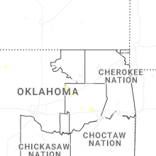

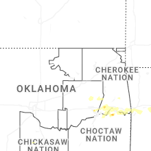
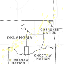
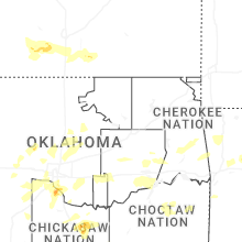

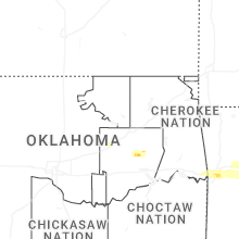
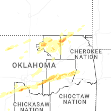


Connect with Interactive Hail Maps