

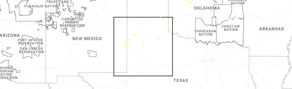
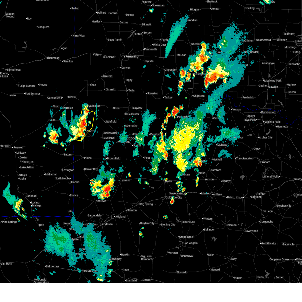
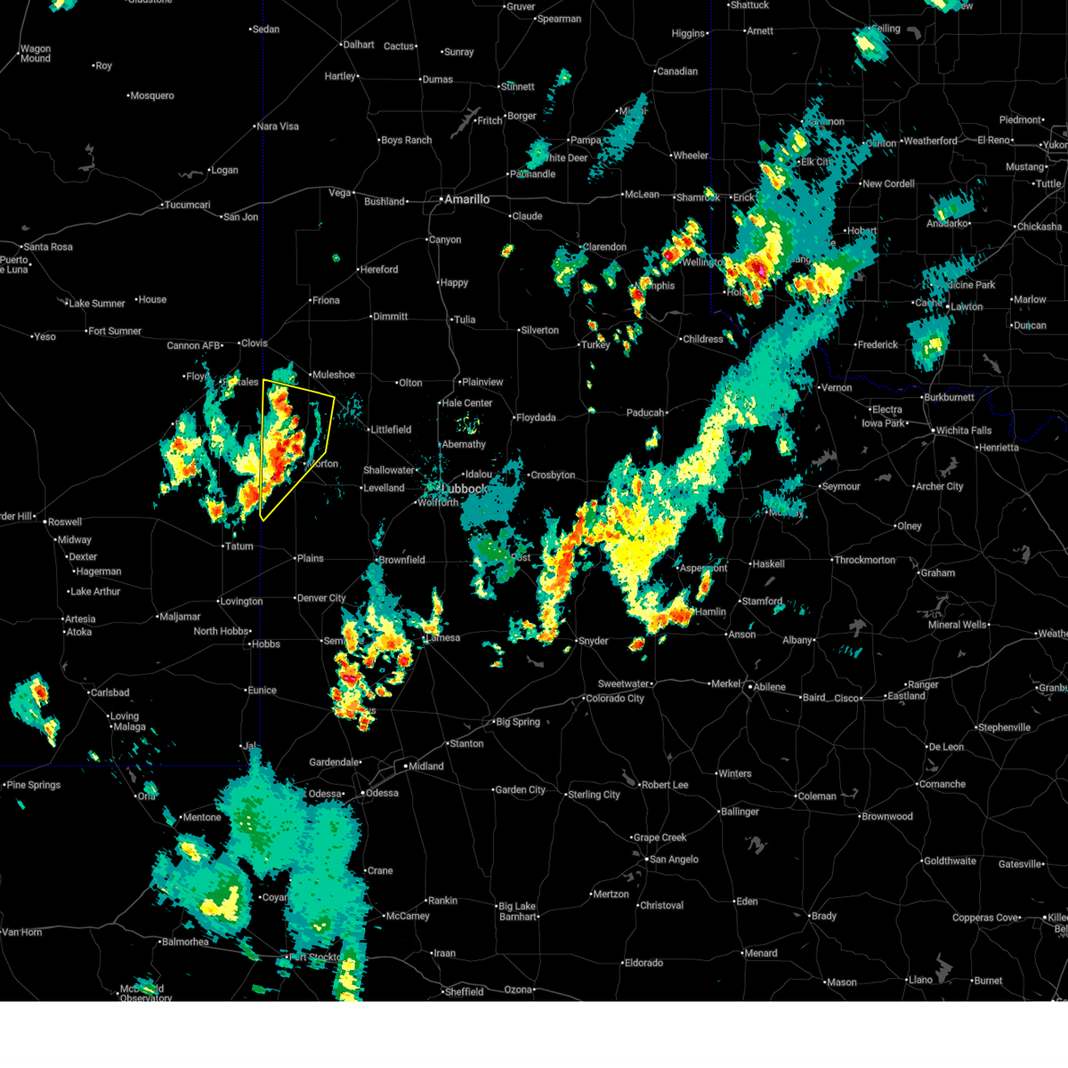
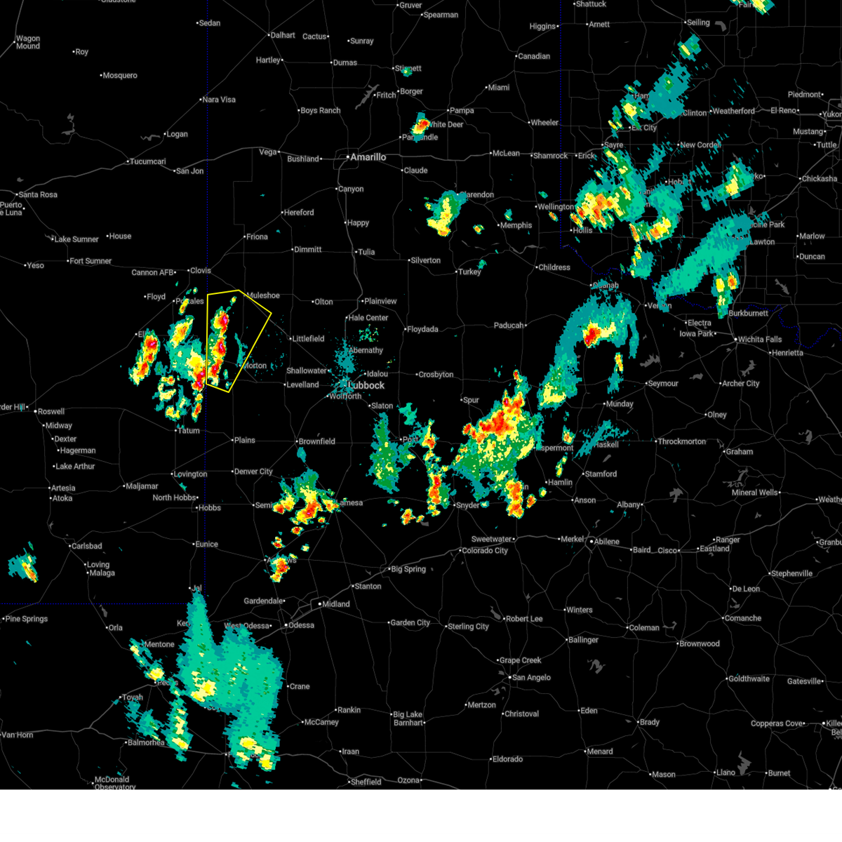
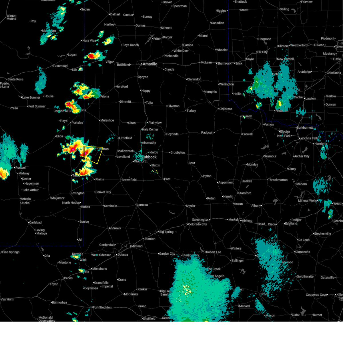
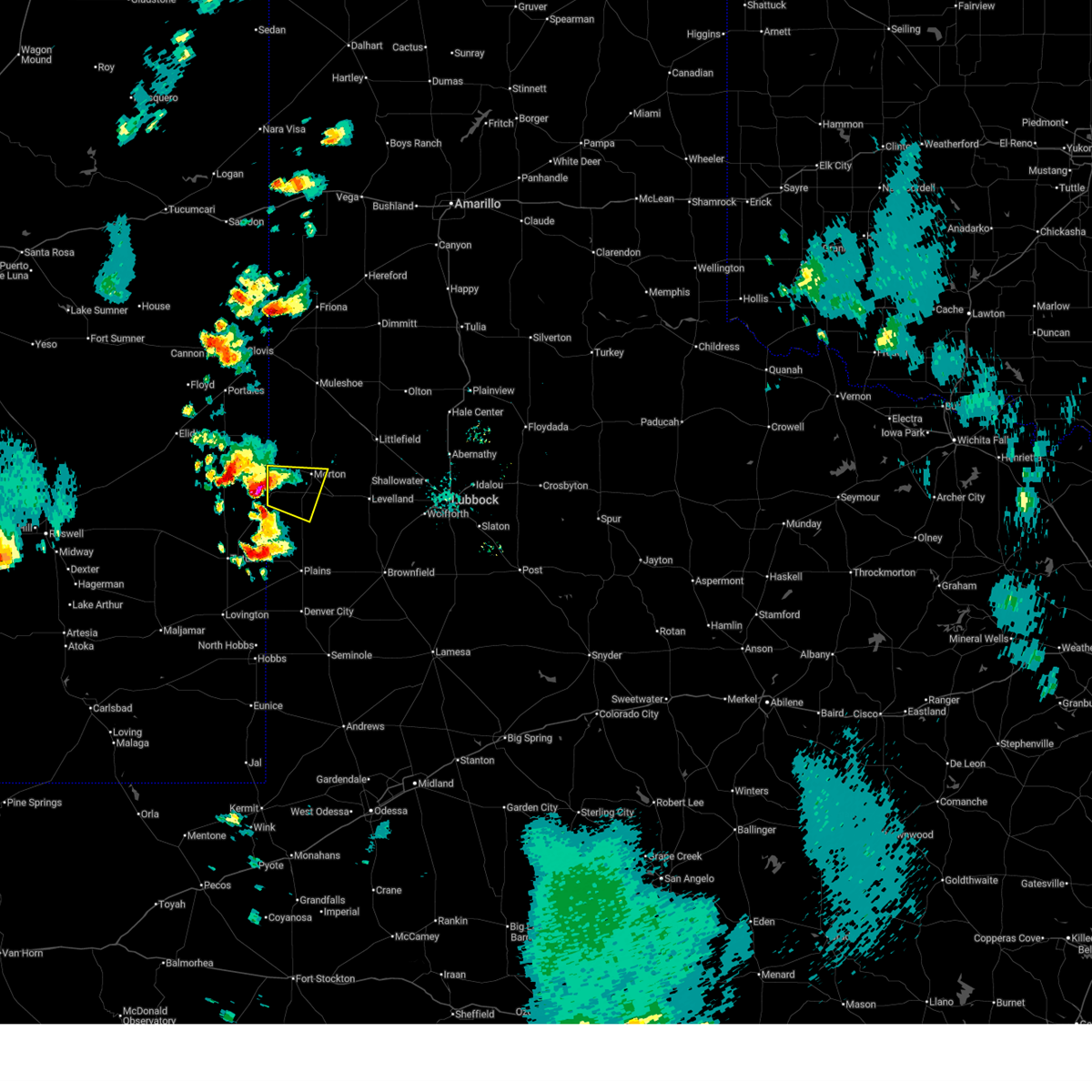
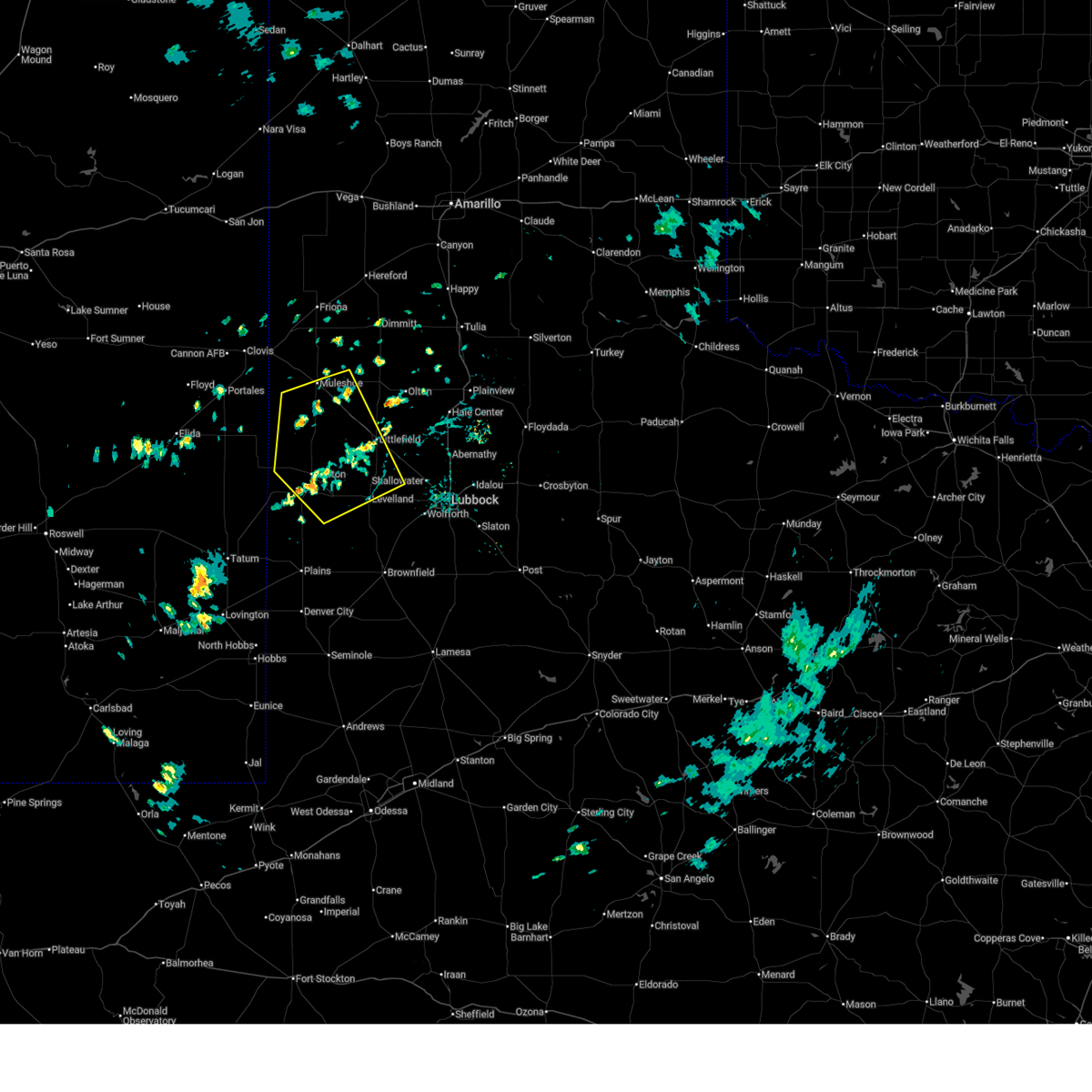
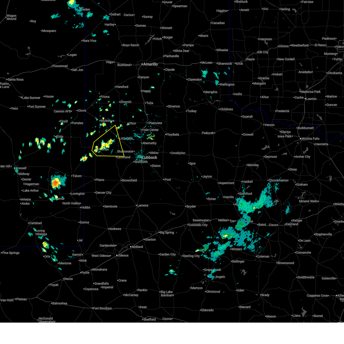
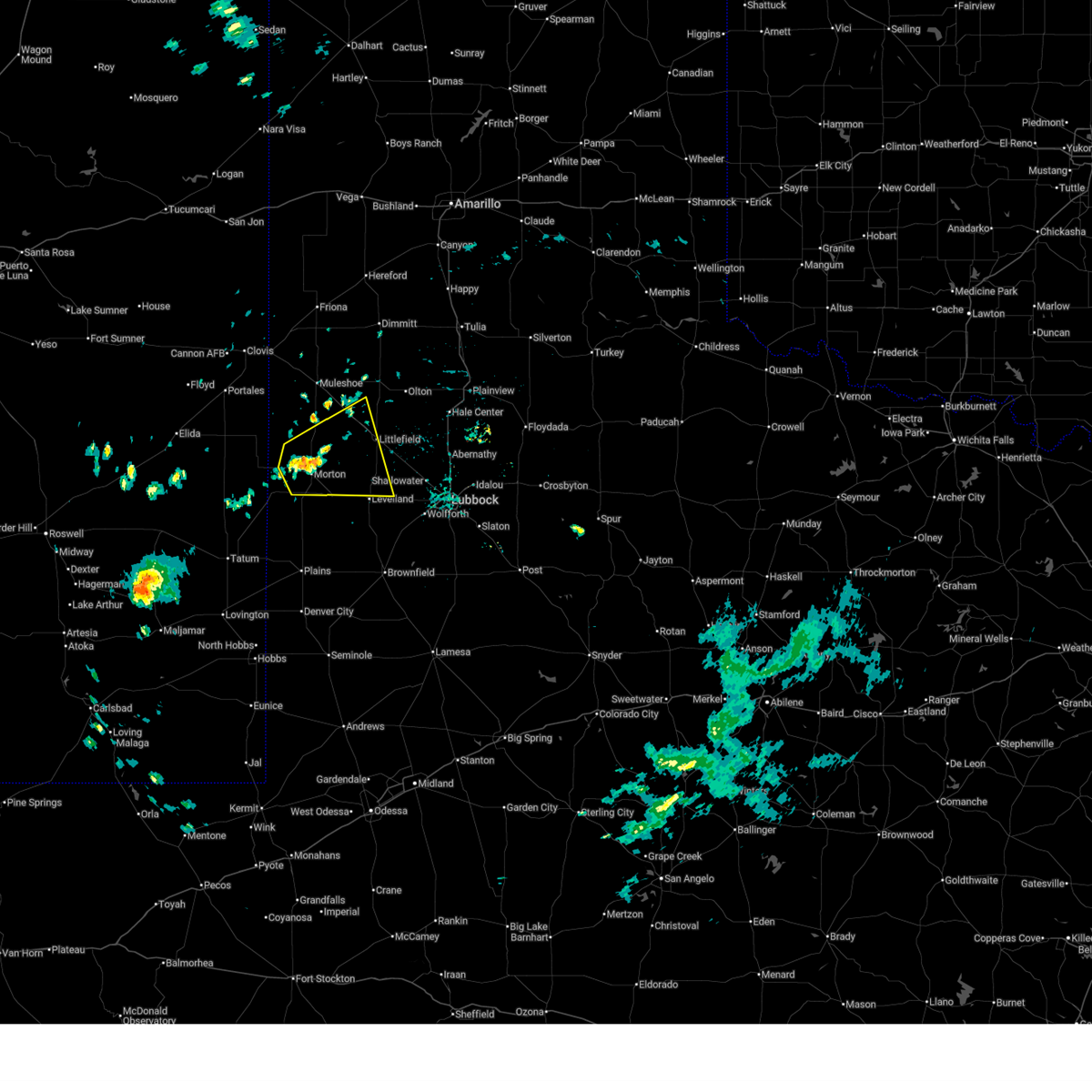
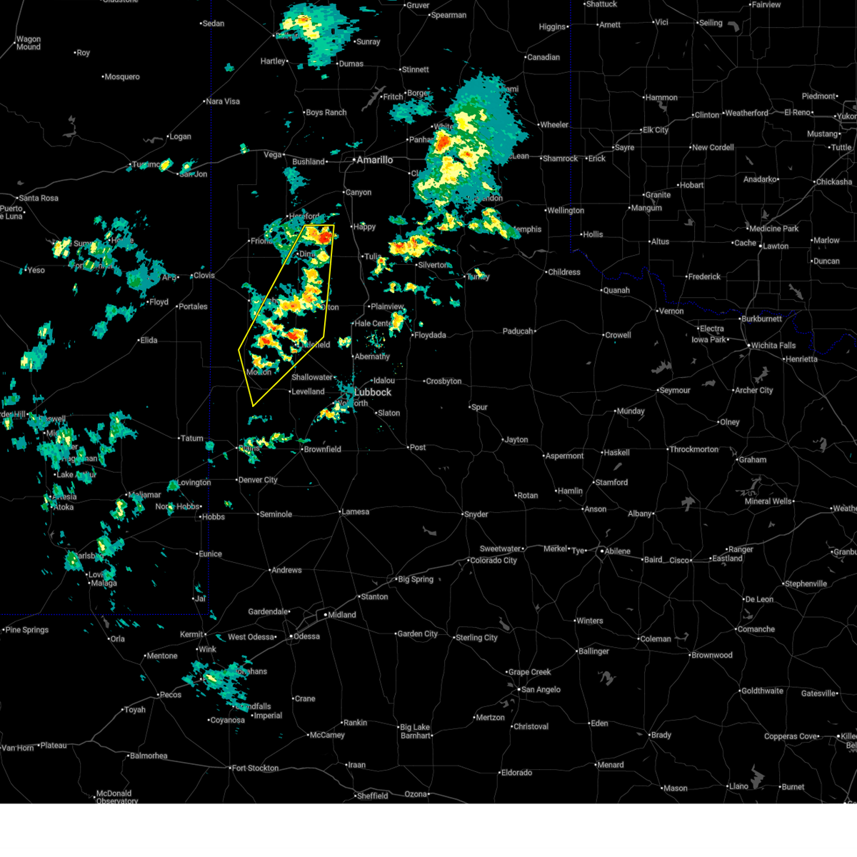
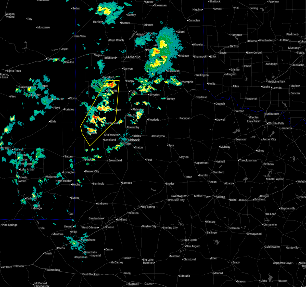
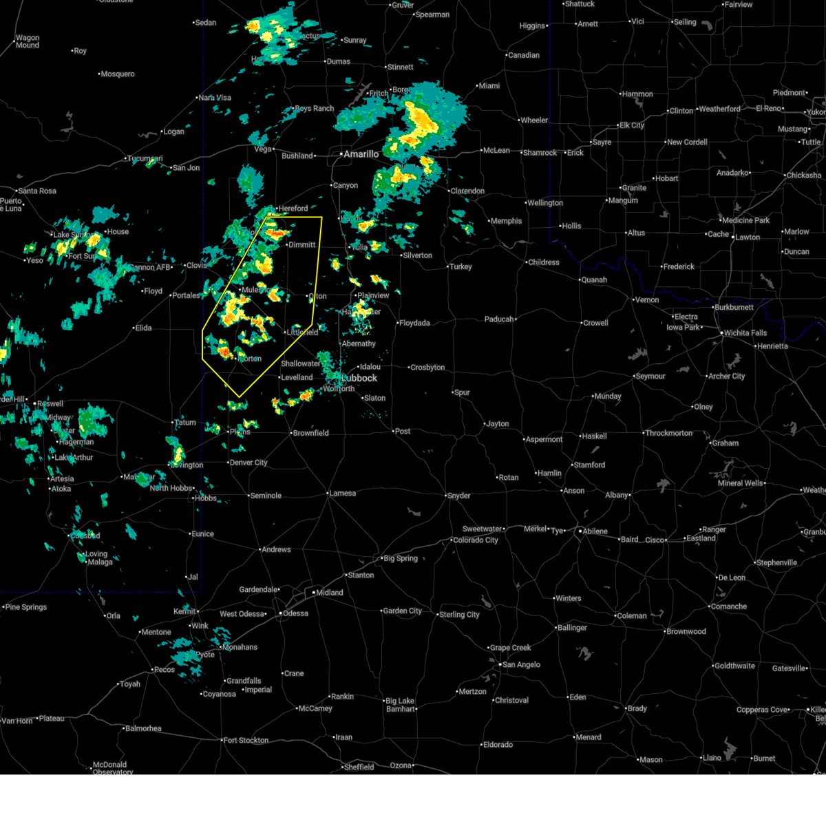
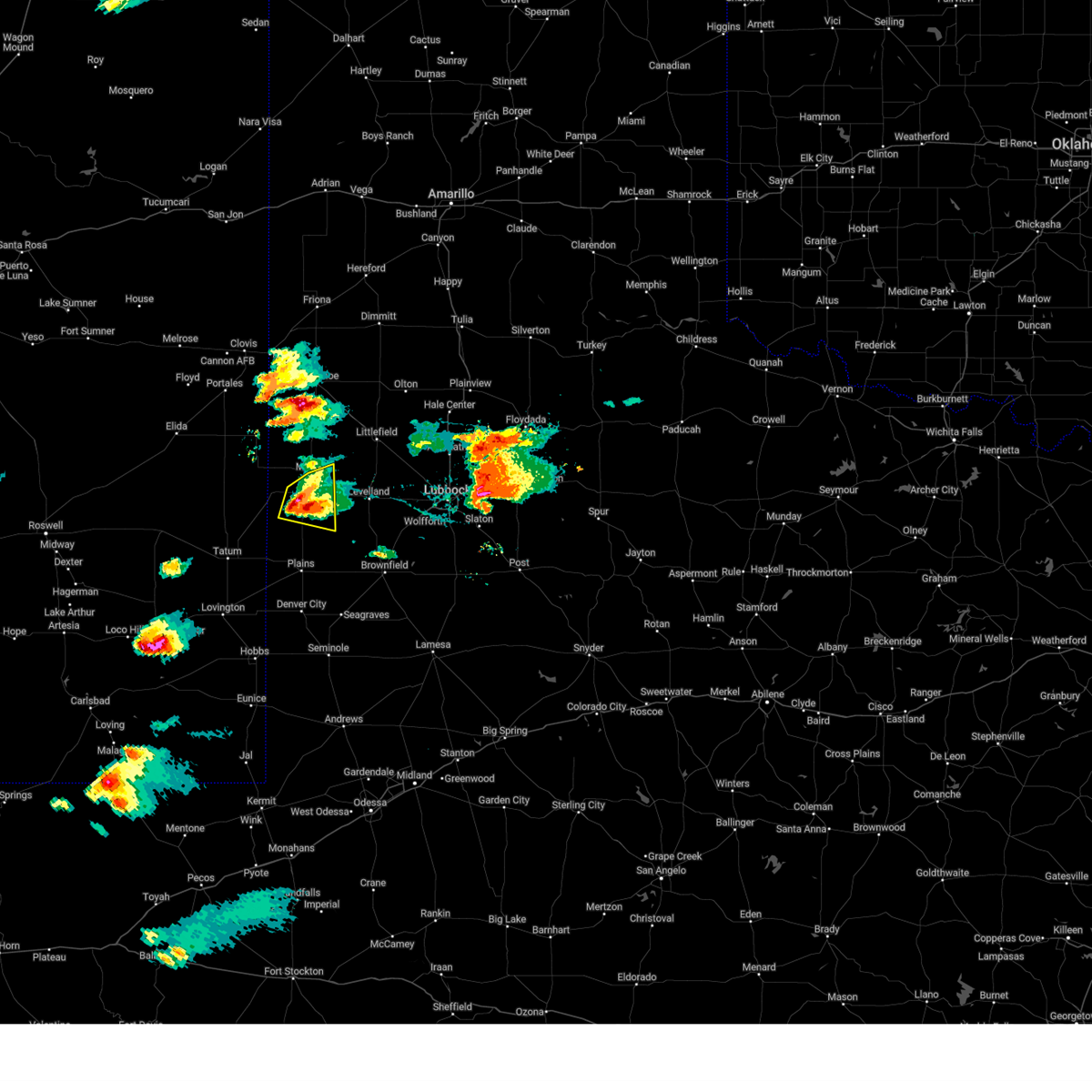
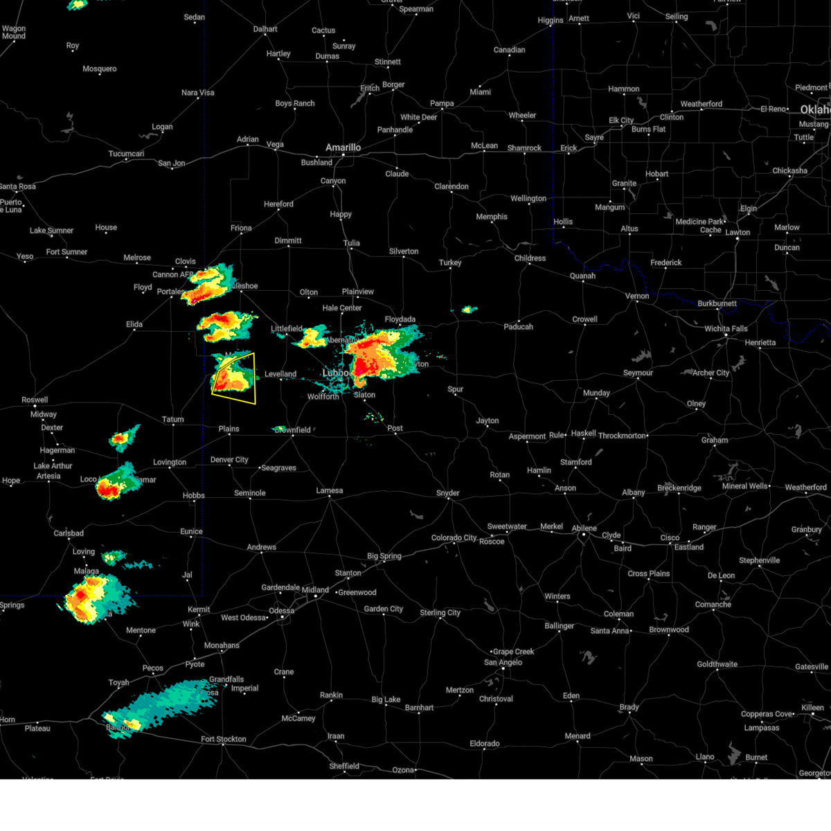
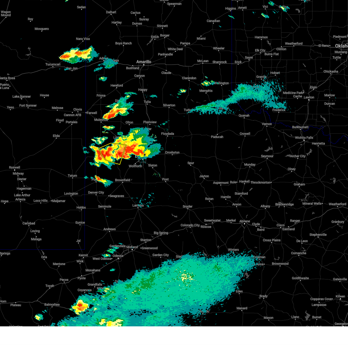
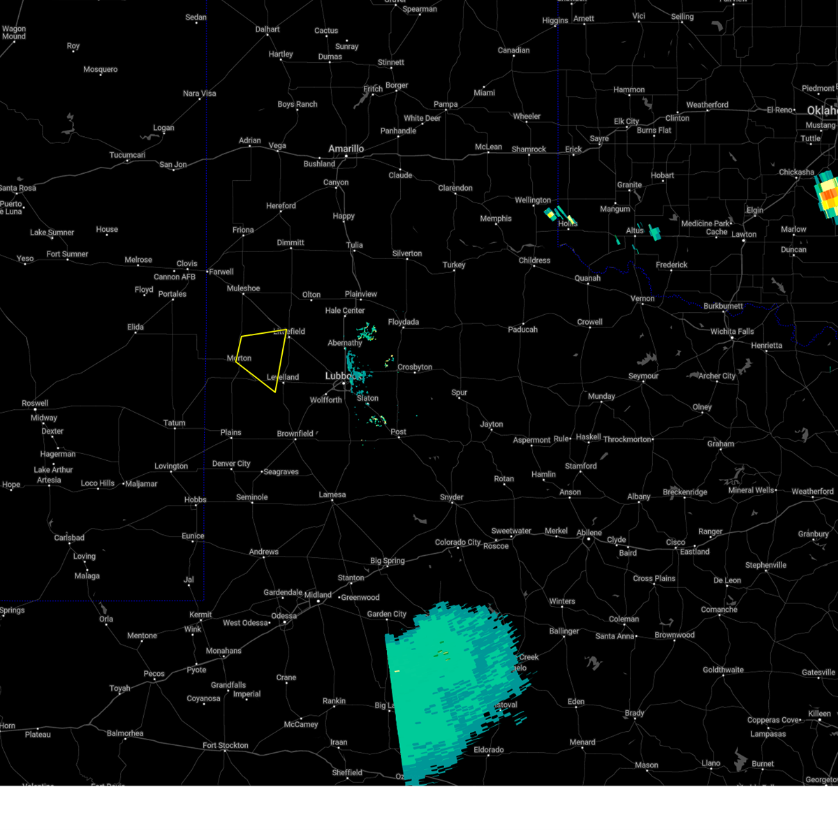
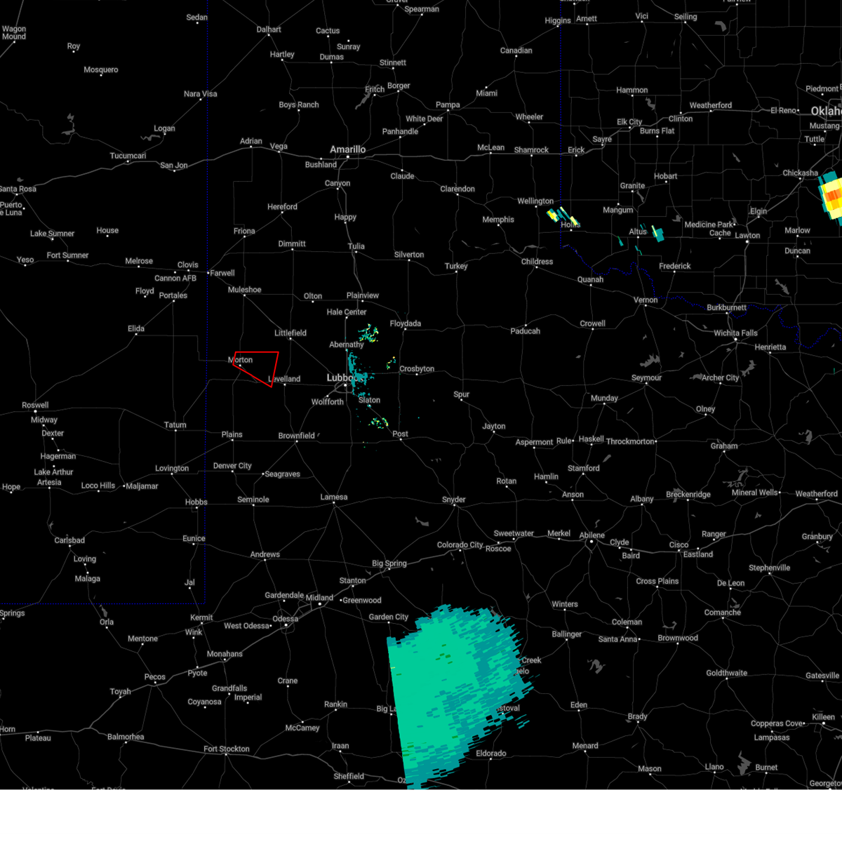
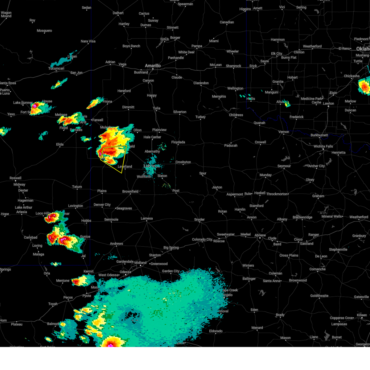
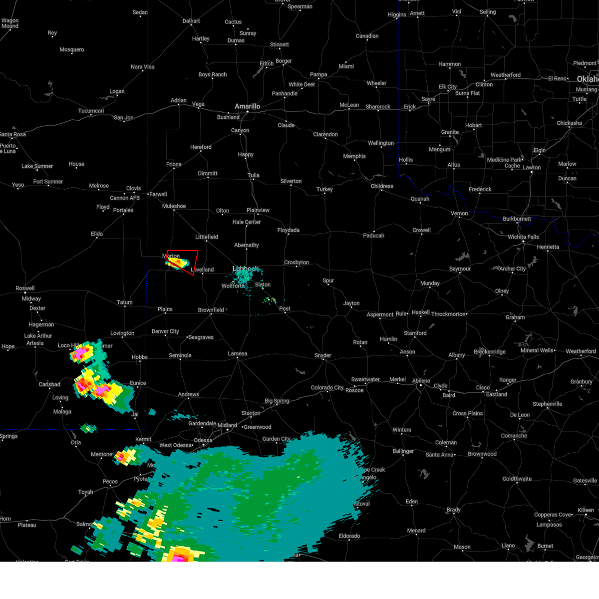
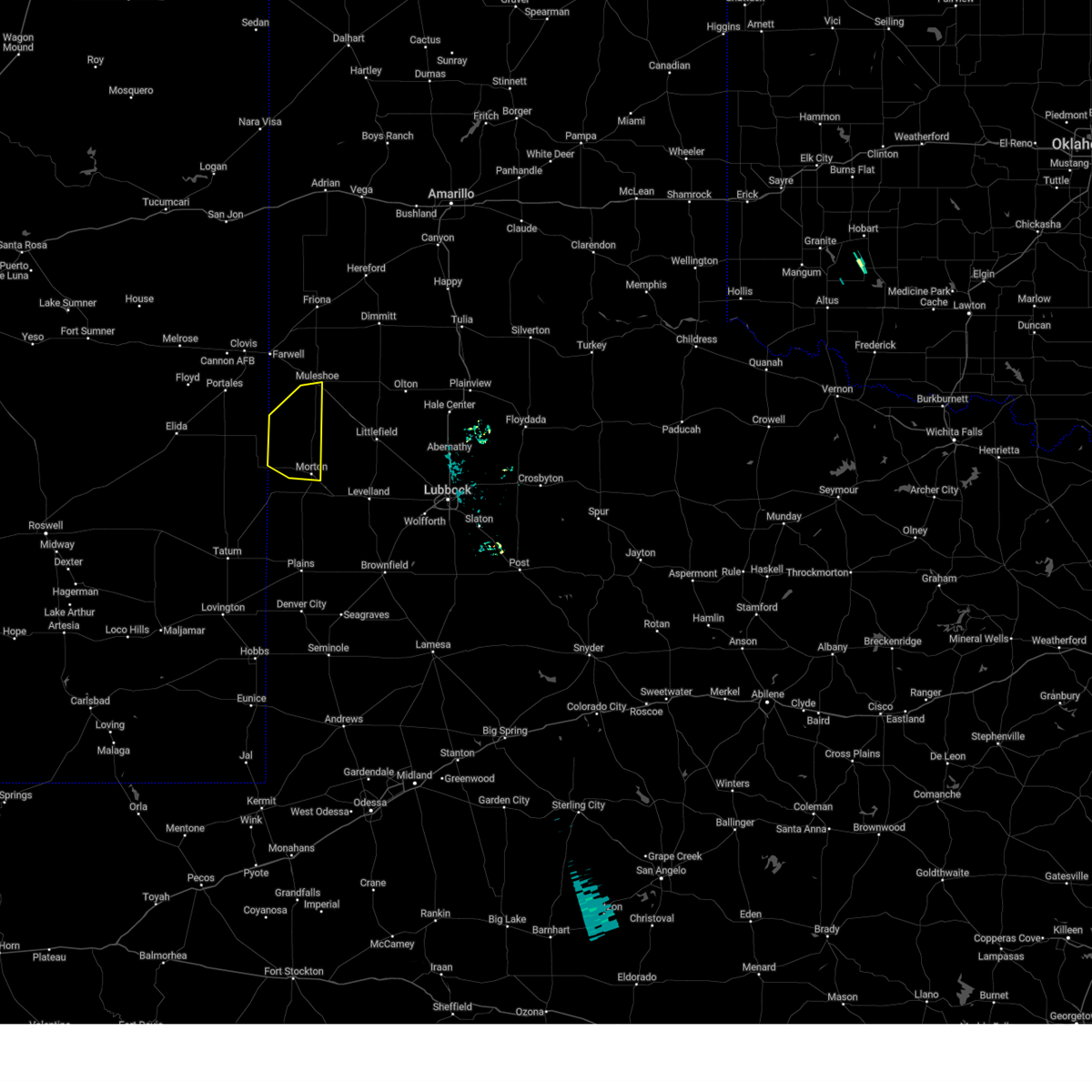
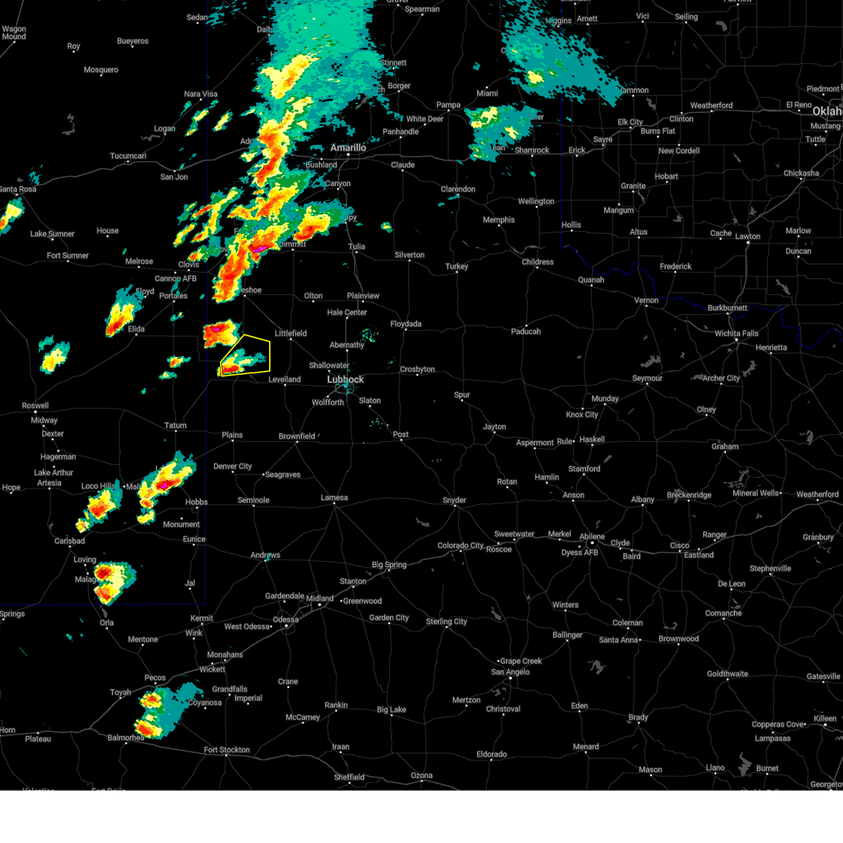
Hail Map for Morton, TX
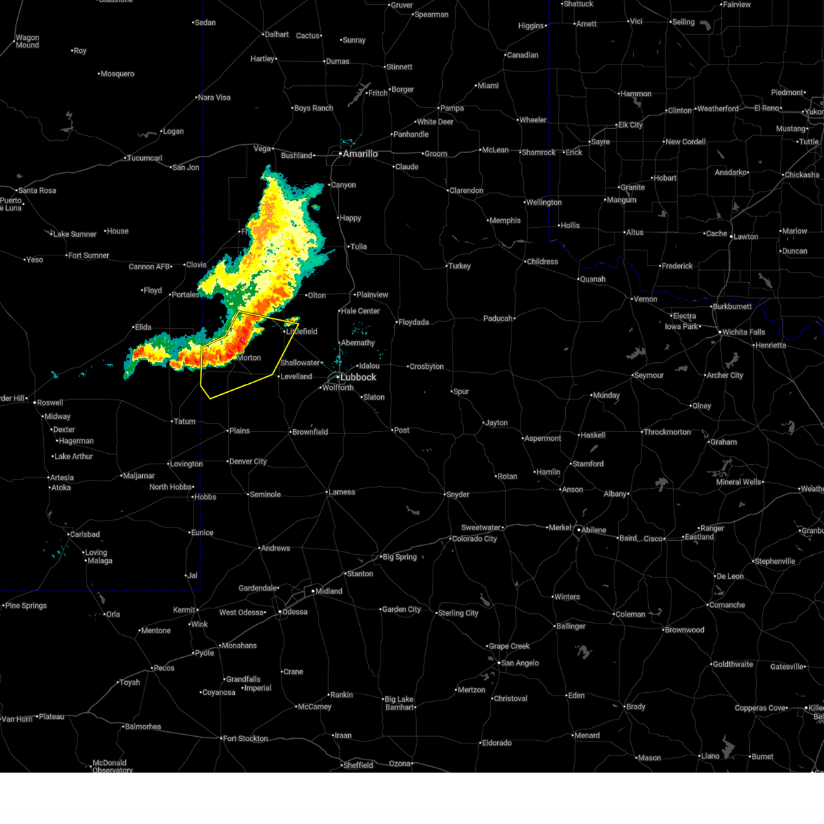
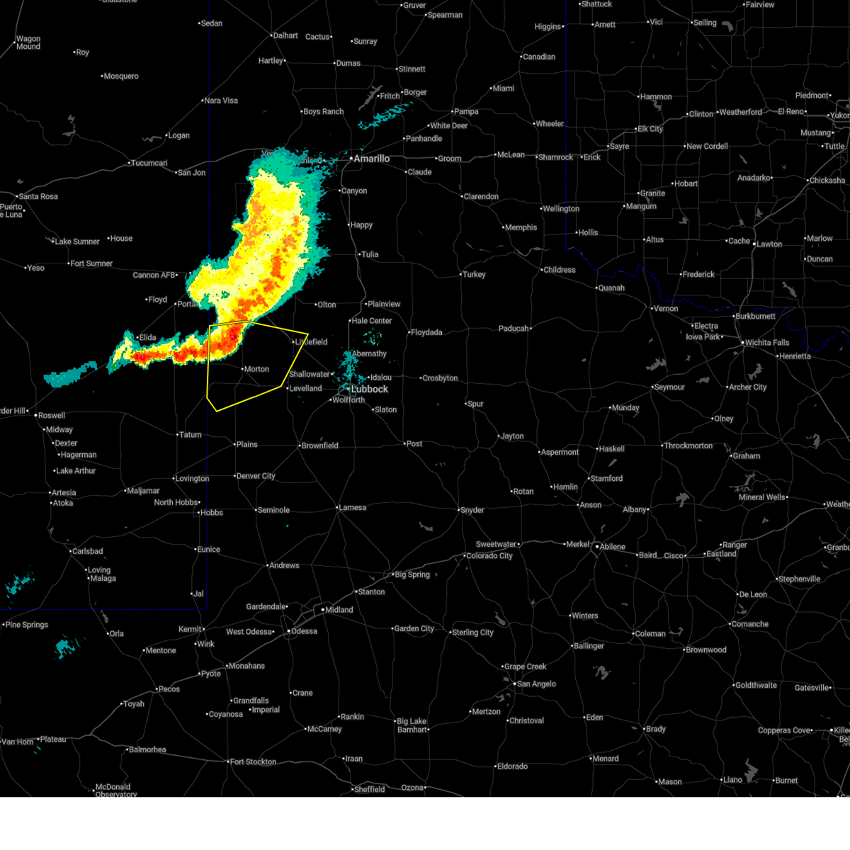
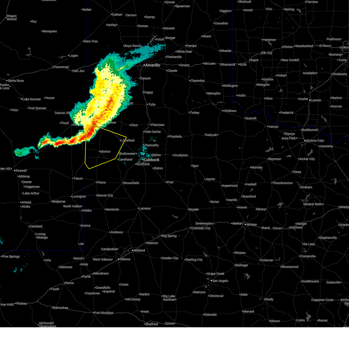
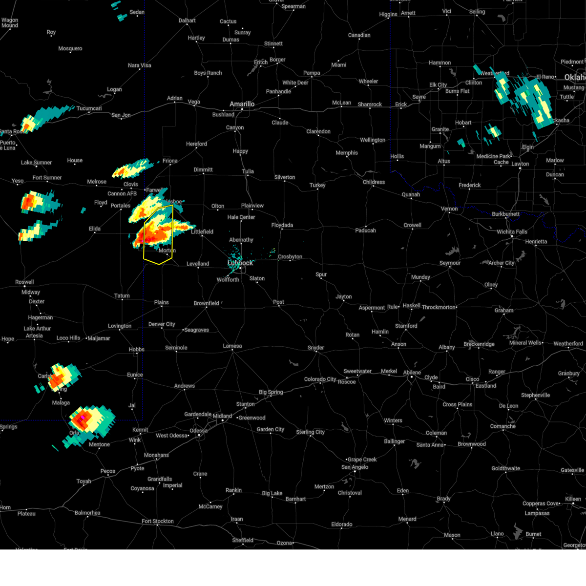
The Morton, TX area has had 24 reports of on-the-ground hail by trained spotters, and has been under severe weather warnings 18 times during the past 12 months. Doppler radar has detected hail at or near Morton, TX on 80 occasions, including 3 occasions during the past year.
| Name: | Morton, TX |
| Where Located: | 52.8 miles W of Lubbock, TX |
| Map: | Google Map for Morton, TX |
| Population: | 2006 |
| Housing Units: | 845 |
| More Info: | Search Google for Morton, TX |
0
The Top Recent Hail Date for Morton, TX is Friday, June 5, 2026 (80th out of 80)
Hail and Wind Damage Spotted near Morton, TX
| Date / Time | Report Details |
|---|---|
| 6/15/2026 8:58 PM CDT |
 At 857 pm cdt, severe thunderstorms were located along a line extending from bula to 3 miles northeast of morton to 3 miles north of bledsoe, moving southeast at 30 mph (radar indicated). Hazards include 60 mph wind gusts. Expect damage to roofs, siding, and trees. Locations impacted include, littlefield, morton, amherst, needmore, bledsoe, bula, muleshoe wildlife refuge, enochs, pep, lehman, maple, and whiteface. At 857 pm cdt, severe thunderstorms were located along a line extending from bula to 3 miles northeast of morton to 3 miles north of bledsoe, moving southeast at 30 mph (radar indicated). Hazards include 60 mph wind gusts. Expect damage to roofs, siding, and trees. Locations impacted include, littlefield, morton, amherst, needmore, bledsoe, bula, muleshoe wildlife refuge, enochs, pep, lehman, maple, and whiteface.
|
| 6/15/2026 8:36 PM CDT |
 At 836 pm cdt, severe thunderstorms were located along a line extending from 3 miles southwest of needmore to 3 miles east of maple to 3 miles northwest of lingo, moving southeast at 35 mph (radar indicated). Hazards include 60 mph wind gusts. Expect damage to roofs, siding, and trees. Locations impacted include, littlefield, morton, amherst, needmore, bledsoe, bula, muleshoe wildlife refuge, enochs, pep, lehman, maple, and whiteface. At 836 pm cdt, severe thunderstorms were located along a line extending from 3 miles southwest of needmore to 3 miles east of maple to 3 miles northwest of lingo, moving southeast at 35 mph (radar indicated). Hazards include 60 mph wind gusts. Expect damage to roofs, siding, and trees. Locations impacted include, littlefield, morton, amherst, needmore, bledsoe, bula, muleshoe wildlife refuge, enochs, pep, lehman, maple, and whiteface.
|
| 6/15/2026 8:22 PM CDT |
 Svrlub the national weather service in lubbock texas has issued a * severe thunderstorm warning for, bailey county in northwestern texas, cochran county in northwestern texas, northwestern hockley county in northwestern texas, southern lamb county in northwestern texas, * until 915 pm cdt. * at 821 pm cdt, severe thunderstorms were located along a line extending from 8 miles northwest of needmore to 9 miles northwest of maple to 5 miles east of dora, moving southeast at 30 mph (radar indicated). Hazards include 60 mph wind gusts. expect damage to roofs, siding, and trees Svrlub the national weather service in lubbock texas has issued a * severe thunderstorm warning for, bailey county in northwestern texas, cochran county in northwestern texas, northwestern hockley county in northwestern texas, southern lamb county in northwestern texas, * until 915 pm cdt. * at 821 pm cdt, severe thunderstorms were located along a line extending from 8 miles northwest of needmore to 9 miles northwest of maple to 5 miles east of dora, moving southeast at 30 mph (radar indicated). Hazards include 60 mph wind gusts. expect damage to roofs, siding, and trees
|
| 6/5/2026 4:30 PM CDT |
 At 430 pm cdt, a severe thunderstorm was located near enochs, or 12 miles north of morton, moving north at 10 mph (radar indicated). Hazards include 60 mph wind gusts. Expect damage to roofs, siding, and trees. Locations impacted include, morton, enochs, bula, muleshoe wildlife refuge, and maple. At 430 pm cdt, a severe thunderstorm was located near enochs, or 12 miles north of morton, moving north at 10 mph (radar indicated). Hazards include 60 mph wind gusts. Expect damage to roofs, siding, and trees. Locations impacted include, morton, enochs, bula, muleshoe wildlife refuge, and maple.
|
| 6/5/2026 4:19 PM CDT |
 At 418 pm cdt, a severe thunderstorm was located over enochs, or 11 miles north of morton, moving northeast at 10 mph (radar indicated). Hazards include 60 mph wind gusts. Expect damage to roofs, siding, and trees. Locations impacted include, morton, needmore, enochs, bula, muleshoe wildlife refuge, and maple. At 418 pm cdt, a severe thunderstorm was located over enochs, or 11 miles north of morton, moving northeast at 10 mph (radar indicated). Hazards include 60 mph wind gusts. Expect damage to roofs, siding, and trees. Locations impacted include, morton, needmore, enochs, bula, muleshoe wildlife refuge, and maple.
|
| 6/5/2026 3:44 PM CDT |
 Svrlub the national weather service in lubbock texas has issued a * severe thunderstorm warning for, bailey county in northwestern texas, northwestern cochran county in northwestern texas, northwestern hockley county in northwestern texas, west central lamb county in northwestern texas, * until 445 pm cdt. * at 344 pm cdt, a severe thunderstorm was located near enochs, or 8 miles north of morton, moving north at 10 mph (radar indicated). Hazards include 60 mph wind gusts. expect damage to roofs, siding, and trees Svrlub the national weather service in lubbock texas has issued a * severe thunderstorm warning for, bailey county in northwestern texas, northwestern cochran county in northwestern texas, northwestern hockley county in northwestern texas, west central lamb county in northwestern texas, * until 445 pm cdt. * at 344 pm cdt, a severe thunderstorm was located near enochs, or 8 miles north of morton, moving north at 10 mph (radar indicated). Hazards include 60 mph wind gusts. expect damage to roofs, siding, and trees
|
| 6/5/2026 3:09 PM CDT |
 Svrlub the national weather service in lubbock texas has issued a * severe thunderstorm warning for, bailey county in northwestern texas, northwestern cochran county in northwestern texas, west central lamb county in northwestern texas, * until 345 pm cdt. * at 309 pm cdt, severe thunderstorms were located along a line extending from 9 miles west of needmore to maple to 4 miles northeast of bledsoe, moving northeast at 5 mph (radar indicated). Hazards include 60 mph wind gusts. expect damage to roofs, siding, and trees Svrlub the national weather service in lubbock texas has issued a * severe thunderstorm warning for, bailey county in northwestern texas, northwestern cochran county in northwestern texas, west central lamb county in northwestern texas, * until 345 pm cdt. * at 309 pm cdt, severe thunderstorms were located along a line extending from 9 miles west of needmore to maple to 4 miles northeast of bledsoe, moving northeast at 5 mph (radar indicated). Hazards include 60 mph wind gusts. expect damage to roofs, siding, and trees
|
| 5/21/2026 6:01 PM CDT |
 At 601 pm cdt, a severe thunderstorm was located over bledsoe, or 14 miles southwest of morton, moving east at 20 mph (radar indicated). Hazards include 60 mph wind gusts and quarter size hail. Hail damage to vehicles is expected. expect wind damage to roofs, siding, and trees. Locations impacted include, morton, bledsoe, and lehman. At 601 pm cdt, a severe thunderstorm was located over bledsoe, or 14 miles southwest of morton, moving east at 20 mph (radar indicated). Hazards include 60 mph wind gusts and quarter size hail. Hail damage to vehicles is expected. expect wind damage to roofs, siding, and trees. Locations impacted include, morton, bledsoe, and lehman.
|
| 5/21/2026 5:43 PM CDT |
 Svrlub the national weather service in lubbock texas has issued a * severe thunderstorm warning for, central cochran county in northwestern texas, * until 645 pm cdt. * at 542 pm cdt, a severe thunderstorm was located 4 miles west of bledsoe, or 20 miles west of morton, moving east at 20 mph (radar indicated). Hazards include ping pong ball size hail and 60 mph wind gusts. People and animals outdoors will be injured. expect hail damage to roofs, siding, windows, and vehicles. Expect wind damage to roofs, siding, and trees. Svrlub the national weather service in lubbock texas has issued a * severe thunderstorm warning for, central cochran county in northwestern texas, * until 645 pm cdt. * at 542 pm cdt, a severe thunderstorm was located 4 miles west of bledsoe, or 20 miles west of morton, moving east at 20 mph (radar indicated). Hazards include ping pong ball size hail and 60 mph wind gusts. People and animals outdoors will be injured. expect hail damage to roofs, siding, windows, and vehicles. Expect wind damage to roofs, siding, and trees.
|
| 5/15/2026 4:29 PM CDT |
 Svrlub the national weather service in lubbock texas has issued a * severe thunderstorm warning for, bailey county in northwestern texas, northeastern cochran county in northwestern texas, northern hockley county in northwestern texas, western lamb county in northwestern texas, * until 500 pm cdt. * at 429 pm cdt, a severe thunderstorm was located near morton, moving northeast at 35 mph (radar indicated). Hazards include 60 mph wind gusts. Expect damage to roofs, siding, and trees. Near zero visibility will be possible along any outflow boundary or stronger wind gust that occurs. Svrlub the national weather service in lubbock texas has issued a * severe thunderstorm warning for, bailey county in northwestern texas, northeastern cochran county in northwestern texas, northern hockley county in northwestern texas, western lamb county in northwestern texas, * until 500 pm cdt. * at 429 pm cdt, a severe thunderstorm was located near morton, moving northeast at 35 mph (radar indicated). Hazards include 60 mph wind gusts. Expect damage to roofs, siding, and trees. Near zero visibility will be possible along any outflow boundary or stronger wind gust that occurs.
|
| 5/15/2026 4:12 PM CDT |
 At 411 pm cdt, a severe thunderstorm was located over pep, or 12 miles northeast of morton, moving east at 30 mph (radar indicated). Hazards include 60 mph wind gusts. Expect damage to roofs, siding, and trees. near zero visibility will be possible along any outflow boundary or stronger wind gust that occurs. Locations impacted include, levelland, littlefield, morton, sudan, amherst, whitharral, bula, enochs, pep, and lehman. At 411 pm cdt, a severe thunderstorm was located over pep, or 12 miles northeast of morton, moving east at 30 mph (radar indicated). Hazards include 60 mph wind gusts. Expect damage to roofs, siding, and trees. near zero visibility will be possible along any outflow boundary or stronger wind gust that occurs. Locations impacted include, levelland, littlefield, morton, sudan, amherst, whitharral, bula, enochs, pep, and lehman.
|
| 5/15/2026 3:50 PM CDT | Storm damage reported in cochran county TX, 1.1 miles WSW of Morton, TX |
| 5/15/2026 3:49 PM CDT |
 Svrlub the national weather service in lubbock texas has issued a * severe thunderstorm warning for, southeastern bailey county in northwestern texas, northern cochran county in northwestern texas, northwestern hockley county in northwestern texas, southwestern lamb county in northwestern texas, * until 430 pm cdt. * at 348 pm cdt, a severe thunderstorm was located 4 miles north of morton, moving east at 30 mph (radar indicated). Hazards include 60 mph wind gusts. Expect damage to roofs, siding, and trees. Near zero visbility will be possible along any outflow boundary or stronger wind gust that occurs. Svrlub the national weather service in lubbock texas has issued a * severe thunderstorm warning for, southeastern bailey county in northwestern texas, northern cochran county in northwestern texas, northwestern hockley county in northwestern texas, southwestern lamb county in northwestern texas, * until 430 pm cdt. * at 348 pm cdt, a severe thunderstorm was located 4 miles north of morton, moving east at 30 mph (radar indicated). Hazards include 60 mph wind gusts. Expect damage to roofs, siding, and trees. Near zero visbility will be possible along any outflow boundary or stronger wind gust that occurs.
|
| 5/14/2026 5:37 PM CDT |
 At 537 pm cdt, severe thunderstorms were located along a line extending from 4 miles north of hart to pep, moving southeast at 40 mph (radar indicated). Hazards include 60 mph wind gusts. Expect damage to roofs, siding, and trees. near zero visbility will be possible along any outflow boundary or stronger wind gust that occurs. Locations impacted include, littlefield, dimmitt, olton, morton, hart, earth, sudan, amherst, fieldton, spade, enochs, bula, muleshoe wildlife refuge, pep, whiteface, nazareth, and springlake. At 537 pm cdt, severe thunderstorms were located along a line extending from 4 miles north of hart to pep, moving southeast at 40 mph (radar indicated). Hazards include 60 mph wind gusts. Expect damage to roofs, siding, and trees. near zero visbility will be possible along any outflow boundary or stronger wind gust that occurs. Locations impacted include, littlefield, dimmitt, olton, morton, hart, earth, sudan, amherst, fieldton, spade, enochs, bula, muleshoe wildlife refuge, pep, whiteface, nazareth, and springlake.
|
| 5/14/2026 5:28 PM CDT |
 At 527 pm cdt, severe thunderstorms were located along a line extending from dimmitt to muleshoe wildlife refuge, moving southeast at 30 mph (radar indicated). Hazards include 60 mph wind gusts. Expect damage to roofs, siding, and trees. near zero visibility will be possible along any outflow boundary or stronger wind gust that occurs. Locations impacted include, littlefield, dimmitt, olton, morton, hart, earth, sudan, amherst, needmore, fieldton, spade, enochs, bula, muleshoe wildlife refuge, pep, lehman, maple, whiteface, nazareth, and springlake. At 527 pm cdt, severe thunderstorms were located along a line extending from dimmitt to muleshoe wildlife refuge, moving southeast at 30 mph (radar indicated). Hazards include 60 mph wind gusts. Expect damage to roofs, siding, and trees. near zero visibility will be possible along any outflow boundary or stronger wind gust that occurs. Locations impacted include, littlefield, dimmitt, olton, morton, hart, earth, sudan, amherst, needmore, fieldton, spade, enochs, bula, muleshoe wildlife refuge, pep, lehman, maple, whiteface, nazareth, and springlake.
|
| 5/14/2026 5:12 PM CDT |
 Svrlub the national weather service in lubbock texas has issued a * severe thunderstorm warning for, bailey county in northwestern texas, cochran county in northwestern texas, southeastern parmer county in the panhandle of texas, northwestern hockley county in northwestern texas, northwestern hale county in northwestern texas, castro county in the panhandle of texas, lamb county in northwestern texas, * until 615 pm cdt. * at 511 pm cdt, a cluster of severe thunderstorms were located along a line extending from easter to 5 miles west of muleshoe wildlife refuge, moving southeast at 30 mph (radar indicated). Hazards include 60 mph wind gusts. Expect damage to roofs, siding, and trees. Near zero visibility will be possible along and outflow boundaries or stronger wind gust that occurs. Svrlub the national weather service in lubbock texas has issued a * severe thunderstorm warning for, bailey county in northwestern texas, cochran county in northwestern texas, southeastern parmer county in the panhandle of texas, northwestern hockley county in northwestern texas, northwestern hale county in northwestern texas, castro county in the panhandle of texas, lamb county in northwestern texas, * until 615 pm cdt. * at 511 pm cdt, a cluster of severe thunderstorms were located along a line extending from easter to 5 miles west of muleshoe wildlife refuge, moving southeast at 30 mph (radar indicated). Hazards include 60 mph wind gusts. Expect damage to roofs, siding, and trees. Near zero visibility will be possible along and outflow boundaries or stronger wind gust that occurs.
|
| 9/22/2025 9:47 PM CDT | At 947 pm cdt, severe thunderstorms were located along a line extending from 4 miles northeast of summerfield to near amherst to 8 miles east of lehman, moving east at 40 mph (radar indicated). Hazards include 60 mph wind gusts. Expect damage to roofs, siding, and trees. Locations impacted include, muleshoe, dimmitt, friona, morton, earth, sudan, amherst, summerfield, needmore, easter, lazbuddie, enochs, black, bula, muleshoe wildlife refuge, pep, lehman, whiteface, and springlake. |
| 9/22/2025 9:34 PM CDT | At 934 pm cdt, severe thunderstorms were located along a line extending from 3 miles west of summerfield to 7 miles northwest of sudan to near morton, moving east at 45 mph (radar indicated). Hazards include 60 mph wind gusts. Expect damage to roofs, siding, and trees. Locations impacted include, muleshoe, dimmitt, friona, morton, earth, bovina, sudan, amherst, summerfield, needmore, easter, lazbuddie, progress, oklahoma lane, enochs, black, bula, muleshoe wildlife refuge, pep, and lehman. |
| 9/22/2025 9:02 PM CDT | Svrlub the national weather service in lubbock texas has issued a * severe thunderstorm warning for, bailey county in northwestern texas, northern cochran county in northwestern texas, parmer county in the panhandle of texas, northwestern hockley county in northwestern texas, castro county in the panhandle of texas, western lamb county in northwestern texas, * until 1000 pm cdt. * at 901 pm cdt, severe thunderstorms were located along a line extending from 3 miles northeast of rhea to 8 miles east of arch to 7 miles northeast of milnesand, moving east at 40 mph (radar indicated). Hazards include 60 mph wind gusts. expect damage to roofs, siding, and trees |
| 6/13/2025 8:53 PM CDT | Storm damage reported in cochran county TX, 1.1 miles WSW of Morton, TX |
| 6/6/2025 6:19 PM CDT | Tennis Ball sized hail reported 13.8 miles NNE of Morton, TX, report from mping: tennis ball (2.50 in.). |
| 6/6/2025 6:13 PM CDT | Golf Ball sized hail reported 13.2 miles NNE of Morton, TX, report from mping: golf ball (1.75 in.). |
| 6/6/2025 6:10 PM CDT | Baseball sized hail reported 13.8 miles NNE of Morton, TX, report from mping: baseball (2.75 in.). |
| 6/6/2025 6:08 PM CDT |
 Svrlub the national weather service in lubbock texas has issued a * severe thunderstorm warning for, southeastern cochran county in northwestern texas, west central hockley county in northwestern texas, * until 715 pm cdt. * at 608 pm cdt, a severe thunderstorm was located 7 miles southeast of lehman, or 12 miles south of morton, moving east at 25 mph (radar indicated). Hazards include 60 mph wind gusts and quarter size hail. Hail damage to vehicles is expected. Expect wind damage to roofs, siding, and trees. Svrlub the national weather service in lubbock texas has issued a * severe thunderstorm warning for, southeastern cochran county in northwestern texas, west central hockley county in northwestern texas, * until 715 pm cdt. * at 608 pm cdt, a severe thunderstorm was located 7 miles southeast of lehman, or 12 miles south of morton, moving east at 25 mph (radar indicated). Hazards include 60 mph wind gusts and quarter size hail. Hail damage to vehicles is expected. Expect wind damage to roofs, siding, and trees.
|
| 6/6/2025 6:05 PM CDT | Quarter sized hail reported 11.8 miles NNE of Morton, TX, report from mping: quarter (1.00 in.). |
| 6/6/2025 5:59 PM CDT |
 Svrlub the national weather service in lubbock texas has issued a * severe thunderstorm warning for, southeastern cochran county in northwestern texas, west central hockley county in northwestern texas, * until 700 pm cdt. * at 559 pm cdt, a severe thunderstorm was located 5 miles south of lehman, or 12 miles south of morton, moving east at 25 mph (radar indicated). Hazards include 60 mph wind gusts and quarter size hail. Hail damage to vehicles is expected. Expect wind damage to roofs, siding, and trees. Svrlub the national weather service in lubbock texas has issued a * severe thunderstorm warning for, southeastern cochran county in northwestern texas, west central hockley county in northwestern texas, * until 700 pm cdt. * at 559 pm cdt, a severe thunderstorm was located 5 miles south of lehman, or 12 miles south of morton, moving east at 25 mph (radar indicated). Hazards include 60 mph wind gusts and quarter size hail. Hail damage to vehicles is expected. Expect wind damage to roofs, siding, and trees.
|
| 6/6/2025 5:41 PM CDT |
 Svrlub the national weather service in lubbock texas has issued a * severe thunderstorm warning for, cochran county in northwestern texas, west central hockley county in northwestern texas, * until 615 pm cdt. * at 540 pm cdt, a severe thunderstorm was located 7 miles southeast of bledsoe, or 14 miles southwest of morton, moving east at 30 mph (radar indicated). Hazards include 60 mph wind gusts and quarter size hail. Hail damage to vehicles is expected. Expect wind damage to roofs, siding, and trees. Svrlub the national weather service in lubbock texas has issued a * severe thunderstorm warning for, cochran county in northwestern texas, west central hockley county in northwestern texas, * until 615 pm cdt. * at 540 pm cdt, a severe thunderstorm was located 7 miles southeast of bledsoe, or 14 miles southwest of morton, moving east at 30 mph (radar indicated). Hazards include 60 mph wind gusts and quarter size hail. Hail damage to vehicles is expected. Expect wind damage to roofs, siding, and trees.
|
| 6/5/2025 7:44 PM CDT |
 At 743 pm cdt, a severe thunderstorm was located near whitharral, or 7 miles north of levelland, moving east at 40 mph (radar indicated). Hazards include 60 mph wind gusts and quarter size hail. Hail damage to vehicles is expected. expect wind damage to roofs, siding, and trees. Locations impacted include, levelland, pep, whitharral, whiteface, and opdyke west. At 743 pm cdt, a severe thunderstorm was located near whitharral, or 7 miles north of levelland, moving east at 40 mph (radar indicated). Hazards include 60 mph wind gusts and quarter size hail. Hail damage to vehicles is expected. expect wind damage to roofs, siding, and trees. Locations impacted include, levelland, pep, whitharral, whiteface, and opdyke west.
|
| 6/5/2025 7:33 PM CDT |
 At 733 pm cdt, a severe thunderstorm was located 5 miles southeast of whitharral, or 7 miles northeast of levelland, moving east at 35 mph (radar indicated). Hazards include golf ball size hail and 70 mph wind gusts. People and animals outdoors will be injured. expect hail damage to roofs, siding, windows, and vehicles. expect considerable tree damage. wind damage is also likely to mobile homes, roofs, and outbuildings. Locations impacted include, levelland, pep, whitharral, whiteface, and opdyke west. At 733 pm cdt, a severe thunderstorm was located 5 miles southeast of whitharral, or 7 miles northeast of levelland, moving east at 35 mph (radar indicated). Hazards include golf ball size hail and 70 mph wind gusts. People and animals outdoors will be injured. expect hail damage to roofs, siding, windows, and vehicles. expect considerable tree damage. wind damage is also likely to mobile homes, roofs, and outbuildings. Locations impacted include, levelland, pep, whitharral, whiteface, and opdyke west.
|
| 6/5/2025 7:30 PM CDT |
 Svrlub the national weather service in lubbock texas has issued a * severe thunderstorm warning for, southeastern bailey county in northwestern texas, northeastern cochran county in northwestern texas, northwestern hockley county in northwestern texas, southwestern lamb county in northwestern texas, * until 830 pm cdt. * at 730 pm cdt, a severe thunderstorm was located 8 miles south of pep, or 12 miles east of morton, moving east at 30 mph (radar indicated). Hazards include 70 mph wind gusts and quarter size hail. Hail damage to vehicles is expected. expect considerable tree damage. Wind damage is also likely to mobile homes, roofs, and outbuildings. Svrlub the national weather service in lubbock texas has issued a * severe thunderstorm warning for, southeastern bailey county in northwestern texas, northeastern cochran county in northwestern texas, northwestern hockley county in northwestern texas, southwestern lamb county in northwestern texas, * until 830 pm cdt. * at 730 pm cdt, a severe thunderstorm was located 8 miles south of pep, or 12 miles east of morton, moving east at 30 mph (radar indicated). Hazards include 70 mph wind gusts and quarter size hail. Hail damage to vehicles is expected. expect considerable tree damage. Wind damage is also likely to mobile homes, roofs, and outbuildings.
|
| 6/5/2025 6:10 PM CDT | Tea Cup sized hail reported 9.6 miles WSW of Morton, TX, report from mping: baseball+ (3.25 in.). |
| 6/5/2025 6:04 PM CDT | Golf Ball sized hail reported 7.5 miles WSW of Morton, TX, report from mping: golf ball (1.75 in.). |
| 6/5/2025 5:57 PM CDT |
 At 556 pm cdt, a severe thunderstorm was located 5 miles west of pep, or 9 miles northeast of morton, moving east at 30 mph. this is a destructive storm for pep (trained weather spotters). Hazards include three inch hail and 70 mph wind gusts. People and animals outdoors will be severely injured. expect shattered windows, extensive damage to roofs, siding, and vehicles. Locations impacted include, littlefield, morton, pep, and bula. At 556 pm cdt, a severe thunderstorm was located 5 miles west of pep, or 9 miles northeast of morton, moving east at 30 mph. this is a destructive storm for pep (trained weather spotters). Hazards include three inch hail and 70 mph wind gusts. People and animals outdoors will be severely injured. expect shattered windows, extensive damage to roofs, siding, and vehicles. Locations impacted include, littlefield, morton, pep, and bula.
|
| 6/5/2025 5:54 PM CDT |
 At 553 pm cdt, a confirmed tornado was located 4 miles northeast of morton, moving east at 25 mph (weather spotters confirmed tornado). Hazards include damaging tornado and baseball size hail. Flying debris will be dangerous to those caught without shelter. mobile homes will be damaged or destroyed. damage to roofs, windows, and vehicles will occur. tree damage is likely. This tornadic thunderstorm will remain over mainly rural areas of northeastern cochran and northwestern hockley counties. At 553 pm cdt, a confirmed tornado was located 4 miles northeast of morton, moving east at 25 mph (weather spotters confirmed tornado). Hazards include damaging tornado and baseball size hail. Flying debris will be dangerous to those caught without shelter. mobile homes will be damaged or destroyed. damage to roofs, windows, and vehicles will occur. tree damage is likely. This tornadic thunderstorm will remain over mainly rural areas of northeastern cochran and northwestern hockley counties.
|
| 6/5/2025 5:51 PM CDT |
 At 550 pm cdt, a severe thunderstorm was located near enochs, or 8 miles north of morton, moving east at 30 mph. this is a destructive storm for 4 miles east of enochs (trained weather spotters). Hazards include baseball size hail and 70 mph wind gusts. People and animals outdoors will be severely injured. expect shattered windows, extensive damage to roofs, siding, and vehicles. Locations impacted include, littlefield, morton, enochs, pep, and bula. At 550 pm cdt, a severe thunderstorm was located near enochs, or 8 miles north of morton, moving east at 30 mph. this is a destructive storm for 4 miles east of enochs (trained weather spotters). Hazards include baseball size hail and 70 mph wind gusts. People and animals outdoors will be severely injured. expect shattered windows, extensive damage to roofs, siding, and vehicles. Locations impacted include, littlefield, morton, enochs, pep, and bula.
|
| 6/5/2025 5:48 PM CDT |
 At 548 pm cdt, a confirmed large and extremely dangerous tornado was located 4 miles north of morton, moving east at 30 mph. this is a particularly dangerous situation. take cover now! (weather spotters confirmed tornado). Hazards include damaging tornado. You are in a life-threatening situation. flying debris may be deadly to those caught without shelter. mobile homes will be destroyed. considerable damage to homes, businesses, and vehicles is likely and complete destruction is possible. The tornado will be near, pep around 605 pm cdt. At 548 pm cdt, a confirmed large and extremely dangerous tornado was located 4 miles north of morton, moving east at 30 mph. this is a particularly dangerous situation. take cover now! (weather spotters confirmed tornado). Hazards include damaging tornado. You are in a life-threatening situation. flying debris may be deadly to those caught without shelter. mobile homes will be destroyed. considerable damage to homes, businesses, and vehicles is likely and complete destruction is possible. The tornado will be near, pep around 605 pm cdt.
|
| 6/5/2025 5:42 PM CDT | At 542 pm cdt, a confirmed large and extremely dangerous tornado was located 4 miles north of morton, moving east at 30 mph. this is a particularly dangerous situation. take cover now! (weather spotters confirmed tornado). Hazards include damaging tornado. You are in a life-threatening situation. flying debris may be deadly to those caught without shelter. mobile homes will be destroyed. considerable damage to homes, businesses, and vehicles is likely and complete destruction is possible. the tornado will be near, morton around 545 pm cdt. Pep around 605 pm cdt. |
| 6/5/2025 5:41 PM CDT | Svrlub the national weather service in lubbock texas has issued a * severe thunderstorm warning for, southeastern bailey county in northwestern texas, northeastern cochran county in northwestern texas, northwestern hockley county in northwestern texas, southwestern lamb county in northwestern texas, * until 645 pm cdt. * at 540 pm cdt, a severe thunderstorm was located 4 miles southwest of enochs, or 6 miles north of morton, moving east at 30 mph. this is a destructive storm for northern cochran county including the city of morton (radar indicated). Hazards include softball size hail and 70 mph wind gusts. People and animals outdoors will be severely injured. Expect shattered windows, extensive damage to roofs, siding, and vehicles. |
| 6/5/2025 5:38 PM CDT | Torlub the national weather service in lubbock texas has issued a * tornado warning for, northeastern cochran county in northwestern texas, northwestern hockley county in northwestern texas, * until 630 pm cdt. * at 537 pm cdt, a confirmed large and extremely dangerous tornado was located 4 miles northwest of morton, moving east at 30 mph. this is a particularly dangerous situation. take cover now! (weather spotters confirmed tornado). Hazards include damaging tornado. You are in a life-threatening situation. flying debris may be deadly to those caught without shelter. mobile homes will be destroyed. considerable damage to homes, businesses, and vehicles is likely and complete destruction is possible. The tornado will be near, morton around 545 pm cdt. |
| 6/5/2025 5:34 PM CDT |
 At 533 pm cdt, a severe thunderstorm was located over maple, or 10 miles northwest of morton, moving east at 25 mph. a second storm with quarter size hail was located 8 miles nw of needmore (radar indicated). Hazards include two inch hail and 60 mph wind gusts. People and animals outdoors will be injured. expect hail damage to roofs, siding, windows, and vehicles. expect wind damage to roofs, siding, and trees. Locations impacted include, muleshoe, morton, needmore, enochs, muleshoe wildlife refuge, and maple. At 533 pm cdt, a severe thunderstorm was located over maple, or 10 miles northwest of morton, moving east at 25 mph. a second storm with quarter size hail was located 8 miles nw of needmore (radar indicated). Hazards include two inch hail and 60 mph wind gusts. People and animals outdoors will be injured. expect hail damage to roofs, siding, windows, and vehicles. expect wind damage to roofs, siding, and trees. Locations impacted include, muleshoe, morton, needmore, enochs, muleshoe wildlife refuge, and maple.
|
| 6/5/2025 5:29 PM CDT |
 At 528 pm cdt, a severe thunderstorm was located near enochs, or 10 miles north of morton, moving east at 20 mph (radar indicated). Hazards include two inch hail and 60 mph wind gusts. People and animals outdoors will be injured. expect hail damage to roofs, siding, windows, and vehicles. expect wind damage to roofs, siding, and trees. Locations impacted include, muleshoe, morton, needmore, enochs, muleshoe wildlife refuge, and maple. At 528 pm cdt, a severe thunderstorm was located near enochs, or 10 miles north of morton, moving east at 20 mph (radar indicated). Hazards include two inch hail and 60 mph wind gusts. People and animals outdoors will be injured. expect hail damage to roofs, siding, windows, and vehicles. expect wind damage to roofs, siding, and trees. Locations impacted include, muleshoe, morton, needmore, enochs, muleshoe wildlife refuge, and maple.
|
| 6/5/2025 5:20 PM CDT |
 At 520 pm cdt, a severe thunderstorm was located over maple, or 12 miles northwest of morton, moving east at 20 mph. a second storm core was located about 12 miles west of needmore (radar indicated). Hazards include two inch hail and 60 mph wind gusts. People and animals outdoors will be injured. expect hail damage to roofs, siding, windows, and vehicles. expect wind damage to roofs, siding, and trees. Locations impacted include, muleshoe, morton, needmore, enochs, muleshoe wildlife refuge, and maple. At 520 pm cdt, a severe thunderstorm was located over maple, or 12 miles northwest of morton, moving east at 20 mph. a second storm core was located about 12 miles west of needmore (radar indicated). Hazards include two inch hail and 60 mph wind gusts. People and animals outdoors will be injured. expect hail damage to roofs, siding, windows, and vehicles. expect wind damage to roofs, siding, and trees. Locations impacted include, muleshoe, morton, needmore, enochs, muleshoe wildlife refuge, and maple.
|
| 6/5/2025 5:18 PM CDT |
 At 514 pm cdt, a severe thunderstorm was located over maple, or 13 miles northwest of morton, moving east at 20 mph. this is a destructive storm for far southwestern bailey and far northwestern cochran county near maple (radar indicated). Hazards include three inch hail and 60 mph wind gusts. People and animals outdoors will be severely injured. expect shattered windows, extensive damage to roofs, siding, and vehicles. Locations impacted include, muleshoe, morton, needmore, enochs, muleshoe wildlife refuge, and maple. At 514 pm cdt, a severe thunderstorm was located over maple, or 13 miles northwest of morton, moving east at 20 mph. this is a destructive storm for far southwestern bailey and far northwestern cochran county near maple (radar indicated). Hazards include three inch hail and 60 mph wind gusts. People and animals outdoors will be severely injured. expect shattered windows, extensive damage to roofs, siding, and vehicles. Locations impacted include, muleshoe, morton, needmore, enochs, muleshoe wildlife refuge, and maple.
|
| 6/5/2025 5:03 PM CDT |
 At 502 pm cdt, a severe thunderstorm was located 4 miles west of maple, or 15 miles northwest of morton, moving east at 20 mph. this is a destructive storm for southwest bailey county near maple. a second core was located near needmore (radar indicated). Hazards include baseball size hail and 60 mph wind gusts. People and animals outdoors will be severely injured. expect shattered windows, extensive damage to roofs, siding, and vehicles. Locations impacted include, muleshoe, morton, needmore, enochs, muleshoe wildlife refuge, and maple. At 502 pm cdt, a severe thunderstorm was located 4 miles west of maple, or 15 miles northwest of morton, moving east at 20 mph. this is a destructive storm for southwest bailey county near maple. a second core was located near needmore (radar indicated). Hazards include baseball size hail and 60 mph wind gusts. People and animals outdoors will be severely injured. expect shattered windows, extensive damage to roofs, siding, and vehicles. Locations impacted include, muleshoe, morton, needmore, enochs, muleshoe wildlife refuge, and maple.
|
| 6/5/2025 4:48 PM CDT |
 Svrlub the national weather service in lubbock texas has issued a * severe thunderstorm warning for, bailey county in northwestern texas, northern cochran county in northwestern texas, * until 545 pm cdt. * at 447 pm cdt, a severe thunderstorm was located over causey, or 20 miles northwest of morton, moving east at 20 mph. a second storm was located near enochs moving north near 30 mph (radar indicated). Hazards include ping pong ball size hail and 60 mph wind gusts. People and animals outdoors will be injured. expect hail damage to roofs, siding, windows, and vehicles. Expect wind damage to roofs, siding, and trees. Svrlub the national weather service in lubbock texas has issued a * severe thunderstorm warning for, bailey county in northwestern texas, northern cochran county in northwestern texas, * until 545 pm cdt. * at 447 pm cdt, a severe thunderstorm was located over causey, or 20 miles northwest of morton, moving east at 20 mph. a second storm was located near enochs moving north near 30 mph (radar indicated). Hazards include ping pong ball size hail and 60 mph wind gusts. People and animals outdoors will be injured. expect hail damage to roofs, siding, windows, and vehicles. Expect wind damage to roofs, siding, and trees.
|
| 9/21/2024 6:17 PM CDT |
 At 617 pm cdt, a severe thunderstorm was located 5 miles northeast of morton, moving northeast at 30 mph (radar indicated). Hazards include 60 mph wind gusts and half dollar size hail. Hail damage to vehicles is expected. expect wind damage to roofs, siding, and trees. Locations impacted include, morton, enochs, pep, and bula. At 617 pm cdt, a severe thunderstorm was located 5 miles northeast of morton, moving northeast at 30 mph (radar indicated). Hazards include 60 mph wind gusts and half dollar size hail. Hail damage to vehicles is expected. expect wind damage to roofs, siding, and trees. Locations impacted include, morton, enochs, pep, and bula.
|
| 9/21/2024 6:02 PM CDT |
 Svrlub the national weather service in lubbock texas has issued a * severe thunderstorm warning for, southeastern bailey county in northwestern texas, northeastern cochran county in northwestern texas, northwestern hockley county in northwestern texas, southwestern lamb county in northwestern texas, * until 645 pm cdt. * at 602 pm cdt, a severe thunderstorm was located over morton, moving northeast at 30 mph (radar indicated). Hazards include 60 mph wind gusts and half dollar size hail. Hail damage to vehicles is expected. Expect wind damage to roofs, siding, and trees. Svrlub the national weather service in lubbock texas has issued a * severe thunderstorm warning for, southeastern bailey county in northwestern texas, northeastern cochran county in northwestern texas, northwestern hockley county in northwestern texas, southwestern lamb county in northwestern texas, * until 645 pm cdt. * at 602 pm cdt, a severe thunderstorm was located over morton, moving northeast at 30 mph (radar indicated). Hazards include 60 mph wind gusts and half dollar size hail. Hail damage to vehicles is expected. Expect wind damage to roofs, siding, and trees.
|
| 7/4/2024 4:43 PM CDT |
 At 443 pm cdt, a severe thunderstorm was located 5 miles east of lehman, or 8 miles southeast of morton, moving east at 15 mph (radar indicated). Hazards include 60 mph wind gusts and nickel size hail. Expect damage to roofs, siding, and trees. Locations impacted include, morton, lehman, and whiteface. At 443 pm cdt, a severe thunderstorm was located 5 miles east of lehman, or 8 miles southeast of morton, moving east at 15 mph (radar indicated). Hazards include 60 mph wind gusts and nickel size hail. Expect damage to roofs, siding, and trees. Locations impacted include, morton, lehman, and whiteface.
|
| 7/4/2024 4:24 PM CDT |
 Svrlub the national weather service in lubbock texas has issued a * severe thunderstorm warning for, northeastern cochran county in northwestern texas, northwestern hockley county in northwestern texas, * until 530 pm cdt. * at 424 pm cdt, a severe thunderstorm was located near lehman, or 7 miles south of morton, moving east at 20 mph (radar indicated). Hazards include 60 mph wind gusts and quarter size hail. Hail damage to vehicles is expected. Expect wind damage to roofs, siding, and trees. Svrlub the national weather service in lubbock texas has issued a * severe thunderstorm warning for, northeastern cochran county in northwestern texas, northwestern hockley county in northwestern texas, * until 530 pm cdt. * at 424 pm cdt, a severe thunderstorm was located near lehman, or 7 miles south of morton, moving east at 20 mph (radar indicated). Hazards include 60 mph wind gusts and quarter size hail. Hail damage to vehicles is expected. Expect wind damage to roofs, siding, and trees.
|
| 6/25/2024 7:11 PM CDT |
 the severe thunderstorm warning has been cancelled and is no longer in effect the severe thunderstorm warning has been cancelled and is no longer in effect
|
| 6/25/2024 7:02 PM CDT |
 At 702 pm cdt, a severe thunderstorm was located 5 miles northeast of lingo, or 16 miles northwest of morton, moving south at 10 mph (radar indicated). Hazards include 60 mph wind gusts and penny size hail. Expect damage to roofs, siding, and trees. Locations impacted include, morton, bledsoe, maple, and lehman. At 702 pm cdt, a severe thunderstorm was located 5 miles northeast of lingo, or 16 miles northwest of morton, moving south at 10 mph (radar indicated). Hazards include 60 mph wind gusts and penny size hail. Expect damage to roofs, siding, and trees. Locations impacted include, morton, bledsoe, maple, and lehman.
|
| 6/25/2024 6:52 PM CDT |
 At 652 pm cdt, a severe thunderstorm was located 4 miles west of maple, or 14 miles northwest of morton, moving southeast at 15 mph (radar indicated). Hazards include 60 mph wind gusts and penny size hail. Expect damage to roofs, siding, and trees. Locations impacted include, morton, enochs, bledsoe, maple, and lehman. At 652 pm cdt, a severe thunderstorm was located 4 miles west of maple, or 14 miles northwest of morton, moving southeast at 15 mph (radar indicated). Hazards include 60 mph wind gusts and penny size hail. Expect damage to roofs, siding, and trees. Locations impacted include, morton, enochs, bledsoe, maple, and lehman.
|
| 6/25/2024 6:42 PM CDT |
 At 641 pm cdt, a severe thunderstorm was located 5 miles east of causey, or 17 miles northwest of morton, moving southeast at 15 mph (radar indicated). Hazards include 60 mph wind gusts and quarter size hail. Hail damage to vehicles is expected. expect wind damage to roofs, siding, and trees. Locations impacted include, morton, enochs, bledsoe, maple, and lehman. At 641 pm cdt, a severe thunderstorm was located 5 miles east of causey, or 17 miles northwest of morton, moving southeast at 15 mph (radar indicated). Hazards include 60 mph wind gusts and quarter size hail. Hail damage to vehicles is expected. expect wind damage to roofs, siding, and trees. Locations impacted include, morton, enochs, bledsoe, maple, and lehman.
|
| 6/25/2024 6:32 PM CDT |
 Svrlub the national weather service in lubbock texas has issued a * severe thunderstorm warning for, southwestern bailey county in northwestern texas, northern cochran county in northwestern texas, * until 730 pm cdt. * at 631 pm cdt, a severe thunderstorm was located 5 miles east of causey, or 18 miles northwest of morton, moving southeast at 15 mph (radar indicated). Hazards include 60 mph wind gusts and quarter size hail. Hail damage to vehicles is expected. Expect wind damage to roofs, siding, and trees. Svrlub the national weather service in lubbock texas has issued a * severe thunderstorm warning for, southwestern bailey county in northwestern texas, northern cochran county in northwestern texas, * until 730 pm cdt. * at 631 pm cdt, a severe thunderstorm was located 5 miles east of causey, or 18 miles northwest of morton, moving southeast at 15 mph (radar indicated). Hazards include 60 mph wind gusts and quarter size hail. Hail damage to vehicles is expected. Expect wind damage to roofs, siding, and trees.
|
| 6/10/2024 5:38 PM CDT | Storm damage reported in cochran county TX, 1.1 miles WSW of Morton, TX |
| 5/30/2024 7:10 PM CDT |
 At 710 pm cdt, a severe thunderstorm was located near bledsoe, or 13 miles southwest of morton, moving east at 25 mph (radar indicated). Hazards include 60 mph wind gusts and quarter size hail. Hail damage to vehicles is expected. expect wind damage to roofs, siding, and trees. Locations impacted include, morton, bledsoe, and lehman. At 710 pm cdt, a severe thunderstorm was located near bledsoe, or 13 miles southwest of morton, moving east at 25 mph (radar indicated). Hazards include 60 mph wind gusts and quarter size hail. Hail damage to vehicles is expected. expect wind damage to roofs, siding, and trees. Locations impacted include, morton, bledsoe, and lehman.
|
| 5/30/2024 6:51 PM CDT |
 Svrlub the national weather service in lubbock texas has issued a * severe thunderstorm warning for, central cochran county in northwestern texas, * until 745 pm cdt. * at 650 pm cdt, a severe thunderstorm was located 4 miles northwest of bledsoe, or 18 miles west of morton, moving east at 20 mph (radar indicated). Hazards include 60 mph wind gusts and quarter size hail. Hail damage to vehicles is expected. Expect wind damage to roofs, siding, and trees. Svrlub the national weather service in lubbock texas has issued a * severe thunderstorm warning for, central cochran county in northwestern texas, * until 745 pm cdt. * at 650 pm cdt, a severe thunderstorm was located 4 miles northwest of bledsoe, or 18 miles west of morton, moving east at 20 mph (radar indicated). Hazards include 60 mph wind gusts and quarter size hail. Hail damage to vehicles is expected. Expect wind damage to roofs, siding, and trees.
|
| 5/30/2024 6:23 PM CDT | Hen Egg sized hail reported 20.6 miles N of Morton, TX, sporadic coverage along highway 214. |
| 5/30/2024 5:33 PM CDT |
 At 533 pm cdt, a severe thunderstorm was located 8 miles southeast of bledsoe, or 16 miles southwest of morton, moving east at 10 mph (radar indicated). Hazards include tennis ball size hail and 60 mph wind gusts. People and animals outdoors will be injured. expect hail damage to roofs, siding, windows, and vehicles. expect wind damage to roofs, siding, and trees. Locations impacted include, morton, lehman, and whiteface. At 533 pm cdt, a severe thunderstorm was located 8 miles southeast of bledsoe, or 16 miles southwest of morton, moving east at 10 mph (radar indicated). Hazards include tennis ball size hail and 60 mph wind gusts. People and animals outdoors will be injured. expect hail damage to roofs, siding, windows, and vehicles. expect wind damage to roofs, siding, and trees. Locations impacted include, morton, lehman, and whiteface.
|
| 5/30/2024 5:23 PM CDT |
 At 523 pm cdt, a severe thunderstorm was located near lehman, or 9 miles southwest of morton, moving east at 15 mph (radar indicated). Hazards include tennis ball size hail and 60 mph wind gusts. People and animals outdoors will be injured. expect hail damage to roofs, siding, windows, and vehicles. expect wind damage to roofs, siding, and trees. Locations impacted include, morton, lehman, and whiteface. At 523 pm cdt, a severe thunderstorm was located near lehman, or 9 miles southwest of morton, moving east at 15 mph (radar indicated). Hazards include tennis ball size hail and 60 mph wind gusts. People and animals outdoors will be injured. expect hail damage to roofs, siding, windows, and vehicles. expect wind damage to roofs, siding, and trees. Locations impacted include, morton, lehman, and whiteface.
|
| 5/30/2024 5:09 PM CDT |
 At 509 pm cdt, a severe thunderstorm was located 4 miles west of lehman, or 10 miles southwest of morton, moving east at 15 mph (radar indicated). Hazards include tennis ball size hail and 60 mph wind gusts. People and animals outdoors will be injured. expect hail damage to roofs, siding, windows, and vehicles. expect wind damage to roofs, siding, and trees. Locations impacted include, morton, lehman, and whiteface. At 509 pm cdt, a severe thunderstorm was located 4 miles west of lehman, or 10 miles southwest of morton, moving east at 15 mph (radar indicated). Hazards include tennis ball size hail and 60 mph wind gusts. People and animals outdoors will be injured. expect hail damage to roofs, siding, windows, and vehicles. expect wind damage to roofs, siding, and trees. Locations impacted include, morton, lehman, and whiteface.
|
| 5/30/2024 4:59 PM CDT |
 At 459 pm cdt, a severe thunderstorm was located 6 miles west of lehman, or 11 miles southwest of morton, moving east at 15 mph (radar indicated). Hazards include tennis ball size hail and 60 mph wind gusts. People and animals outdoors will be injured. expect hail damage to roofs, siding, windows, and vehicles. expect wind damage to roofs, siding, and trees. Locations impacted include, morton, lehman, and whiteface. At 459 pm cdt, a severe thunderstorm was located 6 miles west of lehman, or 11 miles southwest of morton, moving east at 15 mph (radar indicated). Hazards include tennis ball size hail and 60 mph wind gusts. People and animals outdoors will be injured. expect hail damage to roofs, siding, windows, and vehicles. expect wind damage to roofs, siding, and trees. Locations impacted include, morton, lehman, and whiteface.
|
| 5/30/2024 4:53 PM CDT |
 At 453 pm cdt, a severe thunderstorm was located 6 miles east of bledsoe, or 11 miles southwest of morton, moving east at 10 mph (trained weather spotters. hail between golf ball size and two inches in diameter was reported near bledsoe). Hazards include two inch hail and 60 mph wind gusts. People and animals outdoors will be injured. expect hail damage to roofs, siding, windows, and vehicles. expect wind damage to roofs, siding, and trees. Locations impacted include, morton, lehman, bledsoe, and whiteface. At 453 pm cdt, a severe thunderstorm was located 6 miles east of bledsoe, or 11 miles southwest of morton, moving east at 10 mph (trained weather spotters. hail between golf ball size and two inches in diameter was reported near bledsoe). Hazards include two inch hail and 60 mph wind gusts. People and animals outdoors will be injured. expect hail damage to roofs, siding, windows, and vehicles. expect wind damage to roofs, siding, and trees. Locations impacted include, morton, lehman, bledsoe, and whiteface.
|
| 5/30/2024 4:41 PM CDT |
 Svrlub the national weather service in lubbock texas has issued a * severe thunderstorm warning for, central cochran county in northwestern texas, * until 545 pm cdt. * at 441 pm cdt, a severe thunderstorm was located 6 miles east of bledsoe, or 10 miles southwest of morton, moving east at 15 mph (trained weather spotters). Hazards include two inch hail and 60 mph wind gusts. hail between golf ball size and two inches in diameter was reported near bledsoe. People and animals outdoors will be injured. expect hail damage to roofs, siding, windows, and vehicles. Expect wind damage to roofs, siding, and trees. Svrlub the national weather service in lubbock texas has issued a * severe thunderstorm warning for, central cochran county in northwestern texas, * until 545 pm cdt. * at 441 pm cdt, a severe thunderstorm was located 6 miles east of bledsoe, or 10 miles southwest of morton, moving east at 15 mph (trained weather spotters). Hazards include two inch hail and 60 mph wind gusts. hail between golf ball size and two inches in diameter was reported near bledsoe. People and animals outdoors will be injured. expect hail damage to roofs, siding, windows, and vehicles. Expect wind damage to roofs, siding, and trees.
|
| 5/30/2024 4:35 PM CDT |
 At 434 pm cdt, a severe thunderstorm was located over bledsoe, or 13 miles southwest of morton, moving east at 15 mph (trained weather spotters. golf ball size hail was reported near bledsoe). Hazards include two inch hail and 60 mph wind gusts. People and animals outdoors will be injured. expect hail damage to roofs, siding, windows, and vehicles. expect wind damage to roofs, siding, and trees. Locations impacted include, morton, lehman, bledsoe, and whiteface. At 434 pm cdt, a severe thunderstorm was located over bledsoe, or 13 miles southwest of morton, moving east at 15 mph (trained weather spotters. golf ball size hail was reported near bledsoe). Hazards include two inch hail and 60 mph wind gusts. People and animals outdoors will be injured. expect hail damage to roofs, siding, windows, and vehicles. expect wind damage to roofs, siding, and trees. Locations impacted include, morton, lehman, bledsoe, and whiteface.
|
| 5/30/2024 4:29 PM CDT |
 At 428 pm cdt, a severe thunderstorm was located over bledsoe, or 14 miles southwest of morton, moving east at 20 mph (trained weather spotters. ping pong ball size hail was reported in bledsoe). Hazards include ping pong ball size hail and 60 mph wind gusts. People and animals outdoors will be injured. expect hail damage to roofs, siding, windows, and vehicles. expect wind damage to roofs, siding, and trees. Locations impacted include, morton, lehman, bledsoe, and whiteface. At 428 pm cdt, a severe thunderstorm was located over bledsoe, or 14 miles southwest of morton, moving east at 20 mph (trained weather spotters. ping pong ball size hail was reported in bledsoe). Hazards include ping pong ball size hail and 60 mph wind gusts. People and animals outdoors will be injured. expect hail damage to roofs, siding, windows, and vehicles. expect wind damage to roofs, siding, and trees. Locations impacted include, morton, lehman, bledsoe, and whiteface.
|
| 5/30/2024 4:20 PM CDT | Quarter sized hail reported 18 miles ENE of Morton, TX |
| 5/30/2024 4:17 PM CDT |
 At 417 pm cdt, a severe thunderstorm was located over bledsoe, or 15 miles southwest of morton, moving east at 25 mph (trained weather spotters. ping pong ball size hail was reported in bledsoe). Hazards include ping pong ball size hail and 60 mph wind gusts. People and animals outdoors will be injured. expect hail damage to roofs, siding, windows, and vehicles. expect wind damage to roofs, siding, and trees. Locations impacted include, morton, lehman, bledsoe, and whiteface. At 417 pm cdt, a severe thunderstorm was located over bledsoe, or 15 miles southwest of morton, moving east at 25 mph (trained weather spotters. ping pong ball size hail was reported in bledsoe). Hazards include ping pong ball size hail and 60 mph wind gusts. People and animals outdoors will be injured. expect hail damage to roofs, siding, windows, and vehicles. expect wind damage to roofs, siding, and trees. Locations impacted include, morton, lehman, bledsoe, and whiteface.
|
| 5/30/2024 4:16 PM CDT |
 At 415 pm cdt, a severe thunderstorm was located over bledsoe, or 16 miles southwest of morton, moving east at 20 mph (radar indicated). Hazards include 60 mph wind gusts and quarter size hail. Hail damage to vehicles is expected. expect wind damage to roofs, siding, and trees. Locations impacted include, morton, lehman, bledsoe, and whiteface. At 415 pm cdt, a severe thunderstorm was located over bledsoe, or 16 miles southwest of morton, moving east at 20 mph (radar indicated). Hazards include 60 mph wind gusts and quarter size hail. Hail damage to vehicles is expected. expect wind damage to roofs, siding, and trees. Locations impacted include, morton, lehman, bledsoe, and whiteface.
|
| 5/30/2024 4:06 PM CDT |
 Svrlub the national weather service in lubbock texas has issued a * severe thunderstorm warning for, cochran county in northwestern texas, * until 445 pm cdt. * at 406 pm cdt, a severe thunderstorm was located over bledsoe, or 16 miles southwest of morton, moving east at 25 mph (radar indicated). Hazards include 60 mph wind gusts and quarter size hail. Hail damage to vehicles is expected. Expect wind damage to roofs, siding, and trees. Svrlub the national weather service in lubbock texas has issued a * severe thunderstorm warning for, cochran county in northwestern texas, * until 445 pm cdt. * at 406 pm cdt, a severe thunderstorm was located over bledsoe, or 16 miles southwest of morton, moving east at 25 mph (radar indicated). Hazards include 60 mph wind gusts and quarter size hail. Hail damage to vehicles is expected. Expect wind damage to roofs, siding, and trees.
|
| 5/29/2024 1:10 AM CDT |
 At 109 am cdt, a severe thunderstorm was located 7 miles south of pep, or 9 miles east of morton, moving southeast at 30 mph (radar indicated. at 1254 am a 62 mph wind gust was reported at the west texas mesonet station located 1 mile east northeast of morton). Hazards include 70 mph wind gusts and ping pong ball size hail. People and animals outdoors will be injured. expect hail damage to roofs, siding, windows, and vehicles. expect considerable tree damage. wind damage is also likely to mobile homes, roofs, and outbuildings. Locations impacted include, levelland, morton, sundown, whitharral, bula, muleshoe wildlife refuge, enochs, pep, lehman, whiteface, and opdyke west. At 109 am cdt, a severe thunderstorm was located 7 miles south of pep, or 9 miles east of morton, moving southeast at 30 mph (radar indicated. at 1254 am a 62 mph wind gust was reported at the west texas mesonet station located 1 mile east northeast of morton). Hazards include 70 mph wind gusts and ping pong ball size hail. People and animals outdoors will be injured. expect hail damage to roofs, siding, windows, and vehicles. expect considerable tree damage. wind damage is also likely to mobile homes, roofs, and outbuildings. Locations impacted include, levelland, morton, sundown, whitharral, bula, muleshoe wildlife refuge, enochs, pep, lehman, whiteface, and opdyke west.
|
| 5/29/2024 12:52 AM CDT |
 Svrlub the national weather service in lubbock texas has issued a * severe thunderstorm warning for, southeastern bailey county in northwestern texas, northeastern cochran county in northwestern texas, hockley county in northwestern texas, southwestern lamb county in northwestern texas, * until 145 am cdt. * at 1251 am cdt, a severe thunderstorm was located 6 miles northeast of morton, moving southeast at 35 mph (radar indicated). Hazards include 70 mph wind gusts and ping pong ball size hail. People and animals outdoors will be injured. expect hail damage to roofs, siding, windows, and vehicles. expect considerable tree damage. Wind damage is also likely to mobile homes, roofs, and outbuildings. Svrlub the national weather service in lubbock texas has issued a * severe thunderstorm warning for, southeastern bailey county in northwestern texas, northeastern cochran county in northwestern texas, hockley county in northwestern texas, southwestern lamb county in northwestern texas, * until 145 am cdt. * at 1251 am cdt, a severe thunderstorm was located 6 miles northeast of morton, moving southeast at 35 mph (radar indicated). Hazards include 70 mph wind gusts and ping pong ball size hail. People and animals outdoors will be injured. expect hail damage to roofs, siding, windows, and vehicles. expect considerable tree damage. Wind damage is also likely to mobile homes, roofs, and outbuildings.
|
| 5/29/2024 12:43 AM CDT |
 At 1243 am cdt, a severe thunderstorm was located over enochs, or 7 miles north of morton, moving southeast at 30 mph (radar indicated). Hazards include 70 mph wind gusts and ping pong ball size hail. People and animals outdoors will be injured. expect hail damage to roofs, siding, windows, and vehicles. expect considerable tree damage. wind damage is also likely to mobile homes, roofs, and outbuildings. Locations impacted include, muleshoe, morton, needmore, bula, muleshoe wildlife refuge, west camp, enochs, and maple. At 1243 am cdt, a severe thunderstorm was located over enochs, or 7 miles north of morton, moving southeast at 30 mph (radar indicated). Hazards include 70 mph wind gusts and ping pong ball size hail. People and animals outdoors will be injured. expect hail damage to roofs, siding, windows, and vehicles. expect considerable tree damage. wind damage is also likely to mobile homes, roofs, and outbuildings. Locations impacted include, muleshoe, morton, needmore, bula, muleshoe wildlife refuge, west camp, enochs, and maple.
|
| 5/29/2024 12:29 AM CDT |
 At 1229 am cdt, a severe thunderstorm was located near maple, or 14 miles northwest of morton, moving southeast at 30 mph (radar indicated). Hazards include 70 mph wind gusts and ping pong ball size hail. People and animals outdoors will be injured. expect hail damage to roofs, siding, windows, and vehicles. expect considerable tree damage. wind damage is also likely to mobile homes, roofs, and outbuildings. Locations impacted include, muleshoe, morton, needmore, bula, muleshoe wildlife refuge, west camp, enochs, and maple. At 1229 am cdt, a severe thunderstorm was located near maple, or 14 miles northwest of morton, moving southeast at 30 mph (radar indicated). Hazards include 70 mph wind gusts and ping pong ball size hail. People and animals outdoors will be injured. expect hail damage to roofs, siding, windows, and vehicles. expect considerable tree damage. wind damage is also likely to mobile homes, roofs, and outbuildings. Locations impacted include, muleshoe, morton, needmore, bula, muleshoe wildlife refuge, west camp, enochs, and maple.
|
| 5/29/2024 12:08 AM CDT |
 At 1207 am cdt, a severe thunderstorm was located 9 miles southeast of arch, or 21 miles southeast of portales, moving southeast at 30 mph (radar indicated). Hazards include 70 mph wind gusts and ping pong ball size hail. People and animals outdoors will be injured. expect hail damage to roofs, siding, windows, and vehicles. expect considerable tree damage. wind damage is also likely to mobile homes, roofs, and outbuildings. Locations impacted include, muleshoe, morton, needmore, bula, muleshoe wildlife refuge, west camp, enochs, and maple. At 1207 am cdt, a severe thunderstorm was located 9 miles southeast of arch, or 21 miles southeast of portales, moving southeast at 30 mph (radar indicated). Hazards include 70 mph wind gusts and ping pong ball size hail. People and animals outdoors will be injured. expect hail damage to roofs, siding, windows, and vehicles. expect considerable tree damage. wind damage is also likely to mobile homes, roofs, and outbuildings. Locations impacted include, muleshoe, morton, needmore, bula, muleshoe wildlife refuge, west camp, enochs, and maple.
|
| 5/28/2024 11:53 PM CDT |
 Svrlub the national weather service in lubbock texas has issued a * severe thunderstorm warning for, bailey county in northwestern texas, northern cochran county in northwestern texas, * until 100 am cdt. * at 1152 pm cdt, a severe thunderstorm was located over arch, or 13 miles southeast of portales, moving southeast at 30 mph (radar indicated). Hazards include 70 mph wind gusts and ping pong ball size hail. People and animals outdoors will be injured. expect hail damage to roofs, siding, windows, and vehicles. expect considerable tree damage. Wind damage is also likely to mobile homes, roofs, and outbuildings. Svrlub the national weather service in lubbock texas has issued a * severe thunderstorm warning for, bailey county in northwestern texas, northern cochran county in northwestern texas, * until 100 am cdt. * at 1152 pm cdt, a severe thunderstorm was located over arch, or 13 miles southeast of portales, moving southeast at 30 mph (radar indicated). Hazards include 70 mph wind gusts and ping pong ball size hail. People and animals outdoors will be injured. expect hail damage to roofs, siding, windows, and vehicles. expect considerable tree damage. Wind damage is also likely to mobile homes, roofs, and outbuildings.
|
| 5/28/2024 7:03 PM CDT | Baseball sized hail reported 3.3 miles WSW of Morton, TX, report from mping: baseball (2.75 in.). |
| 5/28/2024 6:57 PM CDT | Hen Egg sized hail reported 2.4 miles SW of Morton, TX, report from mping: hen egg (2.00 in.). |
| 5/28/2024 6:45 PM CDT | Quarter sized hail reported 3.2 miles S of Morton, TX, report from mping: quarter (1.00 in.). |
| 5/28/2024 5:51 PM CDT |
 the severe thunderstorm warning has been cancelled and is no longer in effect the severe thunderstorm warning has been cancelled and is no longer in effect
|
| 5/28/2024 5:51 PM CDT |
 At 550 pm cdt, a severe thunderstorm was located 6 miles east of morton, moving east at 25 mph (radar indicated). Hazards include two inch hail and 60 mph wind gusts. People and animals outdoors will be injured. expect hail damage to roofs, siding, windows, and vehicles. expect wind damage to roofs, siding, and trees. Locations impacted include, morton and pep. At 550 pm cdt, a severe thunderstorm was located 6 miles east of morton, moving east at 25 mph (radar indicated). Hazards include two inch hail and 60 mph wind gusts. People and animals outdoors will be injured. expect hail damage to roofs, siding, windows, and vehicles. expect wind damage to roofs, siding, and trees. Locations impacted include, morton and pep.
|
| 5/28/2024 5:27 PM CDT |
 Svrlub the national weather service in lubbock texas has issued a * severe thunderstorm warning for, southeastern bailey county in northwestern texas, northeastern cochran county in northwestern texas, northwestern hockley county in northwestern texas, southwestern lamb county in northwestern texas, * until 615 pm cdt. * at 526 pm cdt, a severe thunderstorm was located near enochs, or 6 miles north of morton, moving east at 25 mph (radar indicated). Hazards include tennis ball size hail and 60 mph wind gusts. People and animals outdoors will be injured. expect hail damage to roofs, siding, windows, and vehicles. Expect wind damage to roofs, siding, and trees. Svrlub the national weather service in lubbock texas has issued a * severe thunderstorm warning for, southeastern bailey county in northwestern texas, northeastern cochran county in northwestern texas, northwestern hockley county in northwestern texas, southwestern lamb county in northwestern texas, * until 615 pm cdt. * at 526 pm cdt, a severe thunderstorm was located near enochs, or 6 miles north of morton, moving east at 25 mph (radar indicated). Hazards include tennis ball size hail and 60 mph wind gusts. People and animals outdoors will be injured. expect hail damage to roofs, siding, windows, and vehicles. Expect wind damage to roofs, siding, and trees.
|
| 5/28/2024 4:07 PM CDT | Golf Ball sized hail reported 8.7 miles S of Morton, TX, report from mping: golf ball (1.75 in.). |
| 5/28/2024 4:06 PM CDT | Hen Egg sized hail reported 9.4 miles S of Morton, TX |
| 5/28/2024 3:58 PM CDT | Half Dollar sized hail reported 8 miles S of Morton, TX, report from mping: half dollar (1.25 in.). |
| 5/16/2024 4:59 PM CDT |
 At 459 pm cdt, severe thunderstorms were located along a line extending from pep to 6 miles west of tokio, moving east at 30 mph (radar indicated). Hazards include 60 mph wind gusts. Expect damage to roofs, siding, and trees. Locations impacted include, levelland, morton, plains, sundown, tokio, pep, lehman, and whiteface. At 459 pm cdt, severe thunderstorms were located along a line extending from pep to 6 miles west of tokio, moving east at 30 mph (radar indicated). Hazards include 60 mph wind gusts. Expect damage to roofs, siding, and trees. Locations impacted include, levelland, morton, plains, sundown, tokio, pep, lehman, and whiteface.
|
| 5/16/2024 4:42 PM CDT |
 Svrlub the national weather service in lubbock texas has issued a * severe thunderstorm warning for, cochran county in northwestern texas, northwestern terry county in northwestern texas, western hockley county in northwestern texas, yoakum county in northwestern texas, * until 515 pm cdt. * at 441 pm cdt, severe thunderstorms were located along a line extending from 4 miles northeast of morton to 4 miles south of plains, moving northeast at 30 mph (west texas mesonet). Hazards include 70 mph wind gusts and penny size hail. Expect considerable tree damage. Damage is likely to mobile homes, roofs, and outbuildings. Svrlub the national weather service in lubbock texas has issued a * severe thunderstorm warning for, cochran county in northwestern texas, northwestern terry county in northwestern texas, western hockley county in northwestern texas, yoakum county in northwestern texas, * until 515 pm cdt. * at 441 pm cdt, severe thunderstorms were located along a line extending from 4 miles northeast of morton to 4 miles south of plains, moving northeast at 30 mph (west texas mesonet). Hazards include 70 mph wind gusts and penny size hail. Expect considerable tree damage. Damage is likely to mobile homes, roofs, and outbuildings.
|
| 5/15/2024 5:31 PM CDT |
 At 531 pm cdt, a severe thunderstorm was located near bula, or 12 miles northeast of morton, moving east at 30 mph (radar indicated). Hazards include 60 mph wind gusts and quarter size hail. Hail damage to vehicles is expected. expect wind damage to roofs, siding, and trees. Locations impacted include, morton, enochs, bula, and muleshoe wildlife refuge. At 531 pm cdt, a severe thunderstorm was located near bula, or 12 miles northeast of morton, moving east at 30 mph (radar indicated). Hazards include 60 mph wind gusts and quarter size hail. Hail damage to vehicles is expected. expect wind damage to roofs, siding, and trees. Locations impacted include, morton, enochs, bula, and muleshoe wildlife refuge.
|
| 5/15/2024 5:22 PM CDT |
 At 521 pm cdt, a severe thunderstorm was located over maple, or 10 miles northwest of morton, moving northeast at 35 mph (radar indicated). Hazards include 60 mph wind gusts and quarter size hail. Hail damage to vehicles is expected. expect wind damage to roofs, siding, and trees. Locations impacted include, enochs, bula, muleshoe wildlife refuge, and maple. At 521 pm cdt, a severe thunderstorm was located over maple, or 10 miles northwest of morton, moving northeast at 35 mph (radar indicated). Hazards include 60 mph wind gusts and quarter size hail. Hail damage to vehicles is expected. expect wind damage to roofs, siding, and trees. Locations impacted include, enochs, bula, muleshoe wildlife refuge, and maple.
|
| 5/15/2024 5:03 PM CDT |
 Svrlub the national weather service in lubbock texas has issued a * severe thunderstorm warning for, southeastern bailey county in northwestern texas, northern cochran county in northwestern texas, * until 600 pm cdt. * at 503 pm cdt, a severe thunderstorm was located 7 miles southeast of lingo, or 14 miles west of morton, moving northeast at 25 mph (radar indicated). Hazards include 60 mph wind gusts and half dollar size hail. Hail damage to vehicles is expected. Expect wind damage to roofs, siding, and trees. Svrlub the national weather service in lubbock texas has issued a * severe thunderstorm warning for, southeastern bailey county in northwestern texas, northern cochran county in northwestern texas, * until 600 pm cdt. * at 503 pm cdt, a severe thunderstorm was located 7 miles southeast of lingo, or 14 miles west of morton, moving northeast at 25 mph (radar indicated). Hazards include 60 mph wind gusts and half dollar size hail. Hail damage to vehicles is expected. Expect wind damage to roofs, siding, and trees.
|
| 10/4/2023 4:33 PM CDT |
 At 433 pm cdt, a severe thunderstorm was located 8 miles east of lehman, or 9 miles southeast of morton, moving east at 20 mph (radar indicated). Hazards include ping pong ball size hail and 60 mph wind gusts. People and animals outdoors will be injured. expect hail damage to roofs, siding, windows, and vehicles. expect wind damage to roofs, siding, and trees. Locations impacted include, morton, sundown, and whiteface. At 433 pm cdt, a severe thunderstorm was located 8 miles east of lehman, or 9 miles southeast of morton, moving east at 20 mph (radar indicated). Hazards include ping pong ball size hail and 60 mph wind gusts. People and animals outdoors will be injured. expect hail damage to roofs, siding, windows, and vehicles. expect wind damage to roofs, siding, and trees. Locations impacted include, morton, sundown, and whiteface.
|
| 10/4/2023 4:28 PM CDT |
 At 427 pm cdt, a severe thunderstorm was located 8 miles east of lehman, or 9 miles southeast of morton, moving east at 30 mph (radar indicated). Hazards include 60 mph wind gusts and quarter size hail. Hail damage to vehicles is expected. expect wind damage to roofs, siding, and trees. Locations impacted include, morton, sundown, lehman, and whiteface. At 427 pm cdt, a severe thunderstorm was located 8 miles east of lehman, or 9 miles southeast of morton, moving east at 30 mph (radar indicated). Hazards include 60 mph wind gusts and quarter size hail. Hail damage to vehicles is expected. expect wind damage to roofs, siding, and trees. Locations impacted include, morton, sundown, lehman, and whiteface.
|
| 10/4/2023 4:21 PM CDT |
 At 421 pm cdt, a severe thunderstorm was located 5 miles east of lehman, or 7 miles southeast of morton, moving east at 25 mph (radar indicated). Hazards include 60 mph wind gusts and quarter size hail. Hail damage to vehicles is expected. expect wind damage to roofs, siding, and trees. locations impacted include, morton, sundown, lehman, and whiteface. hail threat, radar indicated max hail size, 1. 00 in wind threat, radar indicated max wind gust, 60 mph. At 421 pm cdt, a severe thunderstorm was located 5 miles east of lehman, or 7 miles southeast of morton, moving east at 25 mph (radar indicated). Hazards include 60 mph wind gusts and quarter size hail. Hail damage to vehicles is expected. expect wind damage to roofs, siding, and trees. locations impacted include, morton, sundown, lehman, and whiteface. hail threat, radar indicated max hail size, 1. 00 in wind threat, radar indicated max wind gust, 60 mph.
|
| 10/4/2023 4:05 PM CDT |
 At 405 pm cdt, a severe thunderstorm was located over lehman, or 7 miles south of morton, moving east at 30 mph (radar indicated). Hazards include 60 mph wind gusts and quarter size hail. Hail damage to vehicles is expected. Expect wind damage to roofs, siding, and trees. At 405 pm cdt, a severe thunderstorm was located over lehman, or 7 miles south of morton, moving east at 30 mph (radar indicated). Hazards include 60 mph wind gusts and quarter size hail. Hail damage to vehicles is expected. Expect wind damage to roofs, siding, and trees.
|
| 7/7/2023 6:17 PM CDT |
 At 616 pm cdt, severe thunderstorms were located along a line extending from 3 miles northeast of anton to sundown to 4 miles southwest of plains, moving east at 40 mph (radar indicated). Hazards include 70 mph wind gusts. Expect considerable tree damage. damage is likely to mobile homes, roofs, and outbuildings. locations impacted include, levelland, denver city, abernathy, morton, plains, shallowater, sundown, anton, bronco, tokio, locketville, whitharral, pep, lehman, reese center, smyer, whiteface and opdyke west. thunderstorm damage threat, considerable hail threat, radar indicated max hail size, <. 75 in wind threat, radar indicated max wind gust, 70 mph. At 616 pm cdt, severe thunderstorms were located along a line extending from 3 miles northeast of anton to sundown to 4 miles southwest of plains, moving east at 40 mph (radar indicated). Hazards include 70 mph wind gusts. Expect considerable tree damage. damage is likely to mobile homes, roofs, and outbuildings. locations impacted include, levelland, denver city, abernathy, morton, plains, shallowater, sundown, anton, bronco, tokio, locketville, whitharral, pep, lehman, reese center, smyer, whiteface and opdyke west. thunderstorm damage threat, considerable hail threat, radar indicated max hail size, <. 75 in wind threat, radar indicated max wind gust, 70 mph.
|
| 7/7/2023 6:11 PM CDT |
 At 611 pm cdt, severe thunderstorms were located along a line extending from near anton to sundown to 5 miles southwest of plains, moving east at 40 mph (radar indicated). Hazards include 70 mph wind gusts. Expect considerable tree damage. damage is likely to mobile homes, roofs, and outbuildings. locations impacted include, levelland, denver city, abernathy, morton, plains, shallowater, sundown, anton, bronco, tokio, locketville, whitharral, pep, lehman, reese center, smyer, whiteface and opdyke west. thunderstorm damage threat, considerable hail threat, radar indicated max hail size, <. 75 in wind threat, radar indicated max wind gust, 70 mph. At 611 pm cdt, severe thunderstorms were located along a line extending from near anton to sundown to 5 miles southwest of plains, moving east at 40 mph (radar indicated). Hazards include 70 mph wind gusts. Expect considerable tree damage. damage is likely to mobile homes, roofs, and outbuildings. locations impacted include, levelland, denver city, abernathy, morton, plains, shallowater, sundown, anton, bronco, tokio, locketville, whitharral, pep, lehman, reese center, smyer, whiteface and opdyke west. thunderstorm damage threat, considerable hail threat, radar indicated max hail size, <. 75 in wind threat, radar indicated max wind gust, 70 mph.
|
| 7/7/2023 5:54 PM CDT |
 At 554 pm cdt, severe thunderstorms were located along a line extending from 4 miles south of littlefield to 10 miles west of sundown to 7 miles south of bronco, moving east at 40 mph (radar indicated). Hazards include 70 mph wind gusts. Expect considerable tree damage. Damage is likely to mobile homes, roofs, and outbuildings. At 554 pm cdt, severe thunderstorms were located along a line extending from 4 miles south of littlefield to 10 miles west of sundown to 7 miles south of bronco, moving east at 40 mph (radar indicated). Hazards include 70 mph wind gusts. Expect considerable tree damage. Damage is likely to mobile homes, roofs, and outbuildings.
|
| 6/2/2023 2:05 PM CDT |
 At 204 pm cdt, a severe thunderstorm was located 5 miles northwest of whitharral, or 9 miles southwest of littlefield, moving northeast at 35 mph (radar indicated). Hazards include 60 mph wind gusts and half dollar size hail. Hail damage to vehicles is expected. expect wind damage to roofs, siding, and trees. locations impacted include, littlefield, olton, earth, amherst, fieldton, whitharral, pep, lehman, whiteface and springlake. hail threat, radar indicated max hail size, 1. 25 in wind threat, radar indicated max wind gust, 60 mph. At 204 pm cdt, a severe thunderstorm was located 5 miles northwest of whitharral, or 9 miles southwest of littlefield, moving northeast at 35 mph (radar indicated). Hazards include 60 mph wind gusts and half dollar size hail. Hail damage to vehicles is expected. expect wind damage to roofs, siding, and trees. locations impacted include, littlefield, olton, earth, amherst, fieldton, whitharral, pep, lehman, whiteface and springlake. hail threat, radar indicated max hail size, 1. 25 in wind threat, radar indicated max wind gust, 60 mph.
|
| 6/2/2023 1:51 PM CDT |
 At 150 pm cdt, a severe thunderstorm was located 6 miles south of pep, or 13 miles northwest of levelland, moving east at 25 mph (radar indicated). Hazards include 60 mph wind gusts and half dollar size hail. Hail damage to vehicles is expected. expect wind damage to roofs, siding, and trees. locations impacted include, littlefield, olton, morton, earth, sudan, amherst, fieldton, whitharral, bula, pep, lehman, whiteface and springlake. hail threat, radar indicated max hail size, 1. 25 in wind threat, radar indicated max wind gust, 60 mph. At 150 pm cdt, a severe thunderstorm was located 6 miles south of pep, or 13 miles northwest of levelland, moving east at 25 mph (radar indicated). Hazards include 60 mph wind gusts and half dollar size hail. Hail damage to vehicles is expected. expect wind damage to roofs, siding, and trees. locations impacted include, littlefield, olton, morton, earth, sudan, amherst, fieldton, whitharral, bula, pep, lehman, whiteface and springlake. hail threat, radar indicated max hail size, 1. 25 in wind threat, radar indicated max wind gust, 60 mph.
|
| 6/2/2023 1:36 PM CDT |
 At 135 pm cdt, a severe thunderstorm was located 6 miles southeast of morton, moving east at 30 mph (radar indicated). Hazards include 60 mph wind gusts and half dollar size hail. Hail damage to vehicles is expected. Expect wind damage to roofs, siding, and trees. At 135 pm cdt, a severe thunderstorm was located 6 miles southeast of morton, moving east at 30 mph (radar indicated). Hazards include 60 mph wind gusts and half dollar size hail. Hail damage to vehicles is expected. Expect wind damage to roofs, siding, and trees.
|
| 6/2/2023 1:17 PM CDT |
 At 117 pm cdt, a severe thunderstorm was located 5 miles west of morton, moving northeast at 25 mph (radar indicated). Hazards include 60 mph wind gusts and quarter size hail. Hail damage to vehicles is expected. expect wind damage to roofs, siding, and trees. locations impacted include, morton, sudan, needmore, bula, muleshoe wildlife refuge, enochs and maple. hail threat, radar indicated max hail size, 1. 00 in wind threat, radar indicated max wind gust, 60 mph. At 117 pm cdt, a severe thunderstorm was located 5 miles west of morton, moving northeast at 25 mph (radar indicated). Hazards include 60 mph wind gusts and quarter size hail. Hail damage to vehicles is expected. expect wind damage to roofs, siding, and trees. locations impacted include, morton, sudan, needmore, bula, muleshoe wildlife refuge, enochs and maple. hail threat, radar indicated max hail size, 1. 00 in wind threat, radar indicated max wind gust, 60 mph.
|
| 6/2/2023 12:58 PM CDT |
 At 1258 pm cdt, a severe thunderstorm was located 5 miles north of morton, moving northeast at 30 mph (radar indicated). Hazards include 60 mph wind gusts and quarter size hail. Hail damage to vehicles is expected. Expect wind damage to roofs, siding, and trees. At 1258 pm cdt, a severe thunderstorm was located 5 miles north of morton, moving northeast at 30 mph (radar indicated). Hazards include 60 mph wind gusts and quarter size hail. Hail damage to vehicles is expected. Expect wind damage to roofs, siding, and trees.
|
| 5/27/2023 8:51 PM CDT | Quarter sized hail reported 0.3 miles NNE of Morton, TX |
| 5/27/2023 8:51 PM CDT |
 At 850 pm cdt, a severe thunderstorm was located near morton, moving southeast at 20 mph (radar indicated). Hazards include 60 mph wind gusts and half dollar size hail. Hail damage to vehicles is expected. expect wind damage to roofs, siding, and trees. locations impacted include, morton, enochs, pep, lehman and whiteface. hail threat, radar indicated max hail size, 1. 25 in wind threat, radar indicated max wind gust, 60 mph. At 850 pm cdt, a severe thunderstorm was located near morton, moving southeast at 20 mph (radar indicated). Hazards include 60 mph wind gusts and half dollar size hail. Hail damage to vehicles is expected. expect wind damage to roofs, siding, and trees. locations impacted include, morton, enochs, pep, lehman and whiteface. hail threat, radar indicated max hail size, 1. 25 in wind threat, radar indicated max wind gust, 60 mph.
|
| 5/27/2023 8:34 PM CDT |
 At 833 pm cdt, a severe thunderstorm was located near morton, moving southeast at 15 mph (radar indicated). Hazards include 60 mph wind gusts and half dollar size hail. Hail damage to vehicles is expected. Expect wind damage to roofs, siding, and trees. At 833 pm cdt, a severe thunderstorm was located near morton, moving southeast at 15 mph (radar indicated). Hazards include 60 mph wind gusts and half dollar size hail. Hail damage to vehicles is expected. Expect wind damage to roofs, siding, and trees.
|
| 5/27/2023 2:06 AM CDT |
 At 206 am cdt, a severe thunderstorm was located 5 miles northwest of bledsoe, or 20 miles west of morton, moving southeast at 25 mph (radar indicated). Hazards include 60 mph wind gusts and quarter size hail. Hail damage to vehicles is expected. Expect wind damage to roofs, siding, and trees. At 206 am cdt, a severe thunderstorm was located 5 miles northwest of bledsoe, or 20 miles west of morton, moving southeast at 25 mph (radar indicated). Hazards include 60 mph wind gusts and quarter size hail. Hail damage to vehicles is expected. Expect wind damage to roofs, siding, and trees.
|
| 5/24/2023 11:46 PM CDT |
 At 1146 pm cdt, a severe thunderstorm was located 7 miles southeast of bledsoe, or 14 miles southwest of morton, moving southeast at 20 mph (radar indicated). Hazards include golf ball size hail and 60 mph wind gusts. People and animals outdoors will be injured. expect hail damage to roofs, siding, windows, and vehicles. expect wind damage to roofs, siding, and trees. Locations impacted include, levelland, morton, needmore, bledsoe, bula, muleshoe wildlife refuge, enochs, pep, lehman, maple and whiteface. At 1146 pm cdt, a severe thunderstorm was located 7 miles southeast of bledsoe, or 14 miles southwest of morton, moving southeast at 20 mph (radar indicated). Hazards include golf ball size hail and 60 mph wind gusts. People and animals outdoors will be injured. expect hail damage to roofs, siding, windows, and vehicles. expect wind damage to roofs, siding, and trees. Locations impacted include, levelland, morton, needmore, bledsoe, bula, muleshoe wildlife refuge, enochs, pep, lehman, maple and whiteface.
|
| 5/24/2023 11:25 PM CDT |
 At 1124 pm cdt, a pair of severe thunderstorms were located along a line extending from enochs to bledsoe, moving south at 30 mph. the most dangerous storm was located near bledsoe (radar indicated). Hazards include golf ball size hail and 60 mph wind gusts. People and animals outdoors will be injured. expect hail damage to roofs, siding, windows, and vehicles. Expect wind damage to roofs, siding, and trees. At 1124 pm cdt, a pair of severe thunderstorms were located along a line extending from enochs to bledsoe, moving south at 30 mph. the most dangerous storm was located near bledsoe (radar indicated). Hazards include golf ball size hail and 60 mph wind gusts. People and animals outdoors will be injured. expect hail damage to roofs, siding, windows, and vehicles. Expect wind damage to roofs, siding, and trees.
|
| 5/24/2023 11:03 PM CDT |
 At 1103 pm cdt, a severe thunderstorm was located 5 miles north of bledsoe, or 14 miles west of morton, moving southeast at 20 mph (radar indicated). Hazards include tennis ball size hail and 60 mph wind gusts. People and animals outdoors will be injured. expect hail damage to roofs, siding, windows, and vehicles. expect wind damage to roofs, siding, and trees. locations impacted include, morton, bledsoe and lehman. thunderstorm damage threat, considerable hail threat, radar indicated max hail size, 2. 50 in wind threat, radar indicated max wind gust, 60 mph. At 1103 pm cdt, a severe thunderstorm was located 5 miles north of bledsoe, or 14 miles west of morton, moving southeast at 20 mph (radar indicated). Hazards include tennis ball size hail and 60 mph wind gusts. People and animals outdoors will be injured. expect hail damage to roofs, siding, windows, and vehicles. expect wind damage to roofs, siding, and trees. locations impacted include, morton, bledsoe and lehman. thunderstorm damage threat, considerable hail threat, radar indicated max hail size, 2. 50 in wind threat, radar indicated max wind gust, 60 mph.
|
| 5/24/2023 10:30 PM CDT |
 At 1029 pm cdt, a severe thunderstorm was located over lingo, or 19 miles west of morton, moving southeast at 35 mph (radar indicated). Hazards include tennis ball size hail and 70 mph wind gusts. People and animals outdoors will be injured. expect hail damage to roofs, siding, windows, and vehicles. expect considerable tree damage. Wind damage is also likely to mobile homes, roofs, and outbuildings. At 1029 pm cdt, a severe thunderstorm was located over lingo, or 19 miles west of morton, moving southeast at 35 mph (radar indicated). Hazards include tennis ball size hail and 70 mph wind gusts. People and animals outdoors will be injured. expect hail damage to roofs, siding, windows, and vehicles. expect considerable tree damage. Wind damage is also likely to mobile homes, roofs, and outbuildings.
|
| 5/19/2023 6:50 PM CDT | Estimated inflow winds in cochran county TX, 20.6 miles NE of Morton, TX |
| 5/11/2023 1:02 AM CDT | Storm damage reported in cochran county TX, 1.1 miles WSW of Morton, TX |
| 7/4/2022 7:34 PM CDT | Storm damage reported in cochran county TX, 1.1 miles WSW of Morton, TX |
| 5/24/2022 5:18 PM CDT |
 At 517 pm cdt, severe thunderstorms were located along a line extending from 6 miles southwest of littlefield to 6 miles northwest of levelland to 3 miles southwest of sundown, moving east at 35 mph. these are destructive storms for sundown, whiteface, levelland, and opdyke west (west texas mesonet. at 502 pm cdt, the west texas mesonet near sundown measured a wind gust of 78 mph). Hazards include 80 mph wind gusts and nickel size hail. Flying debris will be dangerous to those caught without shelter. mobile homes will be heavily damaged. expect considerable damage to roofs, windows, and vehicles. extensive tree damage and power outages are likely. locations impacted include, levelland, morton, sundown, anton, whitharral, pep, smyer, whiteface and opdyke west. thunderstorm damage threat, destructive hail threat, radar indicated max hail size, 0. 88 in wind threat, radar indicated max wind gust, 80 mph. At 517 pm cdt, severe thunderstorms were located along a line extending from 6 miles southwest of littlefield to 6 miles northwest of levelland to 3 miles southwest of sundown, moving east at 35 mph. these are destructive storms for sundown, whiteface, levelland, and opdyke west (west texas mesonet. at 502 pm cdt, the west texas mesonet near sundown measured a wind gust of 78 mph). Hazards include 80 mph wind gusts and nickel size hail. Flying debris will be dangerous to those caught without shelter. mobile homes will be heavily damaged. expect considerable damage to roofs, windows, and vehicles. extensive tree damage and power outages are likely. locations impacted include, levelland, morton, sundown, anton, whitharral, pep, smyer, whiteface and opdyke west. thunderstorm damage threat, destructive hail threat, radar indicated max hail size, 0. 88 in wind threat, radar indicated max wind gust, 80 mph.
|
| 5/24/2022 5:11 PM CDT |
 At 510 pm cdt, severe thunderstorms were located along a line extending from 5 miles northeast of pep to 8 miles northwest of levelland to 5 miles southwest of sundown, moving east at 35 mph. these are destructive storms for sundown, whiteface, levelland, and opdyke west (west texas mesonet. at 502 pm cdt, the west texas mesonet measured a wind gust of 78 mph). Hazards include 80 mph wind gusts and nickel size hail. Flying debris will be dangerous to those caught without shelter. mobile homes will be heavily damaged. expect considerable damage to roofs, windows, and vehicles. extensive tree damage and power outages are likely. locations impacted include, levelland, morton, sundown, anton, whitharral, pep, smyer, whiteface, and opdyke west. thunderstorm damage threat, destructive hail threat, radar indicated max hail size, 0. 88 in wind threat, radar indicated max wind gust, 80 mph. At 510 pm cdt, severe thunderstorms were located along a line extending from 5 miles northeast of pep to 8 miles northwest of levelland to 5 miles southwest of sundown, moving east at 35 mph. these are destructive storms for sundown, whiteface, levelland, and opdyke west (west texas mesonet. at 502 pm cdt, the west texas mesonet measured a wind gust of 78 mph). Hazards include 80 mph wind gusts and nickel size hail. Flying debris will be dangerous to those caught without shelter. mobile homes will be heavily damaged. expect considerable damage to roofs, windows, and vehicles. extensive tree damage and power outages are likely. locations impacted include, levelland, morton, sundown, anton, whitharral, pep, smyer, whiteface, and opdyke west. thunderstorm damage threat, destructive hail threat, radar indicated max hail size, 0. 88 in wind threat, radar indicated max wind gust, 80 mph.
|
| 5/24/2022 5:04 PM CDT |
 At 504 pm cdt, severe thunderstorms were located along a line extending from 3 miles northeast of pep to 11 miles west of levelland to 8 miles west of sundown, moving east at 35 mph (west texas mesonet. at 5 pm cdt, the west texas mesonet at morton and sundown measured wind gusts of 66 mph). Hazards include 70 mph wind gusts and nickel size hail. Expect considerable tree damage. damage is likely to mobile homes, roofs, and outbuildings. locations impacted include, levelland, morton, sundown, anton, whitharral, pep, smyer, whiteface, and opdyke west. thunderstorm damage threat, considerable hail threat, radar indicated max hail size, 0. 88 in wind threat, radar indicated max wind gust, 70 mph. At 504 pm cdt, severe thunderstorms were located along a line extending from 3 miles northeast of pep to 11 miles west of levelland to 8 miles west of sundown, moving east at 35 mph (west texas mesonet. at 5 pm cdt, the west texas mesonet at morton and sundown measured wind gusts of 66 mph). Hazards include 70 mph wind gusts and nickel size hail. Expect considerable tree damage. damage is likely to mobile homes, roofs, and outbuildings. locations impacted include, levelland, morton, sundown, anton, whitharral, pep, smyer, whiteface, and opdyke west. thunderstorm damage threat, considerable hail threat, radar indicated max hail size, 0. 88 in wind threat, radar indicated max wind gust, 70 mph.
|
| 5/24/2022 5:00 PM CDT | Measured by the west texas mesonet behind the main convective cor in cochran county TX, 1.1 miles WSW of Morton, TX |
| 5/24/2022 4:52 PM CDT |
 At 451 pm cdt, severe thunderstorms were located along a line extending from 3 miles east of enochs to 11 miles northwest of sundown to 12 miles north of plains, moving east at 45 mph (radar indicated). Hazards include 70 mph wind gusts and nickel size hail. Expect considerable tree damage. damage is likely to mobile homes, roofs, and outbuildings. locations impacted include, levelland, morton, sundown, pep, lehman, whiteface, and opdyke west. thunderstorm damage threat, considerable hail threat, radar indicated max hail size, 0. 88 in wind threat, radar indicated max wind gust, 70 mph. At 451 pm cdt, severe thunderstorms were located along a line extending from 3 miles east of enochs to 11 miles northwest of sundown to 12 miles north of plains, moving east at 45 mph (radar indicated). Hazards include 70 mph wind gusts and nickel size hail. Expect considerable tree damage. damage is likely to mobile homes, roofs, and outbuildings. locations impacted include, levelland, morton, sundown, pep, lehman, whiteface, and opdyke west. thunderstorm damage threat, considerable hail threat, radar indicated max hail size, 0. 88 in wind threat, radar indicated max wind gust, 70 mph.
|
| 5/24/2022 4:51 PM CDT |
 At 450 pm cdt, severe thunderstorms were located along a line extending from 4 miles south of bula to 6 miles east of lehman to 16 miles north of plains, moving east at 35 mph (radar indicated). Hazards include 70 mph wind gusts and nickel size hail. Expect considerable tree damage. Damage is likely to mobile homes, roofs, and outbuildings. At 450 pm cdt, severe thunderstorms were located along a line extending from 4 miles south of bula to 6 miles east of lehman to 16 miles north of plains, moving east at 35 mph (radar indicated). Hazards include 70 mph wind gusts and nickel size hail. Expect considerable tree damage. Damage is likely to mobile homes, roofs, and outbuildings.
|
| 5/24/2022 4:43 PM CDT |
 At 443 pm cdt, severe thunderstorms were located along a line extending from 3 miles west of enochs to 5 miles east of lehman to 13 miles north of plains, moving east at 45 mph (radar indicated). Hazards include 70 mph wind gusts and quarter size hail. Hail damage to vehicles is expected. expect considerable tree damage. wind damage is also likely to mobile homes, roofs, and outbuildings. locations impacted include, levelland, morton, sundown, bula, enochs, pep, lehman, whiteface, and opdyke west. thunderstorm damage threat, considerable hail threat, radar indicated max hail size, 1. 00 in wind threat, radar indicated max wind gust, 70 mph. At 443 pm cdt, severe thunderstorms were located along a line extending from 3 miles west of enochs to 5 miles east of lehman to 13 miles north of plains, moving east at 45 mph (radar indicated). Hazards include 70 mph wind gusts and quarter size hail. Hail damage to vehicles is expected. expect considerable tree damage. wind damage is also likely to mobile homes, roofs, and outbuildings. locations impacted include, levelland, morton, sundown, bula, enochs, pep, lehman, whiteface, and opdyke west. thunderstorm damage threat, considerable hail threat, radar indicated max hail size, 1. 00 in wind threat, radar indicated max wind gust, 70 mph.
|
| 5/24/2022 4:32 PM CDT |
 At 432 pm cdt, severe thunderstorms were located along a line extending from 5 miles north of maple to 3 miles northwest of lehman to 11 miles north of bronco, moving east at 35 mph (radar indicated). Hazards include 70 mph wind gusts and ping pong ball size hail. People and animals outdoors will be injured. expect hail damage to roofs, siding, windows, and vehicles. expect considerable tree damage. wind damage is also likely to mobile homes, roofs, and outbuildings. locations impacted include, levelland, morton, sundown, bledsoe, bula, enochs, pep, lehman, maple, whiteface, and opdyke west. thunderstorm damage threat, considerable hail threat, radar indicated max hail size, 1. 50 in wind threat, radar indicated max wind gust, 70 mph. At 432 pm cdt, severe thunderstorms were located along a line extending from 5 miles north of maple to 3 miles northwest of lehman to 11 miles north of bronco, moving east at 35 mph (radar indicated). Hazards include 70 mph wind gusts and ping pong ball size hail. People and animals outdoors will be injured. expect hail damage to roofs, siding, windows, and vehicles. expect considerable tree damage. wind damage is also likely to mobile homes, roofs, and outbuildings. locations impacted include, levelland, morton, sundown, bledsoe, bula, enochs, pep, lehman, maple, whiteface, and opdyke west. thunderstorm damage threat, considerable hail threat, radar indicated max hail size, 1. 50 in wind threat, radar indicated max wind gust, 70 mph.
|
| 5/24/2022 4:22 PM CDT |
 At 422 pm cdt, severe thunderstorms were located along a line extending from 11 miles east of arch to 5 miles northwest of morton to 8 miles southwest of bledsoe, moving east at 45 mph (radar indicated). Hazards include 70 mph wind gusts and ping pong ball size hail. People and animals outdoors will be injured. expect hail damage to roofs, siding, windows, and vehicles. expect considerable tree damage. wind damage is also likely to mobile homes, roofs, and outbuildings. locations impacted include, levelland, morton, sundown, bledsoe, muleshoe wildlife refuge, bula, enochs, pep, lehman, maple, whiteface, and opdyke west. thunderstorm damage threat, considerable hail threat, radar indicated max hail size, 1. 50 in wind threat, radar indicated max wind gust, 70 mph. At 422 pm cdt, severe thunderstorms were located along a line extending from 11 miles east of arch to 5 miles northwest of morton to 8 miles southwest of bledsoe, moving east at 45 mph (radar indicated). Hazards include 70 mph wind gusts and ping pong ball size hail. People and animals outdoors will be injured. expect hail damage to roofs, siding, windows, and vehicles. expect considerable tree damage. wind damage is also likely to mobile homes, roofs, and outbuildings. locations impacted include, levelland, morton, sundown, bledsoe, muleshoe wildlife refuge, bula, enochs, pep, lehman, maple, whiteface, and opdyke west. thunderstorm damage threat, considerable hail threat, radar indicated max hail size, 1. 50 in wind threat, radar indicated max wind gust, 70 mph.
|
| 5/24/2022 4:16 PM CDT |
 At 415 pm cdt, severe thunderstorms were located along a line extending from 6 miles east of arch to near maple to 9 miles east of crossroads, moving east at 45 mph (radar indicated). Hazards include 60 mph wind gusts and quarter size hail. Hail damage to vehicles is expected. expect wind damage to roofs, siding, and trees. locations impacted include, levelland, morton, sundown, bledsoe, muleshoe wildlife refuge, bula, enochs, pep, lehman, maple, whiteface, and opdyke west. hail threat, radar indicated max hail size, 1. 00 in wind threat, radar indicated max wind gust, 60 mph. At 415 pm cdt, severe thunderstorms were located along a line extending from 6 miles east of arch to near maple to 9 miles east of crossroads, moving east at 45 mph (radar indicated). Hazards include 60 mph wind gusts and quarter size hail. Hail damage to vehicles is expected. expect wind damage to roofs, siding, and trees. locations impacted include, levelland, morton, sundown, bledsoe, muleshoe wildlife refuge, bula, enochs, pep, lehman, maple, whiteface, and opdyke west. hail threat, radar indicated max hail size, 1. 00 in wind threat, radar indicated max wind gust, 60 mph.
|
| 5/24/2022 4:04 PM CDT |
 At 404 pm cdt, severe thunderstorms were located along a line extending from arch to 5 miles west of maple to 5 miles southeast of milnesand, moving east at 45 mph (radar indicated. the west texas mesonet at dora, new mexico, measured a wind gust of 56 mph at 355 pm cdt). Hazards include 60 mph wind gusts and quarter size hail. Hail damage to vehicles is expected. Expect wind damage to roofs, siding, and trees. At 404 pm cdt, severe thunderstorms were located along a line extending from arch to 5 miles west of maple to 5 miles southeast of milnesand, moving east at 45 mph (radar indicated. the west texas mesonet at dora, new mexico, measured a wind gust of 56 mph at 355 pm cdt). Hazards include 60 mph wind gusts and quarter size hail. Hail damage to vehicles is expected. Expect wind damage to roofs, siding, and trees.
|
| 5/23/2022 9:51 PM CDT | Power poles blown down at the intersection of fm 597 and fm 30 in hockley county TX, 12.3 miles WSW of Morton, TX |
| 5/23/2022 8:38 PM CDT | West texas mesone in cochran county TX, 1.1 miles WSW of Morton, TX |
| 5/23/2022 8:24 PM CDT |
 At 824 pm cdt, a severe thunderstorm capable of producing a tornado was located 6 miles southeast of morton, moving south at 15 mph (radar indicated rotation). Hazards include tornado and two inch hail. Flying debris will be dangerous to those caught without shelter. mobile homes will be damaged or destroyed. damage to roofs, windows, and vehicles will occur. tree damage is likely. Locations impacted include, morton and pep. At 824 pm cdt, a severe thunderstorm capable of producing a tornado was located 6 miles southeast of morton, moving south at 15 mph (radar indicated rotation). Hazards include tornado and two inch hail. Flying debris will be dangerous to those caught without shelter. mobile homes will be damaged or destroyed. damage to roofs, windows, and vehicles will occur. tree damage is likely. Locations impacted include, morton and pep.
|
| 5/23/2022 8:11 PM CDT |
 At 808 pm cdt, a confirmed tornado was located 5 miles southwest of pep, or 7 miles northeast of morton, moving east at 5 mph (weather spotters confirmed tornado located 4 miles southwest of pep). Hazards include damaging tornado and hail up to two inches in diameter. Flying debris will be dangerous to those caught without shelter. mobile homes will be damaged or destroyed. damage to roofs, windows, and vehicles will occur. Tree damage is likely. At 808 pm cdt, a confirmed tornado was located 5 miles southwest of pep, or 7 miles northeast of morton, moving east at 5 mph (weather spotters confirmed tornado located 4 miles southwest of pep). Hazards include damaging tornado and hail up to two inches in diameter. Flying debris will be dangerous to those caught without shelter. mobile homes will be damaged or destroyed. damage to roofs, windows, and vehicles will occur. Tree damage is likely.
|
| 5/23/2022 7:57 PM CDT |
 At 756 pm cdt, a severe thunderstorm capable of producing a tornado was located near pep, or 10 miles east of morton, moving southeast at 15 mph (radar indicated rotation). Hazards include tornado and baseball size hail. in addition to the tornado, destructive thunderstorm outflow winds up to 80 mph were measured by the west texas mesonet northeast of morton. Flying debris will be dangerous to those caught without shelter. mobile homes will be damaged or destroyed. damage to roofs, windows, and vehicles will occur. tree damage is likely. Locations impacted include, pep. At 756 pm cdt, a severe thunderstorm capable of producing a tornado was located near pep, or 10 miles east of morton, moving southeast at 15 mph (radar indicated rotation). Hazards include tornado and baseball size hail. in addition to the tornado, destructive thunderstorm outflow winds up to 80 mph were measured by the west texas mesonet northeast of morton. Flying debris will be dangerous to those caught without shelter. mobile homes will be damaged or destroyed. damage to roofs, windows, and vehicles will occur. tree damage is likely. Locations impacted include, pep.
|
| 5/23/2022 7:49 PM CDT |
 At 749 pm cdt, a severe thunderstorm capable of producing a tornado was located near pep, or 9 miles northeast of morton, moving east at 20 mph (radar indicated rotation). Hazards include tornado and baseball size hail. Flying debris will be dangerous to those caught without shelter. mobile homes will be damaged or destroyed. damage to roofs, windows, and vehicles will occur. tree damage is likely. Locations impacted include, pep. At 749 pm cdt, a severe thunderstorm capable of producing a tornado was located near pep, or 9 miles northeast of morton, moving east at 20 mph (radar indicated rotation). Hazards include tornado and baseball size hail. Flying debris will be dangerous to those caught without shelter. mobile homes will be damaged or destroyed. damage to roofs, windows, and vehicles will occur. tree damage is likely. Locations impacted include, pep.
|
| 5/23/2022 7:47 PM CDT | West texas mesonet. 40 mph sustained winds also observe in cochran county TX, 1.1 miles WSW of Morton, TX |
| 5/23/2022 7:40 PM CDT |
 At 740 pm cdt, a severe thunderstorm capable of producing a tornado was located 5 miles west of pep, or 8 miles northeast of morton, moving southeast at 20 mph (radar indicated rotation). Hazards include tornado and baseball size hail. Flying debris will be dangerous to those caught without shelter. mobile homes will be damaged or destroyed. damage to roofs, windows, and vehicles will occur. Tree damage is likely. At 740 pm cdt, a severe thunderstorm capable of producing a tornado was located 5 miles west of pep, or 8 miles northeast of morton, moving southeast at 20 mph (radar indicated rotation). Hazards include tornado and baseball size hail. Flying debris will be dangerous to those caught without shelter. mobile homes will be damaged or destroyed. damage to roofs, windows, and vehicles will occur. Tree damage is likely.
|
| 5/23/2022 7:09 PM CDT |
 At 708 pm cdt, a confirmed large and extremely dangerous tornado was located near enochs, or 6 miles north of morton, moving east at 15 mph. this is a particularly dangerous situation. take cover now! (weather spotters confirmed a large tornado 4 miles north of morton). Hazards include damaging tornado. You are in a life-threatening situation. flying debris may be deadly to those caught without shelter. mobile homes will be destroyed. considerable damage to homes, businesses, and vehicles is likely and complete destruction is possible. Locations impacted include, morton, enochs, and bula. At 708 pm cdt, a confirmed large and extremely dangerous tornado was located near enochs, or 6 miles north of morton, moving east at 15 mph. this is a particularly dangerous situation. take cover now! (weather spotters confirmed a large tornado 4 miles north of morton). Hazards include damaging tornado. You are in a life-threatening situation. flying debris may be deadly to those caught without shelter. mobile homes will be destroyed. considerable damage to homes, businesses, and vehicles is likely and complete destruction is possible. Locations impacted include, morton, enochs, and bula.
|
| 5/23/2022 7:05 PM CDT |
 At 705 pm cdt, a confirmed tornado was located near enochs, or 6 miles north of morton, moving east at 15 mph (weather spotters confirmed tornado 6 miles east-southeast of maple). Hazards include damaging tornado and three inch hail. Flying debris will be dangerous to those caught without shelter. mobile homes will be damaged or destroyed. damage to roofs, windows, and vehicles will occur. tree damage is likely. Locations impacted include, morton, enochs, and bula. At 705 pm cdt, a confirmed tornado was located near enochs, or 6 miles north of morton, moving east at 15 mph (weather spotters confirmed tornado 6 miles east-southeast of maple). Hazards include damaging tornado and three inch hail. Flying debris will be dangerous to those caught without shelter. mobile homes will be damaged or destroyed. damage to roofs, windows, and vehicles will occur. tree damage is likely. Locations impacted include, morton, enochs, and bula.
|
| 5/23/2022 7:00 PM CDT |
 At 659 pm cdt, a confirmed tornado was located near enochs, or 6 miles north of morton, moving east at 15 mph (weather spotters confirmed tornado 6 miles east-southeast of maple). Hazards include damaging tornado and three inch hail. Flying debris will be dangerous to those caught without shelter. mobile homes will be damaged or destroyed. damage to roofs, windows, and vehicles will occur. tree damage is likely. Locations impacted include, morton, enochs, and bula. At 659 pm cdt, a confirmed tornado was located near enochs, or 6 miles north of morton, moving east at 15 mph (weather spotters confirmed tornado 6 miles east-southeast of maple). Hazards include damaging tornado and three inch hail. Flying debris will be dangerous to those caught without shelter. mobile homes will be damaged or destroyed. damage to roofs, windows, and vehicles will occur. tree damage is likely. Locations impacted include, morton, enochs, and bula.
|
| 5/23/2022 6:53 PM CDT |
 At 652 pm cdt, a severe thunderstorm capable of producing a tornado was located 4 miles southeast of maple, or 7 miles northwest of morton, moving east at 15 mph (weather spotters reported a funnel cloud 3 miles south of enochs). Hazards include tornado and three inch hail. Flying debris will be dangerous to those caught without shelter. mobile homes will be damaged or destroyed. damage to roofs, windows, and vehicles will occur. tree damage is likely. Locations impacted include, morton, enochs, and bula. At 652 pm cdt, a severe thunderstorm capable of producing a tornado was located 4 miles southeast of maple, or 7 miles northwest of morton, moving east at 15 mph (weather spotters reported a funnel cloud 3 miles south of enochs). Hazards include tornado and three inch hail. Flying debris will be dangerous to those caught without shelter. mobile homes will be damaged or destroyed. damage to roofs, windows, and vehicles will occur. tree damage is likely. Locations impacted include, morton, enochs, and bula.
|
| 5/23/2022 6:50 PM CDT |
 At 650 pm cdt, a severe thunderstorm capable of producing a tornado was located 4 miles southeast of maple, or 7 miles northwest of morton, moving east at 15 mph (radar indicated rotation). Hazards include tornado and hail up to three inches in diameter. Flying debris will be dangerous to those caught without shelter. mobile homes will be damaged or destroyed. damage to roofs, windows, and vehicles will occur. Tree damage is likely. At 650 pm cdt, a severe thunderstorm capable of producing a tornado was located 4 miles southeast of maple, or 7 miles northwest of morton, moving east at 15 mph (radar indicated rotation). Hazards include tornado and hail up to three inches in diameter. Flying debris will be dangerous to those caught without shelter. mobile homes will be damaged or destroyed. damage to roofs, windows, and vehicles will occur. Tree damage is likely.
|
| 5/23/2022 6:28 PM CDT |
 At 627 pm cdt, a severe thunderstorm was located 6 miles northwest of muleshoe wildlife refuge, or 17 miles southwest of muleshoe, moving northeast at 25 mph (radar indicated). Hazards include golf ball size hail and 60 mph wind gusts. People and animals outdoors will be injured. expect hail damage to roofs, siding, windows, and vehicles. expect wind damage to roofs, siding, and trees. locations impacted include, muleshoe, morton, needmore, enochs, maple, and muleshoe wildlife refuge. thunderstorm damage threat, considerable hail threat, observed max hail size, 1. 75 in wind threat, radar indicated max wind gust, 60 mph. At 627 pm cdt, a severe thunderstorm was located 6 miles northwest of muleshoe wildlife refuge, or 17 miles southwest of muleshoe, moving northeast at 25 mph (radar indicated). Hazards include golf ball size hail and 60 mph wind gusts. People and animals outdoors will be injured. expect hail damage to roofs, siding, windows, and vehicles. expect wind damage to roofs, siding, and trees. locations impacted include, muleshoe, morton, needmore, enochs, maple, and muleshoe wildlife refuge. thunderstorm damage threat, considerable hail threat, observed max hail size, 1. 75 in wind threat, radar indicated max wind gust, 60 mph.
|
| 5/23/2022 6:17 PM CDT | Ping Pong Ball sized hail reported 10.7 miles SE of Morton, TX |
| 5/23/2022 6:16 PM CDT |
 At 616 pm cdt, a severe thunderstorm was located 5 miles west of needmore, or 14 miles southwest of muleshoe, moving northeast at 30 mph (radar indicated). Hazards include golf ball size hail and 60 mph wind gusts. People and animals outdoors will be injured. expect hail damage to roofs, siding, windows, and vehicles. expect wind damage to roofs, siding, and trees. locations impacted include, muleshoe, morton, needmore, enochs, maple, and muleshoe wildlife refuge. thunderstorm damage threat, considerable hail threat, observed max hail size, 1. 75 in wind threat, radar indicated max wind gust, 60 mph. At 616 pm cdt, a severe thunderstorm was located 5 miles west of needmore, or 14 miles southwest of muleshoe, moving northeast at 30 mph (radar indicated). Hazards include golf ball size hail and 60 mph wind gusts. People and animals outdoors will be injured. expect hail damage to roofs, siding, windows, and vehicles. expect wind damage to roofs, siding, and trees. locations impacted include, muleshoe, morton, needmore, enochs, maple, and muleshoe wildlife refuge. thunderstorm damage threat, considerable hail threat, observed max hail size, 1. 75 in wind threat, radar indicated max wind gust, 60 mph.
|
| 5/23/2022 5:56 PM CDT |
 At 555 pm cdt, a severe thunderstorm was located 6 miles northwest of maple, or 17 miles northwest of morton, moving northeast at 30 mph (radar indicated). Hazards include golf ball size hail and 60 mph wind gusts. People and animals outdoors will be injured. expect hail damage to roofs, siding, windows, and vehicles. expect wind damage to roofs, siding, and trees. locations impacted include, muleshoe, morton, needmore, enochs, maple and muleshoe wildlife refuge. thunderstorm damage threat, considerable hail threat, observed max hail size, 1. 75 in wind threat, radar indicated max wind gust, 60 mph. At 555 pm cdt, a severe thunderstorm was located 6 miles northwest of maple, or 17 miles northwest of morton, moving northeast at 30 mph (radar indicated). Hazards include golf ball size hail and 60 mph wind gusts. People and animals outdoors will be injured. expect hail damage to roofs, siding, windows, and vehicles. expect wind damage to roofs, siding, and trees. locations impacted include, muleshoe, morton, needmore, enochs, maple and muleshoe wildlife refuge. thunderstorm damage threat, considerable hail threat, observed max hail size, 1. 75 in wind threat, radar indicated max wind gust, 60 mph.
|
| 5/23/2022 5:46 PM CDT |
 At 545 pm cdt, a severe thunderstorm was located 6 miles east of causey, or 16 miles northwest of morton, moving northeast at 30 mph (radar indicated). Hazards include 60 mph wind gusts and quarter size hail. Hail damage to vehicles is expected. Expect wind damage to roofs, siding, and trees. At 545 pm cdt, a severe thunderstorm was located 6 miles east of causey, or 16 miles northwest of morton, moving northeast at 30 mph (radar indicated). Hazards include 60 mph wind gusts and quarter size hail. Hail damage to vehicles is expected. Expect wind damage to roofs, siding, and trees.
|
| 5/16/2022 7:17 PM CDT |
 At 717 pm cdt, a severe thunderstorm was located over bula, or 12 miles northeast of morton, moving northeast at 35 mph (radar indicated). Hazards include 60 mph wind gusts and nickel size hail. Expect damage to roofs, siding, and trees. locations impacted include, morton, enochs, muleshoe wildlife refuge and bula. hail threat, radar indicated max hail size, 0. 88 in wind threat, radar indicated max wind gust, 60 mph. At 717 pm cdt, a severe thunderstorm was located over bula, or 12 miles northeast of morton, moving northeast at 35 mph (radar indicated). Hazards include 60 mph wind gusts and nickel size hail. Expect damage to roofs, siding, and trees. locations impacted include, morton, enochs, muleshoe wildlife refuge and bula. hail threat, radar indicated max hail size, 0. 88 in wind threat, radar indicated max wind gust, 60 mph.
|
| 5/16/2022 7:07 PM CDT |
 At 706 pm cdt, a severe thunderstorm was located 5 miles southwest of enochs, or 6 miles northwest of morton, moving northeast at 35 mph (radar indicated). Hazards include 60 mph wind gusts and penny size hail. Expect damage to roofs, siding, and trees. locations impacted include, morton, bledsoe, muleshoe wildlife refuge, bula, enochs, lehman and maple. hail threat, radar indicated max hail size, 0. 75 in wind threat, radar indicated max wind gust, 60 mph. At 706 pm cdt, a severe thunderstorm was located 5 miles southwest of enochs, or 6 miles northwest of morton, moving northeast at 35 mph (radar indicated). Hazards include 60 mph wind gusts and penny size hail. Expect damage to roofs, siding, and trees. locations impacted include, morton, bledsoe, muleshoe wildlife refuge, bula, enochs, lehman and maple. hail threat, radar indicated max hail size, 0. 75 in wind threat, radar indicated max wind gust, 60 mph.
|
| 5/16/2022 6:52 PM CDT |
 At 652 pm cdt, a severe thunderstorm was located 8 miles west of morton, moving east at 25 mph (radar indicated). Hazards include 60 mph wind gusts and quarter size hail. Hail damage to vehicles is expected. expect wind damage to roofs, siding, and trees. locations impacted include, morton, bledsoe, muleshoe wildlife refuge, bula, enochs, lehman and maple. hail threat, radar indicated max hail size, 1. 00 in wind threat, radar indicated max wind gust, 60 mph. At 652 pm cdt, a severe thunderstorm was located 8 miles west of morton, moving east at 25 mph (radar indicated). Hazards include 60 mph wind gusts and quarter size hail. Hail damage to vehicles is expected. expect wind damage to roofs, siding, and trees. locations impacted include, morton, bledsoe, muleshoe wildlife refuge, bula, enochs, lehman and maple. hail threat, radar indicated max hail size, 1. 00 in wind threat, radar indicated max wind gust, 60 mph.
|
| 5/16/2022 6:42 PM CDT |
 At 641 pm cdt, a severe thunderstorm was located 5 miles northeast of bledsoe, or 12 miles west of morton, moving east at 25 mph (radar indicated). Hazards include 60 mph wind gusts and half dollar size hail. Hail damage to vehicles is expected. expect wind damage to roofs, siding, and trees. locations impacted include, morton, bledsoe, muleshoe wildlife refuge, bula, enochs, lehman and maple. hail threat, radar indicated max hail size, 1. 25 in wind threat, radar indicated max wind gust, 60 mph. At 641 pm cdt, a severe thunderstorm was located 5 miles northeast of bledsoe, or 12 miles west of morton, moving east at 25 mph (radar indicated). Hazards include 60 mph wind gusts and half dollar size hail. Hail damage to vehicles is expected. expect wind damage to roofs, siding, and trees. locations impacted include, morton, bledsoe, muleshoe wildlife refuge, bula, enochs, lehman and maple. hail threat, radar indicated max hail size, 1. 25 in wind threat, radar indicated max wind gust, 60 mph.
|
| 5/16/2022 6:27 PM CDT |
 At 627 pm cdt, a severe thunderstorm was located 4 miles northwest of bledsoe, or 18 miles west of morton, moving east at 25 mph (radar indicated). Hazards include 60 mph wind gusts and quarter size hail. Hail damage to vehicles is expected. Expect wind damage to roofs, siding, and trees. At 627 pm cdt, a severe thunderstorm was located 4 miles northwest of bledsoe, or 18 miles west of morton, moving east at 25 mph (radar indicated). Hazards include 60 mph wind gusts and quarter size hail. Hail damage to vehicles is expected. Expect wind damage to roofs, siding, and trees.
|
| 5/10/2022 4:57 PM CDT |
 At 456 pm cdt, a severe thunderstorm was located over morton, moving north at 20 mph. at 450 pm, this storm produced a wind gust to 62 mph at the west texas mesonet one mile east-northeast of morton (trained weather spotters). Hazards include 70 mph wind gusts and quarter size hail. Hail damage to vehicles is expected. expect considerable tree damage. wind damage is also likely to mobile homes, roofs, and outbuildings. locations impacted include, morton, bledsoe and lehman. thunderstorm damage threat, considerable hail threat, radar indicated max hail size, 1. 00 in wind threat, observed max wind gust, 70 mph. At 456 pm cdt, a severe thunderstorm was located over morton, moving north at 20 mph. at 450 pm, this storm produced a wind gust to 62 mph at the west texas mesonet one mile east-northeast of morton (trained weather spotters). Hazards include 70 mph wind gusts and quarter size hail. Hail damage to vehicles is expected. expect considerable tree damage. wind damage is also likely to mobile homes, roofs, and outbuildings. locations impacted include, morton, bledsoe and lehman. thunderstorm damage threat, considerable hail threat, radar indicated max hail size, 1. 00 in wind threat, observed max wind gust, 70 mph.
|
| 5/10/2022 4:50 PM CDT | West texas mesonet in cochran county TX, 1.1 miles WSW of Morton, TX |
| 5/10/2022 4:37 PM CDT |
 At 437 pm cdt, a severe thunderstorm was located near lehman, or 7 miles southwest of morton, moving north at 20 mph (radar indicated). Hazards include 60 mph wind gusts and half dollar size hail. Hail damage to vehicles is expected. Expect wind damage to roofs, siding, and trees. At 437 pm cdt, a severe thunderstorm was located near lehman, or 7 miles southwest of morton, moving north at 20 mph (radar indicated). Hazards include 60 mph wind gusts and half dollar size hail. Hail damage to vehicles is expected. Expect wind damage to roofs, siding, and trees.
|
| 3/29/2022 5:21 PM CDT | Sustained wind speed 47 mp in cochran county TX, 1.1 miles WSW of Morton, TX |
| 7/5/2021 3:10 AM CDT | Storm damage reported in cochran county TX, 1.1 miles WSW of Morton, TX |
| 7/5/2021 2:48 AM CDT |
 At 248 am cdt, a severe thunderstorm was located near enochs, or 10 miles north of morton, moving south at 20 mph (radar indicated). Hazards include 60 mph wind gusts and quarter size hail. Hail damage to vehicles is expected. Expect wind damage to roofs, siding, and trees. At 248 am cdt, a severe thunderstorm was located near enochs, or 10 miles north of morton, moving south at 20 mph (radar indicated). Hazards include 60 mph wind gusts and quarter size hail. Hail damage to vehicles is expected. Expect wind damage to roofs, siding, and trees.
|
| 6/26/2021 9:24 PM CDT | Power poles down along roadway in hockley county TX, 12.3 miles WSW of Morton, TX |
| 6/26/2021 8:19 PM CDT |
 At 819 pm cdt, a severe thunderstorm was located near sudan, or 15 miles northwest of littlefield, moving southeast at 20 mph. this is a very dangerous storm (radar indicated). Hazards include 80 mph wind gusts and quarter size hail. Flying debris will be dangerous to those caught without shelter. mobile homes will be heavily damaged. expect considerable damage to roofs, windows, and vehicles. Extensive tree damage and power outages are likely. At 819 pm cdt, a severe thunderstorm was located near sudan, or 15 miles northwest of littlefield, moving southeast at 20 mph. this is a very dangerous storm (radar indicated). Hazards include 80 mph wind gusts and quarter size hail. Flying debris will be dangerous to those caught without shelter. mobile homes will be heavily damaged. expect considerable damage to roofs, windows, and vehicles. Extensive tree damage and power outages are likely.
|
| 6/26/2021 8:10 PM CDT | Storm damage reported in cochran county TX, 1.1 miles WSW of Morton, TX |
| 6/26/2021 7:35 PM CDT |
 At 735 pm cdt, a severe thunderstorm was located near causey, or 20 miles northwest of morton, moving east at 20 mph (radar indicated). Hazards include 70 mph wind gusts and ping pong ball size hail. People and animals outdoors will be injured. expect hail damage to roofs, siding, windows, and vehicles. expect considerable tree damage. Wind damage is also likely to mobile homes, roofs, and outbuildings. At 735 pm cdt, a severe thunderstorm was located near causey, or 20 miles northwest of morton, moving east at 20 mph (radar indicated). Hazards include 70 mph wind gusts and ping pong ball size hail. People and animals outdoors will be injured. expect hail damage to roofs, siding, windows, and vehicles. expect considerable tree damage. Wind damage is also likely to mobile homes, roofs, and outbuildings.
|
| 6/26/2021 7:17 PM CDT |
 At 717 pm cdt, a severe thunderstorm was located 4 miles west of pep, or 10 miles northeast of morton, moving north at 20 mph (radar indicated). Hazards include 60 mph wind gusts and quarter size hail. Hail damage to vehicles is expected. expect wind damage to roofs, siding, and trees. Locations impacted include, morton and pep. At 717 pm cdt, a severe thunderstorm was located 4 miles west of pep, or 10 miles northeast of morton, moving north at 20 mph (radar indicated). Hazards include 60 mph wind gusts and quarter size hail. Hail damage to vehicles is expected. expect wind damage to roofs, siding, and trees. Locations impacted include, morton and pep.
|
| 6/26/2021 7:05 PM CDT | Storm damage reported in cochran county TX, 1.1 miles WSW of Morton, TX |
| 6/26/2021 7:01 PM CDT |
 At 700 pm cdt, a severe thunderstorm was located 5 miles east of morton, moving north at 20 mph (radar indicated). Hazards include 60 mph wind gusts and quarter size hail. Hail damage to vehicles is expected. expect wind damage to roofs, siding, and trees. Locations impacted include, morton and pep. At 700 pm cdt, a severe thunderstorm was located 5 miles east of morton, moving north at 20 mph (radar indicated). Hazards include 60 mph wind gusts and quarter size hail. Hail damage to vehicles is expected. expect wind damage to roofs, siding, and trees. Locations impacted include, morton and pep.
|
| 6/26/2021 6:44 PM CDT |
 At 644 pm cdt, a severe thunderstorm was located 5 miles east of lehman, or 6 miles southeast of morton, moving north at 20 mph (radar indicated). Hazards include 60 mph wind gusts and quarter size hail. Hail damage to vehicles is expected. expect wind damage to roofs, siding, and trees. Locations impacted include, morton, pep, lehman and whiteface. At 644 pm cdt, a severe thunderstorm was located 5 miles east of lehman, or 6 miles southeast of morton, moving north at 20 mph (radar indicated). Hazards include 60 mph wind gusts and quarter size hail. Hail damage to vehicles is expected. expect wind damage to roofs, siding, and trees. Locations impacted include, morton, pep, lehman and whiteface.
|
| 6/26/2021 6:29 PM CDT |
 At 629 pm cdt, a severe thunderstorm was located 5 miles southeast of lehman, or 10 miles south of morton, moving north at 20 mph (radar indicated). Hazards include 60 mph wind gusts and quarter size hail. Hail damage to vehicles is expected. expect wind damage to roofs, siding, and trees. Locations impacted include, morton, pep, lehman and whiteface. At 629 pm cdt, a severe thunderstorm was located 5 miles southeast of lehman, or 10 miles south of morton, moving north at 20 mph (radar indicated). Hazards include 60 mph wind gusts and quarter size hail. Hail damage to vehicles is expected. expect wind damage to roofs, siding, and trees. Locations impacted include, morton, pep, lehman and whiteface.
|
| 6/26/2021 6:25 PM CDT |
 At 625 pm cdt, a severe thunderstorm was located 5 miles southeast of lehman, or 11 miles south of morton, moving north at 20 mph (radar indicated). Hazards include 60 mph wind gusts and quarter size hail. Hail damage to vehicles is expected. Expect wind damage to roofs, siding, and trees. At 625 pm cdt, a severe thunderstorm was located 5 miles southeast of lehman, or 11 miles south of morton, moving north at 20 mph (radar indicated). Hazards include 60 mph wind gusts and quarter size hail. Hail damage to vehicles is expected. Expect wind damage to roofs, siding, and trees.
|
| 5/30/2021 9:24 PM CDT |
 The severe thunderstorm warning for southeastern bailey and northeastern cochran counties will expire at 930 pm cdt, the storm which prompted the warning has weakened below severe limits, and no longer poses an immediate threat to life or property. therefore, the warning will be allowed to expire. however hail to the size of nickels, gusty winds, and heavy rain are still possible with this thunderstorm. a severe thunderstorm watch remains in effect until 100 am cdt for northwestern texas. The severe thunderstorm warning for southeastern bailey and northeastern cochran counties will expire at 930 pm cdt, the storm which prompted the warning has weakened below severe limits, and no longer poses an immediate threat to life or property. therefore, the warning will be allowed to expire. however hail to the size of nickels, gusty winds, and heavy rain are still possible with this thunderstorm. a severe thunderstorm watch remains in effect until 100 am cdt for northwestern texas.
|
| 5/30/2021 8:53 PM CDT |
 At 852 pm cdt, a severe thunderstorm was located 5 miles west of morton, moving northeast at 15 mph (trained weather spotters reported tree damage 4 west of morton at 8:45 pm). Hazards include 60 mph wind gusts and half dollar size hail. Hail damage to vehicles is expected. expect wind damage to roofs, siding, and trees. Locations impacted include, morton, enochs, bula and maple. At 852 pm cdt, a severe thunderstorm was located 5 miles west of morton, moving northeast at 15 mph (trained weather spotters reported tree damage 4 west of morton at 8:45 pm). Hazards include 60 mph wind gusts and half dollar size hail. Hail damage to vehicles is expected. expect wind damage to roofs, siding, and trees. Locations impacted include, morton, enochs, bula and maple.
|
| 5/30/2021 8:50 PM CDT | Quarter sized hail reported 5.3 miles E of Morton, TX |
| 5/30/2021 8:45 PM CDT | Trees down in cochran county TX, 4.2 miles E of Morton, TX |
| 5/30/2021 8:37 PM CDT |
 At 837 pm cdt, a severe thunderstorm was located 6 miles west of morton, moving east at 15 mph (radar indicated). Hazards include two inch hail and 60 mph wind gusts. People and animals outdoors will be injured. expect hail damage to roofs, siding, windows, and vehicles. expect wind damage to roofs, siding, and trees. Locations impacted include, morton, enochs, lehman, bula and maple. At 837 pm cdt, a severe thunderstorm was located 6 miles west of morton, moving east at 15 mph (radar indicated). Hazards include two inch hail and 60 mph wind gusts. People and animals outdoors will be injured. expect hail damage to roofs, siding, windows, and vehicles. expect wind damage to roofs, siding, and trees. Locations impacted include, morton, enochs, lehman, bula and maple.
|
| 5/30/2021 8:30 PM CDT |
 At 830 pm cdt, a severe thunderstorm was located 8 miles west of morton, moving east at 15 mph (radar indicated). Hazards include ping pong ball size hail and 60 mph wind gusts. People and animals outdoors will be injured. expect hail damage to roofs, siding, windows, and vehicles. Expect wind damage to roofs, siding, and trees. At 830 pm cdt, a severe thunderstorm was located 8 miles west of morton, moving east at 15 mph (radar indicated). Hazards include ping pong ball size hail and 60 mph wind gusts. People and animals outdoors will be injured. expect hail damage to roofs, siding, windows, and vehicles. Expect wind damage to roofs, siding, and trees.
|
| 5/30/2021 7:43 PM CDT |
 The severe thunderstorm warning for central cochran county will expire at 745 pm cdt, the storm which prompted the warning has weakened below severe limits, and no longer poses an immediate threat to life or property. therefore, the warning will be allowed to expire. however hail up to the size of nickels and gusty winds are still possible with this thunderstorm. a severe thunderstorm watch remains in effect until 100 am cdt for northwestern texas. The severe thunderstorm warning for central cochran county will expire at 745 pm cdt, the storm which prompted the warning has weakened below severe limits, and no longer poses an immediate threat to life or property. therefore, the warning will be allowed to expire. however hail up to the size of nickels and gusty winds are still possible with this thunderstorm. a severe thunderstorm watch remains in effect until 100 am cdt for northwestern texas.
|
| 5/30/2021 7:20 PM CDT |
 At 720 pm cdt, a severe thunderstorm was located 6 miles southwest of bledsoe, or 23 miles southwest of morton, moving east at 5 mph (radar indicated). Hazards include 60 mph wind gusts and quarter size hail. Hail damage to vehicles is expected. expect wind damage to roofs, siding, and trees. Locations impacted include, morton, bledsoe and lehman. At 720 pm cdt, a severe thunderstorm was located 6 miles southwest of bledsoe, or 23 miles southwest of morton, moving east at 5 mph (radar indicated). Hazards include 60 mph wind gusts and quarter size hail. Hail damage to vehicles is expected. expect wind damage to roofs, siding, and trees. Locations impacted include, morton, bledsoe and lehman.
|
| 5/30/2021 6:52 PM CDT |
 At 652 pm cdt, a severe thunderstorm was located 9 miles west of bledsoe, or 23 miles north of tatum, moving northeast at 15 mph (radar indicated). Hazards include 60 mph wind gusts and quarter size hail. Hail damage to vehicles is expected. Expect wind damage to roofs, siding, and trees. At 652 pm cdt, a severe thunderstorm was located 9 miles west of bledsoe, or 23 miles north of tatum, moving northeast at 15 mph (radar indicated). Hazards include 60 mph wind gusts and quarter size hail. Hail damage to vehicles is expected. Expect wind damage to roofs, siding, and trees.
|
| 5/28/2021 9:15 PM CDT |
 At 915 pm cdt, severe thunderstorms were located along a line extending from 4 miles southwest of earth to 6 miles west of whitharral to 13 miles northeast of bronco to 4 miles southwest of plains to 13 miles west of denver city, moving southeast at 35 mph. a number of small scale rotation signatures are being observed with the line across central yoakum county. tornado formation remains possible in this area (radar indicated). Hazards include 60 mph wind gusts and quarter size hail. Hail damage to vehicles is expected. expect wind damage to roofs, siding, and trees. Locations impacted include, levelland, littlefield, muleshoe, denver city, morton, plains, sundown, anton, sudan, amherst, needmore, fieldton, spade, tokio, locketville, bronco, enochs, whitharral, muleshoe wildlife refuge and bula. At 915 pm cdt, severe thunderstorms were located along a line extending from 4 miles southwest of earth to 6 miles west of whitharral to 13 miles northeast of bronco to 4 miles southwest of plains to 13 miles west of denver city, moving southeast at 35 mph. a number of small scale rotation signatures are being observed with the line across central yoakum county. tornado formation remains possible in this area (radar indicated). Hazards include 60 mph wind gusts and quarter size hail. Hail damage to vehicles is expected. expect wind damage to roofs, siding, and trees. Locations impacted include, levelland, littlefield, muleshoe, denver city, morton, plains, sundown, anton, sudan, amherst, needmore, fieldton, spade, tokio, locketville, bronco, enochs, whitharral, muleshoe wildlife refuge and bula.
|
| 5/28/2021 9:03 PM CDT |
 At 903 pm cdt, severe thunderstorms were located along a line extending from 7 miles west of earth to 3 miles east of pep to 13 miles south of bledsoe to 11 miles south of bronco, moving southeast at 30 mph. an area of low level rotation is located about 15 miles northwest of plains and tornado formation remains possible across northwestern yoakum county (radar indicated). Hazards include 70 mph wind gusts and quarter size hail. Hail damage to vehicles is expected. expect considerable tree damage. wind damage is also likely to mobile homes, roofs, and outbuildings. Locations impacted include, levelland, littlefield, muleshoe, denver city, morton, plains, sundown, anton, sudan, amherst, needmore, fieldton, spade, tokio, bledsoe, locketville, maple, bronco, progress and enochs. At 903 pm cdt, severe thunderstorms were located along a line extending from 7 miles west of earth to 3 miles east of pep to 13 miles south of bledsoe to 11 miles south of bronco, moving southeast at 30 mph. an area of low level rotation is located about 15 miles northwest of plains and tornado formation remains possible across northwestern yoakum county (radar indicated). Hazards include 70 mph wind gusts and quarter size hail. Hail damage to vehicles is expected. expect considerable tree damage. wind damage is also likely to mobile homes, roofs, and outbuildings. Locations impacted include, levelland, littlefield, muleshoe, denver city, morton, plains, sundown, anton, sudan, amherst, needmore, fieldton, spade, tokio, bledsoe, locketville, maple, bronco, progress and enochs.
|
| 5/28/2021 8:54 PM CDT |
 At 854 pm cdt, severe thunderstorms were located along a line extending from 5 miles northeast of muleshoe to 3 miles southeast of bula to 11 miles south of bledsoe to 9 miles southeast of mcdonald, moving southeast at 25 mph (radar indicated). Hazards include 70 mph wind gusts and quarter size hail. Hail damage to vehicles is expected. expect considerable tree damage. Wind damage is also likely to mobile homes, roofs, and outbuildings. At 854 pm cdt, severe thunderstorms were located along a line extending from 5 miles northeast of muleshoe to 3 miles southeast of bula to 11 miles south of bledsoe to 9 miles southeast of mcdonald, moving southeast at 25 mph (radar indicated). Hazards include 70 mph wind gusts and quarter size hail. Hail damage to vehicles is expected. expect considerable tree damage. Wind damage is also likely to mobile homes, roofs, and outbuildings.
|
| 5/28/2021 8:50 PM CDT |
 At 850 pm cdt, severe thunderstorms were located along a line extending from 4 miles northeast of muleshoe to near bula to 7 miles southwest of bledsoe, moving southeast at 35 mph (radar indicated). Hazards include 70 mph wind gusts and nickel size hail. Expect considerable tree damage. damage is likely to mobile homes, roofs, and outbuildings. Locations impacted include, littlefield, muleshoe, morton, earth, sudan, amherst, needmore, progress, fieldton, bledsoe, enochs, west camp, muleshoe wildlife refuge, bula, pep, lehman, maple and springlake. At 850 pm cdt, severe thunderstorms were located along a line extending from 4 miles northeast of muleshoe to near bula to 7 miles southwest of bledsoe, moving southeast at 35 mph (radar indicated). Hazards include 70 mph wind gusts and nickel size hail. Expect considerable tree damage. damage is likely to mobile homes, roofs, and outbuildings. Locations impacted include, littlefield, muleshoe, morton, earth, sudan, amherst, needmore, progress, fieldton, bledsoe, enochs, west camp, muleshoe wildlife refuge, bula, pep, lehman, maple and springlake.
|
| 5/28/2021 8:31 PM CDT |
 At 830 pm cdt, severe thunderstorms were located along a line extending from oklahoma lane to muleshoe wildlife refuge to 6 miles east of milnesand, moving southeast at 40 mph. the rotation has shown some weakening but we continue to carefully monitor the storm (radar indicated). Hazards include 70 mph wind gusts and penny size hail. Expect considerable tree damage. damage is likely to mobile homes, roofs, and outbuildings. Locations impacted include, littlefield, muleshoe, morton, earth, bovina, farwell, sudan, amherst, needmore, lazbuddie, oklahoma lane, progress, fieldton, lariat, bledsoe, enochs, west camp, muleshoe wildlife refuge, bula and pep. At 830 pm cdt, severe thunderstorms were located along a line extending from oklahoma lane to muleshoe wildlife refuge to 6 miles east of milnesand, moving southeast at 40 mph. the rotation has shown some weakening but we continue to carefully monitor the storm (radar indicated). Hazards include 70 mph wind gusts and penny size hail. Expect considerable tree damage. damage is likely to mobile homes, roofs, and outbuildings. Locations impacted include, littlefield, muleshoe, morton, earth, bovina, farwell, sudan, amherst, needmore, lazbuddie, oklahoma lane, progress, fieldton, lariat, bledsoe, enochs, west camp, muleshoe wildlife refuge, bula and pep.
|
| 5/28/2021 8:28 PM CDT |
 At 825 pm cdt, severe thunderstorms were located along a line extending from oklahoma lane to 4 miles northwest of muleshoe wildlife refuge to 4 miles east of milnesand, moving southeast at 40 mph. the strongest winds are expected to be along and south of us highway 84 (radar indicated). Hazards include 70 mph wind gusts and penny size hail. Expect considerable tree damage. damage is likely to mobile homes, roofs, and outbuildings. Locations impacted include, littlefield, muleshoe, morton, earth, bovina, farwell, sudan, amherst, needmore, lazbuddie, oklahoma lane, progress, fieldton, lariat, bledsoe, enochs, west camp, muleshoe wildlife refuge, bula and pep. At 825 pm cdt, severe thunderstorms were located along a line extending from oklahoma lane to 4 miles northwest of muleshoe wildlife refuge to 4 miles east of milnesand, moving southeast at 40 mph. the strongest winds are expected to be along and south of us highway 84 (radar indicated). Hazards include 70 mph wind gusts and penny size hail. Expect considerable tree damage. damage is likely to mobile homes, roofs, and outbuildings. Locations impacted include, littlefield, muleshoe, morton, earth, bovina, farwell, sudan, amherst, needmore, lazbuddie, oklahoma lane, progress, fieldton, lariat, bledsoe, enochs, west camp, muleshoe wildlife refuge, bula and pep.
|
| 5/28/2021 8:16 PM CDT |
 At 815 pm cdt, severe thunderstorms were located along a line extending from 6 miles northwest of bovina to 11 miles west of needmore to 6 miles north of milnesand, moving southeast at 40 mph (radar indicated). Hazards include 70 mph wind gusts and nickel size hail. Expect considerable tree damage. damage is likely to mobile homes, roofs, and outbuildings. Locations impacted include, littlefield, muleshoe, morton, earth, bovina, farwell, sudan, amherst, needmore, lazbuddie, oklahoma lane, progress, fieldton, lariat, bledsoe, enochs, west camp, muleshoe wildlife refuge, bula and pep. At 815 pm cdt, severe thunderstorms were located along a line extending from 6 miles northwest of bovina to 11 miles west of needmore to 6 miles north of milnesand, moving southeast at 40 mph (radar indicated). Hazards include 70 mph wind gusts and nickel size hail. Expect considerable tree damage. damage is likely to mobile homes, roofs, and outbuildings. Locations impacted include, littlefield, muleshoe, morton, earth, bovina, farwell, sudan, amherst, needmore, lazbuddie, oklahoma lane, progress, fieldton, lariat, bledsoe, enochs, west camp, muleshoe wildlife refuge, bula and pep.
|
| 5/28/2021 8:07 PM CDT |
 At 806 pm cdt, severe thunderstorms were located along a line extending from 6 miles northeast of progress to 4 miles northwest of milnesand, moving southeast at 35 mph (radar indicated). Hazards include 70 mph wind gusts and nickel size hail. Expect considerable tree damage. damage is likely to mobile homes, roofs, and outbuildings. at 806 pm, an increased threat for a tornado is located about 4 miles south of farwell. Locations impacted include, littlefield, muleshoe, morton, earth, bovina, farwell, sudan, amherst, needmore, lazbuddie, oklahoma lane, progress, fieldton, lariat, bledsoe, enochs, west camp, muleshoe wildlife refuge, bula and pep. At 806 pm cdt, severe thunderstorms were located along a line extending from 6 miles northeast of progress to 4 miles northwest of milnesand, moving southeast at 35 mph (radar indicated). Hazards include 70 mph wind gusts and nickel size hail. Expect considerable tree damage. damage is likely to mobile homes, roofs, and outbuildings. at 806 pm, an increased threat for a tornado is located about 4 miles south of farwell. Locations impacted include, littlefield, muleshoe, morton, earth, bovina, farwell, sudan, amherst, needmore, lazbuddie, oklahoma lane, progress, fieldton, lariat, bledsoe, enochs, west camp, muleshoe wildlife refuge, bula and pep.
|
| 5/28/2021 7:53 PM CDT |
 At 753 pm cdt, severe thunderstorms were located along a line extending from 4 miles northeast of oklahoma lane to 8 miles southwest of pep, moving southeast at 35 mph (radar indicated). Hazards include 70 mph wind gusts and nickel size hail. Expect considerable tree damage. Damage is likely to mobile homes, roofs, and outbuildings. At 753 pm cdt, severe thunderstorms were located along a line extending from 4 miles northeast of oklahoma lane to 8 miles southwest of pep, moving southeast at 35 mph (radar indicated). Hazards include 70 mph wind gusts and nickel size hail. Expect considerable tree damage. Damage is likely to mobile homes, roofs, and outbuildings.
|
| 5/15/2021 8:12 PM CDT |
 At 811 pm cdt, severe thunderstorms were located along a line extending from 4 miles southwest of pep to 5 miles north of sundown to 5 miles west of tokio to denver city, moving east at 35 mph (west texas mesonet. winds gusted to 60 mph at the plains mesonet). Hazards include 70 mph wind gusts and quarter size hail. Hail damage to vehicles is expected. expect considerable tree damage. wind damage is also likely to mobile homes, roofs, and outbuildings. Locations impacted include, levelland, brownfield, denver city, morton, sundown, anton, tokio, enochs, locketville, whitharral, pep, lehman, meadow, smyer, whiteface, ropesville, wellman and opdyke west. At 811 pm cdt, severe thunderstorms were located along a line extending from 4 miles southwest of pep to 5 miles north of sundown to 5 miles west of tokio to denver city, moving east at 35 mph (west texas mesonet. winds gusted to 60 mph at the plains mesonet). Hazards include 70 mph wind gusts and quarter size hail. Hail damage to vehicles is expected. expect considerable tree damage. wind damage is also likely to mobile homes, roofs, and outbuildings. Locations impacted include, levelland, brownfield, denver city, morton, sundown, anton, tokio, enochs, locketville, whitharral, pep, lehman, meadow, smyer, whiteface, ropesville, wellman and opdyke west.
|
| 5/15/2021 8:07 PM CDT |
 At 806 pm cdt, severe thunderstorms were located along a line extending from 6 miles southwest of pep to 7 miles north of sundown to 6 miles east of plains to 3 miles west of denver city, moving east at 35 mph (radar indicated). Hazards include 70 mph wind gusts and quarter size hail. Hail damage to vehicles is expected. expect considerable tree damage. wind damage is also likely to mobile homes, roofs, and outbuildings. Locations impacted include, levelland, brownfield, denver city, morton, sundown, anton, tokio, enochs, locketville, whitharral, pep, lehman, meadow, smyer, whiteface, ropesville, wellman and opdyke west. At 806 pm cdt, severe thunderstorms were located along a line extending from 6 miles southwest of pep to 7 miles north of sundown to 6 miles east of plains to 3 miles west of denver city, moving east at 35 mph (radar indicated). Hazards include 70 mph wind gusts and quarter size hail. Hail damage to vehicles is expected. expect considerable tree damage. wind damage is also likely to mobile homes, roofs, and outbuildings. Locations impacted include, levelland, brownfield, denver city, morton, sundown, anton, tokio, enochs, locketville, whitharral, pep, lehman, meadow, smyer, whiteface, ropesville, wellman and opdyke west.
|
| 5/15/2021 7:54 PM CDT |
 At 753 pm cdt, severe thunderstorms were located along a line extending from 5 miles northeast of morton to 8 miles southeast of lehman to near plains to 6 miles west of denver city, moving east at 30 mph (radar indicated). Hazards include golf ball size hail and 70 mph wind gusts. People and animals outdoors will be injured. expect hail damage to roofs, siding, windows, and vehicles. expect considerable tree damage. wind damage is also likely to mobile homes, roofs, and outbuildings. Locations impacted include, levelland, brownfield, denver city, morton, sundown, anton, tokio, enochs, locketville, whitharral, pep, lehman, meadow, smyer, whiteface, ropesville, wellman and opdyke west. At 753 pm cdt, severe thunderstorms were located along a line extending from 5 miles northeast of morton to 8 miles southeast of lehman to near plains to 6 miles west of denver city, moving east at 30 mph (radar indicated). Hazards include golf ball size hail and 70 mph wind gusts. People and animals outdoors will be injured. expect hail damage to roofs, siding, windows, and vehicles. expect considerable tree damage. wind damage is also likely to mobile homes, roofs, and outbuildings. Locations impacted include, levelland, brownfield, denver city, morton, sundown, anton, tokio, enochs, locketville, whitharral, pep, lehman, meadow, smyer, whiteface, ropesville, wellman and opdyke west.
|
| 5/15/2021 7:51 PM CDT |
 At 751 pm cdt, severe thunderstorms were located along a line extending from near progress to lehman to near denver city, moving east at 30 mph (radar indicated). Hazards include golf ball size hail and 70 mph wind gusts. People and animals outdoors will be injured. expect hail damage to roofs, siding, windows, and vehicles. expect considerable tree damage. wind damage is also likely to mobile homes, roofs, and outbuildings. Locations impacted include, morton, plains, needmore, bronco, bledsoe, muleshoe wildlife refuge, bula, enochs, lehman, maple and whiteface. At 751 pm cdt, severe thunderstorms were located along a line extending from near progress to lehman to near denver city, moving east at 30 mph (radar indicated). Hazards include golf ball size hail and 70 mph wind gusts. People and animals outdoors will be injured. expect hail damage to roofs, siding, windows, and vehicles. expect considerable tree damage. wind damage is also likely to mobile homes, roofs, and outbuildings. Locations impacted include, morton, plains, needmore, bronco, bledsoe, muleshoe wildlife refuge, bula, enochs, lehman, maple and whiteface.
|
| 5/15/2021 7:38 PM CDT |
 At 737 pm cdt, severe thunderstorms were located along a line extending from 4 miles southeast of maple to near denver city, moving east at 35 mph (radar indicated). Hazards include golf ball size hail and 70 mph wind gusts. People and animals outdoors will be injured. expect hail damage to roofs, siding, windows, and vehicles. expect considerable tree damage. Wind damage is also likely to mobile homes, roofs, and outbuildings. At 737 pm cdt, severe thunderstorms were located along a line extending from 4 miles southeast of maple to near denver city, moving east at 35 mph (radar indicated). Hazards include golf ball size hail and 70 mph wind gusts. People and animals outdoors will be injured. expect hail damage to roofs, siding, windows, and vehicles. expect considerable tree damage. Wind damage is also likely to mobile homes, roofs, and outbuildings.
|
| 5/15/2021 7:21 PM CDT |
 At 721 pm cdt, severe thunderstorms were located along a line extending from near west camp to near bledsoe to 10 miles west of denver city, moving east at 30 mph (radar indicated). Hazards include ping pong ball size hail and 60 mph wind gusts. People and animals outdoors will be injured. expect hail damage to roofs, siding, windows, and vehicles. expect wind damage to roofs, siding, and trees. Locations impacted include, muleshoe, morton, plains, needmore, bronco, progress, bledsoe, enochs, west camp, muleshoe wildlife refuge, bula, lehman, maple and whiteface. At 721 pm cdt, severe thunderstorms were located along a line extending from near west camp to near bledsoe to 10 miles west of denver city, moving east at 30 mph (radar indicated). Hazards include ping pong ball size hail and 60 mph wind gusts. People and animals outdoors will be injured. expect hail damage to roofs, siding, windows, and vehicles. expect wind damage to roofs, siding, and trees. Locations impacted include, muleshoe, morton, plains, needmore, bronco, progress, bledsoe, enochs, west camp, muleshoe wildlife refuge, bula, lehman, maple and whiteface.
|
| 5/15/2021 7:15 PM CDT |
 At 714 pm cdt, a severe thunderstorm was located 5 miles northeast of morton, moving northeast at 10 mph (trained weather spotters). Hazards include 60 mph wind gusts and quarter size hail. Hail damage to vehicles is expected. expect wind damage to roofs, siding, and trees. Locations impacted include, morton. At 714 pm cdt, a severe thunderstorm was located 5 miles northeast of morton, moving northeast at 10 mph (trained weather spotters). Hazards include 60 mph wind gusts and quarter size hail. Hail damage to vehicles is expected. expect wind damage to roofs, siding, and trees. Locations impacted include, morton.
|
| 5/15/2021 7:04 PM CDT |
 At 703 pm cdt, severe thunderstorms were located along a line extending from 7 miles north of arch to 8 miles southwest of bledsoe to 9 miles north of humble city, moving east at 30 mph (radar indicated). Hazards include 60 mph wind gusts and quarter size hail. Hail damage to vehicles is expected. Expect wind damage to roofs, siding, and trees. At 703 pm cdt, severe thunderstorms were located along a line extending from 7 miles north of arch to 8 miles southwest of bledsoe to 9 miles north of humble city, moving east at 30 mph (radar indicated). Hazards include 60 mph wind gusts and quarter size hail. Hail damage to vehicles is expected. Expect wind damage to roofs, siding, and trees.
|
| 5/15/2021 6:52 PM CDT |
 At 651 pm cdt, a severe thunderstorm was located over morton, and is nearly stationary (trained weather spotters reported quarter sized hail in morton). Hazards include 60 mph wind gusts and quarter size hail. Hail damage to vehicles is expected. expect wind damage to roofs, siding, and trees. Locations impacted include, morton, enochs and pep. At 651 pm cdt, a severe thunderstorm was located over morton, and is nearly stationary (trained weather spotters reported quarter sized hail in morton). Hazards include 60 mph wind gusts and quarter size hail. Hail damage to vehicles is expected. expect wind damage to roofs, siding, and trees. Locations impacted include, morton, enochs and pep.
|
| 5/15/2021 6:40 PM CDT | Quarter sized hail reported 0.3 miles NNE of Morton, TX |
| 5/15/2021 6:40 PM CDT |
 At 640 pm cdt, a severe thunderstorm was located over morton, moving northeast at 10 mph (radar indicated). Hazards include 60 mph wind gusts and quarter size hail. Hail damage to vehicles is expected. expect wind damage to roofs, siding, and trees. Locations impacted include, morton, enochs and pep. At 640 pm cdt, a severe thunderstorm was located over morton, moving northeast at 10 mph (radar indicated). Hazards include 60 mph wind gusts and quarter size hail. Hail damage to vehicles is expected. expect wind damage to roofs, siding, and trees. Locations impacted include, morton, enochs and pep.
|
| 5/15/2021 6:25 PM CDT |
 At 624 pm cdt, a severe thunderstorm was located over morton, moving northeast at 10 mph (radar indicated). Hazards include 60 mph wind gusts and quarter size hail. Hail damage to vehicles is expected. Expect wind damage to roofs, siding, and trees. At 624 pm cdt, a severe thunderstorm was located over morton, moving northeast at 10 mph (radar indicated). Hazards include 60 mph wind gusts and quarter size hail. Hail damage to vehicles is expected. Expect wind damage to roofs, siding, and trees.
|
| 5/15/2021 6:07 PM CDT |
 The severe thunderstorm warning for southeastern bailey, northeastern cochran and northwestern hockley counties will expire at 615 pm cdt, the storm which prompted the warning has weakened below severe limits, and no longer poses an immediate threat to life or property. therefore, the warning will be allowed to expire. however heavy rain is still possible with this thunderstorm. a severe thunderstorm watch remains in effect until 1100 pm cdt for northwestern texas. The severe thunderstorm warning for southeastern bailey, northeastern cochran and northwestern hockley counties will expire at 615 pm cdt, the storm which prompted the warning has weakened below severe limits, and no longer poses an immediate threat to life or property. therefore, the warning will be allowed to expire. however heavy rain is still possible with this thunderstorm. a severe thunderstorm watch remains in effect until 1100 pm cdt for northwestern texas.
|
| 5/15/2021 5:54 PM CDT |
 At 553 pm cdt, a severe thunderstorm was located near morton, and is nearly stationary (radar indicated). Hazards include 60 mph wind gusts and quarter size hail. Hail damage to vehicles is expected. expect wind damage to roofs, siding, and trees. Locations impacted include, morton and pep. At 553 pm cdt, a severe thunderstorm was located near morton, and is nearly stationary (radar indicated). Hazards include 60 mph wind gusts and quarter size hail. Hail damage to vehicles is expected. expect wind damage to roofs, siding, and trees. Locations impacted include, morton and pep.
|
| 5/15/2021 5:38 PM CDT |
 At 537 pm cdt, a severe thunderstorm was located 5 miles northeast of morton, moving northeast at 5 mph (radar indicated). Hazards include 60 mph wind gusts and quarter size hail. Hail damage to vehicles is expected. expect wind damage to roofs, siding, and trees. Locations impacted include, morton and pep. At 537 pm cdt, a severe thunderstorm was located 5 miles northeast of morton, moving northeast at 5 mph (radar indicated). Hazards include 60 mph wind gusts and quarter size hail. Hail damage to vehicles is expected. expect wind damage to roofs, siding, and trees. Locations impacted include, morton and pep.
|
| 5/15/2021 5:22 PM CDT |
 At 521 pm cdt, a severe thunderstorm was located 4 miles east of morton, and is nearly stationary (radar indicated). Hazards include 60 mph wind gusts and quarter size hail. Hail damage to vehicles is expected. Expect wind damage to roofs, siding, and trees. At 521 pm cdt, a severe thunderstorm was located 4 miles east of morton, and is nearly stationary (radar indicated). Hazards include 60 mph wind gusts and quarter size hail. Hail damage to vehicles is expected. Expect wind damage to roofs, siding, and trees.
|
| 5/15/2021 4:59 PM CDT |
 At 445 pm cdt, a severe thunderstorm was located 4 miles east of morton, moving northeast at 5 mph (radar indicated). Hazards include 60 mph wind gusts and quarter size hail. Hail damage to vehicles is expected. expect wind damage to roofs, siding, and trees. Locations impacted include, morton and pep. At 445 pm cdt, a severe thunderstorm was located 4 miles east of morton, moving northeast at 5 mph (radar indicated). Hazards include 60 mph wind gusts and quarter size hail. Hail damage to vehicles is expected. expect wind damage to roofs, siding, and trees. Locations impacted include, morton and pep.
|
| 5/15/2021 4:45 PM CDT |
 At 445 pm cdt, a severe thunderstorm was located 4 miles east of morton, moving northeast at 5 mph (radar indicated). Hazards include 60 mph wind gusts and quarter size hail. Hail damage to vehicles is expected. expect wind damage to roofs, siding, and trees. Locations impacted include, morton and pep. At 445 pm cdt, a severe thunderstorm was located 4 miles east of morton, moving northeast at 5 mph (radar indicated). Hazards include 60 mph wind gusts and quarter size hail. Hail damage to vehicles is expected. expect wind damage to roofs, siding, and trees. Locations impacted include, morton and pep.
|
| 5/15/2021 4:30 PM CDT |
 At 429 pm cdt, a severe thunderstorm was located 4 miles east of morton, moving northeast at 10 mph (radar indicated). Hazards include 60 mph wind gusts and quarter size hail. Hail damage to vehicles is expected. Expect wind damage to roofs, siding, and trees. At 429 pm cdt, a severe thunderstorm was located 4 miles east of morton, moving northeast at 10 mph (radar indicated). Hazards include 60 mph wind gusts and quarter size hail. Hail damage to vehicles is expected. Expect wind damage to roofs, siding, and trees.
|
| 5/7/2021 7:04 PM CDT |
 At 703 pm cdt, severe thunderstorms were located along a line extending from earth to 6 miles southeast of bronco, moving east at 30 mph (radar indicated. at 635 pm, the muleshoe west texas mesonet measured a 68 mph wind gust). Hazards include 70 mph wind gusts and penny size hail. Expect considerable tree damage. damage is likely to mobile homes, roofs, and outbuildings. Locations impacted include, levelland, brownfield, littlefield, olton, morton, plains, earth, sundown, anton, sudan, amherst, needmore, fieldton, spade, tokio, bledsoe, locketville, maple, bronco and enochs. At 703 pm cdt, severe thunderstorms were located along a line extending from earth to 6 miles southeast of bronco, moving east at 30 mph (radar indicated. at 635 pm, the muleshoe west texas mesonet measured a 68 mph wind gust). Hazards include 70 mph wind gusts and penny size hail. Expect considerable tree damage. damage is likely to mobile homes, roofs, and outbuildings. Locations impacted include, levelland, brownfield, littlefield, olton, morton, plains, earth, sundown, anton, sudan, amherst, needmore, fieldton, spade, tokio, bledsoe, locketville, maple, bronco and enochs.
|
| 5/7/2021 6:43 PM CDT |
 At 643 pm cdt, severe thunderstorms were located along a line extending from 4 miles east of muleshoe to 6 miles northeast of bronco, moving east at 35 mph (radar indicated). Hazards include 70 mph wind gusts and penny size hail. Expect considerable tree damage. Damage is likely to mobile homes, roofs, and outbuildings. At 643 pm cdt, severe thunderstorms were located along a line extending from 4 miles east of muleshoe to 6 miles northeast of bronco, moving east at 35 mph (radar indicated). Hazards include 70 mph wind gusts and penny size hail. Expect considerable tree damage. Damage is likely to mobile homes, roofs, and outbuildings.
|
| 6/22/2020 11:15 PM CDT |
 At 1114 pm cdt, a severe thunderstorm was located 9 miles south of pep, or 9 miles east of morton, moving southeast at 25 mph. this is a very dangerous storm (radar indicated). Hazards include 80 mph wind gusts and nickel size hail. Flying debris will be dangerous to those caught without shelter. mobile homes will be heavily damaged. expect considerable damage to roofs, windows, and vehicles. extensive tree damage and power outages are likely. Locations impacted include, morton, muleshoe wildlife refuge, bula, enochs, pep, lehman and whiteface. At 1114 pm cdt, a severe thunderstorm was located 9 miles south of pep, or 9 miles east of morton, moving southeast at 25 mph. this is a very dangerous storm (radar indicated). Hazards include 80 mph wind gusts and nickel size hail. Flying debris will be dangerous to those caught without shelter. mobile homes will be heavily damaged. expect considerable damage to roofs, windows, and vehicles. extensive tree damage and power outages are likely. Locations impacted include, morton, muleshoe wildlife refuge, bula, enochs, pep, lehman and whiteface.
|
| 6/22/2020 10:53 PM CDT |
 At 1051 pm cdt, a severe thunderstorm was located over morton, moving southeast at 25 mph. this is a very dangerous storm (radar indicated. at 1045 pm cdt, the west texas mesonet station 1 mile east northeast of morton measured a wind gust to 77 mph and sustained speeds of 52 mph). Hazards include 80 mph wind gusts and quarter size hail. Flying debris will be dangerous to those caught without shelter. mobile homes will be heavily damaged. expect considerable damage to roofs, windows, and vehicles. extensive tree damage and power outages are likely. Locations impacted include, morton, muleshoe wildlife refuge, bula, enochs, pep, lehman, maple and whiteface. At 1051 pm cdt, a severe thunderstorm was located over morton, moving southeast at 25 mph. this is a very dangerous storm (radar indicated. at 1045 pm cdt, the west texas mesonet station 1 mile east northeast of morton measured a wind gust to 77 mph and sustained speeds of 52 mph). Hazards include 80 mph wind gusts and quarter size hail. Flying debris will be dangerous to those caught without shelter. mobile homes will be heavily damaged. expect considerable damage to roofs, windows, and vehicles. extensive tree damage and power outages are likely. Locations impacted include, morton, muleshoe wildlife refuge, bula, enochs, pep, lehman, maple and whiteface.
|
| 6/22/2020 10:45 PM CDT | Storm damage reported in cochran county TX, 1.1 miles WSW of Morton, TX |
| 6/22/2020 10:24 PM CDT |
 At 1023 pm cdt, a severe thunderstorm was located over maple, or 12 miles northwest of morton, moving southeast at 25 mph (radar indicated). Hazards include 60 mph wind gusts and quarter size hail. Hail damage to vehicles is expected. Expect wind damage to roofs, siding, and trees. At 1023 pm cdt, a severe thunderstorm was located over maple, or 12 miles northwest of morton, moving southeast at 25 mph (radar indicated). Hazards include 60 mph wind gusts and quarter size hail. Hail damage to vehicles is expected. Expect wind damage to roofs, siding, and trees.
|
| 5/13/2020 6:10 PM CDT |
 The severe thunderstorm warning for eastern cochran and northwestern hockley counties will expire at 615 pm cdt, the storm which prompted the warning has weakened below severe limits, and no longer poses an immediate threat to life or property. therefore, the warning will be allowed to expire. The severe thunderstorm warning for eastern cochran and northwestern hockley counties will expire at 615 pm cdt, the storm which prompted the warning has weakened below severe limits, and no longer poses an immediate threat to life or property. therefore, the warning will be allowed to expire.
|
| 5/13/2020 5:29 PM CDT |
 At 529 pm cdt, a severe thunderstorm was located 4 miles southwest of lehman, or 11 miles south of morton, moving northeast at 20 mph (radar indicated). Hazards include 60 mph wind gusts and quarter size hail. Hail damage to vehicles is expected. Expect wind damage to roofs, siding, and trees. At 529 pm cdt, a severe thunderstorm was located 4 miles southwest of lehman, or 11 miles south of morton, moving northeast at 20 mph (radar indicated). Hazards include 60 mph wind gusts and quarter size hail. Hail damage to vehicles is expected. Expect wind damage to roofs, siding, and trees.
|
| 5/11/2020 7:58 PM CDT |
 At 758 pm cdt, severe thunderstorms were located along a line extending from 7 miles northwest of cotton center to near littlefield to morton, moving southeast at 40 mph (radar indicated). Hazards include 60 mph wind gusts and half dollar size hail. Hail damage to vehicles is expected. Expect wind damage to roofs, siding, and trees. At 758 pm cdt, severe thunderstorms were located along a line extending from 7 miles northwest of cotton center to near littlefield to morton, moving southeast at 40 mph (radar indicated). Hazards include 60 mph wind gusts and half dollar size hail. Hail damage to vehicles is expected. Expect wind damage to roofs, siding, and trees.
|
| 5/11/2020 7:55 PM CDT | Measured by the west texas mesonet in cochran county TX, 1.1 miles WSW of Morton, TX |
| 3/17/2020 8:19 AM CDT |
 At 752 am cdt, severe thunderstorms were located along a line extending from 4 miles west of maple to 3 miles southwest of lehman to 16 miles north of plains, moving east at 30 mph. the strongest portions of the storm will impact lehman and morton (radar indicated). Hazards include 60 mph wind gusts and quarter size hail. Hail damage to vehicles is expected. expect wind damage to roofs, siding, and trees. Locations impacted include, littlefield, morton, earth, sundown, sudan, amherst, needmore, bledsoe, enochs, muleshoe wildlife refuge, bula, pep, lehman, maple and whiteface. At 752 am cdt, severe thunderstorms were located along a line extending from 4 miles west of maple to 3 miles southwest of lehman to 16 miles north of plains, moving east at 30 mph. the strongest portions of the storm will impact lehman and morton (radar indicated). Hazards include 60 mph wind gusts and quarter size hail. Hail damage to vehicles is expected. expect wind damage to roofs, siding, and trees. Locations impacted include, littlefield, morton, earth, sundown, sudan, amherst, needmore, bledsoe, enochs, muleshoe wildlife refuge, bula, pep, lehman, maple and whiteface.
|
| 3/17/2020 7:53 AM CDT |
 At 752 am cdt, severe thunderstorms were located along a line extending from 4 miles west of maple to 3 miles southwest of lehman to 16 miles north of plains, moving east at 30 mph. the strongest portions of the storm will impact lehman and morton (radar indicated). Hazards include 60 mph wind gusts and quarter size hail. Hail damage to vehicles is expected. expect wind damage to roofs, siding, and trees. Locations impacted include, littlefield, morton, earth, sundown, sudan, amherst, needmore, bledsoe, enochs, muleshoe wildlife refuge, bula, pep, lehman, maple and whiteface. At 752 am cdt, severe thunderstorms were located along a line extending from 4 miles west of maple to 3 miles southwest of lehman to 16 miles north of plains, moving east at 30 mph. the strongest portions of the storm will impact lehman and morton (radar indicated). Hazards include 60 mph wind gusts and quarter size hail. Hail damage to vehicles is expected. expect wind damage to roofs, siding, and trees. Locations impacted include, littlefield, morton, earth, sundown, sudan, amherst, needmore, bledsoe, enochs, muleshoe wildlife refuge, bula, pep, lehman, maple and whiteface.
|
| 3/17/2020 7:38 AM CDT |
 At 738 am cdt, severe thunderstorms were located along a line extending from 4 miles east of lingo to 14 miles south of bledsoe to 4 miles northeast of bronco, moving northeast at 40 mph (radar indicated). Hazards include 60 mph wind gusts and quarter size hail. Hail damage to vehicles is expected. Expect wind damage to roofs, siding, and trees. At 738 am cdt, severe thunderstorms were located along a line extending from 4 miles east of lingo to 14 miles south of bledsoe to 4 miles northeast of bronco, moving northeast at 40 mph (radar indicated). Hazards include 60 mph wind gusts and quarter size hail. Hail damage to vehicles is expected. Expect wind damage to roofs, siding, and trees.
|
| 9/28/2019 6:20 PM CDT |
 At 620 pm cdt, a severe thunderstorm was located over pep, or 10 miles northeast of morton, moving northeast at 45 mph (radar indicated). Hazards include 60 mph wind gusts and quarter size hail. Hail damage to vehicles is expected. expect wind damage to roofs, siding, and trees. Locations impacted include, littlefield, morton, pep and bula. At 620 pm cdt, a severe thunderstorm was located over pep, or 10 miles northeast of morton, moving northeast at 45 mph (radar indicated). Hazards include 60 mph wind gusts and quarter size hail. Hail damage to vehicles is expected. expect wind damage to roofs, siding, and trees. Locations impacted include, littlefield, morton, pep and bula.
|
| 9/28/2019 6:14 PM CDT |
 At 614 pm cdt, a severe thunderstorm was located 7 miles east of morton, moving northeast at 45 mph (radar indicated). Hazards include 60 mph wind gusts and quarter size hail. Hail damage to vehicles is expected. expect wind damage to roofs, siding, and trees. Locations impacted include, littlefield, morton, pep, lehman, bula and whiteface. At 614 pm cdt, a severe thunderstorm was located 7 miles east of morton, moving northeast at 45 mph (radar indicated). Hazards include 60 mph wind gusts and quarter size hail. Hail damage to vehicles is expected. expect wind damage to roofs, siding, and trees. Locations impacted include, littlefield, morton, pep, lehman, bula and whiteface.
|
| 9/28/2019 6:03 PM CDT |
 At 602 pm cdt, a severe thunderstorm was located 5 miles east of lehman, or 8 miles southeast of morton, moving northeast at 45 mph (radar indicated). Hazards include 60 mph wind gusts and quarter size hail. Hail damage to vehicles is expected. Expect wind damage to roofs, siding, and trees. At 602 pm cdt, a severe thunderstorm was located 5 miles east of lehman, or 8 miles southeast of morton, moving northeast at 45 mph (radar indicated). Hazards include 60 mph wind gusts and quarter size hail. Hail damage to vehicles is expected. Expect wind damage to roofs, siding, and trees.
|
| 7/3/2019 7:10 PM CDT |
 The severe thunderstorm warning for northeastern cochran and west central hockley counties will expire at 715 pm cdt, the storm which prompted the warning has weakened below severe limits, and no longer poses an immediate threat to life or property. therefore, the warning will be allowed to expire. however small hail, gusty winds, and heavy rain are still possible with this thunderstorm. The severe thunderstorm warning for northeastern cochran and west central hockley counties will expire at 715 pm cdt, the storm which prompted the warning has weakened below severe limits, and no longer poses an immediate threat to life or property. therefore, the warning will be allowed to expire. however small hail, gusty winds, and heavy rain are still possible with this thunderstorm.
|
| 7/3/2019 6:56 PM CDT |
 At 655 pm cdt, a severe thunderstorm was located 8 miles southeast of morton, moving south at 15 mph. a second strong to severe thunderstorm was located 3 miles west of morton moving east southeast at 10 mph (radar indicated). Hazards include 60 mph wind gusts and quarter size hail. Hail damage to vehicles is expected. expect wind damage to roofs, siding, and trees. Locations impacted include, morton, lehman and whiteface. At 655 pm cdt, a severe thunderstorm was located 8 miles southeast of morton, moving south at 15 mph. a second strong to severe thunderstorm was located 3 miles west of morton moving east southeast at 10 mph (radar indicated). Hazards include 60 mph wind gusts and quarter size hail. Hail damage to vehicles is expected. expect wind damage to roofs, siding, and trees. Locations impacted include, morton, lehman and whiteface.
|
| 7/3/2019 6:33 PM CDT |
 At 631 pm cdt, a severe thunderstorm was located 4 miles northeast of morton, moving southeast at 10 mph. a second severe thunderstorm was located 2 miles west of morton, also moving southeast at 10 mph (radar indicated. at 625 pm, the west texas mesonet station 1 mile east northeast of morton reported a wind gust of 62 mph with a sustained north wind of 51 mph). Hazards include 60 mph wind gusts and half dollar size hail. Hail damage to vehicles is expected. expect wind damage to roofs, siding, and trees. Locations impacted include, morton, lehman and whiteface. At 631 pm cdt, a severe thunderstorm was located 4 miles northeast of morton, moving southeast at 10 mph. a second severe thunderstorm was located 2 miles west of morton, also moving southeast at 10 mph (radar indicated. at 625 pm, the west texas mesonet station 1 mile east northeast of morton reported a wind gust of 62 mph with a sustained north wind of 51 mph). Hazards include 60 mph wind gusts and half dollar size hail. Hail damage to vehicles is expected. expect wind damage to roofs, siding, and trees. Locations impacted include, morton, lehman and whiteface.
|
| 7/3/2019 6:25 PM CDT | Measured by the ttu west texas mesonet in cochran county TX, 1.1 miles WSW of Morton, TX |
| 7/3/2019 6:21 PM CDT |
 The national weather service in lubbock texas has issued a * severe thunderstorm warning for. eastern cochran county in northwestern texas. west central hockley county in northwestern texas. until 715 pm cdt. At 621 pm cdt, a severe thunderstorm was located over morton,. The national weather service in lubbock texas has issued a * severe thunderstorm warning for. eastern cochran county in northwestern texas. west central hockley county in northwestern texas. until 715 pm cdt. At 621 pm cdt, a severe thunderstorm was located over morton,.
|
| 6/18/2019 12:35 AM CDT |
 At 1214 am cdt, a severe thunderstorm was located 9 miles southwest of lehman, or 16 miles southwest of morton, moving southeast at 20 mph (radar indicated). Hazards include 60 mph wind gusts and quarter size hail. Hail damage to vehicles is expected. Expect wind damage to roofs, siding, and trees. At 1214 am cdt, a severe thunderstorm was located 9 miles southwest of lehman, or 16 miles southwest of morton, moving southeast at 20 mph (radar indicated). Hazards include 60 mph wind gusts and quarter size hail. Hail damage to vehicles is expected. Expect wind damage to roofs, siding, and trees.
|
| 6/18/2019 12:15 AM CDT |
 At 1214 am cdt, a severe thunderstorm was located 9 miles southwest of lehman, or 16 miles southwest of morton, moving southeast at 20 mph (radar indicated). Hazards include 60 mph wind gusts and quarter size hail. Hail damage to vehicles is expected. Expect wind damage to roofs, siding, and trees. At 1214 am cdt, a severe thunderstorm was located 9 miles southwest of lehman, or 16 miles southwest of morton, moving southeast at 20 mph (radar indicated). Hazards include 60 mph wind gusts and quarter size hail. Hail damage to vehicles is expected. Expect wind damage to roofs, siding, and trees.
|
| 6/5/2019 5:24 PM CDT |
 The severe thunderstorm warning for southeastern bailey and northeastern cochran counties will expire at 530 pm cdt, the storm which prompted the warning has moved out of the area. therefore, the warning will be allowed to expire. The severe thunderstorm warning for southeastern bailey and northeastern cochran counties will expire at 530 pm cdt, the storm which prompted the warning has moved out of the area. therefore, the warning will be allowed to expire.
|
| 6/5/2019 5:11 PM CDT |
 At 511 pm cdt, a severe thunderstorm was located near enochs, or 10 miles north of morton, moving east at 25 mph (radar indicated). Hazards include 70 mph wind gusts and nickel size hail. Expect considerable tree damage. damage is likely to mobile homes, roofs, and outbuildings. Locations impacted include, morton, needmore, enochs, muleshoe wildlife refuge and bula. At 511 pm cdt, a severe thunderstorm was located near enochs, or 10 miles north of morton, moving east at 25 mph (radar indicated). Hazards include 70 mph wind gusts and nickel size hail. Expect considerable tree damage. damage is likely to mobile homes, roofs, and outbuildings. Locations impacted include, morton, needmore, enochs, muleshoe wildlife refuge and bula.
|
| 6/5/2019 5:01 PM CDT |
 At 500 pm cdt, a severe thunderstorm was located over enochs, or 11 miles north of morton, moving east at 25 mph (radar indicated). Hazards include 70 mph wind gusts and nickel size hail. Expect considerable tree damage. damage is likely to mobile homes, roofs, and outbuildings. Locations impacted include, morton, needmore, enochs, muleshoe wildlife refuge, bula and maple. At 500 pm cdt, a severe thunderstorm was located over enochs, or 11 miles north of morton, moving east at 25 mph (radar indicated). Hazards include 70 mph wind gusts and nickel size hail. Expect considerable tree damage. damage is likely to mobile homes, roofs, and outbuildings. Locations impacted include, morton, needmore, enochs, muleshoe wildlife refuge, bula and maple.
|
| 6/5/2019 4:39 PM CDT |
 At 439 pm cdt, a severe thunderstorm was located near maple, or 15 miles northwest of morton, moving east at 25 mph. this is a very dangerous storm (radar indicated). Hazards include 80 mph wind gusts and nickel size hail. Flying debris will be dangerous to those caught without shelter. mobile homes will be heavily damaged. expect considerable damage to roofs, windows, and vehicles. extensive tree damage and power outages are likely. Locations impacted include, morton, needmore, enochs, muleshoe wildlife refuge, bula and maple. At 439 pm cdt, a severe thunderstorm was located near maple, or 15 miles northwest of morton, moving east at 25 mph. this is a very dangerous storm (radar indicated). Hazards include 80 mph wind gusts and nickel size hail. Flying debris will be dangerous to those caught without shelter. mobile homes will be heavily damaged. expect considerable damage to roofs, windows, and vehicles. extensive tree damage and power outages are likely. Locations impacted include, morton, needmore, enochs, muleshoe wildlife refuge, bula and maple.
|
| 6/5/2019 4:25 PM CDT |
 At 425 pm cdt, a severe thunderstorm was located over causey, or 21 miles northwest of morton, moving east at 25 mph. this is a very dangerous storm (radar indicated). Hazards include 80 mph wind gusts and quarter size hail. Flying debris will be dangerous to those caught without shelter. mobile homes will be heavily damaged. expect considerable damage to roofs, windows, and vehicles. Extensive tree damage and power outages are likely. At 425 pm cdt, a severe thunderstorm was located over causey, or 21 miles northwest of morton, moving east at 25 mph. this is a very dangerous storm (radar indicated). Hazards include 80 mph wind gusts and quarter size hail. Flying debris will be dangerous to those caught without shelter. mobile homes will be heavily damaged. expect considerable damage to roofs, windows, and vehicles. Extensive tree damage and power outages are likely.
|
| 5/25/2019 5:31 PM CDT |
 At 531 pm cdt, a severe thunderstorm was located 6 miles northeast of pep, or 7 miles southwest of littlefield, moving northeast at 40 mph (radar indicated). Hazards include 60 mph wind gusts and quarter size hail. Hail damage to vehicles is expected. expect wind damage to roofs, siding, and trees. Locations impacted include, littlefield, morton, whitharral, bula, pep, lehman and whiteface. At 531 pm cdt, a severe thunderstorm was located 6 miles northeast of pep, or 7 miles southwest of littlefield, moving northeast at 40 mph (radar indicated). Hazards include 60 mph wind gusts and quarter size hail. Hail damage to vehicles is expected. expect wind damage to roofs, siding, and trees. Locations impacted include, littlefield, morton, whitharral, bula, pep, lehman and whiteface.
|
| 5/25/2019 5:24 PM CDT |
 At 524 pm cdt, a severe thunderstorm was located near pep, or 11 miles southwest of littlefield, moving northeast at 55 mph (radar indicated). Hazards include 60 mph wind gusts and quarter size hail. Hail damage to vehicles is expected. expect wind damage to roofs, siding, and trees. Locations impacted include, levelland, littlefield, morton, sundown, whitharral, bula, pep, lehman and whiteface. At 524 pm cdt, a severe thunderstorm was located near pep, or 11 miles southwest of littlefield, moving northeast at 55 mph (radar indicated). Hazards include 60 mph wind gusts and quarter size hail. Hail damage to vehicles is expected. expect wind damage to roofs, siding, and trees. Locations impacted include, levelland, littlefield, morton, sundown, whitharral, bula, pep, lehman and whiteface.
|
| 5/25/2019 5:20 PM CDT |
 At 519 pm cdt, a severe thunderstorm was located 8 miles southeast of lehman, or 13 miles south of morton, moving northeast at 70 mph (radar indicated). Hazards include 60 mph wind gusts and quarter size hail. Hail damage to vehicles is expected. expect wind damage to roofs, siding, and trees. Locations impacted include, levelland, littlefield, morton, sundown, whitharral, bula, pep, lehman and whiteface. At 519 pm cdt, a severe thunderstorm was located 8 miles southeast of lehman, or 13 miles south of morton, moving northeast at 70 mph (radar indicated). Hazards include 60 mph wind gusts and quarter size hail. Hail damage to vehicles is expected. expect wind damage to roofs, siding, and trees. Locations impacted include, levelland, littlefield, morton, sundown, whitharral, bula, pep, lehman and whiteface.
|
| 5/25/2019 5:11 PM CDT |
 At 511 pm cdt, a severe thunderstorm was located 15 miles north of plains, moving northeast at 70 mph (radar indicated). Hazards include 60 mph wind gusts and quarter size hail. Hail damage to vehicles is expected. Expect wind damage to roofs, siding, and trees. At 511 pm cdt, a severe thunderstorm was located 15 miles north of plains, moving northeast at 70 mph (radar indicated). Hazards include 60 mph wind gusts and quarter size hail. Hail damage to vehicles is expected. Expect wind damage to roofs, siding, and trees.
|
| 5/25/2019 1:49 PM CDT |
 At 148 pm cdt, a severe thunderstorm was located over pep, or 11 miles east of morton, moving northeast at 45 mph (radar indicated). Hazards include 70 mph wind gusts and quarter size hail. Hail damage to vehicles is expected. expect considerable tree damage. wind damage is also likely to mobile homes, roofs, and outbuildings. Locations impacted include, littlefield, morton, amherst, whitharral, bula, enochs, pep, lehman and whiteface. At 148 pm cdt, a severe thunderstorm was located over pep, or 11 miles east of morton, moving northeast at 45 mph (radar indicated). Hazards include 70 mph wind gusts and quarter size hail. Hail damage to vehicles is expected. expect considerable tree damage. wind damage is also likely to mobile homes, roofs, and outbuildings. Locations impacted include, littlefield, morton, amherst, whitharral, bula, enochs, pep, lehman and whiteface.
|
| 5/25/2019 1:39 PM CDT |
 At 138 pm cdt, a severe thunderstorm was located over pep, or 10 miles northeast of morton, moving northeast at 35 mph. a second severe thunderstorms was located 5 miles southeast of morton, also moving northeast at 35 mph (radar indicated). Hazards include 70 mph wind gusts and half dollar size hail. Hail damage to vehicles is expected. expect considerable tree damage. wind damage is also likely to mobile homes, roofs, and outbuildings. Locations impacted include, littlefield, morton, amherst, whitharral, bula, enochs, pep, lehman and whiteface. At 138 pm cdt, a severe thunderstorm was located over pep, or 10 miles northeast of morton, moving northeast at 35 mph. a second severe thunderstorms was located 5 miles southeast of morton, also moving northeast at 35 mph (radar indicated). Hazards include 70 mph wind gusts and half dollar size hail. Hail damage to vehicles is expected. expect considerable tree damage. wind damage is also likely to mobile homes, roofs, and outbuildings. Locations impacted include, littlefield, morton, amherst, whitharral, bula, enochs, pep, lehman and whiteface.
|
| 5/25/2019 1:27 PM CDT |
 At 127 pm cdt, a severe thunderstorm was located 4 miles east of morton, moving northeast at 35 mph. a second severe thunderstorm was also located over lehman also moving northeast at 35 mph (radar indicated). Hazards include two inch hail. People and animals outdoors will be injured. Expect damage to roofs, siding, windows, and vehicles. At 127 pm cdt, a severe thunderstorm was located 4 miles east of morton, moving northeast at 35 mph. a second severe thunderstorm was also located over lehman also moving northeast at 35 mph (radar indicated). Hazards include two inch hail. People and animals outdoors will be injured. Expect damage to roofs, siding, windows, and vehicles.
|
| 5/25/2019 1:20 PM CDT |
 At 120 pm cdt, a severe thunderstorm was located over morton, moving northeast at 35 mph (radar indicated). Hazards include two inch hail and 60 mph wind gusts. People and animals outdoors will be injured. expect hail damage to roofs, siding, windows, and vehicles. expect wind damage to roofs, siding, and trees. Locations impacted include, morton and lehman. At 120 pm cdt, a severe thunderstorm was located over morton, moving northeast at 35 mph (radar indicated). Hazards include two inch hail and 60 mph wind gusts. People and animals outdoors will be injured. expect hail damage to roofs, siding, windows, and vehicles. expect wind damage to roofs, siding, and trees. Locations impacted include, morton and lehman.
|
| 5/25/2019 1:08 PM CDT |
 At 108 pm cdt, a severe thunderstorm was located near lehman, or 10 miles south of morton, moving northeast at 30 mph (radar indicated). Hazards include two inch hail and 60 mph wind gusts. People and animals outdoors will be injured. expect hail damage to roofs, siding, windows, and vehicles. expect wind damage to roofs, siding, and trees. Locations impacted include, morton, bledsoe and lehman. At 108 pm cdt, a severe thunderstorm was located near lehman, or 10 miles south of morton, moving northeast at 30 mph (radar indicated). Hazards include two inch hail and 60 mph wind gusts. People and animals outdoors will be injured. expect hail damage to roofs, siding, windows, and vehicles. expect wind damage to roofs, siding, and trees. Locations impacted include, morton, bledsoe and lehman.
|
| 5/25/2019 12:53 PM CDT |
 At 1253 pm cdt, a severe thunderstorm was located 7 miles southeast of bledsoe, or 18 miles southwest of morton, moving northeast at 30 mph (radar indicated). Hazards include ping pong ball size hail and 60 mph wind gusts. People and animals outdoors will be injured. expect hail damage to roofs, siding, windows, and vehicles. expect wind damage to roofs, siding, and trees. Locations impacted include, morton, bledsoe and lehman. At 1253 pm cdt, a severe thunderstorm was located 7 miles southeast of bledsoe, or 18 miles southwest of morton, moving northeast at 30 mph (radar indicated). Hazards include ping pong ball size hail and 60 mph wind gusts. People and animals outdoors will be injured. expect hail damage to roofs, siding, windows, and vehicles. expect wind damage to roofs, siding, and trees. Locations impacted include, morton, bledsoe and lehman.
|
| 5/25/2019 12:37 PM CDT |
 At 1236 pm cdt, a severe thunderstorm was located 10 miles south of bledsoe, or 21 miles northeast of tatum, moving northeast at 35 mph (radar indicated). Hazards include ping pong ball size hail and 60 mph wind gusts. People and animals outdoors will be injured. expect hail damage to roofs, siding, windows, and vehicles. Expect wind damage to roofs, siding, and trees. At 1236 pm cdt, a severe thunderstorm was located 10 miles south of bledsoe, or 21 miles northeast of tatum, moving northeast at 35 mph (radar indicated). Hazards include ping pong ball size hail and 60 mph wind gusts. People and animals outdoors will be injured. expect hail damage to roofs, siding, windows, and vehicles. Expect wind damage to roofs, siding, and trees.
|
| 5/23/2019 11:35 PM CDT |
 At 1135 pm cdt, a severe thunderstorm was located 7 miles southeast of morton, moving northeast at 20 mph (radar indicated). Hazards include 60 mph wind gusts and quarter size hail. Hail damage to vehicles is expected. expect wind damage to roofs, siding, and trees. Locations impacted include, morton, pep, lehman and whiteface. At 1135 pm cdt, a severe thunderstorm was located 7 miles southeast of morton, moving northeast at 20 mph (radar indicated). Hazards include 60 mph wind gusts and quarter size hail. Hail damage to vehicles is expected. expect wind damage to roofs, siding, and trees. Locations impacted include, morton, pep, lehman and whiteface.
|
| 5/23/2019 11:14 PM CDT |
 At 1113 pm cdt, a severe thunderstorm was located 4 miles southeast of lehman, or 9 miles south of morton, moving northeast at 30 mph (radar indicated). Hazards include 60 mph wind gusts and quarter size hail. Hail damage to vehicles is expected. Expect wind damage to roofs, siding, and trees. At 1113 pm cdt, a severe thunderstorm was located 4 miles southeast of lehman, or 9 miles south of morton, moving northeast at 30 mph (radar indicated). Hazards include 60 mph wind gusts and quarter size hail. Hail damage to vehicles is expected. Expect wind damage to roofs, siding, and trees.
|
| 5/23/2019 10:58 PM CDT |
 At 1057 pm cdt, a severe thunderstorm was located over morton, moving northeast at 25 mph (radar indicated). Hazards include 60 mph wind gusts and half dollar size hail. Hail damage to vehicles is expected. expect wind damage to roofs, siding, and trees. Locations impacted include, littlefield, morton, anton, sudan, amherst, fieldton, spade, enochs, whitharral, muleshoe wildlife refuge, bula, pep, lehman and whiteface. At 1057 pm cdt, a severe thunderstorm was located over morton, moving northeast at 25 mph (radar indicated). Hazards include 60 mph wind gusts and half dollar size hail. Hail damage to vehicles is expected. expect wind damage to roofs, siding, and trees. Locations impacted include, littlefield, morton, anton, sudan, amherst, fieldton, spade, enochs, whitharral, muleshoe wildlife refuge, bula, pep, lehman and whiteface.
|
| 5/23/2019 10:47 PM CDT |
 At 1045 pm cdt, a severe thunderstorm was located near morton, moving northeast at 25 mph. other st (radar indicated). Hazards include 60 mph wind gusts and half dollar size hail. Hail damage to vehicles is expected. expect wind damage to roofs, siding, and trees. Locations impacted include, littlefield, olton, morton, anton, sudan, amherst, needmore, fieldton, bledsoe, whitharral, muleshoe wildlife refuge, bula, pep, lehman, maple and whiteface. At 1045 pm cdt, a severe thunderstorm was located near morton, moving northeast at 25 mph. other st (radar indicated). Hazards include 60 mph wind gusts and half dollar size hail. Hail damage to vehicles is expected. expect wind damage to roofs, siding, and trees. Locations impacted include, littlefield, olton, morton, anton, sudan, amherst, needmore, fieldton, bledsoe, whitharral, muleshoe wildlife refuge, bula, pep, lehman, maple and whiteface.
|
| 5/23/2019 10:30 PM CDT |
 At 1030 pm cdt, a severe thunderstorm was located 7 miles southeast of bledsoe, or 14 miles southwest of morton, moving northeast at 25 mph (radar indicated). Hazards include 60 mph wind gusts and half dollar size hail. Hail damage to vehicles is expected. Expect wind damage to roofs, siding, and trees. At 1030 pm cdt, a severe thunderstorm was located 7 miles southeast of bledsoe, or 14 miles southwest of morton, moving northeast at 25 mph (radar indicated). Hazards include 60 mph wind gusts and half dollar size hail. Hail damage to vehicles is expected. Expect wind damage to roofs, siding, and trees.
|
| 5/23/2019 10:19 PM CDT |
 At 1019 pm cdt, a severe thunderstorm was located 4 miles east of pep, or 10 miles southwest of littlefield, moving northeast at 25 mph (radar indicated). Hazards include 60 mph wind gusts and half dollar size hail. Hail damage to vehicles is expected. expect wind damage to roofs, siding, and trees. Locations impacted include, littlefield, morton, sudan, amherst, fieldton, bula, enochs, pep, lehman and whiteface. At 1019 pm cdt, a severe thunderstorm was located 4 miles east of pep, or 10 miles southwest of littlefield, moving northeast at 25 mph (radar indicated). Hazards include 60 mph wind gusts and half dollar size hail. Hail damage to vehicles is expected. expect wind damage to roofs, siding, and trees. Locations impacted include, littlefield, morton, sudan, amherst, fieldton, bula, enochs, pep, lehman and whiteface.
|
| 5/23/2019 10:02 PM CDT |
 At 1001 pm cdt, a severe thunderstorm was located 5 miles south of pep, or 10 miles east of morton, another severe storm was located in southwest cochran county. these storms were moving northeast at 25 mph (radar indicated). Hazards include 60 mph wind gusts and half dollar size hail. Hail damage to vehicles is expected. expect wind damage to roofs, siding, and trees. Locations impacted include, littlefield, morton, sudan, amherst, fieldton, bula, enochs, pep, lehman and whiteface. At 1001 pm cdt, a severe thunderstorm was located 5 miles south of pep, or 10 miles east of morton, another severe storm was located in southwest cochran county. these storms were moving northeast at 25 mph (radar indicated). Hazards include 60 mph wind gusts and half dollar size hail. Hail damage to vehicles is expected. expect wind damage to roofs, siding, and trees. Locations impacted include, littlefield, morton, sudan, amherst, fieldton, bula, enochs, pep, lehman and whiteface.
|
| 5/23/2019 9:44 PM CDT |
 At 944 pm cdt, a severe thunderstorm was located 7 miles east of morton, moving northeast at 40 mph (radar indicated). Hazards include 60 mph wind gusts and quarter size hail. Hail damage to vehicles is expected. Expect wind damage to roofs, siding, and trees. At 944 pm cdt, a severe thunderstorm was located 7 miles east of morton, moving northeast at 40 mph (radar indicated). Hazards include 60 mph wind gusts and quarter size hail. Hail damage to vehicles is expected. Expect wind damage to roofs, siding, and trees.
|
| 5/23/2019 8:10 PM CDT |
 At 809 pm cdt, a severe thunderstorm was located 4 miles east of pep, or 10 miles southwest of littlefield, moving northeast at 40 mph. the largest hail is near whiteface moving east-northeast (radar indicated). Hazards include tennis ball size hail and 60 mph wind gusts. People and animals outdoors will be injured. expect hail damage to roofs, siding, windows, and vehicles. expect wind damage to roofs, siding, and trees. Locations impacted include, levelland, morton, needmore, whitharral, muleshoe wildlife refuge, bula, enochs, pep, lehman and whiteface. At 809 pm cdt, a severe thunderstorm was located 4 miles east of pep, or 10 miles southwest of littlefield, moving northeast at 40 mph. the largest hail is near whiteface moving east-northeast (radar indicated). Hazards include tennis ball size hail and 60 mph wind gusts. People and animals outdoors will be injured. expect hail damage to roofs, siding, windows, and vehicles. expect wind damage to roofs, siding, and trees. Locations impacted include, levelland, morton, needmore, whitharral, muleshoe wildlife refuge, bula, enochs, pep, lehman and whiteface.
|
| 5/23/2019 7:37 PM CDT |
 At 737 pm cdt, a severe thunderstorm was located 6 miles southeast of lehman, or 11 miles south of morton, moving northeast at 40 mph (radar indicated). Hazards include two inch hail and 60 mph wind gusts. People and animals outdoors will be injured. expect hail damage to roofs, siding, windows, and vehicles. Expect wind damage to roofs, siding, and trees. At 737 pm cdt, a severe thunderstorm was located 6 miles southeast of lehman, or 11 miles south of morton, moving northeast at 40 mph (radar indicated). Hazards include two inch hail and 60 mph wind gusts. People and animals outdoors will be injured. expect hail damage to roofs, siding, windows, and vehicles. Expect wind damage to roofs, siding, and trees.
|
| 5/23/2019 7:23 PM CDT |
 At 723 pm cdt, a severe thunderstorm was located 5 miles east of lehman, or 8 miles southeast of morton, moving northeast at 50 mph (radar indicated). Hazards include two inch hail and 60 mph wind gusts. People and animals outdoors will be injured. expect hail damage to roofs, siding, windows, and vehicles. expect wind damage to roofs, siding, and trees. Locations impacted include, levelland, morton, needmore, whitharral, muleshoe wildlife refuge, bula, enochs, pep, lehman and whiteface. At 723 pm cdt, a severe thunderstorm was located 5 miles east of lehman, or 8 miles southeast of morton, moving northeast at 50 mph (radar indicated). Hazards include two inch hail and 60 mph wind gusts. People and animals outdoors will be injured. expect hail damage to roofs, siding, windows, and vehicles. expect wind damage to roofs, siding, and trees. Locations impacted include, levelland, morton, needmore, whitharral, muleshoe wildlife refuge, bula, enochs, pep, lehman and whiteface.
|
| 5/23/2019 7:02 PM CDT |
 At 702 pm cdt, a severe thunderstorm was located 14 miles north of plains, moving northeast at 55 mph (radar indicated). Hazards include golf ball size hail and 60 mph wind gusts. People and animals outdoors will be injured. expect hail damage to roofs, siding, windows, and vehicles. Expect wind damage to roofs, siding, and trees. At 702 pm cdt, a severe thunderstorm was located 14 miles north of plains, moving northeast at 55 mph (radar indicated). Hazards include golf ball size hail and 60 mph wind gusts. People and animals outdoors will be injured. expect hail damage to roofs, siding, windows, and vehicles. Expect wind damage to roofs, siding, and trees.
|
| 5/8/2019 11:06 PM CDT |
 At 1106 pm cdt, severe thunderstorms were located along a line extending from 4 miles northeast of needmore, moving east at 25 mph (radar indicated). Hazards include 60 mph wind gusts and quarter size hail. Hail damage to vehicles is expected. Expect wind damage to roofs, siding and trees. At 1106 pm cdt, severe thunderstorms were located along a line extending from 4 miles northeast of needmore, moving east at 25 mph (radar indicated). Hazards include 60 mph wind gusts and quarter size hail. Hail damage to vehicles is expected. Expect wind damage to roofs, siding and trees.
|
| 5/7/2019 7:22 PM CDT |
 At 721 pm cdt, a severe thunderstorm was located 6 miles southwest of pep, or 8 miles east of morton, moving northeast at 35 mph (radar indicated). Hazards include 60 mph wind gusts and quarter size hail. Hail damage to vehicles is expected. expect wind damage to roofs, siding, and trees. Locations impacted include, littlefield, morton, amherst, pep, bula and whiteface. At 721 pm cdt, a severe thunderstorm was located 6 miles southwest of pep, or 8 miles east of morton, moving northeast at 35 mph (radar indicated). Hazards include 60 mph wind gusts and quarter size hail. Hail damage to vehicles is expected. expect wind damage to roofs, siding, and trees. Locations impacted include, littlefield, morton, amherst, pep, bula and whiteface.
|
| 5/7/2019 7:12 PM CDT |
 At 712 pm cdt, a severe thunderstorm was located 4 miles southeast of morton, moving northeast at 35 mph (radar indicated). Hazards include 60 mph wind gusts and quarter size hail. Hail damage to vehicles is expected. Expect wind damage to roofs, siding, and trees. At 712 pm cdt, a severe thunderstorm was located 4 miles southeast of morton, moving northeast at 35 mph (radar indicated). Hazards include 60 mph wind gusts and quarter size hail. Hail damage to vehicles is expected. Expect wind damage to roofs, siding, and trees.
|
| 5/7/2019 6:58 PM CDT |
 At 657 pm cdt, a severe thunderstorm was located near morton, moving northeast at 35 mph (radar indicated). Hazards include 60 mph wind gusts and quarter size hail. Hail damage to vehicles is expected. expect wind damage to roofs, siding, and trees. Locations impacted include, morton, lehman and whiteface. At 657 pm cdt, a severe thunderstorm was located near morton, moving northeast at 35 mph (radar indicated). Hazards include 60 mph wind gusts and quarter size hail. Hail damage to vehicles is expected. expect wind damage to roofs, siding, and trees. Locations impacted include, morton, lehman and whiteface.
|
| 5/7/2019 6:53 PM CDT |
 At 653 pm cdt, a severe thunderstorm was located over lehman, or 7 miles south of morton, moving northeast at 60 mph (radar indicated). Hazards include 60 mph wind gusts and quarter size hail. Hail damage to vehicles is expected. expect wind damage to roofs, siding, and trees. Locations impacted include, morton, lehman and whiteface. At 653 pm cdt, a severe thunderstorm was located over lehman, or 7 miles south of morton, moving northeast at 60 mph (radar indicated). Hazards include 60 mph wind gusts and quarter size hail. Hail damage to vehicles is expected. expect wind damage to roofs, siding, and trees. Locations impacted include, morton, lehman and whiteface.
|
| 5/7/2019 6:45 PM CDT |
 At 644 pm cdt, a severe thunderstorm was located 8 miles southeast of bledsoe, or 16 miles southwest of morton, moving northeast at 60 mph (radar indicated). Hazards include 60 mph wind gusts and quarter size hail. Hail damage to vehicles is expected. Expect wind damage to roofs, siding, and trees. At 644 pm cdt, a severe thunderstorm was located 8 miles southeast of bledsoe, or 16 miles southwest of morton, moving northeast at 60 mph (radar indicated). Hazards include 60 mph wind gusts and quarter size hail. Hail damage to vehicles is expected. Expect wind damage to roofs, siding, and trees.
|
| 5/3/2019 4:19 PM CDT |
 At 419 pm cdt, a severe thunderstorm was located near morton, moving east at 15 mph (radar indicated). Hazards include 60 mph wind gusts and quarter size hail. Hail damage to vehicles is expected. expect wind damage to roofs, siding, and trees. Locations impacted include, morton. At 419 pm cdt, a severe thunderstorm was located near morton, moving east at 15 mph (radar indicated). Hazards include 60 mph wind gusts and quarter size hail. Hail damage to vehicles is expected. expect wind damage to roofs, siding, and trees. Locations impacted include, morton.
|
| 5/3/2019 4:08 PM CDT |
 At 407 pm cdt, a severe thunderstorm was located over morton, moving south at 5 mph (radar indicated). Hazards include ping pong ball size hail. People and animals outdoors will be injured. expect damage to roofs, siding, windows, and vehicles. Locations impacted include, morton, lehman and whiteface. At 407 pm cdt, a severe thunderstorm was located over morton, moving south at 5 mph (radar indicated). Hazards include ping pong ball size hail. People and animals outdoors will be injured. expect damage to roofs, siding, windows, and vehicles. Locations impacted include, morton, lehman and whiteface.
|
| 5/3/2019 3:54 PM CDT |
 At 354 pm cdt, a severe thunderstorm was located near morton, moving southeast at 15 mph (radar indicated). Hazards include ping pong ball size hail. People and animals outdoors will be injured. Expect damage to roofs, siding, windows, and vehicles. At 354 pm cdt, a severe thunderstorm was located near morton, moving southeast at 15 mph (radar indicated). Hazards include ping pong ball size hail. People and animals outdoors will be injured. Expect damage to roofs, siding, windows, and vehicles.
|
| 7/4/2017 8:41 PM CDT |
 At 839 pm cdt, severe thunderstorms were located along a line extending from near tulia to near hale center to near spade to 8 miles southeast of pep to 6 miles east of bledsoe, moving southeast at 30 mph. at 830 pm, the west texas mesonet station at morton reported a wind gust to 58 mph and the station at olton reported a wind gust to 59 mph at 835 pm (radar indicated). Hazards include 70 mph wind gusts. Expect considerable tree damage. damage is likely to mobile homes, roofs, and outbuildings. Locations impacted include, lubbock, plainview, levelland, littlefield, tulia, abernathy, hale center, olton, morton, wolfforth, shallowater, sundown, petersburg, anton, kress, cotton center, fieldton, spade, claytonville and lubbock south plains mall. At 839 pm cdt, severe thunderstorms were located along a line extending from near tulia to near hale center to near spade to 8 miles southeast of pep to 6 miles east of bledsoe, moving southeast at 30 mph. at 830 pm, the west texas mesonet station at morton reported a wind gust to 58 mph and the station at olton reported a wind gust to 59 mph at 835 pm (radar indicated). Hazards include 70 mph wind gusts. Expect considerable tree damage. damage is likely to mobile homes, roofs, and outbuildings. Locations impacted include, lubbock, plainview, levelland, littlefield, tulia, abernathy, hale center, olton, morton, wolfforth, shallowater, sundown, petersburg, anton, kress, cotton center, fieldton, spade, claytonville and lubbock south plains mall.
|
| 7/4/2017 8:31 PM CDT |
 At 829 pm cdt, severe thunderstorms were located along a line extending from 8 miles west of tulia to near spade to pep to 7 miles south of maple, moving southeast at 30 mph (radar indicated). Hazards include 70 mph wind gusts. Expect considerable tree damage. Damage is likely to mobile homes, roofs, and outbuildings. At 829 pm cdt, severe thunderstorms were located along a line extending from 8 miles west of tulia to near spade to pep to 7 miles south of maple, moving southeast at 30 mph (radar indicated). Hazards include 70 mph wind gusts. Expect considerable tree damage. Damage is likely to mobile homes, roofs, and outbuildings.
|
| 7/4/2017 8:30 PM CDT | Measured by the texas tech west texas mesone in cochran county TX, 1.1 miles WSW of Morton, TX |
| 7/1/2017 11:52 PM CDT |
 At 1152 pm cdt, severe thunderstorms were located along a line extending from 9 miles north of earth to near bula to near bledsoe, moving southeast at 35 mph (radar indicated). Hazards include 60 mph wind gusts. Expect damage to roofs, siding, and trees. Locations impacted include, littlefield, muleshoe, olton, morton, earth, anton, sudan, amherst, cotton center, needmore, lazbuddie, fieldton, spade, bledsoe, halfway, maple, progress, enochs, whitharral and muleshoe wildlife refuge. At 1152 pm cdt, severe thunderstorms were located along a line extending from 9 miles north of earth to near bula to near bledsoe, moving southeast at 35 mph (radar indicated). Hazards include 60 mph wind gusts. Expect damage to roofs, siding, and trees. Locations impacted include, littlefield, muleshoe, olton, morton, earth, anton, sudan, amherst, cotton center, needmore, lazbuddie, fieldton, spade, bledsoe, halfway, maple, progress, enochs, whitharral and muleshoe wildlife refuge.
|
| 7/1/2017 11:30 PM CDT |
 At 1130 pm cdt, severe thunderstorms were located along a line extending from 7 miles east of lazbuddie to 7 miles northeast of needmore to near lingo, moving east at 35 mph (radar indicated). Hazards include 70 mph wind gusts. Expect considerable tree damage. Damage is likely to mobile homes, roofs, and outbuildings. At 1130 pm cdt, severe thunderstorms were located along a line extending from 7 miles east of lazbuddie to 7 miles northeast of needmore to near lingo, moving east at 35 mph (radar indicated). Hazards include 70 mph wind gusts. Expect considerable tree damage. Damage is likely to mobile homes, roofs, and outbuildings.
|
| 7/1/2017 1:02 AM CDT |
 At 102 am cdt, a severe thunderstorm was located over lehman, or 9 miles south of morton, moving southeast at 30 mph (radar indicated). Hazards include two inch hail and 70 mph wind gusts. People and animals outdoors will be injured. expect hail damage to roofs, siding, windows, and vehicles. expect considerable tree damage. wind damage is also likely to mobile homes, roofs, and outbuildings. Locations impacted include, morton, lehman and whiteface. At 102 am cdt, a severe thunderstorm was located over lehman, or 9 miles south of morton, moving southeast at 30 mph (radar indicated). Hazards include two inch hail and 70 mph wind gusts. People and animals outdoors will be injured. expect hail damage to roofs, siding, windows, and vehicles. expect considerable tree damage. wind damage is also likely to mobile homes, roofs, and outbuildings. Locations impacted include, morton, lehman and whiteface.
|
| 7/1/2017 12:42 AM CDT |
 At 1242 am cdt, a severe thunderstorm was located near bledsoe, or 9 miles southwest of morton, moving southeast at 30 mph (radar indicated). Hazards include two inch hail and 70 mph wind gusts. People and animals outdoors will be injured. expect hail damage to roofs, siding, windows, and vehicles. expect considerable tree damage. Wind damage is also likely to mobile homes, roofs, and outbuildings. At 1242 am cdt, a severe thunderstorm was located near bledsoe, or 9 miles southwest of morton, moving southeast at 30 mph (radar indicated). Hazards include two inch hail and 70 mph wind gusts. People and animals outdoors will be injured. expect hail damage to roofs, siding, windows, and vehicles. expect considerable tree damage. Wind damage is also likely to mobile homes, roofs, and outbuildings.
|
| 7/1/2017 12:36 AM CDT |
 At 1236 am cdt, a severe thunderstorm was located near morton, moving southeast at 35 mph (radar indicated). Hazards include two inch hail and 70 mph wind gusts. People and animals outdoors will be injured. expect hail damage to roofs, siding, windows, and vehicles. expect considerable tree damage. wind damage is also likely to mobile homes, roofs, and outbuildings. Locations impacted include, morton, enochs, lehman, bledsoe and maple. At 1236 am cdt, a severe thunderstorm was located near morton, moving southeast at 35 mph (radar indicated). Hazards include two inch hail and 70 mph wind gusts. People and animals outdoors will be injured. expect hail damage to roofs, siding, windows, and vehicles. expect considerable tree damage. wind damage is also likely to mobile homes, roofs, and outbuildings. Locations impacted include, morton, enochs, lehman, bledsoe and maple.
|
| 7/1/2017 12:09 AM CDT |
 The national weather service in lubbock texas has issued a * severe thunderstorm warning for. southern bailey county in northwestern texas. cochran county in northwestern texas. Until 1245 am cdt * at 1209 am cdt, a severe thunderstorm was located over lingo, or 20. The national weather service in lubbock texas has issued a * severe thunderstorm warning for. southern bailey county in northwestern texas. cochran county in northwestern texas. Until 1245 am cdt * at 1209 am cdt, a severe thunderstorm was located over lingo, or 20.
|
| 5/9/2017 7:30 PM CDT | Half Dollar sized hail reported 5.3 miles S of Morton, TX |
| 5/9/2017 7:30 PM CDT | Tennis Ball sized hail reported 6.6 miles S of Morton, TX |
| 5/9/2017 7:15 PM CDT |
 At 714 pm cdt, a severe thunderstorm capable of producing a tornado was located 4 miles northwest of morton, moving northeast at 20 mph (radar indicated rotation). Hazards include tornado and two inch hail. Mobile homes will be damaged or destroyed. damage to roofs, windows and vehicles will occur. flying debris will be deadly to people and animals. tree damage is likely. This dangerous storm will be near, enochs around 730 pm cdt. At 714 pm cdt, a severe thunderstorm capable of producing a tornado was located 4 miles northwest of morton, moving northeast at 20 mph (radar indicated rotation). Hazards include tornado and two inch hail. Mobile homes will be damaged or destroyed. damage to roofs, windows and vehicles will occur. flying debris will be deadly to people and animals. tree damage is likely. This dangerous storm will be near, enochs around 730 pm cdt.
|
| 5/9/2017 6:56 PM CDT |
 At 654 pm cdt, a severe thunderstorm capable of producing a tornado was located near lehman, or 6 miles southwest of morton, moving east at 25 mph. a rotating wall cloud is being reported with this storm (radar indicated rotation). Hazards include tornado and hail up to two inches in diameter. Mobile homes will be damaged or destroyed. damage to roofs, windows and vehicles will occur. flying debris will be deadly to people and animals. tree damage is likely. This dangerous storm will be near, morton around 710 pm cdt. At 654 pm cdt, a severe thunderstorm capable of producing a tornado was located near lehman, or 6 miles southwest of morton, moving east at 25 mph. a rotating wall cloud is being reported with this storm (radar indicated rotation). Hazards include tornado and hail up to two inches in diameter. Mobile homes will be damaged or destroyed. damage to roofs, windows and vehicles will occur. flying debris will be deadly to people and animals. tree damage is likely. This dangerous storm will be near, morton around 710 pm cdt.
|
| 5/9/2017 6:38 PM CDT |
 At 637 pm cdt, a dangerous severe thunderstorm was located near bledsoe, moving northeast at 25 mph (radar indicated). Hazards include tennis ball size hail and 60 mph wind gusts. People and animals outdoors will be injured. expect hail damage to roofs, siding, windows and vehicles. expect wind damage to roofs, siding and trees. locations impacted include, morton and bledsoe. A tornado watch remains in effect until 1100 pm cdt for northwestern texas. At 637 pm cdt, a dangerous severe thunderstorm was located near bledsoe, moving northeast at 25 mph (radar indicated). Hazards include tennis ball size hail and 60 mph wind gusts. People and animals outdoors will be injured. expect hail damage to roofs, siding, windows and vehicles. expect wind damage to roofs, siding and trees. locations impacted include, morton and bledsoe. A tornado watch remains in effect until 1100 pm cdt for northwestern texas.
|
| 5/9/2017 6:32 PM CDT |
 At 629 pm cdt, a severe thunderstorm was located over bledsoe, moving northeast at 15 mph. storm spotters are observing a rotating wall cloud with this storm near bledsoe (radar indicated). Hazards include golf ball size hail and 60 mph wind gusts. People and animals outdoors will be injured. expect hail damage to roofs, siding, windows and vehicles. expect wind damage to roofs, siding and trees. locations impacted include, morton and bledsoe. A tornado watch remains in effect until 1100 pm cdt for northwestern texas. At 629 pm cdt, a severe thunderstorm was located over bledsoe, moving northeast at 15 mph. storm spotters are observing a rotating wall cloud with this storm near bledsoe (radar indicated). Hazards include golf ball size hail and 60 mph wind gusts. People and animals outdoors will be injured. expect hail damage to roofs, siding, windows and vehicles. expect wind damage to roofs, siding and trees. locations impacted include, morton and bledsoe. A tornado watch remains in effect until 1100 pm cdt for northwestern texas.
|
| 5/9/2017 6:17 PM CDT |
 At 616 pm cdt, a severe thunderstorm was located near bledsoe, moving northeast at 25 mph (radar indicated). Hazards include golf ball size hail and 60 mph wind gusts. People and animals outdoors will be injured. expect hail damage to roofs, siding, windows and vehicles. Expect wind damage to roofs, siding and trees. At 616 pm cdt, a severe thunderstorm was located near bledsoe, moving northeast at 25 mph (radar indicated). Hazards include golf ball size hail and 60 mph wind gusts. People and animals outdoors will be injured. expect hail damage to roofs, siding, windows and vehicles. Expect wind damage to roofs, siding and trees.
|
| 1/1/2017 8:18 PM CST |
 At 817 pm cst, severe thunderstorms were located along a line extending from 6 miles southeast of lehman to 11 miles north of plains to 8 miles south of tokio, moving northeast at 45 mph. an area of low level circulation was located about 10 miles southwest of sundown (radar indicated). Hazards include 70 mph wind gusts. Expect considerable tree damage. Damage is likely to mobile homes, roofs, and outbuildings. At 817 pm cst, severe thunderstorms were located along a line extending from 6 miles southeast of lehman to 11 miles north of plains to 8 miles south of tokio, moving northeast at 45 mph. an area of low level circulation was located about 10 miles southwest of sundown (radar indicated). Hazards include 70 mph wind gusts. Expect considerable tree damage. Damage is likely to mobile homes, roofs, and outbuildings.
|
| 6/11/2016 6:10 PM CDT | Measured by the texas tech university west texas mesonet in cochran county TX, 1.1 miles WSW of Morton, TX |
| 7/9/2015 9:09 PM CDT |
 At 907 pm cdt, a severe thunderstorm was located 6 miles southwest of lehman, moving northeast at 15 mph (radar indicated). Hazards include ping pong size hail and 60 mph wind gusts. People and animals outdoors will be injured. expect hail damage to roofs, siding, windows and vehicles. expect wind damage to roofs, siding and trees. Locations impacted include, morton, bledsoe and lehman. At 907 pm cdt, a severe thunderstorm was located 6 miles southwest of lehman, moving northeast at 15 mph (radar indicated). Hazards include ping pong size hail and 60 mph wind gusts. People and animals outdoors will be injured. expect hail damage to roofs, siding, windows and vehicles. expect wind damage to roofs, siding and trees. Locations impacted include, morton, bledsoe and lehman.
|
| 7/9/2015 8:44 PM CDT |
 At 843 pm cdt, a severe thunderstorm was located near lehman, moving northeast at 15 mph (radar indicated). Hazards include 60 mph wind gusts and quarter size hail. Minor hail damage to vehicles is expected. Expect some wind damage to roofs, siding and trees. At 843 pm cdt, a severe thunderstorm was located near lehman, moving northeast at 15 mph (radar indicated). Hazards include 60 mph wind gusts and quarter size hail. Minor hail damage to vehicles is expected. Expect some wind damage to roofs, siding and trees.
|
| 7/9/2015 8:16 PM CDT |
 At 814 pm cdt, a line of severe thunderstorms was located from near lariat to 6 miles west of morton, moving northeast at 20 mph (radar indicated). Hazards include 60 mph wind gusts and penny size hail. Expect damage to roofs. siding and trees. Locations impacted include, muleshoe, morton, needmore, west camp, maple and bula. At 814 pm cdt, a line of severe thunderstorms was located from near lariat to 6 miles west of morton, moving northeast at 20 mph (radar indicated). Hazards include 60 mph wind gusts and penny size hail. Expect damage to roofs. siding and trees. Locations impacted include, muleshoe, morton, needmore, west camp, maple and bula.
|
| 7/9/2015 7:54 PM CDT |
 At 753 pm cdt, severe thunderstorms were located along a line extending from 7 miles southeast of arch to near bledsoe, moving northeast at 15 mph (radar indicated). Hazards include 60 mph wind gusts and quarter size hail. Minor hail damage to vehicles is expected. Expect wind damage to roofs, siding and trees. At 753 pm cdt, severe thunderstorms were located along a line extending from 7 miles southeast of arch to near bledsoe, moving northeast at 15 mph (radar indicated). Hazards include 60 mph wind gusts and quarter size hail. Minor hail damage to vehicles is expected. Expect wind damage to roofs, siding and trees.
|
| 6/29/2015 5:36 PM CDT |
 The severe thunderstorm warning for northwestern hockley, southwestern lamb, southeastern bailey and northeastern cochran counties will expire at 545 pm cdt, the storm which prompted the warning has weakened below severe limits, and no longer poses an immediate threat to life or property. therefore the warning will be allowed to expire. however gusty winds to 45 mph are still possible with this thunderstorm. The severe thunderstorm warning for northwestern hockley, southwestern lamb, southeastern bailey and northeastern cochran counties will expire at 545 pm cdt, the storm which prompted the warning has weakened below severe limits, and no longer poses an immediate threat to life or property. therefore the warning will be allowed to expire. however gusty winds to 45 mph are still possible with this thunderstorm.
|
| 6/29/2015 5:21 PM CDT |
 At 520 pm cdt, doppler radar indicated a severe thunderstorm capable of producing quarter size hail and destructive winds in excess of 70 mph. this storm was located over pep, or 10 miles northeast of morton, and moving south at 10 mph. At 520 pm cdt, doppler radar indicated a severe thunderstorm capable of producing quarter size hail and destructive winds in excess of 70 mph. this storm was located over pep, or 10 miles northeast of morton, and moving south at 10 mph.
|
| 6/14/2015 7:06 PM CDT |
 At 705 pm cdt, a severe thunderstorm was located over morton, moving southeast at 35 mph (radar indicated). Hazards include 70 mph wind gusts and penny size hail. Expect considerable tree damage. damage is likely to mobile homes, roofs and outbuildings. Locations impacted include, morton and lehman. At 705 pm cdt, a severe thunderstorm was located over morton, moving southeast at 35 mph (radar indicated). Hazards include 70 mph wind gusts and penny size hail. Expect considerable tree damage. damage is likely to mobile homes, roofs and outbuildings. Locations impacted include, morton and lehman.
|
| 6/14/2015 6:53 PM CDT |
 At 652 pm cdt, a severe thunderstorm was located 7 miles west of morton, moving southeast at 40 mph (radar indicated). Hazards include 70 mph wind gusts and penny size hail. Expect considerable tree damage. Damage is likely to mobile homes, roofs and outbuildings. At 652 pm cdt, a severe thunderstorm was located 7 miles west of morton, moving southeast at 40 mph (radar indicated). Hazards include 70 mph wind gusts and penny size hail. Expect considerable tree damage. Damage is likely to mobile homes, roofs and outbuildings.
|
| 6/12/2015 6:12 PM CDT |
 At 612 pm cdt, a severe thunderstorm was located over bledsoe, or 14 miles southwest of morton, moving east southeast at 15 mph (radar indicated). Hazards include 60 mph wind gusts and half dollar size hail. Hail damage to vehicles is expected. Expect wind damage to roofs, siding and trees. At 612 pm cdt, a severe thunderstorm was located over bledsoe, or 14 miles southwest of morton, moving east southeast at 15 mph (radar indicated). Hazards include 60 mph wind gusts and half dollar size hail. Hail damage to vehicles is expected. Expect wind damage to roofs, siding and trees.
|
| 6/12/2015 6:06 PM CDT |
 At 605 pm cdt, a severe thunderstorm was located near bledsoe, or 12 miles west of morton, moving east at 25 mph (radar indicated). Hazards include quarter size hail and 60 mph wind gusts. Hail damage to vehicles is expected. expect wind damage to roofs, siding and trees. locations impacted include, morton, lehman and bledsoe. A tornado watch remains in effect until 1000 pm cdt for northwestern texas. At 605 pm cdt, a severe thunderstorm was located near bledsoe, or 12 miles west of morton, moving east at 25 mph (radar indicated). Hazards include quarter size hail and 60 mph wind gusts. Hail damage to vehicles is expected. expect wind damage to roofs, siding and trees. locations impacted include, morton, lehman and bledsoe. A tornado watch remains in effect until 1000 pm cdt for northwestern texas.
|
| 6/12/2015 5:47 PM CDT |
 The national weather service in lubbock has issued a * severe thunderstorm warning for. southeastern bailey county in northwestern texas. northern cochran county in northwestern texas. until 615 pm cdt * at 546 pm cdt. A severe thunderstorm was located 7 miles west of. The national weather service in lubbock has issued a * severe thunderstorm warning for. southeastern bailey county in northwestern texas. northern cochran county in northwestern texas. until 615 pm cdt * at 546 pm cdt. A severe thunderstorm was located 7 miles west of.
|
| 6/12/2015 5:34 PM CDT |
 At 534 pm cdt, a severe thunderstorm was located near enochs, or near morton, moving east at 35 mph (radar indicated). Hazards include golf ball size hail and 60 mph wind gusts. People and animals outdoors will be injured. expect hail damage to roofs, siding, windows and vehicles. expect wind damage to roofs, siding and trees. locations impacted include, morton, sudan, maple, bula, pep, muleshoe wildlife refuge and enochs. A tornado watch remains in effect until 1000 pm cdt for northwestern texas. At 534 pm cdt, a severe thunderstorm was located near enochs, or near morton, moving east at 35 mph (radar indicated). Hazards include golf ball size hail and 60 mph wind gusts. People and animals outdoors will be injured. expect hail damage to roofs, siding, windows and vehicles. expect wind damage to roofs, siding and trees. locations impacted include, morton, sudan, maple, bula, pep, muleshoe wildlife refuge and enochs. A tornado watch remains in effect until 1000 pm cdt for northwestern texas.
|
| 6/12/2015 5:13 PM CDT |
 At 512 pm cdt, a severe thunderstorm was located over enochs, or 9 miles north of morton, moving east at 20 mph. additional severe thunderstorm activity is located near sudan. this storm has a history of large hail (radar indicated). Hazards include golf ball size hail and 60 mph wind gusts. People and animals outdoors will be injured. expect hail damage to roofs, siding, windows and vehicles. expect wind damage to roofs, siding and trees. locations impacted include, morton, sudan, maple, bula, pep, muleshoe wildlife refuge and enochs. A tornado watch remains in effect until 1000 pm cdt for northwestern texas. At 512 pm cdt, a severe thunderstorm was located over enochs, or 9 miles north of morton, moving east at 20 mph. additional severe thunderstorm activity is located near sudan. this storm has a history of large hail (radar indicated). Hazards include golf ball size hail and 60 mph wind gusts. People and animals outdoors will be injured. expect hail damage to roofs, siding, windows and vehicles. expect wind damage to roofs, siding and trees. locations impacted include, morton, sudan, maple, bula, pep, muleshoe wildlife refuge and enochs. A tornado watch remains in effect until 1000 pm cdt for northwestern texas.
|
| 6/12/2015 5:04 PM CDT |
 At 503 pm cdt, a severe thunderstorm was located over bula, or 15 miles west of littlefield, moving east at 40 mph. this storm complex has a history of large hail (radar indicated). Hazards include ping pong size hail and 60 mph wind gusts. People and animals outdoors will be injured. expect hail damage to roofs, siding, windows and vehicles. expect wind damage to roofs, siding and trees. locations impacted include, morton, sudan, needmore, maple, bula, pep, muleshoe wildlife refuge and enochs. A tornado watch remains in effect until 1000 pm cdt for northwestern texas. At 503 pm cdt, a severe thunderstorm was located over bula, or 15 miles west of littlefield, moving east at 40 mph. this storm complex has a history of large hail (radar indicated). Hazards include ping pong size hail and 60 mph wind gusts. People and animals outdoors will be injured. expect hail damage to roofs, siding, windows and vehicles. expect wind damage to roofs, siding and trees. locations impacted include, morton, sudan, needmore, maple, bula, pep, muleshoe wildlife refuge and enochs. A tornado watch remains in effect until 1000 pm cdt for northwestern texas.
|
| 6/12/2015 4:57 PM CDT |
 At 456 pm cdt, a severe thunderstorm was located near bula, or 13 miles north of morton, moving east at 40 mph. this storm has a history of large hail (radar indicated). Hazards include ping pong ball size hail and 60 mph wind gusts. People and animals outdoors will be injured. expect hail damage to roofs, siding, windows and vehicles. Expect wind damage to roofs, siding and trees. At 456 pm cdt, a severe thunderstorm was located near bula, or 13 miles north of morton, moving east at 40 mph. this storm has a history of large hail (radar indicated). Hazards include ping pong ball size hail and 60 mph wind gusts. People and animals outdoors will be injured. expect hail damage to roofs, siding, windows and vehicles. Expect wind damage to roofs, siding and trees.
|
| 5/29/2015 9:45 PM CDT | At 945 pm cdt, severe thunderstorms were located along a line extending from 9 miles southeast of morton to 9 miles northeast of plains to 6 miles north of higginbotham, moving southeast at 20 mph (radar indicated). Hazards include quarter size hail and 60 mph wind gusts. Hail damage to vehicles is expected. expect wind damage to roofs, siding and trees. Locations impacted include, levelland, brownfield, denver city, morton, plains, sundown, anton, whitharral, bledsoe, lehman, locketville, pep, tokio, bronco, meadow, smyer, whiteface, ropesville, wellman and opdyke west. |
| 5/29/2015 9:12 PM CDT | At 910 pm cdt, severe thunderstorms were located along a line extending from 8 miles southeast of bledsoe to near bronco to 6 miles south of lovington, moving southeast at 25 mph. portions of this line have had a history of producing tornadoes and large hail (radar indicated). Hazards include 60 mph wind gusts and quarter size hail. Hail damage to vehicles is expected. Expect wind damage to roofs, siding and trees. |
| 5/28/2015 9:25 PM CDT | Measured by the west texas mesonet in cochran county TX, 1.1 miles WSW of Morton, TX |
| 5/28/2015 5:38 PM CDT | At 538 pm cdt, a severe thunderstorm was located 9 miles south of bledsoe, or 21 miles southwest of morton, moving east at 35 mph (radar indicated). Hazards include 60 mph wind gusts and half dollar size hail. Hail damage to vehicles is expected. Expect wind damage to roofs, siding and trees. |
| 5/28/2015 5:03 PM CDT | At 503 pm cdt, a severe thunderstorm was located 8 miles north of plains, moving northeast at 30 mph (radar indicated). Hazards include 60 mph wind gusts and half dollar size hail. Hail damage to vehicles is expected. Expect wind damage to roofs, siding and trees. |
| 5/28/2015 4:45 PM CDT | At 445 pm cdt, a severe thunderstorm was located 12 miles south of lehman, or 18 miles north of plains, moving northeast at 15 mph (radar indicated). Hazards include half dollar size hail and 60 mph wind gusts. Hail damage to vehicles is expected. expect wind damage to roofs, siding and trees. locations impacted include, morton, bledsoe, bronco, lehman, pep and whiteface. A tornado watch remains in effect until 800 pm cdt for northwestern texas. |
| 5/28/2015 4:14 PM CDT | At 413 pm cdt, a severe thunderstorm was located 9 miles north of bronco, or 15 miles northwest of plains, moving northeast at 15 mph (radar indicated). Hazards include 60 mph wind gusts and half dollar size hail. Hail damage to vehicles is expected. Expect wind damage to roofs, siding and trees. |
| 5/14/2015 6:55 PM CDT | At 654 pm cdt, a severe thunderstorm was located over enochs, or 8 miles north of morton, moving north at 35 mph (radar indicated). Hazards include ping pong size hail and 60 mph wind gusts. People and animals outdoors will be injured. expect hail damage to roofs, siding, windows and vehicles. expect wind damage to roofs, siding and trees. locations impacted include, morton, enochs and pep. 1. 50in. |
| 5/14/2015 6:27 PM CDT | At 626 pm cdt, a severe thunderstorm was located over lehman, or 7 miles south of morton, moving north at 35 mph (radar indicated). Hazards include 60 mph wind gusts and quarter size hail. Hail damage to vehicles is expected. Expect wind damage to roofs, siding and trees. |
| 6/19/2014 2:30 AM CDT | West texas mesonet report in cochran county TX, 1.1 miles WSW of Morton, TX |
| 6/9/2014 2:40 AM CDT | West texas mesonet report in cochran county TX, 1.1 miles WSW of Morton, TX |
| 6/6/2014 9:20 PM CDT | Quarter sized hail reported 9.1 miles ESE of Morton, TX |
| 5/21/2014 5:40 PM CDT | Storm damage reported in cochran county TX, 1.1 miles WSW of Morton, TX |
| 5/21/2014 5:35 PM CDT | Storm damage reported in cochran county TX, 1.1 miles WSW of Morton, TX |
| 6/17/2013 7:45 PM CDT | 58 mph wind gust measured by west texas mesonet at morton in cochran county TX, 1.1 miles WSW of Morton, TX |
| 6/5/2013 11:00 PM CDT | Storm damage reported in cochran county TX, 1.1 miles WSW of Morton, TX |
| 6/5/2013 10:35 PM CDT | Storm damage reported in cochran county TX, 1.1 miles WSW of Morton, TX |
| 6/5/2013 10:15 PM CDT | Storm damage reported in cochran county TX, 1.1 miles WSW of Morton, TX |
| 6/5/2013 10:05 PM CDT | Storm damage reported in cochran county TX, 1.1 miles WSW of Morton, TX |
| 6/5/2013 9:30 PM CDT | Storm damage reported in cochran county TX, 1.1 miles WSW of Morton, TX |
| 8/18/2012 10:00 PM CDT | Storm damage reported in cochran county TX, 1.1 miles WSW of Morton, TX |
| 1/1/0001 12:00 AM | Golf Ball sized hail reported 6.5 miles N of Morton, TX |
| 1/1/0001 12:00 AM | Tennis Ball sized hail reported 5.1 miles N of Morton, TX, time estimated |
| 1/1/0001 12:00 AM | Quarter sized hail reported 5.2 miles NE of Morton, TX, hail still falling at this time. |
Hail Maps for Morton, TX
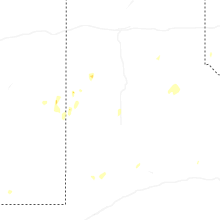
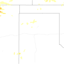
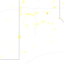
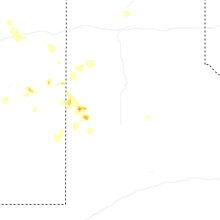


Connect with Interactive Hail Maps