

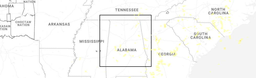
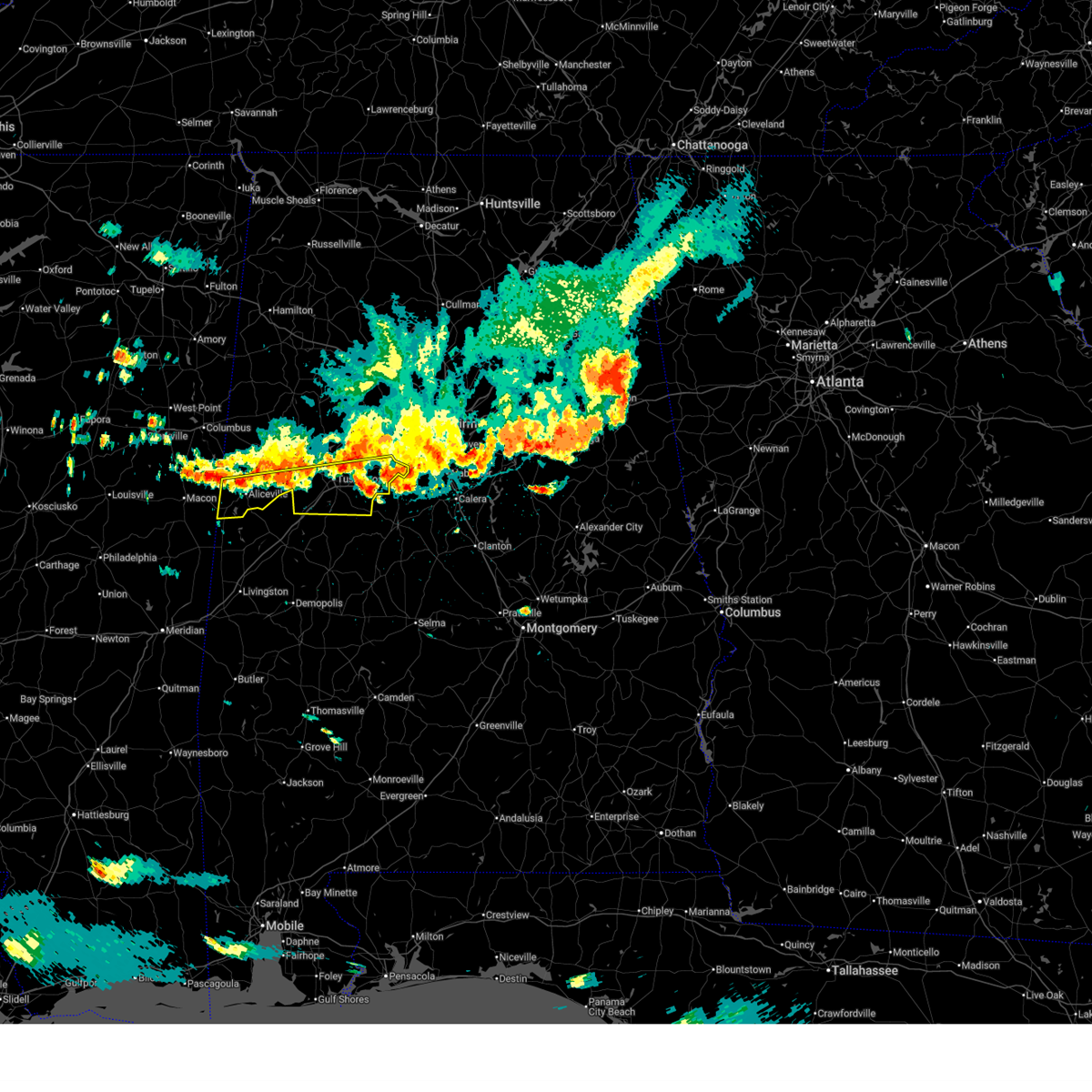
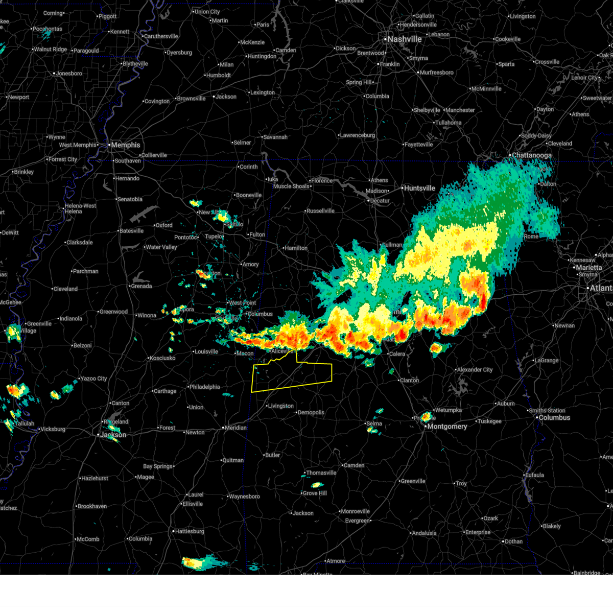
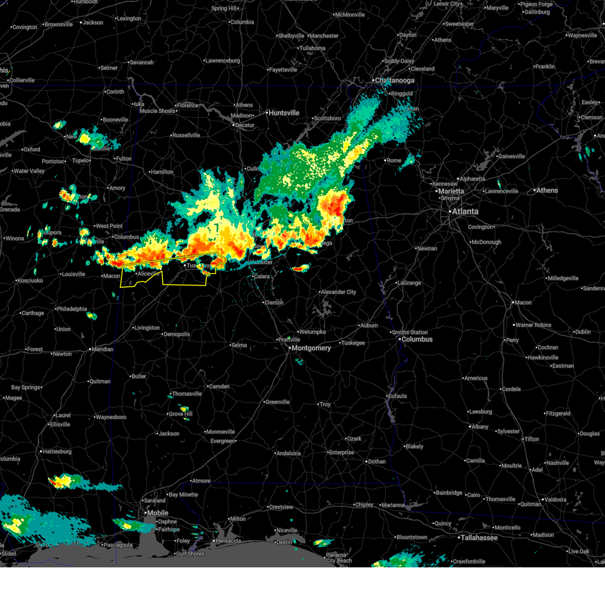
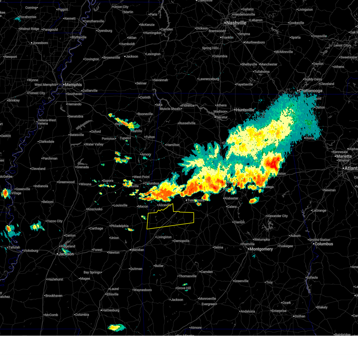
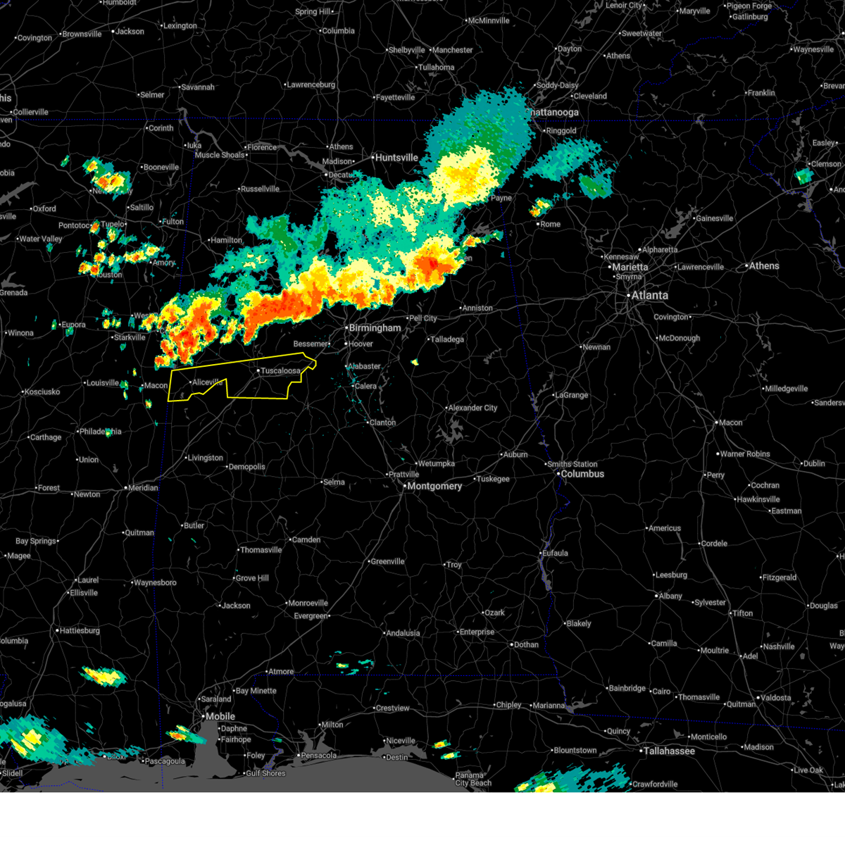
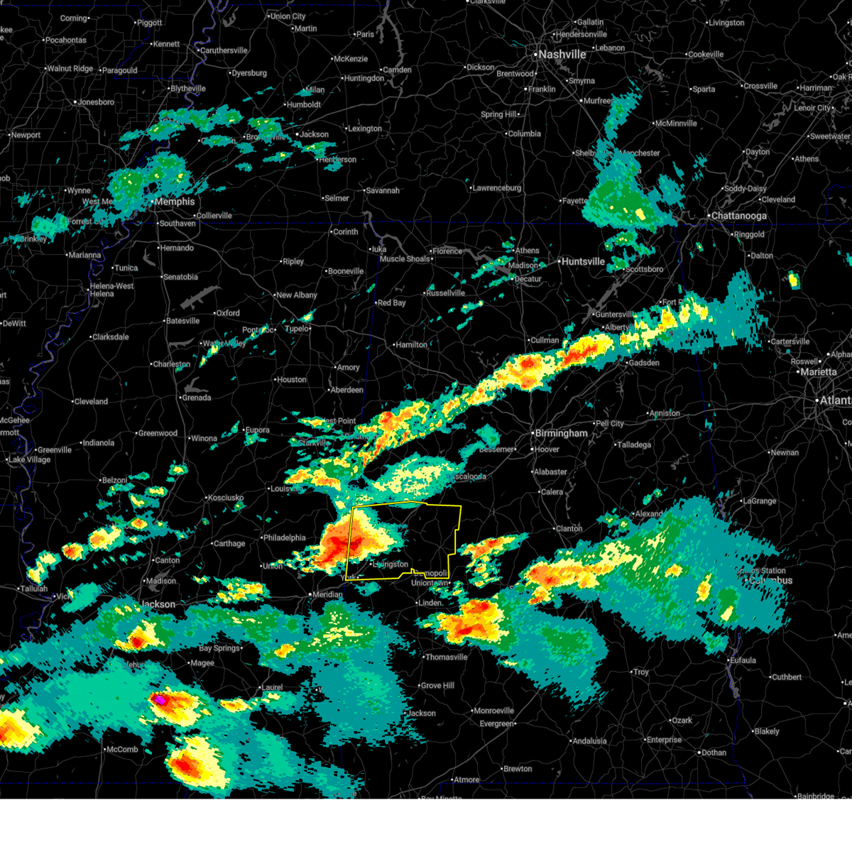
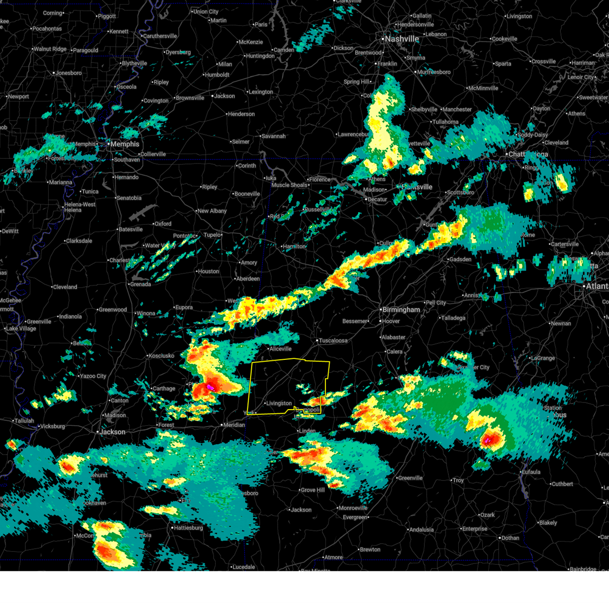
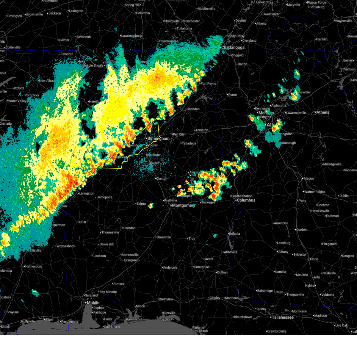
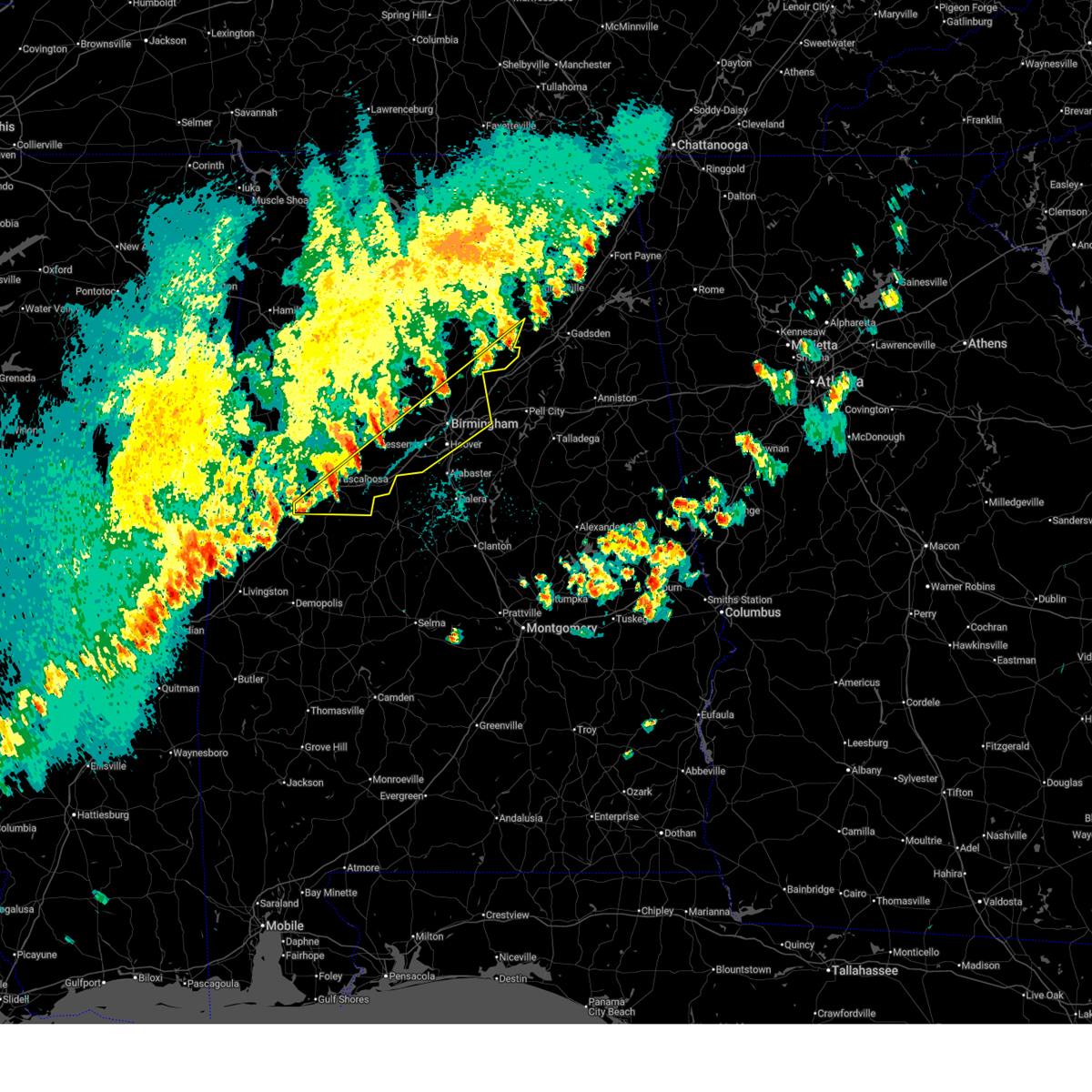
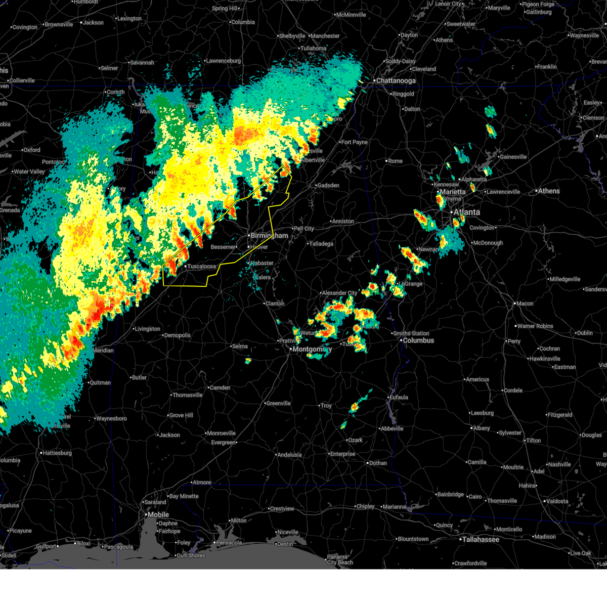
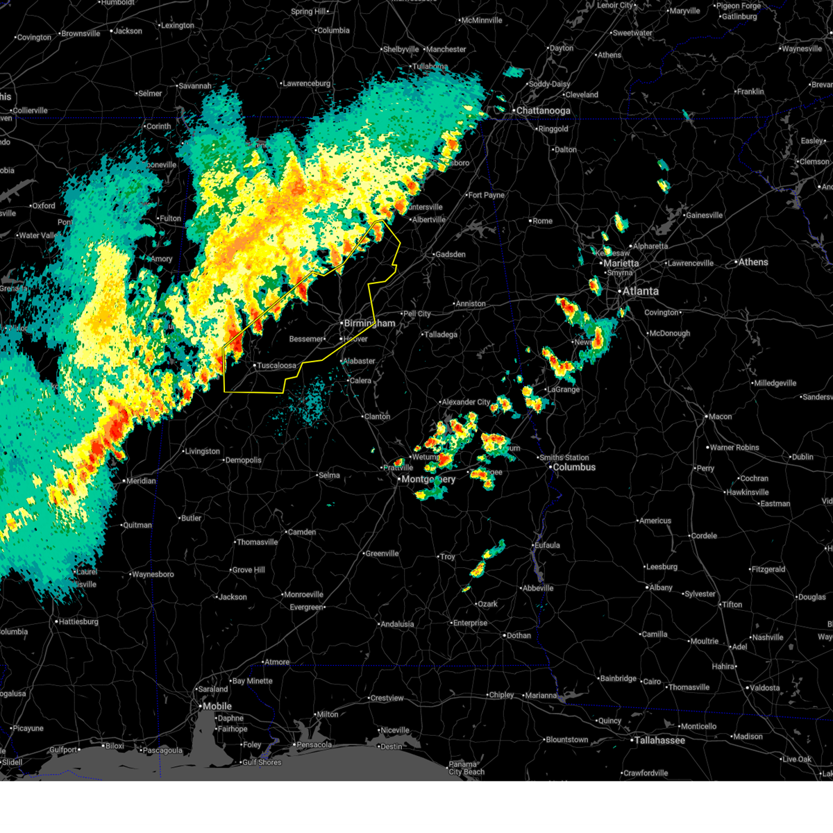
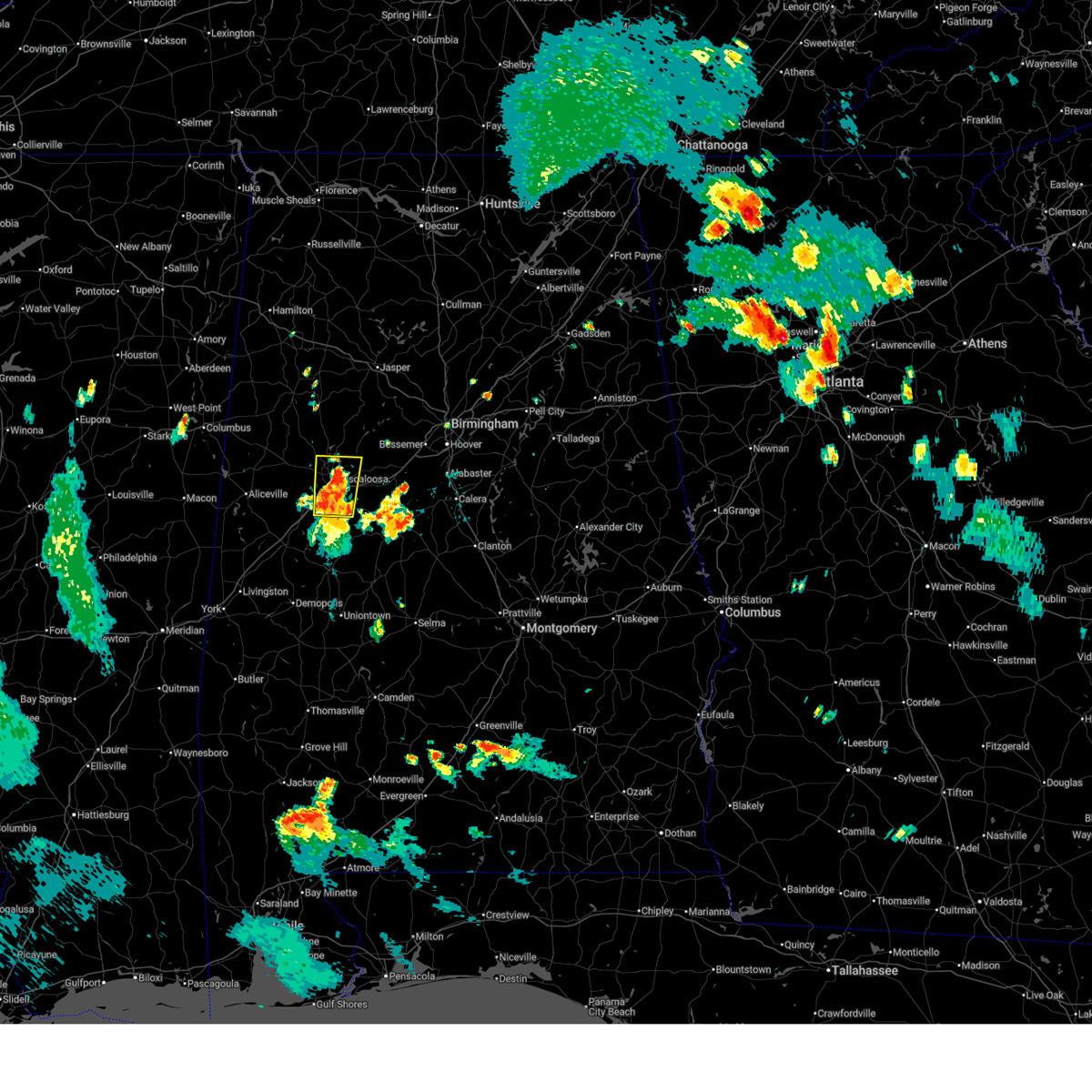
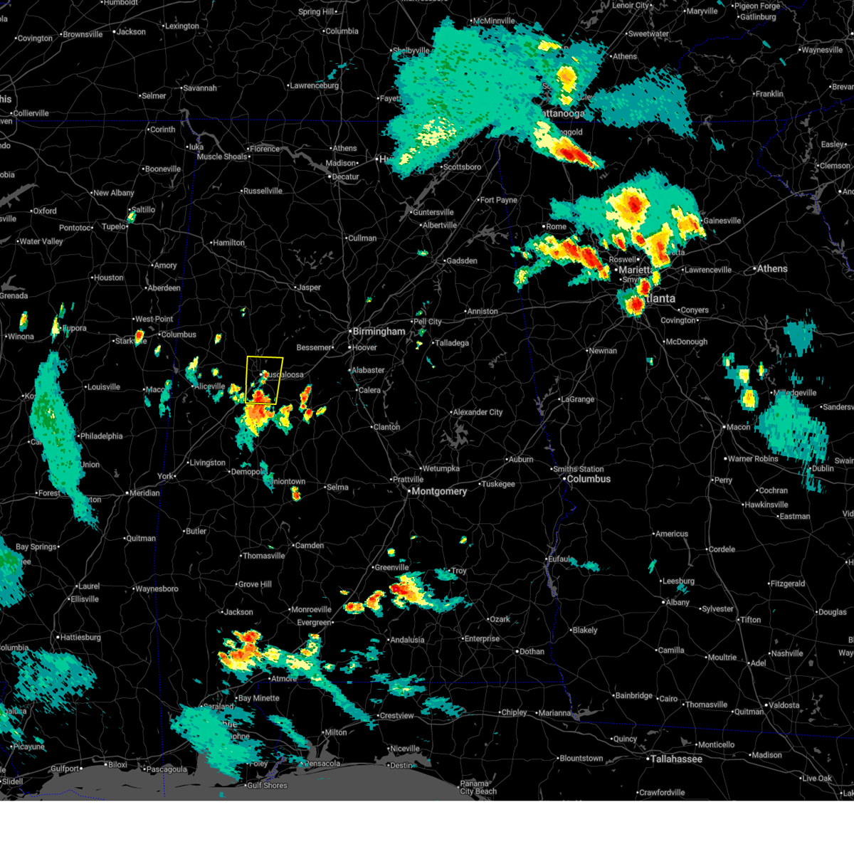
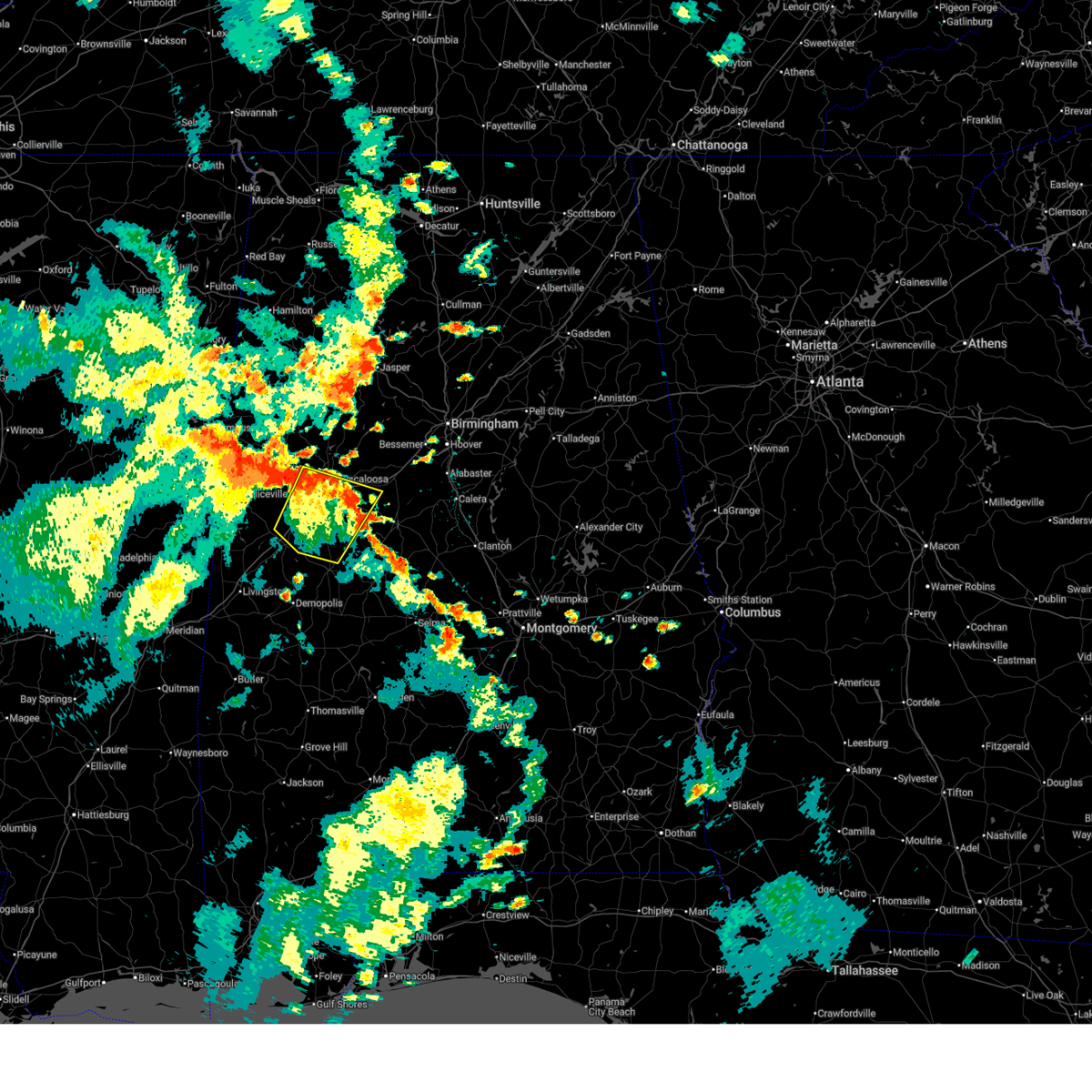
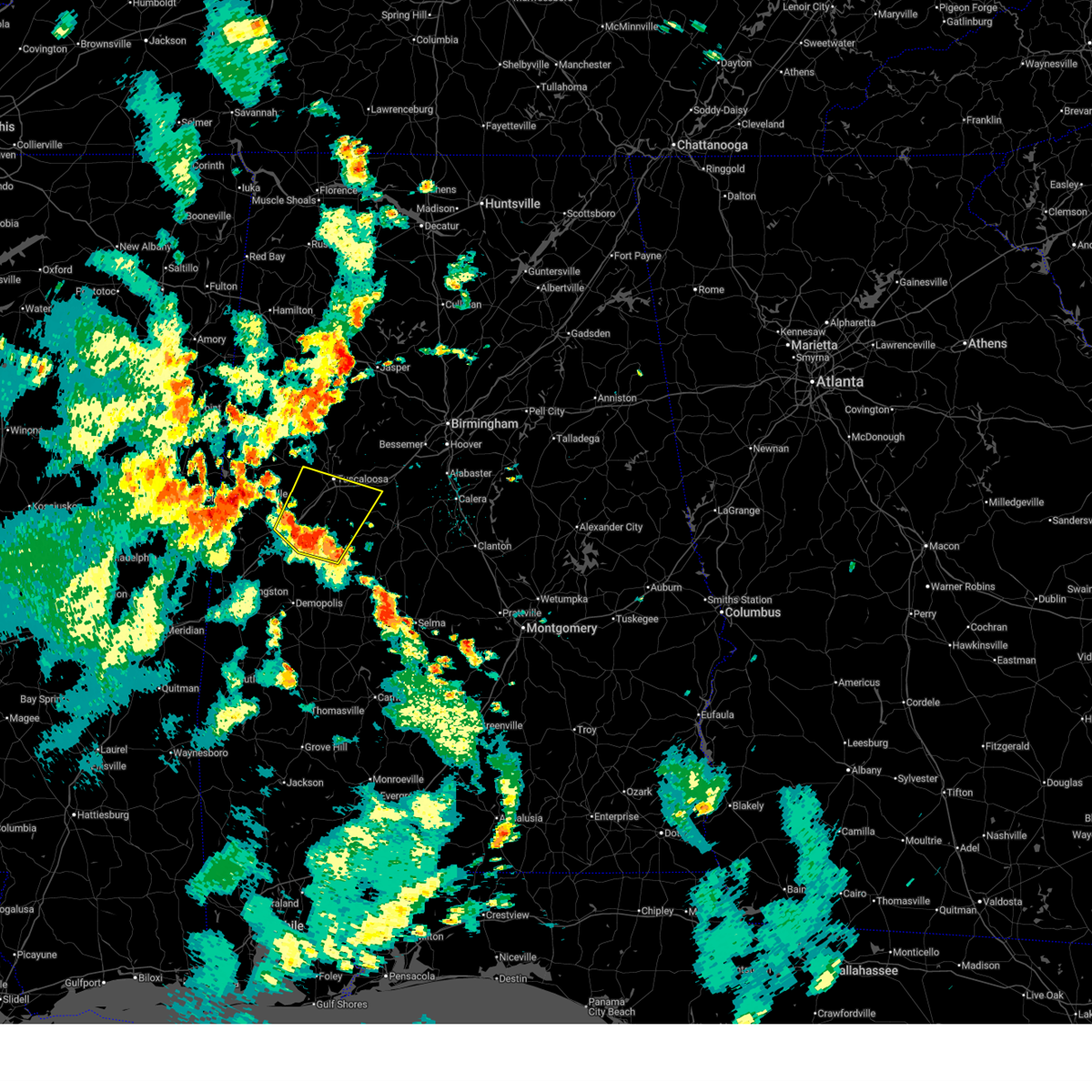
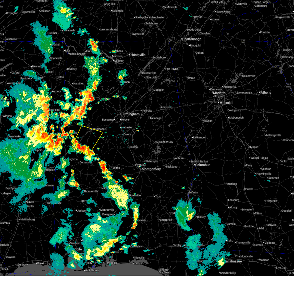
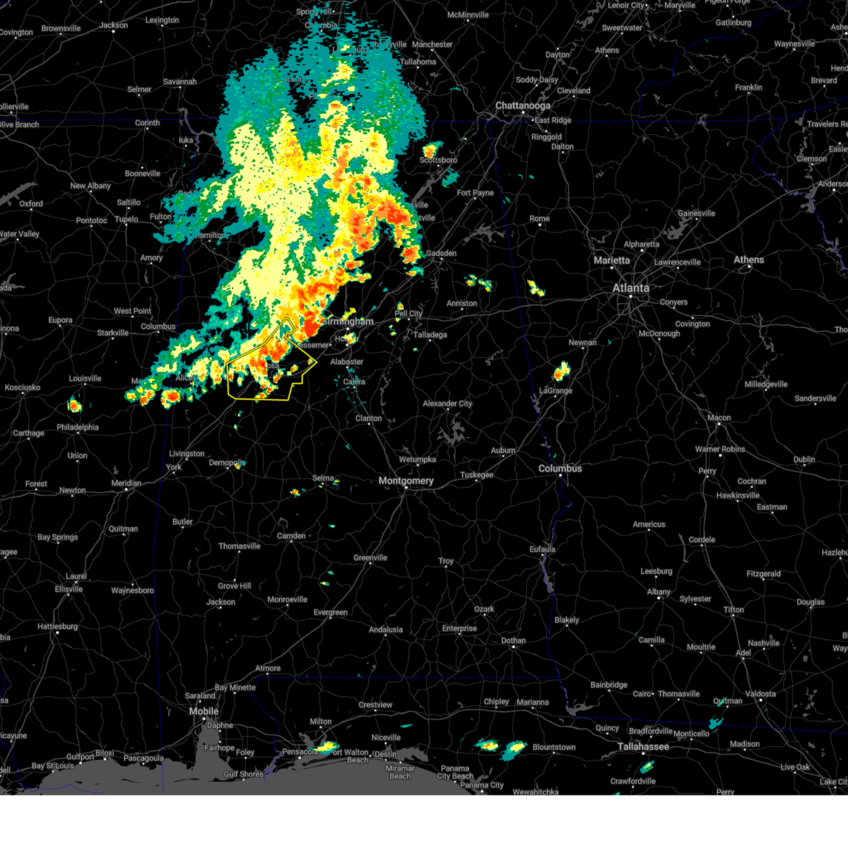
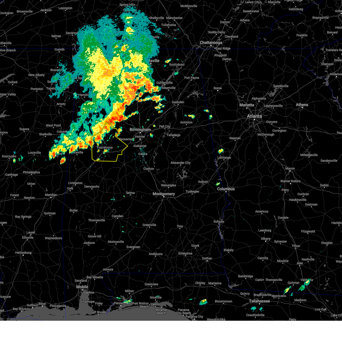
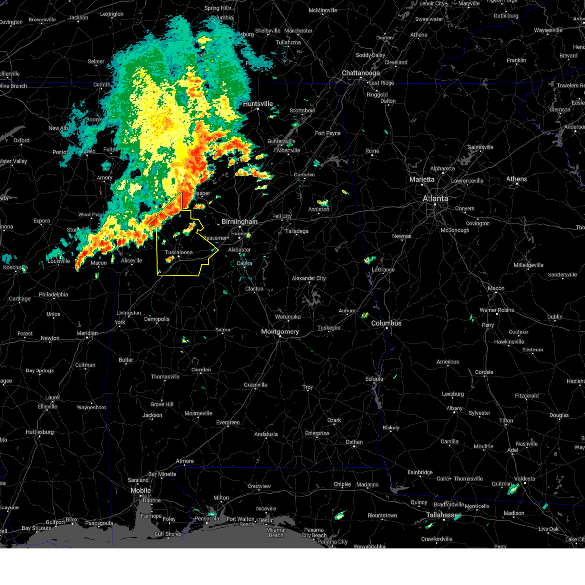
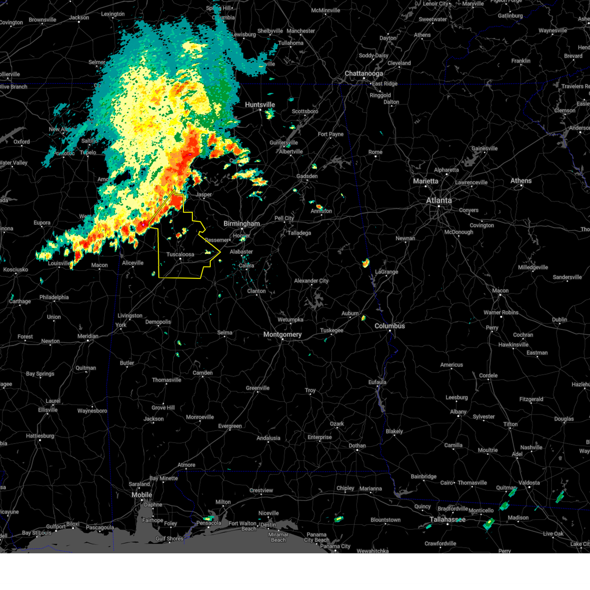
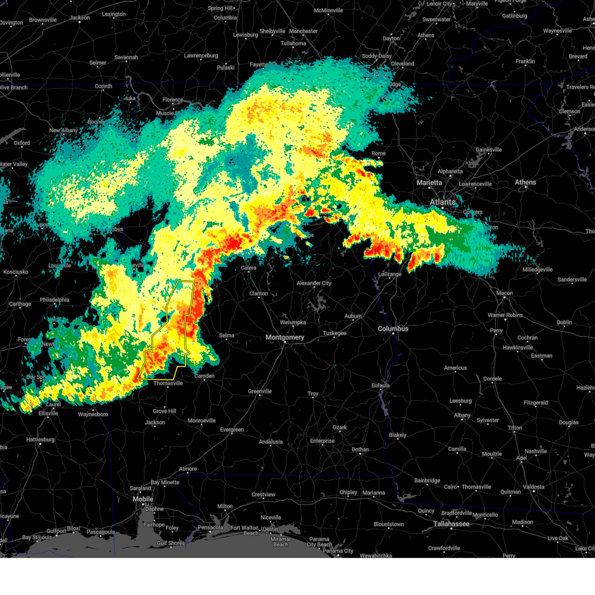
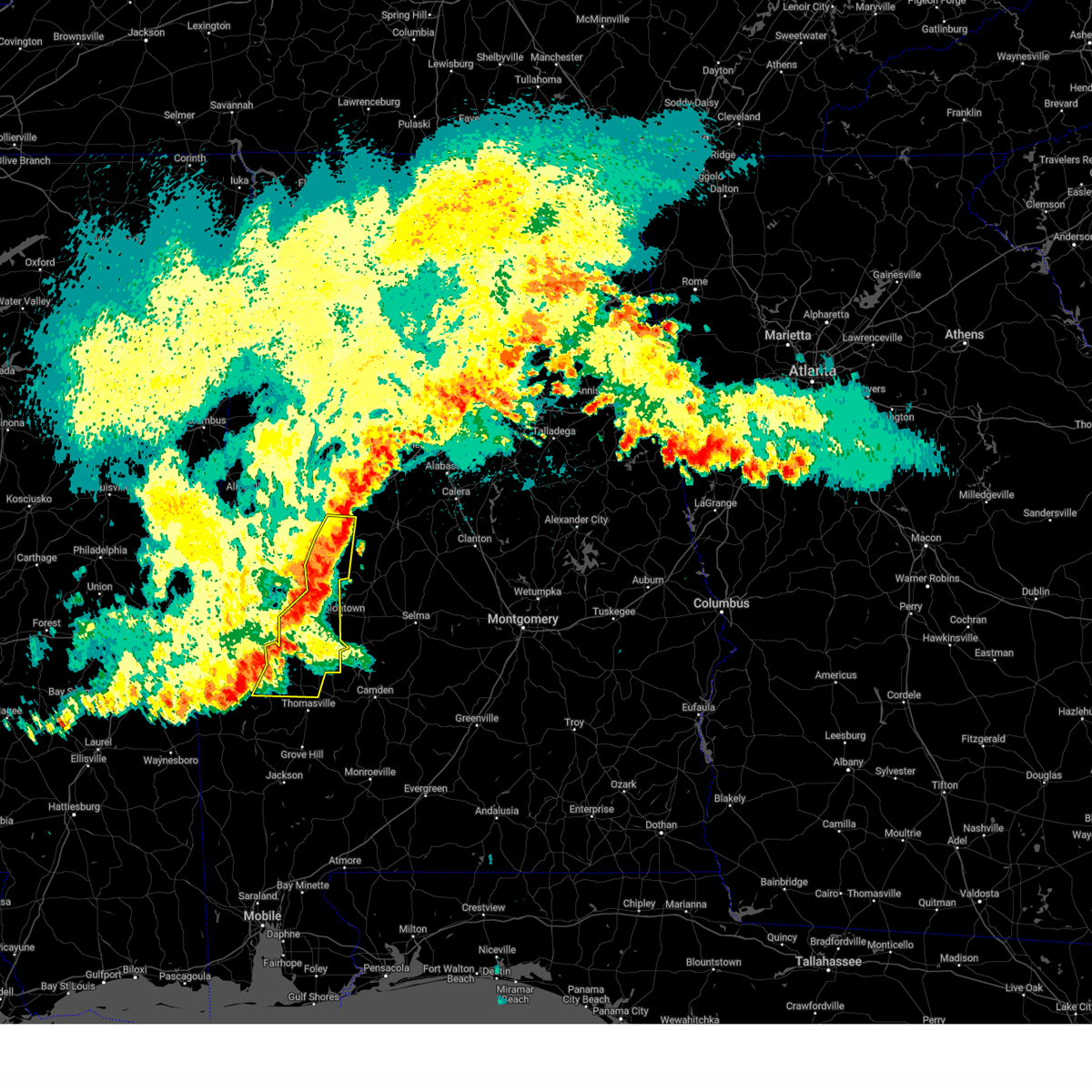
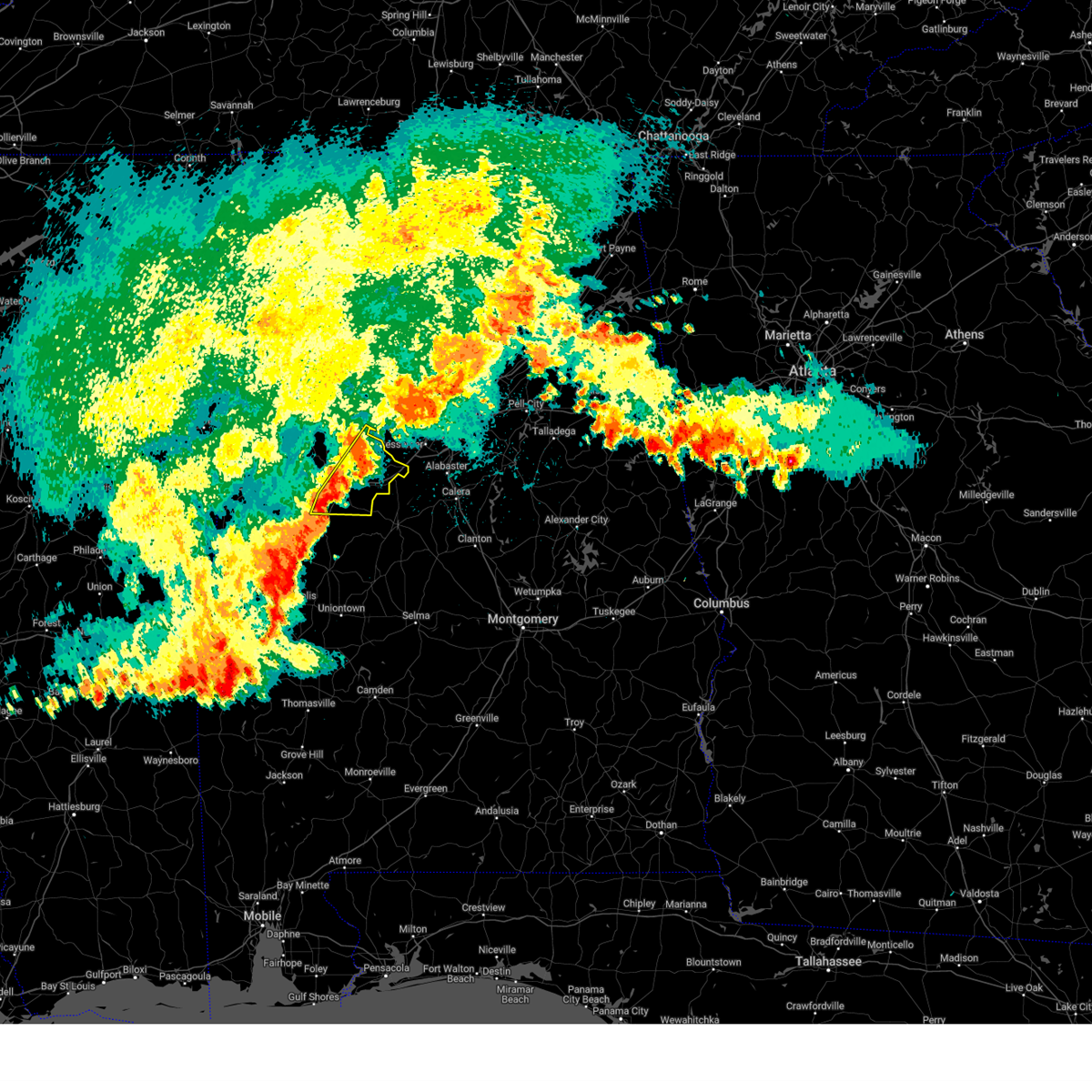
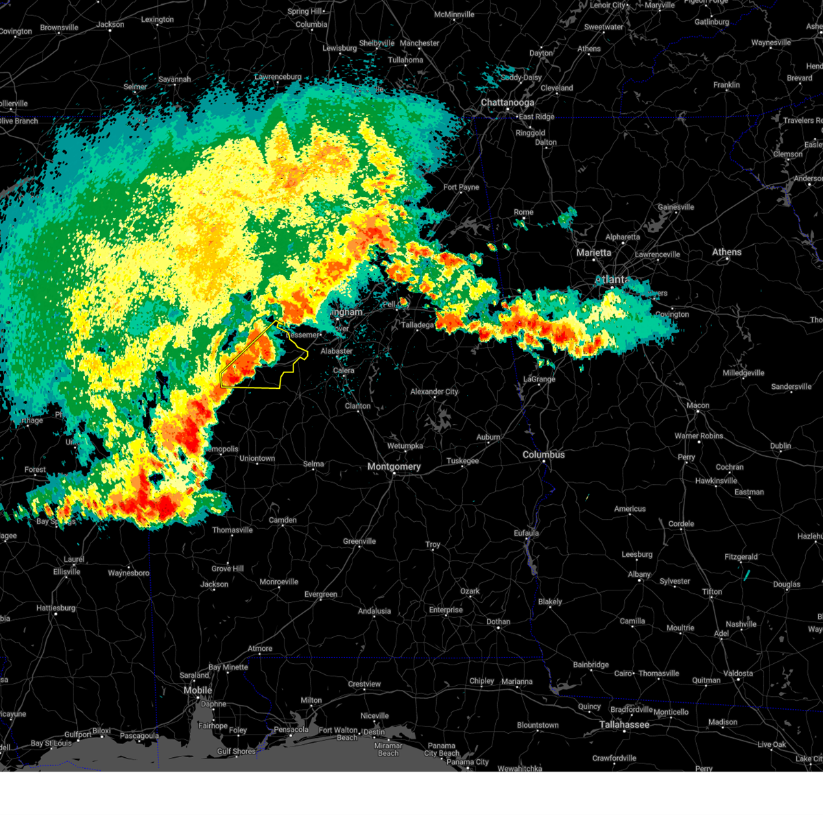
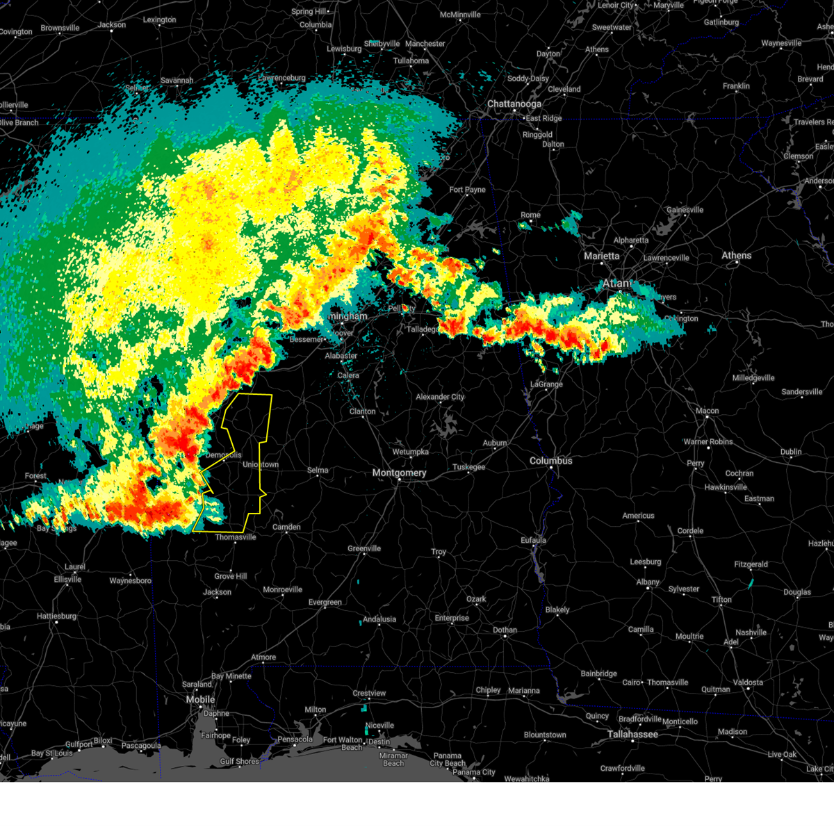
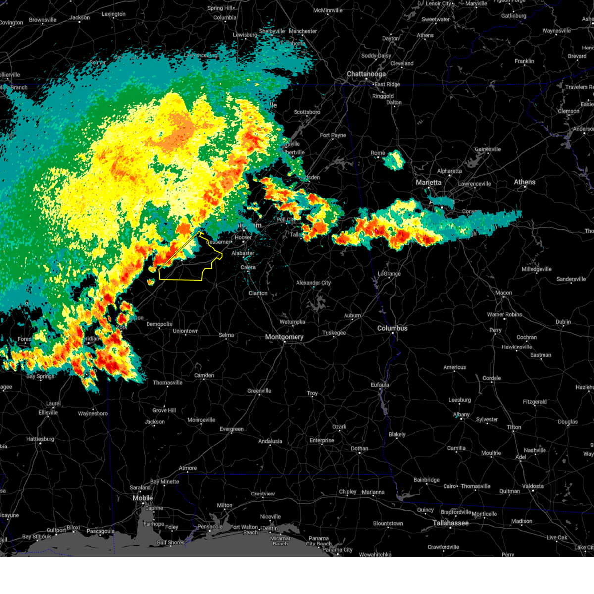
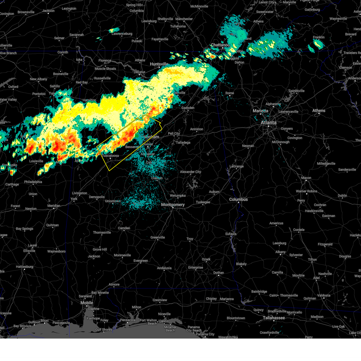
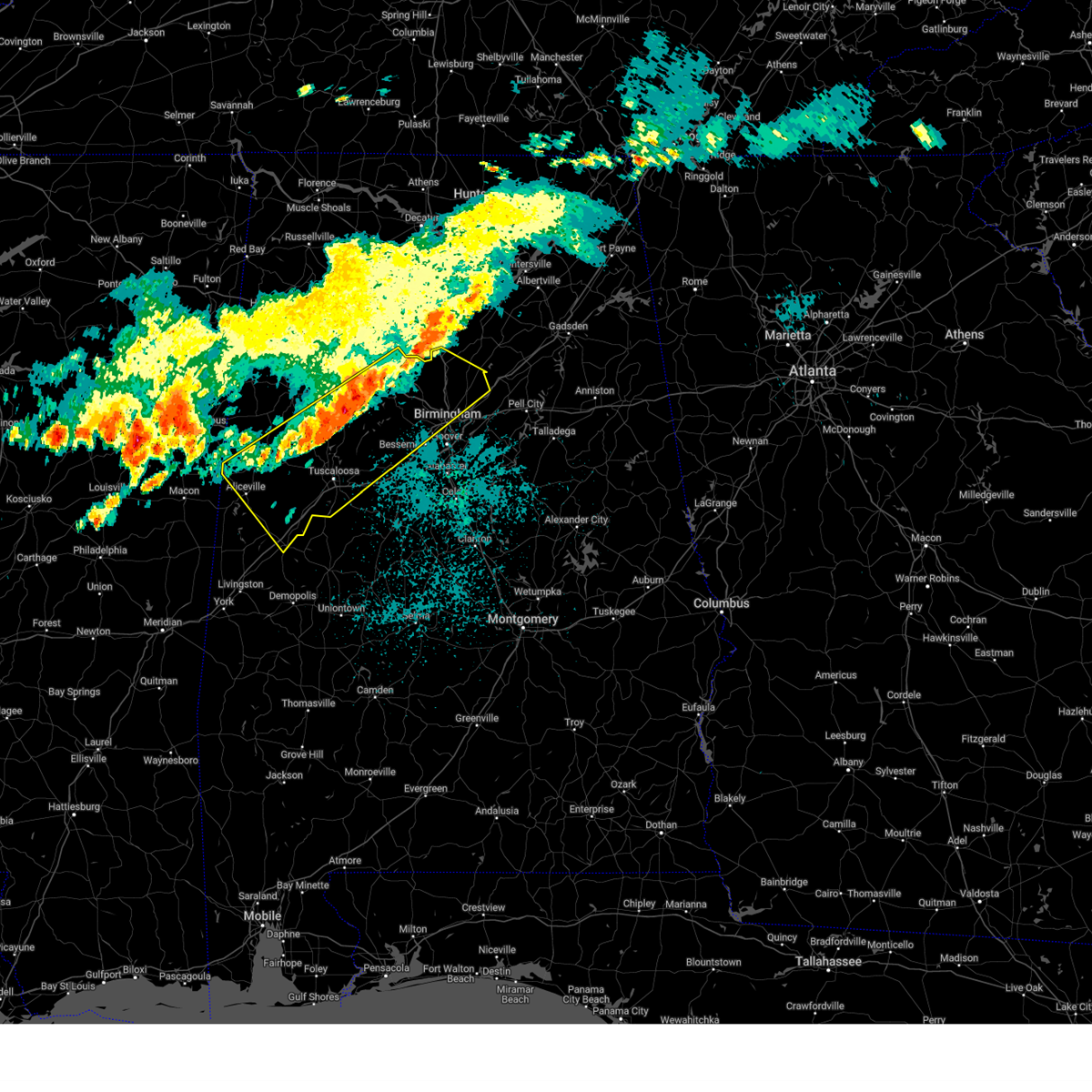
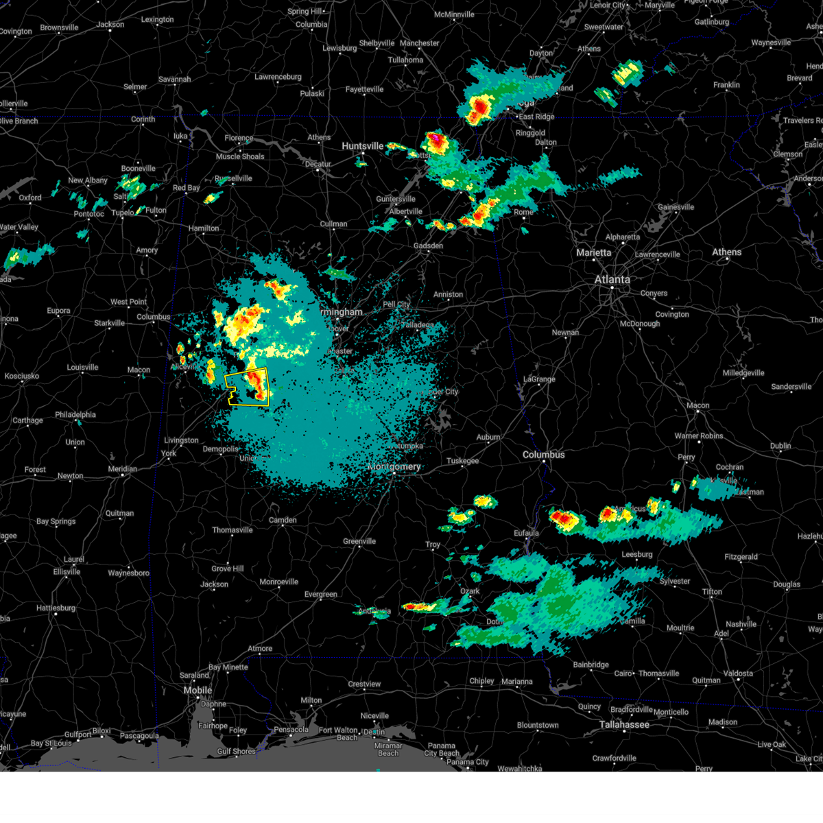
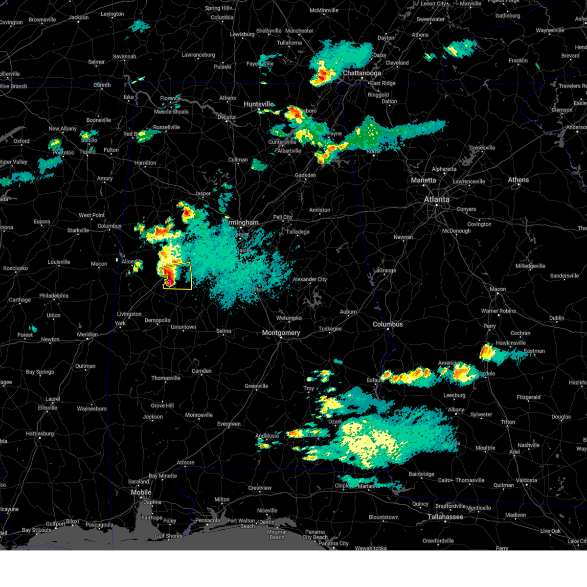
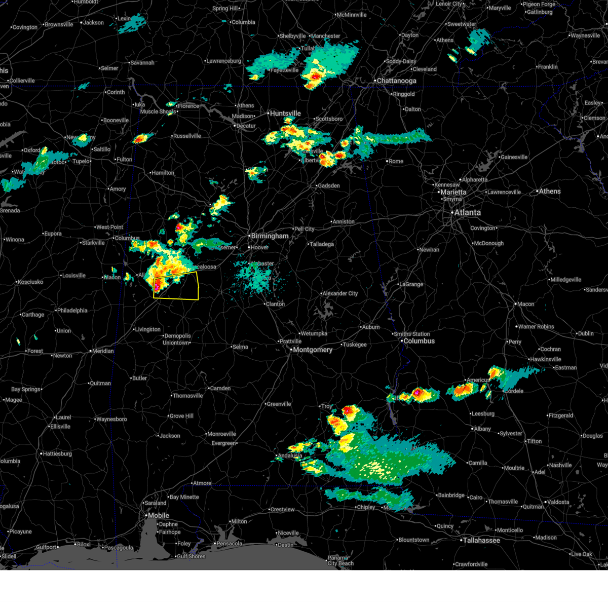
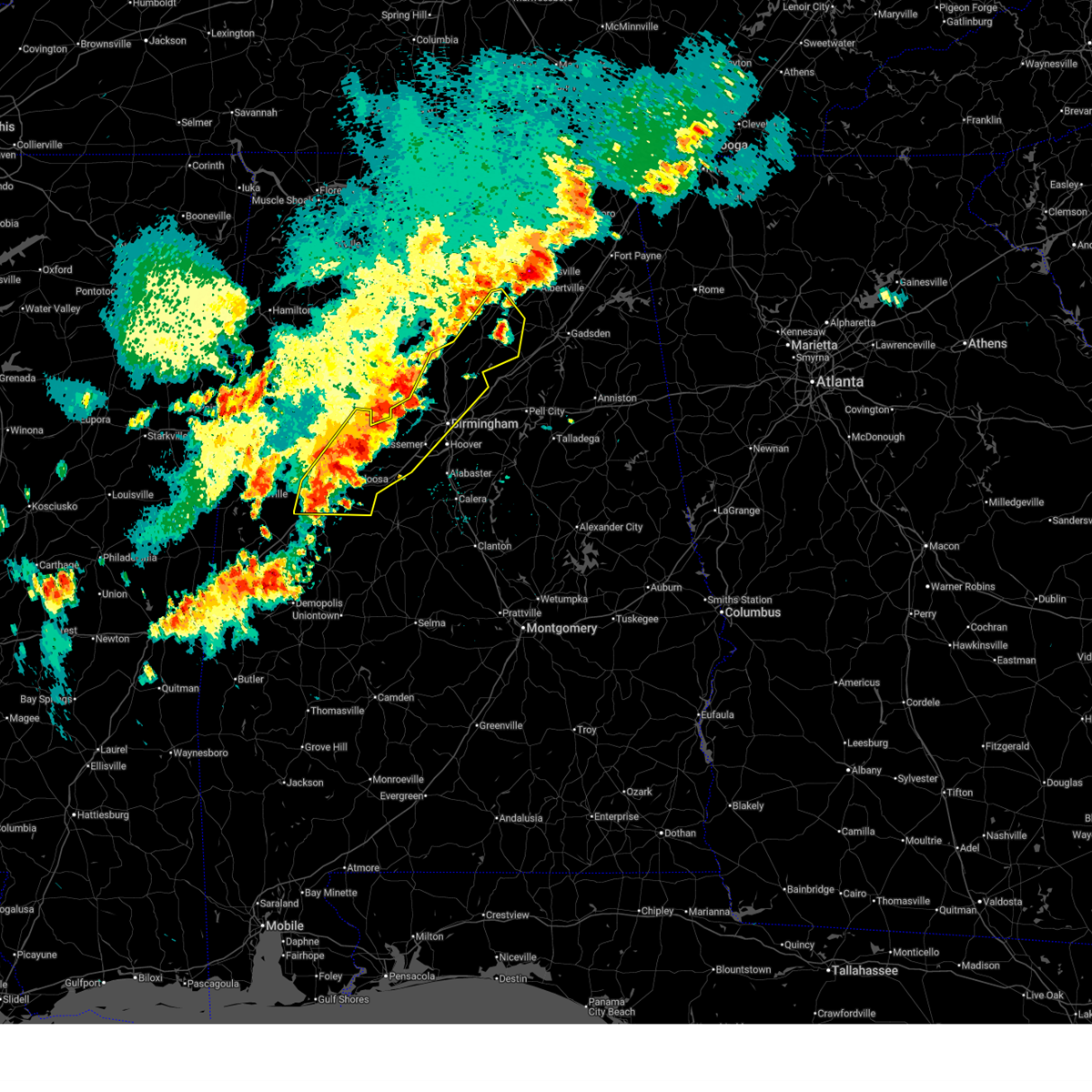
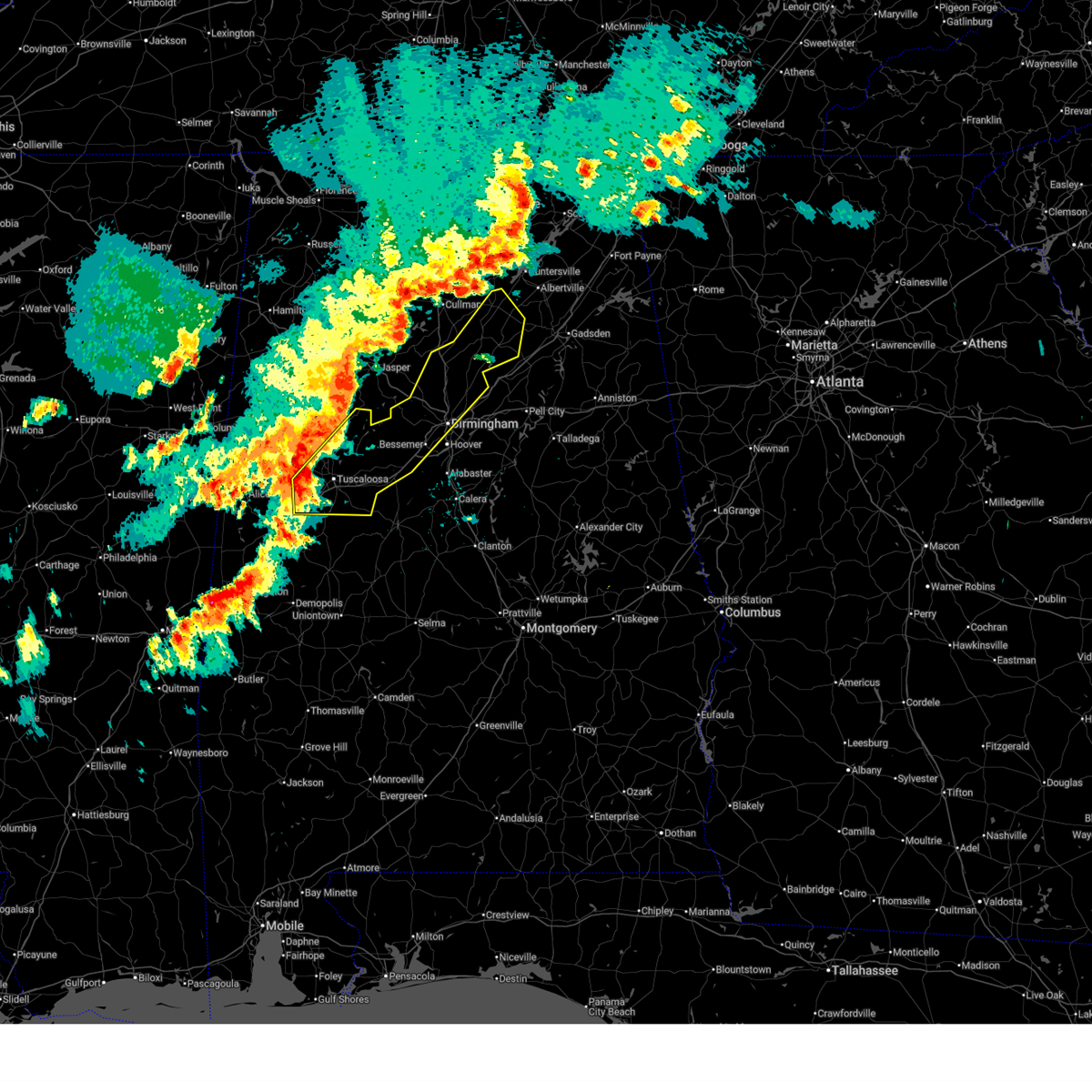
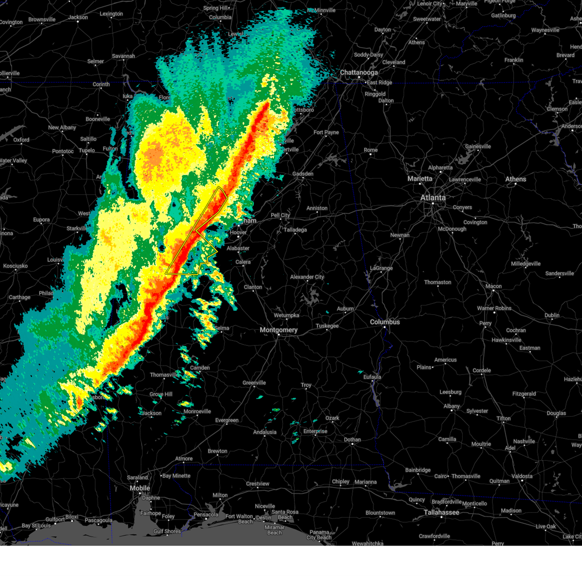
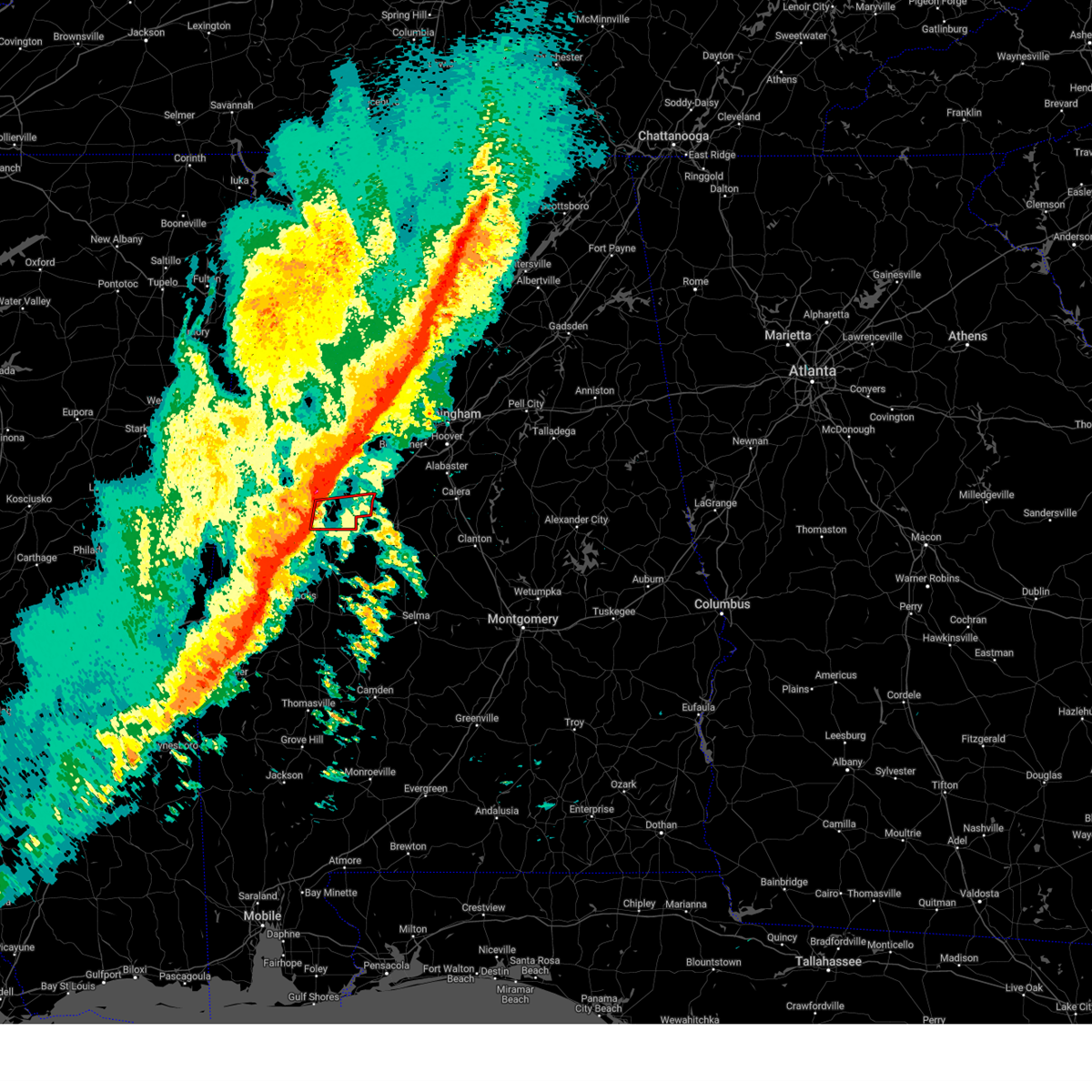
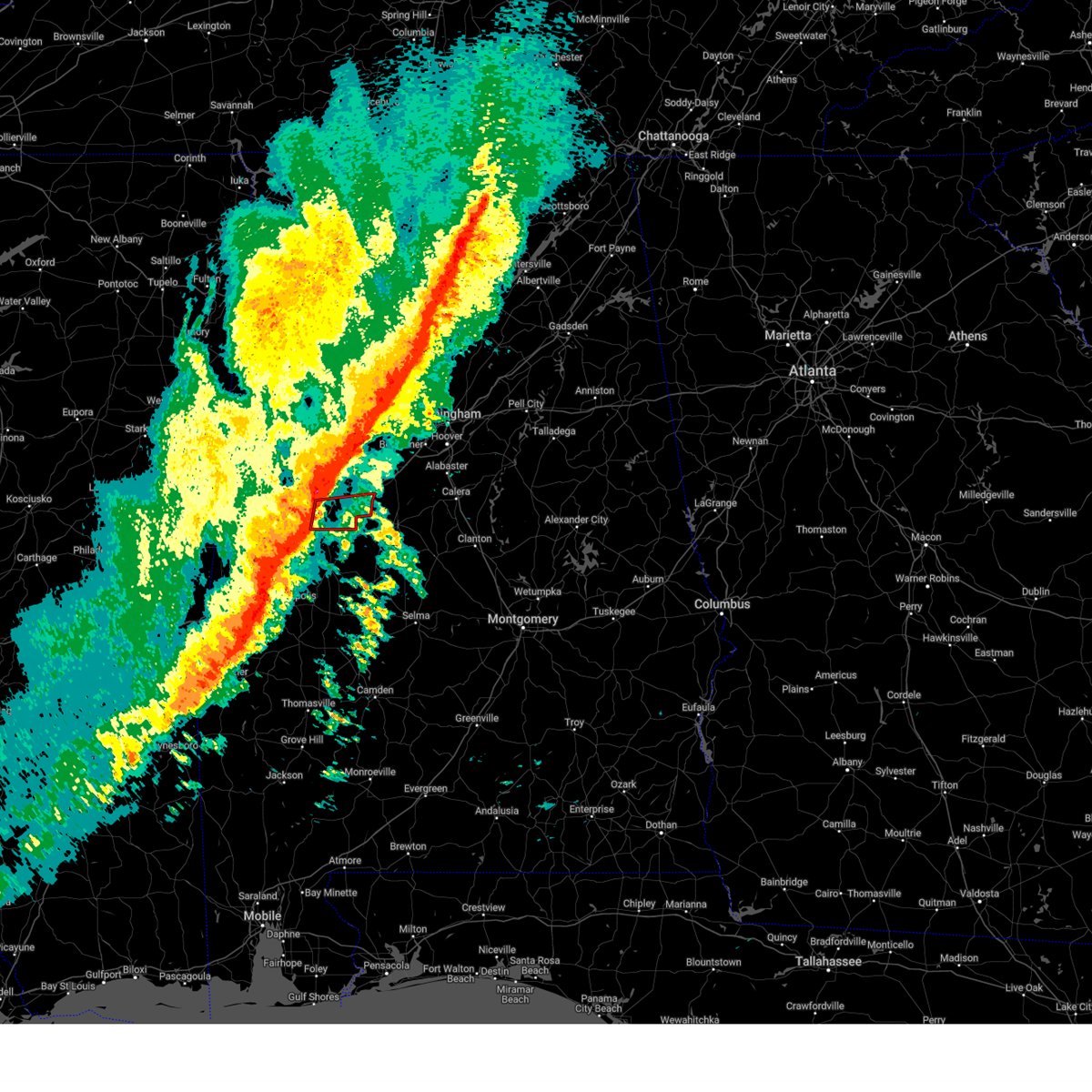
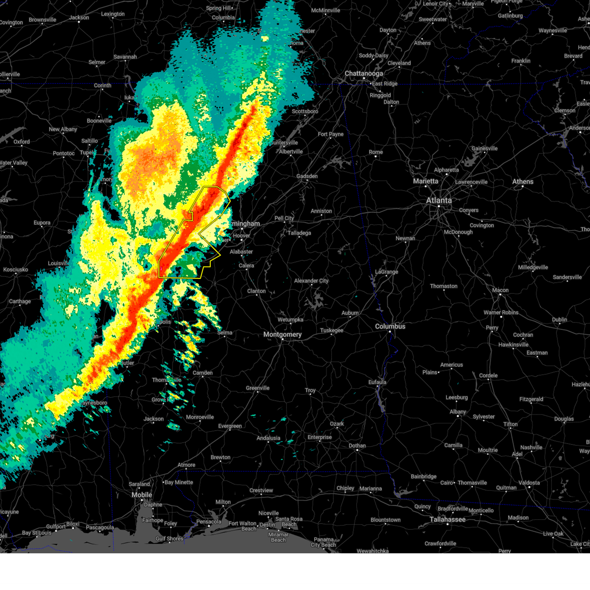
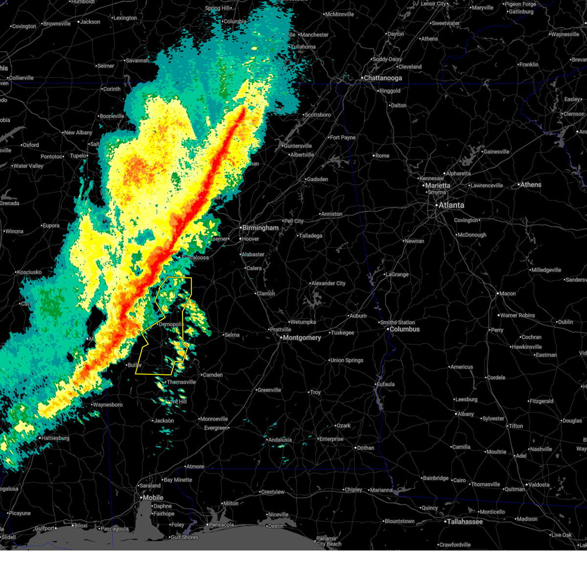
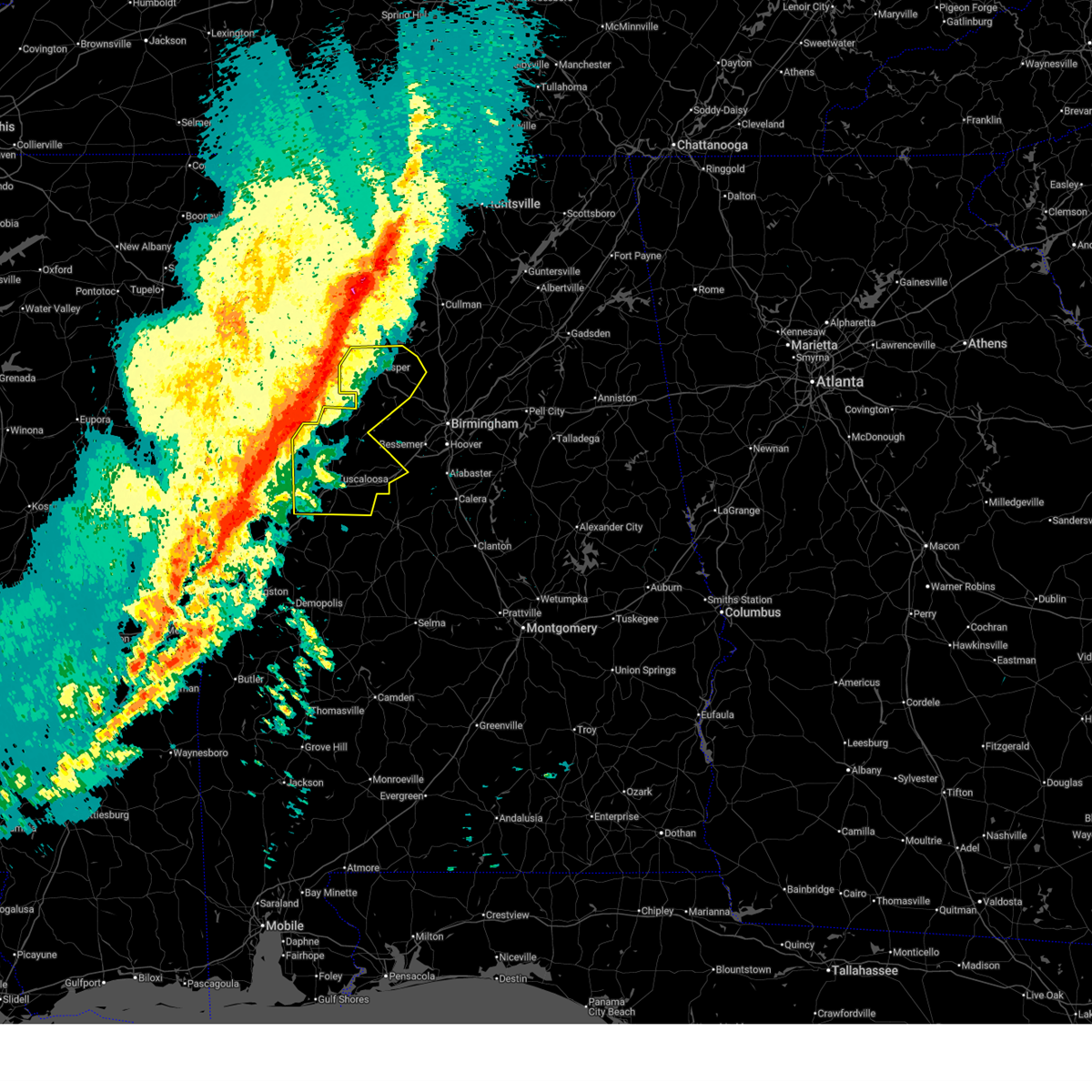
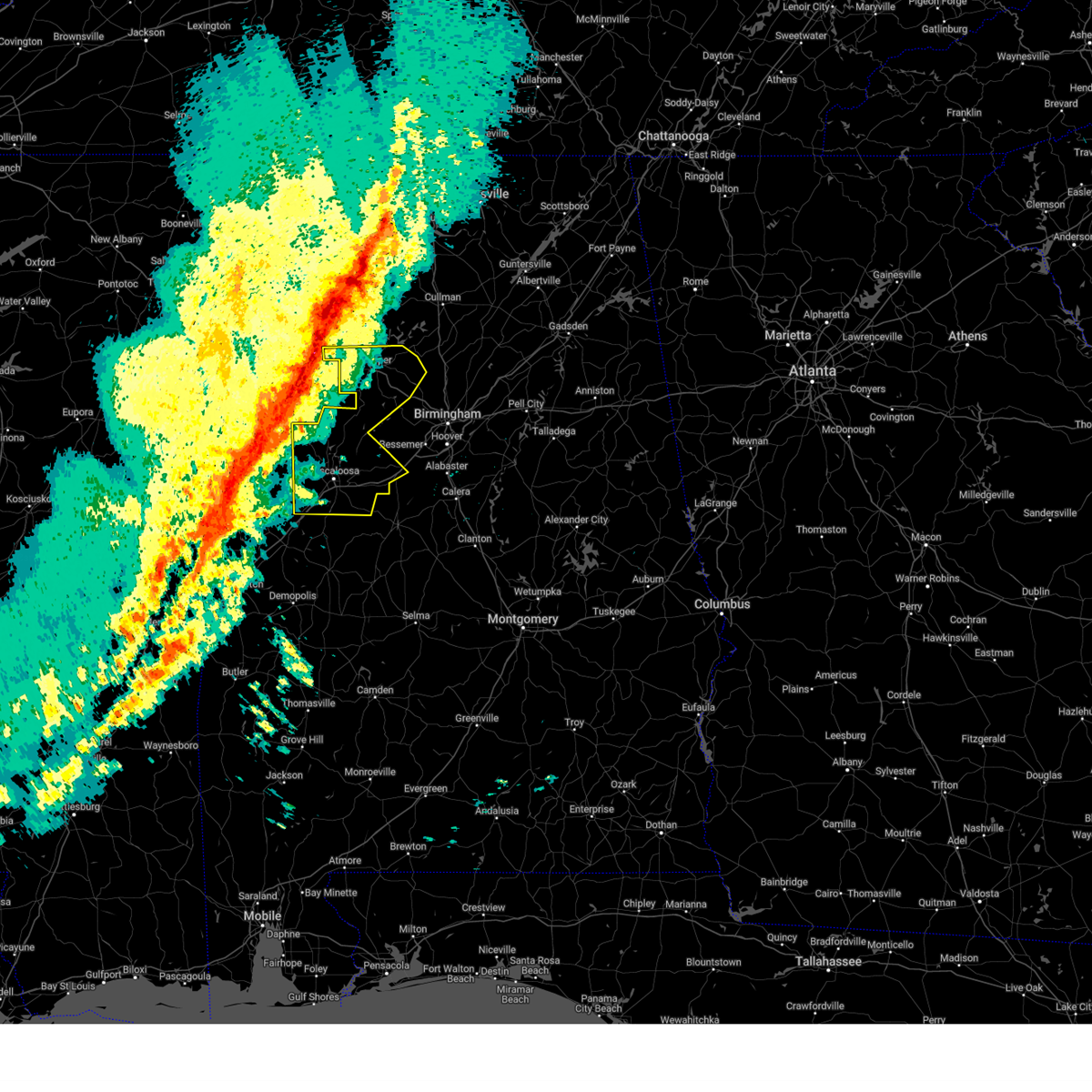
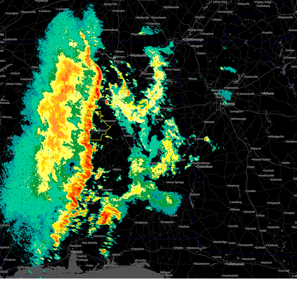
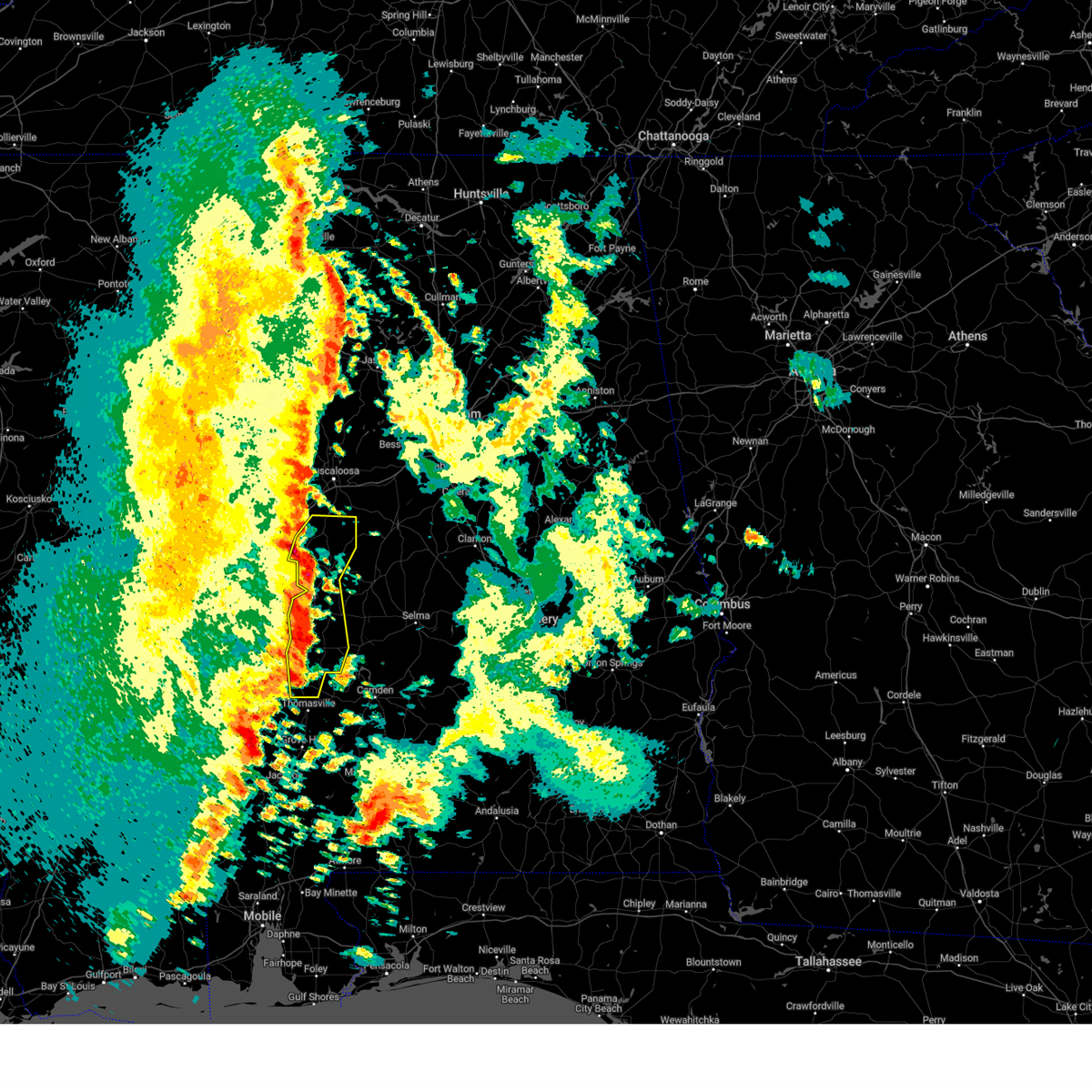
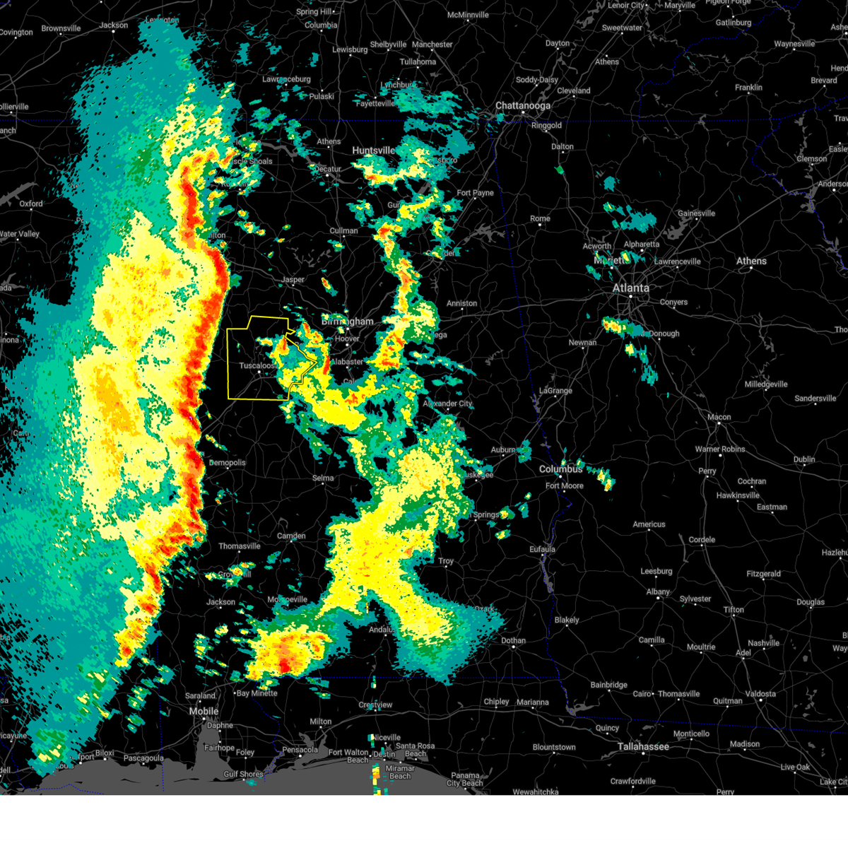
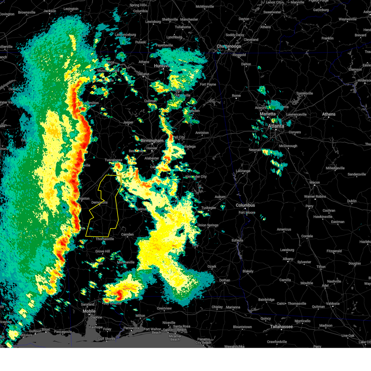
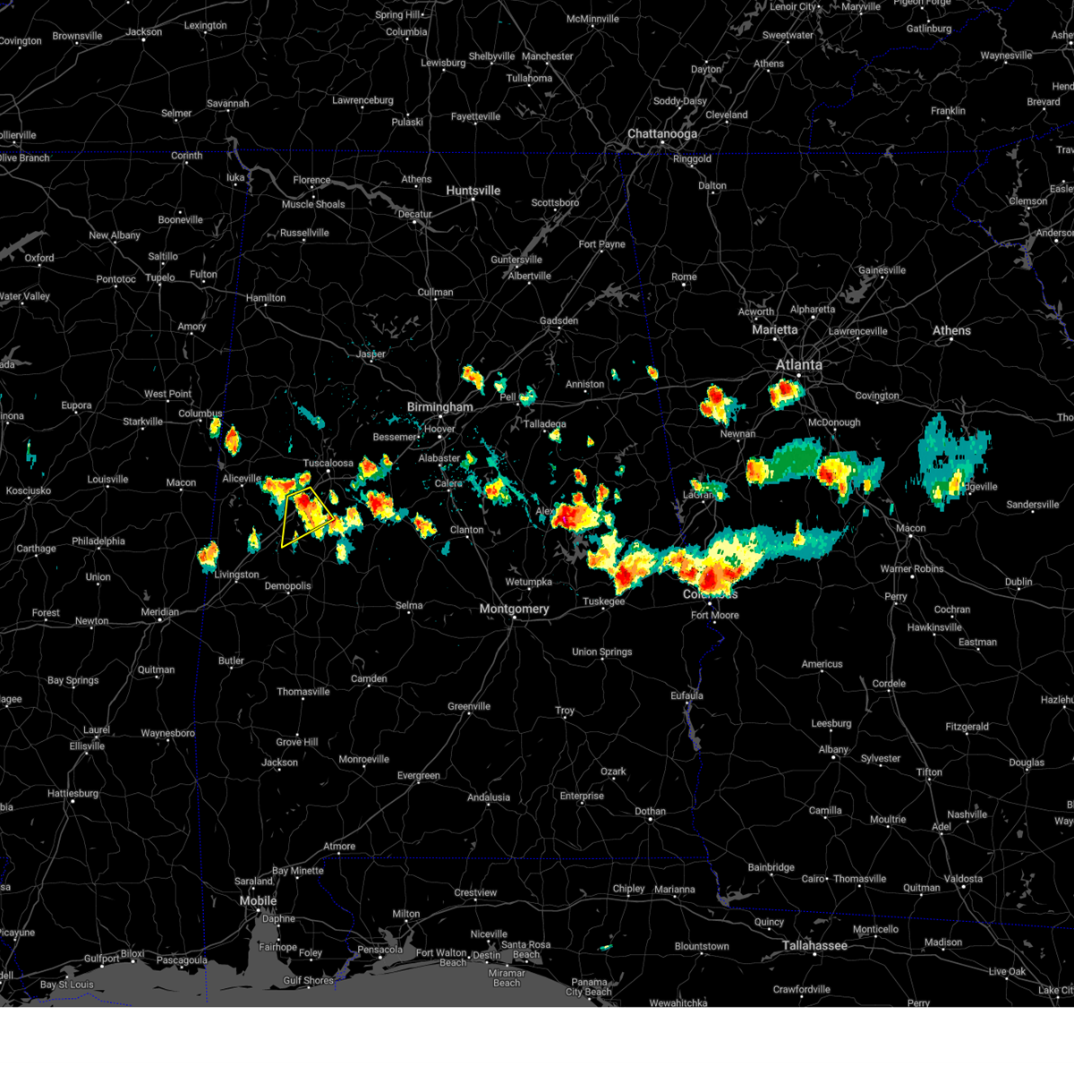
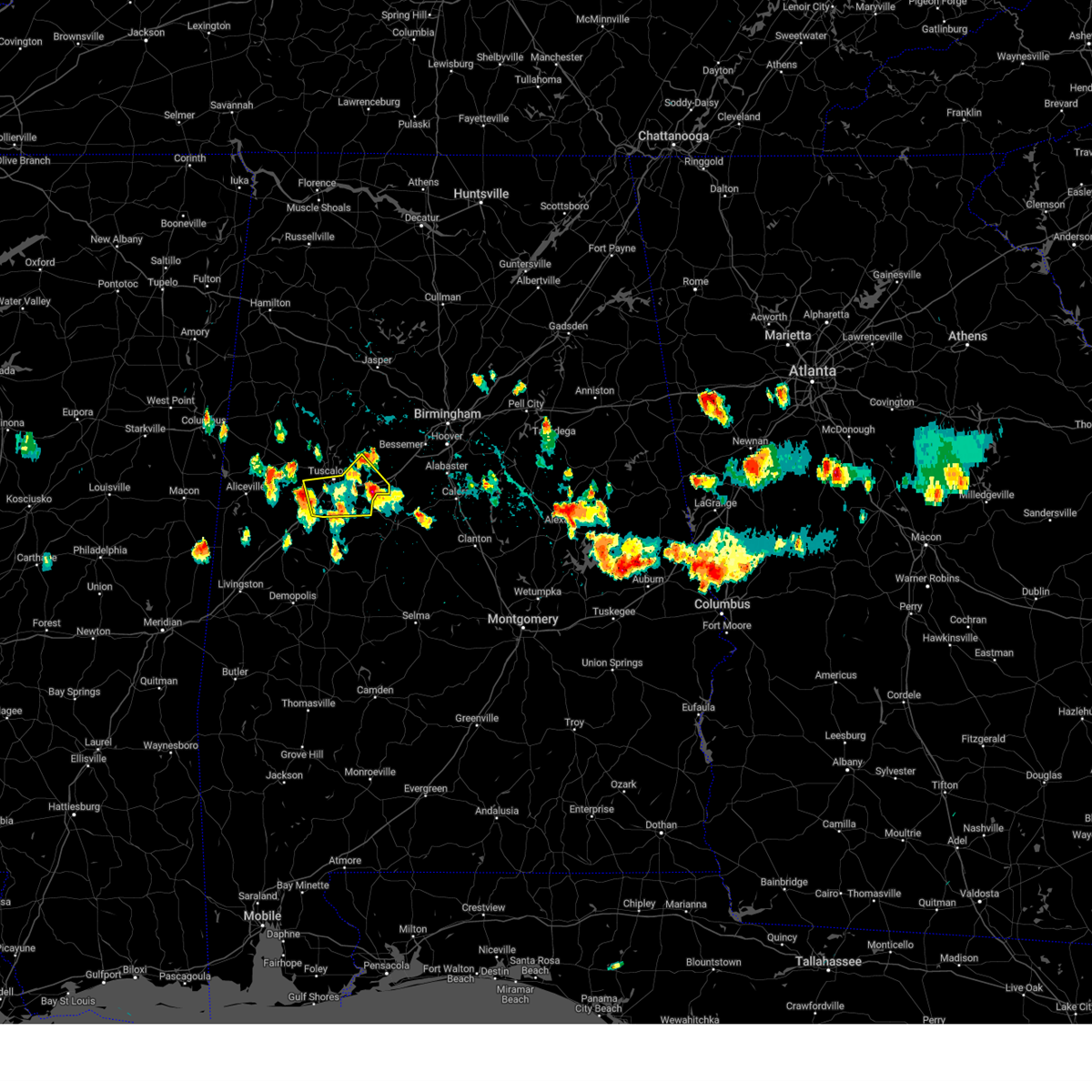
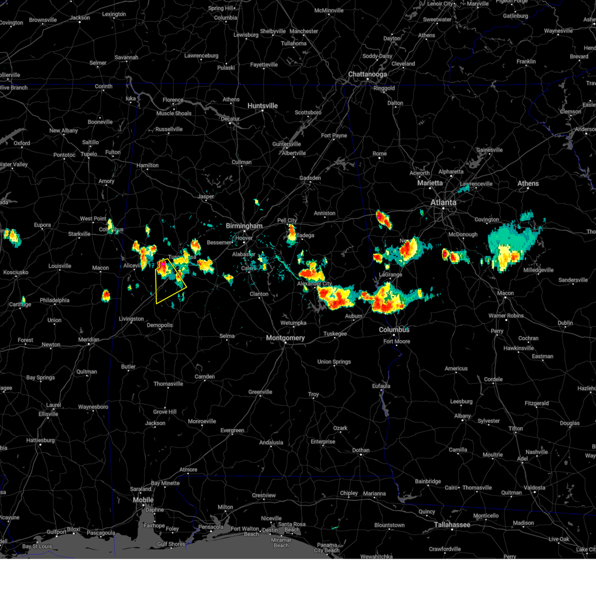
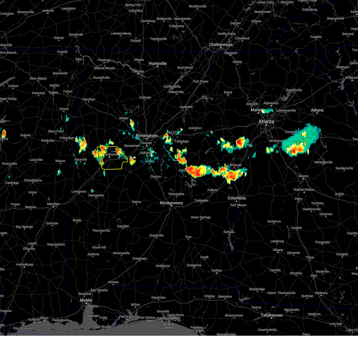
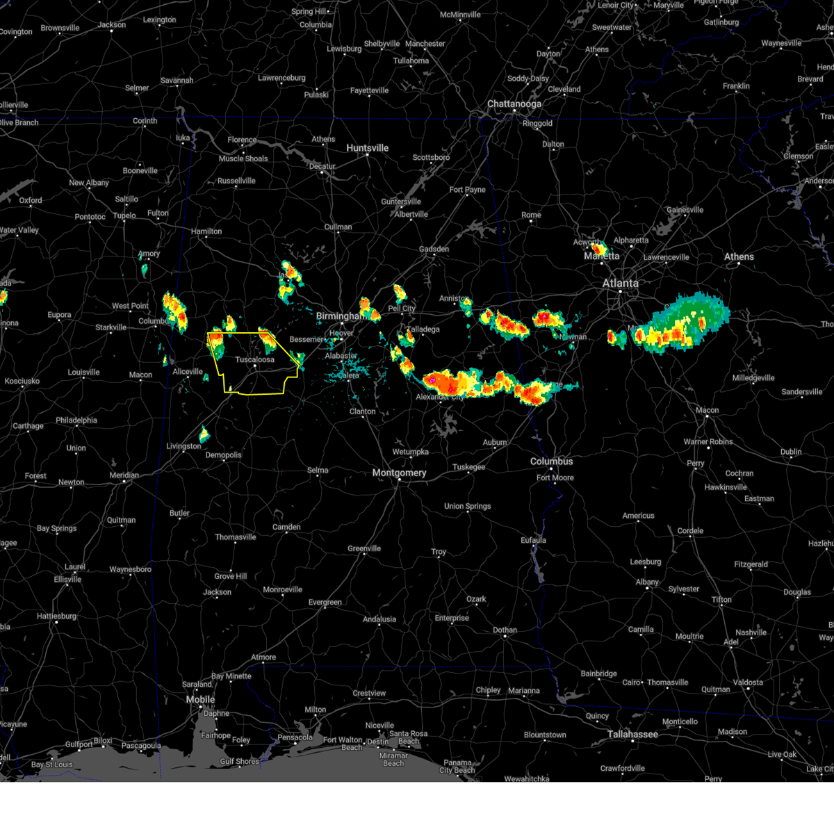
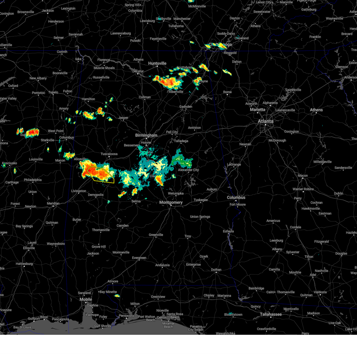
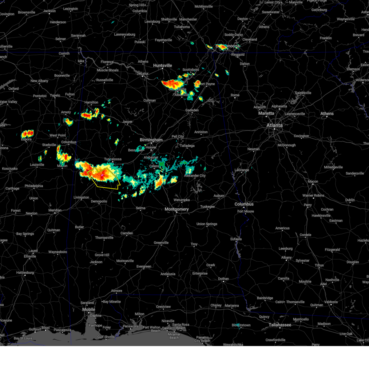
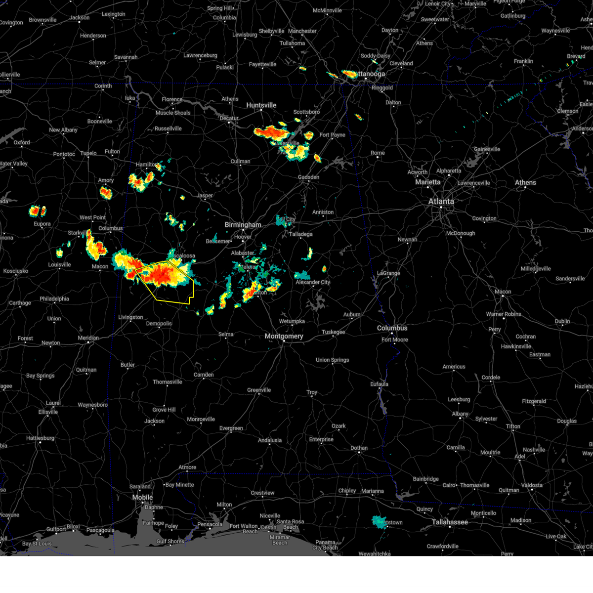
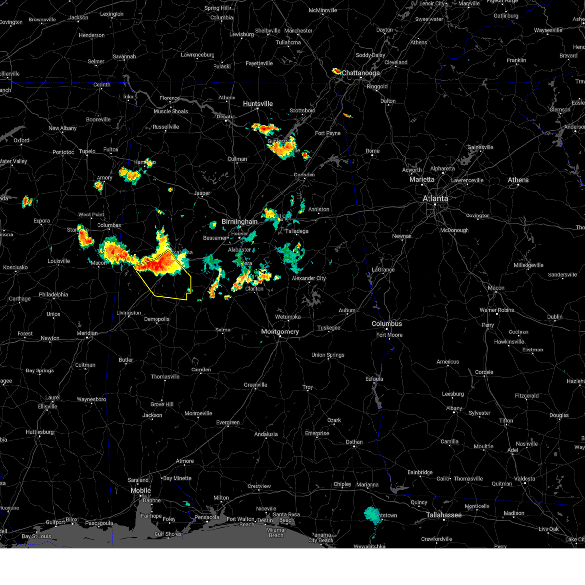
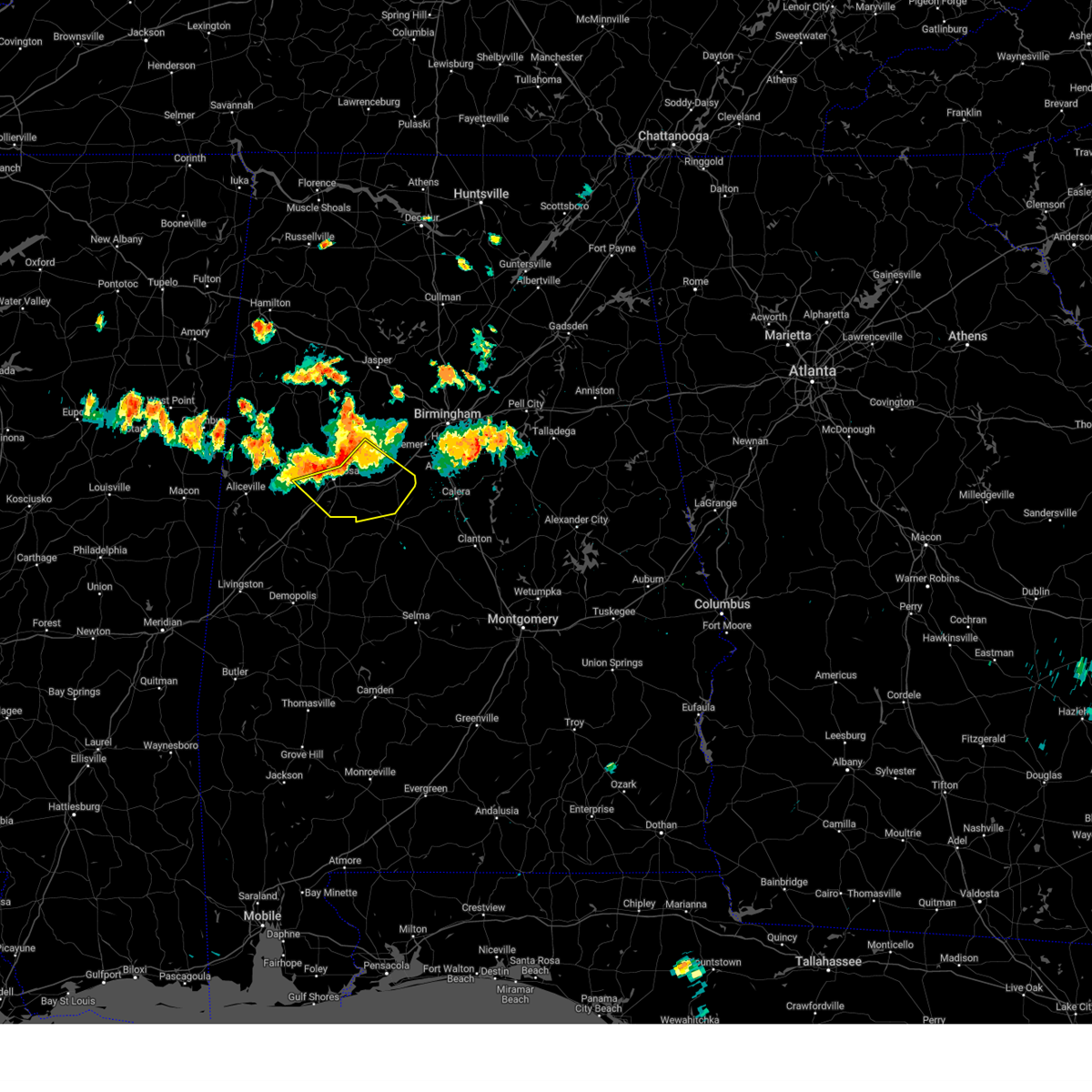
Hail Map for Moundville, AL
The Moundville, AL area has had 6 reports of on-the-ground hail by trained spotters, and has been under severe weather warnings 18 times during the past 12 months. Doppler radar has detected hail at or near Moundville, AL on 75 occasions, including 4 occasions during the past year.
| Name: | Moundville, AL |
| Where Located: | 58.8 miles SW of Birmingham, AL |
| Map: | Google Map for Moundville, AL |
| Population: | 2427 |
| Housing Units: | 1003 |
| More Info: | Search Google for Moundville, AL |
4
The Top Recent Hail Date for Moundville, AL is Wednesday, June 25, 2025 (6th out of 75)
Hail and Wind Damage Spotted near Moundville, AL
| Date / Time | Report Details |
|---|---|
| 6/1/2026 3:51 PM CDT |
 At 351 pm cdt, severe thunderstorms were located along a line extending from 7 miles south of cooksville to near eoline, moving south at 25 mph (radar indicated). Hazards include 60 mph wind gusts and quarter size hail. Hail damage to vehicles is expected. expect wind damage to roofs, siding, and trees. Locations impacted include, eutaw, moundville, akron, boligee, union, gainesville, emelle, panola, west greene, wedgeworth, new west greene, allison, knoxville, evansville, geiger, new mount hebron, moundville airport, eutaw municipal airport, mound state park, and pleasant ridge. At 351 pm cdt, severe thunderstorms were located along a line extending from 7 miles south of cooksville to near eoline, moving south at 25 mph (radar indicated). Hazards include 60 mph wind gusts and quarter size hail. Hail damage to vehicles is expected. expect wind damage to roofs, siding, and trees. Locations impacted include, eutaw, moundville, akron, boligee, union, gainesville, emelle, panola, west greene, wedgeworth, new west greene, allison, knoxville, evansville, geiger, new mount hebron, moundville airport, eutaw municipal airport, mound state park, and pleasant ridge.
|
| 6/1/2026 3:39 PM CDT | Trees down in various parts of northern hale county... some blocking road in hale county AL, 6 miles N of Moundville, AL |
| 6/1/2026 3:35 PM CDT |
 At 335 pm cdt, severe thunderstorms were located along a line extending from cooksville to near mercedes benz of alabama, moving southeast at 25 mph (radar indicated). Hazards include 60 mph wind gusts and quarter size hail. Hail damage to vehicles is expected. expect wind damage to roofs, siding, and trees. Locations impacted include, eutaw, moundville, akron, boligee, union, gainesville, emelle, panola, west greene, wedgeworth, new west greene, mantua, allison, jena, knoxville, evansville, geiger, snoddy, new mount hebron, and moundville airport. At 335 pm cdt, severe thunderstorms were located along a line extending from cooksville to near mercedes benz of alabama, moving southeast at 25 mph (radar indicated). Hazards include 60 mph wind gusts and quarter size hail. Hail damage to vehicles is expected. expect wind damage to roofs, siding, and trees. Locations impacted include, eutaw, moundville, akron, boligee, union, gainesville, emelle, panola, west greene, wedgeworth, new west greene, mantua, allison, jena, knoxville, evansville, geiger, snoddy, new mount hebron, and moundville airport.
|
| 6/1/2026 3:33 PM CDT |
 At 333 pm cdt, severe thunderstorms were located along a line extending from near abernant to near memphis, moving south at 35 mph (radar indicated). Hazards include 60 mph wind gusts and quarter size hail. Hail damage to vehicles is expected. expect wind damage to roofs, siding, and trees. Locations impacted include, tuscaloosa, northport, aliceville, pickensville, holt, lake view, brookwood, coaling, vance, coker, memphis, mcmullen, mcfarland mall, benevola, johnston lake, tuscaloosa amphitheater, tuscaloosa regional airport, lake wildwood, mercedes benz of alabama, and tannehill ironworks state park. At 333 pm cdt, severe thunderstorms were located along a line extending from near abernant to near memphis, moving south at 35 mph (radar indicated). Hazards include 60 mph wind gusts and quarter size hail. Hail damage to vehicles is expected. expect wind damage to roofs, siding, and trees. Locations impacted include, tuscaloosa, northport, aliceville, pickensville, holt, lake view, brookwood, coaling, vance, coker, memphis, mcmullen, mcfarland mall, benevola, johnston lake, tuscaloosa amphitheater, tuscaloosa regional airport, lake wildwood, mercedes benz of alabama, and tannehill ironworks state park.
|
| 6/1/2026 3:22 PM CDT |
 At 322 pm cdt, severe thunderstorms were located along a line extending from near abernant to near memphis, moving south at 20 mph (radar indicated). Hazards include 60 mph wind gusts and quarter size hail. Hail damage to vehicles is expected. expect wind damage to roofs, siding, and trees. Locations impacted include, tuscaloosa, northport, aliceville, pickensville, holt, lake view, brookwood, coaling, vance, coker, memphis, mcmullen, mcfarland mall, benevola, johnston lake, tuscaloosa amphitheater, tuscaloosa regional airport, lake wildwood, mercedes benz of alabama, and tannehill ironworks state park. At 322 pm cdt, severe thunderstorms were located along a line extending from near abernant to near memphis, moving south at 20 mph (radar indicated). Hazards include 60 mph wind gusts and quarter size hail. Hail damage to vehicles is expected. expect wind damage to roofs, siding, and trees. Locations impacted include, tuscaloosa, northport, aliceville, pickensville, holt, lake view, brookwood, coaling, vance, coker, memphis, mcmullen, mcfarland mall, benevola, johnston lake, tuscaloosa amphitheater, tuscaloosa regional airport, lake wildwood, mercedes benz of alabama, and tannehill ironworks state park.
|
| 6/1/2026 3:22 PM CDT |
 At 322 pm cdt, severe thunderstorms were located along a line extending from near paulette to near brookwood, moving south at 25 mph (radar indicated). Hazards include 60 mph wind gusts and quarter size hail. Hail damage to vehicles is expected. expect wind damage to roofs, siding, and trees. Locations impacted include, eutaw, moundville, akron, boligee, union, gainesville, emelle, panola, west greene, wedgeworth, new west greene, mantua, allison, jena, knoxville, evansville, geiger, snoddy, new mount hebron, and moundville airport. At 322 pm cdt, severe thunderstorms were located along a line extending from near paulette to near brookwood, moving south at 25 mph (radar indicated). Hazards include 60 mph wind gusts and quarter size hail. Hail damage to vehicles is expected. expect wind damage to roofs, siding, and trees. Locations impacted include, eutaw, moundville, akron, boligee, union, gainesville, emelle, panola, west greene, wedgeworth, new west greene, mantua, allison, jena, knoxville, evansville, geiger, snoddy, new mount hebron, and moundville airport.
|
| 6/1/2026 3:10 PM CDT |
 At 310 pm cdt, severe thunderstorms were located along a line extending from near bull city to near memphis, moving south at 25 mph (radar indicated). Hazards include 60 mph wind gusts and quarter size hail. Hail damage to vehicles is expected. expect wind damage to roofs, siding, and trees. Locations impacted include, tuscaloosa, northport, aliceville, pickensville, holt, lake view, brookwood, coaling, vance, coker, memphis, mcmullen, mcfarland mall, benevola, johnston lake, tuscaloosa amphitheater, tuscaloosa regional airport, lake wildwood, mercedes benz of alabama, and tannehill ironworks state park. At 310 pm cdt, severe thunderstorms were located along a line extending from near bull city to near memphis, moving south at 25 mph (radar indicated). Hazards include 60 mph wind gusts and quarter size hail. Hail damage to vehicles is expected. expect wind damage to roofs, siding, and trees. Locations impacted include, tuscaloosa, northport, aliceville, pickensville, holt, lake view, brookwood, coaling, vance, coker, memphis, mcmullen, mcfarland mall, benevola, johnston lake, tuscaloosa amphitheater, tuscaloosa regional airport, lake wildwood, mercedes benz of alabama, and tannehill ironworks state park.
|
| 6/1/2026 3:07 PM CDT |
 Svrbmx the national weather service in birmingham has issued a * severe thunderstorm warning for, greene county in west central alabama, northern hale county in west central alabama, northwestern sumter county in west central alabama, * until 415 pm cdt. * at 307 pm cdt, severe thunderstorms were located along a line extending from prairie point to near brookwood, moving south at 25 mph (radar indicated). Hazards include 60 mph wind gusts and quarter size hail. Hail damage to vehicles is expected. Expect wind damage to roofs, siding, and trees. Svrbmx the national weather service in birmingham has issued a * severe thunderstorm warning for, greene county in west central alabama, northern hale county in west central alabama, northwestern sumter county in west central alabama, * until 415 pm cdt. * at 307 pm cdt, severe thunderstorms were located along a line extending from prairie point to near brookwood, moving south at 25 mph (radar indicated). Hazards include 60 mph wind gusts and quarter size hail. Hail damage to vehicles is expected. Expect wind damage to roofs, siding, and trees.
|
| 6/1/2026 2:43 PM CDT |
 Svrbmx the national weather service in birmingham has issued a * severe thunderstorm warning for, southern tuscaloosa county in west central alabama, southern pickens county in west central alabama, * until 345 pm cdt. * at 243 pm cdt, severe thunderstorms were located along a line extending from bull city to pickensville, moving south at 35 mph (radar indicated). Hazards include 60 mph wind gusts and quarter size hail. Hail damage to vehicles is expected. Expect wind damage to roofs, siding, and trees. Svrbmx the national weather service in birmingham has issued a * severe thunderstorm warning for, southern tuscaloosa county in west central alabama, southern pickens county in west central alabama, * until 345 pm cdt. * at 243 pm cdt, severe thunderstorms were located along a line extending from bull city to pickensville, moving south at 35 mph (radar indicated). Hazards include 60 mph wind gusts and quarter size hail. Hail damage to vehicles is expected. Expect wind damage to roofs, siding, and trees.
|
| 5/6/2026 6:33 PM CDT |
 At 632 pm cdt, a severe thunderstorm was located near emelle, or 10 miles north of livingston, moving east at 55 mph (emergency management). Hazards include golf ball size hail and 60 mph wind gusts. People and animals outdoors will be injured. expect hail damage to roofs, siding, windows, and vehicles. expect wind damage to roofs, siding, and trees. Locations impacted include, demopolis, livingston, eutaw, york, greensboro, moundville, forkland, akron, boligee, union, gainesville, epes, newbern, emelle, panola, west greene, thornhill, boyd, sawyerville, and knoxville. At 632 pm cdt, a severe thunderstorm was located near emelle, or 10 miles north of livingston, moving east at 55 mph (emergency management). Hazards include golf ball size hail and 60 mph wind gusts. People and animals outdoors will be injured. expect hail damage to roofs, siding, windows, and vehicles. expect wind damage to roofs, siding, and trees. Locations impacted include, demopolis, livingston, eutaw, york, greensboro, moundville, forkland, akron, boligee, union, gainesville, epes, newbern, emelle, panola, west greene, thornhill, boyd, sawyerville, and knoxville.
|
| 5/6/2026 6:03 PM CDT |
 Svrbmx the national weather service in birmingham has issued a * severe thunderstorm warning for, greene county in west central alabama, hale county in west central alabama, sumter county in west central alabama, * until 715 pm cdt. * at 600 pm cdt, a severe thunderstorm was located near liberty, or near de kalb, moving east at 55 mph. this is a destructive storm moving into sumter, greene, and hale counties (emergency management). Hazards include baseball size hail and 60 mph wind gusts. People and animals outdoors will be severely injured. Expect shattered windows, extensive damage to roofs, siding, and vehicles. Svrbmx the national weather service in birmingham has issued a * severe thunderstorm warning for, greene county in west central alabama, hale county in west central alabama, sumter county in west central alabama, * until 715 pm cdt. * at 600 pm cdt, a severe thunderstorm was located near liberty, or near de kalb, moving east at 55 mph. this is a destructive storm moving into sumter, greene, and hale counties (emergency management). Hazards include baseball size hail and 60 mph wind gusts. People and animals outdoors will be severely injured. Expect shattered windows, extensive damage to roofs, siding, and vehicles.
|
| 3/7/2026 6:43 PM CST |
 At 643 pm cst, severe thunderstorms were located along a line extending from near aurora to near low gap, moving southeast at 20 mph (radar indicated). Hazards include 60 mph wind gusts. Expect damage to roofs, siding, and trees. Locations impacted include, birmingham, southeastern tuscaloosa, hoover, vestavia hills, bessemer, homewood, mountain brook, trussville, hueytown, gardendale, irondale, leeds, fairfield, fultondale, holt, center point, pleasant grove, clay, pinson, and tarrant. At 643 pm cst, severe thunderstorms were located along a line extending from near aurora to near low gap, moving southeast at 20 mph (radar indicated). Hazards include 60 mph wind gusts. Expect damage to roofs, siding, and trees. Locations impacted include, birmingham, southeastern tuscaloosa, hoover, vestavia hills, bessemer, homewood, mountain brook, trussville, hueytown, gardendale, irondale, leeds, fairfield, fultondale, holt, center point, pleasant grove, clay, pinson, and tarrant.
|
| 3/7/2026 6:43 PM CST |
 the severe thunderstorm warning has been cancelled and is no longer in effect the severe thunderstorm warning has been cancelled and is no longer in effect
|
| 3/7/2026 6:33 PM CST |
 the severe thunderstorm warning has been cancelled and is no longer in effect the severe thunderstorm warning has been cancelled and is no longer in effect
|
| 3/7/2026 6:33 PM CST |
 At 633 pm cst, severe thunderstorms were located along a line extending from near aurora to 6 miles east of moundville, moving east at 30 mph (radar indicated). Hazards include 60 mph wind gusts. Expect damage to roofs, siding, and trees. Locations impacted include, birmingham, tuscaloosa, hoover, vestavia hills, bessemer, homewood, northport, mountain brook, trussville, hueytown, gardendale, irondale, leeds, moody, fairfield, fultondale, oneonta, holt, dallas, and center point. At 633 pm cst, severe thunderstorms were located along a line extending from near aurora to 6 miles east of moundville, moving east at 30 mph (radar indicated). Hazards include 60 mph wind gusts. Expect damage to roofs, siding, and trees. Locations impacted include, birmingham, tuscaloosa, hoover, vestavia hills, bessemer, homewood, northport, mountain brook, trussville, hueytown, gardendale, irondale, leeds, moody, fairfield, fultondale, oneonta, holt, dallas, and center point.
|
| 3/7/2026 6:12 PM CST |
 At 612 pm cst, severe thunderstorms were located along a line extending from near walnut grove to near moundville, moving east at 30 mph (radar indicated). Hazards include 60 mph wind gusts. Expect damage to roofs, siding, and trees. Locations impacted include, birmingham, tuscaloosa, hoover, vestavia hills, bessemer, homewood, northport, mountain brook, trussville, hueytown, gardendale, irondale, leeds, moody, fairfield, fultondale, oneonta, sumiton, dora, and blountsville. At 612 pm cst, severe thunderstorms were located along a line extending from near walnut grove to near moundville, moving east at 30 mph (radar indicated). Hazards include 60 mph wind gusts. Expect damage to roofs, siding, and trees. Locations impacted include, birmingham, tuscaloosa, hoover, vestavia hills, bessemer, homewood, northport, mountain brook, trussville, hueytown, gardendale, irondale, leeds, moody, fairfield, fultondale, oneonta, sumiton, dora, and blountsville.
|
| 3/7/2026 6:00 PM CST |
 Svrbmx the national weather service in birmingham has issued a * severe thunderstorm warning for, southeastern walker county in central alabama, tuscaloosa county in west central alabama, blount county in central alabama, jefferson county in central alabama, * until 700 pm cst. * at 600 pm cst, severe thunderstorms were located along a line extending from near snead to 7 miles northeast of knoxville, moving east at 25 mph (radar indicated). Hazards include 60 mph wind gusts. expect damage to roofs, siding, and trees Svrbmx the national weather service in birmingham has issued a * severe thunderstorm warning for, southeastern walker county in central alabama, tuscaloosa county in west central alabama, blount county in central alabama, jefferson county in central alabama, * until 700 pm cst. * at 600 pm cst, severe thunderstorms were located along a line extending from near snead to 7 miles northeast of knoxville, moving east at 25 mph (radar indicated). Hazards include 60 mph wind gusts. expect damage to roofs, siding, and trees
|
| 6/27/2025 6:11 PM CDT |
 At 611 pm cdt, severe thunderstorms were located along a line extending from near northport to near moundville, moving northeast at 10 mph (radar indicated). Hazards include 60 mph wind gusts. Expect damage to roofs, siding, and trees. Locations impacted include, tuscaloosa, northport, holt, moundville, coker, mcfarland mall, lake lurleen state park, shelton state community college, tuscaloosa amphitheater, bryant denny stadium, tuscaloosa regional airport, university mall, deerlick creek campgrounds, lake tuscaloosa, englewood, cottondale, little sandy, flatwoods, maxwell, and peterson. At 611 pm cdt, severe thunderstorms were located along a line extending from near northport to near moundville, moving northeast at 10 mph (radar indicated). Hazards include 60 mph wind gusts. Expect damage to roofs, siding, and trees. Locations impacted include, tuscaloosa, northport, holt, moundville, coker, mcfarland mall, lake lurleen state park, shelton state community college, tuscaloosa amphitheater, bryant denny stadium, tuscaloosa regional airport, university mall, deerlick creek campgrounds, lake tuscaloosa, englewood, cottondale, little sandy, flatwoods, maxwell, and peterson.
|
| 6/27/2025 5:52 PM CDT |
 Svrbmx the national weather service in birmingham has issued a * severe thunderstorm warning for, southwestern tuscaloosa county in west central alabama, * until 630 pm cdt. * at 552 pm cdt, a severe thunderstorm was located over shelton state community college, or near tuscaloosa, moving north at 20 mph (radar indicated). Hazards include 60 mph wind gusts. expect damage to roofs, siding, and trees Svrbmx the national weather service in birmingham has issued a * severe thunderstorm warning for, southwestern tuscaloosa county in west central alabama, * until 630 pm cdt. * at 552 pm cdt, a severe thunderstorm was located over shelton state community college, or near tuscaloosa, moving north at 20 mph (radar indicated). Hazards include 60 mph wind gusts. expect damage to roofs, siding, and trees
|
| 6/16/2025 5:02 PM CDT |
 the severe thunderstorm warning has been cancelled and is no longer in effect the severe thunderstorm warning has been cancelled and is no longer in effect
|
| 6/16/2025 4:35 PM CDT |
 At 434 pm cdt, a severe thunderstorm was located near akron, or 12 miles northeast of eutaw, moving north at 25 mph (radar indicated). Hazards include 60 mph wind gusts. Expect damage to roofs, siding, and trees. Locations impacted include, tuscaloosa, northport, moundville, coaling, vance, coker, akron, union, mcfarland mall, shelton state community college, tuscaloosa amphitheater, bryant denny stadium, wedgeworth, tuscaloosa regional airport, university mall, low gap, jena, knoxville, evansville, and snoddy. At 434 pm cdt, a severe thunderstorm was located near akron, or 12 miles northeast of eutaw, moving north at 25 mph (radar indicated). Hazards include 60 mph wind gusts. Expect damage to roofs, siding, and trees. Locations impacted include, tuscaloosa, northport, moundville, coaling, vance, coker, akron, union, mcfarland mall, shelton state community college, tuscaloosa amphitheater, bryant denny stadium, wedgeworth, tuscaloosa regional airport, university mall, low gap, jena, knoxville, evansville, and snoddy.
|
| 6/16/2025 4:25 PM CDT | Tree down near the intersection of cr 21 and cr 5 in hale county AL, 5 miles NNE of Moundville, AL |
| 6/16/2025 4:22 PM CDT |
 Svrbmx the national weather service in birmingham has issued a * severe thunderstorm warning for, southwestern tuscaloosa county in west central alabama, northeastern greene county in west central alabama, hale county in west central alabama, west central bibb county in central alabama, * until 515 pm cdt. * at 422 pm cdt, a severe thunderstorm was located over akron, or 10 miles east of eutaw, moving north at 25 mph (radar indicated). Hazards include 60 mph wind gusts. expect damage to roofs, siding, and trees Svrbmx the national weather service in birmingham has issued a * severe thunderstorm warning for, southwestern tuscaloosa county in west central alabama, northeastern greene county in west central alabama, hale county in west central alabama, west central bibb county in central alabama, * until 515 pm cdt. * at 422 pm cdt, a severe thunderstorm was located over akron, or 10 miles east of eutaw, moving north at 25 mph (radar indicated). Hazards include 60 mph wind gusts. expect damage to roofs, siding, and trees
|
| 6/7/2025 2:11 PM CDT |
 the severe thunderstorm warning has been cancelled and is no longer in effect the severe thunderstorm warning has been cancelled and is no longer in effect
|
| 6/7/2025 2:11 PM CDT |
 At 211 pm cdt, severe thunderstorms were located along a line extending from near bankhead lock and dam to holt to near jena, moving southeast at 45 mph (radar indicated). Hazards include 60 mph wind gusts and penny size hail. Expect damage to roofs, siding, and trees. Locations impacted include, tuscaloosa, northport, holt, lake view, brookwood, coaling, vance, coker, mcfarland mall, lake lurleen state park, tuscaloosa amphitheater, tuscaloosa regional airport, lake wildwood, mercedes benz of alabama, abernant, shelton state community college, bryant denny stadium, university mall, deerlick creek campgrounds, and bankhead lock and dam. At 211 pm cdt, severe thunderstorms were located along a line extending from near bankhead lock and dam to holt to near jena, moving southeast at 45 mph (radar indicated). Hazards include 60 mph wind gusts and penny size hail. Expect damage to roofs, siding, and trees. Locations impacted include, tuscaloosa, northport, holt, lake view, brookwood, coaling, vance, coker, mcfarland mall, lake lurleen state park, tuscaloosa amphitheater, tuscaloosa regional airport, lake wildwood, mercedes benz of alabama, abernant, shelton state community college, bryant denny stadium, university mall, deerlick creek campgrounds, and bankhead lock and dam.
|
| 6/7/2025 2:00 PM CDT |
 At 200 pm cdt, severe thunderstorms were located along a line extending from near gorgas to 6 miles west of bankhead lock and dam to near jena, moving southeast at 45 mph (radar indicated). Hazards include 60 mph wind gusts and penny size hail. Expect damage to roofs, siding, and trees. Locations impacted include, tuscaloosa, northport, holt, lake view, brookwood, coaling, vance, coker, samantha, mcfarland mall, lake lurleen state park, tuscaloosa amphitheater, tuscaloosa regional airport, lake wildwood, boley springs, mercedes benz of alabama, binion creek landing, abernant, shelton state community college, and bryant denny stadium. At 200 pm cdt, severe thunderstorms were located along a line extending from near gorgas to 6 miles west of bankhead lock and dam to near jena, moving southeast at 45 mph (radar indicated). Hazards include 60 mph wind gusts and penny size hail. Expect damage to roofs, siding, and trees. Locations impacted include, tuscaloosa, northport, holt, lake view, brookwood, coaling, vance, coker, samantha, mcfarland mall, lake lurleen state park, tuscaloosa amphitheater, tuscaloosa regional airport, lake wildwood, boley springs, mercedes benz of alabama, binion creek landing, abernant, shelton state community college, and bryant denny stadium.
|
| 6/7/2025 1:40 PM CDT |
 At 140 pm cdt, severe thunderstorms were located along a line extending from near boley springs to 8 miles northwest of samantha to near carrollton, moving east at 50 mph (radar indicated). Hazards include 60 mph wind gusts and penny size hail. Expect damage to roofs, siding, and trees. Locations impacted include, tuscaloosa, northport, holt, lake view, brookwood, coaling, vance, berry, coker, samantha, mcfarland mall, lake lurleen state park, tuscaloosa amphitheater, tuscaloosa regional airport, lake wildwood, boley springs, mercedes benz of alabama, binion creek landing, bankston, and abernant. At 140 pm cdt, severe thunderstorms were located along a line extending from near boley springs to 8 miles northwest of samantha to near carrollton, moving east at 50 mph (radar indicated). Hazards include 60 mph wind gusts and penny size hail. Expect damage to roofs, siding, and trees. Locations impacted include, tuscaloosa, northport, holt, lake view, brookwood, coaling, vance, berry, coker, samantha, mcfarland mall, lake lurleen state park, tuscaloosa amphitheater, tuscaloosa regional airport, lake wildwood, boley springs, mercedes benz of alabama, binion creek landing, bankston, and abernant.
|
| 6/7/2025 1:25 PM CDT |
 Svrbmx the national weather service in birmingham has issued a * severe thunderstorm warning for, tuscaloosa county in west central alabama, fayette county in west central alabama, * until 245 pm cdt. * at 124 pm cdt, severe thunderstorms were located along a line extending from near eldridge to near ashcraft corner to near ethelsville, moving southeast at 55 mph (radar indicated). Hazards include 60 mph wind gusts and penny size hail. expect damage to roofs, siding, and trees Svrbmx the national weather service in birmingham has issued a * severe thunderstorm warning for, tuscaloosa county in west central alabama, fayette county in west central alabama, * until 245 pm cdt. * at 124 pm cdt, severe thunderstorms were located along a line extending from near eldridge to near ashcraft corner to near ethelsville, moving southeast at 55 mph (radar indicated). Hazards include 60 mph wind gusts and penny size hail. expect damage to roofs, siding, and trees
|
| 5/25/2025 11:25 PM CDT |
 The storms which prompted the warning have weakened below severe limits, and have exited the warned area. therefore, the warning will be allowed to expire. a severe thunderstorm watch remains in effect until 300 am cdt for central, south central, southwestern and west central alabama. The storms which prompted the warning have weakened below severe limits, and have exited the warned area. therefore, the warning will be allowed to expire. a severe thunderstorm watch remains in effect until 300 am cdt for central, south central, southwestern and west central alabama.
|
| 5/25/2025 11:11 PM CDT |
 At 1111 pm cdt, severe thunderstorms were located along a line extending from near low gap to near freddie jones field, moving east at 40 mph (radar indicated). Hazards include 60 mph wind gusts and penny size hail. Expect damage to roofs, siding, and trees. Locations impacted include, demopolis, greensboro, linden, jefferson, moundville, thomaston, sweet water, newbern, myrtlewood, faunsdale, dayton, nanafalia, consul, arcola, surginer, putnam, freddie jones field, greensboro municipal airport, shawnee, and pin hook. At 1111 pm cdt, severe thunderstorms were located along a line extending from near low gap to near freddie jones field, moving east at 40 mph (radar indicated). Hazards include 60 mph wind gusts and penny size hail. Expect damage to roofs, siding, and trees. Locations impacted include, demopolis, greensboro, linden, jefferson, moundville, thomaston, sweet water, newbern, myrtlewood, faunsdale, dayton, nanafalia, consul, arcola, surginer, putnam, freddie jones field, greensboro municipal airport, shawnee, and pin hook.
|
| 5/25/2025 10:52 PM CDT |
 At 1051 pm cdt, severe thunderstorms were located along a line extending from near bull city to near shelton state community college, moving east at 20 mph (radar indicated). Hazards include 60 mph wind gusts and quarter size hail. Hail damage to vehicles is expected. expect wind damage to roofs, siding, and trees. Locations impacted include, tuscaloosa, northport, holt, lake view, brookwood, coaling, vance, tannehill ironworks state park, bull city, abernant, mcfarland mall, shelton state community college, tuscaloosa amphitheater, bryant denny stadium, lake wildwood, university mall, deerlick creek campgrounds, mercedes benz of alabama, bankhead lock and dam, and north bibb. At 1051 pm cdt, severe thunderstorms were located along a line extending from near bull city to near shelton state community college, moving east at 20 mph (radar indicated). Hazards include 60 mph wind gusts and quarter size hail. Hail damage to vehicles is expected. expect wind damage to roofs, siding, and trees. Locations impacted include, tuscaloosa, northport, holt, lake view, brookwood, coaling, vance, tannehill ironworks state park, bull city, abernant, mcfarland mall, shelton state community college, tuscaloosa amphitheater, bryant denny stadium, lake wildwood, university mall, deerlick creek campgrounds, mercedes benz of alabama, bankhead lock and dam, and north bibb.
|
| 5/25/2025 10:30 PM CDT |
 At 1028 pm cdt, severe thunderstorms were located along a line extending from near bull city to 7 miles northwest of moundville, moving east at 20 mph (radar indicated). Hazards include 60 mph wind gusts and quarter size hail. Hail damage to vehicles is expected. expect wind damage to roofs, siding, and trees. Locations impacted include, tuscaloosa, northport, holt, lake view, brookwood, coaling, vance, coker, bull city, mcfarland mall, tuscaloosa amphitheater, tuscaloosa regional airport, lake wildwood, mercedes benz of alabama, tannehill ironworks state park, abernant, shelton state community college, bryant denny stadium, university mall, and deerlick creek campgrounds. At 1028 pm cdt, severe thunderstorms were located along a line extending from near bull city to 7 miles northwest of moundville, moving east at 20 mph (radar indicated). Hazards include 60 mph wind gusts and quarter size hail. Hail damage to vehicles is expected. expect wind damage to roofs, siding, and trees. Locations impacted include, tuscaloosa, northport, holt, lake view, brookwood, coaling, vance, coker, bull city, mcfarland mall, tuscaloosa amphitheater, tuscaloosa regional airport, lake wildwood, mercedes benz of alabama, tannehill ironworks state park, abernant, shelton state community college, bryant denny stadium, university mall, and deerlick creek campgrounds.
|
| 5/25/2025 10:24 PM CDT |
 Svrbmx the national weather service in birmingham has issued a * severe thunderstorm warning for, marengo county in southwestern alabama, hale county in west central alabama, * until 1130 pm cdt. * at 1024 pm cdt, severe thunderstorms were located along a line extending from near knoxville to near kinterbish, moving east at 45 mph (radar indicated). Hazards include 60 mph wind gusts and quarter size hail. Hail damage to vehicles is expected. Expect wind damage to roofs, siding, and trees. Svrbmx the national weather service in birmingham has issued a * severe thunderstorm warning for, marengo county in southwestern alabama, hale county in west central alabama, * until 1130 pm cdt. * at 1024 pm cdt, severe thunderstorms were located along a line extending from near knoxville to near kinterbish, moving east at 45 mph (radar indicated). Hazards include 60 mph wind gusts and quarter size hail. Hail damage to vehicles is expected. Expect wind damage to roofs, siding, and trees.
|
| 5/25/2025 9:59 PM CDT |
 Svrbmx the national weather service in birmingham has issued a * severe thunderstorm warning for, tuscaloosa county in west central alabama, * until 1100 pm cdt. * at 959 pm cdt, severe thunderstorms were located along a line extending from near bankhead lock and dam to near jena, moving east at 20 mph (radar indicated). Hazards include 60 mph wind gusts and quarter size hail. Hail damage to vehicles is expected. Expect wind damage to roofs, siding, and trees. Svrbmx the national weather service in birmingham has issued a * severe thunderstorm warning for, tuscaloosa county in west central alabama, * until 1100 pm cdt. * at 959 pm cdt, severe thunderstorms were located along a line extending from near bankhead lock and dam to near jena, moving east at 20 mph (radar indicated). Hazards include 60 mph wind gusts and quarter size hail. Hail damage to vehicles is expected. Expect wind damage to roofs, siding, and trees.
|
| 5/17/2025 4:41 AM CDT |
 the severe thunderstorm warning has been cancelled and is no longer in effect the severe thunderstorm warning has been cancelled and is no longer in effect
|
| 5/17/2025 4:41 AM CDT |
 At 440 am cdt, severe thunderstorms were located along a line extending from near morris to near benevola, moving southeast at 35 mph (radar indicated). Hazards include 60 mph wind gusts and quarter size hail. Hail damage to vehicles is expected. expect wind damage to roofs, siding, and trees. locations impacted include, lake tuscaloosa, palmerdale, englewood, northport, smoke rise, samantha, brookwood, mulga, new castle, mcfarland mall, ensley, miller steam plant, wiley, echola, tuscaloosa regional airport, lake tuscaloosa dam, camp horne b. s. a. Burnwell, village springs, and weller. At 440 am cdt, severe thunderstorms were located along a line extending from near morris to near benevola, moving southeast at 35 mph (radar indicated). Hazards include 60 mph wind gusts and quarter size hail. Hail damage to vehicles is expected. expect wind damage to roofs, siding, and trees. locations impacted include, lake tuscaloosa, palmerdale, englewood, northport, smoke rise, samantha, brookwood, mulga, new castle, mcfarland mall, ensley, miller steam plant, wiley, echola, tuscaloosa regional airport, lake tuscaloosa dam, camp horne b. s. a. Burnwell, village springs, and weller.
|
| 5/17/2025 4:23 AM CDT |
 At 423 am cdt, severe thunderstorms were located along a line extending from near arkadelphia to near carrollton, moving southeast at 35 mph (radar indicated). Hazards include 60 mph wind gusts and quarter size hail. Hail damage to vehicles is expected. expect wind damage to roofs, siding, and trees. Locations impacted include, aliceville, lake tuscaloosa, palmerdale, carrollton, englewood, ralph, northport, smoke rise, samantha, brookwood, mulga, new castle, mcfarland mall, kirk, ensley, miller steam plant, pleasant ridge, wiley, lewiston, and benevola. At 423 am cdt, severe thunderstorms were located along a line extending from near arkadelphia to near carrollton, moving southeast at 35 mph (radar indicated). Hazards include 60 mph wind gusts and quarter size hail. Hail damage to vehicles is expected. expect wind damage to roofs, siding, and trees. Locations impacted include, aliceville, lake tuscaloosa, palmerdale, carrollton, englewood, ralph, northport, smoke rise, samantha, brookwood, mulga, new castle, mcfarland mall, kirk, ensley, miller steam plant, pleasant ridge, wiley, lewiston, and benevola.
|
| 5/17/2025 4:23 AM CDT |
 the severe thunderstorm warning has been cancelled and is no longer in effect the severe thunderstorm warning has been cancelled and is no longer in effect
|
| 5/17/2025 4:00 AM CDT |
 Svrbmx the national weather service in birmingham has issued a * severe thunderstorm warning for, walker county in central alabama, tuscaloosa county in west central alabama, pickens county in west central alabama, southwestern blount county in central alabama, northern greene county in west central alabama, jefferson county in central alabama, southeastern winston county in northwestern alabama, fayette county in west central alabama, southeastern lamar county in west central alabama, * until 500 am cdt. * at 400 am cdt, severe thunderstorms were located along a line extending from smith dam to near ethelsville, moving southeast at 35 mph (radar indicated). Hazards include 60 mph wind gusts and quarter size hail. Hail damage to vehicles is expected. Expect wind damage to roofs, siding, and trees. Svrbmx the national weather service in birmingham has issued a * severe thunderstorm warning for, walker county in central alabama, tuscaloosa county in west central alabama, pickens county in west central alabama, southwestern blount county in central alabama, northern greene county in west central alabama, jefferson county in central alabama, southeastern winston county in northwestern alabama, fayette county in west central alabama, southeastern lamar county in west central alabama, * until 500 am cdt. * at 400 am cdt, severe thunderstorms were located along a line extending from smith dam to near ethelsville, moving southeast at 35 mph (radar indicated). Hazards include 60 mph wind gusts and quarter size hail. Hail damage to vehicles is expected. Expect wind damage to roofs, siding, and trees.
|
| 5/8/2025 8:35 PM CDT |
 The storm which prompted the warning has weakened below severe limits, and has exited the warned area. therefore, the warning will be allowed to expire. however, small hail and gusty winds are still possible with this thunderstorm. a severe thunderstorm watch remains in effect until 1000 pm cdt for west central alabama. The storm which prompted the warning has weakened below severe limits, and has exited the warned area. therefore, the warning will be allowed to expire. however, small hail and gusty winds are still possible with this thunderstorm. a severe thunderstorm watch remains in effect until 1000 pm cdt for west central alabama.
|
| 5/8/2025 8:14 PM CDT |
 the severe thunderstorm warning has been cancelled and is no longer in effect the severe thunderstorm warning has been cancelled and is no longer in effect
|
| 5/8/2025 8:14 PM CDT |
 At 813 pm cdt, a severe thunderstorm was located near knoxville, or 14 miles northeast of eutaw, moving east at 40 mph (radar indicated). Hazards include 60 mph wind gusts and half dollar size hail. Hail damage to vehicles is expected. expect wind damage to roofs, siding, and trees. Locations impacted include, englewood, ralph, moundville, little sandy, maxwell, moundville airport, phipps, fosters boat landing, hull, mound state park, duncanville, fosters, elliots creek, shelton state community college, and havana. At 813 pm cdt, a severe thunderstorm was located near knoxville, or 14 miles northeast of eutaw, moving east at 40 mph (radar indicated). Hazards include 60 mph wind gusts and half dollar size hail. Hail damage to vehicles is expected. expect wind damage to roofs, siding, and trees. Locations impacted include, englewood, ralph, moundville, little sandy, maxwell, moundville airport, phipps, fosters boat landing, hull, mound state park, duncanville, fosters, elliots creek, shelton state community college, and havana.
|
| 5/8/2025 7:52 PM CDT |
 Svrbmx the national weather service in birmingham has issued a * severe thunderstorm warning for, southwestern tuscaloosa county in west central alabama, northeastern greene county in west central alabama, northern hale county in west central alabama, * until 845 pm cdt. * at 751 pm cdt, a severe thunderstorm was located near mantua, or 12 miles southeast of aliceville, moving east at 40 mph (radar indicated). Hazards include 60 mph wind gusts and half dollar size hail. Hail damage to vehicles is expected. Expect wind damage to roofs, siding, and trees. Svrbmx the national weather service in birmingham has issued a * severe thunderstorm warning for, southwestern tuscaloosa county in west central alabama, northeastern greene county in west central alabama, northern hale county in west central alabama, * until 845 pm cdt. * at 751 pm cdt, a severe thunderstorm was located near mantua, or 12 miles southeast of aliceville, moving east at 40 mph (radar indicated). Hazards include 60 mph wind gusts and half dollar size hail. Hail damage to vehicles is expected. Expect wind damage to roofs, siding, and trees.
|
| 5/2/2025 5:10 PM CDT |
 At 510 pm cdt, severe thunderstorms were located along a line extending from near strawberry to 6 miles west of concord to moundville, moving east at 40 mph (radar indicated). Hazards include 60 mph wind gusts and quarter size hail. Hail damage to vehicles is expected. expect wind damage to roofs, siding, and trees. Locations impacted include, lake tuscaloosa, palmerdale, englewood, ralph, northport, smoke rise, brookwood, mulga, new castle, bangor, mcfarland mall, green pond, ensley, miller steam plant, pearson, wiley, tuscaloosa regional airport, highland park golf course, lake tuscaloosa dam, and chamblees mill. At 510 pm cdt, severe thunderstorms were located along a line extending from near strawberry to 6 miles west of concord to moundville, moving east at 40 mph (radar indicated). Hazards include 60 mph wind gusts and quarter size hail. Hail damage to vehicles is expected. expect wind damage to roofs, siding, and trees. Locations impacted include, lake tuscaloosa, palmerdale, englewood, ralph, northport, smoke rise, brookwood, mulga, new castle, bangor, mcfarland mall, green pond, ensley, miller steam plant, pearson, wiley, tuscaloosa regional airport, highland park golf course, lake tuscaloosa dam, and chamblees mill.
|
| 5/2/2025 4:39 PM CDT |
 Svrbmx the national weather service in birmingham has issued a * severe thunderstorm warning for, tuscaloosa county in west central alabama, blount county in central alabama, jefferson county in central alabama, * until 600 pm cdt. * at 438 pm cdt, severe thunderstorms were located along a line extending from near cullman to 6 miles west of bankhead lock and dam to union, moving east at 40 mph (radar indicated). Hazards include 60 mph wind gusts and quarter size hail. Hail damage to vehicles is expected. Expect wind damage to roofs, siding, and trees. Svrbmx the national weather service in birmingham has issued a * severe thunderstorm warning for, tuscaloosa county in west central alabama, blount county in central alabama, jefferson county in central alabama, * until 600 pm cdt. * at 438 pm cdt, severe thunderstorms were located along a line extending from near cullman to 6 miles west of bankhead lock and dam to union, moving east at 40 mph (radar indicated). Hazards include 60 mph wind gusts and quarter size hail. Hail damage to vehicles is expected. Expect wind damage to roofs, siding, and trees.
|
| 2/16/2025 12:43 AM CST | Trees down in various locations in northern hale count in hale county AL, 9.4 miles N of Moundville, AL |
| 2/16/2025 12:39 AM CST |
 At 1239 am cst, severe thunderstorms were located along a line extending from near blount springs to near moundville, moving east at 55 mph (radar indicated). Hazards include 70 mph wind gusts. Expect considerable tree damage. damage is likely to mobile homes, roofs, and outbuildings. Locations impacted include, tuscaloosa, northport, sumiton, cordova, dora, holt, lake view, brookwood, coaling, vance, sipsey, west jefferson, gorgas steam plant, mcfarland mall, tuscaloosa amphitheater, lake wildwood, burnwell, beloit, quinton, and mercedes benz of alabama. At 1239 am cst, severe thunderstorms were located along a line extending from near blount springs to near moundville, moving east at 55 mph (radar indicated). Hazards include 70 mph wind gusts. Expect considerable tree damage. damage is likely to mobile homes, roofs, and outbuildings. Locations impacted include, tuscaloosa, northport, sumiton, cordova, dora, holt, lake view, brookwood, coaling, vance, sipsey, west jefferson, gorgas steam plant, mcfarland mall, tuscaloosa amphitheater, lake wildwood, burnwell, beloit, quinton, and mercedes benz of alabama.
|
| 2/16/2025 12:36 AM CST |
 At 1235 am cst, a severe thunderstorm capable of producing a tornado was located over moundville, or 12 miles south of tuscaloosa, moving east at 55 mph (radar indicated rotation). Hazards include tornado. Flying debris will be dangerous to those caught without shelter. mobile homes will be damaged or destroyed. damage to roofs, windows, and vehicles will occur. tree damage is likely. Locations impacted include, moundville, mound state park, duncanville, pearson, elliots creek, little sandy, maxwell, moundville airport, hull, hagler, and phipps. At 1235 am cst, a severe thunderstorm capable of producing a tornado was located over moundville, or 12 miles south of tuscaloosa, moving east at 55 mph (radar indicated rotation). Hazards include tornado. Flying debris will be dangerous to those caught without shelter. mobile homes will be damaged or destroyed. damage to roofs, windows, and vehicles will occur. tree damage is likely. Locations impacted include, moundville, mound state park, duncanville, pearson, elliots creek, little sandy, maxwell, moundville airport, hull, hagler, and phipps.
|
| 2/16/2025 12:36 AM CST |
 the tornado warning has been cancelled and is no longer in effect the tornado warning has been cancelled and is no longer in effect
|
| 2/16/2025 12:34 AM CST | A tree was blown down onto a residence with people trapped. status of injuries... if any... unknown at this tim in hale county AL, 2.8 miles NE of Moundville, AL |
| 2/16/2025 12:26 AM CST |
 At 1226 am cst, severe thunderstorms were located along a line extending from near smith dam to 6 miles northwest of moundville, moving east at 55 mph (radar indicated). Hazards include 70 mph wind gusts. Expect considerable tree damage. damage is likely to mobile homes, roofs, and outbuildings. Locations impacted include, tuscaloosa, northport, jasper, sumiton, cordova, dora, holt, lake view, brookwood, coaling, vance, parrish, coker, oakman, sipsey, west jefferson, gorgas steam plant, samantha, smith dam, and mcfarland mall. At 1226 am cst, severe thunderstorms were located along a line extending from near smith dam to 6 miles northwest of moundville, moving east at 55 mph (radar indicated). Hazards include 70 mph wind gusts. Expect considerable tree damage. damage is likely to mobile homes, roofs, and outbuildings. Locations impacted include, tuscaloosa, northport, jasper, sumiton, cordova, dora, holt, lake view, brookwood, coaling, vance, parrish, coker, oakman, sipsey, west jefferson, gorgas steam plant, samantha, smith dam, and mcfarland mall.
|
| 2/16/2025 12:19 AM CST |
 Torbmx the national weather service in birmingham has issued a * tornado warning for, southwestern tuscaloosa county in west central alabama, northeastern greene county in west central alabama, northeastern hale county in west central alabama, * until 100 am cst. * at 1219 am cst, a severe thunderstorm capable of producing a tornado was located over knoxville, or 11 miles north of eutaw, moving east at 55 mph (radar indicated rotation). Hazards include tornado. Flying debris will be dangerous to those caught without shelter. mobile homes will be damaged or destroyed. damage to roofs, windows, and vehicles will occur. Tree damage is likely. Torbmx the national weather service in birmingham has issued a * tornado warning for, southwestern tuscaloosa county in west central alabama, northeastern greene county in west central alabama, northeastern hale county in west central alabama, * until 100 am cst. * at 1219 am cst, a severe thunderstorm capable of producing a tornado was located over knoxville, or 11 miles north of eutaw, moving east at 55 mph (radar indicated rotation). Hazards include tornado. Flying debris will be dangerous to those caught without shelter. mobile homes will be damaged or destroyed. damage to roofs, windows, and vehicles will occur. Tree damage is likely.
|
| 2/16/2025 12:19 AM CST |
 Svrbmx the national weather service in birmingham has issued a * severe thunderstorm warning for, marengo county in southwestern alabama, hale county in west central alabama, * until 130 am cst. * at 1218 am cst, severe thunderstorms were located along a line extending from near jena to near kinterbish, moving east at 55 mph (radar indicated). Hazards include 70 mph wind gusts. Expect considerable tree damage. Damage is likely to mobile homes, roofs, and outbuildings. Svrbmx the national weather service in birmingham has issued a * severe thunderstorm warning for, marengo county in southwestern alabama, hale county in west central alabama, * until 130 am cst. * at 1218 am cst, severe thunderstorms were located along a line extending from near jena to near kinterbish, moving east at 55 mph (radar indicated). Hazards include 70 mph wind gusts. Expect considerable tree damage. Damage is likely to mobile homes, roofs, and outbuildings.
|
| 2/16/2025 12:11 AM CST |
 At 1211 am cst, severe thunderstorms were located along a line extending from near jasper to mantua, moving east at 55 mph (radar indicated). Hazards include 70 mph wind gusts. Expect considerable tree damage. damage is likely to mobile homes, roofs, and outbuildings. Locations impacted include, tuscaloosa, northport, jasper, sumiton, cordova, dora, carbon hill, holt, lake view, brookwood, coaling, vance, parrish, coker, oakman, sipsey, west jefferson, samantha, mcfarland mall, and tuscaloosa regional airport. At 1211 am cst, severe thunderstorms were located along a line extending from near jasper to mantua, moving east at 55 mph (radar indicated). Hazards include 70 mph wind gusts. Expect considerable tree damage. damage is likely to mobile homes, roofs, and outbuildings. Locations impacted include, tuscaloosa, northport, jasper, sumiton, cordova, dora, carbon hill, holt, lake view, brookwood, coaling, vance, parrish, coker, oakman, sipsey, west jefferson, samantha, mcfarland mall, and tuscaloosa regional airport.
|
| 2/15/2025 11:46 PM CST |
 Svrbmx the national weather service in birmingham has issued a * severe thunderstorm warning for, walker county in central alabama, tuscaloosa county in west central alabama, * until 100 am cst. * at 1146 pm cst, severe thunderstorms were located along a line extending from near glen allen to near cooksville, moving east at 55 mph (radar indicated). Hazards include 60 mph wind gusts. expect damage to roofs, siding, and trees Svrbmx the national weather service in birmingham has issued a * severe thunderstorm warning for, walker county in central alabama, tuscaloosa county in west central alabama, * until 100 am cst. * at 1146 pm cst, severe thunderstorms were located along a line extending from near glen allen to near cooksville, moving east at 55 mph (radar indicated). Hazards include 60 mph wind gusts. expect damage to roofs, siding, and trees
|
| 12/28/2024 10:40 PM CST |
 At 1040 pm cst, severe thunderstorms were located along a line extending from near boley springs to near moundville, moving east at 60 mph (radar indicated). Hazards include 60 mph wind gusts. Expect damage to roofs, siding, and trees. Locations impacted include, tuscaloosa, northport, holt, lake view, brookwood,55 coaling, vance, coker, samantha, mcfarland mall, lake lurleen state park, tuscaloosa amphitheater, tuscaloosa regional airport, lake wildwood, mercedes benz of alabama, binion creek landing, abernant, shelton state community college, bryant denny stadium, and university mall. At 1040 pm cst, severe thunderstorms were located along a line extending from near boley springs to near moundville, moving east at 60 mph (radar indicated). Hazards include 60 mph wind gusts. Expect damage to roofs, siding, and trees. Locations impacted include, tuscaloosa, northport, holt, lake view, brookwood,55 coaling, vance, coker, samantha, mcfarland mall, lake lurleen state park, tuscaloosa amphitheater, tuscaloosa regional airport, lake wildwood, mercedes benz of alabama, binion creek landing, abernant, shelton state community college, bryant denny stadium, and university mall.
|
| 12/28/2024 10:39 PM CST |
 At 1038 pm cst, severe thunderstorms were located along a line extending from near moundville to near vineland, moving east at 60 mph (radar indicated). Hazards include 60 mph wind gusts. Expect damage to roofs, siding, and trees. Locations impacted include, greensboro, uniontown, moundville, thomaston, akron, newbern, faunsdale, dayton, consul, surginer, freddie jones field, greensboro municipal airport, magnolia, sawyerville, vineland, carleys, gallion, moundville airport, mound state park, and elliots creek. At 1038 pm cst, severe thunderstorms were located along a line extending from near moundville to near vineland, moving east at 60 mph (radar indicated). Hazards include 60 mph wind gusts. Expect damage to roofs, siding, and trees. Locations impacted include, greensboro, uniontown, moundville, thomaston, akron, newbern, faunsdale, dayton, consul, surginer, freddie jones field, greensboro municipal airport, magnolia, sawyerville, vineland, carleys, gallion, moundville airport, mound state park, and elliots creek.
|
| 12/28/2024 10:25 PM CST |
 At 1025 pm cst, severe thunderstorms were located along a line extending from near knoxville to surginer, moving east at 60 mph (radar indicated). Hazards include 70 mph wind gusts. Expect considerable tree damage. damage is likely to mobile homes, roofs, and outbuildings. Locations impacted include, demopolis, greensboro, linden, uniontown, moundville, thomaston, akron, sweet water, newbern, faunsdale, dayton, consul, arcola, surginer, wedgeworth, freddie jones field, greensboro municipal airport, shawnee, magnolia, and duffys bend. At 1025 pm cst, severe thunderstorms were located along a line extending from near knoxville to surginer, moving east at 60 mph (radar indicated). Hazards include 70 mph wind gusts. Expect considerable tree damage. damage is likely to mobile homes, roofs, and outbuildings. Locations impacted include, demopolis, greensboro, linden, uniontown, moundville, thomaston, akron, sweet water, newbern, faunsdale, dayton, consul, arcola, surginer, wedgeworth, freddie jones field, greensboro municipal airport, shawnee, magnolia, and duffys bend.
|
| 12/28/2024 10:00 PM CST |
 Svrbmx the national weather service in birmingham has issued a * severe thunderstorm warning for, tuscaloosa county in west central alabama, * until 1115 pm cst. * at 1000 pm cst, severe thunderstorms were located along a line extending from near fayette to near boligee, moving east at 60 mph (radar indicated). Hazards include 70 mph wind gusts. Expect considerable tree damage. Damage is likely to mobile homes, roofs, and outbuildings. Svrbmx the national weather service in birmingham has issued a * severe thunderstorm warning for, tuscaloosa county in west central alabama, * until 1115 pm cst. * at 1000 pm cst, severe thunderstorms were located along a line extending from near fayette to near boligee, moving east at 60 mph (radar indicated). Hazards include 70 mph wind gusts. Expect considerable tree damage. Damage is likely to mobile homes, roofs, and outbuildings.
|
| 12/28/2024 9:43 PM CST |
 Svrbmx the national weather service in birmingham has issued a * severe thunderstorm warning for, marengo county in southwestern alabama, hale county in west central alabama, * until 1100 pm cst. * at 942 pm cst, severe thunderstorms were located along a line extending from near panola to near butler, moving east at 40 mph (radar indicated). Hazards include 70 mph wind gusts. Expect considerable tree damage. Damage is likely to mobile homes, roofs, and outbuildings. Svrbmx the national weather service in birmingham has issued a * severe thunderstorm warning for, marengo county in southwestern alabama, hale county in west central alabama, * until 1100 pm cst. * at 942 pm cst, severe thunderstorms were located along a line extending from near panola to near butler, moving east at 40 mph (radar indicated). Hazards include 70 mph wind gusts. Expect considerable tree damage. Damage is likely to mobile homes, roofs, and outbuildings.
|
| 8/28/2024 7:04 PM CDT | A few trees down on the south side of moundville. power lines involved for at least one locatio in hale county AL, 2.6 miles NNE of Moundville, AL |
| 8/18/2024 5:02 PM CDT |
 At 501 pm cdt, a severe thunderstorm was located near moundville, or 14 miles northeast of eutaw, moving southeast at 30 mph (radar indicated). Hazards include 60 mph wind gusts and quarter size hail. Hail damage to vehicles is expected. expect wind damage to roofs, siding, and trees. Locations impacted include, eutaw, moundville, akron, knoxville, evansville, mound state park, fosters, ralph, elliots creek, moundville airport, and eutaw municipal airport. At 501 pm cdt, a severe thunderstorm was located near moundville, or 14 miles northeast of eutaw, moving southeast at 30 mph (radar indicated). Hazards include 60 mph wind gusts and quarter size hail. Hail damage to vehicles is expected. expect wind damage to roofs, siding, and trees. Locations impacted include, eutaw, moundville, akron, knoxville, evansville, mound state park, fosters, ralph, elliots creek, moundville airport, and eutaw municipal airport.
|
| 8/18/2024 4:47 PM CDT | Several trees were blown down around foster in tuscaloosa county AL, 5.9 miles SE of Moundville, AL |
| 8/18/2024 4:41 PM CDT |
 At 441 pm cdt, severe thunderstorms were located along a line extending from vance to near coker, moving southeast at 30 mph (radar indicated). Hazards include 60 mph wind gusts and quarter size hail. Hail damage to vehicles is expected. expect wind damage to roofs, siding, and trees. Locations impacted include, tuscaloosa, northport, holt, moundville, brookwood, coaling, vance, mcfarland mall, shelton state community college, tuscaloosa amphitheater, bryant denny stadium, lake wildwood, university mall, deerlick creek campgrounds, mercedes benz of alabama, englewood, cottondale, little sandy, maxwell, and peterson. At 441 pm cdt, severe thunderstorms were located along a line extending from vance to near coker, moving southeast at 30 mph (radar indicated). Hazards include 60 mph wind gusts and quarter size hail. Hail damage to vehicles is expected. expect wind damage to roofs, siding, and trees. Locations impacted include, tuscaloosa, northport, holt, moundville, brookwood, coaling, vance, mcfarland mall, shelton state community college, tuscaloosa amphitheater, bryant denny stadium, lake wildwood, university mall, deerlick creek campgrounds, mercedes benz of alabama, englewood, cottondale, little sandy, maxwell, and peterson.
|
| 8/18/2024 4:33 PM CDT |
 Svrbmx the national weather service in birmingham has issued a * severe thunderstorm warning for, southwestern tuscaloosa county in west central alabama, northeastern greene county in west central alabama, northwestern hale county in west central alabama, * until 515 pm cdt. * at 433 pm cdt, a severe thunderstorm was located near jena, or 13 miles southwest of northport, moving southeast at 30 mph (radar indicated). Hazards include 60 mph wind gusts and quarter size hail. Hail damage to vehicles is expected. Expect wind damage to roofs, siding, and trees. Svrbmx the national weather service in birmingham has issued a * severe thunderstorm warning for, southwestern tuscaloosa county in west central alabama, northeastern greene county in west central alabama, northwestern hale county in west central alabama, * until 515 pm cdt. * at 433 pm cdt, a severe thunderstorm was located near jena, or 13 miles southwest of northport, moving southeast at 30 mph (radar indicated). Hazards include 60 mph wind gusts and quarter size hail. Hail damage to vehicles is expected. Expect wind damage to roofs, siding, and trees.
|
| 8/18/2024 4:18 PM CDT |
 At 418 pm cdt, severe thunderstorms were located along a line extending from near deerlick creek campgrounds to 6 miles east of gordo, moving southeast at 30 mph (radar indicated). Hazards include 60 mph wind gusts and quarter size hail. Hail damage to vehicles is expected. expect wind damage to roofs, siding, and trees. Locations impacted include, tuscaloosa, northport, holt, moundville, brookwood, coaling, vance, coker, mcfarland mall, lake lurleen state park, tuscaloosa amphitheater, tuscaloosa regional airport, lake wildwood, mercedes benz of alabama, shelton state community college, bryant denny stadium, university mall, deerlick creek campgrounds, lake tuscaloosa, and englewood. At 418 pm cdt, severe thunderstorms were located along a line extending from near deerlick creek campgrounds to 6 miles east of gordo, moving southeast at 30 mph (radar indicated). Hazards include 60 mph wind gusts and quarter size hail. Hail damage to vehicles is expected. expect wind damage to roofs, siding, and trees. Locations impacted include, tuscaloosa, northport, holt, moundville, brookwood, coaling, vance, coker, mcfarland mall, lake lurleen state park, tuscaloosa amphitheater, tuscaloosa regional airport, lake wildwood, mercedes benz of alabama, shelton state community college, bryant denny stadium, university mall, deerlick creek campgrounds, lake tuscaloosa, and englewood.
|
| 8/18/2024 4:18 PM CDT |
 the severe thunderstorm warning has been cancelled and is no longer in effect the severe thunderstorm warning has been cancelled and is no longer in effect
|
| 8/18/2024 4:03 PM CDT |
 Svrbmx the national weather service in birmingham has issued a * severe thunderstorm warning for, tuscaloosa county in west central alabama, northeastern pickens county in west central alabama, * until 500 pm cdt. * at 403 pm cdt, severe thunderstorms were located along a line extending from 7 miles southwest of bankhead lock and dam to near gordo, moving southeast at 30 mph (radar indicated). Hazards include 60 mph wind gusts and quarter size hail. Hail damage to vehicles is expected. Expect wind damage to roofs, siding, and trees. Svrbmx the national weather service in birmingham has issued a * severe thunderstorm warning for, tuscaloosa county in west central alabama, northeastern pickens county in west central alabama, * until 500 pm cdt. * at 403 pm cdt, severe thunderstorms were located along a line extending from 7 miles southwest of bankhead lock and dam to near gordo, moving southeast at 30 mph (radar indicated). Hazards include 60 mph wind gusts and quarter size hail. Hail damage to vehicles is expected. Expect wind damage to roofs, siding, and trees.
|
| 8/2/2024 7:53 PM CDT |
 At 753 pm cdt, severe thunderstorms were located along a line extending from 10 miles southeast of moundville to near sawyerville to near west greene, moving southeast at 30 mph (radar indicated). Hazards include 60 mph wind gusts. Expect damage to roofs, siding, and trees. Locations impacted include, eutaw, moundville, akron, union, knoxville, wedgeworth, evansville, snoddy, harper hill, moundville airport, eutaw municipal airport, and havana. At 753 pm cdt, severe thunderstorms were located along a line extending from 10 miles southeast of moundville to near sawyerville to near west greene, moving southeast at 30 mph (radar indicated). Hazards include 60 mph wind gusts. Expect damage to roofs, siding, and trees. Locations impacted include, eutaw, moundville, akron, union, knoxville, wedgeworth, evansville, snoddy, harper hill, moundville airport, eutaw municipal airport, and havana.
|
| 8/2/2024 7:53 PM CDT |
 the severe thunderstorm warning has been cancelled and is no longer in effect the severe thunderstorm warning has been cancelled and is no longer in effect
|
| 8/2/2024 7:40 PM CDT |
 At 740 pm cdt, severe thunderstorms were located along a line extending from 6 miles west of mertz to 10 miles north of greensboro to near akron, moving southeast at 35 mph (radar indicated). Hazards include 60 mph wind gusts. Expect damage to roofs, siding, and trees. Locations impacted include, eutaw, moundville, akron, union, mantua, knoxville, wedgeworth, evansville, snoddy, ralph, moundville airport, phipps, eutaw municipal airport, mound state park, fosters, lewiston, elliots creek, harper hill, wateroak, and havana. At 740 pm cdt, severe thunderstorms were located along a line extending from 6 miles west of mertz to 10 miles north of greensboro to near akron, moving southeast at 35 mph (radar indicated). Hazards include 60 mph wind gusts. Expect damage to roofs, siding, and trees. Locations impacted include, eutaw, moundville, akron, union, mantua, knoxville, wedgeworth, evansville, snoddy, ralph, moundville airport, phipps, eutaw municipal airport, mound state park, fosters, lewiston, elliots creek, harper hill, wateroak, and havana.
|
| 8/2/2024 7:40 PM CDT |
 the severe thunderstorm warning has been cancelled and is no longer in effect the severe thunderstorm warning has been cancelled and is no longer in effect
|
| 8/2/2024 7:30 PM CDT | Reports of tree limbs and power lines down in moundvill in hale county AL, 0.4 miles NNW of Moundville, AL |
| 8/2/2024 7:22 PM CDT |
 At 722 pm cdt, severe thunderstorms were located along a line extending from near moundville to 6 miles northeast of akron to near union, moving east at 35 mph (radar indicated). Hazards include 60 mph wind gusts. Expect damage to roofs, siding, and trees. Locations impacted include, eutaw, moundville, akron, union, benevola, wedgeworth, mantua, jena, knoxville, evansville, snoddy, ralph, maxwell, moundville airport, eutaw municipal airport, fosters boat landing, hull, mound state park, lewiston, and elliots creek. At 722 pm cdt, severe thunderstorms were located along a line extending from near moundville to 6 miles northeast of akron to near union, moving east at 35 mph (radar indicated). Hazards include 60 mph wind gusts. Expect damage to roofs, siding, and trees. Locations impacted include, eutaw, moundville, akron, union, benevola, wedgeworth, mantua, jena, knoxville, evansville, snoddy, ralph, maxwell, moundville airport, eutaw municipal airport, fosters boat landing, hull, mound state park, lewiston, and elliots creek.
|
| 8/2/2024 7:08 PM CDT |
 Svrbmx the national weather service in birmingham has issued a * severe thunderstorm warning for, southwestern tuscaloosa county in west central alabama, southeastern pickens county in west central alabama, northeastern greene county in west central alabama, northern hale county in west central alabama, * until 800 pm cdt. * at 708 pm cdt, severe thunderstorms were located along a line extending from 8 miles east of jena to near knoxville to near benevola, moving southeast at 35 mph (radar indicated). Hazards include 60 mph wind gusts. expect damage to roofs, siding, and trees Svrbmx the national weather service in birmingham has issued a * severe thunderstorm warning for, southwestern tuscaloosa county in west central alabama, southeastern pickens county in west central alabama, northeastern greene county in west central alabama, northern hale county in west central alabama, * until 800 pm cdt. * at 708 pm cdt, severe thunderstorms were located along a line extending from 8 miles east of jena to near knoxville to near benevola, moving southeast at 35 mph (radar indicated). Hazards include 60 mph wind gusts. expect damage to roofs, siding, and trees
|
| 8/2/2024 6:11 PM CDT |
 At 611 pm cdt, severe thunderstorms were located along a line extending from near brookwood to coaling to near shelton state community college, moving southeast at 35 mph (radar indicated). Hazards include 70 mph wind gusts. Expect considerable tree damage. damage is likely to mobile homes, roofs, and outbuildings. Locations impacted include, tuscaloosa, northport, holt, lake view, brookwood, coaling, vance, woodstock, west blocton, mcfarland mall, tuscaloosa amphitheater, tuscaloosa regional airport, lake wildwood, low gap, mercedes benz of alabama, north bibb, abernant, shelton state community college, bryant denny stadium, and university mall. At 611 pm cdt, severe thunderstorms were located along a line extending from near brookwood to coaling to near shelton state community college, moving southeast at 35 mph (radar indicated). Hazards include 70 mph wind gusts. Expect considerable tree damage. damage is likely to mobile homes, roofs, and outbuildings. Locations impacted include, tuscaloosa, northport, holt, lake view, brookwood, coaling, vance, woodstock, west blocton, mcfarland mall, tuscaloosa amphitheater, tuscaloosa regional airport, lake wildwood, low gap, mercedes benz of alabama, north bibb, abernant, shelton state community college, bryant denny stadium, and university mall.
|
| 8/2/2024 6:00 PM CDT |
 Svrbmx the national weather service in birmingham has issued a * severe thunderstorm warning for, southern tuscaloosa county in west central alabama, northwestern bibb county in central alabama, * until 645 pm cdt. * at 600 pm cdt, severe thunderstorms were located along a line extending from near bankhead lock and dam to holt to near coker, moving southeast at 30 mph (radar indicated). Hazards include 60 mph wind gusts. expect damage to roofs, siding, and trees Svrbmx the national weather service in birmingham has issued a * severe thunderstorm warning for, southern tuscaloosa county in west central alabama, northwestern bibb county in central alabama, * until 645 pm cdt. * at 600 pm cdt, severe thunderstorms were located along a line extending from near bankhead lock and dam to holt to near coker, moving southeast at 30 mph (radar indicated). Hazards include 60 mph wind gusts. expect damage to roofs, siding, and trees
|
| 6/5/2024 7:40 PM CDT |
 The storms which prompted the warning have weakened below severe limits, and have exited the warned area. therefore, the warning will be allowed to expire. to report severe weather, contact your nearest law enforcement agency. they will relay your report to the national weather service birmingham. The storms which prompted the warning have weakened below severe limits, and have exited the warned area. therefore, the warning will be allowed to expire. to report severe weather, contact your nearest law enforcement agency. they will relay your report to the national weather service birmingham.
|
| 6/5/2024 6:45 PM CDT |
 Svrbmx the national weather service in birmingham has issued a * severe thunderstorm warning for, southwestern tuscaloosa county in west central alabama, hale county in west central alabama, * until 745 pm cdt. * at 645 pm cdt, severe thunderstorms were located along a line extending from near west greene to near arcola to near dixons mill, moving northeast at 45 mph (radar indicated). Hazards include 60 mph wind gusts and penny size hail. expect damage to roofs, siding, and trees Svrbmx the national weather service in birmingham has issued a * severe thunderstorm warning for, southwestern tuscaloosa county in west central alabama, hale county in west central alabama, * until 745 pm cdt. * at 645 pm cdt, severe thunderstorms were located along a line extending from near west greene to near arcola to near dixons mill, moving northeast at 45 mph (radar indicated). Hazards include 60 mph wind gusts and penny size hail. expect damage to roofs, siding, and trees
|
| 5/18/2024 4:15 PM CDT |
 Svrbmx the national weather service in birmingham has issued a * severe thunderstorm warning for, south central tuscaloosa county in west central alabama, northeastern hale county in west central alabama, southwestern bibb county in central alabama, * until 445 pm cdt. * at 415 pm cdt, a severe thunderstorm was located over shelton state community college, or 7 miles south of tuscaloosa, moving southeast at 30 mph (radar indicated). Hazards include 60 mph wind gusts and quarter size hail. Hail damage to vehicles is expected. Expect wind damage to roofs, siding, and trees. Svrbmx the national weather service in birmingham has issued a * severe thunderstorm warning for, south central tuscaloosa county in west central alabama, northeastern hale county in west central alabama, southwestern bibb county in central alabama, * until 445 pm cdt. * at 415 pm cdt, a severe thunderstorm was located over shelton state community college, or 7 miles south of tuscaloosa, moving southeast at 30 mph (radar indicated). Hazards include 60 mph wind gusts and quarter size hail. Hail damage to vehicles is expected. Expect wind damage to roofs, siding, and trees.
|
| 5/9/2024 8:15 PM CDT |
 At 815 pm cdt, severe thunderstorms were located along a line extending from near wilsonville to near tannehill ironworks state park to near vance to mertz, moving southeast at 30 mph (radar indicated). Hazards include 60 mph wind gusts and penny size hail. Expect damage to roofs, siding, and trees. Locations impacted include, southwestern birmingham, southeastern tuscaloosa, hoover, vestavia hills, alabaster, bessemer, homewood, pelham, helena, hueytown, calera, fairfield, chelsea, montevallo, brent, columbiana, centreville, jemison, wilsonville, and pleasant grove. At 815 pm cdt, severe thunderstorms were located along a line extending from near wilsonville to near tannehill ironworks state park to near vance to mertz, moving southeast at 30 mph (radar indicated). Hazards include 60 mph wind gusts and penny size hail. Expect damage to roofs, siding, and trees. Locations impacted include, southwestern birmingham, southeastern tuscaloosa, hoover, vestavia hills, alabaster, bessemer, homewood, pelham, helena, hueytown, calera, fairfield, chelsea, montevallo, brent, columbiana, centreville, jemison, wilsonville, and pleasant grove.
|
| 5/9/2024 8:00 PM CDT |
 Svrbmx the national weather service in birmingham has issued a * severe thunderstorm warning for, northwestern chilton county in central alabama, southern tuscaloosa county in west central alabama, shelby county in central alabama, northeastern hale county in west central alabama, bibb county in central alabama, southern jefferson county in central alabama, * until 915 pm cdt. * at 800 pm cdt, severe thunderstorms were located along a line extending from samford university to 6 miles west of shelton state community college, moving southeast at 50 mph (radar indicated). Hazards include 60 mph wind gusts and penny size hail. expect damage to roofs, siding, and trees Svrbmx the national weather service in birmingham has issued a * severe thunderstorm warning for, northwestern chilton county in central alabama, southern tuscaloosa county in west central alabama, shelby county in central alabama, northeastern hale county in west central alabama, bibb county in central alabama, southern jefferson county in central alabama, * until 915 pm cdt. * at 800 pm cdt, severe thunderstorms were located along a line extending from samford university to 6 miles west of shelton state community college, moving southeast at 50 mph (radar indicated). Hazards include 60 mph wind gusts and penny size hail. expect damage to roofs, siding, and trees
|
| 5/9/2024 7:56 PM CDT |
 At 756 pm cdt, severe thunderstorms were located along a line extending from tuscaloosa to near moundville, moving east at 30 mph (radar indicated). Hazards include 60 mph wind gusts. Expect damage to roofs, siding, and trees. Locations impacted include, tuscaloosa, northport, moundville, coker, mcfarland mall, shelton state community college, tuscaloosa amphitheater, bryant denny stadium, tuscaloosa regional airport, university mall, knoxville, englewood, ralph, little sandy, maxwell, moundville airport, fosters boat landing, hull, hagler, and mound state park. At 756 pm cdt, severe thunderstorms were located along a line extending from tuscaloosa to near moundville, moving east at 30 mph (radar indicated). Hazards include 60 mph wind gusts. Expect damage to roofs, siding, and trees. Locations impacted include, tuscaloosa, northport, moundville, coker, mcfarland mall, shelton state community college, tuscaloosa amphitheater, bryant denny stadium, tuscaloosa regional airport, university mall, knoxville, englewood, ralph, little sandy, maxwell, moundville airport, fosters boat landing, hull, hagler, and mound state park.
|
| 5/9/2024 7:43 PM CDT |
 At 743 pm cdt, severe thunderstorms were located along a line extending from near coker to mantua, moving east at 35 mph (radar indicated). Hazards include 60 mph wind gusts. Expect damage to roofs, siding, and trees. Locations impacted include, tuscaloosa, northport, moundville, coker, union, mcfarland mall, shelton state community college, tuscaloosa amphitheater, bryant denny stadium, tuscaloosa regional airport, university mall, mantua, jena, knoxville, snoddy, englewood, ralph, little sandy, maxwell, and moundville airport. At 743 pm cdt, severe thunderstorms were located along a line extending from near coker to mantua, moving east at 35 mph (radar indicated). Hazards include 60 mph wind gusts. Expect damage to roofs, siding, and trees. Locations impacted include, tuscaloosa, northport, moundville, coker, union, mcfarland mall, shelton state community college, tuscaloosa amphitheater, bryant denny stadium, tuscaloosa regional airport, university mall, mantua, jena, knoxville, snoddy, englewood, ralph, little sandy, maxwell, and moundville airport.
|
| 5/9/2024 7:17 PM CDT |
 Svrbmx the national weather service in birmingham has issued a * severe thunderstorm warning for, southwestern tuscaloosa county in west central alabama, northeastern greene county in west central alabama, northeastern hale county in west central alabama, * until 815 pm cdt. * at 717 pm cdt, a severe thunderstorm was located near mantua, or 12 miles southeast of aliceville, moving east at 25 mph (radar indicated). Hazards include 60 mph wind gusts and quarter size hail. Hail damage to vehicles is expected. Expect wind damage to roofs, siding, and trees. Svrbmx the national weather service in birmingham has issued a * severe thunderstorm warning for, southwestern tuscaloosa county in west central alabama, northeastern greene county in west central alabama, northeastern hale county in west central alabama, * until 815 pm cdt. * at 717 pm cdt, a severe thunderstorm was located near mantua, or 12 miles southeast of aliceville, moving east at 25 mph (radar indicated). Hazards include 60 mph wind gusts and quarter size hail. Hail damage to vehicles is expected. Expect wind damage to roofs, siding, and trees.
|
| 12/9/2023 11:12 PM CST |
 At 1111 pm cst, severe thunderstorms were located along a line extending from near boley springs to 6 miles northwest of deerlick creek campgrounds to near shelton state community college, moving northeast at 50 mph (radar indicated). Hazards include 60 mph wind gusts and quarter size hail. Hail damage to vehicles is expected. Expect wind damage to roofs, siding, and trees. At 1111 pm cst, severe thunderstorms were located along a line extending from near boley springs to 6 miles northwest of deerlick creek campgrounds to near shelton state community college, moving northeast at 50 mph (radar indicated). Hazards include 60 mph wind gusts and quarter size hail. Hail damage to vehicles is expected. Expect wind damage to roofs, siding, and trees.
|
| 8/6/2023 3:50 PM CDT |
 At 350 pm cdt, severe thunderstorms were located along a line extending from woodstock to near eutaw, moving east at 35 mph (radar indicated). Hazards include 60 mph wind gusts. Expect damage to roofs, siding, and trees. locations impacted include, southeastern tuscaloosa, eutaw, moundville, lake view, brookwood, coaling, vance, akron, shelton state community college, lake wildwood, knoxville, mercedes benz of alabama, north bibb, englewood, little sandy, maxwell, moundville airport, hagler, hull and mound state park. hail threat, radar indicated max hail size, <. 75 in wind threat, radar indicated max wind gust, 60 mph. At 350 pm cdt, severe thunderstorms were located along a line extending from woodstock to near eutaw, moving east at 35 mph (radar indicated). Hazards include 60 mph wind gusts. Expect damage to roofs, siding, and trees. locations impacted include, southeastern tuscaloosa, eutaw, moundville, lake view, brookwood, coaling, vance, akron, shelton state community college, lake wildwood, knoxville, mercedes benz of alabama, north bibb, englewood, little sandy, maxwell, moundville airport, hagler, hull and mound state park. hail threat, radar indicated max hail size, <. 75 in wind threat, radar indicated max wind gust, 60 mph.
|
| 8/6/2023 3:22 PM CDT |
 At 322 pm cdt, severe thunderstorms were located along a line extending from near deerlick creek campgrounds to new west greene, moving east at 45 mph (radar indicated). Hazards include 60 mph wind gusts. Expect damage to roofs, siding, and trees. locations impacted include, tuscaloosa, northport, eutaw, holt, moundville, lake view, brookwood, coaling, vance, coker, akron, union, panola, west greene, mcfarland mall, lake lurleen state park, tuscaloosa amphitheater, tuscaloosa regional airport, lake wildwood and knoxville. hail threat, radar indicated max hail size, <. 75 in wind threat, radar indicated max wind gust, 60 mph. At 322 pm cdt, severe thunderstorms were located along a line extending from near deerlick creek campgrounds to new west greene, moving east at 45 mph (radar indicated). Hazards include 60 mph wind gusts. Expect damage to roofs, siding, and trees. locations impacted include, tuscaloosa, northport, eutaw, holt, moundville, lake view, brookwood, coaling, vance, coker, akron, union, panola, west greene, mcfarland mall, lake lurleen state park, tuscaloosa amphitheater, tuscaloosa regional airport, lake wildwood and knoxville. hail threat, radar indicated max hail size, <. 75 in wind threat, radar indicated max wind gust, 60 mph.
|
| 8/6/2023 3:06 PM CDT |
 At 306 pm cdt, severe thunderstorms were located along a line extending from near northport to near new west greene, moving east at 35 mph (radar indicated). Hazards include 60 mph wind gusts. Expect damage to roofs, siding, and trees. locations impacted include, tuscaloosa, northport, holt, moundville, lake view, brookwood, coaling, vance, coker, akron, union, panola, west greene, mcfarland mall, benevola, lake lurleen state park, tuscaloosa amphitheater, tuscaloosa regional airport, lake wildwood and knoxville. hail threat, radar indicated max hail size, <. 75 in wind threat, radar indicated max wind gust, 60 mph. At 306 pm cdt, severe thunderstorms were located along a line extending from near northport to near new west greene, moving east at 35 mph (radar indicated). Hazards include 60 mph wind gusts. Expect damage to roofs, siding, and trees. locations impacted include, tuscaloosa, northport, holt, moundville, lake view, brookwood, coaling, vance, coker, akron, union, panola, west greene, mcfarland mall, benevola, lake lurleen state park, tuscaloosa amphitheater, tuscaloosa regional airport, lake wildwood and knoxville. hail threat, radar indicated max hail size, <. 75 in wind threat, radar indicated max wind gust, 60 mph.
|
| 8/6/2023 2:54 PM CDT |
 At 254 pm cdt, severe thunderstorms were located along a line extending from near lake lurleen state park to near panola, moving east at 30 mph (radar indicated). Hazards include 60 mph wind gusts. Expect damage to roofs, siding, and trees. locations impacted include, tuscaloosa, northport, aliceville, gordo, holt, moundville, lake view, brookwood, coaling, vance, coker, akron, union, mcmullen, panola, west greene, mcfarland mall, benevola, johnston lake and lake lurleen state park. hail threat, radar indicated max hail size, <. 75 in wind threat, radar indicated max wind gust, 60 mph. At 254 pm cdt, severe thunderstorms were located along a line extending from near lake lurleen state park to near panola, moving east at 30 mph (radar indicated). Hazards include 60 mph wind gusts. Expect damage to roofs, siding, and trees. locations impacted include, tuscaloosa, northport, aliceville, gordo, holt, moundville, lake view, brookwood, coaling, vance, coker, akron, union, mcmullen, panola, west greene, mcfarland mall, benevola, johnston lake and lake lurleen state park. hail threat, radar indicated max hail size, <. 75 in wind threat, radar indicated max wind gust, 60 mph.
|
| 8/6/2023 2:40 PM CDT |
 At 239 pm cdt, severe thunderstorms were located along a line extending from near gordo to near panola, moving east at 35 mph (radar indicated). Hazards include 60 mph wind gusts. expect damage to roofs, siding, and trees At 239 pm cdt, severe thunderstorms were located along a line extending from near gordo to near panola, moving east at 35 mph (radar indicated). Hazards include 60 mph wind gusts. expect damage to roofs, siding, and trees
|
| 8/5/2023 8:16 PM CDT |
 At 816 pm cdt, severe thunderstorms were located along a line extending from akron to west greene to 7 miles southwest of panola to near porterville, moving southeast at 20 mph (radar indicated). Hazards include 60 mph wind gusts. Expect damage to roofs, siding, and trees. locations impacted include, livingston, eutaw, greensboro, moundville, forkland, akron, boligee, union, gainesville, epes, emelle, panola, walden quarters, west greene, thornhill, wedgeworth, tishabee, greensboro municipal airport, new west greene and boyd. hail threat, radar indicated max hail size, <. 75 in wind threat, radar indicated max wind gust, 60 mph. At 816 pm cdt, severe thunderstorms were located along a line extending from akron to west greene to 7 miles southwest of panola to near porterville, moving southeast at 20 mph (radar indicated). Hazards include 60 mph wind gusts. Expect damage to roofs, siding, and trees. locations impacted include, livingston, eutaw, greensboro, moundville, forkland, akron, boligee, union, gainesville, epes, emelle, panola, walden quarters, west greene, thornhill, wedgeworth, tishabee, greensboro municipal airport, new west greene and boyd. hail threat, radar indicated max hail size, <. 75 in wind threat, radar indicated max wind gust, 60 mph.
|
| 8/5/2023 8:02 PM CDT |
 At 802 pm cdt, severe thunderstorms were located along a line extending from knoxville to near union to near cooksville to near electric mills, moving southeast at 15 mph (radar indicated). Hazards include 60 mph wind gusts. expect damage to roofs, siding, and trees At 802 pm cdt, severe thunderstorms were located along a line extending from knoxville to near union to near cooksville to near electric mills, moving southeast at 15 mph (radar indicated). Hazards include 60 mph wind gusts. expect damage to roofs, siding, and trees
|
| 8/3/2023 4:37 PM CDT |
 At 437 pm cdt, severe thunderstorms were located along a line extending from near moundville to near clanton to near goldville, moving southeast at 25 mph (radar indicated). Hazards include 60 mph wind gusts. Expect damage to roofs, siding, and trees. locations impacted include, alexander city, clanton, brent, dadeville, centreville, jemison, goodwater, rockford, kellyton, equality, weogufka, thorsby, jacksons` gap, new site, maplesville, goldville, dollar, bradford, gap of the mountain and bentleyville. hail threat, radar indicated max hail size, <. 75 in wind threat, radar indicated max wind gust, 60 mph. At 437 pm cdt, severe thunderstorms were located along a line extending from near moundville to near clanton to near goldville, moving southeast at 25 mph (radar indicated). Hazards include 60 mph wind gusts. Expect damage to roofs, siding, and trees. locations impacted include, alexander city, clanton, brent, dadeville, centreville, jemison, goodwater, rockford, kellyton, equality, weogufka, thorsby, jacksons` gap, new site, maplesville, goldville, dollar, bradford, gap of the mountain and bentleyville. hail threat, radar indicated max hail size, <. 75 in wind threat, radar indicated max wind gust, 60 mph.
|
| 8/3/2023 4:20 PM CDT |
 At 420 pm cdt, severe thunderstorms were located along a line extending from near shelton state community college to near gap of the mountain to 8 miles northwest of goldville, moving southeast at 30 mph (radar indicated). Hazards include 60 mph wind gusts. Expect damage to roofs, siding, and trees. locations impacted include, southern tuscaloosa, alexander city, sylacauga, calera, clanton, montevallo, brent, dadeville, centreville, jemison, goodwater, rockford, kellyton, talladega springs, weogufka, stewartville, equality, thorsby, coaling and vance. hail threat, radar indicated max hail size, <. 75 in wind threat, radar indicated max wind gust, 60 mph. At 420 pm cdt, severe thunderstorms were located along a line extending from near shelton state community college to near gap of the mountain to 8 miles northwest of goldville, moving southeast at 30 mph (radar indicated). Hazards include 60 mph wind gusts. Expect damage to roofs, siding, and trees. locations impacted include, southern tuscaloosa, alexander city, sylacauga, calera, clanton, montevallo, brent, dadeville, centreville, jemison, goodwater, rockford, kellyton, talladega springs, weogufka, stewartville, equality, thorsby, coaling and vance. hail threat, radar indicated max hail size, <. 75 in wind threat, radar indicated max wind gust, 60 mph.
|
| 8/3/2023 4:14 PM CDT |
 At 414 pm cdt, severe thunderstorms were located along a line extending from 6 miles southwest of tuscaloosa regional airport to near jemison to near goodwater, moving southeast at 30 mph (radar indicated). Hazards include 60 mph wind gusts. Expect damage to roofs, siding, and trees. locations impacted include, tuscaloosa, northport, alexander city, sylacauga, calera, clanton, montevallo, brent, columbiana, dadeville, centreville, jemison, wilsonville, goodwater, rockford, kellyton, talladega springs, weogufka, stewartville and holt. hail threat, radar indicated max hail size, <. 75 in wind threat, radar indicated max wind gust, 60 mph. At 414 pm cdt, severe thunderstorms were located along a line extending from 6 miles southwest of tuscaloosa regional airport to near jemison to near goodwater, moving southeast at 30 mph (radar indicated). Hazards include 60 mph wind gusts. Expect damage to roofs, siding, and trees. locations impacted include, tuscaloosa, northport, alexander city, sylacauga, calera, clanton, montevallo, brent, columbiana, dadeville, centreville, jemison, wilsonville, goodwater, rockford, kellyton, talladega springs, weogufka, stewartville and holt. hail threat, radar indicated max hail size, <. 75 in wind threat, radar indicated max wind gust, 60 mph.
|
| 8/3/2023 3:52 PM CDT |
 At 352 pm cdt, severe thunderstorms were located along a line extending from 6 miles west of coker to calera to near sycamore, moving southeast at 30 mph (radar indicated). Hazards include 60 mph wind gusts. expect damage to roofs, siding, and trees At 352 pm cdt, severe thunderstorms were located along a line extending from 6 miles west of coker to calera to near sycamore, moving southeast at 30 mph (radar indicated). Hazards include 60 mph wind gusts. expect damage to roofs, siding, and trees
|
| 7/18/2023 10:23 PM CDT |
 At 1023 pm cdt, severe thunderstorms were located along a line extending from near calera to 6 miles southwest of brent to near akron, moving southeast at 40 mph (radar indicated). Hazards include 60 mph wind gusts. Expect damage to roofs, siding, and trees. locations impacted include, alabaster, pelham, helena, calera, montevallo, brent, columbiana, centreville, moundville, west blocton, wilton, american village, west centreville, maylene, ashby, brierfield ironworks park, low gap, mertz, university of montevallo and eoline. hail threat, radar indicated max hail size, <. 75 in wind threat, radar indicated max wind gust, 60 mph. At 1023 pm cdt, severe thunderstorms were located along a line extending from near calera to 6 miles southwest of brent to near akron, moving southeast at 40 mph (radar indicated). Hazards include 60 mph wind gusts. Expect damage to roofs, siding, and trees. locations impacted include, alabaster, pelham, helena, calera, montevallo, brent, columbiana, centreville, moundville, west blocton, wilton, american village, west centreville, maylene, ashby, brierfield ironworks park, low gap, mertz, university of montevallo and eoline. hail threat, radar indicated max hail size, <. 75 in wind threat, radar indicated max wind gust, 60 mph.
|
| 7/18/2023 10:05 PM CDT |
 At 1005 pm cdt, severe thunderstorms were located along a line extending from 6 miles southwest of helena to near vance to near moundville, moving east at 30 mph (radar indicated). Hazards include 60 mph wind gusts. Expect damage to roofs, siding, and trees. locations impacted include, tuscaloosa, bessemer, northport, hueytown, holt, lake view, brookwood, coaling, vance, woodstock, west blocton, north johns, mcfarland mall, benevola, tuscaloosa amphitheater, lake wildwood, mercedes benz of alabama, north bibb, tannehill ironworks state park and abernant. hail threat, radar indicated max hail size, <. 75 in wind threat, radar indicated max wind gust, 60 mph. At 1005 pm cdt, severe thunderstorms were located along a line extending from 6 miles southwest of helena to near vance to near moundville, moving east at 30 mph (radar indicated). Hazards include 60 mph wind gusts. Expect damage to roofs, siding, and trees. locations impacted include, tuscaloosa, bessemer, northport, hueytown, holt, lake view, brookwood, coaling, vance, woodstock, west blocton, north johns, mcfarland mall, benevola, tuscaloosa amphitheater, lake wildwood, mercedes benz of alabama, north bibb, tannehill ironworks state park and abernant. hail threat, radar indicated max hail size, <. 75 in wind threat, radar indicated max wind gust, 60 mph.
|
| 7/18/2023 9:55 PM CDT |
 At 955 pm cdt, severe thunderstorms were located along a line extending from ross bridge to near woodstock to near shelton state community college, moving southeast at 30 mph (radar indicated). Hazards include 60 mph wind gusts. expect damage to roofs, siding, and trees At 955 pm cdt, severe thunderstorms were located along a line extending from ross bridge to near woodstock to near shelton state community college, moving southeast at 30 mph (radar indicated). Hazards include 60 mph wind gusts. expect damage to roofs, siding, and trees
|
| 7/18/2023 9:50 PM CDT |
 At 949 pm cdt, severe thunderstorms were located along a line extending from near splash adventure to near brookwood to 7 miles east of jena, moving southeast at 30 mph (radar indicated). Hazards include 60 mph wind gusts. Expect damage to roofs, siding, and trees. locations impacted include, tuscaloosa, bessemer, northport, hueytown, holt, pleasant grove, lake view, brookwood, coaling, sylvan springs, vance, woodstock, west blocton, coker, north johns, bull city, mcfarland mall, benevola, lake lurleen state park and tuscaloosa amphitheater. hail threat, radar indicated max hail size, <. 75 in wind threat, radar indicated max wind gust, 60 mph. At 949 pm cdt, severe thunderstorms were located along a line extending from near splash adventure to near brookwood to 7 miles east of jena, moving southeast at 30 mph (radar indicated). Hazards include 60 mph wind gusts. Expect damage to roofs, siding, and trees. locations impacted include, tuscaloosa, bessemer, northport, hueytown, holt, pleasant grove, lake view, brookwood, coaling, sylvan springs, vance, woodstock, west blocton, coker, north johns, bull city, mcfarland mall, benevola, lake lurleen state park and tuscaloosa amphitheater. hail threat, radar indicated max hail size, <. 75 in wind threat, radar indicated max wind gust, 60 mph.
|
| 7/18/2023 9:33 PM CDT |
 At 933 pm cdt, severe thunderstorms were located along a line extending from 6 miles northwest of concord to near deerlick creek campgrounds to northport, moving southeast at 30 mph (radar indicated). Hazards include 60 mph wind gusts and nickel size hail. expect damage to roofs, siding, and trees At 933 pm cdt, severe thunderstorms were located along a line extending from 6 miles northwest of concord to near deerlick creek campgrounds to northport, moving southeast at 30 mph (radar indicated). Hazards include 60 mph wind gusts and nickel size hail. expect damage to roofs, siding, and trees
|
| 6/16/2023 7:10 PM CDT |
 At 709 pm cdt, a severe thunderstorm was located near akron, or 13 miles east of eutaw, moving southeast at 35 mph (radar indicated). Hazards include golf ball size hail and 70 mph wind gusts. People and animals outdoors will be injured. expect hail damage to roofs, siding, windows, and vehicles. expect considerable tree damage. wind damage is also likely to mobile homes, roofs, and outbuildings. locations impacted include, greensboro, moundville, akron, newbern, greensboro municipal airport, sawyerville, wedgeworth, evansville, moundville airport, phipps, mound state park, elliots creek, wateroak, harper hill and havana. thunderstorm damage threat, considerable hail threat, radar indicated max hail size, 1. 75 in wind threat, radar indicated max wind gust, 70 mph. At 709 pm cdt, a severe thunderstorm was located near akron, or 13 miles east of eutaw, moving southeast at 35 mph (radar indicated). Hazards include golf ball size hail and 70 mph wind gusts. People and animals outdoors will be injured. expect hail damage to roofs, siding, windows, and vehicles. expect considerable tree damage. wind damage is also likely to mobile homes, roofs, and outbuildings. locations impacted include, greensboro, moundville, akron, newbern, greensboro municipal airport, sawyerville, wedgeworth, evansville, moundville airport, phipps, mound state park, elliots creek, wateroak, harper hill and havana. thunderstorm damage threat, considerable hail threat, radar indicated max hail size, 1. 75 in wind threat, radar indicated max wind gust, 70 mph.
|
| 6/16/2023 7:08 PM CDT |
 At 708 pm cdt, a severe thunderstorm was located near knoxville, or 13 miles northeast of eutaw, moving southeast at 30 mph (radar indicated). Hazards include golf ball size hail and 70 mph wind gusts. People and animals outdoors will be injured. expect hail damage to roofs, siding, windows, and vehicles. expect considerable tree damage. wind damage is also likely to mobile homes, roofs, and outbuildings. locations impacted include, moundville and knoxville. thunderstorm damage threat, considerable hail threat, radar indicated max hail size, 1. 75 in wind threat, radar indicated max wind gust, 70 mph. At 708 pm cdt, a severe thunderstorm was located near knoxville, or 13 miles northeast of eutaw, moving southeast at 30 mph (radar indicated). Hazards include golf ball size hail and 70 mph wind gusts. People and animals outdoors will be injured. expect hail damage to roofs, siding, windows, and vehicles. expect considerable tree damage. wind damage is also likely to mobile homes, roofs, and outbuildings. locations impacted include, moundville and knoxville. thunderstorm damage threat, considerable hail threat, radar indicated max hail size, 1. 75 in wind threat, radar indicated max wind gust, 70 mph.
|
| 6/16/2023 7:00 PM CDT |
 At 659 pm cdt, a severe thunderstorm was located near knoxville, or 12 miles northeast of eutaw, moving southeast at 45 mph. this is a destructive storm for moundville, arkon, havana, and sawyerville (radar indicated). Hazards include 80 mph wind gusts and tennis ball size hail. Flying debris will be dangerous to those caught without shelter. mobile homes will be heavily damaged. expect considerable damage to roofs, windows, and vehicles. extensive tree damage and power outages are likely. locations impacted include, greensboro, moundville, akron, newbern, greensboro municipal airport, sawyerville, wedgeworth, evansville, moundville airport, phipps, mound state park, elliots creek, wateroak, harper hill and havana. thunderstorm damage threat, destructive hail threat, radar indicated max hail size, 2. 50 in wind threat, radar indicated max wind gust, 80 mph. At 659 pm cdt, a severe thunderstorm was located near knoxville, or 12 miles northeast of eutaw, moving southeast at 45 mph. this is a destructive storm for moundville, arkon, havana, and sawyerville (radar indicated). Hazards include 80 mph wind gusts and tennis ball size hail. Flying debris will be dangerous to those caught without shelter. mobile homes will be heavily damaged. expect considerable damage to roofs, windows, and vehicles. extensive tree damage and power outages are likely. locations impacted include, greensboro, moundville, akron, newbern, greensboro municipal airport, sawyerville, wedgeworth, evansville, moundville airport, phipps, mound state park, elliots creek, wateroak, harper hill and havana. thunderstorm damage threat, destructive hail threat, radar indicated max hail size, 2. 50 in wind threat, radar indicated max wind gust, 80 mph.
|
| 6/16/2023 6:58 PM CDT |
 At 657 pm cdt, a severe thunderstorm was located over knoxville, or 10 miles northeast of eutaw, moving southeast at 30 mph. this is a destructive storm for northeastern greene county and southwestern tuscaloosa county (radar indicated). Hazards include 80 mph wind gusts and baseball size hail. Flying debris will be dangerous to those caught without shelter. mobile homes will be heavily damaged. expect considerable damage to roofs, windows, and vehicles. extensive tree damage and power outages are likely. locations impacted include, eutaw, moundville, union, mantua, jena, knoxville, snoddy, ralph, clinton, fosters boat landing, fosters, lewiston, i 20 rest area near eutaw and romulus. thunderstorm damage threat, destructive hail threat, radar indicated max hail size, 2. 75 in wind threat, radar indicated max wind gust, 80 mph. At 657 pm cdt, a severe thunderstorm was located over knoxville, or 10 miles northeast of eutaw, moving southeast at 30 mph. this is a destructive storm for northeastern greene county and southwestern tuscaloosa county (radar indicated). Hazards include 80 mph wind gusts and baseball size hail. Flying debris will be dangerous to those caught without shelter. mobile homes will be heavily damaged. expect considerable damage to roofs, windows, and vehicles. extensive tree damage and power outages are likely. locations impacted include, eutaw, moundville, union, mantua, jena, knoxville, snoddy, ralph, clinton, fosters boat landing, fosters, lewiston, i 20 rest area near eutaw and romulus. thunderstorm damage threat, destructive hail threat, radar indicated max hail size, 2. 75 in wind threat, radar indicated max wind gust, 80 mph.
|
| 6/16/2023 6:50 PM CDT | Tree down across i-20 near fosters. time estimated by rada in tuscaloosa county AL, 5.9 miles SE of Moundville, AL |
| 6/16/2023 6:50 PM CDT | Numerous trees down on hwy 11... some on houses and cars. time estimated by rada in tuscaloosa county AL, 7.2 miles SE of Moundville, AL |
| 6/16/2023 6:46 PM CDT |
 At 646 pm cdt, a severe thunderstorm was located near jena, or 15 miles north of eutaw, moving southeast at 45 mph. this is a destructive storm for akron and moundville (radar indicated). Hazards include 80 mph wind gusts and tennis ball size hail. Flying debris will be dangerous to those caught without shelter. mobile homes will be heavily damaged. expect considerable damage to roofs, windows, and vehicles. Extensive tree damage and power outages are likely. At 646 pm cdt, a severe thunderstorm was located near jena, or 15 miles north of eutaw, moving southeast at 45 mph. this is a destructive storm for akron and moundville (radar indicated). Hazards include 80 mph wind gusts and tennis ball size hail. Flying debris will be dangerous to those caught without shelter. mobile homes will be heavily damaged. expect considerable damage to roofs, windows, and vehicles. Extensive tree damage and power outages are likely.
|
| 6/16/2023 6:40 PM CDT |
 At 639 pm cdt, a severe thunderstorm was located over mantua, or 14 miles east of aliceville, moving southeast at 30 mph. this is a destructive storm for northern greene county and southwestern tuscaloosa county (radar indicated). Hazards include 80 mph wind gusts and baseball size hail. Flying debris will be dangerous to those caught without shelter. mobile homes will be heavily damaged. expect considerable damage to roofs, windows, and vehicles. extensive tree damage and power outages are likely. locations impacted include, eutaw, moundville, union, mantua, jena, knoxville, snoddy, ralph, clinton, fosters boat landing, fosters, lewiston, i 20 rest area near eutaw and romulus. thunderstorm damage threat, destructive hail threat, radar indicated max hail size, 2. 75 in wind threat, radar indicated max wind gust, 80 mph. At 639 pm cdt, a severe thunderstorm was located over mantua, or 14 miles east of aliceville, moving southeast at 30 mph. this is a destructive storm for northern greene county and southwestern tuscaloosa county (radar indicated). Hazards include 80 mph wind gusts and baseball size hail. Flying debris will be dangerous to those caught without shelter. mobile homes will be heavily damaged. expect considerable damage to roofs, windows, and vehicles. extensive tree damage and power outages are likely. locations impacted include, eutaw, moundville, union, mantua, jena, knoxville, snoddy, ralph, clinton, fosters boat landing, fosters, lewiston, i 20 rest area near eutaw and romulus. thunderstorm damage threat, destructive hail threat, radar indicated max hail size, 2. 75 in wind threat, radar indicated max wind gust, 80 mph.
|
| 6/16/2023 6:35 PM CDT |
 At 634 pm cdt, a severe thunderstorm was located over benevola, or 11 miles east of aliceville, moving southeast at 30 mph. this is a destructive storm for northern greene county and southwestern tuscaloosa county (radar indicated). Hazards include baseball size hail and 70 mph wind gusts. People and animals outdoors will be severely injured. expect shattered windows, extensive damage to roofs, siding, and vehicles. locations impacted include, eutaw, moundville, union, mantua, jena, knoxville, snoddy, ralph, clinton, fosters boat landing, fosters, lewiston, i 20 rest area near eutaw and romulus. thunderstorm damage threat, destructive hail threat, radar indicated max hail size, 2. 75 in wind threat, radar indicated max wind gust, 70 mph. At 634 pm cdt, a severe thunderstorm was located over benevola, or 11 miles east of aliceville, moving southeast at 30 mph. this is a destructive storm for northern greene county and southwestern tuscaloosa county (radar indicated). Hazards include baseball size hail and 70 mph wind gusts. People and animals outdoors will be severely injured. expect shattered windows, extensive damage to roofs, siding, and vehicles. locations impacted include, eutaw, moundville, union, mantua, jena, knoxville, snoddy, ralph, clinton, fosters boat landing, fosters, lewiston, i 20 rest area near eutaw and romulus. thunderstorm damage threat, destructive hail threat, radar indicated max hail size, 2. 75 in wind threat, radar indicated max wind gust, 70 mph.
|
| 6/16/2023 6:29 PM CDT |
 At 629 pm cdt, a severe thunderstorm was located over johnston lake, or 9 miles east of aliceville, moving southeast at 30 mph (radar indicated). Hazards include golf ball size hail and 70 mph wind gusts. People and animals outdoors will be injured. expect hail damage to roofs, siding, windows, and vehicles. expect considerable tree damage. Wind damage is also likely to mobile homes, roofs, and outbuildings. At 629 pm cdt, a severe thunderstorm was located over johnston lake, or 9 miles east of aliceville, moving southeast at 30 mph (radar indicated). Hazards include golf ball size hail and 70 mph wind gusts. People and animals outdoors will be injured. expect hail damage to roofs, siding, windows, and vehicles. expect considerable tree damage. Wind damage is also likely to mobile homes, roofs, and outbuildings.
|
| 4/3/2023 5:28 PM CDT |
 The severe thunderstorm warning for southwestern tuscaloosa, northeastern greene and north central hale counties will expire at 530 pm cdt, the storm which prompted the warning has weakened below severe limits, and no longer poses an immediate threat to life or property. therefore, the warning will be allowed to expire. however small hail and gusty winds are still possible with this thunderstorm. The severe thunderstorm warning for southwestern tuscaloosa, northeastern greene and north central hale counties will expire at 530 pm cdt, the storm which prompted the warning has weakened below severe limits, and no longer poses an immediate threat to life or property. therefore, the warning will be allowed to expire. however small hail and gusty winds are still possible with this thunderstorm.
|
| 4/3/2023 5:14 PM CDT |
 At 514 pm cdt, a severe thunderstorm was located over knoxville, or 10 miles north of eutaw, moving east at 20 mph (radar indicated). Hazards include 60 mph wind gusts and quarter size hail. Expect wind damage to roofs, siding, and trees. locations impacted include, moundville, union, knoxville, mound state park, snoddy, ralph, elliots creek, moundville airport and hull. hail threat, radar indicated max hail size, 1. 00 in wind threat, radar indicated max wind gust, 60 mph. At 514 pm cdt, a severe thunderstorm was located over knoxville, or 10 miles north of eutaw, moving east at 20 mph (radar indicated). Hazards include 60 mph wind gusts and quarter size hail. Expect wind damage to roofs, siding, and trees. locations impacted include, moundville, union, knoxville, mound state park, snoddy, ralph, elliots creek, moundville airport and hull. hail threat, radar indicated max hail size, 1. 00 in wind threat, radar indicated max wind gust, 60 mph.
|
| 4/3/2023 4:58 PM CDT |
 At 457 pm cdt, a severe thunderstorm was located over union, or 11 miles north of eutaw, moving east at 30 mph (radar indicated). Hazards include 60 mph wind gusts and half dollar size hail. Hail damage to vehicles is expected. expect wind damage to roofs, siding, and trees. locations impacted include, moundville, union, knoxville, mantua, mound state park, snoddy, fosters, ralph, elliots creek and moundville airport. hail threat, radar indicated max hail size, 1. 25 in wind threat, radar indicated max wind gust, 60 mph. At 457 pm cdt, a severe thunderstorm was located over union, or 11 miles north of eutaw, moving east at 30 mph (radar indicated). Hazards include 60 mph wind gusts and half dollar size hail. Hail damage to vehicles is expected. expect wind damage to roofs, siding, and trees. locations impacted include, moundville, union, knoxville, mantua, mound state park, snoddy, fosters, ralph, elliots creek and moundville airport. hail threat, radar indicated max hail size, 1. 25 in wind threat, radar indicated max wind gust, 60 mph.
|
| 4/3/2023 4:56 PM CDT |
 At 456 pm cdt, a severe thunderstorm was located over union, or 12 miles north of eutaw, moving east at 25 mph (radar indicated). Hazards include 60 mph wind gusts and penny size hail. Expect damage to roofs, siding, and trees. locations impacted include, moundville, union, knoxville, mantua, mound state park, snoddy, fosters, ralph, elliots creek and moundville airport. hail threat, radar indicated max hail size, 0. 75 in wind threat, radar indicated max wind gust, 60 mph. At 456 pm cdt, a severe thunderstorm was located over union, or 12 miles north of eutaw, moving east at 25 mph (radar indicated). Hazards include 60 mph wind gusts and penny size hail. Expect damage to roofs, siding, and trees. locations impacted include, moundville, union, knoxville, mantua, mound state park, snoddy, fosters, ralph, elliots creek and moundville airport. hail threat, radar indicated max hail size, 0. 75 in wind threat, radar indicated max wind gust, 60 mph.
|
| 4/3/2023 4:40 PM CDT |
 At 440 pm cdt, a severe thunderstorm was located 7 miles southwest of benevola, or 8 miles southeast of aliceville, moving east at 30 mph (radar indicated). Hazards include 60 mph wind gusts and penny size hail. expect damage to roofs, siding, and trees At 440 pm cdt, a severe thunderstorm was located 7 miles southwest of benevola, or 8 miles southeast of aliceville, moving east at 30 mph (radar indicated). Hazards include 60 mph wind gusts and penny size hail. expect damage to roofs, siding, and trees
|
| 3/26/2023 5:25 AM CDT |
 At 525 am cdt, severe thunderstorms were located along a line extending from near evansville to low gap to near talladega national forest, moving northeast at 40 mph (radar indicated). Hazards include quarter size hail. Damage to vehicles is expected. locations impacted include, marion, eutaw, greensboro, moundville, akron, sawyerville, heiberger, wedgeworth, evansville, judson college, morgan springs, selden lock and dam, moundville airport, folsom, phipps, eutaw municipal airport, mound state park, elliots creek, sprott and wateroak. hail threat, radar indicated max hail size, 1. 00 in wind threat, radar indicated max wind gust, <50 mph. At 525 am cdt, severe thunderstorms were located along a line extending from near evansville to low gap to near talladega national forest, moving northeast at 40 mph (radar indicated). Hazards include quarter size hail. Damage to vehicles is expected. locations impacted include, marion, eutaw, greensboro, moundville, akron, sawyerville, heiberger, wedgeworth, evansville, judson college, morgan springs, selden lock and dam, moundville airport, folsom, phipps, eutaw municipal airport, mound state park, elliots creek, sprott and wateroak. hail threat, radar indicated max hail size, 1. 00 in wind threat, radar indicated max wind gust, <50 mph.
|
| 3/26/2023 4:54 AM CDT |
 At 454 am cdt, severe thunderstorms were located along a line extending from near tishabee to near sawyerville to near marion, moving northeast at 45 mph (radar indicated). Hazards include quarter size hail. Damage to vehicles is expected. locations impacted include, marion, eutaw, greensboro, moundville, forkland, akron, boligee, walden quarters, thornhill, heiberger, wedgeworth, tishabee, allison, sawyerville, evansville, moundville airport, folsom, eutaw municipal airport, mound state park and elliots creek. hail threat, radar indicated max hail size, 1. 00 in wind threat, radar indicated max wind gust, <50 mph. At 454 am cdt, severe thunderstorms were located along a line extending from near tishabee to near sawyerville to near marion, moving northeast at 45 mph (radar indicated). Hazards include quarter size hail. Damage to vehicles is expected. locations impacted include, marion, eutaw, greensboro, moundville, forkland, akron, boligee, walden quarters, thornhill, heiberger, wedgeworth, tishabee, allison, sawyerville, evansville, moundville airport, folsom, eutaw municipal airport, mound state park and elliots creek. hail threat, radar indicated max hail size, 1. 00 in wind threat, radar indicated max wind gust, <50 mph.
|
| 3/26/2023 4:29 AM CDT |
 At 428 am cdt, severe thunderstorms were located along a line extending from boyd to near tishabee to near chickasaw state park, moving northeast at 40 mph (radar indicated). Hazards include ping pong ball size hail and 60 mph wind gusts. People and animals outdoors will be injured. expect hail damage to roofs, siding, windows, and vehicles. Expect wind damage to roofs, siding, and trees. At 428 am cdt, severe thunderstorms were located along a line extending from boyd to near tishabee to near chickasaw state park, moving northeast at 40 mph (radar indicated). Hazards include ping pong ball size hail and 60 mph wind gusts. People and animals outdoors will be injured. expect hail damage to roofs, siding, windows, and vehicles. Expect wind damage to roofs, siding, and trees.
|
| 3/3/2023 11:31 AM CST |
 At 1131 am cst, severe thunderstorms were located along a line extending from near smith dam to holt, moving east at 40 mph (radar indicated). Hazards include 60 mph wind gusts. expect damage to roofs, siding, and trees At 1131 am cst, severe thunderstorms were located along a line extending from near smith dam to holt, moving east at 40 mph (radar indicated). Hazards include 60 mph wind gusts. expect damage to roofs, siding, and trees
|
| 1/12/2023 10:12 AM CST |
 At 1011 am cst, a confirmed tornado was located near akron, or 13 miles northeast of eutaw, moving northeast at 50 mph (radar confirmed tornado). Hazards include damaging tornado. Flying debris will be dangerous to those caught without shelter. mobile homes will be damaged or destroyed. damage to roofs, windows, and vehicles will occur. tree damage is likely. Locations impacted include, moundville, akron, pearson, elliots creek, moundville airport, phipps, hagler, duncanville and havana. At 1011 am cst, a confirmed tornado was located near akron, or 13 miles northeast of eutaw, moving northeast at 50 mph (radar confirmed tornado). Hazards include damaging tornado. Flying debris will be dangerous to those caught without shelter. mobile homes will be damaged or destroyed. damage to roofs, windows, and vehicles will occur. tree damage is likely. Locations impacted include, moundville, akron, pearson, elliots creek, moundville airport, phipps, hagler, duncanville and havana.
|
| 1/12/2023 10:05 AM CST |
 At 1005 am cst, a confirmed tornado was located over akron, or 7 miles northeast of eutaw, moving east at 50 mph (radar confirmed tornado). Hazards include damaging tornado. Flying debris will be dangerous to those caught without shelter. mobile homes will be damaged or destroyed. damage to roofs, windows, and vehicles will occur. tree damage is likely. Locations impacted include, moundville, akron, mound state park, duncanville, pearson, elliots creek, moundville airport, phipps, havana and hagler. At 1005 am cst, a confirmed tornado was located over akron, or 7 miles northeast of eutaw, moving east at 50 mph (radar confirmed tornado). Hazards include damaging tornado. Flying debris will be dangerous to those caught without shelter. mobile homes will be damaged or destroyed. damage to roofs, windows, and vehicles will occur. tree damage is likely. Locations impacted include, moundville, akron, mound state park, duncanville, pearson, elliots creek, moundville airport, phipps, havana and hagler.
|
| 1/12/2023 9:51 AM CST |
 At 950 am cst, a severe thunderstorm capable of producing a tornado was located near eutaw, moving east at 50 mph (radar indicated rotation). Hazards include tornado. Flying debris will be dangerous to those caught without shelter. mobile homes will be damaged or destroyed. damage to roofs, windows, and vehicles will occur. Tree damage is likely. At 950 am cst, a severe thunderstorm capable of producing a tornado was located near eutaw, moving east at 50 mph (radar indicated rotation). Hazards include tornado. Flying debris will be dangerous to those caught without shelter. mobile homes will be damaged or destroyed. damage to roofs, windows, and vehicles will occur. Tree damage is likely.
|
| 11/29/2022 10:04 PM CST |
 At 1004 pm cst, a confirmed tornado was located near akron, or 13 miles northeast of eutaw, moving northeast at 40 mph (radar confirmed tornado). Hazards include damaging tornado. Flying debris will be dangerous to those caught without shelter. mobile homes will be damaged or destroyed. damage to roofs, windows, and vehicles will occur. tree damage is likely. Locations impacted include, moundville, elliots creek, mound state park, moundville airport, phipps and havana. At 1004 pm cst, a confirmed tornado was located near akron, or 13 miles northeast of eutaw, moving northeast at 40 mph (radar confirmed tornado). Hazards include damaging tornado. Flying debris will be dangerous to those caught without shelter. mobile homes will be damaged or destroyed. damage to roofs, windows, and vehicles will occur. tree damage is likely. Locations impacted include, moundville, elliots creek, mound state park, moundville airport, phipps and havana.
|
| 11/29/2022 9:58 PM CST |
 At 958 pm cst, a confirmed tornado was located near akron, or 10 miles northeast of eutaw, moving northeast at 55 mph (radar confirmed tornado). Hazards include damaging tornado. Flying debris will be dangerous to those caught without shelter. mobile homes will be damaged or destroyed. damage to roofs, windows, and vehicles will occur. tree damage is likely. Locations impacted include, moundville, akron, mound state park, elliots creek, moundville airport, phipps and havana. At 958 pm cst, a confirmed tornado was located near akron, or 10 miles northeast of eutaw, moving northeast at 55 mph (radar confirmed tornado). Hazards include damaging tornado. Flying debris will be dangerous to those caught without shelter. mobile homes will be damaged or destroyed. damage to roofs, windows, and vehicles will occur. tree damage is likely. Locations impacted include, moundville, akron, mound state park, elliots creek, moundville airport, phipps and havana.
|
| 11/29/2022 9:48 PM CST |
 At 948 pm cst, a confirmed tornado was located over eutaw, moving east at 40 mph (radar confirmed tornado). Hazards include damaging tornado. Flying debris will be dangerous to those caught without shelter. mobile homes will be damaged or destroyed. damage to roofs, windows, and vehicles will occur. tree damage is likely. Locations impacted include, eutaw, moundville, akron, allison, wedgeworth, evansville, selden lock and dam, moundville airport, phipps, eutaw municipal airport, mound state park, elliots creek, i 20 rest area near eutaw, wateroak, harper hill, havana and clinton. At 948 pm cst, a confirmed tornado was located over eutaw, moving east at 40 mph (radar confirmed tornado). Hazards include damaging tornado. Flying debris will be dangerous to those caught without shelter. mobile homes will be damaged or destroyed. damage to roofs, windows, and vehicles will occur. tree damage is likely. Locations impacted include, eutaw, moundville, akron, allison, wedgeworth, evansville, selden lock and dam, moundville airport, phipps, eutaw municipal airport, mound state park, elliots creek, i 20 rest area near eutaw, wateroak, harper hill, havana and clinton.
|
| 11/29/2022 9:45 PM CST |
 At 945 pm cst, a severe thunderstorm capable of producing a tornado was located over eutaw, moving east at 40 mph (radar indicated rotation). Hazards include tornado. Flying debris will be dangerous to those caught without shelter. mobile homes will be damaged or destroyed. damage to roofs, windows, and vehicles will occur. Tree damage is likely. At 945 pm cst, a severe thunderstorm capable of producing a tornado was located over eutaw, moving east at 40 mph (radar indicated rotation). Hazards include tornado. Flying debris will be dangerous to those caught without shelter. mobile homes will be damaged or destroyed. damage to roofs, windows, and vehicles will occur. Tree damage is likely.
|
| 7/21/2022 5:21 PM CDT |
 At 520 pm cdt, severe thunderstorms were located along a line extending from near knoxville to allison, moving southeast at 20 mph (radar indicated). Hazards include 60 mph wind gusts and quarter size hail. Hail damage to vehicles is expected. expect wind damage to roofs, siding, and trees. locations impacted include, eutaw, moundville, akron, boligee, union, allison, walden quarters, west greene, sawyerville, knoxville, wedgeworth, evansville, snoddy, ralph, new mount hebron, selden lock and dam, moundville airport, eutaw municipal airport, clinton and five points intersection. hail threat, radar indicated max hail size, 1. 00 in wind threat, radar indicated max wind gust, 60 mph. At 520 pm cdt, severe thunderstorms were located along a line extending from near knoxville to allison, moving southeast at 20 mph (radar indicated). Hazards include 60 mph wind gusts and quarter size hail. Hail damage to vehicles is expected. expect wind damage to roofs, siding, and trees. locations impacted include, eutaw, moundville, akron, boligee, union, allison, walden quarters, west greene, sawyerville, knoxville, wedgeworth, evansville, snoddy, ralph, new mount hebron, selden lock and dam, moundville airport, eutaw municipal airport, clinton and five points intersection. hail threat, radar indicated max hail size, 1. 00 in wind threat, radar indicated max wind gust, 60 mph.
|
| 7/21/2022 5:07 PM CDT |
 At 506 pm cdt, severe thunderstorms were located along a line extending from near jena to near boligee, moving south at 25 mph (radar indicated). Hazards include 60 mph wind gusts and quarter size hail. Hail damage to vehicles is expected. expect wind damage to roofs, siding, and trees. locations impacted include, eutaw, moundville, akron, boligee, union, walden quarters, west greene, benevola, wedgeworth, new west greene, mantua, allison, jena, knoxville, evansville, snoddy, ralph, new mount hebron, moundville airport and eutaw municipal airport. hail threat, radar indicated max hail size, 1. 00 in wind threat, radar indicated max wind gust, 60 mph. At 506 pm cdt, severe thunderstorms were located along a line extending from near jena to near boligee, moving south at 25 mph (radar indicated). Hazards include 60 mph wind gusts and quarter size hail. Hail damage to vehicles is expected. expect wind damage to roofs, siding, and trees. locations impacted include, eutaw, moundville, akron, boligee, union, walden quarters, west greene, benevola, wedgeworth, new west greene, mantua, allison, jena, knoxville, evansville, snoddy, ralph, new mount hebron, moundville airport and eutaw municipal airport. hail threat, radar indicated max hail size, 1. 00 in wind threat, radar indicated max wind gust, 60 mph.
|
| 7/21/2022 5:00 PM CDT |
 At 500 pm cdt, severe thunderstorms were located along a line extending from near mcfarland mall to near union to near boligee, moving southeast at 20 mph (radar indicated). Hazards include 60 mph wind gusts and quarter size hail. Hail damage to vehicles is expected. expect wind damage to roofs, siding, and trees. locations impacted include, southern tuscaloosa, brent, eutaw, aliceville, moundville, coaling, akron, boligee, union, west greene, mcfarland mall, benevola, lake wildwood, low gap, mertz, sawyerville, knoxville, eoline, walden quarters and shelton state community college. hail threat, radar indicated max hail size, 1. 00 in wind threat, radar indicated max wind gust, 60 mph. At 500 pm cdt, severe thunderstorms were located along a line extending from near mcfarland mall to near union to near boligee, moving southeast at 20 mph (radar indicated). Hazards include 60 mph wind gusts and quarter size hail. Hail damage to vehicles is expected. expect wind damage to roofs, siding, and trees. locations impacted include, southern tuscaloosa, brent, eutaw, aliceville, moundville, coaling, akron, boligee, union, west greene, mcfarland mall, benevola, lake wildwood, low gap, mertz, sawyerville, knoxville, eoline, walden quarters and shelton state community college. hail threat, radar indicated max hail size, 1. 00 in wind threat, radar indicated max wind gust, 60 mph.
|
| 7/21/2022 4:42 PM CDT |
 At 442 pm cdt, severe thunderstorms were located along a line extending from near coaling to 6 miles south of aliceville, moving southeast at 20 mph (radar indicated). Hazards include 60 mph wind gusts and quarter size hail. Hail damage to vehicles is expected. Expect wind damage to roofs, siding, and trees. At 442 pm cdt, severe thunderstorms were located along a line extending from near coaling to 6 miles south of aliceville, moving southeast at 20 mph (radar indicated). Hazards include 60 mph wind gusts and quarter size hail. Hail damage to vehicles is expected. Expect wind damage to roofs, siding, and trees.
|
| 6/15/2022 7:28 PM CDT | Several trees down north of moundville. winds estimated at 50-60 mp in tuscaloosa county AL, 2.1 miles WSW of Moundville, AL |
| 6/15/2022 7:20 PM CDT |
 At 720 pm cdt, a severe thunderstorm was located 7 miles southeast of moundville, or 17 miles north of greensboro, and is nearly stationary (radar indicated). Hazards include 60 mph wind gusts and quarter size hail. Hail damage to vehicles is expected. Expect wind damage to roofs, siding, and trees. At 720 pm cdt, a severe thunderstorm was located 7 miles southeast of moundville, or 17 miles north of greensboro, and is nearly stationary (radar indicated). Hazards include 60 mph wind gusts and quarter size hail. Hail damage to vehicles is expected. Expect wind damage to roofs, siding, and trees.
|
| 4/16/2022 12:33 AM CDT | Half Dollar sized hail reported 7.3 miles N of Moundville, AL, half dollar size hail reported in havana. |
| 4/16/2022 12:29 AM CDT | Quarter sized hail reported 2.6 miles NNE of Moundville, AL, quarter size hail reported just south of moundville. |
| 4/13/2022 10:04 PM CDT | Several trees and power lines were blown down. a fire started due to the power lines being down. most of the trees are down near cr 44 and cr 5 in hale county AL, 4.9 miles WNW of Moundville, AL |
| 4/13/2022 10:02 PM CDT |
 At 1002 pm cdt, severe thunderstorms were located along a line extending from 8 miles west of samantha to 6 miles east of moundville to near chickasaw state park, moving east at 55 mph (radar indicated). Hazards include 70 mph wind gusts and penny size hail. Expect considerable tree damage. damage is likely to mobile homes, roofs, and outbuildings. Locations impacted include, tuscaloosa, northport, demopolis, greensboro, linden, gordo, reform, holt, jefferson, moundville, brookwood, coaling, vance, coker, akron, newbern, faunsdale, dayton, samantha and mcfarland mall. At 1002 pm cdt, severe thunderstorms were located along a line extending from 8 miles west of samantha to 6 miles east of moundville to near chickasaw state park, moving east at 55 mph (radar indicated). Hazards include 70 mph wind gusts and penny size hail. Expect considerable tree damage. damage is likely to mobile homes, roofs, and outbuildings. Locations impacted include, tuscaloosa, northport, demopolis, greensboro, linden, gordo, reform, holt, jefferson, moundville, brookwood, coaling, vance, coker, akron, newbern, faunsdale, dayton, samantha and mcfarland mall.
|
| 4/13/2022 9:55 PM CDT |
 At 954 pm cdt, severe thunderstorms were located along a line extending from 6 miles southeast of ashcraft corner to moundville to jefferson, moving east at 55 mph (radar indicated). Hazards include 70 mph wind gusts and penny size hail. Expect considerable tree damage. damage is likely to mobile homes, roofs, and outbuildings. Locations impacted include, tuscaloosa, northport, demopolis, greensboro, linden, gordo, reform, holt, jefferson, moundville, brookwood, coaling, vance, coker, forkland, akron, newbern, faunsdale, ethelsville and dayton. At 954 pm cdt, severe thunderstorms were located along a line extending from 6 miles southeast of ashcraft corner to moundville to jefferson, moving east at 55 mph (radar indicated). Hazards include 70 mph wind gusts and penny size hail. Expect considerable tree damage. damage is likely to mobile homes, roofs, and outbuildings. Locations impacted include, tuscaloosa, northport, demopolis, greensboro, linden, gordo, reform, holt, jefferson, moundville, brookwood, coaling, vance, coker, forkland, akron, newbern, faunsdale, ethelsville and dayton.
|
| 4/13/2022 9:52 PM CDT | Multiple trees down on cedarwood road near havana junctio in hale county AL, 6.1 miles NNE of Moundville, AL |
| 4/13/2022 9:33 PM CDT |
 At 933 pm cdt, severe thunderstorms were located along a line extending from near ethelsville to near union to near kinterbish, moving east at 55 mph (radar indicated). Hazards include 70 mph wind gusts and penny size hail. Expect considerable tree damage. Damage is likely to mobile homes, roofs, and outbuildings. At 933 pm cdt, severe thunderstorms were located along a line extending from near ethelsville to near union to near kinterbish, moving east at 55 mph (radar indicated). Hazards include 70 mph wind gusts and penny size hail. Expect considerable tree damage. Damage is likely to mobile homes, roofs, and outbuildings.
|
| 3/30/2022 9:46 PM CDT |
 At 946 pm cdt, severe thunderstorms were located along a line extending from near coker to near greensboro municipal airport, moving northeast at 45 mph (radar indicated). Hazards include 60 mph wind gusts. expect damage to roofs, siding, and trees At 946 pm cdt, severe thunderstorms were located along a line extending from near coker to near greensboro municipal airport, moving northeast at 45 mph (radar indicated). Hazards include 60 mph wind gusts. expect damage to roofs, siding, and trees
|
| 3/22/2022 6:36 PM CDT | Damage to multiple structures near intersection of cr 52 and hwy 6 in hale county AL, 1.8 miles N of Moundville, AL |
| 2/3/2022 2:16 PM CST |
 At 216 pm cst, a severe thunderstorm capable of producing a tornado was located 7 miles east of akron, or 12 miles north of greensboro, moving northeast at 40 mph (radar indicated rotation). Hazards include tornado. Flying debris will be dangerous to those caught without shelter. mobile homes will be damaged or destroyed. damage to roofs, windows, and vehicles will occur. Tree damage is likely. At 216 pm cst, a severe thunderstorm capable of producing a tornado was located 7 miles east of akron, or 12 miles north of greensboro, moving northeast at 40 mph (radar indicated rotation). Hazards include tornado. Flying debris will be dangerous to those caught without shelter. mobile homes will be damaged or destroyed. damage to roofs, windows, and vehicles will occur. Tree damage is likely.
|
| 12/29/2021 8:35 PM CST |
 At 835 pm cst, a severe thunderstorm capable of producing a tornado was located near moundville, or 16 miles south of tuscaloosa, moving east at 45 mph (radar indicated rotation). Hazards include tornado and half dollar size hail. Flying debris will be dangerous to those caught without shelter. mobile homes will be damaged or destroyed. damage to roofs, windows, and vehicles will occur. tree damage is likely. Locations impacted include, brent, centreville, moundville, west blocton, low gap, west centreville, mertz, eoline, moundville airport, phipps, hagler, mound state park, pearson, elliots creek and harmon. At 835 pm cst, a severe thunderstorm capable of producing a tornado was located near moundville, or 16 miles south of tuscaloosa, moving east at 45 mph (radar indicated rotation). Hazards include tornado and half dollar size hail. Flying debris will be dangerous to those caught without shelter. mobile homes will be damaged or destroyed. damage to roofs, windows, and vehicles will occur. tree damage is likely. Locations impacted include, brent, centreville, moundville, west blocton, low gap, west centreville, mertz, eoline, moundville airport, phipps, hagler, mound state park, pearson, elliots creek and harmon.
|
| 12/29/2021 8:32 PM CST |
 At 832 pm cst, a severe thunderstorm capable of producing a tornado was located over moundville, or 17 miles south of tuscaloosa, moving east at 45 mph (radar indicated rotation). Hazards include tornado. Flying debris will be dangerous to those caught without shelter. mobile homes will be damaged or destroyed. damage to roofs, windows, and vehicles will occur. Tree damage is likely. At 832 pm cst, a severe thunderstorm capable of producing a tornado was located over moundville, or 17 miles south of tuscaloosa, moving east at 45 mph (radar indicated rotation). Hazards include tornado. Flying debris will be dangerous to those caught without shelter. mobile homes will be damaged or destroyed. damage to roofs, windows, and vehicles will occur. Tree damage is likely.
|
| 12/6/2021 8:49 AM CST |
 At 849 am cst, severe thunderstorms were located along a line extending from near bankston to near reform to near prairie point, moving east at 40 mph (radar indicated). Hazards include 60 mph wind gusts. Expect damage to roofs, siding, and trees. locations impacted include, tuscaloosa, northport, aliceville, gordo, reform, carrollton, pickensville, holt, lake view, brookwood, coaling, vance, berry, coker, mcmullen, samantha, mcfarland mall, benevola, johnston lake and lake lurleen state park. hail threat, radar indicated max hail size, <. 75 in wind threat, radar indicated max wind gust, 60 mph. At 849 am cst, severe thunderstorms were located along a line extending from near bankston to near reform to near prairie point, moving east at 40 mph (radar indicated). Hazards include 60 mph wind gusts. Expect damage to roofs, siding, and trees. locations impacted include, tuscaloosa, northport, aliceville, gordo, reform, carrollton, pickensville, holt, lake view, brookwood, coaling, vance, berry, coker, mcmullen, samantha, mcfarland mall, benevola, johnston lake and lake lurleen state park. hail threat, radar indicated max hail size, <. 75 in wind threat, radar indicated max wind gust, 60 mph.
|
| 12/6/2021 8:36 AM CST |
 At 834 am cst, severe thunderstorms were located along a line extending from near fayette to near ethelsville to near deerbrook, moving east at 40 mph (radar indicated). Hazards include 60 mph wind gusts. expect damage to roofs, siding, and trees At 834 am cst, severe thunderstorms were located along a line extending from near fayette to near ethelsville to near deerbrook, moving east at 40 mph (radar indicated). Hazards include 60 mph wind gusts. expect damage to roofs, siding, and trees
|
| 6/12/2021 6:20 PM CDT |
 The severe thunderstorm warning for southwestern tuscaloosa, northeastern greene and northwestern hale counties will expire at 630 pm cdt, the storm which prompted the warning has weakened below severe limits, and no longer poses an immediate threat to life or property. therefore, the warning will be allowed to expire. however gusty winds are still possible with this thunderstorm. The severe thunderstorm warning for southwestern tuscaloosa, northeastern greene and northwestern hale counties will expire at 630 pm cdt, the storm which prompted the warning has weakened below severe limits, and no longer poses an immediate threat to life or property. therefore, the warning will be allowed to expire. however gusty winds are still possible with this thunderstorm.
|
| 6/12/2021 5:51 PM CDT |
 At 551 pm cdt, a severe thunderstorm was located over knoxville, or 13 miles northeast of eutaw, moving southwest at 20 mph (radar indicated). Hazards include 60 mph wind gusts and penny size hail. expect damage to roofs, siding, and trees At 551 pm cdt, a severe thunderstorm was located over knoxville, or 13 miles northeast of eutaw, moving southwest at 20 mph (radar indicated). Hazards include 60 mph wind gusts and penny size hail. expect damage to roofs, siding, and trees
|
| 5/4/2021 4:45 PM CDT |
 At 445 pm cdt, severe thunderstorms were located along a line extending from near knoxville to near nanafalia, moving east at 50 mph (radar indicated). Hazards include 60 mph wind gusts. wind damage has been reported with this line of storms. Expect damage to roofs, siding, and trees. Locations impacted include, demopolis, greensboro, linden, jefferson, moundville, thomaston, akron, sweet water, newbern, myrtlewood, faunsdale, dayton, nanafalia, consul, magnolia, sawyerville, wayne, miller, vineland and arcola. At 445 pm cdt, severe thunderstorms were located along a line extending from near knoxville to near nanafalia, moving east at 50 mph (radar indicated). Hazards include 60 mph wind gusts. wind damage has been reported with this line of storms. Expect damage to roofs, siding, and trees. Locations impacted include, demopolis, greensboro, linden, jefferson, moundville, thomaston, akron, sweet water, newbern, myrtlewood, faunsdale, dayton, nanafalia, consul, magnolia, sawyerville, wayne, miller, vineland and arcola.
|
| 5/4/2021 4:30 PM CDT |
 At 429 pm cdt, severe thunderstorms were located along a line extending from near west greene to near butler, moving east at 50 mph (radar indicated). Hazards include 60 mph wind gusts. wind damage has been reported with this line of storms. expect damage to roofs, siding, and trees At 429 pm cdt, severe thunderstorms were located along a line extending from near west greene to near butler, moving east at 50 mph (radar indicated). Hazards include 60 mph wind gusts. wind damage has been reported with this line of storms. expect damage to roofs, siding, and trees
|
| 4/9/2021 5:37 PM CDT | Quarter sized hail reported 0.4 miles NNW of Moundville, AL, quarter size hail was reported in moundville. pictures received from social media. |
| 4/9/2021 5:00 PM CDT | Quarter sized hail reported 13.7 miles NW of Moundville, AL, quarter size hail was reported near lake payne. pictures received through social media. |
| 3/25/2021 7:37 PM CDT |
 At 737 pm cdt, severe thunderstorms were located along a line extending from near mcfarland mall to 7 miles east of akron, moving northeast at 75 mph (radar indicated). Hazards include 60 mph wind gusts and quarter size hail. Hail damage to vehicles is expected. expect wind damage to roofs, siding, and trees. Locations impacted include, moundville, mound state park, elliots creek, harper hill, wateroak, moundville airport, phipps and havana. At 737 pm cdt, severe thunderstorms were located along a line extending from near mcfarland mall to 7 miles east of akron, moving northeast at 75 mph (radar indicated). Hazards include 60 mph wind gusts and quarter size hail. Hail damage to vehicles is expected. expect wind damage to roofs, siding, and trees. Locations impacted include, moundville, mound state park, elliots creek, harper hill, wateroak, moundville airport, phipps and havana.
|
| 3/25/2021 7:22 PM CDT |
 At 722 pm cdt, severe thunderstorms were located along a line extending from near moundville to forkland, moving northeast at 70 mph (radar indicated). Hazards include two inch hail and 60 mph wind gusts. People and animals outdoors will be injured. expect hail damage to roofs, siding, windows, and vehicles. expect wind damage to roofs, siding, and trees. Locations impacted include, moundville, forkland, akron, walden quarters, sawyerville, thornhill, wedgeworth, evansville, duffys bend, selden lock and dam, moundville airport, phipps, eutaw municipal airport, mound state park, elliots creek, harper hill, wateroak and havana. At 722 pm cdt, severe thunderstorms were located along a line extending from near moundville to forkland, moving northeast at 70 mph (radar indicated). Hazards include two inch hail and 60 mph wind gusts. People and animals outdoors will be injured. expect hail damage to roofs, siding, windows, and vehicles. expect wind damage to roofs, siding, and trees. Locations impacted include, moundville, forkland, akron, walden quarters, sawyerville, thornhill, wedgeworth, evansville, duffys bend, selden lock and dam, moundville airport, phipps, eutaw municipal airport, mound state park, elliots creek, harper hill, wateroak and havana.
|
| 3/25/2021 7:16 PM CDT |
 At 716 pm cdt, severe thunderstorms were located along a line extending from near knoxville to near tishabee, moving northeast at 70 mph (radar indicated). Hazards include 60 mph wind gusts and quarter size hail. Hail damage to vehicles is expected. Expect wind damage to roofs, siding, and trees. At 716 pm cdt, severe thunderstorms were located along a line extending from near knoxville to near tishabee, moving northeast at 70 mph (radar indicated). Hazards include 60 mph wind gusts and quarter size hail. Hail damage to vehicles is expected. Expect wind damage to roofs, siding, and trees.
|
| 3/25/2021 4:10 PM CDT |
 The national weather service in birmingham has issued a * tornado warning for. southern tuscaloosa county in west central alabama. north central hale county in west central alabama. until 515 pm cdt. At 410 pm cdt, a tornado producing storm was located near union, or. The national weather service in birmingham has issued a * tornado warning for. southern tuscaloosa county in west central alabama. north central hale county in west central alabama. until 515 pm cdt. At 410 pm cdt, a tornado producing storm was located near union, or.
|
| 3/25/2021 12:27 PM CDT |
 At 1227 pm cdt, a confirmed large and extremely dangerous tornado was located near low gap, or 15 miles southeast of tuscaloosa, moving northeast at 45 mph. this is a particularly dangerous situation. take cover now! (radar confirmed tornado). Hazards include damaging tornado. You are in a life-threatening situation. flying debris may be deadly to those caught without shelter. mobile homes will be destroyed. considerable damage to homes, businesses, and vehicles is likely and complete destruction is possible. Locations impacted include, brent, centreville, moundville, lake view, brookwood, coaling, vance, woodstock, west blocton, tannehill ironworks state park, low gap, mertz, mercedes benz of alabama, eoline, north bibb, maxwell, hull, hagler, green pond and pearson. At 1227 pm cdt, a confirmed large and extremely dangerous tornado was located near low gap, or 15 miles southeast of tuscaloosa, moving northeast at 45 mph. this is a particularly dangerous situation. take cover now! (radar confirmed tornado). Hazards include damaging tornado. You are in a life-threatening situation. flying debris may be deadly to those caught without shelter. mobile homes will be destroyed. considerable damage to homes, businesses, and vehicles is likely and complete destruction is possible. Locations impacted include, brent, centreville, moundville, lake view, brookwood, coaling, vance, woodstock, west blocton, tannehill ironworks state park, low gap, mertz, mercedes benz of alabama, eoline, north bibb, maxwell, hull, hagler, green pond and pearson.
|
| 3/25/2021 12:21 PM CDT |
 At 1221 pm cdt, a confirmed tornado was located near moundville, or 16 miles south of tuscaloosa, moving northeast at 45 mph (radar confirmed tornado). Hazards include damaging tornado and golf ball size hail. Flying debris will be dangerous to those caught without shelter. mobile homes will be damaged or destroyed. damage to roofs, windows, and vehicles will occur. tree damage is likely. Locations impacted include, brent, centreville, moundville, lake view, brookwood, coaling, vance, woodstock, west blocton, tannehill ironworks state park, low gap, mertz, mercedes benz of alabama, eoline, north bibb, maxwell, hull, hagler, green pond and pearson. At 1221 pm cdt, a confirmed tornado was located near moundville, or 16 miles south of tuscaloosa, moving northeast at 45 mph (radar confirmed tornado). Hazards include damaging tornado and golf ball size hail. Flying debris will be dangerous to those caught without shelter. mobile homes will be damaged or destroyed. damage to roofs, windows, and vehicles will occur. tree damage is likely. Locations impacted include, brent, centreville, moundville, lake view, brookwood, coaling, vance, woodstock, west blocton, tannehill ironworks state park, low gap, mertz, mercedes benz of alabama, eoline, north bibb, maxwell, hull, hagler, green pond and pearson.
|
| 3/25/2021 12:21 PM CDT |
 At 1220 pm cdt, a confirmed tornado was located near moundville, or 16 miles south of tuscaloosa, moving northeast at 40 mph (radar confirmed tornado). Hazards include damaging tornado and golf ball size hail. Flying debris will be dangerous to those caught without shelter. mobile homes will be damaged or destroyed. damage to roofs, windows, and vehicles will occur. tree damage is likely. Locations impacted include, moundville and phipps. At 1220 pm cdt, a confirmed tornado was located near moundville, or 16 miles south of tuscaloosa, moving northeast at 40 mph (radar confirmed tornado). Hazards include damaging tornado and golf ball size hail. Flying debris will be dangerous to those caught without shelter. mobile homes will be damaged or destroyed. damage to roofs, windows, and vehicles will occur. tree damage is likely. Locations impacted include, moundville and phipps.
|
| 3/25/2021 12:18 PM CDT |
 At 1217 pm cdt, a severe thunderstorm capable of producing a tornado was located near moundville, or 17 miles south of tuscaloosa, moving northeast at 40 mph (radar indicated rotation). Hazards include tornado and golf ball size hail. Flying debris will be dangerous to those caught without shelter. mobile homes will be damaged or destroyed. damage to roofs, windows, and vehicles will occur. tree damage is likely. Locations impacted include, moundville and phipps. At 1217 pm cdt, a severe thunderstorm capable of producing a tornado was located near moundville, or 17 miles south of tuscaloosa, moving northeast at 40 mph (radar indicated rotation). Hazards include tornado and golf ball size hail. Flying debris will be dangerous to those caught without shelter. mobile homes will be damaged or destroyed. damage to roofs, windows, and vehicles will occur. tree damage is likely. Locations impacted include, moundville and phipps.
|
| 3/25/2021 12:11 PM CDT |
 At 1211 pm cdt, a severe thunderstorm capable of producing a tornado was located near moundville, or 16 miles north of greensboro, moving northeast at 40 mph (radar indicated rotation). Hazards include tornado and golf ball size hail. Flying debris will be dangerous to those caught without shelter. mobile homes will be damaged or destroyed. damage to roofs, windows, and vehicles will occur. Tree damage is likely. At 1211 pm cdt, a severe thunderstorm capable of producing a tornado was located near moundville, or 16 miles north of greensboro, moving northeast at 40 mph (radar indicated rotation). Hazards include tornado and golf ball size hail. Flying debris will be dangerous to those caught without shelter. mobile homes will be damaged or destroyed. damage to roofs, windows, and vehicles will occur. Tree damage is likely.
|
| 3/25/2021 12:06 PM CDT |
 At 1206 pm cdt, a severe thunderstorm capable of producing a tornado was located near akron, or 13 miles northeast of eutaw, moving northeast at 45 mph (radar indicated rotation). Hazards include tornado and quarter size hail. Flying debris will be dangerous to those caught without shelter. mobile homes will be damaged or destroyed. damage to roofs, windows, and vehicles will occur. tree damage is likely. Locations impacted include, moundville, akron, moundville airport, phipps and havana. At 1206 pm cdt, a severe thunderstorm capable of producing a tornado was located near akron, or 13 miles northeast of eutaw, moving northeast at 45 mph (radar indicated rotation). Hazards include tornado and quarter size hail. Flying debris will be dangerous to those caught without shelter. mobile homes will be damaged or destroyed. damage to roofs, windows, and vehicles will occur. tree damage is likely. Locations impacted include, moundville, akron, moundville airport, phipps and havana.
|
| 3/25/2021 11:57 AM CDT |
 At 1157 am cdt, a severe thunderstorm capable of producing a tornado was located over akron, or near eutaw, moving northeast at 45 mph (radar indicated rotation). Hazards include tornado and quarter size hail. Flying debris will be dangerous to those caught without shelter. mobile homes will be damaged or destroyed. damage to roofs, windows, and vehicles will occur. tree damage is likely. Locations impacted include, moundville, akron, evansville, moundville airport, phipps, havana and harper hill. At 1157 am cdt, a severe thunderstorm capable of producing a tornado was located over akron, or near eutaw, moving northeast at 45 mph (radar indicated rotation). Hazards include tornado and quarter size hail. Flying debris will be dangerous to those caught without shelter. mobile homes will be damaged or destroyed. damage to roofs, windows, and vehicles will occur. tree damage is likely. Locations impacted include, moundville, akron, evansville, moundville airport, phipps, havana and harper hill.
|
| 3/25/2021 11:52 AM CDT |
 At 1151 am cdt, a severe thunderstorm capable of producing a tornado was located over eutaw, moving northeast at 40 mph (radar indicated rotation). Hazards include tornado and quarter size hail. Flying debris will be dangerous to those caught without shelter. mobile homes will be damaged or destroyed. damage to roofs, windows, and vehicles will occur. tree damage is likely. Locations impacted include, eutaw, moundville, akron, wedgeworth, evansville, selden lock and dam, moundville airport, phipps, eutaw municipal airport, mound state park, elliots creek, harper hill and havana. At 1151 am cdt, a severe thunderstorm capable of producing a tornado was located over eutaw, moving northeast at 40 mph (radar indicated rotation). Hazards include tornado and quarter size hail. Flying debris will be dangerous to those caught without shelter. mobile homes will be damaged or destroyed. damage to roofs, windows, and vehicles will occur. tree damage is likely. Locations impacted include, eutaw, moundville, akron, wedgeworth, evansville, selden lock and dam, moundville airport, phipps, eutaw municipal airport, mound state park, elliots creek, harper hill and havana.
|
| 3/25/2021 11:44 AM CDT |
 At 1143 am cdt, a severe thunderstorm capable of producing a tornado was located over allison, or near eutaw, moving northeast at 45 mph (radar indicated rotation). Hazards include tornado and quarter size hail. Flying debris will be dangerous to those caught without shelter. mobile homes will be damaged or destroyed. damage to roofs, windows, and vehicles will occur. tree damage is likely. Locations impacted include, eutaw, moundville, akron, allison, walden quarters, wedgeworth, evansville, selden lock and dam, moundville airport, phipps, eutaw municipal airport, mound state park, elliots creek, harper hill and havana. At 1143 am cdt, a severe thunderstorm capable of producing a tornado was located over allison, or near eutaw, moving northeast at 45 mph (radar indicated rotation). Hazards include tornado and quarter size hail. Flying debris will be dangerous to those caught without shelter. mobile homes will be damaged or destroyed. damage to roofs, windows, and vehicles will occur. tree damage is likely. Locations impacted include, eutaw, moundville, akron, allison, walden quarters, wedgeworth, evansville, selden lock and dam, moundville airport, phipps, eutaw municipal airport, mound state park, elliots creek, harper hill and havana.
|
| 3/25/2021 11:36 AM CDT |
 At 1135 am cdt, a severe thunderstorm capable of producing a tornado was located over boligee, or 10 miles southwest of eutaw, moving northeast at 45 mph (radar indicated rotation). Hazards include tornado. Flying debris will be dangerous to those caught without shelter. mobile homes will be damaged or destroyed. damage to roofs, windows, and vehicles will occur. Tree damage is likely. At 1135 am cdt, a severe thunderstorm capable of producing a tornado was located over boligee, or 10 miles southwest of eutaw, moving northeast at 45 mph (radar indicated rotation). Hazards include tornado. Flying debris will be dangerous to those caught without shelter. mobile homes will be damaged or destroyed. damage to roofs, windows, and vehicles will occur. Tree damage is likely.
|
| 3/17/2021 2:41 PM CDT |
 At 235 pm cdt, a confirmed tornado was located over moundville, or 12 miles south of tuscaloosa, moving northeast at 30 mph (public confirmed tornado). Hazards include damaging tornado and ping pong ball size hail. Flying debris will be dangerous to those caught without shelter. mobile homes will be damaged or destroyed. damage to roofs, windows, and vehicles will occur. tree damage is likely. Locations impacted include, tuscaloosa, moundville, coaling, university mall, mcfarland mall, shelton state community college, tuscaloosa amphitheater, bryant denny stadium, englewood, little sandy, maxwell, university of alabama quad, taylorville, hull, mound state park, duncanville and stillman college. At 235 pm cdt, a confirmed tornado was located over moundville, or 12 miles south of tuscaloosa, moving northeast at 30 mph (public confirmed tornado). Hazards include damaging tornado and ping pong ball size hail. Flying debris will be dangerous to those caught without shelter. mobile homes will be damaged or destroyed. damage to roofs, windows, and vehicles will occur. tree damage is likely. Locations impacted include, tuscaloosa, moundville, coaling, university mall, mcfarland mall, shelton state community college, tuscaloosa amphitheater, bryant denny stadium, englewood, little sandy, maxwell, university of alabama quad, taylorville, hull, mound state park, duncanville and stillman college.
|
| 3/17/2021 2:36 PM CDT |
 The tornado warning for north central hale county will expire at 245 pm cdt, the storm which prompted the warning has moved out of the area. therefore, the warning will be allowed to expire. a tornado watch remains in effect until 700 pm cdt for west central alabama. The tornado warning for north central hale county will expire at 245 pm cdt, the storm which prompted the warning has moved out of the area. therefore, the warning will be allowed to expire. a tornado watch remains in effect until 700 pm cdt for west central alabama.
|
| 3/17/2021 2:35 PM CDT |
 At 235 pm cdt, a confirmed tornado was located over moundville, or 12 miles south of tuscaloosa, moving northeast at 30 mph (public confirmed tornado). Hazards include damaging tornado and ping pong ball size hail. Flying debris will be dangerous to those caught without shelter. mobile homes will be damaged or destroyed. damage to roofs, windows, and vehicles will occur. tree damage is likely. Locations impacted include, tuscaloosa, moundville, coaling, university mall, mcfarland mall, shelton state community college, tuscaloosa amphitheater, bryant denny stadium, englewood, little sandy, maxwell, university of alabama quad, taylorville, hull, mound state park, duncanville and stillman college. At 235 pm cdt, a confirmed tornado was located over moundville, or 12 miles south of tuscaloosa, moving northeast at 30 mph (public confirmed tornado). Hazards include damaging tornado and ping pong ball size hail. Flying debris will be dangerous to those caught without shelter. mobile homes will be damaged or destroyed. damage to roofs, windows, and vehicles will occur. tree damage is likely. Locations impacted include, tuscaloosa, moundville, coaling, university mall, mcfarland mall, shelton state community college, tuscaloosa amphitheater, bryant denny stadium, englewood, little sandy, maxwell, university of alabama quad, taylorville, hull, mound state park, duncanville and stillman college.
|
| 3/17/2021 2:24 PM CDT |
 At 224 pm cdt, a confirmed tornado was located over moundville, or 16 miles south of tuscaloosa, moving northeast at 30 mph (radar confirmed tornado). Hazards include damaging tornado. Flying debris will be dangerous to those caught without shelter. mobile homes will be damaged or destroyed. damage to roofs, windows, and vehicles will occur. tree damage is likely. Locations impacted include, moundville, moundville airport and elliots creek. At 224 pm cdt, a confirmed tornado was located over moundville, or 16 miles south of tuscaloosa, moving northeast at 30 mph (radar confirmed tornado). Hazards include damaging tornado. Flying debris will be dangerous to those caught without shelter. mobile homes will be damaged or destroyed. damage to roofs, windows, and vehicles will occur. tree damage is likely. Locations impacted include, moundville, moundville airport and elliots creek.
|
| 3/17/2021 2:20 PM CDT |
 At 220 pm cdt, a tornado producing storm was located near knoxville, or 13 miles northeast of eutaw, moving northeast at 30 mph (radar confirmed tornado). Hazards include damaging tornado. Flying debris will be dangerous to those caught without shelter. mobile homes will be damaged or destroyed. damage to roofs, windows, and vehicles will occur. Tree damage is likely. At 220 pm cdt, a tornado producing storm was located near knoxville, or 13 miles northeast of eutaw, moving northeast at 30 mph (radar confirmed tornado). Hazards include damaging tornado. Flying debris will be dangerous to those caught without shelter. mobile homes will be damaged or destroyed. damage to roofs, windows, and vehicles will occur. Tree damage is likely.
|
| 3/17/2021 2:14 PM CDT |
 At 214 pm cdt, a severe thunderstorm capable of producing a tornado was located near akron, or 11 miles northeast of eutaw, moving northeast at 30 mph (radar indicated rotation). Hazards include tornado. Flying debris will be dangerous to those caught without shelter. mobile homes will be damaged or destroyed. damage to roofs, windows, and vehicles will occur. tree damage is likely. Locations impacted include, moundville, elliots creek, mound state park, moundville airport and havana. At 214 pm cdt, a severe thunderstorm capable of producing a tornado was located near akron, or 11 miles northeast of eutaw, moving northeast at 30 mph (radar indicated rotation). Hazards include tornado. Flying debris will be dangerous to those caught without shelter. mobile homes will be damaged or destroyed. damage to roofs, windows, and vehicles will occur. tree damage is likely. Locations impacted include, moundville, elliots creek, mound state park, moundville airport and havana.
|
| 3/17/2021 1:59 PM CDT |
 At 158 pm cdt, a severe thunderstorm capable of producing a tornado was located near eutaw, moving northeast at 30 mph (radar indicated rotation). Hazards include tornado. Flying debris will be dangerous to those caught without shelter. mobile homes will be damaged or destroyed. damage to roofs, windows, and vehicles will occur. Tree damage is likely. At 158 pm cdt, a severe thunderstorm capable of producing a tornado was located near eutaw, moving northeast at 30 mph (radar indicated rotation). Hazards include tornado. Flying debris will be dangerous to those caught without shelter. mobile homes will be damaged or destroyed. damage to roofs, windows, and vehicles will occur. Tree damage is likely.
|
| 4/19/2020 5:17 AM CDT |
 At 516 am cdt, severe thunderstorms were located along a line extending from 6 miles northeast of samantha to near holt to near akron, moving east at 55 mph (radar indicated). Hazards include 60 mph wind gusts and quarter size hail. Hail damage to vehicles is expected. expect wind damage to roofs, siding, and trees. Locations impacted include, moundville, akron, mound state park, elliots creek, moundville airport, phipps and havana. At 516 am cdt, severe thunderstorms were located along a line extending from 6 miles northeast of samantha to near holt to near akron, moving east at 55 mph (radar indicated). Hazards include 60 mph wind gusts and quarter size hail. Hail damage to vehicles is expected. expect wind damage to roofs, siding, and trees. Locations impacted include, moundville, akron, mound state park, elliots creek, moundville airport, phipps and havana.
|
| 4/19/2020 5:10 AM CDT |
 At 510 am cdt, severe thunderstorms were located along a line extending from near samantha to tuscaloosa to near akron, moving east at 65 mph (radar indicated). Hazards include 70 mph wind gusts and quarter size hail. Hail damage to vehicles is expected. expect considerable tree damage. wind damage is also likely to mobile homes, roofs, and outbuildings. Locations impacted include, tuscaloosa, northport, holt, moundville, lake view, brookwood, coaling, vance, coker, akron, samantha, mcfarland mall, lake lurleen state park, tuscaloosa amphitheater, tuscaloosa regional airport, lake wildwood, mercedes benz of alabama, binion creek landing, tannehill ironworks state park and abernant. At 510 am cdt, severe thunderstorms were located along a line extending from near samantha to tuscaloosa to near akron, moving east at 65 mph (radar indicated). Hazards include 70 mph wind gusts and quarter size hail. Hail damage to vehicles is expected. expect considerable tree damage. wind damage is also likely to mobile homes, roofs, and outbuildings. Locations impacted include, tuscaloosa, northport, holt, moundville, lake view, brookwood, coaling, vance, coker, akron, samantha, mcfarland mall, lake lurleen state park, tuscaloosa amphitheater, tuscaloosa regional airport, lake wildwood, mercedes benz of alabama, binion creek landing, tannehill ironworks state park and abernant.
|
| 4/19/2020 5:01 AM CDT |
 At 500 am cdt, severe thunderstorms were located along a line extending from 7 miles east of ashcraft corner to near coker to near eutaw, moving east at 55 mph (radar indicated). Hazards include 70 mph wind gusts and quarter size hail. Hail damage to vehicles is expected. expect considerable tree damage. wind damage is also likely to mobile homes, roofs, and outbuildings. Locations impacted include, tuscaloosa, northport, eutaw, holt, moundville, lake view, brookwood, coaling, vance, coker, akron, union, samantha, mcfarland mall, lake lurleen state park, tuscaloosa amphitheater, tuscaloosa regional airport, lake wildwood, knoxville and mercedes benz of alabama. At 500 am cdt, severe thunderstorms were located along a line extending from 7 miles east of ashcraft corner to near coker to near eutaw, moving east at 55 mph (radar indicated). Hazards include 70 mph wind gusts and quarter size hail. Hail damage to vehicles is expected. expect considerable tree damage. wind damage is also likely to mobile homes, roofs, and outbuildings. Locations impacted include, tuscaloosa, northport, eutaw, holt, moundville, lake view, brookwood, coaling, vance, coker, akron, union, samantha, mcfarland mall, lake lurleen state park, tuscaloosa amphitheater, tuscaloosa regional airport, lake wildwood, knoxville and mercedes benz of alabama.
|
| 4/19/2020 4:53 AM CDT |
 At 453 am cdt, severe thunderstorms were located along a line extending from ashcraft corner to 6 miles north of jena to near west greene, moving east at 55 mph (radar indicated). Hazards include 70 mph wind gusts and quarter size hail. Hail damage to vehicles is expected. expect considerable tree damage. Wind damage is also likely to mobile homes, roofs, and outbuildings. At 453 am cdt, severe thunderstorms were located along a line extending from ashcraft corner to 6 miles north of jena to near west greene, moving east at 55 mph (radar indicated). Hazards include 70 mph wind gusts and quarter size hail. Hail damage to vehicles is expected. expect considerable tree damage. Wind damage is also likely to mobile homes, roofs, and outbuildings.
|
| 4/9/2020 5:58 AM CDT |
 At 558 am cdt, severe thunderstorms were located along a line extending from near holt to moundville to near eutaw, moving southeast at 60 mph (radar indicated). Hazards include 60 mph wind gusts and quarter size hail. Hail damage to vehicles is expected. expect wind damage to roofs, siding, and trees. Locations impacted include, tuscaloosa, northport, demopolis, livingston, eutaw, york, greensboro, holt, moundville, lake view, brookwood, coaling, vance, coker, forkland, akron, boligee, union, gainesville and epes. At 558 am cdt, severe thunderstorms were located along a line extending from near holt to moundville to near eutaw, moving southeast at 60 mph (radar indicated). Hazards include 60 mph wind gusts and quarter size hail. Hail damage to vehicles is expected. expect wind damage to roofs, siding, and trees. Locations impacted include, tuscaloosa, northport, demopolis, livingston, eutaw, york, greensboro, holt, moundville, lake view, brookwood, coaling, vance, coker, forkland, akron, boligee, union, gainesville and epes.
|
| 4/9/2020 5:35 AM CDT |
 At 534 am cdt, severe thunderstorms were located along a line extending from 6 miles west of samantha to near benevola to near panola, moving southeast at 55 mph (radar indicated). Hazards include 60 mph wind gusts and quarter size hail. Hail damage to vehicles is expected. Expect wind damage to roofs, siding, and trees. At 534 am cdt, severe thunderstorms were located along a line extending from 6 miles west of samantha to near benevola to near panola, moving southeast at 55 mph (radar indicated). Hazards include 60 mph wind gusts and quarter size hail. Hail damage to vehicles is expected. Expect wind damage to roofs, siding, and trees.
|
| 2/6/2020 1:56 AM CST |
 At 155 am cst, a severe thunderstorm was located near coatopa, or 11 miles southwest of demopolis, moving northeast at 55 mph (radar indicated). Hazards include 60 mph wind gusts and quarter size hail. Hail damage to vehicles is expected. Expect wind damage to roofs, siding, and trees. At 155 am cst, a severe thunderstorm was located near coatopa, or 11 miles southwest of demopolis, moving northeast at 55 mph (radar indicated). Hazards include 60 mph wind gusts and quarter size hail. Hail damage to vehicles is expected. Expect wind damage to roofs, siding, and trees.
|
| 2/6/2020 12:59 AM CST |
 At 1258 am cst, severe thunderstorms were located along a line extending from near shelton state community college to 9 miles southeast of moundville to near duffys bend, moving northeast at 60 mph (radar indicated). Hazards include 60 mph wind gusts and nickel size hail. Expect damage to roofs, siding, and trees. Locations impacted include, brent, centreville, greensboro, moundville, greensboro municipal airport, low gap, west centreville, mertz, heiberger, eoline, morgan springs, moundville airport, folsom, phipps, bibb county airport, oakmulgee, harper hill, wateroak, ellards and havana. At 1258 am cst, severe thunderstorms were located along a line extending from near shelton state community college to 9 miles southeast of moundville to near duffys bend, moving northeast at 60 mph (radar indicated). Hazards include 60 mph wind gusts and nickel size hail. Expect damage to roofs, siding, and trees. Locations impacted include, brent, centreville, greensboro, moundville, greensboro municipal airport, low gap, west centreville, mertz, heiberger, eoline, morgan springs, moundville airport, folsom, phipps, bibb county airport, oakmulgee, harper hill, wateroak, ellards and havana.
|
| 2/6/2020 12:47 AM CST |
 At 1246 am cst, severe thunderstorms were located along a line extending from near knoxville to sawyerville to near demopolis, moving northeast at 45 mph (radar indicated). Hazards include 60 mph wind gusts and nickel size hail. expect damage to roofs, siding, and trees At 1246 am cst, severe thunderstorms were located along a line extending from near knoxville to sawyerville to near demopolis, moving northeast at 45 mph (radar indicated). Hazards include 60 mph wind gusts and nickel size hail. expect damage to roofs, siding, and trees
|
| 1/11/2020 12:15 PM CST |
 At 1214 pm cst, severe thunderstorms were located along a line extending from ashbank to near holt to chickasaw state park, moving northeast at 35 mph (radar indicated). Hazards include 70 mph wind gusts. Expect considerable tree damage. damage is likely to mobile homes, roofs, and outbuildings. Locations impacted include, eastern tuscaloosa, demopolis, greensboro, uniontown, holt, jefferson, moundville, newbern, faunsdale, mcfarland mall, sawyerville, arcola, shelton state community college, university mall, greensboro municipal airport, pin hook, deerlick creek campgrounds, duffys bend, lake tuscaloosa and englewood. At 1214 pm cst, severe thunderstorms were located along a line extending from ashbank to near holt to chickasaw state park, moving northeast at 35 mph (radar indicated). Hazards include 70 mph wind gusts. Expect considerable tree damage. damage is likely to mobile homes, roofs, and outbuildings. Locations impacted include, eastern tuscaloosa, demopolis, greensboro, uniontown, holt, jefferson, moundville, newbern, faunsdale, mcfarland mall, sawyerville, arcola, shelton state community college, university mall, greensboro municipal airport, pin hook, deerlick creek campgrounds, duffys bend, lake tuscaloosa and englewood.
|
| 1/11/2020 11:54 AM CST |
 At 1154 am cst, severe thunderstorms were located along a line extending from near eldridge to tuscaloosa regional airport to jefferson, moving northeast at 45 mph (radar indicated). Hazards include 70 mph wind gusts. Expect considerable tree damage. damage is likely to mobile homes, roofs, and outbuildings. Locations impacted include, tuscaloosa, northport, demopolis, winfield, eutaw, greensboro, uniontown, holt, jefferson, moundville, berry, coker, forkland, glen allen, akron, newbern, faunsdale, samantha, thornhill and mcfarland mall. At 1154 am cst, severe thunderstorms were located along a line extending from near eldridge to tuscaloosa regional airport to jefferson, moving northeast at 45 mph (radar indicated). Hazards include 70 mph wind gusts. Expect considerable tree damage. damage is likely to mobile homes, roofs, and outbuildings. Locations impacted include, tuscaloosa, northport, demopolis, winfield, eutaw, greensboro, uniontown, holt, jefferson, moundville, berry, coker, forkland, glen allen, akron, newbern, faunsdale, samantha, thornhill and mcfarland mall.
|
| 1/11/2020 11:48 AM CST | Several trees and a power pole were blown down between akron and moundvill in hale county AL, 8.6 miles NNE of Moundville, AL |
| 1/11/2020 11:46 AM CST |
 At 1145 am cst, severe thunderstorms were located along a line extending from near glen allen to near coker to near jefferson, moving northeast at 50 mph (radar indicated). Hazards include 60 mph wind gusts. Expect damage to roofs, siding, and trees. Locations impacted include, tuscaloosa, northport, demopolis, winfield, fayette, eutaw, greensboro, uniontown, gordo, holt, jefferson, moundville, berry, coker, forkland, glen allen, akron, union, newbern and faunsdale. At 1145 am cst, severe thunderstorms were located along a line extending from near glen allen to near coker to near jefferson, moving northeast at 50 mph (radar indicated). Hazards include 60 mph wind gusts. Expect damage to roofs, siding, and trees. Locations impacted include, tuscaloosa, northport, demopolis, winfield, fayette, eutaw, greensboro, uniontown, gordo, holt, jefferson, moundville, berry, coker, forkland, glen allen, akron, union, newbern and faunsdale.
|
| 1/11/2020 11:27 AM CST |
 At 1127 am cst, severe thunderstorms were located along a line extending from near fayette to near coatopa, moving northeast at 45 mph (radar indicated). Hazards include 60 mph wind gusts. expect damage to roofs, siding, and trees At 1127 am cst, severe thunderstorms were located along a line extending from near fayette to near coatopa, moving northeast at 45 mph (radar indicated). Hazards include 60 mph wind gusts. expect damage to roofs, siding, and trees
|
| 8/8/2019 3:06 PM CDT |
 At 306 pm cdt, a severe thunderstorm was located 7 miles east of moundville, or 13 miles south of tuscaloosa, moving southeast at 40 mph (radar indicated). Hazards include 60 mph wind gusts. expect damage to roofs, siding, and trees At 306 pm cdt, a severe thunderstorm was located 7 miles east of moundville, or 13 miles south of tuscaloosa, moving southeast at 40 mph (radar indicated). Hazards include 60 mph wind gusts. expect damage to roofs, siding, and trees
|
| 6/20/2019 2:47 AM CDT |
 At 246 am cdt, severe thunderstorms were located along a line extending from eoline to near heiberger to near arcola, moving east at 45 mph (radar indicated). Hazards include 60 mph wind gusts and penny size hail. Expect damage to roofs, siding, and trees. Locations impacted include, greensboro, moundville, forkland, akron, newbern, greensboro municipal airport, duffys bend, sawyerville, arcola, wedgeworth, evansville, gallion, moundville airport, phipps, elliots creek, birdine, harper hill, wateroak, cedarville and laneville. At 246 am cdt, severe thunderstorms were located along a line extending from eoline to near heiberger to near arcola, moving east at 45 mph (radar indicated). Hazards include 60 mph wind gusts and penny size hail. Expect damage to roofs, siding, and trees. Locations impacted include, greensboro, moundville, forkland, akron, newbern, greensboro municipal airport, duffys bend, sawyerville, arcola, wedgeworth, evansville, gallion, moundville airport, phipps, elliots creek, birdine, harper hill, wateroak, cedarville and laneville.
|
| 6/20/2019 2:40 AM CDT |
 At 240 am cdt, severe thunderstorms were located along a line extending from 8 miles northeast of inmanfield to lynns park to coaling, moving east at 50 mph (radar indicated). Hazards include 60 mph wind gusts and penny size hail. Expect damage to roofs, siding, and trees. Locations impacted include, tuscaloosa, northport, jasper, sumiton, cordova, dora, arley, holt, lake view, brookwood, coaling, vance, double springs, parrish, oakman, addison, sipsey, west jefferson, camp mcdowell and mcfarland mall. At 240 am cdt, severe thunderstorms were located along a line extending from 8 miles northeast of inmanfield to lynns park to coaling, moving east at 50 mph (radar indicated). Hazards include 60 mph wind gusts and penny size hail. Expect damage to roofs, siding, and trees. Locations impacted include, tuscaloosa, northport, jasper, sumiton, cordova, dora, arley, holt, lake view, brookwood, coaling, vance, double springs, parrish, oakman, addison, sipsey, west jefferson, camp mcdowell and mcfarland mall.
|
| 6/20/2019 2:21 AM CDT |
 At 221 am cdt, severe thunderstorms were located along a line extending from 6 miles northwest of brushy lake to near oakman to shelton state community college, moving east at 50 mph (radar indicated). Hazards include 60 mph wind gusts and penny size hail. Expect damage to roofs, siding, and trees. Locations impacted include, tuscaloosa, northport, jasper, haleyville, sumiton, cordova, dora, carbon hill, lynn, arley, holt, lake view, brookwood, coaling, vance, berry, double springs, parrish, coker and oakman. At 221 am cdt, severe thunderstorms were located along a line extending from 6 miles northwest of brushy lake to near oakman to shelton state community college, moving east at 50 mph (radar indicated). Hazards include 60 mph wind gusts and penny size hail. Expect damage to roofs, siding, and trees. Locations impacted include, tuscaloosa, northport, jasper, haleyville, sumiton, cordova, dora, carbon hill, lynn, arley, holt, lake view, brookwood, coaling, vance, berry, double springs, parrish, coker and oakman.
|
| 6/20/2019 2:07 AM CDT |
 At 206 am cdt, severe thunderstorms were located along a line extending from 6 miles northeast of knoxville to eutaw to near boyd, moving east at 45 mph (radar indicated). Hazards include 60 mph wind gusts and penny size hail. expect damage to roofs, siding, and trees At 206 am cdt, severe thunderstorms were located along a line extending from 6 miles northeast of knoxville to eutaw to near boyd, moving east at 45 mph (radar indicated). Hazards include 60 mph wind gusts and penny size hail. expect damage to roofs, siding, and trees
|
| 6/20/2019 1:52 AM CDT |
 The national weather service in birmingham has issued a * severe thunderstorm warning for. walker county in central alabama. tuscaloosa county in west central alabama. eastern marion county in northwestern alabama. Winston county in northwestern alabama. The national weather service in birmingham has issued a * severe thunderstorm warning for. walker county in central alabama. tuscaloosa county in west central alabama. eastern marion county in northwestern alabama. Winston county in northwestern alabama.
|
| 5/9/2019 11:41 AM CDT |
 At 1141 am cdt, severe thunderstorms were located along a line extending from 8 miles north of bankhead lock and dam to near moundville, moving east at 35 mph (radar indicated). Hazards include 60 mph wind gusts. Expect damage to roofs, siding, and trees. Locations impacted include, tuscaloosa, northport, holt, lake view, brookwood, coaling, vance, tannehill ironworks state park, bull city, abernant, mcfarland mall, shelton state community college, tuscaloosa amphitheater, bryant denny stadium, lake wildwood, university mall, deerlick creek campgrounds, mercedes benz of alabama, bankhead lock and dam and north bibb. At 1141 am cdt, severe thunderstorms were located along a line extending from 8 miles north of bankhead lock and dam to near moundville, moving east at 35 mph (radar indicated). Hazards include 60 mph wind gusts. Expect damage to roofs, siding, and trees. Locations impacted include, tuscaloosa, northport, holt, lake view, brookwood, coaling, vance, tannehill ironworks state park, bull city, abernant, mcfarland mall, shelton state community college, tuscaloosa amphitheater, bryant denny stadium, lake wildwood, university mall, deerlick creek campgrounds, mercedes benz of alabama, bankhead lock and dam and north bibb.
|
| 5/9/2019 11:27 AM CDT |
 At 1127 am cdt, severe thunderstorms were located along a line extending from near boley springs to near knoxville, moving east at 35 mph (radar indicated). Hazards include 60 mph wind gusts. Expect damage to roofs, siding, and trees. Locations impacted include, tuscaloosa, northport, holt, lake view, brookwood, coaling, vance, coker, bull city, samantha, mcfarland mall, lake lurleen state park, tuscaloosa amphitheater, tuscaloosa regional airport, lake wildwood, mercedes benz of alabama, binion creek landing, tannehill ironworks state park, abernant and shelton state community college. At 1127 am cdt, severe thunderstorms were located along a line extending from near boley springs to near knoxville, moving east at 35 mph (radar indicated). Hazards include 60 mph wind gusts. Expect damage to roofs, siding, and trees. Locations impacted include, tuscaloosa, northport, holt, lake view, brookwood, coaling, vance, coker, bull city, samantha, mcfarland mall, lake lurleen state park, tuscaloosa amphitheater, tuscaloosa regional airport, lake wildwood, mercedes benz of alabama, binion creek landing, tannehill ironworks state park, abernant and shelton state community college.
|
| 5/9/2019 11:14 AM CDT |
 At 1114 am cdt, severe thunderstorms were located along a line extending from 6 miles south of berry to near union, moving east at 35 mph (radar indicated). Hazards include 60 mph wind gusts. expect damage to roofs, siding, and trees At 1114 am cdt, severe thunderstorms were located along a line extending from 6 miles south of berry to near union, moving east at 35 mph (radar indicated). Hazards include 60 mph wind gusts. expect damage to roofs, siding, and trees
|
| 4/18/2019 6:21 PM CDT |
 At 620 pm cdt, severe thunderstorms were located along a line extending from near lake lurleen state park to near shelton state community college to 9 miles east of akron, moving northeast at 45 mph (radar indicated). Hazards include 70 mph wind gusts. Expect considerable tree damage. damage is likely to mobile homes, roofs, and outbuildings. locations impacted include, tuscaloosa, northport, holt, moundville, coker, mcfarland mall, lake lurleen state park, shelton state community college, tuscaloosa amphitheater, bryant denny stadium, tuscaloosa regional airport, university mall, binion creek landing, samantha, lake tuscaloosa, englewood, cottondale, little sandy, flatwoods and maxwell. A tornado watch remains in effect until 1100 pm cdt for central and west central alabama. At 620 pm cdt, severe thunderstorms were located along a line extending from near lake lurleen state park to near shelton state community college to 9 miles east of akron, moving northeast at 45 mph (radar indicated). Hazards include 70 mph wind gusts. Expect considerable tree damage. damage is likely to mobile homes, roofs, and outbuildings. locations impacted include, tuscaloosa, northport, holt, moundville, coker, mcfarland mall, lake lurleen state park, shelton state community college, tuscaloosa amphitheater, bryant denny stadium, tuscaloosa regional airport, university mall, binion creek landing, samantha, lake tuscaloosa, englewood, cottondale, little sandy, flatwoods and maxwell. A tornado watch remains in effect until 1100 pm cdt for central and west central alabama.
|
| 4/18/2019 6:12 PM CDT | Corrects previous tstm wnd dmg report from 2 nw havana. a few trees blown down near havana junctio in hale county AL, 6.7 miles N of Moundville, AL |
| 4/18/2019 6:04 PM CDT |
 At 604 pm cdt, severe thunderstorms were located along a line extending from gordo to 6 miles southeast of jena to near sawyerville, moving northeast at 45 mph (radar indicated). Hazards include 70 mph wind gusts. Expect considerable tree damage. damage is likely to mobile homes, roofs, and outbuildings. locations impacted include, tuscaloosa, northport, holt, moundville, coker, akron, mcfarland mall, lake lurleen state park, tuscaloosa amphitheater, tuscaloosa regional airport, sawyerville, binion creek landing, shelton state community college, bryant denny stadium, wedgeworth, university mall, evansville, samantha, lake tuscaloosa and englewood. A tornado watch remains in effect until 1100 pm cdt for central and west central alabama. At 604 pm cdt, severe thunderstorms were located along a line extending from gordo to 6 miles southeast of jena to near sawyerville, moving northeast at 45 mph (radar indicated). Hazards include 70 mph wind gusts. Expect considerable tree damage. damage is likely to mobile homes, roofs, and outbuildings. locations impacted include, tuscaloosa, northport, holt, moundville, coker, akron, mcfarland mall, lake lurleen state park, tuscaloosa amphitheater, tuscaloosa regional airport, sawyerville, binion creek landing, shelton state community college, bryant denny stadium, wedgeworth, university mall, evansville, samantha, lake tuscaloosa and englewood. A tornado watch remains in effect until 1100 pm cdt for central and west central alabama.
|
| 4/18/2019 5:45 PM CDT |
 At 544 pm cdt, severe thunderstorms were located along a line extending from near carrollton to near union to thornhill, moving northeast at 40 mph (radar indicated). Hazards include 60 mph wind gusts. expect damage to roofs, siding, and trees At 544 pm cdt, severe thunderstorms were located along a line extending from near carrollton to near union to thornhill, moving northeast at 40 mph (radar indicated). Hazards include 60 mph wind gusts. expect damage to roofs, siding, and trees
|
| 4/18/2019 5:18 PM CDT | A few trees blown down near havana junctio in hale county AL, 6.7 miles N of Moundville, AL |
| 3/14/2019 5:34 PM CDT |
 At 533 pm cdt, severe thunderstorms were located along a line extending from near moundville to near duffys bend, moving east at 40 mph (radar indicated). Hazards include 60 mph wind gusts and quarter size hail. Hail damage to vehicles is expected. expect wind damage to roofs, siding, and trees. locations impacted include, greensboro, moundville, akron, greensboro municipal airport, sawyerville, wedgeworth, evansville, moundville airport, phipps, mound state park, elliots creek, harper hill, wateroak and havana. A tornado watch remains in effect until 700 pm cdt for central and west central alabama. At 533 pm cdt, severe thunderstorms were located along a line extending from near moundville to near duffys bend, moving east at 40 mph (radar indicated). Hazards include 60 mph wind gusts and quarter size hail. Hail damage to vehicles is expected. expect wind damage to roofs, siding, and trees. locations impacted include, greensboro, moundville, akron, greensboro municipal airport, sawyerville, wedgeworth, evansville, moundville airport, phipps, mound state park, elliots creek, harper hill, wateroak and havana. A tornado watch remains in effect until 700 pm cdt for central and west central alabama.
|
| 3/14/2019 5:17 PM CDT |
 At 517 pm cdt, severe thunderstorms were located along a line extending from near akron to near tishabee, moving east at 40 mph (radar indicated). Hazards include 60 mph wind gusts and quarter size hail. Hail damage to vehicles is expected. Expect wind damage to roofs, siding, and trees. At 517 pm cdt, severe thunderstorms were located along a line extending from near akron to near tishabee, moving east at 40 mph (radar indicated). Hazards include 60 mph wind gusts and quarter size hail. Hail damage to vehicles is expected. Expect wind damage to roofs, siding, and trees.
|
| 6/28/2018 4:48 PM CDT |
 At 448 pm cdt, severe thunderstorms were located along a line extending from near sulligent to near knoxville, moving southwest at 20 mph (radar indicated). Hazards include 60 mph wind gusts. expect damage to roofs, siding, and trees At 448 pm cdt, severe thunderstorms were located along a line extending from near sulligent to near knoxville, moving southwest at 20 mph (radar indicated). Hazards include 60 mph wind gusts. expect damage to roofs, siding, and trees
|
| 6/28/2018 4:21 PM CDT | Trees were blown down around moundvill in hale county AL, 8.7 miles N of Moundville, AL |
| 6/28/2018 4:13 PM CDT |
 At 413 pm cdt, severe thunderstorms were located along a line extending from near ashcraft corner to near heiberger, moving south at 30 mph (radar indicated). Hazards include 60 mph wind gusts. expect damage to roofs, siding, and trees At 413 pm cdt, severe thunderstorms were located along a line extending from near ashcraft corner to near heiberger, moving south at 30 mph (radar indicated). Hazards include 60 mph wind gusts. expect damage to roofs, siding, and trees
|
| 4/22/2018 6:57 PM CDT |
 At 656 pm cdt, severe thunderstorms were located along a line extending from near shelton state community college to near mertz to near newbern, moving northeast at 35 mph (trained weather spotters). Hazards include 60 mph wind gusts. Expect damage to roofs, siding, and trees. Locations impacted include, greensboro, moundville, newbern, mound state park, elliots creek, harper hill, wateroak, moundville airport, laneville, phipps and havana. At 656 pm cdt, severe thunderstorms were located along a line extending from near shelton state community college to near mertz to near newbern, moving northeast at 35 mph (trained weather spotters). Hazards include 60 mph wind gusts. Expect damage to roofs, siding, and trees. Locations impacted include, greensboro, moundville, newbern, mound state park, elliots creek, harper hill, wateroak, moundville airport, laneville, phipps and havana.
|
| 4/22/2018 6:38 PM CDT |
 At 637 pm cdt, severe thunderstorms were located along a line extending from near moundville to 7 miles northeast of sawyerville to near arcola, moving northeast at 35 mph (trained weather spotters). Hazards include 60 mph wind gusts. expect damage to roofs, siding, and trees At 637 pm cdt, severe thunderstorms were located along a line extending from near moundville to 7 miles northeast of sawyerville to near arcola, moving northeast at 35 mph (trained weather spotters). Hazards include 60 mph wind gusts. expect damage to roofs, siding, and trees
|
| 4/22/2018 6:15 PM CDT | Trees were blown down and blocking road in hale county AL, 7.1 miles NNE of Moundville, AL |
| 4/14/2018 1:39 PM CDT |
 At 138 pm cdt, severe thunderstorms were located along a line extending from near moundville to near magnolia, moving northeast at 25 mph (radar indicated). Hazards include 60 mph wind gusts. expect damage to roofs, siding, and trees At 138 pm cdt, severe thunderstorms were located along a line extending from near moundville to near magnolia, moving northeast at 25 mph (radar indicated). Hazards include 60 mph wind gusts. expect damage to roofs, siding, and trees
|
| 4/14/2018 1:07 PM CDT |
 At 107 pm cdt, a severe thunderstorm capable of producing a tornado was located near greensboro, moving north at 40 mph (radar indicated rotation). Hazards include tornado. Flying debris will be dangerous to those caught without shelter. mobile homes will be damaged or destroyed. damage to roofs, windows, and vehicles will occur. Tree damage is likely. At 107 pm cdt, a severe thunderstorm capable of producing a tornado was located near greensboro, moving north at 40 mph (radar indicated rotation). Hazards include tornado. Flying debris will be dangerous to those caught without shelter. mobile homes will be damaged or destroyed. damage to roofs, windows, and vehicles will occur. Tree damage is likely.
|
| 4/30/2017 12:51 PM CDT |
 At 1250 pm cdt, severe thunderstorms were located along a line extending from 8 miles south of glen allen to 7 miles south of boley springs to near moundville, moving northeast at 45 mph (radar indicated). Hazards include 70 mph wind gusts. Expect considerable tree damage. damage is likely to mobile homes, roofs, and outbuildings. locations impacted include, tuscaloosa, northport, winfield, holt, lake view, brookwood, coaling, vance, berry, coker, glen allen, samantha, mcfarland mall, lake lurleen state park, tuscaloosa amphitheater, boley springs, lake wildwood, lake tuscaloosa binion creek landing, mercedes benz of alabama and bankston. A tornado watch remains in effect until 700 pm cdt for northwestern, west central alabama. At 1250 pm cdt, severe thunderstorms were located along a line extending from 8 miles south of glen allen to 7 miles south of boley springs to near moundville, moving northeast at 45 mph (radar indicated). Hazards include 70 mph wind gusts. Expect considerable tree damage. damage is likely to mobile homes, roofs, and outbuildings. locations impacted include, tuscaloosa, northport, winfield, holt, lake view, brookwood, coaling, vance, berry, coker, glen allen, samantha, mcfarland mall, lake lurleen state park, tuscaloosa amphitheater, boley springs, lake wildwood, lake tuscaloosa binion creek landing, mercedes benz of alabama and bankston. A tornado watch remains in effect until 700 pm cdt for northwestern, west central alabama.
|
| 4/30/2017 12:12 PM CDT |
 At 1212 pm cdt, severe thunderstorms were located along a line extending from millport to near gordo to near epes, moving northeast at 50 mph (radar indicated). Hazards include 70 mph wind gusts. Expect considerable tree damage. Damage is likely to mobile homes, roofs, and outbuildings. At 1212 pm cdt, severe thunderstorms were located along a line extending from millport to near gordo to near epes, moving northeast at 50 mph (radar indicated). Hazards include 70 mph wind gusts. Expect considerable tree damage. Damage is likely to mobile homes, roofs, and outbuildings.
|
| 4/3/2017 4:57 AM CDT |
 At 457 am cdt, severe thunderstorms were located along a line extending from near knoxville to near sawyerville to near dayton, moving northeast at 35 mph (radar indicated). Hazards include 60 mph wind gusts. Expect damage to roofs, siding, and trees. Locations impacted include, demopolis, greensboro, linden, moundville, akron, newbern, faunsdale, dayton, arcola, wedgeworth, greensboro municipal airport, duffys bend, sawyerville, knoxville, chickasaw state park, evansville, providence, old spring hill, gallion and moundville airport. At 457 am cdt, severe thunderstorms were located along a line extending from near knoxville to near sawyerville to near dayton, moving northeast at 35 mph (radar indicated). Hazards include 60 mph wind gusts. Expect damage to roofs, siding, and trees. Locations impacted include, demopolis, greensboro, linden, moundville, akron, newbern, faunsdale, dayton, arcola, wedgeworth, greensboro municipal airport, duffys bend, sawyerville, knoxville, chickasaw state park, evansville, providence, old spring hill, gallion and moundville airport.
|
| 4/3/2017 4:41 AM CDT |
 At 441 am cdt, severe thunderstorms were located along a line extending from near eutaw to near sawyerville to near chickasaw state park, moving northeast at 35 mph (radar indicated). Hazards include 60 mph wind gusts. Expect damage to roofs, siding, and trees. Locations impacted include, demopolis, eutaw, greensboro, linden, jefferson, moundville, forkland, akron, newbern, faunsdale, dayton, walden quarters, thornhill, arcola, wedgeworth, greensboro municipal airport, pin hook, allison, duffys bend and sawyerville. At 441 am cdt, severe thunderstorms were located along a line extending from near eutaw to near sawyerville to near chickasaw state park, moving northeast at 35 mph (radar indicated). Hazards include 60 mph wind gusts. Expect damage to roofs, siding, and trees. Locations impacted include, demopolis, eutaw, greensboro, linden, jefferson, moundville, forkland, akron, newbern, faunsdale, dayton, walden quarters, thornhill, arcola, wedgeworth, greensboro municipal airport, pin hook, allison, duffys bend and sawyerville.
|
| 4/3/2017 4:23 AM CDT |
 At 423 am cdt, severe thunderstorms were located along a line extending from near allison to near thornhill to near jefferson, moving northeast at 50 mph (radar indicated). Hazards include 60 mph wind gusts. Expect damage to roofs, siding, and trees. Locations impacted include, demopolis, eutaw, greensboro, linden, jefferson, moundville, forkland, akron, boligee, epes, newbern, myrtlewood, faunsdale, dayton, walden quarters, thornhill, arcola, wedgeworth, tishabee and greensboro municipal airport. At 423 am cdt, severe thunderstorms were located along a line extending from near allison to near thornhill to near jefferson, moving northeast at 50 mph (radar indicated). Hazards include 60 mph wind gusts. Expect damage to roofs, siding, and trees. Locations impacted include, demopolis, eutaw, greensboro, linden, jefferson, moundville, forkland, akron, boligee, epes, newbern, myrtlewood, faunsdale, dayton, walden quarters, thornhill, arcola, wedgeworth, tishabee and greensboro municipal airport.
|
| 4/3/2017 4:10 AM CDT |
 At 410 am cdt, severe thunderstorms were located along a line extending from near epes to coatopa to 6 miles northwest of pennington, moving northeast at 50 mph (radar indicated). Hazards include 60 mph wind gusts. expect damage to roofs, siding, and trees At 410 am cdt, severe thunderstorms were located along a line extending from near epes to coatopa to 6 miles northwest of pennington, moving northeast at 50 mph (radar indicated). Hazards include 60 mph wind gusts. expect damage to roofs, siding, and trees
|
| 3/1/2017 3:33 PM CST | Trees downed in a few area in hale county AL, 6.6 miles N of Moundville, AL |
| 3/1/2017 3:30 PM CST | Trees downe in hale county AL, 8.6 miles NNE of Moundville, AL |
| 8/5/2016 6:35 PM CDT | Portions of two homes damaged by large fallen tree. power outage reported in same area. report relayed via social media. estimated 40 to 50 mph winds. time estimated by in hale county AL, 0.6 miles NE of Moundville, AL |
| 7/9/2016 1:06 PM CDT |
 At 106 pm cdt, a severe thunderstorm was located near shelton state community college, or 8 miles southwest of tuscaloosa, moving east at 20 mph (radar indicated). Hazards include 60 mph wind gusts and quarter size hail. Hail damage to vehicles is expected. Expect wind damage to roofs, siding, and trees. At 106 pm cdt, a severe thunderstorm was located near shelton state community college, or 8 miles southwest of tuscaloosa, moving east at 20 mph (radar indicated). Hazards include 60 mph wind gusts and quarter size hail. Hail damage to vehicles is expected. Expect wind damage to roofs, siding, and trees.
|
| 7/5/2016 6:13 PM CDT |
 At 612 pm cdt, a severe thunderstorm was located near jena, or 16 miles southwest of tuscaloosa, moving east at 20 mph (radar indicated). Hazards include 60 mph wind gusts and quarter size hail. Hail damage to vehicles is expected. expect wind damage to roofs, siding, and trees. Locations impacted include, moundville, fosters boat landing, romulus, fosters and ralph. At 612 pm cdt, a severe thunderstorm was located near jena, or 16 miles southwest of tuscaloosa, moving east at 20 mph (radar indicated). Hazards include 60 mph wind gusts and quarter size hail. Hail damage to vehicles is expected. expect wind damage to roofs, siding, and trees. Locations impacted include, moundville, fosters boat landing, romulus, fosters and ralph.
|
| 7/5/2016 5:59 PM CDT |
 At 558 pm cdt, a severe thunderstorm was located over mantua, or 14 miles east of aliceville, moving northeast at 15 mph (radar indicated). Hazards include 60 mph wind gusts and quarter size hail. Hail damage to vehicles is expected. Expect wind damage to roofs, siding, and trees. At 558 pm cdt, a severe thunderstorm was located over mantua, or 14 miles east of aliceville, moving northeast at 15 mph (radar indicated). Hazards include 60 mph wind gusts and quarter size hail. Hail damage to vehicles is expected. Expect wind damage to roofs, siding, and trees.
|
| 6/17/2016 3:23 PM CDT |
 At 323 pm cdt, severe thunderstorms were located along a line extending from near vandiver to near maylene to near knoxville, moving southeast at 35 mph (radar indicated). Hazards include 60 mph wind gusts and quarter size hail. Hail damage to vehicles is expected. expect wind damage to roofs, siding, and trees. Locations impacted include, tuscaloosa, hoover, alabaster, northport, pelham, helena, leeds, calera, chelsea, montevallo, brent, columbiana, centreville, greensboro, wilsonville, holt, moundville, indian springs village, vincent and lake view. At 323 pm cdt, severe thunderstorms were located along a line extending from near vandiver to near maylene to near knoxville, moving southeast at 35 mph (radar indicated). Hazards include 60 mph wind gusts and quarter size hail. Hail damage to vehicles is expected. expect wind damage to roofs, siding, and trees. Locations impacted include, tuscaloosa, hoover, alabaster, northport, pelham, helena, leeds, calera, chelsea, montevallo, brent, columbiana, centreville, greensboro, wilsonville, holt, moundville, indian springs village, vincent and lake view.
|
| 6/17/2016 2:57 PM CDT |
 At 257 pm cdt, severe thunderstorms were located along a line extending from the summit to near gordo, moving southeast at 30 mph (radar indicated). Hazards include 60 mph wind gusts and quarter size hail. Hail damage to vehicles is expected. Expect wind damage to roofs, siding, and trees. At 257 pm cdt, severe thunderstorms were located along a line extending from the summit to near gordo, moving southeast at 30 mph (radar indicated). Hazards include 60 mph wind gusts and quarter size hail. Hail damage to vehicles is expected. Expect wind damage to roofs, siding, and trees.
|
| 3/31/2016 8:39 PM CDT |
 At 839 pm cdt, severe thunderstorms were located along a line extending from near moundville to near greensboro municipal airport to near arcola, moving east at 40 mph (radar indicated). Hazards include 60 mph wind gusts. Expect damage to roofs. siding. and trees. locations impacted include, greensboro, moundville, akron, newbern, wedgeworth, evansville, arcola, greensboro municipal airport, sawyerville, duffys bend, wateroak, gallion, elliots creek, selden lock and dam, havana, mound state park, laneville, moundville airport, phipps and cedarville. A tornado watch remains in effect until 100 am cdt for southwestern alabama. At 839 pm cdt, severe thunderstorms were located along a line extending from near moundville to near greensboro municipal airport to near arcola, moving east at 40 mph (radar indicated). Hazards include 60 mph wind gusts. Expect damage to roofs. siding. and trees. locations impacted include, greensboro, moundville, akron, newbern, wedgeworth, evansville, arcola, greensboro municipal airport, sawyerville, duffys bend, wateroak, gallion, elliots creek, selden lock and dam, havana, mound state park, laneville, moundville airport, phipps and cedarville. A tornado watch remains in effect until 100 am cdt for southwestern alabama.
|
| 3/31/2016 8:34 PM CDT |
 At 834 pm cdt, severe thunderstorms were located along a line extending from near lake lurleen state park to near tuscaloosa to near shelton state community college, moving northeast at 45 mph (radar indicated). Hazards include 60 mph wind gusts. Expect damage to roofs. siding. and trees. locations impacted include, tuscaloosa, northport, holt, lake view, brookwood, coaling, vance, coker, tuscaloosa amphitheater, lake wildwood, mercedes benz of alabama, bryant denny stadium, shelton state community college, lake lurleen state park, bull city, university mall, deerlick creek campgrounds, bankhead lock and dam, abernant and tuscaloosa regional airport. A tornado watch remains in effect until 100 am cdt for western alabama. At 834 pm cdt, severe thunderstorms were located along a line extending from near lake lurleen state park to near tuscaloosa to near shelton state community college, moving northeast at 45 mph (radar indicated). Hazards include 60 mph wind gusts. Expect damage to roofs. siding. and trees. locations impacted include, tuscaloosa, northport, holt, lake view, brookwood, coaling, vance, coker, tuscaloosa amphitheater, lake wildwood, mercedes benz of alabama, bryant denny stadium, shelton state community college, lake lurleen state park, bull city, university mall, deerlick creek campgrounds, bankhead lock and dam, abernant and tuscaloosa regional airport. A tornado watch remains in effect until 100 am cdt for western alabama.
|
| 3/31/2016 8:24 PM CDT |
 At 823 pm cdt, severe thunderstorms were located along a line extending from near akron to near forkland to near dug hill, moving east at 45 mph (radar indicated). Hazards include 60 mph wind gusts. Expect damage to roofs. siding. And trees. At 823 pm cdt, severe thunderstorms were located along a line extending from near akron to near forkland to near dug hill, moving east at 45 mph (radar indicated). Hazards include 60 mph wind gusts. Expect damage to roofs. siding. And trees.
|
| 3/31/2016 8:17 PM CDT |
 At 817 pm cdt, severe thunderstorms were located along a line extending from 6 miles west of lake lurleen state park to near coker to near knoxville, moving east at 55 mph (radar indicated). Hazards include 60 mph wind gusts. Expect damage to roofs. siding. and trees. locations impacted include, tuscaloosa, northport, holt, lake view, brookwood, coaling, vance, coker, tuscaloosa amphitheater, lake wildwood, mercedes benz of alabama, bryant denny stadium, shelton state community college, lake lurleen state park, bull city, university mall, deerlick creek campgrounds, bankhead lock and dam, abernant and tuscaloosa regional airport. A tornado watch remains in effect until 100 am cdt for western alabama. At 817 pm cdt, severe thunderstorms were located along a line extending from 6 miles west of lake lurleen state park to near coker to near knoxville, moving east at 55 mph (radar indicated). Hazards include 60 mph wind gusts. Expect damage to roofs. siding. and trees. locations impacted include, tuscaloosa, northport, holt, lake view, brookwood, coaling, vance, coker, tuscaloosa amphitheater, lake wildwood, mercedes benz of alabama, bryant denny stadium, shelton state community college, lake lurleen state park, bull city, university mall, deerlick creek campgrounds, bankhead lock and dam, abernant and tuscaloosa regional airport. A tornado watch remains in effect until 100 am cdt for western alabama.
|
| 3/31/2016 8:05 PM CDT |
 At 805 pm cdt, severe thunderstorms were located along a line extending from 6 miles east of carrollton to jena to union, moving east at 55 mph (radar indicated). Hazards include 60 mph wind gusts. Expect damage to roofs. siding. And trees. At 805 pm cdt, severe thunderstorms were located along a line extending from 6 miles east of carrollton to jena to union, moving east at 55 mph (radar indicated). Hazards include 60 mph wind gusts. Expect damage to roofs. siding. And trees.
|
| 7/29/2015 12:55 PM CDT | Tree uprooted along lock road nine. winds estimated 40-45 mp in tuscaloosa county AL, 5.6 miles ESE of Moundville, AL |
| 7/14/2015 8:28 PM CDT |
 At 828 pm cdt, severe thunderstorms were located along a line extending from abernant to near brookwood to near deerlick creek campgrounds to near northport to near lake lurleen state park, moving south at 40 mph (radar indicated). Hazards include 60 mph wind gusts and penny size hail. Expect damage to roofs. siding and trees. Locations impacted include, tuscaloosa, northport, holt, lake view, brookwood, coaling, vance, coker, tuscaloosa amphitheater, lake wildwood, mercedes benz of alabama, binion creek landing, bryant denny stadium, shelton state community college, lake lurleen state park, university mall, deerlick creek campgrounds, bankhead lock and dam, abernant and tuscaloosa regional airport. At 828 pm cdt, severe thunderstorms were located along a line extending from abernant to near brookwood to near deerlick creek campgrounds to near northport to near lake lurleen state park, moving south at 40 mph (radar indicated). Hazards include 60 mph wind gusts and penny size hail. Expect damage to roofs. siding and trees. Locations impacted include, tuscaloosa, northport, holt, lake view, brookwood, coaling, vance, coker, tuscaloosa amphitheater, lake wildwood, mercedes benz of alabama, binion creek landing, bryant denny stadium, shelton state community college, lake lurleen state park, university mall, deerlick creek campgrounds, bankhead lock and dam, abernant and tuscaloosa regional airport.
|
| 7/14/2015 7:58 PM CDT |
 At 758 pm cdt, severe thunderstorms were located along a line extending from near west jefferson to 6 miles south of oakman to boley springs to 9 miles south of bankston to near ashcraft corner, moving southeast at 55 mph (radar indicated). Hazards include 60 mph wind gusts and penny size hail. Expect damage to roofs. Siding and trees. At 758 pm cdt, severe thunderstorms were located along a line extending from near west jefferson to 6 miles south of oakman to boley springs to 9 miles south of bankston to near ashcraft corner, moving southeast at 55 mph (radar indicated). Hazards include 60 mph wind gusts and penny size hail. Expect damage to roofs. Siding and trees.
|
| 3/31/2015 6:36 PM CDT | A severe thunderstorm warning remains in effect until 700 pm cdt for northeastern hale and southern tuscaloosa counties. at 635 pm cdt. severe thunderstorms were located along a line extending from near deerlick creek campgrounds to tuscaloosa to near knoxville. moving east at 30 mph. hazard. Golf ball size hail and 60 mph wind gusts. |
| 3/31/2015 6:25 PM CDT | A severe thunderstorm warning remains in effect until 700 pm cdt for northeastern hale and southern tuscaloosa counties. at 625 pm cdt. severe thunderstorms were located along a line extending from deerlick creek campgrounds to near mcfarland mall to near knoxville. moving east at 30 mph. hazard. Golf ball size hail and 60 mph wind gusts. |
| 3/31/2015 6:08 PM CDT | The national weather service in birmingham has issued a * severe thunderstorm warning for. northeastern hale county in west central alabama. southern tuscaloosa county in west central alabama. northeastern greene county in west central alabama. Until 700 pm cdt. |
| 3/23/2013 10:22 PM CDT | Golf Ball sized hail reported 7.3 miles N of Moundville, AL |
| 12/25/2012 1:49 PM CST | Several trees were blown down in a small area along highway 69 south of moundville. winds were estimated 50 to 55 mp in hale county AL, 2.5 miles N of Moundville, AL |
| 9/3/2012 3:13 PM CDT | At least 5 trees down south of moundville on highway 6 in hale county AL, 6.7 miles N of Moundville, AL |
| 8/18/2012 5:40 AM CDT | Tree down on sipsey valley road west of wesley chapel roa in tuscaloosa county AL, 9.5 miles ESE of Moundville, AL |
| 7/10/2012 3:35 PM CDT | Several trees and power lines blown down in hale county. some of these trees were blocking roadway in hale county AL, 0.6 miles NE of Moundville, AL |
| 6/11/2012 7:48 PM CDT | Multiple trees down in tow in hale county AL, 0.6 miles NE of Moundville, AL |
| 4/5/2012 10:58 AM CDT | Golf Ball sized hail reported 7.3 miles N of Moundville, AL, golf ball sized hail reported in havana. |
| 1/1/0001 12:00 AM | Trees and powerlines down in and around moundville and akron in hale county AL, 0.6 miles NE of Moundville, AL |
Hail Maps for Moundville, AL
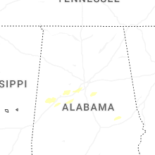
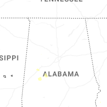
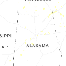
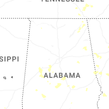
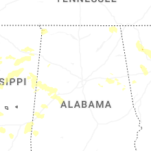
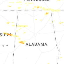


Connect with Interactive Hail Maps