

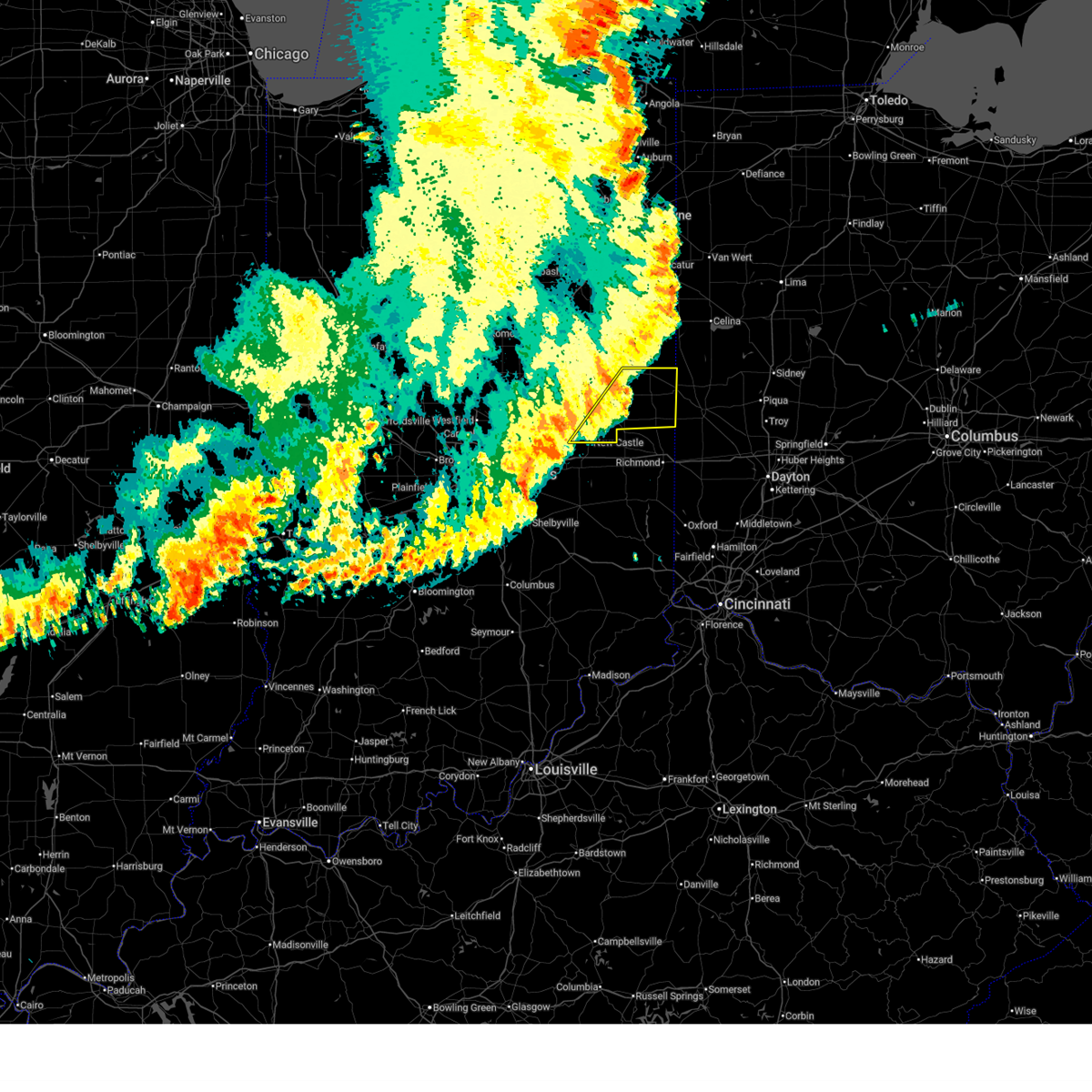
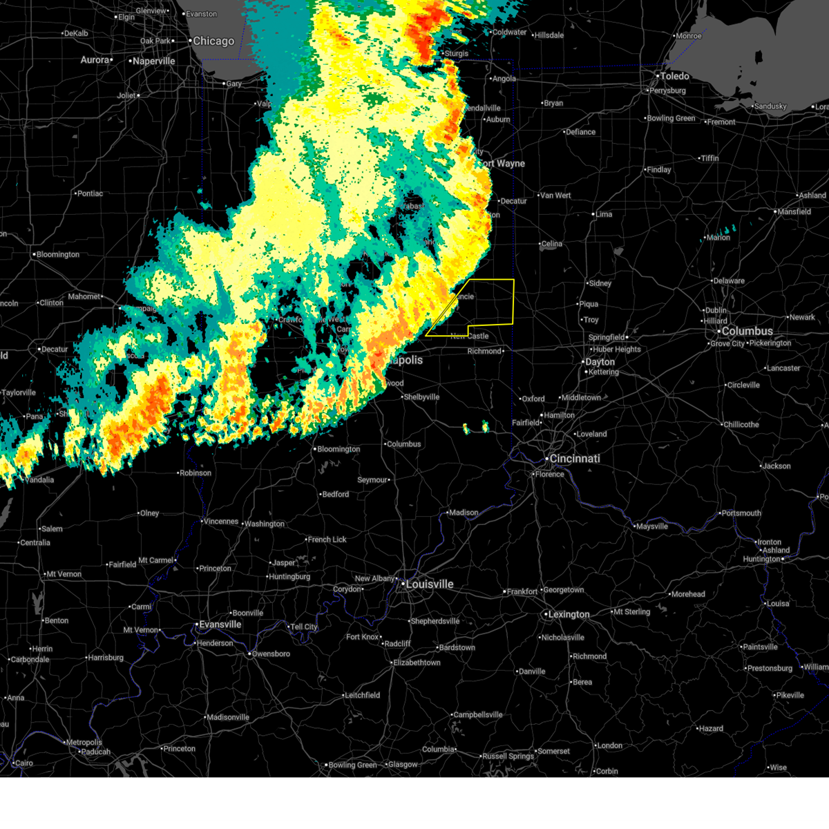
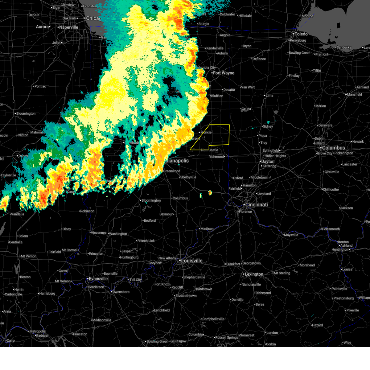
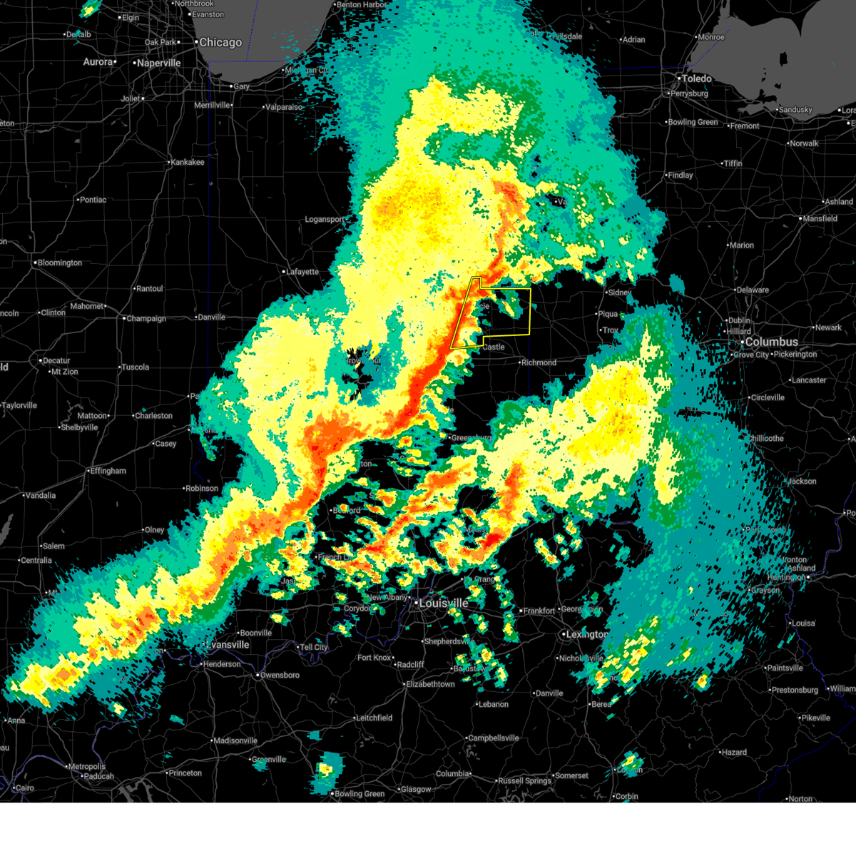
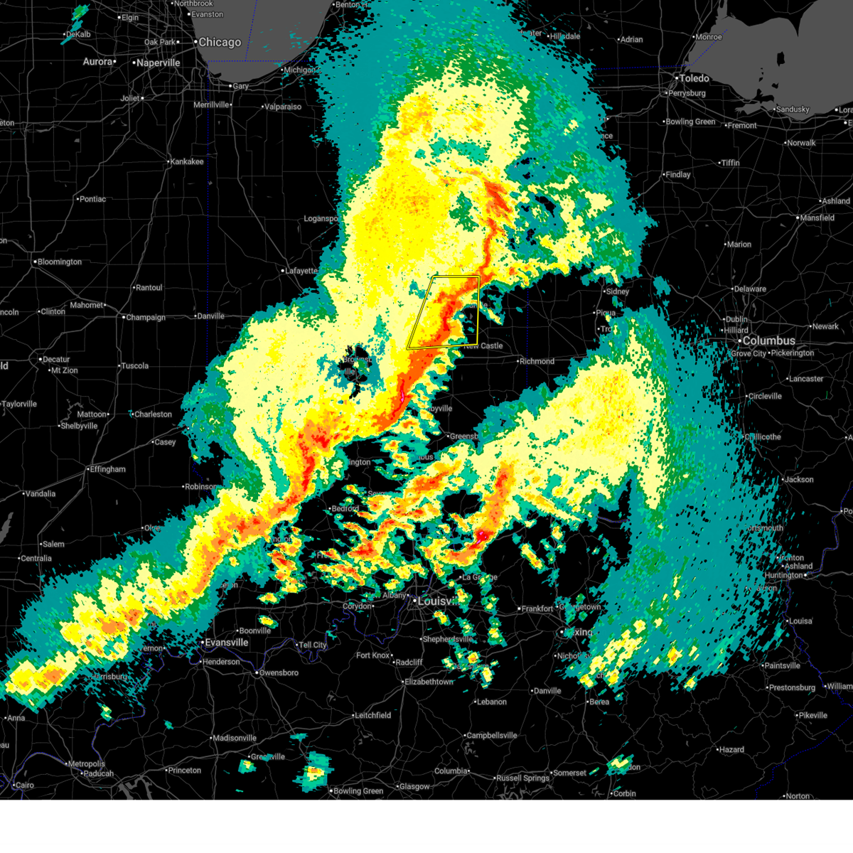
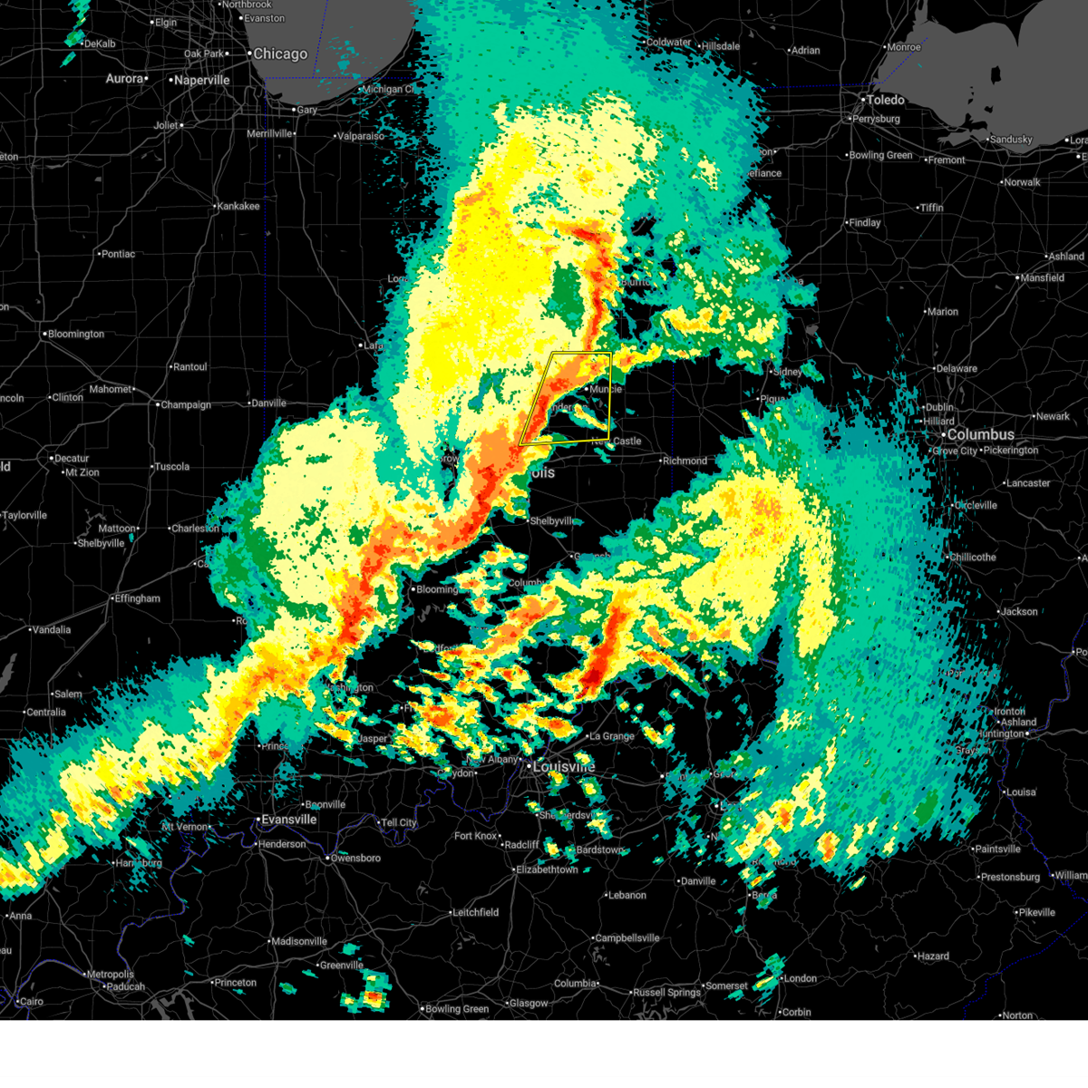
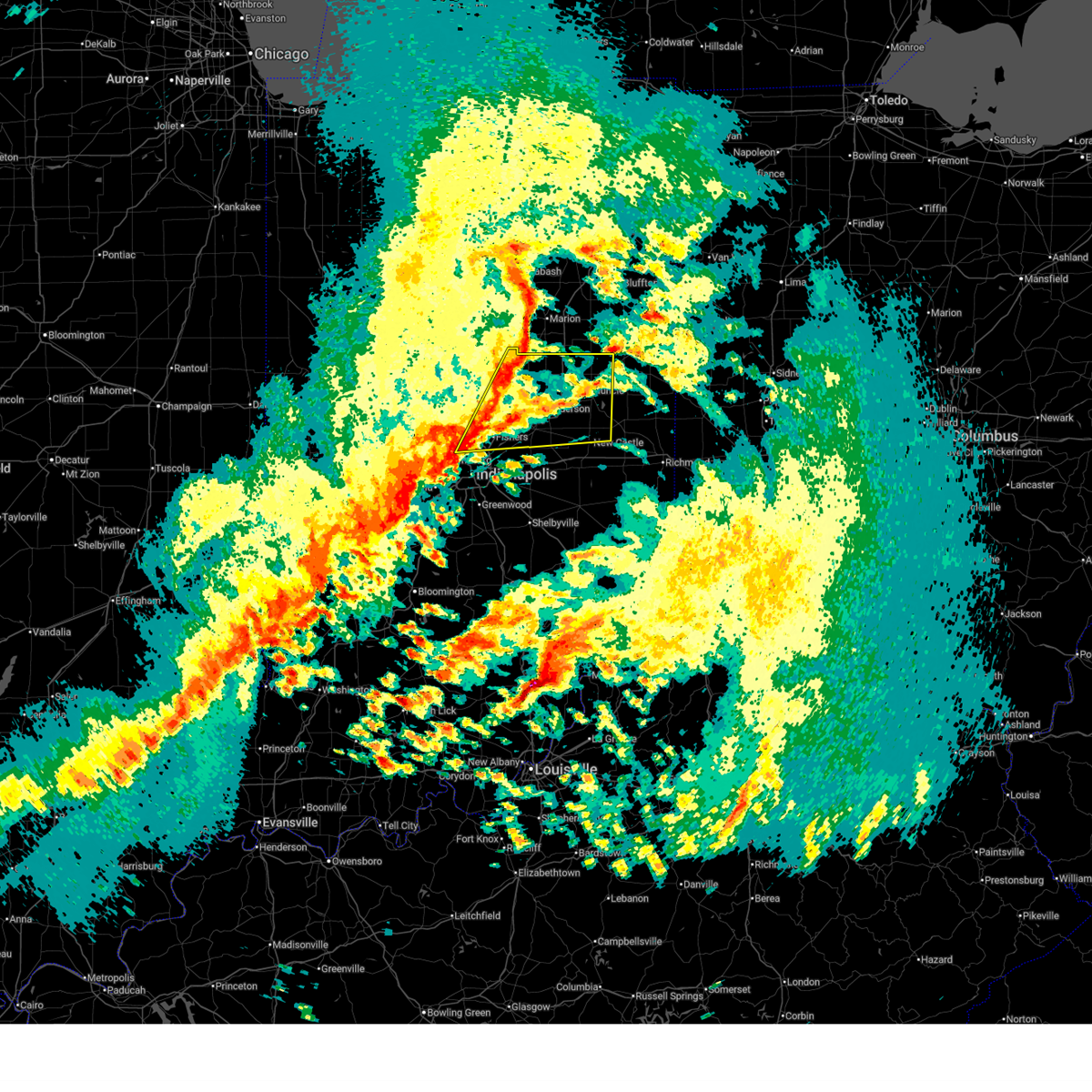
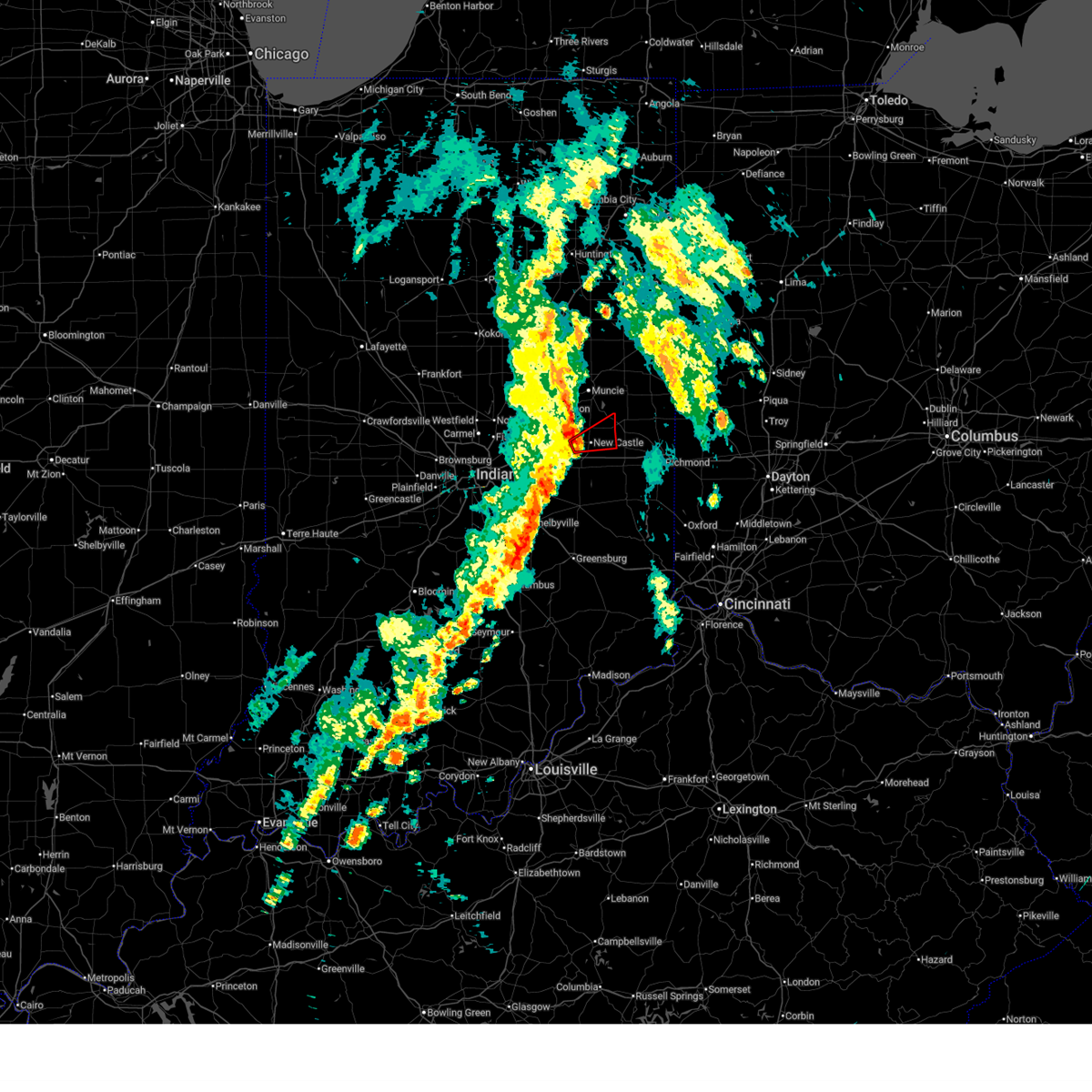
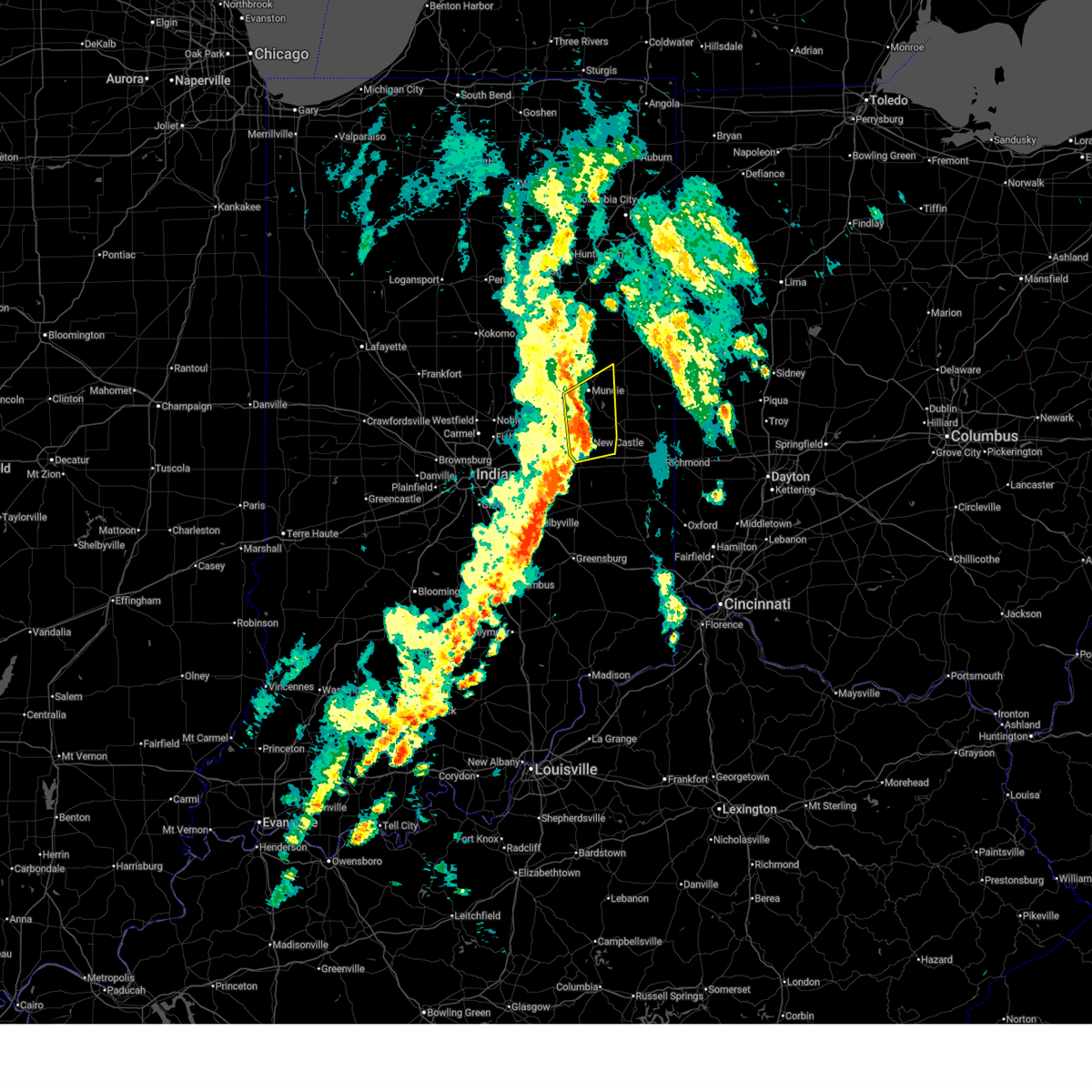
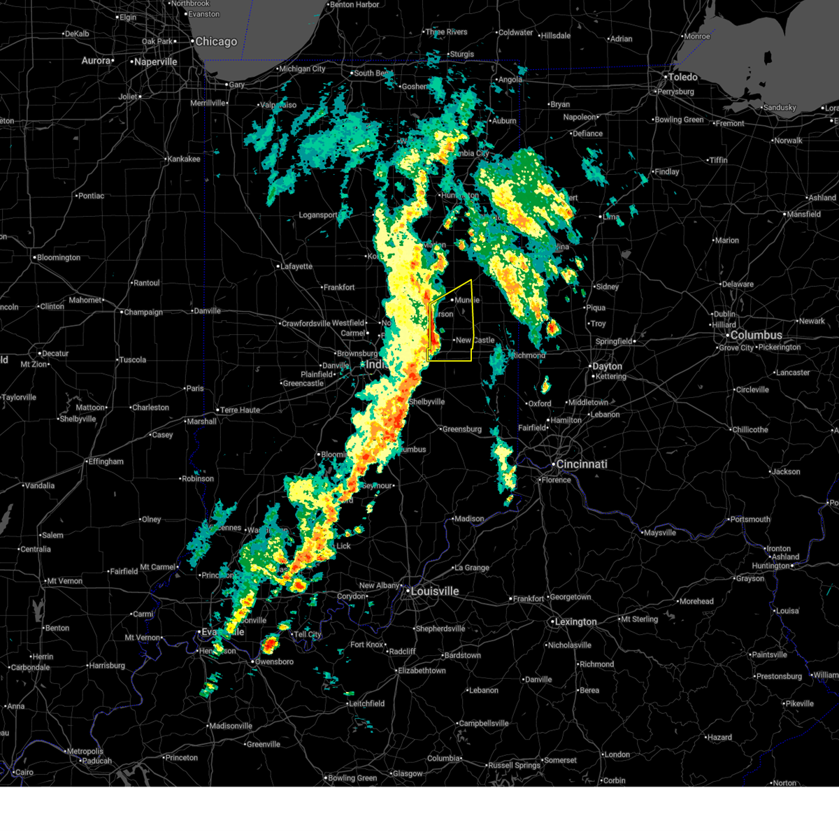
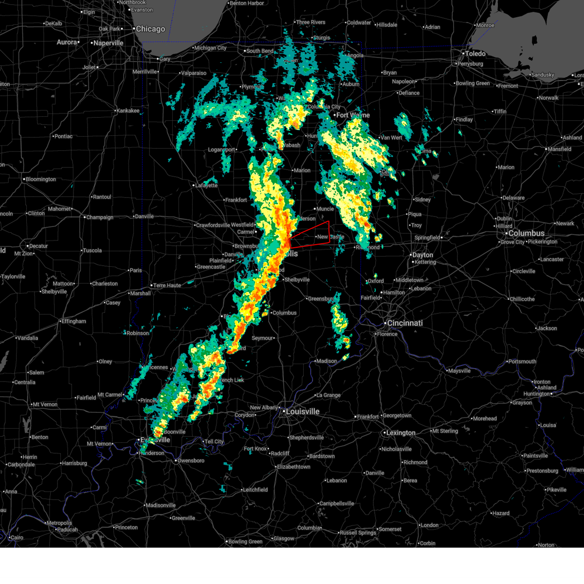
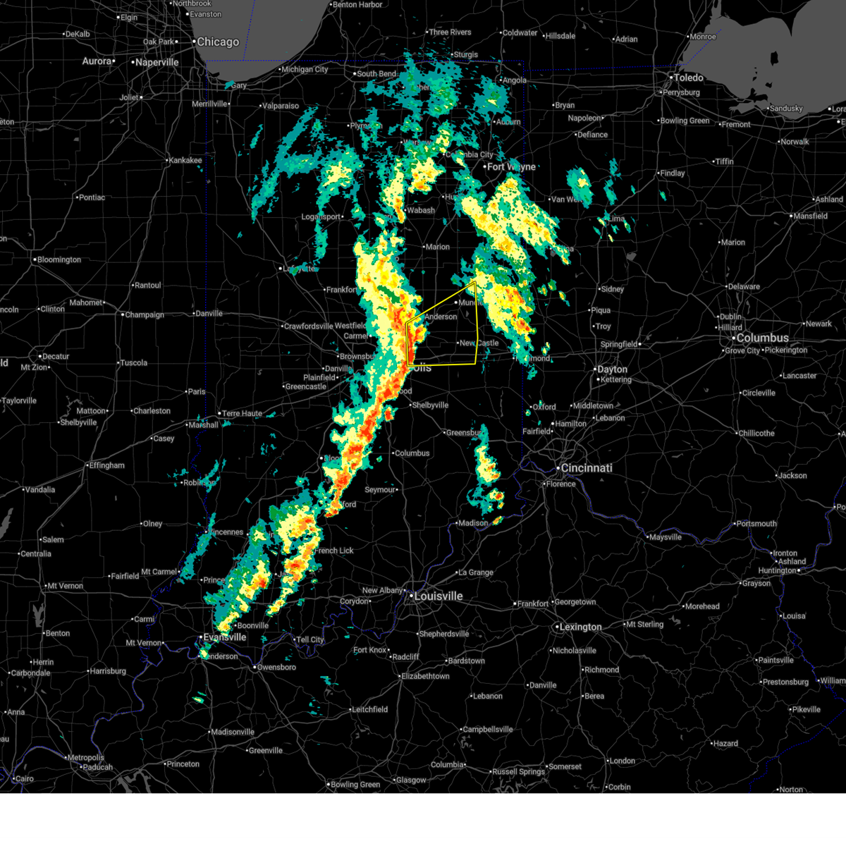
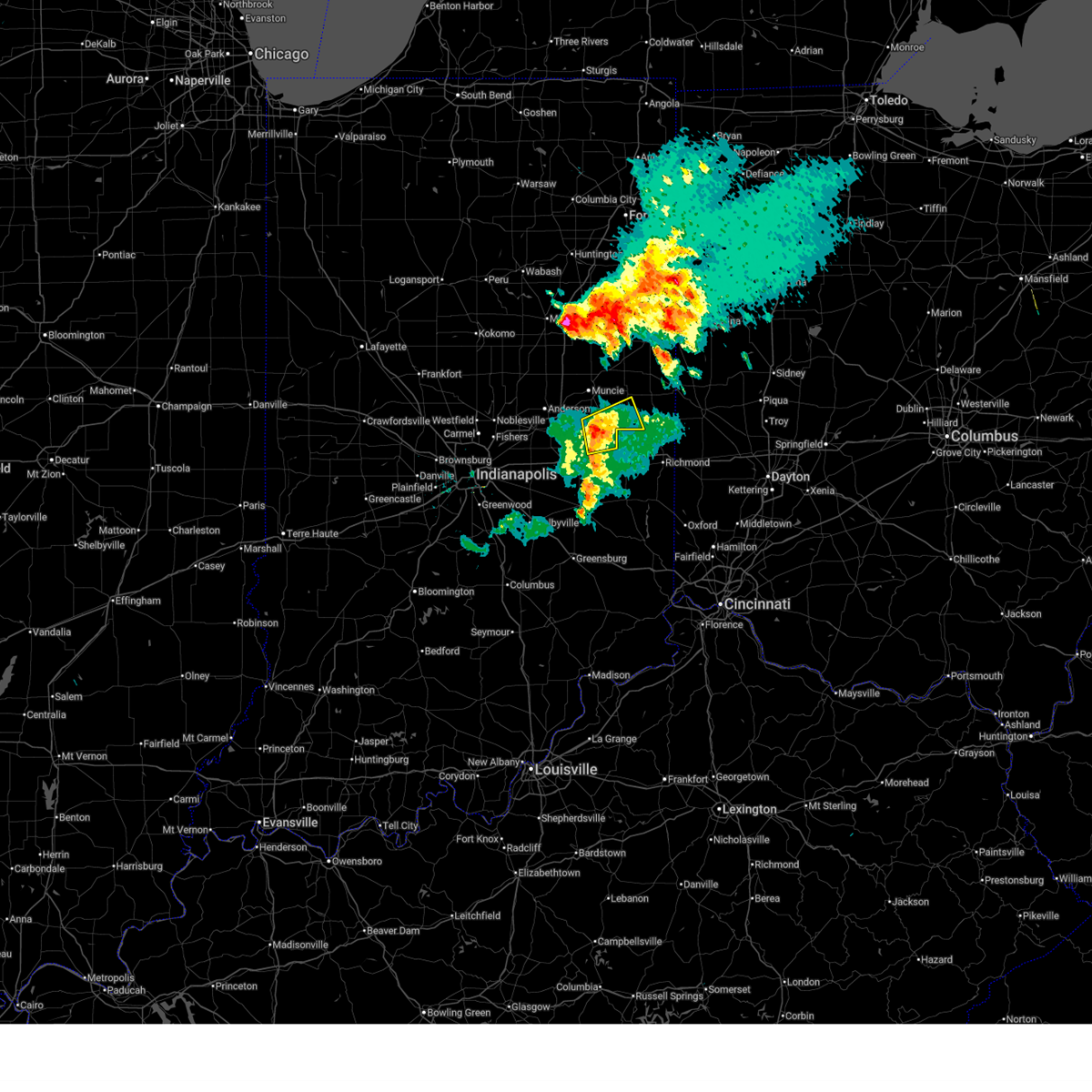
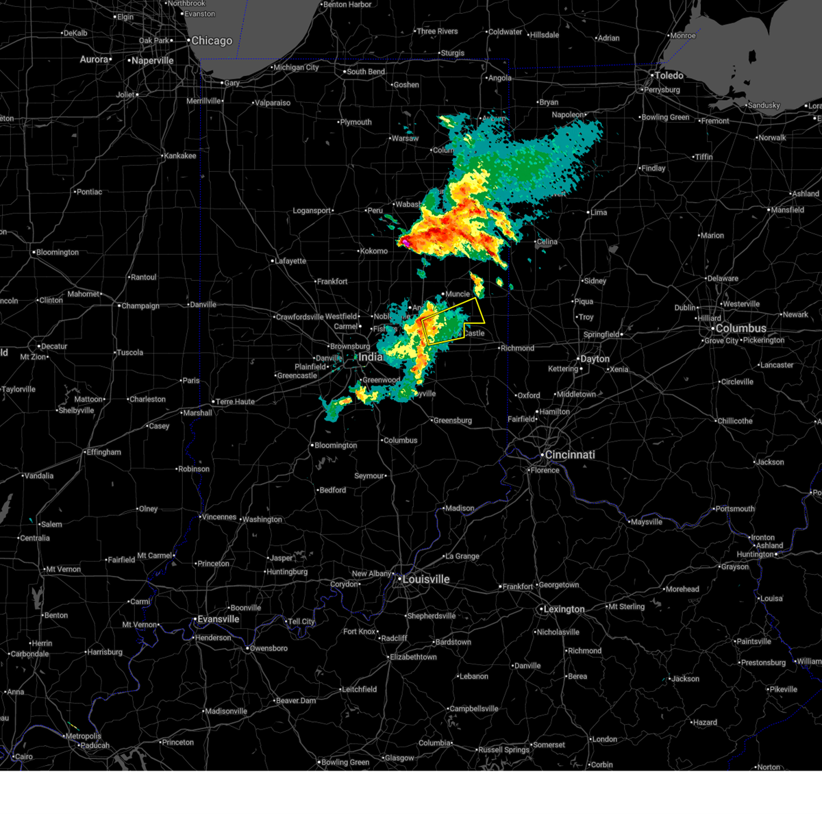
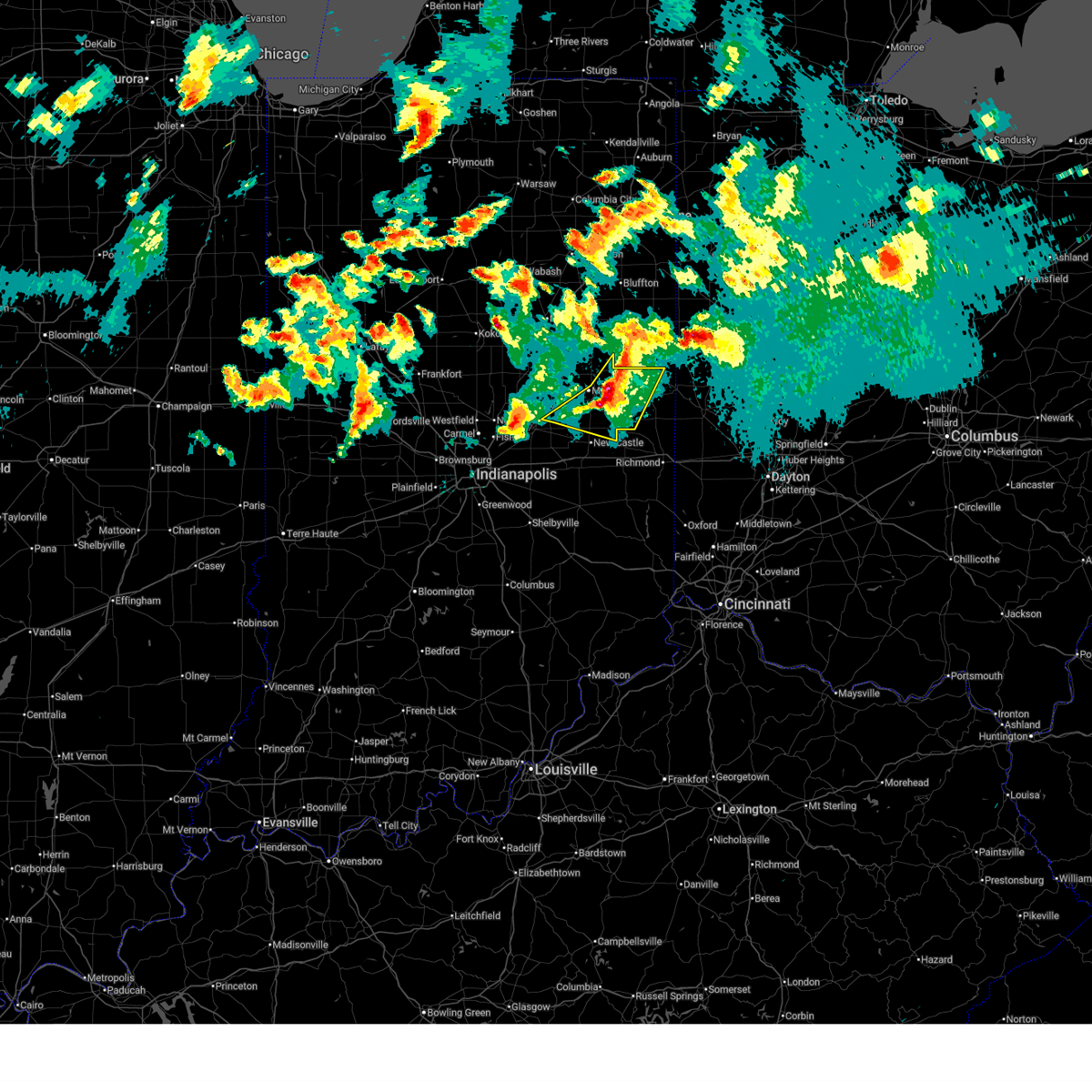
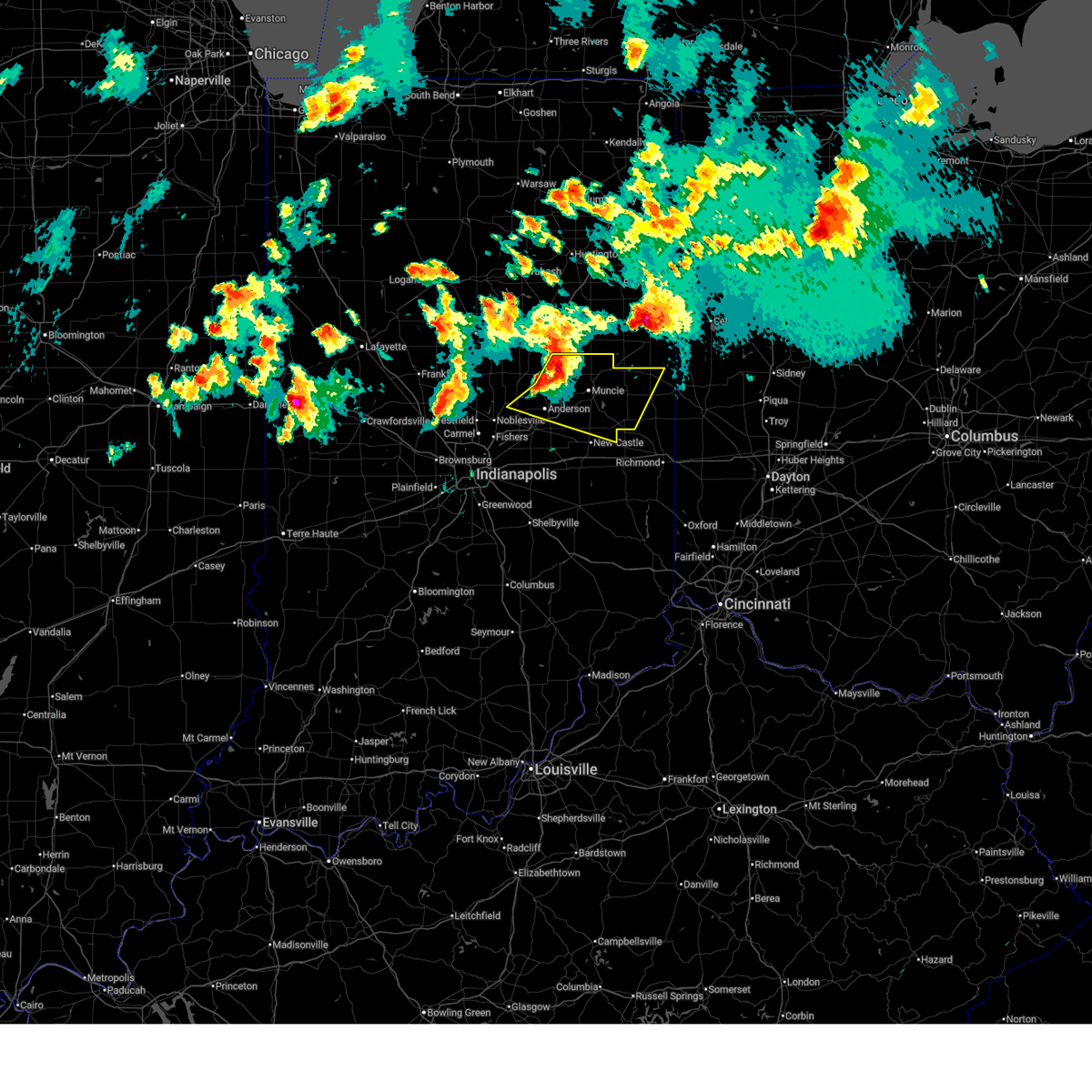
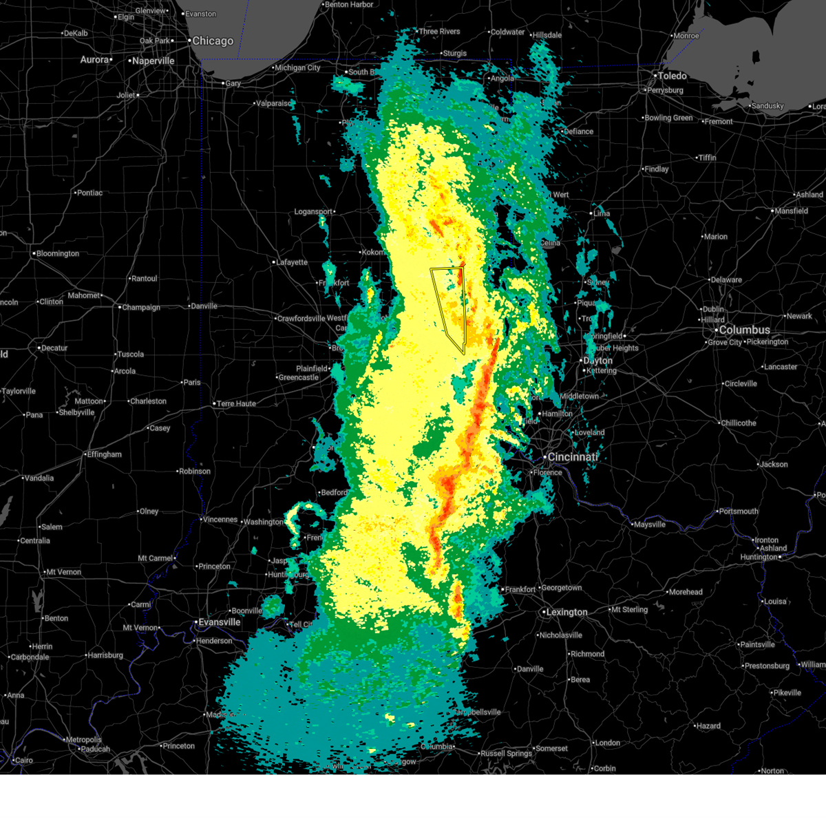
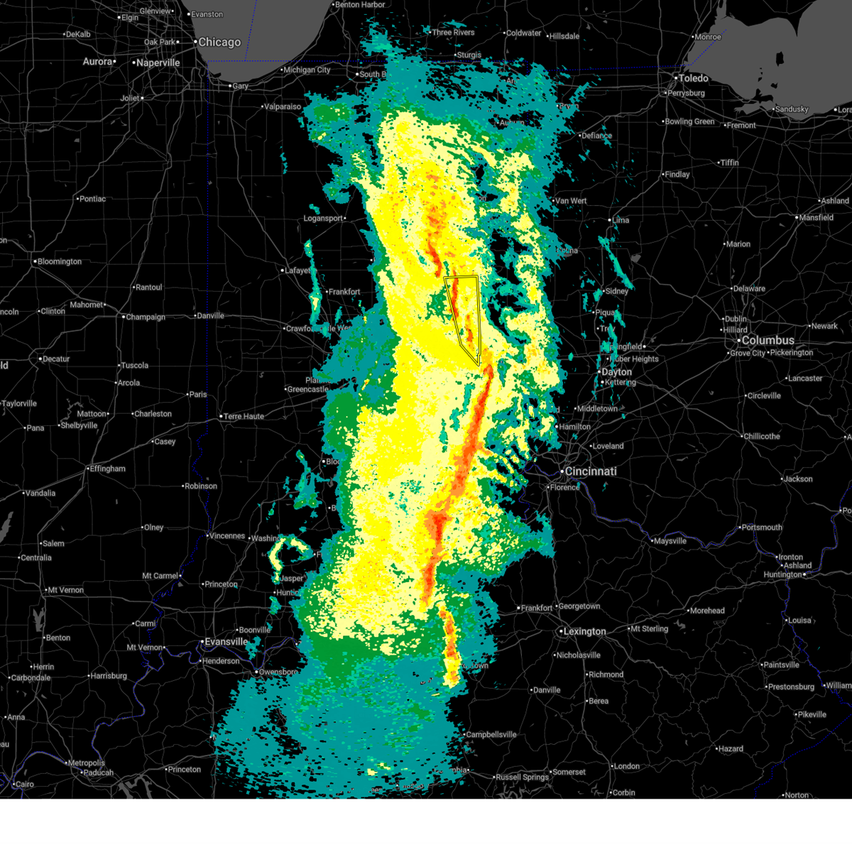
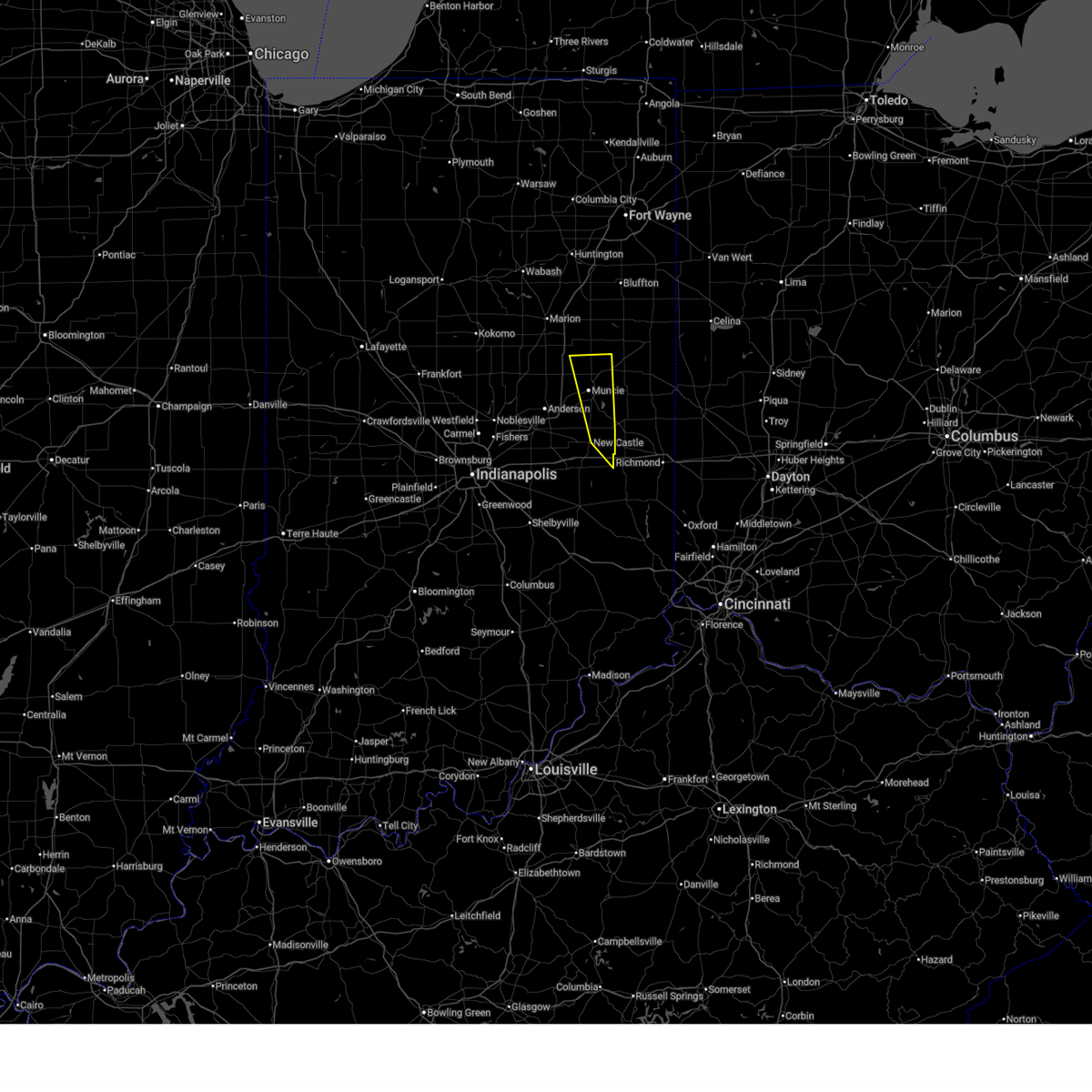
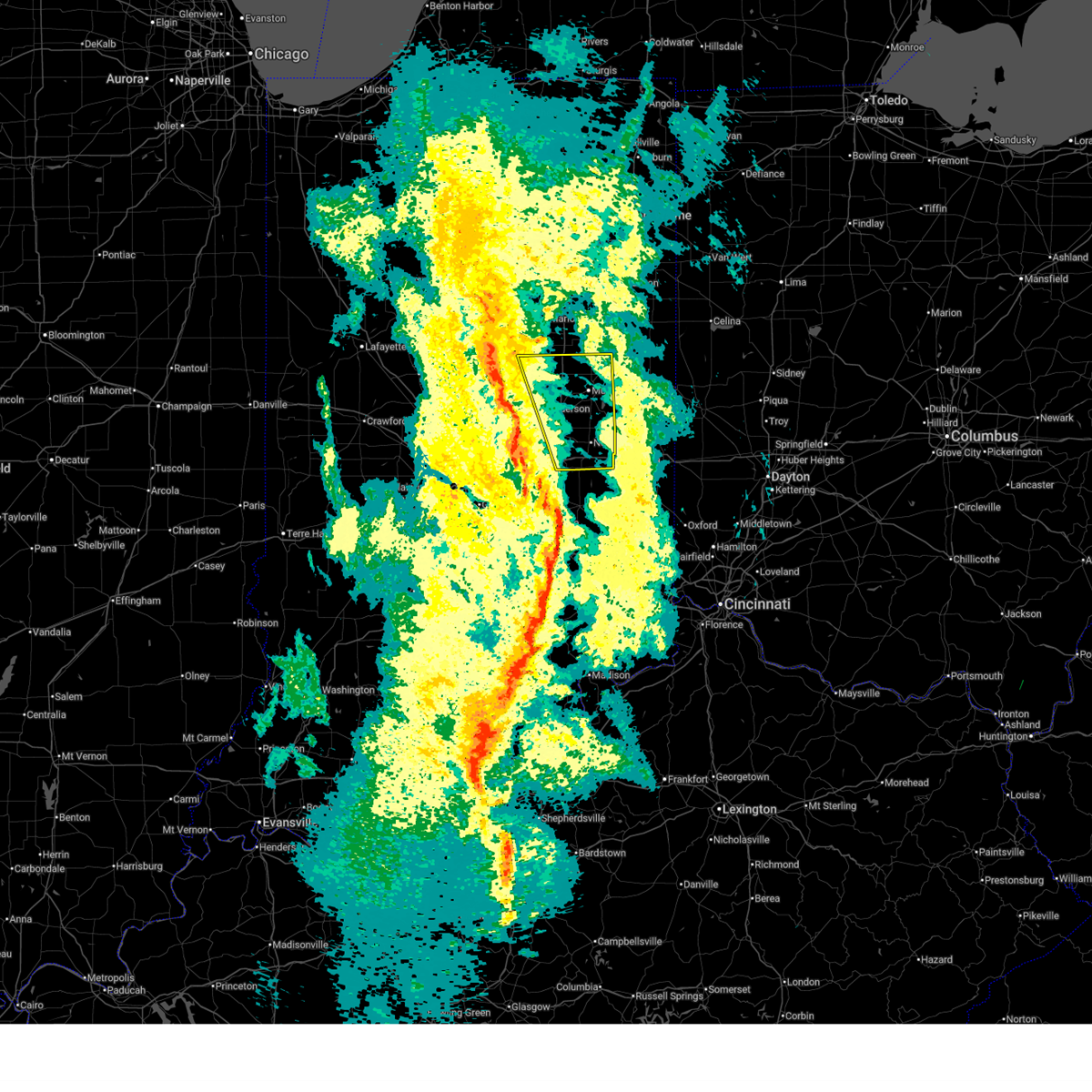
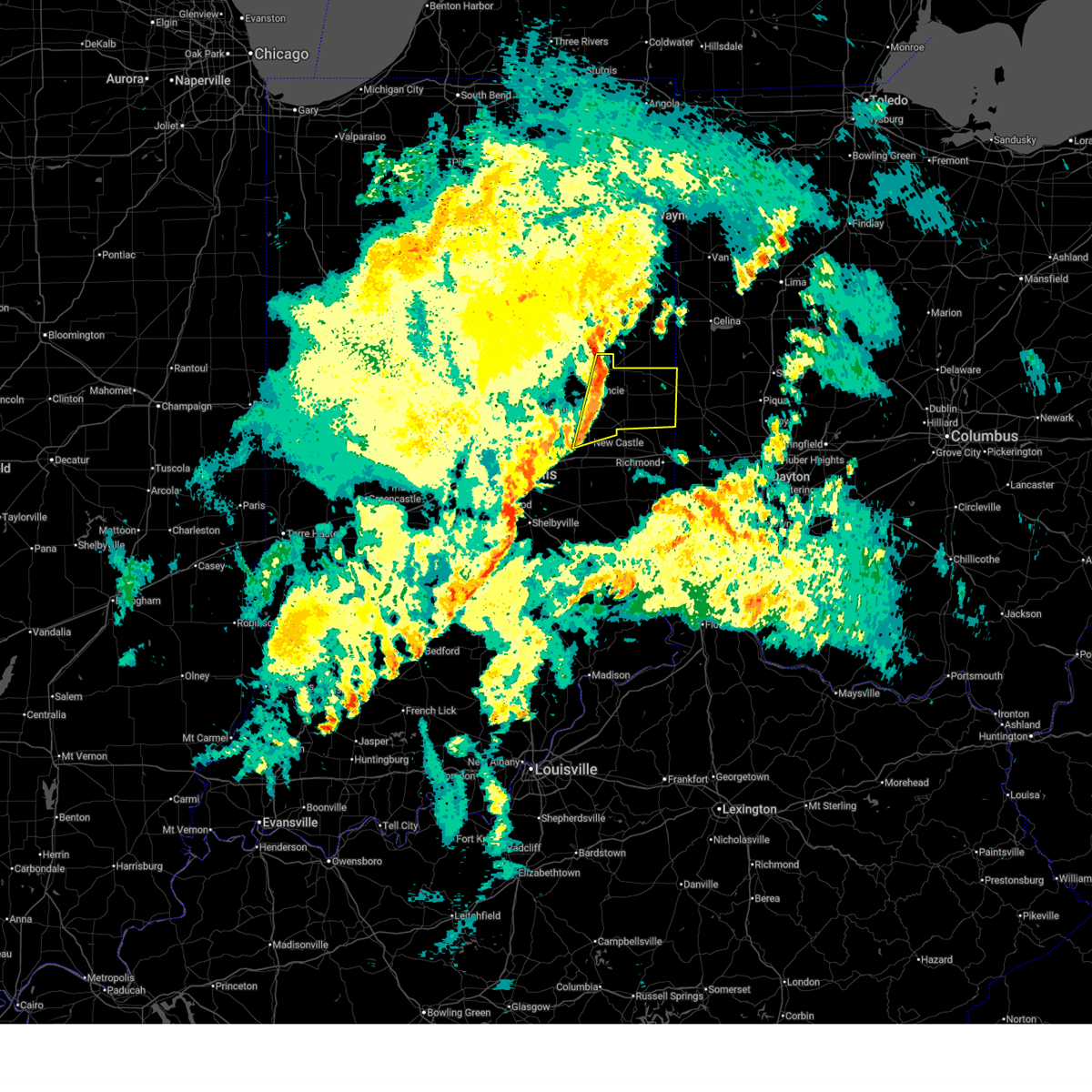
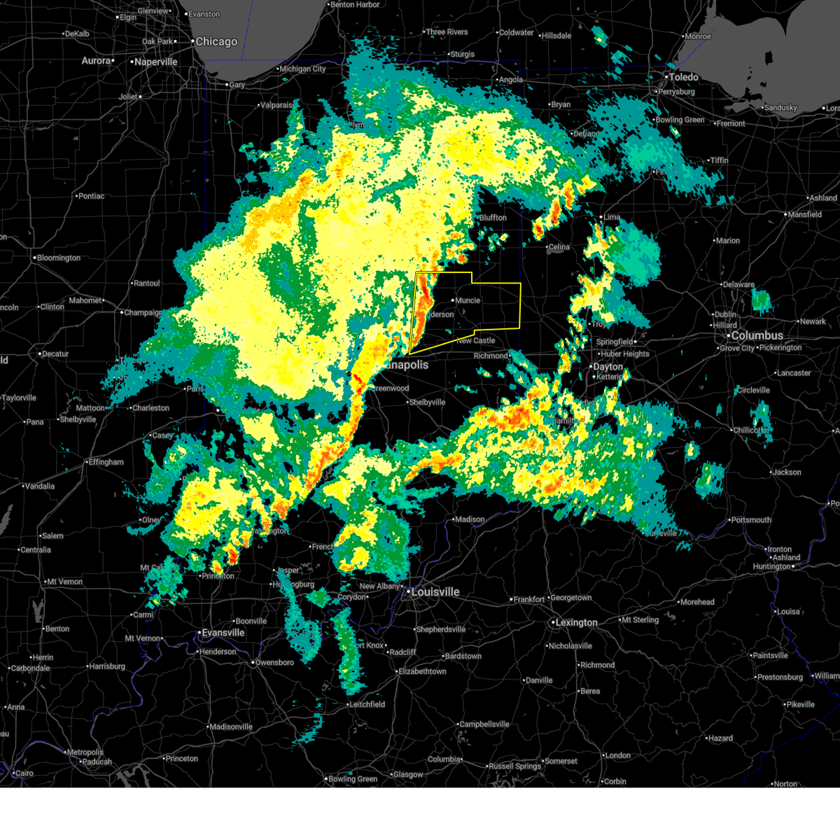
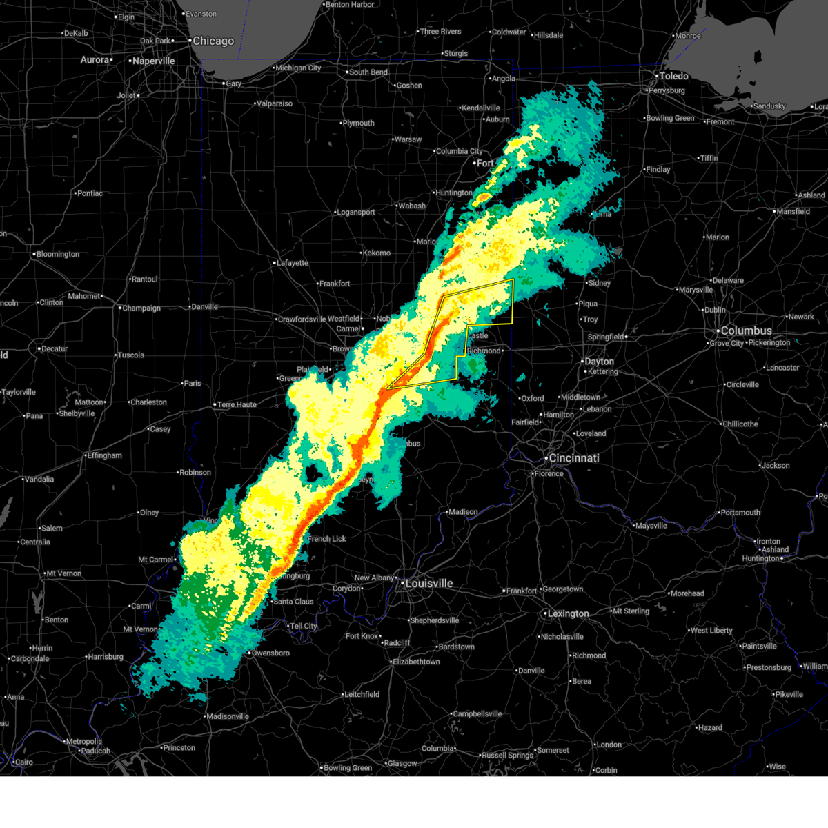
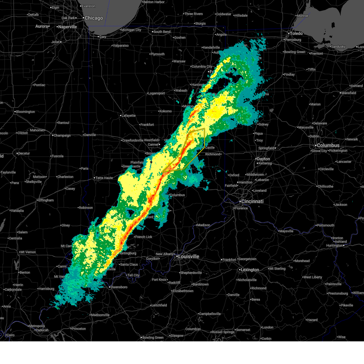
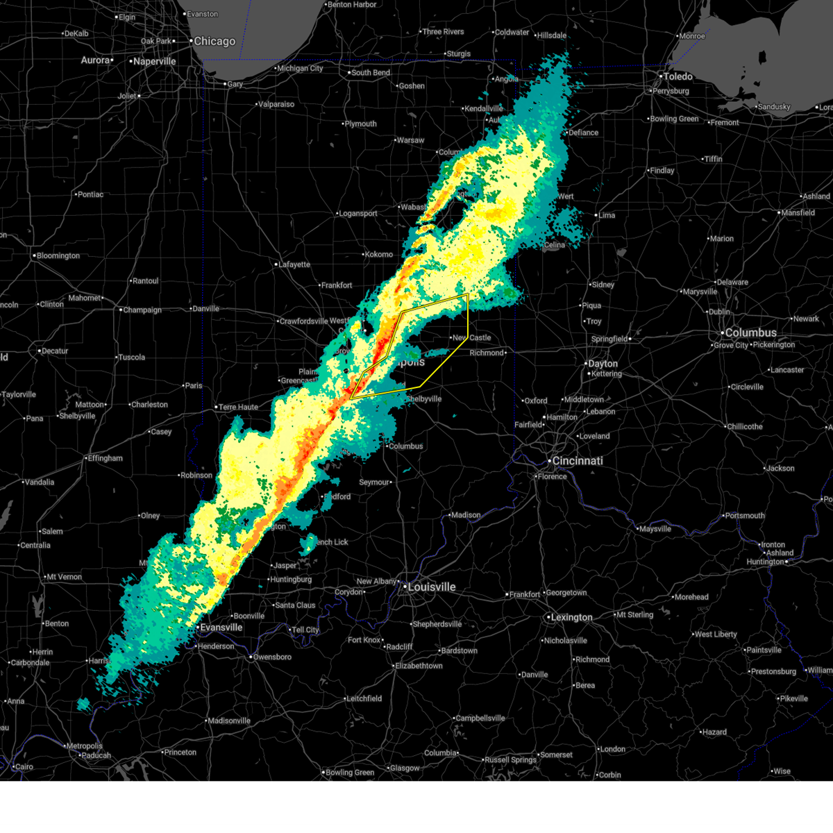
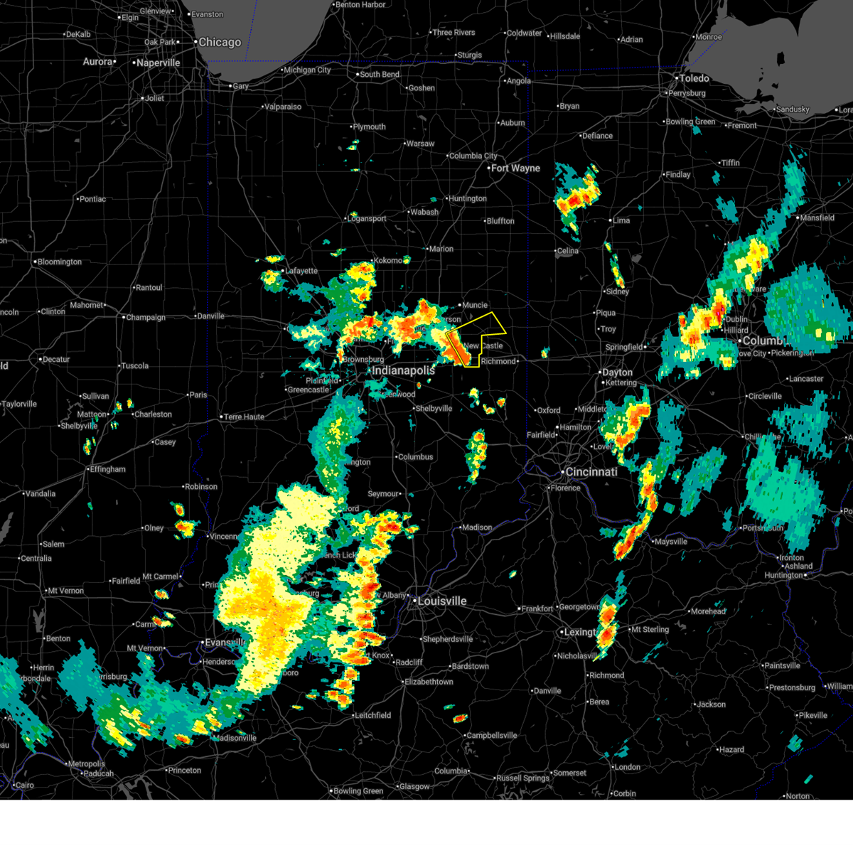
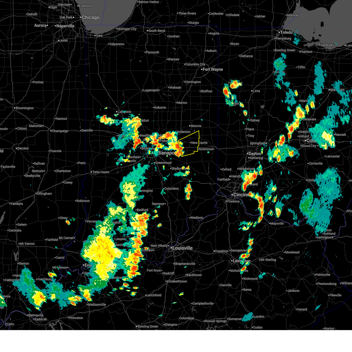
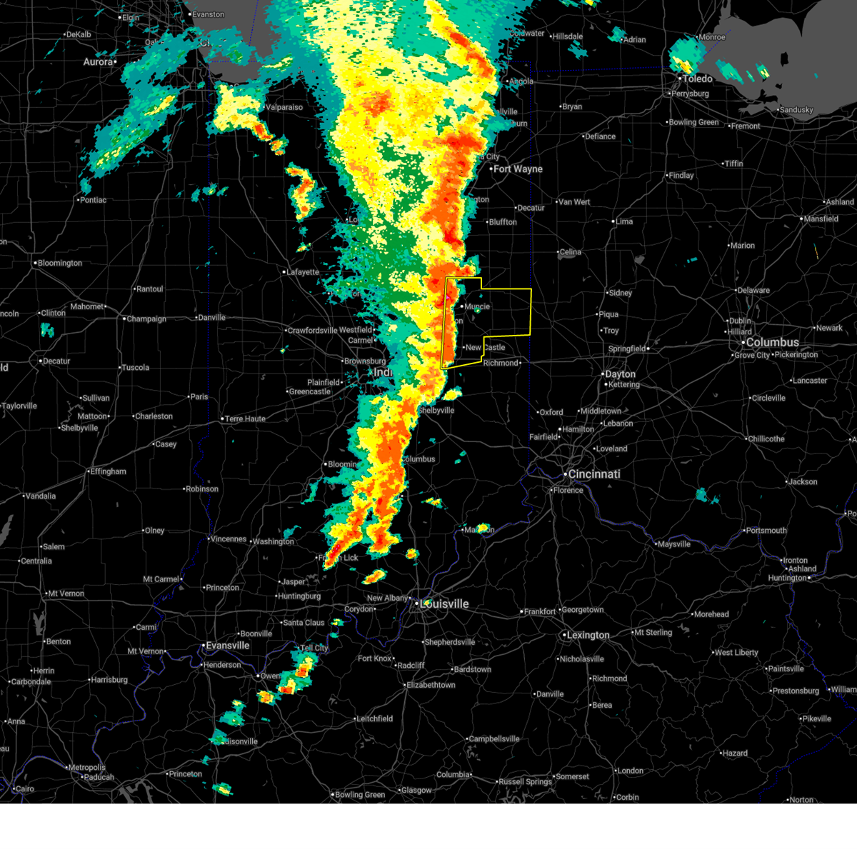
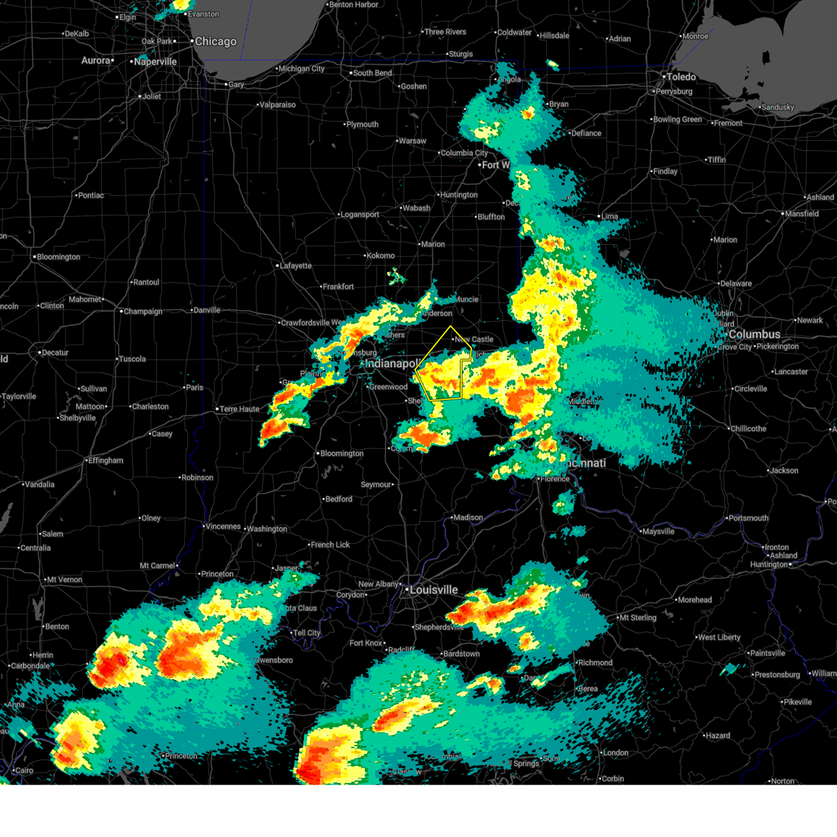
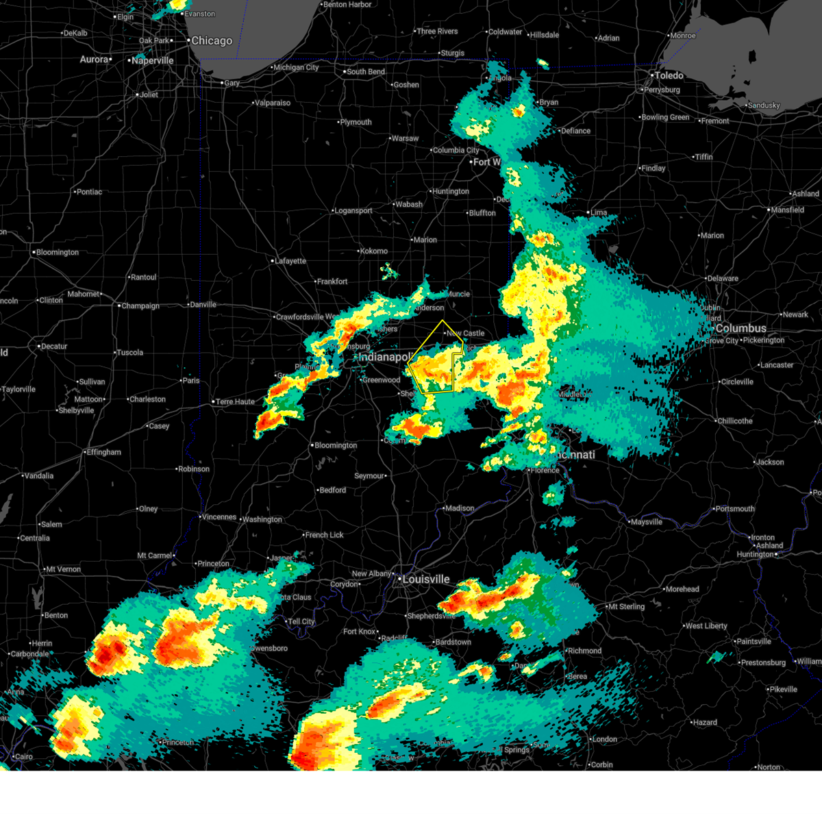
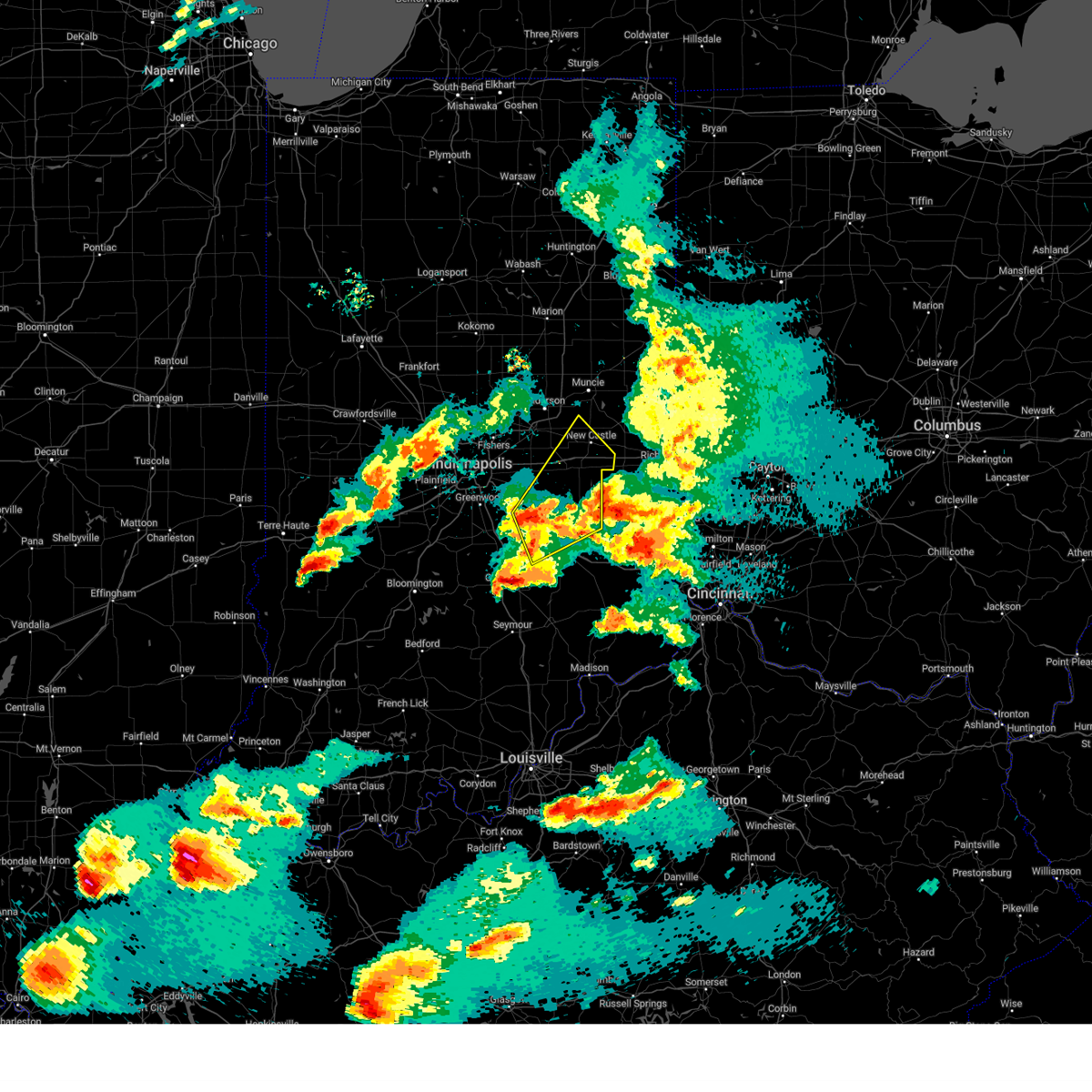
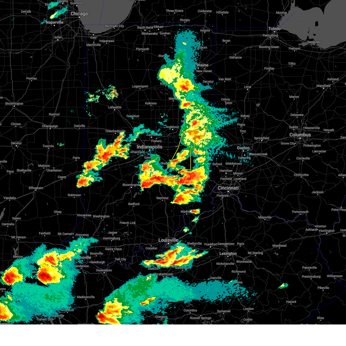
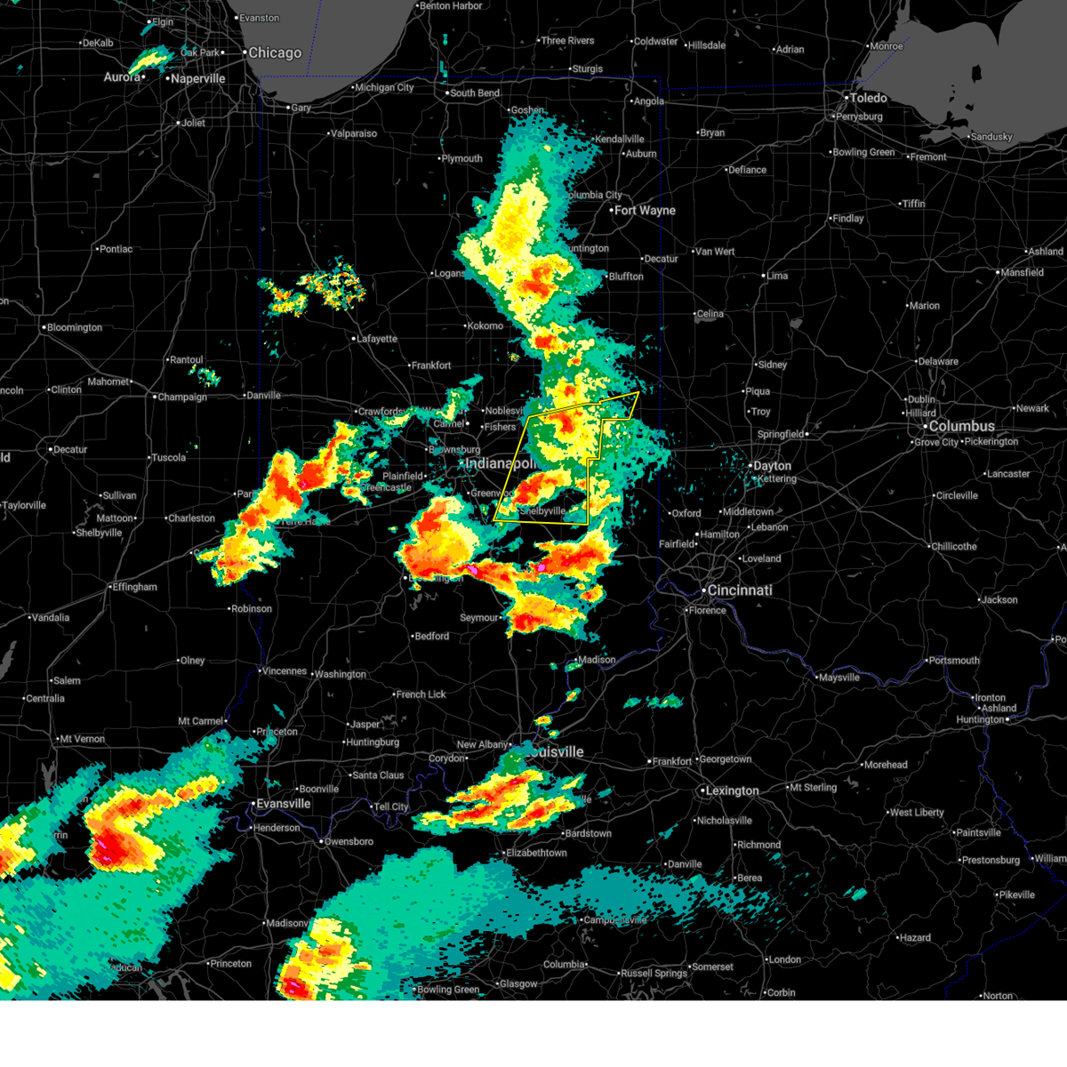
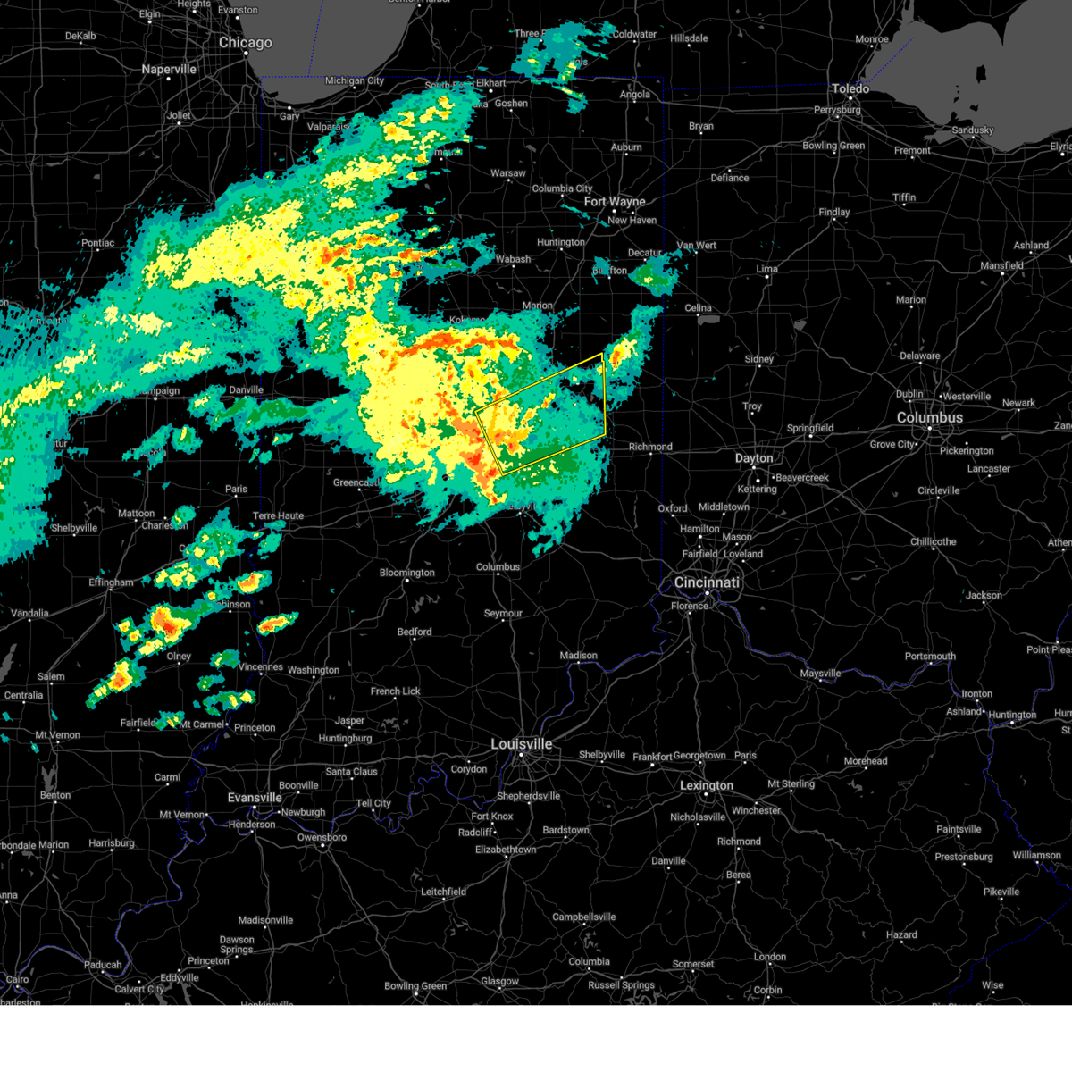
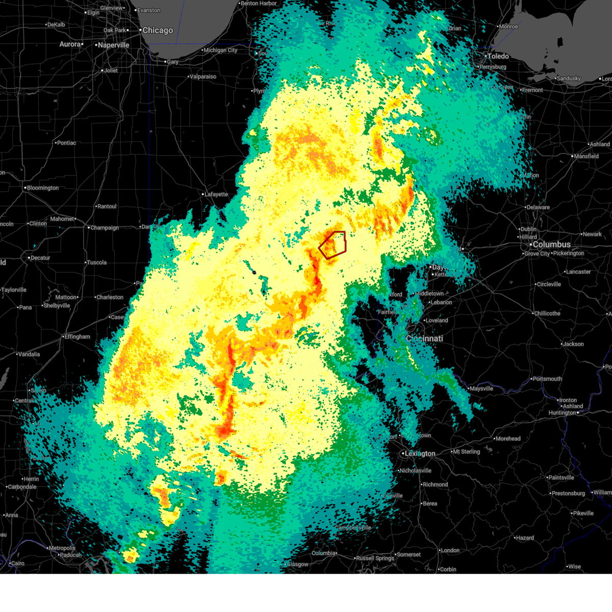
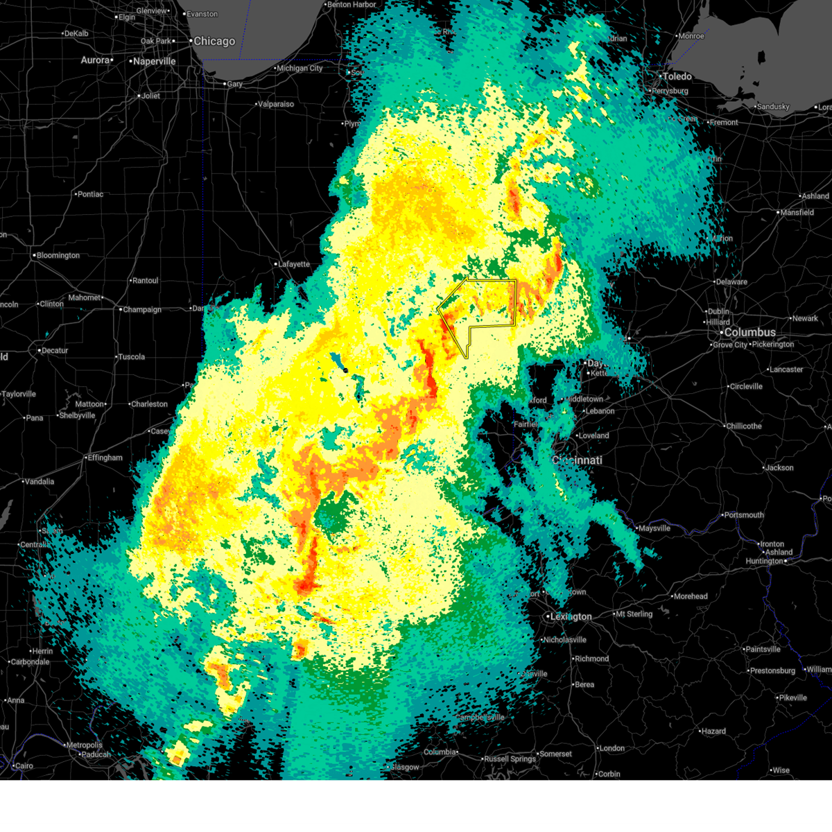
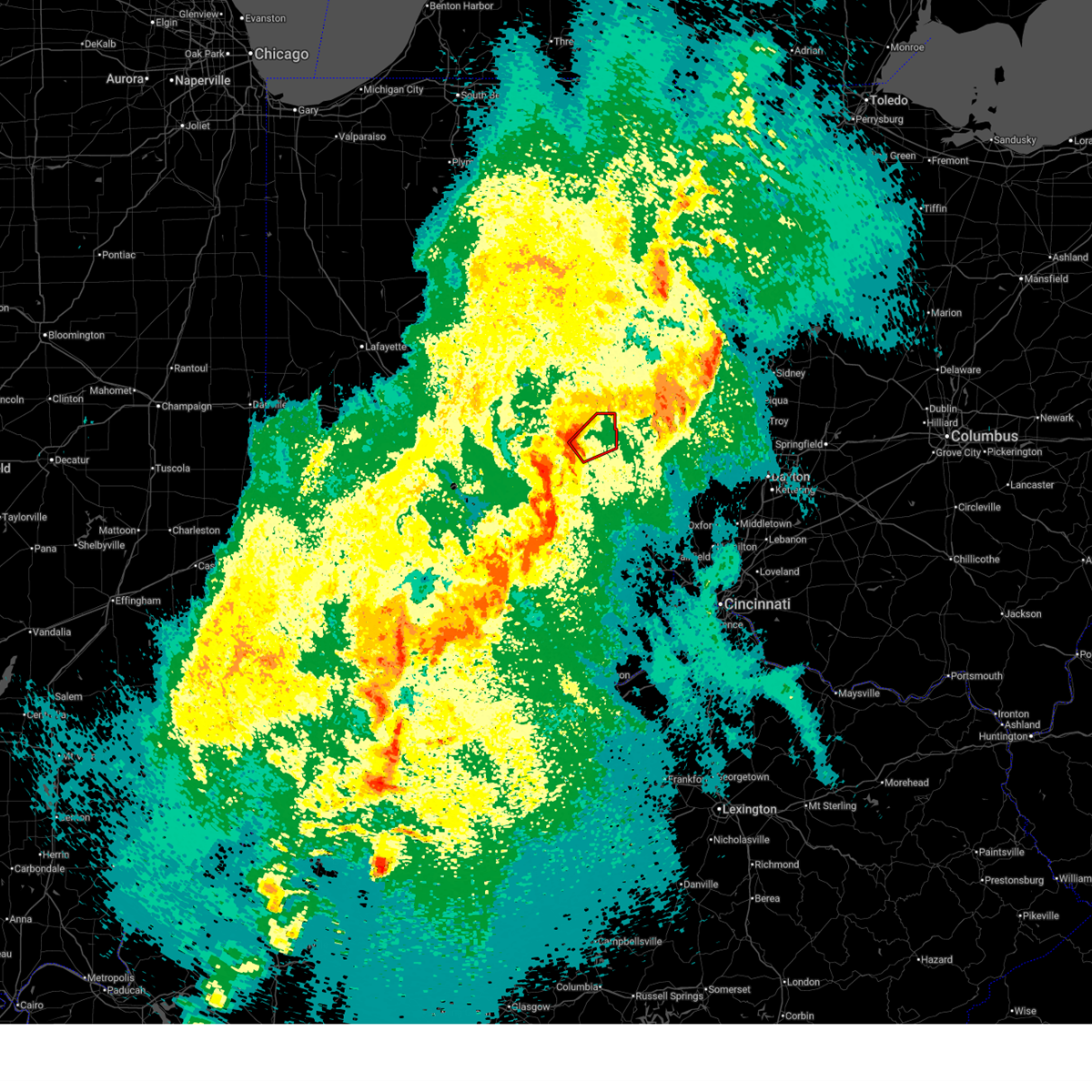
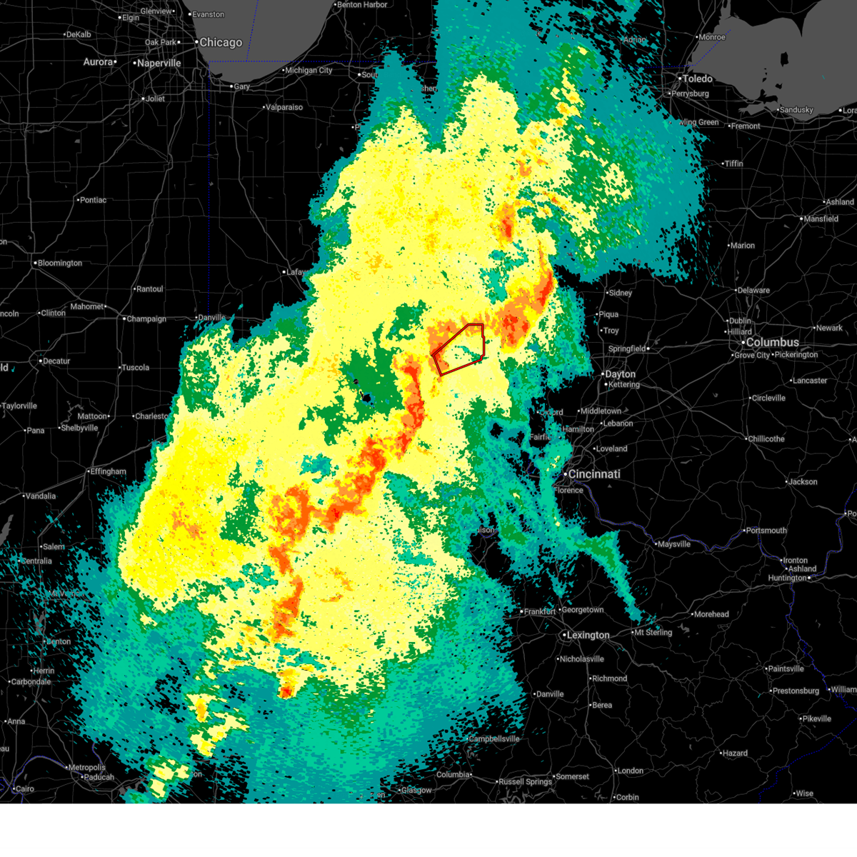
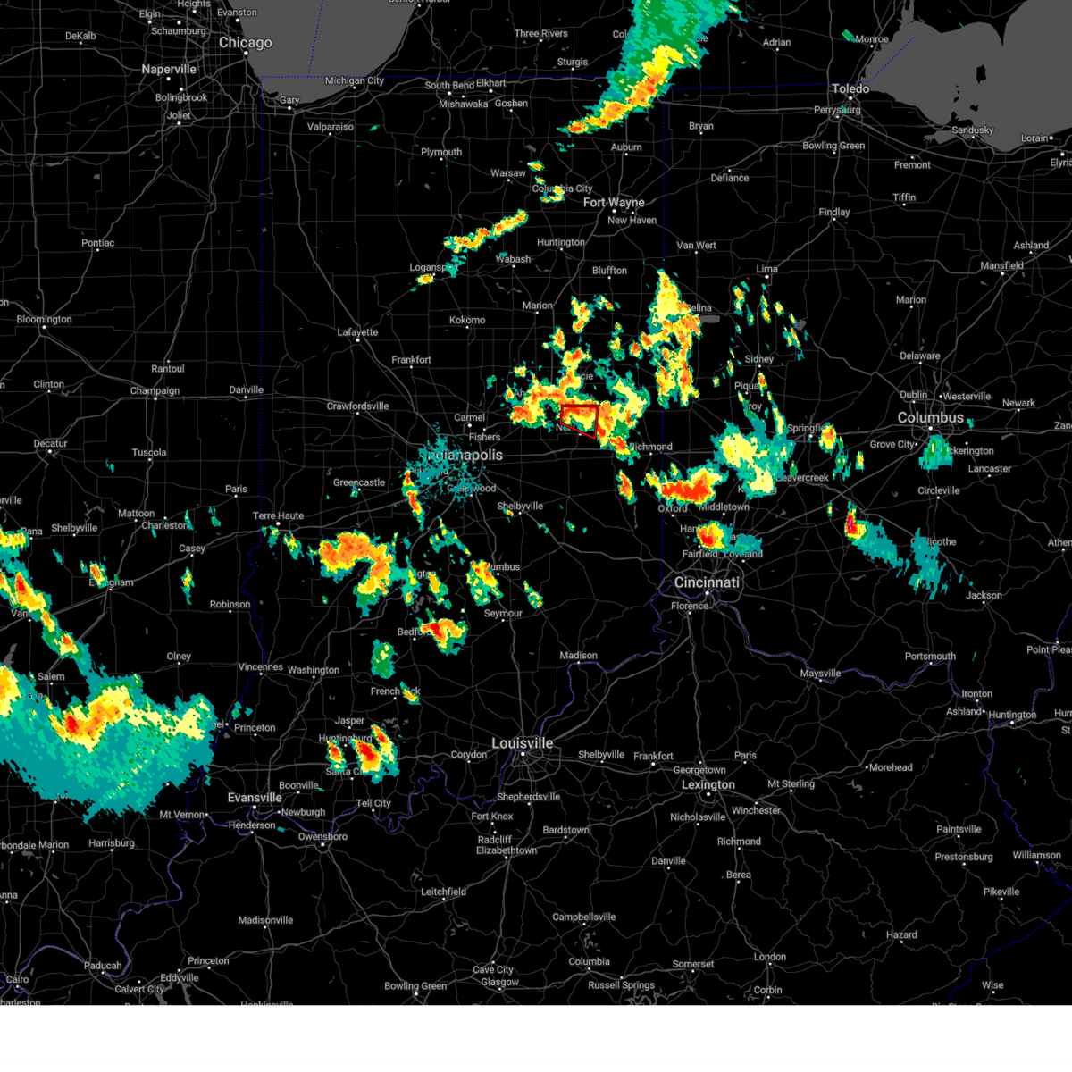
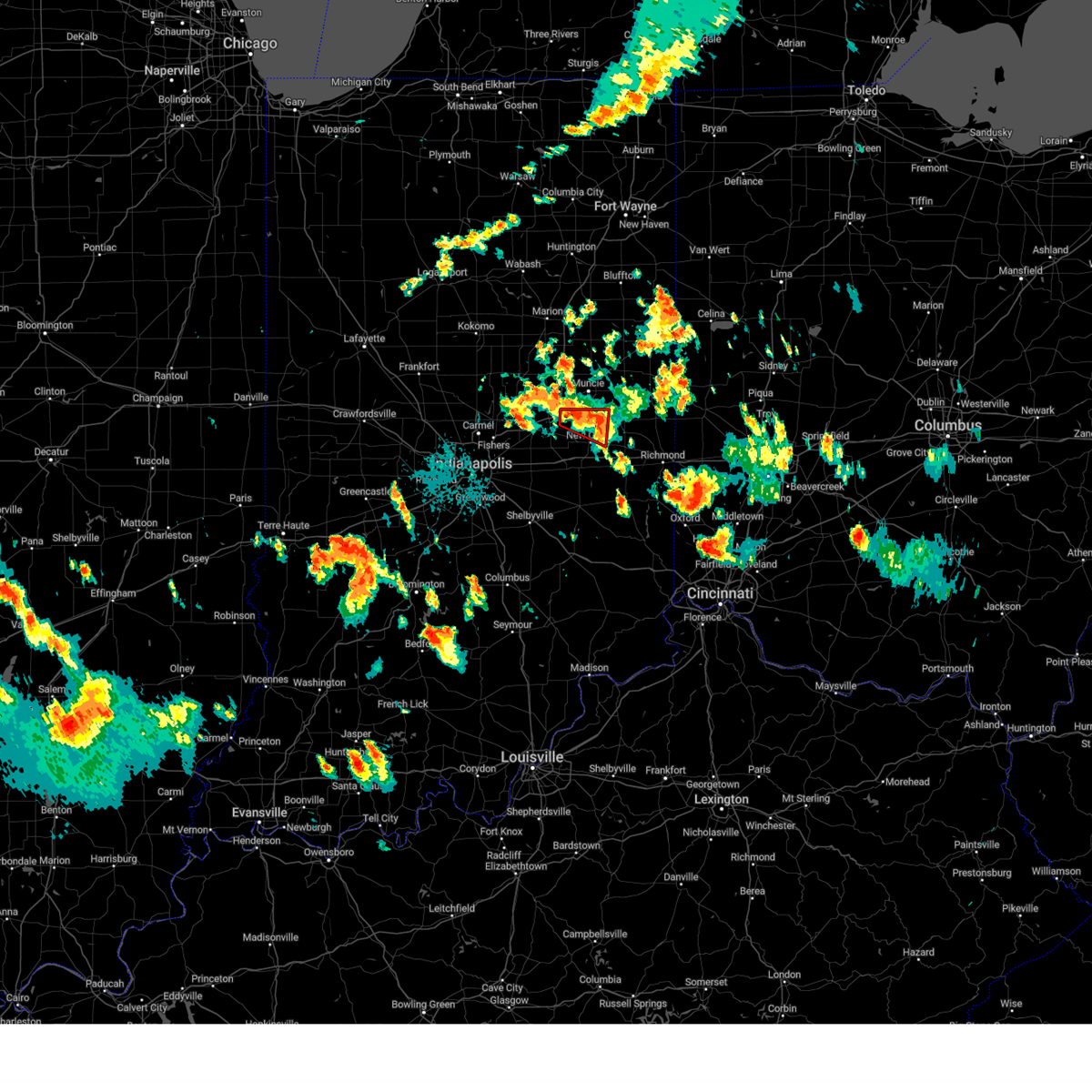
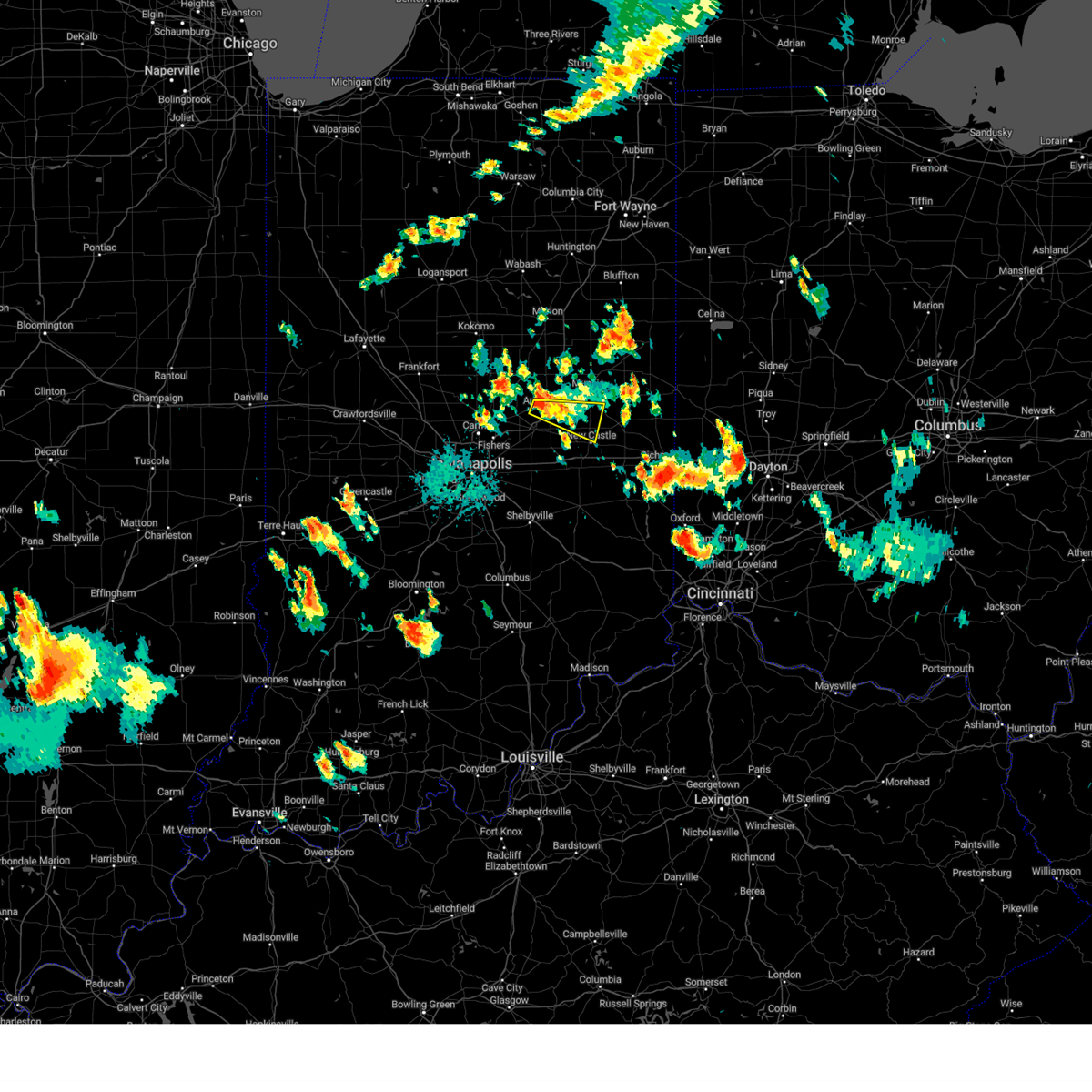
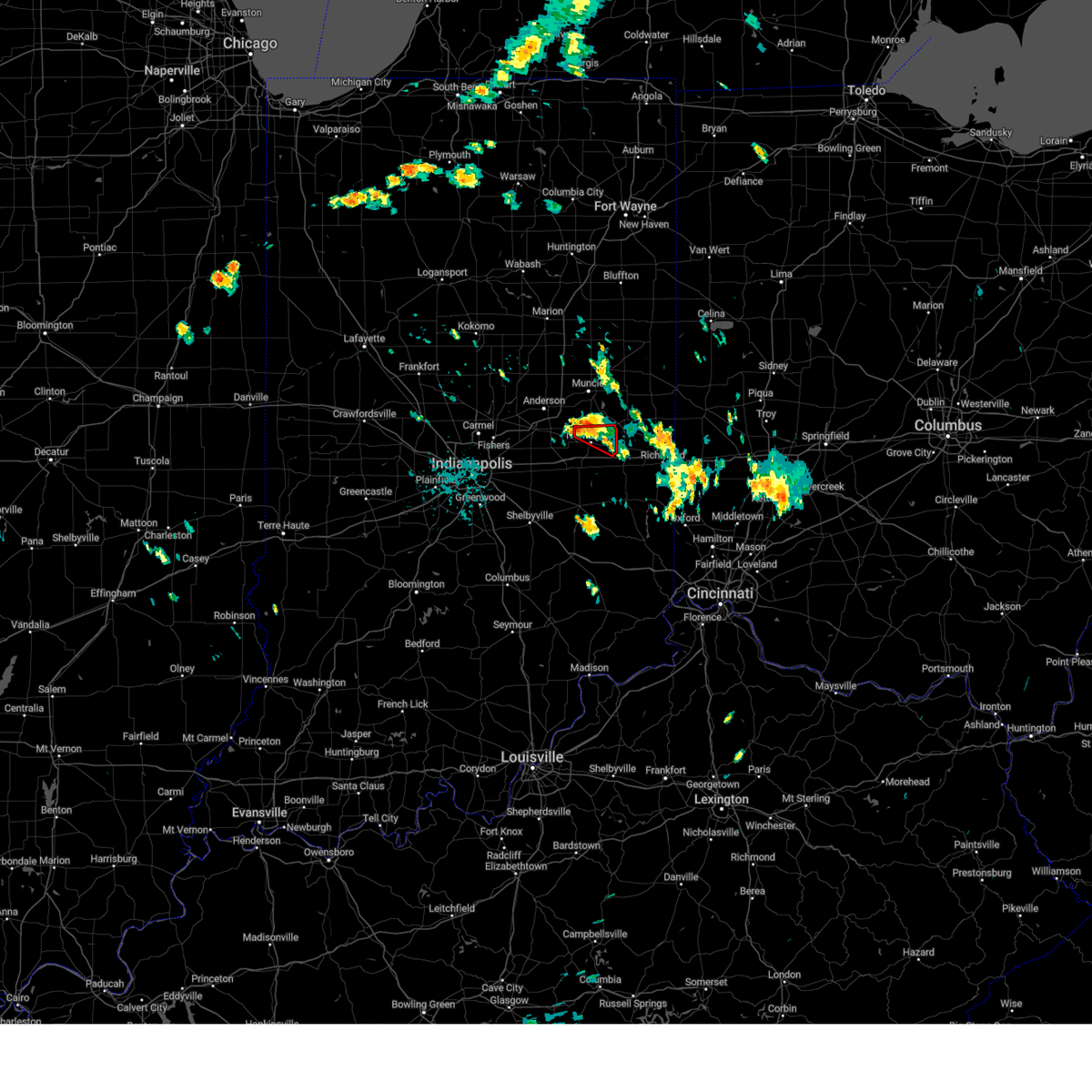
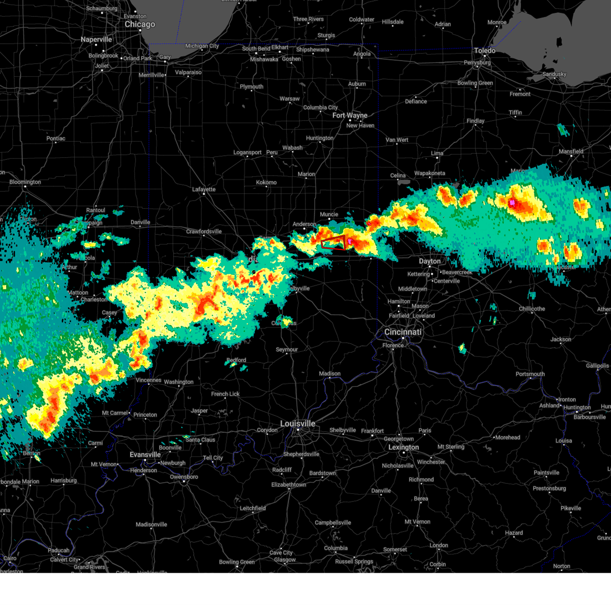
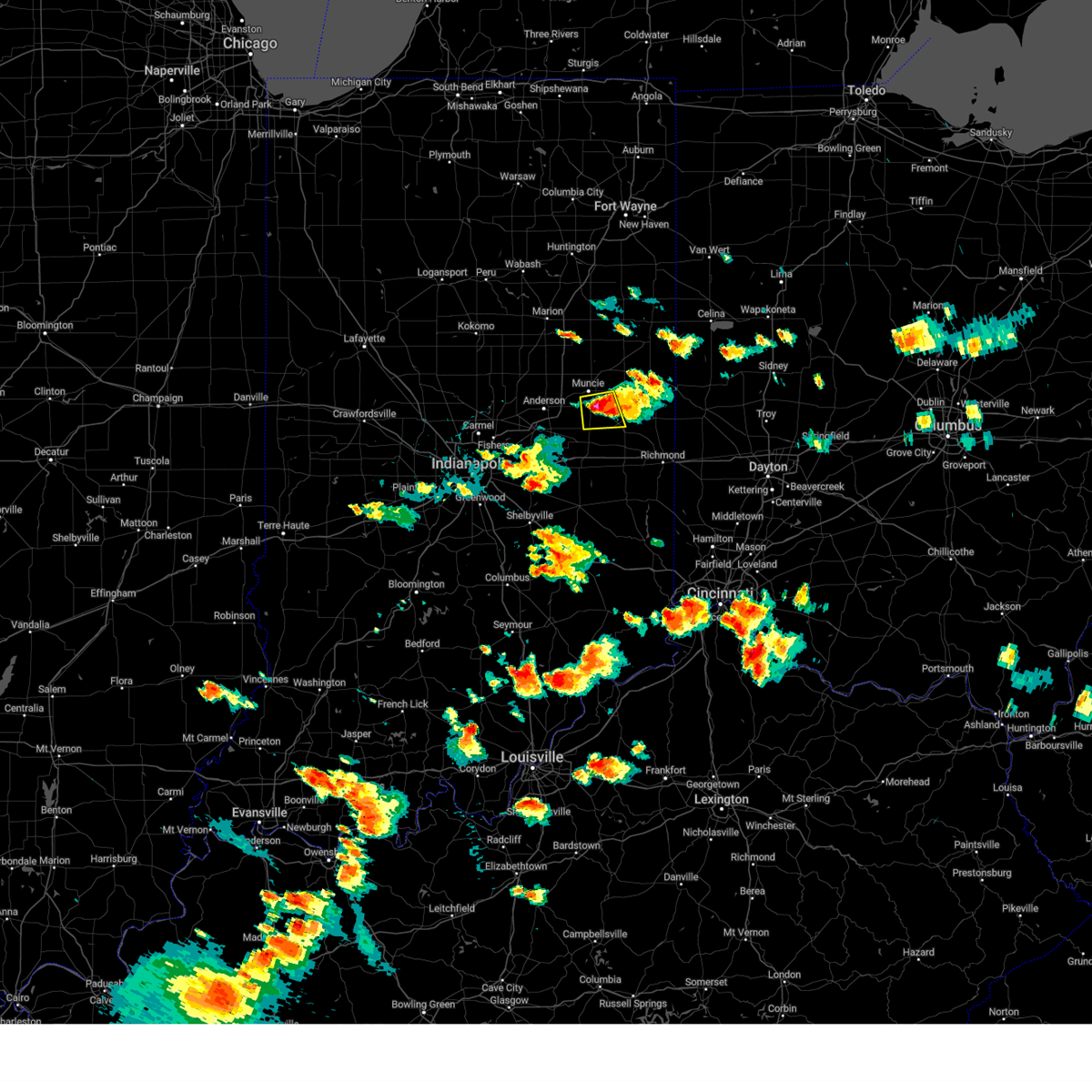
Hail Map for Mount Summit, IN
The Mount Summit, IN area has had 0 reports of on-the-ground hail by trained spotters, and has been under severe weather warnings 38 times during the past 12 months. Doppler radar has detected hail at or near Mount Summit, IN on 45 occasions, including 2 occasions during the past year.
| Name: | Mount Summit, IN |
| Where Located: | 43.7 miles ENE of Indianapolis, IN |
| Map: | Google Map for Mount Summit, IN |
| Population: | 352 |
| Housing Units: | 152 |
| More Info: | Search Google for Mount Summit, IN |
0
The Top Recent Hail Date for Mount Summit, IN is Sunday, March 22, 2026 (23rd out of 45)

Hail and Wind Damage Spotted near Mount Summit, IN
| Date / Time | Report Details |
|---|---|
| 6/11/2026 11:26 PM EDT |
 At 1126 pm edt, severe thunderstorms were located along a line extending from 7 miles southwest of fort recovery to new castle, moving east at 55 mph (radar indicated). Hazards include 60 mph wind gusts. Expect damage to roofs, siding, and trees. Locations impacted include, new castle, winchester, union city, parker city, farmland, lynn, selma, ridgeville, sulphur springs, mooreland, mount summit, saratoga, losantville, modoc, cadiz, springport, blountsville, summit lake state park, and prairie creek reservoir. At 1126 pm edt, severe thunderstorms were located along a line extending from 7 miles southwest of fort recovery to new castle, moving east at 55 mph (radar indicated). Hazards include 60 mph wind gusts. Expect damage to roofs, siding, and trees. Locations impacted include, new castle, winchester, union city, parker city, farmland, lynn, selma, ridgeville, sulphur springs, mooreland, mount summit, saratoga, losantville, modoc, cadiz, springport, blountsville, summit lake state park, and prairie creek reservoir.
|
| 6/11/2026 11:09 PM EDT |
 At 1109 pm edt, severe thunderstorms were located along a line extending from near dunkirk to 10 miles south of anderson, moving east at 50 mph (radar indicated). Hazards include 60 mph wind gusts. Expect damage to roofs, siding, and trees. Locations impacted include, new castle, winchester, union city, parker city, farmland, lynn, selma, ridgeville, sulphur springs, mooreland, mount summit, saratoga, losantville, modoc, cadiz, springport, blountsville, summit lake state park, and prairie creek reservoir. At 1109 pm edt, severe thunderstorms were located along a line extending from near dunkirk to 10 miles south of anderson, moving east at 50 mph (radar indicated). Hazards include 60 mph wind gusts. Expect damage to roofs, siding, and trees. Locations impacted include, new castle, winchester, union city, parker city, farmland, lynn, selma, ridgeville, sulphur springs, mooreland, mount summit, saratoga, losantville, modoc, cadiz, springport, blountsville, summit lake state park, and prairie creek reservoir.
|
| 6/11/2026 11:03 PM EDT |
 Svrind the national weather service in indianapolis has issued a * severe thunderstorm warning for, randolph county in east central indiana, southeastern delaware county in east central indiana, northern henry county in east central indiana, * until midnight edt. * at 1103 pm edt, severe thunderstorms were located along a line extending from near dunkirk to 10 miles south of anderson, moving east at 45 mph (radar indicated). Hazards include 60 mph wind gusts. expect damage to roofs, siding, and trees Svrind the national weather service in indianapolis has issued a * severe thunderstorm warning for, randolph county in east central indiana, southeastern delaware county in east central indiana, northern henry county in east central indiana, * until midnight edt. * at 1103 pm edt, severe thunderstorms were located along a line extending from near dunkirk to 10 miles south of anderson, moving east at 45 mph (radar indicated). Hazards include 60 mph wind gusts. expect damage to roofs, siding, and trees
|
| 4/27/2026 11:26 PM EDT |
 Svrind the national weather service in indianapolis has issued a * severe thunderstorm warning for, randolph county in east central indiana, eastern delaware county in east central indiana, northeastern henry county in east central indiana, * until 1230 am edt. * at 1126 pm edt, severe thunderstorms were located along a line extending from near dunkirk to 7 miles northwest of new castle, moving east at 45 mph (radar indicated). Hazards include 60 mph wind gusts. expect damage to roofs, siding, and trees Svrind the national weather service in indianapolis has issued a * severe thunderstorm warning for, randolph county in east central indiana, eastern delaware county in east central indiana, northeastern henry county in east central indiana, * until 1230 am edt. * at 1126 pm edt, severe thunderstorms were located along a line extending from near dunkirk to 7 miles northwest of new castle, moving east at 45 mph (radar indicated). Hazards include 60 mph wind gusts. expect damage to roofs, siding, and trees
|
| 4/27/2026 11:20 PM EDT |
 At 1119 pm edt, severe thunderstorms were located along a line extending from near pennville to near new castle, moving east at 55 mph (radar indicated). Hazards include 60 mph wind gusts. Expect damage to roofs, siding, and trees. locations impacted include, muncie, anderson, new castle, alexandria, yorktown, pendleton, chesterfield, ingalls, albany, edgewood, eaton, daleville, gaston, selma, markleville, sulphur springs, mooreland, mount summit, cadiz, and springport. This includes interstate 69 between mile markers 218 and 252. At 1119 pm edt, severe thunderstorms were located along a line extending from near pennville to near new castle, moving east at 55 mph (radar indicated). Hazards include 60 mph wind gusts. Expect damage to roofs, siding, and trees. locations impacted include, muncie, anderson, new castle, alexandria, yorktown, pendleton, chesterfield, ingalls, albany, edgewood, eaton, daleville, gaston, selma, markleville, sulphur springs, mooreland, mount summit, cadiz, and springport. This includes interstate 69 between mile markers 218 and 252.
|
| 4/27/2026 11:11 PM EDT |
 At 1111 pm edt, severe thunderstorms were located along a line extending from near pennville to 12 miles west of new castle, moving east at 55 mph (radar indicated). Hazards include 60 mph wind gusts. Expect damage to roofs, siding, and trees. locations impacted include, muncie, anderson, new castle, alexandria, yorktown, pendleton, chesterfield, ingalls, albany, edgewood, eaton, daleville, gaston, selma, markleville, sulphur springs, mooreland, mount summit, cadiz, and springport. This includes interstate 69 between mile markers 218 and 252. At 1111 pm edt, severe thunderstorms were located along a line extending from near pennville to 12 miles west of new castle, moving east at 55 mph (radar indicated). Hazards include 60 mph wind gusts. Expect damage to roofs, siding, and trees. locations impacted include, muncie, anderson, new castle, alexandria, yorktown, pendleton, chesterfield, ingalls, albany, edgewood, eaton, daleville, gaston, selma, markleville, sulphur springs, mooreland, mount summit, cadiz, and springport. This includes interstate 69 between mile markers 218 and 252.
|
| 4/27/2026 10:38 PM EDT |
 Svrind the national weather service in indianapolis has issued a * severe thunderstorm warning for, madison county in central indiana, northern hancock county in central indiana, delaware county in east central indiana, northern henry county in east central indiana, northern marion county in central indiana, hamilton county in central indiana, eastern tipton county in central indiana, * until 1130 pm edt. * at 1038 pm edt, severe thunderstorms were located along a line extending from near swayzee to near indianapolis, moving east at 55 mph (radar indicated). Hazards include 60 mph wind gusts. expect damage to roofs, siding, and trees Svrind the national weather service in indianapolis has issued a * severe thunderstorm warning for, madison county in central indiana, northern hancock county in central indiana, delaware county in east central indiana, northern henry county in east central indiana, northern marion county in central indiana, hamilton county in central indiana, eastern tipton county in central indiana, * until 1130 pm edt. * at 1038 pm edt, severe thunderstorms were located along a line extending from near swayzee to near indianapolis, moving east at 55 mph (radar indicated). Hazards include 60 mph wind gusts. expect damage to roofs, siding, and trees
|
| 4/24/2026 6:03 PM EDT |
 the tornado warning has been cancelled and is no longer in effect the tornado warning has been cancelled and is no longer in effect
|
| 4/24/2026 5:57 PM EDT |
 At 557 pm edt, severe thunderstorms were located along a line extending from near muncie to near new castle, moving east at 35 mph (radar indicated). Hazards include 70 mph wind gusts. Expect considerable tree damage. damage is likely to mobile homes, roofs, and outbuildings. locations impacted include, muncie, new castle, yorktown, albany, daleville, spiceland, selma, sulphur springs, mooreland, mount summit, cadiz, springport, greensboro, blountsville, summit lake state park, ball state university, and prairie creek reservoir. This includes interstate 70 between mile markers 119 and 127. At 557 pm edt, severe thunderstorms were located along a line extending from near muncie to near new castle, moving east at 35 mph (radar indicated). Hazards include 70 mph wind gusts. Expect considerable tree damage. damage is likely to mobile homes, roofs, and outbuildings. locations impacted include, muncie, new castle, yorktown, albany, daleville, spiceland, selma, sulphur springs, mooreland, mount summit, cadiz, springport, greensboro, blountsville, summit lake state park, ball state university, and prairie creek reservoir. This includes interstate 70 between mile markers 119 and 127.
|
| 4/24/2026 5:54 PM EDT |
 At 553 pm edt, a severe thunderstorm capable of producing a tornado was located near new castle, or 16 miles northwest of cambridge city, moving east at 35 mph (radar indicated rotation). Hazards include tornado. Flying debris will be dangerous to those caught without shelter. mobile homes will be damaged or destroyed. damage to roofs, windows, and vehicles will occur. tree damage is likely. this dangerous storm will be near, new castle and mount summit around 600 pm edt. Mooreland and summit lake state park around 605 pm edt. At 553 pm edt, a severe thunderstorm capable of producing a tornado was located near new castle, or 16 miles northwest of cambridge city, moving east at 35 mph (radar indicated rotation). Hazards include tornado. Flying debris will be dangerous to those caught without shelter. mobile homes will be damaged or destroyed. damage to roofs, windows, and vehicles will occur. tree damage is likely. this dangerous storm will be near, new castle and mount summit around 600 pm edt. Mooreland and summit lake state park around 605 pm edt.
|
| 4/24/2026 5:48 PM EDT |
 At 548 pm edt, severe thunderstorms were located along a line extending from 9 miles east of anderson to 9 miles southwest of new castle, moving northeast at 35 mph (radar indicated). Hazards include 70 mph wind gusts. Expect considerable tree damage. damage is likely to mobile homes, roofs, and outbuildings. locations impacted include, muncie, new castle, yorktown, chesterfield, knightstown, albany, daleville, spiceland, selma, shirley, kennard, sulphur springs, mooreland, lewisville, mount summit, straughn, dunreith, cadiz, springport, and greensboro. this includes the following highways, interstate 69 between mile markers 231 and 237. Interstate 70 between mile markers 113 and 133. At 548 pm edt, severe thunderstorms were located along a line extending from 9 miles east of anderson to 9 miles southwest of new castle, moving northeast at 35 mph (radar indicated). Hazards include 70 mph wind gusts. Expect considerable tree damage. damage is likely to mobile homes, roofs, and outbuildings. locations impacted include, muncie, new castle, yorktown, chesterfield, knightstown, albany, daleville, spiceland, selma, shirley, kennard, sulphur springs, mooreland, lewisville, mount summit, straughn, dunreith, cadiz, springport, and greensboro. this includes the following highways, interstate 69 between mile markers 231 and 237. Interstate 70 between mile markers 113 and 133.
|
| 4/24/2026 5:47 PM EDT |
 At 546 pm edt, a severe thunderstorm capable of producing a tornado was located 7 miles west of new castle, or 15 miles southeast of anderson, moving east at 35 mph (radar indicated rotation). Hazards include tornado. Flying debris will be dangerous to those caught without shelter. mobile homes will be damaged or destroyed. damage to roofs, windows, and vehicles will occur. tree damage is likely. this dangerous storm will be near, new castle, cadiz, and greensboro around 550 pm edt. Other locations in the path of this tornadic thunderstorm include mount summit, mooreland and summit lake state park. At 546 pm edt, a severe thunderstorm capable of producing a tornado was located 7 miles west of new castle, or 15 miles southeast of anderson, moving east at 35 mph (radar indicated rotation). Hazards include tornado. Flying debris will be dangerous to those caught without shelter. mobile homes will be damaged or destroyed. damage to roofs, windows, and vehicles will occur. tree damage is likely. this dangerous storm will be near, new castle, cadiz, and greensboro around 550 pm edt. Other locations in the path of this tornadic thunderstorm include mount summit, mooreland and summit lake state park.
|
| 4/24/2026 5:35 PM EDT |
 Torind the national weather service in indianapolis has issued a * tornado warning for, northeastern hancock county in central indiana, henry county in east central indiana, * until 615 pm edt. * at 535 pm edt, a severe thunderstorm capable of producing a tornado was located 10 miles northeast of greenfield, or 14 miles south of anderson, moving northeast at 35 mph (radar indicated rotation). Hazards include tornado. Flying debris will be dangerous to those caught without shelter. mobile homes will be damaged or destroyed. damage to roofs, windows, and vehicles will occur. tree damage is likely. this dangerous storm will be near, shirley and kennard around 540 pm edt. cadiz and greensboro around 545 pm edt. new castle around 550 pm edt. sulphur springs and mount summit around 555 pm edt. other locations in the path of this tornadic thunderstorm include mooreland and summit lake state park. This includes interstate 70 between mile markers 109 and 129. Torind the national weather service in indianapolis has issued a * tornado warning for, northeastern hancock county in central indiana, henry county in east central indiana, * until 615 pm edt. * at 535 pm edt, a severe thunderstorm capable of producing a tornado was located 10 miles northeast of greenfield, or 14 miles south of anderson, moving northeast at 35 mph (radar indicated rotation). Hazards include tornado. Flying debris will be dangerous to those caught without shelter. mobile homes will be damaged or destroyed. damage to roofs, windows, and vehicles will occur. tree damage is likely. this dangerous storm will be near, shirley and kennard around 540 pm edt. cadiz and greensboro around 545 pm edt. new castle around 550 pm edt. sulphur springs and mount summit around 555 pm edt. other locations in the path of this tornadic thunderstorm include mooreland and summit lake state park. This includes interstate 70 between mile markers 109 and 129.
|
| 4/24/2026 5:25 PM EDT |
 Svrind the national weather service in indianapolis has issued a * severe thunderstorm warning for, southern madison county in central indiana, northeastern hancock county in central indiana, southwestern randolph county in east central indiana, southern delaware county in east central indiana, henry county in east central indiana, * until 630 pm edt. * at 525 pm edt, severe thunderstorms were located along a line extending from near anderson to near greenfield, moving northeast at 35 mph (radar indicated). Hazards include 60 mph wind gusts. expect damage to roofs, siding, and trees Svrind the national weather service in indianapolis has issued a * severe thunderstorm warning for, southern madison county in central indiana, northeastern hancock county in central indiana, southwestern randolph county in east central indiana, southern delaware county in east central indiana, henry county in east central indiana, * until 630 pm edt. * at 525 pm edt, severe thunderstorms were located along a line extending from near anderson to near greenfield, moving northeast at 35 mph (radar indicated). Hazards include 60 mph wind gusts. expect damage to roofs, siding, and trees
|
| 4/14/2026 6:39 PM EDT |
 At 639 pm edt, a severe thunderstorm was located near new castle, or 14 miles northwest of cambridge city, moving east at 40 mph (radar indicated). Hazards include 60 mph wind gusts and penny size hail. Expect damage to roofs, siding, and trees. Locations impacted include, new castle, mooreland, mount summit, losantville, modoc, springport, blountsville, and summit lake state park. At 639 pm edt, a severe thunderstorm was located near new castle, or 14 miles northwest of cambridge city, moving east at 40 mph (radar indicated). Hazards include 60 mph wind gusts and penny size hail. Expect damage to roofs, siding, and trees. Locations impacted include, new castle, mooreland, mount summit, losantville, modoc, springport, blountsville, and summit lake state park.
|
| 4/14/2026 6:28 PM EDT |
 Svrind the national weather service in indianapolis has issued a * severe thunderstorm warning for, southeastern delaware county in east central indiana, southwestern randolph county in east central indiana, henry county in east central indiana, * until 700 pm edt. * at 627 pm edt, a severe thunderstorm was located near new castle, or 14 miles southeast of anderson, moving east at 50 mph (radar indicated). Hazards include 60 mph wind gusts and penny size hail. expect damage to roofs, siding, and trees Svrind the national weather service in indianapolis has issued a * severe thunderstorm warning for, southeastern delaware county in east central indiana, southwestern randolph county in east central indiana, henry county in east central indiana, * until 700 pm edt. * at 627 pm edt, a severe thunderstorm was located near new castle, or 14 miles southeast of anderson, moving east at 50 mph (radar indicated). Hazards include 60 mph wind gusts and penny size hail. expect damage to roofs, siding, and trees
|
| 3/26/2026 8:07 PM EDT |
 At 807 pm edt, a severe thunderstorm was located 7 miles southeast of muncie, moving east at 50 mph (radar indicated). Hazards include 70 mph wind gusts and quarter size hail. Hail damage to vehicles is expected. expect considerable tree damage. wind damage is also likely to mobile homes, roofs, and outbuildings. locations impacted include, muncie, anderson, winchester, yorktown, chesterfield, albany, daleville, parker city, farmland, selma, ridgeville, sulphur springs, mooreland, mount summit, losantville, modoc, springport, blountsville, summit lake state park, and ball state university. This includes interstate 69 between mile markers 225 and 233. At 807 pm edt, a severe thunderstorm was located 7 miles southeast of muncie, moving east at 50 mph (radar indicated). Hazards include 70 mph wind gusts and quarter size hail. Hail damage to vehicles is expected. expect considerable tree damage. wind damage is also likely to mobile homes, roofs, and outbuildings. locations impacted include, muncie, anderson, winchester, yorktown, chesterfield, albany, daleville, parker city, farmland, selma, ridgeville, sulphur springs, mooreland, mount summit, losantville, modoc, springport, blountsville, summit lake state park, and ball state university. This includes interstate 69 between mile markers 225 and 233.
|
| 3/26/2026 8:07 PM EDT |
 the severe thunderstorm warning has been cancelled and is no longer in effect the severe thunderstorm warning has been cancelled and is no longer in effect
|
| 3/26/2026 7:40 PM EDT |
 Svrind the national weather service in indianapolis has issued a * severe thunderstorm warning for, central madison county in central indiana, delaware county in east central indiana, western randolph county in east central indiana, northern henry county in east central indiana, east central hamilton county in central indiana, * until 830 pm edt. * at 739 pm edt, a severe thunderstorm was located over alexandria, or 10 miles north of anderson, moving east at 55 mph (radar indicated). Hazards include 70 mph wind gusts and quarter size hail. Hail damage to vehicles is expected. expect considerable tree damage. Wind damage is also likely to mobile homes, roofs, and outbuildings. Svrind the national weather service in indianapolis has issued a * severe thunderstorm warning for, central madison county in central indiana, delaware county in east central indiana, western randolph county in east central indiana, northern henry county in east central indiana, east central hamilton county in central indiana, * until 830 pm edt. * at 739 pm edt, a severe thunderstorm was located over alexandria, or 10 miles north of anderson, moving east at 55 mph (radar indicated). Hazards include 70 mph wind gusts and quarter size hail. Hail damage to vehicles is expected. expect considerable tree damage. Wind damage is also likely to mobile homes, roofs, and outbuildings.
|
| 3/16/2026 12:25 AM EDT |
 The storms which prompted the warning have moved out of the area. therefore, the warning will be allowed to expire. a severe thunderstorm watch remains in effect until 400 am edt for east central indiana. The storms which prompted the warning have moved out of the area. therefore, the warning will be allowed to expire. a severe thunderstorm watch remains in effect until 400 am edt for east central indiana.
|
| 3/16/2026 12:15 AM EDT |
 At 1215 am edt, severe thunderstorms were located along a line extending from near matthews to near new castle, moving east at 50 mph (radar indicated). Hazards include 60 mph wind gusts. Expect damage to roofs, siding, and trees. locations impacted include, muncie, new castle, albany, eaton, selma, mooreland, mount summit, springport, blountsville, summit lake state park, prairie creek reservoir, and ball state university. This includes interstate 70 between mile markers 131 and 133. At 1215 am edt, severe thunderstorms were located along a line extending from near matthews to near new castle, moving east at 50 mph (radar indicated). Hazards include 60 mph wind gusts. Expect damage to roofs, siding, and trees. locations impacted include, muncie, new castle, albany, eaton, selma, mooreland, mount summit, springport, blountsville, summit lake state park, prairie creek reservoir, and ball state university. This includes interstate 70 between mile markers 131 and 133.
|
| 3/16/2026 12:15 AM EDT |
 the severe thunderstorm warning has been cancelled and is no longer in effect the severe thunderstorm warning has been cancelled and is no longer in effect
|
| 3/15/2026 11:47 PM EDT |
 Svrind the national weather service in indianapolis has issued a * severe thunderstorm warning for, madison county in central indiana, northeastern hancock county in central indiana, delaware county in east central indiana, henry county in east central indiana, * until 1230 am edt. * at 1147 pm edt, severe thunderstorms were located along a line extending from near elwood to near greenfield, moving east at 50 mph (radar indicated). Hazards include 60 mph wind gusts. expect damage to roofs, siding, and trees Svrind the national weather service in indianapolis has issued a * severe thunderstorm warning for, madison county in central indiana, northeastern hancock county in central indiana, delaware county in east central indiana, henry county in east central indiana, * until 1230 am edt. * at 1147 pm edt, severe thunderstorms were located along a line extending from near elwood to near greenfield, moving east at 50 mph (radar indicated). Hazards include 60 mph wind gusts. expect damage to roofs, siding, and trees
|
| 3/11/2026 9:15 AM EDT |
 the severe thunderstorm warning has been cancelled and is no longer in effect the severe thunderstorm warning has been cancelled and is no longer in effect
|
| 3/11/2026 9:15 AM EDT |
 At 915 am edt, severe thunderstorms were located along a line extending from near montpelier to near hagerstown, moving east at 65 mph (radar indicated). Hazards include 60 mph wind gusts. Expect damage to roofs, siding, and trees. Locations impacted include, muncie, new castle, winchester, union city, albany, eaton, parker city, farmland, lynn, selma, ridgeville, sulphur springs, mooreland, mount summit, saratoga, losantville, modoc, springport, blountsville, and summit lake state park. At 915 am edt, severe thunderstorms were located along a line extending from near montpelier to near hagerstown, moving east at 65 mph (radar indicated). Hazards include 60 mph wind gusts. Expect damage to roofs, siding, and trees. Locations impacted include, muncie, new castle, winchester, union city, albany, eaton, parker city, farmland, lynn, selma, ridgeville, sulphur springs, mooreland, mount summit, saratoga, losantville, modoc, springport, blountsville, and summit lake state park.
|
| 3/11/2026 8:54 AM EDT |
 Svrind the national weather service in indianapolis has issued a * severe thunderstorm warning for, eastern madison county in central indiana, northeastern hancock county in central indiana, delaware county in east central indiana, randolph county in east central indiana, northern henry county in east central indiana, * until 1000 am edt. * at 854 am edt, severe thunderstorms were located along a line extending from fairmount to 10 miles northeast of greenfield, moving east at 65 mph (radar indicated). Hazards include 60 mph wind gusts. expect damage to roofs, siding, and trees Svrind the national weather service in indianapolis has issued a * severe thunderstorm warning for, eastern madison county in central indiana, northeastern hancock county in central indiana, delaware county in east central indiana, randolph county in east central indiana, northern henry county in east central indiana, * until 1000 am edt. * at 854 am edt, severe thunderstorms were located along a line extending from fairmount to 10 miles northeast of greenfield, moving east at 65 mph (radar indicated). Hazards include 60 mph wind gusts. expect damage to roofs, siding, and trees
|
| 12/28/2025 8:26 PM EST |
 Svrind the national weather service in indianapolis has issued a * severe thunderstorm warning for, southeastern hancock county in central indiana, northern shelby county in central indiana, northern rush county in central indiana, southeastern delaware county in east central indiana, randolph county in east central indiana, henry county in east central indiana, * until 900 pm est. * at 826 pm est, severe thunderstorms were located along a line extending from near muncie to 10 miles southwest of new castle to 6 miles northeast of shelbyville, moving east at 65 mph (radar indicated). Hazards include 60 mph wind gusts. expect damage to roofs, siding, and trees Svrind the national weather service in indianapolis has issued a * severe thunderstorm warning for, southeastern hancock county in central indiana, northern shelby county in central indiana, northern rush county in central indiana, southeastern delaware county in east central indiana, randolph county in east central indiana, henry county in east central indiana, * until 900 pm est. * at 826 pm est, severe thunderstorms were located along a line extending from near muncie to 10 miles southwest of new castle to 6 miles northeast of shelbyville, moving east at 65 mph (radar indicated). Hazards include 60 mph wind gusts. expect damage to roofs, siding, and trees
|
| 12/28/2025 8:18 PM EST |
 At 818 pm est, severe thunderstorms were located along a line extending from muncie to 11 miles northeast of greenfield to 7 miles northwest of shelbyville, moving east at 55 mph (radar indicated). Hazards include 60 mph wind gusts. Expect damage to roofs, siding, and trees. locations impacted include, muncie, shelbyville, greenfield, new castle, yorktown, knightstown, morristown, carthage, spiceland, selma, shirley, markleville, kennard, wilkinson, sulphur springs, mooreland, mount summit, fairland, dunreith, and cadiz. this includes the following highways, interstate 65 near mile marker 95. interstate 70 between mile markers 107 and 128. Interstate 74 between mile markers 102 and 109. At 818 pm est, severe thunderstorms were located along a line extending from muncie to 11 miles northeast of greenfield to 7 miles northwest of shelbyville, moving east at 55 mph (radar indicated). Hazards include 60 mph wind gusts. Expect damage to roofs, siding, and trees. locations impacted include, muncie, shelbyville, greenfield, new castle, yorktown, knightstown, morristown, carthage, spiceland, selma, shirley, markleville, kennard, wilkinson, sulphur springs, mooreland, mount summit, fairland, dunreith, and cadiz. this includes the following highways, interstate 65 near mile marker 95. interstate 70 between mile markers 107 and 128. Interstate 74 between mile markers 102 and 109.
|
| 12/28/2025 8:18 PM EST |
 the severe thunderstorm warning has been cancelled and is no longer in effect the severe thunderstorm warning has been cancelled and is no longer in effect
|
| 12/28/2025 8:04 PM EST |
 the severe thunderstorm warning has been cancelled and is no longer in effect the severe thunderstorm warning has been cancelled and is no longer in effect
|
| 12/28/2025 8:04 PM EST |
 At 803 pm est, severe thunderstorms were located along a line extending from near anderson to near greenfield to near greenwood, moving east at 55 mph (radar indicated). Hazards include 60 mph wind gusts. Expect damage to roofs, siding, and trees. locations impacted include, indianapolis, muncie, anderson, shelbyville, greenwood, greenfield, new castle, beech grove, southport, yorktown, new whiteland, cumberland, pendleton, whiteland, fortville, chesterfield, ingalls, knightstown, new palestine, and edgewood. this includes the following highways, interstate 65 between mile markers 95 and 106. interstate 69 between mile markers 215 and 235. interstate 70 between mile markers 96 and 128. Interstate 74 between mile markers 93 and 110. At 803 pm est, severe thunderstorms were located along a line extending from near anderson to near greenfield to near greenwood, moving east at 55 mph (radar indicated). Hazards include 60 mph wind gusts. Expect damage to roofs, siding, and trees. locations impacted include, indianapolis, muncie, anderson, shelbyville, greenwood, greenfield, new castle, beech grove, southport, yorktown, new whiteland, cumberland, pendleton, whiteland, fortville, chesterfield, ingalls, knightstown, new palestine, and edgewood. this includes the following highways, interstate 65 between mile markers 95 and 106. interstate 69 between mile markers 215 and 235. interstate 70 between mile markers 96 and 128. Interstate 74 between mile markers 93 and 110.
|
| 12/28/2025 7:51 PM EST |
 Svrind the national weather service in indianapolis has issued a * severe thunderstorm warning for, southern madison county in central indiana, hancock county in central indiana, northern shelby county in central indiana, northwestern rush county in central indiana, southern delaware county in east central indiana, eastern morgan county in central indiana, northern johnson county in central indiana, henry county in east central indiana, southeastern marion county in central indiana, southeastern hamilton county in central indiana, * until 830 pm est. * at 750 pm est, severe thunderstorms were located along a line extending from 7 miles west of anderson to near beech grove to 7 miles southeast of mooresville, moving east at 55 mph (radar indicated). Hazards include 60 mph wind gusts. expect damage to roofs, siding, and trees Svrind the national weather service in indianapolis has issued a * severe thunderstorm warning for, southern madison county in central indiana, hancock county in central indiana, northern shelby county in central indiana, northwestern rush county in central indiana, southern delaware county in east central indiana, eastern morgan county in central indiana, northern johnson county in central indiana, henry county in east central indiana, southeastern marion county in central indiana, southeastern hamilton county in central indiana, * until 830 pm est. * at 750 pm est, severe thunderstorms were located along a line extending from 7 miles west of anderson to near beech grove to 7 miles southeast of mooresville, moving east at 55 mph (radar indicated). Hazards include 60 mph wind gusts. expect damage to roofs, siding, and trees
|
| 9/4/2025 12:57 AM EDT |
 The storms which prompted the warning have moved out of the area. therefore, the warning will be allowed to expire. The storms which prompted the warning have moved out of the area. therefore, the warning will be allowed to expire.
|
| 9/4/2025 12:31 AM EDT |
 Svrind the national weather service in indianapolis has issued a * severe thunderstorm warning for, northeastern rush county in central indiana, southeastern henry county in east central indiana, * until 100 am edt. * at 1231 am edt, severe thunderstorms were located along a line extending from near new castle to 8 miles north of rushville, moving east at 45 mph (radar indicated). Hazards include 60 mph wind gusts. expect damage to roofs, siding, and trees Svrind the national weather service in indianapolis has issued a * severe thunderstorm warning for, northeastern rush county in central indiana, southeastern henry county in east central indiana, * until 100 am edt. * at 1231 am edt, severe thunderstorms were located along a line extending from near new castle to 8 miles north of rushville, moving east at 45 mph (radar indicated). Hazards include 60 mph wind gusts. expect damage to roofs, siding, and trees
|
| 7/12/2025 5:16 PM EDT |
 At 516 pm edt, a severe thunderstorm was located near hagerstown, or 11 miles northwest of centerville, moving northeast at 35 mph (radar indicated). Hazards include 60 mph wind gusts. Expect damage to roofs, siding, and trees. locations impacted include, mooreland, mount summit, losantville, modoc, blountsville, and summit lake state park. This includes interstate 70 between mile markers 131 and 133. At 516 pm edt, a severe thunderstorm was located near hagerstown, or 11 miles northwest of centerville, moving northeast at 35 mph (radar indicated). Hazards include 60 mph wind gusts. Expect damage to roofs, siding, and trees. locations impacted include, mooreland, mount summit, losantville, modoc, blountsville, and summit lake state park. This includes interstate 70 between mile markers 131 and 133.
|
| 7/12/2025 5:16 PM EDT |
 the severe thunderstorm warning has been cancelled and is no longer in effect the severe thunderstorm warning has been cancelled and is no longer in effect
|
| 7/12/2025 4:59 PM EDT |
 Svrind the national weather service in indianapolis has issued a * severe thunderstorm warning for, southeastern delaware county in east central indiana, southwestern randolph county in east central indiana, eastern henry county in east central indiana, * until 530 pm edt. * at 459 pm edt, a severe thunderstorm was located near new castle, or 8 miles northwest of cambridge city, moving northeast at 35 mph (radar indicated). Hazards include 60 mph wind gusts. expect damage to roofs, siding, and trees Svrind the national weather service in indianapolis has issued a * severe thunderstorm warning for, southeastern delaware county in east central indiana, southwestern randolph county in east central indiana, eastern henry county in east central indiana, * until 530 pm edt. * at 459 pm edt, a severe thunderstorm was located near new castle, or 8 miles northwest of cambridge city, moving northeast at 35 mph (radar indicated). Hazards include 60 mph wind gusts. expect damage to roofs, siding, and trees
|
| 7/12/2025 4:31 PM EDT |
 Svrind the national weather service in indianapolis has issued a * severe thunderstorm warning for, southeastern madison county in central indiana, northeastern hancock county in central indiana, northeastern rush county in central indiana, southeastern delaware county in east central indiana, southwestern randolph county in east central indiana, henry county in east central indiana, * until 500 pm edt. * at 431 pm edt, severe thunderstorms were located along a line extending from 9 miles west of new castle to 9 miles northwest of rushville, moving northeast at 35 mph (radar indicated). Hazards include 60 mph wind gusts. expect damage to roofs, siding, and trees Svrind the national weather service in indianapolis has issued a * severe thunderstorm warning for, southeastern madison county in central indiana, northeastern hancock county in central indiana, northeastern rush county in central indiana, southeastern delaware county in east central indiana, southwestern randolph county in east central indiana, henry county in east central indiana, * until 500 pm edt. * at 431 pm edt, severe thunderstorms were located along a line extending from 9 miles west of new castle to 9 miles northwest of rushville, moving northeast at 35 mph (radar indicated). Hazards include 60 mph wind gusts. expect damage to roofs, siding, and trees
|
| 6/18/2025 5:23 PM EDT |
 Svrind the national weather service in indianapolis has issued a * severe thunderstorm warning for, delaware county in east central indiana, randolph county in east central indiana, henry county in east central indiana, * until 600 pm edt. * at 523 pm edt, severe thunderstorms were located along a line extending from matthews to 8 miles southwest of new castle, moving east at 55 mph (radar indicated). Hazards include 60 mph wind gusts and quarter size hail. Hail damage to vehicles is expected. Expect wind damage to roofs, siding, and trees. Svrind the national weather service in indianapolis has issued a * severe thunderstorm warning for, delaware county in east central indiana, randolph county in east central indiana, henry county in east central indiana, * until 600 pm edt. * at 523 pm edt, severe thunderstorms were located along a line extending from matthews to 8 miles southwest of new castle, moving east at 55 mph (radar indicated). Hazards include 60 mph wind gusts and quarter size hail. Hail damage to vehicles is expected. Expect wind damage to roofs, siding, and trees.
|
| 5/16/2025 8:35 PM EDT |
 At 834 pm edt, a severe thunderstorm was located 10 miles northwest of rushville, or 18 miles northeast of shelbyville, moving northeast at 50 mph (radar indicated). Hazards include 60 mph wind gusts. Expect damage to roofs, siding, and trees. locations impacted include, new castle, rushville, knightstown, carthage, spiceland, kennard, lewisville, mount summit, glenwood, straughn, dunreith, greensboro, mays, new salem, and arlington. This includes interstate 70 between mile markers 114 and 133. At 834 pm edt, a severe thunderstorm was located 10 miles northwest of rushville, or 18 miles northeast of shelbyville, moving northeast at 50 mph (radar indicated). Hazards include 60 mph wind gusts. Expect damage to roofs, siding, and trees. locations impacted include, new castle, rushville, knightstown, carthage, spiceland, kennard, lewisville, mount summit, glenwood, straughn, dunreith, greensboro, mays, new salem, and arlington. This includes interstate 70 between mile markers 114 and 133.
|
| 5/16/2025 8:35 PM EDT |
 the severe thunderstorm warning has been cancelled and is no longer in effect the severe thunderstorm warning has been cancelled and is no longer in effect
|
| 5/16/2025 8:16 PM EDT |
 Svrind the national weather service in indianapolis has issued a * severe thunderstorm warning for, southeastern hancock county in central indiana, shelby county in central indiana, rush county in central indiana, northwestern decatur county in central indiana, northeastern bartholomew county in central indiana, henry county in east central indiana, * until 900 pm edt. * at 816 pm edt, a severe thunderstorm was located near shelbyville, moving northeast at 50 mph (radar indicated). Hazards include ping pong ball size hail and 60 mph wind gusts. People and animals outdoors will be injured. expect hail damage to roofs, siding, windows, and vehicles. Expect wind damage to roofs, siding, and trees. Svrind the national weather service in indianapolis has issued a * severe thunderstorm warning for, southeastern hancock county in central indiana, shelby county in central indiana, rush county in central indiana, northwestern decatur county in central indiana, northeastern bartholomew county in central indiana, henry county in east central indiana, * until 900 pm edt. * at 816 pm edt, a severe thunderstorm was located near shelbyville, moving northeast at 50 mph (radar indicated). Hazards include ping pong ball size hail and 60 mph wind gusts. People and animals outdoors will be injured. expect hail damage to roofs, siding, windows, and vehicles. Expect wind damage to roofs, siding, and trees.
|
| 5/16/2025 7:56 PM EDT |
 the severe thunderstorm warning has been cancelled and is no longer in effect the severe thunderstorm warning has been cancelled and is no longer in effect
|
| 5/16/2025 7:56 PM EDT |
 At 755 pm edt, severe thunderstorms were located along a line extending from 6 miles northwest of new castle to 8 miles northeast of shelbyville, moving east at 30 mph (radar indicated). Hazards include 60 mph wind gusts and penny size hail. Expect damage to roofs, siding, and trees. locations impacted include, shelbyville, new castle, rushville, knightstown, carthage, spiceland, kennard, sulphur springs, mooreland, lewisville, mount summit, milroy, glenwood, losantville, straughn, modoc, dunreith, cadiz, springport, and greensboro. this includes the following highways, interstate 70 between mile markers 116 and 133. Interstate 74 between mile markers 115 and 118. At 755 pm edt, severe thunderstorms were located along a line extending from 6 miles northwest of new castle to 8 miles northeast of shelbyville, moving east at 30 mph (radar indicated). Hazards include 60 mph wind gusts and penny size hail. Expect damage to roofs, siding, and trees. locations impacted include, shelbyville, new castle, rushville, knightstown, carthage, spiceland, kennard, sulphur springs, mooreland, lewisville, mount summit, milroy, glenwood, losantville, straughn, modoc, dunreith, cadiz, springport, and greensboro. this includes the following highways, interstate 70 between mile markers 116 and 133. Interstate 74 between mile markers 115 and 118.
|
| 5/16/2025 7:42 PM EDT |
 Svrind the national weather service in indianapolis has issued a * severe thunderstorm warning for, southeastern madison county in central indiana, eastern hancock county in central indiana, central shelby county in central indiana, rush county in central indiana, southwestern randolph county in east central indiana, henry county in east central indiana, * until 830 pm edt. * at 742 pm edt, severe thunderstorms were located along a line extending from 9 miles south of anderson to near shelbyville, moving east at 30 mph (radar indicated). Hazards include 60 mph wind gusts and penny size hail. expect damage to roofs, siding, and trees Svrind the national weather service in indianapolis has issued a * severe thunderstorm warning for, southeastern madison county in central indiana, eastern hancock county in central indiana, central shelby county in central indiana, rush county in central indiana, southwestern randolph county in east central indiana, henry county in east central indiana, * until 830 pm edt. * at 742 pm edt, severe thunderstorms were located along a line extending from 9 miles south of anderson to near shelbyville, moving east at 30 mph (radar indicated). Hazards include 60 mph wind gusts and penny size hail. expect damage to roofs, siding, and trees
|
| 4/19/2025 6:08 AM EDT |
 the severe thunderstorm warning has been cancelled and is no longer in effect the severe thunderstorm warning has been cancelled and is no longer in effect
|
| 4/19/2025 6:08 AM EDT |
 At 607 am edt, severe thunderstorms were located along a line extending from near alexandria to 6 miles southwest of new castle, moving northeast at 75 mph. these are destructive storms for southern delaware county (radar indicated). Hazards include 80 mph wind gusts. Flying debris will be dangerous to those caught without shelter. mobile homes will be heavily damaged. expect considerable damage to roofs, windows, and vehicles. extensive tree damage and power outages are likely. locations impacted include, summit lake state park, springport, cadiz, new castle, ball state university, selma, muncie, mount summit, prairie creek reservoir, sulphur springs, daleville, blountsville, mooreland, albany, yorktown, chesterfield, and anderson. This includes interstate 69 between mile markers 228 and 241. At 607 am edt, severe thunderstorms were located along a line extending from near alexandria to 6 miles southwest of new castle, moving northeast at 75 mph. these are destructive storms for southern delaware county (radar indicated). Hazards include 80 mph wind gusts. Flying debris will be dangerous to those caught without shelter. mobile homes will be heavily damaged. expect considerable damage to roofs, windows, and vehicles. extensive tree damage and power outages are likely. locations impacted include, summit lake state park, springport, cadiz, new castle, ball state university, selma, muncie, mount summit, prairie creek reservoir, sulphur springs, daleville, blountsville, mooreland, albany, yorktown, chesterfield, and anderson. This includes interstate 69 between mile markers 228 and 241.
|
| 4/19/2025 6:01 AM EDT |
 At 600 am edt, severe thunderstorms were located along a line extending from 8 miles northwest of anderson to 7 miles east of greenfield, moving northeast at 75 mph. these are destructive storms for southeast madison, northwest henry and southern delaware counties (radar indicated). Hazards include 80 mph wind gusts. Flying debris will be dangerous to those caught without shelter. mobile homes will be heavily damaged. expect considerable damage to roofs, windows, and vehicles. extensive tree damage and power outages are likely. locations impacted include, summit lake state park, greensboro, ingalls, cadiz, new castle, ball state university, selma, muncie, river forest, sulphur springs, daleville, kennard, shirley, mooreland, albany, edgewood, pendleton, springport, wilkinson, and anderson. this includes the following highways, interstate 69 between mile markers 216 and 241. Interstate 70 between mile markers 103 and 113, and between mile markers 115 and 116. At 600 am edt, severe thunderstorms were located along a line extending from 8 miles northwest of anderson to 7 miles east of greenfield, moving northeast at 75 mph. these are destructive storms for southeast madison, northwest henry and southern delaware counties (radar indicated). Hazards include 80 mph wind gusts. Flying debris will be dangerous to those caught without shelter. mobile homes will be heavily damaged. expect considerable damage to roofs, windows, and vehicles. extensive tree damage and power outages are likely. locations impacted include, summit lake state park, greensboro, ingalls, cadiz, new castle, ball state university, selma, muncie, river forest, sulphur springs, daleville, kennard, shirley, mooreland, albany, edgewood, pendleton, springport, wilkinson, and anderson. this includes the following highways, interstate 69 between mile markers 216 and 241. Interstate 70 between mile markers 103 and 113, and between mile markers 115 and 116.
|
| 4/19/2025 6:01 AM EDT |
 the severe thunderstorm warning has been cancelled and is no longer in effect the severe thunderstorm warning has been cancelled and is no longer in effect
|
| 4/19/2025 5:53 AM EDT |
 At 552 am edt, severe thunderstorms were located along a line extending from 7 miles northeast of noblesville to near greenfield, moving northeast at 75 mph. these are destructive storms for southern madison and northern hancock counties (radar indicated). Hazards include 80 mph wind gusts. Flying debris will be dangerous to those caught without shelter. mobile homes will be heavily damaged. expect considerable damage to roofs, windows, and vehicles. extensive tree damage and power outages are likely. locations impacted include, geist reservoir, summit lake state park, greensboro, ingalls, fortville, fishers, cadiz, new palestine, new castle, ball state university, selma, muncie, river forest, mccordsville, sulphur springs, daleville, kennard, shirley, mooreland, and albany. this includes the following highways, interstate 69 between mile markers 204 and 241. Interstate 70 between mile markers 95 and 121. At 552 am edt, severe thunderstorms were located along a line extending from 7 miles northeast of noblesville to near greenfield, moving northeast at 75 mph. these are destructive storms for southern madison and northern hancock counties (radar indicated). Hazards include 80 mph wind gusts. Flying debris will be dangerous to those caught without shelter. mobile homes will be heavily damaged. expect considerable damage to roofs, windows, and vehicles. extensive tree damage and power outages are likely. locations impacted include, geist reservoir, summit lake state park, greensboro, ingalls, fortville, fishers, cadiz, new palestine, new castle, ball state university, selma, muncie, river forest, mccordsville, sulphur springs, daleville, kennard, shirley, mooreland, and albany. this includes the following highways, interstate 69 between mile markers 204 and 241. Interstate 70 between mile markers 95 and 121.
|
| 4/19/2025 5:46 AM EDT |
 Svrind the national weather service in indianapolis has issued a * severe thunderstorm warning for, southern madison county in central indiana, hancock county in central indiana, southwestern randolph county in east central indiana, delaware county in east central indiana, henry county in east central indiana, northeastern marion county in central indiana, southeastern hamilton county in central indiana, * until 630 am edt. * at 545 am edt, severe thunderstorms were located along a line extending from near carmel to 8 miles east of beech grove, moving northeast at 75 mph (radar indicated). Hazards include 70 mph wind gusts. Expect considerable tree damage. Damage is likely to mobile homes, roofs, and outbuildings. Svrind the national weather service in indianapolis has issued a * severe thunderstorm warning for, southern madison county in central indiana, hancock county in central indiana, southwestern randolph county in east central indiana, delaware county in east central indiana, henry county in east central indiana, northeastern marion county in central indiana, southeastern hamilton county in central indiana, * until 630 am edt. * at 545 am edt, severe thunderstorms were located along a line extending from near carmel to 8 miles east of beech grove, moving northeast at 75 mph (radar indicated). Hazards include 70 mph wind gusts. Expect considerable tree damage. Damage is likely to mobile homes, roofs, and outbuildings.
|
| 4/2/2025 11:00 PM EDT |
 the tornado warning has been cancelled and is no longer in effect the tornado warning has been cancelled and is no longer in effect
|
| 4/2/2025 10:59 PM EDT |
 Svrind the national weather service in indianapolis has issued a * severe thunderstorm warning for, randolph county in east central indiana, southeastern delaware county in east central indiana, eastern henry county in east central indiana, * until 1145 pm edt. * at 1059 pm edt, a severe thunderstorm was located 9 miles northeast of new castle, or 12 miles southeast of muncie, moving northeast at 65 mph (radar indicated). Hazards include 60 mph wind gusts. expect damage to roofs, siding, and trees Svrind the national weather service in indianapolis has issued a * severe thunderstorm warning for, randolph county in east central indiana, southeastern delaware county in east central indiana, eastern henry county in east central indiana, * until 1145 pm edt. * at 1059 pm edt, a severe thunderstorm was located 9 miles northeast of new castle, or 12 miles southeast of muncie, moving northeast at 65 mph (radar indicated). Hazards include 60 mph wind gusts. expect damage to roofs, siding, and trees
|
| 4/2/2025 10:51 PM EDT |
 the tornado warning has been cancelled and is no longer in effect the tornado warning has been cancelled and is no longer in effect
|
| 4/2/2025 10:51 PM EDT |
 At 1051 pm edt, a severe thunderstorm capable of producing a tornado was located over new castle, or 11 miles northwest of cambridge city, moving northeast at 60 mph (radar indicated rotation). Hazards include tornado. Flying debris will be dangerous to those caught without shelter. mobile homes will be damaged or destroyed. damage to roofs, windows, and vehicles will occur. tree damage is likely. locations impacted include, summit lake state park, greensboro, mount summit, cadiz, blountsville, new castle, mooreland, and spiceland. This includes interstate 70 between mile markers 122 and 126. At 1051 pm edt, a severe thunderstorm capable of producing a tornado was located over new castle, or 11 miles northwest of cambridge city, moving northeast at 60 mph (radar indicated rotation). Hazards include tornado. Flying debris will be dangerous to those caught without shelter. mobile homes will be damaged or destroyed. damage to roofs, windows, and vehicles will occur. tree damage is likely. locations impacted include, summit lake state park, greensboro, mount summit, cadiz, blountsville, new castle, mooreland, and spiceland. This includes interstate 70 between mile markers 122 and 126.
|
| 4/2/2025 10:42 PM EDT |
 Torind the national weather service in indianapolis has issued a * tornado warning for, east central hancock county in central indiana, north central rush county in central indiana, henry county in east central indiana, * until 1115 pm edt. * at 1042 pm edt, a severe thunderstorm capable of producing a tornado was located 8 miles southwest of new castle, or 17 miles west of cambridge city, moving northeast at 65 mph (radar indicated rotation). Hazards include tornado. Flying debris will be dangerous to those caught without shelter. mobile homes will be damaged or destroyed. damage to roofs, windows, and vehicles will occur. Tree damage is likely. Torind the national weather service in indianapolis has issued a * tornado warning for, east central hancock county in central indiana, north central rush county in central indiana, henry county in east central indiana, * until 1115 pm edt. * at 1042 pm edt, a severe thunderstorm capable of producing a tornado was located 8 miles southwest of new castle, or 17 miles west of cambridge city, moving northeast at 65 mph (radar indicated rotation). Hazards include tornado. Flying debris will be dangerous to those caught without shelter. mobile homes will be damaged or destroyed. damage to roofs, windows, and vehicles will occur. Tree damage is likely.
|
| 4/2/2025 10:10 PM EDT |
 At 1009 pm edt, severe thunderstorms were located along a line extending from near muncie to 10 miles south of albany to new castle, moving northeast at 65 mph. these are destructive storms for new castle, winchester, and farmland (public). Hazards include 80 mph wind gusts and penny size hail. Flying debris will be dangerous to those caught without shelter. mobile homes will be heavily damaged. expect considerable damage to roofs, windows, and vehicles. extensive tree damage and power outages are likely. locations impacted include, summit lake state park, greensboro, knightstown, modoc, farmland, lynn, cadiz, spiceland, union city, new castle, ball state university, selma, muncie, sulphur springs, mooreland, ridgeville, albany, saratoga, straughn, and springport. This includes interstate 70 between mile markers 118 and 133. At 1009 pm edt, severe thunderstorms were located along a line extending from near muncie to 10 miles south of albany to new castle, moving northeast at 65 mph. these are destructive storms for new castle, winchester, and farmland (public). Hazards include 80 mph wind gusts and penny size hail. Flying debris will be dangerous to those caught without shelter. mobile homes will be heavily damaged. expect considerable damage to roofs, windows, and vehicles. extensive tree damage and power outages are likely. locations impacted include, summit lake state park, greensboro, knightstown, modoc, farmland, lynn, cadiz, spiceland, union city, new castle, ball state university, selma, muncie, sulphur springs, mooreland, ridgeville, albany, saratoga, straughn, and springport. This includes interstate 70 between mile markers 118 and 133.
|
| 4/2/2025 10:10 PM EDT |
 the severe thunderstorm warning has been cancelled and is no longer in effect the severe thunderstorm warning has been cancelled and is no longer in effect
|
| 4/2/2025 9:52 PM EDT |
 Svrind the national weather service in indianapolis has issued a * severe thunderstorm warning for, southeastern madison county in central indiana, northeastern shelby county in central indiana, eastern hancock county in central indiana, randolph county in east central indiana, delaware county in east central indiana, northern rush county in central indiana, henry county in east central indiana, * until 1030 pm edt. * at 951 pm edt, severe thunderstorms were located along a line extending from near anderson to 11 miles northwest of new castle to 6 miles east of greenfield, moving east at 70 mph. these are destructive storms for new castle and winchester (public). Hazards include 80 mph wind gusts and penny size hail. Flying debris will be dangerous to those caught without shelter. mobile homes will be heavily damaged. expect considerable damage to roofs, windows, and vehicles. Extensive tree damage and power outages are likely. Svrind the national weather service in indianapolis has issued a * severe thunderstorm warning for, southeastern madison county in central indiana, northeastern shelby county in central indiana, eastern hancock county in central indiana, randolph county in east central indiana, delaware county in east central indiana, northern rush county in central indiana, henry county in east central indiana, * until 1030 pm edt. * at 951 pm edt, severe thunderstorms were located along a line extending from near anderson to 11 miles northwest of new castle to 6 miles east of greenfield, moving east at 70 mph. these are destructive storms for new castle and winchester (public). Hazards include 80 mph wind gusts and penny size hail. Flying debris will be dangerous to those caught without shelter. mobile homes will be heavily damaged. expect considerable damage to roofs, windows, and vehicles. Extensive tree damage and power outages are likely.
|
| 7/29/2024 11:29 PM EDT |
 The storm which prompted the warning has weakened below severe limits, and no longer appears capable of producing a tornado. therefore, the warning will be allowed to expire. a severe thunderstorm watch remains in effect until 400 am edt for east central indiana. The storm which prompted the warning has weakened below severe limits, and no longer appears capable of producing a tornado. therefore, the warning will be allowed to expire. a severe thunderstorm watch remains in effect until 400 am edt for east central indiana.
|
| 7/29/2024 11:01 PM EDT |
 At 1101 pm edt, a severe thunderstorm capable of producing a tornado was located 7 miles northwest of new castle, or 12 miles south of muncie, moving east at 30 mph (radar indicated rotation). Hazards include tornado. Flying debris will be dangerous to those caught without shelter. mobile homes will be damaged or destroyed. damage to roofs, windows, and vehicles will occur. tree damage is likely. Locations impacted include, new castle, sulphur springs, mount summit, springport, and summit lake state park. At 1101 pm edt, a severe thunderstorm capable of producing a tornado was located 7 miles northwest of new castle, or 12 miles south of muncie, moving east at 30 mph (radar indicated rotation). Hazards include tornado. Flying debris will be dangerous to those caught without shelter. mobile homes will be damaged or destroyed. damage to roofs, windows, and vehicles will occur. tree damage is likely. Locations impacted include, new castle, sulphur springs, mount summit, springport, and summit lake state park.
|
| 7/29/2024 11:01 PM EDT |
 the tornado warning has been cancelled and is no longer in effect the tornado warning has been cancelled and is no longer in effect
|
| 7/29/2024 10:46 PM EDT |
 the severe thunderstorm warning has been cancelled and is no longer in effect the severe thunderstorm warning has been cancelled and is no longer in effect
|
| 7/29/2024 10:46 PM EDT |
 At 1046 pm edt, a severe thunderstorm was located 8 miles south of muncie, moving east at 30 mph (radar indicated). Hazards include 60 mph wind gusts and penny size hail. Expect damage to roofs, siding, and trees. locations impacted include, new castle, chesterfield, daleville, sulphur springs, mount summit, springport, and prairie creek reservoir. This includes interstate 69 between mile markers 231 and 235. At 1046 pm edt, a severe thunderstorm was located 8 miles south of muncie, moving east at 30 mph (radar indicated). Hazards include 60 mph wind gusts and penny size hail. Expect damage to roofs, siding, and trees. locations impacted include, new castle, chesterfield, daleville, sulphur springs, mount summit, springport, and prairie creek reservoir. This includes interstate 69 between mile markers 231 and 235.
|
| 7/29/2024 10:45 PM EDT |
 Torind the national weather service in indianapolis has issued a * tornado warning for, southwestern delaware county in east central indiana, northern henry county in east central indiana, * until 1130 pm edt. * at 1044 pm edt, a severe thunderstorm capable of producing a tornado was located 9 miles east of anderson, moving east at 25 mph (radar indicated rotation). Hazards include tornado. Flying debris will be dangerous to those caught without shelter. mobile homes will be damaged or destroyed. damage to roofs, windows, and vehicles will occur. Tree damage is likely. Torind the national weather service in indianapolis has issued a * tornado warning for, southwestern delaware county in east central indiana, northern henry county in east central indiana, * until 1130 pm edt. * at 1044 pm edt, a severe thunderstorm capable of producing a tornado was located 9 miles east of anderson, moving east at 25 mph (radar indicated rotation). Hazards include tornado. Flying debris will be dangerous to those caught without shelter. mobile homes will be damaged or destroyed. damage to roofs, windows, and vehicles will occur. Tree damage is likely.
|
| 7/29/2024 10:15 PM EDT |
 Svrind the national weather service in indianapolis has issued a * severe thunderstorm warning for, southeastern madison county in central indiana, southern delaware county in east central indiana, northwestern henry county in east central indiana, * until 1100 pm edt. * at 1015 pm edt, a severe thunderstorm was located over anderson, moving east at 30 mph (radar indicated). Hazards include 60 mph wind gusts and quarter size hail. Hail damage to vehicles is expected. Expect wind damage to roofs, siding, and trees. Svrind the national weather service in indianapolis has issued a * severe thunderstorm warning for, southeastern madison county in central indiana, southern delaware county in east central indiana, northwestern henry county in east central indiana, * until 1100 pm edt. * at 1015 pm edt, a severe thunderstorm was located over anderson, moving east at 30 mph (radar indicated). Hazards include 60 mph wind gusts and quarter size hail. Hail damage to vehicles is expected. Expect wind damage to roofs, siding, and trees.
|
| 7/29/2024 8:12 PM EDT |
 Torind the national weather service in indianapolis has issued a * tornado warning for, northeastern henry county in east central indiana, * until 845 pm edt. * at 812 pm edt, a severe thunderstorm capable of producing a tornado was located near new castle, or 14 miles southeast of anderson, moving east at 25 mph (radar indicated rotation). Hazards include tornado. Flying debris will be dangerous to those caught without shelter. mobile homes will be damaged or destroyed. damage to roofs, windows, and vehicles will occur. Tree damage is likely. Torind the national weather service in indianapolis has issued a * tornado warning for, northeastern henry county in east central indiana, * until 845 pm edt. * at 812 pm edt, a severe thunderstorm capable of producing a tornado was located near new castle, or 14 miles southeast of anderson, moving east at 25 mph (radar indicated rotation). Hazards include tornado. Flying debris will be dangerous to those caught without shelter. mobile homes will be damaged or destroyed. damage to roofs, windows, and vehicles will occur. Tree damage is likely.
|
| 3/14/2024 8:56 PM EDT |
 The storm which prompted the warning is moving out of the area. therefore, the warning will be allowed to expire. a tornado watch remains in effect until midnight edt for east central indiana. The storm which prompted the warning is moving out of the area. therefore, the warning will be allowed to expire. a tornado watch remains in effect until midnight edt for east central indiana.
|
| 3/14/2024 8:29 PM EDT |
 Torind the national weather service in indianapolis has issued a * tornado warning for, northeastern henry county in east central indiana, * until 900 pm edt. * at 829 pm edt, a severe thunderstorm capable of producing a tornado was located near new castle, or 15 miles southeast of anderson, moving east at 40 mph (radar indicated rotation). Hazards include tornado and golf ball size hail. Flying debris will be dangerous to those caught without shelter. mobile homes will be damaged or destroyed. damage to roofs, windows, and vehicles will occur. Tree damage is likely. Torind the national weather service in indianapolis has issued a * tornado warning for, northeastern henry county in east central indiana, * until 900 pm edt. * at 829 pm edt, a severe thunderstorm capable of producing a tornado was located near new castle, or 15 miles southeast of anderson, moving east at 40 mph (radar indicated rotation). Hazards include tornado and golf ball size hail. Flying debris will be dangerous to those caught without shelter. mobile homes will be damaged or destroyed. damage to roofs, windows, and vehicles will occur. Tree damage is likely.
|
| 7/24/2023 5:49 PM EDT |
 At 549 pm edt, a severe thunderstorm was located 9 miles southeast of anderson, moving southwest at 20 mph (radar indicated). Hazards include 60 mph wind gusts and quarter size hail. Hail damage to vehicles is expected. expect wind damage to roofs, siding, and trees. this severe thunderstorm will remain over mainly rural areas of south central delaware and northern henry counties. hail threat, radar indicated max hail size, 1. 00 in wind threat, radar indicated max wind gust, 60 mph. At 549 pm edt, a severe thunderstorm was located 9 miles southeast of anderson, moving southwest at 20 mph (radar indicated). Hazards include 60 mph wind gusts and quarter size hail. Hail damage to vehicles is expected. expect wind damage to roofs, siding, and trees. this severe thunderstorm will remain over mainly rural areas of south central delaware and northern henry counties. hail threat, radar indicated max hail size, 1. 00 in wind threat, radar indicated max wind gust, 60 mph.
|
| 7/24/2023 5:34 PM EDT |
 At 534 pm edt, a severe thunderstorm was located 10 miles east of anderson, moving southwest at 20 mph (radar indicated). Hazards include 60 mph wind gusts and quarter size hail. Hail damage to vehicles is expected. expect wind damage to roofs, siding, and trees. this severe thunderstorm will be near, cadiz around 550 pm edt. this includes interstate 69 between mile markers 228 and 231. hail threat, radar indicated max hail size, 1. 00 in wind threat, radar indicated max wind gust, 60 mph. At 534 pm edt, a severe thunderstorm was located 10 miles east of anderson, moving southwest at 20 mph (radar indicated). Hazards include 60 mph wind gusts and quarter size hail. Hail damage to vehicles is expected. expect wind damage to roofs, siding, and trees. this severe thunderstorm will be near, cadiz around 550 pm edt. this includes interstate 69 between mile markers 228 and 231. hail threat, radar indicated max hail size, 1. 00 in wind threat, radar indicated max wind gust, 60 mph.
|
| 7/24/2023 5:09 PM EDT |
 At 509 pm edt, a severe thunderstorm was located 8 miles southeast of muncie, moving south at 15 mph (radar indicated). Hazards include 60 mph wind gusts and quarter size hail. Hail damage to vehicles is expected. expect wind damage to roofs, siding, and trees. this severe thunderstorm will be near, summit lake state park around 520 pm edt. blountsville around 525 pm edt. other locations in the path of this severe thunderstorm include losantville. hail threat, radar indicated max hail size, 1. 00 in wind threat, radar indicated max wind gust, 60 mph. At 509 pm edt, a severe thunderstorm was located 8 miles southeast of muncie, moving south at 15 mph (radar indicated). Hazards include 60 mph wind gusts and quarter size hail. Hail damage to vehicles is expected. expect wind damage to roofs, siding, and trees. this severe thunderstorm will be near, summit lake state park around 520 pm edt. blountsville around 525 pm edt. other locations in the path of this severe thunderstorm include losantville. hail threat, radar indicated max hail size, 1. 00 in wind threat, radar indicated max wind gust, 60 mph.
|
| 7/2/2023 5:16 PM EDT |
 At 516 pm edt, a severe thunderstorm was located 8 miles southeast of muncie, moving east at 25 mph (radar indicated). Hazards include 60 mph wind gusts and quarter size hail. Hail damage to vehicles is expected. expect wind damage to roofs, siding, and trees. locations impacted include, mooreland, prairie creek reservoir, selma, blountsville, losantville, parker city, modoc and farmland. hail threat, radar indicated max hail size, 1. 00 in wind threat, radar indicated max wind gust, 60 mph. At 516 pm edt, a severe thunderstorm was located 8 miles southeast of muncie, moving east at 25 mph (radar indicated). Hazards include 60 mph wind gusts and quarter size hail. Hail damage to vehicles is expected. expect wind damage to roofs, siding, and trees. locations impacted include, mooreland, prairie creek reservoir, selma, blountsville, losantville, parker city, modoc and farmland. hail threat, radar indicated max hail size, 1. 00 in wind threat, radar indicated max wind gust, 60 mph.
|
| 7/2/2023 5:03 PM EDT |
 At 502 pm edt, severe thunderstorms were located along a line extending from near new castle to near dublin to near glenwood to 8 miles south of rushville, moving east at 45 mph (radar indicated). Hazards include 60 mph wind gusts and quarter size hail. Hail damage to vehicles is expected. expect wind damage to roofs, siding, and trees. these severe thunderstorms will remain over mainly rural areas of southeastern shelby, rush, northeastern decatur and henry counties. hail threat, radar indicated max hail size, 1. 00 in wind threat, radar indicated max wind gust, 60 mph. At 502 pm edt, severe thunderstorms were located along a line extending from near new castle to near dublin to near glenwood to 8 miles south of rushville, moving east at 45 mph (radar indicated). Hazards include 60 mph wind gusts and quarter size hail. Hail damage to vehicles is expected. expect wind damage to roofs, siding, and trees. these severe thunderstorms will remain over mainly rural areas of southeastern shelby, rush, northeastern decatur and henry counties. hail threat, radar indicated max hail size, 1. 00 in wind threat, radar indicated max wind gust, 60 mph.
|
| 7/2/2023 4:58 PM EDT |
 At 457 pm edt, a severe thunderstorm was located 9 miles south of muncie, moving northeast at 20 mph (radar indicated). Hazards include 60 mph wind gusts and quarter size hail. Hail damage to vehicles is expected. expect wind damage to roofs, siding, and trees. this severe thunderstorm will be near, summit lake state park and ball state university around 510 pm edt. other locations in the path of this severe thunderstorm include blountsville, prairie creek reservoir, selma, parker city and farmland. hail threat, radar indicated max hail size, 1. 00 in wind threat, radar indicated max wind gust, 60 mph. At 457 pm edt, a severe thunderstorm was located 9 miles south of muncie, moving northeast at 20 mph (radar indicated). Hazards include 60 mph wind gusts and quarter size hail. Hail damage to vehicles is expected. expect wind damage to roofs, siding, and trees. this severe thunderstorm will be near, summit lake state park and ball state university around 510 pm edt. other locations in the path of this severe thunderstorm include blountsville, prairie creek reservoir, selma, parker city and farmland. hail threat, radar indicated max hail size, 1. 00 in wind threat, radar indicated max wind gust, 60 mph.
|
| 7/2/2023 4:39 PM EDT |
 At 438 pm edt, severe thunderstorms were located along a line extending from 10 miles southeast of anderson to 10 miles northwest of rushville to near shelbyville, moving east at 45 mph (radar indicated). Hazards include 60 mph wind gusts and quarter size hail. Hail damage to vehicles is expected. expect wind damage to roofs, siding, and trees. severe thunderstorms will be near, knightstown, kennard and cadiz around 445 pm edt. spiceland, dunreith, greensboro and mays around 450 pm edt. new castle, rushville, lewisville and mount summit around 455 pm edt. other locations in the path of these severe thunderstorms include milroy, straughn, new salem, sandusky, mooreland, glenwood and clarksburg. hail threat, radar indicated max hail size, 1. 00 in wind threat, radar indicated max wind gust, 60 mph. At 438 pm edt, severe thunderstorms were located along a line extending from 10 miles southeast of anderson to 10 miles northwest of rushville to near shelbyville, moving east at 45 mph (radar indicated). Hazards include 60 mph wind gusts and quarter size hail. Hail damage to vehicles is expected. expect wind damage to roofs, siding, and trees. severe thunderstorms will be near, knightstown, kennard and cadiz around 445 pm edt. spiceland, dunreith, greensboro and mays around 450 pm edt. new castle, rushville, lewisville and mount summit around 455 pm edt. other locations in the path of these severe thunderstorms include milroy, straughn, new salem, sandusky, mooreland, glenwood and clarksburg. hail threat, radar indicated max hail size, 1. 00 in wind threat, radar indicated max wind gust, 60 mph.
|
| 6/29/2023 3:55 PM EDT |
 At 355 pm edt, severe thunderstorms were located along a line extending from near walton to noblesville, moving east at 70 mph (radar indicated). Hazards include 60 mph wind gusts. Expect damage to roofs, siding, and trees. severe thunderstorms will be near, fishers around 400 pm edt. lapel around 405 pm edt. pendleton, edgewood, woodlawn heights, country club heights and river forest around 410 pm edt. anderson, chesterfield and markleville around 415 pm edt. other locations in the path of these severe thunderstorms include daleville, sulphur springs, mount summit, springport, selma, mooreland, blountsville, prairie creek reservoir and summit lake state park. this includes interstate 69 between mile markers 210 and 252. hail threat, radar indicated max hail size, <. 75 in wind threat, radar indicated max wind gust, 60 mph. At 355 pm edt, severe thunderstorms were located along a line extending from near walton to noblesville, moving east at 70 mph (radar indicated). Hazards include 60 mph wind gusts. Expect damage to roofs, siding, and trees. severe thunderstorms will be near, fishers around 400 pm edt. lapel around 405 pm edt. pendleton, edgewood, woodlawn heights, country club heights and river forest around 410 pm edt. anderson, chesterfield and markleville around 415 pm edt. other locations in the path of these severe thunderstorms include daleville, sulphur springs, mount summit, springport, selma, mooreland, blountsville, prairie creek reservoir and summit lake state park. this includes interstate 69 between mile markers 210 and 252. hail threat, radar indicated max hail size, <. 75 in wind threat, radar indicated max wind gust, 60 mph.
|
| 2/27/2023 2:03 PM EST |
 At 202 pm est, a severe thunderstorm was located 7 miles west of new castle, or 14 miles southeast of anderson, moving northeast at 55 mph (radar indicated). Hazards include 60 mph wind gusts and nickel size hail. Expect damage to roofs, siding, and trees. this severe storm will be near, new castle and mount summit around 210 pm est. springport and summit lake state park around 215 pm est. other locations in the path of this severe thunderstorm include mooreland, blountsville and prairie creek reservoir. This includes interstate 70 between mile markers 113 and 126. At 202 pm est, a severe thunderstorm was located 7 miles west of new castle, or 14 miles southeast of anderson, moving northeast at 55 mph (radar indicated). Hazards include 60 mph wind gusts and nickel size hail. Expect damage to roofs, siding, and trees. this severe storm will be near, new castle and mount summit around 210 pm est. springport and summit lake state park around 215 pm est. other locations in the path of this severe thunderstorm include mooreland, blountsville and prairie creek reservoir. This includes interstate 70 between mile markers 113 and 126.
|
| 2/27/2023 1:55 PM EST |
 At 155 pm est, a severe thunderstorm was located 9 miles northeast of greenfield, or 14 miles south of anderson, moving northeast at 55 mph (radar indicated). Hazards include 60 mph wind gusts and nickel size hail. Expect damage to roofs, siding, and trees. this severe thunderstorm will be near, kennard around 200 pm est. cadiz and greensboro around 205 pm est. new castle, sulphur springs and mount summit around 210 pm est. springport and summit lake state park around 215 pm est. other locations in the path of this severe thunderstorm include mooreland, blountsville and prairie creek reservoir. This includes interstate 70 between mile markers 107 and 126. At 155 pm est, a severe thunderstorm was located 9 miles northeast of greenfield, or 14 miles south of anderson, moving northeast at 55 mph (radar indicated). Hazards include 60 mph wind gusts and nickel size hail. Expect damage to roofs, siding, and trees. this severe thunderstorm will be near, kennard around 200 pm est. cadiz and greensboro around 205 pm est. new castle, sulphur springs and mount summit around 210 pm est. springport and summit lake state park around 215 pm est. other locations in the path of this severe thunderstorm include mooreland, blountsville and prairie creek reservoir. This includes interstate 70 between mile markers 107 and 126.
|
| 8/1/2022 9:57 AM EDT |
 The severe thunderstorm warning for southeastern shelby, rush, northern decatur and henry counties will expire at 1000 am edt, the storms which prompted the warning have moved out of the area. therefore, the warning will be allowed to expire. however gusty winds are still possible with these thunderstorms. The severe thunderstorm warning for southeastern shelby, rush, northern decatur and henry counties will expire at 1000 am edt, the storms which prompted the warning have moved out of the area. therefore, the warning will be allowed to expire. however gusty winds are still possible with these thunderstorms.
|
| 8/1/2022 9:43 AM EDT |
 At 943 am edt, severe thunderstorms were located along a line extending from near new castle to 8 miles northwest of lake santee, moving east at 55 mph (radar indicated). Hazards include 60 mph wind gusts. Expect damage to roofs, siding, and trees. locations impacted include, shelbyville, new castle, greensburg, rushville, adams, knightstown, st. paul, carthage, spiceland, kennard, sulphur springs, lewisville, mount summit, milroy, glenwood, straughn, dunreith, cadiz, greensboro and waldron. this includes the following highways, interstate 70 between mile markers 115 and 133. interstate 74 between mile markers 116 and 131, between mile markers 134 and 136, and between mile markers 143 and 144. hail threat, radar indicated max hail size, <. 75 in wind threat, radar indicated max wind gust, 60 mph. At 943 am edt, severe thunderstorms were located along a line extending from near new castle to 8 miles northwest of lake santee, moving east at 55 mph (radar indicated). Hazards include 60 mph wind gusts. Expect damage to roofs, siding, and trees. locations impacted include, shelbyville, new castle, greensburg, rushville, adams, knightstown, st. paul, carthage, spiceland, kennard, sulphur springs, lewisville, mount summit, milroy, glenwood, straughn, dunreith, cadiz, greensboro and waldron. this includes the following highways, interstate 70 between mile markers 115 and 133. interstate 74 between mile markers 116 and 131, between mile markers 134 and 136, and between mile markers 143 and 144. hail threat, radar indicated max hail size, <. 75 in wind threat, radar indicated max wind gust, 60 mph.
|
| 8/1/2022 9:29 AM EDT |
 At 929 am edt, severe thunderstorms were located along a line extending from 9 miles west of new castle to 6 miles east of shelbyville, moving east at 55 mph (radar indicated). Hazards include 60 mph wind gusts. Expect damage to roofs, siding, and trees. locations impacted include, mount summit, moscow, new castle, spiceland, milroy, sandusky, lewisville, straughn, new salem, clarksburg and lake santee. this includes the following highways, interstate 69 between mile markers 221 and 225. interstate 70 between mile markers 107 and 133. interstate 74 between mile markers 105 and 131, between mile markers 133 and 137, and between mile markers 143 and 144. hail threat, radar indicated max hail size, <. 75 in wind threat, radar indicated max wind gust, 60 mph. At 929 am edt, severe thunderstorms were located along a line extending from 9 miles west of new castle to 6 miles east of shelbyville, moving east at 55 mph (radar indicated). Hazards include 60 mph wind gusts. Expect damage to roofs, siding, and trees. locations impacted include, mount summit, moscow, new castle, spiceland, milroy, sandusky, lewisville, straughn, new salem, clarksburg and lake santee. this includes the following highways, interstate 69 between mile markers 221 and 225. interstate 70 between mile markers 107 and 133. interstate 74 between mile markers 105 and 131, between mile markers 133 and 137, and between mile markers 143 and 144. hail threat, radar indicated max hail size, <. 75 in wind threat, radar indicated max wind gust, 60 mph.
|
| 8/1/2022 9:14 AM EDT |
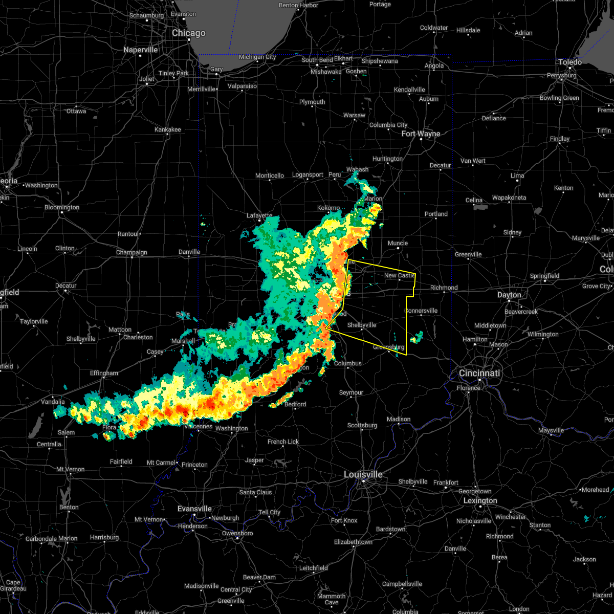 At 914 am edt, severe thunderstorms were located along a line extending from 7 miles southwest of anderson to 8 miles northwest of shelbyville, moving east at 55 mph (radar indicated). Hazards include 70 mph wind gusts. Expect considerable tree damage. damage is likely to mobile homes, roofs, and outbuildings. severe thunderstorms will be near, shelbyville, markleville and wilkinson around 925 am edt. shirley, kennard, cadiz, manilla and waldron around 930 am edt. other locations in the path of these severe thunderstorms include st. paul, spiceland, sulphur springs, mount summit, greensboro, moscow, new castle, lewisville, milroy, dunreith, sandusky, straughn, new salem, clarksburg and lake santee. this includes the following highways, interstate 65 between mile markers 91 and 98. interstate 69 between mile markers 210 and 226. interstate 70 between mile markers 94 and 133. interstate 74 between mile markers 99 and 131, between mile markers 133 and 138, and between mile markers 143 and 144. thunderstorm damage threat, considerable hail threat, radar indicated max hail size, <. 75 in wind threat, radar indicated max wind gust, 70 mph. At 914 am edt, severe thunderstorms were located along a line extending from 7 miles southwest of anderson to 8 miles northwest of shelbyville, moving east at 55 mph (radar indicated). Hazards include 70 mph wind gusts. Expect considerable tree damage. damage is likely to mobile homes, roofs, and outbuildings. severe thunderstorms will be near, shelbyville, markleville and wilkinson around 925 am edt. shirley, kennard, cadiz, manilla and waldron around 930 am edt. other locations in the path of these severe thunderstorms include st. paul, spiceland, sulphur springs, mount summit, greensboro, moscow, new castle, lewisville, milroy, dunreith, sandusky, straughn, new salem, clarksburg and lake santee. this includes the following highways, interstate 65 between mile markers 91 and 98. interstate 69 between mile markers 210 and 226. interstate 70 between mile markers 94 and 133. interstate 74 between mile markers 99 and 131, between mile markers 133 and 138, and between mile markers 143 and 144. thunderstorm damage threat, considerable hail threat, radar indicated max hail size, <. 75 in wind threat, radar indicated max wind gust, 70 mph.
|
| 7/23/2022 10:26 AM EDT |
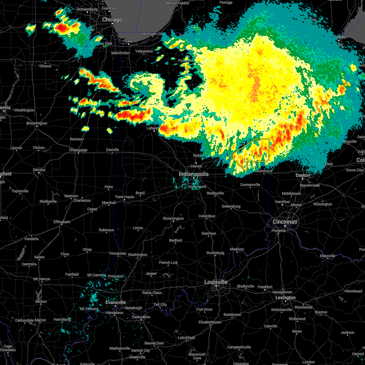 The severe thunderstorm warning for southeastern delaware, randolph and northeastern henry counties will expire at 1030 am edt, the storm which prompted the warning has moved out of the area. therefore, the warning will be allowed to expire. however gusty winds near 45 mph are still possible with this thunderstorm. a severe thunderstorm watch remains in effect until 200 pm edt for east central indiana. The severe thunderstorm warning for southeastern delaware, randolph and northeastern henry counties will expire at 1030 am edt, the storm which prompted the warning has moved out of the area. therefore, the warning will be allowed to expire. however gusty winds near 45 mph are still possible with this thunderstorm. a severe thunderstorm watch remains in effect until 200 pm edt for east central indiana.
|
| 7/23/2022 10:10 AM EDT |
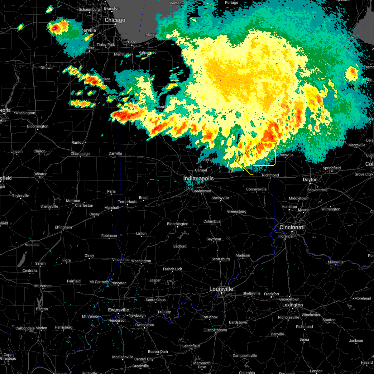 At 1010 am edt, a severe thunderstorm was located near winchester, or 19 miles north of centerville, moving southeast at 50 mph (radar indicated). Hazards include 60 mph wind gusts. Expect damage to roofs, siding, and trees. this severe storm will be near, lynn around 1015 am edt. hail threat, radar indicated max hail size, <. 75 in wind threat, radar indicated max wind gust, 60 mph. At 1010 am edt, a severe thunderstorm was located near winchester, or 19 miles north of centerville, moving southeast at 50 mph (radar indicated). Hazards include 60 mph wind gusts. Expect damage to roofs, siding, and trees. this severe storm will be near, lynn around 1015 am edt. hail threat, radar indicated max hail size, <. 75 in wind threat, radar indicated max wind gust, 60 mph.
|
| 7/23/2022 9:57 AM EDT |
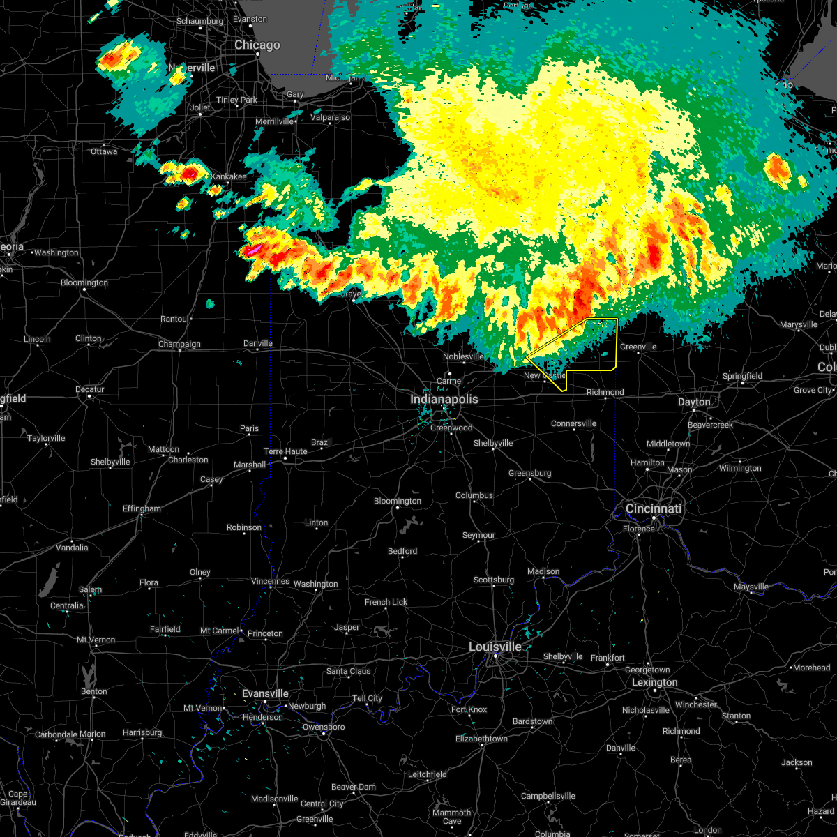 At 957 am edt, a severe thunderstorm was located 9 miles west of winchester, or 12 miles east of muncie, moving southeast at 55 mph (radar indicated). Hazards include 60 mph wind gusts. Expect damage to roofs, siding, and trees. this severe thunderstorm will be near, winchester around 1005 am edt. lynn around 1015 am edt. hail threat, radar indicated max hail size, <. 75 in wind threat, radar indicated max wind gust, 60 mph. At 957 am edt, a severe thunderstorm was located 9 miles west of winchester, or 12 miles east of muncie, moving southeast at 55 mph (radar indicated). Hazards include 60 mph wind gusts. Expect damage to roofs, siding, and trees. this severe thunderstorm will be near, winchester around 1005 am edt. lynn around 1015 am edt. hail threat, radar indicated max hail size, <. 75 in wind threat, radar indicated max wind gust, 60 mph.
|
| 3/6/2022 3:45 AM EST |
 At 344 am est, a severe thunderstorm was located near winchester, or 11 miles southeast of dunkirk, moving east at 70 mph (radar indicated). Hazards include 60 mph wind gusts. Expect damage to roofs, siding, and trees. Locations impacted include, union city and saratoga. At 344 am est, a severe thunderstorm was located near winchester, or 11 miles southeast of dunkirk, moving east at 70 mph (radar indicated). Hazards include 60 mph wind gusts. Expect damage to roofs, siding, and trees. Locations impacted include, union city and saratoga.
|
| 3/6/2022 3:28 AM EST |
 At 327 am est, a severe thunderstorm was located near muncie, moving east at 70 mph (radar indicated). Hazards include 60 mph wind gusts. Expect damage to roofs, siding, and trees. this severe thunderstorm will be near, selma around 335 am est. albany and parker city around 340 am est. farmland around 345 am est. other locations in the path of this severe thunderstorm include winchester, ridgeville, union city and saratoga. This includes interstate 69 between mile markers 222 and 251. At 327 am est, a severe thunderstorm was located near muncie, moving east at 70 mph (radar indicated). Hazards include 60 mph wind gusts. Expect damage to roofs, siding, and trees. this severe thunderstorm will be near, selma around 335 am est. albany and parker city around 340 am est. farmland around 345 am est. other locations in the path of this severe thunderstorm include winchester, ridgeville, union city and saratoga. This includes interstate 69 between mile markers 222 and 251.
|
| 9/14/2021 11:06 PM EDT |
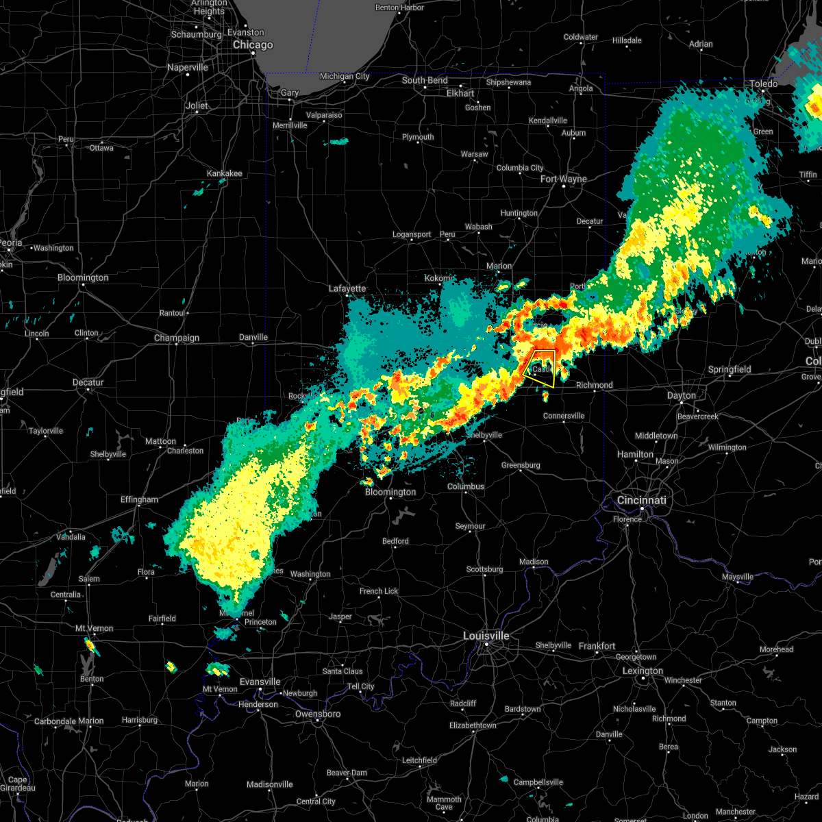 At 1105 pm edt, a severe thunderstorm was located near new castle, or 14 miles south of muncie, moving east at 20 mph (radar indicated). Hazards include 60 mph wind gusts and quarter size hail. Hail damage to vehicles is expected. expect wind damage to roofs, siding, and trees. locations impacted include, new castle, summit lake state park, blountsville and mooreland. this includes interstate 70 near mile marker 133. hail threat, radar indicated max hail size, 1. 00 in wind threat, radar indicated max wind gust, 60 mph. At 1105 pm edt, a severe thunderstorm was located near new castle, or 14 miles south of muncie, moving east at 20 mph (radar indicated). Hazards include 60 mph wind gusts and quarter size hail. Hail damage to vehicles is expected. expect wind damage to roofs, siding, and trees. locations impacted include, new castle, summit lake state park, blountsville and mooreland. this includes interstate 70 near mile marker 133. hail threat, radar indicated max hail size, 1. 00 in wind threat, radar indicated max wind gust, 60 mph.
|
| 9/14/2021 10:47 PM EDT |
 At 1047 pm edt, a severe thunderstorm was located 9 miles northwest of new castle, or 11 miles southeast of anderson, moving east at 20 mph (radar indicated). Hazards include 60 mph wind gusts and quarter size hail. Hail damage to vehicles is expected. expect wind damage to roofs, siding, and trees. this severe thunderstorm will be near, cadiz around 1050 pm edt. sulphur springs around 1055 pm edt. springport around 1100 pm edt. mount summit around 1105 pm edt. other locations in the path of this severe thunderstorm include new castle, mooreland, blountsville and summit lake state park. this includes interstate 70 near mile marker 133. hail threat, radar indicated max hail size, 1. 00 in wind threat, radar indicated max wind gust, 60 mph. At 1047 pm edt, a severe thunderstorm was located 9 miles northwest of new castle, or 11 miles southeast of anderson, moving east at 20 mph (radar indicated). Hazards include 60 mph wind gusts and quarter size hail. Hail damage to vehicles is expected. expect wind damage to roofs, siding, and trees. this severe thunderstorm will be near, cadiz around 1050 pm edt. sulphur springs around 1055 pm edt. springport around 1100 pm edt. mount summit around 1105 pm edt. other locations in the path of this severe thunderstorm include new castle, mooreland, blountsville and summit lake state park. this includes interstate 70 near mile marker 133. hail threat, radar indicated max hail size, 1. 00 in wind threat, radar indicated max wind gust, 60 mph.
|
| 6/18/2021 8:05 PM EDT |
 The severe thunderstorm warning for hancock, northern rush and henry counties will expire at 815 pm edt, the storm which prompted the warning has moved out of the area. therefore, the warning will be allowed to expire. a severe thunderstorm watch remains in effect until 200 am edt for central and east central indiana. The severe thunderstorm warning for hancock, northern rush and henry counties will expire at 815 pm edt, the storm which prompted the warning has moved out of the area. therefore, the warning will be allowed to expire. a severe thunderstorm watch remains in effect until 200 am edt for central and east central indiana.
|
| 6/18/2021 7:39 PM EDT |
 At 739 pm edt, a severe thunderstorm was located over new castle, or 11 miles northwest of cambridge city, moving east at 45 mph (radar indicated). Hazards include two inch hail and 60 mph wind gusts. People and animals outdoors will be injured. expect hail damage to roofs, siding, windows, and vehicles. expect wind damage to roofs, siding, and trees. locations impacted include, straughn. This includes interstate 70 between mile markers 94 and 133. At 739 pm edt, a severe thunderstorm was located over new castle, or 11 miles northwest of cambridge city, moving east at 45 mph (radar indicated). Hazards include two inch hail and 60 mph wind gusts. People and animals outdoors will be injured. expect hail damage to roofs, siding, windows, and vehicles. expect wind damage to roofs, siding, and trees. locations impacted include, straughn. This includes interstate 70 between mile markers 94 and 133.
|
| 6/18/2021 7:15 PM EDT |
 At 714 pm edt, a severe thunderstorm was located near greenfield, or 15 miles south of anderson, moving southeast at 35 mph (radar indicated). Hazards include two inch hail and 60 mph wind gusts. People and animals outdoors will be injured. expect hail damage to roofs, siding, windows, and vehicles. expect wind damage to roofs, siding, and trees. this severe thunderstorm will be near, shirley and wilkinson around 720 pm edt. kennard around 725 pm edt. knightstown, carthage and greensboro around 730 pm edt. other locations in the path of this severe thunderstorm include spiceland, dunreith, mays, lewisville, straughn and glenwood. This includes interstate 70 between mile markers 90 and 133. At 714 pm edt, a severe thunderstorm was located near greenfield, or 15 miles south of anderson, moving southeast at 35 mph (radar indicated). Hazards include two inch hail and 60 mph wind gusts. People and animals outdoors will be injured. expect hail damage to roofs, siding, windows, and vehicles. expect wind damage to roofs, siding, and trees. this severe thunderstorm will be near, shirley and wilkinson around 720 pm edt. kennard around 725 pm edt. knightstown, carthage and greensboro around 730 pm edt. other locations in the path of this severe thunderstorm include spiceland, dunreith, mays, lewisville, straughn and glenwood. This includes interstate 70 between mile markers 90 and 133.
|
| 4/8/2020 9:19 PM EDT |
 At 918 pm edt, a severe thunderstorm was located 9 miles north of rushville, or 15 miles west of cambridge city, moving east at 45 mph (trained weather spotters). Hazards include 70 mph wind gusts and quarter size hail. Hail damage to vehicles is expected. expect considerable tree damage. wind damage is also likely to mobile homes, roofs, and outbuildings. locations impacted include, greenfield, new castle, rushville, knightstown, morristown, carthage, spiceland, shirley, markleville, kennard, wilkinson, sulphur springs, mooreland, lewisville, mount summit, glenwood, straughn, dunreith, cadiz and greensboro. This includes interstate 70 between mile markers 106 and 133. At 918 pm edt, a severe thunderstorm was located 9 miles north of rushville, or 15 miles west of cambridge city, moving east at 45 mph (trained weather spotters). Hazards include 70 mph wind gusts and quarter size hail. Hail damage to vehicles is expected. expect considerable tree damage. wind damage is also likely to mobile homes, roofs, and outbuildings. locations impacted include, greenfield, new castle, rushville, knightstown, morristown, carthage, spiceland, shirley, markleville, kennard, wilkinson, sulphur springs, mooreland, lewisville, mount summit, glenwood, straughn, dunreith, cadiz and greensboro. This includes interstate 70 between mile markers 106 and 133.
|
| 4/8/2020 8:54 PM EDT |
 At 853 pm edt, a severe thunderstorm was located near greenfield, or 15 miles southwest of anderson, moving east at 55 mph. this is a very dangerous storm (trained weather spotters). Hazards include 80 mph wind gusts and quarter size hail. Flying debris will be dangerous to those caught without shelter. mobile homes will be heavily damaged. expect considerable damage to roofs, windows, and vehicles. Extensive tree damage and power outages are likely. At 853 pm edt, a severe thunderstorm was located near greenfield, or 15 miles southwest of anderson, moving east at 55 mph. this is a very dangerous storm (trained weather spotters). Hazards include 80 mph wind gusts and quarter size hail. Flying debris will be dangerous to those caught without shelter. mobile homes will be heavily damaged. expect considerable damage to roofs, windows, and vehicles. Extensive tree damage and power outages are likely.
|
| 3/28/2020 11:19 PM EDT |
 At 1118 pm edt, a severe thunderstorm was located near hagerstown, or 9 miles north of cambridge city, moving northeast at 45 mph (radar indicated). Hazards include 70 mph wind gusts. Expect considerable tree damage. damage is likely to mobile homes, roofs, and outbuildings. locations impacted include, new castle, knightstown, spiceland, shirley, kennard, sulphur springs, mooreland, lewisville, mount summit, straughn, dunreith, cadiz, springport, greensboro, blountsville and summit lake state park. This includes interstate 70 between mile markers 114 and 133. At 1118 pm edt, a severe thunderstorm was located near hagerstown, or 9 miles north of cambridge city, moving northeast at 45 mph (radar indicated). Hazards include 70 mph wind gusts. Expect considerable tree damage. damage is likely to mobile homes, roofs, and outbuildings. locations impacted include, new castle, knightstown, spiceland, shirley, kennard, sulphur springs, mooreland, lewisville, mount summit, straughn, dunreith, cadiz, springport, greensboro, blountsville and summit lake state park. This includes interstate 70 between mile markers 114 and 133.
|
| 3/28/2020 10:55 PM EDT |
 At 1055 pm edt, a severe thunderstorm was located near new castle, or 13 miles south of muncie, moving northeast at 60 mph (radar indicated). Hazards include 70 mph wind gusts. Expect considerable tree damage. Damage is likely to mobile homes, roofs, and outbuildings. At 1055 pm edt, a severe thunderstorm was located near new castle, or 13 miles south of muncie, moving northeast at 60 mph (radar indicated). Hazards include 70 mph wind gusts. Expect considerable tree damage. Damage is likely to mobile homes, roofs, and outbuildings.
|
| 3/28/2020 5:37 PM EDT |
 At 537 pm edt, a severe thunderstorm was located near anderson, moving east at 45 mph (radar indicated). Hazards include quarter size hail. damage to vehicles is expected At 537 pm edt, a severe thunderstorm was located near anderson, moving east at 45 mph (radar indicated). Hazards include quarter size hail. damage to vehicles is expected
|
| 8/18/2019 8:47 PM EDT |
 At 847 pm edt, severe thunderstorms were located along a line extending from 7 miles north of new castle to 7 miles north of rushville to 7 miles southeast of franklin, moving east at 30 mph (radar indicated). Hazards include 60 mph wind gusts and quarter size hail. Hail damage to vehicles is expected. expect wind damage to roofs, siding, and trees. locations impacted include, shelbyville, franklin, new castle, rushville, whiteland, bargersville, knightstown, morristown, carthage, spiceland, shirley, kennard, wilkinson, sulphur springs, mooreland, lewisville, mount summit, fairland, milroy and glenwood. this includes the following highways, interstate 65 between mile markers 90 and 95. interstate 70 between mile markers 110 and 133. Interstate 74 between mile markers 104 and 121. At 847 pm edt, severe thunderstorms were located along a line extending from 7 miles north of new castle to 7 miles north of rushville to 7 miles southeast of franklin, moving east at 30 mph (radar indicated). Hazards include 60 mph wind gusts and quarter size hail. Hail damage to vehicles is expected. expect wind damage to roofs, siding, and trees. locations impacted include, shelbyville, franklin, new castle, rushville, whiteland, bargersville, knightstown, morristown, carthage, spiceland, shirley, kennard, wilkinson, sulphur springs, mooreland, lewisville, mount summit, fairland, milroy and glenwood. this includes the following highways, interstate 65 between mile markers 90 and 95. interstate 70 between mile markers 110 and 133. Interstate 74 between mile markers 104 and 121.
|
| 8/18/2019 8:30 PM EDT |
 At 829 pm edt, severe thunderstorms were located along a line extending from 10 miles northwest of new castle to 10 miles east of greenfield to near franklin, moving east at 30 mph (radar indicated). Hazards include 60 mph wind gusts and quarter size hail. Hail damage to vehicles is expected. expect wind damage to roofs, siding, and trees. locations impacted include, indianapolis, anderson, shelbyville, greenwood, franklin, greenfield, new castle, rushville, southport, new whiteland, whiteland, bargersville, chesterfield, knightstown, new palestine, morristown, carthage, spiceland, shirley and markleville. this includes the following highways, interstate 65 between mile markers 90 and 103. interstate 69 between mile markers 226 and 231. interstate 70 between mile markers 100 and 133. Interstate 74 between mile markers 96 and 121. At 829 pm edt, severe thunderstorms were located along a line extending from 10 miles northwest of new castle to 10 miles east of greenfield to near franklin, moving east at 30 mph (radar indicated). Hazards include 60 mph wind gusts and quarter size hail. Hail damage to vehicles is expected. expect wind damage to roofs, siding, and trees. locations impacted include, indianapolis, anderson, shelbyville, greenwood, franklin, greenfield, new castle, rushville, southport, new whiteland, whiteland, bargersville, chesterfield, knightstown, new palestine, morristown, carthage, spiceland, shirley and markleville. this includes the following highways, interstate 65 between mile markers 90 and 103. interstate 69 between mile markers 226 and 231. interstate 70 between mile markers 100 and 133. Interstate 74 between mile markers 96 and 121.
|
| 8/18/2019 8:00 PM EDT |
 At 759 pm edt, severe thunderstorms were located along a line extending from near anderson to near greenfield to 6 miles northeast of martinsville, moving east at 30 mph (radar indicated). Hazards include 60 mph wind gusts and quarter size hail. Hail damage to vehicles is expected. Expect wind damage to roofs, siding, and trees. At 759 pm edt, severe thunderstorms were located along a line extending from near anderson to near greenfield to 6 miles northeast of martinsville, moving east at 30 mph (radar indicated). Hazards include 60 mph wind gusts and quarter size hail. Hail damage to vehicles is expected. Expect wind damage to roofs, siding, and trees.
|
| 8/18/2019 7:42 PM EDT |
 The national weather service in indianapolis has issued a * severe thunderstorm warning for. western randolph county in east central indiana. southeastern delaware county in east central indiana. northeastern henry county in east central indiana. Until 815 pm edt. The national weather service in indianapolis has issued a * severe thunderstorm warning for. western randolph county in east central indiana. southeastern delaware county in east central indiana. northeastern henry county in east central indiana. Until 815 pm edt.
|
| 6/23/2019 4:41 PM EDT |
 At 421 pm edt, severe thunderstorms were located along a line extending from 7 miles west of anderson to 11 miles east of greenfield, moving northeast at 55 mph (radar indicated). Hazards include 60 mph wind gusts. Expect damage to roofs, siding, and trees. locations impacted include, muncie, anderson, fishers, noblesville, greenfield, new castle, alexandria, yorktown, mccordsville, pendleton, fortville, chesterfield, ingalls, lapel, edgewood, frankton, daleville, shirley, markleville and kennard. this includes the following highways, interstate 69 between mile markers 207 and 245. Interstate 70 between mile markers 101 and 120. At 421 pm edt, severe thunderstorms were located along a line extending from 7 miles west of anderson to 11 miles east of greenfield, moving northeast at 55 mph (radar indicated). Hazards include 60 mph wind gusts. Expect damage to roofs, siding, and trees. locations impacted include, muncie, anderson, fishers, noblesville, greenfield, new castle, alexandria, yorktown, mccordsville, pendleton, fortville, chesterfield, ingalls, lapel, edgewood, frankton, daleville, shirley, markleville and kennard. this includes the following highways, interstate 69 between mile markers 207 and 245. Interstate 70 between mile markers 101 and 120.
|
| 6/23/2019 4:21 PM EDT |
 At 421 pm edt, severe thunderstorms were located along a line extending from 7 miles west of anderson to 11 miles east of greenfield, moving northeast at 55 mph (radar indicated). Hazards include 60 mph wind gusts. Expect damage to roofs, siding, and trees. locations impacted include, muncie, anderson, fishers, noblesville, greenfield, new castle, alexandria, yorktown, mccordsville, pendleton, fortville, chesterfield, ingalls, lapel, edgewood, frankton, daleville, shirley, markleville and kennard. this includes the following highways, interstate 69 between mile markers 207 and 245. Interstate 70 between mile markers 101 and 120. At 421 pm edt, severe thunderstorms were located along a line extending from 7 miles west of anderson to 11 miles east of greenfield, moving northeast at 55 mph (radar indicated). Hazards include 60 mph wind gusts. Expect damage to roofs, siding, and trees. locations impacted include, muncie, anderson, fishers, noblesville, greenfield, new castle, alexandria, yorktown, mccordsville, pendleton, fortville, chesterfield, ingalls, lapel, edgewood, frankton, daleville, shirley, markleville and kennard. this includes the following highways, interstate 69 between mile markers 207 and 245. Interstate 70 between mile markers 101 and 120.
|
| 6/23/2019 4:04 PM EDT |
 At 404 pm edt, severe thunderstorms were located along a line extending from fishers to 7 miles north of shelbyville, moving northeast at 55 mph (radar indicated). Hazards include 60 mph wind gusts. expect damage to roofs, siding, and trees At 404 pm edt, severe thunderstorms were located along a line extending from fishers to 7 miles north of shelbyville, moving northeast at 55 mph (radar indicated). Hazards include 60 mph wind gusts. expect damage to roofs, siding, and trees
|
| 6/15/2019 8:42 PM EDT |
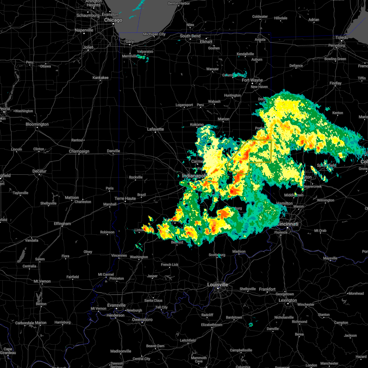 The severe thunderstorm warning for randolph, southeastern delaware and henry counties will expire at 845 pm edt, the storms which prompted the warning have weakened below severe limits, and no longer pose an immediate threat to life or property. therefore, the warning will be allowed to expire. however gusty winds are still possible with these thunderstorms. a tornado watch remains in effect until 1000 pm edt for central and east central indiana. The severe thunderstorm warning for randolph, southeastern delaware and henry counties will expire at 845 pm edt, the storms which prompted the warning have weakened below severe limits, and no longer pose an immediate threat to life or property. therefore, the warning will be allowed to expire. however gusty winds are still possible with these thunderstorms. a tornado watch remains in effect until 1000 pm edt for central and east central indiana.
|
| 6/15/2019 8:22 PM EDT |
 At 822 pm edt, severe thunderstorms were located along a line extending from near redkey to 8 miles west of new castle, moving east at 25 mph (radar indicated). Hazards include 70 mph wind gusts and quarter size hail. Hail damage to vehicles is expected. expect considerable tree damage. wind damage is also likely to mobile homes, roofs, and outbuildings. locations impacted include, muncie, new castle, winchester, union city, parker city, farmland, lynn, selma, ridgeville, kennard, sulphur springs, mooreland, mount summit, saratoga, losantville, modoc, cadiz, springport, greensboro and blountsville. This includes interstate 70 between mile markers 128 and 133. At 822 pm edt, severe thunderstorms were located along a line extending from near redkey to 8 miles west of new castle, moving east at 25 mph (radar indicated). Hazards include 70 mph wind gusts and quarter size hail. Hail damage to vehicles is expected. expect considerable tree damage. wind damage is also likely to mobile homes, roofs, and outbuildings. locations impacted include, muncie, new castle, winchester, union city, parker city, farmland, lynn, selma, ridgeville, kennard, sulphur springs, mooreland, mount summit, saratoga, losantville, modoc, cadiz, springport, greensboro and blountsville. This includes interstate 70 between mile markers 128 and 133.
|
| 6/15/2019 7:47 PM EDT |
 At 746 pm edt, severe thunderstorms were located along a line extending from near albany to 9 miles north of greenfield, moving east at 40 mph. there are several areas of weak rotation within the line (radar indicated). Hazards include 70 mph wind gusts and quarter size hail. Hail damage to vehicles is expected. expect considerable tree damage. Wind damage is also likely to mobile homes, roofs, and outbuildings. At 746 pm edt, severe thunderstorms were located along a line extending from near albany to 9 miles north of greenfield, moving east at 40 mph. there are several areas of weak rotation within the line (radar indicated). Hazards include 70 mph wind gusts and quarter size hail. Hail damage to vehicles is expected. expect considerable tree damage. Wind damage is also likely to mobile homes, roofs, and outbuildings.
|
| 5/27/2019 8:56 PM EDT |
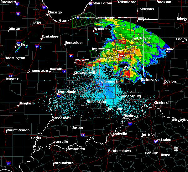 At 856 pm edt, a severe thunderstorm capable of producing a tornado was located 10 miles southeast of muncie, moving east at 55 mph (radar indicated rotation). Hazards include tornado. Flying debris will be dangerous to those caught without shelter. mobile homes will be damaged or destroyed. damage to roofs, windows, and vehicles will occur. tree damage is likely. This tornadic thunderstorm will remain over mainly rural areas of southeastern delaware and northeastern henry counties. At 856 pm edt, a severe thunderstorm capable of producing a tornado was located 10 miles southeast of muncie, moving east at 55 mph (radar indicated rotation). Hazards include tornado. Flying debris will be dangerous to those caught without shelter. mobile homes will be damaged or destroyed. damage to roofs, windows, and vehicles will occur. tree damage is likely. This tornadic thunderstorm will remain over mainly rural areas of southeastern delaware and northeastern henry counties.
|
| 5/27/2019 8:44 PM EDT |
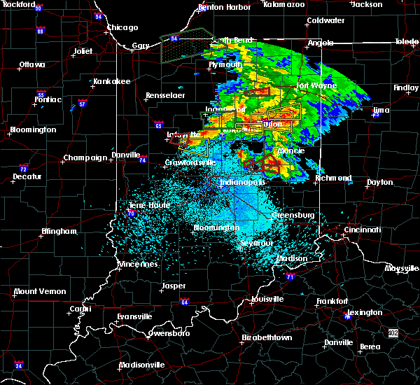 At 844 pm edt, a severe thunderstorm capable of producing a tornado was located 9 miles south of muncie, moving east at 35 mph (radar indicated rotation). Hazards include tornado. Flying debris will be dangerous to those caught without shelter. mobile homes will be damaged or destroyed. damage to roofs, windows, and vehicles will occur. tree damage is likely. this dangerous storm will be near, summit lake state park and prairie creek reservoir around 855 pm edt. Mooreland and blountsville around 900 pm edt. At 844 pm edt, a severe thunderstorm capable of producing a tornado was located 9 miles south of muncie, moving east at 35 mph (radar indicated rotation). Hazards include tornado. Flying debris will be dangerous to those caught without shelter. mobile homes will be damaged or destroyed. damage to roofs, windows, and vehicles will occur. tree damage is likely. this dangerous storm will be near, summit lake state park and prairie creek reservoir around 855 pm edt. Mooreland and blountsville around 900 pm edt.
|
| 5/27/2019 8:33 PM EDT |
 At 833 pm edt, a severe thunderstorm capable of producing a tornado was located 10 miles east of anderson, moving east at 35 mph (radar indicated rotation). Hazards include tornado. Flying debris will be dangerous to those caught without shelter. mobile homes will be damaged or destroyed. damage to roofs, windows, and vehicles will occur. tree damage is likely. this dangerous storm will be near, mount summit around 840 pm edt. Springport around 845 pm edt. At 833 pm edt, a severe thunderstorm capable of producing a tornado was located 10 miles east of anderson, moving east at 35 mph (radar indicated rotation). Hazards include tornado. Flying debris will be dangerous to those caught without shelter. mobile homes will be damaged or destroyed. damage to roofs, windows, and vehicles will occur. tree damage is likely. this dangerous storm will be near, mount summit around 840 pm edt. Springport around 845 pm edt.
|
| 5/19/2019 7:52 PM EDT |
 At 751 pm edt, severe thunderstorms were located along a line extending from 7 miles south of matthews to 10 miles northwest of new castle, moving northeast at 55 mph (radar indicated). Hazards include 60 mph wind gusts. Expect damage to roofs, siding, and trees. locations impacted include, muncie, yorktown, albany, eaton, daleville, parker city, selma, sulphur springs, mooreland, mount summit, losantville, modoc, springport, blountsville, summit lake state park, ball state university and prairie creek reservoir. This includes interstate 69 between mile markers 238 and 244. At 751 pm edt, severe thunderstorms were located along a line extending from 7 miles south of matthews to 10 miles northwest of new castle, moving northeast at 55 mph (radar indicated). Hazards include 60 mph wind gusts. Expect damage to roofs, siding, and trees. locations impacted include, muncie, yorktown, albany, eaton, daleville, parker city, selma, sulphur springs, mooreland, mount summit, losantville, modoc, springport, blountsville, summit lake state park, ball state university and prairie creek reservoir. This includes interstate 69 between mile markers 238 and 244.
|
| 5/19/2019 7:43 PM EDT |
 At 743 pm edt, severe thunderstorms were located along a line extending from near alexandria to 9 miles southeast of anderson, moving northeast at 55 mph (radar indicated). Hazards include 60 mph wind gusts. expect damage to roofs, siding, and trees At 743 pm edt, severe thunderstorms were located along a line extending from near alexandria to 9 miles southeast of anderson, moving northeast at 55 mph (radar indicated). Hazards include 60 mph wind gusts. expect damage to roofs, siding, and trees
|
| 5/19/2019 7:11 PM EDT |
 At 711 pm edt, severe thunderstorms were located along a line extending from 7 miles northwest of anderson to near lawrence, moving east at 50 mph (radar indicated). Hazards include 60 mph wind gusts. Expect damage to roofs, siding, and trees. locations impacted include, indianapolis, muncie, anderson, fishers, noblesville, lawrence, greenfield, new castle, yorktown, cumberland, mccordsville, pendleton, fortville, chesterfield, ingalls, knightstown, lapel, edgewood, daleville and warren park. this includes the following highways, interstate 69 between mile markers 204 and 241. Interstate 70 between mile markers 88 and 126. At 711 pm edt, severe thunderstorms were located along a line extending from 7 miles northwest of anderson to near lawrence, moving east at 50 mph (radar indicated). Hazards include 60 mph wind gusts. Expect damage to roofs, siding, and trees. locations impacted include, indianapolis, muncie, anderson, fishers, noblesville, lawrence, greenfield, new castle, yorktown, cumberland, mccordsville, pendleton, fortville, chesterfield, ingalls, knightstown, lapel, edgewood, daleville and warren park. this includes the following highways, interstate 69 between mile markers 204 and 241. Interstate 70 between mile markers 88 and 126.
|
| 5/19/2019 6:54 PM EDT |
 At 654 pm edt, severe thunderstorms were located along a line extending from near noblesville to near speedway, moving east at 55 mph (radar indicated). Hazards include 60 mph wind gusts. expect damage to roofs, siding, and trees At 654 pm edt, severe thunderstorms were located along a line extending from near noblesville to near speedway, moving east at 55 mph (radar indicated). Hazards include 60 mph wind gusts. expect damage to roofs, siding, and trees
|
| 6/1/2018 6:29 PM EDT |
 At 629 pm edt, a severe thunderstorm was located over new castle, or 13 miles northwest of cambridge city, moving south at 15 mph (radar indicated). Hazards include 60 mph wind gusts and quarter size hail. Hail damage to vehicles is expected. expect wind damage to roofs, siding, and trees. locations impacted include, new castle, spiceland, kennard, mooreland, lewisville, mount summit, straughn, dunreith, cadiz and greensboro. This includes interstate 70 between mile markers 118 and 133. At 629 pm edt, a severe thunderstorm was located over new castle, or 13 miles northwest of cambridge city, moving south at 15 mph (radar indicated). Hazards include 60 mph wind gusts and quarter size hail. Hail damage to vehicles is expected. expect wind damage to roofs, siding, and trees. locations impacted include, new castle, spiceland, kennard, mooreland, lewisville, mount summit, straughn, dunreith, cadiz and greensboro. This includes interstate 70 between mile markers 118 and 133.
|
| 6/1/2018 6:13 PM EDT |
 At 613 pm edt, a severe thunderstorm was located near new castle, or 15 miles south of muncie, moving south at 15 mph (radar indicated). Hazards include 60 mph wind gusts and quarter size hail. Hail damage to vehicles is expected. Expect wind damage to roofs, siding, and trees. At 613 pm edt, a severe thunderstorm was located near new castle, or 15 miles south of muncie, moving south at 15 mph (radar indicated). Hazards include 60 mph wind gusts and quarter size hail. Hail damage to vehicles is expected. Expect wind damage to roofs, siding, and trees.
|
| 5/31/2018 4:22 PM EDT |
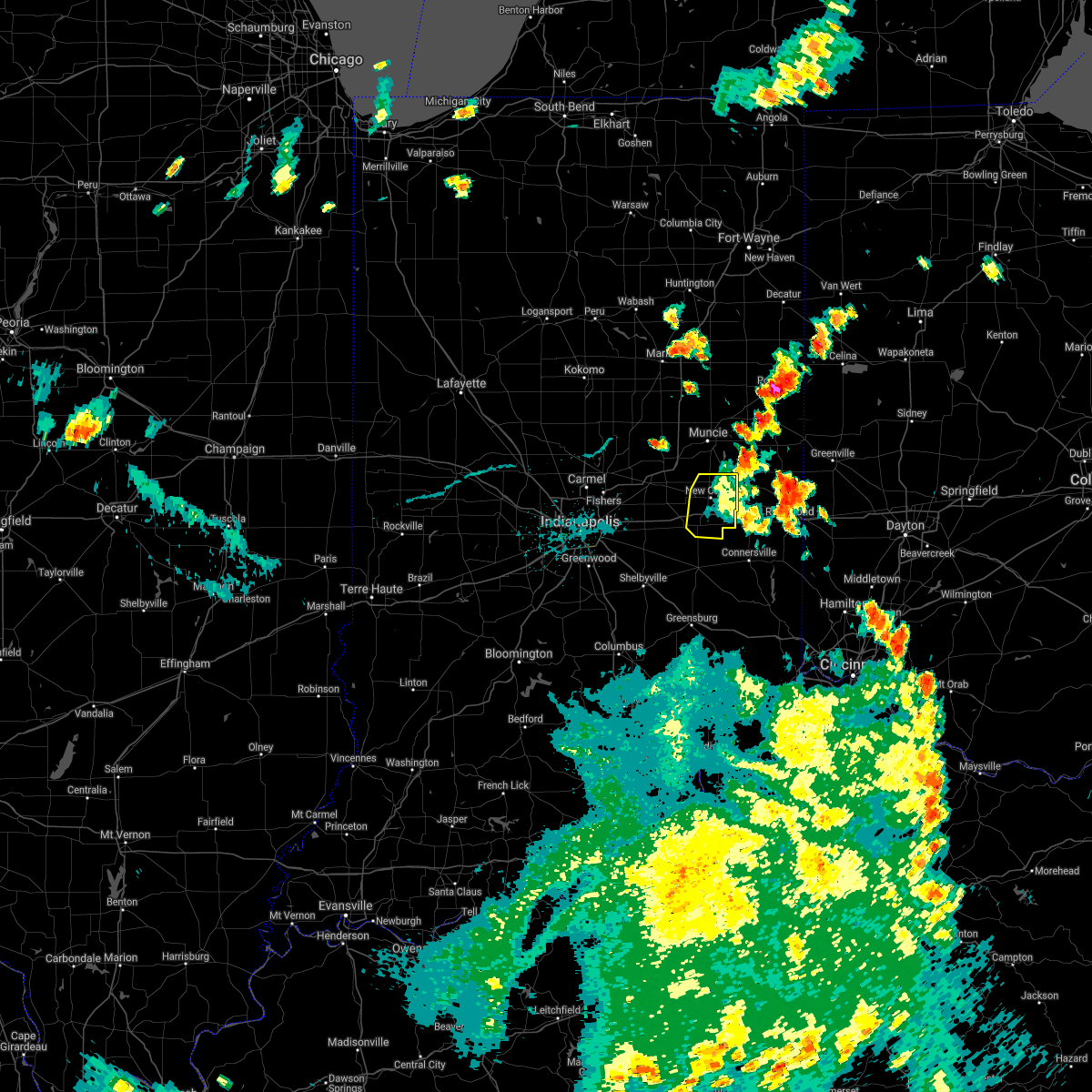 The severe thunderstorm warning for northeastern rush and henry counties will expire at 430 pm edt, the storm which prompted the warning has moved out of the area. therefore the warning will be allowed to expire. a severe thunderstorm watch remains in effect until 600 pm edt for central indiana. The severe thunderstorm warning for northeastern rush and henry counties will expire at 430 pm edt, the storm which prompted the warning has moved out of the area. therefore the warning will be allowed to expire. a severe thunderstorm watch remains in effect until 600 pm edt for central indiana.
|
| 5/31/2018 4:01 PM EDT |
 At 401 pm edt, a severe thunderstorm was located over new castle, or 11 miles northwest of cambridge city, moving east at 30 mph (radar indicated). Hazards include 60 mph wind gusts and quarter size hail. Hail damage to vehicles is expected. expect wind damage to roofs, siding, and trees. locations impacted include, new castle, spiceland, sulphur springs, mooreland, lewisville, mount summit, straughn, dunreith, cadiz, greensboro and summit lake state park. This includes interstate 70 between mile markers 118 and 133. At 401 pm edt, a severe thunderstorm was located over new castle, or 11 miles northwest of cambridge city, moving east at 30 mph (radar indicated). Hazards include 60 mph wind gusts and quarter size hail. Hail damage to vehicles is expected. expect wind damage to roofs, siding, and trees. locations impacted include, new castle, spiceland, sulphur springs, mooreland, lewisville, mount summit, straughn, dunreith, cadiz, greensboro and summit lake state park. This includes interstate 70 between mile markers 118 and 133.
|
| 5/31/2018 3:46 PM EDT |
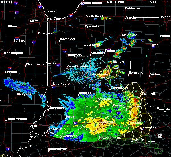 At 346 pm edt, a severe thunderstorm was located 7 miles west of new castle, or 17 miles west of cambridge city, moving east at 35 mph (radar indicated). Hazards include 60 mph wind gusts and quarter size hail. Hail damage to vehicles is expected. Expect wind damage to roofs, siding, and trees. At 346 pm edt, a severe thunderstorm was located 7 miles west of new castle, or 17 miles west of cambridge city, moving east at 35 mph (radar indicated). Hazards include 60 mph wind gusts and quarter size hail. Hail damage to vehicles is expected. Expect wind damage to roofs, siding, and trees.
|
| 5/10/2018 12:29 AM EDT |
 At 1229 am edt, a severe thunderstorm was located 9 miles northwest of new castle, or 11 miles southeast of anderson, moving east at 60 mph (radar indicated). Hazards include 60 mph wind gusts and quarter size hail. Hail damage to vehicles is expected. Expect wind damage to roofs, siding, and trees. At 1229 am edt, a severe thunderstorm was located 9 miles northwest of new castle, or 11 miles southeast of anderson, moving east at 60 mph (radar indicated). Hazards include 60 mph wind gusts and quarter size hail. Hail damage to vehicles is expected. Expect wind damage to roofs, siding, and trees.
|
| 4/3/2018 2:41 PM EDT |
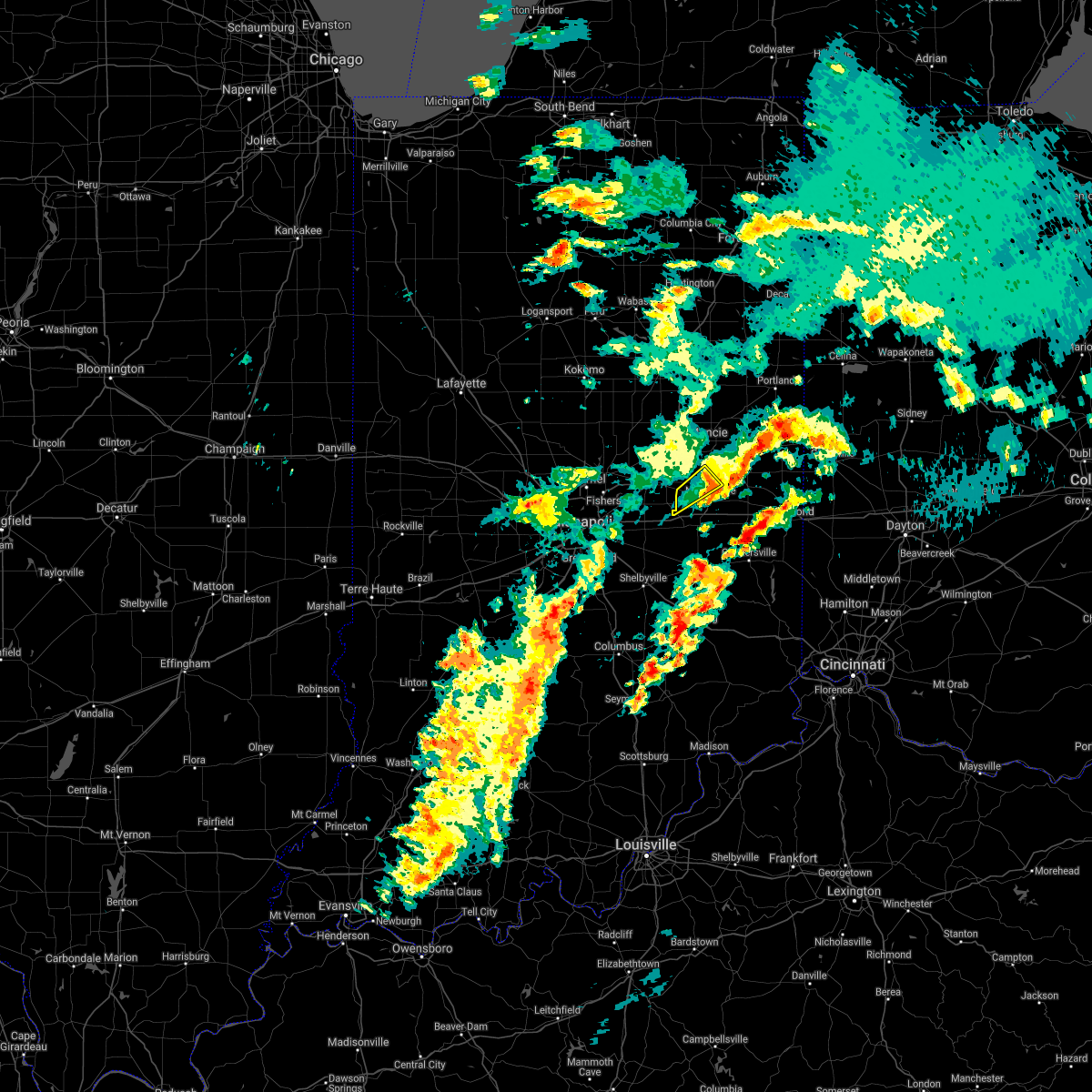 The severe thunderstorm warning for northwestern henry county will expire at 245 pm edt, the storm which prompted the warning has weakened below severe limits, and has exited the warned area. therefore, the warning will be allowed to expire. a tornado watch remains in effect until 800 pm edt for central and east central indiana. The severe thunderstorm warning for northwestern henry county will expire at 245 pm edt, the storm which prompted the warning has weakened below severe limits, and has exited the warned area. therefore, the warning will be allowed to expire. a tornado watch remains in effect until 800 pm edt for central and east central indiana.
|
| 4/3/2018 2:32 PM EDT |
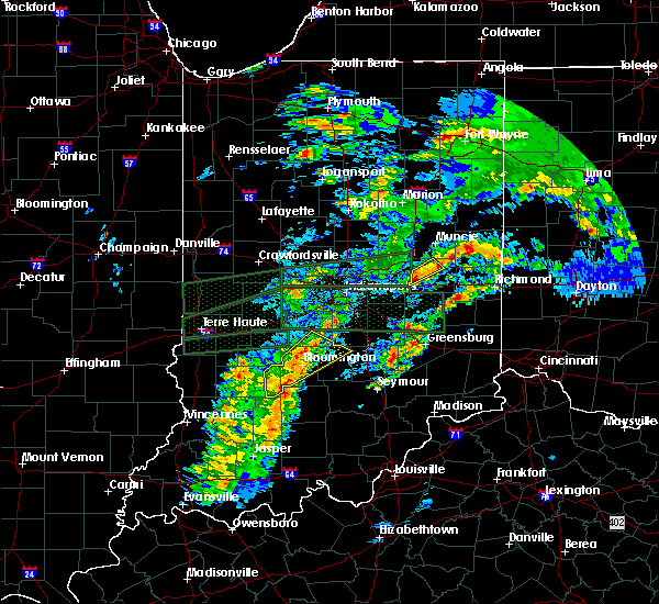 At 231 pm edt, a severe thunderstorm was located 7 miles west of new castle, or 15 miles southeast of anderson, moving northeast at 65 mph (radar indicated). Hazards include 60 mph wind gusts and quarter size hail. Hail damage to vehicles is expected. expect wind damage to roofs, siding, and trees. locations impacted include, shirley, kennard, sulphur springs, mount summit, cadiz and springport. A tornado watch remains in effect until 800 pm edt for central and east central indiana. At 231 pm edt, a severe thunderstorm was located 7 miles west of new castle, or 15 miles southeast of anderson, moving northeast at 65 mph (radar indicated). Hazards include 60 mph wind gusts and quarter size hail. Hail damage to vehicles is expected. expect wind damage to roofs, siding, and trees. locations impacted include, shirley, kennard, sulphur springs, mount summit, cadiz and springport. A tornado watch remains in effect until 800 pm edt for central and east central indiana.
|
| 4/3/2018 2:25 PM EDT |
 At 225 pm edt, a severe thunderstorm was located 11 miles southeast of anderson, moving northeast at 50 mph (radar indicated). Hazards include 60 mph wind gusts and quarter size hail. Hail damage to vehicles is expected. expect wind damage to roofs, siding, and trees. locations impacted include, shirley, markleville, kennard, wilkinson, sulphur springs, mount summit, cadiz and springport. this includes interstate 70 between mile markers 108 and 110. A tornado watch remains in effect until 800 pm edt for central and east central indiana. At 225 pm edt, a severe thunderstorm was located 11 miles southeast of anderson, moving northeast at 50 mph (radar indicated). Hazards include 60 mph wind gusts and quarter size hail. Hail damage to vehicles is expected. expect wind damage to roofs, siding, and trees. locations impacted include, shirley, markleville, kennard, wilkinson, sulphur springs, mount summit, cadiz and springport. this includes interstate 70 between mile markers 108 and 110. A tornado watch remains in effect until 800 pm edt for central and east central indiana.
|
| 4/3/2018 2:11 PM EDT |
 At 211 pm edt, a severe thunderstorm was located near greenfield, or 17 miles south of anderson, moving northeast at 50 mph (radar indicated). Hazards include 60 mph wind gusts. expect damage to roofs, siding, and trees At 211 pm edt, a severe thunderstorm was located near greenfield, or 17 miles south of anderson, moving northeast at 50 mph (radar indicated). Hazards include 60 mph wind gusts. expect damage to roofs, siding, and trees
|
| 7/22/2017 4:39 AM EDT |
 At 439 am edt, severe thunderstorms were located along a line extending from 7 miles northwest of winchester to near new castle, moving east at 45 mph (radar indicated). Hazards include 60 mph wind gusts. Expect damage to roofs, siding, and trees. locations impacted include, new castle, winchester, union city, parker city, farmland, lynn, spiceland, selma, ridgeville, mooreland, lewisville, mount summit, saratoga, losantville, straughn, modoc, springport, greensboro, blountsville and summit lake state park. This includes interstate 70 between mile markers 117 and 133. At 439 am edt, severe thunderstorms were located along a line extending from 7 miles northwest of winchester to near new castle, moving east at 45 mph (radar indicated). Hazards include 60 mph wind gusts. Expect damage to roofs, siding, and trees. locations impacted include, new castle, winchester, union city, parker city, farmland, lynn, spiceland, selma, ridgeville, mooreland, lewisville, mount summit, saratoga, losantville, straughn, modoc, springport, greensboro, blountsville and summit lake state park. This includes interstate 70 between mile markers 117 and 133.
|
| 7/22/2017 4:29 AM EDT |
 At 428 am edt, severe thunderstorms were located along a line extending from near albany to 6 miles west of new castle, moving east at 40 mph (radar indicated). Hazards include 60 mph wind gusts. expect damage to roofs, siding, and trees At 428 am edt, severe thunderstorms were located along a line extending from near albany to 6 miles west of new castle, moving east at 40 mph (radar indicated). Hazards include 60 mph wind gusts. expect damage to roofs, siding, and trees
|
| 7/11/2017 1:39 AM EDT |
 At 139 am edt, a severe thunderstorm was located over new castle, or 13 miles northwest of cambridge city, moving east at 40 mph (radar indicated). Hazards include 60 mph wind gusts and half dollar size hail. Hail damage to vehicles is expected. Expect wind damage to roofs, siding, and trees. At 139 am edt, a severe thunderstorm was located over new castle, or 13 miles northwest of cambridge city, moving east at 40 mph (radar indicated). Hazards include 60 mph wind gusts and half dollar size hail. Hail damage to vehicles is expected. Expect wind damage to roofs, siding, and trees.
|
| 7/7/2017 4:56 PM EDT |
 The severe thunderstorm warning for southern madison, hancock, northeastern marion, henry and southern hamilton counties will expire at 500 pm edt, the storms which prompted the warning have weakened below severe limits, and no longer pose an immediate threat to life or property. therefore the warning will be allowed to expire. however gusty winds are still possible with these thunderstorms. a severe thunderstorm watch remains in effect until 900 pm edt for central and east central indiana. The severe thunderstorm warning for southern madison, hancock, northeastern marion, henry and southern hamilton counties will expire at 500 pm edt, the storms which prompted the warning have weakened below severe limits, and no longer pose an immediate threat to life or property. therefore the warning will be allowed to expire. however gusty winds are still possible with these thunderstorms. a severe thunderstorm watch remains in effect until 900 pm edt for central and east central indiana.
|
| 7/7/2017 4:39 PM EDT |
 At 439 pm edt, severe thunderstorms were located along a line extending from near muncie to 6 miles south of anderson to near carmel, moving southeast at 55 mph (radar indicated). Hazards include 60 mph wind gusts and quarter size hail. Hail damage to vehicles is expected. expect wind damage to roofs, siding, and trees. locations impacted include, indianapolis, anderson, carmel, fishers, noblesville, lawrence, greenfield, new castle, westfield, cumberland, mccordsville, pendleton, fortville, chesterfield, ingalls, knightstown, lapel, edgewood, daleville and spiceland. this includes the following highways, interstate 69 between mile markers 200 and 237. Interstate 70 between mile markers 94 and 133. At 439 pm edt, severe thunderstorms were located along a line extending from near muncie to 6 miles south of anderson to near carmel, moving southeast at 55 mph (radar indicated). Hazards include 60 mph wind gusts and quarter size hail. Hail damage to vehicles is expected. expect wind damage to roofs, siding, and trees. locations impacted include, indianapolis, anderson, carmel, fishers, noblesville, lawrence, greenfield, new castle, westfield, cumberland, mccordsville, pendleton, fortville, chesterfield, ingalls, knightstown, lapel, edgewood, daleville and spiceland. this includes the following highways, interstate 69 between mile markers 200 and 237. Interstate 70 between mile markers 94 and 133.
|
| 7/7/2017 4:28 PM EDT |
 At 427 pm edt, severe thunderstorms were located along a line extending from near alexandria to 7 miles east of noblesville to near zionsville, moving southeast at 55 mph (radar indicated). Hazards include 60 mph wind gusts and quarter size hail. Hail damage to vehicles is expected. Expect wind damage to roofs, siding, and trees. At 427 pm edt, severe thunderstorms were located along a line extending from near alexandria to 7 miles east of noblesville to near zionsville, moving southeast at 55 mph (radar indicated). Hazards include 60 mph wind gusts and quarter size hail. Hail damage to vehicles is expected. Expect wind damage to roofs, siding, and trees.
|
| 7/7/2017 3:38 PM EDT |
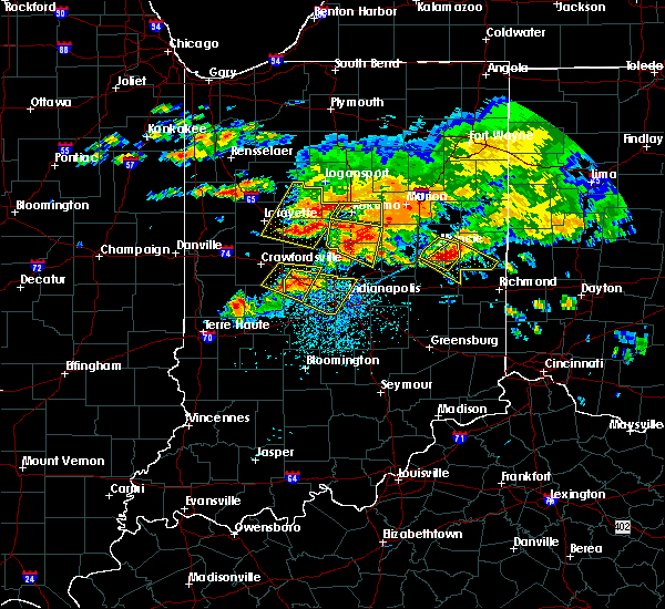 At 338 pm edt, a severe thunderstorm was located near muncie, moving southeast at 30 mph (radar indicated). Hazards include ping pong ball size hail and 60 mph wind gusts. People and animals outdoors will be injured. expect hail damage to roofs, siding, windows, and vehicles. Expect wind damage to roofs, siding, and trees. At 338 pm edt, a severe thunderstorm was located near muncie, moving southeast at 30 mph (radar indicated). Hazards include ping pong ball size hail and 60 mph wind gusts. People and animals outdoors will be injured. expect hail damage to roofs, siding, windows, and vehicles. Expect wind damage to roofs, siding, and trees.
|
| 1/10/2017 8:09 PM EST |
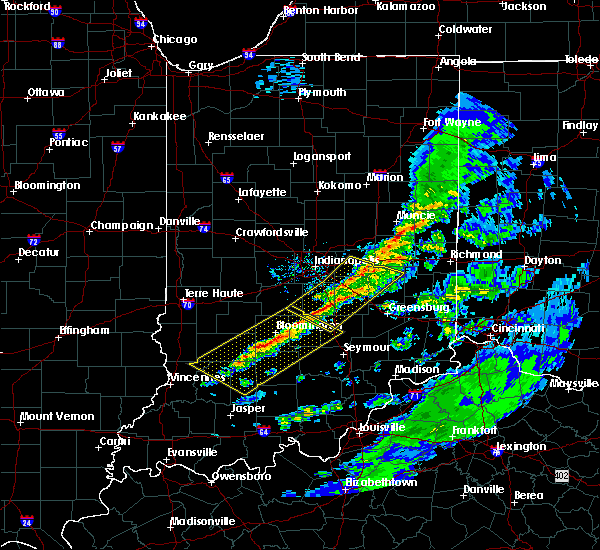 At 809 pm est, severe thunderstorms were located along a line extending from near redkey to 10 miles east of greenfield, moving east at 50 mph (radar indicated). Hazards include 60 mph wind gusts and penny size hail. expect damage to roofs, siding, and trees At 809 pm est, severe thunderstorms were located along a line extending from near redkey to 10 miles east of greenfield, moving east at 50 mph (radar indicated). Hazards include 60 mph wind gusts and penny size hail. expect damage to roofs, siding, and trees
|
| 11/18/2016 7:09 PM EST |
 The severe thunderstorm warning for eastern hancock, northern rush, randolph, madison, henry, delaware and northeastern shelby counties will expire at 715 pm est, the storms which prompted the warning have weakened below severe limits, and no longer pose an immediate threat to life or property. therefore, the warning will be allowed to expire. however gusty winds are still possible with these thunderstorms. The severe thunderstorm warning for eastern hancock, northern rush, randolph, madison, henry, delaware and northeastern shelby counties will expire at 715 pm est, the storms which prompted the warning have weakened below severe limits, and no longer pose an immediate threat to life or property. therefore, the warning will be allowed to expire. however gusty winds are still possible with these thunderstorms.
|
| 11/18/2016 6:52 PM EST |
 At 651 pm est, severe thunderstorms were located along a line extending from near matthews to 8 miles northwest of rushville, moving east at 60 mph (radar indicated). Hazards include 60 mph wind gusts. Expect damage to roofs. siding. and trees. locations impacted include, muncie, anderson, greenfield, new castle, elwood, alexandria, winchester, albany, yorktown, pendleton, union city, chesterfield, ingalls, knightstown, edgewood, frankton, eaton, daleville, parker city and farmland. this includes the following highways, interstate 69 between mile markers 217 and 252. Interstate 70 between mile markers 103 and 133. At 651 pm est, severe thunderstorms were located along a line extending from near matthews to 8 miles northwest of rushville, moving east at 60 mph (radar indicated). Hazards include 60 mph wind gusts. Expect damage to roofs. siding. and trees. locations impacted include, muncie, anderson, greenfield, new castle, elwood, alexandria, winchester, albany, yorktown, pendleton, union city, chesterfield, ingalls, knightstown, edgewood, frankton, eaton, daleville, parker city and farmland. this includes the following highways, interstate 69 between mile markers 217 and 252. Interstate 70 between mile markers 103 and 133.
|
| 11/18/2016 6:30 PM EST |
 At 630 pm est, severe thunderstorms were located along a line extending from near elwood to 9 miles east of greenwood, moving east at 60 mph (radar indicated). Hazards include 60 mph wind gusts. Expect damage to roofs. siding. And trees. At 630 pm est, severe thunderstorms were located along a line extending from near elwood to 9 miles east of greenwood, moving east at 60 mph (radar indicated). Hazards include 60 mph wind gusts. Expect damage to roofs. siding. And trees.
|
| 7/13/2016 5:45 PM EDT |
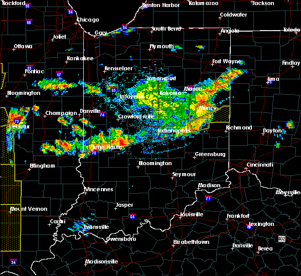 At 545 pm edt, a severe thunderstorm was located 10 miles east of muncie, moving northeast at 55 mph (radar indicated). Hazards include 60 mph wind gusts. Expect damage to roofs. siding. and trees. locations impacted include, new castle, winchester, union city, farmland, lynn, spiceland, kennard, sulphur springs, mooreland, mount summit, saratoga, losantville, modoc, cadiz, springport, greensboro, blountsville, summit lake state park and prairie creek reservoir. This includes interstate 70 between mile markers 118 and 124. At 545 pm edt, a severe thunderstorm was located 10 miles east of muncie, moving northeast at 55 mph (radar indicated). Hazards include 60 mph wind gusts. Expect damage to roofs. siding. and trees. locations impacted include, new castle, winchester, union city, farmland, lynn, spiceland, kennard, sulphur springs, mooreland, mount summit, saratoga, losantville, modoc, cadiz, springport, greensboro, blountsville, summit lake state park and prairie creek reservoir. This includes interstate 70 between mile markers 118 and 124.
|
| 7/13/2016 5:34 PM EDT |
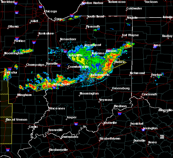 At 534 pm edt, a severe thunderstorm was located 9 miles south of muncie, moving northeast at 55 mph (radar indicated). Hazards include 60 mph wind gusts. Expect damage to roofs. siding. And trees. At 534 pm edt, a severe thunderstorm was located 9 miles south of muncie, moving northeast at 55 mph (radar indicated). Hazards include 60 mph wind gusts. Expect damage to roofs. siding. And trees.
|
| 6/23/2016 2:03 AM EDT |
 At 202 am edt, severe thunderstorms were located along a line extending from near union city to 7 miles northwest of new madison to near centerville, moving southeast at 50 mph (radar indicated). Hazards include 70 mph wind gusts and quarter size hail. Hail damage to vehicles is expected. expect considerable tree damage. wind damage is also likely to mobile homes, roofs, and outbuildings. locations impacted include, muncie, anderson, new castle, winchester, union city, pendleton, parker city, farmland, lynn, selma, markleville, kennard, sulphur springs, mooreland, mount summit, losantville, straughn, modoc, cadiz and springport. this includes the following highways, interstate 69 between mile markers 226 and 232. interstate 70 between mile markers 123 and 133. A tornado watch remains in effect until 500 am edt for central and east central indiana. At 202 am edt, severe thunderstorms were located along a line extending from near union city to 7 miles northwest of new madison to near centerville, moving southeast at 50 mph (radar indicated). Hazards include 70 mph wind gusts and quarter size hail. Hail damage to vehicles is expected. expect considerable tree damage. wind damage is also likely to mobile homes, roofs, and outbuildings. locations impacted include, muncie, anderson, new castle, winchester, union city, pendleton, parker city, farmland, lynn, selma, markleville, kennard, sulphur springs, mooreland, mount summit, losantville, straughn, modoc, cadiz and springport. this includes the following highways, interstate 69 between mile markers 226 and 232. interstate 70 between mile markers 123 and 133. A tornado watch remains in effect until 500 am edt for central and east central indiana.
|
| 6/23/2016 1:51 AM EDT |
 At 151 am edt, severe thunderstorms were located along a line extending from 6 miles northwest of union city to near winchester to near hagerstown, moving east at 70 mph (radar indicated). Hazards include 70 mph wind gusts and quarter size hail. Hail damage to vehicles is expected. expect considerable tree damage. wind damage is also likely to mobile homes, roofs, and outbuildings. locations impacted include, muncie, anderson, new castle, winchester, union city, albany, yorktown, pendleton, chesterfield, eaton, daleville, parker city, farmland, lynn, gaston, selma, ridgeville, markleville, kennard and sulphur springs. this includes the following highways, interstate 69 between mile markers 222 and 251. interstate 70 between mile markers 123 and 133. A tornado watch remains in effect until 500 am edt for central and east central indiana. At 151 am edt, severe thunderstorms were located along a line extending from 6 miles northwest of union city to near winchester to near hagerstown, moving east at 70 mph (radar indicated). Hazards include 70 mph wind gusts and quarter size hail. Hail damage to vehicles is expected. expect considerable tree damage. wind damage is also likely to mobile homes, roofs, and outbuildings. locations impacted include, muncie, anderson, new castle, winchester, union city, albany, yorktown, pendleton, chesterfield, eaton, daleville, parker city, farmland, lynn, gaston, selma, ridgeville, markleville, kennard and sulphur springs. this includes the following highways, interstate 69 between mile markers 222 and 251. interstate 70 between mile markers 123 and 133. A tornado watch remains in effect until 500 am edt for central and east central indiana.
|
| 6/23/2016 1:30 AM EDT |
 At 130 am edt, a severe thunderstorm was located 8 miles southwest of muncie, moving southeast at 55 mph (radar indicated). Hazards include 70 mph wind gusts and quarter size hail. Hail damage to vehicles is expected. expect considerable tree damage. Wind damage is also likely to mobile homes, roofs, and outbuildings. At 130 am edt, a severe thunderstorm was located 8 miles southwest of muncie, moving southeast at 55 mph (radar indicated). Hazards include 70 mph wind gusts and quarter size hail. Hail damage to vehicles is expected. expect considerable tree damage. Wind damage is also likely to mobile homes, roofs, and outbuildings.
|
| 5/1/2016 10:27 PM EDT |
 At 1027 pm edt, a severe thunderstorm capable of producing a tornado was located near anderson, moving east at 25 mph (radar indicated rotation). Hazards include tornado and golf ball size hail. Flying debris will be dangerous to those caught without shelter. mobile homes will be damaged or destroyed. damage to roofs, windows, and vehicles will occur. tree damage is likely. this dangerous storm will be near, chesterfield around 1035 pm edt. daleville around 1040 pm edt. yorktown around 1050 pm edt. muncie and ball state university around 1100 pm edt. springport around 1105 pm edt. summit lake state park around 1115 pm edt. This includes interstate 69 between mile markers 227 and 241. At 1027 pm edt, a severe thunderstorm capable of producing a tornado was located near anderson, moving east at 25 mph (radar indicated rotation). Hazards include tornado and golf ball size hail. Flying debris will be dangerous to those caught without shelter. mobile homes will be damaged or destroyed. damage to roofs, windows, and vehicles will occur. tree damage is likely. this dangerous storm will be near, chesterfield around 1035 pm edt. daleville around 1040 pm edt. yorktown around 1050 pm edt. muncie and ball state university around 1100 pm edt. springport around 1105 pm edt. summit lake state park around 1115 pm edt. This includes interstate 69 between mile markers 227 and 241.
|
| 4/28/2016 4:04 PM EDT |
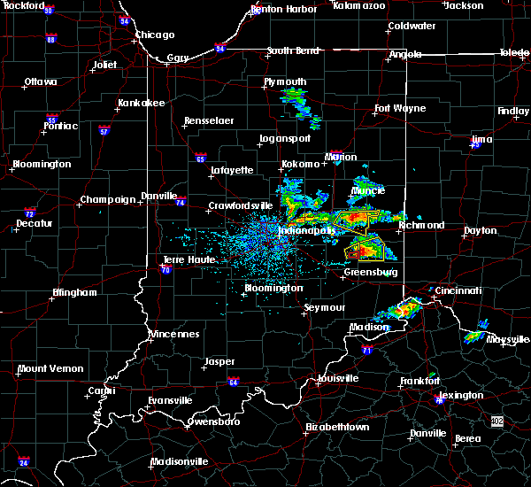 At 404 pm edt, a severe thunderstorm was located near new castle, or 14 miles northwest of cambridge city, moving east at 25 mph (radar indicated). Hazards include quarter size hail. Damage to vehicles is expected. locations impacted include, new castle, sulphur springs, mooreland, mount summit, losantville, modoc and summit lake state park. This includes interstate 70 between mile markers 130 and 133. At 404 pm edt, a severe thunderstorm was located near new castle, or 14 miles northwest of cambridge city, moving east at 25 mph (radar indicated). Hazards include quarter size hail. Damage to vehicles is expected. locations impacted include, new castle, sulphur springs, mooreland, mount summit, losantville, modoc and summit lake state park. This includes interstate 70 between mile markers 130 and 133.
|
| 4/28/2016 3:51 PM EDT |
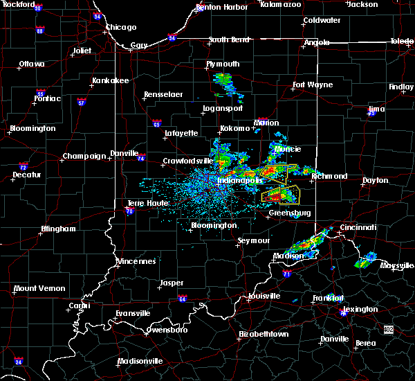 At 351 pm edt, a severe thunderstorm was located near new castle, or 14 miles southeast of anderson, moving east at 20 mph (radar indicated). Hazards include quarter size hail. damage to vehicles is expected At 351 pm edt, a severe thunderstorm was located near new castle, or 14 miles southeast of anderson, moving east at 20 mph (radar indicated). Hazards include quarter size hail. damage to vehicles is expected
|
| 4/26/2016 4:38 PM EDT |
 The severe thunderstorm warning for southeastern madison, northern henry and southern delaware counties will expire at 445 pm edt, the storm which prompted the warning has weakened below severe limits, and no longer pose an immediate threat to life or property. therefore the warning will be allowed to expire. The severe thunderstorm warning for southeastern madison, northern henry and southern delaware counties will expire at 445 pm edt, the storm which prompted the warning has weakened below severe limits, and no longer pose an immediate threat to life or property. therefore the warning will be allowed to expire.
|
| 4/26/2016 4:22 PM EDT |
 At 421 pm edt, a severe thunderstorm was located 9 miles southeast of anderson, moving east at 30 mph (radar indicated). Hazards include quarter size hail. Damage to vehicles is expected. locations impacted include, anderson, new castle, markleville, sulphur springs, mooreland, mount summit, cadiz, springport, blountsville, prairie creek reservoir and summit lake state park. This includes interstate 69 between mile markers 224 and 232. At 421 pm edt, a severe thunderstorm was located 9 miles southeast of anderson, moving east at 30 mph (radar indicated). Hazards include quarter size hail. Damage to vehicles is expected. locations impacted include, anderson, new castle, markleville, sulphur springs, mooreland, mount summit, cadiz, springport, blountsville, prairie creek reservoir and summit lake state park. This includes interstate 69 between mile markers 224 and 232.
|
| 4/26/2016 4:08 PM EDT |
 At 408 pm edt, a severe thunderstorm was located near anderson, moving east at 30 mph (radar indicated). Hazards include quarter size hail. damage to vehicles is expected At 408 pm edt, a severe thunderstorm was located near anderson, moving east at 30 mph (radar indicated). Hazards include quarter size hail. damage to vehicles is expected
|
| 3/27/2016 9:19 PM EDT |
 At 919 pm edt, a severe thunderstorm was located 9 miles northwest of new castle, or 11 miles south of muncie, moving northeast at 45 mph (radar indicated). Hazards include 60 mph wind gusts and quarter size hail. Hail damage to vehicles is expected. Expect wind damage to roofs, siding, and trees. At 919 pm edt, a severe thunderstorm was located 9 miles northwest of new castle, or 11 miles south of muncie, moving northeast at 45 mph (radar indicated). Hazards include 60 mph wind gusts and quarter size hail. Hail damage to vehicles is expected. Expect wind damage to roofs, siding, and trees.
|
| 12/23/2015 4:26 PM EST | At 426 pm est, severe thunderstorms were located along a line extending from 7 miles southeast of alexandria to near dublin, moving northeast at 60 mph (radar indicated). Hazards include 70 mph wind gusts. Expect considerable tree damage. Damage is likely to mobile homes, roofs and outbuildings. |
| 6/21/2015 3:07 AM EDT |
 At 302 am edt, severe thunderstorms were located along a line extending from 7 miles northeast of muncie to rushville, and moving east at 40 mph (radar indicated). Hazards include 70 mph wind gusts. Expect considerable tree damage. damage is likely to mobile homes, roofs and outbuildings. locations impacted include, winchester, mooreland, straughn, blountsville, parker city, farmland, losantville, modoc, ridgeville, saratoga, lynn and union city. This includes interstate 70 between mile markers 118 and 133. At 302 am edt, severe thunderstorms were located along a line extending from 7 miles northeast of muncie to rushville, and moving east at 40 mph (radar indicated). Hazards include 70 mph wind gusts. Expect considerable tree damage. damage is likely to mobile homes, roofs and outbuildings. locations impacted include, winchester, mooreland, straughn, blountsville, parker city, farmland, losantville, modoc, ridgeville, saratoga, lynn and union city. This includes interstate 70 between mile markers 118 and 133.
|
| 6/21/2015 2:51 AM EDT |
 At 250 am edt, severe thunderstorms were located along a line extending from 7 miles northwest of muncie to 10 miles west of rushville, and moving east at 40 mph (radar indicated). Hazards include 70 mph wind gusts. Expect considerable tree damage. Damage is likely to mobile homes, roofs and outbuildings. At 250 am edt, severe thunderstorms were located along a line extending from 7 miles northwest of muncie to 10 miles west of rushville, and moving east at 40 mph (radar indicated). Hazards include 70 mph wind gusts. Expect considerable tree damage. Damage is likely to mobile homes, roofs and outbuildings.
|
| 6/12/2015 5:51 PM EDT |
 A severe thunderstorm warning remains in effect for southeastern delaware. northern henry and western randolph counties until 615 pm edt. at 548 pm edt. a severe thunderstorm was located 8 miles north of new castle. and moving east at 30 mph. hazard. 60 mph wind gusts and quarter size hail. A severe thunderstorm warning remains in effect for southeastern delaware. northern henry and western randolph counties until 615 pm edt. at 548 pm edt. a severe thunderstorm was located 8 miles north of new castle. and moving east at 30 mph. hazard. 60 mph wind gusts and quarter size hail.
|
| 6/12/2015 5:43 PM EDT |
 At 540 pm edt, a severe thunderstorm was located 8 miles northwest of new castle, and moving east at 30 mph (radar indicated). Hazards include 60 mph wind gusts and quarter size hail. Hail damage to vehicles is expected. expect wind damage to roofs, siding and trees. locations impacted include, new castle, mount summit, springport, summit lake state park, mooreland, prairie creek reservoir, blountsville, selma, losantville, parker city, modoc and farmland. This includes interstate 69 between mile markers 225 and 232. At 540 pm edt, a severe thunderstorm was located 8 miles northwest of new castle, and moving east at 30 mph (radar indicated). Hazards include 60 mph wind gusts and quarter size hail. Hail damage to vehicles is expected. expect wind damage to roofs, siding and trees. locations impacted include, new castle, mount summit, springport, summit lake state park, mooreland, prairie creek reservoir, blountsville, selma, losantville, parker city, modoc and farmland. This includes interstate 69 between mile markers 225 and 232.
|
| 6/12/2015 5:24 PM EDT |
 At 520 pm edt, a severe thunderstorm was located 9 miles south of anderson, and moving east at 30 mph (radar indicated). Hazards include 60 mph wind gusts. Expect damage to roofs. Siding and trees. At 520 pm edt, a severe thunderstorm was located 9 miles south of anderson, and moving east at 30 mph (radar indicated). Hazards include 60 mph wind gusts. Expect damage to roofs. Siding and trees.
|
| 5/30/2015 6:51 PM EDT | At 650 pm edt, a severe thunderstorm was located 8 miles southeast of muncie, and moving northeast at 40 mph (radar indicated). Hazards include 60 mph wind gusts and nickel size hail. Expect damage to roofs. siding and trees. Locations impacted include, prairie creek reservoir, selma, parker city, farmland, albany, ridgeville and saratoga. |
| 5/30/2015 6:34 PM EDT | At 631 pm edt, a severe thunderstorm was located 7 miles northwest of new castle, and moving northeast at 40 mph (radar indicated). Hazards include 60 mph wind gusts and nickel size hail. Expect damage to roofs. Siding and trees. |
Hail Maps for Mount Summit, IN

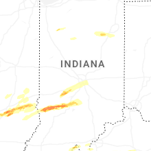


Connect with Interactive Hail Maps