

Hail Map for Mount Vernon, OR
The Mount Vernon, OR area has had 1 report of on-the-ground hail by trained spotters, and has been under severe weather warnings 1 time during the past 12 months. Doppler radar has not detected any hail at or near Mount Vernon, OR in the past 15.4 years.
| Name: | Mount Vernon, OR |
| Where Located: | 57.4 miles N of Burns, OR |
| Map: | Google Map for Mount Vernon, OR |
| Population: | 527 |
| Housing Units: | 281 |
| More Info: | Search Google for Mount Vernon, OR |
Hail and Wind Damage Spotted near Mount Vernon, OR
| Date / Time | Report Details |
|---|---|
| 5/28/2026 4:04 PM PDT |
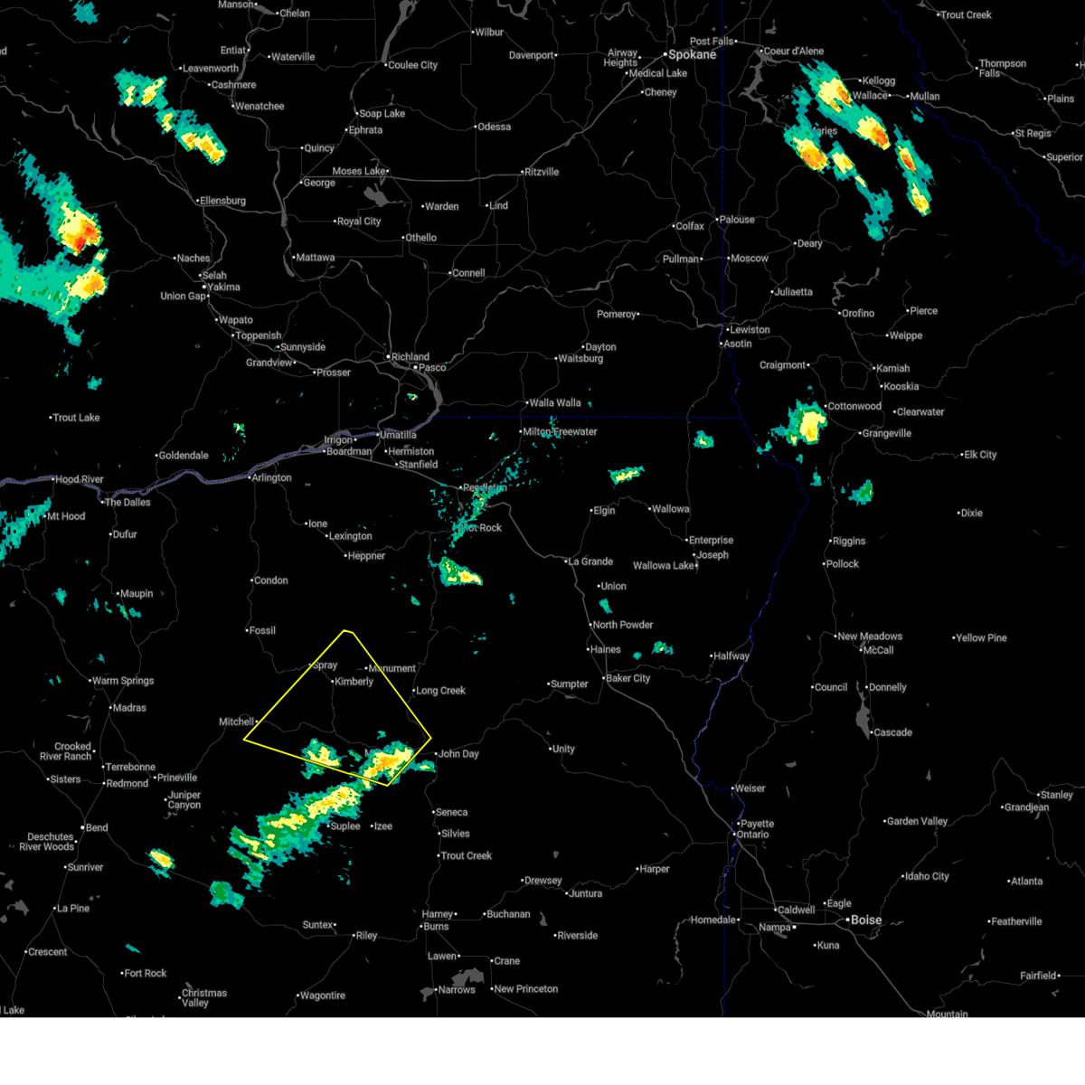 Svrpdt the national weather service in pendleton oregon has issued a * severe thunderstorm warning for, southeastern wheeler county in northeastern oregon, northwestern grant county in central oregon, * until 500 pm pdt. * at 404 pm pdt, a severe thunderstorm was located 7 miles east of dayville, or 21 miles west of john day, moving northwest at 35 mph (radar indicated). Hazards include 70 mph wind gusts and half dollar size hail. Hail damage to vehicles is expected. expect considerable tree damage. Wind damage is also likely to mobile homes, roofs, and outbuildings. Svrpdt the national weather service in pendleton oregon has issued a * severe thunderstorm warning for, southeastern wheeler county in northeastern oregon, northwestern grant county in central oregon, * until 500 pm pdt. * at 404 pm pdt, a severe thunderstorm was located 7 miles east of dayville, or 21 miles west of john day, moving northwest at 35 mph (radar indicated). Hazards include 70 mph wind gusts and half dollar size hail. Hail damage to vehicles is expected. expect considerable tree damage. Wind damage is also likely to mobile homes, roofs, and outbuildings.
|
| 5/28/2026 3:50 PM PDT | Ping Pong Ball sized hail reported 3.5 miles NNE of Mount Vernon, OR, spotter with photo provided. time estimated from radar. |
| 4/29/2020 4:25 PM PDT |
 At 425 pm pdt, a severe thunderstorm was located 12 miles southwest of mount vernon, or 19 miles southwest of john day, moving northeast at 40 mph (radar indicated). Hazards include 60 mph wind gusts and nickel size hail. expect damage to roofs, siding, and trees At 425 pm pdt, a severe thunderstorm was located 12 miles southwest of mount vernon, or 19 miles southwest of john day, moving northeast at 40 mph (radar indicated). Hazards include 60 mph wind gusts and nickel size hail. expect damage to roofs, siding, and trees
|
Connect with Interactive Hail Maps