

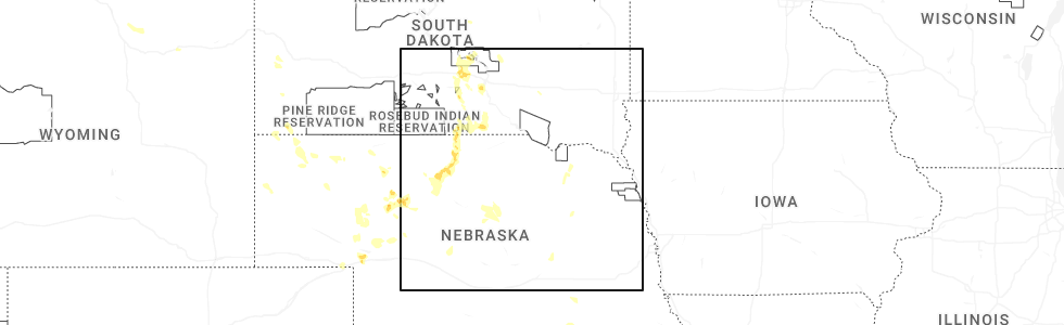
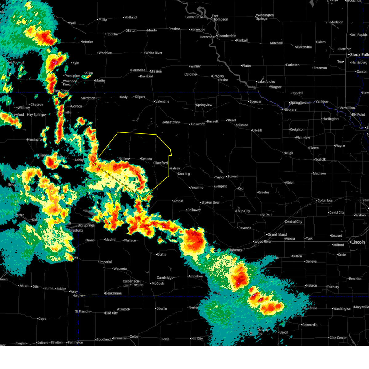
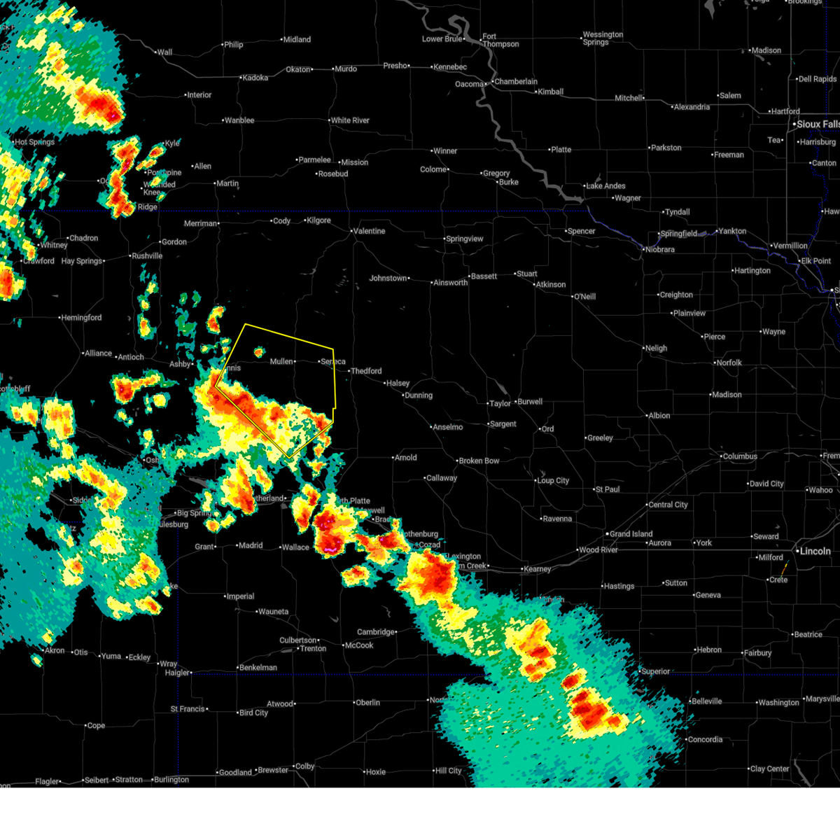
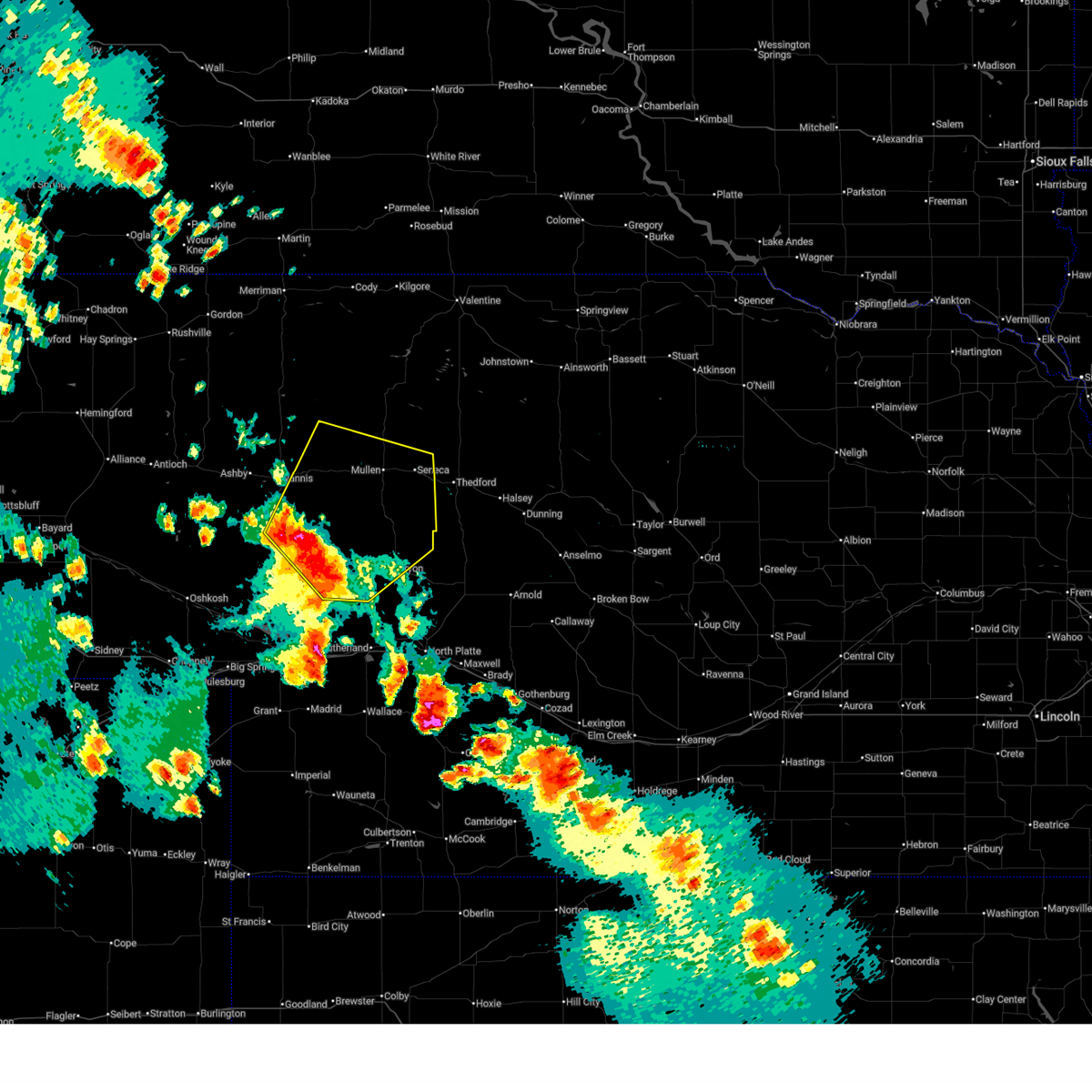
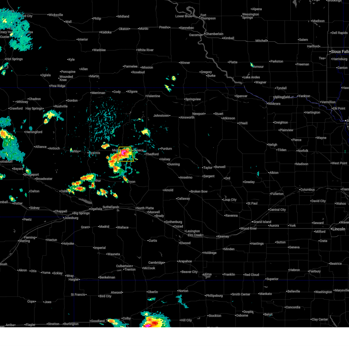
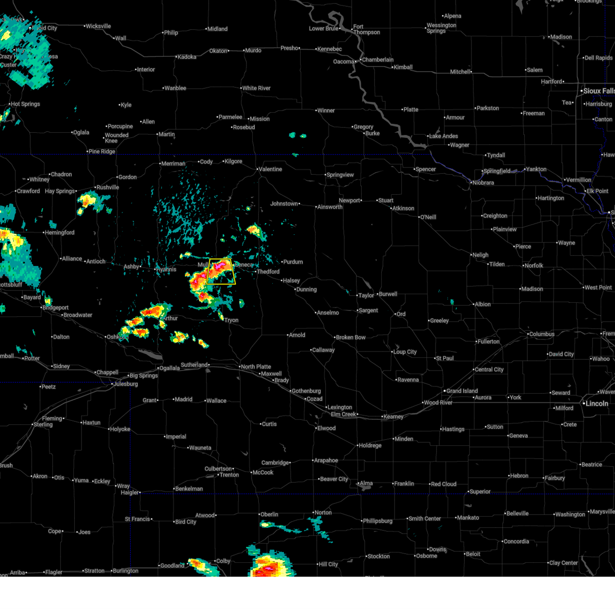
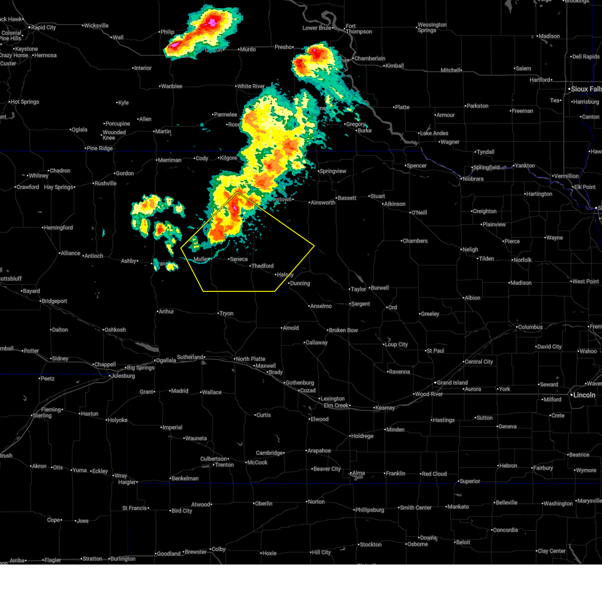
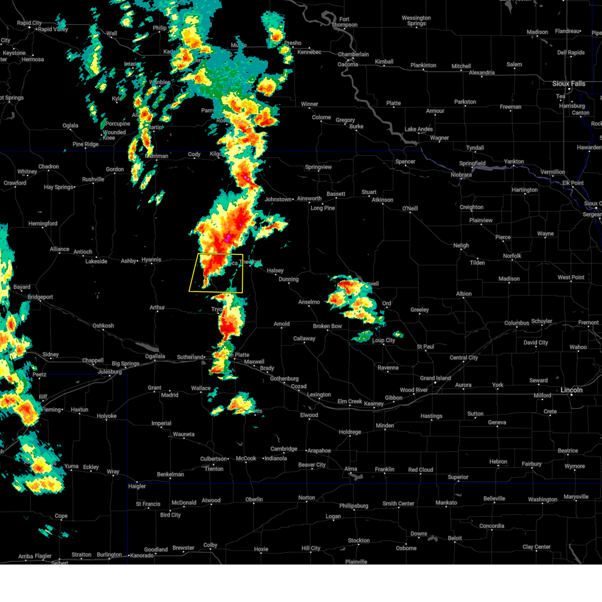
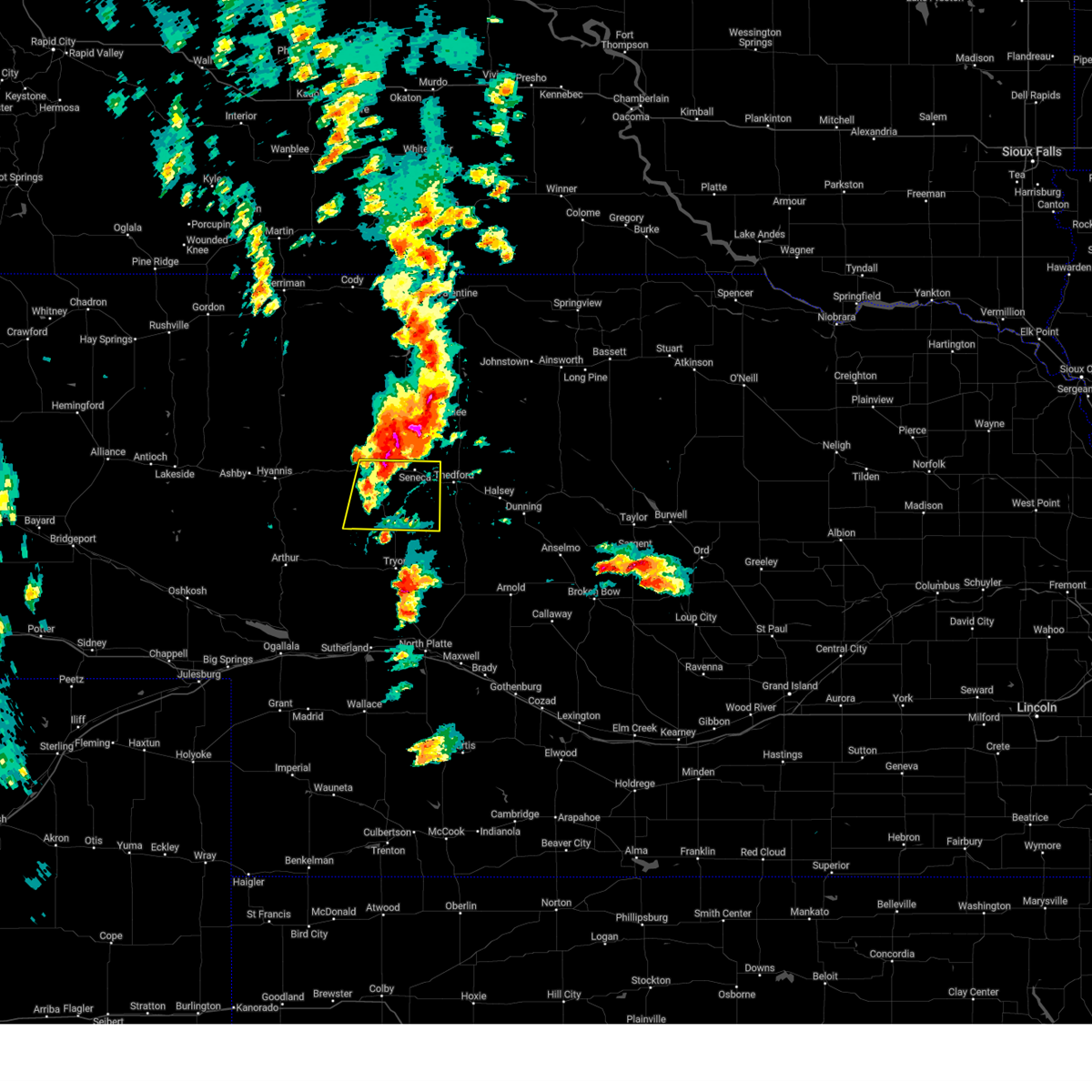
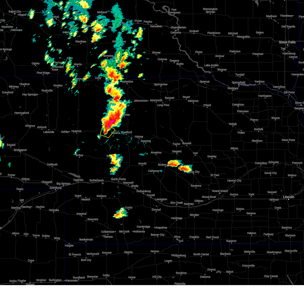
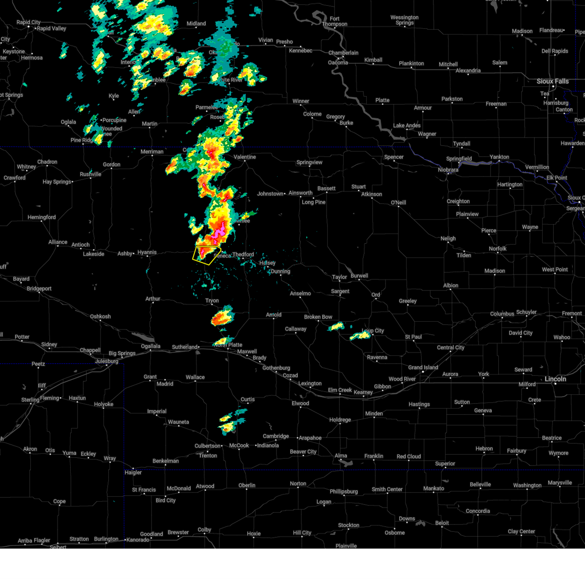
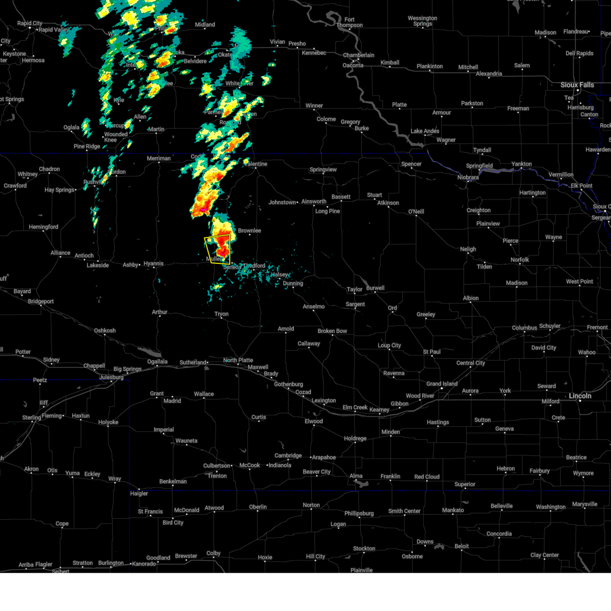
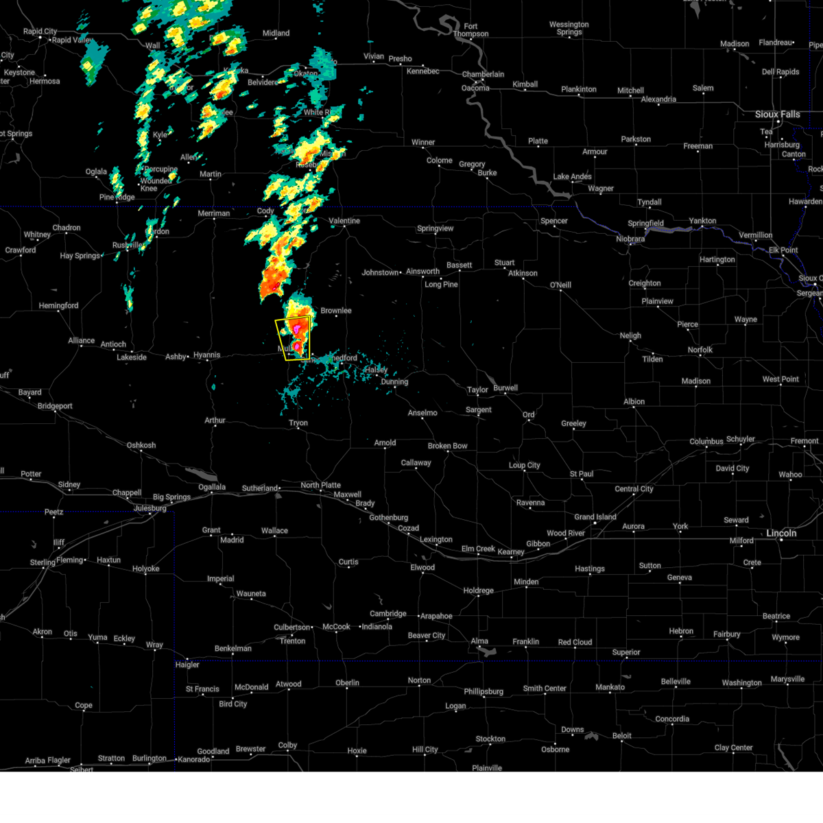
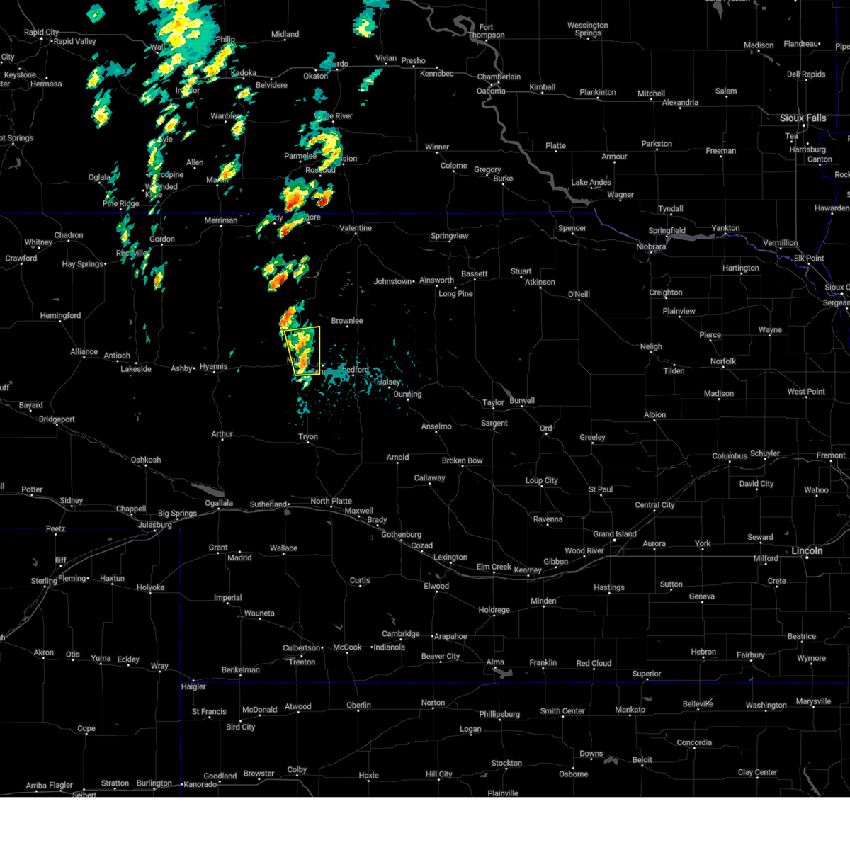
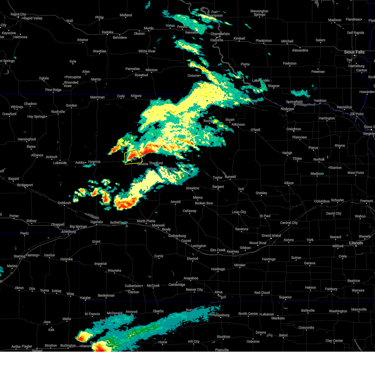
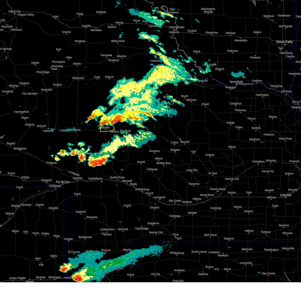
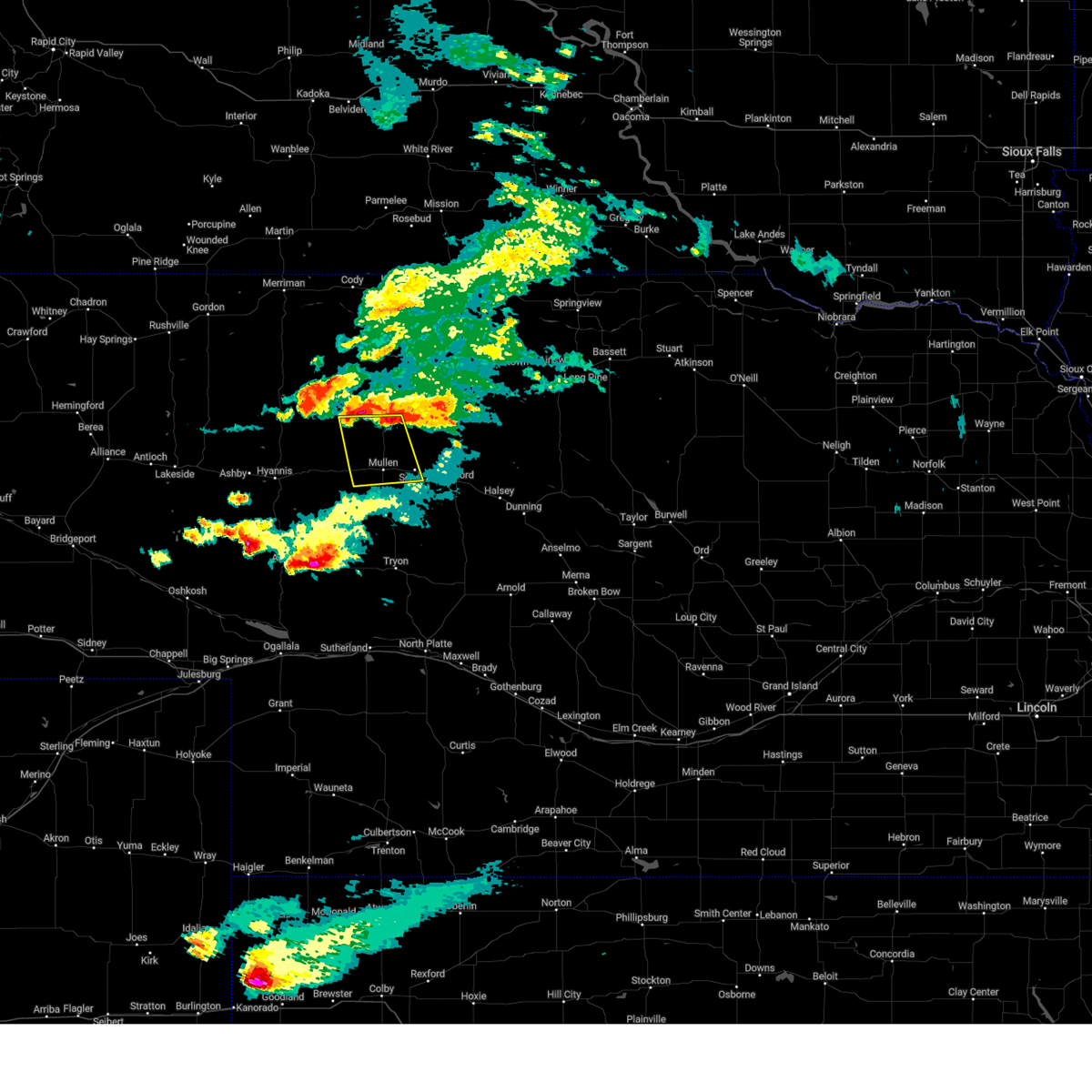
Hail Map for Mullen, NE
The Mullen, NE area has had 72 reports of on-the-ground hail by trained spotters, and has been under severe weather warnings 12 times during the past 12 months. Doppler radar has detected hail at or near Mullen, NE on 99 occasions, including 9 occasions during the past year.
| Name: | Mullen, NE |
| Where Located: | 62.6 miles SSW of Valentine, NE |
| Map: | Google Map for Mullen, NE |
| Population: | 509 |
| Housing Units: | 293 |
| More Info: | Search Google for Mullen, NE |
3
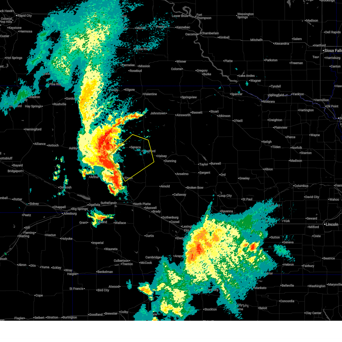
The Top Recent Hail Date for Mullen, NE is Sunday, August 3, 2025 (12th out of 99)
Hail and Wind Damage Spotted near Mullen, NE
| Date / Time | Report Details |
|---|---|
| 6/30/2026 11:46 PM CDT |
 Svrlbf the national weather service in north platte has issued a * severe thunderstorm warning for, south central cherry county in north central nebraska, southeastern hooker county in west central nebraska, northwestern logan county in west central nebraska, northeastern mcpherson county in west central nebraska, thomas county in north central nebraska, * until 1230 am cdt/1130 pm mdt/. * at 1145 pm cdt/1045 pm mdt/, severe thunderstorms were located along a line extending from 12 miles southwest of mullen to tryon, moving northeast at 55 mph (radar indicated). Hazards include 70 mph wind gusts and penny size hail. Expect considerable tree damage. Damage is likely to mobile homes, roofs, and outbuildings. Svrlbf the national weather service in north platte has issued a * severe thunderstorm warning for, south central cherry county in north central nebraska, southeastern hooker county in west central nebraska, northwestern logan county in west central nebraska, northeastern mcpherson county in west central nebraska, thomas county in north central nebraska, * until 1230 am cdt/1130 pm mdt/. * at 1145 pm cdt/1045 pm mdt/, severe thunderstorms were located along a line extending from 12 miles southwest of mullen to tryon, moving northeast at 55 mph (radar indicated). Hazards include 70 mph wind gusts and penny size hail. Expect considerable tree damage. Damage is likely to mobile homes, roofs, and outbuildings.
|
| 6/9/2026 7:41 PM MDT | Golf Ball sized hail reported 20.5 miles N of Mullen, NE |
| 5/30/2026 8:38 PM CDT |
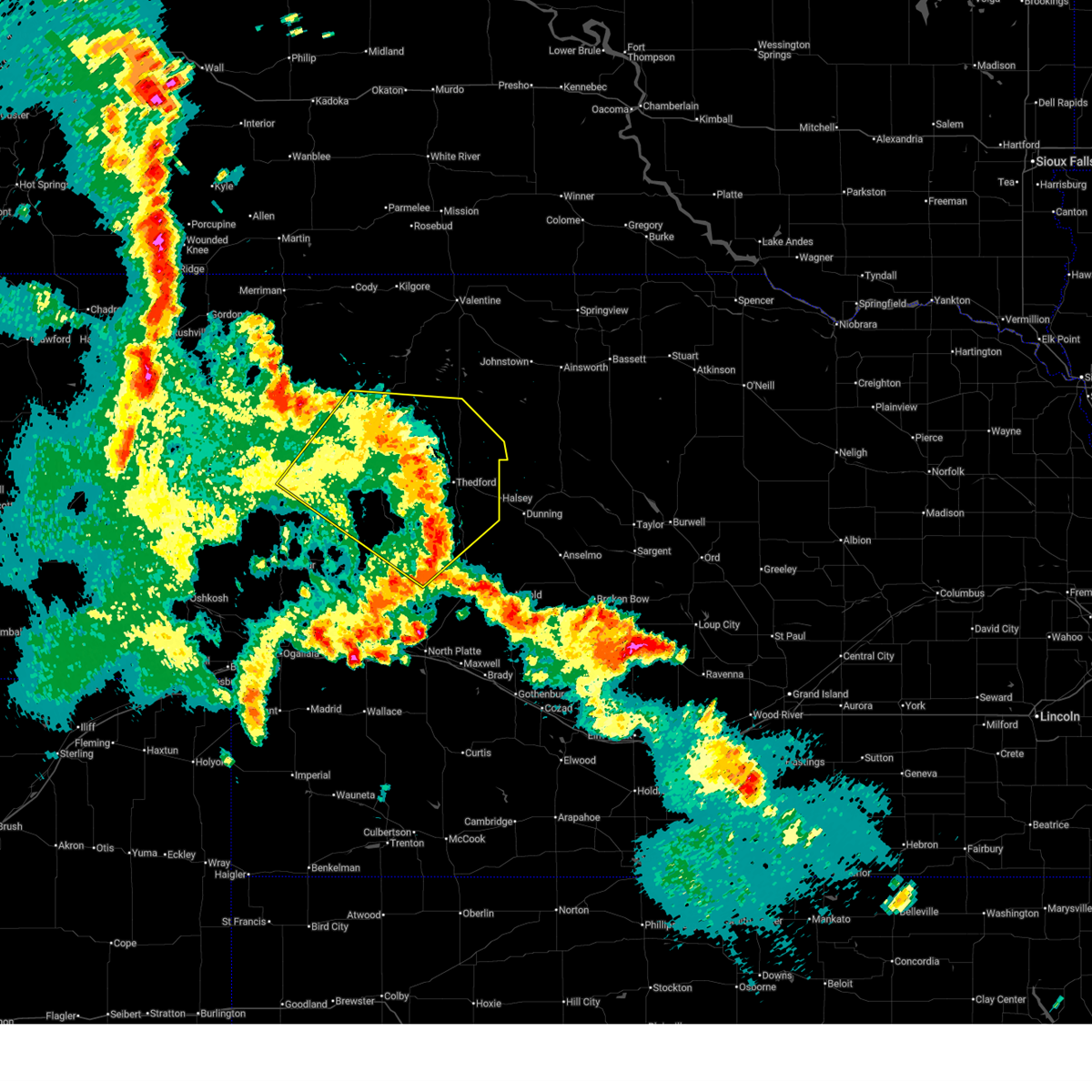 The storms which prompted the warning have weakened below severe limits, and no longer pose an immediate threat to life or property. therefore, the warning will be allowed to expire. however, gusty winds are still possible with these thunderstorms. a tornado watch remains in effect until 1100 pm cdt/1000 pm mdt/ for north central and west central nebraska. to report severe weather, contact your nearest law enforcement agency. they will relay your report to the national weather service north platte. The storms which prompted the warning have weakened below severe limits, and no longer pose an immediate threat to life or property. therefore, the warning will be allowed to expire. however, gusty winds are still possible with these thunderstorms. a tornado watch remains in effect until 1100 pm cdt/1000 pm mdt/ for north central and west central nebraska. to report severe weather, contact your nearest law enforcement agency. they will relay your report to the national weather service north platte.
|
| 5/30/2026 8:11 PM CDT |
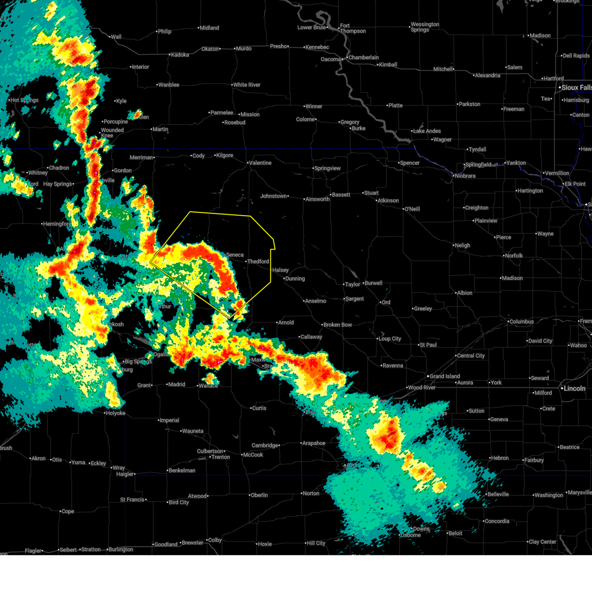 At 811 pm cdt/711 pm mdt/, severe thunderstorms were located along a line extending from 6 miles northeast of whitman to 6 miles northwest of seneca to 7 miles southwest of thedford to 14 miles northeast of ringgold, moving northeast at 40 mph (radar indicated. at 656 pm mdt, damaging winds of 70 mph were reported 5 miles southwest of whitman). Hazards include 70 mph wind gusts and penny size hail. Expect considerable tree damage. damage is likely to mobile homes, roofs, and outbuildings. locations impacted include, mullen, thedford, tryon, halsey, seneca, brownlee, whitman, ringgold, highway 83 crossing the dismal river, duluth, marsh flat, whitman road crossing the north branch of the middle loup river, sevenmile hill, kelso, shimmons lake, carr lake, highway 97 crossing the north loup river, east cody lake, highway 83 crossing the north loup river, and norway. this includes the following highways, highway 2 between mile markers 148 and 227. highway 61 between mile markers 154 and 156. highway 92 between mile markers 204 and 216. highway 97 between mile markers 32 and 93. Highway 83 between mile markers 124 and 177. At 811 pm cdt/711 pm mdt/, severe thunderstorms were located along a line extending from 6 miles northeast of whitman to 6 miles northwest of seneca to 7 miles southwest of thedford to 14 miles northeast of ringgold, moving northeast at 40 mph (radar indicated. at 656 pm mdt, damaging winds of 70 mph were reported 5 miles southwest of whitman). Hazards include 70 mph wind gusts and penny size hail. Expect considerable tree damage. damage is likely to mobile homes, roofs, and outbuildings. locations impacted include, mullen, thedford, tryon, halsey, seneca, brownlee, whitman, ringgold, highway 83 crossing the dismal river, duluth, marsh flat, whitman road crossing the north branch of the middle loup river, sevenmile hill, kelso, shimmons lake, carr lake, highway 97 crossing the north loup river, east cody lake, highway 83 crossing the north loup river, and norway. this includes the following highways, highway 2 between mile markers 148 and 227. highway 61 between mile markers 154 and 156. highway 92 between mile markers 204 and 216. highway 97 between mile markers 32 and 93. Highway 83 between mile markers 124 and 177.
|
| 5/30/2026 7:55 PM CDT |
 Svrlbf the national weather service in north platte has issued a * severe thunderstorm warning for, southeastern cherry county in north central nebraska, northeastern grant county in west central nebraska, hooker county in west central nebraska, northwestern logan county in west central nebraska, northeastern mcpherson county in west central nebraska, thomas county in north central nebraska, * until 845 pm cdt/745 pm mdt/. * at 755 pm cdt/655 pm mdt/, severe thunderstorms were located along a line extending from near whitman to near mullen to 16 miles southwest of thedford to near ringgold, moving northeast at 40 mph (radar indicated). Hazards include 70 mph wind gusts and penny size hail. Expect considerable tree damage. Damage is likely to mobile homes, roofs, and outbuildings. Svrlbf the national weather service in north platte has issued a * severe thunderstorm warning for, southeastern cherry county in north central nebraska, northeastern grant county in west central nebraska, hooker county in west central nebraska, northwestern logan county in west central nebraska, northeastern mcpherson county in west central nebraska, thomas county in north central nebraska, * until 845 pm cdt/745 pm mdt/. * at 755 pm cdt/655 pm mdt/, severe thunderstorms were located along a line extending from near whitman to near mullen to 16 miles southwest of thedford to near ringgold, moving northeast at 40 mph (radar indicated). Hazards include 70 mph wind gusts and penny size hail. Expect considerable tree damage. Damage is likely to mobile homes, roofs, and outbuildings.
|
| 5/30/2026 6:42 PM MDT |
 At 742 pm cdt/642 pm mdt/, severe thunderstorms were located along a line extending from 13 miles southeast of whitman to 17 miles south of mullen to near tryon, moving northeast at 55 mph (radar indicated). Hazards include 70 mph wind gusts and nickel size hail. Expect considerable tree damage. damage is likely to mobile homes, roofs, and outbuildings. locations impacted include, mullen, tryon, seneca, whitman, swan lake, carr lake, duluth, big lamunyon flats, cogill lake, east cody lake, sand beach lake, norway, highway 97 crossing the dismal river, hire, whitman road crossing the north branch of the middle loup river, pratt lake, spring valley lake, schnick lake, hecla, and kelso. this includes the following highways, highway 2 between mile markers 153 and 203. highway 92 between mile markers 187 and 206. Highway 97 between mile markers 32 and 77. At 742 pm cdt/642 pm mdt/, severe thunderstorms were located along a line extending from 13 miles southeast of whitman to 17 miles south of mullen to near tryon, moving northeast at 55 mph (radar indicated). Hazards include 70 mph wind gusts and nickel size hail. Expect considerable tree damage. damage is likely to mobile homes, roofs, and outbuildings. locations impacted include, mullen, tryon, seneca, whitman, swan lake, carr lake, duluth, big lamunyon flats, cogill lake, east cody lake, sand beach lake, norway, highway 97 crossing the dismal river, hire, whitman road crossing the north branch of the middle loup river, pratt lake, spring valley lake, schnick lake, hecla, and kelso. this includes the following highways, highway 2 between mile markers 153 and 203. highway 92 between mile markers 187 and 206. Highway 97 between mile markers 32 and 77.
|
| 5/30/2026 6:21 PM MDT |
 Svrlbf the national weather service in north platte has issued a * severe thunderstorm warning for, eastern arthur county in west central nebraska, south central cherry county in north central nebraska, eastern grant county in west central nebraska, hooker county in west central nebraska, mcpherson county in west central nebraska, western thomas county in north central nebraska, * until 800 pm cdt/700 pm mdt/. * at 720 pm cdt/620 pm mdt/, severe thunderstorms were located along a line extending from near swan lake to 18 miles west of tryon to 11 miles north of sarben, moving northeast at 40 mph (radar indicated). Hazards include 70 mph wind gusts and quarter size hail. Hail damage to vehicles is expected. expect considerable tree damage. Wind damage is also likely to mobile homes, roofs, and outbuildings. Svrlbf the national weather service in north platte has issued a * severe thunderstorm warning for, eastern arthur county in west central nebraska, south central cherry county in north central nebraska, eastern grant county in west central nebraska, hooker county in west central nebraska, mcpherson county in west central nebraska, western thomas county in north central nebraska, * until 800 pm cdt/700 pm mdt/. * at 720 pm cdt/620 pm mdt/, severe thunderstorms were located along a line extending from near swan lake to 18 miles west of tryon to 11 miles north of sarben, moving northeast at 40 mph (radar indicated). Hazards include 70 mph wind gusts and quarter size hail. Hail damage to vehicles is expected. expect considerable tree damage. Wind damage is also likely to mobile homes, roofs, and outbuildings.
|
| 10/4/2025 8:11 PM MDT | The storm which prompted the warning has weakened below severe limits, and no longer poses an immediate threat to life or property. therefore, the warning will be allowed to expire. however, gusty winds are still possible with this thunderstorm. |
| 10/4/2025 7:58 PM MDT | At 858 pm cdt/758 pm mdt/, a severe thunderstorm was located near mullen, moving east at 35 mph (radar indicated). Hazards include 60 mph wind gusts. Expect damage to roofs, siding, and trees. locations impacted include, mullen, seneca, whitman, swan lake, carr lake, highway 97 crossing the dismal river, cogill lake, hecla, kelso, weir, east cody lake, and shimmons lake. this includes the following highways, highway 2 between mile markers 158 and 196. Highway 97 between mile markers 41 and 73. |
| 10/4/2025 7:28 PM MDT | Svrlbf the national weather service in north platte has issued a * severe thunderstorm warning for, northeastern arthur county in west central nebraska, south central cherry county in north central nebraska, eastern grant county in west central nebraska, hooker county in west central nebraska, northern mcpherson county in west central nebraska, western thomas county in north central nebraska, * until 915 pm cdt/815 pm mdt/. * at 828 pm cdt/728 pm mdt/, a severe thunderstorm was located 12 miles southeast of whitman, or 19 miles southwest of mullen, moving east at 35 mph (radar indicated). Hazards include 60 mph wind gusts. expect damage to roofs, siding, and trees |
| 8/3/2025 3:07 PM MDT |
 At 406 pm cdt/306 pm mdt/, a severe thunderstorm was located near mullen, moving south at 5 mph (radar indicated). Hazards include golf ball size hail and 60 mph wind gusts. People and animals outdoors will be injured. expect hail damage to roofs, siding, windows, and vehicles. expect wind damage to roofs, siding, and trees. locations impacted include, mullen and kelso. this includes the following highways, highway 2 between mile markers 181 and 194. Highway 97 between mile markers 55 and 70. At 406 pm cdt/306 pm mdt/, a severe thunderstorm was located near mullen, moving south at 5 mph (radar indicated). Hazards include golf ball size hail and 60 mph wind gusts. People and animals outdoors will be injured. expect hail damage to roofs, siding, windows, and vehicles. expect wind damage to roofs, siding, and trees. locations impacted include, mullen and kelso. this includes the following highways, highway 2 between mile markers 181 and 194. Highway 97 between mile markers 55 and 70.
|
| 8/3/2025 3:03 PM MDT | Hen Egg sized hail reported 0.3 miles NW of Mullen, NE, there was a lot of hail with drifts. |
| 8/3/2025 3:02 PM MDT | Golf Ball sized hail reported 0.3 miles NW of Mullen, NE |
| 8/3/2025 3:02 PM MDT | Storm damage reported in hooker county NE, 0.3 miles NW of Mullen, NE |
| 8/3/2025 2:50 PM MDT |
 Svrlbf the national weather service in north platte has issued a * severe thunderstorm warning for, northeastern hooker county in west central nebraska, west central thomas county in north central nebraska, * until 415 pm cdt/315 pm mdt/. * at 349 pm cdt/249 pm mdt/, a severe thunderstorm was located over mullen, moving south at 5 mph (radar indicated). Hazards include 60 mph wind gusts and quarter size hail. Hail damage to vehicles is expected. Expect wind damage to roofs, siding, and trees. Svrlbf the national weather service in north platte has issued a * severe thunderstorm warning for, northeastern hooker county in west central nebraska, west central thomas county in north central nebraska, * until 415 pm cdt/315 pm mdt/. * at 349 pm cdt/249 pm mdt/, a severe thunderstorm was located over mullen, moving south at 5 mph (radar indicated). Hazards include 60 mph wind gusts and quarter size hail. Hail damage to vehicles is expected. Expect wind damage to roofs, siding, and trees.
|
| 7/9/2025 7:56 PM CDT |
 Svrlbf the national weather service in north platte has issued a * severe thunderstorm warning for, southeastern cherry county in north central nebraska, hooker county in west central nebraska, southwestern brown county in north central nebraska, northwestern blaine county in north central nebraska, thomas county in north central nebraska, * until 900 pm cdt/800 pm mdt/. * at 755 pm cdt/655 pm mdt/, severe thunderstorms were located along a line extending from valentine national wildlife refuge to 6 miles west of brownlee to mullen, moving southeast at 40 mph (radar indicated). Hazards include 70 mph wind gusts. Expect considerable tree damage. Damage is likely to mobile homes, roofs, and outbuildings. Svrlbf the national weather service in north platte has issued a * severe thunderstorm warning for, southeastern cherry county in north central nebraska, hooker county in west central nebraska, southwestern brown county in north central nebraska, northwestern blaine county in north central nebraska, thomas county in north central nebraska, * until 900 pm cdt/800 pm mdt/. * at 755 pm cdt/655 pm mdt/, severe thunderstorms were located along a line extending from valentine national wildlife refuge to 6 miles west of brownlee to mullen, moving southeast at 40 mph (radar indicated). Hazards include 70 mph wind gusts. Expect considerable tree damage. Damage is likely to mobile homes, roofs, and outbuildings.
|
| 5/14/2025 5:26 PM MDT |
 At 625 pm cdt/525 pm mdt/, a severe thunderstorm was located 11 miles south of mullen, moving north at 15 mph (radar indicated). Hazards include quarter size hail. Damage to vehicles is expected. locations impacted include, mullen, seneca, norway, highway 97 crossing the dismal river, kelso, east cody lake, and shimmons lake. this includes the following highways, highway 2 between mile markers 176 and 205. Highway 97 between mile markers 45 and 70. At 625 pm cdt/525 pm mdt/, a severe thunderstorm was located 11 miles south of mullen, moving north at 15 mph (radar indicated). Hazards include quarter size hail. Damage to vehicles is expected. locations impacted include, mullen, seneca, norway, highway 97 crossing the dismal river, kelso, east cody lake, and shimmons lake. this includes the following highways, highway 2 between mile markers 176 and 205. Highway 97 between mile markers 45 and 70.
|
| 5/14/2025 4:58 PM MDT |
 Svrlbf the national weather service in north platte has issued a * severe thunderstorm warning for, hooker county in west central nebraska, western thomas county in north central nebraska, * until 645 pm cdt/545 pm mdt/. * at 558 pm cdt/458 pm mdt/, a severe thunderstorm was located 10 miles south of mullen, moving north at 25 mph (radar indicated). Hazards include quarter size hail. damage to vehicles is expected Svrlbf the national weather service in north platte has issued a * severe thunderstorm warning for, hooker county in west central nebraska, western thomas county in north central nebraska, * until 645 pm cdt/545 pm mdt/. * at 558 pm cdt/458 pm mdt/, a severe thunderstorm was located 10 miles south of mullen, moving north at 25 mph (radar indicated). Hazards include quarter size hail. damage to vehicles is expected
|
| 5/14/2025 4:32 PM MDT |
 At 431 pm mdt, a severe thunderstorm was located over mullen, moving north at 25 mph (radar indicated). Hazards include half dollar size hail. Damage to vehicles is expected. locations impacted include, mullen and kelso. this includes the following highways, highway 2 between mile markers 179 and 193. Highway 97 between mile markers 60 and 70. At 431 pm mdt, a severe thunderstorm was located over mullen, moving north at 25 mph (radar indicated). Hazards include half dollar size hail. Damage to vehicles is expected. locations impacted include, mullen and kelso. this includes the following highways, highway 2 between mile markers 179 and 193. Highway 97 between mile markers 60 and 70.
|
| 5/14/2025 4:30 PM MDT | Quarter sized hail reported 0.4 miles ENE of Mullen, NE |
| 5/14/2025 4:13 PM MDT |
 Svrlbf the national weather service in north platte has issued a * severe thunderstorm warning for, northeastern hooker county in west central nebraska, * until 500 pm mdt. * at 412 pm mdt, a severe thunderstorm was located over mullen, moving northeast at 10 mph (radar indicated). Hazards include golf ball size hail and 60 mph wind gusts. People and animals outdoors will be injured. expect hail damage to roofs, siding, windows, and vehicles. Expect wind damage to roofs, siding, and trees. Svrlbf the national weather service in north platte has issued a * severe thunderstorm warning for, northeastern hooker county in west central nebraska, * until 500 pm mdt. * at 412 pm mdt, a severe thunderstorm was located over mullen, moving northeast at 10 mph (radar indicated). Hazards include golf ball size hail and 60 mph wind gusts. People and animals outdoors will be injured. expect hail damage to roofs, siding, windows, and vehicles. Expect wind damage to roofs, siding, and trees.
|
| 5/14/2025 4:06 PM MDT | Golf Ball sized hail reported 16.6 miles SW of Mullen, NE |
| 5/14/2025 3:31 PM MDT |
 At 330 pm mdt, a severe thunderstorm was located near seneca, or 7 miles northeast of mullen, moving north at 25 mph (radar indicated). Hazards include golf ball size hail and 60 mph wind gusts. People and animals outdoors will be injured. expect hail damage to roofs, siding, windows, and vehicles. expect wind damage to roofs, siding, and trees. locations impacted include, mullen and kelso. this includes the following highways, highway 2 between mile markers 183 and 194. Highway 97 between mile markers 67 and 83. At 330 pm mdt, a severe thunderstorm was located near seneca, or 7 miles northeast of mullen, moving north at 25 mph (radar indicated). Hazards include golf ball size hail and 60 mph wind gusts. People and animals outdoors will be injured. expect hail damage to roofs, siding, windows, and vehicles. expect wind damage to roofs, siding, and trees. locations impacted include, mullen and kelso. this includes the following highways, highway 2 between mile markers 183 and 194. Highway 97 between mile markers 67 and 83.
|
| 5/14/2025 3:22 PM MDT |
 At 322 pm mdt, a severe thunderstorm was located 11 miles northwest of seneca, or 11 miles northeast of mullen, moving north at 25 mph (radar indicated). Hazards include golf ball size hail and 60 mph wind gusts. People and animals outdoors will be injured. expect hail damage to roofs, siding, windows, and vehicles. expect wind damage to roofs, siding, and trees. locations impacted include, mullen and kelso. this includes the following highways, highway 2 between mile markers 183 and 194. Highway 97 between mile markers 65 and 83. At 322 pm mdt, a severe thunderstorm was located 11 miles northwest of seneca, or 11 miles northeast of mullen, moving north at 25 mph (radar indicated). Hazards include golf ball size hail and 60 mph wind gusts. People and animals outdoors will be injured. expect hail damage to roofs, siding, windows, and vehicles. expect wind damage to roofs, siding, and trees. locations impacted include, mullen and kelso. this includes the following highways, highway 2 between mile markers 183 and 194. Highway 97 between mile markers 65 and 83.
|
| 5/14/2025 2:54 PM MDT |
 Svrlbf the national weather service in north platte has issued a * severe thunderstorm warning for, south central cherry county in north central nebraska, northeastern hooker county in west central nebraska, * until 400 pm mdt. * at 254 pm mdt, a severe thunderstorm was located over mullen, moving north at 15 mph (radar indicated). Hazards include golf ball size hail and 60 mph wind gusts. People and animals outdoors will be injured. expect hail damage to roofs, siding, windows, and vehicles. Expect wind damage to roofs, siding, and trees. Svrlbf the national weather service in north platte has issued a * severe thunderstorm warning for, south central cherry county in north central nebraska, northeastern hooker county in west central nebraska, * until 400 pm mdt. * at 254 pm mdt, a severe thunderstorm was located over mullen, moving north at 15 mph (radar indicated). Hazards include golf ball size hail and 60 mph wind gusts. People and animals outdoors will be injured. expect hail damage to roofs, siding, windows, and vehicles. Expect wind damage to roofs, siding, and trees.
|
| 8/11/2024 6:20 PM MDT |
 The storms which prompted the warning have weakened below severe limits, and no longer pose an immediate threat to life or property. therefore, the warning will be allowed to expire. a severe thunderstorm watch remains in effect until 900 pm mdt for north central and west central nebraska. The storms which prompted the warning have weakened below severe limits, and no longer pose an immediate threat to life or property. therefore, the warning will be allowed to expire. a severe thunderstorm watch remains in effect until 900 pm mdt for north central and west central nebraska.
|
| 8/11/2024 6:14 PM MDT |
 the severe thunderstorm warning has been cancelled and is no longer in effect the severe thunderstorm warning has been cancelled and is no longer in effect
|
| 8/11/2024 6:14 PM MDT |
 At 614 pm mdt, severe thunderstorms were located along a line extending from 8 miles northwest of seneca to 12 miles northwest of mullen, moving southeast at 25 mph (radar indicated). Hazards include 60 mph wind gusts and quarter size hail. Hail damage to vehicles is expected. expect wind damage to roofs, siding, and trees. locations impacted include, mullen and kelso. this includes the following highways, highway 2 between mile markers 178 and 194. Highway 97 between mile markers 65 and 77. At 614 pm mdt, severe thunderstorms were located along a line extending from 8 miles northwest of seneca to 12 miles northwest of mullen, moving southeast at 25 mph (radar indicated). Hazards include 60 mph wind gusts and quarter size hail. Hail damage to vehicles is expected. expect wind damage to roofs, siding, and trees. locations impacted include, mullen and kelso. this includes the following highways, highway 2 between mile markers 178 and 194. Highway 97 between mile markers 65 and 77.
|
| 8/11/2024 5:51 PM MDT |
 Svrlbf the national weather service in north platte has issued a * severe thunderstorm warning for, south central cherry county in north central nebraska, northeastern hooker county in west central nebraska, northwestern thomas county in north central nebraska, * until 730 pm cdt/630 pm mdt/. * at 651 pm cdt/551 pm mdt/, severe thunderstorms were located along a line extending from 15 miles north of mullen to 22 miles northeast of whitman, moving southeast at 25 mph (radar indicated). Hazards include 60 mph wind gusts and quarter size hail. Hail damage to vehicles is expected. Expect wind damage to roofs, siding, and trees. Svrlbf the national weather service in north platte has issued a * severe thunderstorm warning for, south central cherry county in north central nebraska, northeastern hooker county in west central nebraska, northwestern thomas county in north central nebraska, * until 730 pm cdt/630 pm mdt/. * at 651 pm cdt/551 pm mdt/, severe thunderstorms were located along a line extending from 15 miles north of mullen to 22 miles northeast of whitman, moving southeast at 25 mph (radar indicated). Hazards include 60 mph wind gusts and quarter size hail. Hail damage to vehicles is expected. Expect wind damage to roofs, siding, and trees.
|
| 7/19/2024 5:26 PM MDT | Tea Cup sized hail reported 26.6 miles NE of Mullen, NE, photos received via social media. time estimated by radar. |
| 7/19/2024 4:38 PM MDT | Golf Ball sized hail reported 20.9 miles SE of Mullen, NE |
| 7/3/2024 2:53 PM MDT |
 At 353 pm cdt/253 pm mdt/, a severe thunderstorm was located near seneca, or near mullen, moving east at 40 mph (radar indicated). Hazards include 60 mph wind gusts. Expect damage to roofs, siding, and trees. locations impacted include, mullen, seneca, giant hill, hecla, and kelso. this includes the following highways, highway 2 between mile markers 169 and 197. Highway 97 between mile markers 55 and 78. At 353 pm cdt/253 pm mdt/, a severe thunderstorm was located near seneca, or near mullen, moving east at 40 mph (radar indicated). Hazards include 60 mph wind gusts. Expect damage to roofs, siding, and trees. locations impacted include, mullen, seneca, giant hill, hecla, and kelso. this includes the following highways, highway 2 between mile markers 169 and 197. Highway 97 between mile markers 55 and 78.
|
| 7/3/2024 2:53 PM MDT |
 the severe thunderstorm warning has been cancelled and is no longer in effect the severe thunderstorm warning has been cancelled and is no longer in effect
|
| 7/3/2024 2:33 PM MDT |
 Svrlbf the national weather service in north platte has issued a * severe thunderstorm warning for, south central cherry county in north central nebraska, eastern grant county in west central nebraska, northern hooker county in west central nebraska, northwestern thomas county in north central nebraska, * until 415 pm cdt/315 pm mdt/. * at 332 pm cdt/232 pm mdt/, a severe thunderstorm was located 8 miles northwest of mullen, moving east at 40 mph (radar indicated). Hazards include 70 mph wind gusts. Expect considerable tree damage. Damage is likely to mobile homes, roofs, and outbuildings. Svrlbf the national weather service in north platte has issued a * severe thunderstorm warning for, south central cherry county in north central nebraska, eastern grant county in west central nebraska, northern hooker county in west central nebraska, northwestern thomas county in north central nebraska, * until 415 pm cdt/315 pm mdt/. * at 332 pm cdt/232 pm mdt/, a severe thunderstorm was located 8 miles northwest of mullen, moving east at 40 mph (radar indicated). Hazards include 70 mph wind gusts. Expect considerable tree damage. Damage is likely to mobile homes, roofs, and outbuildings.
|
| 6/27/2024 6:55 PM MDT |
 the severe thunderstorm warning has been cancelled and is no longer in effect the severe thunderstorm warning has been cancelled and is no longer in effect
|
| 6/27/2024 6:45 PM MDT |
 At 645 pm mdt, a severe thunderstorm was located 13 miles west of mullen, moving northeast at 35 mph (radar indicated). Hazards include 60 mph wind gusts and quarter size hail. Hail damage to vehicles is expected. expect wind damage to roofs, siding, and trees. locations impacted include, mullen, hecla, and kelso. this includes the following highways, highway 2 between mile markers 169 and 190. Highway 97 between mile markers 57 and 76. At 645 pm mdt, a severe thunderstorm was located 13 miles west of mullen, moving northeast at 35 mph (radar indicated). Hazards include 60 mph wind gusts and quarter size hail. Hail damage to vehicles is expected. expect wind damage to roofs, siding, and trees. locations impacted include, mullen, hecla, and kelso. this includes the following highways, highway 2 between mile markers 169 and 190. Highway 97 between mile markers 57 and 76.
|
| 6/27/2024 6:45 PM MDT |
 the severe thunderstorm warning has been cancelled and is no longer in effect the severe thunderstorm warning has been cancelled and is no longer in effect
|
| 6/27/2024 6:36 PM MDT |
 Svrlbf the national weather service in north platte has issued a * severe thunderstorm warning for, south central cherry county in north central nebraska, east central grant county in west central nebraska, northern hooker county in west central nebraska, * until 715 pm mdt. * at 635 pm mdt, a severe thunderstorm was located 10 miles southeast of whitman, or 19 miles west of mullen, moving northeast at 35 mph (radar indicated). Hazards include ping pong ball size hail and 60 mph wind gusts. People and animals outdoors will be injured. expect hail damage to roofs, siding, windows, and vehicles. Expect wind damage to roofs, siding, and trees. Svrlbf the national weather service in north platte has issued a * severe thunderstorm warning for, south central cherry county in north central nebraska, east central grant county in west central nebraska, northern hooker county in west central nebraska, * until 715 pm mdt. * at 635 pm mdt, a severe thunderstorm was located 10 miles southeast of whitman, or 19 miles west of mullen, moving northeast at 35 mph (radar indicated). Hazards include ping pong ball size hail and 60 mph wind gusts. People and animals outdoors will be injured. expect hail damage to roofs, siding, windows, and vehicles. Expect wind damage to roofs, siding, and trees.
|
| 6/20/2024 8:02 PM CDT |
 Svrlbf the national weather service in north platte has issued a * severe thunderstorm warning for, eastern cherry county in north central nebraska, northern hooker county in west central nebraska, northern thomas county in north central nebraska, * until 845 pm cdt/745 pm mdt/. * at 800 pm cdt/700 pm mdt/, severe thunderstorms were located along a line extending from 7 miles northeast of merritt reservoir to near valentine national wildlife refuge to 6 miles west of mullen, moving east at 40 mph (radar indicated). Hazards include 60 mph wind gusts. expect damage to roofs, siding, and trees Svrlbf the national weather service in north platte has issued a * severe thunderstorm warning for, eastern cherry county in north central nebraska, northern hooker county in west central nebraska, northern thomas county in north central nebraska, * until 845 pm cdt/745 pm mdt/. * at 800 pm cdt/700 pm mdt/, severe thunderstorms were located along a line extending from 7 miles northeast of merritt reservoir to near valentine national wildlife refuge to 6 miles west of mullen, moving east at 40 mph (radar indicated). Hazards include 60 mph wind gusts. expect damage to roofs, siding, and trees
|
| 6/20/2024 6:41 PM MDT |
 At 740 pm cdt/640 pm mdt/, severe thunderstorms were located along a line extending from near merritt reservoir to near whitman, moving east at 40 mph (radar indicated). Hazards include 60 mph wind gusts. Expect damage to roofs, siding, and trees. locations impacted include, mullen, seneca, whitman, merritt reservoir, highway 97 crossing the north loup river, speckel meir lake, steer creek campground, duluth, schoolhouse lake, marsh flat, anderson bridge state wildlife management area, round lake, hire, whitman road crossing the north branch of the middle loup river, giant hill, highway 97 crossing big creek, sevenmile hill, hecla, kelso, and weir. this includes the following highways, highway 2 between mile markers 151 and 200. Highway 97 between mile markers 63 and 122. At 740 pm cdt/640 pm mdt/, severe thunderstorms were located along a line extending from near merritt reservoir to near whitman, moving east at 40 mph (radar indicated). Hazards include 60 mph wind gusts. Expect damage to roofs, siding, and trees. locations impacted include, mullen, seneca, whitman, merritt reservoir, highway 97 crossing the north loup river, speckel meir lake, steer creek campground, duluth, schoolhouse lake, marsh flat, anderson bridge state wildlife management area, round lake, hire, whitman road crossing the north branch of the middle loup river, giant hill, highway 97 crossing big creek, sevenmile hill, hecla, kelso, and weir. this includes the following highways, highway 2 between mile markers 151 and 200. Highway 97 between mile markers 63 and 122.
|
| 6/20/2024 6:16 PM MDT |
 Svrlbf the national weather service in north platte has issued a * severe thunderstorm warning for, central cherry county in north central nebraska, northeastern grant county in west central nebraska, northern hooker county in west central nebraska, northwestern thomas county in north central nebraska, * until 815 pm cdt/715 pm mdt/. * at 716 pm cdt/616 pm mdt/, severe thunderstorms were located along a line extending from 11 miles west of medicine lake to near whitman, moving east at 45 mph (radar indicated). Hazards include 60 mph wind gusts. expect damage to roofs, siding, and trees Svrlbf the national weather service in north platte has issued a * severe thunderstorm warning for, central cherry county in north central nebraska, northeastern grant county in west central nebraska, northern hooker county in west central nebraska, northwestern thomas county in north central nebraska, * until 815 pm cdt/715 pm mdt/. * at 716 pm cdt/616 pm mdt/, severe thunderstorms were located along a line extending from 11 miles west of medicine lake to near whitman, moving east at 45 mph (radar indicated). Hazards include 60 mph wind gusts. expect damage to roofs, siding, and trees
|
| 6/7/2024 2:14 PM CDT |
 At 214 pm cdt/114 pm mdt/, a severe thunderstorm was located near seneca, or 8 miles southeast of mullen, moving east at 30 mph (radar indicated). Hazards include two inch hail. People and animals outdoors will be injured. expect damage to roofs, siding, windows, and vehicles. locations impacted include, mullen, thedford, seneca, norway, and kelso. this includes the following highways, highway 2 between mile markers 185 and 210. highway 97 between mile markers 54 and 67. Highway 83 between mile markers 141 and 156. At 214 pm cdt/114 pm mdt/, a severe thunderstorm was located near seneca, or 8 miles southeast of mullen, moving east at 30 mph (radar indicated). Hazards include two inch hail. People and animals outdoors will be injured. expect damage to roofs, siding, windows, and vehicles. locations impacted include, mullen, thedford, seneca, norway, and kelso. this includes the following highways, highway 2 between mile markers 185 and 210. highway 97 between mile markers 54 and 67. Highway 83 between mile markers 141 and 156.
|
| 6/7/2024 12:52 PM MDT |
 Svrlbf the national weather service in north platte has issued a * severe thunderstorm warning for, northeastern hooker county in west central nebraska, western thomas county in north central nebraska, * until 230 pm cdt/130 pm mdt/. * at 151 pm cdt/1251 pm mdt/, a severe thunderstorm was located 7 miles southwest of mullen, moving east at 25 mph (radar indicated). Hazards include two inch hail. People and animals outdoors will be injured. Expect damage to roofs, siding, windows, and vehicles. Svrlbf the national weather service in north platte has issued a * severe thunderstorm warning for, northeastern hooker county in west central nebraska, western thomas county in north central nebraska, * until 230 pm cdt/130 pm mdt/. * at 151 pm cdt/1251 pm mdt/, a severe thunderstorm was located 7 miles southwest of mullen, moving east at 25 mph (radar indicated). Hazards include two inch hail. People and animals outdoors will be injured. Expect damage to roofs, siding, windows, and vehicles.
|
| 6/2/2024 5:42 PM MDT |
 At 642 pm cdt/542 pm mdt/, severe thunderstorms were located along a line extending from 15 miles west of brownlee to 6 miles north of seneca to 7 miles south of mullen, moving southeast at 45 mph (radar indicated). Hazards include 70 mph wind gusts. Expect considerable tree damage. damage is likely to mobile homes, roofs, and outbuildings. locations impacted include, mullen, seneca, marsh flat, norway, giant hill, highway 97 crossing big creek, sevenmile hill, hecla, and kelso. this includes the following highways, highway 2 between mile markers 169 and 201. highway 97 between mile markers 61 and 91. Highway 83 near mile marker 167. At 642 pm cdt/542 pm mdt/, severe thunderstorms were located along a line extending from 15 miles west of brownlee to 6 miles north of seneca to 7 miles south of mullen, moving southeast at 45 mph (radar indicated). Hazards include 70 mph wind gusts. Expect considerable tree damage. damage is likely to mobile homes, roofs, and outbuildings. locations impacted include, mullen, seneca, marsh flat, norway, giant hill, highway 97 crossing big creek, sevenmile hill, hecla, and kelso. this includes the following highways, highway 2 between mile markers 169 and 201. highway 97 between mile markers 61 and 91. Highway 83 near mile marker 167.
|
| 6/2/2024 5:32 PM MDT | Storm damage reported in cherry county NE, 6.7 miles SW of Mullen, NE |
| 6/2/2024 5:16 PM MDT |
 Svrlbf the national weather service in north platte has issued a * severe thunderstorm warning for, south central cherry county in north central nebraska, northern hooker county in west central nebraska, northwestern thomas county in north central nebraska, * until 700 pm cdt/600 pm mdt/. * at 616 pm cdt/516 pm mdt/, a severe thunderstorm was located 19 miles northwest of mullen, moving east at 40 mph (radar indicated). Hazards include 60 mph wind gusts and quarter size hail. Hail damage to vehicles is expected. Expect wind damage to roofs, siding, and trees. Svrlbf the national weather service in north platte has issued a * severe thunderstorm warning for, south central cherry county in north central nebraska, northern hooker county in west central nebraska, northwestern thomas county in north central nebraska, * until 700 pm cdt/600 pm mdt/. * at 616 pm cdt/516 pm mdt/, a severe thunderstorm was located 19 miles northwest of mullen, moving east at 40 mph (radar indicated). Hazards include 60 mph wind gusts and quarter size hail. Hail damage to vehicles is expected. Expect wind damage to roofs, siding, and trees.
|
| 4/15/2024 4:55 PM MDT | Quarter sized hail reported 12.2 miles SE of Mullen, NE, time estimated from radar. |
| 4/15/2024 4:45 PM MDT |
 Svrlbf the national weather service in north platte has issued a * severe thunderstorm warning for, south central cherry county in north central nebraska, north central hooker county in west central nebraska, * until 530 pm mdt. * at 444 pm mdt, a severe thunderstorm was located near mullen, moving north at 45 mph (radar indicated). Hazards include 60 mph wind gusts and half dollar size hail. Hail damage to vehicles is expected. Expect wind damage to roofs, siding, and trees. Svrlbf the national weather service in north platte has issued a * severe thunderstorm warning for, south central cherry county in north central nebraska, north central hooker county in west central nebraska, * until 530 pm mdt. * at 444 pm mdt, a severe thunderstorm was located near mullen, moving north at 45 mph (radar indicated). Hazards include 60 mph wind gusts and half dollar size hail. Hail damage to vehicles is expected. Expect wind damage to roofs, siding, and trees.
|
| 4/6/2024 4:15 PM CDT |
 Svrlbf the national weather service in north platte has issued a * severe thunderstorm warning for, southeastern cherry county in north central nebraska, northeastern hooker county in west central nebraska, southwestern brown county in north central nebraska, northeastern logan county in west central nebraska, northwestern custer county in central nebraska, blaine county in north central nebraska, thomas county in north central nebraska, * until 500 pm cdt/400 pm mdt/. * at 415 pm cdt/315 pm mdt/, severe thunderstorms were located along a line extending from near seneca to thedford to anselmo, moving north at 40 mph (radar indicated). Hazards include 70 mph wind gusts. Expect considerable tree damage. Damage is likely to mobile homes, roofs, and outbuildings. Svrlbf the national weather service in north platte has issued a * severe thunderstorm warning for, southeastern cherry county in north central nebraska, northeastern hooker county in west central nebraska, southwestern brown county in north central nebraska, northeastern logan county in west central nebraska, northwestern custer county in central nebraska, blaine county in north central nebraska, thomas county in north central nebraska, * until 500 pm cdt/400 pm mdt/. * at 415 pm cdt/315 pm mdt/, severe thunderstorms were located along a line extending from near seneca to thedford to anselmo, moving north at 40 mph (radar indicated). Hazards include 70 mph wind gusts. Expect considerable tree damage. Damage is likely to mobile homes, roofs, and outbuildings.
|
| 4/6/2024 2:55 PM MDT |
 The storms which prompted the warning have weakened below severe limits, and no longer pose an immediate threat to life or property. therefore, the warning will be allowed to expire. however, gusty winds are still possible with these thunderstorms. a severe thunderstorm watch remains in effect until 800 pm cdt/700 pm mdt/ for west central nebraska. The storms which prompted the warning have weakened below severe limits, and no longer pose an immediate threat to life or property. therefore, the warning will be allowed to expire. however, gusty winds are still possible with these thunderstorms. a severe thunderstorm watch remains in effect until 800 pm cdt/700 pm mdt/ for west central nebraska.
|
| 4/6/2024 2:46 PM MDT |
 At 346 pm cdt/246 pm mdt/, severe thunderstorms were located along a line extending from 6 miles south of whitman to 14 miles southwest of mullen to 16 miles north of tryon, moving north at 50 mph (radar indicated). Hazards include 60 mph wind gusts. Expect damage to roofs, siding, and trees. locations impacted include, mullen, whitman, carr lake, highway 97 crossing the dismal river, hecla, east cody lake, weir, and shimmons lake. this includes the following highways, highway 2 between mile markers 154 and 186. Highway 97 between mile markers 42 and 70. At 346 pm cdt/246 pm mdt/, severe thunderstorms were located along a line extending from 6 miles south of whitman to 14 miles southwest of mullen to 16 miles north of tryon, moving north at 50 mph (radar indicated). Hazards include 60 mph wind gusts. Expect damage to roofs, siding, and trees. locations impacted include, mullen, whitman, carr lake, highway 97 crossing the dismal river, hecla, east cody lake, weir, and shimmons lake. this includes the following highways, highway 2 between mile markers 154 and 186. Highway 97 between mile markers 42 and 70.
|
| 4/6/2024 2:17 PM MDT |
 Svrlbf the national weather service in north platte has issued a * severe thunderstorm warning for, eastern grant county in west central nebraska, hooker county in west central nebraska, central mcpherson county in west central nebraska, * until 400 pm cdt/300 pm mdt/. * at 317 pm cdt/217 pm mdt/, a severe thunderstorm was located 10 miles west of tryon, moving north at 55 mph (radar indicated). Hazards include 70 mph wind gusts and quarter size hail. Hail damage to vehicles is expected. expect considerable tree damage. Wind damage is also likely to mobile homes, roofs, and outbuildings. Svrlbf the national weather service in north platte has issued a * severe thunderstorm warning for, eastern grant county in west central nebraska, hooker county in west central nebraska, central mcpherson county in west central nebraska, * until 400 pm cdt/300 pm mdt/. * at 317 pm cdt/217 pm mdt/, a severe thunderstorm was located 10 miles west of tryon, moving north at 55 mph (radar indicated). Hazards include 70 mph wind gusts and quarter size hail. Hail damage to vehicles is expected. expect considerable tree damage. Wind damage is also likely to mobile homes, roofs, and outbuildings.
|
| 7/7/2023 2:42 AM MDT |
 The severe thunderstorm warning for southeastern cherry, northern hooker and northwestern thomas counties will expire at 345 am cdt/245 am mdt/, the storms which prompted the warning have weakened below severe limits, and no longer pose an immediate threat to life or property. therefore, the warning will be allowed to expire. however gusty winds are still possible with these thunderstorms. a severe thunderstorm watch remains in effect until 400 am cdt/300 am mdt/ for north central and west central nebraska. The severe thunderstorm warning for southeastern cherry, northern hooker and northwestern thomas counties will expire at 345 am cdt/245 am mdt/, the storms which prompted the warning have weakened below severe limits, and no longer pose an immediate threat to life or property. therefore, the warning will be allowed to expire. however gusty winds are still possible with these thunderstorms. a severe thunderstorm watch remains in effect until 400 am cdt/300 am mdt/ for north central and west central nebraska.
|
| 7/7/2023 2:22 AM MDT |
 At 321 am cdt/221 am mdt/, severe thunderstorms were located along a line extending from 16 miles southwest of merritt reservoir to 7 miles northeast of mullen to 19 miles southwest of seneca, moving east at 50 mph (radar indicated). Hazards include 60 mph wind gusts. Expect damage to roofs, siding, and trees. locations impacted include, mullen, seneca, brownlee, highway 97 crossing the north loup river, marsh flat, norway, giant hill, highway 97 crossing big creek, hecla and kelso. this includes the following highways, highway 2 between mile markers 172 and 206. highway 97 between mile markers 55 and 108. highway 83 between mile markers 157 and 161. hail threat, radar indicated max hail size, <. 75 in wind threat, radar indicated max wind gust, 60 mph. At 321 am cdt/221 am mdt/, severe thunderstorms were located along a line extending from 16 miles southwest of merritt reservoir to 7 miles northeast of mullen to 19 miles southwest of seneca, moving east at 50 mph (radar indicated). Hazards include 60 mph wind gusts. Expect damage to roofs, siding, and trees. locations impacted include, mullen, seneca, brownlee, highway 97 crossing the north loup river, marsh flat, norway, giant hill, highway 97 crossing big creek, hecla and kelso. this includes the following highways, highway 2 between mile markers 172 and 206. highway 97 between mile markers 55 and 108. highway 83 between mile markers 157 and 161. hail threat, radar indicated max hail size, <. 75 in wind threat, radar indicated max wind gust, 60 mph.
|
| 7/7/2023 1:58 AM MDT |
 At 258 am cdt/158 am mdt/, severe thunderstorms were located along a line extending from 19 miles south of medicine lake to 15 miles northwest of mullen to 7 miles south of whitman, moving east at 50 mph (radar indicated). Hazards include 60 mph wind gusts. expect damage to roofs, siding, and trees At 258 am cdt/158 am mdt/, severe thunderstorms were located along a line extending from 19 miles south of medicine lake to 15 miles northwest of mullen to 7 miles south of whitman, moving east at 50 mph (radar indicated). Hazards include 60 mph wind gusts. expect damage to roofs, siding, and trees
|
| 6/29/2023 9:25 PM MDT |
 The severe thunderstorm warning for southeastern cherry, northern hooker and northwestern thomas counties will expire at 1030 pm cdt/930 pm mdt/, the storms which prompted the warning remain severe so a new warning has been issued. . a severe thunderstorm watch remains in effect until 200 am cdt/100 am mdt/ for north central and west central nebraska. The severe thunderstorm warning for southeastern cherry, northern hooker and northwestern thomas counties will expire at 1030 pm cdt/930 pm mdt/, the storms which prompted the warning remain severe so a new warning has been issued. . a severe thunderstorm watch remains in effect until 200 am cdt/100 am mdt/ for north central and west central nebraska.
|
| 6/29/2023 9:08 PM MDT |
 At 1008 pm cdt/908 pm mdt/, severe thunderstorms were located along a line extending from 12 miles southwest of merritt reservoir to near brownlee to 7 miles southeast of mullen, moving east at 30 mph (radar indicated). Hazards include 70 mph wind gusts and quarter size hail. Hail damage to vehicles is expected. expect considerable tree damage. wind damage is also likely to mobile homes, roofs, and outbuildings. locations impacted include, mullen, thedford, seneca, brownlee, valentine national wildlife refuge, merritt reservoir, highway 97 crossing the north loup river, highway 83 crossing the north loup river, marsh flat, norway, giant hill, highway 97 crossing big creek, hecla, kelso and highway 83 crossing goose creek. this includes the following highways, highway 2 between mile markers 173 and 213. highway 97 between mile markers 57 and 119. Highway 83 between mile markers 146 and 182. At 1008 pm cdt/908 pm mdt/, severe thunderstorms were located along a line extending from 12 miles southwest of merritt reservoir to near brownlee to 7 miles southeast of mullen, moving east at 30 mph (radar indicated). Hazards include 70 mph wind gusts and quarter size hail. Hail damage to vehicles is expected. expect considerable tree damage. wind damage is also likely to mobile homes, roofs, and outbuildings. locations impacted include, mullen, thedford, seneca, brownlee, valentine national wildlife refuge, merritt reservoir, highway 97 crossing the north loup river, highway 83 crossing the north loup river, marsh flat, norway, giant hill, highway 97 crossing big creek, hecla, kelso and highway 83 crossing goose creek. this includes the following highways, highway 2 between mile markers 173 and 213. highway 97 between mile markers 57 and 119. Highway 83 between mile markers 146 and 182.
|
| 6/29/2023 8:42 PM MDT |
 At 941 pm cdt/841 pm mdt/, severe thunderstorms were located along a line extending from 14 miles southeast of medicine lake to 17 miles west of brownlee to 10 miles southwest of mullen, moving east at 35 mph (radar indicated). Hazards include 70 mph wind gusts and quarter size hail. Hail damage to vehicles is expected. expect considerable tree damage. Wind damage is also likely to mobile homes, roofs, and outbuildings. At 941 pm cdt/841 pm mdt/, severe thunderstorms were located along a line extending from 14 miles southeast of medicine lake to 17 miles west of brownlee to 10 miles southwest of mullen, moving east at 35 mph (radar indicated). Hazards include 70 mph wind gusts and quarter size hail. Hail damage to vehicles is expected. expect considerable tree damage. Wind damage is also likely to mobile homes, roofs, and outbuildings.
|
| 6/29/2023 7:15 PM MDT | Ping Pong Ball sized hail reported 31.1 miles SE of Mullen, NE, small hail covered the ground with the largest hailstones ping pong ball sized. |
| 5/30/2023 9:10 PM MDT |
 The severe thunderstorm warning for arthur, southwestern cherry, grant, northern keith, hooker, southeastern garden and western mcpherson counties will expire at 1015 pm cdt/915 pm mdt/, the storms which prompted the warning have weakened below severe limits, and no longer pose an immediate threat to life or property. therefore, the warning will be allowed to expire. however small hail and gusty winds are still possible with these thunderstorms. a severe thunderstorm watch remains in effect until midnight cdt/1100 pm mdt/ for the panhandle of, southwestern, north central and west central nebraska. The severe thunderstorm warning for arthur, southwestern cherry, grant, northern keith, hooker, southeastern garden and western mcpherson counties will expire at 1015 pm cdt/915 pm mdt/, the storms which prompted the warning have weakened below severe limits, and no longer pose an immediate threat to life or property. therefore, the warning will be allowed to expire. however small hail and gusty winds are still possible with these thunderstorms. a severe thunderstorm watch remains in effect until midnight cdt/1100 pm mdt/ for the panhandle of, southwestern, north central and west central nebraska.
|
| 5/30/2023 8:54 PM MDT |
 At 954 pm cdt/854 pm mdt/, severe thunderstorms were located along a line extending from 10 miles north of mullen to 8 miles east of swan lake to near keystone, moving east at 30 mph (radar indicated). Hazards include 60 mph wind gusts and penny size hail. Expect damage to roofs, siding, and trees. locations impacted include, mullen, arthur, hyannis, swan lake, whitman, ashby, duluth, swede lake, flatts, cogill lake, green lake, bucktail lake, bourquim hill, three mile lake, pratt lake, kelso, carr lake, haythorn lake and lena. this includes the following highways, highway 2 between mile markers 133 and 193. highway 61 between mile markers 104 and 175. highway 92 between mile markers 165 and 188. highway 97 between mile markers 52 and 76. hail threat, radar indicated max hail size, 0. 75 in wind threat, radar indicated max wind gust, 60 mph. At 954 pm cdt/854 pm mdt/, severe thunderstorms were located along a line extending from 10 miles north of mullen to 8 miles east of swan lake to near keystone, moving east at 30 mph (radar indicated). Hazards include 60 mph wind gusts and penny size hail. Expect damage to roofs, siding, and trees. locations impacted include, mullen, arthur, hyannis, swan lake, whitman, ashby, duluth, swede lake, flatts, cogill lake, green lake, bucktail lake, bourquim hill, three mile lake, pratt lake, kelso, carr lake, haythorn lake and lena. this includes the following highways, highway 2 between mile markers 133 and 193. highway 61 between mile markers 104 and 175. highway 92 between mile markers 165 and 188. highway 97 between mile markers 52 and 76. hail threat, radar indicated max hail size, 0. 75 in wind threat, radar indicated max wind gust, 60 mph.
|
| 5/30/2023 8:14 PM MDT |
 At 914 pm cdt/814 pm mdt/, severe thunderstorms were located along a line extending from 14 miles north of whitman to 11 miles west of swan lake to 9 miles east of lewellen, moving east at 25 mph (radar indicated). Hazards include 60 mph wind gusts and penny size hail. expect damage to roofs, siding, and trees At 914 pm cdt/814 pm mdt/, severe thunderstorms were located along a line extending from 14 miles north of whitman to 11 miles west of swan lake to 9 miles east of lewellen, moving east at 25 mph (radar indicated). Hazards include 60 mph wind gusts and penny size hail. expect damage to roofs, siding, and trees
|
| 5/12/2023 1:49 PM MDT |
 At 149 pm mdt, a severe thunderstorm capable of producing a tornado was located near mullen, moving west at 15 mph (radar indicated rotation). Hazards include tornado. Flying debris will be dangerous to those caught without shelter. mobile homes will be damaged or destroyed. damage to roofs, windows, and vehicles will occur. tree damage is likely. locations impacted include, mullen, hecla and kelso. this includes the following highways, highway 2 between mile markers 174 and 192. Highway 97 between mile markers 58 and 77. At 149 pm mdt, a severe thunderstorm capable of producing a tornado was located near mullen, moving west at 15 mph (radar indicated rotation). Hazards include tornado. Flying debris will be dangerous to those caught without shelter. mobile homes will be damaged or destroyed. damage to roofs, windows, and vehicles will occur. tree damage is likely. locations impacted include, mullen, hecla and kelso. this includes the following highways, highway 2 between mile markers 174 and 192. Highway 97 between mile markers 58 and 77.
|
| 5/12/2023 1:38 PM MDT |
 At 137 pm mdt, a severe thunderstorm capable of producing a tornado was located near mullen, moving southwest at 25 mph (radar indicated rotation). Hazards include tornado. Flying debris will be dangerous to those caught without shelter. mobile homes will be damaged or destroyed. damage to roofs, windows, and vehicles will occur. tree damage is likely. this tornadic thunderstorm will remain over mainly rural areas of south central cherry and northeastern hooker counties, including the following locations, hecla and kelso. this includes the following highways, highway 2 between mile markers 174 and 192. Highway 97 between mile markers 58 and 77. At 137 pm mdt, a severe thunderstorm capable of producing a tornado was located near mullen, moving southwest at 25 mph (radar indicated rotation). Hazards include tornado. Flying debris will be dangerous to those caught without shelter. mobile homes will be damaged or destroyed. damage to roofs, windows, and vehicles will occur. tree damage is likely. this tornadic thunderstorm will remain over mainly rural areas of south central cherry and northeastern hooker counties, including the following locations, hecla and kelso. this includes the following highways, highway 2 between mile markers 174 and 192. Highway 97 between mile markers 58 and 77.
|
| 5/12/2023 1:24 PM MDT |
 At 124 pm mdt, a severe thunderstorm capable of producing a tornado was located 7 miles northeast of mullen, moving southwest at 20 mph (radar indicated rotation). Hazards include tornado. Flying debris will be dangerous to those caught without shelter. mobile homes will be damaged or destroyed. damage to roofs, windows, and vehicles will occur. tree damage is likely. this dangerous storm will be near, mullen around 140 pm mdt. other locations impacted by this tornadic thunderstorm include hecla and kelso. this includes the following highways, highway 2 between mile markers 174 and 192. Highway 97 between mile markers 58 and 78. At 124 pm mdt, a severe thunderstorm capable of producing a tornado was located 7 miles northeast of mullen, moving southwest at 20 mph (radar indicated rotation). Hazards include tornado. Flying debris will be dangerous to those caught without shelter. mobile homes will be damaged or destroyed. damage to roofs, windows, and vehicles will occur. tree damage is likely. this dangerous storm will be near, mullen around 140 pm mdt. other locations impacted by this tornadic thunderstorm include hecla and kelso. this includes the following highways, highway 2 between mile markers 174 and 192. Highway 97 between mile markers 58 and 78.
|
| 4/27/2023 3:53 PM MDT |
 The severe thunderstorm warning for southeastern cherry, east central grant, hooker, northwestern mcpherson and northwestern thomas counties will expire at 500 pm cdt/400 pm mdt/, the storms which prompted the warning have weakened below severe limits, and no longer pose an immediate threat to life or property. therefore, the warning will be allowed to expire. however gusty winds are still possible with these thunderstorms. The severe thunderstorm warning for southeastern cherry, east central grant, hooker, northwestern mcpherson and northwestern thomas counties will expire at 500 pm cdt/400 pm mdt/, the storms which prompted the warning have weakened below severe limits, and no longer pose an immediate threat to life or property. therefore, the warning will be allowed to expire. however gusty winds are still possible with these thunderstorms.
|
| 4/27/2023 3:48 PM MDT |
 At 447 pm cdt/347 pm mdt/, severe thunderstorms were located along a line extending from 6 miles southwest of brownlee to 6 miles southeast of mullen to 7 miles southeast of whitman to 7 miles southwest of swan lake, moving southeast at 25 mph (radar indicated). Hazards include 60 mph wind gusts and penny size hail. Expect damage to roofs, siding, and trees. locations impacted include, mullen, seneca, brownlee, norway, highway 97 crossing the dismal river, giant hill, big lamunyon flats, hecla, kelso, east cody lake and shimmons lake. this includes the following highways, highway 2 between mile markers 171 and 204. highway 97 between mile markers 45 and 79. highway 83 between mile markers 158 and 169. hail threat, radar indicated max hail size, 0. 75 in wind threat, radar indicated max wind gust, 60 mph. At 447 pm cdt/347 pm mdt/, severe thunderstorms were located along a line extending from 6 miles southwest of brownlee to 6 miles southeast of mullen to 7 miles southeast of whitman to 7 miles southwest of swan lake, moving southeast at 25 mph (radar indicated). Hazards include 60 mph wind gusts and penny size hail. Expect damage to roofs, siding, and trees. locations impacted include, mullen, seneca, brownlee, norway, highway 97 crossing the dismal river, giant hill, big lamunyon flats, hecla, kelso, east cody lake and shimmons lake. this includes the following highways, highway 2 between mile markers 171 and 204. highway 97 between mile markers 45 and 79. highway 83 between mile markers 158 and 169. hail threat, radar indicated max hail size, 0. 75 in wind threat, radar indicated max wind gust, 60 mph.
|
| 4/27/2023 3:13 PM MDT |
 At 412 pm cdt/312 pm mdt/, severe thunderstorms were located along a line extending from 15 miles west of brownlee to 7 miles northwest of mullen to near whitman to 14 miles north of arthur, moving southeast at 25 mph (radar indicated). Hazards include 60 mph wind gusts and small hail. expect damage to roofs, siding, and trees At 412 pm cdt/312 pm mdt/, severe thunderstorms were located along a line extending from 15 miles west of brownlee to 7 miles northwest of mullen to near whitman to 14 miles north of arthur, moving southeast at 25 mph (radar indicated). Hazards include 60 mph wind gusts and small hail. expect damage to roofs, siding, and trees
|
| 7/21/2022 4:59 PM MDT |
 At 559 pm cdt/459 pm mdt/, a severe thunderstorm was located near mullen, moving east at 20 mph (radar indicated). Hazards include 60 mph wind gusts and half dollar size hail. Hail damage to vehicles is expected. Expect wind damage to roofs, siding, and trees. At 559 pm cdt/459 pm mdt/, a severe thunderstorm was located near mullen, moving east at 20 mph (radar indicated). Hazards include 60 mph wind gusts and half dollar size hail. Hail damage to vehicles is expected. Expect wind damage to roofs, siding, and trees.
|
| 6/20/2022 5:55 PM MDT | Golf Ball sized hail reported 18.1 miles SE of Mullen, NE, 45 mph winds estimated |
| 6/7/2022 3:53 PM MDT |
 At 453 pm cdt/353 pm mdt/, a severe thunderstorm was located over mullen, moving southeast at 40 mph (public). Hazards include golf ball size hail and 60 mph wind gusts. People and animals outdoors will be injured. expect hail damage to roofs, siding, windows, and vehicles. expect wind damage to roofs, siding, and trees. locations impacted include, mullen, thedford, seneca, norway, highway 97 crossing the dismal river, hecla, kelso, weir and shimmons lake. this includes the following highways, highway 2 between mile markers 165 and 213. highway 97 between mile markers 45 and 70. highway 83 between mile markers 145 and 156. thunderstorm damage threat, considerable hail threat, radar indicated max hail size, 1. 75 in wind threat, radar indicated max wind gust, 60 mph. At 453 pm cdt/353 pm mdt/, a severe thunderstorm was located over mullen, moving southeast at 40 mph (public). Hazards include golf ball size hail and 60 mph wind gusts. People and animals outdoors will be injured. expect hail damage to roofs, siding, windows, and vehicles. expect wind damage to roofs, siding, and trees. locations impacted include, mullen, thedford, seneca, norway, highway 97 crossing the dismal river, hecla, kelso, weir and shimmons lake. this includes the following highways, highway 2 between mile markers 165 and 213. highway 97 between mile markers 45 and 70. highway 83 between mile markers 145 and 156. thunderstorm damage threat, considerable hail threat, radar indicated max hail size, 1. 75 in wind threat, radar indicated max wind gust, 60 mph.
|
| 6/7/2022 3:46 PM MDT | Quarter sized hail reported 4.7 miles SE of Mullen, NE, quarter size hail. |
| 6/7/2022 3:46 PM MDT | Golf Ball sized hail reported 5 miles E of Mullen, NE, ping pong to golf ball size hail. |
| 6/7/2022 3:14 PM MDT |
 At 413 pm cdt/313 pm mdt/, a severe thunderstorm was located 12 miles north of whitman, or 27 miles northwest of mullen, moving east at 35 mph (radar indicated). Hazards include ping pong ball size hail and 60 mph wind gusts. People and animals outdoors will be injured. expect hail damage to roofs, siding, windows, and vehicles. Expect wind damage to roofs, siding, and trees. At 413 pm cdt/313 pm mdt/, a severe thunderstorm was located 12 miles north of whitman, or 27 miles northwest of mullen, moving east at 35 mph (radar indicated). Hazards include ping pong ball size hail and 60 mph wind gusts. People and animals outdoors will be injured. expect hail damage to roofs, siding, windows, and vehicles. Expect wind damage to roofs, siding, and trees.
|
| 6/6/2022 7:35 PM MDT | Golf Ball sized hail reported 11.2 miles E of Mullen, NE, via twitter. |
| 6/6/2022 7:10 PM MDT | Quarter sized hail reported 4 miles ENE of Mullen, NE, accompanied by strong winds. went to basement for shelter. |
| 6/6/2022 7:10 PM MDT | Ping Pong Ball sized hail reported 10.1 miles E of Mullen, NE |
| 6/6/2022 7:10 PM MDT | Report via twitte in hooker county NE, 10.1 miles E of Mullen, NE |
| 6/6/2022 7:47 PM CDT |
 At 747 pm cdt/647 pm mdt/, a severe thunderstorm was located 13 miles northeast of whitman, or 18 miles northwest of mullen, moving southeast at 45 mph (radar indicated). Hazards include ping pong ball size hail and 60 mph wind gusts. People and animals outdoors will be injured. expect hail damage to roofs, siding, windows, and vehicles. Expect wind damage to roofs, siding, and trees. At 747 pm cdt/647 pm mdt/, a severe thunderstorm was located 13 miles northeast of whitman, or 18 miles northwest of mullen, moving southeast at 45 mph (radar indicated). Hazards include ping pong ball size hail and 60 mph wind gusts. People and animals outdoors will be injured. expect hail damage to roofs, siding, windows, and vehicles. Expect wind damage to roofs, siding, and trees.
|
| 6/6/2022 3:34 PM MDT | Quarter sized hail reported 19.1 miles S of Mullen, NE, via spotternetwork.org |
| 6/6/2022 3:30 PM MDT | Golf Ball sized hail reported 17.1 miles SSW of Mullen, NE, golf ball sized hail. shredded trees. |
| 6/6/2022 2:24 PM MDT | Half Dollar sized hail reported 5 miles N of Mullen, NE, report via twitter. |
| 6/5/2022 5:29 PM CDT |
 At 528 pm cdt/428 pm mdt/, severe thunderstorms were located along a line extending from 9 miles southwest of brownlee to near mullen, moving southeast at 30 mph (radar indicated). Hazards include 60 mph wind gusts and quarter size hail. Hail damage to vehicles is expected. Expect wind damage to roofs, siding, and trees. At 528 pm cdt/428 pm mdt/, severe thunderstorms were located along a line extending from 9 miles southwest of brownlee to near mullen, moving southeast at 30 mph (radar indicated). Hazards include 60 mph wind gusts and quarter size hail. Hail damage to vehicles is expected. Expect wind damage to roofs, siding, and trees.
|
| 6/5/2022 4:14 PM MDT |
 At 514 pm cdt/414 pm mdt/, severe thunderstorms were located along a line extending from 12 miles west of brownlee to near mullen, moving southeast at 30 mph (radar indicated). Hazards include 60 mph wind gusts and half dollar size hail. Hail damage to vehicles is expected. expect wind damage to roofs, siding, and trees. locations impacted include, mullen, giant hill, marsh flat, highway 97 crossing big creek and kelso. this includes the following highways, highway 2 between mile markers 180 and 191. highway 97 between mile markers 62 and 89. hail threat, radar indicated max hail size, 1. 25 in wind threat, radar indicated max wind gust, 60 mph. At 514 pm cdt/414 pm mdt/, severe thunderstorms were located along a line extending from 12 miles west of brownlee to near mullen, moving southeast at 30 mph (radar indicated). Hazards include 60 mph wind gusts and half dollar size hail. Hail damage to vehicles is expected. expect wind damage to roofs, siding, and trees. locations impacted include, mullen, giant hill, marsh flat, highway 97 crossing big creek and kelso. this includes the following highways, highway 2 between mile markers 180 and 191. highway 97 between mile markers 62 and 89. hail threat, radar indicated max hail size, 1. 25 in wind threat, radar indicated max wind gust, 60 mph.
|
| 6/5/2022 3:50 PM MDT | Half Dollar sized hail reported 22.5 miles SE of Mullen, NE, quarter to half dollar size hail covering most of the ground. |
| 6/5/2022 3:50 PM MDT |
 At 450 pm cdt/350 pm mdt/, a severe thunderstorm was located 16 miles northwest of mullen, moving southeast at 30 mph (radar indicated). Hazards include golf ball size hail and 60 mph wind gusts. People and animals outdoors will be injured. expect hail damage to roofs, siding, windows, and vehicles. Expect wind damage to roofs, siding, and trees. At 450 pm cdt/350 pm mdt/, a severe thunderstorm was located 16 miles northwest of mullen, moving southeast at 30 mph (radar indicated). Hazards include golf ball size hail and 60 mph wind gusts. People and animals outdoors will be injured. expect hail damage to roofs, siding, windows, and vehicles. Expect wind damage to roofs, siding, and trees.
|
| 5/29/2022 7:42 PM MDT |
 At 842 pm cdt/742 pm mdt/, severe thunderstorms were located along a line extending from 19 miles south of medicine lake to 11 miles southeast of mullen, moving northeast at 25 mph (radar indicated). Hazards include 70 mph wind gusts and quarter size hail. Hail damage to vehicles is expected. expect considerable tree damage. Wind damage is also likely to mobile homes, roofs, and outbuildings. At 842 pm cdt/742 pm mdt/, severe thunderstorms were located along a line extending from 19 miles south of medicine lake to 11 miles southeast of mullen, moving northeast at 25 mph (radar indicated). Hazards include 70 mph wind gusts and quarter size hail. Hail damage to vehicles is expected. expect considerable tree damage. Wind damage is also likely to mobile homes, roofs, and outbuildings.
|
| 5/29/2022 7:27 PM MDT |
 At 827 pm cdt/727 pm mdt/, severe thunderstorms were located along a line extending from 18 miles east of whitman to 6 miles southeast of mullen to 16 miles north of tryon, moving northeast at 35 mph (radar indicated). Hazards include 60 mph wind gusts and quarter size hail. Hail damage to vehicles is expected. expect wind damage to roofs, siding, and trees. locations impacted include, mullen, seneca, carr lake, big lamunyon flats, east cody lake, norway, sand beach lake, highway 97 crossing the dismal river, giant hill, hecla, kelso, weir and shimmons lake. this includes the following highways, highway 2 between mile markers 161 and 208. highway 97 between mile markers 34 and 83. hail threat, radar indicated max hail size, 1. 00 in wind threat, radar indicated max wind gust, 60 mph. At 827 pm cdt/727 pm mdt/, severe thunderstorms were located along a line extending from 18 miles east of whitman to 6 miles southeast of mullen to 16 miles north of tryon, moving northeast at 35 mph (radar indicated). Hazards include 60 mph wind gusts and quarter size hail. Hail damage to vehicles is expected. expect wind damage to roofs, siding, and trees. locations impacted include, mullen, seneca, carr lake, big lamunyon flats, east cody lake, norway, sand beach lake, highway 97 crossing the dismal river, giant hill, hecla, kelso, weir and shimmons lake. this includes the following highways, highway 2 between mile markers 161 and 208. highway 97 between mile markers 34 and 83. hail threat, radar indicated max hail size, 1. 00 in wind threat, radar indicated max wind gust, 60 mph.
|
| 5/29/2022 7:23 PM MDT | Storm damage reported in hooker county NE, 3.8 miles NE of Mullen, NE |
| 5/29/2022 7:07 PM MDT |
 At 806 pm cdt/706 pm mdt/, severe thunderstorms were located along a line extending from 7 miles east of whitman to 17 miles south of mullen to 19 miles northwest of tryon, moving northeast at 45 mph (radar indicated). Hazards include 60 mph wind gusts and quarter size hail. Hail damage to vehicles is expected. Expect wind damage to roofs, siding, and trees. At 806 pm cdt/706 pm mdt/, severe thunderstorms were located along a line extending from 7 miles east of whitman to 17 miles south of mullen to 19 miles northwest of tryon, moving northeast at 45 mph (radar indicated). Hazards include 60 mph wind gusts and quarter size hail. Hail damage to vehicles is expected. Expect wind damage to roofs, siding, and trees.
|
| 5/16/2022 7:15 PM MDT | Ping Pong Ball sized hail reported 11.6 miles S of Mullen, NE, report with photo via email. time estimated from radar. |
| 4/23/2022 1:33 AM CDT |
 At 132 am cdt/1232 am mdt/, severe thunderstorms were located along a line extending from 6 miles northwest of valentine to 13 miles northeast of valentine national wildlife refuge to 16 miles south of mullen, moving east at 35 mph (radar indicated). Hazards include 70 mph wind gusts. Expect considerable tree damage. damage is likely to mobile homes, roofs, and outbuildings. locations impacted include, valentine, mullen, thedford, seneca, brownlee, merritt reservoir, crookston, wood lake, highway 83 crossing the dismal river, marsh flat, smith falls state park, highway 97 crossing the niobrara river, kelso, shimmons lake, highway 97 crossing the north loup river, sparks, highway 83 crossing the north loup river. this includes the following highways, highway 20 between mile markers 177 and 223. highway 2 between mile markers 179 and 226. highway 97 between mile markers 46 and 141. highway 83 between mile markers 132 and 220. highway 12 between mile markers 1 and 21. thunderstorm damage threat, considerable hail threat, radar indicated max hail size, <. 75 in wind threat, radar indicated max wind gust, 70 mph. At 132 am cdt/1232 am mdt/, severe thunderstorms were located along a line extending from 6 miles northwest of valentine to 13 miles northeast of valentine national wildlife refuge to 16 miles south of mullen, moving east at 35 mph (radar indicated). Hazards include 70 mph wind gusts. Expect considerable tree damage. damage is likely to mobile homes, roofs, and outbuildings. locations impacted include, valentine, mullen, thedford, seneca, brownlee, merritt reservoir, crookston, wood lake, highway 83 crossing the dismal river, marsh flat, smith falls state park, highway 97 crossing the niobrara river, kelso, shimmons lake, highway 97 crossing the north loup river, sparks, highway 83 crossing the north loup river. this includes the following highways, highway 20 between mile markers 177 and 223. highway 2 between mile markers 179 and 226. highway 97 between mile markers 46 and 141. highway 83 between mile markers 132 and 220. highway 12 between mile markers 1 and 21. thunderstorm damage threat, considerable hail threat, radar indicated max hail size, <. 75 in wind threat, radar indicated max wind gust, 70 mph.
|
| 4/23/2022 12:54 AM CDT |
 At 1253 am cdt/1153 pm mdt/, severe thunderstorms were located along a line extending from near nenzel to 16 miles south of mullen, moving east at 30 mph (radar indicated). Hazards include 70 mph wind gusts. Expect considerable tree damage. Damage is likely to mobile homes, roofs, and outbuildings. At 1253 am cdt/1153 pm mdt/, severe thunderstorms were located along a line extending from near nenzel to 16 miles south of mullen, moving east at 30 mph (radar indicated). Hazards include 70 mph wind gusts. Expect considerable tree damage. Damage is likely to mobile homes, roofs, and outbuildings.
|
| 7/9/2021 11:55 PM MDT |
 The severe thunderstorm warning for arthur, southwestern cherry, grant, northern keith, hooker, northwestern lincoln and mcpherson counties will expire at 100 am cdt/midnight mdt/, the storms which prompted the warning have moved out of the area. therefore, the warning will be allowed to expire. however gusty winds are still possible with these thunderstorms. a severe thunderstorm watch remains in effect until 300 am cdt/200 am mdt/ for southwestern, north central and west central nebraska. to report severe weather, contact your nearest law enforcement agency. they will relay your report to the national weather service north platte. The severe thunderstorm warning for arthur, southwestern cherry, grant, northern keith, hooker, northwestern lincoln and mcpherson counties will expire at 100 am cdt/midnight mdt/, the storms which prompted the warning have moved out of the area. therefore, the warning will be allowed to expire. however gusty winds are still possible with these thunderstorms. a severe thunderstorm watch remains in effect until 300 am cdt/200 am mdt/ for southwestern, north central and west central nebraska. to report severe weather, contact your nearest law enforcement agency. they will relay your report to the national weather service north platte.
|
| 7/10/2021 12:45 AM CDT |
 At 1244 am cdt/1144 pm mdt/, severe thunderstorms were located along a line extending from 11 miles west of mullen to 6 miles west of tryon to 16 miles north of sutherland, moving east at 50 mph (radar indicated). Hazards include 60 mph wind gusts and penny size hail. expect damage to roofs, siding, and trees At 1244 am cdt/1144 pm mdt/, severe thunderstorms were located along a line extending from 11 miles west of mullen to 6 miles west of tryon to 16 miles north of sutherland, moving east at 50 mph (radar indicated). Hazards include 60 mph wind gusts and penny size hail. expect damage to roofs, siding, and trees
|
| 7/9/2021 11:34 PM MDT | Storm damage reported in hooker county NE, 24.4 miles NE of Mullen, NE |
| 7/9/2021 11:31 PM MDT |
 At 1230 am cdt/1130 pm mdt/, severe thunderstorms were located along a line extending from 22 miles northeast of hyannis to 11 miles east of whitman to 21 miles northwest of tryon to 18 miles southeast of arthur to near kingsley dam, moving east at 60 mph (radar indicated). Hazards include 70 mph wind gusts and quarter size hail. Hail damage to vehicles is expected. expect considerable tree damage. wind damage is also likely to mobile homes, roofs, and outbuildings. locations impacted include, mullen, arthur, tryon, hyannis, whitman, keystone, kingsley dam, lemoyne, duluth, flatts, cogill lake, intersection of highway 61 and survey valley road, green lake, bucktail lake, whitman road crossing the north branch of the middle loup river, three mile lake, pratt lake, sevenmile hill, shimmons lake and carr lake. this includes the following highways, highway 2 between mile markers 142 and 184. highway 61 between mile markers 96 and 184. highway 92 between mile markers 122 and 204. Highway 97 between mile markers 32 and 67. At 1230 am cdt/1130 pm mdt/, severe thunderstorms were located along a line extending from 22 miles northeast of hyannis to 11 miles east of whitman to 21 miles northwest of tryon to 18 miles southeast of arthur to near kingsley dam, moving east at 60 mph (radar indicated). Hazards include 70 mph wind gusts and quarter size hail. Hail damage to vehicles is expected. expect considerable tree damage. wind damage is also likely to mobile homes, roofs, and outbuildings. locations impacted include, mullen, arthur, tryon, hyannis, whitman, keystone, kingsley dam, lemoyne, duluth, flatts, cogill lake, intersection of highway 61 and survey valley road, green lake, bucktail lake, whitman road crossing the north branch of the middle loup river, three mile lake, pratt lake, sevenmile hill, shimmons lake and carr lake. this includes the following highways, highway 2 between mile markers 142 and 184. highway 61 between mile markers 96 and 184. highway 92 between mile markers 122 and 204. Highway 97 between mile markers 32 and 67.
|
| 7/9/2021 11:21 PM MDT |
 At 1221 am cdt/1121 pm mdt/, severe thunderstorms were located along a line extending from 22 miles north of hyannis to near whitman to 9 miles southeast of arthur to lemoyne, moving east at 50 mph (radar indicated). Hazards include 70 mph wind gusts and quarter size hail. Hail damage to vehicles is expected. expect considerable tree damage. wind damage is also likely to mobile homes, roofs, and outbuildings. locations impacted include, mullen, arthur, tryon, lewellen, hyannis, kingsley dam, whitman, keystone, ashby, lemoyne, dipping vat meadow, intersection of highway 61 and survey valley road, whitman road crossing the north branch of the middle loup river, pratt lake, sevenmile hill, shimmons lake, ruthon, haythorn lake, lena and sand puddin lake. this includes the following highways, highway 2 between mile markers 135 and 184. highway 61 between mile markers 96 and 185. highway 92 between mile markers 115 and 204. Highway 97 between mile markers 32 and 67. At 1221 am cdt/1121 pm mdt/, severe thunderstorms were located along a line extending from 22 miles north of hyannis to near whitman to 9 miles southeast of arthur to lemoyne, moving east at 50 mph (radar indicated). Hazards include 70 mph wind gusts and quarter size hail. Hail damage to vehicles is expected. expect considerable tree damage. wind damage is also likely to mobile homes, roofs, and outbuildings. locations impacted include, mullen, arthur, tryon, lewellen, hyannis, kingsley dam, whitman, keystone, ashby, lemoyne, dipping vat meadow, intersection of highway 61 and survey valley road, whitman road crossing the north branch of the middle loup river, pratt lake, sevenmile hill, shimmons lake, ruthon, haythorn lake, lena and sand puddin lake. this includes the following highways, highway 2 between mile markers 135 and 184. highway 61 between mile markers 96 and 185. highway 92 between mile markers 115 and 204. Highway 97 between mile markers 32 and 67.
|
| 7/9/2021 11:09 PM MDT |
 At 1208 am cdt/1108 pm mdt/, severe thunderstorms were located along a line extending from 22 miles north of ashby to near whitman to 15 miles southeast of hyannis to near arthur to near lewellen, moving east at 60 mph. these are very dangerous storms (radar indicated). Hazards include 80 mph wind gusts and quarter size hail. Flying debris will be dangerous to those caught without shelter. mobile homes will be heavily damaged. expect considerable damage to roofs, windows, and vehicles. extensive tree damage and power outages are likely. locations impacted include, oshkosh, mullen, arthur, tryon, lewellen, hyannis, kingsley dam, whitman, keystone, ashby, lemoyne, big hill, dipping vat meadow, intersection of highway 61 and survey valley road, whitman road crossing the north branch of the middle loup river, pratt lake, sevenmile hill, shimmons lake, ruthon and haythorn lake. this includes the following highways, highway 2 between mile markers 126 and 184. highway 61 between mile markers 95 and 185. highway 92 between mile markers 115 and 204. Highway 97 between mile markers 32 and 67. At 1208 am cdt/1108 pm mdt/, severe thunderstorms were located along a line extending from 22 miles north of ashby to near whitman to 15 miles southeast of hyannis to near arthur to near lewellen, moving east at 60 mph. these are very dangerous storms (radar indicated). Hazards include 80 mph wind gusts and quarter size hail. Flying debris will be dangerous to those caught without shelter. mobile homes will be heavily damaged. expect considerable damage to roofs, windows, and vehicles. extensive tree damage and power outages are likely. locations impacted include, oshkosh, mullen, arthur, tryon, lewellen, hyannis, kingsley dam, whitman, keystone, ashby, lemoyne, big hill, dipping vat meadow, intersection of highway 61 and survey valley road, whitman road crossing the north branch of the middle loup river, pratt lake, sevenmile hill, shimmons lake, ruthon and haythorn lake. this includes the following highways, highway 2 between mile markers 126 and 184. highway 61 between mile markers 95 and 185. highway 92 between mile markers 115 and 204. Highway 97 between mile markers 32 and 67.
|
| 7/9/2021 10:53 PM MDT |
 At 1153 pm cdt/1053 pm mdt/, severe thunderstorms were located along a line extending from 23 miles north of ellsworth to near ashby to 13 miles southwest of hyannis to 17 miles north of lewellen to near oshkosh, moving east at 60 mph. these are very dangerous storms (radar indicated). Hazards include 80 mph wind gusts and quarter size hail. Flying debris will be dangerous to those caught without shelter. mobile homes will be heavily damaged. expect considerable damage to roofs, windows, and vehicles. Extensive tree damage and power outages are likely. At 1153 pm cdt/1053 pm mdt/, severe thunderstorms were located along a line extending from 23 miles north of ellsworth to near ashby to 13 miles southwest of hyannis to 17 miles north of lewellen to near oshkosh, moving east at 60 mph. these are very dangerous storms (radar indicated). Hazards include 80 mph wind gusts and quarter size hail. Flying debris will be dangerous to those caught without shelter. mobile homes will be heavily damaged. expect considerable damage to roofs, windows, and vehicles. Extensive tree damage and power outages are likely.
|
| 8/8/2020 8:31 PM MDT |
 At 931 pm cdt/831 pm mdt/, severe thunderstorms were located along a line extending from near nenzel to near merritt reservoir to 21 miles west of valentine national wildlife refuge to near whitman, moving east at 45 mph (radar indicated). Hazards include 60 mph wind gusts and penny size hail. Expect damage to roofs, siding, and trees. locations impacted include, mullen, hyannis, cody, kilgore, nenzel, medicine lake, whitman, merritt reservoir, ashby, valentine national wildlife refuge, crookston, speckel meir lake, duluth, marsh flat, anderson bridge state wildlife management area, highway 97 crossing the niobrara river, indian hill, whitman road crossing the north branch of the middle loup river, sevenmile hill and highway 97 crossing the north loup river. this includes the following highways, highway 20 between mile markers 152 and 194. highway 2 between mile markers 133 and 145, and between mile markers 150 and 187. highway 61 between mile markers 159 and 176. Highway 97 between mile markers 65 and 138. At 931 pm cdt/831 pm mdt/, severe thunderstorms were located along a line extending from near nenzel to near merritt reservoir to 21 miles west of valentine national wildlife refuge to near whitman, moving east at 45 mph (radar indicated). Hazards include 60 mph wind gusts and penny size hail. Expect damage to roofs, siding, and trees. locations impacted include, mullen, hyannis, cody, kilgore, nenzel, medicine lake, whitman, merritt reservoir, ashby, valentine national wildlife refuge, crookston, speckel meir lake, duluth, marsh flat, anderson bridge state wildlife management area, highway 97 crossing the niobrara river, indian hill, whitman road crossing the north branch of the middle loup river, sevenmile hill and highway 97 crossing the north loup river. this includes the following highways, highway 20 between mile markers 152 and 194. highway 2 between mile markers 133 and 145, and between mile markers 150 and 187. highway 61 between mile markers 159 and 176. Highway 97 between mile markers 65 and 138.
|
| 8/8/2020 7:59 PM MDT |
 The national weather service in north platte has issued a * severe thunderstorm warning for. central cherry county in north central nebraska. northern grant county in west central nebraska. northwestern hooker county in west central nebraska. Until 1000 pm cdt/900 pm mdt/. The national weather service in north platte has issued a * severe thunderstorm warning for. central cherry county in north central nebraska. northern grant county in west central nebraska. northwestern hooker county in west central nebraska. Until 1000 pm cdt/900 pm mdt/.
|
| 7/20/2020 4:35 PM MDT | Tennis Ball sized hail reported 3 miles N of Mullen, NE |
| 7/20/2020 4:31 PM MDT |
 At 531 pm cdt/431 pm mdt/, a severe thunderstorm was located over mullen, moving northeast at 20 mph (radar indicated). Hazards include ping pong ball size hail and 60 mph wind gusts. People and animals outdoors will be injured. expect hail damage to roofs, siding, windows, and vehicles. expect wind damage to roofs, siding, and trees. locations impacted include, mullen, thedford, seneca, norway, highway 97 crossing the dismal river, kelso and shimmons lake. this includes the following highways, highway 2 between mile markers 177 and 210. highway 97 between mile markers 53 and 81. Highway 83 between mile markers 151 and 152. At 531 pm cdt/431 pm mdt/, a severe thunderstorm was located over mullen, moving northeast at 20 mph (radar indicated). Hazards include ping pong ball size hail and 60 mph wind gusts. People and animals outdoors will be injured. expect hail damage to roofs, siding, windows, and vehicles. expect wind damage to roofs, siding, and trees. locations impacted include, mullen, thedford, seneca, norway, highway 97 crossing the dismal river, kelso and shimmons lake. this includes the following highways, highway 2 between mile markers 177 and 210. highway 97 between mile markers 53 and 81. Highway 83 between mile markers 151 and 152.
|
| 7/20/2020 4:30 PM MDT | Golf Ball sized hail reported 3 miles N of Mullen, NE |
| 7/20/2020 4:19 PM MDT |
 At 519 pm cdt/419 pm mdt/, a severe thunderstorm was located near mullen, moving northeast at 20 mph (radar indicated). Hazards include 60 mph wind gusts and quarter size hail. Hail damage to vehicles is expected. Expect wind damage to roofs, siding, and trees. At 519 pm cdt/419 pm mdt/, a severe thunderstorm was located near mullen, moving northeast at 20 mph (radar indicated). Hazards include 60 mph wind gusts and quarter size hail. Hail damage to vehicles is expected. Expect wind damage to roofs, siding, and trees.
|
| 7/19/2020 10:49 PM MDT |
 At 1149 pm cdt/1049 pm mdt/, a severe thunderstorm was located over mullen, moving southeast at 25 mph (radar indicated). Hazards include 70 mph wind gusts and quarter size hail. Hail damage to vehicles is expected. expect considerable tree damage. wind damage is also likely to mobile homes, roofs, and outbuildings. this severe thunderstorm will be near, seneca around 1115 pm mdt. other locations impacted by this severe thunderstorm include hecla and kelso. this includes the following highways, highway 2 between mile markers 175 and 199. Highway 97 between mile markers 56 and 75. At 1149 pm cdt/1049 pm mdt/, a severe thunderstorm was located over mullen, moving southeast at 25 mph (radar indicated). Hazards include 70 mph wind gusts and quarter size hail. Hail damage to vehicles is expected. expect considerable tree damage. wind damage is also likely to mobile homes, roofs, and outbuildings. this severe thunderstorm will be near, seneca around 1115 pm mdt. other locations impacted by this severe thunderstorm include hecla and kelso. this includes the following highways, highway 2 between mile markers 175 and 199. Highway 97 between mile markers 56 and 75.
|
| 7/12/2020 10:31 AM CDT |
 At 1031 am cdt/931 am mdt/, a severe thunderstorm was located near mullen, moving east at 25 mph (radar indicated). Hazards include ping pong ball size hail and 60 mph wind gusts. People and animals outdoors will be injured. expect hail damage to roofs, siding, windows, and vehicles. Expect wind damage to roofs, siding, and trees. At 1031 am cdt/931 am mdt/, a severe thunderstorm was located near mullen, moving east at 25 mph (radar indicated). Hazards include ping pong ball size hail and 60 mph wind gusts. People and animals outdoors will be injured. expect hail damage to roofs, siding, windows, and vehicles. Expect wind damage to roofs, siding, and trees.
|
| 7/10/2020 9:31 PM MDT |
 At 1031 pm cdt/931 pm mdt/, a severe thunderstorm was located near seneca, or 8 miles east of mullen, moving southeast at 40 mph (radar indicated). Hazards include 70 mph wind gusts and half dollar size hail. Hail damage to vehicles is expected. expect considerable tree damage. wind damage is also likely to mobile homes, roofs, and outbuildings. locations impacted include, mullen, seneca, brownlee, valentine national wildlife refuge, carr lake, marsh flat, giant hill, pratt lake, spring valley lake, hecla, kelso, weir and highway 83 crossing goose creek. this includes the following highways, highway 2 between mile markers 158 and 199. highway 97 between mile markers 62 and 85. Highway 83 between mile markers 155 and 190. At 1031 pm cdt/931 pm mdt/, a severe thunderstorm was located near seneca, or 8 miles east of mullen, moving southeast at 40 mph (radar indicated). Hazards include 70 mph wind gusts and half dollar size hail. Hail damage to vehicles is expected. expect considerable tree damage. wind damage is also likely to mobile homes, roofs, and outbuildings. locations impacted include, mullen, seneca, brownlee, valentine national wildlife refuge, carr lake, marsh flat, giant hill, pratt lake, spring valley lake, hecla, kelso, weir and highway 83 crossing goose creek. this includes the following highways, highway 2 between mile markers 158 and 199. highway 97 between mile markers 62 and 85. Highway 83 between mile markers 155 and 190.
|
| 7/10/2020 10:24 PM CDT |
 At 1024 pm cdt/924 pm mdt/, severe thunderstorms were located along a line extending from near brownlee to near seneca, moving southeast at 50 mph (radar indicated). Hazards include 60 mph wind gusts and half dollar size hail. Hail damage to vehicles is expected. Expect wind damage to roofs, siding, and trees. At 1024 pm cdt/924 pm mdt/, severe thunderstorms were located along a line extending from near brownlee to near seneca, moving southeast at 50 mph (radar indicated). Hazards include 60 mph wind gusts and half dollar size hail. Hail damage to vehicles is expected. Expect wind damage to roofs, siding, and trees.
|
| 7/10/2020 9:16 PM MDT |
 At 1015 pm cdt/915 pm mdt/, a severe thunderstorm was located 11 miles northwest of seneca, or 11 miles northeast of mullen, moving southeast at 45 mph (radar indicated). Hazards include two inch hail and 70 mph wind gusts. People and animals outdoors will be injured. expect hail damage to roofs, siding, windows, and vehicles. expect considerable tree damage. wind damage is also likely to mobile homes, roofs, and outbuildings. locations impacted include, mullen, seneca, brownlee, carr lake, speckel meir lake, duluth, highway 83 crossing the north loup river, marsh flat, hire, giant hill, pratt lake, spring valley lake and sevenmile hill. this includes the following highways, highway 2 between mile markers 152 and 199. highway 97 between mile markers 62 and 117. Highway 83 between mile markers 155 and 195. At 1015 pm cdt/915 pm mdt/, a severe thunderstorm was located 11 miles northwest of seneca, or 11 miles northeast of mullen, moving southeast at 45 mph (radar indicated). Hazards include two inch hail and 70 mph wind gusts. People and animals outdoors will be injured. expect hail damage to roofs, siding, windows, and vehicles. expect considerable tree damage. wind damage is also likely to mobile homes, roofs, and outbuildings. locations impacted include, mullen, seneca, brownlee, carr lake, speckel meir lake, duluth, highway 83 crossing the north loup river, marsh flat, hire, giant hill, pratt lake, spring valley lake and sevenmile hill. this includes the following highways, highway 2 between mile markers 152 and 199. highway 97 between mile markers 62 and 117. Highway 83 between mile markers 155 and 195.
|
| 7/10/2020 8:46 PM MDT |
 At 945 pm cdt/845 pm mdt/, severe thunderstorms were located along a line extending from near valentine national wildlife refuge to 22 miles north of whitman, moving south at 25 mph (radar indicated). Hazards include 70 mph wind gusts and quarter size hail. Hail damage to vehicles is expected. expect considerable tree damage. Wind damage is also likely to mobile homes, roofs, and outbuildings. At 945 pm cdt/845 pm mdt/, severe thunderstorms were located along a line extending from near valentine national wildlife refuge to 22 miles north of whitman, moving south at 25 mph (radar indicated). Hazards include 70 mph wind gusts and quarter size hail. Hail damage to vehicles is expected. expect considerable tree damage. Wind damage is also likely to mobile homes, roofs, and outbuildings.
|
| 7/10/2020 1:15 PM MDT | Hen Egg sized hail reported 23.6 miles SSW of Mullen, NE, 2 inch hail with very heavy rainfall. |
| 7/9/2020 8:16 PM MDT | Golf Ball sized hail reported 20.9 miles SE of Mullen, NE, report with photo via social media. time estimated from radar. |
| 6/25/2020 6:56 PM MDT |
 At 656 pm mdt, a severe thunderstorm was located 7 miles northwest of mullen, moving southeast at 25 mph (radar indicated). Hazards include 60 mph wind gusts and penny size hail. Expect damage to roofs, siding, and trees. this severe storm will be near, mullen around 710 pm mdt. Other locations impacted by this severe thunderstorm include hecla, giant hill and kelso. At 656 pm mdt, a severe thunderstorm was located 7 miles northwest of mullen, moving southeast at 25 mph (radar indicated). Hazards include 60 mph wind gusts and penny size hail. Expect damage to roofs, siding, and trees. this severe storm will be near, mullen around 710 pm mdt. Other locations impacted by this severe thunderstorm include hecla, giant hill and kelso.
|
| 6/25/2020 6:27 PM MDT |
 At 627 pm mdt, a severe thunderstorm was located 16 miles northwest of mullen, moving southeast at 25 mph (radar indicated). Hazards include ping pong ball size hail and 60 mph wind gusts. People and animals outdoors will be injured. expect hail damage to roofs, siding, windows, and vehicles. expect wind damage to roofs, siding, and trees. this severe thunderstorm will be near, mullen around 705 pm mdt. Other locations impacted by this severe thunderstorm include giant hill, sevenmile hill, hecla, kelso and hire. At 627 pm mdt, a severe thunderstorm was located 16 miles northwest of mullen, moving southeast at 25 mph (radar indicated). Hazards include ping pong ball size hail and 60 mph wind gusts. People and animals outdoors will be injured. expect hail damage to roofs, siding, windows, and vehicles. expect wind damage to roofs, siding, and trees. this severe thunderstorm will be near, mullen around 705 pm mdt. Other locations impacted by this severe thunderstorm include giant hill, sevenmile hill, hecla, kelso and hire.
|
| 5/23/2020 10:01 PM MDT |
 At 1101 pm cdt/1001 pm mdt/, severe thunderstorms were located along a line extending from near mullen to sarben to 7 miles north of grant, moving east at 25 mph (radar indicated). Hazards include 60 mph wind gusts and half dollar size hail. Hail damage to vehicles is expected. expect wind damage to roofs, siding, and trees. locations impacted include, north platte, mullen, tryon, sutherland, hershey, paxton, wallace, madrid, elsie, seneca, lake maloney state recreation area, sarben, ringgold, sutherland reservoir state recreation area, roscoe, flatts, o`fallons, kelso, shimmons lake and grainton. this includes the following highways, highway 2 between mile markers 177 and 201. highway 61 between mile markers 71 and 82. highway 92 between mile markers 181 and 217. highway 97 between mile markers 1 and 70. interstate 80 in nebraska between mile markers 132 and 179. Highway 83 between mile markers 70 and 89. At 1101 pm cdt/1001 pm mdt/, severe thunderstorms were located along a line extending from near mullen to sarben to 7 miles north of grant, moving east at 25 mph (radar indicated). Hazards include 60 mph wind gusts and half dollar size hail. Hail damage to vehicles is expected. expect wind damage to roofs, siding, and trees. locations impacted include, north platte, mullen, tryon, sutherland, hershey, paxton, wallace, madrid, elsie, seneca, lake maloney state recreation area, sarben, ringgold, sutherland reservoir state recreation area, roscoe, flatts, o`fallons, kelso, shimmons lake and grainton. this includes the following highways, highway 2 between mile markers 177 and 201. highway 61 between mile markers 71 and 82. highway 92 between mile markers 181 and 217. highway 97 between mile markers 1 and 70. interstate 80 in nebraska between mile markers 132 and 179. Highway 83 between mile markers 70 and 89.
|
| 5/23/2020 9:44 PM MDT |
 At 1044 pm cdt/944 pm mdt/, severe thunderstorms were located along a line extending from near mullen to near paxton to 6 miles south of ogallala, moving east at 30 mph (radar indicated). Hazards include ping pong ball size hail and 60 mph wind gusts. People and animals outdoors will be injured. expect hail damage to roofs, siding, windows, and vehicles. Expect wind damage to roofs, siding, and trees. At 1044 pm cdt/944 pm mdt/, severe thunderstorms were located along a line extending from near mullen to near paxton to 6 miles south of ogallala, moving east at 30 mph (radar indicated). Hazards include ping pong ball size hail and 60 mph wind gusts. People and animals outdoors will be injured. expect hail damage to roofs, siding, windows, and vehicles. Expect wind damage to roofs, siding, and trees.
|
| 9/11/2019 6:27 PM MDT |
 At 626 pm mdt, a severe thunderstorm was located 11 miles south of whitman, or 23 miles north of arthur, moving northeast at 35 mph (radar indicated). Hazards include 60 mph wind gusts and half dollar size hail. Hail damage to vehicles is expected. Expect wind damage to roofs, siding, and trees. At 626 pm mdt, a severe thunderstorm was located 11 miles south of whitman, or 23 miles north of arthur, moving northeast at 35 mph (radar indicated). Hazards include 60 mph wind gusts and half dollar size hail. Hail damage to vehicles is expected. Expect wind damage to roofs, siding, and trees.
|
| 9/11/2019 6:17 PM MDT | Quarter sized hail reported 27.3 miles SE of Mullen, NE, estimated nickel with a few quarter size hail |
| 9/10/2019 9:09 PM MDT | Quarter sized hail reported 27.3 miles SE of Mullen, NE |
| 8/26/2019 12:08 AM MDT |
 At 107 am cdt/1207 am mdt/, severe thunderstorms were located along a line extending from 14 miles southwest of valentine national wildlife refuge to 8 miles southwest of brownlee to near seneca to 14 miles south of mullen, moving southeast at 55 mph (radar indicated). Hazards include 60 mph wind gusts and penny size hail. Expect damage to roofs, siding, and trees. locations impacted include, mullen, thedford, seneca, brownlee, highway 97 crossing the north loup river, marsh flat, norway, highway 97 crossing the dismal river, giant hill, highway 97 crossing big creek and kelso. this includes the following highways, highway 2 between mile markers 176 and 210. highway 97 between mile markers 52 and 99. Highway 83 between mile markers 142 and 147. At 107 am cdt/1207 am mdt/, severe thunderstorms were located along a line extending from 14 miles southwest of valentine national wildlife refuge to 8 miles southwest of brownlee to near seneca to 14 miles south of mullen, moving southeast at 55 mph (radar indicated). Hazards include 60 mph wind gusts and penny size hail. Expect damage to roofs, siding, and trees. locations impacted include, mullen, thedford, seneca, brownlee, highway 97 crossing the north loup river, marsh flat, norway, highway 97 crossing the dismal river, giant hill, highway 97 crossing big creek and kelso. this includes the following highways, highway 2 between mile markers 176 and 210. highway 97 between mile markers 52 and 99. Highway 83 between mile markers 142 and 147.
|
| 8/25/2019 11:50 PM MDT |
 At 1249 am cdt/1149 pm mdt/, severe thunderstorms were located along a line extending from 17 miles southwest of merritt reservoir to 17 miles northwest of seneca to near mullen to 14 miles east of whitman, moving southeast at 45 mph (radar indicated). Hazards include 60 mph wind gusts and nickel size hail. Expect damage to roofs, siding, and trees. locations impacted include, mullen, thedford, seneca, brownlee, highway 97 crossing the north loup river, speckel meir lake, marsh flat, norway, highway 97 crossing the dismal river, hire, giant hill, highway 97 crossing big creek, sevenmile hill, hecla, kelso and weir. this includes the following highways, highway 2 between mile markers 165 and 210. highway 97 between mile markers 52 and 99. Highway 83 between mile markers 142 and 148. At 1249 am cdt/1149 pm mdt/, severe thunderstorms were located along a line extending from 17 miles southwest of merritt reservoir to 17 miles northwest of seneca to near mullen to 14 miles east of whitman, moving southeast at 45 mph (radar indicated). Hazards include 60 mph wind gusts and nickel size hail. Expect damage to roofs, siding, and trees. locations impacted include, mullen, thedford, seneca, brownlee, highway 97 crossing the north loup river, speckel meir lake, marsh flat, norway, highway 97 crossing the dismal river, hire, giant hill, highway 97 crossing big creek, sevenmile hill, hecla, kelso and weir. this includes the following highways, highway 2 between mile markers 165 and 210. highway 97 between mile markers 52 and 99. Highway 83 between mile markers 142 and 148.
|
| 8/25/2019 11:23 PM MDT |
 At 1223 am cdt/1123 pm mdt/, severe thunderstorms were located along a line extending from 8 miles southwest of medicine lake to 33 miles northeast of hyannis to 8 miles northwest of whitman, moving southeast at 55 mph (radar indicated). Hazards include 70 mph wind gusts and nickel size hail. Expect considerable tree damage. Damage is likely to mobile homes, roofs, and outbuildings. At 1223 am cdt/1123 pm mdt/, severe thunderstorms were located along a line extending from 8 miles southwest of medicine lake to 33 miles northeast of hyannis to 8 miles northwest of whitman, moving southeast at 55 mph (radar indicated). Hazards include 70 mph wind gusts and nickel size hail. Expect considerable tree damage. Damage is likely to mobile homes, roofs, and outbuildings.
|
| 7/12/2019 11:57 PM CDT |
 The severe thunderstorm warning for south central cherry, eastern hooker, northeastern lincoln, logan, northeastern mcpherson, western custer, southwestern blaine and thomas counties will expire at midnight cdt/1100 pm mdt/, the storms which prompted the warning have weakened below severe limits, and no longer pose an immediate threat to life or property. therefore, the warning will be allowed to expire. however gusty winds are still possible with these thunderstorms. a severe thunderstorm watch remains in effect until 200 am cdt/100 am mdt/ for central, southwestern, north central and west central nebraska. to report severe weather, contact your nearest law enforcement agency. they will relay your report to the national weather service north platte. The severe thunderstorm warning for south central cherry, eastern hooker, northeastern lincoln, logan, northeastern mcpherson, western custer, southwestern blaine and thomas counties will expire at midnight cdt/1100 pm mdt/, the storms which prompted the warning have weakened below severe limits, and no longer pose an immediate threat to life or property. therefore, the warning will be allowed to expire. however gusty winds are still possible with these thunderstorms. a severe thunderstorm watch remains in effect until 200 am cdt/100 am mdt/ for central, southwestern, north central and west central nebraska. to report severe weather, contact your nearest law enforcement agency. they will relay your report to the national weather service north platte.
|
| 7/12/2019 11:35 PM CDT |
 At 1106 pm cdt/1006 pm mdt/, severe thunderstorms were located along a line extending from 14 miles northwest of mullen to 15 miles northeast of tryon to near gandy to 8 miles east of brady, moving east at 30 mph (radar indicated). Hazards include 70 mph wind gusts and penny size hail. Expect considerable tree damage. Damage is likely to mobile homes, roofs, and outbuildings. At 1106 pm cdt/1006 pm mdt/, severe thunderstorms were located along a line extending from 14 miles northwest of mullen to 15 miles northeast of tryon to near gandy to 8 miles east of brady, moving east at 30 mph (radar indicated). Hazards include 70 mph wind gusts and penny size hail. Expect considerable tree damage. Damage is likely to mobile homes, roofs, and outbuildings.
|
| 7/12/2019 11:06 PM CDT |
 At 1106 pm cdt/1006 pm mdt/, severe thunderstorms were located along a line extending from 14 miles northwest of mullen to 15 miles northeast of tryon to near gandy to 8 miles east of brady, moving east at 30 mph (radar indicated). Hazards include 70 mph wind gusts and penny size hail. Expect considerable tree damage. Damage is likely to mobile homes, roofs, and outbuildings. At 1106 pm cdt/1006 pm mdt/, severe thunderstorms were located along a line extending from 14 miles northwest of mullen to 15 miles northeast of tryon to near gandy to 8 miles east of brady, moving east at 30 mph (radar indicated). Hazards include 70 mph wind gusts and penny size hail. Expect considerable tree damage. Damage is likely to mobile homes, roofs, and outbuildings.
|
| 7/12/2019 9:42 PM MDT |
 At 1042 pm cdt/942 pm mdt/, severe thunderstorms were located along a line extending from 6 miles northeast of whitman to 14 miles southwest of mullen to near tryon, moving east at 50 mph (radar indicated). Hazards include 70 mph wind gusts and penny size hail. Expect considerable tree damage. damage is likely to mobile homes, roofs, and outbuildings. locations impacted include, mullen, tryon, hyannis, seneca, whitman, ringgold, duluth, flatts, cogill lake, green lake, three mile lake, pratt lake, kelso, shimmons lake, carr lake, lena, big lamunyon flats, east cody lake, calora and norway. this includes the following highways, highway 2 between mile markers 144 and 204. highway 61 between mile markers 150 and 166. highway 92 between mile markers 172 and 216. Highway 97 between mile markers 26 and 76. At 1042 pm cdt/942 pm mdt/, severe thunderstorms were located along a line extending from 6 miles northeast of whitman to 14 miles southwest of mullen to near tryon, moving east at 50 mph (radar indicated). Hazards include 70 mph wind gusts and penny size hail. Expect considerable tree damage. damage is likely to mobile homes, roofs, and outbuildings. locations impacted include, mullen, tryon, hyannis, seneca, whitman, ringgold, duluth, flatts, cogill lake, green lake, three mile lake, pratt lake, kelso, shimmons lake, carr lake, lena, big lamunyon flats, east cody lake, calora and norway. this includes the following highways, highway 2 between mile markers 144 and 204. highway 61 between mile markers 150 and 166. highway 92 between mile markers 172 and 216. Highway 97 between mile markers 26 and 76.
|
| 7/12/2019 9:17 PM MDT |
 At 1017 pm cdt/917 pm mdt/, severe thunderstorms were located along a line extending from ashby to 8 miles southeast of hyannis to 16 miles east of arthur, moving east at 50 mph (radar indicated). Hazards include 70 mph wind gusts and penny size hail. Expect considerable tree damage. Damage is likely to mobile homes, roofs, and outbuildings. At 1017 pm cdt/917 pm mdt/, severe thunderstorms were located along a line extending from ashby to 8 miles southeast of hyannis to 16 miles east of arthur, moving east at 50 mph (radar indicated). Hazards include 70 mph wind gusts and penny size hail. Expect considerable tree damage. Damage is likely to mobile homes, roofs, and outbuildings.
|
| 7/5/2019 9:21 PM MDT |
 The severe thunderstorm warning for south central cherry, northeastern grant and northwestern hooker counties will expire at 930 pm mdt, the storms which prompted the warning have weakened below severe limits, and have exited the warned area. therefore, the warning will be allowed to expire. a severe thunderstorm watch remains in effect until 100 am mdt for north central and west central nebraska. remember, a severe thunderstorm warning still remains in effect for southeastern cherry county. The severe thunderstorm warning for south central cherry, northeastern grant and northwestern hooker counties will expire at 930 pm mdt, the storms which prompted the warning have weakened below severe limits, and have exited the warned area. therefore, the warning will be allowed to expire. a severe thunderstorm watch remains in effect until 100 am mdt for north central and west central nebraska. remember, a severe thunderstorm warning still remains in effect for southeastern cherry county.
|
| 7/5/2019 9:05 PM MDT |
 At 904 pm mdt, severe thunderstorms were located along a line extending from 21 miles west of seneca to 9 miles west of mullen to 8 miles east of whitman, moving southeast at 40 mph (radar indicated). Hazards include 70 mph wind gusts and quarter size hail. Hail damage to vehicles is expected. expect considerable tree damage. wind damage is also likely to mobile homes, roofs, and outbuildings. locations impacted include, mullen, whitman, carr lake, sevenmile hill, hecla, weir and hire. this includes the following highways, highway 2 between mile markers 158 and 186. Highway 97 between mile markers 61 and 79. At 904 pm mdt, severe thunderstorms were located along a line extending from 21 miles west of seneca to 9 miles west of mullen to 8 miles east of whitman, moving southeast at 40 mph (radar indicated). Hazards include 70 mph wind gusts and quarter size hail. Hail damage to vehicles is expected. expect considerable tree damage. wind damage is also likely to mobile homes, roofs, and outbuildings. locations impacted include, mullen, whitman, carr lake, sevenmile hill, hecla, weir and hire. this includes the following highways, highway 2 between mile markers 158 and 186. Highway 97 between mile markers 61 and 79.
|
| 7/5/2019 8:41 PM MDT |
 At 841 pm mdt, severe thunderstorms were located along a line extending from 26 miles northwest of mullen to 20 miles northeast of hyannis to 6 miles north of whitman, moving southeast at 35 mph (radar indicated). Hazards include 70 mph wind gusts and quarter size hail. Hail damage to vehicles is expected. expect considerable tree damage. Wind damage is also likely to mobile homes, roofs, and outbuildings. At 841 pm mdt, severe thunderstorms were located along a line extending from 26 miles northwest of mullen to 20 miles northeast of hyannis to 6 miles north of whitman, moving southeast at 35 mph (radar indicated). Hazards include 70 mph wind gusts and quarter size hail. Hail damage to vehicles is expected. expect considerable tree damage. Wind damage is also likely to mobile homes, roofs, and outbuildings.
|
| 7/4/2019 6:09 PM MDT | Golf Ball sized hail reported 17.8 miles SSE of Mullen, NE |
| 7/4/2019 6:09 PM MDT | Tree limbs down and broken windows with winds estimated at least 50-60 mp in cherry county NE, 17.8 miles SSE of Mullen, NE |
| 7/4/2019 5:59 PM MDT | Golf Ball sized hail reported 17.5 miles SSE of Mullen, NE |
| 7/3/2019 8:43 PM MDT |
 The severe thunderstorm warning for eastern cherry, northern hooker and northwestern thomas counties will expire at 945 pm cdt/845 pm mdt/, the storms which prompted the warning have weakened below severe limits, and no longer pose an immediate threat to life or property. therefore, the warning will be allowed to expire. however gusty winds are still possible with these thunderstorms. a severe thunderstorm watch remains in effect until 100 am cdt/midnight mdt/ for north central and west central nebraska. The severe thunderstorm warning for eastern cherry, northern hooker and northwestern thomas counties will expire at 945 pm cdt/845 pm mdt/, the storms which prompted the warning have weakened below severe limits, and no longer pose an immediate threat to life or property. therefore, the warning will be allowed to expire. however gusty winds are still possible with these thunderstorms. a severe thunderstorm watch remains in effect until 100 am cdt/midnight mdt/ for north central and west central nebraska.
|
| 7/3/2019 8:32 PM MDT |
 At 931 pm cdt/831 pm mdt/, severe thunderstorms were located along a line extending from 7 miles east of merritt reservoir to 20 miles southeast of whitman, moving southeast at 35 mph (radar indicated). Hazards include 60 mph wind gusts and quarter size hail. Hail damage to vehicles is expected. expect wind damage to roofs, siding, and trees. locations impacted include, mullen, seneca, brownlee, valentine national wildlife refuge, merritt reservoir, highway 97 crossing the north loup river, marsh flat, anderson bridge state wildlife management area, schlagel creek state wildlife management area, giant hill, highway 97 crossing big creek, sevenmile hill, big alkali lake state wildlife management area, hecla, weir. this includes the following highways, highway 2 between mile markers 168 and 198. highway 97 between mile markers 54 and 128. Highway 83 between mile markers 175 and 200. At 931 pm cdt/831 pm mdt/, severe thunderstorms were located along a line extending from 7 miles east of merritt reservoir to 20 miles southeast of whitman, moving southeast at 35 mph (radar indicated). Hazards include 60 mph wind gusts and quarter size hail. Hail damage to vehicles is expected. expect wind damage to roofs, siding, and trees. locations impacted include, mullen, seneca, brownlee, valentine national wildlife refuge, merritt reservoir, highway 97 crossing the north loup river, marsh flat, anderson bridge state wildlife management area, schlagel creek state wildlife management area, giant hill, highway 97 crossing big creek, sevenmile hill, big alkali lake state wildlife management area, hecla, weir. this includes the following highways, highway 2 between mile markers 168 and 198. highway 97 between mile markers 54 and 128. Highway 83 between mile markers 175 and 200.
|
| 7/3/2019 8:00 PM MDT |
 At 859 pm cdt/759 pm mdt/, severe thunderstorms were located along a line extending from 10 miles south of nenzel to 8 miles southeast of hyannis, moving southeast at 35 mph (radar indicated). Hazards include 60 mph wind gusts and quarter size hail. Hail damage to vehicles is expected. Expect wind damage to roofs, siding, and trees. At 859 pm cdt/759 pm mdt/, severe thunderstorms were located along a line extending from 10 miles south of nenzel to 8 miles southeast of hyannis, moving southeast at 35 mph (radar indicated). Hazards include 60 mph wind gusts and quarter size hail. Hail damage to vehicles is expected. Expect wind damage to roofs, siding, and trees.
|
| 6/20/2019 1:20 AM MDT |
 At 219 am cdt/119 am mdt/, a severe thunderstorm was located near mullen, moving east at 40 mph (radar indicated). Hazards include 60 mph wind gusts and quarter size hail. Hail damage to vehicles is expected. expect wind damage to roofs, siding, and trees. this severe storm will be near, seneca around 140 am mdt. other locations impacted by this severe thunderstorm include highway 97 crossing the dismal river, kelso and shimmons lake. this includes the following highways, highway 2 between mile markers 176 and 199. Highway 97 between mile markers 46 and 69. At 219 am cdt/119 am mdt/, a severe thunderstorm was located near mullen, moving east at 40 mph (radar indicated). Hazards include 60 mph wind gusts and quarter size hail. Hail damage to vehicles is expected. expect wind damage to roofs, siding, and trees. this severe storm will be near, seneca around 140 am mdt. other locations impacted by this severe thunderstorm include highway 97 crossing the dismal river, kelso and shimmons lake. this includes the following highways, highway 2 between mile markers 176 and 199. Highway 97 between mile markers 46 and 69.
|
| 6/20/2019 1:00 AM MDT |
 At 200 am cdt/100 am mdt/, a severe thunderstorm was located over whitman, or 25 miles west of mullen, moving east at 40 mph (radar indicated). Hazards include 70 mph wind gusts and half dollar size hail. Hail damage to vehicles is expected. expect considerable tree damage. wind damage is also likely to mobile homes, roofs, and outbuildings. this severe thunderstorm will be near, mullen around 140 am mdt. other locations impacted by this severe thunderstorm include carr lake, hecla, highway 97 crossing the dismal river, kelso, weir and shimmons lake. this includes the following highways, highway 2 between mile markers 164 and 199. Highway 97 between mile markers 46 and 72. At 200 am cdt/100 am mdt/, a severe thunderstorm was located over whitman, or 25 miles west of mullen, moving east at 40 mph (radar indicated). Hazards include 70 mph wind gusts and half dollar size hail. Hail damage to vehicles is expected. expect considerable tree damage. wind damage is also likely to mobile homes, roofs, and outbuildings. this severe thunderstorm will be near, mullen around 140 am mdt. other locations impacted by this severe thunderstorm include carr lake, hecla, highway 97 crossing the dismal river, kelso, weir and shimmons lake. this includes the following highways, highway 2 between mile markers 164 and 199. Highway 97 between mile markers 46 and 72.
|
| 5/17/2019 6:30 PM MDT | Golf Ball sized hail reported 0.3 miles NW of Mullen, NE |
| 5/17/2019 6:23 PM MDT | Quarter sized hail reported 3 miles N of Mullen, NE |
| 5/17/2019 6:22 PM MDT |
 At 721 pm cdt/621 pm mdt/, a severe thunderstorm was located near mullen, moving northeast at 50 mph (radar indicated). Hazards include golf ball size hail and 60 mph wind gusts. People and animals outdoors will be injured. expect hail damage to roofs, siding, windows, and vehicles. expect wind damage to roofs, siding, and trees. locations impacted include, mullen, giant hill, hecla, highway 97 crossing the dismal river, kelso and shimmons lake. this includes the following highways, highway 2 between mile markers 172 and 194. highway 97 between mile markers 45 and 83. A tornado watch remains in effect until 1000 pm cdt/900 pm mdt/ for north central and west central nebraska. At 721 pm cdt/621 pm mdt/, a severe thunderstorm was located near mullen, moving northeast at 50 mph (radar indicated). Hazards include golf ball size hail and 60 mph wind gusts. People and animals outdoors will be injured. expect hail damage to roofs, siding, windows, and vehicles. expect wind damage to roofs, siding, and trees. locations impacted include, mullen, giant hill, hecla, highway 97 crossing the dismal river, kelso and shimmons lake. this includes the following highways, highway 2 between mile markers 172 and 194. highway 97 between mile markers 45 and 83. A tornado watch remains in effect until 1000 pm cdt/900 pm mdt/ for north central and west central nebraska.
|
| 5/17/2019 6:14 PM MDT | Golf Ball sized hail reported 10 miles NE of Mullen, NE, pea to golf ball |
| 5/17/2019 6:12 PM MDT | Quarter sized hail reported 10.8 miles NE of Mullen, NE, nickel to quarter |
| 5/17/2019 5:58 PM MDT |
 At 658 pm cdt/558 pm mdt/, a severe thunderstorm was located 16 miles southwest of mullen, moving northeast at 40 mph (radar indicated). Hazards include ping pong ball size hail. People and animals outdoors will be injured. Expect damage to roofs, siding, windows, and vehicles. At 658 pm cdt/558 pm mdt/, a severe thunderstorm was located 16 miles southwest of mullen, moving northeast at 40 mph (radar indicated). Hazards include ping pong ball size hail. People and animals outdoors will be injured. Expect damage to roofs, siding, windows, and vehicles.
|
| 7/22/2018 5:23 PM MDT | Golf Ball sized hail reported 20.4 miles NE of Mullen, NE |
| 6/30/2018 7:18 PM CDT |
 At 717 pm cdt/617 pm mdt/, severe thunderstorms were located along a line extending from near whitman to 15 miles west of tryon to near paxton, moving east at 35 mph (radar indicated). Hazards include 60 mph wind gusts and nickel size hail. Expect damage to roofs, siding, and trees. locations impacted include, mullen, tryon, sutherland, hershey, sarben, ringgold, carr lake, coker, big lamunyon flats, o`fallons, east cody lake, highway 97 crossing the dismal river, schnick lake, hecla, kelso, weir and shimmons lake. this includes the following highways, highway 2 between mile markers 160 and 192. highway 92 between mile markers 188 and 217. highway 97 between mile markers 7 and 69. Interstate 80 in nebraska between mile markers 152 and 161. At 717 pm cdt/617 pm mdt/, severe thunderstorms were located along a line extending from near whitman to 15 miles west of tryon to near paxton, moving east at 35 mph (radar indicated). Hazards include 60 mph wind gusts and nickel size hail. Expect damage to roofs, siding, and trees. locations impacted include, mullen, tryon, sutherland, hershey, sarben, ringgold, carr lake, coker, big lamunyon flats, o`fallons, east cody lake, highway 97 crossing the dismal river, schnick lake, hecla, kelso, weir and shimmons lake. this includes the following highways, highway 2 between mile markers 160 and 192. highway 92 between mile markers 188 and 217. highway 97 between mile markers 7 and 69. Interstate 80 in nebraska between mile markers 152 and 161.
|
| 6/30/2018 6:57 PM CDT |
 At 656 pm cdt/556 pm mdt/, severe thunderstorms were located along a line extending from near hyannis to 11 miles east of arthur to near roscoe, moving east at 35 mph (radar indicated). Hazards include 60 mph wind gusts and nickel size hail. expect damage to roofs, siding, and trees At 656 pm cdt/556 pm mdt/, severe thunderstorms were located along a line extending from near hyannis to 11 miles east of arthur to near roscoe, moving east at 35 mph (radar indicated). Hazards include 60 mph wind gusts and nickel size hail. expect damage to roofs, siding, and trees
|
| 6/9/2018 1:45 AM MDT |
 At 145 am mdt, a severe thunderstorm was located 8 miles west of mullen, moving east at 20 mph (radar indicated). Hazards include 60 mph wind gusts and quarter size hail. Hail damage to vehicles is expected. expect wind damage to roofs, siding, and trees. locations impacted include, mullen and hecla. this includes the following highways, highway 2 between mile markers 172 and 186. Highway 97 between mile markers 58 and 73. At 145 am mdt, a severe thunderstorm was located 8 miles west of mullen, moving east at 20 mph (radar indicated). Hazards include 60 mph wind gusts and quarter size hail. Hail damage to vehicles is expected. expect wind damage to roofs, siding, and trees. locations impacted include, mullen and hecla. this includes the following highways, highway 2 between mile markers 172 and 186. Highway 97 between mile markers 58 and 73.
|
| 6/9/2018 1:29 AM MDT |
 At 129 am mdt, a severe thunderstorm was located 12 miles east of whitman, or 13 miles west of mullen, moving east at 20 mph (radar indicated). Hazards include 60 mph wind gusts and quarter size hail. Hail damage to vehicles is expected. Expect wind damage to roofs, siding, and trees. At 129 am mdt, a severe thunderstorm was located 12 miles east of whitman, or 13 miles west of mullen, moving east at 20 mph (radar indicated). Hazards include 60 mph wind gusts and quarter size hail. Hail damage to vehicles is expected. Expect wind damage to roofs, siding, and trees.
|
| 6/6/2018 9:03 PM MDT |
 At 1002 pm cdt/902 pm mdt/, a severe thunderstorm was located 11 miles southwest of mullen, moving east at 15 mph (radar indicated). Hazards include 60 mph wind gusts and quarter size hail. Hail damage to vehicles is expected. expect wind damage to roofs, siding, and trees. locations impacted include, mullen, seneca, hecla, highway 97 crossing the dismal river, kelso and shimmons lake. this includes the following highways, highway 2 between mile markers 170 and 178, between mile markers 182 and 187, and between mile markers 189 and 201. Highway 97 between mile markers 44 and 67. At 1002 pm cdt/902 pm mdt/, a severe thunderstorm was located 11 miles southwest of mullen, moving east at 15 mph (radar indicated). Hazards include 60 mph wind gusts and quarter size hail. Hail damage to vehicles is expected. expect wind damage to roofs, siding, and trees. locations impacted include, mullen, seneca, hecla, highway 97 crossing the dismal river, kelso and shimmons lake. this includes the following highways, highway 2 between mile markers 170 and 178, between mile markers 182 and 187, and between mile markers 189 and 201. Highway 97 between mile markers 44 and 67.
|
| 6/6/2018 8:43 PM MDT |
 At 942 pm cdt/842 pm mdt/, a severe thunderstorm was located 14 miles southwest of mullen, moving east at 30 mph (radar indicated). Hazards include 60 mph wind gusts and quarter size hail. Hail damage to vehicles is expected. Expect wind damage to roofs, siding, and trees. At 942 pm cdt/842 pm mdt/, a severe thunderstorm was located 14 miles southwest of mullen, moving east at 30 mph (radar indicated). Hazards include 60 mph wind gusts and quarter size hail. Hail damage to vehicles is expected. Expect wind damage to roofs, siding, and trees.
|
| 5/27/2018 8:24 PM MDT |
 At 923 pm cdt/823 pm mdt/, severe thunderstorms were located along a line extending from 15 miles southeast of whitman to 10 miles south of mullen to 13 miles north of ringgold, moving north at 60 mph (radar indicated). Hazards include 65 mph wind gusts. Expect damage to roofs, siding, and trees. these severe storms will be near, mullen and seneca around 835 pm mdt. other locations impacted by these severe thunderstorms include sand beach lake, highway 97 crossing the dismal river, big lamunyon flats, hecla, kelso, east cody lake and shimmons lake. this includes the following highways, highway 2 between mile markers 170 and 201. highway 92 between mile markers 203 and 216. Highway 97 between mile markers 25 and 70. At 923 pm cdt/823 pm mdt/, severe thunderstorms were located along a line extending from 15 miles southeast of whitman to 10 miles south of mullen to 13 miles north of ringgold, moving north at 60 mph (radar indicated). Hazards include 65 mph wind gusts. Expect damage to roofs, siding, and trees. these severe storms will be near, mullen and seneca around 835 pm mdt. other locations impacted by these severe thunderstorms include sand beach lake, highway 97 crossing the dismal river, big lamunyon flats, hecla, kelso, east cody lake and shimmons lake. this includes the following highways, highway 2 between mile markers 170 and 201. highway 92 between mile markers 203 and 216. Highway 97 between mile markers 25 and 70.
|
| 5/27/2018 8:12 PM MDT |
 The national weather service in north platte has issued a * severe thunderstorm warning for. hooker county in west central nebraska. northwestern logan county in west central nebraska. northern mcpherson county in west central nebraska. Western thomas county in north central nebraska. The national weather service in north platte has issued a * severe thunderstorm warning for. hooker county in west central nebraska. northwestern logan county in west central nebraska. northern mcpherson county in west central nebraska. Western thomas county in north central nebraska.
|
| 5/10/2018 7:24 PM MDT | Storm damage reported in hooker county NE, 7.8 miles N of Mullen, NE |
| 5/10/2018 7:22 PM MDT | Storm damage reported in hooker county NE, 2.3 miles N of Mullen, NE |
| 8/26/2017 6:25 PM MDT |
 At 625 pm mdt, a severe thunderstorm was located 10 miles northwest of mullen, moving east at 25 mph (radar indicated). Hazards include quarter size hail. Damage to vehicles is expected. locations impacted include, giant hill and kelso. this includes the following highways, highway 2 between mile markers 187 and 194. Highway 97 between mile markers 68 and 82. At 625 pm mdt, a severe thunderstorm was located 10 miles northwest of mullen, moving east at 25 mph (radar indicated). Hazards include quarter size hail. Damage to vehicles is expected. locations impacted include, giant hill and kelso. this includes the following highways, highway 2 between mile markers 187 and 194. Highway 97 between mile markers 68 and 82.
|
| 8/26/2017 6:19 PM MDT |
 At 618 pm mdt, a severe thunderstorm was located 11 miles northwest of mullen, moving east at 30 mph (radar indicated). Hazards include quarter size hail. Damage to vehicles is expected. locations impacted include, mullen, giant hill, hire and kelso. this includes the following highways, highway 2 between mile markers 175 and 194. Highway 97 between mile markers 67 and 83. At 618 pm mdt, a severe thunderstorm was located 11 miles northwest of mullen, moving east at 30 mph (radar indicated). Hazards include quarter size hail. Damage to vehicles is expected. locations impacted include, mullen, giant hill, hire and kelso. this includes the following highways, highway 2 between mile markers 175 and 194. Highway 97 between mile markers 67 and 83.
|
| 8/26/2017 6:01 PM MDT |
 At 600 pm mdt, a severe thunderstorm was located 9 miles northeast of whitman, or 19 miles west of mullen, moving east at 30 mph (radar indicated). Hazards include quarter size hail. damage to vehicles is expected At 600 pm mdt, a severe thunderstorm was located 9 miles northeast of whitman, or 19 miles west of mullen, moving east at 30 mph (radar indicated). Hazards include quarter size hail. damage to vehicles is expected
|
| 7/25/2017 7:38 PM MDT |
 The severe thunderstorm warning for south central cherry, northeastern grant and hooker counties will expire at 745 pm mdt, the storm which prompted the warning has weakened below severe limits, and no longer poses an immediate threat to life or property. therefore the warning will be allowed to expire. however gusty winds are still possible with this thunderstorm. a severe thunderstorm watch remains in effect until 1000 pm mdt for north central and west central nebraska. The severe thunderstorm warning for south central cherry, northeastern grant and hooker counties will expire at 745 pm mdt, the storm which prompted the warning has weakened below severe limits, and no longer poses an immediate threat to life or property. therefore the warning will be allowed to expire. however gusty winds are still possible with this thunderstorm. a severe thunderstorm watch remains in effect until 1000 pm mdt for north central and west central nebraska.
|
| 7/25/2017 7:29 PM MDT |
 At 729 pm mdt, a severe thunderstorm was located 8 miles east of whitman, or 17 miles west of mullen, moving east at 25 mph (radar indicated). Hazards include 60 mph wind gusts. Expect damage to roofs, siding, and trees. locations impacted include, mullen, carr lake, hire, highway 97 crossing the dismal river, hecla, east cody lake and weir. this includes the following highways, highway 2 between mile markers 163 and 185. Highway 97 between mile markers 52 and 84. At 729 pm mdt, a severe thunderstorm was located 8 miles east of whitman, or 17 miles west of mullen, moving east at 25 mph (radar indicated). Hazards include 60 mph wind gusts. Expect damage to roofs, siding, and trees. locations impacted include, mullen, carr lake, hire, highway 97 crossing the dismal river, hecla, east cody lake and weir. this includes the following highways, highway 2 between mile markers 163 and 185. Highway 97 between mile markers 52 and 84.
|
| 7/25/2017 7:00 PM MDT |
 At 659 pm mdt, a severe thunderstorm was located near whitman, or 30 miles west of mullen, moving east at 25 mph (radar indicated). Hazards include 60 mph wind gusts and penny size hail. expect damage to roofs, siding, and trees At 659 pm mdt, a severe thunderstorm was located near whitman, or 30 miles west of mullen, moving east at 25 mph (radar indicated). Hazards include 60 mph wind gusts and penny size hail. expect damage to roofs, siding, and trees
|
| 7/2/2017 4:39 PM MDT | Ping Pong Ball sized hail reported 17.1 miles NE of Mullen, NE, ping pong... golf ball and quarter size hail covering the ground. |
| 7/2/2017 4:29 PM MDT | Quarter sized hail reported 14.1 miles NE of Mullen, NE |
| 7/2/2017 4:15 PM MDT | Golf Ball sized hail reported 14 miles N of Mullen, NE, reported golf ball size hail at highway 92 by dismal river. |
| 7/2/2017 3:51 PM MDT | Quarter sized hail reported 10 miles SW of Mullen, NE, dime to quarter size hail. |
| 7/2/2017 3:35 PM MDT | Quarter sized hail reported 10.1 miles E of Mullen, NE, nickel to quarter size hail. |
| 6/27/2017 9:48 PM MDT | Wind gusts estimated at 60-70 mph by law enforcemen in hooker county NE, 4 miles E of Mullen, NE |
| 6/27/2017 5:22 PM MDT |
 The severe thunderstorm warning for southeastern cherry, hooker, northwestern logan, northern mcpherson and thomas counties will expire at 1130 pm cdt/1030 pm mdt/, the storms which prompted the warning have weakened, therefore, the warning will be allowed to expire. however gusty winds are still possible with these thunderstorms. to report severe weather, contact your nearest law enforcement agency. they will relay your report to the national weather service north platte. The severe thunderstorm warning for southeastern cherry, hooker, northwestern logan, northern mcpherson and thomas counties will expire at 1130 pm cdt/1030 pm mdt/, the storms which prompted the warning have weakened, therefore, the warning will be allowed to expire. however gusty winds are still possible with these thunderstorms. to report severe weather, contact your nearest law enforcement agency. they will relay your report to the national weather service north platte.
|
| 6/27/2017 4:56 PM MDT |
 At 1055 pm cdt/955 pm mdt/, severe thunderstorms were located along a line extending from 12 miles north of mullen to 6 miles south of seneca to 11 miles north of tryon, moving east at 50 mph (law enforcement). Hazards include 70 mph wind gusts. Expect considerable tree damage. damage is likely to mobile homes, roofs, and outbuildings. locations impacted include, mullen, thedford, seneca, highway 83 crossing the dismal river, east cody lake, norway, sand beach lake, hire, highway 97 crossing the dismal river, giant hill, natwick, hecla, kelso, weir and shimmons lake. this includes the following highways, highway 2 between mile markers 166 and 221. Highway 97 between mile markers 40 and 83. At 1055 pm cdt/955 pm mdt/, severe thunderstorms were located along a line extending from 12 miles north of mullen to 6 miles south of seneca to 11 miles north of tryon, moving east at 50 mph (law enforcement). Hazards include 70 mph wind gusts. Expect considerable tree damage. damage is likely to mobile homes, roofs, and outbuildings. locations impacted include, mullen, thedford, seneca, highway 83 crossing the dismal river, east cody lake, norway, sand beach lake, hire, highway 97 crossing the dismal river, giant hill, natwick, hecla, kelso, weir and shimmons lake. this includes the following highways, highway 2 between mile markers 166 and 221. Highway 97 between mile markers 40 and 83.
|
| 6/27/2017 4:38 PM MDT |
 At 1038 pm cdt/938 pm mdt/, severe thunderstorms were located along a line extending from 13 miles northeast of whitman to 11 miles southwest of mullen to 21 miles northwest of tryon, moving east at 50 mph (radar indicated). Hazards include 60 mph wind gusts. expect damage to roofs, siding, and trees At 1038 pm cdt/938 pm mdt/, severe thunderstorms were located along a line extending from 13 miles northeast of whitman to 11 miles southwest of mullen to 21 miles northwest of tryon, moving east at 50 mph (radar indicated). Hazards include 60 mph wind gusts. expect damage to roofs, siding, and trees
|
| 10/3/2016 6:10 PM MDT |
 At 709 pm cdt/609 pm mdt/, severe thunderstorms were located along a line extending from near nenzel to 22 miles southwest of merritt reservoir to 10 miles east of arthur, moving east at 30 mph (radar indicated). Hazards include 70 mph wind gusts and quarter size hail. Hail damage to vehicles is expected. expect considerable tree damage. wind damage is also likely to mobile homes, roofs, and outbuildings. Locations impacted include, mullen, arthur, tryon, cody, kilgore, seneca, nenzel, ringgold, valentine national wildlife refuge, whitman, merritt reservoir, medicine lake, crookston, hire, carr lake, bucktail, sand beach lake, giant hill, anderson bridge state wildlife management area and marsh flat. At 709 pm cdt/609 pm mdt/, severe thunderstorms were located along a line extending from near nenzel to 22 miles southwest of merritt reservoir to 10 miles east of arthur, moving east at 30 mph (radar indicated). Hazards include 70 mph wind gusts and quarter size hail. Hail damage to vehicles is expected. expect considerable tree damage. wind damage is also likely to mobile homes, roofs, and outbuildings. Locations impacted include, mullen, arthur, tryon, cody, kilgore, seneca, nenzel, ringgold, valentine national wildlife refuge, whitman, merritt reservoir, medicine lake, crookston, hire, carr lake, bucktail, sand beach lake, giant hill, anderson bridge state wildlife management area and marsh flat.
|
| 10/3/2016 5:56 PM MDT |
 At 655 pm cdt/555 pm mdt/, severe thunderstorms were located along a line extending from near cody to 25 miles southwest of merritt reservoir to 6 miles east of arthur, moving east at 30 mph (radar indicated). Hazards include 70 mph wind gusts and quarter size hail. Hail damage to vehicles is expected. expect considerable tree damage. wind damage is also likely to mobile homes, roofs, and outbuildings. Locations impacted include, mullen, arthur, tryon, cody, kilgore, seneca, nenzel, ringgold, valentine national wildlife refuge, whitman, merritt reservoir, medicine lake, crookston, hire, carr lake, bucktail, sand beach lake, giant hill, anderson bridge state wildlife management area and duluth. At 655 pm cdt/555 pm mdt/, severe thunderstorms were located along a line extending from near cody to 25 miles southwest of merritt reservoir to 6 miles east of arthur, moving east at 30 mph (radar indicated). Hazards include 70 mph wind gusts and quarter size hail. Hail damage to vehicles is expected. expect considerable tree damage. wind damage is also likely to mobile homes, roofs, and outbuildings. Locations impacted include, mullen, arthur, tryon, cody, kilgore, seneca, nenzel, ringgold, valentine national wildlife refuge, whitman, merritt reservoir, medicine lake, crookston, hire, carr lake, bucktail, sand beach lake, giant hill, anderson bridge state wildlife management area and duluth.
|
| 10/3/2016 5:25 PM MDT |
 At 624 pm cdt/524 pm mdt/, severe thunderstorms were located along a line extending from 10 miles southeast of lacreek wildlife refuge to 22 miles south of medicine lake to near arthur, moving east at 35 mph (radar indicated). Hazards include 70 mph wind gusts and quarter size hail. Hail damage to vehicles is expected. expect considerable tree damage. Wind damage is also likely to mobile homes, roofs, and outbuildings. At 624 pm cdt/524 pm mdt/, severe thunderstorms were located along a line extending from 10 miles southeast of lacreek wildlife refuge to 22 miles south of medicine lake to near arthur, moving east at 35 mph (radar indicated). Hazards include 70 mph wind gusts and quarter size hail. Hail damage to vehicles is expected. expect considerable tree damage. Wind damage is also likely to mobile homes, roofs, and outbuildings.
|
| 7/27/2016 5:04 PM MDT | Golf Ball sized hail reported 30.2 miles SE of Mullen, NE |
| 6/29/2016 10:20 PM CDT |
 At 1019 pm cdt/919 pm mdt/, severe thunderstorms were located along a line extending from 10 miles west of brewster to 15 miles south of seneca, moving southeast at 45 mph (radar indicated). Hazards include 60 mph wind gusts. Expect damage to roofs. siding. and trees. locations impacted include, mullen, stapleton, thedford, tryon, dunning, halsey, seneca, gandy, purdum, ringgold, logan, linscott, brown lake, kelso, shimmons lake, shanklin bluff, natwick, hoagland, highway 97 crossing the dismal river and highway 83 crossing the dismal river. this includes the following highways, highway 2 between mile markers 176 and 253. highway 92 between mile markers 189 and 239. highway 97 between mile markers 19 and 70. Highway 83 between mile markers 108 and 165. At 1019 pm cdt/919 pm mdt/, severe thunderstorms were located along a line extending from 10 miles west of brewster to 15 miles south of seneca, moving southeast at 45 mph (radar indicated). Hazards include 60 mph wind gusts. Expect damage to roofs. siding. and trees. locations impacted include, mullen, stapleton, thedford, tryon, dunning, halsey, seneca, gandy, purdum, ringgold, logan, linscott, brown lake, kelso, shimmons lake, shanklin bluff, natwick, hoagland, highway 97 crossing the dismal river and highway 83 crossing the dismal river. this includes the following highways, highway 2 between mile markers 176 and 253. highway 92 between mile markers 189 and 239. highway 97 between mile markers 19 and 70. Highway 83 between mile markers 108 and 165.
|
| 6/29/2016 10:03 PM CDT |
 At 1002 pm cdt/902 pm mdt/, severe thunderstorms were located along a line extending from near elsmere to near mullen, moving south at 45 mph (radar indicated). Hazards include 60 mph wind gusts. Expect damage to roofs. siding. And trees. At 1002 pm cdt/902 pm mdt/, severe thunderstorms were located along a line extending from near elsmere to near mullen, moving south at 45 mph (radar indicated). Hazards include 60 mph wind gusts. Expect damage to roofs. siding. And trees.
|
| 6/29/2016 9:58 PM CDT |
 At 958 pm cdt/858 pm mdt/, severe thunderstorms were located along a line extending from 10 miles west of naper to 8 miles east of elsmere to near seneca, moving southeast at 50 mph (radar indicated). Hazards include 70 mph wind gusts. Expect considerable tree damage. damage is likely to mobile homes, roofs, and outbuildings. locations impacted include, ainsworth, bassett, mullen, springview, thedford, long pine, newport, johnstown, seneca, purdum, valentine national wildlife refuge, elsmere, norden, brownlee, wood lake, burton, bobcat state wildlife management area, north river trail, giant hill and marsh flat. this includes the following highways, highway 183 between mile markers 158 and 225. highway 20 between mile markers 212 and 273. highway 2 between mile markers 172 and 217. highway 97 between mile markers 52 and 94, near mile marker 98, and between mile markers 102 and 104. Highway 83 between mile markers 145 and 196. At 958 pm cdt/858 pm mdt/, severe thunderstorms were located along a line extending from 10 miles west of naper to 8 miles east of elsmere to near seneca, moving southeast at 50 mph (radar indicated). Hazards include 70 mph wind gusts. Expect considerable tree damage. damage is likely to mobile homes, roofs, and outbuildings. locations impacted include, ainsworth, bassett, mullen, springview, thedford, long pine, newport, johnstown, seneca, purdum, valentine national wildlife refuge, elsmere, norden, brownlee, wood lake, burton, bobcat state wildlife management area, north river trail, giant hill and marsh flat. this includes the following highways, highway 183 between mile markers 158 and 225. highway 20 between mile markers 212 and 273. highway 2 between mile markers 172 and 217. highway 97 between mile markers 52 and 94, near mile marker 98, and between mile markers 102 and 104. Highway 83 between mile markers 145 and 196.
|
| 6/29/2016 9:41 PM CDT |
 At 939 pm cdt/839 pm mdt/, severe thunderstorms were located along a line extending from 8 miles east of springview to 8 miles south of johnstown to 14 miles north of mullen, moving southeast at 55 mph (radar indicated. at 835 pm...a 62 mph wind gust was reported at ainsworth airport). Hazards include 70 mph wind gusts. Expect considerable tree damage. damage is likely to mobile homes, roofs, and outbuildings. locations impacted include, ainsworth, bassett, mullen, springview, thedford, long pine, newport, johnstown, seneca, purdum, valentine national wildlife refuge, elsmere, merritt reservoir, norden, brownlee, wood lake, burton, bobcat state wildlife management area, north river trail and giant hill. this includes the following highways, highway 183 between mile markers 158 and 225. highway 20 between mile markers 203 and 273. highway 2 between mile markers 171 and 217. highway 97 between mile markers 52 and 123. Highway 83 between mile markers 145 and 206. At 939 pm cdt/839 pm mdt/, severe thunderstorms were located along a line extending from 8 miles east of springview to 8 miles south of johnstown to 14 miles north of mullen, moving southeast at 55 mph (radar indicated. at 835 pm...a 62 mph wind gust was reported at ainsworth airport). Hazards include 70 mph wind gusts. Expect considerable tree damage. damage is likely to mobile homes, roofs, and outbuildings. locations impacted include, ainsworth, bassett, mullen, springview, thedford, long pine, newport, johnstown, seneca, purdum, valentine national wildlife refuge, elsmere, merritt reservoir, norden, brownlee, wood lake, burton, bobcat state wildlife management area, north river trail and giant hill. this includes the following highways, highway 183 between mile markers 158 and 225. highway 20 between mile markers 203 and 273. highway 2 between mile markers 171 and 217. highway 97 between mile markers 52 and 123. Highway 83 between mile markers 145 and 206.
|
| 6/29/2016 9:30 PM CDT |
 At 928 pm cdt/828 pm mdt/, severe thunderstorms were located along a line extending from 6 miles north of springview to 6 miles southwest of johnstown to 21 miles north of mullen, moving southeast at 55 mph (radar indicated. at 856 pm...64 mph winds were reported at miller field in valentine for 20 minutes). Hazards include 70 mph wind gusts. Expect considerable tree damage. Damage is likely to mobile homes, roofs, and outbuildings. At 928 pm cdt/828 pm mdt/, severe thunderstorms were located along a line extending from 6 miles north of springview to 6 miles southwest of johnstown to 21 miles north of mullen, moving southeast at 55 mph (radar indicated. at 856 pm...64 mph winds were reported at miller field in valentine for 20 minutes). Hazards include 70 mph wind gusts. Expect considerable tree damage. Damage is likely to mobile homes, roofs, and outbuildings.
|
| 5/22/2016 8:30 PM MDT | Ping Pong Ball sized hail reported 18.4 miles SE of Mullen, NE |
| 3/29/2016 7:04 PM MDT | Quarter sized hail reported 10.9 miles S of Mullen, NE |
| 3/29/2016 6:58 PM MDT | Quarter sized hail reported 6 miles SE of Mullen, NE |
| 3/29/2016 6:46 PM MDT |
 At 645 pm mdt, a severe thunderstorm was located 9 miles west of mullen, moving northeast at 40 mph (radar indicated). Hazards include 60 mph wind gusts and half dollar size hail. Hail damage to vehicles is expected. Expect wind damage to roofs, siding and trees. At 645 pm mdt, a severe thunderstorm was located 9 miles west of mullen, moving northeast at 40 mph (radar indicated). Hazards include 60 mph wind gusts and half dollar size hail. Hail damage to vehicles is expected. Expect wind damage to roofs, siding and trees.
|
| 3/29/2016 6:45 PM MDT | Quarter sized hail reported 5 miles E of Mullen, NE, dime to quarter size hail along hwy 2 mm 178. time estimated by radar |
| 8/9/2015 5:06 PM MDT |
 The severe thunderstorm warning for northeastern hooker, south central cherry and northwestern thomas counties will expire at 615 pm cdt, the storm which prompted the warning has weakened below severe limits, and no longer pose an immediate threat to life or property. therefore the warning will be allowed to expire. however gusty winds are still possible with this thunderstorm. a severe thunderstorm watch remains in effect until 1000 pm cdt/900 pm mdt/ for cherry, thomas and hooker counties. The severe thunderstorm warning for northeastern hooker, south central cherry and northwestern thomas counties will expire at 615 pm cdt, the storm which prompted the warning has weakened below severe limits, and no longer pose an immediate threat to life or property. therefore the warning will be allowed to expire. however gusty winds are still possible with this thunderstorm. a severe thunderstorm watch remains in effect until 1000 pm cdt/900 pm mdt/ for cherry, thomas and hooker counties.
|
| 8/9/2015 4:39 PM MDT |
 At 539 pm cdt /439 pm mdt/, a severe thunderstorm was located near seneca, or 7 miles northeast of mullen, moving southeast at 30 mph (radar indicated). Hazards include 60 mph wind gusts and quarter size hail. Hail damage to vehicles is expected. expect wind damage to roofs, siding and trees. this includes the following highways, highway 2 between mile markers 177 and 201. highway 97 between mile markers 60 and 82. Locations impacted include, mullen, kelso, norway and seneca. At 539 pm cdt /439 pm mdt/, a severe thunderstorm was located near seneca, or 7 miles northeast of mullen, moving southeast at 30 mph (radar indicated). Hazards include 60 mph wind gusts and quarter size hail. Hail damage to vehicles is expected. expect wind damage to roofs, siding and trees. this includes the following highways, highway 2 between mile markers 177 and 201. highway 97 between mile markers 60 and 82. Locations impacted include, mullen, kelso, norway and seneca.
|
| 8/9/2015 4:10 PM MDT |
 At 510 pm cdt /410 pm mdt/, a severe thunderstorm was located 11 miles northwest of mullen, moving southeast at 25 mph (radar indicated). Hazards include ping pong ball size hail and 60 mph wind gusts. People and animals outdoors will be injured. expect hail damage to roofs, siding, windows and vehicles. Expect wind damage to roofs, siding and trees. At 510 pm cdt /410 pm mdt/, a severe thunderstorm was located 11 miles northwest of mullen, moving southeast at 25 mph (radar indicated). Hazards include ping pong ball size hail and 60 mph wind gusts. People and animals outdoors will be injured. expect hail damage to roofs, siding, windows and vehicles. Expect wind damage to roofs, siding and trees.
|
| 8/6/2015 6:36 AM CDT |
 At 636 am cdt /536 am mdt/, a severe thunderstorm was located near seneca, or 8 miles east of mullen, moving southeast at 35 mph (radar indicated). Hazards include 60 mph wind gusts and quarter size hail. Hail damage to vehicles is expected. Expect wind damage to roofs, siding and trees. At 636 am cdt /536 am mdt/, a severe thunderstorm was located near seneca, or 8 miles east of mullen, moving southeast at 35 mph (radar indicated). Hazards include 60 mph wind gusts and quarter size hail. Hail damage to vehicles is expected. Expect wind damage to roofs, siding and trees.
|
| 7/27/2015 10:24 PM MDT |
 At 1023 pm mdt, a severe thunderstorm was located near mullen, moving east at 40 mph (radar indicated). Hazards include 60 mph wind gusts and quarter size hail. Hail damage to vehicles is expected. expect wind damage to roofs, siding and trees. this includes the following highways, highway 2 between mile markers 168 and 194. highway 97 between mile markers 62 and 91. Locations impacted include, highway 97 crossing big creek, mullen, kelso, marsh flat and hecla. At 1023 pm mdt, a severe thunderstorm was located near mullen, moving east at 40 mph (radar indicated). Hazards include 60 mph wind gusts and quarter size hail. Hail damage to vehicles is expected. expect wind damage to roofs, siding and trees. this includes the following highways, highway 2 between mile markers 168 and 194. highway 97 between mile markers 62 and 91. Locations impacted include, highway 97 crossing big creek, mullen, kelso, marsh flat and hecla.
|
| 7/27/2015 10:07 PM MDT |
 At 1007 pm mdt, a severe thunderstorm was located 13 miles northwest of mullen, moving east at 45 mph (radar indicated). Hazards include 60 mph wind gusts and quarter size hail. Hail damage to vehicles is expected. expect wind damage to roofs, siding and trees. this includes the following highways, highway 2 between mile markers 168 and 194. highway 97 between mile markers 62 and 91. Locations impacted include, highway 97 crossing big creek, mullen, kelso, marsh flat and hecla. At 1007 pm mdt, a severe thunderstorm was located 13 miles northwest of mullen, moving east at 45 mph (radar indicated). Hazards include 60 mph wind gusts and quarter size hail. Hail damage to vehicles is expected. expect wind damage to roofs, siding and trees. this includes the following highways, highway 2 between mile markers 168 and 194. highway 97 between mile markers 62 and 91. Locations impacted include, highway 97 crossing big creek, mullen, kelso, marsh flat and hecla.
|
| 7/26/2015 6:10 PM MDT | Shingles blown off the west side of hous in hooker county NE, 5 miles N of Mullen, NE |
| 7/17/2015 6:22 PM MDT |
 At 619 pm mdt, severe thunderstorms were located along a line extending from 13 miles north of seneca to 8 miles southwest of seneca, and moving east at 45 mph (radar indicated). Hazards include 70 mph wind gusts and ping pong ball size hail. People and animals outdoors will be injured. expect hail damage to roofs, siding, windows and vehicles. expect considerable tree damage. wind damage is also likely to mobile homes, roofs and outbuildings. locations impacted include, thedford, seneca, brownlee, norway, highway 83 crossing the north loup river, highway 83 crossing the dismal river and highway 83 crossing goose creek. this includes highway 83 between mile markers 131 and 186. this includes highway 2 between mile markers 174 and 213. This includes highway 97 between mile markers 44 and 105. At 619 pm mdt, severe thunderstorms were located along a line extending from 13 miles north of seneca to 8 miles southwest of seneca, and moving east at 45 mph (radar indicated). Hazards include 70 mph wind gusts and ping pong ball size hail. People and animals outdoors will be injured. expect hail damage to roofs, siding, windows and vehicles. expect considerable tree damage. wind damage is also likely to mobile homes, roofs and outbuildings. locations impacted include, thedford, seneca, brownlee, norway, highway 83 crossing the north loup river, highway 83 crossing the dismal river and highway 83 crossing goose creek. this includes highway 83 between mile markers 131 and 186. this includes highway 2 between mile markers 174 and 213. This includes highway 97 between mile markers 44 and 105.
|
| 7/17/2015 6:15 PM MDT | Storm damage reported in hooker county NE, 4.8 miles W of Mullen, NE |
| 7/17/2015 6:10 PM MDT | Storm damage reported in hooker county NE, 0.3 miles NW of Mullen, NE |
| 7/17/2015 6:06 PM MDT |
 At 605 pm mdt, severe thunderstorms were located along a line extending from 12 miles north of mullen to 11 miles southwest of mullen, and moving east at 35 mph (radar indicated). Hazards include 70 mph wind gusts and half dollar size hail. Hail damage to vehicles is expected. expect considerable tree damage. Wind damage is also likely to mobile homes, roofs and outbuildings. At 605 pm mdt, severe thunderstorms were located along a line extending from 12 miles north of mullen to 11 miles southwest of mullen, and moving east at 35 mph (radar indicated). Hazards include 70 mph wind gusts and half dollar size hail. Hail damage to vehicles is expected. expect considerable tree damage. Wind damage is also likely to mobile homes, roofs and outbuildings.
|
| 7/17/2015 6:02 PM MDT |
 At 600 pm mdt, a severe thunderstorm was located 10 miles southwest of mullen, and moving east at 40 mph (radar indicated). Hazards include tennis ball size hail and 70 mph wind gusts. People and animals outdoors will be injured. expect hail damage to roofs, siding, windows and vehicles. expect considerable tree damage. wind damage is also likely to mobile homes, roofs and outbuildings. locations impacted include, mullen, highway 97 crossing the dismal river, kelso and shimmons lake. this includes highway 2 between mile markers 165 and 189. This includes highway 97 between mile markers 45 and 70. At 600 pm mdt, a severe thunderstorm was located 10 miles southwest of mullen, and moving east at 40 mph (radar indicated). Hazards include tennis ball size hail and 70 mph wind gusts. People and animals outdoors will be injured. expect hail damage to roofs, siding, windows and vehicles. expect considerable tree damage. wind damage is also likely to mobile homes, roofs and outbuildings. locations impacted include, mullen, highway 97 crossing the dismal river, kelso and shimmons lake. this includes highway 2 between mile markers 165 and 189. This includes highway 97 between mile markers 45 and 70.
|
| 7/17/2015 6:00 PM MDT | Storm damage reported in hooker county NE, 17.1 miles NE of Mullen, NE |
| 7/17/2015 5:53 PM MDT |
 At 549 pm mdt, a severe thunderstorm was located 13 miles southeast of whitman, and moving east at 45 mph (radar indicated). Hazards include tennis ball size hail and 70 mph wind gusts. People and animals outdoors will be injured. expect hail damage to roofs, siding, windows and vehicles. expect considerable tree damage. wind damage is also likely to mobile homes, roofs and outbuildings. locations impacted include, mullen, highway 97 crossing the dismal river, kelso and shimmons lake. this includes highway 2 between mile markers 150 and 189. This includes highway 97 between mile markers 45 and 70. At 549 pm mdt, a severe thunderstorm was located 13 miles southeast of whitman, and moving east at 45 mph (radar indicated). Hazards include tennis ball size hail and 70 mph wind gusts. People and animals outdoors will be injured. expect hail damage to roofs, siding, windows and vehicles. expect considerable tree damage. wind damage is also likely to mobile homes, roofs and outbuildings. locations impacted include, mullen, highway 97 crossing the dismal river, kelso and shimmons lake. this includes highway 2 between mile markers 150 and 189. This includes highway 97 between mile markers 45 and 70.
|
| 7/17/2015 5:44 PM MDT |
 At 541 pm mdt, a severe thunderstorm was located 5 miles southeast of whitman, and moving east at 35 mph (radar indicated). Hazards include tennis ball size hail and 60 mph wind gusts. People and animals outdoors will be injured. expect hail damage to roofs, siding, windows and vehicles. expect wind damage to roofs, siding and trees. locations impacted include, mullen, weir, hecla, kelso, highway 97 crossing the dismal river and shimmons lake. this includes highway 2 between mile markers 151 and 189. This includes highway 97 between mile markers 45 and 70. At 541 pm mdt, a severe thunderstorm was located 5 miles southeast of whitman, and moving east at 35 mph (radar indicated). Hazards include tennis ball size hail and 60 mph wind gusts. People and animals outdoors will be injured. expect hail damage to roofs, siding, windows and vehicles. expect wind damage to roofs, siding and trees. locations impacted include, mullen, weir, hecla, kelso, highway 97 crossing the dismal river and shimmons lake. this includes highway 2 between mile markers 151 and 189. This includes highway 97 between mile markers 45 and 70.
|
| 7/17/2015 5:28 PM MDT |
 At 526 pm mdt, a severe thunderstorm was located 6 miles southwest of whitman, and moving east at 35 mph (radar indicated). Hazards include tennis ball size hail and 60 mph wind gusts. People and animals outdoors will be injured. expect hail damage to roofs, siding, windows and vehicles. Expect wind damage to roofs, siding and trees. At 526 pm mdt, a severe thunderstorm was located 6 miles southwest of whitman, and moving east at 35 mph (radar indicated). Hazards include tennis ball size hail and 60 mph wind gusts. People and animals outdoors will be injured. expect hail damage to roofs, siding, windows and vehicles. Expect wind damage to roofs, siding and trees.
|
| 6/21/2015 5:35 AM MDT | Quarter sized hail reported 20.2 miles N of Mullen, NE, also e40 mph winds |
| 6/21/2015 5:01 AM MDT |
 At 458 am mdt, a severe thunderstorm was located 9 miles west of mullen, and moving southeast at 45 mph (radar indicated). Hazards include quarter size hail. damage to vehicles is expected At 458 am mdt, a severe thunderstorm was located 9 miles west of mullen, and moving southeast at 45 mph (radar indicated). Hazards include quarter size hail. damage to vehicles is expected
|
| 6/20/2015 9:56 PM MDT | The severe thunderstorm warning for south central cherry, western hooker and eastern grant counties will expire at 1100 pm cdt, the storm which prompted the warning has moved out of the warned area. a new warning has been issued for parts of south central cherry, hooker and thomas counties. |
| 6/20/2015 9:54 PM MDT |
 At 953 pm mdt, a severe thunderstorm was located near mullen, and moving southeast at 50 mph (radar indicated). Hazards include 60 mph wind gusts and quarter size hail. Hail damage to vehicles is expected. Expect wind damage to roofs, siding and trees. At 953 pm mdt, a severe thunderstorm was located near mullen, and moving southeast at 50 mph (radar indicated). Hazards include 60 mph wind gusts and quarter size hail. Hail damage to vehicles is expected. Expect wind damage to roofs, siding and trees.
|
| 6/20/2015 9:45 PM MDT | Quarter sized hail reported 0.3 miles NW of Mullen, NE, a brief period of quarter size hail...then the hail stones were mostly pea size. |
| 6/20/2015 9:45 PM MDT |
 At 942 pm mdt, a severe thunderstorm was located near mullen, and moving southeast at 55 mph (radar indicated). Hazards include 60 mph wind gusts and quarter size hail. Hail damage to vehicles is expected. expect wind damage to roofs, siding and trees. locations impacted include, mainly rural areas of extreme southern cherry and northeastern hooker counties. this includes highway 2 between mile markers 142 and 188. this includes highway 61 between mile markers 148 and 162. This includes highway 97 between mile markers 63 and 81. At 942 pm mdt, a severe thunderstorm was located near mullen, and moving southeast at 55 mph (radar indicated). Hazards include 60 mph wind gusts and quarter size hail. Hail damage to vehicles is expected. expect wind damage to roofs, siding and trees. locations impacted include, mainly rural areas of extreme southern cherry and northeastern hooker counties. this includes highway 2 between mile markers 142 and 188. this includes highway 61 between mile markers 148 and 162. This includes highway 97 between mile markers 63 and 81.
|
| 6/20/2015 9:28 PM MDT |
 At 927 pm mdt, a severe thunderstorm was located 16 miles northeast of whitman, and moving southeast at 55 mph (radar indicated). Hazards include golf ball size hail and 60 mph wind gusts. People and animals outdoors will be injured. expect hail damage to roofs, siding, windows and vehicles. expect wind damage to roofs, siding and trees. locations impacted include, mullen, carr lake, weir, cogill lake and hecla. this includes highway 2 between mile markers 142 and 188. this includes highway 61 between mile markers 148 and 175. This includes highway 97 between mile markers 63 and 81. At 927 pm mdt, a severe thunderstorm was located 16 miles northeast of whitman, and moving southeast at 55 mph (radar indicated). Hazards include golf ball size hail and 60 mph wind gusts. People and animals outdoors will be injured. expect hail damage to roofs, siding, windows and vehicles. expect wind damage to roofs, siding and trees. locations impacted include, mullen, carr lake, weir, cogill lake and hecla. this includes highway 2 between mile markers 142 and 188. this includes highway 61 between mile markers 148 and 175. This includes highway 97 between mile markers 63 and 81.
|
| 6/20/2015 9:10 PM MDT |
 At 908 pm mdt, a severe thunderstorm was located 19 miles northwest of whitman, and moving southeast at 45 mph (radar indicated). Hazards include golf ball size hail and 60 mph wind gusts. People and animals outdoors will be injured. expect hail damage to roofs, siding, windows and vehicles. Expect wind damage to roofs, siding and trees. At 908 pm mdt, a severe thunderstorm was located 19 miles northwest of whitman, and moving southeast at 45 mph (radar indicated). Hazards include golf ball size hail and 60 mph wind gusts. People and animals outdoors will be injured. expect hail damage to roofs, siding, windows and vehicles. Expect wind damage to roofs, siding and trees.
|
| 6/16/2015 6:20 PM MDT | Quarter sized hail reported 14 miles SSW of Mullen, NE |
| 6/16/2015 3:36 PM MDT | Quarter sized hail reported 17.1 miles S of Mullen, NE |
| 6/14/2015 3:00 PM MDT | Half Dollar sized hail reported 17.1 miles NE of Mullen, NE |
| 5/15/2015 10:44 PM MDT | At 1041 pm mdt, severe thunderstorms were located along a line extending from 9 miles west of merritt reservoir dam to 16 miles south of merritt reservoir dam to 10 miles northeast of mullen, and moving northeast at 45 mph (radar indicated). Hazards include 60 mph wind gusts and quarter size hail. Hail damage to vehicles is expected. expect wind damage to roofs, siding and trees. locations impacted include, merritt reservoir dam, brownlee and giant hill. this includes highway 2 between mile markers 173 and 192. this includes highway 97 between mile markers 57 and 135. 1. 00in. |
| 5/15/2015 10:18 PM MDT | At 1014 pm mdt, severe thunderstorms were located along a line extending from 24 miles northwest of mullen to 7 miles northwest of mullen to 13 miles southwest of mullen, and moving northeast at 45 mph (radar indicated). Hazards include 60 mph wind gusts and quarter size hail. Hail damage to vehicles is expected. Expect wind damage to roofs, siding and trees. |
| 5/15/2015 9:56 PM MDT | At 953 pm mdt/1053 pm cdt/, severe thunderstorms were located along a line extending from 13 miles east of whitman to 14 miles southwest of mullen to 18 miles west of tryon, and moving northeast at 45 mph (radar indicated). Hazards include 60 mph wind gusts and quarter size hail. Hail damage to vehicles is expected. expect wind damage to roofs, siding and trees. locations impacted include, mullen, highway 97 crossing the dismal river, kelso and shimmons lake. this includes highway 2 between mile markers 165 and 194. this includes highway 92 between mile markers 180 and 192. this includes highway 97 between mile markers 44 and 73. 1. 00in. |
| 5/15/2015 9:30 PM MDT | At 929 pm mdt/1029 pm cdt/, severe thunderstorms were located along a line extending from 9 miles south of whitman to 19 miles east of arthur to 13 miles northeast of keystone, and moving northeast at 45 mph (radar indicated). Hazards include 60 mph wind gusts and half dollar size hail. Hail damage to vehicles is expected. Expect wind damage to roofs, siding and trees. |
| 9/1/2014 5:35 PM MDT | Golf Ball sized hail reported 17.2 miles SE of Mullen, NE |
| 6/17/2014 8:50 PM MDT | Half Dollar sized hail reported 7.1 miles NE of Mullen, NE, marble to half dollar sized hail at time of report. |
| 6/17/2014 8:15 PM MDT | Golf Ball sized hail reported 9.1 miles NE of Mullen, NE |
| 6/17/2014 7:38 PM MDT | Baseball sized hail reported 18.9 miles E of Mullen, NE, golf ball to baseball sized hail...sparse at time of report. |
| 6/17/2014 6:28 PM MDT | Golf Ball sized hail reported 24.2 miles SE of Mullen, NE, hail ranging in size from marble to golf ball size. |
| 6/17/2014 6:18 PM MDT | Baseball sized hail reported 24.4 miles SE of Mullen, NE, golf ball to baseball sized hail...along with torrential rain. some standing water in fields. |
| 6/3/2014 3:25 PM MDT | Hen Egg sized hail reported 0.3 miles NW of Mullen, NE, measured 2-1/4 inch |
| 6/1/2014 6:50 PM MDT | Also heavy rain at time of this repor in hooker county NE, 8.8 miles ENE of Mullen, NE |
| 6/1/2014 6:50 PM MDT | Storm damage reported in hooker county NE, 3 miles N of Mullen, NE |
| 8/1/2013 6:50 PM MDT | Ping Pong Ball sized hail reported 4 miles E of Mullen, NE |
| 8/1/2013 6:30 PM MDT | Baseball sized hail reported 25.1 miles SE of Mullen, NE, numerous funnel clouds have also been observed with this storm. |
| 8/1/2013 6:10 PM MDT | Ping Pong Ball sized hail reported 17.2 miles SE of Mullen, NE, also had 50 to 60 mph wind gusts with the storm |
| 7/30/2013 5:15 PM MDT | Golf Ball sized hail reported 17.1 miles S of Mullen, NE, stones estimated to be as large as golf ball...covering the ground to the depth of an inch. |
| 7/30/2013 5:00 PM MDT | Wind gusts estimted at 50-60 mp in hooker county NE, 6.1 miles NW of Mullen, NE |
| 7/20/2013 7:23 PM MDT | Quarter sized hail reported 0.9 miles ENE of Mullen, NE |
| 7/7/2013 6:15 PM MDT | Baseball sized hail reported 18.8 miles N of Mullen, NE, state trooper reported baseball size hail on the ground between mile markers 46 to 48 on hwy 97. |
| 7/7/2013 5:50 PM MDT | Ping Pong Ball sized hail reported 11.9 miles N of Mullen, NE, deputy reported car windshield broken by ping pong size hail 12 miles south of mullen near mile marker 55. |
| 6/22/2013 10:21 PM MDT | Delayed report. multiple trees and power lines down in mulle in hooker county NE, 0.3 miles NW of Mullen, NE |
| 6/22/2013 9:58 PM MDT | Power is out in mullen...street signs have been knocked down. wind estimated by law enforcement at 70 mp in hooker county NE, 0.3 miles NW of Mullen, NE |
| 6/22/2013 9:56 PM MDT | Storm damage reported in hooker county NE, 0.3 miles NW of Mullen, NE |
| 6/16/2013 4:18 PM MDT | Ping Pong Ball sized hail reported 17.1 miles NE of Mullen, NE, hail is still falling with estimated 70 mph winds. |
| 5/18/2013 7:45 PM MDT | Damage reports of a flag pole sn in hooker county NE, 0.3 miles NW of Mullen, NE |
| 8/26/2012 9:00 PM MDT | Thunderstorm winds around 73 mph peeled metal roofs off two buildings at the dismal river golf club. the strong winds latest about 20 minute in hooker county NE, 17.1 miles NE of Mullen, NE |
| 3/18/2012 7:19 PM MDT | Quarter sized hail reported 14.1 miles NE of Mullen, NE |
| 1/1/0001 12:00 AM | Storm damage reported in hooker county NE, 3 miles N of Mullen, NE |
| 1/1/0001 12:00 AM | Storm damage reported in hooker county NE, 4.3 miles W of Mullen, NE |
| 1/1/0001 12:00 AM | Storm damage reported in hooker county NE, 14 miles N of Mullen, NE |
| 8/17/2011 7:35 PM MDT | Quarter sized hail reported 20.2 miles N of Mullen, NE |
| 8/17/2011 7:25 PM MDT | Quarter sized hail reported 20.2 miles N of Mullen, NE |
| 8/17/2011 6:45 PM MDT | Baseball sized hail reported 26 miles SE of Mullen, NE |
| 8/17/2011 6:39 PM MDT | Golf Ball sized hail reported 5 miles E of Mullen, NE |
| 1/1/0001 12:00 AM | Golf Ball sized hail reported 4.2 miles NE of Mullen, NE |
| 1/1/0001 12:00 AM | Quarter sized hail reported 0.9 miles ENE of Mullen, NE |
| 1/1/0001 12:00 AM | Storm damage reported in cherry county NE, 17.2 miles SE of Mullen, NE |
| 1/1/0001 12:00 AM | 60 mph wind gusts lasted from 1005 cdt to 1015 cdt along with pea size hai in hooker county NE, 0.3 miles NW of Mullen, NE |
| 1/1/0001 12:00 AM | Storm damage reported in hooker county NE, 0.3 miles NW of Mullen, NE |
| 1/1/0001 12:00 AM | Quarter sized hail reported 0.3 miles NW of Mullen, NE |
| 1/1/0001 12:00 AM | Quarter sized hail reported 5.8 miles SSW of Mullen, NE |
Hail Maps for Mullen, NE
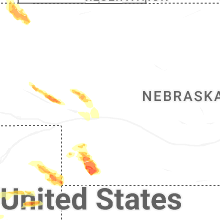
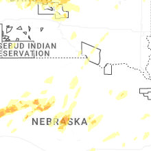
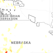
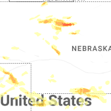
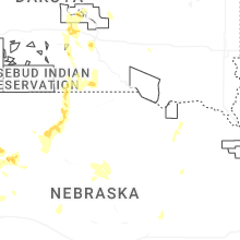
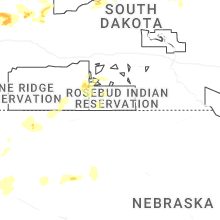
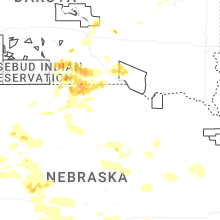
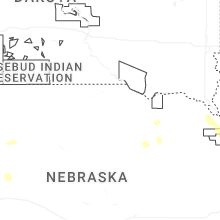
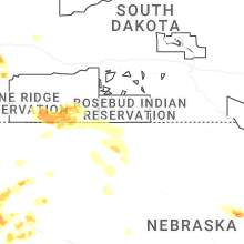
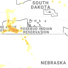
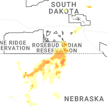
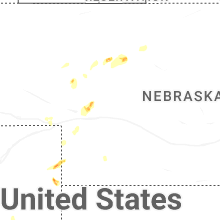
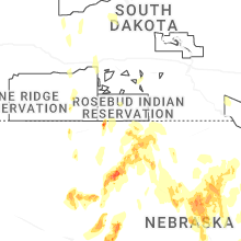


Connect with Interactive Hail Maps