

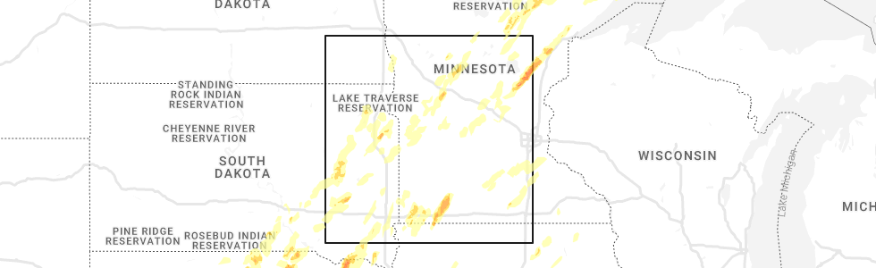
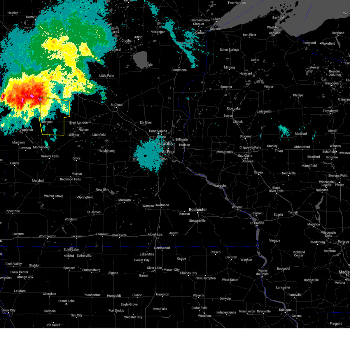
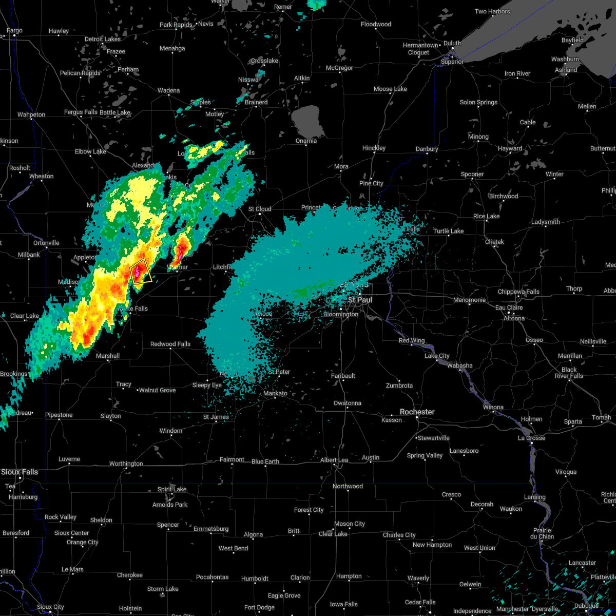
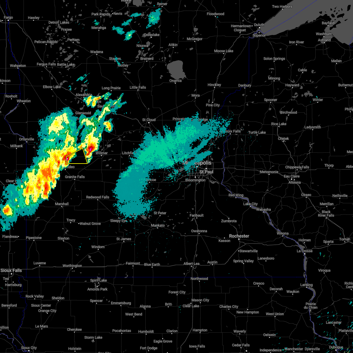
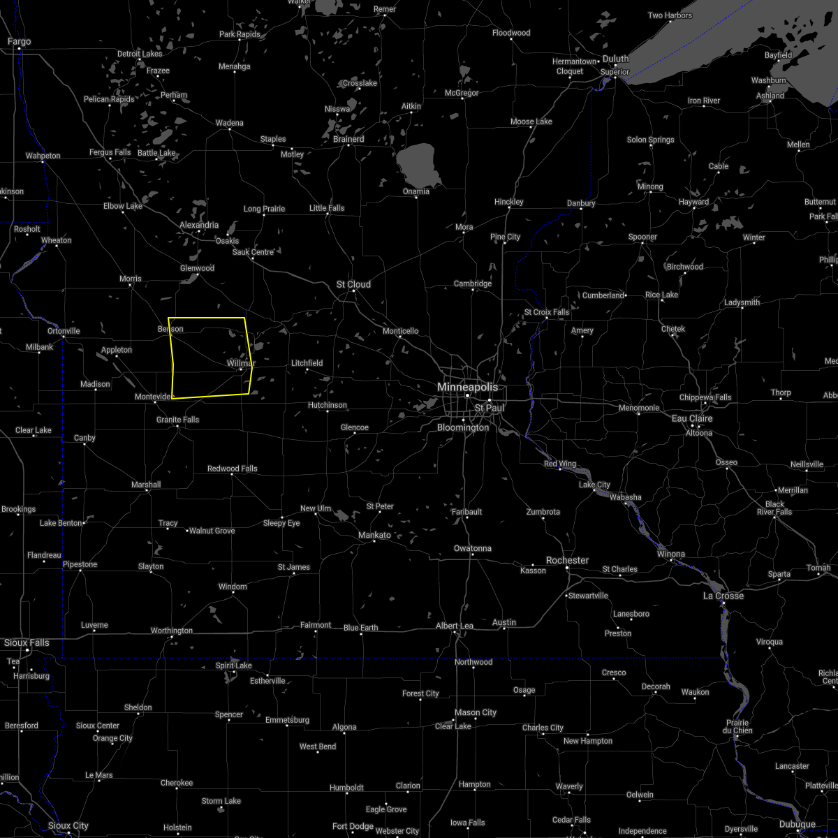
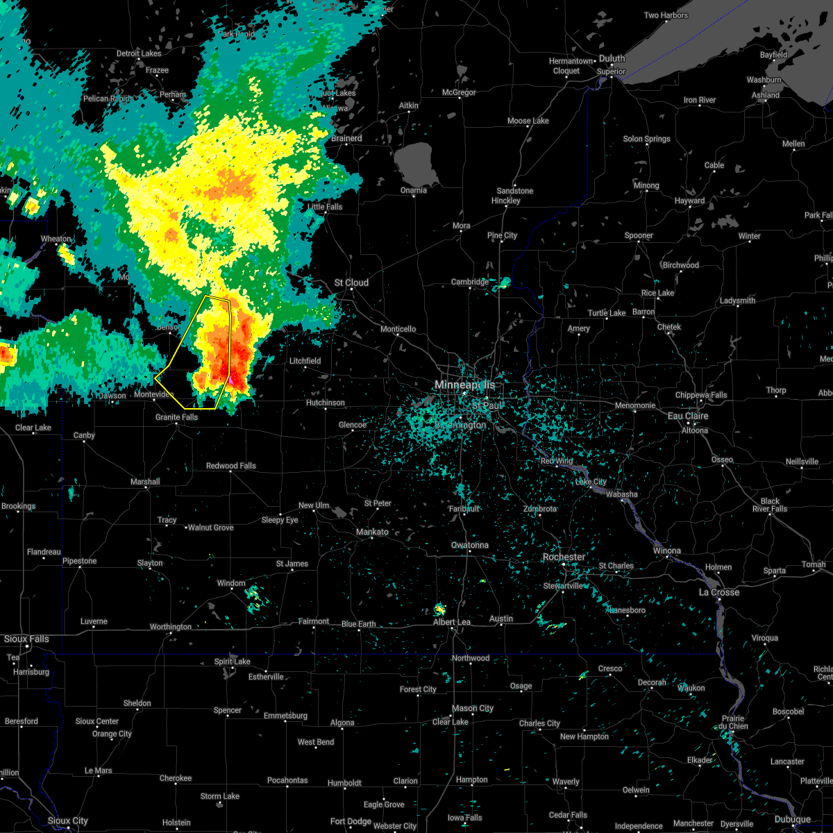
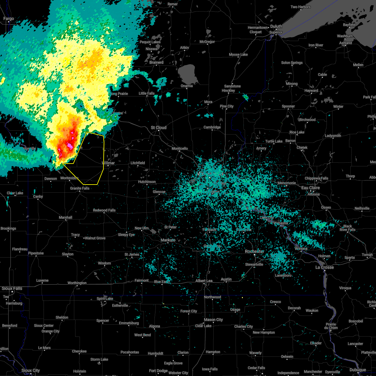
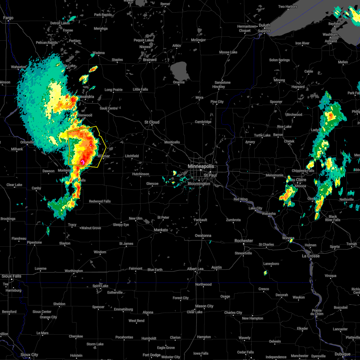
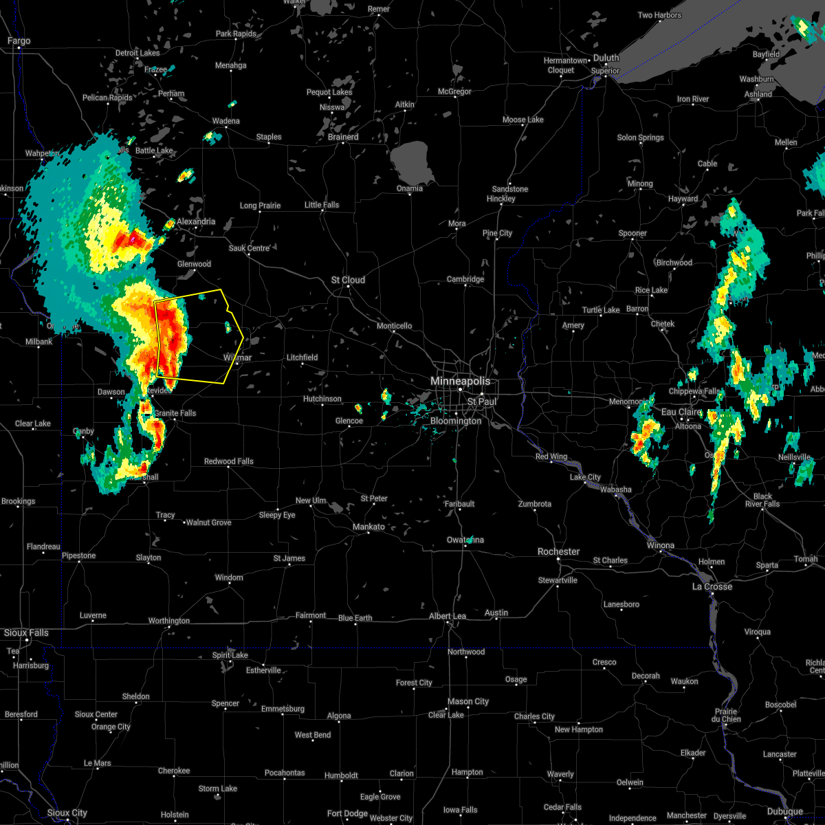
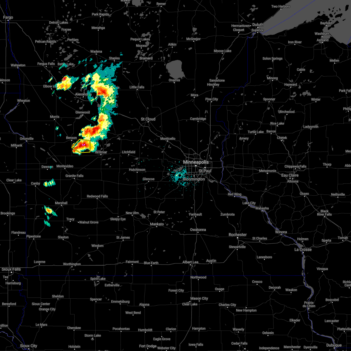
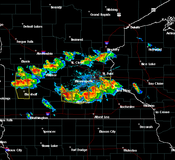
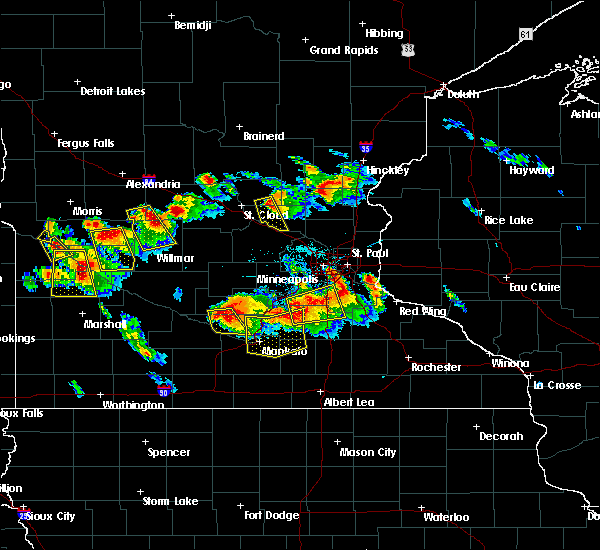
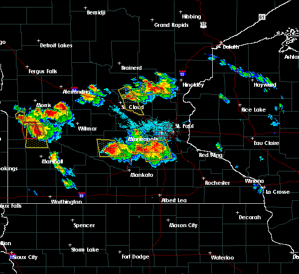
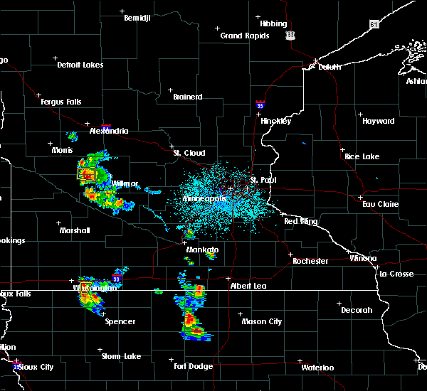
Hail Map for Murdock, MN
The Murdock, MN area has had 0 reports of on-the-ground hail by trained spotters, and has been under severe weather warnings 5 times during the past 12 months. Doppler radar has detected hail at or near Murdock, MN on 47 occasions.
| Name: | Murdock, MN |
| Where Located: | 24.6 miles NE of Montevideo, MN |
| Map: | Google Map for Murdock, MN |
| Population: | 278 |
| Housing Units: | 131 |
| More Info: | Search Google for Murdock, MN |
4
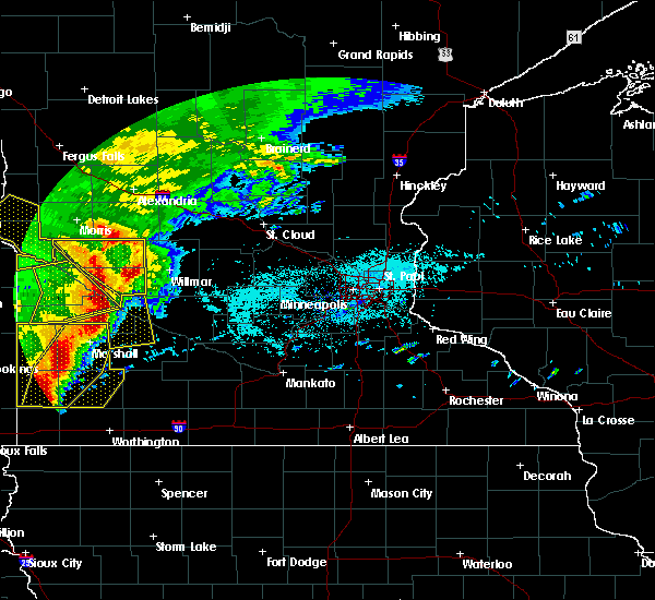
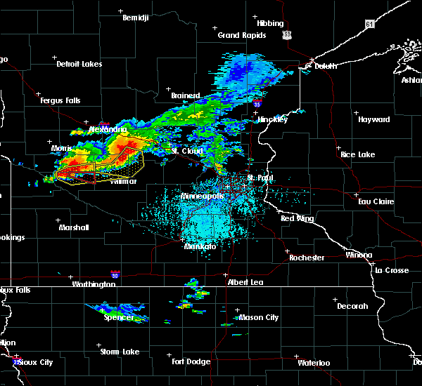
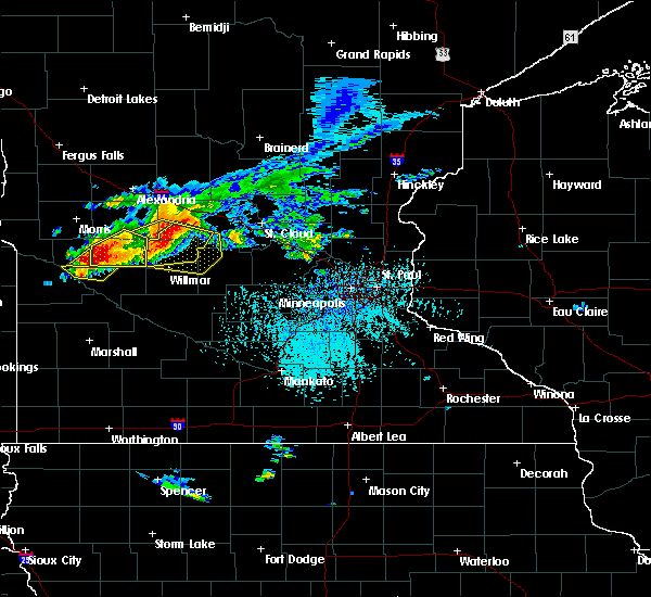
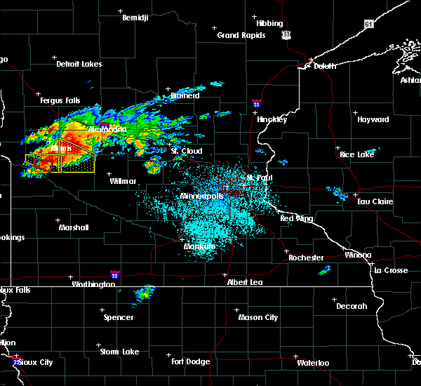
The Top Recent Hail Date for Murdock, MN is Sunday, May 29, 2022 (14th out of 47)
Hail and Wind Damage Spotted near Murdock, MN
| Date / Time | Report Details |
|---|---|
| 7/25/2023 10:59 PM CDT |
 At 1059 pm cdt, a severe thunderstorm was located near new london, or 9 miles north of willmar, moving east at 50 mph (trained weather spotters). Hazards include 60 mph wind gusts and quarter size hail. Hail damage to vehicles is expected. expect wind damage to roofs, siding, and trees. locations impacted include, glenwood, kerkhoven, murdock, grove lake, gilchrist, de graff, sedan, glenwood airport, monson lake state park, swift falls, long beach and lake minnewaska. hail threat, radar indicated max hail size, 1. 00 in wind threat, observed max wind gust, 60 mph. At 1059 pm cdt, a severe thunderstorm was located near new london, or 9 miles north of willmar, moving east at 50 mph (trained weather spotters). Hazards include 60 mph wind gusts and quarter size hail. Hail damage to vehicles is expected. expect wind damage to roofs, siding, and trees. locations impacted include, glenwood, kerkhoven, murdock, grove lake, gilchrist, de graff, sedan, glenwood airport, monson lake state park, swift falls, long beach and lake minnewaska. hail threat, radar indicated max hail size, 1. 00 in wind threat, observed max wind gust, 60 mph.
|
| 7/25/2023 10:45 PM CDT |
 At 1043 pm cdt, a severe thunderstorm was located 10 miles north of kerkhoven, or 16 miles northwest of willmar, moving east at 50 mph (trained weather spotters reported branches down and power outages earlier with this storm). Hazards include 60 mph wind gusts and quarter size hail. Hail damage to vehicles is expected. expect wind damage to roofs, siding, and trees. locations impacted include, benson, glenwood, starbuck, kerkhoven, murdock, lake hassel, grove lake, gilchrist, clontarf, de graff, sedan and glenwood airport. hail threat, radar indicated max hail size, 1. 00 in wind threat, observed max wind gust, 60 mph. At 1043 pm cdt, a severe thunderstorm was located 10 miles north of kerkhoven, or 16 miles northwest of willmar, moving east at 50 mph (trained weather spotters reported branches down and power outages earlier with this storm). Hazards include 60 mph wind gusts and quarter size hail. Hail damage to vehicles is expected. expect wind damage to roofs, siding, and trees. locations impacted include, benson, glenwood, starbuck, kerkhoven, murdock, lake hassel, grove lake, gilchrist, clontarf, de graff, sedan and glenwood airport. hail threat, radar indicated max hail size, 1. 00 in wind threat, observed max wind gust, 60 mph.
|
| 7/25/2023 10:20 PM CDT |
 At 1020 pm cdt, a severe thunderstorm was located near lake hassel, or 17 miles southeast of morris, moving east at 50 mph (trained weather spotters. at 1008 pm the morris airport measured 60 mph winds). Hazards include 60 mph wind gusts and quarter size hail. Hail damage to vehicles is expected. expect wind damage to roofs, siding, and trees. this severe thunderstorm will remain over mainly rural areas of pope and eastern swift counties, including the following locations, glenwood airport, monson lake state park, benson airport, swift falls, grove lake, de graff, lake minnewaska, gilchrist, lake emily and clontarf. hail threat, radar indicated max hail size, 1. 00 in wind threat, observed max wind gust, 60 mph. At 1020 pm cdt, a severe thunderstorm was located near lake hassel, or 17 miles southeast of morris, moving east at 50 mph (trained weather spotters. at 1008 pm the morris airport measured 60 mph winds). Hazards include 60 mph wind gusts and quarter size hail. Hail damage to vehicles is expected. expect wind damage to roofs, siding, and trees. this severe thunderstorm will remain over mainly rural areas of pope and eastern swift counties, including the following locations, glenwood airport, monson lake state park, benson airport, swift falls, grove lake, de graff, lake minnewaska, gilchrist, lake emily and clontarf. hail threat, radar indicated max hail size, 1. 00 in wind threat, observed max wind gust, 60 mph.
|
| 7/25/2023 10:12 PM CDT |
 At 1011 pm cdt, a severe thunderstorm was located near hancock, or 11 miles southeast of morris, moving east at 50 mph (radar indicated. emergency management reported power out earlier with this storm). Hazards include 60 mph wind gusts and quarter size hail. Hail damage to vehicles is expected. expect wind damage to roofs, siding, and trees. this severe thunderstorm will be near, lake hassel around 1025 pm cdt. hail threat, radar indicated max hail size, 1. 00 in wind threat, observed max wind gust, 60 mph. At 1011 pm cdt, a severe thunderstorm was located near hancock, or 11 miles southeast of morris, moving east at 50 mph (radar indicated. emergency management reported power out earlier with this storm). Hazards include 60 mph wind gusts and quarter size hail. Hail damage to vehicles is expected. expect wind damage to roofs, siding, and trees. this severe thunderstorm will be near, lake hassel around 1025 pm cdt. hail threat, radar indicated max hail size, 1. 00 in wind threat, observed max wind gust, 60 mph.
|
| 7/25/2023 10:09 PM CDT |
 At 1008 pm cdt, a severe thunderstorm was located over hancock, or 10 miles southeast of morris, moving east at 50 mph (radar indicated strong winds. emergency managment reportee power out earlier with this storm). Hazards include 60 mph wind gusts and quarter size hail. Hail damage to vehicles is expected. expect wind damage to roofs, siding, and trees. this severe thunderstorm will be near, lake hassel around 1020 pm cdt. hail threat, radar indicated max hail size, 1. 00 in wind threat, observed max wind gust, 60 mph. At 1008 pm cdt, a severe thunderstorm was located over hancock, or 10 miles southeast of morris, moving east at 50 mph (radar indicated strong winds. emergency managment reportee power out earlier with this storm). Hazards include 60 mph wind gusts and quarter size hail. Hail damage to vehicles is expected. expect wind damage to roofs, siding, and trees. this severe thunderstorm will be near, lake hassel around 1020 pm cdt. hail threat, radar indicated max hail size, 1. 00 in wind threat, observed max wind gust, 60 mph.
|
| 9/9/2022 12:20 AM CDT |
 The severe thunderstorm warning for northeastern chippewa and southeastern swift counties will expire at 1230 am cdt, the storm which prompted the warning has weakened below severe limits, and has exited the warned area. therefore, the warning will be allowed to expire. The severe thunderstorm warning for northeastern chippewa and southeastern swift counties will expire at 1230 am cdt, the storm which prompted the warning has weakened below severe limits, and has exited the warned area. therefore, the warning will be allowed to expire.
|
| 9/9/2022 12:15 AM CDT |
 At 1215 am cdt, a severe thunderstorm was located 7 miles southwest of kerkhoven, or 18 miles northeast of montevideo, moving east at 35 mph (radar indicated). Hazards include quarter size hail. Damage to vehicles is expected. this severe thunderstorm will remain over mainly rural areas of northeastern chippewa and southeastern swift counties. hail threat, radar indicated max hail size, 1. 00 in wind threat, radar indicated max wind gust, <50 mph. At 1215 am cdt, a severe thunderstorm was located 7 miles southwest of kerkhoven, or 18 miles northeast of montevideo, moving east at 35 mph (radar indicated). Hazards include quarter size hail. Damage to vehicles is expected. this severe thunderstorm will remain over mainly rural areas of northeastern chippewa and southeastern swift counties. hail threat, radar indicated max hail size, 1. 00 in wind threat, radar indicated max wind gust, <50 mph.
|
| 9/8/2022 11:55 PM CDT |
 At 1155 pm cdt, a severe thunderstorm was located 8 miles northeast of watson, or 8 miles north of montevideo, moving east at 35 mph (radar indicated). Hazards include ping pong ball size hail. People and animals outdoors will be injured. expect damage to roofs, siding, windows, and vehicles. this severe thunderstorm will remain over mainly rural areas of northeastern chippewa and southeastern swift counties. hail threat, radar indicated max hail size, 1. 50 in wind threat, radar indicated max wind gust, <50 mph. At 1155 pm cdt, a severe thunderstorm was located 8 miles northeast of watson, or 8 miles north of montevideo, moving east at 35 mph (radar indicated). Hazards include ping pong ball size hail. People and animals outdoors will be injured. expect damage to roofs, siding, windows, and vehicles. this severe thunderstorm will remain over mainly rural areas of northeastern chippewa and southeastern swift counties. hail threat, radar indicated max hail size, 1. 50 in wind threat, radar indicated max wind gust, <50 mph.
|
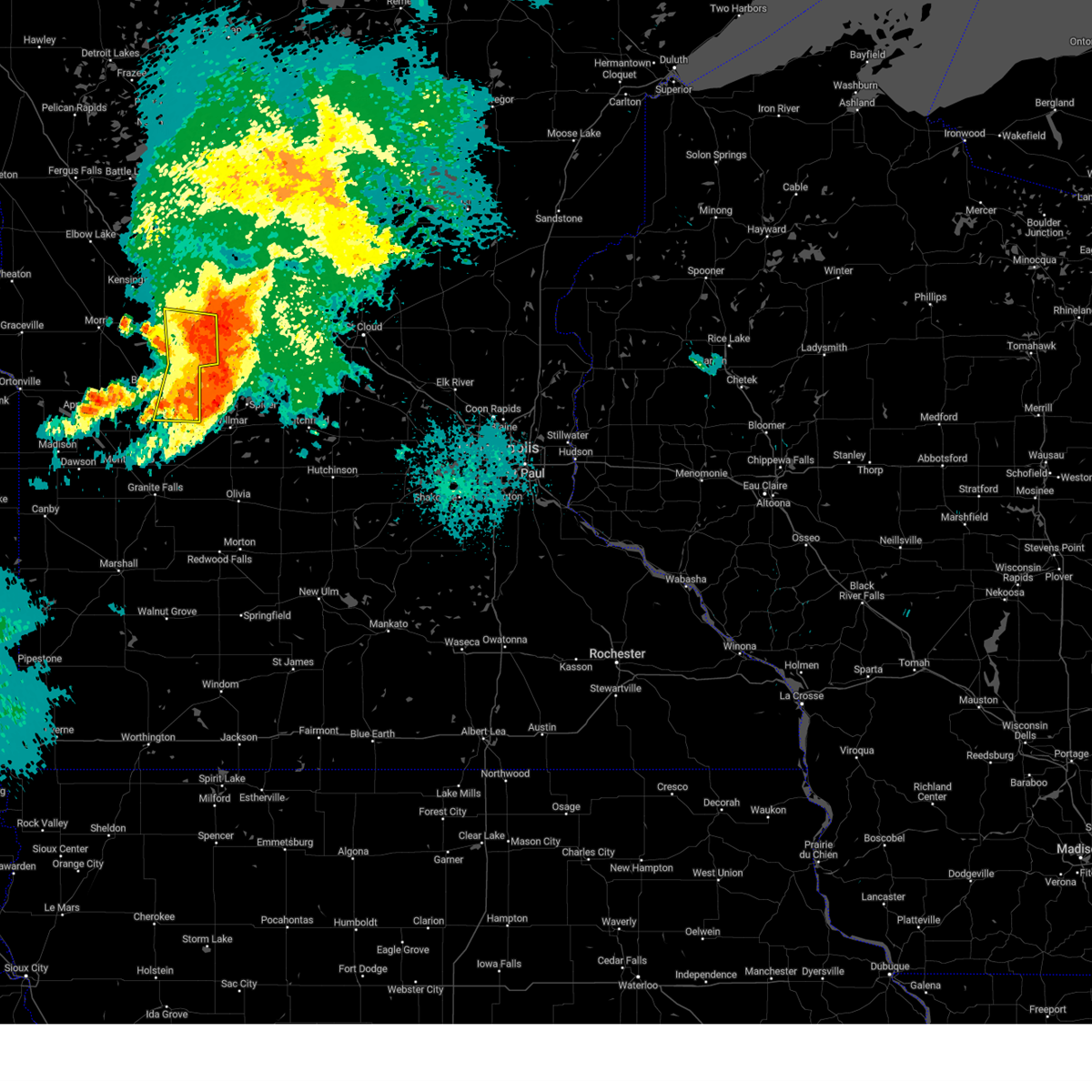
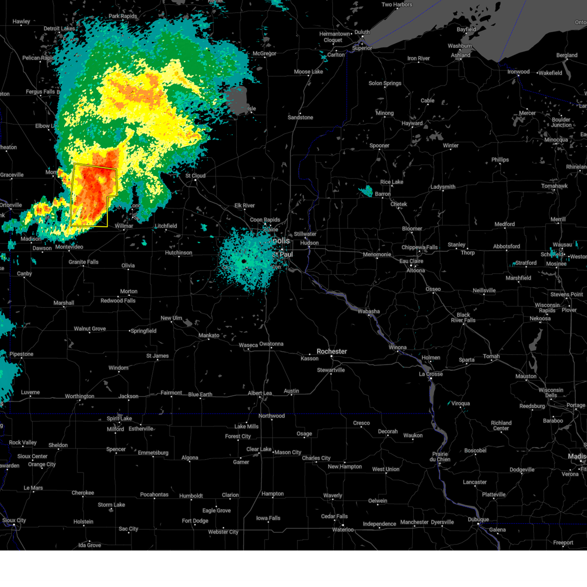
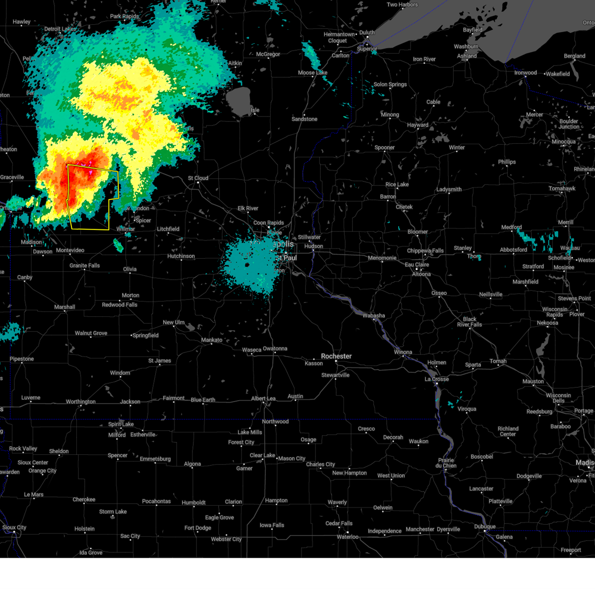
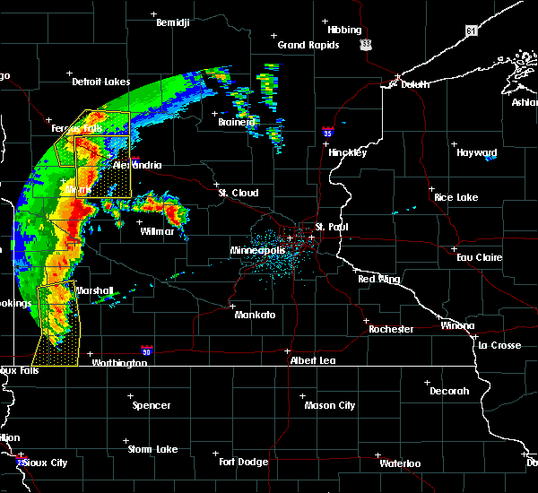
| 5/30/2022 4:50 PM CDT |
 At 450 pm cdt, a severe squall line capable of producing both tornadoes and extensive straight line wind damage was located near murdock, or 19 miles northwest of willmar, moving northeast at 85 mph (radar indicated rotation). Hazards include tornado. Flying debris will be dangerous to those caught without shelter. mobile homes will be damaged or destroyed. damage to roofs, windows, and vehicles will occur. tree damage is likely. Locations impacted include, sauk centre, kerkhoven, brooten, murdock, grove lake, villard, gilchrist, de graff, sunburg, westport, sedan and swift falls. At 450 pm cdt, a severe squall line capable of producing both tornadoes and extensive straight line wind damage was located near murdock, or 19 miles northwest of willmar, moving northeast at 85 mph (radar indicated rotation). Hazards include tornado. Flying debris will be dangerous to those caught without shelter. mobile homes will be damaged or destroyed. damage to roofs, windows, and vehicles will occur. tree damage is likely. Locations impacted include, sauk centre, kerkhoven, brooten, murdock, grove lake, villard, gilchrist, de graff, sunburg, westport, sedan and swift falls.
|
| 5/30/2022 4:44 PM CDT |
 At 443 pm cdt, severe thunderstorms capable of producing both tornadoes and extensive straight line wind damage were located 7 miles southwest of murdock, or 17 miles northeast of montevideo, moving northeast at 85 mph (radar indicated rotation). Hazards include tornado. Flying debris will be dangerous to those caught without shelter. mobile homes will be damaged or destroyed. damage to roofs, windows, and vehicles will occur. Tree damage is likely. At 443 pm cdt, severe thunderstorms capable of producing both tornadoes and extensive straight line wind damage were located 7 miles southwest of murdock, or 17 miles northeast of montevideo, moving northeast at 85 mph (radar indicated rotation). Hazards include tornado. Flying debris will be dangerous to those caught without shelter. mobile homes will be damaged or destroyed. damage to roofs, windows, and vehicles will occur. Tree damage is likely.
|
| 5/30/2022 4:40 PM CDT |
 At 440 pm cdt, severe thunderstorms were located along a line extending from 11 miles southwest of murdock to near maynard to near wood lake, moving northeast at 55 mph (radar indicated). Hazards include 70 mph wind gusts and penny size hail. Expect considerable tree damage. damage is likely to mobile homes, roofs, and outbuildings. Locations impacted include, clara city, kerkhoven, murdock, prinsburg, raymond, willmar and new london. At 440 pm cdt, severe thunderstorms were located along a line extending from 11 miles southwest of murdock to near maynard to near wood lake, moving northeast at 55 mph (radar indicated). Hazards include 70 mph wind gusts and penny size hail. Expect considerable tree damage. damage is likely to mobile homes, roofs, and outbuildings. Locations impacted include, clara city, kerkhoven, murdock, prinsburg, raymond, willmar and new london.
|
| 5/30/2022 4:28 PM CDT |
 At 427 pm cdt, severe thunderstorms were located along a line extending from watson to 5 miles east of clarkfield to near wood lake, moving northeast at 55 mph (radar indicated). Hazards include 70 mph wind gusts and penny size hail. Expect considerable tree damage. damage is likely to mobile homes, roofs, and outbuildings. severe thunderstorms will be near, maynard around 440 pm cdt. clara city and sacred heart around 445 pm cdt. Other locations in the path of these severe thunderstorms include prinsburg, murdock, raymond, kerkhoven and willmar. At 427 pm cdt, severe thunderstorms were located along a line extending from watson to 5 miles east of clarkfield to near wood lake, moving northeast at 55 mph (radar indicated). Hazards include 70 mph wind gusts and penny size hail. Expect considerable tree damage. damage is likely to mobile homes, roofs, and outbuildings. severe thunderstorms will be near, maynard around 440 pm cdt. clara city and sacred heart around 445 pm cdt. Other locations in the path of these severe thunderstorms include prinsburg, murdock, raymond, kerkhoven and willmar.
|
| 5/30/2022 3:52 AM CDT |
 At 351 am cdt, severe thunderstorms were located along a line extending from 8 miles north of watson to near hector, moving northeast at 70 mph (radar indicated). Hazards include 70 mph wind gusts. Expect considerable tree damage. damage is likely to mobile homes, roofs, and outbuildings. severe thunderstorms will be near, hector around 355 am cdt. cosmos around 400 am cdt. other locations in the path of these severe thunderstorms include litchfield. thunderstorm damage threat, considerable hail threat, radar indicated max hail size, <. 75 in wind threat, radar indicated max wind gust, 70 mph. At 351 am cdt, severe thunderstorms were located along a line extending from 8 miles north of watson to near hector, moving northeast at 70 mph (radar indicated). Hazards include 70 mph wind gusts. Expect considerable tree damage. damage is likely to mobile homes, roofs, and outbuildings. severe thunderstorms will be near, hector around 355 am cdt. cosmos around 400 am cdt. other locations in the path of these severe thunderstorms include litchfield. thunderstorm damage threat, considerable hail threat, radar indicated max hail size, <. 75 in wind threat, radar indicated max wind gust, 70 mph.
|
| 5/12/2022 7:00 PM CDT |
 At 659 pm cdt, severe thunderstorms were located along a line extending from 6 miles west of herman to near kensington to near glenwood to near cosmos, moving northeast at 70 mph. these are destructive storms for alexandria and willmar (radar indicated). Hazards include 80 mph wind gusts. Flying debris will be dangerous to those caught without shelter. mobile homes will be heavily damaged. expect considerable damage to roofs, windows, and vehicles. extensive tree damage and power outages are likely. severe thunderstorms will be near, glenwood and kensington around 705 pm cdt. alexandria around 710 pm cdt. evansville and brandon around 715 pm cdt. other locations impacted by these severe thunderstorms include glenwood airport, swift falls, alberta, garfield, willmar airport, villard, blomkest, fish lake, miltona and holmes city. thunderstorm damage threat, destructive hail threat, radar indicated max hail size, <. 75 in wind threat, radar indicated max wind gust, 80 mph. At 659 pm cdt, severe thunderstorms were located along a line extending from 6 miles west of herman to near kensington to near glenwood to near cosmos, moving northeast at 70 mph. these are destructive storms for alexandria and willmar (radar indicated). Hazards include 80 mph wind gusts. Flying debris will be dangerous to those caught without shelter. mobile homes will be heavily damaged. expect considerable damage to roofs, windows, and vehicles. extensive tree damage and power outages are likely. severe thunderstorms will be near, glenwood and kensington around 705 pm cdt. alexandria around 710 pm cdt. evansville and brandon around 715 pm cdt. other locations impacted by these severe thunderstorms include glenwood airport, swift falls, alberta, garfield, willmar airport, villard, blomkest, fish lake, miltona and holmes city. thunderstorm damage threat, destructive hail threat, radar indicated max hail size, <. 75 in wind threat, radar indicated max wind gust, 80 mph.
|
| 5/12/2022 6:36 PM CDT |
 At 635 pm cdt, severe thunderstorms were located along a line extending from near johnson to 5 miles southwest of hancock to 5 miles west of raymond, moving north at 75 mph. these are destructive storms for benson and morris (radar indicated). Hazards include 90 mph wind gusts. You are in a life-threatening situation. flying debris may be deadly to those caught without shelter. mobile homes will be heavily damaged or destroyed. homes and businesses will have substantial roof and window damage. expect extensive tree damage and power outages. these severe storms will be near, hancock and chokio around 640 pm cdt. morris, cyrus and murdock around 645 pm cdt. donnelly around 650 pm cdt. brooten around 700 pm cdt. thunderstorm damage threat, destructive hail threat, radar indicated max hail size, <. 75 in wind threat, radar indicated max wind gust, 90 mph. At 635 pm cdt, severe thunderstorms were located along a line extending from near johnson to 5 miles southwest of hancock to 5 miles west of raymond, moving north at 75 mph. these are destructive storms for benson and morris (radar indicated). Hazards include 90 mph wind gusts. You are in a life-threatening situation. flying debris may be deadly to those caught without shelter. mobile homes will be heavily damaged or destroyed. homes and businesses will have substantial roof and window damage. expect extensive tree damage and power outages. these severe storms will be near, hancock and chokio around 640 pm cdt. morris, cyrus and murdock around 645 pm cdt. donnelly around 650 pm cdt. brooten around 700 pm cdt. thunderstorm damage threat, destructive hail threat, radar indicated max hail size, <. 75 in wind threat, radar indicated max wind gust, 90 mph.
|
| 5/12/2022 6:16 PM CDT |
 At 615 pm cdt, severe thunderstorms were located along a line extending from near milbank to 6 miles southwest of appleton to near hanley falls, moving northeast at 85 mph. these are destructive storms for appleton and benson (radar indicated. at 608 pm cdt, madison airport reported a gust of 94 mph). Hazards include 100 mph wind gusts. You are in a life-threatening situation. flying debris may be deadly to those caught without shelter. mobile homes will be destroyed. expect considerable damage to homes and businesses. expect extensive tree damage and power outages. severe thunderstorms will be near, granite falls and appleton around 620 pm cdt. maynard and lake oliver around 625 pm cdt. clara city around 630 pm cdt. hancock and raymond around 635 pm cdt. kerkhoven, chokio and cyrus around 640 pm cdt. thunderstorm damage threat, destructive hail threat, radar indicated max hail size, <. 75 in wind threat, observed max wind gust, 100 mph. At 615 pm cdt, severe thunderstorms were located along a line extending from near milbank to 6 miles southwest of appleton to near hanley falls, moving northeast at 85 mph. these are destructive storms for appleton and benson (radar indicated. at 608 pm cdt, madison airport reported a gust of 94 mph). Hazards include 100 mph wind gusts. You are in a life-threatening situation. flying debris may be deadly to those caught without shelter. mobile homes will be destroyed. expect considerable damage to homes and businesses. expect extensive tree damage and power outages. severe thunderstorms will be near, granite falls and appleton around 620 pm cdt. maynard and lake oliver around 625 pm cdt. clara city around 630 pm cdt. hancock and raymond around 635 pm cdt. kerkhoven, chokio and cyrus around 640 pm cdt. thunderstorm damage threat, destructive hail threat, radar indicated max hail size, <. 75 in wind threat, observed max wind gust, 100 mph.
|
| 5/9/2022 7:50 AM CDT |
 At 749 am cdt, severe thunderstorms were located along a line extending from 6 miles northwest of murdock to 6 miles south of kerkhoven to 5 miles southwest of prinsburg, moving northeast at 65 mph. these are destructive storms for raymond, pennock, and willmar (radar indicated). Hazards include baseball size hail and 60 mph wind gusts. People and animals outdoors will be severely injured. expect shattered windows, extensive damage to roofs, siding, and vehicles. these severe storms will be near, willmar around 800 am cdt. new london, spicer, brooten and belgrade around 810 am cdt. atwater around 820 am cdt. other locations impacted by these severe thunderstorms include swift falls, kandiyohi, willmar airport, thorpe, de graff, blomkest, padua, regal, priam and pennock. thunderstorm damage threat, destructive hail threat, radar indicated max hail size, 2. 75 in wind threat, radar indicated max wind gust, 60 mph. At 749 am cdt, severe thunderstorms were located along a line extending from 6 miles northwest of murdock to 6 miles south of kerkhoven to 5 miles southwest of prinsburg, moving northeast at 65 mph. these are destructive storms for raymond, pennock, and willmar (radar indicated). Hazards include baseball size hail and 60 mph wind gusts. People and animals outdoors will be severely injured. expect shattered windows, extensive damage to roofs, siding, and vehicles. these severe storms will be near, willmar around 800 am cdt. new london, spicer, brooten and belgrade around 810 am cdt. atwater around 820 am cdt. other locations impacted by these severe thunderstorms include swift falls, kandiyohi, willmar airport, thorpe, de graff, blomkest, padua, regal, priam and pennock. thunderstorm damage threat, destructive hail threat, radar indicated max hail size, 2. 75 in wind threat, radar indicated max wind gust, 60 mph.
|
| 5/9/2022 7:33 AM CDT |
 At 732 am cdt, severe thunderstorms were located along a line extending from 10 miles east of milan to 6 miles east of montevideo to near hanley falls, moving northeast at 65 mph. these are destructive storms for clara city (radar indicated). Hazards include baseball size hail. People and animals outdoors will be severely injured. expect shattered windows, extensive damage to roofs, siding, and vehicles. severe thunderstorms will be near, benson around 740 am cdt. clara city and murdock around 745 am cdt. kerkhoven around 750 am cdt. raymond and prinsburg around 755 am cdt. willmar around 800 am cdt. new london, spicer and brooten around 805 am cdt. belgrade around 810 am cdt. atwater around 815 am cdt. other locations impacted by these severe thunderstorms include benson airport, swift falls, kandiyohi, willmar airport, thorpe, de graff, blomkest, padua, regal and minnesota falls. thunderstorm damage threat, destructive hail threat, radar indicated max hail size, 2. 75 in wind threat, radar indicated max wind gust, <50 mph. At 732 am cdt, severe thunderstorms were located along a line extending from 10 miles east of milan to 6 miles east of montevideo to near hanley falls, moving northeast at 65 mph. these are destructive storms for clara city (radar indicated). Hazards include baseball size hail. People and animals outdoors will be severely injured. expect shattered windows, extensive damage to roofs, siding, and vehicles. severe thunderstorms will be near, benson around 740 am cdt. clara city and murdock around 745 am cdt. kerkhoven around 750 am cdt. raymond and prinsburg around 755 am cdt. willmar around 800 am cdt. new london, spicer and brooten around 805 am cdt. belgrade around 810 am cdt. atwater around 815 am cdt. other locations impacted by these severe thunderstorms include benson airport, swift falls, kandiyohi, willmar airport, thorpe, de graff, blomkest, padua, regal and minnesota falls. thunderstorm damage threat, destructive hail threat, radar indicated max hail size, 2. 75 in wind threat, radar indicated max wind gust, <50 mph.
|
| 8/28/2021 11:05 AM CDT |
 The severe thunderstorm warning for northeastern swift county will expire at 1115 am cdt, the storm which prompted the warning has moved out of the area. therefore, the warning will be allowed to expire. a severe thunderstorm watch remains in effect until noon cdt for central and west central minnesota. The severe thunderstorm warning for northeastern swift county will expire at 1115 am cdt, the storm which prompted the warning has moved out of the area. therefore, the warning will be allowed to expire. a severe thunderstorm watch remains in effect until noon cdt for central and west central minnesota.
|
| 8/28/2021 10:31 AM CDT |
 At 1030 am cdt, a severe thunderstorm was located over benson, or 22 miles southeast of morris, moving east at 35 mph. this is a destructive storm for benson and northeast swift county (trained weather spotters). Hazards include baseball size hail and 60 mph wind gusts. People and animals outdoors will be severely injured. expect shattered windows, extensive damage to roofs, siding, and vehicles. this severe thunderstorm will be near, benson around 1035 am cdt. lake hassel around 1040 am cdt. murdock around 1055 am cdt. other locations impacted by this severe thunderstorm include de graff, swift falls and clontarf. thunderstorm damage threat, destructive hail threat, observed max hail size, 2. 75 in wind threat, radar indicated max wind gust, 60 mph. At 1030 am cdt, a severe thunderstorm was located over benson, or 22 miles southeast of morris, moving east at 35 mph. this is a destructive storm for benson and northeast swift county (trained weather spotters). Hazards include baseball size hail and 60 mph wind gusts. People and animals outdoors will be severely injured. expect shattered windows, extensive damage to roofs, siding, and vehicles. this severe thunderstorm will be near, benson around 1035 am cdt. lake hassel around 1040 am cdt. murdock around 1055 am cdt. other locations impacted by this severe thunderstorm include de graff, swift falls and clontarf. thunderstorm damage threat, destructive hail threat, observed max hail size, 2. 75 in wind threat, radar indicated max wind gust, 60 mph.
|
| 8/26/2021 11:52 AM CDT |
 The severe thunderstorm warning for northeastern chippewa, eastern swift and western kandiyohi counties will expire at noon cdt, the storms which prompted the warning have weakened below severe limits, and no longer pose an immediate threat to life or property. therefore, the warning will be allowed to expire. however gusty winds and heavy rain are still possible with these thunderstorms. a severe thunderstorm watch remains in effect until 300 pm cdt for central and west central minnesota. to report severe weather and damage resulting from severe weather, contact your nearest law enforcement agency. they will relay your report to the national weather service the twin cities. The severe thunderstorm warning for northeastern chippewa, eastern swift and western kandiyohi counties will expire at noon cdt, the storms which prompted the warning have weakened below severe limits, and no longer pose an immediate threat to life or property. therefore, the warning will be allowed to expire. however gusty winds and heavy rain are still possible with these thunderstorms. a severe thunderstorm watch remains in effect until 300 pm cdt for central and west central minnesota. to report severe weather and damage resulting from severe weather, contact your nearest law enforcement agency. they will relay your report to the national weather service the twin cities.
|
| 8/26/2021 11:37 AM CDT |
 At 1135 am cdt, severe thunderstorms were located along a line extending from near lake hassel to 5 miles southwest of murdock to near maynard, moving east at 50 mph. benson, mn recently reported a gust of 78 mph (radar indicated). Hazards include 70 mph wind gusts and penny size hail. Expect considerable tree damage. damage is likely to mobile homes, roofs, and outbuildings. severe thunderstorms will be near, murdock around 1140 am cdt. kerkhoven around 1145 am cdt. raymond around 1150 am cdt. willmar around 1155 am cdt. thunderstorm damage threat, considerable hail threat, radar indicated max hail size, 0. 75 in wind threat, observed max wind gust, 70 mph. At 1135 am cdt, severe thunderstorms were located along a line extending from near lake hassel to 5 miles southwest of murdock to near maynard, moving east at 50 mph. benson, mn recently reported a gust of 78 mph (radar indicated). Hazards include 70 mph wind gusts and penny size hail. Expect considerable tree damage. damage is likely to mobile homes, roofs, and outbuildings. severe thunderstorms will be near, murdock around 1140 am cdt. kerkhoven around 1145 am cdt. raymond around 1150 am cdt. willmar around 1155 am cdt. thunderstorm damage threat, considerable hail threat, radar indicated max hail size, 0. 75 in wind threat, observed max wind gust, 70 mph.
|
| 8/28/2020 3:36 AM CDT |
 At 336 am cdt, severe thunderstorms were located along a line extending from near murdock to near renville to near redwood falls to near wabasso, moving east at 65 mph (radar indicated). Hazards include 60 mph wind gusts and quarter size hail. Hail damage to vehicles is expected. expect wind damage to roofs, siding, and trees. these severe storms will be near, morton around 340 am cdt. bird island around 345 am cdt. morgan and franklin around 350 am cdt. willmar and hector around 355 am cdt. fairfax around 400 am cdt. Other locations impacted by these severe thunderstorms include bechyn, seaforth, delhi, clements, lucan, willmar airport, revere, redwood falls airport, thorpe and cobden. At 336 am cdt, severe thunderstorms were located along a line extending from near murdock to near renville to near redwood falls to near wabasso, moving east at 65 mph (radar indicated). Hazards include 60 mph wind gusts and quarter size hail. Hail damage to vehicles is expected. expect wind damage to roofs, siding, and trees. these severe storms will be near, morton around 340 am cdt. bird island around 345 am cdt. morgan and franklin around 350 am cdt. willmar and hector around 355 am cdt. fairfax around 400 am cdt. Other locations impacted by these severe thunderstorms include bechyn, seaforth, delhi, clements, lucan, willmar airport, revere, redwood falls airport, thorpe and cobden.
|
| 8/28/2020 3:23 AM CDT |
 At 322 am cdt, severe thunderstorms were located along a line extending from 7 miles north of watson to near granite falls to near echo to 7 miles north of walnut grove, moving east at 65 mph (radar indicated). Hazards include 60 mph wind gusts. Expect damage to roofs, siding, and trees. these severe storms will be near, wabasso around 330 am cdt. redwood falls, renville and prinsburg around 335 am cdt. morton and murdock around 340 am cdt. kerkhoven around 345 am cdt. morgan and franklin around 350 am cdt. willmar and hector around 355 am cdt. fairfax around 400 am cdt. Other locations impacted by these severe thunderstorms include bechyn, seaforth, asbury, delhi, clements, willmar airport, revere, blomkest, lake lillian and belview. At 322 am cdt, severe thunderstorms were located along a line extending from 7 miles north of watson to near granite falls to near echo to 7 miles north of walnut grove, moving east at 65 mph (radar indicated). Hazards include 60 mph wind gusts. Expect damage to roofs, siding, and trees. these severe storms will be near, wabasso around 330 am cdt. redwood falls, renville and prinsburg around 335 am cdt. morton and murdock around 340 am cdt. kerkhoven around 345 am cdt. morgan and franklin around 350 am cdt. willmar and hector around 355 am cdt. fairfax around 400 am cdt. Other locations impacted by these severe thunderstorms include bechyn, seaforth, asbury, delhi, clements, willmar airport, revere, blomkest, lake lillian and belview.
|
| 8/28/2020 2:58 AM CDT |
 At 258 am cdt, severe thunderstorms were located along a line extending from near madison to near clarkfield to ghent to near balaton, moving east at 65 mph (radar indicated). Hazards include 60 mph wind gusts. Expect damage to roofs, siding, and trees. severe thunderstorms will be near, clarkfield around 305 am cdt. dawson and hanley falls around 310 am cdt. granite falls, wood lake and milan around 315 am cdt. walnut grove, maynard, echo and watson around 320 am cdt. sacred heart around 325 am cdt. redwood falls, renville and wabasso around 330 am cdt. prinsburg around 335 am cdt. olivia, morton and murdock around 340 am cdt. other locations impacted by these severe thunderstorms include bechyn, seaforth, asbury, delhi, clements, willmar airport, revere, blomkest, lake lillian and belview. This includes prairies edge casino resort and jackpot junction casino. At 258 am cdt, severe thunderstorms were located along a line extending from near madison to near clarkfield to ghent to near balaton, moving east at 65 mph (radar indicated). Hazards include 60 mph wind gusts. Expect damage to roofs, siding, and trees. severe thunderstorms will be near, clarkfield around 305 am cdt. dawson and hanley falls around 310 am cdt. granite falls, wood lake and milan around 315 am cdt. walnut grove, maynard, echo and watson around 320 am cdt. sacred heart around 325 am cdt. redwood falls, renville and wabasso around 330 am cdt. prinsburg around 335 am cdt. olivia, morton and murdock around 340 am cdt. other locations impacted by these severe thunderstorms include bechyn, seaforth, asbury, delhi, clements, willmar airport, revere, blomkest, lake lillian and belview. This includes prairies edge casino resort and jackpot junction casino.
|
| 8/24/2020 3:24 AM CDT |
 The severe thunderstorm warning for southeastern pope, northeastern chippewa, eastern swift and northwestern kandiyohi counties will expire at 330 am cdt, the storms which prompted the warning have moved out of the area. therefore, the warning will be allowed to expire. remember, a severe thunderstorm warning still remains in effect for the rest of kandiyohi county. The severe thunderstorm warning for southeastern pope, northeastern chippewa, eastern swift and northwestern kandiyohi counties will expire at 330 am cdt, the storms which prompted the warning have moved out of the area. therefore, the warning will be allowed to expire. remember, a severe thunderstorm warning still remains in effect for the rest of kandiyohi county.
|
| 8/24/2020 3:09 AM CDT |
 At 240 am cdt, severe thunderstorms were located along a line extending from near starbuck to benson to near milan, moving southeast at 45 mph. these are very dangerous storms (at 240 am, a 79 mph wind gust was reported in benson). Hazards include 80 mph wind gusts and quarter size hail. Flying debris will be dangerous to those caught without shelter. mobile homes will be heavily damaged. expect considerable damage to roofs, windows, and vehicles. extensive tree damage and power outages are likely. severe thunderstorms will be near, murdock around 300 am cdt. kerkhoven around 305 am cdt. clara city, raymond and maynard around 320 am cdt. Other locations impacted by these severe thunderstorms include gilchrist, swift falls, big bend city, de graff, sunburg, gluek, priam and pennock. At 240 am cdt, severe thunderstorms were located along a line extending from near starbuck to benson to near milan, moving southeast at 45 mph. these are very dangerous storms (at 240 am, a 79 mph wind gust was reported in benson). Hazards include 80 mph wind gusts and quarter size hail. Flying debris will be dangerous to those caught without shelter. mobile homes will be heavily damaged. expect considerable damage to roofs, windows, and vehicles. extensive tree damage and power outages are likely. severe thunderstorms will be near, murdock around 300 am cdt. kerkhoven around 305 am cdt. clara city, raymond and maynard around 320 am cdt. Other locations impacted by these severe thunderstorms include gilchrist, swift falls, big bend city, de graff, sunburg, gluek, priam and pennock.
|
| 8/24/2020 2:41 AM CDT |
 At 240 am cdt, severe thunderstorms were located along a line extending from near starbuck to benson to near milan, moving southeast at 45 mph. these are very dangerous storms (at 240 am, a 79 mph wind gust was reported in benson). Hazards include 80 mph wind gusts and quarter size hail. Flying debris will be dangerous to those caught without shelter. mobile homes will be heavily damaged. expect considerable damage to roofs, windows, and vehicles. extensive tree damage and power outages are likely. severe thunderstorms will be near, murdock around 300 am cdt. kerkhoven around 305 am cdt. clara city, raymond and maynard around 320 am cdt. Other locations impacted by these severe thunderstorms include gilchrist, swift falls, big bend city, de graff, sunburg, gluek, priam and pennock. At 240 am cdt, severe thunderstorms were located along a line extending from near starbuck to benson to near milan, moving southeast at 45 mph. these are very dangerous storms (at 240 am, a 79 mph wind gust was reported in benson). Hazards include 80 mph wind gusts and quarter size hail. Flying debris will be dangerous to those caught without shelter. mobile homes will be heavily damaged. expect considerable damage to roofs, windows, and vehicles. extensive tree damage and power outages are likely. severe thunderstorms will be near, murdock around 300 am cdt. kerkhoven around 305 am cdt. clara city, raymond and maynard around 320 am cdt. Other locations impacted by these severe thunderstorms include gilchrist, swift falls, big bend city, de graff, sunburg, gluek, priam and pennock.
|
| 8/21/2020 7:43 PM CDT |
 At 743 pm cdt, severe thunderstorms were located along a line extending from 9 miles west of brooten to 6 miles northeast of kerkhoven to near raymond, moving east at 50 mph (radar indicated). Hazards include 70 mph wind gusts and nickel size hail. Expect considerable tree damage. damage is likely to mobile homes, roofs, and outbuildings. these severe storms will be near, willmar around 800 pm cdt. Other locations impacted by these severe thunderstorms include benson airport, gilchrist, swift falls, clontarf, willmar airport, norway lake, de graff, sunburg, priam and pennock. At 743 pm cdt, severe thunderstorms were located along a line extending from 9 miles west of brooten to 6 miles northeast of kerkhoven to near raymond, moving east at 50 mph (radar indicated). Hazards include 70 mph wind gusts and nickel size hail. Expect considerable tree damage. damage is likely to mobile homes, roofs, and outbuildings. these severe storms will be near, willmar around 800 pm cdt. Other locations impacted by these severe thunderstorms include benson airport, gilchrist, swift falls, clontarf, willmar airport, norway lake, de graff, sunburg, priam and pennock.
|
| 8/21/2020 7:33 PM CDT |
 At 733 pm cdt, severe thunderstorms were located along a line extending from 8 miles northeast of lake hassel to near murdock to 8 miles northwest of clara city, moving east at 25 mph (radar indicated). Hazards include 70 mph wind gusts and nickel size hail. Expect considerable tree damage. damage is likely to mobile homes, roofs, and outbuildings. these severe storms will be near, kerkhoven around 740 pm cdt. raymond around 800 pm cdt. willmar around 820 pm cdt. Other locations impacted by these severe thunderstorms include benson airport, gilchrist, swift falls, clontarf, willmar airport, norway lake, de graff, sunburg, priam and pennock. At 733 pm cdt, severe thunderstorms were located along a line extending from 8 miles northeast of lake hassel to near murdock to 8 miles northwest of clara city, moving east at 25 mph (radar indicated). Hazards include 70 mph wind gusts and nickel size hail. Expect considerable tree damage. damage is likely to mobile homes, roofs, and outbuildings. these severe storms will be near, kerkhoven around 740 pm cdt. raymond around 800 pm cdt. willmar around 820 pm cdt. Other locations impacted by these severe thunderstorms include benson airport, gilchrist, swift falls, clontarf, willmar airport, norway lake, de graff, sunburg, priam and pennock.
|
| 8/21/2020 7:20 PM CDT |
 At 719 pm cdt, severe thunderstorms were located along a line extending from 6 miles northwest of lake hassel to near benson to 7 miles northeast of montevideo, moving east at 15 mph (radar indicated). Hazards include 70 mph wind gusts and quarter size hail. Hail damage to vehicles is expected. expect considerable tree damage. wind damage is also likely to mobile homes, roofs, and outbuildings. severe thunderstorms will be near, lake hassel around 735 pm cdt. murdock around 805 pm cdt. raymond and kerkhoven around 815 pm cdt. Other locations impacted by these severe thunderstorms include benson airport, gilchrist, swift falls, clontarf, willmar airport, norway lake, de graff, sunburg, priam and pennock. At 719 pm cdt, severe thunderstorms were located along a line extending from 6 miles northwest of lake hassel to near benson to 7 miles northeast of montevideo, moving east at 15 mph (radar indicated). Hazards include 70 mph wind gusts and quarter size hail. Hail damage to vehicles is expected. expect considerable tree damage. wind damage is also likely to mobile homes, roofs, and outbuildings. severe thunderstorms will be near, lake hassel around 735 pm cdt. murdock around 805 pm cdt. raymond and kerkhoven around 815 pm cdt. Other locations impacted by these severe thunderstorms include benson airport, gilchrist, swift falls, clontarf, willmar airport, norway lake, de graff, sunburg, priam and pennock.
|
| 7/18/2020 12:44 AM CDT |
 At 1244 am cdt, severe thunderstorms were located along a line extending from near revillo to 7 miles west of milan to 8 miles northeast of kerkhoven, moving southeast at 55 mph (radar indicated). Hazards include 70 mph wind gusts. Expect considerable tree damage. damage is likely to mobile homes, roofs, and outbuildings. severe thunderstorms will be near, willmar, new london and spicer around 1255 am cdt. watson around 100 am cdt. montevideo around 105 am cdt. canby and atwater around 110 am cdt. granite falls, maynard and porter around 120 am cdt. sacred heart around 130 am cdt. renville around 135 am cdt. other locations impacted by these severe thunderstorms include nassau, asbury, willmar airport, blomkest, st. leo, lake lillian, green lake, madison airport, hazel run and cerro gordo. This also includes prairies edge casino resort. At 1244 am cdt, severe thunderstorms were located along a line extending from near revillo to 7 miles west of milan to 8 miles northeast of kerkhoven, moving southeast at 55 mph (radar indicated). Hazards include 70 mph wind gusts. Expect considerable tree damage. damage is likely to mobile homes, roofs, and outbuildings. severe thunderstorms will be near, willmar, new london and spicer around 1255 am cdt. watson around 100 am cdt. montevideo around 105 am cdt. canby and atwater around 110 am cdt. granite falls, maynard and porter around 120 am cdt. sacred heart around 130 am cdt. renville around 135 am cdt. other locations impacted by these severe thunderstorms include nassau, asbury, willmar airport, blomkest, st. leo, lake lillian, green lake, madison airport, hazel run and cerro gordo. This also includes prairies edge casino resort.
|
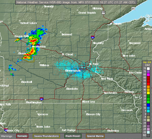
| 7/11/2020 11:57 AM CDT |
 The severe thunderstorm warning for southeastern swift county will expire at noon cdt, the storm which prompted the warning has weakened below severe limits, and no longer poses an immediate threat to life or property. therefore, the warning will be allowed to expire. however small hail is still possible with this thunderstorm. to report severe weather, contact your nearest law enforcement agency. they will relay your report to the national weather service the twin cities. The severe thunderstorm warning for southeastern swift county will expire at noon cdt, the storm which prompted the warning has weakened below severe limits, and no longer poses an immediate threat to life or property. therefore, the warning will be allowed to expire. however small hail is still possible with this thunderstorm. to report severe weather, contact your nearest law enforcement agency. they will relay your report to the national weather service the twin cities.
|
| 7/11/2020 11:51 AM CDT |
 At 1151 am cdt, a severe thunderstorm was located near murdock, or 16 miles northwest of willmar, moving east at 30 mph (radar indicated). Hazards include 60 mph wind gusts and quarter size hail. Hail damage to vehicles is expected. expect wind damage to roofs, siding, and trees. Locations impacted include, kerkhoven, murdock and de graff. At 1151 am cdt, a severe thunderstorm was located near murdock, or 16 miles northwest of willmar, moving east at 30 mph (radar indicated). Hazards include 60 mph wind gusts and quarter size hail. Hail damage to vehicles is expected. expect wind damage to roofs, siding, and trees. Locations impacted include, kerkhoven, murdock and de graff.
|
| 7/11/2020 11:49 AM CDT | Reported at us hwy 12 and swift county road 31. measured 5.4 inch diameter tree branch snapped of in swift county MN, 4.5 miles SE of Murdock, MN |
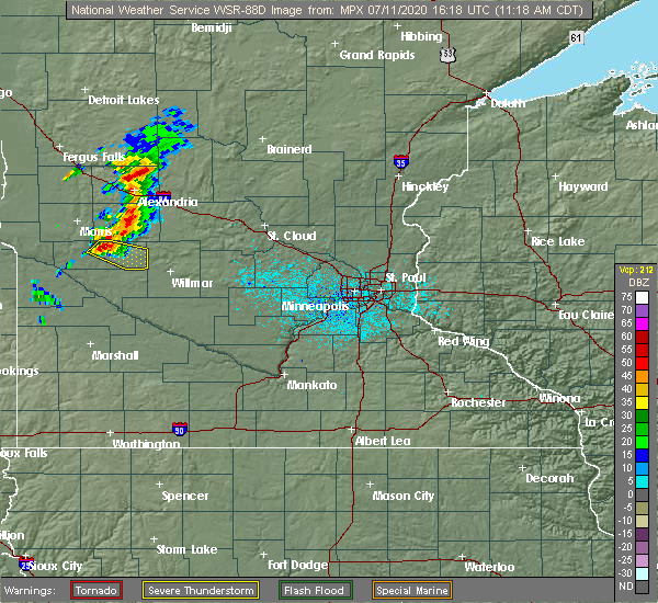
| 7/11/2020 11:40 AM CDT |
 At 1140 am cdt, a severe thunderstorm was located near murdock, or 22 miles northwest of willmar, moving east at 30 mph (radar indicated). Hazards include 60 mph wind gusts and quarter size hail. Hail damage to vehicles is expected. expect wind damage to roofs, siding, and trees. Locations impacted include, benson, kerkhoven, murdock and de graff. At 1140 am cdt, a severe thunderstorm was located near murdock, or 22 miles northwest of willmar, moving east at 30 mph (radar indicated). Hazards include 60 mph wind gusts and quarter size hail. Hail damage to vehicles is expected. expect wind damage to roofs, siding, and trees. Locations impacted include, benson, kerkhoven, murdock and de graff.
|
| 7/11/2020 11:27 AM CDT |
 At 1126 am cdt, a severe thunderstorm was located over benson, or 24 miles southeast of morris, moving east at 30 mph (radar indicated). Hazards include 60 mph wind gusts and quarter size hail. Hail damage to vehicles is expected. expect wind damage to roofs, siding, and trees. Locations impacted include, benson, kerkhoven, murdock, lake hassel, clontarf, de graff and benson airport. At 1126 am cdt, a severe thunderstorm was located over benson, or 24 miles southeast of morris, moving east at 30 mph (radar indicated). Hazards include 60 mph wind gusts and quarter size hail. Hail damage to vehicles is expected. expect wind damage to roofs, siding, and trees. Locations impacted include, benson, kerkhoven, murdock, lake hassel, clontarf, de graff and benson airport.
|
| 7/11/2020 11:17 AM CDT |
 At 1116 am cdt, a severe thunderstorm was located near benson, or 19 miles southeast of morris, moving east at 30 mph (radar indicated). Hazards include 60 mph wind gusts and quarter size hail. Hail damage to vehicles is expected. Expect wind damage to roofs, siding, and trees. At 1116 am cdt, a severe thunderstorm was located near benson, or 19 miles southeast of morris, moving east at 30 mph (radar indicated). Hazards include 60 mph wind gusts and quarter size hail. Hail damage to vehicles is expected. Expect wind damage to roofs, siding, and trees.
|
| 9/2/2019 8:58 PM CDT |
 A severe thunderstorm warning remains in effect until 915 pm cdt for south central todd. western stearns. southeastern swift and northern kandiyohi counties. At 857 pm cdt, severe thunderstorms were located along a line extending from near upsala to near paynesville to near willmar to 10 miles southwest of murdock, moving east at 50 mph. A severe thunderstorm warning remains in effect until 915 pm cdt for south central todd. western stearns. southeastern swift and northern kandiyohi counties. At 857 pm cdt, severe thunderstorms were located along a line extending from near upsala to near paynesville to near willmar to 10 miles southwest of murdock, moving east at 50 mph.
|
| 9/2/2019 8:38 PM CDT |
 At 837 pm cdt, severe thunderstorms were located along a line extending from 7 miles east of lake osakis to near brooten to near murdock to 7 miles east of appleton, moving east at 45 mph (law enforcement). Hazards include 70 mph wind gusts and quarter size hail. Hail damage to vehicles is expected. expect considerable tree damage. wind damage is also likely to mobile homes, roofs, and outbuildings. Locations impacted include, willmar, sauk centre, melrose, benson, glenwood, albany, paynesville, appleton, new london, spicer, kerkhoven and brooten. At 837 pm cdt, severe thunderstorms were located along a line extending from 7 miles east of lake osakis to near brooten to near murdock to 7 miles east of appleton, moving east at 45 mph (law enforcement). Hazards include 70 mph wind gusts and quarter size hail. Hail damage to vehicles is expected. expect considerable tree damage. wind damage is also likely to mobile homes, roofs, and outbuildings. Locations impacted include, willmar, sauk centre, melrose, benson, glenwood, albany, paynesville, appleton, new london, spicer, kerkhoven and brooten.
|
| 9/2/2019 8:20 PM CDT |
 At 819 pm cdt, severe thunderstorms were located along a line extending from near lake osakis to near glenwood to near benson to near correll, moving east at 45 mph (radar indicated). Hazards include 70 mph wind gusts and quarter size hail. Hail damage to vehicles is expected. expect considerable tree damage. Wind damage is also likely to mobile homes, roofs, and outbuildings. At 819 pm cdt, severe thunderstorms were located along a line extending from near lake osakis to near glenwood to near benson to near correll, moving east at 45 mph (radar indicated). Hazards include 70 mph wind gusts and quarter size hail. Hail damage to vehicles is expected. expect considerable tree damage. Wind damage is also likely to mobile homes, roofs, and outbuildings.
|
| 6/6/2018 3:11 AM CDT |
 At 310 am cdt, severe thunderstorms were located along a line extending from villard to near sunburg to 8 miles north of gluek, moving east at 60 mph (radar indicated. at 300am a 67 mph wind gust was reported at benson). Hazards include 60 mph wind gusts. Expect damage to roofs, siding, and trees. severe thunderstorms will be near, sauk centre around 325 am cdt. willmar, melrose, new london and spicer around 330 am cdt. freeport around 335 am cdt. st. anthony and paynesville around 340 am cdt. albany, avon and holdingford around 345 am cdt. other locations impacted by these severe thunderstorms include spring hill, st. Martin, greenwald, green lake, new munich, meire grove, sedan and westport. At 310 am cdt, severe thunderstorms were located along a line extending from villard to near sunburg to 8 miles north of gluek, moving east at 60 mph (radar indicated. at 300am a 67 mph wind gust was reported at benson). Hazards include 60 mph wind gusts. Expect damage to roofs, siding, and trees. severe thunderstorms will be near, sauk centre around 325 am cdt. willmar, melrose, new london and spicer around 330 am cdt. freeport around 335 am cdt. st. anthony and paynesville around 340 am cdt. albany, avon and holdingford around 345 am cdt. other locations impacted by these severe thunderstorms include spring hill, st. Martin, greenwald, green lake, new munich, meire grove, sedan and westport.
|
| 6/6/2018 2:45 AM CDT |
 At 244 am cdt, severe thunderstorms were located along a line extending from near lowry to hancock to appleton, moving east at 50 mph (radar indicated). Hazards include 60 mph wind gusts and penny size hail. Expect damage to roofs, siding, and trees. these severe storms will be near, lowry around 250 am cdt. starbuck around 300 am cdt. benson and glenwood around 310 am cdt. murdock around 315 am cdt. Other locations impacted by these severe thunderstorms include westport, swift falls, alberta, grove lake, de graff, villard, and lake minnewaska. At 244 am cdt, severe thunderstorms were located along a line extending from near lowry to hancock to appleton, moving east at 50 mph (radar indicated). Hazards include 60 mph wind gusts and penny size hail. Expect damage to roofs, siding, and trees. these severe storms will be near, lowry around 250 am cdt. starbuck around 300 am cdt. benson and glenwood around 310 am cdt. murdock around 315 am cdt. Other locations impacted by these severe thunderstorms include westport, swift falls, alberta, grove lake, de graff, villard, and lake minnewaska.
|
| 6/6/2018 2:18 AM CDT |
 At 217 am cdt, severe thunderstorms were located along a line extending from near donnelly to 7 miles northwest of artichoke to 6 miles southwest of big stone national wildlife refuge, moving east at 50 mph (radar indicated). Hazards include 60 mph wind gusts and penny size hail. Expect damage to roofs, siding, and trees. severe thunderstorms will be near, donnelly around 220 am cdt. chokio around 225 am cdt. lake hattie around 230 am cdt. morris and lowry around 240 am cdt. appleton and hancock around 245 am cdt. cyrus around 250 am cdt. Other locations impacted by these severe thunderstorms include westport, swift falls, alberta, grove lake, de graff, villard, fish lake and lake minnewaska. At 217 am cdt, severe thunderstorms were located along a line extending from near donnelly to 7 miles northwest of artichoke to 6 miles southwest of big stone national wildlife refuge, moving east at 50 mph (radar indicated). Hazards include 60 mph wind gusts and penny size hail. Expect damage to roofs, siding, and trees. severe thunderstorms will be near, donnelly around 220 am cdt. chokio around 225 am cdt. lake hattie around 230 am cdt. morris and lowry around 240 am cdt. appleton and hancock around 245 am cdt. cyrus around 250 am cdt. Other locations impacted by these severe thunderstorms include westport, swift falls, alberta, grove lake, de graff, villard, fish lake and lake minnewaska.
|
| 9/22/2017 10:15 PM CDT | Numerous trees... up to one foot in diameter... were blown down in murdock. power was out in part of the cit in swift county MN, 0.3 miles NNW of Murdock, MN |
| 9/20/2017 12:33 AM CDT | Grain bins and sheds damaged. possible tornad in swift county MN, 6.7 miles SSW of Murdock, MN |
| 9/20/2017 12:24 AM CDT |
 At 1223 am cdt, severe thunderstorms were located along a line extending from near clontarf to near de graff to near montevideo airport, moving northeast at 70 mph (radar indicated). Hazards include 60 mph wind gusts and quarter size hail. Hail damage to vehicles is expected. expect wind damage to roofs, siding, and trees. severe thunderstorms will be near, kerkhoven and murdock around 1240 am cdt. Other locations impacted by these severe thunderstorms include de graff, swift falls, and clontarf. At 1223 am cdt, severe thunderstorms were located along a line extending from near clontarf to near de graff to near montevideo airport, moving northeast at 70 mph (radar indicated). Hazards include 60 mph wind gusts and quarter size hail. Hail damage to vehicles is expected. expect wind damage to roofs, siding, and trees. severe thunderstorms will be near, kerkhoven and murdock around 1240 am cdt. Other locations impacted by these severe thunderstorms include de graff, swift falls, and clontarf.
|
| 7/9/2017 9:34 PM CDT |
 At 934 pm cdt, a severe thunderstorm was located near kerkhoven, or 14 miles west of willmar, moving southeast at 45 mph (radar indicated). Hazards include golf ball size hail and 60 mph wind gusts. People and animals outdoors will be injured. expect hail damage to roofs, siding, windows, and vehicles. expect wind damage to roofs, siding, and trees. A tornado watch remains in effect until 100 am cdt for central and west central minnesota. At 934 pm cdt, a severe thunderstorm was located near kerkhoven, or 14 miles west of willmar, moving southeast at 45 mph (radar indicated). Hazards include golf ball size hail and 60 mph wind gusts. People and animals outdoors will be injured. expect hail damage to roofs, siding, windows, and vehicles. expect wind damage to roofs, siding, and trees. A tornado watch remains in effect until 100 am cdt for central and west central minnesota.
|
| 7/9/2017 9:15 PM CDT |
 At 915 pm cdt, a severe thunderstorm was located near de graff, or 19 miles northeast of montevideo, moving southeast at 40 mph (radar indicated). Hazards include golf ball size hail and 60 mph wind gusts. People and animals outdoors will be injured. expect hail damage to roofs, siding, windows, and vehicles. expect wind damage to roofs, siding, and trees. A tornado watch remains in effect until 100 am cdt for central and west central minnesota. At 915 pm cdt, a severe thunderstorm was located near de graff, or 19 miles northeast of montevideo, moving southeast at 40 mph (radar indicated). Hazards include golf ball size hail and 60 mph wind gusts. People and animals outdoors will be injured. expect hail damage to roofs, siding, windows, and vehicles. expect wind damage to roofs, siding, and trees. A tornado watch remains in effect until 100 am cdt for central and west central minnesota.
|
| 7/9/2017 8:58 PM CDT |
 At 858 pm cdt, a severe thunderstorm was located over benson, or 24 miles north of montevideo, moving southeast at 55 mph (radar indicated). Hazards include golf ball size hail and 60 mph wind gusts. People and animals outdoors will be injured. expect hail damage to roofs, siding, windows, and vehicles. expect wind damage to roofs, siding, and trees. this severe thunderstorm will be near, kerkhoven and murdock around 910 pm cdt. clara city and raymond around 925 pm cdt. other locations impacted by this severe thunderstorm include asbury, benson airport, de graff, clontarf and gluek. this includes u. s. highway 12 between mile markers 36 and 59. A tornado watch remains in effect until 100 am cdt for central and west central minnesota. At 858 pm cdt, a severe thunderstorm was located over benson, or 24 miles north of montevideo, moving southeast at 55 mph (radar indicated). Hazards include golf ball size hail and 60 mph wind gusts. People and animals outdoors will be injured. expect hail damage to roofs, siding, windows, and vehicles. expect wind damage to roofs, siding, and trees. this severe thunderstorm will be near, kerkhoven and murdock around 910 pm cdt. clara city and raymond around 925 pm cdt. other locations impacted by this severe thunderstorm include asbury, benson airport, de graff, clontarf and gluek. this includes u. s. highway 12 between mile markers 36 and 59. A tornado watch remains in effect until 100 am cdt for central and west central minnesota.
|
| 7/4/2017 8:01 PM CDT |
 At 801 pm cdt, a severe thunderstorm was located near kerkhoven, or 16 miles west of willmar, moving south at 5 mph (radar indicated). Hazards include ping pong ball size hail and 60 mph wind gusts. People and animals outdoors will be injured. expect hail damage to roofs, siding, windows, and vehicles. expect wind damage to roofs, siding, and trees. Locations impacted include, kerkhoven and murdock. At 801 pm cdt, a severe thunderstorm was located near kerkhoven, or 16 miles west of willmar, moving south at 5 mph (radar indicated). Hazards include ping pong ball size hail and 60 mph wind gusts. People and animals outdoors will be injured. expect hail damage to roofs, siding, windows, and vehicles. expect wind damage to roofs, siding, and trees. Locations impacted include, kerkhoven and murdock.
|
| 7/4/2017 7:44 PM CDT |
 At 743 pm cdt, a severe thunderstorm was located near kerkhoven, or 17 miles west of willmar, and is nearly stationary (radar indicated). Hazards include 60 mph wind gusts and half dollar size hail. Hail damage to vehicles is expected. expect wind damage to roofs, siding, and trees. Locations impacted include, kerkhoven and murdock. At 743 pm cdt, a severe thunderstorm was located near kerkhoven, or 17 miles west of willmar, and is nearly stationary (radar indicated). Hazards include 60 mph wind gusts and half dollar size hail. Hail damage to vehicles is expected. expect wind damage to roofs, siding, and trees. Locations impacted include, kerkhoven and murdock.
|
| 7/4/2017 7:32 PM CDT |
 At 729 pm cdt, a severe thunderstorm was located near kerkhoven, or 17 miles west of willmar, moving east at 5 mph (radar indicated). Hazards include 60 mph wind gusts and half dollar size hail. Hail damage to vehicles is expected. Expect wind damage to roofs, siding, and trees. At 729 pm cdt, a severe thunderstorm was located near kerkhoven, or 17 miles west of willmar, moving east at 5 mph (radar indicated). Hazards include 60 mph wind gusts and half dollar size hail. Hail damage to vehicles is expected. Expect wind damage to roofs, siding, and trees.
|
| 6/11/2017 7:22 AM CDT |
 The severe thunderstorm warning for eastern chippewa and eastern swift counties will expire at 730 am cdt, the storms which prompted the warning have moved out of the area. therefore the warning will be allowed to expire. a severe thunderstorm watch remains in effect until 800 am cdt for central and west central minnesota. The severe thunderstorm warning for eastern chippewa and eastern swift counties will expire at 730 am cdt, the storms which prompted the warning have moved out of the area. therefore the warning will be allowed to expire. a severe thunderstorm watch remains in effect until 800 am cdt for central and west central minnesota.
|
| 6/11/2017 7:09 AM CDT |
 At 708 am cdt, severe thunderstorms were located along a line extending from near swift falls to 6 miles northwest of raymond, moving northeast at 50 mph (law enforcement). Hazards include 70 mph wind gusts and quarter size hail. Hail damage to vehicles is expected. expect considerable tree damage. wind damage is also likely to mobile homes, roofs, and outbuildings. These severe thunderstorms will remain over mainly rural areas of eastern chippewa and eastern swift counties, including the following locations: gluek, de graff and swift falls. At 708 am cdt, severe thunderstorms were located along a line extending from near swift falls to 6 miles northwest of raymond, moving northeast at 50 mph (law enforcement). Hazards include 70 mph wind gusts and quarter size hail. Hail damage to vehicles is expected. expect considerable tree damage. wind damage is also likely to mobile homes, roofs, and outbuildings. These severe thunderstorms will remain over mainly rural areas of eastern chippewa and eastern swift counties, including the following locations: gluek, de graff and swift falls.
|
| 6/11/2017 6:42 AM CDT |
 At 642 am cdt, severe thunderstorms were located along a line extending from danvers to near montevideo, moving northeast at 50 mph (law enforcement). Hazards include 70 mph wind gusts and quarter size hail. Hail damage to vehicles is expected. expect considerable tree damage. wind damage is also likely to mobile homes, roofs, and outbuildings. these severe storms will be near, benson and maynard around 650 am cdt. clara city and lake hassel around 655 am cdt. kerkhoven around 710 am cdt. Other locations impacted by these severe thunderstorms include asbury, benson airport, danvers, swift falls, hagen, big bend city, clontarf, de graff, gluek and holloway. At 642 am cdt, severe thunderstorms were located along a line extending from danvers to near montevideo, moving northeast at 50 mph (law enforcement). Hazards include 70 mph wind gusts and quarter size hail. Hail damage to vehicles is expected. expect considerable tree damage. wind damage is also likely to mobile homes, roofs, and outbuildings. these severe storms will be near, benson and maynard around 650 am cdt. clara city and lake hassel around 655 am cdt. kerkhoven around 710 am cdt. Other locations impacted by these severe thunderstorms include asbury, benson airport, danvers, swift falls, hagen, big bend city, clontarf, de graff, gluek and holloway.
|
| 6/11/2017 6:24 AM CDT |
 At 624 am cdt, severe thunderstorms were located along a line extending from appleton airport to boyd, moving northeast at 50 mph (radar indicated). Hazards include 70 mph wind gusts and quarter size hail. Hail damage to vehicles is expected. expect considerable tree damage. wind damage is also likely to mobile homes, roofs, and outbuildings. severe thunderstorms will be near, maynard around 645 am cdt. benson around 650 am cdt. clara city and lake hassel around 655 am cdt. kerkhoven around 705 am cdt. other locations impacted by these severe thunderstorms include asbury, benson airport, danvers, swift falls, hagen, big bend city, clontarf, de graff, gluek and holloway. this includes the following highways, u. s. highway 12 between mile markers 22 and 62. u. s. highway 212 near mile marker 52. u. s. Highway 59 between mile markers 139 and 153. At 624 am cdt, severe thunderstorms were located along a line extending from appleton airport to boyd, moving northeast at 50 mph (radar indicated). Hazards include 70 mph wind gusts and quarter size hail. Hail damage to vehicles is expected. expect considerable tree damage. wind damage is also likely to mobile homes, roofs, and outbuildings. severe thunderstorms will be near, maynard around 645 am cdt. benson around 650 am cdt. clara city and lake hassel around 655 am cdt. kerkhoven around 705 am cdt. other locations impacted by these severe thunderstorms include asbury, benson airport, danvers, swift falls, hagen, big bend city, clontarf, de graff, gluek and holloway. this includes the following highways, u. s. highway 12 between mile markers 22 and 62. u. s. highway 212 near mile marker 52. u. s. Highway 59 between mile markers 139 and 153.
|
| 7/5/2016 4:02 PM CDT |
 At 401 pm cdt, a severe thunderstorm was located near murdock, or 18 miles northeast of montevideo, moving east at 35 mph (radar indicated). Hazards include golf ball size hail and 70 mph wind gusts. People and animals outdoors will be injured. expect hail damage to roofs, siding, windows, and vehicles. expect considerable tree damage. wind damage is also likely to mobile homes, roofs, and outbuildings. this severe storm will be near, kerkhoven around 410 pm cdt. raymond around 425 pm cdt. willmar around 430 pm cdt. other locations impacted by this severe thunderstorm include priam, pennock, big bend city, willmar airport, hagen, gluek and de graff. A tornado watch remains in effect until 900 pm cdt for west central and central minnesota. At 401 pm cdt, a severe thunderstorm was located near murdock, or 18 miles northeast of montevideo, moving east at 35 mph (radar indicated). Hazards include golf ball size hail and 70 mph wind gusts. People and animals outdoors will be injured. expect hail damage to roofs, siding, windows, and vehicles. expect considerable tree damage. wind damage is also likely to mobile homes, roofs, and outbuildings. this severe storm will be near, kerkhoven around 410 pm cdt. raymond around 425 pm cdt. willmar around 430 pm cdt. other locations impacted by this severe thunderstorm include priam, pennock, big bend city, willmar airport, hagen, gluek and de graff. A tornado watch remains in effect until 900 pm cdt for west central and central minnesota.
|
| 7/5/2016 3:50 PM CDT |
 At 350 pm cdt, a severe thunderstorm was located 7 miles southwest of de graff, or 16 miles northeast of montevideo, moving east at 25 mph (radar indicated). Hazards include golf ball size hail and 70 mph wind gusts. People and animals outdoors will be injured. expect hail damage to roofs, siding, windows, and vehicles. expect considerable tree damage. wind damage is also likely to mobile homes, roofs, and outbuildings. this severe storm will be near, murdock around 410 pm cdt. kerkhoven around 415 pm cdt. raymond around 430 pm cdt. other locations impacted by this severe thunderstorm include priam, pennock, de graff, big bend city, willmar airport, hagen and gluek. A tornado watch remains in effect until 900 pm cdt for west central and central minnesota. At 350 pm cdt, a severe thunderstorm was located 7 miles southwest of de graff, or 16 miles northeast of montevideo, moving east at 25 mph (radar indicated). Hazards include golf ball size hail and 70 mph wind gusts. People and animals outdoors will be injured. expect hail damage to roofs, siding, windows, and vehicles. expect considerable tree damage. wind damage is also likely to mobile homes, roofs, and outbuildings. this severe storm will be near, murdock around 410 pm cdt. kerkhoven around 415 pm cdt. raymond around 430 pm cdt. other locations impacted by this severe thunderstorm include priam, pennock, de graff, big bend city, willmar airport, hagen and gluek. A tornado watch remains in effect until 900 pm cdt for west central and central minnesota.
|
| 7/5/2016 3:41 PM CDT |
 At 341 pm cdt, a severe thunderstorm was located near murdock, or 17 miles northeast of montevideo, moving east at 35 mph (radar indicated). Hazards include 60 mph wind gusts and quarter size hail. Hail damage to vehicles is expected. expect wind damage to roofs, siding, and trees. this severe thunderstorm will be near, murdock around 350 pm cdt. kerkhoven around 355 pm cdt. raymond around 410 pm cdt. willmar around 415 pm cdt. other locations impacted by this severe thunderstorm include priam, pennock, de graff, big bend city, willmar airport, hagen and gluek. this includes the following highways, u. s. highway 12 between mile markers 44 and 63, and between mile markers 67 and 74. u. s. highway 71 between mile markers 118 and 123. A tornado watch remains in effect until 900 pm cdt for west central and central minnesota. At 341 pm cdt, a severe thunderstorm was located near murdock, or 17 miles northeast of montevideo, moving east at 35 mph (radar indicated). Hazards include 60 mph wind gusts and quarter size hail. Hail damage to vehicles is expected. expect wind damage to roofs, siding, and trees. this severe thunderstorm will be near, murdock around 350 pm cdt. kerkhoven around 355 pm cdt. raymond around 410 pm cdt. willmar around 415 pm cdt. other locations impacted by this severe thunderstorm include priam, pennock, de graff, big bend city, willmar airport, hagen and gluek. this includes the following highways, u. s. highway 12 between mile markers 44 and 63, and between mile markers 67 and 74. u. s. highway 71 between mile markers 118 and 123. A tornado watch remains in effect until 900 pm cdt for west central and central minnesota.
|
| 7/5/2016 3:19 PM CDT |
 At 318 pm cdt, a severe thunderstorm was located near murdock, or 17 miles northwest of willmar, moving southeast at 35 mph (radar indicated). Hazards include 60 mph wind gusts and quarter size hail. Hail damage to vehicles is expected. expect wind damage to roofs, siding, and trees. this severe thunderstorm will remain over mainly rural areas of eastern swift and south central pope counties, including the following locations: clontarf, benson airport, swift falls, de graff, danvers and sunburg. A tornado watch remains in effect until 900 pm cdt for west central and central minnesota. At 318 pm cdt, a severe thunderstorm was located near murdock, or 17 miles northwest of willmar, moving southeast at 35 mph (radar indicated). Hazards include 60 mph wind gusts and quarter size hail. Hail damage to vehicles is expected. expect wind damage to roofs, siding, and trees. this severe thunderstorm will remain over mainly rural areas of eastern swift and south central pope counties, including the following locations: clontarf, benson airport, swift falls, de graff, danvers and sunburg. A tornado watch remains in effect until 900 pm cdt for west central and central minnesota.
|
| 7/5/2016 3:00 PM CDT |
 At 300 pm cdt, a severe thunderstorm was located near de graff, or 23 miles northwest of willmar, moving southeast at 45 mph (radar indicated). Hazards include 60 mph wind gusts and quarter size hail. Hail damage to vehicles is expected. expect wind damage to roofs, siding, and trees. this severe storm will be near, murdock around 310 pm cdt. kerkhoven around 315 pm cdt. other locations impacted by this severe thunderstorm include clontarf, benson airport, swift falls, de graff, danvers and sunburg. A tornado watch remains in effect until 900 pm cdt for west central and central minnesota. At 300 pm cdt, a severe thunderstorm was located near de graff, or 23 miles northwest of willmar, moving southeast at 45 mph (radar indicated). Hazards include 60 mph wind gusts and quarter size hail. Hail damage to vehicles is expected. expect wind damage to roofs, siding, and trees. this severe storm will be near, murdock around 310 pm cdt. kerkhoven around 315 pm cdt. other locations impacted by this severe thunderstorm include clontarf, benson airport, swift falls, de graff, danvers and sunburg. A tornado watch remains in effect until 900 pm cdt for west central and central minnesota.
|
| 7/5/2016 2:40 PM CDT |
 At 239 pm cdt, a severe thunderstorm was located near clontarf, or 13 miles southeast of morris, moving southeast at 45 mph (radar indicated). Hazards include 60 mph wind gusts and quarter size hail. Hail damage to vehicles is expected. expect wind damage to roofs, siding, and trees. this severe thunderstorm will be near, lake hassel around 250 pm cdt. benson around 255 pm cdt. murdock around 310 pm cdt. kerkhoven around 315 pm cdt. other locations impacted by this severe thunderstorm include clontarf, de graff, lake emily, benson airport, swift falls, danvers and sunburg. this includes u. s. highway 12 between mile markers 35 and 63. A tornado watch remains in effect until 900 pm cdt for west central and central minnesota. At 239 pm cdt, a severe thunderstorm was located near clontarf, or 13 miles southeast of morris, moving southeast at 45 mph (radar indicated). Hazards include 60 mph wind gusts and quarter size hail. Hail damage to vehicles is expected. expect wind damage to roofs, siding, and trees. this severe thunderstorm will be near, lake hassel around 250 pm cdt. benson around 255 pm cdt. murdock around 310 pm cdt. kerkhoven around 315 pm cdt. other locations impacted by this severe thunderstorm include clontarf, de graff, lake emily, benson airport, swift falls, danvers and sunburg. this includes u. s. highway 12 between mile markers 35 and 63. A tornado watch remains in effect until 900 pm cdt for west central and central minnesota.
|
| 7/5/2016 12:31 AM CDT |
 At 1231 am cdt, severe thunderstorms were located along a line extending from de graff to 8 miles east of big bend city, moving southeast at 40 mph (radar indicated). Hazards include 60 mph wind gusts and half dollar size hail. Hail damage to vehicles is expected. expect wind damage to roofs, siding, and trees. severe thunderstorms will be near, murdock around 1240 am cdt. kerkhoven around 1245 am cdt. clara city around 1255 am cdt. willmar and raymond around 105 am cdt. prinsburg around 110 am cdt. other locations impacted by these severe thunderstorms include priam, pennock, de graff, kandiyohi, gluek, svea, blomkest and willmar airport. this includes the following highways, u. s. highway 12 between mile markers 46 and 84. u. s. Highway 71 between mile markers 108 and 131. At 1231 am cdt, severe thunderstorms were located along a line extending from de graff to 8 miles east of big bend city, moving southeast at 40 mph (radar indicated). Hazards include 60 mph wind gusts and half dollar size hail. Hail damage to vehicles is expected. expect wind damage to roofs, siding, and trees. severe thunderstorms will be near, murdock around 1240 am cdt. kerkhoven around 1245 am cdt. clara city around 1255 am cdt. willmar and raymond around 105 am cdt. prinsburg around 110 am cdt. other locations impacted by these severe thunderstorms include priam, pennock, de graff, kandiyohi, gluek, svea, blomkest and willmar airport. this includes the following highways, u. s. highway 12 between mile markers 46 and 84. u. s. Highway 71 between mile markers 108 and 131.
|
| 7/5/2016 12:24 AM CDT |
 At 1223 am cdt, a severe thunderstorm was located near de graff, or 25 miles north of montevideo, moving southeast at 20 mph (trained weather spotters reported quarter size hail 3 miles east southeast of benson at 1216 am cdt). Hazards include 60 mph wind gusts and up to half dollar size hail. Hail damage to vehicles is expected. expect wind damage to roofs, siding, and trees. This severe thunderstorm will remain over mainly rural areas of eastern swift county, including the following locations: de graff and benson airport. At 1223 am cdt, a severe thunderstorm was located near de graff, or 25 miles north of montevideo, moving southeast at 20 mph (trained weather spotters reported quarter size hail 3 miles east southeast of benson at 1216 am cdt). Hazards include 60 mph wind gusts and up to half dollar size hail. Hail damage to vehicles is expected. expect wind damage to roofs, siding, and trees. This severe thunderstorm will remain over mainly rural areas of eastern swift county, including the following locations: de graff and benson airport.
|
| 7/5/2016 12:01 AM CDT |
 At 1201 am cdt, a severe thunderstorm was located over clontarf, or 19 miles southeast of morris, moving southeast at 30 mph (radar indicated). Hazards include 60 mph wind gusts and half dollar size hail. Hail damage to vehicles is expected. expect wind damage to roofs, siding, and trees. this severe thunderstorm will be near, lake hassel around 1205 am cdt. benson around 1210 am cdt. murdock around 1230 am cdt. other locations impacted by this severe thunderstorm include clontarf, benson airport and de graff. this includes u. s. Highway 12 between mile markers 38 and 57. At 1201 am cdt, a severe thunderstorm was located over clontarf, or 19 miles southeast of morris, moving southeast at 30 mph (radar indicated). Hazards include 60 mph wind gusts and half dollar size hail. Hail damage to vehicles is expected. expect wind damage to roofs, siding, and trees. this severe thunderstorm will be near, lake hassel around 1205 am cdt. benson around 1210 am cdt. murdock around 1230 am cdt. other locations impacted by this severe thunderstorm include clontarf, benson airport and de graff. this includes u. s. Highway 12 between mile markers 38 and 57.
|
| 7/17/2015 10:27 PM CDT |
 At 1027 pm cdt, severe thunderstorms were located along a line extending from near belgrade to pennock to near asbury, moving east at 45 mph (law enforcement). Hazards include 70 mph wind gusts and quarter size hail. Hail damage to vehicles is expected. expect considerable tree damage. wind damage is also likely to mobile homes, roofs and outbuildings. these severe storms will be near, willmar around 1035 pm cdt. new london, raymond and prinsburg around 1045 pm cdt. other locations impacted by these severe thunderstorms include montevideo airport, benson airport, norway lake, willmar airport, hagen, danvers, asbury, clontarf, priam and pennock. this includes the following highways, u. s. highway 12 between mile markers 35 and 74. u. s. highway 212 between mile markers 30 and 39. u. s. highway 8 in minnesota near mile marker 6. u. s. Highway 71 between mile markers 126 and 144. At 1027 pm cdt, severe thunderstorms were located along a line extending from near belgrade to pennock to near asbury, moving east at 45 mph (law enforcement). Hazards include 70 mph wind gusts and quarter size hail. Hail damage to vehicles is expected. expect considerable tree damage. wind damage is also likely to mobile homes, roofs and outbuildings. these severe storms will be near, willmar around 1035 pm cdt. new london, raymond and prinsburg around 1045 pm cdt. other locations impacted by these severe thunderstorms include montevideo airport, benson airport, norway lake, willmar airport, hagen, danvers, asbury, clontarf, priam and pennock. this includes the following highways, u. s. highway 12 between mile markers 35 and 74. u. s. highway 212 between mile markers 30 and 39. u. s. highway 8 in minnesota near mile marker 6. u. s. Highway 71 between mile markers 126 and 144.
|
| 7/17/2015 10:02 PM CDT |
 At 1002 pm cdt, severe thunderstorms were located along a line extending from swift falls to 9 miles east of big bend city to near boyd, moving east at 60 mph (law enforcement). Hazards include 70 mph wind gusts and quarter size hail. Hail damage to vehicles is expected. expect considerable tree damage. wind damage is also likely to mobile homes, roofs and outbuildings. these severe storms will be near, lake hassel around 1005 pm cdt. kerkhoven and murdock around 1015 pm cdt. willmar and maynard around 1025 pm cdt. clara city around 1030 pm cdt. new london around 1035 pm cdt. raymond and prinsburg around 1040 pm cdt. other locations impacted by these severe thunderstorms include montevideo airport, benson airport, norway lake, willmar airport, hagen, danvers, asbury, clontarf, priam and pennock. this includes the following highways, u. s. highway 12 between mile markers 30 and 74. u. s. highway 212 between mile markers 14 and 39. u. s. highway 75 near mile marker 102. u. s. highway 8 in minnesota near mile marker 6. u. s. highway 59 between mile markers 106 and 107. u. s. Highway 71 between mile markers 126 and 144. At 1002 pm cdt, severe thunderstorms were located along a line extending from swift falls to 9 miles east of big bend city to near boyd, moving east at 60 mph (law enforcement). Hazards include 70 mph wind gusts and quarter size hail. Hail damage to vehicles is expected. expect considerable tree damage. wind damage is also likely to mobile homes, roofs and outbuildings. these severe storms will be near, lake hassel around 1005 pm cdt. kerkhoven and murdock around 1015 pm cdt. willmar and maynard around 1025 pm cdt. clara city around 1030 pm cdt. new london around 1035 pm cdt. raymond and prinsburg around 1040 pm cdt. other locations impacted by these severe thunderstorms include montevideo airport, benson airport, norway lake, willmar airport, hagen, danvers, asbury, clontarf, priam and pennock. this includes the following highways, u. s. highway 12 between mile markers 30 and 74. u. s. highway 212 between mile markers 14 and 39. u. s. highway 75 near mile marker 102. u. s. highway 8 in minnesota near mile marker 6. u. s. highway 59 between mile markers 106 and 107. u. s. Highway 71 between mile markers 126 and 144.
|
| 7/17/2015 9:44 PM CDT |
 At 944 pm cdt, severe thunderstorms were located along a line extending from near clontarf to milan to near dawson, moving east at 50 mph (law enforcement). Hazards include 70 mph wind gusts and quarter size hail. Hail damage to vehicles is expected. expect considerable tree damage. wind damage is also likely to mobile homes, roofs and outbuildings. severe thunderstorms will be near, benson around 950 pm cdt. lake hassel around 955 pm cdt. montevideo around 1005 pm cdt. kerkhoven and murdock around 1020 pm cdt. raymond around 1040 pm cdt. willmar and new london around 1045 pm cdt. other locations impacted by these severe thunderstorms include montevideo airport, benson airport, norway lake, willmar airport, hagen, danvers, asbury, clontarf, priam and pennock. this includes the following highways, u. s. highway 12 between mile markers 30 and 74. u. s. highway 212 between mile markers 14 and 39. u. s. highway 75 near mile marker 102. u. s. highway 8 in minnesota near mile marker 6. u. s. highway 59 between mile markers 106 and 107. u. s. Highway 71 between mile markers 126 and 144. At 944 pm cdt, severe thunderstorms were located along a line extending from near clontarf to milan to near dawson, moving east at 50 mph (law enforcement). Hazards include 70 mph wind gusts and quarter size hail. Hail damage to vehicles is expected. expect considerable tree damage. wind damage is also likely to mobile homes, roofs and outbuildings. severe thunderstorms will be near, benson around 950 pm cdt. lake hassel around 955 pm cdt. montevideo around 1005 pm cdt. kerkhoven and murdock around 1020 pm cdt. raymond around 1040 pm cdt. willmar and new london around 1045 pm cdt. other locations impacted by these severe thunderstorms include montevideo airport, benson airport, norway lake, willmar airport, hagen, danvers, asbury, clontarf, priam and pennock. this includes the following highways, u. s. highway 12 between mile markers 30 and 74. u. s. highway 212 between mile markers 14 and 39. u. s. highway 75 near mile marker 102. u. s. highway 8 in minnesota near mile marker 6. u. s. highway 59 between mile markers 106 and 107. u. s. Highway 71 between mile markers 126 and 144.
|
| 6/9/2015 5:44 PM CDT |
 At 544 pm cdt, a severe thunderstorm was located near danvers, or 18 miles south of morris, moving southeast at 35 mph (radar indicated). Hazards include ping pong ball size hail and 60 mph wind gusts. People and animals outdoors will be injured. expect hail damage to roofs, siding, windows and vehicles. expect wind damage to roofs, siding and trees. this severe thunderstorm will be near, benson around 600 pm cdt. murdock around 625 pm cdt. kerkhoven around 630 pm cdt. Other locations impacted by this severe thunderstorm include clontarf, holloway, de graff, big bend city, benson airport, hagen and danvers. At 544 pm cdt, a severe thunderstorm was located near danvers, or 18 miles south of morris, moving southeast at 35 mph (radar indicated). Hazards include ping pong ball size hail and 60 mph wind gusts. People and animals outdoors will be injured. expect hail damage to roofs, siding, windows and vehicles. expect wind damage to roofs, siding and trees. this severe thunderstorm will be near, benson around 600 pm cdt. murdock around 625 pm cdt. kerkhoven around 630 pm cdt. Other locations impacted by this severe thunderstorm include clontarf, holloway, de graff, big bend city, benson airport, hagen and danvers.
|
| 5/16/2015 6:11 PM CDT | At 610 pm cdt, a severe thunderstorm capable of producing a tornado was located over de graff, or 20 miles west of willmar, moving north at 30 mph (radar indicated rotation). Hazards include tornado and quarter size hail. Flying debris will be dangerous to those caught without shelter. mobile homes will be damaged or destroyed. damage to roofs, windows and vehicles will occur. tree damage is likely. this tornadic thunderstorm will remain over mainly rural areas of eastern swift county, including the following locations, de graff. Radar indicated. |
| 5/16/2015 5:22 PM CDT | At 522 pm cdt, a severe thunderstorm capable of producing a tornado was located 7 miles southwest of de graff, or 17 miles northeast of montevideo, moving north at 25 mph (radar indicated rotation). Hazards include tornado. Flying debris will be dangerous to those caught without shelter. mobile homes will be damaged or destroyed. damage to roofs, windows and vehicles will occur. tree damage is likely. this dangerous storm will be near, murdock around 530 pm cdt. other locations impacted by this tornadic thunderstorm include de graff. Radar indicated. |
| 5/16/2015 5:05 PM CDT | At 505 pm cdt, a severe thunderstorm capable of producing a tornado was located near gluek, or 12 miles northeast of montevideo, moving north at 25 mph (radar indicated rotation). Hazards include tornado. Flying debris will be dangerous to those caught without shelter. mobile homes will be damaged or destroyed. damage to roofs, windows and vehicles will occur. tree damage is likely. this dangerous storm will be near, kerkhoven and murdock around 530 pm cdt. other locations impacted by this tornadic thunderstorm include de graff and gluek. Radar indicated. |
Hail Maps for Murdock, MN


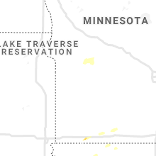


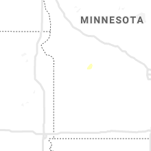


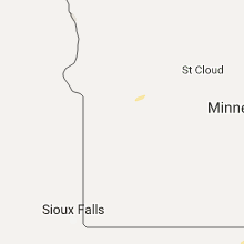


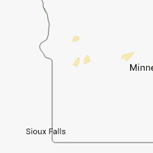


Connect with Interactive Hail Maps