

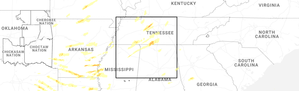
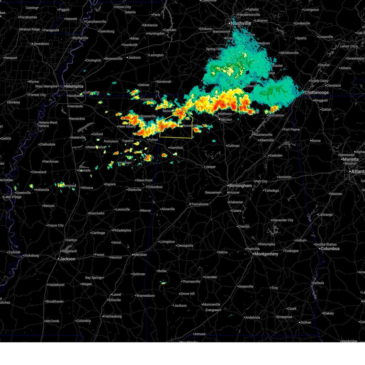
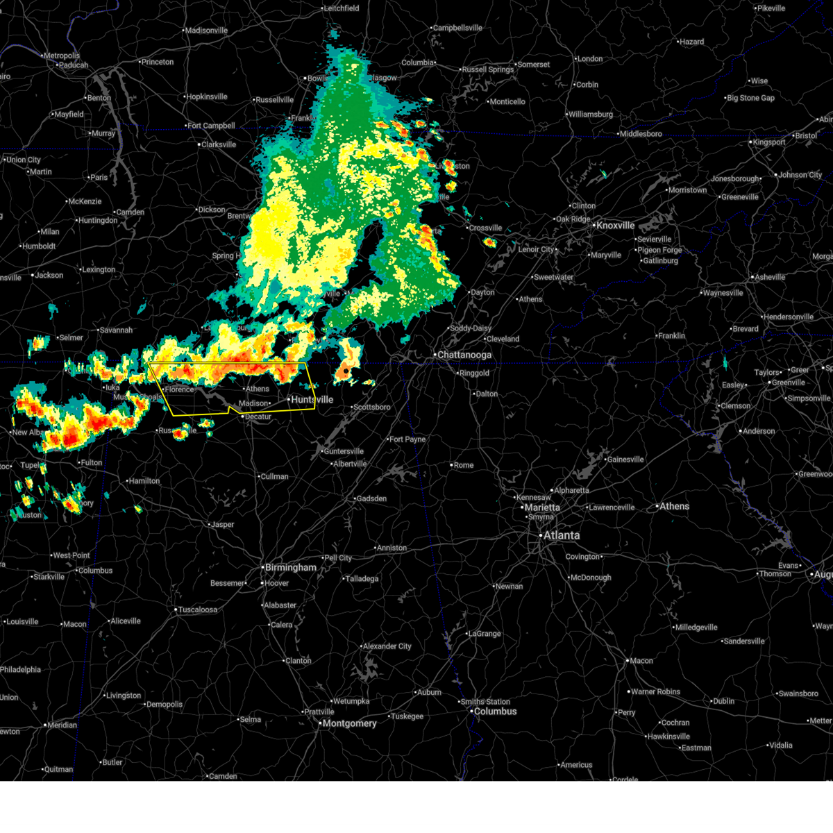
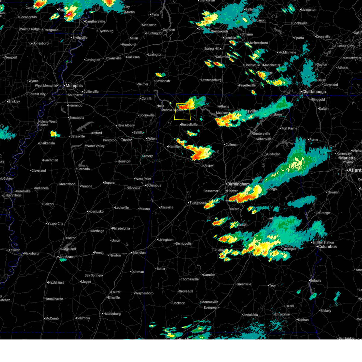
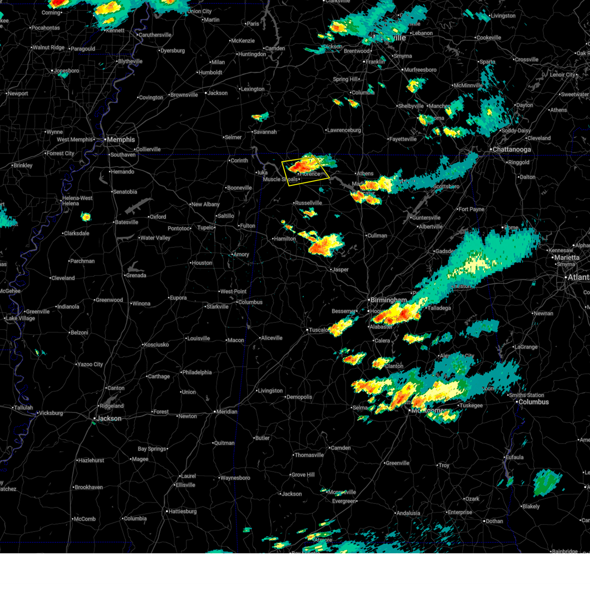
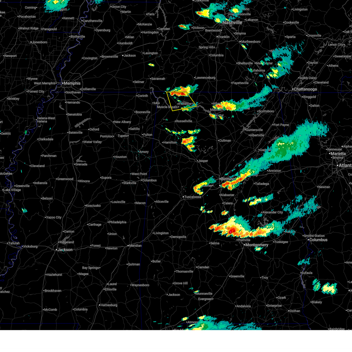
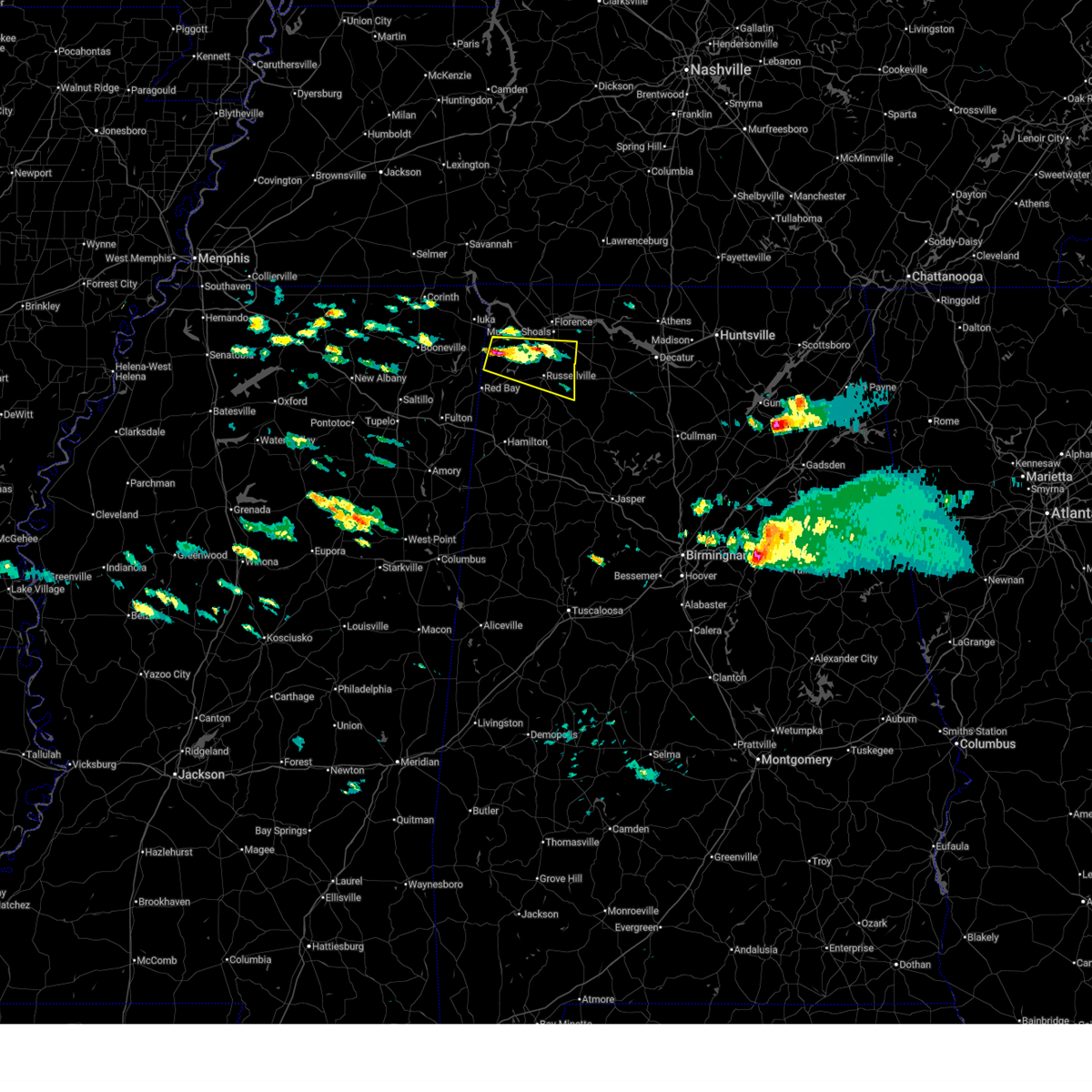
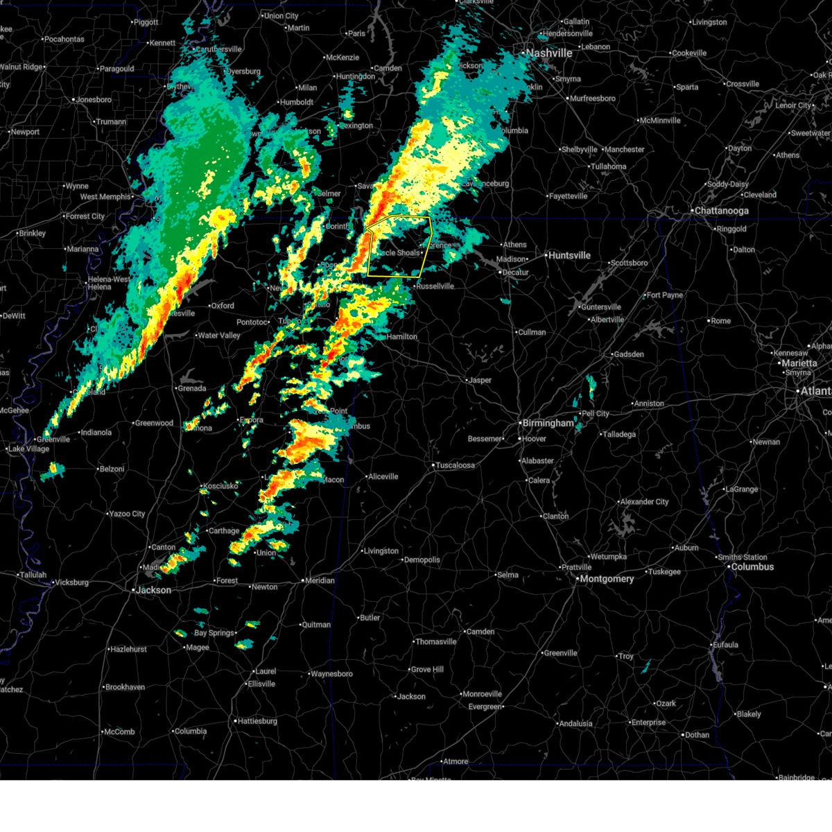
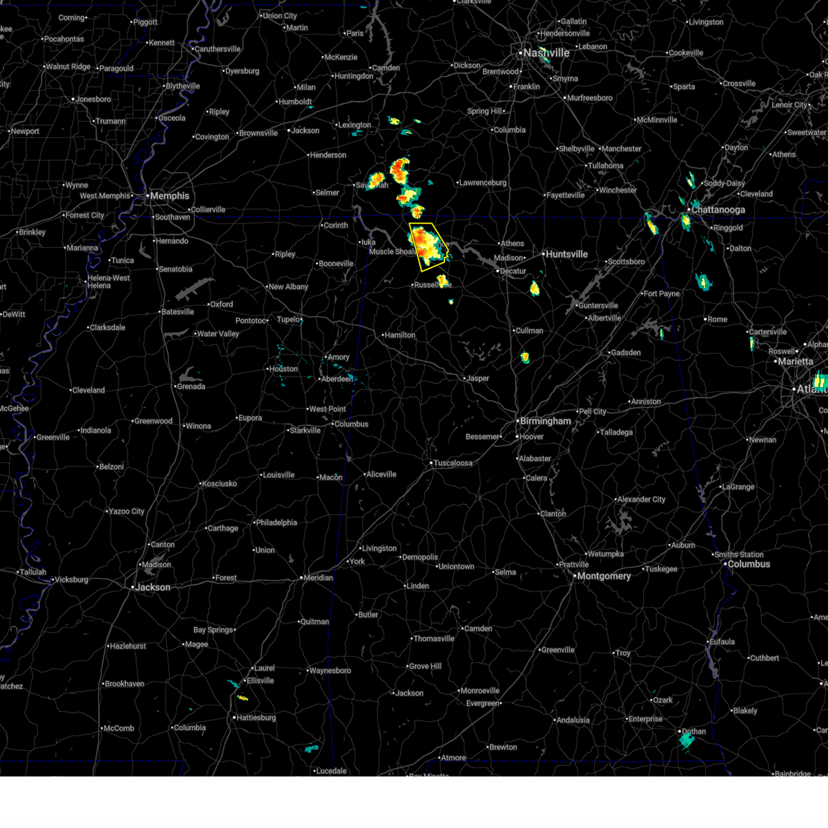
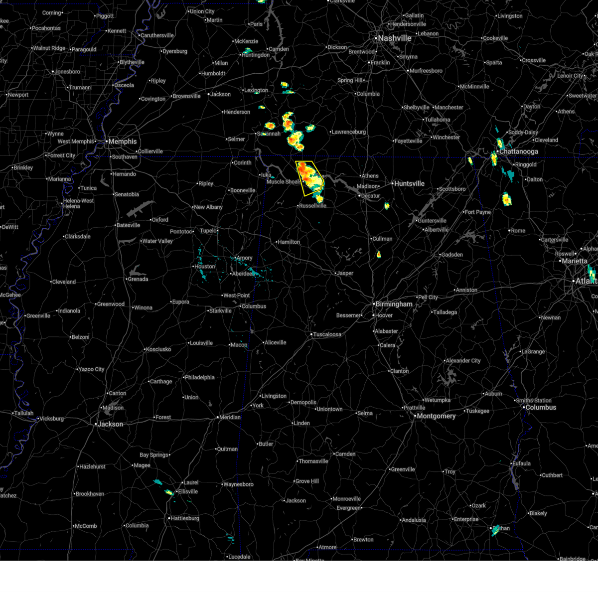
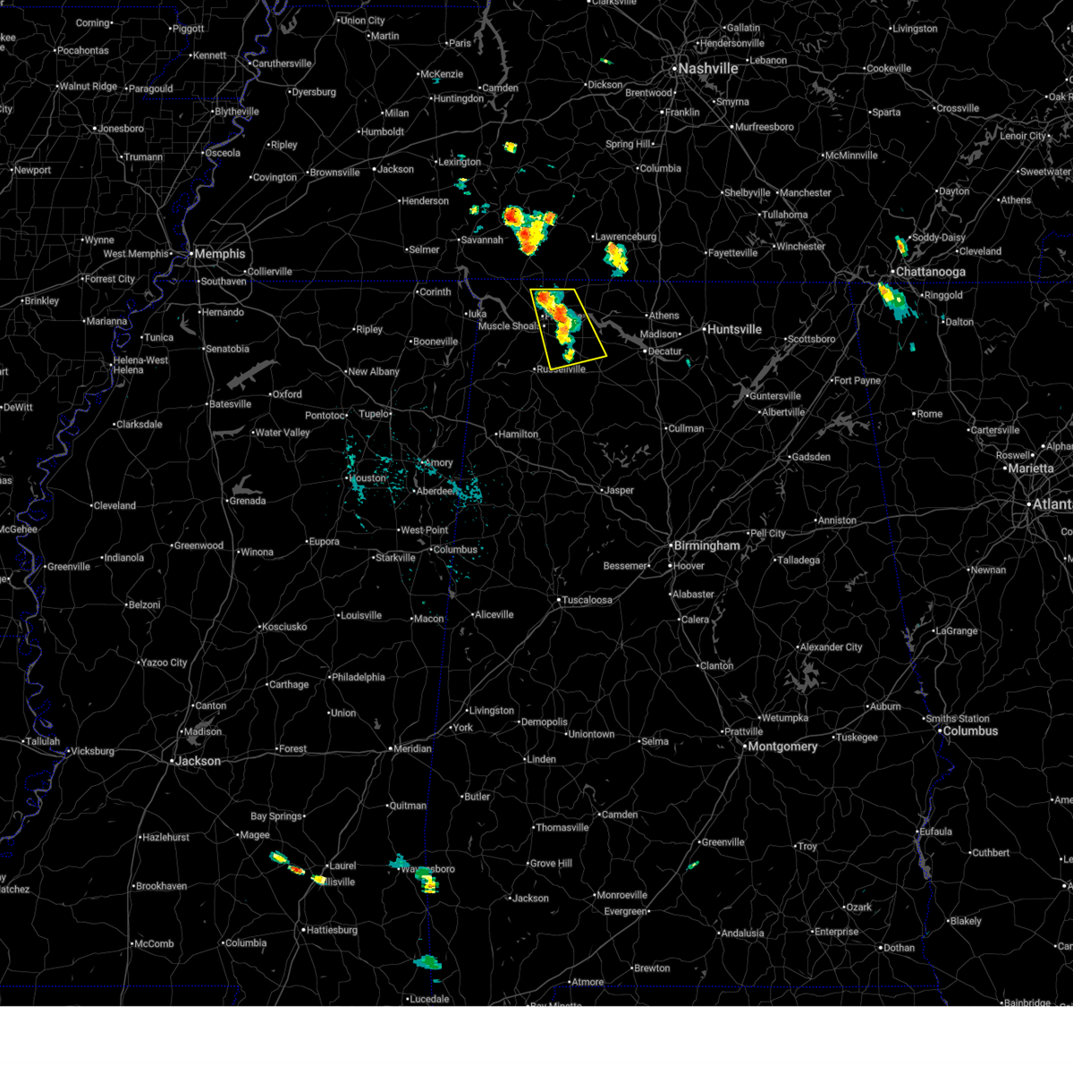
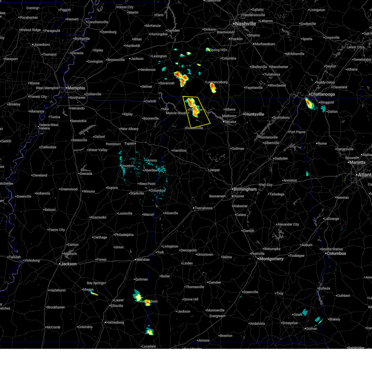
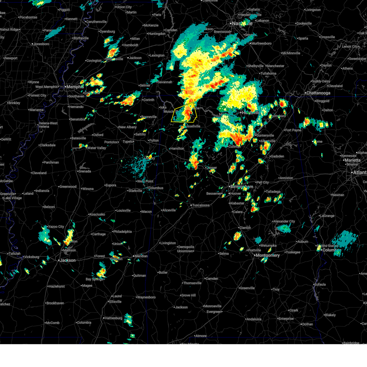
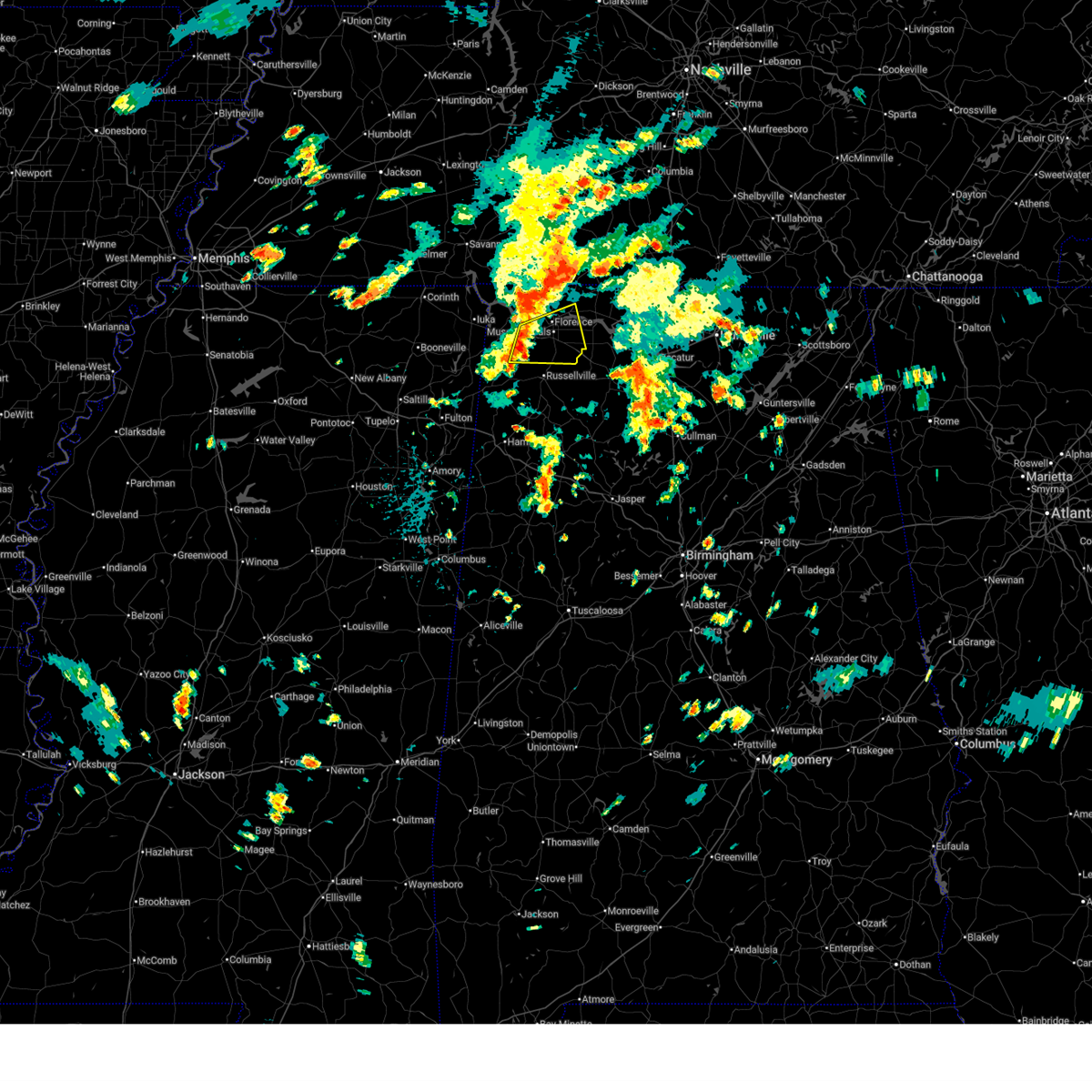
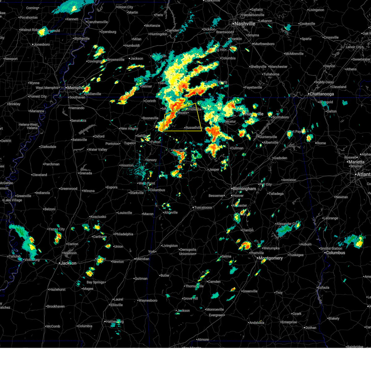
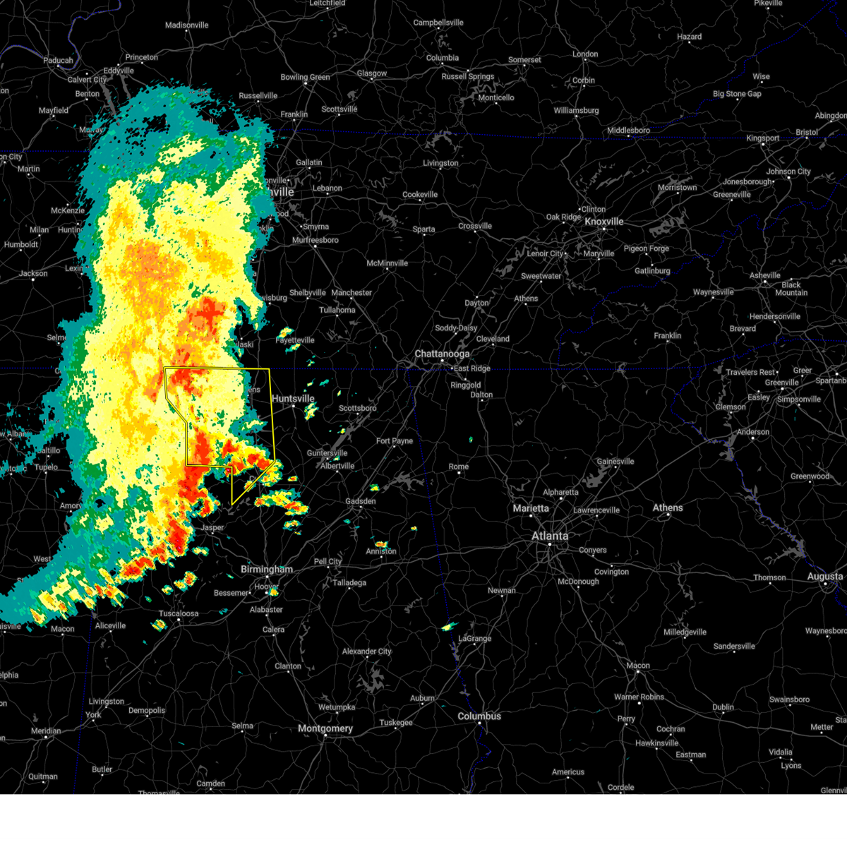
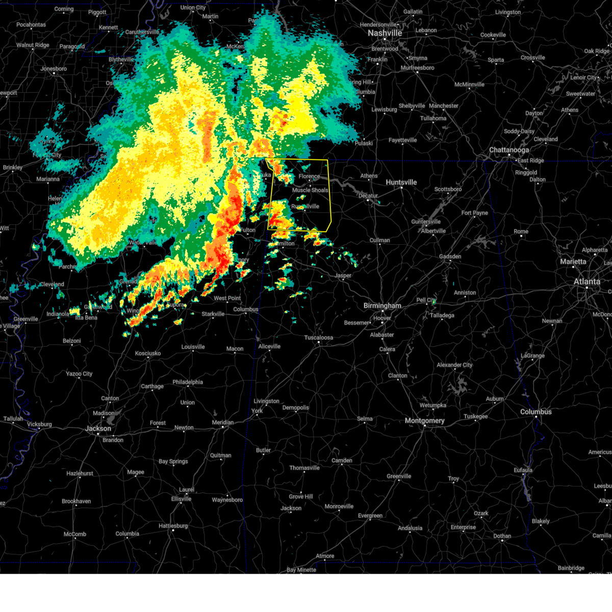
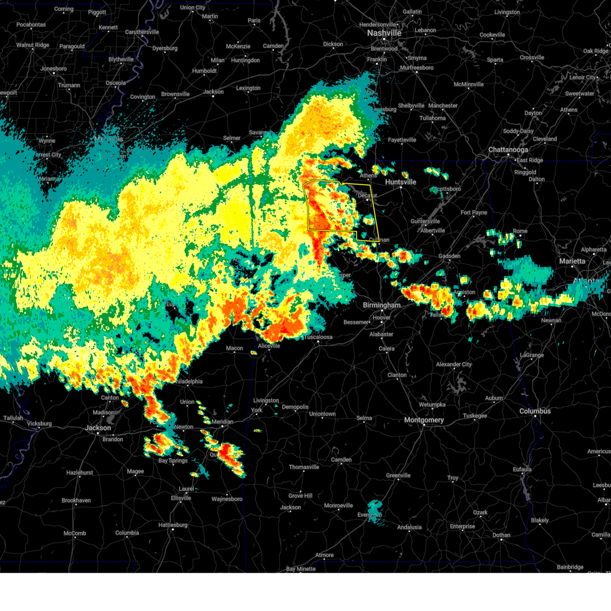
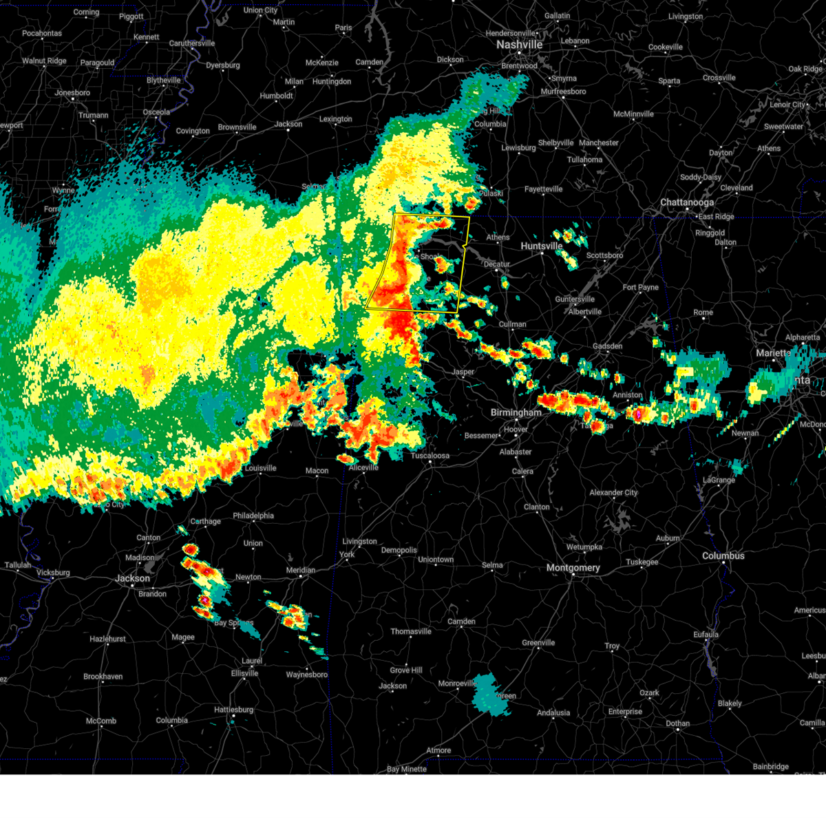
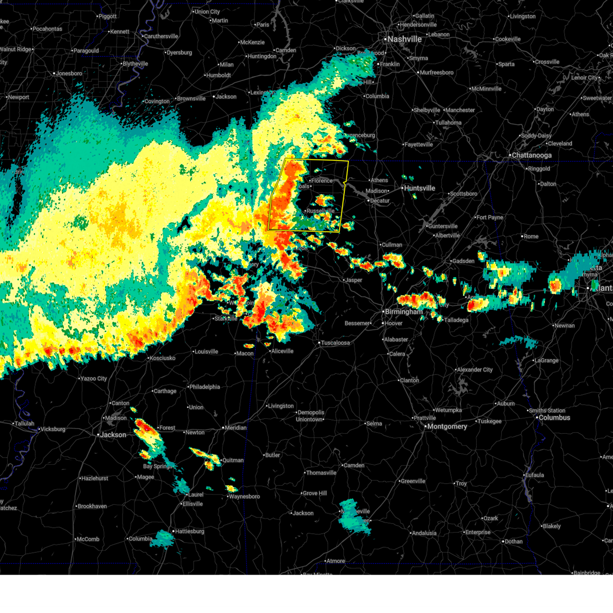
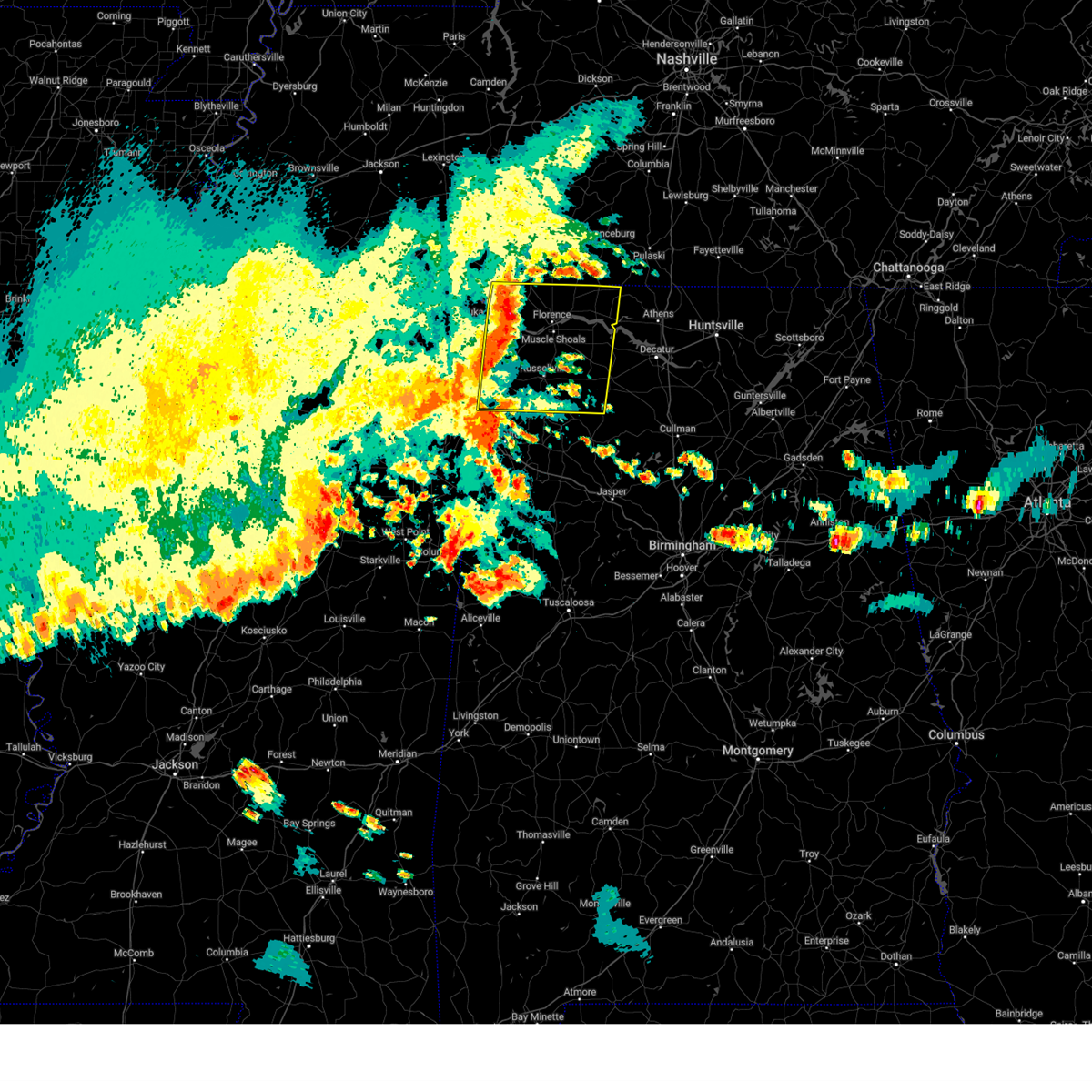
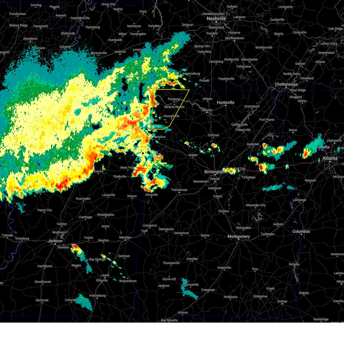
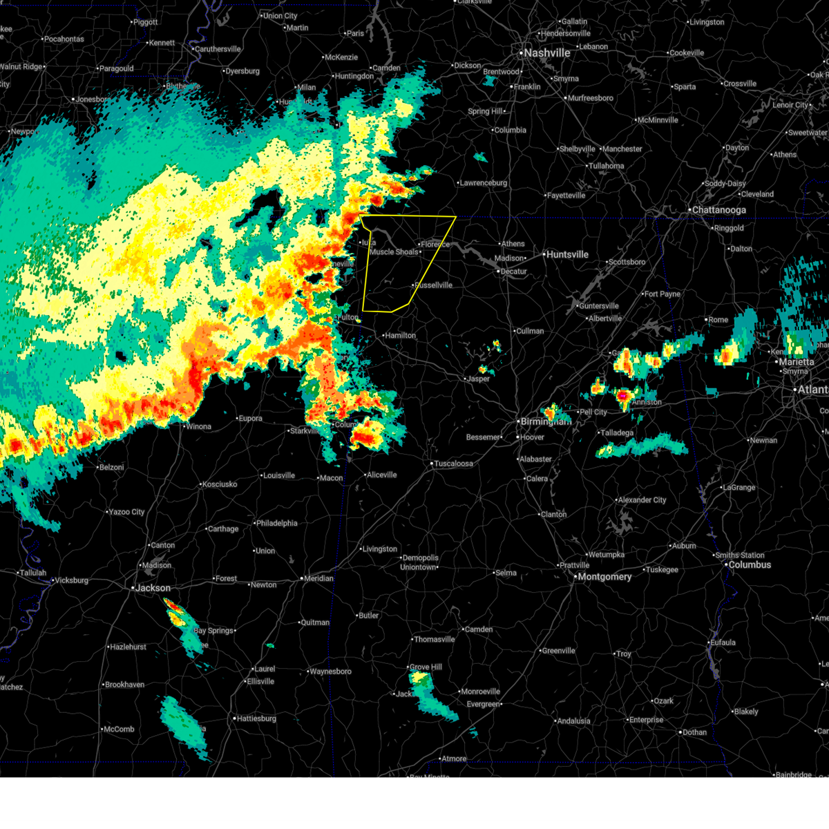
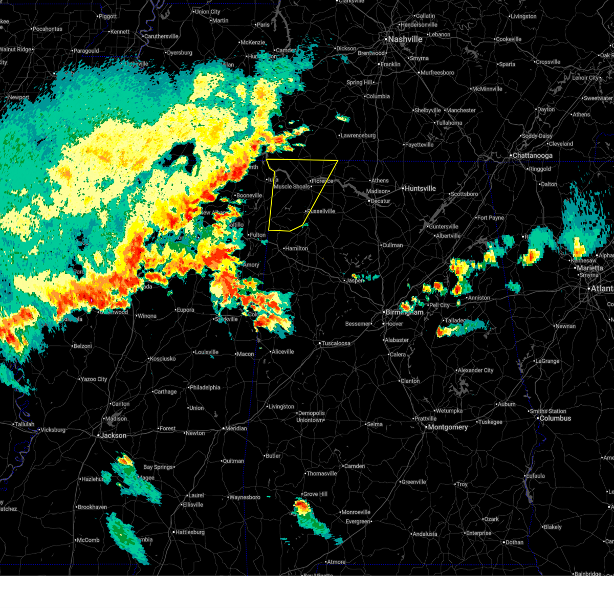
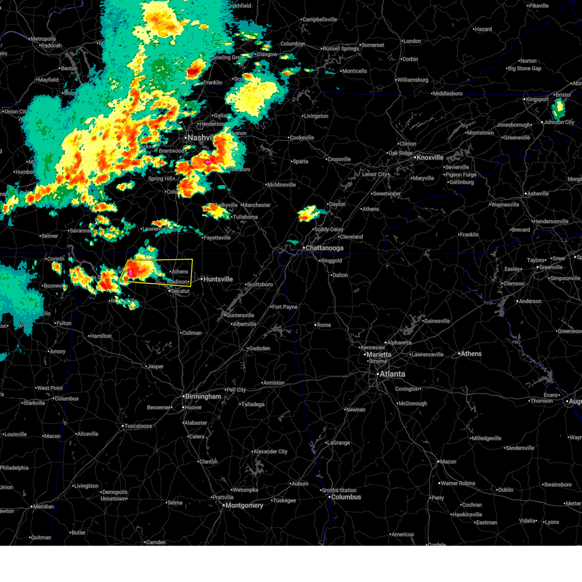
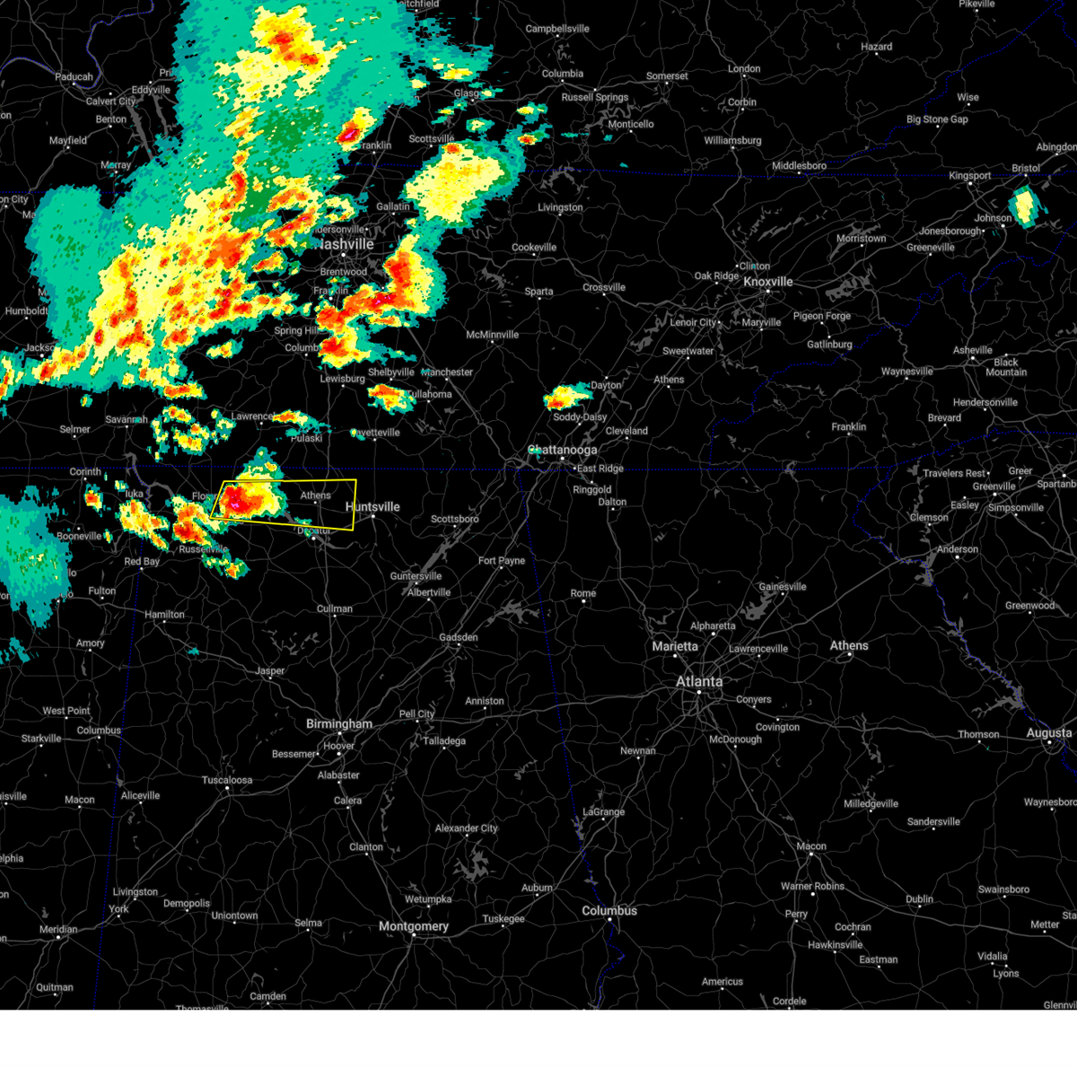
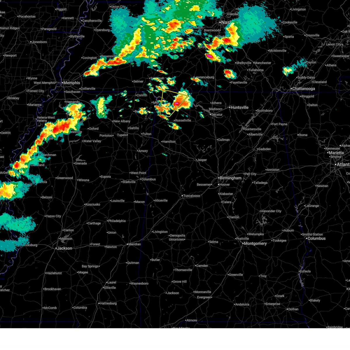
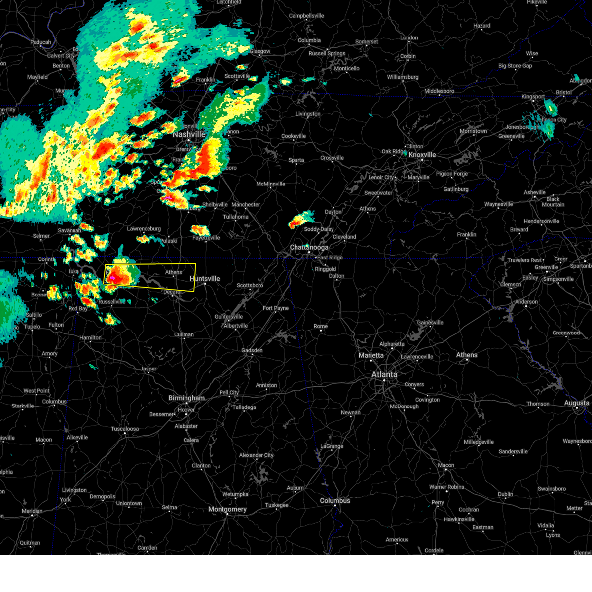
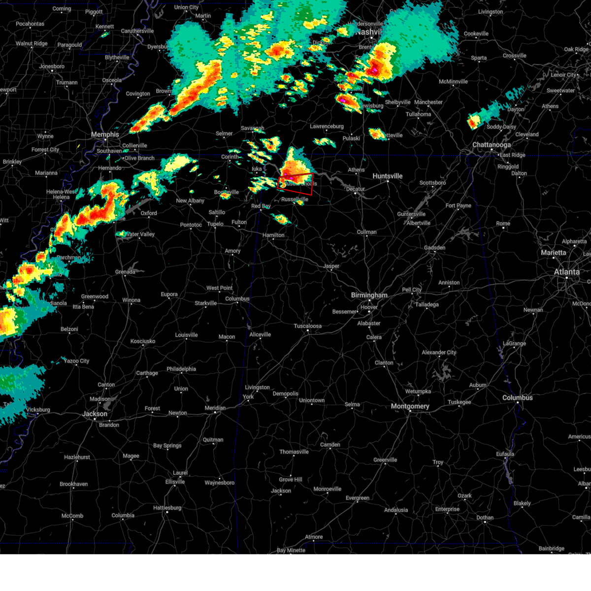
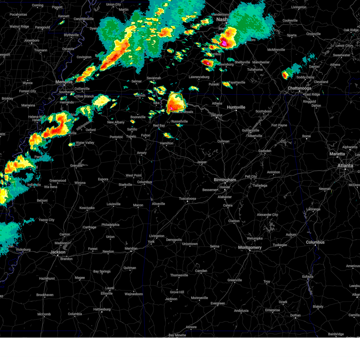
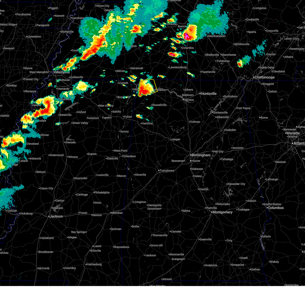
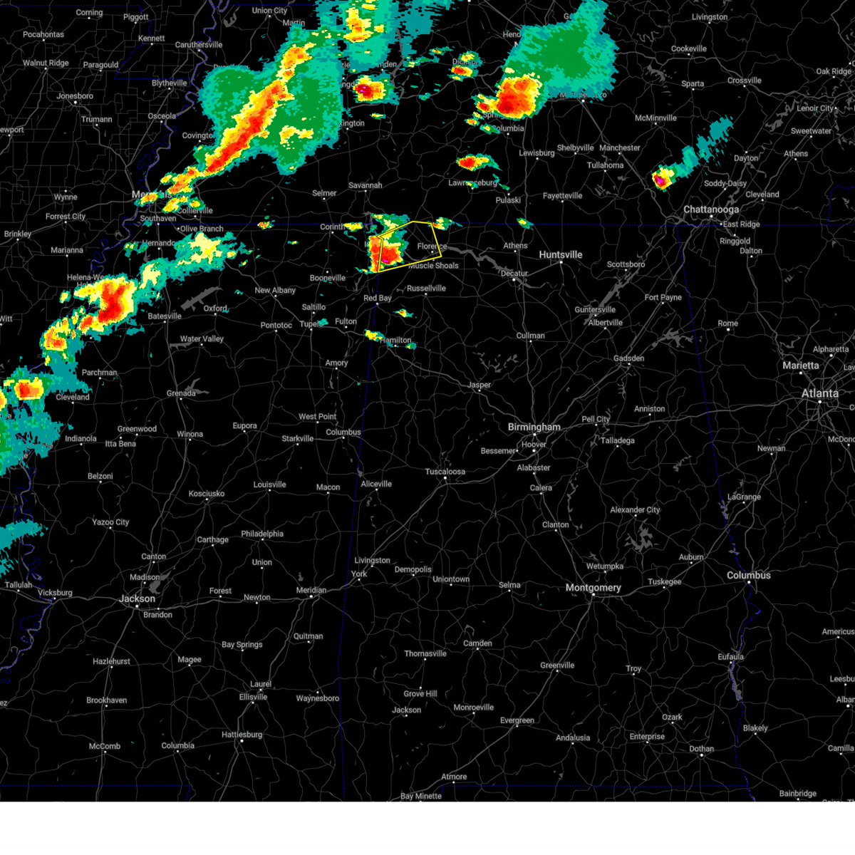
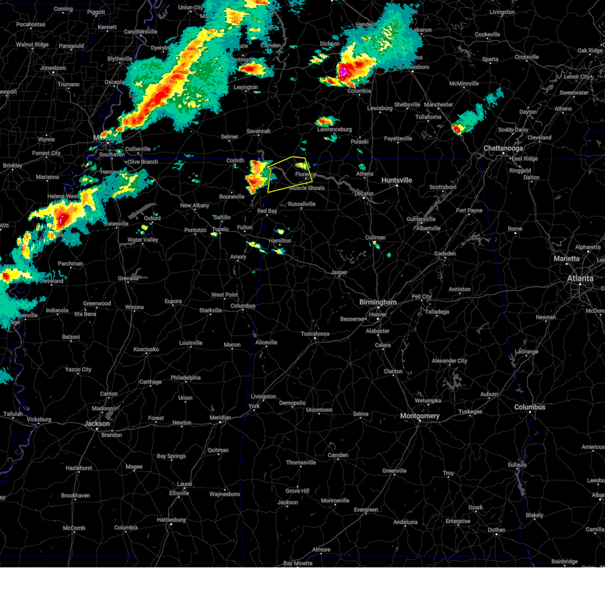
Hail Map for Muscle Shoals, AL
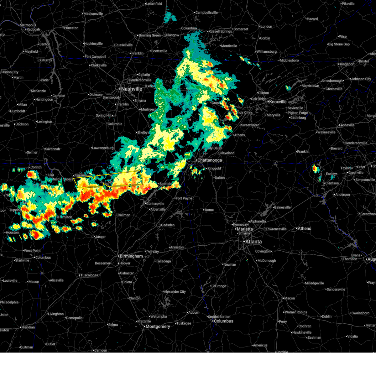
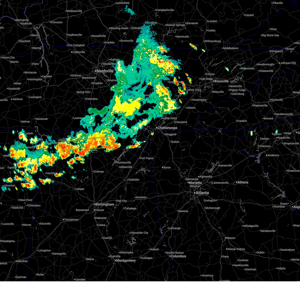
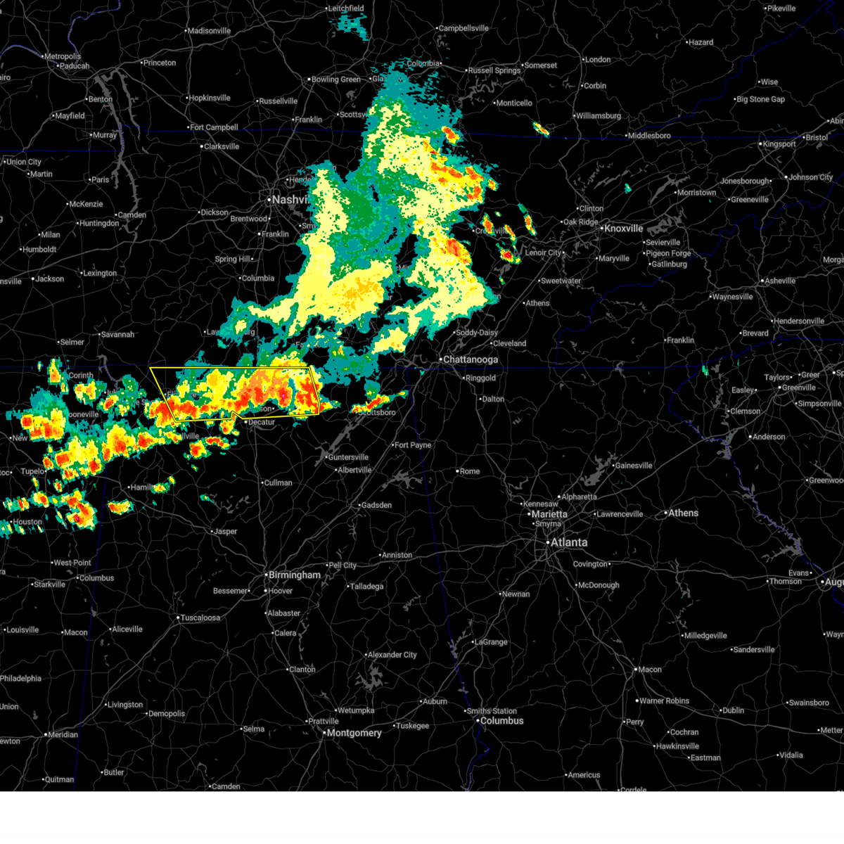
The Muscle Shoals, AL area has had 5 reports of on-the-ground hail by trained spotters, and has been under severe weather warnings 37 times during the past 12 months. Doppler radar has detected hail at or near Muscle Shoals, AL on 87 occasions, including 3 occasions during the past year.
| Name: | Muscle Shoals, AL |
| Where Located: | 4.5 miles SE of Florence, AL |
| Map: | Google Map for Muscle Shoals, AL |
| Population: | 13146 |
| Housing Units: | 5653 |
| More Info: | Search Google for Muscle Shoals, AL |
0
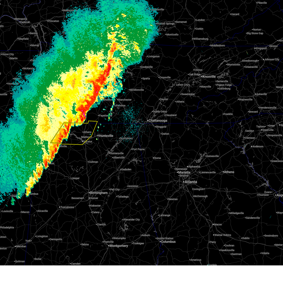
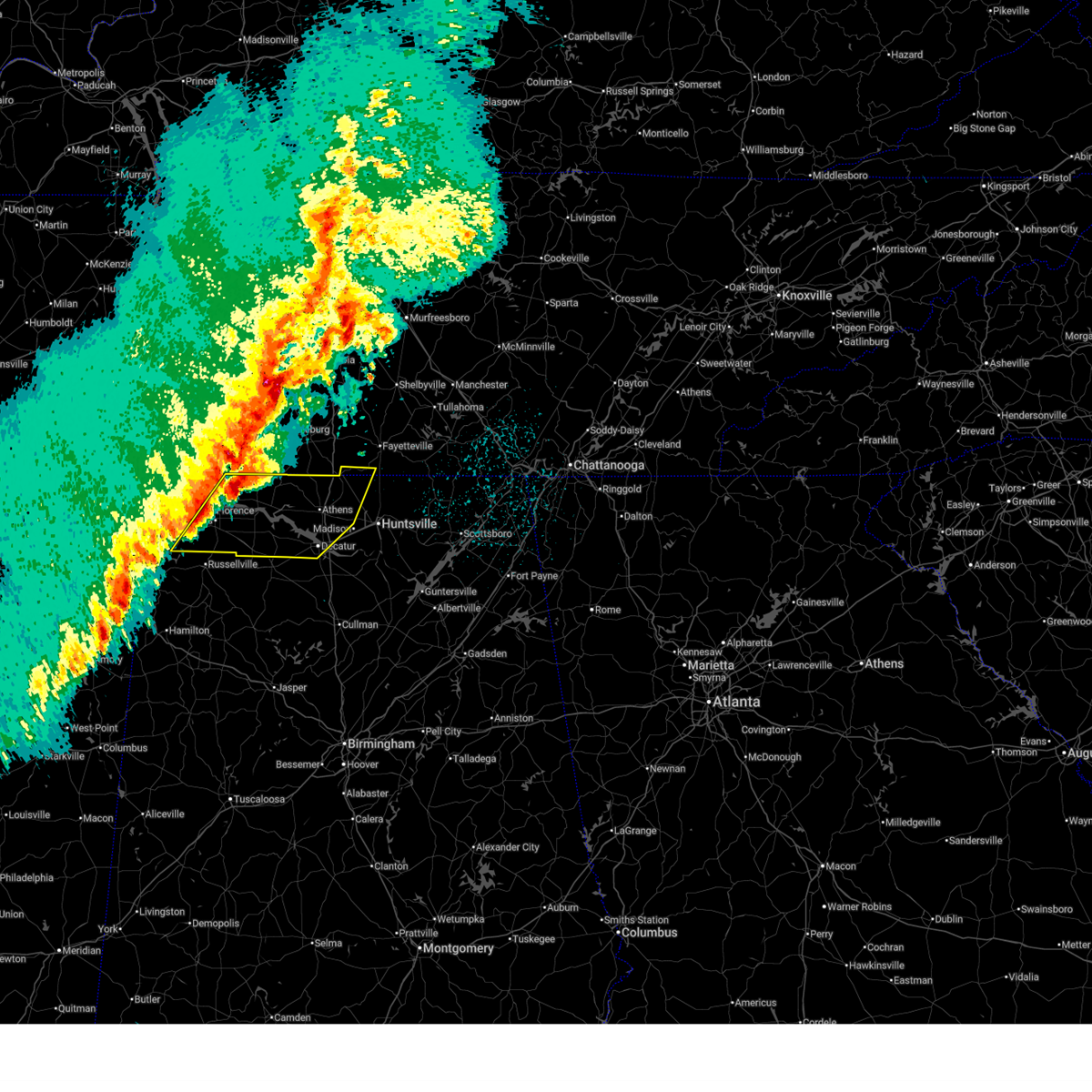
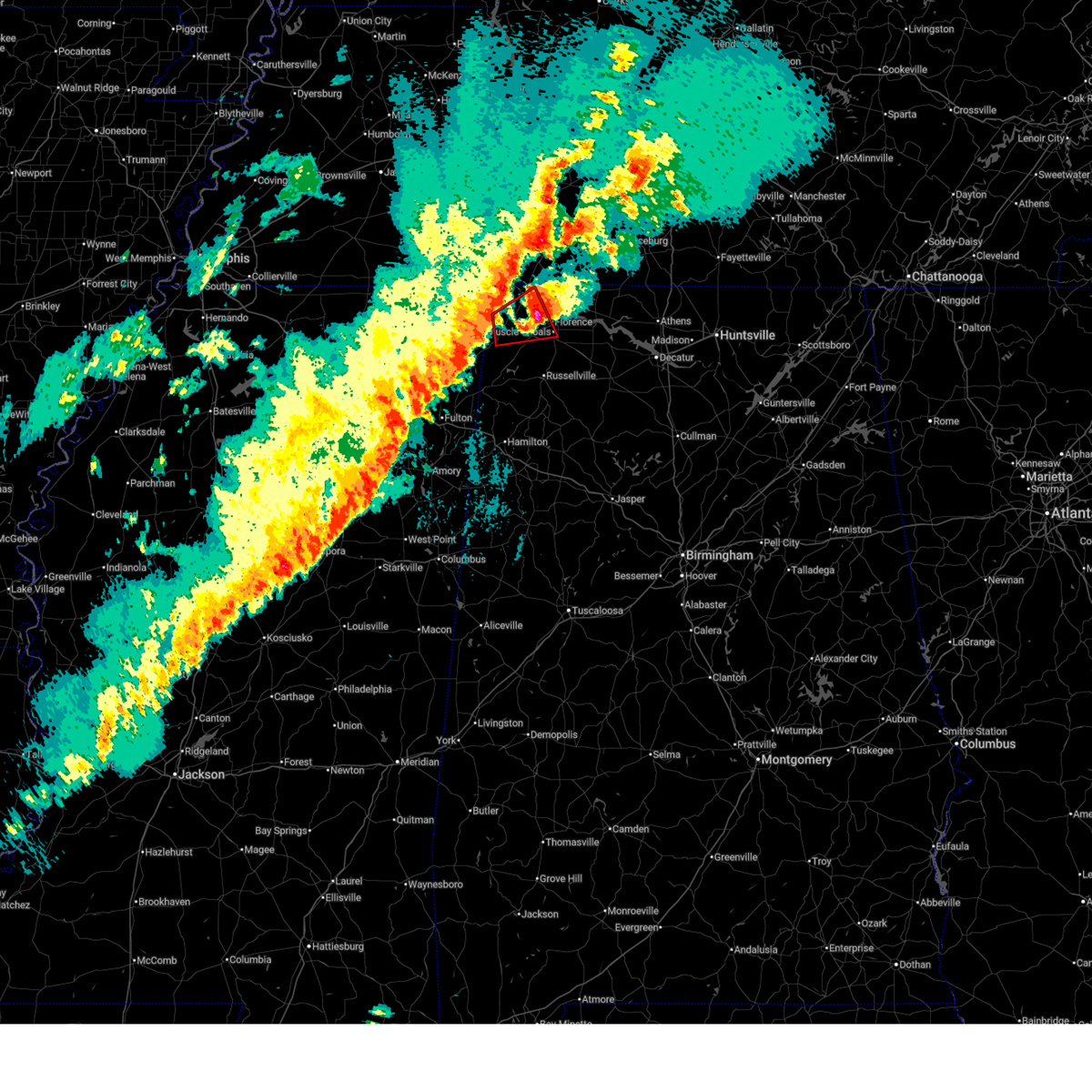
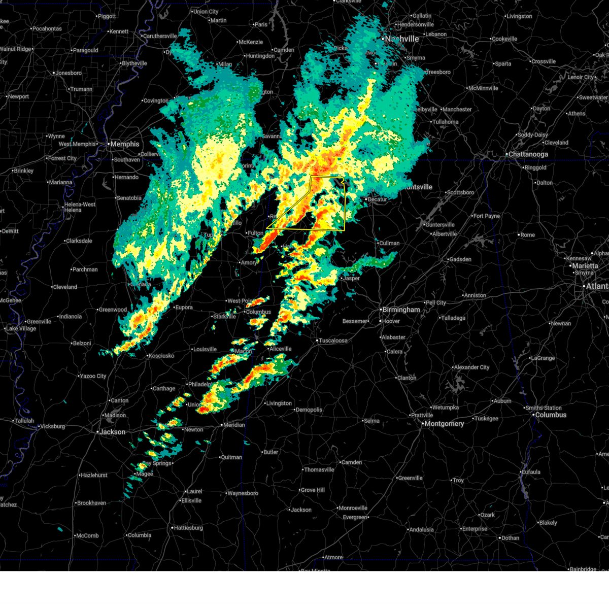
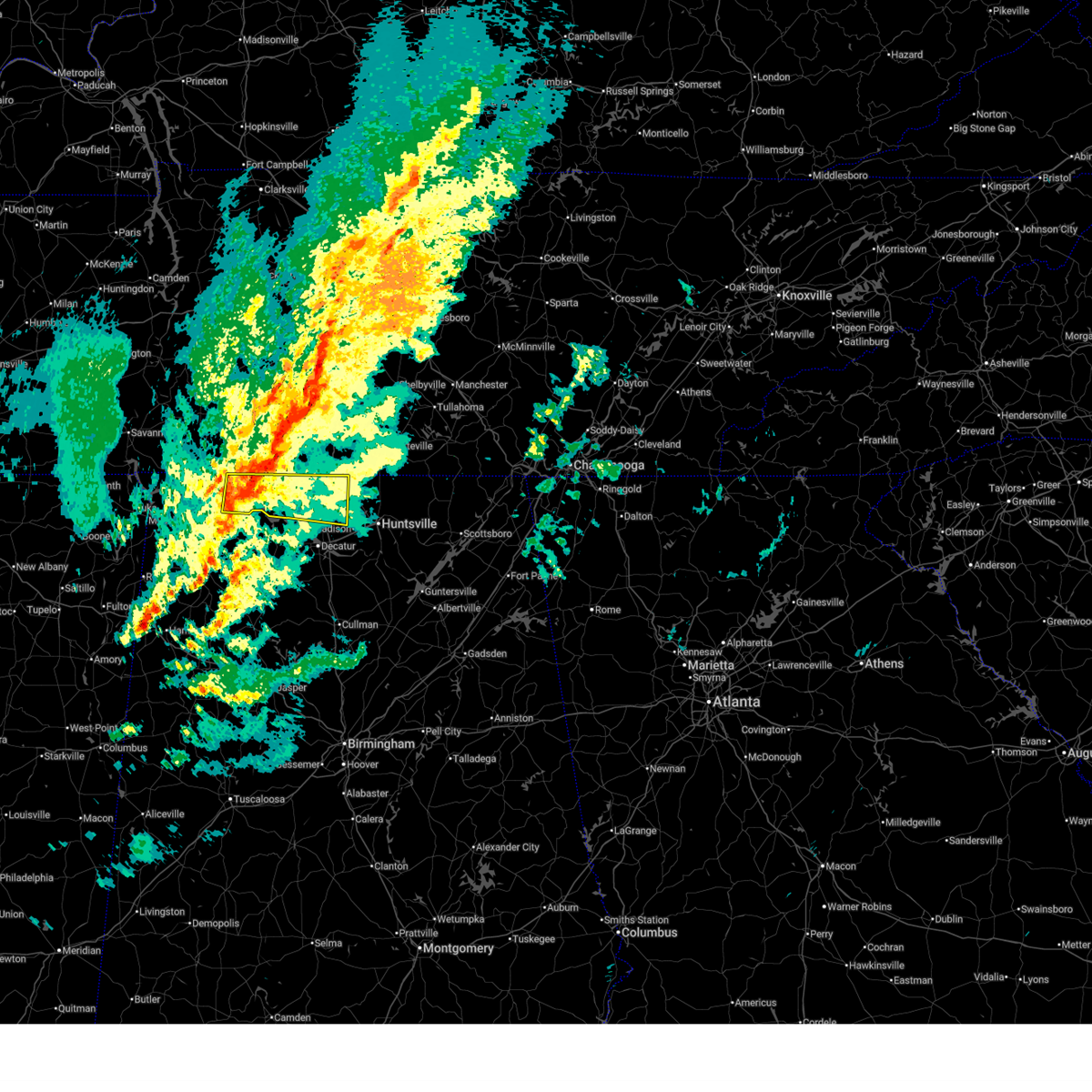
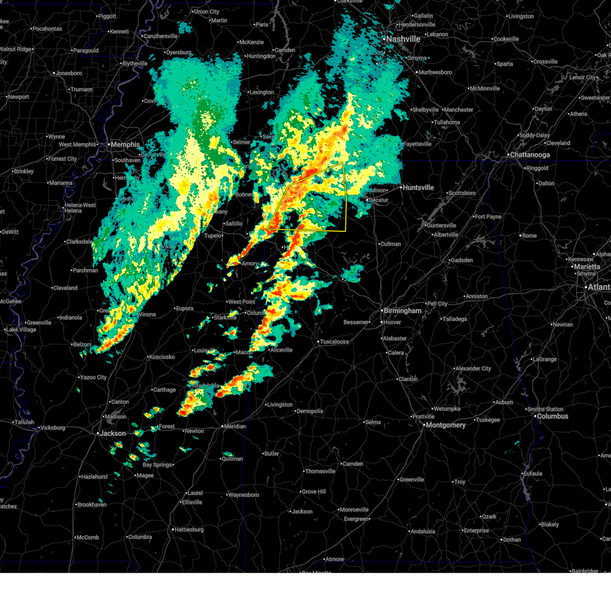
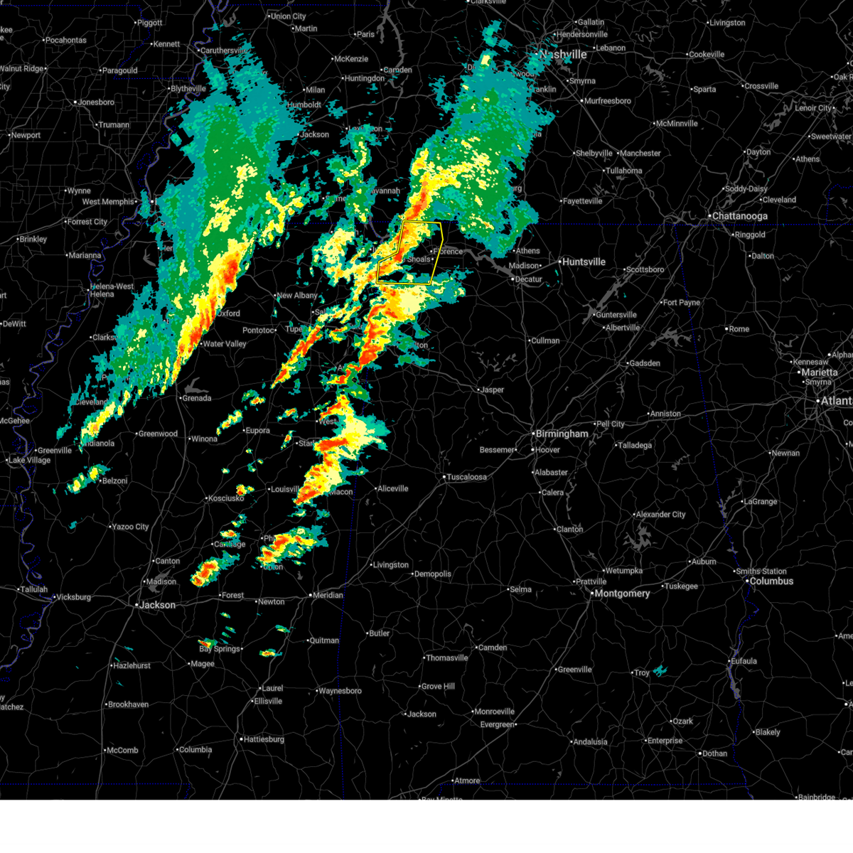
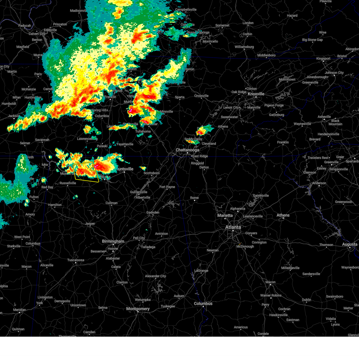
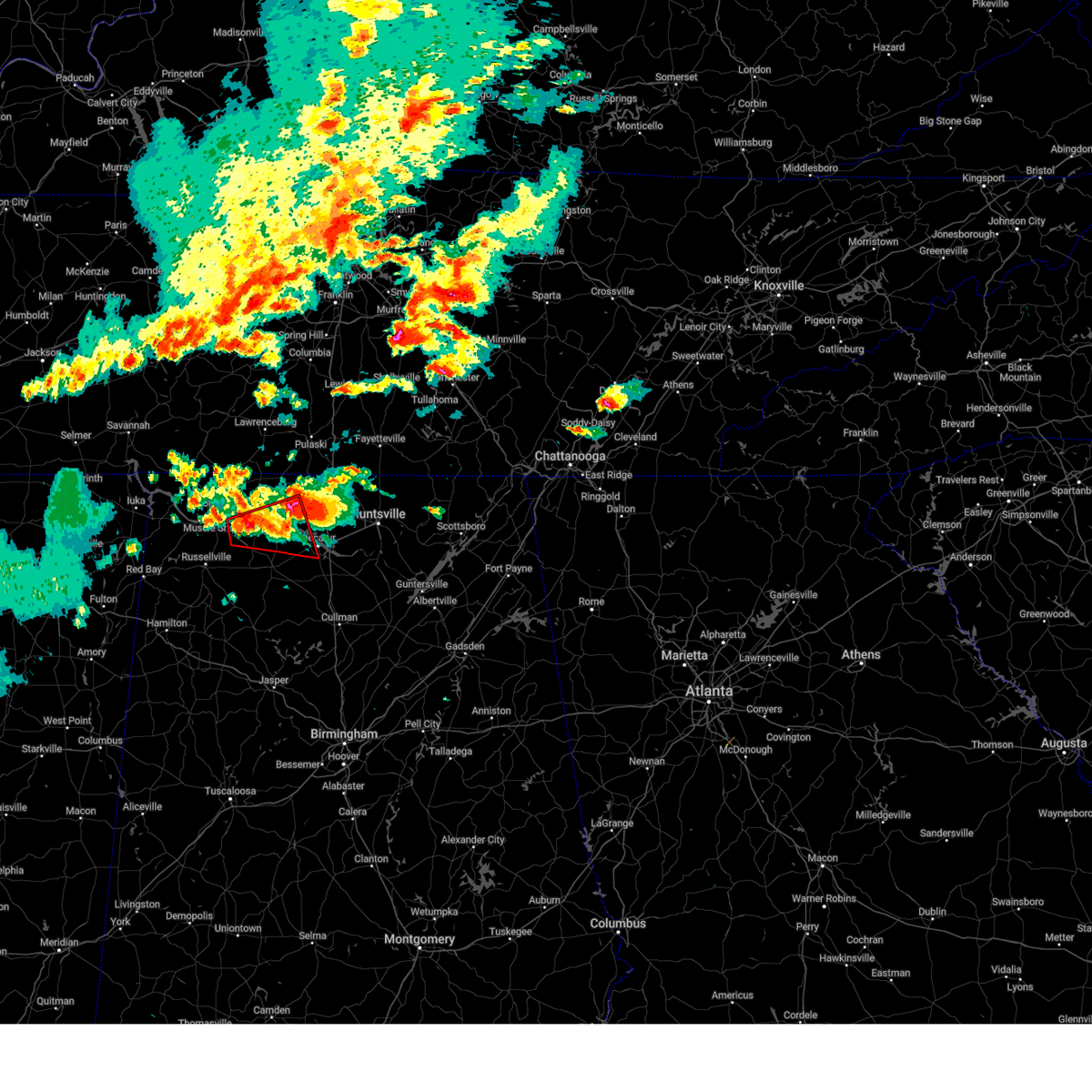
The Top Recent Hail Date for Muscle Shoals, AL is Sunday, March 15, 2026 (49th out of 87)
Hail and Wind Damage Spotted near Muscle Shoals, AL
| Date / Time | Report Details |
|---|---|
| 6/1/2026 1:08 PM CDT |
 The storms which prompted the warning have moved out of the area. therefore, the warning will be allowed to expire. a severe thunderstorm watch remains in effect until 700 pm cdt for north central, northeastern and northwestern alabama. The storms which prompted the warning have moved out of the area. therefore, the warning will be allowed to expire. a severe thunderstorm watch remains in effect until 700 pm cdt for north central, northeastern and northwestern alabama.
|
| 6/1/2026 12:55 PM CDT |
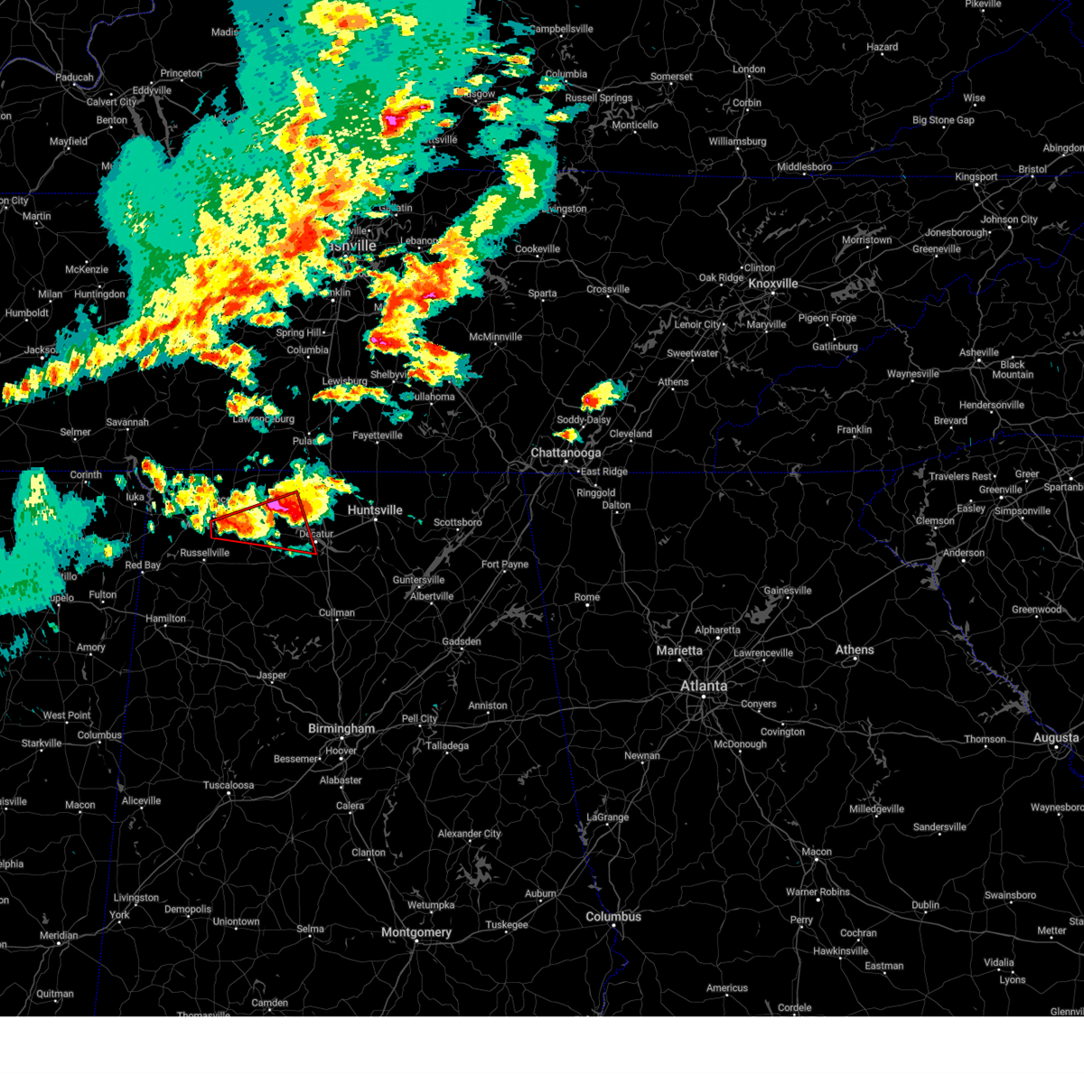
 At 1254 pm cdt, severe thunderstorms were located along a line extending from near gurley to near littleville, moving southeast at 25 mph. these storms have a history of producing damaging wind gusts and small hail (emergency management). Hazards include 60 mph wind gusts and penny size hail. Expect damage to roofs, siding, and trees. Locations impacted include, huntsville, decatur, madison, athens, muscle shoals, moores mill, meridianville, redstone arsenal, town creek, and gurley. At 1254 pm cdt, severe thunderstorms were located along a line extending from near gurley to near littleville, moving southeast at 25 mph. these storms have a history of producing damaging wind gusts and small hail (emergency management). Hazards include 60 mph wind gusts and penny size hail. Expect damage to roofs, siding, and trees. Locations impacted include, huntsville, decatur, madison, athens, muscle shoals, moores mill, meridianville, redstone arsenal, town creek, and gurley.
|
| 6/1/2026 12:45 PM CDT |
 At 1244 pm cdt, severe thunderstorms were located along a line extending from gurley to near littleville, moving southeast at 30 mph (emergency management reports numerous trees down across northwest alabama blocking roadways). Hazards include 60 mph wind gusts and penny size hail. Expect damage to roofs, siding, and trees. Locations impacted include, huntsville, decatur, madison, florence, athens, muscle shoals, sheffield, moores mill, meridianville, and redstone arsenal. At 1244 pm cdt, severe thunderstorms were located along a line extending from gurley to near littleville, moving southeast at 30 mph (emergency management reports numerous trees down across northwest alabama blocking roadways). Hazards include 60 mph wind gusts and penny size hail. Expect damage to roofs, siding, and trees. Locations impacted include, huntsville, decatur, madison, florence, athens, muscle shoals, sheffield, moores mill, meridianville, and redstone arsenal.
|
| 6/1/2026 12:40 PM CDT |
 Svrhun the national weather service in huntsville alabama has issued a * severe thunderstorm warning for, southern colbert county in northwestern alabama, franklin county in northwestern alabama, * until 145 pm cdt. * at 1240 pm cdt, severe thunderstorms were located along a line extending from near littleville to belgreen to near red bay, moving southeast at 25 mph (radar indicated). Hazards include 60 mph wind gusts and penny size hail. expect damage to roofs, siding, and trees Svrhun the national weather service in huntsville alabama has issued a * severe thunderstorm warning for, southern colbert county in northwestern alabama, franklin county in northwestern alabama, * until 145 pm cdt. * at 1240 pm cdt, severe thunderstorms were located along a line extending from near littleville to belgreen to near red bay, moving southeast at 25 mph (radar indicated). Hazards include 60 mph wind gusts and penny size hail. expect damage to roofs, siding, and trees
|
| 6/1/2026 12:20 PM CDT |
 Svrhun the national weather service in huntsville alabama has issued a * severe thunderstorm warning for, madison county in north central alabama, limestone county in north central alabama, eastern lauderdale county in northwestern alabama, southeastern colbert county in northwestern alabama, northern lawrence county in northwestern alabama, * until 115 pm cdt. * at 1220 pm cdt, severe thunderstorms were located along a line extending from near ardmore to near killen, moving southeast at 20 mph (emergency management). Hazards include 60 mph wind gusts and penny size hail. expect damage to roofs, siding, and trees Svrhun the national weather service in huntsville alabama has issued a * severe thunderstorm warning for, madison county in north central alabama, limestone county in north central alabama, eastern lauderdale county in northwestern alabama, southeastern colbert county in northwestern alabama, northern lawrence county in northwestern alabama, * until 115 pm cdt. * at 1220 pm cdt, severe thunderstorms were located along a line extending from near ardmore to near killen, moving southeast at 20 mph (emergency management). Hazards include 60 mph wind gusts and penny size hail. expect damage to roofs, siding, and trees
|
| 5/31/2026 5:30 PM CDT |
 Svrhun the national weather service in huntsville alabama has issued a * severe thunderstorm warning for, south central lauderdale county in northwestern alabama, southeastern colbert county in northwestern alabama, * until 615 pm cdt. * at 528 pm cdt, a severe thunderstorm was located over sheffield, moving south at 20 mph. this storm recently produced a wind gust of 63 mph at northwest alabama regional airport (radar indicated). Hazards include 60-65 mph wind gusts and penny size hail. expect damage to roofs, siding, and trees Svrhun the national weather service in huntsville alabama has issued a * severe thunderstorm warning for, south central lauderdale county in northwestern alabama, southeastern colbert county in northwestern alabama, * until 615 pm cdt. * at 528 pm cdt, a severe thunderstorm was located over sheffield, moving south at 20 mph. this storm recently produced a wind gust of 63 mph at northwest alabama regional airport (radar indicated). Hazards include 60-65 mph wind gusts and penny size hail. expect damage to roofs, siding, and trees
|
| 5/31/2026 5:15 PM CDT |
 At 514 pm cdt, a cluster of severe thunderstorms was centered over st. florian, or near florence, and moving south at 20 mph (radar indicated). Hazards include 60 mph wind gusts and penny size hail. Expect damage to roofs, siding, and trees. locations impacted include, florence, muscle shoals, sheffield, tuscumbia, killen, st. Florian, underwood-petersville, northwest alabama regional airport, oakland, and center star. At 514 pm cdt, a cluster of severe thunderstorms was centered over st. florian, or near florence, and moving south at 20 mph (radar indicated). Hazards include 60 mph wind gusts and penny size hail. Expect damage to roofs, siding, and trees. locations impacted include, florence, muscle shoals, sheffield, tuscumbia, killen, st. Florian, underwood-petersville, northwest alabama regional airport, oakland, and center star.
|
| 5/31/2026 4:48 PM CDT |
 Svrhun the national weather service in huntsville alabama has issued a * severe thunderstorm warning for, central lauderdale county in northwestern alabama, east central colbert county in northwestern alabama, north central lawrence county in northwestern alabama, * until 530 pm cdt. * at 448 pm cdt, a severe thunderstorm was located near underwood-petersville, or 9 miles north of florence, moving southeast at 25 mph (radar indicated). Hazards include 60 mph wind gusts and penny size hail. expect damage to roofs, siding, and trees Svrhun the national weather service in huntsville alabama has issued a * severe thunderstorm warning for, central lauderdale county in northwestern alabama, east central colbert county in northwestern alabama, north central lawrence county in northwestern alabama, * until 530 pm cdt. * at 448 pm cdt, a severe thunderstorm was located near underwood-petersville, or 9 miles north of florence, moving southeast at 25 mph (radar indicated). Hazards include 60 mph wind gusts and penny size hail. expect damage to roofs, siding, and trees
|
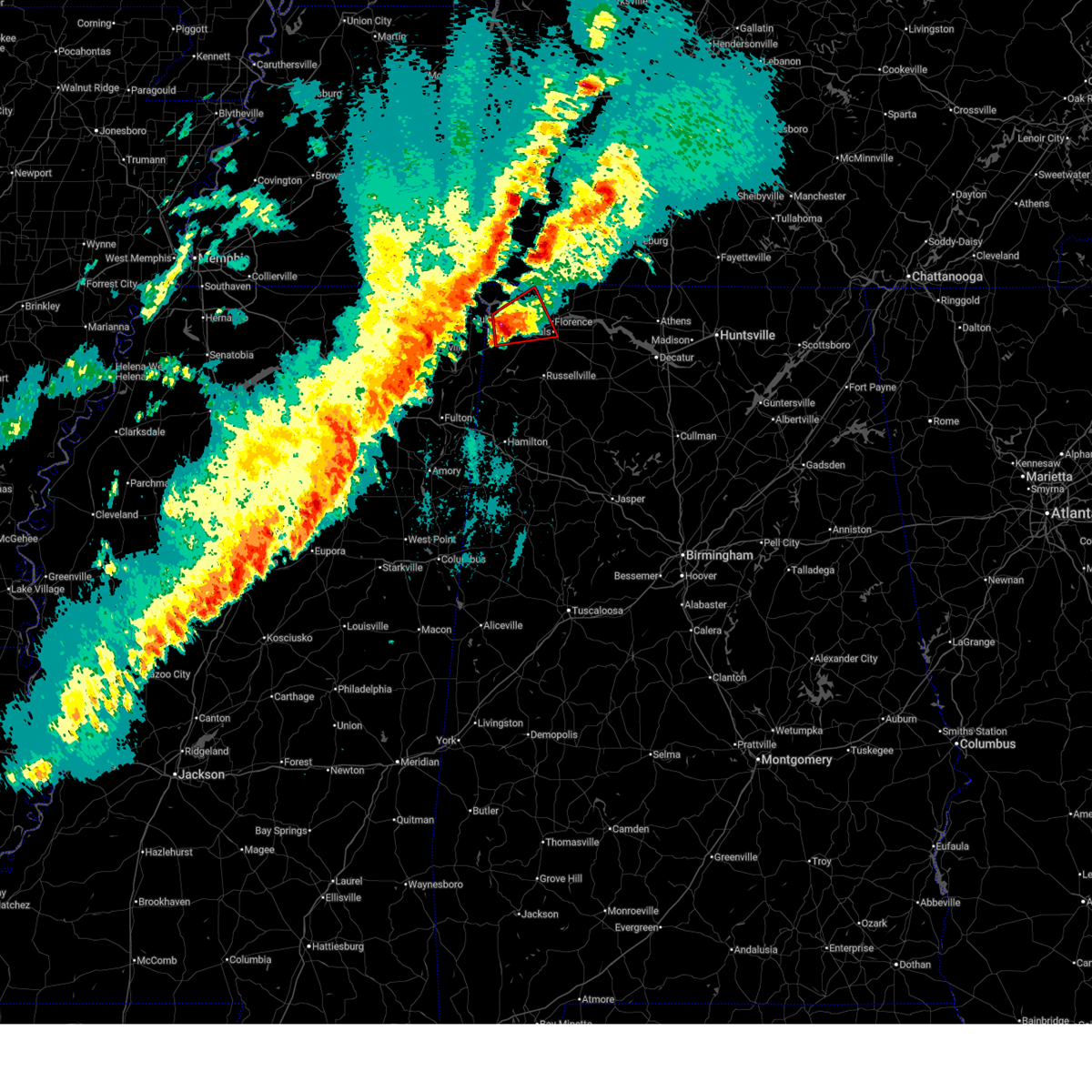
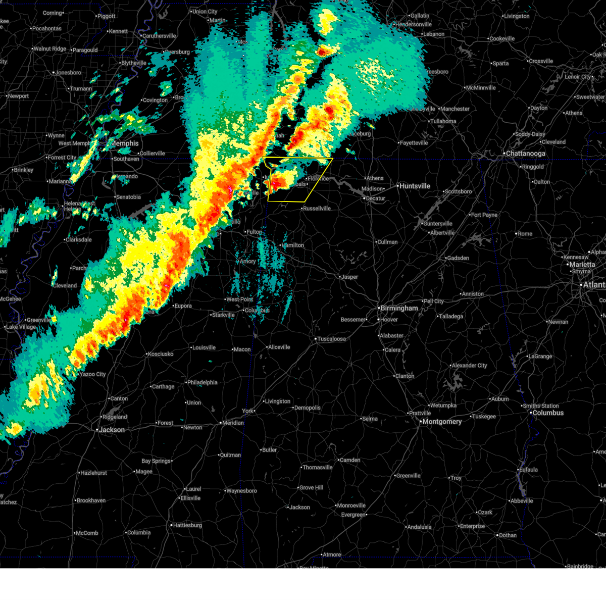
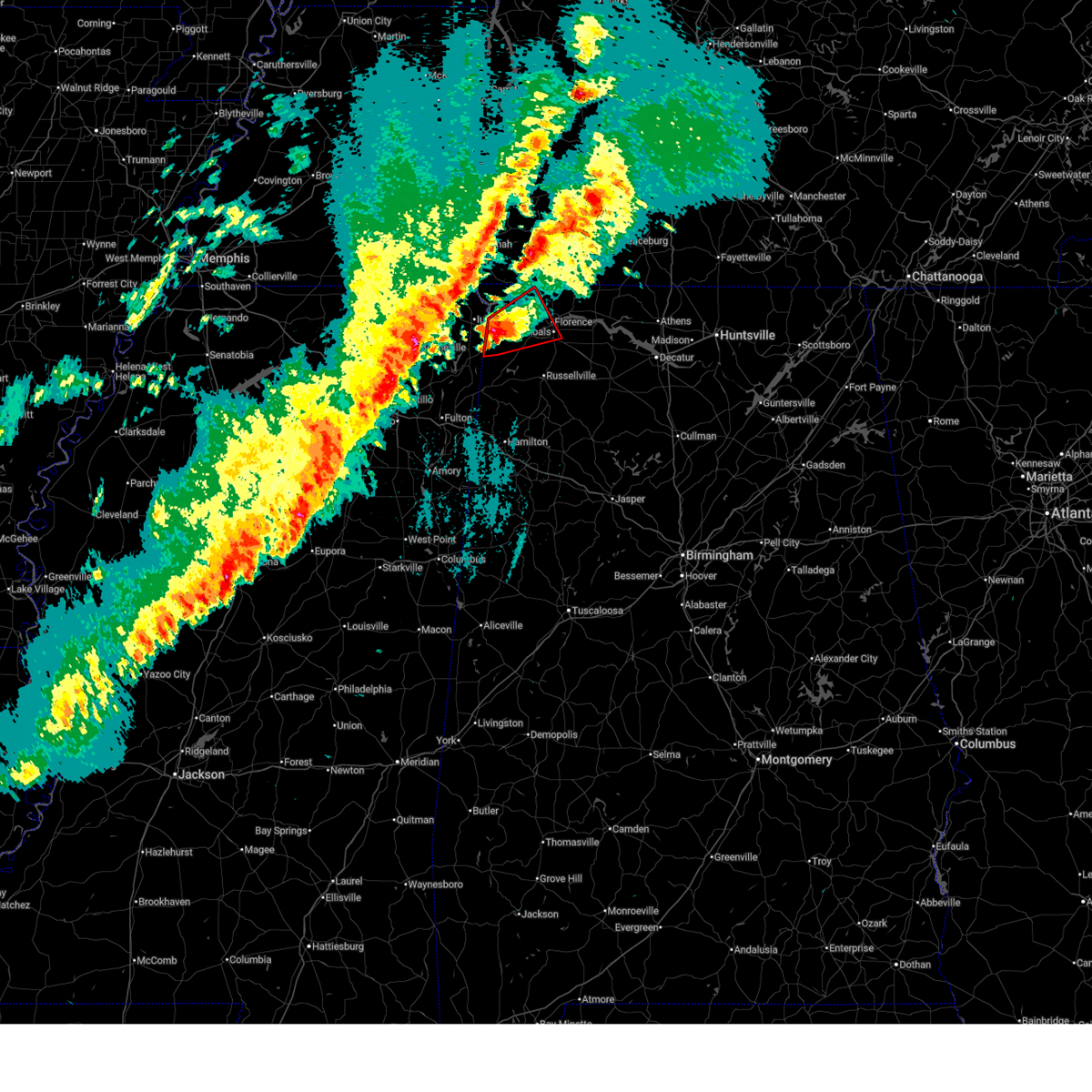
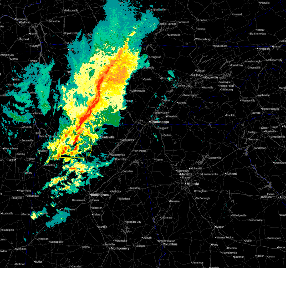
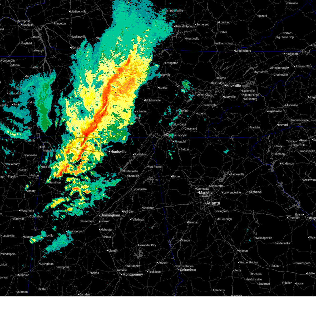
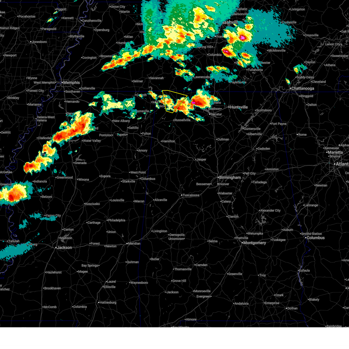
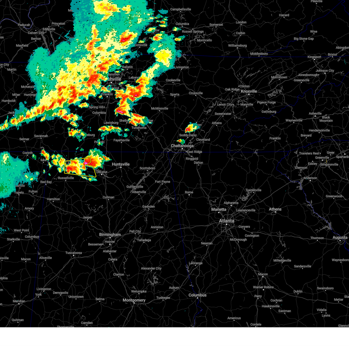
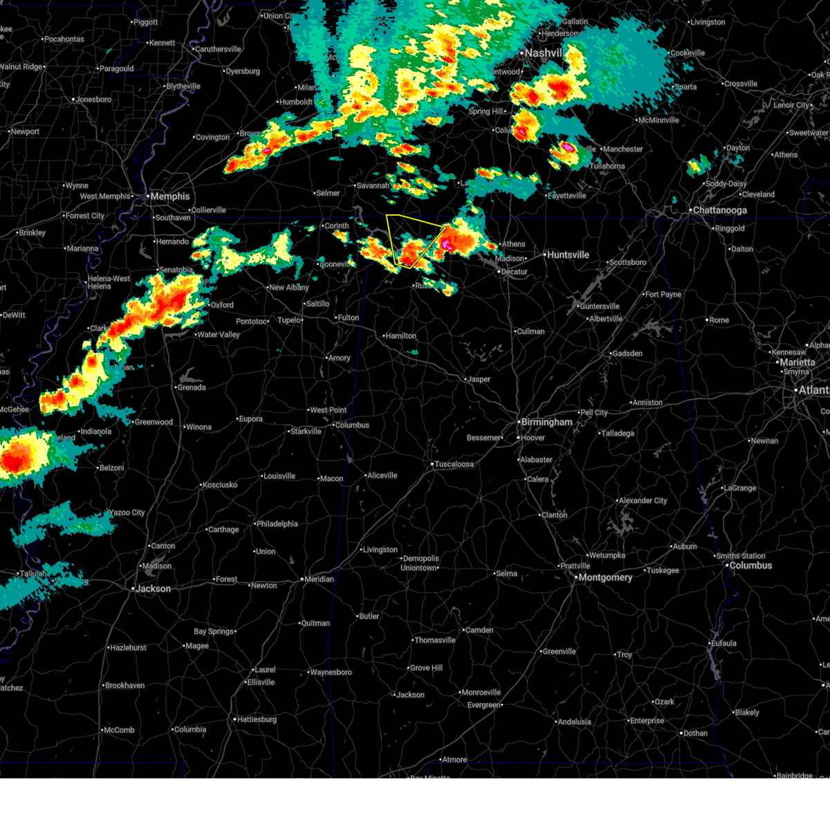
| 3/15/2026 11:22 PM CDT |
 At 1121 pm cdt, severe thunderstorms were located along a line extending from 12 miles east of lexington to rogersville to 8 miles east of littleville, moving east at 40 mph (radar indicated). Hazards include 60 mph wind gusts and penny size hail. Expect damage to roofs, siding, and trees. Locations impacted include, decatur, madison, athens, muscle shoals, tuscumbia, trinity, rogersville, ardmore, killen, and town creek. At 1121 pm cdt, severe thunderstorms were located along a line extending from 12 miles east of lexington to rogersville to 8 miles east of littleville, moving east at 40 mph (radar indicated). Hazards include 60 mph wind gusts and penny size hail. Expect damage to roofs, siding, and trees. Locations impacted include, decatur, madison, athens, muscle shoals, tuscumbia, trinity, rogersville, ardmore, killen, and town creek.
|
| 3/15/2026 10:43 PM CDT |
 Svrhun the national weather service in huntsville alabama has issued a * severe thunderstorm warning for, northwestern madison county in north central alabama, limestone county in north central alabama, eastern lauderdale county in northwestern alabama, southeastern colbert county in northwestern alabama, northwestern morgan county in north central alabama, northern lawrence county in northwestern alabama, southwestern lincoln county in middle tennessee, * until 1145 pm cdt. * at 1043 pm cdt, severe thunderstorms were located along a line extending from near loretto to near florence to 6 miles north of belgreen, moving east at 45 mph (radar indicated). Hazards include 60 mph wind gusts and penny size hail. expect damage to roofs, siding, and trees Svrhun the national weather service in huntsville alabama has issued a * severe thunderstorm warning for, northwestern madison county in north central alabama, limestone county in north central alabama, eastern lauderdale county in northwestern alabama, southeastern colbert county in northwestern alabama, northwestern morgan county in north central alabama, northern lawrence county in northwestern alabama, southwestern lincoln county in middle tennessee, * until 1145 pm cdt. * at 1043 pm cdt, severe thunderstorms were located along a line extending from near loretto to near florence to 6 miles north of belgreen, moving east at 45 mph (radar indicated). Hazards include 60 mph wind gusts and penny size hail. expect damage to roofs, siding, and trees
|
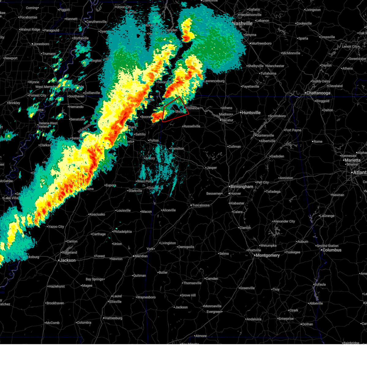
| 3/15/2026 10:13 PM CDT |
 The tornado threat has diminished and the tornado warning has been cancelled. however, large hail and damaging winds remain likely and a severe thunderstorm warning remains in effect for lauderdale and colbert counties. a tornado watch remains in effect until 300 am cdt for northwestern alabama. The tornado threat has diminished and the tornado warning has been cancelled. however, large hail and damaging winds remain likely and a severe thunderstorm warning remains in effect for lauderdale and colbert counties. a tornado watch remains in effect until 300 am cdt for northwestern alabama.
|
| 3/15/2026 10:00 PM CDT |
 At 959 pm cdt, a severe thunderstorm capable of producing a tornado was located over cherokee, or 13 miles west of tuscumbia, moving northeast at 45 mph (radar indicated rotation). Hazards include tornado and quarter size hail. Flying debris will be dangerous to those caught without shelter. mobile homes will be damaged or destroyed. damage to roofs, windows, and vehicles will occur. tree damage is likely. this dangerous storm will be near, florence around 1015 pm cdt. Other locations impacted by this tornadic thunderstorm include red rock, pride landing, threet, mt hester, oakland, and barton. At 959 pm cdt, a severe thunderstorm capable of producing a tornado was located over cherokee, or 13 miles west of tuscumbia, moving northeast at 45 mph (radar indicated rotation). Hazards include tornado and quarter size hail. Flying debris will be dangerous to those caught without shelter. mobile homes will be damaged or destroyed. damage to roofs, windows, and vehicles will occur. tree damage is likely. this dangerous storm will be near, florence around 1015 pm cdt. Other locations impacted by this tornadic thunderstorm include red rock, pride landing, threet, mt hester, oakland, and barton.
|
| 3/15/2026 9:51 PM CDT |
 Svrhun the national weather service in huntsville alabama has issued a * severe thunderstorm warning for, lauderdale county in northwestern alabama, colbert county in northwestern alabama, * until 1045 pm cdt. * at 951 pm cdt, severe thunderstorms were located along a line extending from 7 miles southeast of savannah to near booneville to troy, moving east at 50 mph (radar indicated). Hazards include 60 mph wind gusts and penny size hail. expect damage to roofs, siding, and trees Svrhun the national weather service in huntsville alabama has issued a * severe thunderstorm warning for, lauderdale county in northwestern alabama, colbert county in northwestern alabama, * until 1045 pm cdt. * at 951 pm cdt, severe thunderstorms were located along a line extending from 7 miles southeast of savannah to near booneville to troy, moving east at 50 mph (radar indicated). Hazards include 60 mph wind gusts and penny size hail. expect damage to roofs, siding, and trees
|
| 3/15/2026 9:49 PM CDT |
 At 949 pm cdt, a severe thunderstorm capable of producing a tornado was located near cherokee, or 9 miles northeast of tishomingo state park, moving northeast at 45 mph (radar indicated rotation). Hazards include tornado and quarter size hail. Flying debris will be dangerous to those caught without shelter. mobile homes will be damaged or destroyed. damage to roofs, windows, and vehicles will occur. tree damage is likely. this dangerous storm will be near, cherokee around 955 pm cdt. florence and underwood-petersville around 1015 pm cdt. Other locations impacted by this tornadic thunderstorm include red rock, malone, posey loop, mynot, pride landing, threet, mt hester, margerum, allsboro, and maud. At 949 pm cdt, a severe thunderstorm capable of producing a tornado was located near cherokee, or 9 miles northeast of tishomingo state park, moving northeast at 45 mph (radar indicated rotation). Hazards include tornado and quarter size hail. Flying debris will be dangerous to those caught without shelter. mobile homes will be damaged or destroyed. damage to roofs, windows, and vehicles will occur. tree damage is likely. this dangerous storm will be near, cherokee around 955 pm cdt. florence and underwood-petersville around 1015 pm cdt. Other locations impacted by this tornadic thunderstorm include red rock, malone, posey loop, mynot, pride landing, threet, mt hester, margerum, allsboro, and maud.
|
| 3/15/2026 9:32 PM CDT |
 Torhun the national weather service in huntsville alabama has issued a * tornado warning for, central lauderdale county in northwestern alabama, western colbert county in northwestern alabama, * until 1015 pm cdt. * at 931 pm cdt, a severe thunderstorm capable of producing a tornado was located over tishomingo, or near tishomingo state park, moving northeast at 45 mph (radar indicated rotation). Hazards include tornado and quarter size hail. Flying debris will be dangerous to those caught without shelter. mobile homes will be damaged or destroyed. damage to roofs, windows, and vehicles will occur. tree damage is likely. this dangerous storm will be near, cherokee around 950 pm cdt. Other locations impacted by this tornadic thunderstorm include red rock, malone, posey loop, mynot, pride landing, threet, mt hester, margerum, allsboro, and maud. Torhun the national weather service in huntsville alabama has issued a * tornado warning for, central lauderdale county in northwestern alabama, western colbert county in northwestern alabama, * until 1015 pm cdt. * at 931 pm cdt, a severe thunderstorm capable of producing a tornado was located over tishomingo, or near tishomingo state park, moving northeast at 45 mph (radar indicated rotation). Hazards include tornado and quarter size hail. Flying debris will be dangerous to those caught without shelter. mobile homes will be damaged or destroyed. damage to roofs, windows, and vehicles will occur. tree damage is likely. this dangerous storm will be near, cherokee around 950 pm cdt. Other locations impacted by this tornadic thunderstorm include red rock, malone, posey loop, mynot, pride landing, threet, mt hester, margerum, allsboro, and maud.
|
| 2/26/2026 4:23 PM CST |
 Svrhun the national weather service in huntsville alabama has issued a * severe thunderstorm warning for, southern colbert county in northwestern alabama, northern franklin county in northwestern alabama, * until 530 pm cst. * at 422 pm cst, a severe thunderstorm was located 9 miles south of cherokee, or 9 miles east of tishomingo state park, moving east at 25 mph (radar indicated). Hazards include 60 mph wind gusts and quarter size hail. Hail damage to vehicles is expected. Expect wind damage to roofs, siding, and trees. Svrhun the national weather service in huntsville alabama has issued a * severe thunderstorm warning for, southern colbert county in northwestern alabama, northern franklin county in northwestern alabama, * until 530 pm cst. * at 422 pm cst, a severe thunderstorm was located 9 miles south of cherokee, or 9 miles east of tishomingo state park, moving east at 25 mph (radar indicated). Hazards include 60 mph wind gusts and quarter size hail. Hail damage to vehicles is expected. Expect wind damage to roofs, siding, and trees.
|
| 12/18/2025 7:30 PM CST |
 Svrhun the national weather service in huntsville alabama has issued a * severe thunderstorm warning for, southern limestone county in north central alabama, southeastern colbert county in northwestern alabama, eastern franklin county in northwestern alabama, morgan county in north central alabama, lawrence county in northwestern alabama, * until 815 pm cst. * at 730 pm cst, severe thunderstorms were located along a line extending from 6 miles west of tanner to 6 miles southwest of trinity to 7 miles north of needmore, moving east at 40 mph (radar indicated). Hazards include 70 mph wind gusts. Expect considerable tree damage. Damage is likely to mobile homes, roofs, and outbuildings. Svrhun the national weather service in huntsville alabama has issued a * severe thunderstorm warning for, southern limestone county in north central alabama, southeastern colbert county in northwestern alabama, eastern franklin county in northwestern alabama, morgan county in north central alabama, lawrence county in northwestern alabama, * until 815 pm cst. * at 730 pm cst, severe thunderstorms were located along a line extending from 6 miles west of tanner to 6 miles southwest of trinity to 7 miles north of needmore, moving east at 40 mph (radar indicated). Hazards include 70 mph wind gusts. Expect considerable tree damage. Damage is likely to mobile homes, roofs, and outbuildings.
|
| 12/18/2025 7:26 PM CST |
 At 725 pm cst, a severe thunderstorm was located 10 miles northwest of athens, moving east at 35 mph (radar indicated). Hazards include 60 mph wind gusts. Expect damage to roofs, siding, and trees. Locations impacted include, athens, rogersville, ardmore, killen, lexington, elkmont, anderson, lester, good springs, and cartwright. At 725 pm cst, a severe thunderstorm was located 10 miles northwest of athens, moving east at 35 mph (radar indicated). Hazards include 60 mph wind gusts. Expect damage to roofs, siding, and trees. Locations impacted include, athens, rogersville, ardmore, killen, lexington, elkmont, anderson, lester, good springs, and cartwright.
|
| 12/18/2025 7:16 PM CST | Peak thunderstorm wind gust of 62 mph measured at the northwest alabama regional airport in muscle shoal in colbert county AL, 1 miles W of Muscle Shoals, AL |
| 12/18/2025 7:09 PM CST |
 At 709 pm cst, severe thunderstorms were located along a line extending from town creek to 8 miles east of russellville to near hackleburg, moving east at 35 mph (radar indicated). Hazards include 60 mph wind gusts. Expect damage to roofs, siding, and trees. Locations impacted include, florence, muscle shoals, russellville, moulton, rogersville, phil campbell, town creek, littleville, leighton, and courtland. At 709 pm cst, severe thunderstorms were located along a line extending from town creek to 8 miles east of russellville to near hackleburg, moving east at 35 mph (radar indicated). Hazards include 60 mph wind gusts. Expect damage to roofs, siding, and trees. Locations impacted include, florence, muscle shoals, russellville, moulton, rogersville, phil campbell, town creek, littleville, leighton, and courtland.
|
| 12/18/2025 6:58 PM CST |
 At 658 pm cst, severe thunderstorms were located along a line extending from near killen to near littleville to near belgreen, moving east at 30 mph (radar indicated). Hazards include 60 mph wind gusts. Expect damage to roofs, siding, and trees. Locations impacted include, florence, muscle shoals, russellville, moulton, rogersville, phil campbell, town creek, littleville, leighton, and courtland. At 658 pm cst, severe thunderstorms were located along a line extending from near killen to near littleville to near belgreen, moving east at 30 mph (radar indicated). Hazards include 60 mph wind gusts. Expect damage to roofs, siding, and trees. Locations impacted include, florence, muscle shoals, russellville, moulton, rogersville, phil campbell, town creek, littleville, leighton, and courtland.
|
| 12/18/2025 6:53 PM CST |
 Svrhun the national weather service in huntsville alabama has issued a * severe thunderstorm warning for, limestone county in north central alabama, northeastern lauderdale county in northwestern alabama, east central colbert county in northwestern alabama, * until 800 pm cst. * at 653 pm cst, a severe thunderstorm was located over lexington, or 18 miles northeast of florence, moving east at 50 mph (radar indicated). Hazards include 60 mph wind gusts. expect damage to roofs, siding, and trees Svrhun the national weather service in huntsville alabama has issued a * severe thunderstorm warning for, limestone county in north central alabama, northeastern lauderdale county in northwestern alabama, east central colbert county in northwestern alabama, * until 800 pm cst. * at 653 pm cst, a severe thunderstorm was located over lexington, or 18 miles northeast of florence, moving east at 50 mph (radar indicated). Hazards include 60 mph wind gusts. expect damage to roofs, siding, and trees
|
| 12/18/2025 6:35 PM CST |
 At 634 pm cst, severe thunderstorms were located along a line extending from sheffield to near belgreen to 9 miles southeast of red bay, moving east at 45 mph (radar indicated). Hazards include 60 mph wind gusts. Expect damage to roofs, siding, and trees. Locations impacted include, florence, muscle shoals, russellville, sheffield, tuscumbia, moulton, rogersville, phil campbell, killen, and town creek. At 634 pm cst, severe thunderstorms were located along a line extending from sheffield to near belgreen to 9 miles southeast of red bay, moving east at 45 mph (radar indicated). Hazards include 60 mph wind gusts. Expect damage to roofs, siding, and trees. Locations impacted include, florence, muscle shoals, russellville, sheffield, tuscumbia, moulton, rogersville, phil campbell, killen, and town creek.
|
| 12/18/2025 6:24 PM CST |
 Svrhun the national weather service in huntsville alabama has issued a * severe thunderstorm warning for, southeastern lauderdale county in northwestern alabama, colbert county in northwestern alabama, franklin county in northwestern alabama, lawrence county in northwestern alabama, * until 730 pm cst. * at 624 pm cst, severe thunderstorms were located along a line extending from 9 miles southeast of cherokee to belgreen to near hackleburg, moving east at 25 mph (radar indicated). Hazards include 60 mph wind gusts. expect damage to roofs, siding, and trees Svrhun the national weather service in huntsville alabama has issued a * severe thunderstorm warning for, southeastern lauderdale county in northwestern alabama, colbert county in northwestern alabama, franklin county in northwestern alabama, lawrence county in northwestern alabama, * until 730 pm cst. * at 624 pm cst, severe thunderstorms were located along a line extending from 9 miles southeast of cherokee to belgreen to near hackleburg, moving east at 25 mph (radar indicated). Hazards include 60 mph wind gusts. expect damage to roofs, siding, and trees
|
| 12/18/2025 5:57 PM CST |
 At 556 pm cst, severe thunderstorms were located along a line extending from 8 miles west of underwood-petersville to 9 miles west of sheffield to 6 miles southeast of cherokee, moving east at 45 mph (radar indicated). Hazards include 60 mph wind gusts. Expect damage to roofs, siding, and trees. locations impacted include, florence, muscle shoals, sheffield, tuscumbia, cherokee, littleville, st. Florian, underwood-petersville, malone, and posey loop. At 556 pm cst, severe thunderstorms were located along a line extending from 8 miles west of underwood-petersville to 9 miles west of sheffield to 6 miles southeast of cherokee, moving east at 45 mph (radar indicated). Hazards include 60 mph wind gusts. Expect damage to roofs, siding, and trees. locations impacted include, florence, muscle shoals, sheffield, tuscumbia, cherokee, littleville, st. Florian, underwood-petersville, malone, and posey loop.
|
| 12/18/2025 5:33 PM CST |
 Svrhun the national weather service in huntsville alabama has issued a * severe thunderstorm warning for, central lauderdale county in northwestern alabama, colbert county in northwestern alabama, * until 630 pm cst. * at 532 pm cst, severe thunderstorms were located along a line extending from near iuka to near midway to tishomingo, moving east at 40 mph (radar indicated). Hazards include 60 mph wind gusts. expect damage to roofs, siding, and trees Svrhun the national weather service in huntsville alabama has issued a * severe thunderstorm warning for, central lauderdale county in northwestern alabama, colbert county in northwestern alabama, * until 630 pm cst. * at 532 pm cst, severe thunderstorms were located along a line extending from near iuka to near midway to tishomingo, moving east at 40 mph (radar indicated). Hazards include 60 mph wind gusts. expect damage to roofs, siding, and trees
|
| 8/20/2025 6:37 PM CDT |
 The storm which prompted the warning has weakened below severe limits, and no longer poses an immediate threat to life or property. therefore, the warning will be allowed to expire. The storm which prompted the warning has weakened below severe limits, and no longer poses an immediate threat to life or property. therefore, the warning will be allowed to expire.
|
| 8/20/2025 6:17 PM CDT |
 At 617 pm cdt, a severe thunderstorm was located over littleville, or near russellville, moving south at 15 mph (radar indicated). Hazards include 60 mph wind gusts. Expect damage to roofs, siding, and trees. locations impacted include, florence, muscle shoals, russellville, sheffield, tuscumbia, killen, littleville, leighton, st. Florian, and belgreen. At 617 pm cdt, a severe thunderstorm was located over littleville, or near russellville, moving south at 15 mph (radar indicated). Hazards include 60 mph wind gusts. Expect damage to roofs, siding, and trees. locations impacted include, florence, muscle shoals, russellville, sheffield, tuscumbia, killen, littleville, leighton, st. Florian, and belgreen.
|
| 8/20/2025 5:47 PM CDT |
 Svrhun the national weather service in huntsville alabama has issued a * severe thunderstorm warning for, south central lauderdale county in northwestern alabama, southeastern colbert county in northwestern alabama, northeastern franklin county in northwestern alabama, northwestern lawrence county in northwestern alabama, * until 645 pm cdt. * at 546 pm cdt, a severe thunderstorm was located over tuscumbia, moving south at 15 mph. numerous trees have been reported down near florence (emergency management). Hazards include 60 mph wind gusts. expect damage to roofs, siding, and trees Svrhun the national weather service in huntsville alabama has issued a * severe thunderstorm warning for, south central lauderdale county in northwestern alabama, southeastern colbert county in northwestern alabama, northeastern franklin county in northwestern alabama, northwestern lawrence county in northwestern alabama, * until 645 pm cdt. * at 546 pm cdt, a severe thunderstorm was located over tuscumbia, moving south at 15 mph. numerous trees have been reported down near florence (emergency management). Hazards include 60 mph wind gusts. expect damage to roofs, siding, and trees
|
| 7/28/2025 6:27 PM CDT |
 The storms which prompted the warning have weakened below severe limits; therefore, the warning will be allowed to expire. however, gusty winds and heavy rain are still possible with these thunderstorms. The storms which prompted the warning have weakened below severe limits; therefore, the warning will be allowed to expire. however, gusty winds and heavy rain are still possible with these thunderstorms.
|
| 7/28/2025 6:14 PM CDT |
 At 614 pm cdt, a severe thunderstorm was located over florence, moving south at 5 mph (radar indicated). Hazards include 60 mph wind gusts and quarter size hail. Hail damage to vehicles is expected. expect wind damage to roofs, siding, and trees. locations impacted include, florence, muscle shoals, sheffield, tuscumbia, killen, leighton, st. Florian, underwood-petersville, northwest alabama regional airport, and ford city. At 614 pm cdt, a severe thunderstorm was located over florence, moving south at 5 mph (radar indicated). Hazards include 60 mph wind gusts and quarter size hail. Hail damage to vehicles is expected. expect wind damage to roofs, siding, and trees. locations impacted include, florence, muscle shoals, sheffield, tuscumbia, killen, leighton, st. Florian, underwood-petersville, northwest alabama regional airport, and ford city.
|
| 7/28/2025 6:14 PM CDT |
 the severe thunderstorm warning has been cancelled and is no longer in effect the severe thunderstorm warning has been cancelled and is no longer in effect
|
| 7/28/2025 5:54 PM CDT |
 At 553 pm cdt, a severe thunderstorm was located over underwood-petersville, or near florence, moving south at 10 mph (radar indicated). Hazards include 60 mph wind gusts and quarter size hail. Hail damage to vehicles is expected. expect wind damage to roofs, siding, and trees. locations impacted include, florence, muscle shoals, sheffield, tuscumbia, killen, town creek, littleville, leighton, courtland, and st. Florian. At 553 pm cdt, a severe thunderstorm was located over underwood-petersville, or near florence, moving south at 10 mph (radar indicated). Hazards include 60 mph wind gusts and quarter size hail. Hail damage to vehicles is expected. expect wind damage to roofs, siding, and trees. locations impacted include, florence, muscle shoals, sheffield, tuscumbia, killen, town creek, littleville, leighton, courtland, and st. Florian.
|
| 7/28/2025 5:36 PM CDT |
 Svrhun the national weather service in huntsville alabama has issued a * severe thunderstorm warning for, central lauderdale county in northwestern alabama, southeastern colbert county in northwestern alabama, northeastern franklin county in northwestern alabama, northwestern lawrence county in northwestern alabama, * until 630 pm cdt. * at 535 pm cdt, severe thunderstorms were located over killen, or 7 miles east of florence, moving south at 5 mph (radar indicated). Hazards include 60 mph wind gusts. expect damage to roofs, siding, and trees Svrhun the national weather service in huntsville alabama has issued a * severe thunderstorm warning for, central lauderdale county in northwestern alabama, southeastern colbert county in northwestern alabama, northeastern franklin county in northwestern alabama, northwestern lawrence county in northwestern alabama, * until 630 pm cdt. * at 535 pm cdt, severe thunderstorms were located over killen, or 7 miles east of florence, moving south at 5 mph (radar indicated). Hazards include 60 mph wind gusts. expect damage to roofs, siding, and trees
|
| 7/9/2025 4:07 PM CDT |
 The storm which prompted the warning has weakened below severe limits, and no longer poses an immediate threat to life or property. therefore, the warning will be allowed to expire. however, heavy rain is still possible with this thunderstorm. The storm which prompted the warning has weakened below severe limits, and no longer poses an immediate threat to life or property. therefore, the warning will be allowed to expire. however, heavy rain is still possible with this thunderstorm.
|
| 7/9/2025 3:33 PM CDT |
 At 333 pm cdt, a severe thunderstorm was located near littleville, or 7 miles northwest of russellville, moving east at 25 mph (radar indicated). Hazards include 60 mph wind gusts. Expect damage to roofs, siding, and trees. locations impacted include, florence, muscle shoals, sheffield, tuscumbia, killen, littleville, leighton, st. Florian, posey loop, and northwest alabama regional airport. At 333 pm cdt, a severe thunderstorm was located near littleville, or 7 miles northwest of russellville, moving east at 25 mph (radar indicated). Hazards include 60 mph wind gusts. Expect damage to roofs, siding, and trees. locations impacted include, florence, muscle shoals, sheffield, tuscumbia, killen, littleville, leighton, st. Florian, posey loop, and northwest alabama regional airport.
|
| 7/9/2025 3:33 PM CDT |
 the severe thunderstorm warning has been cancelled and is no longer in effect the severe thunderstorm warning has been cancelled and is no longer in effect
|
| 7/9/2025 3:09 PM CDT |
 Svrhun the national weather service in huntsville alabama has issued a * severe thunderstorm warning for, south central lauderdale county in northwestern alabama, colbert county in northwestern alabama, northern franklin county in northwestern alabama, west central lawrence county in northwestern alabama, * until 415 pm cdt. * at 308 pm cdt, a severe thunderstorm was located 10 miles northwest of belgreen, or 12 miles east of tishomingo state park, moving east at 25 mph (radar indicated). Hazards include 60 mph wind gusts and penny size hail. expect damage to roofs, siding, and trees Svrhun the national weather service in huntsville alabama has issued a * severe thunderstorm warning for, south central lauderdale county in northwestern alabama, colbert county in northwestern alabama, northern franklin county in northwestern alabama, west central lawrence county in northwestern alabama, * until 415 pm cdt. * at 308 pm cdt, a severe thunderstorm was located 10 miles northwest of belgreen, or 12 miles east of tishomingo state park, moving east at 25 mph (radar indicated). Hazards include 60 mph wind gusts and penny size hail. expect damage to roofs, siding, and trees
|
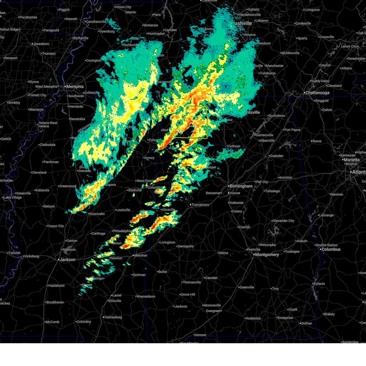
| 6/7/2025 1:36 PM CDT |
 the severe thunderstorm warning has been cancelled and is no longer in effect the severe thunderstorm warning has been cancelled and is no longer in effect
|
| 6/7/2025 1:36 PM CDT |
 At 135 pm cdt, severe thunderstorms were located along a line extending from near courtland to near moreland to eldridge, moving east at 45 mph (radar indicated). Hazards include 60 mph wind gusts. Expect damage to roofs, siding, and trees. Locations impacted include, decatur, madison, florence, athens, hartselle, muscle shoals, moulton, priceville, trinity, and falkville. At 135 pm cdt, severe thunderstorms were located along a line extending from near courtland to near moreland to eldridge, moving east at 45 mph (radar indicated). Hazards include 60 mph wind gusts. Expect damage to roofs, siding, and trees. Locations impacted include, decatur, madison, florence, athens, hartselle, muscle shoals, moulton, priceville, trinity, and falkville.
|
| 6/7/2025 1:08 PM CDT |
 Svrhun the national weather service in huntsville alabama has issued a * severe thunderstorm warning for, west central madison county in north central alabama, limestone county in north central alabama, eastern lauderdale county in northwestern alabama, southeastern colbert county in northwestern alabama, northwestern cullman county in north central alabama, eastern franklin county in northwestern alabama, morgan county in north central alabama, lawrence county in northwestern alabama, * until 215 pm cdt. * at 107 pm cdt, severe thunderstorms were located along a line extending from near littleville to near lake buttahatchee to near bluff, moving east at 45 mph (radar indicated). Hazards include 60 mph wind gusts. expect damage to roofs, siding, and trees Svrhun the national weather service in huntsville alabama has issued a * severe thunderstorm warning for, west central madison county in north central alabama, limestone county in north central alabama, eastern lauderdale county in northwestern alabama, southeastern colbert county in northwestern alabama, northwestern cullman county in north central alabama, eastern franklin county in northwestern alabama, morgan county in north central alabama, lawrence county in northwestern alabama, * until 215 pm cdt. * at 107 pm cdt, severe thunderstorms were located along a line extending from near littleville to near lake buttahatchee to near bluff, moving east at 45 mph (radar indicated). Hazards include 60 mph wind gusts. expect damage to roofs, siding, and trees
|
| 6/7/2025 1:03 PM CDT |
 At 102 pm cdt, severe thunderstorms were located along a line extending from 9 miles north of cherokee to near belgreen to near weston, moving east at 50 mph (radar indicated). Hazards include 60 mph wind gusts. Expect damage to roofs, siding, and trees. Locations impacted include, florence, muscle shoals, russellville, sheffield, tuscumbia, phil campbell, killen, cherokee, littleville, and leighton. At 102 pm cdt, severe thunderstorms were located along a line extending from 9 miles north of cherokee to near belgreen to near weston, moving east at 50 mph (radar indicated). Hazards include 60 mph wind gusts. Expect damage to roofs, siding, and trees. Locations impacted include, florence, muscle shoals, russellville, sheffield, tuscumbia, phil campbell, killen, cherokee, littleville, and leighton.
|
| 6/7/2025 12:21 PM CDT |
 Svrhun the national weather service in huntsville alabama has issued a * severe thunderstorm warning for, lauderdale county in northwestern alabama, colbert county in northwestern alabama, franklin county in northwestern alabama, western lawrence county in northwestern alabama, * until 115 pm cdt. * at 1221 pm cdt, severe thunderstorms were located along a line extending from near corinth to near sandy springs to shannon, moving east at 50 mph (radar indicated). Hazards include 60 mph wind gusts. expect damage to roofs, siding, and trees Svrhun the national weather service in huntsville alabama has issued a * severe thunderstorm warning for, lauderdale county in northwestern alabama, colbert county in northwestern alabama, franklin county in northwestern alabama, western lawrence county in northwestern alabama, * until 115 pm cdt. * at 1221 pm cdt, severe thunderstorms were located along a line extending from near corinth to near sandy springs to shannon, moving east at 50 mph (radar indicated). Hazards include 60 mph wind gusts. expect damage to roofs, siding, and trees
|
| 5/25/2025 8:58 PM CDT |
 Svrhun the national weather service in huntsville alabama has issued a * severe thunderstorm warning for, southwestern limestone county in north central alabama, southeastern colbert county in northwestern alabama, northwestern cullman county in north central alabama, eastern franklin county in northwestern alabama, western morgan county in north central alabama, lawrence county in northwestern alabama, * until 945 pm cdt. * at 858 pm cdt, severe thunderstorms were located along a line extending from near littleville to near ashridge, moving east at 35 mph (radar indicated). Hazards include 70 mph wind gusts. Expect considerable tree damage. Damage is likely to mobile homes, roofs, and outbuildings. Svrhun the national weather service in huntsville alabama has issued a * severe thunderstorm warning for, southwestern limestone county in north central alabama, southeastern colbert county in northwestern alabama, northwestern cullman county in north central alabama, eastern franklin county in northwestern alabama, western morgan county in north central alabama, lawrence county in northwestern alabama, * until 945 pm cdt. * at 858 pm cdt, severe thunderstorms were located along a line extending from near littleville to near ashridge, moving east at 35 mph (radar indicated). Hazards include 70 mph wind gusts. Expect considerable tree damage. Damage is likely to mobile homes, roofs, and outbuildings.
|
| 5/25/2025 8:50 PM CDT |
 At 850 pm cdt, severe thunderstorms were located along a line extending from near florence to russellville to hamilton, moving southeast at 35 mph (radar indicated). Hazards include 70 mph wind gusts and penny size hail. Expect considerable tree damage. damage is likely to mobile homes, roofs, and outbuildings. Locations impacted include, mt hope, northwest alabama regional airport, littleville, la grange, tharptown, ne smith, duketon, russellville, rockwood, and north courtland. At 850 pm cdt, severe thunderstorms were located along a line extending from near florence to russellville to hamilton, moving southeast at 35 mph (radar indicated). Hazards include 70 mph wind gusts and penny size hail. Expect considerable tree damage. damage is likely to mobile homes, roofs, and outbuildings. Locations impacted include, mt hope, northwest alabama regional airport, littleville, la grange, tharptown, ne smith, duketon, russellville, rockwood, and north courtland.
|
| 5/25/2025 8:49 PM CDT |
 At 849 pm cdt, severe thunderstorms were located along a line extending from near florence to russellville to hamilton, moving southeast at 35 mph (radar indicated). Hazards include 70 mph wind gusts and penny size hail. Expect considerable tree damage. damage is likely to mobile homes, roofs, and outbuildings. Locations impacted include, mt hope, northwest alabama regional airport, littleville, la grange, tharptown, ne smith, duketon, russellville, rockwood, and north courtland. At 849 pm cdt, severe thunderstorms were located along a line extending from near florence to russellville to hamilton, moving southeast at 35 mph (radar indicated). Hazards include 70 mph wind gusts and penny size hail. Expect considerable tree damage. damage is likely to mobile homes, roofs, and outbuildings. Locations impacted include, mt hope, northwest alabama regional airport, littleville, la grange, tharptown, ne smith, duketon, russellville, rockwood, and north courtland.
|
| 5/25/2025 8:44 PM CDT |
 At 844 pm cdt, severe thunderstorms were located along a line extending from florence to near russellville to near weston, moving southeast at 35 mph (radar indicated). Hazards include 60 mph wind gusts and penny size hail. Expect damage to roofs, siding, and trees. Locations impacted include, mt hope, northwest alabama regional airport, littleville, la grange, tharptown, ne smith, duketon, russellville, rockwood, and north courtland. At 844 pm cdt, severe thunderstorms were located along a line extending from florence to near russellville to near weston, moving southeast at 35 mph (radar indicated). Hazards include 60 mph wind gusts and penny size hail. Expect damage to roofs, siding, and trees. Locations impacted include, mt hope, northwest alabama regional airport, littleville, la grange, tharptown, ne smith, duketon, russellville, rockwood, and north courtland.
|
| 5/25/2025 8:41 PM CDT |
 At 841 pm cdt, severe thunderstorms were located along a line extending from near florence to near russellville to near weston, moving southeast at 35 mph (radar indicated). Hazards include 60 mph wind gusts and penny size hail. Expect damage to roofs, siding, and trees. Locations impacted include, posey loop, mt hope, northwest alabama regional airport, atwood, littleville, la grange, tharptown, ne smith, duketon, and russellville. At 841 pm cdt, severe thunderstorms were located along a line extending from near florence to near russellville to near weston, moving southeast at 35 mph (radar indicated). Hazards include 60 mph wind gusts and penny size hail. Expect damage to roofs, siding, and trees. Locations impacted include, posey loop, mt hope, northwest alabama regional airport, atwood, littleville, la grange, tharptown, ne smith, duketon, and russellville.
|
| 5/25/2025 8:36 PM CDT |
 At 836 pm cdt, severe thunderstorms were located along a line extending from near underwood-petersville to near belgreen to 6 miles west of weston, moving southeast at 35 mph (radar indicated). Hazards include 60 mph wind gusts and quarter size hail. Hail damage to vehicles is expected. expect wind damage to roofs, siding, and trees. Locations impacted include, posey loop, mt hope, atwood, florence, ne smith, oakland, north courtland, lexington, tuscumbia, and hatton. At 836 pm cdt, severe thunderstorms were located along a line extending from near underwood-petersville to near belgreen to 6 miles west of weston, moving southeast at 35 mph (radar indicated). Hazards include 60 mph wind gusts and quarter size hail. Hail damage to vehicles is expected. expect wind damage to roofs, siding, and trees. Locations impacted include, posey loop, mt hope, atwood, florence, ne smith, oakland, north courtland, lexington, tuscumbia, and hatton.
|
| 5/25/2025 8:18 PM CDT |
 At 818 pm cdt, severe thunderstorms were located along a line extending from 11 miles north of cherokee to 10 miles northwest of belgreen to near tremont, moving southeast at 35 mph (radar indicated). Hazards include 60 mph wind gusts and quarter size hail. Hail damage to vehicles is expected. expect wind damage to roofs, siding, and trees. Locations impacted include, posey loop, mt hope, atwood, florence, ne smith, oakland, north courtland, lexington, tuscumbia, and hatton. At 818 pm cdt, severe thunderstorms were located along a line extending from 11 miles north of cherokee to 10 miles northwest of belgreen to near tremont, moving southeast at 35 mph (radar indicated). Hazards include 60 mph wind gusts and quarter size hail. Hail damage to vehicles is expected. expect wind damage to roofs, siding, and trees. Locations impacted include, posey loop, mt hope, atwood, florence, ne smith, oakland, north courtland, lexington, tuscumbia, and hatton.
|
| 5/25/2025 8:12 PM CDT |
 Svrhun the national weather service in huntsville alabama has issued a * severe thunderstorm warning for, lauderdale county in northwestern alabama, colbert county in northwestern alabama, franklin county in northwestern alabama, western lawrence county in northwestern alabama, * until 915 pm cdt. * at 812 pm cdt, severe thunderstorms were located along a line extending from 9 miles southeast of walnut grove to 8 miles east of tishomingo state park to near fulton, moving southeast at 35 mph (radar indicated). Hazards include 60 mph wind gusts and quarter size hail. Hail damage to vehicles is expected. Expect wind damage to roofs, siding, and trees. Svrhun the national weather service in huntsville alabama has issued a * severe thunderstorm warning for, lauderdale county in northwestern alabama, colbert county in northwestern alabama, franklin county in northwestern alabama, western lawrence county in northwestern alabama, * until 915 pm cdt. * at 812 pm cdt, severe thunderstorms were located along a line extending from 9 miles southeast of walnut grove to 8 miles east of tishomingo state park to near fulton, moving southeast at 35 mph (radar indicated). Hazards include 60 mph wind gusts and quarter size hail. Hail damage to vehicles is expected. Expect wind damage to roofs, siding, and trees.
|
| 5/25/2025 7:53 PM CDT |
 At 753 pm cdt, severe thunderstorms were located along a line extending from near walnut grove to near ecru, moving east at 35 mph (radar indicated). Hazards include two inch hail and 60 mph wind gusts. People and animals outdoors will be injured. expect hail damage to roofs, siding, windows, and vehicles. expect wind damage to roofs, siding, and trees. Locations impacted include, posey loop, atwood, florence, oakland, waterloo, lexington, tuscumbia, underwood-petersville, colbert heights, and cherokee. At 753 pm cdt, severe thunderstorms were located along a line extending from near walnut grove to near ecru, moving east at 35 mph (radar indicated). Hazards include two inch hail and 60 mph wind gusts. People and animals outdoors will be injured. expect hail damage to roofs, siding, windows, and vehicles. expect wind damage to roofs, siding, and trees. Locations impacted include, posey loop, atwood, florence, oakland, waterloo, lexington, tuscumbia, underwood-petersville, colbert heights, and cherokee.
|
| 5/25/2025 7:34 PM CDT |
 At 734 pm cdt, severe thunderstorms were located along a line extending from near pickwick landing state park to near pinedale, moving east at 35 mph (radar indicated). Hazards include ping pong ball size hail and 60 mph wind gusts. People and animals outdoors will be injured. expect hail damage to roofs, siding, windows, and vehicles. expect wind damage to roofs, siding, and trees. Locations impacted include, posey loop, atwood, florence, oakland, waterloo, lexington, tuscumbia, underwood-petersville, colbert heights, and cherokee. At 734 pm cdt, severe thunderstorms were located along a line extending from near pickwick landing state park to near pinedale, moving east at 35 mph (radar indicated). Hazards include ping pong ball size hail and 60 mph wind gusts. People and animals outdoors will be injured. expect hail damage to roofs, siding, windows, and vehicles. expect wind damage to roofs, siding, and trees. Locations impacted include, posey loop, atwood, florence, oakland, waterloo, lexington, tuscumbia, underwood-petersville, colbert heights, and cherokee.
|
| 5/25/2025 7:18 PM CDT |
 Svrhun the national weather service in huntsville alabama has issued a * severe thunderstorm warning for, lauderdale county in northwestern alabama, colbert county in northwestern alabama, franklin county in northwestern alabama, * until 815 pm cdt. * at 718 pm cdt, severe thunderstorms were located along a line extending from near shiloh to near cambridge, moving east at 35 mph (radar indicated). Hazards include quarter size hail. damage to vehicles is expected Svrhun the national weather service in huntsville alabama has issued a * severe thunderstorm warning for, lauderdale county in northwestern alabama, colbert county in northwestern alabama, franklin county in northwestern alabama, * until 815 pm cdt. * at 718 pm cdt, severe thunderstorms were located along a line extending from near shiloh to near cambridge, moving east at 35 mph (radar indicated). Hazards include quarter size hail. damage to vehicles is expected
|
| 5/25/2025 3:12 PM CDT | Lauderdale al 911 call center reported a power pole leaning at 1457 wallace mill r in colbert county AL, 8.7 miles WSW of Muscle Shoals, AL |
| 5/20/2025 5:46 PM CDT |
 At 545 pm cdt, a severe thunderstorm was located over leighton, or 7 miles southeast of muscle shoals, moving east at 40 mph (radar indicated). Hazards include 60 mph wind gusts and quarter size hail. Hail damage to vehicles is expected. expect wind damage to roofs, siding, and trees. Locations impacted include, oliver, ne smith, caddo, north courtland, center star, town creek, killen, courtland, hillsboro, and ford city. At 545 pm cdt, a severe thunderstorm was located over leighton, or 7 miles southeast of muscle shoals, moving east at 40 mph (radar indicated). Hazards include 60 mph wind gusts and quarter size hail. Hail damage to vehicles is expected. expect wind damage to roofs, siding, and trees. Locations impacted include, oliver, ne smith, caddo, north courtland, center star, town creek, killen, courtland, hillsboro, and ford city.
|
| 5/20/2025 5:46 PM CDT |
 At 546 pm cdt, a severe thunderstorm capable of producing a tornado was located over leighton, or 9 miles east of muscle shoals, moving east at 45 mph (radar indicated rotation). Hazards include tornado and quarter size hail. Flying debris will be dangerous to those caught without shelter. mobile homes will be damaged or destroyed. damage to roofs, windows, and vehicles will occur. tree damage is likely. this dangerous storm will be near, town creek around 550 pm cdt. courtland around 555 pm cdt. Other locations impacted by this tornadic thunderstorm include coxey, oliver, hillsboro, cairo, red bank, ne smith, caddo, wheeler, whiteoak, and north courtland. At 546 pm cdt, a severe thunderstorm capable of producing a tornado was located over leighton, or 9 miles east of muscle shoals, moving east at 45 mph (radar indicated rotation). Hazards include tornado and quarter size hail. Flying debris will be dangerous to those caught without shelter. mobile homes will be damaged or destroyed. damage to roofs, windows, and vehicles will occur. tree damage is likely. this dangerous storm will be near, town creek around 550 pm cdt. courtland around 555 pm cdt. Other locations impacted by this tornadic thunderstorm include coxey, oliver, hillsboro, cairo, red bank, ne smith, caddo, wheeler, whiteoak, and north courtland.
|
| 5/20/2025 5:36 PM CDT |
 Torhun the national weather service in huntsville alabama has issued a * tornado warning for, southwestern limestone county in north central alabama, southeastern lauderdale county in northwestern alabama, southeastern colbert county in northwestern alabama, northwestern morgan county in north central alabama, northern lawrence county in northwestern alabama, * until 615 pm cdt. * at 536 pm cdt, a severe thunderstorm capable of producing a tornado was located near muscle shoals, moving east at 45 mph (radar indicated rotation). Hazards include tornado and quarter size hail. Flying debris will be dangerous to those caught without shelter. mobile homes will be damaged or destroyed. damage to roofs, windows, and vehicles will occur. tree damage is likely. this dangerous storm will be near, muscle shoals and leighton around 540 pm cdt. town creek around 550 pm cdt. courtland around 555 pm cdt. Other locations impacted by this tornadic thunderstorm include northwest alabama regional airport, coxey, oliver, hillsboro, red bank, caddo, wheeler, whiteoak, north courtland, and ripley. Torhun the national weather service in huntsville alabama has issued a * tornado warning for, southwestern limestone county in north central alabama, southeastern lauderdale county in northwestern alabama, southeastern colbert county in northwestern alabama, northwestern morgan county in north central alabama, northern lawrence county in northwestern alabama, * until 615 pm cdt. * at 536 pm cdt, a severe thunderstorm capable of producing a tornado was located near muscle shoals, moving east at 45 mph (radar indicated rotation). Hazards include tornado and quarter size hail. Flying debris will be dangerous to those caught without shelter. mobile homes will be damaged or destroyed. damage to roofs, windows, and vehicles will occur. tree damage is likely. this dangerous storm will be near, muscle shoals and leighton around 540 pm cdt. town creek around 550 pm cdt. courtland around 555 pm cdt. Other locations impacted by this tornadic thunderstorm include northwest alabama regional airport, coxey, oliver, hillsboro, red bank, caddo, wheeler, whiteoak, north courtland, and ripley.
|
| 5/20/2025 5:33 PM CDT |
 the severe thunderstorm warning has been cancelled and is no longer in effect the severe thunderstorm warning has been cancelled and is no longer in effect
|
| 5/20/2025 5:32 PM CDT |
 Svrhun the national weather service in huntsville alabama has issued a * severe thunderstorm warning for, southeastern lauderdale county in northwestern alabama, southeastern colbert county in northwestern alabama, northern lawrence county in northwestern alabama, * until 615 pm cdt. * at 532 pm cdt, a severe thunderstorm was located near tuscumbia, moving east at 40 mph (radar indicated). Hazards include 60 mph wind gusts and quarter size hail. Hail damage to vehicles is expected. Expect wind damage to roofs, siding, and trees. Svrhun the national weather service in huntsville alabama has issued a * severe thunderstorm warning for, southeastern lauderdale county in northwestern alabama, southeastern colbert county in northwestern alabama, northern lawrence county in northwestern alabama, * until 615 pm cdt. * at 532 pm cdt, a severe thunderstorm was located near tuscumbia, moving east at 40 mph (radar indicated). Hazards include 60 mph wind gusts and quarter size hail. Hail damage to vehicles is expected. Expect wind damage to roofs, siding, and trees.
|
| 5/20/2025 5:23 PM CDT | 911 call center reported a tree down at 720 gargis hollow rd in muscle shoals a in colbert county AL, 8.1 miles WSW of Muscle Shoals, AL |
| 5/20/2025 5:22 PM CDT | Tree down on a house in ford cit in colbert county AL, 6.3 miles WSW of Muscle Shoals, AL |
| 5/20/2025 5:18 PM CDT |
 At 518 pm cdt, a severe thunderstorm was located near cherokee, or 9 miles west of tuscumbia, moving northeast at 35 mph (radar indicated). Hazards include 60 mph wind gusts and quarter size hail. Hail damage to vehicles is expected. expect wind damage to roofs, siding, and trees. Locations impacted include, posey loop, new bethel, florence, oakland, barton, tuscumbia, red rock, killen, pride landing, and threet. At 518 pm cdt, a severe thunderstorm was located near cherokee, or 9 miles west of tuscumbia, moving northeast at 35 mph (radar indicated). Hazards include 60 mph wind gusts and quarter size hail. Hail damage to vehicles is expected. expect wind damage to roofs, siding, and trees. Locations impacted include, posey loop, new bethel, florence, oakland, barton, tuscumbia, red rock, killen, pride landing, and threet.
|
| 5/20/2025 5:18 PM CDT |
 At 518 pm cdt, a severe thunderstorm was located 7 miles west of rogersville, or 13 miles east of muscle shoals, moving east at 45 mph (radar indicated). Hazards include two inch hail and 60 mph wind gusts. People and animals outdoors will be injured. expect hail damage to roofs, siding, windows, and vehicles. expect wind damage to roofs, siding, and trees. Locations impacted include, madison, cartwright, french mill, coxey, harvest, killen, ford city, red bank, capshaw, and elgin. At 518 pm cdt, a severe thunderstorm was located 7 miles west of rogersville, or 13 miles east of muscle shoals, moving east at 45 mph (radar indicated). Hazards include two inch hail and 60 mph wind gusts. People and animals outdoors will be injured. expect hail damage to roofs, siding, windows, and vehicles. expect wind damage to roofs, siding, and trees. Locations impacted include, madison, cartwright, french mill, coxey, harvest, killen, ford city, red bank, capshaw, and elgin.
|
| 5/20/2025 5:09 PM CDT |
 At 508 pm cdt, a severe thunderstorm was located near killen, or near muscle shoals, moving east at 45 mph (radar indicated). Hazards include golf ball size hail and 60 mph wind gusts. People and animals outdoors will be injured. expect hail damage to roofs, siding, windows, and vehicles. expect wind damage to roofs, siding, and trees. Locations impacted include, madison, cartwright, northwest alabama regional airport, french mill, coxey, harvest, killen, ford city, red bank, and capshaw. At 508 pm cdt, a severe thunderstorm was located near killen, or near muscle shoals, moving east at 45 mph (radar indicated). Hazards include golf ball size hail and 60 mph wind gusts. People and animals outdoors will be injured. expect hail damage to roofs, siding, windows, and vehicles. expect wind damage to roofs, siding, and trees. Locations impacted include, madison, cartwright, northwest alabama regional airport, french mill, coxey, harvest, killen, ford city, red bank, and capshaw.
|
| 5/20/2025 5:07 PM CDT |
 The storm which prompted the warning is moving out of the warned area. therefore, the warning will be allowed to expire. a tornado watch remains in effect until 1000 pm cdt for north central and northwestern alabama. The storm which prompted the warning is moving out of the warned area. therefore, the warning will be allowed to expire. a tornado watch remains in effect until 1000 pm cdt for north central and northwestern alabama.
|
| 5/20/2025 5:06 PM CDT |
 Svrhun the national weather service in huntsville alabama has issued a * severe thunderstorm warning for, central lauderdale county in northwestern alabama, central colbert county in northwestern alabama, * until 545 pm cdt. * at 506 pm cdt, a severe thunderstorm was located 8 miles south of cherokee, or 14 miles east of tishomingo state park, moving northeast at 35 mph (radar indicated). Hazards include 60 mph wind gusts and quarter size hail. Hail damage to vehicles is expected. Expect wind damage to roofs, siding, and trees. Svrhun the national weather service in huntsville alabama has issued a * severe thunderstorm warning for, central lauderdale county in northwestern alabama, central colbert county in northwestern alabama, * until 545 pm cdt. * at 506 pm cdt, a severe thunderstorm was located 8 miles south of cherokee, or 14 miles east of tishomingo state park, moving northeast at 35 mph (radar indicated). Hazards include 60 mph wind gusts and quarter size hail. Hail damage to vehicles is expected. Expect wind damage to roofs, siding, and trees.
|
| 5/20/2025 4:57 PM CDT |
 Svrhun the national weather service in huntsville alabama has issued a * severe thunderstorm warning for, northwestern madison county in north central alabama, limestone county in north central alabama, southeastern lauderdale county in northwestern alabama, east central colbert county in northwestern alabama, northeastern lawrence county in northwestern alabama, * until 600 pm cdt. * at 456 pm cdt, a severe thunderstorm was located over sheffield, moving east at 45 mph. this storm has previous history of producing golfball size hail (radar indicated). Hazards include golf ball size hail and 60 mph wind gusts. People and animals outdoors will be injured. expect hail damage to roofs, siding, windows, and vehicles. Expect wind damage to roofs, siding, and trees. Svrhun the national weather service in huntsville alabama has issued a * severe thunderstorm warning for, northwestern madison county in north central alabama, limestone county in north central alabama, southeastern lauderdale county in northwestern alabama, east central colbert county in northwestern alabama, northeastern lawrence county in northwestern alabama, * until 600 pm cdt. * at 456 pm cdt, a severe thunderstorm was located over sheffield, moving east at 45 mph. this storm has previous history of producing golfball size hail (radar indicated). Hazards include golf ball size hail and 60 mph wind gusts. People and animals outdoors will be injured. expect hail damage to roofs, siding, windows, and vehicles. Expect wind damage to roofs, siding, and trees.
|
| 5/20/2025 4:46 PM CDT |
 At 446 pm cdt, a severe thunderstorm capable of producing a tornado was located 7 miles southeast of cherokee, or 8 miles west of tuscumbia, moving east at 40 mph (radar indicated rotation). Hazards include tornado and golf ball size hail. Flying debris will be dangerous to those caught without shelter. mobile homes will be damaged or destroyed. damage to roofs, windows, and vehicles will occur. tree damage is likely. this dangerous storm will be near, sheffield and tuscumbia around 450 pm cdt. muscle shoals around 455 pm cdt. leighton around 510 pm cdt. Other locations impacted by this tornadic thunderstorm include red rock, posey loop, pride landing, northwest alabama regional airport, new bethel, ford city, colbert heights, barton, and whiteoak. At 446 pm cdt, a severe thunderstorm capable of producing a tornado was located 7 miles southeast of cherokee, or 8 miles west of tuscumbia, moving east at 40 mph (radar indicated rotation). Hazards include tornado and golf ball size hail. Flying debris will be dangerous to those caught without shelter. mobile homes will be damaged or destroyed. damage to roofs, windows, and vehicles will occur. tree damage is likely. this dangerous storm will be near, sheffield and tuscumbia around 450 pm cdt. muscle shoals around 455 pm cdt. leighton around 510 pm cdt. Other locations impacted by this tornadic thunderstorm include red rock, posey loop, pride landing, northwest alabama regional airport, new bethel, ford city, colbert heights, barton, and whiteoak.
|
| 5/20/2025 4:45 PM CDT |
 At 445 pm cdt, a severe thunderstorm was located 9 miles northeast of cherokee, or 12 miles west of florence, moving east at 40 mph (radar indicated). Hazards include golf ball size hail and 60 mph wind gusts. People and animals outdoors will be injured. expect hail damage to roofs, siding, windows, and vehicles. expect wind damage to roofs, siding, and trees. locations impacted include, pride landing, threet, underwood-petersville, florence, sheffield, oakland, barton, muscle shoals, and st. Florian. At 445 pm cdt, a severe thunderstorm was located 9 miles northeast of cherokee, or 12 miles west of florence, moving east at 40 mph (radar indicated). Hazards include golf ball size hail and 60 mph wind gusts. People and animals outdoors will be injured. expect hail damage to roofs, siding, windows, and vehicles. expect wind damage to roofs, siding, and trees. locations impacted include, pride landing, threet, underwood-petersville, florence, sheffield, oakland, barton, muscle shoals, and st. Florian.
|
| 5/20/2025 4:42 PM CDT |
 At 441 pm cdt, a severe thunderstorm capable of producing a tornado was located near cherokee, or 12 miles west of tuscumbia, moving east at 40 mph (radar indicated rotation). Hazards include tornado and half dollar size hail. Flying debris will be dangerous to those caught without shelter. mobile homes will be damaged or destroyed. damage to roofs, windows, and vehicles will occur. tree damage is likely. this dangerous storm will be near, sheffield and tuscumbia around 450 pm cdt. muscle shoals around 455 pm cdt. leighton around 510 pm cdt. Other locations impacted by this tornadic thunderstorm include red rock, posey loop, pride landing, northwest alabama regional airport, new bethel, ford city, colbert heights, barton, and whiteoak. At 441 pm cdt, a severe thunderstorm capable of producing a tornado was located near cherokee, or 12 miles west of tuscumbia, moving east at 40 mph (radar indicated rotation). Hazards include tornado and half dollar size hail. Flying debris will be dangerous to those caught without shelter. mobile homes will be damaged or destroyed. damage to roofs, windows, and vehicles will occur. tree damage is likely. this dangerous storm will be near, sheffield and tuscumbia around 450 pm cdt. muscle shoals around 455 pm cdt. leighton around 510 pm cdt. Other locations impacted by this tornadic thunderstorm include red rock, posey loop, pride landing, northwest alabama regional airport, new bethel, ford city, colbert heights, barton, and whiteoak.
|
| 5/20/2025 4:41 PM CDT |
 At 441 pm cdt, a severe thunderstorm was located near cherokee, or 14 miles northwest of sheffield, moving east at 40 mph (radar indicated). Hazards include 60 mph wind gusts and half dollar size hail. Hail damage to vehicles is expected. expect wind damage to roofs, siding, and trees. locations impacted include, pride landing, threet, cherokee, underwood-petersville, florence, sheffield, oakland, barton, muscle shoals, and st. Florian. At 441 pm cdt, a severe thunderstorm was located near cherokee, or 14 miles northwest of sheffield, moving east at 40 mph (radar indicated). Hazards include 60 mph wind gusts and half dollar size hail. Hail damage to vehicles is expected. expect wind damage to roofs, siding, and trees. locations impacted include, pride landing, threet, cherokee, underwood-petersville, florence, sheffield, oakland, barton, muscle shoals, and st. Florian.
|
| 5/20/2025 4:37 PM CDT |
 At 437 pm cdt, a severe thunderstorm capable of producing a tornado was located near cherokee, or 13 miles northeast of tishomingo state park, moving east at 40 mph (radar indicated rotation). Hazards include tornado and half dollar size hail. Flying debris will be dangerous to those caught without shelter. mobile homes will be damaged or destroyed. damage to roofs, windows, and vehicles will occur. tree damage is likely. this dangerous storm will be near, cherokee around 440 pm cdt. sheffield and tuscumbia around 450 pm cdt. muscle shoals around 455 pm cdt. leighton around 510 pm cdt. Other locations impacted by this tornadic thunderstorm include red rock, posey loop, pride landing, northwest alabama regional airport, mt hester, new bethel, ford city, colbert heights, barton, and whiteoak. At 437 pm cdt, a severe thunderstorm capable of producing a tornado was located near cherokee, or 13 miles northeast of tishomingo state park, moving east at 40 mph (radar indicated rotation). Hazards include tornado and half dollar size hail. Flying debris will be dangerous to those caught without shelter. mobile homes will be damaged or destroyed. damage to roofs, windows, and vehicles will occur. tree damage is likely. this dangerous storm will be near, cherokee around 440 pm cdt. sheffield and tuscumbia around 450 pm cdt. muscle shoals around 455 pm cdt. leighton around 510 pm cdt. Other locations impacted by this tornadic thunderstorm include red rock, posey loop, pride landing, northwest alabama regional airport, mt hester, new bethel, ford city, colbert heights, barton, and whiteoak.
|
| 5/20/2025 4:36 PM CDT |
 At 436 pm cdt, a severe thunderstorm was located near cherokee, or 11 miles east of iuka, moving east at 40 mph (radar indicated). Hazards include 60 mph wind gusts and half dollar size hail. Hail damage to vehicles is expected. expect wind damage to roofs, siding, and trees. Locations impacted include, pride landing, threet, mt hester, cherokee, underwood-petersville, florence, sheffield, wright, oakland, and barton. At 436 pm cdt, a severe thunderstorm was located near cherokee, or 11 miles east of iuka, moving east at 40 mph (radar indicated). Hazards include 60 mph wind gusts and half dollar size hail. Hail damage to vehicles is expected. expect wind damage to roofs, siding, and trees. Locations impacted include, pride landing, threet, mt hester, cherokee, underwood-petersville, florence, sheffield, wright, oakland, and barton.
|
| 5/20/2025 4:29 PM CDT |
 Torhun the national weather service in huntsville alabama has issued a * tornado warning for, south central lauderdale county in northwestern alabama, southern colbert county in northwestern alabama, * until 515 pm cdt. * at 429 pm cdt, a severe thunderstorm capable of producing a tornado was located 8 miles northeast of tishomingo state park, moving east at 40 mph (radar indicated rotation). Hazards include tornado and golf ball size hail. Flying debris will be dangerous to those caught without shelter. mobile homes will be damaged or destroyed. damage to roofs, windows, and vehicles will occur. tree damage is likely. this dangerous storm will be near, cherokee around 435 pm cdt. tuscumbia around 450 pm cdt. sheffield around 455 pm cdt. muscle shoals around 500 pm cdt. Other locations impacted by this tornadic thunderstorm include malone, posey loop, northwest alabama regional airport, mt hester, new bethel, allsboro, maud, barton, red rock, and mynot. Torhun the national weather service in huntsville alabama has issued a * tornado warning for, south central lauderdale county in northwestern alabama, southern colbert county in northwestern alabama, * until 515 pm cdt. * at 429 pm cdt, a severe thunderstorm capable of producing a tornado was located 8 miles northeast of tishomingo state park, moving east at 40 mph (radar indicated rotation). Hazards include tornado and golf ball size hail. Flying debris will be dangerous to those caught without shelter. mobile homes will be damaged or destroyed. damage to roofs, windows, and vehicles will occur. tree damage is likely. this dangerous storm will be near, cherokee around 435 pm cdt. tuscumbia around 450 pm cdt. sheffield around 455 pm cdt. muscle shoals around 500 pm cdt. Other locations impacted by this tornadic thunderstorm include malone, posey loop, northwest alabama regional airport, mt hester, new bethel, allsboro, maud, barton, red rock, and mynot.
|
| 5/20/2025 4:23 PM CDT |
 At 422 pm cdt, a severe thunderstorm was located near iuka, moving east at 40 mph (radar indicated). Hazards include two inch hail and 60 mph wind gusts. People and animals outdoors will be injured. expect hail damage to roofs, siding, windows, and vehicles. expect wind damage to roofs, siding, and trees. Locations impacted include, malone, mt hester, cherokee, florence, allsboro, riverton, wright, oakland, barton, and waterloo. At 422 pm cdt, a severe thunderstorm was located near iuka, moving east at 40 mph (radar indicated). Hazards include two inch hail and 60 mph wind gusts. People and animals outdoors will be injured. expect hail damage to roofs, siding, windows, and vehicles. expect wind damage to roofs, siding, and trees. Locations impacted include, malone, mt hester, cherokee, florence, allsboro, riverton, wright, oakland, barton, and waterloo.
|
| 5/20/2025 4:10 PM CDT |
 Svrhun the national weather service in huntsville alabama has issued a * severe thunderstorm warning for, central lauderdale county in northwestern alabama, northwestern colbert county in northwestern alabama, * until 500 pm cdt. * at 409 pm cdt, a severe thunderstorm was located near midway, or 9 miles southwest of iuka, moving east at 40 mph (radar indicated). Hazards include ping pong ball size hail and 60 mph wind gusts. People and animals outdoors will be injured. expect hail damage to roofs, siding, windows, and vehicles. Expect wind damage to roofs, siding, and trees. Svrhun the national weather service in huntsville alabama has issued a * severe thunderstorm warning for, central lauderdale county in northwestern alabama, northwestern colbert county in northwestern alabama, * until 500 pm cdt. * at 409 pm cdt, a severe thunderstorm was located near midway, or 9 miles southwest of iuka, moving east at 40 mph (radar indicated). Hazards include ping pong ball size hail and 60 mph wind gusts. People and animals outdoors will be injured. expect hail damage to roofs, siding, windows, and vehicles. Expect wind damage to roofs, siding, and trees.
|
| 5/8/2025 6:31 PM CDT |
 the severe thunderstorm warning has been cancelled and is no longer in effect the severe thunderstorm warning has been cancelled and is no longer in effect
|
| 5/8/2025 6:02 PM CDT |
 Svrhun the national weather service in huntsville alabama has issued a * severe thunderstorm warning for, central lauderdale county in northwestern alabama, central colbert county in northwestern alabama, * until 700 pm cdt. * at 602 pm cdt, a severe thunderstorm was located 10 miles north of cherokee, or 11 miles east of j p coleman state park, moving east at 25 mph (radar indicated). Hazards include 60 mph wind gusts and quarter size hail. Hail damage to vehicles is expected. Expect wind damage to roofs, siding, and trees. Svrhun the national weather service in huntsville alabama has issued a * severe thunderstorm warning for, central lauderdale county in northwestern alabama, central colbert county in northwestern alabama, * until 700 pm cdt. * at 602 pm cdt, a severe thunderstorm was located 10 miles north of cherokee, or 11 miles east of j p coleman state park, moving east at 25 mph (radar indicated). Hazards include 60 mph wind gusts and quarter size hail. Hail damage to vehicles is expected. Expect wind damage to roofs, siding, and trees.
|
| 5/2/2025 3:20 PM CDT |
 The storm which prompted the warning has moved out of the area. therefore, the warning will be allowed to expire. a severe thunderstorm watch remains in effect until 500 pm cdt for north central and northwestern alabama. The storm which prompted the warning has moved out of the area. therefore, the warning will be allowed to expire. a severe thunderstorm watch remains in effect until 500 pm cdt for north central and northwestern alabama.
|
| 5/2/2025 3:04 PM CDT |
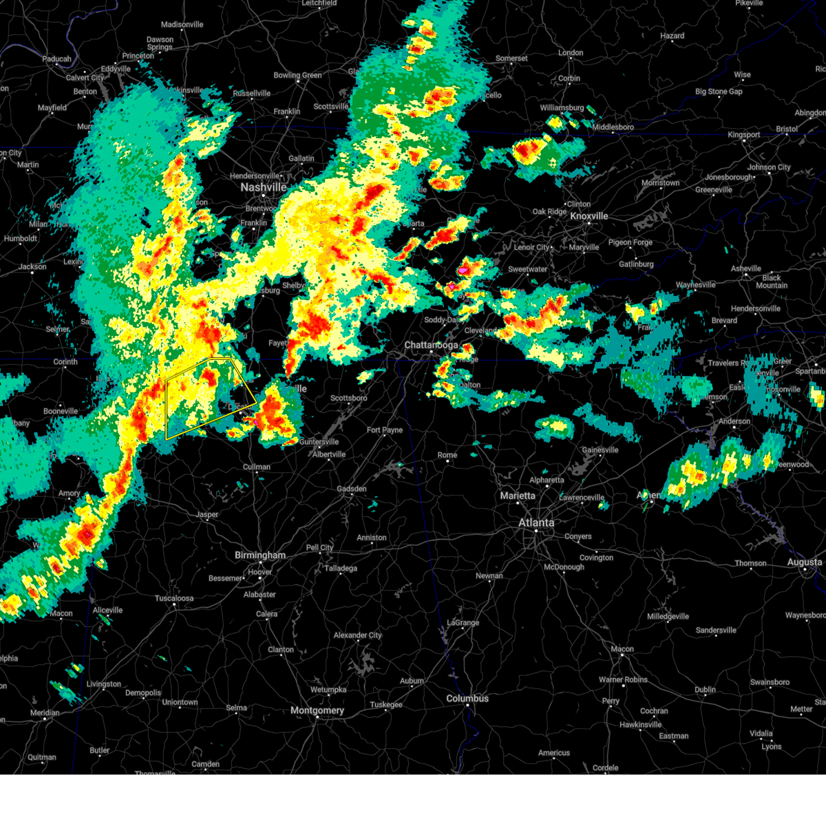 Svrhun the national weather service in huntsville alabama has issued a * severe thunderstorm warning for, central limestone county in north central alabama, southeastern lauderdale county in northwestern alabama, southeastern colbert county in northwestern alabama, northeastern franklin county in northwestern alabama, northwestern morgan county in north central alabama, northern lawrence county in northwestern alabama, * until 400 pm cdt. * at 304 pm cdt, a severe thunderstorm was located over littleville, or near russellville, moving northeast at 50 mph (radar indicated). Hazards include 60 mph wind gusts and quarter size hail. Hail damage to vehicles is expected. Expect wind damage to roofs, siding, and trees. Svrhun the national weather service in huntsville alabama has issued a * severe thunderstorm warning for, central limestone county in north central alabama, southeastern lauderdale county in northwestern alabama, southeastern colbert county in northwestern alabama, northeastern franklin county in northwestern alabama, northwestern morgan county in north central alabama, northern lawrence county in northwestern alabama, * until 400 pm cdt. * at 304 pm cdt, a severe thunderstorm was located over littleville, or near russellville, moving northeast at 50 mph (radar indicated). Hazards include 60 mph wind gusts and quarter size hail. Hail damage to vehicles is expected. Expect wind damage to roofs, siding, and trees.
|
| 5/2/2025 2:57 PM CDT |
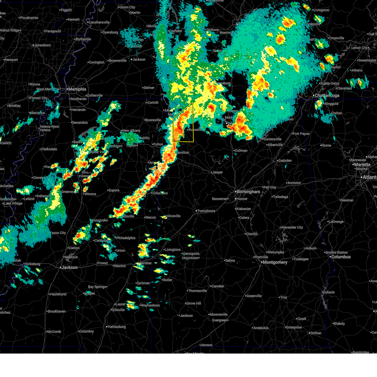 At 257 pm cdt, a severe thunderstorm was located 9 miles north of belgreen, or 11 miles northwest of russellville, moving northeast at 25 mph (radar indicated). Hazards include 60 mph wind gusts and quarter size hail. Hail damage to vehicles is expected. expect wind damage to roofs, siding, and trees. Locations impacted include, posey loop, atwood, littleville, florence, tharptown, duketon, russellville, rockwood, tuscumbia, and red rock. At 257 pm cdt, a severe thunderstorm was located 9 miles north of belgreen, or 11 miles northwest of russellville, moving northeast at 25 mph (radar indicated). Hazards include 60 mph wind gusts and quarter size hail. Hail damage to vehicles is expected. expect wind damage to roofs, siding, and trees. Locations impacted include, posey loop, atwood, littleville, florence, tharptown, duketon, russellville, rockwood, tuscumbia, and red rock.
|
| 5/2/2025 2:29 PM CDT |
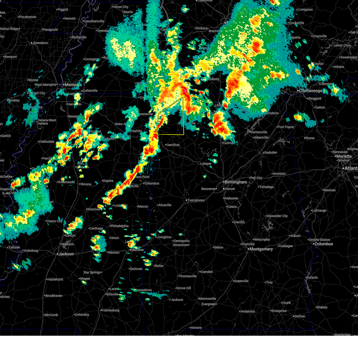 Svrhun the national weather service in huntsville alabama has issued a * severe thunderstorm warning for, south central lauderdale county in northwestern alabama, southwestern colbert county in northwestern alabama, franklin county in northwestern alabama, * until 330 pm cdt. * at 228 pm cdt, a severe thunderstorm was located near red bay, moving northeast at 25 mph (radar indicated). Hazards include 60 mph wind gusts and quarter size hail. Hail damage to vehicles is expected. Expect wind damage to roofs, siding, and trees. Svrhun the national weather service in huntsville alabama has issued a * severe thunderstorm warning for, south central lauderdale county in northwestern alabama, southwestern colbert county in northwestern alabama, franklin county in northwestern alabama, * until 330 pm cdt. * at 228 pm cdt, a severe thunderstorm was located near red bay, moving northeast at 25 mph (radar indicated). Hazards include 60 mph wind gusts and quarter size hail. Hail damage to vehicles is expected. Expect wind damage to roofs, siding, and trees.
|
| 5/2/2025 12:14 PM CDT |
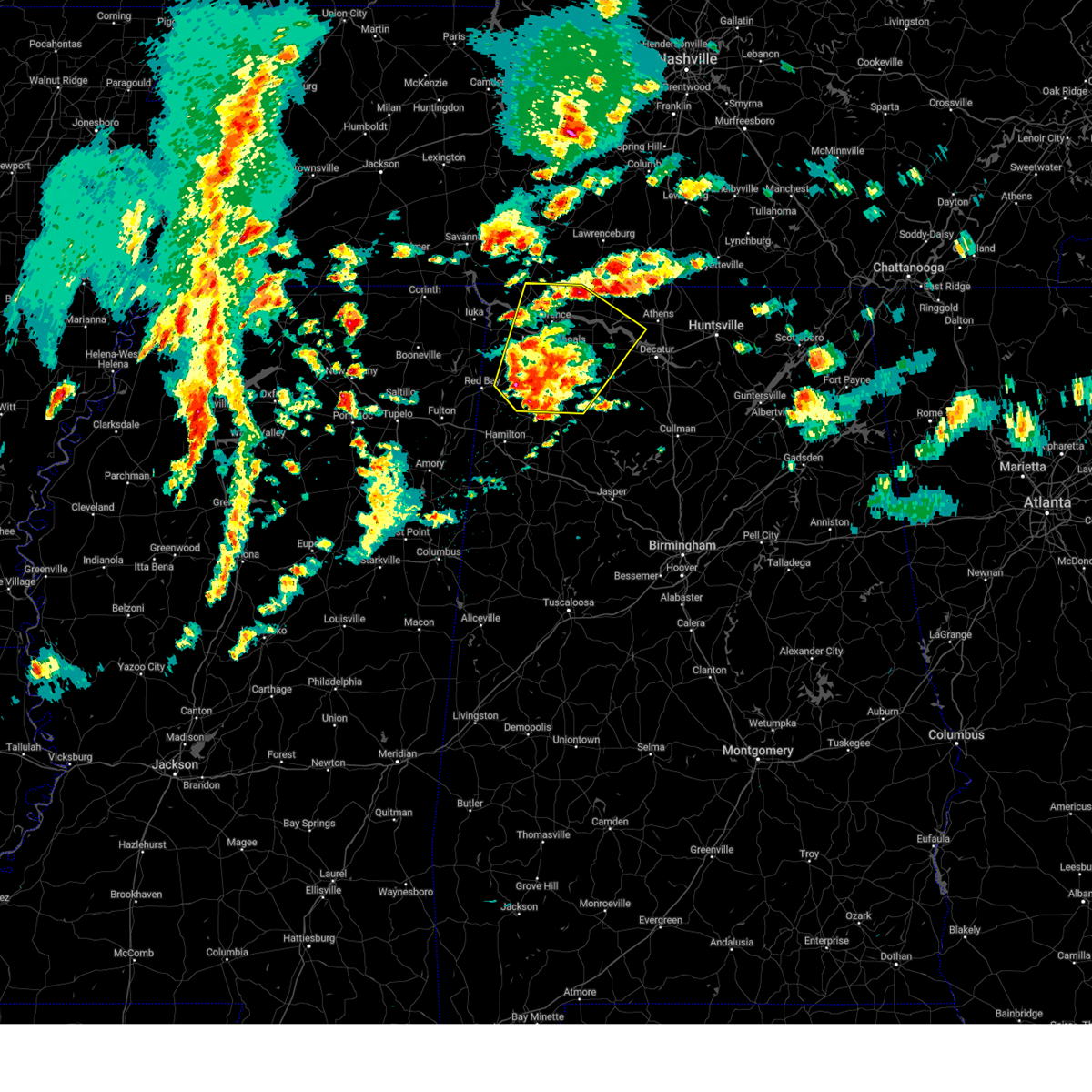 Svrhun the national weather service in huntsville alabama has issued a * severe thunderstorm warning for, west central limestone county in north central alabama, lauderdale county in northwestern alabama, colbert county in northwestern alabama, franklin county in northwestern alabama, lawrence county in northwestern alabama, * until 115 pm cdt. * at 1214 pm cdt, severe thunderstorms were located along a line extending from near tuscumbia to 11 miles west of moulton, moving northeast at 30 mph (radar indicated). Hazards include 60 mph wind gusts and quarter size hail. Hail damage to vehicles is expected. Expect wind damage to roofs, siding, and trees. Svrhun the national weather service in huntsville alabama has issued a * severe thunderstorm warning for, west central limestone county in north central alabama, lauderdale county in northwestern alabama, colbert county in northwestern alabama, franklin county in northwestern alabama, lawrence county in northwestern alabama, * until 115 pm cdt. * at 1214 pm cdt, severe thunderstorms were located along a line extending from near tuscumbia to 11 miles west of moulton, moving northeast at 30 mph (radar indicated). Hazards include 60 mph wind gusts and quarter size hail. Hail damage to vehicles is expected. Expect wind damage to roofs, siding, and trees.
|
| 4/10/2025 6:29 PM CDT | Asos station kmsl muscle shoal in colbert county AL, 1.6 miles W of Muscle Shoals, AL |
| 4/10/2025 5:58 PM CDT | Large tree on a home in ford city... a in colbert county AL, 6.3 miles WSW of Muscle Shoals, AL |
| 4/6/2025 12:54 AM CDT | Tree and powerline downe in colbert county AL, 7 miles SW of Muscle Shoals, AL |
| 4/6/2025 12:52 AM CDT | Power line snapped in hal in colbert county AL, 6 miles WSW of Muscle Shoals, AL |
| 4/5/2025 10:48 PM CDT | Tree downed - 2600 block avalon av in colbert county AL, 0.6 miles NNE of Muscle Shoals, AL |
| 4/5/2025 10:45 PM CDT |
 At 1042 pm cdt, a confirmed tornado was located over killen, or near florence, moving northeast at 45 mph (broadcast media confirmed tornado). Hazards include damaging tornado. Flying debris will be dangerous to those caught without shelter. mobile homes will be damaged or destroyed. damage to roofs, windows, and vehicles will occur. tree damage is likely. this tornado will be near, killen around 1050 pm cdt. lexington around 1055 pm cdt. Other locations impacted by this tornadic thunderstorm include green hill, center star, northwest alabama regional airport, kingtown, oliver, whitehead, ford city, elgin, and anderson. At 1042 pm cdt, a confirmed tornado was located over killen, or near florence, moving northeast at 45 mph (broadcast media confirmed tornado). Hazards include damaging tornado. Flying debris will be dangerous to those caught without shelter. mobile homes will be damaged or destroyed. damage to roofs, windows, and vehicles will occur. tree damage is likely. this tornado will be near, killen around 1050 pm cdt. lexington around 1055 pm cdt. Other locations impacted by this tornadic thunderstorm include green hill, center star, northwest alabama regional airport, kingtown, oliver, whitehead, ford city, elgin, and anderson.
|
| 4/5/2025 10:45 PM CDT |
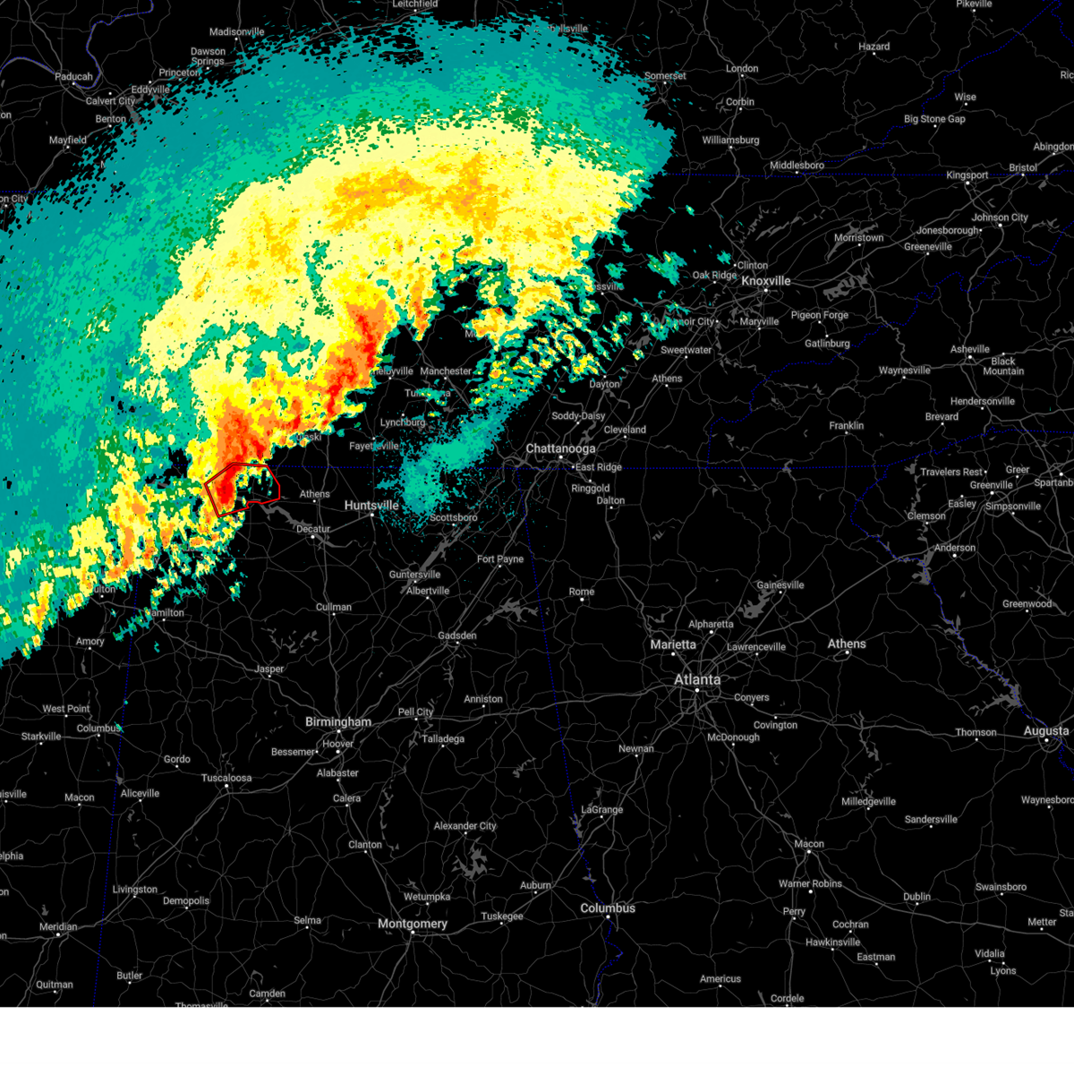 the tornado warning has been cancelled and is no longer in effect the tornado warning has been cancelled and is no longer in effect
|
| 4/5/2025 10:40 PM CDT |
 The storm which prompted the warning has moved out of the area. therefore, the warning will be allowed to expire. however, heavy rain is still possible with this thunderstorm. a tornado watch remains in effect until 300 am cdt for north central and northwestern alabama. remember, a tornado warning still remains in effect for northeastern colbert county, eastern lauderdale county, far northwest lawrence county, and southwestern limestone county. The storm which prompted the warning has moved out of the area. therefore, the warning will be allowed to expire. however, heavy rain is still possible with this thunderstorm. a tornado watch remains in effect until 300 am cdt for north central and northwestern alabama. remember, a tornado warning still remains in effect for northeastern colbert county, eastern lauderdale county, far northwest lawrence county, and southwestern limestone county.
|
| 4/5/2025 10:37 PM CDT | Corrects previous non-tstm wnd gst report from 2 e muscle shoals. asos station kmsl muscle shoa in colbert county AL, 1.6 miles W of Muscle Shoals, AL |
| 4/5/2025 10:34 PM CDT | Corrects previous tstm wnd dmg report from 1 ese muscle shoals. tree downed - 2600 block avalon av in colbert county AL, 0.6 miles NNE of Muscle Shoals, AL |
| 4/5/2025 10:29 PM CDT |
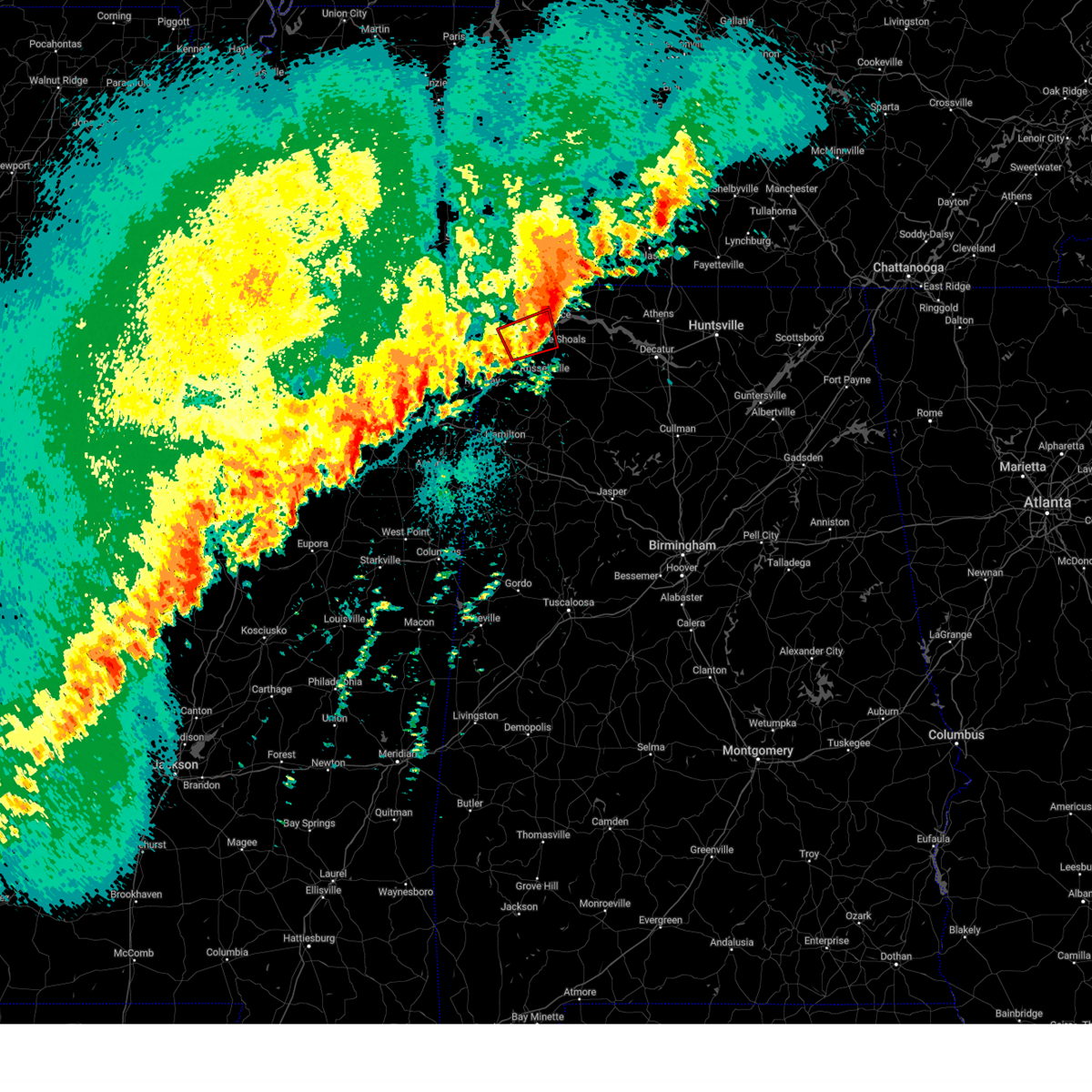 The tornado warning that was previously in effect has been reissued and is in effect until 1115 pm cdt. please refer to that bulletin for the latest severe weather information. a tornado watch remains in effect until 300 am cdt for northwestern alabama. The tornado warning that was previously in effect has been reissued and is in effect until 1115 pm cdt. please refer to that bulletin for the latest severe weather information. a tornado watch remains in effect until 300 am cdt for northwestern alabama.
|
| 4/5/2025 10:26 PM CDT |
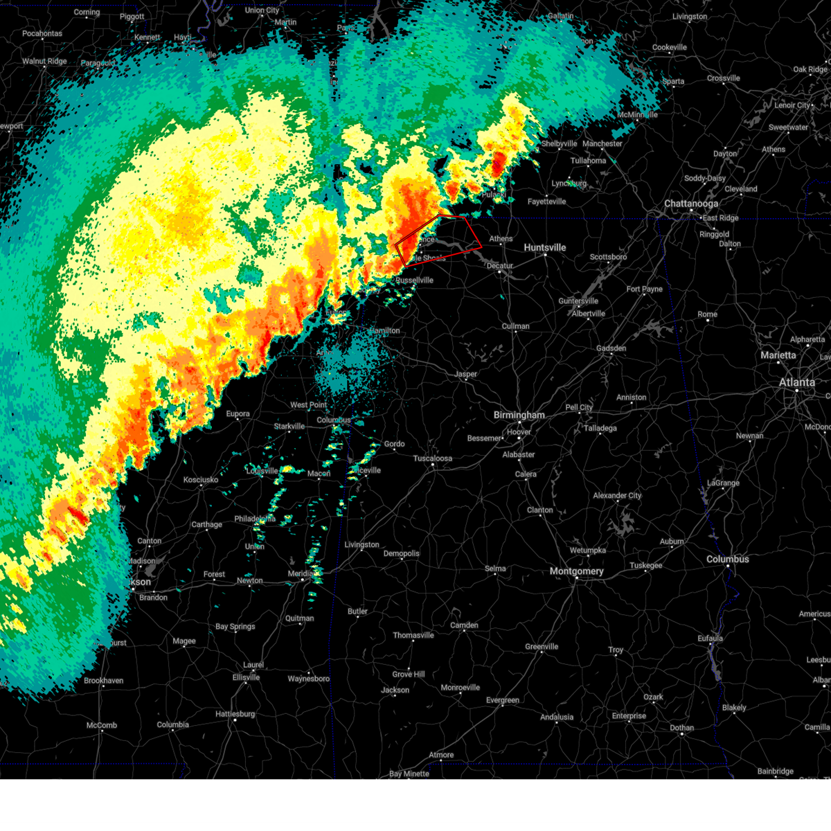 Torhun the national weather service in huntsville alabama has issued a * tornado warning for, west central limestone county in north central alabama, eastern lauderdale county in northwestern alabama, southeastern colbert county in northwestern alabama, north central lawrence county in northwestern alabama, * until 1115 pm cdt. * at 1026 pm cdt, a confirmed tornado was located over sheffield, moving east at 40 mph (broadcast media confirmed tornado). Hazards include damaging tornado. Flying debris will be dangerous to those caught without shelter. mobile homes will be damaged or destroyed. damage to roofs, windows, and vehicles will occur. tree damage is likely. the tornado will be near, sheffield, tuscumbia, florence, and muscle shoals around 1030 pm cdt. st. florian around 1035 pm cdt. killen around 1040 pm cdt. lexington around 1055 pm cdt. Other locations impacted by this tornadic thunderstorm include green hill, northwest alabama regional airport, coxey, oliver, new bethel, oakland, anderson, center star, pride landing, and kingtown. Torhun the national weather service in huntsville alabama has issued a * tornado warning for, west central limestone county in north central alabama, eastern lauderdale county in northwestern alabama, southeastern colbert county in northwestern alabama, north central lawrence county in northwestern alabama, * until 1115 pm cdt. * at 1026 pm cdt, a confirmed tornado was located over sheffield, moving east at 40 mph (broadcast media confirmed tornado). Hazards include damaging tornado. Flying debris will be dangerous to those caught without shelter. mobile homes will be damaged or destroyed. damage to roofs, windows, and vehicles will occur. tree damage is likely. the tornado will be near, sheffield, tuscumbia, florence, and muscle shoals around 1030 pm cdt. st. florian around 1035 pm cdt. killen around 1040 pm cdt. lexington around 1055 pm cdt. Other locations impacted by this tornadic thunderstorm include green hill, northwest alabama regional airport, coxey, oliver, new bethel, oakland, anderson, center star, pride landing, and kingtown.
|
| 4/5/2025 10:16 PM CDT |
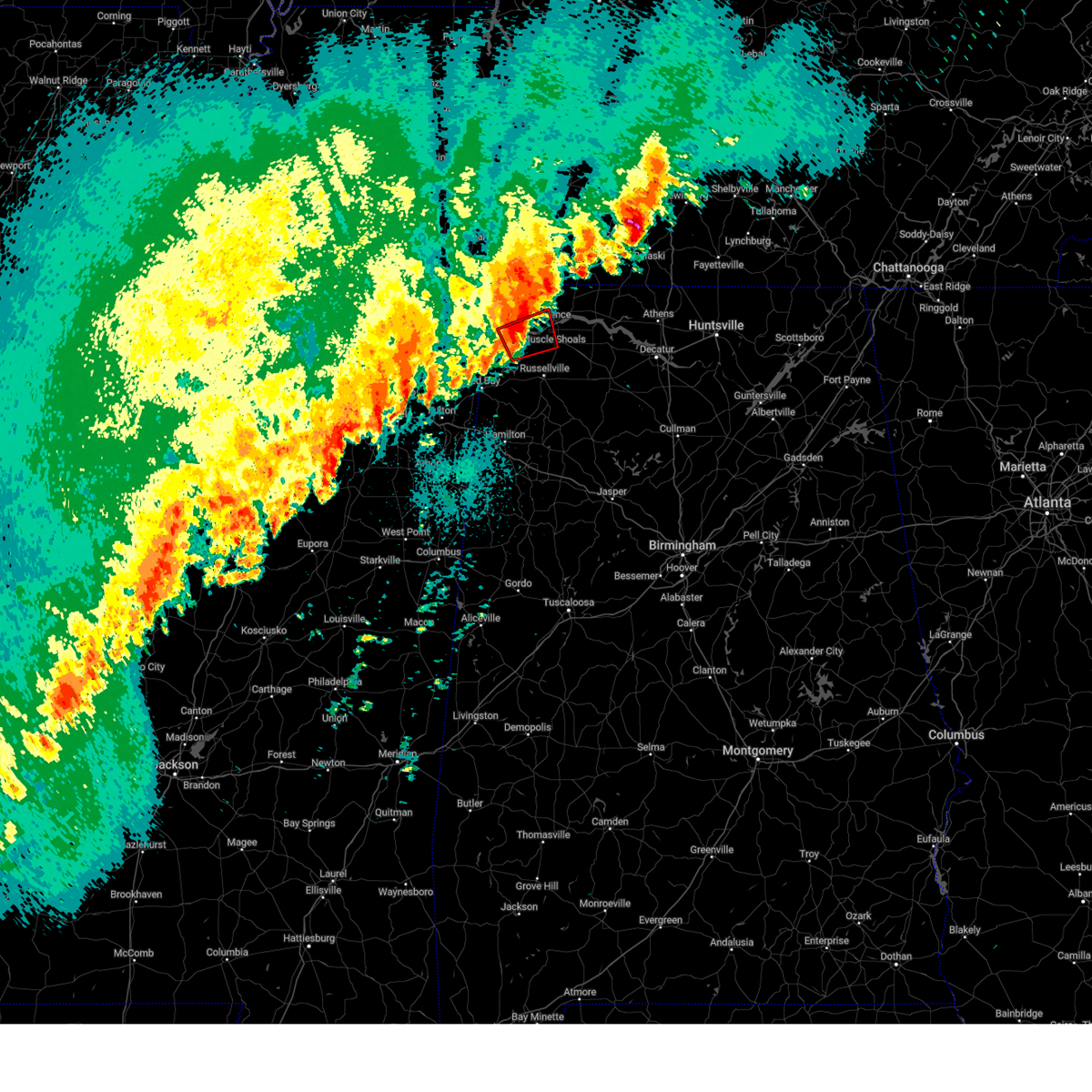 At 1014 pm cdt, a confirmed tornado was located near cherokee, or 10 miles west of tuscumbia, moving northeast at 45 mph (weather spotters confirmed tornado over tishomingo state park). Hazards include damaging tornado. Flying debris will be dangerous to those caught without shelter. mobile homes will be damaged or destroyed. damage to roofs, windows, and vehicles will occur. tree damage is likely. Locations impacted include, posey loop, mt hester, cherokee, srygley church, new bethel, barton, tuscumbia, red rock, pride landing, and sheffield. At 1014 pm cdt, a confirmed tornado was located near cherokee, or 10 miles west of tuscumbia, moving northeast at 45 mph (weather spotters confirmed tornado over tishomingo state park). Hazards include damaging tornado. Flying debris will be dangerous to those caught without shelter. mobile homes will be damaged or destroyed. damage to roofs, windows, and vehicles will occur. tree damage is likely. Locations impacted include, posey loop, mt hester, cherokee, srygley church, new bethel, barton, tuscumbia, red rock, pride landing, and sheffield.
|
| 4/5/2025 10:16 PM CDT |
 the tornado warning has been cancelled and is no longer in effect the tornado warning has been cancelled and is no longer in effect
|
| 4/5/2025 9:51 PM CDT |
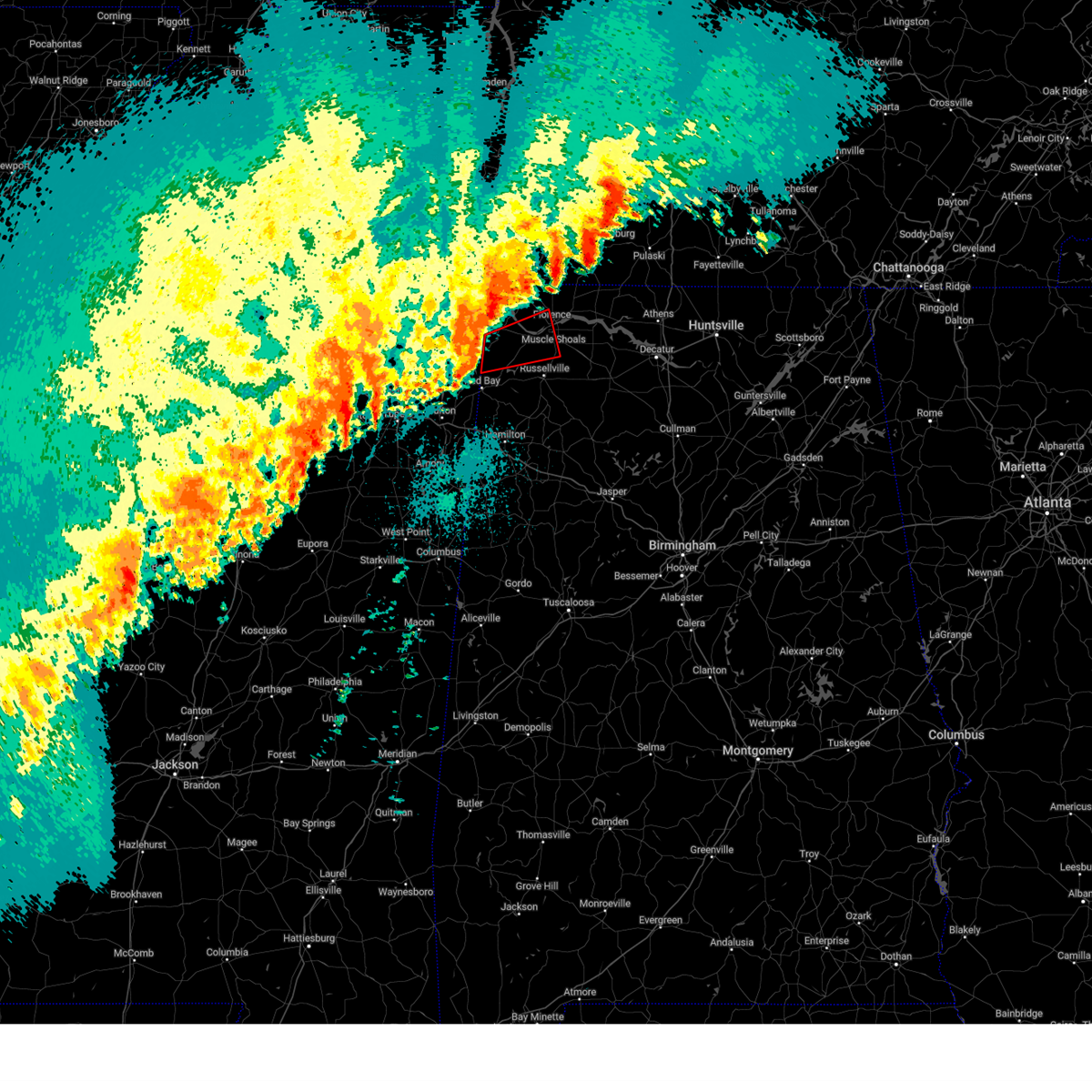 Torhun the national weather service in huntsville alabama has issued a * tornado warning for, south central lauderdale county in northwestern alabama, southwestern colbert county in northwestern alabama, northwestern franklin county in northwestern alabama, * until 1030 pm cdt. * at 950 pm cdt, a confirmed tornado was located over tishomingo state park, moving east at 35 mph (weather spotters confirmed tornado). Hazards include damaging tornado. Flying debris will be dangerous to those caught without shelter. mobile homes will be damaged or destroyed. damage to roofs, windows, and vehicles will occur. tree damage is likely. This tornadic thunderstorm will remain over mainly rural areas of south central lauderdale, southwestern colbert and northwestern franklin counties, including the following locations, malone, posey loop, pogo, mt hester, srygley church, new bethel, allsboro, maud, barton, and red rock. Torhun the national weather service in huntsville alabama has issued a * tornado warning for, south central lauderdale county in northwestern alabama, southwestern colbert county in northwestern alabama, northwestern franklin county in northwestern alabama, * until 1030 pm cdt. * at 950 pm cdt, a confirmed tornado was located over tishomingo state park, moving east at 35 mph (weather spotters confirmed tornado). Hazards include damaging tornado. Flying debris will be dangerous to those caught without shelter. mobile homes will be damaged or destroyed. damage to roofs, windows, and vehicles will occur. tree damage is likely. This tornadic thunderstorm will remain over mainly rural areas of south central lauderdale, southwestern colbert and northwestern franklin counties, including the following locations, malone, posey loop, pogo, mt hester, srygley church, new bethel, allsboro, maud, barton, and red rock.
|
| 4/5/2025 9:40 PM CDT |
 Svrhun the national weather service in huntsville alabama has issued a * severe thunderstorm warning for, central lauderdale county in northwestern alabama, colbert county in northwestern alabama, northern franklin county in northwestern alabama, * until 1045 pm cdt. * at 940 pm cdt, a cluster of severe thunderstorms was located over tishomingo state park, moving northeast at 40 mph (radar indicated). Hazards include 60 mph wind gusts. expect damage to roofs, siding, and trees Svrhun the national weather service in huntsville alabama has issued a * severe thunderstorm warning for, central lauderdale county in northwestern alabama, colbert county in northwestern alabama, northern franklin county in northwestern alabama, * until 1045 pm cdt. * at 940 pm cdt, a cluster of severe thunderstorms was located over tishomingo state park, moving northeast at 40 mph (radar indicated). Hazards include 60 mph wind gusts. expect damage to roofs, siding, and trees
|
| 4/2/2025 5:51 PM CDT |
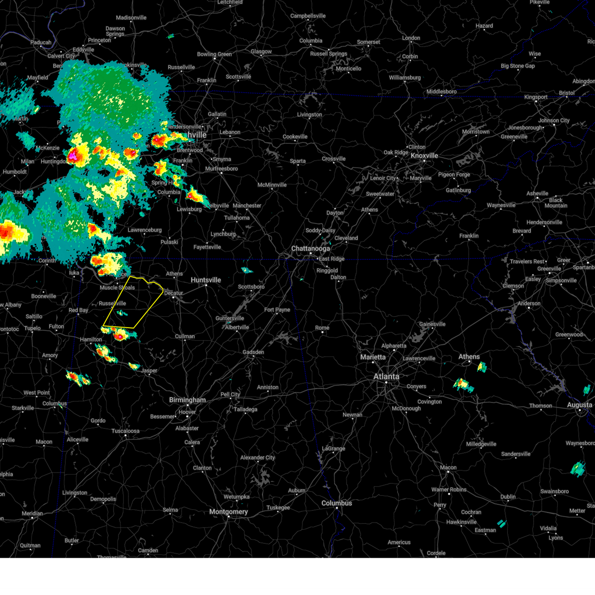 Svrhun the national weather service in huntsville alabama has issued a * severe thunderstorm warning for, southeastern colbert county in northwestern alabama, eastern franklin county in northwestern alabama, lawrence county in northwestern alabama, * until 645 pm cdt. * at 550 pm cdt, a severe thunderstorm was located over needmore, or near haleyville, moving northeast at 50 mph. dime size hail was observed in haleyville (radar indicated). Hazards include quarter size hail. damage to vehicles is expected Svrhun the national weather service in huntsville alabama has issued a * severe thunderstorm warning for, southeastern colbert county in northwestern alabama, eastern franklin county in northwestern alabama, lawrence county in northwestern alabama, * until 645 pm cdt. * at 550 pm cdt, a severe thunderstorm was located over needmore, or near haleyville, moving northeast at 50 mph. dime size hail was observed in haleyville (radar indicated). Hazards include quarter size hail. damage to vehicles is expected
|
| 3/31/2025 3:46 AM CDT |
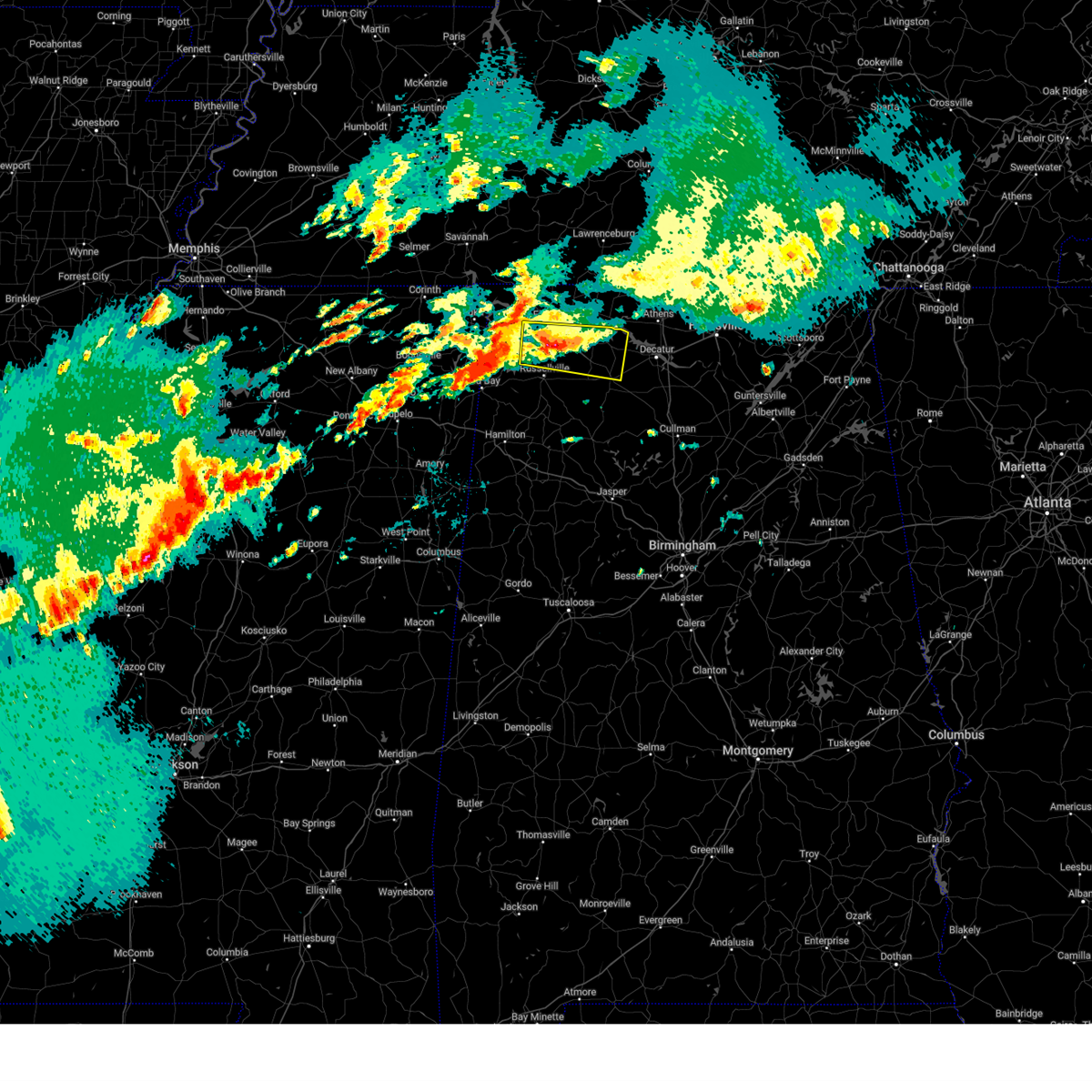 the severe thunderstorm warning has been cancelled and is no longer in effect the severe thunderstorm warning has been cancelled and is no longer in effect
|
| 3/31/2025 3:35 AM CDT |
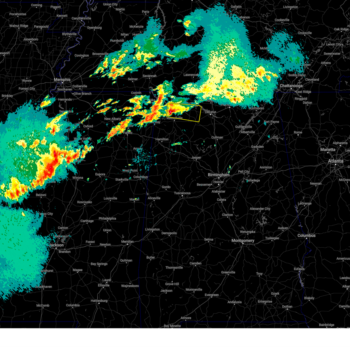 At 335 am cdt, a severe thunderstorm was located near littleville, or 7 miles south of tuscumbia, moving east at 35 mph (radar indicated). Hazards include quarter size hail. Damage to vehicles is expected. Locations impacted include, posey loop, northwest alabama regional airport, littleville, la grange, ne smith, north courtland, tuscumbia, red rock, hatton, and pride landing. At 335 am cdt, a severe thunderstorm was located near littleville, or 7 miles south of tuscumbia, moving east at 35 mph (radar indicated). Hazards include quarter size hail. Damage to vehicles is expected. Locations impacted include, posey loop, northwest alabama regional airport, littleville, la grange, ne smith, north courtland, tuscumbia, red rock, hatton, and pride landing.
|
| 3/31/2025 3:28 AM CDT |
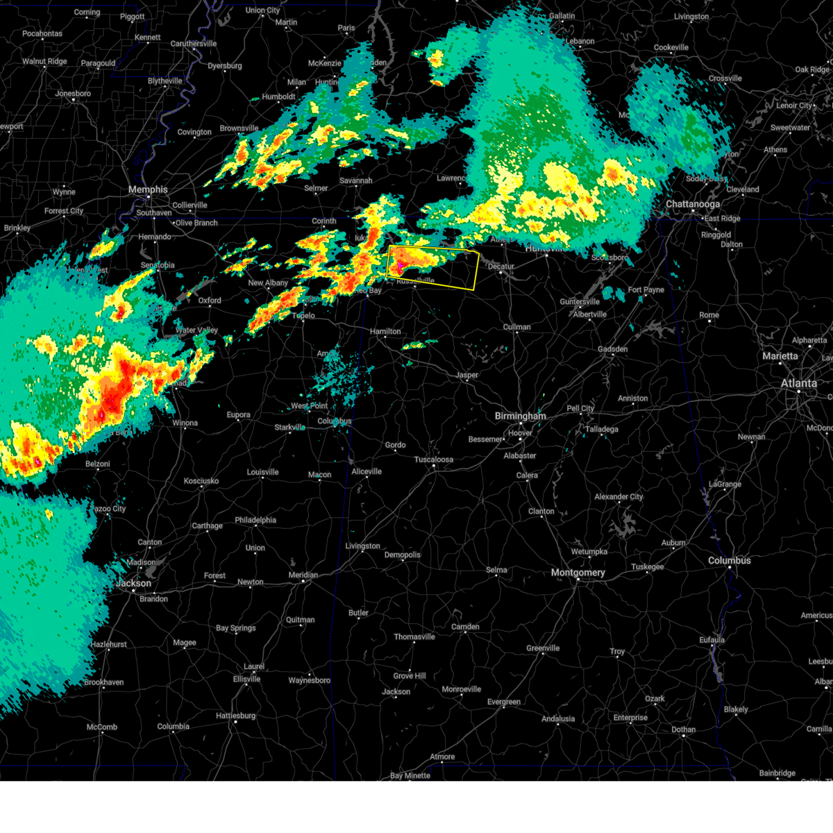 Svrhun the national weather service in huntsville alabama has issued a * severe thunderstorm warning for, southeastern lauderdale county in northwestern alabama, colbert county in northwestern alabama, northeastern franklin county in northwestern alabama, northern lawrence county in northwestern alabama, * until 415 am cdt. * at 328 am cdt, a severe thunderstorm was located 9 miles west of littleville, or 9 miles southwest of tuscumbia, moving east at 35 mph (radar indicated). Hazards include quarter size hail. damage to vehicles is expected Svrhun the national weather service in huntsville alabama has issued a * severe thunderstorm warning for, southeastern lauderdale county in northwestern alabama, colbert county in northwestern alabama, northeastern franklin county in northwestern alabama, northern lawrence county in northwestern alabama, * until 415 am cdt. * at 328 am cdt, a severe thunderstorm was located 9 miles west of littleville, or 9 miles southwest of tuscumbia, moving east at 35 mph (radar indicated). Hazards include quarter size hail. damage to vehicles is expected
|
| 3/31/2025 3:18 AM CDT |
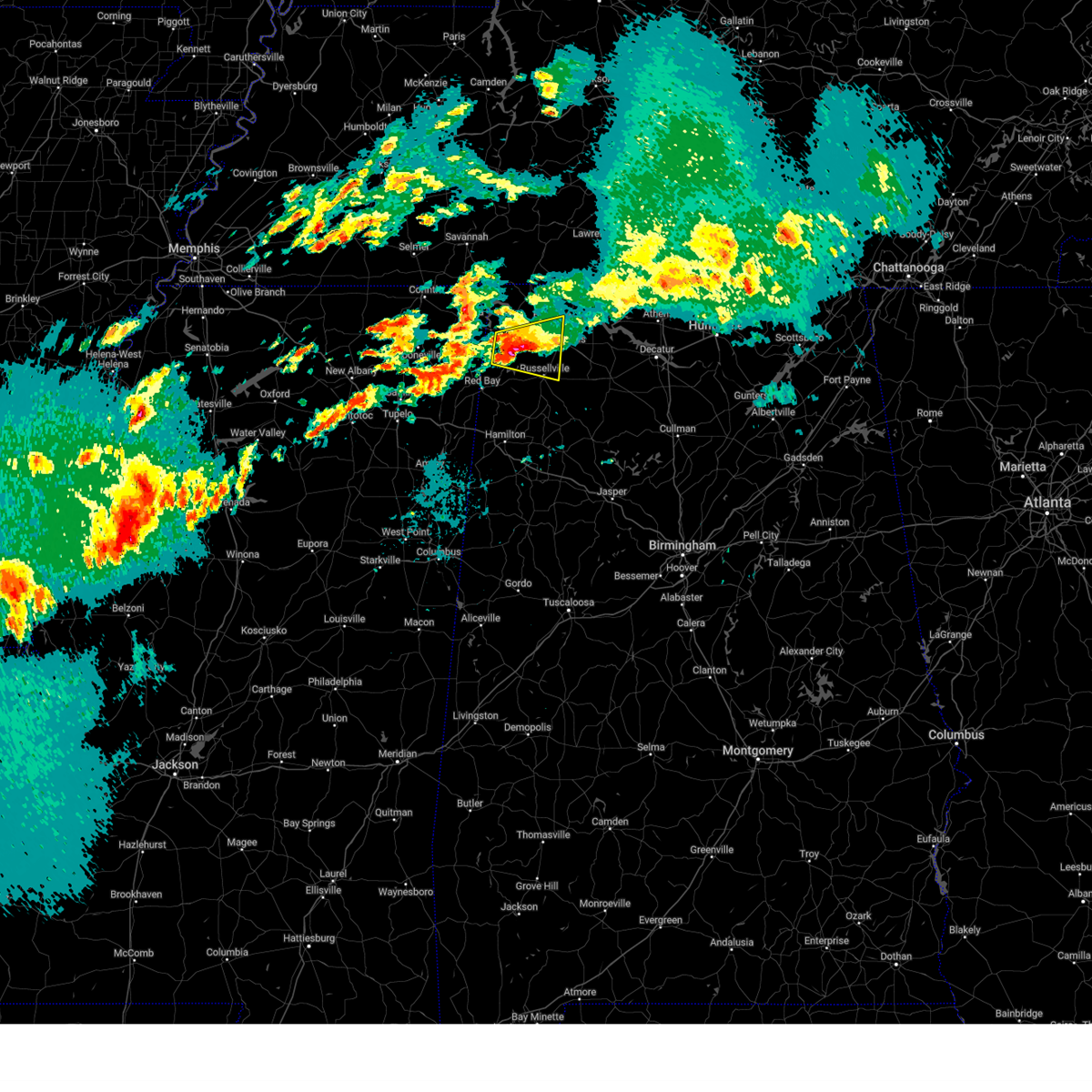 At 318 am cdt, a severe thunderstorm was located 8 miles southeast of cherokee, or 9 miles west of tuscumbia, moving east at 35 mph (radar indicated). Hazards include half dollar size hail. Damage to vehicles is expected. Locations impacted include, posey loop, mt hester, littleville, srygley church, new bethel, tharptown, russellville, barton, tuscumbia, and red rock. At 318 am cdt, a severe thunderstorm was located 8 miles southeast of cherokee, or 9 miles west of tuscumbia, moving east at 35 mph (radar indicated). Hazards include half dollar size hail. Damage to vehicles is expected. Locations impacted include, posey loop, mt hester, littleville, srygley church, new bethel, tharptown, russellville, barton, tuscumbia, and red rock.
|
| 3/31/2025 2:42 AM CDT |
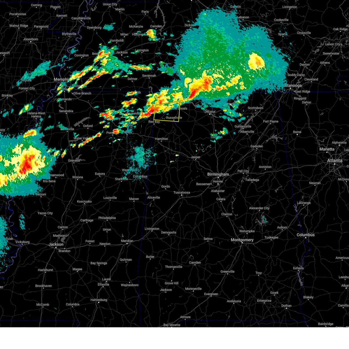 Svrhun the national weather service in huntsville alabama has issued a * severe thunderstorm warning for, south central lauderdale county in northwestern alabama, colbert county in northwestern alabama, northern franklin county in northwestern alabama, * until 330 am cdt. * at 242 am cdt, a severe thunderstorm was located over tishomingo, or over tishomingo state park, moving east at 35 mph (radar indicated). Hazards include half dollar size hail. damage to vehicles is expected Svrhun the national weather service in huntsville alabama has issued a * severe thunderstorm warning for, south central lauderdale county in northwestern alabama, colbert county in northwestern alabama, northern franklin county in northwestern alabama, * until 330 am cdt. * at 242 am cdt, a severe thunderstorm was located over tishomingo, or over tishomingo state park, moving east at 35 mph (radar indicated). Hazards include half dollar size hail. damage to vehicles is expected
|
| 3/31/2025 2:27 AM CDT |
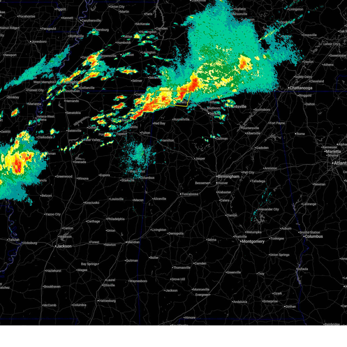 The severe thunderstorm which prompted the warning has weakened. therefore, the warning will be allowed to expire. however, small hail and gusty winds are still possible with this thunderstorm. a tornado watch remains in effect until 500 am cdt for north central and northwestern alabama. The severe thunderstorm which prompted the warning has weakened. therefore, the warning will be allowed to expire. however, small hail and gusty winds are still possible with this thunderstorm. a tornado watch remains in effect until 500 am cdt for north central and northwestern alabama.
|
| 3/31/2025 1:49 AM CDT |
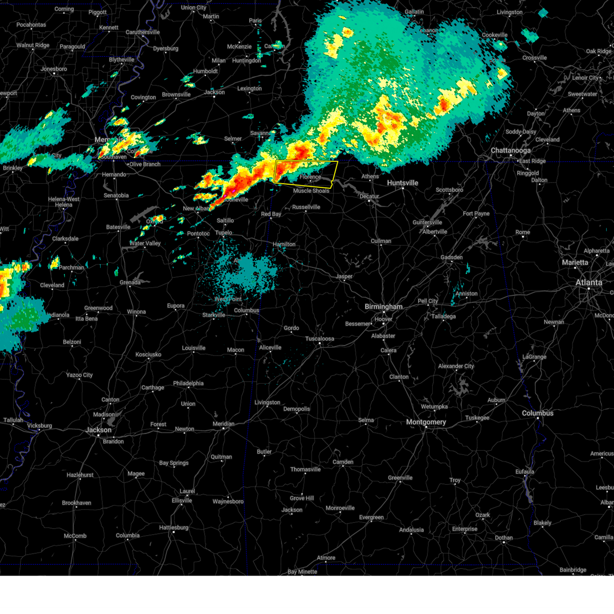 Svrhun the national weather service in huntsville alabama has issued a * severe thunderstorm warning for, lauderdale county in northwestern alabama, northern colbert county in northwestern alabama, * until 230 am cdt. * at 149 am cdt, a severe thunderstorm was located 8 miles north of cherokee, or 10 miles east of j p coleman state park, moving east at 35 mph (radar indicated). Hazards include quarter size hail. damage to vehicles is expected Svrhun the national weather service in huntsville alabama has issued a * severe thunderstorm warning for, lauderdale county in northwestern alabama, northern colbert county in northwestern alabama, * until 230 am cdt. * at 149 am cdt, a severe thunderstorm was located 8 miles north of cherokee, or 10 miles east of j p coleman state park, moving east at 35 mph (radar indicated). Hazards include quarter size hail. damage to vehicles is expected
|
| 3/23/2025 6:39 PM CDT |
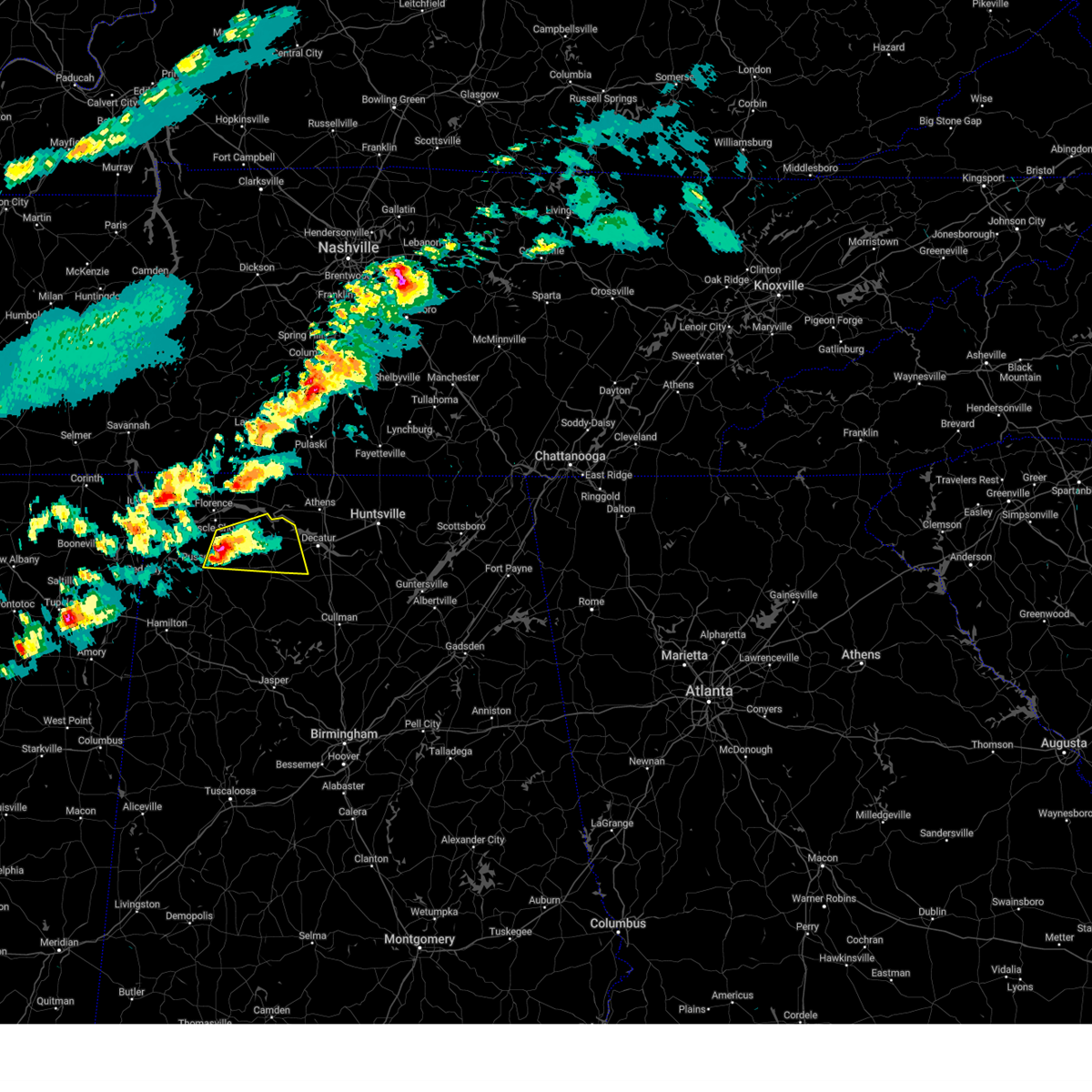 At 638 pm cdt, a severe thunderstorm was located 7 miles south of leighton, or 12 miles northeast of russellville, moving east at 40 mph (radar indicated). Hazards include ping pong ball size hail and 60 mph wind gusts. People and animals outdoors will be injured. expect hail damage to roofs, siding, windows, and vehicles. expect wind damage to roofs, siding, and trees. Locations impacted include, chalybeate springs, littleville, la grange, tharptown, ne smith, russellville, caddo, north courtland, town creek, and hatton. At 638 pm cdt, a severe thunderstorm was located 7 miles south of leighton, or 12 miles northeast of russellville, moving east at 40 mph (radar indicated). Hazards include ping pong ball size hail and 60 mph wind gusts. People and animals outdoors will be injured. expect hail damage to roofs, siding, windows, and vehicles. expect wind damage to roofs, siding, and trees. Locations impacted include, chalybeate springs, littleville, la grange, tharptown, ne smith, russellville, caddo, north courtland, town creek, and hatton.
|
| 3/23/2025 6:19 PM CDT |
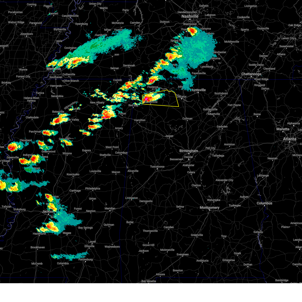 Svrhun the national weather service in huntsville alabama has issued a * severe thunderstorm warning for, southeastern colbert county in northwestern alabama, northeastern franklin county in northwestern alabama, west central morgan county in north central alabama, central lawrence county in northwestern alabama, * until 715 pm cdt. * at 618 pm cdt, a severe thunderstorm was located near littleville, or near russellville, moving east at 40 mph (radar indicated). Hazards include two inch hail and 60 mph wind gusts. People and animals outdoors will be injured. expect hail damage to roofs, siding, windows, and vehicles. Expect wind damage to roofs, siding, and trees. Svrhun the national weather service in huntsville alabama has issued a * severe thunderstorm warning for, southeastern colbert county in northwestern alabama, northeastern franklin county in northwestern alabama, west central morgan county in north central alabama, central lawrence county in northwestern alabama, * until 715 pm cdt. * at 618 pm cdt, a severe thunderstorm was located near littleville, or near russellville, moving east at 40 mph (radar indicated). Hazards include two inch hail and 60 mph wind gusts. People and animals outdoors will be injured. expect hail damage to roofs, siding, windows, and vehicles. Expect wind damage to roofs, siding, and trees.
|
| 3/15/2025 5:20 PM CDT |
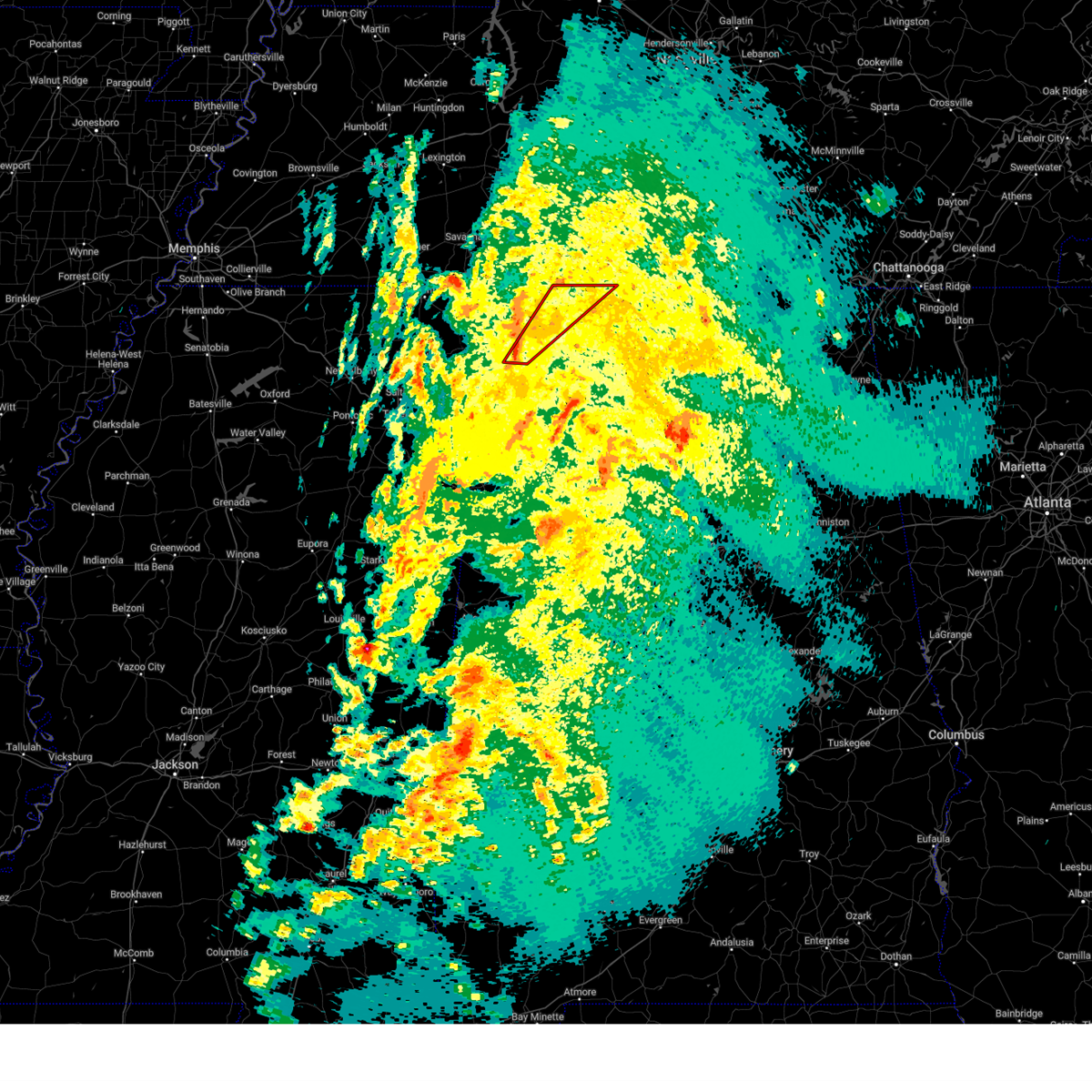 Torhun the national weather service in huntsville alabama has issued a * tornado warning for, central lauderdale county in northwestern alabama, southeastern colbert county in northwestern alabama, * until 600 pm cdt. * at 520 pm cdt, a severe thunderstorm capable of producing a tornado was located 9 miles north of belgreen, or 10 miles northwest of russellville, moving northeast at 50 mph (radar indicated rotation). Hazards include tornado. Flying debris will be dangerous to those caught without shelter. mobile homes will be damaged or destroyed. damage to roofs, windows, and vehicles will occur. tree damage is likely. this dangerous storm will be near, tuscumbia around 525 pm cdt. sheffield and muscle shoals around 530 pm cdt. florence around 535 pm cdt. st. florian around 540 pm cdt. killen around 545 pm cdt. Other locations impacted by this tornadic thunderstorm include green hill, red rock, posey loop, center star, pride landing, northwest alabama regional airport, zip city, kingtown, srygley church, and new bethel. Torhun the national weather service in huntsville alabama has issued a * tornado warning for, central lauderdale county in northwestern alabama, southeastern colbert county in northwestern alabama, * until 600 pm cdt. * at 520 pm cdt, a severe thunderstorm capable of producing a tornado was located 9 miles north of belgreen, or 10 miles northwest of russellville, moving northeast at 50 mph (radar indicated rotation). Hazards include tornado. Flying debris will be dangerous to those caught without shelter. mobile homes will be damaged or destroyed. damage to roofs, windows, and vehicles will occur. tree damage is likely. this dangerous storm will be near, tuscumbia around 525 pm cdt. sheffield and muscle shoals around 530 pm cdt. florence around 535 pm cdt. st. florian around 540 pm cdt. killen around 545 pm cdt. Other locations impacted by this tornadic thunderstorm include green hill, red rock, posey loop, center star, pride landing, northwest alabama regional airport, zip city, kingtown, srygley church, and new bethel.
|
| 3/15/2025 4:26 PM CDT |
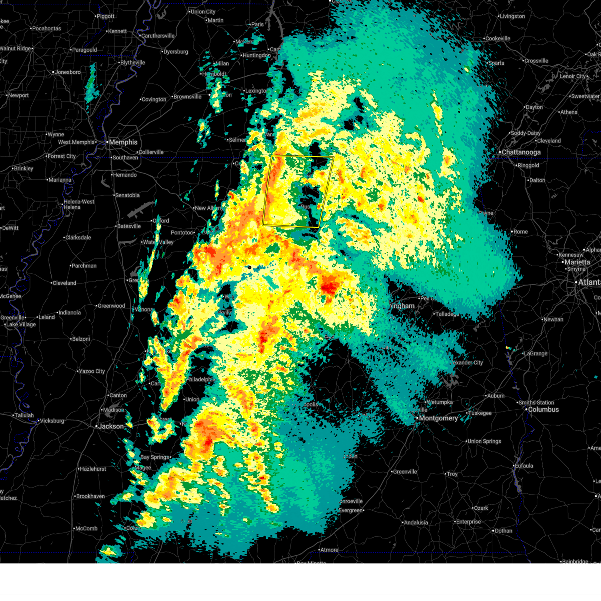 Svrhun the national weather service in huntsville alabama has issued a * severe thunderstorm warning for, lauderdale county in northwestern alabama, colbert county in northwestern alabama, franklin county in northwestern alabama, western lawrence county in northwestern alabama, * until 530 pm cdt. * at 425 pm cdt, severe thunderstorms were located along a line extending from 7 miles southeast of walnut grove to near red bay, moving east at 30 mph (radar indicated). Hazards include 60 mph wind gusts and quarter size hail. Hail damage to vehicles is expected. Expect wind damage to roofs, siding, and trees. Svrhun the national weather service in huntsville alabama has issued a * severe thunderstorm warning for, lauderdale county in northwestern alabama, colbert county in northwestern alabama, franklin county in northwestern alabama, western lawrence county in northwestern alabama, * until 530 pm cdt. * at 425 pm cdt, severe thunderstorms were located along a line extending from 7 miles southeast of walnut grove to near red bay, moving east at 30 mph (radar indicated). Hazards include 60 mph wind gusts and quarter size hail. Hail damage to vehicles is expected. Expect wind damage to roofs, siding, and trees.
|
| 3/15/2025 2:55 PM CDT |
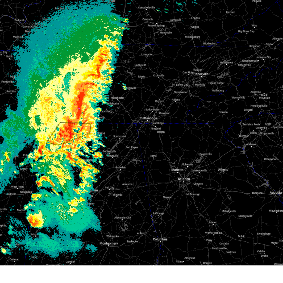 At 255 pm cdt, a severe thunderstorm was located near rogersville, or 15 miles northwest of athens, moving northeast at 40 mph (radar indicated). Hazards include ping pong ball size hail and 60 mph wind gusts. People and animals outdoors will be injured. expect hail damage to roofs, siding, windows, and vehicles. expect wind damage to roofs, siding, and trees. Locations impacted include, good springs, cartwright, northwest alabama regional airport, french mill, coxey, littleville, la grange, florence, ne smith, and north courtland. At 255 pm cdt, a severe thunderstorm was located near rogersville, or 15 miles northwest of athens, moving northeast at 40 mph (radar indicated). Hazards include ping pong ball size hail and 60 mph wind gusts. People and animals outdoors will be injured. expect hail damage to roofs, siding, windows, and vehicles. expect wind damage to roofs, siding, and trees. Locations impacted include, good springs, cartwright, northwest alabama regional airport, french mill, coxey, littleville, la grange, florence, ne smith, and north courtland.
|
| 3/15/2025 2:46 PM CDT |
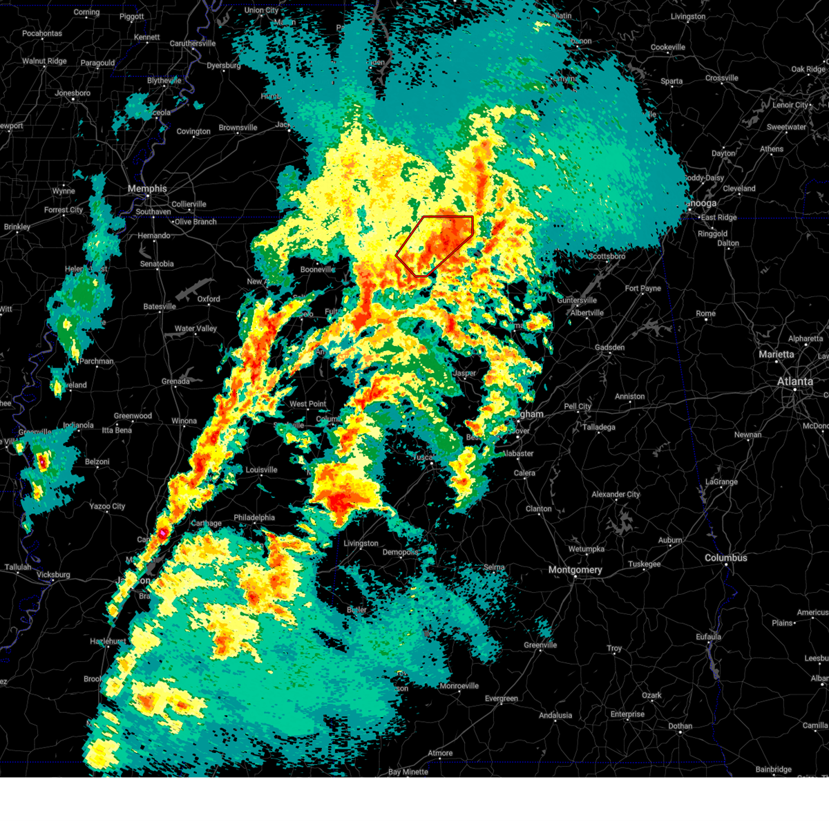 the tornado warning has been cancelled and is no longer in effect the tornado warning has been cancelled and is no longer in effect
|
| 3/15/2025 2:45 PM CDT |
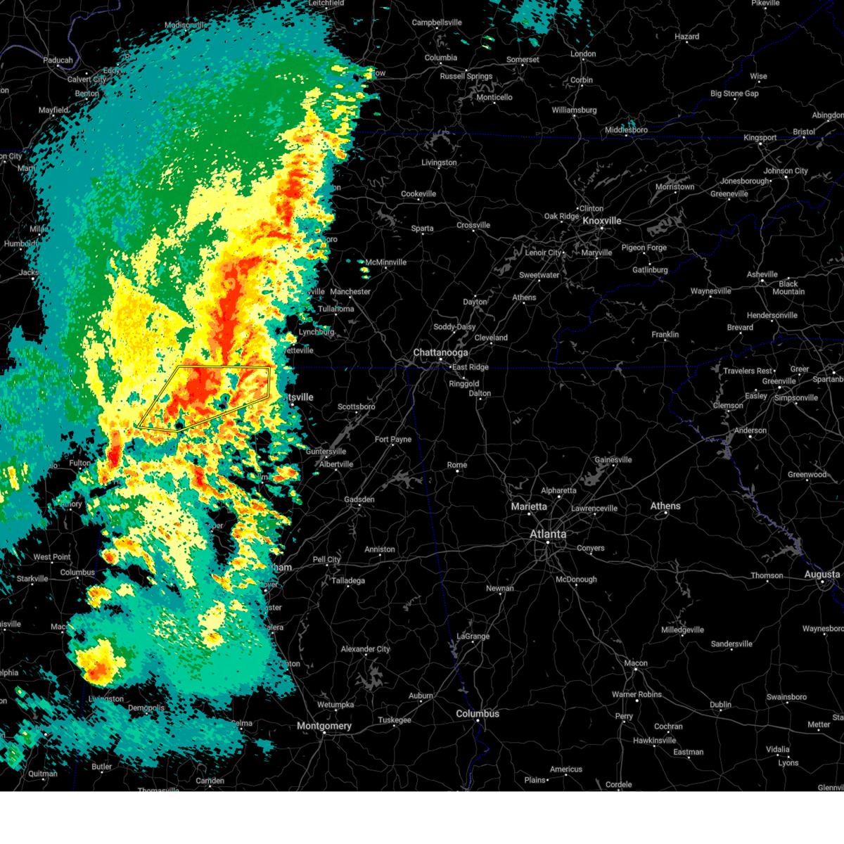 Svrhun the national weather service in huntsville alabama has issued a * severe thunderstorm warning for, limestone county in north central alabama, eastern lauderdale county in northwestern alabama, southeastern colbert county in northwestern alabama, northeastern franklin county in northwestern alabama, northern lawrence county in northwestern alabama, * until 345 pm cdt. * at 244 pm cdt, a severe thunderstorm was located over rogersville, or 18 miles east of muscle shoals, moving northeast at 40 mph (radar indicated). Hazards include golf ball size hail and 60 mph wind gusts. People and animals outdoors will be injured. expect hail damage to roofs, siding, windows, and vehicles. Expect wind damage to roofs, siding, and trees. Svrhun the national weather service in huntsville alabama has issued a * severe thunderstorm warning for, limestone county in north central alabama, eastern lauderdale county in northwestern alabama, southeastern colbert county in northwestern alabama, northeastern franklin county in northwestern alabama, northern lawrence county in northwestern alabama, * until 345 pm cdt. * at 244 pm cdt, a severe thunderstorm was located over rogersville, or 18 miles east of muscle shoals, moving northeast at 40 mph (radar indicated). Hazards include golf ball size hail and 60 mph wind gusts. People and animals outdoors will be injured. expect hail damage to roofs, siding, windows, and vehicles. Expect wind damage to roofs, siding, and trees.
|
| 3/15/2025 2:28 PM CDT |
 the tornado warning has been cancelled and is no longer in effect the tornado warning has been cancelled and is no longer in effect
|
| 3/15/2025 2:28 PM CDT |
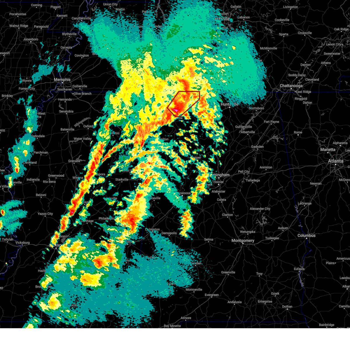 At 226 pm cdt, a severe thunderstorm capable of producing a tornado was located near littleville, or near tuscumbia, moving northeast at 50 mph (radar indicated rotation. ema reported baseball sized hail). Hazards include tornado and baseball size hail. Flying debris will be dangerous to those caught without shelter. mobile homes will be damaged or destroyed. damage to roofs, windows, and vehicles will occur. tree damage is likely. this dangerous storm will be near, muscle shoals and leighton around 230 pm cdt. lexington around 255 pm cdt. Other locations impacted by this tornadic thunderstorm include green hill, northwest alabama regional airport, new bethel, anderson, center star, pride landing, zip city, kingtown, whitehead, and ford city. At 226 pm cdt, a severe thunderstorm capable of producing a tornado was located near littleville, or near tuscumbia, moving northeast at 50 mph (radar indicated rotation. ema reported baseball sized hail). Hazards include tornado and baseball size hail. Flying debris will be dangerous to those caught without shelter. mobile homes will be damaged or destroyed. damage to roofs, windows, and vehicles will occur. tree damage is likely. this dangerous storm will be near, muscle shoals and leighton around 230 pm cdt. lexington around 255 pm cdt. Other locations impacted by this tornadic thunderstorm include green hill, northwest alabama regional airport, new bethel, anderson, center star, pride landing, zip city, kingtown, whitehead, and ford city.
|
| 3/15/2025 2:22 PM CDT |
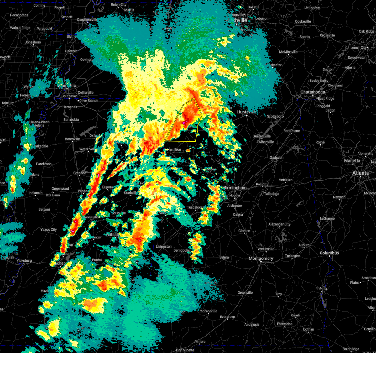 At 221 pm cdt, severe thunderstorms were located along a line extending from near killen to littleville to 8 miles northwest of hackleburg, moving east at 45 mph (radar indicated). Hazards include ping pong ball size hail and 60 mph wind gusts. People and animals outdoors will be injured. expect hail damage to roofs, siding, windows, and vehicles. expect wind damage to roofs, siding, and trees. Locations impacted include, posey loop, northwest alabama regional airport, atwood, littleville, la grange, florence, tharptown, duketon, russellville, and oakland. At 221 pm cdt, severe thunderstorms were located along a line extending from near killen to littleville to 8 miles northwest of hackleburg, moving east at 45 mph (radar indicated). Hazards include ping pong ball size hail and 60 mph wind gusts. People and animals outdoors will be injured. expect hail damage to roofs, siding, windows, and vehicles. expect wind damage to roofs, siding, and trees. Locations impacted include, posey loop, northwest alabama regional airport, atwood, littleville, la grange, florence, tharptown, duketon, russellville, and oakland.
|
| 3/15/2025 2:20 PM CDT | Tree downed near the garage and cherokee roads intersection. time estimated from rada in colbert county AL, 2 miles ESE of Muscle Shoals, AL |
| 3/15/2025 2:19 PM CDT |
 At 219 pm cdt, a severe thunderstorm capable of producing a tornado was located over littleville, or near russellville, moving northeast at 55 mph (radar indicated rotation). Hazards include tornado and ping pong ball size hail. Flying debris will be dangerous to those caught without shelter. mobile homes will be damaged or destroyed. damage to roofs, windows, and vehicles will occur. tree damage is likely. this dangerous storm will be near, littleville around 225 pm cdt. leighton around 230 pm cdt. rogersville around 245 pm cdt. Other locations impacted by this tornadic thunderstorm include green hill, posey loop, northwest alabama regional airport, new bethel, anderson, red rock, center star, pride landing, zip city, and kingtown. At 219 pm cdt, a severe thunderstorm capable of producing a tornado was located over littleville, or near russellville, moving northeast at 55 mph (radar indicated rotation). Hazards include tornado and ping pong ball size hail. Flying debris will be dangerous to those caught without shelter. mobile homes will be damaged or destroyed. damage to roofs, windows, and vehicles will occur. tree damage is likely. this dangerous storm will be near, littleville around 225 pm cdt. leighton around 230 pm cdt. rogersville around 245 pm cdt. Other locations impacted by this tornadic thunderstorm include green hill, posey loop, northwest alabama regional airport, new bethel, anderson, red rock, center star, pride landing, zip city, and kingtown.
|
| 3/15/2025 2:08 PM CDT |
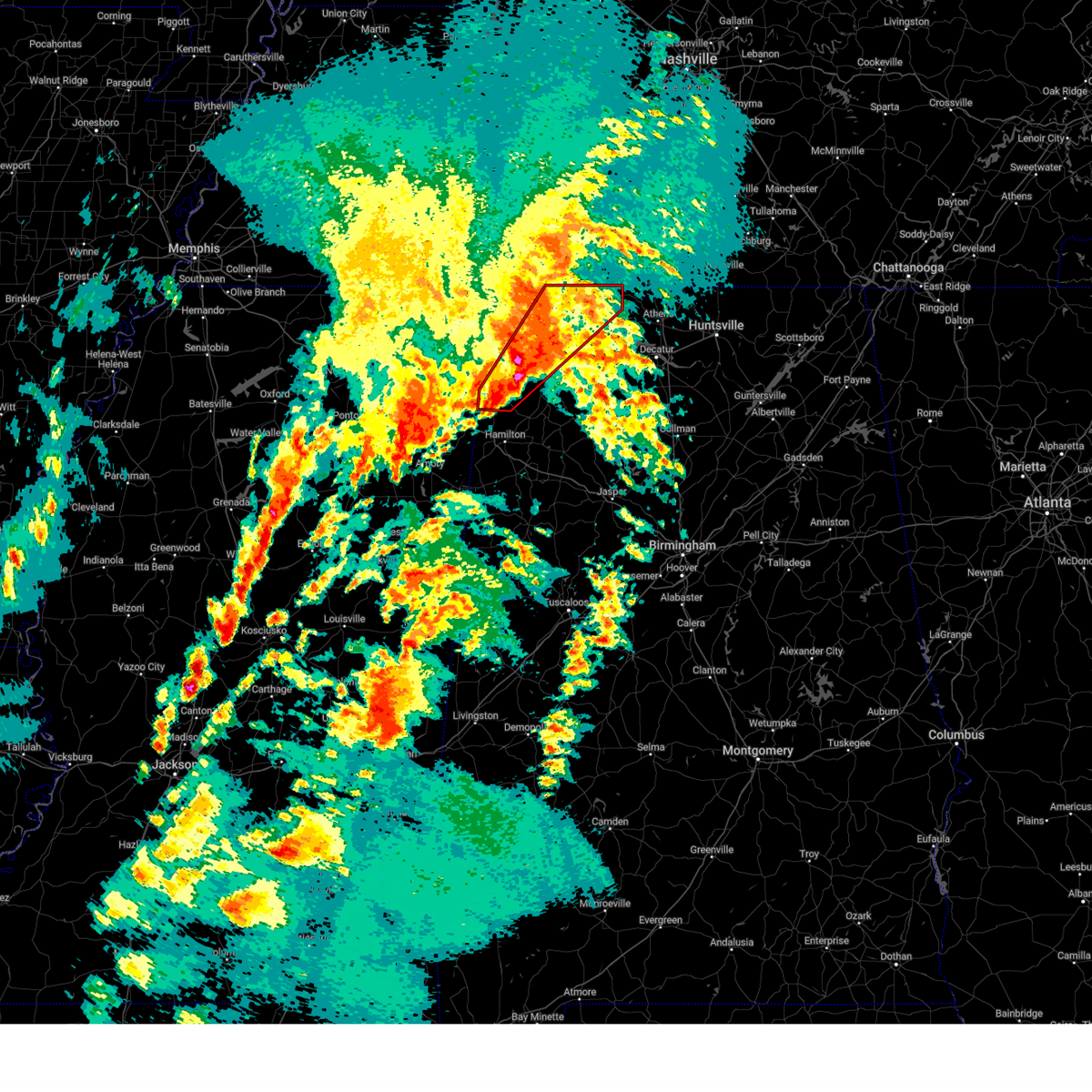 Torhun the national weather service in huntsville alabama has issued a * tornado warning for, lauderdale county in northwestern alabama, colbert county in northwestern alabama, northwestern franklin county in northwestern alabama, northwestern lawrence county in northwestern alabama, * until 315 pm cdt. * at 207 pm cdt, a severe thunderstorm capable of producing a tornado was located over belgreen, or near russellville, moving northeast at 50 mph (radar indicated rotation). Hazards include tornado and ping pong ball size hail. Flying debris will be dangerous to those caught without shelter. mobile homes will be damaged or destroyed. damage to roofs, windows, and vehicles will occur. tree damage is likely. this dangerous storm will be near, russellville and littleville around 215 pm cdt. muscle shoals and leighton around 230 pm cdt. lexington around 255 pm cdt. Other locations impacted by this tornadic thunderstorm include posey loop, northwest alabama regional airport, atwood, oakland, rockwood, red rock, pride landing, zip city, dempsey, and ford city. Torhun the national weather service in huntsville alabama has issued a * tornado warning for, lauderdale county in northwestern alabama, colbert county in northwestern alabama, northwestern franklin county in northwestern alabama, northwestern lawrence county in northwestern alabama, * until 315 pm cdt. * at 207 pm cdt, a severe thunderstorm capable of producing a tornado was located over belgreen, or near russellville, moving northeast at 50 mph (radar indicated rotation). Hazards include tornado and ping pong ball size hail. Flying debris will be dangerous to those caught without shelter. mobile homes will be damaged or destroyed. damage to roofs, windows, and vehicles will occur. tree damage is likely. this dangerous storm will be near, russellville and littleville around 215 pm cdt. muscle shoals and leighton around 230 pm cdt. lexington around 255 pm cdt. Other locations impacted by this tornadic thunderstorm include posey loop, northwest alabama regional airport, atwood, oakland, rockwood, red rock, pride landing, zip city, dempsey, and ford city.
|
| 3/15/2025 1:39 PM CDT |
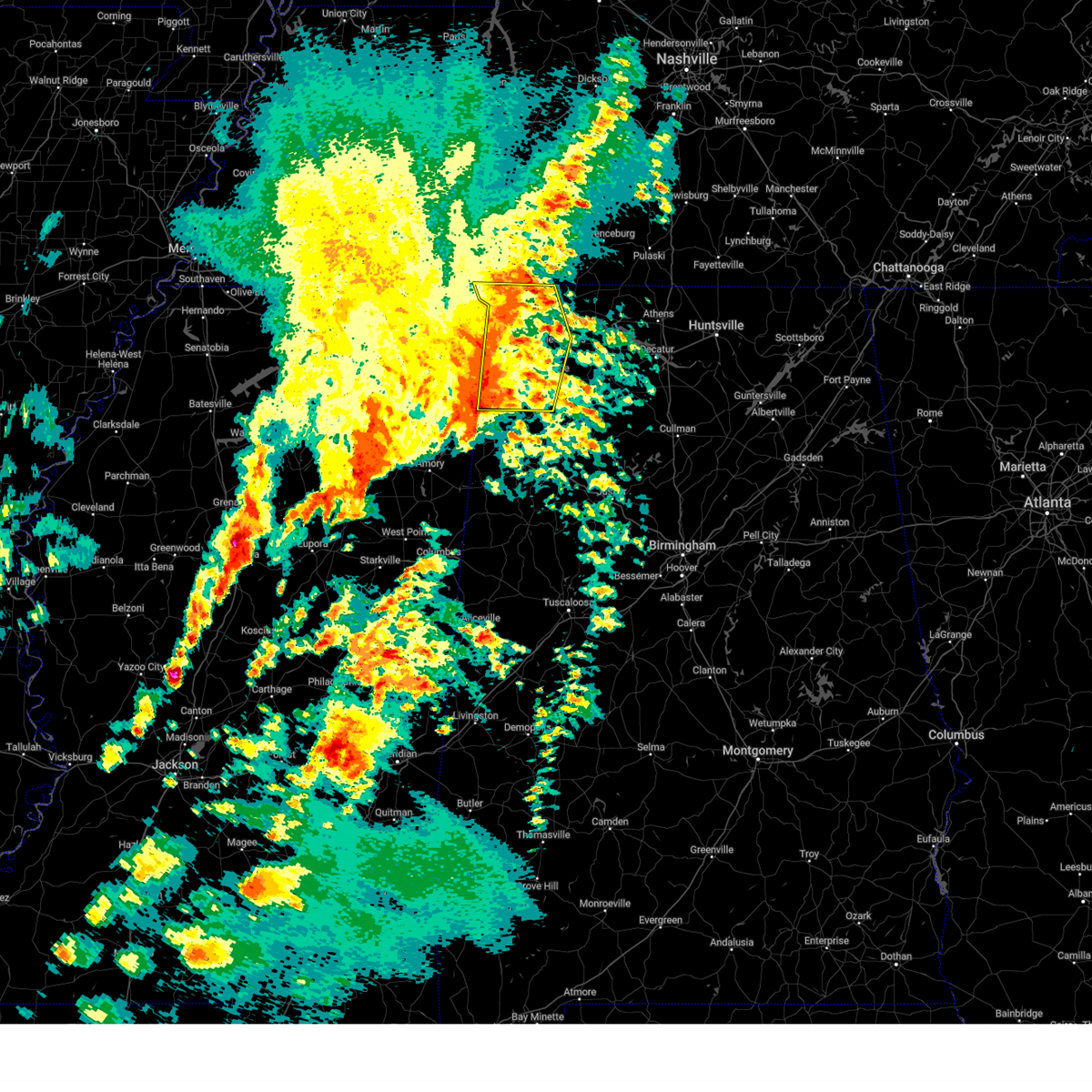 The storms which prompted the warning is still in the area. therefore, the warning will be allowed to expire with an additional severe thunderstorm warning issued in replacement. a tornado watch remains in effect until 800 pm cdt for north central and northwestern alabama. remember, a severe thunderstorm warning still remains in effect for portions of lauderdale, colbert, and franklin counties until 2:30 pm. remember, a tornado warning still remains in effect for franklin county until 2:15 pm. The storms which prompted the warning is still in the area. therefore, the warning will be allowed to expire with an additional severe thunderstorm warning issued in replacement. a tornado watch remains in effect until 800 pm cdt for north central and northwestern alabama. remember, a severe thunderstorm warning still remains in effect for portions of lauderdale, colbert, and franklin counties until 2:30 pm. remember, a tornado warning still remains in effect for franklin county until 2:15 pm.
|
| 3/15/2025 1:37 PM CDT |
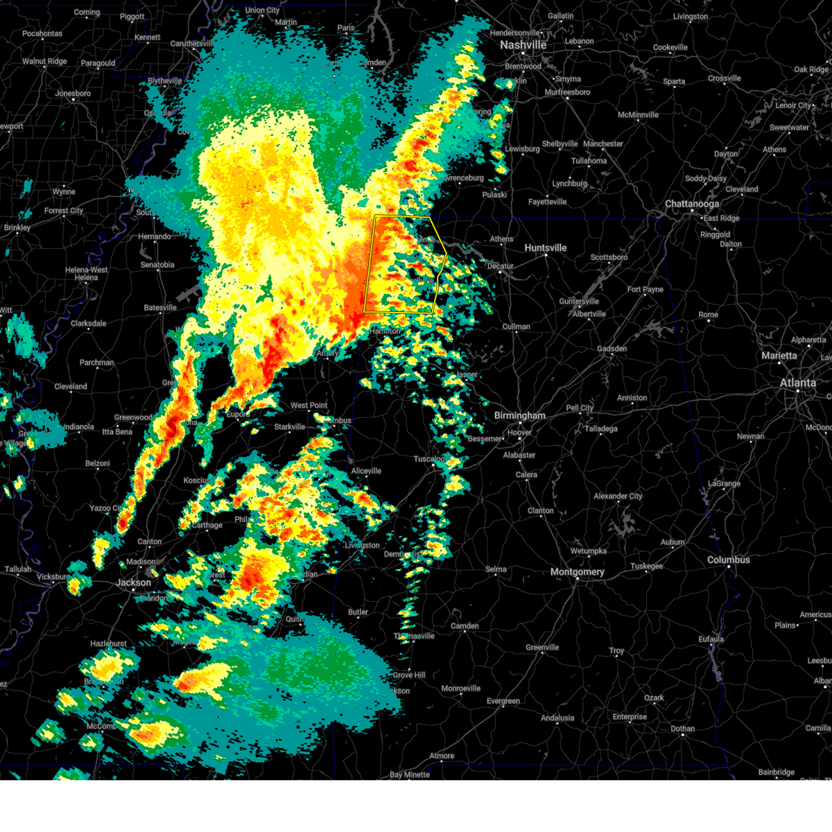 Svrhun the national weather service in huntsville alabama has issued a * severe thunderstorm warning for, central lauderdale county in northwestern alabama, colbert county in northwestern alabama, franklin county in northwestern alabama, * until 230 pm cdt. * at 136 pm cdt, severe thunderstorms were located along a line extending from 10 miles north of cherokee to 6 miles southeast of tishomingo state park to near tremont, moving northeast at 60 mph (radar indicated). Hazards include 60 mph wind gusts and quarter size hail. Hail damage to vehicles is expected. Expect wind damage to roofs, siding, and trees. Svrhun the national weather service in huntsville alabama has issued a * severe thunderstorm warning for, central lauderdale county in northwestern alabama, colbert county in northwestern alabama, franklin county in northwestern alabama, * until 230 pm cdt. * at 136 pm cdt, severe thunderstorms were located along a line extending from 10 miles north of cherokee to 6 miles southeast of tishomingo state park to near tremont, moving northeast at 60 mph (radar indicated). Hazards include 60 mph wind gusts and quarter size hail. Hail damage to vehicles is expected. Expect wind damage to roofs, siding, and trees.
|
| 3/15/2025 1:15 PM CDT |
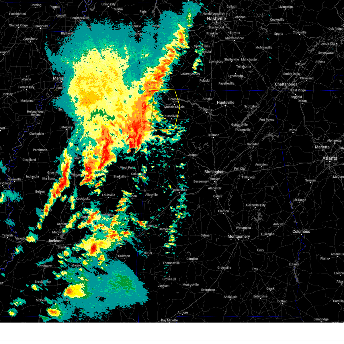 At 115 pm cdt, severe thunderstorms were located along a line extending from iuka to near burton to near fairview, moving east at 40 mph (radar indicated). Hazards include 60 mph wind gusts and quarter size hail. Hail damage to vehicles is expected. expect wind damage to roofs, siding, and trees. Locations impacted include, malone, posey loop, northwest alabama regional airport, atwood, littleville, florence, allsboro, riverton, wright, and tharptown. At 115 pm cdt, severe thunderstorms were located along a line extending from iuka to near burton to near fairview, moving east at 40 mph (radar indicated). Hazards include 60 mph wind gusts and quarter size hail. Hail damage to vehicles is expected. expect wind damage to roofs, siding, and trees. Locations impacted include, malone, posey loop, northwest alabama regional airport, atwood, littleville, florence, allsboro, riverton, wright, and tharptown.
|
| 3/15/2025 12:52 PM CDT |
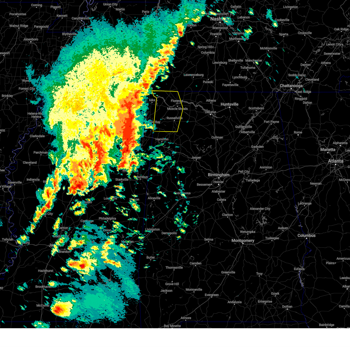 Svrhun the national weather service in huntsville alabama has issued a * severe thunderstorm warning for, western lauderdale county in northwestern alabama, colbert county in northwestern alabama, franklin county in northwestern alabama, * until 145 pm cdt. * at 1252 pm cdt, severe thunderstorms were located along a line extending from hinkle to near wheeler to near saltillo, moving east at 40 mph (radar indicated). Hazards include 60 mph wind gusts and quarter size hail. Hail damage to vehicles is expected. Expect wind damage to roofs, siding, and trees. Svrhun the national weather service in huntsville alabama has issued a * severe thunderstorm warning for, western lauderdale county in northwestern alabama, colbert county in northwestern alabama, franklin county in northwestern alabama, * until 145 pm cdt. * at 1252 pm cdt, severe thunderstorms were located along a line extending from hinkle to near wheeler to near saltillo, moving east at 40 mph (radar indicated). Hazards include 60 mph wind gusts and quarter size hail. Hail damage to vehicles is expected. Expect wind damage to roofs, siding, and trees.
|
| 3/15/2025 4:05 AM CDT |
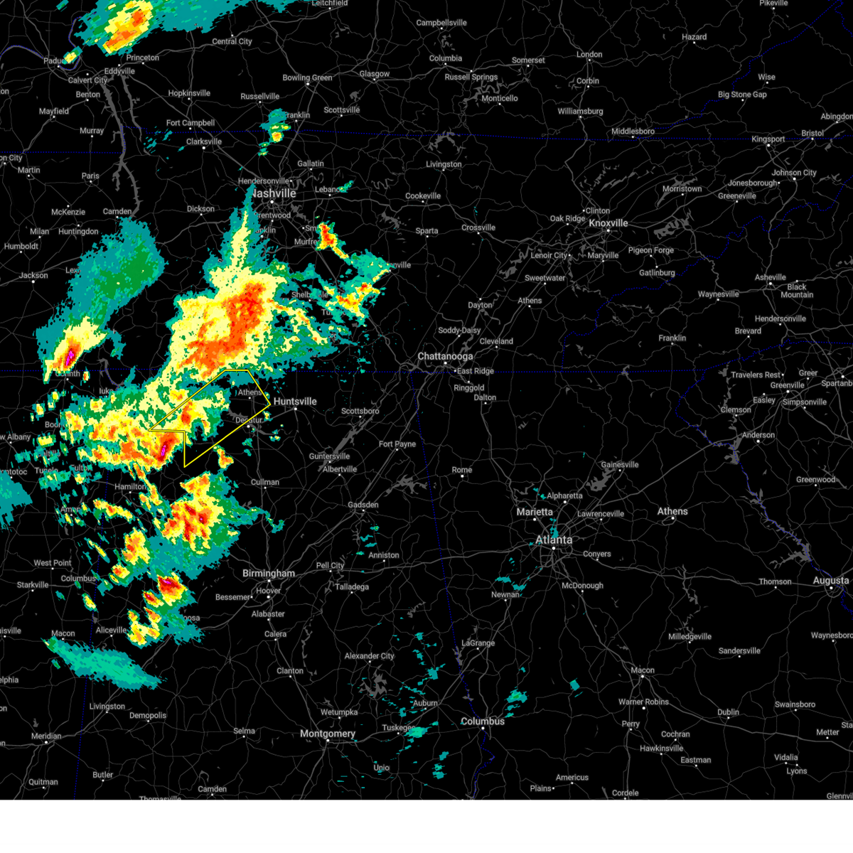 At 405 am cdt, a severe thunderstorm was located near russellville, moving northeast at 55 mph (radar indicated). Hazards include 60 mph wind gusts and quarter size hail. Hail damage to vehicles is expected. expect wind damage to roofs, siding, and trees. Locations impacted include, good springs, mt hope, cartwright, french mill, coxey, trinity, littleville, la grange, ne smith, and north courtland. At 405 am cdt, a severe thunderstorm was located near russellville, moving northeast at 55 mph (radar indicated). Hazards include 60 mph wind gusts and quarter size hail. Hail damage to vehicles is expected. expect wind damage to roofs, siding, and trees. Locations impacted include, good springs, mt hope, cartwright, french mill, coxey, trinity, littleville, la grange, ne smith, and north courtland.
|
| 3/15/2025 3:49 AM CDT |
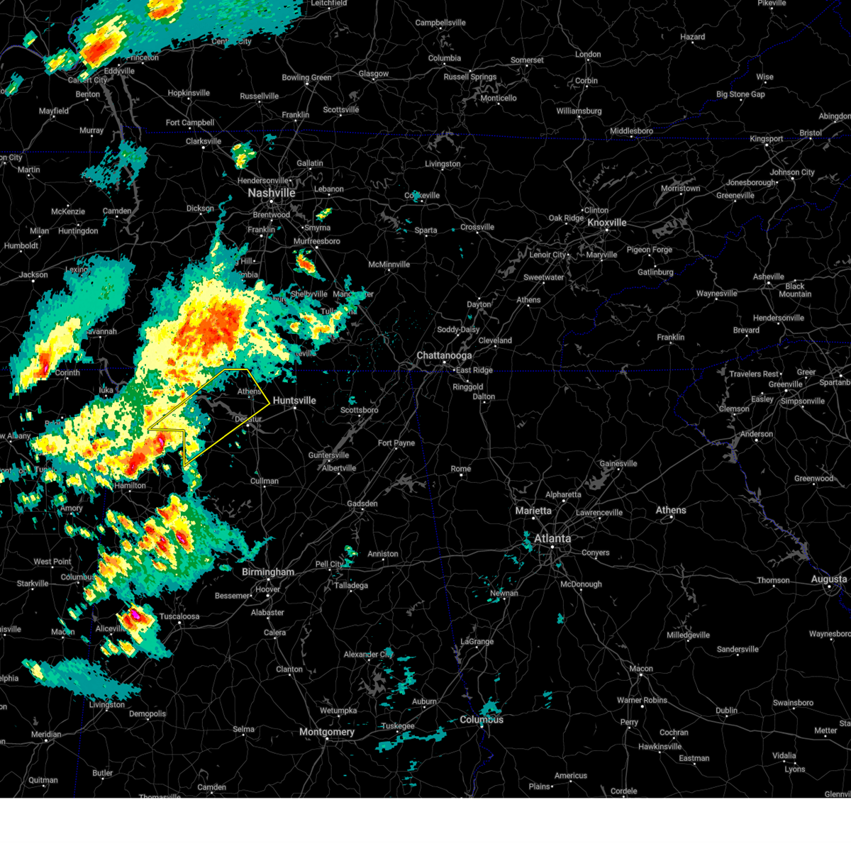 Svrhun the national weather service in huntsville alabama has issued a * severe thunderstorm warning for, limestone county in north central alabama, southeastern lauderdale county in northwestern alabama, southeastern colbert county in northwestern alabama, northwestern morgan county in north central alabama, lawrence county in northwestern alabama, * until 445 am cdt. * at 349 am cdt, a severe thunderstorm was located near russellville, moving northeast at 60 mph (radar indicated). Hazards include 60 mph wind gusts and quarter size hail. Hail damage to vehicles is expected. Expect wind damage to roofs, siding, and trees. Svrhun the national weather service in huntsville alabama has issued a * severe thunderstorm warning for, limestone county in north central alabama, southeastern lauderdale county in northwestern alabama, southeastern colbert county in northwestern alabama, northwestern morgan county in north central alabama, lawrence county in northwestern alabama, * until 445 am cdt. * at 349 am cdt, a severe thunderstorm was located near russellville, moving northeast at 60 mph (radar indicated). Hazards include 60 mph wind gusts and quarter size hail. Hail damage to vehicles is expected. Expect wind damage to roofs, siding, and trees.
|
| 3/13/2025 4:35 PM CDT |
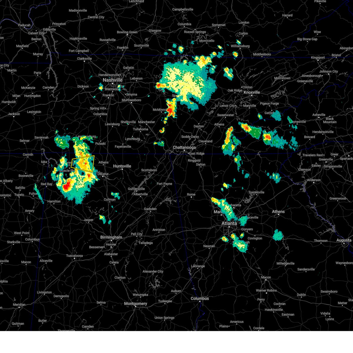 the severe thunderstorm warning has been cancelled and is no longer in effect the severe thunderstorm warning has been cancelled and is no longer in effect
|
| 3/13/2025 4:09 PM CDT |
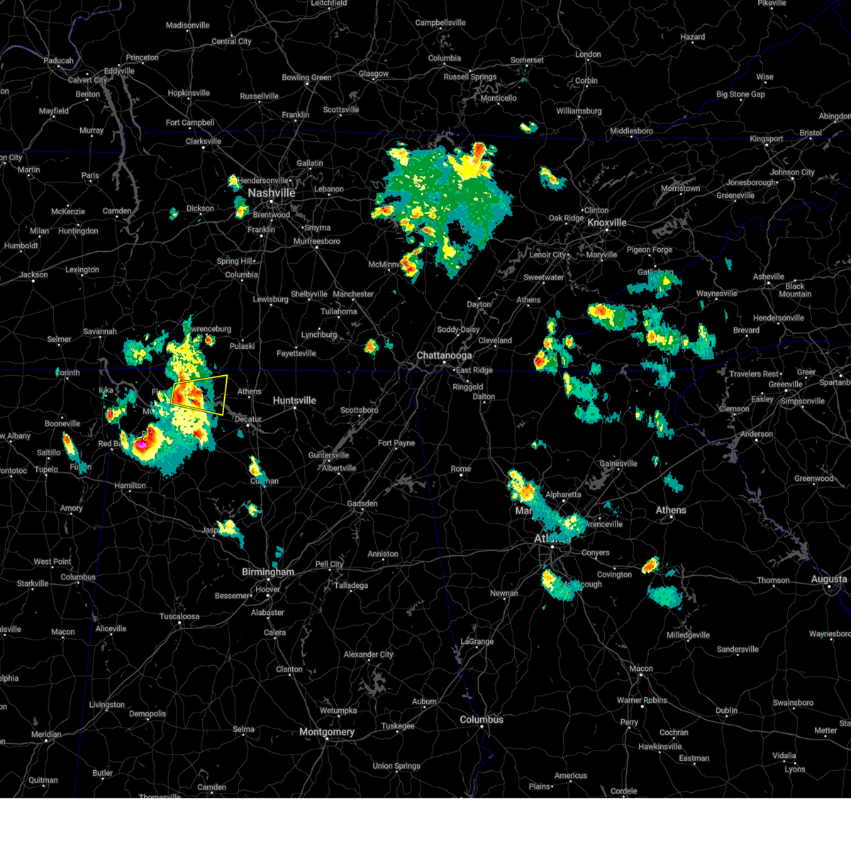 Svrhun the national weather service in huntsville alabama has issued a * severe thunderstorm warning for, northwestern limestone county in north central alabama, southeastern lauderdale county in northwestern alabama, east central colbert county in northwestern alabama, northeastern lawrence county in northwestern alabama, * until 515 pm cdt. * at 409 pm cdt, a severe thunderstorm was located near killen, or near muscle shoals, moving east at 20 mph (radar indicated). Hazards include 60 mph wind gusts and quarter size hail. Hail damage to vehicles is expected. Expect wind damage to roofs, siding, and trees. Svrhun the national weather service in huntsville alabama has issued a * severe thunderstorm warning for, northwestern limestone county in north central alabama, southeastern lauderdale county in northwestern alabama, east central colbert county in northwestern alabama, northeastern lawrence county in northwestern alabama, * until 515 pm cdt. * at 409 pm cdt, a severe thunderstorm was located near killen, or near muscle shoals, moving east at 20 mph (radar indicated). Hazards include 60 mph wind gusts and quarter size hail. Hail damage to vehicles is expected. Expect wind damage to roofs, siding, and trees.
|
| 2/15/2025 11:29 PM CST |
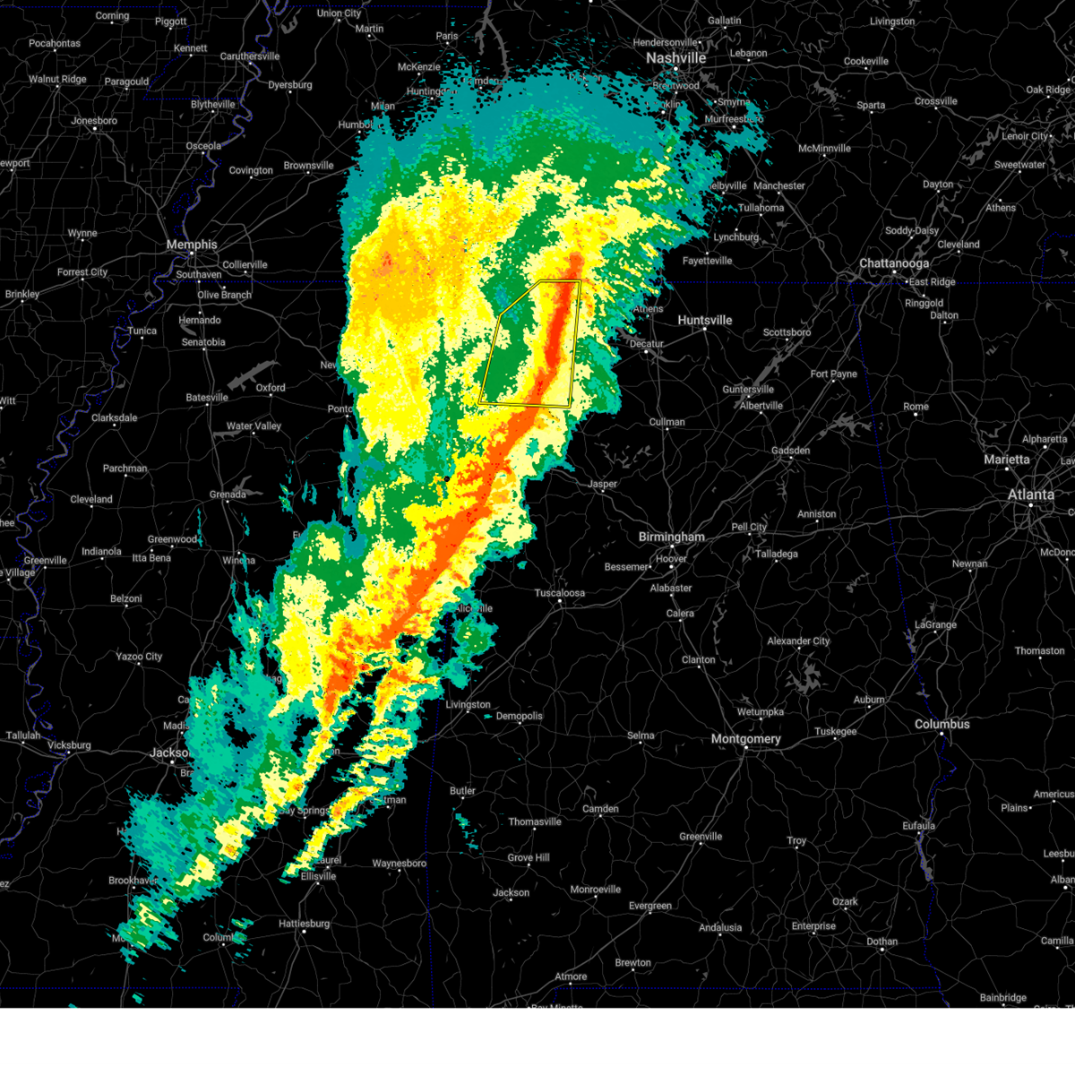 The storms which prompted the warning have moved out of the area. therefore, the warning will be allowed to expire. however, small hail, gusty winds and heavy rain are still possible with these thunderstorms. a tornado watch remains in effect until 400 am cst for north central and northwestern alabama. remember, a severe thunderstorm warning still remains in effect for eastern portions of lauderdale, colbert and franklin counties! remember, a tornado warning still remains in effect for eastern portions of lauderdale, colbert and franklin counties!. The storms which prompted the warning have moved out of the area. therefore, the warning will be allowed to expire. however, small hail, gusty winds and heavy rain are still possible with these thunderstorms. a tornado watch remains in effect until 400 am cst for north central and northwestern alabama. remember, a severe thunderstorm warning still remains in effect for eastern portions of lauderdale, colbert and franklin counties! remember, a tornado warning still remains in effect for eastern portions of lauderdale, colbert and franklin counties!.
|
| 2/15/2025 11:24 PM CST |
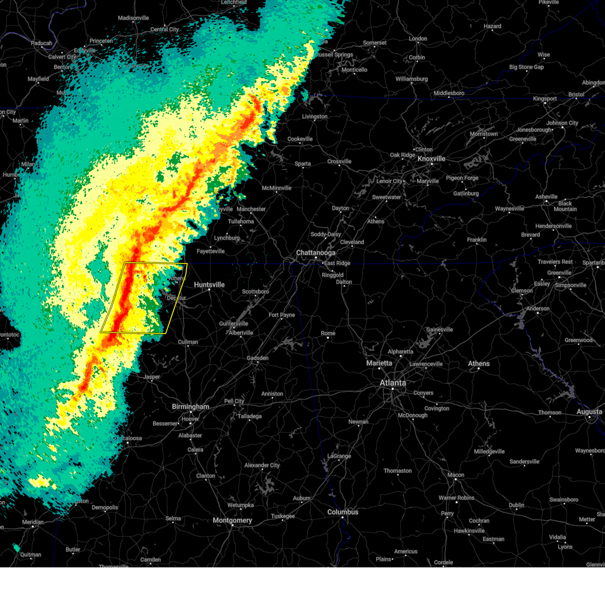 Svrhun the national weather service in huntsville alabama has issued a * severe thunderstorm warning for, limestone county in north central alabama, eastern lauderdale county in northwestern alabama, southeastern colbert county in northwestern alabama, eastern franklin county in northwestern alabama, northwestern morgan county in north central alabama, lawrence county in northwestern alabama, * until 1215 am cst. * at 1123 pm cst, severe thunderstorms were located along a line extending from near loretto to near muscle shoals to littleville to hackleburg, moving east at 60 mph. multiple areas of rotation are present within this line. this line of storms has a history of producing wind damage (radar indicated). Hazards include 60 mph wind gusts and quarter size hail. Hail damage to vehicles is expected. Expect wind damage to roofs, siding, and trees. Svrhun the national weather service in huntsville alabama has issued a * severe thunderstorm warning for, limestone county in north central alabama, eastern lauderdale county in northwestern alabama, southeastern colbert county in northwestern alabama, eastern franklin county in northwestern alabama, northwestern morgan county in north central alabama, lawrence county in northwestern alabama, * until 1215 am cst. * at 1123 pm cst, severe thunderstorms were located along a line extending from near loretto to near muscle shoals to littleville to hackleburg, moving east at 60 mph. multiple areas of rotation are present within this line. this line of storms has a history of producing wind damage (radar indicated). Hazards include 60 mph wind gusts and quarter size hail. Hail damage to vehicles is expected. Expect wind damage to roofs, siding, and trees.
|
| 2/15/2025 11:23 PM CST |
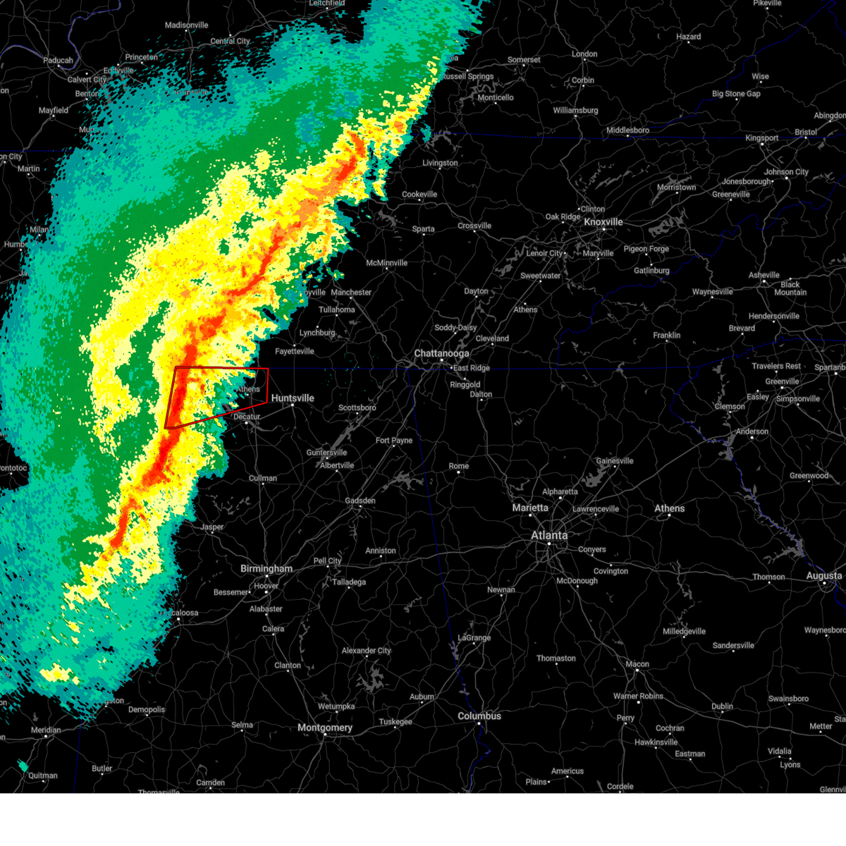 Torhun the national weather service in huntsville alabama has issued a * tornado warning for, limestone county in north central alabama, eastern lauderdale county in northwestern alabama, southeastern colbert county in northwestern alabama, northern lawrence county in northwestern alabama, * until midnight cst. * at 1122 pm cst, a line of severe thunderstorms capable of producing a tornado were located along a line extending from 8 miles north of killen to littleville, moving east at 60 mph. the best areas of rotation along the line were in areas from muscle shoals to killen (radar indicated rotation). Hazards include tornado and quarter size hail. Flying debris will be dangerous to those caught without shelter. mobile homes will be damaged or destroyed. damage to roofs, windows, and vehicles will occur. tree damage is likely. these dangerous storms will be near, killen, lexington, and leighton around 1125 pm cst. town creek around 1130 pm cst. rogersville and courtland around 1135 pm cst. athens around 1155 pm cst. Other locations impacted by these tornadic storms include good springs, cartwright, northwest alabama regional airport, french mill, coxey, north courtland, lester, holland gin, ford city, and red bank. Torhun the national weather service in huntsville alabama has issued a * tornado warning for, limestone county in north central alabama, eastern lauderdale county in northwestern alabama, southeastern colbert county in northwestern alabama, northern lawrence county in northwestern alabama, * until midnight cst. * at 1122 pm cst, a line of severe thunderstorms capable of producing a tornado were located along a line extending from 8 miles north of killen to littleville, moving east at 60 mph. the best areas of rotation along the line were in areas from muscle shoals to killen (radar indicated rotation). Hazards include tornado and quarter size hail. Flying debris will be dangerous to those caught without shelter. mobile homes will be damaged or destroyed. damage to roofs, windows, and vehicles will occur. tree damage is likely. these dangerous storms will be near, killen, lexington, and leighton around 1125 pm cst. town creek around 1130 pm cst. rogersville and courtland around 1135 pm cst. athens around 1155 pm cst. Other locations impacted by these tornadic storms include good springs, cartwright, northwest alabama regional airport, french mill, coxey, north courtland, lester, holland gin, ford city, and red bank.
|
| 2/15/2025 11:21 PM CST | Measured at the northwest alabama regional airport (kmsl in colbert county AL, 1.7 miles WNW of Muscle Shoals, AL |
| 2/15/2025 11:11 PM CST |
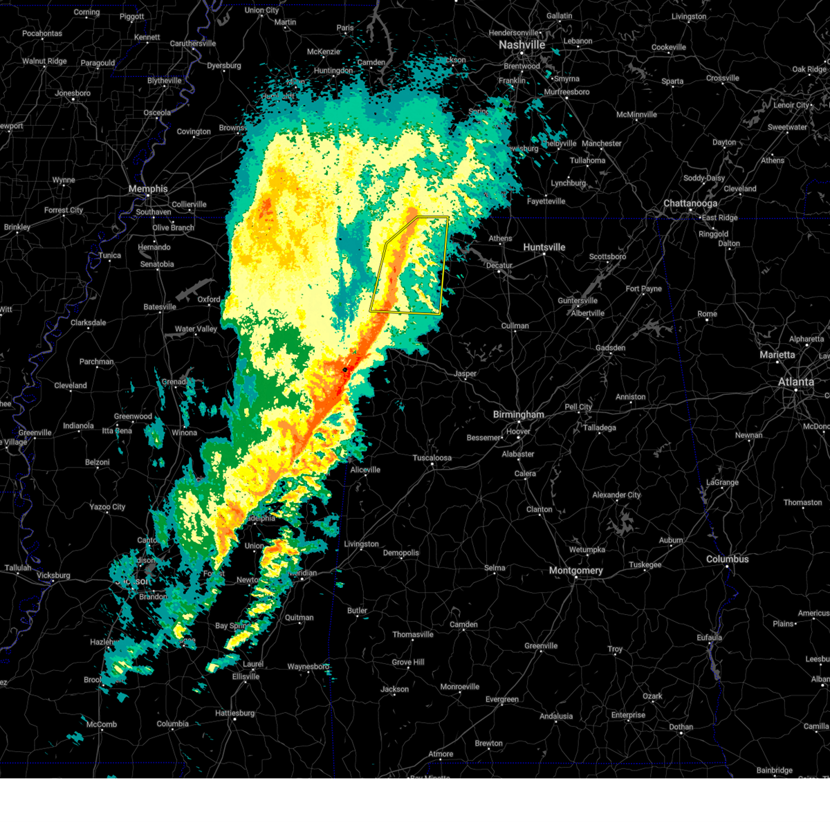 At 1110 pm cst, severe thunderstorms were located along a line extending from 7 miles north of underwood-petersville to near cherokee to near belgreen to 10 miles southeast of red bay, moving northeast at 60 mph. multiple areas of rotation are present within this line (radar indicated). Hazards include 60 mph wind gusts and quarter size hail. Hail damage to vehicles is expected. expect wind damage to roofs, siding, and trees. Locations impacted include, florence, muscle shoals, russellville, sheffield, tuscumbia, phil campbell, killen, cherokee, littleville, and leighton. At 1110 pm cst, severe thunderstorms were located along a line extending from 7 miles north of underwood-petersville to near cherokee to near belgreen to 10 miles southeast of red bay, moving northeast at 60 mph. multiple areas of rotation are present within this line (radar indicated). Hazards include 60 mph wind gusts and quarter size hail. Hail damage to vehicles is expected. expect wind damage to roofs, siding, and trees. Locations impacted include, florence, muscle shoals, russellville, sheffield, tuscumbia, phil campbell, killen, cherokee, littleville, and leighton.
|
| 2/15/2025 10:45 PM CST |
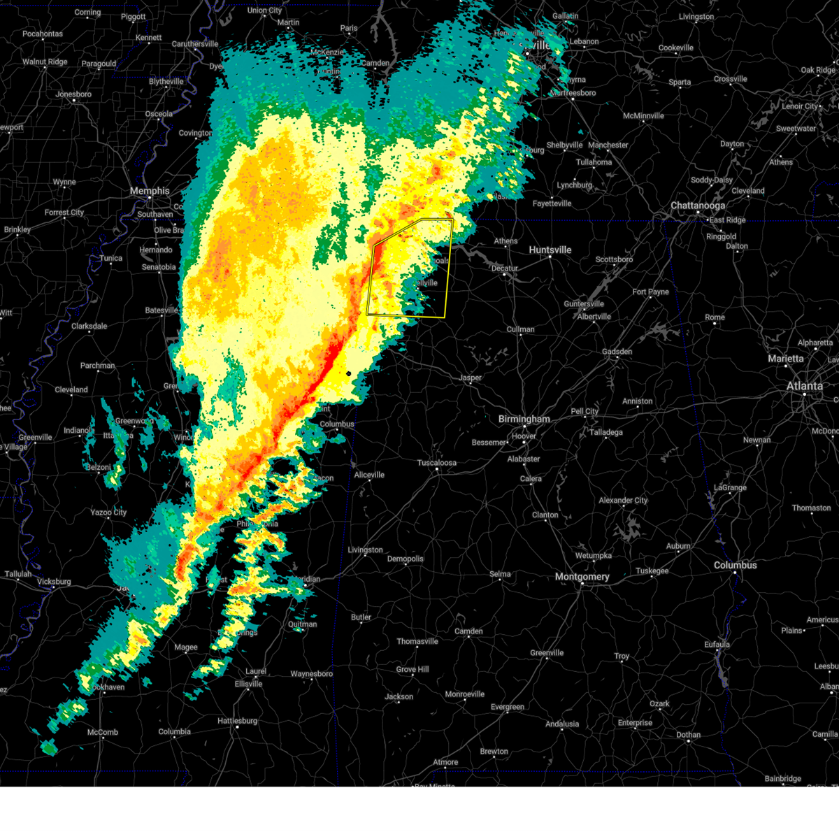 Svrhun the national weather service in huntsville alabama has issued a * severe thunderstorm warning for, central lauderdale county in northwestern alabama, colbert county in northwestern alabama, franklin county in northwestern alabama, southwestern lawrence county in northwestern alabama, * until 1130 pm cst. * at 1045 pm cst, severe thunderstorms were located along a line extending from near iuka to near sandy springs to near fulton to near smithville, moving northeast at 60 mph. multiple areas of rotation are present within this line (radar indicated). Hazards include 60 mph wind gusts and quarter size hail. Hail damage to vehicles is expected. Expect wind damage to roofs, siding, and trees. Svrhun the national weather service in huntsville alabama has issued a * severe thunderstorm warning for, central lauderdale county in northwestern alabama, colbert county in northwestern alabama, franklin county in northwestern alabama, southwestern lawrence county in northwestern alabama, * until 1130 pm cst. * at 1045 pm cst, severe thunderstorms were located along a line extending from near iuka to near sandy springs to near fulton to near smithville, moving northeast at 60 mph. multiple areas of rotation are present within this line (radar indicated). Hazards include 60 mph wind gusts and quarter size hail. Hail damage to vehicles is expected. Expect wind damage to roofs, siding, and trees.
|
| 12/28/2024 10:55 PM CST |
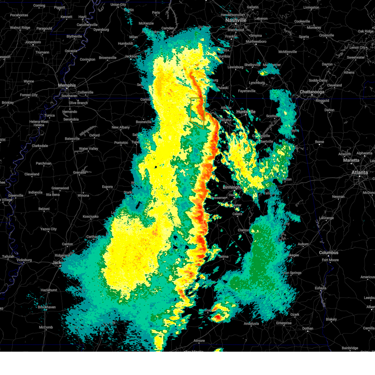 The storms which prompted the warning have moved out of the area. therefore, the warning will be allowed to expire. a tornado watch remains in effect until 400 am cst for north central and northwestern alabama. The storms which prompted the warning have moved out of the area. therefore, the warning will be allowed to expire. a tornado watch remains in effect until 400 am cst for north central and northwestern alabama.
|
| 12/28/2024 10:42 PM CST |
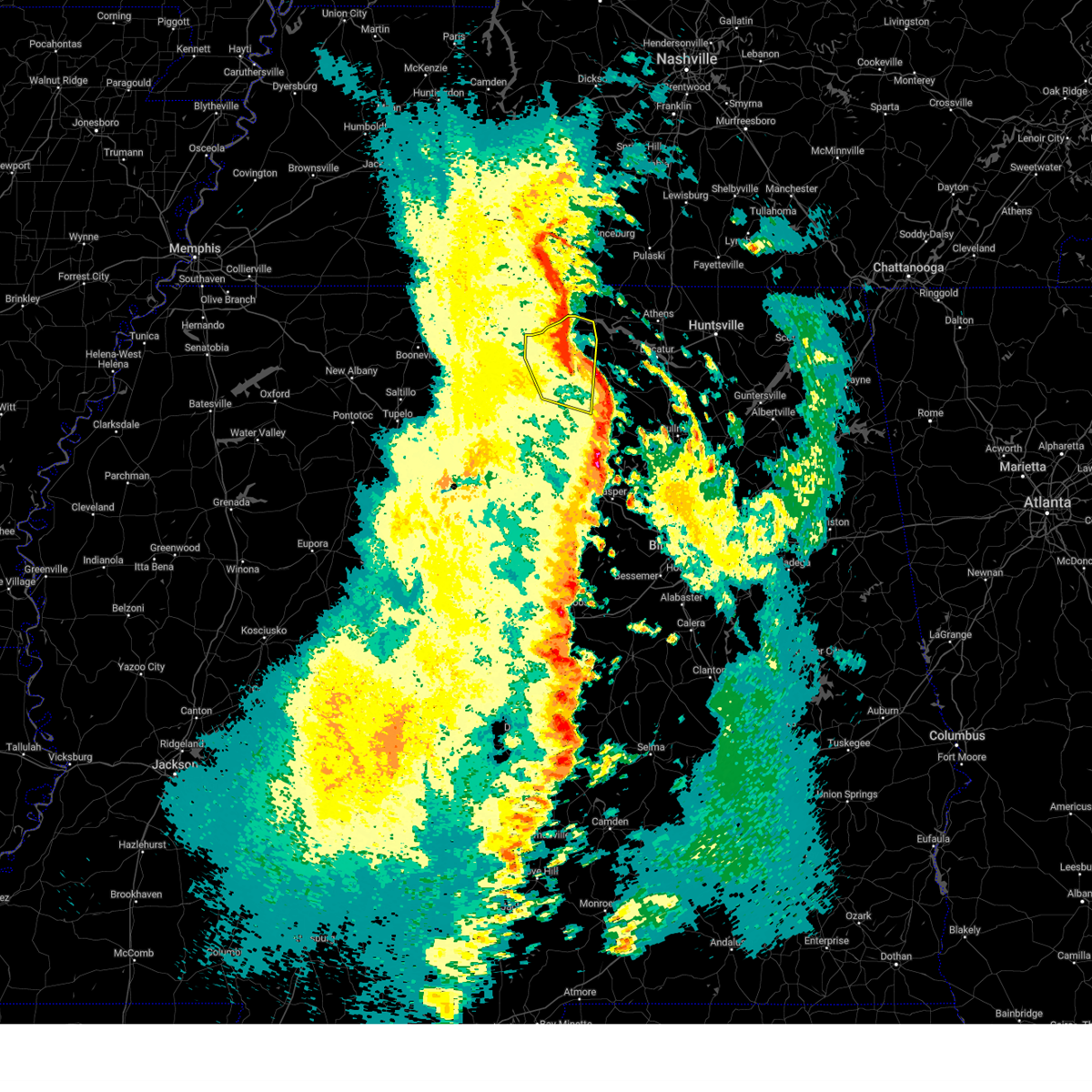 The storms which prompted the warning will soon move out of the area. therefore, the warning will be allowed to expire. however, gusty winds are still possible with these thunderstorms. a tornado watch remains in effect until 400 am cst for north central and northwestern alabama. The storms which prompted the warning will soon move out of the area. therefore, the warning will be allowed to expire. however, gusty winds are still possible with these thunderstorms. a tornado watch remains in effect until 400 am cst for north central and northwestern alabama.
|
| 12/28/2024 10:42 PM CST |
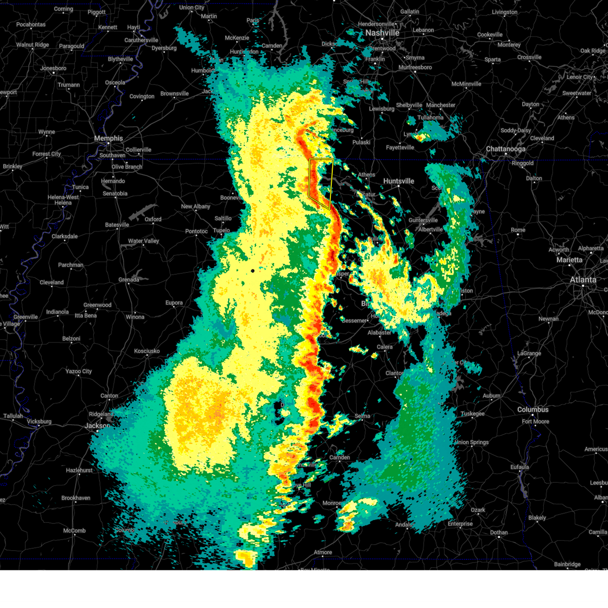 Svrhun the national weather service in huntsville alabama has issued a * severe thunderstorm warning for, eastern lauderdale county in northwestern alabama, southeastern colbert county in northwestern alabama, northwestern lawrence county in northwestern alabama, * until 1100 pm cst. * at 1040 pm cst, a line of severe thunderstorms were located from 11 miles west of loretto to leighton, moving northeast at 50 mph. 60 mph wind gusts have been reported in colbert and lauderdale counties (radar indicated). Hazards include 60 mph wind gusts. expect damage to roofs, siding, and trees Svrhun the national weather service in huntsville alabama has issued a * severe thunderstorm warning for, eastern lauderdale county in northwestern alabama, southeastern colbert county in northwestern alabama, northwestern lawrence county in northwestern alabama, * until 1100 pm cst. * at 1040 pm cst, a line of severe thunderstorms were located from 11 miles west of loretto to leighton, moving northeast at 50 mph. 60 mph wind gusts have been reported in colbert and lauderdale counties (radar indicated). Hazards include 60 mph wind gusts. expect damage to roofs, siding, and trees
|
| 12/28/2024 10:34 PM CST |
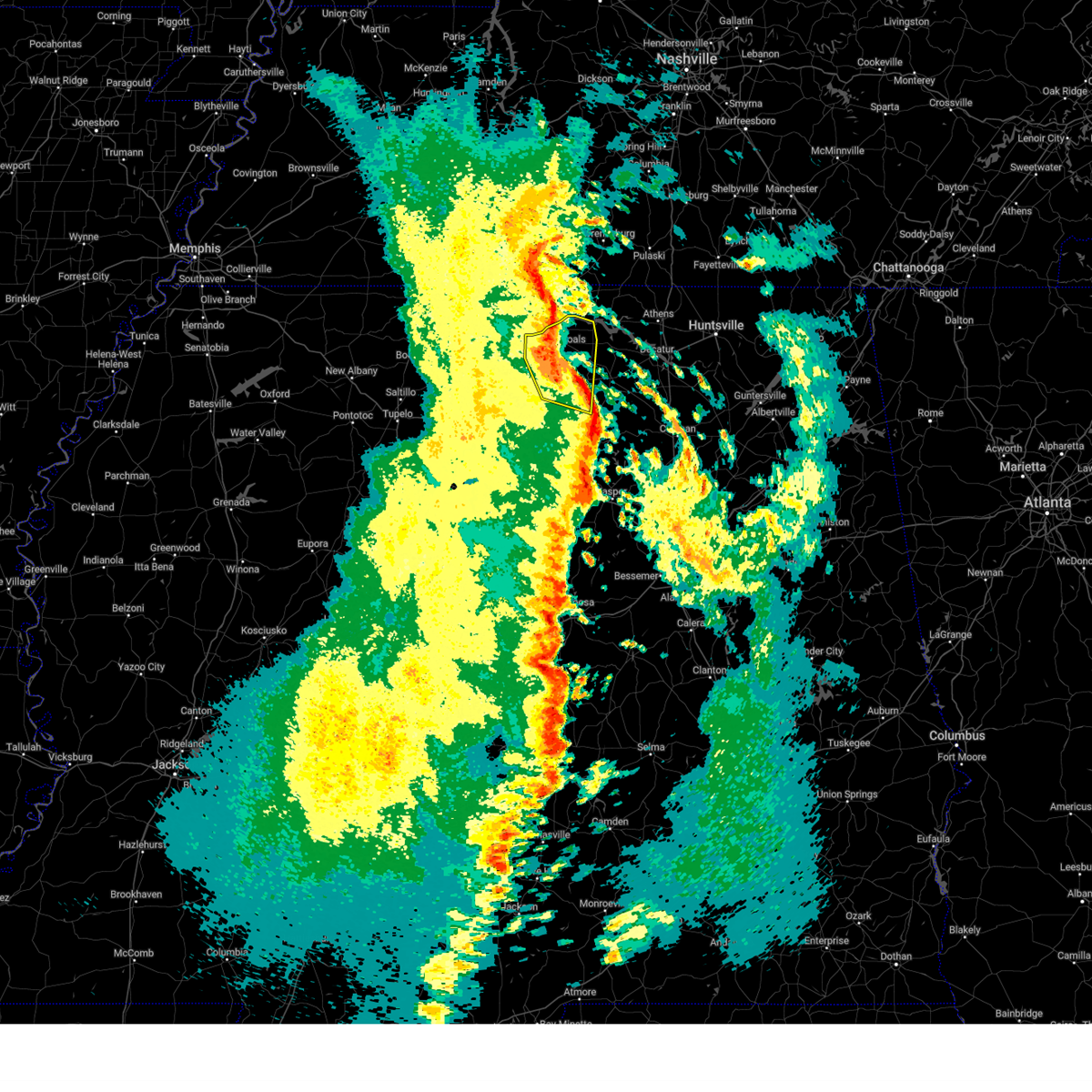 At 1034 pm cst, severe thunderstorms were located along a line extending from near underwood-petersville to near littleville to 10 miles southwest of moulton, moving northeast at 40 mph. wind damage has been reported across franklin county alabama (public). Hazards include 60 mph wind gusts. Expect damage to roofs, siding, and trees. Locations impacted include, muscle shoals, russellville, sheffield, tuscumbia, town creek, littleville, leighton, posey loop, mt hope, and northwest alabama regional airport. At 1034 pm cst, severe thunderstorms were located along a line extending from near underwood-petersville to near littleville to 10 miles southwest of moulton, moving northeast at 40 mph. wind damage has been reported across franklin county alabama (public). Hazards include 60 mph wind gusts. Expect damage to roofs, siding, and trees. Locations impacted include, muscle shoals, russellville, sheffield, tuscumbia, town creek, littleville, leighton, posey loop, mt hope, and northwest alabama regional airport.
|
| 12/28/2024 10:10 PM CST |
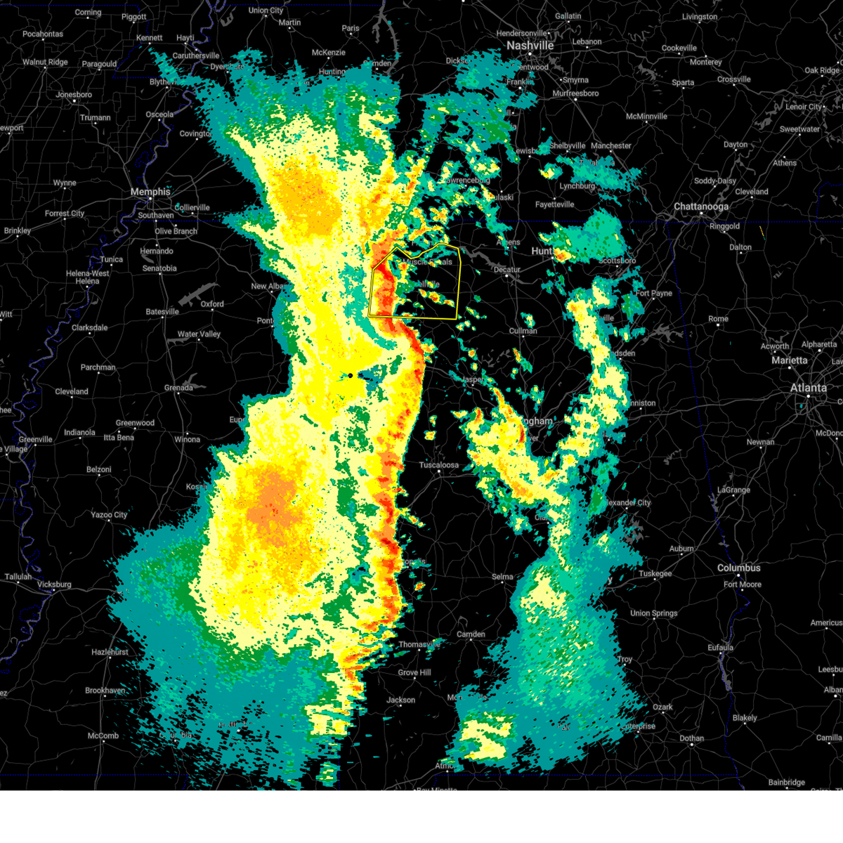 At 1008 pm cst, severe thunderstorms were located along a line extending from near cherokee to 6 miles west of hackleburg to lake buttahatchee, moving northeast at 50 mph. this line has a history of producing wind damage across marion county alabama (public). Hazards include 60 mph wind gusts. Expect damage to roofs, siding, and trees. Locations impacted include, muscle shoals, russellville, sheffield, tuscumbia, red bay, phil campbell, town creek, cherokee, littleville, and leighton. At 1008 pm cst, severe thunderstorms were located along a line extending from near cherokee to 6 miles west of hackleburg to lake buttahatchee, moving northeast at 50 mph. this line has a history of producing wind damage across marion county alabama (public). Hazards include 60 mph wind gusts. Expect damage to roofs, siding, and trees. Locations impacted include, muscle shoals, russellville, sheffield, tuscumbia, red bay, phil campbell, town creek, cherokee, littleville, and leighton.
|
| 12/28/2024 9:52 PM CST |
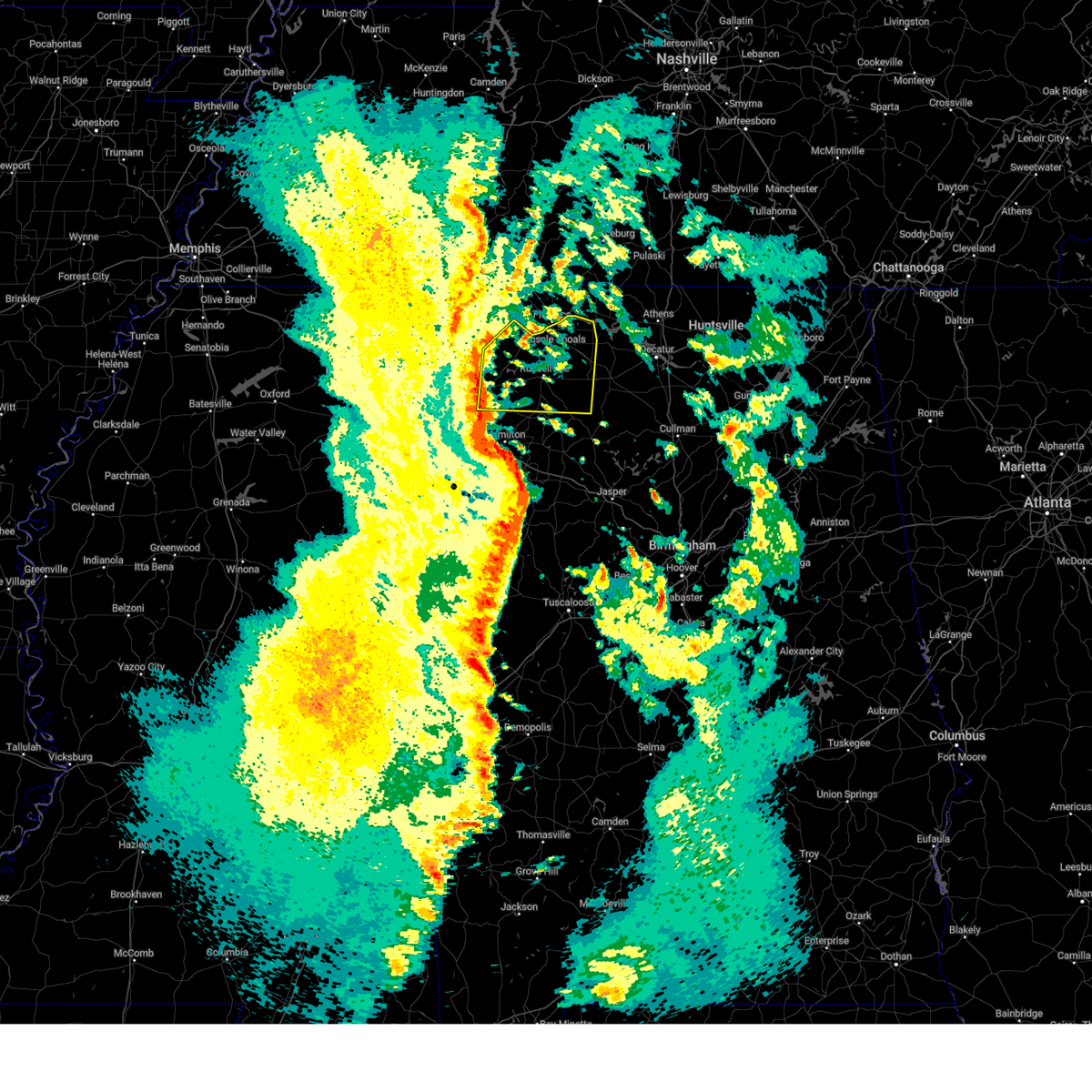 Svrhun the national weather service in huntsville alabama has issued a * severe thunderstorm warning for, colbert county in northwestern alabama, franklin county in northwestern alabama, western lawrence county in northwestern alabama, * until 1045 pm cst. * at 951 pm cst, a line of severe thunderstorms from near belmont to 7 miles west of weston to guin was moving northeast at 50 mph. a tornado watch remains in effect and tornadoes can rapidly form in a line of storms. seek immediate shelter if a tornado warning is issued for your area (radar indicated). Hazards include 60 mph wind gusts. expect damage to roofs, siding, and trees Svrhun the national weather service in huntsville alabama has issued a * severe thunderstorm warning for, colbert county in northwestern alabama, franklin county in northwestern alabama, western lawrence county in northwestern alabama, * until 1045 pm cst. * at 951 pm cst, a line of severe thunderstorms from near belmont to 7 miles west of weston to guin was moving northeast at 50 mph. a tornado watch remains in effect and tornadoes can rapidly form in a line of storms. seek immediate shelter if a tornado warning is issued for your area (radar indicated). Hazards include 60 mph wind gusts. expect damage to roofs, siding, and trees
|
| 6/26/2024 2:45 PM CDT | A power pole was knocked over at 85 veterans drive. time estimated by rada in colbert county AL, 8.1 miles WSW of Muscle Shoals, AL |
| 6/5/2024 8:07 PM CDT |
 The storm which prompted the warning has weakened below severe limits, and has exited the warned area. therefore, the warning will be allowed to expire. The storm which prompted the warning has weakened below severe limits, and has exited the warned area. therefore, the warning will be allowed to expire.
|
| 6/5/2024 7:27 PM CDT |
 Svrhun the national weather service in huntsville alabama has issued a * severe thunderstorm warning for, central lauderdale county in northwestern alabama, colbert county in northwestern alabama, northeastern franklin county in northwestern alabama, northwestern lawrence county in northwestern alabama, * until 815 pm cdt. * at 727 pm cdt, a severe thunderstorm was located near russellville, moving northeast at 45 mph (radar indicated). Hazards include 60 mph wind gusts. expect damage to roofs, siding, and trees Svrhun the national weather service in huntsville alabama has issued a * severe thunderstorm warning for, central lauderdale county in northwestern alabama, colbert county in northwestern alabama, northeastern franklin county in northwestern alabama, northwestern lawrence county in northwestern alabama, * until 815 pm cdt. * at 727 pm cdt, a severe thunderstorm was located near russellville, moving northeast at 45 mph (radar indicated). Hazards include 60 mph wind gusts. expect damage to roofs, siding, and trees
|
| 5/27/2024 2:40 AM CDT |
 The storms which prompted the warning have weakened below severe limits, and no longer pose an immediate threat to life or property. therefore, the warning will be allowed to expire. a tornado watch remains in effect until 800 am cdt for north central and northwestern alabama. The storms which prompted the warning have weakened below severe limits, and no longer pose an immediate threat to life or property. therefore, the warning will be allowed to expire. a tornado watch remains in effect until 800 am cdt for north central and northwestern alabama.
|
| 5/27/2024 1:49 AM CDT |
 Svrhun the national weather service in huntsville alabama has issued a * severe thunderstorm warning for, lauderdale county in northwestern alabama, colbert county in northwestern alabama, franklin county in northwestern alabama, * until 245 am cdt. * at 148 am cdt, severe thunderstorms were located along a line extending from near savannah to 6 miles north of hinkle to near snow lake shores, moving southeast at 40 mph (radar indicated). Hazards include 60 mph wind gusts and quarter size hail. Hail damage to vehicles is expected. Expect wind damage to roofs, siding, and trees. Svrhun the national weather service in huntsville alabama has issued a * severe thunderstorm warning for, lauderdale county in northwestern alabama, colbert county in northwestern alabama, franklin county in northwestern alabama, * until 245 am cdt. * at 148 am cdt, severe thunderstorms were located along a line extending from near savannah to 6 miles north of hinkle to near snow lake shores, moving southeast at 40 mph (radar indicated). Hazards include 60 mph wind gusts and quarter size hail. Hail damage to vehicles is expected. Expect wind damage to roofs, siding, and trees.
|
| 5/8/2024 7:45 PM CDT |
 Svrhun the national weather service in huntsville alabama has issued a * severe thunderstorm warning for, east central colbert county in northwestern alabama, northwestern lawrence county in northwestern alabama, * until 815 pm cdt. * at 745 pm cdt, a severe thunderstorm was located near town creek, or 11 miles east of muscle shoals, moving northeast at 30 mph. spotter reported a a lowering in this supercell (radar indicated). Hazards include 60 mph wind gusts and quarter size hail. Hail damage to vehicles is expected. Expect wind damage to roofs, siding, and trees. Svrhun the national weather service in huntsville alabama has issued a * severe thunderstorm warning for, east central colbert county in northwestern alabama, northwestern lawrence county in northwestern alabama, * until 815 pm cdt. * at 745 pm cdt, a severe thunderstorm was located near town creek, or 11 miles east of muscle shoals, moving northeast at 30 mph. spotter reported a a lowering in this supercell (radar indicated). Hazards include 60 mph wind gusts and quarter size hail. Hail damage to vehicles is expected. Expect wind damage to roofs, siding, and trees.
|
| 4/19/2024 6:11 AM CDT |
 At 611 am cdt, a severe thunderstorm was located over russellville, moving southeast at 30 mph (radar indicated). Hazards include 60 mph wind gusts and quarter size hail. Hail damage to vehicles is expected. expect wind damage to roofs, siding, and trees. Locations impacted include, russellville, moulton, red bay, phil campbell, town creek, littleville, leighton, courtland, belgreen, and north courtland. At 611 am cdt, a severe thunderstorm was located over russellville, moving southeast at 30 mph (radar indicated). Hazards include 60 mph wind gusts and quarter size hail. Hail damage to vehicles is expected. expect wind damage to roofs, siding, and trees. Locations impacted include, russellville, moulton, red bay, phil campbell, town creek, littleville, leighton, courtland, belgreen, and north courtland.
|
| 4/19/2024 5:58 AM CDT |
 Svrhun the national weather service in huntsville alabama has issued a * severe thunderstorm warning for, southern colbert county in northwestern alabama, franklin county in northwestern alabama, western lawrence county in northwestern alabama, * until 645 am cdt. * at 558 am cdt, a severe thunderstorm was located near russellville, moving southeast at 35 mph (radar indicated). Hazards include 60 mph wind gusts and quarter size hail. Hail damage to vehicles is expected. Expect wind damage to roofs, siding, and trees. Svrhun the national weather service in huntsville alabama has issued a * severe thunderstorm warning for, southern colbert county in northwestern alabama, franklin county in northwestern alabama, western lawrence county in northwestern alabama, * until 645 am cdt. * at 558 am cdt, a severe thunderstorm was located near russellville, moving southeast at 35 mph (radar indicated). Hazards include 60 mph wind gusts and quarter size hail. Hail damage to vehicles is expected. Expect wind damage to roofs, siding, and trees.
|
| 4/19/2024 5:44 AM CDT |
 At 543 am cdt, a severe thunderstorm was located 7 miles southwest of tuscumbia, moving east at 40 mph (radar indicated). Hazards include 60 mph wind gusts and quarter size hail. Hail damage to vehicles is expected. expect wind damage to roofs, siding, and trees. Locations impacted include, florence, muscle shoals, russellville, sheffield, tuscumbia, cherokee, littleville, leighton, posey loop, and northwest alabama regional airport. At 543 am cdt, a severe thunderstorm was located 7 miles southwest of tuscumbia, moving east at 40 mph (radar indicated). Hazards include 60 mph wind gusts and quarter size hail. Hail damage to vehicles is expected. expect wind damage to roofs, siding, and trees. Locations impacted include, florence, muscle shoals, russellville, sheffield, tuscumbia, cherokee, littleville, leighton, posey loop, and northwest alabama regional airport.
|
| 4/19/2024 5:31 AM CDT |
 Svrhun the national weather service in huntsville alabama has issued a * severe thunderstorm warning for, south central lauderdale county in northwestern alabama, colbert county in northwestern alabama, northeastern franklin county in northwestern alabama, * until 600 am cdt. * at 530 am cdt, a severe thunderstorm was located over cherokee, or 14 miles west of tuscumbia, moving southeast at 40 mph (radar indicated). Hazards include 60 mph wind gusts and quarter size hail. Hail damage to vehicles is expected. Expect wind damage to roofs, siding, and trees. Svrhun the national weather service in huntsville alabama has issued a * severe thunderstorm warning for, south central lauderdale county in northwestern alabama, colbert county in northwestern alabama, northeastern franklin county in northwestern alabama, * until 600 am cdt. * at 530 am cdt, a severe thunderstorm was located over cherokee, or 14 miles west of tuscumbia, moving southeast at 40 mph (radar indicated). Hazards include 60 mph wind gusts and quarter size hail. Hail damage to vehicles is expected. Expect wind damage to roofs, siding, and trees.
|
| 3/14/2024 10:33 PM CDT |
 At 1033 pm cdt, a severe thunderstorm was located near littleville, or near russellville, moving northeast at 30 mph (radar indicated). Hazards include 60 mph wind gusts and quarter size hail. Hail damage to vehicles is expected. expect wind damage to roofs, siding, and trees. Locations impacted include, russellville, littleville, leighton, hatton, newburg, la grange, tharptown, ne smith, whiteoak, and mt hope. At 1033 pm cdt, a severe thunderstorm was located near littleville, or near russellville, moving northeast at 30 mph (radar indicated). Hazards include 60 mph wind gusts and quarter size hail. Hail damage to vehicles is expected. expect wind damage to roofs, siding, and trees. Locations impacted include, russellville, littleville, leighton, hatton, newburg, la grange, tharptown, ne smith, whiteoak, and mt hope.
|
| 3/14/2024 10:19 PM CDT |
 Svrhun the national weather service in huntsville alabama has issued a * severe thunderstorm warning for, southeastern colbert county in northwestern alabama, northeastern franklin county in northwestern alabama, west central lawrence county in northwestern alabama, * until 1045 pm cdt. * at 1019 pm cdt, a severe thunderstorm was located over russellville, moving northeast at 30 mph (radar indicated). Hazards include 60 mph wind gusts and quarter size hail. Hail damage to vehicles is expected. Expect wind damage to roofs, siding, and trees. Svrhun the national weather service in huntsville alabama has issued a * severe thunderstorm warning for, southeastern colbert county in northwestern alabama, northeastern franklin county in northwestern alabama, west central lawrence county in northwestern alabama, * until 1045 pm cdt. * at 1019 pm cdt, a severe thunderstorm was located over russellville, moving northeast at 30 mph (radar indicated). Hazards include 60 mph wind gusts and quarter size hail. Hail damage to vehicles is expected. Expect wind damage to roofs, siding, and trees.
|
| 3/14/2024 7:49 PM CDT |
 Svrhun the national weather service in huntsville alabama has issued a * severe thunderstorm warning for, central lauderdale county in northwestern alabama, central colbert county in northwestern alabama, * until 815 pm cdt. * at 749 pm cdt, a severe thunderstorm was located near tuscumbia, moving northeast at 55 mph (radar indicated). Hazards include 60-65 mph wind gusts and nickel size hail. expect damage to roofs, siding, and trees Svrhun the national weather service in huntsville alabama has issued a * severe thunderstorm warning for, central lauderdale county in northwestern alabama, central colbert county in northwestern alabama, * until 815 pm cdt. * at 749 pm cdt, a severe thunderstorm was located near tuscumbia, moving northeast at 55 mph (radar indicated). Hazards include 60-65 mph wind gusts and nickel size hail. expect damage to roofs, siding, and trees
|
| 2/28/2024 8:43 AM CST |
 The storm which prompted the warning has weakened below severe limits, and no longer poses an immediate threat to life or property. therefore, the warning will be allowed to expire. The storm which prompted the warning has weakened below severe limits, and no longer poses an immediate threat to life or property. therefore, the warning will be allowed to expire.
|
| 2/28/2024 8:38 AM CST | The kmsl asos reported a 61 mph gus in colbert county AL, 0.5 miles WSW of Muscle Shoals, AL |
| 2/28/2024 8:26 AM CST |
 Svrhun the national weather service in huntsville alabama has issued a * severe thunderstorm warning for, western limestone county in north central alabama, eastern lauderdale county in northwestern alabama, east central colbert county in northwestern alabama, * until 900 am cst. * at 825 am cst, a severe thunderstorm was located over st. florian, or near florence, moving east at 55 mph (emergency management). Hazards include 60 mph wind gusts and quarter size hail. Hail damage to vehicles is expected. Expect wind damage to roofs, siding, and trees. Svrhun the national weather service in huntsville alabama has issued a * severe thunderstorm warning for, western limestone county in north central alabama, eastern lauderdale county in northwestern alabama, east central colbert county in northwestern alabama, * until 900 am cst. * at 825 am cst, a severe thunderstorm was located over st. florian, or near florence, moving east at 55 mph (emergency management). Hazards include 60 mph wind gusts and quarter size hail. Hail damage to vehicles is expected. Expect wind damage to roofs, siding, and trees.
|
| 2/28/2024 8:15 AM CST |
 Svrhun the national weather service in huntsville alabama has issued a * severe thunderstorm warning for, southeastern lauderdale county in northwestern alabama, central colbert county in northwestern alabama, * until 845 am cst. * at 812 am cst, a severe thunderstorm was located over cherokee, or 12 miles east of iuka, moving east at 55 mph (radar indicated. trees were reported down at 8:05 am cst in the riverton area). Hazards include 60 mph wind gusts. expect damage to roofs, siding, and trees Svrhun the national weather service in huntsville alabama has issued a * severe thunderstorm warning for, southeastern lauderdale county in northwestern alabama, central colbert county in northwestern alabama, * until 845 am cst. * at 812 am cst, a severe thunderstorm was located over cherokee, or 12 miles east of iuka, moving east at 55 mph (radar indicated. trees were reported down at 8:05 am cst in the riverton area). Hazards include 60 mph wind gusts. expect damage to roofs, siding, and trees
|
| 2/28/2024 8:15 AM CST |
 At 814 am cst, a severe thunderstorm was located near underwood-petersville, or 7 miles west of florence, moving east at 45 mph (emergency management). Hazards include 60 mph wind gusts. Expect damage to roofs, siding, and trees. locations impacted include, florence, muscle shoals, sheffield, killen, st. Florian, underwood-petersville, center star, ford city, and oakland. At 814 am cst, a severe thunderstorm was located near underwood-petersville, or 7 miles west of florence, moving east at 45 mph (emergency management). Hazards include 60 mph wind gusts. Expect damage to roofs, siding, and trees. locations impacted include, florence, muscle shoals, sheffield, killen, st. Florian, underwood-petersville, center star, ford city, and oakland.
|
| 2/28/2024 8:10 AM CST |
 At 809 am cst, a severe thunderstorm was located over cherokee, or 13 miles west of sheffield, moving east at 45 mph (radar indicated. at 8:05 am cst ema reported trees down in the riverton area). Hazards include 60 mph wind gusts. Expect damage to roofs, siding, and trees. locations impacted include, florence, muscle shoals, sheffield, tuscumbia, killen, st. Florian, underwood-petersville, center star, northwest alabama regional airport, and ford city. At 809 am cst, a severe thunderstorm was located over cherokee, or 13 miles west of sheffield, moving east at 45 mph (radar indicated. at 8:05 am cst ema reported trees down in the riverton area). Hazards include 60 mph wind gusts. Expect damage to roofs, siding, and trees. locations impacted include, florence, muscle shoals, sheffield, tuscumbia, killen, st. Florian, underwood-petersville, center star, northwest alabama regional airport, and ford city.
|
| 2/28/2024 8:06 AM CST |
 Svrhun the national weather service in huntsville alabama has issued a * severe thunderstorm warning for, southern lauderdale county in northwestern alabama, central colbert county in northwestern alabama, * until 830 am cst. * at 806 am cst, a severe thunderstorm was located over cherokee, or 12 miles east of iuka, moving east at 45 mph (radar indicated). Hazards include 60 mph wind gusts. expect damage to roofs, siding, and trees Svrhun the national weather service in huntsville alabama has issued a * severe thunderstorm warning for, southern lauderdale county in northwestern alabama, central colbert county in northwestern alabama, * until 830 am cst. * at 806 am cst, a severe thunderstorm was located over cherokee, or 12 miles east of iuka, moving east at 45 mph (radar indicated). Hazards include 60 mph wind gusts. expect damage to roofs, siding, and trees
|
| 12/9/2023 7:04 PM CST |
 At 704 pm cst, a severe thunderstorm was located near rogersville, or 15 miles east of muscle shoals, moving east at 50 mph (radar indicated). Hazards include 60 mph wind gusts and quarter size hail. Hail damage to vehicles is expected. expect wind damage to roofs, siding, and trees. locations impacted include, florence, muscle shoals, sheffield, tuscumbia, killen, leighton, st. florian, underwood-petersville, northwest alabama regional airport, and ford city. hail threat, radar indicated max hail size, 1. 00 in wind threat, radar indicated max wind gust, 60 mph. At 704 pm cst, a severe thunderstorm was located near rogersville, or 15 miles east of muscle shoals, moving east at 50 mph (radar indicated). Hazards include 60 mph wind gusts and quarter size hail. Hail damage to vehicles is expected. expect wind damage to roofs, siding, and trees. locations impacted include, florence, muscle shoals, sheffield, tuscumbia, killen, leighton, st. florian, underwood-petersville, northwest alabama regional airport, and ford city. hail threat, radar indicated max hail size, 1. 00 in wind threat, radar indicated max wind gust, 60 mph.
|
| 12/9/2023 7:02 PM CST |
 At 702 pm cst, a severe thunderstorm was located near belgreen, or 8 miles northwest of russellville, moving east at 55 mph (radar indicated). Hazards include 60 mph wind gusts and quarter size hail. Hail damage to vehicles is expected. expect wind damage to roofs, siding, and trees. locations impacted include, russellville, tuscumbia, littleville, belgreen, posey loop, cedar creek reservoir, srygley church, new bethel, tharptown, and dempsey. hail threat, radar indicated max hail size, 1. 00 in wind threat, radar indicated max wind gust, 60 mph. At 702 pm cst, a severe thunderstorm was located near belgreen, or 8 miles northwest of russellville, moving east at 55 mph (radar indicated). Hazards include 60 mph wind gusts and quarter size hail. Hail damage to vehicles is expected. expect wind damage to roofs, siding, and trees. locations impacted include, russellville, tuscumbia, littleville, belgreen, posey loop, cedar creek reservoir, srygley church, new bethel, tharptown, and dempsey. hail threat, radar indicated max hail size, 1. 00 in wind threat, radar indicated max wind gust, 60 mph.
|
| 12/9/2023 6:42 PM CST |
 At 642 pm cst, a severe thunderstorm was located over sheffield, moving east at 50 mph (radar indicated). Hazards include 60 mph wind gusts and quarter size hail. Hail damage to vehicles is expected. Expect wind damage to roofs, siding, and trees. At 642 pm cst, a severe thunderstorm was located over sheffield, moving east at 50 mph (radar indicated). Hazards include 60 mph wind gusts and quarter size hail. Hail damage to vehicles is expected. Expect wind damage to roofs, siding, and trees.
|
| 12/9/2023 6:38 PM CST |
 At 637 pm cst, a severe thunderstorm was located near belmont, or near red bay, moving east at 50 mph (radar indicated). Hazards include 60 mph wind gusts and quarter size hail. Hail damage to vehicles is expected. Expect wind damage to roofs, siding, and trees. At 637 pm cst, a severe thunderstorm was located near belmont, or near red bay, moving east at 50 mph (radar indicated). Hazards include 60 mph wind gusts and quarter size hail. Hail damage to vehicles is expected. Expect wind damage to roofs, siding, and trees.
|
| 8/13/2023 4:21 PM CDT |
 At 421 pm cdt, severe thunderstorms were located along a line extending from lexington to town creek to near red bay, moving east at 35 mph (radar indicated). Hazards include 60 mph wind gusts. Expect damage to roofs, siding, and trees. locations impacted include, athens, russellville, red bay, rogersville, phil campbell, killen, town creek, littleville, lexington and leighton. hail threat, radar indicated max hail size, <. 75 in wind threat, radar indicated max wind gust, 60 mph. At 421 pm cdt, severe thunderstorms were located along a line extending from lexington to town creek to near red bay, moving east at 35 mph (radar indicated). Hazards include 60 mph wind gusts. Expect damage to roofs, siding, and trees. locations impacted include, athens, russellville, red bay, rogersville, phil campbell, killen, town creek, littleville, lexington and leighton. hail threat, radar indicated max hail size, <. 75 in wind threat, radar indicated max wind gust, 60 mph.
|
| 8/13/2023 4:11 PM CDT |
 At 410 pm cdt, severe thunderstorms were located along a line extending from near lexington to near leighton to 7 miles northwest of belgreen, moving east at 40 mph (radar indicated). Hazards include 60 mph wind gusts. expect damage to roofs, siding, and trees At 410 pm cdt, severe thunderstorms were located along a line extending from near lexington to near leighton to 7 miles northwest of belgreen, moving east at 40 mph (radar indicated). Hazards include 60 mph wind gusts. expect damage to roofs, siding, and trees
|
| 8/13/2023 3:55 PM CDT | Tree down near river rd and ford rd northeast of muscle shoals. time estimated by rada in colbert county AL, 3.3 miles SSW of Muscle Shoals, AL |
| 8/13/2023 3:51 PM CDT |
 At 351 pm cdt, a severe thunderstorm was located over st. florian, or near florence, moving east at 40 mph (radar indicated). Hazards include 60 mph wind gusts and penny size hail. Expect damage to roofs, siding, and trees. locations impacted include, florence, muscle shoals, sheffield, rogersville, killen, lexington, courtland, st. florian, underwood-petersville and north courtland. hail threat, radar indicated max hail size, 0. 75 in wind threat, radar indicated max wind gust, 60 mph. At 351 pm cdt, a severe thunderstorm was located over st. florian, or near florence, moving east at 40 mph (radar indicated). Hazards include 60 mph wind gusts and penny size hail. Expect damage to roofs, siding, and trees. locations impacted include, florence, muscle shoals, sheffield, rogersville, killen, lexington, courtland, st. florian, underwood-petersville and north courtland. hail threat, radar indicated max hail size, 0. 75 in wind threat, radar indicated max wind gust, 60 mph.
|
| 8/13/2023 3:45 PM CDT |
 At 344 pm cdt, a severe thunderstorm was located over underwood-petersville, or near florence, moving east at 40 mph (radar indicated). Hazards include 60 mph wind gusts and penny size hail. expect damage to roofs, siding, and trees At 344 pm cdt, a severe thunderstorm was located over underwood-petersville, or near florence, moving east at 40 mph (radar indicated). Hazards include 60 mph wind gusts and penny size hail. expect damage to roofs, siding, and trees
|
| 8/9/2023 3:28 PM CDT |
 At 327 pm cdt, a severe thunderstorm was located over leighton, or 7 miles east of muscle shoals, moving east at 45 mph (radar indicated). Hazards include 60 mph wind gusts. expect damage to roofs, siding, and trees At 327 pm cdt, a severe thunderstorm was located over leighton, or 7 miles east of muscle shoals, moving east at 45 mph (radar indicated). Hazards include 60 mph wind gusts. expect damage to roofs, siding, and trees
|
| 8/9/2023 3:20 PM CDT |
 At 319 pm cdt, severe thunderstorms were located along a line extending from 8 miles southeast of lawrenceburg to rogersville to near littleville, moving east at 45 mph (radar indicated). Hazards include 60 mph wind gusts. Expect damage to roofs, siding, and trees. locations impacted include, florence, muscle shoals, sheffield, tuscumbia, rogersville, killen, town creek, littleville, lexington and leighton. hail threat, radar indicated max hail size, <. 75 in wind threat, radar indicated max wind gust, 60 mph. At 319 pm cdt, severe thunderstorms were located along a line extending from 8 miles southeast of lawrenceburg to rogersville to near littleville, moving east at 45 mph (radar indicated). Hazards include 60 mph wind gusts. Expect damage to roofs, siding, and trees. locations impacted include, florence, muscle shoals, sheffield, tuscumbia, rogersville, killen, town creek, littleville, lexington and leighton. hail threat, radar indicated max hail size, <. 75 in wind threat, radar indicated max wind gust, 60 mph.
|
| 8/9/2023 2:53 PM CDT |
 At 252 pm cdt, severe thunderstorms were located along a line extending from 10 miles northwest of loretto to st. florian to 8 miles east of tishomingo state park, moving east at 45 mph (radar indicated). Hazards include 60 mph wind gusts. expect damage to roofs, siding, and trees At 252 pm cdt, severe thunderstorms were located along a line extending from 10 miles northwest of loretto to st. florian to 8 miles east of tishomingo state park, moving east at 45 mph (radar indicated). Hazards include 60 mph wind gusts. expect damage to roofs, siding, and trees
|
| 8/9/2023 2:49 PM CDT |
 At 248 pm cdt, severe thunderstorms were located along a line extending from 9 miles north of st. florian to 7 miles west of sheffield to 8 miles south of cherokee, moving east at 40 mph (radar indicated). Hazards include 60 mph wind gusts. Expect damage to roofs, siding, and trees. locations impacted include, florence, muscle shoals, sheffield, tuscumbia, cherokee, st. florian, underwood-petersville, malone, posey loop and mt hester. hail threat, radar indicated max hail size, <. 75 in wind threat, radar indicated max wind gust, 60 mph. At 248 pm cdt, severe thunderstorms were located along a line extending from 9 miles north of st. florian to 7 miles west of sheffield to 8 miles south of cherokee, moving east at 40 mph (radar indicated). Hazards include 60 mph wind gusts. Expect damage to roofs, siding, and trees. locations impacted include, florence, muscle shoals, sheffield, tuscumbia, cherokee, st. florian, underwood-petersville, malone, posey loop and mt hester. hail threat, radar indicated max hail size, <. 75 in wind threat, radar indicated max wind gust, 60 mph.
|
| 8/9/2023 2:11 PM CDT |
 At 211 pm cdt, severe thunderstorms were located along a line extending from 6 miles northeast of pickwick landing state park to near iuka to near thrashers, moving east at 45 mph (radar indicated). Hazards include 60 mph wind gusts. expect damage to roofs, siding, and trees At 211 pm cdt, severe thunderstorms were located along a line extending from 6 miles northeast of pickwick landing state park to near iuka to near thrashers, moving east at 45 mph (radar indicated). Hazards include 60 mph wind gusts. expect damage to roofs, siding, and trees
|
| 8/7/2023 1:35 PM CDT |
 At 134 pm cdt, severe thunderstorms were located along a line extending from near leighton to near hackleburg, moving east at 65 mph (radar indicated). Hazards include 60 mph wind gusts and penny size hail. expect damage to roofs, siding, and trees At 134 pm cdt, severe thunderstorms were located along a line extending from near leighton to near hackleburg, moving east at 65 mph (radar indicated). Hazards include 60 mph wind gusts and penny size hail. expect damage to roofs, siding, and trees
|
| 8/7/2023 1:27 PM CDT |
 At 127 pm cdt, severe thunderstorms were located along a line extending from tuscumbia to 6 miles south of red bay, moving east at 45 mph (radar indicated). Hazards include 60 mph wind gusts and penny size hail. Expect damage to roofs, siding, and trees. locations impacted include, muscle shoals, russellville, sheffield, tuscumbia, red bay, littleville, leighton, belgreen, vina and hodges. hail threat, radar indicated max hail size, 0. 75 in wind threat, radar indicated max wind gust, 60 mph. At 127 pm cdt, severe thunderstorms were located along a line extending from tuscumbia to 6 miles south of red bay, moving east at 45 mph (radar indicated). Hazards include 60 mph wind gusts and penny size hail. Expect damage to roofs, siding, and trees. locations impacted include, muscle shoals, russellville, sheffield, tuscumbia, red bay, littleville, leighton, belgreen, vina and hodges. hail threat, radar indicated max hail size, 0. 75 in wind threat, radar indicated max wind gust, 60 mph.
|
| 8/7/2023 1:10 PM CDT | A power pole was knocked down or leaning at 2295 river road. time estimate in colbert county AL, 4 miles SW of Muscle Shoals, AL |
| 8/7/2023 1:09 PM CDT |
 At 109 pm cdt, severe thunderstorms were located along a line extending from near cherokee to near fairview, moving east at 45 mph (radar indicated). Hazards include 60 mph wind gusts and penny size hail. expect damage to roofs, siding, and trees At 109 pm cdt, severe thunderstorms were located along a line extending from near cherokee to near fairview, moving east at 45 mph (radar indicated). Hazards include 60 mph wind gusts and penny size hail. expect damage to roofs, siding, and trees
|
| 8/7/2023 12:09 PM CDT |
 At 1209 pm cdt, a severe thunderstorm was located near cherokee, or 10 miles west of tuscumbia, moving east at 35 mph (radar indicated). Hazards include 60 mph wind gusts and quarter size hail. Hail damage to vehicles is expected. Expect wind damage to roofs, siding, and trees. At 1209 pm cdt, a severe thunderstorm was located near cherokee, or 10 miles west of tuscumbia, moving east at 35 mph (radar indicated). Hazards include 60 mph wind gusts and quarter size hail. Hail damage to vehicles is expected. Expect wind damage to roofs, siding, and trees.
|
| 8/7/2023 10:00 AM CDT |
 At 1000 am cdt, severe thunderstorms were located along a line extending from savannah to near shiloh to near hinkle, moving southeast at 50 mph (radar indicated). Hazards include 60 mph wind gusts and quarter size hail. Hail damage to vehicles is expected. Expect wind damage to roofs, siding, and trees. At 1000 am cdt, severe thunderstorms were located along a line extending from savannah to near shiloh to near hinkle, moving southeast at 50 mph (radar indicated). Hazards include 60 mph wind gusts and quarter size hail. Hail damage to vehicles is expected. Expect wind damage to roofs, siding, and trees.
|
| 8/6/2023 2:56 PM CDT |
 The severe thunderstorm warning for southeastern lauderdale, southeastern colbert, eastern franklin and western lawrence counties will expire at 300 pm cdt, the storms which prompted the warning have moved out of the area. therefore, the warning will be allowed to expire. however gusty winds are still possible with these thunderstorms. a severe thunderstorm watch remains in effect until 800 pm cdt for north central and northwestern alabama. The severe thunderstorm warning for southeastern lauderdale, southeastern colbert, eastern franklin and western lawrence counties will expire at 300 pm cdt, the storms which prompted the warning have moved out of the area. therefore, the warning will be allowed to expire. however gusty winds are still possible with these thunderstorms. a severe thunderstorm watch remains in effect until 800 pm cdt for north central and northwestern alabama.
|
| 8/6/2023 2:36 PM CDT |
 At 236 pm cdt, severe thunderstorms were located along a line extending from near leighton to 12 miles west of moulton to near ashridge, moving east at 35 mph (radar indicated). Hazards include 60 mph wind gusts and quarter size hail. Hail damage to vehicles is expected. expect wind damage to roofs, siding, and trees. locations impacted include, florence, muscle shoals, sheffield, tuscumbia, moulton, town creek, littleville, leighton, courtland and posey loop. hail threat, radar indicated max hail size, 1. 00 in wind threat, observed max wind gust, 60 mph. At 236 pm cdt, severe thunderstorms were located along a line extending from near leighton to 12 miles west of moulton to near ashridge, moving east at 35 mph (radar indicated). Hazards include 60 mph wind gusts and quarter size hail. Hail damage to vehicles is expected. expect wind damage to roofs, siding, and trees. locations impacted include, florence, muscle shoals, sheffield, tuscumbia, moulton, town creek, littleville, leighton, courtland and posey loop. hail threat, radar indicated max hail size, 1. 00 in wind threat, observed max wind gust, 60 mph.
|
| 8/6/2023 2:25 PM CDT |
 At 222 pm cdt, severe thunderstorms were located along a line extending from near tuscumbia to 7 miles northeast of phil campbell to needmore, moving east at 35 mph (radar indicated. at 220 pm, widespread wind damage was reported at red bay, russellville, and phil campbell). Hazards include 60 mph wind gusts and quarter size hail. Hail damage to vehicles is expected. expect wind damage to roofs, siding, and trees. locations impacted include, florence, muscle shoals, russellville, sheffield, tuscumbia, moulton, phil campbell, town creek, cherokee and littleville. hail threat, radar indicated max hail size, 1. 00 in wind threat, observed max wind gust, 60 mph. At 222 pm cdt, severe thunderstorms were located along a line extending from near tuscumbia to 7 miles northeast of phil campbell to needmore, moving east at 35 mph (radar indicated. at 220 pm, widespread wind damage was reported at red bay, russellville, and phil campbell). Hazards include 60 mph wind gusts and quarter size hail. Hail damage to vehicles is expected. expect wind damage to roofs, siding, and trees. locations impacted include, florence, muscle shoals, russellville, sheffield, tuscumbia, moulton, phil campbell, town creek, cherokee and littleville. hail threat, radar indicated max hail size, 1. 00 in wind threat, observed max wind gust, 60 mph.
|
| 8/6/2023 2:24 PM CDT | A tree was knocked down onto a railroad track west of leighton. time estimated by rada in colbert county AL, 2.5 miles WNW of Muscle Shoals, AL |
| 8/6/2023 2:14 PM CDT |
 At 213 pm cdt, severe thunderstorms were located along a line extending from tuscumbia to near phil campbell to near needmore, moving east at 35 mph (radar indicated). Hazards include 60 mph wind gusts and quarter size hail. Hail damage to vehicles is expected. Expect wind damage to roofs, siding, and trees. At 213 pm cdt, severe thunderstorms were located along a line extending from tuscumbia to near phil campbell to near needmore, moving east at 35 mph (radar indicated). Hazards include 60 mph wind gusts and quarter size hail. Hail damage to vehicles is expected. Expect wind damage to roofs, siding, and trees.
|
| 8/6/2023 2:01 PM CDT |
 At 200 pm cdt, severe thunderstorms were located along a line extending from near j p coleman state park to belgreen to near lake buttahatchee, moving northeast at 50 mph (radar indicated). Hazards include 60 mph wind gusts and quarter size hail. Hail damage to vehicles is expected. expect wind damage to roofs, siding, and trees. locations impacted include, florence, muscle shoals, russellville, sheffield, tuscumbia, red bay, phil campbell, cherokee, littleville and st. florian. hail threat, radar indicated max hail size, 1. 00 in wind threat, radar indicated max wind gust, 60 mph. At 200 pm cdt, severe thunderstorms were located along a line extending from near j p coleman state park to belgreen to near lake buttahatchee, moving northeast at 50 mph (radar indicated). Hazards include 60 mph wind gusts and quarter size hail. Hail damage to vehicles is expected. expect wind damage to roofs, siding, and trees. locations impacted include, florence, muscle shoals, russellville, sheffield, tuscumbia, red bay, phil campbell, cherokee, littleville and st. florian. hail threat, radar indicated max hail size, 1. 00 in wind threat, radar indicated max wind gust, 60 mph.
|
| 8/6/2023 1:39 PM CDT |
 At 138 pm cdt, severe thunderstorms were located along a line extending from near thrashers to 6 miles south of red bay to near vernon, moving northeast at 40 mph (radar indicated). Hazards include 60 mph wind gusts and quarter size hail. Hail damage to vehicles is expected. Expect wind damage to roofs, siding, and trees. At 138 pm cdt, severe thunderstorms were located along a line extending from near thrashers to 6 miles south of red bay to near vernon, moving northeast at 40 mph (radar indicated). Hazards include 60 mph wind gusts and quarter size hail. Hail damage to vehicles is expected. Expect wind damage to roofs, siding, and trees.
|
| 8/5/2023 8:24 PM CDT |
 The severe thunderstorm warning for limestone, eastern lauderdale, southeastern colbert, eastern franklin, northwestern morgan and lawrence counties will expire at 830 pm cdt, the storms which prompted the warning have weakened below severe limits, and no longer pose an immediate threat to life or property. therefore, the warning will be allowed to expire. however gusty winds and heavy rain are still possible with these thunderstorms. The severe thunderstorm warning for limestone, eastern lauderdale, southeastern colbert, eastern franklin, northwestern morgan and lawrence counties will expire at 830 pm cdt, the storms which prompted the warning have weakened below severe limits, and no longer pose an immediate threat to life or property. therefore, the warning will be allowed to expire. however gusty winds and heavy rain are still possible with these thunderstorms.
|
| 8/5/2023 8:04 PM CDT |
 At 804 pm cdt, severe thunderstorms were located along a line extending from near lexington to near leighton to 9 miles southeast of russellville, moving east at 35 mph (radar indicated). Hazards include 60 mph wind gusts. expect damage to roofs, siding, and trees At 804 pm cdt, severe thunderstorms were located along a line extending from near lexington to near leighton to 9 miles southeast of russellville, moving east at 35 mph (radar indicated). Hazards include 60 mph wind gusts. expect damage to roofs, siding, and trees
|
| 8/5/2023 7:49 PM CDT | Report of a tree down near spout springs rd and river rd. time estimated by rada in colbert county AL, 8.7 miles WSW of Muscle Shoals, AL |
| 8/5/2023 7:29 PM CDT |
 At 729 pm cdt, severe thunderstorms were located along a line extending from 7 miles east of walnut grove to 6 miles west of belgreen, moving east at 50 mph (radar indicated). Hazards include 60 mph wind gusts and nickel size hail. Expect damage to roofs, siding, and trees. locations impacted include, florence, muscle shoals, russellville, sheffield, tuscumbia, killen, cherokee, littleville, st. florian and underwood-petersville. hail threat, radar indicated max hail size, 0. 88 in wind threat, radar indicated max wind gust, 60 mph. At 729 pm cdt, severe thunderstorms were located along a line extending from 7 miles east of walnut grove to 6 miles west of belgreen, moving east at 50 mph (radar indicated). Hazards include 60 mph wind gusts and nickel size hail. Expect damage to roofs, siding, and trees. locations impacted include, florence, muscle shoals, russellville, sheffield, tuscumbia, killen, cherokee, littleville, st. florian and underwood-petersville. hail threat, radar indicated max hail size, 0. 88 in wind threat, radar indicated max wind gust, 60 mph.
|
| 8/5/2023 7:21 PM CDT |
 At 721 pm cdt, severe thunderstorms were located along a line extending from near walnut grove to 7 miles east of red bay, moving east at 50 mph (radar indicated). Hazards include 60 mph wind gusts and quarter size hail. Hail damage to vehicles is expected. expect wind damage to roofs, siding, and trees. locations impacted include, florence, muscle shoals, russellville, sheffield, tuscumbia, killen, cherokee, littleville, st. florian and underwood-petersville. hail threat, radar indicated max hail size, 1. 00 in wind threat, radar indicated max wind gust, 60 mph. At 721 pm cdt, severe thunderstorms were located along a line extending from near walnut grove to 7 miles east of red bay, moving east at 50 mph (radar indicated). Hazards include 60 mph wind gusts and quarter size hail. Hail damage to vehicles is expected. expect wind damage to roofs, siding, and trees. locations impacted include, florence, muscle shoals, russellville, sheffield, tuscumbia, killen, cherokee, littleville, st. florian and underwood-petersville. hail threat, radar indicated max hail size, 1. 00 in wind threat, radar indicated max wind gust, 60 mph.
|
| 8/5/2023 7:12 PM CDT |
 At 712 pm cdt, severe thunderstorms were located along a line extending from walnut grove to red bay, moving east at 50 mph (radar indicated). Hazards include 60 mph wind gusts and nickel size hail. expect damage to roofs, siding, and trees At 712 pm cdt, severe thunderstorms were located along a line extending from walnut grove to red bay, moving east at 50 mph (radar indicated). Hazards include 60 mph wind gusts and nickel size hail. expect damage to roofs, siding, and trees
|
| 7/18/2023 7:25 PM CDT |
 At 725 pm cdt, severe thunderstorms were located along a line extending from underwood-petersville to 6 miles east of cherokee to near tishomingo state park, moving southeast at 50 mph (radar indicated). Hazards include 60 mph wind gusts and penny size hail. expect damage to roofs, siding, and trees At 725 pm cdt, severe thunderstorms were located along a line extending from underwood-petersville to 6 miles east of cherokee to near tishomingo state park, moving southeast at 50 mph (radar indicated). Hazards include 60 mph wind gusts and penny size hail. expect damage to roofs, siding, and trees
|
| 7/18/2023 5:05 PM CDT |
 At 504 pm cdt, severe thunderstorms were located along a line extending from 10 miles west of underwood-petersville to 6 miles east of killen to 7 miles southwest of ardmore, moving south at 35 mph (radar indicated). Hazards include 60 mph wind gusts and nickel size hail. expect damage to roofs, siding, and trees At 504 pm cdt, severe thunderstorms were located along a line extending from 10 miles west of underwood-petersville to 6 miles east of killen to 7 miles southwest of ardmore, moving south at 35 mph (radar indicated). Hazards include 60 mph wind gusts and nickel size hail. expect damage to roofs, siding, and trees
|
| 7/2/2023 4:52 PM CDT |
 At 452 pm cdt, severe thunderstorms were located along a line extending from near st. florian to near killen to near town creek, moving northeast at 40 mph (radar indicated). Hazards include 60 mph wind gusts and half dollar size hail. Hail damage to vehicles is expected. expect wind damage to roofs, siding, and trees. locations impacted include, florence, muscle shoals, sheffield, rogersville, killen, town creek, lexington, leighton, st. florian and underwood-petersville. hail threat, radar indicated max hail size, 1. 25 in wind threat, radar indicated max wind gust, 60 mph. At 452 pm cdt, severe thunderstorms were located along a line extending from near st. florian to near killen to near town creek, moving northeast at 40 mph (radar indicated). Hazards include 60 mph wind gusts and half dollar size hail. Hail damage to vehicles is expected. expect wind damage to roofs, siding, and trees. locations impacted include, florence, muscle shoals, sheffield, rogersville, killen, town creek, lexington, leighton, st. florian and underwood-petersville. hail threat, radar indicated max hail size, 1. 25 in wind threat, radar indicated max wind gust, 60 mph.
|
| 7/2/2023 4:43 PM CDT |
 At 442 pm cdt, severe thunderstorms were located along a line extending from 6 miles northwest of sheffield to near tuscumbia to near littleville, moving northeast at 40 mph (radar indicated). Hazards include 60 mph wind gusts and half dollar size hail. Hail damage to vehicles is expected. expect wind damage to roofs, siding, and trees. locations impacted include, florence, muscle shoals, sheffield, tuscumbia, rogersville, killen, town creek, littleville, lexington and leighton. hail threat, radar indicated max hail size, 1. 25 in wind threat, radar indicated max wind gust, 60 mph. At 442 pm cdt, severe thunderstorms were located along a line extending from 6 miles northwest of sheffield to near tuscumbia to near littleville, moving northeast at 40 mph (radar indicated). Hazards include 60 mph wind gusts and half dollar size hail. Hail damage to vehicles is expected. expect wind damage to roofs, siding, and trees. locations impacted include, florence, muscle shoals, sheffield, tuscumbia, rogersville, killen, town creek, littleville, lexington and leighton. hail threat, radar indicated max hail size, 1. 25 in wind threat, radar indicated max wind gust, 60 mph.
|
| 7/2/2023 4:32 PM CDT |
 At 432 pm cdt, severe thunderstorms were located along a line extending from near cherokee to 6 miles southwest of tuscumbia to near russellville, moving northeast at 40 mph (radar indicated). Hazards include 60 mph wind gusts and quarter size hail. Hail damage to vehicles is expected. Expect wind damage to roofs, siding, and trees. At 432 pm cdt, severe thunderstorms were located along a line extending from near cherokee to 6 miles southwest of tuscumbia to near russellville, moving northeast at 40 mph (radar indicated). Hazards include 60 mph wind gusts and quarter size hail. Hail damage to vehicles is expected. Expect wind damage to roofs, siding, and trees.
|
| 7/2/2023 4:24 PM CDT |
 At 423 pm cdt, a severe thunderstorm was located near cherokee, or 10 miles west of tuscumbia, moving northeast at 45 mph (radar indicated). Hazards include 60 mph wind gusts and quarter size hail. Hail damage to vehicles is expected. expect wind damage to roofs, siding, and trees. locations impacted include, florence, muscle shoals, sheffield, tuscumbia, cherokee, red rock, posey loop, pride landing, mt hester and srygley church. hail threat, radar indicated max hail size, 1. 00 in wind threat, radar indicated max wind gust, 60 mph. At 423 pm cdt, a severe thunderstorm was located near cherokee, or 10 miles west of tuscumbia, moving northeast at 45 mph (radar indicated). Hazards include 60 mph wind gusts and quarter size hail. Hail damage to vehicles is expected. expect wind damage to roofs, siding, and trees. locations impacted include, florence, muscle shoals, sheffield, tuscumbia, cherokee, red rock, posey loop, pride landing, mt hester and srygley church. hail threat, radar indicated max hail size, 1. 00 in wind threat, radar indicated max wind gust, 60 mph.
|
| 7/2/2023 4:18 PM CDT |
 At 417 pm cdt, a severe thunderstorm was located near cherokee, or 14 miles west of tuscumbia, moving northeast at 45 mph (radar indicated). Hazards include 60 mph wind gusts and quarter size hail. Hail damage to vehicles is expected. expect wind damage to roofs, siding, and trees. locations impacted include, florence, muscle shoals, sheffield, tuscumbia, cherokee, posey loop, mt hester, srygley church, barton and oakland. hail threat, radar indicated max hail size, 1. 00 in wind threat, radar indicated max wind gust, 60 mph. At 417 pm cdt, a severe thunderstorm was located near cherokee, or 14 miles west of tuscumbia, moving northeast at 45 mph (radar indicated). Hazards include 60 mph wind gusts and quarter size hail. Hail damage to vehicles is expected. expect wind damage to roofs, siding, and trees. locations impacted include, florence, muscle shoals, sheffield, tuscumbia, cherokee, posey loop, mt hester, srygley church, barton and oakland. hail threat, radar indicated max hail size, 1. 00 in wind threat, radar indicated max wind gust, 60 mph.
|
| 7/2/2023 4:05 PM CDT |
 At 405 pm cdt, a severe thunderstorm was located near tishomingo state park, moving northeast at 45 mph (radar indicated). Hazards include 60 mph wind gusts and quarter size hail. Hail damage to vehicles is expected. Expect wind damage to roofs, siding, and trees. At 405 pm cdt, a severe thunderstorm was located near tishomingo state park, moving northeast at 45 mph (radar indicated). Hazards include 60 mph wind gusts and quarter size hail. Hail damage to vehicles is expected. Expect wind damage to roofs, siding, and trees.
|
| 7/1/2023 3:32 PM CDT |
 At 331 pm cdt, a severe thunderstorm was located near belgreen, or 13 miles southwest of russellville, moving east at 20 mph (radar indicated). Hazards include 70 mph wind gusts and quarter size hail. Hail damage to vehicles is expected. expect considerable tree damage. wind damage is also likely to mobile homes, roofs, and outbuildings. Locations impacted include, russellville, red bay, phil campbell, littleville, leighton, belgreen, vina, hodges, posey loop and atwood. At 331 pm cdt, a severe thunderstorm was located near belgreen, or 13 miles southwest of russellville, moving east at 20 mph (radar indicated). Hazards include 70 mph wind gusts and quarter size hail. Hail damage to vehicles is expected. expect considerable tree damage. wind damage is also likely to mobile homes, roofs, and outbuildings. Locations impacted include, russellville, red bay, phil campbell, littleville, leighton, belgreen, vina, hodges, posey loop and atwood.
|
| 7/1/2023 3:21 PM CDT |
 At 320 pm cdt, a severe thunderstorm was located 8 miles southwest of belgreen, or 10 miles southeast of red bay, moving east at 20 mph (radar indicated). Hazards include 60 mph wind gusts and quarter size hail. Hail damage to vehicles is expected. expect wind damage to roofs, siding, and trees. Locations impacted include, russellville, red bay, phil campbell, littleville, leighton, belgreen, vina, hodges, posey loop and atwood. At 320 pm cdt, a severe thunderstorm was located 8 miles southwest of belgreen, or 10 miles southeast of red bay, moving east at 20 mph (radar indicated). Hazards include 60 mph wind gusts and quarter size hail. Hail damage to vehicles is expected. expect wind damage to roofs, siding, and trees. Locations impacted include, russellville, red bay, phil campbell, littleville, leighton, belgreen, vina, hodges, posey loop and atwood.
|
| 7/1/2023 3:10 PM CDT |
 At 310 pm cdt, a severe thunderstorm was located 7 miles southeast of red bay, moving east at 20 mph (radar indicated). Hazards include 60 mph wind gusts and nickel size hail. expect damage to roofs, siding, and trees At 310 pm cdt, a severe thunderstorm was located 7 miles southeast of red bay, moving east at 20 mph (radar indicated). Hazards include 60 mph wind gusts and nickel size hail. expect damage to roofs, siding, and trees
|
| 7/1/2023 1:59 PM CDT |
 At 159 pm cdt, severe thunderstorms were located along a line extending from 12 miles north of rogersville to near lexington to tuscumbia, moving east at 35 mph (radar indicated). Hazards include 60 mph wind gusts and quarter size hail. Hail damage to vehicles is expected. Expect wind damage to roofs, siding, and trees. At 159 pm cdt, severe thunderstorms were located along a line extending from 12 miles north of rogersville to near lexington to tuscumbia, moving east at 35 mph (radar indicated). Hazards include 60 mph wind gusts and quarter size hail. Hail damage to vehicles is expected. Expect wind damage to roofs, siding, and trees.
|
| 7/1/2023 1:50 PM CDT |
 At 149 pm cdt, severe thunderstorms were located along a line extending from 8 miles southwest of loretto to near killen to near sheffield, moving east at 20 mph (radar indicated). Hazards include 60 mph wind gusts and quarter size hail. Hail damage to vehicles is expected. expect wind damage to roofs, siding, and trees. locations impacted include, florence, muscle shoals, sheffield, tuscumbia, killen, st. Florian, underwood-petersville, green hill, northwest alabama regional airport and oakland. At 149 pm cdt, severe thunderstorms were located along a line extending from 8 miles southwest of loretto to near killen to near sheffield, moving east at 20 mph (radar indicated). Hazards include 60 mph wind gusts and quarter size hail. Hail damage to vehicles is expected. expect wind damage to roofs, siding, and trees. locations impacted include, florence, muscle shoals, sheffield, tuscumbia, killen, st. Florian, underwood-petersville, green hill, northwest alabama regional airport and oakland.
|
| 7/1/2023 1:25 PM CDT |
 At 125 pm cdt, severe thunderstorms were located along a line extending from 8 miles northwest of st. florian to near underwood- petersville to near cherokee, moving east at 20 mph (radar indicated). Hazards include 60 mph wind gusts and quarter size hail. Hail damage to vehicles is expected. expect wind damage to roofs, siding, and trees. locations impacted include, florence, muscle shoals, sheffield, tuscumbia, killen, cherokee, st. Florian, underwood-petersville, green hill and northwest alabama regional airport. At 125 pm cdt, severe thunderstorms were located along a line extending from 8 miles northwest of st. florian to near underwood- petersville to near cherokee, moving east at 20 mph (radar indicated). Hazards include 60 mph wind gusts and quarter size hail. Hail damage to vehicles is expected. expect wind damage to roofs, siding, and trees. locations impacted include, florence, muscle shoals, sheffield, tuscumbia, killen, cherokee, st. Florian, underwood-petersville, green hill and northwest alabama regional airport.
|
| 7/1/2023 1:09 PM CDT |
 At 109 pm cdt, severe thunderstorms were located along a line extending from 7 miles east of walnut grove to near cherokee, moving east at 20 mph (radar indicated). Hazards include 60 mph wind gusts and quarter size hail. Hail damage to vehicles is expected. Expect wind damage to roofs, siding, and trees. At 109 pm cdt, severe thunderstorms were located along a line extending from 7 miles east of walnut grove to near cherokee, moving east at 20 mph (radar indicated). Hazards include 60 mph wind gusts and quarter size hail. Hail damage to vehicles is expected. Expect wind damage to roofs, siding, and trees.
|
| 6/29/2023 5:09 PM CDT |
 The severe thunderstorm warning for southwestern limestone, southeastern colbert, northeastern franklin, northwestern morgan and central lawrence counties will expire at 515 pm cdt, this warning was replaced with an additional warning thus allowing this warning to expire at 515 pm. a severe thunderstorm watch remains in effect until 700 pm cdt for north central and northwestern alabama. The severe thunderstorm warning for southwestern limestone, southeastern colbert, northeastern franklin, northwestern morgan and central lawrence counties will expire at 515 pm cdt, this warning was replaced with an additional warning thus allowing this warning to expire at 515 pm. a severe thunderstorm watch remains in effect until 700 pm cdt for north central and northwestern alabama.
|
| 6/29/2023 4:50 PM CDT |
 At 449 pm cdt, a severe thunderstorm was located over killen, or 10 miles east of florence, moving south at 10 mph (radar indicated). Hazards include 60 mph wind gusts and quarter size hail. Hail damage to vehicles is expected. expect wind damage to roofs, siding, and trees. locations impacted include, florence, muscle shoals, sheffield, rogersville, killen, st. florian, underwood-petersville, anderson, coxey and oliver. hail threat, radar indicated max hail size, 1. 00 in wind threat, radar indicated max wind gust, 60 mph. At 449 pm cdt, a severe thunderstorm was located over killen, or 10 miles east of florence, moving south at 10 mph (radar indicated). Hazards include 60 mph wind gusts and quarter size hail. Hail damage to vehicles is expected. expect wind damage to roofs, siding, and trees. locations impacted include, florence, muscle shoals, sheffield, rogersville, killen, st. florian, underwood-petersville, anderson, coxey and oliver. hail threat, radar indicated max hail size, 1. 00 in wind threat, radar indicated max wind gust, 60 mph.
|
| 6/29/2023 4:48 PM CDT |
 At 448 pm cdt, a severe thunderstorm was located near courtland, or 13 miles north of moulton, moving south at 10 mph (radar indicated). Hazards include golf ball size hail and 60 mph wind gusts. People and animals outdoors will be injured. expect hail damage to roofs, siding, windows, and vehicles. Expect wind damage to roofs, siding, and trees. At 448 pm cdt, a severe thunderstorm was located near courtland, or 13 miles north of moulton, moving south at 10 mph (radar indicated). Hazards include golf ball size hail and 60 mph wind gusts. People and animals outdoors will be injured. expect hail damage to roofs, siding, windows, and vehicles. Expect wind damage to roofs, siding, and trees.
|
| 6/29/2023 4:32 PM CDT |
 At 431 pm cdt, a severe thunderstorm was located near courtland, or 15 miles north of moulton, moving south at 10 mph (radar indicated). Hazards include 60 mph wind gusts and quarter size hail. Hail damage to vehicles is expected. Expect wind damage to roofs, siding, and trees. At 431 pm cdt, a severe thunderstorm was located near courtland, or 15 miles north of moulton, moving south at 10 mph (radar indicated). Hazards include 60 mph wind gusts and quarter size hail. Hail damage to vehicles is expected. Expect wind damage to roofs, siding, and trees.
|
| 6/29/2023 4:28 PM CDT |
 At 428 pm cdt, a severe thunderstorm was located near killen, or 10 miles northeast of florence, moving south at 10 mph (radar indicated). Hazards include 60 mph wind gusts and quarter size hail. Hail damage to vehicles is expected. Expect wind damage to roofs, siding, and trees. At 428 pm cdt, a severe thunderstorm was located near killen, or 10 miles northeast of florence, moving south at 10 mph (radar indicated). Hazards include 60 mph wind gusts and quarter size hail. Hail damage to vehicles is expected. Expect wind damage to roofs, siding, and trees.
|
| 6/29/2023 3:52 PM CDT |
 At 351 pm cdt, a severe thunderstorm was located over lexington, or 19 miles south of lawrenceburg, moving south at 10 mph (radar indicated). Hazards include 60 mph wind gusts and quarter size hail. Hail damage to vehicles is expected. Expect wind damage to roofs, siding, and trees. At 351 pm cdt, a severe thunderstorm was located over lexington, or 19 miles south of lawrenceburg, moving south at 10 mph (radar indicated). Hazards include 60 mph wind gusts and quarter size hail. Hail damage to vehicles is expected. Expect wind damage to roofs, siding, and trees.
|
| 6/25/2023 8:52 PM CDT |
 The severe thunderstorm warning for south central lauderdale, colbert and franklin counties will expire at 900 pm cdt, the storms which prompted the warning have weakened below severe limits, and no longer pose an immediate threat to life or property. therefore, the warning will be allowed to expire. however gusty winds and small hail are still possible with these thunderstorms. a severe thunderstorm watch remains in effect until 300 am cdt for north central and northwestern alabama. The severe thunderstorm warning for south central lauderdale, colbert and franklin counties will expire at 900 pm cdt, the storms which prompted the warning have weakened below severe limits, and no longer pose an immediate threat to life or property. therefore, the warning will be allowed to expire. however gusty winds and small hail are still possible with these thunderstorms. a severe thunderstorm watch remains in effect until 300 am cdt for north central and northwestern alabama.
|
| 6/25/2023 8:36 PM CDT |
 At 836 pm cdt, severe thunderstorms were located along a line extending from near burton to near pratts friendship, moving east at 65 mph (radar indicated). Hazards include 60 mph wind gusts and quarter size hail. Hail damage to vehicles is expected. Expect wind damage to roofs, siding, and trees. At 836 pm cdt, severe thunderstorms were located along a line extending from near burton to near pratts friendship, moving east at 65 mph (radar indicated). Hazards include 60 mph wind gusts and quarter size hail. Hail damage to vehicles is expected. Expect wind damage to roofs, siding, and trees.
|
| 6/14/2023 9:36 AM CDT |
 At 936 am cdt, a severe thunderstorm was located 7 miles north of belgreen, or 9 miles northwest of russellville, moving east at 55 mph (radar indicated). Hazards include 60 mph wind gusts and quarter size hail. Hail damage to vehicles is expected. Expect wind damage to roofs, siding, and trees. At 936 am cdt, a severe thunderstorm was located 7 miles north of belgreen, or 9 miles northwest of russellville, moving east at 55 mph (radar indicated). Hazards include 60 mph wind gusts and quarter size hail. Hail damage to vehicles is expected. Expect wind damage to roofs, siding, and trees.
|
| 6/2/2023 4:36 PM CDT | A power pole was reported damaged and leaning due to strong winds at this locatio in colbert county AL, 2.5 miles ENE of Muscle Shoals, AL |
| 3/24/2023 11:08 PM CDT |
 At 1107 pm cdt, severe thunderstorms were located along a line extending from near lexington to near rogersville to near leighton, moving east at 55 mph (radar indicated). Hazards include 70 mph wind gusts and half dollar size hail. Hail damage to vehicles is expected. expect considerable tree damage. wind damage is also likely to mobile homes, roofs, and outbuildings. Locations impacted include, florence, muscle shoals, tuscumbia, rogersville, killen, town creek, littleville, lexington, leighton and courtland. At 1107 pm cdt, severe thunderstorms were located along a line extending from near lexington to near rogersville to near leighton, moving east at 55 mph (radar indicated). Hazards include 70 mph wind gusts and half dollar size hail. Hail damage to vehicles is expected. expect considerable tree damage. wind damage is also likely to mobile homes, roofs, and outbuildings. Locations impacted include, florence, muscle shoals, tuscumbia, rogersville, killen, town creek, littleville, lexington, leighton and courtland.
|
| 3/24/2023 11:02 PM CDT |
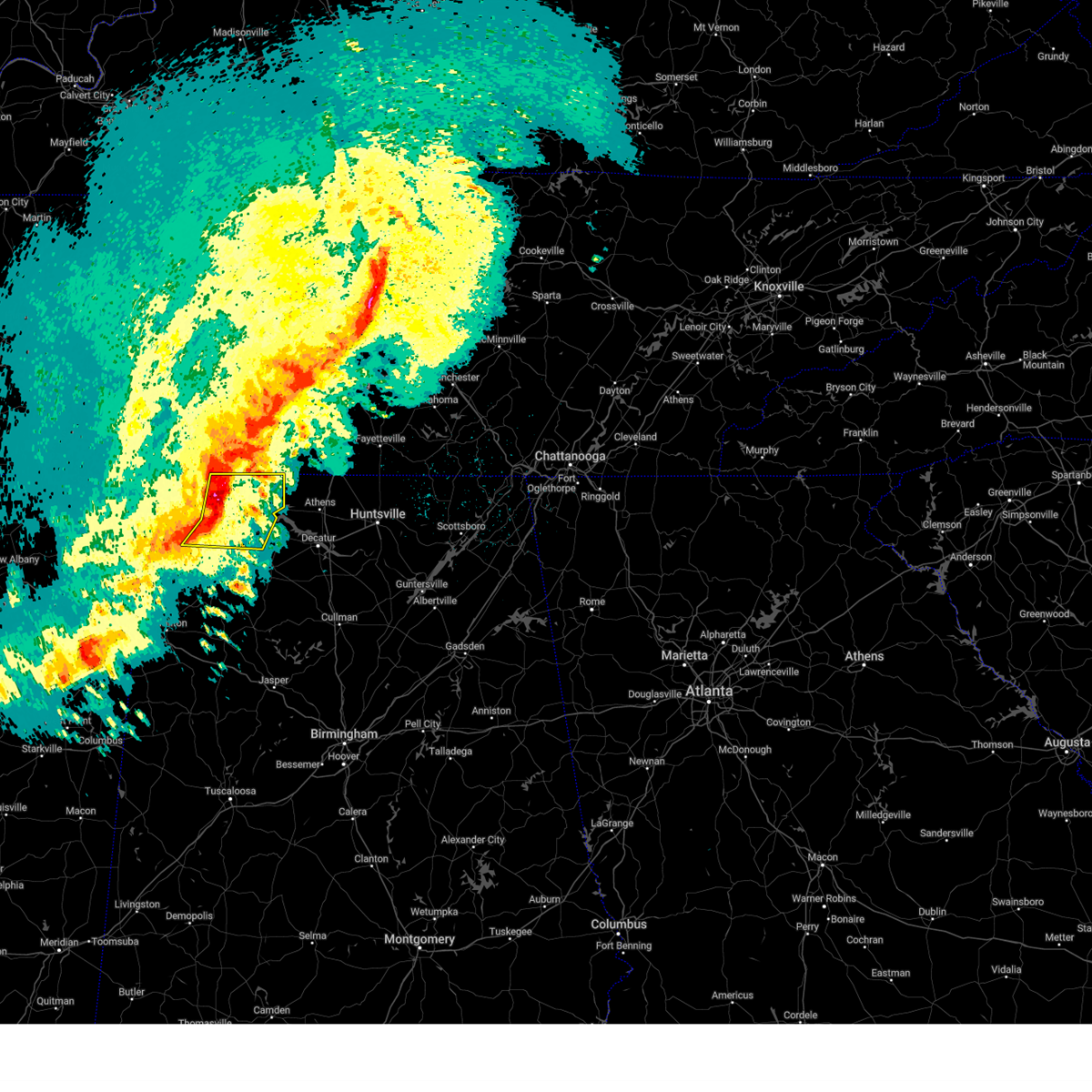 At 1101 pm cdt, severe thunderstorms were located along a line extending from near lexington to leighton to near littleville, moving east at 60 mph (radar indicated). Hazards include 60 mph wind gusts and half dollar size hail. Hail damage to vehicles is expected. expect wind damage to roofs, siding, and trees. Locations impacted include, florence, muscle shoals, sheffield, tuscumbia, rogersville, killen, town creek, littleville, lexington and leighton. At 1101 pm cdt, severe thunderstorms were located along a line extending from near lexington to leighton to near littleville, moving east at 60 mph (radar indicated). Hazards include 60 mph wind gusts and half dollar size hail. Hail damage to vehicles is expected. expect wind damage to roofs, siding, and trees. Locations impacted include, florence, muscle shoals, sheffield, tuscumbia, rogersville, killen, town creek, littleville, lexington and leighton.
|
| 3/24/2023 11:01 PM CDT | Muscle shoals asos (kmsl) reported a gust of 57 kt or 66 mp in colbert county AL, 1 miles W of Muscle Shoals, AL |
| 3/24/2023 10:58 PM CDT |
 At 1058 pm cdt, a severe thunderstorm capable of producing a tornado was located near st. florian, or near florence, moving east at 60 mph (radar indicated rotation). Hazards include tornado and half dollar size hail. Flying debris will be dangerous to those caught without shelter. mobile homes will be damaged or destroyed. damage to roofs, windows, and vehicles will occur. Tree damage is likely. At 1058 pm cdt, a severe thunderstorm capable of producing a tornado was located near st. florian, or near florence, moving east at 60 mph (radar indicated rotation). Hazards include tornado and half dollar size hail. Flying debris will be dangerous to those caught without shelter. mobile homes will be damaged or destroyed. damage to roofs, windows, and vehicles will occur. Tree damage is likely.
|
| 3/24/2023 10:51 PM CDT |
 At 1050 pm cdt, severe thunderstorms were located along a line extending from near underwood-petersville to tuscumbia to crooked oak, moving east at 60 mph (radar indicated). Hazards include 60 mph wind gusts and half dollar size hail. Hail damage to vehicles is expected. expect wind damage to roofs, siding, and trees. Locations impacted include, florence, muscle shoals, russellville, sheffield, tuscumbia, rogersville, killen, town creek, littleville and lexington. At 1050 pm cdt, severe thunderstorms were located along a line extending from near underwood-petersville to tuscumbia to crooked oak, moving east at 60 mph (radar indicated). Hazards include 60 mph wind gusts and half dollar size hail. Hail damage to vehicles is expected. expect wind damage to roofs, siding, and trees. Locations impacted include, florence, muscle shoals, russellville, sheffield, tuscumbia, rogersville, killen, town creek, littleville and lexington.
|
| 3/24/2023 10:48 PM CDT |
 At 1048 pm cdt, a severe thunderstorm capable of producing a tornado was located near florence, moving northeast at 55 mph (radar indicated rotation). Hazards include tornado and half dollar size hail. Flying debris will be dangerous to those caught without shelter. mobile homes will be damaged or destroyed. damage to roofs, windows, and vehicles will occur. tree damage is likely. locations impacted include, florence, muscle shoals, sheffield, tuscumbia, killen, st. Florian, underwood-petersville, oakland, center star and pride landing. At 1048 pm cdt, a severe thunderstorm capable of producing a tornado was located near florence, moving northeast at 55 mph (radar indicated rotation). Hazards include tornado and half dollar size hail. Flying debris will be dangerous to those caught without shelter. mobile homes will be damaged or destroyed. damage to roofs, windows, and vehicles will occur. tree damage is likely. locations impacted include, florence, muscle shoals, sheffield, tuscumbia, killen, st. Florian, underwood-petersville, oakland, center star and pride landing.
|
| 3/24/2023 10:43 PM CDT |
 At 1042 pm cdt, a severe thunderstorm capable of producing a tornado was located near cherokee, or 9 miles west of sheffield, moving northeast at 60 mph (radar indicated rotation). Hazards include tornado and half dollar size hail. Flying debris will be dangerous to those caught without shelter. mobile homes will be damaged or destroyed. damage to roofs, windows, and vehicles will occur. tree damage is likely. locations impacted include, florence, muscle shoals, sheffield, tuscumbia, killen, cherokee, st. Florian, underwood-petersville, barton and oakland. At 1042 pm cdt, a severe thunderstorm capable of producing a tornado was located near cherokee, or 9 miles west of sheffield, moving northeast at 60 mph (radar indicated rotation). Hazards include tornado and half dollar size hail. Flying debris will be dangerous to those caught without shelter. mobile homes will be damaged or destroyed. damage to roofs, windows, and vehicles will occur. tree damage is likely. locations impacted include, florence, muscle shoals, sheffield, tuscumbia, killen, cherokee, st. Florian, underwood-petersville, barton and oakland.
|
| 3/24/2023 10:41 PM CDT |
 At 1040 pm cdt, severe thunderstorms were located along a line extending from underwood-petersville to barton to 6 miles northeast of red bay, moving east at 55 mph (radar indicated). Hazards include 60 mph wind gusts and half dollar size hail. Hail damage to vehicles is expected. Expect wind damage to roofs, siding, and trees. At 1040 pm cdt, severe thunderstorms were located along a line extending from underwood-petersville to barton to 6 miles northeast of red bay, moving east at 55 mph (radar indicated). Hazards include 60 mph wind gusts and half dollar size hail. Hail damage to vehicles is expected. Expect wind damage to roofs, siding, and trees.
|
| 3/24/2023 10:32 PM CDT |
 At 1030 pm cdt, severe thunderstorms were located along a line extending from near cloverdale to near cherokee to near red bay, moving east at 45 mph (radar indicated). Hazards include 60 mph wind gusts and half dollar size hail. Hail damage to vehicles is expected. expect wind damage to roofs, siding, and trees. Locations impacted include, florence, muscle shoals, russellville, sheffield, tuscumbia, red bay, killen, cherokee, littleville and leighton. At 1030 pm cdt, severe thunderstorms were located along a line extending from near cloverdale to near cherokee to near red bay, moving east at 45 mph (radar indicated). Hazards include 60 mph wind gusts and half dollar size hail. Hail damage to vehicles is expected. expect wind damage to roofs, siding, and trees. Locations impacted include, florence, muscle shoals, russellville, sheffield, tuscumbia, red bay, killen, cherokee, littleville and leighton.
|
| 3/24/2023 10:29 PM CDT |
 At 1028 pm cdt, a severe thunderstorm capable of producing a tornado was located near cherokee, or near allsboro, moving northeast at 60 mph (radar indicated rotation). Hazards include tornado and half dollar size hail. Flying debris will be dangerous to those caught without shelter. mobile homes will be damaged or destroyed. damage to roofs, windows, and vehicles will occur. tree damage is likely. locations impacted include, florence, muscle shoals, sheffield, tuscumbia, killen, cherokee, st. Florian, underwood-petersville, malone and posey loop. At 1028 pm cdt, a severe thunderstorm capable of producing a tornado was located near cherokee, or near allsboro, moving northeast at 60 mph (radar indicated rotation). Hazards include tornado and half dollar size hail. Flying debris will be dangerous to those caught without shelter. mobile homes will be damaged or destroyed. damage to roofs, windows, and vehicles will occur. tree damage is likely. locations impacted include, florence, muscle shoals, sheffield, tuscumbia, killen, cherokee, st. Florian, underwood-petersville, malone and posey loop.
|
| 3/24/2023 10:20 PM CDT |
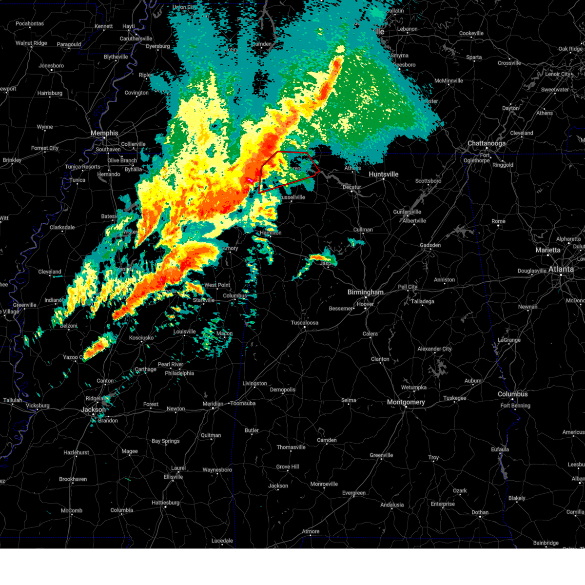 At 1019 pm cdt, a severe thunderstorm capable of producing a tornado was located near midway, or near tishomingo state park, moving northeast at 60 mph (radar indicated rotation). Hazards include tornado and half dollar size hail. Flying debris will be dangerous to those caught without shelter. mobile homes will be damaged or destroyed. damage to roofs, windows, and vehicles will occur. tree damage is likely. this dangerous storm will be near, cherokee around 1035 pm cdt. florence around 1050 pm cdt. st. florian and underwood-petersville around 1055 pm cdt. Other locations impacted by this tornadic thunderstorm include malone, posey loop, northwest alabama regional airport, mt hester, allsboro, maud, wright, barton, oakland and red rock. At 1019 pm cdt, a severe thunderstorm capable of producing a tornado was located near midway, or near tishomingo state park, moving northeast at 60 mph (radar indicated rotation). Hazards include tornado and half dollar size hail. Flying debris will be dangerous to those caught without shelter. mobile homes will be damaged or destroyed. damage to roofs, windows, and vehicles will occur. tree damage is likely. this dangerous storm will be near, cherokee around 1035 pm cdt. florence around 1050 pm cdt. st. florian and underwood-petersville around 1055 pm cdt. Other locations impacted by this tornadic thunderstorm include malone, posey loop, northwest alabama regional airport, mt hester, allsboro, maud, wright, barton, oakland and red rock.
|
| 3/24/2023 10:14 PM CDT |
 At 1013 pm cdt, severe thunderstorms were located along a line extending from near waterloo to near iuka to near tishomingo to near belmont, moving east at 60 mph (radar indicated). Hazards include 60 mph wind gusts and quarter size hail. Hail damage to vehicles is expected. expect wind damage to roofs, siding, and trees. Locations impacted include, florence, muscle shoals, russellville, sheffield, tuscumbia, red bay, killen, cherokee, littleville and leighton. At 1013 pm cdt, severe thunderstorms were located along a line extending from near waterloo to near iuka to near tishomingo to near belmont, moving east at 60 mph (radar indicated). Hazards include 60 mph wind gusts and quarter size hail. Hail damage to vehicles is expected. expect wind damage to roofs, siding, and trees. Locations impacted include, florence, muscle shoals, russellville, sheffield, tuscumbia, red bay, killen, cherokee, littleville and leighton.
|
| 3/24/2023 10:05 PM CDT |
 At 1004 pm cdt, severe thunderstorms were located along a line extending from near waterloo to midway to burton, moving east at 50 mph (radar indicated). Hazards include 60 mph wind gusts and quarter size hail. Hail damage to vehicles is expected. Expect wind damage to roofs, siding, and trees. At 1004 pm cdt, severe thunderstorms were located along a line extending from near waterloo to midway to burton, moving east at 50 mph (radar indicated). Hazards include 60 mph wind gusts and quarter size hail. Hail damage to vehicles is expected. Expect wind damage to roofs, siding, and trees.
|
| 3/3/2023 10:34 AM CST | Ksml reports a wind gust of 52 k in colbert county AL, 1 miles W of Muscle Shoals, AL |
| 3/3/2023 10:29 AM CST |
 At 1028 am cst, severe thunderstorms were located along a line extending from near lexington to near lake buttahatchee, moving northeast at 70 mph. there is widespread tree damage and powerlines down with this line of storms (radar indicated). Hazards include 60 mph wind gusts. expect damage to roofs, siding, and trees At 1028 am cst, severe thunderstorms were located along a line extending from near lexington to near lake buttahatchee, moving northeast at 70 mph. there is widespread tree damage and powerlines down with this line of storms (radar indicated). Hazards include 60 mph wind gusts. expect damage to roofs, siding, and trees
|
| 3/3/2023 10:22 AM CST |
 At 1021 am cst, severe thunderstorms were located along a line extending from near waynesboro to near belgreen, moving northeast at 60 mph. this storm has a history of producing wind damage and power outages (radar indicated). Hazards include 60 mph wind gusts. Expect damage to roofs, siding, and trees. Locations impacted include, florence, muscle shoals, russellville, sheffield, tuscumbia, phil campbell, killen, town creek, littleville and lexington. At 1021 am cst, severe thunderstorms were located along a line extending from near waynesboro to near belgreen, moving northeast at 60 mph. this storm has a history of producing wind damage and power outages (radar indicated). Hazards include 60 mph wind gusts. Expect damage to roofs, siding, and trees. Locations impacted include, florence, muscle shoals, russellville, sheffield, tuscumbia, phil campbell, killen, town creek, littleville and lexington.
|
| 3/3/2023 10:06 AM CST |
 At 1005 am cst, severe thunderstorms were located along a line extending from 8 miles southeast of olive hill to 10 miles southeast of red bay, moving northeast at 60 mph. this line of storms has a history of producing wind damage in mississippi (radar indicated). Hazards include 60 mph wind gusts. Expect damage to roofs, siding, and trees. Locations impacted include, florence, muscle shoals, russellville, sheffield, tuscumbia, phil campbell, killen, town creek, cherokee and littleville. At 1005 am cst, severe thunderstorms were located along a line extending from 8 miles southeast of olive hill to 10 miles southeast of red bay, moving northeast at 60 mph. this line of storms has a history of producing wind damage in mississippi (radar indicated). Hazards include 60 mph wind gusts. Expect damage to roofs, siding, and trees. Locations impacted include, florence, muscle shoals, russellville, sheffield, tuscumbia, phil campbell, killen, town creek, cherokee and littleville.
|
| 3/3/2023 9:27 AM CST |
 At 926 am cst, severe thunderstorms were located along a line extending from glen to near amory, moving northeast at 60 mph (radar indicated). Hazards include 60 mph wind gusts. expect damage to roofs, siding, and trees At 926 am cst, severe thunderstorms were located along a line extending from glen to near amory, moving northeast at 60 mph (radar indicated). Hazards include 60 mph wind gusts. expect damage to roofs, siding, and trees
|
| 3/1/2023 8:42 PM CST |
 At 842 pm cst, severe thunderstorms were located along a line extending from near loretto to near killen to near leighton, moving east at 45 mph (radar indicated). Hazards include 60 mph wind gusts and quarter size hail. Hail damage to vehicles is expected. expect wind damage to roofs, siding, and trees. locations impacted include, florence, muscle shoals, tuscumbia, rogersville, killen, town creek, lexington, leighton, st. Florian and anderson. At 842 pm cst, severe thunderstorms were located along a line extending from near loretto to near killen to near leighton, moving east at 45 mph (radar indicated). Hazards include 60 mph wind gusts and quarter size hail. Hail damage to vehicles is expected. expect wind damage to roofs, siding, and trees. locations impacted include, florence, muscle shoals, tuscumbia, rogersville, killen, town creek, lexington, leighton, st. Florian and anderson.
|
| 3/1/2023 8:28 PM CST |
 At 827 pm cst, severe thunderstorms were located along a line extending from st. florian to florence to tuscumbia, moving east at 45 mph (radar indicated). Hazards include 60 mph wind gusts and quarter size hail. Hail damage to vehicles is expected. Expect wind damage to roofs, siding, and trees. At 827 pm cst, severe thunderstorms were located along a line extending from st. florian to florence to tuscumbia, moving east at 45 mph (radar indicated). Hazards include 60 mph wind gusts and quarter size hail. Hail damage to vehicles is expected. Expect wind damage to roofs, siding, and trees.
|
| 3/1/2023 8:21 PM CST |
 The national weather service in huntsville alabama has issued a * severe thunderstorm warning for. lauderdale county in northwestern alabama. southeastern colbert county in northwestern alabama. northwestern lawrence county in northwestern alabama. Until 845 pm cst. The national weather service in huntsville alabama has issued a * severe thunderstorm warning for. lauderdale county in northwestern alabama. southeastern colbert county in northwestern alabama. northwestern lawrence county in northwestern alabama. Until 845 pm cst.
|
| 3/1/2023 8:09 PM CST |
 At 809 pm cst, a severe thunderstorm capable of producing a tornado was located over cherokee, or 13 miles west of sheffield, moving east at 40 mph (radar indicated rotation). Hazards include tornado and quarter size hail. Flying debris will be dangerous to those caught without shelter. mobile homes will be damaged or destroyed. damage to roofs, windows, and vehicles will occur. tree damage is likely. this dangerous storm will be near, tuscumbia around 830 pm cst. florence, muscle shoals, sheffield and underwood-petersville around 835 pm cst. st. florian around 840 pm cst. Other locations impacted by this tornadic thunderstorm include malone, pride landing, zip city, mt hester, margerum, wright, barton, oakland and threet. At 809 pm cst, a severe thunderstorm capable of producing a tornado was located over cherokee, or 13 miles west of sheffield, moving east at 40 mph (radar indicated rotation). Hazards include tornado and quarter size hail. Flying debris will be dangerous to those caught without shelter. mobile homes will be damaged or destroyed. damage to roofs, windows, and vehicles will occur. tree damage is likely. this dangerous storm will be near, tuscumbia around 830 pm cst. florence, muscle shoals, sheffield and underwood-petersville around 835 pm cst. st. florian around 840 pm cst. Other locations impacted by this tornadic thunderstorm include malone, pride landing, zip city, mt hester, margerum, wright, barton, oakland and threet.
|
| 3/1/2023 7:53 PM CST |
 At 753 pm cst, a severe thunderstorm capable of producing a tornado was located near iuka, moving east at 55 mph (radar indicated rotation). Hazards include tornado and quarter size hail. Flying debris will be dangerous to those caught without shelter. mobile homes will be damaged or destroyed. damage to roofs, windows, and vehicles will occur. tree damage is likely. this dangerous storm will be near, cherokee around 805 pm cst. sheffield and tuscumbia around 820 pm cst. florence, muscle shoals, st. florian and underwood-petersville around 825 pm cst. Other locations impacted by this tornadic thunderstorm include malone, pride landing, zip city, threet, mt hester, margerum, riverton, wright, barton and oakland. At 753 pm cst, a severe thunderstorm capable of producing a tornado was located near iuka, moving east at 55 mph (radar indicated rotation). Hazards include tornado and quarter size hail. Flying debris will be dangerous to those caught without shelter. mobile homes will be damaged or destroyed. damage to roofs, windows, and vehicles will occur. tree damage is likely. this dangerous storm will be near, cherokee around 805 pm cst. sheffield and tuscumbia around 820 pm cst. florence, muscle shoals, st. florian and underwood-petersville around 825 pm cst. Other locations impacted by this tornadic thunderstorm include malone, pride landing, zip city, threet, mt hester, margerum, riverton, wright, barton and oakland.
|
| 1/3/2023 11:10 AM CST |
 At 1110 am cst, a severe thunderstorm was located near littleville, or near tuscumbia, moving east at 40 mph (radar indicated). Hazards include 60 mph wind gusts and quarter size hail. Hail damage to vehicles is expected. expect wind damage to roofs, siding, and trees. Locations impacted include, muscle shoals, russellville, sheffield, tuscumbia, town creek, littleville, leighton, northwest alabama regional airport, new bethel and la grange. At 1110 am cst, a severe thunderstorm was located near littleville, or near tuscumbia, moving east at 40 mph (radar indicated). Hazards include 60 mph wind gusts and quarter size hail. Hail damage to vehicles is expected. expect wind damage to roofs, siding, and trees. Locations impacted include, muscle shoals, russellville, sheffield, tuscumbia, town creek, littleville, leighton, northwest alabama regional airport, new bethel and la grange.
|
| 1/3/2023 10:58 AM CST |
 At 1057 am cst, a severe thunderstorm was located 7 miles west of littleville, or 8 miles southwest of tuscumbia, moving east at 40 mph (radar indicated). Hazards include 60 mph wind gusts and quarter size hail. Hail damage to vehicles is expected. Expect wind damage to roofs, siding, and trees. At 1057 am cst, a severe thunderstorm was located 7 miles west of littleville, or 8 miles southwest of tuscumbia, moving east at 40 mph (radar indicated). Hazards include 60 mph wind gusts and quarter size hail. Hail damage to vehicles is expected. Expect wind damage to roofs, siding, and trees.
|
| 1/3/2023 10:41 AM CST |
 At 1040 am cst, severe thunderstorms were located along a line extending from near cherokee to 7 miles east of tishomingo state park to near red bay, moving east at 45 mph (radar indicated). Hazards include 60 mph wind gusts. Expect damage to roofs, siding, and trees. Locations impacted include, florence, muscle shoals, russellville, sheffield, tuscumbia, red bay, phil campbell, cherokee, littleville and belgreen. At 1040 am cst, severe thunderstorms were located along a line extending from near cherokee to 7 miles east of tishomingo state park to near red bay, moving east at 45 mph (radar indicated). Hazards include 60 mph wind gusts. Expect damage to roofs, siding, and trees. Locations impacted include, florence, muscle shoals, russellville, sheffield, tuscumbia, red bay, phil campbell, cherokee, littleville and belgreen.
|
| 1/3/2023 10:14 AM CST |
 At 1013 am cst, severe thunderstorms were located along a line extending from near midway to 6 miles south of burton to near fairview, moving east at 45 mph (radar indicated). Hazards include 60 mph wind gusts. expect damage to roofs, siding, and trees At 1013 am cst, severe thunderstorms were located along a line extending from near midway to 6 miles south of burton to near fairview, moving east at 45 mph (radar indicated). Hazards include 60 mph wind gusts. expect damage to roofs, siding, and trees
|
| 11/29/2022 11:36 PM CST |
 The severe thunderstorm warning for southeastern lauderdale, southeastern colbert, northeastern franklin and northwestern lawrence counties will expire at 1145 pm cst, the storm which prompted the warning has weakened below severe limits, and no longer poses an immediate threat to life or property. therefore, the warning will be allowed to expire. however small hail, gusty winds and heavy rain are still possible with this thunderstorm. The severe thunderstorm warning for southeastern lauderdale, southeastern colbert, northeastern franklin and northwestern lawrence counties will expire at 1145 pm cst, the storm which prompted the warning has weakened below severe limits, and no longer poses an immediate threat to life or property. therefore, the warning will be allowed to expire. however small hail, gusty winds and heavy rain are still possible with this thunderstorm.
|
| 11/29/2022 11:25 PM CST |
 At 1125 pm cst, a severe thunderstorm was located near littleville, or 7 miles southwest of tuscumbia, moving east at 55 mph (radar indicated). Hazards include 60 mph wind gusts. Expect damage to roofs, siding, and trees. locations impacted include, florence, muscle shoals, russellville, sheffield, tuscumbia, killen, town creek, littleville, leighton and st. florian. hail threat, radar indicated max hail size, <. 75 in wind threat, radar indicated max wind gust, 60 mph. At 1125 pm cst, a severe thunderstorm was located near littleville, or 7 miles southwest of tuscumbia, moving east at 55 mph (radar indicated). Hazards include 60 mph wind gusts. Expect damage to roofs, siding, and trees. locations impacted include, florence, muscle shoals, russellville, sheffield, tuscumbia, killen, town creek, littleville, leighton and st. florian. hail threat, radar indicated max hail size, <. 75 in wind threat, radar indicated max wind gust, 60 mph.
|
| 11/29/2022 11:13 PM CST |
 At 1113 pm cst, a severe thunderstorm was located 10 miles south of cherokee, moving east at 45 mph (radar indicated). Hazards include 60 mph wind gusts. expect damage to roofs, siding, and trees At 1113 pm cst, a severe thunderstorm was located 10 miles south of cherokee, moving east at 45 mph (radar indicated). Hazards include 60 mph wind gusts. expect damage to roofs, siding, and trees
|
| 11/29/2022 2:53 PM CST |
 The severe thunderstorm warning for central limestone, southeastern lauderdale, southeastern colbert and northern lawrence counties will expire at 300 pm cst, the storm which prompted the warning has weakened below severe limits, and has exited the warned area. therefore, the warning will be allowed to expire. The severe thunderstorm warning for central limestone, southeastern lauderdale, southeastern colbert and northern lawrence counties will expire at 300 pm cst, the storm which prompted the warning has weakened below severe limits, and has exited the warned area. therefore, the warning will be allowed to expire.
|
| 11/29/2022 2:24 PM CST |
 The severe thunderstorm warning for southeastern colbert and northeastern franklin counties will expire at 230 pm cst, the storm which prompted the warning has moved out of the area. therefore, the warning will be allowed to expire. however heavy rain is still possible in the wake of this thunderstorm. The severe thunderstorm warning for southeastern colbert and northeastern franklin counties will expire at 230 pm cst, the storm which prompted the warning has moved out of the area. therefore, the warning will be allowed to expire. however heavy rain is still possible in the wake of this thunderstorm.
|
| 11/29/2022 2:16 PM CST |
 At 215 pm cst, a severe thunderstorm was located near leighton, or 8 miles southeast of muscle shoals, moving east at 55 mph (radar indicated). Hazards include 60 mph wind gusts and half dollar size hail. Hail damage to vehicles is expected. Expect wind damage to roofs, siding, and trees. At 215 pm cst, a severe thunderstorm was located near leighton, or 8 miles southeast of muscle shoals, moving east at 55 mph (radar indicated). Hazards include 60 mph wind gusts and half dollar size hail. Hail damage to vehicles is expected. Expect wind damage to roofs, siding, and trees.
|
| 11/29/2022 1:56 PM CST |
 At 156 pm cst, a severe thunderstorm was located 7 miles north of belgreen, or 8 miles northwest of russellville, moving east at 45 mph (radar indicated). Hazards include 60 mph wind gusts and half dollar size hail. Hail damage to vehicles is expected. Expect wind damage to roofs, siding, and trees. At 156 pm cst, a severe thunderstorm was located 7 miles north of belgreen, or 8 miles northwest of russellville, moving east at 45 mph (radar indicated). Hazards include 60 mph wind gusts and half dollar size hail. Hail damage to vehicles is expected. Expect wind damage to roofs, siding, and trees.
|
| 11/29/2022 1:50 PM CST |
 The severe thunderstorm warning for eastern lauderdale and east central colbert counties will expire at 200 pm cst, the storm which prompted the warning has weakened below severe limits, and no longer poses an immediate threat to life or property. therefore, the warning will be allowed to expire. however small hail is still possible with this thunderstorm. The severe thunderstorm warning for eastern lauderdale and east central colbert counties will expire at 200 pm cst, the storm which prompted the warning has weakened below severe limits, and no longer poses an immediate threat to life or property. therefore, the warning will be allowed to expire. however small hail is still possible with this thunderstorm.
|
| 11/29/2022 1:28 PM CST |
 The severe thunderstorm warning for central lauderdale and central colbert counties will expire at 130 pm cst, the severe thunderstorm which prompted the warning has moved out of the originally warned area. therefore, the warning will be allowed to expire and a new one has been issued for locations to the northeast of this location. The severe thunderstorm warning for central lauderdale and central colbert counties will expire at 130 pm cst, the severe thunderstorm which prompted the warning has moved out of the originally warned area. therefore, the warning will be allowed to expire and a new one has been issued for locations to the northeast of this location.
|
| 11/29/2022 1:27 PM CST |
 At 126 pm cst, a severe thunderstorm was located over st. florian, or near florence, moving northeast at 40 mph (trained weather spotters). Hazards include 60 mph wind gusts and half dollar size hail. Hail damage to vehicles is expected. Expect wind damage to roofs, siding, and trees. At 126 pm cst, a severe thunderstorm was located over st. florian, or near florence, moving northeast at 40 mph (trained weather spotters). Hazards include 60 mph wind gusts and half dollar size hail. Hail damage to vehicles is expected. Expect wind damage to roofs, siding, and trees.
|
| 11/29/2022 1:01 PM CST |
 At 101 pm cst, a severe thunderstorm was located near cherokee, or 12 miles west of tuscumbia, moving northeast at 55 mph (emergency management). Hazards include ping pong ball size hail. People and animals outdoors will be injured. Expect damage to roofs, siding, windows, and vehicles. At 101 pm cst, a severe thunderstorm was located near cherokee, or 12 miles west of tuscumbia, moving northeast at 55 mph (emergency management). Hazards include ping pong ball size hail. People and animals outdoors will be injured. Expect damage to roofs, siding, windows, and vehicles.
|
| 7/9/2022 4:14 PM CDT | A tree was reported down at the intersection of pepi drive and 2nd stree in colbert county AL, 0.9 miles SSW of Muscle Shoals, AL |
| 7/9/2022 4:12 PM CDT | A tree was reported down at the intersection of reservation road and ccc camp roa in colbert county AL, 2.5 miles SSE of Muscle Shoals, AL |
| 7/9/2022 4:11 PM CDT | Corrects previous tstm wnd dmg report from 2 nnw muscle shoals. a tree was reported down at the intersection of reservation road and ccc camp roa in colbert county AL, 2.5 miles SSE of Muscle Shoals, AL |
| 5/25/2022 4:42 PM CDT |
 The severe thunderstorm warning for eastern lauderdale, southeastern colbert and northern lawrence counties will expire at 445 pm cdt, the storms which prompted the warning have weakened below severe limits, and no longer pose an immediate threat to life or property. therefore, the warning will be allowed to expire. however gusty winds are still possible with these thunderstorms. The severe thunderstorm warning for eastern lauderdale, southeastern colbert and northern lawrence counties will expire at 445 pm cdt, the storms which prompted the warning have weakened below severe limits, and no longer pose an immediate threat to life or property. therefore, the warning will be allowed to expire. however gusty winds are still possible with these thunderstorms.
|
| 5/25/2022 4:29 PM CDT |
 At 428 pm cdt, severe thunderstorms were located along a line extending from 7 miles north of underwood-petersville to 7 miles south of leighton, moving east at 45 mph (radar indicated). Hazards include 60 mph wind gusts and penny size hail. Expect damage to roofs, siding, and trees. locations impacted include, florence, muscle shoals, sheffield, rogersville, killen, town creek, lexington, leighton, courtland and st. florian. hail threat, radar indicated max hail size, 0. 75 in wind threat, radar indicated max wind gust, 60 mph. At 428 pm cdt, severe thunderstorms were located along a line extending from 7 miles north of underwood-petersville to 7 miles south of leighton, moving east at 45 mph (radar indicated). Hazards include 60 mph wind gusts and penny size hail. Expect damage to roofs, siding, and trees. locations impacted include, florence, muscle shoals, sheffield, rogersville, killen, town creek, lexington, leighton, courtland and st. florian. hail threat, radar indicated max hail size, 0. 75 in wind threat, radar indicated max wind gust, 60 mph.
|
| 5/25/2022 4:13 PM CDT |
 At 413 pm cdt, severe thunderstorms were located along a line extending from 10 miles southeast of walnut grove to 7 miles southeast of russellville, moving east at 50 mph (radar indicated). Hazards include 60 mph wind gusts and penny size hail. expect damage to roofs, siding, and trees At 413 pm cdt, severe thunderstorms were located along a line extending from 10 miles southeast of walnut grove to 7 miles southeast of russellville, moving east at 50 mph (radar indicated). Hazards include 60 mph wind gusts and penny size hail. expect damage to roofs, siding, and trees
|
| 5/25/2022 4:00 PM CDT |
 At 400 pm cdt, severe thunderstorms were located along a line extending from near cherokee to near belgreen, moving northeast at 40 mph (radar indicated). Hazards include 60 mph wind gusts and penny size hail. Expect damage to roofs, siding, and trees. locations impacted include, florence, muscle shoals, russellville, sheffield, tuscumbia, phil campbell, cherokee, littleville, leighton and st. florian. hail threat, radar indicated max hail size, 0. 75 in wind threat, radar indicated max wind gust, 60 mph. At 400 pm cdt, severe thunderstorms were located along a line extending from near cherokee to near belgreen, moving northeast at 40 mph (radar indicated). Hazards include 60 mph wind gusts and penny size hail. Expect damage to roofs, siding, and trees. locations impacted include, florence, muscle shoals, russellville, sheffield, tuscumbia, phil campbell, cherokee, littleville, leighton and st. florian. hail threat, radar indicated max hail size, 0. 75 in wind threat, radar indicated max wind gust, 60 mph.
|
| 5/25/2022 3:48 PM CDT |
 At 347 pm cdt, severe thunderstorms were located along a line extending from 7 miles east of tishomingo state park to 7 miles southwest of belgreen, moving northeast at 40 mph (radar indicated). Hazards include 60 mph wind gusts and penny size hail. expect damage to roofs, siding, and trees At 347 pm cdt, severe thunderstorms were located along a line extending from 7 miles east of tishomingo state park to 7 miles southwest of belgreen, moving northeast at 40 mph (radar indicated). Hazards include 60 mph wind gusts and penny size hail. expect damage to roofs, siding, and trees
|
| 4/16/2022 1:19 AM CDT |
 At 118 am cdt, severe thunderstorms were located along a line extending from near st. florian to 6 miles southwest of tuscumbia to near cherokee, moving southeast at 45 mph (radar indicated). Hazards include 60 mph wind gusts and penny size hail. Expect damage to roofs, siding, and trees. locations impacted include, florence, muscle shoals, sheffield, tuscumbia, killen, cherokee, st. florian, underwood-petersville, posey loop and northwest alabama regional airport. hail threat, radar indicated max hail size, 0. 75 in wind threat, radar indicated max wind gust, 60 mph. At 118 am cdt, severe thunderstorms were located along a line extending from near st. florian to 6 miles southwest of tuscumbia to near cherokee, moving southeast at 45 mph (radar indicated). Hazards include 60 mph wind gusts and penny size hail. Expect damage to roofs, siding, and trees. locations impacted include, florence, muscle shoals, sheffield, tuscumbia, killen, cherokee, st. florian, underwood-petersville, posey loop and northwest alabama regional airport. hail threat, radar indicated max hail size, 0. 75 in wind threat, radar indicated max wind gust, 60 mph.
|
| 4/16/2022 1:11 AM CDT |
 At 110 am cdt, severe thunderstorms were located along a line extending from near st. florian to sheffield to near cherokee, moving southeast at 50 mph (radar indicated). Hazards include 60 mph wind gusts and penny size hail. Expect damage to roofs, siding, and trees. locations impacted include, florence, muscle shoals, sheffield, tuscumbia, killen, cherokee, lexington, st. florian, underwood-petersville and green hill. hail threat, radar indicated max hail size, 0. 75 in wind threat, radar indicated max wind gust, 60 mph. At 110 am cdt, severe thunderstorms were located along a line extending from near st. florian to sheffield to near cherokee, moving southeast at 50 mph (radar indicated). Hazards include 60 mph wind gusts and penny size hail. Expect damage to roofs, siding, and trees. locations impacted include, florence, muscle shoals, sheffield, tuscumbia, killen, cherokee, lexington, st. florian, underwood-petersville and green hill. hail threat, radar indicated max hail size, 0. 75 in wind threat, radar indicated max wind gust, 60 mph.
|
| 4/16/2022 1:02 AM CDT |
 At 101 am cdt, severe thunderstorms were located along a line extending from cloverdale to cherokee, moving east at 50 mph (radar indicated). Hazards include 60 mph wind gusts and penny size hail. Expect damage to roofs, siding, and trees. locations impacted include, florence, muscle shoals, sheffield, tuscumbia, killen, cherokee, lexington, st. florian, underwood-petersville and posey loop. hail threat, radar indicated max hail size, 0. 75 in wind threat, radar indicated max wind gust, 60 mph. At 101 am cdt, severe thunderstorms were located along a line extending from cloverdale to cherokee, moving east at 50 mph (radar indicated). Hazards include 60 mph wind gusts and penny size hail. Expect damage to roofs, siding, and trees. locations impacted include, florence, muscle shoals, sheffield, tuscumbia, killen, cherokee, lexington, st. florian, underwood-petersville and posey loop. hail threat, radar indicated max hail size, 0. 75 in wind threat, radar indicated max wind gust, 60 mph.
|
| 4/16/2022 12:43 AM CDT |
 At 1242 am cdt, a severe thunderstorm was located near j p coleman state park, moving east at 45 mph (radar indicated). Hazards include 60 mph wind gusts and penny size hail. expect damage to roofs, siding, and trees At 1242 am cdt, a severe thunderstorm was located near j p coleman state park, moving east at 45 mph (radar indicated). Hazards include 60 mph wind gusts and penny size hail. expect damage to roofs, siding, and trees
|
| 4/13/2022 7:46 PM CDT |
 At 746 pm cdt, severe thunderstorms were located along a line extending from 7 miles southeast of lawrenceburg to near lexington to near leighton to near russellville, moving east at 45 mph (radar indicated). Hazards include 60 mph wind gusts and penny size hail. Expect damage to roofs, siding, and trees. locations impacted include, florence, muscle shoals, russellville, sheffield, tuscumbia, moulton, trinity, rogersville, killen and town creek. hail threat, radar indicated max hail size, 0. 75 in wind threat, radar indicated max wind gust, 60 mph. At 746 pm cdt, severe thunderstorms were located along a line extending from 7 miles southeast of lawrenceburg to near lexington to near leighton to near russellville, moving east at 45 mph (radar indicated). Hazards include 60 mph wind gusts and penny size hail. Expect damage to roofs, siding, and trees. locations impacted include, florence, muscle shoals, russellville, sheffield, tuscumbia, moulton, trinity, rogersville, killen and town creek. hail threat, radar indicated max hail size, 0. 75 in wind threat, radar indicated max wind gust, 60 mph.
|
| 4/13/2022 7:28 PM CDT |
 At 727 pm cdt, severe thunderstorms were located along a line extending from 7 miles northwest of loretto to near underwood-petersville to 6 miles west of tuscumbia to 10 miles northwest of belgreen, moving east at 45 mph (radar indicated). Hazards include 60 mph wind gusts and penny size hail. expect damage to roofs, siding, and trees At 727 pm cdt, severe thunderstorms were located along a line extending from 7 miles northwest of loretto to near underwood-petersville to 6 miles west of tuscumbia to 10 miles northwest of belgreen, moving east at 45 mph (radar indicated). Hazards include 60 mph wind gusts and penny size hail. expect damage to roofs, siding, and trees
|
| 4/13/2022 7:05 PM CDT |
 At 705 pm cdt, severe thunderstorms were located along a line extending from collinwood to 10 miles southeast of walnut grove to 6 miles east of iuka to near midway, moving east at 55 mph (radar indicated). Hazards include 60 mph wind gusts and quarter size hail. Hail damage to vehicles is expected. expect wind damage to roofs, siding, and trees. locations impacted include, florence, muscle shoals, sheffield, tuscumbia, rogersville, killen, town creek, cherokee, lexington and leighton. hail threat, radar indicated max hail size, 1. 00 in wind threat, radar indicated max wind gust, 60 mph. At 705 pm cdt, severe thunderstorms were located along a line extending from collinwood to 10 miles southeast of walnut grove to 6 miles east of iuka to near midway, moving east at 55 mph (radar indicated). Hazards include 60 mph wind gusts and quarter size hail. Hail damage to vehicles is expected. expect wind damage to roofs, siding, and trees. locations impacted include, florence, muscle shoals, sheffield, tuscumbia, rogersville, killen, town creek, cherokee, lexington and leighton. hail threat, radar indicated max hail size, 1. 00 in wind threat, radar indicated max wind gust, 60 mph.
|
| 4/13/2022 6:36 PM CDT |
 At 635 pm cdt, severe thunderstorms were located along a line extending from 6 miles southwest of adamsville to 6 miles northeast of corinth to glen to near hinkle, moving east at 70 mph (radar indicated). Hazards include 60 mph wind gusts and quarter size hail. Hail damage to vehicles is expected. Expect wind damage to roofs, siding, and trees. At 635 pm cdt, severe thunderstorms were located along a line extending from 6 miles southwest of adamsville to 6 miles northeast of corinth to glen to near hinkle, moving east at 70 mph (radar indicated). Hazards include 60 mph wind gusts and quarter size hail. Hail damage to vehicles is expected. Expect wind damage to roofs, siding, and trees.
|
| 3/30/2022 8:58 PM CDT | A tree was reported down at the intersection of wheeler view dr and river roa in colbert county AL, 9.8 miles WSW of Muscle Shoals, AL |
| 3/30/2022 8:39 PM CDT |
 The severe thunderstorm warning for central lauderdale, southeastern colbert and franklin counties will expire at 845 pm cdt, the storms which prompted the warning have moved out of the area. therefore, the warning will be allowed to expire. a tornado watch remains in effect until 100 am cdt for north central and northwestern alabama. The severe thunderstorm warning for central lauderdale, southeastern colbert and franklin counties will expire at 845 pm cdt, the storms which prompted the warning have moved out of the area. therefore, the warning will be allowed to expire. a tornado watch remains in effect until 100 am cdt for north central and northwestern alabama.
|
| 3/30/2022 8:38 PM CDT |
 At 838 pm cdt, severe thunderstorms were located along a line extending from near loretto to near brinn, moving northeast at 55 mph (radar indicated). Hazards include 60 mph wind gusts. expect damage to roofs, siding, and trees At 838 pm cdt, severe thunderstorms were located along a line extending from near loretto to near brinn, moving northeast at 55 mph (radar indicated). Hazards include 60 mph wind gusts. expect damage to roofs, siding, and trees
|
| 3/30/2022 8:13 PM CDT |
 At 813 pm cdt, severe thunderstorms were located along a line extending from 10 miles northeast of waynesboro to near russellville, moving northeast at 40 mph (radar indicated). Hazards include 60 mph wind gusts. Expect damage to roofs, siding, and trees. locations impacted include, florence, muscle shoals, russellville, sheffield, tuscumbia, phil campbell, killen, littleville, leighton and st. florian. hail threat, radar indicated max hail size, <. 75 in wind threat, radar indicated max wind gust, 60 mph. At 813 pm cdt, severe thunderstorms were located along a line extending from 10 miles northeast of waynesboro to near russellville, moving northeast at 40 mph (radar indicated). Hazards include 60 mph wind gusts. Expect damage to roofs, siding, and trees. locations impacted include, florence, muscle shoals, russellville, sheffield, tuscumbia, phil campbell, killen, littleville, leighton and st. florian. hail threat, radar indicated max hail size, <. 75 in wind threat, radar indicated max wind gust, 60 mph.
|
| 3/30/2022 7:42 PM CDT |
 The severe thunderstorm warning for western lauderdale, colbert and franklin counties will expire at 745 pm cdt, the storms which prompted the warning have moved out of the area. therefore, the warning will be allowed to expire. a tornado watch remains in effect until 100 am cdt for northwestern alabama. remember, a severe thunderstorm warning still remains in effect for portions of lauderdale, colbert, and franklin counties until 845 pm cdt. The severe thunderstorm warning for western lauderdale, colbert and franklin counties will expire at 745 pm cdt, the storms which prompted the warning have moved out of the area. therefore, the warning will be allowed to expire. a tornado watch remains in effect until 100 am cdt for northwestern alabama. remember, a severe thunderstorm warning still remains in effect for portions of lauderdale, colbert, and franklin counties until 845 pm cdt.
|
| 3/30/2022 7:40 PM CDT |
 At 740 pm cdt, severe thunderstorms were located along a line extending from 8 miles southeast of olive hill to 6 miles southeast of red bay, moving northeast at 40 mph (radar indicated). Hazards include 60 mph wind gusts. expect damage to roofs, siding, and trees At 740 pm cdt, severe thunderstorms were located along a line extending from 8 miles southeast of olive hill to 6 miles southeast of red bay, moving northeast at 40 mph (radar indicated). Hazards include 60 mph wind gusts. expect damage to roofs, siding, and trees
|
| 3/30/2022 7:14 PM CDT |
 At 714 pm cdt, severe thunderstorms were located along a line extending from 11 miles north of olive hill to 7 miles south of red bay, moving northeast at 60 mph (radar indicated). Hazards include 60 mph wind gusts. Expect damage to roofs, siding, and trees. Locations impacted include, florence, muscle shoals, russellville, sheffield, tuscumbia, red bay, phil campbell, cherokee, underwood-petersville and belgreen. At 714 pm cdt, severe thunderstorms were located along a line extending from 11 miles north of olive hill to 7 miles south of red bay, moving northeast at 60 mph (radar indicated). Hazards include 60 mph wind gusts. Expect damage to roofs, siding, and trees. Locations impacted include, florence, muscle shoals, russellville, sheffield, tuscumbia, red bay, phil campbell, cherokee, underwood-petersville and belgreen.
|
| 3/30/2022 6:47 PM CDT |
 At 646 pm cdt, severe thunderstorms were located along a line extending from near adamsville to near evergreen, moving northeast at 55 mph (radar indicated). Hazards include 60 mph wind gusts. expect damage to roofs, siding, and trees At 646 pm cdt, severe thunderstorms were located along a line extending from near adamsville to near evergreen, moving northeast at 55 mph (radar indicated). Hazards include 60 mph wind gusts. expect damage to roofs, siding, and trees
|
| 3/22/2022 5:23 PM CDT |
 The severe thunderstorm warning for central lauderdale, southeastern colbert, eastern franklin and southwestern lawrence counties will expire at 530 pm cdt, the storms which prompted the warning have moved out of the area. therefore, the warning will be allowed to expire. however gusty winds and heavy rain are still possible with these thunderstorms. a tornado watch remains in effect until 700 pm cdt for northwestern alabama. a tornado watch also remains in effect until 1100 pm cdt for north central alabama. The severe thunderstorm warning for central lauderdale, southeastern colbert, eastern franklin and southwestern lawrence counties will expire at 530 pm cdt, the storms which prompted the warning have moved out of the area. therefore, the warning will be allowed to expire. however gusty winds and heavy rain are still possible with these thunderstorms. a tornado watch remains in effect until 700 pm cdt for northwestern alabama. a tornado watch also remains in effect until 1100 pm cdt for north central alabama.
|
| 3/22/2022 5:00 PM CDT |
 At 500 pm cdt, severe thunderstorms were located along a line extending from 8 miles southeast of olive hill to near leighton, moving northeast at 55 mph (radar indicated). Hazards include 60 mph wind gusts and nickel size hail. Expect damage to roofs, siding, and trees. locations impacted include, florence, muscle shoals, russellville, sheffield, tuscumbia, phil campbell, killen, littleville, leighton and st. Florian. At 500 pm cdt, severe thunderstorms were located along a line extending from 8 miles southeast of olive hill to near leighton, moving northeast at 55 mph (radar indicated). Hazards include 60 mph wind gusts and nickel size hail. Expect damage to roofs, siding, and trees. locations impacted include, florence, muscle shoals, russellville, sheffield, tuscumbia, phil campbell, killen, littleville, leighton and st. Florian.
|
| 3/22/2022 4:48 PM CDT |
 At 448 pm cdt, severe thunderstorms were located along a line extending from 6 miles north of walnut grove to near russellville, moving north at 50 mph (radar indicated). Hazards include 60 mph wind gusts and nickel size hail. Expect damage to roofs, siding, and trees. Locations impacted include, florence, muscle shoals, russellville, sheffield, tuscumbia, phil campbell, killen, cherokee, littleville and leighton. At 448 pm cdt, severe thunderstorms were located along a line extending from 6 miles north of walnut grove to near russellville, moving north at 50 mph (radar indicated). Hazards include 60 mph wind gusts and nickel size hail. Expect damage to roofs, siding, and trees. Locations impacted include, florence, muscle shoals, russellville, sheffield, tuscumbia, phil campbell, killen, cherokee, littleville and leighton.
|
| 3/22/2022 4:27 PM CDT |
 At 426 pm cdt, severe thunderstorms were located along a line extending from near j p coleman state park to near hackleburg, moving north at 50 mph. this has a history of producing 60 mph winds and tree damage (radar indicated). Hazards include 60 mph wind gusts and nickel size hail. expect damage to roofs, siding, and trees At 426 pm cdt, severe thunderstorms were located along a line extending from near j p coleman state park to near hackleburg, moving north at 50 mph. this has a history of producing 60 mph winds and tree damage (radar indicated). Hazards include 60 mph wind gusts and nickel size hail. expect damage to roofs, siding, and trees
|
| 2/22/2022 7:01 PM CST |
 At 701 pm cst, a severe thunderstorm capable of producing a tornado was located near leighton, or 9 miles east of muscle shoals, moving east at 50 mph (radar indicated rotation). Hazards include tornado. Flying debris will be dangerous to those caught without shelter. mobile homes will be damaged or destroyed. damage to roofs, windows, and vehicles will occur. tree damage is likely. this dangerous storm will be near, rogersville around 715 pm cst. Other locations impacted by this tornadic thunderstorm include center star, northwest alabama regional airport, coxey, oliver, whitehead, cairo, mt rozell, ford city, red bank and elgin. At 701 pm cst, a severe thunderstorm capable of producing a tornado was located near leighton, or 9 miles east of muscle shoals, moving east at 50 mph (radar indicated rotation). Hazards include tornado. Flying debris will be dangerous to those caught without shelter. mobile homes will be damaged or destroyed. damage to roofs, windows, and vehicles will occur. tree damage is likely. this dangerous storm will be near, rogersville around 715 pm cst. Other locations impacted by this tornadic thunderstorm include center star, northwest alabama regional airport, coxey, oliver, whitehead, cairo, mt rozell, ford city, red bank and elgin.
|
| 2/22/2022 6:50 PM CST |
 At 650 pm cst, a severe thunderstorm was located over sheffield, moving east at 50 mph (radar indicated). Hazards include 60 mph wind gusts and quarter size hail. Hail damage to vehicles is expected. Expect wind damage to roofs, siding, and trees. At 650 pm cst, a severe thunderstorm was located over sheffield, moving east at 50 mph (radar indicated). Hazards include 60 mph wind gusts and quarter size hail. Hail damage to vehicles is expected. Expect wind damage to roofs, siding, and trees.
|
| 1/1/2022 5:16 PM CST |
 At 516 pm cst, a severe thunderstorm was located over killen, or 10 miles northeast of florence, moving northeast at 50 mph (radar indicated). Hazards include 60 mph wind gusts. Expect damage to roofs, siding, and trees. locations impacted include, florence, muscle shoals, sheffield, tuscumbia, rogersville, killen, lexington, st. florian, underwood-petersville and anderson. hail threat, radar indicated max hail size, <. 75 in wind threat, radar indicated max wind gust, 60 mph. At 516 pm cst, a severe thunderstorm was located over killen, or 10 miles northeast of florence, moving northeast at 50 mph (radar indicated). Hazards include 60 mph wind gusts. Expect damage to roofs, siding, and trees. locations impacted include, florence, muscle shoals, sheffield, tuscumbia, rogersville, killen, lexington, st. florian, underwood-petersville and anderson. hail threat, radar indicated max hail size, <. 75 in wind threat, radar indicated max wind gust, 60 mph.
|
| 1/1/2022 5:05 PM CST | Trees down and some debris in roadway on wilson dam rd at shoals villa trailer par in colbert county AL, 2.1 miles NNE of Muscle Shoals, AL |
| 1/1/2022 4:53 PM CST |
 At 453 pm cst, a severe thunderstorm was located near tuscumbia, moving northeast at 50 mph (radar indicated). Hazards include 60 mph wind gusts. expect damage to roofs, siding, and trees At 453 pm cst, a severe thunderstorm was located near tuscumbia, moving northeast at 50 mph (radar indicated). Hazards include 60 mph wind gusts. expect damage to roofs, siding, and trees
|
| 1/1/2022 3:21 PM CST |
 At 321 pm cst, a severe thunderstorm was located near tuscumbia, moving northeast at 45 mph (radar indicated). Hazards include 60 mph wind gusts and penny size hail. expect damage to roofs, siding, and trees At 321 pm cst, a severe thunderstorm was located near tuscumbia, moving northeast at 45 mph (radar indicated). Hazards include 60 mph wind gusts and penny size hail. expect damage to roofs, siding, and trees
|
| 12/11/2021 6:08 AM CST |
 At 605 am cst, severe thunderstorms were located along a line extending from near lexington to near littleville to 8 miles west of hackleburg, moving east at 30 mph (trained weather spotters reported roof damage and tree damage in the quad cities area with this storm). Hazards include 60 mph wind gusts. Expect damage to roofs, siding, and trees. locations impacted include, decatur, athens, russellville, moulton, trinity, rogersville, ardmore, phil campbell, town creek and littleville. hail threat, radar indicated max hail size, <. 75 in wind threat, radar indicated max wind gust, 60 mph. At 605 am cst, severe thunderstorms were located along a line extending from near lexington to near littleville to 8 miles west of hackleburg, moving east at 30 mph (trained weather spotters reported roof damage and tree damage in the quad cities area with this storm). Hazards include 60 mph wind gusts. Expect damage to roofs, siding, and trees. locations impacted include, decatur, athens, russellville, moulton, trinity, rogersville, ardmore, phil campbell, town creek and littleville. hail threat, radar indicated max hail size, <. 75 in wind threat, radar indicated max wind gust, 60 mph.
|
| 12/11/2021 6:02 AM CST |
 At 601 am cst, severe thunderstorms were located along a line extending from near lexington to near littleville to 8 miles west of hackleburg, moving east at 30 mph (radar indicated). Hazards include 60 mph wind gusts. Expect damage to roofs, siding, and trees. locations impacted include, decatur, athens, russellville, moulton, trinity, rogersville, ardmore, phil campbell, town creek and littleville. hail threat, radar indicated max hail size, <. 75 in wind threat, radar indicated max wind gust, 60 mph. At 601 am cst, severe thunderstorms were located along a line extending from near lexington to near littleville to 8 miles west of hackleburg, moving east at 30 mph (radar indicated). Hazards include 60 mph wind gusts. Expect damage to roofs, siding, and trees. locations impacted include, decatur, athens, russellville, moulton, trinity, rogersville, ardmore, phil campbell, town creek and littleville. hail threat, radar indicated max hail size, <. 75 in wind threat, radar indicated max wind gust, 60 mph.
|
| 12/11/2021 5:50 AM CST |
 At 550 am cst, severe thunderstorms were located along a line extending from lexington to near russellville to 8 miles southeast of red bay, moving east at 35 mph (radar indicated). Hazards include 60 mph wind gusts. expect damage to roofs, siding, and trees At 550 am cst, severe thunderstorms were located along a line extending from lexington to near russellville to 8 miles southeast of red bay, moving east at 35 mph (radar indicated). Hazards include 60 mph wind gusts. expect damage to roofs, siding, and trees
|
| 12/11/2021 5:38 AM CST |
 At 537 am cst, severe thunderstorms were located along a line extending from 6 miles north of st. florian to near red bay, moving southeast at 20 mph (radar indicated). Hazards include 60 mph wind gusts. Expect damage to roofs, siding, and trees. locations impacted include, florence, muscle shoals, russellville, sheffield, tuscumbia, red bay, killen, littleville, lexington and leighton. hail threat, radar indicated max hail size, <. 75 in wind threat, radar indicated max wind gust, 60 mph. At 537 am cst, severe thunderstorms were located along a line extending from 6 miles north of st. florian to near red bay, moving southeast at 20 mph (radar indicated). Hazards include 60 mph wind gusts. Expect damage to roofs, siding, and trees. locations impacted include, florence, muscle shoals, russellville, sheffield, tuscumbia, red bay, killen, littleville, lexington and leighton. hail threat, radar indicated max hail size, <. 75 in wind threat, radar indicated max wind gust, 60 mph.
|
| 12/11/2021 5:27 AM CST |
 At 527 am cst, severe thunderstorms were located along a line extending from 7 miles north of st. florian to near red bay, moving southeast at 20 mph (radar indicated). Hazards include 70 mph wind gusts. Expect considerable tree damage. Damage is likely to mobile homes, roofs, and outbuildings. At 527 am cst, severe thunderstorms were located along a line extending from 7 miles north of st. florian to near red bay, moving southeast at 20 mph (radar indicated). Hazards include 70 mph wind gusts. Expect considerable tree damage. Damage is likely to mobile homes, roofs, and outbuildings.
|
| 12/11/2021 5:11 AM CST |
 At 511 am cst, severe thunderstorms were located along a line extending from 12 miles west of underwood-petersville to near cherokee to 7 miles northeast of tishomingo state park, moving northeast at 55 mph (radar indicated). Hazards include 70 mph wind gusts. Expect considerable tree damage. damage is likely to mobile homes, roofs, and outbuildings. locations impacted include, florence, muscle shoals, russellville, sheffield, tuscumbia, red bay, cherokee, littleville, st. florian and underwood-petersville. thunderstorm damage threat, considerable hail threat, radar indicated max hail size, <. 75 in wind threat, radar indicated max wind gust, 70 mph. At 511 am cst, severe thunderstorms were located along a line extending from 12 miles west of underwood-petersville to near cherokee to 7 miles northeast of tishomingo state park, moving northeast at 55 mph (radar indicated). Hazards include 70 mph wind gusts. Expect considerable tree damage. damage is likely to mobile homes, roofs, and outbuildings. locations impacted include, florence, muscle shoals, russellville, sheffield, tuscumbia, red bay, cherokee, littleville, st. florian and underwood-petersville. thunderstorm damage threat, considerable hail threat, radar indicated max hail size, <. 75 in wind threat, radar indicated max wind gust, 70 mph.
|
| 12/11/2021 4:59 AM CST |
 At 458 am cst, severe thunderstorms were located along a line extending from 6 miles west of cherokee to near tishomingo state park, moving northeast at 55 mph (radar indicated). Hazards include 70 mph wind gusts. Expect considerable tree damage. Damage is likely to mobile homes, roofs, and outbuildings. At 458 am cst, severe thunderstorms were located along a line extending from 6 miles west of cherokee to near tishomingo state park, moving northeast at 55 mph (radar indicated). Hazards include 70 mph wind gusts. Expect considerable tree damage. Damage is likely to mobile homes, roofs, and outbuildings.
|
| 12/6/2021 7:02 AM CST |
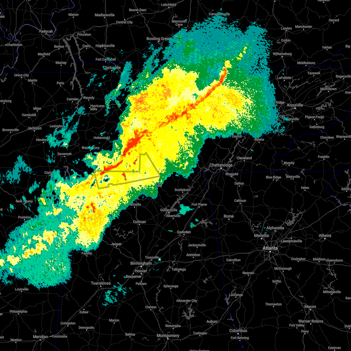 At 702 am cst, a severe thunderstorm was located 9 miles northeast of rogersville, or 15 miles northwest of athens, moving east at 65 mph (radar indicated). Hazards include 60 mph wind gusts. expect damage to roofs, siding, and trees At 702 am cst, a severe thunderstorm was located 9 miles northeast of rogersville, or 15 miles northwest of athens, moving east at 65 mph (radar indicated). Hazards include 60 mph wind gusts. expect damage to roofs, siding, and trees
|
| 12/6/2021 6:01 AM CST |
 At 601 am cst, severe thunderstorms were located along a line extending from near midway to near sandy springs to near tupelo, moving east at 55 mph (radar indicated). Hazards include 60 mph wind gusts. expect damage to roofs, siding, and trees At 601 am cst, severe thunderstorms were located along a line extending from near midway to near sandy springs to near tupelo, moving east at 55 mph (radar indicated). Hazards include 60 mph wind gusts. expect damage to roofs, siding, and trees
|
| 10/6/2021 6:58 PM CDT |
 At 657 pm cdt, a severe thunderstorm was located over tuscumbia, moving northeast at 15 mph (radar indicated). Hazards include 60 mph wind gusts and quarter size hail. Hail damage to vehicles is expected. Expect wind damage to roofs, siding, and trees. At 657 pm cdt, a severe thunderstorm was located over tuscumbia, moving northeast at 15 mph (radar indicated). Hazards include 60 mph wind gusts and quarter size hail. Hail damage to vehicles is expected. Expect wind damage to roofs, siding, and trees.
|
| 10/6/2021 6:39 PM CDT |
 At 639 pm cdt, a severe thunderstorm was located near tuscumbia, moving north at 20 mph (radar indicated). Hazards include 60 mph wind gusts and quarter size hail. Hail damage to vehicles is expected. expect wind damage to roofs, siding, and trees. locations impacted include, florence, muscle shoals, sheffield, tuscumbia, cherokee, littleville, posey loop, srygley church, new bethel and oakland. hail threat, radar indicated max hail size, 1. 00 in wind threat, radar indicated max wind gust, 60 mph. At 639 pm cdt, a severe thunderstorm was located near tuscumbia, moving north at 20 mph (radar indicated). Hazards include 60 mph wind gusts and quarter size hail. Hail damage to vehicles is expected. expect wind damage to roofs, siding, and trees. locations impacted include, florence, muscle shoals, sheffield, tuscumbia, cherokee, littleville, posey loop, srygley church, new bethel and oakland. hail threat, radar indicated max hail size, 1. 00 in wind threat, radar indicated max wind gust, 60 mph.
|
| 10/6/2021 6:25 PM CDT |
 At 625 pm cdt, a severe thunderstorm was located 8 miles southwest of tuscumbia, moving north at 20 mph (radar indicated). Hazards include 60 mph wind gusts and quarter size hail. Hail damage to vehicles is expected. Expect wind damage to roofs, siding, and trees. At 625 pm cdt, a severe thunderstorm was located 8 miles southwest of tuscumbia, moving north at 20 mph (radar indicated). Hazards include 60 mph wind gusts and quarter size hail. Hail damage to vehicles is expected. Expect wind damage to roofs, siding, and trees.
|
| 6/12/2021 4:57 PM CDT |
 The severe thunderstorm warning for eastern lauderdale, east central colbert and north central lawrence counties will expire at 500 pm cdt, the storm which prompted the warning has weakened below severe limits, and no longer poses an immediate threat to life or property. therefore, the warning will be allowed to expire. however small hail, gusty winds and heavy rain are still possible with this thunderstorm. The severe thunderstorm warning for eastern lauderdale, east central colbert and north central lawrence counties will expire at 500 pm cdt, the storm which prompted the warning has weakened below severe limits, and no longer poses an immediate threat to life or property. therefore, the warning will be allowed to expire. however small hail, gusty winds and heavy rain are still possible with this thunderstorm.
|
| 6/12/2021 4:29 PM CDT |
 At 429 pm cdt, a severe thunderstorm was located near lexington, or 19 miles east of florence, moving southwest at 15 mph (radar indicated). Hazards include 60 mph wind gusts and nickel size hail. expect damage to roofs, siding, and trees At 429 pm cdt, a severe thunderstorm was located near lexington, or 19 miles east of florence, moving southwest at 15 mph (radar indicated). Hazards include 60 mph wind gusts and nickel size hail. expect damage to roofs, siding, and trees
|
| 6/3/2021 2:19 AM CDT | A tree was reported down at lime kiln hollow drive and lime drive. time estimated by rada in colbert county AL, 7.5 miles SW of Muscle Shoals, AL |
| 5/6/2021 5:42 PM CDT |
 The severe thunderstorm warning for central lauderdale and southwestern colbert counties will expire at 545 pm cdt, the storms which prompted the warning have moved out of the area. therefore, the warning will be allowed to expire. to report severe weather, contact your nearest law enforcement agency. they will relay your report to the national weather service huntsville alabama. The severe thunderstorm warning for central lauderdale and southwestern colbert counties will expire at 545 pm cdt, the storms which prompted the warning have moved out of the area. therefore, the warning will be allowed to expire. to report severe weather, contact your nearest law enforcement agency. they will relay your report to the national weather service huntsville alabama.
|
| 5/6/2021 5:38 PM CDT | Three power poles were snapped behind the shoetopia building. one of them blew against the building and started a fir in colbert county AL, 1.9 miles ENE of Muscle Shoals, AL |
| 5/6/2021 5:35 PM CDT |
 At 534 pm cdt, severe thunderstorms were located along a line extending from lawrenceburg to 6 miles west of underwood-petersville to near wheeler, moving southeast at 45 mph (emergency management). Hazards include 60 mph wind gusts. Expect damage to roofs, siding, and trees. locations impacted include, florence, muscle shoals, sheffield, tuscumbia, killen, cherokee, st. Florian, underwood-petersville, green hill and mt hester. At 534 pm cdt, severe thunderstorms were located along a line extending from lawrenceburg to 6 miles west of underwood-petersville to near wheeler, moving southeast at 45 mph (emergency management). Hazards include 60 mph wind gusts. Expect damage to roofs, siding, and trees. locations impacted include, florence, muscle shoals, sheffield, tuscumbia, killen, cherokee, st. Florian, underwood-petersville, green hill and mt hester.
|
| 5/6/2021 5:31 PM CDT |
 At 529 pm cdt, severe thunderstorms were located along a line extending from near loretto to near underwood-petersville to 7 miles east of tishomingo state park to near sandy springs, moving southeast at 45 mph (radar indicated). Hazards include 60 mph wind gusts and nickel size hail. expect damage to roofs, siding, and trees At 529 pm cdt, severe thunderstorms were located along a line extending from near loretto to near underwood-petersville to 7 miles east of tishomingo state park to near sandy springs, moving southeast at 45 mph (radar indicated). Hazards include 60 mph wind gusts and nickel size hail. expect damage to roofs, siding, and trees
|
| 5/6/2021 4:56 PM CDT |
 At 455 pm cdt, severe thunderstorms were located along a line extending from 8 miles southwest of hohenwald to near walnut grove to 6 miles east of ripley, moving southeast at 35 mph (radar indicated). Hazards include 60 mph wind gusts and penny size hail. expect damage to roofs, siding, and trees At 455 pm cdt, severe thunderstorms were located along a line extending from 8 miles southwest of hohenwald to near walnut grove to 6 miles east of ripley, moving southeast at 35 mph (radar indicated). Hazards include 60 mph wind gusts and penny size hail. expect damage to roofs, siding, and trees
|
| 5/2/2021 11:39 PM CDT |
 At 1138 pm cdt, a severe thunderstorm capable of producing a tornado was located 7 miles southeast of cherokee, or 9 miles west of tuscumbia, moving northeast at 55 mph. this storm has a history of rapidly producing tornadoes (radar indicated rotation). Hazards include tornado. Flying debris will be dangerous to those caught without shelter. mobile homes will be damaged or destroyed. damage to roofs, windows, and vehicles will occur. tree damage is likely. Locations impacted include, florence, muscle shoals, sheffield, tuscumbia, underwood-petersville, red rock, posey loop, pride landing and oakland. At 1138 pm cdt, a severe thunderstorm capable of producing a tornado was located 7 miles southeast of cherokee, or 9 miles west of tuscumbia, moving northeast at 55 mph. this storm has a history of rapidly producing tornadoes (radar indicated rotation). Hazards include tornado. Flying debris will be dangerous to those caught without shelter. mobile homes will be damaged or destroyed. damage to roofs, windows, and vehicles will occur. tree damage is likely. Locations impacted include, florence, muscle shoals, sheffield, tuscumbia, underwood-petersville, red rock, posey loop, pride landing and oakland.
|
| 5/2/2021 11:28 PM CDT |
 At 1128 pm cdt, a tornado producing storm was located 10 miles south of cherokee, or 12 miles east of tishomingo state park, moving northeast at 40 mph (radar confirmed tornado). Hazards include damaging tornado. Flying debris will be dangerous to those caught without shelter. mobile homes will be damaged or destroyed. damage to roofs, windows, and vehicles will occur. Tree damage is likely. At 1128 pm cdt, a tornado producing storm was located 10 miles south of cherokee, or 12 miles east of tishomingo state park, moving northeast at 40 mph (radar confirmed tornado). Hazards include damaging tornado. Flying debris will be dangerous to those caught without shelter. mobile homes will be damaged or destroyed. damage to roofs, windows, and vehicles will occur. Tree damage is likely.
|
| 3/28/2021 3:09 AM CDT |
 At 308 am cdt, a severe thunderstorm was located near russellville, moving east at 60 mph (radar indicated). Hazards include 60 mph wind gusts and quarter size hail. Hail damage to vehicles is expected. Expect wind damage to roofs, siding, and trees. At 308 am cdt, a severe thunderstorm was located near russellville, moving east at 60 mph (radar indicated). Hazards include 60 mph wind gusts and quarter size hail. Hail damage to vehicles is expected. Expect wind damage to roofs, siding, and trees.
|
| 3/25/2021 3:01 PM CDT |
 At 300 pm cdt, a severe thunderstorm capable of producing a tornado was located 8 miles north of belgreen, or 10 miles northwest of russellville, moving northeast at 35 mph (radar indicated rotation). Hazards include tornado and quarter size hail. Flying debris will be dangerous to those caught without shelter. mobile homes will be damaged or destroyed. damage to roofs, windows, and vehicles will occur. tree damage is likely. Locations impacted include, florence, muscle shoals, sheffield, tuscumbia, red rock, posey loop, pride landing, srygley church, new bethel and colbert heights. At 300 pm cdt, a severe thunderstorm capable of producing a tornado was located 8 miles north of belgreen, or 10 miles northwest of russellville, moving northeast at 35 mph (radar indicated rotation). Hazards include tornado and quarter size hail. Flying debris will be dangerous to those caught without shelter. mobile homes will be damaged or destroyed. damage to roofs, windows, and vehicles will occur. tree damage is likely. Locations impacted include, florence, muscle shoals, sheffield, tuscumbia, red rock, posey loop, pride landing, srygley church, new bethel and colbert heights.
|
| 3/25/2021 2:53 PM CDT |
 At 253 pm cdt, a severe thunderstorm capable of producing a tornado was located 7 miles northwest of belgreen, or 11 miles northeast of red bay, moving northeast at 35 mph (radar indicated rotation). Hazards include tornado. Flying debris will be dangerous to those caught without shelter. mobile homes will be damaged or destroyed. damage to roofs, windows, and vehicles will occur. Tree damage is likely. At 253 pm cdt, a severe thunderstorm capable of producing a tornado was located 7 miles northwest of belgreen, or 11 miles northeast of red bay, moving northeast at 35 mph (radar indicated rotation). Hazards include tornado. Flying debris will be dangerous to those caught without shelter. mobile homes will be damaged or destroyed. damage to roofs, windows, and vehicles will occur. Tree damage is likely.
|
| 3/25/2021 7:44 AM CDT | Tree downed near 2nd st and bainbridge r in colbert county AL, 4.5 miles W of Muscle Shoals, AL |
| 8/28/2020 3:46 PM CDT |
 At 345 pm cdt, a severe thunderstorm was located near killen, or 8 miles east of florence, moving northeast at 45 mph (radar indicated). Hazards include 60 mph wind gusts. expect damage to roofs, siding, and trees At 345 pm cdt, a severe thunderstorm was located near killen, or 8 miles east of florence, moving northeast at 45 mph (radar indicated). Hazards include 60 mph wind gusts. expect damage to roofs, siding, and trees
|
| 8/27/2020 4:12 PM CDT | Roof partially torn off of a business in muscle shoal in colbert county AL, 0.7 miles E of Muscle Shoals, AL |
| 7/12/2020 9:55 AM CDT |
 At 954 am cdt, a severe thunderstorm was located near littleville, or 7 miles southwest of tuscumbia, moving southeast at 25 mph (radar indicated). Hazards include 60 mph wind gusts. expect damage to roofs, siding, and trees At 954 am cdt, a severe thunderstorm was located near littleville, or 7 miles southwest of tuscumbia, moving southeast at 25 mph (radar indicated). Hazards include 60 mph wind gusts. expect damage to roofs, siding, and trees
|
| 7/12/2020 9:50 AM CDT |
 At 949 am cdt, a severe thunderstorm was located near tuscumbia, moving southeast at 15 mph (radar indicated). Hazards include 60 mph wind gusts. Expect damage to roofs, siding, and trees. Locations impacted include, muscle shoals, sheffield, tuscumbia, red rock, posey loop, pride landing and new bethel. At 949 am cdt, a severe thunderstorm was located near tuscumbia, moving southeast at 15 mph (radar indicated). Hazards include 60 mph wind gusts. Expect damage to roofs, siding, and trees. Locations impacted include, muscle shoals, sheffield, tuscumbia, red rock, posey loop, pride landing and new bethel.
|
| 7/12/2020 9:41 AM CDT |
 The national weather service in huntsville alabama has issued a * severe thunderstorm warning for. southeastern colbert county in northwestern alabama. central lawrence county in northwestern alabama. until 1015 am cdt. At 941 am cdt, a severe thunderstorm was located over town creek,. The national weather service in huntsville alabama has issued a * severe thunderstorm warning for. southeastern colbert county in northwestern alabama. central lawrence county in northwestern alabama. until 1015 am cdt. At 941 am cdt, a severe thunderstorm was located over town creek,.
|
| 7/12/2020 9:35 AM CDT |
 At 935 am cdt, a severe thunderstorm was located near cherokee, or 8 miles west of tuscumbia, moving southeast at 15 mph (radar indicated). Hazards include 60 mph wind gusts. expect damage to roofs, siding, and trees At 935 am cdt, a severe thunderstorm was located near cherokee, or 8 miles west of tuscumbia, moving southeast at 15 mph (radar indicated). Hazards include 60 mph wind gusts. expect damage to roofs, siding, and trees
|
| 6/30/2020 6:15 PM CDT |
 At 615 pm cdt, a severe thunderstorm was located over underwood-petersville, or near florence, moving east at 20 mph (radar indicated). Hazards include 60 mph wind gusts. expect damage to roofs, siding, and trees At 615 pm cdt, a severe thunderstorm was located over underwood-petersville, or near florence, moving east at 20 mph (radar indicated). Hazards include 60 mph wind gusts. expect damage to roofs, siding, and trees
|
| 6/22/2020 4:40 PM CDT | A tree was knocked down onto a home damaging the roo in colbert county AL, 0.2 miles SE of Muscle Shoals, AL |
| 6/5/2020 4:13 PM CDT |
 At 403 pm cdt, a severe thunderstorm was located near leighton, or 7 miles southeast of muscle shoals, moving southeast at 10 mph (radar indicated). Hazards include 60 mph wind gusts and quarter size hail. Hail damage to vehicles is expected. expect wind damage to roofs, siding, and trees. Locations impacted include, littleville, leighton, colbert heights, whiteoak, la grange and northwest alabama regional airport. At 403 pm cdt, a severe thunderstorm was located near leighton, or 7 miles southeast of muscle shoals, moving southeast at 10 mph (radar indicated). Hazards include 60 mph wind gusts and quarter size hail. Hail damage to vehicles is expected. expect wind damage to roofs, siding, and trees. Locations impacted include, littleville, leighton, colbert heights, whiteoak, la grange and northwest alabama regional airport.
|
| 6/5/2020 4:05 PM CDT | A large tree was snapped in muscle shoals. report relayed via social media... and time estimated based on rada in colbert county AL, 0.9 miles NE of Muscle Shoals, AL |
| 6/5/2020 4:03 PM CDT |
 At 403 pm cdt, a severe thunderstorm was located near leighton, or 7 miles southeast of muscle shoals, moving southeast at 10 mph (radar indicated). Hazards include 60 mph wind gusts and quarter size hail. Hail damage to vehicles is expected. expect wind damage to roofs, siding, and trees. Locations impacted include, littleville, leighton, colbert heights, whiteoak, la grange and northwest alabama regional airport. At 403 pm cdt, a severe thunderstorm was located near leighton, or 7 miles southeast of muscle shoals, moving southeast at 10 mph (radar indicated). Hazards include 60 mph wind gusts and quarter size hail. Hail damage to vehicles is expected. expect wind damage to roofs, siding, and trees. Locations impacted include, littleville, leighton, colbert heights, whiteoak, la grange and northwest alabama regional airport.
|
| 6/5/2020 3:51 PM CDT |
 At 351 pm cdt, a severe thunderstorm was located near muscle shoals, moving south at 10 mph (radar indicated). Hazards include 60 mph wind gusts and quarter size hail. Hail damage to vehicles is expected. Expect wind damage to roofs, siding, and trees. At 351 pm cdt, a severe thunderstorm was located near muscle shoals, moving south at 10 mph (radar indicated). Hazards include 60 mph wind gusts and quarter size hail. Hail damage to vehicles is expected. Expect wind damage to roofs, siding, and trees.
|
| 5/4/2020 9:06 PM CDT |
 At 905 pm cdt, severe thunderstorms were located along a line extending from 10 miles west of ardmore to near lexington to near underwood-petersville, moving southeast at 55 mph (radar indicated). Hazards include 60 mph wind gusts and quarter size hail. Hail damage to vehicles is expected. expect wind damage to roofs, siding, and trees. Locations impacted include, florence, muscle shoals, sheffield, tuscumbia, rogersville, killen, town creek, cherokee, lexington and leighton. At 905 pm cdt, severe thunderstorms were located along a line extending from 10 miles west of ardmore to near lexington to near underwood-petersville, moving southeast at 55 mph (radar indicated). Hazards include 60 mph wind gusts and quarter size hail. Hail damage to vehicles is expected. expect wind damage to roofs, siding, and trees. Locations impacted include, florence, muscle shoals, sheffield, tuscumbia, rogersville, killen, town creek, cherokee, lexington and leighton.
|
| 5/4/2020 8:26 PM CDT |
 At 825 pm cdt, severe thunderstorms were located along a line extending from 10 miles northeast of collinwood to 8 miles northeast of walnut grove to near savannah, moving southeast at 55 mph (radar indicated). Hazards include 60 mph wind gusts and half dollar size hail. Hail damage to vehicles is expected. Expect wind damage to roofs, siding, and trees. At 825 pm cdt, severe thunderstorms were located along a line extending from 10 miles northeast of collinwood to 8 miles northeast of walnut grove to near savannah, moving southeast at 55 mph (radar indicated). Hazards include 60 mph wind gusts and half dollar size hail. Hail damage to vehicles is expected. Expect wind damage to roofs, siding, and trees.
|
| 5/3/2020 4:30 PM CDT |
 At 430 pm cdt, severe thunderstorms were located along a line extending from near spring hill to 6 miles west of lawrenceburg to near walnut grove, moving southeast at 65 mph (radar indicated). Hazards include 60 mph wind gusts and quarter size hail. Hail damage to vehicles is expected. Expect wind damage to roofs, siding, and trees. At 430 pm cdt, severe thunderstorms were located along a line extending from near spring hill to 6 miles west of lawrenceburg to near walnut grove, moving southeast at 65 mph (radar indicated). Hazards include 60 mph wind gusts and quarter size hail. Hail damage to vehicles is expected. Expect wind damage to roofs, siding, and trees.
|
| 4/9/2020 1:36 AM CDT | Quarter sized hail reported 1.5 miles ESE of Muscle Shoals, AL, report from mping: quarter (1.00 in.). |
| 4/9/2020 1:35 AM CDT |
 At 133 am cdt, a severe thunderstorm was located over leighton, or near muscle shoals, moving east at 60 mph. this storm has a history of producing quarter to golf ball sized hail (public). Hazards include 60 mph wind gusts and half dollar size hail. Hail damage to vehicles is expected. Expect wind damage to roofs, siding, and trees. At 133 am cdt, a severe thunderstorm was located over leighton, or near muscle shoals, moving east at 60 mph. this storm has a history of producing quarter to golf ball sized hail (public). Hazards include 60 mph wind gusts and half dollar size hail. Hail damage to vehicles is expected. Expect wind damage to roofs, siding, and trees.
|
| 4/9/2020 1:26 AM CDT |
 At 126 am cdt, a severe thunderstorm was located over sheffield, moving southeast at 50 mph. at 1:25 am, golf ball sized hail was reported in waterloo, al (radar indicated). Hazards include golf ball size hail and 60 mph wind gusts. People and animals outdoors will be injured. expect hail damage to roofs, siding, windows, and vehicles. expect wind damage to roofs, siding, and trees. locations impacted include, florence, muscle shoals, russellville, sheffield, tuscumbia, killen, cherokee, littleville, leighton and st. Florian. At 126 am cdt, a severe thunderstorm was located over sheffield, moving southeast at 50 mph. at 1:25 am, golf ball sized hail was reported in waterloo, al (radar indicated). Hazards include golf ball size hail and 60 mph wind gusts. People and animals outdoors will be injured. expect hail damage to roofs, siding, windows, and vehicles. expect wind damage to roofs, siding, and trees. locations impacted include, florence, muscle shoals, russellville, sheffield, tuscumbia, killen, cherokee, littleville, leighton and st. Florian.
|
| 4/9/2020 1:09 AM CDT |
 At 108 am cdt, a severe thunderstorm was located 7 miles north of cherokee, or 12 miles east of j p coleman state park, moving southeast at 50 mph (radar indicated). Hazards include 60 mph wind gusts and quarter size hail. Hail damage to vehicles is expected. Expect wind damage to roofs, siding, and trees. At 108 am cdt, a severe thunderstorm was located 7 miles north of cherokee, or 12 miles east of j p coleman state park, moving southeast at 50 mph (radar indicated). Hazards include 60 mph wind gusts and quarter size hail. Hail damage to vehicles is expected. Expect wind damage to roofs, siding, and trees.
|
| 4/9/2020 12:01 AM CDT |
 At 1200 am cdt, a severe thunderstorm was located over midway, or near iuka, moving southeast at 50 mph (radar indicated). Hazards include 60 mph wind gusts and penny size hail. expect damage to roofs, siding, and trees At 1200 am cdt, a severe thunderstorm was located over midway, or near iuka, moving southeast at 50 mph (radar indicated). Hazards include 60 mph wind gusts and penny size hail. expect damage to roofs, siding, and trees
|
| 3/29/2020 2:07 AM CDT |
 The severe thunderstorm warning for eastern lauderdale, northern limestone, southeastern colbert and northwestern lawrence counties will expire at 215 am cdt, the storm which prompted the warning has weakened below severe limits, and no longer poses an immediate threat to life or property. therefore, the warning will be allowed to expire. a tornado watch remains in effect until 400 am cdt for north central and northwestern alabama, and middle tennessee. The severe thunderstorm warning for eastern lauderdale, northern limestone, southeastern colbert and northwestern lawrence counties will expire at 215 am cdt, the storm which prompted the warning has weakened below severe limits, and no longer poses an immediate threat to life or property. therefore, the warning will be allowed to expire. a tornado watch remains in effect until 400 am cdt for north central and northwestern alabama, and middle tennessee.
|
| 3/29/2020 1:37 AM CDT |
 At 137 am cdt, a severe thunderstorm was located over leighton, or 7 miles east of muscle shoals, moving northeast at 65 mph (radar indicated). Hazards include 60 mph wind gusts and quarter size hail. Hail damage to vehicles is expected. Expect wind damage to roofs, siding, and trees. At 137 am cdt, a severe thunderstorm was located over leighton, or 7 miles east of muscle shoals, moving northeast at 65 mph (radar indicated). Hazards include 60 mph wind gusts and quarter size hail. Hail damage to vehicles is expected. Expect wind damage to roofs, siding, and trees.
|
| 3/24/2020 6:29 PM CDT |
 At 629 pm cdt, a confirmed tornado was located near leighton, or 11 miles southeast of muscle shoals, moving east at 40 mph (law enforcement confirmed tornado). Hazards include damaging tornado and half dollar size hail. Flying debris will be dangerous to those caught without shelter. mobile homes will be damaged or destroyed. damage to roofs, windows, and vehicles will occur. tree damage is likely. Locations impacted include, town creek, leighton, hatton, la grange, ne smith, whiteoak and northwest alabama regional airport. At 629 pm cdt, a confirmed tornado was located near leighton, or 11 miles southeast of muscle shoals, moving east at 40 mph (law enforcement confirmed tornado). Hazards include damaging tornado and half dollar size hail. Flying debris will be dangerous to those caught without shelter. mobile homes will be damaged or destroyed. damage to roofs, windows, and vehicles will occur. tree damage is likely. Locations impacted include, town creek, leighton, hatton, la grange, ne smith, whiteoak and northwest alabama regional airport.
|
| 3/24/2020 6:21 PM CDT |
 At 621 pm cdt, a confirmed tornado was located near littleville, or 7 miles southeast of muscle shoals, moving east at 40 mph (law enforcement confirmed tornado). Hazards include damaging tornado and half dollar size hail. Flying debris will be dangerous to those caught without shelter. mobile homes will be damaged or destroyed. damage to roofs, windows, and vehicles will occur. tree damage is likely. Locations impacted include, muscle shoals, tuscumbia, town creek, littleville, leighton, hatton, la grange, colbert heights, ne smith and whiteoak. At 621 pm cdt, a confirmed tornado was located near littleville, or 7 miles southeast of muscle shoals, moving east at 40 mph (law enforcement confirmed tornado). Hazards include damaging tornado and half dollar size hail. Flying debris will be dangerous to those caught without shelter. mobile homes will be damaged or destroyed. damage to roofs, windows, and vehicles will occur. tree damage is likely. Locations impacted include, muscle shoals, tuscumbia, town creek, littleville, leighton, hatton, la grange, colbert heights, ne smith and whiteoak.
|
| 3/24/2020 6:17 PM CDT |
 At 616 pm cdt, a severe thunderstorm capable of producing a tornado was located near littleville, or near tuscumbia, moving east at 35 mph (radar indicated rotation). Hazards include tornado and half dollar size hail. Flying debris will be dangerous to those caught without shelter. mobile homes will be damaged or destroyed. damage to roofs, windows, and vehicles will occur. tree damage is likely. Locations impacted include, muscle shoals, tuscumbia, town creek, littleville, leighton, hatton, la grange, colbert heights, ne smith and whiteoak. At 616 pm cdt, a severe thunderstorm capable of producing a tornado was located near littleville, or near tuscumbia, moving east at 35 mph (radar indicated rotation). Hazards include tornado and half dollar size hail. Flying debris will be dangerous to those caught without shelter. mobile homes will be damaged or destroyed. damage to roofs, windows, and vehicles will occur. tree damage is likely. Locations impacted include, muscle shoals, tuscumbia, town creek, littleville, leighton, hatton, la grange, colbert heights, ne smith and whiteoak.
|
| 3/24/2020 6:08 PM CDT |
 At 607 pm cdt, a severe thunderstorm capable of producing a tornado was located near littleville, or 7 miles southwest of tuscumbia, moving east at 40 mph (radar indicated rotation). Hazards include tornado and half dollar size hail. Flying debris will be dangerous to those caught without shelter. mobile homes will be damaged or destroyed. damage to roofs, windows, and vehicles will occur. tree damage is likely. Locations impacted include, muscle shoals, sheffield, tuscumbia, town creek, littleville, leighton, northwest alabama regional airport, new bethel, la grange and ne smith. At 607 pm cdt, a severe thunderstorm capable of producing a tornado was located near littleville, or 7 miles southwest of tuscumbia, moving east at 40 mph (radar indicated rotation). Hazards include tornado and half dollar size hail. Flying debris will be dangerous to those caught without shelter. mobile homes will be damaged or destroyed. damage to roofs, windows, and vehicles will occur. tree damage is likely. Locations impacted include, muscle shoals, sheffield, tuscumbia, town creek, littleville, leighton, northwest alabama regional airport, new bethel, la grange and ne smith.
|
| 3/24/2020 6:03 PM CDT |
 At 602 pm cdt, a severe thunderstorm capable of producing a tornado was located 9 miles west of littleville, or 10 miles southwest of tuscumbia, moving east at 40 mph (radar indicated rotation). Hazards include tornado and half dollar size hail. Flying debris will be dangerous to those caught without shelter. mobile homes will be damaged or destroyed. damage to roofs, windows, and vehicles will occur. Tree damage is likely. At 602 pm cdt, a severe thunderstorm capable of producing a tornado was located 9 miles west of littleville, or 10 miles southwest of tuscumbia, moving east at 40 mph (radar indicated rotation). Hazards include tornado and half dollar size hail. Flying debris will be dangerous to those caught without shelter. mobile homes will be damaged or destroyed. damage to roofs, windows, and vehicles will occur. Tree damage is likely.
|
| 3/22/2020 11:31 PM CDT |
 At 1131 pm cdt, a severe thunderstorm was located near sheffield, moving northeast at 55 mph (radar indicated). Hazards include 60 mph wind gusts and quarter size hail. Hail damage to vehicles is expected. expect wind damage to roofs, siding, and trees. locations impacted include, florence, muscle shoals, sheffield, tuscumbia, killen, lexington, st. Florian, underwood-petersville, anderson and green hill. At 1131 pm cdt, a severe thunderstorm was located near sheffield, moving northeast at 55 mph (radar indicated). Hazards include 60 mph wind gusts and quarter size hail. Hail damage to vehicles is expected. expect wind damage to roofs, siding, and trees. locations impacted include, florence, muscle shoals, sheffield, tuscumbia, killen, lexington, st. Florian, underwood-petersville, anderson and green hill.
|
| 3/22/2020 11:26 PM CDT |
 At 1126 pm cdt, a severe thunderstorm was located 7 miles east of cherokee, or 7 miles west of sheffield, moving northeast at 55 mph (radar indicated). Hazards include 60 mph wind gusts and quarter size hail. Hail damage to vehicles is expected. Expect wind damage to roofs, siding, and trees. At 1126 pm cdt, a severe thunderstorm was located 7 miles east of cherokee, or 7 miles west of sheffield, moving northeast at 55 mph (radar indicated). Hazards include 60 mph wind gusts and quarter size hail. Hail damage to vehicles is expected. Expect wind damage to roofs, siding, and trees.
|
| 1/11/2020 11:14 AM CST |
 At 1114 am cst, severe thunderstorms were located along a line extending from near muscle shoals to 10 miles southeast of littleville to near phil campbell, moving northeast at 40 mph (radar indicated). Hazards include 60 mph wind gusts. expect damage to roofs, siding, and trees At 1114 am cst, severe thunderstorms were located along a line extending from near muscle shoals to 10 miles southeast of littleville to near phil campbell, moving northeast at 40 mph (radar indicated). Hazards include 60 mph wind gusts. expect damage to roofs, siding, and trees
|
| 1/11/2020 8:38 AM CST |
 At 838 am cst, severe thunderstorms were located along a line extending from near loretto to near littleville, moving east at 25 mph (radar indicated). Hazards include 60 mph wind gusts. Expect damage to roofs, siding, and trees. Locations impacted include, florence, muscle shoals, sheffield, tuscumbia, rogersville, killen, town creek, littleville, lexington and leighton. At 838 am cst, severe thunderstorms were located along a line extending from near loretto to near littleville, moving east at 25 mph (radar indicated). Hazards include 60 mph wind gusts. Expect damage to roofs, siding, and trees. Locations impacted include, florence, muscle shoals, sheffield, tuscumbia, rogersville, killen, town creek, littleville, lexington and leighton.
|
| 1/11/2020 8:07 AM CST |
 At 807 am cst, severe thunderstorms were located along a line extending from 10 miles north of underwood-petersville to 8 miles northwest of belgreen, moving east at 30 mph (radar indicated). Hazards include 60 mph wind gusts. expect damage to roofs, siding, and trees At 807 am cst, severe thunderstorms were located along a line extending from 10 miles north of underwood-petersville to 8 miles northwest of belgreen, moving east at 30 mph (radar indicated). Hazards include 60 mph wind gusts. expect damage to roofs, siding, and trees
|
| 1/11/2020 7:44 AM CST |
 At 744 am cst, severe thunderstorms were located along a line extending from near walnut grove to 6 miles west of cherokee to near tishomingo state park, moving east at 40 mph (radar indicated). Hazards include 60 mph wind gusts. Expect damage to roofs, siding, and trees. locations impacted include, florence, muscle shoals, sheffield, tuscumbia, killen, cherokee, littleville, leighton, st. Florian and underwood-petersville. At 744 am cst, severe thunderstorms were located along a line extending from near walnut grove to 6 miles west of cherokee to near tishomingo state park, moving east at 40 mph (radar indicated). Hazards include 60 mph wind gusts. Expect damage to roofs, siding, and trees. locations impacted include, florence, muscle shoals, sheffield, tuscumbia, killen, cherokee, littleville, leighton, st. Florian and underwood-petersville.
|
| 1/11/2020 7:14 AM CST |
 At 713 am cst, severe thunderstorms were located along a line extending from near pineflat to near burton to 7 miles north of sandy springs, moving east at 40 mph (radar indicated). Hazards include 60 mph wind gusts. expect damage to roofs, siding, and trees At 713 am cst, severe thunderstorms were located along a line extending from near pineflat to near burton to 7 miles north of sandy springs, moving east at 40 mph (radar indicated). Hazards include 60 mph wind gusts. expect damage to roofs, siding, and trees
|
| 12/16/2019 5:10 PM CST |
 At 510 pm cst, a line of severe thunderstorms was extending from near loretto to 8 miles south of town creek to near phil campbell, moving east at 55 mph. this line of storms has a history of producing damaging winds and confirmed tornadoes (radar indicated). Hazards include 60 mph wind gusts. Expect damage to roofs, siding, and trees. Locations impacted include, florence, muscle shoals, russellville, sheffield, tuscumbia, moulton, rogersville, phil campbell, killen and town creek. At 510 pm cst, a line of severe thunderstorms was extending from near loretto to 8 miles south of town creek to near phil campbell, moving east at 55 mph. this line of storms has a history of producing damaging winds and confirmed tornadoes (radar indicated). Hazards include 60 mph wind gusts. Expect damage to roofs, siding, and trees. Locations impacted include, florence, muscle shoals, russellville, sheffield, tuscumbia, moulton, rogersville, phil campbell, killen and town creek.
|
| 12/16/2019 5:04 PM CST | Trees reported down on river road and hillcrest av in colbert county AL, 2.2 miles SSW of Muscle Shoals, AL |
| 12/16/2019 5:03 PM CST |
 At 502 pm cst, a confirmed tornado was located near muscle shoals, moving northeast at 55 mph. damage was reported in colbert heights at 500 pm (emergency management confirmed tornado). Hazards include damaging tornado. Flying debris will be dangerous to those caught without shelter. mobile homes will be damaged or destroyed. damage to roofs, windows, and vehicles will occur. tree damage is likely. Locations impacted include, muscle shoals, russellville, sheffield, tuscumbia, littleville, newburg, northwest alabama regional airport, new bethel, tharptown and isbell. At 502 pm cst, a confirmed tornado was located near muscle shoals, moving northeast at 55 mph. damage was reported in colbert heights at 500 pm (emergency management confirmed tornado). Hazards include damaging tornado. Flying debris will be dangerous to those caught without shelter. mobile homes will be damaged or destroyed. damage to roofs, windows, and vehicles will occur. tree damage is likely. Locations impacted include, muscle shoals, russellville, sheffield, tuscumbia, littleville, newburg, northwest alabama regional airport, new bethel, tharptown and isbell.
|
| 12/16/2019 4:52 PM CST |
 At 451 pm cst, a line of severe thunderstorms extending from 8 miles south of collinwood to russellville to 10 miles southeast of red bay is moving east at 55 mph. this line of storms has a history of producing damaging winds and confirmed tornadoes (radar indicated). Hazards include 60 mph wind gusts. expect damage to roofs, siding, and trees At 451 pm cst, a line of severe thunderstorms extending from 8 miles south of collinwood to russellville to 10 miles southeast of red bay is moving east at 55 mph. this line of storms has a history of producing damaging winds and confirmed tornadoes (radar indicated). Hazards include 60 mph wind gusts. expect damage to roofs, siding, and trees
|
| 12/16/2019 4:26 PM CST |
 At 424 pm cst, a severe thunderstorm capable of producing a tornado was located over belmont, or near red bay, moving northeast at 55 mph. this line of storms has a history of producing confirmed tornadoes (radar indicated rotation). Hazards include tornado. Flying debris will be dangerous to those caught without shelter. mobile homes will be damaged or destroyed. damage to roofs, windows, and vehicles will occur. Tree damage is likely. At 424 pm cst, a severe thunderstorm capable of producing a tornado was located over belmont, or near red bay, moving northeast at 55 mph. this line of storms has a history of producing confirmed tornadoes (radar indicated rotation). Hazards include tornado. Flying debris will be dangerous to those caught without shelter. mobile homes will be damaged or destroyed. damage to roofs, windows, and vehicles will occur. Tree damage is likely.
|
| 12/16/2019 3:59 PM CST |
 At 358 pm cst, severe thunderstorms were located along a line extending from jumpertown to 7 miles southwest of burton to near houston, moving east at 55 mph. this line of storms has a history of producing damaging wind gusts and tornadoes (radar indicated). Hazards include 60 mph wind gusts. expect damage to roofs, siding, and trees At 358 pm cst, severe thunderstorms were located along a line extending from jumpertown to 7 miles southwest of burton to near houston, moving east at 55 mph. this line of storms has a history of producing damaging wind gusts and tornadoes (radar indicated). Hazards include 60 mph wind gusts. expect damage to roofs, siding, and trees
|
| 11/30/2019 3:55 PM CST |
 The severe thunderstorm warning for central lauderdale and northwestern colbert counties will expire at 400 pm cst, the storm which prompted the warning has weakened below severe limits, and no longer poses an immediate threat to life or property. therefore, the warning will be allowed to expire. however small hail is still possible with this thunderstorm. The severe thunderstorm warning for central lauderdale and northwestern colbert counties will expire at 400 pm cst, the storm which prompted the warning has weakened below severe limits, and no longer poses an immediate threat to life or property. therefore, the warning will be allowed to expire. however small hail is still possible with this thunderstorm.
|
| 11/30/2019 3:31 PM CST |
 At 331 pm cst, a severe thunderstorm was located over tishomingo, or near tishomingo state park, moving northeast at 75 mph (radar indicated). Hazards include 60 mph wind gusts and quarter size hail. Hail damage to vehicles is expected. Expect wind damage to roofs, siding, and trees. At 331 pm cst, a severe thunderstorm was located over tishomingo, or near tishomingo state park, moving northeast at 75 mph (radar indicated). Hazards include 60 mph wind gusts and quarter size hail. Hail damage to vehicles is expected. Expect wind damage to roofs, siding, and trees.
|
| 11/22/2019 10:09 PM CST |
 At 1009 pm cst, a severe thunderstorm was located near leighton, or near muscle shoals, moving northeast at 55 mph. dime to quarter sized hail continues to be reported with this storm (emergency management). Hazards include 60 mph wind gusts and quarter size hail. Hail damage to vehicles is expected. expect wind damage to roofs, siding, and trees. Locations impacted include, florence, muscle shoals, sheffield, tuscumbia, rogersville, killen, town creek, littleville, leighton and courtland. At 1009 pm cst, a severe thunderstorm was located near leighton, or near muscle shoals, moving northeast at 55 mph. dime to quarter sized hail continues to be reported with this storm (emergency management). Hazards include 60 mph wind gusts and quarter size hail. Hail damage to vehicles is expected. expect wind damage to roofs, siding, and trees. Locations impacted include, florence, muscle shoals, sheffield, tuscumbia, rogersville, killen, town creek, littleville, leighton and courtland.
|
| 11/22/2019 9:52 PM CST |
 At 952 pm cst, a severe thunderstorm was located near belgreen, or 7 miles west of russellville, moving northeast at 55 mph. at 950 pm, quarter sized hail was reported at belgreen (emergency management). Hazards include 60 mph wind gusts and quarter size hail. Hail damage to vehicles is expected. Expect wind damage to roofs, siding, and trees. At 952 pm cst, a severe thunderstorm was located near belgreen, or 7 miles west of russellville, moving northeast at 55 mph. at 950 pm, quarter sized hail was reported at belgreen (emergency management). Hazards include 60 mph wind gusts and quarter size hail. Hail damage to vehicles is expected. Expect wind damage to roofs, siding, and trees.
|
| 8/23/2019 3:45 PM CDT | Tree or limb fell causing minor roof damage to a residence near ford city. small hail also reported. time estimated from rada in colbert county AL, 6.3 miles WSW of Muscle Shoals, AL |
| 8/23/2019 3:34 PM CDT |
 At 334 pm cdt, a severe thunderstorm was located near leighton, or near muscle shoals, moving east at 10 mph (radar indicated). Hazards include 60 mph wind gusts and nickel size hail. expect damage to roofs, siding, and trees At 334 pm cdt, a severe thunderstorm was located near leighton, or near muscle shoals, moving east at 10 mph (radar indicated). Hazards include 60 mph wind gusts and nickel size hail. expect damage to roofs, siding, and trees
|
| 8/13/2019 9:23 PM CDT |
 At 922 pm cdt, severe thunderstorms were located along a line extending from near town creek to near leighton to near sheffield to cherokee, moving south at 25 mph (radar indicated). Hazards include 60 mph wind gusts. Expect damage to roofs, siding, and trees. Locations impacted include, florence, muscle shoals, sheffield, tuscumbia, killen, town creek, cherokee, littleville, leighton and courtland. At 922 pm cdt, severe thunderstorms were located along a line extending from near town creek to near leighton to near sheffield to cherokee, moving south at 25 mph (radar indicated). Hazards include 60 mph wind gusts. Expect damage to roofs, siding, and trees. Locations impacted include, florence, muscle shoals, sheffield, tuscumbia, killen, town creek, cherokee, littleville, leighton and courtland.
|
| 8/13/2019 9:09 PM CDT |
 The national weather service in huntsville alabama has issued a * severe thunderstorm warning for. lauderdale county in northwestern alabama. colbert county in northwestern alabama. northwestern lawrence county in northwestern alabama. Until 945 pm cdt. The national weather service in huntsville alabama has issued a * severe thunderstorm warning for. lauderdale county in northwestern alabama. colbert county in northwestern alabama. northwestern lawrence county in northwestern alabama. Until 945 pm cdt.
|
| 8/7/2019 4:08 PM CDT |
 The severe thunderstorm warning for central lauderdale and central colbert counties will expire at 415 pm cdt, the storm which prompted the warning has weakened below severe limits, and no longer poses an immediate threat to life or property. therefore, the warning will be allowed to expire. The severe thunderstorm warning for central lauderdale and central colbert counties will expire at 415 pm cdt, the storm which prompted the warning has weakened below severe limits, and no longer poses an immediate threat to life or property. therefore, the warning will be allowed to expire.
|
| 8/7/2019 3:50 PM CDT |
 At 350 pm cdt, a severe thunderstorm was located near cherokee, or 14 miles northwest of sheffield, moving southeast at 15 mph (radar indicated). Hazards include 60 mph wind gusts and penny size hail. expect damage to roofs, siding, and trees At 350 pm cdt, a severe thunderstorm was located near cherokee, or 14 miles northwest of sheffield, moving southeast at 15 mph (radar indicated). Hazards include 60 mph wind gusts and penny size hail. expect damage to roofs, siding, and trees
|
| 8/7/2019 1:57 AM CDT |
 The severe thunderstorm warning for colbert, northeastern franklin and northwestern lawrence counties will expire at 200 am cdt, the storms which prompted the warning have weakened below severe limits, and no longer pose an immediate threat to life or property. therefore, the warning will be allowed to expire. however gusty winds and heavy rain are still possible with these thunderstorms. The severe thunderstorm warning for colbert, northeastern franklin and northwestern lawrence counties will expire at 200 am cdt, the storms which prompted the warning have weakened below severe limits, and no longer pose an immediate threat to life or property. therefore, the warning will be allowed to expire. however gusty winds and heavy rain are still possible with these thunderstorms.
|
| 8/7/2019 1:48 AM CDT |
 At 147 am cdt, severe thunderstorms were located along a line extending from near leighton to near littleville to 7 miles southeast of cherokee, moving south at 25 mph (radar indicated). Hazards include 60 mph wind gusts. Expect damage to roofs, siding, and trees. Locations impacted include, muscle shoals, russellville, sheffield, tuscumbia, town creek, cherokee, littleville, leighton, posey loop and northwest alabama regional airport. At 147 am cdt, severe thunderstorms were located along a line extending from near leighton to near littleville to 7 miles southeast of cherokee, moving south at 25 mph (radar indicated). Hazards include 60 mph wind gusts. Expect damage to roofs, siding, and trees. Locations impacted include, muscle shoals, russellville, sheffield, tuscumbia, town creek, cherokee, littleville, leighton, posey loop and northwest alabama regional airport.
|
| 8/7/2019 1:32 AM CDT |
 At 132 am cdt, severe thunderstorms were located along a line extending from near leighton to near tuscumbia to near cherokee, moving south at 25 mph (radar indicated). Hazards include 60 mph wind gusts. Expect damage to roofs, siding, and trees. Locations impacted include, florence, muscle shoals, russellville, sheffield, tuscumbia, killen, town creek, cherokee, littleville and leighton. At 132 am cdt, severe thunderstorms were located along a line extending from near leighton to near tuscumbia to near cherokee, moving south at 25 mph (radar indicated). Hazards include 60 mph wind gusts. Expect damage to roofs, siding, and trees. Locations impacted include, florence, muscle shoals, russellville, sheffield, tuscumbia, killen, town creek, cherokee, littleville and leighton.
|
| 8/7/2019 1:14 AM CDT |
 At 113 am cdt, severe thunderstorms were located along a line extending from near lexington to killen to underwood-petersville, moving southeast at 25 mph (radar indicated). Hazards include 60 mph wind gusts. Expect damage to roofs, siding, and trees. locations impacted include, florence, muscle shoals, sheffield, tuscumbia, killen, st. Florian, underwood-petersville, northwest alabama regional airport, oakland and center star. At 113 am cdt, severe thunderstorms were located along a line extending from near lexington to killen to underwood-petersville, moving southeast at 25 mph (radar indicated). Hazards include 60 mph wind gusts. Expect damage to roofs, siding, and trees. locations impacted include, florence, muscle shoals, sheffield, tuscumbia, killen, st. Florian, underwood-petersville, northwest alabama regional airport, oakland and center star.
|
| 8/7/2019 1:12 AM CDT |
 At 110 am cdt, severe thunderstorms were located along a line extending from near cherokee to underwood-petersville to killen, moving south at 25 mph (radar indicated). Hazards include 60 mph wind gusts. expect damage to roofs, siding, and trees At 110 am cdt, severe thunderstorms were located along a line extending from near cherokee to underwood-petersville to killen, moving south at 25 mph (radar indicated). Hazards include 60 mph wind gusts. expect damage to roofs, siding, and trees
|
| 8/7/2019 12:58 AM CDT |
 At 1258 am cdt, severe thunderstorms were located along a line extending from near lexington to near st. florian to 10 miles west of underwood-petersville, moving southeast at 25 mph (radar indicated). Hazards include 60 mph wind gusts. Expect damage to roofs, siding, and trees. locations impacted include, florence, muscle shoals, sheffield, tuscumbia, rogersville, killen, lexington, st. Florian, underwood-petersville and anderson. At 1258 am cdt, severe thunderstorms were located along a line extending from near lexington to near st. florian to 10 miles west of underwood-petersville, moving southeast at 25 mph (radar indicated). Hazards include 60 mph wind gusts. Expect damage to roofs, siding, and trees. locations impacted include, florence, muscle shoals, sheffield, tuscumbia, rogersville, killen, lexington, st. Florian, underwood-petersville and anderson.
|
| 8/7/2019 12:43 AM CDT |
 The national weather service in huntsville alabama has issued a * severe thunderstorm warning for. lauderdale county in northwestern alabama. east central colbert county in northwestern alabama. until 130 am cdt. At 1241 am cdt, severe thunderstorms were located along a line. The national weather service in huntsville alabama has issued a * severe thunderstorm warning for. lauderdale county in northwestern alabama. east central colbert county in northwestern alabama. until 130 am cdt. At 1241 am cdt, severe thunderstorms were located along a line.
|
| 7/16/2019 1:41 PM CDT |
 The severe thunderstorm warning for south central lauderdale and central colbert counties will expire at 145 pm cdt. the storm which prompted the warning has weakened below severe limits, and no longer poses an immediate threat to life or property. therefore, the warning will be allowed to expire. However gusty winds are still possible with this thunderstorm. The severe thunderstorm warning for south central lauderdale and central colbert counties will expire at 145 pm cdt. the storm which prompted the warning has weakened below severe limits, and no longer poses an immediate threat to life or property. therefore, the warning will be allowed to expire. However gusty winds are still possible with this thunderstorm.
|
| 7/16/2019 1:17 PM CDT |
 A severe thunderstorm warning remains in effect until 145 pm cdt for south central lauderdale and central colbert counties. at 116 pm cdt, a severe thunderstorm was located near cherokee, or 9 miles west of tuscumbia, moving northeast at 25 mph. hazard. 60 mph wind gusts. source. Radar indicated. A severe thunderstorm warning remains in effect until 145 pm cdt for south central lauderdale and central colbert counties. at 116 pm cdt, a severe thunderstorm was located near cherokee, or 9 miles west of tuscumbia, moving northeast at 25 mph. hazard. 60 mph wind gusts. source. Radar indicated.
|
| 7/16/2019 1:08 PM CDT |
 The national weather service in huntsville alabama has issued a * severe thunderstorm warning for. south central lauderdale county in northwestern alabama. central colbert county in northwestern alabama. until 145 pm cdt. At 108 pm cdt, a severe thunderstorm was located near cherokee, or. The national weather service in huntsville alabama has issued a * severe thunderstorm warning for. south central lauderdale county in northwestern alabama. central colbert county in northwestern alabama. until 145 pm cdt. At 108 pm cdt, a severe thunderstorm was located near cherokee, or.
|
| 7/6/2019 5:48 PM CDT | Tree blown down at stanfields steakhouse. winds estimated at 50 mph. delayed repor in colbert county AL, 6.3 miles WSW of Muscle Shoals, AL |
| 7/6/2019 5:35 PM CDT | Tree blown down across road. winds estimated at 50 mph. delayed repor in colbert county AL, 4.5 miles SW of Muscle Shoals, AL |
| 7/6/2019 4:55 PM CDT | Tree blown down on home (no injuries). winds estimated at 50 mph. delayed repor in colbert county AL, 9.6 miles W of Muscle Shoals, AL |
| 6/28/2019 2:53 PM CDT | Tree reported on house in muscle shoals. time estimated by rada in colbert county AL, 1.3 miles E of Muscle Shoals, AL |
| 6/28/2019 2:53 PM CDT | Tree reported blown down on vehicle. winds estimated at 40 to 50 mph via a user video. time estimated by rada in colbert county AL, 2.4 miles E of Muscle Shoals, AL |
| 6/27/2019 1:25 PM CDT |
 At 125 pm cdt, a severe thunderstorm was located near sheffield, and is nearly stationary (radar indicated). Hazards include 60 mph wind gusts and quarter size hail. Hail damage to vehicles is expected. Expect wind damage to roofs, siding, and trees. At 125 pm cdt, a severe thunderstorm was located near sheffield, and is nearly stationary (radar indicated). Hazards include 60 mph wind gusts and quarter size hail. Hail damage to vehicles is expected. Expect wind damage to roofs, siding, and trees.
|
| 6/22/2019 6:53 PM CDT |
 The severe thunderstorm warning for lauderdale, northwestern limestone, central colbert and northern lawrence counties will expire at 700 pm cdt, the storms which prompted the warning have weakened below severe limits, and no longer pose an immediate threat to life or property. therefore, the warning will be allowed to expire. however gusty winds and heavy rain are still possible with these thunderstorms. to report severe weather, contact your nearest law enforcement agency. they will relay your report to the national weather service huntsville alabama. The severe thunderstorm warning for lauderdale, northwestern limestone, central colbert and northern lawrence counties will expire at 700 pm cdt, the storms which prompted the warning have weakened below severe limits, and no longer pose an immediate threat to life or property. therefore, the warning will be allowed to expire. however gusty winds and heavy rain are still possible with these thunderstorms. to report severe weather, contact your nearest law enforcement agency. they will relay your report to the national weather service huntsville alabama.
|
| 6/22/2019 6:34 PM CDT |
 At 607 pm cdt, severe thunderstorms were located along a line extending from walnut grove to 9 miles east of lexington, moving southeast at 25 mph (radar indicated). Hazards include 60 mph wind gusts and penny size hail. expect damage to roofs, siding, and trees At 607 pm cdt, severe thunderstorms were located along a line extending from walnut grove to 9 miles east of lexington, moving southeast at 25 mph (radar indicated). Hazards include 60 mph wind gusts and penny size hail. expect damage to roofs, siding, and trees
|
| 6/22/2019 6:07 PM CDT |
 At 607 pm cdt, severe thunderstorms were located along a line extending from walnut grove to 9 miles east of lexington, moving southeast at 25 mph (radar indicated). Hazards include 60 mph wind gusts and penny size hail. expect damage to roofs, siding, and trees At 607 pm cdt, severe thunderstorms were located along a line extending from walnut grove to 9 miles east of lexington, moving southeast at 25 mph (radar indicated). Hazards include 60 mph wind gusts and penny size hail. expect damage to roofs, siding, and trees
|
| 6/22/2019 12:50 PM CDT |
 At 1249 pm cdt, a severe thunderstorm was located over leighton, or near muscle shoals, moving east at 20 mph (radar indicated). Hazards include 60 mph wind gusts and quarter size hail. Hail damage to vehicles is expected. expect wind damage to roofs, siding, and trees. Locations impacted include, muscle shoals, sheffield, tuscumbia, littleville, leighton, northwest alabama regional airport, new bethel, crooked oak, ford city and la grange. At 1249 pm cdt, a severe thunderstorm was located over leighton, or near muscle shoals, moving east at 20 mph (radar indicated). Hazards include 60 mph wind gusts and quarter size hail. Hail damage to vehicles is expected. expect wind damage to roofs, siding, and trees. Locations impacted include, muscle shoals, sheffield, tuscumbia, littleville, leighton, northwest alabama regional airport, new bethel, crooked oak, ford city and la grange.
|
| 6/22/2019 12:42 PM CDT |
 At 1241 pm cdt, a severe thunderstorm was located near muscle shoals, moving east at 25 mph (radar indicated). Hazards include 60 mph wind gusts. Expect damage to roofs, siding, and trees. Locations impacted include, muscle shoals, sheffield, tuscumbia, littleville, leighton, posey loop, northwest alabama regional airport, new bethel, la grange and crooked oak. At 1241 pm cdt, a severe thunderstorm was located near muscle shoals, moving east at 25 mph (radar indicated). Hazards include 60 mph wind gusts. Expect damage to roofs, siding, and trees. Locations impacted include, muscle shoals, sheffield, tuscumbia, littleville, leighton, posey loop, northwest alabama regional airport, new bethel, la grange and crooked oak.
|
| 6/22/2019 12:28 PM CDT |
 The national weather service in huntsville alabama has issued a * severe thunderstorm warning for. southeastern colbert county in northwestern alabama. northeastern franklin county in northwestern alabama. until 115 pm cdt. At 1228 pm cdt, a severe thunderstorm was located 8 miles southwest. The national weather service in huntsville alabama has issued a * severe thunderstorm warning for. southeastern colbert county in northwestern alabama. northeastern franklin county in northwestern alabama. until 115 pm cdt. At 1228 pm cdt, a severe thunderstorm was located 8 miles southwest.
|
| 6/21/2019 9:33 PM CDT |
 At 932 pm cdt, severe thunderstorms were located along a line extending from 6 miles east of ardmore to tuscumbia, moving east at 30 mph. there have been numerous reports of tree damage in lauderdale county along the leading edge of the line of storms (radar indicated). Hazards include 60 mph wind gusts. Expect damage to roofs, siding, and trees. Locations impacted include, huntsville, decatur, madison, florence, athens, muscle shoals, sheffield, tuscumbia, moulton and redstone arsenal. At 932 pm cdt, severe thunderstorms were located along a line extending from 6 miles east of ardmore to tuscumbia, moving east at 30 mph. there have been numerous reports of tree damage in lauderdale county along the leading edge of the line of storms (radar indicated). Hazards include 60 mph wind gusts. Expect damage to roofs, siding, and trees. Locations impacted include, huntsville, decatur, madison, florence, athens, muscle shoals, sheffield, tuscumbia, moulton and redstone arsenal.
|
| 6/21/2019 9:19 PM CDT |
 The national weather service in huntsville alabama has issued a * severe thunderstorm warning for. west central madison county in north central alabama. southeastern lauderdale county in northwestern alabama. limestone county in north central alabama. Southeastern colbert county in northwestern alabama. The national weather service in huntsville alabama has issued a * severe thunderstorm warning for. west central madison county in north central alabama. southeastern lauderdale county in northwestern alabama. limestone county in north central alabama. Southeastern colbert county in northwestern alabama.
|
| 6/21/2019 8:59 PM CDT |
 At 822 pm cdt, severe thunderstorms were located along a line extending from near shiloh to near summertown, moving southeast at 35 mph (radar indicated). Hazards include 60 mph wind gusts and penny size hail. expect damage to roofs, siding, and trees At 822 pm cdt, severe thunderstorms were located along a line extending from near shiloh to near summertown, moving southeast at 35 mph (radar indicated). Hazards include 60 mph wind gusts and penny size hail. expect damage to roofs, siding, and trees
|
| 6/21/2019 8:23 PM CDT |
 At 822 pm cdt, severe thunderstorms were located along a line extending from near shiloh to near summertown, moving southeast at 35 mph (radar indicated). Hazards include 60 mph wind gusts and penny size hail. expect damage to roofs, siding, and trees At 822 pm cdt, severe thunderstorms were located along a line extending from near shiloh to near summertown, moving southeast at 35 mph (radar indicated). Hazards include 60 mph wind gusts and penny size hail. expect damage to roofs, siding, and trees
|
| 6/20/2019 2:33 AM CDT |
 At 229 am cdt, severe thunderstorms were located along a line extending from 6 miles northeast of lexington to near addison, moving east at 55 mph. tree damage has been reported with these storms (radar indicated). Hazards include 60 mph wind gusts. Expect damage to roofs, siding, and trees. Locations impacted include, decatur, madison, athens, cullman, hartselle, muscle shoals, moulton, hanceville, priceville and good hope. At 229 am cdt, severe thunderstorms were located along a line extending from 6 miles northeast of lexington to near addison, moving east at 55 mph. tree damage has been reported with these storms (radar indicated). Hazards include 60 mph wind gusts. Expect damage to roofs, siding, and trees. Locations impacted include, decatur, madison, athens, cullman, hartselle, muscle shoals, moulton, hanceville, priceville and good hope.
|
| 6/20/2019 2:15 AM CDT | Trees down on lakewood view road and river roa in colbert county AL, 10.4 miles WSW of Muscle Shoals, AL |
| 6/20/2019 2:11 AM CDT |
 The severe thunderstorm warning for southern colbert, franklin and southwestern lawrence counties will expire at 215 am cdt, the storms which prompted the warning have moved out of the area. therefore, the warning will be allowed to expire. a severe thunderstorm watch remains in effect until 600 am cdt for north central and northwestern alabama. to report severe weather, contact your nearest law enforcement agency. they will relay your report to the national weather service huntsville alabama. The severe thunderstorm warning for southern colbert, franklin and southwestern lawrence counties will expire at 215 am cdt, the storms which prompted the warning have moved out of the area. therefore, the warning will be allowed to expire. a severe thunderstorm watch remains in effect until 600 am cdt for north central and northwestern alabama. to report severe weather, contact your nearest law enforcement agency. they will relay your report to the national weather service huntsville alabama.
|
| 6/20/2019 2:03 AM CDT |
 At 202 am cdt, severe thunderstorms were located along a line extending from 9 miles north of underwood-petersville to near haleyville, moving east at 50 mph (radar indicated). Hazards include 60 mph wind gusts. expect damage to roofs, siding, and trees At 202 am cdt, severe thunderstorms were located along a line extending from 9 miles north of underwood-petersville to near haleyville, moving east at 50 mph (radar indicated). Hazards include 60 mph wind gusts. expect damage to roofs, siding, and trees
|
| 6/20/2019 1:55 AM CDT |
 At 154 am cdt, severe thunderstorms were located along a line extending from 8 miles southeast of cherokee to near phil campbell, moving northeast at 85 mph (radar indicated). Hazards include 60 mph wind gusts. Expect damage to roofs, siding, and trees. Locations impacted include, russellville, tuscumbia, phil campbell, littleville, belgreen, hodges, posey loop, atwood, la grange and tharptown. At 154 am cdt, severe thunderstorms were located along a line extending from 8 miles southeast of cherokee to near phil campbell, moving northeast at 85 mph (radar indicated). Hazards include 60 mph wind gusts. Expect damage to roofs, siding, and trees. Locations impacted include, russellville, tuscumbia, phil campbell, littleville, belgreen, hodges, posey loop, atwood, la grange and tharptown.
|
| 6/20/2019 1:40 AM CDT |
 The national weather service in huntsville alabama has issued a * severe thunderstorm warning for. southern colbert county in northwestern alabama. franklin county in northwestern alabama. southwestern lawrence county in northwestern alabama. Until 215 am cdt. The national weather service in huntsville alabama has issued a * severe thunderstorm warning for. southern colbert county in northwestern alabama. franklin county in northwestern alabama. southwestern lawrence county in northwestern alabama. Until 215 am cdt.
|
| 6/16/2019 4:37 PM CDT |
 The severe thunderstorm warning for lauderdale and east central colbert counties will expire at 445 pm cdt, the storms which prompted the warning have moved out of the area. therefore, the warning will be allowed to expire. however heavy rain is still possible with these thunderstorms. The severe thunderstorm warning for lauderdale and east central colbert counties will expire at 445 pm cdt, the storms which prompted the warning have moved out of the area. therefore, the warning will be allowed to expire. however heavy rain is still possible with these thunderstorms.
|
| 6/16/2019 4:17 PM CDT |
 At 417 pm cdt, severe thunderstorms were located along a line extending from 8 miles north of underwood-petersville to near sheffield, moving east at 35 mph (radar indicated). Hazards include 60 mph wind gusts and penny size hail. expect damage to roofs, siding, and trees At 417 pm cdt, severe thunderstorms were located along a line extending from 8 miles north of underwood-petersville to near sheffield, moving east at 35 mph (radar indicated). Hazards include 60 mph wind gusts and penny size hail. expect damage to roofs, siding, and trees
|
| 5/1/2019 5:38 PM CDT |
 At 538 pm cdt, severe thunderstorms were located along a line extending from 11 miles south of collinwood to near underwood-petersville, moving northeast at 45 mph (radar indicated). Hazards include 60 mph wind gusts. Expect damage to roofs, siding, and trees. locations impacted include, florence, muscle shoals, sheffield, killen, cherokee, st. Florian, underwood-petersville, green hill, mt hester and wright. At 538 pm cdt, severe thunderstorms were located along a line extending from 11 miles south of collinwood to near underwood-petersville, moving northeast at 45 mph (radar indicated). Hazards include 60 mph wind gusts. Expect damage to roofs, siding, and trees. locations impacted include, florence, muscle shoals, sheffield, killen, cherokee, st. Florian, underwood-petersville, green hill, mt hester and wright.
|
| 5/1/2019 5:13 PM CDT |
 At 513 pm cdt, severe thunderstorms were located along a line extending from 10 miles east of j p coleman state park to near cherokee, moving northeast at 45 mph (radar indicated). Hazards include 60 mph wind gusts and quarter size hail. Hail damage to vehicles is expected. Expect wind damage to roofs, siding, and trees. At 513 pm cdt, severe thunderstorms were located along a line extending from 10 miles east of j p coleman state park to near cherokee, moving northeast at 45 mph (radar indicated). Hazards include 60 mph wind gusts and quarter size hail. Hail damage to vehicles is expected. Expect wind damage to roofs, siding, and trees.
|
| 4/14/2019 1:52 AM CDT |
 The severe thunderstorm warning for eastern lauderdale, southeastern colbert and eastern franklin counties will expire at 200 am cdt, the storms which prompted the warning have weakened below severe limits, and no longer pose an immediate threat to life or property. therefore, the warning will be allowed to expire. however gusty winds are still possible with these thunderstorms. a tornado watch remains in effect until 300 am cdt for north central and northwestern alabama. The severe thunderstorm warning for eastern lauderdale, southeastern colbert and eastern franklin counties will expire at 200 am cdt, the storms which prompted the warning have weakened below severe limits, and no longer pose an immediate threat to life or property. therefore, the warning will be allowed to expire. however gusty winds are still possible with these thunderstorms. a tornado watch remains in effect until 300 am cdt for north central and northwestern alabama.
|
| 4/14/2019 1:41 AM CDT |
 At 141 am cdt, severe thunderstorms were located along a line extending from near st. florian to phil campbell, moving northeast at 40 mph (radar indicated). Hazards include 60 mph wind gusts and quarter size hail. Hail damage to vehicles is expected. expect wind damage to roofs, siding, and trees. locations impacted include, florence, muscle shoals, russellville, sheffield, tuscumbia, phil campbell, killen, littleville, lexington and leighton. A tornado watch remains in effect until 300 am cdt for north central and northwestern alabama. At 141 am cdt, severe thunderstorms were located along a line extending from near st. florian to phil campbell, moving northeast at 40 mph (radar indicated). Hazards include 60 mph wind gusts and quarter size hail. Hail damage to vehicles is expected. expect wind damage to roofs, siding, and trees. locations impacted include, florence, muscle shoals, russellville, sheffield, tuscumbia, phil campbell, killen, littleville, lexington and leighton. A tornado watch remains in effect until 300 am cdt for north central and northwestern alabama.
|
| 4/14/2019 1:13 AM CDT |
 At 112 am cdt, severe thunderstorms were located along a line extending from florence to phil campbell, moving northeast at 40 mph (radar indicated). Hazards include 60 mph wind gusts and quarter size hail. Hail damage to vehicles is expected. Expect wind damage to roofs, siding, and trees. At 112 am cdt, severe thunderstorms were located along a line extending from florence to phil campbell, moving northeast at 40 mph (radar indicated). Hazards include 60 mph wind gusts and quarter size hail. Hail damage to vehicles is expected. Expect wind damage to roofs, siding, and trees.
|
| 4/14/2019 12:51 AM CDT |
 At 1250 am cdt, severe thunderstorms were located along a line extending from 10 miles northwest of underwood-petersville to 6 miles northwest of hackleburg, moving northeast at 60 mph (radar indicated). Hazards include 60 mph wind gusts. Expect damage to roofs, siding, and trees. locations impacted include, florence, muscle shoals, russellville, sheffield, tuscumbia, phil campbell, cherokee, littleville, st. florian and underwood-petersville. A tornado watch remains in effect until 300 am cdt for north central and northwestern alabama. At 1250 am cdt, severe thunderstorms were located along a line extending from 10 miles northwest of underwood-petersville to 6 miles northwest of hackleburg, moving northeast at 60 mph (radar indicated). Hazards include 60 mph wind gusts. Expect damage to roofs, siding, and trees. locations impacted include, florence, muscle shoals, russellville, sheffield, tuscumbia, phil campbell, cherokee, littleville, st. florian and underwood-petersville. A tornado watch remains in effect until 300 am cdt for north central and northwestern alabama.
|
| 4/14/2019 12:32 AM CDT |
 At 1231 am cdt, severe thunderstorms were located along a line extending from cherokee to near detroit, moving northeast at 50 mph (radar indicated). Hazards include 60 mph wind gusts and quarter size hail. Hail damage to vehicles is expected. Expect wind damage to roofs, siding, and trees. At 1231 am cdt, severe thunderstorms were located along a line extending from cherokee to near detroit, moving northeast at 50 mph (radar indicated). Hazards include 60 mph wind gusts and quarter size hail. Hail damage to vehicles is expected. Expect wind damage to roofs, siding, and trees.
|
| 3/14/2019 2:13 PM CDT |
 At 213 pm cdt, a severe thunderstorm was located near littleville, or near muscle shoals, moving northeast at 45 mph (radar indicated). Hazards include 60 mph wind gusts. expect damage to roofs, siding, and trees At 213 pm cdt, a severe thunderstorm was located near littleville, or near muscle shoals, moving northeast at 45 mph (radar indicated). Hazards include 60 mph wind gusts. expect damage to roofs, siding, and trees
|
| 3/9/2019 8:26 PM CDT |
 At 725 pm cst, a severe thunderstorm was located near littleville, or 10 miles southeast of muscle shoals, moving east at 55 mph (radar indicated). Hazards include 60 mph wind gusts. expect damage to roofs, siding, and trees At 725 pm cst, a severe thunderstorm was located near littleville, or 10 miles southeast of muscle shoals, moving east at 55 mph (radar indicated). Hazards include 60 mph wind gusts. expect damage to roofs, siding, and trees
|
| 3/9/2019 8:17 PM CDT |
 At 717 pm cst, a severe thunderstorm was located near littleville, or 7 miles southeast of muscle shoals, moving east at 60 mph (radar indicated). Hazards include 60 mph wind gusts. Expect damage to roofs, siding, and trees. locations impacted include, russellville, town creek, littleville, leighton, courtland, north courtland, la grange, tharptown, ne smith and hatton. A tornado watch remains in effect until 900 pm cst for north central and northwestern alabama. At 717 pm cst, a severe thunderstorm was located near littleville, or 7 miles southeast of muscle shoals, moving east at 60 mph (radar indicated). Hazards include 60 mph wind gusts. Expect damage to roofs, siding, and trees. locations impacted include, russellville, town creek, littleville, leighton, courtland, north courtland, la grange, tharptown, ne smith and hatton. A tornado watch remains in effect until 900 pm cst for north central and northwestern alabama.
|
| 3/9/2019 8:09 PM CDT |
 At 708 pm cst, a severe thunderstorm was located near littleville, or 7 miles north of russellville, moving east at 60 mph (radar indicated). Hazards include 60 mph wind gusts. Expect damage to roofs, siding, and trees. locations impacted include, muscle shoals, russellville, tuscumbia, town creek, littleville, leighton, courtland, north courtland, new bethel and la grange. A tornado watch remains in effect until 900 pm cst for north central and northwestern alabama. At 708 pm cst, a severe thunderstorm was located near littleville, or 7 miles north of russellville, moving east at 60 mph (radar indicated). Hazards include 60 mph wind gusts. Expect damage to roofs, siding, and trees. locations impacted include, muscle shoals, russellville, tuscumbia, town creek, littleville, leighton, courtland, north courtland, new bethel and la grange. A tornado watch remains in effect until 900 pm cst for north central and northwestern alabama.
|
| 3/9/2019 8:04 PM CDT |
 At 704 pm cst, a severe thunderstorm was located 8 miles north of belgreen, or 8 miles northwest of russellville, moving east at 60 mph (radar indicated). Hazards include 60 mph wind gusts. expect damage to roofs, siding, and trees At 704 pm cst, a severe thunderstorm was located 8 miles north of belgreen, or 8 miles northwest of russellville, moving east at 60 mph (radar indicated). Hazards include 60 mph wind gusts. expect damage to roofs, siding, and trees
|
| 2/23/2019 5:55 PM CST |
 The severe thunderstorm warning for southeastern colbert and lawrence counties will expire at 600 pm cst, the storms which prompted the warning have weakened below severe limits, and no longer pose an immediate threat to life or property. therefore, the warning will be allowed to expire. however heavy rain is still possible with these thunderstorms. a tornado watch remains in effect until 1000 pm cst for north central and northwestern alabama. The severe thunderstorm warning for southeastern colbert and lawrence counties will expire at 600 pm cst, the storms which prompted the warning have weakened below severe limits, and no longer pose an immediate threat to life or property. therefore, the warning will be allowed to expire. however heavy rain is still possible with these thunderstorms. a tornado watch remains in effect until 1000 pm cst for north central and northwestern alabama.
|
| 2/23/2019 5:44 PM CST |
 At 542 pm cst, severe thunderstorms were located along a line extending from near leighton to near speake to near mount hope, moving northeast at 55 mph (radar indicated). Hazards include 60 mph wind gusts. Expect damage to roofs, siding, and trees. locations impacted include, muscle shoals, moulton, town creek, leighton, courtland, north courtland, hillsboro, mt hope, northwest alabama regional airport and chalybeate springs. A tornado watch remains in effect until 1000 pm cst for north central and northwestern alabama. At 542 pm cst, severe thunderstorms were located along a line extending from near leighton to near speake to near mount hope, moving northeast at 55 mph (radar indicated). Hazards include 60 mph wind gusts. Expect damage to roofs, siding, and trees. locations impacted include, muscle shoals, moulton, town creek, leighton, courtland, north courtland, hillsboro, mt hope, northwest alabama regional airport and chalybeate springs. A tornado watch remains in effect until 1000 pm cst for north central and northwestern alabama.
|
| 2/23/2019 5:29 PM CST |
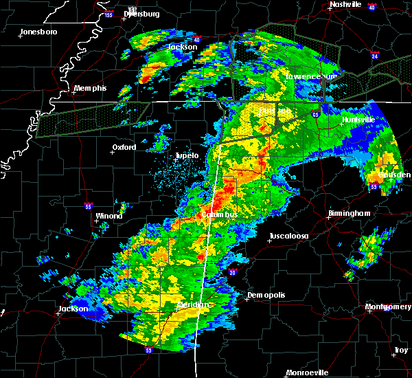 At 529 pm cst, severe thunderstorms were located along a line extending from near littleville to near russellville to phil campbell, moving northeast at 50 mph (radar indicated). Hazards include 60 mph wind gusts. expect damage to roofs, siding, and trees At 529 pm cst, severe thunderstorms were located along a line extending from near littleville to near russellville to phil campbell, moving northeast at 50 mph (radar indicated). Hazards include 60 mph wind gusts. expect damage to roofs, siding, and trees
|
| 11/6/2018 12:28 AM CST |
 The tornado warning for south central lauderdale and southeastern colbert counties will expire at 1230 am cst, the tornado threat has diminished and the tornado warning has been cancelled. however, large hail and damaging winds remain likely and a severe thunderstorm warning remains in effect for the area. however gusty winds are still possible with this thunderstorm. a tornado watch remains in effect until 600 am cst for north central and northwestern alabama. The tornado warning for south central lauderdale and southeastern colbert counties will expire at 1230 am cst, the tornado threat has diminished and the tornado warning has been cancelled. however, large hail and damaging winds remain likely and a severe thunderstorm warning remains in effect for the area. however gusty winds are still possible with this thunderstorm. a tornado watch remains in effect until 600 am cst for north central and northwestern alabama.
|
| 11/6/2018 12:26 AM CST |
 At 1226 am cst, severe thunderstorms were located along a line extending from 7 miles southwest of loretto to near littleville, moving east at 60 mph (radar indicated). Hazards include 60 mph wind gusts. expect damage to roofs, siding, and trees At 1226 am cst, severe thunderstorms were located along a line extending from 7 miles southwest of loretto to near littleville, moving east at 60 mph (radar indicated). Hazards include 60 mph wind gusts. expect damage to roofs, siding, and trees
|
| 11/6/2018 12:20 AM CST |
 At 1220 am cst, a severe thunderstorm capable of producing a tornado was located over tuscumbia, moving east at 45 mph (radar indicated rotation). Hazards include tornado. Flying debris will be dangerous to those caught without shelter. mobile homes will be damaged or destroyed. damage to roofs, windows, and vehicles will occur. tree damage is likely. locations impacted include, florence, muscle shoals, sheffield, tuscumbia, killen, littleville, leighton, st. Florian, northwest alabama regional airport and ford city. At 1220 am cst, a severe thunderstorm capable of producing a tornado was located over tuscumbia, moving east at 45 mph (radar indicated rotation). Hazards include tornado. Flying debris will be dangerous to those caught without shelter. mobile homes will be damaged or destroyed. damage to roofs, windows, and vehicles will occur. tree damage is likely. locations impacted include, florence, muscle shoals, sheffield, tuscumbia, killen, littleville, leighton, st. Florian, northwest alabama regional airport and ford city.
|
| 11/6/2018 12:02 AM CST |
 At 1202 am cst, a severe thunderstorm capable of producing a tornado was located 8 miles southeast of cherokee, or 12 miles southwest of tuscumbia, moving east at 45 mph (radar indicated rotation). Hazards include tornado. Flying debris will be dangerous to those caught without shelter. mobile homes will be damaged or destroyed. damage to roofs, windows, and vehicles will occur. Tree damage is likely. At 1202 am cst, a severe thunderstorm capable of producing a tornado was located 8 miles southeast of cherokee, or 12 miles southwest of tuscumbia, moving east at 45 mph (radar indicated rotation). Hazards include tornado. Flying debris will be dangerous to those caught without shelter. mobile homes will be damaged or destroyed. damage to roofs, windows, and vehicles will occur. Tree damage is likely.
|
| 11/5/2018 11:23 PM CST |
 At 1121 pm cst, a severe thunderstorm was located over underwood-petersville, or 7 miles north of florence, moving east at 60 mph (radar indicated). Hazards include 60 mph wind gusts. expect damage to roofs, siding, and trees At 1121 pm cst, a severe thunderstorm was located over underwood-petersville, or 7 miles north of florence, moving east at 60 mph (radar indicated). Hazards include 60 mph wind gusts. expect damage to roofs, siding, and trees
|
| 11/1/2018 6:55 AM CDT |
 The severe thunderstorm warning for lauderdale, southeastern colbert, eastern franklin and western lawrence counties will expire at 700 am cdt, the storms which prompted the warning have weakened below severe limits, and no longer pose an immediate threat to life or property. therefore, the warning will be allowed to expire. a tornado watch remains in effect until 100 pm cdt for northwestern alabama. The severe thunderstorm warning for lauderdale, southeastern colbert, eastern franklin and western lawrence counties will expire at 700 am cdt, the storms which prompted the warning have weakened below severe limits, and no longer pose an immediate threat to life or property. therefore, the warning will be allowed to expire. a tornado watch remains in effect until 100 pm cdt for northwestern alabama.
|
| 11/1/2018 6:40 AM CDT |
 At 640 am cdt, severe thunderstorms were located along a line extending from 10 miles west of loretto to near needmore, moving east at 50 mph (radar indicated). Hazards include 60 mph wind gusts. Expect damage to roofs, siding, and trees. locations impacted include, florence, muscle shoals, russellville, sheffield, tuscumbia, phil campbell, killen, town creek, littleville and leighton. A tornado watch remains in effect until 100 pm cdt for northwestern alabama. At 640 am cdt, severe thunderstorms were located along a line extending from 10 miles west of loretto to near needmore, moving east at 50 mph (radar indicated). Hazards include 60 mph wind gusts. Expect damage to roofs, siding, and trees. locations impacted include, florence, muscle shoals, russellville, sheffield, tuscumbia, phil campbell, killen, town creek, littleville and leighton. A tornado watch remains in effect until 100 pm cdt for northwestern alabama.
|
| 11/1/2018 6:08 AM CDT |
 At 608 am cdt, severe thunderstorms were located along a line extending from walnut grove to 8 miles southeast of red bay, moving east at 50 mph (radar indicated). Hazards include 60 mph wind gusts. expect damage to roofs, siding, and trees At 608 am cdt, severe thunderstorms were located along a line extending from walnut grove to 8 miles southeast of red bay, moving east at 50 mph (radar indicated). Hazards include 60 mph wind gusts. expect damage to roofs, siding, and trees
|
| 7/15/2018 12:56 PM CDT |
 At 1255 pm cdt, a severe thunderstorm was located 7 miles west of tuscumbia, moving southeast at 10 mph (radar indicated). Hazards include 60 mph wind gusts. expect damage to roofs, siding, and trees At 1255 pm cdt, a severe thunderstorm was located 7 miles west of tuscumbia, moving southeast at 10 mph (radar indicated). Hazards include 60 mph wind gusts. expect damage to roofs, siding, and trees
|
| 6/28/2018 3:25 PM CDT |
 At 324 pm cdt, an area of severe thunderstorms in eastern colbert and franklin counties and lawrence and morgan counties is continuing to move south southeast around 40 to 50 mph (radar indicated). Hazards include 60 mph wind gusts and quarter size hail. Hail damage to vehicles is expected. expect wind damage to roofs, siding, and trees. Locations impacted include, decatur, hartselle, muscle shoals, sheffield, tuscumbia, moulton, priceville, trinity, falkville and town creek. At 324 pm cdt, an area of severe thunderstorms in eastern colbert and franklin counties and lawrence and morgan counties is continuing to move south southeast around 40 to 50 mph (radar indicated). Hazards include 60 mph wind gusts and quarter size hail. Hail damage to vehicles is expected. expect wind damage to roofs, siding, and trees. Locations impacted include, decatur, hartselle, muscle shoals, sheffield, tuscumbia, moulton, priceville, trinity, falkville and town creek.
|
| 6/28/2018 3:03 PM CDT |
 At 303 pm cdt, a severe thunderstorm was located near moulton, moving south at 40 mph (radar indicated). Hazards include 60 mph wind gusts and quarter size hail. Hail damage to vehicles is expected. Expect wind damage to roofs, siding, and trees. At 303 pm cdt, a severe thunderstorm was located near moulton, moving south at 40 mph (radar indicated). Hazards include 60 mph wind gusts and quarter size hail. Hail damage to vehicles is expected. Expect wind damage to roofs, siding, and trees.
|
| 6/28/2018 2:42 PM CDT |
 At 242 pm cdt, a severe thunderstorm was located near killen, or 12 miles east of florence, moving southeast at 15 mph (radar indicated). Hazards include 60 mph wind gusts and nickel size hail. expect damage to roofs, siding, and trees At 242 pm cdt, a severe thunderstorm was located near killen, or 12 miles east of florence, moving southeast at 15 mph (radar indicated). Hazards include 60 mph wind gusts and nickel size hail. expect damage to roofs, siding, and trees
|
| 6/23/2018 5:17 PM CDT |
 At 516 pm cdt, a severe thunderstorm capable of producing a tornado was located near littleville, or 7 miles northwest of russellville, moving east at 20 mph (radar indicated rotation). Hazards include tornado and quarter size hail. Flying debris will be dangerous to those caught without shelter. mobile homes will be damaged or destroyed. damage to roofs, windows, and vehicles will occur. Tree damage is likely. At 516 pm cdt, a severe thunderstorm capable of producing a tornado was located near littleville, or 7 miles northwest of russellville, moving east at 20 mph (radar indicated rotation). Hazards include tornado and quarter size hail. Flying debris will be dangerous to those caught without shelter. mobile homes will be damaged or destroyed. damage to roofs, windows, and vehicles will occur. Tree damage is likely.
|
| 6/23/2018 5:10 PM CDT |
 At 508 pm cdt, a severe thunderstorm was located near littleville, or near tuscumbia, moving east at 20 mph (radar indicated). Hazards include 60 mph wind gusts. Expect damage to roofs, siding, and trees. Locations impacted include, muscle shoals, sheffield, tuscumbia, littleville, leighton, posey loop, new bethel, la grange, red rock and crooked oak. At 508 pm cdt, a severe thunderstorm was located near littleville, or near tuscumbia, moving east at 20 mph (radar indicated). Hazards include 60 mph wind gusts. Expect damage to roofs, siding, and trees. Locations impacted include, muscle shoals, sheffield, tuscumbia, littleville, leighton, posey loop, new bethel, la grange, red rock and crooked oak.
|
| 6/23/2018 4:53 PM CDT |
 At 452 pm cdt, a severe thunderstorm was located 8 miles southeast of cherokee, or 10 miles southwest of tuscumbia, moving east at 25 mph (radar indicated). Hazards include 60 mph wind gusts and nickel size hail. expect damage to roofs, siding, and trees At 452 pm cdt, a severe thunderstorm was located 8 miles southeast of cherokee, or 10 miles southwest of tuscumbia, moving east at 25 mph (radar indicated). Hazards include 60 mph wind gusts and nickel size hail. expect damage to roofs, siding, and trees
|
| 6/23/2018 10:22 AM CDT |
 At 1022 am cdt, severe thunderstorms were located along a line extending from 11 miles southeast of walnut grove to near brushy lake, moving east at 45 mph (radar indicated). Hazards include 60 mph wind gusts. expect damage to roofs, siding, and trees At 1022 am cdt, severe thunderstorms were located along a line extending from 11 miles southeast of walnut grove to near brushy lake, moving east at 45 mph (radar indicated). Hazards include 60 mph wind gusts. expect damage to roofs, siding, and trees
|
| 6/22/2018 5:14 PM CDT |
 At 513 pm cdt, a severe thunderstorm was located near muscle shoals, moving east at 35 mph (radar indicated). Hazards include 60 mph wind gusts and nickel size hail. expect damage to roofs, siding, and trees At 513 pm cdt, a severe thunderstorm was located near muscle shoals, moving east at 35 mph (radar indicated). Hazards include 60 mph wind gusts and nickel size hail. expect damage to roofs, siding, and trees
|
| 6/21/2018 7:45 PM CDT |
 The national weather service in huntsville alabama has issued a * severe thunderstorm warning for. central lauderdale county in northwestern alabama. colbert county in northwestern alabama. northeastern franklin county in northwestern alabama. Western lawrence county in northwestern alabama. The national weather service in huntsville alabama has issued a * severe thunderstorm warning for. central lauderdale county in northwestern alabama. colbert county in northwestern alabama. northeastern franklin county in northwestern alabama. Western lawrence county in northwestern alabama.
|
| 5/30/2018 5:24 PM CDT |
 The severe thunderstorm warning for southeastern colbert, eastern franklin and southwestern lawrence counties will expire at 530 pm cdt, the storms which prompted the warning have weakened below severe limits, and no longer pose an immediate threat to life or property. therefore, the warning will be allowed to expire. however gusty winds and heavy rain are still possible with these thunderstorms. The severe thunderstorm warning for southeastern colbert, eastern franklin and southwestern lawrence counties will expire at 530 pm cdt, the storms which prompted the warning have weakened below severe limits, and no longer pose an immediate threat to life or property. therefore, the warning will be allowed to expire. however gusty winds and heavy rain are still possible with these thunderstorms.
|
| 5/30/2018 5:01 PM CDT |
 At 500 pm cdt, severe thunderstorms were located along a line extending from near tuscumbia to russellville to near phil campbell, moving east at 35 mph (radar indicated). Hazards include 60 mph wind gusts. Expect damage to roofs, siding, and trees. Locations impacted include, muscle shoals, russellville, sheffield, tuscumbia, phil campbell, littleville, leighton, posey loop, mt hope and northwest alabama regional airport. At 500 pm cdt, severe thunderstorms were located along a line extending from near tuscumbia to russellville to near phil campbell, moving east at 35 mph (radar indicated). Hazards include 60 mph wind gusts. Expect damage to roofs, siding, and trees. Locations impacted include, muscle shoals, russellville, sheffield, tuscumbia, phil campbell, littleville, leighton, posey loop, mt hope and northwest alabama regional airport.
|
| 5/30/2018 4:41 PM CDT |
 At 440 pm cdt, severe thunderstorms were located along a line extending from 7 miles southeast of cherokee to belgreen to near hackleburg, moving east at 35 mph (radar indicated). Hazards include 60 mph wind gusts and penny size hail. expect damage to roofs, siding, and trees At 440 pm cdt, severe thunderstorms were located along a line extending from 7 miles southeast of cherokee to belgreen to near hackleburg, moving east at 35 mph (radar indicated). Hazards include 60 mph wind gusts and penny size hail. expect damage to roofs, siding, and trees
|
| 4/14/2018 7:55 AM CDT |
 The severe thunderstorm warning for central lauderdale, southeastern colbert and central franklin counties will expire at 800 am cdt, the storms which prompted the warning have weakened below severe limits, and no longer pose an immediate threat to life or property. therefore the warning will be allowed to expire. however gusty winds are still possible with these thunderstorms as they move to the east. The severe thunderstorm warning for central lauderdale, southeastern colbert and central franklin counties will expire at 800 am cdt, the storms which prompted the warning have weakened below severe limits, and no longer pose an immediate threat to life or property. therefore the warning will be allowed to expire. however gusty winds are still possible with these thunderstorms as they move to the east.
|
| 4/14/2018 7:34 AM CDT |
 At 712 am cdt, severe thunderstorms were located along a line extending from 8 miles north of underwood-petersville to 8 miles southeast of red bay, moving north northeast at 30 mph (radar indicated). Hazards include 60 mph wind gusts and nickel size hail. expect damage to roofs, siding, and trees At 712 am cdt, severe thunderstorms were located along a line extending from 8 miles north of underwood-petersville to 8 miles southeast of red bay, moving north northeast at 30 mph (radar indicated). Hazards include 60 mph wind gusts and nickel size hail. expect damage to roofs, siding, and trees
|
| 4/14/2018 7:12 AM CDT |
 At 712 am cdt, severe thunderstorms were located along a line extending from 8 miles north of underwood-petersville to 8 miles southeast of red bay, moving north northeast at 30 mph (radar indicated). Hazards include 60 mph wind gusts and nickel size hail. expect damage to roofs, siding, and trees At 712 am cdt, severe thunderstorms were located along a line extending from 8 miles north of underwood-petersville to 8 miles southeast of red bay, moving north northeast at 30 mph (radar indicated). Hazards include 60 mph wind gusts and nickel size hail. expect damage to roofs, siding, and trees
|
| 4/3/2018 10:05 PM CDT |
 At 1003 pm cdt, severe thunderstorms were located along a line extending from near lexington to 3 miles east of phil campbell, moving east at 50 mph (emergency management. there have been numerous reports of downed trees and power lines across the shoals region. at 946 pm cdt, the muscle shoals airport reported a 62 mph wind gust with these storms). Hazards include 60 mph wind gusts. Expect damage to roofs, siding, and trees. Locations impacted include, moulton, rogersville, phil campbell, killen, town creek, lexington, leighton, courtland, north courtland and anderson. At 1003 pm cdt, severe thunderstorms were located along a line extending from near lexington to 3 miles east of phil campbell, moving east at 50 mph (emergency management. there have been numerous reports of downed trees and power lines across the shoals region. at 946 pm cdt, the muscle shoals airport reported a 62 mph wind gust with these storms). Hazards include 60 mph wind gusts. Expect damage to roofs, siding, and trees. Locations impacted include, moulton, rogersville, phil campbell, killen, town creek, lexington, leighton, courtland, north courtland and anderson.
|
| 4/3/2018 9:55 PM CDT |
 The tornado warning for southeastern lauderdale, east central colbert and northwestern lawrence counties will expire at 1000 pm cdt, the tornado threat has diminished and the tornado warning will expire at the top of the hour. however, damaging winds remain likely and a severe thunderstorm warning remains in effect for the area until 1015 pm cdt. a severe thunderstorm watch remains in effect until 100 am cdt for north central and northwestern alabama. The tornado warning for southeastern lauderdale, east central colbert and northwestern lawrence counties will expire at 1000 pm cdt, the tornado threat has diminished and the tornado warning will expire at the top of the hour. however, damaging winds remain likely and a severe thunderstorm warning remains in effect for the area until 1015 pm cdt. a severe thunderstorm watch remains in effect until 100 am cdt for north central and northwestern alabama.
|
| 4/3/2018 9:53 PM CDT |
 At 952 pm cdt, severe thunderstorms were located along a line extending from 6 miles southwest of loretto to near needmore, moving east at 50 mph (emergency management. at 946 pm cdt, a 62 mph gust was reported at the muscle shoals airport. at 949 pm cdt, trees were reported down in waterloo). Hazards include 60 mph wind gusts and penny size hail. Expect damage to roofs, siding, and trees. Locations impacted include, florence, muscle shoals, russellville, sheffield, tuscumbia, moulton, rogersville, phil campbell, killen and town creek. At 952 pm cdt, severe thunderstorms were located along a line extending from 6 miles southwest of loretto to near needmore, moving east at 50 mph (emergency management. at 946 pm cdt, a 62 mph gust was reported at the muscle shoals airport. at 949 pm cdt, trees were reported down in waterloo). Hazards include 60 mph wind gusts and penny size hail. Expect damage to roofs, siding, and trees. Locations impacted include, florence, muscle shoals, russellville, sheffield, tuscumbia, moulton, rogersville, phil campbell, killen and town creek.
|
| 4/3/2018 9:46 PM CDT | Large tree down on tuxedo av in colbert county AL, 2.5 miles ENE of Muscle Shoals, AL |
| 4/3/2018 9:46 PM CDT | Kmsl reported a gust to 54 kt (62mph in colbert county AL, 1 miles W of Muscle Shoals, AL |
| 4/3/2018 9:40 PM CDT |
 At 940 pm cdt, a severe thunderstorm capable of producing a tornado was located over muscle shoals, moving east at 55 mph (radar indicated rotation). Hazards include tornado. Flying debris will be dangerous to those caught without shelter. mobile homes will be damaged or destroyed. damage to roofs, windows, and vehicles will occur. Tree damage is likely. At 940 pm cdt, a severe thunderstorm capable of producing a tornado was located over muscle shoals, moving east at 55 mph (radar indicated rotation). Hazards include tornado. Flying debris will be dangerous to those caught without shelter. mobile homes will be damaged or destroyed. damage to roofs, windows, and vehicles will occur. Tree damage is likely.
|
| 4/3/2018 9:32 PM CDT |
 At 931 pm cdt, severe thunderstorms were located along a line extending from threet to near hodges, moving east at 50 mph (radar indicated). Hazards include 60 mph wind gusts and penny size hail. Expect damage to roofs, siding, and trees. Locations impacted include, florence, muscle shoals, russellville, sheffield, tuscumbia, moulton, rogersville, phil campbell, killen and town creek. At 931 pm cdt, severe thunderstorms were located along a line extending from threet to near hodges, moving east at 50 mph (radar indicated). Hazards include 60 mph wind gusts and penny size hail. Expect damage to roofs, siding, and trees. Locations impacted include, florence, muscle shoals, russellville, sheffield, tuscumbia, moulton, rogersville, phil campbell, killen and town creek.
|
| 4/3/2018 9:24 PM CDT |
 At 923 pm cdt, severe thunderstorms were located along a line extending from 11 miles east of walnut grove to 8 miles northwest of hackleburg, moving east at 50 mph (radar indicated. at 8:45pm trees were reported down on powerlines in booneville with these storms). Hazards include 60 mph wind gusts and penny size hail. expect damage to roofs, siding, and trees At 923 pm cdt, severe thunderstorms were located along a line extending from 11 miles east of walnut grove to 8 miles northwest of hackleburg, moving east at 50 mph (radar indicated. at 8:45pm trees were reported down on powerlines in booneville with these storms). Hazards include 60 mph wind gusts and penny size hail. expect damage to roofs, siding, and trees
|
| 3/19/2018 5:13 PM CDT |
 At 513 pm cdt, a severe thunderstorm capable of producing a tornado was located 8 miles south of cherokee, or 14 miles east of tishomingo state park, moving east at 40 mph (radar indicated rotation). Hazards include tornado and quarter size hail. Flying debris will be dangerous to those caught without shelter. mobile homes will be damaged or destroyed. damage to roofs, windows, and vehicles will occur. tree damage is likely. this dangerous storm will be near, tuscumbia and littleville around 535 pm cdt. sheffield around 540 pm cdt. leighton around 545 pm cdt. Other locations impacted by this tornadic thunderstorm include red rock, posey loop, pride landing, northwest alabama regional airport and srygley church. At 513 pm cdt, a severe thunderstorm capable of producing a tornado was located 8 miles south of cherokee, or 14 miles east of tishomingo state park, moving east at 40 mph (radar indicated rotation). Hazards include tornado and quarter size hail. Flying debris will be dangerous to those caught without shelter. mobile homes will be damaged or destroyed. damage to roofs, windows, and vehicles will occur. tree damage is likely. this dangerous storm will be near, tuscumbia and littleville around 535 pm cdt. sheffield around 540 pm cdt. leighton around 545 pm cdt. Other locations impacted by this tornadic thunderstorm include red rock, posey loop, pride landing, northwest alabama regional airport and srygley church.
|
| 3/19/2018 5:08 PM CDT |
 At 508 pm cdt, a severe thunderstorm capable of producing a tornado was located near red bay, moving east at 40 mph (radar indicated rotation). Hazards include tornado and tennis ball size hail. Flying debris will be dangerous to those caught without shelter. mobile homes will be damaged or destroyed. damage to roofs, windows, and vehicles will occur. tree damage is likely. Locations impacted include, russellville, red bay, littleville, leighton, belgreen, pogo, cedar creek reservoir, srygley church, new bethel and la grange. At 508 pm cdt, a severe thunderstorm capable of producing a tornado was located near red bay, moving east at 40 mph (radar indicated rotation). Hazards include tornado and tennis ball size hail. Flying debris will be dangerous to those caught without shelter. mobile homes will be damaged or destroyed. damage to roofs, windows, and vehicles will occur. tree damage is likely. Locations impacted include, russellville, red bay, littleville, leighton, belgreen, pogo, cedar creek reservoir, srygley church, new bethel and la grange.
|
| 3/19/2018 4:58 PM CDT |
 At 458 pm cdt, a severe thunderstorm capable of producing a tornado was located near belmont, or near red bay, moving east at 65 mph (radar indicated rotation). Hazards include tornado and golf ball size hail. Flying debris will be dangerous to those caught without shelter. mobile homes will be damaged or destroyed. damage to roofs, windows, and vehicles will occur. Tree damage is likely. At 458 pm cdt, a severe thunderstorm capable of producing a tornado was located near belmont, or near red bay, moving east at 65 mph (radar indicated rotation). Hazards include tornado and golf ball size hail. Flying debris will be dangerous to those caught without shelter. mobile homes will be damaged or destroyed. damage to roofs, windows, and vehicles will occur. Tree damage is likely.
|
| 3/19/2018 4:48 PM CDT |
 At 447 pm cdt, a severe thunderstorm was located near tishomingo state park, moving east at 55 mph (radar indicated). Hazards include golf ball size hail and 60 mph wind gusts. People and animals outdoors will be injured. expect hail damage to roofs, siding, windows, and vehicles. Expect wind damage to roofs, siding, and trees. At 447 pm cdt, a severe thunderstorm was located near tishomingo state park, moving east at 55 mph (radar indicated). Hazards include golf ball size hail and 60 mph wind gusts. People and animals outdoors will be injured. expect hail damage to roofs, siding, windows, and vehicles. Expect wind damage to roofs, siding, and trees.
|
| 3/19/2018 1:50 PM CDT |
 At 150 pm cdt, a severe thunderstorm capable of producing a tornado was located over leighton, or 7 miles southeast of muscle shoals, moving northeast at 40 mph (radar indicated rotation). Hazards include tornado and quarter size hail. Flying debris will be dangerous to those caught without shelter. mobile homes will be damaged or destroyed. damage to roofs, windows, and vehicles will occur. tree damage is likely. This tornadic thunderstorm will remain over mainly rural areas of southeastern colbert county, including the following locations: whiteoak, ford city and northwest alabama regional airport. At 150 pm cdt, a severe thunderstorm capable of producing a tornado was located over leighton, or 7 miles southeast of muscle shoals, moving northeast at 40 mph (radar indicated rotation). Hazards include tornado and quarter size hail. Flying debris will be dangerous to those caught without shelter. mobile homes will be damaged or destroyed. damage to roofs, windows, and vehicles will occur. tree damage is likely. This tornadic thunderstorm will remain over mainly rural areas of southeastern colbert county, including the following locations: whiteoak, ford city and northwest alabama regional airport.
|
| 3/19/2018 1:38 PM CDT |
 At 138 pm cdt, a severe thunderstorm capable of producing a tornado was located near littleville, or near tuscumbia, moving northeast at 55 mph (radar indicated rotation). Hazards include tornado and quarter size hail. Flying debris will be dangerous to those caught without shelter. mobile homes will be damaged or destroyed. damage to roofs, windows, and vehicles will occur. tree damage is likely. this dangerous storm will be near, leighton around 145 pm cdt. Other locations impacted by this tornadic thunderstorm include colbert heights, northwest alabama regional airport, whiteoak and ford city. At 138 pm cdt, a severe thunderstorm capable of producing a tornado was located near littleville, or near tuscumbia, moving northeast at 55 mph (radar indicated rotation). Hazards include tornado and quarter size hail. Flying debris will be dangerous to those caught without shelter. mobile homes will be damaged or destroyed. damage to roofs, windows, and vehicles will occur. tree damage is likely. this dangerous storm will be near, leighton around 145 pm cdt. Other locations impacted by this tornadic thunderstorm include colbert heights, northwest alabama regional airport, whiteoak and ford city.
|
| 3/19/2018 1:20 PM CDT |
 At 119 pm cdt, a severe thunderstorm was located near tuscumbia, moving east at 40 mph (radar indicated). Hazards include 60 mph wind gusts and quarter size hail. Hail damage to vehicles is expected. Expect wind damage to roofs, siding, and trees. At 119 pm cdt, a severe thunderstorm was located near tuscumbia, moving east at 40 mph (radar indicated). Hazards include 60 mph wind gusts and quarter size hail. Hail damage to vehicles is expected. Expect wind damage to roofs, siding, and trees.
|
| 2/25/2018 12:24 AM CST |
 At 1223 am cst, severe thunderstorms were located along a line extending from near littleville to near weston, moving east at 60 mph (radar indicated). Hazards include 60 mph wind gusts. expect damage to roofs, siding, and trees At 1223 am cst, severe thunderstorms were located along a line extending from near littleville to near weston, moving east at 60 mph (radar indicated). Hazards include 60 mph wind gusts. expect damage to roofs, siding, and trees
|
| 2/25/2018 12:01 AM CST |
 At 1200 am cst, severe thunderstorms were located along a line extending from near lexington to tremont, moving east at 60 mph (radar indicated). Hazards include 60 mph wind gusts. Expect damage to roofs, siding, and trees. Locations impacted include, florence, muscle shoals, russellville, sheffield, tuscumbia, red bay, rogersville, killen, town creek and littleville. At 1200 am cst, severe thunderstorms were located along a line extending from near lexington to tremont, moving east at 60 mph (radar indicated). Hazards include 60 mph wind gusts. Expect damage to roofs, siding, and trees. Locations impacted include, florence, muscle shoals, russellville, sheffield, tuscumbia, red bay, rogersville, killen, town creek and littleville.
|
| 2/24/2018 11:36 PM CST |
 At 1135 pm cst, severe thunderstorms were located along a line extending from 6 miles northwest of underwood-petersville to near evergreen, moving northeast at 55 mph (radar indicated). Hazards include 60 mph wind gusts. expect damage to roofs, siding, and trees At 1135 pm cst, severe thunderstorms were located along a line extending from 6 miles northwest of underwood-petersville to near evergreen, moving northeast at 55 mph (radar indicated). Hazards include 60 mph wind gusts. expect damage to roofs, siding, and trees
|
| 12/23/2017 5:56 AM CST |
 The severe thunderstorm warning for central lauderdale, southeastern colbert and central franklin counties will expire at 600 am cst, the storms which prompted the warning have weakened below severe limits, and no longer pose an immediate threat to life or property. therefore the warning will be allowed to expire. however gusty winds are still possible with these thunderstorms. The severe thunderstorm warning for central lauderdale, southeastern colbert and central franklin counties will expire at 600 am cst, the storms which prompted the warning have weakened below severe limits, and no longer pose an immediate threat to life or property. therefore the warning will be allowed to expire. however gusty winds are still possible with these thunderstorms.
|
| 12/23/2017 5:31 AM CST |
 At 530 am cst, severe thunderstorms were located along a line extending from near underwood-petersville to 7 miles northeast of tremont, moving south at 20 mph (radar indicated). Hazards include 60 mph wind gusts. expect damage to roofs, siding, and trees At 530 am cst, severe thunderstorms were located along a line extending from near underwood-petersville to 7 miles northeast of tremont, moving south at 20 mph (radar indicated). Hazards include 60 mph wind gusts. expect damage to roofs, siding, and trees
|
| 12/23/2017 5:01 AM CST |
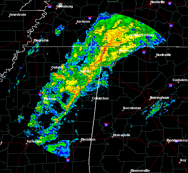 At 500 am cst, severe thunderstorms were located along a line extending from near walnut grove to near iuka to near tishomingo state park, moving east at 30 mph (radar indicated). Hazards include 60 to 70 mph wind gusts. expect damage to roofs, siding, and trees At 500 am cst, severe thunderstorms were located along a line extending from near walnut grove to near iuka to near tishomingo state park, moving east at 30 mph (radar indicated). Hazards include 60 to 70 mph wind gusts. expect damage to roofs, siding, and trees
|
| 11/18/2017 5:07 PM CST |
 At 506 pm cst, severe thunderstorms were located along a line extending from near lexington to near leighton, moving east at 55 mph (radar indicated). Hazards include 60 mph wind gusts. expect damage to roofs, siding, and trees At 506 pm cst, severe thunderstorms were located along a line extending from near lexington to near leighton, moving east at 55 mph (radar indicated). Hazards include 60 mph wind gusts. expect damage to roofs, siding, and trees
|
| 11/18/2017 4:54 PM CST |
 At 454 pm cst, severe thunderstorms were located along a line extending from near sheffield to 9 miles south of red bay, moving east at 40 mph (radar indicated). Hazards include 70 mph wind gusts and nickel size hail. Expect considerable tree damage. Damage is likely to mobile homes, roofs, and outbuildings. At 454 pm cst, severe thunderstorms were located along a line extending from near sheffield to 9 miles south of red bay, moving east at 40 mph (radar indicated). Hazards include 70 mph wind gusts and nickel size hail. Expect considerable tree damage. Damage is likely to mobile homes, roofs, and outbuildings.
|
| 9/19/2017 11:07 AM CDT | Gust reported by asos of 59 mp in colbert county AL, 1 miles W of Muscle Shoals, AL |
| 9/19/2017 11:06 AM CDT | Gust reported by asos of 59 mp in colbert county AL, 1 miles W of Muscle Shoals, AL |
| 7/3/2017 4:55 PM CDT |
 At 454 pm cdt, a cluster of severe thunderstorms was centered near iuka, moving northeast at 45 mph (radar indicated). Hazards include 60 mph wind gusts. expect damage to roofs, siding, and trees At 454 pm cdt, a cluster of severe thunderstorms was centered near iuka, moving northeast at 45 mph (radar indicated). Hazards include 60 mph wind gusts. expect damage to roofs, siding, and trees
|
| 6/23/2017 1:27 PM CDT | Ema reported a tree down at ne markate ave & river road in muscle shoal in colbert county AL, 2.2 miles SSW of Muscle Shoals, AL |
| 5/28/2017 1:02 AM CDT |
 At 102 am cdt, severe thunderstorms were located along a line extending from near lexington to near red bay, moving southeast at 60 mph (radar indicated). Hazards include 70 to 80 mph wind gusts and penny size hail. Expect considerable tree damage. Damage is likely to mobile homes, roofs, and outbuildings. At 102 am cdt, severe thunderstorms were located along a line extending from near lexington to near red bay, moving southeast at 60 mph (radar indicated). Hazards include 70 to 80 mph wind gusts and penny size hail. Expect considerable tree damage. Damage is likely to mobile homes, roofs, and outbuildings.
|
| 4/30/2017 1:28 PM CDT |
 At 128 pm cdt, severe thunderstorms were located along a line extending from 9 miles southwest of loretto to near leighton, moving northeast at 60 mph (radar indicated). Hazards include 70 mph wind gusts. Expect considerable tree damage. Damage is likely to mobile homes, roofs, and outbuildings. At 128 pm cdt, severe thunderstorms were located along a line extending from 9 miles southwest of loretto to near leighton, moving northeast at 60 mph (radar indicated). Hazards include 70 mph wind gusts. Expect considerable tree damage. Damage is likely to mobile homes, roofs, and outbuildings.
|
| 4/30/2017 1:16 PM CDT |
 At 115 pm cdt, severe thunderstorms were located along a line extending from 10 miles west of loretto to near littleville, moving northeast at 55 mph (emergency management. at 109 pm cdt, a tree was reported down near camp westmoreland in the florence area. at 113 pm cdt, a tree was reported down on a house along county road 8 near florence). Hazards include 70 mph wind gusts. Expect considerable tree damage. damage is likely to mobile homes, roofs, and outbuildings. locations impacted include, florence, muscle shoals, russellville, sheffield, tuscumbia, rogersville, killen, littleville, lexington and leighton. A tornado watch remains in effect until 700 pm cdt for north central and northwestern alabama. At 115 pm cdt, severe thunderstorms were located along a line extending from 10 miles west of loretto to near littleville, moving northeast at 55 mph (emergency management. at 109 pm cdt, a tree was reported down near camp westmoreland in the florence area. at 113 pm cdt, a tree was reported down on a house along county road 8 near florence). Hazards include 70 mph wind gusts. Expect considerable tree damage. damage is likely to mobile homes, roofs, and outbuildings. locations impacted include, florence, muscle shoals, russellville, sheffield, tuscumbia, rogersville, killen, littleville, lexington and leighton. A tornado watch remains in effect until 700 pm cdt for north central and northwestern alabama.
|
| 4/30/2017 12:51 PM CDT |
 At 1250 pm cdt, severe thunderstorms were located along a line extending from 8 miles west of underwood-petersville to near belgreen, moving northeast at 65 mph (radar indicated). Hazards include 70 mph wind gusts. Expect considerable tree damage. Damage is likely to mobile homes, roofs, and outbuildings. At 1250 pm cdt, severe thunderstorms were located along a line extending from 8 miles west of underwood-petersville to near belgreen, moving northeast at 65 mph (radar indicated). Hazards include 70 mph wind gusts. Expect considerable tree damage. Damage is likely to mobile homes, roofs, and outbuildings.
|
| 4/26/2017 11:50 PM CDT |
 At 1149 pm cdt, a severe thunderstorm was located near killen, or near florence, moving northeast at 60 mph (radar indicated). Hazards include 60 mph wind gusts and penny size hail. Expect damage to roofs, siding, and trees. locations impacted include, florence, muscle shoals, sheffield, tuscumbia, killen, littleville, lexington, leighton, st. Florian and underwood-petersville. At 1149 pm cdt, a severe thunderstorm was located near killen, or near florence, moving northeast at 60 mph (radar indicated). Hazards include 60 mph wind gusts and penny size hail. Expect damage to roofs, siding, and trees. locations impacted include, florence, muscle shoals, sheffield, tuscumbia, killen, littleville, lexington, leighton, st. Florian and underwood-petersville.
|
| 4/26/2017 11:37 PM CDT |
 At 1137 pm cdt, a severe thunderstorm was located over tuscumbia, moving northeast at 70 mph (radar indicated). Hazards include 60 mph wind gusts and penny size hail. expect damage to roofs, siding, and trees At 1137 pm cdt, a severe thunderstorm was located over tuscumbia, moving northeast at 70 mph (radar indicated). Hazards include 60 mph wind gusts and penny size hail. expect damage to roofs, siding, and trees
|
| 3/27/2017 9:38 PM CDT |
 At 937 pm cdt, a severe thunderstorm was located 9 miles southeast of cherokee, or 10 miles southwest of tuscumbia, moving southeast at 15 mph (radar indicated. nickel sized hail has been reported with this storm. and trees were reported down earlier near cherokee). Hazards include 60 mph wind gusts and quarter size hail. Hail damage to vehicles is expected. expect wind damage to roofs, siding, and trees. Locations impacted include, muscle shoals, russellville, sheffield, tuscumbia, red bay, phil campbell, littleville, belgreen, vina and hodges. At 937 pm cdt, a severe thunderstorm was located 9 miles southeast of cherokee, or 10 miles southwest of tuscumbia, moving southeast at 15 mph (radar indicated. nickel sized hail has been reported with this storm. and trees were reported down earlier near cherokee). Hazards include 60 mph wind gusts and quarter size hail. Hail damage to vehicles is expected. expect wind damage to roofs, siding, and trees. Locations impacted include, muscle shoals, russellville, sheffield, tuscumbia, red bay, phil campbell, littleville, belgreen, vina and hodges.
|
| 3/27/2017 9:21 PM CDT |
 At 920 pm cdt, severe thunderstorms were located along a line extending from near midway to near muscle shoals, moving southeast at 45 mph (radar indicated). Hazards include 60 mph wind gusts and quarter size hail. Hail damage to vehicles is expected. Expect wind damage to roofs, siding, and trees. At 920 pm cdt, severe thunderstorms were located along a line extending from near midway to near muscle shoals, moving southeast at 45 mph (radar indicated). Hazards include 60 mph wind gusts and quarter size hail. Hail damage to vehicles is expected. Expect wind damage to roofs, siding, and trees.
|
| 3/27/2017 3:52 PM CDT |
 At 352 pm cdt, a severe thunderstorm was located near red bay, moving northeast at 40 mph. another severe thunderstorm was located near russellville (radar indicated). Hazards include 60 mph wind gusts and half dollar size hail. Hail damage to vehicles is expected. Expect wind damage to roofs, siding, and trees. At 352 pm cdt, a severe thunderstorm was located near red bay, moving northeast at 40 mph. another severe thunderstorm was located near russellville (radar indicated). Hazards include 60 mph wind gusts and half dollar size hail. Hail damage to vehicles is expected. Expect wind damage to roofs, siding, and trees.
|
| 3/27/2017 2:16 PM CDT |
 At 216 pm cdt, a severe thunderstorm was located near tishomingo state park, moving northeast at 30 mph. another severe thunderstorm was located near posey loop moving northeast at 30 mph (radar indicated). Hazards include 60 mph wind gusts and quarter size hail. Hail damage to vehicles is expected. expect wind damage to roofs, siding, and trees. Locations impacted include, florence, sheffield, tuscumbia, cherokee, malone, posey loop, allsboro, wright, red rock and pride landing. At 216 pm cdt, a severe thunderstorm was located near tishomingo state park, moving northeast at 30 mph. another severe thunderstorm was located near posey loop moving northeast at 30 mph (radar indicated). Hazards include 60 mph wind gusts and quarter size hail. Hail damage to vehicles is expected. expect wind damage to roofs, siding, and trees. Locations impacted include, florence, sheffield, tuscumbia, cherokee, malone, posey loop, allsboro, wright, red rock and pride landing.
|
| 3/27/2017 2:03 PM CDT |
 At 202 pm cdt, a severe thunderstorm was located near tishomingo state park, moving northeast at 35 mph (radar indicated). Hazards include 60 mph wind gusts and quarter size hail. Hail damage to vehicles is expected. Expect wind damage to roofs, siding, and trees. At 202 pm cdt, a severe thunderstorm was located near tishomingo state park, moving northeast at 35 mph (radar indicated). Hazards include 60 mph wind gusts and quarter size hail. Hail damage to vehicles is expected. Expect wind damage to roofs, siding, and trees.
|
| 3/10/2017 12:39 AM CST |
 The severe thunderstorm warning for northwestern madison, lauderdale, limestone, colbert and northern lawrence counties will expire at 1245 am cst, the storms which prompted the warning have weakened below severe limits, and no longer pose an immediate threat to life or property. therefore, the warning will be allowed to expire. a severe thunderstorm warning remains in effect for eastern madison county, al. a severe thunderstorm watch remains in effect until 400 am cst for north central, northeastern and northwestern alabama, and middle tennessee. The severe thunderstorm warning for northwestern madison, lauderdale, limestone, colbert and northern lawrence counties will expire at 1245 am cst, the storms which prompted the warning have weakened below severe limits, and no longer pose an immediate threat to life or property. therefore, the warning will be allowed to expire. a severe thunderstorm warning remains in effect for eastern madison county, al. a severe thunderstorm watch remains in effect until 400 am cst for north central, northeastern and northwestern alabama, and middle tennessee.
|
| 3/10/2017 12:00 AM CST |
 At 1159 pm cst, severe thunderstorms were located along a line extending from near tanner to near cherokee, moving south-southeast at 40 mph (radar indicated). Hazards include 60 mph wind gusts and quarter size hail. Hail damage to vehicles is expected. expect wind damage to roofs, siding, and trees. Locations impacted include, northwestern huntsville, madison, florence, athens, muscle shoals, sheffield, tuscumbia, j p coleman state park, meridianville and hazel green. At 1159 pm cst, severe thunderstorms were located along a line extending from near tanner to near cherokee, moving south-southeast at 40 mph (radar indicated). Hazards include 60 mph wind gusts and quarter size hail. Hail damage to vehicles is expected. expect wind damage to roofs, siding, and trees. Locations impacted include, northwestern huntsville, madison, florence, athens, muscle shoals, sheffield, tuscumbia, j p coleman state park, meridianville and hazel green.
|
| 3/9/2017 11:50 PM CST |
 At 1149 pm cst, severe thunderstorms were located along a line extending from near ardmore to 8 miles southeast of walnut grove, moving southwest at 85 mph (radar indicated). Hazards include 60 mph wind gusts and quarter size hail. Hail damage to vehicles is expected. Expect wind damage to roofs, siding, and trees. At 1149 pm cst, severe thunderstorms were located along a line extending from near ardmore to 8 miles southeast of walnut grove, moving southwest at 85 mph (radar indicated). Hazards include 60 mph wind gusts and quarter size hail. Hail damage to vehicles is expected. Expect wind damage to roofs, siding, and trees.
|
| 3/1/2017 12:46 PM CST |
 At 1246 pm cst, a severe thunderstorm was located over town creek, or 13 miles east of muscle shoals, moving east at 60 mph (emergency management). Hazards include 60 mph wind gusts and half dollar size hail. Hail damage to vehicles is expected. expect wind damage to roofs, siding, and trees. locations impacted include, muscle shoals, town creek, leighton, courtland, north courtland, la grange, ne smith, spring valley, hatton and whiteoak. A tornado watch remains in effect until 600 pm cst for north central and northwestern alabama. At 1246 pm cst, a severe thunderstorm was located over town creek, or 13 miles east of muscle shoals, moving east at 60 mph (emergency management). Hazards include 60 mph wind gusts and half dollar size hail. Hail damage to vehicles is expected. expect wind damage to roofs, siding, and trees. locations impacted include, muscle shoals, town creek, leighton, courtland, north courtland, la grange, ne smith, spring valley, hatton and whiteoak. A tornado watch remains in effect until 600 pm cst for north central and northwestern alabama.
|
| 3/1/2017 12:32 PM CST |
 At 1232 pm cst, a severe thunderstorm was located near littleville, or near tuscumbia, moving east at 55 mph (radar indicated). Hazards include two inch hail and 60 mph wind gusts. People and animals outdoors will be injured. expect hail damage to roofs, siding, windows, and vehicles. Expect wind damage to roofs, siding, and trees. At 1232 pm cst, a severe thunderstorm was located near littleville, or near tuscumbia, moving east at 55 mph (radar indicated). Hazards include two inch hail and 60 mph wind gusts. People and animals outdoors will be injured. expect hail damage to roofs, siding, windows, and vehicles. Expect wind damage to roofs, siding, and trees.
|
| 3/1/2017 11:58 AM CST |
 At 1158 am cst, a severe thunderstorm was located over st. florian, or near florence, moving east at 55 mph (radar indicated). Hazards include golf ball size hail and 60 mph wind gusts. People and animals outdoors will be injured. expect hail damage to roofs, siding, windows, and vehicles. Expect wind damage to roofs, siding, and trees. At 1158 am cst, a severe thunderstorm was located over st. florian, or near florence, moving east at 55 mph (radar indicated). Hazards include golf ball size hail and 60 mph wind gusts. People and animals outdoors will be injured. expect hail damage to roofs, siding, windows, and vehicles. Expect wind damage to roofs, siding, and trees.
|
| 12/18/2016 12:43 AM CST |
 At 1242 am cst, a severe thunderstorm was located near tuscumbia, moving east at 65 mph (radar indicated). Hazards include 70 mph wind gusts. Expect considerable tree damage. damage is likely to mobile homes, roofs, and outbuildings. locations impacted include, russellville, tuscumbia, littleville, posey loop, crooked oak, red rock, spring valley, new bethel, pleasant ridge and tharptown. A tornado watch remains in effect until 300 am cst for north central and northwestern alabama. At 1242 am cst, a severe thunderstorm was located near tuscumbia, moving east at 65 mph (radar indicated). Hazards include 70 mph wind gusts. Expect considerable tree damage. damage is likely to mobile homes, roofs, and outbuildings. locations impacted include, russellville, tuscumbia, littleville, posey loop, crooked oak, red rock, spring valley, new bethel, pleasant ridge and tharptown. A tornado watch remains in effect until 300 am cst for north central and northwestern alabama.
|
| 12/18/2016 12:25 AM CST |
 At 1225 am cst, a severe thunderstorm was located over sheffield, moving east at 50 mph (radar indicated). Hazards include 70 mph wind gusts. Expect considerable tree damage. Damage is likely to mobile homes, roofs, and outbuildings. At 1225 am cst, a severe thunderstorm was located over sheffield, moving east at 50 mph (radar indicated). Hazards include 70 mph wind gusts. Expect considerable tree damage. Damage is likely to mobile homes, roofs, and outbuildings.
|
| 12/18/2016 12:20 AM CST |
 At 1220 am cst, a severe thunderstorm was located near belmont, or near tishomingo state park, moving northeast at 70 mph (radar indicated). Hazards include 70 mph wind gusts. Expect considerable tree damage. Damage is likely to mobile homes, roofs, and outbuildings. At 1220 am cst, a severe thunderstorm was located near belmont, or near tishomingo state park, moving northeast at 70 mph (radar indicated). Hazards include 70 mph wind gusts. Expect considerable tree damage. Damage is likely to mobile homes, roofs, and outbuildings.
|
| 12/18/2016 12:12 AM CST |
 At 1212 am cst, a severe thunderstorm was located near cherokee, or 8 miles west of tuscumbia, moving east at 60 mph (radar indicated). Hazards include 70 mph wind gusts. Expect considerable tree damage. damage is likely to mobile homes, roofs, and outbuildings. locations impacted include, florence, muscle shoals, sheffield, tuscumbia, killen, cherokee, st. florian, underwood-petersville, northwest alabama regional airport and barton. A tornado watch remains in effect until 300 am cst for north central and northwestern alabama. At 1212 am cst, a severe thunderstorm was located near cherokee, or 8 miles west of tuscumbia, moving east at 60 mph (radar indicated). Hazards include 70 mph wind gusts. Expect considerable tree damage. damage is likely to mobile homes, roofs, and outbuildings. locations impacted include, florence, muscle shoals, sheffield, tuscumbia, killen, cherokee, st. florian, underwood-petersville, northwest alabama regional airport and barton. A tornado watch remains in effect until 300 am cst for north central and northwestern alabama.
|
| 12/17/2016 11:55 PM CST |
 At 1154 pm cst, a severe thunderstorm was located over cherokee, or 13 miles east of iuka, moving east at 50 mph (radar indicated). Hazards include 70 mph wind gusts. Expect considerable tree damage. Damage is likely to mobile homes, roofs, and outbuildings. At 1154 pm cst, a severe thunderstorm was located over cherokee, or 13 miles east of iuka, moving east at 50 mph (radar indicated). Hazards include 70 mph wind gusts. Expect considerable tree damage. Damage is likely to mobile homes, roofs, and outbuildings.
|
| 11/29/2016 7:41 PM CST |
 The tornado warning for south central colbert and north central franklin counties will expire at 745 pm cst, the storm which prompted the warning has moved out of the area. therefore the warning will be allowed to expire. however gusty winds are still possible with this thunderstorm. a tornado watch remains in effect until 1100 pm cst for northwestern alabama. a tornado watch also remains in effect until midnight cst for north central and northwestern alabama. The tornado warning for south central colbert and north central franklin counties will expire at 745 pm cst, the storm which prompted the warning has moved out of the area. therefore the warning will be allowed to expire. however gusty winds are still possible with this thunderstorm. a tornado watch remains in effect until 1100 pm cst for northwestern alabama. a tornado watch also remains in effect until midnight cst for north central and northwestern alabama.
|
| 11/29/2016 7:31 PM CST |
 At 731 pm cst, a severe thunderstorm was located over leighton, or near muscle shoals, moving northeast at 55 mph (radar indicated). Hazards include 70 mph wind gusts and quarter size hail. Hail damage to vehicles is expected. expect considerable tree damage. Wind damage is also likely to mobile homes, roofs, and outbuildings. At 731 pm cst, a severe thunderstorm was located over leighton, or near muscle shoals, moving northeast at 55 mph (radar indicated). Hazards include 70 mph wind gusts and quarter size hail. Hail damage to vehicles is expected. expect considerable tree damage. Wind damage is also likely to mobile homes, roofs, and outbuildings.
|
| 11/29/2016 7:14 PM CST |
 At 714 pm cst, a severe thunderstorm capable of producing a tornado was located 8 miles north of belgreen, or 9 miles northwest of russellville, moving northeast at 35 mph (radar indicated rotation). Hazards include tornado and quarter size hail. Flying debris will be dangerous to those caught without shelter. mobile homes will be damaged or destroyed. damage to roofs, windows, and vehicles will occur. tree damage is likely. this dangerous storm will be near, littleville around 730 pm cst. tuscumbia around 735 pm cst. sheffield around 740 pm cst. muscle shoals around 745 pm cst. Other locations impacted by this tornadic thunderstorm include crooked oak, posey loop, srygley church, spring valley and new bethel. At 714 pm cst, a severe thunderstorm capable of producing a tornado was located 8 miles north of belgreen, or 9 miles northwest of russellville, moving northeast at 35 mph (radar indicated rotation). Hazards include tornado and quarter size hail. Flying debris will be dangerous to those caught without shelter. mobile homes will be damaged or destroyed. damage to roofs, windows, and vehicles will occur. tree damage is likely. this dangerous storm will be near, littleville around 730 pm cst. tuscumbia around 735 pm cst. sheffield around 740 pm cst. muscle shoals around 745 pm cst. Other locations impacted by this tornadic thunderstorm include crooked oak, posey loop, srygley church, spring valley and new bethel.
|
| 11/29/2016 7:05 PM CST |
 At 704 pm cst, a severe thunderstorm was located over belgreen, or 8 miles west of russellville, moving northeast at 35 mph (radar indicated). Hazards include 70 mph wind gusts and quarter size hail. Hail damage to vehicles is expected. expect considerable tree damage. Wind damage is also likely to mobile homes, roofs, and outbuildings. At 704 pm cst, a severe thunderstorm was located over belgreen, or 8 miles west of russellville, moving northeast at 35 mph (radar indicated). Hazards include 70 mph wind gusts and quarter size hail. Hail damage to vehicles is expected. expect considerable tree damage. Wind damage is also likely to mobile homes, roofs, and outbuildings.
|
| 8/26/2016 3:50 PM CDT | Ema reported a power pole down near sheffield in colbert county AL, 2.5 miles ESE of Muscle Shoals, AL |
| 6/17/2016 12:00 PM CDT |
 At 1200 pm cdt, a severe thunderstorm was located near littleville, or near muscle shoals, moving south at 15 mph (radar indicated). Hazards include 60 mph wind gusts and quarter size hail. Hail damage to vehicles is expected. Expect wind damage to roofs, siding, and trees. At 1200 pm cdt, a severe thunderstorm was located near littleville, or near muscle shoals, moving south at 15 mph (radar indicated). Hazards include 60 mph wind gusts and quarter size hail. Hail damage to vehicles is expected. Expect wind damage to roofs, siding, and trees.
|
| 6/15/2016 6:38 PM CDT |
 The severe thunderstorm warning for southeastern colbert county will expire at 645 pm cdt, the storm which prompted the warning has weakened below severe limits, and no longer pose an immediate threat to life or property. therefore the warning will be allowed to expire. The severe thunderstorm warning for southeastern colbert county will expire at 645 pm cdt, the storm which prompted the warning has weakened below severe limits, and no longer pose an immediate threat to life or property. therefore the warning will be allowed to expire.
|
| 6/15/2016 6:23 PM CDT |
 At 622 pm cdt, a severe thunderstorm was located near leighton, or near muscle shoals, moving east at 20 mph (radar indicated). Hazards include 60 mph wind gusts and penny size hail. Expect damage to roofs. siding. And trees. At 622 pm cdt, a severe thunderstorm was located near leighton, or near muscle shoals, moving east at 20 mph (radar indicated). Hazards include 60 mph wind gusts and penny size hail. Expect damage to roofs. siding. And trees.
|
| 4/29/2016 4:25 PM CDT | The severe thunderstorm warning for southeastern colbert and northern lawrence counties will expire at 430 pm cdt, the storm which prompted the warning has weakened below severe limits, and no longer poses an immediate threat to life or property. therefore the warning will be allowed to expire. |
| 4/29/2016 4:14 PM CDT |
 At 413 pm cdt, a severe thunderstorm was located over town creek, or 13 miles northwest of moulton, moving east at 40 mph (emergency management. this storm has a history of producing sporadic tree damage in colbert county). Hazards include 60 mph wind gusts and penny size hail. Expect damage to roofs. siding. and trees. Locations impacted include, muscle shoals, town creek, littleville, leighton, courtland, north courtland, hillsboro, hatton, ne smith and spring valley. At 413 pm cdt, a severe thunderstorm was located over town creek, or 13 miles northwest of moulton, moving east at 40 mph (emergency management. this storm has a history of producing sporadic tree damage in colbert county). Hazards include 60 mph wind gusts and penny size hail. Expect damage to roofs. siding. and trees. Locations impacted include, muscle shoals, town creek, littleville, leighton, courtland, north courtland, hillsboro, hatton, ne smith and spring valley.
|
| 4/29/2016 3:59 PM CDT |
 At 357 pm cdt, a severe thunderstorm was located near leighton, or 8 miles southeast of muscle shoals, moving east at 45 mph (emergency management. this storm has produced tree damage in a few locations in colbert county, generally just south of highway 72). Hazards include 60 mph wind gusts and penny size hail. Expect damage to roofs. siding. And trees. At 357 pm cdt, a severe thunderstorm was located near leighton, or 8 miles southeast of muscle shoals, moving east at 45 mph (emergency management. this storm has produced tree damage in a few locations in colbert county, generally just south of highway 72). Hazards include 60 mph wind gusts and penny size hail. Expect damage to roofs. siding. And trees.
|
| 4/29/2016 3:49 PM CDT |
 At 347 pm cdt, a severe thunderstorm was located near tuscumbia, moving east at 40 mph (emergency management. at 325 pm cdt damaging winds were reported on allsboro road just south of highway 72). Hazards include 60 mph wind gusts. Expect damage to roofs. siding. and trees. locations impacted include, florence, muscle shoals, sheffield, tuscumbia, killen, cherokee, leighton, st. Florian, underwood-petersville and spring valley. At 347 pm cdt, a severe thunderstorm was located near tuscumbia, moving east at 40 mph (emergency management. at 325 pm cdt damaging winds were reported on allsboro road just south of highway 72). Hazards include 60 mph wind gusts. Expect damage to roofs. siding. and trees. locations impacted include, florence, muscle shoals, sheffield, tuscumbia, killen, cherokee, leighton, st. Florian, underwood-petersville and spring valley.
|
| 4/29/2016 3:37 PM CDT |
 At 335 pm cdt, a severe thunderstorm was located near cherokee, or 10 miles west of tuscumbia, moving east at 35 mph (emergency management. at 325 pm cdt damaging winds were reported on allsboro road just south of highway 72). Hazards include 60 mph wind gusts. Expect damage to roofs. siding. And trees. At 335 pm cdt, a severe thunderstorm was located near cherokee, or 10 miles west of tuscumbia, moving east at 35 mph (emergency management. at 325 pm cdt damaging winds were reported on allsboro road just south of highway 72). Hazards include 60 mph wind gusts. Expect damage to roofs. siding. And trees.
|
| 3/31/2015 9:28 PM CDT | The national weather service in huntsville has issued a * severe thunderstorm warning for. southeastern colbert county in northwestern alabama. until 945 pm cdt * at 927 pm cdt. doppler radar indicated a severe thunderstorm capable of producing quarter size hail. This storm was located near. |
| 3/31/2015 9:22 PM CDT | A severe thunderstorm warning remains in effect until 930 pm cdt for southeastern colbert county. at 921 pm cdt. doppler radar indicated a severe thunderstorm capable of producing quarter size hail. this storm was located near littleville. or 10 miles southeast of muscle shoals. moving southeast at 25 mph. This storm produced quarter size hail earlier. |
| 3/31/2015 9:04 PM CDT | A severe thunderstorm warning remains in effect until 930 pm cdt for colbert and southwestern lauderdale counties. at 857 pm cdt. trained weather spotters reported a severe thunderstorm producing quarter size hail near tuscumbia. this storm was moving southeast at 25 mph. Locations impacted include. |
| 3/31/2015 8:41 PM CDT | The national weather service in huntsville has issued a * severe thunderstorm warning for. colbert county in northwestern alabama. southwestern lauderdale county in northwestern alabama. until 930 pm cdt * at 839 pm cdt. Doppler radar indicated a severe thunderstorm. |
| 10/13/2014 7:30 PM CDT | Trees down on powerlines on billy bowling blv in colbert county AL, 2.4 miles E of Muscle Shoals, AL |
| 10/13/2014 7:28 PM CDT | Trees down on moss ave. size of trees unknow in colbert county AL, 2.4 miles E of Muscle Shoals, AL |
| 10/13/2014 7:25 PM CDT | Tree down on a house at east 4th street and high stree in colbert county AL, 2.4 miles E of Muscle Shoals, AL |
| 10/13/2014 5:08 PM CDT | A 60 mph gust was measured at this locatio in colbert county AL, 1.2 miles WNW of Muscle Shoals, AL |
| 6/7/2014 7:23 PM CDT | A tree was reported dow in colbert county AL, 4.5 miles SW of Muscle Shoals, AL |
| 6/5/2013 8:26 AM CDT | Power outages were reported along woodward avenue beginning near lowes and continuing northward along woodward avenue into the muscle shoals are in colbert county AL, 2.7 miles ENE of Muscle Shoals, AL |
| 1/30/2013 2:30 AM CST | Tree on house near elmhurst av in colbert county AL, 2.5 miles ENE of Muscle Shoals, AL |
| 7/1/2012 7:01 PM CDT | Quarter sized hail reported 5.6 miles W of Muscle Shoals, AL |
| 6/11/2012 6:01 PM CDT | A tree was blown down on 2nd stree in colbert county AL, 0.8 miles S of Muscle Shoals, AL |
| 5/29/2012 8:49 PM CDT | Quarter sized hail reported 2.5 miles ENE of Muscle Shoals, AL, quarter sized hail was reported with estimated 50 mph wind gusts near wilson dam hwy and al 157. |
| 1/1/0001 12:00 AM | Quarter sized hail reported 2.5 miles ENE of Muscle Shoals, AL |
| 1/1/0001 12:00 AM | Parts of the big lots roof blown over the road for block in colbert county AL, 2.5 miles ENE of Muscle Shoals, AL |
| 1/1/0001 12:00 AM | Two outbuildings destroyed and one large pecan tree over 100 years old blown over. one tin building destroye in colbert county AL, 5.8 miles WSW of Muscle Shoals, AL |
| 1/1/0001 12:00 AM | A wind gust to 51 knots was reported at the muscle shoals asos sit in colbert county AL, 1 miles W of Muscle Shoals, AL |
| 1/1/0001 12:00 AM | A tree was blown down onto a traile in colbert county AL, 1.8 miles NE of Muscle Shoals, AL |
| 1/1/0001 12:00 AM | Quarter sized hail reported 2.5 miles ENE of Muscle Shoals, AL, penny to quarter sized hail reported in muscle shoals. |
| 1/1/0001 12:00 AM | Driving range building destroyed on woodward avenu in colbert county AL, 2.5 miles ENE of Muscle Shoals, AL |
| 1/1/0001 12:00 AM | Power lines down. pea to marble size hai in colbert county AL, 2.5 miles ENE of Muscle Shoals, AL |
| 1/1/0001 12:00 AM | Power lines blown down on grand view avenu in colbert county AL, 3.1 miles SSW of Muscle Shoals, AL |
| 1/1/0001 12:00 AM | Roofs damaged and trees down in the lagrange mountain are in colbert county AL, 6.7 miles NNW of Muscle Shoals, AL |
| 1/1/0001 12:00 AM | Roof torn off of hr block building on the corner of avalon ave and woodwar in colbert county AL, 0.7 miles E of Muscle Shoals, AL |
| 1/1/0001 12:00 AM | Measured gust to 67 mp in colbert county AL, 2.5 miles ENE of Muscle Shoals, AL |
| 1/1/0001 12:00 AM | An outbuilding was destroye in colbert county AL, 0.9 miles NE of Muscle Shoals, AL |
| 1/1/0001 12:00 AM | A wind gust to 60 mph was observed at the msl aso in colbert county AL, 2.5 miles ENE of Muscle Shoals, AL |
| 1/1/0001 12:00 AM | A tree and power line were blown down in ford cit in colbert county AL, 6.3 miles WSW of Muscle Shoals, AL |
| 1/1/0001 12:00 AM | Tree limbs were knocked down which caused a power outage in spring valley. time estimated by rada in colbert county AL, 6.1 miles N of Muscle Shoals, AL |
| 1/1/0001 12:00 AM | Trees were blown down and a roof was blown off of a shed in the southeastern portion of the muscle shoals community. this occurred at the intersection of highway 20 and in colbert county AL, 4 miles N of Muscle Shoals, AL |
Hail Maps for Muscle Shoals, AL
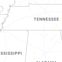


Connect with Interactive Hail Maps