

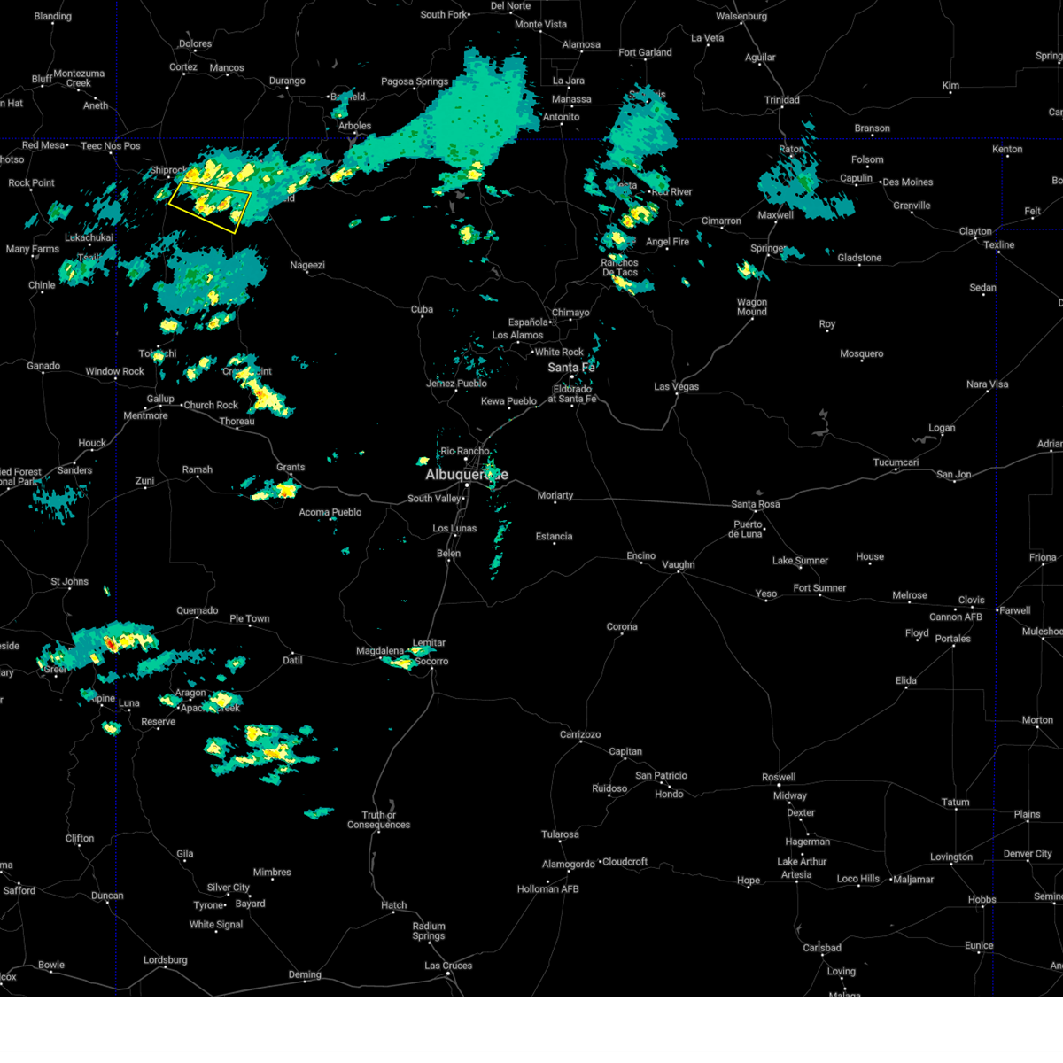
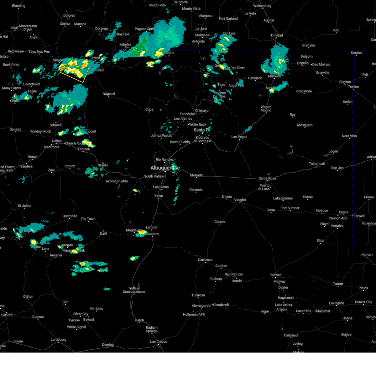
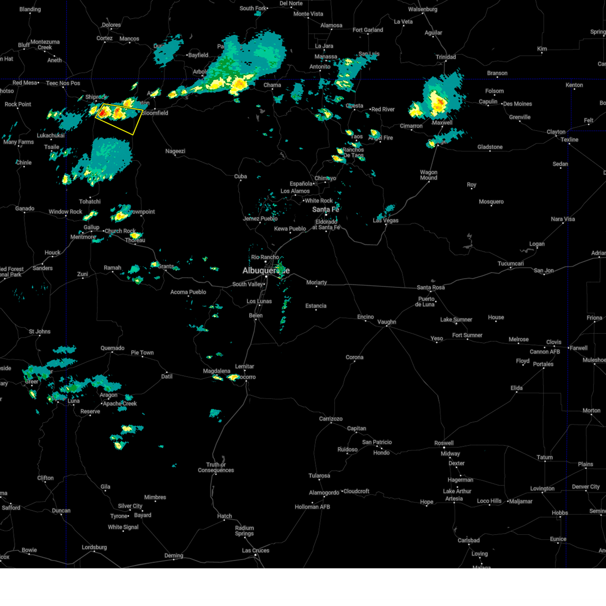
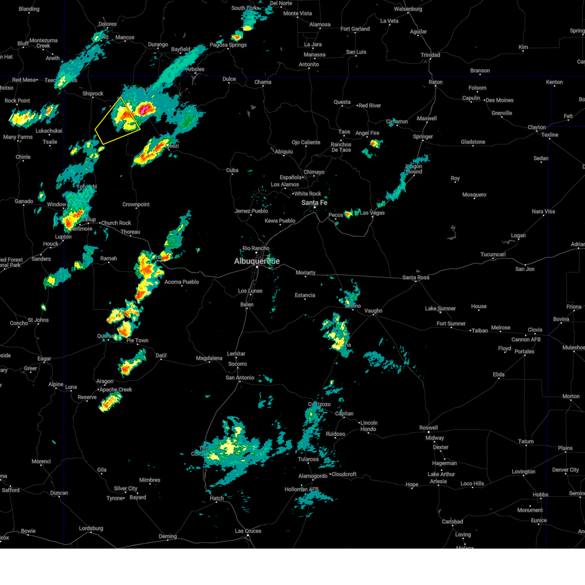
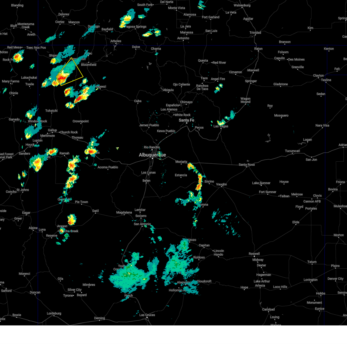
Hail Map for Napi Headquarters, NM
The Napi Headquarters, NM area has had 0 reports of on-the-ground hail by trained spotters, and has been under severe weather warnings 1 time during the past 12 months. Doppler radar has detected hail at or near Napi Headquarters, NM on 4 occasions.
| Name: | Napi Headquarters, NM |
| Where Located: | 5 miles S of Farmington, NM |
| Map: | Google Map for Napi Headquarters, NM |
| Population: | 727 |
| Housing Units: | 196 |
| More Info: | Search Google for Napi Headquarters, NM |
5
The Top Recent Hail Date for Napi Headquarters, NM is Wednesday, September 18, 2013 (1st out of 4)

Hail and Wind Damage Spotted near Napi Headquarters, NM
| Date / Time | Report Details |
|---|---|
| 6/26/2026 3:39 PM MDT |
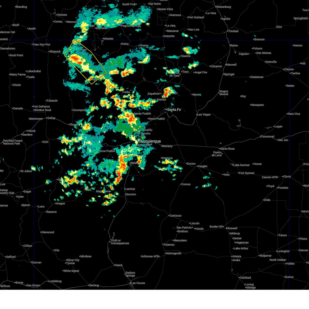 Svrabq the national weather service in albuquerque has issued a * severe thunderstorm warning for, west central rio arriba county in north central new mexico, eastern san juan county in northwestern new mexico, * until 445 pm mdt. * at 339 pm mdt, severe thunderstorms were located along a line from over farmington to near nageezi, moving northeast at 15 mph (radar indicated). Hazards include 60 mph wind gusts and quarter size hail. Hail damage to vehicles is expected. Expect wind damage to roofs, siding, and trees. Svrabq the national weather service in albuquerque has issued a * severe thunderstorm warning for, west central rio arriba county in north central new mexico, eastern san juan county in northwestern new mexico, * until 445 pm mdt. * at 339 pm mdt, severe thunderstorms were located along a line from over farmington to near nageezi, moving northeast at 15 mph (radar indicated). Hazards include 60 mph wind gusts and quarter size hail. Hail damage to vehicles is expected. Expect wind damage to roofs, siding, and trees.
|
| 6/3/2025 5:25 PM MDT |
 The storm which prompted the warning has weakened below severe limits, and no longer poses an immediate threat to life or property. therefore, the warning will be allowed to expire. however, small hail and heavy rain are still possible with this thunderstorm. The storm which prompted the warning has weakened below severe limits, and no longer poses an immediate threat to life or property. therefore, the warning will be allowed to expire. however, small hail and heavy rain are still possible with this thunderstorm.
|
| 6/3/2025 5:06 PM MDT |
 At 506 pm mdt, a severe thunderstorm was located near ojo amarillo, or 13 miles southwest of farmington, moving east at 15 mph (radar indicated). Hazards include 60 mph wind gusts and quarter size hail. Hail damage to vehicles is expected. expect wind damage to roofs, siding, and trees. locations impacted include, kirtland, ojo amarillo, nenahnezad, upper fruitland and napi headquarters. This includes highway 64 between mile markers 30 and 31. At 506 pm mdt, a severe thunderstorm was located near ojo amarillo, or 13 miles southwest of farmington, moving east at 15 mph (radar indicated). Hazards include 60 mph wind gusts and quarter size hail. Hail damage to vehicles is expected. expect wind damage to roofs, siding, and trees. locations impacted include, kirtland, ojo amarillo, nenahnezad, upper fruitland and napi headquarters. This includes highway 64 between mile markers 30 and 31.
|
| 6/3/2025 4:45 PM MDT |
 Svrabq the national weather service in albuquerque has issued a * severe thunderstorm warning for, central san juan county in northwestern new mexico, * until 530 pm mdt. * at 445 pm mdt, a severe thunderstorm was located near nenahnezad, or 16 miles southeast of shiprock, moving east at 15 mph (radar indicated). Hazards include 60 mph wind gusts and quarter size hail. Hail damage to vehicles is expected. Expect wind damage to roofs, siding, and trees. Svrabq the national weather service in albuquerque has issued a * severe thunderstorm warning for, central san juan county in northwestern new mexico, * until 530 pm mdt. * at 445 pm mdt, a severe thunderstorm was located near nenahnezad, or 16 miles southeast of shiprock, moving east at 15 mph (radar indicated). Hazards include 60 mph wind gusts and quarter size hail. Hail damage to vehicles is expected. Expect wind damage to roofs, siding, and trees.
|
| 6/30/2024 4:09 PM MDT |
 Svrabq the national weather service in albuquerque has issued a * severe thunderstorm warning for, northwestern san juan county in northwestern new mexico, * until 515 pm mdt. * at 409 pm mdt, a severe thunderstorm was located 10 miles southwest of nenahnezad, or 13 miles southeast of shiprock, moving northeast at 30 mph (radar indicated). Hazards include 60 mph wind gusts and penny size hail. expect damage to roofs, siding, and trees Svrabq the national weather service in albuquerque has issued a * severe thunderstorm warning for, northwestern san juan county in northwestern new mexico, * until 515 pm mdt. * at 409 pm mdt, a severe thunderstorm was located 10 miles southwest of nenahnezad, or 13 miles southeast of shiprock, moving northeast at 30 mph (radar indicated). Hazards include 60 mph wind gusts and penny size hail. expect damage to roofs, siding, and trees
|
| 6/21/2024 4:07 PM MDT |
 The storm which prompted the warning has weakened below severe limits, and no longer poses an immediate threat to life or property. therefore, the warning will be allowed to expire. however, small hail is still possible with this thunderstorm. a severe thunderstorm watch remains in effect until 700 pm mdt for northwestern new mexico. The storm which prompted the warning has weakened below severe limits, and no longer poses an immediate threat to life or property. therefore, the warning will be allowed to expire. however, small hail is still possible with this thunderstorm. a severe thunderstorm watch remains in effect until 700 pm mdt for northwestern new mexico.
|
| 6/21/2024 3:44 PM MDT |
 The storm which prompted the warning has weakened below severe limits, and no longer poses an immediate threat to life or property. therefore, the warning will be allowed to expire. however, small hail is still possible with this thunderstorm. a severe thunderstorm watch remains in effect until 700 pm mdt for northwestern new mexico. The storm which prompted the warning has weakened below severe limits, and no longer poses an immediate threat to life or property. therefore, the warning will be allowed to expire. however, small hail is still possible with this thunderstorm. a severe thunderstorm watch remains in effect until 700 pm mdt for northwestern new mexico.
|
| 6/21/2024 3:41 PM MDT |
 At 340 pm mdt, a severe thunderstorm was located 7 miles south of bloomfield, moving north at 25 mph (radar indicated). Hazards include golf ball size hail and 60 mph wind gusts. People and animals outdoors will be injured. expect hail damage to roofs, siding, windows, and vehicles. expect wind damage to roofs, siding, and trees. Locations impacted include, farmington, bloomfield, aztec, flora vista, and napi headquarters. At 340 pm mdt, a severe thunderstorm was located 7 miles south of bloomfield, moving north at 25 mph (radar indicated). Hazards include golf ball size hail and 60 mph wind gusts. People and animals outdoors will be injured. expect hail damage to roofs, siding, windows, and vehicles. expect wind damage to roofs, siding, and trees. Locations impacted include, farmington, bloomfield, aztec, flora vista, and napi headquarters.
|
| 6/21/2024 3:29 PM MDT |
 Svrabq the national weather service in albuquerque has issued a * severe thunderstorm warning for, north central san juan county in northwestern new mexico, * until 415 pm mdt. * at 328 pm mdt, a severe thunderstorm was located 9 miles south of bloomfield, moving north at 25 mph (radar indicated). Hazards include 60 mph wind gusts and quarter size hail. Hail damage to vehicles is expected. Expect wind damage to roofs, siding, and trees. Svrabq the national weather service in albuquerque has issued a * severe thunderstorm warning for, north central san juan county in northwestern new mexico, * until 415 pm mdt. * at 328 pm mdt, a severe thunderstorm was located 9 miles south of bloomfield, moving north at 25 mph (radar indicated). Hazards include 60 mph wind gusts and quarter size hail. Hail damage to vehicles is expected. Expect wind damage to roofs, siding, and trees.
|
| 6/21/2024 2:58 PM MDT |
 Svrabq the national weather service in albuquerque has issued a * severe thunderstorm warning for, central san juan county in northwestern new mexico, * until 345 pm mdt. * at 258 pm mdt, a severe thunderstorm was located near burnham, or 26 miles south of shiprock, moving northeast at 20 mph (radar indicated). Hazards include ping pong ball size hail and 60 mph wind gusts. People and animals outdoors will be injured. expect hail damage to roofs, siding, windows, and vehicles. Expect wind damage to roofs, siding, and trees. Svrabq the national weather service in albuquerque has issued a * severe thunderstorm warning for, central san juan county in northwestern new mexico, * until 345 pm mdt. * at 258 pm mdt, a severe thunderstorm was located near burnham, or 26 miles south of shiprock, moving northeast at 20 mph (radar indicated). Hazards include ping pong ball size hail and 60 mph wind gusts. People and animals outdoors will be injured. expect hail damage to roofs, siding, windows, and vehicles. Expect wind damage to roofs, siding, and trees.
|
| 7/24/2021 2:08 PM MDT |
 The severe thunderstorm warning for north central san juan county will expire at 215 pm mdt, the storm which prompted the warning has weakened below severe limits, and no longer poses an immediate threat to life or property. therefore, the warning will be allowed to expire. however heavy rain is still possible with this thunderstorm. The severe thunderstorm warning for north central san juan county will expire at 215 pm mdt, the storm which prompted the warning has weakened below severe limits, and no longer poses an immediate threat to life or property. therefore, the warning will be allowed to expire. however heavy rain is still possible with this thunderstorm.
|
| 7/24/2021 1:52 PM MDT |
 At 152 pm mdt, a severe thunderstorm was located over napi headquarters, or 9 miles southwest of farmington, moving northwest at 25 mph (radar indicated). Hazards include 60 mph wind gusts and quarter size hail. Hail damage to vehicles is expected. expect wind damage to roofs, siding, and trees. locations impacted include, southwestern farmington, kirtland, ojo amarillo, napi headquarters, fruitland, upper fruitland and nenahnezad. This includes highway 64 between mile markers 36 and 53. At 152 pm mdt, a severe thunderstorm was located over napi headquarters, or 9 miles southwest of farmington, moving northwest at 25 mph (radar indicated). Hazards include 60 mph wind gusts and quarter size hail. Hail damage to vehicles is expected. expect wind damage to roofs, siding, and trees. locations impacted include, southwestern farmington, kirtland, ojo amarillo, napi headquarters, fruitland, upper fruitland and nenahnezad. This includes highway 64 between mile markers 36 and 53.
|
| 7/24/2021 1:31 PM MDT |
 At 130 pm mdt, a severe thunderstorm was located 7 miles southeast of napi headquarters, or 9 miles southwest of bloomfield, moving northwest at 20 mph (radar indicated). Hazards include 60 mph wind gusts and quarter size hail. Hail damage to vehicles is expected. Expect wind damage to roofs, siding, and trees. At 130 pm mdt, a severe thunderstorm was located 7 miles southeast of napi headquarters, or 9 miles southwest of bloomfield, moving northwest at 20 mph (radar indicated). Hazards include 60 mph wind gusts and quarter size hail. Hail damage to vehicles is expected. Expect wind damage to roofs, siding, and trees.
|
| 7/24/2021 1:15 PM MDT |
 At 114 pm mdt, a severe thunderstorm was located 10 miles south of bloomfield, moving northwest at 20 mph (radar indicated). Hazards include 60 mph wind gusts and quarter size hail. Hail damage to vehicles is expected. expect wind damage to roofs, siding, and trees. locations impacted include, napi headquarters. this includes the following highways, highway 550 between mile markers 136 and 148. Highway 64 between mile markers 55 and 61. At 114 pm mdt, a severe thunderstorm was located 10 miles south of bloomfield, moving northwest at 20 mph (radar indicated). Hazards include 60 mph wind gusts and quarter size hail. Hail damage to vehicles is expected. expect wind damage to roofs, siding, and trees. locations impacted include, napi headquarters. this includes the following highways, highway 550 between mile markers 136 and 148. Highway 64 between mile markers 55 and 61.
|
| 7/24/2021 1:02 PM MDT |
 At 101 pm mdt, a severe thunderstorm was located 11 miles northwest of el huerfano trading post, or 12 miles south of bloomfield, moving northwest at 20 mph (radar indicated). Hazards include 60 mph wind gusts and quarter size hail. Hail damage to vehicles is expected. Expect wind damage to roofs, siding, and trees. At 101 pm mdt, a severe thunderstorm was located 11 miles northwest of el huerfano trading post, or 12 miles south of bloomfield, moving northwest at 20 mph (radar indicated). Hazards include 60 mph wind gusts and quarter size hail. Hail damage to vehicles is expected. Expect wind damage to roofs, siding, and trees.
|
| 9/30/2017 2:49 PM MDT |
 At 248 pm mdt, a severe thunderstorm was located near ojo amarillo, or 11 miles southwest of farmington, moving east at 20 mph (radar indicated). Hazards include 60 mph wind gusts and quarter size hail. Hail damage to vehicles is expected. expect wind damage to roofs, siding, and trees. Locations impacted include, farmington, kirtland, ojo amarillo, napi headquarters, fruitland, upper fruitland and nenahnezad. At 248 pm mdt, a severe thunderstorm was located near ojo amarillo, or 11 miles southwest of farmington, moving east at 20 mph (radar indicated). Hazards include 60 mph wind gusts and quarter size hail. Hail damage to vehicles is expected. expect wind damage to roofs, siding, and trees. Locations impacted include, farmington, kirtland, ojo amarillo, napi headquarters, fruitland, upper fruitland and nenahnezad.
|
| 9/30/2017 2:32 PM MDT |
 At 232 pm mdt, a severe thunderstorm was located near ojo amarillo, or 16 miles southwest of farmington, moving east at 25 mph (radar indicated). Hazards include 60 mph wind gusts and half dollar size hail. Hail damage to vehicles is expected. Expect wind damage to roofs, siding, and trees. At 232 pm mdt, a severe thunderstorm was located near ojo amarillo, or 16 miles southwest of farmington, moving east at 25 mph (radar indicated). Hazards include 60 mph wind gusts and half dollar size hail. Hail damage to vehicles is expected. Expect wind damage to roofs, siding, and trees.
|
| 6/11/2015 11:57 AM MDT |
 At 1157 am mdt, a severe thunderstorm was located near napi headquarters, or 8 miles southwest of farmington, moving northeast at 20 mph (radar indicated). Hazards include quarter size hail and 60 mph wind gusts. Hail damage to vehicles is expected. Expect wind damage to roofs, siding and trees. At 1157 am mdt, a severe thunderstorm was located near napi headquarters, or 8 miles southwest of farmington, moving northeast at 20 mph (radar indicated). Hazards include quarter size hail and 60 mph wind gusts. Hail damage to vehicles is expected. Expect wind damage to roofs, siding and trees.
|
Hail Maps for Napi Headquarters, NM


Connect with Interactive Hail Maps