

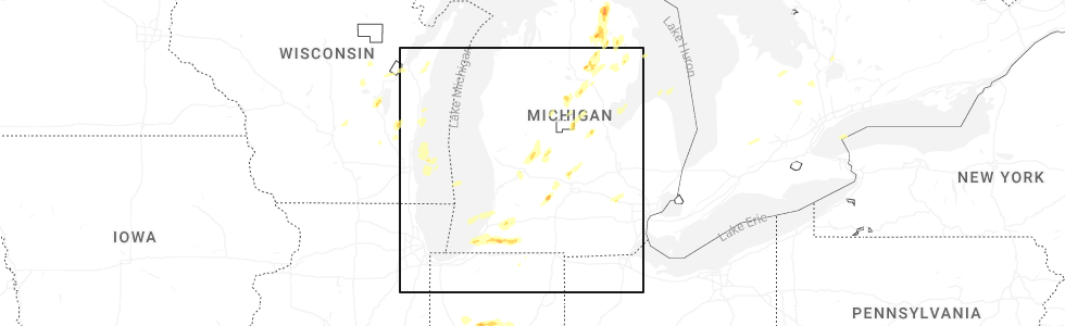
Hail Map for Nashville, MI
The Nashville, MI area has had 1 report of on-the-ground hail by trained spotters, and has been under severe weather warnings 28 times during the past 12 months. Doppler radar has detected hail at or near Nashville, MI on 26 occasions, including 3 occasions during the past year.
| Name: | Nashville, MI |
| Where Located: | 38.5 miles SE of Grand Rapids, MI |
| Map: | Google Map for Nashville, MI |
| Population: | 1628 |
| Housing Units: | 708 |
| More Info: | Search Google for Nashville, MI |
5
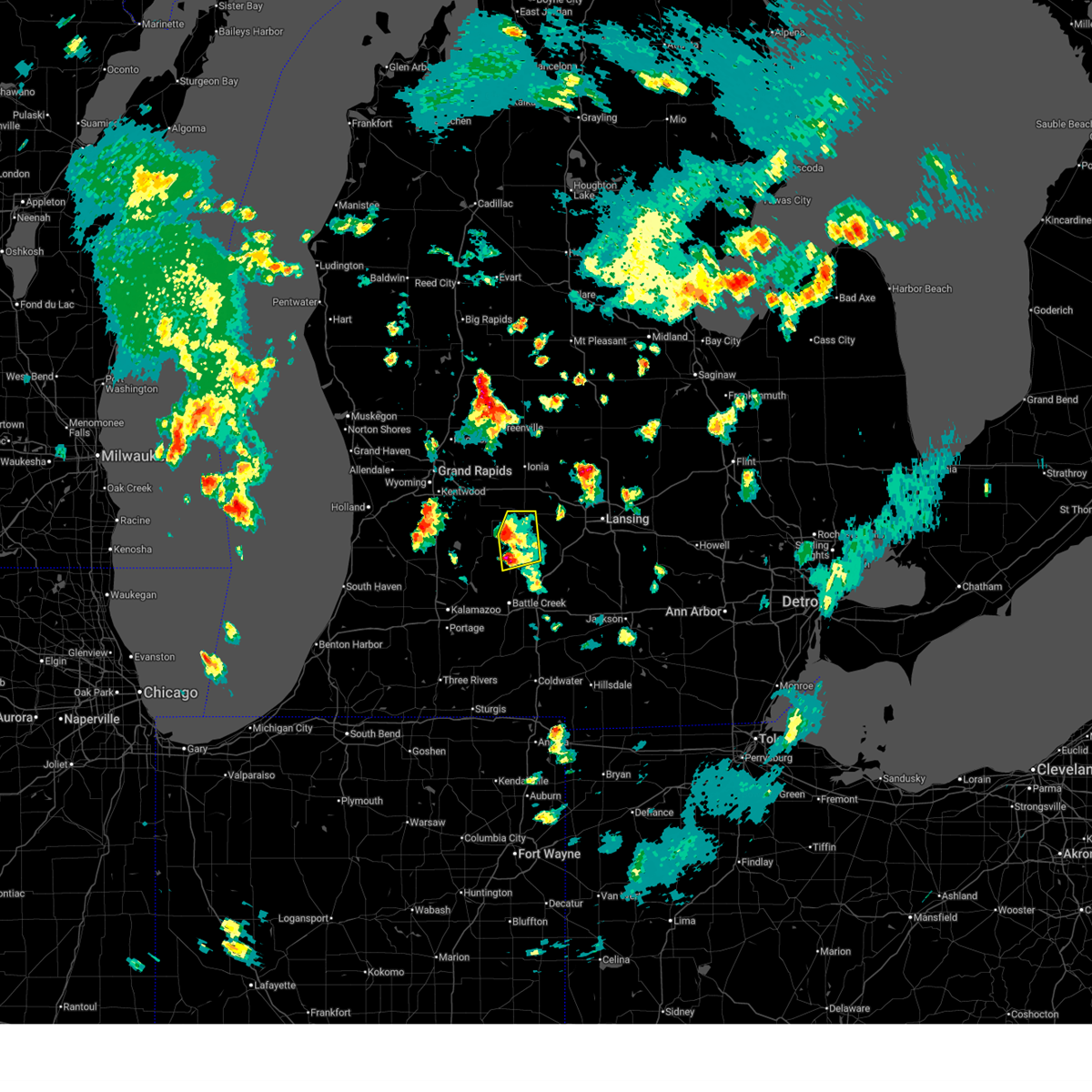
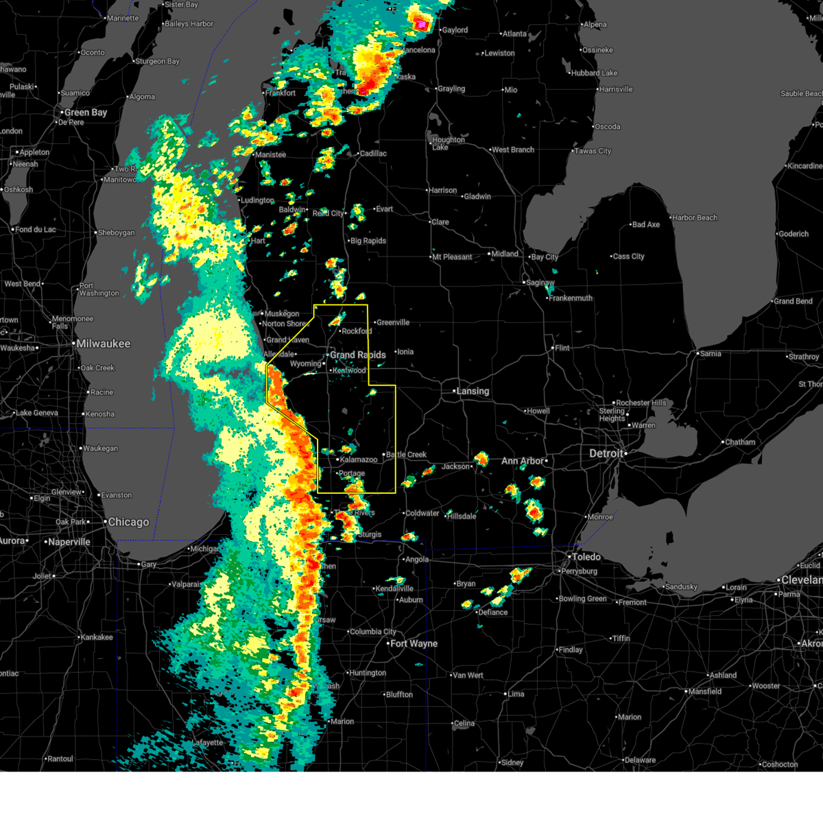
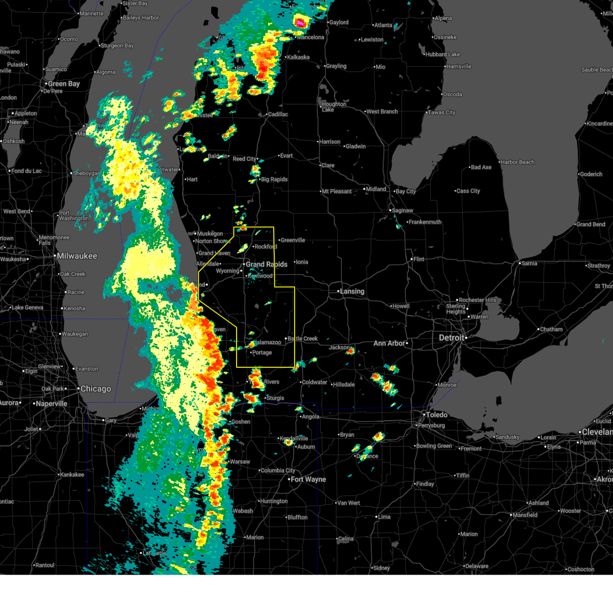
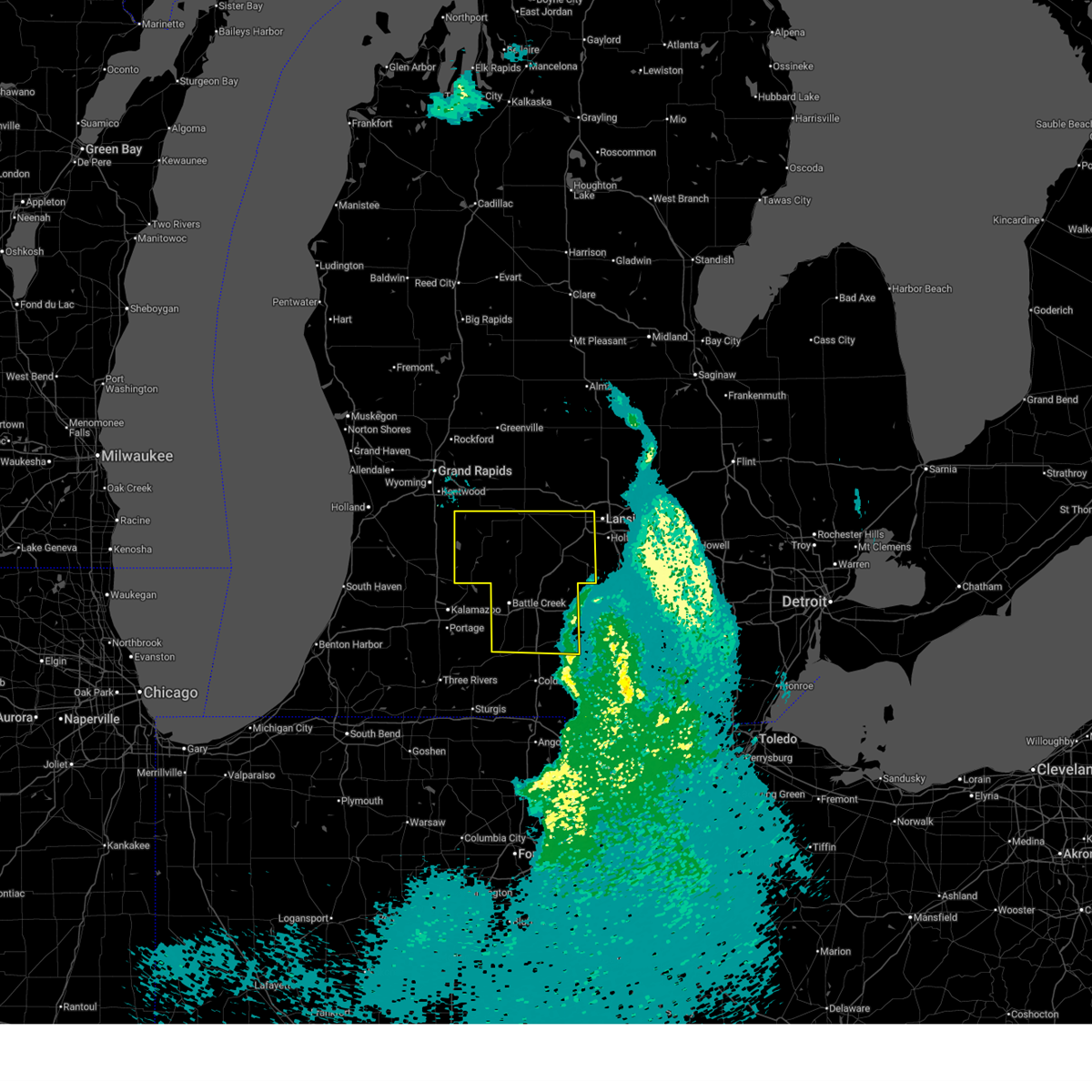
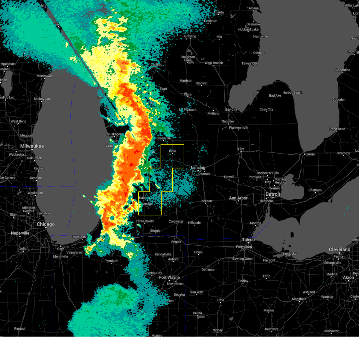
The Top Recent Hail Date for Nashville, MI is Tuesday, June 16, 2026 (1st out of 26)
Hail and Wind Damage Spotted near Nashville, MI
| Date / Time | Report Details |
|---|---|
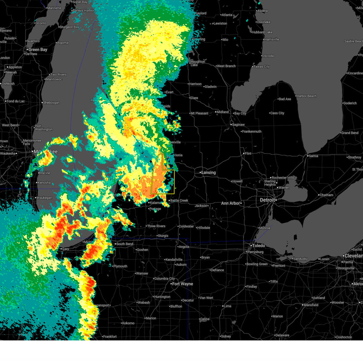
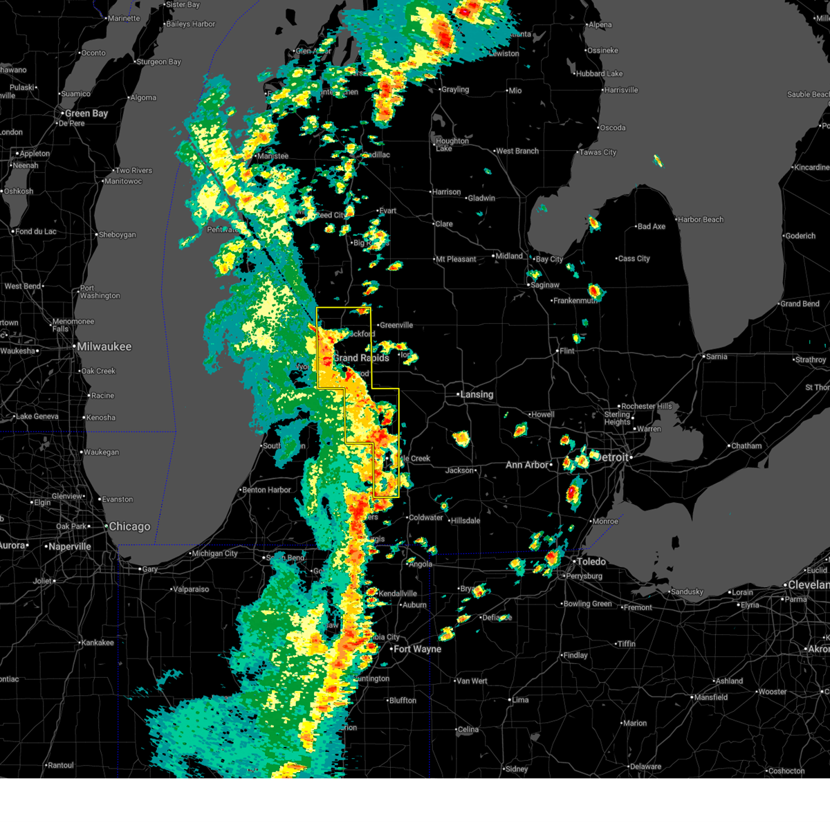
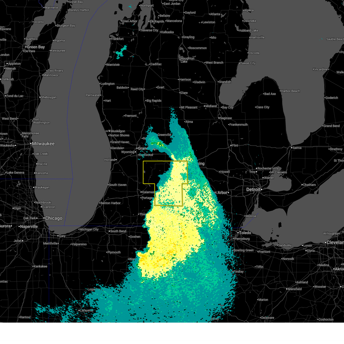
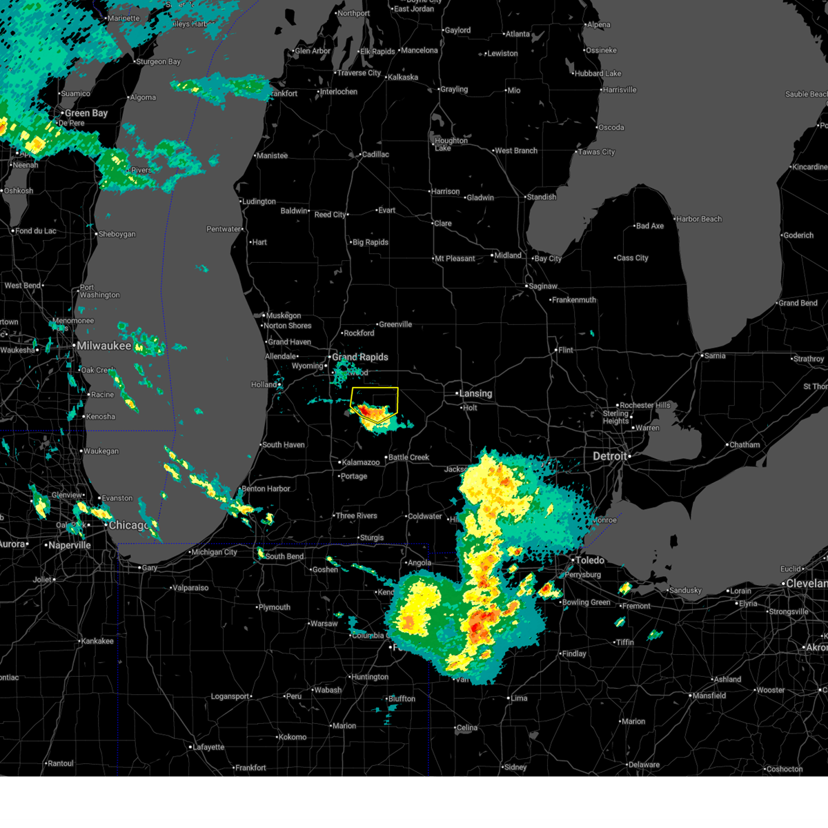
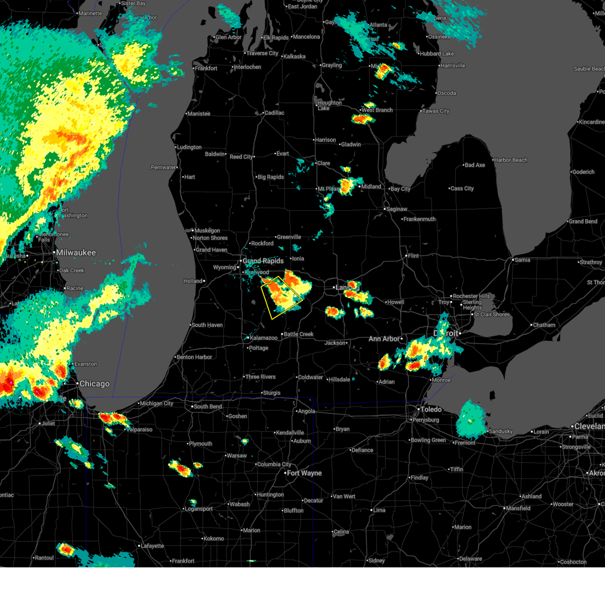
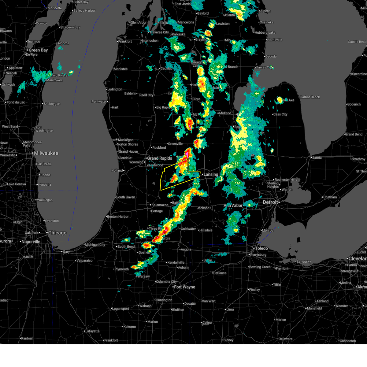
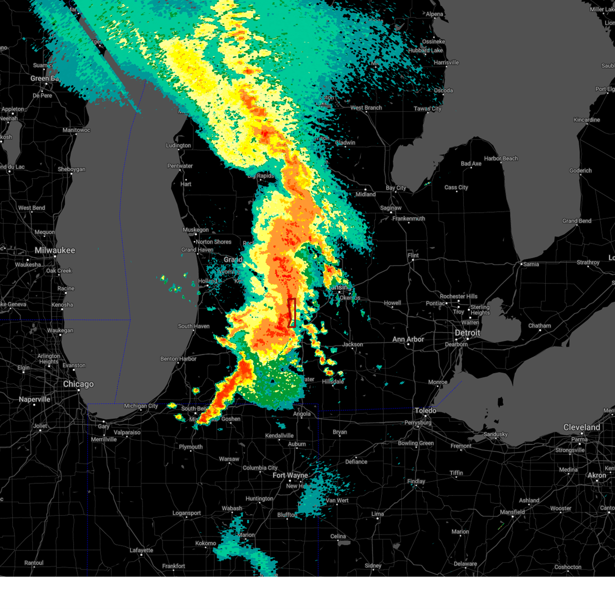
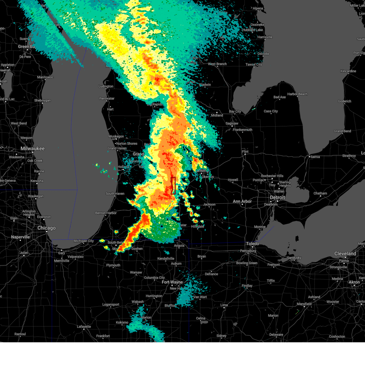
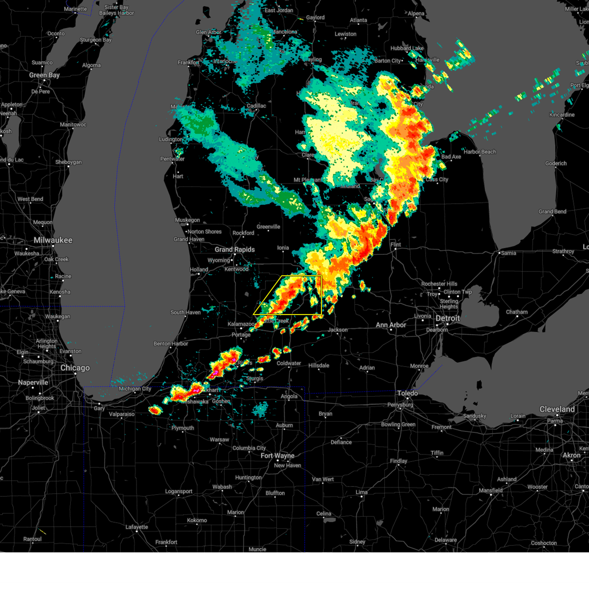
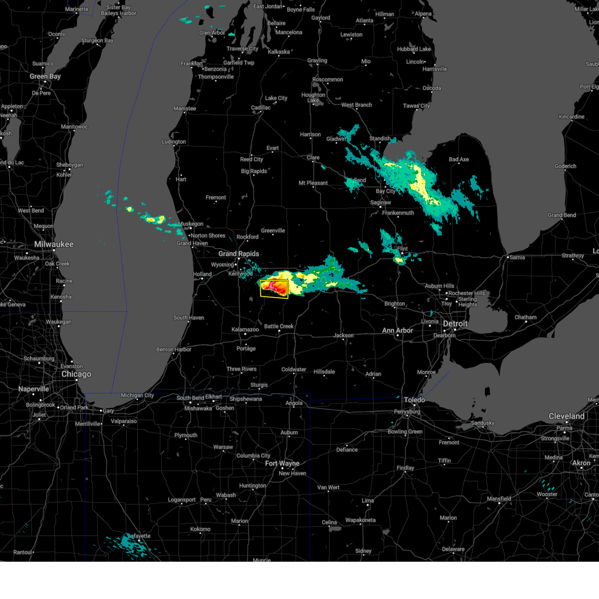
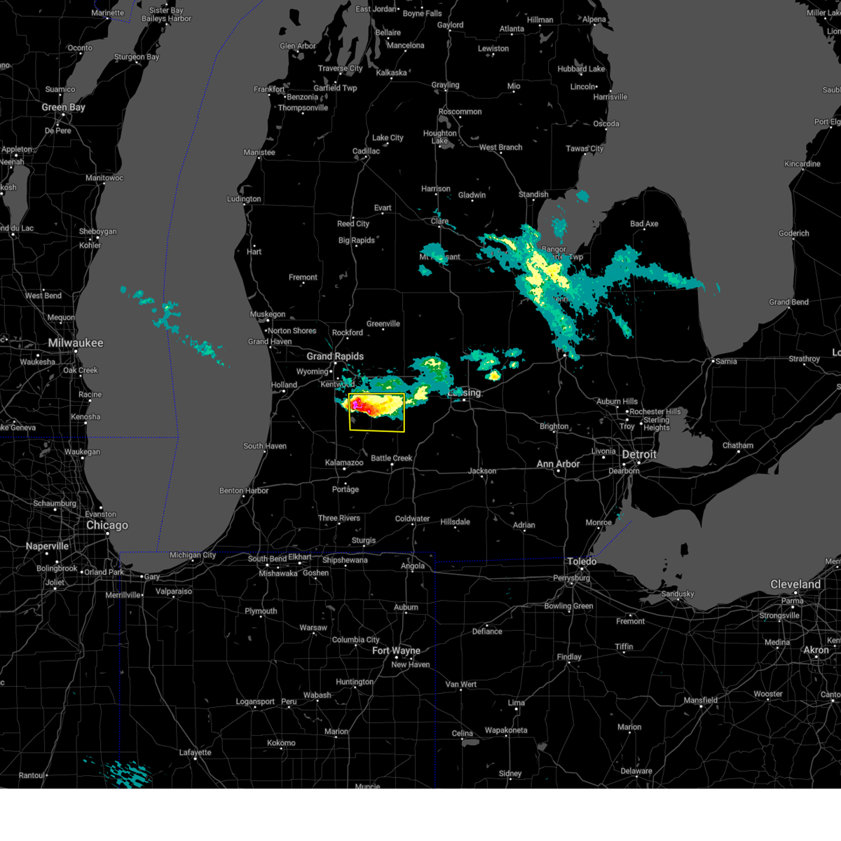
| 6/16/2026 4:50 PM EDT | Half Dollar sized hail reported 0.4 miles NNW of Nashville, MI, two photos on social media taken 15 minutes after the storm passed. time based on radar. |
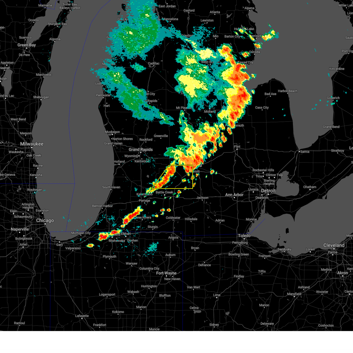
| 6/16/2026 4:37 PM EDT |
 At 437 pm edt, severe thunderstorms were located along a line extending from 5 miles east of hastings to 7 miles south of nashville, moving northeast at 25 mph (radar indicated). Hazards include 60 mph wind gusts and quarter size hail. Hail damage to vehicles is expected. expect wind damage to roofs, siding, and trees. Locations impacted include, nashville, kalamo, vermontville, sunfield, woodland, woodbury, lacey,. At 437 pm edt, severe thunderstorms were located along a line extending from 5 miles east of hastings to 7 miles south of nashville, moving northeast at 25 mph (radar indicated). Hazards include 60 mph wind gusts and quarter size hail. Hail damage to vehicles is expected. expect wind damage to roofs, siding, and trees. Locations impacted include, nashville, kalamo, vermontville, sunfield, woodland, woodbury, lacey,.
|
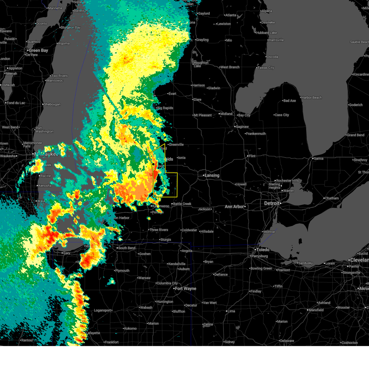
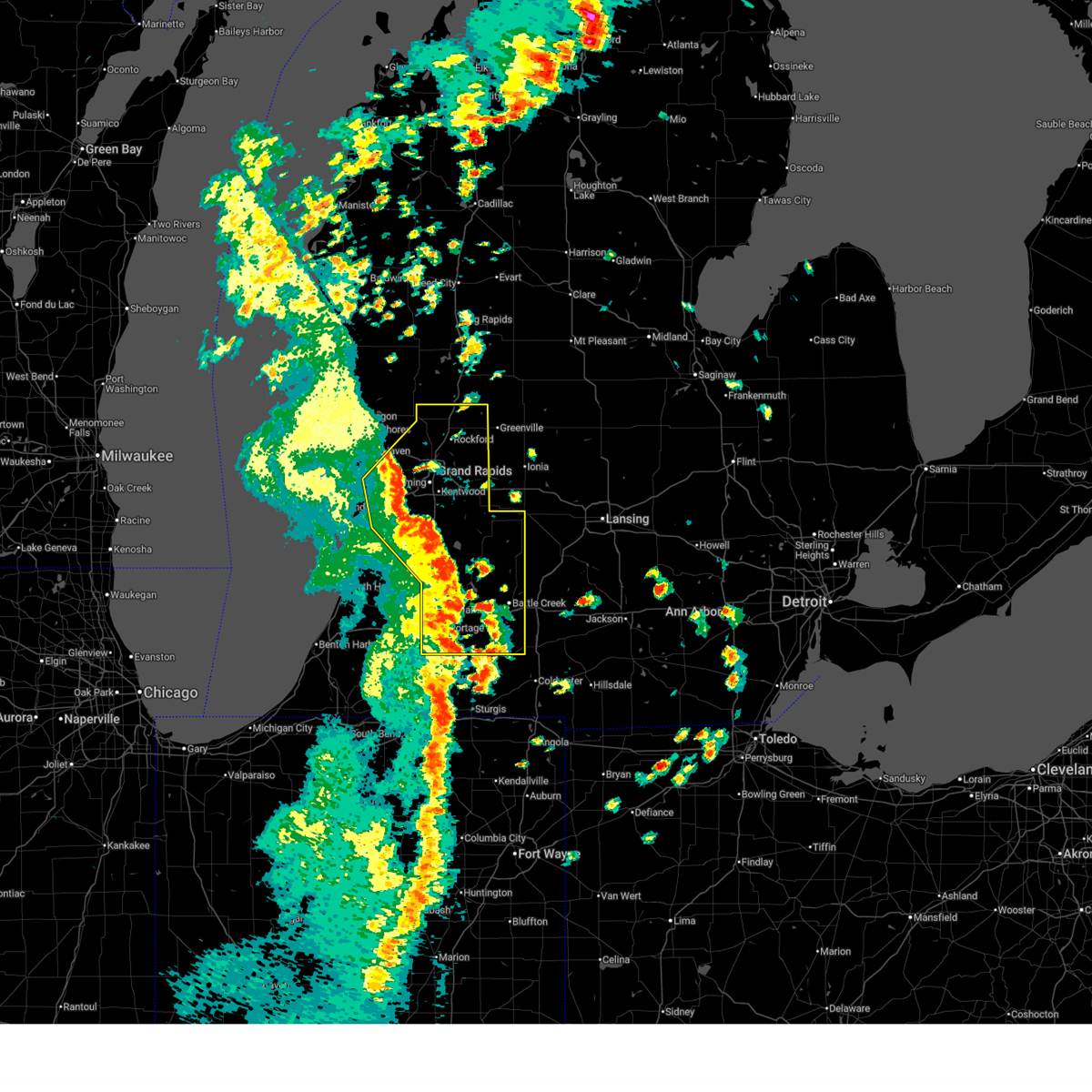
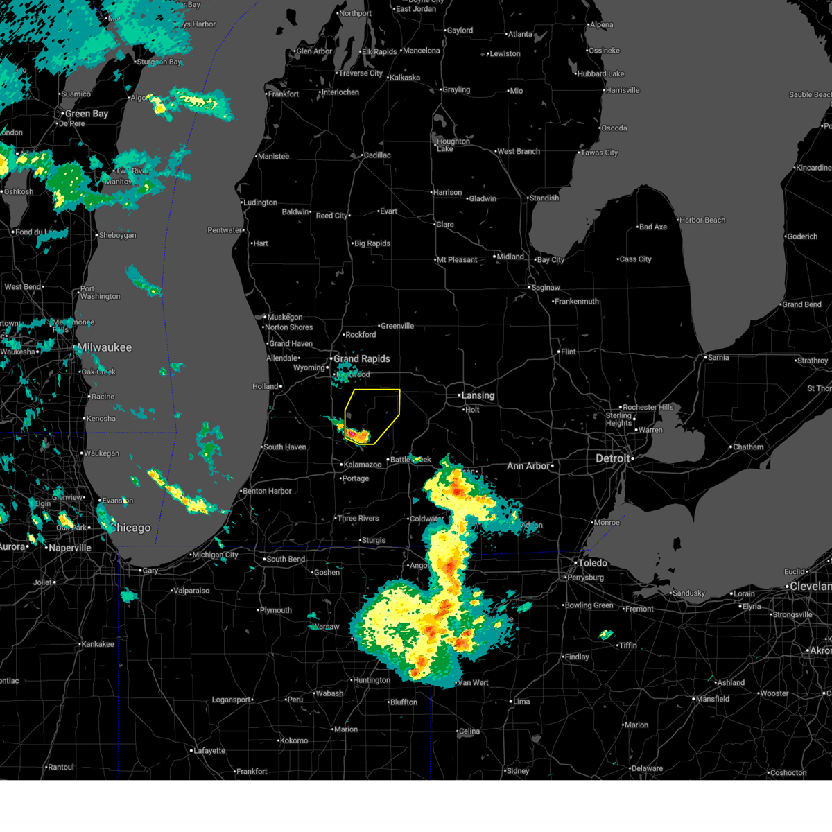
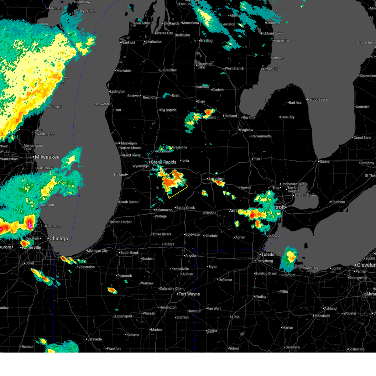
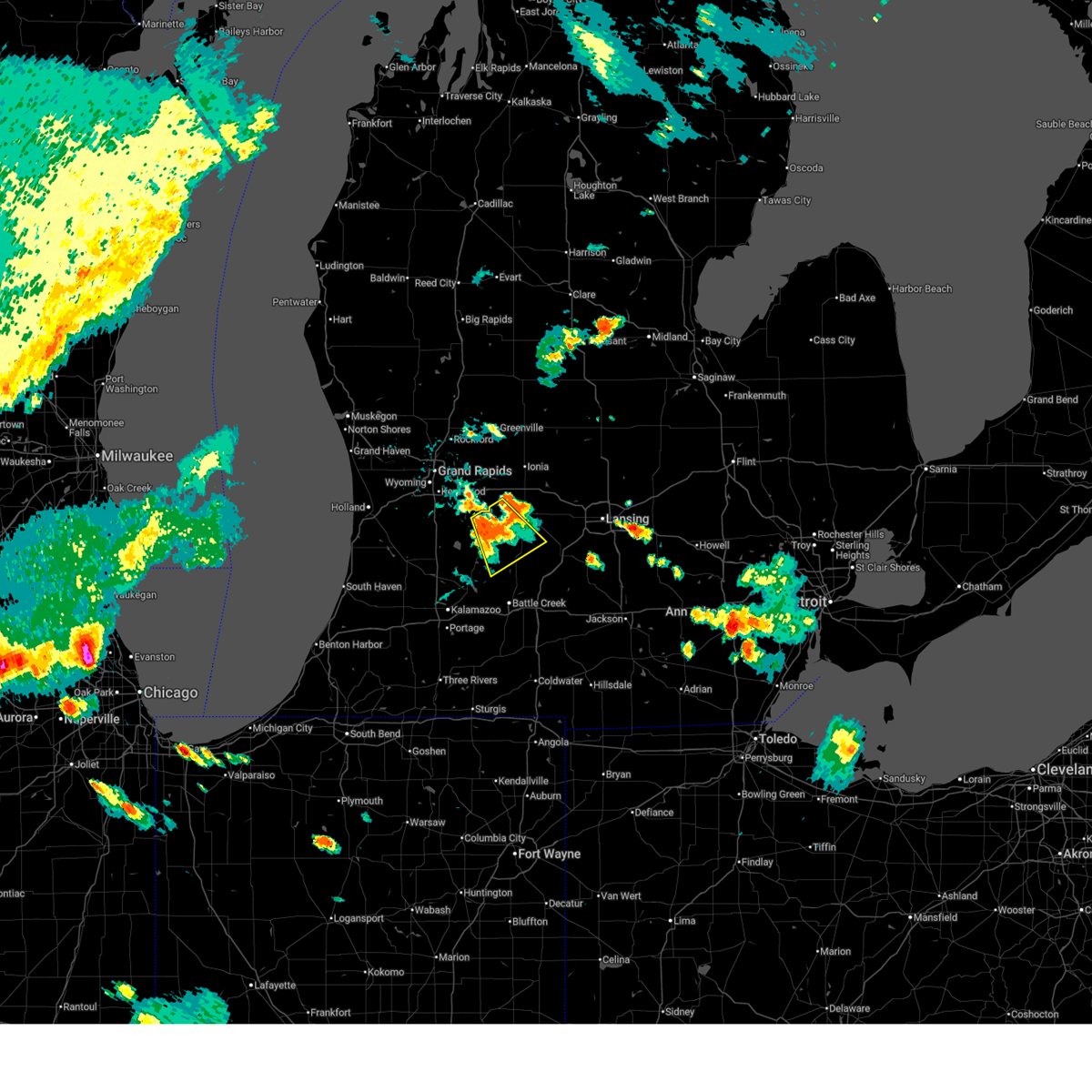
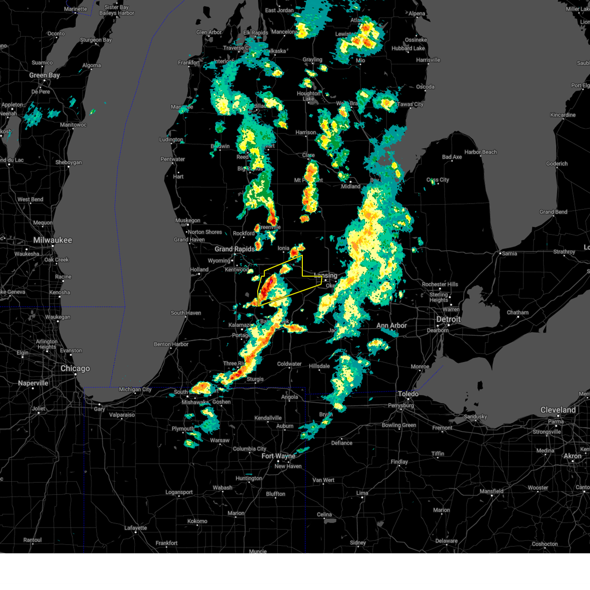
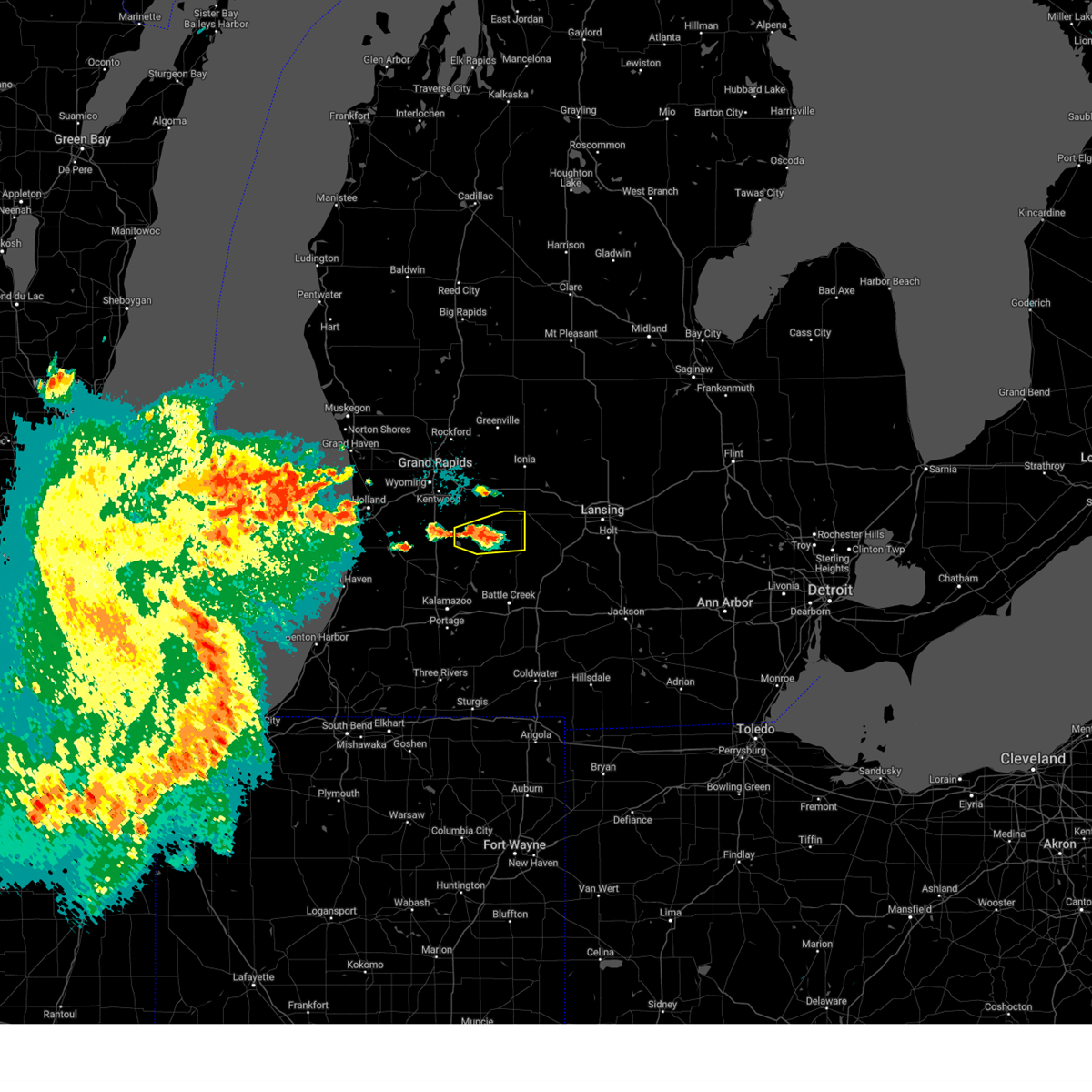
| 6/16/2026 4:21 PM EDT |
 Svrgrr the national weather service in grand rapids has issued a * severe thunderstorm warning for, eastern barry county in southwestern michigan, western eaton county in south central michigan, * until 500 pm edt. * at 421 pm edt, severe thunderstorms were located along a line extending from near hastings to 8 miles northeast of gull lake, moving northeast at 25 mph (radar indicated). Hazards include 60 mph wind gusts and quarter size hail. Hail damage to vehicles is expected. Expect wind damage to roofs, siding, and trees. Svrgrr the national weather service in grand rapids has issued a * severe thunderstorm warning for, eastern barry county in southwestern michigan, western eaton county in south central michigan, * until 500 pm edt. * at 421 pm edt, severe thunderstorms were located along a line extending from near hastings to 8 miles northeast of gull lake, moving northeast at 25 mph (radar indicated). Hazards include 60 mph wind gusts and quarter size hail. Hail damage to vehicles is expected. Expect wind damage to roofs, siding, and trees.
|
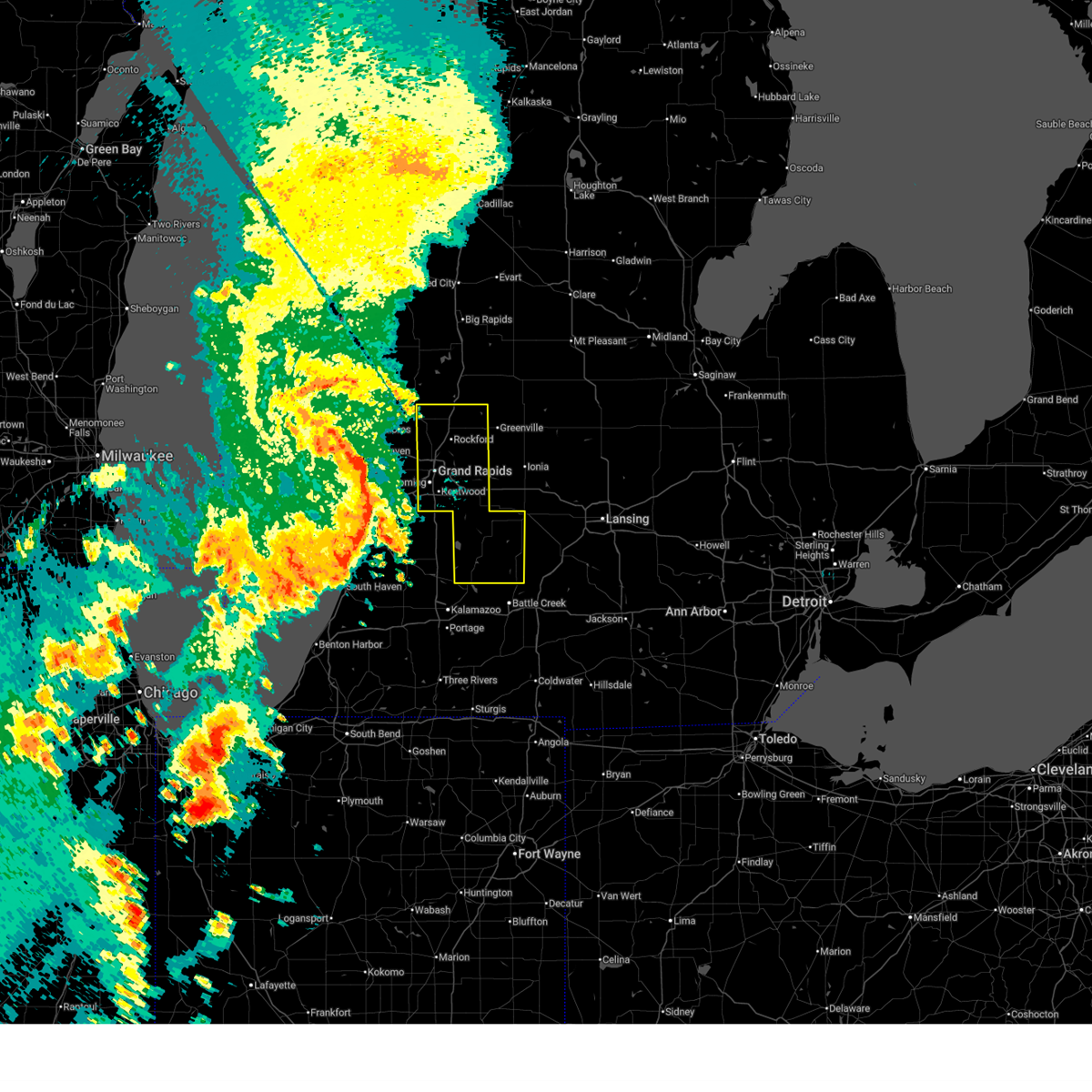
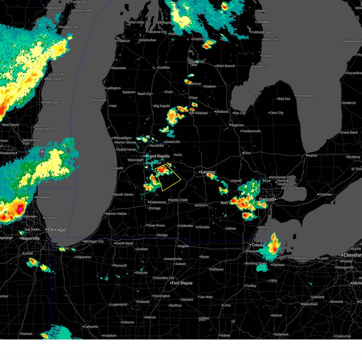
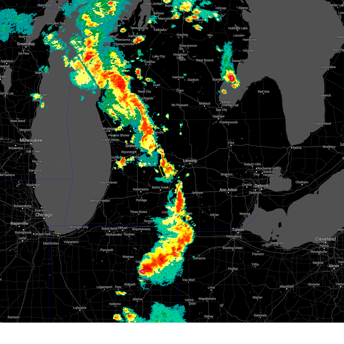
| 6/11/2026 9:47 PM EDT |
 At 947 pm edt, severe thunderstorms were located along a line extending from 7 miles north of greenville to near freeport, moving east at 55 mph (radar indicated). Hazards include 60 mph wind gusts. Expect damage to roofs, siding, and trees. Locations impacted include, hastings, nashville, freeport, assyria, woodland, delton, banfield, prairieville, hickory corners, dowling, woodbury, cloverdale, lacey,. At 947 pm edt, severe thunderstorms were located along a line extending from 7 miles north of greenville to near freeport, moving east at 55 mph (radar indicated). Hazards include 60 mph wind gusts. Expect damage to roofs, siding, and trees. Locations impacted include, hastings, nashville, freeport, assyria, woodland, delton, banfield, prairieville, hickory corners, dowling, woodbury, cloverdale, lacey,.
|
| 6/11/2026 9:40 PM EDT |
 At 940 pm edt, severe thunderstorms were located along a line extending from 8 miles northwest of greenville to near freeport, moving east at 55 mph (radar indicated). Hazards include 70 mph wind gusts. Expect considerable tree damage. damage is likely to mobile homes, roofs, and outbuildings. Locations impacted include, hastings, lowell, middleville, nashville, freeport, orangeville, irving, assyria, woodland, delton, banfield, yankee springs, prairieville, hickory corners, dowling, pine lake, woodbury, alto, cloverdale, lacey,. At 940 pm edt, severe thunderstorms were located along a line extending from 8 miles northwest of greenville to near freeport, moving east at 55 mph (radar indicated). Hazards include 70 mph wind gusts. Expect considerable tree damage. damage is likely to mobile homes, roofs, and outbuildings. Locations impacted include, hastings, lowell, middleville, nashville, freeport, orangeville, irving, assyria, woodland, delton, banfield, yankee springs, prairieville, hickory corners, dowling, pine lake, woodbury, alto, cloverdale, lacey,.
|
| 6/11/2026 9:33 PM EDT |
 At 932 pm edt, severe thunderstorms were located along a line extending from 7 miles northeast of rockford to middleville, moving east at 55 mph. a tornado warning is also in effect for southeastern kent county (radar indicated). Hazards include 60 mph wind gusts. Expect damage to roofs, siding, and trees. locations impacted include, grand rapids, hastings, kentwood, east grand rapids, lowell, middleville, nashville, caledonia, freeport, gerald r. Ford inter, ada, grattan, orangeville, irving, assyria, woodland, delton, yankee springs, hickory corners, pine lake,. At 932 pm edt, severe thunderstorms were located along a line extending from 7 miles northeast of rockford to middleville, moving east at 55 mph. a tornado warning is also in effect for southeastern kent county (radar indicated). Hazards include 60 mph wind gusts. Expect damage to roofs, siding, and trees. locations impacted include, grand rapids, hastings, kentwood, east grand rapids, lowell, middleville, nashville, caledonia, freeport, gerald r. Ford inter, ada, grattan, orangeville, irving, assyria, woodland, delton, yankee springs, hickory corners, pine lake,.
|
| 6/11/2026 8:58 PM EDT |
 Svrgrr the national weather service in grand rapids has issued a * severe thunderstorm warning for, kent county in southwestern michigan, barry county in southwestern michigan, * until 1000 pm edt. * at 858 pm edt, severe thunderstorms were located along a line extending from near fruitport to near fennville, moving east at 55 mph (radar indicated). Hazards include 70 mph wind gusts. Expect considerable tree damage. Damage is likely to mobile homes, roofs, and outbuildings. Svrgrr the national weather service in grand rapids has issued a * severe thunderstorm warning for, kent county in southwestern michigan, barry county in southwestern michigan, * until 1000 pm edt. * at 858 pm edt, severe thunderstorms were located along a line extending from near fruitport to near fennville, moving east at 55 mph (radar indicated). Hazards include 70 mph wind gusts. Expect considerable tree damage. Damage is likely to mobile homes, roofs, and outbuildings.
|
| 6/10/2026 7:13 PM EDT |
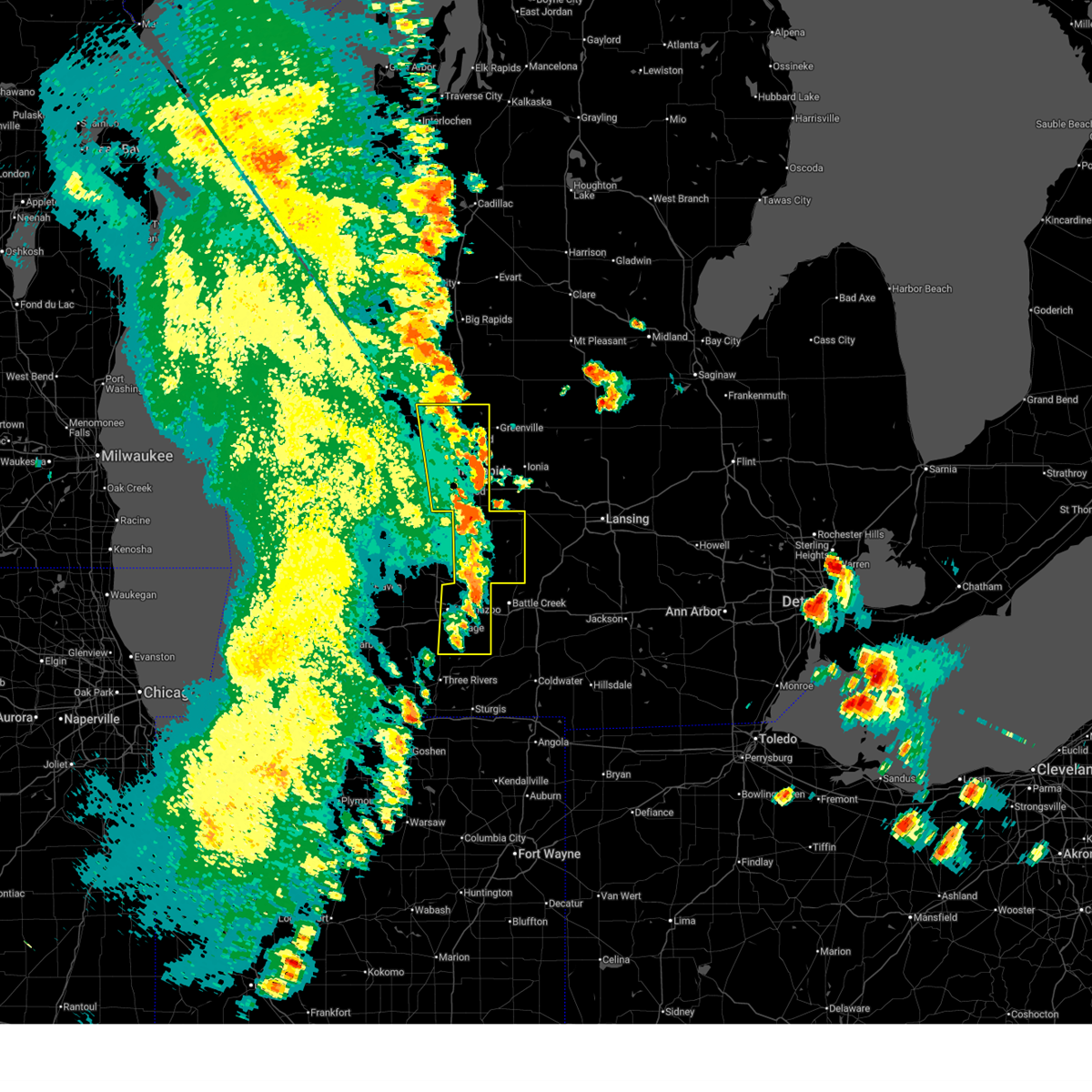 At 712 pm edt, severe thunderstorms were located along a line extending from 6 miles west of morley to near lowell to near climax, moving northeast at 50 mph (radar indicated). Hazards include 60 mph wind gusts and penny size hail. Expect damage to roofs, siding, and trees. Locations impacted include, grand rapids, kalamazoo, portage, hastings, wyoming, kentwood, walker, east grand rapids, rockford, sparta, lowell, middleville, vicksburg, galesburg, parchment, nashville, schoolcraft, caledonia, climax, richland,. At 712 pm edt, severe thunderstorms were located along a line extending from 6 miles west of morley to near lowell to near climax, moving northeast at 50 mph (radar indicated). Hazards include 60 mph wind gusts and penny size hail. Expect damage to roofs, siding, and trees. Locations impacted include, grand rapids, kalamazoo, portage, hastings, wyoming, kentwood, walker, east grand rapids, rockford, sparta, lowell, middleville, vicksburg, galesburg, parchment, nashville, schoolcraft, caledonia, climax, richland,.
|
| 6/10/2026 6:54 PM EDT |
 At 654 pm edt, severe thunderstorms were located along a line extending from near newaygo to near kalamazoo, moving east at 40 mph (radar indicated). Hazards include 60 mph wind gusts and penny size hail. Expect damage to roofs, siding, and trees. Locations impacted include, grand rapids, kalamazoo, portage, hastings, wyoming, kentwood, walker, grandville, east grand rapids, rockford, sparta, lowell, middleville, vicksburg, galesburg, parchment, nashville, schoolcraft, caledonia, climax,. At 654 pm edt, severe thunderstorms were located along a line extending from near newaygo to near kalamazoo, moving east at 40 mph (radar indicated). Hazards include 60 mph wind gusts and penny size hail. Expect damage to roofs, siding, and trees. Locations impacted include, grand rapids, kalamazoo, portage, hastings, wyoming, kentwood, walker, grandville, east grand rapids, rockford, sparta, lowell, middleville, vicksburg, galesburg, parchment, nashville, schoolcraft, caledonia, climax,.
|
| 6/10/2026 6:32 PM EDT |
 Svrgrr the national weather service in grand rapids has issued a * severe thunderstorm warning for, kent county in southwestern michigan, barry county in southwestern michigan, kalamazoo county in southwestern michigan, * until 730 pm edt. * at 631 pm edt, severe thunderstorms were located along a line extending from near lakewood club to near fennville, moving east at 45 mph. tree damage has been reported in holland with these storms (radar indicated). Hazards include 60 mph wind gusts and penny size hail. expect damage to roofs, siding, and trees Svrgrr the national weather service in grand rapids has issued a * severe thunderstorm warning for, kent county in southwestern michigan, barry county in southwestern michigan, kalamazoo county in southwestern michigan, * until 730 pm edt. * at 631 pm edt, severe thunderstorms were located along a line extending from near lakewood club to near fennville, moving east at 45 mph. tree damage has been reported in holland with these storms (radar indicated). Hazards include 60 mph wind gusts and penny size hail. expect damage to roofs, siding, and trees
|
| 5/18/2026 3:03 PM EDT |
 At 303 pm edt, severe thunderstorms were located along a line extending from near howard city to near belding to 5 miles northeast of albion, moving northeast at 55 mph (radar indicated). Hazards include 70 mph wind gusts and quarter size hail. Hail damage to vehicles is expected. expect considerable tree damage. wind damage is also likely to mobile homes, roofs, and outbuildings. Locations impacted include, hastings, battle creek, rockford, lowell, nashville, union city, freeport, burlington, brownlee park, ada, grattan, cedar springs, assyria, sand lake, woodland, woodbury, murray lake, alto, cannonsburg, lacey,. At 303 pm edt, severe thunderstorms were located along a line extending from near howard city to near belding to 5 miles northeast of albion, moving northeast at 55 mph (radar indicated). Hazards include 70 mph wind gusts and quarter size hail. Hail damage to vehicles is expected. expect considerable tree damage. wind damage is also likely to mobile homes, roofs, and outbuildings. Locations impacted include, hastings, battle creek, rockford, lowell, nashville, union city, freeport, burlington, brownlee park, ada, grattan, cedar springs, assyria, sand lake, woodland, woodbury, murray lake, alto, cannonsburg, lacey,.
|
| 5/18/2026 2:52 PM EDT |
 At 251 pm edt, severe thunderstorms were located along a line extending from 8 miles northeast of sparta to near lowell to 5 miles east of bellevue, moving northeast at 55 mph (radar indicated). Hazards include 70 mph wind gusts and quarter size hail. Hail damage to vehicles is expected. expect considerable tree damage. wind damage is also likely to mobile homes, roofs, and outbuildings. locations impacted include, grand rapids, hastings, battle creek, wyoming, kentwood, walker, grandville, east grand rapids, rockford, sparta, lowell, middleville, nashville, union city, caledonia, freeport, burlington, brownlee park, gerald r. Ford inter, ada,. At 251 pm edt, severe thunderstorms were located along a line extending from 8 miles northeast of sparta to near lowell to 5 miles east of bellevue, moving northeast at 55 mph (radar indicated). Hazards include 70 mph wind gusts and quarter size hail. Hail damage to vehicles is expected. expect considerable tree damage. wind damage is also likely to mobile homes, roofs, and outbuildings. locations impacted include, grand rapids, hastings, battle creek, wyoming, kentwood, walker, grandville, east grand rapids, rockford, sparta, lowell, middleville, nashville, union city, caledonia, freeport, burlington, brownlee park, gerald r. Ford inter, ada,.
|
| 5/18/2026 2:44 PM EDT |
 the severe thunderstorm warning has been cancelled and is no longer in effect the severe thunderstorm warning has been cancelled and is no longer in effect
|
| 5/18/2026 2:44 PM EDT |
 At 242 pm edt, severe thunderstorms were located along a line extending from near sparta to near lowell to 6 miles south of bellevue, moving northeast at 65 mph (radar indicated). Hazards include 70 mph wind gusts. Expect considerable tree damage. damage is likely to mobile homes, roofs, and outbuildings. locations impacted include, grand rapids, hastings, battle creek, wyoming, kentwood, walker, grandville, east grand rapids, rockford, sparta, lowell, middleville, nashville, union city, caledonia, freeport, burlington, brownlee park, gerald r. Ford inter, ada,. At 242 pm edt, severe thunderstorms were located along a line extending from near sparta to near lowell to 6 miles south of bellevue, moving northeast at 65 mph (radar indicated). Hazards include 70 mph wind gusts. Expect considerable tree damage. damage is likely to mobile homes, roofs, and outbuildings. locations impacted include, grand rapids, hastings, battle creek, wyoming, kentwood, walker, grandville, east grand rapids, rockford, sparta, lowell, middleville, nashville, union city, caledonia, freeport, burlington, brownlee park, gerald r. Ford inter, ada,.
|
| 5/18/2026 2:21 PM EDT |
 At 221 pm edt, severe thunderstorms were located along a line extending from near coopersville to near wayland to 5 miles east of marcellus, moving northeast at 55 mph (radar indicated). Hazards include 70 mph wind gusts. Expect considerable tree damage. damage is likely to mobile homes, roofs, and outbuildings. Locations impacted include, grand rapids, kalamazoo, portage, holland, hastings, battle creek, allegan, wyoming, kentwood, walker, grandville, east grand rapids, hudsonville, rockford, zeeland, coopersville, sparta, wayland, otsego, plainwell,. At 221 pm edt, severe thunderstorms were located along a line extending from near coopersville to near wayland to 5 miles east of marcellus, moving northeast at 55 mph (radar indicated). Hazards include 70 mph wind gusts. Expect considerable tree damage. damage is likely to mobile homes, roofs, and outbuildings. Locations impacted include, grand rapids, kalamazoo, portage, holland, hastings, battle creek, allegan, wyoming, kentwood, walker, grandville, east grand rapids, hudsonville, rockford, zeeland, coopersville, sparta, wayland, otsego, plainwell,.
|
| 5/18/2026 2:05 PM EDT |
 At 205 pm edt, severe thunderstorms were located along a line extending from 6 miles north of beechwood to near allegan to 8 miles east of cassopolis, moving northeast at 55 mph (radar indicated). Hazards include 70 mph wind gusts. Expect considerable tree damage. damage is likely to mobile homes, roofs, and outbuildings. Locations impacted include, grand rapids, kalamazoo, portage, holland, hastings, battle creek, allegan, wyoming, kentwood, walker, grandville, east grand rapids, hudsonville, rockford, zeeland, coopersville, sparta, wayland, otsego, plainwell,. At 205 pm edt, severe thunderstorms were located along a line extending from 6 miles north of beechwood to near allegan to 8 miles east of cassopolis, moving northeast at 55 mph (radar indicated). Hazards include 70 mph wind gusts. Expect considerable tree damage. damage is likely to mobile homes, roofs, and outbuildings. Locations impacted include, grand rapids, kalamazoo, portage, holland, hastings, battle creek, allegan, wyoming, kentwood, walker, grandville, east grand rapids, hudsonville, rockford, zeeland, coopersville, sparta, wayland, otsego, plainwell,.
|
| 5/18/2026 1:58 PM EDT |
 Svrgrr the national weather service in grand rapids has issued a * severe thunderstorm warning for, western calhoun county in south central michigan, allegan county in southwestern michigan, kent county in southwestern michigan, ottawa county in southwestern michigan, barry county in southwestern michigan, kalamazoo county in southwestern michigan, * until 330 pm edt. * at 158 pm edt, severe thunderstorms were located along a line extending from holland state park to paw paw to cassopolis, moving northeast at 55 mph (radar indicated. at 120 pm, a 63 mph wind gust was reported at the benton harbor airport). Hazards include 60 mph wind gusts. expect damage to roofs, siding, and trees Svrgrr the national weather service in grand rapids has issued a * severe thunderstorm warning for, western calhoun county in south central michigan, allegan county in southwestern michigan, kent county in southwestern michigan, ottawa county in southwestern michigan, barry county in southwestern michigan, kalamazoo county in southwestern michigan, * until 330 pm edt. * at 158 pm edt, severe thunderstorms were located along a line extending from holland state park to paw paw to cassopolis, moving northeast at 55 mph (radar indicated. at 120 pm, a 63 mph wind gust was reported at the benton harbor airport). Hazards include 60 mph wind gusts. expect damage to roofs, siding, and trees
|
| 4/27/2026 5:50 PM EDT |
 At 545 pm edt, damaging winds behind an exiting area of precipitation will affect much of the area. damaging winds could persist for 30 minutes at any given location (trained weather spotters). Hazards include 60 mph wind gusts. Expect damage to roofs, siding, and trees. Locations impacted include, lansing, charlotte, albion, hastings, marshall, battle creek, eaton rapids, grand ledge, middleville, potterville, homer, nashville, bellevue, freeport, burlington, brownlee park, orangeville, irving, marengo, assyria,. At 545 pm edt, damaging winds behind an exiting area of precipitation will affect much of the area. damaging winds could persist for 30 minutes at any given location (trained weather spotters). Hazards include 60 mph wind gusts. Expect damage to roofs, siding, and trees. Locations impacted include, lansing, charlotte, albion, hastings, marshall, battle creek, eaton rapids, grand ledge, middleville, potterville, homer, nashville, bellevue, freeport, burlington, brownlee park, orangeville, irving, marengo, assyria,.
|
| 4/27/2026 5:07 PM EDT |
 Svrgrr the national weather service in grand rapids has issued a * severe thunderstorm warning for, calhoun county in south central michigan, barry county in southwestern michigan, eaton county in south central michigan, * until 630 pm edt. * at 504 pm edt, damaging winds behind an exiting area of precipitation will affect much of the area. damaging winds could persist for 30 minutes or more at any given location (trained weather spotters). Hazards include 60 mph wind gusts. expect damage to roofs, siding, and trees Svrgrr the national weather service in grand rapids has issued a * severe thunderstorm warning for, calhoun county in south central michigan, barry county in southwestern michigan, eaton county in south central michigan, * until 630 pm edt. * at 504 pm edt, damaging winds behind an exiting area of precipitation will affect much of the area. damaging winds could persist for 30 minutes or more at any given location (trained weather spotters). Hazards include 60 mph wind gusts. expect damage to roofs, siding, and trees
|
| 4/14/2026 11:37 PM EDT |
 Svrgrr the national weather service in grand rapids has issued a * severe thunderstorm warning for, barry county in southwestern michigan, eaton county in south central michigan, * until 100 am edt. * at 1137 pm edt, severe thunderstorms were located along a line extending from 6 miles southeast of lake odessa to near allegan, moving east at 60 mph (radar indicated). Hazards include 60 mph wind gusts. expect damage to roofs, siding, and trees Svrgrr the national weather service in grand rapids has issued a * severe thunderstorm warning for, barry county in southwestern michigan, eaton county in south central michigan, * until 100 am edt. * at 1137 pm edt, severe thunderstorms were located along a line extending from 6 miles southeast of lake odessa to near allegan, moving east at 60 mph (radar indicated). Hazards include 60 mph wind gusts. expect damage to roofs, siding, and trees
|
| 4/13/2026 7:53 PM EDT |
 At 752 pm edt, a severe thunderstorm was located near freeport, or near hastings, moving northeast at 25 mph (emergency management. at 751 pm quarter sized hail was reported in the city of hastings). Hazards include ping pong ball size hail and 60 mph wind gusts. People and animals outdoors will be injured. expect hail damage to roofs, siding, windows, and vehicles. expect wind damage to roofs, siding, and trees. Locations impacted include, hastings, middleville, nashville, freeport, irving, woodland, woodbury,. At 752 pm edt, a severe thunderstorm was located near freeport, or near hastings, moving northeast at 25 mph (emergency management. at 751 pm quarter sized hail was reported in the city of hastings). Hazards include ping pong ball size hail and 60 mph wind gusts. People and animals outdoors will be injured. expect hail damage to roofs, siding, windows, and vehicles. expect wind damage to roofs, siding, and trees. Locations impacted include, hastings, middleville, nashville, freeport, irving, woodland, woodbury,.
|
| 4/13/2026 7:44 PM EDT |
 At 744 pm edt, a severe thunderstorm was located near hastings, moving northeast at 25 mph (radar indicated). Hazards include 60 mph wind gusts and quarter size hail. Hail damage to vehicles is expected. expect wind damage to roofs, siding, and trees. Locations impacted include, hastings, middleville, nashville, freeport, irving, woodland, woodbury,. At 744 pm edt, a severe thunderstorm was located near hastings, moving northeast at 25 mph (radar indicated). Hazards include 60 mph wind gusts and quarter size hail. Hail damage to vehicles is expected. expect wind damage to roofs, siding, and trees. Locations impacted include, hastings, middleville, nashville, freeport, irving, woodland, woodbury,.
|
| 4/13/2026 7:19 PM EDT |
 Svrgrr the national weather service in grand rapids has issued a * severe thunderstorm warning for, barry county in southwestern michigan, * until 815 pm edt. * at 719 pm edt, a severe thunderstorm was located 8 miles east of martin, or 12 miles southwest of hastings, moving northeast at 25 mph (radar indicated). Hazards include 60 mph wind gusts and quarter size hail. Hail damage to vehicles is expected. Expect wind damage to roofs, siding, and trees. Svrgrr the national weather service in grand rapids has issued a * severe thunderstorm warning for, barry county in southwestern michigan, * until 815 pm edt. * at 719 pm edt, a severe thunderstorm was located 8 miles east of martin, or 12 miles southwest of hastings, moving northeast at 25 mph (radar indicated). Hazards include 60 mph wind gusts and quarter size hail. Hail damage to vehicles is expected. Expect wind damage to roofs, siding, and trees.
|
| 4/2/2026 8:11 PM EDT |
 Svrgrr the national weather service in grand rapids has issued a * severe thunderstorm warning for, northern calhoun county in south central michigan, southeastern barry county in southwestern michigan, eaton county in south central michigan, * until 915 pm edt. * at 810 pm edt, a severe thunderstorm was located over brownlee park, or near battle creek, moving northeast at 55 mph (radar indicated). Hazards include 60 mph wind gusts. expect damage to roofs, siding, and trees Svrgrr the national weather service in grand rapids has issued a * severe thunderstorm warning for, northern calhoun county in south central michigan, southeastern barry county in southwestern michigan, eaton county in south central michigan, * until 915 pm edt. * at 810 pm edt, a severe thunderstorm was located over brownlee park, or near battle creek, moving northeast at 55 mph (radar indicated). Hazards include 60 mph wind gusts. expect damage to roofs, siding, and trees
|
| 4/2/2026 6:52 PM EDT |
 Svrgrr the national weather service in grand rapids has issued a * severe thunderstorm warning for, southeastern allegan county in southwestern michigan, barry county in southwestern michigan, * until 730 pm edt. * at 652 pm edt, a severe thunderstorm was located near richland, or 10 miles north of kalamazoo, moving northeast at 45 mph (radar indicated). Hazards include 60 mph wind gusts. expect damage to roofs, siding, and trees Svrgrr the national weather service in grand rapids has issued a * severe thunderstorm warning for, southeastern allegan county in southwestern michigan, barry county in southwestern michigan, * until 730 pm edt. * at 652 pm edt, a severe thunderstorm was located near richland, or 10 miles north of kalamazoo, moving northeast at 45 mph (radar indicated). Hazards include 60 mph wind gusts. expect damage to roofs, siding, and trees
|
| 8/16/2025 5:55 PM EDT |
 The storm which prompted the warning has weakened below severe limits, and no longer poses an immediate threat to life or property. therefore, the warning will be allowed to expire. however, lightning and heavy rain are still possible with this thunderstorm. The storm which prompted the warning has weakened below severe limits, and no longer poses an immediate threat to life or property. therefore, the warning will be allowed to expire. however, lightning and heavy rain are still possible with this thunderstorm.
|
| 8/16/2025 5:34 PM EDT |
 At 533 pm edt, a severe thunderstorm was located over hastings, moving southeast at 5 mph (radar indicated). Hazards include 60 mph wind gusts and quarter size hail. Hail damage to vehicles is expected. expect wind damage to roofs, siding, and trees. Locations impacted include, hastings, lake odessa, nashville, freeport, vermontville, woodland, dowling, banfield,. At 533 pm edt, a severe thunderstorm was located over hastings, moving southeast at 5 mph (radar indicated). Hazards include 60 mph wind gusts and quarter size hail. Hail damage to vehicles is expected. expect wind damage to roofs, siding, and trees. Locations impacted include, hastings, lake odessa, nashville, freeport, vermontville, woodland, dowling, banfield,.
|
| 8/16/2025 5:34 PM EDT |
 the severe thunderstorm warning has been cancelled and is no longer in effect the severe thunderstorm warning has been cancelled and is no longer in effect
|
| 8/16/2025 5:14 PM EDT |
 Svrgrr the national weather service in grand rapids has issued a * severe thunderstorm warning for, southeastern kent county in southwestern michigan, eastern barry county in southwestern michigan, southwestern ionia county in south central michigan, west central eaton county in south central michigan, * until 600 pm edt. * at 514 pm edt, a severe thunderstorm was located near freeport, or near hastings, moving southeast at 25 mph (radar indicated). Hazards include 60 mph wind gusts and quarter size hail. Hail damage to vehicles is expected. Expect wind damage to roofs, siding, and trees. Svrgrr the national weather service in grand rapids has issued a * severe thunderstorm warning for, southeastern kent county in southwestern michigan, eastern barry county in southwestern michigan, southwestern ionia county in south central michigan, west central eaton county in south central michigan, * until 600 pm edt. * at 514 pm edt, a severe thunderstorm was located near freeport, or near hastings, moving southeast at 25 mph (radar indicated). Hazards include 60 mph wind gusts and quarter size hail. Hail damage to vehicles is expected. Expect wind damage to roofs, siding, and trees.
|
| 6/9/2025 6:01 PM EDT |
 the severe thunderstorm warning has been cancelled and is no longer in effect the severe thunderstorm warning has been cancelled and is no longer in effect
|
| 6/9/2025 5:26 PM EDT |
 Svrgrr the national weather service in grand rapids has issued a * severe thunderstorm warning for, northeastern barry county in southwestern michigan, southern ionia county in south central michigan, northern eaton county in south central michigan, * until 615 pm edt. * at 526 pm edt, severe thunderstorms were located along a line extending from near lake odessa to near hastings to 10 miles west of nashville, moving northeast at 50 mph (radar indicated). Hazards include 60 mph wind gusts and quarter size hail. Hail damage to vehicles is expected. Expect wind damage to roofs, siding, and trees. Svrgrr the national weather service in grand rapids has issued a * severe thunderstorm warning for, northeastern barry county in southwestern michigan, southern ionia county in south central michigan, northern eaton county in south central michigan, * until 615 pm edt. * at 526 pm edt, severe thunderstorms were located along a line extending from near lake odessa to near hastings to 10 miles west of nashville, moving northeast at 50 mph (radar indicated). Hazards include 60 mph wind gusts and quarter size hail. Hail damage to vehicles is expected. Expect wind damage to roofs, siding, and trees.
|
| 5/15/2025 11:44 PM EDT |
 the severe thunderstorm warning has been cancelled and is no longer in effect the severe thunderstorm warning has been cancelled and is no longer in effect
|
| 5/15/2025 11:27 PM EDT |
 The storm which prompted the warning has moved out of the area. therefore, the warning will be allowed to expire. a tornado watch remains in effect until 300 am edt for southwestern michigan. The storm which prompted the warning has moved out of the area. therefore, the warning will be allowed to expire. a tornado watch remains in effect until 300 am edt for southwestern michigan.
|
| 5/15/2025 11:18 PM EDT |
 Torgrr the national weather service in grand rapids has issued a * tornado warning for, eaton county in south central michigan, * until 1145 pm edt. * at 1118 pm edt, severe thunderstorms capable of producing both tornadoes and extensive straight line wind damage were located along a line extending from near vermontville to near bellevue, moving east at 60 mph (radar indicated rotation). Hazards include tornado. Flying debris will be dangerous to those caught without shelter. mobile homes will be damaged or destroyed. damage to roofs, windows, and vehicles will occur. Tree damage is likely. Torgrr the national weather service in grand rapids has issued a * tornado warning for, eaton county in south central michigan, * until 1145 pm edt. * at 1118 pm edt, severe thunderstorms capable of producing both tornadoes and extensive straight line wind damage were located along a line extending from near vermontville to near bellevue, moving east at 60 mph (radar indicated rotation). Hazards include tornado. Flying debris will be dangerous to those caught without shelter. mobile homes will be damaged or destroyed. damage to roofs, windows, and vehicles will occur. Tree damage is likely.
|
| 5/15/2025 11:16 PM EDT |
 the tornado warning has been cancelled and is no longer in effect the tornado warning has been cancelled and is no longer in effect
|
| 5/15/2025 11:16 PM EDT |
 At 1116 pm edt, a severe thunderstorm capable of producing a tornado was located near nashville, or 11 miles west of charlotte, moving east at 60 mph (radar indicated rotation). Hazards include tornado. Flying debris will be dangerous to those caught without shelter. mobile homes will be damaged or destroyed. damage to roofs, windows, and vehicles will occur. tree damage is likely. Locations impacted include, nashville, assyria,. At 1116 pm edt, a severe thunderstorm capable of producing a tornado was located near nashville, or 11 miles west of charlotte, moving east at 60 mph (radar indicated rotation). Hazards include tornado. Flying debris will be dangerous to those caught without shelter. mobile homes will be damaged or destroyed. damage to roofs, windows, and vehicles will occur. tree damage is likely. Locations impacted include, nashville, assyria,.
|
| 5/15/2025 10:47 PM EDT |
 At 1046 pm edt, a confirmed tornado was located near martin, or 12 miles east of allegan, moving east at 45 mph (radar confirmed tornado). Hazards include damaging tornado. Flying debris will be dangerous to those caught without shelter. mobile homes will be damaged or destroyed. damage to roofs, windows, and vehicles will occur. tree damage is likely. Locations impacted include, hastings, plainwell, nashville, martin, orangeville, assyria, delton, bradley, banfield, gun lake, yankee springs, prairieville, hickory corners, dowling, pine lake, shelbyville, cloverdale, lacey,. At 1046 pm edt, a confirmed tornado was located near martin, or 12 miles east of allegan, moving east at 45 mph (radar confirmed tornado). Hazards include damaging tornado. Flying debris will be dangerous to those caught without shelter. mobile homes will be damaged or destroyed. damage to roofs, windows, and vehicles will occur. tree damage is likely. Locations impacted include, hastings, plainwell, nashville, martin, orangeville, assyria, delton, bradley, banfield, gun lake, yankee springs, prairieville, hickory corners, dowling, pine lake, shelbyville, cloverdale, lacey,.
|
| 5/15/2025 10:43 PM EDT |
 Torgrr the national weather service in grand rapids has issued a * tornado warning for, southeastern allegan county in southwestern michigan, barry county in southwestern michigan, * until 1130 pm edt. * at 1042 pm edt, a severe thunderstorm capable of producing a tornado was located near martin, or 9 miles east of allegan, moving east at 45 mph (radar indicated rotation). Hazards include tornado. Flying debris will be dangerous to those caught without shelter. mobile homes will be damaged or destroyed. damage to roofs, windows, and vehicles will occur. Tree damage is likely. Torgrr the national weather service in grand rapids has issued a * tornado warning for, southeastern allegan county in southwestern michigan, barry county in southwestern michigan, * until 1130 pm edt. * at 1042 pm edt, a severe thunderstorm capable of producing a tornado was located near martin, or 9 miles east of allegan, moving east at 45 mph (radar indicated rotation). Hazards include tornado. Flying debris will be dangerous to those caught without shelter. mobile homes will be damaged or destroyed. damage to roofs, windows, and vehicles will occur. Tree damage is likely.
|
| 5/15/2025 10:33 PM EDT |
 Svrgrr the national weather service in grand rapids has issued a * severe thunderstorm warning for, barry county in southwestern michigan, ionia county in south central michigan, kalamazoo county in southwestern michigan, * until midnight edt. * at 1032 pm edt, severe thunderstorms were located along a line extending from 7 miles south of howard city to kentwood to near decatur, moving east at 55 mph (radar indicated). Hazards include 60 mph wind gusts. expect damage to roofs, siding, and trees Svrgrr the national weather service in grand rapids has issued a * severe thunderstorm warning for, barry county in southwestern michigan, ionia county in south central michigan, kalamazoo county in southwestern michigan, * until midnight edt. * at 1032 pm edt, severe thunderstorms were located along a line extending from 7 miles south of howard city to kentwood to near decatur, moving east at 55 mph (radar indicated). Hazards include 60 mph wind gusts. expect damage to roofs, siding, and trees
|
| 3/30/2025 6:29 PM EDT |
 The storms which prompted the warning have moved out of the area. therefore, the warning will be allowed to expire. a severe thunderstorm watch remains in effect until 900 pm edt for south central, central and southwestern michigan. The storms which prompted the warning have moved out of the area. therefore, the warning will be allowed to expire. a severe thunderstorm watch remains in effect until 900 pm edt for south central, central and southwestern michigan.
|
| 3/30/2025 6:15 PM EDT |
 At 614 pm edt, severe thunderstorms were located along a line extending from 8 miles northwest of greenville to 5 miles southeast of lake odessa to 10 miles southwest of leslie, moving northeast at 60 mph. these are destructive storms for western and southern michigan (radar indicated). Hazards include 80 mph wind gusts and penny size hail. Flying debris will be dangerous to those caught without shelter. mobile homes will be heavily damaged. expect considerable damage to roofs, windows, and vehicles. extensive tree damage and power outages are likely. Locations impacted include, hastings, nashville, duck lake, woodland, grattan, woodbury, marengo, lowell, freeport, murray lake, alto, albion, cannonsburg, lincoln lake, sand lake, cedar springs,. At 614 pm edt, severe thunderstorms were located along a line extending from 8 miles northwest of greenville to 5 miles southeast of lake odessa to 10 miles southwest of leslie, moving northeast at 60 mph. these are destructive storms for western and southern michigan (radar indicated). Hazards include 80 mph wind gusts and penny size hail. Flying debris will be dangerous to those caught without shelter. mobile homes will be heavily damaged. expect considerable damage to roofs, windows, and vehicles. extensive tree damage and power outages are likely. Locations impacted include, hastings, nashville, duck lake, woodland, grattan, woodbury, marengo, lowell, freeport, murray lake, alto, albion, cannonsburg, lincoln lake, sand lake, cedar springs,.
|
| 3/30/2025 5:56 PM EDT |
 At 554 pm edt, severe thunderstorms were located along a line extending from near sparta to 7 miles southwest of hastings to near marshall, moving northeast at 60 mph. these are destructive storms for southwest michigan (at 5:50 pm grand rapids asos reported 80 mph winds). Hazards include 80 mph wind gusts and penny size hail. Flying debris will be dangerous to those caught without shelter. mobile homes will be heavily damaged. expect considerable damage to roofs, windows, and vehicles. extensive tree damage and power outages are likely. Locations impacted include, cutlerville, wyoming, battle creek, belmont, grandville, duck lake, yankee springs, hickory corners, grattan, alto, brownlee park, dutton, sparta, banfield, comstock park, walker, marshall, nashville, athens, tekonsha,. At 554 pm edt, severe thunderstorms were located along a line extending from near sparta to 7 miles southwest of hastings to near marshall, moving northeast at 60 mph. these are destructive storms for southwest michigan (at 5:50 pm grand rapids asos reported 80 mph winds). Hazards include 80 mph wind gusts and penny size hail. Flying debris will be dangerous to those caught without shelter. mobile homes will be heavily damaged. expect considerable damage to roofs, windows, and vehicles. extensive tree damage and power outages are likely. Locations impacted include, cutlerville, wyoming, battle creek, belmont, grandville, duck lake, yankee springs, hickory corners, grattan, alto, brownlee park, dutton, sparta, banfield, comstock park, walker, marshall, nashville, athens, tekonsha,.
|
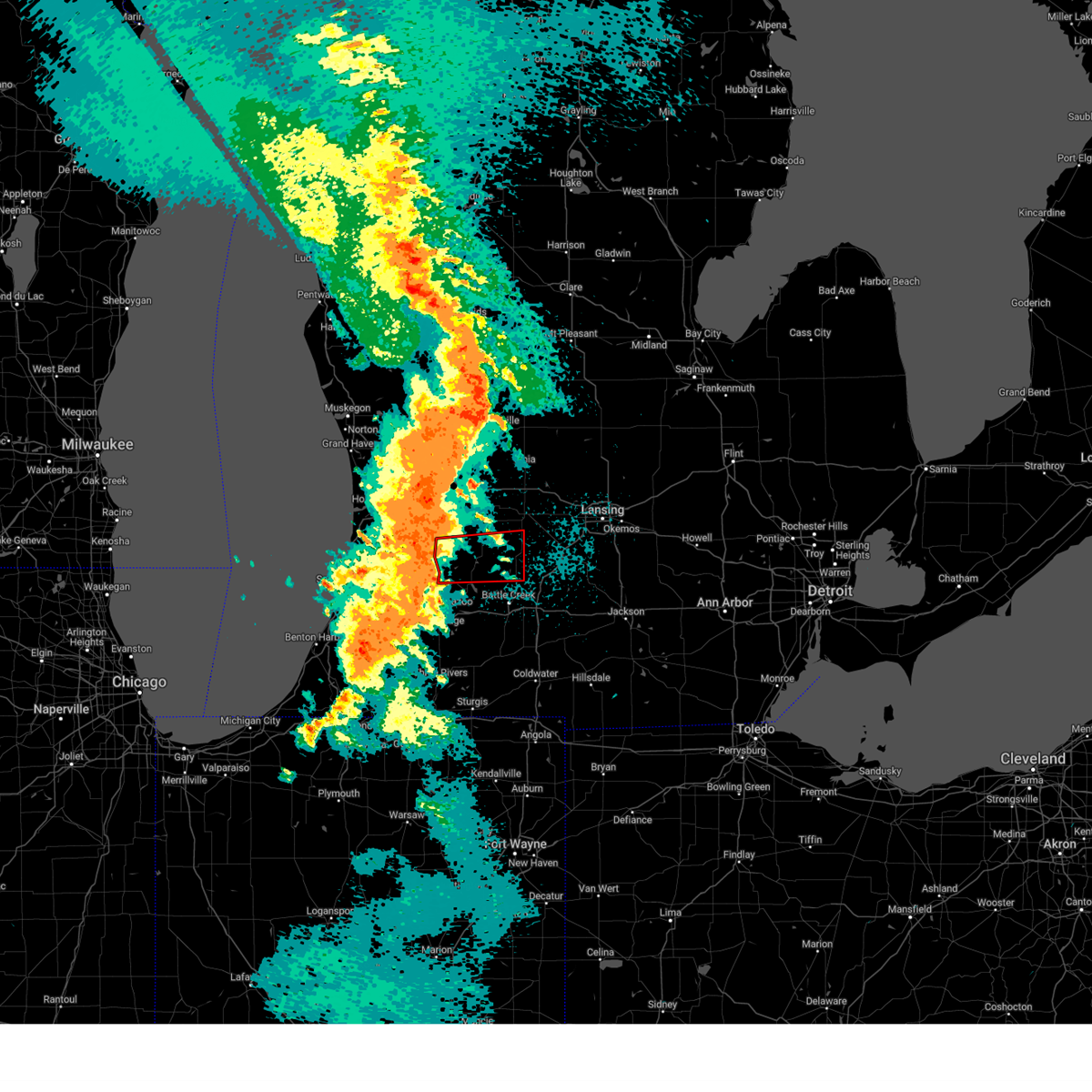
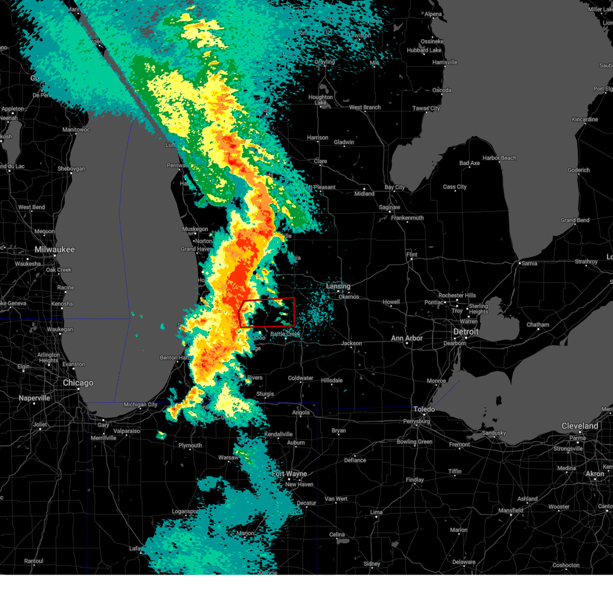
| 3/30/2025 5:55 PM EDT | 72 mph gust reported by trainer spotter. time estimated via radar. delayed repor in barry county MI, 4.5 miles ENE of Nashville, MI |
| 3/30/2025 5:48 PM EDT |
 At 547 pm edt, severe thunderstorms were located along a line extending from 6 miles southwest of sparta to 5 miles east of martin to near burlington, moving northeast at 60 mph (radar indicated). Hazards include 70 mph wind gusts and penny size hail. Expect considerable tree damage. damage is likely to mobile homes, roofs, and outbuildings. Locations impacted include, cutlerville, wyoming, battle creek, belmont, grandville, duck lake, yankee springs, hickory corners, grattan, alto, brownlee park, dutton, sparta, banfield, comstock park, walker, marshall, nashville, athens, tekonsha,. At 547 pm edt, severe thunderstorms were located along a line extending from 6 miles southwest of sparta to 5 miles east of martin to near burlington, moving northeast at 60 mph (radar indicated). Hazards include 70 mph wind gusts and penny size hail. Expect considerable tree damage. damage is likely to mobile homes, roofs, and outbuildings. Locations impacted include, cutlerville, wyoming, battle creek, belmont, grandville, duck lake, yankee springs, hickory corners, grattan, alto, brownlee park, dutton, sparta, banfield, comstock park, walker, marshall, nashville, athens, tekonsha,.
|
| 3/30/2025 5:24 PM EDT |
 Svrgrr the national weather service in grand rapids has issued a * severe thunderstorm warning for, calhoun county in south central michigan, kent county in southwestern michigan, barry county in southwestern michigan, * until 630 pm edt. * at 523 pm edt, severe thunderstorms were located along a line extending from near beechwood to near schoolcraft, moving northeast at 65 mph (radar indicated). Hazards include 70 mph wind gusts and penny size hail. Expect considerable tree damage. Damage is likely to mobile homes, roofs, and outbuildings. Svrgrr the national weather service in grand rapids has issued a * severe thunderstorm warning for, calhoun county in south central michigan, kent county in southwestern michigan, barry county in southwestern michigan, * until 630 pm edt. * at 523 pm edt, severe thunderstorms were located along a line extending from near beechwood to near schoolcraft, moving northeast at 65 mph (radar indicated). Hazards include 70 mph wind gusts and penny size hail. Expect considerable tree damage. Damage is likely to mobile homes, roofs, and outbuildings.
|
| 8/27/2024 4:44 PM EDT |
 At 444 pm edt, a severe thunderstorm was located near charlotte, moving east at 35 mph (radar indicated). Hazards include 70 mph wind gusts. Expect considerable tree damage. damage is likely to mobile homes, roofs, and outbuildings. Locations impacted include, lansing, charlotte, eaton rapids, grand ledge, potterville, nashville, bellevue, edgemont park, assyria, kalamo, olivet, brookfield, dimondale, vermontville, sunfield, mulliken, waverly, woodland, banfield, hickory corners,. At 444 pm edt, a severe thunderstorm was located near charlotte, moving east at 35 mph (radar indicated). Hazards include 70 mph wind gusts. Expect considerable tree damage. damage is likely to mobile homes, roofs, and outbuildings. Locations impacted include, lansing, charlotte, eaton rapids, grand ledge, potterville, nashville, bellevue, edgemont park, assyria, kalamo, olivet, brookfield, dimondale, vermontville, sunfield, mulliken, waverly, woodland, banfield, hickory corners,.
|
| 8/27/2024 4:35 PM EDT |
 At 435 pm edt, a severe thunderstorm was located near charlotte, moving east at 40 mph (radar indicated). Hazards include 60 mph wind gusts. Expect damage to roofs, siding, and trees. Locations impacted include, lansing, charlotte, eaton rapids, grand ledge, potterville, nashville, bellevue, edgemont park, assyria, kalamo, olivet, brookfield, dimondale, vermontville, sunfield, mulliken, waverly, woodland, banfield, hickory corners,. At 435 pm edt, a severe thunderstorm was located near charlotte, moving east at 40 mph (radar indicated). Hazards include 60 mph wind gusts. Expect damage to roofs, siding, and trees. Locations impacted include, lansing, charlotte, eaton rapids, grand ledge, potterville, nashville, bellevue, edgemont park, assyria, kalamo, olivet, brookfield, dimondale, vermontville, sunfield, mulliken, waverly, woodland, banfield, hickory corners,.
|
| 8/27/2024 4:08 PM EDT |
 Svrgrr the national weather service in grand rapids has issued a * severe thunderstorm warning for, barry county in southwestern michigan, eaton county in south central michigan, * until 515 pm edt. * at 407 pm edt, a severe thunderstorm was located over hastings, moving east at 40 mph (radar indicated). Hazards include 60 mph wind gusts. expect damage to roofs, siding, and trees Svrgrr the national weather service in grand rapids has issued a * severe thunderstorm warning for, barry county in southwestern michigan, eaton county in south central michigan, * until 515 pm edt. * at 407 pm edt, a severe thunderstorm was located over hastings, moving east at 40 mph (radar indicated). Hazards include 60 mph wind gusts. expect damage to roofs, siding, and trees
|
| 7/16/2024 12:25 AM EDT |
 Svrgrr the national weather service in grand rapids has issued a * severe thunderstorm warning for, western calhoun county in south central michigan, southeastern barry county in southwestern michigan, eastern kalamazoo county in southwestern michigan, * until 130 am edt. * at 1224 am edt, severe thunderstorms were located along a line extending from near richland to near galesburg to near vicksburg, moving northeast at 50 mph (radar indicated). Hazards include 60 mph wind gusts. expect damage to roofs, siding, and trees Svrgrr the national weather service in grand rapids has issued a * severe thunderstorm warning for, western calhoun county in south central michigan, southeastern barry county in southwestern michigan, eastern kalamazoo county in southwestern michigan, * until 130 am edt. * at 1224 am edt, severe thunderstorms were located along a line extending from near richland to near galesburg to near vicksburg, moving northeast at 50 mph (radar indicated). Hazards include 60 mph wind gusts. expect damage to roofs, siding, and trees
|
| 7/15/2024 12:33 AM EDT |
 At 1232 am edt, a severe thunderstorm was located near hastings, moving east at 20 mph (radar indicated). Hazards include 60 mph wind gusts and quarter size hail. Hail damage to vehicles is expected. expect wind damage to roofs, siding, and trees. Locations impacted include, hastings, middleville, nashville, irving, woodland, woodbury, gun lake, yankee springs,. At 1232 am edt, a severe thunderstorm was located near hastings, moving east at 20 mph (radar indicated). Hazards include 60 mph wind gusts and quarter size hail. Hail damage to vehicles is expected. expect wind damage to roofs, siding, and trees. Locations impacted include, hastings, middleville, nashville, irving, woodland, woodbury, gun lake, yankee springs,.
|
| 7/15/2024 12:13 AM EDT |
 Svrgrr the national weather service in grand rapids has issued a * severe thunderstorm warning for, barry county in southwestern michigan, * until 115 am edt. * at 1212 am edt, a severe thunderstorm was located 7 miles northeast of martin, or 11 miles west of hastings, moving east northeast at 20 mph (radar indicated). Hazards include 60 mph wind gusts and quarter size hail. Hail damage to vehicles is expected. Expect wind damage to roofs, siding, and trees. Svrgrr the national weather service in grand rapids has issued a * severe thunderstorm warning for, barry county in southwestern michigan, * until 115 am edt. * at 1212 am edt, a severe thunderstorm was located 7 miles northeast of martin, or 11 miles west of hastings, moving east northeast at 20 mph (radar indicated). Hazards include 60 mph wind gusts and quarter size hail. Hail damage to vehicles is expected. Expect wind damage to roofs, siding, and trees.
|
| 6/25/2024 7:24 AM EDT |
 At 724 am edt, severe thunderstorms were located along a line extending from 9 miles northeast of bangor to near gull lake to 6 miles southeast of nashville to 6 miles east of portland, moving southeast at 50 mph (radar indicated). Hazards include 60 mph wind gusts and penny size hail. Expect damage to roofs, siding, and trees. Locations impacted include, allegan, portland, otsego, plainwell, nashville, martin, orangeville, assyria, sebewa, sunfield, mulliken, delton, banfield, pullman, prairieville, hickory corners, dowling, woodbury, pine lake, cloverdale,. At 724 am edt, severe thunderstorms were located along a line extending from 9 miles northeast of bangor to near gull lake to 6 miles southeast of nashville to 6 miles east of portland, moving southeast at 50 mph (radar indicated). Hazards include 60 mph wind gusts and penny size hail. Expect damage to roofs, siding, and trees. Locations impacted include, allegan, portland, otsego, plainwell, nashville, martin, orangeville, assyria, sebewa, sunfield, mulliken, delton, banfield, pullman, prairieville, hickory corners, dowling, woodbury, pine lake, cloverdale,.
|
| 6/16/2024 10:41 PM EDT |
 Svrgrr the national weather service in grand rapids has issued a * severe thunderstorm warning for, southeastern barry county in southwestern michigan, eastern kalamazoo county in southwestern michigan, * until 1130 pm edt. * at 1041 pm edt, severe thunderstorms were located along a line extending from near nashville to near vicksburg, moving east at 50 mph. these storms produced a 76 mph wind gust at the kalamazoo airport at 10:22pm (radar indicated). Hazards include 70 mph wind gusts and penny size hail. Expect considerable tree damage. Damage is likely to mobile homes, roofs, and outbuildings. Svrgrr the national weather service in grand rapids has issued a * severe thunderstorm warning for, southeastern barry county in southwestern michigan, eastern kalamazoo county in southwestern michigan, * until 1130 pm edt. * at 1041 pm edt, severe thunderstorms were located along a line extending from near nashville to near vicksburg, moving east at 50 mph. these storms produced a 76 mph wind gust at the kalamazoo airport at 10:22pm (radar indicated). Hazards include 70 mph wind gusts and penny size hail. Expect considerable tree damage. Damage is likely to mobile homes, roofs, and outbuildings.
|
| 6/13/2024 4:07 PM EDT |
 Svrgrr the national weather service in grand rapids has issued a * severe thunderstorm warning for, northeastern barry county in southwestern michigan, eaton county in south central michigan, * until 445 pm edt. * at 406 pm edt, severe thunderstorms were located along a line extending from near lake odessa to near hastings, moving east at 45 mph (radar indicated). Hazards include 60 mph wind gusts. expect damage to roofs, siding, and trees Svrgrr the national weather service in grand rapids has issued a * severe thunderstorm warning for, northeastern barry county in southwestern michigan, eaton county in south central michigan, * until 445 pm edt. * at 406 pm edt, severe thunderstorms were located along a line extending from near lake odessa to near hastings, moving east at 45 mph (radar indicated). Hazards include 60 mph wind gusts. expect damage to roofs, siding, and trees
|
| 5/5/2024 12:26 AM EDT |
 the severe thunderstorm warning has been cancelled and is no longer in effect the severe thunderstorm warning has been cancelled and is no longer in effect
|
| 5/5/2024 12:10 AM EDT |
 At 1208 am edt, a severe thunderstorm was located near hastings, moving northeast at 40 mph (radar indicated). Hazards include 60 mph wind gusts. Expect damage to roofs, siding, and trees. Locations impacted include, hastings, nashville, freeport, assyria, woodland, prairieville, dowling, delton, woodbury, banfield, cloverdale, lacey,. At 1208 am edt, a severe thunderstorm was located near hastings, moving northeast at 40 mph (radar indicated). Hazards include 60 mph wind gusts. Expect damage to roofs, siding, and trees. Locations impacted include, hastings, nashville, freeport, assyria, woodland, prairieville, dowling, delton, woodbury, banfield, cloverdale, lacey,.
|
| 5/5/2024 12:10 AM EDT |
 the severe thunderstorm warning has been cancelled and is no longer in effect the severe thunderstorm warning has been cancelled and is no longer in effect
|
| 5/5/2024 12:01 AM EDT |
 the severe thunderstorm warning has been cancelled and is no longer in effect the severe thunderstorm warning has been cancelled and is no longer in effect
|
| 5/5/2024 12:01 AM EDT |
 At 1201 am edt, a severe thunderstorm was located 9 miles south of hastings, moving northeast at 35 mph (radar indicated). Hazards include 60 mph wind gusts. Expect damage to roofs, siding, and trees. Locations impacted include, hastings, nashville, freeport, assyria, woodland, delton, banfield, prairieville, hickory corners, dowling, woodbury, pine lake, bedford, cloverdale, lacey,. At 1201 am edt, a severe thunderstorm was located 9 miles south of hastings, moving northeast at 35 mph (radar indicated). Hazards include 60 mph wind gusts. Expect damage to roofs, siding, and trees. Locations impacted include, hastings, nashville, freeport, assyria, woodland, delton, banfield, prairieville, hickory corners, dowling, woodbury, pine lake, bedford, cloverdale, lacey,.
|
| 5/4/2024 11:42 PM EDT |
 Svrgrr the national weather service in grand rapids has issued a * severe thunderstorm warning for, northwestern calhoun county in south central michigan, barry county in southwestern michigan, northeastern kalamazoo county in southwestern michigan, * until 1245 am edt. * at 1141 pm edt, a severe thunderstorm was located near richland, or 8 miles north of kalamazoo, moving northeast at 30 mph (radar indicated). Hazards include 60 mph wind gusts. expect damage to roofs, siding, and trees Svrgrr the national weather service in grand rapids has issued a * severe thunderstorm warning for, northwestern calhoun county in south central michigan, barry county in southwestern michigan, northeastern kalamazoo county in southwestern michigan, * until 1245 am edt. * at 1141 pm edt, a severe thunderstorm was located near richland, or 8 miles north of kalamazoo, moving northeast at 30 mph (radar indicated). Hazards include 60 mph wind gusts. expect damage to roofs, siding, and trees
|
| 2/27/2024 11:54 PM EST |
 At 1152 pm est, severe thunderstorms were located along a line extending from near hastings to 10 miles north of gull lake, moving northeast at 40 mph (radar indicated). Hazards include 60 mph wind gusts and penny size hail. Expect damage to roofs, siding, and trees. Locations impacted include, kalamazoo, nashville, richland, comstock northwest, westwood, gull lake, assyria, augusta, woodland, delton, banfield, hickory corners, dowling, woodbury, lacey,. At 1152 pm est, severe thunderstorms were located along a line extending from near hastings to 10 miles north of gull lake, moving northeast at 40 mph (radar indicated). Hazards include 60 mph wind gusts and penny size hail. Expect damage to roofs, siding, and trees. Locations impacted include, kalamazoo, nashville, richland, comstock northwest, westwood, gull lake, assyria, augusta, woodland, delton, banfield, hickory corners, dowling, woodbury, lacey,.
|
| 2/27/2024 11:19 PM EST |
 Svrgrr the national weather service in grand rapids has issued a * severe thunderstorm warning for, eastern allegan county in southwestern michigan, barry county in southwestern michigan, northern kalamazoo county in southwestern michigan, * until 1215 am est. * at 1117 pm est, severe thunderstorms were located along a line extending from plainwell to near westwood, moving northeast at 40 mph. other storms were near allegan moving east (radar indicated). Hazards include 60 mph wind gusts and penny size hail. expect damage to roofs, siding, and trees Svrgrr the national weather service in grand rapids has issued a * severe thunderstorm warning for, eastern allegan county in southwestern michigan, barry county in southwestern michigan, northern kalamazoo county in southwestern michigan, * until 1215 am est. * at 1117 pm est, severe thunderstorms were located along a line extending from plainwell to near westwood, moving northeast at 40 mph. other storms were near allegan moving east (radar indicated). Hazards include 60 mph wind gusts and penny size hail. expect damage to roofs, siding, and trees
|
| 8/24/2023 8:52 PM EDT |
 At 852 pm edt, a severe thunderstorm was located near lake odessa, or 11 miles northeast of hastings, moving southeast at 60 mph (radar indicated). Hazards include 60 mph wind gusts and penny size hail. expect damage to roofs, siding, and trees At 852 pm edt, a severe thunderstorm was located near lake odessa, or 11 miles northeast of hastings, moving southeast at 60 mph (radar indicated). Hazards include 60 mph wind gusts and penny size hail. expect damage to roofs, siding, and trees
|
| 7/12/2023 10:52 PM EDT |
 At 1052 pm edt, a severe thunderstorm was located near hastings, moving east at 40 mph (radar indicated). Hazards include 60 mph wind gusts. expect damage to roofs, siding, and trees At 1052 pm edt, a severe thunderstorm was located near hastings, moving east at 40 mph (radar indicated). Hazards include 60 mph wind gusts. expect damage to roofs, siding, and trees
|
| 6/25/2023 4:53 PM EDT |
 At 452 pm edt, a severe thunderstorm was located 6 miles northwest of charlotte, moving northeast at 35 mph (radar indicated). Hazards include 60 mph wind gusts and penny size hail. Expect damage to roofs, siding, and trees. locations impacted include, nashville, kalamo, vermontville, hail threat, radar indicated max hail size, 0. 75 in wind threat, radar indicated max wind gust, 60 mph. At 452 pm edt, a severe thunderstorm was located 6 miles northwest of charlotte, moving northeast at 35 mph (radar indicated). Hazards include 60 mph wind gusts and penny size hail. Expect damage to roofs, siding, and trees. locations impacted include, nashville, kalamo, vermontville, hail threat, radar indicated max hail size, 0. 75 in wind threat, radar indicated max wind gust, 60 mph.
|
| 6/25/2023 4:34 PM EDT |
 At 433 pm edt, a severe thunderstorm was located near bellevue, or 13 miles northeast of battle creek, moving northeast at 35 mph (radar indicated). Hazards include 60 mph wind gusts and penny size hail. Expect damage to roofs, siding, and trees. locations impacted include, charlotte, hastings, nashville, bellevue, assyria, kalamo, olivet, vermontville, dowling, banfield, lacey, hail threat, radar indicated max hail size, 0. 75 in wind threat, radar indicated max wind gust, 60 mph. At 433 pm edt, a severe thunderstorm was located near bellevue, or 13 miles northeast of battle creek, moving northeast at 35 mph (radar indicated). Hazards include 60 mph wind gusts and penny size hail. Expect damage to roofs, siding, and trees. locations impacted include, charlotte, hastings, nashville, bellevue, assyria, kalamo, olivet, vermontville, dowling, banfield, lacey, hail threat, radar indicated max hail size, 0. 75 in wind threat, radar indicated max wind gust, 60 mph.
|
| 6/25/2023 4:10 PM EDT |
 At 409 pm edt, a severe thunderstorm was located near battle creek, moving northeast at 35 mph (radar indicated). Hazards include 60 mph wind gusts and penny size hail. expect damage to roofs, siding, and trees At 409 pm edt, a severe thunderstorm was located near battle creek, moving northeast at 35 mph (radar indicated). Hazards include 60 mph wind gusts and penny size hail. expect damage to roofs, siding, and trees
|
| 5/7/2023 7:04 AM EDT |
 At 703 am edt, a severe thunderstorm was located 6 miles southwest of hastings, moving east at 40 mph (radar indicated). Hazards include quarter size hail. Damage to vehicles is expected. locations impacted include, hastings, middleville, nashville, orangeville, irving, assyria, woodland, delton, banfield, gun lake, yankee springs, hastings city barry , prairieville, dowling, pine lake, cloverdale, lacey, hail threat, radar indicated max hail size, 1. 00 in wind threat, radar indicated max wind gust, <50 mph. At 703 am edt, a severe thunderstorm was located 6 miles southwest of hastings, moving east at 40 mph (radar indicated). Hazards include quarter size hail. Damage to vehicles is expected. locations impacted include, hastings, middleville, nashville, orangeville, irving, assyria, woodland, delton, banfield, gun lake, yankee springs, hastings city barry , prairieville, dowling, pine lake, cloverdale, lacey, hail threat, radar indicated max hail size, 1. 00 in wind threat, radar indicated max wind gust, <50 mph.
|
| 5/7/2023 6:52 AM EDT |
 At 651 am edt, a severe thunderstorm was located near martin, or 14 miles west of hastings, moving east at 40 mph (radar indicated). Hazards include quarter size hail. damage to vehicles is expected At 651 am edt, a severe thunderstorm was located near martin, or 14 miles west of hastings, moving east at 40 mph (radar indicated). Hazards include quarter size hail. damage to vehicles is expected
|
| 4/5/2023 11:12 AM EDT |
 At 1112 am edt, severe thunderstorms were located along a line extending from near hastings to near nashville to 5 miles north of level park-oak park, moving northeast at 60 mph (radar indicated). Hazards include 60 mph wind gusts. expect damage to roofs, siding, and trees At 1112 am edt, severe thunderstorms were located along a line extending from near hastings to near nashville to 5 miles north of level park-oak park, moving northeast at 60 mph (radar indicated). Hazards include 60 mph wind gusts. expect damage to roofs, siding, and trees
|
| 4/5/2023 10:54 AM EDT |
 At 1054 am edt, a severe thunderstorm was located near gull lake, or 12 miles northwest of battle creek, moving northeast at 65 mph (radar indicated). Hazards include 60 mph wind gusts. expect damage to roofs, siding, and trees At 1054 am edt, a severe thunderstorm was located near gull lake, or 12 miles northwest of battle creek, moving northeast at 65 mph (radar indicated). Hazards include 60 mph wind gusts. expect damage to roofs, siding, and trees
|
| 4/4/2023 7:31 PM EDT |
 At 731 pm edt, a severe thunderstorm was located near freeport, or near hastings, moving east at 25 mph (radar indicated). Hazards include golf ball size hail and 60 mph wind gusts. People and animals outdoors will be injured. expect hail damage to roofs, siding, windows, and vehicles. Expect wind damage to roofs, siding, and trees. At 731 pm edt, a severe thunderstorm was located near freeport, or near hastings, moving east at 25 mph (radar indicated). Hazards include golf ball size hail and 60 mph wind gusts. People and animals outdoors will be injured. expect hail damage to roofs, siding, windows, and vehicles. Expect wind damage to roofs, siding, and trees.
|
| 4/4/2023 7:30 PM EDT |
 At 729 pm edt, a severe thunderstorm was located near hastings, moving east at 25 mph (radar indicated). Hazards include ping pong ball size hail and 60 mph wind gusts. People and animals outdoors will be injured. expect hail damage to roofs, siding, windows, and vehicles. expect wind damage to roofs, siding, and trees. locations impacted include, hastings, nashville, freeport, woodland, woodbury, hastings city barry , hail threat, radar indicated max hail size, 1. 50 in wind threat, radar indicated max wind gust, 60 mph. At 729 pm edt, a severe thunderstorm was located near hastings, moving east at 25 mph (radar indicated). Hazards include ping pong ball size hail and 60 mph wind gusts. People and animals outdoors will be injured. expect hail damage to roofs, siding, windows, and vehicles. expect wind damage to roofs, siding, and trees. locations impacted include, hastings, nashville, freeport, woodland, woodbury, hastings city barry , hail threat, radar indicated max hail size, 1. 50 in wind threat, radar indicated max wind gust, 60 mph.
|
| 4/4/2023 7:08 PM EDT |
 At 707 pm edt, a severe thunderstorm was located over middleville, or 9 miles northwest of hastings, moving east at 30 mph (radar indicated). Hazards include ping pong ball size hail and 60 mph wind gusts. People and animals outdoors will be injured. expect hail damage to roofs, siding, windows, and vehicles. expect wind damage to roofs, siding, and trees. locations impacted include, hastings, middleville, nashville, freeport, orangeville, irving, woodland, woodbury, gun lake, cloverdale, yankee springs, hastings city barry , hail threat, radar indicated max hail size, 1. 50 in wind threat, radar indicated max wind gust, 60 mph. At 707 pm edt, a severe thunderstorm was located over middleville, or 9 miles northwest of hastings, moving east at 30 mph (radar indicated). Hazards include ping pong ball size hail and 60 mph wind gusts. People and animals outdoors will be injured. expect hail damage to roofs, siding, windows, and vehicles. expect wind damage to roofs, siding, and trees. locations impacted include, hastings, middleville, nashville, freeport, orangeville, irving, woodland, woodbury, gun lake, cloverdale, yankee springs, hastings city barry , hail threat, radar indicated max hail size, 1. 50 in wind threat, radar indicated max wind gust, 60 mph.
|
| 4/4/2023 6:43 PM EDT |
 At 642 pm edt, a severe thunderstorm was located over wayland, or 14 miles northeast of allegan, moving east at 40 mph (radar indicated). Hazards include ping pong ball size hail and 60 mph wind gusts. People and animals outdoors will be injured. expect hail damage to roofs, siding, windows, and vehicles. Expect wind damage to roofs, siding, and trees. At 642 pm edt, a severe thunderstorm was located over wayland, or 14 miles northeast of allegan, moving east at 40 mph (radar indicated). Hazards include ping pong ball size hail and 60 mph wind gusts. People and animals outdoors will be injured. expect hail damage to roofs, siding, windows, and vehicles. Expect wind damage to roofs, siding, and trees.
|
| 8/29/2022 3:47 PM EDT |
 At 345 pm edt, a line of severe thunderstorms was located along a line from grand rapids to near stanton, moving east at 45 mph. these storms have a history of producing wind damage and power outages. seek shelter inside a sturdy building (trained weather spotters). Hazards include 60 mph wind gusts and quarter size hail. Hail damage to vehicles is expected. Expect wind damage to roofs, siding, and trees. At 345 pm edt, a line of severe thunderstorms was located along a line from grand rapids to near stanton, moving east at 45 mph. these storms have a history of producing wind damage and power outages. seek shelter inside a sturdy building (trained weather spotters). Hazards include 60 mph wind gusts and quarter size hail. Hail damage to vehicles is expected. Expect wind damage to roofs, siding, and trees.
|
| 8/3/2022 5:39 PM EDT |
 The severe thunderstorm warning for barry county will expire at 545 pm edt, the storm which prompted the warning has weakened below severe limits, and has exited the warned area. therefore, the warning will be allowed to expire. a severe thunderstorm watch remains in effect until 900 pm edt for south central and southwestern michigan. The severe thunderstorm warning for barry county will expire at 545 pm edt, the storm which prompted the warning has weakened below severe limits, and has exited the warned area. therefore, the warning will be allowed to expire. a severe thunderstorm watch remains in effect until 900 pm edt for south central and southwestern michigan.
|
| 8/3/2022 5:23 PM EDT |
 At 523 pm edt, a severe thunderstorm was located 6 miles west of charlotte, moving east at 35 mph (radar indicated). Hazards include 60 mph wind gusts and penny size hail. expect damage to roofs, siding, and trees At 523 pm edt, a severe thunderstorm was located 6 miles west of charlotte, moving east at 35 mph (radar indicated). Hazards include 60 mph wind gusts and penny size hail. expect damage to roofs, siding, and trees
|
| 8/3/2022 4:51 PM EDT |
 At 451 pm edt, a severe thunderstorm was located 6 miles east of martin, or 13 miles southwest of hastings, moving east at 40 mph (radar indicated). Hazards include 60 mph wind gusts. expect damage to roofs, siding, and trees At 451 pm edt, a severe thunderstorm was located 6 miles east of martin, or 13 miles southwest of hastings, moving east at 40 mph (radar indicated). Hazards include 60 mph wind gusts. expect damage to roofs, siding, and trees
|
| 7/23/2022 11:06 PM EDT |
 The severe thunderstorm warning for barry county will expire at 1115 pm edt, the storms which prompted the warning have weakened below severe limits, and no longer pose an immediate threat to life or property. therefore, the warning will be allowed to expire. however, gusty winds are still possible with these thunderstorms. a severe thunderstorm watch remains in effect until midnight edt for south central and southwestern michigan. The severe thunderstorm warning for barry county will expire at 1115 pm edt, the storms which prompted the warning have weakened below severe limits, and no longer pose an immediate threat to life or property. therefore, the warning will be allowed to expire. however, gusty winds are still possible with these thunderstorms. a severe thunderstorm watch remains in effect until midnight edt for south central and southwestern michigan.
|
| 7/23/2022 10:46 PM EDT |
 At 1045 pm edt, severe thunderstorms were located along a line extending from near lake odessa to 5 miles southwest of nashville to near gull lake, moving east at 50 mph (radar indicated). Hazards include 60 mph wind gusts. Expect damage to roofs, siding, and trees. locations impacted include, hastings, middleville, nashville, freeport, orangeville, irving, assyria, woodland, delton, banfield, gun lake, yankee springs, prairieville, hickory corners, dowling, pine lake, woodbury, cloverdale, lacey, hail threat, radar indicated max hail size, <. 75 in wind threat, radar indicated max wind gust, 60 mph. At 1045 pm edt, severe thunderstorms were located along a line extending from near lake odessa to 5 miles southwest of nashville to near gull lake, moving east at 50 mph (radar indicated). Hazards include 60 mph wind gusts. Expect damage to roofs, siding, and trees. locations impacted include, hastings, middleville, nashville, freeport, orangeville, irving, assyria, woodland, delton, banfield, gun lake, yankee springs, prairieville, hickory corners, dowling, pine lake, woodbury, cloverdale, lacey, hail threat, radar indicated max hail size, <. 75 in wind threat, radar indicated max wind gust, 60 mph.
|
| 7/23/2022 10:17 PM EDT |
 At 1016 pm edt, severe thunderstorms were located along a line extending from near caledonia to 6 miles south of fennville, moving east at 65 mph (radar indicated). Hazards include 60 mph wind gusts and quarter size hail. Hail damage to vehicles is expected. Expect wind damage to roofs, siding, and trees. At 1016 pm edt, severe thunderstorms were located along a line extending from near caledonia to 6 miles south of fennville, moving east at 65 mph (radar indicated). Hazards include 60 mph wind gusts and quarter size hail. Hail damage to vehicles is expected. Expect wind damage to roofs, siding, and trees.
|
| 6/14/2022 12:09 AM EDT |
 At 1208 am edt, a severe thunderstorm was located 6 miles southeast of lake odessa, or 11 miles east of hastings, moving southeast at 50 mph (radar indicated). Hazards include ping pong ball size hail. People and animals outdoors will be injured. Expect damage to roofs, siding, windows, and vehicles. At 1208 am edt, a severe thunderstorm was located 6 miles southeast of lake odessa, or 11 miles east of hastings, moving southeast at 50 mph (radar indicated). Hazards include ping pong ball size hail. People and animals outdoors will be injured. Expect damage to roofs, siding, windows, and vehicles.
|
| 9/7/2021 5:13 PM EDT |
 At 512 pm edt, severe thunderstorms were located along a line extending from 5 miles northeast of gull lake to 5 miles southeast of vicksburg, moving east at 60 mph (radar indicated). Hazards include 60 mph wind gusts. expect damage to roofs, siding, and trees At 512 pm edt, severe thunderstorms were located along a line extending from 5 miles northeast of gull lake to 5 miles southeast of vicksburg, moving east at 60 mph (radar indicated). Hazards include 60 mph wind gusts. expect damage to roofs, siding, and trees
|
| 8/24/2021 6:48 PM EDT |
 At 648 pm edt, a severe thunderstorm was located near grand ledge, or 9 miles north of charlotte, moving east at 25 mph (radar indicated). Hazards include 60 mph wind gusts. expect damage to roofs, siding, and trees At 648 pm edt, a severe thunderstorm was located near grand ledge, or 9 miles north of charlotte, moving east at 25 mph (radar indicated). Hazards include 60 mph wind gusts. expect damage to roofs, siding, and trees
|
| 8/11/2021 10:10 PM EDT |
 The severe thunderstorm warning for southeastern ionia, northeastern barry, southwestern clinton and eaton counties will expire at 1015 pm edt, the storms which prompted the warning have weakened below severe limits, and no longer pose an immediate threat to life or property. therefore, the warning will be allowed to expire. however, gusty winds to 40 mph, lightning strikes, and heavy rain are still possible over the area as another round of thunderstorms is currently moving into barry county. a severe thunderstorm watch remains in effect until 300 am edt for south central and southwestern michigan. The severe thunderstorm warning for southeastern ionia, northeastern barry, southwestern clinton and eaton counties will expire at 1015 pm edt, the storms which prompted the warning have weakened below severe limits, and no longer pose an immediate threat to life or property. therefore, the warning will be allowed to expire. however, gusty winds to 40 mph, lightning strikes, and heavy rain are still possible over the area as another round of thunderstorms is currently moving into barry county. a severe thunderstorm watch remains in effect until 300 am edt for south central and southwestern michigan.
|
| 8/11/2021 9:52 PM EDT |
 At 950 pm edt, severe thunderstorms were located along a line extending from portland to near nashville, moving east at 55 mph (radar indicated). Hazards include 60 mph wind gusts. Expect damage to roofs, siding, and trees. locations impacted include, lansing, charlotte, eaton rapids, portland, grand ledge, potterville, nashville, kalamo, dimondale, sebewa, vermontville, sunfield, mulliken, waverly, woodland, eagle, wacousta, gresham, dowling, woodbury, hail threat, radar indicated max hail size, <. 75 in wind threat, radar indicated max wind gust, 60 mph. At 950 pm edt, severe thunderstorms were located along a line extending from portland to near nashville, moving east at 55 mph (radar indicated). Hazards include 60 mph wind gusts. Expect damage to roofs, siding, and trees. locations impacted include, lansing, charlotte, eaton rapids, portland, grand ledge, potterville, nashville, kalamo, dimondale, sebewa, vermontville, sunfield, mulliken, waverly, woodland, eagle, wacousta, gresham, dowling, woodbury, hail threat, radar indicated max hail size, <. 75 in wind threat, radar indicated max wind gust, 60 mph.
|
| 8/11/2021 9:30 PM EDT |
 At 929 pm edt, severe thunderstorms were located along a line extending from near saranac to 10 miles north of gull lake, moving east at 55 mph (radar indicated). Hazards include 60 mph wind gusts. expect damage to roofs, siding, and trees At 929 pm edt, severe thunderstorms were located along a line extending from near saranac to 10 miles north of gull lake, moving east at 55 mph (radar indicated). Hazards include 60 mph wind gusts. expect damage to roofs, siding, and trees
|
| 8/10/2021 10:02 PM EDT |
 At 1002 pm edt, severe thunderstorms were located along a line extending from 6 miles west of manistee to near fruitport to near fennville to near coloma, moving east at 55 mph (radar indicated). Hazards include 60 mph wind gusts. expect damage to roofs, siding, and trees At 1002 pm edt, severe thunderstorms were located along a line extending from 6 miles west of manistee to near fruitport to near fennville to near coloma, moving east at 55 mph (radar indicated). Hazards include 60 mph wind gusts. expect damage to roofs, siding, and trees
|
| 6/26/2021 4:55 PM EDT |
 At 454 pm edt, severe thunderstorms were located along a line extending from 8 miles southwest of portland to near vicksburg, moving northeast at 35 mph. another severe storm was located just northeast of battle creek (radar indicated). Hazards include 60 mph wind gusts. expect damage to roofs, siding, and trees At 454 pm edt, severe thunderstorms were located along a line extending from 8 miles southwest of portland to near vicksburg, moving northeast at 35 mph. another severe storm was located just northeast of battle creek (radar indicated). Hazards include 60 mph wind gusts. expect damage to roofs, siding, and trees
|
| 8/28/2020 10:56 PM EDT |
 At 1055 pm edt, severe thunderstorms were located along a line extending from near hastings to 8 miles north of level park-oak park to near gull lake, moving east at 40 mph (radar indicated). Hazards include 60 mph wind gusts and penny size hail. expect damage to roofs, siding, and trees At 1055 pm edt, severe thunderstorms were located along a line extending from near hastings to 8 miles north of level park-oak park to near gull lake, moving east at 40 mph (radar indicated). Hazards include 60 mph wind gusts and penny size hail. expect damage to roofs, siding, and trees
|
| 6/10/2020 2:28 PM EDT |
 The severe thunderstorm warning for barry county will expire at 230 pm edt, the storm which prompted the warning has weakened below severe limits, and no longer poses an immediate threat to life or property. therefore, the warning will be allowed to expire. a severe thunderstorm watch remains in effect until 600 pm edt for south central and southwestern michigan. The severe thunderstorm warning for barry county will expire at 230 pm edt, the storm which prompted the warning has weakened below severe limits, and no longer poses an immediate threat to life or property. therefore, the warning will be allowed to expire. a severe thunderstorm watch remains in effect until 600 pm edt for south central and southwestern michigan.
|
| 6/10/2020 2:06 PM EDT |
 At 204 pm edt, a severe thunderstorm was located 7 miles southwest of hastings, moving northeast at 50 mph. another severe thunderstorm near battle creek was moving northeast at 50 mph as well and moving towards assyria (radar indicated). Hazards include 60 mph wind gusts and quarter size hail. Hail damage to vehicles is expected. expect wind damage to roofs, siding, and trees. Locations impacted include, hastings, middleville, nashville, freeport, orangeville, irving, assyria, woodland, delton, banfield, yankee springs, prairieville, hickory corners, dowling, pine lake, woodbury, cloverdale, lacey, gun lake,. At 204 pm edt, a severe thunderstorm was located 7 miles southwest of hastings, moving northeast at 50 mph. another severe thunderstorm near battle creek was moving northeast at 50 mph as well and moving towards assyria (radar indicated). Hazards include 60 mph wind gusts and quarter size hail. Hail damage to vehicles is expected. expect wind damage to roofs, siding, and trees. Locations impacted include, hastings, middleville, nashville, freeport, orangeville, irving, assyria, woodland, delton, banfield, yankee springs, prairieville, hickory corners, dowling, pine lake, woodbury, cloverdale, lacey, gun lake,.
|
| 6/10/2020 1:50 PM EDT |
 At 150 pm edt, a severe thunderstorm was located near plainwell, or 12 miles north of kalamazoo, moving northeast at 50 mph (radar indicated). Hazards include 60 mph wind gusts. expect damage to roofs, siding, and trees At 150 pm edt, a severe thunderstorm was located near plainwell, or 12 miles north of kalamazoo, moving northeast at 50 mph (radar indicated). Hazards include 60 mph wind gusts. expect damage to roofs, siding, and trees
|
| 4/7/2020 9:23 PM EDT |
 At 923 pm edt, severe thunderstorms were located along a line extending from eaton rapids to near south gull lake, moving east at 50 mph (radar indicated). Hazards include 60 mph wind gusts and quarter size hail. Hail damage to vehicles is expected. expect wind damage to roofs, siding, and trees. Locations impacted include, charlotte, eaton rapids, nashville, bellevue, assyria, kalamo, olivet, brookfield, delton, banfield, hickory corners, dowling, lacey,. At 923 pm edt, severe thunderstorms were located along a line extending from eaton rapids to near south gull lake, moving east at 50 mph (radar indicated). Hazards include 60 mph wind gusts and quarter size hail. Hail damage to vehicles is expected. expect wind damage to roofs, siding, and trees. Locations impacted include, charlotte, eaton rapids, nashville, bellevue, assyria, kalamo, olivet, brookfield, delton, banfield, hickory corners, dowling, lacey,.
|
| 4/7/2020 8:59 PM EDT |
 The national weather service in grand rapids has issued a * severe thunderstorm warning for. barry county in southwestern michigan. eaton county in south central michigan. until 1030 pm edt. At 858 pm edt, severe thunderstorms were located along a line. The national weather service in grand rapids has issued a * severe thunderstorm warning for. barry county in southwestern michigan. eaton county in south central michigan. until 1030 pm edt. At 858 pm edt, severe thunderstorms were located along a line.
|
| 8/29/2019 9:38 PM EDT |
 At 938 pm edt, severe thunderstorms were located along a line extending from near lake odessa to near middleville, moving southeast at 25 mph (radar indicated). Hazards include 60 mph wind gusts and penny size hail. expect damage to roofs, siding, and trees At 938 pm edt, severe thunderstorms were located along a line extending from near lake odessa to near middleville, moving southeast at 25 mph (radar indicated). Hazards include 60 mph wind gusts and penny size hail. expect damage to roofs, siding, and trees
|
| 7/20/2019 2:12 AM EDT |
 At 211 am edt, severe thunderstorms were located along a line extending from near lake odessa to 7 miles west of allegan, moving southeast at 50 mph (mesonets. multiple wind gusts of 60-70 mph have been reported in kent county with these storms). Hazards include 70 mph wind gusts. the strongest winds will impact wayland to shelbyville. Expect damage to roofs, siding, and trees. Locations impacted include, hastings, allegan, plainwell, wayland, otsego, middleville, nashville, fennville, freeport, martin, dorr, orangeville, irving, ganges, assyria, hamilton, hopkins, woodland, delton, bradley,. At 211 am edt, severe thunderstorms were located along a line extending from near lake odessa to 7 miles west of allegan, moving southeast at 50 mph (mesonets. multiple wind gusts of 60-70 mph have been reported in kent county with these storms). Hazards include 70 mph wind gusts. the strongest winds will impact wayland to shelbyville. Expect damage to roofs, siding, and trees. Locations impacted include, hastings, allegan, plainwell, wayland, otsego, middleville, nashville, fennville, freeport, martin, dorr, orangeville, irving, ganges, assyria, hamilton, hopkins, woodland, delton, bradley,.
|
| 7/20/2019 1:58 AM EDT |
 At 158 am edt, severe thunderstorms were located along a line extending from near saranac to near fennville, moving southeast at 50 mph (radar indicated. a 69 mph wind gust was measured in grand rapids as this storm moved through). Hazards include 70 mph wind gusts. Expect damage to roofs, siding, and trees. Locations impacted include, holland, hastings, allegan, plainwell, wayland, otsego, middleville, nashville, fennville, saugatuck, freeport, martin, saugatuck sp, dorr, orangeville, irving, ganges, assyria, hamilton, douglas,. At 158 am edt, severe thunderstorms were located along a line extending from near saranac to near fennville, moving southeast at 50 mph (radar indicated. a 69 mph wind gust was measured in grand rapids as this storm moved through). Hazards include 70 mph wind gusts. Expect damage to roofs, siding, and trees. Locations impacted include, holland, hastings, allegan, plainwell, wayland, otsego, middleville, nashville, fennville, saugatuck, freeport, martin, saugatuck sp, dorr, orangeville, irving, ganges, assyria, hamilton, douglas,.
|
| 7/20/2019 1:42 AM EDT |
 At 140 am edt, severe thunderstorms were located along a line extending from near holland to rockford, moving southeast at 50 mph (radar indicated). Hazards include 60 mph wind gusts. expect damage to roofs, siding, and trees At 140 am edt, severe thunderstorms were located along a line extending from near holland to rockford, moving southeast at 50 mph (radar indicated). Hazards include 60 mph wind gusts. expect damage to roofs, siding, and trees
|
| 6/1/2019 8:37 PM EDT |
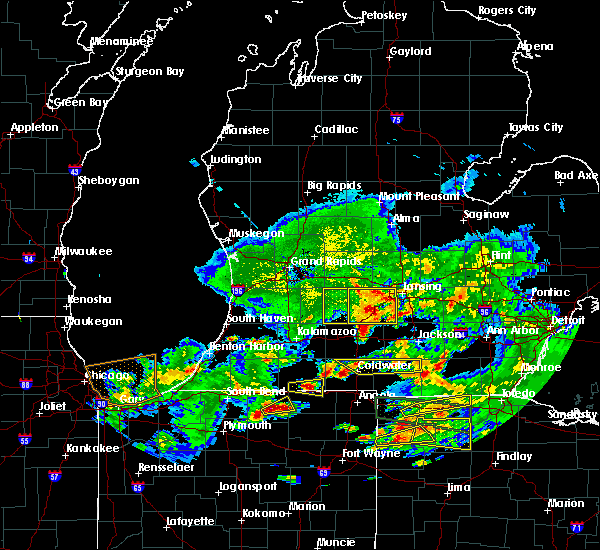 The severe thunderstorm warning for eastern barry county will expire at 845 pm edt, the storms which prompted the warning have moved out of the area. therefore, the warning will be allowed to expire. a severe thunderstorm watch remains in effect until 1100 pm edt for south central and southwestern michigan. The severe thunderstorm warning for eastern barry county will expire at 845 pm edt, the storms which prompted the warning have moved out of the area. therefore, the warning will be allowed to expire. a severe thunderstorm watch remains in effect until 1100 pm edt for south central and southwestern michigan.
|
| 6/1/2019 8:20 PM EDT |
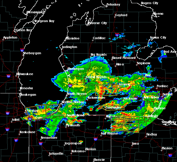 At 819 pm edt, severe thunderstorms were located along a line extending from near lake odessa to near bellevue, moving east at 50 mph (radar indicated). Hazards include 60 mph wind gusts and quarter size hail. Hail damage to vehicles is expected. expect wind damage to roofs, siding, and trees. Locations impacted include, hastings, nashville, freeport, assyria, woodland, dowling, woodbury, banfield, lacey,. At 819 pm edt, severe thunderstorms were located along a line extending from near lake odessa to near bellevue, moving east at 50 mph (radar indicated). Hazards include 60 mph wind gusts and quarter size hail. Hail damage to vehicles is expected. expect wind damage to roofs, siding, and trees. Locations impacted include, hastings, nashville, freeport, assyria, woodland, dowling, woodbury, banfield, lacey,.
|
| 6/1/2019 7:39 PM EDT |
 At 738 pm edt, severe thunderstorms were located along a line extending from 5 miles southwest of wyoming to near allegan, moving east at 55 mph (radar indicated). Hazards include 60 mph wind gusts and quarter size hail. Hail damage to vehicles is expected. Expect wind damage to roofs, siding, and trees. At 738 pm edt, severe thunderstorms were located along a line extending from 5 miles southwest of wyoming to near allegan, moving east at 55 mph (radar indicated). Hazards include 60 mph wind gusts and quarter size hail. Hail damage to vehicles is expected. Expect wind damage to roofs, siding, and trees.
|
| 5/19/2019 6:27 PM EDT |
 At 626 pm edt, a severe thunderstorm capable of producing a tornado was located southwest of nashville, or 10 miles southeast of hastings, moving east at 35 mph (radar indicated rotation). Hazards include tornado. Flying debris will be dangerous to those caught without shelter. mobile homes will be damaged or destroyed. damage to roofs, windows, and vehicles will occur. tree damage is likely. this dangerous storm will be near, nashville around 635 pm edt. charlotte around 700 pm edt. Other locations impacted by this tornadic thunderstorm include kalamo, vermontville and gresham. At 626 pm edt, a severe thunderstorm capable of producing a tornado was located southwest of nashville, or 10 miles southeast of hastings, moving east at 35 mph (radar indicated rotation). Hazards include tornado. Flying debris will be dangerous to those caught without shelter. mobile homes will be damaged or destroyed. damage to roofs, windows, and vehicles will occur. tree damage is likely. this dangerous storm will be near, nashville around 635 pm edt. charlotte around 700 pm edt. Other locations impacted by this tornadic thunderstorm include kalamo, vermontville and gresham.
|
| 7/7/2017 4:01 AM EDT |
 At 400 am edt, severe thunderstorms were located along a line extending from near lake odessa to 6 miles southeast of nashville to near level park-oak park, moving southeast at 60 mph (trained weather spotters). Hazards include 60 mph wind gusts. Expect damage to roofs, siding, and trees. Locations impacted include, charlotte, marshall, eaton rapids, grand ledge, battle creek, potterville, nashville, bellevue, richland, brownlee park, level park-oak park, south gull lake, assyria, kalamo, olivet, brookfield, augusta, vermontville, sunfield, mulliken,. At 400 am edt, severe thunderstorms were located along a line extending from near lake odessa to 6 miles southeast of nashville to near level park-oak park, moving southeast at 60 mph (trained weather spotters). Hazards include 60 mph wind gusts. Expect damage to roofs, siding, and trees. Locations impacted include, charlotte, marshall, eaton rapids, grand ledge, battle creek, potterville, nashville, bellevue, richland, brownlee park, level park-oak park, south gull lake, assyria, kalamo, olivet, brookfield, augusta, vermontville, sunfield, mulliken,.
|
| 7/7/2017 3:42 AM EDT |
 At 341 am edt, severe thunderstorms were located along a line extending from near lowell to near hastings to near plainwell, moving southeast at 55 mph (radar indicated). Hazards include 60 mph wind gusts. expect damage to roofs, siding, and trees At 341 am edt, severe thunderstorms were located along a line extending from near lowell to near hastings to near plainwell, moving southeast at 55 mph (radar indicated). Hazards include 60 mph wind gusts. expect damage to roofs, siding, and trees
|
| 8/20/2016 3:04 PM EDT |
 At 302 pm edt, a severe thunderstorm was located near nashville, moving northeast at 40 mph. other severe storms were located in a line from belding to hastings (radar indicated). Hazards include 60 mph wind gusts. Expect damage to roofs. siding. And trees. At 302 pm edt, a severe thunderstorm was located near nashville, moving northeast at 40 mph. other severe storms were located in a line from belding to hastings (radar indicated). Hazards include 60 mph wind gusts. Expect damage to roofs. siding. And trees.
|
| 8/20/2016 2:35 PM EDT |
 At 233 pm edt, a severe thunderstorm capable of producing a tornado was located just north of bedford, moving northeast at 35 mph (radar indicated rotation). Hazards include tornado. Flying debris will be dangerous to those caught without shelter. mobile homes will be damaged or destroyed. damage to roofs, windows, and vehicles will occur. Tree damage is likely. At 233 pm edt, a severe thunderstorm capable of producing a tornado was located just north of bedford, moving northeast at 35 mph (radar indicated rotation). Hazards include tornado. Flying debris will be dangerous to those caught without shelter. mobile homes will be damaged or destroyed. damage to roofs, windows, and vehicles will occur. Tree damage is likely.
|
| 8/20/2016 2:16 PM EDT |
 At 216 pm edt, a severe thunderstorm was located over level park-oak park, moving northeast at 35 mph (radar indicated). Hazards include 60 mph wind gusts. Expect damage to roofs. siding. And trees. At 216 pm edt, a severe thunderstorm was located over level park-oak park, moving northeast at 35 mph (radar indicated). Hazards include 60 mph wind gusts. Expect damage to roofs. siding. And trees.
|
| 4/25/2016 9:43 PM EDT |
 At 943 pm edt, a severe thunderstorm was located near plainwell, moving east at 40 mph (radar indicated). Hazards include 60 mph wind gusts and quarter size hail. Hail damage to vehicles is expected. expect wind damage to roofs, siding and trees. Locations impacted include, hastings, wayland, otsego, middleville, nashville, freeport, martin, orangeville, irving, hopkins, woodland, delton, dowling, bradley, lacey, woodbury, shelbyville,. At 943 pm edt, a severe thunderstorm was located near plainwell, moving east at 40 mph (radar indicated). Hazards include 60 mph wind gusts and quarter size hail. Hail damage to vehicles is expected. expect wind damage to roofs, siding and trees. Locations impacted include, hastings, wayland, otsego, middleville, nashville, freeport, martin, orangeville, irving, hopkins, woodland, delton, dowling, bradley, lacey, woodbury, shelbyville,.
|
| 4/25/2016 9:29 PM EDT |
 At 928 pm edt, a severe thunderstorm was located near wayland, moving east at 35 mph (radar indicated). Hazards include 60 mph wind gusts and quarter size hail. Hail damage to vehicles is expected. Expect wind damage to roofs, siding and trees. At 928 pm edt, a severe thunderstorm was located near wayland, moving east at 35 mph (radar indicated). Hazards include 60 mph wind gusts and quarter size hail. Hail damage to vehicles is expected. Expect wind damage to roofs, siding and trees.
|
| 9/3/2015 4:28 PM EDT |
 At 427 pm edt, severe thunderstorms were located along a line extending from near lansing to near potterville to nashville, moving east at 20 mph (radar indicated). Hazards include 60 mph wind gusts. Expect damage to roofs. siding and trees. Locations impacted include, lansing, charlotte, waverly, haslett, east lansing, grand ledge, potterville, nashville, edgemont park, dewitt, kalamo, olivet, dimondale, vermontville, gresham, bath, okemos,. At 427 pm edt, severe thunderstorms were located along a line extending from near lansing to near potterville to nashville, moving east at 20 mph (radar indicated). Hazards include 60 mph wind gusts. Expect damage to roofs. siding and trees. Locations impacted include, lansing, charlotte, waverly, haslett, east lansing, grand ledge, potterville, nashville, edgemont park, dewitt, kalamo, olivet, dimondale, vermontville, gresham, bath, okemos,.
|
| 9/3/2015 3:54 PM EDT |
 At 353 pm edt, severe thunderstorms were located along a line extending from near grand ledge to near nashville, moving east at 20 mph (radar indicated). Hazards include 60 mph wind gusts. Expect damage to roofs. Siding and trees. At 353 pm edt, severe thunderstorms were located along a line extending from near grand ledge to near nashville, moving east at 20 mph (radar indicated). Hazards include 60 mph wind gusts. Expect damage to roofs. Siding and trees.
|
| 8/2/2015 9:55 PM EDT |
 At 954 pm edt, severe thunderstorms were located along a line extending from near nashville to 6 miles southeast of fennville, moving south at 30 mph (radar indicated). Hazards include 60 mph wind gusts and quarter size hail. Hail damage to vehicles is expected. expect wind damage to roofs, siding and trees. Locations impacted include, charlotte, hastings, allegan, portland, wayland, middleville, lake odessa, nashville, fennville, saugatuck, martin, orangeville, irving, ganges, kalamo, hamilton, douglas, sebewa, vermontville, hopkins,. At 954 pm edt, severe thunderstorms were located along a line extending from near nashville to 6 miles southeast of fennville, moving south at 30 mph (radar indicated). Hazards include 60 mph wind gusts and quarter size hail. Hail damage to vehicles is expected. expect wind damage to roofs, siding and trees. Locations impacted include, charlotte, hastings, allegan, portland, wayland, middleville, lake odessa, nashville, fennville, saugatuck, martin, orangeville, irving, ganges, kalamo, hamilton, douglas, sebewa, vermontville, hopkins,.
|
| 8/2/2015 9:00 PM EDT |
 At 859 pm edt, severe thunderstorms were located along a line extending from near belding to 8 miles northwest of beechwood, moving south at 35 mph (radar indicated). Hazards include 60 mph wind gusts. Expect damage to roofs. Siding and trees. At 859 pm edt, severe thunderstorms were located along a line extending from near belding to 8 miles northwest of beechwood, moving south at 35 mph (radar indicated). Hazards include 60 mph wind gusts. Expect damage to roofs. Siding and trees.
|
| 7/18/2015 7:30 PM EDT |
 At 730 pm edt, severe thunderstorms were located along a line extending from near hastings to near banfield, moving east at 45 mph (radar indicated). Hazards include 60 mph wind gusts. Expect damage to trees. Locations impacted include, nashville, assyria, lacey, banfield, dowling, a tornado watch remains in effect until midnight edt for southwestern michigan. At 730 pm edt, severe thunderstorms were located along a line extending from near hastings to near banfield, moving east at 45 mph (radar indicated). Hazards include 60 mph wind gusts. Expect damage to trees. Locations impacted include, nashville, assyria, lacey, banfield, dowling, a tornado watch remains in effect until midnight edt for southwestern michigan.
|
| 7/18/2015 7:07 PM EDT |
 At 706 pm edt, a severe thunderstorm was located near plainwell, moving east at 40 mph (radar indicated). Hazards include 60 mph wind gusts. Expect damage to roofs. Siding and trees. At 706 pm edt, a severe thunderstorm was located near plainwell, moving east at 40 mph (radar indicated). Hazards include 60 mph wind gusts. Expect damage to roofs. Siding and trees.
|
| 6/22/2015 11:14 PM EDT |
 At 1114 pm edt, a severe thunderstorm was located near martin, moving east at 50 mph (radar indicated). Hazards include 60 mph wind gusts. Expect damage to roofs. Siding and trees. At 1114 pm edt, a severe thunderstorm was located near martin, moving east at 50 mph (radar indicated). Hazards include 60 mph wind gusts. Expect damage to roofs. Siding and trees.
|
Hail Maps for Nashville, MI
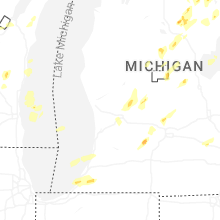
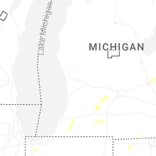
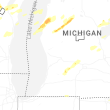
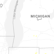


Connect with Interactive Hail Maps