

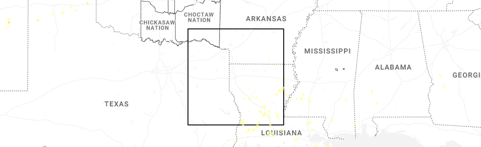
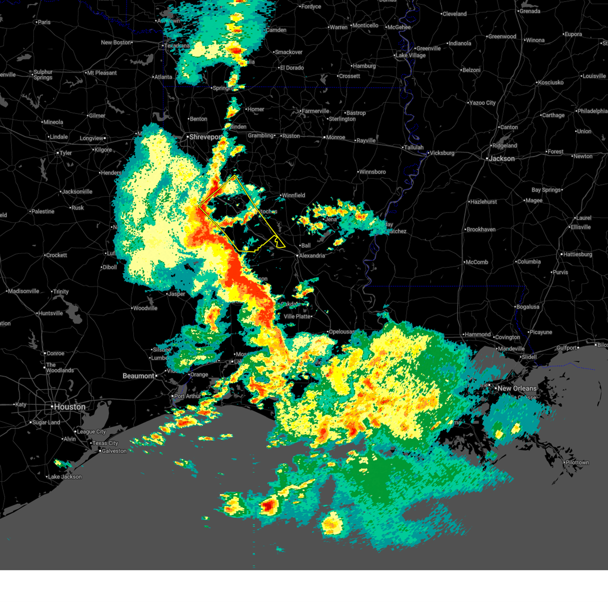
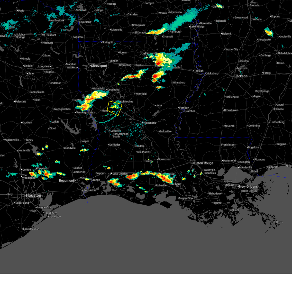
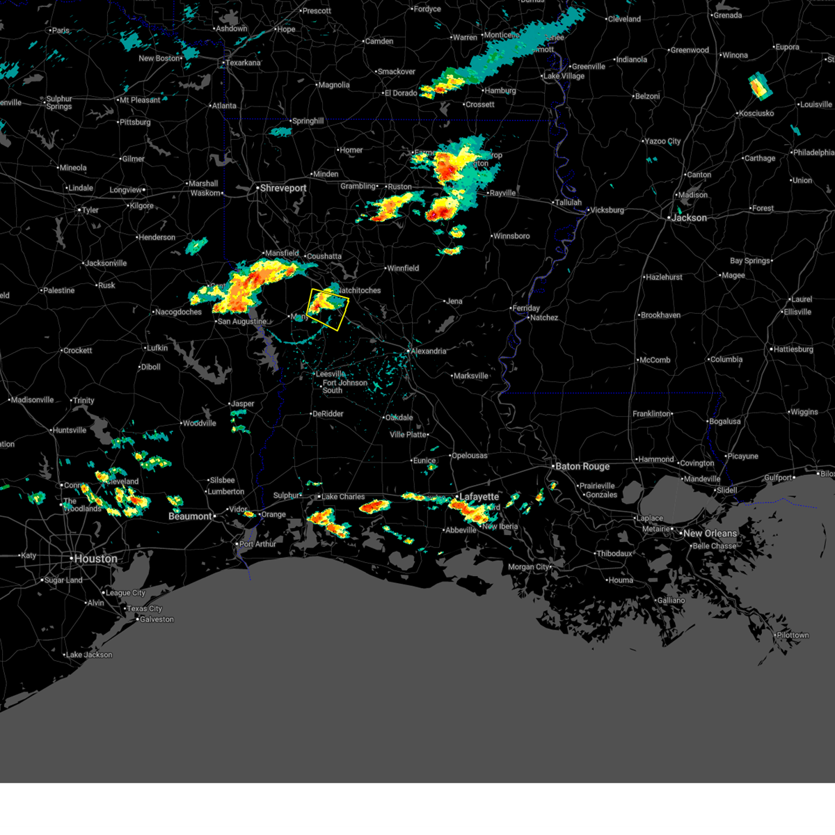
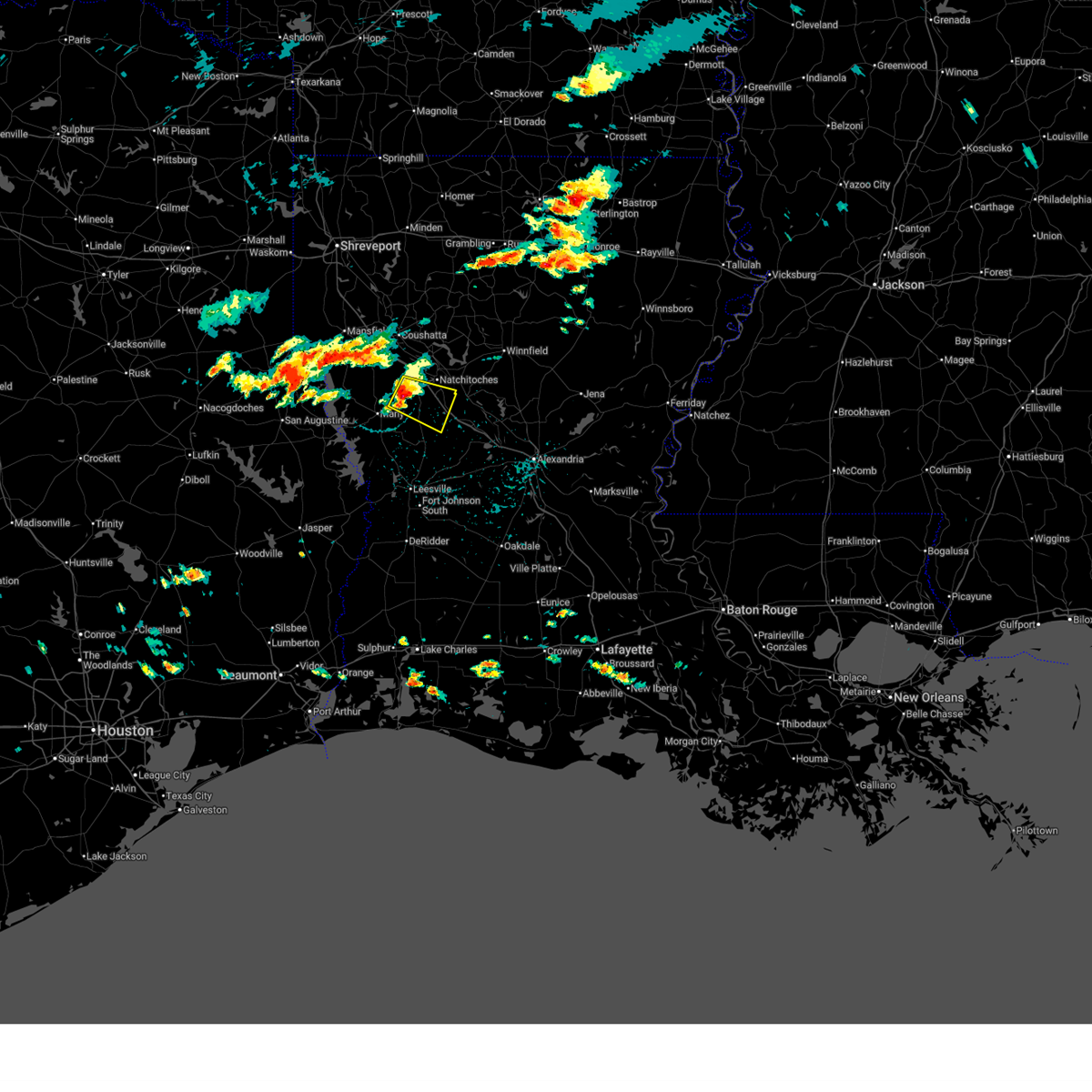
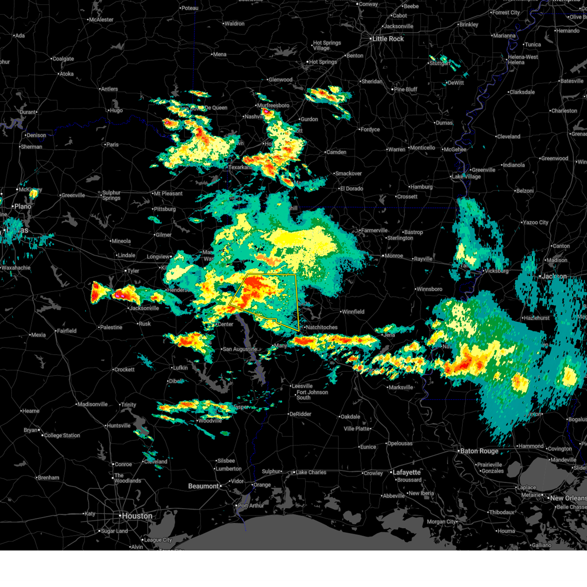
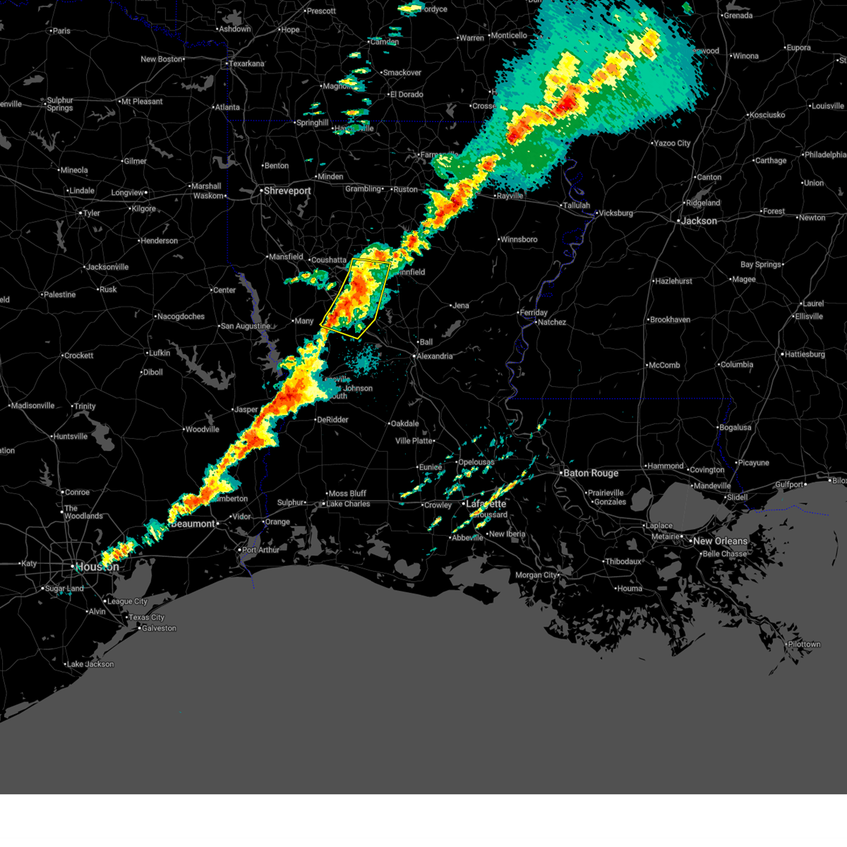
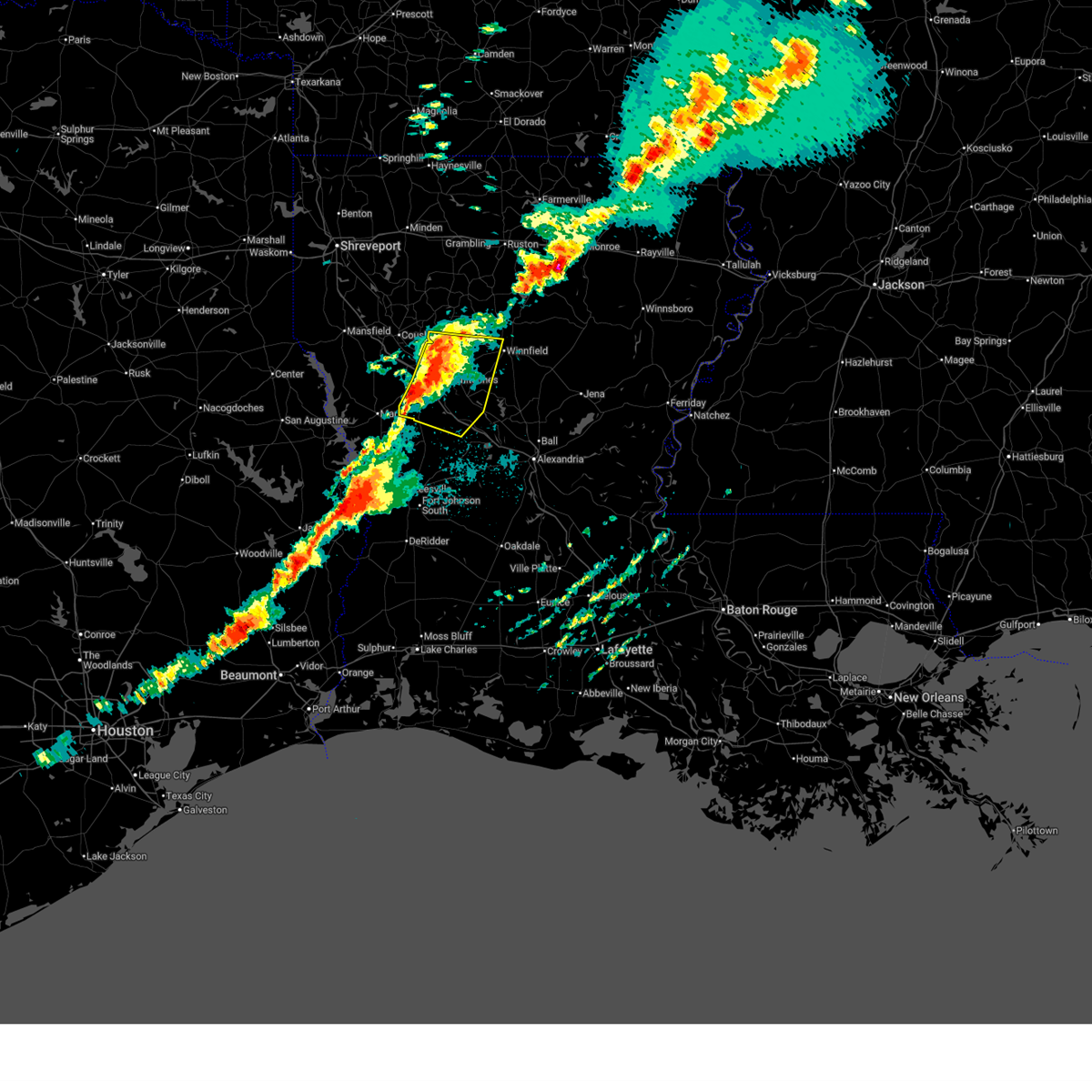
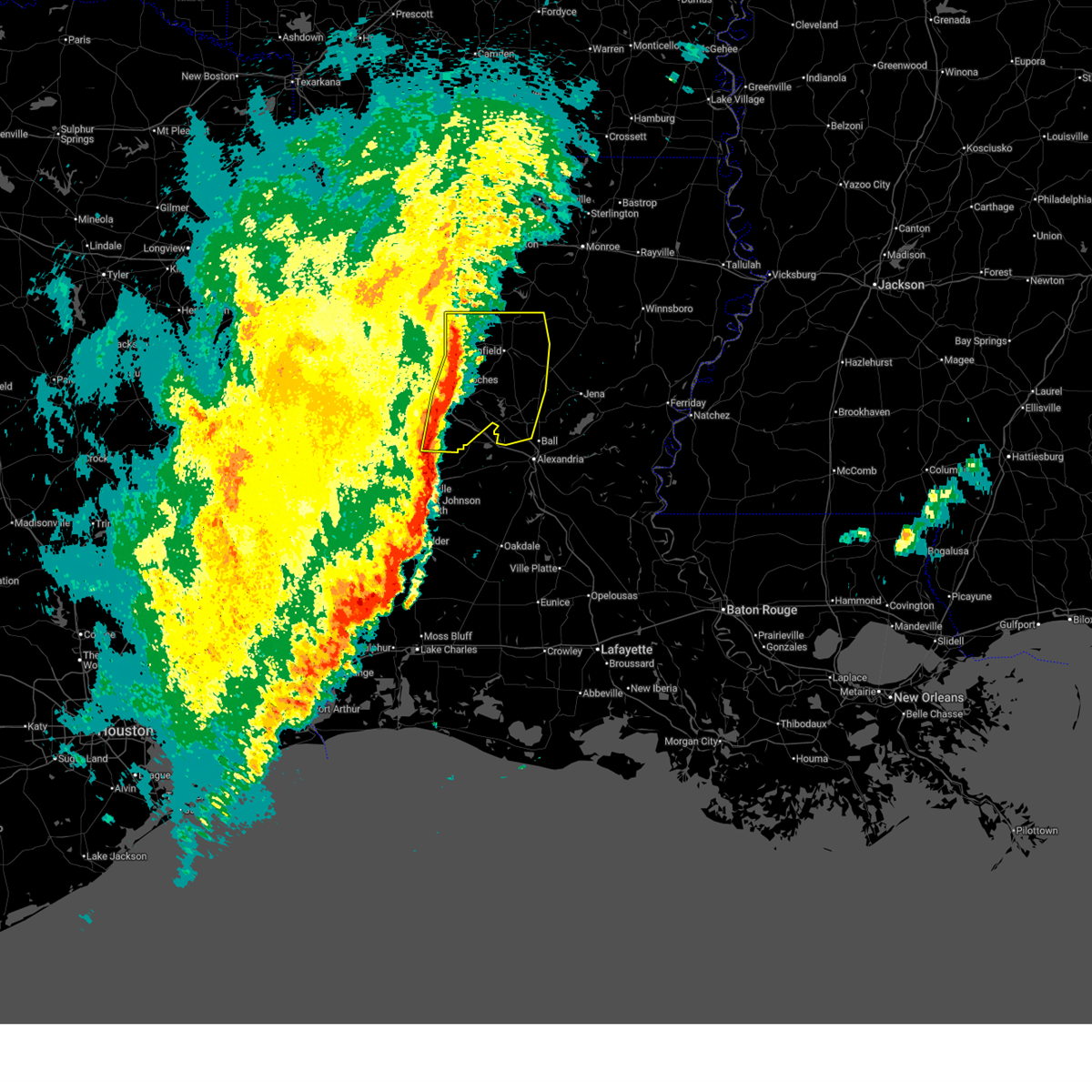
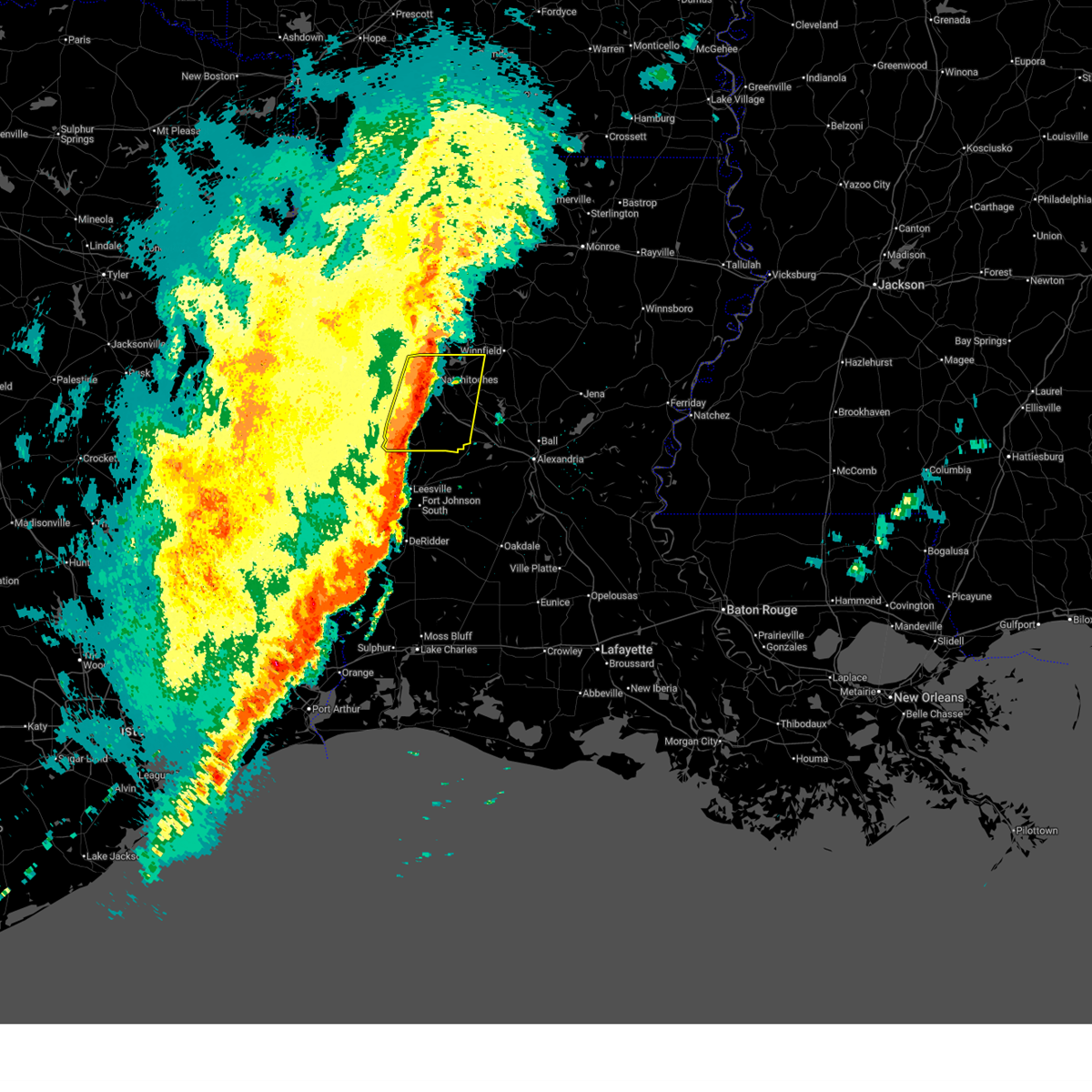
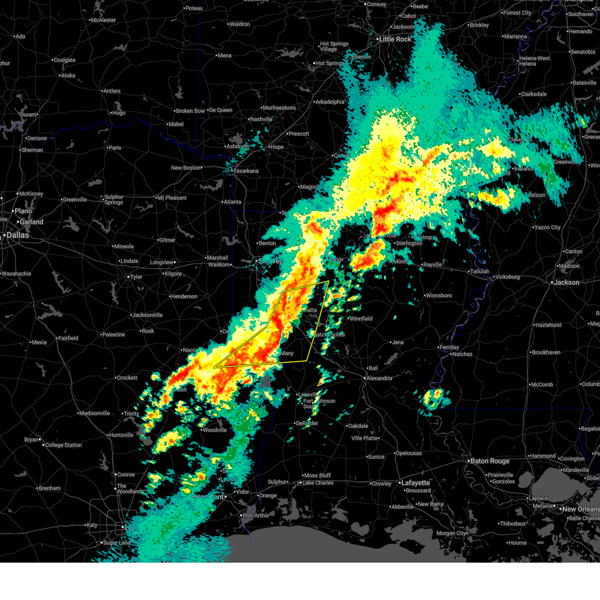
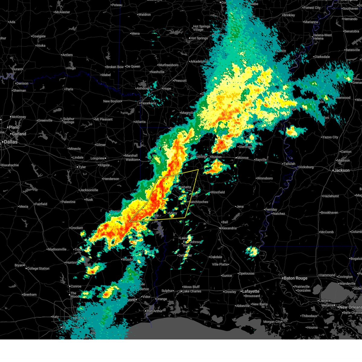
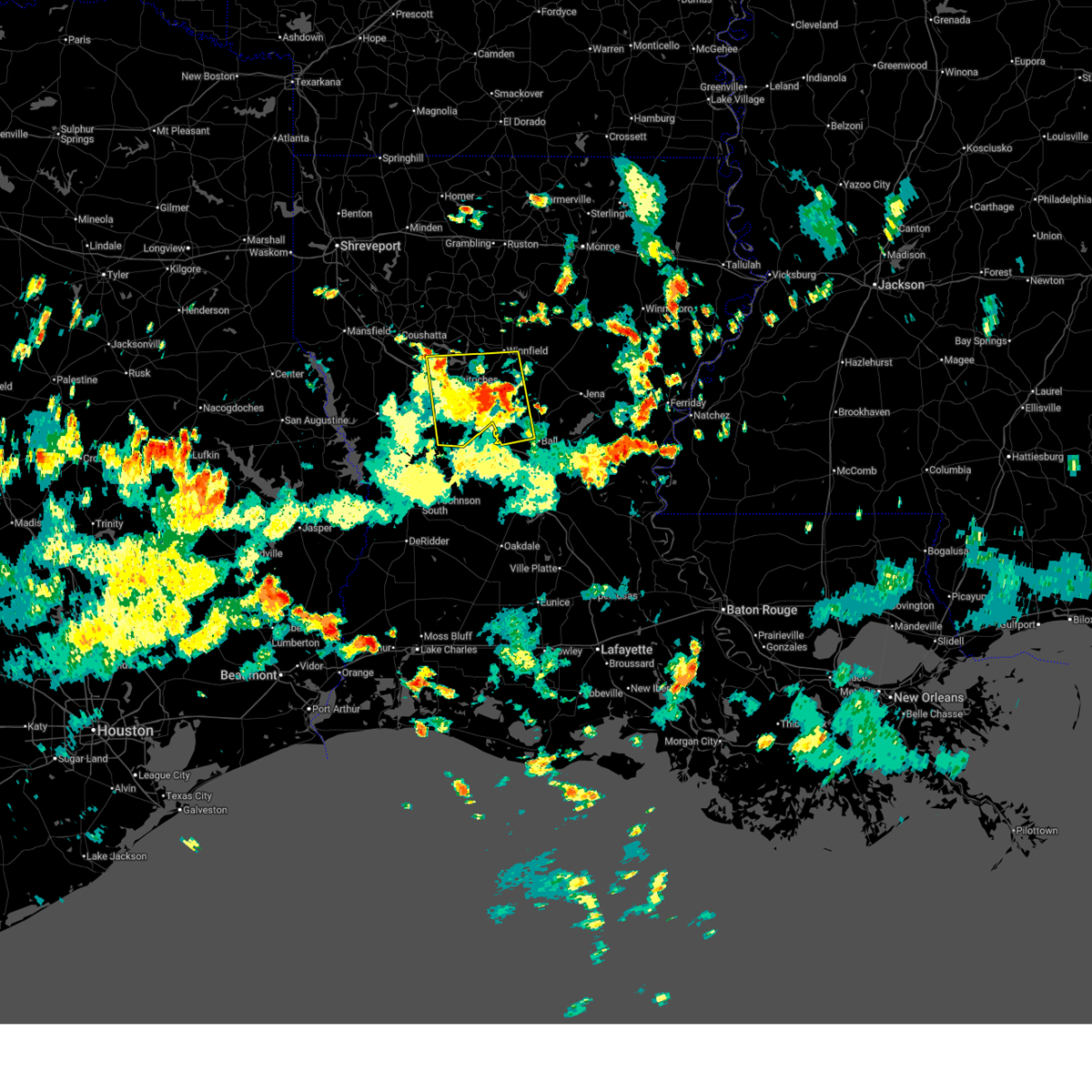
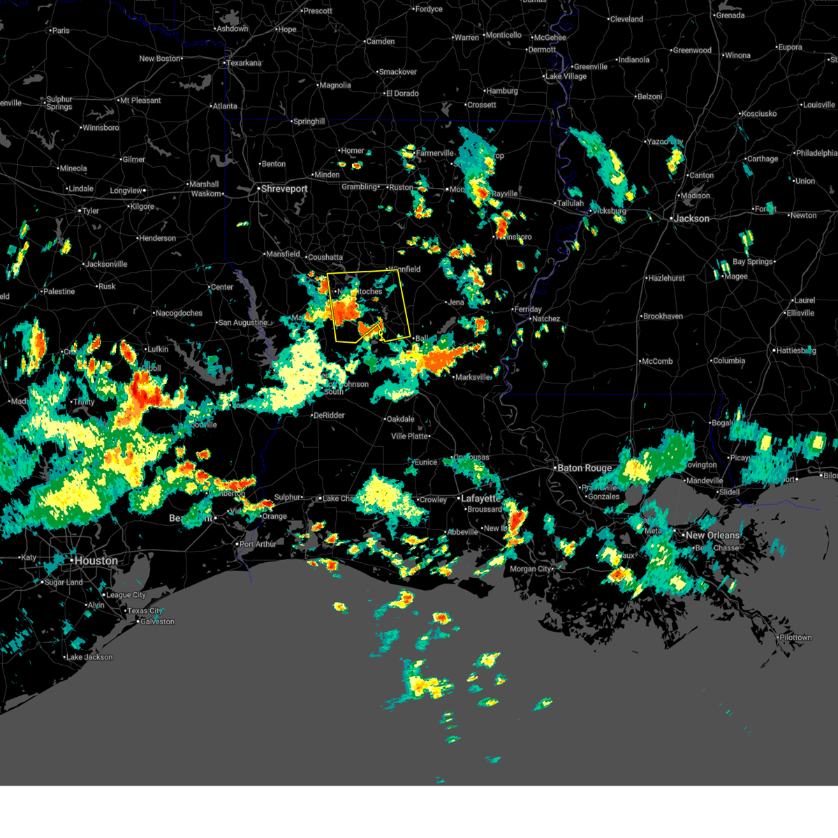
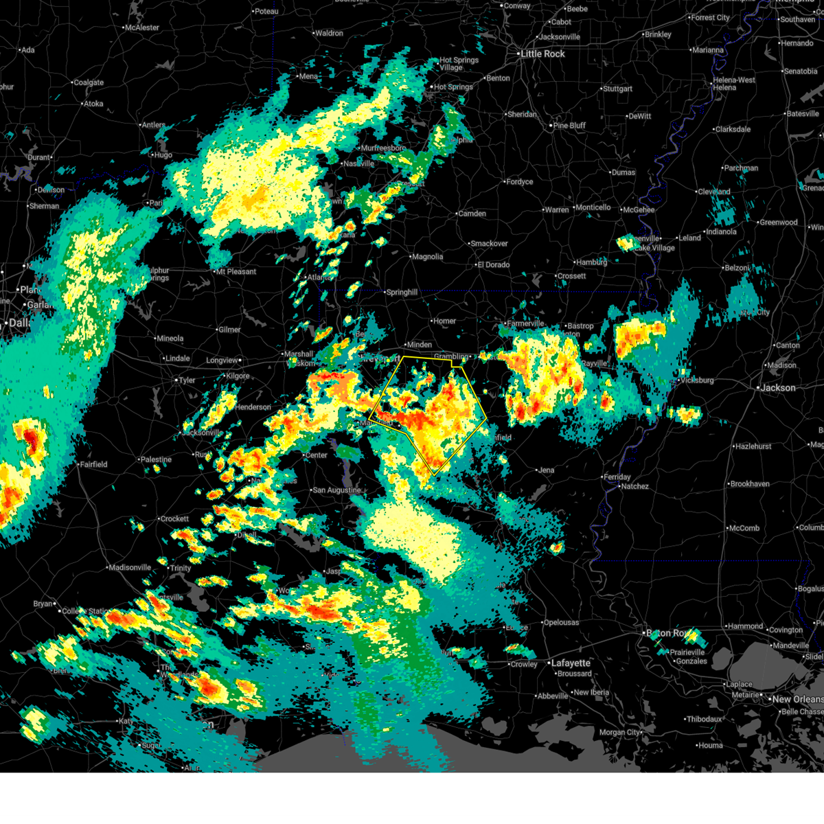
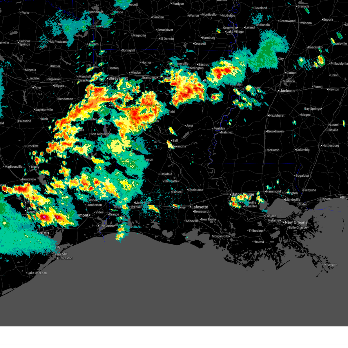
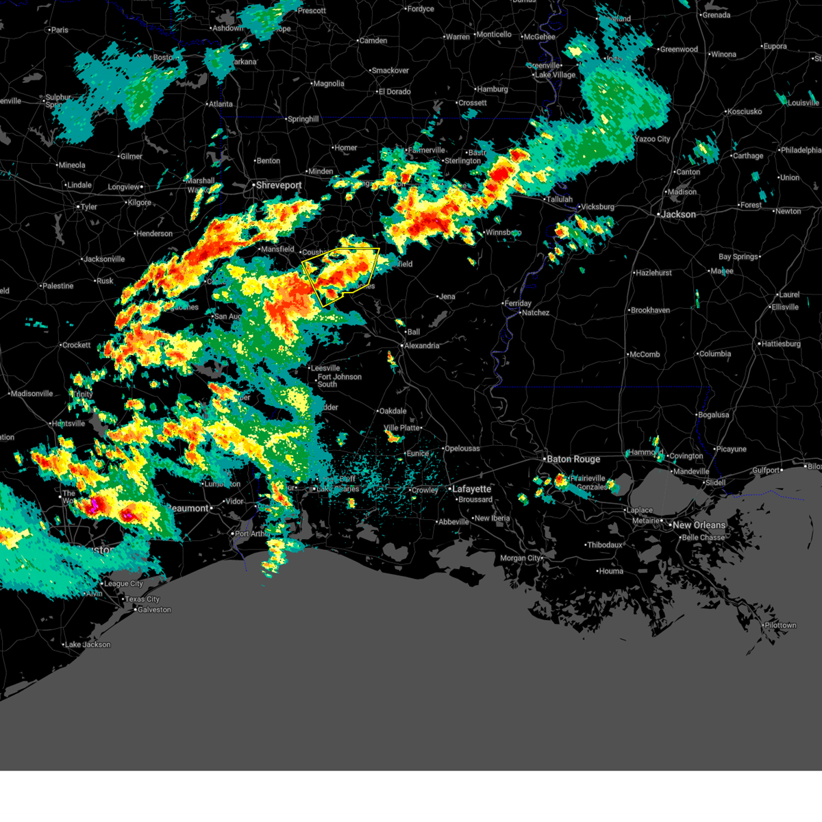
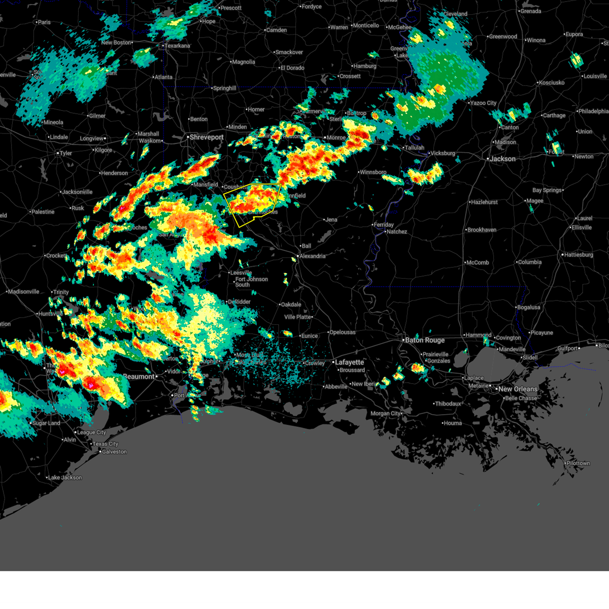
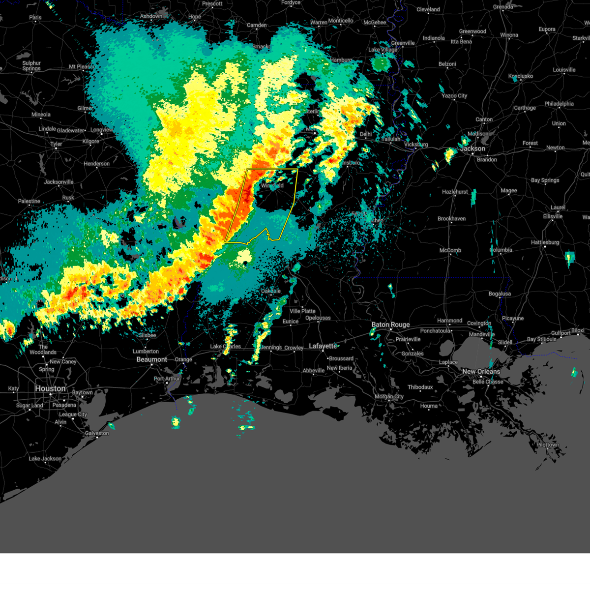
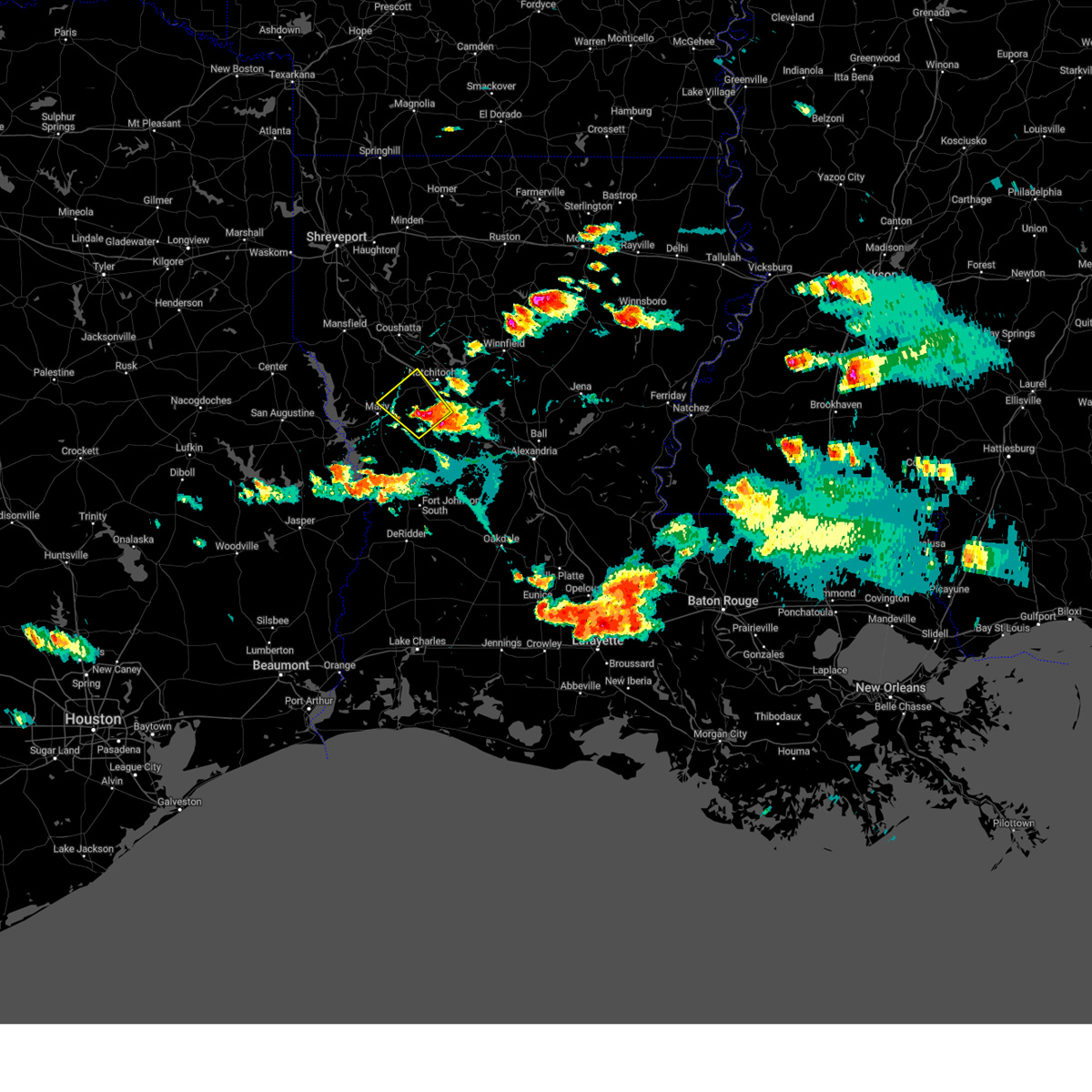
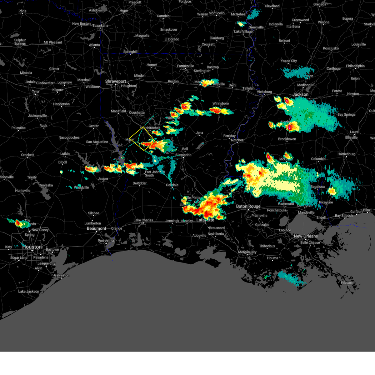
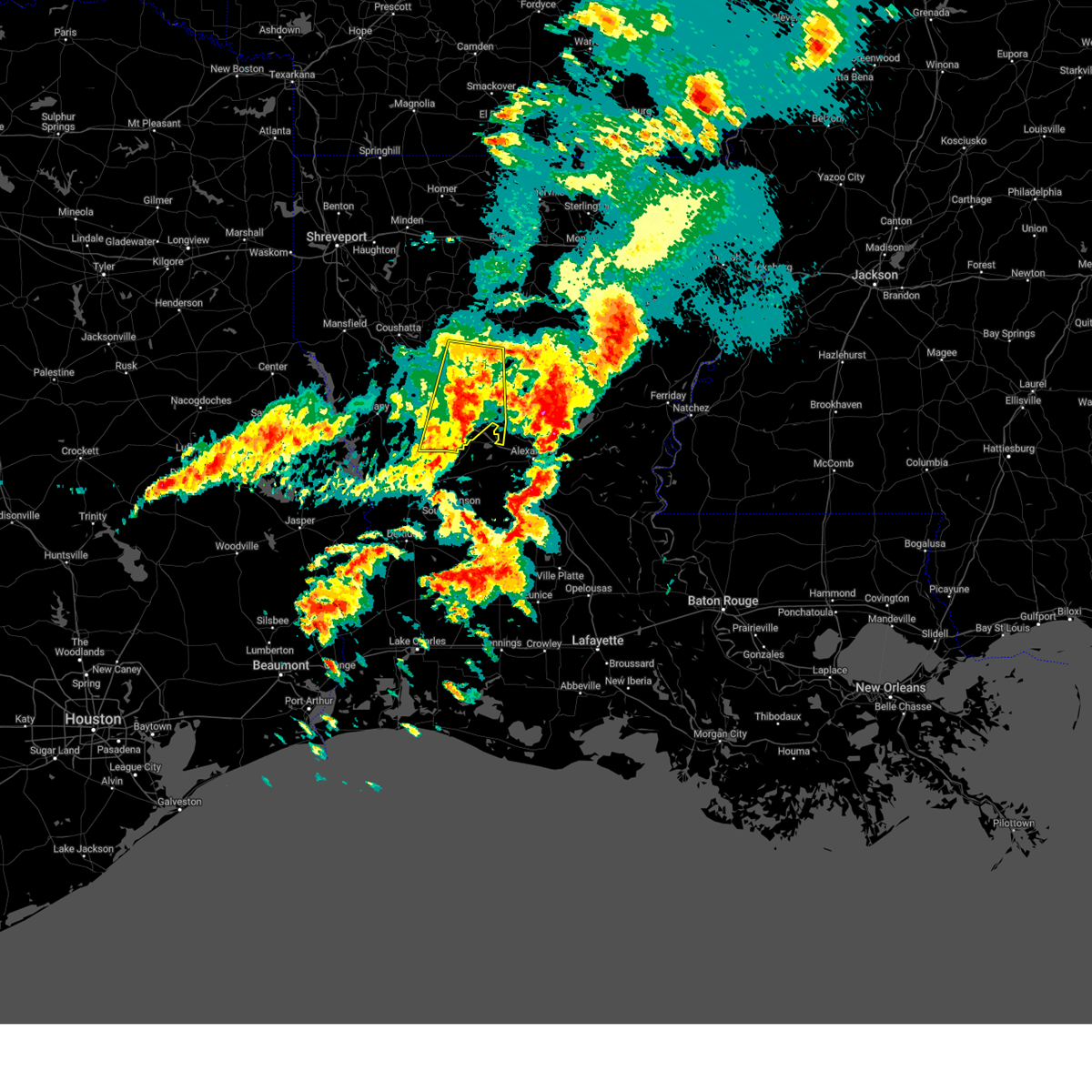
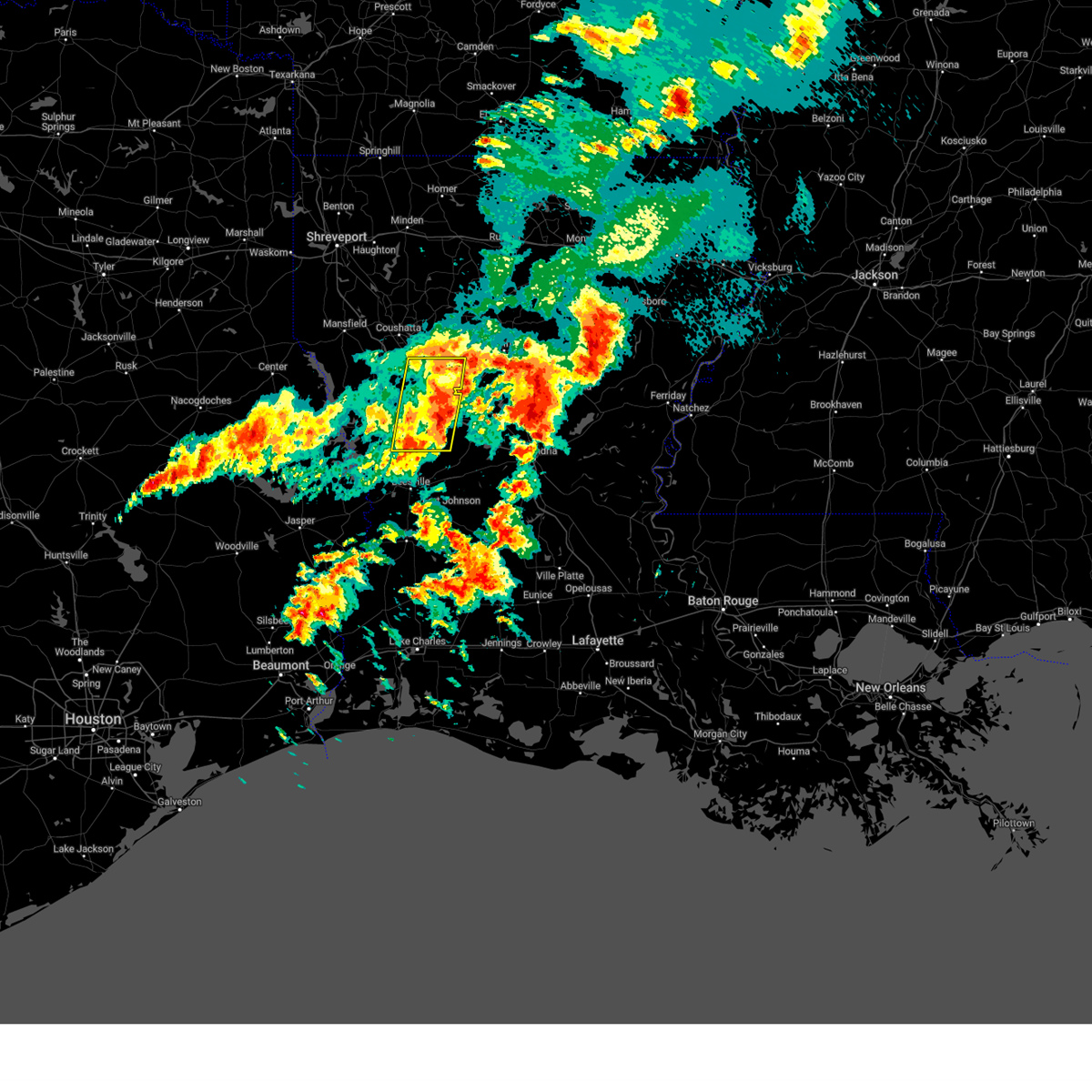
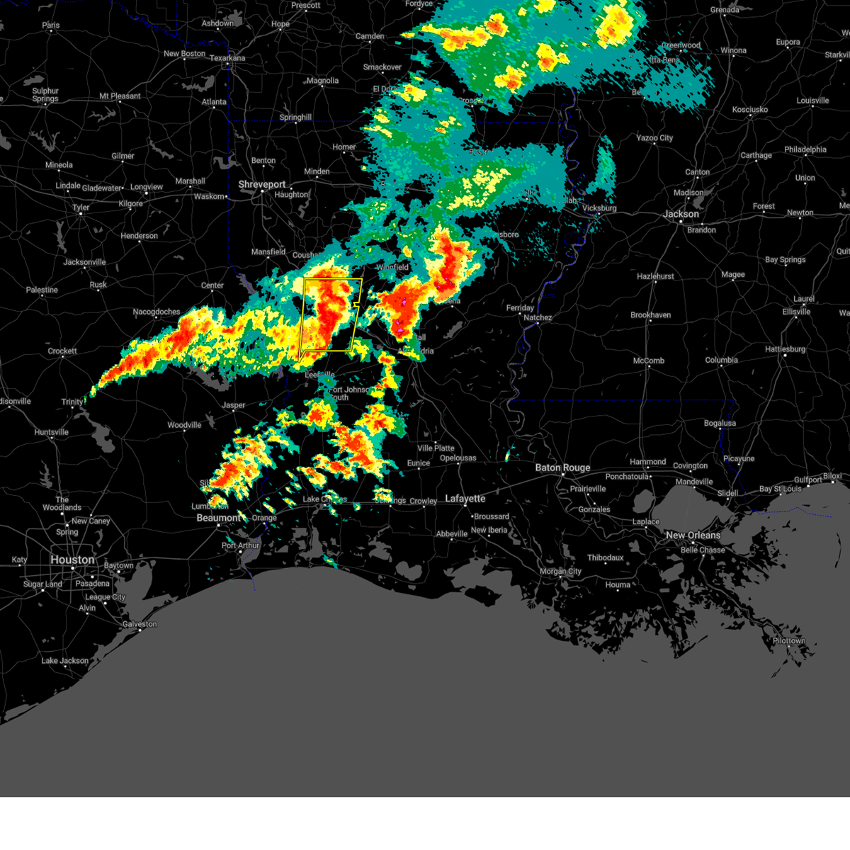
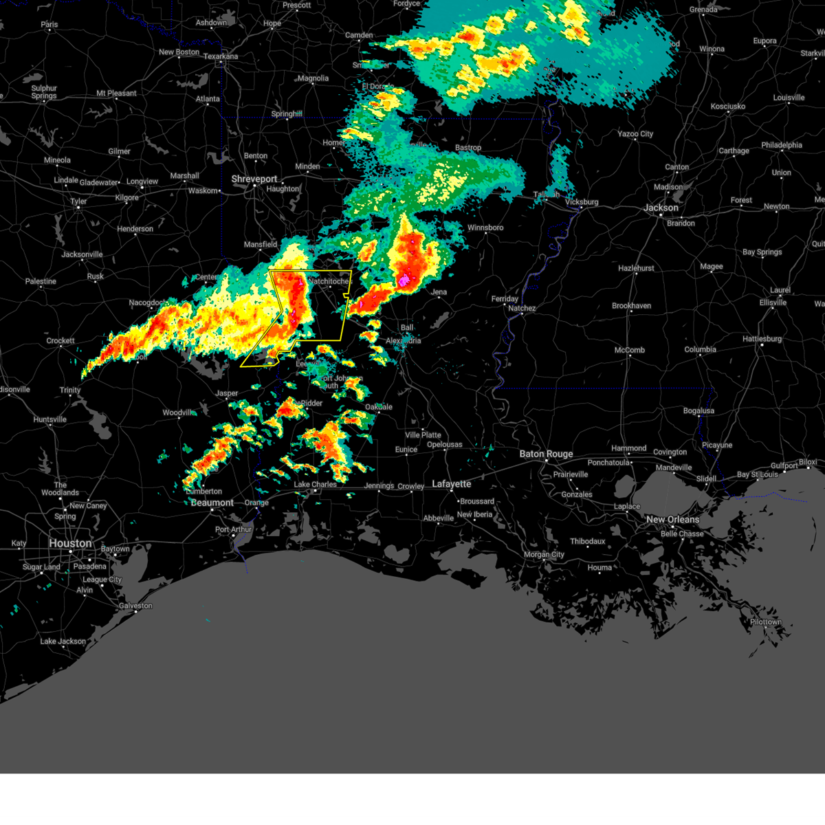
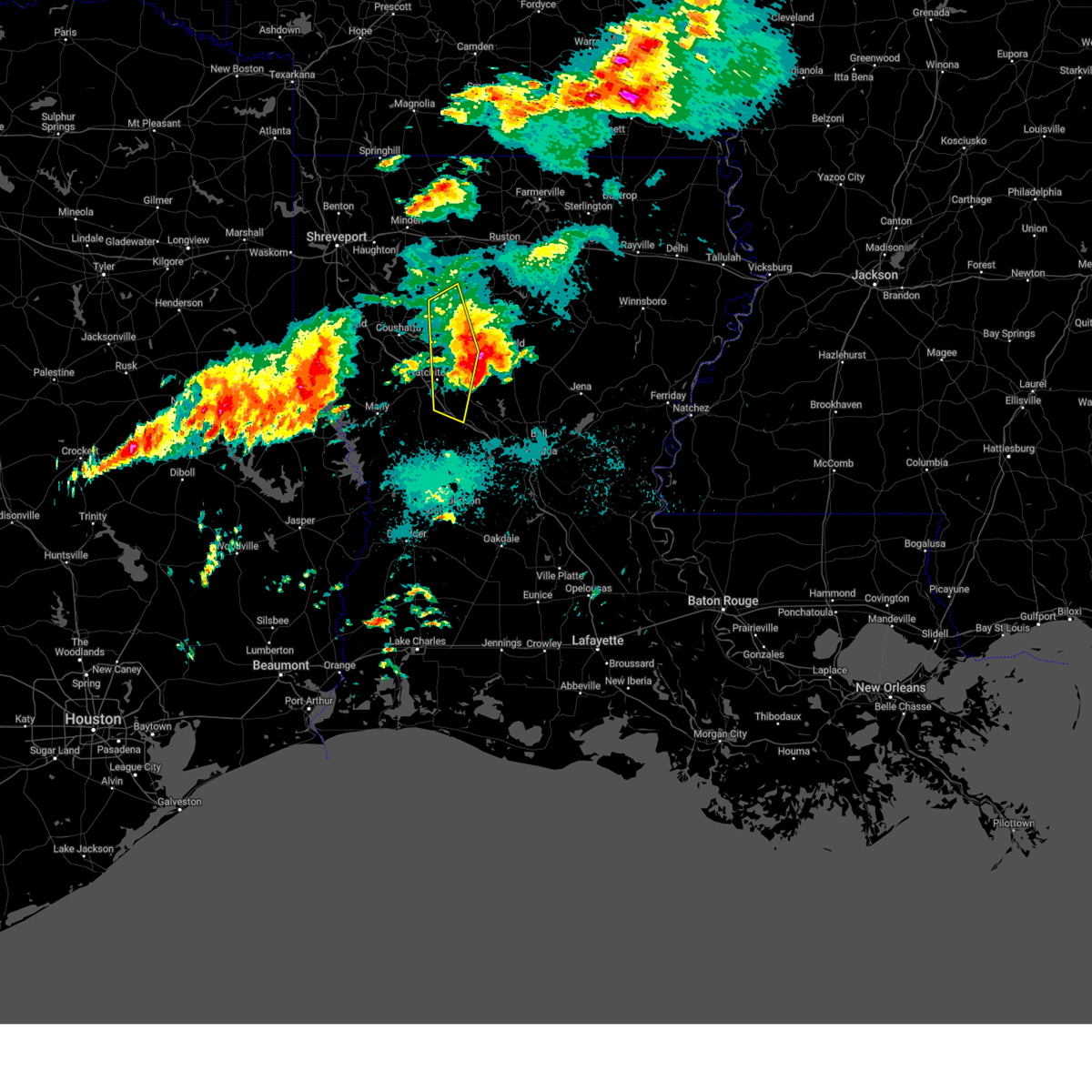
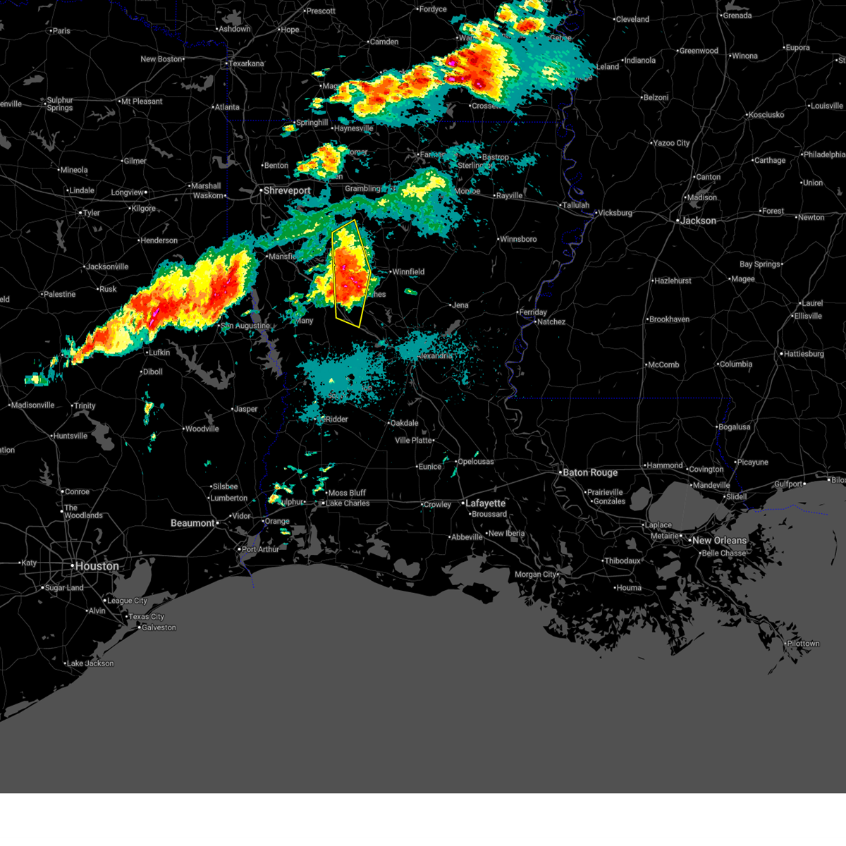
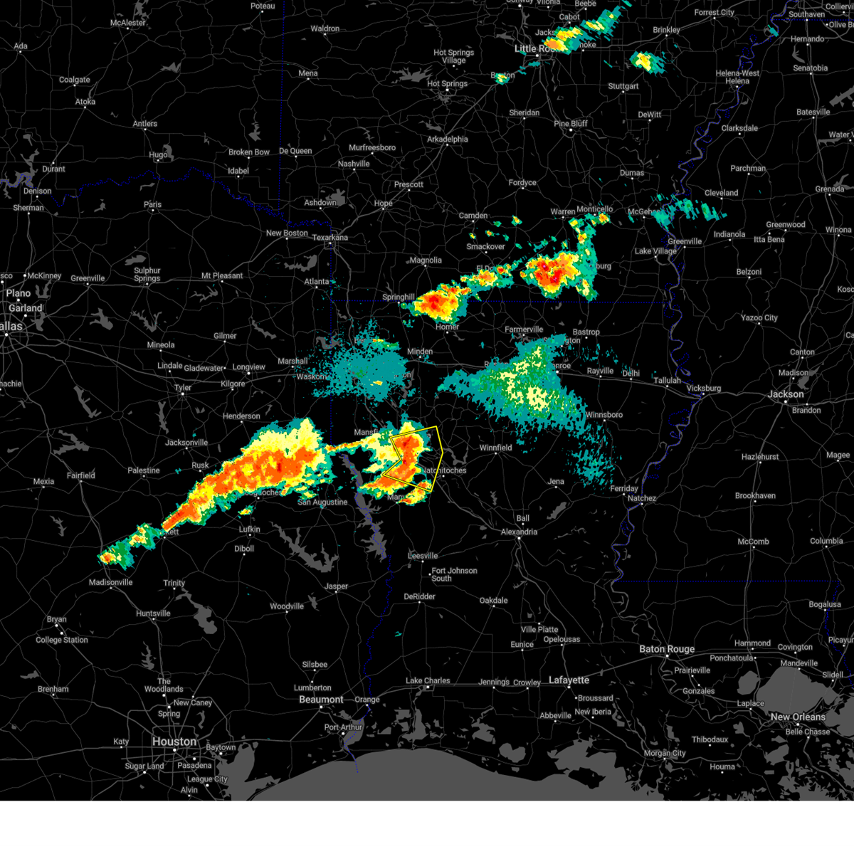
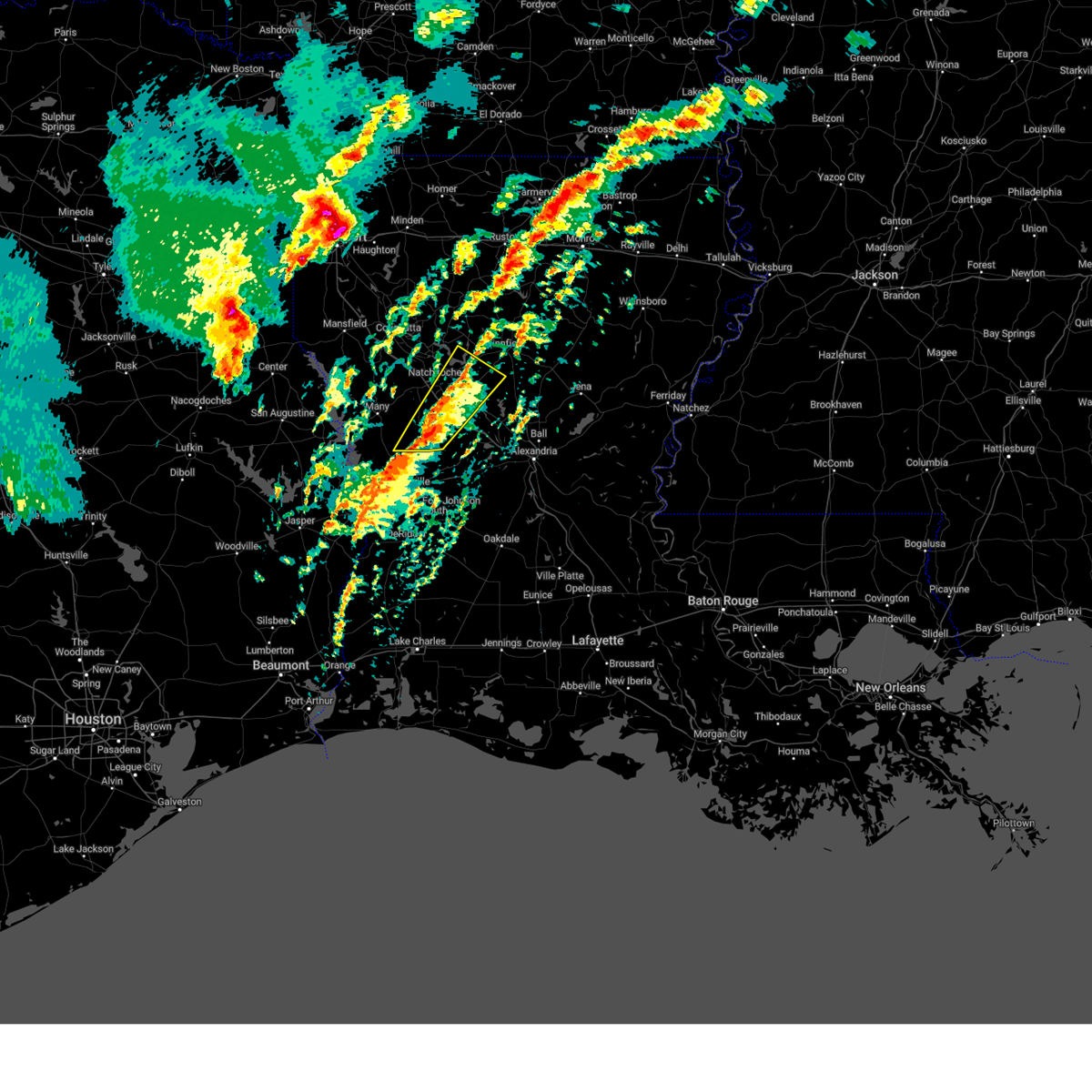
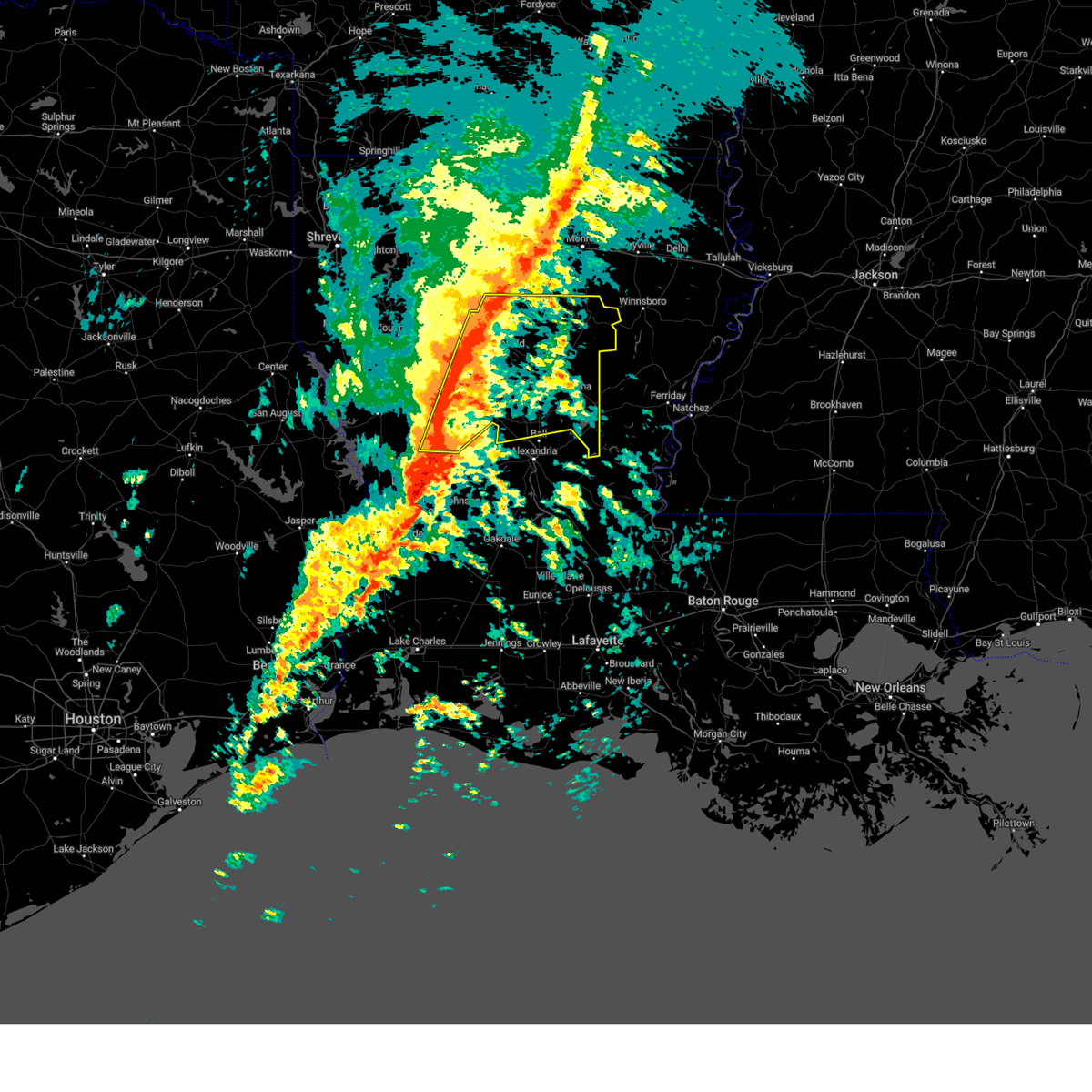
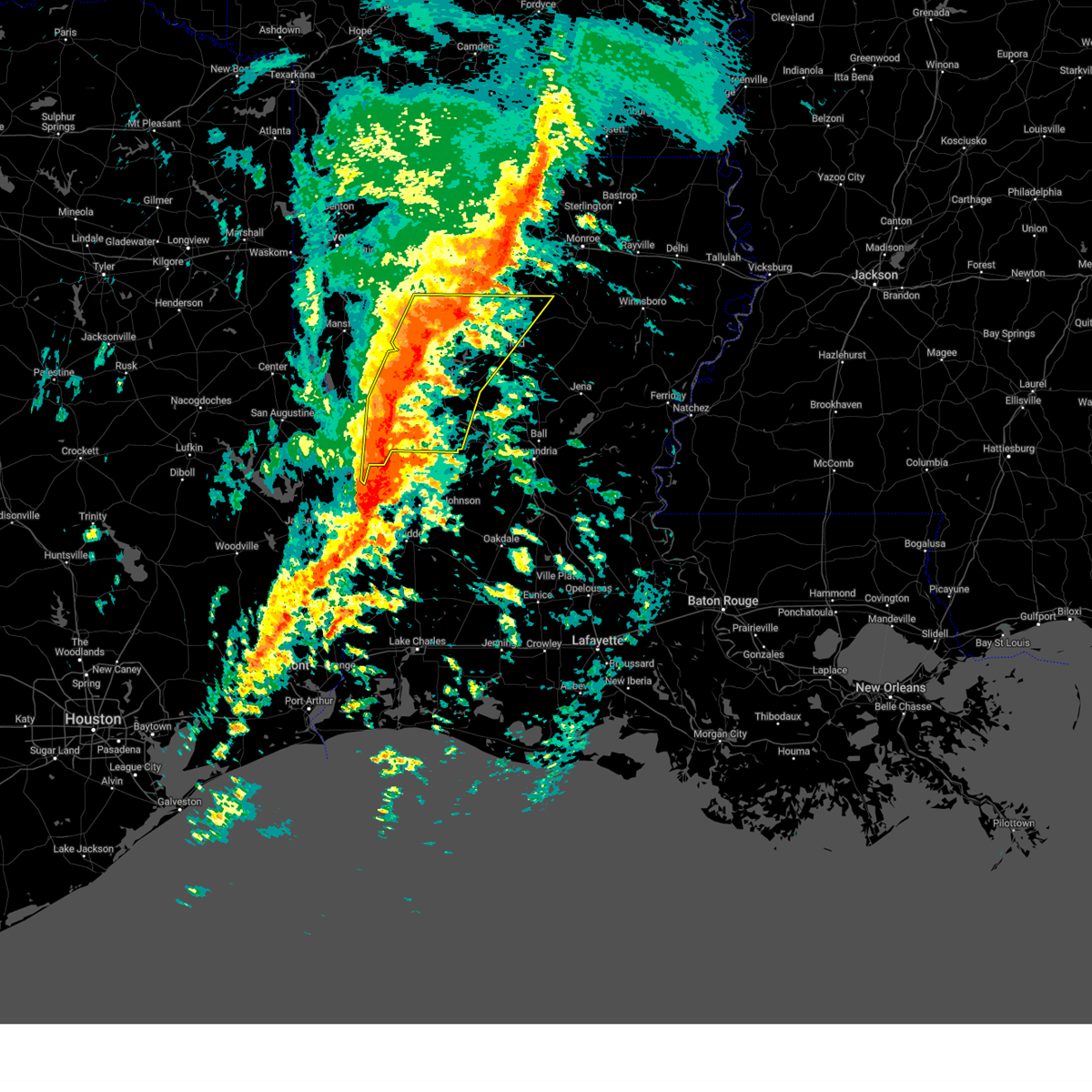
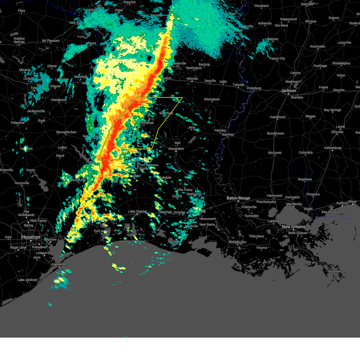
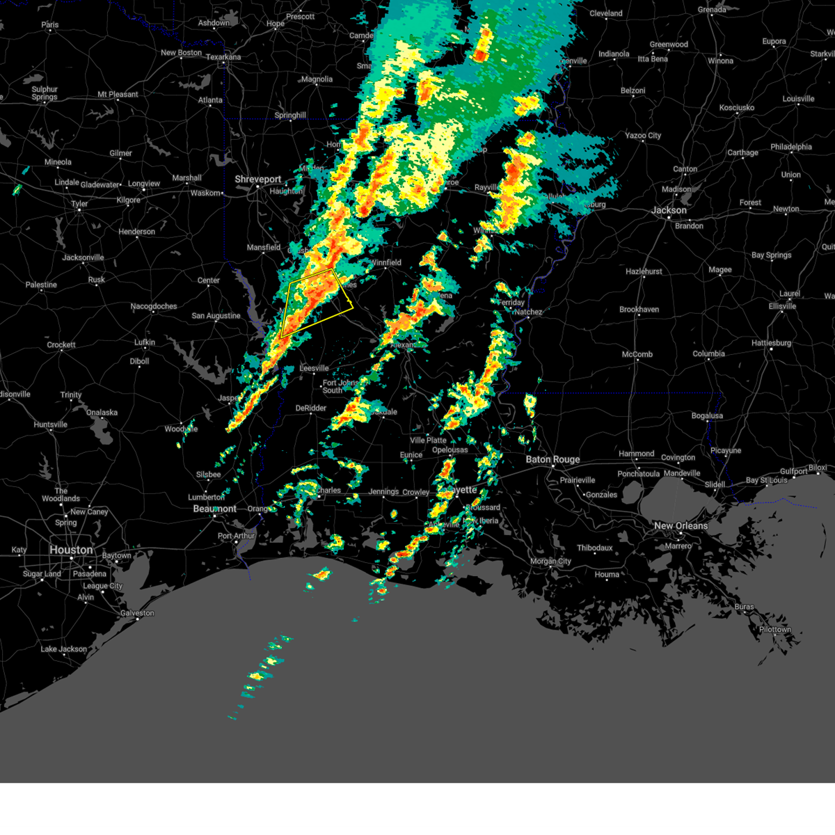
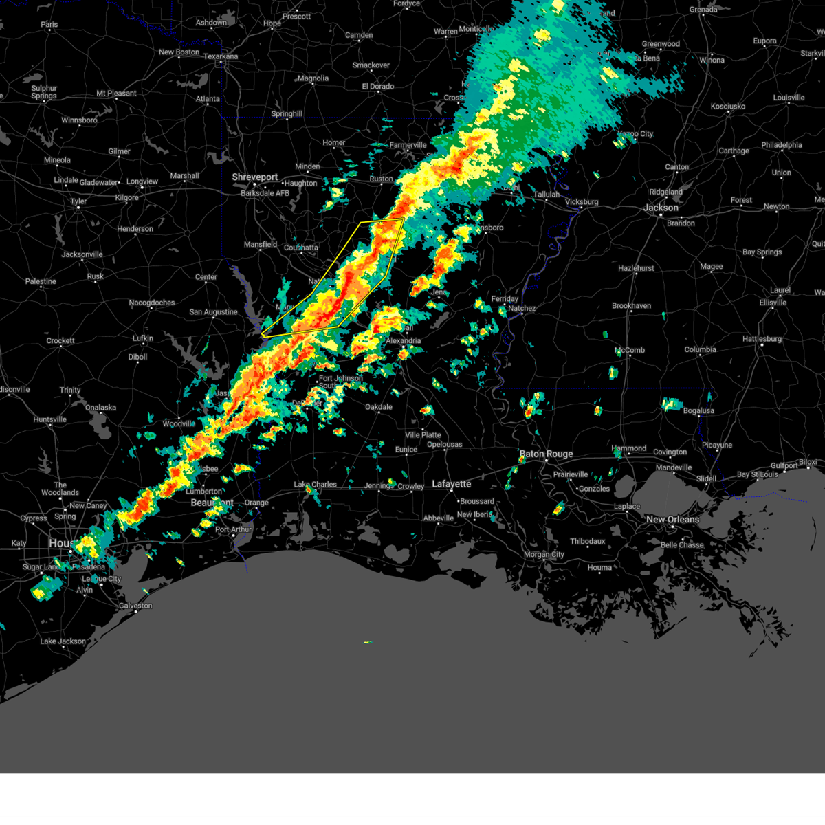
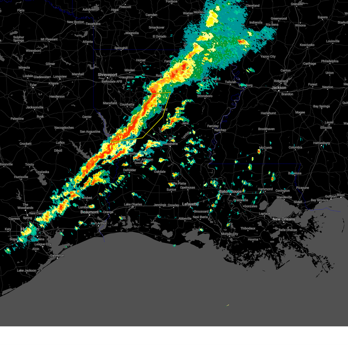
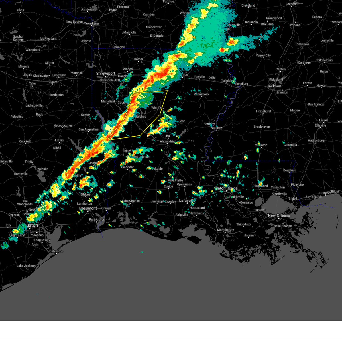
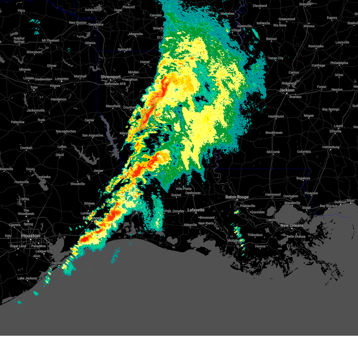
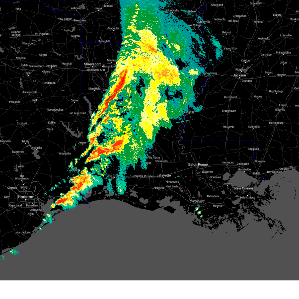
Hail Map for Natchitoches, LA
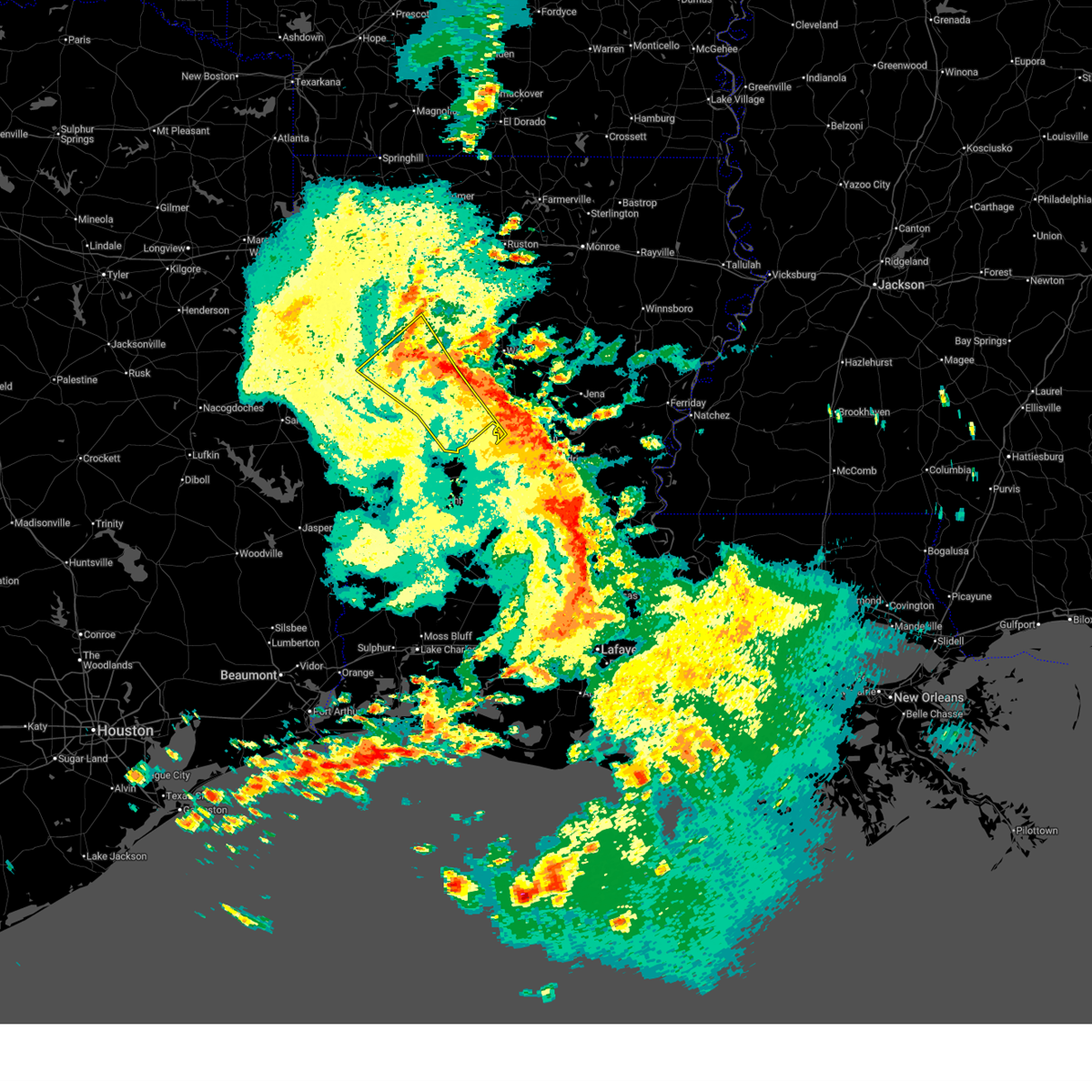
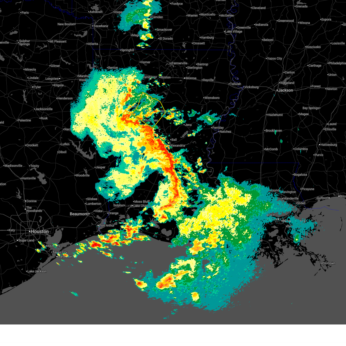
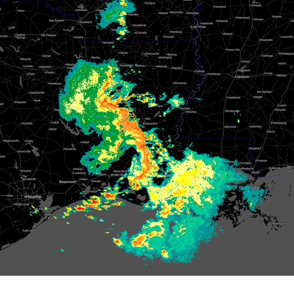
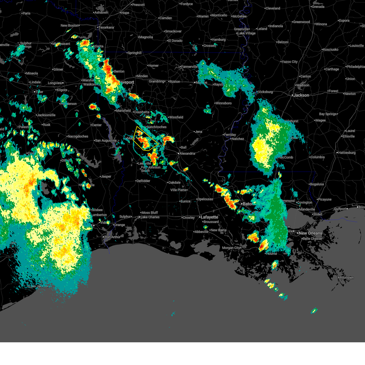
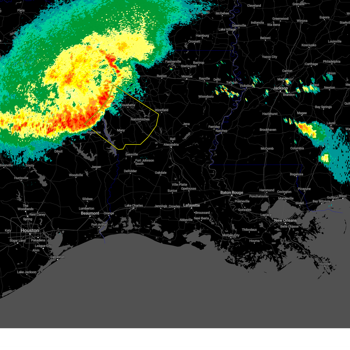
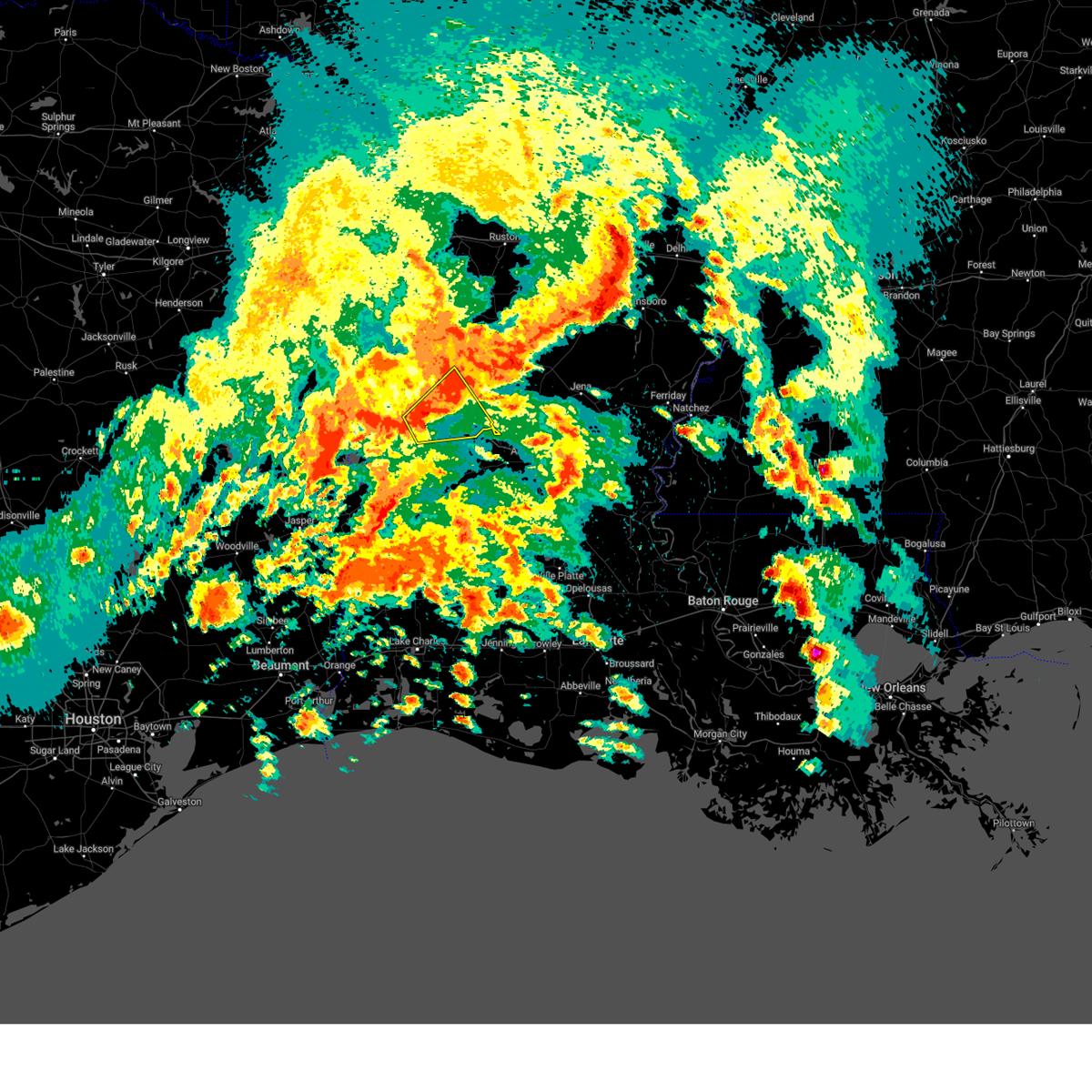
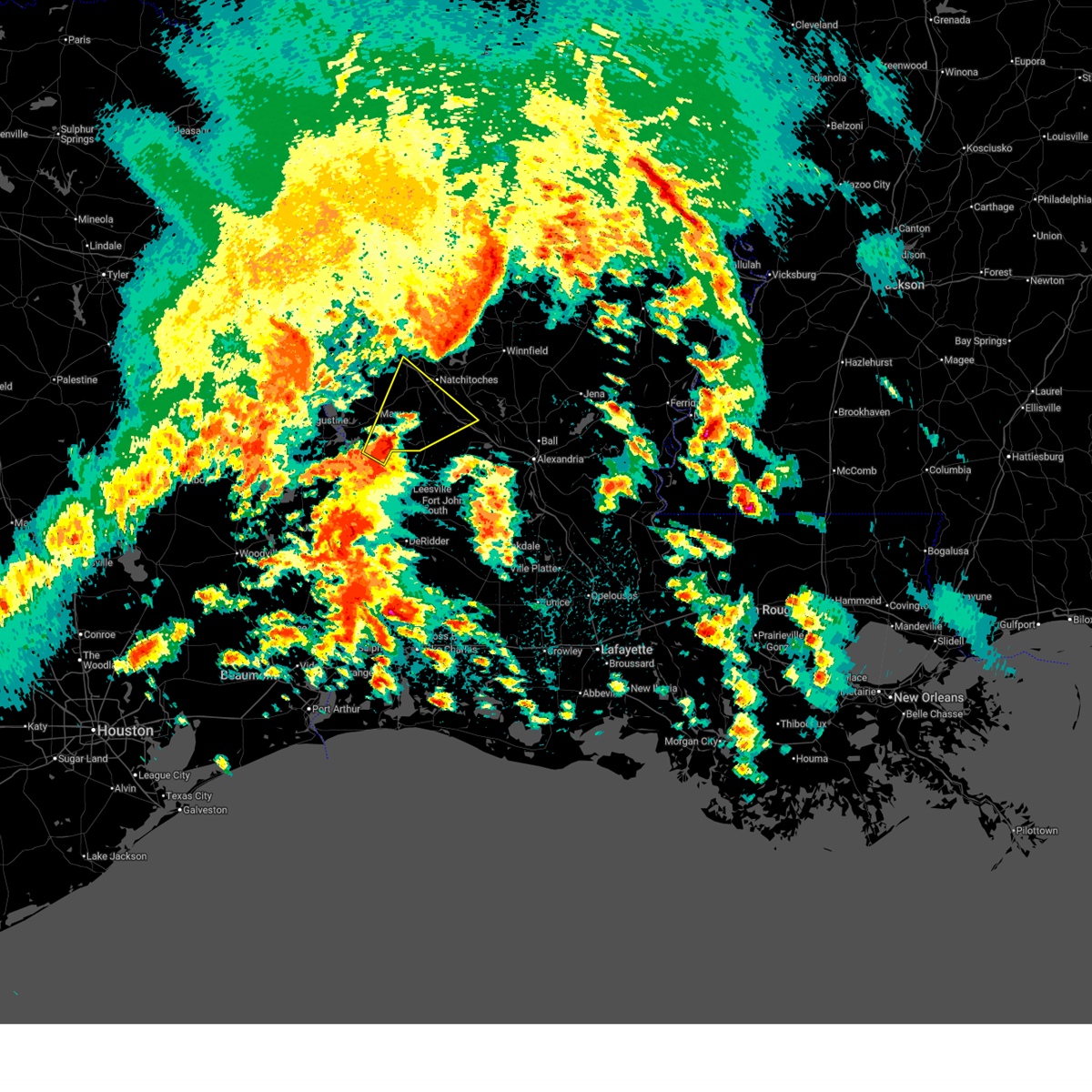
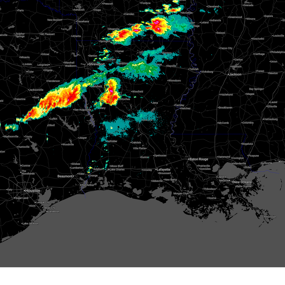
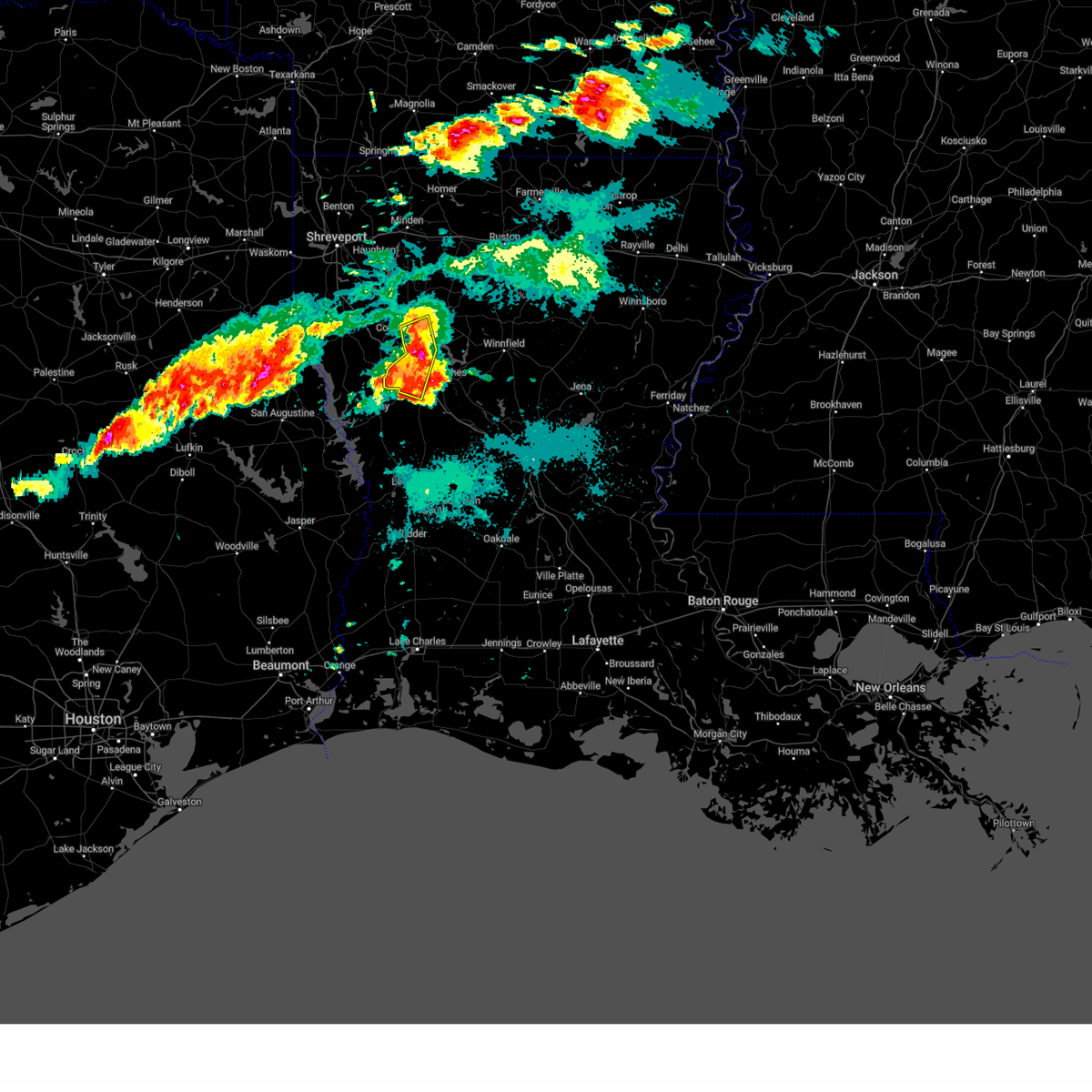
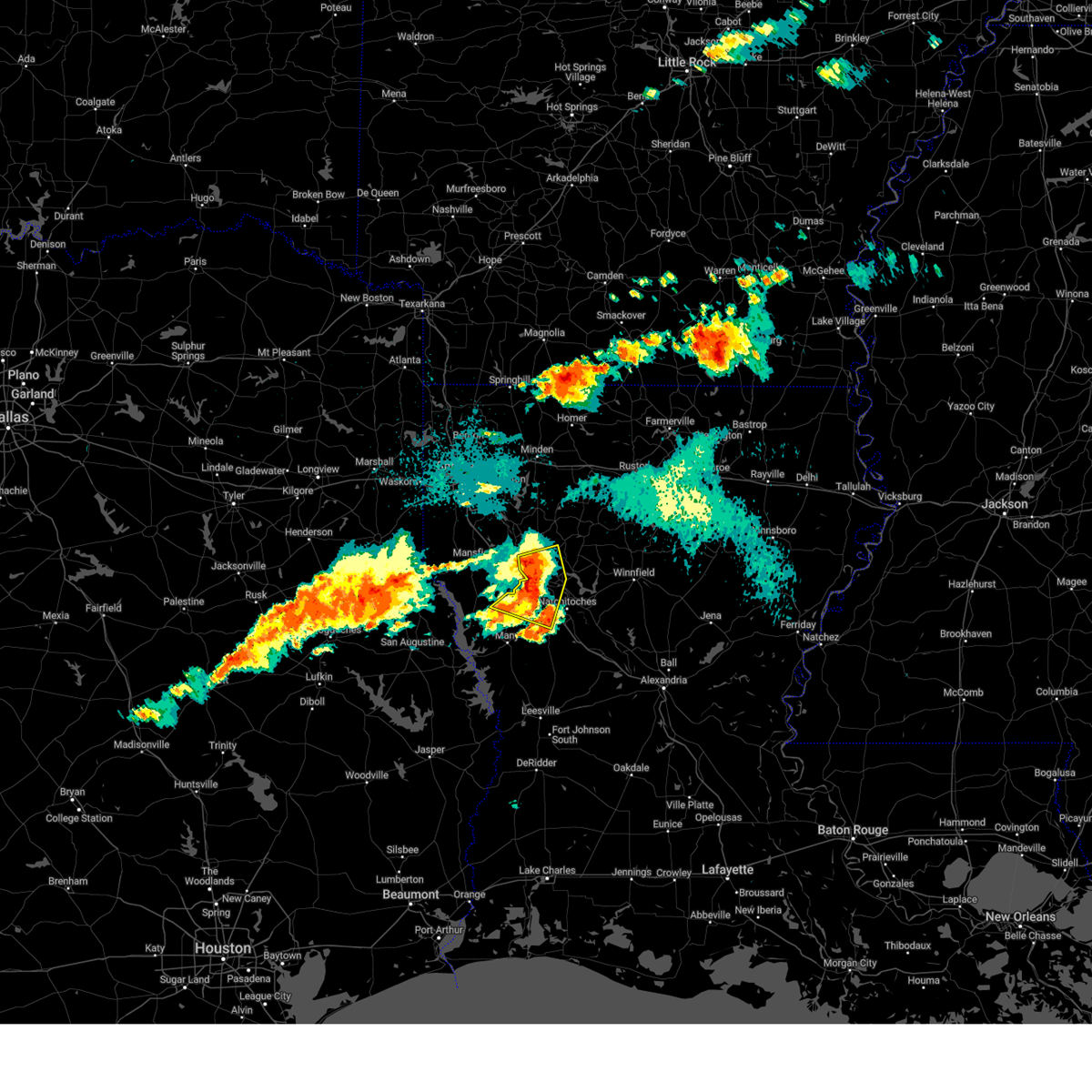
The Natchitoches, LA area has had 16 reports of on-the-ground hail by trained spotters, and has been under severe weather warnings 25 times during the past 12 months. Doppler radar has detected hail at or near Natchitoches, LA on 97 occasions, including 5 occasions during the past year.
| Name: | Natchitoches, LA |
| Where Located: | 64 miles SE of Shreveport, LA |
| Map: | Google Map for Natchitoches, LA |
| Population: | 18323 |
| Housing Units: | 7906 |
| More Info: | Search Google for Natchitoches, LA |
1
The Top Recent Hail Date for Natchitoches, LA is Wednesday, July 30, 2025 (29th out of 97)
Hail and Wind Damage Spotted near Natchitoches, LA
| Date / Time | Report Details |
|---|---|
| 5/23/2026 11:07 AM CDT |
 The storms which prompted the warning have moved out of the area. therefore, the warning will be allowed to expire. however, small hail, gusty winds, and heavy rain are still possible with these thunderstorms. to report severe weather, contact your nearest law enforcement agency. they will send your report to the national weather service office. a severe thunderstorm watch remains in effect until 600 pm cdt saturday for portions of north central and northwest louisiana. The storms which prompted the warning have moved out of the area. therefore, the warning will be allowed to expire. however, small hail, gusty winds, and heavy rain are still possible with these thunderstorms. to report severe weather, contact your nearest law enforcement agency. they will send your report to the national weather service office. a severe thunderstorm watch remains in effect until 600 pm cdt saturday for portions of north central and northwest louisiana.
|
| 5/23/2026 10:50 AM CDT |
 Svrshv the national weather service in shreveport has issued a * severe thunderstorm warning for, west central grant parish in north central louisiana, western winn parish in north central louisiana, southeastern bienville parish in northwestern louisiana, northeastern natchitoches parish in northwestern louisiana, * until 1145 am cdt. * at 1050 am cdt, severe thunderstorms were located along a line from 6 miles west of campti to 5 miles north of colfax, or along a line from 12 miles northwest of natchitoches to 23 miles south of winnfield, moving northeast at 40 mph (radar indicated). Hazards include 60 mph wind gusts and small hail. expect damage to roofs, siding, and trees Svrshv the national weather service in shreveport has issued a * severe thunderstorm warning for, west central grant parish in north central louisiana, western winn parish in north central louisiana, southeastern bienville parish in northwestern louisiana, northeastern natchitoches parish in northwestern louisiana, * until 1145 am cdt. * at 1050 am cdt, severe thunderstorms were located along a line from 6 miles west of campti to 5 miles north of colfax, or along a line from 12 miles northwest of natchitoches to 23 miles south of winnfield, moving northeast at 40 mph (radar indicated). Hazards include 60 mph wind gusts and small hail. expect damage to roofs, siding, and trees
|
| 5/23/2026 10:38 AM CDT |
 At 1038 am cdt, severe thunderstorms were located along a line from 10 miles southwest of coushatta to 8 miles southwest of colfax, or along a line from 18 miles southeast of mansfield to 27 miles southeast of natchitoches, moving northeast at 40 mph (radar indicated). Hazards include 60 mph wind gusts and small hail. Expect damage to roofs, siding, and trees. locations impacted include, natchitoches, coushatta, colfax, campti, montgomery, allen, pleasant hill, provencal, natchez, martin, clarence, robeline, powhatan, hagewood, flora, grand ecore, bermuda, cypress and st. Maurice. At 1038 am cdt, severe thunderstorms were located along a line from 10 miles southwest of coushatta to 8 miles southwest of colfax, or along a line from 18 miles southeast of mansfield to 27 miles southeast of natchitoches, moving northeast at 40 mph (radar indicated). Hazards include 60 mph wind gusts and small hail. Expect damage to roofs, siding, and trees. locations impacted include, natchitoches, coushatta, colfax, campti, montgomery, allen, pleasant hill, provencal, natchez, martin, clarence, robeline, powhatan, hagewood, flora, grand ecore, bermuda, cypress and st. Maurice.
|
| 5/23/2026 10:08 AM CDT |
 Svrshv the national weather service in shreveport has issued a * severe thunderstorm warning for, southwestern grant parish in north central louisiana, southwestern winn parish in north central louisiana, southeastern de soto parish in northwestern louisiana, natchitoches parish in northwestern louisiana, southeastern red river parish in northwestern louisiana, northeastern sabine parish in northwestern louisiana, * until 1115 am cdt. * at 1008 am cdt, severe thunderstorms were located along a line from 9 miles east of converse to 28 miles southwest of colfax, or along a line from 20 miles southeast of mansfield to 33 miles south of natchitoches, moving northeast at 40 mph (radar indicated). Hazards include 60 mph wind gusts and quarter size hail. Hail damage to vehicles is expected. Expect wind damage to roofs, siding, and trees. Svrshv the national weather service in shreveport has issued a * severe thunderstorm warning for, southwestern grant parish in north central louisiana, southwestern winn parish in north central louisiana, southeastern de soto parish in northwestern louisiana, natchitoches parish in northwestern louisiana, southeastern red river parish in northwestern louisiana, northeastern sabine parish in northwestern louisiana, * until 1115 am cdt. * at 1008 am cdt, severe thunderstorms were located along a line from 9 miles east of converse to 28 miles southwest of colfax, or along a line from 20 miles southeast of mansfield to 33 miles south of natchitoches, moving northeast at 40 mph (radar indicated). Hazards include 60 mph wind gusts and quarter size hail. Hail damage to vehicles is expected. Expect wind damage to roofs, siding, and trees.
|
| 5/10/2026 5:20 PM CDT |
 The storm which prompted the warning has weakened below severe limits, and no longer poses an immediate threat to life or property. therefore, the warning will be allowed to expire. The storm which prompted the warning has weakened below severe limits, and no longer poses an immediate threat to life or property. therefore, the warning will be allowed to expire.
|
| 5/10/2026 5:01 PM CDT |
 At 501 pm cdt, a severe thunderstorm was located 10 miles southwest of natchitoches, moving southeast at 15 mph (radar indicated). Hazards include 60 mph wind gusts and quarter size hail. Hail damage to vehicles is expected. expect wind damage to roofs, siding, and trees. Locations impacted include, natchitoches, provencal, natchez, robeline, flora, bellwood, hagewood, cypress and bermuda. At 501 pm cdt, a severe thunderstorm was located 10 miles southwest of natchitoches, moving southeast at 15 mph (radar indicated). Hazards include 60 mph wind gusts and quarter size hail. Hail damage to vehicles is expected. expect wind damage to roofs, siding, and trees. Locations impacted include, natchitoches, provencal, natchez, robeline, flora, bellwood, hagewood, cypress and bermuda.
|
| 5/10/2026 4:40 PM CDT |
 Svrshv the national weather service in shreveport has issued a * severe thunderstorm warning for, southwestern natchitoches parish in northwestern louisiana, east central sabine parish in northwestern louisiana, * until 530 pm cdt. * at 440 pm cdt, a severe thunderstorm was located 12 miles west of natchitoches, moving east at 15 mph (radar indicated). Hazards include 60 mph wind gusts and quarter size hail. Hail damage to vehicles is expected. Expect wind damage to roofs, siding, and trees. Svrshv the national weather service in shreveport has issued a * severe thunderstorm warning for, southwestern natchitoches parish in northwestern louisiana, east central sabine parish in northwestern louisiana, * until 530 pm cdt. * at 440 pm cdt, a severe thunderstorm was located 12 miles west of natchitoches, moving east at 15 mph (radar indicated). Hazards include 60 mph wind gusts and quarter size hail. Hail damage to vehicles is expected. Expect wind damage to roofs, siding, and trees.
|
| 4/29/2026 5:28 PM CDT |
 Svrshv the national weather service in shreveport has issued a * severe thunderstorm warning for, southwestern bienville parish in northwestern louisiana, southern bossier parish in northwestern louisiana, southeastern caddo parish in northwestern louisiana, de soto parish in northwestern louisiana, west central natchitoches parish in northwestern louisiana, red river parish in northwestern louisiana, * until 630 pm cdt. * at 528 pm cdt, a severe thunderstorm was located 8 miles northwest of mansfield, moving east at 35 mph (radar indicated). Hazards include 60 mph wind gusts and quarter size hail. Hail damage to vehicles is expected. Expect wind damage to roofs, siding, and trees. Svrshv the national weather service in shreveport has issued a * severe thunderstorm warning for, southwestern bienville parish in northwestern louisiana, southern bossier parish in northwestern louisiana, southeastern caddo parish in northwestern louisiana, de soto parish in northwestern louisiana, west central natchitoches parish in northwestern louisiana, red river parish in northwestern louisiana, * until 630 pm cdt. * at 528 pm cdt, a severe thunderstorm was located 8 miles northwest of mansfield, moving east at 35 mph (radar indicated). Hazards include 60 mph wind gusts and quarter size hail. Hail damage to vehicles is expected. Expect wind damage to roofs, siding, and trees.
|
| 3/15/2026 8:34 PM CDT |
 At 834 pm cdt, severe thunderstorms were located along a line from 6 miles west of winnfield to 17 miles south of natchitoches, moving east at 45 mph (radar indicated). Hazards include 60 mph wind gusts and quarter size hail. Hail damage to vehicles is expected. expect wind damage to roofs, siding, and trees. locations impacted include, natchitoches, montgomery, natchez, clarence, goldonna, calvin, atlanta, st. Maurice, bermuda, melrose, clear lake, cypress, cloutierville, flora, aloha, chopin and bellwood. At 834 pm cdt, severe thunderstorms were located along a line from 6 miles west of winnfield to 17 miles south of natchitoches, moving east at 45 mph (radar indicated). Hazards include 60 mph wind gusts and quarter size hail. Hail damage to vehicles is expected. expect wind damage to roofs, siding, and trees. locations impacted include, natchitoches, montgomery, natchez, clarence, goldonna, calvin, atlanta, st. Maurice, bermuda, melrose, clear lake, cypress, cloutierville, flora, aloha, chopin and bellwood.
|
| 3/15/2026 8:22 PM CDT | A tree was downed blocking both lanes of highway 71 near highway 477 in the saint maurice communit in winn county LA, 9.6 miles W of Natchitoches, LA |
| 3/15/2026 8:19 PM CDT |
 the severe thunderstorm warning has been cancelled and is no longer in effect the severe thunderstorm warning has been cancelled and is no longer in effect
|
| 3/15/2026 8:19 PM CDT |
 At 819 pm cdt, severe thunderstorms were located along a line from 13 miles northeast of campti to 13 miles east of many, or along a line from 17 miles west of winnfield to 16 miles southwest of natchitoches, moving east at 50 mph (radar indicated). Hazards include 60 mph wind gusts and quarter size hail. Hail damage to vehicles is expected. expect wind damage to roofs, siding, and trees. locations impacted include, natchitoches, campti, montgomery, provencal, natchez, clarence, goldonna, calvin, atlanta, powhatan, st. Maurice, bermuda, grand ecore, clear lake, melrose, cypress, flora, cloutierville, creston and hagewood. At 819 pm cdt, severe thunderstorms were located along a line from 13 miles northeast of campti to 13 miles east of many, or along a line from 17 miles west of winnfield to 16 miles southwest of natchitoches, moving east at 50 mph (radar indicated). Hazards include 60 mph wind gusts and quarter size hail. Hail damage to vehicles is expected. expect wind damage to roofs, siding, and trees. locations impacted include, natchitoches, campti, montgomery, provencal, natchez, clarence, goldonna, calvin, atlanta, powhatan, st. Maurice, bermuda, grand ecore, clear lake, melrose, cypress, flora, cloutierville, creston and hagewood.
|
| 3/15/2026 8:06 PM CDT |
 Svrshv the national weather service in shreveport has issued a * severe thunderstorm warning for, west central grant parish in north central louisiana, southwestern winn parish in north central louisiana, natchitoches parish in northwestern louisiana, southeastern red river parish in northwestern louisiana, northeastern sabine parish in northwestern louisiana, * until 900 pm cdt. * at 806 pm cdt, severe thunderstorms were located along a line from near campti to 6 miles east of many, or along a line from 16 miles north of natchitoches to 20 miles southwest of natchitoches, moving southeast at 35 mph (radar indicated). Hazards include 60 mph wind gusts and quarter size hail. Hail damage to vehicles is expected. Expect wind damage to roofs, siding, and trees. Svrshv the national weather service in shreveport has issued a * severe thunderstorm warning for, west central grant parish in north central louisiana, southwestern winn parish in north central louisiana, natchitoches parish in northwestern louisiana, southeastern red river parish in northwestern louisiana, northeastern sabine parish in northwestern louisiana, * until 900 pm cdt. * at 806 pm cdt, severe thunderstorms were located along a line from near campti to 6 miles east of many, or along a line from 16 miles north of natchitoches to 20 miles southwest of natchitoches, moving southeast at 35 mph (radar indicated). Hazards include 60 mph wind gusts and quarter size hail. Hail damage to vehicles is expected. Expect wind damage to roofs, siding, and trees.
|
| 2/14/2026 8:09 PM CST |
 Svrshv the national weather service in shreveport has issued a * severe thunderstorm warning for, grant parish in north central louisiana, winn parish in north central louisiana, central natchitoches parish in northwestern louisiana, * until 900 pm cst. * at 809 pm cst, severe thunderstorms were located along a line from 16 miles southwest of jonesboro to 24 miles south of montgomery, or along a line from 16 miles southwest of jonesboro to 27 miles south of natchitoches, moving east at 40 mph (radar indicated). Hazards include 60 mph wind gusts. expect damage to roofs, siding, and trees Svrshv the national weather service in shreveport has issued a * severe thunderstorm warning for, grant parish in north central louisiana, winn parish in north central louisiana, central natchitoches parish in northwestern louisiana, * until 900 pm cst. * at 809 pm cst, severe thunderstorms were located along a line from 16 miles southwest of jonesboro to 24 miles south of montgomery, or along a line from 16 miles southwest of jonesboro to 27 miles south of natchitoches, moving east at 40 mph (radar indicated). Hazards include 60 mph wind gusts. expect damage to roofs, siding, and trees
|
| 2/14/2026 7:52 PM CST |
 the severe thunderstorm warning has been cancelled and is no longer in effect the severe thunderstorm warning has been cancelled and is no longer in effect
|
| 2/14/2026 7:52 PM CST |
 At 752 pm cst, severe thunderstorms were located along a line from 5 miles east of campti to 25 miles southeast of many, or along a line from 12 miles north of natchitoches to 31 miles south of natchitoches, moving east at 30 mph (radar indicated). Hazards include 60 mph wind gusts. Expect damage to roofs, siding, and trees. locations impacted include, natchitoches, campti, montgomery, allen, provencal, natchez, clarence, robeline, powhatan, flora, cypress, bellwood, bermuda, melrose, hagewood, st. Maurice, cloutierville, grand ecore, kisatchie and gorum. At 752 pm cst, severe thunderstorms were located along a line from 5 miles east of campti to 25 miles southeast of many, or along a line from 12 miles north of natchitoches to 31 miles south of natchitoches, moving east at 30 mph (radar indicated). Hazards include 60 mph wind gusts. Expect damage to roofs, siding, and trees. locations impacted include, natchitoches, campti, montgomery, allen, provencal, natchez, clarence, robeline, powhatan, flora, cypress, bellwood, bermuda, melrose, hagewood, st. Maurice, cloutierville, grand ecore, kisatchie and gorum.
|
| 2/14/2026 7:27 PM CST |
 Svrshv the national weather service in shreveport has issued a * severe thunderstorm warning for, west central grant parish in north central louisiana, southwestern winn parish in north central louisiana, natchitoches parish in northwestern louisiana, eastern sabine parish in northwestern louisiana, southeastern sabine county in eastern texas, * until 815 pm cst. * at 727 pm cst, severe thunderstorms were located along a line from 8 miles west of campti to 19 miles south of many, or along a line from 15 miles northwest of natchitoches to 36 miles southwest of natchitoches, moving east at 30 mph (radar indicated). Hazards include 60 mph wind gusts. expect damage to roofs, siding, and trees Svrshv the national weather service in shreveport has issued a * severe thunderstorm warning for, west central grant parish in north central louisiana, southwestern winn parish in north central louisiana, natchitoches parish in northwestern louisiana, eastern sabine parish in northwestern louisiana, southeastern sabine county in eastern texas, * until 815 pm cst. * at 727 pm cst, severe thunderstorms were located along a line from 8 miles west of campti to 19 miles south of many, or along a line from 15 miles northwest of natchitoches to 36 miles southwest of natchitoches, moving east at 30 mph (radar indicated). Hazards include 60 mph wind gusts. expect damage to roofs, siding, and trees
|
| 1/9/2026 4:33 PM CST |
 Svrshv the national weather service in shreveport has issued a * severe thunderstorm warning for, southeastern natchitoches parish in northwestern louisiana, * until 515 pm cst. * at 433 pm cst, a severe thunderstorm was located 23 miles south of natchitoches, moving northeast at 25 mph (radar indicated). Hazards include 60 mph wind gusts and quarter size hail. Hail damage to vehicles is expected. Expect wind damage to roofs, siding, and trees. Svrshv the national weather service in shreveport has issued a * severe thunderstorm warning for, southeastern natchitoches parish in northwestern louisiana, * until 515 pm cst. * at 433 pm cst, a severe thunderstorm was located 23 miles south of natchitoches, moving northeast at 25 mph (radar indicated). Hazards include 60 mph wind gusts and quarter size hail. Hail damage to vehicles is expected. Expect wind damage to roofs, siding, and trees.
|
| 11/24/2025 9:30 PM CST |
 The storms which prompted the warning have weakened below severe limits, and no longer pose an immediate threat to life or property. therefore, the warning has been allowed to expire. however, small hail, gusty winds, and heavy rain are still possible with these thunderstorms. to report severe weather, contact your nearest law enforcement agency. they will send your report to the national weather service office. The storms which prompted the warning have weakened below severe limits, and no longer pose an immediate threat to life or property. therefore, the warning has been allowed to expire. however, small hail, gusty winds, and heavy rain are still possible with these thunderstorms. to report severe weather, contact your nearest law enforcement agency. they will send your report to the national weather service office.
|
| 11/24/2025 9:15 PM CST |
 At 915 pm cst, severe thunderstorms were located along a line from 17 miles southeast of ringgold to near many, or along a line from 21 miles west of jonesboro to 20 miles southwest of natchitoches, moving east at 60 mph (radar indicated). Hazards include 60 mph wind gusts and small hail. Expect damage to roofs, siding, and trees. Locations impacted include, natchitoches, milam, many, coushatta, zwolle, campti, allen, pleasant hill, florien, provencal, martin, clarence, hall summit, saline, lucky, ashland, castor, noble, fisher and edgefield. At 915 pm cst, severe thunderstorms were located along a line from 17 miles southeast of ringgold to near many, or along a line from 21 miles west of jonesboro to 20 miles southwest of natchitoches, moving east at 60 mph (radar indicated). Hazards include 60 mph wind gusts and small hail. Expect damage to roofs, siding, and trees. Locations impacted include, natchitoches, milam, many, coushatta, zwolle, campti, allen, pleasant hill, florien, provencal, martin, clarence, hall summit, saline, lucky, ashland, castor, noble, fisher and edgefield.
|
| 11/24/2025 9:15 PM CST |
 the severe thunderstorm warning has been cancelled and is no longer in effect the severe thunderstorm warning has been cancelled and is no longer in effect
|
| 11/24/2025 9:03 PM CST |
 At 903 pm cst, severe thunderstorms were located along a line from 10 miles northeast of coushatta to 5 miles southeast of zwolle, or along a line from 28 miles east of mansfield to 31 miles west of natchitoches, moving east at 60 mph (radar indicated). Hazards include 60 mph wind gusts and small hail. Expect damage to roofs, siding, and trees. Locations impacted include, natchitoches, milam, many, san augustine, coushatta, zwolle, campti, converse, allen, oak grove, pleasant hill, florien, provencal, martin, clarence, hall summit, saline, lucky, ashland and castor. At 903 pm cst, severe thunderstorms were located along a line from 10 miles northeast of coushatta to 5 miles southeast of zwolle, or along a line from 28 miles east of mansfield to 31 miles west of natchitoches, moving east at 60 mph (radar indicated). Hazards include 60 mph wind gusts and small hail. Expect damage to roofs, siding, and trees. Locations impacted include, natchitoches, milam, many, san augustine, coushatta, zwolle, campti, converse, allen, oak grove, pleasant hill, florien, provencal, martin, clarence, hall summit, saline, lucky, ashland and castor.
|
| 11/24/2025 8:40 PM CST |
 Svrshv the national weather service in shreveport has issued a * severe thunderstorm warning for, southeastern bienville parish in northwestern louisiana, southeastern de soto parish in northwestern louisiana, western natchitoches parish in northwestern louisiana, red river parish in northwestern louisiana, sabine parish in northwestern louisiana, northwestern sabine county in eastern texas, northeastern san augustine county in eastern texas, southeastern shelby county in eastern texas, * until 930 pm cst. * at 840 pm cst, severe thunderstorms were located along a line from near mansfield to 6 miles north of rosevine, or along a line from near mansfield to 23 miles southeast of center, moving east at 60 mph (radar indicated). Hazards include 60 mph wind gusts and small hail. expect damage to roofs, siding, and trees Svrshv the national weather service in shreveport has issued a * severe thunderstorm warning for, southeastern bienville parish in northwestern louisiana, southeastern de soto parish in northwestern louisiana, western natchitoches parish in northwestern louisiana, red river parish in northwestern louisiana, sabine parish in northwestern louisiana, northwestern sabine county in eastern texas, northeastern san augustine county in eastern texas, southeastern shelby county in eastern texas, * until 930 pm cst. * at 840 pm cst, severe thunderstorms were located along a line from near mansfield to 6 miles north of rosevine, or along a line from near mansfield to 23 miles southeast of center, moving east at 60 mph (radar indicated). Hazards include 60 mph wind gusts and small hail. expect damage to roofs, siding, and trees
|
| 8/18/2025 6:45 PM CDT | Trees and power lines down along highway 6 east near highway 486 near grand ecore. trees and power lines were also downed on tauzin island road near grand ecor in natchitoches county LA, 5.6 miles SSW of Natchitoches, LA |
| 7/9/2025 3:55 PM CDT |
 The storm which prompted the warning has weakened below severe limits, and no longer poses an immediate threat to life or property. therefore, the warning will be allowed to expire. however, gusty winds are still possible with this thunderstorm. The storm which prompted the warning has weakened below severe limits, and no longer poses an immediate threat to life or property. therefore, the warning will be allowed to expire. however, gusty winds are still possible with this thunderstorm.
|
| 7/9/2025 3:24 PM CDT |
 Svrshv the national weather service in shreveport has issued a * severe thunderstorm warning for, grant parish in north central louisiana, southeastern natchitoches parish in northwestern louisiana, southwestern winn parish in north central louisiana, * until 400 pm cdt. * at 324 pm cdt, a severe thunderstorm was located 8 miles southwest of montgomery, or 11 miles southeast of natchitoches, moving east at 15 mph (radar indicated). Hazards include 60 mph wind gusts. expect damage to roofs, siding, and trees Svrshv the national weather service in shreveport has issued a * severe thunderstorm warning for, grant parish in north central louisiana, southeastern natchitoches parish in northwestern louisiana, southwestern winn parish in north central louisiana, * until 400 pm cdt. * at 324 pm cdt, a severe thunderstorm was located 8 miles southwest of montgomery, or 11 miles southeast of natchitoches, moving east at 15 mph (radar indicated). Hazards include 60 mph wind gusts. expect damage to roofs, siding, and trees
|
| 7/3/2025 5:50 PM CDT |
 Svrshv the national weather service in shreveport has issued a * severe thunderstorm warning for, southwestern natchitoches parish in northwestern louisiana, east central sabine parish in northwestern louisiana, * until 630 pm cdt. * at 549 pm cdt, a severe thunderstorm was located 13 miles north of kurthwood, or 14 miles south of natchitoches. this thunderstorm was nearly stationary (radar indicated). Hazards include 60 mph wind gusts and penny size hail. expect damage to roofs, siding, and trees Svrshv the national weather service in shreveport has issued a * severe thunderstorm warning for, southwestern natchitoches parish in northwestern louisiana, east central sabine parish in northwestern louisiana, * until 630 pm cdt. * at 549 pm cdt, a severe thunderstorm was located 13 miles north of kurthwood, or 14 miles south of natchitoches. this thunderstorm was nearly stationary (radar indicated). Hazards include 60 mph wind gusts and penny size hail. expect damage to roofs, siding, and trees
|
| 6/9/2025 1:55 AM CDT |
 Svrshv the national weather service in shreveport has issued a * severe thunderstorm warning for, west central grant parish in north central louisiana, de soto parish in northwestern louisiana, red river parish in northwestern louisiana, natchitoches parish in northwestern louisiana, southeastern caddo parish in northwestern louisiana, southwestern bienville parish in northwestern louisiana, south central bossier parish in northwestern louisiana, sabine parish in northwestern louisiana, southwestern winn parish in north central louisiana, eastern shelby county in eastern texas, northeastern sabine county in eastern texas, * until 315 am cdt. * at 155 am cdt, severe thunderstorms were located along a line extending from 14 miles west of ringgold to 15 miles southeast of stonewall to 7 miles southwest of mansfield to near patroon to near neuville, moving southeast at 40 mph (radar indicated). Hazards include 60 mph wind gusts and quarter size hail. Hail damage to vehicles is expected. Expect wind damage to roofs, siding, and trees. Svrshv the national weather service in shreveport has issued a * severe thunderstorm warning for, west central grant parish in north central louisiana, de soto parish in northwestern louisiana, red river parish in northwestern louisiana, natchitoches parish in northwestern louisiana, southeastern caddo parish in northwestern louisiana, southwestern bienville parish in northwestern louisiana, south central bossier parish in northwestern louisiana, sabine parish in northwestern louisiana, southwestern winn parish in north central louisiana, eastern shelby county in eastern texas, northeastern sabine county in eastern texas, * until 315 am cdt. * at 155 am cdt, severe thunderstorms were located along a line extending from 14 miles west of ringgold to 15 miles southeast of stonewall to 7 miles southwest of mansfield to near patroon to near neuville, moving southeast at 40 mph (radar indicated). Hazards include 60 mph wind gusts and quarter size hail. Hail damage to vehicles is expected. Expect wind damage to roofs, siding, and trees.
|
| 5/6/2025 5:44 PM CDT |
 Svrshv the national weather service in shreveport has issued a * severe thunderstorm warning for, southwestern grant parish in north central louisiana, southern natchitoches parish in northwestern louisiana, east central sabine parish in northwestern louisiana, southwestern winn parish in north central louisiana, * until 630 pm cdt. * at 544 pm cdt, a severe thunderstorm was located 12 miles north of kurthwood, or 14 miles south of natchitoches, moving northeast at 25 mph (radar indicated). Hazards include 60 mph wind gusts and quarter size hail. Hail damage to vehicles is expected. Expect wind damage to roofs, siding, and trees. Svrshv the national weather service in shreveport has issued a * severe thunderstorm warning for, southwestern grant parish in north central louisiana, southern natchitoches parish in northwestern louisiana, east central sabine parish in northwestern louisiana, southwestern winn parish in north central louisiana, * until 630 pm cdt. * at 544 pm cdt, a severe thunderstorm was located 12 miles north of kurthwood, or 14 miles south of natchitoches, moving northeast at 25 mph (radar indicated). Hazards include 60 mph wind gusts and quarter size hail. Hail damage to vehicles is expected. Expect wind damage to roofs, siding, and trees.
|
| 5/6/2025 4:48 PM CDT |
 Svrshv the national weather service in shreveport has issued a * severe thunderstorm warning for, southern natchitoches parish in northwestern louisiana, eastern sabine parish in northwestern louisiana, * until 515 pm cdt. * at 448 pm cdt, a severe thunderstorm was located 10 miles north of hornbeck, or 14 miles north of anacoco, moving northeast at 55 mph (radar indicated). Hazards include quarter size hail. damage to vehicles is expected Svrshv the national weather service in shreveport has issued a * severe thunderstorm warning for, southern natchitoches parish in northwestern louisiana, eastern sabine parish in northwestern louisiana, * until 515 pm cdt. * at 448 pm cdt, a severe thunderstorm was located 10 miles north of hornbeck, or 14 miles north of anacoco, moving northeast at 55 mph (radar indicated). Hazards include quarter size hail. damage to vehicles is expected
|
| 5/2/2025 3:27 PM CDT |
 Svrshv the national weather service in shreveport has issued a * severe thunderstorm warning for, southwestern jackson parish in north central louisiana, western winn parish in north central louisiana, bienville parish in northwestern louisiana, southeastern bossier parish in northwestern louisiana, east central de soto parish in northwestern louisiana, northeastern natchitoches parish in northwestern louisiana, red river parish in northwestern louisiana, southeastern webster parish in northwestern louisiana, * until 415 pm cdt. * at 327 pm cdt, severe thunderstorms were located along a line from 11 miles northwest of coushatta to 9 miles east of campti, or along a line from 19 miles northeast of mansfield to 11 miles northeast of natchitoches, moving northeast at 40 mph (radar indicated). Hazards include 60 mph wind gusts and quarter size hail. Hail damage to vehicles is expected. Expect wind damage to roofs, siding, and trees. Svrshv the national weather service in shreveport has issued a * severe thunderstorm warning for, southwestern jackson parish in north central louisiana, western winn parish in north central louisiana, bienville parish in northwestern louisiana, southeastern bossier parish in northwestern louisiana, east central de soto parish in northwestern louisiana, northeastern natchitoches parish in northwestern louisiana, red river parish in northwestern louisiana, southeastern webster parish in northwestern louisiana, * until 415 pm cdt. * at 327 pm cdt, severe thunderstorms were located along a line from 11 miles northwest of coushatta to 9 miles east of campti, or along a line from 19 miles northeast of mansfield to 11 miles northeast of natchitoches, moving northeast at 40 mph (radar indicated). Hazards include 60 mph wind gusts and quarter size hail. Hail damage to vehicles is expected. Expect wind damage to roofs, siding, and trees.
|
| 5/2/2025 3:09 PM CDT |
 At 309 pm cdt, severe thunderstorms were located along a line from near winnfield to 7 miles northwest of natchitoches, moving northeast at 5 mph (radar indicated). Hazards include 60 mph wind gusts and quarter size hail. Hail damage to vehicles is expected. expect wind damage to roofs, siding, and trees. locations impacted include, natchitoches, campti, natchez, clarence, goldonna, calvin, atlanta, powhatan, clear lake, grand ecore, st. Maurice, creston, black lake, bermuda, flora and lake end. At 309 pm cdt, severe thunderstorms were located along a line from near winnfield to 7 miles northwest of natchitoches, moving northeast at 5 mph (radar indicated). Hazards include 60 mph wind gusts and quarter size hail. Hail damage to vehicles is expected. expect wind damage to roofs, siding, and trees. locations impacted include, natchitoches, campti, natchez, clarence, goldonna, calvin, atlanta, powhatan, clear lake, grand ecore, st. Maurice, creston, black lake, bermuda, flora and lake end.
|
| 5/2/2025 3:02 PM CDT | Dispatch reported multiple trees down across the parish... concentrated on the northern hal in natchitoches county LA, 9.3 miles SSE of Natchitoches, LA |
| 5/2/2025 2:48 PM CDT |
 At 248 pm cdt, severe thunderstorms were located along a line from 5 miles west of winnfield to 8 miles northwest of natchitoches, moving northeast at 5 mph (radar indicated). Hazards include 60 mph wind gusts and quarter size hail. Hail damage to vehicles is expected. expect wind damage to roofs, siding, and trees. locations impacted include, natchitoches, campti, natchez, clarence, goldonna, calvin, atlanta, powhatan, clear lake, grand ecore, st. Maurice, creston, black lake, bermuda, flora and lake end. At 248 pm cdt, severe thunderstorms were located along a line from 5 miles west of winnfield to 8 miles northwest of natchitoches, moving northeast at 5 mph (radar indicated). Hazards include 60 mph wind gusts and quarter size hail. Hail damage to vehicles is expected. expect wind damage to roofs, siding, and trees. locations impacted include, natchitoches, campti, natchez, clarence, goldonna, calvin, atlanta, powhatan, clear lake, grand ecore, st. Maurice, creston, black lake, bermuda, flora and lake end.
|
| 5/2/2025 2:26 PM CDT |
 Svrshv the national weather service in shreveport has issued a * severe thunderstorm warning for, southwestern winn parish in north central louisiana, central natchitoches parish in northwestern louisiana, southeastern red river parish in northwestern louisiana, * until 330 pm cdt. * at 226 pm cdt, severe thunderstorms were located along a line from 6 miles northwest of winnfield to 8 miles southwest of campti, or along a line from 6 miles northwest of winnfield to 9 miles northwest of natchitoches, moving northeast at 10 mph (radar indicated). Hazards include 60 mph wind gusts and quarter size hail. Hail damage to vehicles is expected. Expect wind damage to roofs, siding, and trees. Svrshv the national weather service in shreveport has issued a * severe thunderstorm warning for, southwestern winn parish in north central louisiana, central natchitoches parish in northwestern louisiana, southeastern red river parish in northwestern louisiana, * until 330 pm cdt. * at 226 pm cdt, severe thunderstorms were located along a line from 6 miles northwest of winnfield to 8 miles southwest of campti, or along a line from 6 miles northwest of winnfield to 9 miles northwest of natchitoches, moving northeast at 10 mph (radar indicated). Hazards include 60 mph wind gusts and quarter size hail. Hail damage to vehicles is expected. Expect wind damage to roofs, siding, and trees.
|
| 5/1/2025 1:21 AM CDT |
 Svrshv the national weather service in shreveport has issued a * severe thunderstorm warning for, grant parish in north central louisiana, eastern natchitoches parish in northwestern louisiana, winn parish in north central louisiana, * until 200 am cdt. * at 121 am cdt, severe thunderstorms were located along a line extending from 12 miles southwest of jonesboro to near montgomery to near kurthwood, moving east at 35 mph (radar indicated). Hazards include 60 mph wind gusts and penny size hail. expect damage to roofs, siding, and trees Svrshv the national weather service in shreveport has issued a * severe thunderstorm warning for, grant parish in north central louisiana, eastern natchitoches parish in northwestern louisiana, winn parish in north central louisiana, * until 200 am cdt. * at 121 am cdt, severe thunderstorms were located along a line extending from 12 miles southwest of jonesboro to near montgomery to near kurthwood, moving east at 35 mph (radar indicated). Hazards include 60 mph wind gusts and penny size hail. expect damage to roofs, siding, and trees
|
| 4/22/2025 6:15 PM CDT |
 At 614 pm cdt, a severe thunderstorm was located 13 miles southwest of natchitoches, moving northwest at 5 mph (public). Hazards include golf ball size hail and 60 mph wind gusts. People and animals outdoors will be injured. expect hail damage to roofs, siding, windows, and vehicles. expect wind damage to roofs, siding, and trees. Locations impacted include, robeline, flora, provencal, cypress, bellwood, hagewood, and natchitoches. At 614 pm cdt, a severe thunderstorm was located 13 miles southwest of natchitoches, moving northwest at 5 mph (public). Hazards include golf ball size hail and 60 mph wind gusts. People and animals outdoors will be injured. expect hail damage to roofs, siding, windows, and vehicles. expect wind damage to roofs, siding, and trees. Locations impacted include, robeline, flora, provencal, cypress, bellwood, hagewood, and natchitoches.
|
| 4/22/2025 6:03 PM CDT |
 Svrshv the national weather service in shreveport has issued a * severe thunderstorm warning for, southwestern natchitoches parish in northwestern louisiana, northeastern sabine parish in northwestern louisiana, * until 645 pm cdt. * at 602 pm cdt, a severe thunderstorm was located 14 miles southwest of natchitoches, moving northwest at 5 mph (radar indicated). Hazards include 60 mph wind gusts and quarter size hail. Hail damage to vehicles is expected. Expect wind damage to roofs, siding, and trees. Svrshv the national weather service in shreveport has issued a * severe thunderstorm warning for, southwestern natchitoches parish in northwestern louisiana, northeastern sabine parish in northwestern louisiana, * until 645 pm cdt. * at 602 pm cdt, a severe thunderstorm was located 14 miles southwest of natchitoches, moving northwest at 5 mph (radar indicated). Hazards include 60 mph wind gusts and quarter size hail. Hail damage to vehicles is expected. Expect wind damage to roofs, siding, and trees.
|
| 3/31/2025 3:10 AM CDT |
 At 310 am cdt, severe thunderstorms were located along a line from 7 miles southwest of winnfield to 22 miles southwest of colfax, or along a line from 7 miles southwest of winnfield to 31 miles south of natchitoches, moving east at 40 mph (radar indicated). Hazards include 60 mph wind gusts and quarter size hail. Hail damage to vehicles is expected. expect wind damage to roofs, siding, and trees. locations impacted include, natchitoches, winnfield, colfax, montgomery, natchez, clarence, calvin, atlanta, melrose, bermuda, cloutierville, st. Maurice, aloha, cypress, chopin, flora, gorum, bellwood, lake iatt and clear lake. At 310 am cdt, severe thunderstorms were located along a line from 7 miles southwest of winnfield to 22 miles southwest of colfax, or along a line from 7 miles southwest of winnfield to 31 miles south of natchitoches, moving east at 40 mph (radar indicated). Hazards include 60 mph wind gusts and quarter size hail. Hail damage to vehicles is expected. expect wind damage to roofs, siding, and trees. locations impacted include, natchitoches, winnfield, colfax, montgomery, natchez, clarence, calvin, atlanta, melrose, bermuda, cloutierville, st. Maurice, aloha, cypress, chopin, flora, gorum, bellwood, lake iatt and clear lake.
|
| 3/31/2025 3:10 AM CDT |
 the severe thunderstorm warning has been cancelled and is no longer in effect the severe thunderstorm warning has been cancelled and is no longer in effect
|
| 3/31/2025 3:01 AM CDT |
 the severe thunderstorm warning has been cancelled and is no longer in effect the severe thunderstorm warning has been cancelled and is no longer in effect
|
| 3/31/2025 3:01 AM CDT |
 Svrshv the national weather service in shreveport has issued a * severe thunderstorm warning for, southwestern grant parish in north central louisiana, southwestern winn parish in north central louisiana, eastern natchitoches parish in northwestern louisiana, southeastern red river parish in northwestern louisiana, * until 345 am cdt. * at 301 am cdt, severe thunderstorms were located along a line from 12 miles west of winnfield to 26 miles southwest of montgomery, or along a line from 12 miles west of winnfield to 28 miles south of natchitoches, moving east at 40 mph (radar indicated). Hazards include 60 mph wind gusts and quarter size hail. Hail damage to vehicles is expected. Expect wind damage to roofs, siding, and trees. Svrshv the national weather service in shreveport has issued a * severe thunderstorm warning for, southwestern grant parish in north central louisiana, southwestern winn parish in north central louisiana, eastern natchitoches parish in northwestern louisiana, southeastern red river parish in northwestern louisiana, * until 345 am cdt. * at 301 am cdt, severe thunderstorms were located along a line from 12 miles west of winnfield to 26 miles southwest of montgomery, or along a line from 12 miles west of winnfield to 28 miles south of natchitoches, moving east at 40 mph (radar indicated). Hazards include 60 mph wind gusts and quarter size hail. Hail damage to vehicles is expected. Expect wind damage to roofs, siding, and trees.
|
| 3/31/2025 2:58 AM CDT |
 At 258 am cdt, severe thunderstorms were located along a line from near natchitoches to 24 miles southeast of many, or along a line from near natchitoches to 31 miles south of natchitoches, moving east at 40 mph (radar indicated). Hazards include 60 mph wind gusts and quarter size hail. Hail damage to vehicles is expected. expect wind damage to roofs, siding, and trees. locations impacted include, natchitoches, allen, provencal, natchez, clarence, robeline, powhatan, flora, bellwood, cypress, hagewood, bermuda, melrose, kisatchie, grand ecore, st. Maurice and clear lake. At 258 am cdt, severe thunderstorms were located along a line from near natchitoches to 24 miles southeast of many, or along a line from near natchitoches to 31 miles south of natchitoches, moving east at 40 mph (radar indicated). Hazards include 60 mph wind gusts and quarter size hail. Hail damage to vehicles is expected. expect wind damage to roofs, siding, and trees. locations impacted include, natchitoches, allen, provencal, natchez, clarence, robeline, powhatan, flora, bellwood, cypress, hagewood, bermuda, melrose, kisatchie, grand ecore, st. Maurice and clear lake.
|
| 3/31/2025 2:50 AM CDT |
 At 250 am cdt, severe thunderstorms were located along a line from 8 miles southwest of campti to 20 miles southeast of many, or along a line from 9 miles northwest of natchitoches to 32 miles southwest of natchitoches, moving east at 40 mph (radar indicated). Hazards include 70 mph wind gusts and quarter size hail. Hail damage to vehicles is expected. expect considerable tree damage. wind damage is also likely to mobile homes, roofs, and outbuildings. locations impacted include, natchitoches, allen, provencal, natchez, clarence, robeline, powhatan, flora, hagewood, bellwood, cypress, bermuda, melrose, kisatchie, grand ecore, st. Maurice, mount carmel and clear lake. At 250 am cdt, severe thunderstorms were located along a line from 8 miles southwest of campti to 20 miles southeast of many, or along a line from 9 miles northwest of natchitoches to 32 miles southwest of natchitoches, moving east at 40 mph (radar indicated). Hazards include 70 mph wind gusts and quarter size hail. Hail damage to vehicles is expected. expect considerable tree damage. wind damage is also likely to mobile homes, roofs, and outbuildings. locations impacted include, natchitoches, allen, provencal, natchez, clarence, robeline, powhatan, flora, hagewood, bellwood, cypress, bermuda, melrose, kisatchie, grand ecore, st. Maurice, mount carmel and clear lake.
|
| 3/31/2025 2:50 AM CDT |
 the severe thunderstorm warning has been cancelled and is no longer in effect the severe thunderstorm warning has been cancelled and is no longer in effect
|
| 3/31/2025 2:26 AM CDT |
 Svrshv the national weather service in shreveport has issued a * severe thunderstorm warning for, southwestern winn parish in north central louisiana, south central de soto parish in northwestern louisiana, natchitoches parish in northwestern louisiana, central sabine parish in northwestern louisiana, southeastern sabine county in eastern texas, * until 315 am cdt. * at 226 am cdt, severe thunderstorms were located along a line from 14 miles southwest of coushatta to 16 miles south of many, or along a line from 19 miles southeast of mansfield to 39 miles southwest of natchitoches, moving east at 40 mph (radar indicated). Hazards include 70 mph wind gusts and quarter size hail. Hail damage to vehicles is expected. expect considerable tree damage. Wind damage is also likely to mobile homes, roofs, and outbuildings. Svrshv the national weather service in shreveport has issued a * severe thunderstorm warning for, southwestern winn parish in north central louisiana, south central de soto parish in northwestern louisiana, natchitoches parish in northwestern louisiana, central sabine parish in northwestern louisiana, southeastern sabine county in eastern texas, * until 315 am cdt. * at 226 am cdt, severe thunderstorms were located along a line from 14 miles southwest of coushatta to 16 miles south of many, or along a line from 19 miles southeast of mansfield to 39 miles southwest of natchitoches, moving east at 40 mph (radar indicated). Hazards include 70 mph wind gusts and quarter size hail. Hail damage to vehicles is expected. expect considerable tree damage. Wind damage is also likely to mobile homes, roofs, and outbuildings.
|
| 3/31/2025 1:45 AM CDT |
 the severe thunderstorm warning has been cancelled and is no longer in effect the severe thunderstorm warning has been cancelled and is no longer in effect
|
| 3/31/2025 1:31 AM CDT |
 the severe thunderstorm warning has been cancelled and is no longer in effect the severe thunderstorm warning has been cancelled and is no longer in effect
|
| 3/31/2025 1:31 AM CDT |
 At 131 am cdt, severe thunderstorms were located along a line from 18 miles north of campti to 7 miles south of natchitoches, or along a line from 23 miles west of jonesboro to 7 miles south of natchitoches, moving east at 15 mph (radar indicated). Hazards include ping pong ball size hail and 60 mph wind gusts. People and animals outdoors will be injured. expect hail damage to roofs, siding, windows, and vehicles. expect wind damage to roofs, siding, and trees. locations impacted include, natchitoches, campti, montgomery, natchez, clarence, goldonna, saline, lucky, ashland, clear lake, creston, grand ecore, black lake, st. Maurice, chestnut, bermuda, melrose, flora, cypress and cloutierville. At 131 am cdt, severe thunderstorms were located along a line from 18 miles north of campti to 7 miles south of natchitoches, or along a line from 23 miles west of jonesboro to 7 miles south of natchitoches, moving east at 15 mph (radar indicated). Hazards include ping pong ball size hail and 60 mph wind gusts. People and animals outdoors will be injured. expect hail damage to roofs, siding, windows, and vehicles. expect wind damage to roofs, siding, and trees. locations impacted include, natchitoches, campti, montgomery, natchez, clarence, goldonna, saline, lucky, ashland, clear lake, creston, grand ecore, black lake, st. Maurice, chestnut, bermuda, melrose, flora, cypress and cloutierville.
|
| 3/31/2025 1:18 AM CDT |
 the severe thunderstorm warning has been cancelled and is no longer in effect the severe thunderstorm warning has been cancelled and is no longer in effect
|
| 3/31/2025 1:18 AM CDT |
 Svrshv the national weather service in shreveport has issued a * severe thunderstorm warning for, west central grant parish in north central louisiana, western winn parish in north central louisiana, south central bienville parish in northwestern louisiana, central natchitoches parish in northwestern louisiana, northeastern red river parish in northwestern louisiana, * until 200 am cdt. * at 118 am cdt, severe thunderstorms were located along a line from 14 miles southeast of ringgold to 7 miles south of natchitoches, or along a line from 26 miles west of jonesboro to 7 miles south of natchitoches, moving east at 15 mph (radar indicated). Hazards include two inch hail and 60 mph wind gusts. People and animals outdoors will be injured. expect hail damage to roofs, siding, windows, and vehicles. Expect wind damage to roofs, siding, and trees. Svrshv the national weather service in shreveport has issued a * severe thunderstorm warning for, west central grant parish in north central louisiana, western winn parish in north central louisiana, south central bienville parish in northwestern louisiana, central natchitoches parish in northwestern louisiana, northeastern red river parish in northwestern louisiana, * until 200 am cdt. * at 118 am cdt, severe thunderstorms were located along a line from 14 miles southeast of ringgold to 7 miles south of natchitoches, or along a line from 26 miles west of jonesboro to 7 miles south of natchitoches, moving east at 15 mph (radar indicated). Hazards include two inch hail and 60 mph wind gusts. People and animals outdoors will be injured. expect hail damage to roofs, siding, windows, and vehicles. Expect wind damage to roofs, siding, and trees.
|
| 3/31/2025 1:10 AM CDT |
 At 110 am cdt, severe thunderstorms were located along a line from 6 miles northeast of coushatta to 10 miles west of natchitoches, or along a line from 24 miles north of natchitoches to 10 miles west of natchitoches, moving east at 15 mph (radar indicated). Hazards include tennis ball size hail and 60 mph wind gusts. People and animals outdoors will be injured. expect hail damage to roofs, siding, windows, and vehicles. expect wind damage to roofs, siding, and trees. Locations impacted include, natchitoches, coushatta, campti, allen, provencal, martin, ashland, robeline, powhatan, hagewood and marthaville. At 110 am cdt, severe thunderstorms were located along a line from 6 miles northeast of coushatta to 10 miles west of natchitoches, or along a line from 24 miles north of natchitoches to 10 miles west of natchitoches, moving east at 15 mph (radar indicated). Hazards include tennis ball size hail and 60 mph wind gusts. People and animals outdoors will be injured. expect hail damage to roofs, siding, windows, and vehicles. expect wind damage to roofs, siding, and trees. Locations impacted include, natchitoches, coushatta, campti, allen, provencal, martin, ashland, robeline, powhatan, hagewood and marthaville.
|
| 3/31/2025 1:10 AM CDT |
 the severe thunderstorm warning has been cancelled and is no longer in effect the severe thunderstorm warning has been cancelled and is no longer in effect
|
| 3/31/2025 12:58 AM CDT |
 the severe thunderstorm warning has been cancelled and is no longer in effect the severe thunderstorm warning has been cancelled and is no longer in effect
|
| 3/31/2025 12:58 AM CDT |
 At 1258 am cdt, severe thunderstorms were located along a line from near coushatta to 15 miles north of many, or along a line from 17 miles east of mansfield to 18 miles west of natchitoches, moving east at 15 mph (radar indicated). Hazards include 60 mph wind gusts and quarter size hail. Hail damage to vehicles is expected. expect wind damage to roofs, siding, and trees. Locations impacted include, natchitoches, coushatta, campti, allen, pleasant hill, provencal, martin, ashland, edgefield, robeline, powhatan, lake end, hanna, ajax, armistead, hagewood and marthaville. At 1258 am cdt, severe thunderstorms were located along a line from near coushatta to 15 miles north of many, or along a line from 17 miles east of mansfield to 18 miles west of natchitoches, moving east at 15 mph (radar indicated). Hazards include 60 mph wind gusts and quarter size hail. Hail damage to vehicles is expected. expect wind damage to roofs, siding, and trees. Locations impacted include, natchitoches, coushatta, campti, allen, pleasant hill, provencal, martin, ashland, edgefield, robeline, powhatan, lake end, hanna, ajax, armistead, hagewood and marthaville.
|
| 3/31/2025 12:51 AM CDT |
 Svrshv the national weather service in shreveport has issued a * severe thunderstorm warning for, southeastern de soto parish in northwestern louisiana, northwestern natchitoches parish in northwestern louisiana, southeastern red river parish in northwestern louisiana, northeastern sabine parish in northwestern louisiana, * until 145 am cdt. * at 1251 am cdt, severe thunderstorms were located along a line from 7 miles west of coushatta to 14 miles north of many, or along a line from 15 miles east of mansfield to 20 miles west of natchitoches, moving east at 15 mph (radar indicated). Hazards include 60 mph wind gusts and quarter size hail. Hail damage to vehicles is expected. Expect wind damage to roofs, siding, and trees. Svrshv the national weather service in shreveport has issued a * severe thunderstorm warning for, southeastern de soto parish in northwestern louisiana, northwestern natchitoches parish in northwestern louisiana, southeastern red river parish in northwestern louisiana, northeastern sabine parish in northwestern louisiana, * until 145 am cdt. * at 1251 am cdt, severe thunderstorms were located along a line from 7 miles west of coushatta to 14 miles north of many, or along a line from 15 miles east of mansfield to 20 miles west of natchitoches, moving east at 15 mph (radar indicated). Hazards include 60 mph wind gusts and quarter size hail. Hail damage to vehicles is expected. Expect wind damage to roofs, siding, and trees.
|
| 3/15/2025 10:23 AM CDT |
 the severe thunderstorm warning has been cancelled and is no longer in effect the severe thunderstorm warning has been cancelled and is no longer in effect
|
| 3/15/2025 9:48 AM CDT |
 Svrshv the national weather service in shreveport has issued a * severe thunderstorm warning for, west central grant parish in north central louisiana, southwestern jackson parish in north central louisiana, northwestern winn parish in north central louisiana, central natchitoches parish in northwestern louisiana, * until 1030 am cdt. * at 948 am cdt, a severe thunderstorm was located 6 miles east of natchitoches, moving northeast at 45 mph (radar indicated). Hazards include 60 mph wind gusts and quarter size hail. Hail damage to vehicles is expected. Expect wind damage to roofs, siding, and trees. Svrshv the national weather service in shreveport has issued a * severe thunderstorm warning for, west central grant parish in north central louisiana, southwestern jackson parish in north central louisiana, northwestern winn parish in north central louisiana, central natchitoches parish in northwestern louisiana, * until 1030 am cdt. * at 948 am cdt, a severe thunderstorm was located 6 miles east of natchitoches, moving northeast at 45 mph (radar indicated). Hazards include 60 mph wind gusts and quarter size hail. Hail damage to vehicles is expected. Expect wind damage to roofs, siding, and trees.
|
| 3/15/2025 7:11 AM CDT |
 Svrshv the national weather service in shreveport has issued a * severe thunderstorm warning for, northwestern grant parish in north central louisiana, southwestern winn parish in north central louisiana, central natchitoches parish in northwestern louisiana, east central sabine parish in northwestern louisiana, * until 800 am cdt. * at 711 am cdt, a severe thunderstorm was located 15 miles south of natchitoches, moving northeast at 45 mph (radar indicated). Hazards include 60 mph wind gusts and quarter size hail. Hail damage to vehicles is expected. Expect wind damage to roofs, siding, and trees. Svrshv the national weather service in shreveport has issued a * severe thunderstorm warning for, northwestern grant parish in north central louisiana, southwestern winn parish in north central louisiana, central natchitoches parish in northwestern louisiana, east central sabine parish in northwestern louisiana, * until 800 am cdt. * at 711 am cdt, a severe thunderstorm was located 15 miles south of natchitoches, moving northeast at 45 mph (radar indicated). Hazards include 60 mph wind gusts and quarter size hail. Hail damage to vehicles is expected. Expect wind damage to roofs, siding, and trees.
|
| 3/15/2025 6:04 AM CDT |
 Svrshv the national weather service in shreveport has issued a * severe thunderstorm warning for, west central grant parish in north central louisiana, southwestern winn parish in north central louisiana, southeastern natchitoches parish in northwestern louisiana, east central sabine parish in northwestern louisiana, * until 700 am cdt. * at 604 am cdt, a severe thunderstorm was located 19 miles south of natchitoches, moving northeast at 30 mph (radar indicated). Hazards include 60 mph wind gusts and quarter size hail. Hail damage to vehicles is expected. Expect wind damage to roofs, siding, and trees. Svrshv the national weather service in shreveport has issued a * severe thunderstorm warning for, west central grant parish in north central louisiana, southwestern winn parish in north central louisiana, southeastern natchitoches parish in northwestern louisiana, east central sabine parish in northwestern louisiana, * until 700 am cdt. * at 604 am cdt, a severe thunderstorm was located 19 miles south of natchitoches, moving northeast at 30 mph (radar indicated). Hazards include 60 mph wind gusts and quarter size hail. Hail damage to vehicles is expected. Expect wind damage to roofs, siding, and trees.
|
| 3/4/2025 11:27 AM CST |
 Svrshv the national weather service in shreveport has issued a * severe thunderstorm warning for, caldwell parish in north central louisiana, grant parish in north central louisiana, southern jackson parish in north central louisiana, la salle parish in north central louisiana, winn parish in north central louisiana, eastern natchitoches parish in northwestern louisiana, * until 1245 pm cst. * at 1127 am cst, severe thunderstorms were located along a line from 10 miles east of jonesboro to 19 miles southwest of colfax, or along a line from 10 miles east of jonesboro to 26 miles south of natchitoches, moving east at 45 mph (radar indicated). Hazards include 70 mph wind gusts and quarter size hail. Hail damage to vehicles is expected. expect considerable tree damage. Wind damage is also likely to mobile homes, roofs, and outbuildings. Svrshv the national weather service in shreveport has issued a * severe thunderstorm warning for, caldwell parish in north central louisiana, grant parish in north central louisiana, southern jackson parish in north central louisiana, la salle parish in north central louisiana, winn parish in north central louisiana, eastern natchitoches parish in northwestern louisiana, * until 1245 pm cst. * at 1127 am cst, severe thunderstorms were located along a line from 10 miles east of jonesboro to 19 miles southwest of colfax, or along a line from 10 miles east of jonesboro to 26 miles south of natchitoches, moving east at 45 mph (radar indicated). Hazards include 70 mph wind gusts and quarter size hail. Hail damage to vehicles is expected. expect considerable tree damage. Wind damage is also likely to mobile homes, roofs, and outbuildings.
|
| 3/4/2025 11:12 AM CST | Multiple trees down on homes on mary street just north of natchitoche in natchitoches county LA, 3.3 miles SW of Natchitoches, LA |
| 3/4/2025 11:02 AM CST |
 At 1102 am cst, severe thunderstorms were located along a line from over jonesboro to 26 miles south of many, or along a line from over jonesboro to 43 miles southwest of natchitoches, moving east at 45 mph (radar indicated). Hazards include 60 mph wind gusts and quarter size hail. Hail damage to vehicles is expected. expect wind damage to roofs, siding, and trees. Locations impacted include, natchitoches, winnfield, jonesboro, many, coushatta, campti, montgomery, allen, florien, provencal, natchez, martin, clarence, goldonna, dodson, saline, lucky, ashland, calvin and fisher. At 1102 am cst, severe thunderstorms were located along a line from over jonesboro to 26 miles south of many, or along a line from over jonesboro to 43 miles southwest of natchitoches, moving east at 45 mph (radar indicated). Hazards include 60 mph wind gusts and quarter size hail. Hail damage to vehicles is expected. expect wind damage to roofs, siding, and trees. Locations impacted include, natchitoches, winnfield, jonesboro, many, coushatta, campti, montgomery, allen, florien, provencal, natchez, martin, clarence, goldonna, dodson, saline, lucky, ashland, calvin and fisher.
|
| 3/4/2025 11:02 AM CST |
 the severe thunderstorm warning has been cancelled and is no longer in effect the severe thunderstorm warning has been cancelled and is no longer in effect
|
| 3/4/2025 10:38 AM CST |
 Svrshv the national weather service in shreveport has issued a * severe thunderstorm warning for, west central grant parish in north central louisiana, southern jackson parish in north central louisiana, winn parish in north central louisiana, southeastern bienville parish in northwestern louisiana, southeastern de soto parish in northwestern louisiana, natchitoches parish in northwestern louisiana, red river parish in northwestern louisiana, sabine parish in northwestern louisiana, sabine county in eastern texas, * until 1145 am cst. * at 1038 am cst, severe thunderstorms were located along a line from 16 miles west of jonesboro to 12 miles southeast of hemphill, or along a line from 16 miles west of jonesboro to 48 miles southeast of center, moving east at 45 mph (radar indicated). Hazards include 60 mph wind gusts and quarter size hail. Hail damage to vehicles is expected. Expect wind damage to roofs, siding, and trees. Svrshv the national weather service in shreveport has issued a * severe thunderstorm warning for, west central grant parish in north central louisiana, southern jackson parish in north central louisiana, winn parish in north central louisiana, southeastern bienville parish in northwestern louisiana, southeastern de soto parish in northwestern louisiana, natchitoches parish in northwestern louisiana, red river parish in northwestern louisiana, sabine parish in northwestern louisiana, sabine county in eastern texas, * until 1145 am cst. * at 1038 am cst, severe thunderstorms were located along a line from 16 miles west of jonesboro to 12 miles southeast of hemphill, or along a line from 16 miles west of jonesboro to 48 miles southeast of center, moving east at 45 mph (radar indicated). Hazards include 60 mph wind gusts and quarter size hail. Hail damage to vehicles is expected. Expect wind damage to roofs, siding, and trees.
|
| 2/15/2025 6:40 PM CST |
 The storm which prompted the warning has weakened below severe limits, and no longer poses an immediate threat to life or property. therefore, the warning will be allowed to expire. however, gusty winds and heavy rain are still possible with this thunderstorm. a tornado watch remains in effect until 1000 pm cst for a portion of northwest louisiana. The storm which prompted the warning has weakened below severe limits, and no longer poses an immediate threat to life or property. therefore, the warning will be allowed to expire. however, gusty winds and heavy rain are still possible with this thunderstorm. a tornado watch remains in effect until 1000 pm cst for a portion of northwest louisiana.
|
| 2/15/2025 6:29 PM CST |
 At 629 pm cst, a severe thunderstorm was located 6 miles northeast of many, or 19 miles southwest of natchitoches, moving northeast at 50 mph (radar indicated). Hazards include 60 mph wind gusts and small hail. Expect damage to roofs, siding, and trees. Locations impacted include, natchitoches, many, campti, allen, florien, provencal, natchez, clarence, fisher, robeline, powhatan, hagewood, marthaville, flora, grand ecore, mount carmel, cypress and bermuda. At 629 pm cst, a severe thunderstorm was located 6 miles northeast of many, or 19 miles southwest of natchitoches, moving northeast at 50 mph (radar indicated). Hazards include 60 mph wind gusts and small hail. Expect damage to roofs, siding, and trees. Locations impacted include, natchitoches, many, campti, allen, florien, provencal, natchez, clarence, fisher, robeline, powhatan, hagewood, marthaville, flora, grand ecore, mount carmel, cypress and bermuda.
|
| 2/15/2025 6:11 PM CST |
 the severe thunderstorm warning has been cancelled and is no longer in effect the severe thunderstorm warning has been cancelled and is no longer in effect
|
| 2/15/2025 6:11 PM CST |
 At 611 pm cst, a severe thunderstorm was located over many, or 26 miles southwest of natchitoches, moving northeast at 55 mph (radar indicated). Hazards include 60 mph wind gusts and small hail. Expect damage to roofs, siding, and trees. Locations impacted include, natchitoches, many, zwolle, campti, allen, florien, provencal, natchez, clarence, noble, fisher, robeline, powhatan, marthaville, mount carmel, hagewood, belmont, flora, negreet and bellwood. At 611 pm cst, a severe thunderstorm was located over many, or 26 miles southwest of natchitoches, moving northeast at 55 mph (radar indicated). Hazards include 60 mph wind gusts and small hail. Expect damage to roofs, siding, and trees. Locations impacted include, natchitoches, many, zwolle, campti, allen, florien, provencal, natchez, clarence, noble, fisher, robeline, powhatan, marthaville, mount carmel, hagewood, belmont, flora, negreet and bellwood.
|
| 2/15/2025 5:52 PM CST |
 Svrshv the national weather service in shreveport has issued a * severe thunderstorm warning for, southern natchitoches parish in northwestern louisiana, sabine parish in northwestern louisiana, central sabine county in eastern texas, * until 645 pm cst. * at 552 pm cst, a severe thunderstorm was located 5 miles southeast of milam, or 37 miles southeast of center, moving northeast at 55 mph (radar indicated). Hazards include 60 mph wind gusts and small hail. expect damage to roofs, siding, and trees Svrshv the national weather service in shreveport has issued a * severe thunderstorm warning for, southern natchitoches parish in northwestern louisiana, sabine parish in northwestern louisiana, central sabine county in eastern texas, * until 645 pm cst. * at 552 pm cst, a severe thunderstorm was located 5 miles southeast of milam, or 37 miles southeast of center, moving northeast at 55 mph (radar indicated). Hazards include 60 mph wind gusts and small hail. expect damage to roofs, siding, and trees
|
| 1/5/2025 3:14 PM CST |
 The severe thunderstorm warning that was previously in effect has been reissued for winn, grant, and natchitoches parishes and is in effect until 400 pm cst. please refer to that bulletin for the latest severe weather information. however, gusty winds and heavy rain are still possible with these thunderstorms. The severe thunderstorm warning that was previously in effect has been reissued for winn, grant, and natchitoches parishes and is in effect until 400 pm cst. please refer to that bulletin for the latest severe weather information. however, gusty winds and heavy rain are still possible with these thunderstorms.
|
| 1/5/2025 2:47 PM CST |
 the severe thunderstorm warning has been cancelled and is no longer in effect the severe thunderstorm warning has been cancelled and is no longer in effect
|
| 1/5/2025 2:47 PM CST |
 At 247 pm cst, severe thunderstorms were located along a line from 6 miles southwest of jonesboro to 11 miles southeast of many, or along a line from 6 miles southwest of jonesboro to 22 miles southwest of natchitoches, moving east at 50 mph (radar indicated). Hazards include 60 mph wind gusts and quarter size hail. Hail damage to vehicles is expected. expect wind damage to roofs, siding, and trees. locations impacted include, natchitoches, winnfield, jonesboro, many, campti, montgomery, florien, provencal, natchez, clarence, goldonna, dodson, calvin, fisher, atlanta, st. Maurice, clear lake, grand ecore, bermuda and melrose. At 247 pm cst, severe thunderstorms were located along a line from 6 miles southwest of jonesboro to 11 miles southeast of many, or along a line from 6 miles southwest of jonesboro to 22 miles southwest of natchitoches, moving east at 50 mph (radar indicated). Hazards include 60 mph wind gusts and quarter size hail. Hail damage to vehicles is expected. expect wind damage to roofs, siding, and trees. locations impacted include, natchitoches, winnfield, jonesboro, many, campti, montgomery, florien, provencal, natchez, clarence, goldonna, dodson, calvin, fisher, atlanta, st. Maurice, clear lake, grand ecore, bermuda and melrose.
|
| 1/5/2025 2:25 PM CST |
 Svrshv the national weather service in shreveport has issued a * severe thunderstorm warning for, west central grant parish in north central louisiana, southwestern jackson parish in north central louisiana, winn parish in north central louisiana, southeastern bienville parish in northwestern louisiana, natchitoches parish in northwestern louisiana, southeastern red river parish in northwestern louisiana, northeastern sabine parish in northwestern louisiana, * until 315 pm cst. * at 225 pm cst, severe thunderstorms were located along a line from 17 miles north of campti to 11 miles east of milam, or along a line from 24 miles west of jonesboro to 38 miles southwest of natchitoches, moving east at 50 mph (radar indicated). Hazards include 60 mph wind gusts and quarter size hail. Hail damage to vehicles is expected. Expect wind damage to roofs, siding, and trees. Svrshv the national weather service in shreveport has issued a * severe thunderstorm warning for, west central grant parish in north central louisiana, southwestern jackson parish in north central louisiana, winn parish in north central louisiana, southeastern bienville parish in northwestern louisiana, natchitoches parish in northwestern louisiana, southeastern red river parish in northwestern louisiana, northeastern sabine parish in northwestern louisiana, * until 315 pm cst. * at 225 pm cst, severe thunderstorms were located along a line from 17 miles north of campti to 11 miles east of milam, or along a line from 24 miles west of jonesboro to 38 miles southwest of natchitoches, moving east at 50 mph (radar indicated). Hazards include 60 mph wind gusts and quarter size hail. Hail damage to vehicles is expected. Expect wind damage to roofs, siding, and trees.
|
| 12/26/2024 8:08 PM CST |
 the severe thunderstorm warning has been cancelled and is no longer in effect the severe thunderstorm warning has been cancelled and is no longer in effect
|
| 12/26/2024 8:08 PM CST |
 At 808 pm cst, severe thunderstorms were located along a line from 15 miles northeast of campti to over natchitoches, or along a line from 17 miles northwest of winnfield to over natchitoches, moving northeast at 35 mph (radar indicated). Hazards include 60 mph wind gusts and small hail. Expect damage to roofs, siding, and trees. locations impacted include, natchitoches, clarence, goldonna, clear lake, grand ecore and st. Maurice. At 808 pm cst, severe thunderstorms were located along a line from 15 miles northeast of campti to over natchitoches, or along a line from 17 miles northwest of winnfield to over natchitoches, moving northeast at 35 mph (radar indicated). Hazards include 60 mph wind gusts and small hail. Expect damage to roofs, siding, and trees. locations impacted include, natchitoches, clarence, goldonna, clear lake, grand ecore and st. Maurice.
|
| 12/26/2024 7:27 PM CST |
 Svrshv the national weather service in shreveport has issued a * severe thunderstorm warning for, western winn parish in north central louisiana, central natchitoches parish in northwestern louisiana, southeastern red river parish in northwestern louisiana, northeastern sabine parish in northwestern louisiana, * until 815 pm cst. * at 727 pm cst, severe thunderstorms were located along a line from 13 miles south of coushatta to over many, or along a line from 15 miles northwest of natchitoches to 26 miles southwest of natchitoches, moving northeast at 45 mph (radar indicated). Hazards include 60 mph wind gusts and small hail. expect damage to roofs, siding, and trees Svrshv the national weather service in shreveport has issued a * severe thunderstorm warning for, western winn parish in north central louisiana, central natchitoches parish in northwestern louisiana, southeastern red river parish in northwestern louisiana, northeastern sabine parish in northwestern louisiana, * until 815 pm cst. * at 727 pm cst, severe thunderstorms were located along a line from 13 miles south of coushatta to over many, or along a line from 15 miles northwest of natchitoches to 26 miles southwest of natchitoches, moving northeast at 45 mph (radar indicated). Hazards include 60 mph wind gusts and small hail. expect damage to roofs, siding, and trees
|
| 12/26/2024 4:48 PM CST |
 The storm which prompted the warning has weakened below severe limits, and no longer poses an immediate threat to life or property. therefore, the warning has been allowed to expire. however, small hail is still possible with this thunderstorm. The storm which prompted the warning has weakened below severe limits, and no longer poses an immediate threat to life or property. therefore, the warning has been allowed to expire. however, small hail is still possible with this thunderstorm.
|
| 12/26/2024 4:36 PM CST |
 the severe thunderstorm warning has been cancelled and is no longer in effect the severe thunderstorm warning has been cancelled and is no longer in effect
|
| 12/26/2024 4:36 PM CST |
 At 436 pm cst, a severe thunderstorm was located 15 miles south of coushatta, or 15 miles west of natchitoches, moving northeast at 50 mph (radar indicated). Hazards include 60 mph wind gusts and quarter size hail. Hail damage to vehicles is expected. expect wind damage to roofs, siding, and trees. Locations impacted include, natchitoches, many, campti, allen, clarence, fisher, robeline, powhatan, hagewood, marthaville, lake end and grand ecore. At 436 pm cst, a severe thunderstorm was located 15 miles south of coushatta, or 15 miles west of natchitoches, moving northeast at 50 mph (radar indicated). Hazards include 60 mph wind gusts and quarter size hail. Hail damage to vehicles is expected. expect wind damage to roofs, siding, and trees. Locations impacted include, natchitoches, many, campti, allen, clarence, fisher, robeline, powhatan, hagewood, marthaville, lake end and grand ecore.
|
| 12/26/2024 3:55 PM CST |
 Svrshv the national weather service in shreveport has issued a * severe thunderstorm warning for, southeastern de soto parish in northwestern louisiana, west central natchitoches parish in northwestern louisiana, southeastern red river parish in northwestern louisiana, central sabine parish in northwestern louisiana, northeastern sabine county in eastern texas, * until 445 pm cst. * at 355 pm cst, a severe thunderstorm was located 7 miles east of milam, or 39 miles southeast of center, moving northeast at 50 mph (radar indicated). Hazards include 60 mph wind gusts and half dollar size hail. Hail damage to vehicles is expected. Expect wind damage to roofs, siding, and trees. Svrshv the national weather service in shreveport has issued a * severe thunderstorm warning for, southeastern de soto parish in northwestern louisiana, west central natchitoches parish in northwestern louisiana, southeastern red river parish in northwestern louisiana, central sabine parish in northwestern louisiana, northeastern sabine county in eastern texas, * until 445 pm cst. * at 355 pm cst, a severe thunderstorm was located 7 miles east of milam, or 39 miles southeast of center, moving northeast at 50 mph (radar indicated). Hazards include 60 mph wind gusts and half dollar size hail. Hail damage to vehicles is expected. Expect wind damage to roofs, siding, and trees.
|
| 7/8/2024 6:14 PM CDT |
 At 603 pm cdt, a severe thunderstorm capable of producing a tornado was located near campti, or 7 miles north of natchitoches, moving north at 45 mph. another storm capable of producing a tornado was located just south of ashland, also moving north near 45 mph (radar indicated rotation). Hazards include tornado. Flying debris will be dangerous to those caught without shelter. mobile homes will be damaged or destroyed. damage to roofs, windows, and vehicles will occur. tree damage is likely. this dangerous storm will be near, campti around 610 pm cdt. Other locations impacted by this tornadic thunderstorm include creston, black lake, grand ecore, chestnut, ashland, and clarence. At 603 pm cdt, a severe thunderstorm capable of producing a tornado was located near campti, or 7 miles north of natchitoches, moving north at 45 mph. another storm capable of producing a tornado was located just south of ashland, also moving north near 45 mph (radar indicated rotation). Hazards include tornado. Flying debris will be dangerous to those caught without shelter. mobile homes will be damaged or destroyed. damage to roofs, windows, and vehicles will occur. tree damage is likely. this dangerous storm will be near, campti around 610 pm cdt. Other locations impacted by this tornadic thunderstorm include creston, black lake, grand ecore, chestnut, ashland, and clarence.
|
| 7/8/2024 6:04 PM CDT |
 At 603 pm cdt, a severe thunderstorm capable of producing a tornado was located near campti, or 7 miles north of natchitoches, moving north at 45 mph. another storm capable of producing a tornado was located just north of campit, also moving north near 45 mph (radar indicated rotation). Hazards include tornado. Flying debris will be dangerous to those caught without shelter. mobile homes will be damaged or destroyed. damage to roofs, windows, and vehicles will occur. tree damage is likely. this dangerous storm will be near, campti around 610 pm cdt. Other locations impacted by this tornadic thunderstorm include creston, black lake, grand ecore, chestnut, ashland, and clarence. At 603 pm cdt, a severe thunderstorm capable of producing a tornado was located near campti, or 7 miles north of natchitoches, moving north at 45 mph. another storm capable of producing a tornado was located just north of campit, also moving north near 45 mph (radar indicated rotation). Hazards include tornado. Flying debris will be dangerous to those caught without shelter. mobile homes will be damaged or destroyed. damage to roofs, windows, and vehicles will occur. tree damage is likely. this dangerous storm will be near, campti around 610 pm cdt. Other locations impacted by this tornadic thunderstorm include creston, black lake, grand ecore, chestnut, ashland, and clarence.
|
| 7/8/2024 5:50 PM CDT |
 Torshv the national weather service in shreveport has issued a * tornado warning for, north central natchitoches parish in northwestern louisiana, * until 630 pm cdt. * at 550 pm cdt, a severe thunderstorm capable of producing a tornado was located near natchitoches, moving north at 50 mph (radar indicated rotation). Hazards include tornado. Flying debris will be dangerous to those caught without shelter. mobile homes will be damaged or destroyed. damage to roofs, windows, and vehicles will occur. tree damage is likely. this dangerous storm will be near, natchitoches around 555 pm cdt. campti around 600 pm cdt. Other locations impacted by this tornadic thunderstorm include black lake, grand ecore, chestnut, creston, ashland, hagewood, clarence, powhatan, and goldonna. Torshv the national weather service in shreveport has issued a * tornado warning for, north central natchitoches parish in northwestern louisiana, * until 630 pm cdt. * at 550 pm cdt, a severe thunderstorm capable of producing a tornado was located near natchitoches, moving north at 50 mph (radar indicated rotation). Hazards include tornado. Flying debris will be dangerous to those caught without shelter. mobile homes will be damaged or destroyed. damage to roofs, windows, and vehicles will occur. tree damage is likely. this dangerous storm will be near, natchitoches around 555 pm cdt. campti around 600 pm cdt. Other locations impacted by this tornadic thunderstorm include black lake, grand ecore, chestnut, creston, ashland, hagewood, clarence, powhatan, and goldonna.
|
| 7/8/2024 2:35 PM CDT |
 Torshv the national weather service in shreveport has issued a * tornado warning for, southeastern red river parish in northwestern louisiana, central natchitoches parish in northwestern louisiana, * until 300 pm cdt. * at 235 pm cdt, a severe thunderstorm capable of producing a tornado was located near natchitoches, moving north at 40 mph (radar indicated rotation). Hazards include tornado. Flying debris will be dangerous to those caught without shelter. mobile homes will be damaged or destroyed. damage to roofs, windows, and vehicles will occur. tree damage is likely. this dangerous storm will be near, natchitoches around 240 pm cdt. campti around 250 pm cdt. Other locations impacted by this tornadic thunderstorm include lake end, black lake, grand ecore, powhatan, martin, edgefield, hanna, allen, ashland, and hagewood. Torshv the national weather service in shreveport has issued a * tornado warning for, southeastern red river parish in northwestern louisiana, central natchitoches parish in northwestern louisiana, * until 300 pm cdt. * at 235 pm cdt, a severe thunderstorm capable of producing a tornado was located near natchitoches, moving north at 40 mph (radar indicated rotation). Hazards include tornado. Flying debris will be dangerous to those caught without shelter. mobile homes will be damaged or destroyed. damage to roofs, windows, and vehicles will occur. tree damage is likely. this dangerous storm will be near, natchitoches around 240 pm cdt. campti around 250 pm cdt. Other locations impacted by this tornadic thunderstorm include lake end, black lake, grand ecore, powhatan, martin, edgefield, hanna, allen, ashland, and hagewood.
|
| 7/8/2024 2:17 PM CDT |
 At 217 pm cdt, a severe thunderstorm capable of producing a tornado was located 8 miles southwest of natchitoches, moving north at 45 mph (radar indicated rotation). Hazards include tornado. Flying debris will be dangerous to those caught without shelter. mobile homes will be damaged or destroyed. damage to roofs, windows, and vehicles will occur. tree damage is likely. this dangerous storm will be near, natchitoches around 220 pm cdt. other locations impacted by this tornadic thunderstorm include robeline, flora, provencal, cypress, natchez, bellwood, bermuda, hagewood, st. Maurice, and clarence. At 217 pm cdt, a severe thunderstorm capable of producing a tornado was located 8 miles southwest of natchitoches, moving north at 45 mph (radar indicated rotation). Hazards include tornado. Flying debris will be dangerous to those caught without shelter. mobile homes will be damaged or destroyed. damage to roofs, windows, and vehicles will occur. tree damage is likely. this dangerous storm will be near, natchitoches around 220 pm cdt. other locations impacted by this tornadic thunderstorm include robeline, flora, provencal, cypress, natchez, bellwood, bermuda, hagewood, st. Maurice, and clarence.
|
| 7/8/2024 1:52 PM CDT |
 Torshv the national weather service in shreveport has issued a * tornado warning for, southwestern natchitoches parish in northwestern louisiana, * until 245 pm cdt. * at 151 pm cdt, a severe thunderstorm capable of producing a tornado was located over kurthwood, or 8 miles north of slagle, moving north at 45 mph (radar indicated rotation). Hazards include tornado. Flying debris will be dangerous to those caught without shelter. mobile homes will be damaged or destroyed. damage to roofs, windows, and vehicles will occur. tree damage is likely. this dangerous storm will be near, natchitoches around 215 pm cdt. Other locations impacted by this tornadic thunderstorm include kisatchie, melrose, robeline, flora, provencal, cypress, natchez, bellwood, bermuda, and hagewood. Torshv the national weather service in shreveport has issued a * tornado warning for, southwestern natchitoches parish in northwestern louisiana, * until 245 pm cdt. * at 151 pm cdt, a severe thunderstorm capable of producing a tornado was located over kurthwood, or 8 miles north of slagle, moving north at 45 mph (radar indicated rotation). Hazards include tornado. Flying debris will be dangerous to those caught without shelter. mobile homes will be damaged or destroyed. damage to roofs, windows, and vehicles will occur. tree damage is likely. this dangerous storm will be near, natchitoches around 215 pm cdt. Other locations impacted by this tornadic thunderstorm include kisatchie, melrose, robeline, flora, provencal, cypress, natchez, bellwood, bermuda, and hagewood.
|
| 6/26/2024 2:16 PM CDT |
 Svrshv the national weather service in shreveport has issued a * severe thunderstorm warning for, west central grant parish in north central louisiana, southeastern red river parish in northwestern louisiana, northern natchitoches parish in northwestern louisiana, south central bienville parish in northwestern louisiana, winn parish in north central louisiana, * until 315 pm cdt. * at 216 pm cdt, severe thunderstorms were located along a line extending from 16 miles west of jonesboro to 12 miles southwest of coushatta, moving southeast at 40 mph (radar indicated). Hazards include 60 mph wind gusts. expect damage to roofs, siding, and trees Svrshv the national weather service in shreveport has issued a * severe thunderstorm warning for, west central grant parish in north central louisiana, southeastern red river parish in northwestern louisiana, northern natchitoches parish in northwestern louisiana, south central bienville parish in northwestern louisiana, winn parish in north central louisiana, * until 315 pm cdt. * at 216 pm cdt, severe thunderstorms were located along a line extending from 16 miles west of jonesboro to 12 miles southwest of coushatta, moving southeast at 40 mph (radar indicated). Hazards include 60 mph wind gusts. expect damage to roofs, siding, and trees
|
| 6/26/2024 2:14 PM CDT |
 Svrshv the national weather service in shreveport has issued a * severe thunderstorm warning for, southern natchitoches parish in northwestern louisiana, sabine parish in northwestern louisiana, southeastern shelby county in eastern texas, eastern san augustine county in eastern texas, sabine county in eastern texas, * until 315 pm cdt. * at 214 pm cdt, severe thunderstorms were located along a line extending from 9 miles southwest of coushatta to 6 miles west of converse to near neuville, moving southeast at 50 mph (radar indicated). Hazards include 60 mph wind gusts. expect damage to roofs, siding, and trees Svrshv the national weather service in shreveport has issued a * severe thunderstorm warning for, southern natchitoches parish in northwestern louisiana, sabine parish in northwestern louisiana, southeastern shelby county in eastern texas, eastern san augustine county in eastern texas, sabine county in eastern texas, * until 315 pm cdt. * at 214 pm cdt, severe thunderstorms were located along a line extending from 9 miles southwest of coushatta to 6 miles west of converse to near neuville, moving southeast at 50 mph (radar indicated). Hazards include 60 mph wind gusts. expect damage to roofs, siding, and trees
|
| 6/4/2024 2:00 PM CDT |
 Svrshv the national weather service in shreveport has issued a * severe thunderstorm warning for, southwestern grant parish in north central louisiana, southeastern red river parish in northwestern louisiana, natchitoches parish in northwestern louisiana, sabine parish in northwestern louisiana, northeastern sabine county in eastern texas, * until 245 pm cdt. * at 158 pm cdt, severe thunderstorms were located along a line extending from 7 miles northwest of montgomery to near toledo bend dam, moving east at 55 mph (radar indicated). Hazards include 60 mph wind gusts. expect damage to roofs, siding, and trees Svrshv the national weather service in shreveport has issued a * severe thunderstorm warning for, southwestern grant parish in north central louisiana, southeastern red river parish in northwestern louisiana, natchitoches parish in northwestern louisiana, sabine parish in northwestern louisiana, northeastern sabine county in eastern texas, * until 245 pm cdt. * at 158 pm cdt, severe thunderstorms were located along a line extending from 7 miles northwest of montgomery to near toledo bend dam, moving east at 55 mph (radar indicated). Hazards include 60 mph wind gusts. expect damage to roofs, siding, and trees
|
| 6/4/2024 1:21 PM CDT |
 Svrshv the national weather service in shreveport has issued a * severe thunderstorm warning for, southeastern de soto parish in northwestern louisiana, southeastern red river parish in northwestern louisiana, western natchitoches parish in northwestern louisiana, sabine parish in northwestern louisiana, north central sabine county in eastern texas, * until 200 pm cdt. * at 120 pm cdt, severe thunderstorms were located along a line extending from 9 miles northwest of coushatta to 7 miles northeast of milam, moving east at 50 mph (radar indicated). Hazards include 60 mph wind gusts. expect damage to roofs, siding, and trees Svrshv the national weather service in shreveport has issued a * severe thunderstorm warning for, southeastern de soto parish in northwestern louisiana, southeastern red river parish in northwestern louisiana, western natchitoches parish in northwestern louisiana, sabine parish in northwestern louisiana, north central sabine county in eastern texas, * until 200 pm cdt. * at 120 pm cdt, severe thunderstorms were located along a line extending from 9 miles northwest of coushatta to 7 miles northeast of milam, moving east at 50 mph (radar indicated). Hazards include 60 mph wind gusts. expect damage to roofs, siding, and trees
|
| 6/3/2024 11:12 PM CDT |
 At 1111 pm cdt, severe thunderstorms were located along a line extending from 16 miles southwest of jonesboro to near natchitoches to 6 miles south of many, moving east at 45 mph (radar indicated). Hazards include 60 mph wind gusts. Expect damage to roofs, siding, and trees. locations impacted include, natchitoches, many, campti, montgomery, allen, florien, provencal, natchez, clarence, goldonna, saline, fisher, robeline, powhatan, kisatchie, cloutierville, melrose, bellwood, st. Maurice, and friendship. At 1111 pm cdt, severe thunderstorms were located along a line extending from 16 miles southwest of jonesboro to near natchitoches to 6 miles south of many, moving east at 45 mph (radar indicated). Hazards include 60 mph wind gusts. Expect damage to roofs, siding, and trees. locations impacted include, natchitoches, many, campti, montgomery, allen, florien, provencal, natchez, clarence, goldonna, saline, fisher, robeline, powhatan, kisatchie, cloutierville, melrose, bellwood, st. Maurice, and friendship.
|
| 6/3/2024 11:12 PM CDT |
 the severe thunderstorm warning has been cancelled and is no longer in effect the severe thunderstorm warning has been cancelled and is no longer in effect
|
| 6/3/2024 10:37 PM CDT |
 Svrshv the national weather service in shreveport has issued a * severe thunderstorm warning for, west central grant parish in north central louisiana, southwestern jackson parish in north central louisiana, southeastern de soto parish in northwestern louisiana, red river parish in northwestern louisiana, natchitoches parish in northwestern louisiana, southern bienville parish in northwestern louisiana, southeastern bossier parish in northwestern louisiana, sabine parish in northwestern louisiana, western winn parish in north central louisiana, * until 1130 pm cdt. * at 1037 pm cdt, severe thunderstorms were located along a line extending from near ringgold to 13 miles northeast of converse to 9 miles west of zwolle, moving southeast at 40 mph (radar indicated. numerous trees and power lines have been downed across southern caddo and desoto parishes from these storms). Hazards include 60 mph wind gusts. expect damage to roofs, siding, and trees Svrshv the national weather service in shreveport has issued a * severe thunderstorm warning for, west central grant parish in north central louisiana, southwestern jackson parish in north central louisiana, southeastern de soto parish in northwestern louisiana, red river parish in northwestern louisiana, natchitoches parish in northwestern louisiana, southern bienville parish in northwestern louisiana, southeastern bossier parish in northwestern louisiana, sabine parish in northwestern louisiana, western winn parish in north central louisiana, * until 1130 pm cdt. * at 1037 pm cdt, severe thunderstorms were located along a line extending from near ringgold to 13 miles northeast of converse to 9 miles west of zwolle, moving southeast at 40 mph (radar indicated. numerous trees and power lines have been downed across southern caddo and desoto parishes from these storms). Hazards include 60 mph wind gusts. expect damage to roofs, siding, and trees
|
| 6/2/2024 11:30 PM CDT |
 the severe thunderstorm warning has been cancelled and is no longer in effect the severe thunderstorm warning has been cancelled and is no longer in effect
|
| 6/2/2024 11:17 PM CDT |
 At 1117 pm cdt, severe thunderstorms were located along a line extending from near montgomery to 6 miles north of flatwoods to 6 miles northwest of hutton, moving southeast at 55 mph. these storms continue to quickly weaken, and the warning may be cancelled early (radar indicated. trees have been blown down across western and central natchitoches parish with these storms). Hazards include 60 mph wind gusts. Expect damage to roofs, siding, and trees. locations impacted include, natchitoches, montgomery, natchez, cloutierville, melrose, flora, cypress, bellwood, chopin, bermuda, st. Maurice, and gorum. At 1117 pm cdt, severe thunderstorms were located along a line extending from near montgomery to 6 miles north of flatwoods to 6 miles northwest of hutton, moving southeast at 55 mph. these storms continue to quickly weaken, and the warning may be cancelled early (radar indicated. trees have been blown down across western and central natchitoches parish with these storms). Hazards include 60 mph wind gusts. Expect damage to roofs, siding, and trees. locations impacted include, natchitoches, montgomery, natchez, cloutierville, melrose, flora, cypress, bellwood, chopin, bermuda, st. Maurice, and gorum.
|
| 6/2/2024 11:17 PM CDT |
 the severe thunderstorm warning has been cancelled and is no longer in effect the severe thunderstorm warning has been cancelled and is no longer in effect
|
| 6/2/2024 10:40 PM CDT |
 Svrshv the national weather service in shreveport has issued a * severe thunderstorm warning for, west central grant parish in north central louisiana, natchitoches parish in northwestern louisiana, northeastern sabine parish in northwestern louisiana, southwestern winn parish in north central louisiana, * until 1145 pm cdt. * at 1039 pm cdt, a severe thunderstorm was located 14 miles west of natchitoches, moving southeast at 35 mph (radar indicated). Hazards include 60 mph wind gusts. expect damage to roofs, siding, and trees Svrshv the national weather service in shreveport has issued a * severe thunderstorm warning for, west central grant parish in north central louisiana, natchitoches parish in northwestern louisiana, northeastern sabine parish in northwestern louisiana, southwestern winn parish in north central louisiana, * until 1145 pm cdt. * at 1039 pm cdt, a severe thunderstorm was located 14 miles west of natchitoches, moving southeast at 35 mph (radar indicated). Hazards include 60 mph wind gusts. expect damage to roofs, siding, and trees
|
| 6/1/2024 6:59 PM CDT |
 Svrshv the national weather service in shreveport has issued a * severe thunderstorm warning for, south central webster parish in northwestern louisiana, southwestern jackson parish in north central louisiana, southeastern de soto parish in northwestern louisiana, red river parish in northwestern louisiana, northern natchitoches parish in northwestern louisiana, bienville parish in northwestern louisiana, southeastern bossier parish in northwestern louisiana, northern sabine parish in northwestern louisiana, northwestern winn parish in north central louisiana, * until 745 pm cdt. * at 658 pm cdt, severe thunderstorms were located along a line extending from 9 miles southwest of haughton to 8 miles south of ringgold to near coushatta to near converse, moving east at 40 mph (radar indicated). Hazards include 60 mph wind gusts and quarter size hail. Hail damage to vehicles is expected. Expect wind damage to roofs, siding, and trees. Svrshv the national weather service in shreveport has issued a * severe thunderstorm warning for, south central webster parish in northwestern louisiana, southwestern jackson parish in north central louisiana, southeastern de soto parish in northwestern louisiana, red river parish in northwestern louisiana, northern natchitoches parish in northwestern louisiana, bienville parish in northwestern louisiana, southeastern bossier parish in northwestern louisiana, northern sabine parish in northwestern louisiana, northwestern winn parish in north central louisiana, * until 745 pm cdt. * at 658 pm cdt, severe thunderstorms were located along a line extending from 9 miles southwest of haughton to 8 miles south of ringgold to near coushatta to near converse, moving east at 40 mph (radar indicated). Hazards include 60 mph wind gusts and quarter size hail. Hail damage to vehicles is expected. Expect wind damage to roofs, siding, and trees.
|
| 5/30/2024 9:03 PM CDT |
 Svrshv the national weather service in shreveport has issued a * severe thunderstorm warning for, grant parish in north central louisiana, central natchitoches parish in northwestern louisiana, central winn parish in north central louisiana, * until 945 pm cdt. * at 902 pm cdt, severe thunderstorms were located along a line extending from near campti to near hutton, moving east at 45 mph. **! hazard, 70 mph wind gusts (radar indicated). Expect considerable tree damage. Damage is likely to mobile homes, roofs, and outbuildings. Svrshv the national weather service in shreveport has issued a * severe thunderstorm warning for, grant parish in north central louisiana, central natchitoches parish in northwestern louisiana, central winn parish in north central louisiana, * until 945 pm cdt. * at 902 pm cdt, severe thunderstorms were located along a line extending from near campti to near hutton, moving east at 45 mph. **! hazard, 70 mph wind gusts (radar indicated). Expect considerable tree damage. Damage is likely to mobile homes, roofs, and outbuildings.
|
| 5/30/2024 8:23 PM CDT |
 Svrshv the national weather service in shreveport has issued a * severe thunderstorm warning for, natchitoches parish in northwestern louisiana, eastern sabine parish in northwestern louisiana, * until 915 pm cdt. * at 822 pm cdt, severe thunderstorms were located along a line extending from 13 miles east of converse to near many to near hornbeck to 6 miles east of toledo bend dam, moving east at 35 mph (radar indicated). Hazards include 70 mph wind gusts. Expect considerable tree damage. Damage is likely to mobile homes, roofs, and outbuildings. Svrshv the national weather service in shreveport has issued a * severe thunderstorm warning for, natchitoches parish in northwestern louisiana, eastern sabine parish in northwestern louisiana, * until 915 pm cdt. * at 822 pm cdt, severe thunderstorms were located along a line extending from 13 miles east of converse to near many to near hornbeck to 6 miles east of toledo bend dam, moving east at 35 mph (radar indicated). Hazards include 70 mph wind gusts. Expect considerable tree damage. Damage is likely to mobile homes, roofs, and outbuildings.
|
| 5/9/2024 9:51 PM CDT |
 At 950 pm cdt, a severe thunderstorm was located over montgomery, or 13 miles east of natchitoches, moving east at 25 mph (radar indicated). Hazards include golf ball size hail and 60 mph wind gusts. People and animals outdoors will be injured. expect hail damage to roofs, siding, windows, and vehicles. expect wind damage to roofs, siding, and trees. locations impacted include, montgomery, natchez, atlanta, melrose, cypress, bermuda, aloha, st. Maurice, and cloutierville. At 950 pm cdt, a severe thunderstorm was located over montgomery, or 13 miles east of natchitoches, moving east at 25 mph (radar indicated). Hazards include golf ball size hail and 60 mph wind gusts. People and animals outdoors will be injured. expect hail damage to roofs, siding, windows, and vehicles. expect wind damage to roofs, siding, and trees. locations impacted include, montgomery, natchez, atlanta, melrose, cypress, bermuda, aloha, st. Maurice, and cloutierville.
|
| 5/9/2024 9:36 PM CDT |
 Svrshv the national weather service in shreveport has issued a * severe thunderstorm warning for, west central grant parish in north central louisiana, east central natchitoches parish in northwestern louisiana, southwestern winn parish in north central louisiana, * until 1015 pm cdt. * at 936 pm cdt, a severe thunderstorm was located near montgomery, or 8 miles southeast of natchitoches, moving east at 25 mph (radar indicated). Hazards include 60 mph wind gusts and quarter size hail. Hail damage to vehicles is expected. Expect wind damage to roofs, siding, and trees. Svrshv the national weather service in shreveport has issued a * severe thunderstorm warning for, west central grant parish in north central louisiana, east central natchitoches parish in northwestern louisiana, southwestern winn parish in north central louisiana, * until 1015 pm cdt. * at 936 pm cdt, a severe thunderstorm was located near montgomery, or 8 miles southeast of natchitoches, moving east at 25 mph (radar indicated). Hazards include 60 mph wind gusts and quarter size hail. Hail damage to vehicles is expected. Expect wind damage to roofs, siding, and trees.
|
| 5/2/2024 10:31 AM CDT |
 the tornado warning has been cancelled and is no longer in effect the tornado warning has been cancelled and is no longer in effect
|
| 5/2/2024 10:09 AM CDT |
 Torshv the national weather service in shreveport has issued a * tornado warning for, west central natchitoches parish in northwestern louisiana, northeastern sabine parish in northwestern louisiana, * until 1045 am cdt. * at 1008 am cdt, a severe thunderstorm capable of producing a tornado was located 10 miles north of many, or 18 miles west of natchitoches, moving northeast at 25 mph (radar indicated rotation). Hazards include tornado. Flying debris will be dangerous to those caught without shelter. mobile homes will be damaged or destroyed. damage to roofs, windows, and vehicles will occur. Tree damage is likely. Torshv the national weather service in shreveport has issued a * tornado warning for, west central natchitoches parish in northwestern louisiana, northeastern sabine parish in northwestern louisiana, * until 1045 am cdt. * at 1008 am cdt, a severe thunderstorm capable of producing a tornado was located 10 miles north of many, or 18 miles west of natchitoches, moving northeast at 25 mph (radar indicated rotation). Hazards include tornado. Flying debris will be dangerous to those caught without shelter. mobile homes will be damaged or destroyed. damage to roofs, windows, and vehicles will occur. Tree damage is likely.
|
| 4/29/2024 12:15 AM CDT |
 At 1214 am cdt, severe thunderstorms were located along a line extending from near natchitoches to 8 miles northwest of kurthwood to 6 miles northeast of burkeville, moving east at 40 mph (radar indicated). Hazards include 70 mph wind gusts and quarter size hail. Hail damage to vehicles is expected. expect considerable tree damage. wind damage is also likely to mobile homes, roofs, and outbuildings. Locations impacted include, natchitoches, milam, many, zwolle, hemphill, pineland, florien, provencal, fisher, robeline, kisatchie, fairmount, mount carmel, belmont, mcelroy, negreet, flora, yellowpine, and columbus. At 1214 am cdt, severe thunderstorms were located along a line extending from near natchitoches to 8 miles northwest of kurthwood to 6 miles northeast of burkeville, moving east at 40 mph (radar indicated). Hazards include 70 mph wind gusts and quarter size hail. Hail damage to vehicles is expected. expect considerable tree damage. wind damage is also likely to mobile homes, roofs, and outbuildings. Locations impacted include, natchitoches, milam, many, zwolle, hemphill, pineland, florien, provencal, fisher, robeline, kisatchie, fairmount, mount carmel, belmont, mcelroy, negreet, flora, yellowpine, and columbus.
|
| 4/29/2024 12:15 AM CDT |
 the severe thunderstorm warning has been cancelled and is no longer in effect the severe thunderstorm warning has been cancelled and is no longer in effect
|
| 4/28/2024 11:44 PM CDT |
 At 1144 pm cdt, a severe thunderstorm was located 13 miles southwest of coushatta, or 15 miles southeast of mansfield, moving northeast at 35 mph (radar indicated). Hazards include 60 mph wind gusts and quarter size hail. Hail damage to vehicles is expected. expect wind damage to roofs, siding, and trees. Locations impacted include, mansfield, coushatta, campti, converse, allen, oak grove, pleasant hill, martin, south mansfield, hall summit, ashland, edgefield, robeline, powhatan, carmel, lake end, grand bayou, belmont, hanna, and loggy bayou. At 1144 pm cdt, a severe thunderstorm was located 13 miles southwest of coushatta, or 15 miles southeast of mansfield, moving northeast at 35 mph (radar indicated). Hazards include 60 mph wind gusts and quarter size hail. Hail damage to vehicles is expected. expect wind damage to roofs, siding, and trees. Locations impacted include, mansfield, coushatta, campti, converse, allen, oak grove, pleasant hill, martin, south mansfield, hall summit, ashland, edgefield, robeline, powhatan, carmel, lake end, grand bayou, belmont, hanna, and loggy bayou.
|
| 4/28/2024 11:42 PM CDT |
 Svrshv the national weather service in shreveport has issued a * severe thunderstorm warning for, southwestern natchitoches parish in northwestern louisiana, sabine parish in northwestern louisiana, southeastern shelby county in eastern texas, southeastern angelina county in eastern texas, southern san augustine county in eastern texas, sabine county in eastern texas, * until 1230 am cdt. * at 1141 pm cdt, severe thunderstorms were located along a line extending from 6 miles northeast of zwolle to 11 miles southeast of milam to near harrisburg, moving east at 40 mph (radar indicated). Hazards include 70 mph wind gusts and quarter size hail. Hail damage to vehicles is expected. expect considerable tree damage. Wind damage is also likely to mobile homes, roofs, and outbuildings. Svrshv the national weather service in shreveport has issued a * severe thunderstorm warning for, southwestern natchitoches parish in northwestern louisiana, sabine parish in northwestern louisiana, southeastern shelby county in eastern texas, southeastern angelina county in eastern texas, southern san augustine county in eastern texas, sabine county in eastern texas, * until 1230 am cdt. * at 1141 pm cdt, severe thunderstorms were located along a line extending from 6 miles northeast of zwolle to 11 miles southeast of milam to near harrisburg, moving east at 40 mph (radar indicated). Hazards include 70 mph wind gusts and quarter size hail. Hail damage to vehicles is expected. expect considerable tree damage. Wind damage is also likely to mobile homes, roofs, and outbuildings.
|
| 4/28/2024 11:32 PM CDT |
 Svrshv the national weather service in shreveport has issued a * severe thunderstorm warning for, southeastern de soto parish in northwestern louisiana, red river parish in northwestern louisiana, northwestern natchitoches parish in northwestern louisiana, northern sabine parish in northwestern louisiana, * until 1215 am cdt. * at 1132 pm cdt, a severe thunderstorm was located 8 miles east of converse, or 17 miles southeast of mansfield, moving northeast at 40 mph (radar indicated). Hazards include 60 mph wind gusts and quarter size hail. Hail damage to vehicles is expected. Expect wind damage to roofs, siding, and trees. Svrshv the national weather service in shreveport has issued a * severe thunderstorm warning for, southeastern de soto parish in northwestern louisiana, red river parish in northwestern louisiana, northwestern natchitoches parish in northwestern louisiana, northern sabine parish in northwestern louisiana, * until 1215 am cdt. * at 1132 pm cdt, a severe thunderstorm was located 8 miles east of converse, or 17 miles southeast of mansfield, moving northeast at 40 mph (radar indicated). Hazards include 60 mph wind gusts and quarter size hail. Hail damage to vehicles is expected. Expect wind damage to roofs, siding, and trees.
|
| 3/8/2024 11:31 AM CST |
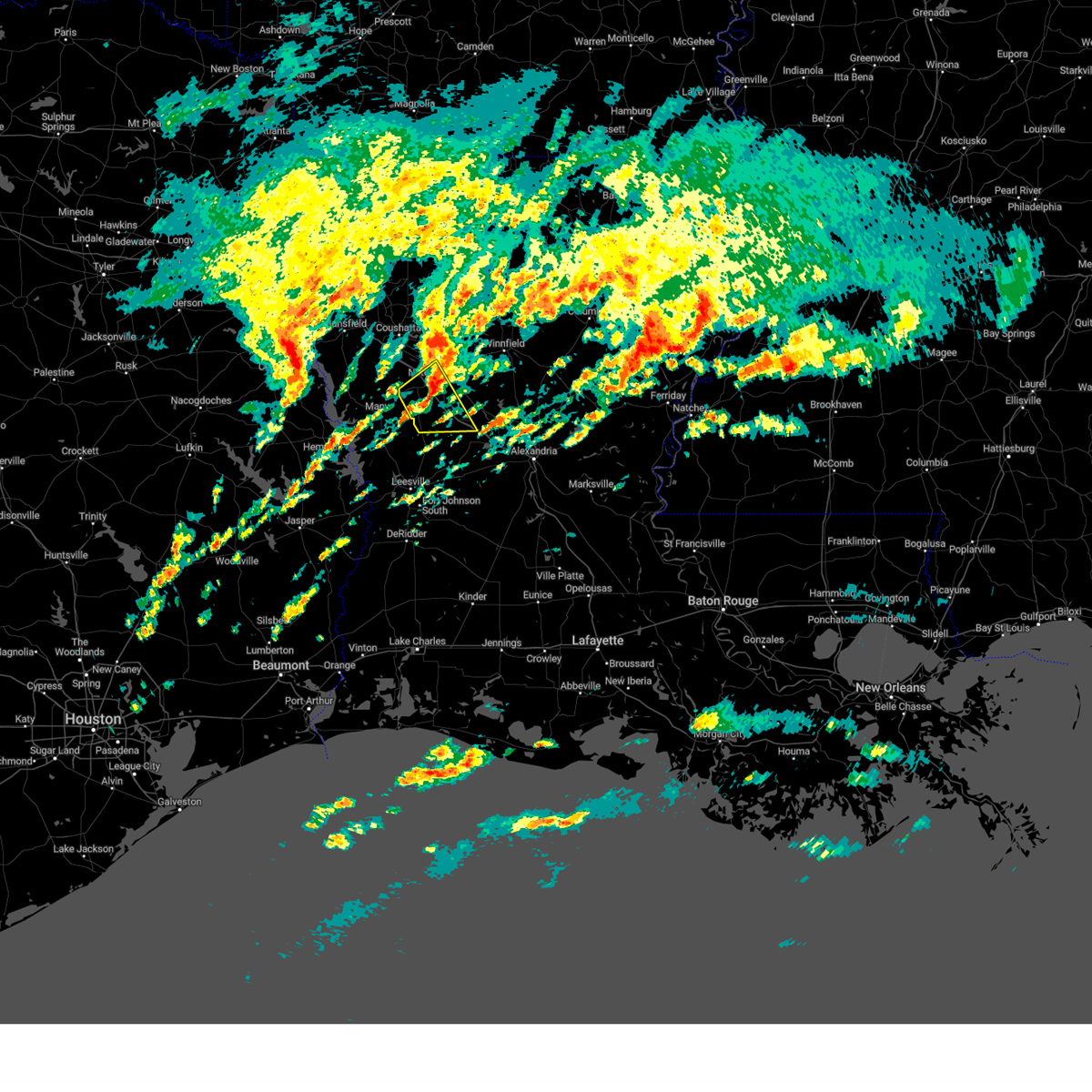 the severe thunderstorm warning has been cancelled and is no longer in effect the severe thunderstorm warning has been cancelled and is no longer in effect
|
| 3/8/2024 11:21 AM CST |
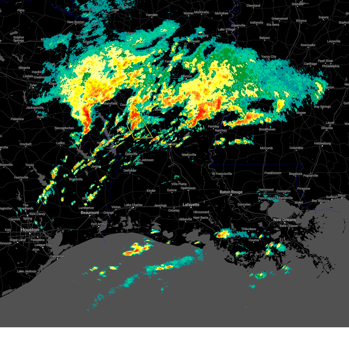 At 1121 am cst, a severe thunderstorm was located 7 miles southwest of natchitoches, moving east at 40 mph (radar indicated). Hazards include quarter size hail. Damage to vehicles is expected. Locations impacted include, natchitoches, provencal, natchez, robeline, cloutierville, melrose, grand ecore, bellwood, chopin, flora, cypress, bermuda, and hagewood. At 1121 am cst, a severe thunderstorm was located 7 miles southwest of natchitoches, moving east at 40 mph (radar indicated). Hazards include quarter size hail. Damage to vehicles is expected. Locations impacted include, natchitoches, provencal, natchez, robeline, cloutierville, melrose, grand ecore, bellwood, chopin, flora, cypress, bermuda, and hagewood.
|
| 3/8/2024 11:21 AM CST |
 the severe thunderstorm warning has been cancelled and is no longer in effect the severe thunderstorm warning has been cancelled and is no longer in effect
|
| 3/8/2024 10:57 AM CST |
 Svrshv the national weather service in shreveport has issued a * severe thunderstorm warning for, southern natchitoches parish in northwestern louisiana, northeastern sabine parish in northwestern louisiana, * until 1145 am cst. * at 1056 am cst, a severe thunderstorm was located near many, or 20 miles north of anacoco, moving east at 40 mph (radar indicated). Hazards include quarter size hail. damage to vehicles is expected Svrshv the national weather service in shreveport has issued a * severe thunderstorm warning for, southern natchitoches parish in northwestern louisiana, northeastern sabine parish in northwestern louisiana, * until 1145 am cst. * at 1056 am cst, a severe thunderstorm was located near many, or 20 miles north of anacoco, moving east at 40 mph (radar indicated). Hazards include quarter size hail. damage to vehicles is expected
|
| 1/8/2024 12:58 PM CST |
 At 1258 pm cst, a severe thunderstorm was located 13 miles east of converse, or 18 miles southeast of mansfield, moving northeast at 70 mph (radar indicated). Hazards include quarter size hail. damage to vehicles is expected At 1258 pm cst, a severe thunderstorm was located 13 miles east of converse, or 18 miles southeast of mansfield, moving northeast at 70 mph (radar indicated). Hazards include quarter size hail. damage to vehicles is expected
|
| 12/9/2023 4:16 PM CST |
 At 414 pm cst, a severe thunderstorm was located 12 miles west of campti, or 14 miles northwest of natchitoches, moving east at 35 mph (radar indicated). Hazards include golf ball size hail and 60 mph wind gusts. People and animals outdoors will be injured. expect hail damage to roofs, siding, windows, and vehicles. expect wind damage to roofs, siding, and trees. locations impacted include, natchitoches, campti, allen, clarence, powhatan, lake end, black lake, grand ecore, and ajax. thunderstorm damage threat, considerable hail threat, radar indicated max hail size, 1. 75 in wind threat, radar indicated max wind gust, 60 mph. At 414 pm cst, a severe thunderstorm was located 12 miles west of campti, or 14 miles northwest of natchitoches, moving east at 35 mph (radar indicated). Hazards include golf ball size hail and 60 mph wind gusts. People and animals outdoors will be injured. expect hail damage to roofs, siding, windows, and vehicles. expect wind damage to roofs, siding, and trees. locations impacted include, natchitoches, campti, allen, clarence, powhatan, lake end, black lake, grand ecore, and ajax. thunderstorm damage threat, considerable hail threat, radar indicated max hail size, 1. 75 in wind threat, radar indicated max wind gust, 60 mph.
|
| 12/9/2023 4:02 PM CST |
 At 401 pm cst, a severe thunderstorm was located 14 miles east of converse, or 21 miles west of natchitoches, moving east at 35 mph (radar indicated). Hazards include 60 mph wind gusts and quarter size hail. Hail damage to vehicles is expected. Expect wind damage to roofs, siding, and trees. At 401 pm cst, a severe thunderstorm was located 14 miles east of converse, or 21 miles west of natchitoches, moving east at 35 mph (radar indicated). Hazards include 60 mph wind gusts and quarter size hail. Hail damage to vehicles is expected. Expect wind damage to roofs, siding, and trees.
|
| 7/16/2023 4:01 PM CDT | A large tree limb was downed onto highway 485 in powhata in natchitoches county LA, 9.3 miles SSE of Natchitoches, LA |
| 7/16/2023 4:01 PM CDT |
 At 401 pm cdt, a severe thunderstorm was located over campti, or 12 miles north of natchitoches, moving northeast at 20 mph (radar indicated). Hazards include 60 mph wind gusts and quarter size hail. Hail damage to vehicles is expected. Expect wind damage to roofs, siding, and trees. At 401 pm cdt, a severe thunderstorm was located over campti, or 12 miles north of natchitoches, moving northeast at 20 mph (radar indicated). Hazards include 60 mph wind gusts and quarter size hail. Hail damage to vehicles is expected. Expect wind damage to roofs, siding, and trees.
|
| 6/26/2023 8:03 AM CDT |
 At 802 am cdt, severe thunderstorms were located along a line extending from coushatta to 15 miles southwest of jonesboro, moving southeast at 35 mph (radar indicated). Hazards include 60 mph wind gusts. expect damage to roofs, siding, and trees At 802 am cdt, severe thunderstorms were located along a line extending from coushatta to 15 miles southwest of jonesboro, moving southeast at 35 mph (radar indicated). Hazards include 60 mph wind gusts. expect damage to roofs, siding, and trees
|
| 6/16/2023 2:48 AM CDT |
 At 247 am cdt, severe thunderstorms were located along a line extending from 13 miles south of grambling to near jonesboro to 12 miles west of winnfield to near natchitoches, moving east at 50 mph (radar indicated). Hazards include 80 mph wind gusts and quarter size hail. Flying debris will be dangerous to those caught without shelter. mobile homes will be heavily damaged. expect considerable damage to roofs, windows, and vehicles. extensive tree damage and power outages are likely. Locations impacted include, ruston, natchitoches, grambling, winnfield, jonesboro, campti, montgomery, simsboro, provencal, natchez, chatham, clarence, hodge, goldonna, north hodge, dodson, east hodge, saline, calvin and quitman. At 247 am cdt, severe thunderstorms were located along a line extending from 13 miles south of grambling to near jonesboro to 12 miles west of winnfield to near natchitoches, moving east at 50 mph (radar indicated). Hazards include 80 mph wind gusts and quarter size hail. Flying debris will be dangerous to those caught without shelter. mobile homes will be heavily damaged. expect considerable damage to roofs, windows, and vehicles. extensive tree damage and power outages are likely. Locations impacted include, ruston, natchitoches, grambling, winnfield, jonesboro, campti, montgomery, simsboro, provencal, natchez, chatham, clarence, hodge, goldonna, north hodge, dodson, east hodge, saline, calvin and quitman.
|
| 6/16/2023 2:28 AM CDT |
 At 228 am cdt, a severe thunderstorm was located 12 miles northeast of many, or 14 miles west of natchitoches, moving east at 60 mph (radar indicated). Hazards include 60 mph wind gusts and quarter size hail. Hail damage to vehicles is expected. expect wind damage to roofs, siding, and trees. locations impacted include, natchitoches, many, pleasant hill, provencal, natchez, robeline, flora, belmont, marthaville and hagewood. hail threat, radar indicated max hail size, 1. 00 in wind threat, radar indicated max wind gust, 60 mph. At 228 am cdt, a severe thunderstorm was located 12 miles northeast of many, or 14 miles west of natchitoches, moving east at 60 mph (radar indicated). Hazards include 60 mph wind gusts and quarter size hail. Hail damage to vehicles is expected. expect wind damage to roofs, siding, and trees. locations impacted include, natchitoches, many, pleasant hill, provencal, natchez, robeline, flora, belmont, marthaville and hagewood. hail threat, radar indicated max hail size, 1. 00 in wind threat, radar indicated max wind gust, 60 mph.
|
| 6/16/2023 2:12 AM CDT |
 At 211 am cdt, severe thunderstorms were located along a line extending from near heflin to 9 miles southeast of ringgold to near coushatta to 9 miles east of converse, moving east at 50 mph (radar indicated). Hazards include 80 mph wind gusts and quarter size hail. Flying debris will be dangerous to those caught without shelter. mobile homes will be heavily damaged. expect considerable damage to roofs, windows, and vehicles. Extensive tree damage and power outages are likely. At 211 am cdt, severe thunderstorms were located along a line extending from near heflin to 9 miles southeast of ringgold to near coushatta to 9 miles east of converse, moving east at 50 mph (radar indicated). Hazards include 80 mph wind gusts and quarter size hail. Flying debris will be dangerous to those caught without shelter. mobile homes will be heavily damaged. expect considerable damage to roofs, windows, and vehicles. Extensive tree damage and power outages are likely.
|
| 6/16/2023 2:00 AM CDT |
 At 200 am cdt, a severe thunderstorm was located near converse, or 13 miles south of mansfield, moving east at 60 mph (radar indicated). Hazards include 60 mph wind gusts and quarter size hail. Hail damage to vehicles is expected. Expect wind damage to roofs, siding, and trees. At 200 am cdt, a severe thunderstorm was located near converse, or 13 miles south of mansfield, moving east at 60 mph (radar indicated). Hazards include 60 mph wind gusts and quarter size hail. Hail damage to vehicles is expected. Expect wind damage to roofs, siding, and trees.
|
| 6/12/2023 3:18 PM CDT | Several trees down or twisted off. power poles and lines dow in natchitoches county LA, 7.2 miles SW of Natchitoches, LA |
| 6/12/2023 3:05 PM CDT | Quarter sized hail reported 7.2 miles SW of Natchitoches, LA, quarter size hail fell at the dollar general in clarence. |
| 6/12/2023 2:12 PM CDT |
 At 210 pm cdt, a severe thunderstorm was located 9 miles west of campti, or 13 miles northwest of natchitoches, moving east at 25 mph (radar indicated). Hazards include 60 mph wind gusts and half dollar size hail. Hail damage to vehicles is expected. Expect wind damage to roofs, siding, and trees. At 210 pm cdt, a severe thunderstorm was located 9 miles west of campti, or 13 miles northwest of natchitoches, moving east at 25 mph (radar indicated). Hazards include 60 mph wind gusts and half dollar size hail. Hail damage to vehicles is expected. Expect wind damage to roofs, siding, and trees.
|
| 6/12/2023 1:44 PM CDT |
 At 144 pm cdt, a severe thunderstorm was located 11 miles north of many, or 22 miles west of natchitoches, moving southeast at 25 mph (radar indicated). Hazards include 60 mph wind gusts and penny size hail. expect damage to roofs, siding, and trees At 144 pm cdt, a severe thunderstorm was located 11 miles north of many, or 22 miles west of natchitoches, moving southeast at 25 mph (radar indicated). Hazards include 60 mph wind gusts and penny size hail. expect damage to roofs, siding, and trees
|
| 6/12/2023 1:17 PM CDT |
 At 117 pm cdt, a severe thunderstorm was located 14 miles south of coushatta, or 17 miles west of natchitoches, moving southeast at 20 mph (radar indicated). Hazards include 60 mph wind gusts and quarter size hail. Hail damage to vehicles is expected. Expect wind damage to roofs, siding, and trees. At 117 pm cdt, a severe thunderstorm was located 14 miles south of coushatta, or 17 miles west of natchitoches, moving southeast at 20 mph (radar indicated). Hazards include 60 mph wind gusts and quarter size hail. Hail damage to vehicles is expected. Expect wind damage to roofs, siding, and trees.
|
| 6/10/2023 4:17 PM CDT |
 At 417 pm cdt, severe thunderstorms were located along a line extending from 9 miles northwest of winnfield to 9 miles southwest of natchitoches to 7 miles east of milam, moving southeast at 25 mph (radar indicated). Hazards include 60 mph wind gusts and quarter size hail. Hail damage to vehicles is expected. expect wind damage to roofs, siding, and trees. locations impacted include, natchitoches, natchez, clarence, kisatchie, melrose, flora, cypress, bellwood, clear lake and bermuda. hail threat, radar indicated max hail size, 1. 00 in wind threat, radar indicated max wind gust, 60 mph. At 417 pm cdt, severe thunderstorms were located along a line extending from 9 miles northwest of winnfield to 9 miles southwest of natchitoches to 7 miles east of milam, moving southeast at 25 mph (radar indicated). Hazards include 60 mph wind gusts and quarter size hail. Hail damage to vehicles is expected. expect wind damage to roofs, siding, and trees. locations impacted include, natchitoches, natchez, clarence, kisatchie, melrose, flora, cypress, bellwood, clear lake and bermuda. hail threat, radar indicated max hail size, 1. 00 in wind threat, radar indicated max wind gust, 60 mph.
|
| 6/10/2023 3:40 PM CDT | Reports of trees down near highway 122 in natchitoches county LA, 8.8 miles WSW of Natchitoches, LA |
| 6/10/2023 3:40 PM CDT | Reports of several trees down throughout natchitoches paris in natchitoches county LA, 2.6 miles WSW of Natchitoches, LA |
| 6/10/2023 3:26 PM CDT |
 At 325 pm cdt, severe thunderstorms were located along a line extending from 17 miles southeast of ringgold to 10 miles northeast of zwolle to near patroon, moving southeast at 25 mph (radar indicated). Hazards include 60 mph wind gusts and quarter size hail. Hail damage to vehicles is expected. Expect wind damage to roofs, siding, and trees. At 325 pm cdt, severe thunderstorms were located along a line extending from 17 miles southeast of ringgold to 10 miles northeast of zwolle to near patroon, moving southeast at 25 mph (radar indicated). Hazards include 60 mph wind gusts and quarter size hail. Hail damage to vehicles is expected. Expect wind damage to roofs, siding, and trees.
|
| 5/11/2023 10:06 AM CDT |
 At 1006 am cdt, severe thunderstorms were located along a line extending from 12 miles east of coushatta to 7 miles southwest of campti to 14 miles east of converse, moving east at 35 mph (radar indicated). Hazards include 60 mph wind gusts and nickel size hail. expect damage to roofs, siding, and trees At 1006 am cdt, severe thunderstorms were located along a line extending from 12 miles east of coushatta to 7 miles southwest of campti to 14 miles east of converse, moving east at 35 mph (radar indicated). Hazards include 60 mph wind gusts and nickel size hail. expect damage to roofs, siding, and trees
|
| 5/11/2023 9:36 AM CDT |
 At 936 am cdt, severe thunderstorms were located along a line extending from 8 miles west of coushatta to near converse, moving east at 40 mph (radar indicated). Hazards include 60 mph wind gusts and nickel size hail. expect damage to roofs, siding, and trees At 936 am cdt, severe thunderstorms were located along a line extending from 8 miles west of coushatta to near converse, moving east at 40 mph (radar indicated). Hazards include 60 mph wind gusts and nickel size hail. expect damage to roofs, siding, and trees
|
| 4/15/2023 8:01 PM CDT |
 At 800 pm cdt, a severe thunderstorm was located 8 miles southwest of natchitoches, moving east at 45 mph (radar indicated). Hazards include 60 mph wind gusts and half dollar size hail. Hail damage to vehicles is expected. Expect wind damage to roofs, siding, and trees. At 800 pm cdt, a severe thunderstorm was located 8 miles southwest of natchitoches, moving east at 45 mph (radar indicated). Hazards include 60 mph wind gusts and half dollar size hail. Hail damage to vehicles is expected. Expect wind damage to roofs, siding, and trees.
|
| 4/15/2023 7:57 PM CDT | Reports of trees down on highway 84 east of clarenc in natchitoches county LA, 8.1 miles SW of Natchitoches, LA |
| 4/15/2023 7:45 PM CDT |
 At 745 pm cdt, a severe thunderstorm was located 7 miles east of campti, or 14 miles northeast of natchitoches, moving east at 35 mph (radar indicated). Hazards include 60 mph wind gusts and half dollar size hail. Hail damage to vehicles is expected. Expect wind damage to roofs, siding, and trees. At 745 pm cdt, a severe thunderstorm was located 7 miles east of campti, or 14 miles northeast of natchitoches, moving east at 35 mph (radar indicated). Hazards include 60 mph wind gusts and half dollar size hail. Hail damage to vehicles is expected. Expect wind damage to roofs, siding, and trees.
|
| 4/15/2023 7:35 PM CDT |
 At 735 pm cdt, a severe thunderstorm was located 14 miles northeast of coushatta, or 25 miles west of jonesboro, moving east at 25 mph (radar indicated). Hazards include ping pong ball size hail and 60 mph wind gusts. People and animals outdoors will be injured. expect hail damage to roofs, siding, windows, and vehicles. expect wind damage to roofs, siding, and trees. locations impacted include, natchitoches, campti, allen, martin, clarence, ashland, powhatan, lake end, grand ecore, womack, black lake, creston, marthaville and hagewood. hail threat, radar indicated max hail size, 1. 50 in wind threat, radar indicated max wind gust, 60 mph. At 735 pm cdt, a severe thunderstorm was located 14 miles northeast of coushatta, or 25 miles west of jonesboro, moving east at 25 mph (radar indicated). Hazards include ping pong ball size hail and 60 mph wind gusts. People and animals outdoors will be injured. expect hail damage to roofs, siding, windows, and vehicles. expect wind damage to roofs, siding, and trees. locations impacted include, natchitoches, campti, allen, martin, clarence, ashland, powhatan, lake end, grand ecore, womack, black lake, creston, marthaville and hagewood. hail threat, radar indicated max hail size, 1. 50 in wind threat, radar indicated max wind gust, 60 mph.
|
| 4/15/2023 6:41 PM CDT |
 At 641 pm cdt, a severe thunderstorm was located 12 miles northwest of coushatta, or 13 miles northeast of mansfield, moving east at 25 mph (radar indicated). Hazards include ping pong ball size hail and 60 mph wind gusts. People and animals outdoors will be injured. expect hail damage to roofs, siding, windows, and vehicles. Expect wind damage to roofs, siding, and trees. At 641 pm cdt, a severe thunderstorm was located 12 miles northwest of coushatta, or 13 miles northeast of mansfield, moving east at 25 mph (radar indicated). Hazards include ping pong ball size hail and 60 mph wind gusts. People and animals outdoors will be injured. expect hail damage to roofs, siding, windows, and vehicles. Expect wind damage to roofs, siding, and trees.
|
| 3/26/2023 7:51 PM CDT | Report of a tree down on powerlines on highway 11 in natchitoches county LA, 5.9 miles ENE of Natchitoches, LA |
| 3/26/2023 7:49 PM CDT |
 At 749 pm cdt, a severe thunderstorm was located near natchitoches, moving east at 40 mph (radar indicated). Hazards include 60 mph wind gusts and quarter size hail. Hail damage to vehicles is expected. Expect wind damage to roofs, siding, and trees. At 749 pm cdt, a severe thunderstorm was located near natchitoches, moving east at 40 mph (radar indicated). Hazards include 60 mph wind gusts and quarter size hail. Hail damage to vehicles is expected. Expect wind damage to roofs, siding, and trees.
|
| 3/26/2023 5:13 PM CDT |
 At 512 pm cdt, a severe thunderstorm was located 7 miles southeast of natchitoches, moving east at 45 mph (radar indicated). Hazards include 60 mph wind gusts and quarter size hail. Hail damage to vehicles is expected. Expect wind damage to roofs, siding, and trees. At 512 pm cdt, a severe thunderstorm was located 7 miles southeast of natchitoches, moving east at 45 mph (radar indicated). Hazards include 60 mph wind gusts and quarter size hail. Hail damage to vehicles is expected. Expect wind damage to roofs, siding, and trees.
|
| 3/26/2023 5:05 PM CDT |
 At 505 pm cdt, a severe thunderstorm was located near natchitoches, moving east at 45 mph (radar indicated). Hazards include ping pong ball size hail and 60 mph wind gusts. People and animals outdoors will be injured. expect hail damage to roofs, siding, windows, and vehicles. expect wind damage to roofs, siding, and trees. locations impacted include, natchitoches, provencal, natchez, cloutierville, melrose, flora, cypress, bermuda and st. maurice. hail threat, radar indicated max hail size, 1. 50 in wind threat, radar indicated max wind gust, 60 mph. At 505 pm cdt, a severe thunderstorm was located near natchitoches, moving east at 45 mph (radar indicated). Hazards include ping pong ball size hail and 60 mph wind gusts. People and animals outdoors will be injured. expect hail damage to roofs, siding, windows, and vehicles. expect wind damage to roofs, siding, and trees. locations impacted include, natchitoches, provencal, natchez, cloutierville, melrose, flora, cypress, bermuda and st. maurice. hail threat, radar indicated max hail size, 1. 50 in wind threat, radar indicated max wind gust, 60 mph.
|
| 3/26/2023 4:55 PM CDT |
 At 455 pm cdt, a severe thunderstorm was located 11 miles southwest of natchitoches, moving east at 45 mph (radar indicated). Hazards include 60 mph wind gusts and quarter size hail. Hail damage to vehicles is expected. expect wind damage to roofs, siding, and trees. locations impacted include, natchitoches, provencal, natchez, robeline, cloutierville, melrose, flora, cypress, bermuda and st. maurice. hail threat, radar indicated max hail size, 1. 00 in wind threat, radar indicated max wind gust, 60 mph. At 455 pm cdt, a severe thunderstorm was located 11 miles southwest of natchitoches, moving east at 45 mph (radar indicated). Hazards include 60 mph wind gusts and quarter size hail. Hail damage to vehicles is expected. expect wind damage to roofs, siding, and trees. locations impacted include, natchitoches, provencal, natchez, robeline, cloutierville, melrose, flora, cypress, bermuda and st. maurice. hail threat, radar indicated max hail size, 1. 00 in wind threat, radar indicated max wind gust, 60 mph.
|
| 3/26/2023 4:26 PM CDT |
 At 425 pm cdt, a severe thunderstorm was located near many, or 21 miles northwest of anacoco, moving east at 45 mph (radar indicated). Hazards include 60 mph wind gusts and quarter size hail. Hail damage to vehicles is expected. Expect wind damage to roofs, siding, and trees. At 425 pm cdt, a severe thunderstorm was located near many, or 21 miles northwest of anacoco, moving east at 45 mph (radar indicated). Hazards include 60 mph wind gusts and quarter size hail. Hail damage to vehicles is expected. Expect wind damage to roofs, siding, and trees.
|
| 3/26/2023 2:53 PM CDT |
 At 252 pm cdt, a severe thunderstorm was located over hornbeck, or near anacoco, moving northeast at 45 mph (radar indicated). Hazards include 60 mph wind gusts and quarter size hail. Hail damage to vehicles is expected. Expect wind damage to roofs, siding, and trees. At 252 pm cdt, a severe thunderstorm was located over hornbeck, or near anacoco, moving northeast at 45 mph (radar indicated). Hazards include 60 mph wind gusts and quarter size hail. Hail damage to vehicles is expected. Expect wind damage to roofs, siding, and trees.
|
| 3/17/2023 12:54 AM CDT |
 The severe thunderstorm warning for northwestern caldwell, southeastern jackson, central natchitoches, southern ouachita, east central sabine and winn parishes will expire at 100 am cdt, the storms which prompted the warning have weakened below severe limits, and have exited the warned area. therefore, the warning will be allowed to expire. a tornado watch remains in effect until 500 am cdt for north central and northwestern louisiana. remember, a severe thunderstorm warning still remains in effect for southern sabine, southern natchitoches, and southern winn parishes. The severe thunderstorm warning for northwestern caldwell, southeastern jackson, central natchitoches, southern ouachita, east central sabine and winn parishes will expire at 100 am cdt, the storms which prompted the warning have weakened below severe limits, and have exited the warned area. therefore, the warning will be allowed to expire. a tornado watch remains in effect until 500 am cdt for north central and northwestern louisiana. remember, a severe thunderstorm warning still remains in effect for southern sabine, southern natchitoches, and southern winn parishes.
|
| 3/17/2023 12:35 AM CDT |
 At 1235 am cdt, severe thunderstorms were located along a line extending from 9 miles southwest of brownsville-bawcomville to 17 miles northwest of clarks to 17 miles southeast of jonesboro to near winnfield to 19 miles north of montgomery to 11 miles east of campti to near natchitoches to 16 miles east of many, moving east at 35 mph (radar indicated). Hazards include 60 mph wind gusts and penny size hail. Expect damage to roofs, siding, and trees. locations impacted include, monroe, natchitoches, winnfield, brownsville-bawcomville, richwood, provencal, natchez, chatham, clarence, dodson, calvin, atlanta, sikes, fondale, vixen, st. maurice, joyce, clear lake, grand ecore and hudson. hail threat, radar indicated max hail size, 0. 75 in wind threat, radar indicated max wind gust, 60 mph. At 1235 am cdt, severe thunderstorms were located along a line extending from 9 miles southwest of brownsville-bawcomville to 17 miles northwest of clarks to 17 miles southeast of jonesboro to near winnfield to 19 miles north of montgomery to 11 miles east of campti to near natchitoches to 16 miles east of many, moving east at 35 mph (radar indicated). Hazards include 60 mph wind gusts and penny size hail. Expect damage to roofs, siding, and trees. locations impacted include, monroe, natchitoches, winnfield, brownsville-bawcomville, richwood, provencal, natchez, chatham, clarence, dodson, calvin, atlanta, sikes, fondale, vixen, st. maurice, joyce, clear lake, grand ecore and hudson. hail threat, radar indicated max hail size, 0. 75 in wind threat, radar indicated max wind gust, 60 mph.
|
| 3/17/2023 12:08 AM CDT |
 At 1208 am cdt, severe thunderstorms were located along a line extending from 10 miles east of ruston to 6 miles south of jonesboro to 18 miles northwest of winnfield to near campti to 10 miles south of coushatta to 12 miles north of many, moving southeast at 35 mph (radar indicated). Hazards include 60 mph wind gusts and penny size hail. expect damage to roofs, siding, and trees At 1208 am cdt, severe thunderstorms were located along a line extending from 10 miles east of ruston to 6 miles south of jonesboro to 18 miles northwest of winnfield to near campti to 10 miles south of coushatta to 12 miles north of many, moving southeast at 35 mph (radar indicated). Hazards include 60 mph wind gusts and penny size hail. expect damage to roofs, siding, and trees
|
| 3/3/2023 12:51 AM CST |
 At 1250 am cst, severe thunderstorms were located along a line extending from ringgold to 8 miles northwest of hornbeck, moving east at 50 mph (radar indicated). Hazards include 60 mph wind gusts. Expect damage to roofs, siding, and trees. locations impacted include, natchitoches, coushatta, zwolle, ringgold, campti, allen, oak grove, pleasant hill, provencal, natchez, martin, clarence, hall summit, saline, lucky, ashland, castor, noble, edgefield and bienville. hail threat, radar indicated max hail size, <. 75 in wind threat, radar indicated max wind gust, 60 mph. At 1250 am cst, severe thunderstorms were located along a line extending from ringgold to 8 miles northwest of hornbeck, moving east at 50 mph (radar indicated). Hazards include 60 mph wind gusts. Expect damage to roofs, siding, and trees. locations impacted include, natchitoches, coushatta, zwolle, ringgold, campti, allen, oak grove, pleasant hill, provencal, natchez, martin, clarence, hall summit, saline, lucky, ashland, castor, noble, edgefield and bienville. hail threat, radar indicated max hail size, <. 75 in wind threat, radar indicated max wind gust, 60 mph.
|
| 3/3/2023 12:17 AM CST |
 At 1216 am cst, severe thunderstorms were located along a line extending from 8 miles south of bossier city to near milam, moving east at 45 mph (radar indicated). Hazards include 60 mph wind gusts. expect damage to roofs, siding, and trees At 1216 am cst, severe thunderstorms were located along a line extending from 8 miles south of bossier city to near milam, moving east at 45 mph (radar indicated). Hazards include 60 mph wind gusts. expect damage to roofs, siding, and trees
|
| 1/12/2023 3:56 AM CST |
 At 356 am cst, a severe thunderstorm was located 7 miles east of natchitoches, moving east at 50 mph (radar indicated). Hazards include 60 mph wind gusts and quarter size hail. Hail damage to vehicles is expected. Expect wind damage to roofs, siding, and trees. At 356 am cst, a severe thunderstorm was located 7 miles east of natchitoches, moving east at 50 mph (radar indicated). Hazards include 60 mph wind gusts and quarter size hail. Hail damage to vehicles is expected. Expect wind damage to roofs, siding, and trees.
|
| 1/12/2023 3:42 AM CST |
 At 341 am cst, a severe thunderstorm was located near natchitoches, moving east at 45 mph (radar indicated). Hazards include 60 mph wind gusts and nickel size hail. Expect damage to roofs, siding, and trees. locations impacted include, natchitoches, campti, montgomery, allen, provencal, natchez, clarence, robeline, powhatan, melrose, grand ecore, st. Maurice, flora, cypress, clear lake, bermuda and hagewood. At 341 am cst, a severe thunderstorm was located near natchitoches, moving east at 45 mph (radar indicated). Hazards include 60 mph wind gusts and nickel size hail. Expect damage to roofs, siding, and trees. locations impacted include, natchitoches, campti, montgomery, allen, provencal, natchez, clarence, robeline, powhatan, melrose, grand ecore, st. Maurice, flora, cypress, clear lake, bermuda and hagewood.
|
| 1/12/2023 3:19 AM CST |
 At 319 am cst, severe thunderstorms were located along a line extending from 13 miles east of converse to 9 miles north of many to near zwolle, moving east at 45 mph (radar indicated). Hazards include 60 mph wind gusts and nickel size hail. Expect damage to roofs, siding, and trees. locations impacted include, natchitoches, many, zwolle, campti, montgomery, allen, pleasant hill, provencal, natchez, clarence, robeline, powhatan, melrose, grand ecore, belmont, bellwood, st. maurice, flora, cypress and clear lake. hail threat, radar indicated max hail size, 0. 88 in wind threat, radar indicated max wind gust, 60 mph. At 319 am cst, severe thunderstorms were located along a line extending from 13 miles east of converse to 9 miles north of many to near zwolle, moving east at 45 mph (radar indicated). Hazards include 60 mph wind gusts and nickel size hail. Expect damage to roofs, siding, and trees. locations impacted include, natchitoches, many, zwolle, campti, montgomery, allen, pleasant hill, provencal, natchez, clarence, robeline, powhatan, melrose, grand ecore, belmont, bellwood, st. maurice, flora, cypress and clear lake. hail threat, radar indicated max hail size, 0. 88 in wind threat, radar indicated max wind gust, 60 mph.
|
| 1/12/2023 3:04 AM CST |
 At 303 am cst, severe thunderstorms were located along a line extending from near converse to near zwolle to 12 miles east of patroon to 7 miles northwest of milam, moving east at 40 mph (radar indicated). Hazards include 60 mph wind gusts and nickel size hail. expect damage to roofs, siding, and trees At 303 am cst, severe thunderstorms were located along a line extending from near converse to near zwolle to 12 miles east of patroon to 7 miles northwest of milam, moving east at 40 mph (radar indicated). Hazards include 60 mph wind gusts and nickel size hail. expect damage to roofs, siding, and trees
|
| 1/7/2023 11:57 PM CST |
 At 1157 pm cst, a severe thunderstorm was located 10 miles northeast of zwolle, or 22 miles southeast of mansfield, moving northeast at 35 mph (radar indicated). Hazards include 60 mph wind gusts and nickel size hail. expect damage to roofs, siding, and trees At 1157 pm cst, a severe thunderstorm was located 10 miles northeast of zwolle, or 22 miles southeast of mansfield, moving northeast at 35 mph (radar indicated). Hazards include 60 mph wind gusts and nickel size hail. expect damage to roofs, siding, and trees
|
| 1/7/2023 11:18 PM CST |
 At 1118 pm cst, a severe thunderstorm was located over campti, or 11 miles north of natchitoches, moving northeast at 30 mph (radar indicated). Hazards include 60 mph wind gusts and quarter size hail. Hail damage to vehicles is expected. expect wind damage to roofs, siding, and trees. locations impacted include, campti, clarence, goldonna, calvin, black lake, grand ecore, chestnut, clear lake and creston. hail threat, radar indicated max hail size, 1. 00 in wind threat, radar indicated max wind gust, 60 mph. At 1118 pm cst, a severe thunderstorm was located over campti, or 11 miles north of natchitoches, moving northeast at 30 mph (radar indicated). Hazards include 60 mph wind gusts and quarter size hail. Hail damage to vehicles is expected. expect wind damage to roofs, siding, and trees. locations impacted include, campti, clarence, goldonna, calvin, black lake, grand ecore, chestnut, clear lake and creston. hail threat, radar indicated max hail size, 1. 00 in wind threat, radar indicated max wind gust, 60 mph.
|
| 1/7/2023 10:54 PM CST |
 At 1054 pm cst, a severe thunderstorm was located 9 miles west of natchitoches, moving northeast at 25 mph (radar indicated). Hazards include 60 mph wind gusts and quarter size hail. Hail damage to vehicles is expected. Expect wind damage to roofs, siding, and trees. At 1054 pm cst, a severe thunderstorm was located 9 miles west of natchitoches, moving northeast at 25 mph (radar indicated). Hazards include 60 mph wind gusts and quarter size hail. Hail damage to vehicles is expected. Expect wind damage to roofs, siding, and trees.
|
| 1/2/2023 4:03 PM CST |
 At 401 pm cst, a severe thunderstorm was located 8 miles northeast of campti, or 18 miles north of natchitoches, moving northeast at 50 mph (radar indicated). Hazards include 60 mph wind gusts and quarter size hail. Hail damage to vehicles is expected. expect wind damage to roofs, siding, and trees. Locations impacted include, campti, clarence, goldonna, saline, lucky, ashland, powhatan, grand ecore, friendship, black lake, chestnut, clear lake and creston. At 401 pm cst, a severe thunderstorm was located 8 miles northeast of campti, or 18 miles north of natchitoches, moving northeast at 50 mph (radar indicated). Hazards include 60 mph wind gusts and quarter size hail. Hail damage to vehicles is expected. expect wind damage to roofs, siding, and trees. Locations impacted include, campti, clarence, goldonna, saline, lucky, ashland, powhatan, grand ecore, friendship, black lake, chestnut, clear lake and creston.
|
| 1/2/2023 3:48 PM CST |
 At 348 pm cst, a severe thunderstorm capable of producing a tornado was located near natchitoches, moving northeast at 40 mph (radar indicated rotation). Hazards include tornado. Flying debris will be dangerous to those caught without shelter. mobile homes will be damaged or destroyed. damage to roofs, windows, and vehicles will occur. tree damage is likely. this dangerous storm will be near, campti around 400 pm cst. Other locations impacted by this tornadic thunderstorm include goldonna, black lake, grand ecore, chestnut, clear lake, saline, creston, clarence, hagewood and powhatan. At 348 pm cst, a severe thunderstorm capable of producing a tornado was located near natchitoches, moving northeast at 40 mph (radar indicated rotation). Hazards include tornado. Flying debris will be dangerous to those caught without shelter. mobile homes will be damaged or destroyed. damage to roofs, windows, and vehicles will occur. tree damage is likely. this dangerous storm will be near, campti around 400 pm cst. Other locations impacted by this tornadic thunderstorm include goldonna, black lake, grand ecore, chestnut, clear lake, saline, creston, clarence, hagewood and powhatan.
|
| 1/2/2023 3:43 PM CST |
 At 343 pm cst, a severe thunderstorm was located near natchitoches, moving northeast at 50 mph (radar indicated). Hazards include 60 mph wind gusts and quarter size hail. Hail damage to vehicles is expected. Expect wind damage to roofs, siding, and trees. At 343 pm cst, a severe thunderstorm was located near natchitoches, moving northeast at 50 mph (radar indicated). Hazards include 60 mph wind gusts and quarter size hail. Hail damage to vehicles is expected. Expect wind damage to roofs, siding, and trees.
|
| 12/13/2022 10:21 PM CST |
 At 1020 pm cst, a severe thunderstorm was located 8 miles south of natchitoches, moving northeast at 35 mph (radar indicated). Hazards include 60 mph wind gusts and quarter size hail. Hail damage to vehicles is expected. Expect wind damage to roofs, siding, and trees. At 1020 pm cst, a severe thunderstorm was located 8 miles south of natchitoches, moving northeast at 35 mph (radar indicated). Hazards include 60 mph wind gusts and quarter size hail. Hail damage to vehicles is expected. Expect wind damage to roofs, siding, and trees.
|
| 12/13/2022 8:36 PM CST |
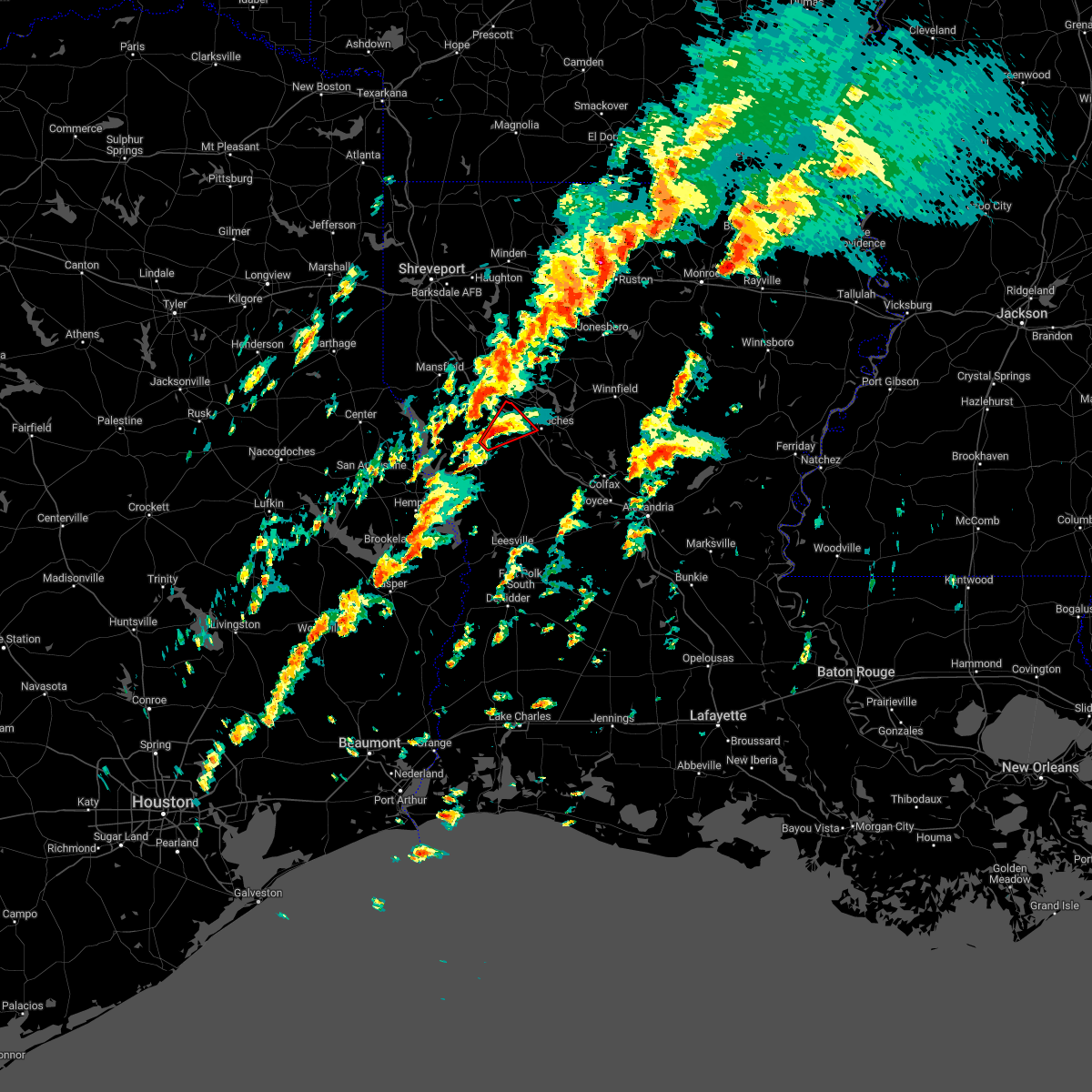 At 836 pm cst, a severe thunderstorm capable of producing a tornado was located 9 miles northeast of many, or 18 miles west of natchitoches, moving northeast at 35 mph (radar indicated rotation). Hazards include tornado. Flying debris will be dangerous to those caught without shelter. mobile homes will be damaged or destroyed. damage to roofs, windows, and vehicles will occur. tree damage is likely. Locations impacted include, natchitoches, allen, robeline, marthaville and hagewood. At 836 pm cst, a severe thunderstorm capable of producing a tornado was located 9 miles northeast of many, or 18 miles west of natchitoches, moving northeast at 35 mph (radar indicated rotation). Hazards include tornado. Flying debris will be dangerous to those caught without shelter. mobile homes will be damaged or destroyed. damage to roofs, windows, and vehicles will occur. tree damage is likely. Locations impacted include, natchitoches, allen, robeline, marthaville and hagewood.
|
| 12/13/2022 8:21 PM CST |
 At 821 pm cst, a severe thunderstorm capable of producing a tornado was located near many, or 25 miles west of natchitoches, moving northeast at 35 mph (radar indicated rotation). Hazards include tornado. Flying debris will be dangerous to those caught without shelter. mobile homes will be damaged or destroyed. damage to roofs, windows, and vehicles will occur. tree damage is likely. This tornadic thunderstorm will remain over mainly rural areas of west central natchitoches and northeastern sabine parishes, including the following locations, robeline, allen, marthaville and hagewood. At 821 pm cst, a severe thunderstorm capable of producing a tornado was located near many, or 25 miles west of natchitoches, moving northeast at 35 mph (radar indicated rotation). Hazards include tornado. Flying debris will be dangerous to those caught without shelter. mobile homes will be damaged or destroyed. damage to roofs, windows, and vehicles will occur. tree damage is likely. This tornadic thunderstorm will remain over mainly rural areas of west central natchitoches and northeastern sabine parishes, including the following locations, robeline, allen, marthaville and hagewood.
|
| 12/13/2022 4:16 PM CST |
 At 416 pm cst, a severe thunderstorm capable of producing a tornado was located 5 miles southeast of robeline, or 13 miles southwest of natchitoches, moving northeast at 40 mph (radar indicated rotation). Hazards include tornado. Flying debris will be dangerous to those caught without shelter. mobile homes will be damaged or destroyed. damage to roofs, windows, and vehicles will occur. tree damage is likely. this dangerous storm will be near, natchitoches around 440 pm cst. campti around 450 pm cst. Other locations impacted by this tornadic thunderstorm include robeline, provencal, grand ecore, clear lake, powhatan, hagewood and clarence. At 416 pm cst, a severe thunderstorm capable of producing a tornado was located 5 miles southeast of robeline, or 13 miles southwest of natchitoches, moving northeast at 40 mph (radar indicated rotation). Hazards include tornado. Flying debris will be dangerous to those caught without shelter. mobile homes will be damaged or destroyed. damage to roofs, windows, and vehicles will occur. tree damage is likely. this dangerous storm will be near, natchitoches around 440 pm cst. campti around 450 pm cst. Other locations impacted by this tornadic thunderstorm include robeline, provencal, grand ecore, clear lake, powhatan, hagewood and clarence.
|
| 12/13/2022 4:01 PM CST |
 At 400 pm cst, a severe thunderstorm capable of producing a tornado was located 7 miles southeast of many, or 7 miles northeast of florien, moving northeast at 45 mph (radar indicated rotation). Hazards include tornado. Flying debris will be dangerous to those caught without shelter. mobile homes will be damaged or destroyed. damage to roofs, windows, and vehicles will occur. tree damage is likely. this dangerous storm will be near, natchitoches around 435 pm cst. campti around 440 pm cst. Other locations impacted by this tornadic thunderstorm include robeline, provencal, grand ecore, mount carmel, clear lake, powhatan, allen, hagewood, clarence and fisher. At 400 pm cst, a severe thunderstorm capable of producing a tornado was located 7 miles southeast of many, or 7 miles northeast of florien, moving northeast at 45 mph (radar indicated rotation). Hazards include tornado. Flying debris will be dangerous to those caught without shelter. mobile homes will be damaged or destroyed. damage to roofs, windows, and vehicles will occur. tree damage is likely. this dangerous storm will be near, natchitoches around 435 pm cst. campti around 440 pm cst. Other locations impacted by this tornadic thunderstorm include robeline, provencal, grand ecore, mount carmel, clear lake, powhatan, allen, hagewood, clarence and fisher.
|
| 11/29/2022 6:12 PM CST |
 At 611 pm cst, a severe thunderstorm was located near natchitoches, moving east at 45 mph (radar indicated). Hazards include 60 mph wind gusts and half dollar size hail. Hail damage to vehicles is expected. expect wind damage to roofs, siding, and trees. Locations impacted include, natchitoches, campti, clarence, powhatan, black lake, grand ecore, clear lake and creston. At 611 pm cst, a severe thunderstorm was located near natchitoches, moving east at 45 mph (radar indicated). Hazards include 60 mph wind gusts and half dollar size hail. Hail damage to vehicles is expected. expect wind damage to roofs, siding, and trees. Locations impacted include, natchitoches, campti, clarence, powhatan, black lake, grand ecore, clear lake and creston.
|
| 11/29/2022 5:57 PM CST |
 At 557 pm cst, a severe thunderstorm was located 11 miles southwest of campti, or 12 miles northwest of natchitoches, moving northeast at 50 mph (radar indicated). Hazards include 60 mph wind gusts and half dollar size hail. Hail damage to vehicles is expected. Expect wind damage to roofs, siding, and trees. At 557 pm cst, a severe thunderstorm was located 11 miles southwest of campti, or 12 miles northwest of natchitoches, moving northeast at 50 mph (radar indicated). Hazards include 60 mph wind gusts and half dollar size hail. Hail damage to vehicles is expected. Expect wind damage to roofs, siding, and trees.
|
| 11/29/2022 4:44 PM CST |
 At 443 pm cst, a severe thunderstorm was located 11 miles west of winnfield, moving northeast at 60 mph (radar indicated). Hazards include golf ball size hail and 60 mph wind gusts. People and animals outdoors will be injured. expect hail damage to roofs, siding, windows, and vehicles. expect wind damage to roofs, siding, and trees. locations impacted include, natchitoches, winnfield, natchez, clarence, calvin, atlanta, grand ecore, st. Maurice and bermuda. At 443 pm cst, a severe thunderstorm was located 11 miles west of winnfield, moving northeast at 60 mph (radar indicated). Hazards include golf ball size hail and 60 mph wind gusts. People and animals outdoors will be injured. expect hail damage to roofs, siding, windows, and vehicles. expect wind damage to roofs, siding, and trees. locations impacted include, natchitoches, winnfield, natchez, clarence, calvin, atlanta, grand ecore, st. Maurice and bermuda.
|
| 11/29/2022 4:42 PM CST |
 At 442 pm cst, a severe thunderstorm capable of producing a tornado was located near natchitoches, moving northeast at 35 mph (radar indicated rotation). Hazards include tornado and golf ball size hail. Flying debris will be dangerous to those caught without shelter. mobile homes will be damaged or destroyed. damage to roofs, windows, and vehicles will occur. tree damage is likely. locations impacted include, natchitoches, montgomery, natchez, clarence, calvin, atlanta, bermuda and st. Maurice. At 442 pm cst, a severe thunderstorm capable of producing a tornado was located near natchitoches, moving northeast at 35 mph (radar indicated rotation). Hazards include tornado and golf ball size hail. Flying debris will be dangerous to those caught without shelter. mobile homes will be damaged or destroyed. damage to roofs, windows, and vehicles will occur. tree damage is likely. locations impacted include, natchitoches, montgomery, natchez, clarence, calvin, atlanta, bermuda and st. Maurice.
|
| 11/29/2022 4:35 PM CST |
 At 435 pm cst, a severe thunderstorm was located 9 miles east of campti, or 12 miles northeast of natchitoches, moving northeast at 60 mph (radar indicated). Hazards include golf ball size hail and 60 mph wind gusts. People and animals outdoors will be injured. expect hail damage to roofs, siding, windows, and vehicles. expect wind damage to roofs, siding, and trees. locations impacted include, natchitoches, winnfield, campti, allen, natchez, clarence, goldonna, calvin, atlanta, powhatan, grand ecore, st. Maurice, black lake, clear lake, creston and bermuda. At 435 pm cst, a severe thunderstorm was located 9 miles east of campti, or 12 miles northeast of natchitoches, moving northeast at 60 mph (radar indicated). Hazards include golf ball size hail and 60 mph wind gusts. People and animals outdoors will be injured. expect hail damage to roofs, siding, windows, and vehicles. expect wind damage to roofs, siding, and trees. locations impacted include, natchitoches, winnfield, campti, allen, natchez, clarence, goldonna, calvin, atlanta, powhatan, grand ecore, st. Maurice, black lake, clear lake, creston and bermuda.
|
| 11/29/2022 4:28 PM CST | Golf Ball sized hail reported 1.5 miles WSW of Natchitoches, LA |
| 11/29/2022 4:28 PM CST |
 At 428 pm cst, a severe thunderstorm capable of producing a tornado was located near natchitoches, moving northeast at 35 mph (radar indicated rotation). Hazards include tornado and golf ball size hail. Flying debris will be dangerous to those caught without shelter. mobile homes will be damaged or destroyed. damage to roofs, windows, and vehicles will occur. Tree damage is likely. At 428 pm cst, a severe thunderstorm capable of producing a tornado was located near natchitoches, moving northeast at 35 mph (radar indicated rotation). Hazards include tornado and golf ball size hail. Flying debris will be dangerous to those caught without shelter. mobile homes will be damaged or destroyed. damage to roofs, windows, and vehicles will occur. Tree damage is likely.
|
| 11/29/2022 4:20 PM CST | Half Dollar sized hail reported 5.6 miles ENE of Natchitoches, LA, public reports hail up to half dollar size in hagewood community. |
| 11/29/2022 4:12 PM CST |
 At 412 pm cst, a severe thunderstorm was located 11 miles west of natchitoches, moving northeast at 60 mph (radar indicated). Hazards include golf ball size hail and 60 mph wind gusts. People and animals outdoors will be injured. expect hail damage to roofs, siding, windows, and vehicles. Expect wind damage to roofs, siding, and trees. At 412 pm cst, a severe thunderstorm was located 11 miles west of natchitoches, moving northeast at 60 mph (radar indicated). Hazards include golf ball size hail and 60 mph wind gusts. People and animals outdoors will be injured. expect hail damage to roofs, siding, windows, and vehicles. Expect wind damage to roofs, siding, and trees.
|
| 11/29/2022 2:33 PM CST |
 At 233 pm cst, a severe thunderstorm capable of producing a tornado was located near natchitoches, moving northeast at 40 mph (radar indicated rotation). Hazards include tornado. Flying debris will be dangerous to those caught without shelter. mobile homes will be damaged or destroyed. damage to roofs, windows, and vehicles will occur. tree damage is likely. this dangerous storm will be near, natchitoches around 245 pm cst. other locations impacted by this tornadic thunderstorm include clear lake, st. Maurice, clarence, provencal, grand ecore and hagewood. At 233 pm cst, a severe thunderstorm capable of producing a tornado was located near natchitoches, moving northeast at 40 mph (radar indicated rotation). Hazards include tornado. Flying debris will be dangerous to those caught without shelter. mobile homes will be damaged or destroyed. damage to roofs, windows, and vehicles will occur. tree damage is likely. this dangerous storm will be near, natchitoches around 245 pm cst. other locations impacted by this tornadic thunderstorm include clear lake, st. Maurice, clarence, provencal, grand ecore and hagewood.
|
| 11/4/2022 11:50 PM CDT |
 At 1150 pm cdt, severe thunderstorms were located along a line extending from 11 miles south of arcadia to 8 miles northwest of natchitoches, moving east at 30 mph (radar indicated). Hazards include 60 mph wind gusts. expect damage to roofs, siding, and trees At 1150 pm cdt, severe thunderstorms were located along a line extending from 11 miles south of arcadia to 8 miles northwest of natchitoches, moving east at 30 mph (radar indicated). Hazards include 60 mph wind gusts. expect damage to roofs, siding, and trees
|
| 11/4/2022 11:37 PM CDT |
 At 1136 pm cdt, severe thunderstorms were located along a line extending from 8 miles south of gibsland to 10 miles southwest of campti, moving east at 30 mph (radar indicated). Hazards include 60 mph wind gusts. Expect damage to roofs, siding, and trees. locations impacted include, natchitoches, campti, allen, martin, clarence, goldonna, saline, lucky, ashland, castor, bienville, powhatan, bryceland, lake end, brice, friendship, liberty hill, sailes, chestnut and clear lake. hail threat, radar indicated max hail size, <. 75 in wind threat, radar indicated max wind gust, 60 mph. At 1136 pm cdt, severe thunderstorms were located along a line extending from 8 miles south of gibsland to 10 miles southwest of campti, moving east at 30 mph (radar indicated). Hazards include 60 mph wind gusts. Expect damage to roofs, siding, and trees. locations impacted include, natchitoches, campti, allen, martin, clarence, goldonna, saline, lucky, ashland, castor, bienville, powhatan, bryceland, lake end, brice, friendship, liberty hill, sailes, chestnut and clear lake. hail threat, radar indicated max hail size, <. 75 in wind threat, radar indicated max wind gust, 60 mph.
|
| 11/4/2022 10:53 PM CDT |
 At 1053 pm cdt, severe thunderstorms were located along a line extending from 8 miles south of doyline to near converse, moving east at 40 mph (radar indicated). Hazards include 60 mph wind gusts. expect damage to roofs, siding, and trees At 1053 pm cdt, severe thunderstorms were located along a line extending from 8 miles south of doyline to near converse, moving east at 40 mph (radar indicated). Hazards include 60 mph wind gusts. expect damage to roofs, siding, and trees
|
| 9/7/2022 4:37 PM CDT |
 At 437 pm cdt, severe thunderstorms were located along a line extending from 12 miles northeast of many to 8 miles southwest of natchitoches to 11 miles southwest of montgomery to 6 miles northwest of flatwoods, moving southwest at 20 mph (radar indicated). Hazards include 60 mph wind gusts and penny size hail. Expect damage to roofs, siding, and trees. locations impacted include, natchitoches, many, provencal, natchez, robeline, cloutierville, melrose, bellwood, chopin, flora, cypress, bermuda, gorum, marthaville and hagewood. hail threat, radar indicated max hail size, 0. 75 in wind threat, radar indicated max wind gust, 60 mph. At 437 pm cdt, severe thunderstorms were located along a line extending from 12 miles northeast of many to 8 miles southwest of natchitoches to 11 miles southwest of montgomery to 6 miles northwest of flatwoods, moving southwest at 20 mph (radar indicated). Hazards include 60 mph wind gusts and penny size hail. Expect damage to roofs, siding, and trees. locations impacted include, natchitoches, many, provencal, natchez, robeline, cloutierville, melrose, bellwood, chopin, flora, cypress, bermuda, gorum, marthaville and hagewood. hail threat, radar indicated max hail size, 0. 75 in wind threat, radar indicated max wind gust, 60 mph.
|
| 9/7/2022 4:24 PM CDT | Tree limbs dow in natchitoches county LA, 14.2 miles NNW of Natchitoches, LA |
| 9/7/2022 4:13 PM CDT |
 At 413 pm cdt, severe thunderstorms were located along a line extending from 13 miles southwest of campti to near natchitoches to near montgomery to near colfax, moving southwest at 15 mph (radar indicated). Hazards include 60 mph wind gusts and penny size hail. expect damage to roofs, siding, and trees At 413 pm cdt, severe thunderstorms were located along a line extending from 13 miles southwest of campti to near natchitoches to near montgomery to near colfax, moving southwest at 15 mph (radar indicated). Hazards include 60 mph wind gusts and penny size hail. expect damage to roofs, siding, and trees
|
| 7/13/2022 9:29 PM CDT |
 At 929 pm cdt, a severe thunderstorm was located over natchitoches, moving south at 5 mph (radar indicated). Hazards include 60 mph wind gusts and quarter size hail. Hail damage to vehicles is expected. expect wind damage to roofs, siding, and trees. locations impacted include, natchitoches, clarence and st. maurice. hail threat, radar indicated max hail size, 1. 00 in wind threat, radar indicated max wind gust, 60 mph. At 929 pm cdt, a severe thunderstorm was located over natchitoches, moving south at 5 mph (radar indicated). Hazards include 60 mph wind gusts and quarter size hail. Hail damage to vehicles is expected. expect wind damage to roofs, siding, and trees. locations impacted include, natchitoches, clarence and st. maurice. hail threat, radar indicated max hail size, 1. 00 in wind threat, radar indicated max wind gust, 60 mph.
|
| 7/13/2022 9:25 PM CDT | Reports of large tree down on bucks grocery road... just south of the grand ecore communit in natchitoches county LA, 3.8 miles SSW of Natchitoches, LA |
| 7/13/2022 9:04 PM CDT |
 At 904 pm cdt, a severe thunderstorm was located near natchitoches, moving south at 5 mph (radar indicated). Hazards include 60 mph wind gusts and quarter size hail. Hail damage to vehicles is expected. Expect wind damage to roofs, siding, and trees. At 904 pm cdt, a severe thunderstorm was located near natchitoches, moving south at 5 mph (radar indicated). Hazards include 60 mph wind gusts and quarter size hail. Hail damage to vehicles is expected. Expect wind damage to roofs, siding, and trees.
|
| 6/10/2022 12:57 PM CDT |
 At 1257 pm cdt, severe thunderstorms were located along a line extending from 13 miles east of montgomery to 11 miles east of many, moving south at 20 mph (radar indicated). Hazards include ping pong ball size hail and 60 mph wind gusts. People and animals outdoors will be injured. expect hail damage to roofs, siding, windows, and vehicles. Expect wind damage to roofs, siding, and trees. At 1257 pm cdt, severe thunderstorms were located along a line extending from 13 miles east of montgomery to 11 miles east of many, moving south at 20 mph (radar indicated). Hazards include ping pong ball size hail and 60 mph wind gusts. People and animals outdoors will be injured. expect hail damage to roofs, siding, windows, and vehicles. Expect wind damage to roofs, siding, and trees.
|
| 6/10/2022 12:40 PM CDT | Very large tree limb across the road on highway 122 in natchitoches county LA, 6.9 miles WSW of Natchitoches, LA |
| 6/10/2022 12:05 PM CDT |
 At 1204 pm cdt, severe thunderstorms were located along a line extending from 16 miles north of campti to 11 miles southeast of mansfield, moving southeast at 35 mph (radar indicated). Hazards include 60 mph wind gusts and penny size hail. expect damage to roofs, siding, and trees At 1204 pm cdt, severe thunderstorms were located along a line extending from 16 miles north of campti to 11 miles southeast of mansfield, moving southeast at 35 mph (radar indicated). Hazards include 60 mph wind gusts and penny size hail. expect damage to roofs, siding, and trees
|
| 6/2/2022 4:15 PM CDT | Large tree uprooted and outbuilding destroyed near the intersection of caspari and jefferson street in natchitoches at a nsu fraternity hous in natchitoches county LA, 1.6 miles WNW of Natchitoches, LA |
| 4/13/2022 5:06 PM CDT |
 At 506 pm cdt, severe thunderstorms were located along a line extending from 13 miles southeast of jonesboro to 7 miles southeast of winnfield to 6 miles northwest of lena, moving east at 70 mph (radar indicated). Hazards include 70 mph wind gusts. Expect considerable tree damage. damage is likely to mobile homes, roofs, and outbuildings. locations impacted include, natchitoches, winnfield, colfax, montgomery, natchez, pollock, dry prong, dodson, georgetown, calvin, atlanta, sikes, cloutierville, melrose, bellwood, chopin, st. Maurice, joyce, lake iatt and williana. At 506 pm cdt, severe thunderstorms were located along a line extending from 13 miles southeast of jonesboro to 7 miles southeast of winnfield to 6 miles northwest of lena, moving east at 70 mph (radar indicated). Hazards include 70 mph wind gusts. Expect considerable tree damage. damage is likely to mobile homes, roofs, and outbuildings. locations impacted include, natchitoches, winnfield, colfax, montgomery, natchez, pollock, dry prong, dodson, georgetown, calvin, atlanta, sikes, cloutierville, melrose, bellwood, chopin, st. Maurice, joyce, lake iatt and williana.
|
| 4/13/2022 4:45 PM CDT | A tree was downed on highway 1227 northeast of clarenc in natchitoches county LA, 11.7 miles SW of Natchitoches, LA |
| 4/13/2022 4:39 PM CDT |
 At 439 pm cdt, severe thunderstorms were located along a line extending from 14 miles northeast of campti to near natchitoches to 16 miles north of kurthwood, moving east at 45 mph (radar indicated). Hazards include 60 mph wind gusts. expect damage to roofs, siding, and trees At 439 pm cdt, severe thunderstorms were located along a line extending from 14 miles northeast of campti to near natchitoches to 16 miles north of kurthwood, moving east at 45 mph (radar indicated). Hazards include 60 mph wind gusts. expect damage to roofs, siding, and trees
|
| 4/13/2022 4:29 PM CDT |
 At 429 pm cdt, a severe thunderstorm was located 13 miles northeast of many, or 15 miles west of natchitoches, moving east at 40 mph (radar indicated). Hazards include 60 mph wind gusts and quarter size hail. Hail damage to vehicles is expected. expect wind damage to roofs, siding, and trees. Locations impacted include, natchitoches, many, zwolle, allen, pleasant hill, provencal, robeline, powhatan, belmont, marthaville, hagewood and flora. At 429 pm cdt, a severe thunderstorm was located 13 miles northeast of many, or 15 miles west of natchitoches, moving east at 40 mph (radar indicated). Hazards include 60 mph wind gusts and quarter size hail. Hail damage to vehicles is expected. expect wind damage to roofs, siding, and trees. Locations impacted include, natchitoches, many, zwolle, allen, pleasant hill, provencal, robeline, powhatan, belmont, marthaville, hagewood and flora.
|
| 4/13/2022 3:56 PM CDT |
 At 356 pm cdt, a severe thunderstorm was located near zwolle, or 26 miles south of mansfield, moving east at 40 mph (radar indicated). Hazards include 60 mph wind gusts and quarter size hail. Hail damage to vehicles is expected. Expect wind damage to roofs, siding, and trees. At 356 pm cdt, a severe thunderstorm was located near zwolle, or 26 miles south of mansfield, moving east at 40 mph (radar indicated). Hazards include 60 mph wind gusts and quarter size hail. Hail damage to vehicles is expected. Expect wind damage to roofs, siding, and trees.
|
| 4/13/2022 12:34 AM CDT |
 At 1234 am cdt, severe thunderstorms were located along a line extending from 6 miles east of natchitoches to near nacogdoches, moving east at 25 mph (radar indicated). Hazards include 60 mph wind gusts and nickel size hail. Expect damage to roofs, siding, and trees. Locations impacted include, natchitoches, center, milam, many, san augustine, zwolle, converse, patroon, bland lake, neuville, shelbyville, allen, oak grove, pleasant hill, provencal, natchez, huxley, noble, robeline and lake end. At 1234 am cdt, severe thunderstorms were located along a line extending from 6 miles east of natchitoches to near nacogdoches, moving east at 25 mph (radar indicated). Hazards include 60 mph wind gusts and nickel size hail. Expect damage to roofs, siding, and trees. Locations impacted include, natchitoches, center, milam, many, san augustine, zwolle, converse, patroon, bland lake, neuville, shelbyville, allen, oak grove, pleasant hill, provencal, natchez, huxley, noble, robeline and lake end.
|
| 4/13/2022 12:15 AM CDT |
 At 1215 am cdt, severe thunderstorms were located along a line extending from natchitoches to near nacogdoches, moving east at 25 mph (radar indicated). Hazards include 60 mph wind gusts and nickel size hail. Expect damage to roofs, siding, and trees. Locations impacted include, nacogdoches, natchitoches, center, milam, many, san augustine, zwolle, converse, melrose, patroon, martinsville, bland lake, neuville, woden, shelbyville, allen, oak grove, pleasant hill, provencal and natchez. At 1215 am cdt, severe thunderstorms were located along a line extending from natchitoches to near nacogdoches, moving east at 25 mph (radar indicated). Hazards include 60 mph wind gusts and nickel size hail. Expect damage to roofs, siding, and trees. Locations impacted include, nacogdoches, natchitoches, center, milam, many, san augustine, zwolle, converse, melrose, patroon, martinsville, bland lake, neuville, woden, shelbyville, allen, oak grove, pleasant hill, provencal and natchez.
|
| 4/12/2022 11:58 PM CDT |
 At 1157 pm cdt, severe thunderstorms were located along a line extending from near natchitoches to 8 miles west of nacogdoches, moving east at 25 mph (radar indicated). Hazards include 60 mph wind gusts and nickel size hail. expect damage to roofs, siding, and trees At 1157 pm cdt, severe thunderstorms were located along a line extending from near natchitoches to 8 miles west of nacogdoches, moving east at 25 mph (radar indicated). Hazards include 60 mph wind gusts and nickel size hail. expect damage to roofs, siding, and trees
|
| 4/12/2022 10:39 PM CDT |
 At 1039 pm cdt, severe thunderstorms were located along a line extending from near gibsland to 14 miles east of converse, moving east at 65 mph (radar indicated). Hazards include 60 mph wind gusts and penny size hail. expect damage to roofs, siding, and trees At 1039 pm cdt, severe thunderstorms were located along a line extending from near gibsland to 14 miles east of converse, moving east at 65 mph (radar indicated). Hazards include 60 mph wind gusts and penny size hail. expect damage to roofs, siding, and trees
|
| 3/30/2022 12:48 PM CDT | Tree and utility line down on franklin lane southeast of natchitoches... road blocked by tre in natchitoches county LA, 5.5 miles W of Natchitoches, LA |
| 3/30/2022 12:19 PM CDT |
 At 1219 pm cdt, a severe thunderstorm capable of producing a tornado was located 12 miles north of montgomery, or 14 miles northeast of natchitoches, moving east at 55 mph (radar indicated rotation). Hazards include tornado. Flying debris will be dangerous to those caught without shelter. mobile homes will be damaged or destroyed. damage to roofs, windows, and vehicles will occur. tree damage is likely. locations impacted include, natchitoches, clarence, atlanta, st. Maurice and grand ecore. At 1219 pm cdt, a severe thunderstorm capable of producing a tornado was located 12 miles north of montgomery, or 14 miles northeast of natchitoches, moving east at 55 mph (radar indicated rotation). Hazards include tornado. Flying debris will be dangerous to those caught without shelter. mobile homes will be damaged or destroyed. damage to roofs, windows, and vehicles will occur. tree damage is likely. locations impacted include, natchitoches, clarence, atlanta, st. Maurice and grand ecore.
|
| 3/30/2022 12:08 PM CDT |
 At 1207 pm cdt, a severe thunderstorm capable of producing a tornado was located near natchitoches, moving east at 55 mph (radar indicated rotation). Hazards include tornado. Flying debris will be dangerous to those caught without shelter. mobile homes will be damaged or destroyed. damage to roofs, windows, and vehicles will occur. Tree damage is likely. At 1207 pm cdt, a severe thunderstorm capable of producing a tornado was located near natchitoches, moving east at 55 mph (radar indicated rotation). Hazards include tornado. Flying debris will be dangerous to those caught without shelter. mobile homes will be damaged or destroyed. damage to roofs, windows, and vehicles will occur. Tree damage is likely.
|
| 3/30/2022 11:54 AM CDT | Tree fell on home on 100 block of 485 trapping family in home. injuries unknown at this tim in natchitoches county LA, 9.9 miles SSE of Natchitoches, LA |
| 3/30/2022 11:34 AM CDT |
 At 1134 am cdt, severe thunderstorms were located along a line extending from 6 miles southwest of coushatta to near mayflower, moving east at 45 mph (radar indicated). Hazards include 60 mph wind gusts. expect damage to roofs, siding, and trees At 1134 am cdt, severe thunderstorms were located along a line extending from 6 miles southwest of coushatta to near mayflower, moving east at 45 mph (radar indicated). Hazards include 60 mph wind gusts. expect damage to roofs, siding, and trees
|
| 3/22/2022 5:30 AM CDT |
 At 530 am cdt, severe thunderstorms were located along a line extending from 10 miles northeast of coushatta to near many, moving northeast at 35 mph (radar indicated). Hazards include 60 mph wind gusts and quarter size hail. Hail damage to vehicles is expected. Expect wind damage to roofs, siding, and trees. At 530 am cdt, severe thunderstorms were located along a line extending from 10 miles northeast of coushatta to near many, moving northeast at 35 mph (radar indicated). Hazards include 60 mph wind gusts and quarter size hail. Hail damage to vehicles is expected. Expect wind damage to roofs, siding, and trees.
|
| 1/9/2022 5:27 AM CST |
 At 527 am cst, a severe thunderstorm capable of producing a tornado was located 9 miles southwest of montgomery, or 11 miles south of natchitoches, moving northeast at 35 mph (radar indicated rotation). Hazards include tornado and quarter size hail. Flying debris will be dangerous to those caught without shelter. mobile homes will be damaged or destroyed. damage to roofs, windows, and vehicles will occur. tree damage is likely. Locations impacted include, natchitoches, natchez, cloutierville, melrose, flora, bellwood and bermuda. At 527 am cst, a severe thunderstorm capable of producing a tornado was located 9 miles southwest of montgomery, or 11 miles south of natchitoches, moving northeast at 35 mph (radar indicated rotation). Hazards include tornado and quarter size hail. Flying debris will be dangerous to those caught without shelter. mobile homes will be damaged or destroyed. damage to roofs, windows, and vehicles will occur. tree damage is likely. Locations impacted include, natchitoches, natchez, cloutierville, melrose, flora, bellwood and bermuda.
|
| 1/9/2022 5:11 AM CST |
 At 509 am cst, a tornado producing storm was located 12 miles north of kurthwood, or 17 miles south of natchitoches, moving northeast at 30 mph (radar confirmed tornado). Hazards include damaging tornado and quarter size hail. Flying debris will be dangerous to those caught without shelter. mobile homes will be damaged or destroyed. damage to roofs, windows, and vehicles will occur. tree damage is likely. Communities in the path of this storm include natchitoches, cloutierville, melrose, flora, natchez, bellwood and bermuda. At 509 am cst, a tornado producing storm was located 12 miles north of kurthwood, or 17 miles south of natchitoches, moving northeast at 30 mph (radar confirmed tornado). Hazards include damaging tornado and quarter size hail. Flying debris will be dangerous to those caught without shelter. mobile homes will be damaged or destroyed. damage to roofs, windows, and vehicles will occur. tree damage is likely. Communities in the path of this storm include natchitoches, cloutierville, melrose, flora, natchez, bellwood and bermuda.
|
| 10/27/2021 12:59 PM CDT |
 At 1258 pm cdt, severe thunderstorms were located along a line extending from near natchitoches to 9 miles west of montgomery to 6 miles north of hutton, moving east at 30 mph (radar indicated). Hazards include 60 mph wind gusts. Expect damage to roofs, siding, and trees. locations impacted include, natchitoches, winnfield, colfax, montgomery, natchez, clarence, calvin, atlanta, cloutierville, melrose, grand ecore, chopin, st. Maurice, lake iatt, clear lake, bermuda, aloha and gorum. At 1258 pm cdt, severe thunderstorms were located along a line extending from near natchitoches to 9 miles west of montgomery to 6 miles north of hutton, moving east at 30 mph (radar indicated). Hazards include 60 mph wind gusts. Expect damage to roofs, siding, and trees. locations impacted include, natchitoches, winnfield, colfax, montgomery, natchez, clarence, calvin, atlanta, cloutierville, melrose, grand ecore, chopin, st. Maurice, lake iatt, clear lake, bermuda, aloha and gorum.
|
| 10/27/2021 12:29 PM CDT |
 At 1228 pm cdt, severe thunderstorms were located along a line extending from 11 miles west of natchitoches to 13 miles east of many to 6 miles west of kurthwood, moving northeast at 30 mph (radar indicated). Hazards include 60 mph wind gusts. expect damage to roofs, siding, and trees At 1228 pm cdt, severe thunderstorms were located along a line extending from 11 miles west of natchitoches to 13 miles east of many to 6 miles west of kurthwood, moving northeast at 30 mph (radar indicated). Hazards include 60 mph wind gusts. expect damage to roofs, siding, and trees
|
| 10/27/2021 12:17 PM CDT |
 At 1216 pm cdt, severe thunderstorms were located along a line extending from 9 miles south of doyline to near coushatta to 10 miles northeast of many, moving east at 25 mph (radar indicated). Hazards include 60 mph wind gusts. Expect damage to roofs, siding, and trees. Locations impacted include, natchitoches, coushatta, ringgold, campti, heflin, allen, natchez, martin, clarence, hall summit, ashland, castor, edgefield, robeline, jamestown, powhatan, lake end, grand bayou, plum orchard landing and hanna. At 1216 pm cdt, severe thunderstorms were located along a line extending from 9 miles south of doyline to near coushatta to 10 miles northeast of many, moving east at 25 mph (radar indicated). Hazards include 60 mph wind gusts. Expect damage to roofs, siding, and trees. Locations impacted include, natchitoches, coushatta, ringgold, campti, heflin, allen, natchez, martin, clarence, hall summit, ashland, castor, edgefield, robeline, jamestown, powhatan, lake end, grand bayou, plum orchard landing and hanna.
|
| 10/27/2021 11:40 AM CDT |
 At 1139 am cdt, severe thunderstorms were located along a line extending from 7 miles northeast of stonewall to near mansfield to near zwolle, moving east at 25 mph (radar indicated). Hazards include 60 mph wind gusts. expect damage to roofs, siding, and trees At 1139 am cdt, severe thunderstorms were located along a line extending from 7 miles northeast of stonewall to near mansfield to near zwolle, moving east at 25 mph (radar indicated). Hazards include 60 mph wind gusts. expect damage to roofs, siding, and trees
|
| 5/9/2021 7:48 PM CDT |
 At 748 pm cdt, severe thunderstorms were located along a line extending from near montgomery to near hutton, moving east at 25 mph (radar indicated). Hazards include 60 mph wind gusts. Expect damage to roofs, siding, and trees. Locations impacted include, natchitoches, montgomery, natchez, kisatchie, cloutierville, melrose, flora, bellwood, chopin, bermuda, aloha and gorum. At 748 pm cdt, severe thunderstorms were located along a line extending from near montgomery to near hutton, moving east at 25 mph (radar indicated). Hazards include 60 mph wind gusts. Expect damage to roofs, siding, and trees. Locations impacted include, natchitoches, montgomery, natchez, kisatchie, cloutierville, melrose, flora, bellwood, chopin, bermuda, aloha and gorum.
|
| 5/9/2021 7:22 PM CDT |
 At 722 pm cdt, a severe thunderstorm was located 12 miles south of natchitoches, or near provencal, moving east at 15 mph (radar indicated). Hazards include 60 mph wind gusts. expect damage to roofs, siding, and trees At 722 pm cdt, a severe thunderstorm was located 12 miles south of natchitoches, or near provencal, moving east at 15 mph (radar indicated). Hazards include 60 mph wind gusts. expect damage to roofs, siding, and trees
|
| 5/4/2021 12:20 PM CDT | Widespread trees and power lines down across the paris in natchitoches county LA, 1.5 miles WSW of Natchitoches, LA |
| 5/4/2021 12:17 PM CDT |
 At 1217 pm cdt, severe thunderstorms were located along a line extending from near many to near hornbeck, moving northeast at 35 mph (radar indicated). Hazards include 60 mph wind gusts. expect damage to roofs, siding, and trees At 1217 pm cdt, severe thunderstorms were located along a line extending from near many to near hornbeck, moving northeast at 35 mph (radar indicated). Hazards include 60 mph wind gusts. expect damage to roofs, siding, and trees
|
| 5/4/2021 12:05 PM CDT |
 At 1204 pm cdt, severe thunderstorms were located along a line extending from 9 miles north of mansfield to near converse, moving east at 65 mph (public). Hazards include 60 mph wind gusts and quarter size hail. Hail damage to vehicles is expected. Expect wind damage to roofs, siding, and trees. At 1204 pm cdt, severe thunderstorms were located along a line extending from 9 miles north of mansfield to near converse, moving east at 65 mph (public). Hazards include 60 mph wind gusts and quarter size hail. Hail damage to vehicles is expected. Expect wind damage to roofs, siding, and trees.
|
| 4/16/2021 2:34 PM CDT |
 At 234 pm cdt, a severe thunderstorm was located near montgomery, or 9 miles southeast of natchitoches, moving east at 50 mph (radar indicated). Hazards include 60 mph wind gusts and quarter size hail. Hail damage to vehicles is expected. expect wind damage to roofs, siding, and trees. Locations impacted include, natchitoches, natchez, cloutierville, melrose, flora, bellwood and bermuda. At 234 pm cdt, a severe thunderstorm was located near montgomery, or 9 miles southeast of natchitoches, moving east at 50 mph (radar indicated). Hazards include 60 mph wind gusts and quarter size hail. Hail damage to vehicles is expected. expect wind damage to roofs, siding, and trees. Locations impacted include, natchitoches, natchez, cloutierville, melrose, flora, bellwood and bermuda.
|
| 4/16/2021 2:22 PM CDT |
 At 220 pm cdt, a severe thunderstorm was located 7 miles southwest of natchitoches, moving east at 50 mph (radar indicated). Hazards include 60 mph wind gusts and quarter size hail. Hail damage to vehicles is expected. expect wind damage to roofs, siding, and trees. Locations impacted include, natchitoches, allen, provencal, natchez, robeline, cloutierville, melrose, flora, bellwood, bermuda and hagewood. At 220 pm cdt, a severe thunderstorm was located 7 miles southwest of natchitoches, moving east at 50 mph (radar indicated). Hazards include 60 mph wind gusts and quarter size hail. Hail damage to vehicles is expected. expect wind damage to roofs, siding, and trees. Locations impacted include, natchitoches, allen, provencal, natchez, robeline, cloutierville, melrose, flora, bellwood, bermuda and hagewood.
|
| 4/16/2021 2:03 PM CDT |
 At 203 pm cdt, a severe thunderstorm was located 10 miles north of many, or 19 miles west of natchitoches, moving east southeast at 50 mph (radar indicated). Hazards include 60 mph wind gusts and quarter size hail. Hail damage to vehicles is expected. Expect wind damage to roofs, siding, and trees. At 203 pm cdt, a severe thunderstorm was located 10 miles north of many, or 19 miles west of natchitoches, moving east southeast at 50 mph (radar indicated). Hazards include 60 mph wind gusts and quarter size hail. Hail damage to vehicles is expected. Expect wind damage to roofs, siding, and trees.
|
| 12/30/2020 3:10 PM CST |
 At 310 pm cst, a severe thunderstorm capable of producing a tornado was located near natchitoches, moving northeast at 25 mph (radar indicated rotation). Hazards include tornado. Flying debris will be dangerous to those caught without shelter. mobile homes will be damaged or destroyed. damage to roofs, windows, and vehicles will occur. tree damage is likely. this tornadic thunderstorm will remain over mainly rural areas of northwestern grant, central natchitoches and southwestern winn parishes, including the following locations, st. Maurice. At 310 pm cst, a severe thunderstorm capable of producing a tornado was located near natchitoches, moving northeast at 25 mph (radar indicated rotation). Hazards include tornado. Flying debris will be dangerous to those caught without shelter. mobile homes will be damaged or destroyed. damage to roofs, windows, and vehicles will occur. tree damage is likely. this tornadic thunderstorm will remain over mainly rural areas of northwestern grant, central natchitoches and southwestern winn parishes, including the following locations, st. Maurice.
|
| 4/29/2020 2:49 AM CDT |
 At 248 am cdt, severe thunderstorms were located along a line extending from 7 miles southwest of wisner to 9 miles west of midway to 8 miles northwest of flatwoods to 8 miles southwest of many, moving southeast at 45 mph (radar indicated). Hazards include 60 mph wind gusts and quarter size hail. Hail damage to vehicles is expected. expect wind damage to roofs, siding, and trees. Locations impacted include, natchitoches, jena, many, zwolle, colfax, olla, montgomery, midway, urania, florien, provencal, natchez, pollock, dry prong, tullos, georgetown, fisher, robeline, atlanta and nebo. At 248 am cdt, severe thunderstorms were located along a line extending from 7 miles southwest of wisner to 9 miles west of midway to 8 miles northwest of flatwoods to 8 miles southwest of many, moving southeast at 45 mph (radar indicated). Hazards include 60 mph wind gusts and quarter size hail. Hail damage to vehicles is expected. expect wind damage to roofs, siding, and trees. Locations impacted include, natchitoches, jena, many, zwolle, colfax, olla, montgomery, midway, urania, florien, provencal, natchez, pollock, dry prong, tullos, georgetown, fisher, robeline, atlanta and nebo.
|
| 4/29/2020 2:19 AM CDT |
 At 218 am cdt, severe thunderstorms were located along a line extending from 6 miles west of liddieville to 6 miles east of winnfield to near natchitoches to 6 miles west of converse, moving southeast at 45 mph (radar indicated). Hazards include 60 mph wind gusts and quarter size hail. Hail damage to vehicles is expected. Expect wind damage to roofs, siding, and trees. At 218 am cdt, severe thunderstorms were located along a line extending from 6 miles west of liddieville to 6 miles east of winnfield to near natchitoches to 6 miles west of converse, moving southeast at 45 mph (radar indicated). Hazards include 60 mph wind gusts and quarter size hail. Hail damage to vehicles is expected. Expect wind damage to roofs, siding, and trees.
|
| 4/29/2020 1:34 AM CDT |
 At 134 am cdt, severe thunderstorms were located along a line extending from near ruston to 9 miles southwest of grambling to 7 miles east of ringgold to 16 miles northeast of mansfield to 10 miles southwest of stonewall, moving southeast at 60 mph (radar indicated). Hazards include 60 mph wind gusts and quarter size hail. Hail damage to vehicles is expected. Expect wind damage to roofs, siding, and trees. At 134 am cdt, severe thunderstorms were located along a line extending from near ruston to 9 miles southwest of grambling to 7 miles east of ringgold to 16 miles northeast of mansfield to 10 miles southwest of stonewall, moving southeast at 60 mph (radar indicated). Hazards include 60 mph wind gusts and quarter size hail. Hail damage to vehicles is expected. Expect wind damage to roofs, siding, and trees.
|
| 4/24/2020 10:37 PM CDT |
 The severe thunderstorm warning for west central grant, southwestern jackson, central natchitoches, southern bienville and western winn parishes will expire at 1045 pm cdt, the storm which prompted the warning has weakened below severe limits, and no longer poses an immediate threat to life or property. therefore, the warning will be allowed to expire. however gusty winds are still possible with this thunderstorm. a severe thunderstorm watch remains in effect until 200 am cdt for north central and northwestern louisiana. The severe thunderstorm warning for west central grant, southwestern jackson, central natchitoches, southern bienville and western winn parishes will expire at 1045 pm cdt, the storm which prompted the warning has weakened below severe limits, and no longer poses an immediate threat to life or property. therefore, the warning will be allowed to expire. however gusty winds are still possible with this thunderstorm. a severe thunderstorm watch remains in effect until 200 am cdt for north central and northwestern louisiana.
|
| 4/24/2020 10:23 PM CDT |
 At 1023 pm cdt, a severe thunderstorm was located 9 miles east of campti, or 12 miles northeast of natchitoches, moving east at 55 mph (radar indicated). Hazards include 60 mph wind gusts and quarter size hail. Hail damage to vehicles is expected. expect wind damage to roofs, siding, and trees. locations impacted include, natchitoches, winnfield, campti, montgomery, natchez, clarence, goldonna, dodson, calvin, atlanta, grand ecore, hudson, st. Maurice, joyce, clear lake, creston, bermuda, aloha and hagewood. At 1023 pm cdt, a severe thunderstorm was located 9 miles east of campti, or 12 miles northeast of natchitoches, moving east at 55 mph (radar indicated). Hazards include 60 mph wind gusts and quarter size hail. Hail damage to vehicles is expected. expect wind damage to roofs, siding, and trees. locations impacted include, natchitoches, winnfield, campti, montgomery, natchez, clarence, goldonna, dodson, calvin, atlanta, grand ecore, hudson, st. Maurice, joyce, clear lake, creston, bermuda, aloha and hagewood.
|
| 4/24/2020 9:53 PM CDT |
 At 953 pm cdt, a severe thunderstorm was located near coushatta, or 18 miles east of mansfield, moving east at 55 mph (radar indicated). Hazards include 70 mph wind gusts and half dollar size hail. Hail damage to vehicles is expected. expect considerable tree damage. Wind damage is also likely to mobile homes, roofs, and outbuildings. At 953 pm cdt, a severe thunderstorm was located near coushatta, or 18 miles east of mansfield, moving east at 55 mph (radar indicated). Hazards include 70 mph wind gusts and half dollar size hail. Hail damage to vehicles is expected. expect considerable tree damage. Wind damage is also likely to mobile homes, roofs, and outbuildings.
|
| 4/22/2020 10:38 PM CDT |
 At 1038 pm cdt, a severe thunderstorm capable of producing a tornado was located 7 miles northeast of natchitoches, moving east at 60 mph (radar indicated rotation). Hazards include tornado and quarter size hail. Flying debris will be dangerous to those caught without shelter. mobile homes will be damaged or destroyed. damage to roofs, windows, and vehicles will occur. tree damage is likely. this dangerous storm will be near, winnfield around 1100 pm cdt. other locations impacted by this tornadic thunderstorm include joyce, calvin, atlanta, grand ecore, hudson, clear lake, st. Maurice and clarence. At 1038 pm cdt, a severe thunderstorm capable of producing a tornado was located 7 miles northeast of natchitoches, moving east at 60 mph (radar indicated rotation). Hazards include tornado and quarter size hail. Flying debris will be dangerous to those caught without shelter. mobile homes will be damaged or destroyed. damage to roofs, windows, and vehicles will occur. tree damage is likely. this dangerous storm will be near, winnfield around 1100 pm cdt. other locations impacted by this tornadic thunderstorm include joyce, calvin, atlanta, grand ecore, hudson, clear lake, st. Maurice and clarence.
|
| 4/22/2020 10:29 PM CDT |
 At 1028 pm cdt, a severe thunderstorm capable of producing a tornado was located near powhatan, or 13 miles north of natchitoches, moving northeast at 65 mph (radar indicated rotation). Hazards include tornado and quarter size hail. Flying debris will be dangerous to those caught without shelter. mobile homes will be damaged or destroyed. damage to roofs, windows, and vehicles will occur. tree damage is likely. This tornadic thunderstorm will remain over mainly rural areas of northern natchitoches and northwestern winn parishes, including the following locations, goldonna, black lake, grand ecore, clear lake, creston, powhatan, allen and clarence. At 1028 pm cdt, a severe thunderstorm capable of producing a tornado was located near powhatan, or 13 miles north of natchitoches, moving northeast at 65 mph (radar indicated rotation). Hazards include tornado and quarter size hail. Flying debris will be dangerous to those caught without shelter. mobile homes will be damaged or destroyed. damage to roofs, windows, and vehicles will occur. tree damage is likely. This tornadic thunderstorm will remain over mainly rural areas of northern natchitoches and northwestern winn parishes, including the following locations, goldonna, black lake, grand ecore, clear lake, creston, powhatan, allen and clarence.
|
| 4/22/2020 10:13 PM CDT |
 At 1012 pm cdt, a severe thunderstorm capable of producing a tornado was located 12 miles southwest of campti, or 12 miles west of natchitoches, moving northeast at 65 mph (radar indicated rotation). Hazards include tornado and quarter size hail. Flying debris will be dangerous to those caught without shelter. mobile homes will be damaged or destroyed. damage to roofs, windows, and vehicles will occur. tree damage is likely. this dangerous storm will be near, natchitoches around 1020 pm cdt. campti around 1025 pm cdt. Other locations impacted by this tornadic thunderstorm include goldonna, black lake, grand ecore, clear lake, creston, powhatan, allen and clarence. At 1012 pm cdt, a severe thunderstorm capable of producing a tornado was located 12 miles southwest of campti, or 12 miles west of natchitoches, moving northeast at 65 mph (radar indicated rotation). Hazards include tornado and quarter size hail. Flying debris will be dangerous to those caught without shelter. mobile homes will be damaged or destroyed. damage to roofs, windows, and vehicles will occur. tree damage is likely. this dangerous storm will be near, natchitoches around 1020 pm cdt. campti around 1025 pm cdt. Other locations impacted by this tornadic thunderstorm include goldonna, black lake, grand ecore, clear lake, creston, powhatan, allen and clarence.
|
| 4/22/2020 5:15 PM CDT |
 At 515 pm cdt, a severe thunderstorm was located near zwolle, or 23 miles south of mansfield, moving east at 45 mph (radar indicated). Hazards include 60 mph wind gusts and quarter size hail. Hail damage to vehicles is expected. Expect wind damage to roofs, siding, and trees. At 515 pm cdt, a severe thunderstorm was located near zwolle, or 23 miles south of mansfield, moving east at 45 mph (radar indicated). Hazards include 60 mph wind gusts and quarter size hail. Hail damage to vehicles is expected. Expect wind damage to roofs, siding, and trees.
|
| 4/22/2020 12:48 PM CDT |
 At 1247 pm cdt, a severe thunderstorm was located 14 miles south of natchitoches, moving northeast at 40 mph (radar indicated). Hazards include 60 mph wind gusts and half dollar size hail. Hail damage to vehicles is expected. expect wind damage to roofs, siding, and trees. locations impacted include, natchitoches, montgomery, provencal, natchez, clarence, cloutierville, melrose, grand ecore, bellwood, st. Maurice, flora, bermuda and aloha. At 1247 pm cdt, a severe thunderstorm was located 14 miles south of natchitoches, moving northeast at 40 mph (radar indicated). Hazards include 60 mph wind gusts and half dollar size hail. Hail damage to vehicles is expected. expect wind damage to roofs, siding, and trees. locations impacted include, natchitoches, montgomery, provencal, natchez, clarence, cloutierville, melrose, grand ecore, bellwood, st. Maurice, flora, bermuda and aloha.
|
| 4/22/2020 12:37 PM CDT | Quarter sized hail reported 1 miles SW of Natchitoches, LA, photos of hail quarter size and some larger just west of natchitoches. |
| 4/22/2020 12:34 PM CDT |
 At 1234 pm cdt, a severe thunderstorm was located 11 miles southeast of many, or 16 miles north of anacoco, moving northeast at 40 mph (radar indicated). Hazards include 60 mph wind gusts and half dollar size hail. Hail damage to vehicles is expected. Expect wind damage to roofs, siding, and trees. At 1234 pm cdt, a severe thunderstorm was located 11 miles southeast of many, or 16 miles north of anacoco, moving northeast at 40 mph (radar indicated). Hazards include 60 mph wind gusts and half dollar size hail. Hail damage to vehicles is expected. Expect wind damage to roofs, siding, and trees.
|
| 4/22/2020 12:18 PM CDT |
 At 1218 pm cdt, a severe thunderstorm was located 10 miles southwest of montgomery, or 11 miles south of natchitoches, moving northeast at 65 mph (radar indicated). Hazards include 60 mph wind gusts and quarter size hail. Hail damage to vehicles is expected. expect wind damage to roofs, siding, and trees. locations impacted include, natchitoches, winnfield, campti, montgomery, allen, provencal, natchez, clarence, goldonna, dodson, calvin, atlanta, powhatan, melrose, st. Maurice, joyce, chestnut, clear lake, grand ecore and hudson. At 1218 pm cdt, a severe thunderstorm was located 10 miles southwest of montgomery, or 11 miles south of natchitoches, moving northeast at 65 mph (radar indicated). Hazards include 60 mph wind gusts and quarter size hail. Hail damage to vehicles is expected. expect wind damage to roofs, siding, and trees. locations impacted include, natchitoches, winnfield, campti, montgomery, allen, provencal, natchez, clarence, goldonna, dodson, calvin, atlanta, powhatan, melrose, st. Maurice, joyce, chestnut, clear lake, grand ecore and hudson.
|
| 4/22/2020 12:11 PM CDT | Quarter sized hail reported 6.1 miles ENE of Natchitoches, LA, quarter size hail photo from hagewood... la. |
| 4/22/2020 12:01 PM CDT |
 The national weather service in shreveport has issued a * severe thunderstorm warning for. northwestern grant parish in north central louisiana. southwestern jackson parish in north central louisiana. southeastern red river parish in northwestern louisiana. Central natchitoches parish in northwestern louisiana. The national weather service in shreveport has issued a * severe thunderstorm warning for. northwestern grant parish in north central louisiana. southwestern jackson parish in north central louisiana. southeastern red river parish in northwestern louisiana. Central natchitoches parish in northwestern louisiana.
|
| 4/22/2020 11:53 AM CDT | Golf Ball sized hail reported 8.1 miles E of Natchitoches, LA, public picture of hail on social media between robeline and natchitoches on shady grove road. |
| 4/19/2020 1:19 PM CDT |
 At 118 pm cdt, a severe thunderstorm capable of producing a tornado was located 9 miles southwest of natchitoches, or near provencal, moving east at 45 mph (radar indicated rotation). Hazards include tornado. Flying debris will be dangerous to those caught without shelter. mobile homes will be damaged or destroyed. damage to roofs, windows, and vehicles will occur. tree damage is likely. this dangerous storm will be near, montgomery around 140 pm cdt. other locations impacted by this tornadic thunderstorm include melrose, flora, provencal, natchez, bermuda, aloha and st. Maurice. At 118 pm cdt, a severe thunderstorm capable of producing a tornado was located 9 miles southwest of natchitoches, or near provencal, moving east at 45 mph (radar indicated rotation). Hazards include tornado. Flying debris will be dangerous to those caught without shelter. mobile homes will be damaged or destroyed. damage to roofs, windows, and vehicles will occur. tree damage is likely. this dangerous storm will be near, montgomery around 140 pm cdt. other locations impacted by this tornadic thunderstorm include melrose, flora, provencal, natchez, bermuda, aloha and st. Maurice.
|
| 4/19/2020 1:06 PM CDT |
 At 106 pm cdt, severe thunderstorms were located along a line extending from 9 miles southeast of coushatta to 10 miles west of natchitoches to near many, moving east at 50 mph (radar indicated). Hazards include 60 mph wind gusts and quarter size hail. Hail damage to vehicles is expected. Expect wind damage to roofs, siding, and trees. At 106 pm cdt, severe thunderstorms were located along a line extending from 9 miles southeast of coushatta to 10 miles west of natchitoches to near many, moving east at 50 mph (radar indicated). Hazards include 60 mph wind gusts and quarter size hail. Hail damage to vehicles is expected. Expect wind damage to roofs, siding, and trees.
|
| 4/19/2020 1:00 PM CDT |
 At 100 pm cdt, severe thunderstorms were located along a line extending from 15 miles west of natchitoches to 6 miles east of many to 10 miles southeast of zwolle, moving east at 65 mph (radar indicated). Hazards include 60 mph wind gusts and quarter size hail. Hail damage to vehicles is expected. expect wind damage to roofs, siding, and trees. Locations impacted include, natchitoches, many, zwolle, florien, provencal, fisher, robeline, negreet and mount carmel. At 100 pm cdt, severe thunderstorms were located along a line extending from 15 miles west of natchitoches to 6 miles east of many to 10 miles southeast of zwolle, moving east at 65 mph (radar indicated). Hazards include 60 mph wind gusts and quarter size hail. Hail damage to vehicles is expected. expect wind damage to roofs, siding, and trees. Locations impacted include, natchitoches, many, zwolle, florien, provencal, fisher, robeline, negreet and mount carmel.
|
| 4/19/2020 12:34 PM CDT |
 At 1234 pm cdt, severe thunderstorms were located along a line extending from 6 miles northwest of zwolle to near rosevine, moving east at 40 mph (radar indicated). Hazards include 60 mph wind gusts and quarter size hail. Hail damage to vehicles is expected. Expect wind damage to roofs, siding, and trees. At 1234 pm cdt, severe thunderstorms were located along a line extending from 6 miles northwest of zwolle to near rosevine, moving east at 40 mph (radar indicated). Hazards include 60 mph wind gusts and quarter size hail. Hail damage to vehicles is expected. Expect wind damage to roofs, siding, and trees.
|
| 3/4/2020 6:27 AM CST |
 At 626 am cst, a severe thunderstorm was located 7 miles west of natchitoches, moving northeast at 40 mph (radar indicated). Hazards include 60 mph wind gusts and penny size hail. Expect damage to roofs, siding, and trees. Locations impacted include, natchitoches, campti, allen, provencal, natchez, clarence, robeline, powhatan, cloutierville, melrose, grand ecore, bellwood, flora, black lake, bermuda and hagewood. At 626 am cst, a severe thunderstorm was located 7 miles west of natchitoches, moving northeast at 40 mph (radar indicated). Hazards include 60 mph wind gusts and penny size hail. Expect damage to roofs, siding, and trees. Locations impacted include, natchitoches, campti, allen, provencal, natchez, clarence, robeline, powhatan, cloutierville, melrose, grand ecore, bellwood, flora, black lake, bermuda and hagewood.
|
| 3/4/2020 6:14 AM CST |
 At 614 am cst, a severe thunderstorm was located 10 miles northeast of many, or 16 miles west of natchitoches, moving northeast at 40 mph (radar indicated). Hazards include 60 mph wind gusts and quarter size hail. Hail damage to vehicles is expected. expect wind damage to roofs, siding, and trees. Locations impacted include, natchitoches, many, campti, allen, provencal, natchez, clarence, robeline, powhatan, cloutierville, melrose, grand ecore, belmont, bellwood, flora, black lake, bermuda, marthaville and hagewood. At 614 am cst, a severe thunderstorm was located 10 miles northeast of many, or 16 miles west of natchitoches, moving northeast at 40 mph (radar indicated). Hazards include 60 mph wind gusts and quarter size hail. Hail damage to vehicles is expected. expect wind damage to roofs, siding, and trees. Locations impacted include, natchitoches, many, campti, allen, provencal, natchez, clarence, robeline, powhatan, cloutierville, melrose, grand ecore, belmont, bellwood, flora, black lake, bermuda, marthaville and hagewood.
|
| 1/11/2020 3:05 AM CST | Report from mping: 1-inch tree limbs broken; shingles blown of in natchitoches county LA, 5.7 miles WNW of Natchitoches, LA |
| 1/11/2020 1:39 AM CST |
 At 138 am cst, severe thunderstorms were located along a line extending from near mansfield to near browndell, moving east at 40 mph (radar indicated). Hazards include 60 mph wind gusts. expect damage to roofs, siding, and trees At 138 am cst, severe thunderstorms were located along a line extending from near mansfield to near browndell, moving east at 40 mph (radar indicated). Hazards include 60 mph wind gusts. expect damage to roofs, siding, and trees
|
| 12/16/2019 1:58 PM CST |
 The severe thunderstorm warning for southwestern natchitoches and east central sabine parishes will expire at 200 pm cst, the storm which prompted the warning has weakened below severe limits, and has exited the warned area. therefore, the warning will be allowed to expire. a tornado watch remains in effect until 600 pm cst for northwestern louisiana. The severe thunderstorm warning for southwestern natchitoches and east central sabine parishes will expire at 200 pm cst, the storm which prompted the warning has weakened below severe limits, and has exited the warned area. therefore, the warning will be allowed to expire. a tornado watch remains in effect until 600 pm cst for northwestern louisiana.
|
| 12/16/2019 1:11 PM CST |
 At 111 pm cst, a severe thunderstorm was located 8 miles southwest of many, or 18 miles northwest of anacoco, moving east at 35 mph (radar indicated). Hazards include 60 mph wind gusts and quarter size hail. Hail damage to vehicles is expected. Expect wind damage to roofs, siding, and trees. At 111 pm cst, a severe thunderstorm was located 8 miles southwest of many, or 18 miles northwest of anacoco, moving east at 35 mph (radar indicated). Hazards include 60 mph wind gusts and quarter size hail. Hail damage to vehicles is expected. Expect wind damage to roofs, siding, and trees.
|
| 12/16/2019 1:10 PM CST |
 At 110 pm cst, severe thunderstorms were located along a line extending from near campti to 17 miles southeast of coushatta to near natchitoches, moving northeast at 55 mph (radar indicated). Hazards include 60 mph wind gusts and quarter size hail. Hail damage to vehicles is expected. expect wind damage to roofs, siding, and trees. locations impacted include, natchitoches, winnfield, campti, provencal, clarence, goldonna, dodson, calvin, atlanta, powhatan, sikes, grand ecore, hudson, st. Maurice, joyce, black lake, clear lake and creston. At 110 pm cst, severe thunderstorms were located along a line extending from near campti to 17 miles southeast of coushatta to near natchitoches, moving northeast at 55 mph (radar indicated). Hazards include 60 mph wind gusts and quarter size hail. Hail damage to vehicles is expected. expect wind damage to roofs, siding, and trees. locations impacted include, natchitoches, winnfield, campti, provencal, clarence, goldonna, dodson, calvin, atlanta, powhatan, sikes, grand ecore, hudson, st. Maurice, joyce, black lake, clear lake and creston.
|
| 12/16/2019 12:49 PM CST |
 At 1248 pm cst, severe thunderstorms were located along a line extending from 15 miles south of coushatta to 13 miles east of zwolle to near many, moving northeast at 45 mph (radar indicated). Hazards include 60 mph wind gusts and quarter size hail. Hail damage to vehicles is expected. Expect wind damage to roofs, siding, and trees. At 1248 pm cst, severe thunderstorms were located along a line extending from 15 miles south of coushatta to 13 miles east of zwolle to near many, moving northeast at 45 mph (radar indicated). Hazards include 60 mph wind gusts and quarter size hail. Hail damage to vehicles is expected. Expect wind damage to roofs, siding, and trees.
|
| 5/19/2019 1:14 AM CDT |
 At 114 am cdt, severe thunderstorms were located along a line extending from 15 miles south of gibsland to 16 miles southwest of jonesboro to near campti to near zwolle, moving east at 40 mph (radar indicated). Hazards include 60 mph wind gusts and quarter size hail. Hail damage to vehicles is expected. Expect wind damage to roofs, siding, and trees. At 114 am cdt, severe thunderstorms were located along a line extending from 15 miles south of gibsland to 16 miles southwest of jonesboro to near campti to near zwolle, moving east at 40 mph (radar indicated). Hazards include 60 mph wind gusts and quarter size hail. Hail damage to vehicles is expected. Expect wind damage to roofs, siding, and trees.
|
| 5/19/2019 12:59 AM CDT |
 At 1258 am cdt, severe thunderstorms were located along a line extending from near heflin to 9 miles southeast of ringgold to 8 miles northwest of campti to 10 miles north of many to near milam, moving east at 45 mph (radar indicated). Hazards include 60 mph wind gusts and quarter size hail. Hail damage to vehicles is expected. Expect wind damage to roofs, siding, and trees. At 1258 am cdt, severe thunderstorms were located along a line extending from near heflin to 9 miles southeast of ringgold to 8 miles northwest of campti to 10 miles north of many to near milam, moving east at 45 mph (radar indicated). Hazards include 60 mph wind gusts and quarter size hail. Hail damage to vehicles is expected. Expect wind damage to roofs, siding, and trees.
|
| 5/19/2019 12:15 AM CDT |
 The national weather service in shreveport has issued a * severe thunderstorm warning for. southeastern webster parish in northwestern louisiana. de soto parish in northwestern louisiana. red river parish in northwestern louisiana. Northwestern natchitoches parish in northwestern louisiana. The national weather service in shreveport has issued a * severe thunderstorm warning for. southeastern webster parish in northwestern louisiana. de soto parish in northwestern louisiana. red river parish in northwestern louisiana. Northwestern natchitoches parish in northwestern louisiana.
|
| 5/9/2019 4:42 AM CDT |
 At 442 am cdt, a severe thunderstorm was located 7 miles north of montgomery, or 13 miles east of natchitoches, moving east at 45 mph (radar indicated). Hazards include 60 mph wind gusts. expect damage to roofs, siding, and trees At 442 am cdt, a severe thunderstorm was located 7 miles north of montgomery, or 13 miles east of natchitoches, moving east at 45 mph (radar indicated). Hazards include 60 mph wind gusts. expect damage to roofs, siding, and trees
|
| 5/9/2019 4:11 AM CDT |
 At 410 am cdt, severe thunderstorms were located along a line extending from near kurthwood to near burr ferry, moving southeast at 55 mph (radar indicated). Hazards include 60 mph wind gusts. Expect damage to roofs, siding, and trees. Locations impacted include, natchitoches, many, zwolle, florien, provencal, fisher, robeline, negreet, mount carmel, belmont, marthaville and hagewood. At 410 am cdt, severe thunderstorms were located along a line extending from near kurthwood to near burr ferry, moving southeast at 55 mph (radar indicated). Hazards include 60 mph wind gusts. Expect damage to roofs, siding, and trees. Locations impacted include, natchitoches, many, zwolle, florien, provencal, fisher, robeline, negreet, mount carmel, belmont, marthaville and hagewood.
|
| 5/9/2019 3:39 AM CDT |
 At 338 am cdt, severe thunderstorms were located along a line extending from 7 miles northeast of many to near hemphill, moving east at 25 mph (radar indicated). Hazards include 60 mph wind gusts. expect damage to roofs, siding, and trees At 338 am cdt, severe thunderstorms were located along a line extending from 7 miles northeast of many to near hemphill, moving east at 25 mph (radar indicated). Hazards include 60 mph wind gusts. expect damage to roofs, siding, and trees
|
| 5/8/2019 5:34 PM CDT |
 At 534 pm cdt, severe thunderstorms were located along a line extending from near winnfield to 7 miles east of montgomery to near flatwoods to slagle to near new llano, moving east at 60 mph (radar indicated). Hazards include 60 mph wind gusts and penny size hail. Expect damage to roofs, siding, and trees. Locations impacted include, natchitoches, milam, many, hemphill, campti, allen, florien, provencal, natchez, martin, clarence, goldonna, ashland, fisher, robeline, powhatan, lake end, kisatchie, belmont and bellwood. At 534 pm cdt, severe thunderstorms were located along a line extending from near winnfield to 7 miles east of montgomery to near flatwoods to slagle to near new llano, moving east at 60 mph (radar indicated). Hazards include 60 mph wind gusts and penny size hail. Expect damage to roofs, siding, and trees. Locations impacted include, natchitoches, milam, many, hemphill, campti, allen, florien, provencal, natchez, martin, clarence, goldonna, ashland, fisher, robeline, powhatan, lake end, kisatchie, belmont and bellwood.
|
| 5/8/2019 4:43 PM CDT |
 At 443 pm cdt, severe thunderstorms were located along a line extending from 7 miles west of coushatta to near zwolle to milam to pineland to 6 miles west of browndell, moving east at 60 mph (radar indicated). Hazards include 60 mph wind gusts and penny size hail. expect damage to roofs, siding, and trees At 443 pm cdt, severe thunderstorms were located along a line extending from 7 miles west of coushatta to near zwolle to milam to pineland to 6 miles west of browndell, moving east at 60 mph (radar indicated). Hazards include 60 mph wind gusts and penny size hail. expect damage to roofs, siding, and trees
|
| 4/25/2019 1:29 AM CDT |
 At 129 am cdt, severe thunderstorms were located along a line extending from near jonesboro to 13 miles northeast of campti to 10 miles southwest of natchitoches to 10 miles east of milam to near pineland, moving northeast at 80 mph (radar indicated). Hazards include 60 mph wind gusts. Expect damage to roofs, siding, and trees. Locations impacted include, natchitoches, jonesboro, milam, many, hemphill, campti, allen, florien, provencal, natchez, clarence, hodge, goldonna, north hodge, dodson, east hodge, saline, calvin, fisher and robeline. At 129 am cdt, severe thunderstorms were located along a line extending from near jonesboro to 13 miles northeast of campti to 10 miles southwest of natchitoches to 10 miles east of milam to near pineland, moving northeast at 80 mph (radar indicated). Hazards include 60 mph wind gusts. Expect damage to roofs, siding, and trees. Locations impacted include, natchitoches, jonesboro, milam, many, hemphill, campti, allen, florien, provencal, natchez, clarence, hodge, goldonna, north hodge, dodson, east hodge, saline, calvin, fisher and robeline.
|
| 4/25/2019 1:12 AM CDT |
 At 112 am cdt, severe thunderstorms were located along a line extending from 17 miles southeast of ringgold to 12 miles west of natchitoches to near many to near browndell, moving northeast at 35 mph (radar indicated). Hazards include 60 mph wind gusts and penny size hail. expect damage to roofs, siding, and trees At 112 am cdt, severe thunderstorms were located along a line extending from 17 miles southeast of ringgold to 12 miles west of natchitoches to near many to near browndell, moving northeast at 35 mph (radar indicated). Hazards include 60 mph wind gusts and penny size hail. expect damage to roofs, siding, and trees
|
| 4/25/2019 12:37 AM CDT |
 At 1237 am cdt, severe thunderstorms were located along a line extending from 7 miles north of converse to hemphill to 6 miles north of ebenezer, moving east at 40 mph (radar indicated). Hazards include 60 mph wind gusts. expect damage to roofs, siding, and trees At 1237 am cdt, severe thunderstorms were located along a line extending from 7 miles north of converse to hemphill to 6 miles north of ebenezer, moving east at 40 mph (radar indicated). Hazards include 60 mph wind gusts. expect damage to roofs, siding, and trees
|
| 4/25/2019 12:37 AM CDT |
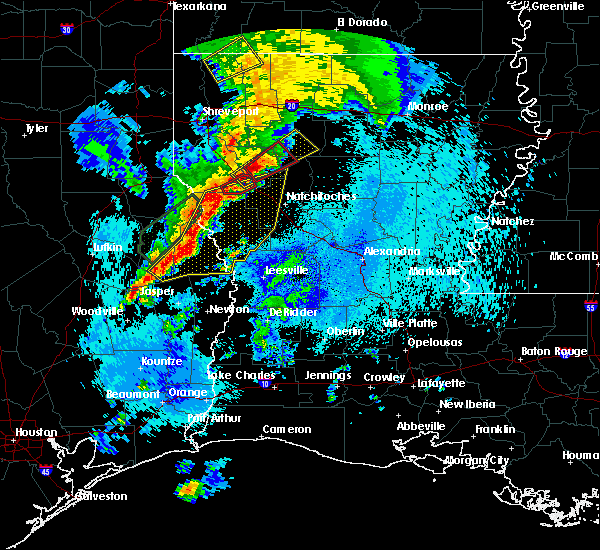 At 1237 am cdt, severe thunderstorms were located along a line extending from 7 miles north of converse to hemphill to 6 miles north of ebenezer, moving east at 40 mph (radar indicated). Hazards include 60 mph wind gusts. expect damage to roofs, siding, and trees At 1237 am cdt, severe thunderstorms were located along a line extending from 7 miles north of converse to hemphill to 6 miles north of ebenezer, moving east at 40 mph (radar indicated). Hazards include 60 mph wind gusts. expect damage to roofs, siding, and trees
|
| 4/13/2019 4:29 PM CDT |
 At 428 pm cdt, severe thunderstorms were located along a line extending from 15 miles southeast of ringgold to near campti to natchitoches to 8 miles north of kurthwood, moving east at 45 mph (radar indicated). Hazards include 60 mph wind gusts and quarter size hail. Hail damage to vehicles is expected. expect wind damage to roofs, siding, and trees. Locations impacted include, natchitoches, campti, provencal, natchez, martin, clarence, goldonna, saline, lucky, ashland, powhatan, kisatchie, melrose, grand ecore, bellwood, flora, black lake, chestnut, clear lake and creston. At 428 pm cdt, severe thunderstorms were located along a line extending from 15 miles southeast of ringgold to near campti to natchitoches to 8 miles north of kurthwood, moving east at 45 mph (radar indicated). Hazards include 60 mph wind gusts and quarter size hail. Hail damage to vehicles is expected. expect wind damage to roofs, siding, and trees. Locations impacted include, natchitoches, campti, provencal, natchez, martin, clarence, goldonna, saline, lucky, ashland, powhatan, kisatchie, melrose, grand ecore, bellwood, flora, black lake, chestnut, clear lake and creston.
|
| 4/13/2019 4:17 PM CDT |
 At 416 pm cdt, severe thunderstorms were located along a line extending from 11 miles south of ringgold to near campti to 9 miles west of natchitoches to 7 miles northwest of kurthwood, moving east at 50 mph (radar indicated). Hazards include 60 mph wind gusts and quarter size hail. Hail damage to vehicles is expected. expect wind damage to roofs, siding, and trees. Locations impacted include, natchitoches, coushatta, campti, allen, provencal, natchez, martin, clarence, goldonna, saline, lucky, ashland, edgefield, robeline, powhatan, lake end, kisatchie, melrose, bellwood and chestnut. At 416 pm cdt, severe thunderstorms were located along a line extending from 11 miles south of ringgold to near campti to 9 miles west of natchitoches to 7 miles northwest of kurthwood, moving east at 50 mph (radar indicated). Hazards include 60 mph wind gusts and quarter size hail. Hail damage to vehicles is expected. expect wind damage to roofs, siding, and trees. Locations impacted include, natchitoches, coushatta, campti, allen, provencal, natchez, martin, clarence, goldonna, saline, lucky, ashland, edgefield, robeline, powhatan, lake end, kisatchie, melrose, bellwood and chestnut.
|
| 4/13/2019 3:55 PM CDT |
 At 355 pm cdt, severe thunderstorms were located along a line extending from near coushatta to 12 miles northeast of zwolle to near many to 6 miles west of hornbeck, moving east at 45 mph (radar indicated). Hazards include 60 mph wind gusts and quarter size hail. Hail damage to vehicles is expected. Expect wind damage to roofs, siding, and trees. At 355 pm cdt, severe thunderstorms were located along a line extending from near coushatta to 12 miles northeast of zwolle to near many to 6 miles west of hornbeck, moving east at 45 mph (radar indicated). Hazards include 60 mph wind gusts and quarter size hail. Hail damage to vehicles is expected. Expect wind damage to roofs, siding, and trees.
|
| 4/13/2019 2:58 AM CDT |
 At 258 am cdt, a severe thunderstorm was located near natchitoches, moving northeast at 30 mph (radar indicated). Hazards include 60 mph wind gusts and half dollar size hail. Hail damage to vehicles is expected. Expect wind damage to roofs, siding, and trees. At 258 am cdt, a severe thunderstorm was located near natchitoches, moving northeast at 30 mph (radar indicated). Hazards include 60 mph wind gusts and half dollar size hail. Hail damage to vehicles is expected. Expect wind damage to roofs, siding, and trees.
|
| 4/13/2019 2:40 AM CDT |
 At 240 am cdt, a severe thunderstorm was located 7 miles north of flatwoods, or 8 miles northwest of lena, moving northeast at 45 mph (radar indicated). Hazards include golf ball size hail and 60 mph wind gusts. People and animals outdoors will be injured. expect hail damage to roofs, siding, windows, and vehicles. Expect wind damage to roofs, siding, and trees. At 240 am cdt, a severe thunderstorm was located 7 miles north of flatwoods, or 8 miles northwest of lena, moving northeast at 45 mph (radar indicated). Hazards include golf ball size hail and 60 mph wind gusts. People and animals outdoors will be injured. expect hail damage to roofs, siding, windows, and vehicles. Expect wind damage to roofs, siding, and trees.
|
| 4/7/2019 3:13 PM CDT |
 At 313 pm cdt, severe thunderstorms were located along a line extending from 7 miles west of winnfield to near natchitoches to 10 miles east of many, moving northwest at 40 mph (radar indicated). Hazards include 60 mph wind gusts and quarter size hail. Hail damage to vehicles is expected. Expect wind damage to roofs, siding, and trees. At 313 pm cdt, severe thunderstorms were located along a line extending from 7 miles west of winnfield to near natchitoches to 10 miles east of many, moving northwest at 40 mph (radar indicated). Hazards include 60 mph wind gusts and quarter size hail. Hail damage to vehicles is expected. Expect wind damage to roofs, siding, and trees.
|
| 4/7/2019 2:22 PM CDT |
 At 222 pm cdt, severe thunderstorms were located along a line extending from near lena to near hutton to slagle, moving northwest at 30 mph (radar indicated). Hazards include 60 mph wind gusts. expect damage to roofs, siding, and trees At 222 pm cdt, severe thunderstorms were located along a line extending from near lena to near hutton to slagle, moving northwest at 30 mph (radar indicated). Hazards include 60 mph wind gusts. expect damage to roofs, siding, and trees
|
| 4/6/2019 8:53 PM CDT |
 At 851 pm cdt, a severe thunderstorm was located near montgomery, or 11 miles southeast of natchitoches, moving northeast at 40 mph. other intense thunderstorms were developing in the same general vicinity along the red river valley (radar indicated). Hazards include golf ball size hail and 60 mph wind gusts. People and animals outdoors will be injured. expect hail damage to roofs, siding, windows, and vehicles. Expect wind damage to roofs, siding, and trees. At 851 pm cdt, a severe thunderstorm was located near montgomery, or 11 miles southeast of natchitoches, moving northeast at 40 mph. other intense thunderstorms were developing in the same general vicinity along the red river valley (radar indicated). Hazards include golf ball size hail and 60 mph wind gusts. People and animals outdoors will be injured. expect hail damage to roofs, siding, windows, and vehicles. Expect wind damage to roofs, siding, and trees.
|
| 4/6/2019 8:15 PM CDT | Quarter sized hail reported 14.8 miles NNW of Natchitoches, LA, quarter size hail near the cypress community via social media. |
| 4/6/2019 8:06 PM CDT |
 At 803 pm cdt, a severe thunderstorm was located 7 miles north of hutton, or 15 miles west of lena, moving north northeast at 40 mph. another intense storm has developed just east of natchitoches (radar indicated). Hazards include 60 mph wind gusts and quarter size hail. Hail damage to vehicles is expected. Expect wind damage to roofs, siding, and trees. At 803 pm cdt, a severe thunderstorm was located 7 miles north of hutton, or 15 miles west of lena, moving north northeast at 40 mph. another intense storm has developed just east of natchitoches (radar indicated). Hazards include 60 mph wind gusts and quarter size hail. Hail damage to vehicles is expected. Expect wind damage to roofs, siding, and trees.
|
| 4/6/2019 11:50 AM CDT | Quarter sized hail reported 12.4 miles NNW of Natchitoches, LA, fedex driver reported 1 hail along i-49 10 south of natchitoches. |
| 4/6/2019 11:44 AM CDT |
 At 1144 am cdt, a severe thunderstorm was located 8 miles east of montgomery, or 14 miles north of lena, moving northeast at 35 mph (radar indicated). Hazards include 60 mph wind gusts and quarter size hail. Hail damage to vehicles is expected. Expect wind damage to roofs, siding, and trees. At 1144 am cdt, a severe thunderstorm was located 8 miles east of montgomery, or 14 miles north of lena, moving northeast at 35 mph (radar indicated). Hazards include 60 mph wind gusts and quarter size hail. Hail damage to vehicles is expected. Expect wind damage to roofs, siding, and trees.
|
| 11/5/2018 5:03 PM CST |
 At 502 pm cst, a confirmed tornado was located 12 miles west of natchitoches, moving northeast at 35 mph (radar confirmed tornado). Hazards include damaging tornado. Flying debris will be dangerous to those caught without shelter. mobile homes will be damaged or destroyed. damage to roofs, windows, and vehicles will occur. tree damage is likely. Locations impacted include, allen and powhatan. At 502 pm cst, a confirmed tornado was located 12 miles west of natchitoches, moving northeast at 35 mph (radar confirmed tornado). Hazards include damaging tornado. Flying debris will be dangerous to those caught without shelter. mobile homes will be damaged or destroyed. damage to roofs, windows, and vehicles will occur. tree damage is likely. Locations impacted include, allen and powhatan.
|
| 11/5/2018 4:48 PM CST |
 At 447 pm cst, a confirmed tornado was located 13 miles north of many, or 20 miles west of natchitoches, moving northeast at 30 mph. a tornado is on the ground at this time. take cover immediately (law enforcement confirmed tornado). Hazards include damaging tornado. Flying debris will be dangerous to those caught without shelter. mobile homes will be damaged or destroyed. damage to roofs, windows, and vehicles will occur. tree damage is likely. This tornadic thunderstorm will remain over mainly rural areas of west central natchitoches and north central sabine parishes, including the following locations, allen, powhatan and marthaville. At 447 pm cst, a confirmed tornado was located 13 miles north of many, or 20 miles west of natchitoches, moving northeast at 30 mph. a tornado is on the ground at this time. take cover immediately (law enforcement confirmed tornado). Hazards include damaging tornado. Flying debris will be dangerous to those caught without shelter. mobile homes will be damaged or destroyed. damage to roofs, windows, and vehicles will occur. tree damage is likely. This tornadic thunderstorm will remain over mainly rural areas of west central natchitoches and north central sabine parishes, including the following locations, allen, powhatan and marthaville.
|
| 11/5/2018 4:37 PM CST | Trees reported down on route 71 and on harrisonburg r in winn county LA, 10.2 miles W of Natchitoches, LA |
| 11/5/2018 4:15 PM CST | Damage to roof of home and porch at the plantation point community and damage reported near fish hatchery roa in natchitoches county LA, 6.2 miles WNW of Natchitoches, LA |
| 11/5/2018 4:14 PM CST |
 At 414 pm cst, a confirmed tornado was located near natchitoches, moving northeast at 35 mph (law enforcement confirmed tornado). Hazards include damaging tornado. Flying debris will be dangerous to those caught without shelter. mobile homes will be damaged or destroyed. damage to roofs, windows, and vehicles will occur. tree damage is likely. this tornadic thunderstorm will remain over mainly rural areas of northwestern grant, central natchitoches and southwestern winn parishes, including the following locations, st. Maurice, natchez and clarence. At 414 pm cst, a confirmed tornado was located near natchitoches, moving northeast at 35 mph (law enforcement confirmed tornado). Hazards include damaging tornado. Flying debris will be dangerous to those caught without shelter. mobile homes will be damaged or destroyed. damage to roofs, windows, and vehicles will occur. tree damage is likely. this tornadic thunderstorm will remain over mainly rural areas of northwestern grant, central natchitoches and southwestern winn parishes, including the following locations, st. Maurice, natchez and clarence.
|
| 11/5/2018 4:08 PM CST |
 At 408 pm cst, a severe thunderstorm capable of producing a tornado was located near natchitoches, moving northeast at 35 mph (radar indicated rotation). Hazards include tornado. Flying debris will be dangerous to those caught without shelter. mobile homes will be damaged or destroyed. damage to roofs, windows, and vehicles will occur. tree damage is likely. this dangerous storm will be near, montgomery around 425 pm cst. other locations impacted by this tornadic thunderstorm include bermuda, st. Maurice, natchez and clarence. At 408 pm cst, a severe thunderstorm capable of producing a tornado was located near natchitoches, moving northeast at 35 mph (radar indicated rotation). Hazards include tornado. Flying debris will be dangerous to those caught without shelter. mobile homes will be damaged or destroyed. damage to roofs, windows, and vehicles will occur. tree damage is likely. this dangerous storm will be near, montgomery around 425 pm cst. other locations impacted by this tornadic thunderstorm include bermuda, st. Maurice, natchez and clarence.
|
| 7/29/2018 4:13 PM CDT | Trees and power lines down in the cit in natchitoches county LA, 2.3 miles WSW of Natchitoches, LA |
| 7/29/2018 3:46 PM CDT |
 At 346 pm cdt, severe thunderstorms were located along a line extending from 7 miles north of winnfield to near many, moving southeast at 30 mph (radar indicated). Hazards include 60 mph wind gusts. expect damage to roofs, siding, and trees At 346 pm cdt, severe thunderstorms were located along a line extending from 7 miles north of winnfield to near many, moving southeast at 30 mph (radar indicated). Hazards include 60 mph wind gusts. expect damage to roofs, siding, and trees
|
| 4/6/2018 9:55 PM CDT |
 At 955 pm cdt, severe thunderstorms were located along a line extending from 6 miles northeast of milam to 8 miles northwest of kurthwood to near boyce to 10 miles north of ball to walters, moving southeast at 25 mph (radar indicated). Hazards include 60 mph wind gusts. expect damage to roofs, siding, and trees At 955 pm cdt, severe thunderstorms were located along a line extending from 6 miles northeast of milam to 8 miles northwest of kurthwood to near boyce to 10 miles north of ball to walters, moving southeast at 25 mph (radar indicated). Hazards include 60 mph wind gusts. expect damage to roofs, siding, and trees
|
| 4/6/2018 8:56 PM CDT |
 At 856 pm cdt, severe thunderstorms were located along a line extending from 6 miles west of zwolle to 10 miles east of many to 7 miles northeast of montgomery to near olla, moving southeast at 35 mph (radar indicated). Hazards include 60 mph wind gusts and quarter size hail. Hail damage to vehicles is expected. Expect wind damage to roofs, siding, and trees. At 856 pm cdt, severe thunderstorms were located along a line extending from 6 miles west of zwolle to 10 miles east of many to 7 miles northeast of montgomery to near olla, moving southeast at 35 mph (radar indicated). Hazards include 60 mph wind gusts and quarter size hail. Hail damage to vehicles is expected. Expect wind damage to roofs, siding, and trees.
|
| 4/6/2018 7:59 PM CDT |
 At 758 pm cdt, severe thunderstorms were located along a line extending from 9 miles west of campti to 7 miles northeast of natchitoches to 14 miles southwest of jonesboro, moving southeast at 45 mph (radar indicated). Hazards include 60 mph wind gusts and half dollar size hail. Hail damage to vehicles is expected. Expect wind damage to roofs, siding, and trees. At 758 pm cdt, severe thunderstorms were located along a line extending from 9 miles west of campti to 7 miles northeast of natchitoches to 14 miles southwest of jonesboro, moving southeast at 45 mph (radar indicated). Hazards include 60 mph wind gusts and half dollar size hail. Hail damage to vehicles is expected. Expect wind damage to roofs, siding, and trees.
|
| 4/3/2018 6:00 PM CDT |
 At 559 pm cdt, severe thunderstorms were located along a line extending from near montgomery to near toledo bend dam, moving east at 50 mph (radar indicated). Hazards include 60 mph wind gusts and quarter size hail. Hail damage to vehicles is expected. Expect wind damage to roofs, siding, and trees. At 559 pm cdt, severe thunderstorms were located along a line extending from near montgomery to near toledo bend dam, moving east at 50 mph (radar indicated). Hazards include 60 mph wind gusts and quarter size hail. Hail damage to vehicles is expected. Expect wind damage to roofs, siding, and trees.
|
| 4/3/2018 5:33 PM CDT |
 At 532 pm cdt, severe thunderstorms were located along a line extending from 8 miles west of natchitoches to 6 miles north of mayflower, moving east at 30 mph (radar indicated). Hazards include 60 mph wind gusts and penny size hail. Expect damage to roofs, siding, and trees. Locations impacted include, natchitoches, milam, many, san augustine, zwolle, hemphill, pineland, montgomery, patroon, bland lake, neuville, rosevine, macune, florien, provencal, natchez, huxley, noble, fisher and broaddus. At 532 pm cdt, severe thunderstorms were located along a line extending from 8 miles west of natchitoches to 6 miles north of mayflower, moving east at 30 mph (radar indicated). Hazards include 60 mph wind gusts and penny size hail. Expect damage to roofs, siding, and trees. Locations impacted include, natchitoches, milam, many, san augustine, zwolle, hemphill, pineland, montgomery, patroon, bland lake, neuville, rosevine, macune, florien, provencal, natchez, huxley, noble, fisher and broaddus.
|
| 4/3/2018 5:30 PM CDT |
 At 529 pm cdt, severe thunderstorms were located along a line extending from near jonesboro to near natchitoches, moving east at 55 mph (radar indicated). Hazards include 60 mph wind gusts and penny size hail. expect damage to roofs, siding, and trees At 529 pm cdt, severe thunderstorms were located along a line extending from near jonesboro to near natchitoches, moving east at 55 mph (radar indicated). Hazards include 60 mph wind gusts and penny size hail. expect damage to roofs, siding, and trees
|
| 4/3/2018 5:14 PM CDT |
 At 514 pm cdt, severe thunderstorms were located along a line extending from 12 miles north of many to near pineland, moving southeast at 20 mph (radar indicated). Hazards include 60 mph wind gusts and quarter size hail. Hail damage to vehicles is expected. Expect wind damage to roofs, siding, and trees. At 514 pm cdt, severe thunderstorms were located along a line extending from 12 miles north of many to near pineland, moving southeast at 20 mph (radar indicated). Hazards include 60 mph wind gusts and quarter size hail. Hail damage to vehicles is expected. Expect wind damage to roofs, siding, and trees.
|
| 4/3/2018 4:44 PM CDT |
 At 444 pm cdt, severe thunderstorms were located along a line extending from 11 miles southwest of ringgold to near converse, moving east at 60 mph (radar indicated). Hazards include 60 mph wind gusts and quarter size hail. Hail damage to vehicles is expected. Expect wind damage to roofs, siding, and trees. At 444 pm cdt, severe thunderstorms were located along a line extending from 11 miles southwest of ringgold to near converse, moving east at 60 mph (radar indicated). Hazards include 60 mph wind gusts and quarter size hail. Hail damage to vehicles is expected. Expect wind damage to roofs, siding, and trees.
|
| 3/28/2018 3:01 PM CDT |
 The national weather service in shreveport has issued a * severe thunderstorm warning for. southern jackson parish in north central louisiana. northeastern natchitoches parish in northwestern louisiana. southeastern bienville parish in northwestern louisiana. Winn parish in north central louisiana. The national weather service in shreveport has issued a * severe thunderstorm warning for. southern jackson parish in north central louisiana. northeastern natchitoches parish in northwestern louisiana. southeastern bienville parish in northwestern louisiana. Winn parish in north central louisiana.
|
| 3/18/2018 9:21 PM CDT |
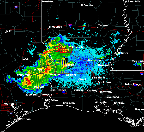 At 921 pm cdt, a severe thunderstorm capable of producing a tornado was located 9 miles northeast of many, or 17 miles west of natchitoches, moving east at 25 mph (radar indicated rotation). Hazards include tornado and ping pong ball size hail. Flying debris will be dangerous to those caught without shelter. mobile homes will be damaged or destroyed. damage to roofs, windows, and vehicles will occur. tree damage is likely. this dangerous storm will be near, natchitoches around 1005 pm cdt. Other locations impacted by this tornadic thunderstorm include bermuda, robeline, natchez, marthaville, provencal and hagewood. At 921 pm cdt, a severe thunderstorm capable of producing a tornado was located 9 miles northeast of many, or 17 miles west of natchitoches, moving east at 25 mph (radar indicated rotation). Hazards include tornado and ping pong ball size hail. Flying debris will be dangerous to those caught without shelter. mobile homes will be damaged or destroyed. damage to roofs, windows, and vehicles will occur. tree damage is likely. this dangerous storm will be near, natchitoches around 1005 pm cdt. Other locations impacted by this tornadic thunderstorm include bermuda, robeline, natchez, marthaville, provencal and hagewood.
|
| 12/20/2017 12:53 AM CST |
 At 1253 am cst, a severe thunderstorm was located near campti, or 12 miles north of natchitoches, moving east at 45 mph (radar indicated). Hazards include 60 mph wind gusts. Expect damage to roofs, siding, and trees. Locations impacted include, clarence, goldonna, calvin, clear lake, creston and grand ecore. At 1253 am cst, a severe thunderstorm was located near campti, or 12 miles north of natchitoches, moving east at 45 mph (radar indicated). Hazards include 60 mph wind gusts. Expect damage to roofs, siding, and trees. Locations impacted include, clarence, goldonna, calvin, clear lake, creston and grand ecore.
|
| 7/23/2017 5:29 PM CDT |
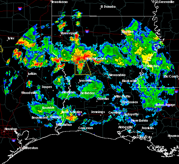 At 528 pm cdt, a severe thunderstorm was located 9 miles southwest of natchitoches, moving south at 35 mph (radar indicated). Hazards include 60 mph wind gusts. expect damage to roofs, siding, and trees At 528 pm cdt, a severe thunderstorm was located 9 miles southwest of natchitoches, moving south at 35 mph (radar indicated). Hazards include 60 mph wind gusts. expect damage to roofs, siding, and trees
|
| 5/28/2017 7:55 PM CDT | Reported at natchitoches regional airport awo in natchitoches county LA, 2.5 miles NW of Natchitoches, LA |
| 5/28/2017 7:43 PM CDT |
 At 742 pm cdt, severe thunderstorms were located along a line extending from 11 miles south of arcadia to 15 miles west of jonesboro to 19 miles east of coushatta to near campti to 7 miles southwest of natchitoches, moving northeast at 30 mph (radar indicated). Hazards include 70 mph wind gusts and quarter size hail. Hail damage to vehicles is expected. expect considerable tree damage. Wind damage is also likely to mobile homes, roofs, and outbuildings. At 742 pm cdt, severe thunderstorms were located along a line extending from 11 miles south of arcadia to 15 miles west of jonesboro to 19 miles east of coushatta to near campti to 7 miles southwest of natchitoches, moving northeast at 30 mph (radar indicated). Hazards include 70 mph wind gusts and quarter size hail. Hail damage to vehicles is expected. expect considerable tree damage. Wind damage is also likely to mobile homes, roofs, and outbuildings.
|
| 5/28/2017 7:30 PM CDT |
 At 730 pm cdt, a severe thunderstorm capable of producing a tornado was located near campti, or near natchitoches, moving east at 50 mph (radar indicated rotation). Hazards include tornado and quarter size hail. Flying debris will be dangerous to those caught without shelter. mobile homes will be damaged or destroyed. damage to roofs, windows, and vehicles will occur. tree damage is likely. this dangerous storm will be near, montgomery around 750 pm cdt. other locations impacted by this tornadic thunderstorm include melrose, robeline, provencal, grand ecore, natchez, st. Maurice, clarence, joyce, flora and atlanta. At 730 pm cdt, a severe thunderstorm capable of producing a tornado was located near campti, or near natchitoches, moving east at 50 mph (radar indicated rotation). Hazards include tornado and quarter size hail. Flying debris will be dangerous to those caught without shelter. mobile homes will be damaged or destroyed. damage to roofs, windows, and vehicles will occur. tree damage is likely. this dangerous storm will be near, montgomery around 750 pm cdt. other locations impacted by this tornadic thunderstorm include melrose, robeline, provencal, grand ecore, natchez, st. Maurice, clarence, joyce, flora and atlanta.
|
| 5/28/2017 6:51 PM CDT |
 At 651 pm cdt, severe thunderstorms were located along a line extending from near doyline to 8 miles northeast of converse, moving east at 60 mph (radar indicated). Hazards include 60 mph wind gusts and quarter size hail. Hail damage to vehicles is expected. Expect wind damage to roofs, siding, and trees. At 651 pm cdt, severe thunderstorms were located along a line extending from near doyline to 8 miles northeast of converse, moving east at 60 mph (radar indicated). Hazards include 60 mph wind gusts and quarter size hail. Hail damage to vehicles is expected. Expect wind damage to roofs, siding, and trees.
|
| 5/3/2017 6:09 PM CDT |
 The severe thunderstorm warning for southeastern webster, northern natchitoches, bienville and western winn parishes will expire at 615 pm cdt, the storms which prompted the warning have weakened below severe limits, and have exited the warned area. therefore the warning will be allowed to expire. a severe thunderstorm watch remains in effect until midnight cdt for northwestern louisiana. The severe thunderstorm warning for southeastern webster, northern natchitoches, bienville and western winn parishes will expire at 615 pm cdt, the storms which prompted the warning have weakened below severe limits, and have exited the warned area. therefore the warning will be allowed to expire. a severe thunderstorm watch remains in effect until midnight cdt for northwestern louisiana.
|
| 5/3/2017 5:52 PM CDT |
 At 552 pm cdt, severe thunderstorms were located along a line extending from 6 miles south of gibsland to 18 miles southwest of jonesboro to near campti to 6 miles west of natchitoches, moving east at 55 mph (radar indicated). Hazards include 60 mph wind gusts and quarter size hail. Hail damage to vehicles is expected. expect wind damage to roofs, siding, and trees. locations impacted include, natchitoches, campti, natchez, clarence, goldonna, saline, lucky, ashland, castor, calvin, bienville, robeline, jamestown, bryceland, mount lebanon, brice, st. Maurice, friendship, liberty hill and sailes. At 552 pm cdt, severe thunderstorms were located along a line extending from 6 miles south of gibsland to 18 miles southwest of jonesboro to near campti to 6 miles west of natchitoches, moving east at 55 mph (radar indicated). Hazards include 60 mph wind gusts and quarter size hail. Hail damage to vehicles is expected. expect wind damage to roofs, siding, and trees. locations impacted include, natchitoches, campti, natchez, clarence, goldonna, saline, lucky, ashland, castor, calvin, bienville, robeline, jamestown, bryceland, mount lebanon, brice, st. Maurice, friendship, liberty hill and sailes.
|
| 5/3/2017 5:28 PM CDT |
 At 528 pm cdt, severe thunderstorms were located along a line extending from near doyline to near coushatta to 19 miles west of campti to 7 miles east of converse, moving east at 60 mph (radar indicated). Hazards include 60 mph wind gusts and quarter size hail. Hail damage to vehicles is expected. Expect wind damage to roofs, siding, and trees. At 528 pm cdt, severe thunderstorms were located along a line extending from near doyline to near coushatta to 19 miles west of campti to 7 miles east of converse, moving east at 60 mph (radar indicated). Hazards include 60 mph wind gusts and quarter size hail. Hail damage to vehicles is expected. Expect wind damage to roofs, siding, and trees.
|
| 4/30/2017 7:38 AM CDT | Trees reported down parish wide in natchitoches parish... tree down and power lines on hwy 494 past first churc in natchitoches county LA, 1.5 miles WSW of Natchitoches, LA |
| 4/29/2017 2:24 PM CDT | Trees dow in natchitoches county LA, 1.5 miles SSW of Natchitoches, LA |
| 4/29/2017 2:23 PM CDT |
 At 222 pm cdt, a severe thunderstorm was located near natchitoches, moving northeast at 35 mph (radar indicated). Hazards include 60 mph wind gusts possible. expect wind damage to roofs, siding, and trees At 222 pm cdt, a severe thunderstorm was located near natchitoches, moving northeast at 35 mph (radar indicated). Hazards include 60 mph wind gusts possible. expect wind damage to roofs, siding, and trees
|
| 4/29/2017 2:13 PM CDT |
 At 212 pm cdt, a severe thunderstorm capable of producing a tornado was located 7 miles southwest of natchitoches, moving northeast at 35 mph (radar indicated rotation). Hazards include tornado and quarter size hail. Flying debris will be dangerous to those caught without shelter. mobile homes will be damaged or destroyed. damage to roofs, windows, and vehicles will occur. tree damage is likely. this dangerous storm will be near, natchitoches around 230 pm cdt. campti around 240 pm cdt. other locations impacted by this tornadic thunderstorm include robeline, provencal, grand ecore, natchez, allen, st. Maurice, clarence, flora, black lake and clear lake. At 212 pm cdt, a severe thunderstorm capable of producing a tornado was located 7 miles southwest of natchitoches, moving northeast at 35 mph (radar indicated rotation). Hazards include tornado and quarter size hail. Flying debris will be dangerous to those caught without shelter. mobile homes will be damaged or destroyed. damage to roofs, windows, and vehicles will occur. tree damage is likely. this dangerous storm will be near, natchitoches around 230 pm cdt. campti around 240 pm cdt. other locations impacted by this tornadic thunderstorm include robeline, provencal, grand ecore, natchez, allen, st. Maurice, clarence, flora, black lake and clear lake.
|
| 4/29/2017 1:51 PM CDT |
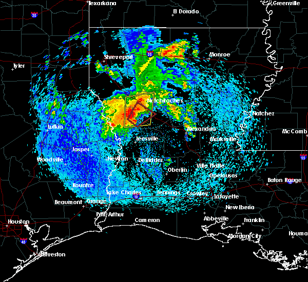 At 150 pm cdt, a severe thunderstorm capable of producing a tornado was located 12 miles east of many, or 18 miles north of anacoco, moving northeast at 25 mph (radar indicated rotation). Hazards include tornado and quarter size hail. Flying debris will be dangerous to those caught without shelter. mobile homes will be damaged or destroyed. damage to roofs, windows, and vehicles will occur. Tree damage is likely. At 150 pm cdt, a severe thunderstorm capable of producing a tornado was located 12 miles east of many, or 18 miles north of anacoco, moving northeast at 25 mph (radar indicated rotation). Hazards include tornado and quarter size hail. Flying debris will be dangerous to those caught without shelter. mobile homes will be damaged or destroyed. damage to roofs, windows, and vehicles will occur. Tree damage is likely.
|
| 4/29/2017 1:31 PM CDT |
 At 130 pm cdt, a severe thunderstorm was located 7 miles northeast of many, or 18 miles southwest of natchitoches, moving north northeast at 40 mph (radar indicated). Hazards include 60 mph wind gusts and quarter size hail. Hail damage to vehicles is expected. Expect wind damage to roofs, siding, and trees. At 130 pm cdt, a severe thunderstorm was located 7 miles northeast of many, or 18 miles southwest of natchitoches, moving north northeast at 40 mph (radar indicated). Hazards include 60 mph wind gusts and quarter size hail. Hail damage to vehicles is expected. Expect wind damage to roofs, siding, and trees.
|
| 4/26/2017 6:07 PM CDT |
 At 606 pm cdt, severe thunderstorms were located along a line extending from 11 miles northeast of many to 7 miles northwest of mayflower, moving east at 25 mph (radar indicated). Hazards include 60 mph wind gusts and nickel size hail. Expect damage to roofs, siding, and trees. locations impacted include, natchitoches, many, montgomery, florien, provencal, natchez, fisher, robeline, kisatchie, cloutierville, melrose, fairmount, mount carmel, bellwood, negreet, flora, columbus, bermuda and gorum. A tornado watch remains in effect until 1100 pm cdt for north central and northwestern louisiana, and eastern texas. At 606 pm cdt, severe thunderstorms were located along a line extending from 11 miles northeast of many to 7 miles northwest of mayflower, moving east at 25 mph (radar indicated). Hazards include 60 mph wind gusts and nickel size hail. Expect damage to roofs, siding, and trees. locations impacted include, natchitoches, many, montgomery, florien, provencal, natchez, fisher, robeline, kisatchie, cloutierville, melrose, fairmount, mount carmel, bellwood, negreet, flora, columbus, bermuda and gorum. A tornado watch remains in effect until 1100 pm cdt for north central and northwestern louisiana, and eastern texas.
|
| 4/26/2017 5:29 PM CDT |
 At 529 pm cdt, severe thunderstorms were located along a line extending from near zwolle to 6 miles northeast of ebenezer, moving east at 50 mph (radar indicated). Hazards include 60 mph wind gusts and nickel size hail. expect damage to roofs, siding, and trees At 529 pm cdt, severe thunderstorms were located along a line extending from near zwolle to 6 miles northeast of ebenezer, moving east at 50 mph (radar indicated). Hazards include 60 mph wind gusts and nickel size hail. expect damage to roofs, siding, and trees
|
| 4/2/2017 3:36 PM CDT |
 At 336 pm cdt, severe thunderstorms were located along a line extending from 8 miles southwest of jonesboro to 7 miles southwest of natchitoches to near kurthwood, moving east at 40 mph (radar indicated). Hazards include 60 mph wind gusts and quarter size hail. Hail damage to vehicles is expected. Expect wind damage to roofs, siding, and trees. At 336 pm cdt, severe thunderstorms were located along a line extending from 8 miles southwest of jonesboro to 7 miles southwest of natchitoches to near kurthwood, moving east at 40 mph (radar indicated). Hazards include 60 mph wind gusts and quarter size hail. Hail damage to vehicles is expected. Expect wind damage to roofs, siding, and trees.
|
| 4/2/2017 3:14 PM CDT |
 At 314 pm cdt, severe thunderstorms were located along a line extending from 10 miles southeast of ringgold to near toledo bend dam, moving east at 40 mph (radar indicated). Hazards include 70 mph wind gusts and quarter size hail. Hail damage to vehicles is expected. expect considerable tree damage. wind damage is also likely to mobile homes, roofs, and outbuildings. locations impacted include, natchitoches, many, coushatta, campti, allen, florien, provencal, natchez, martin, clarence, ashland, fisher, robeline, powhatan, lake end, kisatchie, bellwood, hanna, chestnut and marthaville. A tornado watch remains in effect until 900 pm cdt for northwestern louisiana. At 314 pm cdt, severe thunderstorms were located along a line extending from 10 miles southeast of ringgold to near toledo bend dam, moving east at 40 mph (radar indicated). Hazards include 70 mph wind gusts and quarter size hail. Hail damage to vehicles is expected. expect considerable tree damage. wind damage is also likely to mobile homes, roofs, and outbuildings. locations impacted include, natchitoches, many, coushatta, campti, allen, florien, provencal, natchez, martin, clarence, ashland, fisher, robeline, powhatan, lake end, kisatchie, bellwood, hanna, chestnut and marthaville. A tornado watch remains in effect until 900 pm cdt for northwestern louisiana.
|
| 4/2/2017 2:41 PM CDT |
 At 241 pm cdt, severe thunderstorms were located along a line extending from 11 miles northeast of mansfield to near mayflower, moving east at 40 mph (radar indicated). Hazards include 70 mph wind gusts and quarter size hail. Hail damage to vehicles is expected. expect considerable tree damage. Wind damage is also likely to mobile homes, roofs, and outbuildings. At 241 pm cdt, severe thunderstorms were located along a line extending from 11 miles northeast of mansfield to near mayflower, moving east at 40 mph (radar indicated). Hazards include 70 mph wind gusts and quarter size hail. Hail damage to vehicles is expected. expect considerable tree damage. Wind damage is also likely to mobile homes, roofs, and outbuildings.
|
| 3/29/2017 6:25 PM CDT | Tree down along cele cook driv in natchitoches county LA, 2.2 miles SSE of Natchitoches, LA |
| 3/29/2017 6:21 PM CDT |
 At 621 pm cdt, a severe thunderstorm was located 7 miles north of kurthwood, or 16 miles northeast of anacoco, moving northeast at 55 mph (radar indicated). Hazards include 60 mph wind gusts and quarter size hail. Hail damage to vehicles is expected. Expect wind damage to roofs, siding, and trees. At 621 pm cdt, a severe thunderstorm was located 7 miles north of kurthwood, or 16 miles northeast of anacoco, moving northeast at 55 mph (radar indicated). Hazards include 60 mph wind gusts and quarter size hail. Hail damage to vehicles is expected. Expect wind damage to roofs, siding, and trees.
|
| 3/29/2017 5:47 PM CDT |
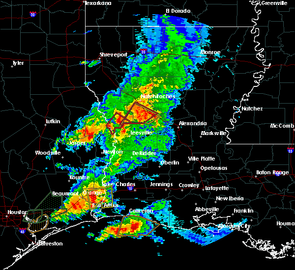 At 546 pm cdt, a severe thunderstorm capable of producing a tornado was located 11 miles north of kurthwood, or 18 miles south of natchitoches, moving northeast at 25 mph (radar indicated rotation). Hazards include tornado. Flying debris will be dangerous to those caught without shelter. mobile homes will be damaged or destroyed. damage to roofs, windows, and vehicles will occur. tree damage is likely. Locations impacted include, natchitoches, provencal, kisatchie, cloutierville, melrose, flora, bellwood, chopin and gorum. At 546 pm cdt, a severe thunderstorm capable of producing a tornado was located 11 miles north of kurthwood, or 18 miles south of natchitoches, moving northeast at 25 mph (radar indicated rotation). Hazards include tornado. Flying debris will be dangerous to those caught without shelter. mobile homes will be damaged or destroyed. damage to roofs, windows, and vehicles will occur. tree damage is likely. Locations impacted include, natchitoches, provencal, kisatchie, cloutierville, melrose, flora, bellwood, chopin and gorum.
|
| 3/29/2017 5:23 PM CDT |
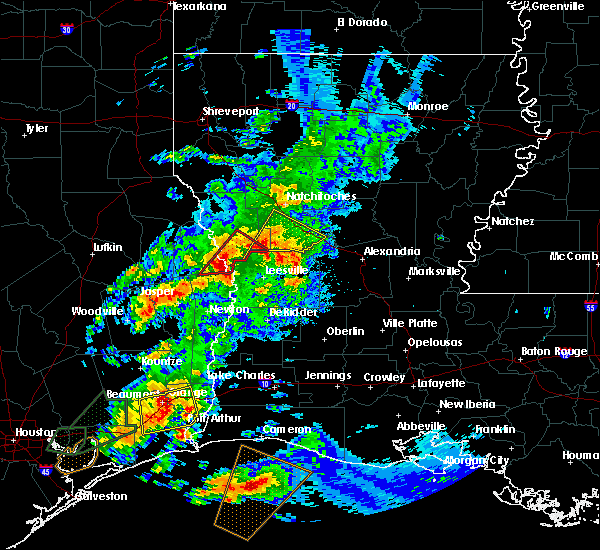 At 522 pm cdt, a severe thunderstorm capable of producing a tornado was located near hornbeck, or 7 miles north of anacoco, moving northeast at 30 mph (radar indicated rotation). Hazards include tornado and quarter size hail. Flying debris will be dangerous to those caught without shelter. mobile homes will be damaged or destroyed. damage to roofs, windows, and vehicles will occur. Tree damage is likely. At 522 pm cdt, a severe thunderstorm capable of producing a tornado was located near hornbeck, or 7 miles north of anacoco, moving northeast at 30 mph (radar indicated rotation). Hazards include tornado and quarter size hail. Flying debris will be dangerous to those caught without shelter. mobile homes will be damaged or destroyed. damage to roofs, windows, and vehicles will occur. Tree damage is likely.
|
| 3/29/2017 5:14 PM CDT |
 At 514 pm cdt, a severe thunderstorm was located near anacoco, moving northeast at 30 mph (radar indicated). Hazards include 60 mph wind gusts and quarter size hail. Hail damage to vehicles is expected. Expect wind damage to roofs, siding, and trees. At 514 pm cdt, a severe thunderstorm was located near anacoco, moving northeast at 30 mph (radar indicated). Hazards include 60 mph wind gusts and quarter size hail. Hail damage to vehicles is expected. Expect wind damage to roofs, siding, and trees.
|
| 3/25/2017 12:00 AM CDT |
 At 1200 am cdt, severe thunderstorms were located along a line extending from 6 miles north of jonesboro to 24 miles northwest of olla to 6 miles southwest of winnfield to near natchitoches to 14 miles west of montgomery to 9 miles northwest of kurthwood, moving northeast at 40 mph (radar indicated). Hazards include 60 mph wind gusts. expect damage to roofs, siding, and trees At 1200 am cdt, severe thunderstorms were located along a line extending from 6 miles north of jonesboro to 24 miles northwest of olla to 6 miles southwest of winnfield to near natchitoches to 14 miles west of montgomery to 9 miles northwest of kurthwood, moving northeast at 40 mph (radar indicated). Hazards include 60 mph wind gusts. expect damage to roofs, siding, and trees
|
| 3/24/2017 11:36 PM CDT |
 At 1136 pm cdt, severe thunderstorms were located along a line extending from 13 miles south of arcadia to 13 miles northwest of winnfield to 9 miles north of montgomery to 12 miles east of many to 10 miles west of hornbeck, moving northeast at 35 mph (radar indicated). Hazards include 60 mph wind gusts. Expect damage to roofs, siding, and trees. locations impacted include, natchitoches, winnfield, jonesboro, many, campti, montgomery, allen, florien, provencal, natchez, clarence, hodge, goldonna, north hodge, dodson, east hodge, saline, lucky, ashland and calvin. A tornado watch remains in effect until 300 am cdt for north central and northwestern louisiana. At 1136 pm cdt, severe thunderstorms were located along a line extending from 13 miles south of arcadia to 13 miles northwest of winnfield to 9 miles north of montgomery to 12 miles east of many to 10 miles west of hornbeck, moving northeast at 35 mph (radar indicated). Hazards include 60 mph wind gusts. Expect damage to roofs, siding, and trees. locations impacted include, natchitoches, winnfield, jonesboro, many, campti, montgomery, allen, florien, provencal, natchez, clarence, hodge, goldonna, north hodge, dodson, east hodge, saline, lucky, ashland and calvin. A tornado watch remains in effect until 300 am cdt for north central and northwestern louisiana.
|
| 3/24/2017 11:05 PM CDT | Several trees and power lines down as well as some structures damaged along highway 504 and 8 mile loo in natchitoches county LA, 2 miles SE of Natchitoches, LA |
| 3/24/2017 11:05 PM CDT | Several trees and power lines down as well as several structures with damage in the hagewood area along highway 11 in natchitoches county LA, 6.4 miles ENE of Natchitoches, LA |
| 3/24/2017 11:03 PM CDT |
 At 1103 pm cdt, severe thunderstorms capable of producing both tornadoes and extensive straight line wind damage were located 5 miles west of natchitoches, moving northeast at 45 mph (radar indicated rotation). Hazards include tornado. Flying debris will be dangerous to those caught without shelter. mobile homes will be damaged or destroyed. damage to roofs, windows, and vehicles will occur. tree damage is likely. these dangerous storms will be near, natchitoches around 1110 pm cdt. other locations impacted by this tornadic thunderstorm include calvin, grand ecore, clear lake, st. Maurice, clarence, hagewood, provencal and atlanta. At 1103 pm cdt, severe thunderstorms capable of producing both tornadoes and extensive straight line wind damage were located 5 miles west of natchitoches, moving northeast at 45 mph (radar indicated rotation). Hazards include tornado. Flying debris will be dangerous to those caught without shelter. mobile homes will be damaged or destroyed. damage to roofs, windows, and vehicles will occur. tree damage is likely. these dangerous storms will be near, natchitoches around 1110 pm cdt. other locations impacted by this tornadic thunderstorm include calvin, grand ecore, clear lake, st. Maurice, clarence, hagewood, provencal and atlanta.
|
| 3/24/2017 11:00 PM CDT |
 At 1100 pm cdt, severe thunderstorms were located along a line extending from 9 miles north of coushatta to 6 miles west of campti to 10 miles southwest of natchitoches to 7 miles northwest of hornbeck, moving east at 40 mph (radar indicated). Hazards include 60 mph wind gusts. expect damage to roofs, siding, and trees At 1100 pm cdt, severe thunderstorms were located along a line extending from 9 miles north of coushatta to 6 miles west of campti to 10 miles southwest of natchitoches to 7 miles northwest of hornbeck, moving east at 40 mph (radar indicated). Hazards include 60 mph wind gusts. expect damage to roofs, siding, and trees
|
| 3/24/2017 10:29 PM CDT |
 At 1029 pm cdt, severe thunderstorms were located along a line extending from 6 miles south of mansfield to near converse to near zwolle to 8 miles southeast of milam, moving northeast at 60 mph (radar indicated). Hazards include 60 mph wind gusts. Expect damage to roofs, siding, and trees. locations impacted include, natchitoches, milam, many, coushatta, zwolle, hemphill, pineland, converse, allen, oak grove, pleasant hill, florien, provencal, martin, noble, fisher, edgefield, robeline, powhatan and lake end. A tornado watch remains in effect until 300 am cdt for northwestern louisiana, and eastern texas. At 1029 pm cdt, severe thunderstorms were located along a line extending from 6 miles south of mansfield to near converse to near zwolle to 8 miles southeast of milam, moving northeast at 60 mph (radar indicated). Hazards include 60 mph wind gusts. Expect damage to roofs, siding, and trees. locations impacted include, natchitoches, milam, many, coushatta, zwolle, hemphill, pineland, converse, allen, oak grove, pleasant hill, florien, provencal, martin, noble, fisher, edgefield, robeline, powhatan and lake end. A tornado watch remains in effect until 300 am cdt for northwestern louisiana, and eastern texas.
|
| 3/24/2017 10:13 PM CDT |
 At 1013 pm cdt, severe thunderstorms were located along a line extending from 11 miles southeast of logansport to 7 miles southwest of converse to 6 miles north of milam to near hemphill, moving northeast at 55 mph (radar indicated). Hazards include 60 mph wind gusts. expect damage to roofs, siding, and trees At 1013 pm cdt, severe thunderstorms were located along a line extending from 11 miles southeast of logansport to 7 miles southwest of converse to 6 miles north of milam to near hemphill, moving northeast at 55 mph (radar indicated). Hazards include 60 mph wind gusts. expect damage to roofs, siding, and trees
|
| 1/21/2017 5:55 PM CST | *** 1 inj *** two homes destroyed along patrick road and hwy 494. a man has a broken ar in natchitoches county LA, 7 miles WNW of Natchitoches, LA |
| 1/21/2017 5:54 PM CST |
 At 554 pm cst, a severe thunderstorm capable of producing a tornado was located 8 miles north of montgomery, or 10 miles east of natchitoches, moving northeast at 35 mph (radar indicated rotation). Hazards include tornado and quarter size hail. Flying debris will be dangerous to those caught without shelter. mobile homes will be damaged or destroyed. damage to roofs, windows, and vehicles will occur. tree damage is likely. locations impacted include, natchitoches, natchez, clarence, atlanta and st. Maurice. At 554 pm cst, a severe thunderstorm capable of producing a tornado was located 8 miles north of montgomery, or 10 miles east of natchitoches, moving northeast at 35 mph (radar indicated rotation). Hazards include tornado and quarter size hail. Flying debris will be dangerous to those caught without shelter. mobile homes will be damaged or destroyed. damage to roofs, windows, and vehicles will occur. tree damage is likely. locations impacted include, natchitoches, natchez, clarence, atlanta and st. Maurice.
|
| 1/21/2017 5:37 PM CST |
 At 536 pm cst, a severe thunderstorm capable of producing a tornado was located near natchitoches, moving northeast at 35 mph (radar indicated rotation). Hazards include tornado and quarter size hail. Flying debris will be dangerous to those caught without shelter. mobile homes will be damaged or destroyed. damage to roofs, windows, and vehicles will occur. Tree damage is likely. At 536 pm cst, a severe thunderstorm capable of producing a tornado was located near natchitoches, moving northeast at 35 mph (radar indicated rotation). Hazards include tornado and quarter size hail. Flying debris will be dangerous to those caught without shelter. mobile homes will be damaged or destroyed. damage to roofs, windows, and vehicles will occur. Tree damage is likely.
|
| 1/2/2017 10:46 AM CST |
 At 1045 am cst, severe thunderstorms were located along a line extending from 15 miles northeast of coushatta to 9 miles northeast of natchitoches to near flatwoods, moving east at 50 mph (radar indicated). Hazards include 70 mph wind gusts and nickel size hail. Expect considerable tree damage. damage is likely to mobile homes, roofs, and outbuildings. locations impacted include, natchitoches, colfax, campti, montgomery, natchez, martin, clarence, goldonna, saline, lucky, ashland, calvin, atlanta, cloutierville, melrose, chopin, st. maurice, chestnut, clear lake and gorum. A tornado watch remains in effect until 200 pm cst for north central and northwestern louisiana. At 1045 am cst, severe thunderstorms were located along a line extending from 15 miles northeast of coushatta to 9 miles northeast of natchitoches to near flatwoods, moving east at 50 mph (radar indicated). Hazards include 70 mph wind gusts and nickel size hail. Expect considerable tree damage. damage is likely to mobile homes, roofs, and outbuildings. locations impacted include, natchitoches, colfax, campti, montgomery, natchez, martin, clarence, goldonna, saline, lucky, ashland, calvin, atlanta, cloutierville, melrose, chopin, st. maurice, chestnut, clear lake and gorum. A tornado watch remains in effect until 200 pm cst for north central and northwestern louisiana.
|
| 1/2/2017 10:42 AM CST | Large tree down across highway 1 just north of cypress in natchitoches county LA, 9.4 miles NNW of Natchitoches, LA |
| 1/2/2017 10:18 AM CST |
 At 1018 am cst, severe thunderstorms were located along a line extending from 7 miles west of coushatta to 13 miles west of natchitoches to near kurthwood, moving east at 50 mph (radar indicated). Hazards include 70 mph wind gusts and quarter size hail. Hail damage to vehicles is expected. expect considerable tree damage. Wind damage is also likely to mobile homes, roofs, and outbuildings. At 1018 am cst, severe thunderstorms were located along a line extending from 7 miles west of coushatta to 13 miles west of natchitoches to near kurthwood, moving east at 50 mph (radar indicated). Hazards include 70 mph wind gusts and quarter size hail. Hail damage to vehicles is expected. expect considerable tree damage. Wind damage is also likely to mobile homes, roofs, and outbuildings.
|
| 11/29/2016 5:55 PM CST |
 At 554 pm cst, a severe thunderstorm was located near montgomery, or 10 miles southeast of natchitoches, moving northeast at 35 mph (radar indicated). Hazards include 60 mph wind gusts and quarter size hail. Hail damage to vehicles is expected. expect wind damage to roofs, siding, and trees. locations impacted include, natchitoches, montgomery, natchez, clarence, cloutierville, melrose, flora, chopin, bermuda, aloha and st. maurice. A tornado watch remains in effect until 900 pm cst for north central and northwestern louisiana. At 554 pm cst, a severe thunderstorm was located near montgomery, or 10 miles southeast of natchitoches, moving northeast at 35 mph (radar indicated). Hazards include 60 mph wind gusts and quarter size hail. Hail damage to vehicles is expected. expect wind damage to roofs, siding, and trees. locations impacted include, natchitoches, montgomery, natchez, clarence, cloutierville, melrose, flora, chopin, bermuda, aloha and st. maurice. A tornado watch remains in effect until 900 pm cst for north central and northwestern louisiana.
|
| 11/29/2016 5:41 PM CST |
 At 540 pm cst, a severe thunderstorm was located 12 miles south of natchitoches, moving east at 35 mph (radar indicated). Hazards include 60 mph wind gusts and quarter size hail. Hail damage to vehicles is expected. expect wind damage to roofs, siding, and trees. locations impacted include, natchitoches, montgomery, provencal, natchez, clarence, cloutierville, melrose, bellwood, chopin, st. maurice, flora, bermuda, aloha and hagewood. A tornado watch remains in effect until 900 pm cst for north central and northwestern louisiana. At 540 pm cst, a severe thunderstorm was located 12 miles south of natchitoches, moving east at 35 mph (radar indicated). Hazards include 60 mph wind gusts and quarter size hail. Hail damage to vehicles is expected. expect wind damage to roofs, siding, and trees. locations impacted include, natchitoches, montgomery, provencal, natchez, clarence, cloutierville, melrose, bellwood, chopin, st. maurice, flora, bermuda, aloha and hagewood. A tornado watch remains in effect until 900 pm cst for north central and northwestern louisiana.
|
| 11/29/2016 5:26 PM CST |
 At 526 pm cst, a severe thunderstorm was located 11 miles east of many, or 18 miles southwest of natchitoches, moving northeast at 35 mph (radar indicated). Hazards include 60 mph wind gusts and quarter size hail. Hail damage to vehicles is expected. Expect wind damage to roofs, siding, and trees. At 526 pm cst, a severe thunderstorm was located 11 miles east of many, or 18 miles southwest of natchitoches, moving northeast at 35 mph (radar indicated). Hazards include 60 mph wind gusts and quarter size hail. Hail damage to vehicles is expected. Expect wind damage to roofs, siding, and trees.
|
| 11/29/2016 4:40 PM CST |
 At 439 pm cst, a severe thunderstorm was located over many, or 23 miles northwest of anacoco, moving northeast at 35 mph (radar indicated). Hazards include 60 mph wind gusts and quarter size hail. Hail damage to vehicles is expected. Expect wind damage to roofs, siding, and trees. At 439 pm cst, a severe thunderstorm was located over many, or 23 miles northwest of anacoco, moving northeast at 35 mph (radar indicated). Hazards include 60 mph wind gusts and quarter size hail. Hail damage to vehicles is expected. Expect wind damage to roofs, siding, and trees.
|
| 11/29/2016 4:05 PM CST |
 At 404 pm cst, a severe thunderstorm capable of producing a tornado was located near many, or 20 miles southwest of natchitoches, moving northeast at 35 mph (radar indicated rotation). Hazards include tornado and quarter size hail. Flying debris will be dangerous to those caught without shelter. mobile homes will be damaged or destroyed. damage to roofs, windows, and vehicles will occur. tree damage is likely. Locations impacted include, natchitoches, many, provencal, natchez, robeline, melrose, flora, grand ecore, bermuda and hagewood. At 404 pm cst, a severe thunderstorm capable of producing a tornado was located near many, or 20 miles southwest of natchitoches, moving northeast at 35 mph (radar indicated rotation). Hazards include tornado and quarter size hail. Flying debris will be dangerous to those caught without shelter. mobile homes will be damaged or destroyed. damage to roofs, windows, and vehicles will occur. tree damage is likely. Locations impacted include, natchitoches, many, provencal, natchez, robeline, melrose, flora, grand ecore, bermuda and hagewood.
|
| 11/29/2016 3:50 PM CST |
 At 350 pm cst, a severe thunderstorm capable of producing a tornado was located near many, or 20 miles northwest of anacoco, moving northeast at 40 mph (radar indicated rotation). Hazards include tornado and quarter size hail. Flying debris will be dangerous to those caught without shelter. mobile homes will be damaged or destroyed. damage to roofs, windows, and vehicles will occur. tree damage is likely. This tornadic thunderstorm will remain over mainly rural areas of central natchitoches, northeastern sabine and southwestern winn parishes, including the following locations: melrose, robeline, flora, fisher, provencal, grand ecore, natchez, mount carmel, bellwood and bermuda. At 350 pm cst, a severe thunderstorm capable of producing a tornado was located near many, or 20 miles northwest of anacoco, moving northeast at 40 mph (radar indicated rotation). Hazards include tornado and quarter size hail. Flying debris will be dangerous to those caught without shelter. mobile homes will be damaged or destroyed. damage to roofs, windows, and vehicles will occur. tree damage is likely. This tornadic thunderstorm will remain over mainly rural areas of central natchitoches, northeastern sabine and southwestern winn parishes, including the following locations: melrose, robeline, flora, fisher, provencal, grand ecore, natchez, mount carmel, bellwood and bermuda.
|
| 11/29/2016 3:41 PM CST |
 At 341 pm cst, a severe thunderstorm was located 15 miles north of many, or 19 miles west of natchitoches, moving northeast at 50 mph (radar indicated). Hazards include 60 mph wind gusts and quarter size hail. Hail damage to vehicles is expected. Expect wind damage to roofs, siding, and trees. At 341 pm cst, a severe thunderstorm was located 15 miles north of many, or 19 miles west of natchitoches, moving northeast at 50 mph (radar indicated). Hazards include 60 mph wind gusts and quarter size hail. Hail damage to vehicles is expected. Expect wind damage to roofs, siding, and trees.
|
| 11/28/2016 2:25 PM CST |
 At 224 pm cst, a severe thunderstorm was located 9 miles northwest of kurthwood, or 12 miles north of anacoco, moving east at 55 mph (radar indicated). Hazards include 60 mph wind gusts and nickel size hail. Expect damage to roofs. siding. and trees. locations impacted include, many, zwolle, florien, provencal, fisher, robeline, kisatchie, mount carmel and bellwood. A tornado watch remains in effect until 500 pm cst for northwestern louisiana. At 224 pm cst, a severe thunderstorm was located 9 miles northwest of kurthwood, or 12 miles north of anacoco, moving east at 55 mph (radar indicated). Hazards include 60 mph wind gusts and nickel size hail. Expect damage to roofs. siding. and trees. locations impacted include, many, zwolle, florien, provencal, fisher, robeline, kisatchie, mount carmel and bellwood. A tornado watch remains in effect until 500 pm cst for northwestern louisiana.
|
| 11/28/2016 2:02 PM CST |
 At 202 pm cst, a severe thunderstorm was located 12 miles southeast of milam, or 13 miles north of toledo bend dam, moving east at 55 mph (radar indicated). Hazards include 60 mph wind gusts and half dollar size hail. Hail damage to vehicles is expected. Expect wind damage to roofs, siding, and trees. At 202 pm cst, a severe thunderstorm was located 12 miles southeast of milam, or 13 miles north of toledo bend dam, moving east at 55 mph (radar indicated). Hazards include 60 mph wind gusts and half dollar size hail. Hail damage to vehicles is expected. Expect wind damage to roofs, siding, and trees.
|
| 8/11/2016 4:50 PM CDT | Power lines were downed on highway 504 in the oak grove area near interstate 4 in natchitoches county LA, 1.7 miles ESE of Natchitoches, LA |
| 8/11/2016 4:46 PM CDT |
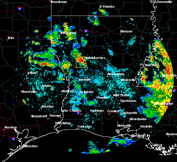 At 445 pm cdt, a severe thunderstorm was located near hagewood, or 4 miles west of natchitoches, moving south at 15 mph (radar indicated). Hazards include 60 mph wind gusts. Expect damage to roofs. siding. And trees. At 445 pm cdt, a severe thunderstorm was located near hagewood, or 4 miles west of natchitoches, moving south at 15 mph (radar indicated). Hazards include 60 mph wind gusts. Expect damage to roofs. siding. And trees.
|
| 7/22/2016 4:29 PM CDT |
 At 429 pm cdt, a severe thunderstorm was located 12 miles west of winnfield, moving southwest at 15 mph (radar indicated). Hazards include 60 mph wind gusts and penny size hail. Expect damage to roofs. siding. And trees. At 429 pm cdt, a severe thunderstorm was located 12 miles west of winnfield, moving southwest at 15 mph (radar indicated). Hazards include 60 mph wind gusts and penny size hail. Expect damage to roofs. siding. And trees.
|
| 7/14/2016 9:56 PM CDT |
 At 956 pm cdt, a strong gust front with a broken line of strong to severe thunderstorms were located along a line extending from 6 miles west of natchitoches to 13 miles north of colfax to near aimwell, moving south at 25 mph. while these storms have weakened over the last few minutes, sporadic wind damage will remain possible over the next half hour (radar indicated). Hazards include 60 mph wind gusts. Expect damage to roofs. siding. and trees. Locations impacted include, natchitoches, jena, colfax, olla, montgomery, midway, allen, urania, provencal, natchez, clarence, pollock, dry prong, tullos, georgetown, robeline, atlanta, flora, williana and hagewood. At 956 pm cdt, a strong gust front with a broken line of strong to severe thunderstorms were located along a line extending from 6 miles west of natchitoches to 13 miles north of colfax to near aimwell, moving south at 25 mph. while these storms have weakened over the last few minutes, sporadic wind damage will remain possible over the next half hour (radar indicated). Hazards include 60 mph wind gusts. Expect damage to roofs. siding. and trees. Locations impacted include, natchitoches, jena, colfax, olla, montgomery, midway, allen, urania, provencal, natchez, clarence, pollock, dry prong, tullos, georgetown, robeline, atlanta, flora, williana and hagewood.
|
| 7/14/2016 9:26 PM CDT |
 At 926 pm cdt, severe thunderstorms were located along a line extending from campti to 6 miles southeast of winnfield to near enterprise, moving south at 25 mph (radar indicated). Hazards include 60 mph wind gusts. Expect damage to roofs. siding. And trees. At 926 pm cdt, severe thunderstorms were located along a line extending from campti to 6 miles southeast of winnfield to near enterprise, moving south at 25 mph (radar indicated). Hazards include 60 mph wind gusts. Expect damage to roofs. siding. And trees.
|
| 6/18/2016 12:55 PM CDT |
 At 1255 pm cdt, severe thunderstorms were located along a line extending from 6 miles west of campti to 9 miles southwest of montgomery to near boyce, moving west at 35 mph (radar indicated). Hazards include 60 mph wind gusts. Expect damage to roofs. siding. And trees. At 1255 pm cdt, severe thunderstorms were located along a line extending from 6 miles west of campti to 9 miles southwest of montgomery to near boyce, moving west at 35 mph (radar indicated). Hazards include 60 mph wind gusts. Expect damage to roofs. siding. And trees.
|
| 5/27/2016 3:05 PM CDT |
 At 304 pm cdt, a severe thunderstorm was located near montgomery, or 9 miles east of natchitoches, moving northeast at 55 mph (radar indicated). Hazards include 60 mph wind gusts and quarter size hail. Hail damage to vehicles is expected. Expect wind damage to roofs, siding, and trees. At 304 pm cdt, a severe thunderstorm was located near montgomery, or 9 miles east of natchitoches, moving northeast at 55 mph (radar indicated). Hazards include 60 mph wind gusts and quarter size hail. Hail damage to vehicles is expected. Expect wind damage to roofs, siding, and trees.
|
| 5/27/2016 2:55 PM CDT | Storm damage reported in natchitoches county LA, 1.5 miles WSW of Natchitoches, LA |
| 5/27/2016 2:50 PM CDT | Several large trees down on the northwestern state university campu in natchitoches county LA, 1.4 miles W of Natchitoches, LA |
| 5/27/2016 2:29 PM CDT |
 At 229 pm cdt, a severe thunderstorm was located 12 miles northeast of many, or 13 miles southwest of natchitoches, moving east at 30 mph (radar indicated). Hazards include 60 mph wind gusts and quarter size hail. Hail damage to vehicles is expected. Expect wind damage to roofs, siding, and trees. At 229 pm cdt, a severe thunderstorm was located 12 miles northeast of many, or 13 miles southwest of natchitoches, moving east at 30 mph (radar indicated). Hazards include 60 mph wind gusts and quarter size hail. Hail damage to vehicles is expected. Expect wind damage to roofs, siding, and trees.
|
| 4/27/2016 6:43 AM CDT |
 At 643 am cdt, a severe thunderstorm was located 8 miles southwest of coushatta, or 19 miles southeast of mansfield, moving east at 25 mph (radar indicated). Hazards include 60 mph wind gusts and quarter size hail. Hail damage to vehicles is expected. Expect wind damage to roofs, siding, and trees. At 643 am cdt, a severe thunderstorm was located 8 miles southwest of coushatta, or 19 miles southeast of mansfield, moving east at 25 mph (radar indicated). Hazards include 60 mph wind gusts and quarter size hail. Hail damage to vehicles is expected. Expect wind damage to roofs, siding, and trees.
|
| 3/31/2016 3:14 PM CDT |
 At 314 pm cdt, severe thunderstorms were located along a line extending from near campti to 11 miles north of montgomery to 12 miles north of colfax, moving northeast at 50 mph (radar indicated). Hazards include 60 mph wind gusts and quarter size hail. Hail damage to vehicles is expected. Expect wind damage to roofs, siding, and trees. At 314 pm cdt, severe thunderstorms were located along a line extending from near campti to 11 miles north of montgomery to 12 miles north of colfax, moving northeast at 50 mph (radar indicated). Hazards include 60 mph wind gusts and quarter size hail. Hail damage to vehicles is expected. Expect wind damage to roofs, siding, and trees.
|
| 3/31/2016 2:48 PM CDT |
 A severe thunderstorm warning remains in effect until 315 pm cdt for central natchitoches parish. at 248 pm cdt. a severe thunderstorm was located 11 miles southwest of natchitoches. moving northeast at 35 mph. hazard. tennis ball size hail and 60 mph wind gusts. source. Radar indicated. A severe thunderstorm warning remains in effect until 315 pm cdt for central natchitoches parish. at 248 pm cdt. a severe thunderstorm was located 11 miles southwest of natchitoches. moving northeast at 35 mph. hazard. tennis ball size hail and 60 mph wind gusts. source. Radar indicated.
|
| 3/31/2016 2:34 PM CDT |
 At 234 pm cdt, a severe thunderstorm was located just northeast of fisher, or 20 miles southwest of natchitoches, moving northeast at 35 mph (radar indicated). Hazards include ping pong ball size hail and 60 mph wind gusts. People and animals outdoors will be injured. expect hail damage to roofs, siding, windows, and vehicles. Expect wind damage to roofs, siding, and trees. At 234 pm cdt, a severe thunderstorm was located just northeast of fisher, or 20 miles southwest of natchitoches, moving northeast at 35 mph (radar indicated). Hazards include ping pong ball size hail and 60 mph wind gusts. People and animals outdoors will be injured. expect hail damage to roofs, siding, windows, and vehicles. Expect wind damage to roofs, siding, and trees.
|
| 3/17/2016 3:32 PM CDT |
 At 332 pm cdt, a severe thunderstorm was located 11 miles west of hornbeck, or 14 miles north of toledo bend dam, moving east at 30 mph (radar indicated). Hazards include 60 mph wind gusts and quarter size hail. Hail damage to vehicles is expected. Expect wind damage to roofs, siding, and trees. At 332 pm cdt, a severe thunderstorm was located 11 miles west of hornbeck, or 14 miles north of toledo bend dam, moving east at 30 mph (radar indicated). Hazards include 60 mph wind gusts and quarter size hail. Hail damage to vehicles is expected. Expect wind damage to roofs, siding, and trees.
|
| 3/17/2016 2:46 PM CDT |
 At 246 pm cdt, a severe thunderstorm was located near natchitoches, moving east at 30 mph (radar indicated). Hazards include 60 mph wind gusts and half dollar size hail. Hail damage to vehicles is expected. Expect wind damage to roofs, siding, and trees. At 246 pm cdt, a severe thunderstorm was located near natchitoches, moving east at 30 mph (radar indicated). Hazards include 60 mph wind gusts and half dollar size hail. Hail damage to vehicles is expected. Expect wind damage to roofs, siding, and trees.
|
| 3/8/2016 7:47 PM CST | Tree down on hwy 6 eas in natchitoches county LA, 3.3 miles SW of Natchitoches, LA |
| 3/8/2016 7:36 PM CST |
 At 736 pm cst, a severe thunderstorm capable of producing a tornado was located 12 miles west of natchitoches, moving northeast at 30 mph (radar indicated rotation). Hazards include tornado and quarter size hail. Flying debris will be dangerous to those caught without shelter. mobile homes will be damaged or destroyed. damage to roofs, windows, and vehicles will occur. tree damage is likely. Locations impacted include, natchitoches, allen, provencal, natchez, robeline, powhatan, marthaville, lake end and hagewood. At 736 pm cst, a severe thunderstorm capable of producing a tornado was located 12 miles west of natchitoches, moving northeast at 30 mph (radar indicated rotation). Hazards include tornado and quarter size hail. Flying debris will be dangerous to those caught without shelter. mobile homes will be damaged or destroyed. damage to roofs, windows, and vehicles will occur. tree damage is likely. Locations impacted include, natchitoches, allen, provencal, natchez, robeline, powhatan, marthaville, lake end and hagewood.
|
| 3/8/2016 7:26 PM CST |
 At 726 pm cst, a severe thunderstorm capable of producing a tornado was located 9 miles northeast of many, or 16 miles southwest of natchitoches, moving northeast at 35 mph (radar indicated rotation). Hazards include tornado and quarter size hail. Flying debris will be dangerous to those caught without shelter. mobile homes will be damaged or destroyed. damage to roofs, windows, and vehicles will occur. tree damage is likely. Locations impacted include, natchitoches, many, allen, provencal, natchez, robeline, powhatan, bermuda, marthaville, flora, lake end and hagewood. At 726 pm cst, a severe thunderstorm capable of producing a tornado was located 9 miles northeast of many, or 16 miles southwest of natchitoches, moving northeast at 35 mph (radar indicated rotation). Hazards include tornado and quarter size hail. Flying debris will be dangerous to those caught without shelter. mobile homes will be damaged or destroyed. damage to roofs, windows, and vehicles will occur. tree damage is likely. Locations impacted include, natchitoches, many, allen, provencal, natchez, robeline, powhatan, bermuda, marthaville, flora, lake end and hagewood.
|
| 3/8/2016 7:14 PM CST |
 At 714 pm cst, a severe thunderstorm capable of producing a tornado was located near many, or 20 miles north of anacoco, moving northeast at 35 mph (radar indicated rotation). Hazards include tornado and quarter size hail. Flying debris will be dangerous to those caught without shelter. mobile homes will be damaged or destroyed. damage to roofs, windows, and vehicles will occur. Tree damage is likely. At 714 pm cst, a severe thunderstorm capable of producing a tornado was located near many, or 20 miles north of anacoco, moving northeast at 35 mph (radar indicated rotation). Hazards include tornado and quarter size hail. Flying debris will be dangerous to those caught without shelter. mobile homes will be damaged or destroyed. damage to roofs, windows, and vehicles will occur. Tree damage is likely.
|
| 3/8/2016 3:40 PM CST | Trees and powerlines down in natchitoches county LA, 1.5 miles WSW of Natchitoches, LA |
| 3/8/2016 3:15 PM CST |
 At 315 pm cst, a severe thunderstorm was located 9 miles east of natchitoches, moving northeast at 45 mph (radar indicated). Hazards include 60 mph wind gusts and nickel size hail. Expect damage to roofs. siding. and trees. locations impacted include, natchitoches, winnfield, campti, montgomery, natchez, clarence, dodson, calvin, atlanta, grand ecore, clear lake, hudson, bermuda, st. maurice, melrose and joyce. A tornado watch remains in effect until 600 pm cst for northwestern louisiana. At 315 pm cst, a severe thunderstorm was located 9 miles east of natchitoches, moving northeast at 45 mph (radar indicated). Hazards include 60 mph wind gusts and nickel size hail. Expect damage to roofs. siding. and trees. locations impacted include, natchitoches, winnfield, campti, montgomery, natchez, clarence, dodson, calvin, atlanta, grand ecore, clear lake, hudson, bermuda, st. maurice, melrose and joyce. A tornado watch remains in effect until 600 pm cst for northwestern louisiana.
|
| 3/8/2016 2:53 PM CST | Trees and power lines down in natchitoches county LA, 7.1 miles NW of Natchitoches, LA |
| 3/8/2016 2:41 PM CST |
 At 241 pm cst, a severe thunderstorm was located 8 miles south of natchitoches, moving northeast at 45 mph (radar indicated). Hazards include 60 mph wind gusts. Expect damage to roofs. siding. And trees. At 241 pm cst, a severe thunderstorm was located 8 miles south of natchitoches, moving northeast at 45 mph (radar indicated). Hazards include 60 mph wind gusts. Expect damage to roofs. siding. And trees.
|
| 3/8/2016 2:40 PM CST | Trees and powerlines down in natchitoches county LA, 1.5 miles WSW of Natchitoches, LA |
| 2/23/2016 5:35 PM CST |
 At 534 pm cst, a severe thunderstorm was located 13 miles northeast of campti, or 16 miles west of winnfield, moving east at 45 mph (public). Hazards include 60 mph wind gusts and quarter size hail. Hail damage to vehicles is expected. expect wind damage to roofs, siding, and trees. locations impacted include, natchitoches, winnfield, clarence, goldonna, dodson, calvin, atlanta, grand ecore, st. Maurice and clear lake. At 534 pm cst, a severe thunderstorm was located 13 miles northeast of campti, or 16 miles west of winnfield, moving east at 45 mph (public). Hazards include 60 mph wind gusts and quarter size hail. Hail damage to vehicles is expected. expect wind damage to roofs, siding, and trees. locations impacted include, natchitoches, winnfield, clarence, goldonna, dodson, calvin, atlanta, grand ecore, st. Maurice and clear lake.
|
| 2/23/2016 5:25 PM CST | Half Dollar sized hail reported 1.5 miles WSW of Natchitoches, LA |
| 2/23/2016 5:23 PM CST | Quarter sized hail reported 1.5 miles WSW of Natchitoches, LA, hail lasted seven minutes and partially covered the ground. |
| 2/23/2016 5:13 PM CST |
 At 512 pm cst, a severe thunderstorm was located near campti, or 11 miles north of natchitoches, moving east at 45 mph (public). Hazards include 60 mph wind gusts and quarter size hail. Hail damage to vehicles is expected. Expect wind damage to roofs, siding, and trees. At 512 pm cst, a severe thunderstorm was located near campti, or 11 miles north of natchitoches, moving east at 45 mph (public). Hazards include 60 mph wind gusts and quarter size hail. Hail damage to vehicles is expected. Expect wind damage to roofs, siding, and trees.
|
| 1/21/2016 1:51 PM CST | At 130 pm cst, a severe thunderstorm was located 9 miles southwest of natchitoches, moving northeast at 35 mph (radar indicated). Hazards include 60 mph wind gusts and quarter size hail. Hail damage to vehicles is expected. expect wind damage to roofs, siding, and trees. locations impacted include, natchitoches, montgomery, provencal, natchez, clarence, grand ecore, bermuda, st. maurice, clear lake, flora and hagewood. A tornado watch remains in effect until 700 pm cst for northwestern louisiana. |
| 1/21/2016 1:30 PM CST | At 130 pm cst, a severe thunderstorm was located 9 miles southwest of natchitoches, moving northeast at 35 mph (radar indicated). Hazards include 60 mph wind gusts and quarter size hail. Hail damage to vehicles is expected. expect wind damage to roofs, siding, and trees. locations impacted include, natchitoches, montgomery, provencal, natchez, clarence, grand ecore, bermuda, st. maurice, clear lake, flora and hagewood. A tornado watch remains in effect until 700 pm cst for northwestern louisiana. |
| 1/21/2016 1:28 PM CST | At 128 pm cst, a severe thunderstorm capable of producing a tornado was located 12 miles southwest of natchitoches, moving northeast at 35 mph (radar indicated rotation). Hazards include tornado and quarter size hail. Flying debris will be dangerous to those caught without shelter. mobile homes will be damaged or destroyed. damage to roofs, windows, and vehicles will occur. tree damage is likely. This tornadic thunderstorm will remain over mainly rural areas of southwestern natchitoches and eastern sabine parishes, including the following locations: flora, natchez, provencal and bermuda. |
| 1/21/2016 1:17 PM CST | At 116 pm cst, a severe thunderstorm capable of producing a tornado was located 9 miles east of many, or 18 miles southwest of natchitoches, moving northeast at 35 mph (radar indicated rotation). Hazards include tornado and quarter size hail. Flying debris will be dangerous to those caught without shelter. mobile homes will be damaged or destroyed. damage to roofs, windows, and vehicles will occur. tree damage is likely. this dangerous storm will be near, natchitoches around 145 pm cst. Other locations impacted by this tornadic thunderstorm include flora, natchez, bermuda and provencal. |
| 1/21/2016 1:13 PM CST | At 112 pm cst, a severe thunderstorm was located 7 miles east of many, or 20 miles southwest of natchitoches, moving northeast at 35 mph (radar indicated). Hazards include 60 mph wind gusts and quarter size hail. Hail damage to vehicles is expected. Expect wind damage to roofs, siding, and trees. |
| 12/27/2015 11:57 PM CST |
 At 1156 pm cst, severe thunderstorms were located along a line extending from 12 miles northeast of campti to near hineston, moving east at 45 mph (radar indicated). Hazards include 60 mph wind gusts. Expect damage to roofs. siding. and trees. locations impacted include, winnfield, jonesboro, colfax, montgomery, clarence, hodge, dry prong, goldonna, dodson, saline, lucky, ashland, calvin, bienville, atlanta, clear lake, creston, williana, brice and friendship. A tornado watch remains in effect until 500 am cst for northwestern louisiana. At 1156 pm cst, severe thunderstorms were located along a line extending from 12 miles northeast of campti to near hineston, moving east at 45 mph (radar indicated). Hazards include 60 mph wind gusts. Expect damage to roofs. siding. and trees. locations impacted include, winnfield, jonesboro, colfax, montgomery, clarence, hodge, dry prong, goldonna, dodson, saline, lucky, ashland, calvin, bienville, atlanta, clear lake, creston, williana, brice and friendship. A tornado watch remains in effect until 500 am cst for northwestern louisiana.
|
| 12/27/2015 11:33 PM CST |
 At 1132 pm cst, severe thunderstorms were located along a line extending from near campti to near fullerton, moving northeast at 45 mph (radar indicated). Hazards include 60 mph wind gusts. Expect damage to roofs. siding. And trees. At 1132 pm cst, severe thunderstorms were located along a line extending from near campti to near fullerton, moving northeast at 45 mph (radar indicated). Hazards include 60 mph wind gusts. Expect damage to roofs. siding. And trees.
|
| 11/17/2015 1:25 PM CST | Trees down across the parish in natchitoches county LA, 1.5 miles WSW of Natchitoches, LA |
| 11/17/2015 1:09 PM CST |
 At 106 pm cst, severe thunderstorms were located along a line extending from near bienville to near natchitoches, moving east at 30 mph (radar indicated). Hazards include 60 mph wind gusts. Expect damage to roofs. siding. and trees. A tornado watch remains in effect until 400 pm cst for northwestern louisiana. At 106 pm cst, severe thunderstorms were located along a line extending from near bienville to near natchitoches, moving east at 30 mph (radar indicated). Hazards include 60 mph wind gusts. Expect damage to roofs. siding. and trees. A tornado watch remains in effect until 400 pm cst for northwestern louisiana.
|
| 11/17/2015 12:14 PM CST |
 At 1212 pm cst, a severe thunderstorm was located 8 miles northwest of coushatta or 17 miles east of mansfield, moving northeast at 50 mph (radar indicated). Hazards include 60 mph wind gusts. Expect damage to roofs. siding. and trees. A tornado watch remains in effect until 400 pm cst for northwestern louisiana. At 1212 pm cst, a severe thunderstorm was located 8 miles northwest of coushatta or 17 miles east of mansfield, moving northeast at 50 mph (radar indicated). Hazards include 60 mph wind gusts. Expect damage to roofs. siding. and trees. A tornado watch remains in effect until 400 pm cst for northwestern louisiana.
|
| 9/11/2015 8:32 PM CDT | Trees down across several roads. a tree fell on a house. several power lines dow in natchitoches county LA, 1.5 miles WSW of Natchitoches, LA |
| 9/11/2015 8:29 PM CDT |
 At 828 pm cdt, a severe thunderstorm was located near natchitoches, moving southeast at 20 mph (radar indicated). Hazards include 60 mph wind gusts. Expect damage to roofs. siding and trees. locations impacted include, natchitoches, montgomery, provencal, natchez, robeline, bermuda, st. Maurice, bellwood, cloutierville, flora, hagewood and melrose. At 828 pm cdt, a severe thunderstorm was located near natchitoches, moving southeast at 20 mph (radar indicated). Hazards include 60 mph wind gusts. Expect damage to roofs. siding and trees. locations impacted include, natchitoches, montgomery, provencal, natchez, robeline, bermuda, st. Maurice, bellwood, cloutierville, flora, hagewood and melrose.
|
| 9/11/2015 8:00 PM CDT |
 At 759 pm cdt, a severe thunderstorm was located just north of natchitoches, moving southeast at 20 mph (radar indicated). Hazards include 60 mph wind gusts and penny size hail. Expect damage to roofs. Siding and trees. At 759 pm cdt, a severe thunderstorm was located just north of natchitoches, moving southeast at 20 mph (radar indicated). Hazards include 60 mph wind gusts and penny size hail. Expect damage to roofs. Siding and trees.
|
| 7/4/2015 6:36 PM CDT |
 At 635 pm cdt, a severe thunderstorm was located 10 miles southwest of natchitoches, moving southeast at 20 mph (radar indicated). Hazards include 60 mph wind gusts. Expect damage to roofs. siding and trees. Locations impacted include, natchitoches, many, zwolle, campti, montgomery, converse, allen, oak grove, pleasant hill, provencal, natchez, clarence, noble, robeline, powhatan, grand ecore, marthaville, clear lake, ajax and belmont. At 635 pm cdt, a severe thunderstorm was located 10 miles southwest of natchitoches, moving southeast at 20 mph (radar indicated). Hazards include 60 mph wind gusts. Expect damage to roofs. siding and trees. Locations impacted include, natchitoches, many, zwolle, campti, montgomery, converse, allen, oak grove, pleasant hill, provencal, natchez, clarence, noble, robeline, powhatan, grand ecore, marthaville, clear lake, ajax and belmont.
|
| 7/4/2015 5:59 PM CDT |
 At 558 pm cdt, a severe thunderstorm was located 14 miles west of natchitoches, moving south at 20 mph (radar indicated). Hazards include 60 mph wind gusts. Expect wind damage to roofs. Siding and trees. At 558 pm cdt, a severe thunderstorm was located 14 miles west of natchitoches, moving south at 20 mph (radar indicated). Hazards include 60 mph wind gusts. Expect wind damage to roofs. Siding and trees.
|
| 5/27/2015 5:50 AM CDT | At 549 am cdt, severe thunderstorms were located along a line extending from 15 miles northeast of campti to 13 miles north of kurthwood, and are nearly stationary (radar indicated). Hazards include 60 mph wind gusts. Expect damage to roofs. siding and trees. Locations impacted include, natchitoches, winnfield, colfax, campti, montgomery, provencal, natchez, clarence, goldonna, dodson, calvin, atlanta, clear lake, creston, flora, chopin, grand ecore, black lake, chestnut and bermuda. |
| 5/27/2015 5:25 AM CDT | At 525 am cdt, severe thunderstorms were located along a line extending from 12 miles northeast of coushatta to 9 miles east of many, moving east at 25 mph (radar indicated). Hazards include 60 mph wind gusts. Expect damage to roofs. Siding and trees. |
| 5/24/2015 12:20 PM CDT | At 1219 pm cdt, severe thunderstorms were located along a line extending from near coushatta to 7 miles west of natchitoches to 8 miles northwest of kurthwood, moving northeast at 25 mph (radar indicated). Hazards include 60 mph wind gusts and quarter size hail. Hail damage to vehicles is expected. Expect wind damage to roofs, siding and trees. |
| 4/19/2015 6:32 PM CDT | The national weather service in shreveport has issued a * severe thunderstorm warning for. east central sabine parish in northwestern louisiana. southern natchitoches parish in northwestern louisiana. until 700 pm cdt * at 632 pm cdt. A severe thunderstorm was located 10 miles north of. |
| 4/19/2015 2:22 AM CDT | At 221 am cdt, severe thunderstorms were located along a line extending from near ringgold to near flatwoods, moving east at 40 mph (radar indicated). Hazards include 60 mph wind gusts. Expect damage to roofs. Siding and trees. |
| 4/19/2015 1:52 AM CDT | At 151 am cdt, severe thunderstorms were located along a line extending from 10 miles south of coushatta to 13 miles east of many to near kurthwood, moving east at 45 mph (radar indicated). Hazards include 60 mph wind gusts. This line of thunderstorms will down trees and powerlines along its path. locations impacted include, natchitoches, many, campti, allen, pleasant hill, provencal, natchez, robeline, powhatan, marthaville, ajax, belmont, flora, hagewood, kisatchie, bellwood and mount carmel. 75in. |
| 4/19/2015 1:29 AM CDT | At 128 am cdt, severe thunderstorms were located along a line extending from near converse to near many to near toledo bend dam, moving east at 35 mph (radar indicated). Hazards include 60 mph wind gusts. these winds will likely down trees and powerlines |
| 3/28/2014 8:50 PM CDT | Widespread trees and powerlines down throughout the parish in natchitoches county LA, 1.5 miles WSW of Natchitoches, LA |
| 2/25/2014 6:19 PM CST | Quarter sized hail reported 2.7 miles S of Natchitoches, LA, nickel to quarter size hail covering the ground |
| 12/21/2013 3:30 PM CST | Trees andf power lines down parish wide in natchitoches county LA, 1.5 miles WSW of Natchitoches, LA |
| 6/6/2013 6:00 AM CDT | A large tree fell adjacent to the old antoons restaurant on washington street...damaging a corner of the building. a canopy was also blown off a building on south dr. n in natchitoches county LA, 1.5 miles WSW of Natchitoches, LA |
| 3/31/2013 12:15 PM CDT | Power lines and trees down in the city of natchitoches in natchitoches county LA, 1.5 miles WSW of Natchitoches, LA |
| 12/20/2012 2:40 AM CST | Trees down across highway in natchitoches county LA, 1.5 miles WSW of Natchitoches, LA |
| 8/7/2012 5:23 PM CDT | Tree down on paul jordan road in natchitoches county LA, 4.6 miles SW of Natchitoches, LA |
| 8/7/2012 5:21 PM CDT | Several trees down in natchitoches in natchitoches county LA, 1.5 miles WSW of Natchitoches, LA |
| 1/1/0001 12:00 AM | Tree down blocking the road on golddina in natchitoches county LA, 1.5 miles WSW of Natchitoches, LA |
| 9/28/2011 6:00 PM CDT | Quarter sized hail reported 7.1 miles NW of Natchitoches, LA |
| 1/1/0001 12:00 AM | Half Dollar sized hail reported 5.6 miles SSW of Natchitoches, LA |
| 5/25/2011 10:20 PM CDT | Quarter sized hail reported 1.5 miles WSW of Natchitoches, LA |
| 1/1/0001 12:00 AM | Golf Ball sized hail reported 11.2 miles SE of Natchitoches, LA, one mile southeast of allen. |
| 1/1/0001 12:00 AM | Several trees were downed throughout the paris in natchitoches county LA, 1.5 miles WSW of Natchitoches, LA |
| 1/1/0001 12:00 AM | Possible tornado. reports of numerous power poles down near state highway 1 and lateral roa in natchitoches county LA, 2 miles NW of Natchitoches, LA |
| 1/1/0001 12:00 AM | Quarter sized hail reported 1.5 miles WSW of Natchitoches, LA, one inch hail reported by natchitoches co-op observer. |
Hail Maps for Natchitoches, LA
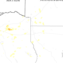
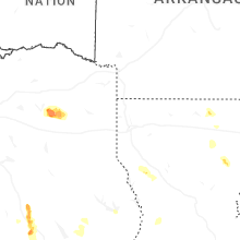

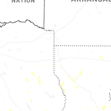
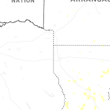
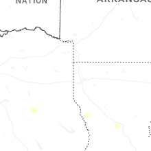

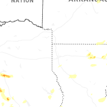
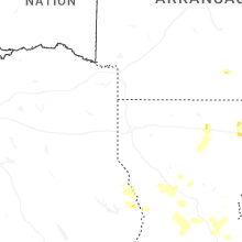
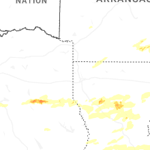
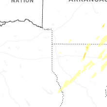


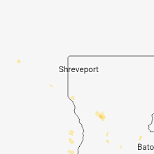


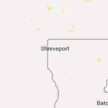


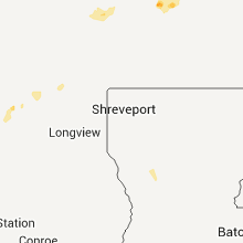


Connect with Interactive Hail Maps