

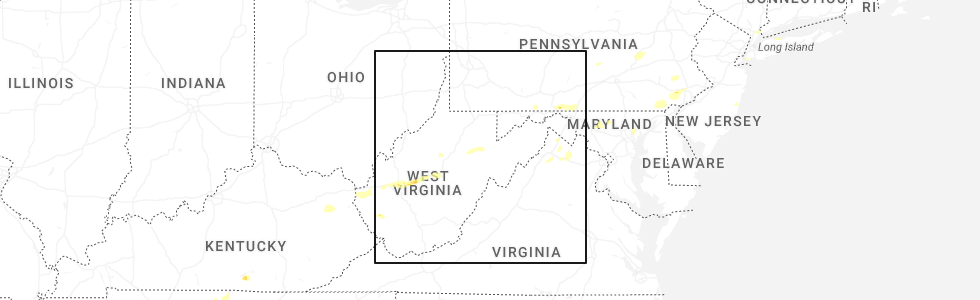
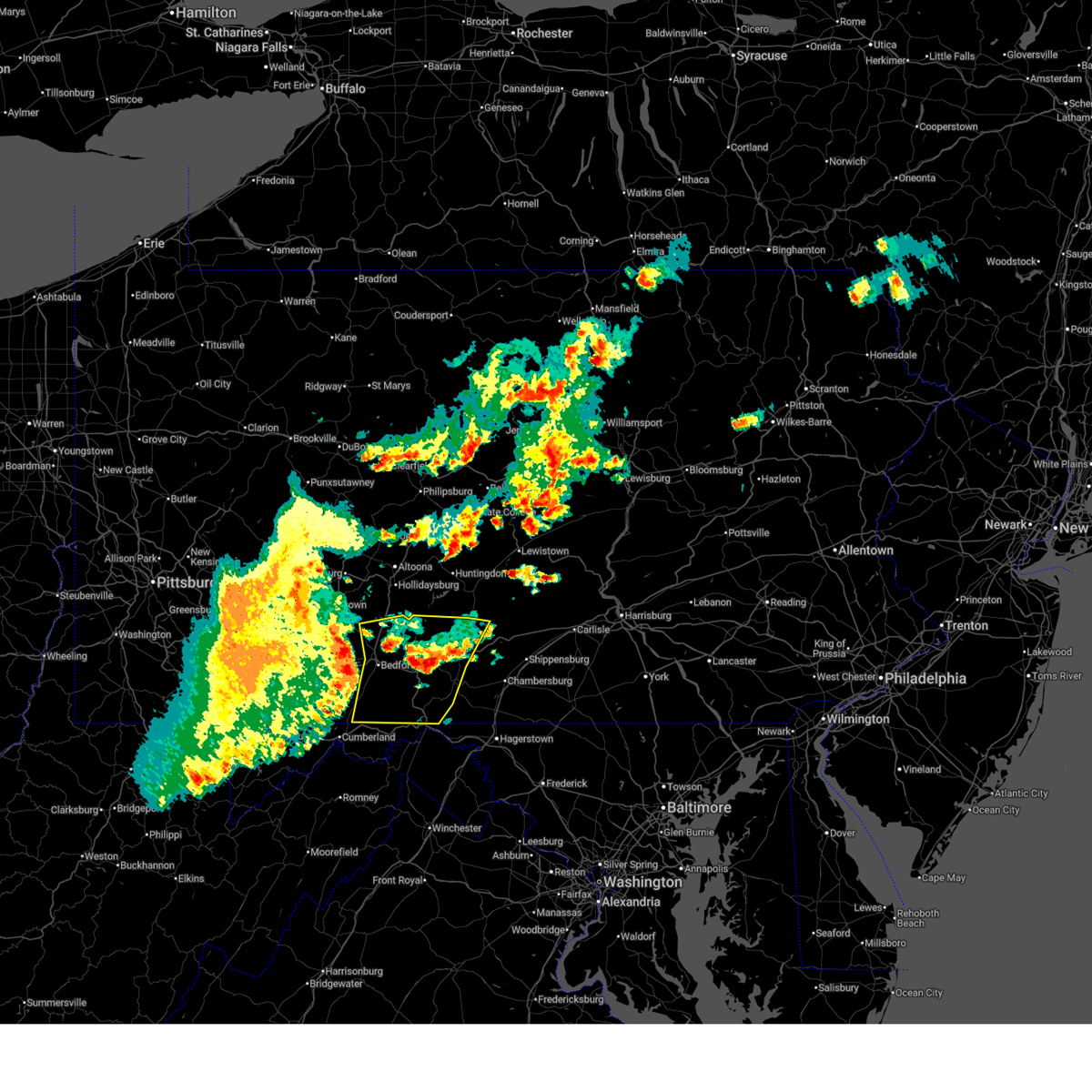
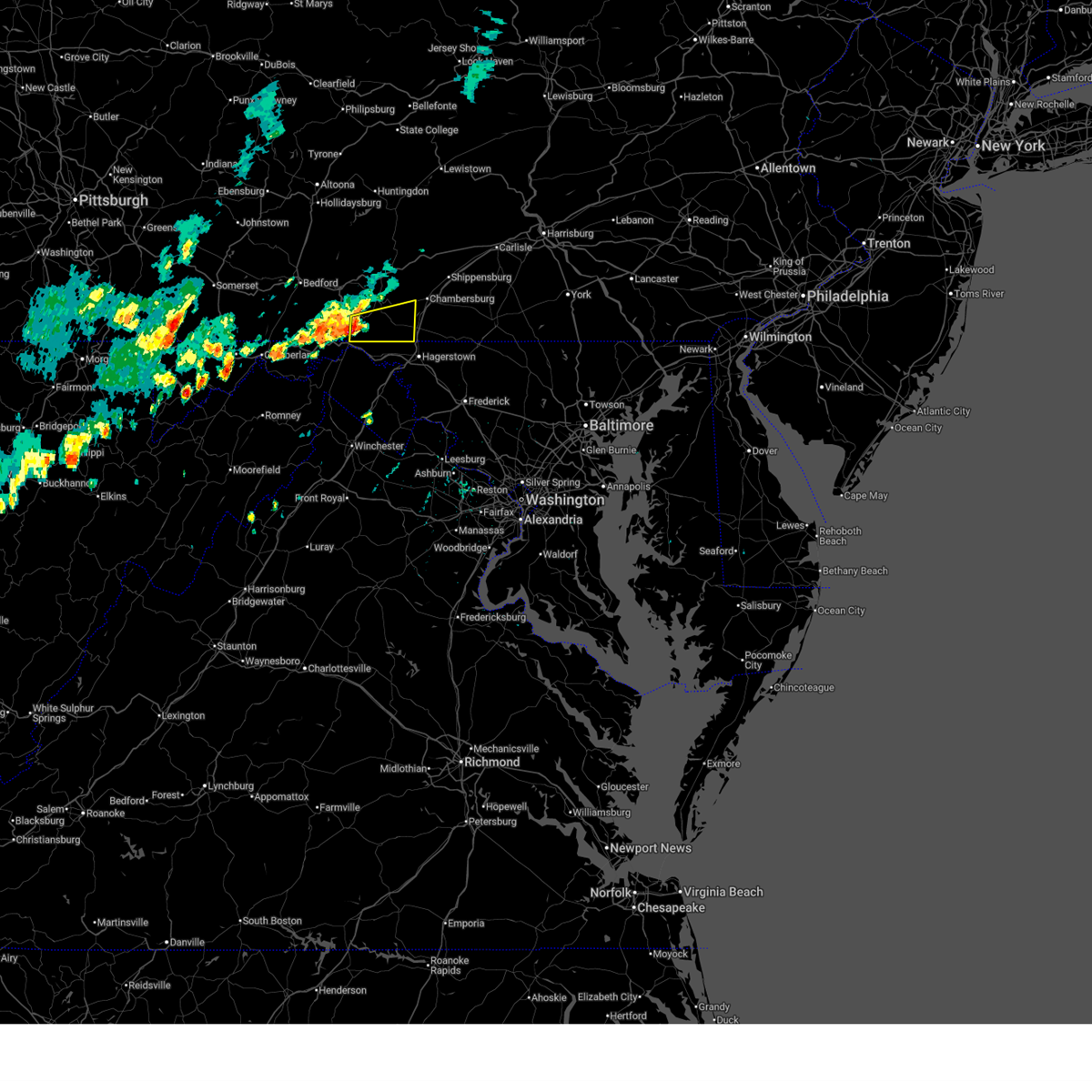
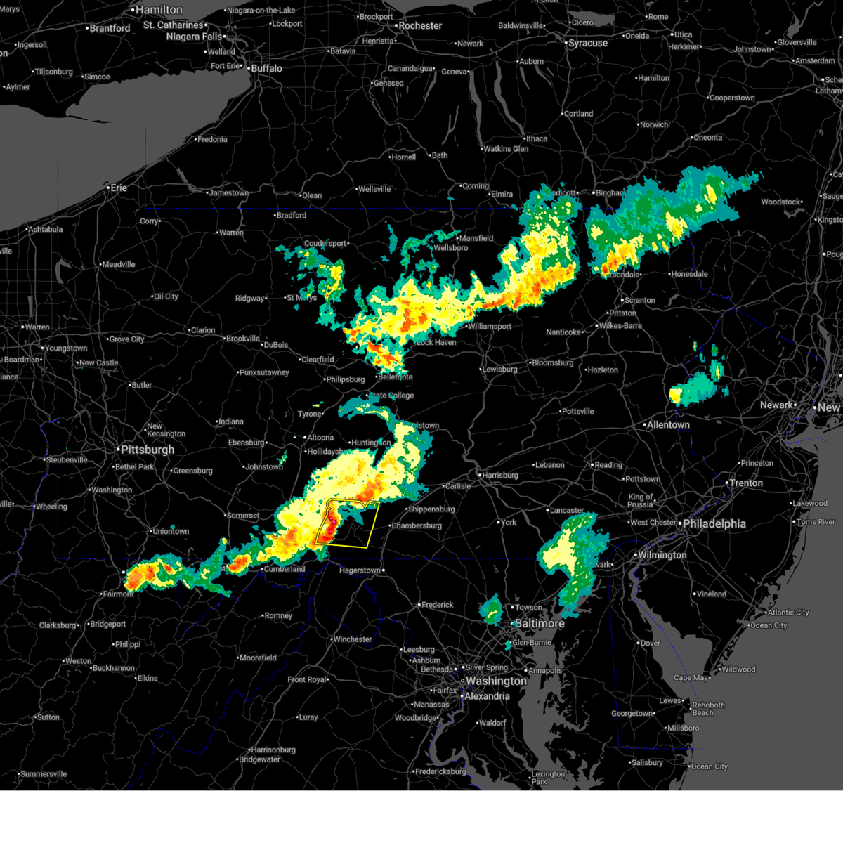
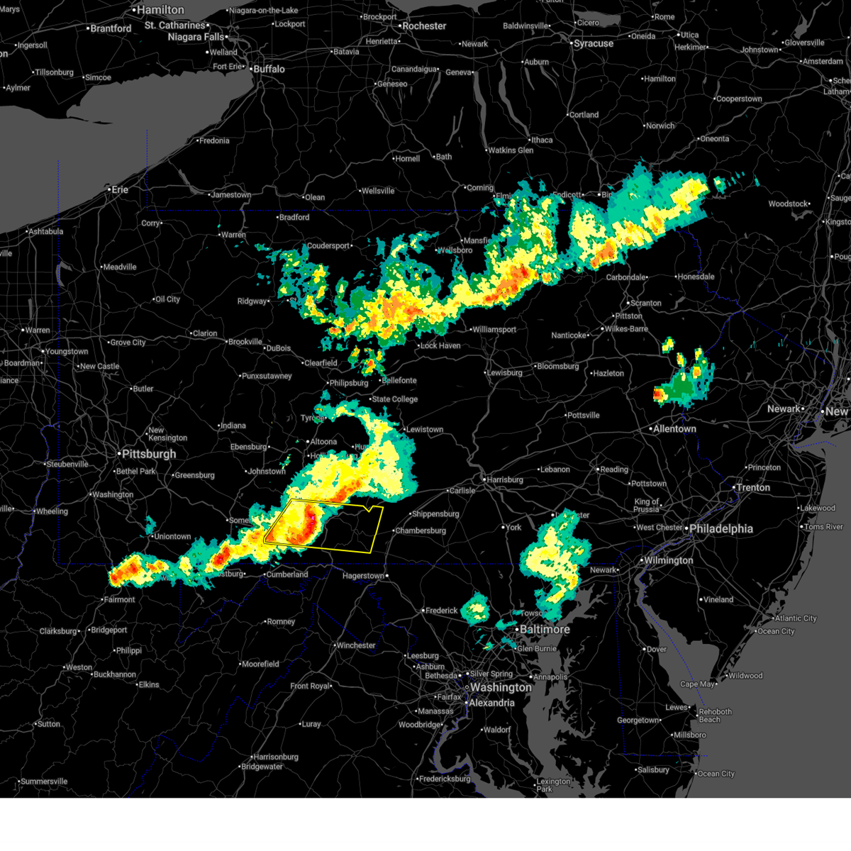
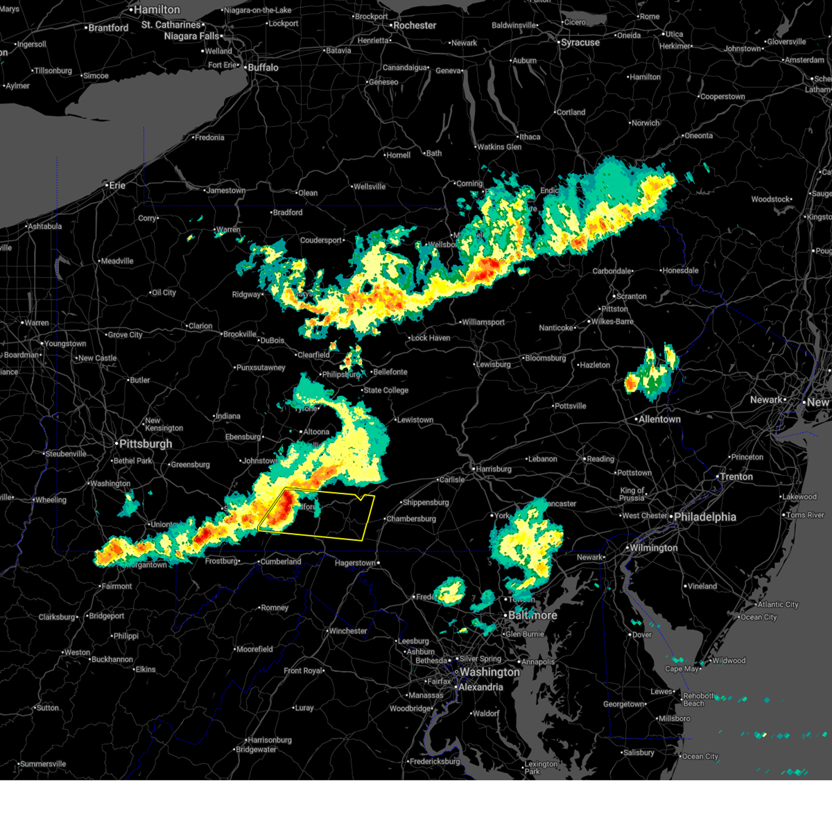
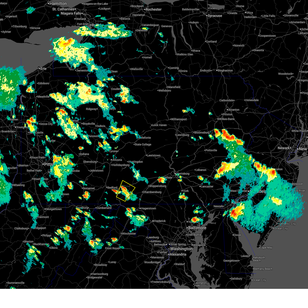
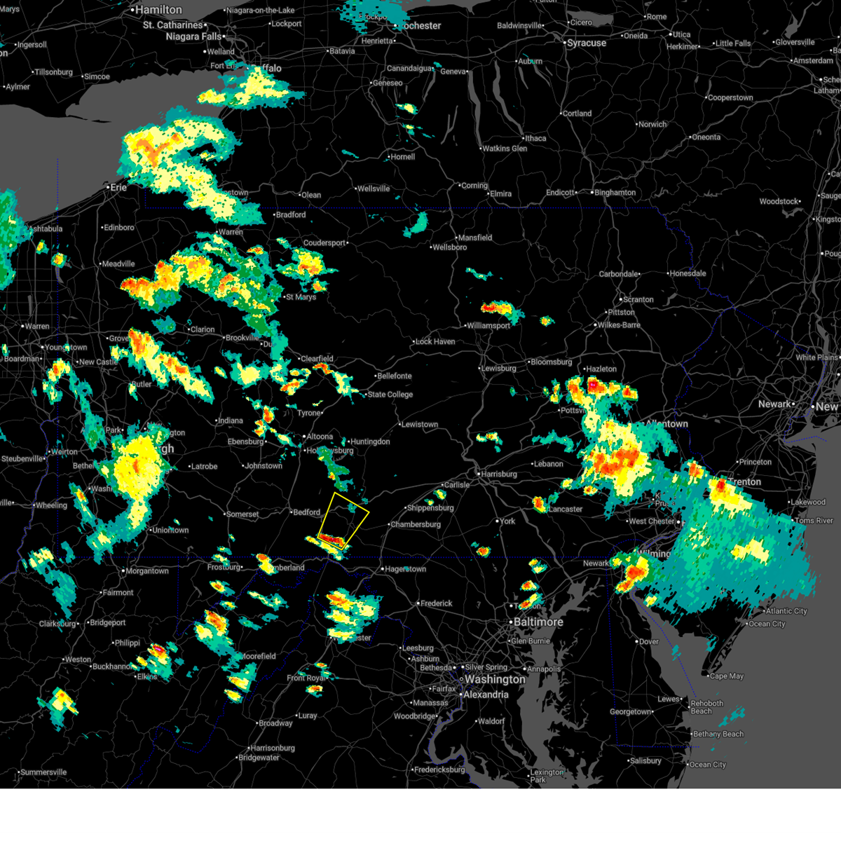
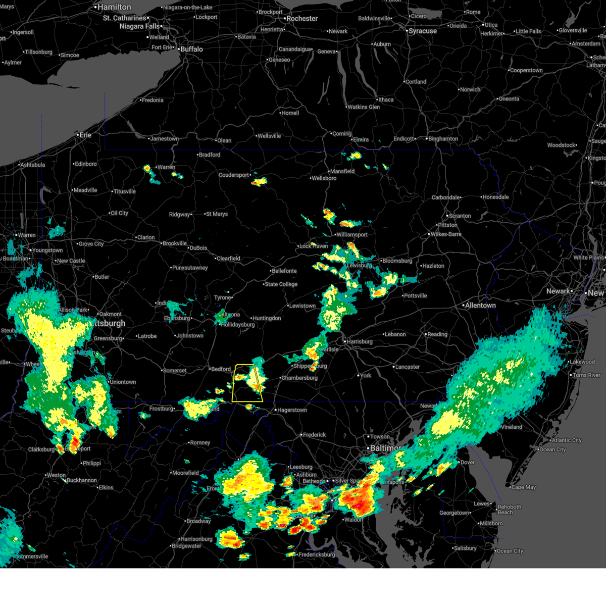
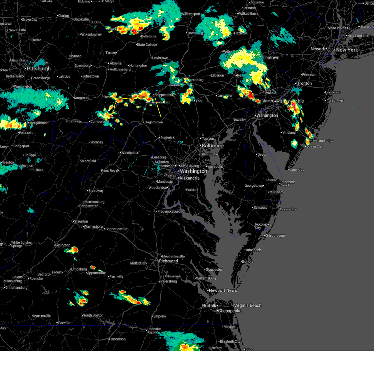
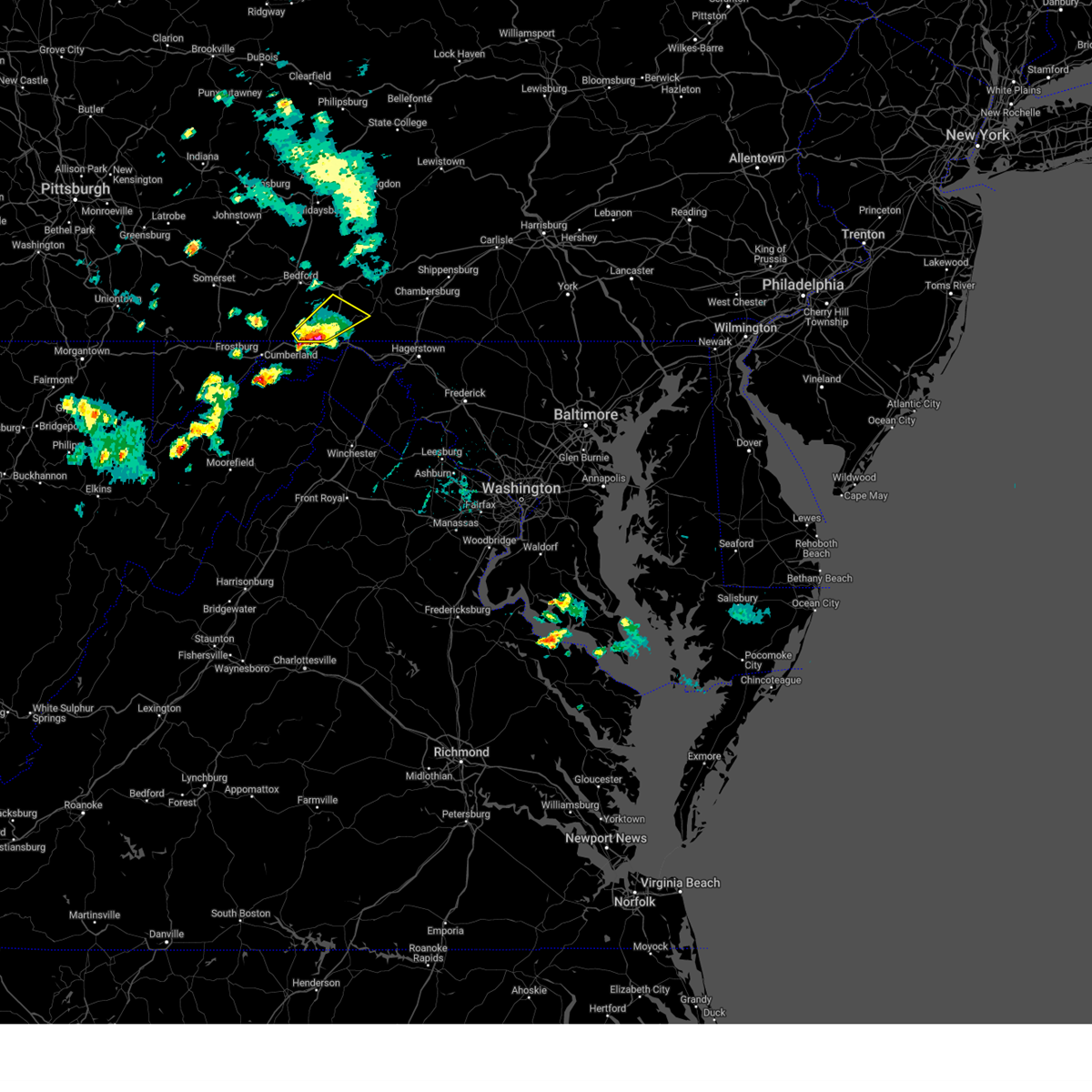
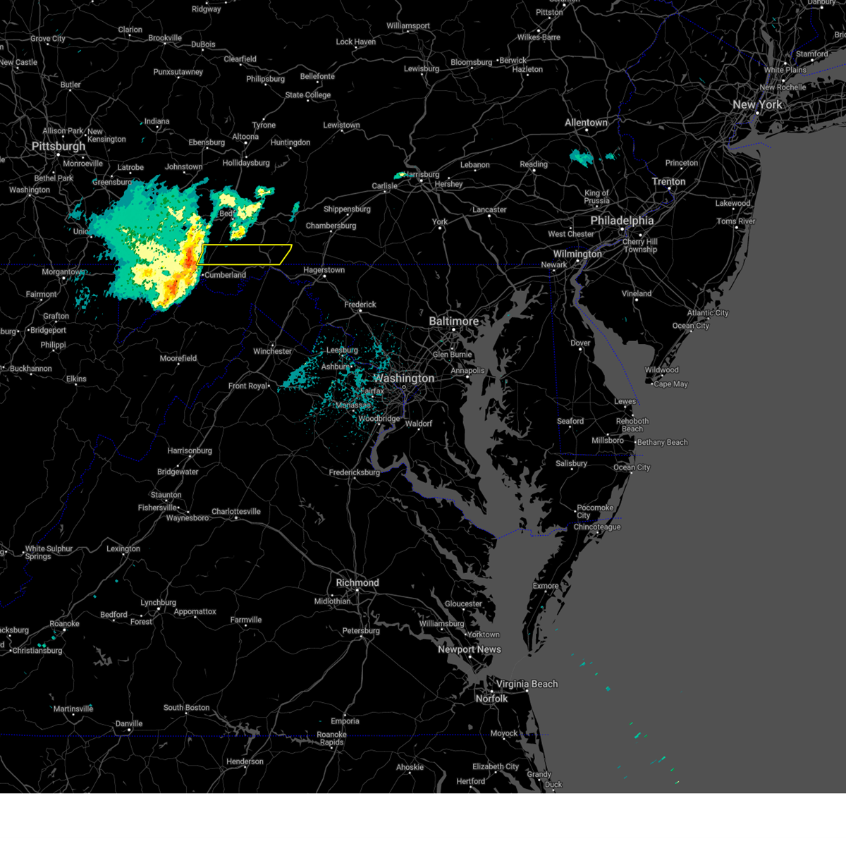
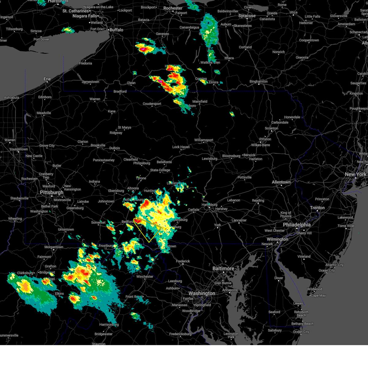
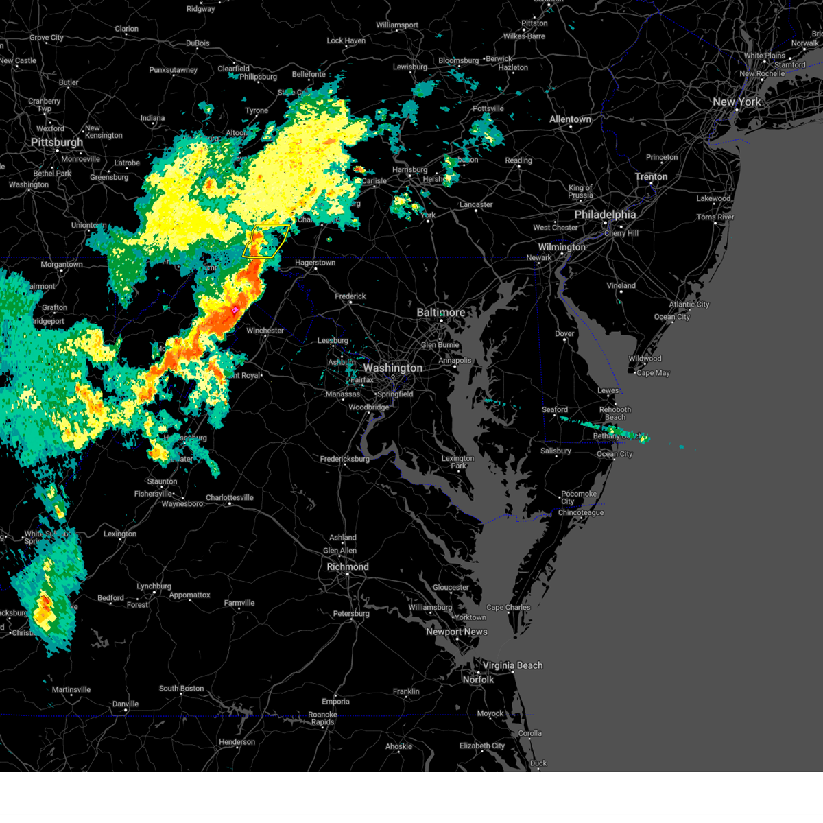
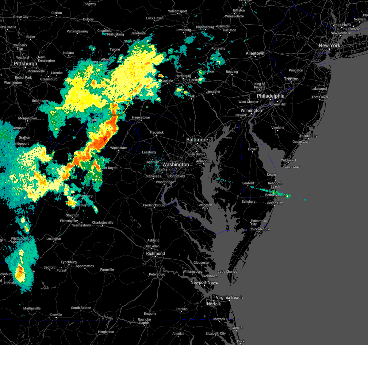
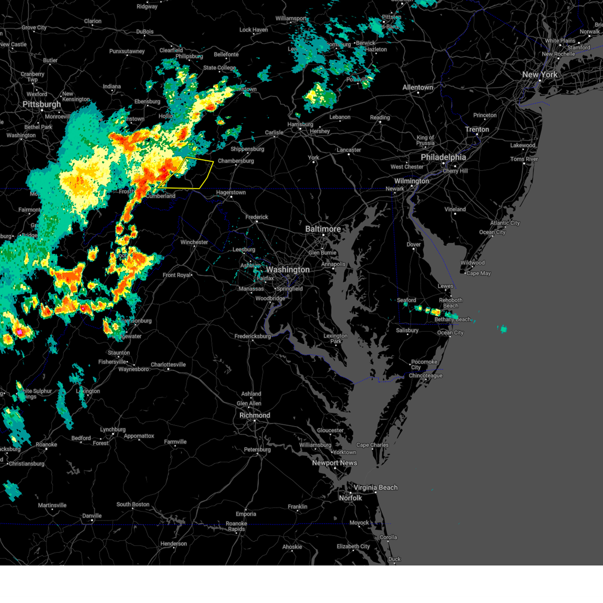
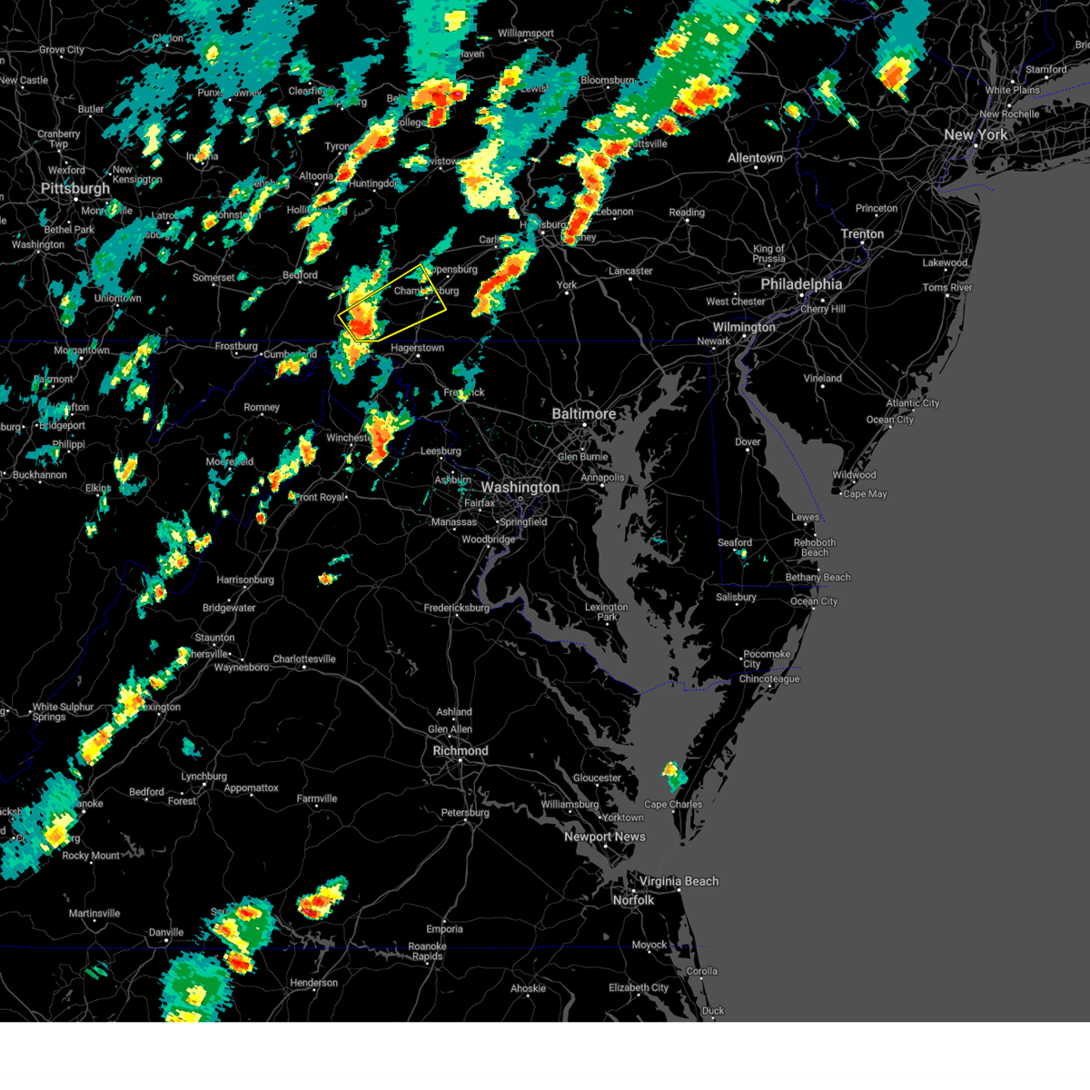
Hail Map for Needmore, PA
The Needmore, PA area has had 1 report of on-the-ground hail by trained spotters, and has been under severe weather warnings 14 times during the past 12 months. Doppler radar has detected hail at or near Needmore, PA on 39 occasions, including 2 occasions during the past year.
| Name: | Needmore, PA |
| Where Located: | 67 miles SSW of State College, PA |
| Map: | Google Map for Needmore, PA |
| Population: | 170 |
| Housing Units: | 72 |
| More Info: | Search Google for Needmore, PA |
0
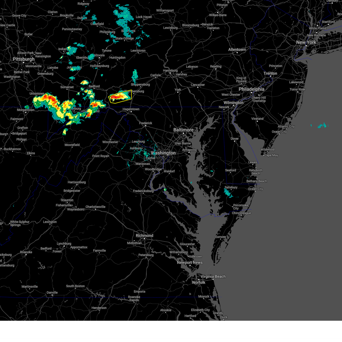
The Top Recent Hail Date for Needmore, PA is Wednesday, May 20, 2026 (32nd out of 39)
Hail and Wind Damage Spotted near Needmore, PA
| Date / Time | Report Details |
|---|---|
| 6/11/2026 6:13 PM EDT |
 Svrctp the national weather service in state college pa has issued a * severe thunderstorm warning for, western adams county in south central pennsylvania, cumberland county in south central pennsylvania, franklin county in south central pennsylvania, central fulton county in south central pennsylvania, southeastern huntingdon county in central pennsylvania, southwestern perry county in south central pennsylvania, * until 715 pm edt. * at 613 pm edt, severe thunderstorms were located along a line extending from rockhill furnace to harrisonville to warfordsburg, moving east at 45 mph (radar indicated). Hazards include 60 mph wind gusts. expect damage to roofs, siding, and trees Svrctp the national weather service in state college pa has issued a * severe thunderstorm warning for, western adams county in south central pennsylvania, cumberland county in south central pennsylvania, franklin county in south central pennsylvania, central fulton county in south central pennsylvania, southeastern huntingdon county in central pennsylvania, southwestern perry county in south central pennsylvania, * until 715 pm edt. * at 613 pm edt, severe thunderstorms were located along a line extending from rockhill furnace to harrisonville to warfordsburg, moving east at 45 mph (radar indicated). Hazards include 60 mph wind gusts. expect damage to roofs, siding, and trees
|
| 6/11/2026 5:59 PM EDT |
 the severe thunderstorm warning has been cancelled and is no longer in effect the severe thunderstorm warning has been cancelled and is no longer in effect
|
| 6/11/2026 5:59 PM EDT |
 At 559 pm edt, severe thunderstorms were located along a line extending from houserville to raystown dam to clearville, moving east at 45 mph (radar indicated). Hazards include 60 mph wind gusts. Expect damage to roofs, siding, and trees. locations impacted include, state college, huntingdon, breezewood, park forest village, boalsburg, pleasant gap, warfordsburg, mount union, lemont, clearville, zion, and everett. this includes the following interstates, interstate 70 from mile markers 147 to 170. the pennsylvania turnpike from mile markers 149 to 179. Interstate 99 from mile markers 69 to 83. At 559 pm edt, severe thunderstorms were located along a line extending from houserville to raystown dam to clearville, moving east at 45 mph (radar indicated). Hazards include 60 mph wind gusts. Expect damage to roofs, siding, and trees. locations impacted include, state college, huntingdon, breezewood, park forest village, boalsburg, pleasant gap, warfordsburg, mount union, lemont, clearville, zion, and everett. this includes the following interstates, interstate 70 from mile markers 147 to 170. the pennsylvania turnpike from mile markers 149 to 179. Interstate 99 from mile markers 69 to 83.
|
| 6/11/2026 5:22 PM EDT |
 Svrctp the national weather service in state college pa has issued a * severe thunderstorm warning for, bedford county in south central pennsylvania, blair county in central pennsylvania, southwestern centre county in central pennsylvania, fulton county in south central pennsylvania, huntingdon county in central pennsylvania, western mifflin county in central pennsylvania, southeastern somerset county in south central pennsylvania, * until 615 pm edt. * at 522 pm edt, severe thunderstorms were located along a line extending from tyrone to queen to near la vale, moving east at 45 mph (radar indicated). Hazards include 60 mph wind gusts. expect damage to roofs, siding, and trees Svrctp the national weather service in state college pa has issued a * severe thunderstorm warning for, bedford county in south central pennsylvania, blair county in central pennsylvania, southwestern centre county in central pennsylvania, fulton county in south central pennsylvania, huntingdon county in central pennsylvania, western mifflin county in central pennsylvania, southeastern somerset county in south central pennsylvania, * until 615 pm edt. * at 522 pm edt, severe thunderstorms were located along a line extending from tyrone to queen to near la vale, moving east at 45 mph (radar indicated). Hazards include 60 mph wind gusts. expect damage to roofs, siding, and trees
|
| 6/6/2026 4:27 PM EDT | Tree down on railing of i-70 eb near mm 15 in fulton county PA, 6.3 miles SE of Needmore, PA |
| 6/6/2026 3:57 PM EDT |
 Svrctp the national weather service in state college pa has issued a * severe thunderstorm warning for, bedford county in south central pennsylvania, fulton county in south central pennsylvania, southern huntingdon county in central pennsylvania, * until 500 pm edt. * at 356 pm edt, severe thunderstorms were located along a line extending from ogletown to near cessna to near bedford to buffalo mills to near lake gordon to near la vale, moving east at 65 mph. these is a line of destructive storms! (radar indicated). Hazards include 80 mph wind gusts and quarter size hail. Flying debris will be dangerous to those caught without shelter. mobile homes will be heavily damaged. expect considerable damage to roofs, windows, and vehicles. Extensive tree damage and power outages are likely. Svrctp the national weather service in state college pa has issued a * severe thunderstorm warning for, bedford county in south central pennsylvania, fulton county in south central pennsylvania, southern huntingdon county in central pennsylvania, * until 500 pm edt. * at 356 pm edt, severe thunderstorms were located along a line extending from ogletown to near cessna to near bedford to buffalo mills to near lake gordon to near la vale, moving east at 65 mph. these is a line of destructive storms! (radar indicated). Hazards include 80 mph wind gusts and quarter size hail. Flying debris will be dangerous to those caught without shelter. mobile homes will be heavily damaged. expect considerable damage to roofs, windows, and vehicles. Extensive tree damage and power outages are likely.
|
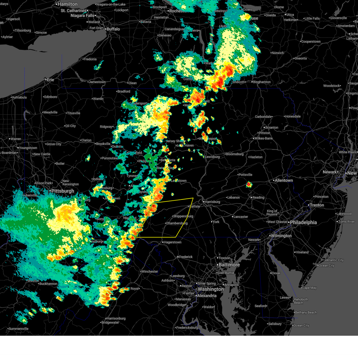
| 5/20/2026 1:03 PM EDT |
 Svrctp the national weather service in state college pa has issued a * severe thunderstorm warning for, southwestern franklin county in south central pennsylvania, southeastern fulton county in south central pennsylvania, * until 145 pm edt. * at 103 pm edt, a severe thunderstorm was located over big cove tannery, moving east at 30 mph (radar indicated). Hazards include 60 mph wind gusts and quarter size hail. Hail damage to vehicles is expected. Expect wind damage to roofs, siding, and trees. Svrctp the national weather service in state college pa has issued a * severe thunderstorm warning for, southwestern franklin county in south central pennsylvania, southeastern fulton county in south central pennsylvania, * until 145 pm edt. * at 103 pm edt, a severe thunderstorm was located over big cove tannery, moving east at 30 mph (radar indicated). Hazards include 60 mph wind gusts and quarter size hail. Hail damage to vehicles is expected. Expect wind damage to roofs, siding, and trees.
|
| 4/14/2026 7:51 PM EDT |
 At 751 pm edt, a severe thunderstorm was located over harrisonville, moving east at 40 mph (radar indicated). Hazards include 60 mph wind gusts and penny size hail. Expect damage to roofs, siding, and trees. locations impacted include, mercersburg, mcconnellsburg, harrisonville, fort loudon, big cove tannery, crystal springs, wells tannery, fort littleton, needmore, valley-hi, saluvia, and locust grove. this includes the following interstates, interstate 70 from mile markers 151 to 160. The pennsylvania turnpike between mile markers 166 and 183, and from mile markers 187 to 188. At 751 pm edt, a severe thunderstorm was located over harrisonville, moving east at 40 mph (radar indicated). Hazards include 60 mph wind gusts and penny size hail. Expect damage to roofs, siding, and trees. locations impacted include, mercersburg, mcconnellsburg, harrisonville, fort loudon, big cove tannery, crystal springs, wells tannery, fort littleton, needmore, valley-hi, saluvia, and locust grove. this includes the following interstates, interstate 70 from mile markers 151 to 160. The pennsylvania turnpike between mile markers 166 and 183, and from mile markers 187 to 188.
|
| 4/14/2026 7:38 PM EDT |
 At 737 pm edt, a severe thunderstorm was located over breezewood, moving east at 40 mph (radar indicated). Hazards include 60 mph wind gusts and penny size hail. Expect damage to roofs, siding, and trees. locations impacted include, bedford, breezewood, clearville, everett, mercersburg, mcconnellsburg, harrisonville, fort loudon, buffalo mills, big cove tannery, crystal springs, and wells tannery. this includes the following interstates, interstate 70 from mile markers 147 to 160. the pennsylvania turnpike between mile markers 137 and 183, and from mile markers 187 to 188. Interstate 99 from mile markers 0 to 6. At 737 pm edt, a severe thunderstorm was located over breezewood, moving east at 40 mph (radar indicated). Hazards include 60 mph wind gusts and penny size hail. Expect damage to roofs, siding, and trees. locations impacted include, bedford, breezewood, clearville, everett, mercersburg, mcconnellsburg, harrisonville, fort loudon, buffalo mills, big cove tannery, crystal springs, and wells tannery. this includes the following interstates, interstate 70 from mile markers 147 to 160. the pennsylvania turnpike between mile markers 137 and 183, and from mile markers 187 to 188. Interstate 99 from mile markers 0 to 6.
|
| 4/14/2026 7:20 PM EDT |
 Svrctp the national weather service in state college pa has issued a * severe thunderstorm warning for, central bedford county in south central pennsylvania, southwestern franklin county in south central pennsylvania, fulton county in south central pennsylvania, * until 800 pm edt. * at 719 pm edt, a severe thunderstorm was located over bedford, moving east at 40 mph (radar indicated). Hazards include 60 mph wind gusts and penny size hail. expect damage to roofs, siding, and trees Svrctp the national weather service in state college pa has issued a * severe thunderstorm warning for, central bedford county in south central pennsylvania, southwestern franklin county in south central pennsylvania, fulton county in south central pennsylvania, * until 800 pm edt. * at 719 pm edt, a severe thunderstorm was located over bedford, moving east at 40 mph (radar indicated). Hazards include 60 mph wind gusts and penny size hail. expect damage to roofs, siding, and trees
|
| 6/30/2025 4:22 PM EDT |
 The storm which prompted the warning has weakened below severe limits, and no longer poses an immediate threat to life or property. therefore, the warning will be allowed to expire. to report severe weather, contact your nearest law enforcement agency. they will relay your report to the national weather service state college pa. The storm which prompted the warning has weakened below severe limits, and no longer poses an immediate threat to life or property. therefore, the warning will be allowed to expire. to report severe weather, contact your nearest law enforcement agency. they will relay your report to the national weather service state college pa.
|
| 6/30/2025 3:48 PM EDT |
 Svrctp the national weather service in state college pa has issued a * severe thunderstorm warning for, west central franklin county in south central pennsylvania, fulton county in south central pennsylvania, * until 430 pm edt. * at 348 pm edt, a severe thunderstorm was located over needmore, moving northeast at 25 mph (radar indicated). Hazards include 60 mph wind gusts. expect damage to roofs, siding, and trees Svrctp the national weather service in state college pa has issued a * severe thunderstorm warning for, west central franklin county in south central pennsylvania, fulton county in south central pennsylvania, * until 430 pm edt. * at 348 pm edt, a severe thunderstorm was located over needmore, moving northeast at 25 mph (radar indicated). Hazards include 60 mph wind gusts. expect damage to roofs, siding, and trees
|
| 6/26/2025 9:41 PM EDT |
 The storm which prompted the warning has weakened below severe limits, and no longer poses an immediate threat to life or property. therefore, the warning will be allowed to expire. however, heavy rain is still possible with this thunderstorm. a severe thunderstorm watch remains in effect until 1000 pm edt for south central pennsylvania. The storm which prompted the warning has weakened below severe limits, and no longer poses an immediate threat to life or property. therefore, the warning will be allowed to expire. however, heavy rain is still possible with this thunderstorm. a severe thunderstorm watch remains in effect until 1000 pm edt for south central pennsylvania.
|
| 6/26/2025 9:00 PM EDT |
 Svrctp the national weather service in state college pa has issued a * severe thunderstorm warning for, southwestern franklin county in south central pennsylvania, fulton county in south central pennsylvania, * until 945 pm edt. * at 859 pm edt, a severe thunderstorm was located over harrisonville, moving south at 15 mph (radar indicated). Hazards include 60 mph wind gusts and penny size hail. expect damage to roofs, siding, and trees Svrctp the national weather service in state college pa has issued a * severe thunderstorm warning for, southwestern franklin county in south central pennsylvania, fulton county in south central pennsylvania, * until 945 pm edt. * at 859 pm edt, a severe thunderstorm was located over harrisonville, moving south at 15 mph (radar indicated). Hazards include 60 mph wind gusts and penny size hail. expect damage to roofs, siding, and trees
|
| 6/25/2025 7:34 PM EDT |
 Svrctp the national weather service in state college pa has issued a * severe thunderstorm warning for, southwestern adams county in south central pennsylvania, franklin county in south central pennsylvania, fulton county in south central pennsylvania, * until 845 pm edt. * at 733 pm edt, severe thunderstorms were located along a line extending from fayetteville to fort loudon to crystal springs, moving south at 5 mph (radar indicated). Hazards include 60 mph wind gusts and penny size hail. expect damage to roofs, siding, and trees Svrctp the national weather service in state college pa has issued a * severe thunderstorm warning for, southwestern adams county in south central pennsylvania, franklin county in south central pennsylvania, fulton county in south central pennsylvania, * until 845 pm edt. * at 733 pm edt, severe thunderstorms were located along a line extending from fayetteville to fort loudon to crystal springs, moving south at 5 mph (radar indicated). Hazards include 60 mph wind gusts and penny size hail. expect damage to roofs, siding, and trees
|
| 5/1/2025 6:16 PM EDT |
 At 616 pm edt, a severe thunderstorm was located over big cove tannery, moving northeast at 15 mph (radar indicated). Hazards include 60 mph wind gusts and quarter size hail. Hail damage to vehicles is expected. expect wind damage to roofs, siding, and trees. locations impacted include, williamson, st. Thomas, mercersburg, needmore, big cove tannery, fort loudon, mcconnellsburg, and marion. At 616 pm edt, a severe thunderstorm was located over big cove tannery, moving northeast at 15 mph (radar indicated). Hazards include 60 mph wind gusts and quarter size hail. Hail damage to vehicles is expected. expect wind damage to roofs, siding, and trees. locations impacted include, williamson, st. Thomas, mercersburg, needmore, big cove tannery, fort loudon, mcconnellsburg, and marion.
|
| 5/1/2025 5:56 PM EDT |
 Svrctp the national weather service in state college pa has issued a * severe thunderstorm warning for, southwestern franklin county in south central pennsylvania, southern fulton county in south central pennsylvania, * until 630 pm edt. * at 556 pm edt, a severe thunderstorm was located over big cove tannery, moving east at 35 mph (radar indicated). Hazards include 60 mph wind gusts and half dollar size hail. Hail damage to vehicles is expected. Expect wind damage to roofs, siding, and trees. Svrctp the national weather service in state college pa has issued a * severe thunderstorm warning for, southwestern franklin county in south central pennsylvania, southern fulton county in south central pennsylvania, * until 630 pm edt. * at 556 pm edt, a severe thunderstorm was located over big cove tannery, moving east at 35 mph (radar indicated). Hazards include 60 mph wind gusts and half dollar size hail. Hail damage to vehicles is expected. Expect wind damage to roofs, siding, and trees.
|
| 5/1/2025 5:35 PM EDT |
 At 534 pm edt, a severe thunderstorm was located over barnes gap, moving northeast at 30 mph (radar indicated). Hazards include 60 mph wind gusts and quarter size hail. Hail damage to vehicles is expected. expect wind damage to roofs, siding, and trees. locations impacted include, barnes gap, big cove tannery, inglesmith, needmore, and locust grove. This includes interstate 70 from mile markers 153 to 166. At 534 pm edt, a severe thunderstorm was located over barnes gap, moving northeast at 30 mph (radar indicated). Hazards include 60 mph wind gusts and quarter size hail. Hail damage to vehicles is expected. expect wind damage to roofs, siding, and trees. locations impacted include, barnes gap, big cove tannery, inglesmith, needmore, and locust grove. This includes interstate 70 from mile markers 153 to 166.
|
| 5/1/2025 5:09 PM EDT |
 Svrctp the national weather service in state college pa has issued a * severe thunderstorm warning for, southeastern bedford county in south central pennsylvania, southwestern fulton county in south central pennsylvania, * until 600 pm edt. * at 509 pm edt, a severe thunderstorm was located over inglesmith, moving northeast at 25 mph (radar indicated). Hazards include 60 mph wind gusts and quarter size hail. Hail damage to vehicles is expected. Expect wind damage to roofs, siding, and trees. Svrctp the national weather service in state college pa has issued a * severe thunderstorm warning for, southeastern bedford county in south central pennsylvania, southwestern fulton county in south central pennsylvania, * until 600 pm edt. * at 509 pm edt, a severe thunderstorm was located over inglesmith, moving northeast at 25 mph (radar indicated). Hazards include 60 mph wind gusts and quarter size hail. Hail damage to vehicles is expected. Expect wind damage to roofs, siding, and trees.
|
| 4/19/2025 9:39 PM EDT | Trees/wires dow in fulton county PA, 8.2 miles N of Needmore, PA |
| 4/19/2025 9:38 PM EDT | A tree fell onto a car in belfast townshi in fulton county PA, 1.1 miles ENE of Needmore, PA |
| 4/19/2025 9:11 PM EDT |
 Svrctp the national weather service in state college pa has issued a * severe thunderstorm warning for, southwestern bedford county in south central pennsylvania, southwestern fulton county in south central pennsylvania, * until 945 pm edt. * at 910 pm edt, a severe thunderstorm was located near lake gordon, moving east at 70 mph (radar indicated). Hazards include 60 mph wind gusts and nickel size hail. expect damage to roofs, siding, and trees Svrctp the national weather service in state college pa has issued a * severe thunderstorm warning for, southwestern bedford county in south central pennsylvania, southwestern fulton county in south central pennsylvania, * until 945 pm edt. * at 910 pm edt, a severe thunderstorm was located near lake gordon, moving east at 70 mph (radar indicated). Hazards include 60 mph wind gusts and nickel size hail. expect damage to roofs, siding, and trees
|
| 9/21/2024 5:17 PM EDT |
 the severe thunderstorm warning has been cancelled and is no longer in effect the severe thunderstorm warning has been cancelled and is no longer in effect
|
| 9/21/2024 5:07 PM EDT |
 At 506 pm edt, a severe thunderstorm was located over harrisonville, moving southeast at 30 mph (radar indicated). Hazards include 60 mph wind gusts and quarter size hail. Hail damage to vehicles is expected. expect wind damage to roofs, siding, and trees. locations impacted include, mcconnellsburg, harrisonville, fort loudon, big cove tannery, crystal springs, needmore, valley-hi, and saluvia. this includes the following interstates, interstate 70 from mile markers 151 to 154. The pennsylvania turnpike from mile markers 166 to 170. At 506 pm edt, a severe thunderstorm was located over harrisonville, moving southeast at 30 mph (radar indicated). Hazards include 60 mph wind gusts and quarter size hail. Hail damage to vehicles is expected. expect wind damage to roofs, siding, and trees. locations impacted include, mcconnellsburg, harrisonville, fort loudon, big cove tannery, crystal springs, needmore, valley-hi, and saluvia. this includes the following interstates, interstate 70 from mile markers 151 to 154. The pennsylvania turnpike from mile markers 166 to 170.
|
| 9/21/2024 5:07 PM EDT |
 the severe thunderstorm warning has been cancelled and is no longer in effect the severe thunderstorm warning has been cancelled and is no longer in effect
|
| 9/21/2024 4:44 PM EDT |
 Svrctp the national weather service in state college pa has issued a * severe thunderstorm warning for, east central bedford county in south central pennsylvania, west central franklin county in south central pennsylvania, central fulton county in south central pennsylvania, * until 530 pm edt. * at 444 pm edt, a severe thunderstorm was located over breezewood, moving southeast at 30 mph (radar indicated). Hazards include 60 mph wind gusts and quarter size hail. Hail damage to vehicles is expected. Expect wind damage to roofs, siding, and trees. Svrctp the national weather service in state college pa has issued a * severe thunderstorm warning for, east central bedford county in south central pennsylvania, west central franklin county in south central pennsylvania, central fulton county in south central pennsylvania, * until 530 pm edt. * at 444 pm edt, a severe thunderstorm was located over breezewood, moving southeast at 30 mph (radar indicated). Hazards include 60 mph wind gusts and quarter size hail. Hail damage to vehicles is expected. Expect wind damage to roofs, siding, and trees.
|
| 8/31/2024 4:53 PM EDT |
 At 453 pm edt, severe thunderstorms were located along a line extending from needmore to berkeley springs, moving southeast at 15 mph (radar indicated). Hazards include 60 mph wind gusts. Expect damage to roofs, siding, and trees. locations impacted include, warfordsburg, mcconnellsburg, big cove tannery, needmore, and locust grove. This includes interstate 70 from mile markers 152 to 170. At 453 pm edt, severe thunderstorms were located along a line extending from needmore to berkeley springs, moving southeast at 15 mph (radar indicated). Hazards include 60 mph wind gusts. Expect damage to roofs, siding, and trees. locations impacted include, warfordsburg, mcconnellsburg, big cove tannery, needmore, and locust grove. This includes interstate 70 from mile markers 152 to 170.
|
| 8/31/2024 4:53 PM EDT |
 the severe thunderstorm warning has been cancelled and is no longer in effect the severe thunderstorm warning has been cancelled and is no longer in effect
|
| 8/31/2024 3:58 PM EDT |
 Svrctp the national weather service in state college pa has issued a * severe thunderstorm warning for, southeastern bedford county in south central pennsylvania, fulton county in south central pennsylvania, * until 515 pm edt. * at 357 pm edt, a severe thunderstorm was located over inglesmith, moving southeast at 20 mph (radar indicated). Hazards include 60 mph wind gusts and quarter size hail. Hail damage to vehicles is expected. Expect wind damage to roofs, siding, and trees. Svrctp the national weather service in state college pa has issued a * severe thunderstorm warning for, southeastern bedford county in south central pennsylvania, fulton county in south central pennsylvania, * until 515 pm edt. * at 357 pm edt, a severe thunderstorm was located over inglesmith, moving southeast at 20 mph (radar indicated). Hazards include 60 mph wind gusts and quarter size hail. Hail damage to vehicles is expected. Expect wind damage to roofs, siding, and trees.
|
| 8/3/2024 2:22 PM EDT |
 Svrctp the national weather service in state college pa has issued a * severe thunderstorm warning for, southern franklin county in south central pennsylvania, southeastern fulton county in south central pennsylvania, * until 300 pm edt. * at 221 pm edt, a severe thunderstorm was located over big cove tannery, moving northeast at 30 mph (radar indicated). Hazards include 60 mph wind gusts and quarter size hail. Hail damage to vehicles is expected. Expect wind damage to roofs, siding, and trees. Svrctp the national weather service in state college pa has issued a * severe thunderstorm warning for, southern franklin county in south central pennsylvania, southeastern fulton county in south central pennsylvania, * until 300 pm edt. * at 221 pm edt, a severe thunderstorm was located over big cove tannery, moving northeast at 30 mph (radar indicated). Hazards include 60 mph wind gusts and quarter size hail. Hail damage to vehicles is expected. Expect wind damage to roofs, siding, and trees.
|
| 8/7/2023 3:18 PM EDT |
 At 317 pm edt, severe thunderstorms were located along a line extending from breezewood to warfordsburg, moving east at 40 mph (radar indicated). Hazards include 70 mph wind gusts and quarter size hail. Hail damage to vehicles is expected. expect considerable tree damage. wind damage is also likely to mobile homes, roofs, and outbuildings. locations impacted include, breezewood, warfordsburg, clearville, everett, mercersburg, mcconnellsburg, harrisonville, fort loudon, big cove tannery, crystal springs, wells tannery and fort littleton. this includes the following interstates, interstate 70 from mile markers 147 to 170. The pennsylvania turnpike from mile markers 155 to 184. At 317 pm edt, severe thunderstorms were located along a line extending from breezewood to warfordsburg, moving east at 40 mph (radar indicated). Hazards include 70 mph wind gusts and quarter size hail. Hail damage to vehicles is expected. expect considerable tree damage. wind damage is also likely to mobile homes, roofs, and outbuildings. locations impacted include, breezewood, warfordsburg, clearville, everett, mercersburg, mcconnellsburg, harrisonville, fort loudon, big cove tannery, crystal springs, wells tannery and fort littleton. this includes the following interstates, interstate 70 from mile markers 147 to 170. The pennsylvania turnpike from mile markers 155 to 184.
|
| 8/7/2023 3:10 PM EDT | Report of a road sign being blown across i-70 at mile marker 15 in fulton county PA, 6.6 miles ENE of Needmore, PA |
| 8/7/2023 2:58 PM EDT |
 At 257 pm edt, severe thunderstorms were located along a line extending from bedford to barnes gap, moving east at 35 mph (radar indicated). Hazards include 60 mph wind gusts. expect damage to roofs, siding, and trees At 257 pm edt, severe thunderstorms were located along a line extending from bedford to barnes gap, moving east at 35 mph (radar indicated). Hazards include 60 mph wind gusts. expect damage to roofs, siding, and trees
|
| 8/7/2023 1:31 PM EDT |
 At 130 pm edt, a severe thunderstorm was located near hancock, moving northeast at 30 mph (radar indicated). Hazards include 60 mph wind gusts and quarter size hail. Hail damage to vehicles is expected. Expect wind damage to roofs, siding, and trees. At 130 pm edt, a severe thunderstorm was located near hancock, moving northeast at 30 mph (radar indicated). Hazards include 60 mph wind gusts and quarter size hail. Hail damage to vehicles is expected. Expect wind damage to roofs, siding, and trees.
|
| 7/15/2023 9:08 PM EDT |
 The severe thunderstorm warning for bedford, southwestern franklin, southern fulton and southeastern somerset counties will expire at 915 pm edt, the storms which prompted the warning have weakened below severe limits, and no longer pose an immediate threat to life or property. therefore, the warning will be allowed to expire. however gusty winds and heavy rain are still possible with these thunderstorms. The severe thunderstorm warning for bedford, southwestern franklin, southern fulton and southeastern somerset counties will expire at 915 pm edt, the storms which prompted the warning have weakened below severe limits, and no longer pose an immediate threat to life or property. therefore, the warning will be allowed to expire. however gusty winds and heavy rain are still possible with these thunderstorms.
|
| 7/15/2023 9:03 PM EDT | Tree down partially blocking us-522. time estimated by rada in fulton county PA, 3.6 miles NE of Needmore, PA |
| 7/15/2023 8:29 PM EDT |
 At 828 pm edt, severe thunderstorms were located along a line extending from near berlin to near berkeley springs, moving northeast at 25 mph (trained weather spotters). Hazards include 60 mph wind gusts. expect damage to roofs, siding, and trees At 828 pm edt, severe thunderstorms were located along a line extending from near berlin to near berkeley springs, moving northeast at 25 mph (trained weather spotters). Hazards include 60 mph wind gusts. expect damage to roofs, siding, and trees
|
| 6/26/2023 3:34 PM EDT | Trees down on wire in bedford county PA, 8.4 miles E of Needmore, PA |
| 7/23/2022 5:55 PM EDT | A few trees down between flickerville rd and the 5000 block of pleasant grove r in fulton county PA, 3.3 miles ENE of Needmore, PA |
| 7/23/2022 5:54 PM EDT |
 The national weather service in state college pa has issued a * severe thunderstorm warning for. southwestern franklin county in south central pennsylvania. southern fulton county in south central pennsylvania. until 645 pm edt. At 554 pm edt, severe thunderstorms were located along a line. The national weather service in state college pa has issued a * severe thunderstorm warning for. southwestern franklin county in south central pennsylvania. southern fulton county in south central pennsylvania. until 645 pm edt. At 554 pm edt, severe thunderstorms were located along a line.
|
| 7/23/2022 5:26 PM EDT |
 At 526 pm edt, a severe thunderstorm was located over crystal springs, moving east at 50 mph (radar indicated). Hazards include 60 mph wind gusts and nickel size hail. expect damage to roofs, siding, and trees At 526 pm edt, a severe thunderstorm was located over crystal springs, moving east at 50 mph (radar indicated). Hazards include 60 mph wind gusts and nickel size hail. expect damage to roofs, siding, and trees
|
| 7/12/2022 3:21 PM EDT |
 The severe thunderstorm warning for southern bedford and southwestern fulton counties will expire at 330 pm edt, the storm which prompted the warning has moved out of the area. therefore, the warning will be allowed to expire. a severe thunderstorm watch remains in effect until 700 pm edt for south central pennsylvania. to report severe weather, contact your nearest law enforcement agency. they will relay your report to the national weather service state college pa. The severe thunderstorm warning for southern bedford and southwestern fulton counties will expire at 330 pm edt, the storm which prompted the warning has moved out of the area. therefore, the warning will be allowed to expire. a severe thunderstorm watch remains in effect until 700 pm edt for south central pennsylvania. to report severe weather, contact your nearest law enforcement agency. they will relay your report to the national weather service state college pa.
|
| 7/12/2022 2:56 PM EDT |
 At 256 pm edt, a severe thunderstorm was located over greencastle, moving east at 40 mph (radar indicated). Hazards include 60 mph wind gusts and half dollar size hail. Hail damage to vehicles is expected. expect wind damage to roofs, siding, and trees. locations impacted include, chambersburg, greencastle, guilford, st. thomas, warfordsburg, mercersburg, scotland, marion, fort loudon, big cove tannery, needmore and claylick. hail threat, radar indicated max hail size, 1. 25 in wind threat, radar indicated max wind gust, 60 mph. At 256 pm edt, a severe thunderstorm was located over greencastle, moving east at 40 mph (radar indicated). Hazards include 60 mph wind gusts and half dollar size hail. Hail damage to vehicles is expected. expect wind damage to roofs, siding, and trees. locations impacted include, chambersburg, greencastle, guilford, st. thomas, warfordsburg, mercersburg, scotland, marion, fort loudon, big cove tannery, needmore and claylick. hail threat, radar indicated max hail size, 1. 25 in wind threat, radar indicated max wind gust, 60 mph.
|
| 7/12/2022 2:51 PM EDT |
 At 251 pm edt, a severe thunderstorm was located over mercersburg, moving east at 40 mph (radar indicated). Hazards include 60 mph wind gusts and quarter size hail. Hail damage to vehicles is expected. expect wind damage to roofs, siding, and trees. locations impacted include, chambersburg, greencastle, guilford, st. thomas, warfordsburg, mercersburg, scotland, marion, fort loudon, big cove tannery, needmore and claylick. this includes the following interstates, interstate 70 from mile markers 168 to 169. interstate 81 from mile markers 2 to 18. hail threat, radar indicated max hail size, 1. 00 in wind threat, radar indicated max wind gust, 60 mph. At 251 pm edt, a severe thunderstorm was located over mercersburg, moving east at 40 mph (radar indicated). Hazards include 60 mph wind gusts and quarter size hail. Hail damage to vehicles is expected. expect wind damage to roofs, siding, and trees. locations impacted include, chambersburg, greencastle, guilford, st. thomas, warfordsburg, mercersburg, scotland, marion, fort loudon, big cove tannery, needmore and claylick. this includes the following interstates, interstate 70 from mile markers 168 to 169. interstate 81 from mile markers 2 to 18. hail threat, radar indicated max hail size, 1. 00 in wind threat, radar indicated max wind gust, 60 mph.
|
| 7/12/2022 2:46 PM EDT |
 At 246 pm edt, a severe thunderstorm was located over lake gordon, moving east at 35 mph (radar indicated). Hazards include 60 mph wind gusts and quarter size hail. Hail damage to vehicles is expected. Expect wind damage to roofs, siding, and trees. At 246 pm edt, a severe thunderstorm was located over lake gordon, moving east at 35 mph (radar indicated). Hazards include 60 mph wind gusts and quarter size hail. Hail damage to vehicles is expected. Expect wind damage to roofs, siding, and trees.
|
| 7/12/2022 2:37 PM EDT |
 At 237 pm edt, a severe thunderstorm was located over warfordsburg, moving east at 30 mph (radar indicated). Hazards include 60 mph wind gusts. expect damage to roofs, siding, and trees At 237 pm edt, a severe thunderstorm was located over warfordsburg, moving east at 30 mph (radar indicated). Hazards include 60 mph wind gusts. expect damage to roofs, siding, and trees
|
| 7/1/2022 5:37 PM EDT |
 At 537 pm edt, a severe thunderstorm was located over locust grove, moving east at 30 mph (radar indicated). Hazards include 60 mph wind gusts and quarter size hail. Hail damage to vehicles is expected. expect wind damage to roofs, siding, and trees. this severe thunderstorm will be near, locust grove and crystal springs around 550 pm edt. needmore around 600 pm edt. mcconnellsburg, harrisonville and big cove tannery around 610 pm edt. this includes the following interstates, interstate 70 from mile markers 149 to 166. the pennsylvania turnpike from mile markers 175 to 182. hail threat, radar indicated max hail size, 1. 00 in wind threat, radar indicated max wind gust, 60 mph. At 537 pm edt, a severe thunderstorm was located over locust grove, moving east at 30 mph (radar indicated). Hazards include 60 mph wind gusts and quarter size hail. Hail damage to vehicles is expected. expect wind damage to roofs, siding, and trees. this severe thunderstorm will be near, locust grove and crystal springs around 550 pm edt. needmore around 600 pm edt. mcconnellsburg, harrisonville and big cove tannery around 610 pm edt. this includes the following interstates, interstate 70 from mile markers 149 to 166. the pennsylvania turnpike from mile markers 175 to 182. hail threat, radar indicated max hail size, 1. 00 in wind threat, radar indicated max wind gust, 60 mph.
|
| 6/22/2022 7:21 PM EDT |
 At 720 pm edt, a severe thunderstorm was located over clearville, moving southeast at 40 mph (radar indicated). Hazards include 60 mph wind gusts and quarter size hail. Hail damage to vehicles is expected. Expect wind damage to roofs, siding, and trees. At 720 pm edt, a severe thunderstorm was located over clearville, moving southeast at 40 mph (radar indicated). Hazards include 60 mph wind gusts and quarter size hail. Hail damage to vehicles is expected. Expect wind damage to roofs, siding, and trees.
|
| 6/14/2022 4:07 AM EDT |
 At 406 am edt, a severe thunderstorm was located over big cove tannery, moving east at 25 mph (radar indicated). Hazards include 60 mph wind gusts and quarter size hail. Hail damage to vehicles is expected. expect wind damage to roofs, siding, and trees. this severe thunderstorm will be near, big cove tannery around 410 am edt. mercersburg and claylick around 430 am edt. greencastle, marion and st. thomas around 440 am edt. other locations impacted by this severe thunderstorm include williamson, upton, state line, quincy and whitetail ski area. this includes interstate 81 from mile markers 0 to 17. hail threat, radar indicated max hail size, 1. 00 in wind threat, radar indicated max wind gust, 60 mph. At 406 am edt, a severe thunderstorm was located over big cove tannery, moving east at 25 mph (radar indicated). Hazards include 60 mph wind gusts and quarter size hail. Hail damage to vehicles is expected. expect wind damage to roofs, siding, and trees. this severe thunderstorm will be near, big cove tannery around 410 am edt. mercersburg and claylick around 430 am edt. greencastle, marion and st. thomas around 440 am edt. other locations impacted by this severe thunderstorm include williamson, upton, state line, quincy and whitetail ski area. this includes interstate 81 from mile markers 0 to 17. hail threat, radar indicated max hail size, 1. 00 in wind threat, radar indicated max wind gust, 60 mph.
|
| 5/20/2022 12:09 PM EDT |
 At 1208 pm edt, severe thunderstorms were located along a line extending from near wells tannery to everett to clearville to near lake gordon, moving east at 50 mph (radar indicated). Hazards include 70 mph wind gusts. Expect considerable tree damage. Damage is likely to mobile homes, roofs, and outbuildings. At 1208 pm edt, severe thunderstorms were located along a line extending from near wells tannery to everett to clearville to near lake gordon, moving east at 50 mph (radar indicated). Hazards include 70 mph wind gusts. Expect considerable tree damage. Damage is likely to mobile homes, roofs, and outbuildings.
|
| 3/31/2022 4:06 PM EDT |
 At 404 pm edt, severe thunderstorms were located along a line extending from mount union to waterfall to fort littleton to mcconnellsburg to needmore to warfordsburg, moving northeast at 80 mph. the strongest winds in the line of storms will be from fort littleton to willow hill (radar indicated). Hazards include 70 mph wind gusts. Expect considerable tree damage. damage is likely to mobile homes, roofs, and outbuildings. locations impacted include, mcconnellsburg, breezewood, warfordsburg, mount union, clearville, everett, harrisonville, fort loudon, big cove tannery, crystal springs, waterfall and rockhill furnace. this includes the following interstates, interstate 70 from mile markers 147 to 170. the pennsylvania turnpike from mile markers 155 to 200. thunderstorm damage threat, considerable hail threat, radar indicated max hail size, <. 75 in wind threat, radar indicated max wind gust, 70 mph. At 404 pm edt, severe thunderstorms were located along a line extending from mount union to waterfall to fort littleton to mcconnellsburg to needmore to warfordsburg, moving northeast at 80 mph. the strongest winds in the line of storms will be from fort littleton to willow hill (radar indicated). Hazards include 70 mph wind gusts. Expect considerable tree damage. damage is likely to mobile homes, roofs, and outbuildings. locations impacted include, mcconnellsburg, breezewood, warfordsburg, mount union, clearville, everett, harrisonville, fort loudon, big cove tannery, crystal springs, waterfall and rockhill furnace. this includes the following interstates, interstate 70 from mile markers 147 to 170. the pennsylvania turnpike from mile markers 155 to 200. thunderstorm damage threat, considerable hail threat, radar indicated max hail size, <. 75 in wind threat, radar indicated max wind gust, 70 mph.
|
| 3/31/2022 3:48 PM EDT |
 At 348 pm edt, severe thunderstorms were located along a line extending from valley-hi to crystal springs to locust grove to inglesmith to near barnes gap, moving northeast at 50 mph (radar indicated). Hazards include 60 mph wind gusts. expect damage to roofs, siding, and trees At 348 pm edt, severe thunderstorms were located along a line extending from valley-hi to crystal springs to locust grove to inglesmith to near barnes gap, moving northeast at 50 mph (radar indicated). Hazards include 60 mph wind gusts. expect damage to roofs, siding, and trees
|
| 3/7/2022 6:26 PM EST |
 At 625 pm est, severe thunderstorms were located along a line extending from near rockhill furnace to warfordsburg, moving east at 55 mph (radar indicated). Hazards include 60 mph wind gusts. expect damage to roofs, siding, and trees At 625 pm est, severe thunderstorms were located along a line extending from near rockhill furnace to warfordsburg, moving east at 55 mph (radar indicated). Hazards include 60 mph wind gusts. expect damage to roofs, siding, and trees
|
| 8/18/2021 4:05 PM EDT |
 At 404 pm edt, a severe thunderstorm was located over big cove tannery, moving northeast at 40 mph (radar indicated). Hazards include 60 mph wind gusts. Expect damage to roofs, siding, and trees. this severe thunderstorm will be near, fort loudon, mercersburg and mcconnellsburg around 410 pm edt. st. thomas around 420 pm edt. chambersburg, fannettsburg and willow hill around 430 pm edt. upper strasburg and roxbury around 440 pm edt. other locations impacted by this severe thunderstorm include orrstown and williamson. this includes the following interstates, the pennsylvania turnpike near mile marker 184, and from mile markers 187 to 196. Interstate 81 from mile markers 15 to 24. At 404 pm edt, a severe thunderstorm was located over big cove tannery, moving northeast at 40 mph (radar indicated). Hazards include 60 mph wind gusts. Expect damage to roofs, siding, and trees. this severe thunderstorm will be near, fort loudon, mercersburg and mcconnellsburg around 410 pm edt. st. thomas around 420 pm edt. chambersburg, fannettsburg and willow hill around 430 pm edt. upper strasburg and roxbury around 440 pm edt. other locations impacted by this severe thunderstorm include orrstown and williamson. this includes the following interstates, the pennsylvania turnpike near mile marker 184, and from mile markers 187 to 196. Interstate 81 from mile markers 15 to 24.
|
| 8/13/2021 2:12 PM EDT |
 At 211 pm edt, severe thunderstorms were located along a line extending from near spruce hill to near claylick, moving east at 25 mph (radar indicated). Hazards include 60 mph wind gusts and penny size hail. expect damage to roofs, siding, and trees At 211 pm edt, severe thunderstorms were located along a line extending from near spruce hill to near claylick, moving east at 25 mph (radar indicated). Hazards include 60 mph wind gusts and penny size hail. expect damage to roofs, siding, and trees
|
| 7/11/2021 7:58 PM EDT |
 The national weather service in state college pa has issued a * severe thunderstorm warning for. southeastern bedford county in south central pennsylvania. southeastern huntingdon county in central pennsylvania. franklin county in south central pennsylvania. Central mifflin county in central pennsylvania. The national weather service in state college pa has issued a * severe thunderstorm warning for. southeastern bedford county in south central pennsylvania. southeastern huntingdon county in central pennsylvania. franklin county in south central pennsylvania. Central mifflin county in central pennsylvania.
|
| 7/11/2021 6:57 PM EDT |
 At 655 pm edt, severe thunderstorms were located along a line extending from near julian to near huntingdon to near trough creek state park to near everett to near lake gordon, moving east at 40 mph (radar indicated). Hazards include 70 mph wind gusts. Expect considerable tree damage. Damage is likely to mobile homes, roofs, and outbuildings. At 655 pm edt, severe thunderstorms were located along a line extending from near julian to near huntingdon to near trough creek state park to near everett to near lake gordon, moving east at 40 mph (radar indicated). Hazards include 70 mph wind gusts. Expect considerable tree damage. Damage is likely to mobile homes, roofs, and outbuildings.
|
| 6/30/2021 5:24 PM EDT |
 At 524 pm edt, a severe thunderstorm was located near locust grove, moving east at 25 mph (radar indicated). Hazards include 60 mph wind gusts and penny size hail. expect damage to roofs, siding, and trees At 524 pm edt, a severe thunderstorm was located near locust grove, moving east at 25 mph (radar indicated). Hazards include 60 mph wind gusts and penny size hail. expect damage to roofs, siding, and trees
|
| 8/27/2020 7:57 PM EDT |
 At 757 pm edt, severe thunderstorms were located along a line extending from aspers to waynesboro to claylick, moving southeast at 55 mph (radar indicated). Hazards include 60 mph wind gusts and quarter size hail. Hail damage to vehicles is expected. expect wind damage to trees, roofs, and siding. locations impacted include, chambersburg, waynesboro, greencastle, fayetteville, warfordsburg, wayne heights, mont alto, mercersburg, rouzerville, marion, big cove tannery, needmore, locust grove, barnes gap, claylick, state line, quincy, williamson, upton and whitetail ski area. this includes the following interstates, interstate 70 from mile markers 156 to 170. Interstate 81 from mile markers 1 to 13. At 757 pm edt, severe thunderstorms were located along a line extending from aspers to waynesboro to claylick, moving southeast at 55 mph (radar indicated). Hazards include 60 mph wind gusts and quarter size hail. Hail damage to vehicles is expected. expect wind damage to trees, roofs, and siding. locations impacted include, chambersburg, waynesboro, greencastle, fayetteville, warfordsburg, wayne heights, mont alto, mercersburg, rouzerville, marion, big cove tannery, needmore, locust grove, barnes gap, claylick, state line, quincy, williamson, upton and whitetail ski area. this includes the following interstates, interstate 70 from mile markers 156 to 170. Interstate 81 from mile markers 1 to 13.
|
| 8/27/2020 7:29 PM EDT |
 At 728 pm edt, severe thunderstorms were located along a line extending from near big spring state park to near fort littleton to breezewood, moving southeast at 55 mph (radar indicated). Hazards include 60 mph wind gusts and quarter size hail. Hail damage to vehicles is expected. Expect wind damage to trees, roofs, and siding. At 728 pm edt, severe thunderstorms were located along a line extending from near big spring state park to near fort littleton to breezewood, moving southeast at 55 mph (radar indicated). Hazards include 60 mph wind gusts and quarter size hail. Hail damage to vehicles is expected. Expect wind damage to trees, roofs, and siding.
|
| 7/21/2020 5:05 PM EDT |
 At 504 pm edt, a severe thunderstorm was located near needmore, moving east at 35 mph (radar indicated). Hazards include 60 mph wind gusts and penny size hail. Expect damage to trees, roofs, and siding. this severe thunderstorm will be near, big cove tannery and harrisonville around 510 pm edt. mcconnellsburg around 520 pm edt. fort loudon and mercersburg around 530 pm edt. marion and st. thomas around 540 pm edt. other locations impacted by this severe thunderstorm include williamson, upton, state line, quincy, penn state mont alto and whitetail ski area. this includes the following interstates, interstate 70 near mile marker 156, and from mile markers 160 to 170. Interstate 81 from mile markers 0 to 22. At 504 pm edt, a severe thunderstorm was located near needmore, moving east at 35 mph (radar indicated). Hazards include 60 mph wind gusts and penny size hail. Expect damage to trees, roofs, and siding. this severe thunderstorm will be near, big cove tannery and harrisonville around 510 pm edt. mcconnellsburg around 520 pm edt. fort loudon and mercersburg around 530 pm edt. marion and st. thomas around 540 pm edt. other locations impacted by this severe thunderstorm include williamson, upton, state line, quincy, penn state mont alto and whitetail ski area. this includes the following interstates, interstate 70 near mile marker 156, and from mile markers 160 to 170. Interstate 81 from mile markers 0 to 22.
|
| 6/4/2020 6:20 PM EDT |
 At 619 pm edt, a severe thunderstorm was located near fort loudon, moving northeast at 35 mph. this storm has already produced wind damage in antrim township and mercersburg (radar indicated). Hazards include 60 mph wind gusts. Expect damage to trees, roofs, and siding. locations impacted include, chambersburg, waynesboro, shippensburg, greencastle, breezewood, guilford, st. thomas, fayetteville, wayne heights, mont alto, mercersburg, scotland, mcconnellsburg, harrisonville, rouzerville, marion, fort loudon, big cove tannery, crystal springs and fort littleton. this includes the following interstates, interstate 70 from mile markers 147 to 155. the pennsylvania turnpike from mile markers 160 to 181. Interstate 81 from mile markers 0 to 25. At 619 pm edt, a severe thunderstorm was located near fort loudon, moving northeast at 35 mph. this storm has already produced wind damage in antrim township and mercersburg (radar indicated). Hazards include 60 mph wind gusts. Expect damage to trees, roofs, and siding. locations impacted include, chambersburg, waynesboro, shippensburg, greencastle, breezewood, guilford, st. thomas, fayetteville, wayne heights, mont alto, mercersburg, scotland, mcconnellsburg, harrisonville, rouzerville, marion, fort loudon, big cove tannery, crystal springs and fort littleton. this includes the following interstates, interstate 70 from mile markers 147 to 155. the pennsylvania turnpike from mile markers 160 to 181. Interstate 81 from mile markers 0 to 25.
|
| 6/4/2020 6:03 PM EDT | Trees and wires down near needmor in fulton county PA, 0.2 miles SW of Needmore, PA |
| 6/4/2020 5:55 PM EDT | Trees down along great cove roa in fulton county PA, 5 miles NE of Needmore, PA |
| 6/4/2020 5:45 PM EDT |
 At 543 pm edt, a cluster of severe thunderstorm was located along a rough line just the south of the maryland border, moving northeast at 35 mph (radar indicated). Hazards include 60 mph wind gusts and quarter size hail. Hail damage to vehicles is expected. Expect wind damage to trees, roofs, and siding. At 543 pm edt, a cluster of severe thunderstorm was located along a rough line just the south of the maryland border, moving northeast at 35 mph (radar indicated). Hazards include 60 mph wind gusts and quarter size hail. Hail damage to vehicles is expected. Expect wind damage to trees, roofs, and siding.
|
| 4/13/2020 12:16 PM EDT |
 At 1216 pm edt, a severe thunderstorm was located near barnes gap, moving northeast at 55 mph (radar indicated). Hazards include 60 mph wind gusts and penny size hail. Expect damage to trees, roofs, and siding. this severe thunderstorm will be near, locust grove and warfordsburg around 1220 pm edt. needmore, big cove tannery, saluvia and crystal springs around 1230 pm edt. mcconnellsburg, fort loudon, harrisonville and fort littleton around 1240 pm edt. fannettsburg and willow hill around 1250 pm edt. other locations impacted by this severe thunderstorm include orrstown. this includes the following interstates, interstate 70 from mile markers 151 to 168. the pennsylvania turnpike between mile markers 174 and 183, and from mile markers 187 to 201. Interstate 81 from mile markers 22 to 25. At 1216 pm edt, a severe thunderstorm was located near barnes gap, moving northeast at 55 mph (radar indicated). Hazards include 60 mph wind gusts and penny size hail. Expect damage to trees, roofs, and siding. this severe thunderstorm will be near, locust grove and warfordsburg around 1220 pm edt. needmore, big cove tannery, saluvia and crystal springs around 1230 pm edt. mcconnellsburg, fort loudon, harrisonville and fort littleton around 1240 pm edt. fannettsburg and willow hill around 1250 pm edt. other locations impacted by this severe thunderstorm include orrstown. this includes the following interstates, interstate 70 from mile markers 151 to 168. the pennsylvania turnpike between mile markers 174 and 183, and from mile markers 187 to 201. Interstate 81 from mile markers 22 to 25.
|
| 4/8/2020 3:10 AM EDT |
 The severe thunderstorm warning for fulton county will expire at 315 am edt, the storm which prompted the warning has moved out of the area. therefore, the warning will be allowed to expire. to report severe weather, contact your nearest law enforcement agency. they will relay your report to the national weather service state college pa. The severe thunderstorm warning for fulton county will expire at 315 am edt, the storm which prompted the warning has moved out of the area. therefore, the warning will be allowed to expire. to report severe weather, contact your nearest law enforcement agency. they will relay your report to the national weather service state college pa.
|
| 4/8/2020 2:54 AM EDT |
 At 253 am edt, a severe thunderstorm was located over big cove tannery, moving southeast at 65 mph (radar indicated). Hazards include 60 mph wind gusts and quarter size hail. Hail damage to vehicles is expected. expect wind damage to trees, roofs, and siding. locations impacted include, warfordsburg, mcconnellsburg, harrisonville, big cove tannery, crystal springs, waterfall, wells tannery, fort littleton, needmore, valley-hi, saluvia, locust grove, barnes gap and sideling hill rest area. this includes the following interstates, interstate 70 from mile markers 151 to 170. The pennsylvania turnpike from mile markers 166 to 184. At 253 am edt, a severe thunderstorm was located over big cove tannery, moving southeast at 65 mph (radar indicated). Hazards include 60 mph wind gusts and quarter size hail. Hail damage to vehicles is expected. expect wind damage to trees, roofs, and siding. locations impacted include, warfordsburg, mcconnellsburg, harrisonville, big cove tannery, crystal springs, waterfall, wells tannery, fort littleton, needmore, valley-hi, saluvia, locust grove, barnes gap and sideling hill rest area. this includes the following interstates, interstate 70 from mile markers 151 to 170. The pennsylvania turnpike from mile markers 166 to 184.
|
| 4/8/2020 2:26 AM EDT |
 At 226 am edt, severe thunderstorms were located along a line extending from 6 miles northwest of doylesburg to 6 miles west of bedford, moving east at 75 mph (radar indicated). Hazards include 60 mph wind gusts and quarter size hail. Hail damage to vehicles is expected. Expect wind damage to trees, roofs, and siding. At 226 am edt, severe thunderstorms were located along a line extending from 6 miles northwest of doylesburg to 6 miles west of bedford, moving east at 75 mph (radar indicated). Hazards include 60 mph wind gusts and quarter size hail. Hail damage to vehicles is expected. Expect wind damage to trees, roofs, and siding.
|
| 10/31/2019 5:42 PM EDT |
 At 541 pm edt, severe thunderstorms were located along a line extending from near big cove tannery to near hancock to near greenwood, moving northeast at 55 mph (radar indicated). Hazards include 60 mph wind gusts. expect damage to trees, roofs, and siding At 541 pm edt, severe thunderstorms were located along a line extending from near big cove tannery to near hancock to near greenwood, moving northeast at 55 mph (radar indicated). Hazards include 60 mph wind gusts. expect damage to trees, roofs, and siding
|
| 8/15/2019 4:06 PM EDT |
 At 405 pm edt, a severe thunderstorm was located near clearville, moving east at 20 mph (radar indicated). Hazards include 60 mph wind gusts and quarter size hail. Hail damage to vehicles is expected. Expect wind damage to trees, roofs, and siding. At 405 pm edt, a severe thunderstorm was located near clearville, moving east at 20 mph (radar indicated). Hazards include 60 mph wind gusts and quarter size hail. Hail damage to vehicles is expected. Expect wind damage to trees, roofs, and siding.
|
| 7/6/2019 6:44 PM EDT |
 At 644 pm edt, severe thunderstorms were located along a line extending from near cornwall to big cove tannery, moving east at 30 mph (radar indicated). Hazards include 60 mph wind gusts and quarter size hail. Hail damage to vehicles is expected. Expect wind damage to trees, roofs, and siding. At 644 pm edt, severe thunderstorms were located along a line extending from near cornwall to big cove tannery, moving east at 30 mph (radar indicated). Hazards include 60 mph wind gusts and quarter size hail. Hail damage to vehicles is expected. Expect wind damage to trees, roofs, and siding.
|
| 6/19/2019 10:17 PM EDT |
 At 1017 pm edt, a severe thunderstorm was located over locust grove, moving northeast at 20 mph (radar indicated). Hazards include 60 mph wind gusts and nickel size hail. Expect damage to trees, roofs, and siding. locations impacted include, mcconnellsburg, harrisonville, big cove tannery, crystal springs, fort littleton, needmore, saluvia, sideling hill rest area and locust grove. this includes the following interstates, interstate 70 from mile markers 151 to 166. The pennsylvania turnpike from mile markers 173 to 181. At 1017 pm edt, a severe thunderstorm was located over locust grove, moving northeast at 20 mph (radar indicated). Hazards include 60 mph wind gusts and nickel size hail. Expect damage to trees, roofs, and siding. locations impacted include, mcconnellsburg, harrisonville, big cove tannery, crystal springs, fort littleton, needmore, saluvia, sideling hill rest area and locust grove. this includes the following interstates, interstate 70 from mile markers 151 to 166. The pennsylvania turnpike from mile markers 173 to 181.
|
| 6/19/2019 9:36 PM EDT |
 At 935 pm edt, a severe thunderstorm was located near inglesmith, moving northeast at 20 mph (radar indicated). Hazards include 60 mph wind gusts and nickel size hail. torrential rainfall is also occurring with this storm, and may lead to flash flooding. expect damage to trees, roofs, and siding At 935 pm edt, a severe thunderstorm was located near inglesmith, moving northeast at 20 mph (radar indicated). Hazards include 60 mph wind gusts and nickel size hail. torrential rainfall is also occurring with this storm, and may lead to flash flooding. expect damage to trees, roofs, and siding
|
| 5/23/2019 10:34 PM EDT |
 At 1033 pm edt, a severe thunderstorm was located near claylick, moving southeast at 50 mph (radar indicated). Hazards include 60 mph wind gusts and quarter size hail. Hail damage to vehicles is expected. expect wind damage to trees, roofs, and siding. Locations impacted include, mcconnellsburg, big cove tannery and needmore. At 1033 pm edt, a severe thunderstorm was located near claylick, moving southeast at 50 mph (radar indicated). Hazards include 60 mph wind gusts and quarter size hail. Hail damage to vehicles is expected. expect wind damage to trees, roofs, and siding. Locations impacted include, mcconnellsburg, big cove tannery and needmore.
|
| 5/23/2019 10:15 PM EDT |
 At 1015 pm edt, a severe thunderstorm was located near crystal springs, moving southeast at 45 mph (radar indicated). Hazards include 60 mph wind gusts and quarter size hail. Hail damage to vehicles is expected. Expect wind damage to trees, roofs, and siding. At 1015 pm edt, a severe thunderstorm was located near crystal springs, moving southeast at 45 mph (radar indicated). Hazards include 60 mph wind gusts and quarter size hail. Hail damage to vehicles is expected. Expect wind damage to trees, roofs, and siding.
|
| 5/19/2019 2:27 PM EDT |
 At 227 pm edt, a severe thunderstorm was located near warfordsburg, moving northeast at 35 mph (radar indicated). Hazards include 60 mph wind gusts and quarter size hail. Hail damage to vehicles is expected. expect wind damage to trees, roofs, and siding. this severe thunderstorm will be near, needmore around 230 pm edt. big cove tannery and claylick around 240 pm edt. fort loudon, mcconnellsburg and mercersburg around 250 pm edt. st. thomas around 300 pm edt. other locations impacted by this severe thunderstorm include williamson and whitetail ski area. this includes the following interstates, interstate 70 from mile markers 166 to 170. The pennsylvania turnpike between mile markers 177 and 183, and from mile markers 187 to 192. At 227 pm edt, a severe thunderstorm was located near warfordsburg, moving northeast at 35 mph (radar indicated). Hazards include 60 mph wind gusts and quarter size hail. Hail damage to vehicles is expected. expect wind damage to trees, roofs, and siding. this severe thunderstorm will be near, needmore around 230 pm edt. big cove tannery and claylick around 240 pm edt. fort loudon, mcconnellsburg and mercersburg around 250 pm edt. st. thomas around 300 pm edt. other locations impacted by this severe thunderstorm include williamson and whitetail ski area. this includes the following interstates, interstate 70 from mile markers 166 to 170. The pennsylvania turnpike between mile markers 177 and 183, and from mile markers 187 to 192.
|
| 4/19/2019 6:19 PM EDT |
 At 618 pm edt, a severe thunderstorm was located near berkeley springs, moving northeast at 50 mph (radar indicated). Hazards include 60 mph wind gusts. expect damage to roofs, siding, and trees At 618 pm edt, a severe thunderstorm was located near berkeley springs, moving northeast at 50 mph (radar indicated). Hazards include 60 mph wind gusts. expect damage to roofs, siding, and trees
|
| 4/14/2019 11:28 PM EDT |
 At 1128 pm edt, severe thunderstorms were located along a line extending from near julian to near rockhill furnace to near needmore, moving northeast at 55 mph (radar indicated). Hazards include 60 mph wind gusts and penny size hail. Expect damage to roofs, siding, and trees. locations impacted include, state college, huntingdon, bellefonte, park forest village, boalsburg, warfordsburg, mount union, stormstown, lemont, houserville, mercersburg, pine grove mills, mcconnellsburg, harrisonville, milesburg, fort loudon, ramblewood, big cove tannery, port matilda and allensville. for those driving on interstate 80, this includes areas between the snow shoe and milesburg exits, specifically from mile markers 149 to 157. this includes the following interstates, interstate 70 from mile markers 162 to 170. the pennsylvania turnpike from mile markers 167 to 190. interstate 99 from mile markers 58 to 79. A tornado watch remains in effect until 300 am edt for central and south central pennsylvania. At 1128 pm edt, severe thunderstorms were located along a line extending from near julian to near rockhill furnace to near needmore, moving northeast at 55 mph (radar indicated). Hazards include 60 mph wind gusts and penny size hail. Expect damage to roofs, siding, and trees. locations impacted include, state college, huntingdon, bellefonte, park forest village, boalsburg, warfordsburg, mount union, stormstown, lemont, houserville, mercersburg, pine grove mills, mcconnellsburg, harrisonville, milesburg, fort loudon, ramblewood, big cove tannery, port matilda and allensville. for those driving on interstate 80, this includes areas between the snow shoe and milesburg exits, specifically from mile markers 149 to 157. this includes the following interstates, interstate 70 from mile markers 162 to 170. the pennsylvania turnpike from mile markers 167 to 190. interstate 99 from mile markers 58 to 79. A tornado watch remains in effect until 300 am edt for central and south central pennsylvania.
|
| 4/14/2019 10:58 PM EDT |
 At 1058 pm edt, severe thunderstorms were located along a line extending from near blandburg to near everett to 6 miles west of inglesmith, moving northeast at 55 mph (radar indicated). Hazards include 60 mph wind gusts and penny size hail. expect damage to roofs, siding, and trees At 1058 pm edt, severe thunderstorms were located along a line extending from near blandburg to near everett to 6 miles west of inglesmith, moving northeast at 55 mph (radar indicated). Hazards include 60 mph wind gusts and penny size hail. expect damage to roofs, siding, and trees
|
| 8/21/2018 4:38 PM EDT |
 At 436 pm edt, severe thunderstorms were located along a line extending from saluvia to near warfordsburg, moving northeast at 30 mph (radar indicated). Hazards include 70 mph wind gusts. Expect considerable tree damage. damage is likely to mobile homes, roofs, and outbuildings. locations impacted include, warfordsburg, mercersburg, mcconnellsburg, harrisonville, fort loudon, big cove tannery, fort littleton, needmore, valley-hi, saluvia, claylick, sideling hill rest area, shade gap and whitetail ski area. this includes the following interstates, interstate 70 from mile markers 165 to 170. The pennsylvania turnpike from mile markers 166 to 186. At 436 pm edt, severe thunderstorms were located along a line extending from saluvia to near warfordsburg, moving northeast at 30 mph (radar indicated). Hazards include 70 mph wind gusts. Expect considerable tree damage. damage is likely to mobile homes, roofs, and outbuildings. locations impacted include, warfordsburg, mercersburg, mcconnellsburg, harrisonville, fort loudon, big cove tannery, fort littleton, needmore, valley-hi, saluvia, claylick, sideling hill rest area, shade gap and whitetail ski area. this includes the following interstates, interstate 70 from mile markers 165 to 170. The pennsylvania turnpike from mile markers 166 to 186.
|
| 8/21/2018 4:15 PM EDT |
 At 414 pm edt, severe thunderstorms were located along a line extending from near everett to barnes gap, moving northeast at 30 mph (radar indicated). Hazards include 60 mph wind gusts. expect damage to roofs, siding, and trees At 414 pm edt, severe thunderstorms were located along a line extending from near everett to barnes gap, moving northeast at 30 mph (radar indicated). Hazards include 60 mph wind gusts. expect damage to roofs, siding, and trees
|
| 9/5/2017 3:02 PM EDT |
 At 301 pm edt, a severe thunderstorm was located near big cove tannery, moving northeast at 45 mph (radar indicated). Hazards include 60 mph wind gusts and quarter size hail. Hail damage to vehicles is possible. Expect wind damage to trees and power lines. At 301 pm edt, a severe thunderstorm was located near big cove tannery, moving northeast at 45 mph (radar indicated). Hazards include 60 mph wind gusts and quarter size hail. Hail damage to vehicles is possible. Expect wind damage to trees and power lines.
|
| 8/4/2017 6:18 PM EDT |
 At 617 pm edt, severe thunderstorms were located along a line extending from fort littleton to hancock, moving east at 25 mph (radar indicated). Hazards include 60 mph wind gusts and quarter size hail. Hail damage to vehicles is possible. Expect wind damage to trees and power lines. At 617 pm edt, severe thunderstorms were located along a line extending from fort littleton to hancock, moving east at 25 mph (radar indicated). Hazards include 60 mph wind gusts and quarter size hail. Hail damage to vehicles is possible. Expect wind damage to trees and power lines.
|
| 8/4/2017 6:08 PM EDT |
 At 607 pm edt, a severe thunderstorm was located over valley-hi, moving northeast at 20 mph (radar indicated). Hazards include 60 mph wind gusts and quarter size hail. Hail damage to vehicles is possible. expect wind damage to trees and power lines. Locations impacted include, saluvia, waterfall, harrisonville, fort littleton, sideling hill rest area, crystal springs, valley-hi, locust grove, wells tannery and mcconnellsburg. At 607 pm edt, a severe thunderstorm was located over valley-hi, moving northeast at 20 mph (radar indicated). Hazards include 60 mph wind gusts and quarter size hail. Hail damage to vehicles is possible. expect wind damage to trees and power lines. Locations impacted include, saluvia, waterfall, harrisonville, fort littleton, sideling hill rest area, crystal springs, valley-hi, locust grove, wells tannery and mcconnellsburg.
|
| 8/4/2017 5:55 PM EDT |
 At 555 pm edt, a severe thunderstorm capable of producing a tornado was located near crystal springs, moving northeast at 20 mph (radar indicated rotation). Hazards include tornado and quarter size hail. Flying debris will be dangerous to those caught without shelter. mobile homes will be damaged or destroyed. damage to roofs, windows, and vehicles will occur. tree damage is likely. This dangerous storm will be near, saluvia, harrisonville and sideling hill rest area around 610 pm edt. At 555 pm edt, a severe thunderstorm capable of producing a tornado was located near crystal springs, moving northeast at 20 mph (radar indicated rotation). Hazards include tornado and quarter size hail. Flying debris will be dangerous to those caught without shelter. mobile homes will be damaged or destroyed. damage to roofs, windows, and vehicles will occur. tree damage is likely. This dangerous storm will be near, saluvia, harrisonville and sideling hill rest area around 610 pm edt.
|
| 8/4/2017 5:28 PM EDT |
 At 527 pm edt, a severe thunderstorm was located near clearville, moving northeast at 20 mph (radar indicated). Hazards include 60 mph wind gusts and quarter size hail. Hail damage to vehicles is possible. Expect wind damage to trees and power lines. At 527 pm edt, a severe thunderstorm was located near clearville, moving northeast at 20 mph (radar indicated). Hazards include 60 mph wind gusts and quarter size hail. Hail damage to vehicles is possible. Expect wind damage to trees and power lines.
|
| 5/30/2017 4:02 PM EDT |
 At 401 pm edt, severe thunderstorms were located along a line extending from near newport to near new bloomfield to near carlisle springs to near newville to upper strasburg, moving east at 45 mph (radar indicated). Hazards include 60 mph wind gusts and quarter size hail. Hail damage to vehicles is possible. expect wind damage to trees and power lines. locations impacted include, chambersburg, shippensburg, saluvia, st. Thomas, roxbury, scotland, big cove tannery, fort loudon, locust grove and mercersburg. At 401 pm edt, severe thunderstorms were located along a line extending from near newport to near new bloomfield to near carlisle springs to near newville to upper strasburg, moving east at 45 mph (radar indicated). Hazards include 60 mph wind gusts and quarter size hail. Hail damage to vehicles is possible. expect wind damage to trees and power lines. locations impacted include, chambersburg, shippensburg, saluvia, st. Thomas, roxbury, scotland, big cove tannery, fort loudon, locust grove and mercersburg.
|
| 5/30/2017 3:13 PM EDT |
 At 313 pm edt, severe thunderstorms were located along a line extending from near mount union to rockhill furnace to near fannettsburg to mcconnellsburg to near clearville, moving east at 45 mph (radar indicated). Hazards include 70 mph wind gusts and quarter size hail. Hail damage to vehicles is possible. expect considerable tree damage. Wind damage is also likely to mobile homes, roofs, and outbuildings. At 313 pm edt, severe thunderstorms were located along a line extending from near mount union to rockhill furnace to near fannettsburg to mcconnellsburg to near clearville, moving east at 45 mph (radar indicated). Hazards include 70 mph wind gusts and quarter size hail. Hail damage to vehicles is possible. expect considerable tree damage. Wind damage is also likely to mobile homes, roofs, and outbuildings.
|
| 5/30/2017 2:43 PM EDT |
 At 242 pm edt, severe thunderstorms were located along a line extending from near new enterprise to near breezewood to 8 miles northeast of lake gordon, moving east at 40 mph (radar indicated). Hazards include 70 mph wind gusts and nickel size hail. Expect considerable tree damage. Damage is likely to mobile homes, roofs, and outbuildings. At 242 pm edt, severe thunderstorms were located along a line extending from near new enterprise to near breezewood to 8 miles northeast of lake gordon, moving east at 40 mph (radar indicated). Hazards include 70 mph wind gusts and nickel size hail. Expect considerable tree damage. Damage is likely to mobile homes, roofs, and outbuildings.
|
| 2/12/2017 8:59 PM EST |
 At 857 pm est, severe thunderstorms were located along a line extending from near williamsburg to near ursina, moving southeast at 45 mph (radar indicated). Hazards include 60 mph wind gusts. expect downed tree limbs, causing isolated damage to roofs and siding At 857 pm est, severe thunderstorms were located along a line extending from near williamsburg to near ursina, moving southeast at 45 mph (radar indicated). Hazards include 60 mph wind gusts. expect downed tree limbs, causing isolated damage to roofs and siding
|
| 10/30/2016 3:29 PM EDT |
 At 328 pm edt, severe thunderstorms were located along a line extending from near mexico to near fort littleton to near clearville to near lake gordon, moving east at 50 mph (radar indicated). Hazards include 60 mph wind gusts. Expect damage to roofs. siding. and trees. severe thunderstorms will be near, fort littleton, ickesburg and spruce hill around 330 pm edt. fannettsburg, locust grove, willow hill, new bloomfield and crystal springs around 340 pm edt. chambersburg, needmore, upper strasburg, big cove tannery, duncannon, barnes gap, inglesmith and roxbury around 350 pm edt. shippensburg, harrisburg, mercersburg, scotland, claylick, fayetteville, guilford, marysville, warfordsburg and rockville around 400 pm edt. other locations impacted by these severe thunderstorms include york springs, idaville, blain, rainsburg, shirleysburg, wellsville, new germantown, franklintown, bendersville and dauphin. this includes the following interstates, interstate 70 from mile markers 147 to 170. the pennsylvania turnpike from mile markers 151 to 258. interstate 81 from mile markers 1 to 79. interstate 83 from mile markers 22 to 50. Interstate 283 from mile markers 0 to 2. At 328 pm edt, severe thunderstorms were located along a line extending from near mexico to near fort littleton to near clearville to near lake gordon, moving east at 50 mph (radar indicated). Hazards include 60 mph wind gusts. Expect damage to roofs. siding. and trees. severe thunderstorms will be near, fort littleton, ickesburg and spruce hill around 330 pm edt. fannettsburg, locust grove, willow hill, new bloomfield and crystal springs around 340 pm edt. chambersburg, needmore, upper strasburg, big cove tannery, duncannon, barnes gap, inglesmith and roxbury around 350 pm edt. shippensburg, harrisburg, mercersburg, scotland, claylick, fayetteville, guilford, marysville, warfordsburg and rockville around 400 pm edt. other locations impacted by these severe thunderstorms include york springs, idaville, blain, rainsburg, shirleysburg, wellsville, new germantown, franklintown, bendersville and dauphin. this includes the following interstates, interstate 70 from mile markers 147 to 170. the pennsylvania turnpike from mile markers 151 to 258. interstate 81 from mile markers 1 to 79. interstate 83 from mile markers 22 to 50. Interstate 283 from mile markers 0 to 2.
|
| 7/14/2015 5:02 PM EDT |
 At 502 pm edt, doppler radar indicated a severe thunderstorm capable of producing quarter size hail and damaging winds in excess of 60 mph. this storm was located near locust grove, moving east at 25 mph. locations impacted include, barnes gap, big cove tannery, inglesmith, locust grove, mcconnellsburg, needmore and warfordsburg. At 502 pm edt, doppler radar indicated a severe thunderstorm capable of producing quarter size hail and damaging winds in excess of 60 mph. this storm was located near locust grove, moving east at 25 mph. locations impacted include, barnes gap, big cove tannery, inglesmith, locust grove, mcconnellsburg, needmore and warfordsburg.
|
| 7/14/2015 4:35 PM EDT |
 At 435 pm edt, doppler radar indicated a severe thunderstorm capable of producing quarter size hail and damaging winds around 60 mph. this storm was located near inglesmith, and moving east at 20 mph. At 435 pm edt, doppler radar indicated a severe thunderstorm capable of producing quarter size hail and damaging winds around 60 mph. this storm was located near inglesmith, and moving east at 20 mph.
|
| 5/31/2015 3:12 PM EDT | Trees and wires down near great cove road and timber ridge roa in fulton county PA, 1.1 miles SW of Needmore, PA |
| 5/31/2015 3:12 PM EDT | At 312 pm edt, doppler radar indicated a severe thunderstorm capable of producing quarter size hail and damaging winds around 60 mph. this storm was located near big cove tannery, and moving north at 25 mph. |
| 5/6/2015 6:53 PM EDT | At 652 pm edt, doppler radar indicated a severe thunderstorm capable of producing quarter size hail and damaging winds in excess of 60 mph. this storm was located near locust grove, moving southeast at 20 mph. locations impacted include, warfordsburg, needmore, barnes gap, locust grove and inglesmith. |
| 5/6/2015 6:27 PM EDT | At 627 pm edt, doppler radar indicated a severe thunderstorm capable of producing quarter size hail and damaging winds in excess of 60 mph. this storm was located over clearville, moving southeast at 20 mph. locations impacted include, warfordsburg, clearville, everett, needmore, locust grove, barnes gap, inglesmith and rainsburg. |
| 5/6/2015 6:19 PM EDT | At 619 pm edt, doppler radar indicated a severe thunderstorm capable of producing quarter size hail and damaging winds around 60 mph. this storm was located near clearville, and moving southeast at 20 mph. |
| 4/20/2015 7:32 PM EDT | At 732 pm edt, doppler radar indicated a severe thunderstorm capable of producing quarter size hail and damaging winds around 60 mph. this storm was located near warfordsburg, and moving northeast at 40 mph. |
| 11/1/2013 5:45 AM EDT | Trees and wires down in thompson township... sporadic damage elsewhere around count in fulton county PA, 1.3 miles NNE of Needmore, PA |
| 6/29/2012 8:02 PM EDT | Trees and wires reported down near needmor in fulton county PA, 1 miles SSE of Needmore, PA |
| 6/1/2012 7:21 PM EDT | Trees and wires down in fulton county PA, 1 miles SSE of Needmore, PA |
| 5/26/2011 5:30 PM EDT | Hen Egg sized hail reported 5.2 miles NW of Needmore, PA |
Hail Maps for Needmore, PA
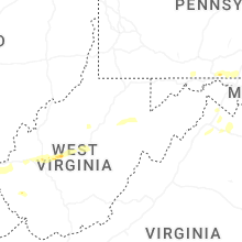
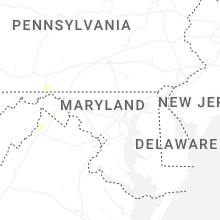
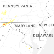


Connect with Interactive Hail Maps