

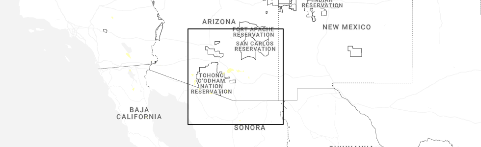
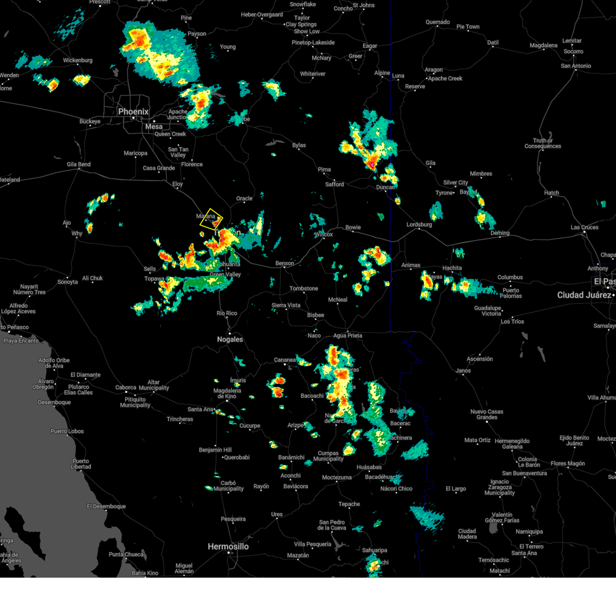
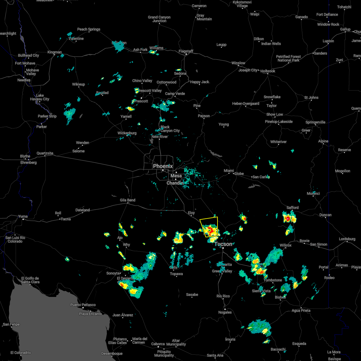
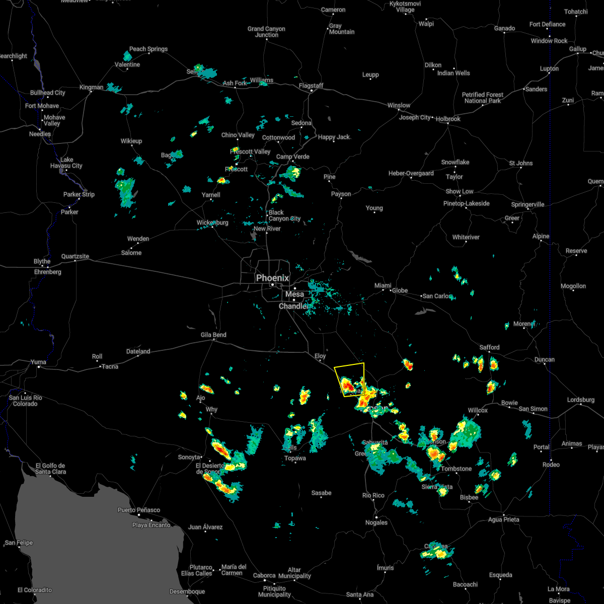
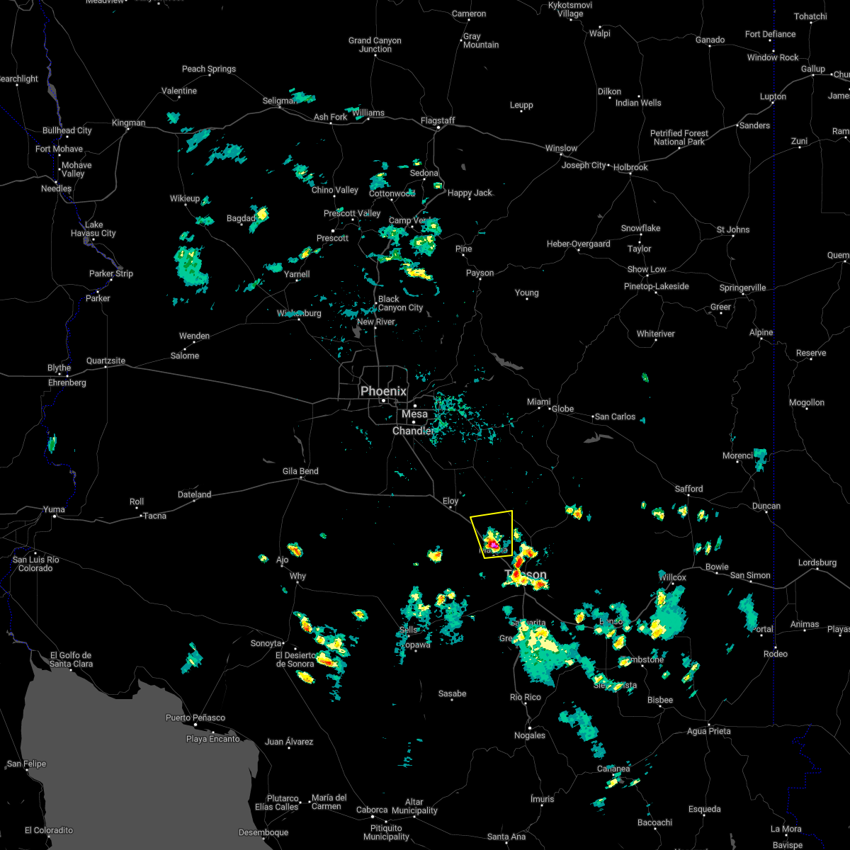
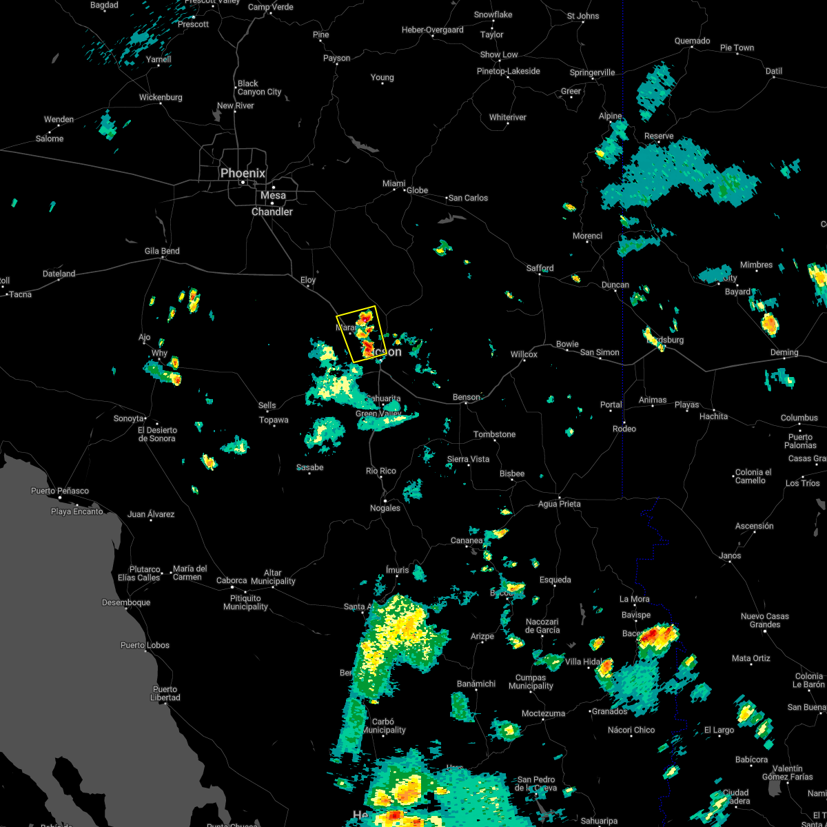
Hail Map for Nelson, AZ
The Nelson, AZ area has had 0 reports of on-the-ground hail by trained spotters, and has been under severe weather warnings 5 times during the past 12 months. Doppler radar has detected hail at or near Nelson, AZ on 29 occasions, including 1 occasion during the past year.
| Name: | Nelson, AZ |
| Where Located: | 22.3 miles NW of Tucson, AZ |
| Map: | Google Map for Nelson, AZ |
| Population: | 259 |
| Housing Units: | 100 |
| More Info: | Search Google for Nelson, AZ |
5
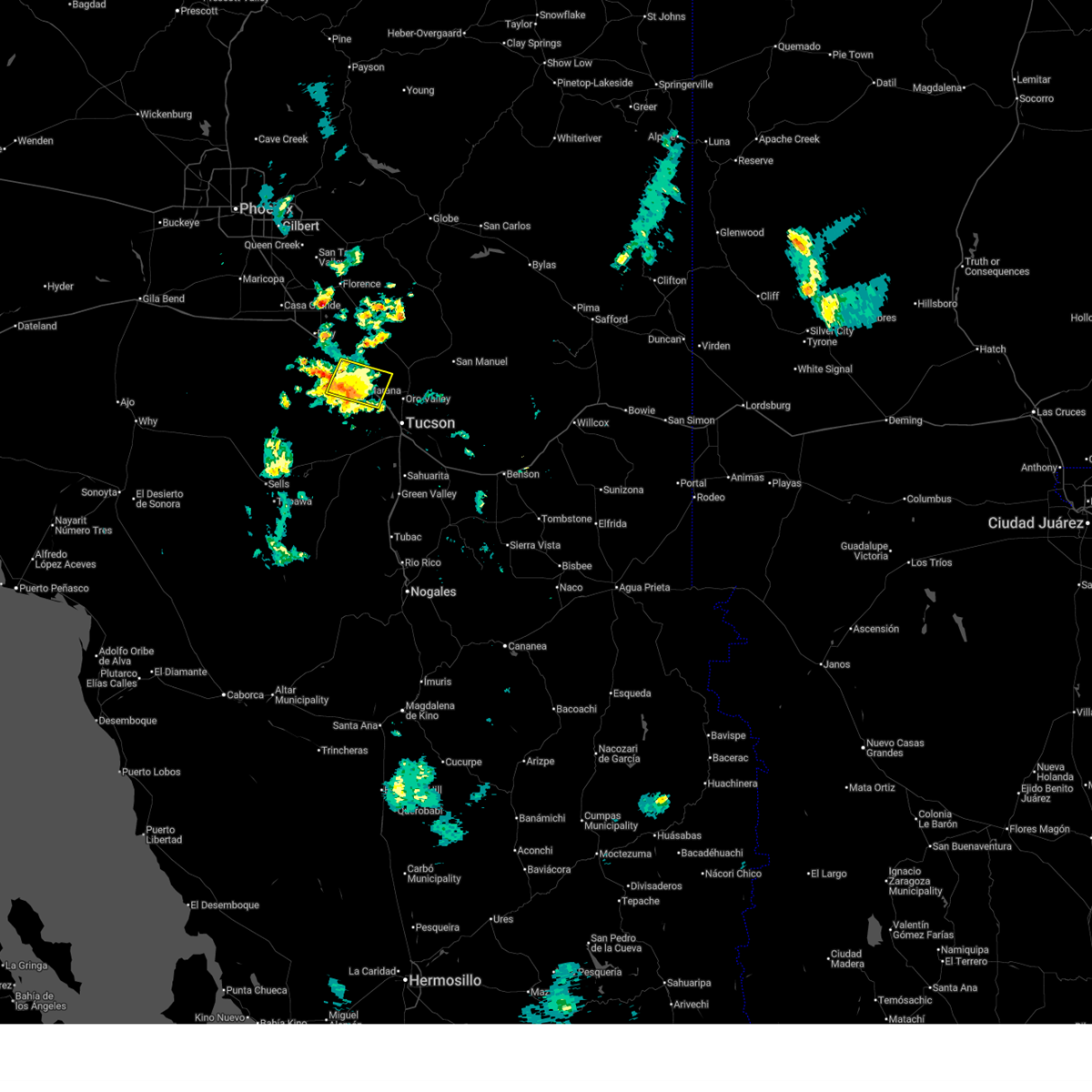
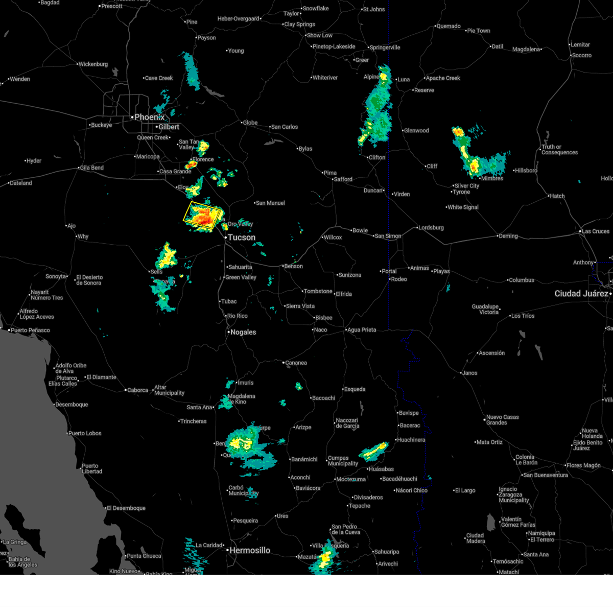
The Top Recent Hail Date for Nelson, AZ is Monday, August 25, 2025 (4th out of 29)
Hail and Wind Damage Spotted near Nelson, AZ
| Date / Time | Report Details |
|---|---|
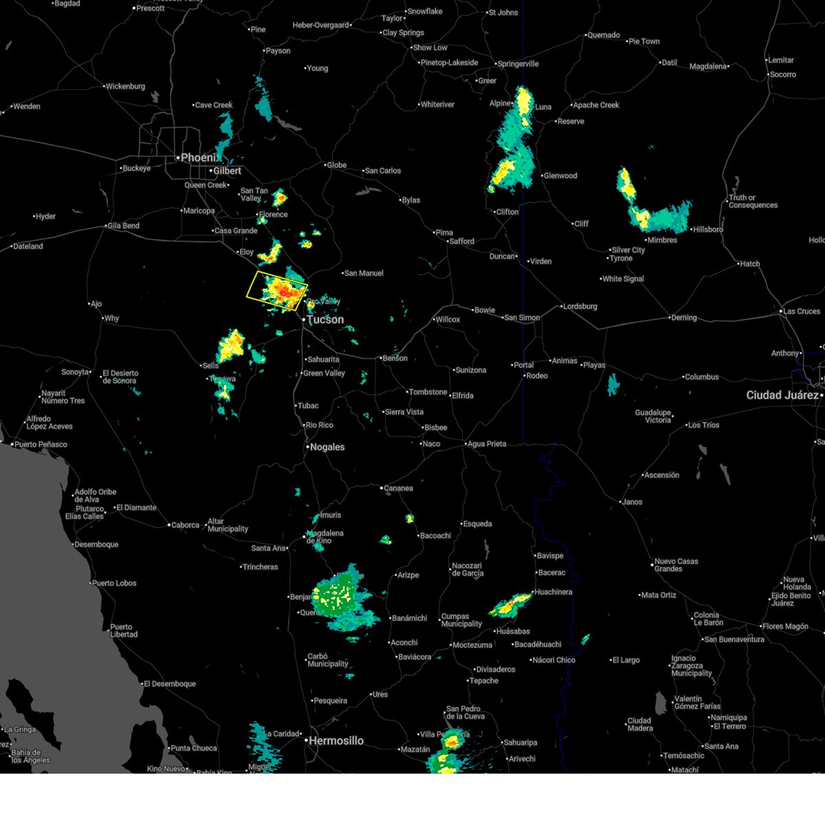
| 8/25/2025 3:49 PM MST |
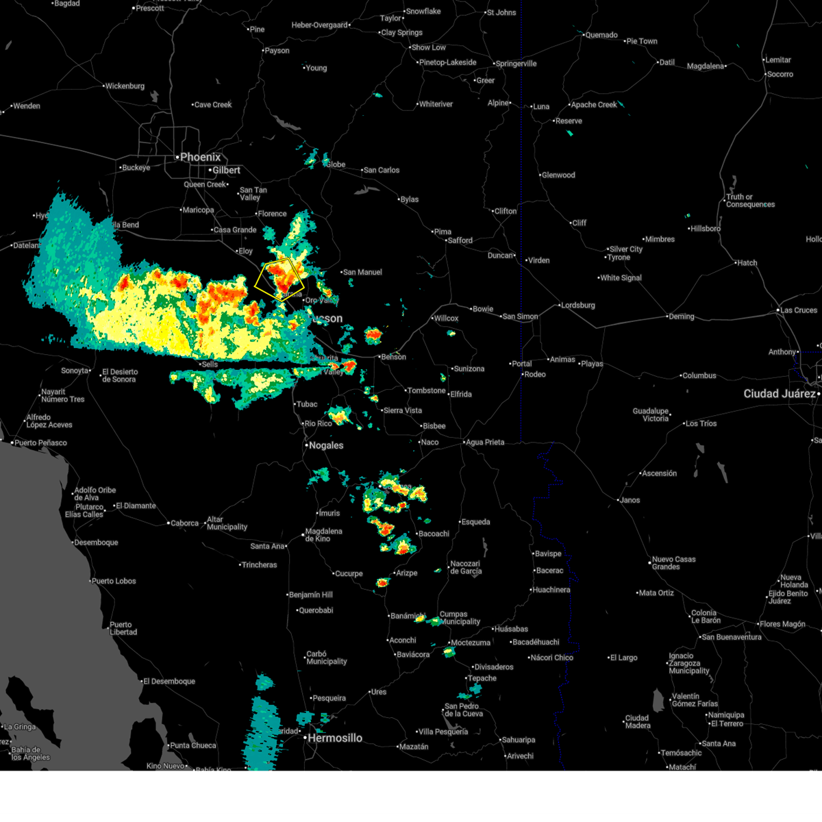 At 349 pm mst, a severe thunderstorm was located 8 miles north of marana, moving northwest at 10 mph (radar indicated). Hazards include 60 mph wind gusts and quarter size hail. Hail damage to vehicles is expected. expect wind damage to roofs, siding, and trees. locations impacted include, oro valley, marana, avra valley, tortolita, pinal airpark, picture rocks, red rock and dove mountain. This includes interstate 10 between mile markers 225 and 243. At 349 pm mst, a severe thunderstorm was located 8 miles north of marana, moving northwest at 10 mph (radar indicated). Hazards include 60 mph wind gusts and quarter size hail. Hail damage to vehicles is expected. expect wind damage to roofs, siding, and trees. locations impacted include, oro valley, marana, avra valley, tortolita, pinal airpark, picture rocks, red rock and dove mountain. This includes interstate 10 between mile markers 225 and 243.
|
| 8/25/2025 3:37 PM MST |
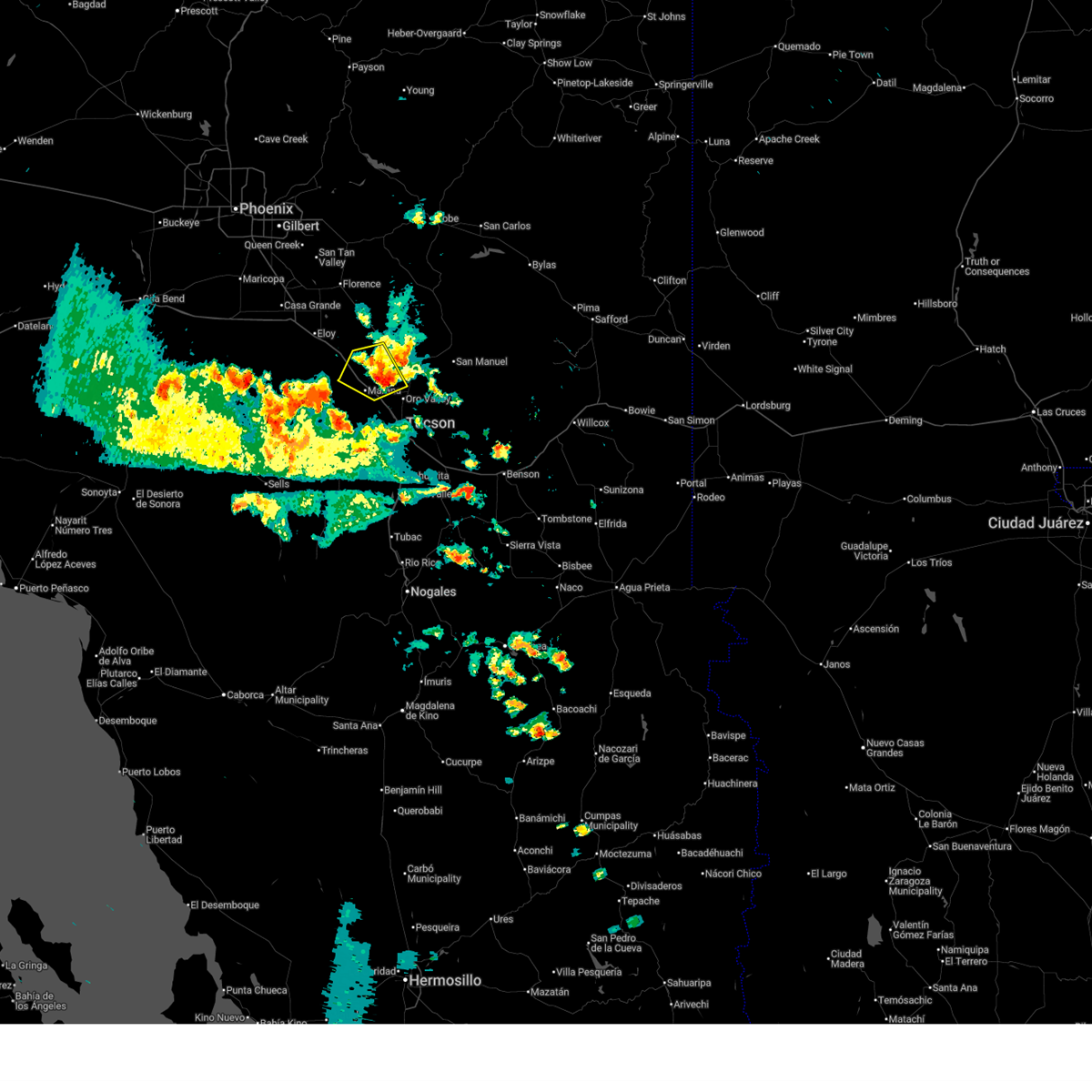 Svrtwc the national weather service in tucson has issued a * severe thunderstorm warning for, northeastern pima county in southeastern arizona, south central pinal county in southeastern arizona, * until 415 pm mst. * at 337 pm mst, a severe thunderstorm was located 6 miles north of marana, moving northwest at 10 mph (radar indicated). Hazards include 60 mph wind gusts and quarter size hail. Hail damage to vehicles is expected. Expect wind damage to roofs, siding, and trees. Svrtwc the national weather service in tucson has issued a * severe thunderstorm warning for, northeastern pima county in southeastern arizona, south central pinal county in southeastern arizona, * until 415 pm mst. * at 337 pm mst, a severe thunderstorm was located 6 miles north of marana, moving northwest at 10 mph (radar indicated). Hazards include 60 mph wind gusts and quarter size hail. Hail damage to vehicles is expected. Expect wind damage to roofs, siding, and trees.
|
| 8/20/2025 7:26 PM MST |
 The storm which prompted the warning has weakened below severe limits, and no longer poses an immediate threat to life or property. therefore, the warning will be allowed to expire. however, gusty winds and heavy rain are still possible with this thunderstorm. The storm which prompted the warning has weakened below severe limits, and no longer poses an immediate threat to life or property. therefore, the warning will be allowed to expire. however, gusty winds and heavy rain are still possible with this thunderstorm.
|
| 8/20/2025 6:59 PM MST |
 At 659 pm mst, a severe thunderstorm was located near avra valley, moving west at 15 mph (radar indicated). Hazards include 60 mph wind gusts. Expect damage to roofs, siding, and trees. locations impacted include, tucson, marana, avra valley, tortolita, pinal airpark, saguaro national park west, picture rocks, red rock and dove mountain. This includes interstate 10 between mile markers 224 and 244. At 659 pm mst, a severe thunderstorm was located near avra valley, moving west at 15 mph (radar indicated). Hazards include 60 mph wind gusts. Expect damage to roofs, siding, and trees. locations impacted include, tucson, marana, avra valley, tortolita, pinal airpark, saguaro national park west, picture rocks, red rock and dove mountain. This includes interstate 10 between mile markers 224 and 244.
|
| 8/20/2025 6:47 PM MST |
 Svrtwc the national weather service in tucson has issued a * severe thunderstorm warning for, north central pima county in southeastern arizona, south central pinal county in southeastern arizona, * until 730 pm mst. * at 647 pm mst, a severe thunderstorm was located near marana, moving west at 15 mph (radar indicated). Hazards include 60 mph wind gusts. Expect damage to roofs, siding, and trees. Blowing dust is also expected. Svrtwc the national weather service in tucson has issued a * severe thunderstorm warning for, north central pima county in southeastern arizona, south central pinal county in southeastern arizona, * until 730 pm mst. * at 647 pm mst, a severe thunderstorm was located near marana, moving west at 15 mph (radar indicated). Hazards include 60 mph wind gusts. Expect damage to roofs, siding, and trees. Blowing dust is also expected.
|
| 8/23/2024 5:06 PM MST |
 The storm which prompted the warning has weakened below severe limits. therefore, the warning will be allowed to expire. however, heavy rain is still possible with this thunderstorm. The storm which prompted the warning has weakened below severe limits. therefore, the warning will be allowed to expire. however, heavy rain is still possible with this thunderstorm.
|
| 8/23/2024 4:26 PM MST |
 Svrtwc the national weather service in tucson has issued a * severe thunderstorm warning for, northeastern pima county in southeastern arizona, * until 515 pm mst. * at 425 pm mst, a severe thunderstorm was located near flowing wells, or 9 miles south of marana, moving north at 10 mph (radar indicated). Hazards include 60 mph wind gusts and nickel size hail. expect damage to roofs, siding, and trees Svrtwc the national weather service in tucson has issued a * severe thunderstorm warning for, northeastern pima county in southeastern arizona, * until 515 pm mst. * at 425 pm mst, a severe thunderstorm was located near flowing wells, or 9 miles south of marana, moving north at 10 mph (radar indicated). Hazards include 60 mph wind gusts and nickel size hail. expect damage to roofs, siding, and trees
|
| 8/23/2024 3:45 PM MST |
 Svrtwc the national weather service in tucson has issued a * severe thunderstorm warning for, northeastern pima county in southeastern arizona, * until 430 pm mst. * at 344 pm mst, a severe thunderstorm was located near saguaro national park west, or 8 miles south of marana, moving north at 10 mph (radar indicated). Hazards include 60 mph wind gusts and penny size hail. expect damage to roofs, siding, and trees Svrtwc the national weather service in tucson has issued a * severe thunderstorm warning for, northeastern pima county in southeastern arizona, * until 430 pm mst. * at 344 pm mst, a severe thunderstorm was located near saguaro national park west, or 8 miles south of marana, moving north at 10 mph (radar indicated). Hazards include 60 mph wind gusts and penny size hail. expect damage to roofs, siding, and trees
|
| 8/8/2024 5:28 PM MST |
 The storm which prompted the warning has weakened below severe limits, and no longer poses an immediate threat to life or property. therefore, the warning will be allowed to expire. however, gusty winds and brief heavy rain are still possible with this thunderstorm. The storm which prompted the warning has weakened below severe limits, and no longer poses an immediate threat to life or property. therefore, the warning will be allowed to expire. however, gusty winds and brief heavy rain are still possible with this thunderstorm.
|
| 8/8/2024 5:16 PM MST |
 At 516 pm mst, a severe thunderstorm was located over marana, moving northwest at 10 mph (radar indicated). Hazards include 60 mph wind gusts and quarter size hail. Hail damage to vehicles is expected. expect wind damage to roofs, siding, and trees. locations impacted include, marana, picture rocks, and dove mountain. This includes interstate 10 between mile markers 236 and 243. At 516 pm mst, a severe thunderstorm was located over marana, moving northwest at 10 mph (radar indicated). Hazards include 60 mph wind gusts and quarter size hail. Hail damage to vehicles is expected. expect wind damage to roofs, siding, and trees. locations impacted include, marana, picture rocks, and dove mountain. This includes interstate 10 between mile markers 236 and 243.
|
| 8/8/2024 4:57 PM MST |
 Svrtwc the national weather service in tucson has issued a * severe thunderstorm warning for, northeastern pima county in southeastern arizona, southeastern pinal county in southeastern arizona, * until 530 pm mst. * at 457 pm mst, a severe thunderstorm was located over marana, moving northwest at 10 mph (radar indicated). Hazards include 60 mph wind gusts and quarter size hail. Hail damage to vehicles is expected. Expect wind damage to roofs, siding, and trees. Svrtwc the national weather service in tucson has issued a * severe thunderstorm warning for, northeastern pima county in southeastern arizona, southeastern pinal county in southeastern arizona, * until 530 pm mst. * at 457 pm mst, a severe thunderstorm was located over marana, moving northwest at 10 mph (radar indicated). Hazards include 60 mph wind gusts and quarter size hail. Hail damage to vehicles is expected. Expect wind damage to roofs, siding, and trees.
|
| 7/25/2024 6:28 PM MST |
 the severe thunderstorm warning has been cancelled and is no longer in effect the severe thunderstorm warning has been cancelled and is no longer in effect
|
| 7/25/2024 6:18 PM MST |
 Svrtwc the national weather service in tucson has issued a * severe thunderstorm warning for, north central pima county in southeastern arizona, south central pinal county in southeastern arizona, * until 700 pm mst. * at 616 pm mst, a severe thunderstorm was located over pinal airpark, or 11 miles northwest of marana, and is nearly stationary (radar indicated). Hazards include 60 mph wind gusts and quarter size hail. Hail damage to vehicles is expected. Expect wind damage to roofs, siding, and trees. Svrtwc the national weather service in tucson has issued a * severe thunderstorm warning for, north central pima county in southeastern arizona, south central pinal county in southeastern arizona, * until 700 pm mst. * at 616 pm mst, a severe thunderstorm was located over pinal airpark, or 11 miles northwest of marana, and is nearly stationary (radar indicated). Hazards include 60 mph wind gusts and quarter size hail. Hail damage to vehicles is expected. Expect wind damage to roofs, siding, and trees.
|
| 7/14/2024 7:24 PM MST |
 Svrtwc the national weather service in tucson has issued a * severe thunderstorm warning for, north central pima county in southeastern arizona, southwestern pinal county in southeastern arizona, * until 815 pm mst. * at 722 pm mst, severe thunderstorms were located along a line extending from 8 miles southwest of chui-chu to 13 miles south of arizona city to 10 miles west of avra valley, moving northwest at 25 mph (radar indicated). Hazards include 70 mph wind gusts and quarter size hail. Hail damage to vehicles is expected. expect considerable tree damage. Wind damage is also likely to mobile homes, roofs, and outbuildings. Svrtwc the national weather service in tucson has issued a * severe thunderstorm warning for, north central pima county in southeastern arizona, southwestern pinal county in southeastern arizona, * until 815 pm mst. * at 722 pm mst, severe thunderstorms were located along a line extending from 8 miles southwest of chui-chu to 13 miles south of arizona city to 10 miles west of avra valley, moving northwest at 25 mph (radar indicated). Hazards include 70 mph wind gusts and quarter size hail. Hail damage to vehicles is expected. expect considerable tree damage. Wind damage is also likely to mobile homes, roofs, and outbuildings.
|
| 7/14/2024 6:48 PM MST |
 At 647 pm mst, severe thunderstorms were located along a line extending from 9 miles south of chui-chu to 9 miles southwest of picacho peak state park to near avra valley, moving northwest at 10 mph (radar indicated). Hazards include 70 mph wind gusts and quarter size hail. Hail damage to vehicles is expected. expect considerable tree damage. wind damage is also likely to mobile homes, roofs, and outbuildings. locations impacted include, marana, eloy, avra valley, picacho, picacho peak state park, pinal airpark, picture rocks, red rock, north komelik, queens well, jack rabbit, shopishk, east chui-chu, and silver bell. this includes the following highways, interstate 10 between mile markers 206 and 236. Route 87 between mile markers 116 and 122. At 647 pm mst, severe thunderstorms were located along a line extending from 9 miles south of chui-chu to 9 miles southwest of picacho peak state park to near avra valley, moving northwest at 10 mph (radar indicated). Hazards include 70 mph wind gusts and quarter size hail. Hail damage to vehicles is expected. expect considerable tree damage. wind damage is also likely to mobile homes, roofs, and outbuildings. locations impacted include, marana, eloy, avra valley, picacho, picacho peak state park, pinal airpark, picture rocks, red rock, north komelik, queens well, jack rabbit, shopishk, east chui-chu, and silver bell. this includes the following highways, interstate 10 between mile markers 206 and 236. Route 87 between mile markers 116 and 122.
|
| 7/14/2024 6:26 PM MST |
 Svrtwc the national weather service in tucson has issued a * severe thunderstorm warning for, north central pima county in southeastern arizona, southwestern pinal county in southeastern arizona, * until 730 pm mst. * at 625 pm mst, an area of severe severe thunderstorm was located along and west of interstate-10, 11 miles southwest of picacho peak state park, or 25 miles south of casa grande, moving northwest at 10 mph (radar indicated). Hazards include 60 mph wind gusts and quarter size hail. Hail damage to vehicles is expected. Expect wind damage to roofs, siding, and trees. Svrtwc the national weather service in tucson has issued a * severe thunderstorm warning for, north central pima county in southeastern arizona, southwestern pinal county in southeastern arizona, * until 730 pm mst. * at 625 pm mst, an area of severe severe thunderstorm was located along and west of interstate-10, 11 miles southwest of picacho peak state park, or 25 miles south of casa grande, moving northwest at 10 mph (radar indicated). Hazards include 60 mph wind gusts and quarter size hail. Hail damage to vehicles is expected. Expect wind damage to roofs, siding, and trees.
|
| 7/1/2024 1:42 PM MST |
 the severe thunderstorm warning has been cancelled and is no longer in effect the severe thunderstorm warning has been cancelled and is no longer in effect
|
| 7/1/2024 1:26 PM MST |
 Svrtwc the national weather service in tucson has issued a * severe thunderstorm warning for, north central pima county in southeastern arizona, * until 200 pm mst. * at 126 pm mst, a severe thunderstorm was located near avra valley, or 8 miles southwest of marana, moving northeast at 20 mph (radar indicated). Hazards include 60 mph wind gusts and quarter size hail. Hail damage to vehicles is expected. Expect wind damage to roofs, siding, and trees. Svrtwc the national weather service in tucson has issued a * severe thunderstorm warning for, north central pima county in southeastern arizona, * until 200 pm mst. * at 126 pm mst, a severe thunderstorm was located near avra valley, or 8 miles southwest of marana, moving northeast at 20 mph (radar indicated). Hazards include 60 mph wind gusts and quarter size hail. Hail damage to vehicles is expected. Expect wind damage to roofs, siding, and trees.
|
| 6/28/2024 4:17 PM MST |
 Svrtwc the national weather service in tucson has issued a * severe thunderstorm warning for, northeastern pima county in southeastern arizona, southeastern pinal county in southeastern arizona, * until 500 pm mst. * at 416 pm mst, a severe thunderstorm was located over marana, moving east at 15 mph (radar indicated). Hazards include 60 mph wind gusts and penny size hail. expect damage to roofs, siding, and trees Svrtwc the national weather service in tucson has issued a * severe thunderstorm warning for, northeastern pima county in southeastern arizona, southeastern pinal county in southeastern arizona, * until 500 pm mst. * at 416 pm mst, a severe thunderstorm was located over marana, moving east at 15 mph (radar indicated). Hazards include 60 mph wind gusts and penny size hail. expect damage to roofs, siding, and trees
|
| 8/31/2023 7:26 PM MST |
 The severe thunderstorm warning for north central pima and south central pinal counties will expire at 730 pm mst, the storm which prompted the warning has weakened below severe limits, and no longer poses an immediate threat to life or property. therefore, the warning will be allowed to expire. however gusty winds are still possible with this thunderstorm. The severe thunderstorm warning for north central pima and south central pinal counties will expire at 730 pm mst, the storm which prompted the warning has weakened below severe limits, and no longer poses an immediate threat to life or property. therefore, the warning will be allowed to expire. however gusty winds are still possible with this thunderstorm.
|
| 8/31/2023 7:05 PM MST |
 At 704 pm mst, a severe thunderstorm was located 7 miles northwest of avra valley, or 18 miles west of marana, moving west at 20 mph (radar indicated). Hazards include 60 mph wind gusts and quarter size hail. also blowing dust reducing visibility to less than a quarter mile. Hail damage to vehicles is expected. expect wind damage to roofs, siding, and trees. locations impacted include, marana, avra valley, picacho peak state park, picture rocks, red rock and silver bell. hail threat, radar indicated max hail size, 1. 00 in wind threat, radar indicated max wind gust, 60 mph. At 704 pm mst, a severe thunderstorm was located 7 miles northwest of avra valley, or 18 miles west of marana, moving west at 20 mph (radar indicated). Hazards include 60 mph wind gusts and quarter size hail. also blowing dust reducing visibility to less than a quarter mile. Hail damage to vehicles is expected. expect wind damage to roofs, siding, and trees. locations impacted include, marana, avra valley, picacho peak state park, picture rocks, red rock and silver bell. hail threat, radar indicated max hail size, 1. 00 in wind threat, radar indicated max wind gust, 60 mph.
|
| 8/31/2023 6:42 PM MST |
 At 641 pm mst, a severe thunderstorm was located over avra valley, or 10 miles west of marana, moving west at 20 mph (radar indicated). Hazards include 60 mph wind gusts and quarter size hail. Hail damage to vehicles is expected. Expect wind damage to roofs, siding, and trees. At 641 pm mst, a severe thunderstorm was located over avra valley, or 10 miles west of marana, moving west at 20 mph (radar indicated). Hazards include 60 mph wind gusts and quarter size hail. Hail damage to vehicles is expected. Expect wind damage to roofs, siding, and trees.
|
| 8/17/2023 4:23 PM MST |
 The severe thunderstorm warning for north central pima and south central pinal counties will expire at 430 pm mst, the storm which prompted the warning has weakened below severe limits, and has exited the warned area. therefore, the warning will be allowed to expire. however gusty winds are still possible with this thunderstorm. The severe thunderstorm warning for north central pima and south central pinal counties will expire at 430 pm mst, the storm which prompted the warning has weakened below severe limits, and has exited the warned area. therefore, the warning will be allowed to expire. however gusty winds are still possible with this thunderstorm.
|
| 8/17/2023 3:45 PM MST |
 At 345 pm mst, a severe thunderstorm was located over avra valley, or 9 miles west of marana, moving northwest at 5 mph (radar indicated). Hazards include 60 mph wind gusts and quarter size hail. Hail damage to vehicles is expected. Expect wind damage to roofs, siding, and trees. At 345 pm mst, a severe thunderstorm was located over avra valley, or 9 miles west of marana, moving northwest at 5 mph (radar indicated). Hazards include 60 mph wind gusts and quarter size hail. Hail damage to vehicles is expected. Expect wind damage to roofs, siding, and trees.
|
| 7/31/2023 8:10 PM MST |
 The severe thunderstorm warning for north central pima and south central pinal counties will expire at 815 pm mst, the storm which prompted the warning has moved out of the area. therefore, the warning will be allowed to expire. however gusty winds are still possible with this thunderstorm. remember, a severe thunderstorm warning still remains in effect for southeast pinal county, including red rock and picacho peak. The severe thunderstorm warning for north central pima and south central pinal counties will expire at 815 pm mst, the storm which prompted the warning has moved out of the area. therefore, the warning will be allowed to expire. however gusty winds are still possible with this thunderstorm. remember, a severe thunderstorm warning still remains in effect for southeast pinal county, including red rock and picacho peak.
|
| 7/31/2023 7:46 PM MST |
 At 744 pm mst, a severe thunderstorm was located near avra valley, or 13 miles northwest of marana, moving northwest at 15 mph (radar indicated. at 735pm mst, a 72 mph wind gust was reported at marana airport). Hazards include 70 mph wind gusts and penny size hail. Expect considerable tree damage. damage is likely to mobile homes, roofs, and outbuildings. locations impacted include, marana, avra valley, picacho peak state park, saguaro national park west, picture rocks, red rock, silver bell and dove mountain. thunderstorm damage threat, considerable hail threat, radar indicated max hail size, 0. 75 in wind threat, observed max wind gust, 70 mph. At 744 pm mst, a severe thunderstorm was located near avra valley, or 13 miles northwest of marana, moving northwest at 15 mph (radar indicated. at 735pm mst, a 72 mph wind gust was reported at marana airport). Hazards include 70 mph wind gusts and penny size hail. Expect considerable tree damage. damage is likely to mobile homes, roofs, and outbuildings. locations impacted include, marana, avra valley, picacho peak state park, saguaro national park west, picture rocks, red rock, silver bell and dove mountain. thunderstorm damage threat, considerable hail threat, radar indicated max hail size, 0. 75 in wind threat, observed max wind gust, 70 mph.
|
| 7/31/2023 7:30 PM MST |
 At 729 pm mst, a severe thunderstorm was located near avra valley, or 8 miles west of marana, moving northwest at 15 mph (radar indicated). Hazards include 60 mph wind gusts and penny size hail. expect damage to roofs, siding, and trees At 729 pm mst, a severe thunderstorm was located near avra valley, or 8 miles west of marana, moving northwest at 15 mph (radar indicated). Hazards include 60 mph wind gusts and penny size hail. expect damage to roofs, siding, and trees
|
| 7/31/2023 7:12 PM MST |
 At 710 pm mst, a line of severe thunderstorms from dove mmountain to almost three points continued to move to the northwest at 15 mph with damaging winds, frequent lightning and very heavy rains the major threats (radar indicated). Hazards include 60 mph wind gusts and penny size hail. Expect damage to roofs, siding, and trees. locations impacted include, tucson, catalina, oro valley, marana, casas adobes, drexel heights, flowing wells, saddlebrooke, three points, avra valley, pascua pueblo yaqui reservation, tortolita, tucson estates, saguaro national park west, valencia west, catalina foothills, picture rocks, dove mountain, san xavier mission and oracle junction. hail threat, radar indicated max hail size, 0. 75 in wind threat, radar indicated max wind gust, 60 mph. At 710 pm mst, a line of severe thunderstorms from dove mmountain to almost three points continued to move to the northwest at 15 mph with damaging winds, frequent lightning and very heavy rains the major threats (radar indicated). Hazards include 60 mph wind gusts and penny size hail. Expect damage to roofs, siding, and trees. locations impacted include, tucson, catalina, oro valley, marana, casas adobes, drexel heights, flowing wells, saddlebrooke, three points, avra valley, pascua pueblo yaqui reservation, tortolita, tucson estates, saguaro national park west, valencia west, catalina foothills, picture rocks, dove mountain, san xavier mission and oracle junction. hail threat, radar indicated max hail size, 0. 75 in wind threat, radar indicated max wind gust, 60 mph.
|
| 7/31/2023 6:41 PM MST |
 At 641 pm mst, severe thunderstorms were located along a line extending from near saddlebrooke to flowing wells to 7 miles south of pascua pueblo yaqui reservation, moving northwest at 15 mph (radar indicated). Hazards include 60 mph wind gusts and penny size hail. expect damage to roofs, siding, and trees At 641 pm mst, severe thunderstorms were located along a line extending from near saddlebrooke to flowing wells to 7 miles south of pascua pueblo yaqui reservation, moving northwest at 15 mph (radar indicated). Hazards include 60 mph wind gusts and penny size hail. expect damage to roofs, siding, and trees
|
| 7/30/2023 6:41 PM MST |
 At 640 pm mst, a severe thunderstorm was located 8 miles south of avra valley, or 12 miles southwest of marana, moving west at 15 mph (radar indicated). Hazards include 60 mph wind gusts and quarter size hail. Hail damage to vehicles is expected. Expect wind damage to roofs, siding, and trees. At 640 pm mst, a severe thunderstorm was located 8 miles south of avra valley, or 12 miles southwest of marana, moving west at 15 mph (radar indicated). Hazards include 60 mph wind gusts and quarter size hail. Hail damage to vehicles is expected. Expect wind damage to roofs, siding, and trees.
|
| 7/17/2023 5:16 PM MST |
 At 514 pm mst, an area of severe thunderstorms was located near marana and oro valley, moving northwest at 15 mph (radar indicated). Hazards include 60 mph wind gusts and quarter size hail. Hail damage to vehicles is expected. expect wind damage to roofs, siding, and trees. locations impacted include, tucson, catalina, oro valley, marana, casas adobes, drexel heights, flowing wells, saddlebrooke, avra valley, tortolita, catalina state park, tucson estates, saguaro national park west, catalina foothills, valencia west, picture rocks, dove mountain and ryan airfield. hail threat, radar indicated max hail size, 1. 00 in wind threat, radar indicated max wind gust, 60 mph. At 514 pm mst, an area of severe thunderstorms was located near marana and oro valley, moving northwest at 15 mph (radar indicated). Hazards include 60 mph wind gusts and quarter size hail. Hail damage to vehicles is expected. expect wind damage to roofs, siding, and trees. locations impacted include, tucson, catalina, oro valley, marana, casas adobes, drexel heights, flowing wells, saddlebrooke, avra valley, tortolita, catalina state park, tucson estates, saguaro national park west, catalina foothills, valencia west, picture rocks, dove mountain and ryan airfield. hail threat, radar indicated max hail size, 1. 00 in wind threat, radar indicated max wind gust, 60 mph.
|
| 7/17/2023 4:48 PM MST |
 At 447 pm mst, an are of severe thunderstorms was located over northwest, central and southwest tucson, moving west and northwest at 15 to 20 mph (radar indicated). Hazards include 60 mph wind gusts and quarter size hail. Hail damage to vehicles is expected. Expect wind damage to roofs, siding, and trees. At 447 pm mst, an are of severe thunderstorms was located over northwest, central and southwest tucson, moving west and northwest at 15 to 20 mph (radar indicated). Hazards include 60 mph wind gusts and quarter size hail. Hail damage to vehicles is expected. Expect wind damage to roofs, siding, and trees.
|
| 10/7/2022 4:11 PM MST |
 The severe thunderstorm warning for northeastern pima and south central pinal counties will expire at 415 pm mst, the storm which prompted the warning has weakened below severe limits, and no longer poses an immediate threat to life or property. therefore, the warning will be allowed to expire. however, gusty winds with areas of blowing dust, and heavy rain are still possible with this thunderstorm. The severe thunderstorm warning for northeastern pima and south central pinal counties will expire at 415 pm mst, the storm which prompted the warning has weakened below severe limits, and no longer poses an immediate threat to life or property. therefore, the warning will be allowed to expire. however, gusty winds with areas of blowing dust, and heavy rain are still possible with this thunderstorm.
|
| 10/7/2022 3:49 PM MST |
 At 348 pm mst, a severe thunderstorm was located 10 miles northwest of marana, moving northwest at 15 mph (radar indicated). Hazards include 60 mph wind gusts, quarter size hail, and areas of blowing dust with low visibilities. Hail damage to vehicles is expected. expect wind damage to roofs, siding, and trees. locations impacted include, marana, red rock and dove mountain, and portions of interstate 10. hail threat, radar indicated max hail size, 1. 00 in wind threat, radar indicated max wind gust, 60 mph. At 348 pm mst, a severe thunderstorm was located 10 miles northwest of marana, moving northwest at 15 mph (radar indicated). Hazards include 60 mph wind gusts, quarter size hail, and areas of blowing dust with low visibilities. Hail damage to vehicles is expected. expect wind damage to roofs, siding, and trees. locations impacted include, marana, red rock and dove mountain, and portions of interstate 10. hail threat, radar indicated max hail size, 1. 00 in wind threat, radar indicated max wind gust, 60 mph.
|
| 10/7/2022 3:29 PM MST |
 At 328 pm mst, a severe thunderstorm was located 7 miles northwest of marana, moving north at 10 to 15 mph (radar indicated). Hazards include 60 mph wind gusts, quarter size hail, and blowing dust with low visibilities. Hail damage to vehicles is expected. Expect wind damage to roofs, siding, and trees. At 328 pm mst, a severe thunderstorm was located 7 miles northwest of marana, moving north at 10 to 15 mph (radar indicated). Hazards include 60 mph wind gusts, quarter size hail, and blowing dust with low visibilities. Hail damage to vehicles is expected. Expect wind damage to roofs, siding, and trees.
|
| 9/21/2022 3:57 PM MST |
 At 356 pm mst, a severe thunderstorm was located near avra valley, or near marana, moving northeast at 15 mph (radar indicated). Hazards include 60 mph wind gusts and quarter size hail. Hail damage to vehicles is expected. Expect wind damage to roofs, siding, and trees. At 356 pm mst, a severe thunderstorm was located near avra valley, or near marana, moving northeast at 15 mph (radar indicated). Hazards include 60 mph wind gusts and quarter size hail. Hail damage to vehicles is expected. Expect wind damage to roofs, siding, and trees.
|
| 8/9/2022 4:10 PM MST |
 The severe thunderstorm warning for northeastern pima and southeastern pinal counties will expire at 415 pm mst, the storm which prompted the warning has weakened below severe limits, and no longer poses an immediate threat to life or property. therefore, the warning will be allowed to expire. The severe thunderstorm warning for northeastern pima and southeastern pinal counties will expire at 415 pm mst, the storm which prompted the warning has weakened below severe limits, and no longer poses an immediate threat to life or property. therefore, the warning will be allowed to expire.
|
| 8/9/2022 3:45 PM MST |
 At 343 pm mst, a severe thunderstorm was located near casas adobes, or near marana, moving north at 5 mph (trained weather spotters. at 341 pm a spotter reported a two trees down near thornydale and cortaro roads). Hazards include 60 mph wind gusts and quarter size hail. Hail damage to vehicles is expected. expect wind damage to roofs, siding, and trees. locations impacted include, tucson, oro valley, marana, casas adobes, flowing wells, tortolita, saguaro national park west, catalina foothills, tucson estates, picture rocks and dove mountain. hail threat, radar indicated max hail size, 1. 00 in wind threat, radar indicated max wind gust, 60 mph. At 343 pm mst, a severe thunderstorm was located near casas adobes, or near marana, moving north at 5 mph (trained weather spotters. at 341 pm a spotter reported a two trees down near thornydale and cortaro roads). Hazards include 60 mph wind gusts and quarter size hail. Hail damage to vehicles is expected. expect wind damage to roofs, siding, and trees. locations impacted include, tucson, oro valley, marana, casas adobes, flowing wells, tortolita, saguaro national park west, catalina foothills, tucson estates, picture rocks and dove mountain. hail threat, radar indicated max hail size, 1. 00 in wind threat, radar indicated max wind gust, 60 mph.
|
| 8/9/2022 3:33 PM MST |
 At 333 pm mst, a severe thunderstorm was located near casas adobes, or 7 miles southeast of marana, moving north at 5 mph (radar indicated). Hazards include 60 mph wind gusts and quarter size hail. Hail damage to vehicles is expected. Expect wind damage to roofs, siding, and trees. At 333 pm mst, a severe thunderstorm was located near casas adobes, or 7 miles southeast of marana, moving north at 5 mph (radar indicated). Hazards include 60 mph wind gusts and quarter size hail. Hail damage to vehicles is expected. Expect wind damage to roofs, siding, and trees.
|
| 7/30/2022 2:56 PM MST |
 The severe thunderstorm warning for northeastern pima and southeastern pinal counties will expire at 300 pm mst, the storm which prompted the warning has weakened below severe limits, and no longer poses an immediate threat to life or property. therefore, the warning will be allowed to expire. however gusty winds and heavy rain are still possible with this thunderstorm. The severe thunderstorm warning for northeastern pima and southeastern pinal counties will expire at 300 pm mst, the storm which prompted the warning has weakened below severe limits, and no longer poses an immediate threat to life or property. therefore, the warning will be allowed to expire. however gusty winds and heavy rain are still possible with this thunderstorm.
|
| 7/30/2022 2:34 PM MST |
 At 233 pm mst, a severe thunderstorm was located near marana, moving northwest at 20 mph (radar indicated). Hazards include 60 mph wind gusts and quarter size hail. Hail damage to vehicles is expected. Expect wind damage to roofs, siding, and trees. At 233 pm mst, a severe thunderstorm was located near marana, moving northwest at 20 mph (radar indicated). Hazards include 60 mph wind gusts and quarter size hail. Hail damage to vehicles is expected. Expect wind damage to roofs, siding, and trees.
|
| 7/15/2022 5:27 PM MST |
 At 527 pm mst, a severe thunderstorm was located near marana, moving northwest at 5 mph (radar indicated). Hazards include 60 mph wind gusts and quarter size hail. Hail damage to vehicles is expected. expect wind damage to roofs, siding, and trees. locations impacted include, marana, avra valley, picture rocks and dove mountain. hail threat, radar indicated max hail size, 1. 00 in wind threat, radar indicated max wind gust, 60 mph. At 527 pm mst, a severe thunderstorm was located near marana, moving northwest at 5 mph (radar indicated). Hazards include 60 mph wind gusts and quarter size hail. Hail damage to vehicles is expected. expect wind damage to roofs, siding, and trees. locations impacted include, marana, avra valley, picture rocks and dove mountain. hail threat, radar indicated max hail size, 1. 00 in wind threat, radar indicated max wind gust, 60 mph.
|
| 7/15/2022 5:00 PM MST |
 At 500 pm mst, a severe thunderstorm was located near marana, moving northwest at 5 mph (radar indicated). Hazards include 60 mph wind gusts and quarter size hail. Hail damage to vehicles is expected. expect wind damage to roofs, siding, and trees. Blowing dust may also reduce visibility to one mile or less. At 500 pm mst, a severe thunderstorm was located near marana, moving northwest at 5 mph (radar indicated). Hazards include 60 mph wind gusts and quarter size hail. Hail damage to vehicles is expected. expect wind damage to roofs, siding, and trees. Blowing dust may also reduce visibility to one mile or less.
|
| 7/14/2022 4:35 PM MST |
 At 434 pm mst, a severe thunderstorm was located near avra valley, or 12 miles southwest of marana, moving west at 15 mph (radar indicated). Hazards include 60 mph wind gusts. Expect damage to roofs, siding, and trees. locations impacted include, marana, avra valley, saguaro national park west, picture rocks and silver bell. hail threat, radar indicated max hail size, <. 75 in wind threat, radar indicated max wind gust, 60 mph. At 434 pm mst, a severe thunderstorm was located near avra valley, or 12 miles southwest of marana, moving west at 15 mph (radar indicated). Hazards include 60 mph wind gusts. Expect damage to roofs, siding, and trees. locations impacted include, marana, avra valley, saguaro national park west, picture rocks and silver bell. hail threat, radar indicated max hail size, <. 75 in wind threat, radar indicated max wind gust, 60 mph.
|
| 7/14/2022 4:23 PM MST |
 At 423 pm mst, a severe thunderstorm was located 7 miles west of saguaro national park west, or 10 miles southwest of marana, moving west at 15 mph (radar indicated). Hazards include 60 mph wind gusts and quarter size hail. Hail damage to vehicles is expected. Expect wind damage to roofs, siding, and trees. At 423 pm mst, a severe thunderstorm was located 7 miles west of saguaro national park west, or 10 miles southwest of marana, moving west at 15 mph (radar indicated). Hazards include 60 mph wind gusts and quarter size hail. Hail damage to vehicles is expected. Expect wind damage to roofs, siding, and trees.
|
| 8/28/2021 5:57 PM MST |
 The severe thunderstorm warning for northeastern pima and southeastern pinal counties will expire at 600 pm mst, the storms which prompted the warning have weakened below severe limits, and no longer pose an immediate threat to life or property. therefore, the warning will be allowed to expire. however gusty winds and heavy rain are still possible with these thunderstorms. a flash flood warning remains in effect for much of the region. The severe thunderstorm warning for northeastern pima and southeastern pinal counties will expire at 600 pm mst, the storms which prompted the warning have weakened below severe limits, and no longer pose an immediate threat to life or property. therefore, the warning will be allowed to expire. however gusty winds and heavy rain are still possible with these thunderstorms. a flash flood warning remains in effect for much of the region.
|
| 8/28/2021 5:27 PM MST |
 At 525 pm mst, severe thunderstorms were located along a line extending from 6 miles north of saddlebrooke to near casas adobes, moving west at 15 mph (radar indicated). Hazards include 60 mph wind gusts and penny size hail. Expect damage to roofs, siding, and trees. locations impacted include, marana, flowing wells, saddlebrooke, avra valley, tortolita, saguaro national park west, picture rocks, red rock, dove mountain hail threat, radar indicated max hail size, 0. 75 in wind threat, radar indicated max wind gust, 60 mph. At 525 pm mst, severe thunderstorms were located along a line extending from 6 miles north of saddlebrooke to near casas adobes, moving west at 15 mph (radar indicated). Hazards include 60 mph wind gusts and penny size hail. Expect damage to roofs, siding, and trees. locations impacted include, marana, flowing wells, saddlebrooke, avra valley, tortolita, saguaro national park west, picture rocks, red rock, dove mountain hail threat, radar indicated max hail size, 0. 75 in wind threat, radar indicated max wind gust, 60 mph.
|
| 8/28/2021 4:58 PM MST |
 At 457 pm mst, severe thunderstorms were located along a line extending from oracle to near flowing wells, moving west at 15 mph (radar indicated). Hazards include 60 mph wind gusts and penny size hail. expect damage to roofs, siding, and trees At 457 pm mst, severe thunderstorms were located along a line extending from oracle to near flowing wells, moving west at 15 mph (radar indicated). Hazards include 60 mph wind gusts and penny size hail. expect damage to roofs, siding, and trees
|
| 7/23/2021 12:20 AM MST |
 At 1217 am mst, an area of severe thunderstorms with extremely heavy rainfall was located near northwest tucson and marana, moving northwest at 15 mph (radar indicated). Hazards include 60 mph wind gusts, torrential downpours. Expect damage to roofs, siding, and trees. locations impacted include, northwest tucson, catalina, oro valley, marana, sahuarita, casas adobes, drexel heights, flowing wells, three points, avra valley, tortolita, east sahuarita, sabino canyon recreation area, summit and tucson estates. this includes the following highways, interstate 10 between mile markers 233 and 280. interstate 19 between mile markers 45 and 63. route 77 between mile markers 70 and 86. route 86 between mile markers 150 and 171. Route 286 between mile markers 44 and 45. At 1217 am mst, an area of severe thunderstorms with extremely heavy rainfall was located near northwest tucson and marana, moving northwest at 15 mph (radar indicated). Hazards include 60 mph wind gusts, torrential downpours. Expect damage to roofs, siding, and trees. locations impacted include, northwest tucson, catalina, oro valley, marana, sahuarita, casas adobes, drexel heights, flowing wells, three points, avra valley, tortolita, east sahuarita, sabino canyon recreation area, summit and tucson estates. this includes the following highways, interstate 10 between mile markers 233 and 280. interstate 19 between mile markers 45 and 63. route 77 between mile markers 70 and 86. route 86 between mile markers 150 and 171. Route 286 between mile markers 44 and 45.
|
| 7/22/2021 11:45 PM MST |
 At 1144 pm mst, an area of severe thunderstorms was located over tucson, moving northwest at 15 mph (radar indicated). Hazards include 60 mph wind gusts. expect damage to roofs, siding, and trees At 1144 pm mst, an area of severe thunderstorms was located over tucson, moving northwest at 15 mph (radar indicated). Hazards include 60 mph wind gusts. expect damage to roofs, siding, and trees
|
| 7/22/2021 3:07 PM MST |
 At 307 pm mst, a severe thunderstorm was located 10 miles west of saguaro national park west, or 17 miles southwest of marana, moving north at 10 mph (radar indicated). Hazards include 60 mph wind gusts and quarter size hail. Hail damage to vehicles is expected. expect wind damage to roofs, siding, and trees. Locations impacted include, marana, avra valley, tucson estates, picture rocks and san pedro. At 307 pm mst, a severe thunderstorm was located 10 miles west of saguaro national park west, or 17 miles southwest of marana, moving north at 10 mph (radar indicated). Hazards include 60 mph wind gusts and quarter size hail. Hail damage to vehicles is expected. expect wind damage to roofs, siding, and trees. Locations impacted include, marana, avra valley, tucson estates, picture rocks and san pedro.
|
| 7/22/2021 2:51 PM MST |
 At 251 pm mst, a severe thunderstorm was located 9 miles north of three points, or 18 miles southwest of marana, moving north at 10 mph (radar indicated). Hazards include 60 mph wind gusts and quarter size hail. Hail damage to vehicles is expected. Expect wind damage to roofs, siding, and trees. At 251 pm mst, a severe thunderstorm was located 9 miles north of three points, or 18 miles southwest of marana, moving north at 10 mph (radar indicated). Hazards include 60 mph wind gusts and quarter size hail. Hail damage to vehicles is expected. Expect wind damage to roofs, siding, and trees.
|
| 7/10/2021 7:48 PM MST |
 At 748 pm mst, a severe thunderstorm was located over south tucson, or over tucson, moving west at 10 mph (radar indicated). Hazards include 60 mph wind gusts. Expect damage to roofs, siding, and trees. locations impacted include, tucson, catalina, oro valley, marana, davis-monthan air force base, casas adobes, drexel heights, flowing wells, tanque verde, south tucson, avra valley, pascua pueblo yaqui reservation, tortolita, mount lemmon/summerhaven, sabino canyon recreation area, tucson estates, saguaro national park west, valencia west, catalina state park and catalina foothills. this includes the following highways, interstate 10 between mile markers 233 and 277. interstate 19 between mile markers 54 and 63. route 77 between mile markers 70 and 86. Route 86 between mile markers 158 and 171. At 748 pm mst, a severe thunderstorm was located over south tucson, or over tucson, moving west at 10 mph (radar indicated). Hazards include 60 mph wind gusts. Expect damage to roofs, siding, and trees. locations impacted include, tucson, catalina, oro valley, marana, davis-monthan air force base, casas adobes, drexel heights, flowing wells, tanque verde, south tucson, avra valley, pascua pueblo yaqui reservation, tortolita, mount lemmon/summerhaven, sabino canyon recreation area, tucson estates, saguaro national park west, valencia west, catalina state park and catalina foothills. this includes the following highways, interstate 10 between mile markers 233 and 277. interstate 19 between mile markers 54 and 63. route 77 between mile markers 70 and 86. Route 86 between mile markers 158 and 171.
|
| 7/10/2021 7:14 PM MST |
 At 714 pm mst, a severe thunderstorm was located over tucson, moving west at 10 mph (radar indicated). Hazards include 60 mph wind gusts. expect damage to roofs, siding, and trees At 714 pm mst, a severe thunderstorm was located over tucson, moving west at 10 mph (radar indicated). Hazards include 60 mph wind gusts. expect damage to roofs, siding, and trees
|
| 7/2/2021 4:11 PM MST |
 The severe thunderstorm warning for northeastern pima county will expire at 415 pm mst, the storms which prompted the warning have weakened below severe limits, and no longer pose an immediate threat to life or property. therefore, the warning will be allowed to expire. however gusty winds and heavy rain are still possible with these thunderstorms. to report severe weather, contact your nearest law enforcement agency. they will relay your report to the national weather service tucson. The severe thunderstorm warning for northeastern pima county will expire at 415 pm mst, the storms which prompted the warning have weakened below severe limits, and no longer pose an immediate threat to life or property. therefore, the warning will be allowed to expire. however gusty winds and heavy rain are still possible with these thunderstorms. to report severe weather, contact your nearest law enforcement agency. they will relay your report to the national weather service tucson.
|
| 7/2/2021 3:55 PM MST |
 At 354 pm mst, severe thunderstorms were located along a line extending from near tucson estates to near saguaro national park west to tortolita, moving northwest at 15 mph (radar indicated). Hazards include 60 mph wind gusts. Expect damage to roofs, siding, and trees. locations impacted include, tucson, marana, casas adobes, flowing wells, avra valley, saguaro national park west, tucson estates, valencia west, picture rocks and ryan airfield. this includes the following highways, interstate 10 between mile markers 245 and 255. route 77 near mile marker 71. Route 86 near mile marker 160. At 354 pm mst, severe thunderstorms were located along a line extending from near tucson estates to near saguaro national park west to tortolita, moving northwest at 15 mph (radar indicated). Hazards include 60 mph wind gusts. Expect damage to roofs, siding, and trees. locations impacted include, tucson, marana, casas adobes, flowing wells, avra valley, saguaro national park west, tucson estates, valencia west, picture rocks and ryan airfield. this includes the following highways, interstate 10 between mile markers 245 and 255. route 77 near mile marker 71. Route 86 near mile marker 160.
|
| 7/2/2021 3:35 PM MST |
 At 335 pm mst, severe thunderstorms were located along a line extending from tucson estates to 7 miles northwest of valencia west to near saguaro national park west to near oro valley, moving northwest at 15 mph (radar indicated). Hazards include 60 mph wind gusts. expect damage to roofs, siding, and trees At 335 pm mst, severe thunderstorms were located along a line extending from tucson estates to 7 miles northwest of valencia west to near saguaro national park west to near oro valley, moving northwest at 15 mph (radar indicated). Hazards include 60 mph wind gusts. expect damage to roofs, siding, and trees
|
| 8/29/2020 5:28 PM MST |
 The severe thunderstorm warning for north central pima county will expire at 530 pm mst, the storm which prompted the warning has weakened below severe limits, and no longer poses an immediate threat to life or property. therefore, the warning will be allowed to expire. however heavy rain is still possible with these thunderstorms. a flood advisory remains in effect in this area until 715 pm for low water crossings and a flash flood watch is in effect for much of southeast arizona through sunday. The severe thunderstorm warning for north central pima county will expire at 530 pm mst, the storm which prompted the warning has weakened below severe limits, and no longer poses an immediate threat to life or property. therefore, the warning will be allowed to expire. however heavy rain is still possible with these thunderstorms. a flood advisory remains in effect in this area until 715 pm for low water crossings and a flash flood watch is in effect for much of southeast arizona through sunday.
|
| 8/29/2020 5:11 PM MST |
 At 509 pm mst, a severe thunderstorm was located near marana, moving northeast at 15 mph (radar indicated). Hazards include 60 mph wind gusts and penny size hail. Expect damage to roofs, siding, and trees. locations impacted include, marana, avra valley and picture rocks. This includes interstate 10 between mile markers 234 and 248. At 509 pm mst, a severe thunderstorm was located near marana, moving northeast at 15 mph (radar indicated). Hazards include 60 mph wind gusts and penny size hail. Expect damage to roofs, siding, and trees. locations impacted include, marana, avra valley and picture rocks. This includes interstate 10 between mile markers 234 and 248.
|
| 8/29/2020 4:53 PM MST |
 At 451 pm mst, a severe thunderstorm was located near marana, moving northeast at 10 mph (radar indicated). Hazards include 60 mph wind gusts and penny size hail. expect damage to roofs, siding, and trees At 451 pm mst, a severe thunderstorm was located near marana, moving northeast at 10 mph (radar indicated). Hazards include 60 mph wind gusts and penny size hail. expect damage to roofs, siding, and trees
|
| 8/16/2020 5:40 PM MST |
 The severe thunderstorm warning for north central pima county will expire at 545 pm mst, the storm which prompted the warning has weakened below severe limits, and no longer poses an immediate threat to life or property. therefore, the warning will be allowed to expire. however gusty winds and heavy rain are still possible with this thunderstorm. The severe thunderstorm warning for north central pima county will expire at 545 pm mst, the storm which prompted the warning has weakened below severe limits, and no longer poses an immediate threat to life or property. therefore, the warning will be allowed to expire. however gusty winds and heavy rain are still possible with this thunderstorm.
|
| 8/16/2020 5:28 PM MST |
 At 528 pm mst, a severe thunderstorm was located 8 miles west of tucson estates, or 17 miles southwest of marana, moving southwest at 5 mph (radar indicated). Hazards include 60 mph wind gusts and quarter size hail. blowing dust with less than one quarter of a mile visibility. Hail damage to vehicles is expected. expect wind damage to roofs, siding, and trees. locations impacted include, marana, three points, avra valley, saguaro national park west, tucson estates, picture rocks, san pedro, pan tak and silver bell. this includes the following highways, interstate 10 between mile markers 238 and 243. route 86 between mile markers 132 and 153. Route 286 between mile markers 42 and 45. At 528 pm mst, a severe thunderstorm was located 8 miles west of tucson estates, or 17 miles southwest of marana, moving southwest at 5 mph (radar indicated). Hazards include 60 mph wind gusts and quarter size hail. blowing dust with less than one quarter of a mile visibility. Hail damage to vehicles is expected. expect wind damage to roofs, siding, and trees. locations impacted include, marana, three points, avra valley, saguaro national park west, tucson estates, picture rocks, san pedro, pan tak and silver bell. this includes the following highways, interstate 10 between mile markers 238 and 243. route 86 between mile markers 132 and 153. Route 286 between mile markers 42 and 45.
|
| 8/16/2020 5:06 PM MST |
 At 505 pm mst, a severe thunderstorm was located 8 miles west of saguaro national park west, or 13 miles southwest of marana, moving west at 20 mph (radar indicated). Hazards include 60 mph wind gusts and quarter size hail. blowing dust with less than one quarter of a mile visibility possible. Hail damage to vehicles is expected. Expect wind damage to roofs, siding, and trees. At 505 pm mst, a severe thunderstorm was located 8 miles west of saguaro national park west, or 13 miles southwest of marana, moving west at 20 mph (radar indicated). Hazards include 60 mph wind gusts and quarter size hail. blowing dust with less than one quarter of a mile visibility possible. Hail damage to vehicles is expected. Expect wind damage to roofs, siding, and trees.
|
| 7/11/2020 8:57 PM MST |
 The severe thunderstorm warning for northeastern pima and southeastern pinal counties will expire at 900 pm mst, the storm which prompted the warning has weakened below severe limits, and no longer poses a threat. therefore, the warning will be allowed to expire. however gusty winds are still possible. The severe thunderstorm warning for northeastern pima and southeastern pinal counties will expire at 900 pm mst, the storm which prompted the warning has weakened below severe limits, and no longer poses a threat. therefore, the warning will be allowed to expire. however gusty winds are still possible.
|
| 7/11/2020 8:23 PM MST |
 At 822 pm mst, a severe thunderstorm was located near tortolita and just west of marana, moving west at 15 mph (radar indicated). Hazards include 60 mph wind gusts, small hail, blowing dust, and brief heavy rain. expect damage to roofs, siding, and trees At 822 pm mst, a severe thunderstorm was located near tortolita and just west of marana, moving west at 15 mph (radar indicated). Hazards include 60 mph wind gusts, small hail, blowing dust, and brief heavy rain. expect damage to roofs, siding, and trees
|
| 12/9/2019 10:13 AM MST |
 The severe thunderstorm warning for north central pima and south central pinal counties will expire at 1015 am mst, the storms which prompted the warning have weakened below severe limits and are now moving eastward away from i-10. heavy rain and wind gusts to 40 mph are still possible with these thunderstorms. The severe thunderstorm warning for north central pima and south central pinal counties will expire at 1015 am mst, the storms which prompted the warning have weakened below severe limits and are now moving eastward away from i-10. heavy rain and wind gusts to 40 mph are still possible with these thunderstorms.
|
| 12/9/2019 9:57 AM MST |
 At 956 am mst, severe thunderstorms were located along a line extending from near picacho peak state park to 9 miles southwest of avra valley, moving east at 20 mph (radar indicated). Hazards include 60 mph wind gusts and large hail. Expect damage to roofs, siding, and trees. locations impacted include, marana, avra valley, picacho peak state park, picture rocks, red rock and silver bell. this includes the following highways, interstate 10 between mile markers 218 and 241. Route 79 between mile markers 102 and 108. At 956 am mst, severe thunderstorms were located along a line extending from near picacho peak state park to 9 miles southwest of avra valley, moving east at 20 mph (radar indicated). Hazards include 60 mph wind gusts and large hail. Expect damage to roofs, siding, and trees. locations impacted include, marana, avra valley, picacho peak state park, picture rocks, red rock and silver bell. this includes the following highways, interstate 10 between mile markers 218 and 241. Route 79 between mile markers 102 and 108.
|
| 12/9/2019 9:36 AM MST |
 At 935 am mst, severe thunderstorms were located along a line extending from picacho peak state park to 15 miles southwest of avra valley, moving east at 20 mph (radar indicated). Hazards include 60 mph wind gusts and penny size hail. expect damage to roofs, siding, and trees At 935 am mst, severe thunderstorms were located along a line extending from picacho peak state park to 15 miles southwest of avra valley, moving east at 20 mph (radar indicated). Hazards include 60 mph wind gusts and penny size hail. expect damage to roofs, siding, and trees
|
| 11/29/2019 6:37 AM MST |
 At 636 am mst, a severe thunderstorm capable of producing a tornado was located near avra valley, or 7 miles west of marana, moving east at 15 mph (radar indicated rotation). Hazards include tornado. Flying debris will be dangerous to those caught without shelter. mobile homes will be damaged or destroyed. damage to roofs, windows, and vehicles will occur. tree damage is likely. this dangerous storm will be near, marana around 655 am mst. other locations impacted by this tornadic thunderstorm include red rock and picture rocks. This includes interstate 10 between mile markers 227 and 237. At 636 am mst, a severe thunderstorm capable of producing a tornado was located near avra valley, or 7 miles west of marana, moving east at 15 mph (radar indicated rotation). Hazards include tornado. Flying debris will be dangerous to those caught without shelter. mobile homes will be damaged or destroyed. damage to roofs, windows, and vehicles will occur. tree damage is likely. this dangerous storm will be near, marana around 655 am mst. other locations impacted by this tornadic thunderstorm include red rock and picture rocks. This includes interstate 10 between mile markers 227 and 237.
|
| 11/29/2019 6:19 AM MST |
 At 617 am mst, a line of scattered showers and thunderstorms was located 13 miles west of avra valley, or 22 miles west of marana, moving east at 30 mph (radar indicated). Hazards include 60 mph wind gusts. expect damage to roofs, siding, and trees At 617 am mst, a line of scattered showers and thunderstorms was located 13 miles west of avra valley, or 22 miles west of marana, moving east at 30 mph (radar indicated). Hazards include 60 mph wind gusts. expect damage to roofs, siding, and trees
|
| 9/26/2019 4:10 PM MST |
 The severe thunderstorm warning for north central pima county will expire at 415 pm mst, the storms which prompted the warning around the marana, avra valley and picture rocks area has weakened below severe limits. therefore, the warning will be allowed to expire. however gusty winds are still possible from earlier outflows. The severe thunderstorm warning for north central pima county will expire at 415 pm mst, the storms which prompted the warning around the marana, avra valley and picture rocks area has weakened below severe limits. therefore, the warning will be allowed to expire. however gusty winds are still possible from earlier outflows.
|
| 9/26/2019 3:49 PM MST |
 At 347 pm mst, a severe thunderstorm capable of producing a tornado was located about 2 miles southwest of marana, moving northeast at 25 mph (radar indicated rotation, spotter seeing strong mid to lower level rotation). Hazards include tornado and half dollar size hail. Flying debris will be dangerous to those caught without shelter. mobile homes will be damaged or destroyed. damage to roofs, windows, and vehicles will occur. tree damage is likely. this dangerous storm will be near, marana around 355 pm mst. tortolita around 405 pm mst. other locations impacted by this tornadic thunderstorm include dove mountain and picture rocks. This includes interstate 10 between mile markers 237 and 246. At 347 pm mst, a severe thunderstorm capable of producing a tornado was located about 2 miles southwest of marana, moving northeast at 25 mph (radar indicated rotation, spotter seeing strong mid to lower level rotation). Hazards include tornado and half dollar size hail. Flying debris will be dangerous to those caught without shelter. mobile homes will be damaged or destroyed. damage to roofs, windows, and vehicles will occur. tree damage is likely. this dangerous storm will be near, marana around 355 pm mst. tortolita around 405 pm mst. other locations impacted by this tornadic thunderstorm include dove mountain and picture rocks. This includes interstate 10 between mile markers 237 and 246.
|
| 9/26/2019 3:41 PM MST |
 At 340 pm mst, a severe thunderstorm capable of producing a tornado was located near marana, moving northeast at 30 mph (radar indicated rotation). Hazards include tornado and quarter size hail. Flying debris will be dangerous to those caught without shelter. mobile homes will be damaged or destroyed. damage to roofs, windows, and vehicles will occur. tree damage is likely. this dangerous storm will be near, marana around 355 pm mst. tortolita around 405 pm mst. oro valley around 415 pm mst. other locations impacted by this tornadic thunderstorm include dove mountain and picture rocks. This includes interstate 10 between mile markers 237 and 246. At 340 pm mst, a severe thunderstorm capable of producing a tornado was located near marana, moving northeast at 30 mph (radar indicated rotation). Hazards include tornado and quarter size hail. Flying debris will be dangerous to those caught without shelter. mobile homes will be damaged or destroyed. damage to roofs, windows, and vehicles will occur. tree damage is likely. this dangerous storm will be near, marana around 355 pm mst. tortolita around 405 pm mst. oro valley around 415 pm mst. other locations impacted by this tornadic thunderstorm include dove mountain and picture rocks. This includes interstate 10 between mile markers 237 and 246.
|
| 9/26/2019 3:32 PM MST |
 At 332 pm mst, a severe thunderstorm was located near saguaro national park west, or 8 miles southwest of marana, moving northeast at 30 mph (radar indicated). Hazards include 60 mph wind gusts. expect damage to roofs, siding, and trees At 332 pm mst, a severe thunderstorm was located near saguaro national park west, or 8 miles southwest of marana, moving northeast at 30 mph (radar indicated). Hazards include 60 mph wind gusts. expect damage to roofs, siding, and trees
|
| 7/24/2019 6:10 PM MST |
 At 609 pm mst, severe thunderstorms were located along a line extending from near marana to 7 miles south of avra valley, moving northwest at 10 mph (radar indicated. a trained spotter near avra valley reported dime size hail associated with these storms). Hazards include 60 mph wind gusts and quarter size hail. Hail damage to vehicles is expected. expect wind damage to roofs, siding, and trees. locations impacted include, marana, avra valley, picture rocks, red rock, silver bell and dove mountain. this includes the following highways, interstate 10 between mile markers 225 and 243. Route 79 near mile marker 108. At 609 pm mst, severe thunderstorms were located along a line extending from near marana to 7 miles south of avra valley, moving northwest at 10 mph (radar indicated. a trained spotter near avra valley reported dime size hail associated with these storms). Hazards include 60 mph wind gusts and quarter size hail. Hail damage to vehicles is expected. expect wind damage to roofs, siding, and trees. locations impacted include, marana, avra valley, picture rocks, red rock, silver bell and dove mountain. this includes the following highways, interstate 10 between mile markers 225 and 243. Route 79 near mile marker 108.
|
| 7/24/2019 5:52 PM MST |
 At 551 pm mst, severe thunderstorms were located along a line extending from near tortolita to 6 miles northwest of saguaro national park west, moving northwest at 10 mph (radar indicated). Hazards include 60 mph wind gusts and quarter size hail. Hail damage to vehicles is expected. Expect wind damage to roofs, siding, and trees. At 551 pm mst, severe thunderstorms were located along a line extending from near tortolita to 6 miles northwest of saguaro national park west, moving northwest at 10 mph (radar indicated). Hazards include 60 mph wind gusts and quarter size hail. Hail damage to vehicles is expected. Expect wind damage to roofs, siding, and trees.
|
| 5/11/2019 8:25 PM MST |
 The severe thunderstorm warning for northeastern pima county will expire at 830 pm mst, the storm which prompted the warning has weakened below severe limits, and no longer poses an immediate threat to life or property. therefore, the warning will be allowed to expire. however gusty winds and heavy rain are still expected with this thunderstorm as it drifts to the west. The severe thunderstorm warning for northeastern pima county will expire at 830 pm mst, the storm which prompted the warning has weakened below severe limits, and no longer poses an immediate threat to life or property. therefore, the warning will be allowed to expire. however gusty winds and heavy rain are still expected with this thunderstorm as it drifts to the west.
|
| 5/11/2019 8:12 PM MST |
 At 808 pm mst, a severe thunderstorm located near saguaro national park west, or 7 miles southeast of marana, moving west-northwest at 15 mph (radar indicates the storm is moving to the west-northwest over drexel heights and the tucson heights area. strong gusts to 60 mph will proceed the storm. less of a threat exists for the oro valley area at this time). Hazards include 60 mph wind gusts. Expect damage to roofs, siding, and trees. locations impacted include, tucson, catalina, oro valley, marana, davis-monthan air force base, casas adobes, drexel heights, flowing wells, south tucson, three points, avra valley, pascua pueblo yaqui reservation, tortolita, summit, catalina state park, tucson estates, saguaro national park west, catalina foothills, valencia west and tucson international airport. this includes the following highways, interstate 10 between mile markers 233 and 268. interstate 19 between mile markers 51 and 63. route 77 between mile markers 70 and 85. Route 86 between mile markers 154 and 171. At 808 pm mst, a severe thunderstorm located near saguaro national park west, or 7 miles southeast of marana, moving west-northwest at 15 mph (radar indicates the storm is moving to the west-northwest over drexel heights and the tucson heights area. strong gusts to 60 mph will proceed the storm. less of a threat exists for the oro valley area at this time). Hazards include 60 mph wind gusts. Expect damage to roofs, siding, and trees. locations impacted include, tucson, catalina, oro valley, marana, davis-monthan air force base, casas adobes, drexel heights, flowing wells, south tucson, three points, avra valley, pascua pueblo yaqui reservation, tortolita, summit, catalina state park, tucson estates, saguaro national park west, catalina foothills, valencia west and tucson international airport. this includes the following highways, interstate 10 between mile markers 233 and 268. interstate 19 between mile markers 51 and 63. route 77 between mile markers 70 and 85. Route 86 between mile markers 154 and 171.
|
| 5/11/2019 7:45 PM MST |
 At 743 pm mst, a severe thunderstorm was located over drexel heights, or near tucson, moving northwest at 25 mph (radar and observation indicated). Hazards include 60 mph wind gusts. winds gusts to 53 mph at afb dm and 56 mph at tucson airport. strong damaging gusts will continue to move northwest. expect damage to roofs, siding, and trees At 743 pm mst, a severe thunderstorm was located over drexel heights, or near tucson, moving northwest at 25 mph (radar and observation indicated). Hazards include 60 mph wind gusts. winds gusts to 53 mph at afb dm and 56 mph at tucson airport. strong damaging gusts will continue to move northwest. expect damage to roofs, siding, and trees
|
| 10/21/2018 3:22 PM MST |
 The severe thunderstorm warning for northeastern pima county will expire at 330 pm mst, most of the storms which prompted the warning have weakened below severe limits, and no longer pose an immediate threat to life or property. thus, this warning will be allowed to expire. the strongest storm near sahuarita remains under a severe thunderstorm warning until 400 pm mst. gusty winds and heavy rain are still possible with these thunderstorms. The severe thunderstorm warning for northeastern pima county will expire at 330 pm mst, most of the storms which prompted the warning have weakened below severe limits, and no longer pose an immediate threat to life or property. thus, this warning will be allowed to expire. the strongest storm near sahuarita remains under a severe thunderstorm warning until 400 pm mst. gusty winds and heavy rain are still possible with these thunderstorms.
|
| 10/21/2018 3:01 PM MST |
 At 301 pm mst, severe thunderstorms were located along a line extending from 15 miles south of avra valley to 6 miles north of three points to 6 miles south of valencia west to near green valley, moving northeast at 20 mph (trained weather spotters). Hazards include 60 mph wind gusts and quarter size hail. Hail damage to vehicles is expected. expect wind damage to roofs, siding, and trees. locations impacted include, tucson, oro valley, marana, green valley, sahuarita, tortolita, summit, tucson estates, avra valley, drexel-alvernon, valencia west, east sahuarita, flowing wells, littletown, drexel heights, three points, casas adobes, south tucson, ryan field and dove mountain. this includes the following highways, interstate 10 between mile markers 235 and 276. interstate 19 between mile markers 40 and 63. route 77 between mile markers 70 and 78. route 86 between mile markers 148 and 171. Route 286 between mile markers 44 and 45. At 301 pm mst, severe thunderstorms were located along a line extending from 15 miles south of avra valley to 6 miles north of three points to 6 miles south of valencia west to near green valley, moving northeast at 20 mph (trained weather spotters). Hazards include 60 mph wind gusts and quarter size hail. Hail damage to vehicles is expected. expect wind damage to roofs, siding, and trees. locations impacted include, tucson, oro valley, marana, green valley, sahuarita, tortolita, summit, tucson estates, avra valley, drexel-alvernon, valencia west, east sahuarita, flowing wells, littletown, drexel heights, three points, casas adobes, south tucson, ryan field and dove mountain. this includes the following highways, interstate 10 between mile markers 235 and 276. interstate 19 between mile markers 40 and 63. route 77 between mile markers 70 and 78. route 86 between mile markers 148 and 171. Route 286 between mile markers 44 and 45.
|
| 10/21/2018 2:44 PM MST |
 At 243 pm mst, severe thunderstorms were located along a line extending from 17 miles west of tucson estates to near three points to 8 miles southwest of valencia west to near green valley, moving northeast at 25 mph. the strongest part of the storm is just west of sahuarita and likely producing damaging hail up to two inches in diameter (radar indicated). Hazards include two inch hail and 60 mph wind gusts. People and animals outdoors will be injured. expect hail damage to roofs, siding, windows, and vehicles. expect wind damage to roofs, siding, and trees. locations impacted include, tucson, oro valley, marana, green valley, sahuarita, tortolita, summit, tucson estates, avra valley, drexel-alvernon, valencia west, east sahuarita, flowing wells, littletown, drexel heights, three points, casas adobes, south tucson, ryan field and dove mountain. this includes the following highways, interstate 10 between mile markers 235 and 276. interstate 19 between mile markers 40 and 63. route 77 between mile markers 70 and 78. route 86 between mile markers 144 and 171. Route 286 between mile markers 40 and 45. At 243 pm mst, severe thunderstorms were located along a line extending from 17 miles west of tucson estates to near three points to 8 miles southwest of valencia west to near green valley, moving northeast at 25 mph. the strongest part of the storm is just west of sahuarita and likely producing damaging hail up to two inches in diameter (radar indicated). Hazards include two inch hail and 60 mph wind gusts. People and animals outdoors will be injured. expect hail damage to roofs, siding, windows, and vehicles. expect wind damage to roofs, siding, and trees. locations impacted include, tucson, oro valley, marana, green valley, sahuarita, tortolita, summit, tucson estates, avra valley, drexel-alvernon, valencia west, east sahuarita, flowing wells, littletown, drexel heights, three points, casas adobes, south tucson, ryan field and dove mountain. this includes the following highways, interstate 10 between mile markers 235 and 276. interstate 19 between mile markers 40 and 63. route 77 between mile markers 70 and 78. route 86 between mile markers 144 and 171. Route 286 between mile markers 40 and 45.
|
| 10/21/2018 2:30 PM MST |
 At 230 pm mst, severe thunderstorms were located along a line extending from 14 miles north of kitt peak to 6 miles south of three points to 10 miles southwest of green valley, moving northeast at 20 mph (radar indicated). Hazards include 60 mph wind gusts and quarter size hail. Hail damage to vehicles is expected. Expect wind damage to roofs, siding, and trees. At 230 pm mst, severe thunderstorms were located along a line extending from 14 miles north of kitt peak to 6 miles south of three points to 10 miles southwest of green valley, moving northeast at 20 mph (radar indicated). Hazards include 60 mph wind gusts and quarter size hail. Hail damage to vehicles is expected. Expect wind damage to roofs, siding, and trees.
|
| 8/22/2018 3:26 PM MST |
 At 325 pm mst, a severe thunderstorm was located 7 miles north of avra valley, or 10 miles northwest of marana, moving north at 10 mph (radar indicated). Hazards include 60 mph wind gusts and quarter size hail. Hail damage to vehicles is expected. Expect wind damage to roofs, siding, and trees. At 325 pm mst, a severe thunderstorm was located 7 miles north of avra valley, or 10 miles northwest of marana, moving north at 10 mph (radar indicated). Hazards include 60 mph wind gusts and quarter size hail. Hail damage to vehicles is expected. Expect wind damage to roofs, siding, and trees.
|
| 8/1/2018 8:34 PM MST |
 At 833 pm mst, severe thunderstorms were located along a line extending from near tortolita to near tucson estates to drexel heights, moving west and northwest at 5 mph (radar indicated). Hazards include 60 mph wind gusts and penny size hail, along with heavy rain. Expect damage to roofs, siding, and trees. locations impacted include, west tucson, oro valley, marana, flowing wells, drexel heights, tucson estates, valencia west, casas adobes, avra valley, tortolita, summit, ryan field, saguaro national park west, picture rocks. this includes the following highways, interstate 10 between mile markers 239 and 255. interstate 19 between mile markers 52 and 58. route 77 between mile markers 73 and 78. Route 86 between mile markers 153 and 169. At 833 pm mst, severe thunderstorms were located along a line extending from near tortolita to near tucson estates to drexel heights, moving west and northwest at 5 mph (radar indicated). Hazards include 60 mph wind gusts and penny size hail, along with heavy rain. Expect damage to roofs, siding, and trees. locations impacted include, west tucson, oro valley, marana, flowing wells, drexel heights, tucson estates, valencia west, casas adobes, avra valley, tortolita, summit, ryan field, saguaro national park west, picture rocks. this includes the following highways, interstate 10 between mile markers 239 and 255. interstate 19 between mile markers 52 and 58. route 77 between mile markers 73 and 78. Route 86 between mile markers 153 and 169.
|
| 8/1/2018 8:14 PM MST |
 At 812 pm mst, severe thunderstorms were located along a line extending from near casas adobes to near tucson estates to near drexel heights, moving west at 5 mph (radar indicated). Hazards include 60 mph wind gusts and penny size hail, along with heavy rain. expect damage to roofs, siding, and trees At 812 pm mst, severe thunderstorms were located along a line extending from near casas adobes to near tucson estates to near drexel heights, moving west at 5 mph (radar indicated). Hazards include 60 mph wind gusts and penny size hail, along with heavy rain. expect damage to roofs, siding, and trees
|
| 7/10/2018 2:29 PM MST |
 At 228 pm mst, a severe thunderstorm was located over marana, moving northwest at 15 mph (radar indicated). Hazards include 60 mph wind gusts. expect damage to roofs, siding, and trees At 228 pm mst, a severe thunderstorm was located over marana, moving northwest at 15 mph (radar indicated). Hazards include 60 mph wind gusts. expect damage to roofs, siding, and trees
|
| 7/10/2018 2:11 PM MST |
 At 210 pm mst, a severe thunderstorm was located near marana, moving northwest at 20 mph (radar indicated). Hazards include 60 mph wind gusts. Expect damage to roofs, siding, and trees. locations impacted include, oro valley, marana, tortolita, casas adobes, flowing wells, red rock, dove mountain and picture rocks. this includes the following highways, interstate 10 between mile markers 226 and 251. Route 77 between mile markers 76 and 82. At 210 pm mst, a severe thunderstorm was located near marana, moving northwest at 20 mph (radar indicated). Hazards include 60 mph wind gusts. Expect damage to roofs, siding, and trees. locations impacted include, oro valley, marana, tortolita, casas adobes, flowing wells, red rock, dove mountain and picture rocks. this includes the following highways, interstate 10 between mile markers 226 and 251. Route 77 between mile markers 76 and 82.
|
| 7/10/2018 1:45 PM MST |
 At 145 pm mst, a severe thunderstorm was located near casas adobes, or near oro valley, moving northwest at 20 mph (radar indicated). Hazards include 60 mph wind gusts. expect damage to roofs, siding, and trees At 145 pm mst, a severe thunderstorm was located near casas adobes, or near oro valley, moving northwest at 20 mph (radar indicated). Hazards include 60 mph wind gusts. expect damage to roofs, siding, and trees
|
| 8/10/2017 5:24 PM MST |
 At 523 pm mst, a severe thunderstorm was located near marana, moving northwest at 35 mph (radar indicated). Hazards include 60 mph wind gusts. Expect damage to roofs, siding, and trees. blowing dust will restrict visibility to generally around 1 mile but also lower at times. Locations impacted include, tucson, oro valley, marana, flowing wells, avra valley, casas adobes, tortolita, saguaro national park west, picture rocks and catalina foothills. At 523 pm mst, a severe thunderstorm was located near marana, moving northwest at 35 mph (radar indicated). Hazards include 60 mph wind gusts. Expect damage to roofs, siding, and trees. blowing dust will restrict visibility to generally around 1 mile but also lower at times. Locations impacted include, tucson, oro valley, marana, flowing wells, avra valley, casas adobes, tortolita, saguaro national park west, picture rocks and catalina foothills.
|
| 8/10/2017 5:04 PM MST |
 At 504 pm mst, a severe thunderstorm was located near flowing wells, or 8 miles southeast of marana, moving northwest at 35 mph (radar indicated). Hazards include 60 mph wind gusts. expect damage to roofs, siding, and trees At 504 pm mst, a severe thunderstorm was located near flowing wells, or 8 miles southeast of marana, moving northwest at 35 mph (radar indicated). Hazards include 60 mph wind gusts. expect damage to roofs, siding, and trees
|
| 8/2/2017 2:25 PM MST |
 The severe thunderstorm warning for north central pima county will expire at 230 pm mst, the storm which prompted the warning has weakened below severe limits, and no longer poses an immediate threat to life or property. therefore the warning will be allowed to expire. however heavy rain is still occurring with this thunderstorm. The severe thunderstorm warning for north central pima county will expire at 230 pm mst, the storm which prompted the warning has weakened below severe limits, and no longer poses an immediate threat to life or property. therefore the warning will be allowed to expire. however heavy rain is still occurring with this thunderstorm.
|
| 8/2/2017 2:12 PM MST |
 At 212 pm mst, a severe thunderstorm was located 7 miles southwest of marana or near picture rocks, and is nearly stationary (radar indicated). Hazards include 60 mph wind gusts and nickel size hail. Expect damage to roofs, siding, and trees. Locations impacted include, marana, avra valley, saguaro national park west and picture rocks. At 212 pm mst, a severe thunderstorm was located 7 miles southwest of marana or near picture rocks, and is nearly stationary (radar indicated). Hazards include 60 mph wind gusts and nickel size hail. Expect damage to roofs, siding, and trees. Locations impacted include, marana, avra valley, saguaro national park west and picture rocks.
|
| 8/2/2017 1:58 PM MST |
 At 158 pm mst, a severe thunderstorm was located 7 miles southwest of marana or near picture rocks, and is nearly stationary (radar indicated). Hazards include 60 mph wind gusts and nickel size hail. expect damage to roofs, siding, and trees At 158 pm mst, a severe thunderstorm was located 7 miles southwest of marana or near picture rocks, and is nearly stationary (radar indicated). Hazards include 60 mph wind gusts and nickel size hail. expect damage to roofs, siding, and trees
|
| 7/19/2016 4:57 PM MST |
 The severe thunderstorm warning for northeastern pima county will expire at 500 pm mst, the storms which prompted the warning have weakened below severe limits, and no longer poses an immediate threat to life or property. therefore the warning will be allowed to expire. however gusty winds are still possible with these thunderstorms as they continue to move to the northwest at 15 to 20 mph. The severe thunderstorm warning for northeastern pima county will expire at 500 pm mst, the storms which prompted the warning have weakened below severe limits, and no longer poses an immediate threat to life or property. therefore the warning will be allowed to expire. however gusty winds are still possible with these thunderstorms as they continue to move to the northwest at 15 to 20 mph.
|
| 7/19/2016 4:39 PM MST |
 At 435 pm mst, doppler radar indicated a cluster of severe thunderstorms that are still capable of producing damaging winds in excess of 60 mph. the latest report from the marana airport indicated sustained winds of 28 mph with gusts to 32 mph. much stronger winds are likely to the west of marana near avra valley and also to the southeast near rillito. this storm was located over avra valley, or near marana, moving northwest at 15 mph. locations impacted include, marana, avra valley, casas adobes, tucson estates, silver bell, picture rocks and saguaro national park west. At 435 pm mst, doppler radar indicated a cluster of severe thunderstorms that are still capable of producing damaging winds in excess of 60 mph. the latest report from the marana airport indicated sustained winds of 28 mph with gusts to 32 mph. much stronger winds are likely to the west of marana near avra valley and also to the southeast near rillito. this storm was located over avra valley, or near marana, moving northwest at 15 mph. locations impacted include, marana, avra valley, casas adobes, tucson estates, silver bell, picture rocks and saguaro national park west.
|
| 7/19/2016 4:11 PM MST |
 At 410 pm mst, doppler radar indicated a cluster of severe thunderstorms capable of producing damaging winds in excess of 60 mph. this storm was located near marana, and moving northwest at 15 mph. At 410 pm mst, doppler radar indicated a cluster of severe thunderstorms capable of producing damaging winds in excess of 60 mph. this storm was located near marana, and moving northwest at 15 mph.
|
| 6/26/2016 7:13 PM MST |
 At 711 pm mst, doppler radar indicated a severe thunderstorm capable of producing damaging winds in excess of 60 mph. this storm was located southeast of flowing wells, or 7 miles northwest of tucson, and moving northwest at 25 to 30 mph. At 711 pm mst, doppler radar indicated a severe thunderstorm capable of producing damaging winds in excess of 60 mph. this storm was located southeast of flowing wells, or 7 miles northwest of tucson, and moving northwest at 25 to 30 mph.
|
| 8/25/2015 2:36 PM MST |
 At 233 pm mst, doppler radar indicated a severe thunderstorm capable of producing damaging winds in excess of 60 mph. this storm was located near marana. this storm showed very little movement in the past 20 minutes. locallized blowing dust may impact interstate 10 from marana to red rocks. the marana police department reported downed power lines between honea drive and sandy street in marana. locations impacted include, marana and picture rocks. At 233 pm mst, doppler radar indicated a severe thunderstorm capable of producing damaging winds in excess of 60 mph. this storm was located near marana. this storm showed very little movement in the past 20 minutes. locallized blowing dust may impact interstate 10 from marana to red rocks. the marana police department reported downed power lines between honea drive and sandy street in marana. locations impacted include, marana and picture rocks.
|
| 8/25/2015 2:24 PM MST |
 At 222 pm mst, doppler radar indicated a severe thunderstorm capable of producing damaging winds in excess of 60 mph. this storm was located near marana, and moving north at 15 mph. locallized blowing dust will also be posssible and may impact interstate 10 from marana to red rocks. At 222 pm mst, doppler radar indicated a severe thunderstorm capable of producing damaging winds in excess of 60 mph. this storm was located near marana, and moving north at 15 mph. locallized blowing dust will also be posssible and may impact interstate 10 from marana to red rocks.
|
| 8/23/2015 7:28 PM MST |
 At 728 pm mst, doppler radar indicated a severe thunderstorm capable of producing quarter size hail and damaging winds in excess of 60 mph. this storm was located near avra valley, moving south at 5 mph. locations impacted include, marana, avra valley and picture rocks. At 728 pm mst, doppler radar indicated a severe thunderstorm capable of producing quarter size hail and damaging winds in excess of 60 mph. this storm was located near avra valley, moving south at 5 mph. locations impacted include, marana, avra valley and picture rocks.
|
| 8/23/2015 7:13 PM MST |
 At 712 pm mst, doppler radar indicated a severe thunderstorm capable of producing quarter size hail and damaging winds in excess of 60 mph. this storm was located over avra valley, and moving southwest at 5 mph. At 712 pm mst, doppler radar indicated a severe thunderstorm capable of producing quarter size hail and damaging winds in excess of 60 mph. this storm was located over avra valley, and moving southwest at 5 mph.
|
| 8/20/2015 3:35 PM MST |
 At 332 pm mst, doppler radar indicated a severe thunderstorm capable of producing quarter size hail and damaging winds in excess of 60 mph. this storm was located near avra valley. this storm was nearly stationary. reports of blowing dust and gusts to 46 mph have been reported in the vicinity of this storm. locations impacted include, marana, avra valley and picture rocks. At 332 pm mst, doppler radar indicated a severe thunderstorm capable of producing quarter size hail and damaging winds in excess of 60 mph. this storm was located near avra valley. this storm was nearly stationary. reports of blowing dust and gusts to 46 mph have been reported in the vicinity of this storm. locations impacted include, marana, avra valley and picture rocks.
|
| 8/20/2015 3:14 PM MST |
 At 311 pm mst, doppler radar continued to indicate a severe thunderstorm capable of producing quarter size hail and damaging winds in excess of 60 mph. this storm was located over avra valley, and moving east at 5 mph. there have been reports of blowing dust in the vicinity of this storm. At 311 pm mst, doppler radar continued to indicate a severe thunderstorm capable of producing quarter size hail and damaging winds in excess of 60 mph. this storm was located over avra valley, and moving east at 5 mph. there have been reports of blowing dust in the vicinity of this storm.
|
| 8/20/2015 3:04 PM MST |
 At 303 pm mst, doppler radar indicated a severe thunderstorm capable of producing quarter size hail and damaging winds in excess of 60 mph. this storm was located over avra valley, moving east at 5 mph. locations impacted include, marana, avra valley, picture rocks and saguaro national park west. At 303 pm mst, doppler radar indicated a severe thunderstorm capable of producing quarter size hail and damaging winds in excess of 60 mph. this storm was located over avra valley, moving east at 5 mph. locations impacted include, marana, avra valley, picture rocks and saguaro national park west.
|
| 8/20/2015 2:47 PM MST |
 At 247 pm mst, doppler radar indicated a severe thunderstorm capable of producing quarter size hail and damaging winds in excess of 60 mph. this storm was located over avra valley, and moving east at 5 mph. At 247 pm mst, doppler radar indicated a severe thunderstorm capable of producing quarter size hail and damaging winds in excess of 60 mph. this storm was located over avra valley, and moving east at 5 mph.
|
| 6/30/2015 5:30 PM MST |
 At 528 pm mst, reports of one inch hail of occurred near campbell and roger. doppler radar incicates this storm will continue to produce large hail and possibly strong winds to 60 mph. locations impacted include, tucson, oro valley, marana, tucson estates, flowing wells, tortolita, casas adobes, drexel heights, valencia west, drexel-alvernon, three points, avra valley, south tucson, ryan field, catalina foothills, picture rocks, san xavier mission, catalina state park, davis-monthan air force base and saguaro national park west. At 528 pm mst, reports of one inch hail of occurred near campbell and roger. doppler radar incicates this storm will continue to produce large hail and possibly strong winds to 60 mph. locations impacted include, tucson, oro valley, marana, tucson estates, flowing wells, tortolita, casas adobes, drexel heights, valencia west, drexel-alvernon, three points, avra valley, south tucson, ryan field, catalina foothills, picture rocks, san xavier mission, catalina state park, davis-monthan air force base and saguaro national park west.
|
| 6/30/2015 5:19 PM MST |
 At 518 pm mst, doppler radar indicated a severe thunderstorm capable of producing quarter size hail and damaging winds in excess of 60 mph. this storm was located over flowing wells, and moving southwest at 25 mph. At 518 pm mst, doppler radar indicated a severe thunderstorm capable of producing quarter size hail and damaging winds in excess of 60 mph. this storm was located over flowing wells, and moving southwest at 25 mph.
|
| 6/27/2015 3:55 PM MST |
 The severe thunderstorm warning for south central pinal and north central pima counties will expire at 400 pm mst, the storm which prompted the warning has weakened below severe limits, and no longer poses an immediate threat to life or property. therefore the warning will be allowed to expire. however gusty winds are still possible with this thunderstorm and areas of blowing dust could reduce visibility to less than 1 mile. a blowing dust advisory remains in effect for much of pima and southeast pinal counties until 8 pm mst. to report severe weather, contact your nearest law enforcement agency. they will relay your report to the national weather service tucson. The severe thunderstorm warning for south central pinal and north central pima counties will expire at 400 pm mst, the storm which prompted the warning has weakened below severe limits, and no longer poses an immediate threat to life or property. therefore the warning will be allowed to expire. however gusty winds are still possible with this thunderstorm and areas of blowing dust could reduce visibility to less than 1 mile. a blowing dust advisory remains in effect for much of pima and southeast pinal counties until 8 pm mst. to report severe weather, contact your nearest law enforcement agency. they will relay your report to the national weather service tucson.
|
| 6/27/2015 3:25 PM MST |
 At 324 pm mst, doppler radar indicated a severe thunderstorm capable of producing quarter size hail and damaging winds in excess of 60 mph. this storm was located near dove mountain, moving west at 20 mph. locations impacted include, avra valley, pinal air park and interstate 10 near the pima and pinal county line. At 324 pm mst, doppler radar indicated a severe thunderstorm capable of producing quarter size hail and damaging winds in excess of 60 mph. this storm was located near dove mountain, moving west at 20 mph. locations impacted include, avra valley, pinal air park and interstate 10 near the pima and pinal county line.
|
| 6/27/2015 3:11 PM MST |
 At 309 pm mst, doppler radar indicated a severe thunderstorm capable of producing quarter size hail and damaging winds in excess of 60 mph and areas of blowing dust which could reduce visibility to less than a quarter mile. this storm was located near dove mountain, and moving west at 30 mph. At 309 pm mst, doppler radar indicated a severe thunderstorm capable of producing quarter size hail and damaging winds in excess of 60 mph and areas of blowing dust which could reduce visibility to less than a quarter mile. this storm was located near dove mountain, and moving west at 30 mph.
|
Hail Maps for Nelson, AZ
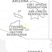


Connect with Interactive Hail Maps