

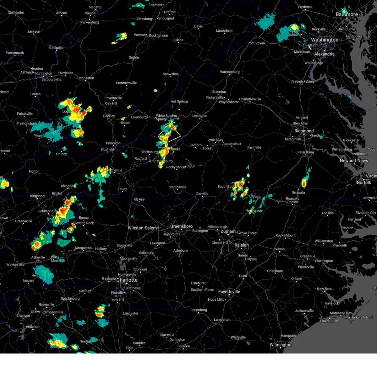
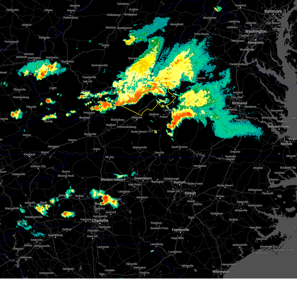
Hail Map for New Castle, VA
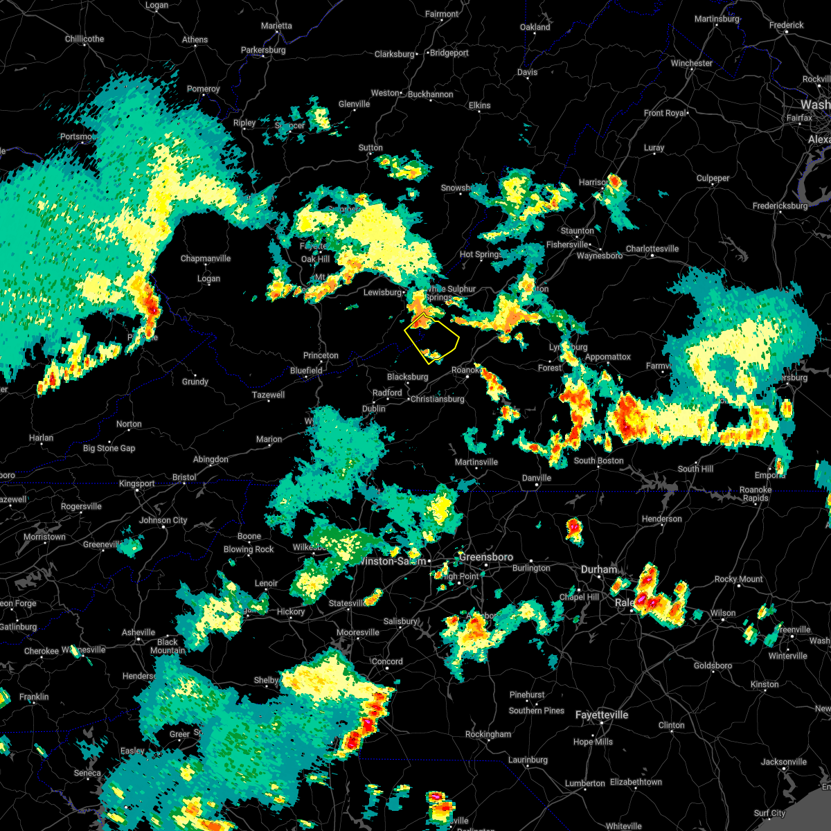
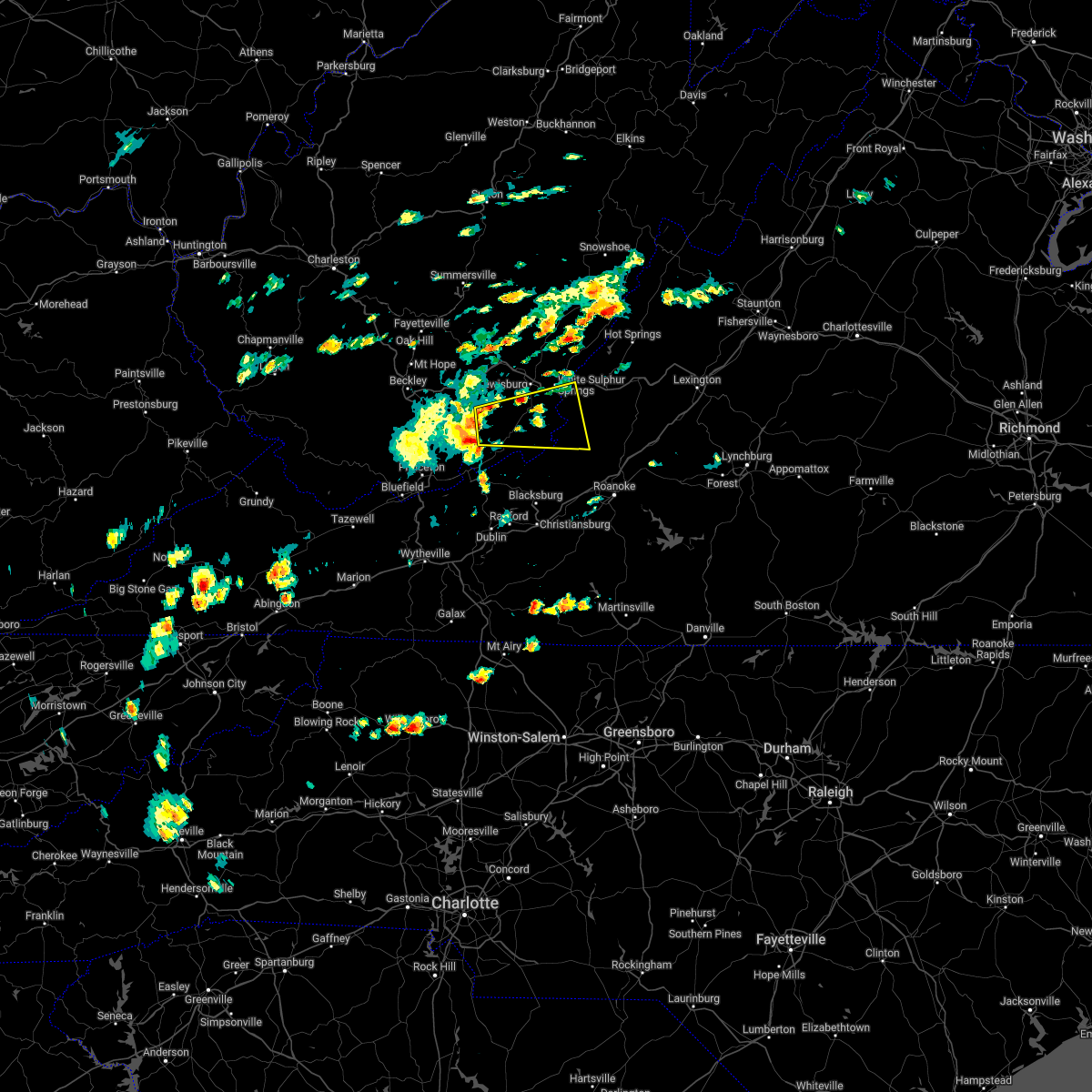
The New Castle, VA area has had 2 reports of on-the-ground hail by trained spotters, and has been under severe weather warnings 17 times during the past 12 months. Doppler radar has detected hail at or near New Castle, VA on 18 occasions, including 1 occasion during the past year.
| Name: | New Castle, VA |
| Where Located: | 18.4 miles NNW of Roanoke, VA |
| Map: | Google Map for New Castle, VA |
| Population: | 153 |
| Housing Units: | 84 |
| More Info: | Search Google for New Castle, VA |
0
The Top Recent Hail Date for New Castle, VA is Thursday, September 7, 2023 (18th out of 18)

Hail and Wind Damage Spotted near New Castle, VA
| Date / Time | Report Details |
|---|---|
| 9/7/2023 4:31 PM EDT |
 At 431 pm edt, a severe thunderstorm was located over new castle, moving northeast at 20 mph (radar indicated). Hazards include 60 mph wind gusts. Expect damage to roofs, siding, and trees. locations impacted include, new castle, oriskany, and fincastle. hail threat, radar indicated max hail size, <. 75 in wind threat, radar indicated max wind gust, 60 mph. At 431 pm edt, a severe thunderstorm was located over new castle, moving northeast at 20 mph (radar indicated). Hazards include 60 mph wind gusts. Expect damage to roofs, siding, and trees. locations impacted include, new castle, oriskany, and fincastle. hail threat, radar indicated max hail size, <. 75 in wind threat, radar indicated max wind gust, 60 mph.
|
| 9/7/2023 4:10 PM EDT |
 At 410 pm edt, a severe thunderstorm was located over abbott, or near new castle, moving northeast at 20 mph (radar indicated). Hazards include 60 mph wind gusts and quarter size hail. Hail damage to vehicles is expected. Expect wind damage to roofs, siding, and trees. At 410 pm edt, a severe thunderstorm was located over abbott, or near new castle, moving northeast at 20 mph (radar indicated). Hazards include 60 mph wind gusts and quarter size hail. Hail damage to vehicles is expected. Expect wind damage to roofs, siding, and trees.
|
| 8/7/2023 6:26 PM EDT |
 At 626 pm edt, severe thunderstorms were located along a line extending from near organ cave to gap mills to laurel branch, moving east at 55 mph (radar indicated). Hazards include 60 mph wind gusts. expect damage to roofs, siding, and trees At 626 pm edt, severe thunderstorms were located along a line extending from near organ cave to gap mills to laurel branch, moving east at 55 mph (radar indicated). Hazards include 60 mph wind gusts. expect damage to roofs, siding, and trees
|
| 7/28/2023 5:41 PM EDT |
 At 541 pm edt, severe thunderstorms were located along a line extending from near catawba to pilot to near grahams forge to near sugar grove, moving southeast at 25 mph (radar indicated). Hazards include 60 mph wind gusts. Expect damage to roofs, siding, and trees. locations impacted include, blacksburg, salem, christiansburg, radford, pulaski, wytheville, and marion. this includes the following location virginia tech. hail threat, radar indicated max hail size, <. 75 in wind threat, radar indicated max wind gust, 60 mph. At 541 pm edt, severe thunderstorms were located along a line extending from near catawba to pilot to near grahams forge to near sugar grove, moving southeast at 25 mph (radar indicated). Hazards include 60 mph wind gusts. Expect damage to roofs, siding, and trees. locations impacted include, blacksburg, salem, christiansburg, radford, pulaski, wytheville, and marion. this includes the following location virginia tech. hail threat, radar indicated max hail size, <. 75 in wind threat, radar indicated max wind gust, 60 mph.
|
| 7/28/2023 5:20 PM EDT |
 At 520 pm edt, severe thunderstorms were located along a line extending from sinking creek to radford to near wytheville to marion, moving southeast at 35 mph (radar indicated). Hazards include 60 mph wind gusts. Expect damage to roofs, siding, and trees. locations impacted include, blacksburg, salem, christiansburg, radford, pulaski, wytheville, and bland. this includes the following location virginia tech. hail threat, radar indicated max hail size, <. 75 in wind threat, radar indicated max wind gust, 60 mph. At 520 pm edt, severe thunderstorms were located along a line extending from sinking creek to radford to near wytheville to marion, moving southeast at 35 mph (radar indicated). Hazards include 60 mph wind gusts. Expect damage to roofs, siding, and trees. locations impacted include, blacksburg, salem, christiansburg, radford, pulaski, wytheville, and bland. this includes the following location virginia tech. hail threat, radar indicated max hail size, <. 75 in wind threat, radar indicated max wind gust, 60 mph.
|
| 7/28/2023 4:51 PM EDT |
 At 451 pm edt, severe thunderstorms were located along a line extending from wolfcreek to near narrows to suiter to near broadford, moving southeast at 45 mph (radar indicated). Hazards include 60 mph wind gusts. expect damage to roofs, siding, and trees At 451 pm edt, severe thunderstorms were located along a line extending from wolfcreek to near narrows to suiter to near broadford, moving southeast at 45 mph (radar indicated). Hazards include 60 mph wind gusts. expect damage to roofs, siding, and trees
|
| 7/17/2023 7:59 PM EDT |
 At 759 pm edt, severe thunderstorms were located along a line extending from near craig springs to near bradshaw to crockett springs, moving east at 30 mph (radar indicated). Hazards include 60 mph wind gusts. Expect damage to roofs, siding, and trees. locations impacted include, roanoke, salem, christiansburg, vinton, troutville, new castle, and pilot. this includes the following locations the salem fairgrounds and roanoke regional airport. hail threat, radar indicated max hail size, <. 75 in wind threat, radar indicated max wind gust, 60 mph. At 759 pm edt, severe thunderstorms were located along a line extending from near craig springs to near bradshaw to crockett springs, moving east at 30 mph (radar indicated). Hazards include 60 mph wind gusts. Expect damage to roofs, siding, and trees. locations impacted include, roanoke, salem, christiansburg, vinton, troutville, new castle, and pilot. this includes the following locations the salem fairgrounds and roanoke regional airport. hail threat, radar indicated max hail size, <. 75 in wind threat, radar indicated max wind gust, 60 mph.
|
| 7/17/2023 7:35 PM EDT |
 At 735 pm edt, severe thunderstorms were located along a line extending from waiteville to near blacksburg to radford, moving east at 30 mph (radar indicated). Hazards include 60 mph wind gusts. expect damage to roofs, siding, and trees At 735 pm edt, severe thunderstorms were located along a line extending from waiteville to near blacksburg to radford, moving east at 30 mph (radar indicated). Hazards include 60 mph wind gusts. expect damage to roofs, siding, and trees
|
| 7/13/2023 9:00 PM EDT |
 At 900 pm edt, severe thunderstorms were located along a line extending from near lexington to near springwood to near new castle, moving east at 45 mph (radar indicated). Hazards include 60 mph wind gusts and quarter size hail. Hail damage to vehicles is expected. expect wind damage to roofs, siding, and trees. locations impacted include, lexington, buena vista, buchanan, glasgow, troutville, new castle, and forks of buffalo. this includes the following location vmi. hail threat, radar indicated max hail size, 1. 00 in wind threat, radar indicated max wind gust, 60 mph. At 900 pm edt, severe thunderstorms were located along a line extending from near lexington to near springwood to near new castle, moving east at 45 mph (radar indicated). Hazards include 60 mph wind gusts and quarter size hail. Hail damage to vehicles is expected. expect wind damage to roofs, siding, and trees. locations impacted include, lexington, buena vista, buchanan, glasgow, troutville, new castle, and forks of buffalo. this includes the following location vmi. hail threat, radar indicated max hail size, 1. 00 in wind threat, radar indicated max wind gust, 60 mph.
|
| 7/13/2023 8:40 PM EDT |
 At 840 pm edt, severe thunderstorms were located along a line extending from near longdale furnace to near oriskany to near paint bank, moving east at 45 mph (radar indicated). Hazards include 60 mph wind gusts and quarter size hail. Hail damage to vehicles is expected. Expect wind damage to roofs, siding, and trees. At 840 pm edt, severe thunderstorms were located along a line extending from near longdale furnace to near oriskany to near paint bank, moving east at 45 mph (radar indicated). Hazards include 60 mph wind gusts and quarter size hail. Hail damage to vehicles is expected. Expect wind damage to roofs, siding, and trees.
|
| 7/13/2023 8:23 PM EDT |
 At 822 pm edt, severe thunderstorms were located along a line extending from buena vista to near new castle, moving east at 70 mph (radar indicated). Hazards include 70 mph wind gusts and quarter size hail. Hail damage to vehicles is expected. expect considerable tree damage. wind damage is also likely to mobile homes, roofs, and outbuildings. locations impacted include, alleghany, lexington, buena vista, covington, clifton forge, lewisburg, and white sulphur springs. this includes the following locations vmi and the west virginia state fairgrounds. thunderstorm damage threat, considerable hail threat, radar indicated max hail size, 1. 00 in wind threat, radar indicated max wind gust, 70 mph. At 822 pm edt, severe thunderstorms were located along a line extending from buena vista to near new castle, moving east at 70 mph (radar indicated). Hazards include 70 mph wind gusts and quarter size hail. Hail damage to vehicles is expected. expect considerable tree damage. wind damage is also likely to mobile homes, roofs, and outbuildings. locations impacted include, alleghany, lexington, buena vista, covington, clifton forge, lewisburg, and white sulphur springs. this includes the following locations vmi and the west virginia state fairgrounds. thunderstorm damage threat, considerable hail threat, radar indicated max hail size, 1. 00 in wind threat, radar indicated max wind gust, 70 mph.
|
| 7/13/2023 7:59 PM EDT |
 At 759 pm edt, severe thunderstorms were located along a line extending from near longdale furnace to near wolfcreek, moving east at 70 mph (radar indicated). Hazards include 60 mph wind gusts and quarter size hail. Hail damage to vehicles is expected. Expect wind damage to roofs, siding, and trees. At 759 pm edt, severe thunderstorms were located along a line extending from near longdale furnace to near wolfcreek, moving east at 70 mph (radar indicated). Hazards include 60 mph wind gusts and quarter size hail. Hail damage to vehicles is expected. Expect wind damage to roofs, siding, and trees.
|
| 7/12/2022 8:01 PM EDT |
 At 800 pm edt, severe thunderstorms were located along a line extending from near nace to walton, moving southeast at 30 mph (radar indicated). Hazards include 60 mph wind gusts and quarter size hail. Hail damage to vehicles is expected. expect wind damage to roofs, siding, and trees. locations impacted include, roanoke, blacksburg, salem, christiansburg, radford, pulaski, and vinton. hail threat, radar indicated max hail size, 1. 00 in wind threat, radar indicated max wind gust, 60 mph. At 800 pm edt, severe thunderstorms were located along a line extending from near nace to walton, moving southeast at 30 mph (radar indicated). Hazards include 60 mph wind gusts and quarter size hail. Hail damage to vehicles is expected. expect wind damage to roofs, siding, and trees. locations impacted include, roanoke, blacksburg, salem, christiansburg, radford, pulaski, and vinton. hail threat, radar indicated max hail size, 1. 00 in wind threat, radar indicated max wind gust, 60 mph.
|
| 7/12/2022 7:33 PM EDT |
 At 733 pm edt, a severe thunderstorm was located over eagle rock, moving east at 30 mph (radar indicated). Hazards include 60 mph wind gusts and quarter size hail. Hail damage to vehicles is expected. expect wind damage to roofs, siding, and trees. locations impacted include, covington, clifton forge, union, new castle, paint bank, sinking creek, and jordan mines. hail threat, radar indicated max hail size, 1. 00 in wind threat, radar indicated max wind gust, 60 mph. At 733 pm edt, a severe thunderstorm was located over eagle rock, moving east at 30 mph (radar indicated). Hazards include 60 mph wind gusts and quarter size hail. Hail damage to vehicles is expected. expect wind damage to roofs, siding, and trees. locations impacted include, covington, clifton forge, union, new castle, paint bank, sinking creek, and jordan mines. hail threat, radar indicated max hail size, 1. 00 in wind threat, radar indicated max wind gust, 60 mph.
|
| 7/12/2022 7:29 PM EDT |
 At 729 pm edt, severe thunderstorms were located along a line extending from eagle rock to oakvale, moving southeast at 20 mph (radar indicated). Hazards include 60 mph wind gusts and quarter size hail. Hail damage to vehicles is expected. Expect wind damage to roofs, siding, and trees. At 729 pm edt, severe thunderstorms were located along a line extending from eagle rock to oakvale, moving southeast at 20 mph (radar indicated). Hazards include 60 mph wind gusts and quarter size hail. Hail damage to vehicles is expected. Expect wind damage to roofs, siding, and trees.
|
| 7/12/2022 7:10 PM EDT |
 At 709 pm edt, a severe thunderstorm was located near covington, moving east at 40 mph (radar indicated. at 7:08pm, trees were reported down on i-64 in greenbrier county). Hazards include ping pong ball size hail and 60 mph wind gusts. People and animals outdoors will be injured. expect hail damage to roofs, siding, windows, and vehicles. expect wind damage to roofs, siding, and trees. locations impacted include, alleghany, covington, clifton forge, lewisburg, hinton, white sulphur springs, and ronceverte. hail threat, radar indicated max hail size, 1. 50 in wind threat, radar indicated max wind gust, 60 mph. At 709 pm edt, a severe thunderstorm was located near covington, moving east at 40 mph (radar indicated. at 7:08pm, trees were reported down on i-64 in greenbrier county). Hazards include ping pong ball size hail and 60 mph wind gusts. People and animals outdoors will be injured. expect hail damage to roofs, siding, windows, and vehicles. expect wind damage to roofs, siding, and trees. locations impacted include, alleghany, covington, clifton forge, lewisburg, hinton, white sulphur springs, and ronceverte. hail threat, radar indicated max hail size, 1. 50 in wind threat, radar indicated max wind gust, 60 mph.
|
| 7/12/2022 6:42 PM EDT |
 At 640 pm edt, a severe thunderstorm was located over white sulphur springs, moving east at 35 mph (radar indicated. at 6:38 pm downed trees and power lines were reported east of lewisburg). Hazards include ping pong ball size hail and 60 mph wind gusts. People and animals outdoors will be injured. expect hail damage to roofs, siding, windows, and vehicles. Expect wind damage to roofs, siding, and trees. At 640 pm edt, a severe thunderstorm was located over white sulphur springs, moving east at 35 mph (radar indicated. at 6:38 pm downed trees and power lines were reported east of lewisburg). Hazards include ping pong ball size hail and 60 mph wind gusts. People and animals outdoors will be injured. expect hail damage to roofs, siding, windows, and vehicles. Expect wind damage to roofs, siding, and trees.
|
| 7/6/2022 8:11 PM EDT |
 The severe thunderstorm warning for southeastern craig county will expire at 815 pm edt, the storm which prompted the warning has moved out of the area. therefore, the warning will be allowed to expire. a severe thunderstorm watch remains in effect until 1100 pm edt for south central virginia. The severe thunderstorm warning for southeastern craig county will expire at 815 pm edt, the storm which prompted the warning has moved out of the area. therefore, the warning will be allowed to expire. a severe thunderstorm watch remains in effect until 1100 pm edt for south central virginia.
|
| 7/6/2022 8:00 PM EDT |
 At 800 pm edt, a severe thunderstorm was located near abbott, or near new castle, moving southeast at 20 mph (radar indicated). Hazards include 60 mph wind gusts and penny size hail. Expect damage to roofs, siding, and trees. locations impacted include, new castle, and abbott. hail threat, radar indicated max hail size, 0. 75 in wind threat, radar indicated max wind gust, 60 mph. At 800 pm edt, a severe thunderstorm was located near abbott, or near new castle, moving southeast at 20 mph (radar indicated). Hazards include 60 mph wind gusts and penny size hail. Expect damage to roofs, siding, and trees. locations impacted include, new castle, and abbott. hail threat, radar indicated max hail size, 0. 75 in wind threat, radar indicated max wind gust, 60 mph.
|
| 7/6/2022 7:46 PM EDT |
 At 746 pm edt, a severe thunderstorm was located over new castle, moving southeast at 15 mph (radar indicated). Hazards include 60 mph wind gusts and quarter size hail. Hail damage to vehicles is expected. Expect wind damage to roofs, siding, and trees. At 746 pm edt, a severe thunderstorm was located over new castle, moving southeast at 15 mph (radar indicated). Hazards include 60 mph wind gusts and quarter size hail. Hail damage to vehicles is expected. Expect wind damage to roofs, siding, and trees.
|
| 7/6/2022 7:20 PM EDT |
 At 720 pm edt, a severe thunderstorm was located over paint bank, moving southeast at 20 mph (radar indicated). Hazards include 60 mph wind gusts and quarter size hail. Hail damage to vehicles is expected. Expect wind damage to roofs, siding, and trees. At 720 pm edt, a severe thunderstorm was located over paint bank, moving southeast at 20 mph (radar indicated). Hazards include 60 mph wind gusts and quarter size hail. Hail damage to vehicles is expected. Expect wind damage to roofs, siding, and trees.
|
| 6/17/2022 1:00 AM EDT |
 At 100 am edt, a severe thunderstorm was located over catawba, moving southeast at 25 mph (radar indicated). Hazards include 60 mph wind gusts. expect damage to roofs, siding, and trees At 100 am edt, a severe thunderstorm was located over catawba, moving southeast at 25 mph (radar indicated). Hazards include 60 mph wind gusts. expect damage to roofs, siding, and trees
|
| 6/16/2022 11:48 PM EDT |
 At 1148 pm edt, a severe thunderstorm was located over clifton forge, moving southeast at 30 mph (radar indicated). Hazards include 60 mph wind gusts. Expect damage to roofs, siding, and trees. locations impacted include, alleghany, covington, clifton forge, buchanan, glasgow, troutville, and new castle. hail threat, radar indicated max hail size, <. 75 in wind threat, radar indicated max wind gust, 60 mph. At 1148 pm edt, a severe thunderstorm was located over clifton forge, moving southeast at 30 mph (radar indicated). Hazards include 60 mph wind gusts. Expect damage to roofs, siding, and trees. locations impacted include, alleghany, covington, clifton forge, buchanan, glasgow, troutville, and new castle. hail threat, radar indicated max hail size, <. 75 in wind threat, radar indicated max wind gust, 60 mph.
|
| 6/16/2022 11:36 PM EDT |
 At 1136 pm edt, a severe thunderstorm was located near oriskany, moving southeast at 25 mph (radar indicated). Hazards include 60 mph wind gusts. expect damage to roofs, siding, and trees At 1136 pm edt, a severe thunderstorm was located near oriskany, moving southeast at 25 mph (radar indicated). Hazards include 60 mph wind gusts. expect damage to roofs, siding, and trees
|
| 6/14/2022 12:36 AM EDT |
 The severe thunderstorm warning for roanoke, east central pulaski, southeastern craig, northeastern floyd, bedford, botetourt, franklin and montgomery counties, the city of radford, the city of salem and the city of roanoke will expire at 1245 am edt, the storms which prompted the warning have weakened below severe limits, and no longer pose an immediate threat to life or property. therefore, the warning will be allowed to expire. however gusty winds are still possible with these thunderstorms. The severe thunderstorm warning for roanoke, east central pulaski, southeastern craig, northeastern floyd, bedford, botetourt, franklin and montgomery counties, the city of radford, the city of salem and the city of roanoke will expire at 1245 am edt, the storms which prompted the warning have weakened below severe limits, and no longer pose an immediate threat to life or property. therefore, the warning will be allowed to expire. however gusty winds are still possible with these thunderstorms.
|
| 6/14/2022 12:15 AM EDT |
 At 1214 am edt, severe thunderstorms were located along a line extending from near bent mountain to fairfield, moving southeast at 45 mph (radar indicated). Hazards include 60 mph wind gusts. Expect damage to roofs, siding, and trees. locations impacted include, roanoke, blacksburg, salem, christiansburg, radford, vinton, and bedford. this includes the following locations virginia tech, the salem fairgrounds, the national d-day memorial, and roanoke regional airport. hail threat, radar indicated max hail size, <. 75 in wind threat, radar indicated max wind gust, 60 mph. At 1214 am edt, severe thunderstorms were located along a line extending from near bent mountain to fairfield, moving southeast at 45 mph (radar indicated). Hazards include 60 mph wind gusts. Expect damage to roofs, siding, and trees. locations impacted include, roanoke, blacksburg, salem, christiansburg, radford, vinton, and bedford. this includes the following locations virginia tech, the salem fairgrounds, the national d-day memorial, and roanoke regional airport. hail threat, radar indicated max hail size, <. 75 in wind threat, radar indicated max wind gust, 60 mph.
|
| 6/14/2022 12:06 AM EDT |
 The severe thunderstorm warning for alleghany county in west central virginia, northeastern giles and craig counties in southwestern virginia, bath and northwestern botetourt counties in west central virginia, northwestern montgomery county in southwestern virginia, southeastern greenbrier and eastern monroe counties in southeastern west virginia and the city of covington will expire at 1215 am edt, the storms which prompted the warning have moved out of the area. therefore, the warning will be allowed to expire. a severe thunderstorm watch remains in effect until 100 am edt for southwestern and west central virginia, and southeastern west virginia. The severe thunderstorm warning for alleghany county in west central virginia, northeastern giles and craig counties in southwestern virginia, bath and northwestern botetourt counties in west central virginia, northwestern montgomery county in southwestern virginia, southeastern greenbrier and eastern monroe counties in southeastern west virginia and the city of covington will expire at 1215 am edt, the storms which prompted the warning have moved out of the area. therefore, the warning will be allowed to expire. a severe thunderstorm watch remains in effect until 100 am edt for southwestern and west central virginia, and southeastern west virginia.
|
| 6/13/2022 11:55 PM EDT |
 At 1155 pm edt, severe thunderstorms were located along a line extending from near shawsville to goshen, moving southeast at 45 mph (radar indicated). Hazards include 60 mph wind gusts. Expect damage to roofs, siding, and trees. locations impacted include, roanoke, blacksburg, salem, christiansburg, radford, vinton, and lexington. this includes the following locations virginia tech, vmi, the salem fairgrounds, the national d-day memorial, and roanoke regional airport. hail threat, radar indicated max hail size, <. 75 in wind threat, radar indicated max wind gust, 60 mph. At 1155 pm edt, severe thunderstorms were located along a line extending from near shawsville to goshen, moving southeast at 45 mph (radar indicated). Hazards include 60 mph wind gusts. Expect damage to roofs, siding, and trees. locations impacted include, roanoke, blacksburg, salem, christiansburg, radford, vinton, and lexington. this includes the following locations virginia tech, vmi, the salem fairgrounds, the national d-day memorial, and roanoke regional airport. hail threat, radar indicated max hail size, <. 75 in wind threat, radar indicated max wind gust, 60 mph.
|
| 6/13/2022 11:44 PM EDT |
 At 1144 pm edt, severe thunderstorms were located along a line extending from burnsville to near walton, moving southeast at 30 mph (radar indicated). Hazards include 70 mph wind gusts. Expect considerable tree damage. damage is likely to mobile homes, roofs, and outbuildings. locations impacted include, blacksburg, christiansburg, alleghany, covington, clifton forge, pearisburg, and pembroke. this includes the following location virginia tech. thunderstorm damage threat, considerable hail threat, radar indicated max hail size, <. 75 in wind threat, radar indicated max wind gust, 70 mph. At 1144 pm edt, severe thunderstorms were located along a line extending from burnsville to near walton, moving southeast at 30 mph (radar indicated). Hazards include 70 mph wind gusts. Expect considerable tree damage. damage is likely to mobile homes, roofs, and outbuildings. locations impacted include, blacksburg, christiansburg, alleghany, covington, clifton forge, pearisburg, and pembroke. this includes the following location virginia tech. thunderstorm damage threat, considerable hail threat, radar indicated max hail size, <. 75 in wind threat, radar indicated max wind gust, 70 mph.
|
| 6/13/2022 11:41 PM EDT |
 At 1140 pm edt, severe thunderstorms were located along a line extending from blacksburg to near millboro, moving southeast at 40 mph (radar indicated). Hazards include 70 mph wind gusts. Expect considerable tree damage. Damage is likely to mobile homes, roofs, and outbuildings. At 1140 pm edt, severe thunderstorms were located along a line extending from blacksburg to near millboro, moving southeast at 40 mph (radar indicated). Hazards include 70 mph wind gusts. Expect considerable tree damage. Damage is likely to mobile homes, roofs, and outbuildings.
|
| 6/13/2022 11:27 PM EDT |
 At 1126 pm edt, severe thunderstorms were located along a line extending from near burnsville to near bane, moving southeast at 30 mph (radar indicated). Hazards include 70 mph wind gusts. Expect considerable tree damage. damage is likely to mobile homes, roofs, and outbuildings. locations impacted include, blacksburg, christiansburg, alleghany, covington, clifton forge, lewisburg, and pearisburg. this includes the following locations virginia tech and the west virginia state fairgrounds. thunderstorm damage threat, considerable hail threat, radar indicated max hail size, <. 75 in wind threat, radar indicated max wind gust, 70 mph. At 1126 pm edt, severe thunderstorms were located along a line extending from near burnsville to near bane, moving southeast at 30 mph (radar indicated). Hazards include 70 mph wind gusts. Expect considerable tree damage. damage is likely to mobile homes, roofs, and outbuildings. locations impacted include, blacksburg, christiansburg, alleghany, covington, clifton forge, lewisburg, and pearisburg. this includes the following locations virginia tech and the west virginia state fairgrounds. thunderstorm damage threat, considerable hail threat, radar indicated max hail size, <. 75 in wind threat, radar indicated max wind gust, 70 mph.
|
| 6/13/2022 11:14 PM EDT |
 At 1111 pm edt, severe thunderstorms were located along a line extending from 9 miles southeast of cass scenic railroad to near pearisburg, moving southeast at 30 mph (radar indicated. at 10:45pm a downed tree was reported in rainelle, west virginia). Hazards include 70 mph wind gusts. Expect considerable tree damage. Damage is likely to mobile homes, roofs, and outbuildings. At 1111 pm edt, severe thunderstorms were located along a line extending from 9 miles southeast of cass scenic railroad to near pearisburg, moving southeast at 30 mph (radar indicated. at 10:45pm a downed tree was reported in rainelle, west virginia). Hazards include 70 mph wind gusts. Expect considerable tree damage. Damage is likely to mobile homes, roofs, and outbuildings.
|
| 6/2/2022 2:03 PM EDT |
 At 203 pm edt, a severe thunderstorm was located over wayside, or 7 miles west of union, moving east at 35 mph (radar indicated). Hazards include 60 mph wind gusts and quarter size hail. Hail damage to vehicles is expected. Expect wind damage to roofs, siding, and trees. At 203 pm edt, a severe thunderstorm was located over wayside, or 7 miles west of union, moving east at 35 mph (radar indicated). Hazards include 60 mph wind gusts and quarter size hail. Hail damage to vehicles is expected. Expect wind damage to roofs, siding, and trees.
|
| 7/13/2021 3:23 PM EDT |
 At 323 pm edt, a severe thunderstorm was located near catawba, moving northeast at 25 mph (radar indicated). Hazards include 60 mph wind gusts and quarter size hail. Hail damage to vehicles is expected. expect wind damage to roofs, siding, and trees. Locations impacted include, troutville, new castle, catawba, abbott, daleville, and bradshaw. At 323 pm edt, a severe thunderstorm was located near catawba, moving northeast at 25 mph (radar indicated). Hazards include 60 mph wind gusts and quarter size hail. Hail damage to vehicles is expected. expect wind damage to roofs, siding, and trees. Locations impacted include, troutville, new castle, catawba, abbott, daleville, and bradshaw.
|
| 7/13/2021 3:14 PM EDT |
 At 314 pm edt, a severe thunderstorm was located over bradshaw, or 7 miles south of sinking creek, moving northeast at 20 mph (radar indicated). Hazards include 60 mph wind gusts and quarter size hail. Hail damage to vehicles is expected. Expect wind damage to roofs, siding, and trees. At 314 pm edt, a severe thunderstorm was located over bradshaw, or 7 miles south of sinking creek, moving northeast at 20 mph (radar indicated). Hazards include 60 mph wind gusts and quarter size hail. Hail damage to vehicles is expected. Expect wind damage to roofs, siding, and trees.
|
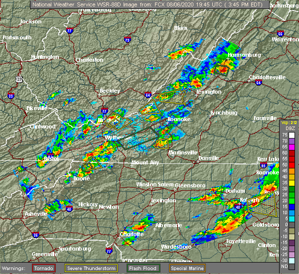
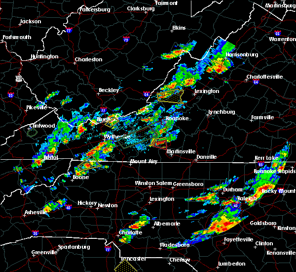
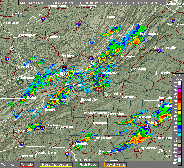
| 8/6/2020 3:48 PM EDT |
 At 348 pm edt, a severe thunderstorm was located near craig springs, or near paint bank, moving northeast at 5 mph (radar indicated). Hazards include 60 mph wind gusts and quarter size hail. Hail damage to vehicles is expected. expect wind damage to roofs, siding, and trees. Locations impacted include, new castle, paint bank, sweet springs, craig springs, earlehurst, and potts creek. At 348 pm edt, a severe thunderstorm was located near craig springs, or near paint bank, moving northeast at 5 mph (radar indicated). Hazards include 60 mph wind gusts and quarter size hail. Hail damage to vehicles is expected. expect wind damage to roofs, siding, and trees. Locations impacted include, new castle, paint bank, sweet springs, craig springs, earlehurst, and potts creek.
|
| 8/6/2020 3:40 PM EDT |
 At 340 pm edt, a severe thunderstorm was located near waiteville, or near paint bank, moving northeast at 5 mph (radar indicated). Hazards include 60 mph wind gusts and quarter size hail. Hail damage to vehicles is expected. Expect wind damage to roofs, siding, and trees. At 340 pm edt, a severe thunderstorm was located near waiteville, or near paint bank, moving northeast at 5 mph (radar indicated). Hazards include 60 mph wind gusts and quarter size hail. Hail damage to vehicles is expected. Expect wind damage to roofs, siding, and trees.
|
| 7/21/2020 3:42 PM EDT |
 The severe thunderstorm warning for northeastern craig and west central botetourt counties will expire at 345 pm edt, the storm which prompted the warning has weakened below severe limits, and no longer poses an immediate threat to life or property. therefore, the warning will be allowed to expire. if you have storm reports, please call the national weather service at 1, 8 6 6, 2 1 5, 4 3 2 4. reports and pictures can also be shared on the national weather service blacksburg facebook page and on twitter. The severe thunderstorm warning for northeastern craig and west central botetourt counties will expire at 345 pm edt, the storm which prompted the warning has weakened below severe limits, and no longer poses an immediate threat to life or property. therefore, the warning will be allowed to expire. if you have storm reports, please call the national weather service at 1, 8 6 6, 2 1 5, 4 3 2 4. reports and pictures can also be shared on the national weather service blacksburg facebook page and on twitter.
|
| 7/21/2020 3:29 PM EDT |
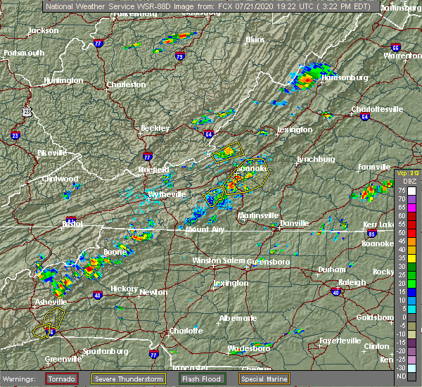 At 328 pm edt, a severe thunderstorm was located near oriskany, moving northeast at 15 mph (radar indicated). Hazards include 60 mph wind gusts. Expect damage to trees and powerlines. Locations impacted include, oriskany. At 328 pm edt, a severe thunderstorm was located near oriskany, moving northeast at 15 mph (radar indicated). Hazards include 60 mph wind gusts. Expect damage to trees and powerlines. Locations impacted include, oriskany.
|
| 7/21/2020 3:05 PM EDT |
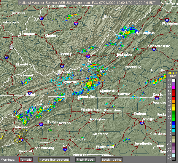 At 304 pm edt, a severe thunderstorm was located over new castle, moving northeast at 15 mph (radar indicated). Hazards include 60 mph wind gusts and quarter size hail. Hail damage to vehicles is expected. Expect wind damage to roofs, siding, and trees. At 304 pm edt, a severe thunderstorm was located over new castle, moving northeast at 15 mph (radar indicated). Hazards include 60 mph wind gusts and quarter size hail. Hail damage to vehicles is expected. Expect wind damage to roofs, siding, and trees.
|
| 1/11/2020 9:36 PM EST |
 At 935 pm est, severe thunderstorms were located along a line extending from near cass scenic railroad to gala, moving northeast at 85 mph (radar indicated). Hazards include 60 mph wind gusts. Expect damage to roofs, siding, and trees. locations impacted include, blacksburg, christiansburg, radford, pulaski, dublin, pembroke, and new castle. This includes the following location virginia tech. At 935 pm est, severe thunderstorms were located along a line extending from near cass scenic railroad to gala, moving northeast at 85 mph (radar indicated). Hazards include 60 mph wind gusts. Expect damage to roofs, siding, and trees. locations impacted include, blacksburg, christiansburg, radford, pulaski, dublin, pembroke, and new castle. This includes the following location virginia tech.
|
| 1/11/2020 9:28 PM EST |
 At 927 pm est, severe thunderstorms were located along a line extending from near snowshoe to near oriskany, moving northeast at 85 mph (radar indicated). Hazards include 70 mph wind gusts. Expect considerable tree damage. damage is likely to mobile homes, roofs, and outbuildings. locations impacted include, blacksburg, christiansburg, radford, pulaski, covington, dublin, and pembroke. This includes the following location virginia tech. At 927 pm est, severe thunderstorms were located along a line extending from near snowshoe to near oriskany, moving northeast at 85 mph (radar indicated). Hazards include 70 mph wind gusts. Expect considerable tree damage. damage is likely to mobile homes, roofs, and outbuildings. locations impacted include, blacksburg, christiansburg, radford, pulaski, covington, dublin, and pembroke. This includes the following location virginia tech.
|
| 1/11/2020 9:11 PM EST |
 At 911 pm est, severe thunderstorms were located along a line extending from near beartown state park to near glenvar, moving east at 50 mph (radar indicated). Hazards include 70 mph wind gusts. Expect considerable tree damage. damage is likely to mobile homes, roofs, and outbuildings. locations impacted include, blacksburg, christiansburg, radford, alleghany, pulaski, covington, and lewisburg. This includes the following locations virginia tech and the west virginia state fairgrounds. At 911 pm est, severe thunderstorms were located along a line extending from near beartown state park to near glenvar, moving east at 50 mph (radar indicated). Hazards include 70 mph wind gusts. Expect considerable tree damage. damage is likely to mobile homes, roofs, and outbuildings. locations impacted include, blacksburg, christiansburg, radford, alleghany, pulaski, covington, and lewisburg. This includes the following locations virginia tech and the west virginia state fairgrounds.
|
| 1/11/2020 8:44 PM EST |
 At 844 pm est, severe thunderstorms were located along a line extending from near williamsburg to near copper valley, moving northeast at 85 mph (radar indicated). Hazards include 70 mph wind gusts. Expect considerable tree damage. Damage is likely to mobile homes, roofs, and outbuildings. At 844 pm est, severe thunderstorms were located along a line extending from near williamsburg to near copper valley, moving northeast at 85 mph (radar indicated). Hazards include 70 mph wind gusts. Expect considerable tree damage. Damage is likely to mobile homes, roofs, and outbuildings.
|
| 10/31/2019 5:25 PM EDT |
 The severe thunderstorm warning for central alleghany county in west central virginia, craig county in southwestern virginia, bath and northwestern botetourt counties in west central virginia and the city of covington will expire at 530 pm edt, the storms which prompted the warning have weakened below severe limits, and no longer pose an immediate threat to life or property. therefore, the warning will be allowed to expire. a tornado watch remains in effect until 1100 pm edt for central, south central, southwestern and west central virginia. when it is safe to do so, please send your reports of hail of any size, as well as reports of any wind damage, including downed trees or large limbs, to the national weather service by calling toll free at 1, 8 6 6, 2 1 5, 4 3 2 4. reports and pictures can also be shared on the national weather service blacksburg facebook page and on twitter. The severe thunderstorm warning for central alleghany county in west central virginia, craig county in southwestern virginia, bath and northwestern botetourt counties in west central virginia and the city of covington will expire at 530 pm edt, the storms which prompted the warning have weakened below severe limits, and no longer pose an immediate threat to life or property. therefore, the warning will be allowed to expire. a tornado watch remains in effect until 1100 pm edt for central, south central, southwestern and west central virginia. when it is safe to do so, please send your reports of hail of any size, as well as reports of any wind damage, including downed trees or large limbs, to the national weather service by calling toll free at 1, 8 6 6, 2 1 5, 4 3 2 4. reports and pictures can also be shared on the national weather service blacksburg facebook page and on twitter.
|
| 10/31/2019 5:16 PM EDT |
 At 515 pm edt, severe thunderstorms were located along a line extending from near nimrod hall to near abbott, moving northeast at 25 mph (radar indicated). Hazards include 60 mph wind gusts. Expect damage to roofs, siding, and trees. locations impacted include, covington, clifton forge, new castle, warm springs, sinking creek, millboro, and oriskany. A tornado watch remains in effect until 1100 pm edt for central, south central, southwestern and west central virginia. At 515 pm edt, severe thunderstorms were located along a line extending from near nimrod hall to near abbott, moving northeast at 25 mph (radar indicated). Hazards include 60 mph wind gusts. Expect damage to roofs, siding, and trees. locations impacted include, covington, clifton forge, new castle, warm springs, sinking creek, millboro, and oriskany. A tornado watch remains in effect until 1100 pm edt for central, south central, southwestern and west central virginia.
|
| 10/31/2019 4:41 PM EDT |
 At 441 pm edt, severe thunderstorms were located along a line extending from 13 miles northeast of greenbank to near callaghan, moving northeast at 65 mph (radar indicated). Hazards include 60 mph wind gusts. Expect damage to roofs, siding, and trees. locations impacted include, covington, clifton forge, new castle, sinking creek, millboro, warm springs, and jordan mines. a tornado watch remains in effect until 700 pm edt for southwestern virginia, and southeastern west virginia. A tornado watch also remains in effect until 1100 pm edt for central, south central, southwestern and west central virginia. At 441 pm edt, severe thunderstorms were located along a line extending from 13 miles northeast of greenbank to near callaghan, moving northeast at 65 mph (radar indicated). Hazards include 60 mph wind gusts. Expect damage to roofs, siding, and trees. locations impacted include, covington, clifton forge, new castle, sinking creek, millboro, warm springs, and jordan mines. a tornado watch remains in effect until 700 pm edt for southwestern virginia, and southeastern west virginia. A tornado watch also remains in effect until 1100 pm edt for central, south central, southwestern and west central virginia.
|
| 10/31/2019 4:04 PM EDT |
 At 402 pm edt, severe thunderstorms were located along a line extending from 6 miles northeast of beartown state park to near cascades, moving northeast at 65 mph (radar indicated). Hazards include 60 mph wind gusts. expect damage to roofs, siding, and trees At 402 pm edt, severe thunderstorms were located along a line extending from 6 miles northeast of beartown state park to near cascades, moving northeast at 65 mph (radar indicated). Hazards include 60 mph wind gusts. expect damage to roofs, siding, and trees
|
| 9/30/2019 4:08 PM EDT |
 At 408 pm edt, a severe thunderstorm was located over new castle, moving south at 15 mph (radar indicated). Hazards include 60 mph wind gusts and quarter size hail. Hail damage to vehicles is expected. Expect wind damage to roofs, siding, and trees. At 408 pm edt, a severe thunderstorm was located over new castle, moving south at 15 mph (radar indicated). Hazards include 60 mph wind gusts and quarter size hail. Hail damage to vehicles is expected. Expect wind damage to roofs, siding, and trees.
|
| 9/30/2019 3:29 PM EDT |
 At 329 pm edt, a severe thunderstorm was located over jordan mines, moving southeast at 25 mph (radar indicated). Hazards include 60 mph wind gusts and quarter size hail. Hail damage to vehicles is expected. Expect wind damage to roofs, siding, and trees. At 329 pm edt, a severe thunderstorm was located over jordan mines, moving southeast at 25 mph (radar indicated). Hazards include 60 mph wind gusts and quarter size hail. Hail damage to vehicles is expected. Expect wind damage to roofs, siding, and trees.
|
| 8/22/2019 1:25 PM EDT | Tree down near intersection of market street and rte. 615. timing estimated by rada in craig county VA, 0.6 miles S of New Castle, VA |
| 8/22/2019 1:06 PM EDT |
 At 106 pm edt, a severe thunderstorm was located near potts creek, moving east at 25 mph (radar indicated). Hazards include 60 mph wind gusts and quarter size hail. Hail damage to vehicles is expected. Expect wind damage to roofs, siding, and trees. At 106 pm edt, a severe thunderstorm was located near potts creek, moving east at 25 mph (radar indicated). Hazards include 60 mph wind gusts and quarter size hail. Hail damage to vehicles is expected. Expect wind damage to roofs, siding, and trees.
|
| 8/9/2019 3:11 PM EDT |
 The severe thunderstorm warning for northeastern craig county in southwestern virginia and northwestern botetourt counties in west central virginia will expire at 315 pm edt, the storm which prompted the warning has moved out of the area. therefore, the warning will be allowed to expire. when it is safe to do so, please send your reports of hail of any size, as well as reports of any wind damage, including downed trees or large limbs, to the national weather service by calling toll free at 1, 8 6 6, 2 1 5, 4 3 2 4. reports and pictures can also be shared on the national weather service blacksburg facebook page and on twitter. remember, a severe thunderstorm warning still remains in effect for southwestern alleghany. The severe thunderstorm warning for northeastern craig county in southwestern virginia and northwestern botetourt counties in west central virginia will expire at 315 pm edt, the storm which prompted the warning has moved out of the area. therefore, the warning will be allowed to expire. when it is safe to do so, please send your reports of hail of any size, as well as reports of any wind damage, including downed trees or large limbs, to the national weather service by calling toll free at 1, 8 6 6, 2 1 5, 4 3 2 4. reports and pictures can also be shared on the national weather service blacksburg facebook page and on twitter. remember, a severe thunderstorm warning still remains in effect for southwestern alleghany.
|
| 8/9/2019 2:43 PM EDT |
 At 216 pm edt, a severe thunderstorm was located over alleghany, moving southeast at 30 mph (radar indicated). Hazards include 60 mph wind gusts. expect damage to roofs, siding, and trees At 216 pm edt, a severe thunderstorm was located over alleghany, moving southeast at 30 mph (radar indicated). Hazards include 60 mph wind gusts. expect damage to roofs, siding, and trees
|
| 8/9/2019 2:16 PM EDT |
 At 216 pm edt, a severe thunderstorm was located over alleghany, moving southeast at 30 mph (radar indicated). Hazards include 60 mph wind gusts. expect damage to roofs, siding, and trees At 216 pm edt, a severe thunderstorm was located over alleghany, moving southeast at 30 mph (radar indicated). Hazards include 60 mph wind gusts. expect damage to roofs, siding, and trees
|
| 8/1/2019 5:08 PM EDT | A few trees down near the intersection of cumberland gap road and mountain side drive. time estimated from rada in craig county VA, 7.3 miles NE of New Castle, VA |
| 8/1/2019 5:03 PM EDT | Tree down blocking one lane on johns creek mountain road. time estimated from rada in craig county VA, 16.8 miles ENE of New Castle, VA |
| 8/1/2019 4:28 PM EDT |
 At 428 pm edt, a severe thunderstorm was located near mc donalds mill, moving east at 10 mph (radar indicated). Hazards include 60 mph wind gusts and quarter size hail. Hail damage to vehicles is expected. Expect wind damage to roofs, siding, and trees. At 428 pm edt, a severe thunderstorm was located near mc donalds mill, moving east at 10 mph (radar indicated). Hazards include 60 mph wind gusts and quarter size hail. Hail damage to vehicles is expected. Expect wind damage to roofs, siding, and trees.
|
| 5/31/2019 4:30 PM EDT |
 At 430 pm edt, severe thunderstorms were located along a line extending from near paint bank to bradshaw, moving east at 40 mph (radar indicated). Hazards include 60 mph wind gusts and quarter size hail. Hail damage to vehicles is expected. expect wind damage to roofs, siding, and trees. locations impacted include, roanoke, salem, vinton, troutville, and new castle. This includes the following locations the salem fairgrounds and roanoke regional airport. At 430 pm edt, severe thunderstorms were located along a line extending from near paint bank to bradshaw, moving east at 40 mph (radar indicated). Hazards include 60 mph wind gusts and quarter size hail. Hail damage to vehicles is expected. expect wind damage to roofs, siding, and trees. locations impacted include, roanoke, salem, vinton, troutville, and new castle. This includes the following locations the salem fairgrounds and roanoke regional airport.
|
| 5/31/2019 4:14 PM EDT |
 At 414 pm edt, severe thunderstorms were located along a line extending from near gap mills to near mc donalds mill, moving east at 40 mph (radar indicated). Hazards include 60 mph wind gusts and quarter size hail. Hail damage to vehicles is expected. expect wind damage to roofs, siding, and trees. locations impacted include, roanoke, blacksburg, salem, vinton, and troutville. This includes the following locations virginia tech, the salem fairgrounds, and roanoke regional airport. At 414 pm edt, severe thunderstorms were located along a line extending from near gap mills to near mc donalds mill, moving east at 40 mph (radar indicated). Hazards include 60 mph wind gusts and quarter size hail. Hail damage to vehicles is expected. expect wind damage to roofs, siding, and trees. locations impacted include, roanoke, blacksburg, salem, vinton, and troutville. This includes the following locations virginia tech, the salem fairgrounds, and roanoke regional airport.
|
| 5/31/2019 3:45 PM EDT |
 At 345 pm edt, severe thunderstorms were located along a line extending from near zenith to walton, moving east at 40 mph (radar indicated). Hazards include 60 mph wind gusts and quarter size hail. Hail damage to vehicles is expected. Expect wind damage to roofs, siding, and trees. At 345 pm edt, severe thunderstorms were located along a line extending from near zenith to walton, moving east at 40 mph (radar indicated). Hazards include 60 mph wind gusts and quarter size hail. Hail damage to vehicles is expected. Expect wind damage to roofs, siding, and trees.
|
| 5/29/2019 5:12 PM EDT |
 The severe thunderstorm warning for alleghany county in west central virginia, craig county in southwestern virginia, northwestern botetourt county in west central virginia, south central greenbrier and eastern monroe counties in southeastern west virginia and the city of covington will expire at 515 pm edt, the storms which prompted the warning have moved east so a new warning has been issued. a severe thunderstorm watch remains in effect until 800 pm edt for central, south central, southwestern and west central virginia, and southeastern west virginia. when it is safe to do so, please send your reports of hail of any size, as well as reports of any wind damage, including downed trees or large limbs, to the national weather service by calling toll free at 1, 8 6 6, 2 1 5, 4 3 2 4. reports and pictures can also be shared on the national weather service blacksburg facebook page and on twitter. The severe thunderstorm warning for alleghany county in west central virginia, craig county in southwestern virginia, northwestern botetourt county in west central virginia, south central greenbrier and eastern monroe counties in southeastern west virginia and the city of covington will expire at 515 pm edt, the storms which prompted the warning have moved east so a new warning has been issued. a severe thunderstorm watch remains in effect until 800 pm edt for central, south central, southwestern and west central virginia, and southeastern west virginia. when it is safe to do so, please send your reports of hail of any size, as well as reports of any wind damage, including downed trees or large limbs, to the national weather service by calling toll free at 1, 8 6 6, 2 1 5, 4 3 2 4. reports and pictures can also be shared on the national weather service blacksburg facebook page and on twitter.
|
| 5/29/2019 5:11 PM EDT |
 At 510 pm edt, severe thunderstorms were located along a line extending from near alleghany to near potts creek to near craig springs, moving east at 45 mph (radar indicated). Hazards include 60 mph wind gusts. expect damage to roofs, siding, and trees At 510 pm edt, severe thunderstorms were located along a line extending from near alleghany to near potts creek to near craig springs, moving east at 45 mph (radar indicated). Hazards include 60 mph wind gusts. expect damage to roofs, siding, and trees
|
| 5/29/2019 4:59 PM EDT |
 At 459 pm edt, severe thunderstorms were located along a line extending from fairlea to near gap mills to near lindside, moving east at 40 mph (radar indicated). Hazards include 60 mph wind gusts. Expect damage to roofs, siding, and trees. locations impacted include, alleghany, covington, clifton forge, lewisburg, and white sulphur springs. This includes the following location the west virginia state fairgrounds. At 459 pm edt, severe thunderstorms were located along a line extending from fairlea to near gap mills to near lindside, moving east at 40 mph (radar indicated). Hazards include 60 mph wind gusts. Expect damage to roofs, siding, and trees. locations impacted include, alleghany, covington, clifton forge, lewisburg, and white sulphur springs. This includes the following location the west virginia state fairgrounds.
|
| 5/29/2019 4:36 PM EDT |
 At 436 pm edt, severe thunderstorms were located along a line extending from near alderson to near wolfcreek to near elgood, moving east at 40 mph (radar indicated). Hazards include 60 mph wind gusts. expect damage to roofs, siding, and trees At 436 pm edt, severe thunderstorms were located along a line extending from near alderson to near wolfcreek to near elgood, moving east at 40 mph (radar indicated). Hazards include 60 mph wind gusts. expect damage to roofs, siding, and trees
|
| 5/26/2019 10:39 PM EDT |
 The severe thunderstorm warning for roanoke, southeastern pulaski, east central giles, southern craig, floyd, northeastern carroll and montgomery counties, the city of salem and the city of roanoke will expire at 1045 pm edt, the storms which prompted the warning have weakened below severe limits, and no longer pose an immediate threat to life or property. therefore, the warning will be allowed to expire. when it is safe to do so, please send your reports of hail of any size, as well as reports of any wind damage, including downed trees or large limbs, to the national weather service by calling toll free at 1, 8 6 6, 2 1 5, 4 3 2 4. reports and pictures can also be shared on the national weather service blacksburg facebook page and on twitter. The severe thunderstorm warning for roanoke, southeastern pulaski, east central giles, southern craig, floyd, northeastern carroll and montgomery counties, the city of salem and the city of roanoke will expire at 1045 pm edt, the storms which prompted the warning have weakened below severe limits, and no longer pose an immediate threat to life or property. therefore, the warning will be allowed to expire. when it is safe to do so, please send your reports of hail of any size, as well as reports of any wind damage, including downed trees or large limbs, to the national weather service by calling toll free at 1, 8 6 6, 2 1 5, 4 3 2 4. reports and pictures can also be shared on the national weather service blacksburg facebook page and on twitter.
|
| 5/26/2019 10:33 PM EDT |
 At 1032 pm edt, severe thunderstorms were located along a line extending from near new castle to catawba to crockett springs to near gladesboro, moving east at 55 mph (radar indicated). Hazards include 60 mph wind gusts. Expect damage to roofs, siding, and trees. locations impacted include, roanoke, blacksburg, salem, christiansburg, and vinton. This includes the following locations virginia tech, the salem fairgrounds, and roanoke regional airport. At 1032 pm edt, severe thunderstorms were located along a line extending from near new castle to catawba to crockett springs to near gladesboro, moving east at 55 mph (radar indicated). Hazards include 60 mph wind gusts. Expect damage to roofs, siding, and trees. locations impacted include, roanoke, blacksburg, salem, christiansburg, and vinton. This includes the following locations virginia tech, the salem fairgrounds, and roanoke regional airport.
|
| 5/26/2019 10:13 PM EDT |
 At 1012 pm edt, severe thunderstorms were located along a line extending from laurel branch to near maggie to fairlawn to near byllesby, moving east at 60 mph (radar indicated). Hazards include 60 mph wind gusts. expect damage to roofs, siding, and trees At 1012 pm edt, severe thunderstorms were located along a line extending from laurel branch to near maggie to fairlawn to near byllesby, moving east at 60 mph (radar indicated). Hazards include 60 mph wind gusts. expect damage to roofs, siding, and trees
|
| 4/14/2019 11:17 PM EDT |
 At 1116 pm edt, severe thunderstorms were located along a line extending from near covington to pilot, moving northeast at 50 mph (radar indicated). Hazards include 60 mph wind gusts. Expect damage to roofs, siding, and trees. locations impacted include, blacksburg, christiansburg, new castle, indian valley, and paint bank. this includes the following location virginia tech. A tornado watch remains in effect until 500 am edt for northwestern north carolina, and south central, southwestern and west central virginia. At 1116 pm edt, severe thunderstorms were located along a line extending from near covington to pilot, moving northeast at 50 mph (radar indicated). Hazards include 60 mph wind gusts. Expect damage to roofs, siding, and trees. locations impacted include, blacksburg, christiansburg, new castle, indian valley, and paint bank. this includes the following location virginia tech. A tornado watch remains in effect until 500 am edt for northwestern north carolina, and south central, southwestern and west central virginia.
|
| 4/14/2019 11:09 PM EDT |
 At 1108 pm edt, severe thunderstorms were located along a line extending from near jordan mines to near childress, moving east at 40 mph (radar indicated). Hazards include 60 mph wind gusts. expect damage to roofs, siding, and trees At 1108 pm edt, severe thunderstorms were located along a line extending from near jordan mines to near childress, moving east at 40 mph (radar indicated). Hazards include 60 mph wind gusts. expect damage to roofs, siding, and trees
|
| 4/14/2019 10:46 PM EDT |
 At 1045 pm edt, severe thunderstorms were located along a line extending from near glace to sylvatus, moving east at 35 mph (radar indicated). Hazards include 60 mph wind gusts. Expect damage to roofs, siding, and trees. locations impacted include, blacksburg, christiansburg, radford, pulaski, and pearisburg. this includes the following location virginia tech. A tornado watch remains in effect until 500 am edt for northwestern north carolina, and south central, southwestern and west central virginia. At 1045 pm edt, severe thunderstorms were located along a line extending from near glace to sylvatus, moving east at 35 mph (radar indicated). Hazards include 60 mph wind gusts. Expect damage to roofs, siding, and trees. locations impacted include, blacksburg, christiansburg, radford, pulaski, and pearisburg. this includes the following location virginia tech. A tornado watch remains in effect until 500 am edt for northwestern north carolina, and south central, southwestern and west central virginia.
|
| 4/14/2019 10:27 PM EDT |
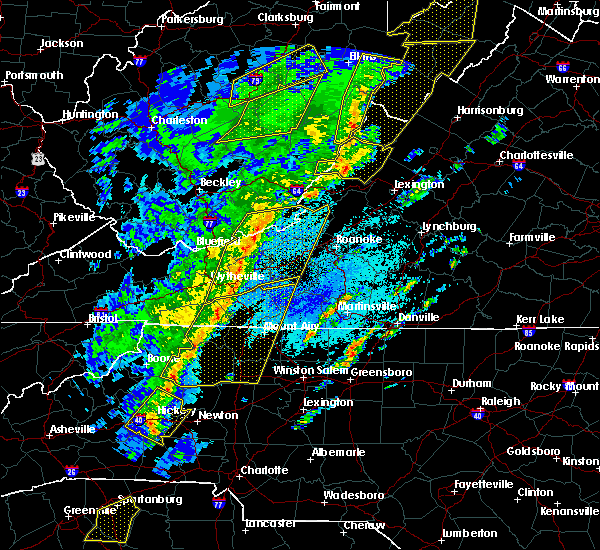 At 1026 pm edt, severe thunderstorms were located along a line extending from near union to byllesby, moving northeast at 50 mph (radar indicated). Hazards include 60 mph wind gusts. expect damage to roofs, siding, and trees At 1026 pm edt, severe thunderstorms were located along a line extending from near union to byllesby, moving northeast at 50 mph (radar indicated). Hazards include 60 mph wind gusts. expect damage to roofs, siding, and trees
|
| 4/8/2019 2:47 PM EDT | Quarter sized hail reported 0.5 miles E of New Castle, VA |
| 4/8/2019 2:38 PM EDT |
 At 237 pm edt, a severe thunderstorm was located near abbott, moving east at 30 mph (radar indicated). Hazards include 60 mph wind gusts and quarter size hail. Hail damage to vehicles is expected. Expect wind damage to roofs, siding, and trees. At 237 pm edt, a severe thunderstorm was located near abbott, moving east at 30 mph (radar indicated). Hazards include 60 mph wind gusts and quarter size hail. Hail damage to vehicles is expected. Expect wind damage to roofs, siding, and trees.
|
| 6/9/2018 6:05 PM EDT |
 The severe thunderstorm warning for eastern roanoke, east central craig, west central bedford and southwestern botetourt counties and the city of roanoke will expire at 615 pm edt, the storm which prompted the warning has weakened below severe limits, and no longer poses an immediate threat to life or property. therefore, the warning will be allowed to expire. however heavy rain is still possible with this thunderstorm. when it is safe to do so, please send your reports of hail of any size, as well as reports of any wind damage, including downed trees or large limbs, to the national weather service by calling toll free at 1, 8 6 6, 2 1 5, 4 3 2 4. reports and pictures can also be shared on the national weather service blacksburg facebook page and on twitter. The severe thunderstorm warning for eastern roanoke, east central craig, west central bedford and southwestern botetourt counties and the city of roanoke will expire at 615 pm edt, the storm which prompted the warning has weakened below severe limits, and no longer poses an immediate threat to life or property. therefore, the warning will be allowed to expire. however heavy rain is still possible with this thunderstorm. when it is safe to do so, please send your reports of hail of any size, as well as reports of any wind damage, including downed trees or large limbs, to the national weather service by calling toll free at 1, 8 6 6, 2 1 5, 4 3 2 4. reports and pictures can also be shared on the national weather service blacksburg facebook page and on twitter.
|
| 6/9/2018 5:30 PM EDT |
 At 529 pm edt, a severe thunderstorm was located near daleville, moving southeast at 10 mph (radar indicated). Hazards include 60 mph wind gusts and quarter size hail. Hail damage to vehicles is expected. expect wind damage to roofs, siding, and trees. locations impacted include, roanoke, vinton, troutville, new castle, and stewartsville. This includes the following location roanoke regional airport. At 529 pm edt, a severe thunderstorm was located near daleville, moving southeast at 10 mph (radar indicated). Hazards include 60 mph wind gusts and quarter size hail. Hail damage to vehicles is expected. expect wind damage to roofs, siding, and trees. locations impacted include, roanoke, vinton, troutville, new castle, and stewartsville. This includes the following location roanoke regional airport.
|
| 6/9/2018 5:15 PM EDT |
 At 515 pm edt, a severe thunderstorm was located near new castle, moving southeast at 15 mph (radar indicated). Hazards include 60 mph wind gusts and quarter size hail. Hail damage to vehicles is expected. Expect wind damage to roofs, siding, and trees. At 515 pm edt, a severe thunderstorm was located near new castle, moving southeast at 15 mph (radar indicated). Hazards include 60 mph wind gusts and quarter size hail. Hail damage to vehicles is expected. Expect wind damage to roofs, siding, and trees.
|
| 5/15/2018 2:58 PM EDT |
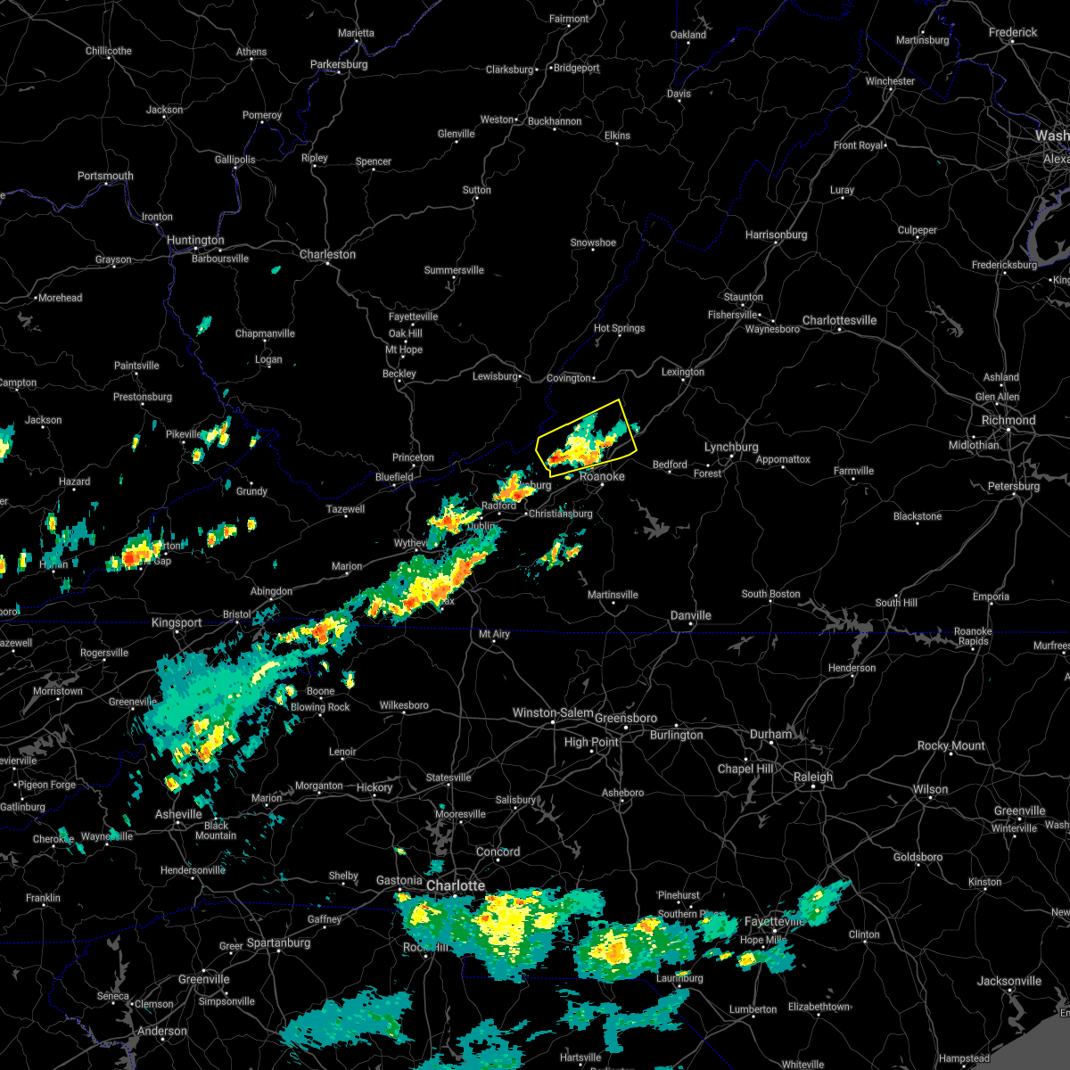 The severe thunderstorm warning for northwestern roanoke, craig and southwestern botetourt counties will expire at 300 pm edt, the storm which prompted the warning has weakened below severe limits, and no longer poses an immediate threat to life or property. therefore, the warning will be allowed to expire. when it is safe to do so, please send your reports of hail of any size, as well as reports of any wind damage, including downed trees or large limbs, to the national weather service by calling toll free at 1, 8 6 6, 2 1 5, 4 3 2 4. reports and pictures can also be shared on the national weather service blacksburg facebook page and on twitter. The severe thunderstorm warning for northwestern roanoke, craig and southwestern botetourt counties will expire at 300 pm edt, the storm which prompted the warning has weakened below severe limits, and no longer poses an immediate threat to life or property. therefore, the warning will be allowed to expire. when it is safe to do so, please send your reports of hail of any size, as well as reports of any wind damage, including downed trees or large limbs, to the national weather service by calling toll free at 1, 8 6 6, 2 1 5, 4 3 2 4. reports and pictures can also be shared on the national weather service blacksburg facebook page and on twitter.
|
| 5/15/2018 2:31 PM EDT |
 At 231 pm edt, a severe thunderstorm was located near new castle, moving east at 20 mph (radar indicated). Hazards include 60 mph wind gusts and quarter size hail. Hail damage to vehicles is expected. expect wind damage to roofs, siding, and trees. Locations impacted include, troutville, new castle, catawba, oriskany, and sinking creek. At 231 pm edt, a severe thunderstorm was located near new castle, moving east at 20 mph (radar indicated). Hazards include 60 mph wind gusts and quarter size hail. Hail damage to vehicles is expected. expect wind damage to roofs, siding, and trees. Locations impacted include, troutville, new castle, catawba, oriskany, and sinking creek.
|
| 5/15/2018 2:28 PM EDT | One large oak tree uprooted at turnpike creek farm... dime size hail also reporte in craig county VA, 9.5 miles NE of New Castle, VA |
| 5/15/2018 2:09 PM EDT |
 At 209 pm edt, a severe thunderstorm was located over abbott, moving east at 20 mph (radar indicated). Hazards include 60 mph wind gusts and quarter size hail. Hail damage to vehicles is expected. Expect wind damage to roofs, siding, and trees. At 209 pm edt, a severe thunderstorm was located over abbott, moving east at 20 mph (radar indicated). Hazards include 60 mph wind gusts and quarter size hail. Hail damage to vehicles is expected. Expect wind damage to roofs, siding, and trees.
|
| 4/15/2018 4:59 PM EDT | Multiple buildings sustained damage by thunderstorm winds in the community of new castle. in addition... several trees were blown down or snappe in craig county VA, 0.5 miles E of New Castle, VA |
| 4/15/2018 4:54 PM EDT |
 The severe thunderstorm warning for western roanoke, craig, southwestern botetourt, montgomery and southeastern monroe counties will expire at 500 pm edt, the storm which prompted the warning has weakened below severe limits, and no longer poses an immediate threat to life or property. therefore the warning will be allowed to expire. a tornado watch remains in effect until 700 pm edt for southwestern virginia. a tornado watch also remains in effect until 1100 pm edt for central, south central, southwestern and west central virginia. when it is safe to do so, please send your reports of hail of any size, as well as reports of any wind damage, including downed trees or large limbs, to the national weather service by calling toll free at 1, 8 6 6, 2 1 5, 4 3 2 4. reports and pictures can also be shared on the national weather service blacksburg facebook page and on twitter. The severe thunderstorm warning for western roanoke, craig, southwestern botetourt, montgomery and southeastern monroe counties will expire at 500 pm edt, the storm which prompted the warning has weakened below severe limits, and no longer poses an immediate threat to life or property. therefore the warning will be allowed to expire. a tornado watch remains in effect until 700 pm edt for southwestern virginia. a tornado watch also remains in effect until 1100 pm edt for central, south central, southwestern and west central virginia. when it is safe to do so, please send your reports of hail of any size, as well as reports of any wind damage, including downed trees or large limbs, to the national weather service by calling toll free at 1, 8 6 6, 2 1 5, 4 3 2 4. reports and pictures can also be shared on the national weather service blacksburg facebook page and on twitter.
|
| 4/15/2018 4:33 PM EDT |
 At 432 pm edt, a severe thunderstorm was located over sinking creek, moving north at 60 mph (radar indicated). Hazards include 60 mph wind gusts and quarter size hail. Hail damage to vehicles is expected. expect wind damage to roofs, siding, and trees. locations impacted include, blacksburg, christiansburg, troutville, new castle, and pilot. this includes the following location virginia tech. a tornado watch remains in effect until 700 pm edt for southwestern virginia. A tornado watch also remains in effect until 1100 pm edt for central, south central, southwestern and west central virginia. At 432 pm edt, a severe thunderstorm was located over sinking creek, moving north at 60 mph (radar indicated). Hazards include 60 mph wind gusts and quarter size hail. Hail damage to vehicles is expected. expect wind damage to roofs, siding, and trees. locations impacted include, blacksburg, christiansburg, troutville, new castle, and pilot. this includes the following location virginia tech. a tornado watch remains in effect until 700 pm edt for southwestern virginia. A tornado watch also remains in effect until 1100 pm edt for central, south central, southwestern and west central virginia.
|
| 4/15/2018 3:57 PM EDT |
 At 356 pm edt, a severe thunderstorm was located near copper valley, moving north at 60 mph (radar indicated). Hazards include 60 mph wind gusts and quarter size hail. Hail damage to vehicles is expected. Expect wind damage to roofs, siding, and trees. At 356 pm edt, a severe thunderstorm was located near copper valley, moving north at 60 mph (radar indicated). Hazards include 60 mph wind gusts and quarter size hail. Hail damage to vehicles is expected. Expect wind damage to roofs, siding, and trees.
|
| 10/23/2017 7:28 PM EDT |
 At 727 pm edt, severe thunderstorms were located along a line extending from near falling spring to near alleghany to near abbott, moving northeast at 70 mph (radar indicated). Hazards include 60 mph wind gusts and quarter size hail. Hail damage to vehicles is expected. Expect wind damage to roofs, siding, and trees. At 727 pm edt, severe thunderstorms were located along a line extending from near falling spring to near alleghany to near abbott, moving northeast at 70 mph (radar indicated). Hazards include 60 mph wind gusts and quarter size hail. Hail damage to vehicles is expected. Expect wind damage to roofs, siding, and trees.
|
| 6/15/2017 6:07 PM EDT |
 At 539 pm edt, a severe thunderstorm was located over abbott, moving southeast at 20 mph (radar indicated). Hazards include 60 mph wind gusts and quarter size hail. Hail damage to vehicles is expected. expect wind damage to roofs, siding, and trees. Locations impacted include, new castle, catawba, and abbott. At 539 pm edt, a severe thunderstorm was located over abbott, moving southeast at 20 mph (radar indicated). Hazards include 60 mph wind gusts and quarter size hail. Hail damage to vehicles is expected. expect wind damage to roofs, siding, and trees. Locations impacted include, new castle, catawba, and abbott.
|
| 6/15/2017 5:39 PM EDT |
 At 539 pm edt, a severe thunderstorm was located over abbott, moving southeast at 20 mph (radar indicated). Hazards include 60 mph wind gusts and quarter size hail. Hail damage to vehicles is expected. expect wind damage to roofs, siding, and trees. Locations impacted include, new castle, catawba, and abbott. At 539 pm edt, a severe thunderstorm was located over abbott, moving southeast at 20 mph (radar indicated). Hazards include 60 mph wind gusts and quarter size hail. Hail damage to vehicles is expected. expect wind damage to roofs, siding, and trees. Locations impacted include, new castle, catawba, and abbott.
|
| 6/15/2017 5:28 PM EDT |
 At 528 pm edt, a severe thunderstorm was located near abbott, moving east at 15 mph (radar indicated). Hazards include 60 mph wind gusts and quarter size hail. Hail damage to vehicles is expected. Expect wind damage to roofs, siding, and trees. At 528 pm edt, a severe thunderstorm was located near abbott, moving east at 15 mph (radar indicated). Hazards include 60 mph wind gusts and quarter size hail. Hail damage to vehicles is expected. Expect wind damage to roofs, siding, and trees.
|
| 3/1/2017 11:55 AM EST | Two large pine trees snapped off part way u in craig county VA, 0.5 miles E of New Castle, VA |
| 3/1/2017 11:42 AM EST |
 At 1142 am est, severe thunderstorms were located along a line extending from paint bank to near waiteville to mountain lake, moving east at 65 mph (radar indicated). Hazards include 60 mph wind gusts. expect damage to roofs, siding, and trees At 1142 am est, severe thunderstorms were located along a line extending from paint bank to near waiteville to mountain lake, moving east at 65 mph (radar indicated). Hazards include 60 mph wind gusts. expect damage to roofs, siding, and trees
|
| 7/28/2016 9:42 PM EDT |
 At 942 pm edt, severe thunderstorms were located along a line extending from new castle to near catawba to elliston-lafayette, moving east at 40 mph (radar indicated). Hazards include 60 mph wind gusts. Expect damage to roofs. siding. and trees. locations impacted include, roanoke, salem, vinton, troutville, and new castle. This includes the following locations the salem fairgrounds and roanoke regional airport. At 942 pm edt, severe thunderstorms were located along a line extending from new castle to near catawba to elliston-lafayette, moving east at 40 mph (radar indicated). Hazards include 60 mph wind gusts. Expect damage to roofs. siding. and trees. locations impacted include, roanoke, salem, vinton, troutville, and new castle. This includes the following locations the salem fairgrounds and roanoke regional airport.
|
| 7/28/2016 9:29 PM EDT |
 At 929 pm edt, severe thunderstorms were located along a line extending from near paint bank to near mc donalds mill to near christiansburg, moving east at 35 mph (radar indicated). Hazards include 60 mph wind gusts. Expect damage to roofs. siding. and trees. locations impacted include, roanoke, blacksburg, salem, christiansburg, and vinton. This includes the following locations virginia tech, the salem fairgrounds, and roanoke regional airport. At 929 pm edt, severe thunderstorms were located along a line extending from near paint bank to near mc donalds mill to near christiansburg, moving east at 35 mph (radar indicated). Hazards include 60 mph wind gusts. Expect damage to roofs. siding. and trees. locations impacted include, roanoke, blacksburg, salem, christiansburg, and vinton. This includes the following locations virginia tech, the salem fairgrounds, and roanoke regional airport.
|
| 7/28/2016 9:19 PM EDT |
 At 919 pm edt, severe thunderstorms were located along a line extending from moncove lake state park to near blacksburg to near walton, moving east at 35 mph (radar indicated). Hazards include 60 mph wind gusts. Expect damage to roofs. siding. And trees. At 919 pm edt, severe thunderstorms were located along a line extending from moncove lake state park to near blacksburg to near walton, moving east at 35 mph (radar indicated). Hazards include 60 mph wind gusts. Expect damage to roofs. siding. And trees.
|
| 7/8/2016 4:57 PM EDT |
 At 456 pm edt, severe thunderstorms were located along a line extending from jordan mines to near new castle to glenvar, moving east at 40 mph (radar indicated). Hazards include 60 mph wind gusts. Expect damage to roofs. siding. And trees. At 456 pm edt, severe thunderstorms were located along a line extending from jordan mines to near new castle to glenvar, moving east at 40 mph (radar indicated). Hazards include 60 mph wind gusts. Expect damage to roofs. siding. And trees.
|
| 7/8/2016 4:45 PM EDT | Numerous trees down across the county with many power outages reported. storms crossed the county from about 440 pm to 500 pm per rada in craig county VA, 0.5 miles E of New Castle, VA |
| 6/23/2016 4:36 PM EDT |
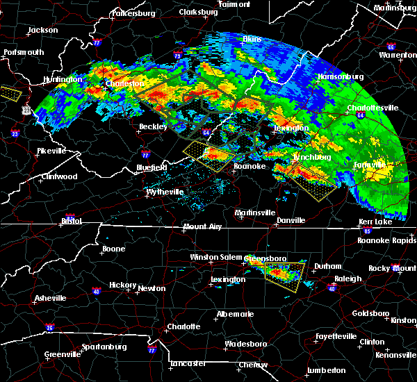 At 435 pm edt, a severe thunderstorm was located over craig springs, moving southeast at 50 mph (radar indicated). Hazards include 60 mph wind gusts and quarter size hail. Hail damage to vehicles is expected. expect wind damage to roofs, siding, and trees. Locations impacted include, new castle, paint bank, catawba, sinking creek, and craig springs. At 435 pm edt, a severe thunderstorm was located over craig springs, moving southeast at 50 mph (radar indicated). Hazards include 60 mph wind gusts and quarter size hail. Hail damage to vehicles is expected. expect wind damage to roofs, siding, and trees. Locations impacted include, new castle, paint bank, catawba, sinking creek, and craig springs.
|
| 6/23/2016 4:14 PM EDT |
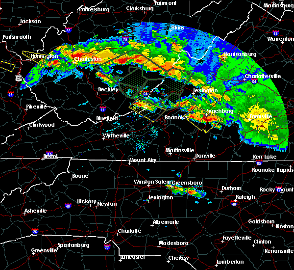 At 414 pm edt, a severe thunderstorm was located over hollywood, moving southeast at 30 mph (radar indicated). Hazards include 60 mph wind gusts and quarter size hail. Hail damage to vehicles is expected. Expect wind damage to roofs, siding, and trees. At 414 pm edt, a severe thunderstorm was located over hollywood, moving southeast at 30 mph (radar indicated). Hazards include 60 mph wind gusts and quarter size hail. Hail damage to vehicles is expected. Expect wind damage to roofs, siding, and trees.
|
| 6/23/2016 4:14 PM EDT |
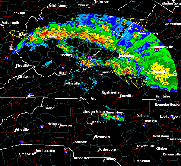 At 414 pm edt, a severe thunderstorm was located over hollywood, moving southeast at 30 mph (radar indicated). Hazards include 60 mph wind gusts and quarter size hail. Hail damage to vehicles is expected. Expect wind damage to roofs, siding, and trees. At 414 pm edt, a severe thunderstorm was located over hollywood, moving southeast at 30 mph (radar indicated). Hazards include 60 mph wind gusts and quarter size hail. Hail damage to vehicles is expected. Expect wind damage to roofs, siding, and trees.
|
| 6/23/2016 2:13 PM EDT |
 At 212 pm edt, severe thunderstorms were located along a line extending from near buena vista to near arcadia to alleghany, moving east at 35 mph (radar indicated). Hazards include 60 mph wind gusts. Expect damage to roofs. siding. and trees. Locations impacted include, alleghany, buena vista, covington, buchanan, and glasgow. At 212 pm edt, severe thunderstorms were located along a line extending from near buena vista to near arcadia to alleghany, moving east at 35 mph (radar indicated). Hazards include 60 mph wind gusts. Expect damage to roofs. siding. and trees. Locations impacted include, alleghany, buena vista, covington, buchanan, and glasgow.
|
| 6/23/2016 1:59 PM EDT |
 At 158 pm edt, severe thunderstorms were located along a line extending from near lexington to near eagle rock to near greenbrier river trail, moving east at 35 mph (radar indicated). Hazards include 60 mph wind gusts. Expect damage to roofs. siding. and trees. locations impacted include, alleghany, lexington, buena vista, covington, and white sulphur springs. This includes vmi. At 158 pm edt, severe thunderstorms were located along a line extending from near lexington to near eagle rock to near greenbrier river trail, moving east at 35 mph (radar indicated). Hazards include 60 mph wind gusts. Expect damage to roofs. siding. and trees. locations impacted include, alleghany, lexington, buena vista, covington, and white sulphur springs. This includes vmi.
|
| 6/23/2016 1:48 PM EDT |
 At 147 pm edt, severe thunderstorms were located along a line extending from collierstown to near oriskany to lewisburg, moving southeast at 35 mph (radar indicated). Hazards include 60 mph wind gusts. Expect damage to roofs. siding. and trees. locations impacted include, alleghany, lexington, buena vista, covington, and clifton forge. This includes vmi and the west virginia state fairgrounds. At 147 pm edt, severe thunderstorms were located along a line extending from collierstown to near oriskany to lewisburg, moving southeast at 35 mph (radar indicated). Hazards include 60 mph wind gusts. Expect damage to roofs. siding. and trees. locations impacted include, alleghany, lexington, buena vista, covington, and clifton forge. This includes vmi and the west virginia state fairgrounds.
|
| 6/23/2016 1:36 PM EDT |
 At 135 pm edt, severe thunderstorms were located along a line extending from near douthat state park to near jordan mines to near asbury, moving east at 35 mph (radar indicated). Hazards include 60 mph wind gusts. Expect damage to roofs. siding. And trees. At 135 pm edt, severe thunderstorms were located along a line extending from near douthat state park to near jordan mines to near asbury, moving east at 35 mph (radar indicated). Hazards include 60 mph wind gusts. Expect damage to roofs. siding. And trees.
|
| 6/23/2016 9:23 AM EDT |
 The severe thunderstorm warning for craig, bath and alleghany counties and the city of covington will expire at 930 am edt, the storms which prompted the warning have moved out of the area. therefore the warning will be allowed to expire. however gusty winds are still possible with these thunderstorms, especially on ridges, and with the wet ground some trees could still be uprooted. when it is safe to do so, please send your reports of hail of any size, as well as any reports of wind damage, including downed trees or large limbs, to the national weather service by calling toll free at 1, 8 6 6, 2 1 5, 4 3 2 4. reports and pictures can also be shared on the national weather service blacksburg facebook page and on twitter. The severe thunderstorm warning for craig, bath and alleghany counties and the city of covington will expire at 930 am edt, the storms which prompted the warning have moved out of the area. therefore the warning will be allowed to expire. however gusty winds are still possible with these thunderstorms, especially on ridges, and with the wet ground some trees could still be uprooted. when it is safe to do so, please send your reports of hail of any size, as well as any reports of wind damage, including downed trees or large limbs, to the national weather service by calling toll free at 1, 8 6 6, 2 1 5, 4 3 2 4. reports and pictures can also be shared on the national weather service blacksburg facebook page and on twitter.
|
| 6/23/2016 9:10 AM EDT |
 At 909 am edt, severe thunderstorms were located along a line extending from near daleville to near mc donalds mill, moving southeast at 40 mph. at this time, the greatest threat for any additional wind damage is primarily in craig county, but some ridge tops in allegheny and bath counties may still have very gusty winds which could result in uprooted trees (radar indicated). Hazards include 60 mph wind gusts. Expect damage to roofs. siding. and trees. Locations impacted include, alleghany, covington, clifton forge, new castle, and jordan mines. At 909 am edt, severe thunderstorms were located along a line extending from near daleville to near mc donalds mill, moving southeast at 40 mph. at this time, the greatest threat for any additional wind damage is primarily in craig county, but some ridge tops in allegheny and bath counties may still have very gusty winds which could result in uprooted trees (radar indicated). Hazards include 60 mph wind gusts. Expect damage to roofs. siding. and trees. Locations impacted include, alleghany, covington, clifton forge, new castle, and jordan mines.
|
| 6/23/2016 9:00 AM EDT |
 At 900 am edt, severe thunderstorms were located along a line extending from 6 miles west of fincastle to near sinking creek, moving southeast at 65 mph (radar indicated). Hazards include 60 mph wind gusts. Expect damage to roofs. siding. and trees. Locations impacted include, alleghany, covington, clifton forge, new castle, and jordan mines. At 900 am edt, severe thunderstorms were located along a line extending from 6 miles west of fincastle to near sinking creek, moving southeast at 65 mph (radar indicated). Hazards include 60 mph wind gusts. Expect damage to roofs. siding. and trees. Locations impacted include, alleghany, covington, clifton forge, new castle, and jordan mines.
|
| 6/23/2016 8:33 AM EDT |
 At 832 am edt, severe thunderstorms were located along a line extending from near mountain grove to near moncove lake state park, moving southeast at 70 mph (radar indicated). Hazards include 70 mph wind gusts. Expect considerable tree damage. Damage is likely to mobile homes, roofs, and outbuildings. At 832 am edt, severe thunderstorms were located along a line extending from near mountain grove to near moncove lake state park, moving southeast at 70 mph (radar indicated). Hazards include 70 mph wind gusts. Expect considerable tree damage. Damage is likely to mobile homes, roofs, and outbuildings.
|
| 6/21/2016 5:05 PM EDT |
 At 504 pm edt, a severe thunderstorm was located over talcott, moving east at 25 mph (radar indicated). Hazards include 60 mph wind gusts and quarter size hail. Hail damage to vehicles is expected. expect wind damage to roofs, siding, and trees. Locations impacted include, hinton, alderson, union, new castle, and paint bank. At 504 pm edt, a severe thunderstorm was located over talcott, moving east at 25 mph (radar indicated). Hazards include 60 mph wind gusts and quarter size hail. Hail damage to vehicles is expected. expect wind damage to roofs, siding, and trees. Locations impacted include, hinton, alderson, union, new castle, and paint bank.
|
| 6/21/2016 4:52 PM EDT |
 At 452 pm edt, a severe thunderstorm was located over hix, moving southeast at 40 mph (radar indicated). Hazards include 60 mph wind gusts and quarter size hail. Hail damage to vehicles is expected. Expect wind damage to roofs, siding, and trees. At 452 pm edt, a severe thunderstorm was located over hix, moving southeast at 40 mph (radar indicated). Hazards include 60 mph wind gusts and quarter size hail. Hail damage to vehicles is expected. Expect wind damage to roofs, siding, and trees.
|
| 6/15/2016 6:19 PM EDT |
 At 619 pm edt, severe thunderstorms were located along a line extending from near oriskany to hollins to poages mill, moving east at 35 mph (radar indicated). Hazards include 60 mph wind gusts and quarter size hail. Hail damage to vehicles is expected. expect wind damage to roofs, siding, and trees. locations impacted include, roanoke, salem, vinton, troutville, and new castle. This includes the salem fairgrounds and roanoke regional airport. At 619 pm edt, severe thunderstorms were located along a line extending from near oriskany to hollins to poages mill, moving east at 35 mph (radar indicated). Hazards include 60 mph wind gusts and quarter size hail. Hail damage to vehicles is expected. expect wind damage to roofs, siding, and trees. locations impacted include, roanoke, salem, vinton, troutville, and new castle. This includes the salem fairgrounds and roanoke regional airport.
|
| 6/15/2016 6:08 PM EDT |
 At 607 pm edt, severe thunderstorms were located along a line extending from near new castle to near catawba to near elliston- lafayette, moving east at 35 mph. minor wind damage to trees have been reported with this storm (radar indicated and spotter confirmed). Hazards include 60 mph wind gusts and quarter size hail. Hail damage to vehicles is expected. expect wind damage to roofs, siding, and trees. locations impacted include, roanoke, salem, vinton, troutville, and new castle. This includes the salem fairgrounds and roanoke regional airport. At 607 pm edt, severe thunderstorms were located along a line extending from near new castle to near catawba to near elliston- lafayette, moving east at 35 mph. minor wind damage to trees have been reported with this storm (radar indicated and spotter confirmed). Hazards include 60 mph wind gusts and quarter size hail. Hail damage to vehicles is expected. expect wind damage to roofs, siding, and trees. locations impacted include, roanoke, salem, vinton, troutville, and new castle. This includes the salem fairgrounds and roanoke regional airport.
|
| 6/15/2016 5:51 PM EDT |
 At 550 pm edt, severe thunderstorms were located along a line extending from near craig springs to near bradshaw to near shawsville, moving east at 35 mph (radar indicated). Hazards include 60 mph wind gusts and quarter size hail. Hail damage to vehicles is expected. Expect wind damage to roofs, siding, and trees. At 550 pm edt, severe thunderstorms were located along a line extending from near craig springs to near bradshaw to near shawsville, moving east at 35 mph (radar indicated). Hazards include 60 mph wind gusts and quarter size hail. Hail damage to vehicles is expected. Expect wind damage to roofs, siding, and trees.
|
| 5/2/2016 4:30 PM EDT | Half Dollar sized hail reported 15.8 miles ENE of New Castle, VA, public reports hail up to half dollar size near the community of maggie in craig county... virginia. |
| 5/1/2016 8:59 PM EDT |
 At 858 pm edt, severe thunderstorms were located along a line extending from near callaghan to near craig springs, moving east at 30 mph (radar indicated). Hazards include 60 mph wind gusts. Expect damage to roofs. siding. and trees. Locations impacted include, alleghany, covington, clifton forge, new castle, and oriskany. At 858 pm edt, severe thunderstorms were located along a line extending from near callaghan to near craig springs, moving east at 30 mph (radar indicated). Hazards include 60 mph wind gusts. Expect damage to roofs. siding. and trees. Locations impacted include, alleghany, covington, clifton forge, new castle, and oriskany.
|
| 5/1/2016 8:42 PM EDT |
 At 842 pm edt, severe thunderstorms were located along a line extending from near alvon to near waiteville, moving east at 45 mph (radar indicated). Hazards include 60 mph wind gusts. Expect damage to roofs. siding. And trees. At 842 pm edt, severe thunderstorms were located along a line extending from near alvon to near waiteville, moving east at 45 mph (radar indicated). Hazards include 60 mph wind gusts. Expect damage to roofs. siding. And trees.
|
| 9/4/2015 4:10 PM EDT |
 The severe thunderstorm warning for northeastern craig, northwestern botetourt and central alleghany counties and the city of covington will expire at 415 pm edt, the storm which prompted the warning has weakened below severe limits, and has exited the warned area. therefore the warning will be allowed to expire. when it is safe to do so, please send your reports of hail of any size, as well as any reports of wind damage, including downed trees or large limbs, to the national weather service by calling toll free at 1, 8 6 6, 2 1 5, 4 3 2 4. reports and pictures can also be shared on the national weather service blacksburg facebook page and on twitter. The severe thunderstorm warning for northeastern craig, northwestern botetourt and central alleghany counties and the city of covington will expire at 415 pm edt, the storm which prompted the warning has weakened below severe limits, and has exited the warned area. therefore the warning will be allowed to expire. when it is safe to do so, please send your reports of hail of any size, as well as any reports of wind damage, including downed trees or large limbs, to the national weather service by calling toll free at 1, 8 6 6, 2 1 5, 4 3 2 4. reports and pictures can also be shared on the national weather service blacksburg facebook page and on twitter.
|
| 9/4/2015 3:28 PM EDT |
 At 327 pm edt, a severe thunderstorm was located near covington, moving southwest at 20 mph (radar indicated). Hazards include 60 mph wind gusts and quarter size hail. Hail damage to vehicles is expected. expect wind damage to roofs, siding and trees. Locations impacted include, covington, clifton forge, new castle, jordan mines, and paint bank. At 327 pm edt, a severe thunderstorm was located near covington, moving southwest at 20 mph (radar indicated). Hazards include 60 mph wind gusts and quarter size hail. Hail damage to vehicles is expected. expect wind damage to roofs, siding and trees. Locations impacted include, covington, clifton forge, new castle, jordan mines, and paint bank.
|
| 9/4/2015 3:08 PM EDT |
 At 308 pm edt, a severe thunderstorm was located over low moor, moving southwest at 20 mph (radar indicated). Hazards include 60 mph wind gusts and quarter size hail. Hail damage to vehicles is expected. Expect wind damage to roofs, siding and trees. At 308 pm edt, a severe thunderstorm was located over low moor, moving southwest at 20 mph (radar indicated). Hazards include 60 mph wind gusts and quarter size hail. Hail damage to vehicles is expected. Expect wind damage to roofs, siding and trees.
|
| 7/14/2015 8:32 PM EDT |
 At 831 pm edt, severe thunderstorms were located along a line extending from near brownsburg to eagle rock to newport, moving east at 55 mph (radar indicated). Hazards include 60 mph wind gusts. Expect damage to roofs. siding and trees. locations impacted include, lexington, covington, clifton forge, pearisburg, and narrows. This includes vmi. At 831 pm edt, severe thunderstorms were located along a line extending from near brownsburg to eagle rock to newport, moving east at 55 mph (radar indicated). Hazards include 60 mph wind gusts. Expect damage to roofs. siding and trees. locations impacted include, lexington, covington, clifton forge, pearisburg, and narrows. This includes vmi.
|
| 7/14/2015 8:18 PM EDT |
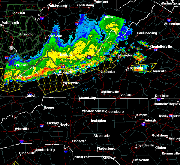 At 818 pm edt, severe thunderstorms were located along a line extending from near yost to near oriskany to kimballton, moving east at 45 mph (radar indicated). Hazards include 60 mph wind gusts. Expect damage to roofs. siding and trees. locations impacted include, lexington, covington, clifton forge, pearisburg, and narrows. This includes vmi. At 818 pm edt, severe thunderstorms were located along a line extending from near yost to near oriskany to kimballton, moving east at 45 mph (radar indicated). Hazards include 60 mph wind gusts. Expect damage to roofs. siding and trees. locations impacted include, lexington, covington, clifton forge, pearisburg, and narrows. This includes vmi.
|
| 7/14/2015 8:05 PM EDT |
 At 805 pm edt, severe thunderstorms were located along a line extending from near burnsville to near jordan mines to pembroke, moving east at 45 mph (radar indicated). Hazards include 60 mph wind gusts. Expect damage to roofs. siding and trees. locations impacted include, lexington, covington, clifton forge, pearisburg, and narrows. This includes vmi. At 805 pm edt, severe thunderstorms were located along a line extending from near burnsville to near jordan mines to pembroke, moving east at 45 mph (radar indicated). Hazards include 60 mph wind gusts. Expect damage to roofs. siding and trees. locations impacted include, lexington, covington, clifton forge, pearisburg, and narrows. This includes vmi.
|
| 7/14/2015 7:51 PM EDT |
 At 751 pm edt, severe thunderstorms were located along a line extending from 6 miles north of mountain grove to white sulphur springs to rich creek, moving southeast at 40 mph (radar indicated). Hazards include 60 mph wind gusts. Expect damage to roofs. Siding and trees. At 751 pm edt, severe thunderstorms were located along a line extending from 6 miles north of mountain grove to white sulphur springs to rich creek, moving southeast at 40 mph (radar indicated). Hazards include 60 mph wind gusts. Expect damage to roofs. Siding and trees.
|
| 7/13/2015 7:48 PM EDT |
 At 746 pm edt, severe thunderstorms were located along a line extending from near mountain grove, to covington, to elliston, to near laurel fork, moving east at 40 mph (radar indicated). Hazards include 60 mph wind gusts. Expect damage to roofs. siding and trees. Locations impacted include, christiansburg, covington, clifton forge, floyd, and new castle. At 746 pm edt, severe thunderstorms were located along a line extending from near mountain grove, to covington, to elliston, to near laurel fork, moving east at 40 mph (radar indicated). Hazards include 60 mph wind gusts. Expect damage to roofs. siding and trees. Locations impacted include, christiansburg, covington, clifton forge, floyd, and new castle.
|
| 7/13/2015 7:09 PM EDT |
 At 708 pm edt, severe thunderstorms were located along a line extending from near marlinton to near draper, moving east at 70 mph (radar indicated). Hazards include 60 mph wind gusts. Expect damage to roofs. Siding and trees. At 708 pm edt, severe thunderstorms were located along a line extending from near marlinton to near draper, moving east at 70 mph (radar indicated). Hazards include 60 mph wind gusts. Expect damage to roofs. Siding and trees.
|
| 6/30/2015 10:49 PM EDT |
 At 1048 pm edt, severe thunderstorms were located along a line extending from near oriskany to near catawba to near glenvar, moving east at 45 mph (radar indicated). Hazards include 60 mph wind gusts and quarter size hail. Hail damage to vehicles is expected. expect wind damage to roofs, siding and trees. locations impacted include, roanoke, salem, vinton, buchanan, and troutville. This includes the salem fairgrounds and roanoke regional airport. At 1048 pm edt, severe thunderstorms were located along a line extending from near oriskany to near catawba to near glenvar, moving east at 45 mph (radar indicated). Hazards include 60 mph wind gusts and quarter size hail. Hail damage to vehicles is expected. expect wind damage to roofs, siding and trees. locations impacted include, roanoke, salem, vinton, buchanan, and troutville. This includes the salem fairgrounds and roanoke regional airport.
|
| 6/30/2015 10:22 PM EDT |
 At 1021 pm edt, severe thunderstorms were located along a line extending from near paint bank to near simmonsville to near blacksburg, moving east at 40 mph (radar indicated). Hazards include 60 mph wind gusts and quarter size hail. Hail damage to vehicles is expected. Expect wind damage to roofs, siding and trees. At 1021 pm edt, severe thunderstorms were located along a line extending from near paint bank to near simmonsville to near blacksburg, moving east at 40 mph (radar indicated). Hazards include 60 mph wind gusts and quarter size hail. Hail damage to vehicles is expected. Expect wind damage to roofs, siding and trees.
|
| 9/2/2012 5:16 PM EDT | One tree down on holcombe avenue that brought down a power line in craig county VA, 0.1 miles WNW of New Castle, VA |
| 9/2/2012 5:16 PM EDT | One large tree limb down along albert street in craig county VA, 0.1 miles WNW of New Castle, VA |
| 6/29/2012 8:37 PM EDT | In craig county hundreds of trees were blown down...power lines down. a few barns were damaged...a porch was destroyed by thunderstorm winds on route 42. several vehicl in craig county VA, 0.5 miles E of New Castle, VA |
| 1/1/0001 12:00 AM | Tree down on route 60 in craig county VA, 5 miles SW of New Castle, VA |
| 1/1/0001 12:00 AM | Large branches down newport road. report via wdbj in craig county VA, 7 miles N of New Castle, VA |
| 1/1/0001 12:00 AM | Large tree down on potts mountain...route 311 in craig county VA, 9.3 miles SE of New Castle, VA |
| 1/1/0001 12:00 AM | Couple trees dow in craig county VA, 0.5 miles E of New Castle, VA |
Hail Maps for New Castle, VA


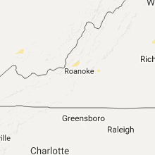


Connect with Interactive Hail Maps