

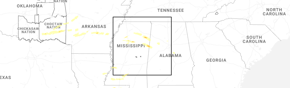
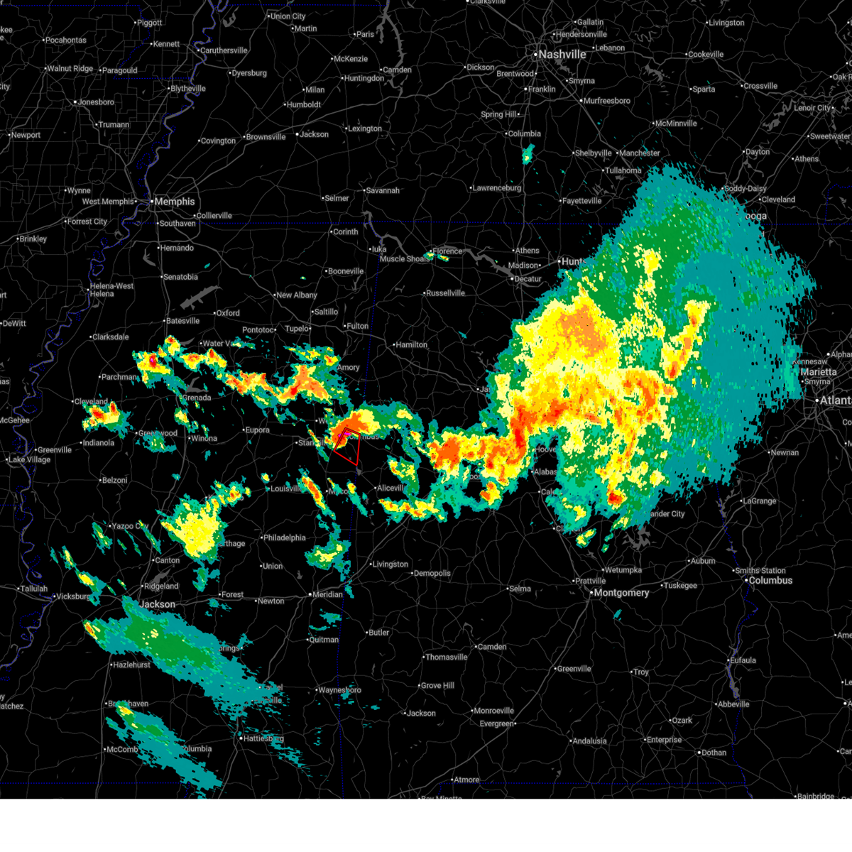
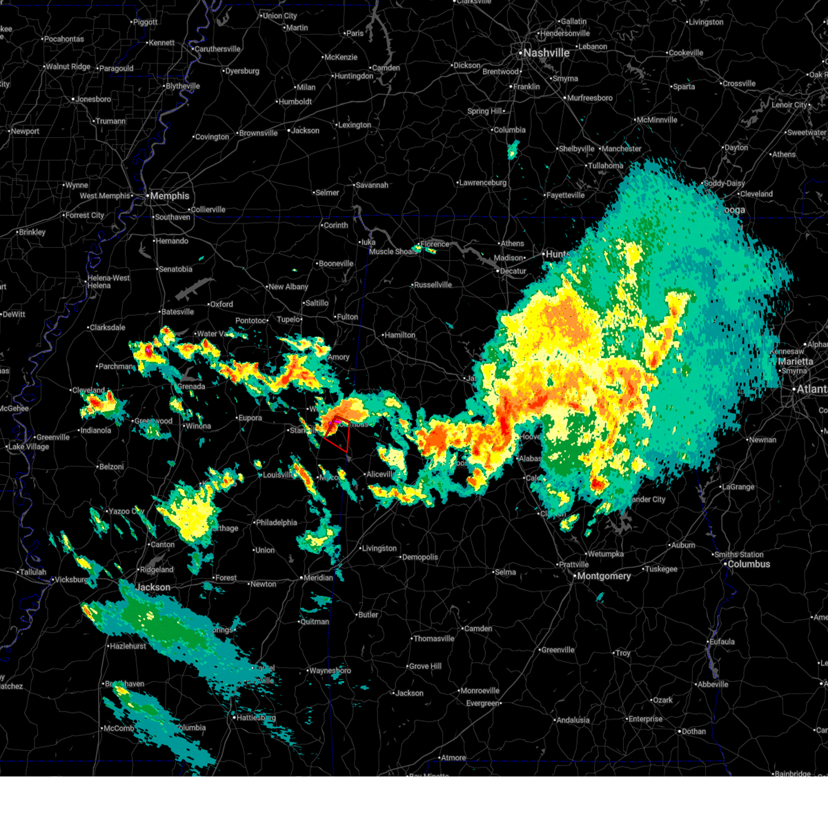
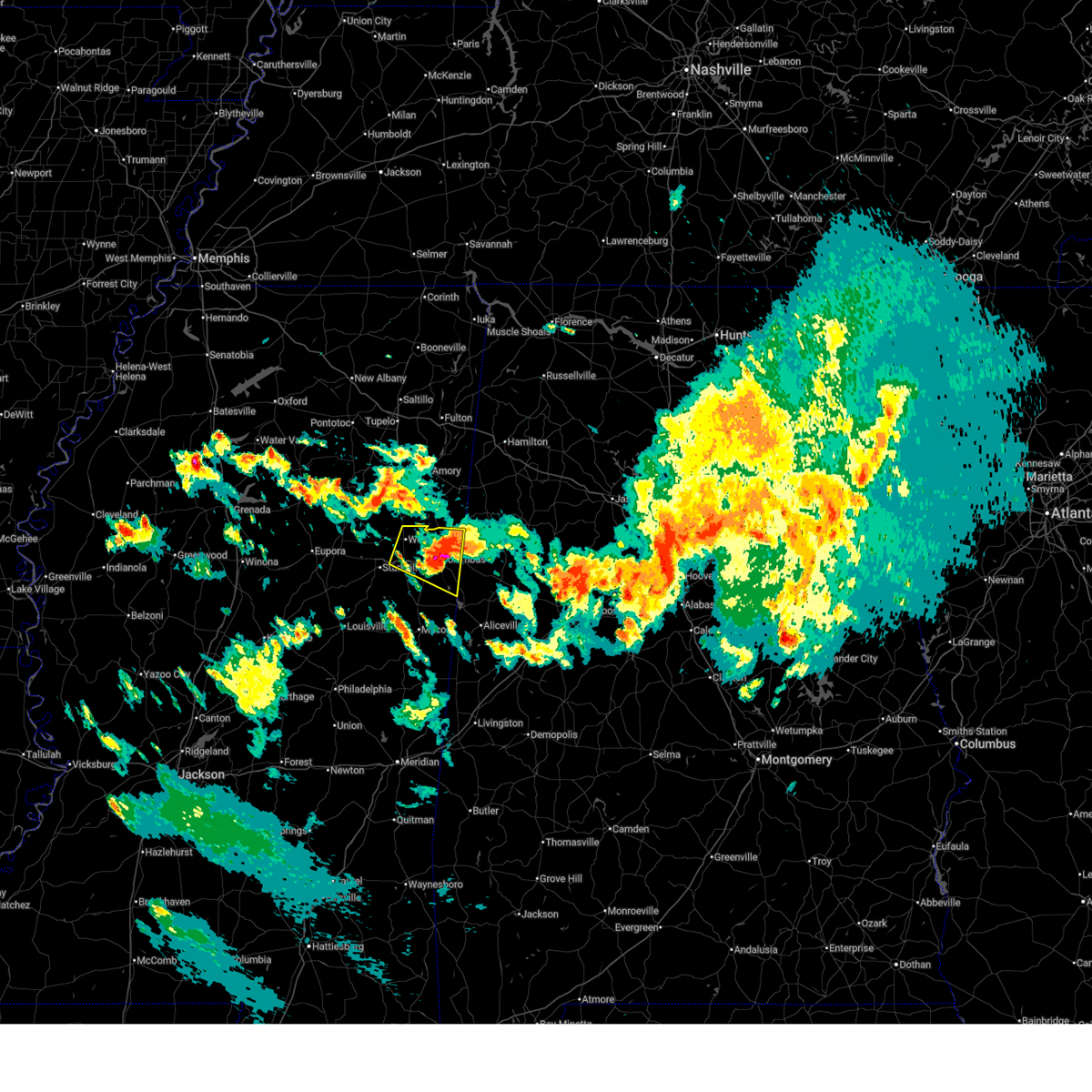
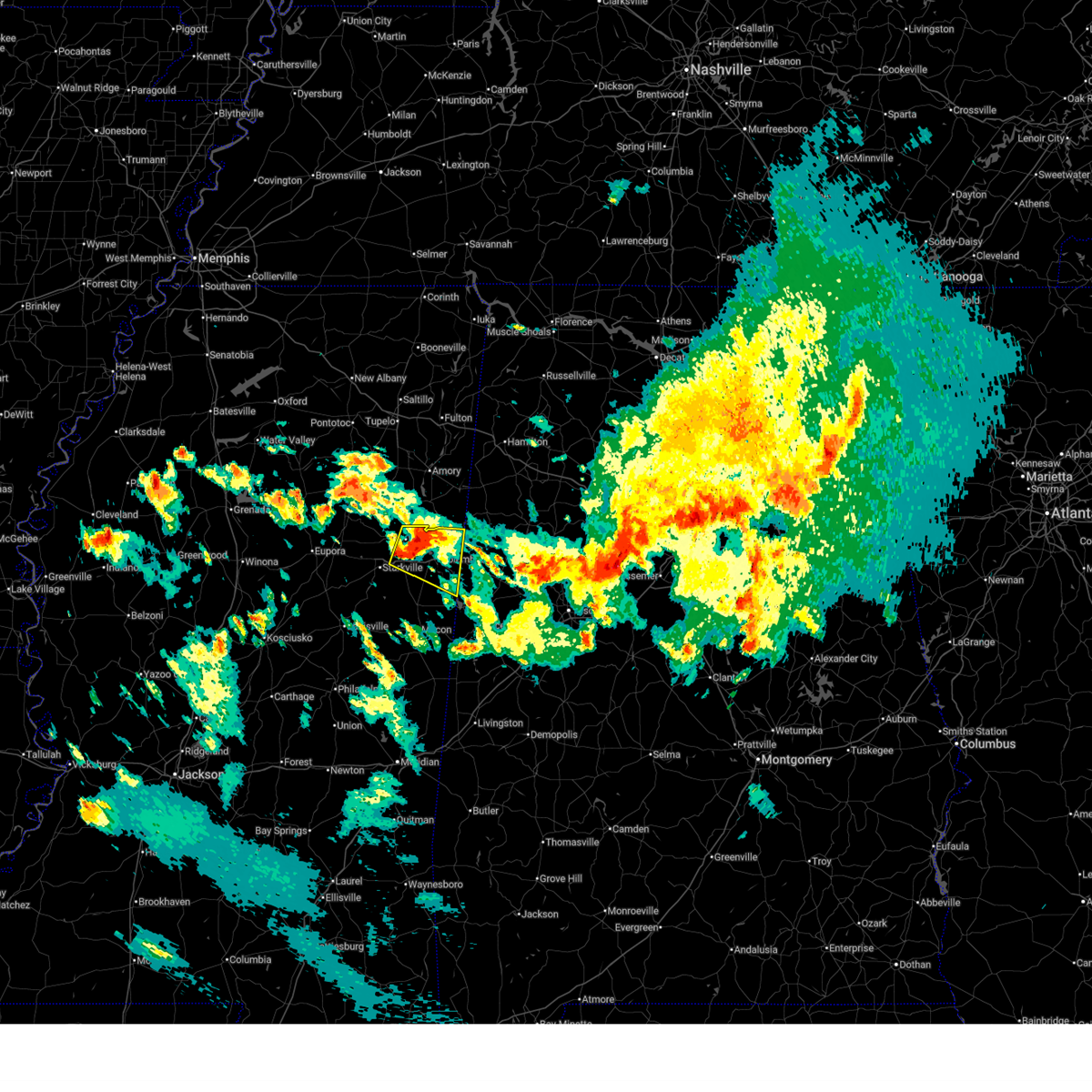
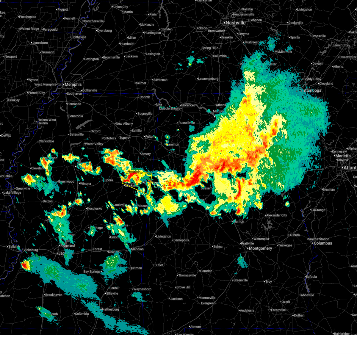
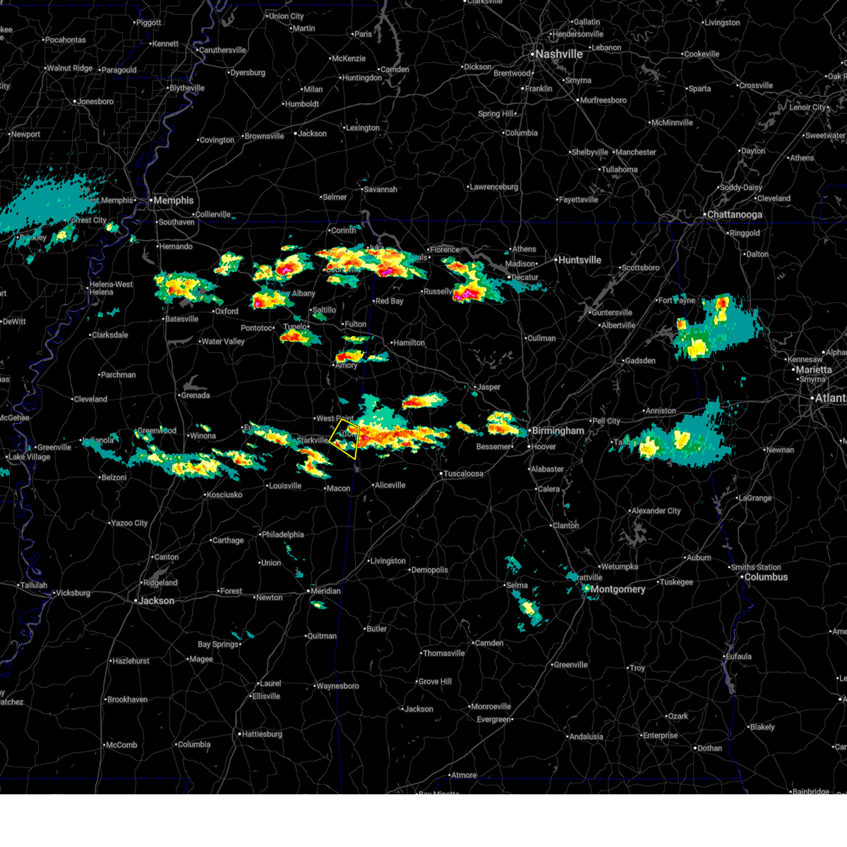
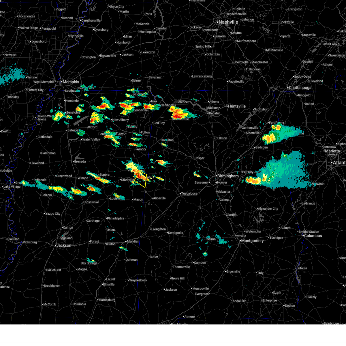
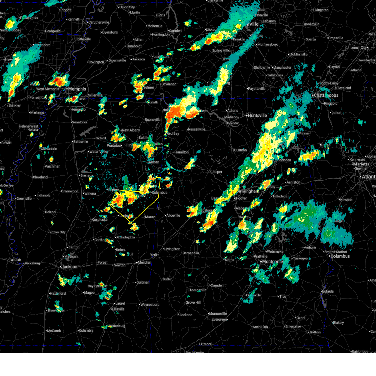
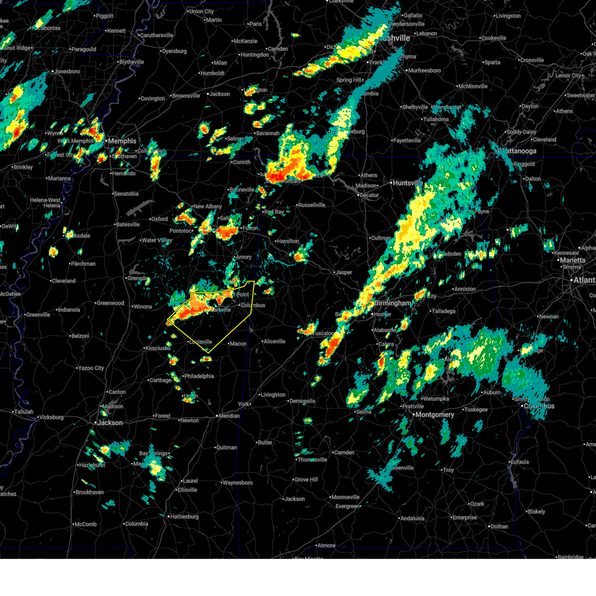
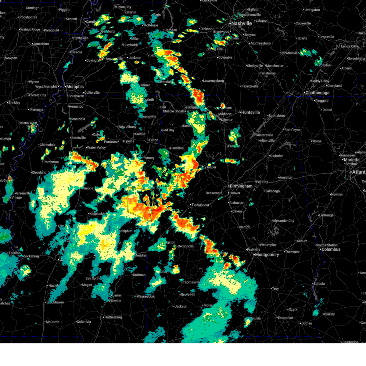
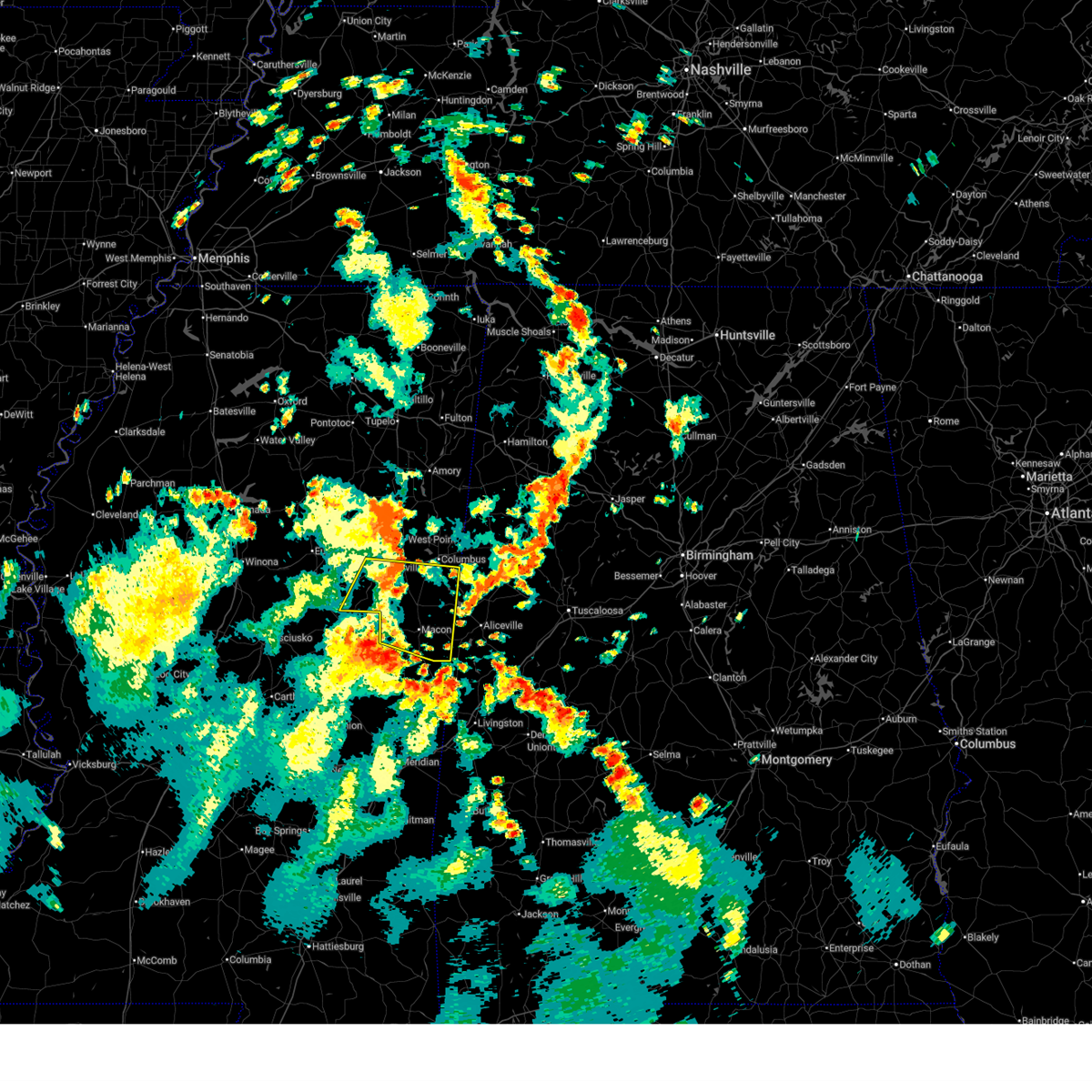
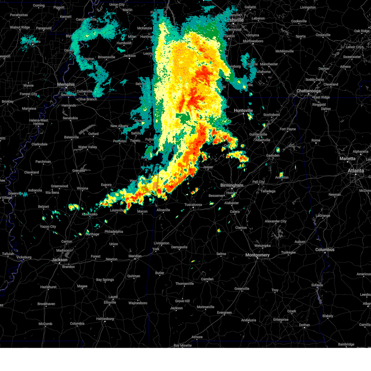
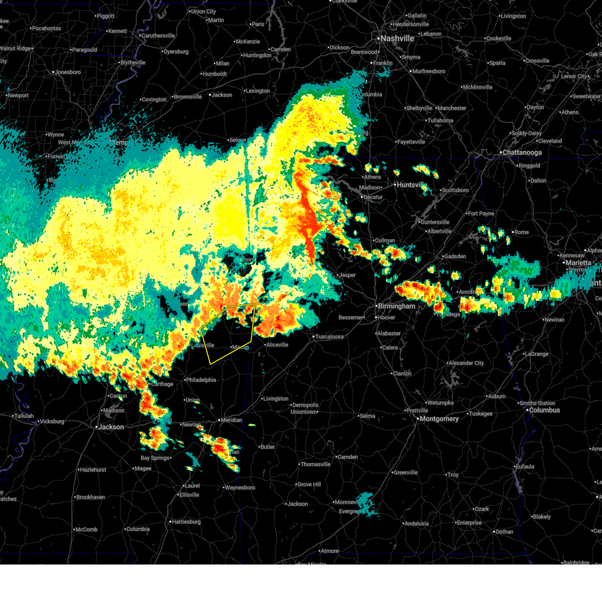
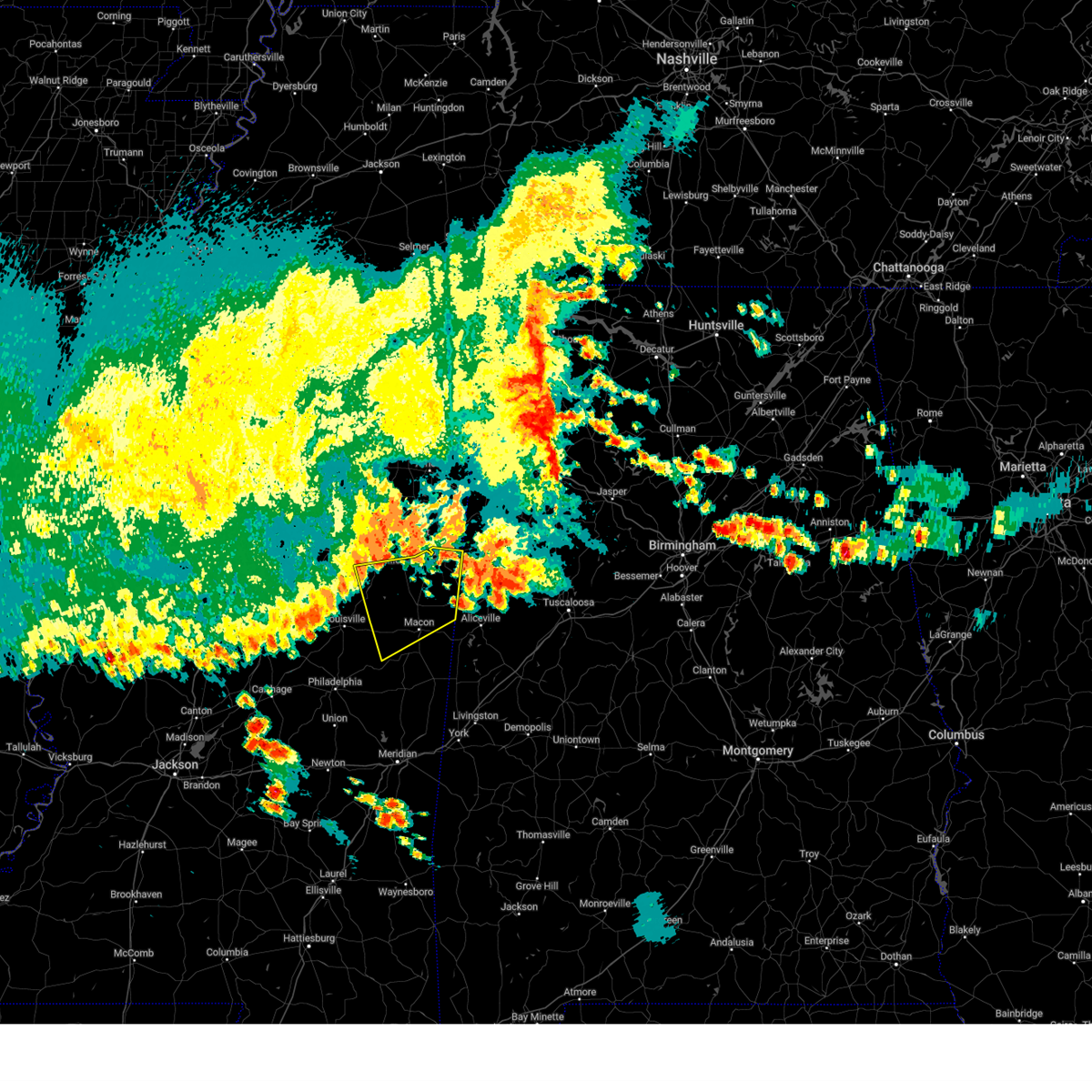
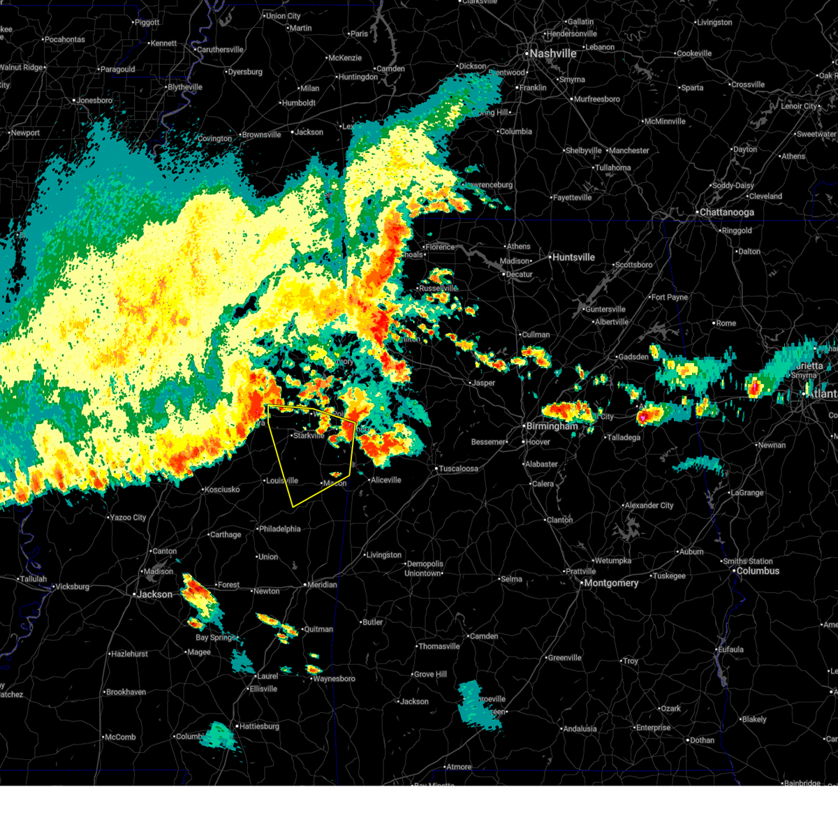
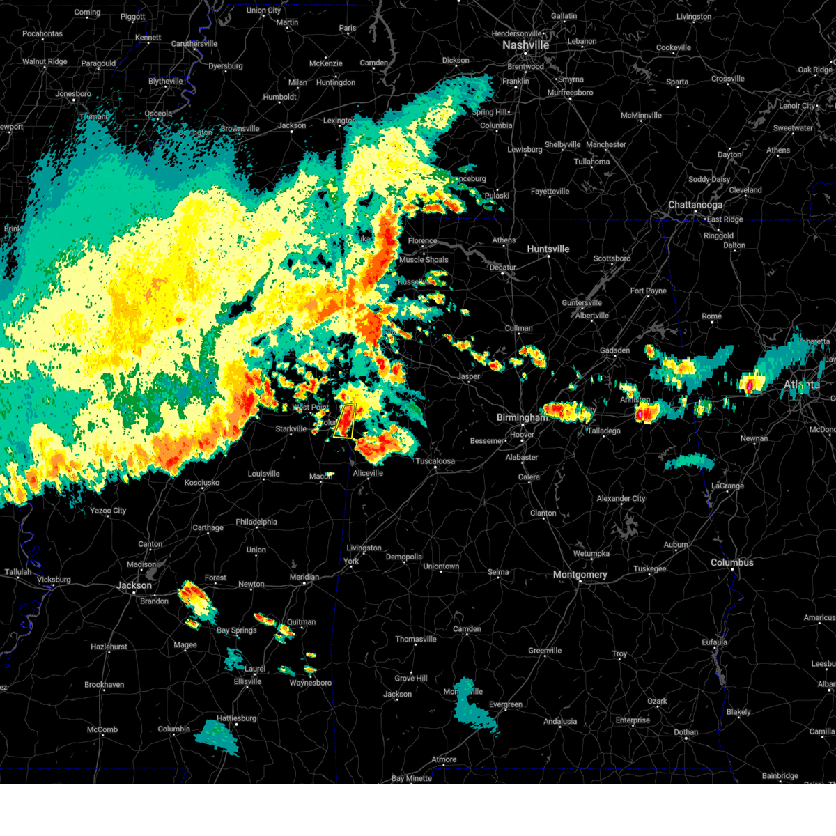
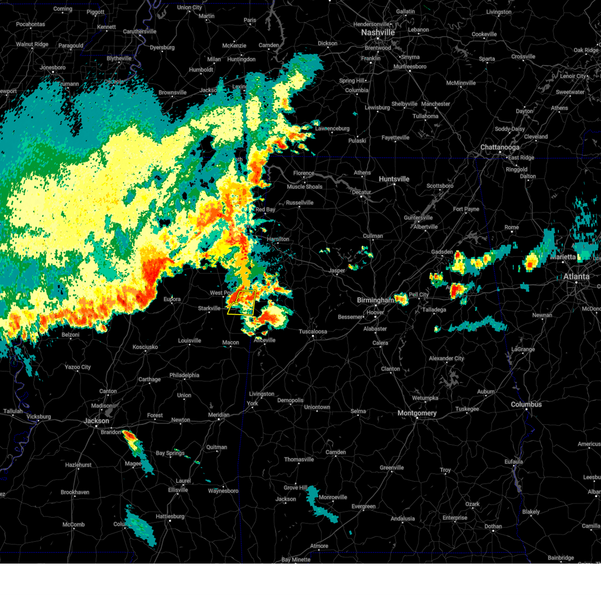
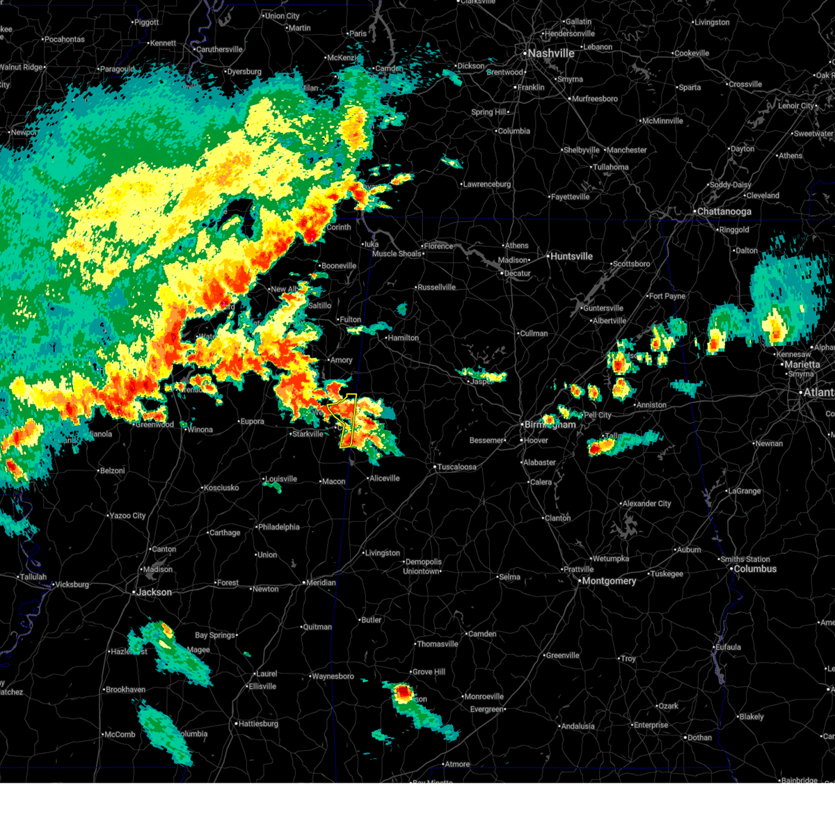
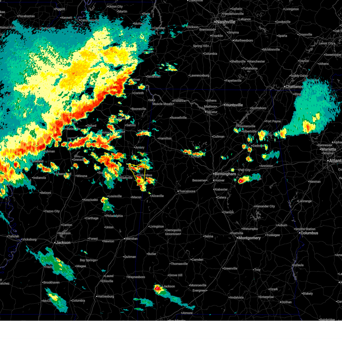
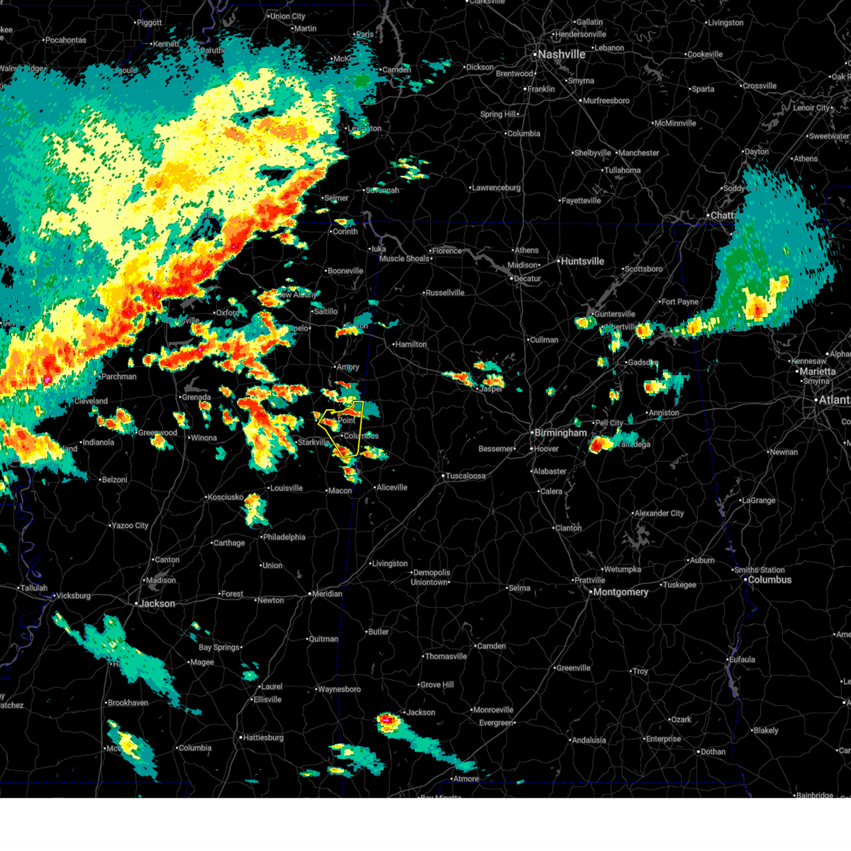
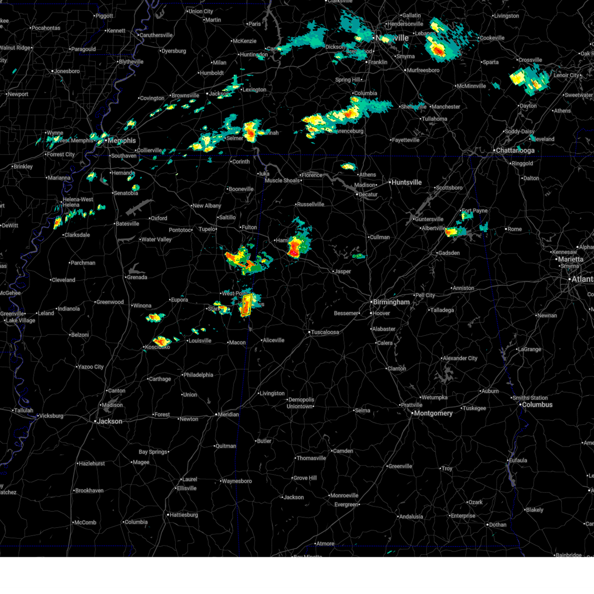
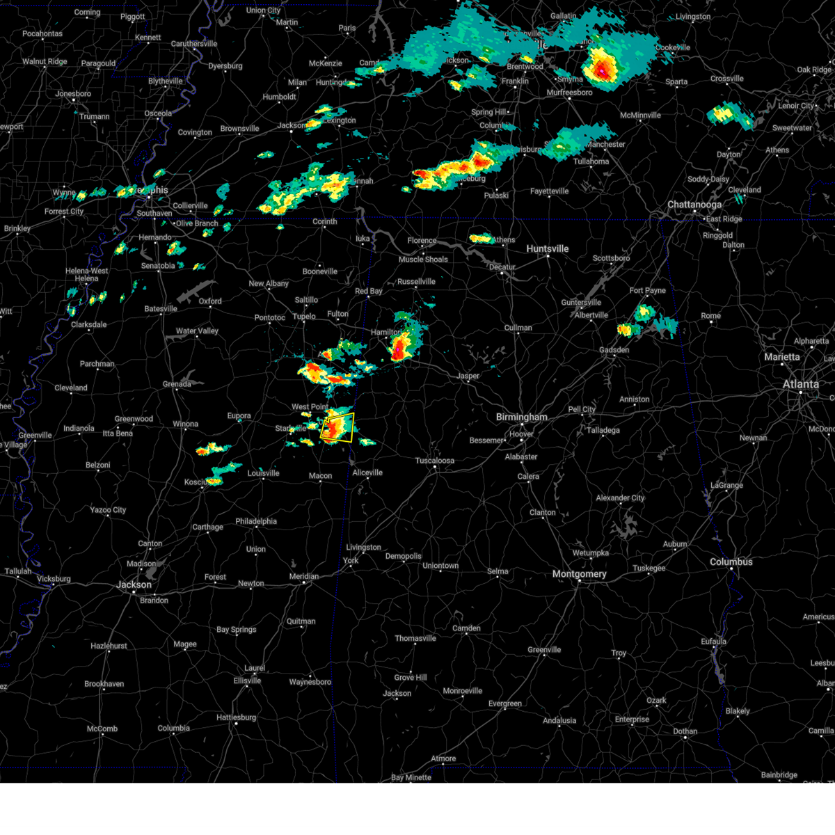
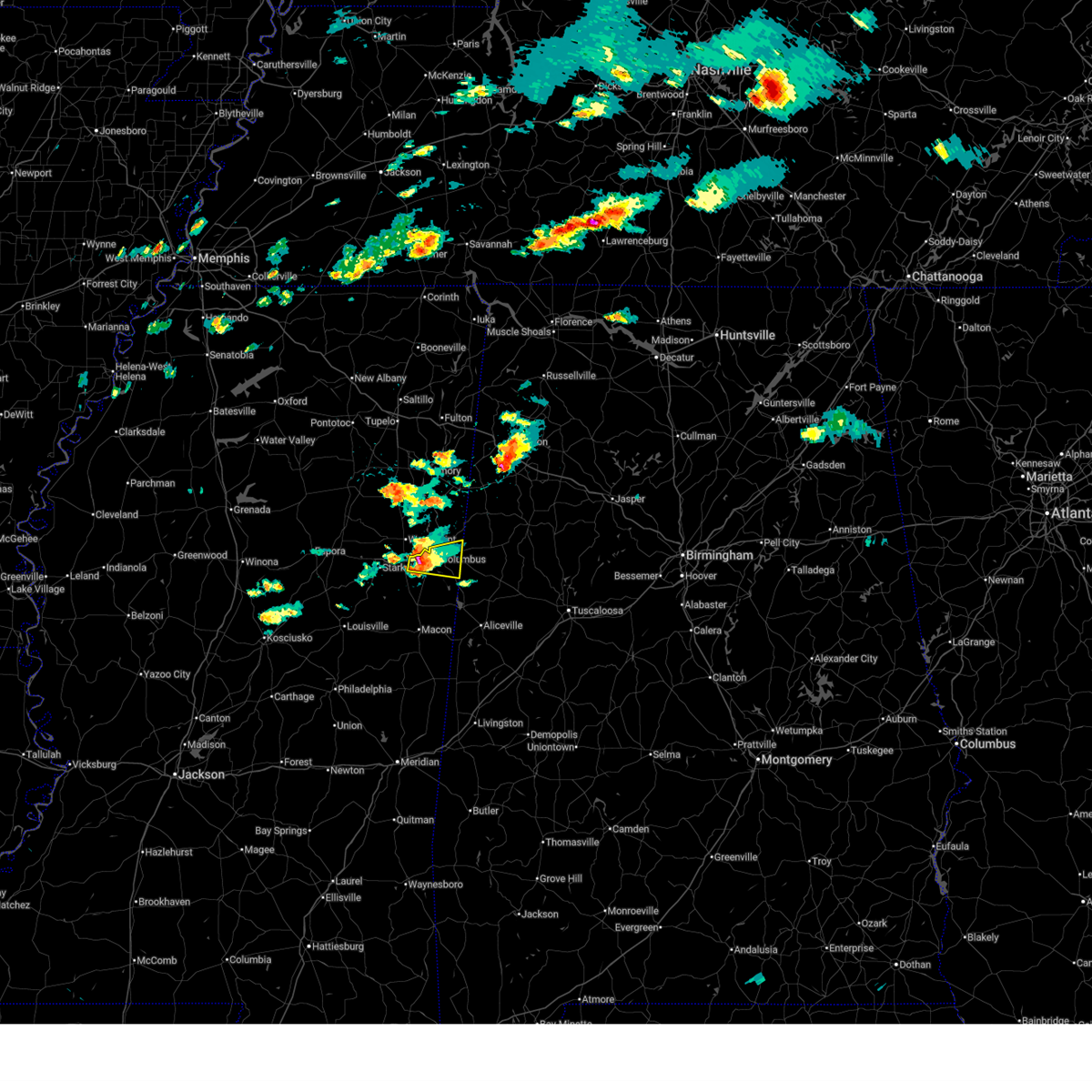
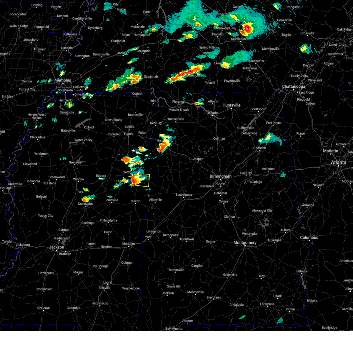
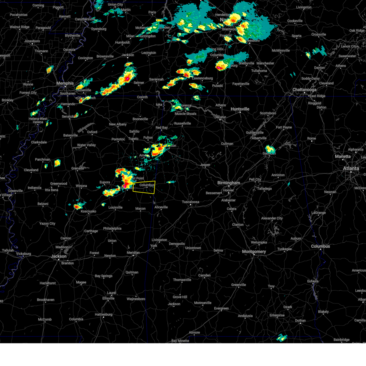
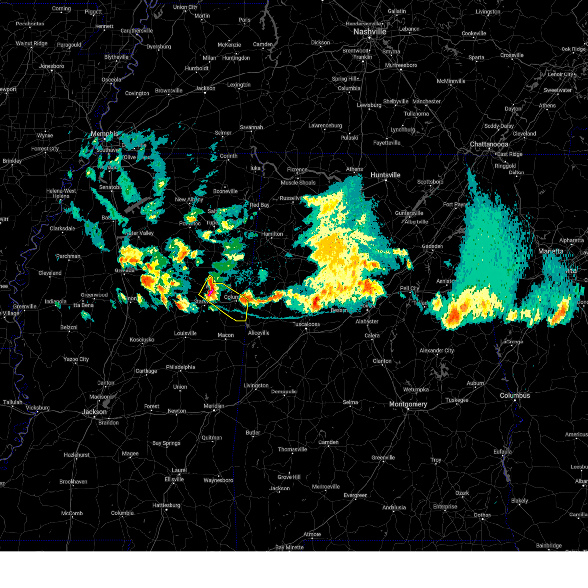
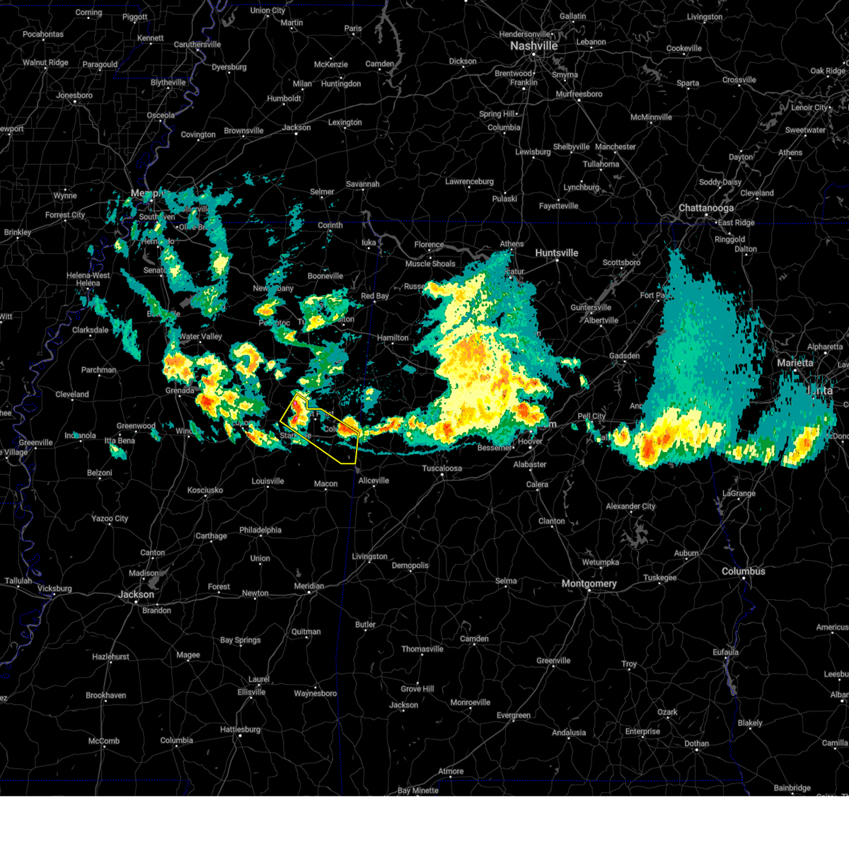
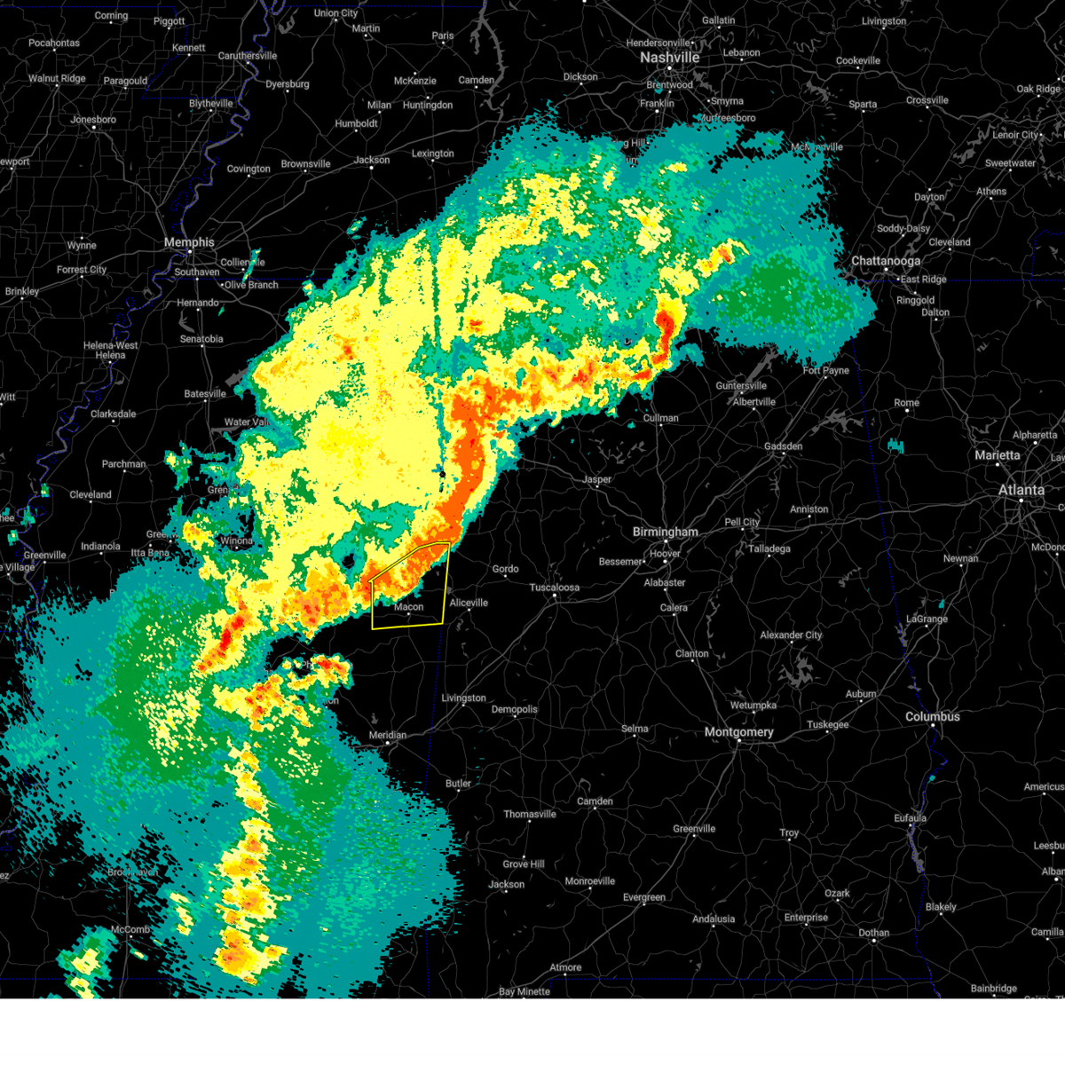
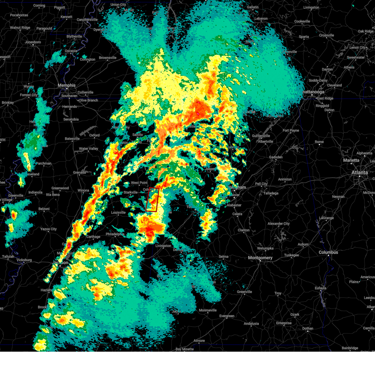
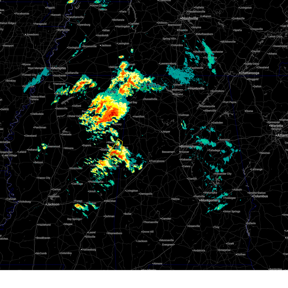
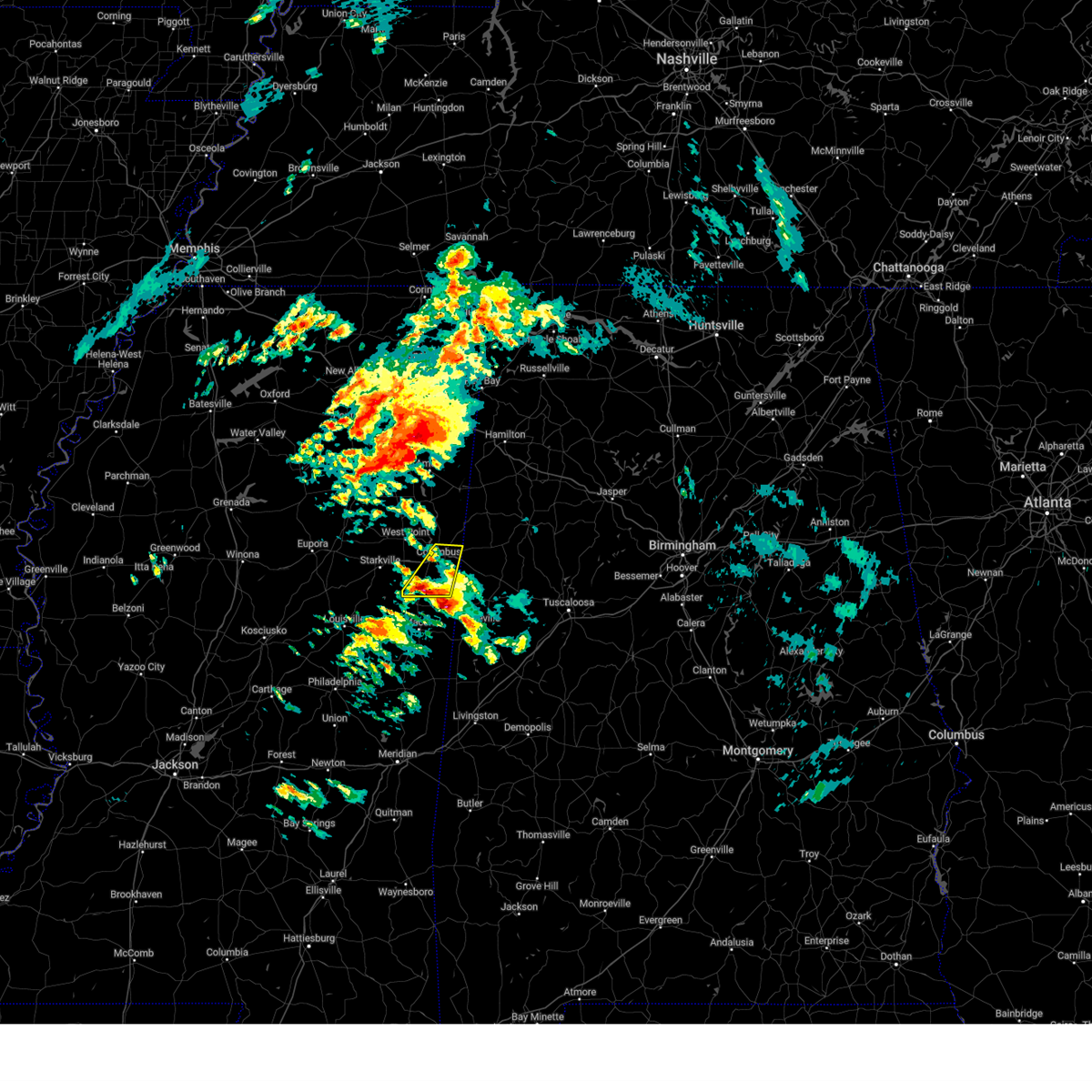
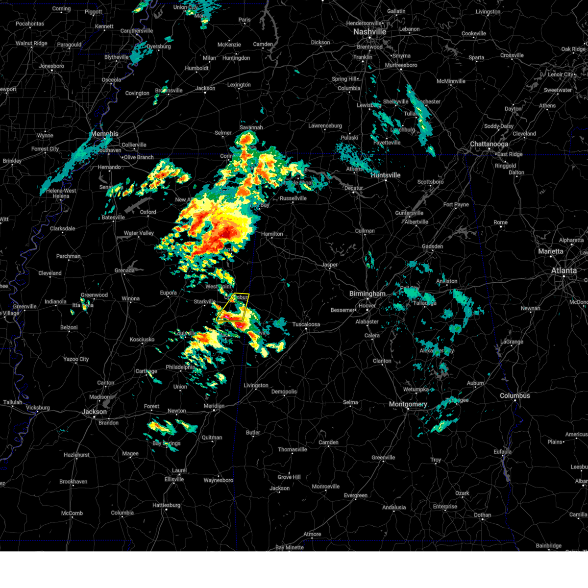
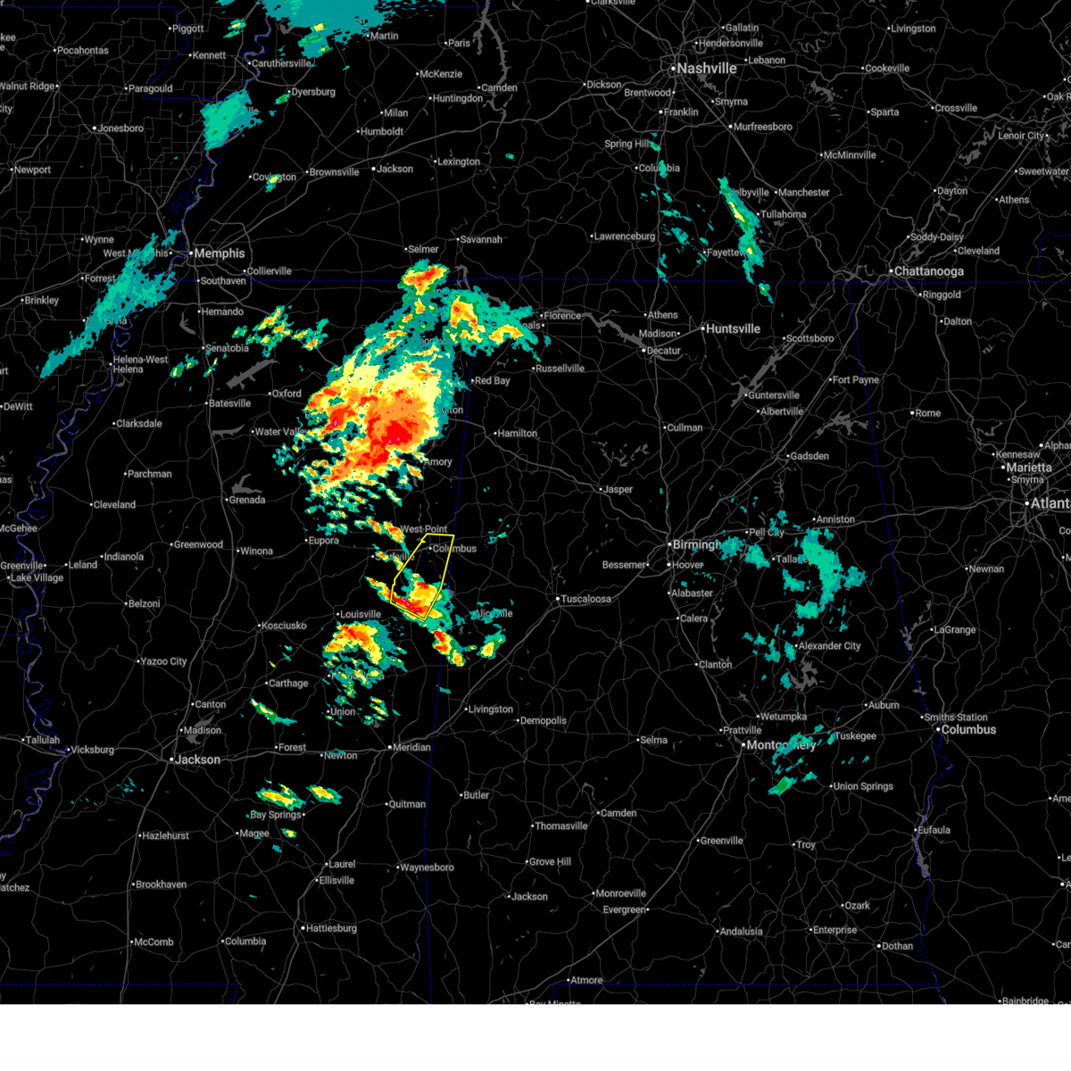
Hail Map for New Hope, MS
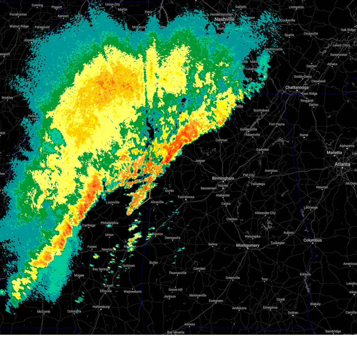
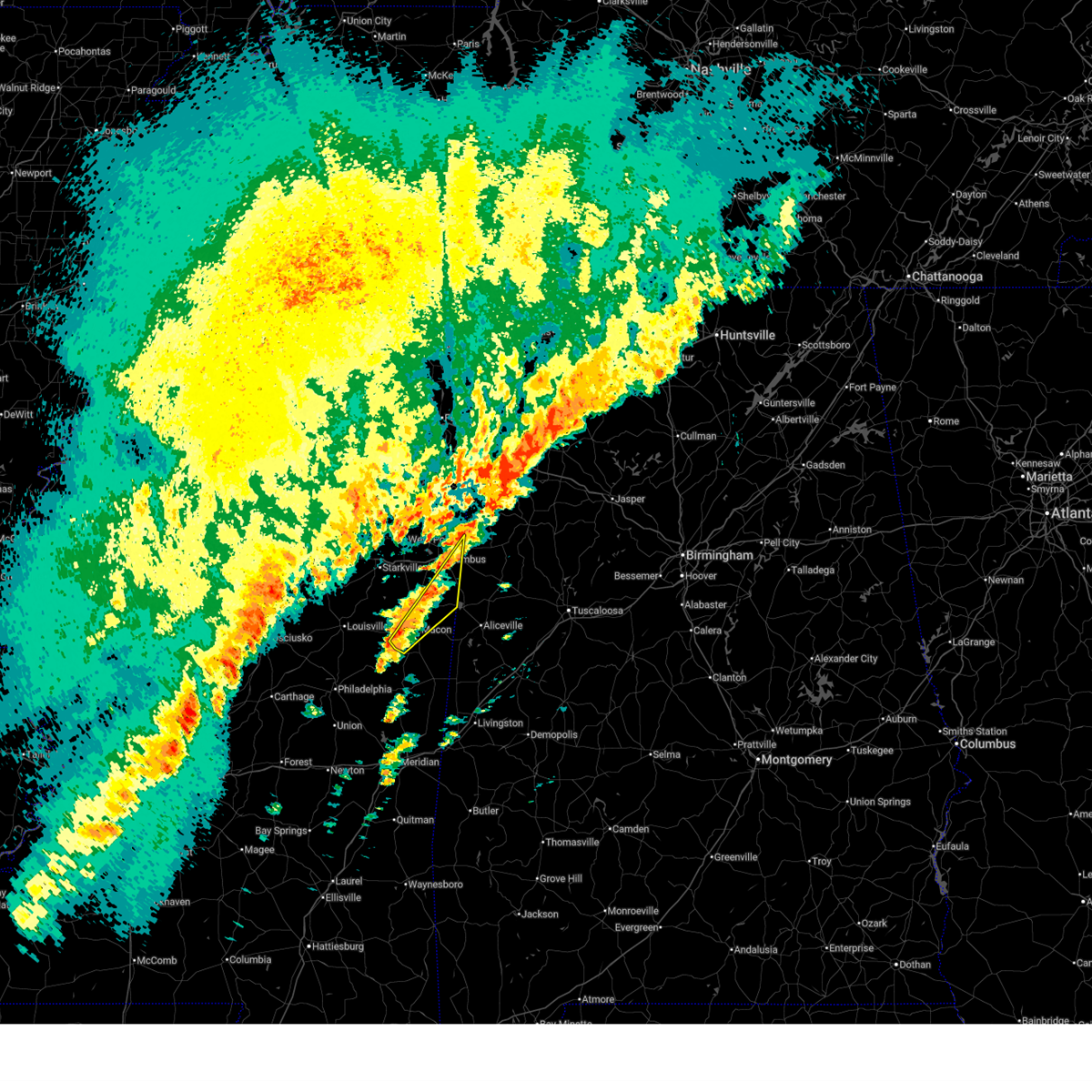
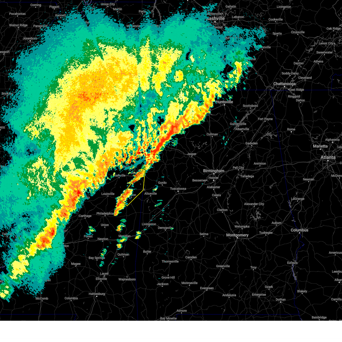
The New Hope, MS area has had 0 reports of on-the-ground hail by trained spotters, and has been under severe weather warnings 23 times during the past 12 months. Doppler radar has detected hail at or near New Hope, MS on 78 occasions, including 7 occasions during the past year.
| Name: | New Hope, MS |
| Where Located: | 27.6 miles E of Starkville, MS |
| Map: | Google Map for New Hope, MS |
| Population: | 3193 |
| Housing Units: | 1234 |
| More Info: | Search Google for New Hope, MS |
2
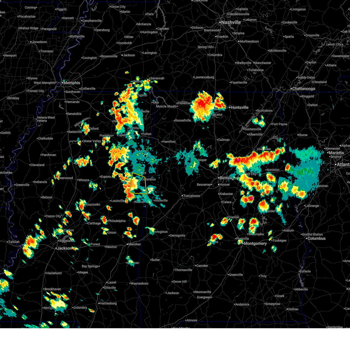
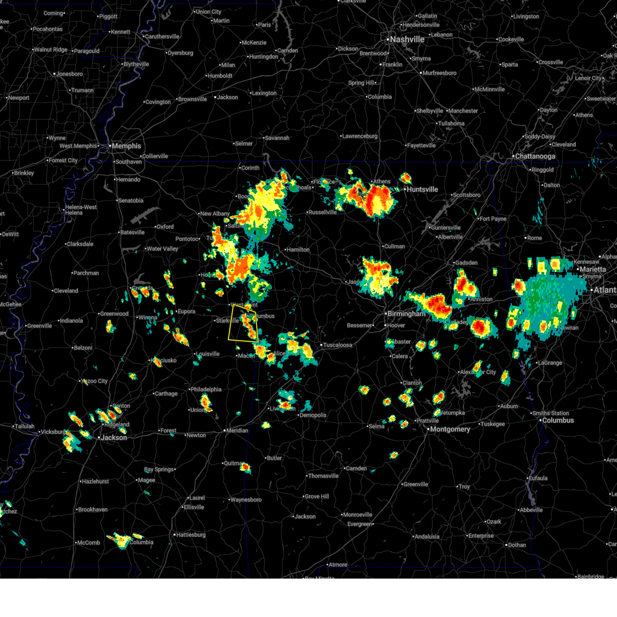
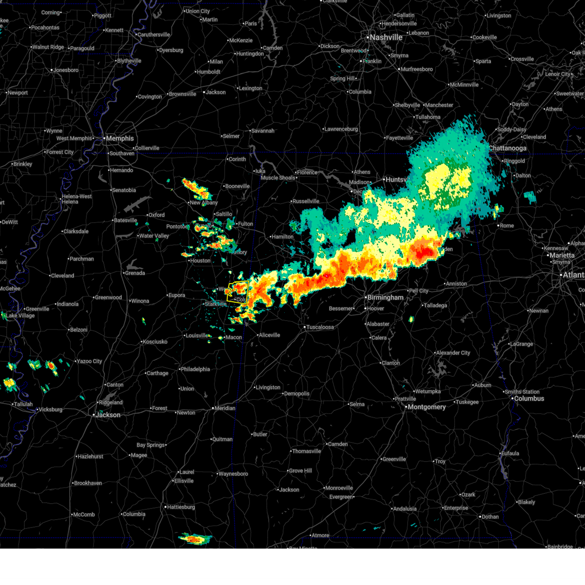
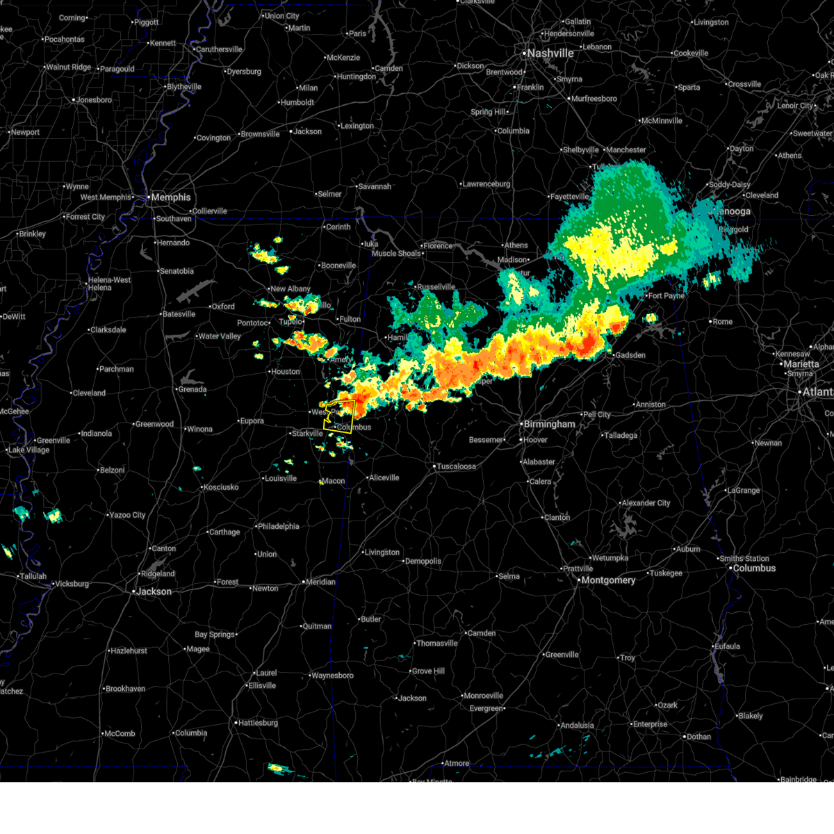
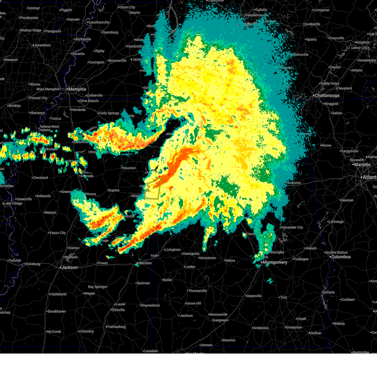
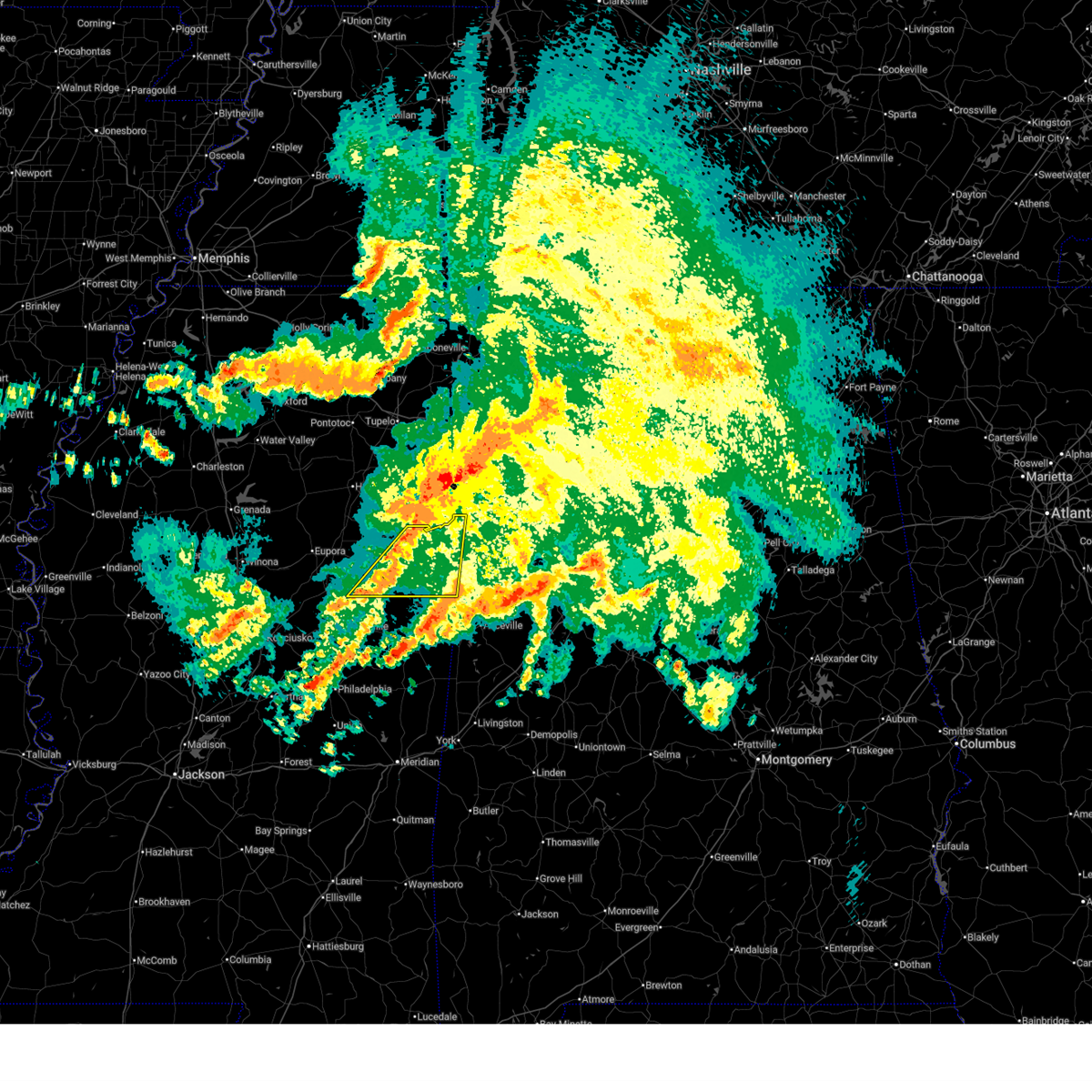
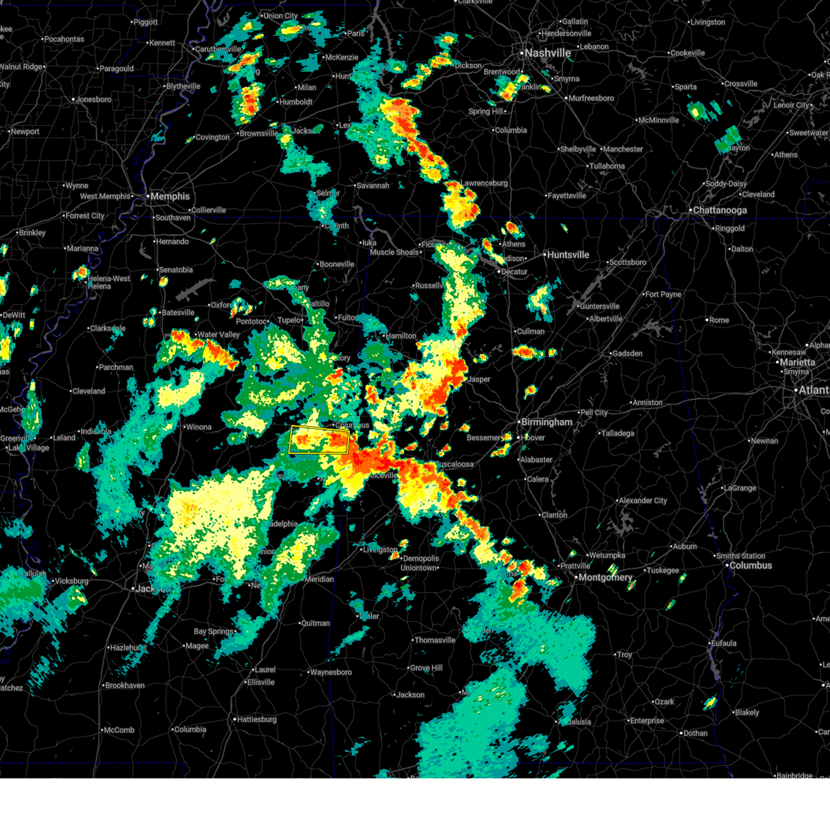
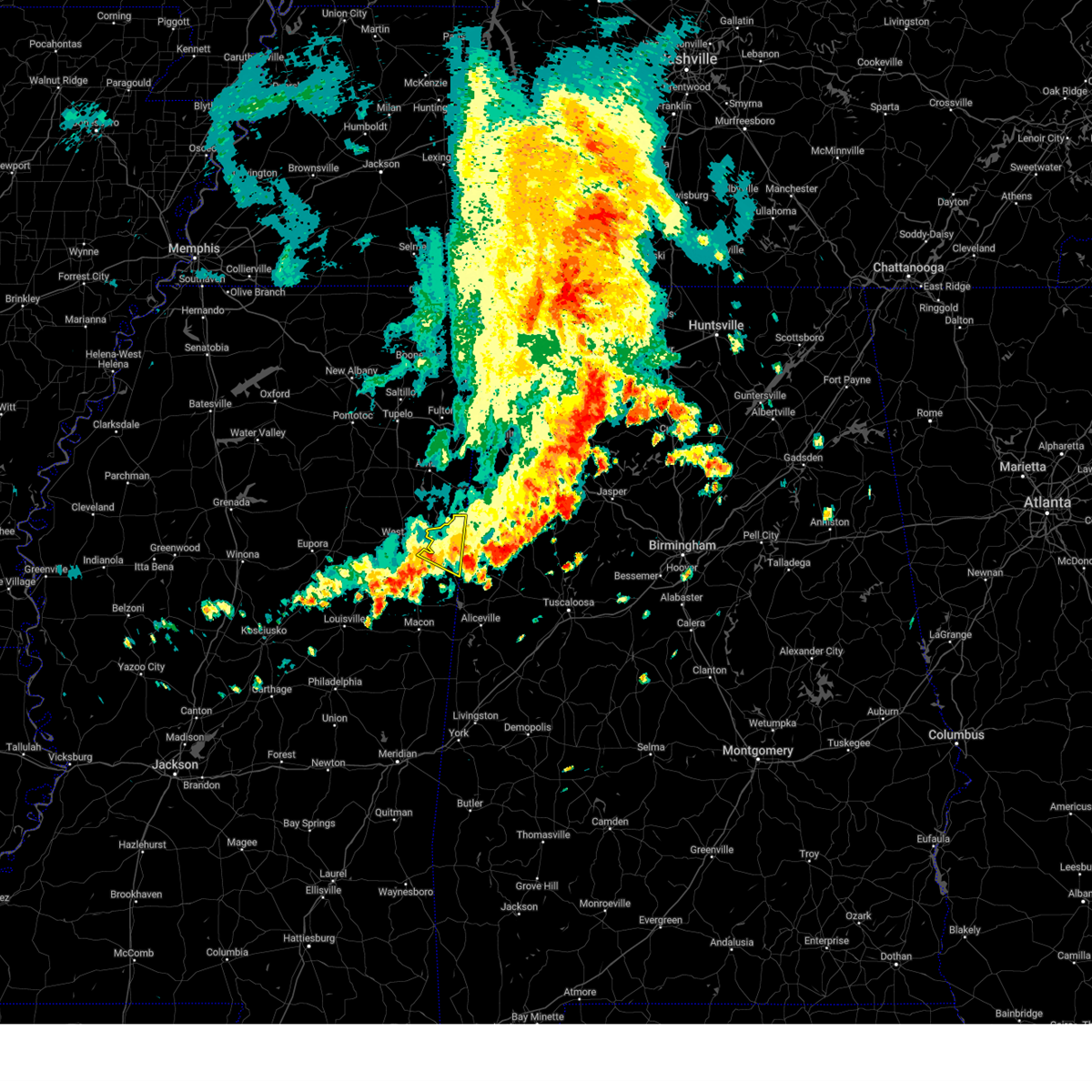
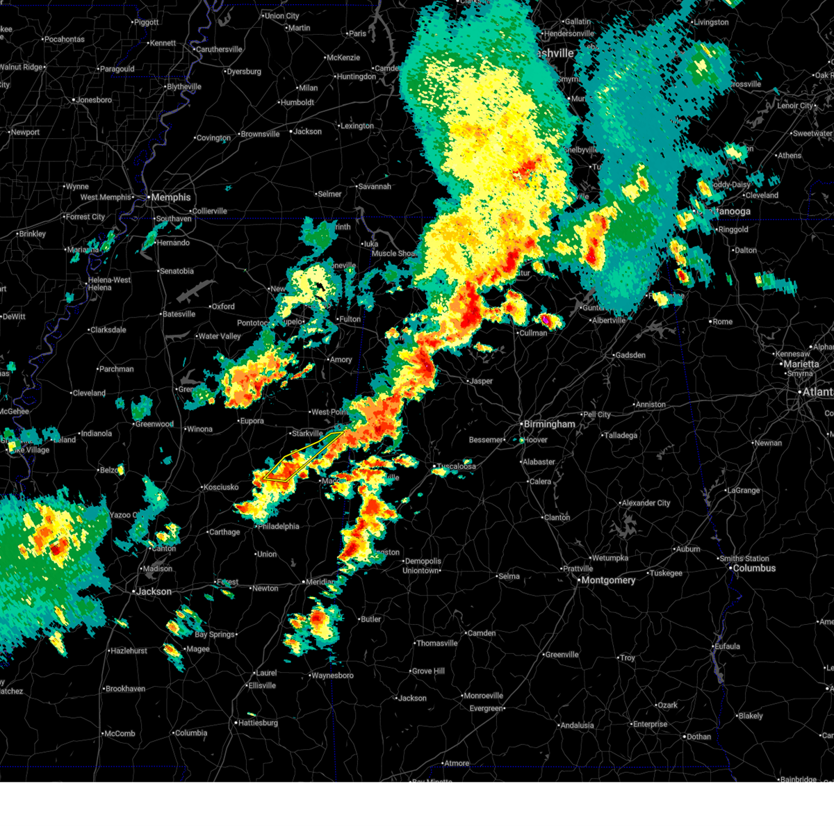
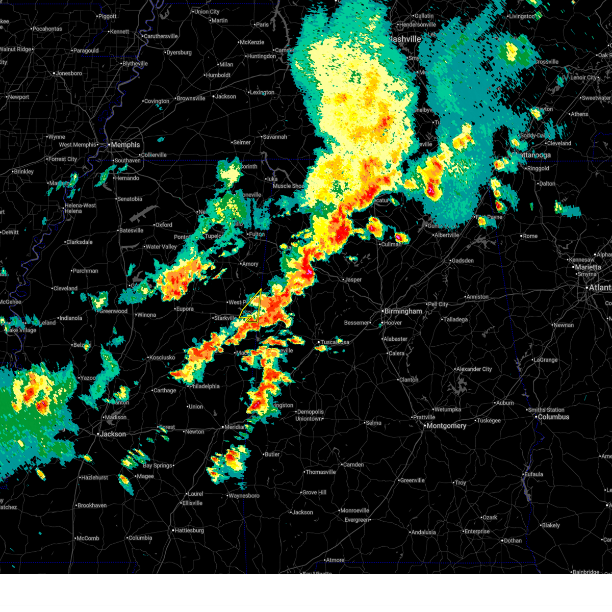
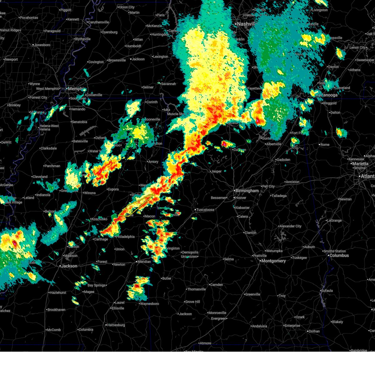
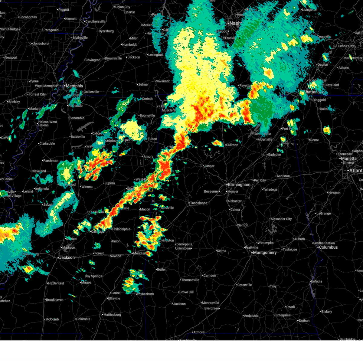
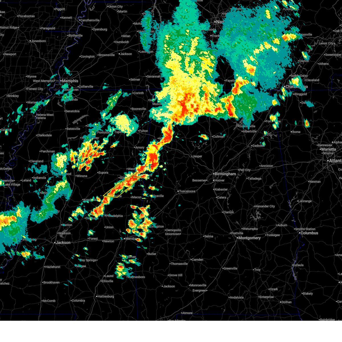
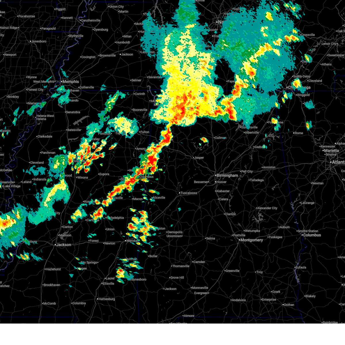
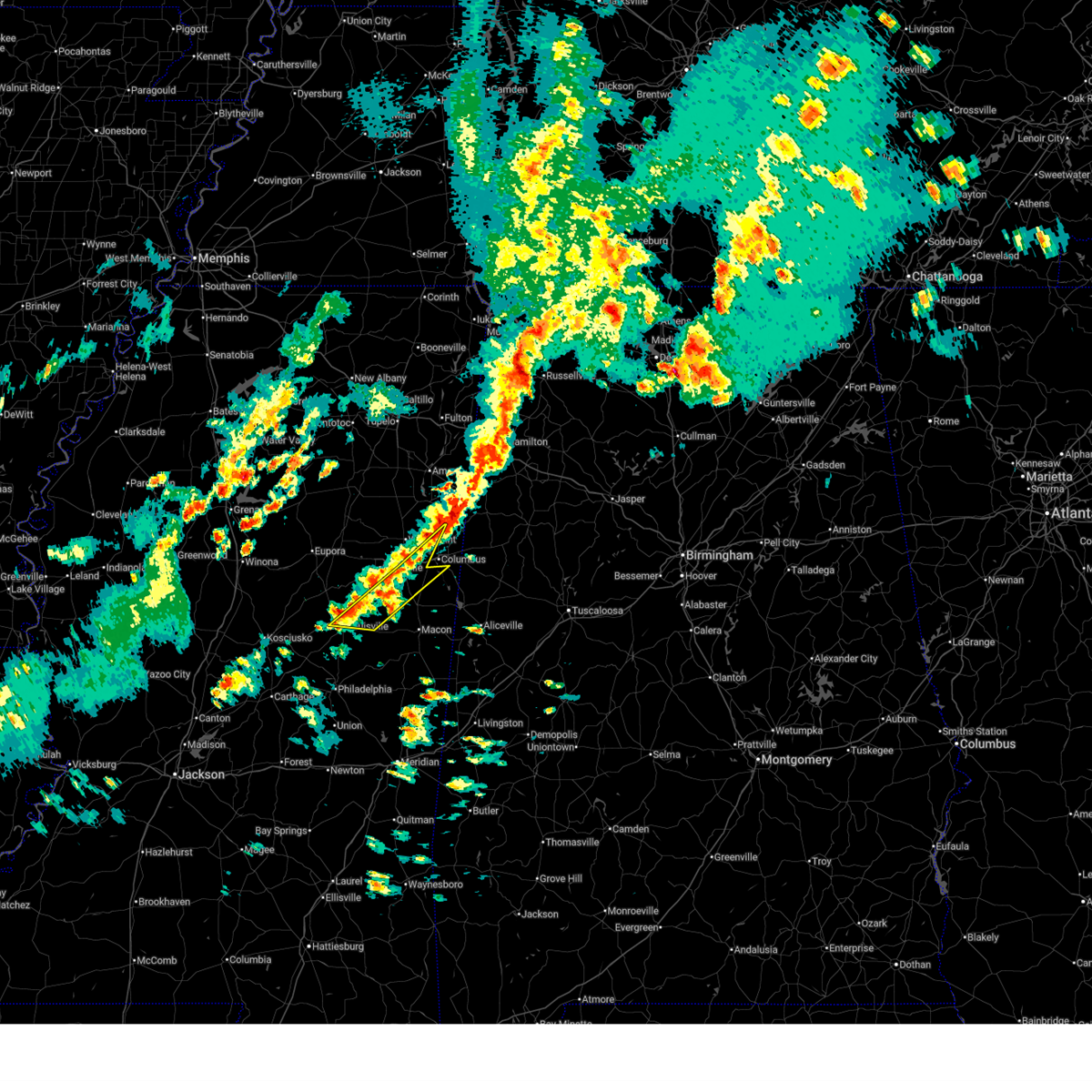
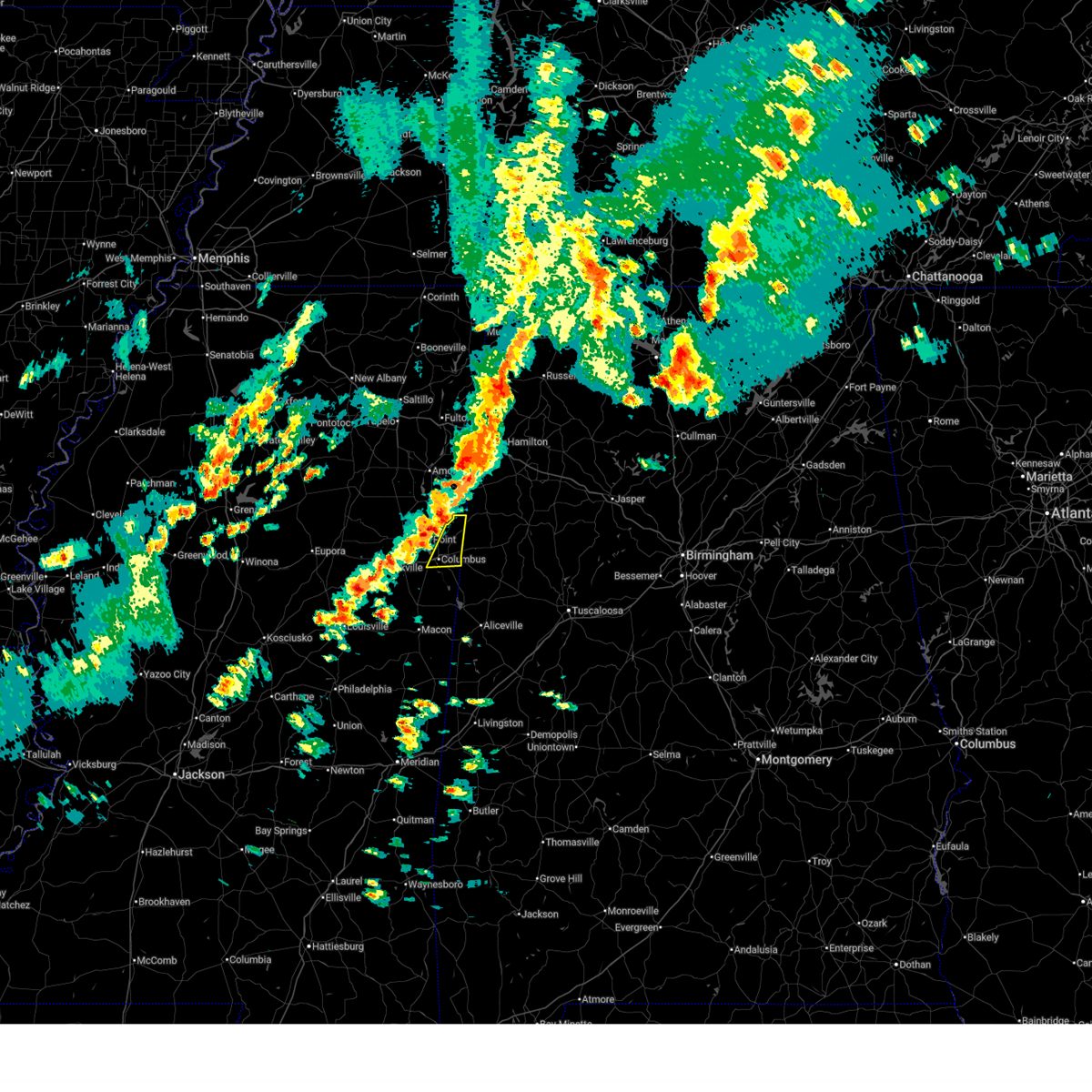
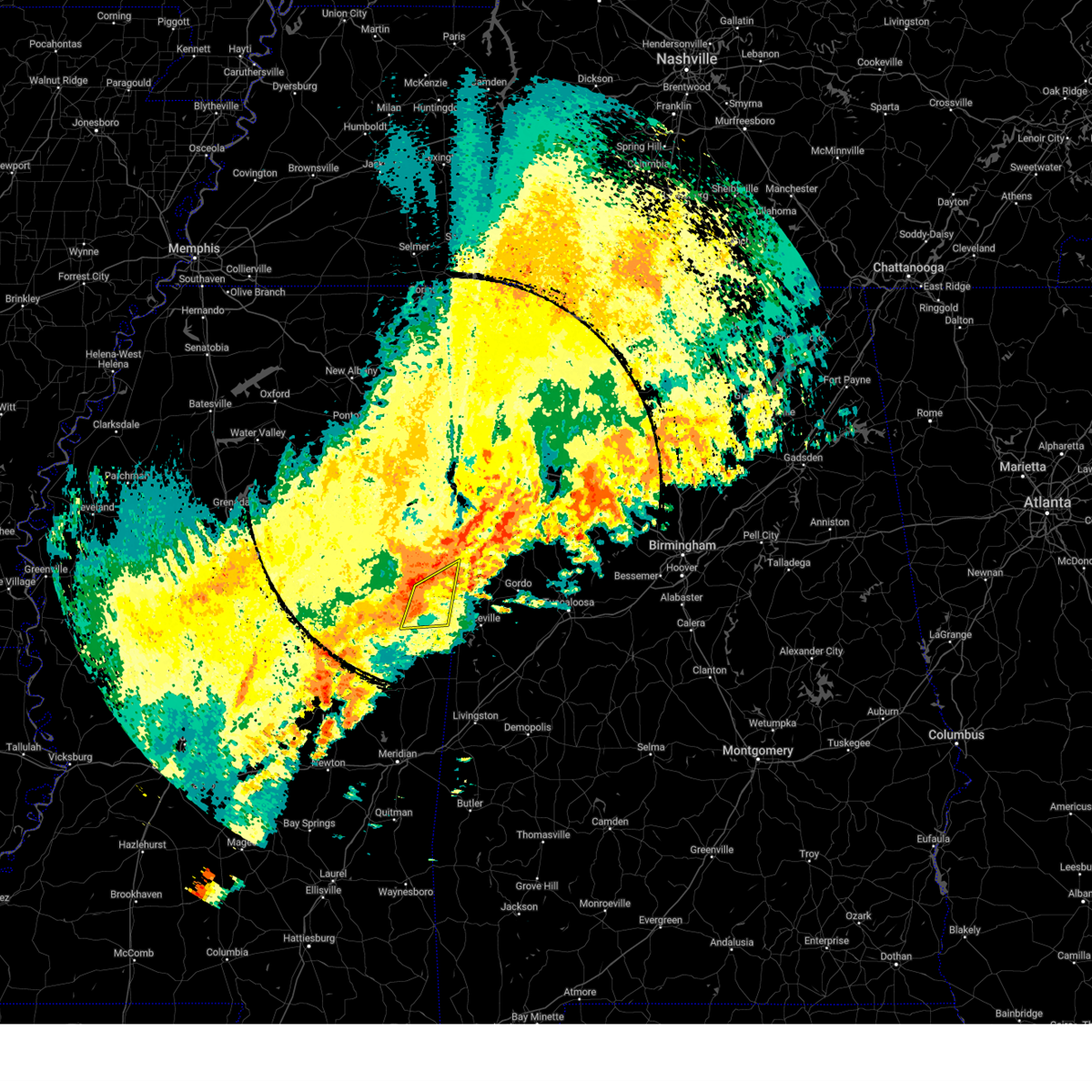
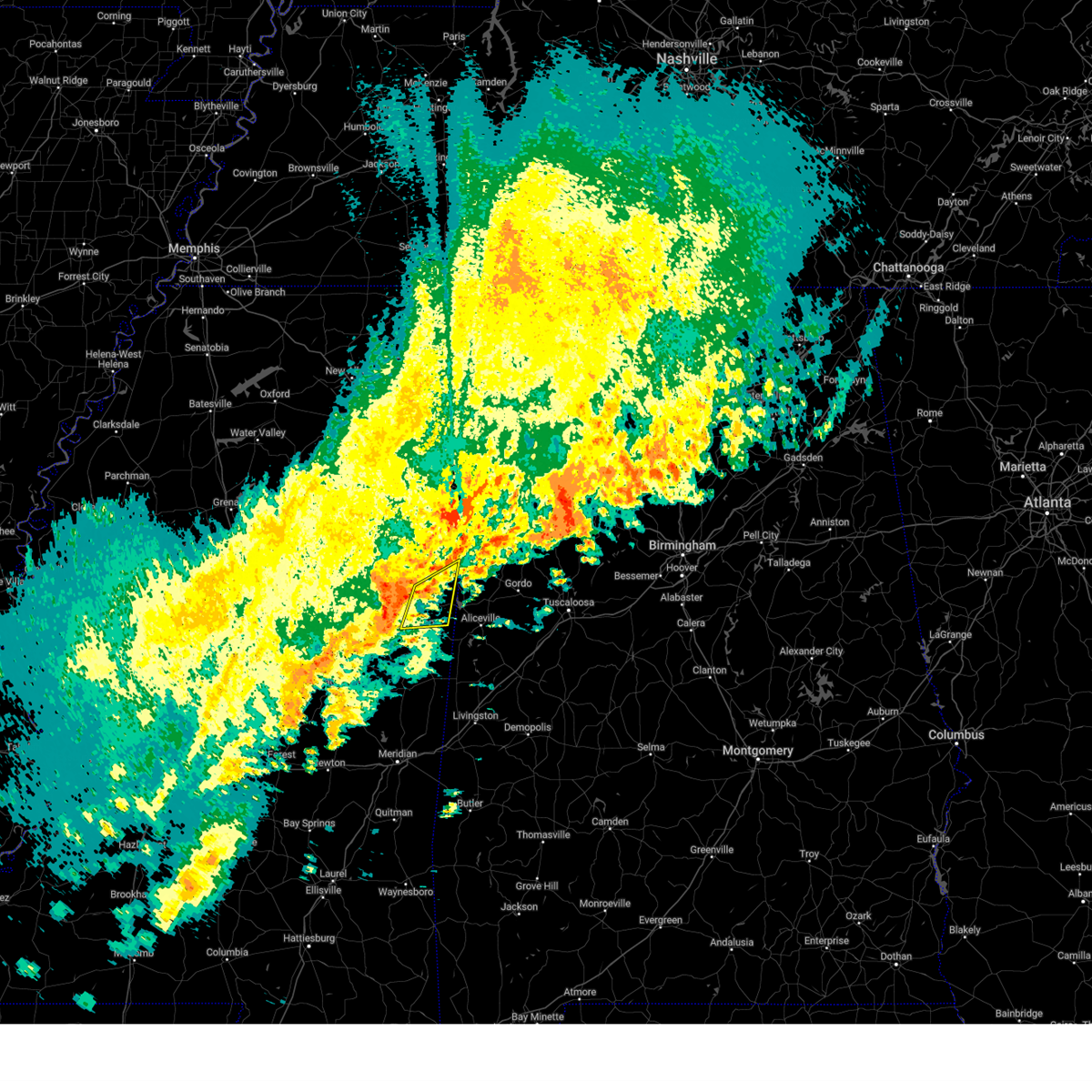
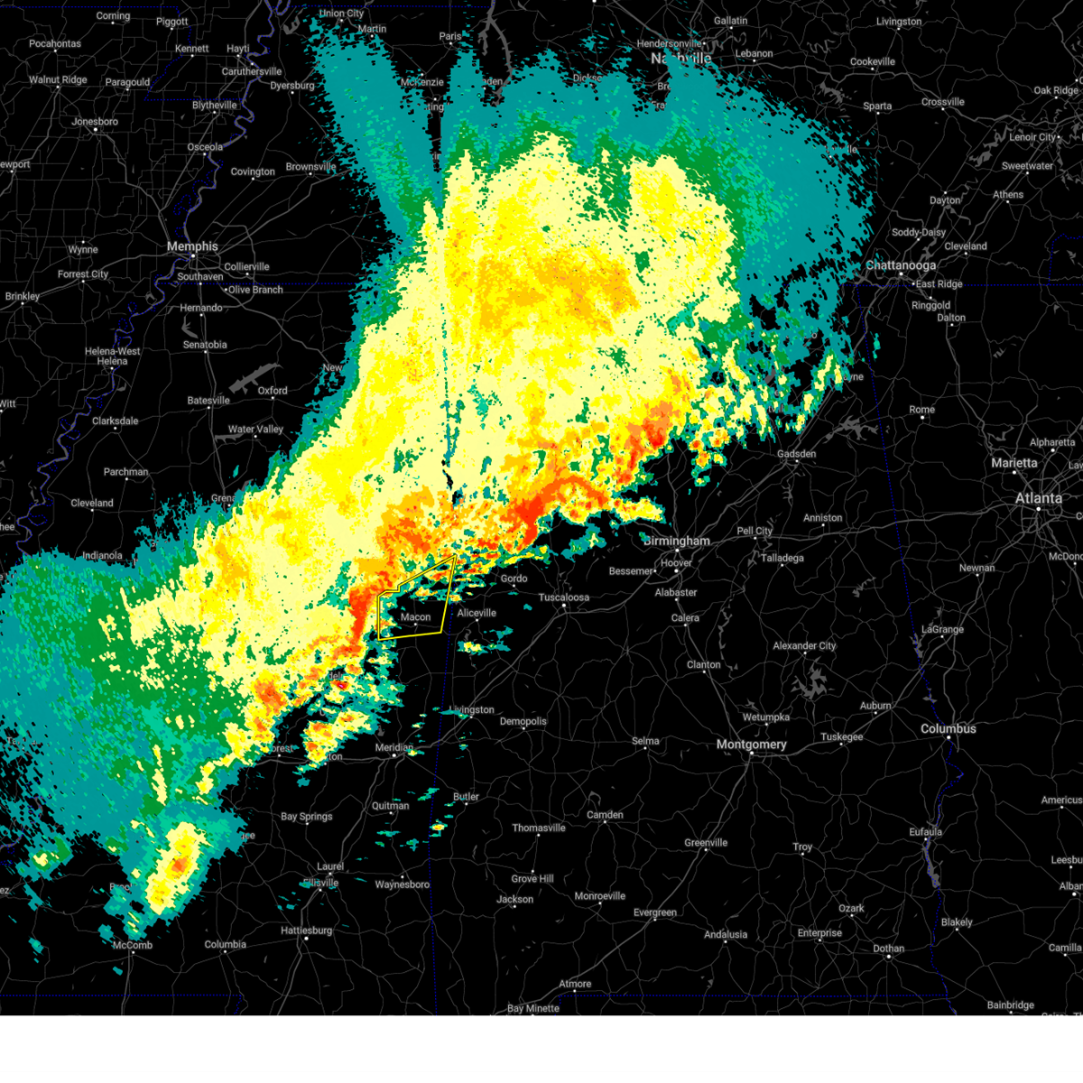
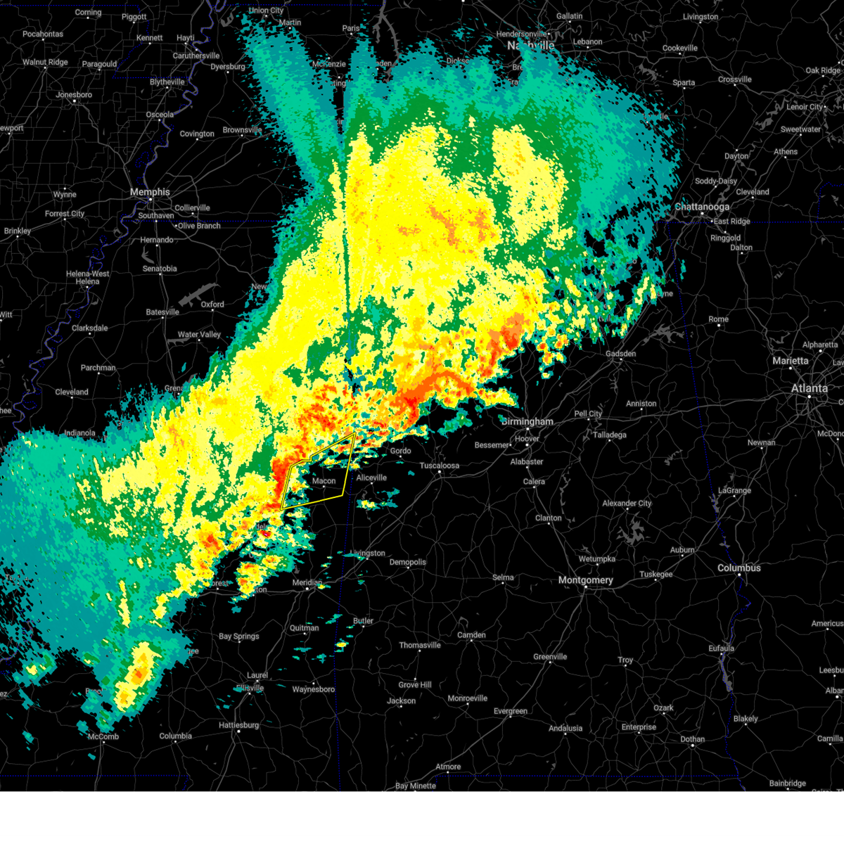
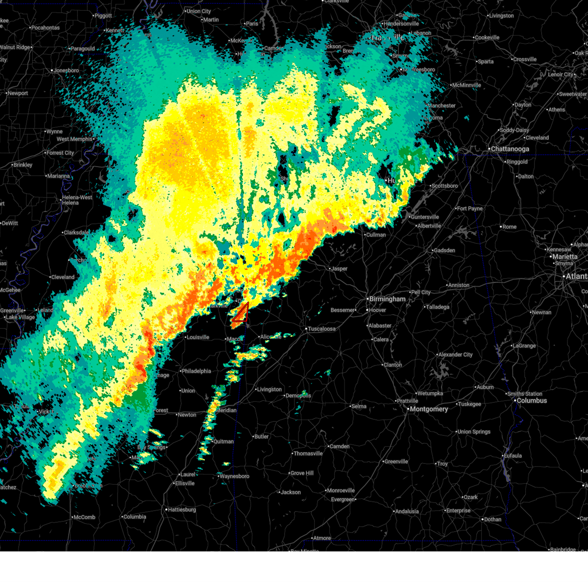
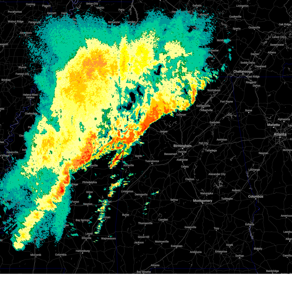
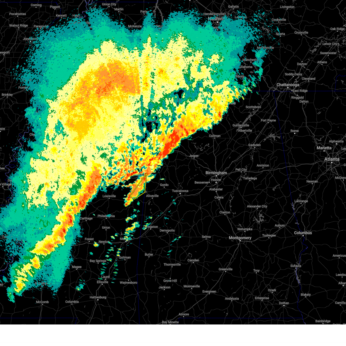
The Top Recent Hail Date for New Hope, MS is Monday, March 9, 2026 (3rd out of 78)
Hail and Wind Damage Spotted near New Hope, MS
| Date / Time | Report Details |
|---|---|
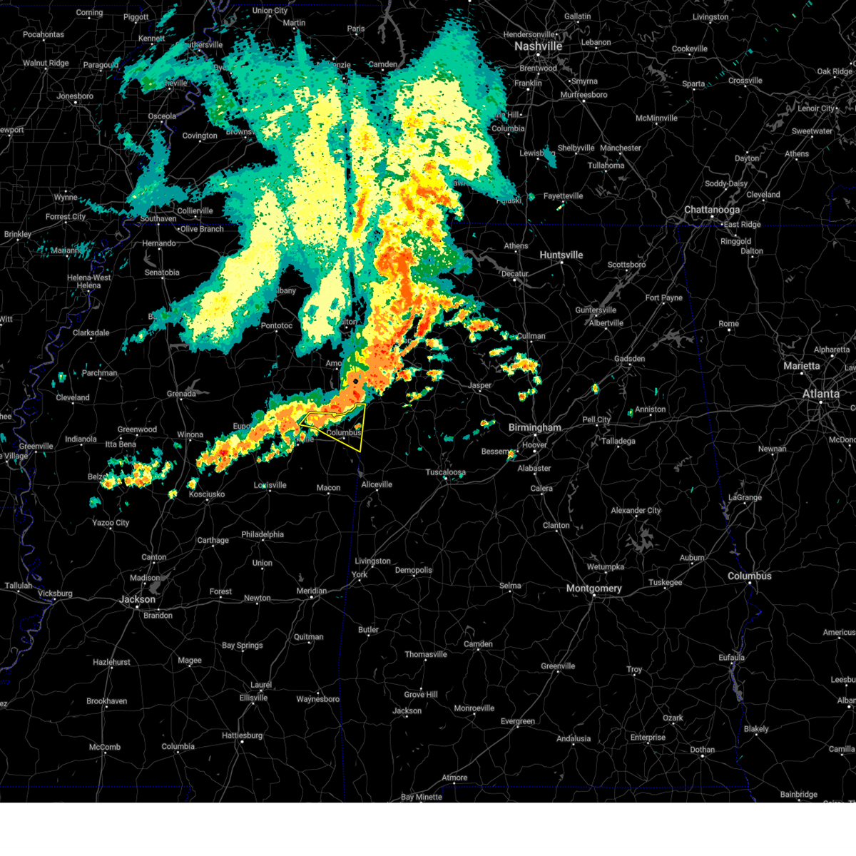
| 7/1/2026 5:24 PM CDT |
 The storm which prompted the warning has moved out of the area. therefore, the warning will be allowed to expire. a severe thunderstorm watch remains in effect until 1000 pm cdt for northeastern and east central mississippi. to report severe weather, contact your nearest law enforcement agency. they will relay your report to the national weather service jackson. The storm which prompted the warning has moved out of the area. therefore, the warning will be allowed to expire. a severe thunderstorm watch remains in effect until 1000 pm cdt for northeastern and east central mississippi. to report severe weather, contact your nearest law enforcement agency. they will relay your report to the national weather service jackson.
|
| 7/1/2026 4:37 PM CDT |
 Svrjan the national weather service in jackson has issued a * severe thunderstorm warning for, northeastern noxubee county in east central mississippi, southeastern clay county in northeastern mississippi, southern lowndes county in northeastern mississippi, * until 530 pm cdt. * at 437 pm cdt, a severe thunderstorm was located near columbus, moving west at 10 mph (radar indicated). Hazards include 60 mph wind gusts and penny size hail. Expect damage to roofs, siding, and trees. This severe thunderstorm will be near, columbus, waverly, and bent oak around 440 pm cdt. Svrjan the national weather service in jackson has issued a * severe thunderstorm warning for, northeastern noxubee county in east central mississippi, southeastern clay county in northeastern mississippi, southern lowndes county in northeastern mississippi, * until 530 pm cdt. * at 437 pm cdt, a severe thunderstorm was located near columbus, moving west at 10 mph (radar indicated). Hazards include 60 mph wind gusts and penny size hail. Expect damage to roofs, siding, and trees. This severe thunderstorm will be near, columbus, waverly, and bent oak around 440 pm cdt.
|
| 6/1/2026 2:35 PM CDT |
 The storm which prompted the warning has moved out of the area. therefore, the warning will be allowed to expire. a severe thunderstorm watch remains in effect until 700 pm cdt for northeastern mississippi. The storm which prompted the warning has moved out of the area. therefore, the warning will be allowed to expire. a severe thunderstorm watch remains in effect until 700 pm cdt for northeastern mississippi.
|
| 6/1/2026 2:07 PM CDT |
 At 207 pm cdt, a severe thunderstorm was located over steens, or 7 miles northeast of columbus, moving south at 15 mph (radar indicated). Hazards include 60 mph wind gusts and quarter size hail. Hail damage to vehicles is expected. expect wind damage to roofs, siding, and trees. This severe storm will be near, columbus, columbus afb, and steens around 210 pm cdt. At 207 pm cdt, a severe thunderstorm was located over steens, or 7 miles northeast of columbus, moving south at 15 mph (radar indicated). Hazards include 60 mph wind gusts and quarter size hail. Hail damage to vehicles is expected. expect wind damage to roofs, siding, and trees. This severe storm will be near, columbus, columbus afb, and steens around 210 pm cdt.
|
| 6/1/2026 1:51 PM CDT |
 Svrjan the national weather service in jackson has issued a * severe thunderstorm warning for, northeastern lowndes county in northeastern mississippi, * until 245 pm cdt. * at 150 pm cdt, a severe thunderstorm was located over caledonia, or 11 miles north of columbus, moving south at 15 mph (radar indicated). Hazards include 60 mph wind gusts and quarter size hail. Hail damage to vehicles is expected. expect wind damage to roofs, siding, and trees. This severe thunderstorm will be near, columbus, columbus afb, and steens around 155 pm cdt. Svrjan the national weather service in jackson has issued a * severe thunderstorm warning for, northeastern lowndes county in northeastern mississippi, * until 245 pm cdt. * at 150 pm cdt, a severe thunderstorm was located over caledonia, or 11 miles north of columbus, moving south at 15 mph (radar indicated). Hazards include 60 mph wind gusts and quarter size hail. Hail damage to vehicles is expected. expect wind damage to roofs, siding, and trees. This severe thunderstorm will be near, columbus, columbus afb, and steens around 155 pm cdt.
|
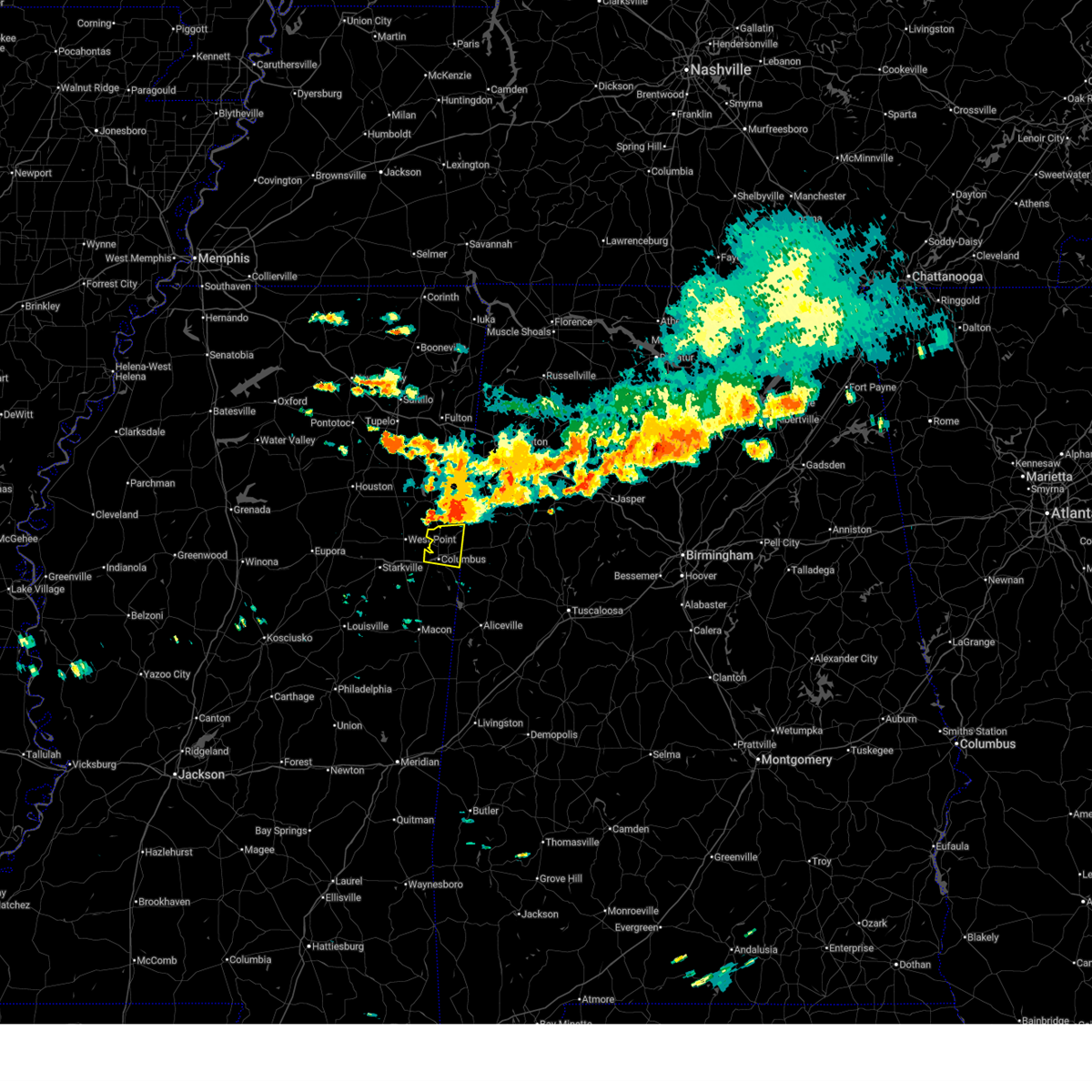
| 5/22/2026 4:23 PM CDT |
 Svrjan the national weather service in jackson has issued a * severe thunderstorm warning for, southeastern clay county in northeastern mississippi, lowndes county in northeastern mississippi, * until 530 pm cdt. * at 423 pm cdt, a severe thunderstorm was located near artesia, or 10 miles south of west point, moving northeast at 30 mph (radar indicated). Hazards include 60 mph wind gusts and quarter size hail. Hail damage to vehicles is expected. expect wind damage to roofs, siding, and trees. this severe thunderstorm will be near, columbus, waverly, tibbee, and bent oak around 430 pm cdt. columbus afb around 435 pm cdt. kolola springs around 445 pm cdt. Caledonia and steens around 455 pm cdt. Svrjan the national weather service in jackson has issued a * severe thunderstorm warning for, southeastern clay county in northeastern mississippi, lowndes county in northeastern mississippi, * until 530 pm cdt. * at 423 pm cdt, a severe thunderstorm was located near artesia, or 10 miles south of west point, moving northeast at 30 mph (radar indicated). Hazards include 60 mph wind gusts and quarter size hail. Hail damage to vehicles is expected. expect wind damage to roofs, siding, and trees. this severe thunderstorm will be near, columbus, waverly, tibbee, and bent oak around 430 pm cdt. columbus afb around 435 pm cdt. kolola springs around 445 pm cdt. Caledonia and steens around 455 pm cdt.
|
| 4/29/2026 12:07 AM CDT |
 The storms which prompted the warning have moved out of the area. therefore, the warning will be allowed to expire. a tornado watch remains in effect until 400 am cdt for northeastern mississippi. The storms which prompted the warning have moved out of the area. therefore, the warning will be allowed to expire. a tornado watch remains in effect until 400 am cdt for northeastern mississippi.
|
| 4/28/2026 11:51 PM CDT |
 At 1150 pm cdt, severe thunderstorms were located along a line extending from near vernon to near columbus to bent oak, moving east at 35 mph (radar indicated). Hazards include 60 mph wind gusts. Expect damage to roofs, siding, and trees. These severe storms will be near, columbus and steens around 1155 pm cdt. At 1150 pm cdt, severe thunderstorms were located along a line extending from near vernon to near columbus to bent oak, moving east at 35 mph (radar indicated). Hazards include 60 mph wind gusts. Expect damage to roofs, siding, and trees. These severe storms will be near, columbus and steens around 1155 pm cdt.
|
| 4/28/2026 11:26 PM CDT |
 Svrjan the national weather service in jackson has issued a * severe thunderstorm warning for, eastern oktibbeha county in northeastern mississippi, southeastern clay county in northeastern mississippi, lowndes county in northeastern mississippi, * until 1215 am cdt. * at 1125 pm cdt, severe thunderstorms were located along a line extending from 7 miles south of aberdeen to near craig springs, moving east at 40 mph (radar indicated). Hazards include 60 mph wind gusts. Expect damage to roofs, siding, and trees. severe thunderstorms will be near, starkville, west point, artesia, waverly, columbus afb, kolola springs, tibbee, sessums, oktoc, and craig springs around 1130 pm cdt. columbus and caledonia around 1135 pm cdt. crawford and bent oak around 1140 pm cdt. Steens around 1145 pm cdt. Svrjan the national weather service in jackson has issued a * severe thunderstorm warning for, eastern oktibbeha county in northeastern mississippi, southeastern clay county in northeastern mississippi, lowndes county in northeastern mississippi, * until 1215 am cdt. * at 1125 pm cdt, severe thunderstorms were located along a line extending from 7 miles south of aberdeen to near craig springs, moving east at 40 mph (radar indicated). Hazards include 60 mph wind gusts. Expect damage to roofs, siding, and trees. severe thunderstorms will be near, starkville, west point, artesia, waverly, columbus afb, kolola springs, tibbee, sessums, oktoc, and craig springs around 1130 pm cdt. columbus and caledonia around 1135 pm cdt. crawford and bent oak around 1140 pm cdt. Steens around 1145 pm cdt.
|
| 4/1/2026 3:09 PM CDT |
 Svrjan the national weather service in jackson has issued a * severe thunderstorm warning for, southeastern clay county in northeastern mississippi, northeastern lowndes county in northeastern mississippi, * until 345 pm cdt. * at 309 pm cdt, a severe thunderstorm was located near steens, or near columbus, moving northeast at 30 mph (radar indicated). Hazards include 60 mph wind gusts and penny size hail. Expect damage to roofs, siding, and trees. This severe thunderstorm will be near, caledonia and kolola springs around 315 pm cdt. Svrjan the national weather service in jackson has issued a * severe thunderstorm warning for, southeastern clay county in northeastern mississippi, northeastern lowndes county in northeastern mississippi, * until 345 pm cdt. * at 309 pm cdt, a severe thunderstorm was located near steens, or near columbus, moving northeast at 30 mph (radar indicated). Hazards include 60 mph wind gusts and penny size hail. Expect damage to roofs, siding, and trees. This severe thunderstorm will be near, caledonia and kolola springs around 315 pm cdt.
|
| 3/9/2026 8:26 PM CDT |
 the tornado warning has been cancelled and is no longer in effect the tornado warning has been cancelled and is no longer in effect
|
| 3/9/2026 8:26 PM CDT |
 The storm which prompted the warning has moved out of the area. therefore, the warning will be allowed to expire. The storm which prompted the warning has moved out of the area. therefore, the warning will be allowed to expire.
|
| 3/9/2026 8:10 PM CDT |
 At 810 pm cdt, a severe thunderstorm capable of producing a tornado was located near columbus, moving southeast at 25 mph (radar indicated rotation). Hazards include tornado and baseball size hail. Flying debris will be dangerous to those caught without shelter. mobile homes will be damaged or destroyed. damage to roofs, windows, and vehicles will occur. tree damage is likely. This dangerous storm will be near, columbus around 815 pm cdt. At 810 pm cdt, a severe thunderstorm capable of producing a tornado was located near columbus, moving southeast at 25 mph (radar indicated rotation). Hazards include tornado and baseball size hail. Flying debris will be dangerous to those caught without shelter. mobile homes will be damaged or destroyed. damage to roofs, windows, and vehicles will occur. tree damage is likely. This dangerous storm will be near, columbus around 815 pm cdt.
|
| 3/9/2026 8:07 PM CDT |
 Torjan the national weather service in jackson has issued a * tornado warning for, southeastern lowndes county in northeastern mississippi, * until 845 pm cdt. * at 807 pm cdt, a severe thunderstorm capable of producing a tornado was located near columbus, moving southeast at 25 mph (radar indicated rotation). Hazards include tornado. Flying debris will be dangerous to those caught without shelter. mobile homes will be damaged or destroyed. damage to roofs, windows, and vehicles will occur. tree damage is likely. This dangerous storm will be near, columbus around 815 pm cdt. Torjan the national weather service in jackson has issued a * tornado warning for, southeastern lowndes county in northeastern mississippi, * until 845 pm cdt. * at 807 pm cdt, a severe thunderstorm capable of producing a tornado was located near columbus, moving southeast at 25 mph (radar indicated rotation). Hazards include tornado. Flying debris will be dangerous to those caught without shelter. mobile homes will be damaged or destroyed. damage to roofs, windows, and vehicles will occur. tree damage is likely. This dangerous storm will be near, columbus around 815 pm cdt.
|
| 3/9/2026 8:04 PM CDT |
 At 804 pm cdt, a severe thunderstorm was located over columbus, moving southeast at 25 mph (radar indicated). Hazards include golf ball size hail and 60 mph wind gusts. People and animals outdoors will be injured. expect hail damage to roofs, siding, windows, and vehicles. expect wind damage to roofs, siding, and trees. This severe storm will be near, columbus and steens around 810 pm cdt. At 804 pm cdt, a severe thunderstorm was located over columbus, moving southeast at 25 mph (radar indicated). Hazards include golf ball size hail and 60 mph wind gusts. People and animals outdoors will be injured. expect hail damage to roofs, siding, windows, and vehicles. expect wind damage to roofs, siding, and trees. This severe storm will be near, columbus and steens around 810 pm cdt.
|
| 3/9/2026 7:45 PM CDT |
 At 744 pm cdt, a severe thunderstorm was located over waverly, or 7 miles east of west point, moving east at 30 mph (radar indicated). Hazards include 60 mph wind gusts and half dollar size hail. Hail damage to vehicles is expected. expect wind damage to roofs, siding, and trees. this severe storm will be near, columbus, kolola springs, and columbus afb around 750 pm cdt. Steens around 755 pm cdt. At 744 pm cdt, a severe thunderstorm was located over waverly, or 7 miles east of west point, moving east at 30 mph (radar indicated). Hazards include 60 mph wind gusts and half dollar size hail. Hail damage to vehicles is expected. expect wind damage to roofs, siding, and trees. this severe storm will be near, columbus, kolola springs, and columbus afb around 750 pm cdt. Steens around 755 pm cdt.
|
| 3/9/2026 7:32 PM CDT |
 Svrjan the national weather service in jackson has issued a * severe thunderstorm warning for, northeastern oktibbeha county in northeastern mississippi, southeastern clay county in northeastern mississippi, lowndes county in northeastern mississippi, * until 830 pm cdt. * at 732 pm cdt, a severe thunderstorm was located over west point, moving east at 30 mph (radar indicated). Hazards include 60 mph wind gusts and half dollar size hail. Hail damage to vehicles is expected. expect wind damage to roofs, siding, and trees. this severe thunderstorm will be near, columbus, waverly, and columbus afb around 740 pm cdt. kolola springs around 750 pm cdt. Steens around 755 pm cdt. Svrjan the national weather service in jackson has issued a * severe thunderstorm warning for, northeastern oktibbeha county in northeastern mississippi, southeastern clay county in northeastern mississippi, lowndes county in northeastern mississippi, * until 830 pm cdt. * at 732 pm cdt, a severe thunderstorm was located over west point, moving east at 30 mph (radar indicated). Hazards include 60 mph wind gusts and half dollar size hail. Hail damage to vehicles is expected. expect wind damage to roofs, siding, and trees. this severe thunderstorm will be near, columbus, waverly, and columbus afb around 740 pm cdt. kolola springs around 750 pm cdt. Steens around 755 pm cdt.
|
| 2/26/2026 5:38 PM CST |
 The storm which prompted the warning has weakened below severe limits, and has exited the warned area. therefore, the warning will be allowed to expire. however, gusty winds are still possible with this thunderstorm. The storm which prompted the warning has weakened below severe limits, and has exited the warned area. therefore, the warning will be allowed to expire. however, gusty winds are still possible with this thunderstorm.
|
| 2/26/2026 5:12 PM CST |
 Svrjan the national weather service in jackson has issued a * severe thunderstorm warning for, southeastern lowndes county in northeastern mississippi, * until 545 pm cst. * at 512 pm cst, a severe thunderstorm was located over columbus, moving southeast at 50 mph (radar indicated). Hazards include 60 mph wind gusts and quarter size hail. Hail damage to vehicles is expected. expect wind damage to roofs, siding, and trees. This severe thunderstorm will be near, columbus around 515 pm cst. Svrjan the national weather service in jackson has issued a * severe thunderstorm warning for, southeastern lowndes county in northeastern mississippi, * until 545 pm cst. * at 512 pm cst, a severe thunderstorm was located over columbus, moving southeast at 50 mph (radar indicated). Hazards include 60 mph wind gusts and quarter size hail. Hail damage to vehicles is expected. expect wind damage to roofs, siding, and trees. This severe thunderstorm will be near, columbus around 515 pm cst.
|
| 8/13/2025 3:00 PM CDT |
 At 259 pm cdt, severe thunderstorms were located along a line extending from near columbus to near betheden, moving southeast at 30 mph (radar indicated). Hazards include 60 mph wind gusts and penny size hail. Expect damage to roofs, siding, and trees. these severe storms will be near, columbus and crawford around 305 pm cdt. brooksville around 310 pm cdt. Mashulaville around 320 pm cdt. At 259 pm cdt, severe thunderstorms were located along a line extending from near columbus to near betheden, moving southeast at 30 mph (radar indicated). Hazards include 60 mph wind gusts and penny size hail. Expect damage to roofs, siding, and trees. these severe storms will be near, columbus and crawford around 305 pm cdt. brooksville around 310 pm cdt. Mashulaville around 320 pm cdt.
|
| 8/13/2025 2:36 PM CDT |
 the severe thunderstorm warning has been cancelled and is no longer in effect the severe thunderstorm warning has been cancelled and is no longer in effect
|
| 8/13/2025 2:36 PM CDT |
 At 235 pm cdt, severe thunderstorms were located along a line extending from waverly to near sturgis, moving east at 25 mph (radar indicated). Hazards include 60 mph wind gusts and penny size hail. Expect damage to roofs, siding, and trees. these severe storms will be near, starkville, columbus, artesia, longview, columbus afb, waverly, tibbee, sessums, and craig springs around 240 pm cdt. bent oak and oktoc around 245 pm cdt. steens around 250 pm cdt. Crawford around 305 pm cdt. At 235 pm cdt, severe thunderstorms were located along a line extending from waverly to near sturgis, moving east at 25 mph (radar indicated). Hazards include 60 mph wind gusts and penny size hail. Expect damage to roofs, siding, and trees. these severe storms will be near, starkville, columbus, artesia, longview, columbus afb, waverly, tibbee, sessums, and craig springs around 240 pm cdt. bent oak and oktoc around 245 pm cdt. steens around 250 pm cdt. Crawford around 305 pm cdt.
|
| 8/13/2025 2:17 PM CDT |
 Svrjan the national weather service in jackson has issued a * severe thunderstorm warning for, northern choctaw county in central mississippi, northwestern noxubee county in east central mississippi, oktibbeha county in northeastern mississippi, northeastern winston county in east central mississippi, southeastern webster county in north central mississippi, clay county in northeastern mississippi, lowndes county in northeastern mississippi, * until 315 pm cdt. * at 217 pm cdt, severe thunderstorms were located along a line extending from 6 miles southeast of aberdeen to near longview, moving southeast at 25 mph (radar indicated). Hazards include 60 mph wind gusts and penny size hail. Expect damage to roofs, siding, and trees. severe thunderstorms will be near, starkville, west point, kolola springs, columbus afb, waverly, muldrow, tibbee, sessums, and craig springs around 225 pm cdt. artesia and oktoc around 230 pm cdt. columbus around 235 pm cdt. caledonia and bent oak around 240 pm cdt. Crawford and steens around 245 pm cdt. Svrjan the national weather service in jackson has issued a * severe thunderstorm warning for, northern choctaw county in central mississippi, northwestern noxubee county in east central mississippi, oktibbeha county in northeastern mississippi, northeastern winston county in east central mississippi, southeastern webster county in north central mississippi, clay county in northeastern mississippi, lowndes county in northeastern mississippi, * until 315 pm cdt. * at 217 pm cdt, severe thunderstorms were located along a line extending from 6 miles southeast of aberdeen to near longview, moving southeast at 25 mph (radar indicated). Hazards include 60 mph wind gusts and penny size hail. Expect damage to roofs, siding, and trees. severe thunderstorms will be near, starkville, west point, kolola springs, columbus afb, waverly, muldrow, tibbee, sessums, and craig springs around 225 pm cdt. artesia and oktoc around 230 pm cdt. columbus around 235 pm cdt. caledonia and bent oak around 240 pm cdt. Crawford and steens around 245 pm cdt.
|
| 6/16/2025 5:10 PM CDT |
 The storm which prompted the warning has weakened below severe limits, and has exited the warned area. therefore, the warning will be allowed to expire. The storm which prompted the warning has weakened below severe limits, and has exited the warned area. therefore, the warning will be allowed to expire.
|
| 6/16/2025 4:59 PM CDT |
 the severe thunderstorm warning has been cancelled and is no longer in effect the severe thunderstorm warning has been cancelled and is no longer in effect
|
| 6/16/2025 4:59 PM CDT |
 At 459 pm cdt, a severe thunderstorm was located over bent oak, or 10 miles west of columbus, moving northeast at 35 mph (radar indicated). Hazards include 60 mph wind gusts. Expect damage to roofs, siding, and trees. This severe thunderstorm will remain over mainly rural areas of southeastern oktibbeha and southern lowndes counties. At 459 pm cdt, a severe thunderstorm was located over bent oak, or 10 miles west of columbus, moving northeast at 35 mph (radar indicated). Hazards include 60 mph wind gusts. Expect damage to roofs, siding, and trees. This severe thunderstorm will remain over mainly rural areas of southeastern oktibbeha and southern lowndes counties.
|
| 6/16/2025 4:38 PM CDT |
 At 438 pm cdt, a severe thunderstorm was located near crawford, or 13 miles southeast of starkville, moving northeast at 35 mph (radar indicated). Hazards include 60 mph wind gusts. Expect damage to roofs, siding, and trees. This severe storm will be near, artesia, sessums, and bent oak around 445 pm cdt. At 438 pm cdt, a severe thunderstorm was located near crawford, or 13 miles southeast of starkville, moving northeast at 35 mph (radar indicated). Hazards include 60 mph wind gusts. Expect damage to roofs, siding, and trees. This severe storm will be near, artesia, sessums, and bent oak around 445 pm cdt.
|
| 6/16/2025 4:38 PM CDT |
 the severe thunderstorm warning has been cancelled and is no longer in effect the severe thunderstorm warning has been cancelled and is no longer in effect
|
| 6/16/2025 4:09 PM CDT |
 Svrjan the national weather service in jackson has issued a * severe thunderstorm warning for, noxubee county in east central mississippi, southern oktibbeha county in northeastern mississippi, northeastern winston county in east central mississippi, southern lowndes county in northeastern mississippi, * until 515 pm cdt. * at 409 pm cdt, a severe thunderstorm was located near mashulaville, or 13 miles east of louisville, moving northeast at 35 mph (radar indicated). Hazards include 60 mph wind gusts. Expect damage to roofs, siding, and trees. this severe thunderstorm will be near, mashulaville around 415 pm cdt. oktoc around 425 pm cdt. brooksville and crawford around 430 pm cdt. artesia and sessums around 440 pm cdt. Bent oak around 445 pm cdt. Svrjan the national weather service in jackson has issued a * severe thunderstorm warning for, noxubee county in east central mississippi, southern oktibbeha county in northeastern mississippi, northeastern winston county in east central mississippi, southern lowndes county in northeastern mississippi, * until 515 pm cdt. * at 409 pm cdt, a severe thunderstorm was located near mashulaville, or 13 miles east of louisville, moving northeast at 35 mph (radar indicated). Hazards include 60 mph wind gusts. Expect damage to roofs, siding, and trees. this severe thunderstorm will be near, mashulaville around 415 pm cdt. oktoc around 425 pm cdt. brooksville and crawford around 430 pm cdt. artesia and sessums around 440 pm cdt. Bent oak around 445 pm cdt.
|
| 6/7/2025 1:33 PM CDT |
 the severe thunderstorm warning has been cancelled and is no longer in effect the severe thunderstorm warning has been cancelled and is no longer in effect
|
| 6/7/2025 1:25 PM CDT |
 At 125 pm cdt, a severe thunderstorm was located near ashcraft corner, or near millport, moving east at 65 mph (radar indicated). Hazards include 60 mph wind gusts and quarter size hail. Hail damage to vehicles is expected. expect wind damage to roofs, siding, and trees. This severe thunderstorm will remain over mainly rural areas of northeastern lowndes county. At 125 pm cdt, a severe thunderstorm was located near ashcraft corner, or near millport, moving east at 65 mph (radar indicated). Hazards include 60 mph wind gusts and quarter size hail. Hail damage to vehicles is expected. expect wind damage to roofs, siding, and trees. This severe thunderstorm will remain over mainly rural areas of northeastern lowndes county.
|
| 6/7/2025 1:25 PM CDT |
 the severe thunderstorm warning has been cancelled and is no longer in effect the severe thunderstorm warning has been cancelled and is no longer in effect
|
| 6/7/2025 12:54 PM CDT |
 Svrjan the national weather service in jackson has issued a * severe thunderstorm warning for, southeastern clay county in northeastern mississippi, northeastern lowndes county in northeastern mississippi, * until 200 pm cdt. * at 1253 pm cdt, a severe thunderstorm was located near waverly, or near west point, moving east at 65 mph (radar indicated). Hazards include 60 mph wind gusts and quarter size hail. Hail damage to vehicles is expected. expect wind damage to roofs, siding, and trees. This severe thunderstorm will be near, columbus, caledonia, kolola springs, columbus afb, and steens around 100 pm cdt. Svrjan the national weather service in jackson has issued a * severe thunderstorm warning for, southeastern clay county in northeastern mississippi, northeastern lowndes county in northeastern mississippi, * until 200 pm cdt. * at 1253 pm cdt, a severe thunderstorm was located near waverly, or near west point, moving east at 65 mph (radar indicated). Hazards include 60 mph wind gusts and quarter size hail. Hail damage to vehicles is expected. expect wind damage to roofs, siding, and trees. This severe thunderstorm will be near, columbus, caledonia, kolola springs, columbus afb, and steens around 100 pm cdt.
|
| 5/25/2025 9:12 PM CDT |
 At 911 pm cdt, severe thunderstorms were located along a line extending from 7 miles west of ethelsville to near mashulaville, moving east at 45 mph (radar indicated). Hazards include 60 mph wind gusts. Expect damage to roofs, siding, and trees. these severe storms will be near, macon, bigbee valley, and deerbrook around 915 pm cdt. Prairie point around 920 pm cdt. At 911 pm cdt, severe thunderstorms were located along a line extending from 7 miles west of ethelsville to near mashulaville, moving east at 45 mph (radar indicated). Hazards include 60 mph wind gusts. Expect damage to roofs, siding, and trees. these severe storms will be near, macon, bigbee valley, and deerbrook around 915 pm cdt. Prairie point around 920 pm cdt.
|
| 5/25/2025 9:02 PM CDT |
 the severe thunderstorm warning has been cancelled and is no longer in effect the severe thunderstorm warning has been cancelled and is no longer in effect
|
| 5/25/2025 9:02 PM CDT |
 At 902 pm cdt, severe thunderstorms were located along a line extending from 6 miles south of columbus to near mashulaville, moving southeast at 40 mph (radar indicated). Hazards include 60 mph wind gusts. Expect damage to roofs, siding, and trees. these severe storms will be near, brooksville, deerbrook, and mashulaville around 905 pm cdt. macon and bigbee valley around 910 pm cdt. Prairie point around 915 pm cdt. At 902 pm cdt, severe thunderstorms were located along a line extending from 6 miles south of columbus to near mashulaville, moving southeast at 40 mph (radar indicated). Hazards include 60 mph wind gusts. Expect damage to roofs, siding, and trees. these severe storms will be near, brooksville, deerbrook, and mashulaville around 905 pm cdt. macon and bigbee valley around 910 pm cdt. Prairie point around 915 pm cdt.
|
| 5/25/2025 8:51 PM CDT |
 At 851 pm cdt, a severe thunderstorm was located over crawford, or 13 miles southeast of starkville, moving southeast at 45 mph (radar indicated). Hazards include 60 mph wind gusts. Expect damage to roofs, siding, and trees. this severe storm will be near, brooksville, crawford, and deerbrook around 855 pm cdt. macon around 900 pm cdt. Prairie point around 905 pm cdt. At 851 pm cdt, a severe thunderstorm was located over crawford, or 13 miles southeast of starkville, moving southeast at 45 mph (radar indicated). Hazards include 60 mph wind gusts. Expect damage to roofs, siding, and trees. this severe storm will be near, brooksville, crawford, and deerbrook around 855 pm cdt. macon around 900 pm cdt. Prairie point around 905 pm cdt.
|
| 5/25/2025 8:41 PM CDT |
 At 840 pm cdt, a severe thunderstorm was located near starkville, moving east at 45 mph (radar indicated). Hazards include 60 mph wind gusts. Expect damage to roofs, siding, and trees. this severe storm will be near, artesia and sessums around 845 pm cdt. bent oak around 850 pm cdt. Columbus around 900 pm cdt. At 840 pm cdt, a severe thunderstorm was located near starkville, moving east at 45 mph (radar indicated). Hazards include 60 mph wind gusts. Expect damage to roofs, siding, and trees. this severe storm will be near, artesia and sessums around 845 pm cdt. bent oak around 850 pm cdt. Columbus around 900 pm cdt.
|
| 5/25/2025 8:41 PM CDT |
 the severe thunderstorm warning has been cancelled and is no longer in effect the severe thunderstorm warning has been cancelled and is no longer in effect
|
| 5/25/2025 8:14 PM CDT |
 Svrjan the national weather service in jackson has issued a * severe thunderstorm warning for, noxubee county in east central mississippi, oktibbeha county in northeastern mississippi, northeastern winston county in east central mississippi, southern clay county in northeastern mississippi, lowndes county in northeastern mississippi, * until 930 pm cdt. * at 814 pm cdt, a severe thunderstorm was located over maben, or 11 miles east of eupora, moving east at 40 mph (radar indicated). Hazards include 60 mph wind gusts. Expect damage to roofs, siding, and trees. this severe thunderstorm will be near, pheba around 820 pm cdt. starkville and longview around 825 pm cdt. muldrow and sessums around 835 pm cdt. artesia around 840 pm cdt. tibbee around 845 pm cdt. bent oak around 850 pm cdt. Columbus around 900 pm cdt. Svrjan the national weather service in jackson has issued a * severe thunderstorm warning for, noxubee county in east central mississippi, oktibbeha county in northeastern mississippi, northeastern winston county in east central mississippi, southern clay county in northeastern mississippi, lowndes county in northeastern mississippi, * until 930 pm cdt. * at 814 pm cdt, a severe thunderstorm was located over maben, or 11 miles east of eupora, moving east at 40 mph (radar indicated). Hazards include 60 mph wind gusts. Expect damage to roofs, siding, and trees. this severe thunderstorm will be near, pheba around 820 pm cdt. starkville and longview around 825 pm cdt. muldrow and sessums around 835 pm cdt. artesia around 840 pm cdt. tibbee around 845 pm cdt. bent oak around 850 pm cdt. Columbus around 900 pm cdt.
|
| 5/25/2025 8:07 PM CDT |
 At 807 pm cdt, a severe thunderstorm was located over steens, or near columbus, moving east at 30 mph (radar indicated). Hazards include ping pong ball size hail and 60 mph wind gusts. People and animals outdoors will be injured. expect hail damage to roofs, siding, windows, and vehicles. expect wind damage to roofs, siding, and trees. This severe storm will be near, columbus and steens around 810 pm cdt. At 807 pm cdt, a severe thunderstorm was located over steens, or near columbus, moving east at 30 mph (radar indicated). Hazards include ping pong ball size hail and 60 mph wind gusts. People and animals outdoors will be injured. expect hail damage to roofs, siding, windows, and vehicles. expect wind damage to roofs, siding, and trees. This severe storm will be near, columbus and steens around 810 pm cdt.
|
| 5/25/2025 7:44 PM CDT |
 Svrjan the national weather service in jackson has issued a * severe thunderstorm warning for, northern lowndes county in northeastern mississippi, * until 830 pm cdt. * at 744 pm cdt, a severe thunderstorm was located near waverly, or near columbus, moving east at 35 mph (radar indicated). Hazards include 60 mph wind gusts and quarter size hail. Hail damage to vehicles is expected. expect wind damage to roofs, siding, and trees. This severe thunderstorm will be near, columbus, columbus afb, and steens around 750 pm cdt. Svrjan the national weather service in jackson has issued a * severe thunderstorm warning for, northern lowndes county in northeastern mississippi, * until 830 pm cdt. * at 744 pm cdt, a severe thunderstorm was located near waverly, or near columbus, moving east at 35 mph (radar indicated). Hazards include 60 mph wind gusts and quarter size hail. Hail damage to vehicles is expected. expect wind damage to roofs, siding, and trees. This severe thunderstorm will be near, columbus, columbus afb, and steens around 750 pm cdt.
|
| 5/25/2025 7:08 PM CDT |
 At 707 pm cdt, a severe thunderstorm was located near ethelsville, or near columbus, moving northeast at 15 mph (radar indicated). Hazards include ping pong ball size hail and 60 mph wind gusts. People and animals outdoors will be injured. expect hail damage to roofs, siding, windows, and vehicles. expect wind damage to roofs, siding, and trees. Locations impacted include, columbus, caledonia, kolola springs, steens, and columbus afb. At 707 pm cdt, a severe thunderstorm was located near ethelsville, or near columbus, moving northeast at 15 mph (radar indicated). Hazards include ping pong ball size hail and 60 mph wind gusts. People and animals outdoors will be injured. expect hail damage to roofs, siding, windows, and vehicles. expect wind damage to roofs, siding, and trees. Locations impacted include, columbus, caledonia, kolola springs, steens, and columbus afb.
|
| 5/25/2025 7:08 PM CDT |
 the severe thunderstorm warning has been cancelled and is no longer in effect the severe thunderstorm warning has been cancelled and is no longer in effect
|
| 5/25/2025 6:42 PM CDT |
 At 642 pm cdt, a severe thunderstorm was located near columbus afb, or 9 miles east of west point, moving northeast at 20 mph (radar indicated). Hazards include 60 mph wind gusts and quarter size hail. Hail damage to vehicles is expected. expect wind damage to roofs, siding, and trees. Locations impacted include, columbus, caledonia, kolola springs, steens, waverly, and columbus afb. At 642 pm cdt, a severe thunderstorm was located near columbus afb, or 9 miles east of west point, moving northeast at 20 mph (radar indicated). Hazards include 60 mph wind gusts and quarter size hail. Hail damage to vehicles is expected. expect wind damage to roofs, siding, and trees. Locations impacted include, columbus, caledonia, kolola springs, steens, waverly, and columbus afb.
|
| 5/25/2025 6:28 PM CDT |
 Svrjan the national weather service in jackson has issued a * severe thunderstorm warning for, southeastern clay county in northeastern mississippi, eastern lowndes county in northeastern mississippi, * until 730 pm cdt. * at 628 pm cdt, a severe thunderstorm was located over waverly, or near west point, moving northeast at 20 mph (radar indicated). Hazards include ping pong ball size hail and 60 mph wind gusts. People and animals outdoors will be injured. expect hail damage to roofs, siding, windows, and vehicles. expect wind damage to roofs, siding, and trees. this severe thunderstorm will be near, columbus, kolola springs, and columbus afb around 635 pm cdt. Caledonia around 650 pm cdt. Svrjan the national weather service in jackson has issued a * severe thunderstorm warning for, southeastern clay county in northeastern mississippi, eastern lowndes county in northeastern mississippi, * until 730 pm cdt. * at 628 pm cdt, a severe thunderstorm was located over waverly, or near west point, moving northeast at 20 mph (radar indicated). Hazards include ping pong ball size hail and 60 mph wind gusts. People and animals outdoors will be injured. expect hail damage to roofs, siding, windows, and vehicles. expect wind damage to roofs, siding, and trees. this severe thunderstorm will be near, columbus, kolola springs, and columbus afb around 635 pm cdt. Caledonia around 650 pm cdt.
|
| 5/8/2025 5:07 PM CDT |
 The storm which prompted the warning is moving out of the area. therefore, the warning will be allowed to expire. The storm which prompted the warning is moving out of the area. therefore, the warning will be allowed to expire.
|
| 5/8/2025 5:02 PM CDT |
 At 502 pm cdt, a severe thunderstorm was located near ethelsville, or 8 miles southwest of millport, moving east at 35 mph (radar indicated). Hazards include 60 mph wind gusts and quarter size hail. Hail damage to vehicles is expected. expect wind damage to roofs, siding, and trees. This severe thunderstorm will remain over mainly rural areas of east central lowndes county. At 502 pm cdt, a severe thunderstorm was located near ethelsville, or 8 miles southwest of millport, moving east at 35 mph (radar indicated). Hazards include 60 mph wind gusts and quarter size hail. Hail damage to vehicles is expected. expect wind damage to roofs, siding, and trees. This severe thunderstorm will remain over mainly rural areas of east central lowndes county.
|
| 5/8/2025 4:44 PM CDT |
 At 444 pm cdt, a severe thunderstorm was located over columbus, moving east at 35 mph (radar indicated). Hazards include 60 mph wind gusts and quarter size hail. Hail damage to vehicles is expected. expect wind damage to roofs, siding, and trees. This severe storm will be near, steens and columbus around 450 pm cdt. At 444 pm cdt, a severe thunderstorm was located over columbus, moving east at 35 mph (radar indicated). Hazards include 60 mph wind gusts and quarter size hail. Hail damage to vehicles is expected. expect wind damage to roofs, siding, and trees. This severe storm will be near, steens and columbus around 450 pm cdt.
|
| 5/8/2025 4:34 PM CDT |
 At 434 pm cdt, a severe thunderstorm was located near bent oak, or near columbus, moving east at 35 mph (radar indicated). Hazards include golf ball size hail and 60 mph wind gusts. People and animals outdoors will be injured. expect hail damage to roofs, siding, windows, and vehicles. expect wind damage to roofs, siding, and trees. This severe storm will be near, steens and columbus around 440 pm cdt. At 434 pm cdt, a severe thunderstorm was located near bent oak, or near columbus, moving east at 35 mph (radar indicated). Hazards include golf ball size hail and 60 mph wind gusts. People and animals outdoors will be injured. expect hail damage to roofs, siding, windows, and vehicles. expect wind damage to roofs, siding, and trees. This severe storm will be near, steens and columbus around 440 pm cdt.
|
| 5/8/2025 4:34 PM CDT |
 the severe thunderstorm warning has been cancelled and is no longer in effect the severe thunderstorm warning has been cancelled and is no longer in effect
|
| 5/8/2025 4:25 PM CDT |
 At 424 pm cdt, a severe thunderstorm was located near tibbee, or 8 miles southeast of west point, moving east at 30 mph (radar indicated). Hazards include golf ball size hail and 60 mph wind gusts. People and animals outdoors will be injured. expect hail damage to roofs, siding, windows, and vehicles. expect wind damage to roofs, siding, and trees. this severe storm will be near, bent oak, waverly, columbus afb, and columbus around 430 pm cdt. Steens around 445 pm cdt. At 424 pm cdt, a severe thunderstorm was located near tibbee, or 8 miles southeast of west point, moving east at 30 mph (radar indicated). Hazards include golf ball size hail and 60 mph wind gusts. People and animals outdoors will be injured. expect hail damage to roofs, siding, windows, and vehicles. expect wind damage to roofs, siding, and trees. this severe storm will be near, bent oak, waverly, columbus afb, and columbus around 430 pm cdt. Steens around 445 pm cdt.
|
| 5/8/2025 4:25 PM CDT |
 the severe thunderstorm warning has been cancelled and is no longer in effect the severe thunderstorm warning has been cancelled and is no longer in effect
|
| 5/8/2025 4:09 PM CDT |
 Svrjan the national weather service in jackson has issued a * severe thunderstorm warning for, northeastern oktibbeha county in northeastern mississippi, southeastern clay county in northeastern mississippi, central lowndes county in northeastern mississippi, * until 515 pm cdt. * at 408 pm cdt, a severe thunderstorm was located over muldrow, or 7 miles south of west point, moving east at 35 mph (radar indicated). Hazards include golf ball size hail and 60 mph wind gusts. People and animals outdoors will be injured. expect hail damage to roofs, siding, windows, and vehicles. expect wind damage to roofs, siding, and trees. this severe thunderstorm will be near, tibbee, bent oak, and waverly around 415 pm cdt. columbus around 420 pm cdt. columbus afb around 425 pm cdt. Steens around 435 pm cdt. Svrjan the national weather service in jackson has issued a * severe thunderstorm warning for, northeastern oktibbeha county in northeastern mississippi, southeastern clay county in northeastern mississippi, central lowndes county in northeastern mississippi, * until 515 pm cdt. * at 408 pm cdt, a severe thunderstorm was located over muldrow, or 7 miles south of west point, moving east at 35 mph (radar indicated). Hazards include golf ball size hail and 60 mph wind gusts. People and animals outdoors will be injured. expect hail damage to roofs, siding, windows, and vehicles. expect wind damage to roofs, siding, and trees. this severe thunderstorm will be near, tibbee, bent oak, and waverly around 415 pm cdt. columbus around 420 pm cdt. columbus afb around 425 pm cdt. Steens around 435 pm cdt.
|
| 5/2/2025 4:00 PM CDT |
 The storms which prompted the warning have weakened below severe limits, and no longer pose an immediate threat to life or property. therefore, the warning has been allowed to expire. a severe thunderstorm watch remains in effect until 700 pm cdt for northeastern and east central mississippi. to report severe weather, contact your nearest law enforcement agency. they will relay your report to the national weather service jackson. The storms which prompted the warning have weakened below severe limits, and no longer pose an immediate threat to life or property. therefore, the warning has been allowed to expire. a severe thunderstorm watch remains in effect until 700 pm cdt for northeastern and east central mississippi. to report severe weather, contact your nearest law enforcement agency. they will relay your report to the national weather service jackson.
|
| 5/2/2025 3:52 PM CDT |
 The storms which prompted the warning have moved out of the area. therefore, the warning will be allowed to expire. a severe thunderstorm watch remains in effect until 700 pm cdt for northeastern mississippi. to report severe weather, contact your nearest law enforcement agency. they will relay your report to the national weather service jackson. The storms which prompted the warning have moved out of the area. therefore, the warning will be allowed to expire. a severe thunderstorm watch remains in effect until 700 pm cdt for northeastern mississippi. to report severe weather, contact your nearest law enforcement agency. they will relay your report to the national weather service jackson.
|
| 5/2/2025 3:40 PM CDT |
 At 340 pm cdt, severe thunderstorms were located along a line extending from near columbus to near millcreek, moving east at 15 mph (radar indicated). Hazards include 60 mph wind gusts and quarter size hail. Hail damage to vehicles is expected. expect wind damage to roofs, siding, and trees. Locations impacted include, crawford, millcreek, louisville, and columbus. At 340 pm cdt, severe thunderstorms were located along a line extending from near columbus to near millcreek, moving east at 15 mph (radar indicated). Hazards include 60 mph wind gusts and quarter size hail. Hail damage to vehicles is expected. expect wind damage to roofs, siding, and trees. Locations impacted include, crawford, millcreek, louisville, and columbus.
|
| 5/2/2025 3:29 PM CDT |
 Svrjan the national weather service in jackson has issued a * severe thunderstorm warning for, northeastern lowndes county in northeastern mississippi, * until 400 pm cdt. * at 328 pm cdt, severe thunderstorms were located along a line extending from near caledonia to near columbus, moving east at 30 mph (radar indicated). Hazards include 60 mph wind gusts and quarter size hail. Hail damage to vehicles is expected. Expect wind damage to roofs, siding, and trees. Svrjan the national weather service in jackson has issued a * severe thunderstorm warning for, northeastern lowndes county in northeastern mississippi, * until 400 pm cdt. * at 328 pm cdt, severe thunderstorms were located along a line extending from near caledonia to near columbus, moving east at 30 mph (radar indicated). Hazards include 60 mph wind gusts and quarter size hail. Hail damage to vehicles is expected. Expect wind damage to roofs, siding, and trees.
|
| 5/2/2025 3:21 PM CDT |
 the severe thunderstorm warning has been cancelled and is no longer in effect the severe thunderstorm warning has been cancelled and is no longer in effect
|
| 5/2/2025 3:21 PM CDT |
 At 320 pm cdt, severe thunderstorms were located along a line extending from near bent oak to near louisville, moving east at 20 mph (public). Hazards include 60 mph wind gusts and quarter size hail. Hail damage to vehicles is expected. expect wind damage to roofs, siding, and trees. Locations impacted include, betheden, millcreek, artesia, oktoc, crawford, bent oak, louisville, and columbus. At 320 pm cdt, severe thunderstorms were located along a line extending from near bent oak to near louisville, moving east at 20 mph (public). Hazards include 60 mph wind gusts and quarter size hail. Hail damage to vehicles is expected. expect wind damage to roofs, siding, and trees. Locations impacted include, betheden, millcreek, artesia, oktoc, crawford, bent oak, louisville, and columbus.
|
| 5/2/2025 3:15 PM CDT |
 At 315 pm cdt, severe thunderstorms were located along a line extending from near caledonia to near columbus, moving east at 25 mph (radar indicated. at 248 pm, a 55 mph wind gust was reported at columbus air force base). Hazards include 60 mph wind gusts and quarter size hail. Hail damage to vehicles is expected. expect wind damage to roofs, siding, and trees. Locations impacted include, columbus, steens, caledonia, and columbus afb. At 315 pm cdt, severe thunderstorms were located along a line extending from near caledonia to near columbus, moving east at 25 mph (radar indicated. at 248 pm, a 55 mph wind gust was reported at columbus air force base). Hazards include 60 mph wind gusts and quarter size hail. Hail damage to vehicles is expected. expect wind damage to roofs, siding, and trees. Locations impacted include, columbus, steens, caledonia, and columbus afb.
|
| 5/2/2025 2:58 PM CDT |
 Svrjan the national weather service in jackson has issued a * severe thunderstorm warning for, northwestern noxubee county in east central mississippi, southeastern oktibbeha county in northeastern mississippi, northeastern winston county in east central mississippi, southeastern clay county in northeastern mississippi, western lowndes county in northeastern mississippi, * until 400 pm cdt. * at 257 pm cdt, severe thunderstorms were located along a line extending from columbus afb to louisville, moving east at 15 mph (public. quarter size hail was reported east of west point). Hazards include 60 mph wind gusts and quarter size hail. Hail damage to vehicles is expected. Expect wind damage to roofs, siding, and trees. Svrjan the national weather service in jackson has issued a * severe thunderstorm warning for, northwestern noxubee county in east central mississippi, southeastern oktibbeha county in northeastern mississippi, northeastern winston county in east central mississippi, southeastern clay county in northeastern mississippi, western lowndes county in northeastern mississippi, * until 400 pm cdt. * at 257 pm cdt, severe thunderstorms were located along a line extending from columbus afb to louisville, moving east at 15 mph (public. quarter size hail was reported east of west point). Hazards include 60 mph wind gusts and quarter size hail. Hail damage to vehicles is expected. Expect wind damage to roofs, siding, and trees.
|
| 5/2/2025 2:44 PM CDT |
 Svrjan the national weather service in jackson has issued a * severe thunderstorm warning for, northeastern lowndes county in northeastern mississippi, * until 330 pm cdt. * at 244 pm cdt, severe thunderstorms were located along a line extending from near caledonia to waverly, moving east at 30 mph (radar indicated). Hazards include 60 mph wind gusts and quarter size hail. Hail damage to vehicles is expected. expect wind damage to roofs, siding, and trees. severe thunderstorms will be near, columbus afb, columbus, and caledonia around 250 pm cdt. Steens around 255 pm cdt. Svrjan the national weather service in jackson has issued a * severe thunderstorm warning for, northeastern lowndes county in northeastern mississippi, * until 330 pm cdt. * at 244 pm cdt, severe thunderstorms were located along a line extending from near caledonia to waverly, moving east at 30 mph (radar indicated). Hazards include 60 mph wind gusts and quarter size hail. Hail damage to vehicles is expected. expect wind damage to roofs, siding, and trees. severe thunderstorms will be near, columbus afb, columbus, and caledonia around 250 pm cdt. Steens around 255 pm cdt.
|
| 4/22/2025 3:00 PM CDT |
 Svrjan the national weather service in jackson has issued a * severe thunderstorm warning for, eastern noxubee county in east central mississippi, southern lowndes county in northeastern mississippi, * until 400 pm cdt. * at 259 pm cdt, a severe thunderstorm was located over deerbrook, or 8 miles northeast of macon, moving northeast at 25 mph (radar indicated). Hazards include 60 mph wind gusts and quarter size hail. Hail damage to vehicles is expected. expect wind damage to roofs, siding, and trees. This severe thunderstorm will be near, bigbee valley and prairie point around 305 pm cdt. Svrjan the national weather service in jackson has issued a * severe thunderstorm warning for, eastern noxubee county in east central mississippi, southern lowndes county in northeastern mississippi, * until 400 pm cdt. * at 259 pm cdt, a severe thunderstorm was located over deerbrook, or 8 miles northeast of macon, moving northeast at 25 mph (radar indicated). Hazards include 60 mph wind gusts and quarter size hail. Hail damage to vehicles is expected. expect wind damage to roofs, siding, and trees. This severe thunderstorm will be near, bigbee valley and prairie point around 305 pm cdt.
|
| 4/10/2025 9:19 PM CDT |
 the severe thunderstorm warning has been cancelled and is no longer in effect the severe thunderstorm warning has been cancelled and is no longer in effect
|
| 4/10/2025 9:02 PM CDT |
 the severe thunderstorm warning has been cancelled and is no longer in effect the severe thunderstorm warning has been cancelled and is no longer in effect
|
| 4/10/2025 9:02 PM CDT |
 At 901 pm cdt, a severe thunderstorm was located near columbus, moving southeast at 55 mph (radar indicated). Hazards include 60 mph wind gusts and quarter size hail. Hail damage to vehicles is expected. expect wind damage to roofs, siding, and trees. This severe storm will be near, columbus around 905 pm cdt. At 901 pm cdt, a severe thunderstorm was located near columbus, moving southeast at 55 mph (radar indicated). Hazards include 60 mph wind gusts and quarter size hail. Hail damage to vehicles is expected. expect wind damage to roofs, siding, and trees. This severe storm will be near, columbus around 905 pm cdt.
|
| 4/10/2025 8:53 PM CDT |
 the severe thunderstorm warning has been cancelled and is no longer in effect the severe thunderstorm warning has been cancelled and is no longer in effect
|
| 4/10/2025 8:53 PM CDT |
 At 852 pm cdt, a severe thunderstorm was located near bent oak, or near columbus, moving southeast at 55 mph (radar indicated). Hazards include 60 mph wind gusts and quarter size hail. Hail damage to vehicles is expected. expect wind damage to roofs, siding, and trees. This severe storm will be near, columbus around 900 pm cdt. At 852 pm cdt, a severe thunderstorm was located near bent oak, or near columbus, moving southeast at 55 mph (radar indicated). Hazards include 60 mph wind gusts and quarter size hail. Hail damage to vehicles is expected. expect wind damage to roofs, siding, and trees. This severe storm will be near, columbus around 900 pm cdt.
|
| 4/10/2025 8:40 PM CDT |
 At 839 pm cdt, a severe thunderstorm was located over muldrow, or over west point, moving southeast at 55 mph (radar indicated). Hazards include ping pong ball size hail and 60 mph wind gusts. People and animals outdoors will be injured. expect hail damage to roofs, siding, windows, and vehicles. expect wind damage to roofs, siding, and trees. This severe storm will be near, waverly, tibbee, bent oak, and columbus around 845 pm cdt. At 839 pm cdt, a severe thunderstorm was located over muldrow, or over west point, moving southeast at 55 mph (radar indicated). Hazards include ping pong ball size hail and 60 mph wind gusts. People and animals outdoors will be injured. expect hail damage to roofs, siding, windows, and vehicles. expect wind damage to roofs, siding, and trees. This severe storm will be near, waverly, tibbee, bent oak, and columbus around 845 pm cdt.
|
| 4/10/2025 8:37 PM CDT |
 Svrjan the national weather service in jackson has issued a * severe thunderstorm warning for, northeastern oktibbeha county in northeastern mississippi, clay county in northeastern mississippi, lowndes county in northeastern mississippi, * until 930 pm cdt. * at 837 pm cdt, a severe thunderstorm was located near muldrow, or near west point, moving southeast at 55 mph (radar indicated). Hazards include 60 mph wind gusts and quarter size hail. Hail damage to vehicles is expected. expect wind damage to roofs, siding, and trees. this severe thunderstorm will be near, muldrow, tibbee, and west point around 840 pm cdt. Waverly, bent oak, artesia, and columbus around 845 pm cdt. Svrjan the national weather service in jackson has issued a * severe thunderstorm warning for, northeastern oktibbeha county in northeastern mississippi, clay county in northeastern mississippi, lowndes county in northeastern mississippi, * until 930 pm cdt. * at 837 pm cdt, a severe thunderstorm was located near muldrow, or near west point, moving southeast at 55 mph (radar indicated). Hazards include 60 mph wind gusts and quarter size hail. Hail damage to vehicles is expected. expect wind damage to roofs, siding, and trees. this severe thunderstorm will be near, muldrow, tibbee, and west point around 840 pm cdt. Waverly, bent oak, artesia, and columbus around 845 pm cdt.
|
| 4/6/2025 3:26 AM CDT |
 the severe thunderstorm warning has been cancelled and is no longer in effect the severe thunderstorm warning has been cancelled and is no longer in effect
|
| 4/6/2025 3:11 AM CDT |
 At 311 am cdt, severe thunderstorms were located along a line extending from near bent oak to macon, moving northeast at 45 mph (radar indicated). Hazards include 60 mph wind gusts. Expect damage to roofs, siding, and trees. these severe storms will be near, deerbrook, columbus, and macon around 315 am cdt. Bigbee valley and prairie point around 320 am cdt. At 311 am cdt, severe thunderstorms were located along a line extending from near bent oak to macon, moving northeast at 45 mph (radar indicated). Hazards include 60 mph wind gusts. Expect damage to roofs, siding, and trees. these severe storms will be near, deerbrook, columbus, and macon around 315 am cdt. Bigbee valley and prairie point around 320 am cdt.
|
| 4/6/2025 2:53 AM CDT |
 At 253 am cdt, severe thunderstorms were located along a line extending from near crawford to near mashulaville, moving northeast at 40 mph (radar indicated). Hazards include 60 mph wind gusts and penny size hail. Expect damage to roofs, siding, and trees. these severe storms will be near, crawford, brooksville, and mashulaville around 300 am cdt. macon around 305 am cdt. deerbrook around 310 am cdt. columbus around 315 am cdt. Bigbee valley around 330 am cdt. At 253 am cdt, severe thunderstorms were located along a line extending from near crawford to near mashulaville, moving northeast at 40 mph (radar indicated). Hazards include 60 mph wind gusts and penny size hail. Expect damage to roofs, siding, and trees. these severe storms will be near, crawford, brooksville, and mashulaville around 300 am cdt. macon around 305 am cdt. deerbrook around 310 am cdt. columbus around 315 am cdt. Bigbee valley around 330 am cdt.
|
| 4/6/2025 2:53 AM CDT |
 the severe thunderstorm warning has been cancelled and is no longer in effect the severe thunderstorm warning has been cancelled and is no longer in effect
|
| 4/6/2025 2:41 AM CDT |
 Svrjan the national weather service in jackson has issued a * severe thunderstorm warning for, noxubee county in east central mississippi, southeastern winston county in east central mississippi, southern lowndes county in northeastern mississippi, * until 345 am cdt. * at 241 am cdt, severe thunderstorms were located along a line extending from near oktoc to near nanih waiya, moving northeast at 40 mph (radar indicated). Hazards include 60 mph wind gusts and penny size hail. Expect damage to roofs, siding, and trees. severe thunderstorms will be near, mashulaville around 245 am cdt. crawford around 250 am cdt. brooksville around 255 am cdt. macon around 305 am cdt. deerbrook around 310 am cdt. columbus around 315 am cdt. Bigbee valley around 325 am cdt. Svrjan the national weather service in jackson has issued a * severe thunderstorm warning for, noxubee county in east central mississippi, southeastern winston county in east central mississippi, southern lowndes county in northeastern mississippi, * until 345 am cdt. * at 241 am cdt, severe thunderstorms were located along a line extending from near oktoc to near nanih waiya, moving northeast at 40 mph (radar indicated). Hazards include 60 mph wind gusts and penny size hail. Expect damage to roofs, siding, and trees. severe thunderstorms will be near, mashulaville around 245 am cdt. crawford around 250 am cdt. brooksville around 255 am cdt. macon around 305 am cdt. deerbrook around 310 am cdt. columbus around 315 am cdt. Bigbee valley around 325 am cdt.
|
| 4/6/2025 1:40 AM CDT |
 The storm which prompted the warning has moved out of the area. therefore, the warning will be allowed to expire. a tornado watch remains in effect until 500 am cdt for northeastern mississippi. The storm which prompted the warning has moved out of the area. therefore, the warning will be allowed to expire. a tornado watch remains in effect until 500 am cdt for northeastern mississippi.
|
| 4/6/2025 1:23 AM CDT |
 Torjan the national weather service in jackson has issued a * tornado warning for, southeastern lowndes county in northeastern mississippi, * until 145 am cdt. * at 123 am cdt, a severe thunderstorm capable of producing a tornado was located near bigbee valley, or 7 miles northwest of pickensville, moving northeast at 45 mph (radar indicated rotation). Hazards include tornado. Flying debris will be dangerous to those caught without shelter. mobile homes will be damaged or destroyed. damage to roofs, windows, and vehicles will occur. tree damage is likely. This dangerous storm will be near, columbus around 130 am cdt. Torjan the national weather service in jackson has issued a * tornado warning for, southeastern lowndes county in northeastern mississippi, * until 145 am cdt. * at 123 am cdt, a severe thunderstorm capable of producing a tornado was located near bigbee valley, or 7 miles northwest of pickensville, moving northeast at 45 mph (radar indicated rotation). Hazards include tornado. Flying debris will be dangerous to those caught without shelter. mobile homes will be damaged or destroyed. damage to roofs, windows, and vehicles will occur. tree damage is likely. This dangerous storm will be near, columbus around 130 am cdt.
|
| 4/6/2025 1:08 AM CDT |
 At 108 am cdt, a severe thunderstorm was located over deerbrook, or 7 miles northeast of macon, moving northeast at 35 mph (radar indicated). Hazards include 60 mph wind gusts. Expect damage to roofs, siding, and trees. this severe storm will be near, bigbee valley around 115 am cdt. Columbus around 125 am cdt. At 108 am cdt, a severe thunderstorm was located over deerbrook, or 7 miles northeast of macon, moving northeast at 35 mph (radar indicated). Hazards include 60 mph wind gusts. Expect damage to roofs, siding, and trees. this severe storm will be near, bigbee valley around 115 am cdt. Columbus around 125 am cdt.
|
| 4/6/2025 1:01 AM CDT |
 At 101 am cdt, a severe thunderstorm was located near macon, moving northeast at 30 mph (radar indicated). Hazards include 60 mph wind gusts. Expect damage to roofs, siding, and trees. this severe storm will be near, deerbrook around 105 am cdt. bigbee valley around 110 am cdt. Columbus around 130 am cdt. At 101 am cdt, a severe thunderstorm was located near macon, moving northeast at 30 mph (radar indicated). Hazards include 60 mph wind gusts. Expect damage to roofs, siding, and trees. this severe storm will be near, deerbrook around 105 am cdt. bigbee valley around 110 am cdt. Columbus around 130 am cdt.
|
| 4/6/2025 12:51 AM CDT |
 At 1251 am cdt, a severe thunderstorm was located near macon, moving northeast at 35 mph (radar indicated). Hazards include 60 mph wind gusts. Expect damage to roofs, siding, and trees. this severe storm will be near, deerbrook, brooksville, and macon around 1255 am cdt. bigbee valley around 110 am cdt. columbus around 125 am cdt. Steens around 150 am cdt. At 1251 am cdt, a severe thunderstorm was located near macon, moving northeast at 35 mph (radar indicated). Hazards include 60 mph wind gusts. Expect damage to roofs, siding, and trees. this severe storm will be near, deerbrook, brooksville, and macon around 1255 am cdt. bigbee valley around 110 am cdt. columbus around 125 am cdt. Steens around 150 am cdt.
|
| 4/6/2025 12:39 AM CDT |
 Svrjan the national weather service in jackson has issued a * severe thunderstorm warning for, central noxubee county in east central mississippi, southeastern lowndes county in northeastern mississippi, * until 145 am cdt. * at 1238 am cdt, a severe thunderstorm was located near columbus, moving northeast at 30 mph (radar indicated). Hazards include 60 mph wind gusts. Expect damage to roofs, siding, and trees. This severe thunderstorm will be near, steens and columbus around 1245 am cdt. Svrjan the national weather service in jackson has issued a * severe thunderstorm warning for, central noxubee county in east central mississippi, southeastern lowndes county in northeastern mississippi, * until 145 am cdt. * at 1238 am cdt, a severe thunderstorm was located near columbus, moving northeast at 30 mph (radar indicated). Hazards include 60 mph wind gusts. Expect damage to roofs, siding, and trees. This severe thunderstorm will be near, steens and columbus around 1245 am cdt.
|
| 3/31/2025 6:22 AM CDT |
 Svrjan the national weather service in jackson has issued a * severe thunderstorm warning for, noxubee county in east central mississippi, southeastern oktibbeha county in northeastern mississippi, southern lowndes county in northeastern mississippi, * until 645 am cdt. * at 622 am cdt, a severe thunderstorm was located near deerbrook, or 12 miles north of macon, moving east at 50 mph (radar indicated). Hazards include 60 mph wind gusts. Expect damage to roofs, siding, and trees. This severe thunderstorm will be near, bigbee valley around 625 am cdt. Svrjan the national weather service in jackson has issued a * severe thunderstorm warning for, noxubee county in east central mississippi, southeastern oktibbeha county in northeastern mississippi, southern lowndes county in northeastern mississippi, * until 645 am cdt. * at 622 am cdt, a severe thunderstorm was located near deerbrook, or 12 miles north of macon, moving east at 50 mph (radar indicated). Hazards include 60 mph wind gusts. Expect damage to roofs, siding, and trees. This severe thunderstorm will be near, bigbee valley around 625 am cdt.
|
| 3/31/2025 5:58 AM CDT |
 At 557 am cdt, severe thunderstorms were located along a line extending from columbus afb to near ethel, moving east at 50 mph (radar indicated). Hazards include 60 mph wind gusts and quarter size hail. Hail damage to vehicles is expected. expect wind damage to roofs, siding, and trees. these severe storms will be near, waverly, tibbee, sessums, columbus afb, oktoc, steens, bent oak, craig springs, starkville, and artesia around 605 am cdt. betheden and louisville around 610 am cdt. crawford and millcreek around 615 am cdt. brooksville around 625 am cdt. deerbrook around 630 am cdt. bigbee valley around 635 am cdt. Prairie point around 645 am cdt. At 557 am cdt, severe thunderstorms were located along a line extending from columbus afb to near ethel, moving east at 50 mph (radar indicated). Hazards include 60 mph wind gusts and quarter size hail. Hail damage to vehicles is expected. expect wind damage to roofs, siding, and trees. these severe storms will be near, waverly, tibbee, sessums, columbus afb, oktoc, steens, bent oak, craig springs, starkville, and artesia around 605 am cdt. betheden and louisville around 610 am cdt. crawford and millcreek around 615 am cdt. brooksville around 625 am cdt. deerbrook around 630 am cdt. bigbee valley around 635 am cdt. Prairie point around 645 am cdt.
|
| 3/31/2025 5:20 AM CDT |
 Svrjan the national weather service in jackson has issued a * severe thunderstorm warning for, central choctaw county in central mississippi, northern noxubee county in east central mississippi, oktibbeha county in northeastern mississippi, northeastern attala county in central mississippi, northern winston county in east central mississippi, clay county in northeastern mississippi, lowndes county in northeastern mississippi, * until 615 am cdt. * at 519 am cdt, a severe thunderstorm was located near pheba, or 16 miles northwest of starkville, moving east at 45 mph (radar indicated). Hazards include 60 mph wind gusts and quarter size hail. Hail damage to vehicles is expected. expect wind damage to roofs, siding, and trees. this severe thunderstorm will be near, griffith and pala alto around 525 am cdt. muldrow and west point around 535 am cdt. waverly, kolola springs, and columbus afb around 550 am cdt. columbus around 555 am cdt. caledonia around 600 am cdt. Steens around 605 am cdt. Svrjan the national weather service in jackson has issued a * severe thunderstorm warning for, central choctaw county in central mississippi, northern noxubee county in east central mississippi, oktibbeha county in northeastern mississippi, northeastern attala county in central mississippi, northern winston county in east central mississippi, clay county in northeastern mississippi, lowndes county in northeastern mississippi, * until 615 am cdt. * at 519 am cdt, a severe thunderstorm was located near pheba, or 16 miles northwest of starkville, moving east at 45 mph (radar indicated). Hazards include 60 mph wind gusts and quarter size hail. Hail damage to vehicles is expected. expect wind damage to roofs, siding, and trees. this severe thunderstorm will be near, griffith and pala alto around 525 am cdt. muldrow and west point around 535 am cdt. waverly, kolola springs, and columbus afb around 550 am cdt. columbus around 555 am cdt. caledonia around 600 am cdt. Steens around 605 am cdt.
|
| 3/15/2025 2:54 PM CDT |
 the tornado warning has been cancelled and is no longer in effect the tornado warning has been cancelled and is no longer in effect
|
| 3/15/2025 2:36 PM CDT |
 At 236 pm cdt, a severe thunderstorm capable of producing a tornado was located near bigbee valley, or 7 miles northwest of pickensville, moving northeast at 50 mph (radar indicated rotation). Hazards include tornado. Flying debris will be dangerous to those caught without shelter. mobile homes will be damaged or destroyed. damage to roofs, windows, and vehicles will occur. tree damage is likely. This dangerous storm will be near, columbus around 240 pm cdt. At 236 pm cdt, a severe thunderstorm capable of producing a tornado was located near bigbee valley, or 7 miles northwest of pickensville, moving northeast at 50 mph (radar indicated rotation). Hazards include tornado. Flying debris will be dangerous to those caught without shelter. mobile homes will be damaged or destroyed. damage to roofs, windows, and vehicles will occur. tree damage is likely. This dangerous storm will be near, columbus around 240 pm cdt.
|
| 3/15/2025 2:23 PM CDT |
 At 223 pm cdt, a severe thunderstorm capable of producing a tornado was located near macon, moving northeast at 45 mph (radar indicated rotation). Hazards include tornado. Flying debris will be dangerous to those caught without shelter. mobile homes will be damaged or destroyed. damage to roofs, windows, and vehicles will occur. tree damage is likely. this dangerous storm will be near, bigbee valley, prairie point, deerbrook, and brooksville around 230 pm cdt. Columbus around 245 pm cdt. At 223 pm cdt, a severe thunderstorm capable of producing a tornado was located near macon, moving northeast at 45 mph (radar indicated rotation). Hazards include tornado. Flying debris will be dangerous to those caught without shelter. mobile homes will be damaged or destroyed. damage to roofs, windows, and vehicles will occur. tree damage is likely. this dangerous storm will be near, bigbee valley, prairie point, deerbrook, and brooksville around 230 pm cdt. Columbus around 245 pm cdt.
|
| 3/15/2025 2:11 PM CDT |
 Torjan the national weather service in jackson has issued a * tornado warning for, noxubee county in east central mississippi, lowndes county in northeastern mississippi, * until 315 pm cdt. * at 210 pm cdt, a severe thunderstorm capable of producing a tornado was located near shuqualak, or 7 miles south of macon, moving northeast at 45 mph (radar indicated rotation). Hazards include tornado. Flying debris will be dangerous to those caught without shelter. mobile homes will be damaged or destroyed. damage to roofs, windows, and vehicles will occur. tree damage is likely. this dangerous storm will be near, macon around 215 pm cdt. brooksville around 220 pm cdt. prairie point and deerbrook around 225 pm cdt. bigbee valley around 235 pm cdt. Columbus around 245 pm cdt. Torjan the national weather service in jackson has issued a * tornado warning for, noxubee county in east central mississippi, lowndes county in northeastern mississippi, * until 315 pm cdt. * at 210 pm cdt, a severe thunderstorm capable of producing a tornado was located near shuqualak, or 7 miles south of macon, moving northeast at 45 mph (radar indicated rotation). Hazards include tornado. Flying debris will be dangerous to those caught without shelter. mobile homes will be damaged or destroyed. damage to roofs, windows, and vehicles will occur. tree damage is likely. this dangerous storm will be near, macon around 215 pm cdt. brooksville around 220 pm cdt. prairie point and deerbrook around 225 pm cdt. bigbee valley around 235 pm cdt. Columbus around 245 pm cdt.
|
| 3/15/2025 2:39 AM CDT |
 The storm which prompted the warning has moved out of the area. therefore, the warning will be allowed to expire. a tornado watch remains in effect until 500 am cdt for northeastern mississippi. remember, a severe thunderstorm warning still remains in effect for portion of lowndes county until 0330. The storm which prompted the warning has moved out of the area. therefore, the warning will be allowed to expire. a tornado watch remains in effect until 500 am cdt for northeastern mississippi. remember, a severe thunderstorm warning still remains in effect for portion of lowndes county until 0330.
|
| 3/15/2025 2:38 AM CDT |
 Svrjan the national weather service in jackson has issued a * severe thunderstorm warning for, eastern lowndes county in northeastern mississippi, * until 330 am cdt. * at 237 am cdt, a severe thunderstorm was located near bent oak, or near columbus, moving northeast at 55 mph (radar indicated). Hazards include 60 mph wind gusts and half dollar size hail. Hail damage to vehicles is expected. expect wind damage to roofs, siding, and trees. this severe thunderstorm will be near, columbus afb, steens, and columbus around 245 am cdt. Other locations impacted by this severe thunderstorm include forest. Svrjan the national weather service in jackson has issued a * severe thunderstorm warning for, eastern lowndes county in northeastern mississippi, * until 330 am cdt. * at 237 am cdt, a severe thunderstorm was located near bent oak, or near columbus, moving northeast at 55 mph (radar indicated). Hazards include 60 mph wind gusts and half dollar size hail. Hail damage to vehicles is expected. expect wind damage to roofs, siding, and trees. this severe thunderstorm will be near, columbus afb, steens, and columbus around 245 am cdt. Other locations impacted by this severe thunderstorm include forest.
|
| 3/15/2025 2:32 AM CDT |
 the severe thunderstorm warning has been cancelled and is no longer in effect the severe thunderstorm warning has been cancelled and is no longer in effect
|
| 3/15/2025 2:32 AM CDT |
 At 231 am cdt, a severe thunderstorm was located near ethelsville, or 8 miles east of columbus, moving northeast at 65 mph (radar indicated). Hazards include 60 mph wind gusts and half dollar size hail. Hail damage to vehicles is expected. expect wind damage to roofs, siding, and trees. This severe storm will be near, steens around 235 am cdt. At 231 am cdt, a severe thunderstorm was located near ethelsville, or 8 miles east of columbus, moving northeast at 65 mph (radar indicated). Hazards include 60 mph wind gusts and half dollar size hail. Hail damage to vehicles is expected. expect wind damage to roofs, siding, and trees. This severe storm will be near, steens around 235 am cdt.
|
| 3/15/2025 2:20 AM CDT |
 the severe thunderstorm warning has been cancelled and is no longer in effect the severe thunderstorm warning has been cancelled and is no longer in effect
|
| 3/15/2025 2:20 AM CDT |
 At 220 am cdt, a severe thunderstorm was located 7 miles northwest of bigbee valley, or 10 miles northwest of pickensville, moving northeast at 65 mph (radar indicated). Hazards include 60 mph wind gusts and half dollar size hail. Hail damage to vehicles is expected. expect wind damage to roofs, siding, and trees. this severe storm will be near, columbus around 225 am cdt. Steens around 230 am cdt. At 220 am cdt, a severe thunderstorm was located 7 miles northwest of bigbee valley, or 10 miles northwest of pickensville, moving northeast at 65 mph (radar indicated). Hazards include 60 mph wind gusts and half dollar size hail. Hail damage to vehicles is expected. expect wind damage to roofs, siding, and trees. this severe storm will be near, columbus around 225 am cdt. Steens around 230 am cdt.
|
| 3/15/2025 1:44 AM CDT |
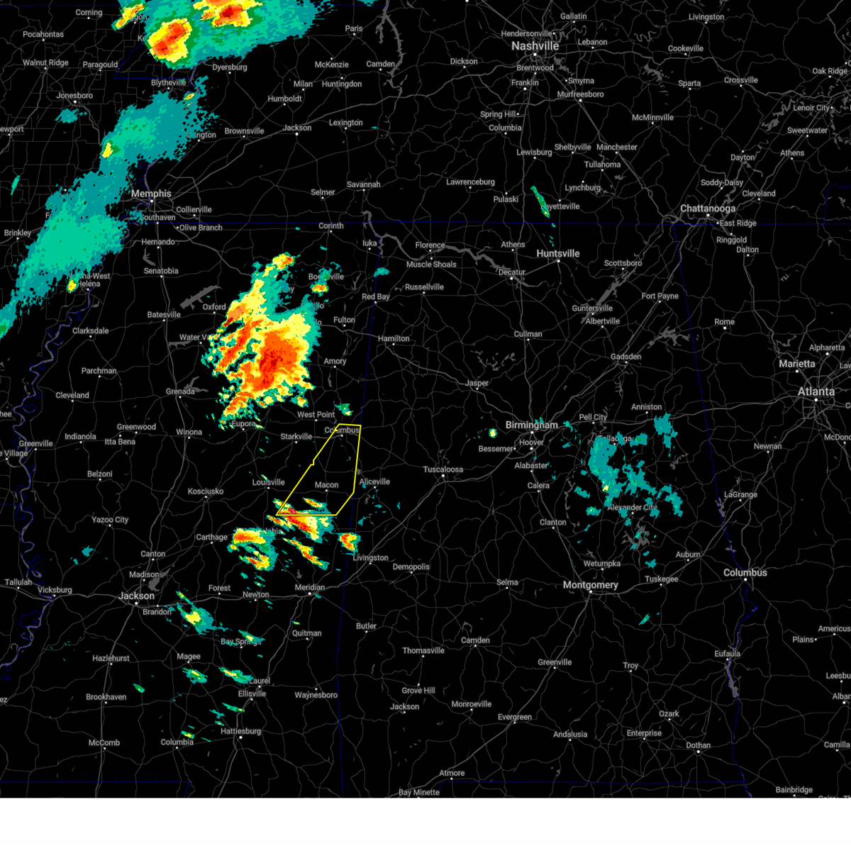 Svrjan the national weather service in jackson has issued a * severe thunderstorm warning for, noxubee county in east central mississippi, southeastern winston county in east central mississippi, lowndes county in northeastern mississippi, * until 245 am cdt. * at 144 am cdt, a severe thunderstorm was located near preston, or 16 miles northwest of de kalb, moving northeast at 65 mph (radar indicated). Hazards include 60 mph wind gusts and half dollar size hail. Hail damage to vehicles is expected. expect wind damage to roofs, siding, and trees. this severe thunderstorm will be near, gholson and mashulaville around 150 am cdt. macon around 155 am cdt. brooksville around 200 am cdt. crawford and deerbrook around 205 am cdt. bigbee valley around 215 am cdt. columbus around 220 am cdt. Steens around 230 am cdt. Svrjan the national weather service in jackson has issued a * severe thunderstorm warning for, noxubee county in east central mississippi, southeastern winston county in east central mississippi, lowndes county in northeastern mississippi, * until 245 am cdt. * at 144 am cdt, a severe thunderstorm was located near preston, or 16 miles northwest of de kalb, moving northeast at 65 mph (radar indicated). Hazards include 60 mph wind gusts and half dollar size hail. Hail damage to vehicles is expected. expect wind damage to roofs, siding, and trees. this severe thunderstorm will be near, gholson and mashulaville around 150 am cdt. macon around 155 am cdt. brooksville around 200 am cdt. crawford and deerbrook around 205 am cdt. bigbee valley around 215 am cdt. columbus around 220 am cdt. Steens around 230 am cdt.
|
| 2/15/2025 11:21 PM CST |
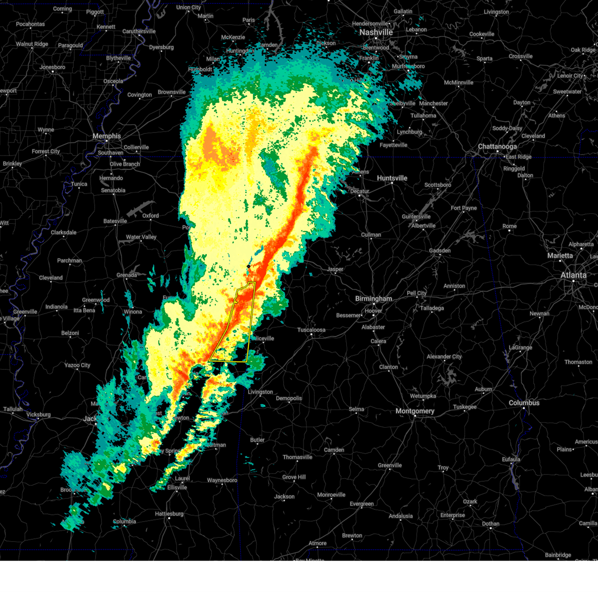 At 1121 pm cst, severe thunderstorms were located along a line extending from steens to gholson, moving east at 75 mph (radar indicated). Hazards include 70 mph wind gusts. Expect considerable tree damage. damage is likely to mobile homes, roofs, and outbuildings. these severe storms will be near, bigbee valley, prairie point, shuqualak, deerbrook, columbus, and macon around 1125 pm cst. paulette around 1130 pm cst. Cooksville around 1135 pm cst. At 1121 pm cst, severe thunderstorms were located along a line extending from steens to gholson, moving east at 75 mph (radar indicated). Hazards include 70 mph wind gusts. Expect considerable tree damage. damage is likely to mobile homes, roofs, and outbuildings. these severe storms will be near, bigbee valley, prairie point, shuqualak, deerbrook, columbus, and macon around 1125 pm cst. paulette around 1130 pm cst. Cooksville around 1135 pm cst.
|
| 2/15/2025 11:21 PM CST |
 the severe thunderstorm warning has been cancelled and is no longer in effect the severe thunderstorm warning has been cancelled and is no longer in effect
|
| 2/15/2025 10:25 PM CST |
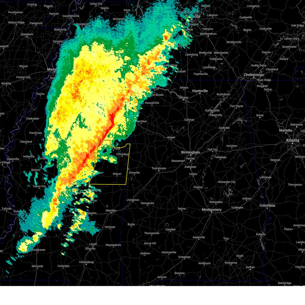 Svrjan the national weather service in jackson has issued a * severe thunderstorm warning for, noxubee county in east central mississippi, oktibbeha county in northeastern mississippi, winston county in east central mississippi, clay county in northeastern mississippi, lowndes county in northeastern mississippi, * until 1130 pm cst. * at 1025 pm cst, severe thunderstorms were located along a line extending from near trebloc to near smyrna, moving east at 70 mph (radar indicated). Hazards include 70 mph wind gusts. Expect considerable tree damage. damage is likely to mobile homes, roofs, and outbuildings. severe thunderstorms will be near, sturgis, griffith, pheba, and pala alto around 1030 pm cst. louisville, starkville, craig springs, longview, mcmillan, and west point around 1035 pm cst. muldrow and betheden around 1040 pm cst. millcreek, tibbee, sessums, oktoc, and noxapater around 1045 pm cst. waverly, kolola springs, columbus afb, and artesia around 1050 pm cst. crawford, bent oak, columbus, mashulaville, and caledonia around 1055 pm cst. steens and brooksville around 1100 pm cst. Deerbrook and macon around 1105 pm cst. Svrjan the national weather service in jackson has issued a * severe thunderstorm warning for, noxubee county in east central mississippi, oktibbeha county in northeastern mississippi, winston county in east central mississippi, clay county in northeastern mississippi, lowndes county in northeastern mississippi, * until 1130 pm cst. * at 1025 pm cst, severe thunderstorms were located along a line extending from near trebloc to near smyrna, moving east at 70 mph (radar indicated). Hazards include 70 mph wind gusts. Expect considerable tree damage. damage is likely to mobile homes, roofs, and outbuildings. severe thunderstorms will be near, sturgis, griffith, pheba, and pala alto around 1030 pm cst. louisville, starkville, craig springs, longview, mcmillan, and west point around 1035 pm cst. muldrow and betheden around 1040 pm cst. millcreek, tibbee, sessums, oktoc, and noxapater around 1045 pm cst. waverly, kolola springs, columbus afb, and artesia around 1050 pm cst. crawford, bent oak, columbus, mashulaville, and caledonia around 1055 pm cst. steens and brooksville around 1100 pm cst. Deerbrook and macon around 1105 pm cst.
|
| 1/5/2025 8:21 PM CST |
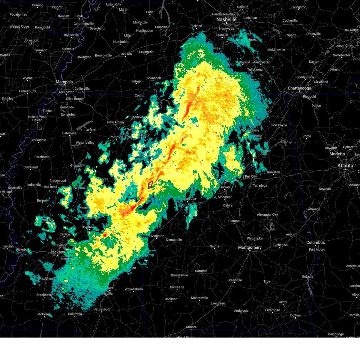 The tornadic thunderstorm which prompted the warning has moved out of the warned area. therefore, the warning will be allowed to expire. a tornado watch remains in effect until 900 pm cst for northeastern mississippi. The tornadic thunderstorm which prompted the warning has moved out of the warned area. therefore, the warning will be allowed to expire. a tornado watch remains in effect until 900 pm cst for northeastern mississippi.
|
| 1/5/2025 8:17 PM CST |
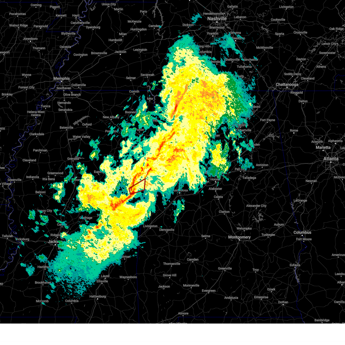 At 817 pm cst, a confirmed tornado was located near deerbrook, or 10 miles northwest of pickensville, moving northeast at 50 mph (radar confirmed tornado). Hazards include damaging tornado. Flying debris will be dangerous to those caught without shelter. mobile homes will be damaged or destroyed. damage to roofs, windows, and vehicles will occur. tree damage is likely. This tornado will be near, columbus around 825 pm cst. At 817 pm cst, a confirmed tornado was located near deerbrook, or 10 miles northwest of pickensville, moving northeast at 50 mph (radar confirmed tornado). Hazards include damaging tornado. Flying debris will be dangerous to those caught without shelter. mobile homes will be damaged or destroyed. damage to roofs, windows, and vehicles will occur. tree damage is likely. This tornado will be near, columbus around 825 pm cst.
|
| 1/5/2025 8:13 PM CST |
 At 812 pm cst, a severe thunderstorm capable of producing a tornado was located near deerbrook, or 11 miles north of macon, moving northeast at 50 mph (radar indicated rotation). Hazards include tornado. Flying debris will be dangerous to those caught without shelter. mobile homes will be damaged or destroyed. damage to roofs, windows, and vehicles will occur. tree damage is likely. This dangerous storm will be near, columbus around 825 pm cst. At 812 pm cst, a severe thunderstorm capable of producing a tornado was located near deerbrook, or 11 miles north of macon, moving northeast at 50 mph (radar indicated rotation). Hazards include tornado. Flying debris will be dangerous to those caught without shelter. mobile homes will be damaged or destroyed. damage to roofs, windows, and vehicles will occur. tree damage is likely. This dangerous storm will be near, columbus around 825 pm cst.
|
| 1/5/2025 8:11 PM CST |
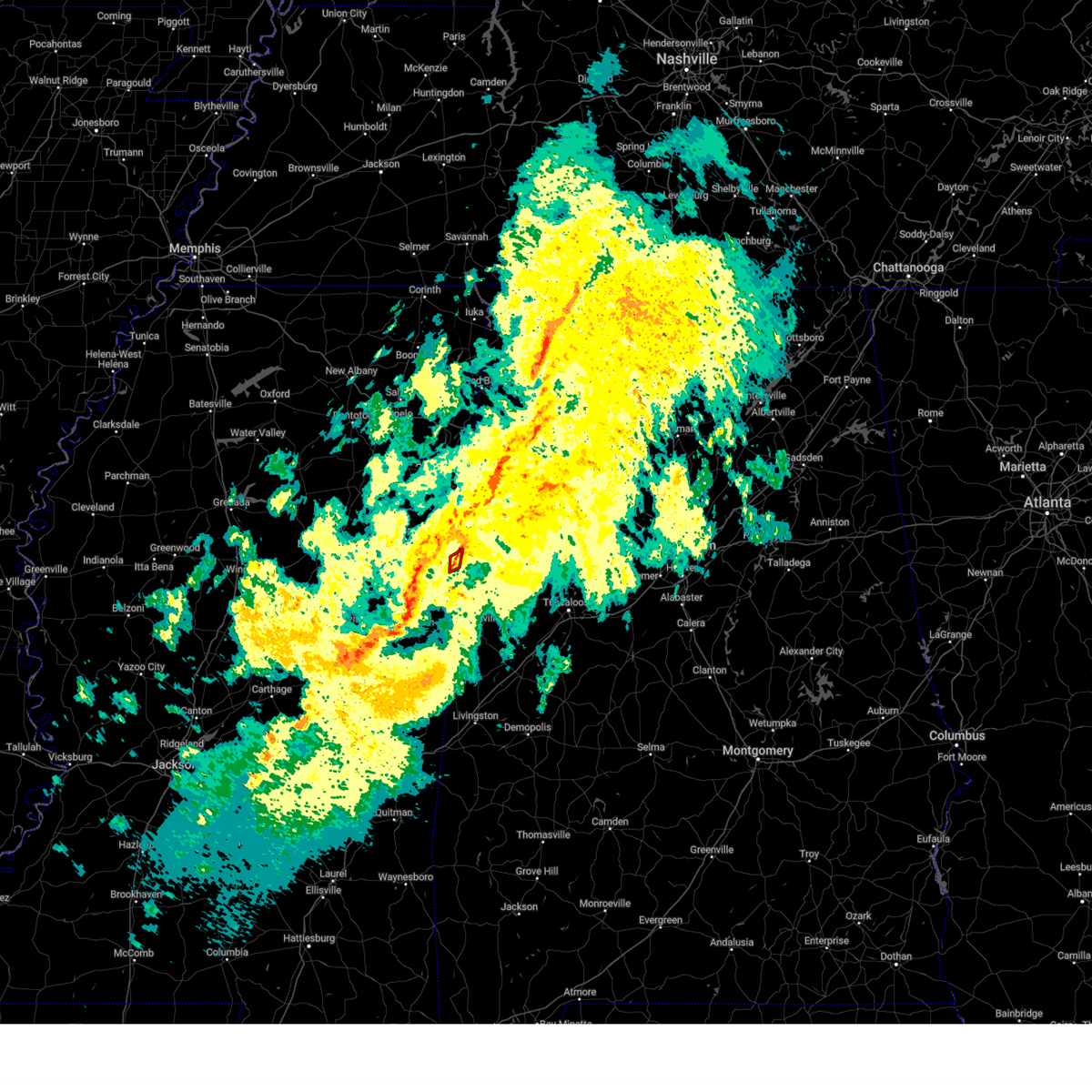 At 810 pm cst, a severe thunderstorm capable of producing a tornado was located near steens, or 8 miles east of columbus, moving northeast at 65 mph (radar indicated rotation). Hazards include tornado. Flying debris will be dangerous to those caught without shelter. mobile homes will be damaged or destroyed. damage to roofs, windows, and vehicles will occur. tree damage is likely. This tornadic thunderstorm will remain over mainly rural areas of east central lowndes county. At 810 pm cst, a severe thunderstorm capable of producing a tornado was located near steens, or 8 miles east of columbus, moving northeast at 65 mph (radar indicated rotation). Hazards include tornado. Flying debris will be dangerous to those caught without shelter. mobile homes will be damaged or destroyed. damage to roofs, windows, and vehicles will occur. tree damage is likely. This tornadic thunderstorm will remain over mainly rural areas of east central lowndes county.
|
| 1/5/2025 7:59 PM CST |
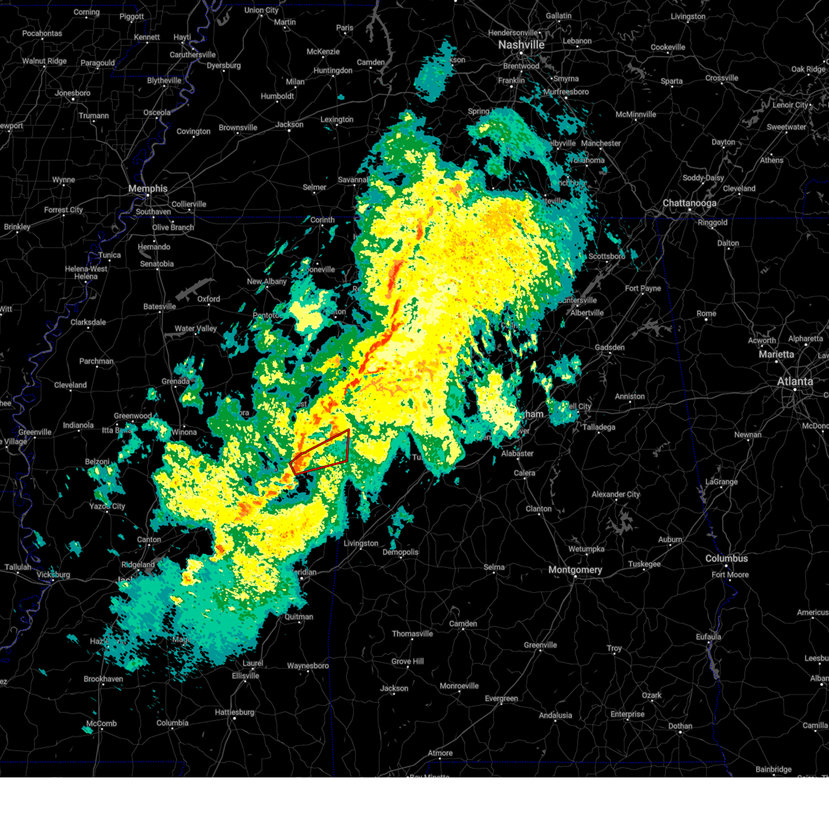 At 758 pm cst, a severe thunderstorm capable of producing a tornado was located 7 miles west of brooksville, or 10 miles northwest of macon, moving northeast at 65 mph (radar indicated rotation). Hazards include tornado. Flying debris will be dangerous to those caught without shelter. mobile homes will be damaged or destroyed. damage to roofs, windows, and vehicles will occur. tree damage is likely. this dangerous storm will be near, crawford, deerbrook, and brooksville around 805 pm cst. bigbee valley around 815 pm cst. Columbus around 820 pm cst. At 758 pm cst, a severe thunderstorm capable of producing a tornado was located 7 miles west of brooksville, or 10 miles northwest of macon, moving northeast at 65 mph (radar indicated rotation). Hazards include tornado. Flying debris will be dangerous to those caught without shelter. mobile homes will be damaged or destroyed. damage to roofs, windows, and vehicles will occur. tree damage is likely. this dangerous storm will be near, crawford, deerbrook, and brooksville around 805 pm cst. bigbee valley around 815 pm cst. Columbus around 820 pm cst.
|
| 1/5/2025 7:59 PM CST |
 the tornado warning has been cancelled and is no longer in effect the tornado warning has been cancelled and is no longer in effect
|
| 1/5/2025 7:57 PM CST |
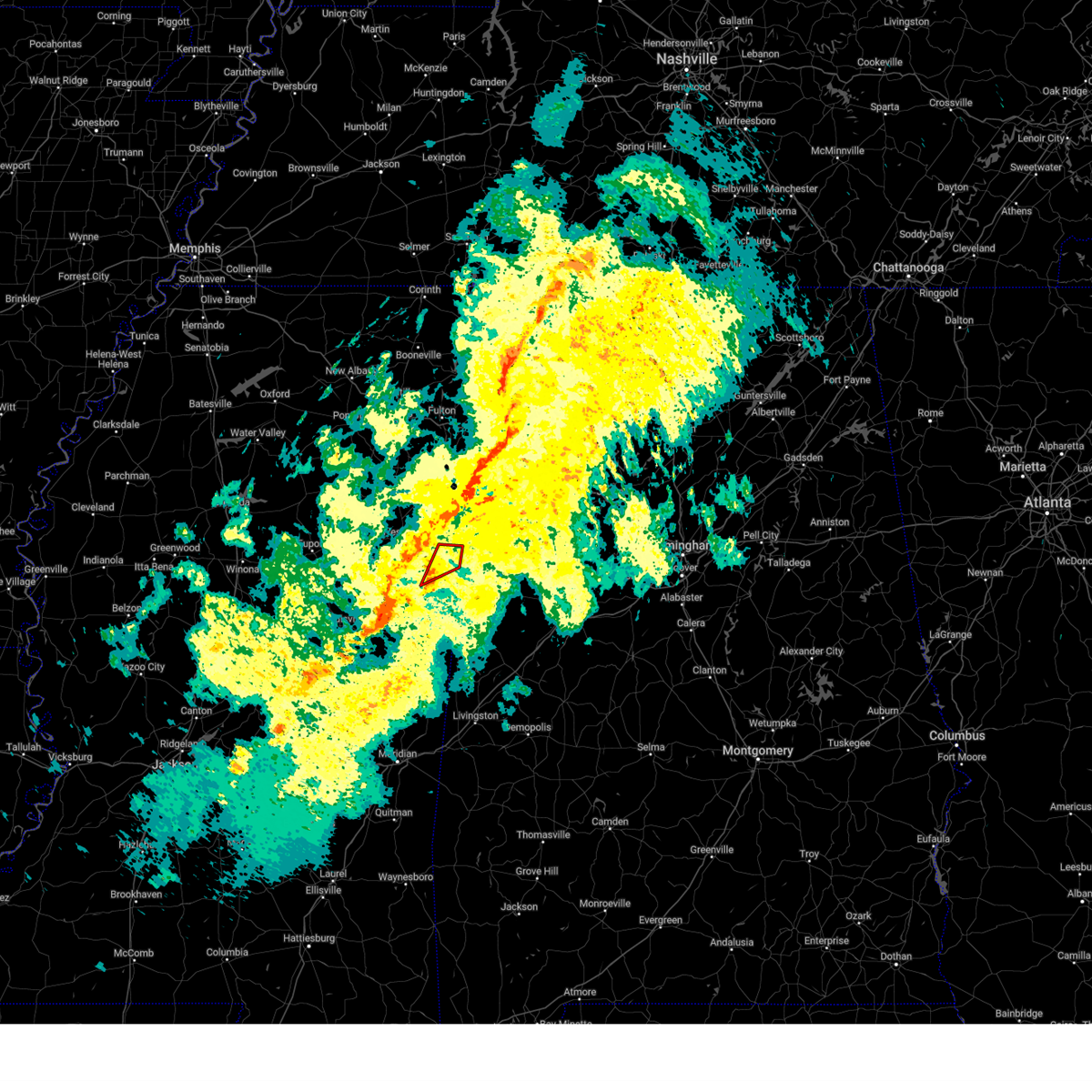 Torjan the national weather service in jackson has issued a * tornado warning for, southeastern lowndes county in northeastern mississippi, * until 830 pm cst. * at 756 pm cst, a severe thunderstorm capable of producing a tornado was located 7 miles southeast of bent oak, or 9 miles south of columbus, moving northeast at 65 mph (radar indicated rotation). Hazards include tornado. Flying debris will be dangerous to those caught without shelter. mobile homes will be damaged or destroyed. damage to roofs, windows, and vehicles will occur. tree damage is likely. this dangerous storm will be near, columbus around 800 pm cst. Steens around 805 pm cst. Torjan the national weather service in jackson has issued a * tornado warning for, southeastern lowndes county in northeastern mississippi, * until 830 pm cst. * at 756 pm cst, a severe thunderstorm capable of producing a tornado was located 7 miles southeast of bent oak, or 9 miles south of columbus, moving northeast at 65 mph (radar indicated rotation). Hazards include tornado. Flying debris will be dangerous to those caught without shelter. mobile homes will be damaged or destroyed. damage to roofs, windows, and vehicles will occur. tree damage is likely. this dangerous storm will be near, columbus around 800 pm cst. Steens around 805 pm cst.
|
| 1/5/2025 7:42 PM CST |
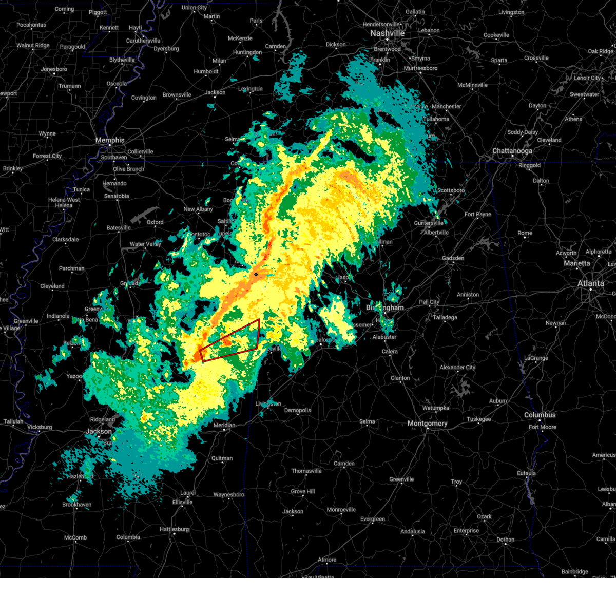 Torjan the national weather service in jackson has issued a * tornado warning for, northern noxubee county in east central mississippi, east central winston county in east central mississippi, southeastern lowndes county in northeastern mississippi, * until 845 pm cst. * at 741 pm cst, a severe thunderstorm capable of producing a tornado was located over millcreek, or 7 miles east of louisville, moving northeast at 50 mph (radar indicated rotation). Hazards include tornado. Flying debris will be dangerous to those caught without shelter. mobile homes will be damaged or destroyed. damage to roofs, windows, and vehicles will occur. tree damage is likely. this dangerous storm will be near, mashulaville around 745 pm cst. crawford and brooksville around 800 pm cst. deerbrook around 805 pm cst. bigbee valley around 815 pm cst. Columbus around 825 pm cst. Torjan the national weather service in jackson has issued a * tornado warning for, northern noxubee county in east central mississippi, east central winston county in east central mississippi, southeastern lowndes county in northeastern mississippi, * until 845 pm cst. * at 741 pm cst, a severe thunderstorm capable of producing a tornado was located over millcreek, or 7 miles east of louisville, moving northeast at 50 mph (radar indicated rotation). Hazards include tornado. Flying debris will be dangerous to those caught without shelter. mobile homes will be damaged or destroyed. damage to roofs, windows, and vehicles will occur. tree damage is likely. this dangerous storm will be near, mashulaville around 745 pm cst. crawford and brooksville around 800 pm cst. deerbrook around 805 pm cst. bigbee valley around 815 pm cst. Columbus around 825 pm cst.
|
| 12/28/2024 9:13 PM CST |
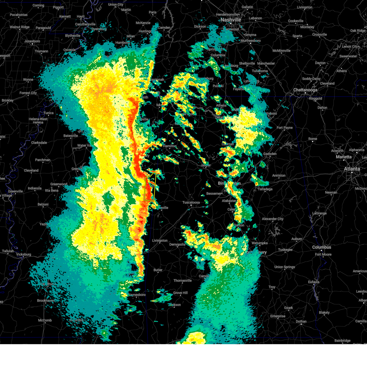 At 913 pm cst, a severe thunderstorm was located near columbus, moving northeast at 50 mph (radar indicated). Hazards include 60 mph wind gusts and nickel size hail. Expect damage to roofs, siding, and trees. This severe storm will be near, columbus and steens around 920 pm cst. At 913 pm cst, a severe thunderstorm was located near columbus, moving northeast at 50 mph (radar indicated). Hazards include 60 mph wind gusts and nickel size hail. Expect damage to roofs, siding, and trees. This severe storm will be near, columbus and steens around 920 pm cst.
|
| 12/28/2024 8:48 PM CST |
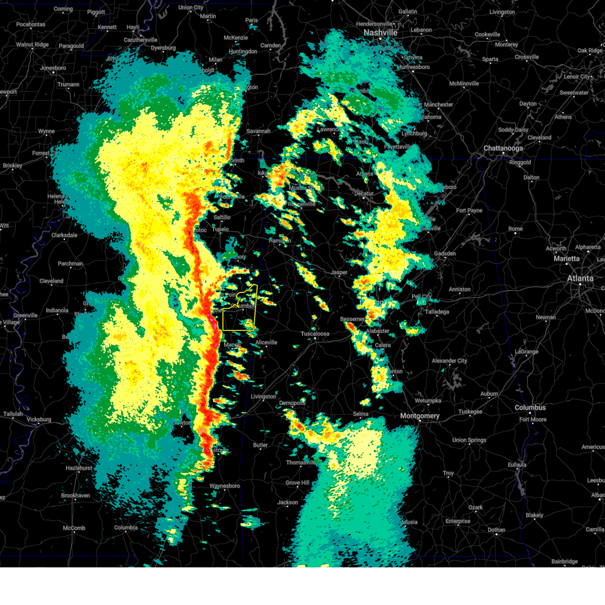 Svrjan the national weather service in jackson has issued a * severe thunderstorm warning for, lowndes county in northeastern mississippi, * until 930 pm cst. * at 848 pm cst, a severe thunderstorm was located over crawford, or 12 miles southeast of starkville, moving northeast at 50 mph (radar indicated). Hazards include 60 mph wind gusts and nickel size hail. Expect damage to roofs, siding, and trees. this severe thunderstorm will be near, bent oak and artesia around 855 pm cst. columbus around 900 pm cst. Steens around 915 pm cst. Svrjan the national weather service in jackson has issued a * severe thunderstorm warning for, lowndes county in northeastern mississippi, * until 930 pm cst. * at 848 pm cst, a severe thunderstorm was located over crawford, or 12 miles southeast of starkville, moving northeast at 50 mph (radar indicated). Hazards include 60 mph wind gusts and nickel size hail. Expect damage to roofs, siding, and trees. this severe thunderstorm will be near, bent oak and artesia around 855 pm cst. columbus around 900 pm cst. Steens around 915 pm cst.
|
| 7/15/2024 1:51 PM CDT |
 Svrjan the national weather service in jackson has issued a * severe thunderstorm warning for, southern lowndes county in northeastern mississippi, * until 230 pm cdt. * at 151 pm cdt, a severe thunderstorm was located over artesia, or 10 miles east of starkville, moving southeast at 15 mph (radar indicated). Hazards include 60 mph wind gusts and quarter size hail. Hail damage to vehicles is expected. expect wind damage to roofs, siding, and trees. This severe thunderstorm will be near, artesia and bent oak around 155 pm cdt. Svrjan the national weather service in jackson has issued a * severe thunderstorm warning for, southern lowndes county in northeastern mississippi, * until 230 pm cdt. * at 151 pm cdt, a severe thunderstorm was located over artesia, or 10 miles east of starkville, moving southeast at 15 mph (radar indicated). Hazards include 60 mph wind gusts and quarter size hail. Hail damage to vehicles is expected. expect wind damage to roofs, siding, and trees. This severe thunderstorm will be near, artesia and bent oak around 155 pm cdt.
|
| 5/25/2024 5:19 PM CDT |
 the severe thunderstorm warning has been cancelled and is no longer in effect the severe thunderstorm warning has been cancelled and is no longer in effect
|
| 5/25/2024 5:00 PM CDT |
 Svrjan the national weather service in jackson has issued a * severe thunderstorm warning for, north central noxubee county in east central mississippi, southeastern oktibbeha county in northeastern mississippi, southern lowndes county in northeastern mississippi, * until 600 pm cdt. * at 500 pm cdt, a severe thunderstorm was located over crawford, or 13 miles southeast of starkville, moving northeast at 20 mph (radar indicated). Hazards include 60 mph wind gusts and quarter size hail. Hail damage to vehicles is expected. expect wind damage to roofs, siding, and trees. this severe thunderstorm will be near, artesia around 505 pm cdt. bent oak around 510 pm cdt. Columbus around 530 pm cdt. Svrjan the national weather service in jackson has issued a * severe thunderstorm warning for, north central noxubee county in east central mississippi, southeastern oktibbeha county in northeastern mississippi, southern lowndes county in northeastern mississippi, * until 600 pm cdt. * at 500 pm cdt, a severe thunderstorm was located over crawford, or 13 miles southeast of starkville, moving northeast at 20 mph (radar indicated). Hazards include 60 mph wind gusts and quarter size hail. Hail damage to vehicles is expected. expect wind damage to roofs, siding, and trees. this severe thunderstorm will be near, artesia around 505 pm cdt. bent oak around 510 pm cdt. Columbus around 530 pm cdt.
|
| 5/9/2024 6:18 PM CDT |
 At 618 pm cdt, a severe thunderstorm was located near columbus, moving east at 25 mph (radar indicated). Hazards include 60 mph wind gusts and quarter size hail. Hail damage to vehicles is expected. expect wind damage to roofs, siding, and trees. This severe storm will be near, columbus around 625 pm cdt. At 618 pm cdt, a severe thunderstorm was located near columbus, moving east at 25 mph (radar indicated). Hazards include 60 mph wind gusts and quarter size hail. Hail damage to vehicles is expected. expect wind damage to roofs, siding, and trees. This severe storm will be near, columbus around 625 pm cdt.
|
| 5/9/2024 6:05 PM CDT |
 At 605 pm cdt, a severe thunderstorm was located near columbus, moving east at 30 mph (radar indicated). Hazards include 60 mph wind gusts and half dollar size hail. Hail damage to vehicles is expected. expect wind damage to roofs, siding, and trees. This severe storm will be near, columbus around 610 pm cdt. At 605 pm cdt, a severe thunderstorm was located near columbus, moving east at 30 mph (radar indicated). Hazards include 60 mph wind gusts and half dollar size hail. Hail damage to vehicles is expected. expect wind damage to roofs, siding, and trees. This severe storm will be near, columbus around 610 pm cdt.
|
| 5/9/2024 5:56 PM CDT |
 Svrjan the national weather service in jackson has issued a * severe thunderstorm warning for, southern lowndes county in northeastern mississippi, * until 645 pm cdt. * at 556 pm cdt, a severe thunderstorm was located over bent oak, or 8 miles southwest of columbus, moving east at 30 mph (radar indicated). Hazards include 60 mph wind gusts and quarter size hail. Hail damage to vehicles is expected. expect wind damage to roofs, siding, and trees. This severe thunderstorm will be near, columbus around 600 pm cdt. Svrjan the national weather service in jackson has issued a * severe thunderstorm warning for, southern lowndes county in northeastern mississippi, * until 645 pm cdt. * at 556 pm cdt, a severe thunderstorm was located over bent oak, or 8 miles southwest of columbus, moving east at 30 mph (radar indicated). Hazards include 60 mph wind gusts and quarter size hail. Hail damage to vehicles is expected. expect wind damage to roofs, siding, and trees. This severe thunderstorm will be near, columbus around 600 pm cdt.
|
| 3/15/2024 5:28 AM CDT |
 the severe thunderstorm warning has been cancelled and is no longer in effect the severe thunderstorm warning has been cancelled and is no longer in effect
|
| 3/15/2024 5:26 AM CDT |
 At 525 am cdt, a severe thunderstorm was located over millport, moving east at 55 mph (radar indicated). Hazards include 60 mph wind gusts and penny size hail. Expect damage to roofs, siding, and trees. Locations impacted include, columbus, caledonia, and steens. At 525 am cdt, a severe thunderstorm was located over millport, moving east at 55 mph (radar indicated). Hazards include 60 mph wind gusts and penny size hail. Expect damage to roofs, siding, and trees. Locations impacted include, columbus, caledonia, and steens.
|
| 3/15/2024 5:12 AM CDT |
 the severe thunderstorm warning has been cancelled and is no longer in effect the severe thunderstorm warning has been cancelled and is no longer in effect
|
| 3/15/2024 5:12 AM CDT |
 At 511 am cdt, a severe thunderstorm was located near steens, or near columbus, moving east at 55 mph (radar indicated). Hazards include 60 mph wind gusts and quarter size hail. Hail damage to vehicles is expected. expect wind damage to roofs, siding, and trees. This severe thunderstorm will remain over mainly rural areas of eastern lowndes county. At 511 am cdt, a severe thunderstorm was located near steens, or near columbus, moving east at 55 mph (radar indicated). Hazards include 60 mph wind gusts and quarter size hail. Hail damage to vehicles is expected. expect wind damage to roofs, siding, and trees. This severe thunderstorm will remain over mainly rural areas of eastern lowndes county.
|
| 3/15/2024 4:59 AM CDT |
 Svrjan the national weather service in jackson has issued a * severe thunderstorm warning for, southeastern clay county in northeastern mississippi, lowndes county in northeastern mississippi, * until 545 am cdt. * at 459 am cdt, a severe thunderstorm was located near bent oak, or near columbus, moving east at 55 mph (radar indicated). Hazards include 60 mph wind gusts and quarter size hail. Hail damage to vehicles is expected. expect wind damage to roofs, siding, and trees. This severe thunderstorm will be near, columbus, columbus afb, and steens around 505 am cdt. Svrjan the national weather service in jackson has issued a * severe thunderstorm warning for, southeastern clay county in northeastern mississippi, lowndes county in northeastern mississippi, * until 545 am cdt. * at 459 am cdt, a severe thunderstorm was located near bent oak, or near columbus, moving east at 55 mph (radar indicated). Hazards include 60 mph wind gusts and quarter size hail. Hail damage to vehicles is expected. expect wind damage to roofs, siding, and trees. This severe thunderstorm will be near, columbus, columbus afb, and steens around 505 am cdt.
|
| 1/12/2024 10:02 AM CST |
 At 1001 am cst, severe thunderstorms were located along a line extending from lamar county airport to near columbus, moving northeast at 60 mph (radar indicated). Hazards include 70 mph wind gusts. Expect considerable tree damage. damage is likely to mobile homes, roofs, and outbuildings. these severe storms will be near, columbus around 1005 am cst. thunderstorm damage threat, considerable hail threat, radar indicated max hail size, <. 75 in wind threat, radar indicated max wind gust, 70 mph. At 1001 am cst, severe thunderstorms were located along a line extending from lamar county airport to near columbus, moving northeast at 60 mph (radar indicated). Hazards include 70 mph wind gusts. Expect considerable tree damage. damage is likely to mobile homes, roofs, and outbuildings. these severe storms will be near, columbus around 1005 am cst. thunderstorm damage threat, considerable hail threat, radar indicated max hail size, <. 75 in wind threat, radar indicated max wind gust, 70 mph.
|
| 1/12/2024 9:47 AM CST |
 At 947 am cst, severe thunderstorms were located along a line extending from near caledonia to near bent oak, moving east at 60 mph (radar indicated). Hazards include 70 mph wind gusts. Expect considerable tree damage. damage is likely to mobile homes, roofs, and outbuildings. these severe storms will be near, columbus, caledonia, columbus afb, and steens around 950 am cst. thunderstorm damage threat, considerable hail threat, radar indicated max hail size, <. 75 in wind threat, radar indicated max wind gust, 70 mph. At 947 am cst, severe thunderstorms were located along a line extending from near caledonia to near bent oak, moving east at 60 mph (radar indicated). Hazards include 70 mph wind gusts. Expect considerable tree damage. damage is likely to mobile homes, roofs, and outbuildings. these severe storms will be near, columbus, caledonia, columbus afb, and steens around 950 am cst. thunderstorm damage threat, considerable hail threat, radar indicated max hail size, <. 75 in wind threat, radar indicated max wind gust, 70 mph.
|
| 1/12/2024 9:23 AM CST |
 At 923 am cst, severe thunderstorms were located along a line extending from west point to near craig springs, moving northeast at 60 mph (radar indicated). Hazards include 70 mph wind gusts. Expect considerable tree damage. damage is likely to mobile homes, roofs, and outbuildings. severe thunderstorms will be near, artesia, waverly, tibbee, and columbus afb around 930 am cst. columbus, kolola springs, and bent oak around 935 am cst. caledonia around 940 am cst. steens around 945 am cst. thunderstorm damage threat, considerable hail threat, radar indicated max hail size, <. 75 in wind threat, radar indicated max wind gust, 70 mph. At 923 am cst, severe thunderstorms were located along a line extending from west point to near craig springs, moving northeast at 60 mph (radar indicated). Hazards include 70 mph wind gusts. Expect considerable tree damage. damage is likely to mobile homes, roofs, and outbuildings. severe thunderstorms will be near, artesia, waverly, tibbee, and columbus afb around 930 am cst. columbus, kolola springs, and bent oak around 935 am cst. caledonia around 940 am cst. steens around 945 am cst. thunderstorm damage threat, considerable hail threat, radar indicated max hail size, <. 75 in wind threat, radar indicated max wind gust, 70 mph.
|
| 8/3/2023 4:31 PM CDT |
 At 431 pm cdt, a severe thunderstorm was located near ethelsville, or near columbus, moving east at 15 mph (radar indicated). Hazards include 60 mph wind gusts and quarter size hail. Hail damage to vehicles is expected. expect wind damage to roofs, siding, and trees. locations impacted include, columbus, crawford, artesia and bent oak. hail threat, radar indicated max hail size, 1. 00 in wind threat, radar indicated max wind gust, 60 mph. At 431 pm cdt, a severe thunderstorm was located near ethelsville, or near columbus, moving east at 15 mph (radar indicated). Hazards include 60 mph wind gusts and quarter size hail. Hail damage to vehicles is expected. expect wind damage to roofs, siding, and trees. locations impacted include, columbus, crawford, artesia and bent oak. hail threat, radar indicated max hail size, 1. 00 in wind threat, radar indicated max wind gust, 60 mph.
|
| 8/3/2023 4:07 PM CDT |
 At 406 pm cdt, a severe thunderstorm was located near columbus, moving east at 15 mph (radar indicated). Hazards include 60 mph wind gusts and quarter size hail. Hail damage to vehicles is expected. expect wind damage to roofs, siding, and trees. this severe thunderstorm will remain over mainly rural areas of lowndes county. hail threat, radar indicated max hail size, 1. 00 in wind threat, radar indicated max wind gust, 60 mph. At 406 pm cdt, a severe thunderstorm was located near columbus, moving east at 15 mph (radar indicated). Hazards include 60 mph wind gusts and quarter size hail. Hail damage to vehicles is expected. expect wind damage to roofs, siding, and trees. this severe thunderstorm will remain over mainly rural areas of lowndes county. hail threat, radar indicated max hail size, 1. 00 in wind threat, radar indicated max wind gust, 60 mph.
|
| 7/14/2023 2:41 PM CDT | At 240 pm cdt, a severe thunderstorm was located over bent oak, or 8 miles southwest of columbus, moving east at 25 mph (radar indicated). Hazards include 60 mph wind gusts and penny size hail. Expect damage to roofs, siding, and trees. this severe storm will be near, columbus around 250 pm cdt. hail threat, radar indicated max hail size, 0. 75 in wind threat, radar indicated max wind gust, 60 mph. |
| 7/14/2023 2:24 PM CDT |
 At 224 pm cdt, a severe thunderstorm was located over artesia, or 10 miles south of west point, moving east at 25 mph (radar indicated). Hazards include 60 mph wind gusts and penny size hail. Expect damage to roofs, siding, and trees. this severe thunderstorm will be near, bent oak around 235 pm cdt. columbus around 250 pm cdt. hail threat, radar indicated max hail size, 0. 75 in wind threat, radar indicated max wind gust, 60 mph. At 224 pm cdt, a severe thunderstorm was located over artesia, or 10 miles south of west point, moving east at 25 mph (radar indicated). Hazards include 60 mph wind gusts and penny size hail. Expect damage to roofs, siding, and trees. this severe thunderstorm will be near, bent oak around 235 pm cdt. columbus around 250 pm cdt. hail threat, radar indicated max hail size, 0. 75 in wind threat, radar indicated max wind gust, 60 mph.
|
| 6/18/2023 9:50 PM CDT |
 The severe thunderstorm warning for southeastern clay and lowndes counties will expire at 1000 pm cdt, the storms which prompted the warning have weakened below severe limits, and have exited the warned area. therefore, the warning will be allowed to expire. a tornado watch remains in effect until 100 am cdt for northeastern mississippi. The severe thunderstorm warning for southeastern clay and lowndes counties will expire at 1000 pm cdt, the storms which prompted the warning have weakened below severe limits, and have exited the warned area. therefore, the warning will be allowed to expire. a tornado watch remains in effect until 100 am cdt for northeastern mississippi.
|
| 6/18/2023 9:29 PM CDT |
 At 929 pm cdt, severe thunderstorms were located along a line extending from near tibbee to near bigbee valley, moving northeast at 45 mph (radar indicated). Hazards include 60 mph wind gusts and penny size hail. Expect damage to roofs, siding, and trees. these severe storms will be near, columbus and waverly around 940 pm cdt. columbus afb around 945 pm cdt. steens and kolola springs around 950 pm cdt. caledonia around 955 pm cdt. hail threat, radar indicated max hail size, 0. 75 in wind threat, radar indicated max wind gust, 60 mph. At 929 pm cdt, severe thunderstorms were located along a line extending from near tibbee to near bigbee valley, moving northeast at 45 mph (radar indicated). Hazards include 60 mph wind gusts and penny size hail. Expect damage to roofs, siding, and trees. these severe storms will be near, columbus and waverly around 940 pm cdt. columbus afb around 945 pm cdt. steens and kolola springs around 950 pm cdt. caledonia around 955 pm cdt. hail threat, radar indicated max hail size, 0. 75 in wind threat, radar indicated max wind gust, 60 mph.
|
| 6/18/2023 9:18 PM CDT |
 At 918 pm cdt, severe thunderstorms were located along a line extending from near starkville to near crawford to near brooksville, moving northeast at 45 mph (radar indicated). Hazards include 60 mph wind gusts and nickel size hail. Expect damage to roofs, siding, and trees. these severe storms will be near, deerbrook and bent oak around 925 pm cdt. prairie point around 930 pm cdt. columbus and bigbee valley around 935 pm cdt. waverly around 940 pm cdt. columbus afb around 945 pm cdt. steens and kolola springs around 950 pm cdt. caledonia around 955 pm cdt. hail threat, radar indicated max hail size, 0. 88 in wind threat, radar indicated max wind gust, 60 mph. At 918 pm cdt, severe thunderstorms were located along a line extending from near starkville to near crawford to near brooksville, moving northeast at 45 mph (radar indicated). Hazards include 60 mph wind gusts and nickel size hail. Expect damage to roofs, siding, and trees. these severe storms will be near, deerbrook and bent oak around 925 pm cdt. prairie point around 930 pm cdt. columbus and bigbee valley around 935 pm cdt. waverly around 940 pm cdt. columbus afb around 945 pm cdt. steens and kolola springs around 950 pm cdt. caledonia around 955 pm cdt. hail threat, radar indicated max hail size, 0. 88 in wind threat, radar indicated max wind gust, 60 mph.
|
| 6/18/2023 9:01 PM CDT |
 At 901 pm cdt, severe thunderstorms were located along a line extending from near longview to 6 miles southwest of oktoc to near mashulaville, moving northeast at 45 mph (radar indicated). Hazards include 60 mph wind gusts and half dollar size hail. Hail damage to vehicles is expected. expect wind damage to roofs, siding, and trees. severe thunderstorms will be near, starkville and oktoc around 910 pm cdt. macon and crawford around 915 pm cdt. brooksville and sessums around 920 pm cdt. artesia, deerbrook, muldrow and bent oak around 925 pm cdt. tibbee and prairie point around 930 pm cdt. columbus and bigbee valley around 935 pm cdt. waverly around 940 pm cdt. columbus afb around 945 pm cdt. hail threat, radar indicated max hail size, 1. 25 in wind threat, radar indicated max wind gust, 60 mph. At 901 pm cdt, severe thunderstorms were located along a line extending from near longview to 6 miles southwest of oktoc to near mashulaville, moving northeast at 45 mph (radar indicated). Hazards include 60 mph wind gusts and half dollar size hail. Hail damage to vehicles is expected. expect wind damage to roofs, siding, and trees. severe thunderstorms will be near, starkville and oktoc around 910 pm cdt. macon and crawford around 915 pm cdt. brooksville and sessums around 920 pm cdt. artesia, deerbrook, muldrow and bent oak around 925 pm cdt. tibbee and prairie point around 930 pm cdt. columbus and bigbee valley around 935 pm cdt. waverly around 940 pm cdt. columbus afb around 945 pm cdt. hail threat, radar indicated max hail size, 1. 25 in wind threat, radar indicated max wind gust, 60 mph.
|
| 6/18/2023 7:04 AM CDT |
 At 703 am cdt, severe thunderstorms were located along a line extending from near bent oak to near bigbee valley to near panola, moving northeast at 50 mph (radar indicated). Hazards include 60 mph wind gusts and penny size hail. Expect damage to roofs, siding, and trees. these severe storms will be near, columbus around 710 am cdt. hail threat, radar indicated max hail size, 0. 75 in wind threat, radar indicated max wind gust, 60 mph. At 703 am cdt, severe thunderstorms were located along a line extending from near bent oak to near bigbee valley to near panola, moving northeast at 50 mph (radar indicated). Hazards include 60 mph wind gusts and penny size hail. Expect damage to roofs, siding, and trees. these severe storms will be near, columbus around 710 am cdt. hail threat, radar indicated max hail size, 0. 75 in wind threat, radar indicated max wind gust, 60 mph.
|
| 6/18/2023 6:46 AM CDT |
 At 645 am cdt, severe thunderstorms were located along a line extending from near oktoc to near brooksville to near scooba, moving northeast at 50 mph (radar indicated). Hazards include 60 mph wind gusts and penny size hail. Expect damage to roofs, siding, and trees. these severe storms will be near, brooksville, crawford and sessums around 650 am cdt. artesia, deerbrook and cooksville around 655 am cdt. bent oak and tibbee around 700 am cdt. bigbee valley around 705 am cdt. columbus and waverly around 710 am cdt. columbus afb around 715 am cdt. steens and kolola springs around 720 am cdt. caledonia around 725 am cdt. hail threat, radar indicated max hail size, 0. 75 in wind threat, radar indicated max wind gust, 60 mph. At 645 am cdt, severe thunderstorms were located along a line extending from near oktoc to near brooksville to near scooba, moving northeast at 50 mph (radar indicated). Hazards include 60 mph wind gusts and penny size hail. Expect damage to roofs, siding, and trees. these severe storms will be near, brooksville, crawford and sessums around 650 am cdt. artesia, deerbrook and cooksville around 655 am cdt. bent oak and tibbee around 700 am cdt. bigbee valley around 705 am cdt. columbus and waverly around 710 am cdt. columbus afb around 715 am cdt. steens and kolola springs around 720 am cdt. caledonia around 725 am cdt. hail threat, radar indicated max hail size, 0. 75 in wind threat, radar indicated max wind gust, 60 mph.
|
| 6/18/2023 6:29 AM CDT |
 At 628 am cdt, severe thunderstorms were located along a line extending from betheden to near mashulaville to de kalb, moving northeast at 50 mph (radar indicated). Hazards include 60 mph wind gusts and quarter size hail. Hail damage to vehicles is expected. expect wind damage to roofs, siding, and trees. severe thunderstorms will be near, scooba and electric mills around 640 am cdt. macon and oktoc around 645 am cdt. brooksville, crawford, sessums and paulette around 650 am cdt. artesia, deerbrook and cooksville around 655 am cdt. bent oak and tibbee around 700 am cdt. bigbee valley around 705 am cdt. columbus and waverly around 710 am cdt. columbus afb around 715 am cdt. hail threat, radar indicated max hail size, 1. 00 in wind threat, radar indicated max wind gust, 60 mph. At 628 am cdt, severe thunderstorms were located along a line extending from betheden to near mashulaville to de kalb, moving northeast at 50 mph (radar indicated). Hazards include 60 mph wind gusts and quarter size hail. Hail damage to vehicles is expected. expect wind damage to roofs, siding, and trees. severe thunderstorms will be near, scooba and electric mills around 640 am cdt. macon and oktoc around 645 am cdt. brooksville, crawford, sessums and paulette around 650 am cdt. artesia, deerbrook and cooksville around 655 am cdt. bent oak and tibbee around 700 am cdt. bigbee valley around 705 am cdt. columbus and waverly around 710 am cdt. columbus afb around 715 am cdt. hail threat, radar indicated max hail size, 1. 00 in wind threat, radar indicated max wind gust, 60 mph.
|
| 6/16/2023 6:43 PM CDT |
 At 643 pm cdt, severe thunderstorms were located along a line extending from 7 miles southeast of bent oak to 7 miles southeast of columbus to near ethelsville, moving southeast at 35 mph (radar indicated). Hazards include 60 mph wind gusts and quarter size hail. Hail damage to vehicles is expected. expect wind damage to roofs, siding, and trees. these severe thunderstorms will remain over mainly rural areas of southern lowndes county. hail threat, radar indicated max hail size, 1. 00 in wind threat, radar indicated max wind gust, 60 mph. At 643 pm cdt, severe thunderstorms were located along a line extending from 7 miles southeast of bent oak to 7 miles southeast of columbus to near ethelsville, moving southeast at 35 mph (radar indicated). Hazards include 60 mph wind gusts and quarter size hail. Hail damage to vehicles is expected. expect wind damage to roofs, siding, and trees. these severe thunderstorms will remain over mainly rural areas of southern lowndes county. hail threat, radar indicated max hail size, 1. 00 in wind threat, radar indicated max wind gust, 60 mph.
|
| 6/16/2023 6:24 PM CDT |
 At 624 pm cdt, severe thunderstorms were located along a line extending from near tibbee to near waverly to kolola springs, moving southeast at 45 mph (radar indicated). Hazards include 60 mph wind gusts and quarter size hail. Hail damage to vehicles is expected. expect wind damage to roofs, siding, and trees. severe thunderstorms will be near, columbus around 630 pm cdt. steens around 635 pm cdt. hail threat, radar indicated max hail size, 1. 00 in wind threat, radar indicated max wind gust, 60 mph. At 624 pm cdt, severe thunderstorms were located along a line extending from near tibbee to near waverly to kolola springs, moving southeast at 45 mph (radar indicated). Hazards include 60 mph wind gusts and quarter size hail. Hail damage to vehicles is expected. expect wind damage to roofs, siding, and trees. severe thunderstorms will be near, columbus around 630 pm cdt. steens around 635 pm cdt. hail threat, radar indicated max hail size, 1. 00 in wind threat, radar indicated max wind gust, 60 mph.
|
| 6/16/2023 5:26 PM CDT |
 At 526 pm cdt, a severe thunderstorm was located near columbus afb, or 7 miles north of columbus, moving southeast at 30 mph (radar indicated). Hazards include 60 mph wind gusts and half dollar size hail. Hail damage to vehicles is expected. expect wind damage to roofs, siding, and trees. this severe storm will be near, steens around 535 pm cdt. other locations impacted by this severe thunderstorm include forest. hail threat, radar indicated max hail size, 1. 25 in wind threat, radar indicated max wind gust, 60 mph. At 526 pm cdt, a severe thunderstorm was located near columbus afb, or 7 miles north of columbus, moving southeast at 30 mph (radar indicated). Hazards include 60 mph wind gusts and half dollar size hail. Hail damage to vehicles is expected. expect wind damage to roofs, siding, and trees. this severe storm will be near, steens around 535 pm cdt. other locations impacted by this severe thunderstorm include forest. hail threat, radar indicated max hail size, 1. 25 in wind threat, radar indicated max wind gust, 60 mph.
|
| 6/16/2023 5:13 PM CDT |
 At 511 pm cdt, a severe thunderstorm was located over columbus, moving southeast at 20 mph. this is a destructive storm for new hope (broadcast media. at 508 pm cdt, hail up to 3.5 inches or larger than baseballs was reported in caledonia and near the columbus air force base). Hazards include three inch hail and 60 mph wind gusts. People and animals outdoors will be severely injured. expect shattered windows, extensive damage to roofs, siding, and vehicles. locations impacted include, columbus, caledonia, kolola springs, steens, waverly, columbus afb and forest. thunderstorm damage threat, destructive hail threat, observed max hail size, 3. 00 in wind threat, radar indicated max wind gust, 60 mph. At 511 pm cdt, a severe thunderstorm was located over columbus, moving southeast at 20 mph. this is a destructive storm for new hope (broadcast media. at 508 pm cdt, hail up to 3.5 inches or larger than baseballs was reported in caledonia and near the columbus air force base). Hazards include three inch hail and 60 mph wind gusts. People and animals outdoors will be severely injured. expect shattered windows, extensive damage to roofs, siding, and vehicles. locations impacted include, columbus, caledonia, kolola springs, steens, waverly, columbus afb and forest. thunderstorm damage threat, destructive hail threat, observed max hail size, 3. 00 in wind threat, radar indicated max wind gust, 60 mph.
|
| 6/16/2023 4:57 PM CDT |
 At 456 pm cdt, severe thunderstorms were located along a line extending from near steens to near waverly, moving southeast at 20 mph (broadcast media. at 445 pm cdt, golf ball size hail was reported in caledonia). Hazards include golf ball size hail and 60 mph wind gusts. People and animals outdoors will be injured. expect hail damage to roofs, siding, windows, and vehicles. expect wind damage to roofs, siding, and trees. locations impacted include, columbus, caledonia, kolola springs, steens, waverly, columbus afb and forest. thunderstorm damage threat, considerable hail threat, observed max hail size, 1. 75 in wind threat, radar indicated max wind gust, 60 mph. At 456 pm cdt, severe thunderstorms were located along a line extending from near steens to near waverly, moving southeast at 20 mph (broadcast media. at 445 pm cdt, golf ball size hail was reported in caledonia). Hazards include golf ball size hail and 60 mph wind gusts. People and animals outdoors will be injured. expect hail damage to roofs, siding, windows, and vehicles. expect wind damage to roofs, siding, and trees. locations impacted include, columbus, caledonia, kolola springs, steens, waverly, columbus afb and forest. thunderstorm damage threat, considerable hail threat, observed max hail size, 1. 75 in wind threat, radar indicated max wind gust, 60 mph.
|
| 6/16/2023 4:52 PM CDT |
 At 452 pm cdt, severe thunderstorms were located along a line extending from near caledonia to near waverly, moving east at 20 mph (broadcast media). Hazards include golf ball size hail. People and animals outdoors will be injured. expect damage to roofs, siding, windows, and vehicles. severe thunderstorms will be near, caledonia around 455 pm cdt. columbus around 505 pm cdt. steens around 515 pm cdt. other locations impacted by these severe thunderstorms include forest. thunderstorm damage threat, considerable hail threat, observed max hail size, 1. 75 in wind threat, radar indicated max wind gust, <50 mph. At 452 pm cdt, severe thunderstorms were located along a line extending from near caledonia to near waverly, moving east at 20 mph (broadcast media). Hazards include golf ball size hail. People and animals outdoors will be injured. expect damage to roofs, siding, windows, and vehicles. severe thunderstorms will be near, caledonia around 455 pm cdt. columbus around 505 pm cdt. steens around 515 pm cdt. other locations impacted by these severe thunderstorms include forest. thunderstorm damage threat, considerable hail threat, observed max hail size, 1. 75 in wind threat, radar indicated max wind gust, <50 mph.
|
| 6/14/2023 2:50 AM CDT |
 At 249 am cdt, a severe thunderstorm was located over columbus, moving east at 30 mph (radar indicated). Hazards include 60 mph wind gusts and quarter size hail. Hail damage to vehicles is expected. expect wind damage to roofs, siding, and trees. this severe storm will be near, steens around 300 am cdt. hail threat, radar indicated max hail size, 1. 00 in wind threat, radar indicated max wind gust, 60 mph. At 249 am cdt, a severe thunderstorm was located over columbus, moving east at 30 mph (radar indicated). Hazards include 60 mph wind gusts and quarter size hail. Hail damage to vehicles is expected. expect wind damage to roofs, siding, and trees. this severe storm will be near, steens around 300 am cdt. hail threat, radar indicated max hail size, 1. 00 in wind threat, radar indicated max wind gust, 60 mph.
|
| 6/14/2023 2:39 AM CDT |
 At 239 am cdt, a severe thunderstorm was located over waverly, or 8 miles west of columbus, moving east at 35 mph (radar indicated). Hazards include 60 mph wind gusts and quarter size hail. Hail damage to vehicles is expected. expect wind damage to roofs, siding, and trees. this severe storm will be near, columbus and columbus afb around 250 am cdt. steens around 300 am cdt. hail threat, radar indicated max hail size, 1. 00 in wind threat, radar indicated max wind gust, 60 mph. At 239 am cdt, a severe thunderstorm was located over waverly, or 8 miles west of columbus, moving east at 35 mph (radar indicated). Hazards include 60 mph wind gusts and quarter size hail. Hail damage to vehicles is expected. expect wind damage to roofs, siding, and trees. this severe storm will be near, columbus and columbus afb around 250 am cdt. steens around 300 am cdt. hail threat, radar indicated max hail size, 1. 00 in wind threat, radar indicated max wind gust, 60 mph.
|
| 6/14/2023 2:29 AM CDT |
 At 228 am cdt, a severe thunderstorm was located over tibbee, or near west point, moving east at 35 mph (radar indicated). Hazards include 60 mph wind gusts and quarter size hail. Hail damage to vehicles is expected. expect wind damage to roofs, siding, and trees. this severe thunderstorm will be near, bent oak around 235 am cdt. waverly around 245 am cdt. columbus around 250 am cdt. columbus afb around 255 am cdt. steens around 300 am cdt. hail threat, radar indicated max hail size, 1. 00 in wind threat, radar indicated max wind gust, 60 mph. At 228 am cdt, a severe thunderstorm was located over tibbee, or near west point, moving east at 35 mph (radar indicated). Hazards include 60 mph wind gusts and quarter size hail. Hail damage to vehicles is expected. expect wind damage to roofs, siding, and trees. this severe thunderstorm will be near, bent oak around 235 am cdt. waverly around 245 am cdt. columbus around 250 am cdt. columbus afb around 255 am cdt. steens around 300 am cdt. hail threat, radar indicated max hail size, 1. 00 in wind threat, radar indicated max wind gust, 60 mph.
|
| 6/11/2023 10:51 PM CDT |
 At 1051 pm cdt, a severe thunderstorm was located near bigbee valley, or near pickensville, moving southeast at 50 mph (radar indicated). Hazards include 60 mph wind gusts and nickel size hail. Expect damage to roofs, siding, and trees. this severe thunderstorm will remain over mainly rural areas of northeastern noxubee and southern lowndes counties. hail threat, radar indicated max hail size, 0. 88 in wind threat, radar indicated max wind gust, 60 mph. At 1051 pm cdt, a severe thunderstorm was located near bigbee valley, or near pickensville, moving southeast at 50 mph (radar indicated). Hazards include 60 mph wind gusts and nickel size hail. Expect damage to roofs, siding, and trees. this severe thunderstorm will remain over mainly rural areas of northeastern noxubee and southern lowndes counties. hail threat, radar indicated max hail size, 0. 88 in wind threat, radar indicated max wind gust, 60 mph.
|
| 6/11/2023 10:38 PM CDT |
 At 1038 pm cdt, a severe thunderstorm was located near deerbrook, or 13 miles southwest of columbus, moving southeast at 50 mph (radar indicated). Hazards include 60 mph wind gusts and quarter size hail. Hail damage to vehicles is expected. expect wind damage to roofs, siding, and trees. this severe storm will be near, bigbee valley around 1050 pm cdt. prairie point around 1055 pm cdt. Other locations impacted by this severe thunderstorm include forest. At 1038 pm cdt, a severe thunderstorm was located near deerbrook, or 13 miles southwest of columbus, moving southeast at 50 mph (radar indicated). Hazards include 60 mph wind gusts and quarter size hail. Hail damage to vehicles is expected. expect wind damage to roofs, siding, and trees. this severe storm will be near, bigbee valley around 1050 pm cdt. prairie point around 1055 pm cdt. Other locations impacted by this severe thunderstorm include forest.
|
| 6/11/2023 10:17 PM CDT |
 At 1017 pm cdt, a severe thunderstorm was located over muldrow, or 7 miles south of west point, moving southeast at 50 mph (radar indicated). Hazards include 60 mph wind gusts and quarter size hail. Hail damage to vehicles is expected. expect wind damage to roofs, siding, and trees. this severe thunderstorm will be near, artesia and sessums around 1025 pm cdt. bent oak around 1030 pm cdt. crawford around 1035 pm cdt. brooksville around 1040 pm cdt. deerbrook around 1045 pm cdt. bigbee valley around 1050 pm cdt. prairie point around 1055 pm cdt. other locations impacted by this severe thunderstorm include forest. hail threat, radar indicated max hail size, 1. 00 in wind threat, radar indicated max wind gust, 60 mph. At 1017 pm cdt, a severe thunderstorm was located over muldrow, or 7 miles south of west point, moving southeast at 50 mph (radar indicated). Hazards include 60 mph wind gusts and quarter size hail. Hail damage to vehicles is expected. expect wind damage to roofs, siding, and trees. this severe thunderstorm will be near, artesia and sessums around 1025 pm cdt. bent oak around 1030 pm cdt. crawford around 1035 pm cdt. brooksville around 1040 pm cdt. deerbrook around 1045 pm cdt. bigbee valley around 1050 pm cdt. prairie point around 1055 pm cdt. other locations impacted by this severe thunderstorm include forest. hail threat, radar indicated max hail size, 1. 00 in wind threat, radar indicated max wind gust, 60 mph.
|
| 5/11/2023 5:12 PM CDT |
 The severe thunderstorm warning for southeastern clay and lowndes counties will expire at 515 pm cdt, the storms which prompted the warning are moving out of the area. therefore, the warning will be allowed to expire. however gusty winds are still possible with these thunderstorms. to report severe weather, contact your nearest law enforcement agency. they will relay your report to the national weather service jackson. The severe thunderstorm warning for southeastern clay and lowndes counties will expire at 515 pm cdt, the storms which prompted the warning are moving out of the area. therefore, the warning will be allowed to expire. however gusty winds are still possible with these thunderstorms. to report severe weather, contact your nearest law enforcement agency. they will relay your report to the national weather service jackson.
|
| 5/11/2023 4:57 PM CDT |
 At 456 pm cdt, severe thunderstorms were located along a line extending from 6 miles northeast of west point to near waverly to near deerbrook, moving northeast at 40 mph (radar indicated). Hazards include 60 mph wind gusts. Expect damage to roofs, siding, and trees. these severe storms will be near, columbus around 500 pm cdt. columbus afb around 505 pm cdt. kolola springs around 510 pm cdt. steens around 515 pm cdt. caledonia around 520 pm cdt. hail threat, radar indicated max hail size, <. 75 in wind threat, radar indicated max wind gust, 60 mph. At 456 pm cdt, severe thunderstorms were located along a line extending from 6 miles northeast of west point to near waverly to near deerbrook, moving northeast at 40 mph (radar indicated). Hazards include 60 mph wind gusts. Expect damage to roofs, siding, and trees. these severe storms will be near, columbus around 500 pm cdt. columbus afb around 505 pm cdt. kolola springs around 510 pm cdt. steens around 515 pm cdt. caledonia around 520 pm cdt. hail threat, radar indicated max hail size, <. 75 in wind threat, radar indicated max wind gust, 60 mph.
|
| 5/11/2023 4:47 PM CDT |
 At 446 pm cdt, severe thunderstorms were located along a line extending from near trebloc to near bent oak to near shuqualak, moving northeast at 40 mph (radar indicated). Hazards include 60 mph wind gusts. Expect damage to roofs, siding, and trees. these severe storms will be near, bent oak around 450 pm cdt. waverly around 455 pm cdt. columbus and cooksville around 500 pm cdt. columbus afb and prairie point around 505 pm cdt. steens and kolola springs around 510 pm cdt. caledonia around 515 pm cdt. hail threat, radar indicated max hail size, <. 75 in wind threat, radar indicated max wind gust, 60 mph. At 446 pm cdt, severe thunderstorms were located along a line extending from near trebloc to near bent oak to near shuqualak, moving northeast at 40 mph (radar indicated). Hazards include 60 mph wind gusts. Expect damage to roofs, siding, and trees. these severe storms will be near, bent oak around 450 pm cdt. waverly around 455 pm cdt. columbus and cooksville around 500 pm cdt. columbus afb and prairie point around 505 pm cdt. steens and kolola springs around 510 pm cdt. caledonia around 515 pm cdt. hail threat, radar indicated max hail size, <. 75 in wind threat, radar indicated max wind gust, 60 mph.
|
| 5/11/2023 4:33 PM CDT |
 At 432 pm cdt, severe thunderstorms were located along a line extending from near montpelier to sessums to near gholson, moving east at 30 mph (radar indicated). Hazards include 60 mph wind gusts. Expect damage to roofs, siding, and trees. these severe storms will be near, artesia around 440 pm cdt. shuqualak, tibbee and pala alto around 445 pm cdt. bent oak around 455 pm cdt. paulette and waverly around 500 pm cdt. columbus and cooksville around 505 pm cdt. columbus afb around 510 pm cdt. steens around 520 pm cdt. hail threat, radar indicated max hail size, <. 75 in wind threat, observed max wind gust, 60 mph. At 432 pm cdt, severe thunderstorms were located along a line extending from near montpelier to sessums to near gholson, moving east at 30 mph (radar indicated). Hazards include 60 mph wind gusts. Expect damage to roofs, siding, and trees. these severe storms will be near, artesia around 440 pm cdt. shuqualak, tibbee and pala alto around 445 pm cdt. bent oak around 455 pm cdt. paulette and waverly around 500 pm cdt. columbus and cooksville around 505 pm cdt. columbus afb around 510 pm cdt. steens around 520 pm cdt. hail threat, radar indicated max hail size, <. 75 in wind threat, observed max wind gust, 60 mph.
|
| 5/11/2023 3:52 PM CDT |
 At 352 pm cdt, severe thunderstorms were located along a line extending from near slate springs to near ackerman to stallo, moving northeast at 45 mph (radar indicated). Hazards include 60 mph wind gusts. Expect damage to roofs, siding, and trees. severe thunderstorms will be near, sturgis around 400 pm cdt. craig springs and betheden around 405 pm cdt. longview around 410 pm cdt. starkville around 415 pm cdt. mashulaville and oktoc around 420 pm cdt. sessums around 425 pm cdt. artesia around 430 pm cdt. macon, brooksville and tibbee around 435 pm cdt. hail threat, radar indicated max hail size, <. 75 in wind threat, observed max wind gust, 60 mph. At 352 pm cdt, severe thunderstorms were located along a line extending from near slate springs to near ackerman to stallo, moving northeast at 45 mph (radar indicated). Hazards include 60 mph wind gusts. Expect damage to roofs, siding, and trees. severe thunderstorms will be near, sturgis around 400 pm cdt. craig springs and betheden around 405 pm cdt. longview around 410 pm cdt. starkville around 415 pm cdt. mashulaville and oktoc around 420 pm cdt. sessums around 425 pm cdt. artesia around 430 pm cdt. macon, brooksville and tibbee around 435 pm cdt. hail threat, radar indicated max hail size, <. 75 in wind threat, observed max wind gust, 60 mph.
|
| 4/27/2023 7:27 PM CDT |
 At 726 pm cdt, a severe thunderstorm was located near columbus, moving east at 30 mph (radar indicated). Hazards include ping pong ball size hail and 60 mph wind gusts. People and animals outdoors will be injured. expect hail damage to roofs, siding, windows, and vehicles. expect wind damage to roofs, siding, and trees. this severe thunderstorm will remain over mainly rural areas of southeastern lowndes county. hail threat, radar indicated max hail size, 1. 50 in wind threat, radar indicated max wind gust, 60 mph. At 726 pm cdt, a severe thunderstorm was located near columbus, moving east at 30 mph (radar indicated). Hazards include ping pong ball size hail and 60 mph wind gusts. People and animals outdoors will be injured. expect hail damage to roofs, siding, windows, and vehicles. expect wind damage to roofs, siding, and trees. this severe thunderstorm will remain over mainly rural areas of southeastern lowndes county. hail threat, radar indicated max hail size, 1. 50 in wind threat, radar indicated max wind gust, 60 mph.
|
| 4/27/2023 7:02 PM CDT |
 At 702 pm cdt, a severe thunderstorm was located near waverly, or 8 miles west of columbus, moving east at 30 mph (radar indicated). Hazards include ping pong ball size hail and 60 mph wind gusts. People and animals outdoors will be injured. expect hail damage to roofs, siding, windows, and vehicles. expect wind damage to roofs, siding, and trees. this severe storm will be near, columbus around 715 pm cdt. steens around 725 pm cdt. hail threat, radar indicated max hail size, 1. 50 in wind threat, radar indicated max wind gust, 60 mph. At 702 pm cdt, a severe thunderstorm was located near waverly, or 8 miles west of columbus, moving east at 30 mph (radar indicated). Hazards include ping pong ball size hail and 60 mph wind gusts. People and animals outdoors will be injured. expect hail damage to roofs, siding, windows, and vehicles. expect wind damage to roofs, siding, and trees. this severe storm will be near, columbus around 715 pm cdt. steens around 725 pm cdt. hail threat, radar indicated max hail size, 1. 50 in wind threat, radar indicated max wind gust, 60 mph.
|
| 4/27/2023 6:45 PM CDT |
 At 645 pm cdt, a severe thunderstorm was located over muldrow, or near west point, moving east at 35 mph (radar indicated). Hazards include ping pong ball size hail and 60 mph wind gusts. People and animals outdoors will be injured. expect hail damage to roofs, siding, windows, and vehicles. expect wind damage to roofs, siding, and trees. this severe thunderstorm will be near, tibbee around 650 pm cdt. artesia around 655 pm cdt. waverly and bent oak around 705 pm cdt. columbus and columbus afb around 715 pm cdt. steens around 725 pm cdt. hail threat, radar indicated max hail size, 1. 50 in wind threat, radar indicated max wind gust, 60 mph. At 645 pm cdt, a severe thunderstorm was located over muldrow, or near west point, moving east at 35 mph (radar indicated). Hazards include ping pong ball size hail and 60 mph wind gusts. People and animals outdoors will be injured. expect hail damage to roofs, siding, windows, and vehicles. expect wind damage to roofs, siding, and trees. this severe thunderstorm will be near, tibbee around 650 pm cdt. artesia around 655 pm cdt. waverly and bent oak around 705 pm cdt. columbus and columbus afb around 715 pm cdt. steens around 725 pm cdt. hail threat, radar indicated max hail size, 1. 50 in wind threat, radar indicated max wind gust, 60 mph.
|
| 4/27/2023 6:39 PM CDT |
 At 639 pm cdt, a severe thunderstorm was located near millport, moving east at 25 mph (radar indicated). Hazards include golf ball size hail and 60 mph wind gusts. People and animals outdoors will be injured. expect hail damage to roofs, siding, windows, and vehicles. expect wind damage to roofs, siding, and trees. locations impacted include, columbus and steens. thunderstorm damage threat, considerable hail threat, radar indicated max hail size, 1. 75 in wind threat, radar indicated max wind gust, 60 mph. At 639 pm cdt, a severe thunderstorm was located near millport, moving east at 25 mph (radar indicated). Hazards include golf ball size hail and 60 mph wind gusts. People and animals outdoors will be injured. expect hail damage to roofs, siding, windows, and vehicles. expect wind damage to roofs, siding, and trees. locations impacted include, columbus and steens. thunderstorm damage threat, considerable hail threat, radar indicated max hail size, 1. 75 in wind threat, radar indicated max wind gust, 60 mph.
|
| 4/27/2023 6:22 PM CDT |
 At 621 pm cdt, a severe thunderstorm was located near steens, or near columbus, moving east at 25 mph (radar indicated). Hazards include golf ball size hail and 60 mph wind gusts. People and animals outdoors will be injured. expect hail damage to roofs, siding, windows, and vehicles. expect wind damage to roofs, siding, and trees. this severe thunderstorm will remain over mainly rural areas of east central lowndes county. thunderstorm damage threat, considerable hail threat, radar indicated max hail size, 1. 75 in wind threat, radar indicated max wind gust, 60 mph. At 621 pm cdt, a severe thunderstorm was located near steens, or near columbus, moving east at 25 mph (radar indicated). Hazards include golf ball size hail and 60 mph wind gusts. People and animals outdoors will be injured. expect hail damage to roofs, siding, windows, and vehicles. expect wind damage to roofs, siding, and trees. this severe thunderstorm will remain over mainly rural areas of east central lowndes county. thunderstorm damage threat, considerable hail threat, radar indicated max hail size, 1. 75 in wind threat, radar indicated max wind gust, 60 mph.
|
| 4/27/2023 6:06 PM CDT |
 At 606 pm cdt, a severe thunderstorm was located near columbus, moving east at 25 mph (radar indicated). Hazards include golf ball size hail and 60 mph wind gusts. People and animals outdoors will be injured. expect hail damage to roofs, siding, windows, and vehicles. expect wind damage to roofs, siding, and trees. this severe storm will be near, columbus around 610 pm cdt. steens around 620 pm cdt. thunderstorm damage threat, considerable hail threat, radar indicated max hail size, 1. 75 in wind threat, radar indicated max wind gust, 60 mph. At 606 pm cdt, a severe thunderstorm was located near columbus, moving east at 25 mph (radar indicated). Hazards include golf ball size hail and 60 mph wind gusts. People and animals outdoors will be injured. expect hail damage to roofs, siding, windows, and vehicles. expect wind damage to roofs, siding, and trees. this severe storm will be near, columbus around 610 pm cdt. steens around 620 pm cdt. thunderstorm damage threat, considerable hail threat, radar indicated max hail size, 1. 75 in wind threat, radar indicated max wind gust, 60 mph.
|
| 4/27/2023 5:43 PM CDT |
 At 543 pm cdt, a severe thunderstorm was located over tibbee, or near west point, moving east at 25 mph (radar indicated). Hazards include golf ball size hail and 60 mph wind gusts. People and animals outdoors will be injured. expect hail damage to roofs, siding, windows, and vehicles. expect wind damage to roofs, siding, and trees. this severe thunderstorm will be near, waverly around 555 pm cdt. columbus around 605 pm cdt. columbus afb around 610 pm cdt. Steens around 620 pm cdt. At 543 pm cdt, a severe thunderstorm was located over tibbee, or near west point, moving east at 25 mph (radar indicated). Hazards include golf ball size hail and 60 mph wind gusts. People and animals outdoors will be injured. expect hail damage to roofs, siding, windows, and vehicles. expect wind damage to roofs, siding, and trees. this severe thunderstorm will be near, waverly around 555 pm cdt. columbus around 605 pm cdt. columbus afb around 610 pm cdt. Steens around 620 pm cdt.
|
| 3/3/2023 10:01 AM CST |
 At 1000 am cst, severe thunderstorms were located along a line extending from kolola springs to deerbrook to near bluff springs, moving east at 40 mph (radar indicated). Hazards include 60 mph wind gusts. Expect damage to roofs, siding, and trees. severe thunderstorms will be near, columbus afb, caledonia, deerbrook, kolola springs and steens around 1005 am cst. prairie point around 1010 am cst. bigbee valley around 1015 am cst. electric mills and porterville around 1025 am cst. other locations impacted by these severe thunderstorms include shuqualak and scooba. hail threat, radar indicated max hail size, <. 75 in wind threat, observed max wind gust, 60 mph. At 1000 am cst, severe thunderstorms were located along a line extending from kolola springs to deerbrook to near bluff springs, moving east at 40 mph (radar indicated). Hazards include 60 mph wind gusts. Expect damage to roofs, siding, and trees. severe thunderstorms will be near, columbus afb, caledonia, deerbrook, kolola springs and steens around 1005 am cst. prairie point around 1010 am cst. bigbee valley around 1015 am cst. electric mills and porterville around 1025 am cst. other locations impacted by these severe thunderstorms include shuqualak and scooba. hail threat, radar indicated max hail size, <. 75 in wind threat, observed max wind gust, 60 mph.
|
| 1/3/2023 11:20 PM CST |
 The severe thunderstorm warning for northern noxubee and southern lowndes counties will expire at 1130 pm cst, the storm which prompted the warning has weakened below severe limits, and no longer poses an immediate threat to life or property. therefore, the warning will be allowed to expire. a severe thunderstorm watch remains in effect until midnight cst for northeastern and east central mississippi. to report severe weather, contact your nearest law enforcement agency. they will relay your report to the national weather service jackson. The severe thunderstorm warning for northern noxubee and southern lowndes counties will expire at 1130 pm cst, the storm which prompted the warning has weakened below severe limits, and no longer poses an immediate threat to life or property. therefore, the warning will be allowed to expire. a severe thunderstorm watch remains in effect until midnight cst for northeastern and east central mississippi. to report severe weather, contact your nearest law enforcement agency. they will relay your report to the national weather service jackson.
|
| 1/3/2023 11:06 PM CST |
 The severe thunderstorm warning for northeastern lowndes county will expire at 1115 pm cst, the storm which prompted the warning has moved out of the area. therefore, the warning will be allowed to expire. a severe thunderstorm watch remains in effect until midnight cst for northeastern mississippi. to report severe weather, contact your nearest law enforcement agency. they will relay your report to the national weather service jackson. remember, a severe thunderstorm warning still remains in effect for southern lowndes county until 1130 pm. The severe thunderstorm warning for northeastern lowndes county will expire at 1115 pm cst, the storm which prompted the warning has moved out of the area. therefore, the warning will be allowed to expire. a severe thunderstorm watch remains in effect until midnight cst for northeastern mississippi. to report severe weather, contact your nearest law enforcement agency. they will relay your report to the national weather service jackson. remember, a severe thunderstorm warning still remains in effect for southern lowndes county until 1130 pm.
|
| 1/3/2023 10:57 PM CST |
 At 1057 pm cst, a severe thunderstorm was located over macon, or 16 miles west of pickensville, moving northeast at 70 mph (radar indicated). Hazards include 60 mph wind gusts and penny size hail. expect damage to roofs, siding, and trees At 1057 pm cst, a severe thunderstorm was located over macon, or 16 miles west of pickensville, moving northeast at 70 mph (radar indicated). Hazards include 60 mph wind gusts and penny size hail. expect damage to roofs, siding, and trees
|
| 1/3/2023 10:44 PM CST |
 At 1044 pm cst, a severe thunderstorm was located over columbus afb, moving northeast at 45 mph (radar indicated). Hazards include 60 mph wind gusts and half dollar size hail. Hail damage to vehicles is expected. expect wind damage to roofs, siding, and trees. this severe storm will be near, caledonia around 1055 pm cst. hail threat, radar indicated max hail size, 1. 25 in wind threat, radar indicated max wind gust, 60 mph. At 1044 pm cst, a severe thunderstorm was located over columbus afb, moving northeast at 45 mph (radar indicated). Hazards include 60 mph wind gusts and half dollar size hail. Hail damage to vehicles is expected. expect wind damage to roofs, siding, and trees. this severe storm will be near, caledonia around 1055 pm cst. hail threat, radar indicated max hail size, 1. 25 in wind threat, radar indicated max wind gust, 60 mph.
|
| 1/3/2023 10:28 PM CST |
 At 1028 pm cst, a severe thunderstorm was located near the golden triangle regional airport, or 8 miles southeast of west point, moving northeast at 35 mph (radar indicated). Hazards include 60 mph wind gusts and half dollar size hail. Hail damage to vehicles is expected. expect wind damage to roofs, siding, and trees. this severe storm will be near, columbus and waverly around 1040 pm cst. columbus afb around 1045 pm cst. kolola springs around 1050 pm cst. steens around 1055 pm cst. caledonia around 1100 pm cst. other locations impacted by this severe thunderstorm include artesia. hail threat, radar indicated max hail size, 1. 25 in wind threat, radar indicated max wind gust, 60 mph. At 1028 pm cst, a severe thunderstorm was located near the golden triangle regional airport, or 8 miles southeast of west point, moving northeast at 35 mph (radar indicated). Hazards include 60 mph wind gusts and half dollar size hail. Hail damage to vehicles is expected. expect wind damage to roofs, siding, and trees. this severe storm will be near, columbus and waverly around 1040 pm cst. columbus afb around 1045 pm cst. kolola springs around 1050 pm cst. steens around 1055 pm cst. caledonia around 1100 pm cst. other locations impacted by this severe thunderstorm include artesia. hail threat, radar indicated max hail size, 1. 25 in wind threat, radar indicated max wind gust, 60 mph.
|
| 1/3/2023 10:19 PM CST |
 At 1019 pm cst, a severe thunderstorm was located near tibbee, or 8 miles south of west point, moving northeast at 40 mph (radar indicated). Hazards include 60 mph wind gusts and quarter size hail. Hail damage to vehicles is expected. expect wind damage to roofs, siding, and trees. this severe thunderstorm will be near, bent oak around 1025 pm cst. waverly around 1035 pm cst. columbus afb around 1040 pm cst. kolola springs around 1045 pm cst. caledonia around 1055 pm cst. other locations impacted by this severe thunderstorm include artesia. hail threat, radar indicated max hail size, 1. 00 in wind threat, radar indicated max wind gust, 60 mph. At 1019 pm cst, a severe thunderstorm was located near tibbee, or 8 miles south of west point, moving northeast at 40 mph (radar indicated). Hazards include 60 mph wind gusts and quarter size hail. Hail damage to vehicles is expected. expect wind damage to roofs, siding, and trees. this severe thunderstorm will be near, bent oak around 1025 pm cst. waverly around 1035 pm cst. columbus afb around 1040 pm cst. kolola springs around 1045 pm cst. caledonia around 1055 pm cst. other locations impacted by this severe thunderstorm include artesia. hail threat, radar indicated max hail size, 1. 00 in wind threat, radar indicated max wind gust, 60 mph.
|
| 11/29/2022 10:56 PM CST |
 At 1055 pm cst, a severe thunderstorm capable of producing a tornado was located over steens, or near columbus, moving east at 60 mph (radar indicated rotation). Hazards include tornado and quarter size hail. Flying debris will be dangerous to those caught without shelter. mobile homes will be damaged or destroyed. damage to roofs, windows, and vehicles will occur. tree damage is likely. This tornadic thunderstorm will remain over mainly rural areas of northeastern oktibbeha, southeastern clay and lowndes counties, including the following locations, artesia. At 1055 pm cst, a severe thunderstorm capable of producing a tornado was located over steens, or near columbus, moving east at 60 mph (radar indicated rotation). Hazards include tornado and quarter size hail. Flying debris will be dangerous to those caught without shelter. mobile homes will be damaged or destroyed. damage to roofs, windows, and vehicles will occur. tree damage is likely. This tornadic thunderstorm will remain over mainly rural areas of northeastern oktibbeha, southeastern clay and lowndes counties, including the following locations, artesia.
|
| 11/29/2022 10:17 PM CST |
 At 1017 pm cst, a severe thunderstorm capable of producing a tornado was located over craig springs, or 10 miles southwest of starkville, moving northeast at 55 mph (radar indicated rotation). Hazards include tornado and quarter size hail. Flying debris will be dangerous to those caught without shelter. mobile homes will be damaged or destroyed. damage to roofs, windows, and vehicles will occur. tree damage is likely. this dangerous storm will be near, starkville and oktoc around 1025 pm cst. sessums around 1030 pm cst. muldrow around 1035 pm cst. bent oak and tibbee around 1040 pm cst. columbus and waverly around 1050 pm cst. columbus afb and kolola springs around 1055 pm cst. caledonia and steens around 1100 pm cst. Other locations impacted by this tornadic thunderstorm include artesia. At 1017 pm cst, a severe thunderstorm capable of producing a tornado was located over craig springs, or 10 miles southwest of starkville, moving northeast at 55 mph (radar indicated rotation). Hazards include tornado and quarter size hail. Flying debris will be dangerous to those caught without shelter. mobile homes will be damaged or destroyed. damage to roofs, windows, and vehicles will occur. tree damage is likely. this dangerous storm will be near, starkville and oktoc around 1025 pm cst. sessums around 1030 pm cst. muldrow around 1035 pm cst. bent oak and tibbee around 1040 pm cst. columbus and waverly around 1050 pm cst. columbus afb and kolola springs around 1055 pm cst. caledonia and steens around 1100 pm cst. Other locations impacted by this tornadic thunderstorm include artesia.
|
| 11/29/2022 7:43 PM CST |
 At 743 pm cst, a confirmed tornado was located near bent oak, or 10 miles southwest of columbus, moving northeast at 45 mph (radar confirmed tornado). Hazards include damaging tornado. Flying debris will be dangerous to those caught without shelter. mobile homes will be damaged or destroyed. damage to roofs, windows, and vehicles will occur. tree damage is likely. this tornado will be near, columbus around 755 pm cst. Other locations impacted by this tornadic thunderstorm include artesia. At 743 pm cst, a confirmed tornado was located near bent oak, or 10 miles southwest of columbus, moving northeast at 45 mph (radar confirmed tornado). Hazards include damaging tornado. Flying debris will be dangerous to those caught without shelter. mobile homes will be damaged or destroyed. damage to roofs, windows, and vehicles will occur. tree damage is likely. this tornado will be near, columbus around 755 pm cst. Other locations impacted by this tornadic thunderstorm include artesia.
|
| 11/29/2022 7:36 PM CST |
 At 735 pm cst, a severe thunderstorm capable of producing a tornado was located near crawford, or 14 miles southeast of starkville, moving northeast at 45 mph (radar indicated rotation). Hazards include tornado. Flying debris will be dangerous to those caught without shelter. mobile homes will be damaged or destroyed. damage to roofs, windows, and vehicles will occur. tree damage is likely. this dangerous storm will be near, bent oak around 745 pm cst. columbus around 755 pm cst. Other locations impacted by this tornadic thunderstorm include artesia. At 735 pm cst, a severe thunderstorm capable of producing a tornado was located near crawford, or 14 miles southeast of starkville, moving northeast at 45 mph (radar indicated rotation). Hazards include tornado. Flying debris will be dangerous to those caught without shelter. mobile homes will be damaged or destroyed. damage to roofs, windows, and vehicles will occur. tree damage is likely. this dangerous storm will be near, bent oak around 745 pm cst. columbus around 755 pm cst. Other locations impacted by this tornadic thunderstorm include artesia.
|
| 11/29/2022 7:13 PM CST |
 At 712 pm cst, a severe thunderstorm capable of producing a tornado was located near betheden, or 14 miles south of starkville, moving northeast at 40 mph (radar indicated rotation). Hazards include tornado. Flying debris will be dangerous to those caught without shelter. mobile homes will be damaged or destroyed. damage to roofs, windows, and vehicles will occur. tree damage is likely. this dangerous storm will be near, oktoc around 725 pm cst. sessums around 730 pm cst. crawford around 735 pm cst. bent oak around 745 pm cst. columbus around 755 pm cst. Other locations impacted by this tornadic thunderstorm include artesia. At 712 pm cst, a severe thunderstorm capable of producing a tornado was located near betheden, or 14 miles south of starkville, moving northeast at 40 mph (radar indicated rotation). Hazards include tornado. Flying debris will be dangerous to those caught without shelter. mobile homes will be damaged or destroyed. damage to roofs, windows, and vehicles will occur. tree damage is likely. this dangerous storm will be near, oktoc around 725 pm cst. sessums around 730 pm cst. crawford around 735 pm cst. bent oak around 745 pm cst. columbus around 755 pm cst. Other locations impacted by this tornadic thunderstorm include artesia.
|
| 10/13/2022 12:19 AM CDT |
 At 1219 am cdt, severe thunderstorms were located along a line extending from near blooming grove to near ethelsville, moving southeast at 50 mph (radar indicated). Hazards include 60 mph wind gusts. Expect damage to roofs, siding, and trees. These severe thunderstorms will remain over mainly rural areas of east central lowndes county. At 1219 am cdt, severe thunderstorms were located along a line extending from near blooming grove to near ethelsville, moving southeast at 50 mph (radar indicated). Hazards include 60 mph wind gusts. Expect damage to roofs, siding, and trees. These severe thunderstorms will remain over mainly rural areas of east central lowndes county.
|
| 10/12/2022 11:58 PM CDT |
 At 1158 pm cdt, severe thunderstorms were located along a line extending from near sulligent to near waverly, moving southeast at 50 mph (radar indicated). Hazards include 60 mph wind gusts and nickel size hail. Expect damage to roofs, siding, and trees. these severe storms will be near, columbus around 1205 am cdt. Steens around 1210 am cdt. At 1158 pm cdt, severe thunderstorms were located along a line extending from near sulligent to near waverly, moving southeast at 50 mph (radar indicated). Hazards include 60 mph wind gusts and nickel size hail. Expect damage to roofs, siding, and trees. these severe storms will be near, columbus around 1205 am cdt. Steens around 1210 am cdt.
|
| 10/12/2022 11:48 PM CDT |
 At 1148 pm cdt, severe thunderstorms were located along a line extending from 9 miles southwest of detroit to near west point, moving southeast at 50 mph (radar indicated). Hazards include 60 mph wind gusts and nickel size hail. Expect damage to roofs, siding, and trees. severe thunderstorms will be near, columbus afb and kolola springs around 1200 am cdt. columbus around 1205 am cdt. steens around 1210 am cdt. hail threat, radar indicated max hail size, 0. 88 in wind threat, radar indicated max wind gust, 60 mph. At 1148 pm cdt, severe thunderstorms were located along a line extending from 9 miles southwest of detroit to near west point, moving southeast at 50 mph (radar indicated). Hazards include 60 mph wind gusts and nickel size hail. Expect damage to roofs, siding, and trees. severe thunderstorms will be near, columbus afb and kolola springs around 1200 am cdt. columbus around 1205 am cdt. steens around 1210 am cdt. hail threat, radar indicated max hail size, 0. 88 in wind threat, radar indicated max wind gust, 60 mph.
|
| 5/24/2022 4:42 PM CDT |
 At 441 pm cdt, a severe thunderstorm was located over kolola springs, or near columbus afb, moving northeast at 40 mph (radar indicated). Hazards include 60 mph wind gusts and penny size hail. Expect damage to roofs, siding, and trees. this severe storm will be near, caledonia around 445 pm cdt. hail threat, radar indicated max hail size, 0. 75 in wind threat, radar indicated max wind gust, 60 mph. At 441 pm cdt, a severe thunderstorm was located over kolola springs, or near columbus afb, moving northeast at 40 mph (radar indicated). Hazards include 60 mph wind gusts and penny size hail. Expect damage to roofs, siding, and trees. this severe storm will be near, caledonia around 445 pm cdt. hail threat, radar indicated max hail size, 0. 75 in wind threat, radar indicated max wind gust, 60 mph.
|
| 5/24/2022 4:26 PM CDT |
 At 426 pm cdt, a severe thunderstorm was located near waverly, or near columbus, moving northeast at 40 mph (radar indicated). Hazards include 60 mph wind gusts and penny size hail. Expect damage to roofs, siding, and trees. this severe storm will be near, columbus afb and steens around 435 pm cdt. kolola springs around 440 pm cdt. caledonia around 450 pm cdt. other locations impacted by this severe thunderstorm include artesia. hail threat, radar indicated max hail size, 0. 75 in wind threat, radar indicated max wind gust, 60 mph. At 426 pm cdt, a severe thunderstorm was located near waverly, or near columbus, moving northeast at 40 mph (radar indicated). Hazards include 60 mph wind gusts and penny size hail. Expect damage to roofs, siding, and trees. this severe storm will be near, columbus afb and steens around 435 pm cdt. kolola springs around 440 pm cdt. caledonia around 450 pm cdt. other locations impacted by this severe thunderstorm include artesia. hail threat, radar indicated max hail size, 0. 75 in wind threat, radar indicated max wind gust, 60 mph.
|
| 5/24/2022 4:10 PM CDT |
 At 409 pm cdt, a severe thunderstorm was located near bent oak, or 12 miles southwest of columbus, moving northeast at 40 mph (radar indicated). Hazards include 60 mph wind gusts and penny size hail. Expect damage to roofs, siding, and trees. this severe thunderstorm will be near, bent oak around 415 pm cdt. columbus around 425 pm cdt. waverly around 430 pm cdt. columbus afb around 435 pm cdt. steens around 440 pm cdt. kolola springs around 445 pm cdt. caledonia around 450 pm cdt. other locations impacted by this severe thunderstorm include artesia. hail threat, radar indicated max hail size, 0. 75 in wind threat, radar indicated max wind gust, 60 mph. At 409 pm cdt, a severe thunderstorm was located near bent oak, or 12 miles southwest of columbus, moving northeast at 40 mph (radar indicated). Hazards include 60 mph wind gusts and penny size hail. Expect damage to roofs, siding, and trees. this severe thunderstorm will be near, bent oak around 415 pm cdt. columbus around 425 pm cdt. waverly around 430 pm cdt. columbus afb around 435 pm cdt. steens around 440 pm cdt. kolola springs around 445 pm cdt. caledonia around 450 pm cdt. other locations impacted by this severe thunderstorm include artesia. hail threat, radar indicated max hail size, 0. 75 in wind threat, radar indicated max wind gust, 60 mph.
|
| 5/24/2022 4:06 PM CDT |
 At 406 pm cdt, a severe thunderstorm was located near deerbrook, or 13 miles southwest of columbus, moving northeast at 40 mph (radar indicated). Hazards include 60 mph wind gusts. Expect damage to roofs, siding, and trees. this severe storm will be near, bent oak around 415 pm cdt. columbus around 425 pm cdt. other locations impacted by this severe thunderstorm include artesia. hail threat, radar indicated max hail size, <. 75 in wind threat, radar indicated max wind gust, 60 mph. At 406 pm cdt, a severe thunderstorm was located near deerbrook, or 13 miles southwest of columbus, moving northeast at 40 mph (radar indicated). Hazards include 60 mph wind gusts. Expect damage to roofs, siding, and trees. this severe storm will be near, bent oak around 415 pm cdt. columbus around 425 pm cdt. other locations impacted by this severe thunderstorm include artesia. hail threat, radar indicated max hail size, <. 75 in wind threat, radar indicated max wind gust, 60 mph.
|
| 5/24/2022 3:51 PM CDT |
 At 351 pm cdt, a severe thunderstorm was located near brooksville, or 16 miles west of pickensville, moving east at 40 mph (radar indicated). Hazards include 60 mph wind gusts. Expect damage to roofs, siding, and trees. this severe storm will be near, deerbrook around 355 pm cdt. prairie point around 405 pm cdt. bigbee valley around 410 pm cdt. other locations impacted by this severe thunderstorm include shuqualak and artesia. hail threat, radar indicated max hail size, <. 75 in wind threat, radar indicated max wind gust, 60 mph. At 351 pm cdt, a severe thunderstorm was located near brooksville, or 16 miles west of pickensville, moving east at 40 mph (radar indicated). Hazards include 60 mph wind gusts. Expect damage to roofs, siding, and trees. this severe storm will be near, deerbrook around 355 pm cdt. prairie point around 405 pm cdt. bigbee valley around 410 pm cdt. other locations impacted by this severe thunderstorm include shuqualak and artesia. hail threat, radar indicated max hail size, <. 75 in wind threat, radar indicated max wind gust, 60 mph.
|
| 5/24/2022 3:34 PM CDT |
 At 334 pm cdt, a severe thunderstorm was located near mashulaville, or 16 miles northeast of preston, moving northeast at 40 mph (radar indicated). Hazards include 60 mph wind gusts. Expect damage to roofs, siding, and trees. this severe thunderstorm will be near, macon around 340 pm cdt. brooksville around 350 pm cdt. deerbrook around 355 pm cdt. crawford around 400 pm cdt. columbus and bent oak around 415 pm cdt. other locations impacted by this severe thunderstorm include shuqualak and artesia. hail threat, radar indicated max hail size, <. 75 in wind threat, radar indicated max wind gust, 60 mph. At 334 pm cdt, a severe thunderstorm was located near mashulaville, or 16 miles northeast of preston, moving northeast at 40 mph (radar indicated). Hazards include 60 mph wind gusts. Expect damage to roofs, siding, and trees. this severe thunderstorm will be near, macon around 340 pm cdt. brooksville around 350 pm cdt. deerbrook around 355 pm cdt. crawford around 400 pm cdt. columbus and bent oak around 415 pm cdt. other locations impacted by this severe thunderstorm include shuqualak and artesia. hail threat, radar indicated max hail size, <. 75 in wind threat, radar indicated max wind gust, 60 mph.
|
| 5/15/2022 5:22 PM CDT |
 At 522 pm cdt, a severe thunderstorm was located near crawford, or 15 miles southeast of starkville, moving south at 25 mph (radar indicated). Hazards include 60 mph wind gusts and quarter size hail. Hail damage to vehicles is expected. expect wind damage to roofs, siding, and trees. this severe thunderstorm will be near, crawford around 525 pm cdt. brooksville and deerbrook around 535 pm cdt. macon around 555 pm cdt. hail threat, radar indicated max hail size, 1. 00 in wind threat, radar indicated max wind gust, 60 mph. At 522 pm cdt, a severe thunderstorm was located near crawford, or 15 miles southeast of starkville, moving south at 25 mph (radar indicated). Hazards include 60 mph wind gusts and quarter size hail. Hail damage to vehicles is expected. expect wind damage to roofs, siding, and trees. this severe thunderstorm will be near, crawford around 525 pm cdt. brooksville and deerbrook around 535 pm cdt. macon around 555 pm cdt. hail threat, radar indicated max hail size, 1. 00 in wind threat, radar indicated max wind gust, 60 mph.
|
| 5/15/2022 4:58 PM CDT |
 At 457 pm cdt, a severe thunderstorm was located near waverly, or near columbus afb, moving south at 15 mph (radar indicated). Hazards include 60 mph wind gusts and quarter size hail. Hail damage to vehicles is expected. expect wind damage to roofs, siding, and trees. this severe thunderstorm will be near, columbus afb and waverly around 520 pm cdt. tibbee around 525 pm cdt. columbus around 545 pm cdt. bent oak around 550 pm cdt. other locations impacted by this severe thunderstorm include artesia. hail threat, radar indicated max hail size, 1. 00 in wind threat, radar indicated max wind gust, 60 mph. At 457 pm cdt, a severe thunderstorm was located near waverly, or near columbus afb, moving south at 15 mph (radar indicated). Hazards include 60 mph wind gusts and quarter size hail. Hail damage to vehicles is expected. expect wind damage to roofs, siding, and trees. this severe thunderstorm will be near, columbus afb and waverly around 520 pm cdt. tibbee around 525 pm cdt. columbus around 545 pm cdt. bent oak around 550 pm cdt. other locations impacted by this severe thunderstorm include artesia. hail threat, radar indicated max hail size, 1. 00 in wind threat, radar indicated max wind gust, 60 mph.
|
| 5/2/2022 3:00 PM CDT |
 At 300 pm cdt, a severe thunderstorm was located over steens, or near columbus, moving northeast at 15 mph (radar indicated). Hazards include 60 mph wind gusts and quarter size hail. Hail damage to vehicles is expected. expect wind damage to roofs, siding, and trees. this severe thunderstorm will be near, caledonia around 330 pm cdt. hail threat, radar indicated max hail size, 1. 00 in wind threat, radar indicated max wind gust, 60 mph. At 300 pm cdt, a severe thunderstorm was located over steens, or near columbus, moving northeast at 15 mph (radar indicated). Hazards include 60 mph wind gusts and quarter size hail. Hail damage to vehicles is expected. expect wind damage to roofs, siding, and trees. this severe thunderstorm will be near, caledonia around 330 pm cdt. hail threat, radar indicated max hail size, 1. 00 in wind threat, radar indicated max wind gust, 60 mph.
|
| 4/13/2022 9:40 PM CDT |
 At 940 pm cdt, a severe thunderstorm was located near ethelsville, or 8 miles southeast of columbus, moving east at 45 mph (radar indicated). Hazards include 60 mph wind gusts. Expect damage to roofs, siding, and trees. locations impacted include, columbus and steens. hail threat, radar indicated max hail size, <. 75 in wind threat, radar indicated max wind gust, 60 mph. At 940 pm cdt, a severe thunderstorm was located near ethelsville, or 8 miles southeast of columbus, moving east at 45 mph (radar indicated). Hazards include 60 mph wind gusts. Expect damage to roofs, siding, and trees. locations impacted include, columbus and steens. hail threat, radar indicated max hail size, <. 75 in wind threat, radar indicated max wind gust, 60 mph.
|
| 4/13/2022 9:36 PM CDT |
 At 936 pm cdt, a severe thunderstorm capable of producing a tornado was located near ethelsville, or 7 miles southeast of columbus, moving east at 20 mph (radar indicated rotation). Hazards include tornado. Flying debris will be dangerous to those caught without shelter. mobile homes will be damaged or destroyed. damage to roofs, windows, and vehicles will occur. tree damage is likely. Locations impacted include, columbus. At 936 pm cdt, a severe thunderstorm capable of producing a tornado was located near ethelsville, or 7 miles southeast of columbus, moving east at 20 mph (radar indicated rotation). Hazards include tornado. Flying debris will be dangerous to those caught without shelter. mobile homes will be damaged or destroyed. damage to roofs, windows, and vehicles will occur. tree damage is likely. Locations impacted include, columbus.
|
| 4/13/2022 9:29 PM CDT |
 At 929 pm cdt, a severe thunderstorm capable of producing a tornado was located over ethelsville, or 10 miles southeast of columbus, moving northeast at 55 mph (radar indicated rotation). Hazards include tornado. Flying debris will be dangerous to those caught without shelter. mobile homes will be damaged or destroyed. damage to roofs, windows, and vehicles will occur. tree damage is likely. Locations impacted include, columbus. At 929 pm cdt, a severe thunderstorm capable of producing a tornado was located over ethelsville, or 10 miles southeast of columbus, moving northeast at 55 mph (radar indicated rotation). Hazards include tornado. Flying debris will be dangerous to those caught without shelter. mobile homes will be damaged or destroyed. damage to roofs, windows, and vehicles will occur. tree damage is likely. Locations impacted include, columbus.
|
| 4/13/2022 9:28 PM CDT |
 At 928 pm cdt, severe thunderstorms were located along a line extending from vernon to steens to 6 miles southwest of ethelsville, moving northeast at 55 mph (radar indicated). Hazards include 60 mph wind gusts. Expect damage to roofs, siding, and trees. these severe thunderstorms will remain over mainly rural areas of lowndes county. hail threat, radar indicated max hail size, <. 75 in wind threat, radar indicated max wind gust, 60 mph. At 928 pm cdt, severe thunderstorms were located along a line extending from vernon to steens to 6 miles southwest of ethelsville, moving northeast at 55 mph (radar indicated). Hazards include 60 mph wind gusts. Expect damage to roofs, siding, and trees. these severe thunderstorms will remain over mainly rural areas of lowndes county. hail threat, radar indicated max hail size, <. 75 in wind threat, radar indicated max wind gust, 60 mph.
|
| 4/13/2022 9:24 PM CDT |
 At 923 pm cdt, a severe thunderstorm capable of producing a tornado was located 7 miles north of bigbee valley, or 9 miles north of pickensville, moving northeast at 55 mph (radar indicated rotation). Hazards include tornado. Flying debris will be dangerous to those caught without shelter. mobile homes will be damaged or destroyed. damage to roofs, windows, and vehicles will occur. tree damage is likely. Locations impacted include, columbus. At 923 pm cdt, a severe thunderstorm capable of producing a tornado was located 7 miles north of bigbee valley, or 9 miles north of pickensville, moving northeast at 55 mph (radar indicated rotation). Hazards include tornado. Flying debris will be dangerous to those caught without shelter. mobile homes will be damaged or destroyed. damage to roofs, windows, and vehicles will occur. tree damage is likely. Locations impacted include, columbus.
|
| 4/13/2022 9:12 PM CDT |
 At 911 pm cdt, a severe thunderstorm capable of producing a tornado was located over deerbrook, or 13 miles west of pickensville, moving northeast at 55 mph (radar indicated rotation). Hazards include tornado. Flying debris will be dangerous to those caught without shelter. mobile homes will be damaged or destroyed. damage to roofs, windows, and vehicles will occur. tree damage is likely. This tornadic thunderstorm will remain over mainly rural areas of southeastern lowndes county. At 911 pm cdt, a severe thunderstorm capable of producing a tornado was located over deerbrook, or 13 miles west of pickensville, moving northeast at 55 mph (radar indicated rotation). Hazards include tornado. Flying debris will be dangerous to those caught without shelter. mobile homes will be damaged or destroyed. damage to roofs, windows, and vehicles will occur. tree damage is likely. This tornadic thunderstorm will remain over mainly rural areas of southeastern lowndes county.
|
| 4/13/2022 8:53 PM CDT |
 At 853 pm cdt, severe thunderstorms were located along a line extending from near pala alto to near oktoc, moving east at 40 mph (radar indicated). Hazards include 60 mph wind gusts. Expect damage to roofs, siding, and trees. severe thunderstorms will be near, crawford around 910 pm cdt. bent oak around 915 pm cdt. kolola springs around 920 pm cdt. caledonia around 930 pm cdt. other locations impacted by these severe thunderstorms include artesia. hail threat, radar indicated max hail size, <. 75 in wind threat, radar indicated max wind gust, 60 mph. At 853 pm cdt, severe thunderstorms were located along a line extending from near pala alto to near oktoc, moving east at 40 mph (radar indicated). Hazards include 60 mph wind gusts. Expect damage to roofs, siding, and trees. severe thunderstorms will be near, crawford around 910 pm cdt. bent oak around 915 pm cdt. kolola springs around 920 pm cdt. caledonia around 930 pm cdt. other locations impacted by these severe thunderstorms include artesia. hail threat, radar indicated max hail size, <. 75 in wind threat, radar indicated max wind gust, 60 mph.
|
| 3/30/2022 7:53 PM CDT |
 At 753 pm cdt, a severe thunderstorm was located over steens, or near columbus afb, moving northeast at 60 mph (radar indicated). Hazards include 60 mph wind gusts. Expect damage to roofs, siding, and trees. This severe thunderstorm will remain over mainly rural areas of northeastern lowndes county. At 753 pm cdt, a severe thunderstorm was located over steens, or near columbus afb, moving northeast at 60 mph (radar indicated). Hazards include 60 mph wind gusts. Expect damage to roofs, siding, and trees. This severe thunderstorm will remain over mainly rural areas of northeastern lowndes county.
|
| 3/30/2022 7:45 PM CDT |
 At 745 pm cdt, a severe thunderstorm was located over columbus, moving northeast at 55 mph (radar indicated). Hazards include 70 mph wind gusts. Expect considerable tree damage. damage is likely to mobile homes, roofs, and outbuildings. this severe storm will be near, columbus afb around 750 pm cdt. steens and kolola springs around 755 pm cdt. Caledonia around 800 pm cdt. At 745 pm cdt, a severe thunderstorm was located over columbus, moving northeast at 55 mph (radar indicated). Hazards include 70 mph wind gusts. Expect considerable tree damage. damage is likely to mobile homes, roofs, and outbuildings. this severe storm will be near, columbus afb around 750 pm cdt. steens and kolola springs around 755 pm cdt. Caledonia around 800 pm cdt.
|
| 3/30/2022 7:27 PM CDT |
 At 727 pm cdt, a severe thunderstorm was located near crawford, or 14 miles southeast of starkville, moving northeast at 75 mph (radar indicated). Hazards include 70 mph wind gusts. Expect considerable tree damage. damage is likely to mobile homes, roofs, and outbuildings. this severe storm will be near, bent oak around 730 pm cdt. waverly around 735 pm cdt. columbus and columbus afb around 740 pm cdt. steens and kolola springs around 745 pm cdt. caledonia around 750 pm cdt. Other locations impacted by this severe thunderstorm include artesia. At 727 pm cdt, a severe thunderstorm was located near crawford, or 14 miles southeast of starkville, moving northeast at 75 mph (radar indicated). Hazards include 70 mph wind gusts. Expect considerable tree damage. damage is likely to mobile homes, roofs, and outbuildings. this severe storm will be near, bent oak around 730 pm cdt. waverly around 735 pm cdt. columbus and columbus afb around 740 pm cdt. steens and kolola springs around 745 pm cdt. caledonia around 750 pm cdt. Other locations impacted by this severe thunderstorm include artesia.
|
| 3/30/2022 6:53 PM CDT |
 At 653 pm cdt, severe thunderstorms were located along a line extending from near prairie to near millcreek, moving northeast at 60 mph (radar indicated). Hazards include 60 mph wind gusts. Expect damage to roofs, siding, and trees. severe thunderstorms will be near, crawford and oktoc around 710 pm cdt. sessums around 715 pm cdt. bent oak around 720 pm cdt. tibbee around 725 pm cdt. columbus and waverly around 730 pm cdt. columbus afb and steens around 735 pm cdt. caledonia and kolola springs around 740 pm cdt. other locations impacted by these severe thunderstorms include artesia. hail threat, radar indicated max hail size, <. 75 in wind threat, radar indicated max wind gust, 60 mph. At 653 pm cdt, severe thunderstorms were located along a line extending from near prairie to near millcreek, moving northeast at 60 mph (radar indicated). Hazards include 60 mph wind gusts. Expect damage to roofs, siding, and trees. severe thunderstorms will be near, crawford and oktoc around 710 pm cdt. sessums around 715 pm cdt. bent oak around 720 pm cdt. tibbee around 725 pm cdt. columbus and waverly around 730 pm cdt. columbus afb and steens around 735 pm cdt. caledonia and kolola springs around 740 pm cdt. other locations impacted by these severe thunderstorms include artesia. hail threat, radar indicated max hail size, <. 75 in wind threat, radar indicated max wind gust, 60 mph.
|
| 3/22/2022 3:29 PM CDT |
 At 329 pm cdt, severe thunderstorms were located along a line extending from amory to near caledonia to 8 miles south of columbus, moving northeast at 50 mph (radar indicated). Hazards include 60 mph wind gusts and penny size hail. Expect damage to roofs, siding, and trees. These severe thunderstorms will remain over mainly rural areas of lowndes county. At 329 pm cdt, severe thunderstorms were located along a line extending from amory to near caledonia to 8 miles south of columbus, moving northeast at 50 mph (radar indicated). Hazards include 60 mph wind gusts and penny size hail. Expect damage to roofs, siding, and trees. These severe thunderstorms will remain over mainly rural areas of lowndes county.
|
| 3/22/2022 3:17 PM CDT |
 At 317 pm cdt, severe thunderstorms were located along a line extending from near new wren to near waverly to 6 miles north of deerbrook, moving northeast at 50 mph (radar indicated). Hazards include 60 mph wind gusts and penny size hail. Expect damage to roofs, siding, and trees. these severe storms will be near, kolola springs and steens around 325 pm cdt. Caledonia around 330 pm cdt. At 317 pm cdt, severe thunderstorms were located along a line extending from near new wren to near waverly to 6 miles north of deerbrook, moving northeast at 50 mph (radar indicated). Hazards include 60 mph wind gusts and penny size hail. Expect damage to roofs, siding, and trees. these severe storms will be near, kolola springs and steens around 325 pm cdt. Caledonia around 330 pm cdt.
|
| 3/22/2022 3:08 PM CDT |
 At 308 pm cdt, severe thunderstorms were located along a line extending from near prairie to near tibbee to near crawford, moving northeast at 50 mph (radar indicated). Hazards include 60 mph wind gusts and penny size hail. Expect damage to roofs, siding, and trees. these severe storms will be near, waverly around 315 pm cdt. columbus, columbus afb and bent oak around 320 pm cdt. kolola springs and steens around 325 pm cdt. caledonia around 330 pm cdt. Other locations impacted by these severe thunderstorms include artesia. At 308 pm cdt, severe thunderstorms were located along a line extending from near prairie to near tibbee to near crawford, moving northeast at 50 mph (radar indicated). Hazards include 60 mph wind gusts and penny size hail. Expect damage to roofs, siding, and trees. these severe storms will be near, waverly around 315 pm cdt. columbus, columbus afb and bent oak around 320 pm cdt. kolola springs and steens around 325 pm cdt. caledonia around 330 pm cdt. Other locations impacted by these severe thunderstorms include artesia.
|
| 3/22/2022 2:57 PM CDT |
 At 257 pm cdt, severe thunderstorms were located along a line extending from trebloc to near sessums to 8 miles west of brooksville, moving northeast at 55 mph (radar indicated). Hazards include 60 mph wind gusts and penny size hail. Expect damage to roofs, siding, and trees. these severe storms will be near, waverly around 310 pm cdt. columbus afb around 315 pm cdt. kolola springs around 320 pm cdt. caledonia around 325 pm cdt. columbus around 330 pm cdt. steens around 335 pm cdt. Other locations impacted by these severe thunderstorms include artesia. At 257 pm cdt, severe thunderstorms were located along a line extending from trebloc to near sessums to 8 miles west of brooksville, moving northeast at 55 mph (radar indicated). Hazards include 60 mph wind gusts and penny size hail. Expect damage to roofs, siding, and trees. these severe storms will be near, waverly around 310 pm cdt. columbus afb around 315 pm cdt. kolola springs around 320 pm cdt. caledonia around 325 pm cdt. columbus around 330 pm cdt. steens around 335 pm cdt. Other locations impacted by these severe thunderstorms include artesia.
|
| 3/22/2022 2:31 PM CDT |
 At 231 pm cdt, severe thunderstorms were located along a line extending from near houlka to near montpelier to near starkville to near millcreek, moving northeast at 50 mph (radar indicated). Hazards include 60 mph wind gusts and penny size hail. Expect damage to roofs, siding, and trees. these severe storms will be near, montpelier, pala alto and griffith around 235 pm cdt. sessums around 240 pm cdt. muldrow around 245 pm cdt. tibbee around 250 pm cdt. west point and oktoc around 255 pm cdt. crawford and waverly around 300 pm cdt. columbus afb around 305 pm cdt. kolola springs and bent oak around 310 pm cdt. Other locations impacted by these severe thunderstorms include artesia. At 231 pm cdt, severe thunderstorms were located along a line extending from near houlka to near montpelier to near starkville to near millcreek, moving northeast at 50 mph (radar indicated). Hazards include 60 mph wind gusts and penny size hail. Expect damage to roofs, siding, and trees. these severe storms will be near, montpelier, pala alto and griffith around 235 pm cdt. sessums around 240 pm cdt. muldrow around 245 pm cdt. tibbee around 250 pm cdt. west point and oktoc around 255 pm cdt. crawford and waverly around 300 pm cdt. columbus afb around 305 pm cdt. kolola springs and bent oak around 310 pm cdt. Other locations impacted by these severe thunderstorms include artesia.
|
| 3/22/2022 2:12 PM CDT |
 At 212 pm cdt, severe thunderstorms were located along a line extending from vardaman to cumberland to near ackerman to 7 miles west of center ridge, moving northeast at 50 mph (radar indicated). Hazards include 60 mph wind gusts and penny size hail. Expect damage to roofs, siding, and trees. severe thunderstorms will be near, pheba and cumberland around 220 pm cdt. montpelier and longview around 225 pm cdt. starkville and griffith around 230 pm cdt. pala alto around 235 pm cdt. sessums around 240 pm cdt. muldrow around 245 pm cdt. west point and tibbee around 250 pm cdt. oktoc around 255 pm cdt. Other locations impacted by these severe thunderstorms include mantee and artesia. At 212 pm cdt, severe thunderstorms were located along a line extending from vardaman to cumberland to near ackerman to 7 miles west of center ridge, moving northeast at 50 mph (radar indicated). Hazards include 60 mph wind gusts and penny size hail. Expect damage to roofs, siding, and trees. severe thunderstorms will be near, pheba and cumberland around 220 pm cdt. montpelier and longview around 225 pm cdt. starkville and griffith around 230 pm cdt. pala alto around 235 pm cdt. sessums around 240 pm cdt. muldrow around 245 pm cdt. west point and tibbee around 250 pm cdt. oktoc around 255 pm cdt. Other locations impacted by these severe thunderstorms include mantee and artesia.
|
| 2/17/2022 3:13 PM CST |
 At 313 pm cst, severe thunderstorms were located along a line extending from near kolola springs to 6 miles north of deerbrook, moving east at 45 mph (radar indicated). Hazards include 60 mph wind gusts. Expect damage to roofs, siding, and trees. severe thunderstorms will be near, caledonia around 320 pm cst. hail threat, radar indicated max hail size, <. 75 in wind threat, radar indicated max wind gust, 60 mph. At 313 pm cst, severe thunderstorms were located along a line extending from near kolola springs to 6 miles north of deerbrook, moving east at 45 mph (radar indicated). Hazards include 60 mph wind gusts. Expect damage to roofs, siding, and trees. severe thunderstorms will be near, caledonia around 320 pm cst. hail threat, radar indicated max hail size, <. 75 in wind threat, radar indicated max wind gust, 60 mph.
|
| 1/1/2022 6:04 PM CST |
 At 603 pm cst, a severe thunderstorm capable of producing a tornado was located over steens, or near columbus afb, moving northeast at 45 mph (radar indicated rotation). Hazards include tornado. Flying debris will be dangerous to those caught without shelter. mobile homes will be damaged or destroyed. damage to roofs, windows, and vehicles will occur. tree damage is likely. This tornadic thunderstorm will remain over mainly rural areas of southeastern lowndes county. At 603 pm cst, a severe thunderstorm capable of producing a tornado was located over steens, or near columbus afb, moving northeast at 45 mph (radar indicated rotation). Hazards include tornado. Flying debris will be dangerous to those caught without shelter. mobile homes will be damaged or destroyed. damage to roofs, windows, and vehicles will occur. tree damage is likely. This tornadic thunderstorm will remain over mainly rural areas of southeastern lowndes county.
|
| 1/1/2022 6:02 PM CST |
 At 602 pm cst, a severe thunderstorm capable of producing a tornado was located over columbus, moving northeast at 40 mph (radar indicated rotation). Hazards include tornado. Flying debris will be dangerous to those caught without shelter. mobile homes will be damaged or destroyed. damage to roofs, windows, and vehicles will occur. tree damage is likely. this dangerous storm will be near, columbus afb around 605 pm cst. Steens around 610 pm cst. At 602 pm cst, a severe thunderstorm capable of producing a tornado was located over columbus, moving northeast at 40 mph (radar indicated rotation). Hazards include tornado. Flying debris will be dangerous to those caught without shelter. mobile homes will be damaged or destroyed. damage to roofs, windows, and vehicles will occur. tree damage is likely. this dangerous storm will be near, columbus afb around 605 pm cst. Steens around 610 pm cst.
|
| 1/1/2022 5:42 PM CST |
 At 542 pm cst, a severe thunderstorm capable of producing a tornado was located over bent oak, or 9 miles southwest of columbus, moving northeast at 45 mph (radar indicated rotation). Hazards include tornado. Flying debris will be dangerous to those caught without shelter. mobile homes will be damaged or destroyed. damage to roofs, windows, and vehicles will occur. tree damage is likely. this dangerous storm will be near, columbus and waverly around 555 pm cst. columbus afb around 600 pm cst. steens and kolola springs around 605 pm cst. caledonia around 610 pm cst. Other locations impacted by this tornadic thunderstorm include artesia. At 542 pm cst, a severe thunderstorm capable of producing a tornado was located over bent oak, or 9 miles southwest of columbus, moving northeast at 45 mph (radar indicated rotation). Hazards include tornado. Flying debris will be dangerous to those caught without shelter. mobile homes will be damaged or destroyed. damage to roofs, windows, and vehicles will occur. tree damage is likely. this dangerous storm will be near, columbus and waverly around 555 pm cst. columbus afb around 600 pm cst. steens and kolola springs around 605 pm cst. caledonia around 610 pm cst. Other locations impacted by this tornadic thunderstorm include artesia.
|
| 1/1/2022 5:40 PM CST |
 At 540 pm cst, a severe thunderstorm capable of producing a tornado was located near bent oak, or 12 miles south of west point, moving northeast at 45 mph (radar indicated rotation). Hazards include tornado. Flying debris will be dangerous to those caught without shelter. mobile homes will be damaged or destroyed. damage to roofs, windows, and vehicles will occur. tree damage is likely. this dangerous storm will be near, bent oak around 545 pm cst. waverly around 555 pm cst. columbus and columbus afb around 600 pm cst. steens and kolola springs around 605 pm cst. caledonia around 615 pm cst. Other locations impacted by this tornadic thunderstorm include artesia. At 540 pm cst, a severe thunderstorm capable of producing a tornado was located near bent oak, or 12 miles south of west point, moving northeast at 45 mph (radar indicated rotation). Hazards include tornado. Flying debris will be dangerous to those caught without shelter. mobile homes will be damaged or destroyed. damage to roofs, windows, and vehicles will occur. tree damage is likely. this dangerous storm will be near, bent oak around 545 pm cst. waverly around 555 pm cst. columbus and columbus afb around 600 pm cst. steens and kolola springs around 605 pm cst. caledonia around 615 pm cst. Other locations impacted by this tornadic thunderstorm include artesia.
|
| 1/1/2022 5:35 PM CST |
 At 535 pm cst, a severe thunderstorm capable of producing a tornado was located near sessums, or 10 miles east of starkville, moving northeast at 45 mph (radar indicated rotation). Hazards include tornado. Flying debris will be dangerous to those caught without shelter. mobile homes will be damaged or destroyed. damage to roofs, windows, and vehicles will occur. tree damage is likely. this dangerous storm will be near, bent oak and tibbee around 545 pm cst. waverly around 555 pm cst. columbus and columbus afb around 600 pm cst. steens and kolola springs around 605 pm cst. caledonia around 615 pm cst. Other locations impacted by this tornadic thunderstorm include artesia. At 535 pm cst, a severe thunderstorm capable of producing a tornado was located near sessums, or 10 miles east of starkville, moving northeast at 45 mph (radar indicated rotation). Hazards include tornado. Flying debris will be dangerous to those caught without shelter. mobile homes will be damaged or destroyed. damage to roofs, windows, and vehicles will occur. tree damage is likely. this dangerous storm will be near, bent oak and tibbee around 545 pm cst. waverly around 555 pm cst. columbus and columbus afb around 600 pm cst. steens and kolola springs around 605 pm cst. caledonia around 615 pm cst. Other locations impacted by this tornadic thunderstorm include artesia.
|
| 1/1/2022 5:30 PM CST |
 At 529 pm cst, a severe thunderstorm capable of producing a tornado was located over oktoc, or 8 miles southeast of starkville, moving northeast at 45 mph (radar indicated rotation). Hazards include tornado. Flying debris will be dangerous to those caught without shelter. mobile homes will be damaged or destroyed. damage to roofs, windows, and vehicles will occur. tree damage is likely. this dangerous storm will be near, bent oak and tibbee around 545 pm cst. waverly around 555 pm cst. columbus around 600 pm cst. columbus afb around 605 pm cst. steens and kolola springs around 610 pm cst. caledonia around 615 pm cst. Other locations impacted by this tornadic thunderstorm include artesia. At 529 pm cst, a severe thunderstorm capable of producing a tornado was located over oktoc, or 8 miles southeast of starkville, moving northeast at 45 mph (radar indicated rotation). Hazards include tornado. Flying debris will be dangerous to those caught without shelter. mobile homes will be damaged or destroyed. damage to roofs, windows, and vehicles will occur. tree damage is likely. this dangerous storm will be near, bent oak and tibbee around 545 pm cst. waverly around 555 pm cst. columbus around 600 pm cst. columbus afb around 605 pm cst. steens and kolola springs around 610 pm cst. caledonia around 615 pm cst. Other locations impacted by this tornadic thunderstorm include artesia.
|
| 12/6/2021 8:22 AM CST |
 The severe thunderstorm warning for northeastern oktibbeha, southeastern clay and lowndes counties will expire at 830 am cst, the storm which prompted the warning has weakened below severe limits and was moving out of the area. the warning will be allowed to expire. The severe thunderstorm warning for northeastern oktibbeha, southeastern clay and lowndes counties will expire at 830 am cst, the storm which prompted the warning has weakened below severe limits and was moving out of the area. the warning will be allowed to expire.
|
| 12/6/2021 7:51 AM CST |
 At 751 am cst, a severe thunderstorm was located near starkville, moving east at 45 mph (radar indicated). Hazards include 60 mph wind gusts. Expect damage to roofs, siding, and trees. this severe storm will be near, sessums around 800 am cst. bent oak around 815 am cst. Other locations impacted by this severe thunderstorm include artesia. At 751 am cst, a severe thunderstorm was located near starkville, moving east at 45 mph (radar indicated). Hazards include 60 mph wind gusts. Expect damage to roofs, siding, and trees. this severe storm will be near, sessums around 800 am cst. bent oak around 815 am cst. Other locations impacted by this severe thunderstorm include artesia.
|
| 12/6/2021 7:43 AM CST |
 At 743 am cst, a severe thunderstorm was located near longview, or near starkville, moving east at 50 mph (radar indicated). Hazards include 60 mph wind gusts. Expect damage to roofs, siding, and trees. this severe thunderstorm will be near, sessums and muldrow around 755 am cst. tibbee around 800 am cst. bent oak around 805 am cst. columbus around 815 am cst. Other locations impacted by this severe thunderstorm include artesia. At 743 am cst, a severe thunderstorm was located near longview, or near starkville, moving east at 50 mph (radar indicated). Hazards include 60 mph wind gusts. Expect damage to roofs, siding, and trees. this severe thunderstorm will be near, sessums and muldrow around 755 am cst. tibbee around 800 am cst. bent oak around 805 am cst. columbus around 815 am cst. Other locations impacted by this severe thunderstorm include artesia.
|
| 10/5/2021 8:42 PM CDT |
 A severe thunderstorm warning remains in effect until 900 pm cdt for northeastern lowndes county. at 842 pm cdt, severe thunderstorms were located along a line extending from kolola springs to near caledonia to 6 miles west of millport, moving north at 20 mph. hazard. 60 mph wind gusts and nickel size hail. A severe thunderstorm warning remains in effect until 900 pm cdt for northeastern lowndes county. at 842 pm cdt, severe thunderstorms were located along a line extending from kolola springs to near caledonia to 6 miles west of millport, moving north at 20 mph. hazard. 60 mph wind gusts and nickel size hail.
|
| 10/5/2021 7:53 PM CDT |
 At 753 pm cdt, severe thunderstorms were located along a line extending from near waverly to near bigbee valley, moving northeast at 25 mph (radar indicated). Hazards include 60 mph wind gusts and nickel size hail. Expect damage to roofs, siding, and trees. severe thunderstorms will be near, waverly around 800 pm cdt. columbus around 805 pm cdt. columbus afb around 815 pm cdt. kolola springs around 820 pm cdt. caledonia around 830 pm cdt. steens around 835 pm cdt. other locations impacted by these severe thunderstorms include artesia. hail threat, radar indicated max hail size, 0. 88 in wind threat, radar indicated max wind gust, 60 mph. At 753 pm cdt, severe thunderstorms were located along a line extending from near waverly to near bigbee valley, moving northeast at 25 mph (radar indicated). Hazards include 60 mph wind gusts and nickel size hail. Expect damage to roofs, siding, and trees. severe thunderstorms will be near, waverly around 800 pm cdt. columbus around 805 pm cdt. columbus afb around 815 pm cdt. kolola springs around 820 pm cdt. caledonia around 830 pm cdt. steens around 835 pm cdt. other locations impacted by these severe thunderstorms include artesia. hail threat, radar indicated max hail size, 0. 88 in wind threat, radar indicated max wind gust, 60 mph.
|
| 9/1/2021 3:51 PM CDT |
 At 350 pm cdt, a severe thunderstorm was located near pickensville, moving southeast at 50 mph (radar indicated). Hazards include 60 mph wind gusts and nickel size hail. Expect damage to roofs, siding, and trees. this severe thunderstorm will remain over mainly rural areas of northeastern noxubee, east central oktibbeha and lowndes counties, including the following locations, artesia. hail threat, radar indicated max hail size, 0. 88 in wind threat, radar indicated max wind gust, 60 mph. At 350 pm cdt, a severe thunderstorm was located near pickensville, moving southeast at 50 mph (radar indicated). Hazards include 60 mph wind gusts and nickel size hail. Expect damage to roofs, siding, and trees. this severe thunderstorm will remain over mainly rural areas of northeastern noxubee, east central oktibbeha and lowndes counties, including the following locations, artesia. hail threat, radar indicated max hail size, 0. 88 in wind threat, radar indicated max wind gust, 60 mph.
|
| 9/1/2021 3:25 PM CDT |
 At 325 pm cdt, a severe thunderstorm was located near waverly, or near columbus, moving southeast at 50 mph (radar indicated). Hazards include 60 mph wind gusts and nickel size hail. Expect damage to roofs, siding, and trees. this severe thunderstorm will be near, columbus around 330 pm cdt. bigbee valley around 350 pm cdt. other locations impacted by this severe thunderstorm include artesia. hail threat, radar indicated max hail size, 0. 88 in wind threat, radar indicated max wind gust, 60 mph. At 325 pm cdt, a severe thunderstorm was located near waverly, or near columbus, moving southeast at 50 mph (radar indicated). Hazards include 60 mph wind gusts and nickel size hail. Expect damage to roofs, siding, and trees. this severe thunderstorm will be near, columbus around 330 pm cdt. bigbee valley around 350 pm cdt. other locations impacted by this severe thunderstorm include artesia. hail threat, radar indicated max hail size, 0. 88 in wind threat, radar indicated max wind gust, 60 mph.
|
| 9/1/2021 1:40 PM CDT |
 At 140 pm cdt, a severe thunderstorm was located over steens, or 7 miles northeast of columbus, moving south at 25 mph (radar indicated). Hazards include 60 mph wind gusts. Expect damage to roofs, siding, and trees. locations impacted include, columbus and steens. hail threat, radar indicated max hail size, <. 75 in wind threat, radar indicated max wind gust, 60 mph. At 140 pm cdt, a severe thunderstorm was located over steens, or 7 miles northeast of columbus, moving south at 25 mph (radar indicated). Hazards include 60 mph wind gusts. Expect damage to roofs, siding, and trees. locations impacted include, columbus and steens. hail threat, radar indicated max hail size, <. 75 in wind threat, radar indicated max wind gust, 60 mph.
|
| 9/1/2021 1:30 PM CDT |
 At 129 pm cdt, a severe thunderstorm was located near caledonia, or 11 miles northwest of millport, moving southeast at 30 mph (radar indicated). Hazards include 60 mph wind gusts. Expect damage to roofs, siding, and trees. locations impacted include, woodlawn, steens, and new hope. hail threat, radar indicated max hail size, <. 75 in wind threat, radar indicated max wind gust, 60 mph. At 129 pm cdt, a severe thunderstorm was located near caledonia, or 11 miles northwest of millport, moving southeast at 30 mph (radar indicated). Hazards include 60 mph wind gusts. Expect damage to roofs, siding, and trees. locations impacted include, woodlawn, steens, and new hope. hail threat, radar indicated max hail size, <. 75 in wind threat, radar indicated max wind gust, 60 mph.
|
| 9/1/2021 1:10 PM CDT |
 At 110 pm cdt, a severe thunderstorm was located over caledonia, or 7 miles northeast of columbus afb, moving southeast at 35 mph (radar indicated. a 54 mph wind gust was recorded at the monroe county airport). Hazards include 60 mph wind gusts. Expect damage to roofs, siding, and trees. this severe thunderstorm will be near, steens around 130 pm cdt. hail threat, radar indicated max hail size, <. 75 in wind threat, radar indicated max wind gust, 60 mph. At 110 pm cdt, a severe thunderstorm was located over caledonia, or 7 miles northeast of columbus afb, moving southeast at 35 mph (radar indicated. a 54 mph wind gust was recorded at the monroe county airport). Hazards include 60 mph wind gusts. Expect damage to roofs, siding, and trees. this severe thunderstorm will be near, steens around 130 pm cdt. hail threat, radar indicated max hail size, <. 75 in wind threat, radar indicated max wind gust, 60 mph.
|
| 6/13/2021 2:50 PM CDT |
 At 249 pm cdt, a severe thunderstorm was located near bent oak, or 7 miles southwest of columbus, moving southwest at 30 mph (radar indicated). Hazards include 60 mph wind gusts and quarter size hail. Hail damage to vehicles is expected. expect wind damage to roofs, siding, and trees. Locations impacted include, columbus, west point, crawford, waverly, bent oak, tibbee and artesia. At 249 pm cdt, a severe thunderstorm was located near bent oak, or 7 miles southwest of columbus, moving southwest at 30 mph (radar indicated). Hazards include 60 mph wind gusts and quarter size hail. Hail damage to vehicles is expected. expect wind damage to roofs, siding, and trees. Locations impacted include, columbus, west point, crawford, waverly, bent oak, tibbee and artesia.
|
| 6/13/2021 2:19 PM CDT |
 At 218 pm cdt, a severe thunderstorm was located near steens, or near columbus, moving south at 25 mph (radar indicated). Hazards include 60 mph wind gusts and quarter size hail. Hail damage to vehicles is expected. expect wind damage to roofs, siding, and trees. This severe thunderstorm will remain over mainly rural areas of southeastern clay and lowndes counties, including the following locations, artesia. At 218 pm cdt, a severe thunderstorm was located near steens, or near columbus, moving south at 25 mph (radar indicated). Hazards include 60 mph wind gusts and quarter size hail. Hail damage to vehicles is expected. expect wind damage to roofs, siding, and trees. This severe thunderstorm will remain over mainly rural areas of southeastern clay and lowndes counties, including the following locations, artesia.
|
| 6/13/2021 1:51 PM CDT |
 At 151 pm cdt, a severe thunderstorm was located near columbus, moving southeast at 15 mph (radar indicated). Hazards include 60 mph wind gusts and quarter size hail. Hail damage to vehicles is expected. expect wind damage to roofs, siding, and trees. this severe storm will be near, columbus around 155 pm cdt. bent oak around 205 pm cdt. Other locations impacted by this severe thunderstorm include artesia. At 151 pm cdt, a severe thunderstorm was located near columbus, moving southeast at 15 mph (radar indicated). Hazards include 60 mph wind gusts and quarter size hail. Hail damage to vehicles is expected. expect wind damage to roofs, siding, and trees. this severe storm will be near, columbus around 155 pm cdt. bent oak around 205 pm cdt. Other locations impacted by this severe thunderstorm include artesia.
|
| 6/13/2021 1:40 PM CDT |
 At 140 pm cdt, a severe thunderstorm was located near waverly, or near columbus, moving southeast at 20 mph (radar indicated). Hazards include 60 mph wind gusts and quarter size hail. Hail damage to vehicles is expected. expect wind damage to roofs, siding, and trees. this severe thunderstorm will be near, columbus around 145 pm cdt. bent oak around 150 pm cdt. Other locations impacted by this severe thunderstorm include artesia. At 140 pm cdt, a severe thunderstorm was located near waverly, or near columbus, moving southeast at 20 mph (radar indicated). Hazards include 60 mph wind gusts and quarter size hail. Hail damage to vehicles is expected. expect wind damage to roofs, siding, and trees. this severe thunderstorm will be near, columbus around 145 pm cdt. bent oak around 150 pm cdt. Other locations impacted by this severe thunderstorm include artesia.
|
| 5/9/2021 8:21 PM CDT |
 At 820 pm cdt, severe thunderstorms were located along a line extending from 8 miles northwest of caledonia to near pala alto, moving southeast at 40 mph (radar indicated). Hazards include 60 mph wind gusts and penny size hail. Expect damage to roofs, siding, and trees. severe thunderstorms will be near, kolola springs around 830 pm cdt. caledonia around 835 pm cdt. steens around 840 pm cdt. columbus afb and bent oak around 845 pm cdt. Columbus around 850 pm cdt. At 820 pm cdt, severe thunderstorms were located along a line extending from 8 miles northwest of caledonia to near pala alto, moving southeast at 40 mph (radar indicated). Hazards include 60 mph wind gusts and penny size hail. Expect damage to roofs, siding, and trees. severe thunderstorms will be near, kolola springs around 830 pm cdt. caledonia around 835 pm cdt. steens around 840 pm cdt. columbus afb and bent oak around 845 pm cdt. Columbus around 850 pm cdt.
|
| 5/6/2021 7:21 PM CDT |
 At 712 pm cdt, severe thunderstorms were located along a line extending from kennedy to near muldrow to near maben, moving south at 35 mph (radar indicated). Hazards include 60 mph wind gusts. Expect damage to roofs, siding, and trees. these severe storms will be near, sessums around 725 pm cdt. oktoc around 730 pm cdt. crawford and longview around 740 pm cdt. craig springs around 745 pm cdt. Other locations impacted by these severe thunderstorms include sturgis and artesia. At 712 pm cdt, severe thunderstorms were located along a line extending from kennedy to near muldrow to near maben, moving south at 35 mph (radar indicated). Hazards include 60 mph wind gusts. Expect damage to roofs, siding, and trees. these severe storms will be near, sessums around 725 pm cdt. oktoc around 730 pm cdt. crawford and longview around 740 pm cdt. craig springs around 745 pm cdt. Other locations impacted by these severe thunderstorms include sturgis and artesia.
|
| 5/6/2021 7:12 PM CDT |
 At 712 pm cdt, severe thunderstorms were located along a line extending from kennedy to near muldrow to near maben, moving south at 35 mph (radar indicated). Hazards include 60 mph wind gusts. Expect damage to roofs, siding, and trees. these severe storms will be near, sessums around 725 pm cdt. oktoc around 730 pm cdt. crawford and longview around 740 pm cdt. craig springs around 745 pm cdt. Other locations impacted by these severe thunderstorms include sturgis and artesia. At 712 pm cdt, severe thunderstorms were located along a line extending from kennedy to near muldrow to near maben, moving south at 35 mph (radar indicated). Hazards include 60 mph wind gusts. Expect damage to roofs, siding, and trees. these severe storms will be near, sessums around 725 pm cdt. oktoc around 730 pm cdt. crawford and longview around 740 pm cdt. craig springs around 745 pm cdt. Other locations impacted by these severe thunderstorms include sturgis and artesia.
|
| 5/6/2021 6:30 PM CDT |
 At 629 pm cdt, severe thunderstorms were located along a line extending from near sulligent to near trebloc to near pittsboro, moving south at 35 mph (radar indicated). Hazards include 60 mph wind gusts. Expect damage to roofs, siding, and trees. severe thunderstorms will be near, montpelier around 645 pm cdt. griffith and pala alto around 655 pm cdt. west point around 700 pm cdt. clarkson around 705 pm cdt. cumberland and muldrow around 710 pm cdt. maben and tibbee around 715 pm cdt. sessums around 720 pm cdt. crawford, oktoc and longview around 730 pm cdt. Other locations impacted by these severe thunderstorms include mantee, sturgis and artesia. At 629 pm cdt, severe thunderstorms were located along a line extending from near sulligent to near trebloc to near pittsboro, moving south at 35 mph (radar indicated). Hazards include 60 mph wind gusts. Expect damage to roofs, siding, and trees. severe thunderstorms will be near, montpelier around 645 pm cdt. griffith and pala alto around 655 pm cdt. west point around 700 pm cdt. clarkson around 705 pm cdt. cumberland and muldrow around 710 pm cdt. maben and tibbee around 715 pm cdt. sessums around 720 pm cdt. crawford, oktoc and longview around 730 pm cdt. Other locations impacted by these severe thunderstorms include mantee, sturgis and artesia.
|
| 5/4/2021 4:06 PM CDT |
 At 406 pm cdt, severe thunderstorms were located along a line extending from near columbus to near prairie point, moving east at 55 mph (radar indicated). Hazards include 60 mph wind gusts. Expect damage to roofs, siding, and trees. these severe storms will be near, columbus around 410 pm cdt. steens and bigbee valley around 415 pm cdt. other locations impacted by these severe thunderstorms include shuqualak. A tornado watch remains in effect until 1000 pm cdt for northeastern and east central mississippi. At 406 pm cdt, severe thunderstorms were located along a line extending from near columbus to near prairie point, moving east at 55 mph (radar indicated). Hazards include 60 mph wind gusts. Expect damage to roofs, siding, and trees. these severe storms will be near, columbus around 410 pm cdt. steens and bigbee valley around 415 pm cdt. other locations impacted by these severe thunderstorms include shuqualak. A tornado watch remains in effect until 1000 pm cdt for northeastern and east central mississippi.
|
| 5/4/2021 3:59 PM CDT |
 At 359 pm cdt, severe thunderstorms were located along a line extending from bent oak to macon, moving east at 60 mph (radar indicated). Hazards include 60 mph wind gusts. Expect damage to roofs, siding, and trees. these severe storms will be near, columbus and prairie point around 410 pm cdt. steens and bigbee valley around 415 pm cdt. other locations impacted by these severe thunderstorms include shuqualak. A tornado watch remains in effect until 1000 pm cdt for northeastern and east central mississippi. At 359 pm cdt, severe thunderstorms were located along a line extending from bent oak to macon, moving east at 60 mph (radar indicated). Hazards include 60 mph wind gusts. Expect damage to roofs, siding, and trees. these severe storms will be near, columbus and prairie point around 410 pm cdt. steens and bigbee valley around 415 pm cdt. other locations impacted by these severe thunderstorms include shuqualak. A tornado watch remains in effect until 1000 pm cdt for northeastern and east central mississippi.
|
| 5/4/2021 3:49 PM CDT |
 At 349 pm cdt, severe thunderstorms were located along a line extending from sessums to mashulaville, moving east at 55 mph (radar indicated). Hazards include 60 mph wind gusts. Expect damage to roofs, siding, and trees. severe thunderstorms will be near, macon and bent oak around 400 pm cdt. deerbrook around 405 pm cdt. columbus and prairie point around 410 pm cdt. steens and bigbee valley around 415 pm cdt. other locations impacted by these severe thunderstorms include shuqualak and artesia. A tornado watch remains in effect until 1000 pm cdt for northeastern and east central mississippi. At 349 pm cdt, severe thunderstorms were located along a line extending from sessums to mashulaville, moving east at 55 mph (radar indicated). Hazards include 60 mph wind gusts. Expect damage to roofs, siding, and trees. severe thunderstorms will be near, macon and bent oak around 400 pm cdt. deerbrook around 405 pm cdt. columbus and prairie point around 410 pm cdt. steens and bigbee valley around 415 pm cdt. other locations impacted by these severe thunderstorms include shuqualak and artesia. A tornado watch remains in effect until 1000 pm cdt for northeastern and east central mississippi.
|
| 5/3/2021 2:41 PM CDT |
 The severe thunderstorm warning for southeastern lowndes county will expire at 245 pm cdt, the storm which prompted the warning has moved out of the area. a severe thunderstorm watch remains in effect until 800 pm cdt for northeastern mississippi. The severe thunderstorm warning for southeastern lowndes county will expire at 245 pm cdt, the storm which prompted the warning has moved out of the area. a severe thunderstorm watch remains in effect until 800 pm cdt for northeastern mississippi.
|
| 5/3/2021 2:21 PM CDT |
 At 221 pm cdt, a severe thunderstorm was located near columbus, moving east at 20 mph (radar indicated). Hazards include 60 mph wind gusts and quarter size hail. Hail damage to vehicles is expected. expect wind damage to roofs, siding, and trees. Locations impacted include, columbus. At 221 pm cdt, a severe thunderstorm was located near columbus, moving east at 20 mph (radar indicated). Hazards include 60 mph wind gusts and quarter size hail. Hail damage to vehicles is expected. expect wind damage to roofs, siding, and trees. Locations impacted include, columbus.
|
| 5/3/2021 2:00 PM CDT |
 At 159 pm cdt, a severe thunderstorm was located near bent oak, or 7 miles south of columbus, moving east at 20 mph (radar indicated). Hazards include 60 mph wind gusts and half dollar size hail. Hail damage to vehicles is expected. expect wind damage to roofs, siding, and trees. This severe thunderstorm will remain over mainly rural areas of southeastern lowndes county. At 159 pm cdt, a severe thunderstorm was located near bent oak, or 7 miles south of columbus, moving east at 20 mph (radar indicated). Hazards include 60 mph wind gusts and half dollar size hail. Hail damage to vehicles is expected. expect wind damage to roofs, siding, and trees. This severe thunderstorm will remain over mainly rural areas of southeastern lowndes county.
|
| 4/9/2021 6:23 PM CDT |
 At 623 pm cdt, a severe thunderstorm was located near ethelsville, or 7 miles southeast of columbus, and is nearly stationary (radar indicated). Hazards include 60 mph wind gusts and quarter size hail. Hail damage to vehicles is expected. expect wind damage to roofs, siding, and trees. This severe thunderstorm will remain over mainly rural areas of east central lowndes county. At 623 pm cdt, a severe thunderstorm was located near ethelsville, or 7 miles southeast of columbus, and is nearly stationary (radar indicated). Hazards include 60 mph wind gusts and quarter size hail. Hail damage to vehicles is expected. expect wind damage to roofs, siding, and trees. This severe thunderstorm will remain over mainly rural areas of east central lowndes county.
|
| 4/9/2021 5:59 PM CDT |
 At 546 pm cdt, a severe thunderstorm was located near columbus, moving north at 15 mph (radar indicated). Hazards include 60 mph wind gusts and quarter size hail. Hail damage to vehicles is expected. expect wind damage to roofs, siding, and trees. this severe thunderstorm will be near, columbus around 615 pm cdt. Steens around 635 pm cdt. At 546 pm cdt, a severe thunderstorm was located near columbus, moving north at 15 mph (radar indicated). Hazards include 60 mph wind gusts and quarter size hail. Hail damage to vehicles is expected. expect wind damage to roofs, siding, and trees. this severe thunderstorm will be near, columbus around 615 pm cdt. Steens around 635 pm cdt.
|
| 4/9/2021 5:46 PM CDT |
 At 546 pm cdt, a severe thunderstorm was located near columbus, moving north at 15 mph (radar indicated). Hazards include 60 mph wind gusts and quarter size hail. Hail damage to vehicles is expected. expect wind damage to roofs, siding, and trees. this severe thunderstorm will be near, columbus around 615 pm cdt. Steens around 635 pm cdt. At 546 pm cdt, a severe thunderstorm was located near columbus, moving north at 15 mph (radar indicated). Hazards include 60 mph wind gusts and quarter size hail. Hail damage to vehicles is expected. expect wind damage to roofs, siding, and trees. this severe thunderstorm will be near, columbus around 615 pm cdt. Steens around 635 pm cdt.
|
| 3/27/2021 5:25 PM CDT |
 At 524 pm cdt, a severe thunderstorm was located near columbus, moving northeast at 30 mph (radar indicated). Hazards include golf ball size hail and 60 mph wind gusts. People and animals outdoors will be injured. expect hail damage to roofs, siding, windows, and vehicles. expect wind damage to roofs, siding, and trees. This severe storm will be near, steens around 535 pm cdt. At 524 pm cdt, a severe thunderstorm was located near columbus, moving northeast at 30 mph (radar indicated). Hazards include golf ball size hail and 60 mph wind gusts. People and animals outdoors will be injured. expect hail damage to roofs, siding, windows, and vehicles. expect wind damage to roofs, siding, and trees. This severe storm will be near, steens around 535 pm cdt.
|
| 3/27/2021 5:10 PM CDT |
 At 510 pm cdt, a severe thunderstorm was located 7 miles east of bent oak, or 7 miles south of columbus, moving northeast at 30 mph (radar indicated). Hazards include golf ball size hail and 60 mph wind gusts. People and animals outdoors will be injured. expect hail damage to roofs, siding, windows, and vehicles. expect wind damage to roofs, siding, and trees. this severe thunderstorm will be near, columbus around 520 pm cdt. Steens around 535 pm cdt. At 510 pm cdt, a severe thunderstorm was located 7 miles east of bent oak, or 7 miles south of columbus, moving northeast at 30 mph (radar indicated). Hazards include golf ball size hail and 60 mph wind gusts. People and animals outdoors will be injured. expect hail damage to roofs, siding, windows, and vehicles. expect wind damage to roofs, siding, and trees. this severe thunderstorm will be near, columbus around 520 pm cdt. Steens around 535 pm cdt.
|
| 3/27/2021 4:51 PM CDT |
 At 451 pm cdt, a severe thunderstorm was located over crawford, or 15 miles southeast of starkville, moving northeast at 20 mph (radar indicated). Hazards include 60 mph wind gusts and quarter size hail. Hail damage to vehicles is expected. expect wind damage to roofs, siding, and trees. This severe thunderstorm will remain over mainly rural areas of southern lowndes county. At 451 pm cdt, a severe thunderstorm was located over crawford, or 15 miles southeast of starkville, moving northeast at 20 mph (radar indicated). Hazards include 60 mph wind gusts and quarter size hail. Hail damage to vehicles is expected. expect wind damage to roofs, siding, and trees. This severe thunderstorm will remain over mainly rural areas of southern lowndes county.
|
| 3/27/2021 4:40 PM CDT |
 At 440 pm cdt, a severe thunderstorm was located near crawford, or 15 miles southeast of starkville, moving northeast at 30 mph (radar indicated). Hazards include 60 mph wind gusts and quarter size hail. Hail damage to vehicles is expected. expect wind damage to roofs, siding, and trees. This severe storm will be near, crawford around 445 pm cdt. At 440 pm cdt, a severe thunderstorm was located near crawford, or 15 miles southeast of starkville, moving northeast at 30 mph (radar indicated). Hazards include 60 mph wind gusts and quarter size hail. Hail damage to vehicles is expected. expect wind damage to roofs, siding, and trees. This severe storm will be near, crawford around 445 pm cdt.
|
| 3/27/2021 4:20 PM CDT |
 At 419 pm cdt, a severe thunderstorm was located near oktoc, or 15 miles south of starkville, moving northeast at 50 mph (radar indicated). Hazards include 60 mph wind gusts and quarter size hail. Hail damage to vehicles is expected. expect wind damage to roofs, siding, and trees. this severe thunderstorm will be near, brooksville and crawford around 430 pm cdt. bent oak around 440 pm cdt. columbus around 455 pm cdt. steens around 500 pm cdt. Other locations impacted by this severe thunderstorm include artesia. At 419 pm cdt, a severe thunderstorm was located near oktoc, or 15 miles south of starkville, moving northeast at 50 mph (radar indicated). Hazards include 60 mph wind gusts and quarter size hail. Hail damage to vehicles is expected. expect wind damage to roofs, siding, and trees. this severe thunderstorm will be near, brooksville and crawford around 430 pm cdt. bent oak around 440 pm cdt. columbus around 455 pm cdt. steens around 500 pm cdt. Other locations impacted by this severe thunderstorm include artesia.
|
| 3/25/2021 1:46 PM CDT | At 146 pm cdt, a severe thunderstorm was located over columbus, moving northeast at 35 mph (radar indicated). Hazards include 60 mph wind gusts. Expect damage to roofs, siding, and trees. this severe thunderstorm will be near, columbus afb around 150 pm cdt. steens and kolola springs around 155 pm cdt. caledonia around 205 pm cdt. A tornado watch remains in effect until 800 pm cdt for northeastern mississippi. |
| 3/17/2021 7:44 PM CDT |
 At 744 pm cdt, severe thunderstorms were located along a line extending from near bedford to near ethelsville to prairie point, moving northeast at 70 mph (radar indicated). Hazards include 60 mph wind gusts. Expect damage to roofs, siding, and trees. these severe thunderstorms will remain over mainly rural areas of northeastern noxubee and eastern lowndes counties. A tornado watch remains in effect until 300 am cdt for northeastern and east central mississippi. At 744 pm cdt, severe thunderstorms were located along a line extending from near bedford to near ethelsville to prairie point, moving northeast at 70 mph (radar indicated). Hazards include 60 mph wind gusts. Expect damage to roofs, siding, and trees. these severe thunderstorms will remain over mainly rural areas of northeastern noxubee and eastern lowndes counties. A tornado watch remains in effect until 300 am cdt for northeastern and east central mississippi.
|
| 3/17/2021 7:35 PM CDT |
 At 735 pm cdt, severe thunderstorms were located along a line extending from new wren to near steens to cooksville, moving northeast at 55 mph (radar indicated). Hazards include 60 mph wind gusts. Expect damage to roofs, siding, and trees. these severe storms will be near, caledonia, steens and kolola springs around 740 pm cdt. A tornado watch remains in effect until 300 am cdt for northeastern and east central mississippi. At 735 pm cdt, severe thunderstorms were located along a line extending from new wren to near steens to cooksville, moving northeast at 55 mph (radar indicated). Hazards include 60 mph wind gusts. Expect damage to roofs, siding, and trees. these severe storms will be near, caledonia, steens and kolola springs around 740 pm cdt. A tornado watch remains in effect until 300 am cdt for northeastern and east central mississippi.
|
| 3/17/2021 7:25 PM CDT |
 At 725 pm cdt, severe thunderstorms were located along a line extending from near trebloc to near bent oak to 8 miles southwest of paulette, moving northeast at 55 mph (radar indicated). Hazards include 60 mph wind gusts. Expect damage to roofs, siding, and trees. these severe storms will be near, waverly around 730 pm cdt. columbus and columbus afb around 735 pm cdt. steens and kolola springs around 740 pm cdt. caledonia around 745 pm cdt. other locations impacted by these severe thunderstorms include shuqualak and artesia. A tornado watch remains in effect until 300 am cdt for northeastern and east central mississippi. At 725 pm cdt, severe thunderstorms were located along a line extending from near trebloc to near bent oak to 8 miles southwest of paulette, moving northeast at 55 mph (radar indicated). Hazards include 60 mph wind gusts. Expect damage to roofs, siding, and trees. these severe storms will be near, waverly around 730 pm cdt. columbus and columbus afb around 735 pm cdt. steens and kolola springs around 740 pm cdt. caledonia around 745 pm cdt. other locations impacted by these severe thunderstorms include shuqualak and artesia. A tornado watch remains in effect until 300 am cdt for northeastern and east central mississippi.
|
| 3/17/2021 7:18 PM CDT |
 At 718 pm cdt, severe thunderstorms were located along a line extending from near trebloc to near sessums to 6 miles southeast of gholson, moving northeast at 55 mph (radar indicated). Hazards include 60 mph wind gusts. Expect damage to roofs, siding, and trees. these severe storms will be near, bent oak and tibbee around 725 pm cdt. waverly around 730 pm cdt. columbus, columbus afb and paulette around 735 pm cdt. cooksville, steens and kolola springs around 740 pm cdt. caledonia around 745 pm cdt. other locations impacted by these severe thunderstorms include shuqualak and artesia. A tornado watch remains in effect until 300 am cdt for northeastern and east central mississippi. At 718 pm cdt, severe thunderstorms were located along a line extending from near trebloc to near sessums to 6 miles southeast of gholson, moving northeast at 55 mph (radar indicated). Hazards include 60 mph wind gusts. Expect damage to roofs, siding, and trees. these severe storms will be near, bent oak and tibbee around 725 pm cdt. waverly around 730 pm cdt. columbus, columbus afb and paulette around 735 pm cdt. cooksville, steens and kolola springs around 740 pm cdt. caledonia around 745 pm cdt. other locations impacted by these severe thunderstorms include shuqualak and artesia. A tornado watch remains in effect until 300 am cdt for northeastern and east central mississippi.
|
| 3/17/2021 6:42 PM CDT |
 At 642 pm cdt, severe thunderstorms were located along a line extending from 7 miles southeast of lodi to 6 miles south of ackerman to near burnside, moving northeast at 55 mph (radar indicated). Hazards include 60 mph wind gusts. Expect damage to roofs, siding, and trees. severe thunderstorms will be near, eupora around 650 pm cdt. nanih waiya and betheden around 655 pm cdt. mathiston, craig springs, clarkson and sherwood around 700 pm cdt. preston, maben, cumberland and longview around 705 pm cdt. starkville, oktoc, gholson and pheba around 710 pm cdt. montpelier, sessums and mashulaville around 715 pm cdt. griffith around 720 pm cdt. macon, bent oak, pala alto and tibbee around 725 pm cdt. other locations impacted by these severe thunderstorms include shuqualak, sturgis and artesia. a tornado watch remains in effect until 700 pm cdt for central, northeastern and east central mississippi. A tornado watch also remains in effect until 700 pm cdt for north central mississippi. At 642 pm cdt, severe thunderstorms were located along a line extending from 7 miles southeast of lodi to 6 miles south of ackerman to near burnside, moving northeast at 55 mph (radar indicated). Hazards include 60 mph wind gusts. Expect damage to roofs, siding, and trees. severe thunderstorms will be near, eupora around 650 pm cdt. nanih waiya and betheden around 655 pm cdt. mathiston, craig springs, clarkson and sherwood around 700 pm cdt. preston, maben, cumberland and longview around 705 pm cdt. starkville, oktoc, gholson and pheba around 710 pm cdt. montpelier, sessums and mashulaville around 715 pm cdt. griffith around 720 pm cdt. macon, bent oak, pala alto and tibbee around 725 pm cdt. other locations impacted by these severe thunderstorms include shuqualak, sturgis and artesia. a tornado watch remains in effect until 700 pm cdt for central, northeastern and east central mississippi. A tornado watch also remains in effect until 700 pm cdt for north central mississippi.
|
| 8/27/2020 1:56 PM CDT |
 At 156 pm cdt, a severe thunderstorm was located near columbus, moving north at 40 mph (radar indicated). Hazards include 60 mph wind gusts. Expect damage to roofs, siding, and trees. this severe storm will be near, columbus afb around 200 pm cdt. Caledonia and kolola springs around 205 pm cdt. At 156 pm cdt, a severe thunderstorm was located near columbus, moving north at 40 mph (radar indicated). Hazards include 60 mph wind gusts. Expect damage to roofs, siding, and trees. this severe storm will be near, columbus afb around 200 pm cdt. Caledonia and kolola springs around 205 pm cdt.
|
| 8/27/2020 1:42 PM CDT |
 At 141 pm cdt, a severe thunderstorm was located near columbus, moving north at 40 mph (radar indicated). Hazards include 60 mph wind gusts. Expect damage to roofs, siding, and trees. this severe storm will be near, columbus and steens around 155 pm cdt. columbus afb around 200 pm cdt. kolola springs around 205 pm cdt. Caledonia around 210 pm cdt. At 141 pm cdt, a severe thunderstorm was located near columbus, moving north at 40 mph (radar indicated). Hazards include 60 mph wind gusts. Expect damage to roofs, siding, and trees. this severe storm will be near, columbus and steens around 155 pm cdt. columbus afb around 200 pm cdt. kolola springs around 205 pm cdt. Caledonia around 210 pm cdt.
|
| 8/27/2020 1:21 PM CDT |
 At 120 pm cdt, a severe thunderstorm was located near prairie point, or 7 miles west of pickensville, moving north at 40 mph (radar indicated). Hazards include 60 mph wind gusts. Expect damage to roofs, siding, and trees. this severe thunderstorm will be near, bigbee valley around 125 pm cdt. columbus and steens around 155 pm cdt. columbus afb around 200 pm cdt. kolola springs around 205 pm cdt. Caledonia around 210 pm cdt. At 120 pm cdt, a severe thunderstorm was located near prairie point, or 7 miles west of pickensville, moving north at 40 mph (radar indicated). Hazards include 60 mph wind gusts. Expect damage to roofs, siding, and trees. this severe thunderstorm will be near, bigbee valley around 125 pm cdt. columbus and steens around 155 pm cdt. columbus afb around 200 pm cdt. kolola springs around 205 pm cdt. Caledonia around 210 pm cdt.
|
| 7/12/2020 12:42 PM CDT |
 At 1241 pm cdt, severe thunderstorms were located along a line extending from 6 miles north of millport to near columbus afb, moving south at 35 mph (radar indicated). Hazards include 60 mph wind gusts. Expect damage to roofs, siding, and trees. severe thunderstorms will be near, columbus around 1250 pm cdt. Bent oak around 100 pm cdt. At 1241 pm cdt, severe thunderstorms were located along a line extending from 6 miles north of millport to near columbus afb, moving south at 35 mph (radar indicated). Hazards include 60 mph wind gusts. Expect damage to roofs, siding, and trees. severe thunderstorms will be near, columbus around 1250 pm cdt. Bent oak around 100 pm cdt.
|
| 6/25/2020 6:05 PM CDT |
 At 605 pm cdt, severe thunderstorms were located along a line extending from near west point to near columbus to near bigbee valley, moving east at 25 mph (radar indicated). Hazards include 60 mph wind gusts. Expect damage to roofs, siding, and trees. these severe storms will be near, columbus and bigbee valley around 610 pm cdt. waverly around 620 pm cdt. steens around 625 pm cdt. columbus afb around 635 pm cdt. kolola springs around 640 pm cdt. Caledonia around 655 pm cdt. At 605 pm cdt, severe thunderstorms were located along a line extending from near west point to near columbus to near bigbee valley, moving east at 25 mph (radar indicated). Hazards include 60 mph wind gusts. Expect damage to roofs, siding, and trees. these severe storms will be near, columbus and bigbee valley around 610 pm cdt. waverly around 620 pm cdt. steens around 625 pm cdt. columbus afb around 635 pm cdt. kolola springs around 640 pm cdt. Caledonia around 655 pm cdt.
|
| 6/25/2020 5:31 PM CDT |
 At 531 pm cdt, severe thunderstorms were located along a line extending from near pheba to near bent oak to mashulaville, moving northeast at 35 mph (radar indicated). Hazards include 60 mph wind gusts. Expect damage to roofs, siding, and trees. these severe storms will be near, crawford around 535 pm cdt. bent oak around 540 pm cdt. muldrow around 545 pm cdt. macon around 550 pm cdt. west point and brooksville around 555 pm cdt. columbus around 600 pm cdt. deerbrook around 605 pm cdt. steens and prairie point around 610 pm cdt. Other locations impacted by these severe thunderstorms include artesia. At 531 pm cdt, severe thunderstorms were located along a line extending from near pheba to near bent oak to mashulaville, moving northeast at 35 mph (radar indicated). Hazards include 60 mph wind gusts. Expect damage to roofs, siding, and trees. these severe storms will be near, crawford around 535 pm cdt. bent oak around 540 pm cdt. muldrow around 545 pm cdt. macon around 550 pm cdt. west point and brooksville around 555 pm cdt. columbus around 600 pm cdt. deerbrook around 605 pm cdt. steens and prairie point around 610 pm cdt. Other locations impacted by these severe thunderstorms include artesia.
|
| 6/25/2020 5:18 PM CDT |
 At 518 pm cdt, a severe thunderstorm was located near oktoc, or 12 miles south of starkville, moving east at 25 mph (radar indicated). Hazards include 60 mph wind gusts. Expect damage to roofs, siding, and trees. this severe thunderstorm will be near, brooksville and crawford around 540 pm cdt. deerbrook and bent oak around 555 pm cdt. bigbee valley around 615 pm cdt. Other locations impacted by this severe thunderstorm include artesia. At 518 pm cdt, a severe thunderstorm was located near oktoc, or 12 miles south of starkville, moving east at 25 mph (radar indicated). Hazards include 60 mph wind gusts. Expect damage to roofs, siding, and trees. this severe thunderstorm will be near, brooksville and crawford around 540 pm cdt. deerbrook and bent oak around 555 pm cdt. bigbee valley around 615 pm cdt. Other locations impacted by this severe thunderstorm include artesia.
|
| 6/22/2020 2:20 PM CDT |
 The severe thunderstorm warning for southeastern clay and northern lowndes counties will expire at 230 pm cdt, the storm which prompted the warning has weakened below severe limits, and no longer poses an immediate threat to life or property. therefore, the warning will be allowed to expire. however gusty winds are still possible with this thunderstorm. The severe thunderstorm warning for southeastern clay and northern lowndes counties will expire at 230 pm cdt, the storm which prompted the warning has weakened below severe limits, and no longer poses an immediate threat to life or property. therefore, the warning will be allowed to expire. however gusty winds are still possible with this thunderstorm.
|
| 6/22/2020 2:07 PM CDT |
 At 206 pm cdt, a severe thunderstorm was located near waverly, or near west point, moving northeast at 30 mph (radar indicated). Hazards include 60 mph wind gusts and nickel size hail. Expect damage to roofs, siding, and trees. this severe storm will be near, waverly around 210 pm cdt. columbus around 215 pm cdt. columbus afb around 220 pm cdt. kolola springs around 230 pm cdt. Caledonia around 240 pm cdt. At 206 pm cdt, a severe thunderstorm was located near waverly, or near west point, moving northeast at 30 mph (radar indicated). Hazards include 60 mph wind gusts and nickel size hail. Expect damage to roofs, siding, and trees. this severe storm will be near, waverly around 210 pm cdt. columbus around 215 pm cdt. columbus afb around 220 pm cdt. kolola springs around 230 pm cdt. Caledonia around 240 pm cdt.
|
| 6/22/2020 1:51 PM CDT |
 The national weather service in jackson has issued a * severe thunderstorm warning for. northeastern oktibbeha county in northeastern mississippi. southeastern clay county in northeastern mississippi. lowndes county in northeastern mississippi. Until 230 pm cdt. The national weather service in jackson has issued a * severe thunderstorm warning for. northeastern oktibbeha county in northeastern mississippi. southeastern clay county in northeastern mississippi. lowndes county in northeastern mississippi. Until 230 pm cdt.
|
| 6/5/2020 4:46 PM CDT |
 At 446 pm cdt, severe thunderstorms were located along a line extending from 7 miles northeast of steens to oktoc to near chester, moving southeast at 45 mph (radar indicated). Hazards include 60 mph wind gusts and quarter size hail. Hail damage to vehicles is expected. expect wind damage to roofs, siding, and trees. these severe storms will be near, oktoc around 450 pm cdt. crawford around 455 pm cdt. Other locations impacted by these severe thunderstorms include french camp, sturgis and artesia. At 446 pm cdt, severe thunderstorms were located along a line extending from 7 miles northeast of steens to oktoc to near chester, moving southeast at 45 mph (radar indicated). Hazards include 60 mph wind gusts and quarter size hail. Hail damage to vehicles is expected. expect wind damage to roofs, siding, and trees. these severe storms will be near, oktoc around 450 pm cdt. crawford around 455 pm cdt. Other locations impacted by these severe thunderstorms include french camp, sturgis and artesia.
|
| 6/5/2020 3:42 PM CDT |
 At 342 pm cdt, severe thunderstorms were located along a line extending from near fulton to 6 miles northeast of houston to 6 miles west of pittsboro, moving southeast at 35 mph (radar indicated). Hazards include 70 mph wind gusts and quarter size hail. Hail damage to vehicles is expected. expect considerable tree damage. wind damage is also likely to mobile homes, roofs, and outbuildings. severe thunderstorms will be near, bellefontaine, pala alto and embry around 415 pm cdt. griffith around 420 pm cdt. west point and clarkson around 425 pm cdt. eupora around 430 pm cdt. mathiston and muldrow around 435 pm cdt. tibbee and sherwood around 440 pm cdt. reform and sessums around 445 pm cdt. chester and bent oak around 450 pm cdt. Other locations impacted by these severe thunderstorms include walthall, french camp, mantee, sturgis and artesia. At 342 pm cdt, severe thunderstorms were located along a line extending from near fulton to 6 miles northeast of houston to 6 miles west of pittsboro, moving southeast at 35 mph (radar indicated). Hazards include 70 mph wind gusts and quarter size hail. Hail damage to vehicles is expected. expect considerable tree damage. wind damage is also likely to mobile homes, roofs, and outbuildings. severe thunderstorms will be near, bellefontaine, pala alto and embry around 415 pm cdt. griffith around 420 pm cdt. west point and clarkson around 425 pm cdt. eupora around 430 pm cdt. mathiston and muldrow around 435 pm cdt. tibbee and sherwood around 440 pm cdt. reform and sessums around 445 pm cdt. chester and bent oak around 450 pm cdt. Other locations impacted by these severe thunderstorms include walthall, french camp, mantee, sturgis and artesia.
|
| 5/23/2020 5:07 PM CDT |
 At 506 pm cdt, a severe thunderstorm was located near waverly, or 8 miles west of columbus, moving northeast at 30 mph (radar indicated). Hazards include 60 mph wind gusts and quarter size hail. Hail damage to vehicles is expected. expect wind damage to roofs, siding, and trees. this severe storm will be near, waverly around 515 pm cdt. columbus around 520 pm cdt. columbus afb around 525 pm cdt. kolola springs and steens around 530 pm cdt. caledonia around 540 pm cdt. Other locations impacted by this severe thunderstorm include artesia. At 506 pm cdt, a severe thunderstorm was located near waverly, or 8 miles west of columbus, moving northeast at 30 mph (radar indicated). Hazards include 60 mph wind gusts and quarter size hail. Hail damage to vehicles is expected. expect wind damage to roofs, siding, and trees. this severe storm will be near, waverly around 515 pm cdt. columbus around 520 pm cdt. columbus afb around 525 pm cdt. kolola springs and steens around 530 pm cdt. caledonia around 540 pm cdt. Other locations impacted by this severe thunderstorm include artesia.
|
| 5/23/2020 4:51 PM CDT |
 At 451 pm cdt, a severe thunderstorm was located near sessums, or 10 miles east of starkville, moving northeast at 30 mph (radar indicated). Hazards include 60 mph wind gusts and quarter size hail. Hail damage to vehicles is expected. expect wind damage to roofs, siding, and trees. this severe thunderstorm will be near, bent oak and tibbee around 500 pm cdt. waverly around 515 pm cdt. columbus around 520 pm cdt. columbus afb around 525 pm cdt. kolola springs and steens around 530 pm cdt. caledonia around 540 pm cdt. Other locations impacted by this severe thunderstorm include artesia. At 451 pm cdt, a severe thunderstorm was located near sessums, or 10 miles east of starkville, moving northeast at 30 mph (radar indicated). Hazards include 60 mph wind gusts and quarter size hail. Hail damage to vehicles is expected. expect wind damage to roofs, siding, and trees. this severe thunderstorm will be near, bent oak and tibbee around 500 pm cdt. waverly around 515 pm cdt. columbus around 520 pm cdt. columbus afb around 525 pm cdt. kolola springs and steens around 530 pm cdt. caledonia around 540 pm cdt. Other locations impacted by this severe thunderstorm include artesia.
|
| 4/12/2020 11:35 PM CDT |
 At 1134 pm cdt, severe thunderstorms were located along a line extending from near steens to 6 miles northwest of bigbee valley to near mashulaville, moving east at 60 mph (radar indicated). Hazards include 60 mph wind gusts. Expect damage to roofs, siding, and trees. These severe storms will be near, bigbee valley around 1140 pm cdt. At 1134 pm cdt, severe thunderstorms were located along a line extending from near steens to 6 miles northwest of bigbee valley to near mashulaville, moving east at 60 mph (radar indicated). Hazards include 60 mph wind gusts. Expect damage to roofs, siding, and trees. These severe storms will be near, bigbee valley around 1140 pm cdt.
|
| 4/12/2020 11:23 PM CDT |
 At 1123 pm cdt, severe thunderstorms were located along a line extending from near caledonia to near vernon, moving east at 65 mph (radar indicated). Hazards include 60 mph wind gusts. Expect damage to roofs, siding, and trees. these severe storms will be near, caledonia around 1130 pm cdt. macon around 1140 pm cdt. prairie point around 1150 pm cdt. Other locations impacted by these severe thunderstorms include artesia. At 1123 pm cdt, severe thunderstorms were located along a line extending from near caledonia to near vernon, moving east at 65 mph (radar indicated). Hazards include 60 mph wind gusts. Expect damage to roofs, siding, and trees. these severe storms will be near, caledonia around 1130 pm cdt. macon around 1140 pm cdt. prairie point around 1150 pm cdt. Other locations impacted by these severe thunderstorms include artesia.
|
| 4/12/2020 11:10 PM CDT |
 At 1110 pm cdt, severe thunderstorms were located along a line extending from near west point to near center ridge, moving east at 45 mph (radar indicated). Hazards include 60 mph wind gusts. Expect damage to roofs, siding, and trees. these severe storms will be near, waverly around 1115 pm cdt. columbus afb around 1120 pm cdt. columbus, kolola springs and millcreek around 1125 pm cdt. caledonia and steens around 1130 pm cdt. mashulaville around 1145 pm cdt. Other locations impacted by these severe thunderstorms include artesia. At 1110 pm cdt, severe thunderstorms were located along a line extending from near west point to near center ridge, moving east at 45 mph (radar indicated). Hazards include 60 mph wind gusts. Expect damage to roofs, siding, and trees. these severe storms will be near, waverly around 1115 pm cdt. columbus afb around 1120 pm cdt. columbus, kolola springs and millcreek around 1125 pm cdt. caledonia and steens around 1130 pm cdt. mashulaville around 1145 pm cdt. Other locations impacted by these severe thunderstorms include artesia.
|
| 4/12/2020 10:40 PM CDT |
 At 1040 pm cdt, severe thunderstorms were located along a line extending from near pyland to near eupora to near poplar creek, moving east at 65 mph (radar indicated). Hazards include 60 mph wind gusts. Expect damage to roofs, siding, and trees. severe thunderstorms will be near, maben around 1045 pm cdt. ackerman, pheba and chester around 1055 pm cdt. griffith around 1100 pm cdt. muldrow and pala alto around 1105 pm cdt. west point, craig springs, tibbee, longview and betheden around 1110 pm cdt. waverly around 1115 pm cdt. columbus, columbus afb, oktoc, kolola springs and sessums around 1120 pm cdt. caledonia, crawford and steens around 1125 pm cdt. Other locations impacted by these severe thunderstorms include sturgis, weir and artesia. At 1040 pm cdt, severe thunderstorms were located along a line extending from near pyland to near eupora to near poplar creek, moving east at 65 mph (radar indicated). Hazards include 60 mph wind gusts. Expect damage to roofs, siding, and trees. severe thunderstorms will be near, maben around 1045 pm cdt. ackerman, pheba and chester around 1055 pm cdt. griffith around 1100 pm cdt. muldrow and pala alto around 1105 pm cdt. west point, craig springs, tibbee, longview and betheden around 1110 pm cdt. waverly around 1115 pm cdt. columbus, columbus afb, oktoc, kolola springs and sessums around 1120 pm cdt. caledonia, crawford and steens around 1125 pm cdt. Other locations impacted by these severe thunderstorms include sturgis, weir and artesia.
|
| 4/12/2020 5:35 PM CDT |
 At 535 pm cdt, a severe thunderstorm capable of producing a tornado was located near ethelsville, or 9 miles southeast of columbus, moving northeast at 60 mph (radar indicated rotation). Hazards include tornado and quarter size hail. Flying debris will be dangerous to those caught without shelter. mobile homes will be damaged or destroyed. damage to roofs, windows, and vehicles will occur. tree damage is likely. Locations impacted include, columbus. At 535 pm cdt, a severe thunderstorm capable of producing a tornado was located near ethelsville, or 9 miles southeast of columbus, moving northeast at 60 mph (radar indicated rotation). Hazards include tornado and quarter size hail. Flying debris will be dangerous to those caught without shelter. mobile homes will be damaged or destroyed. damage to roofs, windows, and vehicles will occur. tree damage is likely. Locations impacted include, columbus.
|
| 4/12/2020 5:23 PM CDT |
 At 523 pm cdt, a severe thunderstorm capable of producing a tornado was located near bent oak, or 11 miles southwest of columbus, moving northeast at 65 mph (radar indicated rotation). Hazards include tornado. Flying debris will be dangerous to those caught without shelter. mobile homes will be damaged or destroyed. damage to roofs, windows, and vehicles will occur. tree damage is likely. This tornadic thunderstorm will remain over mainly rural areas of southeastern lowndes county. At 523 pm cdt, a severe thunderstorm capable of producing a tornado was located near bent oak, or 11 miles southwest of columbus, moving northeast at 65 mph (radar indicated rotation). Hazards include tornado. Flying debris will be dangerous to those caught without shelter. mobile homes will be damaged or destroyed. damage to roofs, windows, and vehicles will occur. tree damage is likely. This tornadic thunderstorm will remain over mainly rural areas of southeastern lowndes county.
|
| 4/12/2020 5:14 PM CDT |
 At 514 pm cdt, a severe thunderstorm capable of producing a tornado was located over crawford, or 15 miles southeast of starkville, moving northeast at 65 mph (radar indicated rotation). Hazards include tornado. Flying debris will be dangerous to those caught without shelter. mobile homes will be damaged or destroyed. damage to roofs, windows, and vehicles will occur. tree damage is likely. This dangerous storm will be near, columbus around 535 pm cdt. At 514 pm cdt, a severe thunderstorm capable of producing a tornado was located over crawford, or 15 miles southeast of starkville, moving northeast at 65 mph (radar indicated rotation). Hazards include tornado. Flying debris will be dangerous to those caught without shelter. mobile homes will be damaged or destroyed. damage to roofs, windows, and vehicles will occur. tree damage is likely. This dangerous storm will be near, columbus around 535 pm cdt.
|
| 4/12/2020 5:06 PM CDT |
 At 506 pm cdt, a severe thunderstorm capable of producing a tornado was located 8 miles north of mashulaville, or 17 miles east of louisville, moving northeast at 65 mph (radar indicated rotation). Hazards include tornado. Flying debris will be dangerous to those caught without shelter. mobile homes will be damaged or destroyed. damage to roofs, windows, and vehicles will occur. tree damage is likely. this dangerous storm will be near, brooksville and crawford around 515 pm cdt. Deerbrook around 520 pm cdt. At 506 pm cdt, a severe thunderstorm capable of producing a tornado was located 8 miles north of mashulaville, or 17 miles east of louisville, moving northeast at 65 mph (radar indicated rotation). Hazards include tornado. Flying debris will be dangerous to those caught without shelter. mobile homes will be damaged or destroyed. damage to roofs, windows, and vehicles will occur. tree damage is likely. this dangerous storm will be near, brooksville and crawford around 515 pm cdt. Deerbrook around 520 pm cdt.
|
| 4/12/2020 3:55 PM CDT |
 At 355 pm cdt, a severe thunderstorm capable of producing a tornado was located near columbus, moving northeast at 30 mph (radar indicated rotation). Hazards include tornado. Flying debris will be dangerous to those caught without shelter. mobile homes will be damaged or destroyed. damage to roofs, windows, and vehicles will occur. tree damage is likely. This dangerous storm will be near, columbus around 405 pm cdt. At 355 pm cdt, a severe thunderstorm capable of producing a tornado was located near columbus, moving northeast at 30 mph (radar indicated rotation). Hazards include tornado. Flying debris will be dangerous to those caught without shelter. mobile homes will be damaged or destroyed. damage to roofs, windows, and vehicles will occur. tree damage is likely. This dangerous storm will be near, columbus around 405 pm cdt.
|
| 4/12/2020 3:29 PM CDT |
 At 329 pm cdt, a severe thunderstorm capable of producing a tornado was located over crawford, or 13 miles southeast of starkville, moving east at 50 mph (radar indicated rotation). Hazards include tornado. Flying debris will be dangerous to those caught without shelter. mobile homes will be damaged or destroyed. damage to roofs, windows, and vehicles will occur. tree damage is likely. this dangerous storm will be near, bent oak around 340 pm cdt. Other locations impacted by this tornadic thunderstorm include artesia. At 329 pm cdt, a severe thunderstorm capable of producing a tornado was located over crawford, or 13 miles southeast of starkville, moving east at 50 mph (radar indicated rotation). Hazards include tornado. Flying debris will be dangerous to those caught without shelter. mobile homes will be damaged or destroyed. damage to roofs, windows, and vehicles will occur. tree damage is likely. this dangerous storm will be near, bent oak around 340 pm cdt. Other locations impacted by this tornadic thunderstorm include artesia.
|
| 4/12/2020 11:03 AM CDT |
 At 1102 am cdt, a severe thunderstorm was located over macon, or 18 miles southwest of pickensville, moving northeast at 65 mph (radar indicated). Hazards include quarter size hail. Damage to vehicles is expected. this severe storm will be near, deerbrook and prairie point around 1110 am cdt. bigbee valley around 1115 am cdt. A tornado watch remains in effect until 800 pm cdt for northeastern and east central mississippi. At 1102 am cdt, a severe thunderstorm was located over macon, or 18 miles southwest of pickensville, moving northeast at 65 mph (radar indicated). Hazards include quarter size hail. Damage to vehicles is expected. this severe storm will be near, deerbrook and prairie point around 1110 am cdt. bigbee valley around 1115 am cdt. A tornado watch remains in effect until 800 pm cdt for northeastern and east central mississippi.
|
| 4/12/2020 10:50 AM CDT |
 At 1050 am cdt, a severe thunderstorm was located near gholson, or 9 miles northeast of preston, moving northeast at 65 mph (radar indicated). Hazards include quarter size hail. Damage to vehicles is expected. this severe thunderstorm will be near, macon around 1100 am cdt. brooksville around 1105 am cdt. deerbrook and prairie point around 1110 am cdt. bigbee valley around 1115 am cdt. other locations impacted by this severe thunderstorm include shuqualak. A tornado watch remains in effect until 800 pm cdt for northeastern and east central mississippi. At 1050 am cdt, a severe thunderstorm was located near gholson, or 9 miles northeast of preston, moving northeast at 65 mph (radar indicated). Hazards include quarter size hail. Damage to vehicles is expected. this severe thunderstorm will be near, macon around 1100 am cdt. brooksville around 1105 am cdt. deerbrook and prairie point around 1110 am cdt. bigbee valley around 1115 am cdt. other locations impacted by this severe thunderstorm include shuqualak. A tornado watch remains in effect until 800 pm cdt for northeastern and east central mississippi.
|
| 4/9/2020 4:48 AM CDT |
 At 447 am cdt, severe thunderstorms were located along a line extending from near waverly to near tibbee, moving southeast at 60 mph (radar indicated). Hazards include 60 mph wind gusts and half dollar size hail. Hail damage to vehicles is expected. expect wind damage to roofs, siding, and trees. these severe storms will be near, columbus and bent oak around 455 am cdt. steens around 500 am cdt. Other locations impacted by these severe thunderstorms include artesia. At 447 am cdt, severe thunderstorms were located along a line extending from near waverly to near tibbee, moving southeast at 60 mph (radar indicated). Hazards include 60 mph wind gusts and half dollar size hail. Hail damage to vehicles is expected. expect wind damage to roofs, siding, and trees. these severe storms will be near, columbus and bent oak around 455 am cdt. steens around 500 am cdt. Other locations impacted by these severe thunderstorms include artesia.
|
| 4/9/2020 4:25 AM CDT |
 At 425 am cdt, severe thunderstorms were located along a line extending from near prairie to near trebloc to near montpelier, moving southeast at 60 mph (radar indicated). Hazards include 60 mph wind gusts and half dollar size hail. Hail damage to vehicles is expected. expect wind damage to roofs, siding, and trees. severe thunderstorms will be near, pala alto and griffith around 430 am cdt. west point and muldrow around 440 am cdt. starkville, columbus afb, waverly, tibbee and kolola springs around 445 am cdt. columbus and sessums around 450 am cdt. bent oak, oktoc and steens around 455 am cdt. crawford around 500 am cdt. Other locations impacted by these severe thunderstorms include mantee and artesia. At 425 am cdt, severe thunderstorms were located along a line extending from near prairie to near trebloc to near montpelier, moving southeast at 60 mph (radar indicated). Hazards include 60 mph wind gusts and half dollar size hail. Hail damage to vehicles is expected. expect wind damage to roofs, siding, and trees. severe thunderstorms will be near, pala alto and griffith around 430 am cdt. west point and muldrow around 440 am cdt. starkville, columbus afb, waverly, tibbee and kolola springs around 445 am cdt. columbus and sessums around 450 am cdt. bent oak, oktoc and steens around 455 am cdt. crawford around 500 am cdt. Other locations impacted by these severe thunderstorms include mantee and artesia.
|
| 3/29/2020 1:49 AM CDT |
 At 149 am cdt, a severe thunderstorm was located over columbus afb, moving northeast at 75 mph (radar indicated). Hazards include ping pong ball size hail and 60 mph wind gusts. People and animals outdoors will be injured. expect hail damage to roofs, siding, windows, and vehicles. expect wind damage to roofs, siding, and trees. this severe storm will be near, caledonia around 155 am cdt. A tornado watch remains in effect until 400 am cdt for northeastern mississippi. At 149 am cdt, a severe thunderstorm was located over columbus afb, moving northeast at 75 mph (radar indicated). Hazards include ping pong ball size hail and 60 mph wind gusts. People and animals outdoors will be injured. expect hail damage to roofs, siding, windows, and vehicles. expect wind damage to roofs, siding, and trees. this severe storm will be near, caledonia around 155 am cdt. A tornado watch remains in effect until 400 am cdt for northeastern mississippi.
|
| 3/29/2020 1:31 AM CDT |
 At 131 am cdt, a severe thunderstorm was located over starkville, moving northeast at 70 mph (radar indicated). Hazards include 60 mph wind gusts and quarter size hail. Hail damage to vehicles is expected. expect wind damage to roofs, siding, and trees. this severe thunderstorm will be near, tibbee and muldrow around 140 am cdt. west point and waverly around 145 am cdt. columbus afb around 150 am cdt. kolola springs around 155 am cdt. caledonia around 200 am cdt. other locations impacted by this severe thunderstorm include artesia. A tornado watch remains in effect until 400 am cdt for northeastern mississippi. At 131 am cdt, a severe thunderstorm was located over starkville, moving northeast at 70 mph (radar indicated). Hazards include 60 mph wind gusts and quarter size hail. Hail damage to vehicles is expected. expect wind damage to roofs, siding, and trees. this severe thunderstorm will be near, tibbee and muldrow around 140 am cdt. west point and waverly around 145 am cdt. columbus afb around 150 am cdt. kolola springs around 155 am cdt. caledonia around 200 am cdt. other locations impacted by this severe thunderstorm include artesia. A tornado watch remains in effect until 400 am cdt for northeastern mississippi.
|
| 2/5/2020 6:18 PM CST |
 At 617 pm cst, a severe thunderstorm capable of producing a tornado was located over columbus, moving northeast at 50 mph (radar indicated rotation). Hazards include tornado. Flying debris will be dangerous to those caught without shelter. mobile homes will be damaged or destroyed. damage to roofs, windows, and vehicles will occur. tree damage is likely. This dangerous storm will be near, steens around 620 pm cst. At 617 pm cst, a severe thunderstorm capable of producing a tornado was located over columbus, moving northeast at 50 mph (radar indicated rotation). Hazards include tornado. Flying debris will be dangerous to those caught without shelter. mobile homes will be damaged or destroyed. damage to roofs, windows, and vehicles will occur. tree damage is likely. This dangerous storm will be near, steens around 620 pm cst.
|
| 2/5/2020 6:04 PM CST |
 At 604 pm cst, a severe thunderstorm capable of producing a tornado was located over bent oak, or 8 miles southwest of columbus, moving east at 30 mph (radar indicated rotation). Hazards include tornado and quarter size hail. Flying debris will be dangerous to those caught without shelter. mobile homes will be damaged or destroyed. damage to roofs, windows, and vehicles will occur. tree damage is likely. this dangerous storm will be near, waverly around 615 pm cst. columbus around 620 pm cst. columbus afb around 625 pm cst. Steens around 630 pm cst. At 604 pm cst, a severe thunderstorm capable of producing a tornado was located over bent oak, or 8 miles southwest of columbus, moving east at 30 mph (radar indicated rotation). Hazards include tornado and quarter size hail. Flying debris will be dangerous to those caught without shelter. mobile homes will be damaged or destroyed. damage to roofs, windows, and vehicles will occur. tree damage is likely. this dangerous storm will be near, waverly around 615 pm cst. columbus around 620 pm cst. columbus afb around 625 pm cst. Steens around 630 pm cst.
|
| 2/5/2020 5:56 PM CST |
 At 555 pm cst, a severe thunderstorm capable of producing a tornado was located near tibbee, or 8 miles south of west point, moving northeast at 45 mph (radar indicated rotation). Hazards include tornado. Flying debris will be dangerous to those caught without shelter. mobile homes will be damaged or destroyed. damage to roofs, windows, and vehicles will occur. tree damage is likely. this dangerous storm will be near, waverly around 605 pm cst. columbus and columbus afb around 610 pm cst. kolola springs around 615 pm cst. steens around 620 pm cst. caledonia around 625 pm cst. Other locations impacted by this tornadic thunderstorm include artesia. At 555 pm cst, a severe thunderstorm capable of producing a tornado was located near tibbee, or 8 miles south of west point, moving northeast at 45 mph (radar indicated rotation). Hazards include tornado. Flying debris will be dangerous to those caught without shelter. mobile homes will be damaged or destroyed. damage to roofs, windows, and vehicles will occur. tree damage is likely. this dangerous storm will be near, waverly around 605 pm cst. columbus and columbus afb around 610 pm cst. kolola springs around 615 pm cst. steens around 620 pm cst. caledonia around 625 pm cst. Other locations impacted by this tornadic thunderstorm include artesia.
|
| 2/5/2020 5:41 PM CST |
 At 541 pm cst, a severe thunderstorm capable of producing a tornado was located over sessums, or near starkville, moving northeast at 50 mph (radar indicated rotation). Hazards include tornado. Flying debris will be dangerous to those caught without shelter. mobile homes will be damaged or destroyed. damage to roofs, windows, and vehicles will occur. tree damage is likely. this dangerous storm will be near, muldrow around 550 pm cst. tibbee and bent oak around 555 pm cst. waverly around 600 pm cst. columbus around 605 pm cst. columbus afb and kolola springs around 610 pm cst. steens around 615 pm cst. caledonia around 620 pm cst. Other locations impacted by this tornadic thunderstorm include artesia. At 541 pm cst, a severe thunderstorm capable of producing a tornado was located over sessums, or near starkville, moving northeast at 50 mph (radar indicated rotation). Hazards include tornado. Flying debris will be dangerous to those caught without shelter. mobile homes will be damaged or destroyed. damage to roofs, windows, and vehicles will occur. tree damage is likely. this dangerous storm will be near, muldrow around 550 pm cst. tibbee and bent oak around 555 pm cst. waverly around 600 pm cst. columbus around 605 pm cst. columbus afb and kolola springs around 610 pm cst. steens around 615 pm cst. caledonia around 620 pm cst. Other locations impacted by this tornadic thunderstorm include artesia.
|
| 1/11/2020 10:38 AM CST |
 The severe thunderstorm warning for northwestern noxubee, oktibbeha, eastern winston, clay and lowndes counties will expire at 1045 am cst, the storms which prompted the warning have weakened below severe limits, and no longer pose an immediate threat to life or property. therefore, the warning will be allowed to expire. however gusty winds are still possible with these thunderstorms. a tornado watch remains in effect until 400 pm cst for northeastern and east central mississippi. The severe thunderstorm warning for northwestern noxubee, oktibbeha, eastern winston, clay and lowndes counties will expire at 1045 am cst, the storms which prompted the warning have weakened below severe limits, and no longer pose an immediate threat to life or property. therefore, the warning will be allowed to expire. however gusty winds are still possible with these thunderstorms. a tornado watch remains in effect until 400 pm cst for northeastern and east central mississippi.
|
| 1/11/2020 10:26 AM CST |
 At 1025 am cst, severe thunderstorms were located along a line extending from near griffith to near muldrow to near crawford, moving northeast at 90 mph (radar indicated). Hazards include 60 mph wind gusts and nickel size hail. Expect damage to roofs, siding, and trees. these severe storms will be near, west point around 1030 am cst. columbus and waverly around 1035 am cst. columbus afb, kolola springs and steens around 1040 am cst. caledonia around 1045 am cst. other locations impacted by these severe thunderstorms include artesia. A tornado watch remains in effect until 400 pm cst for northeastern and east central mississippi. At 1025 am cst, severe thunderstorms were located along a line extending from near griffith to near muldrow to near crawford, moving northeast at 90 mph (radar indicated). Hazards include 60 mph wind gusts and nickel size hail. Expect damage to roofs, siding, and trees. these severe storms will be near, west point around 1030 am cst. columbus and waverly around 1035 am cst. columbus afb, kolola springs and steens around 1040 am cst. caledonia around 1045 am cst. other locations impacted by these severe thunderstorms include artesia. A tornado watch remains in effect until 400 pm cst for northeastern and east central mississippi.
|
| 1/11/2020 10:01 AM CST |
 At 1000 am cst, severe thunderstorms were located along a line extending from near ackerman to near louisville to near vernon, moving northeast at 90 mph (radar indicated). Hazards include 60 mph wind gusts and nickel size hail. Expect damage to roofs, siding, and trees. severe thunderstorms will be near, betheden and reform around 1005 am cst. craig springs, longview and sherwood around 1010 am cst. starkville, maben, pheba, sessums and oktoc around 1015 am cst. crawford, muldrow, griffith and tibbee around 1020 am cst. west point, bent oak and pala alto around 1025 am cst. columbus and waverly around 1030 am cst. columbus afb, steens and kolola springs around 1035 am cst. caledonia around 1040 am cst. other locations impacted by these severe thunderstorms include noxapater, sturgis and artesia. A tornado watch remains in effect until 400 pm cst for northeastern and east central mississippi. At 1000 am cst, severe thunderstorms were located along a line extending from near ackerman to near louisville to near vernon, moving northeast at 90 mph (radar indicated). Hazards include 60 mph wind gusts and nickel size hail. Expect damage to roofs, siding, and trees. severe thunderstorms will be near, betheden and reform around 1005 am cst. craig springs, longview and sherwood around 1010 am cst. starkville, maben, pheba, sessums and oktoc around 1015 am cst. crawford, muldrow, griffith and tibbee around 1020 am cst. west point, bent oak and pala alto around 1025 am cst. columbus and waverly around 1030 am cst. columbus afb, steens and kolola springs around 1035 am cst. caledonia around 1040 am cst. other locations impacted by these severe thunderstorms include noxapater, sturgis and artesia. A tornado watch remains in effect until 400 pm cst for northeastern and east central mississippi.
|
| 1/11/2020 9:23 AM CST |
 At 923 am cst, severe thunderstorms were located along a line extending from near west point to near sessums, moving east at 55 mph (radar indicated). Hazards include 60 mph wind gusts. Expect damage to roofs, siding, and trees. severe thunderstorms will be near, columbus afb and kolola springs around 935 am cst. caledonia and waverly around 940 am cst. columbus around 945 am cst. steens around 950 am cst. A tornado watch remains in effect until 400 pm cst for northeastern mississippi. At 923 am cst, severe thunderstorms were located along a line extending from near west point to near sessums, moving east at 55 mph (radar indicated). Hazards include 60 mph wind gusts. Expect damage to roofs, siding, and trees. severe thunderstorms will be near, columbus afb and kolola springs around 935 am cst. caledonia and waverly around 940 am cst. columbus around 945 am cst. steens around 950 am cst. A tornado watch remains in effect until 400 pm cst for northeastern mississippi.
|
| 1/11/2020 8:57 AM CST |
 At 857 am cst, severe thunderstorms were located along a line extending from near longview to near zama, moving northeast at 25 mph (radar indicated). Hazards include 60 mph wind gusts. Expect damage to roofs, siding, and trees. severe thunderstorms will be near, longview around 905 am cst. starkville around 915 am cst. sessums around 930 am cst. louisville and mcmillan around 935 am cst. millcreek around 950 am cst. betheden around 955 am cst. other locations impacted by these severe thunderstorms include noxapater, shuqualak, sturgis and artesia. a tornado watch remains in effect until 1100 am cst for central mississippi. A tornado watch also remains in effect until 400 pm cst for northeastern and east central mississippi. At 857 am cst, severe thunderstorms were located along a line extending from near longview to near zama, moving northeast at 25 mph (radar indicated). Hazards include 60 mph wind gusts. Expect damage to roofs, siding, and trees. severe thunderstorms will be near, longview around 905 am cst. starkville around 915 am cst. sessums around 930 am cst. louisville and mcmillan around 935 am cst. millcreek around 950 am cst. betheden around 955 am cst. other locations impacted by these severe thunderstorms include noxapater, shuqualak, sturgis and artesia. a tornado watch remains in effect until 1100 am cst for central mississippi. A tornado watch also remains in effect until 400 pm cst for northeastern and east central mississippi.
|
| 1/11/2020 8:20 AM CST |
 At 819 am cst, severe thunderstorms were located along a line extending from near montpelier to near sherwood, moving east at 40 mph (radar indicated). Hazards include 60 mph wind gusts. Expect damage to roofs, siding, and trees. severe thunderstorms will be near, montpelier around 825 am cst. starkville and griffith around 835 am cst. pala alto around 840 am cst. west point and muldrow around 850 am cst. tibbee around 855 am cst. bent oak around 905 am cst. columbus afb and kolola springs around 910 am cst. columbus and caledonia around 915 am cst. other locations impacted by these severe thunderstorms include mantee. a tornado watch remains in effect until 900 am cst for central and north central mississippi. A tornado watch also remains in effect until 400 pm cst for northeastern mississippi. At 819 am cst, severe thunderstorms were located along a line extending from near montpelier to near sherwood, moving east at 40 mph (radar indicated). Hazards include 60 mph wind gusts. Expect damage to roofs, siding, and trees. severe thunderstorms will be near, montpelier around 825 am cst. starkville and griffith around 835 am cst. pala alto around 840 am cst. west point and muldrow around 850 am cst. tibbee around 855 am cst. bent oak around 905 am cst. columbus afb and kolola springs around 910 am cst. columbus and caledonia around 915 am cst. other locations impacted by these severe thunderstorms include mantee. a tornado watch remains in effect until 900 am cst for central and north central mississippi. A tornado watch also remains in effect until 400 pm cst for northeastern mississippi.
|
| 7/15/2019 8:16 AM CDT |
 At 816 am cdt, a severe thunderstorm was located near waverly, or near columbus, moving northeast at 40 mph (radar indicated). Hazards include 60 mph wind gusts. Expect damage to roofs, siding, and trees. this severe storm will be near, waverly around 820 am cdt. columbus around 825 am cdt. Columbus afb, caledonia and kolola springs around 830 am cdt. At 816 am cdt, a severe thunderstorm was located near waverly, or near columbus, moving northeast at 40 mph (radar indicated). Hazards include 60 mph wind gusts. Expect damage to roofs, siding, and trees. this severe storm will be near, waverly around 820 am cdt. columbus around 825 am cdt. Columbus afb, caledonia and kolola springs around 830 am cdt.
|
| 7/15/2019 8:01 AM CDT |
 At 801 am cdt, a severe thunderstorm was located near bent oak, or 13 miles east of starkville, moving north at 50 mph (radar indicated). Hazards include 60 mph wind gusts. Expect damage to roofs, siding, and trees. this severe thunderstorm will be near, tibbee around 810 am cdt. columbus and waverly around 815 am cdt. columbus afb around 820 am cdt. kolola springs around 825 am cdt. Other locations impacted by this severe thunderstorm include artesia. At 801 am cdt, a severe thunderstorm was located near bent oak, or 13 miles east of starkville, moving north at 50 mph (radar indicated). Hazards include 60 mph wind gusts. Expect damage to roofs, siding, and trees. this severe thunderstorm will be near, tibbee around 810 am cdt. columbus and waverly around 815 am cdt. columbus afb around 820 am cdt. kolola springs around 825 am cdt. Other locations impacted by this severe thunderstorm include artesia.
|
| 7/3/2019 2:51 PM CDT |
 The severe thunderstorm warning for clay and central lowndes counties will expire at 300 pm cdt, the storm which prompted the warning has weakened below severe limits, and has exited the warned area. therefore, the warning will be allowed to expire. however gusty winds are still possible with this thunderstorm. The severe thunderstorm warning for clay and central lowndes counties will expire at 300 pm cdt, the storm which prompted the warning has weakened below severe limits, and has exited the warned area. therefore, the warning will be allowed to expire. however gusty winds are still possible with this thunderstorm.
|
| 7/3/2019 2:33 PM CDT |
 At 231 pm cdt, a severe thunderstorm was located over west point, moving northeast at 20 mph (radar indicated). Hazards include 60 mph wind gusts. Expect damage to roofs, siding, and trees. This severe thunderstorm will remain over mainly rural areas of clay and central lowndes counties. At 231 pm cdt, a severe thunderstorm was located over west point, moving northeast at 20 mph (radar indicated). Hazards include 60 mph wind gusts. Expect damage to roofs, siding, and trees. This severe thunderstorm will remain over mainly rural areas of clay and central lowndes counties.
|
| 7/3/2019 2:21 PM CDT |
 At 220 pm cdt, a severe thunderstorm was located over tibbee, or near west point, moving north at 20 mph (radar indicated). Hazards include 60 mph wind gusts. Expect damage to roofs, siding, and trees. this severe thunderstorm will be near, waverly around 230 pm cdt. west point around 235 pm cdt. Other locations impacted by this severe thunderstorm include artesia. At 220 pm cdt, a severe thunderstorm was located over tibbee, or near west point, moving north at 20 mph (radar indicated). Hazards include 60 mph wind gusts. Expect damage to roofs, siding, and trees. this severe thunderstorm will be near, waverly around 230 pm cdt. west point around 235 pm cdt. Other locations impacted by this severe thunderstorm include artesia.
|
| 6/22/2019 2:47 AM CDT |
 At 247 am cdt, a severe thunderstorm was located near columbus, moving southeast at 15 mph (radar indicated). Hazards include 60 mph wind gusts and quarter size hail. Hail damage to vehicles is expected. Expect wind damage to roofs, siding, and trees. At 247 am cdt, a severe thunderstorm was located near columbus, moving southeast at 15 mph (radar indicated). Hazards include 60 mph wind gusts and quarter size hail. Hail damage to vehicles is expected. Expect wind damage to roofs, siding, and trees.
|
| 6/20/2019 1:38 AM CDT |
 The severe thunderstorm warning for noxubee, eastern oktibbeha, southeastern winston, southeastern clay and lowndes counties will expire at 145 am cdt, the storms which prompted the warning have moved out of the area. therefore, the warning will be allowed to expire. a severe thunderstorm watch remains in effect until 600 am cdt for northeastern and east central mississippi. The severe thunderstorm warning for noxubee, eastern oktibbeha, southeastern winston, southeastern clay and lowndes counties will expire at 145 am cdt, the storms which prompted the warning have moved out of the area. therefore, the warning will be allowed to expire. a severe thunderstorm watch remains in effect until 600 am cdt for northeastern and east central mississippi.
|
| 6/20/2019 1:15 AM CDT |
 At 114 am cdt, severe thunderstorms were located along a line extending from near prairie to near crawford to vernon, moving east at 40 mph (radar indicated). Hazards include 60 mph wind gusts and quarter size hail. Hail damage to vehicles is expected. expect wind damage to roofs, siding, and trees. these severe storms will be near, west point and crawford around 120 am cdt. brooksville around 125 am cdt. deerbrook around 130 am cdt. gholson and mashulaville around 135 am cdt. kolola springs and prairie point around 140 am cdt. caledonia and bigbee valley around 145 am cdt. Other locations impacted by these severe thunderstorms include shuqualak, noxapater and artesia. At 114 am cdt, severe thunderstorms were located along a line extending from near prairie to near crawford to vernon, moving east at 40 mph (radar indicated). Hazards include 60 mph wind gusts and quarter size hail. Hail damage to vehicles is expected. expect wind damage to roofs, siding, and trees. these severe storms will be near, west point and crawford around 120 am cdt. brooksville around 125 am cdt. deerbrook around 130 am cdt. gholson and mashulaville around 135 am cdt. kolola springs and prairie point around 140 am cdt. caledonia and bigbee valley around 145 am cdt. Other locations impacted by these severe thunderstorms include shuqualak, noxapater and artesia.
|
| 6/20/2019 12:48 AM CDT |
 At 1247 am cdt, severe thunderstorms were located along a line extending from near montpelier to near craig springs to 8 miles east of zama, moving east at 40 mph (radar indicated). Hazards include 60 mph wind gusts and quarter size hail. Hail damage to vehicles is expected. expect wind damage to roofs, siding, and trees. severe thunderstorms will be near, griffith around 100 am cdt. pala alto and oktoc around 105 am cdt. west point and crawford around 115 am cdt. brooksville around 120 am cdt. deerbrook, gholson and mashulaville around 130 am cdt. kolola springs and prairie point around 135 am cdt. caledonia and bigbee valley around 140 am cdt. Other locations impacted by these severe thunderstorms include shuqualak, noxapater and artesia. At 1247 am cdt, severe thunderstorms were located along a line extending from near montpelier to near craig springs to 8 miles east of zama, moving east at 40 mph (radar indicated). Hazards include 60 mph wind gusts and quarter size hail. Hail damage to vehicles is expected. expect wind damage to roofs, siding, and trees. severe thunderstorms will be near, griffith around 100 am cdt. pala alto and oktoc around 105 am cdt. west point and crawford around 115 am cdt. brooksville around 120 am cdt. deerbrook, gholson and mashulaville around 130 am cdt. kolola springs and prairie point around 135 am cdt. caledonia and bigbee valley around 140 am cdt. Other locations impacted by these severe thunderstorms include shuqualak, noxapater and artesia.
|
| 4/18/2019 6:03 PM CDT |
 At 603 pm cdt, a severe thunderstorm was located over waverly, or near columbus, moving east at 45 mph (trained weather spotters). Hazards include 60 mph wind gusts. Expect damage to roofs, siding, and trees. locations impacted include, columbus, columbus afb, caledonia, kolola springs, steens and waverly. A tornado watch remains in effect until 900 pm cdt for northeastern mississippi. At 603 pm cdt, a severe thunderstorm was located over waverly, or near columbus, moving east at 45 mph (trained weather spotters). Hazards include 60 mph wind gusts. Expect damage to roofs, siding, and trees. locations impacted include, columbus, columbus afb, caledonia, kolola springs, steens and waverly. A tornado watch remains in effect until 900 pm cdt for northeastern mississippi.
|
| 4/18/2019 5:46 PM CDT |
 At 546 pm cdt, a severe thunderstorm was located near muldrow, or near starkville, moving east at 45 mph (trained weather spotters). Hazards include 60 mph wind gusts. expect damage to roofs, siding, and trees At 546 pm cdt, a severe thunderstorm was located near muldrow, or near starkville, moving east at 45 mph (trained weather spotters). Hazards include 60 mph wind gusts. expect damage to roofs, siding, and trees
|
| 4/6/2019 6:37 PM CDT |
 At 636 pm cdt, severe thunderstorms were located along a line extending from muldrow to near brooksville to near macon, moving east at 50 mph (radar indicated). Hazards include 70 mph wind gusts and quarter size hail. Hail damage to vehicles is expected. expect considerable tree damage. wind damage is also likely to mobile homes, roofs, and outbuildings. severe thunderstorms will be near, deerbrook around 640 pm cdt. waverly, bigbee valley and prairie point around 650 pm cdt. columbus and columbus afb around 655 pm cdt. kolola springs around 700 pm cdt. Caledonia and steens around 705 pm cdt. At 636 pm cdt, severe thunderstorms were located along a line extending from muldrow to near brooksville to near macon, moving east at 50 mph (radar indicated). Hazards include 70 mph wind gusts and quarter size hail. Hail damage to vehicles is expected. expect considerable tree damage. wind damage is also likely to mobile homes, roofs, and outbuildings. severe thunderstorms will be near, deerbrook around 640 pm cdt. waverly, bigbee valley and prairie point around 650 pm cdt. columbus and columbus afb around 655 pm cdt. kolola springs around 700 pm cdt. Caledonia and steens around 705 pm cdt.
|
| 3/14/2019 2:25 PM CDT |
 At 225 pm cdt, a severe thunderstorm capable of producing a tornado was located over steens, or near columbus, moving northeast at 45 mph (radar indicated rotation). Hazards include tornado and quarter size hail. Flying debris will be dangerous to those caught without shelter. mobile homes will be damaged or destroyed. damage to roofs, windows, and vehicles will occur. tree damage is likely. This tornadic thunderstorm will remain over mainly rural areas of east central lowndes county. At 225 pm cdt, a severe thunderstorm capable of producing a tornado was located over steens, or near columbus, moving northeast at 45 mph (radar indicated rotation). Hazards include tornado and quarter size hail. Flying debris will be dangerous to those caught without shelter. mobile homes will be damaged or destroyed. damage to roofs, windows, and vehicles will occur. tree damage is likely. This tornadic thunderstorm will remain over mainly rural areas of east central lowndes county.
|
| 3/14/2019 2:17 PM CDT |
 At 217 pm cdt, a severe thunderstorm capable of producing a tornado was located over columbus, moving northeast at 45 mph (radar indicated rotation). Hazards include tornado and quarter size hail. Flying debris will be dangerous to those caught without shelter. mobile homes will be damaged or destroyed. damage to roofs, windows, and vehicles will occur. tree damage is likely. This dangerous storm will be near, steens around 225 pm cdt. At 217 pm cdt, a severe thunderstorm capable of producing a tornado was located over columbus, moving northeast at 45 mph (radar indicated rotation). Hazards include tornado and quarter size hail. Flying debris will be dangerous to those caught without shelter. mobile homes will be damaged or destroyed. damage to roofs, windows, and vehicles will occur. tree damage is likely. This dangerous storm will be near, steens around 225 pm cdt.
|
| 3/14/2019 2:08 PM CDT |
 At 208 pm cdt, a severe thunderstorm capable of producing a tornado was located near bent oak, or near columbus, moving northeast at 45 mph (radar indicated rotation). Hazards include tornado and quarter size hail. Flying debris will be dangerous to those caught without shelter. mobile homes will be damaged or destroyed. damage to roofs, windows, and vehicles will occur. tree damage is likely. this dangerous storm will be near, columbus around 215 pm cdt. columbus afb around 220 pm cdt. Steens around 225 pm cdt. At 208 pm cdt, a severe thunderstorm capable of producing a tornado was located near bent oak, or near columbus, moving northeast at 45 mph (radar indicated rotation). Hazards include tornado and quarter size hail. Flying debris will be dangerous to those caught without shelter. mobile homes will be damaged or destroyed. damage to roofs, windows, and vehicles will occur. tree damage is likely. this dangerous storm will be near, columbus around 215 pm cdt. columbus afb around 220 pm cdt. Steens around 225 pm cdt.
|
| 3/14/2019 2:01 PM CDT |
 At 201 pm cdt, a severe thunderstorm capable of producing a tornado was located over bent oak, or 10 miles southwest of columbus, moving northeast at 45 mph (radar indicated rotation). Hazards include tornado and quarter size hail. Flying debris will be dangerous to those caught without shelter. mobile homes will be damaged or destroyed. damage to roofs, windows, and vehicles will occur. tree damage is likely. this dangerous storm will be near, columbus around 215 pm cdt. columbus afb around 220 pm cdt. steens around 225 pm cdt. Other locations impacted by this tornadic thunderstorm include artesia. At 201 pm cdt, a severe thunderstorm capable of producing a tornado was located over bent oak, or 10 miles southwest of columbus, moving northeast at 45 mph (radar indicated rotation). Hazards include tornado and quarter size hail. Flying debris will be dangerous to those caught without shelter. mobile homes will be damaged or destroyed. damage to roofs, windows, and vehicles will occur. tree damage is likely. this dangerous storm will be near, columbus around 215 pm cdt. columbus afb around 220 pm cdt. steens around 225 pm cdt. Other locations impacted by this tornadic thunderstorm include artesia.
|
| 3/14/2019 1:55 PM CDT |
 At 154 pm cdt, a severe thunderstorm capable of producing a tornado was located near sessums, or 10 miles east of starkville, moving northeast at 45 mph (radar indicated rotation). Hazards include tornado and quarter size hail. Flying debris will be dangerous to those caught without shelter. mobile homes will be damaged or destroyed. damage to roofs, windows, and vehicles will occur. tree damage is likely. this dangerous storm will be near, bent oak around 205 pm cdt. columbus and columbus afb around 220 pm cdt. steens around 225 pm cdt. Other locations impacted by this tornadic thunderstorm include artesia. At 154 pm cdt, a severe thunderstorm capable of producing a tornado was located near sessums, or 10 miles east of starkville, moving northeast at 45 mph (radar indicated rotation). Hazards include tornado and quarter size hail. Flying debris will be dangerous to those caught without shelter. mobile homes will be damaged or destroyed. damage to roofs, windows, and vehicles will occur. tree damage is likely. this dangerous storm will be near, bent oak around 205 pm cdt. columbus and columbus afb around 220 pm cdt. steens around 225 pm cdt. Other locations impacted by this tornadic thunderstorm include artesia.
|
| 3/9/2019 8:08 PM CDT |
 The tornado warning for east central lowndes county will expire at 715 pm cst, the tornadic thunderstorm which prompted the warning has moved out of the warned area. therefore, the warning will be allowed to expire. a tornado watch remains in effect until 900 pm cst for northeastern mississippi. The tornado warning for east central lowndes county will expire at 715 pm cst, the tornadic thunderstorm which prompted the warning has moved out of the warned area. therefore, the warning will be allowed to expire. a tornado watch remains in effect until 900 pm cst for northeastern mississippi.
|
| 3/9/2019 8:04 PM CDT |
 At 703 pm cst, a severe thunderstorm capable of producing a tornado was located near columbus, moving east at 45 mph (radar indicated rotation). Hazards include tornado. Flying debris will be dangerous to those caught without shelter. mobile homes will be damaged or destroyed. damage to roofs, windows, and vehicles will occur. tree damage is likely. Locations impacted include, columbus. At 703 pm cst, a severe thunderstorm capable of producing a tornado was located near columbus, moving east at 45 mph (radar indicated rotation). Hazards include tornado. Flying debris will be dangerous to those caught without shelter. mobile homes will be damaged or destroyed. damage to roofs, windows, and vehicles will occur. tree damage is likely. Locations impacted include, columbus.
|
| 3/9/2019 7:57 PM CDT |
 At 656 pm cst, a severe thunderstorm capable of producing a tornado was located near columbus, moving east at 45 mph (radar indicated rotation). Hazards include tornado. Flying debris will be dangerous to those caught without shelter. mobile homes will be damaged or destroyed. damage to roofs, windows, and vehicles will occur. tree damage is likely. Locations impacted include, columbus. At 656 pm cst, a severe thunderstorm capable of producing a tornado was located near columbus, moving east at 45 mph (radar indicated rotation). Hazards include tornado. Flying debris will be dangerous to those caught without shelter. mobile homes will be damaged or destroyed. damage to roofs, windows, and vehicles will occur. tree damage is likely. Locations impacted include, columbus.
|
| 3/9/2019 7:47 PM CDT |
 At 647 pm cst, a severe thunderstorm capable of producing a tornado was located near bent oak, or 10 miles southwest of columbus, moving east at 45 mph (radar indicated rotation). Hazards include tornado. Flying debris will be dangerous to those caught without shelter. mobile homes will be damaged or destroyed. damage to roofs, windows, and vehicles will occur. tree damage is likely. This tornadic thunderstorm will remain over mainly rural areas of southern lowndes county. At 647 pm cst, a severe thunderstorm capable of producing a tornado was located near bent oak, or 10 miles southwest of columbus, moving east at 45 mph (radar indicated rotation). Hazards include tornado. Flying debris will be dangerous to those caught without shelter. mobile homes will be damaged or destroyed. damage to roofs, windows, and vehicles will occur. tree damage is likely. This tornadic thunderstorm will remain over mainly rural areas of southern lowndes county.
|
| 3/9/2019 7:33 PM CDT |
 At 632 pm cst, a severe thunderstorm capable of producing a tornado was located near oktoc, or 9 miles southeast of starkville, moving east at 45 mph (radar indicated rotation). Hazards include tornado. Flying debris will be dangerous to those caught without shelter. mobile homes will be damaged or destroyed. damage to roofs, windows, and vehicles will occur. tree damage is likely. this dangerous storm will be near, bent oak around 645 pm cst. Other locations impacted by this tornadic thunderstorm include artesia and forest. At 632 pm cst, a severe thunderstorm capable of producing a tornado was located near oktoc, or 9 miles southeast of starkville, moving east at 45 mph (radar indicated rotation). Hazards include tornado. Flying debris will be dangerous to those caught without shelter. mobile homes will be damaged or destroyed. damage to roofs, windows, and vehicles will occur. tree damage is likely. this dangerous storm will be near, bent oak around 645 pm cst. Other locations impacted by this tornadic thunderstorm include artesia and forest.
|
| 2/23/2019 5:21 PM CST |
 At 520 pm cst, a confirmed large and extremely dangerous tornado was located over columbus, moving east at 35 mph. this is a particularly dangerous situation. take cover now! (radar confirmed tornado). Hazards include damaging tornado. You are in a life-threatening situation. flying debris may be deadly to those caught without shelter. mobile homes will be destroyed. considerable damage to homes, businesses, and vehicles is likely and complete destruction is possible. The tornado will be near, steens around 530 pm cst. At 520 pm cst, a confirmed large and extremely dangerous tornado was located over columbus, moving east at 35 mph. this is a particularly dangerous situation. take cover now! (radar confirmed tornado). Hazards include damaging tornado. You are in a life-threatening situation. flying debris may be deadly to those caught without shelter. mobile homes will be destroyed. considerable damage to homes, businesses, and vehicles is likely and complete destruction is possible. The tornado will be near, steens around 530 pm cst.
|
| 2/23/2019 5:18 PM CST |
 At 517 pm cst, a confirmed tornado was located over columbus, moving northeast at 35 mph (weather spotters confirmed tornado). Hazards include damaging tornado and quarter size hail. Flying debris will be dangerous to those caught without shelter. mobile homes will be damaged or destroyed. damage to roofs, windows, and vehicles will occur. tree damage is likely. This tornado will be near, steens around 530 pm cst. At 517 pm cst, a confirmed tornado was located over columbus, moving northeast at 35 mph (weather spotters confirmed tornado). Hazards include damaging tornado and quarter size hail. Flying debris will be dangerous to those caught without shelter. mobile homes will be damaged or destroyed. damage to roofs, windows, and vehicles will occur. tree damage is likely. This tornado will be near, steens around 530 pm cst.
|
| 2/23/2019 5:09 PM CST |
 At 508 pm cst, a confirmed tornado was located near bent oak, or near columbus, moving northeast at 40 mph (weather spotters confirmed tornado). Hazards include damaging tornado and quarter size hail. Flying debris will be dangerous to those caught without shelter. mobile homes will be damaged or destroyed. damage to roofs, windows, and vehicles will occur. tree damage is likely. this tornado will be near, columbus and columbus afb around 520 pm cst. Steens around 525 pm cst. At 508 pm cst, a confirmed tornado was located near bent oak, or near columbus, moving northeast at 40 mph (weather spotters confirmed tornado). Hazards include damaging tornado and quarter size hail. Flying debris will be dangerous to those caught without shelter. mobile homes will be damaged or destroyed. damage to roofs, windows, and vehicles will occur. tree damage is likely. this tornado will be near, columbus and columbus afb around 520 pm cst. Steens around 525 pm cst.
|
| 2/23/2019 4:56 PM CST |
 At 456 pm cst, a severe thunderstorm capable of producing a tornado was located near sessums, or 11 miles east of starkville, moving east at 40 mph (radar indicated rotation). Hazards include tornado and quarter size hail. Flying debris will be dangerous to those caught without shelter. mobile homes will be damaged or destroyed. damage to roofs, windows, and vehicles will occur. tree damage is likely. this dangerous storm will be near, bent oak around 505 pm cst. columbus around 520 pm cst. steens around 525 pm cst. Other locations impacted by this tornadic thunderstorm include artesia. At 456 pm cst, a severe thunderstorm capable of producing a tornado was located near sessums, or 11 miles east of starkville, moving east at 40 mph (radar indicated rotation). Hazards include tornado and quarter size hail. Flying debris will be dangerous to those caught without shelter. mobile homes will be damaged or destroyed. damage to roofs, windows, and vehicles will occur. tree damage is likely. this dangerous storm will be near, bent oak around 505 pm cst. columbus around 520 pm cst. steens around 525 pm cst. Other locations impacted by this tornadic thunderstorm include artesia.
|
| 2/23/2019 4:49 PM CST |
 At 448 pm cst, a severe thunderstorm was located near oktoc, or 10 miles southeast of starkville, moving east at 45 mph (radar indicated). Hazards include 60 mph wind gusts and quarter size hail. Hail damage to vehicles is expected. expect wind damage to roofs, siding, and trees. this severe thunderstorm will be near, bent oak around 500 pm cst. other locations impacted by this severe thunderstorm include artesia. A tornado watch remains in effect until 800 pm cst for northeastern mississippi. At 448 pm cst, a severe thunderstorm was located near oktoc, or 10 miles southeast of starkville, moving east at 45 mph (radar indicated). Hazards include 60 mph wind gusts and quarter size hail. Hail damage to vehicles is expected. expect wind damage to roofs, siding, and trees. this severe thunderstorm will be near, bent oak around 500 pm cst. other locations impacted by this severe thunderstorm include artesia. A tornado watch remains in effect until 800 pm cst for northeastern mississippi.
|
| 11/6/2018 1:57 AM CST |
 At 157 am cst, a severe thunderstorm capable of producing a tornado was located over steens, or near columbus, moving east at 45 mph (radar indicated rotation). Hazards include tornado. Flying debris will be dangerous to those caught without shelter. mobile homes will be damaged or destroyed. damage to roofs, windows, and vehicles will occur. tree damage is likely. This tornadic thunderstorm will remain over mainly rural areas of east central lowndes county. At 157 am cst, a severe thunderstorm capable of producing a tornado was located over steens, or near columbus, moving east at 45 mph (radar indicated rotation). Hazards include tornado. Flying debris will be dangerous to those caught without shelter. mobile homes will be damaged or destroyed. damage to roofs, windows, and vehicles will occur. tree damage is likely. This tornadic thunderstorm will remain over mainly rural areas of east central lowndes county.
|
| 11/6/2018 1:51 AM CST |
 At 151 am cst, a severe thunderstorm capable of producing a tornado was located over columbus, moving east at 45 mph (radar indicated rotation). Hazards include tornado. Flying debris will be dangerous to those caught without shelter. mobile homes will be damaged or destroyed. damage to roofs, windows, and vehicles will occur. tree damage is likely. This dangerous storm will be near, steens around 155 am cst. At 151 am cst, a severe thunderstorm capable of producing a tornado was located over columbus, moving east at 45 mph (radar indicated rotation). Hazards include tornado. Flying debris will be dangerous to those caught without shelter. mobile homes will be damaged or destroyed. damage to roofs, windows, and vehicles will occur. tree damage is likely. This dangerous storm will be near, steens around 155 am cst.
|
| 11/6/2018 1:40 AM CST |
 At 140 am cst, a confirmed tornado was located near bent oak, or 7 miles west of columbus, moving east at 25 mph (radar confirmed tornado). Hazards include damaging tornado. Flying debris will be dangerous to those caught without shelter. mobile homes will be damaged or destroyed. damage to roofs, windows, and vehicles will occur. tree damage is likely. this tornado will be near, columbus and columbus afb around 155 am cst. Steens around 210 am cst. At 140 am cst, a confirmed tornado was located near bent oak, or 7 miles west of columbus, moving east at 25 mph (radar confirmed tornado). Hazards include damaging tornado. Flying debris will be dangerous to those caught without shelter. mobile homes will be damaged or destroyed. damage to roofs, windows, and vehicles will occur. tree damage is likely. this tornado will be near, columbus and columbus afb around 155 am cst. Steens around 210 am cst.
|
| 11/6/2018 1:31 AM CST |
 At 130 am cst, a confirmed tornado was located over sessums, or 8 miles east of starkville, moving east at 45 mph (radar confirmed tornado). Hazards include damaging tornado. Flying debris will be dangerous to those caught without shelter. mobile homes will be damaged or destroyed. damage to roofs, windows, and vehicles will occur. tree damage is likely. this tornado will be near, bent oak and tibbee around 140 am cst. waverly around 150 am cst. columbus and columbus afb around 155 am cst. steens around 205 am cst. Other locations impacted by this tornadic thunderstorm include artesia. At 130 am cst, a confirmed tornado was located over sessums, or 8 miles east of starkville, moving east at 45 mph (radar confirmed tornado). Hazards include damaging tornado. Flying debris will be dangerous to those caught without shelter. mobile homes will be damaged or destroyed. damage to roofs, windows, and vehicles will occur. tree damage is likely. this tornado will be near, bent oak and tibbee around 140 am cst. waverly around 150 am cst. columbus and columbus afb around 155 am cst. steens around 205 am cst. Other locations impacted by this tornadic thunderstorm include artesia.
|
| 11/6/2018 1:27 AM CST |
 At 127 am cst, a severe thunderstorm capable of producing a tornado was located over sessums, or near starkville, moving east at 45 mph (radar indicated rotation). Hazards include tornado. Flying debris will be dangerous to those caught without shelter. mobile homes will be damaged or destroyed. damage to roofs, windows, and vehicles will occur. tree damage is likely. this dangerous storm will be near, tibbee around 135 am cst. bent oak around 140 am cst. waverly around 150 am cst. columbus and columbus afb around 155 am cst. steens around 200 am cst. Other locations impacted by this tornadic thunderstorm include artesia. At 127 am cst, a severe thunderstorm capable of producing a tornado was located over sessums, or near starkville, moving east at 45 mph (radar indicated rotation). Hazards include tornado. Flying debris will be dangerous to those caught without shelter. mobile homes will be damaged or destroyed. damage to roofs, windows, and vehicles will occur. tree damage is likely. this dangerous storm will be near, tibbee around 135 am cst. bent oak around 140 am cst. waverly around 150 am cst. columbus and columbus afb around 155 am cst. steens around 200 am cst. Other locations impacted by this tornadic thunderstorm include artesia.
|
| 11/1/2018 6:09 AM CDT |
 At 609 am cdt, a severe thunderstorm capable of producing a tornado was located near columbus, moving northeast at 40 mph (radar indicated rotation). Hazards include tornado. Flying debris will be dangerous to those caught without shelter. mobile homes will be damaged or destroyed. damage to roofs, windows, and vehicles will occur. tree damage is likely. this dangerous storm will be near, columbus around 615 am cdt. Steens around 625 am cdt. At 609 am cdt, a severe thunderstorm capable of producing a tornado was located near columbus, moving northeast at 40 mph (radar indicated rotation). Hazards include tornado. Flying debris will be dangerous to those caught without shelter. mobile homes will be damaged or destroyed. damage to roofs, windows, and vehicles will occur. tree damage is likely. this dangerous storm will be near, columbus around 615 am cdt. Steens around 625 am cdt.
|
| 11/1/2018 5:58 AM CDT |
 At 558 am cdt, severe thunderstorms were located along a line extending from near columbus to near bigbee valley, moving east at 40 mph (radar indicated). Hazards include 60 mph wind gusts. Expect damage to roofs, siding, and trees. these severe thunderstorms will remain over mainly rural areas of southeastern clay and lowndes counties, including the following locations, artesia. A tornado watch remains in effect until 900 am cdt for northeastern mississippi. At 558 am cdt, severe thunderstorms were located along a line extending from near columbus to near bigbee valley, moving east at 40 mph (radar indicated). Hazards include 60 mph wind gusts. Expect damage to roofs, siding, and trees. these severe thunderstorms will remain over mainly rural areas of southeastern clay and lowndes counties, including the following locations, artesia. A tornado watch remains in effect until 900 am cdt for northeastern mississippi.
|
| 11/1/2018 5:46 AM CDT |
 At 545 am cdt, a severe thunderstorm capable of producing a tornado was located over crawford, or 14 miles southeast of starkville, moving northeast at 40 mph (radar indicated rotation). Hazards include tornado. Flying debris will be dangerous to those caught without shelter. mobile homes will be damaged or destroyed. damage to roofs, windows, and vehicles will occur. tree damage is likely. this dangerous storm will be near, bent oak around 600 am cdt. columbus around 615 am cdt. Steens around 625 am cdt. At 545 am cdt, a severe thunderstorm capable of producing a tornado was located over crawford, or 14 miles southeast of starkville, moving northeast at 40 mph (radar indicated rotation). Hazards include tornado. Flying debris will be dangerous to those caught without shelter. mobile homes will be damaged or destroyed. damage to roofs, windows, and vehicles will occur. tree damage is likely. this dangerous storm will be near, bent oak around 600 am cdt. columbus around 615 am cdt. Steens around 625 am cdt.
|
| 11/1/2018 5:08 AM CDT |
 At 508 am cdt, severe thunderstorms were located along a line extending from near pheba to craig springs, moving east at 40 mph (radar indicated). Hazards include 60 mph wind gusts. Expect damage to roofs, siding, and trees. severe thunderstorms will be near, griffith around 515 am cdt. muldrow and oktoc around 525 am cdt. west point around 530 am cdt. crawford and tibbee around 535 am cdt. bent oak around 540 am cdt. waverly around 545 am cdt. columbus and columbus afb around 550 am cdt. steens around 600 am cdt. other locations impacted by these severe thunderstorms include artesia. A tornado watch remains in effect until 900 am cdt for northeastern mississippi. At 508 am cdt, severe thunderstorms were located along a line extending from near pheba to craig springs, moving east at 40 mph (radar indicated). Hazards include 60 mph wind gusts. Expect damage to roofs, siding, and trees. severe thunderstorms will be near, griffith around 515 am cdt. muldrow and oktoc around 525 am cdt. west point around 530 am cdt. crawford and tibbee around 535 am cdt. bent oak around 540 am cdt. waverly around 545 am cdt. columbus and columbus afb around 550 am cdt. steens around 600 am cdt. other locations impacted by these severe thunderstorms include artesia. A tornado watch remains in effect until 900 am cdt for northeastern mississippi.
|
| 8/12/2018 4:03 PM CDT |
 At 403 pm cdt, a severe thunderstorm was located over steens, or near columbus, and is nearly stationary (radar indicated). Hazards include 60 mph wind gusts and quarter size hail. Hail damage to vehicles is expected. expect wind damage to roofs, siding, and trees. This severe thunderstorm will remain over mainly rural areas of east central lowndes county, including the following locations, forest. At 403 pm cdt, a severe thunderstorm was located over steens, or near columbus, and is nearly stationary (radar indicated). Hazards include 60 mph wind gusts and quarter size hail. Hail damage to vehicles is expected. expect wind damage to roofs, siding, and trees. This severe thunderstorm will remain over mainly rural areas of east central lowndes county, including the following locations, forest.
|
| 7/17/2018 8:25 PM CDT |
 At 824 pm cdt, a severe thunderstorm was located over columbus, moving south at 30 mph (radar indicated). Hazards include 60 mph wind gusts. Expect damage to roofs, siding, and trees. This severe thunderstorm will remain over mainly rural areas of lowndes and southeastern clay counties. At 824 pm cdt, a severe thunderstorm was located over columbus, moving south at 30 mph (radar indicated). Hazards include 60 mph wind gusts. Expect damage to roofs, siding, and trees. This severe thunderstorm will remain over mainly rural areas of lowndes and southeastern clay counties.
|
| 7/17/2018 8:19 PM CDT |
 At 819 pm cdt, a severe thunderstorm was located over columbus, moving south at 15 mph (radar indicated). Hazards include 60 mph wind gusts. Expect damage to roofs, siding, and trees. this severe storm will be near, columbus around 825 pm cdt. Other locations impacted by this severe thunderstorm include artesia. At 819 pm cdt, a severe thunderstorm was located over columbus, moving south at 15 mph (radar indicated). Hazards include 60 mph wind gusts. Expect damage to roofs, siding, and trees. this severe storm will be near, columbus around 825 pm cdt. Other locations impacted by this severe thunderstorm include artesia.
|
| 7/17/2018 7:54 PM CDT |
 The national weather service in jackson has issued a * severe thunderstorm warning for. lowndes county in northeastern mississippi. southeastern clay county in northeastern mississippi. until 900 pm cdt. At 753 pm cdt, a severe thunderstorm was located over columbus afb,. The national weather service in jackson has issued a * severe thunderstorm warning for. lowndes county in northeastern mississippi. southeastern clay county in northeastern mississippi. until 900 pm cdt. At 753 pm cdt, a severe thunderstorm was located over columbus afb,.
|
| 6/17/2018 8:35 PM CDT |
 The severe thunderstorm warning for central lowndes and southeastern clay counties will expire at 845 pm cdt, the storm which prompted the warning has weakened below severe limits, and no longer poses an immediate threat to life or property. therefore, the warning will be allowed to expire. however heavy rain is still possible with this thunderstorm. The severe thunderstorm warning for central lowndes and southeastern clay counties will expire at 845 pm cdt, the storm which prompted the warning has weakened below severe limits, and no longer poses an immediate threat to life or property. therefore, the warning will be allowed to expire. however heavy rain is still possible with this thunderstorm.
|
| 6/17/2018 7:56 PM CDT |
 At 755 pm cdt, a severe thunderstorm was located over waverly, or near columbus afb, moving north at 10 mph (radar indicated). Hazards include 60 mph wind gusts and quarter size hail. Hail damage to vehicles is expected. Expect wind damage to roofs, siding, and trees. At 755 pm cdt, a severe thunderstorm was located over waverly, or near columbus afb, moving north at 10 mph (radar indicated). Hazards include 60 mph wind gusts and quarter size hail. Hail damage to vehicles is expected. Expect wind damage to roofs, siding, and trees.
|
| 5/30/2018 3:48 PM CDT |
 At 347 pm cdt, a severe thunderstorm was located 8 miles south of columbus, and is nearly stationary. other potentially severe storms are developing between columbus and caledonia (radar indicated). Hazards include 60 mph wind gusts and quarter size hail. Hail damage to vehicles is expected. expect wind damage to roofs, siding, and trees. Locations impacted include, columbus, columbus afb and steens. At 347 pm cdt, a severe thunderstorm was located 8 miles south of columbus, and is nearly stationary. other potentially severe storms are developing between columbus and caledonia (radar indicated). Hazards include 60 mph wind gusts and quarter size hail. Hail damage to vehicles is expected. expect wind damage to roofs, siding, and trees. Locations impacted include, columbus, columbus afb and steens.
|
| 5/30/2018 3:27 PM CDT |
 At 327 pm cdt, a severe thunderstorm was located 7 miles south of columbus, and is nearly stationary (radar indicated). Hazards include 60 mph wind gusts and quarter size hail. Hail damage to vehicles is expected. expect wind damage to roofs, siding, and trees. This severe thunderstorm will remain over mainly rural areas of lowndes county. At 327 pm cdt, a severe thunderstorm was located 7 miles south of columbus, and is nearly stationary (radar indicated). Hazards include 60 mph wind gusts and quarter size hail. Hail damage to vehicles is expected. expect wind damage to roofs, siding, and trees. This severe thunderstorm will remain over mainly rural areas of lowndes county.
|
| 4/14/2018 10:33 AM CDT |
 At 1033 am cdt, a severe thunderstorm capable of producing a tornado was located over bent oak, or 9 miles southwest of columbus, moving northeast at 35 mph (radar indicated rotation). Hazards include tornado. Flying debris will be dangerous to those caught without shelter. mobile homes will be damaged or destroyed. damage to roofs, windows, and vehicles will occur. tree damage is likely. this dangerous storm will be near, waverly around 1045 am cdt. columbus around 1050 am cdt. Columbus afb around 1055 am cdt. At 1033 am cdt, a severe thunderstorm capable of producing a tornado was located over bent oak, or 9 miles southwest of columbus, moving northeast at 35 mph (radar indicated rotation). Hazards include tornado. Flying debris will be dangerous to those caught without shelter. mobile homes will be damaged or destroyed. damage to roofs, windows, and vehicles will occur. tree damage is likely. this dangerous storm will be near, waverly around 1045 am cdt. columbus around 1050 am cdt. Columbus afb around 1055 am cdt.
|
| 4/14/2018 10:25 AM CDT |
 At 1025 am cdt, a severe thunderstorm capable of producing a tornado was located near bent oak, or 11 miles east of starkville, moving northeast at 30 mph (radar indicated rotation). Hazards include tornado. Flying debris will be dangerous to those caught without shelter. mobile homes will be damaged or destroyed. damage to roofs, windows, and vehicles will occur. tree damage is likely. this dangerous storm will be near, bent oak around 1035 am cdt. waverly around 1045 am cdt. columbus around 1050 am cdt. columbus afb around 1055 am cdt. Other locations impacted by this tornadic thunderstorm include artesia. At 1025 am cdt, a severe thunderstorm capable of producing a tornado was located near bent oak, or 11 miles east of starkville, moving northeast at 30 mph (radar indicated rotation). Hazards include tornado. Flying debris will be dangerous to those caught without shelter. mobile homes will be damaged or destroyed. damage to roofs, windows, and vehicles will occur. tree damage is likely. this dangerous storm will be near, bent oak around 1035 am cdt. waverly around 1045 am cdt. columbus around 1050 am cdt. columbus afb around 1055 am cdt. Other locations impacted by this tornadic thunderstorm include artesia.
|
| 4/14/2018 10:12 AM CDT |
 At 1011 am cdt, a severe thunderstorm capable of producing a tornado was located over oktoc, or 8 miles southeast of starkville, moving northeast at 35 mph (radar indicated rotation). Hazards include tornado. Flying debris will be dangerous to those caught without shelter. mobile homes will be damaged or destroyed. damage to roofs, windows, and vehicles will occur. tree damage is likely. this dangerous storm will be near, sessums around 1015 am cdt. bent oak around 1035 am cdt. waverly around 1045 am cdt. columbus around 1050 am cdt. columbus afb around 1055 am cdt. Other locations impacted by this tornadic thunderstorm include artesia. At 1011 am cdt, a severe thunderstorm capable of producing a tornado was located over oktoc, or 8 miles southeast of starkville, moving northeast at 35 mph (radar indicated rotation). Hazards include tornado. Flying debris will be dangerous to those caught without shelter. mobile homes will be damaged or destroyed. damage to roofs, windows, and vehicles will occur. tree damage is likely. this dangerous storm will be near, sessums around 1015 am cdt. bent oak around 1035 am cdt. waverly around 1045 am cdt. columbus around 1050 am cdt. columbus afb around 1055 am cdt. Other locations impacted by this tornadic thunderstorm include artesia.
|
| 4/14/2018 10:06 AM CDT |
 At 1005 am cdt, a severe thunderstorm capable of producing a tornado was located over oktoc, or 8 miles south of starkville, moving northeast at 30 mph (radar indicated rotation). Hazards include tornado. Flying debris will be dangerous to those caught without shelter. mobile homes will be damaged or destroyed. damage to roofs, windows, and vehicles will occur. tree damage is likely. this dangerous storm will be near, oktoc around 1010 am cdt. sessums around 1020 am cdt. bent oak around 1035 am cdt. waverly around 1050 am cdt. columbus around 1055 am cdt. columbus afb around 1100 am cdt. Other locations impacted by this tornadic thunderstorm include artesia. At 1005 am cdt, a severe thunderstorm capable of producing a tornado was located over oktoc, or 8 miles south of starkville, moving northeast at 30 mph (radar indicated rotation). Hazards include tornado. Flying debris will be dangerous to those caught without shelter. mobile homes will be damaged or destroyed. damage to roofs, windows, and vehicles will occur. tree damage is likely. this dangerous storm will be near, oktoc around 1010 am cdt. sessums around 1020 am cdt. bent oak around 1035 am cdt. waverly around 1050 am cdt. columbus around 1055 am cdt. columbus afb around 1100 am cdt. Other locations impacted by this tornadic thunderstorm include artesia.
|
| 4/14/2018 9:52 AM CDT |
 At 951 am cdt, severe thunderstorms were located along a line extending from near pheba to near mashulaville, moving northeast at 45 mph (radar indicated). Hazards include 60 mph wind gusts. Expect damage to roofs, siding, and trees. severe thunderstorms will be near, griffith around 1000 am cdt. pala alto around 1005 am cdt. brooksville around 1015 am cdt. crawford around 1020 am cdt. deerbrook around 1025 am cdt. bent oak around 1035 am cdt. steens around 1055 am cdt. other locations impacted by these severe thunderstorms include artesia. A tornado watch remains in effect until 200 pm cdt for northeastern and east central mississippi. At 951 am cdt, severe thunderstorms were located along a line extending from near pheba to near mashulaville, moving northeast at 45 mph (radar indicated). Hazards include 60 mph wind gusts. Expect damage to roofs, siding, and trees. severe thunderstorms will be near, griffith around 1000 am cdt. pala alto around 1005 am cdt. brooksville around 1015 am cdt. crawford around 1020 am cdt. deerbrook around 1025 am cdt. bent oak around 1035 am cdt. steens around 1055 am cdt. other locations impacted by these severe thunderstorms include artesia. A tornado watch remains in effect until 200 pm cdt for northeastern and east central mississippi.
|
| 4/3/2018 10:10 PM CDT |
 At 1009 pm cdt, severe thunderstorms were located along a line extending from near vernon to near shuqualak, moving east at 45 mph (radar indicated). Hazards include 60 mph wind gusts. Expect damage to roofs, siding, and trees. Locations impacted include, columbus, macon, brooksville, prairie point, deerbrook, steens, bigbee valley, gholson, cooksville, paulette and shuqualak. At 1009 pm cdt, severe thunderstorms were located along a line extending from near vernon to near shuqualak, moving east at 45 mph (radar indicated). Hazards include 60 mph wind gusts. Expect damage to roofs, siding, and trees. Locations impacted include, columbus, macon, brooksville, prairie point, deerbrook, steens, bigbee valley, gholson, cooksville, paulette and shuqualak.
|
| 4/3/2018 9:46 PM CDT |
 At 945 pm cdt, severe thunderstorms were located along a line extending from near caledonia to near preston, moving east at 50 mph (trained weather spotters. at 920 pm, the broadcast media reported trees were blown down in starkville). Hazards include 60 mph wind gusts. Expect damage to roofs, siding, and trees. Locations impacted include, columbus, columbus afb, macon, brooksville, caledonia, crawford, prairie point, bent oak, cooksville, paulette, deerbrook, kolola springs, steens, bigbee valley, mashulaville, gholson, shuqualak and artesia. At 945 pm cdt, severe thunderstorms were located along a line extending from near caledonia to near preston, moving east at 50 mph (trained weather spotters. at 920 pm, the broadcast media reported trees were blown down in starkville). Hazards include 60 mph wind gusts. Expect damage to roofs, siding, and trees. Locations impacted include, columbus, columbus afb, macon, brooksville, caledonia, crawford, prairie point, bent oak, cooksville, paulette, deerbrook, kolola springs, steens, bigbee valley, mashulaville, gholson, shuqualak and artesia.
|
| 4/3/2018 9:21 PM CDT |
 At 920 pm cdt, severe thunderstorms were located along a line extending from near prairie to just west of louisville, moving east at 50 mph (radar indicated). Hazards include 60 mph wind gusts. expect damage to roofs, siding, and trees At 920 pm cdt, severe thunderstorms were located along a line extending from near prairie to just west of louisville, moving east at 50 mph (radar indicated). Hazards include 60 mph wind gusts. expect damage to roofs, siding, and trees
|
| 9/5/2017 4:09 PM CDT |
 At 409 pm cdt, severe thunderstorms were located along a line extending from near steens to 7 miles southeast of lodi, moving southeast at 20 mph (radar indicated). Hazards include 60 mph wind gusts and quarter size hail. Hail damage to vehicles is expected. expect wind damage to roofs, siding, and trees. these severe storms will be near, columbus, columbus afb and kolola springs around 415 pm cdt. steens around 420 pm cdt. chester around 445 pm cdt. Other locations impacted by these severe thunderstorms include french camp, sturgis and artesia. At 409 pm cdt, severe thunderstorms were located along a line extending from near steens to 7 miles southeast of lodi, moving southeast at 20 mph (radar indicated). Hazards include 60 mph wind gusts and quarter size hail. Hail damage to vehicles is expected. expect wind damage to roofs, siding, and trees. these severe storms will be near, columbus, columbus afb and kolola springs around 415 pm cdt. steens around 420 pm cdt. chester around 445 pm cdt. Other locations impacted by these severe thunderstorms include french camp, sturgis and artesia.
|
| 9/5/2017 3:44 PM CDT |
 At 344 pm cdt, severe thunderstorms were located along a line extending from near kolola springs to near lodi, moving south at 15 mph (radar indicated). Hazards include 60 mph wind gusts and quarter size hail. Hail damage to vehicles is expected. expect wind damage to roofs, siding, and trees. severe thunderstorms will be near, caledonia and kolola springs around 400 pm cdt. columbus afb around 410 pm cdt. columbus and steens around 425 pm cdt. chester around 445 pm cdt. Other locations impacted by these severe thunderstorms include walthall, french camp, sturgis and artesia. At 344 pm cdt, severe thunderstorms were located along a line extending from near kolola springs to near lodi, moving south at 15 mph (radar indicated). Hazards include 60 mph wind gusts and quarter size hail. Hail damage to vehicles is expected. expect wind damage to roofs, siding, and trees. severe thunderstorms will be near, caledonia and kolola springs around 400 pm cdt. columbus afb around 410 pm cdt. columbus and steens around 425 pm cdt. chester around 445 pm cdt. Other locations impacted by these severe thunderstorms include walthall, french camp, sturgis and artesia.
|
| 8/31/2017 4:01 PM CDT |
 At 401 pm cdt, a severe thunderstorm capable of producing a tornado was located near columbus, moving north at 40 mph (radar indicated rotation). Hazards include tornado. Flying debris will be dangerous to those caught without shelter. mobile homes will be damaged or destroyed. damage to roofs, windows, and vehicles will occur. tree damage is likely. this dangerous storm will be near, columbus afb and steens around 405 pm cdt. kolola springs around 410 pm cdt. Caledonia around 415 pm cdt. At 401 pm cdt, a severe thunderstorm capable of producing a tornado was located near columbus, moving north at 40 mph (radar indicated rotation). Hazards include tornado. Flying debris will be dangerous to those caught without shelter. mobile homes will be damaged or destroyed. damage to roofs, windows, and vehicles will occur. tree damage is likely. this dangerous storm will be near, columbus afb and steens around 405 pm cdt. kolola springs around 410 pm cdt. Caledonia around 415 pm cdt.
|
| 8/31/2017 3:49 PM CDT |
 At 349 pm cdt, a severe thunderstorm capable of producing a tornado was located near columbus, moving north at 50 mph (radar indicated rotation). Hazards include tornado. Flying debris will be dangerous to those caught without shelter. mobile homes will be damaged or destroyed. damage to roofs, windows, and vehicles will occur. tree damage is likely. this dangerous storm will be near, columbus and steens around 400 pm cdt. columbus afb around 405 pm cdt. Caledonia and kolola springs around 410 pm cdt. At 349 pm cdt, a severe thunderstorm capable of producing a tornado was located near columbus, moving north at 50 mph (radar indicated rotation). Hazards include tornado. Flying debris will be dangerous to those caught without shelter. mobile homes will be damaged or destroyed. damage to roofs, windows, and vehicles will occur. tree damage is likely. this dangerous storm will be near, columbus and steens around 400 pm cdt. columbus afb around 405 pm cdt. Caledonia and kolola springs around 410 pm cdt.
|
| 7/8/2017 1:30 PM CDT |
 At 130 pm cdt, a severe thunderstorm was located over columbus, moving southeast at 20 mph (radar indicated). Hazards include 60 mph wind gusts and nickel size hail. Expect damage to roofs, siding, and trees. This severe thunderstorm will remain over mainly rural areas of southern lowndes county. At 130 pm cdt, a severe thunderstorm was located over columbus, moving southeast at 20 mph (radar indicated). Hazards include 60 mph wind gusts and nickel size hail. Expect damage to roofs, siding, and trees. This severe thunderstorm will remain over mainly rural areas of southern lowndes county.
|
| 7/8/2017 1:07 PM CDT |
 At 107 pm cdt, a severe thunderstorm was located over waverly, or near columbus, moving southeast at 20 mph (radar indicated). Hazards include 60 mph wind gusts and nickel size hail. Expect damage to roofs, siding, and trees. this severe thunderstorm will be near, columbus around 115 pm cdt. Steens around 130 pm cdt. At 107 pm cdt, a severe thunderstorm was located over waverly, or near columbus, moving southeast at 20 mph (radar indicated). Hazards include 60 mph wind gusts and nickel size hail. Expect damage to roofs, siding, and trees. this severe thunderstorm will be near, columbus around 115 pm cdt. Steens around 130 pm cdt.
|
| 6/16/2017 5:20 PM CDT |
 At 520 pm cdt, severe thunderstorms were located along a line extending from near columbus afb to near bent oak to betheden, moving east at 35 mph (radar indicated). Hazards include 60 mph wind gusts and quarter size hail. Hail damage to vehicles is expected. expect wind damage to roofs, siding, and trees. severe thunderstorms will be near, columbus afb and bent oak around 525 pm cdt. kolola springs around 530 pm cdt. caledonia around 535 pm cdt. mashulaville around 540 pm cdt. brooksville around 550 pm cdt. macon around 555 pm cdt. deerbrook around 600 pm cdt. prairie point around 610 pm cdt. Other locations impacted by these severe thunderstorms include shuqualak and artesia. At 520 pm cdt, severe thunderstorms were located along a line extending from near columbus afb to near bent oak to betheden, moving east at 35 mph (radar indicated). Hazards include 60 mph wind gusts and quarter size hail. Hail damage to vehicles is expected. expect wind damage to roofs, siding, and trees. severe thunderstorms will be near, columbus afb and bent oak around 525 pm cdt. kolola springs around 530 pm cdt. caledonia around 535 pm cdt. mashulaville around 540 pm cdt. brooksville around 550 pm cdt. macon around 555 pm cdt. deerbrook around 600 pm cdt. prairie point around 610 pm cdt. Other locations impacted by these severe thunderstorms include shuqualak and artesia.
|
| 6/15/2017 3:10 PM CDT |
 At 310 pm cdt, severe thunderstorms were located along a line extending from near steens to near bent oak, moving southeast at 40 mph (public). Hazards include 60 mph wind gusts. Expect damage to roofs, siding, and trees. severe thunderstorms will be near, deerbrook around 325 pm cdt. pickensville and bigbee valley around 330 pm cdt. Prairie point around 335 pm cdt. At 310 pm cdt, severe thunderstorms were located along a line extending from near steens to near bent oak, moving southeast at 40 mph (public). Hazards include 60 mph wind gusts. Expect damage to roofs, siding, and trees. severe thunderstorms will be near, deerbrook around 325 pm cdt. pickensville and bigbee valley around 330 pm cdt. Prairie point around 335 pm cdt.
|
| 5/28/2017 1:44 AM CDT |
 At 143 am cdt, severe thunderstorms were located along a line extending from near gattman to near prairie, moving south at 40 mph (radar indicated). Hazards include 60 mph wind gusts. expect damage to roofs, siding, and trees At 143 am cdt, severe thunderstorms were located along a line extending from near gattman to near prairie, moving south at 40 mph (radar indicated). Hazards include 60 mph wind gusts. expect damage to roofs, siding, and trees
|
| 5/20/2017 1:59 PM CDT |
 At 159 pm cdt, a severe thunderstorm was located near steens, or near columbus, moving northeast at 45 mph (radar indicated). Hazards include 60 mph wind gusts and quarter size hail. Hail damage to vehicles is expected. expect wind damage to roofs, siding, and trees. This severe thunderstorm will remain over mainly rural areas of northern noxubee and lowndes counties. At 159 pm cdt, a severe thunderstorm was located near steens, or near columbus, moving northeast at 45 mph (radar indicated). Hazards include 60 mph wind gusts and quarter size hail. Hail damage to vehicles is expected. expect wind damage to roofs, siding, and trees. This severe thunderstorm will remain over mainly rural areas of northern noxubee and lowndes counties.
|
| 4/30/2017 11:52 AM CDT |
 The severe thunderstorm warning for lowndes county will expire at noon cdt, the storm which prompted the warning has moved out of the area. therefore the warning will be allowed to expire. a tornado watch remains in effect until 300 pm cdt for northeastern mississippi. The severe thunderstorm warning for lowndes county will expire at noon cdt, the storm which prompted the warning has moved out of the area. therefore the warning will be allowed to expire. a tornado watch remains in effect until 300 pm cdt for northeastern mississippi.
|
| 4/30/2017 11:24 AM CDT |
 At 1124 am cdt, a severe thunderstorm was located near columbus, moving northeast at 45 mph (radar indicated). Hazards include 60 mph wind gusts. Expect damage to roofs, siding, and trees. this severe thunderstorm will be near, steens around 1135 am cdt. caledonia around 1145 am cdt. A tornado watch remains in effect until 300 pm cdt for northeastern mississippi. At 1124 am cdt, a severe thunderstorm was located near columbus, moving northeast at 45 mph (radar indicated). Hazards include 60 mph wind gusts. Expect damage to roofs, siding, and trees. this severe thunderstorm will be near, steens around 1135 am cdt. caledonia around 1145 am cdt. A tornado watch remains in effect until 300 pm cdt for northeastern mississippi.
|
| 4/26/2017 11:47 PM CDT |
 At 1147 pm cdt, a severe thunderstorm was located near columbus, moving northeast at 60 mph (radar indicated). Hazards include 60 mph wind gusts and quarter size hail. Hail damage to vehicles is expected. expect wind damage to roofs, siding, and trees. This severe thunderstorm will be near, steens around 1155 pm cdt. At 1147 pm cdt, a severe thunderstorm was located near columbus, moving northeast at 60 mph (radar indicated). Hazards include 60 mph wind gusts and quarter size hail. Hail damage to vehicles is expected. expect wind damage to roofs, siding, and trees. This severe thunderstorm will be near, steens around 1155 pm cdt.
|
| 4/26/2017 10:53 PM CDT |
 At 1053 pm cdt, a severe thunderstorm was located near starkville, moving northeast at 55 mph (radar indicated). Hazards include 60 mph wind gusts and quarter size hail. Hail damage to vehicles is expected. expect wind damage to roofs, siding, and trees. this severe storm will be near, sessums around 1100 pm cdt. muldrow around 1105 pm cdt. tibbee and bent oak around 1110 pm cdt. waverly around 1120 pm cdt. columbus, columbus afb and kolola springs around 1125 pm cdt. steens around 1130 pm cdt. caledonia around 1135 pm cdt. Other locations impacted by this severe thunderstorm include artesia. At 1053 pm cdt, a severe thunderstorm was located near starkville, moving northeast at 55 mph (radar indicated). Hazards include 60 mph wind gusts and quarter size hail. Hail damage to vehicles is expected. expect wind damage to roofs, siding, and trees. this severe storm will be near, sessums around 1100 pm cdt. muldrow around 1105 pm cdt. tibbee and bent oak around 1110 pm cdt. waverly around 1120 pm cdt. columbus, columbus afb and kolola springs around 1125 pm cdt. steens around 1130 pm cdt. caledonia around 1135 pm cdt. Other locations impacted by this severe thunderstorm include artesia.
|
| 4/26/2017 10:39 PM CDT |
 At 1039 pm cdt, a severe thunderstorm was located near craig springs, or 12 miles north of louisville, moving northeast at 55 mph (radar indicated). Hazards include 60 mph wind gusts and quarter size hail. Hail damage to vehicles is expected. expect wind damage to roofs, siding, and trees. this severe thunderstorm will be near, craig springs around 1045 pm cdt. longview around 1050 pm cdt. starkville and oktoc around 1055 pm cdt. sessums around 1100 pm cdt. muldrow around 1105 pm cdt. tibbee and bent oak around 1110 pm cdt. waverly around 1120 pm cdt. columbus and columbus afb around 1125 pm cdt. Other locations impacted by this severe thunderstorm include sturgis and artesia. At 1039 pm cdt, a severe thunderstorm was located near craig springs, or 12 miles north of louisville, moving northeast at 55 mph (radar indicated). Hazards include 60 mph wind gusts and quarter size hail. Hail damage to vehicles is expected. expect wind damage to roofs, siding, and trees. this severe thunderstorm will be near, craig springs around 1045 pm cdt. longview around 1050 pm cdt. starkville and oktoc around 1055 pm cdt. sessums around 1100 pm cdt. muldrow around 1105 pm cdt. tibbee and bent oak around 1110 pm cdt. waverly around 1120 pm cdt. columbus and columbus afb around 1125 pm cdt. Other locations impacted by this severe thunderstorm include sturgis and artesia.
|
| 3/9/2017 7:58 PM CST |
 At 758 pm cst, a severe thunderstorm was located near bent oak, or 13 miles southwest of columbus, moving east at 25 mph (radar indicated). Hazards include 60 mph wind gusts and quarter size hail. Hail damage to vehicles is expected. expect wind damage to roofs, siding, and trees. This severe thunderstorm will remain over mainly rural areas of southern lowndes county. At 758 pm cst, a severe thunderstorm was located near bent oak, or 13 miles southwest of columbus, moving east at 25 mph (radar indicated). Hazards include 60 mph wind gusts and quarter size hail. Hail damage to vehicles is expected. expect wind damage to roofs, siding, and trees. This severe thunderstorm will remain over mainly rural areas of southern lowndes county.
|
| 3/7/2017 1:06 PM CST |
 The severe thunderstorm warning for lowndes county will expire at 115 pm cst, the storm which prompted the warning has weakened below severe limits, and no longer pose an immediate threat to life or property. therefore the warning will be allowed to expire. The severe thunderstorm warning for lowndes county will expire at 115 pm cst, the storm which prompted the warning has weakened below severe limits, and no longer pose an immediate threat to life or property. therefore the warning will be allowed to expire.
|
| 3/7/2017 12:46 PM CST |
 At 1246 pm cst, a severe thunderstorm was located near bent oak, or near columbus, moving east at 45 mph (trained weather spotters). Hazards include 60 mph wind gusts. Expect damage to roofs, siding, and trees. this severe storm will be near, columbus around 1250 pm cst. Steens around 100 pm cst. At 1246 pm cst, a severe thunderstorm was located near bent oak, or near columbus, moving east at 45 mph (trained weather spotters). Hazards include 60 mph wind gusts. Expect damage to roofs, siding, and trees. this severe storm will be near, columbus around 1250 pm cst. Steens around 100 pm cst.
|
| 3/7/2017 12:32 PM CST |
 At 1232 pm cst, a severe thunderstorm was located over sessums, or 8 miles east of starkville, moving east at 45 mph (trained weather spotters. at 1230pm 3 trees were reported down near the mississippi state campus). Hazards include 60 mph wind gusts. Expect damage to roofs, siding, and trees. this severe thunderstorm will be near, tibbee around 1235 pm cst. bent oak around 1240 pm cst. columbus around 1250 pm cst. steens around 100 pm cst. Other locations impacted by this severe thunderstorm include artesia. At 1232 pm cst, a severe thunderstorm was located over sessums, or 8 miles east of starkville, moving east at 45 mph (trained weather spotters. at 1230pm 3 trees were reported down near the mississippi state campus). Hazards include 60 mph wind gusts. Expect damage to roofs, siding, and trees. this severe thunderstorm will be near, tibbee around 1235 pm cst. bent oak around 1240 pm cst. columbus around 1250 pm cst. steens around 100 pm cst. Other locations impacted by this severe thunderstorm include artesia.
|
| 1/2/2017 5:07 PM CST |
 The severe thunderstorm warning for eastern lowndes county will expire at 515 pm cst, the storms which prompted the warning have moved out of the area. therefore the warning will be allowed to expire. The severe thunderstorm warning for eastern lowndes county will expire at 515 pm cst, the storms which prompted the warning have moved out of the area. therefore the warning will be allowed to expire.
|
| 1/2/2017 4:44 PM CST |
 At 443 pm cst, severe thunderstorms were located along a line extending from columbus afb to near bigbee valley, moving northeast at 50 mph (radar indicated). Hazards include 60 mph wind gusts. Expect damage to roofs, siding, and trees. these severe storms will be near, kolola springs and steens around 450 pm cst. Caledonia around 455 pm cst. At 443 pm cst, severe thunderstorms were located along a line extending from columbus afb to near bigbee valley, moving northeast at 50 mph (radar indicated). Hazards include 60 mph wind gusts. Expect damage to roofs, siding, and trees. these severe storms will be near, kolola springs and steens around 450 pm cst. Caledonia around 455 pm cst.
|
| 1/2/2017 4:29 PM CST |
 At 429 pm cst, severe thunderstorms were located along a line extending from near tibbee to brooksville to 7 miles west of paulette, moving east at 35 mph (radar indicated). Hazards include 60 mph wind gusts. Expect damage to roofs, siding, and trees. these severe storms will be near, deerbrook and bent oak around 435 pm cst. paulette around 440 pm cst. prairie point around 445 pm cst. columbus, columbus afb, bigbee valley and cooksville around 450 pm cst. pickensville around 455 pm cst. steens around 500 pm cst. Other locations impacted by these severe thunderstorms include shuqualak. At 429 pm cst, severe thunderstorms were located along a line extending from near tibbee to brooksville to 7 miles west of paulette, moving east at 35 mph (radar indicated). Hazards include 60 mph wind gusts. Expect damage to roofs, siding, and trees. these severe storms will be near, deerbrook and bent oak around 435 pm cst. paulette around 440 pm cst. prairie point around 445 pm cst. columbus, columbus afb, bigbee valley and cooksville around 450 pm cst. pickensville around 455 pm cst. steens around 500 pm cst. Other locations impacted by these severe thunderstorms include shuqualak.
|
| 1/2/2017 4:15 PM CST |
 At 414 pm cst, severe thunderstorms were located along a line extending from near starkville to near gholson, moving east at 30 mph (radar indicated). Hazards include 60 mph wind gusts. Expect damage to roofs, siding, and trees. severe thunderstorms will be near, sessums around 420 pm cst. macon and bent oak around 435 pm cst. paulette around 445 pm cst. cooksville and prairie point around 450 pm cst. columbus and columbus afb around 455 pm cst. steens around 505 pm cst. Other locations impacted by these severe thunderstorms include artesia and shuqualak. At 414 pm cst, severe thunderstorms were located along a line extending from near starkville to near gholson, moving east at 30 mph (radar indicated). Hazards include 60 mph wind gusts. Expect damage to roofs, siding, and trees. severe thunderstorms will be near, sessums around 420 pm cst. macon and bent oak around 435 pm cst. paulette around 445 pm cst. cooksville and prairie point around 450 pm cst. columbus and columbus afb around 455 pm cst. steens around 505 pm cst. Other locations impacted by these severe thunderstorms include artesia and shuqualak.
|
| 11/29/2016 8:29 PM CST |
 At 829 pm cst, a severe thunderstorm capable of producing a tornado was located near new hope, moving northeast at 35 mph (radar indicated rotation). Hazards include tornado. Flying debris will be dangerous to those caught without shelter. mobile homes will be damaged or destroyed. damage to roofs, windows, and vehicles will occur. tree damage is likely. Locations impacted include, columbus and steens. At 829 pm cst, a severe thunderstorm capable of producing a tornado was located near new hope, moving northeast at 35 mph (radar indicated rotation). Hazards include tornado. Flying debris will be dangerous to those caught without shelter. mobile homes will be damaged or destroyed. damage to roofs, windows, and vehicles will occur. tree damage is likely. Locations impacted include, columbus and steens.
|
| 11/29/2016 8:18 PM CST |
 At 818 pm cst, a confirmed tornado was located just southwest of columbus, moving northeast at 45 mph (radar confirmed tornado). Hazards include damaging tornado. Flying debris will be dangerous to those caught without shelter. mobile homes will be damaged or destroyed. damage to roofs, windows, and vehicles will occur. Tree damage is likely. At 818 pm cst, a confirmed tornado was located just southwest of columbus, moving northeast at 45 mph (radar confirmed tornado). Hazards include damaging tornado. Flying debris will be dangerous to those caught without shelter. mobile homes will be damaged or destroyed. damage to roofs, windows, and vehicles will occur. Tree damage is likely.
|
| 11/28/2016 4:58 PM CST |
 At 457 pm cst, severe thunderstorms were located along a line extending from kolola springs to near crawford, moving east at 40 mph (radar indicated). Hazards include 60 mph wind gusts. Expect damage to roofs. siding. and trees. severe thunderstorms will be near, caledonia, kolola springs and steens around 505 pm cst. A tornado watch remains in effect until 900 pm cst for northeastern mississippi. At 457 pm cst, severe thunderstorms were located along a line extending from kolola springs to near crawford, moving east at 40 mph (radar indicated). Hazards include 60 mph wind gusts. Expect damage to roofs. siding. and trees. severe thunderstorms will be near, caledonia, kolola springs and steens around 505 pm cst. A tornado watch remains in effect until 900 pm cst for northeastern mississippi.
|
| 8/14/2016 2:51 PM CDT |
 The severe thunderstorm warning for central lowndes and southeastern clay counties will expire at 300 pm cdt, the storm which prompted the warning has moved out of the area. therefore the warning will be allowed to expire. however, gusty winds are still possible in the wake of with this thunderstorm. The severe thunderstorm warning for central lowndes and southeastern clay counties will expire at 300 pm cdt, the storm which prompted the warning has moved out of the area. therefore the warning will be allowed to expire. however, gusty winds are still possible in the wake of with this thunderstorm.
|
| 8/14/2016 2:41 PM CDT |
 At 240 pm cdt, a severe thunderstorm was located over columbus afb, moving north at 45 mph (radar indicated). Hazards include 60 mph wind gusts. Expect damage to roofs. siding. and trees. This severe thunderstorm will remain over mainly rural areas of central lowndes and southeastern clay counties. At 240 pm cdt, a severe thunderstorm was located over columbus afb, moving north at 45 mph (radar indicated). Hazards include 60 mph wind gusts. Expect damage to roofs. siding. and trees. This severe thunderstorm will remain over mainly rural areas of central lowndes and southeastern clay counties.
|
| 8/14/2016 2:26 PM CDT |
 At 226 pm cdt, a severe thunderstorm was located near columbus, moving north at 30 mph (radar indicated). Hazards include 60 mph wind gusts. Expect damage to roofs. siding. and trees. this severe storm will be near, columbus around 235 pm cdt. waverly around 240 pm cdt. columbus afb around 245 pm cdt. kolola springs around 250 pm cdt. Other locations impacted by this severe thunderstorm include artesia. At 226 pm cdt, a severe thunderstorm was located near columbus, moving north at 30 mph (radar indicated). Hazards include 60 mph wind gusts. Expect damage to roofs. siding. and trees. this severe storm will be near, columbus around 235 pm cdt. waverly around 240 pm cdt. columbus afb around 245 pm cdt. kolola springs around 250 pm cdt. Other locations impacted by this severe thunderstorm include artesia.
|
| 8/14/2016 1:53 PM CDT |
 At 153 pm cdt, a severe thunderstorm was located near brooksville, or 17 miles west of pickensville, moving north at 35 mph (radar indicated). Hazards include 60 mph wind gusts. Expect damage to roofs. siding. and trees. this severe thunderstorm will be near, brooksville and deerbrook around 200 pm cdt. crawford around 210 pm cdt. bent oak around 225 pm cdt. columbus and tibbee around 235 pm cdt. waverly around 240 pm cdt. columbus afb around 245 pm cdt. kolola springs around 250 pm cdt. Other locations impacted by this severe thunderstorm include artesia. At 153 pm cdt, a severe thunderstorm was located near brooksville, or 17 miles west of pickensville, moving north at 35 mph (radar indicated). Hazards include 60 mph wind gusts. Expect damage to roofs. siding. and trees. this severe thunderstorm will be near, brooksville and deerbrook around 200 pm cdt. crawford around 210 pm cdt. bent oak around 225 pm cdt. columbus and tibbee around 235 pm cdt. waverly around 240 pm cdt. columbus afb around 245 pm cdt. kolola springs around 250 pm cdt. Other locations impacted by this severe thunderstorm include artesia.
|
| 7/22/2016 5:39 PM CDT |
 At 539 pm cdt, a severe thunderstorm was located over columbus, moving southwest at 15 mph (radar indicated). Hazards include 60 mph wind gusts and quarter size hail. Hail damage to vehicles is expected. expect wind damage to roofs, siding, and trees. this severe storm will be near, waverly around 555 pm cdt. bent oak and tibbee around 615 pm cdt. Other locations impacted by this severe thunderstorm include artesia. At 539 pm cdt, a severe thunderstorm was located over columbus, moving southwest at 15 mph (radar indicated). Hazards include 60 mph wind gusts and quarter size hail. Hail damage to vehicles is expected. expect wind damage to roofs, siding, and trees. this severe storm will be near, waverly around 555 pm cdt. bent oak and tibbee around 615 pm cdt. Other locations impacted by this severe thunderstorm include artesia.
|
| 7/22/2016 5:30 PM CDT |
 At 530 pm cdt, a severe thunderstorm was located over columbus, moving southwest at 15 mph (radar indicated). Hazards include 60 mph wind gusts and nickel size hail. Expect damage to roofs. siding. and trees. this severe thunderstorm will be near, columbus afb around 535 pm cdt. columbus around 540 pm cdt. waverly around 555 pm cdt. bent oak and tibbee around 615 pm cdt. Other locations impacted by this severe thunderstorm include artesia. At 530 pm cdt, a severe thunderstorm was located over columbus, moving southwest at 15 mph (radar indicated). Hazards include 60 mph wind gusts and nickel size hail. Expect damage to roofs. siding. and trees. this severe thunderstorm will be near, columbus afb around 535 pm cdt. columbus around 540 pm cdt. waverly around 555 pm cdt. bent oak and tibbee around 615 pm cdt. Other locations impacted by this severe thunderstorm include artesia.
|
| 7/11/2016 3:07 PM CDT |
 At 306 pm cdt, severe thunderstorms were located along a line extending from near aberdeen to waverly to near bent oak to near deerbrook, moving east at 40 mph (radar indicated). Hazards include 60 mph wind gusts. Expect damage to roofs. siding. and trees. these severe storms will be near, columbus, columbus afb, kolola springs, steens and bigbee valley around 315 pm cdt. Other locations impacted by these severe thunderstorms include artesia. At 306 pm cdt, severe thunderstorms were located along a line extending from near aberdeen to waverly to near bent oak to near deerbrook, moving east at 40 mph (radar indicated). Hazards include 60 mph wind gusts. Expect damage to roofs. siding. and trees. these severe storms will be near, columbus, columbus afb, kolola springs, steens and bigbee valley around 315 pm cdt. Other locations impacted by these severe thunderstorms include artesia.
|
| 7/11/2016 2:48 PM CDT |
 At 248 pm cdt, severe thunderstorms were located along a line extending from near prairie to west point to tibbee to brooksville, moving east at 30 mph (radar indicated). Hazards include 60 mph wind gusts. Expect damage to roofs. siding. and trees. these severe storms will be near, brooksville and bent oak around 255 pm cdt. deerbrook around 300 pm cdt. waverly around 305 pm cdt. columbus and bigbee valley around 310 pm cdt. columbus afb, kolola springs and steens around 315 pm cdt. Other locations impacted by these severe thunderstorms include artesia. At 248 pm cdt, severe thunderstorms were located along a line extending from near prairie to west point to tibbee to brooksville, moving east at 30 mph (radar indicated). Hazards include 60 mph wind gusts. Expect damage to roofs. siding. and trees. these severe storms will be near, brooksville and bent oak around 255 pm cdt. deerbrook around 300 pm cdt. waverly around 305 pm cdt. columbus and bigbee valley around 310 pm cdt. columbus afb, kolola springs and steens around 315 pm cdt. Other locations impacted by these severe thunderstorms include artesia.
|
| 7/11/2016 2:34 PM CDT |
 At 233 pm cdt, severe thunderstorms were located along a line extending from near trebloc to pala alto to near griffith to 6 miles west of brooksville, moving east at 40 mph (radar indicated). Hazards include 60 mph wind gusts. Expect damage to roofs. siding. and trees. severe thunderstorms will be near, west point and crawford around 240 pm cdt. brooksville and tibbee around 245 pm cdt. deerbrook around 250 pm cdt. waverly around 255 pm cdt. columbus afb around 300 pm cdt. columbus, kolola springs and bigbee valley around 305 pm cdt. caledonia and steens around 315 pm cdt. Other locations impacted by these severe thunderstorms include artesia. At 233 pm cdt, severe thunderstorms were located along a line extending from near trebloc to pala alto to near griffith to 6 miles west of brooksville, moving east at 40 mph (radar indicated). Hazards include 60 mph wind gusts. Expect damage to roofs. siding. and trees. severe thunderstorms will be near, west point and crawford around 240 pm cdt. brooksville and tibbee around 245 pm cdt. deerbrook around 250 pm cdt. waverly around 255 pm cdt. columbus afb around 300 pm cdt. columbus, kolola springs and bigbee valley around 305 pm cdt. caledonia and steens around 315 pm cdt. Other locations impacted by these severe thunderstorms include artesia.
|
| 6/17/2016 3:02 PM CDT |
 At 301 pm cdt, severe thunderstorms were located along a line extending from near reform to near crawford to near pickensville, moving southeast at 40 mph (radar indicated). Hazards include 60 mph wind gusts and quarter size hail. Hail damage to vehicles is expected. expect wind damage to roofs, siding, and trees. these severe storms will be near, crawford around 305 pm cdt. craig springs around 320 pm cdt. Other locations impacted by these severe thunderstorms include artesia and sturgis. At 301 pm cdt, severe thunderstorms were located along a line extending from near reform to near crawford to near pickensville, moving southeast at 40 mph (radar indicated). Hazards include 60 mph wind gusts and quarter size hail. Hail damage to vehicles is expected. expect wind damage to roofs, siding, and trees. these severe storms will be near, crawford around 305 pm cdt. craig springs around 320 pm cdt. Other locations impacted by these severe thunderstorms include artesia and sturgis.
|
| 6/17/2016 2:26 PM CDT |
 At 225 pm cdt, severe thunderstorms were located along a line extending from slate springs to near pheba to columbus afb, moving southeast at 40 mph (radar indicated). Hazards include 60 mph wind gusts and quarter size hail. Hail damage to vehicles is expected. expect wind damage to roofs, siding, and trees. severe thunderstorms will be near, columbus afb and waverly around 230 pm cdt. columbus around 235 pm cdt. muldrow around 240 pm cdt. sessums and tibbee around 250 pm cdt. maben around 255 pm cdt. bent oak around 300 pm cdt. crawford around 305 pm cdt. starkville and longview around 315 pm cdt. Other locations impacted by these severe thunderstorms include artesia and sturgis. At 225 pm cdt, severe thunderstorms were located along a line extending from slate springs to near pheba to columbus afb, moving southeast at 40 mph (radar indicated). Hazards include 60 mph wind gusts and quarter size hail. Hail damage to vehicles is expected. expect wind damage to roofs, siding, and trees. severe thunderstorms will be near, columbus afb and waverly around 230 pm cdt. columbus around 235 pm cdt. muldrow around 240 pm cdt. sessums and tibbee around 250 pm cdt. maben around 255 pm cdt. bent oak around 300 pm cdt. crawford around 305 pm cdt. starkville and longview around 315 pm cdt. Other locations impacted by these severe thunderstorms include artesia and sturgis.
|
| 6/17/2016 1:59 PM CDT |
 At 158 pm cdt, severe thunderstorms were located along a line extending from near west point to near columbus to near ethelsville, moving south at 25 mph (radar indicated). Hazards include 60 mph wind gusts and quarter size hail. Hail damage to vehicles is expected. expect wind damage to roofs, siding, and trees. These severe thunderstorms will remain over mainly rural areas of central lowndes and southeastern clay counties. At 158 pm cdt, severe thunderstorms were located along a line extending from near west point to near columbus to near ethelsville, moving south at 25 mph (radar indicated). Hazards include 60 mph wind gusts and quarter size hail. Hail damage to vehicles is expected. expect wind damage to roofs, siding, and trees. These severe thunderstorms will remain over mainly rural areas of central lowndes and southeastern clay counties.
|
| 6/17/2016 1:26 PM CDT |
 At 125 pm cdt, severe thunderstorms were located along a line extending from near prairie to near steens, moving southeast at 25 mph (radar indicated). Hazards include 60 mph wind gusts and quarter size hail. Hail damage to vehicles is expected. expect wind damage to roofs, siding, and trees. severe thunderstorms will be near, steens around 130 pm cdt. columbus afb, waverly and tibbee around 200 pm cdt. Columbus around 210 pm cdt. At 125 pm cdt, severe thunderstorms were located along a line extending from near prairie to near steens, moving southeast at 25 mph (radar indicated). Hazards include 60 mph wind gusts and quarter size hail. Hail damage to vehicles is expected. expect wind damage to roofs, siding, and trees. severe thunderstorms will be near, steens around 130 pm cdt. columbus afb, waverly and tibbee around 200 pm cdt. Columbus around 210 pm cdt.
|
| 5/1/2016 12:54 PM CDT |
 At 1254 pm cdt, a severe thunderstorm was located near columbus, moving northeast at 50 mph (radar indicated). Hazards include 60 mph wind gusts. Expect damage to roofs. siding. and trees. this severe storm will be near, steens around 105 pm cdt. Other locations impacted by this severe thunderstorm include artesia. At 1254 pm cdt, a severe thunderstorm was located near columbus, moving northeast at 50 mph (radar indicated). Hazards include 60 mph wind gusts. Expect damage to roofs. siding. and trees. this severe storm will be near, steens around 105 pm cdt. Other locations impacted by this severe thunderstorm include artesia.
|
| 5/1/2016 12:14 PM CDT |
 At 1214 pm cdt, a severe thunderstorm was located over betheden, or 9 miles northeast of louisville, moving northeast at 50 mph (radar indicated). Hazards include 60 mph wind gusts. Expect damage to roofs. siding. and trees. this severe thunderstorm will be near, oktoc around 1230 pm cdt. brooksville, crawford and sessums around 1235 pm cdt. bent oak around 1245 pm cdt. columbus around 100 pm cdt. steens around 105 pm cdt. Other locations impacted by this severe thunderstorm include artesia. At 1214 pm cdt, a severe thunderstorm was located over betheden, or 9 miles northeast of louisville, moving northeast at 50 mph (radar indicated). Hazards include 60 mph wind gusts. Expect damage to roofs. siding. and trees. this severe thunderstorm will be near, oktoc around 1230 pm cdt. brooksville, crawford and sessums around 1235 pm cdt. bent oak around 1245 pm cdt. columbus around 100 pm cdt. steens around 105 pm cdt. Other locations impacted by this severe thunderstorm include artesia.
|
| 4/29/2016 5:13 PM CDT |
 At 513 pm cdt, a severe thunderstorm was located 7 miles north of bigbee valley, or 10 miles south of columbus, moving east at 20 mph (radar indicated). Hazards include quarter size hail. Damage to vehicles is expected. This severe thunderstorm will remain over mainly rural areas of southeastern lowndes county. At 513 pm cdt, a severe thunderstorm was located 7 miles north of bigbee valley, or 10 miles south of columbus, moving east at 20 mph (radar indicated). Hazards include quarter size hail. Damage to vehicles is expected. This severe thunderstorm will remain over mainly rural areas of southeastern lowndes county.
|
| 4/29/2016 5:04 PM CDT |
 At 503 pm cdt, a severe thunderstorm was located near new hope, or near columbus, moving northeast at 15 mph (public). Hazards include quarter size hail. Damage to vehicles is expected. This severe storm will be near, steens around 515 pm cdt. At 503 pm cdt, a severe thunderstorm was located near new hope, or near columbus, moving northeast at 15 mph (public). Hazards include quarter size hail. Damage to vehicles is expected. This severe storm will be near, steens around 515 pm cdt.
|
| 4/29/2016 4:52 PM CDT |
 At 452 pm cdt, a severe thunderstorm was located near columbus, moving east at 15 mph (radar indicated). Hazards include ping pong ball size hail and 60 mph wind gusts. People and animals outdoors will be injured. expect hail damage to roofs, siding, windows, and vehicles. expect wind damage to roofs, siding, and trees. This severe thunderstorm will be near, steens around 520 pm cdt. At 452 pm cdt, a severe thunderstorm was located near columbus, moving east at 15 mph (radar indicated). Hazards include ping pong ball size hail and 60 mph wind gusts. People and animals outdoors will be injured. expect hail damage to roofs, siding, windows, and vehicles. expect wind damage to roofs, siding, and trees. This severe thunderstorm will be near, steens around 520 pm cdt.
|
| 3/31/2016 6:39 PM CDT | The severe thunderstorm warning for southeastern lowndes county will expire at 645 pm cdt, the storm which prompted the warning has moved out of the area. therefore the warning will be allowed to expire. a tornado watch remains in effect until 1000 pm cdt for northeastern mississippi. |
| 3/31/2016 6:38 PM CDT |
 The tornado warning for east central lowndes county will expire at 645 pm cdt, the storm which prompted the warning has moved out of the area. therefore the warning will be allowed to expire. a tornado watch remains in effect until 1000 pm cdt for northeastern mississippi. The tornado warning for east central lowndes county will expire at 645 pm cdt, the storm which prompted the warning has moved out of the area. therefore the warning will be allowed to expire. a tornado watch remains in effect until 1000 pm cdt for northeastern mississippi.
|
| 3/31/2016 6:31 PM CDT |
 At 631 pm cdt, a confirmed tornado was located near ethelsville, or 7 miles southeast of columbus, moving northeast at 25 mph (radar confirmed tornado). Hazards include damaging tornado and golf ball size hail. Flying debris will be dangerous to those caught without shelter. mobile homes will be damaged or destroyed. damage to roofs, windows and vehicles will occur. tree damage is likely. Locations impacted include, columbus. At 631 pm cdt, a confirmed tornado was located near ethelsville, or 7 miles southeast of columbus, moving northeast at 25 mph (radar confirmed tornado). Hazards include damaging tornado and golf ball size hail. Flying debris will be dangerous to those caught without shelter. mobile homes will be damaged or destroyed. damage to roofs, windows and vehicles will occur. tree damage is likely. Locations impacted include, columbus.
|
| 3/31/2016 6:21 PM CDT |
 At 621 pm cdt, a confirmed tornado was located near columbus, moving east at 30 mph (radar confirmed tornado). Hazards include damaging tornado and golf ball size hail. Flying debris will be dangerous to those caught without shelter. mobile homes will be damaged or destroyed. damage to roofs, windows and vehicles will occur. tree damage is likely. Locations impacted include, columbus. At 621 pm cdt, a confirmed tornado was located near columbus, moving east at 30 mph (radar confirmed tornado). Hazards include damaging tornado and golf ball size hail. Flying debris will be dangerous to those caught without shelter. mobile homes will be damaged or destroyed. damage to roofs, windows and vehicles will occur. tree damage is likely. Locations impacted include, columbus.
|
| 3/31/2016 6:17 PM CDT |
 At 617 pm cdt, a severe thunderstorm capable of producing a tornado was located near columbus, moving east at 30 mph (radar indicated rotation). Hazards include tornado and golf ball size hail. Flying debris will be dangerous to those caught without shelter. mobile homes will be damaged or destroyed. damage to roofs, windows and vehicles will occur. tree damage is likely. This tornadic thunderstorm will remain over mainly rural areas of southeastern lowndes county. At 617 pm cdt, a severe thunderstorm capable of producing a tornado was located near columbus, moving east at 30 mph (radar indicated rotation). Hazards include tornado and golf ball size hail. Flying debris will be dangerous to those caught without shelter. mobile homes will be damaged or destroyed. damage to roofs, windows and vehicles will occur. tree damage is likely. This tornadic thunderstorm will remain over mainly rural areas of southeastern lowndes county.
|
| 3/31/2016 6:11 PM CDT |
 At 611 pm cdt, a severe thunderstorm was located near columbus, moving northeast at 25 mph (radar indicated). Hazards include two inch hail and 60 mph wind gusts. People and animals outdoors will be injured. expect hail damage to roofs, siding, windows and vehicles. expect wind damage to roofs, siding and trees. this severe storm will be near, steens around 630 pm cdt. A tornado watch remains in effect until 1000 pm cdt for northeastern mississippi. At 611 pm cdt, a severe thunderstorm was located near columbus, moving northeast at 25 mph (radar indicated). Hazards include two inch hail and 60 mph wind gusts. People and animals outdoors will be injured. expect hail damage to roofs, siding, windows and vehicles. expect wind damage to roofs, siding and trees. this severe storm will be near, steens around 630 pm cdt. A tornado watch remains in effect until 1000 pm cdt for northeastern mississippi.
|
| 3/31/2016 5:53 PM CDT |
 At 553 pm cdt, a severe thunderstorm was located near bent oak, or 8 miles southwest of columbus, moving northeast at 40 mph (radar indicated). Hazards include ping pong ball size hail and 60 mph wind gusts. People and animals outdoors will be injured. expect hail damage to roofs, siding, windows and vehicles. expect wind damage to roofs, siding and trees. this severe thunderstorm will be near, columbus around 610 pm cdt. steens around 615 pm cdt. A tornado watch remains in effect until 1000 pm cdt for northeastern mississippi. At 553 pm cdt, a severe thunderstorm was located near bent oak, or 8 miles southwest of columbus, moving northeast at 40 mph (radar indicated). Hazards include ping pong ball size hail and 60 mph wind gusts. People and animals outdoors will be injured. expect hail damage to roofs, siding, windows and vehicles. expect wind damage to roofs, siding and trees. this severe thunderstorm will be near, columbus around 610 pm cdt. steens around 615 pm cdt. A tornado watch remains in effect until 1000 pm cdt for northeastern mississippi.
|
| 2/23/2016 11:10 PM CST |
 At 1110 pm cst, severe thunderstorms were located along a line extending from near west point to near bent oak to macon, moving northeast at 55 mph (radar indicated). Hazards include 60 mph wind gusts. Expect damage to roofs. siding and trees. these severe storms will be near, waverly around 1115 pm cst. columbus and columbus afb around 1120 pm cst. steens and kolola springs around 1125 pm cst. Caledonia and bigbee valley around 1130 pm cst. At 1110 pm cst, severe thunderstorms were located along a line extending from near west point to near bent oak to macon, moving northeast at 55 mph (radar indicated). Hazards include 60 mph wind gusts. Expect damage to roofs. siding and trees. these severe storms will be near, waverly around 1115 pm cst. columbus and columbus afb around 1120 pm cst. steens and kolola springs around 1125 pm cst. Caledonia and bigbee valley around 1130 pm cst.
|
| 2/23/2016 10:41 PM CST |
 At 1040 pm cst, severe thunderstorms were located along a line extending from near maben to craig springs to near vernon, moving northeast at 55 mph (radar indicated). Hazards include 60 mph wind gusts. Expect damage to roofs. siding and trees. severe thunderstorms will be near, starkville, mashulaville, pheba and oktoc around 1050 pm cst. sessums around 1055 pm cst. griffith around 1100 pm cst. macon, brooksville, pala alto, tibbee and muldrow around 1105 pm cst. west point, bent oak and deerbrook around 1110 pm cst. prairie point and waverly around 1115 pm cst. columbus, columbus afb and bigbee valley around 1120 pm cst. steens and kolola springs around 1125 pm cst. Other locations impacted by these severe thunderstorms include artesia. At 1040 pm cst, severe thunderstorms were located along a line extending from near maben to craig springs to near vernon, moving northeast at 55 mph (radar indicated). Hazards include 60 mph wind gusts. Expect damage to roofs. siding and trees. severe thunderstorms will be near, starkville, mashulaville, pheba and oktoc around 1050 pm cst. sessums around 1055 pm cst. griffith around 1100 pm cst. macon, brooksville, pala alto, tibbee and muldrow around 1105 pm cst. west point, bent oak and deerbrook around 1110 pm cst. prairie point and waverly around 1115 pm cst. columbus, columbus afb and bigbee valley around 1120 pm cst. steens and kolola springs around 1125 pm cst. Other locations impacted by these severe thunderstorms include artesia.
|
| 2/2/2016 10:54 PM CST |
 The severe thunderstorm warning for eastern noxubee and southeastern lowndes counties will expire at 1100 pm cst, the storm which prompted the warning has weakened below severe limits, and no longer pose an immediate threat to life or property. therefore the warning will be allowed to expire. however gusty winds are still possible with this thunderstorm. a tornado watch remains in effect until 300 am cst for northeastern mississippi. The severe thunderstorm warning for eastern noxubee and southeastern lowndes counties will expire at 1100 pm cst, the storm which prompted the warning has weakened below severe limits, and no longer pose an immediate threat to life or property. therefore the warning will be allowed to expire. however gusty winds are still possible with this thunderstorm. a tornado watch remains in effect until 300 am cst for northeastern mississippi.
|
| 2/2/2016 10:44 PM CST |
 At 1043 pm cst, a severe thunderstorm was located near bigbee valley, or 8 miles west of pickensville, moving northeast at 60 mph (radar indicated). Hazards include 60 mph wind gusts. Expect damage to roofs. siding and trees. locations impacted include, columbus, pickensville, macon, prairie point, deerbrook and bigbee valley. A tornado watch remains in effect until 300 am cst for northeastern mississippi. At 1043 pm cst, a severe thunderstorm was located near bigbee valley, or 8 miles west of pickensville, moving northeast at 60 mph (radar indicated). Hazards include 60 mph wind gusts. Expect damage to roofs. siding and trees. locations impacted include, columbus, pickensville, macon, prairie point, deerbrook and bigbee valley. A tornado watch remains in effect until 300 am cst for northeastern mississippi.
|
| 2/2/2016 10:29 PM CST |
 At 1028 pm cst, a severe thunderstorm was located near macon, or 18 miles northeast of preston, moving northeast at 45 mph (radar indicated). Hazards include 60 mph wind gusts. Expect damage to roofs. siding and trees. locations impacted include, columbus, pickensville, macon, brooksville, prairie point, deerbrook, gholson, bigbee valley and shuqualak. A tornado watch remains in effect until 300 am cst for northeastern mississippi. At 1028 pm cst, a severe thunderstorm was located near macon, or 18 miles northeast of preston, moving northeast at 45 mph (radar indicated). Hazards include 60 mph wind gusts. Expect damage to roofs. siding and trees. locations impacted include, columbus, pickensville, macon, brooksville, prairie point, deerbrook, gholson, bigbee valley and shuqualak. A tornado watch remains in effect until 300 am cst for northeastern mississippi.
|
| 2/2/2016 10:15 PM CST |
 At 1015 pm cst, a severe thunderstorm was located near mashulaville, or 12 miles northeast of preston, moving northeast at 60 mph (radar indicated). Hazards include 60 mph wind gusts. Expect damage to roofs. Siding and trees. At 1015 pm cst, a severe thunderstorm was located near mashulaville, or 12 miles northeast of preston, moving northeast at 60 mph (radar indicated). Hazards include 60 mph wind gusts. Expect damage to roofs. Siding and trees.
|
| 2/2/2016 8:36 PM CST |
 The tornado warning for northeastern lowndes county will expire at 845 pm cst, the tornadic thunderstorm which prompted the warning has moved out of the warned area. therefore the warning will be allowed to expire. a tornado watch remains in effect until 300 am cst for northeastern mississippi. The tornado warning for northeastern lowndes county will expire at 845 pm cst, the tornadic thunderstorm which prompted the warning has moved out of the warned area. therefore the warning will be allowed to expire. a tornado watch remains in effect until 300 am cst for northeastern mississippi.
|
| 2/2/2016 8:21 PM CST |
 At 821 pm cst, a severe thunderstorm capable of producing a tornado was located over columbus, moving northeast at 45 mph (radar indicated rotation). Hazards include tornado. Flying debris will be dangerous to those caught without shelter. mobile homes will be damaged or destroyed. damage to roofs, windows and vehicles will occur. tree damage is likely. this dangerous storm will be near, columbus afb around 825 pm cst. steens around 830 pm cst. Caledonia around 835 pm cst. At 821 pm cst, a severe thunderstorm capable of producing a tornado was located over columbus, moving northeast at 45 mph (radar indicated rotation). Hazards include tornado. Flying debris will be dangerous to those caught without shelter. mobile homes will be damaged or destroyed. damage to roofs, windows and vehicles will occur. tree damage is likely. this dangerous storm will be near, columbus afb around 825 pm cst. steens around 830 pm cst. Caledonia around 835 pm cst.
|
| 2/2/2016 8:11 PM CST |
 At 810 pm cst, a severe thunderstorm capable of producing a tornado was located near bent oak, or 7 miles southwest of columbus, moving northeast at 50 mph (radar indicated rotation). Hazards include tornado. Flying debris will be dangerous to those caught without shelter. mobile homes will be damaged or destroyed. damage to roofs, windows and vehicles will occur. tree damage is likely. this dangerous storm will be near, columbus around 820 pm cst. columbus afb around 825 pm cst. steens around 830 pm cst. Caledonia around 835 pm cst. At 810 pm cst, a severe thunderstorm capable of producing a tornado was located near bent oak, or 7 miles southwest of columbus, moving northeast at 50 mph (radar indicated rotation). Hazards include tornado. Flying debris will be dangerous to those caught without shelter. mobile homes will be damaged or destroyed. damage to roofs, windows and vehicles will occur. tree damage is likely. this dangerous storm will be near, columbus around 820 pm cst. columbus afb around 825 pm cst. steens around 830 pm cst. Caledonia around 835 pm cst.
|
| 2/2/2016 8:02 PM CST |
 At 802 pm cst, a severe thunderstorm capable of producing a tornado was located near crawford, or 15 miles southwest of columbus, moving northeast at 45 mph (radar indicated rotation). Hazards include tornado. Flying debris will be dangerous to those caught without shelter. mobile homes will be damaged or destroyed. damage to roofs, windows and vehicles will occur. tree damage is likely. this dangerous storm will be near, bent oak around 810 pm cst. columbus around 825 pm cst. columbus afb and steens around 830 pm cst. Caledonia around 840 pm cst. At 802 pm cst, a severe thunderstorm capable of producing a tornado was located near crawford, or 15 miles southwest of columbus, moving northeast at 45 mph (radar indicated rotation). Hazards include tornado. Flying debris will be dangerous to those caught without shelter. mobile homes will be damaged or destroyed. damage to roofs, windows and vehicles will occur. tree damage is likely. this dangerous storm will be near, bent oak around 810 pm cst. columbus around 825 pm cst. columbus afb and steens around 830 pm cst. Caledonia around 840 pm cst.
|
| 2/2/2016 7:47 PM CST |
 At 747 pm cst, a severe thunderstorm capable of producing a tornado was located near brooksville, or 20 miles southeast of starkville, moving northeast at 45 mph (radar indicated rotation). Hazards include tornado. Flying debris will be dangerous to those caught without shelter. mobile homes will be damaged or destroyed. damage to roofs, windows and vehicles will occur. tree damage is likely. this dangerous storm will be near, brooksville around 755 pm cst. crawford and deerbrook around 800 pm cst. bent oak around 810 pm cst. columbus around 825 pm cst. columbus afb and steens around 830 pm cst. Caledonia around 840 pm cst. At 747 pm cst, a severe thunderstorm capable of producing a tornado was located near brooksville, or 20 miles southeast of starkville, moving northeast at 45 mph (radar indicated rotation). Hazards include tornado. Flying debris will be dangerous to those caught without shelter. mobile homes will be damaged or destroyed. damage to roofs, windows and vehicles will occur. tree damage is likely. this dangerous storm will be near, brooksville around 755 pm cst. crawford and deerbrook around 800 pm cst. bent oak around 810 pm cst. columbus around 825 pm cst. columbus afb and steens around 830 pm cst. Caledonia around 840 pm cst.
|
| 2/2/2016 5:43 PM CST |
 At 542 pm cst, a severe thunderstorm capable of producing a tornado was located over bigbee valley, or near pickensville, moving northeast at 40 mph (radar indicated rotation). Hazards include tornado. Flying debris will be dangerous to those caught without shelter. mobile homes will be damaged or destroyed. damage to roofs, windows and vehicles will occur. tree damage is likely. This dangerous storm will be near, steens around 610 pm cst. At 542 pm cst, a severe thunderstorm capable of producing a tornado was located over bigbee valley, or near pickensville, moving northeast at 40 mph (radar indicated rotation). Hazards include tornado. Flying debris will be dangerous to those caught without shelter. mobile homes will be damaged or destroyed. damage to roofs, windows and vehicles will occur. tree damage is likely. This dangerous storm will be near, steens around 610 pm cst.
|
| 12/23/2015 9:40 PM CST | The severe thunderstorm warning for northeastern noxubee and southeastern lowndes counties will expire at 945 pm cst, the storm which prompted the warning has moved out of the area. therefore the warning will be allowed to expire. a tornado watch remains in effect until 400 am cst for northeastern mississippi. |
| 12/23/2015 9:32 PM CST | At 932 pm cst, a severe thunderstorm was located near ethelsville, or 8 miles north of pickensville, moving northeast at 50 mph (radar indicated). Hazards include 60 mph wind gusts and quarter size hail. Hail damage to vehicles is expected. expect wind damage to roofs, siding and trees. this severe thunderstorm will remain over mainly rural areas of northeastern noxubee and southeastern lowndes counties. A tornado watch remains in effect until 400 am cst for northeastern mississippi. |
| 12/23/2015 9:15 PM CST | At 914 pm cst, a severe thunderstorm was located over deerbrook, or 13 miles west of pickensville, moving northeast at 55 mph (radar indicated). Hazards include 60 mph wind gusts and quarter size hail. Hail damage to vehicles is expected. expect wind damage to roofs, siding and trees. this severe thunderstorm will be near, pickensville and bigbee valley around 925 pm cst. A tornado watch remains in effect until 400 am cst for northeastern mississippi. |
| 11/18/2015 3:44 AM CST |
 At 344 am cst, severe thunderstorms were located along a line extending from near deerbrook to 6 miles west of paulette, moving northeast at 30 mph (radar indicated). Hazards include 60 mph wind gusts. Expect damage to roofs. siding and trees. these severe storms will be near, deerbrook around 350 am cst. columbus and prairie point around 410 am cst. pickensville and bigbee valley around 425 am cst. A tornado watch remains in effect until 900 am cst for northeastern mississippi. At 344 am cst, severe thunderstorms were located along a line extending from near deerbrook to 6 miles west of paulette, moving northeast at 30 mph (radar indicated). Hazards include 60 mph wind gusts. Expect damage to roofs. siding and trees. these severe storms will be near, deerbrook around 350 am cst. columbus and prairie point around 410 am cst. pickensville and bigbee valley around 425 am cst. A tornado watch remains in effect until 900 am cst for northeastern mississippi.
|
| 11/18/2015 3:41 AM CST |
 At 341 am cst, a severe thunderstorm was located near waverly, or near columbus, moving northeast at 30 mph (radar indicated). Hazards include 60 mph wind gusts. Expect damage to roofs. siding and trees. this severe thunderstorm will be near, columbus around 350 am cst. columbus afb around 355 am cst. steens around 400 am cst. kolola springs around 405 am cst. caledonia around 415 am cst. A tornado watch remains in effect until 900 am cst for northeastern mississippi. At 341 am cst, a severe thunderstorm was located near waverly, or near columbus, moving northeast at 30 mph (radar indicated). Hazards include 60 mph wind gusts. Expect damage to roofs. siding and trees. this severe thunderstorm will be near, columbus around 350 am cst. columbus afb around 355 am cst. steens around 400 am cst. kolola springs around 405 am cst. caledonia around 415 am cst. A tornado watch remains in effect until 900 am cst for northeastern mississippi.
|
| 11/18/2015 3:26 AM CST |
 At 325 am cst, a severe thunderstorm was located near macon, or 18 miles northeast of preston, moving northeast at 55 mph (radar indicated). Hazards include 60 mph wind gusts. Expect damage to roofs. siding and trees. this severe thunderstorm will be near, brooksville around 335 am cst. deerbrook and prairie point around 340 am cst. bigbee valley around 345 am cst. pickensville around 350 am cst. other locations impacted by this severe thunderstorm include shuqualak. A tornado watch remains in effect until 900 am cst for northeastern mississippi. At 325 am cst, a severe thunderstorm was located near macon, or 18 miles northeast of preston, moving northeast at 55 mph (radar indicated). Hazards include 60 mph wind gusts. Expect damage to roofs. siding and trees. this severe thunderstorm will be near, brooksville around 335 am cst. deerbrook and prairie point around 340 am cst. bigbee valley around 345 am cst. pickensville around 350 am cst. other locations impacted by this severe thunderstorm include shuqualak. A tornado watch remains in effect until 900 am cst for northeastern mississippi.
|
| 7/29/2015 4:11 PM CDT |
 The severe thunderstorm warning for southeastern lowndes county will expire at 415 pm cdt, the storm which prompted the warning has moved out of the area. therefore the warning will be allowed to expire. The severe thunderstorm warning for southeastern lowndes county will expire at 415 pm cdt, the storm which prompted the warning has moved out of the area. therefore the warning will be allowed to expire.
|
| 7/29/2015 3:58 PM CDT |
 At 357 pm cdt, a severe thunderstorm was located near bigbee valley, or 8 miles northwest of pickensville, moving south at 30 mph (radar indicated). Hazards include 60 mph wind gusts. Expect damage to roofs. siding and trees. Locations impacted include, columbus. At 357 pm cdt, a severe thunderstorm was located near bigbee valley, or 8 miles northwest of pickensville, moving south at 30 mph (radar indicated). Hazards include 60 mph wind gusts. Expect damage to roofs. siding and trees. Locations impacted include, columbus.
|
| 7/29/2015 3:37 PM CDT |
 At 337 pm cdt, a severe thunderstorm was located near columbus, moving south at 30 mph (radar indicated). Hazards include 60 mph wind gusts. Expect damage to roofs. siding and trees. This severe thunderstorm will remain over mainly rural areas of southeastern lowndes county. At 337 pm cdt, a severe thunderstorm was located near columbus, moving south at 30 mph (radar indicated). Hazards include 60 mph wind gusts. Expect damage to roofs. siding and trees. This severe thunderstorm will remain over mainly rural areas of southeastern lowndes county.
|
| 7/29/2015 3:30 PM CDT | Roof shingle damage caused by high winds. report relayed via social medi in lowndes county MS, 0.9 miles WNW of New Hope, MS |
| 7/22/2015 4:07 PM CDT |
 At 407 pm cdt, a severe thunderstorm was located near new hope, or 8 miles southeast of columbus, and is moving east at 10 mph (radar indicated). Hazards include 60 mph wind gusts. Expect damage to roofs. siding and trees. Locations impacted include, columbus. At 407 pm cdt, a severe thunderstorm was located near new hope, or 8 miles southeast of columbus, and is moving east at 10 mph (radar indicated). Hazards include 60 mph wind gusts. Expect damage to roofs. siding and trees. Locations impacted include, columbus.
|
| 7/22/2015 3:56 PM CDT |
 At 356 pm cdt, a severe thunderstorm was located near ethelsville, or 7 miles southeast of columbus, moving southeast at 5 mph (radar indicated). Hazards include 60 mph wind gusts and quarter size hail. Hail damage to vehicles is expected. expect wind damage to roofs, siding and trees. This severe thunderstorm will remain over mainly rural areas of southeastern lowndes county. At 356 pm cdt, a severe thunderstorm was located near ethelsville, or 7 miles southeast of columbus, moving southeast at 5 mph (radar indicated). Hazards include 60 mph wind gusts and quarter size hail. Hail damage to vehicles is expected. expect wind damage to roofs, siding and trees. This severe thunderstorm will remain over mainly rural areas of southeastern lowndes county.
|
| 7/15/2015 5:28 PM CDT |
 At 528 pm cdt, a severe thunderstorm was located over waverly, or near west point, moving south at 25 mph (radar indicated). Hazards include 60 mph wind gusts. Expect damage to roofs. siding and trees. this severe thunderstorm will be near, tibbee around 540 pm cdt. bent oak around 550 pm cdt. sessums around 600 pm cdt. crawford and oktoc around 615 pm cdt. Other locations impacted by this severe thunderstorm include artesia. At 528 pm cdt, a severe thunderstorm was located over waverly, or near west point, moving south at 25 mph (radar indicated). Hazards include 60 mph wind gusts. Expect damage to roofs. siding and trees. this severe thunderstorm will be near, tibbee around 540 pm cdt. bent oak around 550 pm cdt. sessums around 600 pm cdt. crawford and oktoc around 615 pm cdt. Other locations impacted by this severe thunderstorm include artesia.
|
| 7/10/2015 5:21 PM CDT |
 At 520 pm cdt, a severe thunderstorm was located near columbus, moving northwest at 10 mph (radar indicated). Hazards include 60 mph wind gusts and quarter size hail. Hail damage to vehicles is expected. expect wind damage to roofs, siding and trees. this severe thunderstorm will be near, columbus afb around 545 pm cdt. kolola springs around 550 pm cdt. Waverly around 555 pm cdt. At 520 pm cdt, a severe thunderstorm was located near columbus, moving northwest at 10 mph (radar indicated). Hazards include 60 mph wind gusts and quarter size hail. Hail damage to vehicles is expected. expect wind damage to roofs, siding and trees. this severe thunderstorm will be near, columbus afb around 545 pm cdt. kolola springs around 550 pm cdt. Waverly around 555 pm cdt.
|
| 5/27/2015 4:17 PM CDT | At 416 pm cdt, severe thunderstorms were located along a line extending from near carrollton al to 8 miles southeast of bent oak, moving northwest at 45 mph (radar indicated). Hazards include 60 mph wind gusts. Expect damage to roofs. siding and trees. these severe storms will be near, bent oak around 425 pm cdt. columbus and columbus afb around 430 pm cdt. Other locations impacted by these severe thunderstorms include artesia. |
| 5/27/2015 3:48 PM CDT | At 347 pm cdt, severe thunderstorms were located along a line extending from near bigbee valley to near brooksville, moving north at 30 mph (radar indicated). Hazards include 60 mph wind gusts. Expect damage to roofs. siding and trees. severe thunderstorms will be near, bigbee valley around 355 pm cdt. Bent oak around 430 pm cdt. |
| 5/24/2015 3:43 PM CDT | At 342 pm cdt, severe thunderstorms were located along a line extending from near new hope to near sessums, moving north at 35 mph (radar indicated). Hazards include 60 mph wind gusts. Expect damage to roofs. siding and trees. these severe storms will be near, bent oak around 350 pm cdt. columbus around 400 pm cdt. Other locations impacted by these severe thunderstorms include artesia. |
| 5/24/2015 3:28 PM CDT | At 328 pm cdt, severe thunderstorms were located along a line extending from 6 miles southeast of prairie point to near mashulaville, moving north at 35 mph (radar indicated). Hazards include 60 mph wind gusts. Expect damage to roofs. siding and trees. severe thunderstorms will be near, brooksville and bigbee valley around 345 pm cdt. crawford around 355 pm cdt. oktoc around 400 pm cdt. sessums around 410 pm cdt. columbus around 415 pm cdt. Other locations impacted by these severe thunderstorms include artesia and forest. |
| 3/31/2015 4:33 PM CDT | A severe thunderstorm warning remains in effect until 500 pm cdt for east central lowndes county. at 432 pm cdt. a severe thunderstorm was located near steens. or near columbus. moving southeast at 30 mph. hazard. golf ball size hail and 60 mph wind gusts. source. Radar indicated. |
| 3/31/2015 4:24 PM CDT | A severe thunderstorm warning remains in effect until 500 pm cdt for northeastern lowndes county. at 423 pm cdt. a severe thunderstorm was located near columbus. moving east at 15 mph. hazard. golf ball size hail and 60 mph wind gusts. source. Radar indicated. |
| 3/31/2015 4:21 PM CDT | The national weather service in jackson has issued a * severe thunderstorm warning for. northeastern lowndes county in northeastern mississippi. until 500 pm cdt * at 420 pm cdt. a severe thunderstorm was located over columbus. Moving east at 15 mph. |
| 10/13/2014 4:40 PM CDT | Several trees down in lowndes county MS, 0.9 miles WNW of New Hope, MS |
| 12/25/2012 4:50 PM CST | Few trees down around the county. one on kimberly drive r in lowndes county MS, 1 miles NNW of New Hope, MS |
| 7/6/2012 5:35 PM CDT | A tree fell across a utility line in lowndes county MS, 0.9 miles WNW of New Hope, MS |
| 7/6/2012 5:35 PM CDT | A tree was downed across a road near lake lowndes state park in lowndes county MS, 2.3 miles WNW of New Hope, MS |
| 1/1/0001 12:00 AM | Couple of trees down across nashville ferry and old yorkville roads in lowndes county MS, 3.3 miles NNE of New Hope, MS |
Hail Maps for New Hope, MS
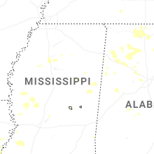
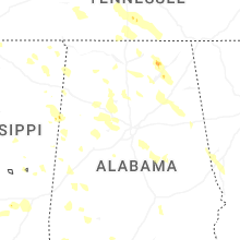
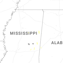
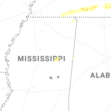
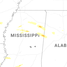


Connect with Interactive Hail Maps