

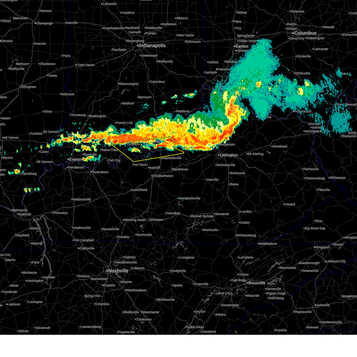
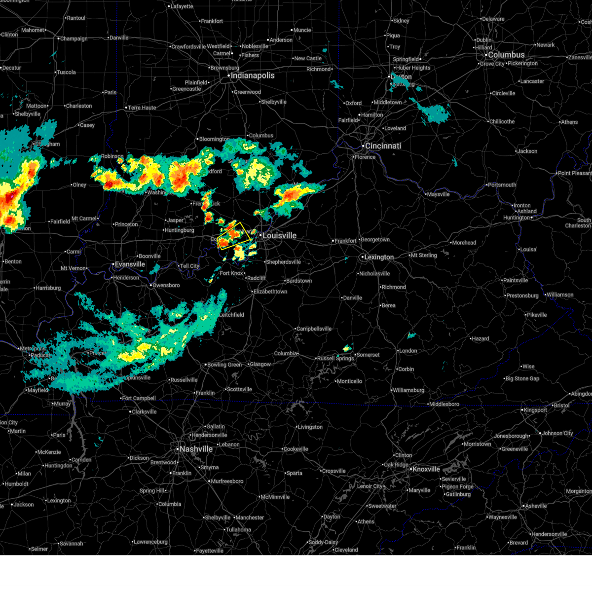
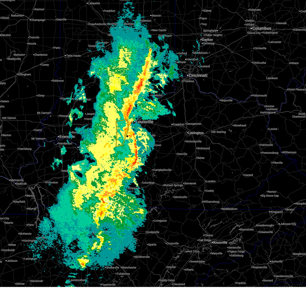
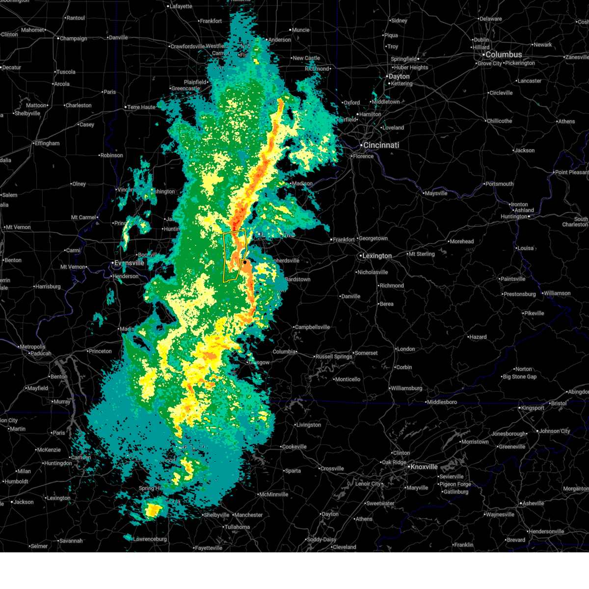
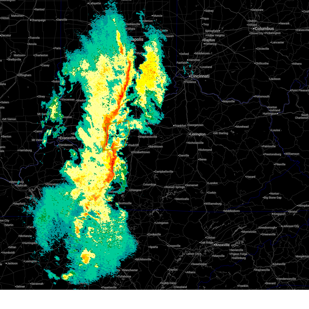
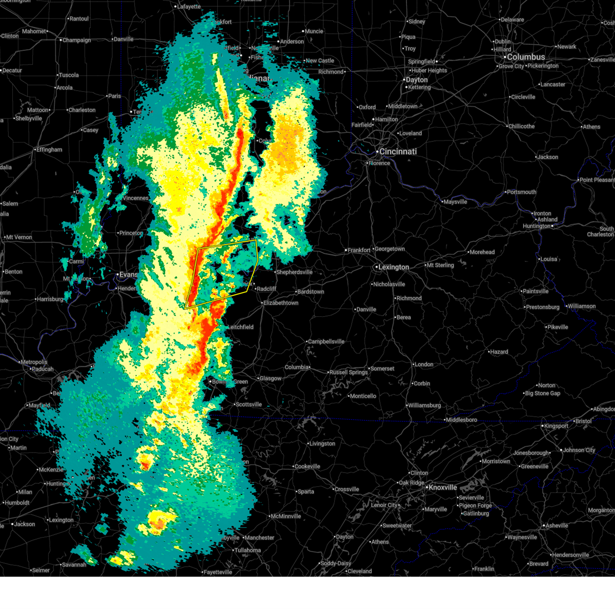
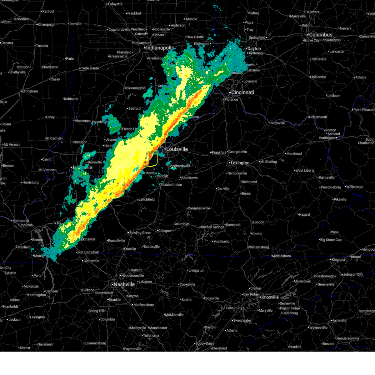
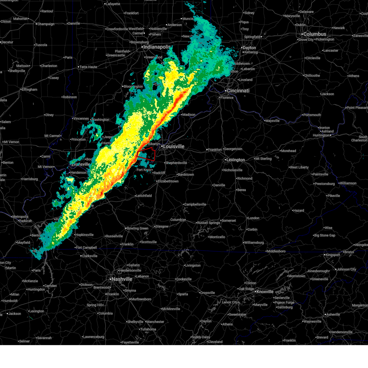
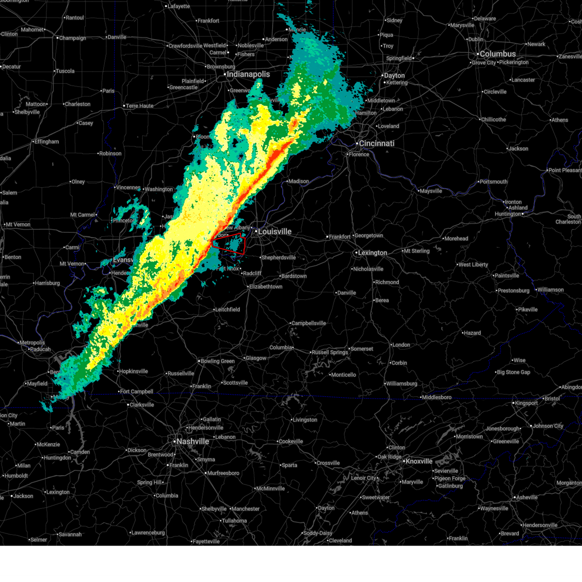
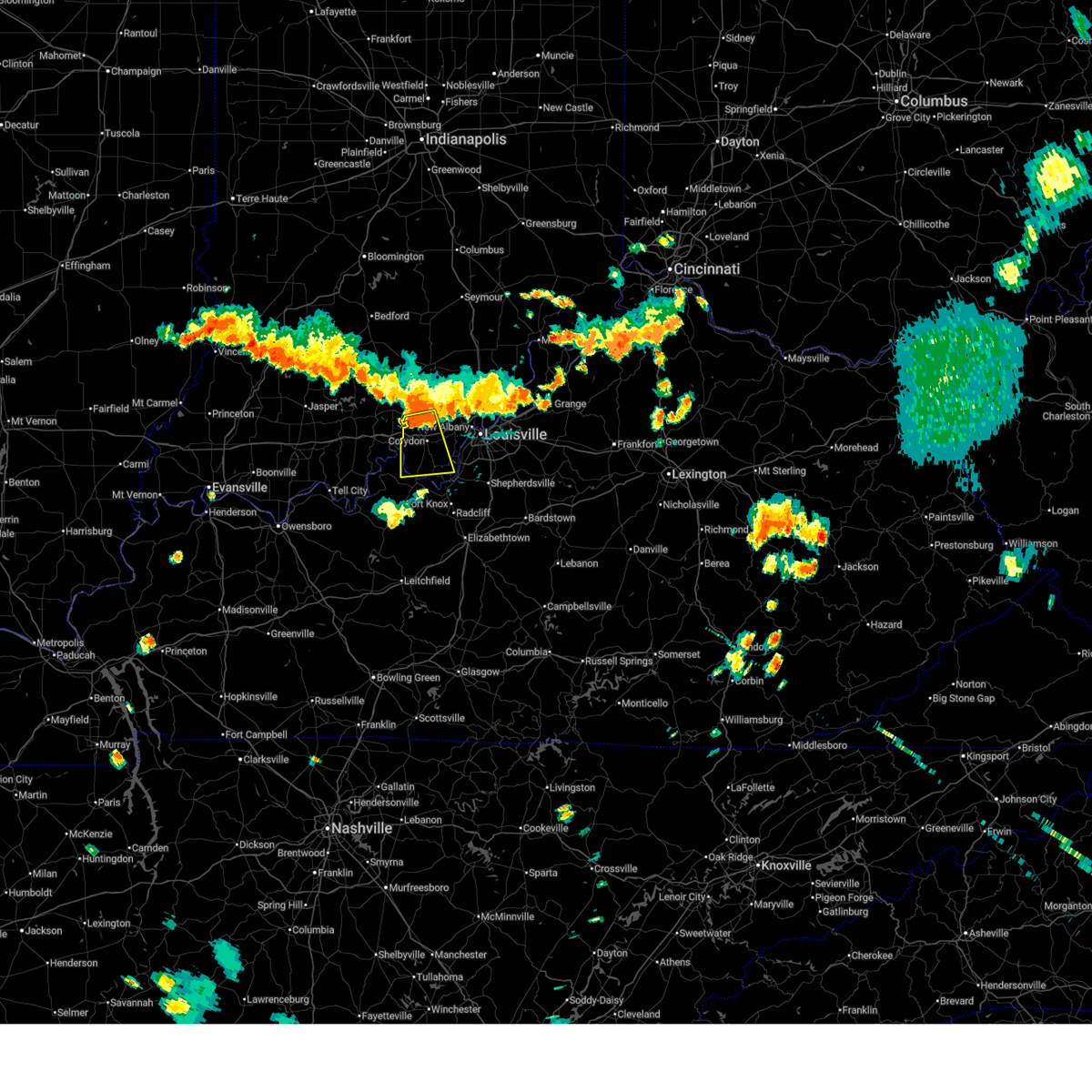
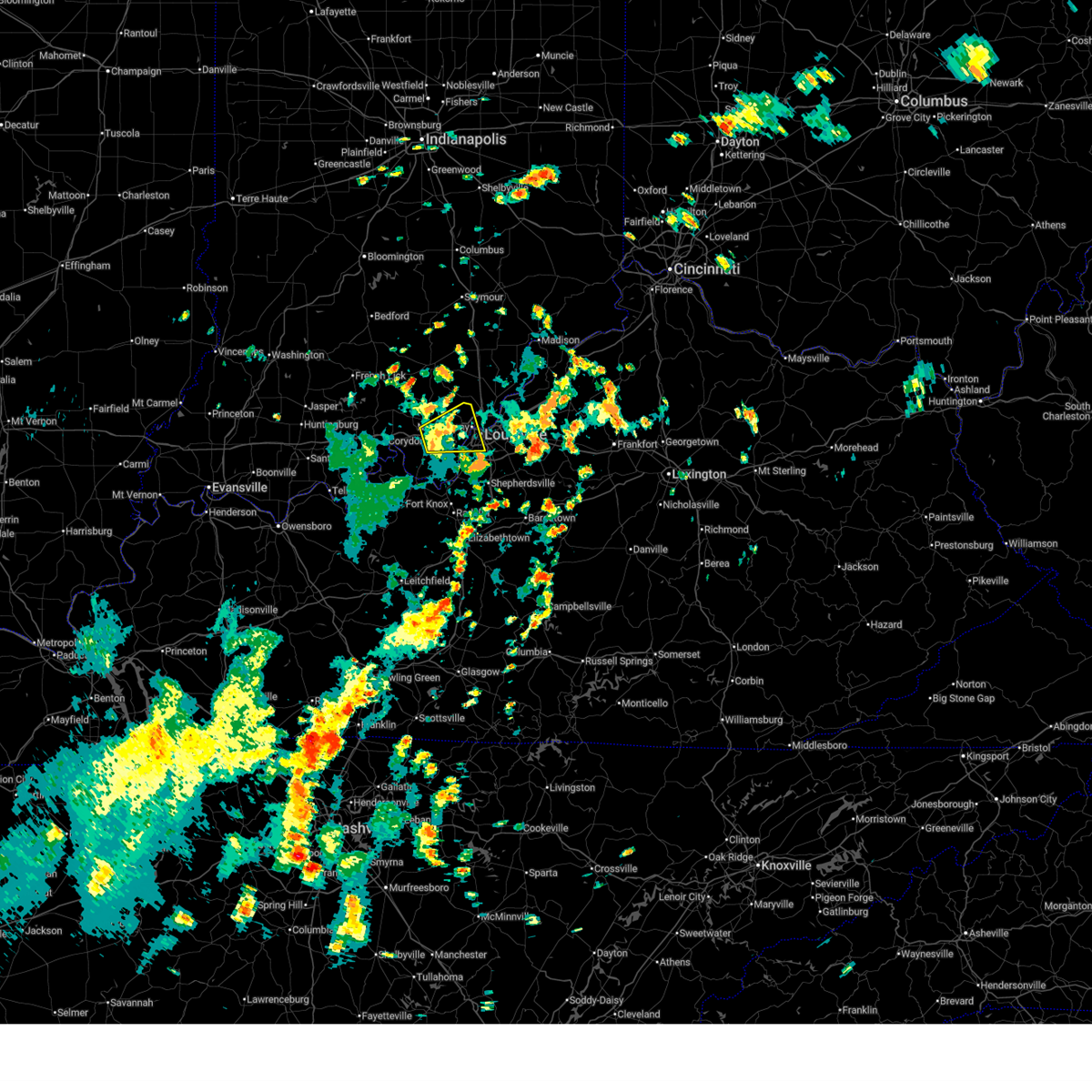
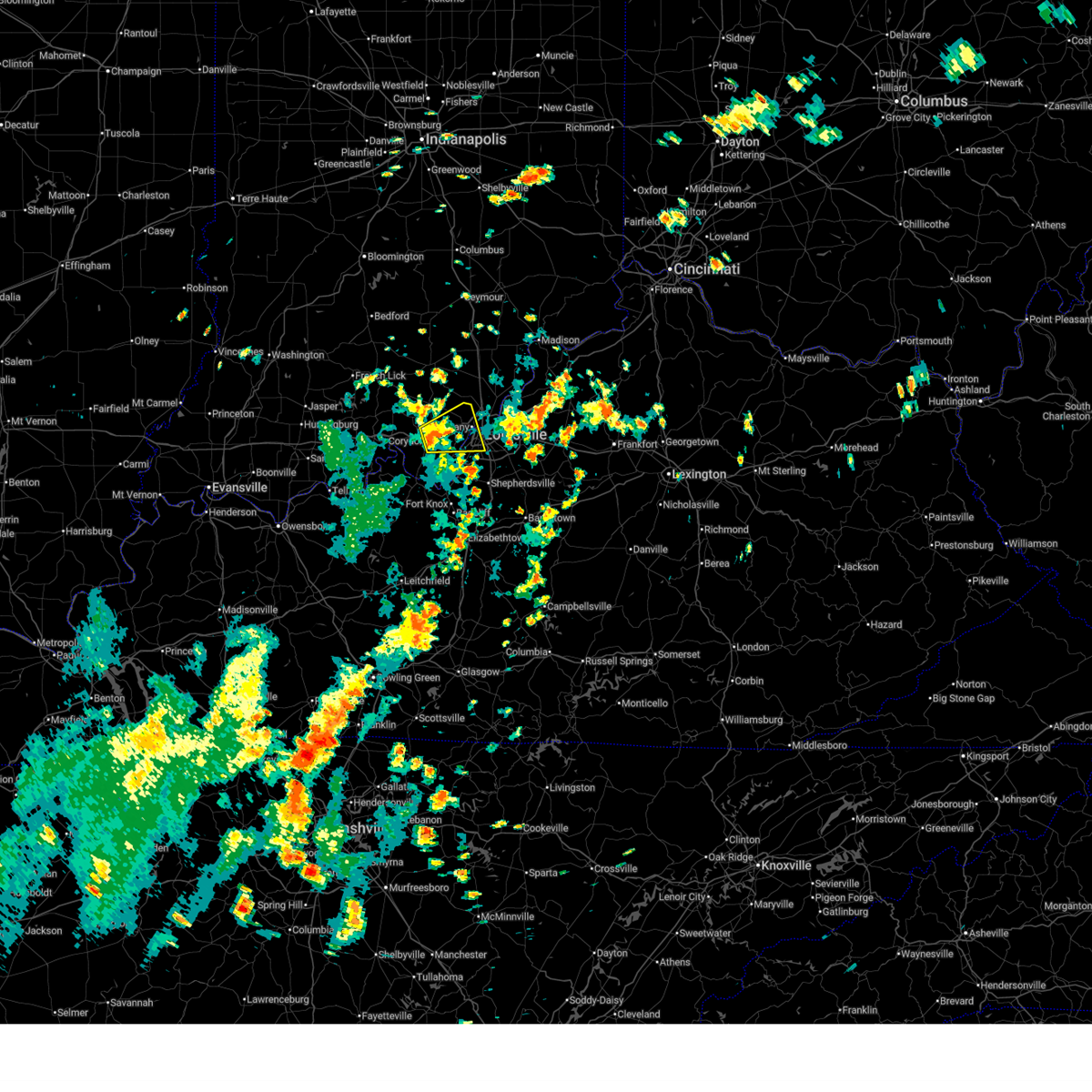
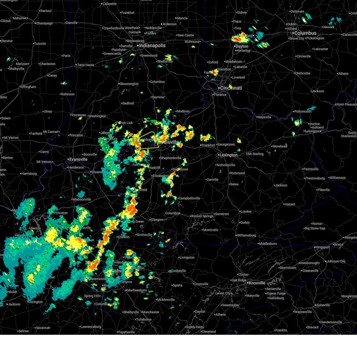
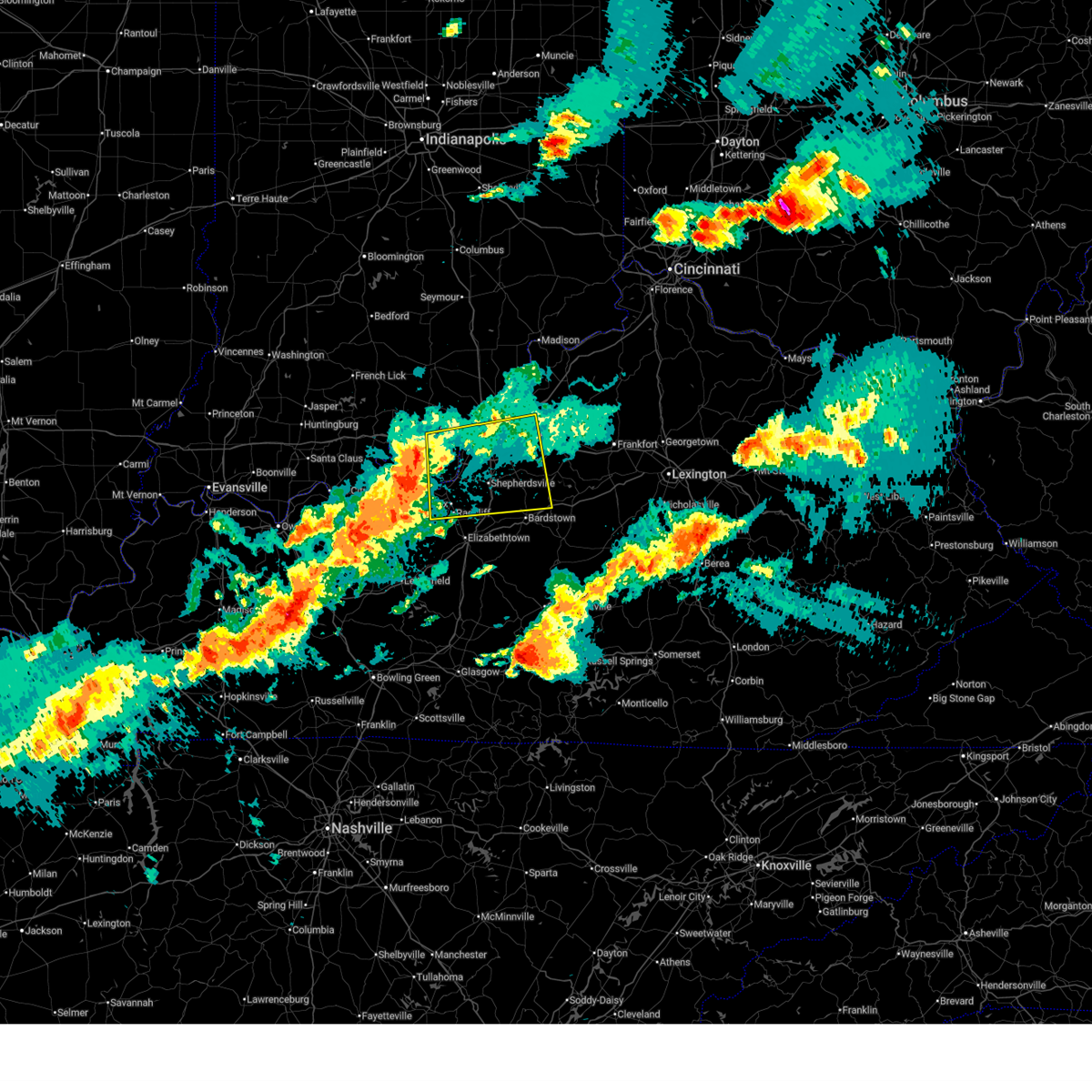
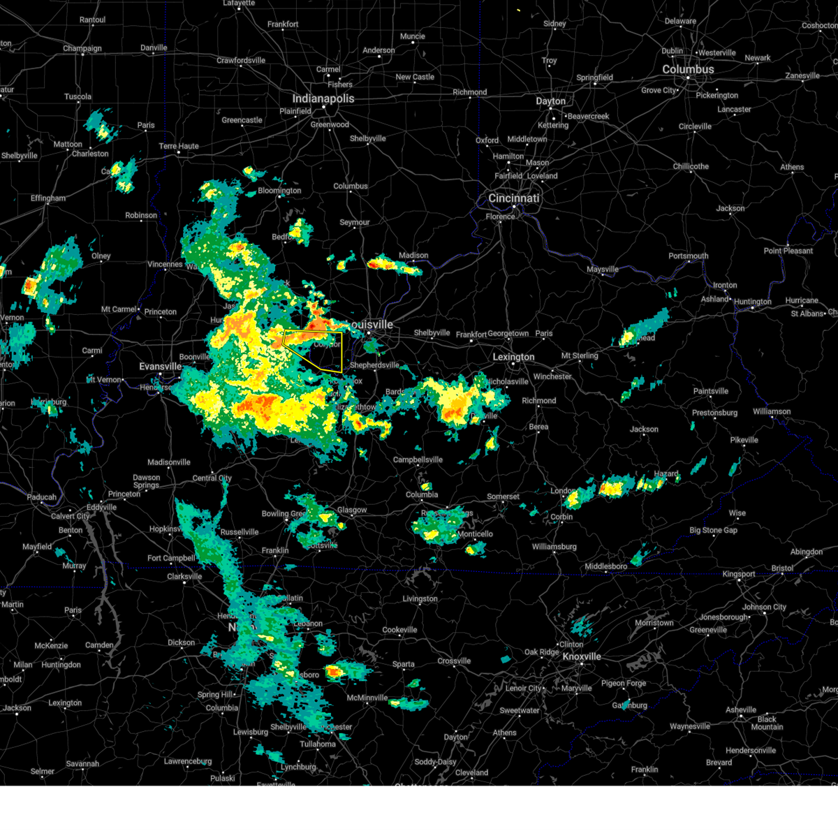
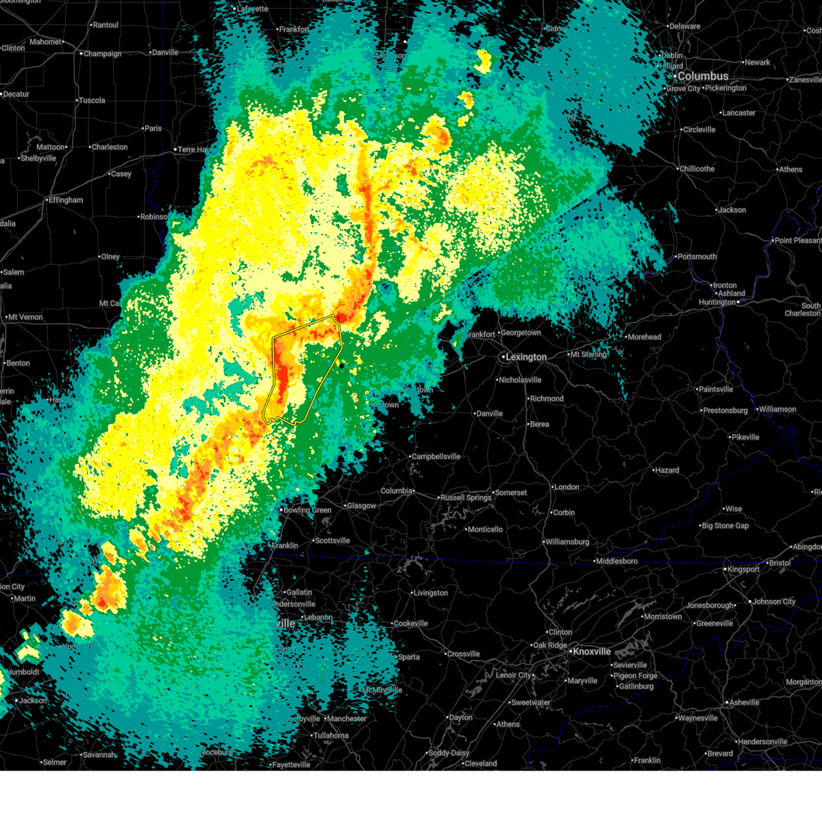
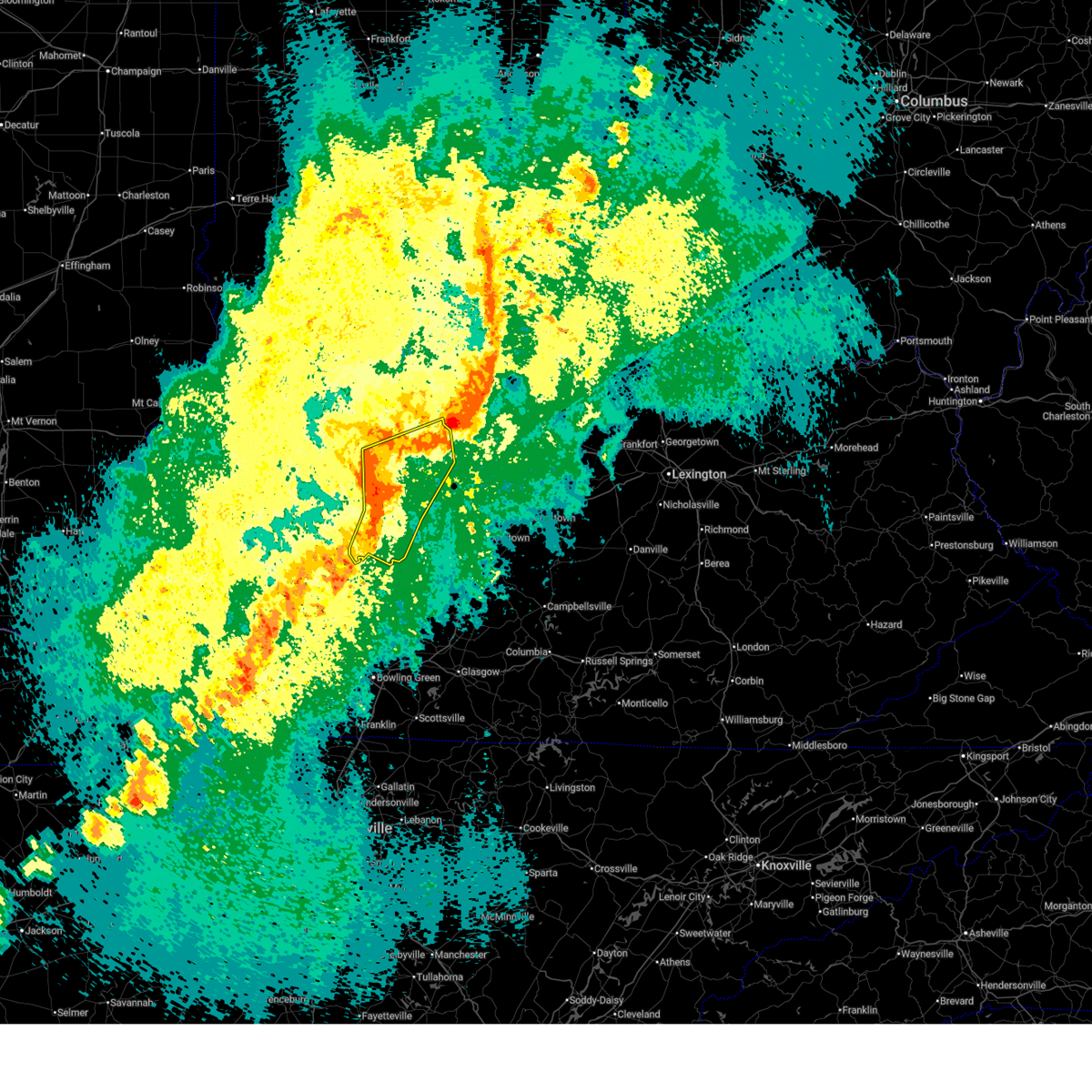
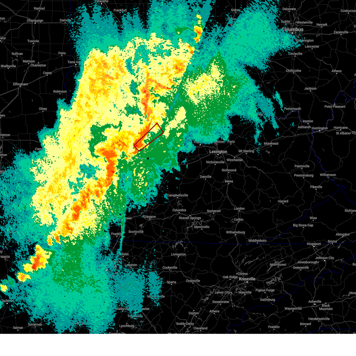
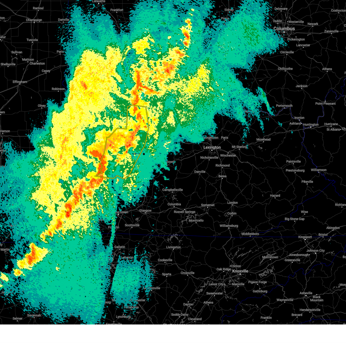
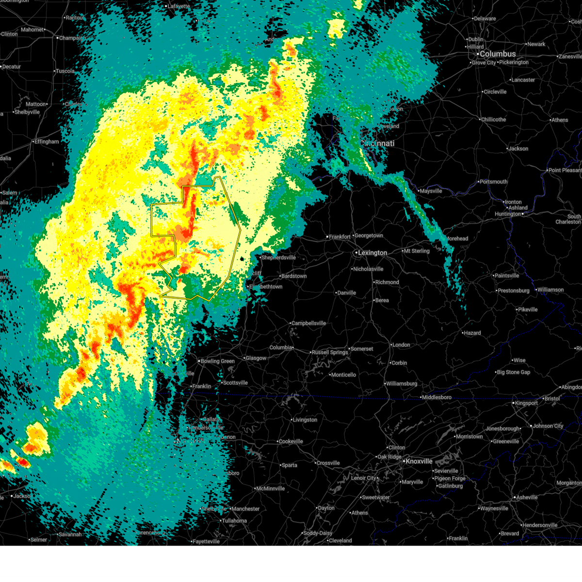
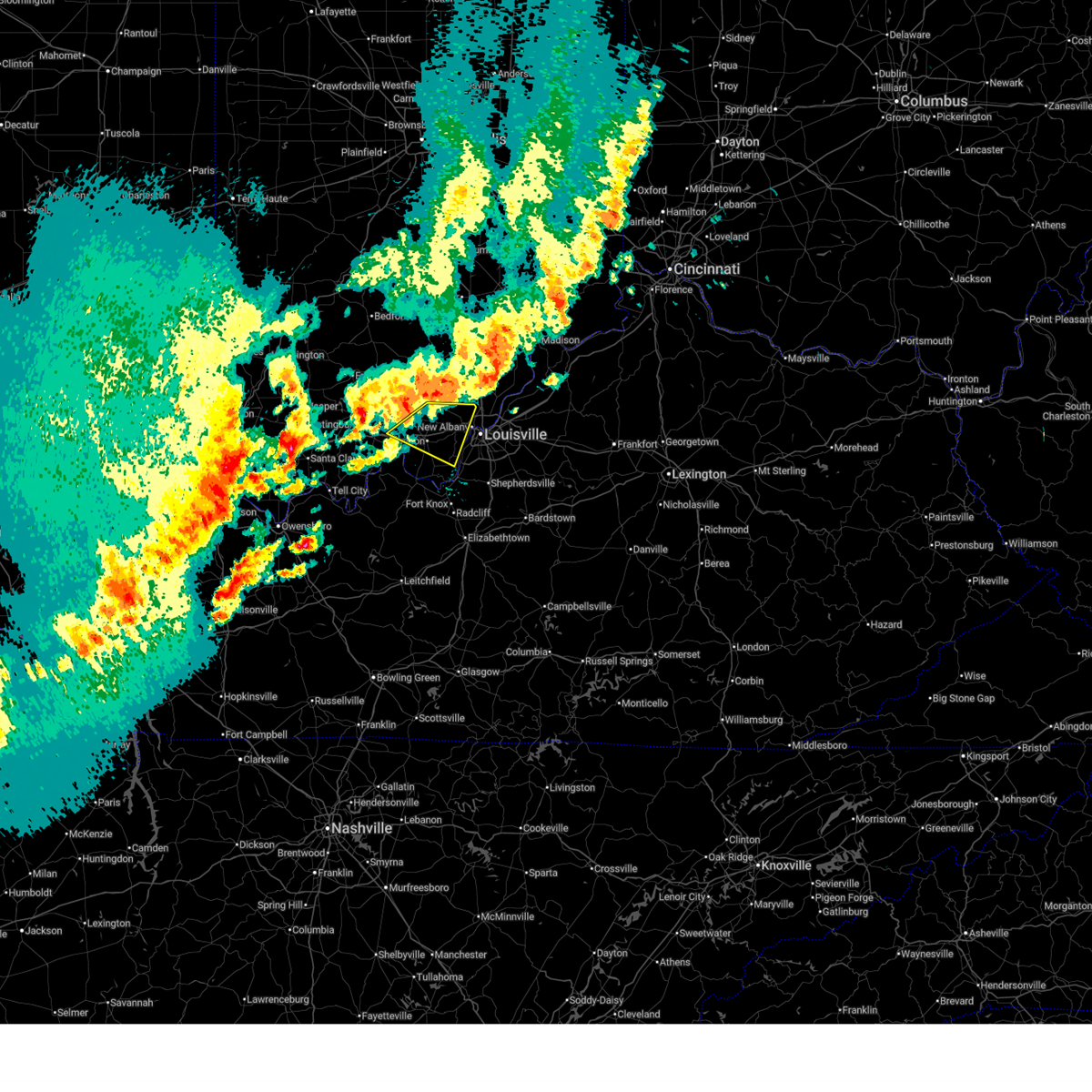
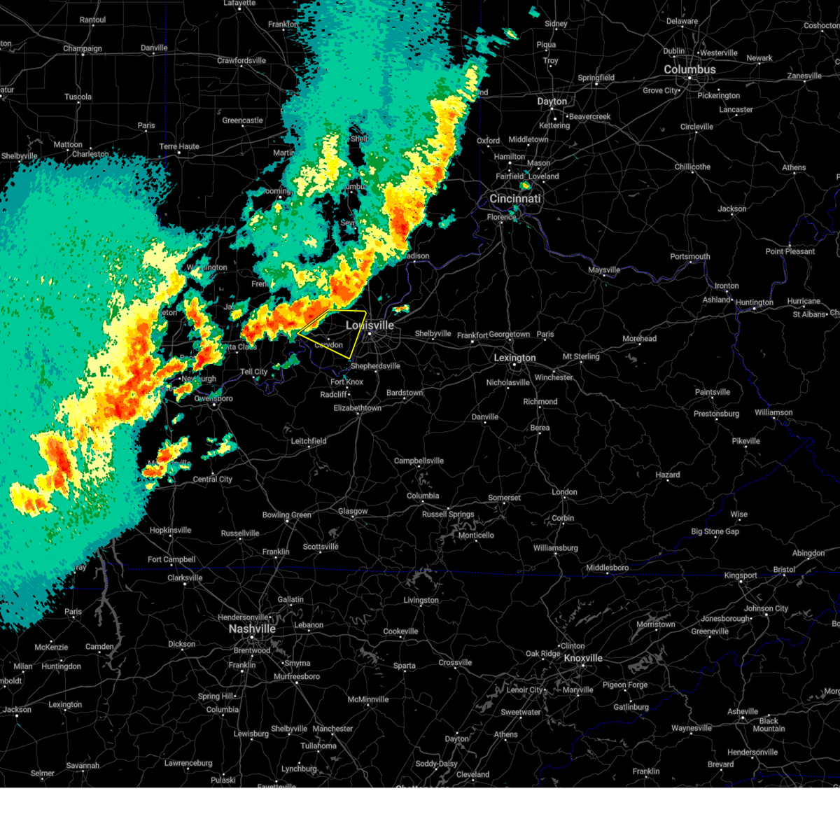
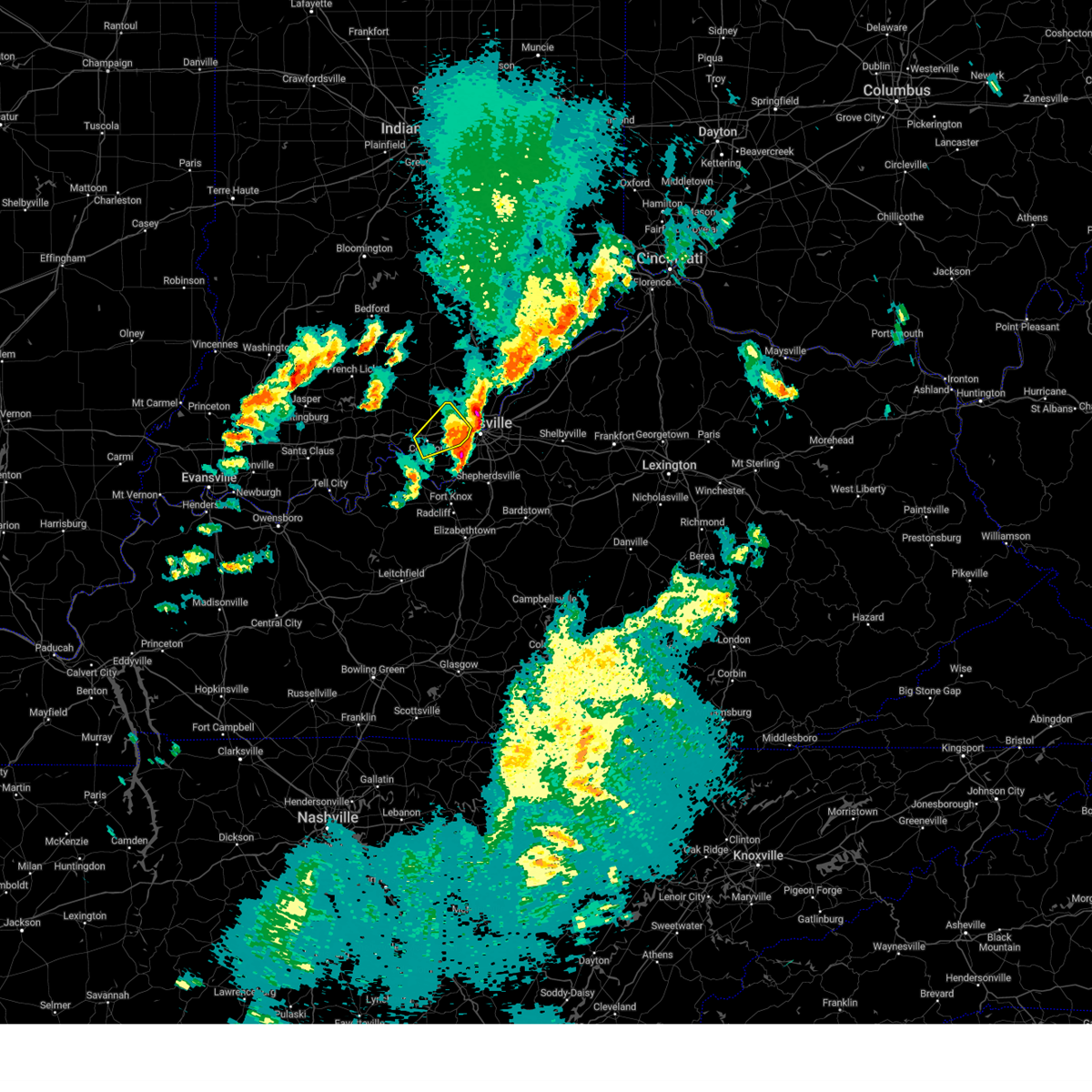
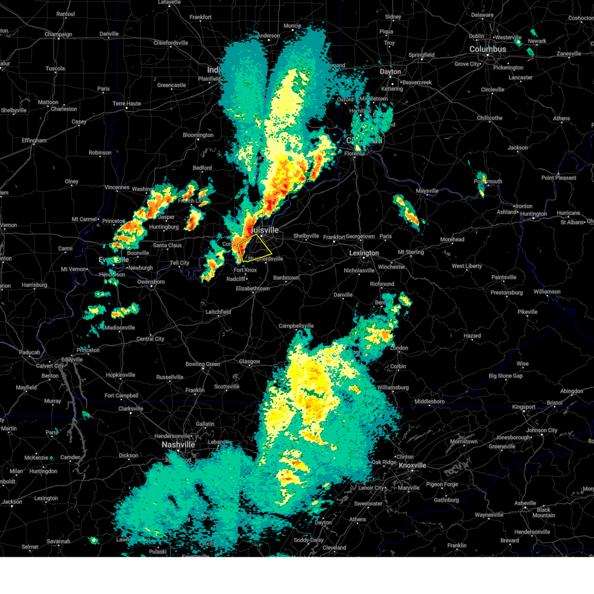
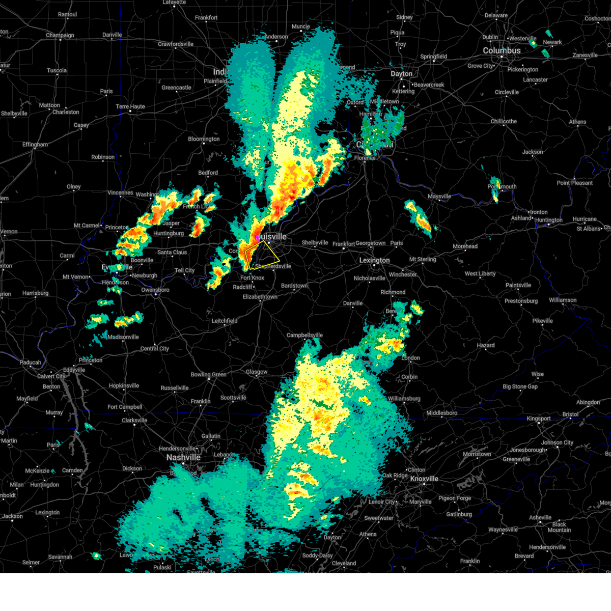
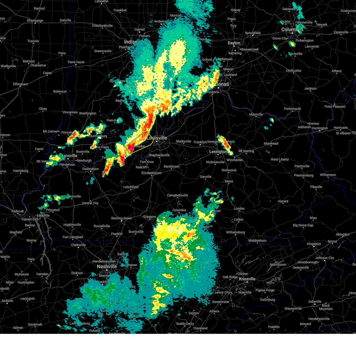
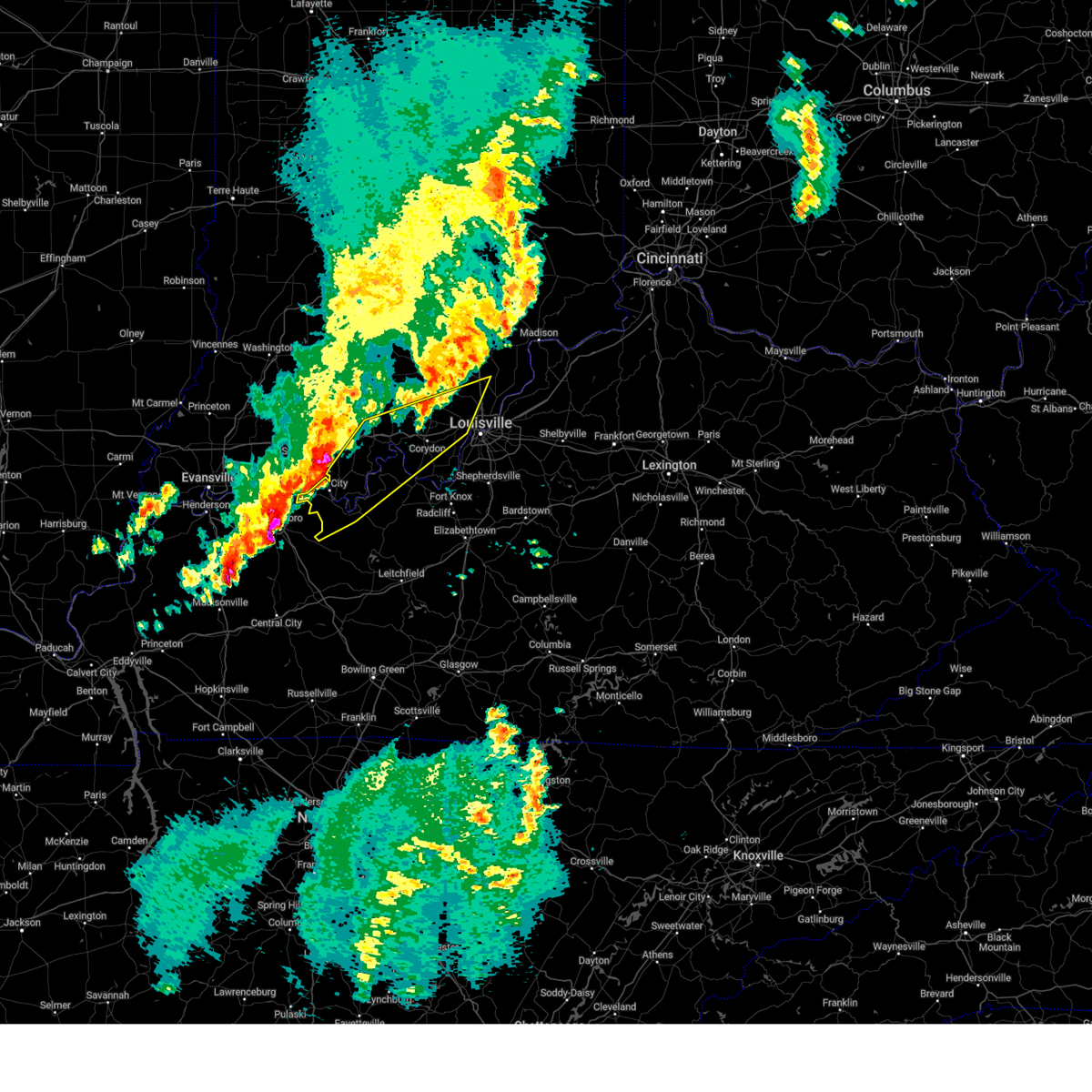
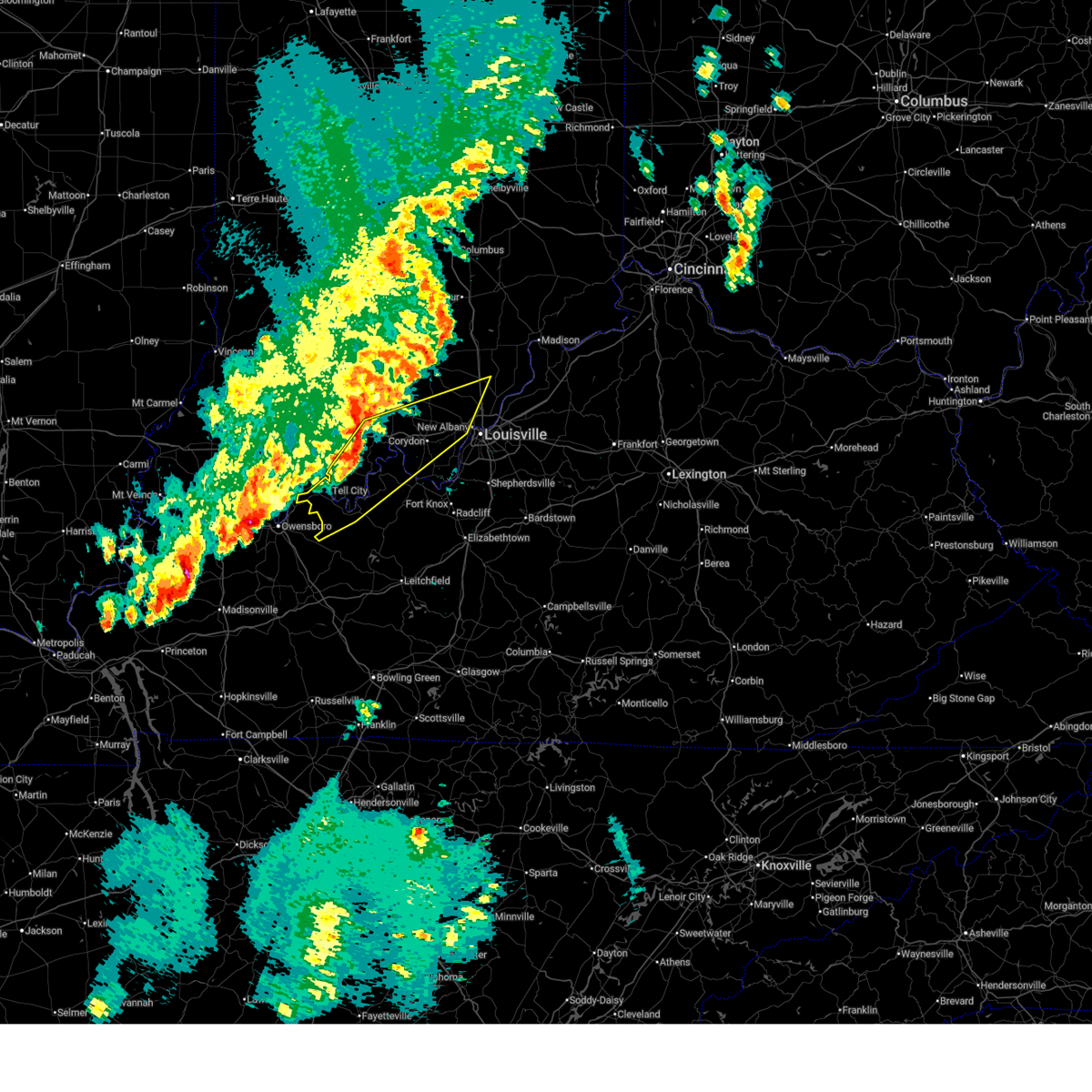
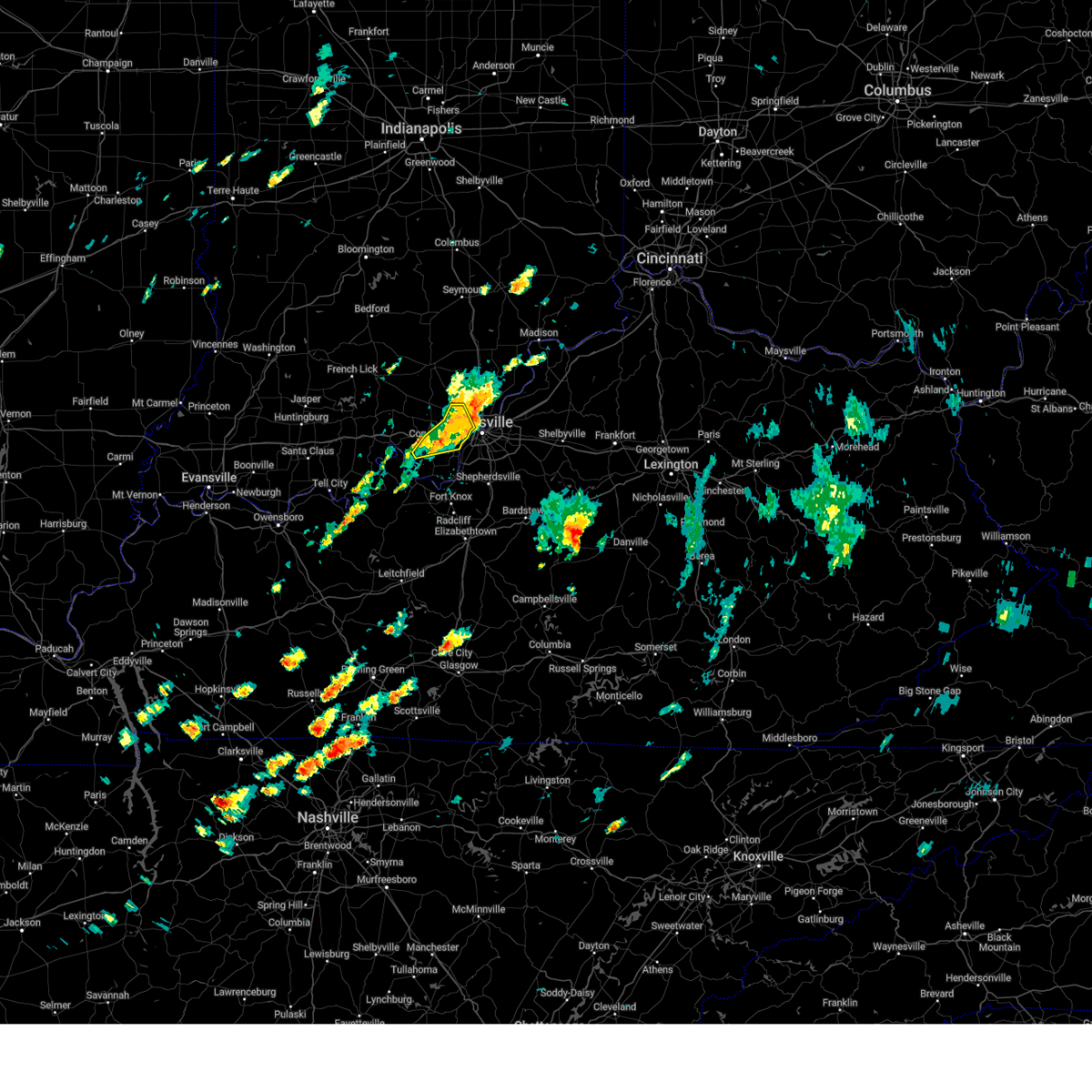
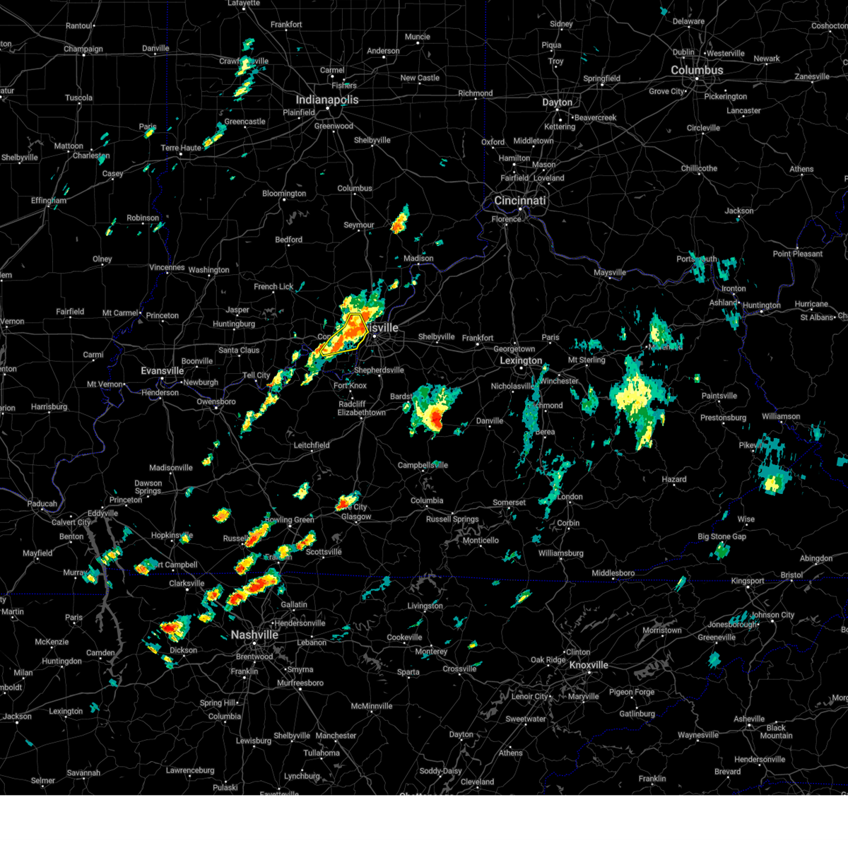
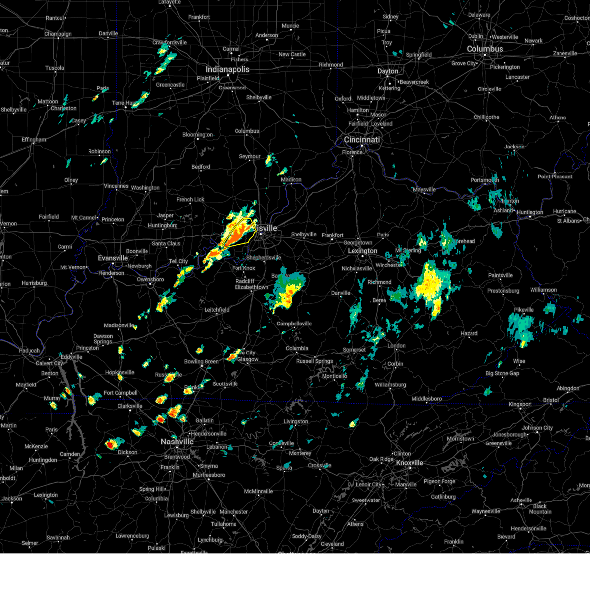
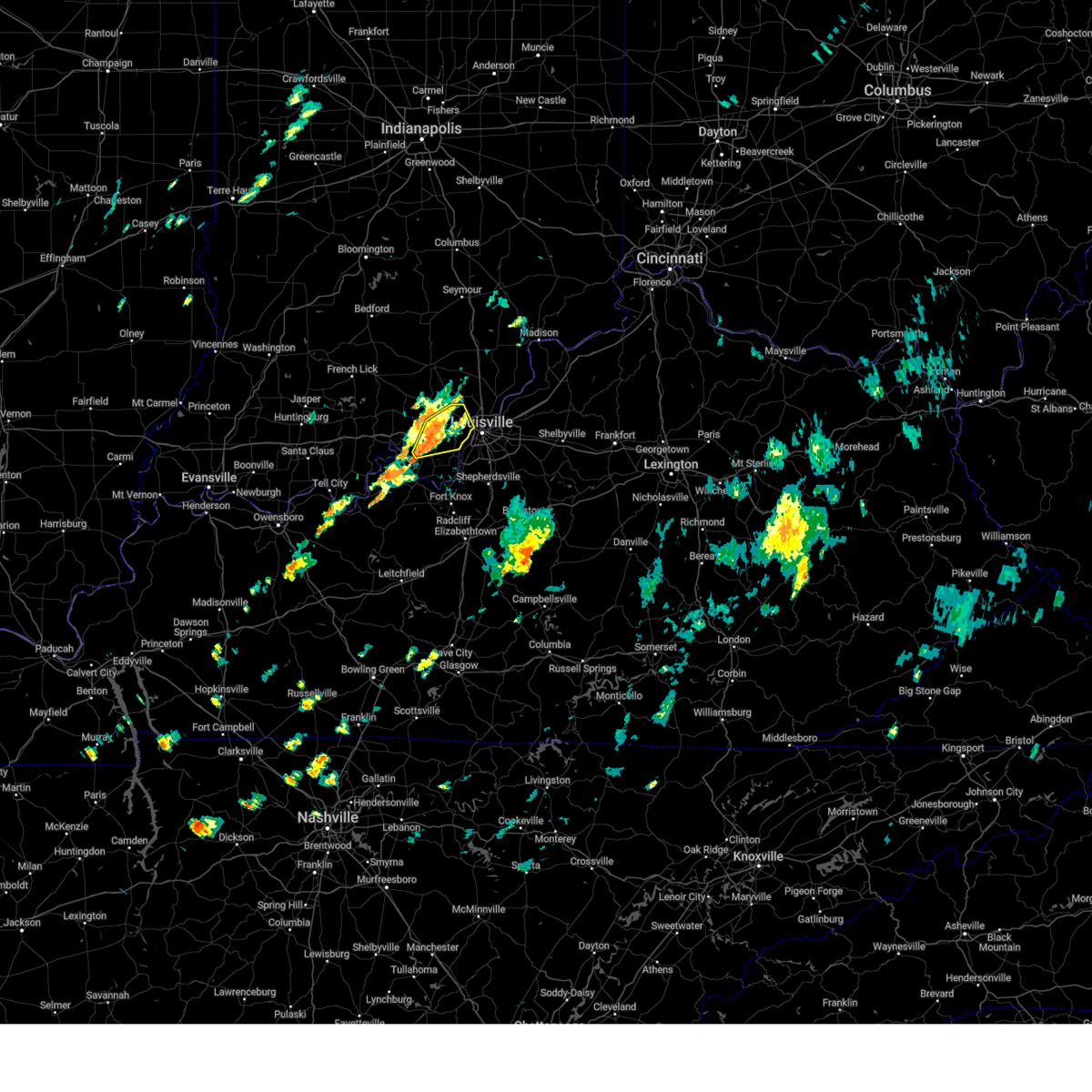
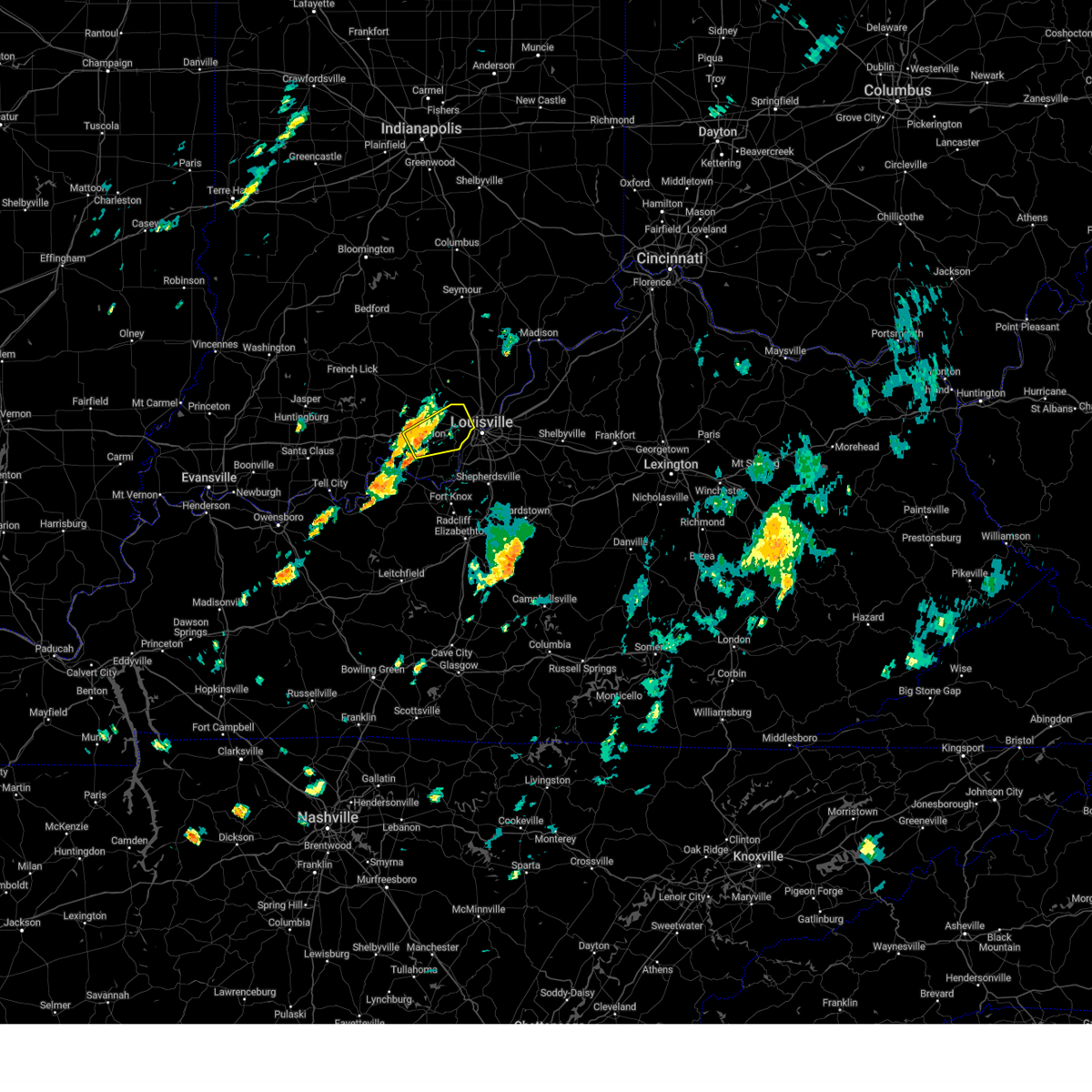
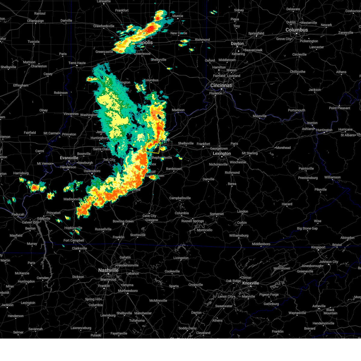
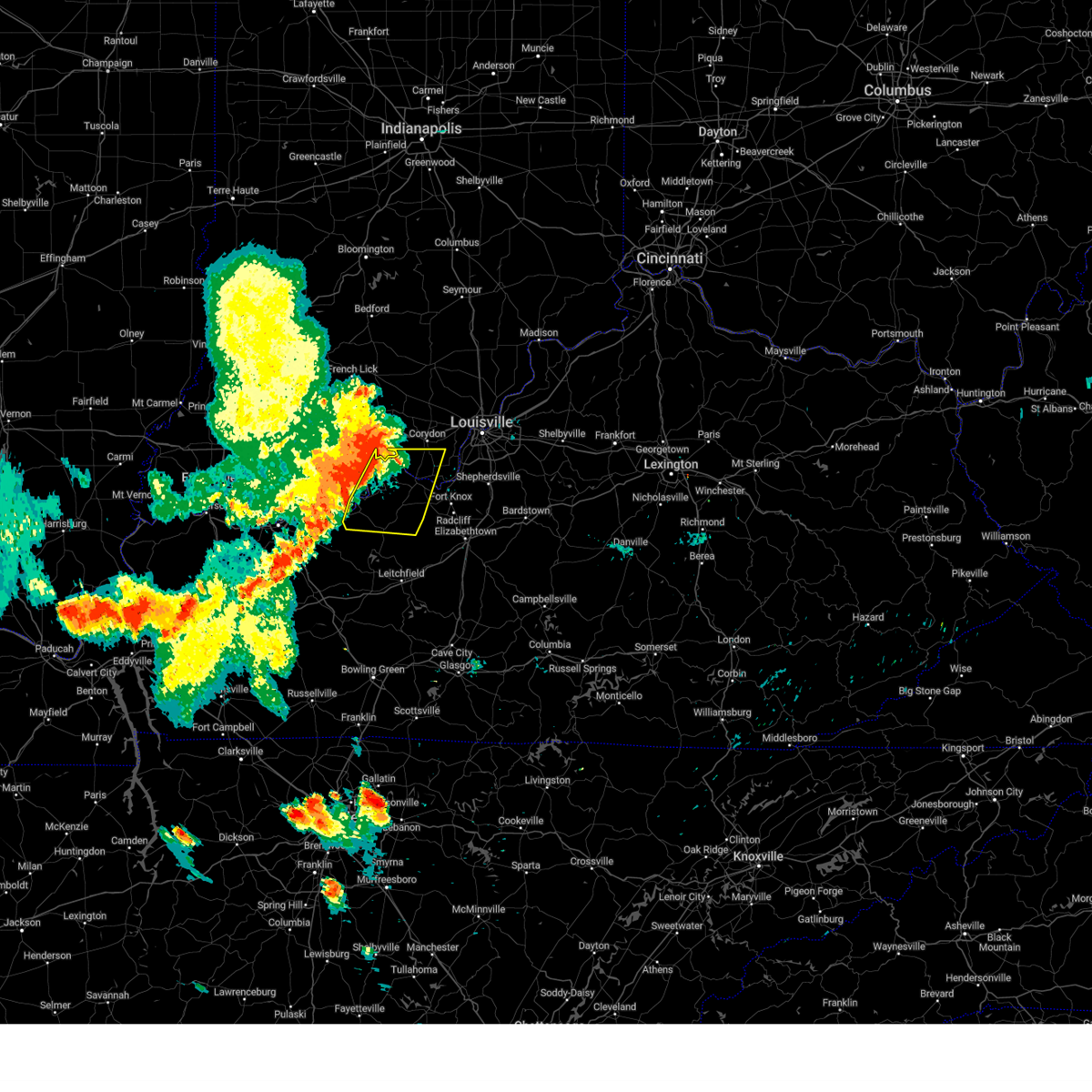
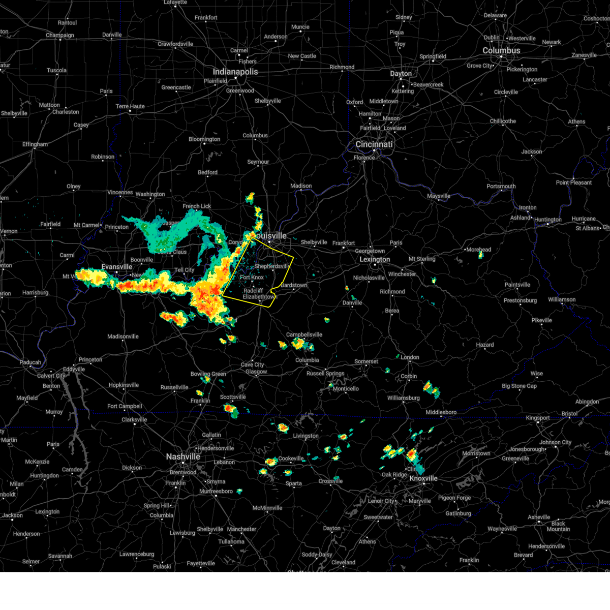
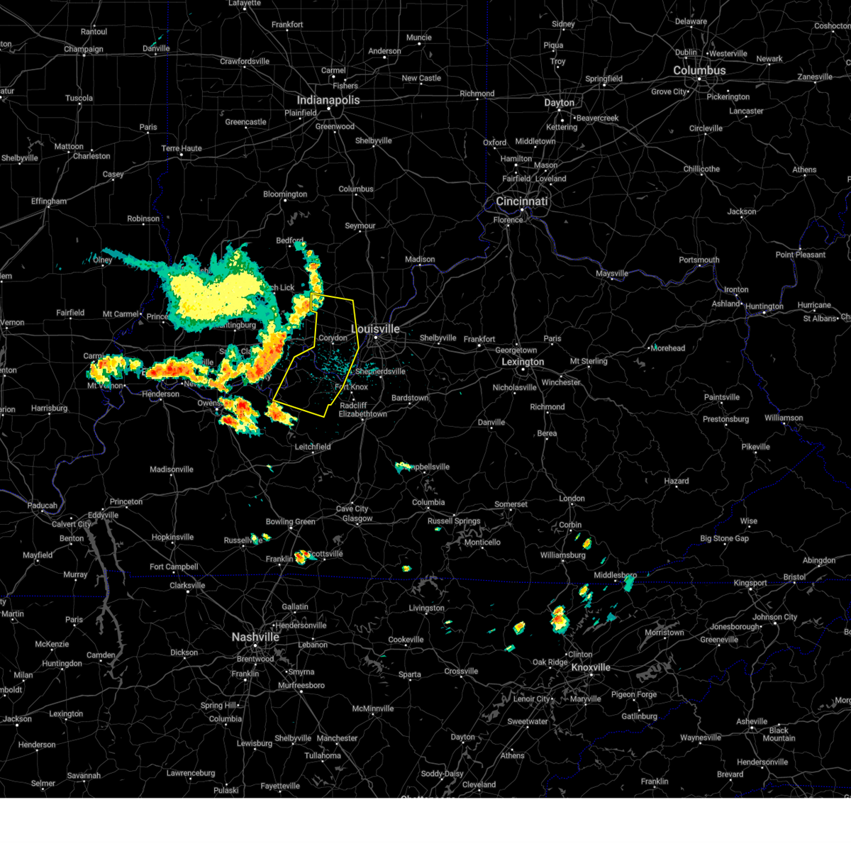
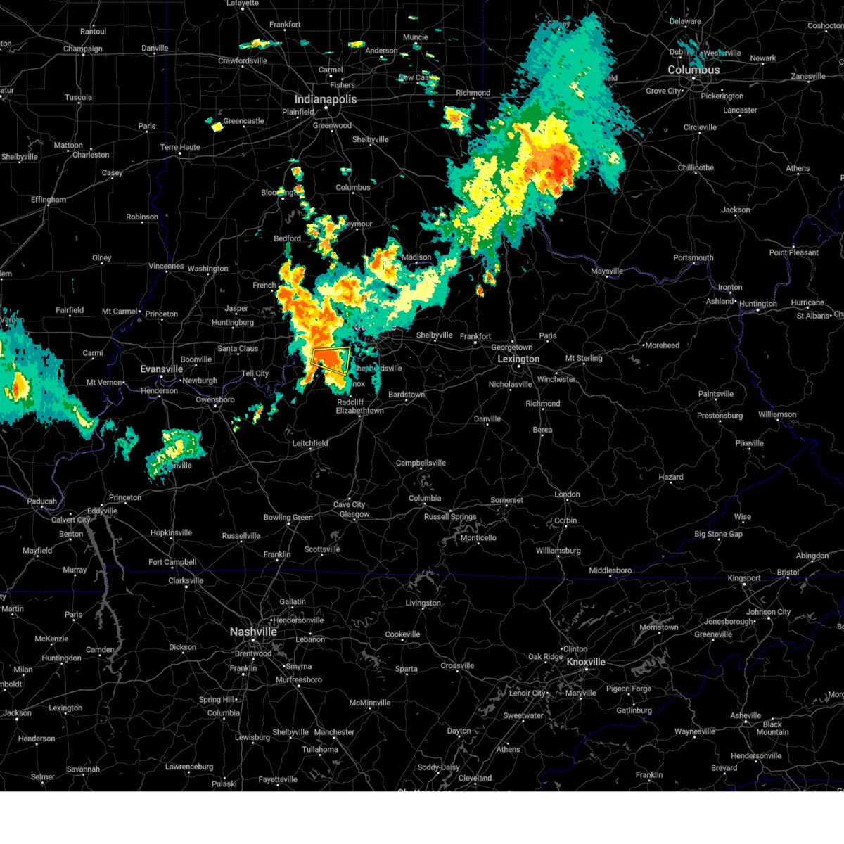
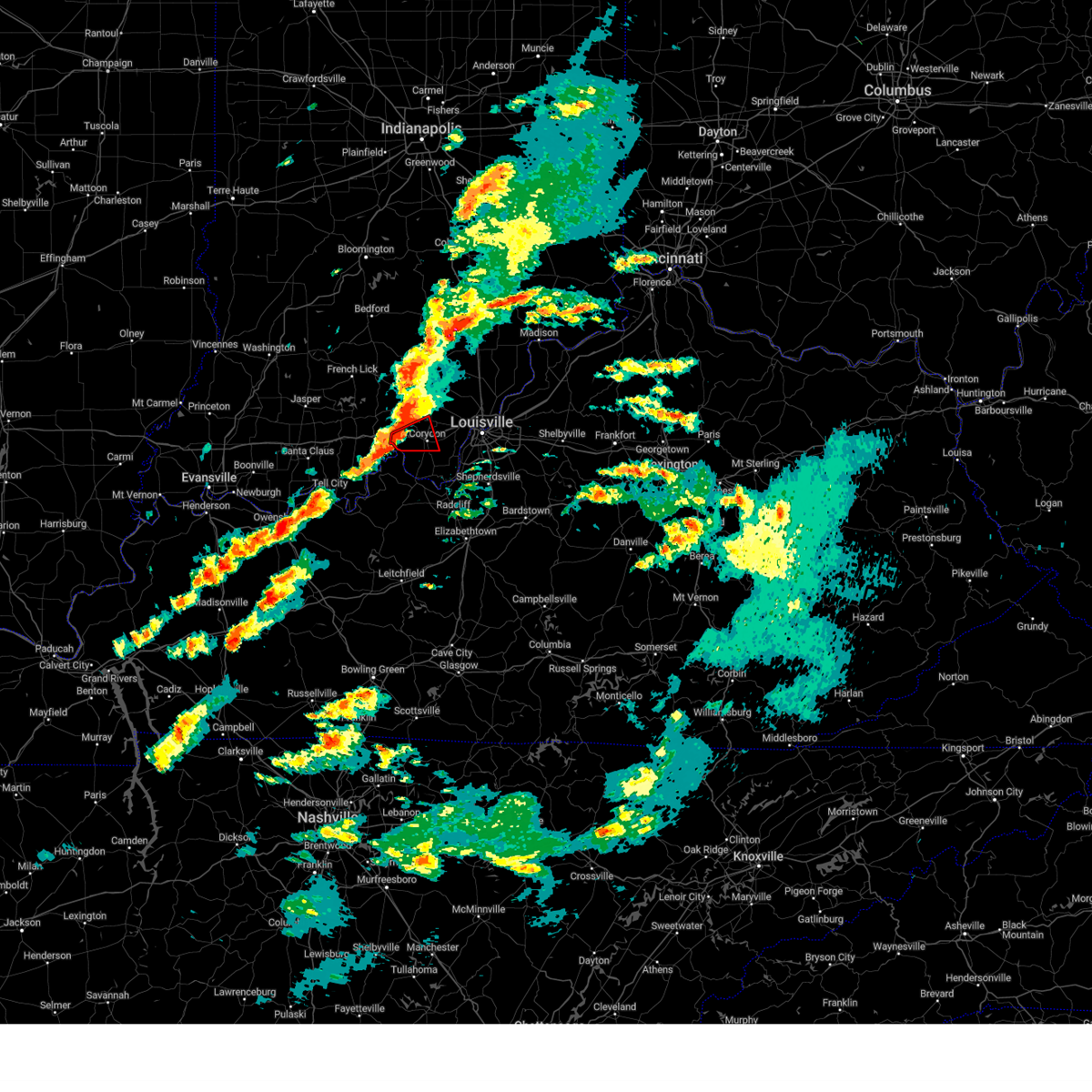
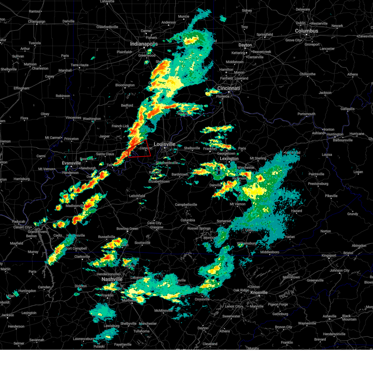
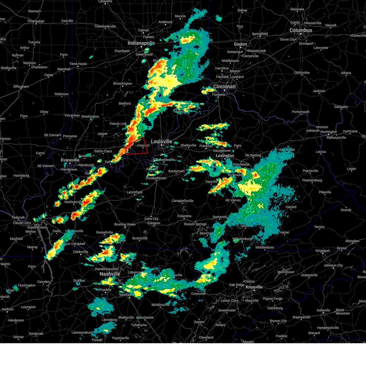
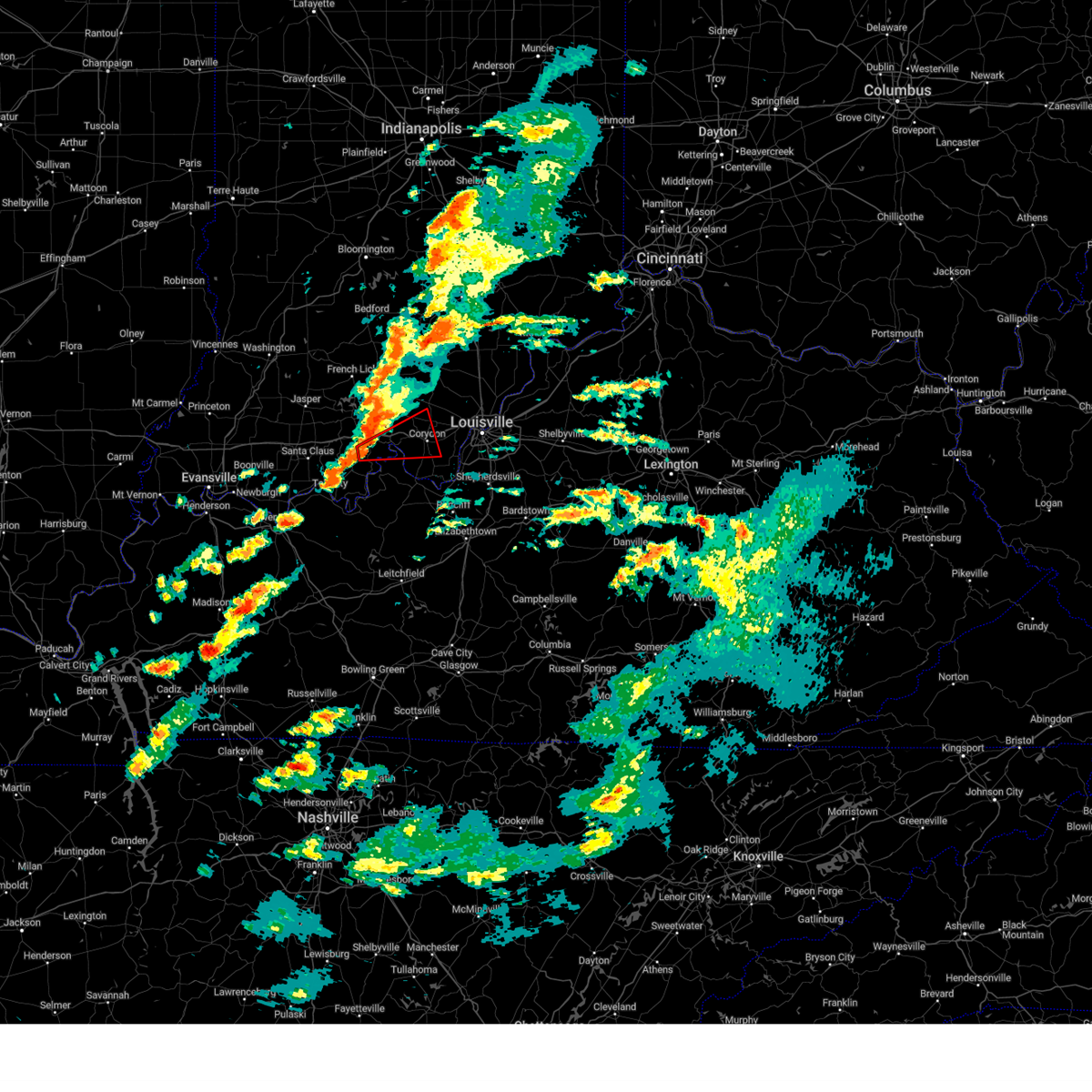
Hail Map for New Middletown, IN
The New Middletown, IN area has had 0 reports of on-the-ground hail by trained spotters, and has been under severe weather warnings 22 times during the past 12 months. Doppler radar has detected hail at or near New Middletown, IN on 57 occasions, including 5 occasions during the past year.
| Name: | New Middletown, IN |
| Where Located: | 21.9 miles WNW of Louisville, KY |
| Map: | Google Map for New Middletown, IN |
| Population: | 93 |
| Housing Units: | 39 |
| More Info: | Search Google for New Middletown, IN |
1
The Top Recent Hail Date for New Middletown, IN is Sunday, March 22, 2026 (8th out of 57)

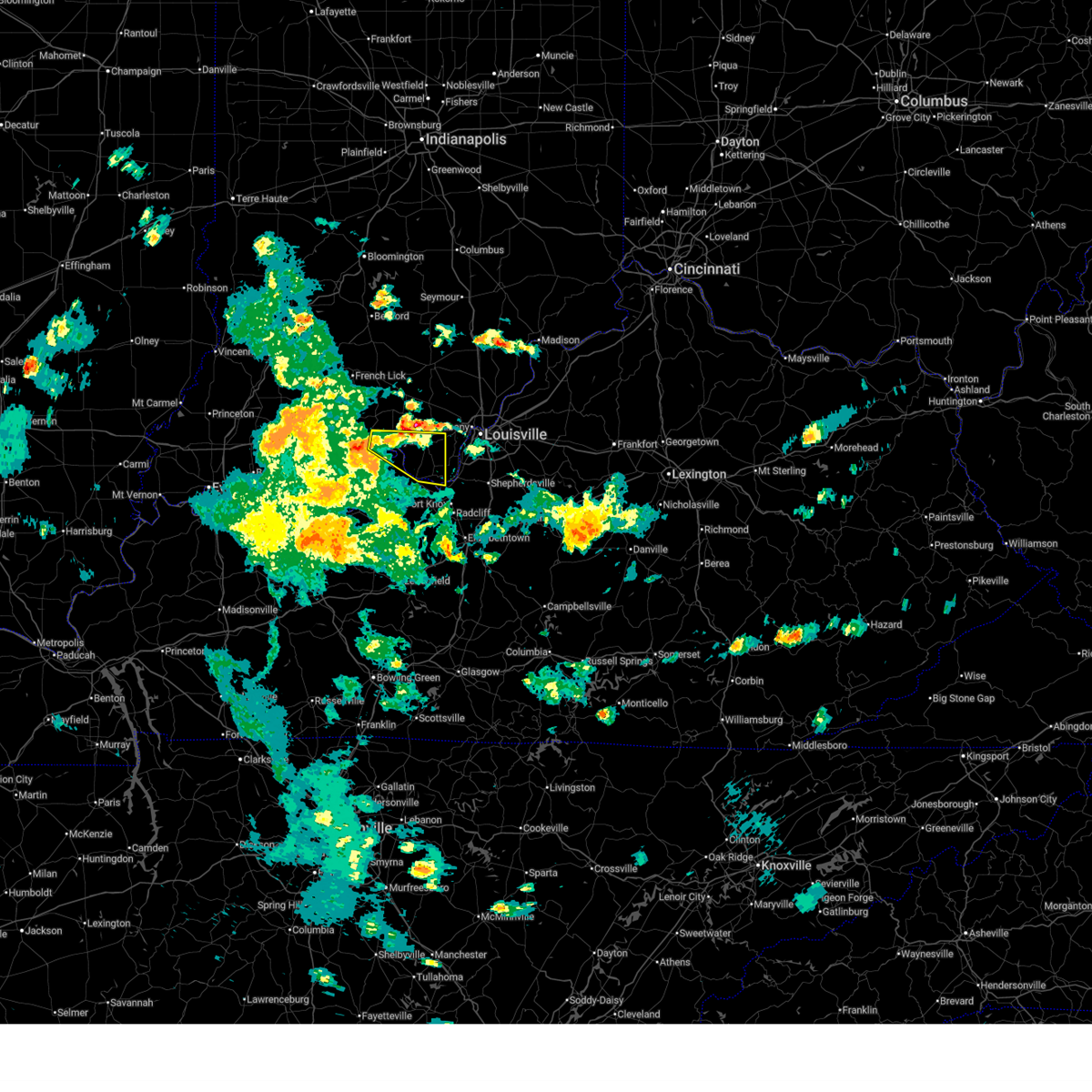
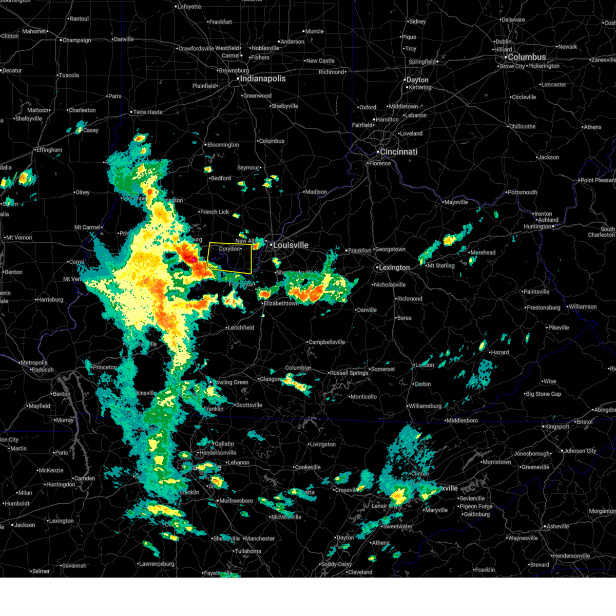
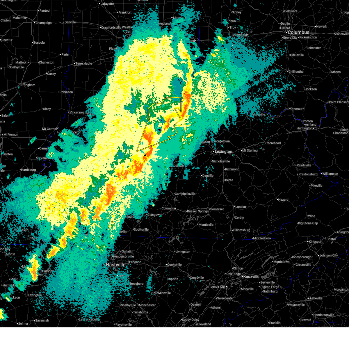
Hail and Wind Damage Spotted near New Middletown, IN
| Date / Time | Report Details |
|---|---|
| 6/18/2026 4:40 AM EDT |
 Svrlmk the national weather service in louisville has issued a * severe thunderstorm warning for, harrison county in south central indiana, south central clark county in south central indiana, southeastern crawford county in south central indiana, northeastern perry county in south central indiana, southern floyd county in south central indiana, southwestern oldham county in central kentucky, northwestern spencer county in central kentucky, central meade county in central kentucky, jefferson county in central kentucky, northern bullitt county in central kentucky, north central hardin county in central kentucky, * until 515 am edt/415 am cdt/. * at 440 am edt/340 am cdt/, severe thunderstorms were located along a line extending from 6 miles northwest of st. dennis to 7 miles southwest of carefree town, moving southeast at 30 mph (radar indicated). Hazards include 60 mph wind gusts. expect damage to roofs, siding, and trees Svrlmk the national weather service in louisville has issued a * severe thunderstorm warning for, harrison county in south central indiana, south central clark county in south central indiana, southeastern crawford county in south central indiana, northeastern perry county in south central indiana, southern floyd county in south central indiana, southwestern oldham county in central kentucky, northwestern spencer county in central kentucky, central meade county in central kentucky, jefferson county in central kentucky, northern bullitt county in central kentucky, north central hardin county in central kentucky, * until 515 am edt/415 am cdt/. * at 440 am edt/340 am cdt/, severe thunderstorms were located along a line extending from 6 miles northwest of st. dennis to 7 miles southwest of carefree town, moving southeast at 30 mph (radar indicated). Hazards include 60 mph wind gusts. expect damage to roofs, siding, and trees
|
| 5/16/2026 5:42 PM EDT |
 Svrlmk the national weather service in louisville has issued a * severe thunderstorm warning for, central harrison county in south central indiana, southwestern floyd county in south central indiana, * until 615 pm edt. * at 542 pm edt, a severe thunderstorm was located near corydon, moving northeast at 30 mph (radar indicated). Hazards include 60 mph wind gusts and quarter size hail. Hail damage to vehicles is expected. Expect wind damage to roofs, siding, and trees. Svrlmk the national weather service in louisville has issued a * severe thunderstorm warning for, central harrison county in south central indiana, southwestern floyd county in south central indiana, * until 615 pm edt. * at 542 pm edt, a severe thunderstorm was located near corydon, moving northeast at 30 mph (radar indicated). Hazards include 60 mph wind gusts and quarter size hail. Hail damage to vehicles is expected. Expect wind damage to roofs, siding, and trees.
|
| 3/16/2026 12:02 AM EDT |
 The storms which prompted the warning have moved out of the area. therefore, the warning has been allowed to expire. a tornado watch remains in effect until 500 am edt/400 am cdt/ for south central indiana, and central kentucky. to report severe weather, contact your nearest law enforcement agency. they will relay your report to the national weather service louisville. The storms which prompted the warning have moved out of the area. therefore, the warning has been allowed to expire. a tornado watch remains in effect until 500 am edt/400 am cdt/ for south central indiana, and central kentucky. to report severe weather, contact your nearest law enforcement agency. they will relay your report to the national weather service louisville.
|
| 3/15/2026 11:49 PM EDT |
 the severe thunderstorm warning has been cancelled and is no longer in effect the severe thunderstorm warning has been cancelled and is no longer in effect
|
| 3/15/2026 11:49 PM EDT |
 At 1148 pm edt/1048 pm cdt/, severe thunderstorms were located along a line extending from 11 miles north of corydon to 7 miles northeast of brandenburg to 14 miles east of hardinsburg, moving east at 55 mph (radar indicated). Hazards include 60 mph wind gusts. Expect damage to roofs, siding, and trees. Locations impacted include, corydon, brandenburg, muldraugh, lanesville, elizabeth, ekron, new middletown, laconia, new boston, and central. At 1148 pm edt/1048 pm cdt/, severe thunderstorms were located along a line extending from 11 miles north of corydon to 7 miles northeast of brandenburg to 14 miles east of hardinsburg, moving east at 55 mph (radar indicated). Hazards include 60 mph wind gusts. Expect damage to roofs, siding, and trees. Locations impacted include, corydon, brandenburg, muldraugh, lanesville, elizabeth, ekron, new middletown, laconia, new boston, and central.
|
| 3/15/2026 11:28 PM EDT |
 the severe thunderstorm warning has been cancelled and is no longer in effect the severe thunderstorm warning has been cancelled and is no longer in effect
|
| 3/15/2026 11:28 PM EDT |
 At 1127 pm edt/1027 pm cdt/, severe thunderstorms were located along a line extending from near carefree town to 13 miles west of brandenburg to near hardinsburg, moving east at 55 mph (radar indicated). Hazards include 60 mph wind gusts. Expect damage to roofs, siding, and trees. Locations impacted include, corydon, brandenburg, hardinsburg, webster, irvington, muldraugh, lanesville, leavenworth, elizabeth, and ekron. At 1127 pm edt/1027 pm cdt/, severe thunderstorms were located along a line extending from near carefree town to 13 miles west of brandenburg to near hardinsburg, moving east at 55 mph (radar indicated). Hazards include 60 mph wind gusts. Expect damage to roofs, siding, and trees. Locations impacted include, corydon, brandenburg, hardinsburg, webster, irvington, muldraugh, lanesville, leavenworth, elizabeth, and ekron.
|
| 3/15/2026 11:13 PM EDT |
 Svrlmk the national weather service in louisville has issued a * severe thunderstorm warning for, harrison county in south central indiana, southeastern crawford county in south central indiana, central perry county in south central indiana, southwestern floyd county in south central indiana, meade county in central kentucky, southeastern hancock county in central kentucky, breckinridge county in central kentucky, northwestern hardin county in central kentucky, north central ohio county in central kentucky, * until midnight edt/1100 pm cdt/. * at 1112 pm edt/1012 pm cdt/, severe thunderstorms were located along a line extending from 12 miles southwest of english to 7 miles east of tell city to 7 miles east of whitesville, moving east at 55 mph (radar indicated). Hazards include 60 mph wind gusts. expect damage to roofs, siding, and trees Svrlmk the national weather service in louisville has issued a * severe thunderstorm warning for, harrison county in south central indiana, southeastern crawford county in south central indiana, central perry county in south central indiana, southwestern floyd county in south central indiana, meade county in central kentucky, southeastern hancock county in central kentucky, breckinridge county in central kentucky, northwestern hardin county in central kentucky, north central ohio county in central kentucky, * until midnight edt/1100 pm cdt/. * at 1112 pm edt/1012 pm cdt/, severe thunderstorms were located along a line extending from 12 miles southwest of english to 7 miles east of tell city to 7 miles east of whitesville, moving east at 55 mph (radar indicated). Hazards include 60 mph wind gusts. expect damage to roofs, siding, and trees
|
| 12/28/2025 9:33 PM EST |
 At 933 pm est, a severe thunderstorm was located 7 miles east of brandenburg, moving east at 50 mph (radar indicated). Hazards include 60 mph wind gusts. Expect damage to roofs, siding, and trees. Locations impacted include, brandenburg, west point, elizabeth, new middletown, laconia, rosewood, evans landing, new boston, seven springs, and lottick corner. At 933 pm est, a severe thunderstorm was located 7 miles east of brandenburg, moving east at 50 mph (radar indicated). Hazards include 60 mph wind gusts. Expect damage to roofs, siding, and trees. Locations impacted include, brandenburg, west point, elizabeth, new middletown, laconia, rosewood, evans landing, new boston, seven springs, and lottick corner.
|
| 12/28/2025 9:23 PM EST |
 the severe thunderstorm warning has been cancelled and is no longer in effect the severe thunderstorm warning has been cancelled and is no longer in effect
|
| 12/28/2025 9:23 PM EST |
 At 923 pm est, a severe thunderstorm was located 7 miles south of corydon, moving east at 40 mph (radar indicated). Hazards include 60 mph wind gusts. Expect damage to roofs, siding, and trees. Locations impacted include, brandenburg, west point, elizabeth, new middletown, mauckport, laconia, new amsterdam, lodale, battletown, and rosewood. At 923 pm est, a severe thunderstorm was located 7 miles south of corydon, moving east at 40 mph (radar indicated). Hazards include 60 mph wind gusts. Expect damage to roofs, siding, and trees. Locations impacted include, brandenburg, west point, elizabeth, new middletown, mauckport, laconia, new amsterdam, lodale, battletown, and rosewood.
|
| 12/28/2025 9:22 PM EST |
 At 921 pm est, a severe thunderstorm capable of producing a tornado was located near corydon, moving east at 40 mph (radar indicated rotation). Hazards include tornado. Flying debris will be dangerous to those caught without shelter. mobile homes will be damaged or destroyed. damage to roofs, windows, and vehicles will occur. tree damage is likely. Locations impacted include, elizabeth, new middletown, bridgeport, rosewood, valley city, sugar grove, macedonia, central, dogwood, and seven springs. At 921 pm est, a severe thunderstorm capable of producing a tornado was located near corydon, moving east at 40 mph (radar indicated rotation). Hazards include tornado. Flying debris will be dangerous to those caught without shelter. mobile homes will be damaged or destroyed. damage to roofs, windows, and vehicles will occur. tree damage is likely. Locations impacted include, elizabeth, new middletown, bridgeport, rosewood, valley city, sugar grove, macedonia, central, dogwood, and seven springs.
|
| 12/28/2025 9:22 PM EST |
 the tornado warning has been cancelled and is no longer in effect the tornado warning has been cancelled and is no longer in effect
|
| 12/28/2025 9:16 PM EST |
 Torlmk the national weather service in louisville has issued a * tornado warning for, southern harrison county in south central indiana, north central meade county in central kentucky, * until 945 pm est. * at 916 pm est, a severe thunderstorm capable of producing a tornado was located 9 miles southeast of carefree town, moving east at 40 mph (radar indicated rotation). Hazards include tornado. Flying debris will be dangerous to those caught without shelter. mobile homes will be damaged or destroyed. damage to roofs, windows, and vehicles will occur. tree damage is likely. This tornadic thunderstorm will remain over mainly rural areas of southern harrison and north central meade counties, including the following locations, rosewood, central, new middletown, seven springs, lottick corner, bridgeport, elizabeth, valley city, new amsterdam, and sugar grove. Torlmk the national weather service in louisville has issued a * tornado warning for, southern harrison county in south central indiana, north central meade county in central kentucky, * until 945 pm est. * at 916 pm est, a severe thunderstorm capable of producing a tornado was located 9 miles southeast of carefree town, moving east at 40 mph (radar indicated rotation). Hazards include tornado. Flying debris will be dangerous to those caught without shelter. mobile homes will be damaged or destroyed. damage to roofs, windows, and vehicles will occur. tree damage is likely. This tornadic thunderstorm will remain over mainly rural areas of southern harrison and north central meade counties, including the following locations, rosewood, central, new middletown, seven springs, lottick corner, bridgeport, elizabeth, valley city, new amsterdam, and sugar grove.
|
| 12/28/2025 9:11 PM EST |
 Svrlmk the national weather service in louisville has issued a * severe thunderstorm warning for, southern harrison county in south central indiana, south central crawford county in south central indiana, northern meade county in central kentucky, * until 945 pm est. * at 911 pm est, a severe thunderstorm was located 8 miles south of carefree town, moving east at 40 mph (radar indicated). Hazards include 60 mph wind gusts. expect damage to roofs, siding, and trees Svrlmk the national weather service in louisville has issued a * severe thunderstorm warning for, southern harrison county in south central indiana, south central crawford county in south central indiana, northern meade county in central kentucky, * until 945 pm est. * at 911 pm est, a severe thunderstorm was located 8 miles south of carefree town, moving east at 40 mph (radar indicated). Hazards include 60 mph wind gusts. expect damage to roofs, siding, and trees
|
| 7/28/2025 7:46 PM EDT |
 The storm which prompted the warning has weakened below severe limits, and no longer poses an immediate threat to life or property. therefore, the warning has been allowed to expire. however, gusty winds and heavy rain are still expected with this thunderstorm. The storm which prompted the warning has weakened below severe limits, and no longer poses an immediate threat to life or property. therefore, the warning has been allowed to expire. however, gusty winds and heavy rain are still expected with this thunderstorm.
|
| 7/28/2025 7:24 PM EDT |
 At 724 pm edt, a severe thunderstorm was located over corydon, moving south at 35 mph (radar indicated). Hazards include 60 mph wind gusts. Expect damage to roofs, siding, and trees. Locations impacted include, corydon, elizabeth, crandall, new middletown, mauckport, new amsterdam, lodale, battletown, moberly, and white cloud. At 724 pm edt, a severe thunderstorm was located over corydon, moving south at 35 mph (radar indicated). Hazards include 60 mph wind gusts. Expect damage to roofs, siding, and trees. Locations impacted include, corydon, elizabeth, crandall, new middletown, mauckport, new amsterdam, lodale, battletown, moberly, and white cloud.
|
| 7/28/2025 7:09 PM EDT |
 Svrlmk the national weather service in louisville has issued a * severe thunderstorm warning for, harrison county in south central indiana, north central meade county in central kentucky, * until 745 pm edt. * at 709 pm edt, a severe thunderstorm was located 8 miles northwest of corydon, moving south at 30 mph (radar indicated). Hazards include 60 mph wind gusts. expect damage to roofs, siding, and trees Svrlmk the national weather service in louisville has issued a * severe thunderstorm warning for, harrison county in south central indiana, north central meade county in central kentucky, * until 745 pm edt. * at 709 pm edt, a severe thunderstorm was located 8 miles northwest of corydon, moving south at 30 mph (radar indicated). Hazards include 60 mph wind gusts. expect damage to roofs, siding, and trees
|
| 6/28/2025 3:30 PM EDT |
 The storm which prompted the warning has weakened below severe limits, and no longer poses an immediate threat to life or property. therefore, the warning will be allowed to expire. however, gusty winds and heavy rain are still possible with this thunderstorm. to report severe weather, contact your nearest law enforcement agency. they will relay your report to the national weather service louisville. The storm which prompted the warning has weakened below severe limits, and no longer poses an immediate threat to life or property. therefore, the warning will be allowed to expire. however, gusty winds and heavy rain are still possible with this thunderstorm. to report severe weather, contact your nearest law enforcement agency. they will relay your report to the national weather service louisville.
|
| 6/28/2025 3:29 PM EDT |
 The storm which prompted the warning has weakened below severe limits, and no longer poses an immediate threat to life or property. therefore, the warning will be allowed to expire. however, gusty winds and heavy rain are still possible with this thunderstorm. to report severe weather, contact your nearest law enforcement agency. they will relay your report to the national weather service louisville. The storm which prompted the warning has weakened below severe limits, and no longer poses an immediate threat to life or property. therefore, the warning will be allowed to expire. however, gusty winds and heavy rain are still possible with this thunderstorm. to report severe weather, contact your nearest law enforcement agency. they will relay your report to the national weather service louisville.
|
| 6/28/2025 3:17 PM EDT |
 At 317 pm edt, a severe thunderstorm was located 8 miles northwest of st. dennis, moving east at 25 mph (radar indicated). Hazards include 60 mph wind gusts. Expect damage to roofs, siding, and trees. locations impacted include, louisville, new albany, shively, corydon, st. Dennis, pleasure ridge park, galena, greenville, lanesville, and crandall. At 317 pm edt, a severe thunderstorm was located 8 miles northwest of st. dennis, moving east at 25 mph (radar indicated). Hazards include 60 mph wind gusts. Expect damage to roofs, siding, and trees. locations impacted include, louisville, new albany, shively, corydon, st. Dennis, pleasure ridge park, galena, greenville, lanesville, and crandall.
|
| 6/28/2025 2:59 PM EDT |
 Svrlmk the national weather service in louisville has issued a * severe thunderstorm warning for, central harrison county in south central indiana, floyd county in south central indiana, west central jefferson county in central kentucky, * until 330 pm edt. * at 258 pm edt, a severe thunderstorm was located over corydon, moving east at 25 mph (radar indicated). Hazards include 60 mph wind gusts and quarter size hail. Hail damage to vehicles is expected. Expect wind damage to roofs, siding, and trees. Svrlmk the national weather service in louisville has issued a * severe thunderstorm warning for, central harrison county in south central indiana, floyd county in south central indiana, west central jefferson county in central kentucky, * until 330 pm edt. * at 258 pm edt, a severe thunderstorm was located over corydon, moving east at 25 mph (radar indicated). Hazards include 60 mph wind gusts and quarter size hail. Hail damage to vehicles is expected. Expect wind damage to roofs, siding, and trees.
|
| 5/16/2025 9:55 PM EDT |
 Svrlmk the national weather service in louisville has issued a * severe thunderstorm warning for, southeastern harrison county in south central indiana, south central clark county in south central indiana, southern floyd county in south central indiana, south central oldham county in central kentucky, western spencer county in central kentucky, west central shelby county in central kentucky, northwestern nelson county in central kentucky, southeastern meade county in central kentucky, jefferson county in central kentucky, bullitt county in central kentucky, northeastern hardin county in central kentucky, * until 1030 pm edt. * at 954 pm edt, a severe thunderstorm was located 9 miles northeast of brandenburg, moving east at 75 mph (radar indicated). Hazards include 70 mph wind gusts and quarter size hail. Hail damage to vehicles is expected. expect considerable tree damage. Wind damage is also likely to mobile homes, roofs, and outbuildings. Svrlmk the national weather service in louisville has issued a * severe thunderstorm warning for, southeastern harrison county in south central indiana, south central clark county in south central indiana, southern floyd county in south central indiana, south central oldham county in central kentucky, western spencer county in central kentucky, west central shelby county in central kentucky, northwestern nelson county in central kentucky, southeastern meade county in central kentucky, jefferson county in central kentucky, bullitt county in central kentucky, northeastern hardin county in central kentucky, * until 1030 pm edt. * at 954 pm edt, a severe thunderstorm was located 9 miles northeast of brandenburg, moving east at 75 mph (radar indicated). Hazards include 70 mph wind gusts and quarter size hail. Hail damage to vehicles is expected. expect considerable tree damage. Wind damage is also likely to mobile homes, roofs, and outbuildings.
|
| 5/16/2025 9:39 PM EDT |
 Svrlmk the national weather service in louisville has issued a * severe thunderstorm warning for, southwestern harrison county in south central indiana, south central crawford county in south central indiana, southeastern perry county in south central indiana, meade county in central kentucky, northeastern breckinridge county in central kentucky, * until 1000 pm edt/900 pm cdt/. * at 939 pm edt/839 pm cdt/, a severe thunderstorm was located 14 miles north of hardinsburg, moving east at 65 mph (radar indicated). Hazards include 60 mph wind gusts and quarter size hail. Hail damage to vehicles is expected. Expect wind damage to roofs, siding, and trees. Svrlmk the national weather service in louisville has issued a * severe thunderstorm warning for, southwestern harrison county in south central indiana, south central crawford county in south central indiana, southeastern perry county in south central indiana, meade county in central kentucky, northeastern breckinridge county in central kentucky, * until 1000 pm edt/900 pm cdt/. * at 939 pm edt/839 pm cdt/, a severe thunderstorm was located 14 miles north of hardinsburg, moving east at 65 mph (radar indicated). Hazards include 60 mph wind gusts and quarter size hail. Hail damage to vehicles is expected. Expect wind damage to roofs, siding, and trees.
|
| 5/2/2025 3:32 PM EDT |
 the severe thunderstorm warning has been cancelled and is no longer in effect the severe thunderstorm warning has been cancelled and is no longer in effect
|
| 5/2/2025 3:32 PM EDT |
 At 332 pm edt, a severe thunderstorm was located near corydon, moving east at 30 mph (radar indicated). Hazards include 60 mph wind gusts and quarter size hail. Hail damage to vehicles is expected. expect wind damage to roofs, siding, and trees. Locations impacted include, corydon, lanesville, crandall, new middletown, new salisbury, breckenridge, moberly, byrneville, white cloud, and seven springs. At 332 pm edt, a severe thunderstorm was located near corydon, moving east at 30 mph (radar indicated). Hazards include 60 mph wind gusts and quarter size hail. Hail damage to vehicles is expected. expect wind damage to roofs, siding, and trees. Locations impacted include, corydon, lanesville, crandall, new middletown, new salisbury, breckenridge, moberly, byrneville, white cloud, and seven springs.
|
| 5/2/2025 3:16 PM EDT |
 Svrlmk the national weather service in louisville has issued a * severe thunderstorm warning for, central harrison county in south central indiana, southeastern crawford county in south central indiana, southwestern floyd county in south central indiana, northwestern meade county in central kentucky, * until 400 pm edt. * at 316 pm edt, a severe thunderstorm was located near carefree town, moving east at 30 mph (radar indicated). Hazards include 60 mph wind gusts and quarter size hail. Hail damage to vehicles is expected. Expect wind damage to roofs, siding, and trees. Svrlmk the national weather service in louisville has issued a * severe thunderstorm warning for, central harrison county in south central indiana, southeastern crawford county in south central indiana, southwestern floyd county in south central indiana, northwestern meade county in central kentucky, * until 400 pm edt. * at 316 pm edt, a severe thunderstorm was located near carefree town, moving east at 30 mph (radar indicated). Hazards include 60 mph wind gusts and quarter size hail. Hail damage to vehicles is expected. Expect wind damage to roofs, siding, and trees.
|
| 4/10/2025 6:37 PM EDT |
 The storm which prompted the warning has weakened below severe limits, and no longer poses an immediate threat to life or property. therefore, the warning will be allowed to expire. however, gusty winds are still possible with this thunderstorm. to report severe weather, contact your nearest law enforcement agency. they will relay your report to the national weather service louisville. The storm which prompted the warning has weakened below severe limits, and no longer poses an immediate threat to life or property. therefore, the warning will be allowed to expire. however, gusty winds are still possible with this thunderstorm. to report severe weather, contact your nearest law enforcement agency. they will relay your report to the national weather service louisville.
|
| 4/10/2025 6:32 PM EDT |
 At 632 pm edt/532 pm cdt/, a severe thunderstorm was located 7 miles southwest of corydon, moving east at 35 mph (radar indicated). Hazards include 60 mph wind gusts and quarter size hail. Hail damage to vehicles is expected. expect wind damage to roofs, siding, and trees. Locations impacted include, corydon, brandenburg, carefree town, leavenworth, new middletown, mauckport, alton, laconia, new amsterdam, and beechwood. At 632 pm edt/532 pm cdt/, a severe thunderstorm was located 7 miles southwest of corydon, moving east at 35 mph (radar indicated). Hazards include 60 mph wind gusts and quarter size hail. Hail damage to vehicles is expected. expect wind damage to roofs, siding, and trees. Locations impacted include, corydon, brandenburg, carefree town, leavenworth, new middletown, mauckport, alton, laconia, new amsterdam, and beechwood.
|
| 4/10/2025 6:00 PM EDT |
 Svrlmk the national weather service in louisville has issued a * severe thunderstorm warning for, southern harrison county in south central indiana, southeastern crawford county in south central indiana, northeastern perry county in south central indiana, northern meade county in central kentucky, * until 645 pm edt/545 pm cdt/. * at 600 pm edt/500 pm cdt/, a severe thunderstorm was located 11 miles southwest of carefree town, moving east at 35 mph (radar indicated). Hazards include 60 mph wind gusts and quarter size hail. Hail damage to vehicles is expected. Expect wind damage to roofs, siding, and trees. Svrlmk the national weather service in louisville has issued a * severe thunderstorm warning for, southern harrison county in south central indiana, southeastern crawford county in south central indiana, northeastern perry county in south central indiana, northern meade county in central kentucky, * until 645 pm edt/545 pm cdt/. * at 600 pm edt/500 pm cdt/, a severe thunderstorm was located 11 miles southwest of carefree town, moving east at 35 mph (radar indicated). Hazards include 60 mph wind gusts and quarter size hail. Hail damage to vehicles is expected. Expect wind damage to roofs, siding, and trees.
|
| 4/3/2025 12:21 AM EDT |
 The storms which prompted the warning have weakened below severe limits, and have exited the warned area. therefore, the warning will be allowed to expire. however, gusty winds and heavy rain are still possible with these thunderstorms. a tornado watch remains in effect until 200 am edt for south central indiana, and central kentucky. to report severe weather, contact your nearest law enforcement agency. they will relay your report to the national weather service louisville. The storms which prompted the warning have weakened below severe limits, and have exited the warned area. therefore, the warning will be allowed to expire. however, gusty winds and heavy rain are still possible with these thunderstorms. a tornado watch remains in effect until 200 am edt for south central indiana, and central kentucky. to report severe weather, contact your nearest law enforcement agency. they will relay your report to the national weather service louisville.
|
| 4/2/2025 10:48 PM CDT |
 the severe thunderstorm warning has been cancelled and is no longer in effect the severe thunderstorm warning has been cancelled and is no longer in effect
|
| 4/2/2025 10:48 PM CDT |
 At 1146 pm edt/1046 pm cdt/, severe thunderstorms were located along a line extending from 9 miles southwest of carefree town to 12 miles southwest of brandenburg to 8 miles south of hardinsburg, moving east at 55 mph (radar indicated). Hazards include 60 mph wind gusts. Expect damage to roofs, siding, and trees. Locations impacted include, corydon, brandenburg, hardinsburg, mount pleasant, webster, irvington, lanesville, leavenworth, elizabeth, and crandall. At 1146 pm edt/1046 pm cdt/, severe thunderstorms were located along a line extending from 9 miles southwest of carefree town to 12 miles southwest of brandenburg to 8 miles south of hardinsburg, moving east at 55 mph (radar indicated). Hazards include 60 mph wind gusts. Expect damage to roofs, siding, and trees. Locations impacted include, corydon, brandenburg, hardinsburg, mount pleasant, webster, irvington, lanesville, leavenworth, elizabeth, and crandall.
|
| 4/2/2025 11:39 PM EDT |
 Svrlmk the national weather service in louisville has issued a * severe thunderstorm warning for, southeastern harrison county in south central indiana, jefferson county in south central indiana, clark county in south central indiana, floyd county in south central indiana, scott county in south central indiana, oldham county in central kentucky, trimble county in central kentucky, central jefferson county in central kentucky, * until 1230 am edt. * at 1139 pm edt, severe thunderstorms were located along a line extending from 9 miles south of scottsburg to 7 miles west of pleasure ridge park, moving northeast at 75 mph (radar indicated). Hazards include 60 mph wind gusts. expect damage to roofs, siding, and trees Svrlmk the national weather service in louisville has issued a * severe thunderstorm warning for, southeastern harrison county in south central indiana, jefferson county in south central indiana, clark county in south central indiana, floyd county in south central indiana, scott county in south central indiana, oldham county in central kentucky, trimble county in central kentucky, central jefferson county in central kentucky, * until 1230 am edt. * at 1139 pm edt, severe thunderstorms were located along a line extending from 9 miles south of scottsburg to 7 miles west of pleasure ridge park, moving northeast at 75 mph (radar indicated). Hazards include 60 mph wind gusts. expect damage to roofs, siding, and trees
|
| 4/2/2025 11:32 PM EDT |
 Torlmk the national weather service in louisville has issued a * tornado warning for, central harrison county in south central indiana, central clark county in south central indiana, floyd county in south central indiana, * until midnight edt. * at 1132 pm edt, a severe thunderstorm capable of producing a tornado was located near corydon, moving northeast at 60 mph (radar indicated rotation). Hazards include tornado. Flying debris will be dangerous to those caught without shelter. mobile homes will be damaged or destroyed. damage to roofs, windows, and vehicles will occur. tree damage is likely. this dangerous storm will be near, corydon around 1135 pm edt. georgetown around 1140 pm edt. new albany around 1145 pm edt. jeffersonville around 1150 pm edt. Other locations impacted by this tornadic thunderstorm include saint joseph, crandall, clarksville, starlight, watson, floyds knobs, edwardsville, breckenridge, galena, and bennettsville. Torlmk the national weather service in louisville has issued a * tornado warning for, central harrison county in south central indiana, central clark county in south central indiana, floyd county in south central indiana, * until midnight edt. * at 1132 pm edt, a severe thunderstorm capable of producing a tornado was located near corydon, moving northeast at 60 mph (radar indicated rotation). Hazards include tornado. Flying debris will be dangerous to those caught without shelter. mobile homes will be damaged or destroyed. damage to roofs, windows, and vehicles will occur. tree damage is likely. this dangerous storm will be near, corydon around 1135 pm edt. georgetown around 1140 pm edt. new albany around 1145 pm edt. jeffersonville around 1150 pm edt. Other locations impacted by this tornadic thunderstorm include saint joseph, crandall, clarksville, starlight, watson, floyds knobs, edwardsville, breckenridge, galena, and bennettsville.
|
| 4/2/2025 10:26 PM CDT |
 the severe thunderstorm warning has been cancelled and is no longer in effect the severe thunderstorm warning has been cancelled and is no longer in effect
|
| 4/2/2025 10:26 PM CDT |
 At 1125 pm edt/1025 pm cdt/, severe thunderstorms were located along a line extending from brownstown to 13 miles north of corydon to 8 miles northeast of hardinsburg, moving east at 60 mph (radar indicated). Hazards include 60 mph wind gusts. Expect damage to roofs, siding, and trees. Locations impacted include, tell city, salem, corydon, brandenburg, hardinsburg, hawesville, english, carefree town, mount pleasant, and webster. At 1125 pm edt/1025 pm cdt/, severe thunderstorms were located along a line extending from brownstown to 13 miles north of corydon to 8 miles northeast of hardinsburg, moving east at 60 mph (radar indicated). Hazards include 60 mph wind gusts. Expect damage to roofs, siding, and trees. Locations impacted include, tell city, salem, corydon, brandenburg, hardinsburg, hawesville, english, carefree town, mount pleasant, and webster.
|
| 4/2/2025 10:00 PM CDT |
 The storms which prompted the warning have moved out of the area. therefore, the warning will be allowed to expire. however, gusty winds and heavy rain are still possible with these thunderstorms. a tornado watch remains in effect until 200 am edt/100 am cdt/ for south central indiana, and central kentucky. to report severe weather, contact your nearest law enforcement agency. they will relay your report to the national weather service louisville. remember, a severe thunderstorm warning still remains in effect. The storms which prompted the warning have moved out of the area. therefore, the warning will be allowed to expire. however, gusty winds and heavy rain are still possible with these thunderstorms. a tornado watch remains in effect until 200 am edt/100 am cdt/ for south central indiana, and central kentucky. to report severe weather, contact your nearest law enforcement agency. they will relay your report to the national weather service louisville. remember, a severe thunderstorm warning still remains in effect.
|
| 4/2/2025 9:58 PM CDT |
 Svrlmk the national weather service in louisville has issued a * severe thunderstorm warning for, harrison county in south central indiana, northwestern clark county in south central indiana, crawford county in south central indiana, perry county in south central indiana, floyd county in south central indiana, orange county in south central indiana, washington county in south central indiana, meade county in central kentucky, hancock county in central kentucky, breckinridge county in central kentucky, northeastern ohio county in central kentucky, * until midnight edt/1100 pm cdt/. * at 1058 pm edt/958 pm cdt/, severe thunderstorms were located along a line extending from 10 miles south of bedford to 7 miles southwest of english to near whitesville, moving northeast at 55 mph (radar indicated). Hazards include 60 mph wind gusts. expect damage to roofs, siding, and trees Svrlmk the national weather service in louisville has issued a * severe thunderstorm warning for, harrison county in south central indiana, northwestern clark county in south central indiana, crawford county in south central indiana, perry county in south central indiana, floyd county in south central indiana, orange county in south central indiana, washington county in south central indiana, meade county in central kentucky, hancock county in central kentucky, breckinridge county in central kentucky, northeastern ohio county in central kentucky, * until midnight edt/1100 pm cdt/. * at 1058 pm edt/958 pm cdt/, severe thunderstorms were located along a line extending from 10 miles south of bedford to 7 miles southwest of english to near whitesville, moving northeast at 55 mph (radar indicated). Hazards include 60 mph wind gusts. expect damage to roofs, siding, and trees
|
| 4/2/2025 9:37 PM CDT |
 At 1037 pm edt/937 pm cdt/, severe thunderstorms were located along a line extending from 11 miles southwest of shoals to 10 miles northeast of santa claus to grandview, moving northeast at 60 mph (radar indicated). Hazards include 70 mph wind gusts and nickel size hail. Expect considerable tree damage. damage is likely to mobile homes, roofs, and outbuildings. Locations impacted include, jasper, tell city, paoli, corydon, brandenburg, hardinsburg, hawesville, english, carefree town, and mount pleasant. At 1037 pm edt/937 pm cdt/, severe thunderstorms were located along a line extending from 11 miles southwest of shoals to 10 miles northeast of santa claus to grandview, moving northeast at 60 mph (radar indicated). Hazards include 70 mph wind gusts and nickel size hail. Expect considerable tree damage. damage is likely to mobile homes, roofs, and outbuildings. Locations impacted include, jasper, tell city, paoli, corydon, brandenburg, hardinsburg, hawesville, english, carefree town, and mount pleasant.
|
| 4/2/2025 9:19 PM CDT |
 Svrlmk the national weather service in louisville has issued a * severe thunderstorm warning for, harrison county in south central indiana, dubois county in south central indiana, crawford county in south central indiana, perry county in south central indiana, orange county in south central indiana, western washington county in south central indiana, meade county in central kentucky, hancock county in central kentucky, breckinridge county in central kentucky, northeastern ohio county in central kentucky, * until 1100 pm edt/1000 pm cdt/. * at 1018 pm edt/918 pm cdt/, severe thunderstorms were located along a line extending from near petersburg to near folsomville to stanley, moving northeast at 75 mph (radar indicated). Hazards include 70 mph wind gusts and nickel size hail. Expect considerable tree damage. Damage is likely to mobile homes, roofs, and outbuildings. Svrlmk the national weather service in louisville has issued a * severe thunderstorm warning for, harrison county in south central indiana, dubois county in south central indiana, crawford county in south central indiana, perry county in south central indiana, orange county in south central indiana, western washington county in south central indiana, meade county in central kentucky, hancock county in central kentucky, breckinridge county in central kentucky, northeastern ohio county in central kentucky, * until 1100 pm edt/1000 pm cdt/. * at 1018 pm edt/918 pm cdt/, severe thunderstorms were located along a line extending from near petersburg to near folsomville to stanley, moving northeast at 75 mph (radar indicated). Hazards include 70 mph wind gusts and nickel size hail. Expect considerable tree damage. Damage is likely to mobile homes, roofs, and outbuildings.
|
| 3/30/2025 9:30 PM EDT |
 Svrlmk the national weather service in louisville has issued a * severe thunderstorm warning for, southeastern harrison county in south central indiana, southwestern jefferson county in central kentucky, northwestern bullitt county in central kentucky, * until 1000 pm edt. * at 930 pm edt, a severe thunderstorm was located 8 miles northeast of brandenburg, moving east at 50 mph (radar indicated). Hazards include 60 mph wind gusts. expect damage to roofs, siding, and trees Svrlmk the national weather service in louisville has issued a * severe thunderstorm warning for, southeastern harrison county in south central indiana, southwestern jefferson county in central kentucky, northwestern bullitt county in central kentucky, * until 1000 pm edt. * at 930 pm edt, a severe thunderstorm was located 8 miles northeast of brandenburg, moving east at 50 mph (radar indicated). Hazards include 60 mph wind gusts. expect damage to roofs, siding, and trees
|
| 3/30/2025 8:24 PM EDT |
 The storm which prompted the warning has weakened below severe limits, and no longer poses an immediate threat to life or property. therefore, the warning will be allowed to expire. however, gusty winds are still possible with this thunderstorm. a tornado watch remains in effect until 100 am edt for south central indiana, and central kentucky. The storm which prompted the warning has weakened below severe limits, and no longer poses an immediate threat to life or property. therefore, the warning will be allowed to expire. however, gusty winds are still possible with this thunderstorm. a tornado watch remains in effect until 100 am edt for south central indiana, and central kentucky.
|
| 3/30/2025 8:03 PM EDT |
 Svrlmk the national weather service in louisville has issued a * severe thunderstorm warning for, central harrison county in south central indiana, east central crawford county in south central indiana, floyd county in south central indiana, * until 830 pm edt. * at 803 pm edt, a severe thunderstorm was located 7 miles northwest of corydon, moving east at 40 mph (radar indicated). Hazards include 60 mph wind gusts and quarter size hail. Hail damage to vehicles is expected. Expect wind damage to roofs, siding, and trees. Svrlmk the national weather service in louisville has issued a * severe thunderstorm warning for, central harrison county in south central indiana, east central crawford county in south central indiana, floyd county in south central indiana, * until 830 pm edt. * at 803 pm edt, a severe thunderstorm was located 7 miles northwest of corydon, moving east at 40 mph (radar indicated). Hazards include 60 mph wind gusts and quarter size hail. Hail damage to vehicles is expected. Expect wind damage to roofs, siding, and trees.
|
| 3/15/2025 7:23 AM EDT |
 The storm which prompted the warning has moved out of the area. therefore, the warning will be allowed to expire. a tornado watch remains in effect until 1000 am edt for south central indiana, and central kentucky. remember, a severe thunderstorm warning still remains in effect for portions of harrison and floyd county until 745 am edt. The storm which prompted the warning has moved out of the area. therefore, the warning will be allowed to expire. a tornado watch remains in effect until 1000 am edt for south central indiana, and central kentucky. remember, a severe thunderstorm warning still remains in effect for portions of harrison and floyd county until 745 am edt.
|
| 3/15/2025 7:22 AM EDT |
 At 722 am edt, a severe thunderstorm was located near pleasure ridge park, moving northeast at 60 mph (radar indicated). Hazards include 60 mph wind gusts and half dollar size hail. Hail damage to vehicles is expected. expect wind damage to roofs, siding, and trees. locations impacted include, louisville, new albany, shively, hollyvilla, south park view, valley station, pleasure ridge par, pleasure ridge park, fairdale, and st. Dennis. At 722 am edt, a severe thunderstorm was located near pleasure ridge park, moving northeast at 60 mph (radar indicated). Hazards include 60 mph wind gusts and half dollar size hail. Hail damage to vehicles is expected. expect wind damage to roofs, siding, and trees. locations impacted include, louisville, new albany, shively, hollyvilla, south park view, valley station, pleasure ridge par, pleasure ridge park, fairdale, and st. Dennis.
|
| 3/15/2025 7:22 AM EDT |
 the severe thunderstorm warning has been cancelled and is no longer in effect the severe thunderstorm warning has been cancelled and is no longer in effect
|
| 3/15/2025 7:14 AM EDT |
 At 714 am edt, a severe thunderstorm was located 9 miles northeast of brandenburg, moving northeast at 60 mph (radar indicated). Hazards include 60 mph wind gusts and half dollar size hail. Hail damage to vehicles is expected. expect wind damage to roofs, siding, and trees. locations impacted include, louisville, new albany, shively, hollyvilla, south park view, valley station, pleasure ridge par, pleasure ridge park, fairdale, and st. Dennis. At 714 am edt, a severe thunderstorm was located 9 miles northeast of brandenburg, moving northeast at 60 mph (radar indicated). Hazards include 60 mph wind gusts and half dollar size hail. Hail damage to vehicles is expected. expect wind damage to roofs, siding, and trees. locations impacted include, louisville, new albany, shively, hollyvilla, south park view, valley station, pleasure ridge par, pleasure ridge park, fairdale, and st. Dennis.
|
| 3/15/2025 7:08 AM EDT |
 At 706 am edt, a severe thunderstorm was located over corydon, moving northeast at 60 mph (radar indicated). Hazards include 60 mph wind gusts and quarter size hail. Hail damage to vehicles is expected. expect wind damage to roofs, siding, and trees. Locations impacted include, new albany, corydon, galena, greenville, lanesville, crandall, new middletown, new salisbury, edwardsville, and breckenridge. At 706 am edt, a severe thunderstorm was located over corydon, moving northeast at 60 mph (radar indicated). Hazards include 60 mph wind gusts and quarter size hail. Hail damage to vehicles is expected. expect wind damage to roofs, siding, and trees. Locations impacted include, new albany, corydon, galena, greenville, lanesville, crandall, new middletown, new salisbury, edwardsville, and breckenridge.
|
| 3/15/2025 7:08 AM EDT |
 the severe thunderstorm warning has been cancelled and is no longer in effect the severe thunderstorm warning has been cancelled and is no longer in effect
|
| 3/15/2025 7:07 AM EDT |
 Svrlmk the national weather service in louisville has issued a * severe thunderstorm warning for, southern harrison county in south central indiana, south central floyd county in south central indiana, central meade county in central kentucky, southwestern jefferson county in central kentucky, northwestern bullitt county in central kentucky, * until 730 am edt. * at 706 am edt, a severe thunderstorm was located over brandenburg, moving northeast at 60 mph (radar indicated). Hazards include 60 mph wind gusts and half dollar size hail. Hail damage to vehicles is expected. Expect wind damage to roofs, siding, and trees. Svrlmk the national weather service in louisville has issued a * severe thunderstorm warning for, southern harrison county in south central indiana, south central floyd county in south central indiana, central meade county in central kentucky, southwestern jefferson county in central kentucky, northwestern bullitt county in central kentucky, * until 730 am edt. * at 706 am edt, a severe thunderstorm was located over brandenburg, moving northeast at 60 mph (radar indicated). Hazards include 60 mph wind gusts and half dollar size hail. Hail damage to vehicles is expected. Expect wind damage to roofs, siding, and trees.
|
| 3/15/2025 6:53 AM EDT |
 Svrlmk the national weather service in louisville has issued a * severe thunderstorm warning for, central harrison county in south central indiana, southeastern crawford county in south central indiana, floyd county in south central indiana, north central meade county in central kentucky, * until 730 am edt. * at 653 am edt, a severe thunderstorm was located 8 miles southeast of carefree town, moving northeast at 60 mph (radar indicated). Hazards include 60 mph wind gusts and half dollar size hail. Hail damage to vehicles is expected. Expect wind damage to roofs, siding, and trees. Svrlmk the national weather service in louisville has issued a * severe thunderstorm warning for, central harrison county in south central indiana, southeastern crawford county in south central indiana, floyd county in south central indiana, north central meade county in central kentucky, * until 730 am edt. * at 653 am edt, a severe thunderstorm was located 8 miles southeast of carefree town, moving northeast at 60 mph (radar indicated). Hazards include 60 mph wind gusts and half dollar size hail. Hail damage to vehicles is expected. Expect wind damage to roofs, siding, and trees.
|
| 3/15/2025 4:51 AM CDT |
 The storms which prompted the warning have weakened. more storms will approach the region from the southwest in the next 20 to 30 minutes, which will likely lead to another issued severe thunderstorm warning. a tornado watch remains in effect until 1000 am edt/900 am cdt/ for south central indiana, and central kentucky. The storms which prompted the warning have weakened. more storms will approach the region from the southwest in the next 20 to 30 minutes, which will likely lead to another issued severe thunderstorm warning. a tornado watch remains in effect until 1000 am edt/900 am cdt/ for south central indiana, and central kentucky.
|
| 3/15/2025 4:20 AM CDT |
 Svrlmk the national weather service in louisville has issued a * severe thunderstorm warning for, harrison county in south central indiana, northwestern clark county in south central indiana, crawford county in south central indiana, perry county in south central indiana, floyd county in south central indiana, south central washington county in south central indiana, northwestern meade county in central kentucky, hancock county in central kentucky, northwestern breckinridge county in central kentucky, northern ohio county in central kentucky, * until 600 am edt/500 am cdt/. * at 520 am edt/420 am cdt/, severe thunderstorms were located along a line extending from near english to 13 miles northeast of tell city to near st. joseph, moving east at 60 mph (radar indicated). Hazards include 60 mph wind gusts and quarter size hail. Hail damage to vehicles is expected. Expect wind damage to roofs, siding, and trees. Svrlmk the national weather service in louisville has issued a * severe thunderstorm warning for, harrison county in south central indiana, northwestern clark county in south central indiana, crawford county in south central indiana, perry county in south central indiana, floyd county in south central indiana, south central washington county in south central indiana, northwestern meade county in central kentucky, hancock county in central kentucky, northwestern breckinridge county in central kentucky, northern ohio county in central kentucky, * until 600 am edt/500 am cdt/. * at 520 am edt/420 am cdt/, severe thunderstorms were located along a line extending from near english to 13 miles northeast of tell city to near st. joseph, moving east at 60 mph (radar indicated). Hazards include 60 mph wind gusts and quarter size hail. Hail damage to vehicles is expected. Expect wind damage to roofs, siding, and trees.
|
| 9/24/2024 1:42 PM EDT |
 The storm which prompted the warning has moved out of the area. therefore, the warning will be allowed to expire. remember, a severe thunderstorm warning still remains in effect for harrison and floyd counties in indiana and jefferson county in kentucky. The storm which prompted the warning has moved out of the area. therefore, the warning will be allowed to expire. remember, a severe thunderstorm warning still remains in effect for harrison and floyd counties in indiana and jefferson county in kentucky.
|
| 9/24/2024 1:40 PM EDT |
 Svrlmk the national weather service in louisville has issued a * severe thunderstorm warning for, east central harrison county in south central indiana, southwestern clark county in south central indiana, southern floyd county in south central indiana, west central jefferson county in central kentucky, * until 215 pm edt. * at 139 pm edt, a severe thunderstorm was located 7 miles east of corydon, moving east at 30 mph (radar indicated). Hazards include 60 mph wind gusts and quarter size hail. Hail damage to vehicles is expected. Expect wind damage to roofs, siding, and trees. Svrlmk the national weather service in louisville has issued a * severe thunderstorm warning for, east central harrison county in south central indiana, southwestern clark county in south central indiana, southern floyd county in south central indiana, west central jefferson county in central kentucky, * until 215 pm edt. * at 139 pm edt, a severe thunderstorm was located 7 miles east of corydon, moving east at 30 mph (radar indicated). Hazards include 60 mph wind gusts and quarter size hail. Hail damage to vehicles is expected. Expect wind damage to roofs, siding, and trees.
|
| 9/24/2024 1:33 PM EDT |
 At 133 pm edt, a severe thunderstorm was located near new albany, moving east at 30 mph (radar indicated). Hazards include 60 mph wind gusts and quarter size hail. Hail damage to vehicles is expected. expect wind damage to roofs, siding, and trees. Locations impacted include, new albany, corydon, galena, greenville, lanesville, crandall, new middletown, navilleton, floyds knobs, and lottick corner. At 133 pm edt, a severe thunderstorm was located near new albany, moving east at 30 mph (radar indicated). Hazards include 60 mph wind gusts and quarter size hail. Hail damage to vehicles is expected. expect wind damage to roofs, siding, and trees. Locations impacted include, new albany, corydon, galena, greenville, lanesville, crandall, new middletown, navilleton, floyds knobs, and lottick corner.
|
| 9/24/2024 1:24 PM EDT |
 At 124 pm edt, a severe thunderstorm was located 8 miles northeast of corydon, moving east at 30 mph (radar indicated). Hazards include 60 mph wind gusts and quarter size hail. Hail damage to vehicles is expected. expect wind damage to roofs, siding, and trees. Locations impacted include, new albany, corydon, galena, greenville, lanesville, crandall, new middletown, navilleton, byrneville, and floyds knobs. At 124 pm edt, a severe thunderstorm was located 8 miles northeast of corydon, moving east at 30 mph (radar indicated). Hazards include 60 mph wind gusts and quarter size hail. Hail damage to vehicles is expected. expect wind damage to roofs, siding, and trees. Locations impacted include, new albany, corydon, galena, greenville, lanesville, crandall, new middletown, navilleton, byrneville, and floyds knobs.
|
| 9/24/2024 1:18 PM EDT |
 At 118 pm edt, a severe thunderstorm was located near corydon, moving east at 30 mph (radar indicated). Hazards include 60 mph wind gusts and quarter size hail. Hail damage to vehicles is expected. expect wind damage to roofs, siding, and trees. Locations impacted include, new albany, corydon, galena, greenville, lanesville, crandall, new middletown, navilleton, byrneville, and floyds knobs. At 118 pm edt, a severe thunderstorm was located near corydon, moving east at 30 mph (radar indicated). Hazards include 60 mph wind gusts and quarter size hail. Hail damage to vehicles is expected. expect wind damage to roofs, siding, and trees. Locations impacted include, new albany, corydon, galena, greenville, lanesville, crandall, new middletown, navilleton, byrneville, and floyds knobs.
|
| 9/24/2024 1:08 PM EDT |
 Svrlmk the national weather service in louisville has issued a * severe thunderstorm warning for, central harrison county in south central indiana, floyd county in south central indiana, * until 145 pm edt. * at 108 pm edt, a severe thunderstorm was located over corydon, moving east at 30 mph (radar indicated). Hazards include 60 mph wind gusts and quarter size hail. Hail damage to vehicles is expected. Expect wind damage to roofs, siding, and trees. Svrlmk the national weather service in louisville has issued a * severe thunderstorm warning for, central harrison county in south central indiana, floyd county in south central indiana, * until 145 pm edt. * at 108 pm edt, a severe thunderstorm was located over corydon, moving east at 30 mph (radar indicated). Hazards include 60 mph wind gusts and quarter size hail. Hail damage to vehicles is expected. Expect wind damage to roofs, siding, and trees.
|
| 8/1/2024 4:59 PM EDT |
 At 459 pm edt, a severe thunderstorm was located over st. dennis, moving east at 45 mph (radar indicated). Hazards include 60 mph wind gusts. Expect damage to roofs, siding, and trees. locations impacted include, louisville, new albany, shively, valley station, st. Dennis, pleasure ridge par, pleasure ridge park, fairdale, clarksville, and lanesville. At 459 pm edt, a severe thunderstorm was located over st. dennis, moving east at 45 mph (radar indicated). Hazards include 60 mph wind gusts. Expect damage to roofs, siding, and trees. locations impacted include, louisville, new albany, shively, valley station, st. Dennis, pleasure ridge par, pleasure ridge park, fairdale, clarksville, and lanesville.
|
| 8/1/2024 4:44 PM EDT |
 Svrlmk the national weather service in louisville has issued a * severe thunderstorm warning for, northeastern harrison county in south central indiana, southern floyd county in south central indiana, west central jefferson county in central kentucky, * until 515 pm edt. * at 444 pm edt, a severe thunderstorm was located near corydon, moving east at 45 mph (radar indicated). Hazards include 60 mph wind gusts. expect damage to roofs, siding, and trees Svrlmk the national weather service in louisville has issued a * severe thunderstorm warning for, northeastern harrison county in south central indiana, southern floyd county in south central indiana, west central jefferson county in central kentucky, * until 515 pm edt. * at 444 pm edt, a severe thunderstorm was located near corydon, moving east at 45 mph (radar indicated). Hazards include 60 mph wind gusts. expect damage to roofs, siding, and trees
|
| 7/30/2024 8:54 PM EDT |
 The storms which prompted the warning have weakened below severe limits. however, gusty winds are still possible with these thunderstorms. to report severe weather, contact your nearest law enforcement agency and ask them to relay your report to the national weather service louisville. The storms which prompted the warning have weakened below severe limits. however, gusty winds are still possible with these thunderstorms. to report severe weather, contact your nearest law enforcement agency and ask them to relay your report to the national weather service louisville.
|
| 7/30/2024 8:42 PM EDT |
 the severe thunderstorm warning has been cancelled and is no longer in effect the severe thunderstorm warning has been cancelled and is no longer in effect
|
| 7/30/2024 8:42 PM EDT |
 At 841 pm edt/741 pm cdt/, severe thunderstorms were located along a line extending from 9 miles southeast of carefree town to near brandenburg to hardinsburg, moving southeast at 45 mph (radar indicated). Hazards include 60 mph wind gusts. Expect damage to roofs, siding, and trees. Locations impacted include, brandenburg, hardinsburg, webster, irvington, ekron, new middletown, mauckport, laconia, new amsterdam, and frymire. At 841 pm edt/741 pm cdt/, severe thunderstorms were located along a line extending from 9 miles southeast of carefree town to near brandenburg to hardinsburg, moving southeast at 45 mph (radar indicated). Hazards include 60 mph wind gusts. Expect damage to roofs, siding, and trees. Locations impacted include, brandenburg, hardinsburg, webster, irvington, ekron, new middletown, mauckport, laconia, new amsterdam, and frymire.
|
| 7/30/2024 8:24 PM EDT |
 Svrlmk the national weather service in louisville has issued a * severe thunderstorm warning for, southwestern harrison county in south central indiana, southeastern perry county in south central indiana, meade county in central kentucky, breckinridge county in central kentucky, * until 900 pm edt/800 pm cdt/. * at 823 pm edt/723 pm cdt/, severe thunderstorms were located along a line extending from 8 miles southwest of carefree town to 8 miles southeast of hawesville, moving east at 50 mph (radar indicated). Hazards include 60 mph wind gusts. expect damage to roofs, siding, and trees Svrlmk the national weather service in louisville has issued a * severe thunderstorm warning for, southwestern harrison county in south central indiana, southeastern perry county in south central indiana, meade county in central kentucky, breckinridge county in central kentucky, * until 900 pm edt/800 pm cdt/. * at 823 pm edt/723 pm cdt/, severe thunderstorms were located along a line extending from 8 miles southwest of carefree town to 8 miles southeast of hawesville, moving east at 50 mph (radar indicated). Hazards include 60 mph wind gusts. expect damage to roofs, siding, and trees
|
| 7/30/2024 1:31 PM EDT |
 Svrlmk the national weather service in louisville has issued a * severe thunderstorm warning for, southeastern harrison county in south central indiana, southwestern floyd county in south central indiana, southeastern meade county in central kentucky, southern jefferson county in central kentucky, bullitt county in central kentucky, east central breckinridge county in central kentucky, central hardin county in central kentucky, * until 215 pm edt/115 pm cdt/. * at 130 pm edt/1230 pm cdt/, a severe thunderstorm was located near st. dennis, moving east at 40 mph (radar indicated). Hazards include 60 mph wind gusts. expect damage to roofs, siding, and trees Svrlmk the national weather service in louisville has issued a * severe thunderstorm warning for, southeastern harrison county in south central indiana, southwestern floyd county in south central indiana, southeastern meade county in central kentucky, southern jefferson county in central kentucky, bullitt county in central kentucky, east central breckinridge county in central kentucky, central hardin county in central kentucky, * until 215 pm edt/115 pm cdt/. * at 130 pm edt/1230 pm cdt/, a severe thunderstorm was located near st. dennis, moving east at 40 mph (radar indicated). Hazards include 60 mph wind gusts. expect damage to roofs, siding, and trees
|
| 7/30/2024 1:04 PM EDT |
 Svrlmk the national weather service in louisville has issued a * severe thunderstorm warning for, harrison county in south central indiana, west central clark county in south central indiana, eastern crawford county in south central indiana, southeastern perry county in south central indiana, western floyd county in south central indiana, southwestern washington county in south central indiana, meade county in central kentucky, central breckinridge county in central kentucky, * until 130 pm edt/1230 pm cdt/. * at 103 pm edt/1203 pm cdt/, a severe thunderstorm was located 12 miles south of carefree town, moving east at 50 mph (radar indicated). Hazards include 60 mph wind gusts. expect damage to roofs, siding, and trees Svrlmk the national weather service in louisville has issued a * severe thunderstorm warning for, harrison county in south central indiana, west central clark county in south central indiana, eastern crawford county in south central indiana, southeastern perry county in south central indiana, western floyd county in south central indiana, southwestern washington county in south central indiana, meade county in central kentucky, central breckinridge county in central kentucky, * until 130 pm edt/1230 pm cdt/. * at 103 pm edt/1203 pm cdt/, a severe thunderstorm was located 12 miles south of carefree town, moving east at 50 mph (radar indicated). Hazards include 60 mph wind gusts. expect damage to roofs, siding, and trees
|
| 7/30/2024 1:41 AM EDT |
 Svrlmk the national weather service in louisville has issued a * severe thunderstorm warning for, southern harrison county in south central indiana, east central meade county in central kentucky, * until 215 am edt. * at 141 am edt, a severe thunderstorm was located near brandenburg, moving east at 15 mph (radar indicated). Hazards include 60 mph wind gusts. expect damage to roofs, siding, and trees Svrlmk the national weather service in louisville has issued a * severe thunderstorm warning for, southern harrison county in south central indiana, east central meade county in central kentucky, * until 215 am edt. * at 141 am edt, a severe thunderstorm was located near brandenburg, moving east at 15 mph (radar indicated). Hazards include 60 mph wind gusts. expect damage to roofs, siding, and trees
|
| 5/26/2024 11:09 PM EDT |
 Svrlmk the national weather service in louisville has issued a * severe thunderstorm warning for, southeastern harrison county in south central indiana, south central clark county in south central indiana, southeastern floyd county in south central indiana, oldham county in central kentucky, spencer county in central kentucky, western shelby county in central kentucky, northeastern nelson county in central kentucky, southeastern meade county in central kentucky, jefferson county in central kentucky, bullitt county in central kentucky, northeastern hardin county in central kentucky, * until midnight edt. * at 1109 pm edt, severe thunderstorms were located along a line extending from 7 miles east of corydon to 9 miles southeast of brandenburg, moving east at 70 mph (radar indicated). Hazards include 60 mph wind gusts and penny size hail. expect damage to roofs, siding, and trees Svrlmk the national weather service in louisville has issued a * severe thunderstorm warning for, southeastern harrison county in south central indiana, south central clark county in south central indiana, southeastern floyd county in south central indiana, oldham county in central kentucky, spencer county in central kentucky, western shelby county in central kentucky, northeastern nelson county in central kentucky, southeastern meade county in central kentucky, jefferson county in central kentucky, bullitt county in central kentucky, northeastern hardin county in central kentucky, * until midnight edt. * at 1109 pm edt, severe thunderstorms were located along a line extending from 7 miles east of corydon to 9 miles southeast of brandenburg, moving east at 70 mph (radar indicated). Hazards include 60 mph wind gusts and penny size hail. expect damage to roofs, siding, and trees
|
| 5/26/2024 11:04 PM EDT |
 the severe thunderstorm warning has been cancelled and is no longer in effect the severe thunderstorm warning has been cancelled and is no longer in effect
|
| 5/26/2024 11:04 PM EDT |
 At 1103 pm edt, a severe thunderstorm was located near brandenburg, moving east at 60 mph (radar indicated). Hazards include 60 mph wind gusts. Expect damage to roofs, siding, and trees. Locations impacted include, brandenburg, muldraugh, west point, lanesville, elizabeth, ekron, new middletown, mauckport, laconia, and new amsterdam. At 1103 pm edt, a severe thunderstorm was located near brandenburg, moving east at 60 mph (radar indicated). Hazards include 60 mph wind gusts. Expect damage to roofs, siding, and trees. Locations impacted include, brandenburg, muldraugh, west point, lanesville, elizabeth, ekron, new middletown, mauckport, laconia, and new amsterdam.
|
| 5/26/2024 10:49 PM EDT |
 Svrlmk the national weather service in louisville has issued a * severe thunderstorm warning for, southern harrison county in south central indiana, meade county in central kentucky, northeastern breckinridge county in central kentucky, north central hardin county in central kentucky, * until 1115 pm edt/1015 pm cdt/. * at 1048 pm edt/948 pm cdt/, a severe thunderstorm was located 9 miles northeast of hardinsburg, moving east at 60 mph (radar indicated). Hazards include 60 mph wind gusts. expect damage to roofs, siding, and trees Svrlmk the national weather service in louisville has issued a * severe thunderstorm warning for, southern harrison county in south central indiana, meade county in central kentucky, northeastern breckinridge county in central kentucky, north central hardin county in central kentucky, * until 1115 pm edt/1015 pm cdt/. * at 1048 pm edt/948 pm cdt/, a severe thunderstorm was located 9 miles northeast of hardinsburg, moving east at 60 mph (radar indicated). Hazards include 60 mph wind gusts. expect damage to roofs, siding, and trees
|
| 5/22/2024 7:33 PM EDT |
 Svrlmk the national weather service in louisville has issued a * severe thunderstorm warning for, southeastern harrison county in south central indiana, southern floyd county in south central indiana, east central meade county in central kentucky, southwestern jefferson county in central kentucky, northwestern bullitt county in central kentucky, north central hardin county in central kentucky, * until 800 pm edt. * at 732 pm edt, a severe thunderstorm was located near brandenburg, moving southeast at 25 mph (radar indicated). Hazards include 60 mph wind gusts. expect damage to roofs, siding, and trees Svrlmk the national weather service in louisville has issued a * severe thunderstorm warning for, southeastern harrison county in south central indiana, southern floyd county in south central indiana, east central meade county in central kentucky, southwestern jefferson county in central kentucky, northwestern bullitt county in central kentucky, north central hardin county in central kentucky, * until 800 pm edt. * at 732 pm edt, a severe thunderstorm was located near brandenburg, moving southeast at 25 mph (radar indicated). Hazards include 60 mph wind gusts. expect damage to roofs, siding, and trees
|
| 4/19/2024 12:01 AM EDT |
 The storms which prompted the warning have moved out of the originial warning area and a new warning has been issued downstream. a severe thunderstorm watch remains in effect until 300 am edt for south central indiana, and central kentucky. remember, a severe thunderstorm warning still remains in effect for eastern harrison, floyd, and clark county until 1230 am edt. The storms which prompted the warning have moved out of the originial warning area and a new warning has been issued downstream. a severe thunderstorm watch remains in effect until 300 am edt for south central indiana, and central kentucky. remember, a severe thunderstorm warning still remains in effect for eastern harrison, floyd, and clark county until 1230 am edt.
|
| 4/18/2024 11:44 PM EDT |
 the severe thunderstorm warning has been cancelled and is no longer in effect the severe thunderstorm warning has been cancelled and is no longer in effect
|
| 4/18/2024 11:44 PM EDT |
 At 1143 pm edt, severe thunderstorms were located along a line extending from 11 miles northeast of carefree town to near corydon to 9 miles northwest of brandenburg, moving east at 45 mph (radar indicated). Hazards include 60 mph wind gusts. Expect damage to roofs, siding, and trees. Locations impacted include, new albany, corydon, brandenburg, galena, new pekin, palmyra, milltown, borden, and greenville. At 1143 pm edt, severe thunderstorms were located along a line extending from 11 miles northeast of carefree town to near corydon to 9 miles northwest of brandenburg, moving east at 45 mph (radar indicated). Hazards include 60 mph wind gusts. Expect damage to roofs, siding, and trees. Locations impacted include, new albany, corydon, brandenburg, galena, new pekin, palmyra, milltown, borden, and greenville.
|
| 4/18/2024 11:26 PM EDT |
 Svrlmk the national weather service in louisville has issued a * severe thunderstorm warning for, harrison county in south central indiana, west central clark county in south central indiana, crawford county in south central indiana, east central perry county in south central indiana, floyd county in south central indiana, southeastern orange county in south central indiana, southern washington county in south central indiana, northern meade county in central kentucky, * until midnight edt/1100 pm cdt/. * at 1126 pm edt/1026 pm cdt/, severe thunderstorms were located along a line extending from near english to carefree town to 17 miles northeast of tell city, moving east at 50 mph (radar indicated). Hazards include 60 mph wind gusts. expect damage to roofs, siding, and trees Svrlmk the national weather service in louisville has issued a * severe thunderstorm warning for, harrison county in south central indiana, west central clark county in south central indiana, crawford county in south central indiana, east central perry county in south central indiana, floyd county in south central indiana, southeastern orange county in south central indiana, southern washington county in south central indiana, northern meade county in central kentucky, * until midnight edt/1100 pm cdt/. * at 1126 pm edt/1026 pm cdt/, severe thunderstorms were located along a line extending from near english to carefree town to 17 miles northeast of tell city, moving east at 50 mph (radar indicated). Hazards include 60 mph wind gusts. expect damage to roofs, siding, and trees
|
| 4/2/2024 4:55 PM EDT |
 the tornado warning has been cancelled and is no longer in effect the tornado warning has been cancelled and is no longer in effect
|
| 4/2/2024 4:55 PM EDT |
 At 455 pm edt, a severe thunderstorm capable of producing a tornado was located near carefree town, moving east at 55 mph (radar indicated rotation). Hazards include tornado. Flying debris will be dangerous to those caught without shelter. mobile homes will be damaged or destroyed. damage to roofs, windows, and vehicles will occur. tree damage is likely. this dangerous storm will be near, corydon around 500 pm edt. Other locations impacted by this tornadic thunderstorm include moberly, leavenworth, white cloud, new middletown, wyandotte, carefree, and ramsey. At 455 pm edt, a severe thunderstorm capable of producing a tornado was located near carefree town, moving east at 55 mph (radar indicated rotation). Hazards include tornado. Flying debris will be dangerous to those caught without shelter. mobile homes will be damaged or destroyed. damage to roofs, windows, and vehicles will occur. tree damage is likely. this dangerous storm will be near, corydon around 500 pm edt. Other locations impacted by this tornadic thunderstorm include moberly, leavenworth, white cloud, new middletown, wyandotte, carefree, and ramsey.
|
| 4/2/2024 4:48 PM EDT |
 At 447 pm edt, a severe thunderstorm capable of producing a tornado was located near carefree town, moving east at 55 mph (radar indicated rotation). Hazards include tornado. Flying debris will be dangerous to those caught without shelter. mobile homes will be damaged or destroyed. damage to roofs, windows, and vehicles will occur. tree damage is likely. this dangerous storm will be near, carefree town around 455 pm edt. corydon around 500 pm edt. Other locations impacted by this tornadic thunderstorm include moberly, fredonia, beechwood, white cloud, fairdale, new middletown, sulphur, alton, carefree, and pilot knob. At 447 pm edt, a severe thunderstorm capable of producing a tornado was located near carefree town, moving east at 55 mph (radar indicated rotation). Hazards include tornado. Flying debris will be dangerous to those caught without shelter. mobile homes will be damaged or destroyed. damage to roofs, windows, and vehicles will occur. tree damage is likely. this dangerous storm will be near, carefree town around 455 pm edt. corydon around 500 pm edt. Other locations impacted by this tornadic thunderstorm include moberly, fredonia, beechwood, white cloud, fairdale, new middletown, sulphur, alton, carefree, and pilot knob.
|
| 4/2/2024 4:48 PM EDT |
 the tornado warning has been cancelled and is no longer in effect the tornado warning has been cancelled and is no longer in effect
|
| 4/2/2024 4:40 PM EDT |
 Torlmk the national weather service in louisville has issued a * tornado warning for, northwestern harrison county in south central indiana, southeastern crawford county in south central indiana, northeastern perry county in south central indiana, northwestern meade county in central kentucky, * until 515 pm edt/415 pm cdt/. * at 440 pm edt/340 pm cdt/, a severe thunderstorm capable of producing a tornado was located 11 miles southwest of carefree town, moving east at 55 mph (radar indicated rotation). Hazards include tornado. Flying debris will be dangerous to those caught without shelter. mobile homes will be damaged or destroyed. damage to roofs, windows, and vehicles will occur. tree damage is likely. this dangerous storm will be near, carefree town around 450 pm edt. corydon around 500 pm edt. Other locations impacted by this tornadic thunderstorm include oriole, moberly, fredonia, beechwood, white cloud, mount pleasant, fairdale, new middletown, sulphur, and alton. Torlmk the national weather service in louisville has issued a * tornado warning for, northwestern harrison county in south central indiana, southeastern crawford county in south central indiana, northeastern perry county in south central indiana, northwestern meade county in central kentucky, * until 515 pm edt/415 pm cdt/. * at 440 pm edt/340 pm cdt/, a severe thunderstorm capable of producing a tornado was located 11 miles southwest of carefree town, moving east at 55 mph (radar indicated rotation). Hazards include tornado. Flying debris will be dangerous to those caught without shelter. mobile homes will be damaged or destroyed. damage to roofs, windows, and vehicles will occur. tree damage is likely. this dangerous storm will be near, carefree town around 450 pm edt. corydon around 500 pm edt. Other locations impacted by this tornadic thunderstorm include oriole, moberly, fredonia, beechwood, white cloud, mount pleasant, fairdale, new middletown, sulphur, and alton.
|
| 4/2/2024 8:10 AM EDT |
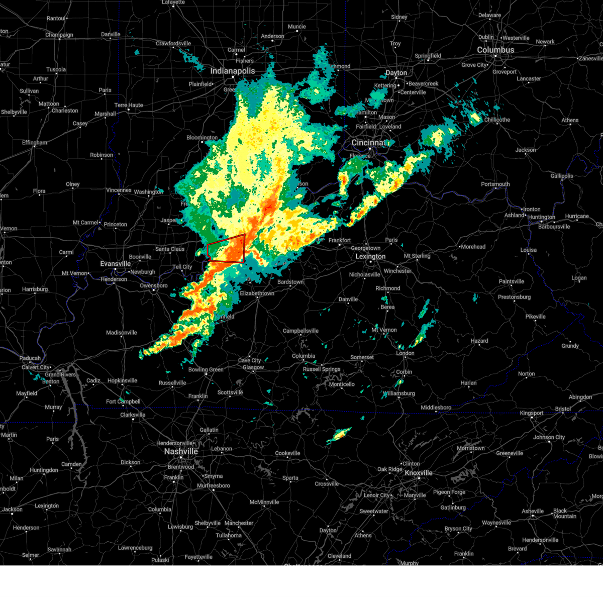 The storm which prompted the warning has weakened below severe limits, and no longer appears capable of producing a tornado. therefore, the warning will be allowed to expire. however, gusty winds and heavy rain are still possible with this thunderstorm. a tornado watch remains in effect until noon edt for south central indiana, and central kentucky. to report severe weather, contact your nearest law enforcement agency. they will relay your report to the national weather service louisville. The storm which prompted the warning has weakened below severe limits, and no longer appears capable of producing a tornado. therefore, the warning will be allowed to expire. however, gusty winds and heavy rain are still possible with this thunderstorm. a tornado watch remains in effect until noon edt for south central indiana, and central kentucky. to report severe weather, contact your nearest law enforcement agency. they will relay your report to the national weather service louisville.
|
| 4/2/2024 7:55 AM EDT |
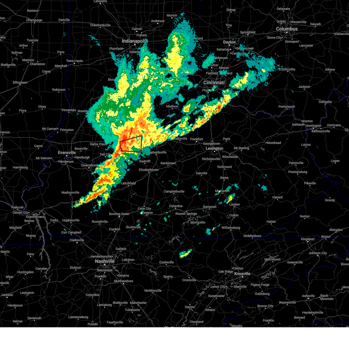 At 754 am edt, a severe squall line capable of producing both tornadoes and extensive straight line wind damage was located 7 miles southwest of carefree town, moving east at 60 mph (radar indicated rotation). Hazards include tornado. Flying debris will be dangerous to those caught without shelter. mobile homes will be damaged or destroyed. damage to roofs, windows, and vehicles will occur. tree damage is likely. these dangerous storms will be near, corydon around 810 am edt. Other locations impacted by this tornadic thunderstorm include crandall, roberta, concordia, lodale, battletown, fredonia, beechwood, white cloud, central, and new middletown. At 754 am edt, a severe squall line capable of producing both tornadoes and extensive straight line wind damage was located 7 miles southwest of carefree town, moving east at 60 mph (radar indicated rotation). Hazards include tornado. Flying debris will be dangerous to those caught without shelter. mobile homes will be damaged or destroyed. damage to roofs, windows, and vehicles will occur. tree damage is likely. these dangerous storms will be near, corydon around 810 am edt. Other locations impacted by this tornadic thunderstorm include crandall, roberta, concordia, lodale, battletown, fredonia, beechwood, white cloud, central, and new middletown.
|
| 4/2/2024 7:55 AM EDT |
 the tornado warning has been cancelled and is no longer in effect the tornado warning has been cancelled and is no longer in effect
|
| 4/2/2024 7:44 AM EDT |
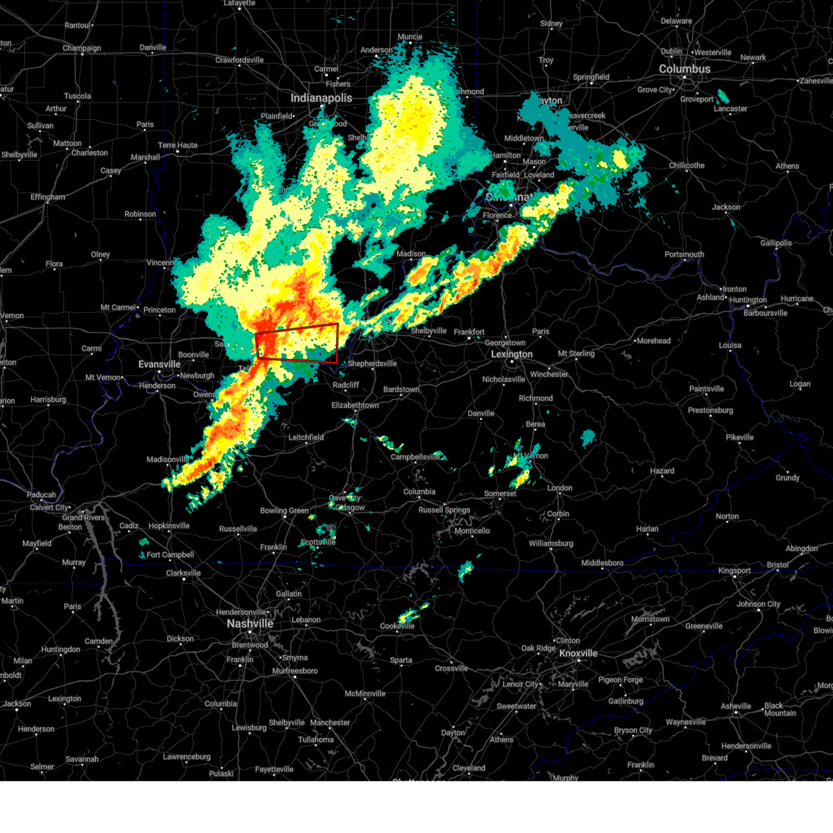 Torlmk the national weather service in louisville has issued a * tornado warning for, central harrison county in south central indiana, southeastern crawford county in south central indiana, northeastern perry county in south central indiana, northwestern meade county in central kentucky, * until 815 am edt/715 am cdt/. * at 744 am edt/644 am cdt/, a severe thunderstorm capable of producing a tornado was located 15 miles northeast of tell city, moving east at 60 mph (radar indicated rotation). Hazards include tornado. Flying debris will be dangerous to those caught without shelter. mobile homes will be damaged or destroyed. damage to roofs, windows, and vehicles will occur. tree damage is likely. this dangerous storm will be near, corydon around 810 am edt. Other locations impacted by this tornadic thunderstorm include crandall, roberta, ranger, beechwood, white cloud, terry, west fork, central, titus, and sulphur. Torlmk the national weather service in louisville has issued a * tornado warning for, central harrison county in south central indiana, southeastern crawford county in south central indiana, northeastern perry county in south central indiana, northwestern meade county in central kentucky, * until 815 am edt/715 am cdt/. * at 744 am edt/644 am cdt/, a severe thunderstorm capable of producing a tornado was located 15 miles northeast of tell city, moving east at 60 mph (radar indicated rotation). Hazards include tornado. Flying debris will be dangerous to those caught without shelter. mobile homes will be damaged or destroyed. damage to roofs, windows, and vehicles will occur. tree damage is likely. this dangerous storm will be near, corydon around 810 am edt. Other locations impacted by this tornadic thunderstorm include crandall, roberta, ranger, beechwood, white cloud, terry, west fork, central, titus, and sulphur.
|
| 8/7/2023 1:22 AM EDT |
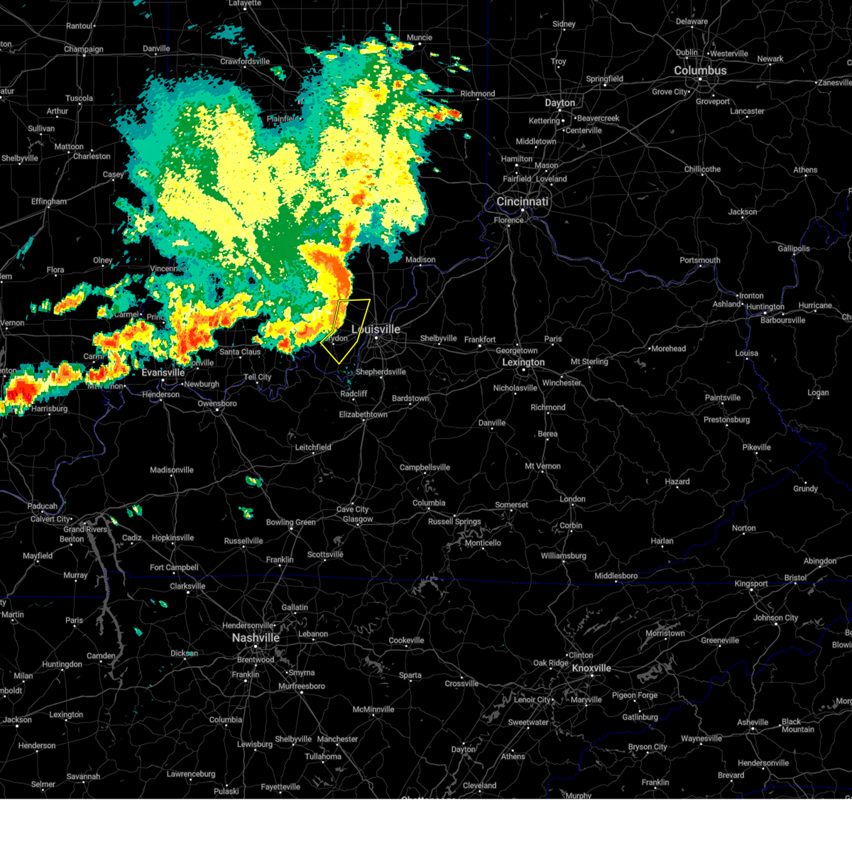 At 122 am edt, severe thunderstorms were located along a line extending from 13 miles northwest of new albany to near corydon, moving east at 55 mph (radar indicated). Hazards include 60 mph wind gusts and penny size hail. Expect damage to roofs, siding, and trees. Locations impacted include, corydon, galena, new pekin, palmyra, borden, greenville, lanesville, crandall, new middletown and navilleton. At 122 am edt, severe thunderstorms were located along a line extending from 13 miles northwest of new albany to near corydon, moving east at 55 mph (radar indicated). Hazards include 60 mph wind gusts and penny size hail. Expect damage to roofs, siding, and trees. Locations impacted include, corydon, galena, new pekin, palmyra, borden, greenville, lanesville, crandall, new middletown and navilleton.
|
| 8/7/2023 1:01 AM EDT |
 At 101 am edt, severe thunderstorms were located along a line extending from 9 miles southeast of paoli to 8 miles north of carefree town to near english, moving east at 55 mph (radar indicated). Hazards include 60 mph wind gusts and penny size hail. expect damage to roofs, siding, and trees At 101 am edt, severe thunderstorms were located along a line extending from 9 miles southeast of paoli to 8 miles north of carefree town to near english, moving east at 55 mph (radar indicated). Hazards include 60 mph wind gusts and penny size hail. expect damage to roofs, siding, and trees
|
| 7/2/2023 4:56 PM EDT |
 At 455 pm edt/355 pm cdt/, a severe thunderstorm was located 11 miles southwest of carefree town, moving east at 45 mph (radar indicated). Hazards include 70 mph wind gusts and penny size hail. Expect considerable tree damage. Damage is likely to mobile homes, roofs, and outbuildings. At 455 pm edt/355 pm cdt/, a severe thunderstorm was located 11 miles southwest of carefree town, moving east at 45 mph (radar indicated). Hazards include 70 mph wind gusts and penny size hail. Expect considerable tree damage. Damage is likely to mobile homes, roofs, and outbuildings.
|
| 6/29/2023 4:57 PM EDT |
 The severe thunderstorm warning for harrison, southeastern perry, northwestern meade, east central hancock and northwestern breckinridge counties will expire at 500 pm edt/400 pm cdt/, the storms which prompted the warning have moved out of the area. therefore, the warning will be allowed to expire. a severe thunderstorm watch remains in effect until 800 pm edt/700 pm cdt/ for south central indiana. a severe thunderstorm watch also remains in effect until 900 pm edt/800 pm cdt/ for south central indiana, and central kentucky. The severe thunderstorm warning for harrison, southeastern perry, northwestern meade, east central hancock and northwestern breckinridge counties will expire at 500 pm edt/400 pm cdt/, the storms which prompted the warning have moved out of the area. therefore, the warning will be allowed to expire. a severe thunderstorm watch remains in effect until 800 pm edt/700 pm cdt/ for south central indiana. a severe thunderstorm watch also remains in effect until 900 pm edt/800 pm cdt/ for south central indiana, and central kentucky.
|
| 6/29/2023 4:51 PM EDT |
 At 451 pm edt/351 pm cdt/, severe thunderstorms were located along a line extending from near corydon to 7 miles east of whitesville, moving southeast at 55 mph (radar indicated). Hazards include 60 mph wind gusts. Expect damage to roofs, siding, and trees. locations impacted include, corydon, hawesville, cannelton, cloverport, lanesville, crandall, new middletown, mauckport, new amsterdam and frymire. hail threat, radar indicated max hail size, <. 75 in wind threat, radar indicated max wind gust, 60 mph. At 451 pm edt/351 pm cdt/, severe thunderstorms were located along a line extending from near corydon to 7 miles east of whitesville, moving southeast at 55 mph (radar indicated). Hazards include 60 mph wind gusts. Expect damage to roofs, siding, and trees. locations impacted include, corydon, hawesville, cannelton, cloverport, lanesville, crandall, new middletown, mauckport, new amsterdam and frymire. hail threat, radar indicated max hail size, <. 75 in wind threat, radar indicated max wind gust, 60 mph.
|
| 6/29/2023 3:25 PM CDT |
 At 425 pm edt/325 pm cdt/, severe thunderstorms were located along a line extending from 7 miles northeast of english to near grandview, moving southeast at 55 mph (trained weather spotters). Hazards include 60 mph wind gusts and penny size hail. Expect damage to roofs, siding, and trees. locations impacted include, tell city, corydon, hawesville, carefree town, mount pleasant, lewisport, cannelton, cloverport, palmyra and marengo. hail threat, radar indicated max hail size, 0. 75 in wind threat, observed max wind gust, 60 mph. At 425 pm edt/325 pm cdt/, severe thunderstorms were located along a line extending from 7 miles northeast of english to near grandview, moving southeast at 55 mph (trained weather spotters). Hazards include 60 mph wind gusts and penny size hail. Expect damage to roofs, siding, and trees. locations impacted include, tell city, corydon, hawesville, carefree town, mount pleasant, lewisport, cannelton, cloverport, palmyra and marengo. hail threat, radar indicated max hail size, 0. 75 in wind threat, observed max wind gust, 60 mph.
|
| 6/29/2023 3:13 PM CDT |
 At 412 pm edt/312 pm cdt/, severe thunderstorms were located along a line extending from near paoli to near folsomville, moving southeast at 55 mph (radar indicated). Hazards include 60 mph wind gusts and penny size hail. expect damage to roofs, siding, and trees At 412 pm edt/312 pm cdt/, severe thunderstorms were located along a line extending from near paoli to near folsomville, moving southeast at 55 mph (radar indicated). Hazards include 60 mph wind gusts and penny size hail. expect damage to roofs, siding, and trees
|
| 6/25/2023 9:10 PM EDT |
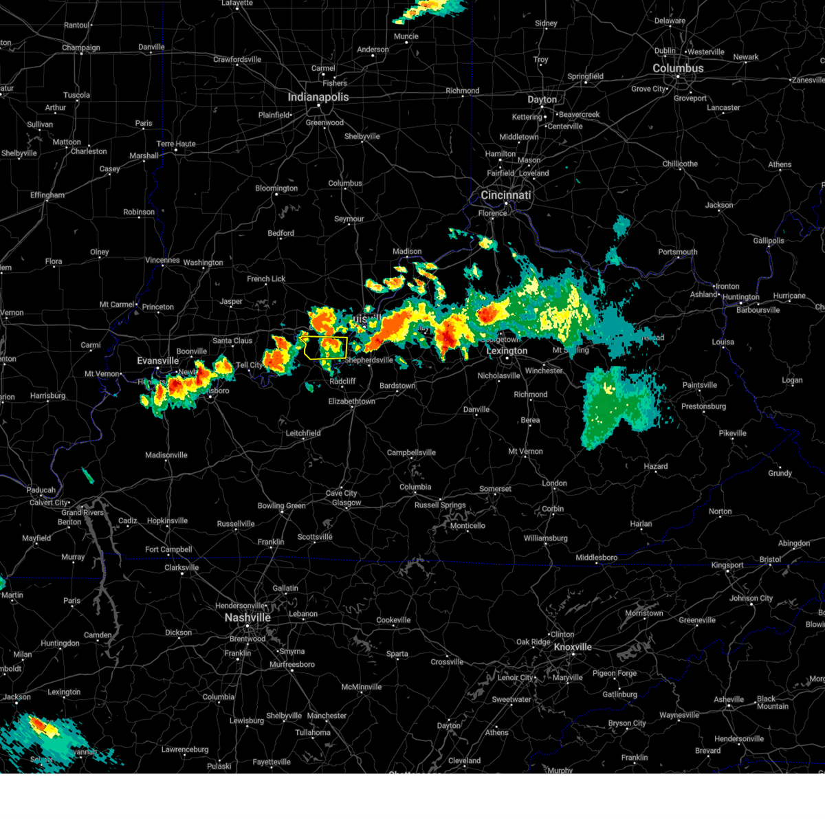 The severe thunderstorm warning for southern harrison county will expire at 915 pm edt, the storm which prompted the warning has weakened below severe limits, and no longer poses an immediate threat to life or property. therefore, the warning will be allowed to expire. however small hail, gusty winds and heavy rain are still possible with this thunderstorm. a tornado watch remains in effect until 1100 pm edt for south central indiana, and central kentucky. to report severe weather, contact your nearest law enforcement agency. they will relay your report to the national weather service louisville. The severe thunderstorm warning for southern harrison county will expire at 915 pm edt, the storm which prompted the warning has weakened below severe limits, and no longer poses an immediate threat to life or property. therefore, the warning will be allowed to expire. however small hail, gusty winds and heavy rain are still possible with this thunderstorm. a tornado watch remains in effect until 1100 pm edt for south central indiana, and central kentucky. to report severe weather, contact your nearest law enforcement agency. they will relay your report to the national weather service louisville.
|
| 6/25/2023 9:02 PM EDT |
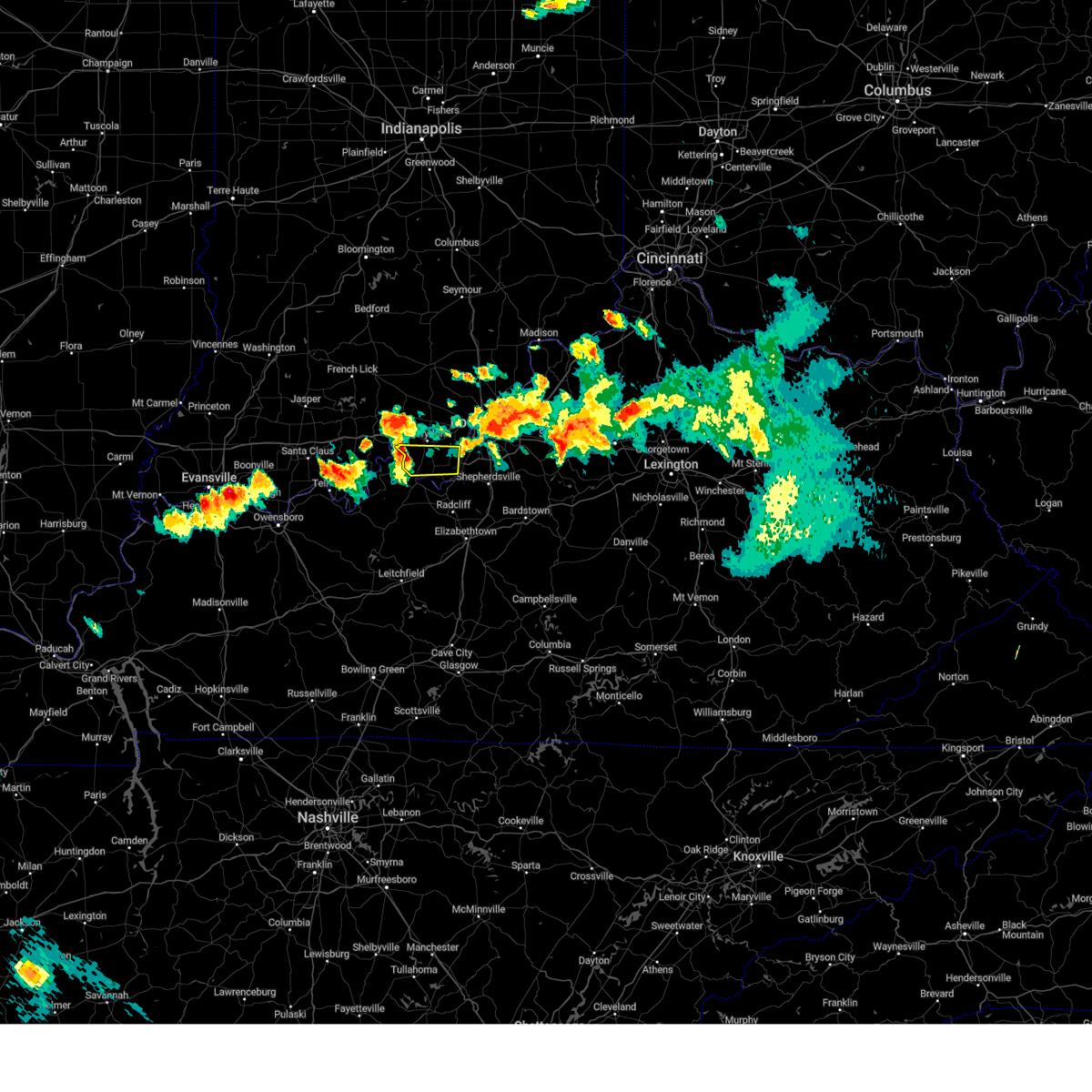 At 901 pm edt, a severe thunderstorm was located near corydon, moving east at 60 mph (radar indicated). Hazards include 60 mph wind gusts and quarter size hail. Hail damage to vehicles is expected. expect wind damage to roofs, siding, and trees. locations impacted include, elizabeth, new middletown, new amsterdam, central, titus, seven springs, lottick corner, valley city, glidas and macedonia. hail threat, radar indicated max hail size, 1. 00 in wind threat, radar indicated max wind gust, 60 mph. At 901 pm edt, a severe thunderstorm was located near corydon, moving east at 60 mph (radar indicated). Hazards include 60 mph wind gusts and quarter size hail. Hail damage to vehicles is expected. expect wind damage to roofs, siding, and trees. locations impacted include, elizabeth, new middletown, new amsterdam, central, titus, seven springs, lottick corner, valley city, glidas and macedonia. hail threat, radar indicated max hail size, 1. 00 in wind threat, radar indicated max wind gust, 60 mph.
|
| 6/25/2023 8:46 PM EDT |
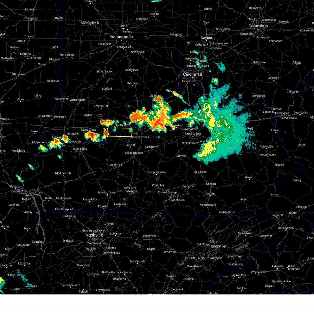 At 846 pm edt/746 pm cdt/, a severe thunderstorm was located 9 miles south of carefree town, moving east at 60 mph (radar indicated). Hazards include 60 mph wind gusts and quarter size hail. Hail damage to vehicles is expected. Expect wind damage to roofs, siding, and trees. At 846 pm edt/746 pm cdt/, a severe thunderstorm was located 9 miles south of carefree town, moving east at 60 mph (radar indicated). Hazards include 60 mph wind gusts and quarter size hail. Hail damage to vehicles is expected. Expect wind damage to roofs, siding, and trees.
|
| 6/25/2023 8:46 PM EDT |
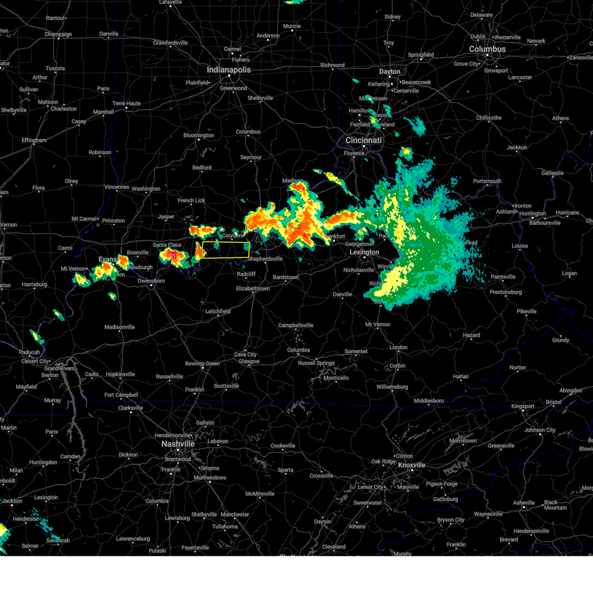 At 846 pm edt/746 pm cdt/, a severe thunderstorm was located 9 miles south of carefree town, moving east at 60 mph (radar indicated). Hazards include 60 mph wind gusts and quarter size hail. Hail damage to vehicles is expected. Expect wind damage to roofs, siding, and trees. At 846 pm edt/746 pm cdt/, a severe thunderstorm was located 9 miles south of carefree town, moving east at 60 mph (radar indicated). Hazards include 60 mph wind gusts and quarter size hail. Hail damage to vehicles is expected. Expect wind damage to roofs, siding, and trees.
|
| 6/25/2023 6:50 PM EDT |
 At 650 pm edt, a severe thunderstorm was located over fairdale, moving southeast at 35 mph (radar indicated). Hazards include two inch hail and 70 mph wind gusts. People and animals outdoors will be injured. expect hail damage to roofs, siding, windows, and vehicles. expect considerable tree damage. wind damage is also likely to mobile homes, roofs, and outbuildings. locations impacted include, louisville, jeffersonville, new albany, jeffersontown, st. matthews, shively, shepherdsville, lyndon, douglass hills and hurstbourne. thunderstorm damage threat, considerable hail threat, radar indicated max hail size, 2. 00 in wind threat, radar indicated max wind gust, 70 mph. At 650 pm edt, a severe thunderstorm was located over fairdale, moving southeast at 35 mph (radar indicated). Hazards include two inch hail and 70 mph wind gusts. People and animals outdoors will be injured. expect hail damage to roofs, siding, windows, and vehicles. expect considerable tree damage. wind damage is also likely to mobile homes, roofs, and outbuildings. locations impacted include, louisville, jeffersonville, new albany, jeffersontown, st. matthews, shively, shepherdsville, lyndon, douglass hills and hurstbourne. thunderstorm damage threat, considerable hail threat, radar indicated max hail size, 2. 00 in wind threat, radar indicated max wind gust, 70 mph.
|
| 6/25/2023 6:37 PM EDT |
 At 636 pm edt, a severe thunderstorm was located over st. dennis, moving southeast at 35 mph (radar indicated). Hazards include two inch hail and 70 mph wind gusts. People and animals outdoors will be injured. expect hail damage to roofs, siding, windows, and vehicles. expect considerable tree damage. wind damage is also likely to mobile homes, roofs, and outbuildings. locations impacted include, louisville, jeffersonville, new albany, jeffersontown, st. matthews, shively, shepherdsville, lyndon, douglass hills and hurstbourne. thunderstorm damage threat, considerable hail threat, radar indicated max hail size, 2. 00 in wind threat, radar indicated max wind gust, 70 mph. At 636 pm edt, a severe thunderstorm was located over st. dennis, moving southeast at 35 mph (radar indicated). Hazards include two inch hail and 70 mph wind gusts. People and animals outdoors will be injured. expect hail damage to roofs, siding, windows, and vehicles. expect considerable tree damage. wind damage is also likely to mobile homes, roofs, and outbuildings. locations impacted include, louisville, jeffersonville, new albany, jeffersontown, st. matthews, shively, shepherdsville, lyndon, douglass hills and hurstbourne. thunderstorm damage threat, considerable hail threat, radar indicated max hail size, 2. 00 in wind threat, radar indicated max wind gust, 70 mph.
|
| 6/25/2023 6:32 PM EDT |
 At 632 pm edt, a severe thunderstorm was located near st. dennis, moving southeast at 35 mph (radar indicated). Hazards include 70 mph wind gusts and half dollar size hail. Hail damage to vehicles is expected. expect considerable tree damage. wind damage is also likely to mobile homes, roofs, and outbuildings. locations impacted include, louisville, jeffersonville, new albany, jeffersontown, st. matthews, shively, shepherdsville, lyndon, douglass hills and hurstbourne. thunderstorm damage threat, considerable hail threat, radar indicated max hail size, 1. 25 in wind threat, radar indicated max wind gust, 70 mph. At 632 pm edt, a severe thunderstorm was located near st. dennis, moving southeast at 35 mph (radar indicated). Hazards include 70 mph wind gusts and half dollar size hail. Hail damage to vehicles is expected. expect considerable tree damage. wind damage is also likely to mobile homes, roofs, and outbuildings. locations impacted include, louisville, jeffersonville, new albany, jeffersontown, st. matthews, shively, shepherdsville, lyndon, douglass hills and hurstbourne. thunderstorm damage threat, considerable hail threat, radar indicated max hail size, 1. 25 in wind threat, radar indicated max wind gust, 70 mph.
|
| 6/25/2023 6:29 PM EDT |
 At 629 pm edt, a severe thunderstorm was located near st. dennis, moving southeast at 35 mph (radar indicated). Hazards include 60 mph wind gusts and quarter size hail. Hail damage to vehicles is expected. Expect wind damage to roofs, siding, and trees. At 629 pm edt, a severe thunderstorm was located near st. dennis, moving southeast at 35 mph (radar indicated). Hazards include 60 mph wind gusts and quarter size hail. Hail damage to vehicles is expected. Expect wind damage to roofs, siding, and trees.
|
| 6/25/2023 6:22 PM EDT |
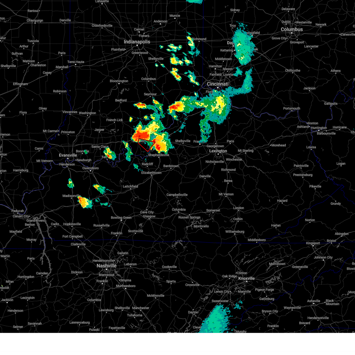 At 622 pm edt, a severe thunderstorm capable of producing a tornado was located near corydon, moving southeast at 40 mph (radar indicated rotation). Hazards include tornado and golf ball size hail. Flying debris will be dangerous to those caught without shelter. mobile homes will be damaged or destroyed. damage to roofs, windows, and vehicles will occur. tree damage is likely. locations impacted include, louisville, shively, corydon, st. Dennis, pleasure ridge park, lanesville, elizabeth, new middletown, seven springs and lottick corner. At 622 pm edt, a severe thunderstorm capable of producing a tornado was located near corydon, moving southeast at 40 mph (radar indicated rotation). Hazards include tornado and golf ball size hail. Flying debris will be dangerous to those caught without shelter. mobile homes will be damaged or destroyed. damage to roofs, windows, and vehicles will occur. tree damage is likely. locations impacted include, louisville, shively, corydon, st. Dennis, pleasure ridge park, lanesville, elizabeth, new middletown, seven springs and lottick corner.
|
| 6/25/2023 6:12 PM EDT |
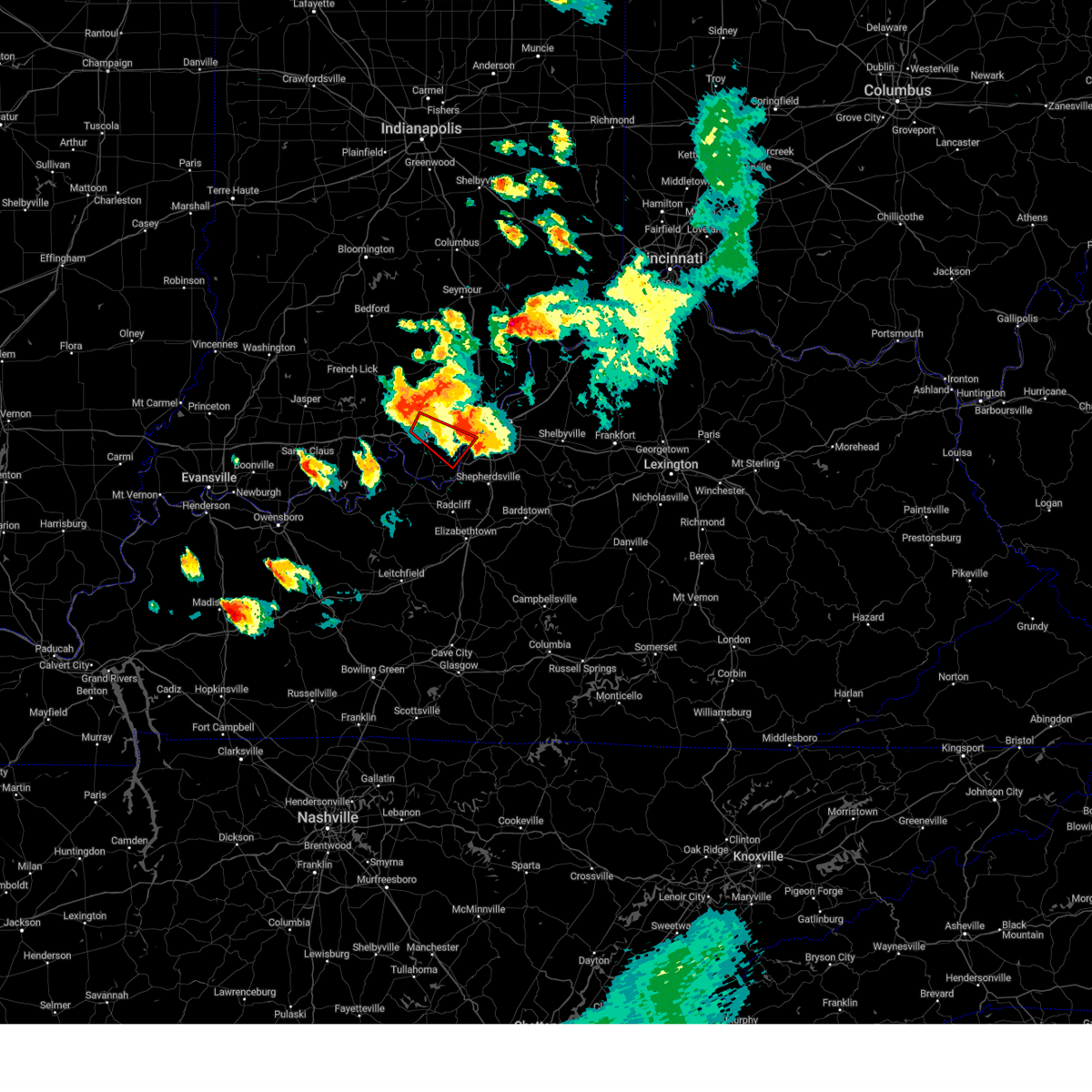 At 612 pm edt, a severe thunderstorm capable of producing a tornado was located near corydon, moving southeast at 40 mph (radar indicated rotation). Hazards include tornado and golf ball size hail. Flying debris will be dangerous to those caught without shelter. mobile homes will be damaged or destroyed. damage to roofs, windows, and vehicles will occur. Tree damage is likely. At 612 pm edt, a severe thunderstorm capable of producing a tornado was located near corydon, moving southeast at 40 mph (radar indicated rotation). Hazards include tornado and golf ball size hail. Flying debris will be dangerous to those caught without shelter. mobile homes will be damaged or destroyed. damage to roofs, windows, and vehicles will occur. Tree damage is likely.
|
| 6/25/2023 6:12 PM EDT |
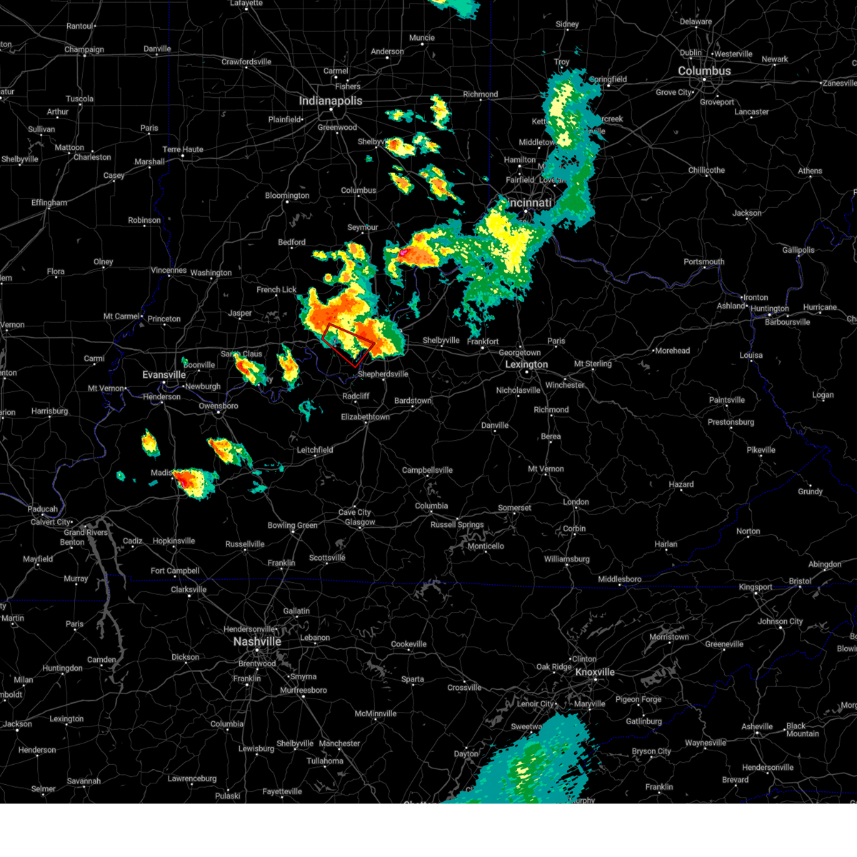 At 612 pm edt, a severe thunderstorm capable of producing a tornado was located near corydon, moving southeast at 40 mph (radar indicated rotation). Hazards include tornado and golf ball size hail. Flying debris will be dangerous to those caught without shelter. mobile homes will be damaged or destroyed. damage to roofs, windows, and vehicles will occur. Tree damage is likely. At 612 pm edt, a severe thunderstorm capable of producing a tornado was located near corydon, moving southeast at 40 mph (radar indicated rotation). Hazards include tornado and golf ball size hail. Flying debris will be dangerous to those caught without shelter. mobile homes will be damaged or destroyed. damage to roofs, windows, and vehicles will occur. Tree damage is likely.
|
| 6/25/2023 6:05 PM EDT |
 At 605 pm edt, a severe thunderstorm was located 7 miles northeast of carefree town, moving east at 45 mph (radar indicated). Hazards include 60 mph wind gusts and quarter size hail. Hail damage to vehicles is expected. Expect wind damage to roofs, siding, and trees. At 605 pm edt, a severe thunderstorm was located 7 miles northeast of carefree town, moving east at 45 mph (radar indicated). Hazards include 60 mph wind gusts and quarter size hail. Hail damage to vehicles is expected. Expect wind damage to roofs, siding, and trees.
|
| 6/25/2023 5:48 PM EDT |
 At 548 pm edt, a severe thunderstorm was located over corydon, moving southeast at 35 mph (radar indicated). Hazards include golf ball size hail and 60 mph wind gusts. People and animals outdoors will be injured. expect hail damage to roofs, siding, windows, and vehicles. Expect wind damage to roofs, siding, and trees. At 548 pm edt, a severe thunderstorm was located over corydon, moving southeast at 35 mph (radar indicated). Hazards include golf ball size hail and 60 mph wind gusts. People and animals outdoors will be injured. expect hail damage to roofs, siding, windows, and vehicles. Expect wind damage to roofs, siding, and trees.
|
| 5/9/2023 3:17 AM EDT |
 At 317 am edt, a severe thunderstorm was located 7 miles southeast of corydon, moving east at 30 mph (radar indicated). Hazards include 60 mph wind gusts and half dollar size hail. Hail damage to vehicles is expected. expect wind damage to roofs, siding, and trees. locations impacted include, valley station, pleasure ridge par, pleasure ridge park, st. dennis, elizabeth, new middletown, bridgeport, sugar grove, seven springs and lottick corner. hail threat, radar indicated max hail size, 1. 25 in wind threat, radar indicated max wind gust, 60 mph. At 317 am edt, a severe thunderstorm was located 7 miles southeast of corydon, moving east at 30 mph (radar indicated). Hazards include 60 mph wind gusts and half dollar size hail. Hail damage to vehicles is expected. expect wind damage to roofs, siding, and trees. locations impacted include, valley station, pleasure ridge par, pleasure ridge park, st. dennis, elizabeth, new middletown, bridgeport, sugar grove, seven springs and lottick corner. hail threat, radar indicated max hail size, 1. 25 in wind threat, radar indicated max wind gust, 60 mph.
|
| 5/9/2023 3:12 AM EDT |
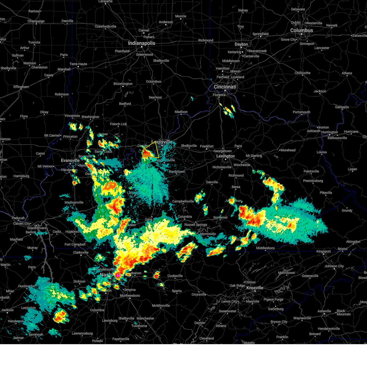 At 311 am edt, a severe thunderstorm was located near corydon, moving east at 35 mph (radar indicated). Hazards include golf ball size hail and 60 mph wind gusts. People and animals outdoors will be injured. expect hail damage to roofs, siding, windows, and vehicles. expect wind damage to roofs, siding, and trees. locations impacted include, valley station, pleasure ridge par, pleasure ridge park, st. dennis, lanesville, elizabeth, new middletown, seven springs, lottick corner and bridgeport. thunderstorm damage threat, considerable hail threat, radar indicated max hail size, 1. 75 in wind threat, radar indicated max wind gust, 60 mph. At 311 am edt, a severe thunderstorm was located near corydon, moving east at 35 mph (radar indicated). Hazards include golf ball size hail and 60 mph wind gusts. People and animals outdoors will be injured. expect hail damage to roofs, siding, windows, and vehicles. expect wind damage to roofs, siding, and trees. locations impacted include, valley station, pleasure ridge par, pleasure ridge park, st. dennis, lanesville, elizabeth, new middletown, seven springs, lottick corner and bridgeport. thunderstorm damage threat, considerable hail threat, radar indicated max hail size, 1. 75 in wind threat, radar indicated max wind gust, 60 mph.
|
| 5/9/2023 3:03 AM EDT |
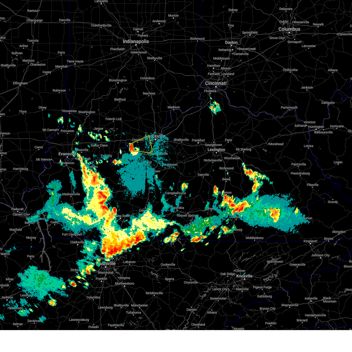 At 303 am edt, a severe thunderstorm was located near corydon, moving east at 35 mph (radar indicated). Hazards include ping pong ball size hail and 60 mph wind gusts. People and animals outdoors will be injured. expect hail damage to roofs, siding, windows, and vehicles. Expect wind damage to roofs, siding, and trees. At 303 am edt, a severe thunderstorm was located near corydon, moving east at 35 mph (radar indicated). Hazards include ping pong ball size hail and 60 mph wind gusts. People and animals outdoors will be injured. expect hail damage to roofs, siding, windows, and vehicles. Expect wind damage to roofs, siding, and trees.
|
| 4/5/2023 4:31 PM EDT |
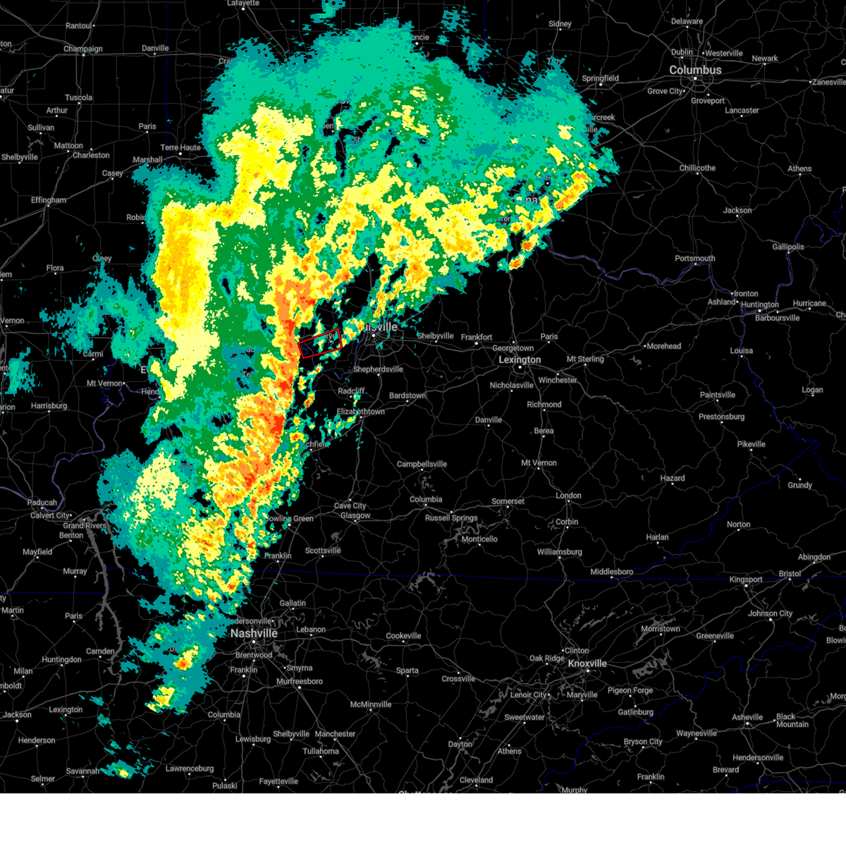 At 431 pm edt, a severe thunderstorm capable of producing a tornado was located near carefree town, moving east at 50 mph (radar indicated rotation). Hazards include tornado. Flying debris will be dangerous to those caught without shelter. mobile homes will be damaged or destroyed. damage to roofs, windows, and vehicles will occur. tree damage is likely. This dangerous storm will be near, corydon around 445 pm edt. At 431 pm edt, a severe thunderstorm capable of producing a tornado was located near carefree town, moving east at 50 mph (radar indicated rotation). Hazards include tornado. Flying debris will be dangerous to those caught without shelter. mobile homes will be damaged or destroyed. damage to roofs, windows, and vehicles will occur. tree damage is likely. This dangerous storm will be near, corydon around 445 pm edt.
|
| 4/5/2023 4:23 PM EDT |
 At 423 pm edt/323 pm cdt/, severe thunderstorms were located along a line extending from 7 miles southwest of carefree town to near hardinsburg, moving east at 55 mph (radar indicated). Hazards include 60 mph wind gusts. expect damage to roofs, siding, and trees At 423 pm edt/323 pm cdt/, severe thunderstorms were located along a line extending from 7 miles southwest of carefree town to near hardinsburg, moving east at 55 mph (radar indicated). Hazards include 60 mph wind gusts. expect damage to roofs, siding, and trees
|
| 3/3/2023 2:55 PM EST |
 The severe thunderstorm warning for harrison, northeastern crawford and eastern meade counties will expire at 300 pm est, the storms which prompted the warning have moved out of the area. therefore, the warning will be allowed to expire. a tornado watch remains in effect until 500 pm est for south central indiana, and central kentucky. The severe thunderstorm warning for harrison, northeastern crawford and eastern meade counties will expire at 300 pm est, the storms which prompted the warning have moved out of the area. therefore, the warning will be allowed to expire. a tornado watch remains in effect until 500 pm est for south central indiana, and central kentucky.
|
| 3/3/2023 2:47 PM EST |
 At 246 pm est, severe thunderstorms were located along a line extending from 7 miles southeast of paoli to 8 miles northeast of brandenburg, moving northeast at 70 mph (trained weather spotters and weather observing stations). Hazards include 70 mph wind gusts. Expect considerable tree damage. damage is likely to mobile homes, roofs, and outbuildings. Locations impacted include, corydon, palmyra, milltown, lanesville, elizabeth, crandall, new middletown, laconia, byrneville and white cloud. At 246 pm est, severe thunderstorms were located along a line extending from 7 miles southeast of paoli to 8 miles northeast of brandenburg, moving northeast at 70 mph (trained weather spotters and weather observing stations). Hazards include 70 mph wind gusts. Expect considerable tree damage. damage is likely to mobile homes, roofs, and outbuildings. Locations impacted include, corydon, palmyra, milltown, lanesville, elizabeth, crandall, new middletown, laconia, byrneville and white cloud.
|
| 3/3/2023 2:35 PM EST |
 At 234 pm est/134 pm cst/, severe thunderstorms were located along a line extending from 6 miles southwest of carefree town to 16 miles east of hardinsburg, moving northeast at 75 mph. these are destructive storms! (trained weather spotters). Hazards include 80 mph wind gusts. Flying debris will be dangerous to those caught without shelter. mobile homes will be heavily damaged. expect considerable damage to roofs, windows, and vehicles. extensive tree damage and power outages are likely. Locations impacted include, corydon, brandenburg, carefree town, mount pleasant, webster, irvington, palmyra, milltown, lanesville and leavenworth. At 234 pm est/134 pm cst/, severe thunderstorms were located along a line extending from 6 miles southwest of carefree town to 16 miles east of hardinsburg, moving northeast at 75 mph. these are destructive storms! (trained weather spotters). Hazards include 80 mph wind gusts. Flying debris will be dangerous to those caught without shelter. mobile homes will be heavily damaged. expect considerable damage to roofs, windows, and vehicles. extensive tree damage and power outages are likely. Locations impacted include, corydon, brandenburg, carefree town, mount pleasant, webster, irvington, palmyra, milltown, lanesville and leavenworth.
|
| 3/3/2023 2:32 PM EST |
 At 231 pm est/131 pm cst/, severe thunderstorms were located along a line extending from near english to near brandenburg, moving northeast at 80 mph. these are destructive storms! (weather observing stations). Hazards include 80 mph wind gusts. Flying debris will be dangerous to those caught without shelter. mobile homes will be heavily damaged. expect considerable damage to roofs, windows, and vehicles. extensive tree damage and power outages are likely. Locations impacted include, corydon. At 231 pm est/131 pm cst/, severe thunderstorms were located along a line extending from near english to near brandenburg, moving northeast at 80 mph. these are destructive storms! (weather observing stations). Hazards include 80 mph wind gusts. Flying debris will be dangerous to those caught without shelter. mobile homes will be heavily damaged. expect considerable damage to roofs, windows, and vehicles. extensive tree damage and power outages are likely. Locations impacted include, corydon.
|
| 3/3/2023 2:20 PM EST |
 At 220 pm est/120 pm cst/, severe thunderstorms were located along a line extending from 11 miles southwest of english to 8 miles east of hardinsburg, moving northeast at 80 mph (radar indicated). Hazards include 70 mph wind gusts. Expect considerable tree damage. damage is likely to mobile homes, roofs, and outbuildings. severe thunderstorms will be near, brandenburg around 235 pm est. Other locations in the path of these severe thunderstorms include corydon. At 220 pm est/120 pm cst/, severe thunderstorms were located along a line extending from 11 miles southwest of english to 8 miles east of hardinsburg, moving northeast at 80 mph (radar indicated). Hazards include 70 mph wind gusts. Expect considerable tree damage. damage is likely to mobile homes, roofs, and outbuildings. severe thunderstorms will be near, brandenburg around 235 pm est. Other locations in the path of these severe thunderstorms include corydon.
|
| 7/6/2022 3:40 PM EDT |
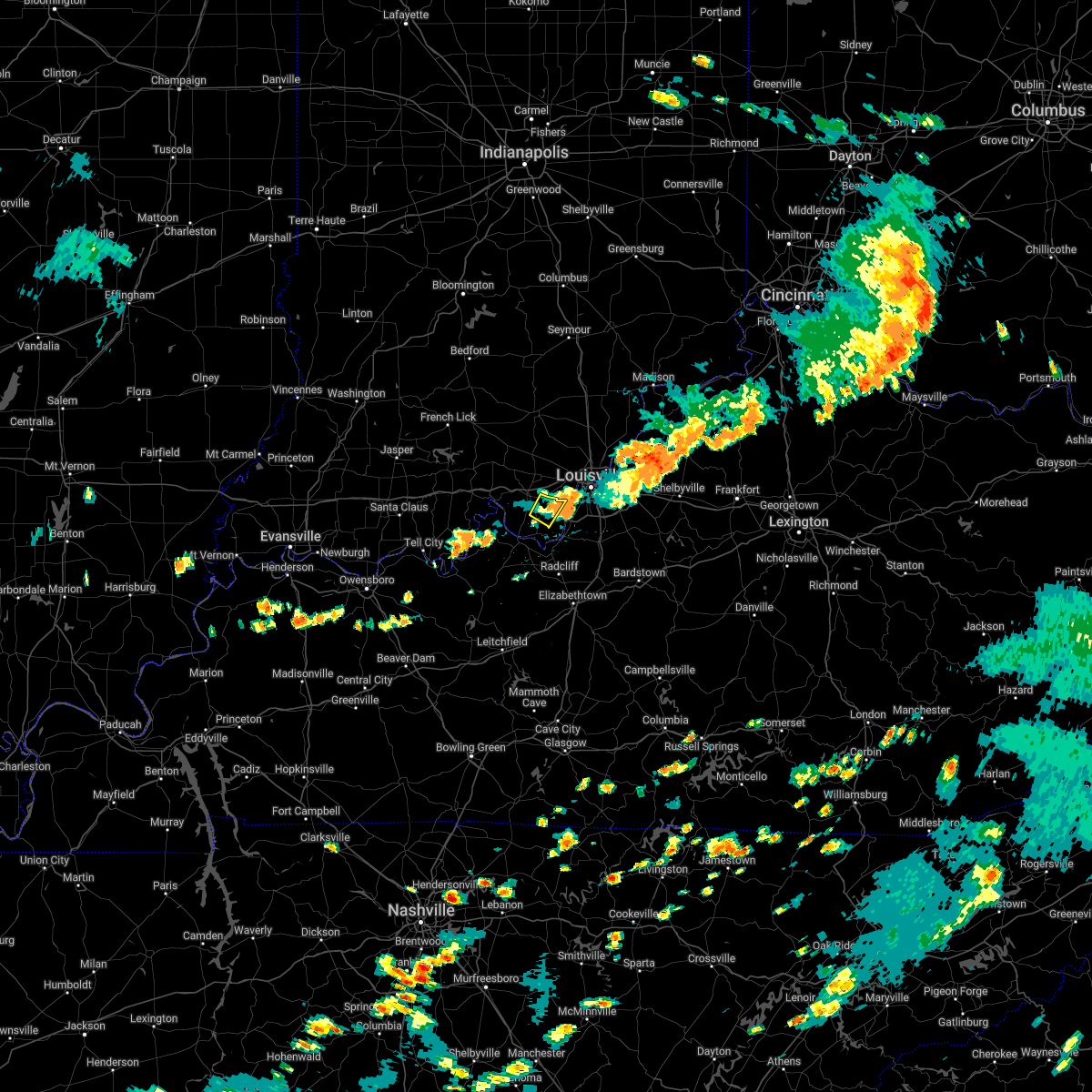 The severe thunderstorm warning for southeastern harrison county will expire at 345 pm edt, the storm which prompted the warning has moved out of the area. therefore, the warning will be allowed to expire. a severe thunderstorm watch remains in effect until 700 pm edt for south central indiana. remember, a severe thunderstorm warning still remains in effect for eastern harrison county, indiana. The severe thunderstorm warning for southeastern harrison county will expire at 345 pm edt, the storm which prompted the warning has moved out of the area. therefore, the warning will be allowed to expire. a severe thunderstorm watch remains in effect until 700 pm edt for south central indiana. remember, a severe thunderstorm warning still remains in effect for eastern harrison county, indiana.
|
| 7/6/2022 3:31 PM EDT |
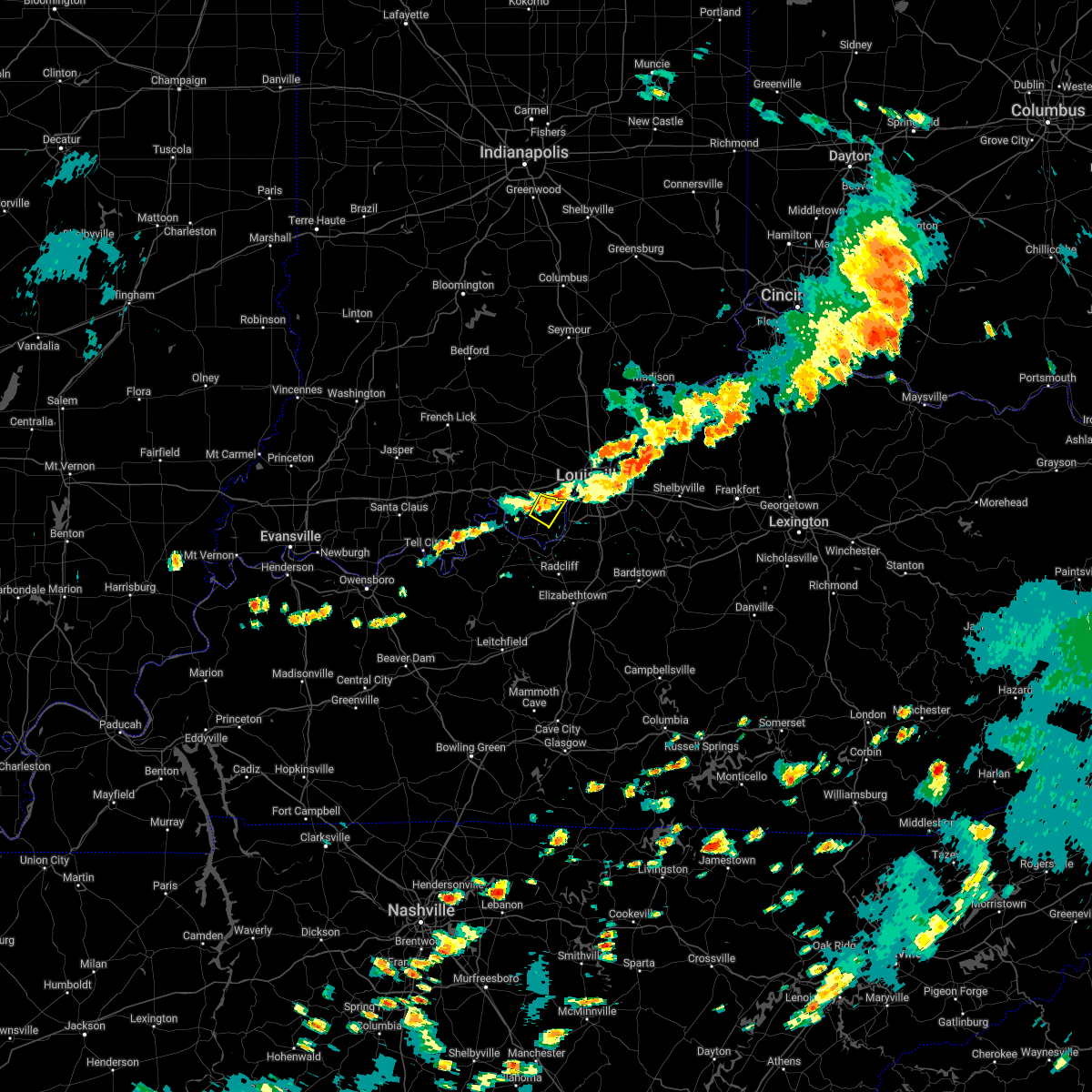 At 331 pm edt, a severe thunderstorm was located 7 miles west of valley station, moving east at 25 mph (radar indicated). Hazards include 60 mph wind gusts. Expect damage to roofs, siding, and trees. locations impacted include, elizabeth, new middletown, seven springs, dogwood and lottick corner. hail threat, radar indicated max hail size, <. 75 in wind threat, radar indicated max wind gust, 60 mph. At 331 pm edt, a severe thunderstorm was located 7 miles west of valley station, moving east at 25 mph (radar indicated). Hazards include 60 mph wind gusts. Expect damage to roofs, siding, and trees. locations impacted include, elizabeth, new middletown, seven springs, dogwood and lottick corner. hail threat, radar indicated max hail size, <. 75 in wind threat, radar indicated max wind gust, 60 mph.
|
| 7/6/2022 3:21 PM EDT |
 At 320 pm edt, a severe thunderstorm was located near corydon, moving southeast at 20 mph (radar indicated). Hazards include 60 mph wind gusts. Expect damage to roofs, siding, and trees. this severe thunderstorm will remain over mainly rural areas of central harrison county, including the following locations, elizabeth, valley city, central, new middletown, seven springs, dogwood and lottick corner. hail threat, radar indicated max hail size, <. 75 in wind threat, radar indicated max wind gust, 60 mph. At 320 pm edt, a severe thunderstorm was located near corydon, moving southeast at 20 mph (radar indicated). Hazards include 60 mph wind gusts. Expect damage to roofs, siding, and trees. this severe thunderstorm will remain over mainly rural areas of central harrison county, including the following locations, elizabeth, valley city, central, new middletown, seven springs, dogwood and lottick corner. hail threat, radar indicated max hail size, <. 75 in wind threat, radar indicated max wind gust, 60 mph.
|
| 7/6/2022 3:10 PM EDT |
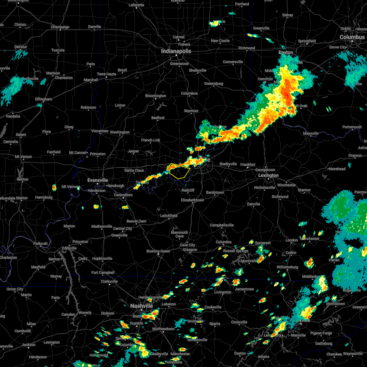 At 310 pm edt, a severe thunderstorm was located near corydon, moving southeast at 20 mph (radar indicated). Hazards include 60 mph wind gusts and penny size hail. Expect damage to roofs, siding, and trees. this severe thunderstorm will be near, corydon around 315 pm edt. hail threat, radar indicated max hail size, 0. 75 in wind threat, radar indicated max wind gust, 60 mph. At 310 pm edt, a severe thunderstorm was located near corydon, moving southeast at 20 mph (radar indicated). Hazards include 60 mph wind gusts and penny size hail. Expect damage to roofs, siding, and trees. this severe thunderstorm will be near, corydon around 315 pm edt. hail threat, radar indicated max hail size, 0. 75 in wind threat, radar indicated max wind gust, 60 mph.
|
| 6/22/2022 4:31 PM EDT |
 At 430 pm edt, severe thunderstorms were from glenview to shively to 7 miles southwest of valley station, moving east at 25 mph (radar indicated). Hazards include 60 mph wind gusts and quarter size hail. Hail damage to vehicles is expected. Expect wind damage to roofs, siding, and trees. At 430 pm edt, severe thunderstorms were from glenview to shively to 7 miles southwest of valley station, moving east at 25 mph (radar indicated). Hazards include 60 mph wind gusts and quarter size hail. Hail damage to vehicles is expected. Expect wind damage to roofs, siding, and trees.
|
| 6/22/2022 4:22 PM EDT |
 At 421 pm edt, the leading edge of strong gusty winds from severe thunderstorms was from near jeffersonville to shively to 8 miles west of valley station to 8 miles south of brandenburg, moving southeast at 35 mph (radar indicated). Hazards include 60 mph wind gusts and nickel size hail. Expect damage to roofs, siding, and trees. locations impacted include, louisville, jeffersonville, new albany, shively, brandenburg, glenview, pleasure ridge park, and st. dennis. hail threat, radar indicated max hail size, 0. 88 in wind threat, radar indicated max wind gust, 60 mph. At 421 pm edt, the leading edge of strong gusty winds from severe thunderstorms was from near jeffersonville to shively to 8 miles west of valley station to 8 miles south of brandenburg, moving southeast at 35 mph (radar indicated). Hazards include 60 mph wind gusts and nickel size hail. Expect damage to roofs, siding, and trees. locations impacted include, louisville, jeffersonville, new albany, shively, brandenburg, glenview, pleasure ridge park, and st. dennis. hail threat, radar indicated max hail size, 0. 88 in wind threat, radar indicated max wind gust, 60 mph.
|
| 6/22/2022 4:13 PM EDT |
 At 413 pm edt, severe thunderstorms were from near new albany to near corydon to 9 miles southwest of brandenburg, moving east at 25 mph (radar indicated). Hazards include 60 mph wind gusts and quarter size hail. Hail damage to vehicles is expected. Expect wind damage to roofs, siding, and trees. At 413 pm edt, severe thunderstorms were from near new albany to near corydon to 9 miles southwest of brandenburg, moving east at 25 mph (radar indicated). Hazards include 60 mph wind gusts and quarter size hail. Hail damage to vehicles is expected. Expect wind damage to roofs, siding, and trees.
|
| 5/21/2022 4:43 PM EDT |
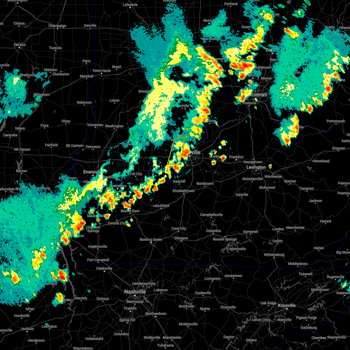 The severe thunderstorm warning for northeastern harrison, northwestern clark, western floyd and southeastern washington counties will expire at 445 pm edt, the storms which prompted the warning have moved out of the area. therefore, the warning will be allowed to expire. a severe thunderstorm watch remains in effect until 700 pm edt for south central indiana. The severe thunderstorm warning for northeastern harrison, northwestern clark, western floyd and southeastern washington counties will expire at 445 pm edt, the storms which prompted the warning have moved out of the area. therefore, the warning will be allowed to expire. a severe thunderstorm watch remains in effect until 700 pm edt for south central indiana.
|
| 5/21/2022 4:36 PM EDT |
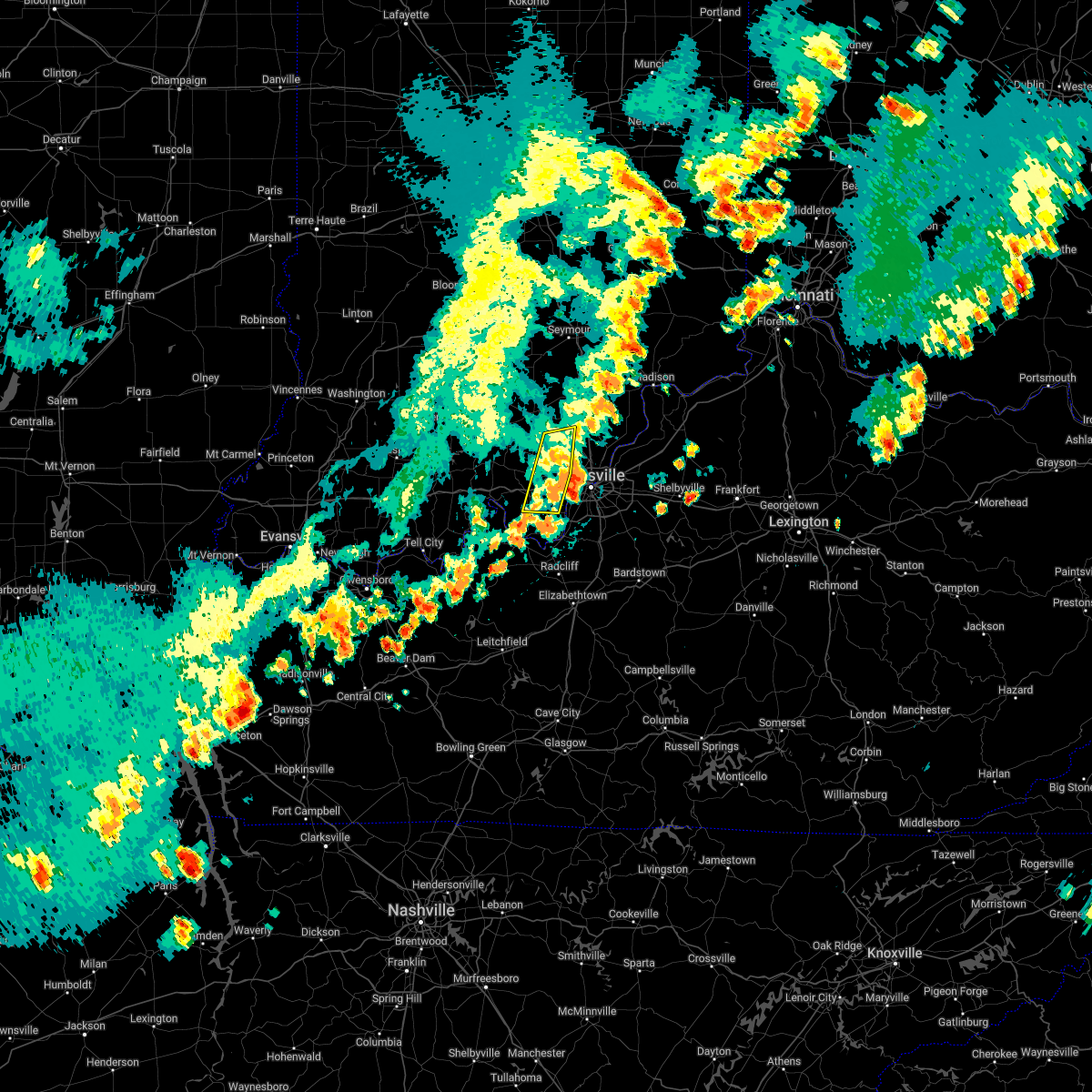 At 436 pm edt, severe thunderstorms were located along a line extending from 13 miles southeast of salem to near brandenburg, moving east at 20 mph (radar indicated). Hazards include 60 mph wind gusts. Expect damage to roofs, siding, and trees. locations impacted include, corydon, galena, new pekin, borden, greenville, lanesville, crandall, new middletown, navilleton and starlight. hail threat, radar indicated max hail size, <. 75 in wind threat, radar indicated max wind gust, 60 mph. At 436 pm edt, severe thunderstorms were located along a line extending from 13 miles southeast of salem to near brandenburg, moving east at 20 mph (radar indicated). Hazards include 60 mph wind gusts. Expect damage to roofs, siding, and trees. locations impacted include, corydon, galena, new pekin, borden, greenville, lanesville, crandall, new middletown, navilleton and starlight. hail threat, radar indicated max hail size, <. 75 in wind threat, radar indicated max wind gust, 60 mph.
|
| 5/21/2022 3:58 PM EDT |
 At 358 pm edt, severe thunderstorms were located along a line extending from 10 miles southwest of salem to 12 miles south of carefree town, moving east at 50 mph (trained weather spotters). Hazards include 60 mph wind gusts. Expect damage to roofs, siding, and trees. these severe thunderstorms will remain over mainly rural areas of harrison, northwestern clark, western floyd and southern washington counties, including the following locations, crandall, starlight, byrneville, white cloud, shorts corner, martinsburg, bradford, south boston, livonia and fairdale. hail threat, radar indicated max hail size, <. 75 in wind threat, observed max wind gust, 60 mph. At 358 pm edt, severe thunderstorms were located along a line extending from 10 miles southwest of salem to 12 miles south of carefree town, moving east at 50 mph (trained weather spotters). Hazards include 60 mph wind gusts. Expect damage to roofs, siding, and trees. these severe thunderstorms will remain over mainly rural areas of harrison, northwestern clark, western floyd and southern washington counties, including the following locations, crandall, starlight, byrneville, white cloud, shorts corner, martinsburg, bradford, south boston, livonia and fairdale. hail threat, radar indicated max hail size, <. 75 in wind threat, observed max wind gust, 60 mph.
|
| 5/19/2022 4:33 PM EDT |
 At 433 pm edt, a severe thunderstorm was located near corydon, moving east at 25 mph (radar indicated). Hazards include 60 mph wind gusts and penny size hail. Expect damage to roofs, siding, and trees. locations impacted include, corydon, lanesville, crandall, new middletown, breckenridge, moberly and white cloud. hail threat, radar indicated max hail size, 0. 75 in wind threat, radar indicated max wind gust, 60 mph. At 433 pm edt, a severe thunderstorm was located near corydon, moving east at 25 mph (radar indicated). Hazards include 60 mph wind gusts and penny size hail. Expect damage to roofs, siding, and trees. locations impacted include, corydon, lanesville, crandall, new middletown, breckenridge, moberly and white cloud. hail threat, radar indicated max hail size, 0. 75 in wind threat, radar indicated max wind gust, 60 mph.
|
| 5/19/2022 4:23 PM EDT |
 At 423 pm edt, a severe thunderstorm was located near corydon, moving east at 25 mph (radar indicated). Hazards include 60 mph wind gusts and nickel size hail. Expect damage to roofs, siding, and trees. locations impacted include, corydon, lanesville, crandall, new middletown, breckenridge, moberly, white cloud, central, dogwood and new salisbury. hail threat, radar indicated max hail size, 0. 88 in wind threat, radar indicated max wind gust, 60 mph. At 423 pm edt, a severe thunderstorm was located near corydon, moving east at 25 mph (radar indicated). Hazards include 60 mph wind gusts and nickel size hail. Expect damage to roofs, siding, and trees. locations impacted include, corydon, lanesville, crandall, new middletown, breckenridge, moberly, white cloud, central, dogwood and new salisbury. hail threat, radar indicated max hail size, 0. 88 in wind threat, radar indicated max wind gust, 60 mph.
|
| 5/19/2022 4:10 PM EDT |
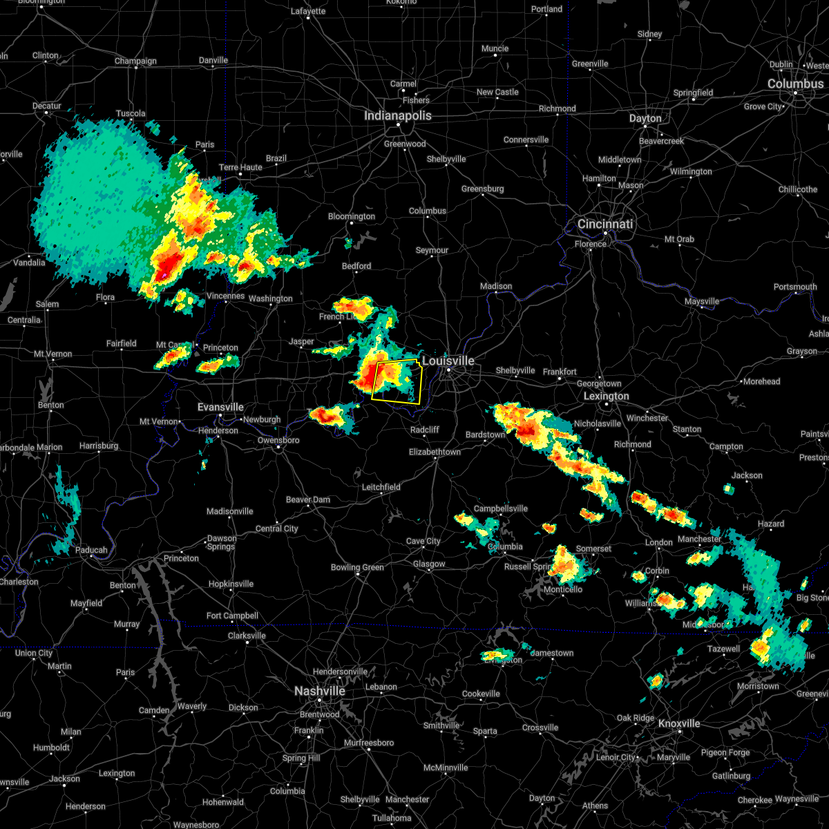 At 410 pm edt, a severe thunderstorm was located near carefree town, moving east at 25 mph (radar indicated). Hazards include 60 mph wind gusts and quarter size hail. Hail damage to vehicles is expected. Expect wind damage to roofs, siding, and trees. At 410 pm edt, a severe thunderstorm was located near carefree town, moving east at 25 mph (radar indicated). Hazards include 60 mph wind gusts and quarter size hail. Hail damage to vehicles is expected. Expect wind damage to roofs, siding, and trees.
|
| 4/13/2022 8:02 PM EDT |
 At 802 pm edt, a severe thunderstorm was located near valley station, moving east at 50 mph (radar indicated). Hazards include 70 mph wind gusts and quarter size hail. Hail damage to vehicles is expected. expect considerable tree damage. wind damage is also likely to mobile homes, roofs, and outbuildings. locations impacted include, shively, shepherdsville, valley station, pleasure ridge par, pleasure ridge park, st. Dennis, radcliff, muldraugh, west point and lanesville. At 802 pm edt, a severe thunderstorm was located near valley station, moving east at 50 mph (radar indicated). Hazards include 70 mph wind gusts and quarter size hail. Hail damage to vehicles is expected. expect considerable tree damage. wind damage is also likely to mobile homes, roofs, and outbuildings. locations impacted include, shively, shepherdsville, valley station, pleasure ridge par, pleasure ridge park, st. Dennis, radcliff, muldraugh, west point and lanesville.
|
| 4/13/2022 7:48 PM EDT |
 At 747 pm edt, a severe thunderstorm was located over brandenburg, moving east at 50 mph (radar indicated). Hazards include 70 mph wind gusts and penny size hail. Expect considerable tree damage. Damage is likely to mobile homes, roofs, and outbuildings. At 747 pm edt, a severe thunderstorm was located over brandenburg, moving east at 50 mph (radar indicated). Hazards include 70 mph wind gusts and penny size hail. Expect considerable tree damage. Damage is likely to mobile homes, roofs, and outbuildings.
|
| 7/20/2020 2:40 PM EDT |
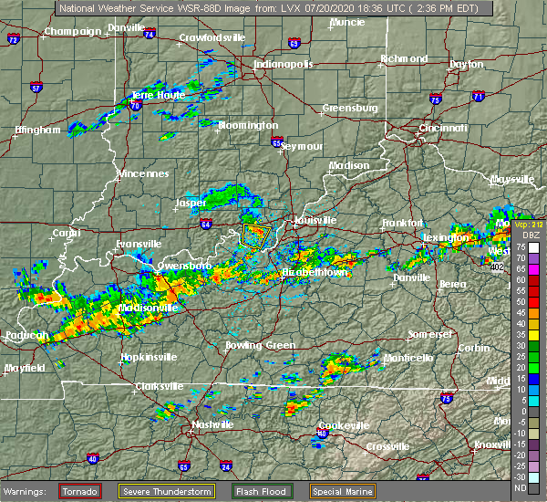 The severe thunderstorm warning for southern harrison county will expire at 245 pm edt, the storm which prompted the warning has weakened. however gusty winds to 45 mph are still possible with this thunderstorm. report severe weather to local law enforcement, post your report to the national weather service louisville facebook page, or tweet your report using hashtag l, m, k, spotter. The severe thunderstorm warning for southern harrison county will expire at 245 pm edt, the storm which prompted the warning has weakened. however gusty winds to 45 mph are still possible with this thunderstorm. report severe weather to local law enforcement, post your report to the national weather service louisville facebook page, or tweet your report using hashtag l, m, k, spotter.
|
| 7/20/2020 2:27 PM EDT |
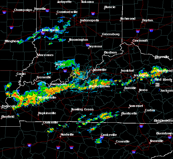 At 226 pm edt, a severe thunderstorm was located near corydon, moving east at 25 mph (radar indicated). Hazards include 60 mph wind gusts. Expect damage to roofs, siding, and trees. Locations impacted include, corydon, new middletown, laconia, breckenridge, valley city, white cloud, glidas, central, and dogwood. At 226 pm edt, a severe thunderstorm was located near corydon, moving east at 25 mph (radar indicated). Hazards include 60 mph wind gusts. Expect damage to roofs, siding, and trees. Locations impacted include, corydon, new middletown, laconia, breckenridge, valley city, white cloud, glidas, central, and dogwood.
|
| 7/20/2020 2:14 PM EDT |
 At 214 pm edt, a severe thunderstorm was located 9 miles southeast of carefree town, moving east at 25 mph (radar indicated). Hazards include 60 mph wind gusts. expect damage to roofs, siding, and trees At 214 pm edt, a severe thunderstorm was located 9 miles southeast of carefree town, moving east at 25 mph (radar indicated). Hazards include 60 mph wind gusts. expect damage to roofs, siding, and trees
|
| 7/20/2020 2:14 PM EDT |
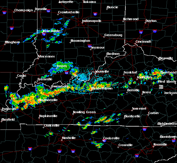 At 214 pm edt, a severe thunderstorm was located 9 miles southeast of carefree town, moving east at 25 mph (radar indicated). Hazards include 60 mph wind gusts. expect damage to roofs, siding, and trees At 214 pm edt, a severe thunderstorm was located 9 miles southeast of carefree town, moving east at 25 mph (radar indicated). Hazards include 60 mph wind gusts. expect damage to roofs, siding, and trees
|
| 7/11/2020 9:03 PM EDT |
 At 902 pm edt, severe thunderstorms were from near carefree town to near hollyvilla, moving southeast at 35 mph (radar indicated). Hazards include 60 mph wind gusts. Expect damage to roofs, siding, and trees. locations impacted include, louisville, jeffersonville, new albany, jeffersontown, st. Matthews, shively, shepherdsville, lyndon, hurstbourne, and corydon. At 902 pm edt, severe thunderstorms were from near carefree town to near hollyvilla, moving southeast at 35 mph (radar indicated). Hazards include 60 mph wind gusts. Expect damage to roofs, siding, and trees. locations impacted include, louisville, jeffersonville, new albany, jeffersontown, st. Matthews, shively, shepherdsville, lyndon, hurstbourne, and corydon.
|
| 7/11/2020 8:40 PM EDT |
 At 840 pm edt, severe thunderstorms were from near english to near pleasure ridge park, moving southeast at 35 mph (radar indicated). Hazards include 60 mph wind gusts and penny size hail. expect damage to roofs, siding, and trees At 840 pm edt, severe thunderstorms were from near english to near pleasure ridge park, moving southeast at 35 mph (radar indicated). Hazards include 60 mph wind gusts and penny size hail. expect damage to roofs, siding, and trees
|
| 7/11/2020 8:27 PM EDT |
 At 827 pm edt, severe thunderstorms were from near coldstream to fern creek to near corydon, moving southeast at 45 mph (radar indicated). Hazards include 60 mph wind gusts and nickel size hail. Expect damage to roofs, siding, and trees. locations impacted include, louisville, jeffersonville, new albany, jeffersontown, st. Matthews, shively, shepherdsville, lyndon, middletown, and douglass hills. At 827 pm edt, severe thunderstorms were from near coldstream to fern creek to near corydon, moving southeast at 45 mph (radar indicated). Hazards include 60 mph wind gusts and nickel size hail. Expect damage to roofs, siding, and trees. locations impacted include, louisville, jeffersonville, new albany, jeffersontown, st. Matthews, shively, shepherdsville, lyndon, middletown, and douglass hills.
|
| 7/11/2020 8:09 PM EDT |
 At 807 pm edt, severe thunderstorms were from 10 miles north of prospect to near jeffersonville to 6 miles north of corydon, moving southeast at 45 mph (radar indicated). Hazards include 60 mph wind gusts and nickel size hail. Expect damage to roofs, siding, and trees. severe thunderstorms will be near, louisville around 815 pm edt. jeffersontown around 820 pm edt. anchorage around 825 pm edt. middletown around 830 pm edt. Other locations impacted by these severe thunderstorms include crandall, clarksville, bradford, clark siding, buckner, watson, floyds knobs, and utica. At 807 pm edt, severe thunderstorms were from 10 miles north of prospect to near jeffersonville to 6 miles north of corydon, moving southeast at 45 mph (radar indicated). Hazards include 60 mph wind gusts and nickel size hail. Expect damage to roofs, siding, and trees. severe thunderstorms will be near, louisville around 815 pm edt. jeffersontown around 820 pm edt. anchorage around 825 pm edt. middletown around 830 pm edt. Other locations impacted by these severe thunderstorms include crandall, clarksville, bradford, clark siding, buckner, watson, floyds knobs, and utica.
|
| 6/27/2020 6:16 PM EDT |
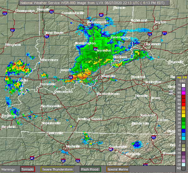 At 616 pm edt, a severe thunderstorm was located just west of corydon, moving southeast at 30 mph (radar indicated). Hazards include 60 mph wind gusts. Expect damage to roofs, siding, and trees. Locations impacted include, corydon, carefree town, leavenworth, new middletown, breckenridge, valley city, moberly, white cloud, glidas and central. At 616 pm edt, a severe thunderstorm was located just west of corydon, moving southeast at 30 mph (radar indicated). Hazards include 60 mph wind gusts. Expect damage to roofs, siding, and trees. Locations impacted include, corydon, carefree town, leavenworth, new middletown, breckenridge, valley city, moberly, white cloud, glidas and central.
|
| 6/27/2020 5:57 PM EDT |
 At 557 pm edt, a severe thunderstorm was located near carefree town, moving southeast at 35 mph (radar indicated). Hazards include 60 mph wind gusts. expect damage to roofs, siding, and trees At 557 pm edt, a severe thunderstorm was located near carefree town, moving southeast at 35 mph (radar indicated). Hazards include 60 mph wind gusts. expect damage to roofs, siding, and trees
|
| 4/8/2020 10:28 PM EDT |
 At 1028 pm edt, severe thunderstorms were located along a line extending from 8 miles southwest of madison to 10 miles northwest of prospect to 8 miles south of carefree town, moving east at 50 mph (radar indicated). Hazards include 70 mph wind gusts. Expect considerable tree damage. Damage is likely to mobile homes, roofs, and outbuildings. At 1028 pm edt, severe thunderstorms were located along a line extending from 8 miles southwest of madison to 10 miles northwest of prospect to 8 miles south of carefree town, moving east at 50 mph (radar indicated). Hazards include 70 mph wind gusts. Expect considerable tree damage. Damage is likely to mobile homes, roofs, and outbuildings.
|
| 4/8/2020 10:02 PM EDT |
 At 1001 pm edt/901 pm cdt/, a severe thunderstorm was located 8 miles west of english, moving southeast at 70 mph (radar indicated). Hazards include 70 mph wind gusts. Expect considerable tree damage. Damage is likely to mobile homes, roofs, and outbuildings. At 1001 pm edt/901 pm cdt/, a severe thunderstorm was located 8 miles west of english, moving southeast at 70 mph (radar indicated). Hazards include 70 mph wind gusts. Expect considerable tree damage. Damage is likely to mobile homes, roofs, and outbuildings.
|
| 3/28/2020 10:44 PM EDT |
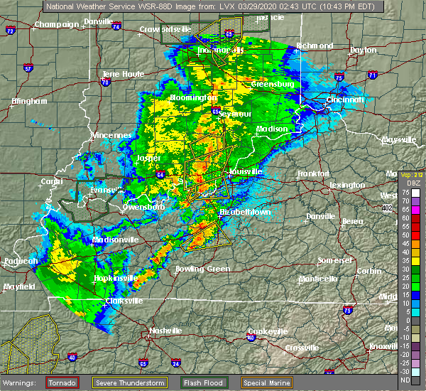 At 1044 pm edt, a severe thunderstorm was located 8 miles west of new albany, moving northeast at 55 mph (radar indicated). Hazards include 60 mph wind gusts. Expect damage to roofs, siding, and trees. Locations impacted include, new albany, corydon, sellersburg, galena, blue river, new pekin, palmyra, borden, greenville and lanesville. At 1044 pm edt, a severe thunderstorm was located 8 miles west of new albany, moving northeast at 55 mph (radar indicated). Hazards include 60 mph wind gusts. Expect damage to roofs, siding, and trees. Locations impacted include, new albany, corydon, sellersburg, galena, blue river, new pekin, palmyra, borden, greenville and lanesville.
|
| 3/28/2020 10:28 PM EDT |
 At 1028 pm edt, a severe thunderstorm was located near corydon, moving east at 55 mph (radar indicated). Hazards include 60 mph wind gusts. expect damage to roofs, siding, and trees At 1028 pm edt, a severe thunderstorm was located near corydon, moving east at 55 mph (radar indicated). Hazards include 60 mph wind gusts. expect damage to roofs, siding, and trees
|
| 1/11/2020 10:26 AM EST |
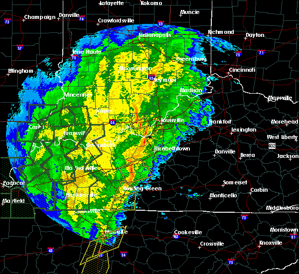 At 1025 am est, a severe thunderstorm was located over corydon, moving east at 40 mph (radar indicated). Hazards include 60 mph wind gusts. Expect damage to roofs, siding, and trees. Locations impacted include, corydon, lanesville, crandall, new middletown, breckenridge and byrneville. At 1025 am est, a severe thunderstorm was located over corydon, moving east at 40 mph (radar indicated). Hazards include 60 mph wind gusts. Expect damage to roofs, siding, and trees. Locations impacted include, corydon, lanesville, crandall, new middletown, breckenridge and byrneville.
|
| 1/11/2020 10:17 AM EST |
 At 1017 am est, a severe thunderstorm was located near corydon, moving east at 40 mph (radar indicated). Hazards include 60 mph wind gusts. expect damage to roofs, siding, and trees At 1017 am est, a severe thunderstorm was located near corydon, moving east at 40 mph (radar indicated). Hazards include 60 mph wind gusts. expect damage to roofs, siding, and trees
|
| 8/22/2019 3:01 AM EDT |
 At 242 am edt, a severe thunderstorm was located near carefree town, moving east at 40 mph (radar indicated). Hazards include 60 mph wind gusts. expect damage to roofs, siding, and trees At 242 am edt, a severe thunderstorm was located near carefree town, moving east at 40 mph (radar indicated). Hazards include 60 mph wind gusts. expect damage to roofs, siding, and trees
|
| 8/22/2019 2:43 AM EDT |
 The national weather service in louisville has issued a * severe thunderstorm warning for. central harrison county in south central indiana. southwestern floyd county in south central indiana. until 315 am edt. At 242 am edt, a severe thunderstorm was located near carefree. The national weather service in louisville has issued a * severe thunderstorm warning for. central harrison county in south central indiana. southwestern floyd county in south central indiana. until 315 am edt. At 242 am edt, a severe thunderstorm was located near carefree.
|
| 6/23/2019 4:26 PM EDT |
 The tornado warning for east central harrison, south central floyd and west central jefferson counties will expire at 430 pm edt, the storm which prompted the warning has weakened below severe limits, and no longer appears capable of producing a tornado. therefore, the warning will be allowed to expire. however gusty winds are still possible with this thunderstorm. a severe thunderstorm watch remains in effect until 800 pm edt for south central indiana. a severe thunderstorm watch also remains in effect until 800 pm edt for central kentucky. report severe weather to local law enforcement, post your report to the national weather service louisville facebook page, or tweet your report using hashtag l, m, k, spotter. The tornado warning for east central harrison, south central floyd and west central jefferson counties will expire at 430 pm edt, the storm which prompted the warning has weakened below severe limits, and no longer appears capable of producing a tornado. therefore, the warning will be allowed to expire. however gusty winds are still possible with this thunderstorm. a severe thunderstorm watch remains in effect until 800 pm edt for south central indiana. a severe thunderstorm watch also remains in effect until 800 pm edt for central kentucky. report severe weather to local law enforcement, post your report to the national weather service louisville facebook page, or tweet your report using hashtag l, m, k, spotter.
|
| 6/23/2019 4:26 PM EDT |
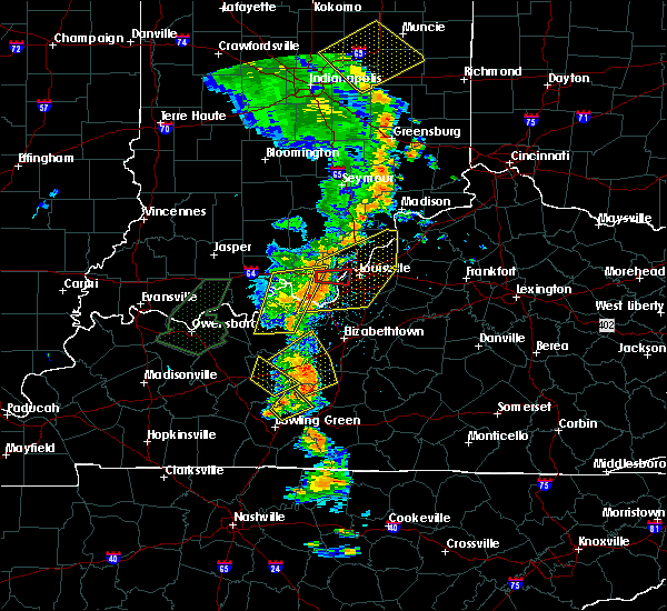 The tornado warning for east central harrison, south central floyd and west central jefferson counties will expire at 430 pm edt, the storm which prompted the warning has weakened below severe limits, and no longer appears capable of producing a tornado. therefore, the warning will be allowed to expire. however gusty winds are still possible with this thunderstorm. a severe thunderstorm watch remains in effect until 800 pm edt for south central indiana. a severe thunderstorm watch also remains in effect until 800 pm edt for central kentucky. report severe weather to local law enforcement, post your report to the national weather service louisville facebook page, or tweet your report using hashtag l, m, k, spotter. The tornado warning for east central harrison, south central floyd and west central jefferson counties will expire at 430 pm edt, the storm which prompted the warning has weakened below severe limits, and no longer appears capable of producing a tornado. therefore, the warning will be allowed to expire. however gusty winds are still possible with this thunderstorm. a severe thunderstorm watch remains in effect until 800 pm edt for south central indiana. a severe thunderstorm watch also remains in effect until 800 pm edt for central kentucky. report severe weather to local law enforcement, post your report to the national weather service louisville facebook page, or tweet your report using hashtag l, m, k, spotter.
|
| 6/23/2019 4:23 PM EDT |
 At 423 pm edt, severe thunderstorms were located along a line extending from 9 miles south of borden to 8 miles west of valley station to near brandenburg, moving east at 50 mph (radar indicated). Hazards include 60 mph wind gusts and penny size hail. expect damage to roofs, siding, and trees At 423 pm edt, severe thunderstorms were located along a line extending from 9 miles south of borden to 8 miles west of valley station to near brandenburg, moving east at 50 mph (radar indicated). Hazards include 60 mph wind gusts and penny size hail. expect damage to roofs, siding, and trees
|
| 6/23/2019 4:16 PM EDT |
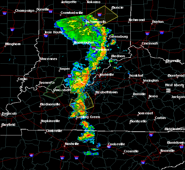 At 416 pm edt, a severe thunderstorm capable of producing a tornado was located near corydon, moving east at 40 mph (radar indicated rotation). Hazards include tornado. Flying debris will be dangerous to those caught without shelter. mobile homes will be damaged or destroyed. damage to roofs, windows, and vehicles will occur. Tree damage is likely. At 416 pm edt, a severe thunderstorm capable of producing a tornado was located near corydon, moving east at 40 mph (radar indicated rotation). Hazards include tornado. Flying debris will be dangerous to those caught without shelter. mobile homes will be damaged or destroyed. damage to roofs, windows, and vehicles will occur. Tree damage is likely.
|
| 6/5/2019 9:45 PM EDT |
 At 944 pm edt/844 pm cdt/, severe thunderstorms were located along a line extending from near pleasure ridge park to 10 miles south of carefree town, moving south at 35 mph (law enforcement reported trees down in crawford county). Hazards include 60 mph wind gusts. Expect damage to roofs, siding, and trees. Locations impacted include, corydon, carefree town, mount pleasant, lanesville, leavenworth, elizabeth, new middletown, alton, new amsterdam and roberta. At 944 pm edt/844 pm cdt/, severe thunderstorms were located along a line extending from near pleasure ridge park to 10 miles south of carefree town, moving south at 35 mph (law enforcement reported trees down in crawford county). Hazards include 60 mph wind gusts. Expect damage to roofs, siding, and trees. Locations impacted include, corydon, carefree town, mount pleasant, lanesville, leavenworth, elizabeth, new middletown, alton, new amsterdam and roberta.
|
| 6/5/2019 9:17 PM EDT |
 At 915 pm edt/815 pm cdt/, severe thunderstorms were located along a line extending from 9 miles southwest of new providence town to near english, moving south at 35 mph (radar indicated). Hazards include 60 to 70 mph wind gusts. Expect considerable tree damage. damage is likely to mobile homes, roofs, and outbuildings. Widespread trees down reported in orange county from this storm. At 915 pm edt/815 pm cdt/, severe thunderstorms were located along a line extending from 9 miles southwest of new providence town to near english, moving south at 35 mph (radar indicated). Hazards include 60 to 70 mph wind gusts. Expect considerable tree damage. damage is likely to mobile homes, roofs, and outbuildings. Widespread trees down reported in orange county from this storm.
|
| 12/31/2018 3:38 PM EST |
 At 338 pm est, a severe thunderstorm was located 8 miles southeast of corydon, moving east at 55 mph (radar indicated). Hazards include 70 mph wind gusts. Expect considerable tree damage. Damage is likely to mobile homes, roofs, and outbuildings. At 338 pm est, a severe thunderstorm was located 8 miles southeast of corydon, moving east at 55 mph (radar indicated). Hazards include 70 mph wind gusts. Expect considerable tree damage. Damage is likely to mobile homes, roofs, and outbuildings.
|
| 9/25/2018 4:54 PM EDT |
 At 454 pm edt, a severe thunderstorm was located near corydon, moving east at 20 mph (radar indicated). Hazards include 60 mph wind gusts. Expect damage to roofs, siding, and trees. Locations impacted include, corydon, lanesville, elizabeth, crandall, new middletown, rosewood, fishtown, central, seven springs and lottick corner. At 454 pm edt, a severe thunderstorm was located near corydon, moving east at 20 mph (radar indicated). Hazards include 60 mph wind gusts. Expect damage to roofs, siding, and trees. Locations impacted include, corydon, lanesville, elizabeth, crandall, new middletown, rosewood, fishtown, central, seven springs and lottick corner.
|
| 9/25/2018 4:28 PM EDT |
 At 426 pm edt, a severe thunderstorm was located 7 miles south of carefree town, moving east at 20 mph (radar indicated). Hazards include 60 mph wind gusts. Expect damage to roofs, siding, and trees. Saturated soils from recent rains could allow trees to topple over in the stronger wind gusts. At 426 pm edt, a severe thunderstorm was located 7 miles south of carefree town, moving east at 20 mph (radar indicated). Hazards include 60 mph wind gusts. Expect damage to roofs, siding, and trees. Saturated soils from recent rains could allow trees to topple over in the stronger wind gusts.
|
| 8/15/2018 7:49 PM EDT |
 At 748 pm edt/648 pm cdt/, severe thunderstorms were located along a line extending from near seymour to new providence town to 10 miles southeast of hardinsburg, moving northeast at 45 mph (radar indicated). Hazards include 60 mph wind gusts. expect damage to roofs, siding, and trees At 748 pm edt/648 pm cdt/, severe thunderstorms were located along a line extending from near seymour to new providence town to 10 miles southeast of hardinsburg, moving northeast at 45 mph (radar indicated). Hazards include 60 mph wind gusts. expect damage to roofs, siding, and trees
|
| 7/20/2018 9:35 PM EDT |
 At 935 pm edt, severe thunderstorms were located along a line extending from near corydon to 7 miles north of brandenburg, moving east at 50 mph (radar indicated). Hazards include 60 mph wind gusts and quarter size hail. Hail damage to vehicles is expected. Expect wind damage to roofs, siding, and trees. At 935 pm edt, severe thunderstorms were located along a line extending from near corydon to 7 miles north of brandenburg, moving east at 50 mph (radar indicated). Hazards include 60 mph wind gusts and quarter size hail. Hail damage to vehicles is expected. Expect wind damage to roofs, siding, and trees.
|
| 7/20/2018 2:24 PM EDT |
 At 224 pm edt, a confirmed tornado was located near new middletown, moving east at 20 mph (weather spotters confirmed tornado). Hazards include damaging tornado and baseball size hail. Flying debris will be dangerous to those caught without shelter. mobile homes will be damaged or destroyed. damage to roofs, windows, and vehicles will occur. tree damage is likely. Locations impacted include, new middletown, bridgeport, seven springs and lottick corner. At 224 pm edt, a confirmed tornado was located near new middletown, moving east at 20 mph (weather spotters confirmed tornado). Hazards include damaging tornado and baseball size hail. Flying debris will be dangerous to those caught without shelter. mobile homes will be damaged or destroyed. damage to roofs, windows, and vehicles will occur. tree damage is likely. Locations impacted include, new middletown, bridgeport, seven springs and lottick corner.
|
| 7/20/2018 2:16 PM EDT |
 At 216 pm edt, a confirmed large and extremely dangerous tornado was located near new middletown, moving east at 30 mph. this is a particularly dangerous situation. take cover now! (weather spotters confirmed tornado). Hazards include damaging tornado. You are in a life-threatening situation. flying debris may be deadly to those caught without shelter. mobile homes will be destroyed. considerable damage to homes, businesses, and vehicles is likely and complete destruction is possible. Locations impacted include, elizabeth, new middletown, bridgeport, fishtown, sugar grove, seven springs and lottick corner. At 216 pm edt, a confirmed large and extremely dangerous tornado was located near new middletown, moving east at 30 mph. this is a particularly dangerous situation. take cover now! (weather spotters confirmed tornado). Hazards include damaging tornado. You are in a life-threatening situation. flying debris may be deadly to those caught without shelter. mobile homes will be destroyed. considerable damage to homes, businesses, and vehicles is likely and complete destruction is possible. Locations impacted include, elizabeth, new middletown, bridgeport, fishtown, sugar grove, seven springs and lottick corner.
|
| 7/20/2018 2:09 PM EDT |
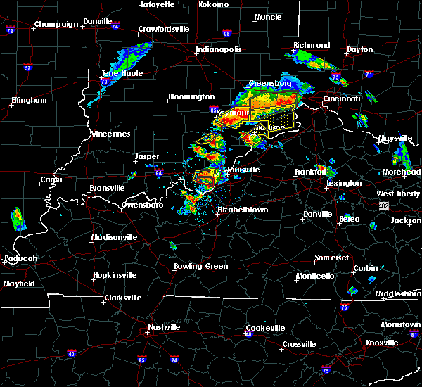 At 209 pm edt, a severe thunderstorm was located near st. dennis, moving east at 30 mph. this is a very dangerous storm (radar indicated). Hazards include baseball size hail and 70 mph wind gusts. People and animals outdoors will be severely injured. expect shattered windows, extensive damage to roofs, siding, and vehicles. locations impacted include, corydon, lanesville, elizabeth, new middletown, bridgeport, edwardsville, breckenridge, sugar grove, seven springs and lottick corner. A tornado watch remains in effect until 900 pm edt for south central indiana. At 209 pm edt, a severe thunderstorm was located near st. dennis, moving east at 30 mph. this is a very dangerous storm (radar indicated). Hazards include baseball size hail and 70 mph wind gusts. People and animals outdoors will be severely injured. expect shattered windows, extensive damage to roofs, siding, and vehicles. locations impacted include, corydon, lanesville, elizabeth, new middletown, bridgeport, edwardsville, breckenridge, sugar grove, seven springs and lottick corner. A tornado watch remains in effect until 900 pm edt for south central indiana.
|
| 7/20/2018 2:09 PM EDT |
 At 213 pm edt, a confirmed tornado was located near corydon, moving east at 30 mph (radar confirmed tornado). Hazards include damaging tornado and baseball size hail. Flying debris will be dangerous to those caught without shelter. mobile homes will be damaged or destroyed. damage to roofs, windows, and vehicles will occur. tree damage is likely. Locations impacted include, elizabeth, new middletown, bridgeport, fishtown, sugar grove, seven springs and lottick corner. At 213 pm edt, a confirmed tornado was located near corydon, moving east at 30 mph (radar confirmed tornado). Hazards include damaging tornado and baseball size hail. Flying debris will be dangerous to those caught without shelter. mobile homes will be damaged or destroyed. damage to roofs, windows, and vehicles will occur. tree damage is likely. Locations impacted include, elizabeth, new middletown, bridgeport, fishtown, sugar grove, seven springs and lottick corner.
|
| 7/20/2018 2:00 PM EDT |
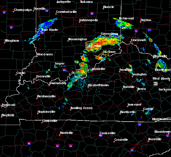 At 200 pm edt, a severe thunderstorm capable of producing a tornado was located near corydon, moving east at 25 mph (radar indicated rotation). Hazards include tornado and baseball size hail. Flying debris will be dangerous to those caught without shelter. mobile homes will be damaged or destroyed. damage to roofs, windows, and vehicles will occur. Tree damage is likely. At 200 pm edt, a severe thunderstorm capable of producing a tornado was located near corydon, moving east at 25 mph (radar indicated rotation). Hazards include tornado and baseball size hail. Flying debris will be dangerous to those caught without shelter. mobile homes will be damaged or destroyed. damage to roofs, windows, and vehicles will occur. Tree damage is likely.
|
| 7/20/2018 1:55 PM EDT |
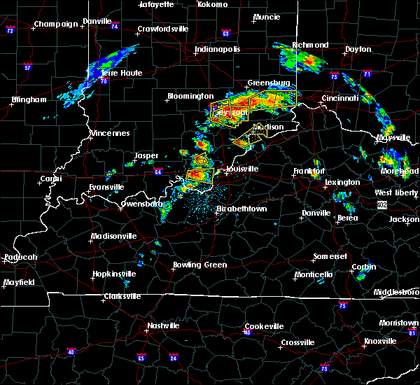 At 155 pm edt, a severe thunderstorm was located over corydon, moving east at 30 mph. this is a very dangerous storm (radar indicated). Hazards include baseball size hail and 70 mph wind gusts. People and animals outdoors will be severely injured. expect shattered windows, extensive damage to roofs, siding, and vehicles. locations impacted include, corydon, lanesville, elizabeth, new middletown, bridgeport, edwardsville, breckenridge, white cloud, sugar grove and seven springs. A tornado watch remains in effect until 900 pm edt for south central indiana. At 155 pm edt, a severe thunderstorm was located over corydon, moving east at 30 mph. this is a very dangerous storm (radar indicated). Hazards include baseball size hail and 70 mph wind gusts. People and animals outdoors will be severely injured. expect shattered windows, extensive damage to roofs, siding, and vehicles. locations impacted include, corydon, lanesville, elizabeth, new middletown, bridgeport, edwardsville, breckenridge, white cloud, sugar grove and seven springs. A tornado watch remains in effect until 900 pm edt for south central indiana.
|
| 7/20/2018 1:40 PM EDT |
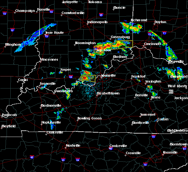 At 140 pm edt, a severe thunderstorm was located near corydon, moving east at 30 mph (radar indicated). Hazards include two inch hail and 70 mph wind gusts. People and animals outdoors will be injured. expect hail damage to roofs, siding, windows, and vehicles. expect considerable tree damage. Wind damage is also likely to mobile homes, roofs, and outbuildings. At 140 pm edt, a severe thunderstorm was located near corydon, moving east at 30 mph (radar indicated). Hazards include two inch hail and 70 mph wind gusts. People and animals outdoors will be injured. expect hail damage to roofs, siding, windows, and vehicles. expect considerable tree damage. Wind damage is also likely to mobile homes, roofs, and outbuildings.
|
| 6/26/2018 12:40 PM EDT |
 At 1240 pm edt/1140 am cdt/, severe thunderstorms were located along a line extending from near paoli to 6 miles south of carefree town to 9 miles north of hardinsburg, moving east at 55 mph (radar indicated). Hazards include 60 mph wind gusts. expect damage to roofs, siding, and trees At 1240 pm edt/1140 am cdt/, severe thunderstorms were located along a line extending from near paoli to 6 miles south of carefree town to 9 miles north of hardinsburg, moving east at 55 mph (radar indicated). Hazards include 60 mph wind gusts. expect damage to roofs, siding, and trees
|
| 5/31/2018 1:49 PM EDT |
 At 149 pm edt/1249 pm cdt/, severe thunderstorms were located along a line extending from near carefree town to near hardinsburg, moving east at 55 mph (radar indicated). Hazards include 70 mph wind gusts. Expect considerable tree damage. Damage is likely to mobile homes, roofs, and outbuildings. At 149 pm edt/1249 pm cdt/, severe thunderstorms were located along a line extending from near carefree town to near hardinsburg, moving east at 55 mph (radar indicated). Hazards include 70 mph wind gusts. Expect considerable tree damage. Damage is likely to mobile homes, roofs, and outbuildings.
|
| 2/24/2018 10:53 PM EST |
 The severe thunderstorm warning for southern harrison, south central floyd, southeastern meade, west central jefferson and northeastern breckinridge counties will expire at 1100 pm est/1000 pm cst/, the storms which prompted the warning are moving out of the warned area. therefore, the warning will be allowed to expire at 1100 pm est. report any severe weather to local law enforcement, post your report to the national weather service louisville facebook page, or tweet your report using hashtag l, m, k, spotter. The severe thunderstorm warning for southern harrison, south central floyd, southeastern meade, west central jefferson and northeastern breckinridge counties will expire at 1100 pm est/1000 pm cst/, the storms which prompted the warning are moving out of the warned area. therefore, the warning will be allowed to expire at 1100 pm est. report any severe weather to local law enforcement, post your report to the national weather service louisville facebook page, or tweet your report using hashtag l, m, k, spotter.
|
| 2/24/2018 10:53 PM EST |
 At 1025 pm est/925 pm cst/, severe thunderstorms were located along a line extending from near corydon to 7 miles northeast of hardinsburg, moving east at 60 to 65 mph (radar indicated). Hazards include 60 mph wind gusts. expect damage to roofs, siding, and trees At 1025 pm est/925 pm cst/, severe thunderstorms were located along a line extending from near corydon to 7 miles northeast of hardinsburg, moving east at 60 to 65 mph (radar indicated). Hazards include 60 mph wind gusts. expect damage to roofs, siding, and trees
|
| 2/24/2018 10:26 PM EST |
 The national weather service in louisville has issued a * severe thunderstorm warning for. southern harrison county in south central indiana. south central floyd county in south central indiana. southeastern meade county in central kentucky. West central jefferson county in central kentucky. The national weather service in louisville has issued a * severe thunderstorm warning for. southern harrison county in south central indiana. south central floyd county in south central indiana. southeastern meade county in central kentucky. West central jefferson county in central kentucky.
|
| 2/24/2018 10:26 PM EST |
 At 1025 pm est/925 pm cst/, severe thunderstorms were located along a line extending from near corydon to 7 miles northeast of hardinsburg, moving east at 60 to 65 mph (radar indicated). Hazards include 60 mph wind gusts. expect damage to roofs, siding, and trees At 1025 pm est/925 pm cst/, severe thunderstorms were located along a line extending from near corydon to 7 miles northeast of hardinsburg, moving east at 60 to 65 mph (radar indicated). Hazards include 60 mph wind gusts. expect damage to roofs, siding, and trees
|
| 7/23/2017 3:36 AM EDT |
 At 335 am edt/235 am cdt/, severe thunderstorms were located along a line extending from near st. dennis to 8 miles east of holiday world, moving southeast at 40 mph (radar indicated). Hazards include 60 mph wind gusts. Expect damage to roofs, siding, and trees. Locations impacted include, corydon, carefree town, palmyra, milltown, lanesville, leavenworth, crandall, new middletown, alton and new amsterdam. At 335 am edt/235 am cdt/, severe thunderstorms were located along a line extending from near st. dennis to 8 miles east of holiday world, moving southeast at 40 mph (radar indicated). Hazards include 60 mph wind gusts. Expect damage to roofs, siding, and trees. Locations impacted include, corydon, carefree town, palmyra, milltown, lanesville, leavenworth, crandall, new middletown, alton and new amsterdam.
|
| 7/23/2017 3:12 AM EDT |
 At 312 am edt/212 am cdt/, severe thunderstorms were located along a line extending from 7 miles north of corydon to near dale, moving southeast at 40 mph (radar indicated). Hazards include 60 mph wind gusts. expect damage to roofs, siding, and trees At 312 am edt/212 am cdt/, severe thunderstorms were located along a line extending from 7 miles north of corydon to near dale, moving southeast at 40 mph (radar indicated). Hazards include 60 mph wind gusts. expect damage to roofs, siding, and trees
|
| 7/7/2017 9:56 PM EDT |
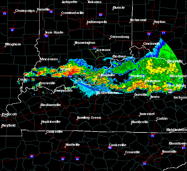 The severe thunderstorm warning for southeastern harrison, southwestern floyd, southwestern jefferson and northwestern bullitt counties will expire at 1000 pm edt, the storm which prompted the warning has weakened below severe limits, and no longer poses an immediate threat to life or property. therefore the warning will be allowed to expire. however gusty winds are still possible with this thunderstorm. a severe thunderstorm watch remains in effect until 1100 pm edt for south central indiana, and central kentucky. report severe weather to local law enforcement, post your report to the national weather service louisville facebook page, or tweet your report using hashtag l, m, k, spotter. The severe thunderstorm warning for southeastern harrison, southwestern floyd, southwestern jefferson and northwestern bullitt counties will expire at 1000 pm edt, the storm which prompted the warning has weakened below severe limits, and no longer poses an immediate threat to life or property. therefore the warning will be allowed to expire. however gusty winds are still possible with this thunderstorm. a severe thunderstorm watch remains in effect until 1100 pm edt for south central indiana, and central kentucky. report severe weather to local law enforcement, post your report to the national weather service louisville facebook page, or tweet your report using hashtag l, m, k, spotter.
|
| 7/7/2017 9:48 PM EDT |
 At 948 pm edt, a severe thunderstorm was located near pleasure ridge park, moving southeast at 40 mph (radar indicated). Hazards include 60 mph wind gusts. Expect damage to roofs, siding, and trees. Locations impacted include, louisville, new albany, shively, corydon, lynnview, hollyvilla, south park view, valley station, pleasure ridge par and pleasure ridge park. At 948 pm edt, a severe thunderstorm was located near pleasure ridge park, moving southeast at 40 mph (radar indicated). Hazards include 60 mph wind gusts. Expect damage to roofs, siding, and trees. Locations impacted include, louisville, new albany, shively, corydon, lynnview, hollyvilla, south park view, valley station, pleasure ridge par and pleasure ridge park.
|
| 7/7/2017 9:48 PM EDT |
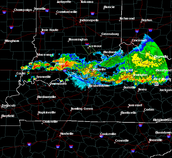 At 948 pm edt, a severe thunderstorm was located near pleasure ridge park, moving southeast at 40 mph (radar indicated). Hazards include 60 mph wind gusts. Expect damage to roofs, siding, and trees. Locations impacted include, louisville, new albany, shively, corydon, lynnview, hollyvilla, south park view, valley station, pleasure ridge par and pleasure ridge park. At 948 pm edt, a severe thunderstorm was located near pleasure ridge park, moving southeast at 40 mph (radar indicated). Hazards include 60 mph wind gusts. Expect damage to roofs, siding, and trees. Locations impacted include, louisville, new albany, shively, corydon, lynnview, hollyvilla, south park view, valley station, pleasure ridge par and pleasure ridge park.
|
| 7/7/2017 9:31 PM EDT |
 At 931 pm edt, a severe thunderstorm was located 9 miles northeast of corydon, moving southeast at 35 mph (radar indicated). Hazards include 60 mph wind gusts. expect damage to roofs, siding, and trees At 931 pm edt, a severe thunderstorm was located 9 miles northeast of corydon, moving southeast at 35 mph (radar indicated). Hazards include 60 mph wind gusts. expect damage to roofs, siding, and trees
|
| 7/7/2017 9:31 PM EDT |
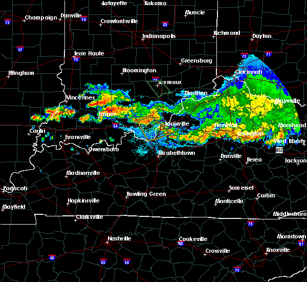 At 931 pm edt, a severe thunderstorm was located 9 miles northeast of corydon, moving southeast at 35 mph (radar indicated). Hazards include 60 mph wind gusts. expect damage to roofs, siding, and trees At 931 pm edt, a severe thunderstorm was located 9 miles northeast of corydon, moving southeast at 35 mph (radar indicated). Hazards include 60 mph wind gusts. expect damage to roofs, siding, and trees
|
| 7/7/2017 9:06 PM EDT |
 At 906 pm edt, a severe thunderstorm was located 12 miles west of new providence town, moving southeast at 50 mph (radar indicated). Hazards include 60 mph wind gusts. expect damage to roofs, siding, and trees At 906 pm edt, a severe thunderstorm was located 12 miles west of new providence town, moving southeast at 50 mph (radar indicated). Hazards include 60 mph wind gusts. expect damage to roofs, siding, and trees
|
| 6/30/2017 9:18 PM EDT |
 At 918 pm edt, a severe thunderstorm was located near brandenburg, moving east at 30 mph (radar indicated). Hazards include 60 mph wind gusts. expect damage to roofs, siding, and trees At 918 pm edt, a severe thunderstorm was located near brandenburg, moving east at 30 mph (radar indicated). Hazards include 60 mph wind gusts. expect damage to roofs, siding, and trees
|
| 6/5/2017 7:36 PM EDT |
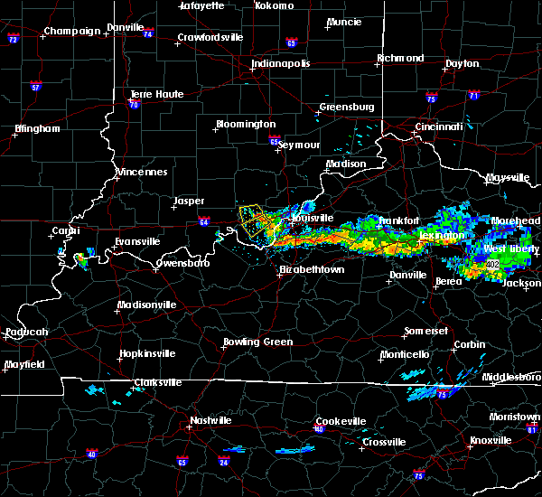 At 736 pm edt, a severe thunderstorm was located near corydon, moving southwest at 10 mph (radar indicated). Hazards include 60 mph wind gusts and penny size hail. expect damage to roofs, siding, and trees At 736 pm edt, a severe thunderstorm was located near corydon, moving southwest at 10 mph (radar indicated). Hazards include 60 mph wind gusts and penny size hail. expect damage to roofs, siding, and trees
|
| 5/19/2017 5:51 PM EDT |
 At 551 pm edt, a severe thunderstorm was located over corydon, moving east at 25 mph (radar indicated). Hazards include 60 mph wind gusts and quarter size hail. Hail damage to vehicles is expected. expect wind damage to roofs, siding, and trees. Locations impacted include, corydon, lanesville, crandall, new middletown and breckenridge. At 551 pm edt, a severe thunderstorm was located over corydon, moving east at 25 mph (radar indicated). Hazards include 60 mph wind gusts and quarter size hail. Hail damage to vehicles is expected. expect wind damage to roofs, siding, and trees. Locations impacted include, corydon, lanesville, crandall, new middletown and breckenridge.
|
| 5/19/2017 5:37 PM EDT |
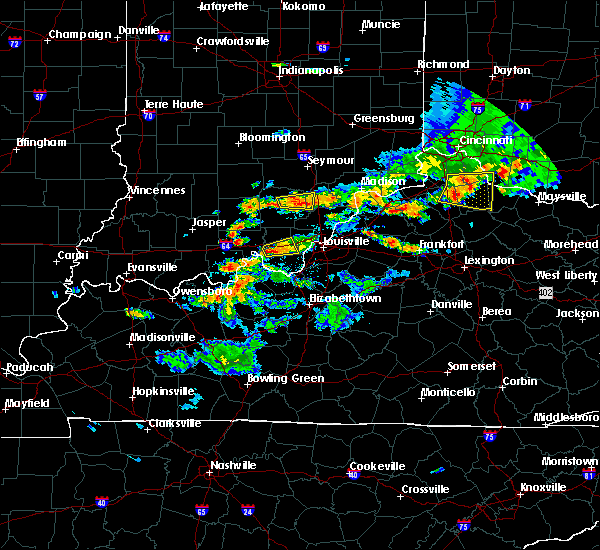 At 537 pm edt, a severe thunderstorm was located near corydon, moving east at 25 mph (radar indicated). Hazards include 60 mph wind gusts and quarter size hail. Hail damage to vehicles is expected. Expect wind damage to roofs, siding, and trees. At 537 pm edt, a severe thunderstorm was located near corydon, moving east at 25 mph (radar indicated). Hazards include 60 mph wind gusts and quarter size hail. Hail damage to vehicles is expected. Expect wind damage to roofs, siding, and trees.
|
| 4/5/2017 6:10 PM EDT |
 At 610 pm edt, a severe thunderstorm was located near corydon, moving northeast at 65 mph (radar indicated). Hazards include quarter size hail. damage to vehicles is expected At 610 pm edt, a severe thunderstorm was located near corydon, moving northeast at 65 mph (radar indicated). Hazards include quarter size hail. damage to vehicles is expected
|
| 4/5/2017 5:10 PM EDT |
 At 510 pm edt, a severe thunderstorm was located near brandenburg, moving northeast at 65 mph (radar indicated). Hazards include two inch hail and 60 mph wind gusts. People and animals outdoors will be injured. expect hail damage to roofs, siding, windows, and vehicles. Expect wind damage to roofs, siding, and trees. At 510 pm edt, a severe thunderstorm was located near brandenburg, moving northeast at 65 mph (radar indicated). Hazards include two inch hail and 60 mph wind gusts. People and animals outdoors will be injured. expect hail damage to roofs, siding, windows, and vehicles. Expect wind damage to roofs, siding, and trees.
|
| 3/1/2017 6:22 AM EST |
 At 621 am est, severe thunderstorms were located along a line extending from 8 miles north of brooksburg to 7 miles southwest of brandenburg, moving east at 55 mph (radar indicated). Hazards include 60 mph wind gusts. expect damage to roofs, siding, and trees At 621 am est, severe thunderstorms were located along a line extending from 8 miles north of brooksburg to 7 miles southwest of brandenburg, moving east at 55 mph (radar indicated). Hazards include 60 mph wind gusts. expect damage to roofs, siding, and trees
|
| 3/1/2017 5:57 AM EST |
 At 556 am est/456 am cst/, severe thunderstorms were located along a line extending from 9 miles northwest of scottsburg to 10 miles southwest of carefree town, moving east at 55 mph (radar indicated). Hazards include 60 mph wind gusts. expect damage to roofs, siding, and trees At 556 am est/456 am cst/, severe thunderstorms were located along a line extending from 9 miles northwest of scottsburg to 10 miles southwest of carefree town, moving east at 55 mph (radar indicated). Hazards include 60 mph wind gusts. expect damage to roofs, siding, and trees
|
| 3/1/2017 2:25 AM EST |
 At 224 am est/124 am cst/, severe thunderstorms were located along a line extending from 13 miles south of carefree town to 7 miles southwest of brandenburg to 6 miles northeast of hardinsburg, moving east at 75 mph (radar indicated). Hazards include 60 mph wind gusts and quarter size hail. Hail damage to vehicles is expected. Expect wind damage to roofs, siding, and trees. At 224 am est/124 am cst/, severe thunderstorms were located along a line extending from 13 miles south of carefree town to 7 miles southwest of brandenburg to 6 miles northeast of hardinsburg, moving east at 75 mph (radar indicated). Hazards include 60 mph wind gusts and quarter size hail. Hail damage to vehicles is expected. Expect wind damage to roofs, siding, and trees.
|
| 9/10/2016 3:21 PM EDT |
 At 321 pm edt, severe thunderstorms were located along a line extending from near corydon to 9 miles southwest of brandenburg, moving east at 35 mph (radar indicated). Hazards include 60 mph wind gusts. Expect damage to roofs. siding. And trees. At 321 pm edt, severe thunderstorms were located along a line extending from near corydon to 9 miles southwest of brandenburg, moving east at 35 mph (radar indicated). Hazards include 60 mph wind gusts. Expect damage to roofs. siding. And trees.
|
| 7/14/2016 4:54 PM EDT |
 At 454 pm edt, a severe thunderstorm was located near corydon, moving east at 35 mph (radar indicated). Hazards include 60 mph wind gusts and penny size hail. Expect damage to roofs. siding. And trees. At 454 pm edt, a severe thunderstorm was located near corydon, moving east at 35 mph (radar indicated). Hazards include 60 mph wind gusts and penny size hail. Expect damage to roofs. siding. And trees.
|
| 7/8/2016 8:25 PM EDT |
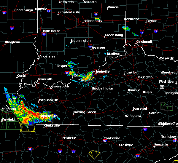 The severe thunderstorm warning for southeastern harrison and southwestern jefferson counties will expire at 830 pm edt, the storm which prompted the warning has weakened below severe limits, and no longer pose an immediate threat to life or property. therefore the warning will be allowed to expire. however gusty winds and heavy rain are still possible with this thunderstorm. The severe thunderstorm warning for southeastern harrison and southwestern jefferson counties will expire at 830 pm edt, the storm which prompted the warning has weakened below severe limits, and no longer pose an immediate threat to life or property. therefore the warning will be allowed to expire. however gusty winds and heavy rain are still possible with this thunderstorm.
|
| 7/8/2016 8:18 PM EDT |
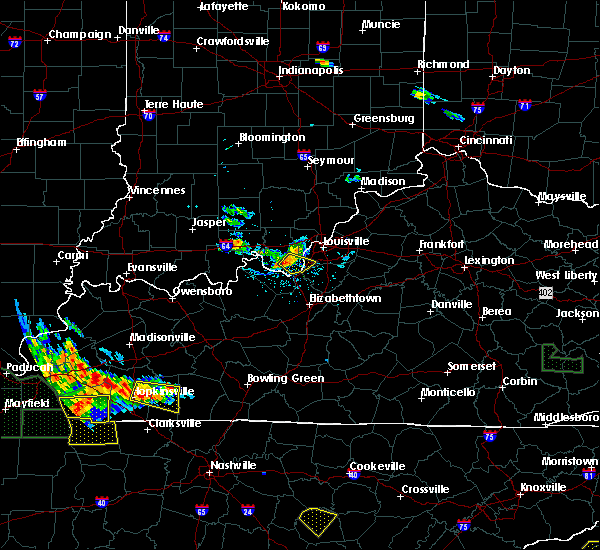 At 817 pm edt, a severe thunderstorm was located 8 miles west of valley station, moving southeast at 35 mph (radar indicated). Hazards include 60 mph wind gusts. Expect damage to roofs. siding. and trees. Locations impacted include, valley station, pleasure ridge park, elizabeth, new middletown, evans landing, dogwood, fishtown, seven springs, rosewood and macedonia. At 817 pm edt, a severe thunderstorm was located 8 miles west of valley station, moving southeast at 35 mph (radar indicated). Hazards include 60 mph wind gusts. Expect damage to roofs. siding. and trees. Locations impacted include, valley station, pleasure ridge park, elizabeth, new middletown, evans landing, dogwood, fishtown, seven springs, rosewood and macedonia.
|
| 7/8/2016 8:07 PM EDT |
 At 806 pm edt, a severe thunderstorm was located near corydon, moving southeast at 35 mph (radar indicated). Hazards include 60 mph wind gusts and nickel size hail. Expect damage to roofs. siding. And trees. At 806 pm edt, a severe thunderstorm was located near corydon, moving southeast at 35 mph (radar indicated). Hazards include 60 mph wind gusts and nickel size hail. Expect damage to roofs. siding. And trees.
|
| 7/8/2016 8:07 PM EDT |
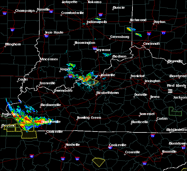 At 806 pm edt, a severe thunderstorm was located near corydon, moving southeast at 35 mph (radar indicated). Hazards include 60 mph wind gusts and nickel size hail. Expect damage to roofs. siding. And trees. At 806 pm edt, a severe thunderstorm was located near corydon, moving southeast at 35 mph (radar indicated). Hazards include 60 mph wind gusts and nickel size hail. Expect damage to roofs. siding. And trees.
|
| 7/7/2016 4:37 PM EDT |
 At 437 pm edt, severe thunderstorms were located along a line extending from near corydon to 7 miles south of hodgenville, moving east at 45 mph (radar indicated). Hazards include 60 mph wind gusts and penny size hail. Expect damage to roofs. siding. and trees. Locations impacted include, elizabethtown, corydon, brandenburg, radcliff, vine grove, muldraugh, west point, upton, sonora and ekron. At 437 pm edt, severe thunderstorms were located along a line extending from near corydon to 7 miles south of hodgenville, moving east at 45 mph (radar indicated). Hazards include 60 mph wind gusts and penny size hail. Expect damage to roofs. siding. and trees. Locations impacted include, elizabethtown, corydon, brandenburg, radcliff, vine grove, muldraugh, west point, upton, sonora and ekron.
|
| 7/7/2016 4:22 PM EDT |
 At 422 pm edt/322 pm cdt/, severe thunderstorms were located along a line extending from near carefree to 13 miles north of munfordville, moving east at 45 mph (radar indicated). Hazards include 60 mph wind gusts. Expect damage to roofs. siding. and trees. Locations impacted include, elizabethtown, corydon, brandenburg, radcliff, vine grove, irvington, muldraugh, west point, upton and sonora. At 422 pm edt/322 pm cdt/, severe thunderstorms were located along a line extending from near carefree to 13 miles north of munfordville, moving east at 45 mph (radar indicated). Hazards include 60 mph wind gusts. Expect damage to roofs. siding. and trees. Locations impacted include, elizabethtown, corydon, brandenburg, radcliff, vine grove, irvington, muldraugh, west point, upton and sonora.
|
| 7/7/2016 2:58 PM CDT |
 At 357 pm edt/257 pm cdt/, severe thunderstorms were located along a line extending from 10 miles southwest of english to 8 miles northwest of leitchfield, moving east at 45 mph (radar indicated). Hazards include 60 mph wind gusts. Expect damage to roofs. siding. And trees. At 357 pm edt/257 pm cdt/, severe thunderstorms were located along a line extending from 10 miles southwest of english to 8 miles northwest of leitchfield, moving east at 45 mph (radar indicated). Hazards include 60 mph wind gusts. Expect damage to roofs. siding. And trees.
|
| 6/23/2016 5:16 PM EDT |
 At 515 pm edt, a severe thunderstorm was located 7 miles east of corydon, moving east at 30 mph (radar indicated). Hazards include 60 mph wind gusts and penny size hail. Expect damage to roofs. siding. and trees. Locations impacted include, corydon, lanesville, crandall, new middletown, breckenridge and dogwood. At 515 pm edt, a severe thunderstorm was located 7 miles east of corydon, moving east at 30 mph (radar indicated). Hazards include 60 mph wind gusts and penny size hail. Expect damage to roofs. siding. and trees. Locations impacted include, corydon, lanesville, crandall, new middletown, breckenridge and dogwood.
|
| 6/23/2016 4:59 PM EDT |
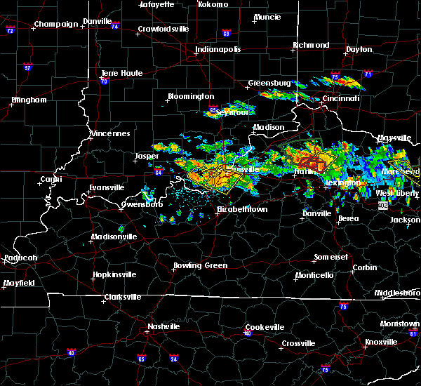 At 459 pm edt, a severe thunderstorm was located over corydon, moving east at 35 mph (radar indicated). Hazards include 60 mph wind gusts and quarter size hail. Hail damage to vehicles is expected. Expect wind damage to roofs, siding, and trees. At 459 pm edt, a severe thunderstorm was located over corydon, moving east at 35 mph (radar indicated). Hazards include 60 mph wind gusts and quarter size hail. Hail damage to vehicles is expected. Expect wind damage to roofs, siding, and trees.
|
| 6/23/2016 4:42 PM EDT |
 At 441 pm edt, a severe thunderstorm was located over corydon, moving southeast at 30 mph (radar indicated). Hazards include 60 mph wind gusts and quarter size hail. Hail damage to vehicles is expected. expect wind damage to roofs, siding, and trees. Locations impacted include, corydon, lanesville, elizabeth, crandall, new middletown, lottick corner, dogwood, seven springs, breckenridge and macedonia. At 441 pm edt, a severe thunderstorm was located over corydon, moving southeast at 30 mph (radar indicated). Hazards include 60 mph wind gusts and quarter size hail. Hail damage to vehicles is expected. expect wind damage to roofs, siding, and trees. Locations impacted include, corydon, lanesville, elizabeth, crandall, new middletown, lottick corner, dogwood, seven springs, breckenridge and macedonia.
|
| 6/23/2016 4:30 PM EDT |
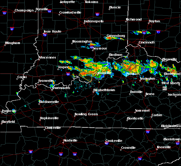 At 430 pm edt, a severe thunderstorm was located over corydon, moving southeast at 35 mph (radar indicated). Hazards include 60 mph wind gusts and quarter size hail. Hail damage to vehicles is expected. Expect wind damage to roofs, siding, and trees. At 430 pm edt, a severe thunderstorm was located over corydon, moving southeast at 35 mph (radar indicated). Hazards include 60 mph wind gusts and quarter size hail. Hail damage to vehicles is expected. Expect wind damage to roofs, siding, and trees.
|
| 5/11/2016 8:33 PM EDT |
 At 831 pm edt, a severe thunderstorm was located 8 miles northeast of corydon, moving east at 35 mph (radar indicated). Hazards include 60 mph wind gusts and quarter size hail. Hail damage to vehicles is expected. Expect wind damage to roofs, siding, and trees. At 831 pm edt, a severe thunderstorm was located 8 miles northeast of corydon, moving east at 35 mph (radar indicated). Hazards include 60 mph wind gusts and quarter size hail. Hail damage to vehicles is expected. Expect wind damage to roofs, siding, and trees.
|
| 5/11/2016 8:16 PM EDT |
 At 815 pm edt, a severe thunderstorm was located near carefree town, moving east at 40 mph (radar indicated). Hazards include 60 mph wind gusts and quarter size hail. Hail damage to vehicles is expected. expect wind damage to roofs, siding, and trees. Locations impacted include, corydon, carefree town, milltown, lanesville, leavenworth, crandall, new middletown, ramsey, cape sandy and hogtown. At 815 pm edt, a severe thunderstorm was located near carefree town, moving east at 40 mph (radar indicated). Hazards include 60 mph wind gusts and quarter size hail. Hail damage to vehicles is expected. expect wind damage to roofs, siding, and trees. Locations impacted include, corydon, carefree town, milltown, lanesville, leavenworth, crandall, new middletown, ramsey, cape sandy and hogtown.
|
| 5/11/2016 8:00 PM EDT |
 At 759 pm edt/659 pm cdt/, a severe thunderstorm was located near english, moving east at 40 mph (radar indicated). Hazards include 60 mph wind gusts and quarter size hail. Hail damage to vehicles is expected. Expect wind damage to roofs, siding, and trees. At 759 pm edt/659 pm cdt/, a severe thunderstorm was located near english, moving east at 40 mph (radar indicated). Hazards include 60 mph wind gusts and quarter size hail. Hail damage to vehicles is expected. Expect wind damage to roofs, siding, and trees.
|
| 5/7/2016 9:55 PM EDT |
 The severe thunderstorm warning for eastern harrison, floyd, southwestern clark, jefferson, east central meade, southwestern oldham, north central hardin and bullitt counties will expire at 1000 pm edt, the storms which prompted the warning have weakened. therefore the warning will be allowed to expire. a severe thunderstorm watch remains in effect until 200 am edt for south central indiana, and central kentucky. The severe thunderstorm warning for eastern harrison, floyd, southwestern clark, jefferson, east central meade, southwestern oldham, north central hardin and bullitt counties will expire at 1000 pm edt, the storms which prompted the warning have weakened. therefore the warning will be allowed to expire. a severe thunderstorm watch remains in effect until 200 am edt for south central indiana, and central kentucky.
|
| 5/7/2016 9:55 PM EDT | The severe thunderstorm warning for eastern harrison, floyd, southwestern clark, jefferson, east central meade, southwestern oldham, north central hardin and bullitt counties will expire at 1000 pm edt, the storms which prompted the warning have weakened. therefore the warning will be allowed to expire. a severe thunderstorm watch remains in effect until 200 am edt for south central indiana, and central kentucky. |
| 5/7/2016 9:40 PM EDT |
 At 940 pm edt, severe thunderstorms were located along a line extending from 8 miles southeast of new providence town to 9 miles west of shepherdsville, moving east at 60 mph (trained weather spotters). Hazards include 60 mph wind gusts and quarter size hail. Hail damage to vehicles is expected. expect wind damage to roofs, siding, and trees. locations impacted include, louisville, jeffersonville, new albany, jeffersontown, st. Matthews, shively, shepherdsville, lyndon, middletown and douglass hills. At 940 pm edt, severe thunderstorms were located along a line extending from 8 miles southeast of new providence town to 9 miles west of shepherdsville, moving east at 60 mph (trained weather spotters). Hazards include 60 mph wind gusts and quarter size hail. Hail damage to vehicles is expected. expect wind damage to roofs, siding, and trees. locations impacted include, louisville, jeffersonville, new albany, jeffersontown, st. Matthews, shively, shepherdsville, lyndon, middletown and douglass hills.
|
| 5/7/2016 9:18 PM EDT |
 At 917 pm edt/817 pm cdt/, severe thunderstorms were located along a line extending from 9 miles southwest of salem to 10 miles northeast of hardinsburg, moving east at 60 mph (trained weather spotters. these line of storms has a history of producing wind damage and 60 mph gusts). Hazards include 60 mph wind gusts and quarter size hail. Hail damage to vehicles is expected. Expect wind damage to roofs, siding, and trees. At 917 pm edt/817 pm cdt/, severe thunderstorms were located along a line extending from 9 miles southwest of salem to 10 miles northeast of hardinsburg, moving east at 60 mph (trained weather spotters. these line of storms has a history of producing wind damage and 60 mph gusts). Hazards include 60 mph wind gusts and quarter size hail. Hail damage to vehicles is expected. Expect wind damage to roofs, siding, and trees.
|
| 5/7/2016 8:50 PM EDT |
 At 849 pm edt, a severe thunderstorm was located near st. dennis, moving southeast at 55 mph (radar indicated). Hazards include 60 mph wind gusts and quarter size hail. Hail damage to vehicles is expected. expect wind damage to roofs, siding, and trees. locations impacted include, louisville, jeffersonville, new albany, shively, corydon, pleasure ridge par, pleasure ridge park, st. dennis, valley station and fairdale. those attending outdoor events in the path of this storm should prepare for imminent dangerous weather conditions. Seek shelter now!. At 849 pm edt, a severe thunderstorm was located near st. dennis, moving southeast at 55 mph (radar indicated). Hazards include 60 mph wind gusts and quarter size hail. Hail damage to vehicles is expected. expect wind damage to roofs, siding, and trees. locations impacted include, louisville, jeffersonville, new albany, shively, corydon, pleasure ridge par, pleasure ridge park, st. dennis, valley station and fairdale. those attending outdoor events in the path of this storm should prepare for imminent dangerous weather conditions. Seek shelter now!.
|
| 5/7/2016 8:36 PM EDT |
 At 836 pm edt, a severe thunderstorm was located over corydon, moving southeast at 55 mph (radar indicated). Hazards include 60 mph wind gusts and quarter size hail. Hail damage to vehicles is expected. Expect wind damage to roofs, siding, and trees. At 836 pm edt, a severe thunderstorm was located over corydon, moving southeast at 55 mph (radar indicated). Hazards include 60 mph wind gusts and quarter size hail. Hail damage to vehicles is expected. Expect wind damage to roofs, siding, and trees.
|
| 4/27/2016 9:04 PM EDT |
 At 903 pm edt, a severe thunderstorm was located 8 miles west of valley station, moving northeast at 45 mph (radar indicated). Hazards include 60 mph wind gusts. Expect damage to roofs. siding. and trees. Locations impacted include, brandenburg, lanesville, elizabeth, new middletown, mauckport, laconia, central, evans landing, lottick corner and dogwood. At 903 pm edt, a severe thunderstorm was located 8 miles west of valley station, moving northeast at 45 mph (radar indicated). Hazards include 60 mph wind gusts. Expect damage to roofs. siding. and trees. Locations impacted include, brandenburg, lanesville, elizabeth, new middletown, mauckport, laconia, central, evans landing, lottick corner and dogwood.
|
| 4/27/2016 8:48 PM EDT |
 At 846 pm edt/746 pm cdt/, a severe thunderstorm was located over brandenburg, moving northeast at 45 mph. at 838 pm edt, power lines were reported down in cloverport (radar indicated. schoettmer). Hazards include 60 mph wind gusts. Expect damage to roofs. siding. and trees. locations impacted include, brandenburg, irvington, lanesville, elizabeth, ekron, new middletown, mauckport, laconia, central and evans landing. A tornado watch remains in effect until midnight edt/1100 pm cdt/ for central kentucky. At 846 pm edt/746 pm cdt/, a severe thunderstorm was located over brandenburg, moving northeast at 45 mph. at 838 pm edt, power lines were reported down in cloverport (radar indicated. schoettmer). Hazards include 60 mph wind gusts. Expect damage to roofs. siding. and trees. locations impacted include, brandenburg, irvington, lanesville, elizabeth, ekron, new middletown, mauckport, laconia, central and evans landing. A tornado watch remains in effect until midnight edt/1100 pm cdt/ for central kentucky.
|
| 4/27/2016 8:25 PM EDT |
 At 824 pm edt/724 pm cdt/, a severe thunderstorm was located near hardinsburg, moving northeast at 40 mph (radar indicated). Hazards include 60 mph wind gusts. Expect damage to roofs. siding. And trees. At 824 pm edt/724 pm cdt/, a severe thunderstorm was located near hardinsburg, moving northeast at 40 mph (radar indicated). Hazards include 60 mph wind gusts. Expect damage to roofs. siding. And trees.
|
| 4/26/2016 8:47 PM EDT |
 At 847 pm edt, severe thunderstorms were located along a line extending from 11 miles west of new albany to near corydon, moving northeast at 35 mph (radar indicated). Hazards include 60 mph wind gusts and quarter size hail. Hail damage to vehicles is expected. Expect wind damage to roofs, siding, and trees. At 847 pm edt, severe thunderstorms were located along a line extending from 11 miles west of new albany to near corydon, moving northeast at 35 mph (radar indicated). Hazards include 60 mph wind gusts and quarter size hail. Hail damage to vehicles is expected. Expect wind damage to roofs, siding, and trees.
|
| 3/27/2016 9:39 PM EDT |
 The severe thunderstorm warning for harrison, south central floyd, meade and central breckinridge counties will expire at 945 pm edt, the storms which prompted the warning have weakened below severe limits, and no longer pose an immediate threat to life or property. therefore the warning will be allowed to expire. a severe thunderstorm watch remains in effect until 1100 pm edt/1000 pm cdt/ for south central indiana and central kentucky. The severe thunderstorm warning for harrison, south central floyd, meade and central breckinridge counties will expire at 945 pm edt, the storms which prompted the warning have weakened below severe limits, and no longer pose an immediate threat to life or property. therefore the warning will be allowed to expire. a severe thunderstorm watch remains in effect until 1100 pm edt/1000 pm cdt/ for south central indiana and central kentucky.
|
| 3/27/2016 9:12 PM EDT |
 At 912 pm edt/812 pm cdt/, severe thunderstorms were located along a line extending from 6 miles southeast of carefree town to near hardinsburg, moving northeast at 50 mph (radar indicated). Hazards include 60 mph wind gusts and penny size hail. Expect damage to roofs. siding. And trees. At 912 pm edt/812 pm cdt/, severe thunderstorms were located along a line extending from 6 miles southeast of carefree town to near hardinsburg, moving northeast at 50 mph (radar indicated). Hazards include 60 mph wind gusts and penny size hail. Expect damage to roofs. siding. And trees.
|
| 12/23/2015 6:43 PM EST | The severe thunderstorm warning for harrison county will expire at 645 pm est, the severe thunderstorm which prompted the warning has moved out of the warned area. therefore the warning will be allowed to expire. a tornado watch remains in effect until 900 pm est for south central indiana and central kentucky. |
| 12/23/2015 6:34 PM EST | A severe thunderstorm warning remains in effect until 645 pm est for harrison county. at 634 pm est. a severe thunderstorm was located over corydon. moving northeast at 70 mph. hazard. 60 mph wind gusts and quarter size hail. source. Radar indicated. |
| 12/23/2015 6:33 PM EST | At 633 pm est /533 pm cst/, a severe thunderstorm was located over corydon, moving northeast at 70 mph (radar indicated). Hazards include 60 mph wind gusts and quarter size hail. Hail damage to vehicles is expected. expect wind damage to roofs, siding and trees. locations impacted include, corydon, palmyra, lanesville, leavenworth, crandall, new middletown, alton, central, ramsey, cape sandy, valley city, magnet, seven springs, frenchtown, wyandotte, new salisbury, white cloud, byrneville, moberly and lottick corner. A tornado watch remains in effect until 900 pm est/800 pm cst/ for south central indiana and central kentucky. |
| 12/23/2015 6:18 PM EST | At 618 pm est /518 pm cst/, a severe thunderstorm was located 13 miles west of brandenburg, moving northeast at 75 mph (radar indicated). Hazards include 60 mph wind gusts and quarter size hail. Hail damage to vehicles is expected. Expect wind damage to roofs, siding and trees. |
| 12/23/2015 6:18 PM EST | At 618 pm est /518 pm cst/, a severe thunderstorm was located 13 miles west of brandenburg, moving northeast at 75 mph (radar indicated). Hazards include 60 mph wind gusts and quarter size hail. Hail damage to vehicles is expected. Expect wind damage to roofs, siding and trees. |
| 8/4/2015 7:25 PM EDT |
 At 725 pm edt, a severe thunderstorm was located just south of brandenburg, moving east at 30 mph (radar indicated). Hazards include 60 mph wind gusts. Expect damage to roofs. siding and trees. Locations impacted include, brandenburg, west point, elizabeth, new middletown, mauckport, laconia, new amsterdam, central, evans landing, payneville, cedar flat, valley city, seven springs, sirocco, rosewood, macedonia, new boston, titus, wolf creek and lottick corner. At 725 pm edt, a severe thunderstorm was located just south of brandenburg, moving east at 30 mph (radar indicated). Hazards include 60 mph wind gusts. Expect damage to roofs. siding and trees. Locations impacted include, brandenburg, west point, elizabeth, new middletown, mauckport, laconia, new amsterdam, central, evans landing, payneville, cedar flat, valley city, seven springs, sirocco, rosewood, macedonia, new boston, titus, wolf creek and lottick corner.
|
| 8/4/2015 7:15 PM EDT |
 At 714 pm edt, a severe thunderstorm was located 7 miles northwest of brandenburg, moving east at 30 mph (radar indicated). Hazards include 60 mph wind gusts. Expect damage to roofs. Siding and trees. At 714 pm edt, a severe thunderstorm was located 7 miles northwest of brandenburg, moving east at 30 mph (radar indicated). Hazards include 60 mph wind gusts. Expect damage to roofs. Siding and trees.
|
| 7/13/2015 4:16 PM EDT |
 At 414 pm edt, a severe thunderstorm was located 5 miles east of corydon, moving southeast at 20 mph (radar indicated). Hazards include 60 mph wind gusts and penny size hail. Expect damage to roofs. siding and trees. locations impacted include, dogwood. Half inch hail has been reported with this storm. At 414 pm edt, a severe thunderstorm was located 5 miles east of corydon, moving southeast at 20 mph (radar indicated). Hazards include 60 mph wind gusts and penny size hail. Expect damage to roofs. siding and trees. locations impacted include, dogwood. Half inch hail has been reported with this storm.
|
| 7/13/2015 3:58 PM EDT |
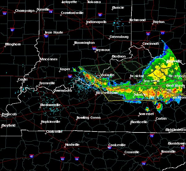 At 355 pm edt, a severe thunderstorm was located near corydon, and moving southeast at 20 mph (radar indicated). Hazards include 60 mph wind gusts and quarter size hail. Hail damage to vehicles is expected. Expect wind damage to roofs, siding and trees. At 355 pm edt, a severe thunderstorm was located near corydon, and moving southeast at 20 mph (radar indicated). Hazards include 60 mph wind gusts and quarter size hail. Hail damage to vehicles is expected. Expect wind damage to roofs, siding and trees.
|
| 6/26/2015 5:33 PM EDT | At 529 pm edt, a severe thunderstorm was located 8 miles southwest of corydon, and moving east at 25 mph (radar indicated). Hazards include 70 mph wind gusts. Expect considerable tree damage. damage is likely to mobile homes, roofs and outbuildings. Locations impacted include, corydon, central, dogwood, new salisbury, new middletown, crandall, seven springs and breckenridge. |
| 6/26/2015 5:17 PM EDT | At 515 pm edt, a severe thunderstorm was located 12 miles southwest of corydon, and moving east at 25 mph (radar indicated). Hazards include 70 mph wind gusts. Expect considerable tree damage. damage is likely to mobile homes, roofs and outbuildings. Locations impacted include, corydon, new amsterdam, wyandotte, valley city, white cloud, central, moberly, dogwood, breckenridge, new middletown, crandall, seven springs and new salisbury. |
| 6/26/2015 5:17 PM EDT | At 515 pm edt, a severe thunderstorm was located 12 miles southwest of corydon, and moving east at 25 mph (radar indicated). Hazards include 70 mph wind gusts. Expect considerable tree damage. damage is likely to mobile homes, roofs and outbuildings. Locations impacted include, corydon, new amsterdam, wyandotte, valley city, white cloud, central, moberly, dogwood, breckenridge, new middletown, crandall, seven springs and new salisbury. |
| 6/26/2015 5:12 PM EDT | At 510 pm edt, a severe thunderstorm was located 14 miles northwest of brandenburg, and moving east at 25 mph (radar indicated). Hazards include 60 mph wind gusts. Expect damage to roofs. Siding and trees. |
| 6/26/2015 5:12 PM EDT | At 510 pm edt, a severe thunderstorm was located 14 miles northwest of brandenburg, and moving east at 25 mph (radar indicated). Hazards include 60 mph wind gusts. Expect damage to roofs. Siding and trees. |
| 6/21/2015 9:59 PM EDT |
 At 956 pm edt, severe thunderstorms were located along a line extending from 6 miles south of corydon to brandenburg, moving southeast at 25 mph (radar indicated). Hazards include 60 mph wind gusts and penny size hail. Expect damage to roofs. Siding and trees. At 956 pm edt, severe thunderstorms were located along a line extending from 6 miles south of corydon to brandenburg, moving southeast at 25 mph (radar indicated). Hazards include 60 mph wind gusts and penny size hail. Expect damage to roofs. Siding and trees.
|
| 5/27/2015 1:54 PM EDT | At 151 pm edt, a severe thunderstorm was located 5 miles west of pleasure ridge park, and moving east at 40 mph (radar indicated). Hazards include 60 mph wind gusts. Expect damage to roofs. Siding and trees. |
| 5/27/2015 1:54 PM EDT | At 151 pm edt, a severe thunderstorm was located 5 miles west of pleasure ridge park, and moving east at 40 mph (radar indicated). Hazards include 60 mph wind gusts. Expect damage to roofs. Siding and trees. |
| 4/7/2015 5:16 PM EDT | A severe thunderstorm warning remains in effect for floyd and northern harrison counties until 525 pm edt. at 513 pm edt. a severe thunderstorm was located near corydon. and moving east at 40 mph. hazard. 60 mph wind gusts and quarter size hail. source. Radar indicated. |
| 4/7/2015 4:56 PM EDT | The national weather service in louisville has issued a * severe thunderstorm warning for. eastern crawford county in south central indiana. floyd county in south central indiana. northern harrison county in south central indiana. Until 525 pm edt. |
| 4/7/2015 4:50 PM EDT | A tornado warning remains in effect for southern harrison county until 455 pm edt. at 448 pm edt. a severe thunderstorm capable of producing a tornado was located 5 miles northwest of brandenburg. and moving east at 50 mph. hazard. Tornado and small hail. |
| 4/7/2015 4:37 PM EDT | The national weather service in louisville has issued a * tornado warning for. southern harrison county in south central indiana. northern meade county in north central kentucky. until 455 pm edt * at 435 pm edt. A severe squall line capable of producing tornadoes. |
| 4/7/2015 4:37 PM EDT | The national weather service in louisville has issued a * tornado warning for. southern harrison county in south central indiana. northern meade county in north central kentucky. until 455 pm edt * at 435 pm edt. A severe squall line capable of producing tornadoes. |
| 4/2/2015 3:29 PM EDT | A severe thunderstorm warning remains in effect for southwestern oldham. northern part of jefferson. southern clark. floyd and central harrison counties until 345 pm edt. at 326 pm edt. a severe thunderstorm was located near shively. and moving east at 40 mph. hazard. 60 mph wind gusts and half dollar size hail. |
| 4/2/2015 3:29 PM EDT | A severe thunderstorm warning remains in effect for southwestern oldham. northern part of jefferson. southern clark. floyd and central harrison counties until 345 pm edt. at 326 pm edt. a severe thunderstorm was located near shively. and moving east at 40 mph. hazard. 60 mph wind gusts and half dollar size hail. |
| 4/2/2015 3:29 PM EDT | A severe thunderstorm warning remains in effect for southwestern oldham. northern part of jefferson. southern clark. floyd and central harrison counties until 345 pm edt. at 326 pm edt. a severe thunderstorm was located near shively. and moving east at 40 mph. hazard. 60 mph wind gusts and half dollar size hail. |
| 4/2/2015 3:15 PM EDT | A severe thunderstorm warning remains in effect for southwestern oldham. northern part of jefferson. southern clark. floyd and central harrison counties until 345 pm edt. at 311 pm edt. a severe thunderstorm was located 8 miles east of corydon. and moving east at 50 mph. hazard. 60 mph wind gusts and half dollar size hail. |
| 4/2/2015 3:15 PM EDT | A severe thunderstorm warning remains in effect for southwestern oldham. northern part of jefferson. southern clark. floyd and central harrison counties until 345 pm edt. at 311 pm edt. a severe thunderstorm was located 8 miles east of corydon. and moving east at 50 mph. hazard. 60 mph wind gusts and half dollar size hail. |
| 4/2/2015 3:00 PM EDT | The national weather service in louisville has issued a * severe thunderstorm warning for. southern clark county in south central indiana. floyd county in south central indiana. central harrison county in south central indiana. Northern jefferson county in north central kentucky. |
| 4/2/2015 3:00 PM EDT | The national weather service in louisville has issued a * severe thunderstorm warning for. southern clark county in south central indiana. floyd county in south central indiana. central harrison county in south central indiana. Northern jefferson county in north central kentucky. |
| 4/2/2015 2:49 PM EDT | A severe thunderstorm warning remains in effect for extreme north central meade. southeastern crawford and harrison counties until 305 pm edt. at 246 pm edt. a severe thunderstorm was located 6 miles west of corydon. and moving east at 50 mph. hazard. Ping pong ball size hail and 60 mph wind gusts. |
| 4/2/2015 2:49 PM EDT | A severe thunderstorm warning remains in effect for extreme north central meade. southeastern crawford and harrison counties until 305 pm edt. at 246 pm edt. a severe thunderstorm was located 6 miles west of corydon. and moving east at 50 mph. hazard. Ping pong ball size hail and 60 mph wind gusts. |
| 4/2/2015 2:42 PM EDT | A severe thunderstorm warning remains in effect for northwestern meade. southeastern crawford. harrison and east central perry counties until 305 pm edt/205 pm cdt/. at 240 pm edt. a severe thunderstorm was located 10 miles west of corydon. and moving east at 60 mph. hazard. 60 mph wind gusts and quarter size hail. |
| 4/2/2015 2:42 PM EDT | A severe thunderstorm warning remains in effect for northwestern meade. southeastern crawford. harrison and east central perry counties until 305 pm edt/205 pm cdt/. at 240 pm edt. a severe thunderstorm was located 10 miles west of corydon. and moving east at 60 mph. hazard. 60 mph wind gusts and quarter size hail. |
| 4/2/2015 2:36 PM EDT | A severe thunderstorm warning remains in effect for northwestern meade. southeastern crawford. harrison and east central perry counties until 305 pm edt/205 pm cdt/. at 235 pm edt. a severe thunderstorm was located 12 miles west of corydon. and moving east at 50 mph. hazard. 60 mph wind gusts and quarter size hail. |
| 4/2/2015 2:36 PM EDT | A severe thunderstorm warning remains in effect for northwestern meade. southeastern crawford. harrison and east central perry counties until 305 pm edt/205 pm cdt/. at 235 pm edt. a severe thunderstorm was located 12 miles west of corydon. and moving east at 50 mph. hazard. 60 mph wind gusts and quarter size hail. |
| 4/2/2015 2:19 PM EDT | The national weather service in louisville has issued a * severe thunderstorm warning for. southern crawford county in south central indiana. harrison county in south central indiana. east central perry county in south central indiana. Northwestern meade county in north central kentucky. |
| 4/2/2015 2:19 PM EDT | The national weather service in louisville has issued a * severe thunderstorm warning for. southern crawford county in south central indiana. harrison county in south central indiana. east central perry county in south central indiana. Northwestern meade county in north central kentucky. |
| 11/17/2013 5:20 PM EST | Harrison county road department had to remove a few trees from roadways south of the i-64 corridor. one additional tree was down near elizabet in harrison county IN, 0.3 miles N of New Middletown, IN |
Hail Maps for New Middletown, IN
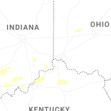

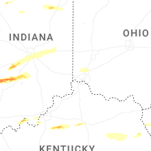
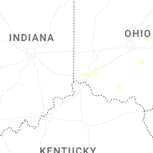


Connect with Interactive Hail Maps