

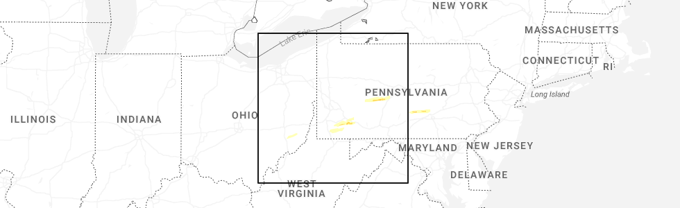
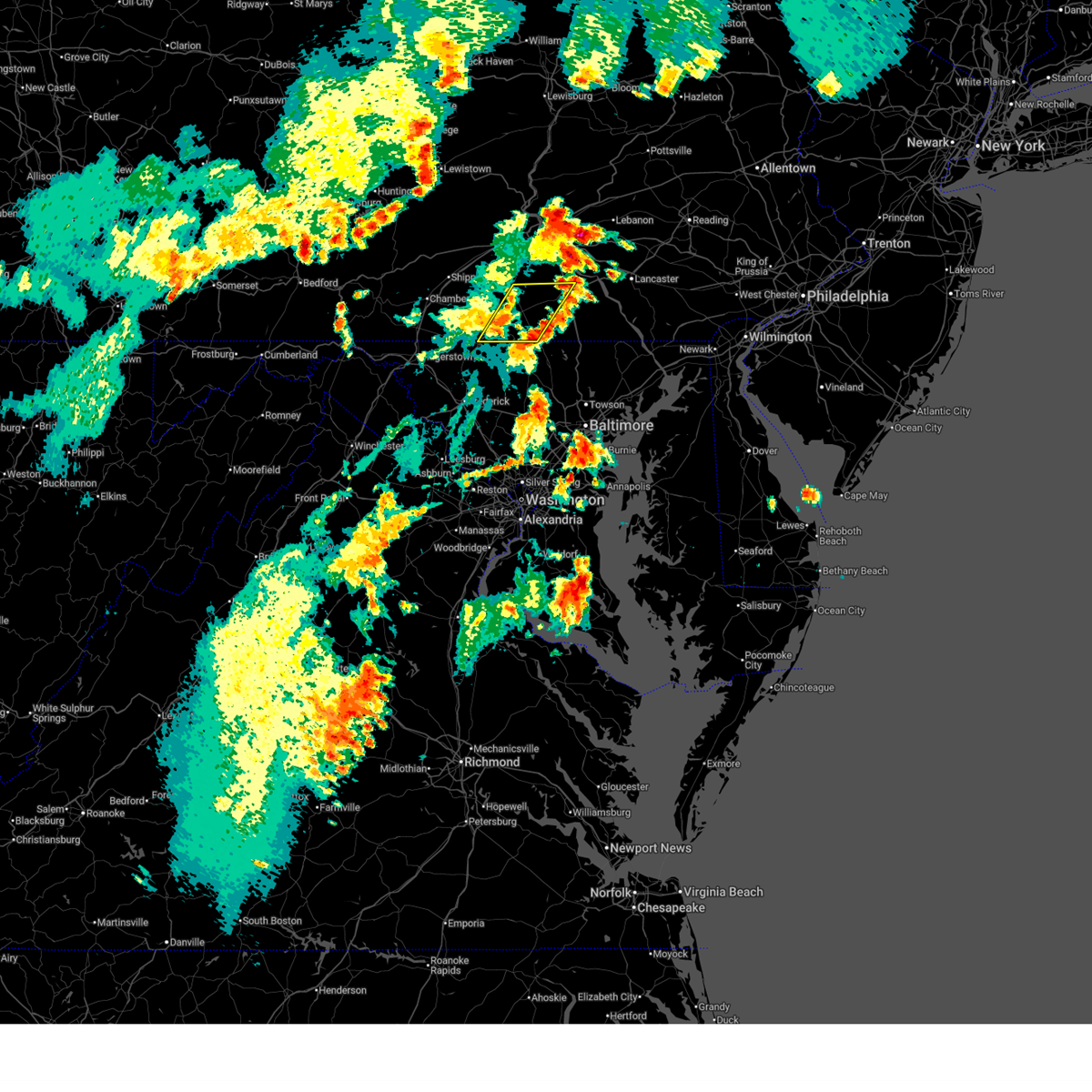
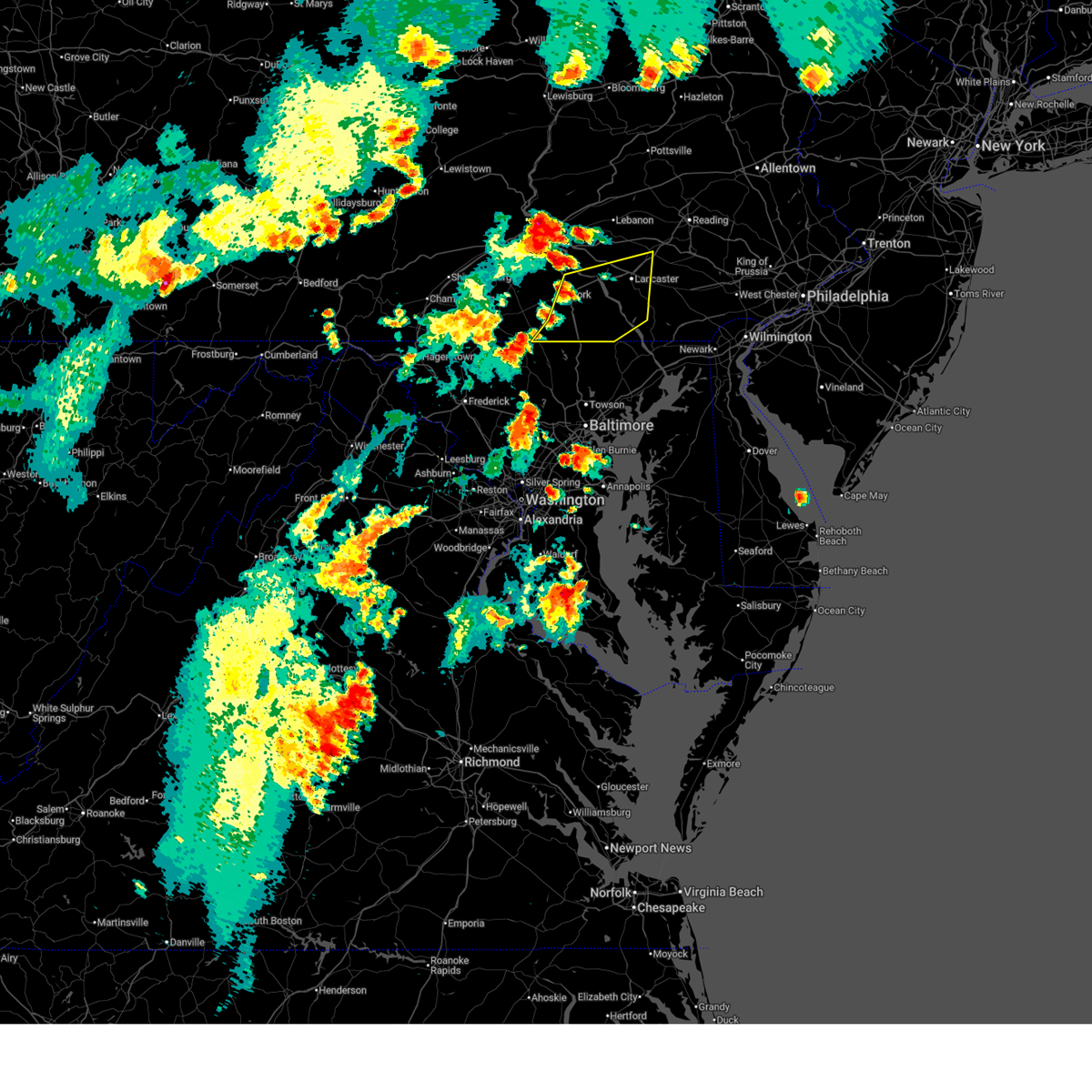
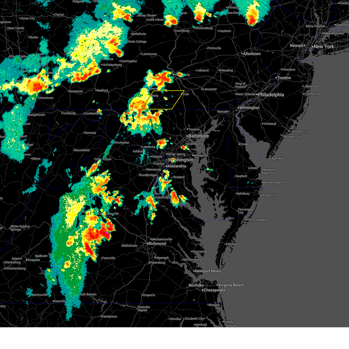
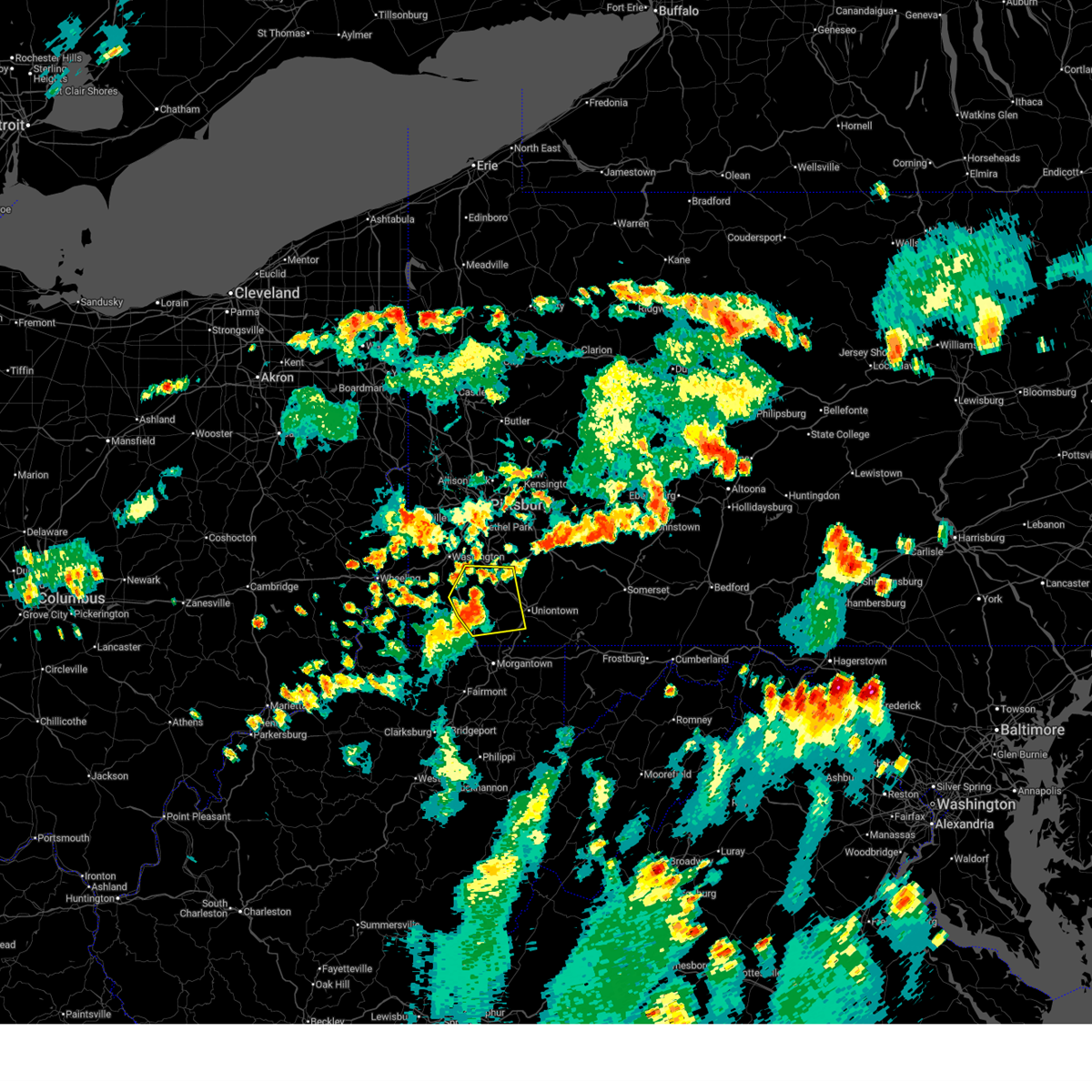
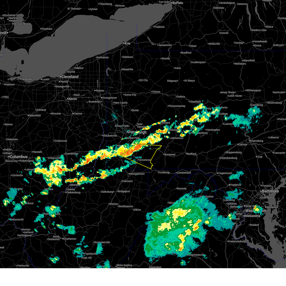
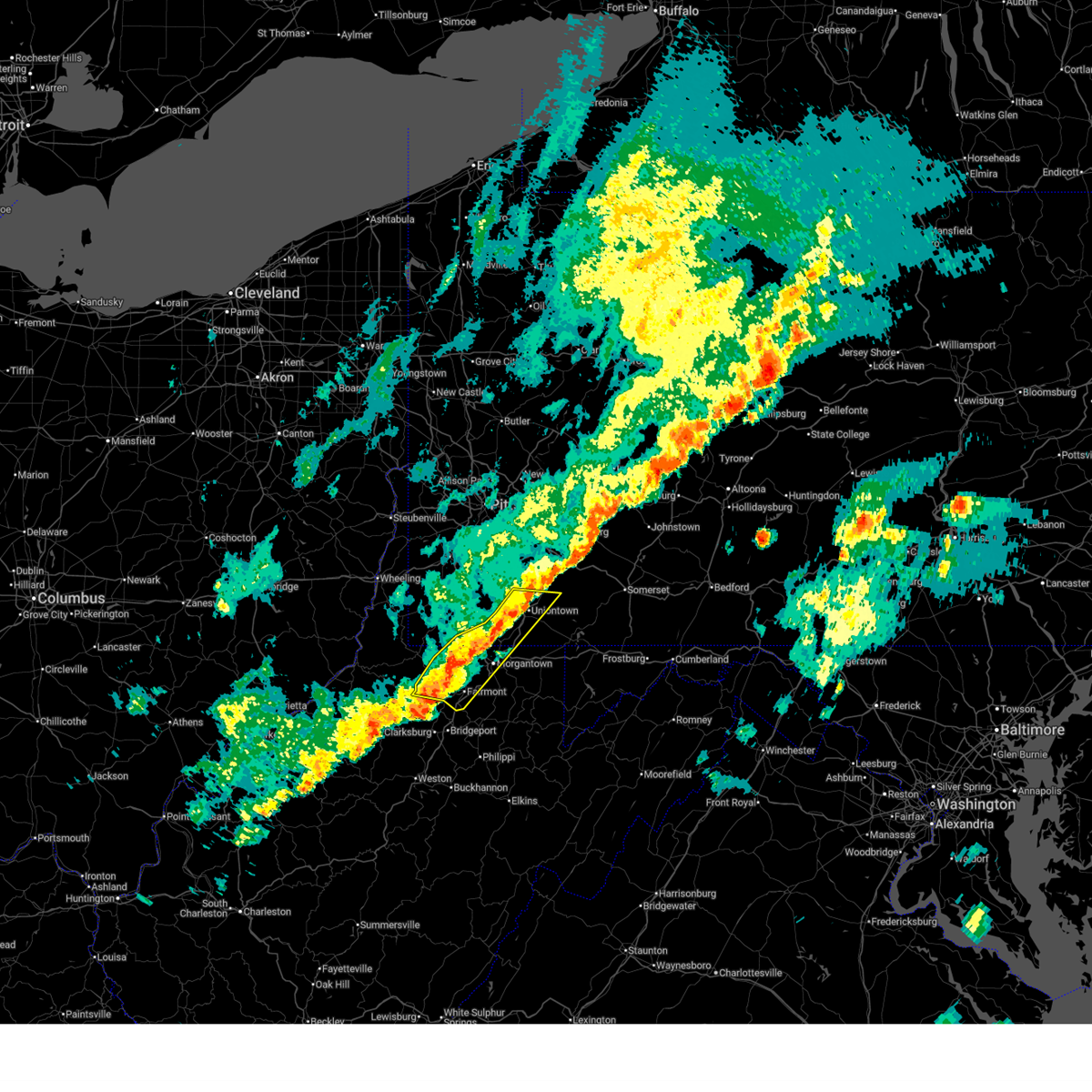
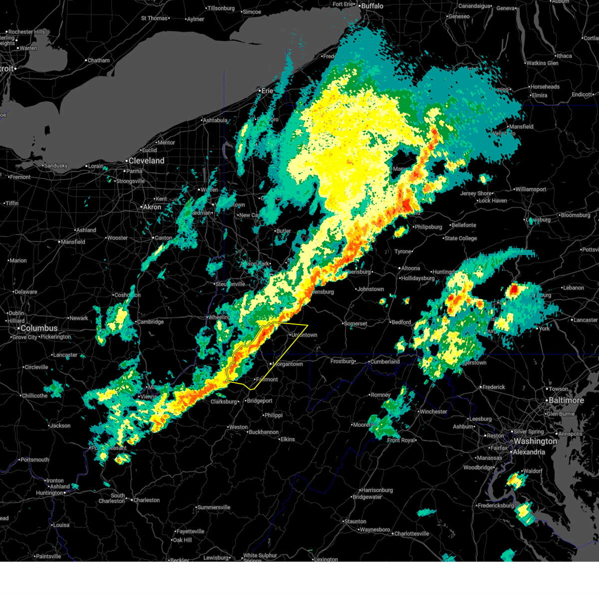
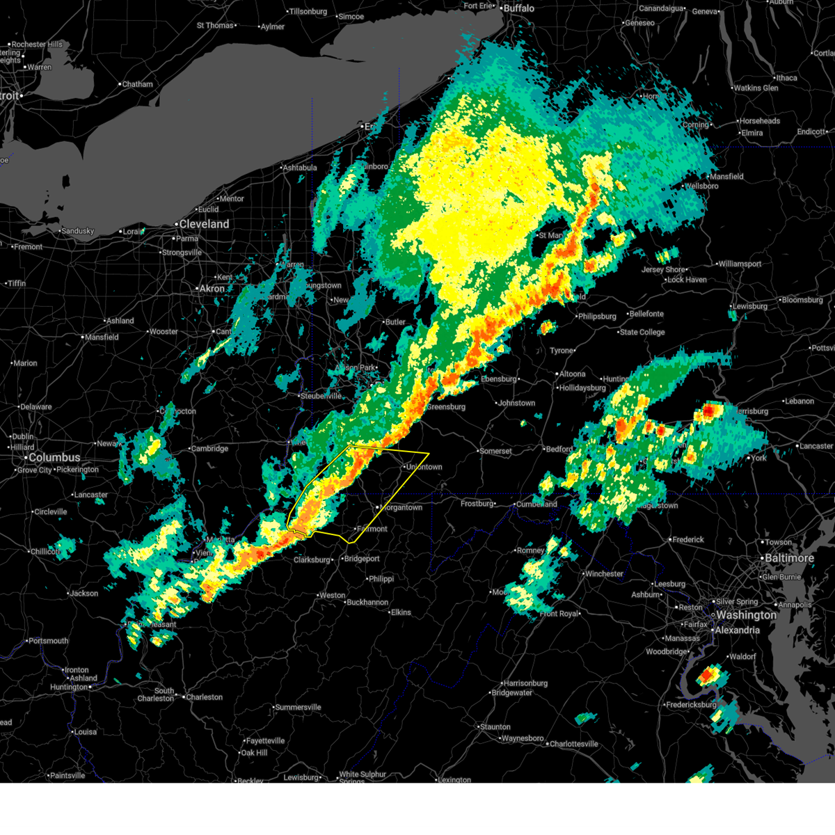
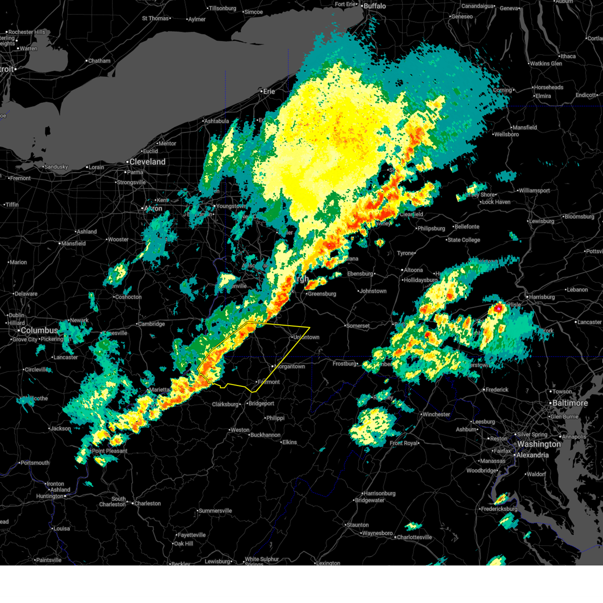
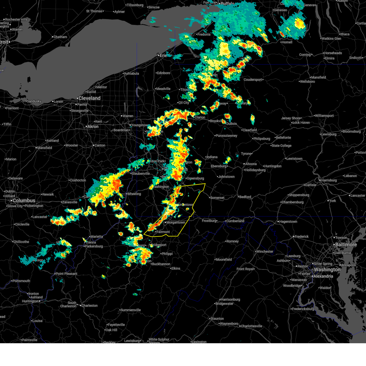
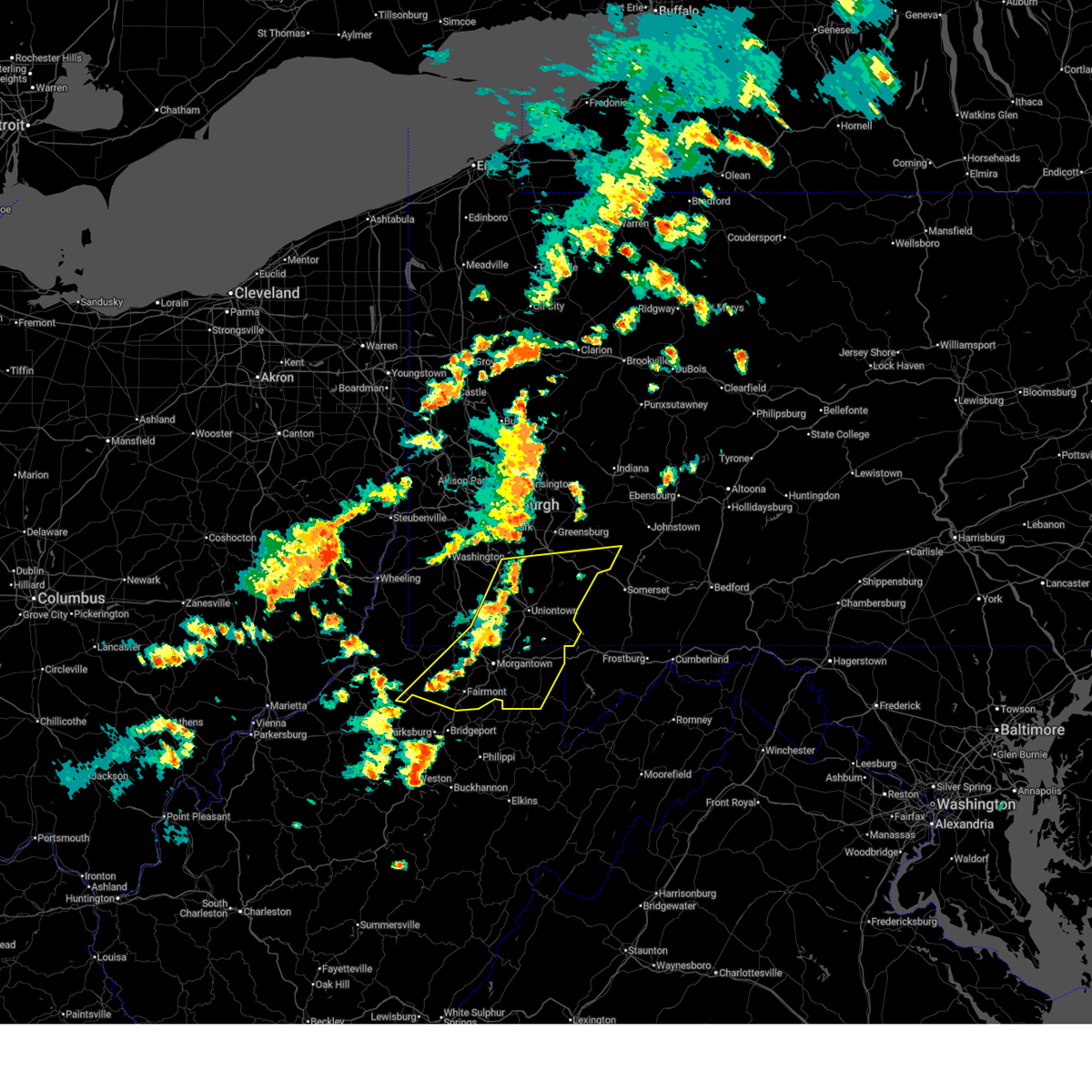
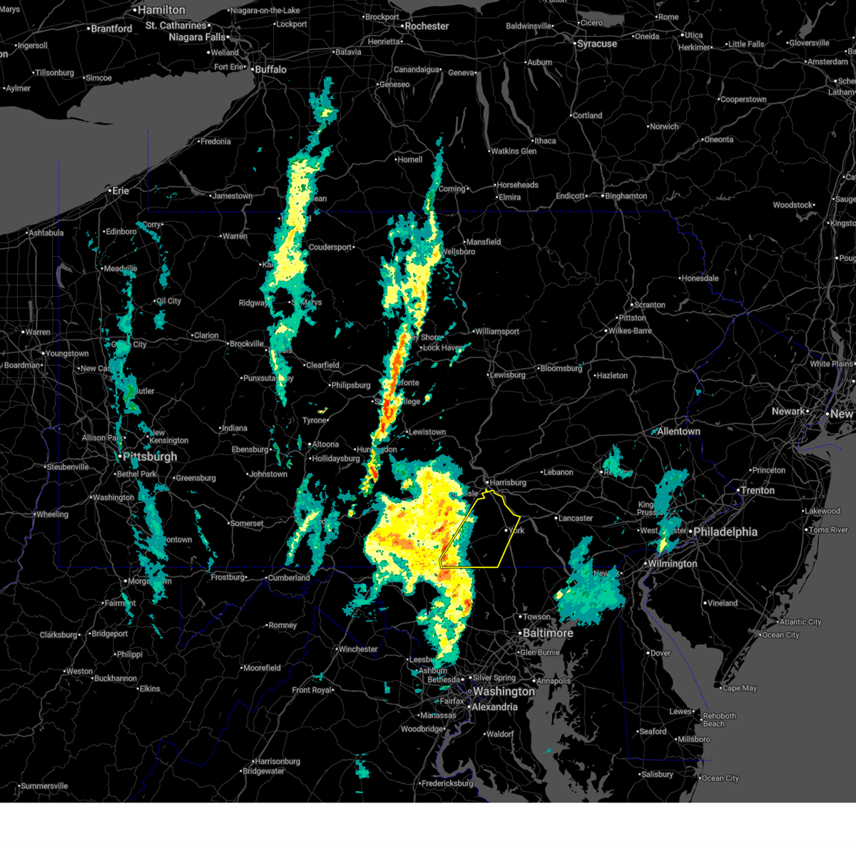
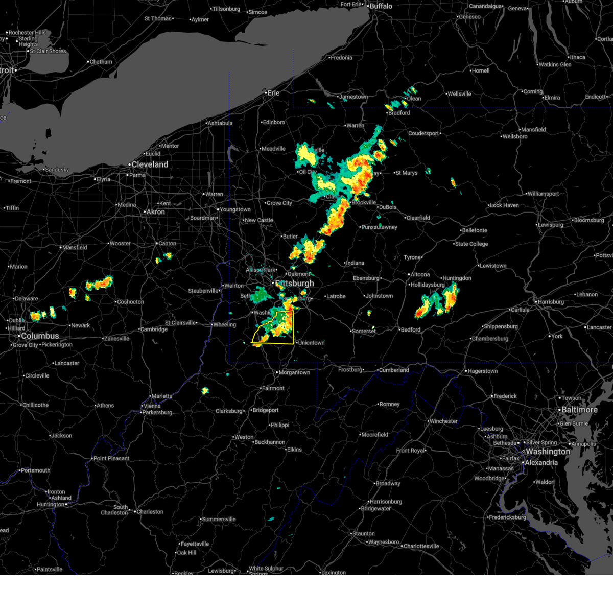
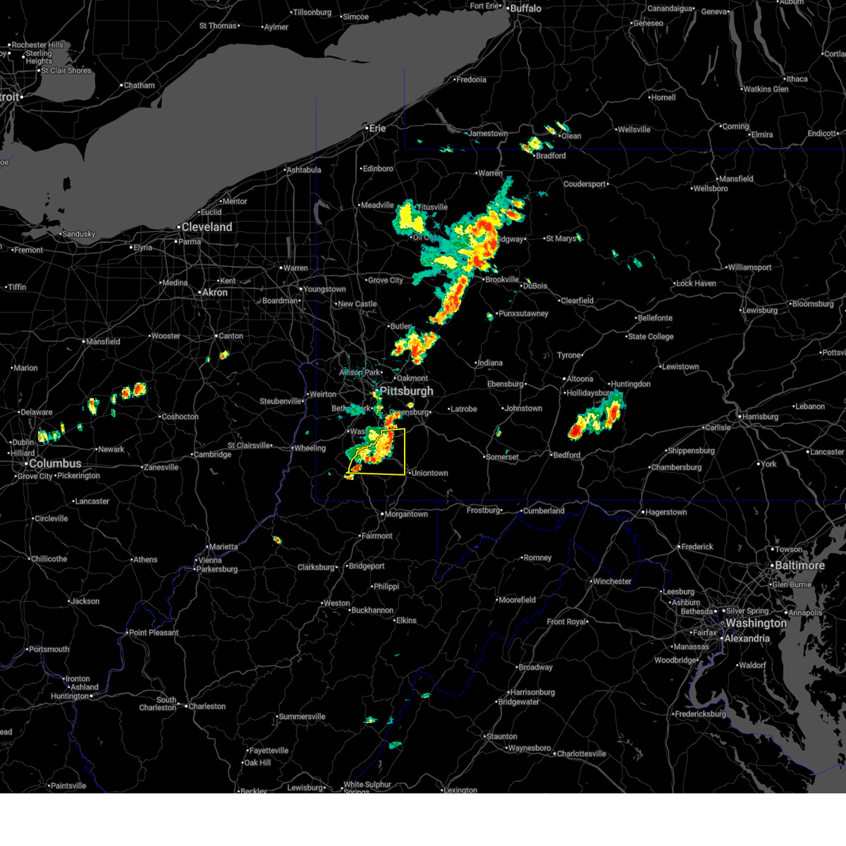
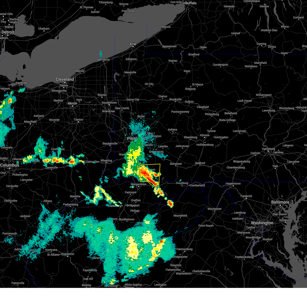
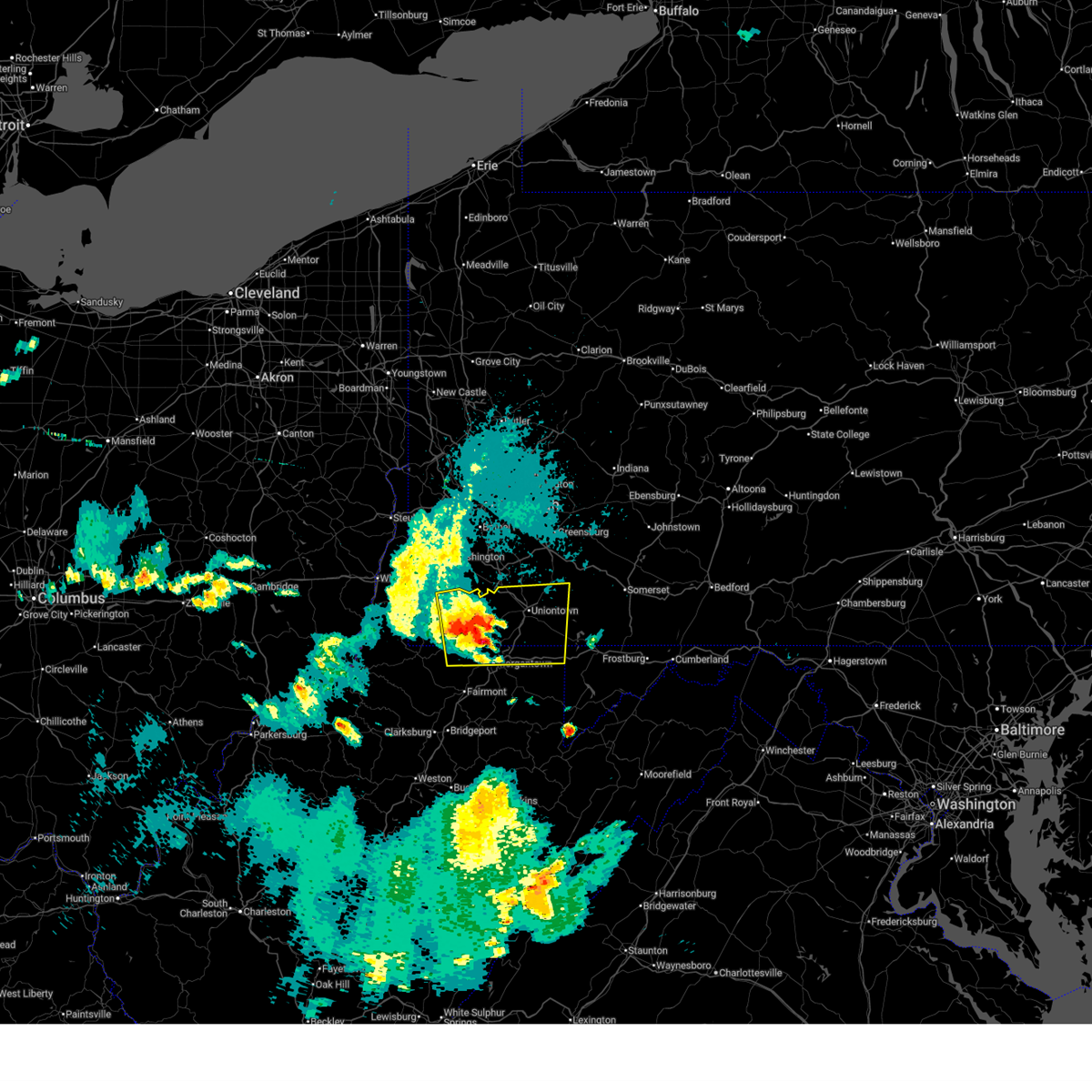
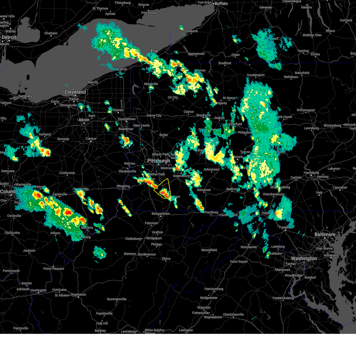
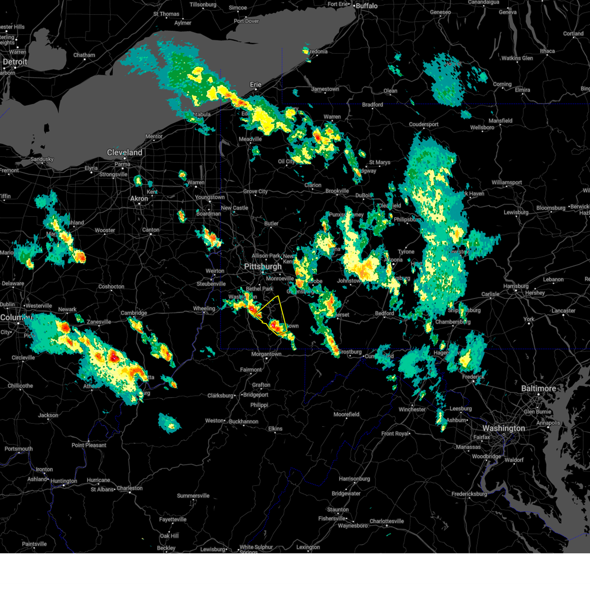
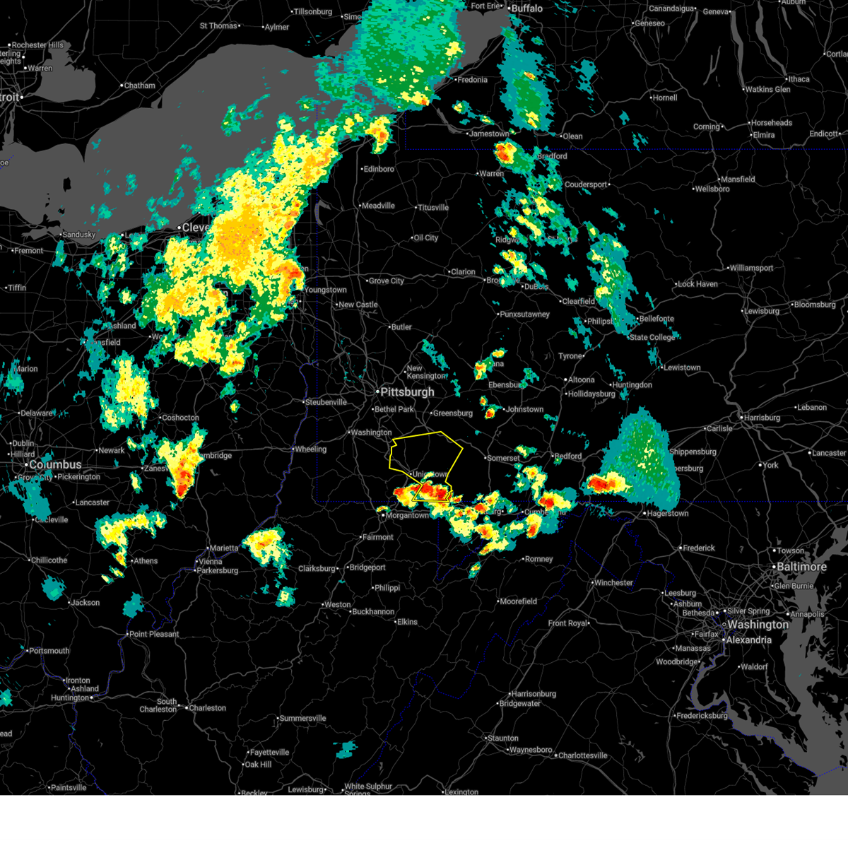
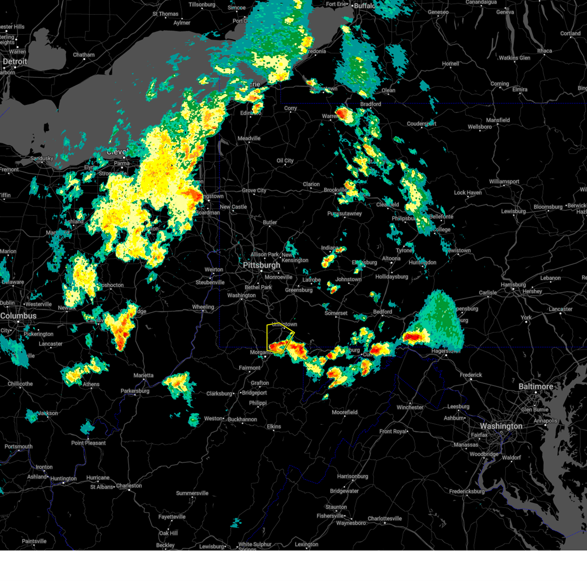
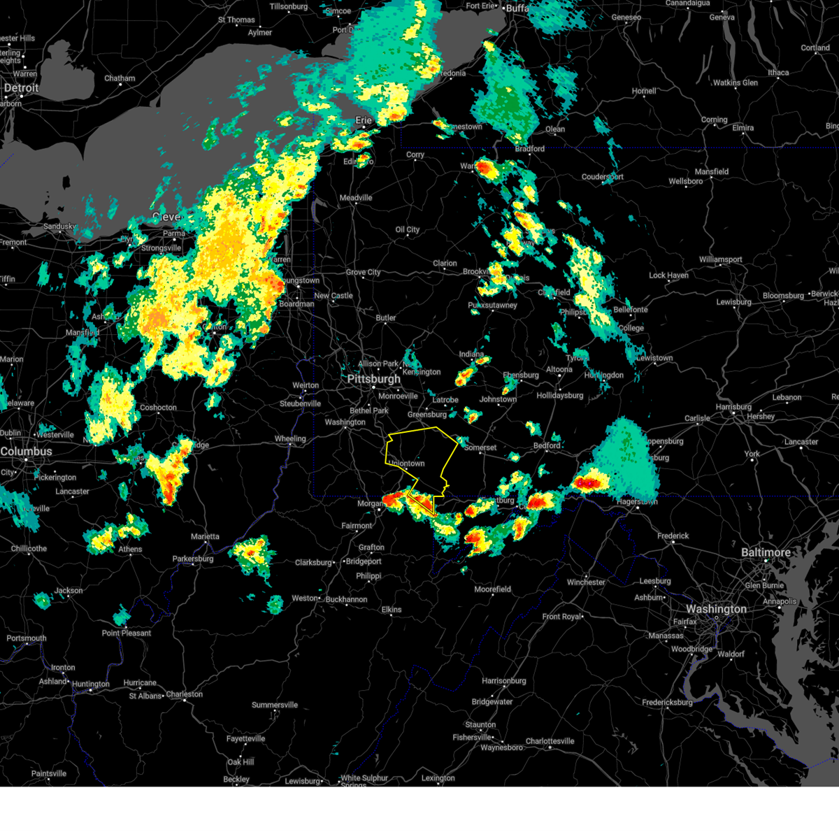
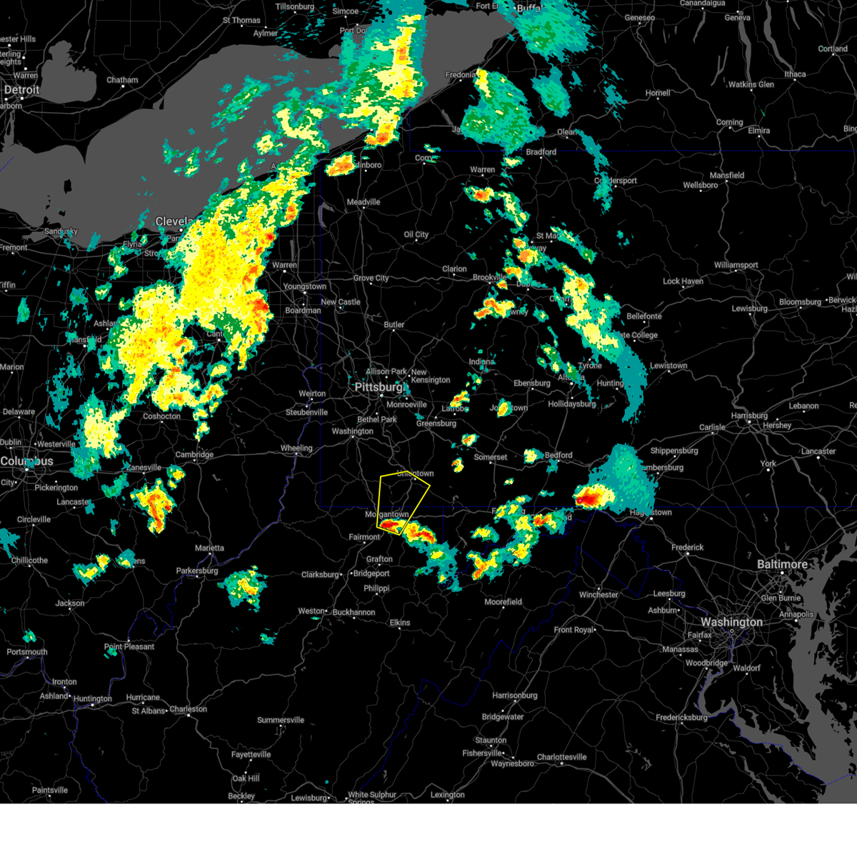
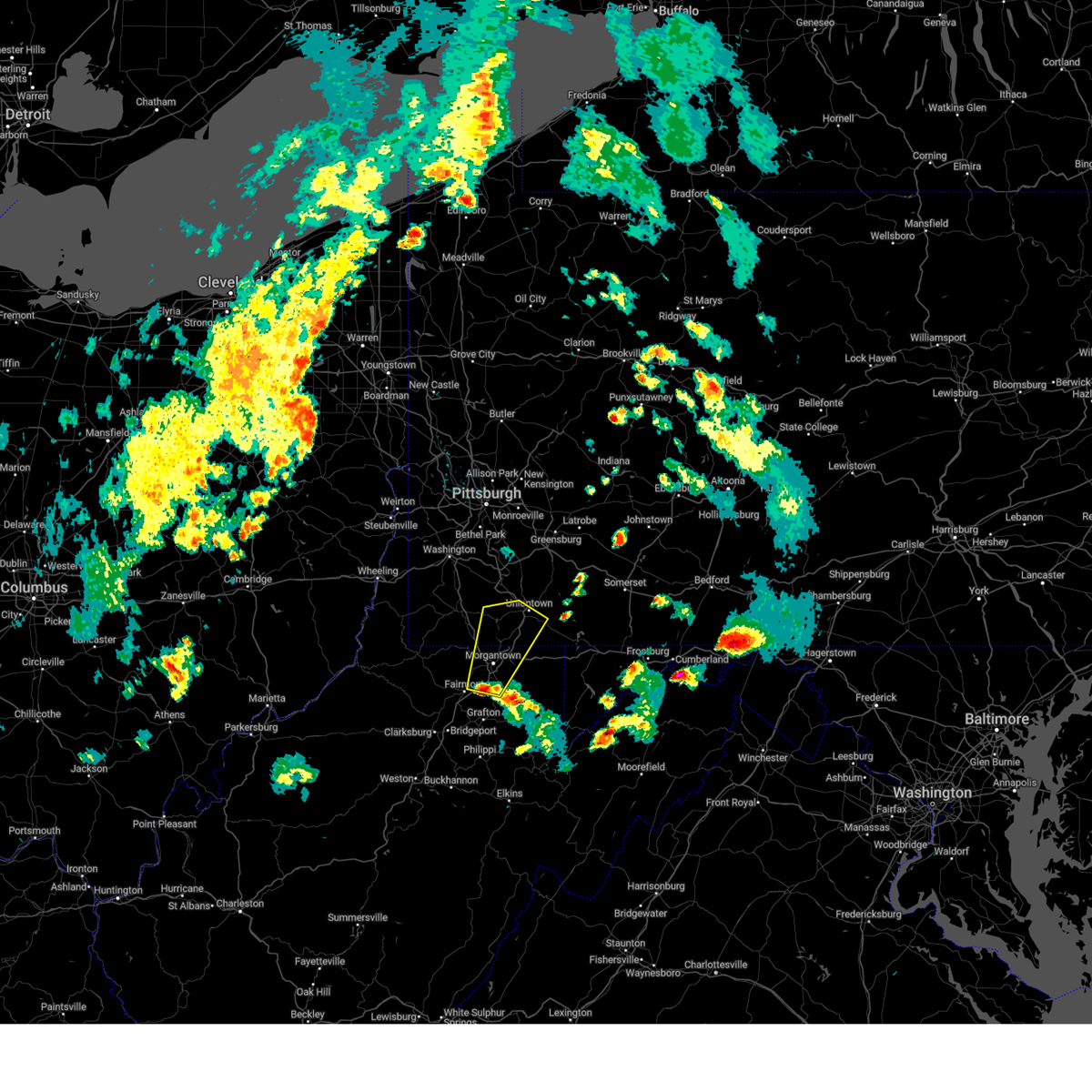
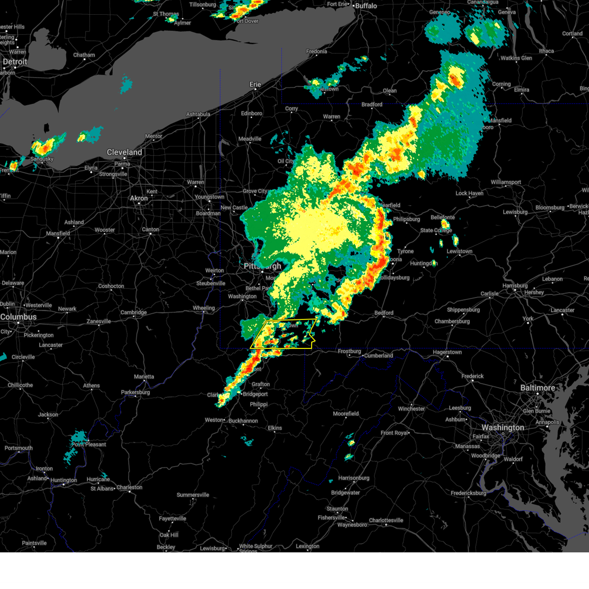
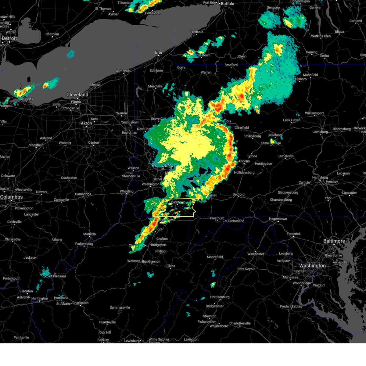
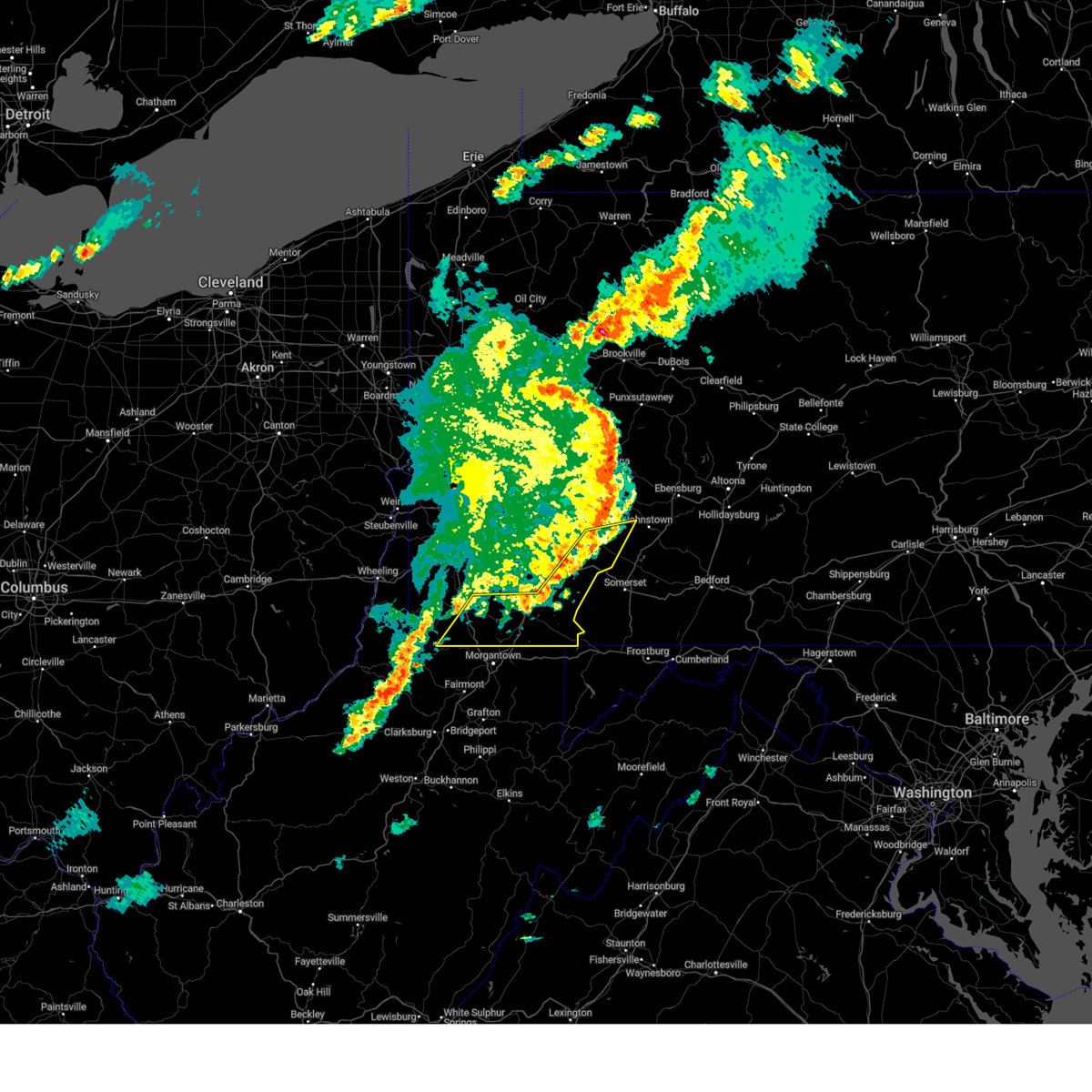
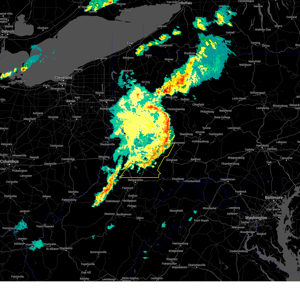
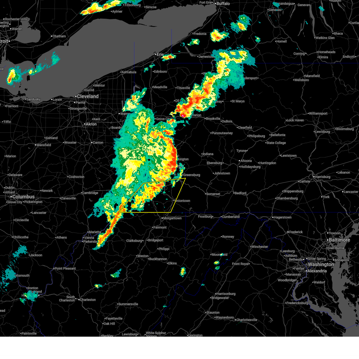
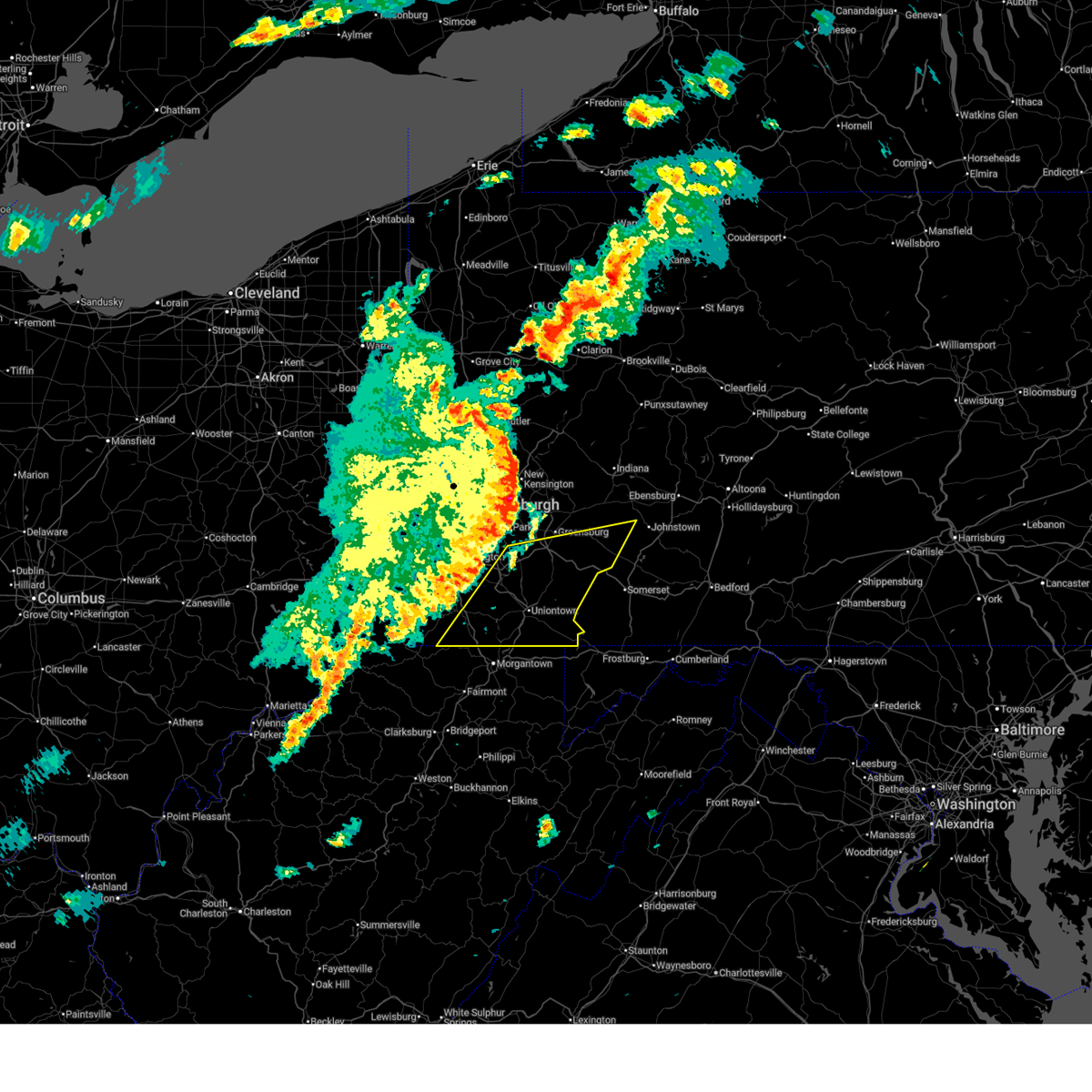
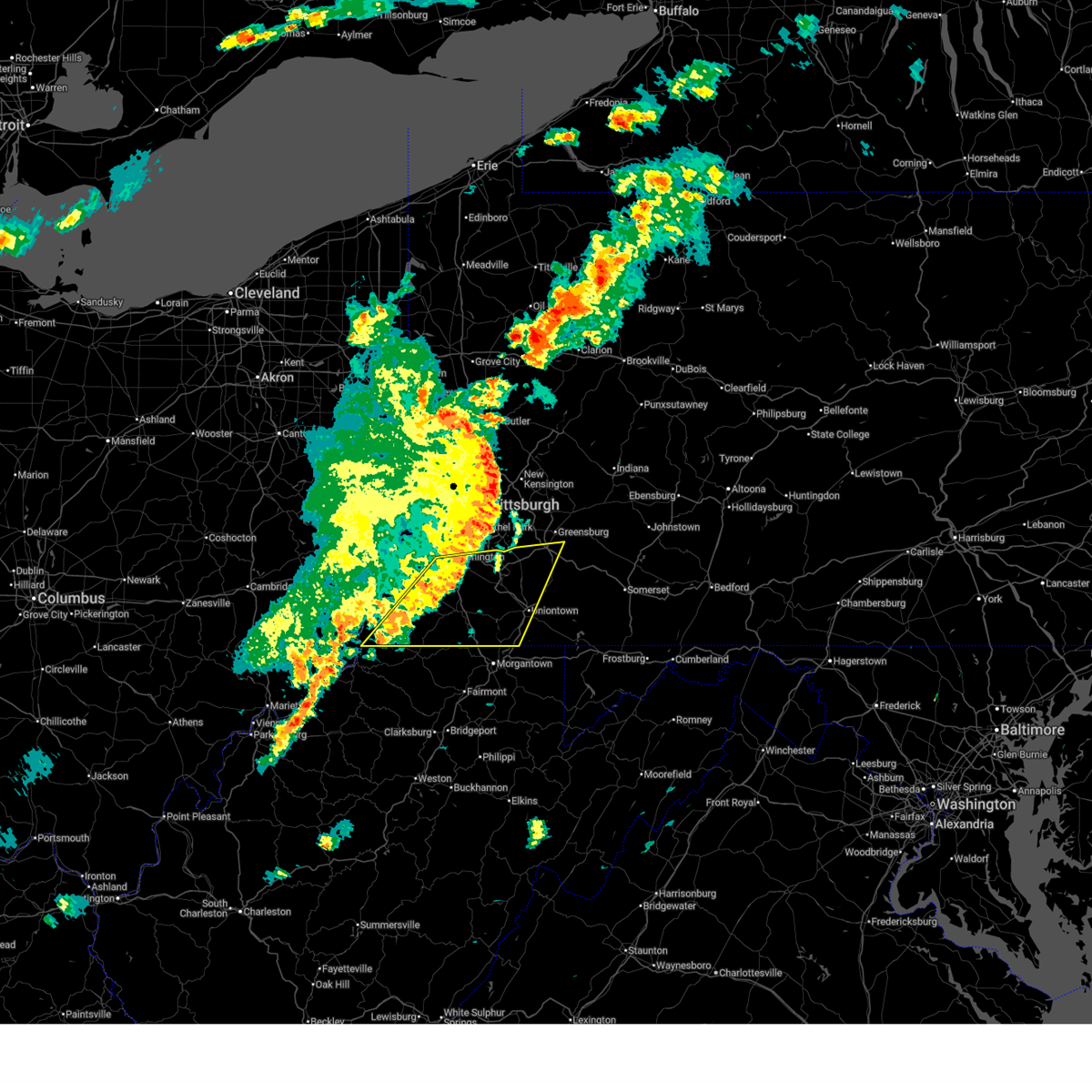
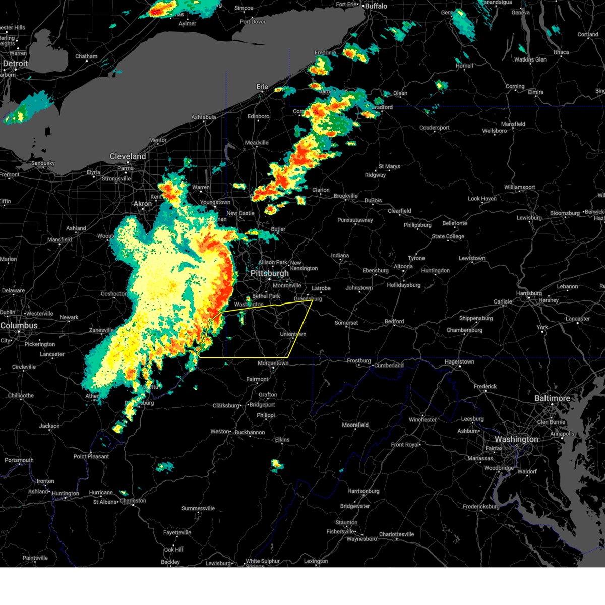
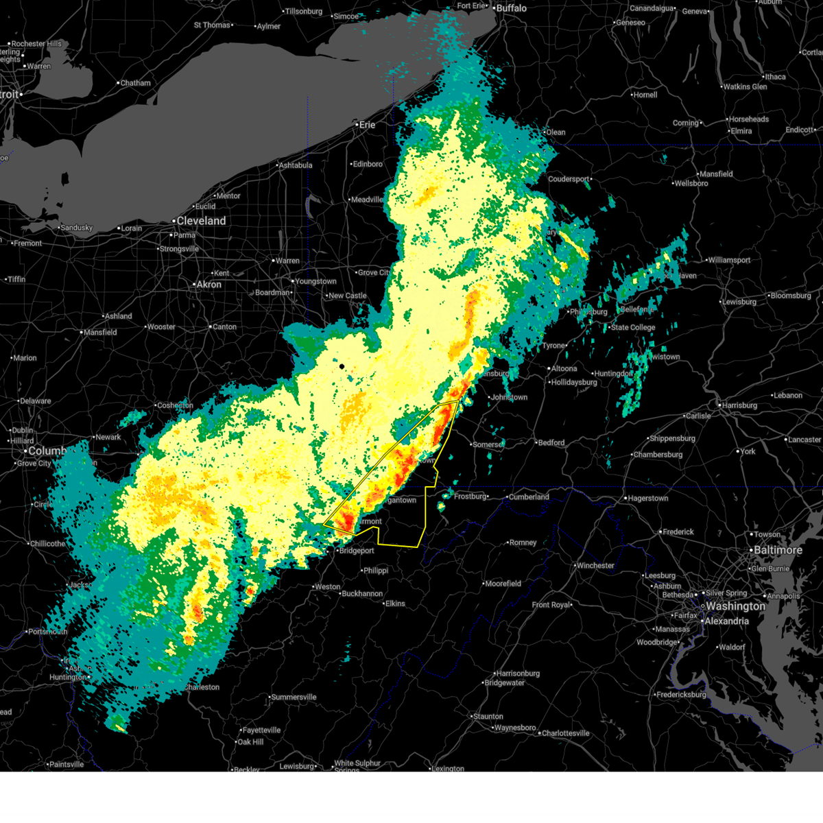
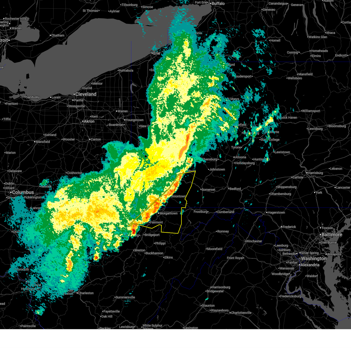
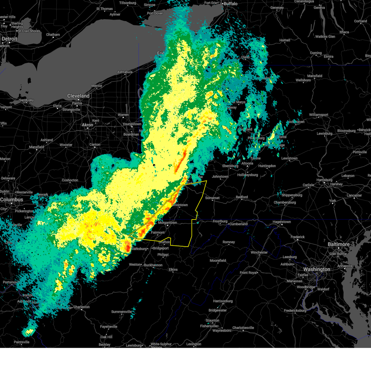
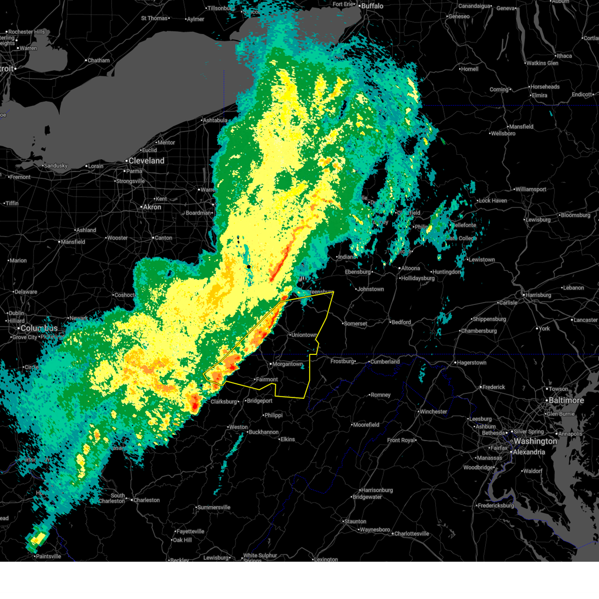
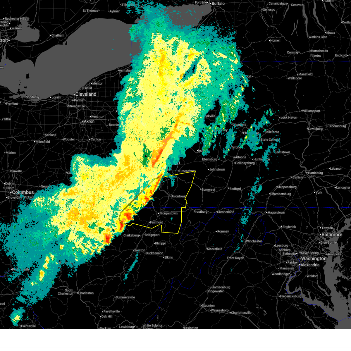
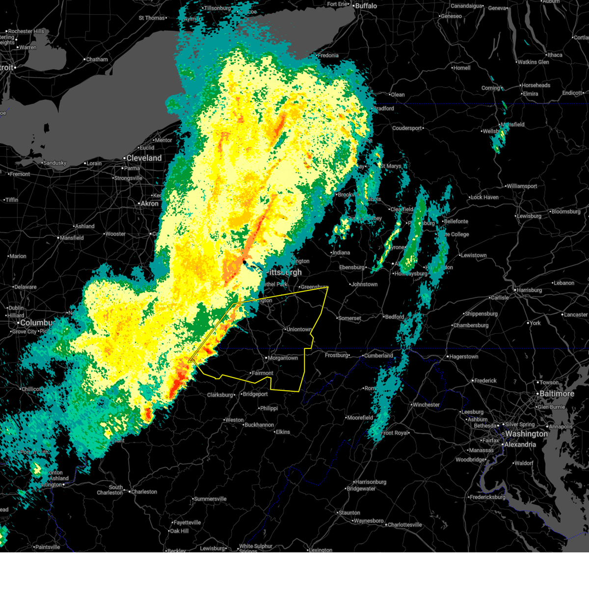
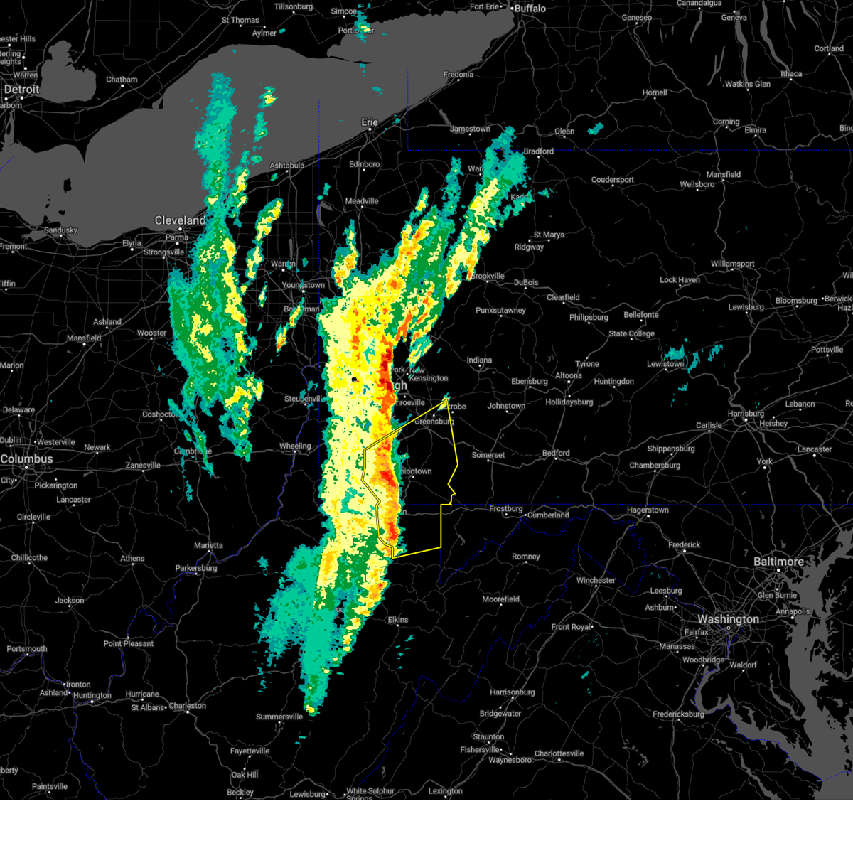
Hail Map for New Salem, PA
The New Salem, PA area has had 0 reports of on-the-ground hail by trained spotters, and has been under severe weather warnings 30 times during the past 12 months. Doppler radar has detected hail at or near New Salem, PA on 70 occasions, including 3 occasions during the past year.
| Name: | New Salem, PA |
| Where Located: | 43.4 miles NNW of Baltimore, MD |
| Map: | Google Map for New Salem, PA |
| Population: | 724 |
| Housing Units: | 318 |
| More Info: | Search Google for New Salem, PA |
2
The Top Recent Hail Date for New Salem, PA is Wednesday, March 11, 2026 (18th out of 70)
Hail and Wind Damage Spotted near New Salem, PA
| Date / Time | Report Details |
|---|---|
| 7/5/2026 8:01 PM EDT |
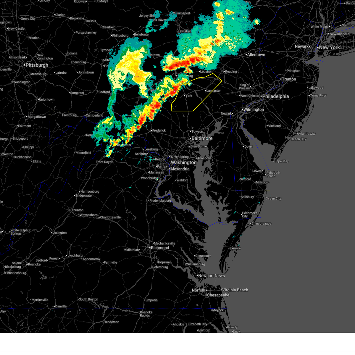
 At 801 pm edt, severe thunderstorms were located along a line extending from penn national race course to emigsville to stewartstown, moving east at 40 mph (radar indicated). Hazards include 60 mph wind gusts. Expect damage to roofs, siding, and trees. locations impacted include, harrisburg, york, lebanon, lower allen, hanover, hershey, colonial park, weigelstown, elizabethtown, columbia, progress, and lititz. this includes the following interstates, the pennsylvania turnpike from mile markers 237 to 274. interstate 78 from mile markers 0 to 3. interstate 81 from mile markers 67 to 90. interstate 83 from mile markers 0 to 50. Interstate 283 from mile markers 0 to 2. At 801 pm edt, severe thunderstorms were located along a line extending from penn national race course to emigsville to stewartstown, moving east at 40 mph (radar indicated). Hazards include 60 mph wind gusts. Expect damage to roofs, siding, and trees. locations impacted include, harrisburg, york, lebanon, lower allen, hanover, hershey, colonial park, weigelstown, elizabethtown, columbia, progress, and lititz. this includes the following interstates, the pennsylvania turnpike from mile markers 237 to 274. interstate 78 from mile markers 0 to 3. interstate 81 from mile markers 67 to 90. interstate 83 from mile markers 0 to 50. Interstate 283 from mile markers 0 to 2.
|
| 7/5/2026 7:27 PM EDT |
 Svrctp the national weather service in state college pa has issued a * severe thunderstorm warning for, eastern adams county in south central pennsylvania, eastern cumberland county in south central pennsylvania, dauphin county in south central pennsylvania, northwestern lancaster county in south central pennsylvania, lebanon county in south central pennsylvania, east central perry county in south central pennsylvania, york county in south central pennsylvania, * until 830 pm edt. * at 727 pm edt, severe thunderstorms were located along a line extending from dehart dam to lake meade to manchester, moving east at 45 mph (radar indicated). Hazards include 70 mph wind gusts. Expect considerable tree damage. Damage is likely to mobile homes, roofs, and outbuildings. Svrctp the national weather service in state college pa has issued a * severe thunderstorm warning for, eastern adams county in south central pennsylvania, eastern cumberland county in south central pennsylvania, dauphin county in south central pennsylvania, northwestern lancaster county in south central pennsylvania, lebanon county in south central pennsylvania, east central perry county in south central pennsylvania, york county in south central pennsylvania, * until 830 pm edt. * at 727 pm edt, severe thunderstorms were located along a line extending from dehart dam to lake meade to manchester, moving east at 45 mph (radar indicated). Hazards include 70 mph wind gusts. Expect considerable tree damage. Damage is likely to mobile homes, roofs, and outbuildings.
|
| 7/4/2026 7:27 PM EDT |
 At 727 pm edt, severe thunderstorms were located along a line extending from wrightsville to cross roads to near railroad, moving east at 20 mph (radar indicated). Hazards include 70 mph wind gusts and nickel size hail. Expect considerable tree damage. damage is likely to mobile homes, roofs, and outbuildings. locations impacted include, lancaster, york, ephrata, columbia, lititz, millersville, willow street, mount joy, red lion, spry, east petersburg, and dallastown. This includes interstate 83 from mile markers 0 to 26. At 727 pm edt, severe thunderstorms were located along a line extending from wrightsville to cross roads to near railroad, moving east at 20 mph (radar indicated). Hazards include 70 mph wind gusts and nickel size hail. Expect considerable tree damage. damage is likely to mobile homes, roofs, and outbuildings. locations impacted include, lancaster, york, ephrata, columbia, lititz, millersville, willow street, mount joy, red lion, spry, east petersburg, and dallastown. This includes interstate 83 from mile markers 0 to 26.
|
| 7/4/2026 7:11 PM EDT |
 At 711 pm edt, severe thunderstorms were located along a line extending from littlestown to east berlin, moving east at 35 mph (radar indicated). Hazards include 60 mph wind gusts and penny size hail. Expect damage to roofs, siding, and trees. locations impacted include, york, hanover, weigelstown, gettysburg, parkville, hampton, shiloh, west york, littlestown, codorus, grantley, and mcsherrystown. This includes interstate 83 from mile markers 21 to 23. At 711 pm edt, severe thunderstorms were located along a line extending from littlestown to east berlin, moving east at 35 mph (radar indicated). Hazards include 60 mph wind gusts and penny size hail. Expect damage to roofs, siding, and trees. locations impacted include, york, hanover, weigelstown, gettysburg, parkville, hampton, shiloh, west york, littlestown, codorus, grantley, and mcsherrystown. This includes interstate 83 from mile markers 21 to 23.
|
| 7/4/2026 7:10 PM EDT |
 Svrctp the national weather service in state college pa has issued a * severe thunderstorm warning for, central lancaster county in south central pennsylvania, southeastern york county in south central pennsylvania, * until 800 pm edt. * at 709 pm edt, severe thunderstorms were located along a line extending from hallam to shrewsbury to manchester, moving east at 20 mph (radar indicated). Hazards include 60 mph wind gusts and nickel size hail. expect damage to roofs, siding, and trees Svrctp the national weather service in state college pa has issued a * severe thunderstorm warning for, central lancaster county in south central pennsylvania, southeastern york county in south central pennsylvania, * until 800 pm edt. * at 709 pm edt, severe thunderstorms were located along a line extending from hallam to shrewsbury to manchester, moving east at 20 mph (radar indicated). Hazards include 60 mph wind gusts and nickel size hail. expect damage to roofs, siding, and trees
|
| 7/4/2026 6:39 PM EDT |
 Svrctp the national weather service in state college pa has issued a * severe thunderstorm warning for, adams county in south central pennsylvania, southeastern franklin county in south central pennsylvania, southwestern york county in south central pennsylvania, * until 730 pm edt. * at 638 pm edt, severe thunderstorms were located along a line extending from littlestown to rouzerville, moving northeast at 55 mph (radar indicated). Hazards include 60 mph wind gusts and penny size hail. expect damage to roofs, siding, and trees Svrctp the national weather service in state college pa has issued a * severe thunderstorm warning for, adams county in south central pennsylvania, southeastern franklin county in south central pennsylvania, southwestern york county in south central pennsylvania, * until 730 pm edt. * at 638 pm edt, severe thunderstorms were located along a line extending from littlestown to rouzerville, moving northeast at 55 mph (radar indicated). Hazards include 60 mph wind gusts and penny size hail. expect damage to roofs, siding, and trees
|
| 7/4/2026 6:02 PM EDT |
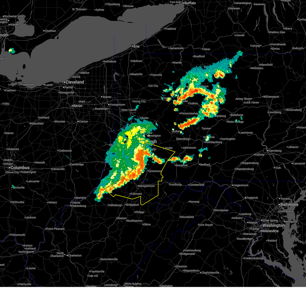
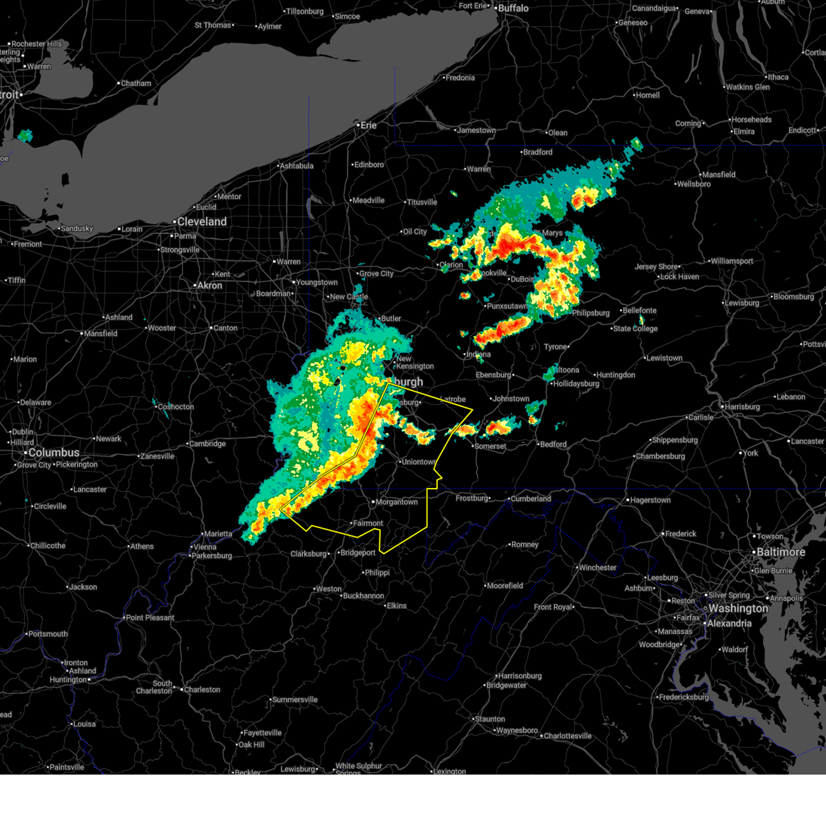
 Svrpbz the national weather service in pittsburgh has issued a * severe thunderstorm warning for, western fayette county in southwestern pennsylvania, eastern greene county in southwestern pennsylvania, southeastern washington county in southwestern pennsylvania, * until 645 pm edt. * at 602 pm edt, a severe thunderstorm was located over jefferson boro, or 7 miles northeast of waynesburg, moving northeast at 25 mph (radar indicated). Hazards include 60 mph wind gusts and small hail. expect damage to roofs, siding, and trees Svrpbz the national weather service in pittsburgh has issued a * severe thunderstorm warning for, western fayette county in southwestern pennsylvania, eastern greene county in southwestern pennsylvania, southeastern washington county in southwestern pennsylvania, * until 645 pm edt. * at 602 pm edt, a severe thunderstorm was located over jefferson boro, or 7 miles northeast of waynesburg, moving northeast at 25 mph (radar indicated). Hazards include 60 mph wind gusts and small hail. expect damage to roofs, siding, and trees
|
| 6/22/2026 5:09 PM EDT |
 the severe thunderstorm warning has been cancelled and is no longer in effect the severe thunderstorm warning has been cancelled and is no longer in effect
|
| 6/22/2026 5:09 PM EDT |
 At 509 pm edt, severe thunderstorms were located along a line from 5 miles northeast of mount pleasant to over fredericktown-millsboro, or along a line from 8 miles southeast of greensburg to 13 miles northeast of waynesburg, moving east at 20 mph (radar indicated). Hazards include 60 mph wind gusts. Expect damage to roofs, siding, and trees. Locations impacted include, uniontown, connellsville, mount pleasant, scottdale, brownsville, south connellsville, farmington, perryopolis, seven springs, dunbar, everson, republic, vanderbilt, smithton, dawson, grindstone, new salem, donegal, chalkhill and champion. At 509 pm edt, severe thunderstorms were located along a line from 5 miles northeast of mount pleasant to over fredericktown-millsboro, or along a line from 8 miles southeast of greensburg to 13 miles northeast of waynesburg, moving east at 20 mph (radar indicated). Hazards include 60 mph wind gusts. Expect damage to roofs, siding, and trees. Locations impacted include, uniontown, connellsville, mount pleasant, scottdale, brownsville, south connellsville, farmington, perryopolis, seven springs, dunbar, everson, republic, vanderbilt, smithton, dawson, grindstone, new salem, donegal, chalkhill and champion.
|
| 6/22/2026 4:50 PM EDT |
 Svrpbz the national weather service in pittsburgh has issued a * severe thunderstorm warning for, fayette county in southwestern pennsylvania, northeastern greene county in southwestern pennsylvania, southeastern washington county in southwestern pennsylvania, southern westmoreland county in southwestern pennsylvania, * until 600 pm edt. * at 450 pm edt, severe thunderstorms were located along a line from over new stanton to 5 miles west of fredericktown-millsboro, or along a line from 7 miles southwest of greensburg to 9 miles northeast of waynesburg, moving east at 20 mph (radar indicated). Hazards include 60 mph wind gusts. expect damage to roofs, siding, and trees Svrpbz the national weather service in pittsburgh has issued a * severe thunderstorm warning for, fayette county in southwestern pennsylvania, northeastern greene county in southwestern pennsylvania, southeastern washington county in southwestern pennsylvania, southern westmoreland county in southwestern pennsylvania, * until 600 pm edt. * at 450 pm edt, severe thunderstorms were located along a line from over new stanton to 5 miles west of fredericktown-millsboro, or along a line from 7 miles southwest of greensburg to 9 miles northeast of waynesburg, moving east at 20 mph (radar indicated). Hazards include 60 mph wind gusts. expect damage to roofs, siding, and trees
|
| 6/14/2026 8:17 PM EDT |
 At 817 pm edt, a severe thunderstorm was located over spry, moving northeast at 45 mph (radar indicated). Hazards include 70 mph wind gusts and half dollar size hail. Hail damage to vehicles is expected. expect considerable tree damage. wind damage is also likely to mobile homes, roofs, and outbuildings. locations impacted include, york, red lion, spry, dallastown, shiloh, east york, stonybrook-wilshire, west york, shrewsbury, codorus, grantley, and tyler run-queens gate. This includes interstate 83 from mile markers 5 to 23. At 817 pm edt, a severe thunderstorm was located over spry, moving northeast at 45 mph (radar indicated). Hazards include 70 mph wind gusts and half dollar size hail. Hail damage to vehicles is expected. expect considerable tree damage. wind damage is also likely to mobile homes, roofs, and outbuildings. locations impacted include, york, red lion, spry, dallastown, shiloh, east york, stonybrook-wilshire, west york, shrewsbury, codorus, grantley, and tyler run-queens gate. This includes interstate 83 from mile markers 5 to 23.
|
| 6/14/2026 8:06 PM EDT |
 Svrctp the national weather service in state college pa has issued a * severe thunderstorm warning for, southern york county in south central pennsylvania, * until 845 pm edt. * at 806 pm edt, a severe thunderstorm was located over codorus, moving northeast at 45 mph (radar indicated). Hazards include 60 mph wind gusts and quarter size hail. Hail damage to vehicles is expected. Expect wind damage to roofs, siding, and trees. Svrctp the national weather service in state college pa has issued a * severe thunderstorm warning for, southern york county in south central pennsylvania, * until 845 pm edt. * at 806 pm edt, a severe thunderstorm was located over codorus, moving northeast at 45 mph (radar indicated). Hazards include 60 mph wind gusts and quarter size hail. Hail damage to vehicles is expected. Expect wind damage to roofs, siding, and trees.
|
| 6/14/2026 7:28 PM EDT |
 At 728 pm edt, severe thunderstorms were located along a line from near brownsville to near mannington, or along a line from 8 miles northwest of uniontown to near mannington, moving east at 25 mph (radar indicated). Hazards include 60 mph wind gusts and small hail. Expect damage to roofs, siding, and trees. Locations impacted include, morgantown, fairmont, uniontown, westover, mannington, star city, masontown, pleasant valley, winfield, south connellsville, barrackville, point marion, monongah, granville, fairview, cassville, fairchance, dunbar and rivesville. At 728 pm edt, severe thunderstorms were located along a line from near brownsville to near mannington, or along a line from 8 miles northwest of uniontown to near mannington, moving east at 25 mph (radar indicated). Hazards include 60 mph wind gusts and small hail. Expect damage to roofs, siding, and trees. Locations impacted include, morgantown, fairmont, uniontown, westover, mannington, star city, masontown, pleasant valley, winfield, south connellsville, barrackville, point marion, monongah, granville, fairview, cassville, fairchance, dunbar and rivesville.
|
| 6/14/2026 7:17 PM EDT |
 At 717 pm edt, severe thunderstorms were located along a line from over brownsville to 9 miles east of jacksonburg, or along a line from 12 miles northwest of uniontown to 9 miles west of mannington, moving east at 25 mph (radar indicated). Hazards include 60 mph wind gusts and small hail. Expect damage to roofs, siding, and trees. Locations impacted include, morgantown, fairmont, uniontown, westover, mannington, star city, masontown, pleasant valley, brownsville, winfield, south connellsville, fairdale, jefferson boro, barrackville, point marion, monongah, granville, fairview and cassville. At 717 pm edt, severe thunderstorms were located along a line from over brownsville to 9 miles east of jacksonburg, or along a line from 12 miles northwest of uniontown to 9 miles west of mannington, moving east at 25 mph (radar indicated). Hazards include 60 mph wind gusts and small hail. Expect damage to roofs, siding, and trees. Locations impacted include, morgantown, fairmont, uniontown, westover, mannington, star city, masontown, pleasant valley, brownsville, winfield, south connellsville, fairdale, jefferson boro, barrackville, point marion, monongah, granville, fairview and cassville.
|
| 6/14/2026 7:07 PM EDT |
 At 707 pm edt, severe thunderstorms were located along a line from over fredericktown-millsboro to near jacksonburg, or along a line from 12 miles northeast of waynesburg to 13 miles west of mannington, moving east at 25 mph (radar indicated). Hazards include 60 mph wind gusts and small hail. Expect damage to roofs, siding, and trees. Locations impacted include, morgantown, fairmont, uniontown, waynesburg, westover, mannington, star city, masontown, pleasant valley, brownsville, winfield, fredericktown-millsboro, south connellsville, jefferson boro, fairdale, barrackville, point marion, monongah, granville and pine grove. At 707 pm edt, severe thunderstorms were located along a line from over fredericktown-millsboro to near jacksonburg, or along a line from 12 miles northeast of waynesburg to 13 miles west of mannington, moving east at 25 mph (radar indicated). Hazards include 60 mph wind gusts and small hail. Expect damage to roofs, siding, and trees. Locations impacted include, morgantown, fairmont, uniontown, waynesburg, westover, mannington, star city, masontown, pleasant valley, brownsville, winfield, fredericktown-millsboro, south connellsville, jefferson boro, fairdale, barrackville, point marion, monongah, granville and pine grove.
|
| 6/14/2026 6:54 PM EDT |
 Svrpbz the national weather service in pittsburgh has issued a * severe thunderstorm warning for, southwestern fayette county in southwestern pennsylvania, greene county in southwestern pennsylvania, southeastern washington county in southwestern pennsylvania, marion county in northern west virginia, marshall county in northern west virginia, monongalia county in northern west virginia, wetzel county in northern west virginia, * until 745 pm edt. * at 654 pm edt, severe thunderstorms were located along a line from near waynesburg to 7 miles southwest of pine grove, or along a line from near waynesburg to 10 miles south of new martinsville, moving southeast at 30 mph (radar indicated). Hazards include 60 mph wind gusts and small hail. expect damage to roofs, siding, and trees Svrpbz the national weather service in pittsburgh has issued a * severe thunderstorm warning for, southwestern fayette county in southwestern pennsylvania, greene county in southwestern pennsylvania, southeastern washington county in southwestern pennsylvania, marion county in northern west virginia, marshall county in northern west virginia, monongalia county in northern west virginia, wetzel county in northern west virginia, * until 745 pm edt. * at 654 pm edt, severe thunderstorms were located along a line from near waynesburg to 7 miles southwest of pine grove, or along a line from near waynesburg to 10 miles south of new martinsville, moving southeast at 30 mph (radar indicated). Hazards include 60 mph wind gusts and small hail. expect damage to roofs, siding, and trees
|
| 6/11/2026 3:59 PM EDT |
 At 359 pm edt, severe thunderstorms were located along a line from near scottdale to near monongah, or along a line from 8 miles northwest of connellsville to near mannington, moving east at 30 mph (radar indicated). Hazards include 60 mph wind gusts. Expect damage to roofs, siding, and trees. Locations impacted include, morgantown, fairmont, uniontown, connellsville, westover, kingwood, star city, mount pleasant, scottdale, masontown, pleasant valley, winfield, south connellsville, farmington, perryopolis, barrackville, point marion, monongah, granville and seven springs. At 359 pm edt, severe thunderstorms were located along a line from near scottdale to near monongah, or along a line from 8 miles northwest of connellsville to near mannington, moving east at 30 mph (radar indicated). Hazards include 60 mph wind gusts. Expect damage to roofs, siding, and trees. Locations impacted include, morgantown, fairmont, uniontown, connellsville, westover, kingwood, star city, mount pleasant, scottdale, masontown, pleasant valley, winfield, south connellsville, farmington, perryopolis, barrackville, point marion, monongah, granville and seven springs.
|
| 6/11/2026 3:49 PM EDT | Tree and wires down. the wires are on fire. time estimated via rada in fayette county PA, 1.3 miles NNE of New Salem, PA |
| 6/11/2026 3:41 PM EDT |
 Svrpbz the national weather service in pittsburgh has issued a * severe thunderstorm warning for, fayette county in southwestern pennsylvania, eastern greene county in southwestern pennsylvania, southeastern washington county in southwestern pennsylvania, southern westmoreland county in southwestern pennsylvania, northern preston county in northeastern west virginia, marion county in northern west virginia, monongalia county in northern west virginia, southeastern wetzel county in northern west virginia, * until 445 pm edt. * at 341 pm edt, severe thunderstorms were located along a line from near monessen to 6 miles southwest of mannington, or along a line from 14 miles southeast of gastonville to 6 miles southwest of mannington, moving east at 30 mph (radar indicated). Hazards include 60 mph wind gusts. expect damage to roofs, siding, and trees Svrpbz the national weather service in pittsburgh has issued a * severe thunderstorm warning for, fayette county in southwestern pennsylvania, eastern greene county in southwestern pennsylvania, southeastern washington county in southwestern pennsylvania, southern westmoreland county in southwestern pennsylvania, northern preston county in northeastern west virginia, marion county in northern west virginia, monongalia county in northern west virginia, southeastern wetzel county in northern west virginia, * until 445 pm edt. * at 341 pm edt, severe thunderstorms were located along a line from near monessen to 6 miles southwest of mannington, or along a line from 14 miles southeast of gastonville to 6 miles southwest of mannington, moving east at 30 mph (radar indicated). Hazards include 60 mph wind gusts. expect damage to roofs, siding, and trees
|
| 6/6/2026 8:30 PM EDT |
 At 830 pm edt, a severe thunderstorm was located over brownsville, or 11 miles northwest of uniontown, moving east at 40 mph (radar indicated). Hazards include 60 mph wind gusts and small hail. Expect damage to roofs, siding, and trees. Locations impacted include, uniontown, brownsville, perryopolis, north belle vernon, belle vernon, lynnwood-pricedale, west brownsville, roscoe, fayette city, newell, allenport, stockdale, republic, vanderbilt, dunlevy, dawson, elco and grindstone. At 830 pm edt, a severe thunderstorm was located over brownsville, or 11 miles northwest of uniontown, moving east at 40 mph (radar indicated). Hazards include 60 mph wind gusts and small hail. Expect damage to roofs, siding, and trees. Locations impacted include, uniontown, brownsville, perryopolis, north belle vernon, belle vernon, lynnwood-pricedale, west brownsville, roscoe, fayette city, newell, allenport, stockdale, republic, vanderbilt, dunlevy, dawson, elco and grindstone.
|
| 6/6/2026 8:17 PM EDT |
 At 817 pm edt, a severe thunderstorm was located over fredericktown-millsboro, or 12 miles northeast of waynesburg, moving east at 40 mph (radar indicated). Hazards include 60 mph wind gusts and small hail. Expect damage to roofs, siding, and trees. Locations impacted include, uniontown, monessen, california, charleroi, bentleyville, brownsville, fredericktown-millsboro, perryopolis, jefferson boro, north belle vernon, speers, isabella, belle vernon, ellsworth, lynnwood-pricedale, west brownsville, roscoe, deemston, cokeburg and fayette city. At 817 pm edt, a severe thunderstorm was located over fredericktown-millsboro, or 12 miles northeast of waynesburg, moving east at 40 mph (radar indicated). Hazards include 60 mph wind gusts and small hail. Expect damage to roofs, siding, and trees. Locations impacted include, uniontown, monessen, california, charleroi, bentleyville, brownsville, fredericktown-millsboro, perryopolis, jefferson boro, north belle vernon, speers, isabella, belle vernon, ellsworth, lynnwood-pricedale, west brownsville, roscoe, deemston, cokeburg and fayette city.
|
| 6/6/2026 8:05 PM EDT |
 Svrpbz the national weather service in pittsburgh has issued a * severe thunderstorm warning for, northwestern fayette county in southwestern pennsylvania, northeastern greene county in southwestern pennsylvania, southeastern washington county in southwestern pennsylvania, southwestern westmoreland county in southwestern pennsylvania, * until 845 pm edt. * at 805 pm edt, a severe thunderstorm was located 8 miles north of waynesburg, moving east at 40 mph (radar indicated). Hazards include 60 mph wind gusts and small hail. expect damage to roofs, siding, and trees Svrpbz the national weather service in pittsburgh has issued a * severe thunderstorm warning for, northwestern fayette county in southwestern pennsylvania, northeastern greene county in southwestern pennsylvania, southeastern washington county in southwestern pennsylvania, southwestern westmoreland county in southwestern pennsylvania, * until 845 pm edt. * at 805 pm edt, a severe thunderstorm was located 8 miles north of waynesburg, moving east at 40 mph (radar indicated). Hazards include 60 mph wind gusts and small hail. expect damage to roofs, siding, and trees
|
| 6/6/2026 5:33 PM EDT |
 Svrctp the national weather service in state college pa has issued a * severe thunderstorm warning for, lancaster county in south central pennsylvania, york county in south central pennsylvania, * until 630 pm edt. * at 532 pm edt, severe thunderstorms were located along a line extending from royalton to mount wolf to dover to east berlin to emmitsburg, moving east at 50 mph (radar indicated). Hazards include 60 mph wind gusts and nickel size hail. expect damage to roofs, siding, and trees Svrctp the national weather service in state college pa has issued a * severe thunderstorm warning for, lancaster county in south central pennsylvania, york county in south central pennsylvania, * until 630 pm edt. * at 532 pm edt, severe thunderstorms were located along a line extending from royalton to mount wolf to dover to east berlin to emmitsburg, moving east at 50 mph (radar indicated). Hazards include 60 mph wind gusts and nickel size hail. expect damage to roofs, siding, and trees
|
| 6/6/2026 3:04 PM EDT |
 At 304 pm edt, severe thunderstorms were located along a line from over new stanton to 8 miles southeast of jacksonburg, or along a line from 6 miles southwest of greensburg to 9 miles west of mannington, moving southeast at 45 mph (radar indicated). Hazards include 70 mph wind gusts. Expect considerable tree damage. damage is likely to mobile homes, roofs, and outbuildings. Locations impacted include, morgantown, monroeville, greensburg, fairmont, uniontown, jeannette, latrobe, connellsville, westover, kingwood, mannington, star city, terra alta, north versailles, white oak, monessen and california. At 304 pm edt, severe thunderstorms were located along a line from over new stanton to 8 miles southeast of jacksonburg, or along a line from 6 miles southwest of greensburg to 9 miles west of mannington, moving southeast at 45 mph (radar indicated). Hazards include 70 mph wind gusts. Expect considerable tree damage. damage is likely to mobile homes, roofs, and outbuildings. Locations impacted include, morgantown, monroeville, greensburg, fairmont, uniontown, jeannette, latrobe, connellsville, westover, kingwood, mannington, star city, terra alta, north versailles, white oak, monessen and california.
|
| 6/6/2026 2:47 PM EDT |
 Svrpbz the national weather service in pittsburgh has issued a * severe thunderstorm warning for, southeastern allegheny county in southwestern pennsylvania, fayette county in southwestern pennsylvania, greene county in southwestern pennsylvania, southeastern washington county in southwestern pennsylvania, southern westmoreland county in southwestern pennsylvania, preston county in northeastern west virginia, marion county in northern west virginia, monongalia county in northern west virginia, eastern wetzel county in northern west virginia, * until 345 pm edt. * at 247 pm edt, severe thunderstorms were located along a line from near white oak to near jacksonburg, or along a line from 5 miles southeast of mckeesport to 13 miles west of mannington, moving southeast at 35 mph (radar indicated). Hazards include 70 mph wind gusts. Expect considerable tree damage. Damage is likely to mobile homes, roofs, and outbuildings. Svrpbz the national weather service in pittsburgh has issued a * severe thunderstorm warning for, southeastern allegheny county in southwestern pennsylvania, fayette county in southwestern pennsylvania, greene county in southwestern pennsylvania, southeastern washington county in southwestern pennsylvania, southern westmoreland county in southwestern pennsylvania, preston county in northeastern west virginia, marion county in northern west virginia, monongalia county in northern west virginia, eastern wetzel county in northern west virginia, * until 345 pm edt. * at 247 pm edt, severe thunderstorms were located along a line from near white oak to near jacksonburg, or along a line from 5 miles southeast of mckeesport to 13 miles west of mannington, moving southeast at 35 mph (radar indicated). Hazards include 70 mph wind gusts. Expect considerable tree damage. Damage is likely to mobile homes, roofs, and outbuildings.
|
| 3/16/2026 12:26 PM EDT |
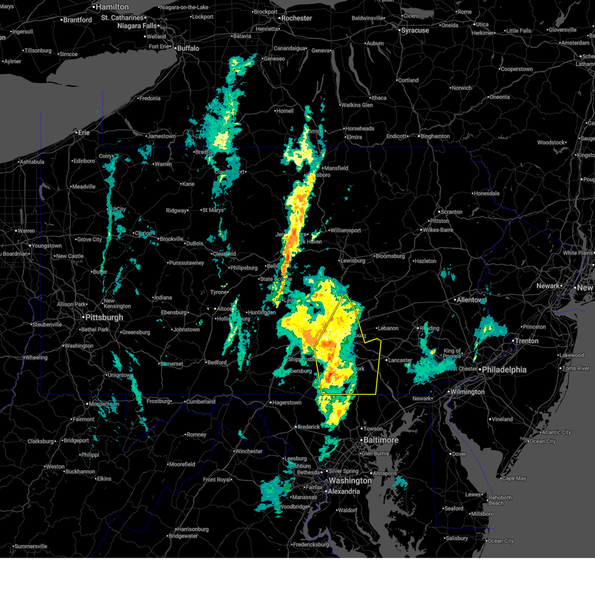 Svrctp the national weather service in state college pa has issued a * severe thunderstorm warning for, eastern adams county in south central pennsylvania, northeastern cumberland county in south central pennsylvania, dauphin county in south central pennsylvania, northwestern lancaster county in south central pennsylvania, east central perry county in south central pennsylvania, york county in south central pennsylvania, * until 100 pm edt. * at 1225 pm edt, severe thunderstorms were located along a line extending from new kingstown to glen rock, moving north at 65 mph (radar indicated). Hazards include 60 mph wind gusts. expect damage to roofs, siding, and trees Svrctp the national weather service in state college pa has issued a * severe thunderstorm warning for, eastern adams county in south central pennsylvania, northeastern cumberland county in south central pennsylvania, dauphin county in south central pennsylvania, northwestern lancaster county in south central pennsylvania, east central perry county in south central pennsylvania, york county in south central pennsylvania, * until 100 pm edt. * at 1225 pm edt, severe thunderstorms were located along a line extending from new kingstown to glen rock, moving north at 65 mph (radar indicated). Hazards include 60 mph wind gusts. expect damage to roofs, siding, and trees
|
| 3/16/2026 11:55 AM EDT |
 Svrctp the national weather service in state college pa has issued a * severe thunderstorm warning for, eastern adams county in south central pennsylvania, western york county in south central pennsylvania, * until 1230 pm edt. * at 1155 am edt, severe thunderstorms were located along a line extending from lake heritage to taneytown to near westminster, moving northeast at 65 mph (radar indicated). Hazards include 60 mph wind gusts. expect damage to roofs, siding, and trees Svrctp the national weather service in state college pa has issued a * severe thunderstorm warning for, eastern adams county in south central pennsylvania, western york county in south central pennsylvania, * until 1230 pm edt. * at 1155 am edt, severe thunderstorms were located along a line extending from lake heritage to taneytown to near westminster, moving northeast at 65 mph (radar indicated). Hazards include 60 mph wind gusts. expect damage to roofs, siding, and trees
|
| 9/25/2025 4:18 PM EDT | At 418 pm edt, a severe thunderstorm was located over west york, moving east at 40 mph (law enforcement). Hazards include 60 mph wind gusts. Expect damage to roofs, siding, and trees. locations impacted include, lancaster, york, weigelstown, columbia, millersville, mount joy, red lion, spry, east petersburg, dallastown, shiloh, and east york. This includes interstate 83 from mile markers 11 to 27. |
| 9/25/2025 4:18 PM EDT | the severe thunderstorm warning has been cancelled and is no longer in effect |
| 9/25/2025 4:02 PM EDT | Svrctp the national weather service in state college pa has issued a * severe thunderstorm warning for, northeastern adams county in south central pennsylvania, southwestern lancaster county in south central pennsylvania, central york county in south central pennsylvania, * until 445 pm edt. * at 402 pm edt, a severe thunderstorm was located over east berlin, moving east at 40 mph (radar indicated). Hazards include 60 mph wind gusts. expect damage to roofs, siding, and trees |
| 7/25/2025 6:35 PM EDT |
 Svrctp the national weather service in state college pa has issued a * severe thunderstorm warning for, southeastern york county in south central pennsylvania, * until 700 pm edt. * at 635 pm edt, a severe thunderstorm was located over jacobus, moving east at 35 mph (radar indicated). Hazards include 60 mph wind gusts and penny size hail. expect damage to roofs, siding, and trees Svrctp the national weather service in state college pa has issued a * severe thunderstorm warning for, southeastern york county in south central pennsylvania, * until 700 pm edt. * at 635 pm edt, a severe thunderstorm was located over jacobus, moving east at 35 mph (radar indicated). Hazards include 60 mph wind gusts and penny size hail. expect damage to roofs, siding, and trees
|
| 6/30/2025 10:55 PM EDT |
 Svrctp the national weather service in state college pa has issued a * severe thunderstorm warning for, lancaster county in south central pennsylvania, southeastern york county in south central pennsylvania, * until 1215 am edt. * at 1054 pm edt, severe thunderstorms were located along a line extending from dover to east york to glen rock, moving east at 45 mph (radar indicated). Hazards include 60 mph wind gusts. expect damage to roofs, siding, and trees Svrctp the national weather service in state college pa has issued a * severe thunderstorm warning for, lancaster county in south central pennsylvania, southeastern york county in south central pennsylvania, * until 1215 am edt. * at 1054 pm edt, severe thunderstorms were located along a line extending from dover to east york to glen rock, moving east at 45 mph (radar indicated). Hazards include 60 mph wind gusts. expect damage to roofs, siding, and trees
|
| 6/28/2025 12:58 PM EDT |
 The storm which prompted the warning has moved out of the area. therefore, the warning will be allowed to expire. however, gusty winds are still possible with this thunderstorm. to report severe weather, contact your nearest law enforcement agency. they will send your report to the national weather service office. a severe thunderstorm watch remains in effect until 800 pm edt saturday for a portion of southwest pennsylvania. The storm which prompted the warning has moved out of the area. therefore, the warning will be allowed to expire. however, gusty winds are still possible with this thunderstorm. to report severe weather, contact your nearest law enforcement agency. they will send your report to the national weather service office. a severe thunderstorm watch remains in effect until 800 pm edt saturday for a portion of southwest pennsylvania.
|
| 6/28/2025 12:45 PM EDT |
 At 1245 pm edt, a severe thunderstorm was located over california, or 15 miles northwest of uniontown, moving east at 25 mph (radar indicated). Hazards include 60 mph wind gusts. Expect damage to roofs, siding, and trees. Locations impacted include, waynesburg, monessen, california, donora, monongahela, charleroi, bentleyville, brownsville, fredericktown-millsboro, perryopolis, fairdale, jefferson boro, north belle vernon, wickerham manor-fisher, baidland, north charleroi, speers, isabella, belle vernon and lynnwood-pricedale. At 1245 pm edt, a severe thunderstorm was located over california, or 15 miles northwest of uniontown, moving east at 25 mph (radar indicated). Hazards include 60 mph wind gusts. Expect damage to roofs, siding, and trees. Locations impacted include, waynesburg, monessen, california, donora, monongahela, charleroi, bentleyville, brownsville, fredericktown-millsboro, perryopolis, fairdale, jefferson boro, north belle vernon, wickerham manor-fisher, baidland, north charleroi, speers, isabella, belle vernon and lynnwood-pricedale.
|
| 6/28/2025 12:18 PM EDT |
 Svrpbz the national weather service in pittsburgh has issued a * severe thunderstorm warning for, northwestern fayette county in southwestern pennsylvania, northern greene county in southwestern pennsylvania, southeastern washington county in southwestern pennsylvania, southwestern westmoreland county in southwestern pennsylvania, * until 100 pm edt. * at 1218 pm edt, a severe thunderstorm was located 7 miles southwest of bentleyville, or 11 miles southeast of washington, moving east at 25 mph (radar indicated). Hazards include 60 mph wind gusts. expect damage to roofs, siding, and trees Svrpbz the national weather service in pittsburgh has issued a * severe thunderstorm warning for, northwestern fayette county in southwestern pennsylvania, northern greene county in southwestern pennsylvania, southeastern washington county in southwestern pennsylvania, southwestern westmoreland county in southwestern pennsylvania, * until 100 pm edt. * at 1218 pm edt, a severe thunderstorm was located 7 miles southwest of bentleyville, or 11 miles southeast of washington, moving east at 25 mph (radar indicated). Hazards include 60 mph wind gusts. expect damage to roofs, siding, and trees
|
| 6/26/2025 5:12 PM EDT |
 Svrctp the national weather service in state college pa has issued a * severe thunderstorm warning for, southern york county in south central pennsylvania, * until 615 pm edt. * at 512 pm edt, a severe thunderstorm was located over codorus, moving southeast at 20 mph (radar indicated). Hazards include 60 mph wind gusts and quarter size hail. Hail damage to vehicles is expected. Expect wind damage to roofs, siding, and trees. Svrctp the national weather service in state college pa has issued a * severe thunderstorm warning for, southern york county in south central pennsylvania, * until 615 pm edt. * at 512 pm edt, a severe thunderstorm was located over codorus, moving southeast at 20 mph (radar indicated). Hazards include 60 mph wind gusts and quarter size hail. Hail damage to vehicles is expected. Expect wind damage to roofs, siding, and trees.
|
| 6/25/2025 6:02 PM EDT |
 Svrpbz the national weather service in pittsburgh has issued a * severe thunderstorm warning for, fayette county in southwestern pennsylvania, northern preston county in northeastern west virginia, northeastern monongalia county in northern west virginia, * until 645 pm edt. * at 602 pm edt, severe thunderstorms were located along a line from 6 miles east of south connellsville to over masontown, or along a line from 7 miles east of connellsville to 9 miles southwest of uniontown, moving southeast at 35 mph (radar indicated). Hazards include 60 mph wind gusts. expect damage to roofs, siding, and trees Svrpbz the national weather service in pittsburgh has issued a * severe thunderstorm warning for, fayette county in southwestern pennsylvania, northern preston county in northeastern west virginia, northeastern monongalia county in northern west virginia, * until 645 pm edt. * at 602 pm edt, severe thunderstorms were located along a line from 6 miles east of south connellsville to over masontown, or along a line from 7 miles east of connellsville to 9 miles southwest of uniontown, moving southeast at 35 mph (radar indicated). Hazards include 60 mph wind gusts. expect damage to roofs, siding, and trees
|
| 5/17/2025 1:30 AM EDT |
 the severe thunderstorm warning has been cancelled and is no longer in effect the severe thunderstorm warning has been cancelled and is no longer in effect
|
| 5/17/2025 1:30 AM EDT |
 At 130 am edt, a severe thunderstorm was located 5 miles southwest of uniontown, moving east at 50 mph (radar indicated). Hazards include 60 mph wind gusts and small hail. Expect damage to roofs, siding, and trees. Locations impacted include, uniontown, connellsville, masontown, brownsville, south connellsville, farmington, point marion, fairchance, isabella, dunbar, smithfield, republic, nemacolin, vanderbilt, new salem, grindstone, greensboro, centerville, brandonville and chalkhill. At 130 am edt, a severe thunderstorm was located 5 miles southwest of uniontown, moving east at 50 mph (radar indicated). Hazards include 60 mph wind gusts and small hail. Expect damage to roofs, siding, and trees. Locations impacted include, uniontown, connellsville, masontown, brownsville, south connellsville, farmington, point marion, fairchance, isabella, dunbar, smithfield, republic, nemacolin, vanderbilt, new salem, grindstone, greensboro, centerville, brandonville and chalkhill.
|
| 5/17/2025 1:17 AM EDT |
 At 117 am edt, a severe thunderstorm was located near masontown, or 10 miles north of star city, moving east at 50 mph (radar indicated). Hazards include 60 mph wind gusts and small hail. Expect damage to roofs, siding, and trees. Locations impacted include, morgantown, uniontown, connellsville, waynesburg, masontown, brownsville, fredericktown-millsboro, south connellsville, farmington, fairdale, jefferson boro, point marion, fairchance, isabella, dunbar, rogersville, smithfield, deemston, nemacolin and republic. At 117 am edt, a severe thunderstorm was located near masontown, or 10 miles north of star city, moving east at 50 mph (radar indicated). Hazards include 60 mph wind gusts and small hail. Expect damage to roofs, siding, and trees. Locations impacted include, morgantown, uniontown, connellsville, waynesburg, masontown, brownsville, fredericktown-millsboro, south connellsville, farmington, fairdale, jefferson boro, point marion, fairchance, isabella, dunbar, rogersville, smithfield, deemston, nemacolin and republic.
|
| 5/17/2025 1:07 AM EDT |
 Svrpbz the national weather service in pittsburgh has issued a * severe thunderstorm warning for, fayette county in southwestern pennsylvania, greene county in southwestern pennsylvania, northeastern preston county in northeastern west virginia, northeastern monongalia county in northern west virginia, * until 200 am edt. * at 107 am edt, a severe thunderstorm was located 8 miles north of cassville, or 9 miles southeast of waynesburg, moving east at 50 mph (radar indicated). Hazards include 60 mph wind gusts and small hail. expect damage to roofs, siding, and trees Svrpbz the national weather service in pittsburgh has issued a * severe thunderstorm warning for, fayette county in southwestern pennsylvania, greene county in southwestern pennsylvania, northeastern preston county in northeastern west virginia, northeastern monongalia county in northern west virginia, * until 200 am edt. * at 107 am edt, a severe thunderstorm was located 8 miles north of cassville, or 9 miles southeast of waynesburg, moving east at 50 mph (radar indicated). Hazards include 60 mph wind gusts and small hail. expect damage to roofs, siding, and trees
|
| 5/16/2025 5:51 PM EDT |
 the severe thunderstorm warning has been cancelled and is no longer in effect the severe thunderstorm warning has been cancelled and is no longer in effect
|
| 5/16/2025 5:51 PM EDT |
 At 550 pm edt, severe thunderstorms were located along a line extending from brogue to sunnyburn to jarrettsville, moving east at 25 mph (radar indicated). Hazards include 60 mph wind gusts and quarter size hail. Hail damage to vehicles is expected. expect wind damage to roofs, siding, and trees. locations impacted include, york, hanover, weigelstown, parkville, red lion, spry, dallastown, shiloh, east york, stonybrook-wilshire, west york, and shrewsbury. This includes interstate 83 from mile markers 0 to 24. At 550 pm edt, severe thunderstorms were located along a line extending from brogue to sunnyburn to jarrettsville, moving east at 25 mph (radar indicated). Hazards include 60 mph wind gusts and quarter size hail. Hail damage to vehicles is expected. expect wind damage to roofs, siding, and trees. locations impacted include, york, hanover, weigelstown, parkville, red lion, spry, dallastown, shiloh, east york, stonybrook-wilshire, west york, and shrewsbury. This includes interstate 83 from mile markers 0 to 24.
|
| 5/16/2025 5:01 PM EDT |
 Svrctp the national weather service in state college pa has issued a * severe thunderstorm warning for, eastern adams county in south central pennsylvania, york county in south central pennsylvania, * until 630 pm edt. * at 501 pm edt, multiple severe thunderstorms were located along a line extending from spring grove to codorus to manchester, moving east at 25 mph (radar indicated). Hazards include 60 mph wind gusts and quarter size hail. Hail damage to vehicles is expected. Expect wind damage to roofs, siding, and trees. Svrctp the national weather service in state college pa has issued a * severe thunderstorm warning for, eastern adams county in south central pennsylvania, york county in south central pennsylvania, * until 630 pm edt. * at 501 pm edt, multiple severe thunderstorms were located along a line extending from spring grove to codorus to manchester, moving east at 25 mph (radar indicated). Hazards include 60 mph wind gusts and quarter size hail. Hail damage to vehicles is expected. Expect wind damage to roofs, siding, and trees.
|
| 5/5/2025 4:42 PM EDT |
 At 442 pm edt, a severe thunderstorm was located over brownsville, or 14 miles northwest of uniontown, moving northwest at 30 mph (radar indicated). Hazards include half dollar size hail. Damage to vehicles is expected. Locations impacted include, monessen, california, donora, charleroi, bentleyville, brownsville, fredericktown-millsboro, north belle vernon, wickerham manor-fisher, north charleroi, speers, isabella, belle vernon, ellsworth, lynnwood-pricedale, west brownsville, roscoe, deemston, fayette city and newell. At 442 pm edt, a severe thunderstorm was located over brownsville, or 14 miles northwest of uniontown, moving northwest at 30 mph (radar indicated). Hazards include half dollar size hail. Damage to vehicles is expected. Locations impacted include, monessen, california, donora, charleroi, bentleyville, brownsville, fredericktown-millsboro, north belle vernon, wickerham manor-fisher, north charleroi, speers, isabella, belle vernon, ellsworth, lynnwood-pricedale, west brownsville, roscoe, deemston, fayette city and newell.
|
| 5/5/2025 4:34 PM EDT |
 Svrpbz the national weather service in pittsburgh has issued a * severe thunderstorm warning for, northwestern fayette county in southwestern pennsylvania, southeastern washington county in southwestern pennsylvania, western westmoreland county in southwestern pennsylvania, * until 500 pm edt. * at 434 pm edt, a severe thunderstorm was located near brownsville, or 10 miles northwest of uniontown, moving northwest at 30 mph (radar indicated). Hazards include half dollar size hail. damage to vehicles is expected Svrpbz the national weather service in pittsburgh has issued a * severe thunderstorm warning for, northwestern fayette county in southwestern pennsylvania, southeastern washington county in southwestern pennsylvania, western westmoreland county in southwestern pennsylvania, * until 500 pm edt. * at 434 pm edt, a severe thunderstorm was located near brownsville, or 10 miles northwest of uniontown, moving northwest at 30 mph (radar indicated). Hazards include half dollar size hail. damage to vehicles is expected
|
| 5/1/2025 6:05 PM EDT |
 At 605 pm edt, severe thunderstorms were located along a line from near masontown to 10 miles east of farmington, or along a line from 9 miles southwest of uniontown to 20 miles southeast of uniontown, moving north at 40 mph (radar indicated). Hazards include 60 mph wind gusts and quarter size hail. Hail damage to vehicles is expected. expect wind damage to roofs, siding, and trees. Locations impacted include, uniontown, connellsville, california, mount pleasant, scottdale, brownsville, south connellsville, farmington, perryopolis, seven springs, north belle vernon, belle vernon, dunbar, lynnwood-pricedale, west brownsville, roscoe, everson, fayette city, newell and allenport. At 605 pm edt, severe thunderstorms were located along a line from near masontown to 10 miles east of farmington, or along a line from 9 miles southwest of uniontown to 20 miles southeast of uniontown, moving north at 40 mph (radar indicated). Hazards include 60 mph wind gusts and quarter size hail. Hail damage to vehicles is expected. expect wind damage to roofs, siding, and trees. Locations impacted include, uniontown, connellsville, california, mount pleasant, scottdale, brownsville, south connellsville, farmington, perryopolis, seven springs, north belle vernon, belle vernon, dunbar, lynnwood-pricedale, west brownsville, roscoe, everson, fayette city, newell and allenport.
|
| 5/1/2025 6:05 PM EDT |
 the severe thunderstorm warning has been cancelled and is no longer in effect the severe thunderstorm warning has been cancelled and is no longer in effect
|
| 5/1/2025 5:59 PM EDT |
 At 559 pm edt, severe thunderstorms were located along a line from over point marion to near farmington, or along a line from 8 miles northeast of star city to 7 miles southeast of uniontown, moving northeast at 35 mph (radar indicated). Hazards include 60 mph wind gusts and small hail. Expect damage to roofs, siding, and trees. Locations impacted include, uniontown, masontown, point marion, fairchance, smithfield, nemacolin, new salem, greensboro, chalkhill and cheat lake. At 559 pm edt, severe thunderstorms were located along a line from over point marion to near farmington, or along a line from 8 miles northeast of star city to 7 miles southeast of uniontown, moving northeast at 35 mph (radar indicated). Hazards include 60 mph wind gusts and small hail. Expect damage to roofs, siding, and trees. Locations impacted include, uniontown, masontown, point marion, fairchance, smithfield, nemacolin, new salem, greensboro, chalkhill and cheat lake.
|
| 5/1/2025 5:58 PM EDT |
 Svrpbz the national weather service in pittsburgh has issued a * severe thunderstorm warning for, fayette county in southwestern pennsylvania, southwestern westmoreland county in southwestern pennsylvania, northeastern preston county in northeastern west virginia, * until 645 pm edt. * at 558 pm edt, severe thunderstorms were located along a line from over point marion to 14 miles southeast of farmington, or along a line from 9 miles northeast of star city to 16 miles northeast of terra alta, moving north at 40 mph (radar indicated). Hazards include 60 mph wind gusts. expect damage to roofs, siding, and trees Svrpbz the national weather service in pittsburgh has issued a * severe thunderstorm warning for, fayette county in southwestern pennsylvania, southwestern westmoreland county in southwestern pennsylvania, northeastern preston county in northeastern west virginia, * until 645 pm edt. * at 558 pm edt, severe thunderstorms were located along a line from over point marion to 14 miles southeast of farmington, or along a line from 9 miles northeast of star city to 16 miles northeast of terra alta, moving north at 40 mph (radar indicated). Hazards include 60 mph wind gusts. expect damage to roofs, siding, and trees
|
| 5/1/2025 5:39 PM EDT |
 the severe thunderstorm warning has been cancelled and is no longer in effect the severe thunderstorm warning has been cancelled and is no longer in effect
|
| 5/1/2025 5:39 PM EDT |
 At 539 pm edt, a severe thunderstorm was located over morgantown, moving northeast at 35 mph (radar indicated). Hazards include 60 mph wind gusts and small hail. Expect damage to roofs, siding, and trees. Locations impacted include, morgantown, uniontown, westover, star city, masontown, fairdale, point marion, granville, brookhaven, cassville, fairchance, smithfield, bobtown, nemacolin, carmichaels, new salem, greensboro, chalkhill, cheat lake and osage. At 539 pm edt, a severe thunderstorm was located over morgantown, moving northeast at 35 mph (radar indicated). Hazards include 60 mph wind gusts and small hail. Expect damage to roofs, siding, and trees. Locations impacted include, morgantown, uniontown, westover, star city, masontown, fairdale, point marion, granville, brookhaven, cassville, fairchance, smithfield, bobtown, nemacolin, carmichaels, new salem, greensboro, chalkhill, cheat lake and osage.
|
| 5/1/2025 5:26 PM EDT |
 Svrpbz the national weather service in pittsburgh has issued a * severe thunderstorm warning for, southwestern fayette county in southwestern pennsylvania, southeastern greene county in southwestern pennsylvania, northwestern preston county in northeastern west virginia, east central marion county in northern west virginia, monongalia county in northern west virginia, * until 615 pm edt. * at 526 pm edt, a severe thunderstorm was located 6 miles south of westover, moving north at 35 mph (radar indicated). Hazards include 60 mph wind gusts and quarter size hail. Hail damage to vehicles is expected. Expect wind damage to roofs, siding, and trees. Svrpbz the national weather service in pittsburgh has issued a * severe thunderstorm warning for, southwestern fayette county in southwestern pennsylvania, southeastern greene county in southwestern pennsylvania, northwestern preston county in northeastern west virginia, east central marion county in northern west virginia, monongalia county in northern west virginia, * until 615 pm edt. * at 526 pm edt, a severe thunderstorm was located 6 miles south of westover, moving north at 35 mph (radar indicated). Hazards include 60 mph wind gusts and quarter size hail. Hail damage to vehicles is expected. Expect wind damage to roofs, siding, and trees.
|
| 4/29/2025 6:23 PM EDT |
 The storms which prompted the warning have weakened below severe limits, and have exited the warned area. therefore, the warning will be allowed to expire. however, gusty winds are still possible with these thunderstorms. a severe thunderstorm watch remains in effect until 1000 pm edt for southwestern pennsylvania, and northern and northeastern west virginia. remember, a severe thunderstorm warning still remains in effect for southern fayette county. The storms which prompted the warning have weakened below severe limits, and have exited the warned area. therefore, the warning will be allowed to expire. however, gusty winds are still possible with these thunderstorms. a severe thunderstorm watch remains in effect until 1000 pm edt for southwestern pennsylvania, and northern and northeastern west virginia. remember, a severe thunderstorm warning still remains in effect for southern fayette county.
|
| 4/29/2025 6:16 PM EDT |
 the severe thunderstorm warning has been cancelled and is no longer in effect the severe thunderstorm warning has been cancelled and is no longer in effect
|
| 4/29/2025 6:16 PM EDT |
 At 615 pm edt, severe thunderstorms were located along a line extending from scalp level to near ursina, moving east at 65 mph (radar indicated). Hazards include 60 mph wind gusts. Expect damage to trees and power lines, resulting in some power outages. Locations impacted include, uniontown, masontown, south connellsville, farmington, fairdale, point marion, fairchance, isabella, dunbar, smithfield, bobtown, republic, nemacolin, carmichaels, new salem, markleysburg, greensboro, chalkhill, mount morris, and ohiopyle. At 615 pm edt, severe thunderstorms were located along a line extending from scalp level to near ursina, moving east at 65 mph (radar indicated). Hazards include 60 mph wind gusts. Expect damage to trees and power lines, resulting in some power outages. Locations impacted include, uniontown, masontown, south connellsville, farmington, fairdale, point marion, fairchance, isabella, dunbar, smithfield, bobtown, republic, nemacolin, carmichaels, new salem, markleysburg, greensboro, chalkhill, mount morris, and ohiopyle.
|
| 4/29/2025 5:54 PM EDT |
 At 554 pm edt, severe thunderstorms were located along a line extending from ligonier to 8 miles east of point marion, moving east at 65 mph (radar indicated). Hazards include 70 mph wind gusts. Trees snapped and uprooted. power outages can be expected. Locations impacted include, uniontown, connellsville, masontown, south connellsville, farmington, ligonier, fairdale, jefferson boro, point marion, seven springs, fairchance, isabella, dunbar, smithfield, bobtown, republic, nemacolin, carmichaels, rices landing, and youngstown. At 554 pm edt, severe thunderstorms were located along a line extending from ligonier to 8 miles east of point marion, moving east at 65 mph (radar indicated). Hazards include 70 mph wind gusts. Trees snapped and uprooted. power outages can be expected. Locations impacted include, uniontown, connellsville, masontown, south connellsville, farmington, ligonier, fairdale, jefferson boro, point marion, seven springs, fairchance, isabella, dunbar, smithfield, bobtown, republic, nemacolin, carmichaels, rices landing, and youngstown.
|
| 4/29/2025 5:54 PM EDT |
 the severe thunderstorm warning has been cancelled and is no longer in effect the severe thunderstorm warning has been cancelled and is no longer in effect
|
| 4/29/2025 5:29 PM EDT |
 The storms which prompted the warning have moved out of the area. therefore, the warning will be allowed to expire. however, gusty winds are still possible with these thunderstorms. a severe thunderstorm watch remains in effect until 700 pm edt for northern west virginia. a severe thunderstorm watch also remains in effect until 1000 pm edt for southwestern pennsylvania, and northern west virginia. remember, a severe thunderstorm warning still remains in effect for fayette and westmoreland counties. The storms which prompted the warning have moved out of the area. therefore, the warning will be allowed to expire. however, gusty winds are still possible with these thunderstorms. a severe thunderstorm watch remains in effect until 700 pm edt for northern west virginia. a severe thunderstorm watch also remains in effect until 1000 pm edt for southwestern pennsylvania, and northern west virginia. remember, a severe thunderstorm warning still remains in effect for fayette and westmoreland counties.
|
| 4/29/2025 5:24 PM EDT |
 Svrpbz the national weather service in pittsburgh has issued a * severe thunderstorm warning for, southeastern washington county in southwestern pennsylvania, southern allegheny county in southwestern pennsylvania, southern westmoreland county in southwestern pennsylvania, eastern greene county in southwestern pennsylvania, fayette county in southwestern pennsylvania, * until 630 pm edt. * at 524 pm edt, severe thunderstorms were located along a line extending from near donora to 7 miles east of hundred, moving east at 65 mph (radar indicated). Hazards include 70 mph wind gusts. Trees snapped and uprooted. Power outages can be expected. Svrpbz the national weather service in pittsburgh has issued a * severe thunderstorm warning for, southeastern washington county in southwestern pennsylvania, southern allegheny county in southwestern pennsylvania, southern westmoreland county in southwestern pennsylvania, eastern greene county in southwestern pennsylvania, fayette county in southwestern pennsylvania, * until 630 pm edt. * at 524 pm edt, severe thunderstorms were located along a line extending from near donora to 7 miles east of hundred, moving east at 65 mph (radar indicated). Hazards include 70 mph wind gusts. Trees snapped and uprooted. Power outages can be expected.
|
| 4/29/2025 5:12 PM EDT |
 At 511 pm edt, severe thunderstorms were located along a line extending from near east washington to 6 miles southeast of cameron, moving east at 55 mph (radar indicated). Hazards include 70 mph wind gusts. Trees snapped and uprooted. power outages can be expected. Locations impacted include, washington, uniontown, waynesburg, monessen, california, donora, mount pleasant, scottdale, monongahela, charleroi, masontown, youngwood, west newton, bentleyville, brownsville, east washington, new stanton, fredericktown-millsboro, perryopolis, and fairdale. At 511 pm edt, severe thunderstorms were located along a line extending from near east washington to 6 miles southeast of cameron, moving east at 55 mph (radar indicated). Hazards include 70 mph wind gusts. Trees snapped and uprooted. power outages can be expected. Locations impacted include, washington, uniontown, waynesburg, monessen, california, donora, mount pleasant, scottdale, monongahela, charleroi, masontown, youngwood, west newton, bentleyville, brownsville, east washington, new stanton, fredericktown-millsboro, perryopolis, and fairdale.
|
| 4/29/2025 5:12 PM EDT |
 the severe thunderstorm warning has been cancelled and is no longer in effect the severe thunderstorm warning has been cancelled and is no longer in effect
|
| 4/29/2025 4:50 PM EDT |
 Svrpbz the national weather service in pittsburgh has issued a * severe thunderstorm warning for, southern washington county in southwestern pennsylvania, southwestern westmoreland county in southwestern pennsylvania, greene county in southwestern pennsylvania, western fayette county in southwestern pennsylvania, ohio county in northern west virginia, marshall county in northern west virginia, * until 530 pm edt. * at 450 pm edt, severe thunderstorms were located along a line extending from near west liberty to 6 miles south of powhatan point, moving east at 55 mph (radar indicated). Hazards include 70 mph wind gusts. Trees snapped and uprooted. Power outages can be expected. Svrpbz the national weather service in pittsburgh has issued a * severe thunderstorm warning for, southern washington county in southwestern pennsylvania, southwestern westmoreland county in southwestern pennsylvania, greene county in southwestern pennsylvania, western fayette county in southwestern pennsylvania, ohio county in northern west virginia, marshall county in northern west virginia, * until 530 pm edt. * at 450 pm edt, severe thunderstorms were located along a line extending from near west liberty to 6 miles south of powhatan point, moving east at 55 mph (radar indicated). Hazards include 70 mph wind gusts. Trees snapped and uprooted. Power outages can be expected.
|
| 4/19/2025 8:33 PM EDT |
 At 833 pm edt, a severe thunderstorm was located 7 miles south of uniontown, moving east at 65 mph (law enforcement reported wind damage in monongalia county). Hazards include 60 mph wind gusts and quarter size hail. Hail damage to vehicles is expected. expect wind damage to roofs, siding, and trees. Locations impacted include, morgantown, uniontown, connellsville, masontown, south connellsville, farmington, point marion, seven springs, brookhaven, fairchance, dunbar, smithfield, nemacolin, new salem, markleysburg, greensboro, donegal, brandonville, chalkhill and champion. At 833 pm edt, a severe thunderstorm was located 7 miles south of uniontown, moving east at 65 mph (law enforcement reported wind damage in monongalia county). Hazards include 60 mph wind gusts and quarter size hail. Hail damage to vehicles is expected. expect wind damage to roofs, siding, and trees. Locations impacted include, morgantown, uniontown, connellsville, masontown, south connellsville, farmington, point marion, seven springs, brookhaven, fairchance, dunbar, smithfield, nemacolin, new salem, markleysburg, greensboro, donegal, brandonville, chalkhill and champion.
|
| 4/19/2025 8:33 PM EDT |
 the severe thunderstorm warning has been cancelled and is no longer in effect the severe thunderstorm warning has been cancelled and is no longer in effect
|
| 4/19/2025 8:23 PM EDT |
 Svrpbz the national weather service in pittsburgh has issued a * severe thunderstorm warning for, fayette county in southwestern pennsylvania, southeastern greene county in southwestern pennsylvania, southwestern westmoreland county in southwestern pennsylvania, northern preston county in northeastern west virginia, northeastern monongalia county in northern west virginia, * until 915 pm edt. * at 823 pm edt, a severe thunderstorm was located over point marion, or 8 miles north of star city, moving east at 65 mph (law enforcement reported wind damage in monongalia county). Hazards include 60 mph wind gusts and quarter size hail. Hail damage to vehicles is expected. Expect wind damage to roofs, siding, and trees. Svrpbz the national weather service in pittsburgh has issued a * severe thunderstorm warning for, fayette county in southwestern pennsylvania, southeastern greene county in southwestern pennsylvania, southwestern westmoreland county in southwestern pennsylvania, northern preston county in northeastern west virginia, northeastern monongalia county in northern west virginia, * until 915 pm edt. * at 823 pm edt, a severe thunderstorm was located over point marion, or 8 miles north of star city, moving east at 65 mph (law enforcement reported wind damage in monongalia county). Hazards include 60 mph wind gusts and quarter size hail. Hail damage to vehicles is expected. Expect wind damage to roofs, siding, and trees.
|
| 4/3/2025 5:30 AM EDT |
 The storms which prompted the warning have moved out of part of the area. therefore, the warning has been allowed to expire. a new severe thunderstorm warning has been issued for eastern portions of the area. a severe thunderstorm watch remains in effect until 700 am edt for portions of southwest pennsylvania and northern west virginia. The storms which prompted the warning have moved out of part of the area. therefore, the warning has been allowed to expire. a new severe thunderstorm warning has been issued for eastern portions of the area. a severe thunderstorm watch remains in effect until 700 am edt for portions of southwest pennsylvania and northern west virginia.
|
| 4/3/2025 5:22 AM EDT |
 the severe thunderstorm warning has been cancelled and is no longer in effect the severe thunderstorm warning has been cancelled and is no longer in effect
|
| 4/3/2025 5:22 AM EDT |
 At 522 am edt, severe thunderstorms were located along a line from over blairsville to near masontown, or along a line from 9 miles southwest of homer city to 10 miles northeast of star city, moving east at 60 mph (radar indicated). Hazards include 60 mph wind gusts. Expect damage to roofs, siding, and trees. Locations impacted include, morgantown, fairmont, uniontown, connellsville, westover, kingwood, star city, terra alta, rowlesburg, mount pleasant, scottdale, masontown, pleasant valley, winfield, south connellsville, farmington, ligonier, barrackville, point marion and monongah. At 522 am edt, severe thunderstorms were located along a line from over blairsville to near masontown, or along a line from 9 miles southwest of homer city to 10 miles northeast of star city, moving east at 60 mph (radar indicated). Hazards include 60 mph wind gusts. Expect damage to roofs, siding, and trees. Locations impacted include, morgantown, fairmont, uniontown, connellsville, westover, kingwood, star city, terra alta, rowlesburg, mount pleasant, scottdale, masontown, pleasant valley, winfield, south connellsville, farmington, ligonier, barrackville, point marion and monongah.
|
| 4/3/2025 5:13 AM EDT |
 At 513 am edt, severe thunderstorms were located along a line from 7 miles northwest of latrobe to 6 miles north of cassville, or along a line from 7 miles northwest of latrobe to 7 miles northwest of star city, moving east at 60 mph (radar indicated). Hazards include 60 mph wind gusts. Expect damage to roofs, siding, and trees. Locations impacted include, morgantown, fairmont, uniontown, connellsville, westover, kingwood, mannington, star city, terra alta, rowlesburg, mount pleasant, scottdale, masontown, pleasant valley, winfield, south connellsville, farmington, ligonier, barrackville and point marion. At 513 am edt, severe thunderstorms were located along a line from 7 miles northwest of latrobe to 6 miles north of cassville, or along a line from 7 miles northwest of latrobe to 7 miles northwest of star city, moving east at 60 mph (radar indicated). Hazards include 60 mph wind gusts. Expect damage to roofs, siding, and trees. Locations impacted include, morgantown, fairmont, uniontown, connellsville, westover, kingwood, mannington, star city, terra alta, rowlesburg, mount pleasant, scottdale, masontown, pleasant valley, winfield, south connellsville, farmington, ligonier, barrackville and point marion.
|
| 4/3/2025 5:02 AM EDT |
 the severe thunderstorm warning has been cancelled and is no longer in effect the severe thunderstorm warning has been cancelled and is no longer in effect
|
| 4/3/2025 5:02 AM EDT |
 At 502 am edt, severe thunderstorms were located along a line from over jeannette to 7 miles north of fairview, or along a line from over jeannette to 12 miles north of mannington, moving east at 60 mph (radar indicated). Hazards include 60 mph wind gusts. Expect damage to roofs, siding, and trees. Locations impacted include, morgantown, fairmont, uniontown, connellsville, westover, kingwood, mannington, star city, terra alta, rowlesburg, california, mount pleasant, scottdale, masontown, pleasant valley, youngwood, brownsville, winfield, new stanton and south connellsville. At 502 am edt, severe thunderstorms were located along a line from over jeannette to 7 miles north of fairview, or along a line from over jeannette to 12 miles north of mannington, moving east at 60 mph (radar indicated). Hazards include 60 mph wind gusts. Expect damage to roofs, siding, and trees. Locations impacted include, morgantown, fairmont, uniontown, connellsville, westover, kingwood, mannington, star city, terra alta, rowlesburg, california, mount pleasant, scottdale, masontown, pleasant valley, youngwood, brownsville, winfield, new stanton and south connellsville.
|
| 4/3/2025 4:53 AM EDT |
 the severe thunderstorm warning has been cancelled and is no longer in effect the severe thunderstorm warning has been cancelled and is no longer in effect
|
| 4/3/2025 4:53 AM EDT |
 At 453 am edt, severe thunderstorms were located along a line from over white oak to near hundred, or along a line from near mckeesport to 10 miles northwest of mannington, moving east at 60 mph (radar indicated). Hazards include 60 mph wind gusts. Expect damage to roofs, siding, and trees. Locations impacted include, morgantown, fairmont, uniontown, connellsville, waynesburg, westover, kingwood, mannington, star city, terra alta, rowlesburg, monessen, california, donora, mount pleasant, scottdale, charleroi, masontown, pleasant valley and youngwood. At 453 am edt, severe thunderstorms were located along a line from over white oak to near hundred, or along a line from near mckeesport to 10 miles northwest of mannington, moving east at 60 mph (radar indicated). Hazards include 60 mph wind gusts. Expect damage to roofs, siding, and trees. Locations impacted include, morgantown, fairmont, uniontown, connellsville, waynesburg, westover, kingwood, mannington, star city, terra alta, rowlesburg, monessen, california, donora, mount pleasant, scottdale, charleroi, masontown, pleasant valley and youngwood.
|
| 4/3/2025 4:44 AM EDT |
 At 444 am edt, severe thunderstorms were located along a line from over jefferson hills to 6 miles northeast of jacksonburg, or along a line from over gastonville to 14 miles northwest of mannington, moving east at 60 mph (radar indicated). Hazards include 60 mph wind gusts. Expect damage to roofs, siding, and trees. Locations impacted include, morgantown, fairmont, uniontown, connellsville, waynesburg, westover, kingwood, mannington, star city, terra alta, rowlesburg, monessen, california, donora, mount pleasant, scottdale, monongahela, charleroi, masontown and pleasant valley. At 444 am edt, severe thunderstorms were located along a line from over jefferson hills to 6 miles northeast of jacksonburg, or along a line from over gastonville to 14 miles northwest of mannington, moving east at 60 mph (radar indicated). Hazards include 60 mph wind gusts. Expect damage to roofs, siding, and trees. Locations impacted include, morgantown, fairmont, uniontown, connellsville, waynesburg, westover, kingwood, mannington, star city, terra alta, rowlesburg, monessen, california, donora, mount pleasant, scottdale, monongahela, charleroi, masontown and pleasant valley.
|
| 4/3/2025 4:28 AM EDT |
 Svrpbz the national weather service in pittsburgh has issued a * severe thunderstorm warning for, fayette county in southwestern pennsylvania, greene county in southwestern pennsylvania, southern washington county in southwestern pennsylvania, southwestern westmoreland county in southwestern pennsylvania, preston county in northeastern west virginia, marion county in northern west virginia, marshall county in northern west virginia, monongalia county in northern west virginia, wetzel county in northern west virginia, * until 530 am edt. * at 428 am edt, severe thunderstorms were located along a line from over washington to 10 miles south of new martinsville, moving east at 60 mph (radar indicated). Hazards include 60 mph wind gusts. expect damage to roofs, siding, and trees Svrpbz the national weather service in pittsburgh has issued a * severe thunderstorm warning for, fayette county in southwestern pennsylvania, greene county in southwestern pennsylvania, southern washington county in southwestern pennsylvania, southwestern westmoreland county in southwestern pennsylvania, preston county in northeastern west virginia, marion county in northern west virginia, marshall county in northern west virginia, monongalia county in northern west virginia, wetzel county in northern west virginia, * until 530 am edt. * at 428 am edt, severe thunderstorms were located along a line from over washington to 10 miles south of new martinsville, moving east at 60 mph (radar indicated). Hazards include 60 mph wind gusts. expect damage to roofs, siding, and trees
|
| 3/16/2025 9:32 PM EDT |
 Svrctp the national weather service in state college pa has issued a * severe thunderstorm warning for, lancaster county in south central pennsylvania, southern york county in south central pennsylvania, * until 1015 pm edt. * at 931 pm edt, a severe thunderstorm was located over spring grove, moving northeast at 70 mph (radar indicated). Hazards include 60 mph wind gusts and nickel size hail. expect damage to roofs, siding, and trees Svrctp the national weather service in state college pa has issued a * severe thunderstorm warning for, lancaster county in south central pennsylvania, southern york county in south central pennsylvania, * until 1015 pm edt. * at 931 pm edt, a severe thunderstorm was located over spring grove, moving northeast at 70 mph (radar indicated). Hazards include 60 mph wind gusts and nickel size hail. expect damage to roofs, siding, and trees
|
| 3/16/2025 1:06 PM EDT |
 The severe thunderstorm warning that was previously in effect has been reissued for preston, fayette, and westmoreland counties and is in effect until 200 pm edt. please refer to that bulletin for the latest severe weather information. to report severe weather, contact your nearest law enforcement agency. they will send your report to the national weather service office. The severe thunderstorm warning that was previously in effect has been reissued for preston, fayette, and westmoreland counties and is in effect until 200 pm edt. please refer to that bulletin for the latest severe weather information. to report severe weather, contact your nearest law enforcement agency. they will send your report to the national weather service office.
|
| 3/16/2025 12:41 PM EDT |
 At 1241 pm edt, severe thunderstorms were located along a line from over monongahela to 9 miles south of newburg, or along a line from 6 miles southeast of gastonville to 14 miles southwest of rowlesburg, moving northeast at 60 mph (radar indicated). Hazards include 70 mph wind gusts. Expect considerable tree damage. damage is likely to mobile homes, roofs, and outbuildings. Locations impacted include, morgantown, greensburg, uniontown, jeannette, connellsville, westover, kingwood, star city, terra alta, monessen, california, donora, mount pleasant, scottdale, monongahela, charleroi, masontown, youngwood, west newton and bentleyville. At 1241 pm edt, severe thunderstorms were located along a line from over monongahela to 9 miles south of newburg, or along a line from 6 miles southeast of gastonville to 14 miles southwest of rowlesburg, moving northeast at 60 mph (radar indicated). Hazards include 70 mph wind gusts. Expect considerable tree damage. damage is likely to mobile homes, roofs, and outbuildings. Locations impacted include, morgantown, greensburg, uniontown, jeannette, connellsville, westover, kingwood, star city, terra alta, monessen, california, donora, mount pleasant, scottdale, monongahela, charleroi, masontown, youngwood, west newton and bentleyville.
|
| 3/16/2025 12:41 PM EDT |
 the severe thunderstorm warning has been cancelled and is no longer in effect the severe thunderstorm warning has been cancelled and is no longer in effect
|
| 3/16/2025 12:26 PM EDT |
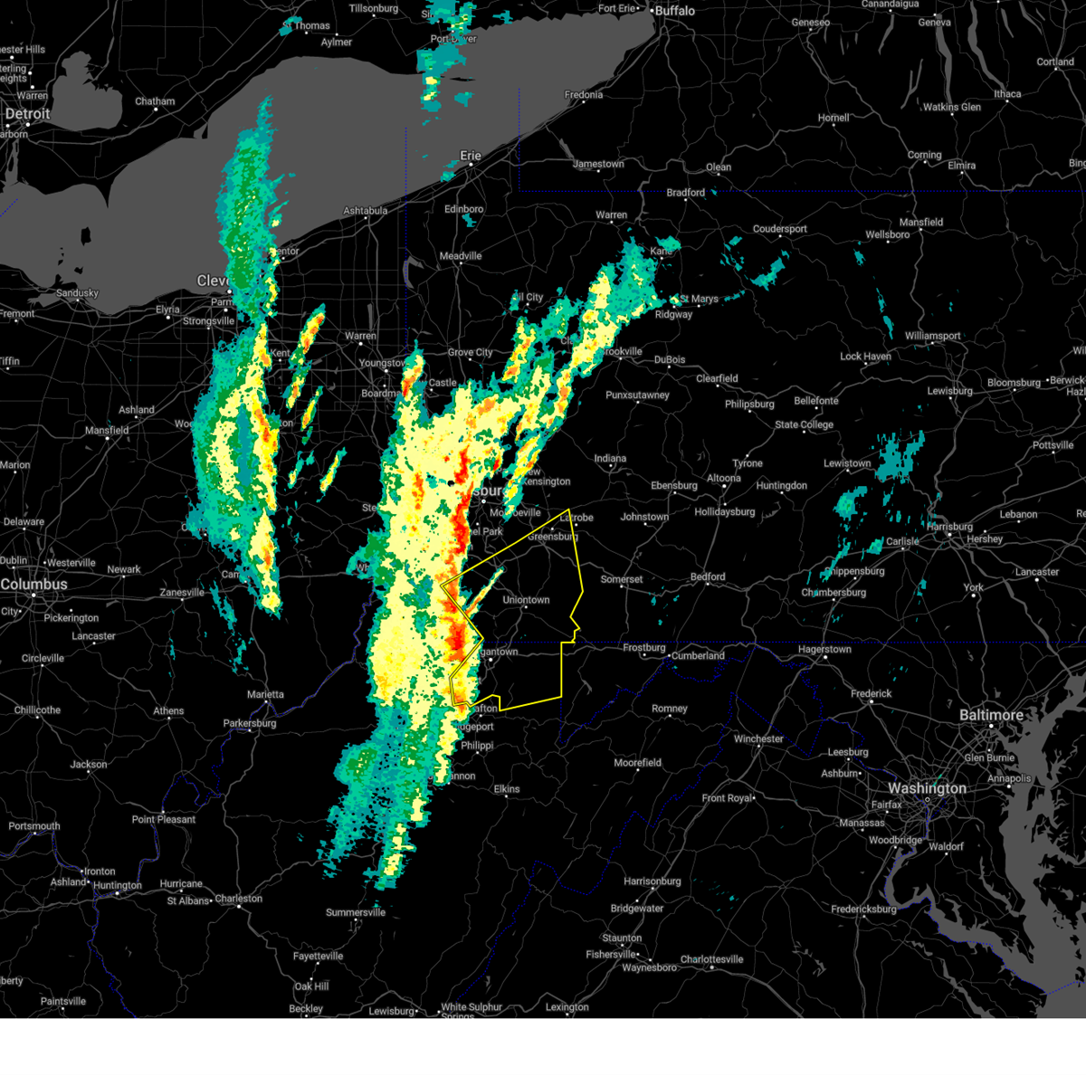 Svrpbz the national weather service in pittsburgh has issued a * severe thunderstorm warning for, fayette county in southwestern pennsylvania, eastern greene county in southwestern pennsylvania, southeastern washington county in southwestern pennsylvania, southwestern westmoreland county in southwestern pennsylvania, preston county in northeastern west virginia, eastern marion county in northern west virginia, monongalia county in northern west virginia, * until 115 pm edt. * at 1226 pm edt, severe thunderstorms were located along a line from 7 miles northwest of fredericktown-millsboro to 24 miles south of pleasant valley, or along a line from 10 miles north of waynesburg to 23 miles west of parsons, moving northeast at 60 mph (radar indicated). Hazards include 60 mph wind gusts. expect damage to roofs, siding, and trees Svrpbz the national weather service in pittsburgh has issued a * severe thunderstorm warning for, fayette county in southwestern pennsylvania, eastern greene county in southwestern pennsylvania, southeastern washington county in southwestern pennsylvania, southwestern westmoreland county in southwestern pennsylvania, preston county in northeastern west virginia, eastern marion county in northern west virginia, monongalia county in northern west virginia, * until 115 pm edt. * at 1226 pm edt, severe thunderstorms were located along a line from 7 miles northwest of fredericktown-millsboro to 24 miles south of pleasant valley, or along a line from 10 miles north of waynesburg to 23 miles west of parsons, moving northeast at 60 mph (radar indicated). Hazards include 60 mph wind gusts. expect damage to roofs, siding, and trees
|
| 12/31/2024 2:48 PM EST |
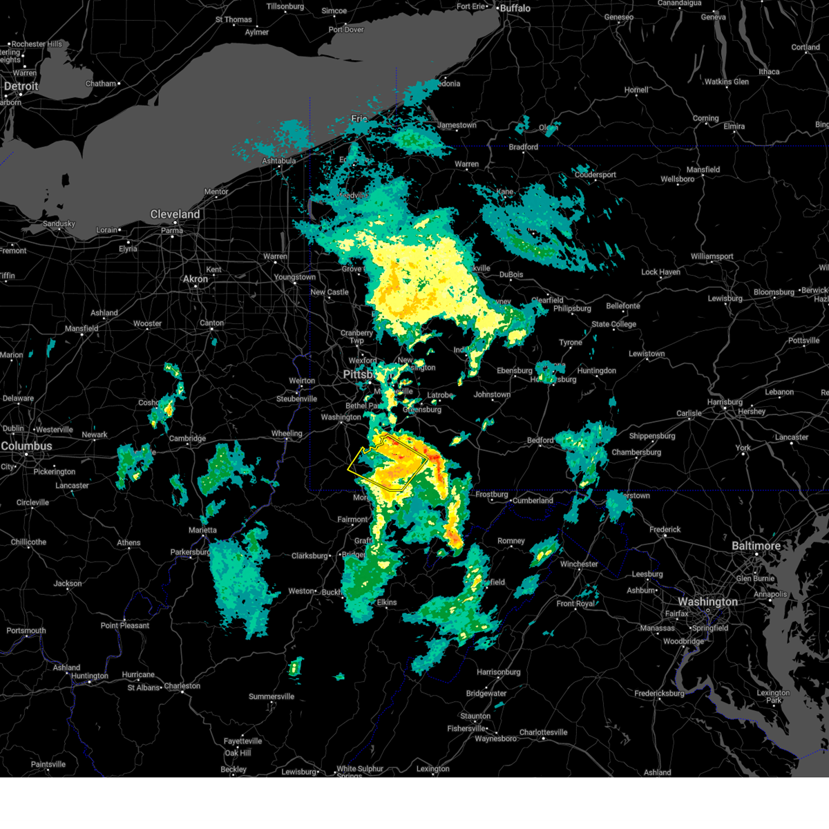 the severe thunderstorm warning has been cancelled and is no longer in effect the severe thunderstorm warning has been cancelled and is no longer in effect
|
| 12/31/2024 2:24 PM EST |
 the severe thunderstorm warning has been cancelled and is no longer in effect the severe thunderstorm warning has been cancelled and is no longer in effect
|
| 12/31/2024 2:24 PM EST |
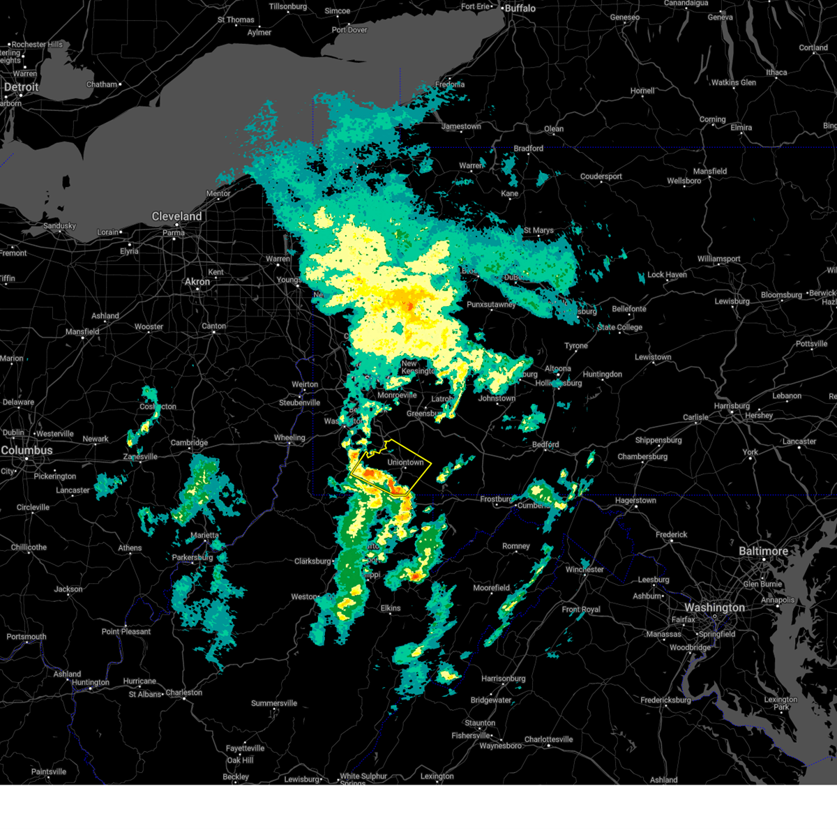 At 224 pm est, a severe thunderstorm was located over fairdale, or 11 miles east of waynesburg, moving northeast at 40 mph (radar indicated). Hazards include 60 mph wind gusts and small hail. Expect damage to roofs, siding, and trees. Locations impacted include, uniontown, california, masontown, brownsville, fredericktown-millsboro, fairdale, jefferson boro, fairchance, isabella, dunbar, west brownsville, smithfield, roscoe, deemston, newell, allenport, stockdale, republic, nemacolin and carmichaels. At 224 pm est, a severe thunderstorm was located over fairdale, or 11 miles east of waynesburg, moving northeast at 40 mph (radar indicated). Hazards include 60 mph wind gusts and small hail. Expect damage to roofs, siding, and trees. Locations impacted include, uniontown, california, masontown, brownsville, fredericktown-millsboro, fairdale, jefferson boro, fairchance, isabella, dunbar, west brownsville, smithfield, roscoe, deemston, newell, allenport, stockdale, republic, nemacolin and carmichaels.
|
| 12/31/2024 2:12 PM EST |
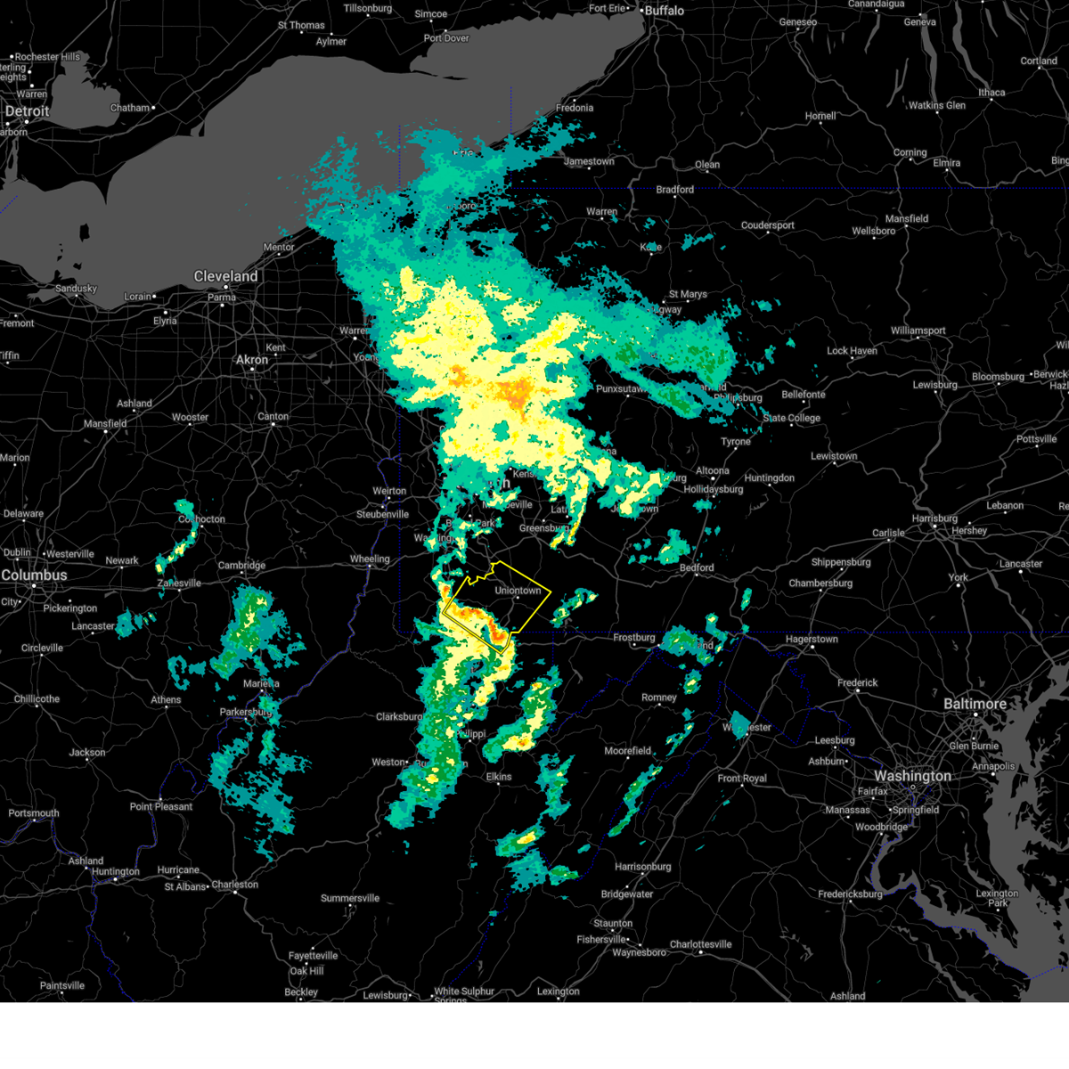 Svrpbz the national weather service in pittsburgh has issued a * severe thunderstorm warning for, western fayette county in southwestern pennsylvania, eastern greene county in southwestern pennsylvania, northeastern monongalia county in northern west virginia, * until 300 pm est. * at 212 pm est, a severe thunderstorm was located 9 miles south of jefferson boro, or 9 miles southeast of waynesburg, moving northeast at 40 mph (radar indicated). Hazards include 60 mph wind gusts and small hail. expect damage to roofs, siding, and trees Svrpbz the national weather service in pittsburgh has issued a * severe thunderstorm warning for, western fayette county in southwestern pennsylvania, eastern greene county in southwestern pennsylvania, northeastern monongalia county in northern west virginia, * until 300 pm est. * at 212 pm est, a severe thunderstorm was located 9 miles south of jefferson boro, or 9 miles southeast of waynesburg, moving northeast at 40 mph (radar indicated). Hazards include 60 mph wind gusts and small hail. expect damage to roofs, siding, and trees
|
| 10/6/2024 10:25 PM EDT |
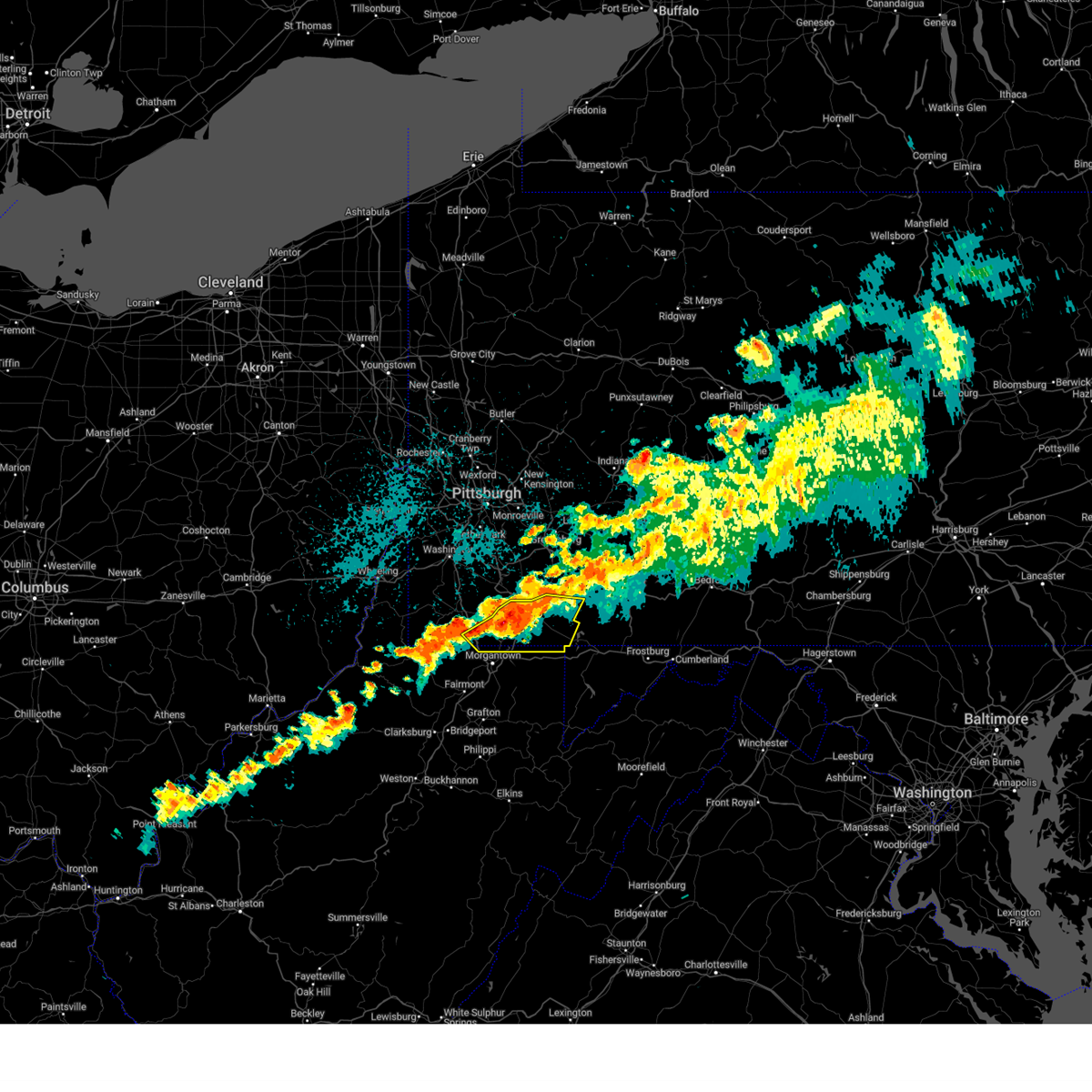 At 1025 pm edt, severe thunderstorms were located along a line from 8 miles southeast of south connellsville to 9 miles south of uniontown, or along a line from 10 miles southeast of connellsville to 9 miles south of uniontown, moving east at 55 mph (radar indicated). Hazards include 60 mph wind gusts and small hail. Expect damage to roofs, siding, and trees. Locations impacted include, uniontown, masontown, farmington, point marion, fairchance, dunbar, smithfield, nemacolin, bobtown, new salem, markleysburg, greensboro, chalkhill, mount morris, ohiopyle, mill run, clifton mills and cheat lake. At 1025 pm edt, severe thunderstorms were located along a line from 8 miles southeast of south connellsville to 9 miles south of uniontown, or along a line from 10 miles southeast of connellsville to 9 miles south of uniontown, moving east at 55 mph (radar indicated). Hazards include 60 mph wind gusts and small hail. Expect damage to roofs, siding, and trees. Locations impacted include, uniontown, masontown, farmington, point marion, fairchance, dunbar, smithfield, nemacolin, bobtown, new salem, markleysburg, greensboro, chalkhill, mount morris, ohiopyle, mill run, clifton mills and cheat lake.
|
| 10/6/2024 10:18 PM EDT |
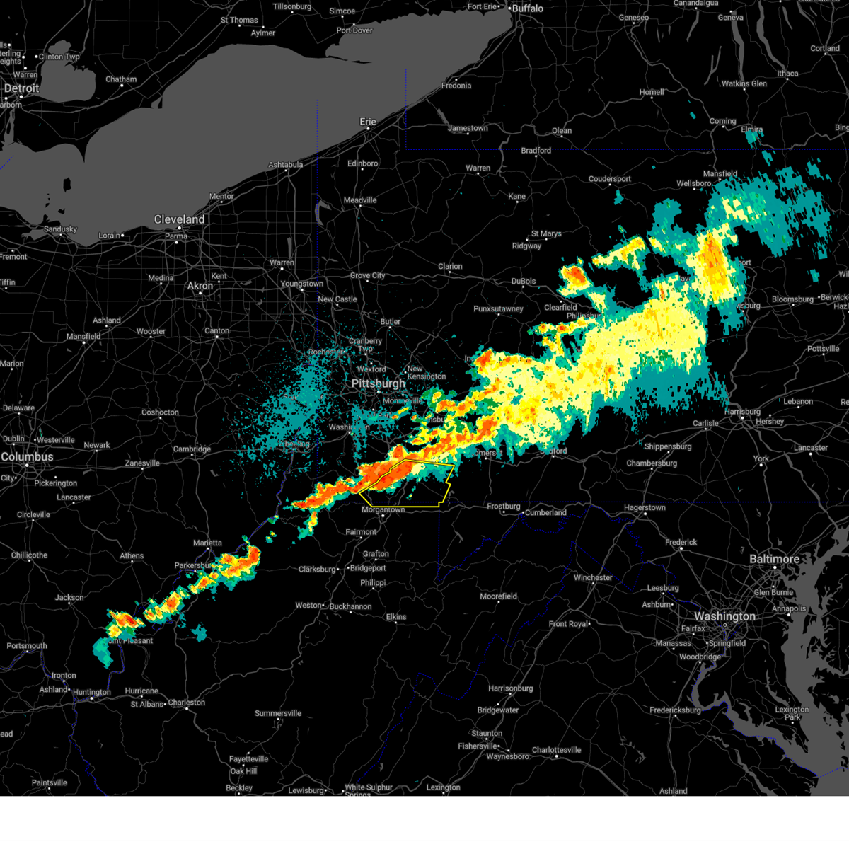 At 1018 pm edt, severe thunderstorms were located along a line from near south connellsville to near masontown, or along a line from 6 miles south of connellsville to 11 miles northeast of star city, moving east at 55 mph (radar indicated). Hazards include 60 mph wind gusts and small hail. Expect damage to roofs, siding, and trees. Locations impacted include, uniontown, masontown, farmington, fairdale, point marion, fairchance, dunbar, smithfield, nemacolin, bobtown, new salem, markleysburg, greensboro, chalkhill, mount morris, ohiopyle, mill run, clifton mills and cheat lake. At 1018 pm edt, severe thunderstorms were located along a line from near south connellsville to near masontown, or along a line from 6 miles south of connellsville to 11 miles northeast of star city, moving east at 55 mph (radar indicated). Hazards include 60 mph wind gusts and small hail. Expect damage to roofs, siding, and trees. Locations impacted include, uniontown, masontown, farmington, fairdale, point marion, fairchance, dunbar, smithfield, nemacolin, bobtown, new salem, markleysburg, greensboro, chalkhill, mount morris, ohiopyle, mill run, clifton mills and cheat lake.
|
| 10/6/2024 10:08 PM EDT |
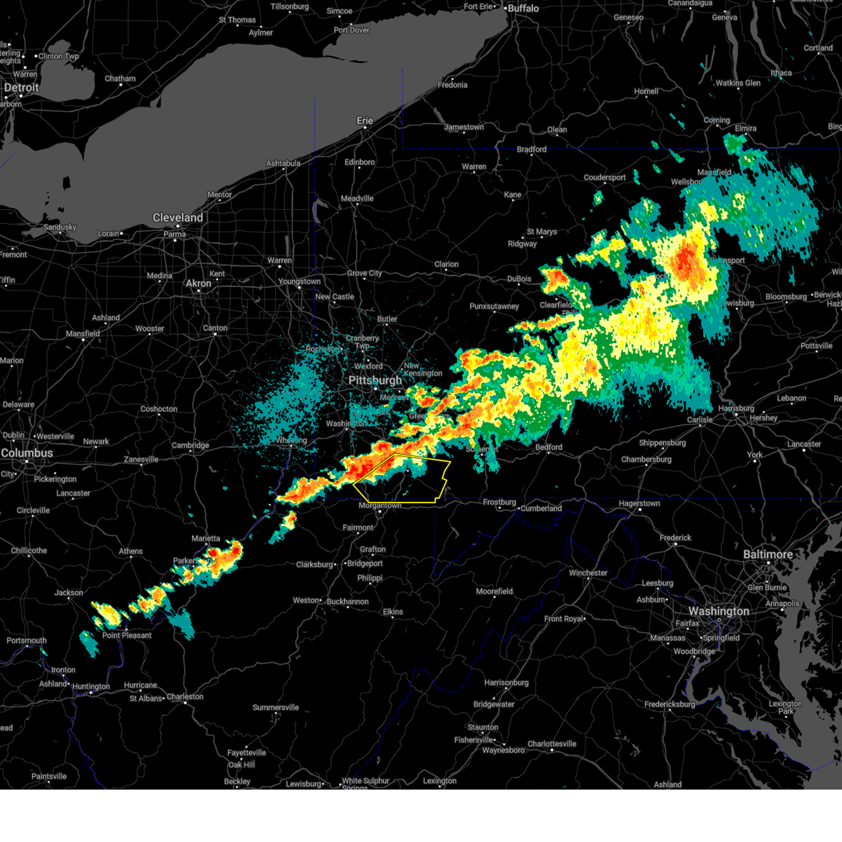 Svrpbz the national weather service in pittsburgh has issued a * severe thunderstorm warning for, fayette county in southwestern pennsylvania, southeastern greene county in southwestern pennsylvania, northeastern preston county in northeastern west virginia, northeastern monongalia county in northern west virginia, * until 1100 pm edt. * at 1008 pm edt, severe thunderstorms were located along a line from near uniontown to 7 miles southwest of fairdale, or along a line from near uniontown to 9 miles southeast of waynesburg, moving east at 55 mph (radar indicated). Hazards include 60 mph wind gusts. expect damage to roofs, siding, and trees Svrpbz the national weather service in pittsburgh has issued a * severe thunderstorm warning for, fayette county in southwestern pennsylvania, southeastern greene county in southwestern pennsylvania, northeastern preston county in northeastern west virginia, northeastern monongalia county in northern west virginia, * until 1100 pm edt. * at 1008 pm edt, severe thunderstorms were located along a line from near uniontown to 7 miles southwest of fairdale, or along a line from near uniontown to 9 miles southeast of waynesburg, moving east at 55 mph (radar indicated). Hazards include 60 mph wind gusts. expect damage to roofs, siding, and trees
|
| 8/31/2024 2:39 PM EDT |
 At 239 pm edt, a severe thunderstorm was located near uniontown, moving east at 30 mph (radar indicated). Hazards include 60 mph wind gusts and nickel size hail. Expect damage to trees and power lines, resulting in some power outages. Locations impacted include, uniontown, masontown, brownsville, farmington, point marion, fairchance, dunbar, west brownsville, smithfield, republic, nemacolin, grindstone, new salem, greensboro, chalkhill, and cheat lake. At 239 pm edt, a severe thunderstorm was located near uniontown, moving east at 30 mph (radar indicated). Hazards include 60 mph wind gusts and nickel size hail. Expect damage to trees and power lines, resulting in some power outages. Locations impacted include, uniontown, masontown, brownsville, farmington, point marion, fairchance, dunbar, west brownsville, smithfield, republic, nemacolin, grindstone, new salem, greensboro, chalkhill, and cheat lake.
|
| 8/31/2024 2:39 PM EDT |
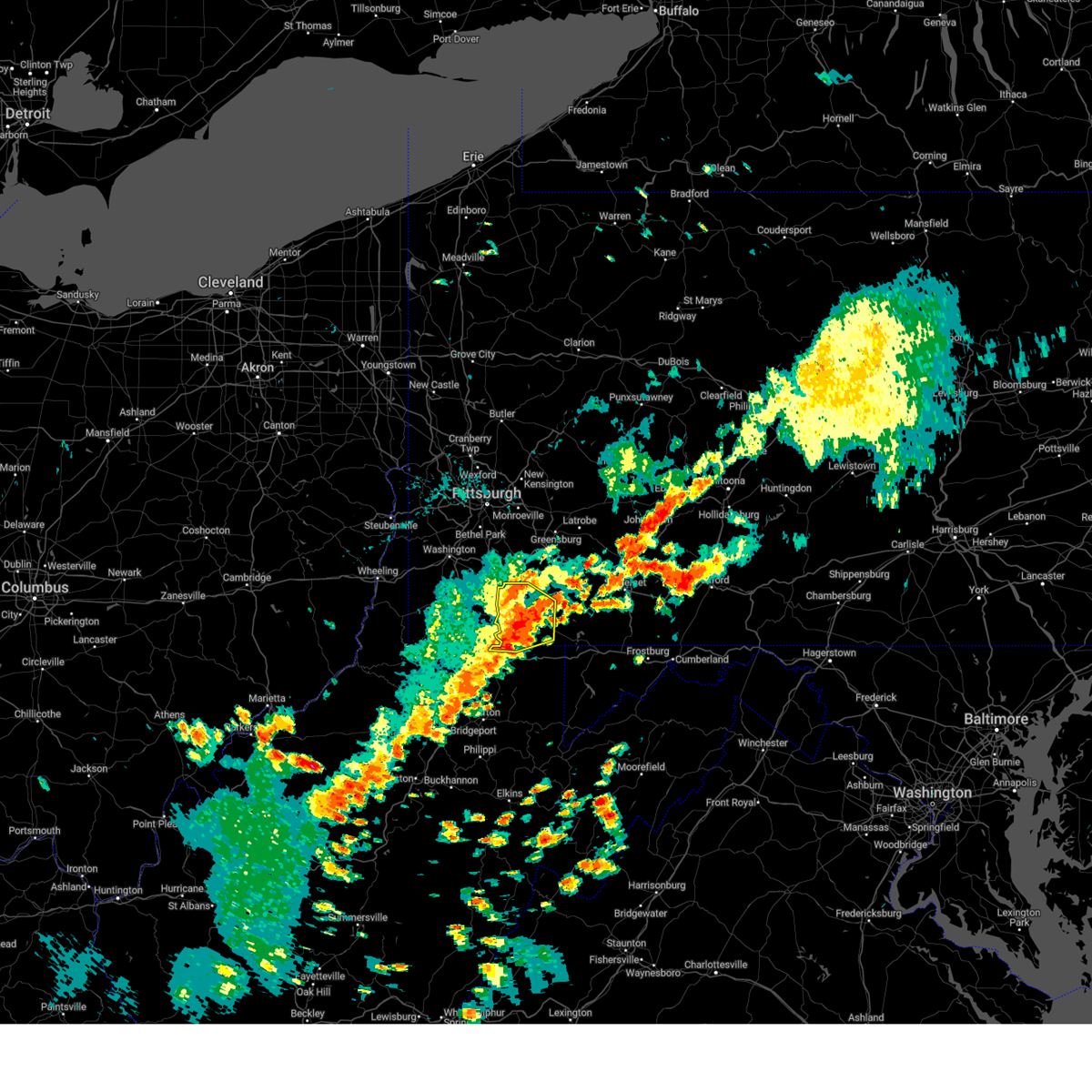 the severe thunderstorm warning has been cancelled and is no longer in effect the severe thunderstorm warning has been cancelled and is no longer in effect
|
| 8/31/2024 2:29 PM EDT |
 the severe thunderstorm warning has been cancelled and is no longer in effect the severe thunderstorm warning has been cancelled and is no longer in effect
|
| 8/31/2024 2:29 PM EDT |
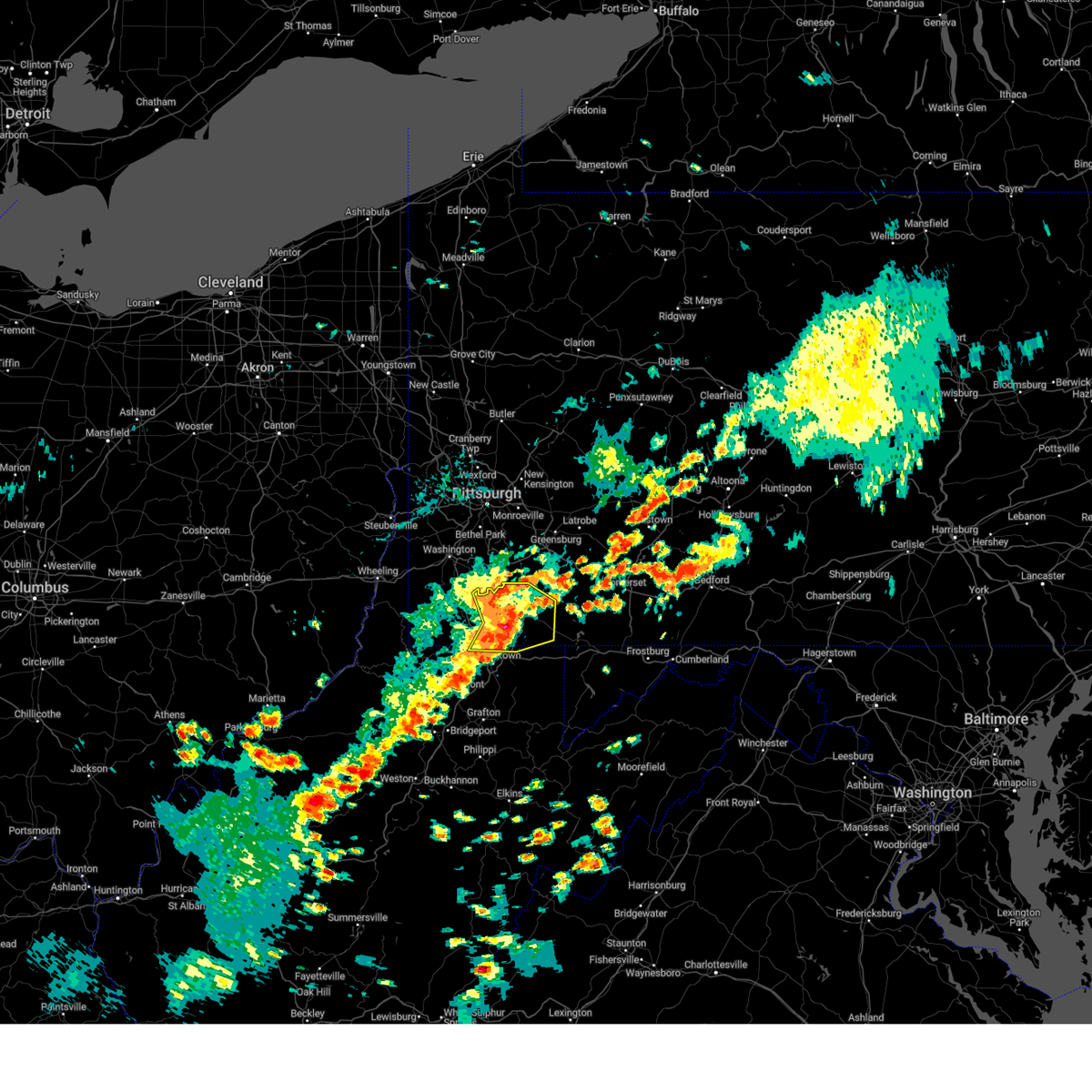 At 229 pm edt, a severe thunderstorm was located near uniontown, moving east at 30 mph (radar indicated). Hazards include 60 mph wind gusts and quarter size hail. Minor hail damage to vehicles is possible. expect wind damage to trees and power lines, resulting in some power outages. Locations impacted include, uniontown, masontown, brownsville, fredericktown-millsboro, farmington, fairdale, jefferson boro, point marion, fairchance, isabella, dunbar, west brownsville, smithfield, deemston, bobtown, republic, nemacolin, carmichaels, rices landing, and new salem. At 229 pm edt, a severe thunderstorm was located near uniontown, moving east at 30 mph (radar indicated). Hazards include 60 mph wind gusts and quarter size hail. Minor hail damage to vehicles is possible. expect wind damage to trees and power lines, resulting in some power outages. Locations impacted include, uniontown, masontown, brownsville, fredericktown-millsboro, farmington, fairdale, jefferson boro, point marion, fairchance, isabella, dunbar, west brownsville, smithfield, deemston, bobtown, republic, nemacolin, carmichaels, rices landing, and new salem.
|
| 8/31/2024 2:02 PM EDT |
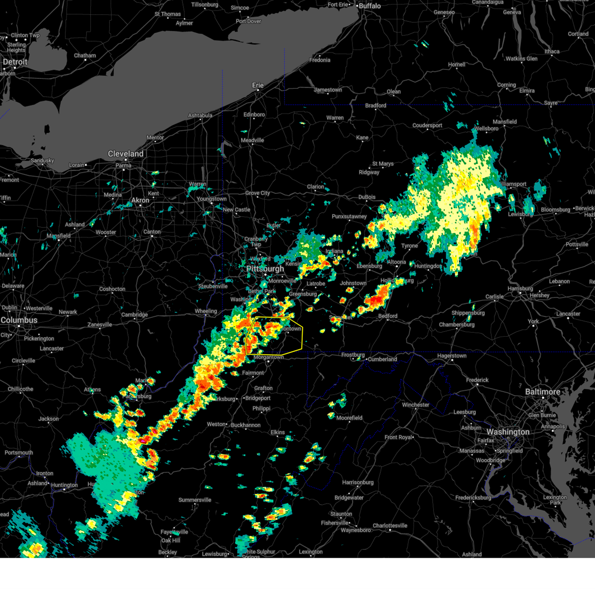 Svrpbz the national weather service in pittsburgh has issued a * severe thunderstorm warning for, southeastern washington county in southwestern pennsylvania, eastern greene county in southwestern pennsylvania, southwestern fayette county in southwestern pennsylvania, northeastern monongalia county in northern west virginia, north central preston county in northeastern west virginia, * until 245 pm edt. * at 202 pm edt, a severe thunderstorm was located over jefferson boro, or near waynesburg, moving east at 30 mph (radar indicated). Hazards include 60 mph wind gusts and quarter size hail. Minor hail damage to vehicles is possible. Expect wind damage to trees and power lines, resulting in some power outages. Svrpbz the national weather service in pittsburgh has issued a * severe thunderstorm warning for, southeastern washington county in southwestern pennsylvania, eastern greene county in southwestern pennsylvania, southwestern fayette county in southwestern pennsylvania, northeastern monongalia county in northern west virginia, north central preston county in northeastern west virginia, * until 245 pm edt. * at 202 pm edt, a severe thunderstorm was located over jefferson boro, or near waynesburg, moving east at 30 mph (radar indicated). Hazards include 60 mph wind gusts and quarter size hail. Minor hail damage to vehicles is possible. Expect wind damage to trees and power lines, resulting in some power outages.
|
| 7/16/2024 7:28 PM EDT |
 Svrctp the national weather service in state college pa has issued a * severe thunderstorm warning for, southeastern adams county in south central pennsylvania, lancaster county in south central pennsylvania, york county in south central pennsylvania, * until 845 pm edt. * at 726 pm edt, severe thunderstorms were located along a line extending from churchtown to east york to parkville, moving southeast at 15 mph (radar indicated). Hazards include 60 mph wind gusts and quarter size hail. Expect wind damage to roofs, siding, and trees. Hail damage to vehicles is expected. Svrctp the national weather service in state college pa has issued a * severe thunderstorm warning for, southeastern adams county in south central pennsylvania, lancaster county in south central pennsylvania, york county in south central pennsylvania, * until 845 pm edt. * at 726 pm edt, severe thunderstorms were located along a line extending from churchtown to east york to parkville, moving southeast at 15 mph (radar indicated). Hazards include 60 mph wind gusts and quarter size hail. Expect wind damage to roofs, siding, and trees. Hail damage to vehicles is expected.
|
| 7/16/2024 6:48 PM EDT |
 Svrctp the national weather service in state college pa has issued a * severe thunderstorm warning for, lancaster county in south central pennsylvania, central york county in south central pennsylvania, * until 730 pm edt. * at 647 pm edt, severe thunderstorms were located along a line extending from reamstown to landisville to york, moving slowly southeast at 5 mph (radar indicated). Hazards include 60 mph wind gusts. expect damage to roofs, siding, and trees Svrctp the national weather service in state college pa has issued a * severe thunderstorm warning for, lancaster county in south central pennsylvania, central york county in south central pennsylvania, * until 730 pm edt. * at 647 pm edt, severe thunderstorms were located along a line extending from reamstown to landisville to york, moving slowly southeast at 5 mph (radar indicated). Hazards include 60 mph wind gusts. expect damage to roofs, siding, and trees
|
| 6/29/2024 7:26 PM EDT |
 The storm which prompted the warning has weakened below severe limits, and has exited the warned area. therefore, the warning will be allowed to expire. a tornado watch remains in effect until 800 pm edt for south central pennsylvania. The storm which prompted the warning has weakened below severe limits, and has exited the warned area. therefore, the warning will be allowed to expire. a tornado watch remains in effect until 800 pm edt for south central pennsylvania.
|
| 6/29/2024 7:05 PM EDT |
 At 704 pm edt, a severe thunderstorm was located over dover, moving east at 50 mph (radar indicated). Hazards include 60 mph wind gusts and quarter size hail. Hail damage to vehicles is expected. expect wind damage to roofs, siding, and trees. locations impacted include, york, weigelstown, hampton, shiloh, west york, grantley, manchester, emigsville, dillsburg, lake meade, dover, and north york. This includes interstate 83 from mile markers 21 to 32. At 704 pm edt, a severe thunderstorm was located over dover, moving east at 50 mph (radar indicated). Hazards include 60 mph wind gusts and quarter size hail. Hail damage to vehicles is expected. expect wind damage to roofs, siding, and trees. locations impacted include, york, weigelstown, hampton, shiloh, west york, grantley, manchester, emigsville, dillsburg, lake meade, dover, and north york. This includes interstate 83 from mile markers 21 to 32.
|
| 6/29/2024 7:05 PM EDT |
 the severe thunderstorm warning has been cancelled and is no longer in effect the severe thunderstorm warning has been cancelled and is no longer in effect
|
| 6/29/2024 6:44 PM EDT |
 Svrctp the national weather service in state college pa has issued a * severe thunderstorm warning for, northeastern adams county in south central pennsylvania, central cumberland county in south central pennsylvania, southeastern dauphin county in south central pennsylvania, northwestern york county in south central pennsylvania, * until 730 pm edt. * at 644 pm edt, a severe thunderstorm was located over dillsburg, moving east at 25 mph (radar indicated). Hazards include 60 mph wind gusts and quarter size hail. Hail damage to vehicles is expected. Expect wind damage to roofs, siding, and trees. Svrctp the national weather service in state college pa has issued a * severe thunderstorm warning for, northeastern adams county in south central pennsylvania, central cumberland county in south central pennsylvania, southeastern dauphin county in south central pennsylvania, northwestern york county in south central pennsylvania, * until 730 pm edt. * at 644 pm edt, a severe thunderstorm was located over dillsburg, moving east at 25 mph (radar indicated). Hazards include 60 mph wind gusts and quarter size hail. Hail damage to vehicles is expected. Expect wind damage to roofs, siding, and trees.
|
| 6/26/2024 10:14 PM EDT |
 At 1014 pm edt, severe thunderstorms were located along a line extending from near lake meade to hanover, moving northeast at 45 mph (radar indicated). Hazards include 60 mph wind gusts. Expect damage to roofs, siding, and trees. these severe storms will be near, weigelstown, york airport, and lake meade around 1020 pm edt. york, lower allen, and new cumberland around 1030 pm edt. other locations impacted by these severe thunderstorms include seven valleys, abbottstown, franklintown, york springs, and gardners. this includes the following interstates, the pennsylvania turnpike from mile markers 237 to 245. Interstate 83 from mile markers 5 to 42. At 1014 pm edt, severe thunderstorms were located along a line extending from near lake meade to hanover, moving northeast at 45 mph (radar indicated). Hazards include 60 mph wind gusts. Expect damage to roofs, siding, and trees. these severe storms will be near, weigelstown, york airport, and lake meade around 1020 pm edt. york, lower allen, and new cumberland around 1030 pm edt. other locations impacted by these severe thunderstorms include seven valleys, abbottstown, franklintown, york springs, and gardners. this includes the following interstates, the pennsylvania turnpike from mile markers 237 to 245. Interstate 83 from mile markers 5 to 42.
|
| 6/26/2024 9:57 PM EDT |
 Svrctp the national weather service in state college pa has issued a * severe thunderstorm warning for, adams county in south central pennsylvania, southeastern cumberland county in south central pennsylvania, york county in south central pennsylvania, * until 1030 pm edt. * at 957 pm edt, severe thunderstorms were located along a line extending from cashtown to taneytown, moving northeast at 50 mph (radar indicated). Hazards include 60 mph wind gusts. Expect damage to roofs, siding, and trees. severe thunderstorms will be near, hanover, gettysburg, and littlestown around 1000 pm edt. parkville, hampton, and lake meade around 1010 pm edt. weigelstown, york airport, and dover around 1020 pm edt. york and west york around 1030 pm edt. other locations impacted by these severe thunderstorms include arendtsville, gardners, glenville, heidlersburg, and biglerville. this includes the following interstates, the pennsylvania turnpike from mile markers 237 to 245. Interstate 83 from mile markers 5 to 42. Svrctp the national weather service in state college pa has issued a * severe thunderstorm warning for, adams county in south central pennsylvania, southeastern cumberland county in south central pennsylvania, york county in south central pennsylvania, * until 1030 pm edt. * at 957 pm edt, severe thunderstorms were located along a line extending from cashtown to taneytown, moving northeast at 50 mph (radar indicated). Hazards include 60 mph wind gusts. Expect damage to roofs, siding, and trees. severe thunderstorms will be near, hanover, gettysburg, and littlestown around 1000 pm edt. parkville, hampton, and lake meade around 1010 pm edt. weigelstown, york airport, and dover around 1020 pm edt. york and west york around 1030 pm edt. other locations impacted by these severe thunderstorms include arendtsville, gardners, glenville, heidlersburg, and biglerville. this includes the following interstates, the pennsylvania turnpike from mile markers 237 to 245. Interstate 83 from mile markers 5 to 42.
|
| 6/23/2024 5:09 PM EDT |
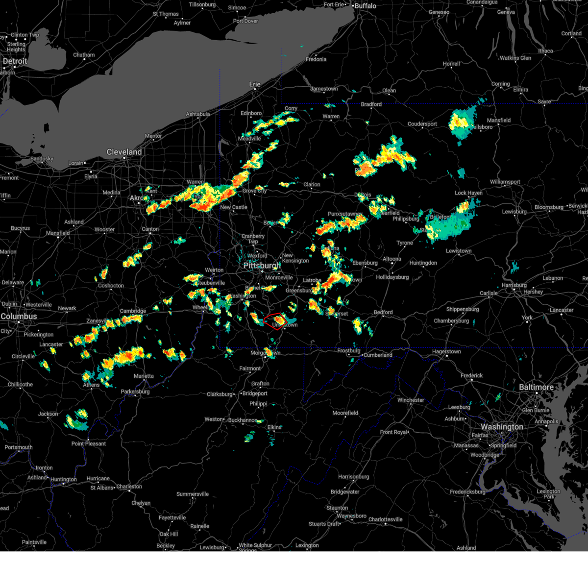 The storm which prompted the warning has weakened below severe limits, and no longer appears capable of producing a tornado. therefore, the warning will be allowed to expire. however, gusty winds and heavy rain are still possible with this thunderstorm. a severe thunderstorm watch remains in effect until 1000 pm edt for southwestern pennsylvania. The storm which prompted the warning has weakened below severe limits, and no longer appears capable of producing a tornado. therefore, the warning will be allowed to expire. however, gusty winds and heavy rain are still possible with this thunderstorm. a severe thunderstorm watch remains in effect until 1000 pm edt for southwestern pennsylvania.
|
| 6/23/2024 5:00 PM EDT |
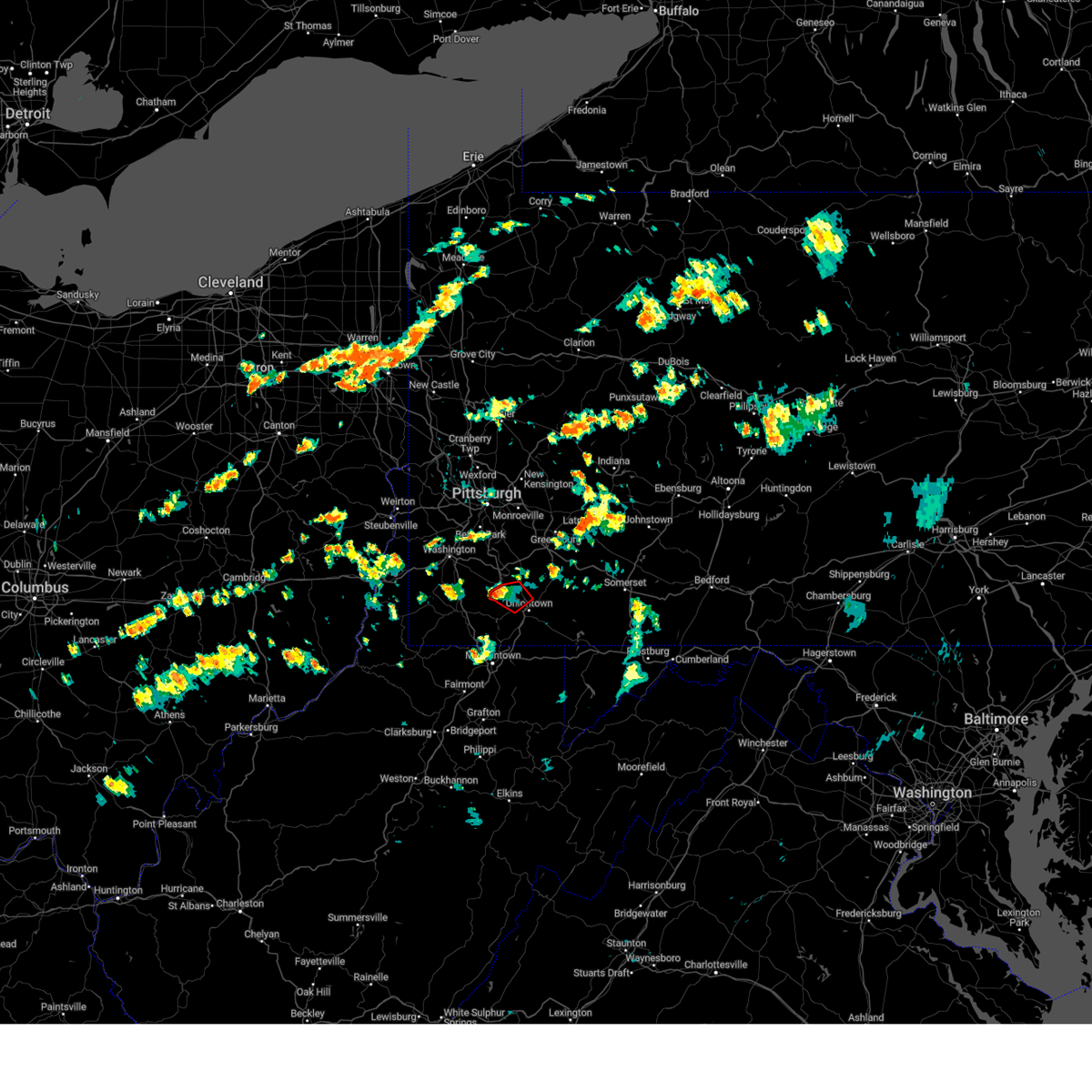 the tornado warning has been cancelled and is no longer in effect the tornado warning has been cancelled and is no longer in effect
|
| 6/23/2024 5:00 PM EDT |
 At 500 pm edt, a severe thunderstorm capable of producing a tornado was located near brownsville, or 12 miles northwest of uniontown, moving east at 30 mph (radar indicated rotation). Hazards include tornado. Flying debris will be dangerous to those caught without shelter. mobile homes will be damaged or destroyed. damage to roofs, windows, and vehicles will occur. tree damage is likely. this dangerous storm will be near, brownsville around 505 pm edt. Other locations impacted by this tornadic thunderstorm include grindstone, new salem, republic, west brownsville, isabella, and centerville. At 500 pm edt, a severe thunderstorm capable of producing a tornado was located near brownsville, or 12 miles northwest of uniontown, moving east at 30 mph (radar indicated rotation). Hazards include tornado. Flying debris will be dangerous to those caught without shelter. mobile homes will be damaged or destroyed. damage to roofs, windows, and vehicles will occur. tree damage is likely. this dangerous storm will be near, brownsville around 505 pm edt. Other locations impacted by this tornadic thunderstorm include grindstone, new salem, republic, west brownsville, isabella, and centerville.
|
| 6/23/2024 4:50 PM EDT |
 At 450 pm edt, a severe thunderstorm capable of producing a tornado was located over fredericktown-millsboro, or 12 miles northeast of waynesburg, moving east at 30 mph (radar indicated rotation). Hazards include tornado. Flying debris will be dangerous to those caught without shelter. mobile homes will be damaged or destroyed. damage to roofs, windows, and vehicles will occur. tree damage is likely. this dangerous storm will be near, california and brownsville around 455 pm edt. Other locations impacted by this tornadic thunderstorm include grindstone, west brownsville, clarksville, new salem, isabella, deemston, rices landing, republic, centerville, and beallsville. At 450 pm edt, a severe thunderstorm capable of producing a tornado was located over fredericktown-millsboro, or 12 miles northeast of waynesburg, moving east at 30 mph (radar indicated rotation). Hazards include tornado. Flying debris will be dangerous to those caught without shelter. mobile homes will be damaged or destroyed. damage to roofs, windows, and vehicles will occur. tree damage is likely. this dangerous storm will be near, california and brownsville around 455 pm edt. Other locations impacted by this tornadic thunderstorm include grindstone, west brownsville, clarksville, new salem, isabella, deemston, rices landing, republic, centerville, and beallsville.
|
| 6/23/2024 4:38 PM EDT |
 Torpbz the national weather service in pittsburgh has issued a * tornado warning for, southeastern washington county in southwestern pennsylvania, northeastern greene county in southwestern pennsylvania, northwestern fayette county in southwestern pennsylvania, * until 515 pm edt. * at 438 pm edt, a severe thunderstorm capable of producing a tornado was located near jefferson boro, or 7 miles northeast of waynesburg, moving east at 30 mph (radar indicated rotation). Hazards include tornado. Flying debris will be dangerous to those caught without shelter. mobile homes will be damaged or destroyed. damage to roofs, windows, and vehicles will occur. tree damage is likely. this dangerous storm will be near, fredericktown-millsboro and jefferson boro around 445 pm edt. california and brownsville around 455 pm edt. Other locations impacted by this tornadic thunderstorm include grindstone, west brownsville, clarksville, new salem, isabella, deemston, rices landing, republic, marianna, and centerville. Torpbz the national weather service in pittsburgh has issued a * tornado warning for, southeastern washington county in southwestern pennsylvania, northeastern greene county in southwestern pennsylvania, northwestern fayette county in southwestern pennsylvania, * until 515 pm edt. * at 438 pm edt, a severe thunderstorm capable of producing a tornado was located near jefferson boro, or 7 miles northeast of waynesburg, moving east at 30 mph (radar indicated rotation). Hazards include tornado. Flying debris will be dangerous to those caught without shelter. mobile homes will be damaged or destroyed. damage to roofs, windows, and vehicles will occur. tree damage is likely. this dangerous storm will be near, fredericktown-millsboro and jefferson boro around 445 pm edt. california and brownsville around 455 pm edt. Other locations impacted by this tornadic thunderstorm include grindstone, west brownsville, clarksville, new salem, isabella, deemston, rices landing, republic, marianna, and centerville.
|
| 6/18/2024 4:22 PM EDT |
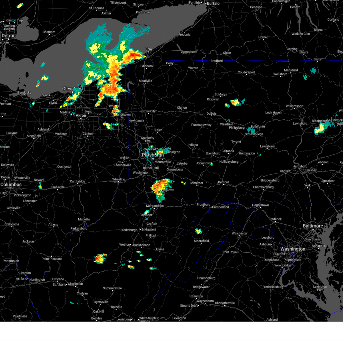 At 422 pm edt, severe thunderstorms were located along a line from near masontown to near perryopolis, or along a line from 8 miles west of uniontown to 10 miles north of uniontown. these storms were stationary (emergency management reported trees and powerlines down across northwest fayette county between brownsville and perryopolis). Hazards include 60 mph wind gusts and small hail. Expect damage to roofs, siding, and trees. Locations impacted include, brownsville, fairdale, isabella, west brownsville, republic, nemacolin, carmichaels, grindstone and new salem. At 422 pm edt, severe thunderstorms were located along a line from near masontown to near perryopolis, or along a line from 8 miles west of uniontown to 10 miles north of uniontown. these storms were stationary (emergency management reported trees and powerlines down across northwest fayette county between brownsville and perryopolis). Hazards include 60 mph wind gusts and small hail. Expect damage to roofs, siding, and trees. Locations impacted include, brownsville, fairdale, isabella, west brownsville, republic, nemacolin, carmichaels, grindstone and new salem.
|
| 6/18/2024 3:54 PM EDT |
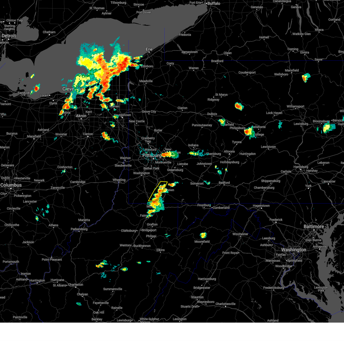 Svrpbz the national weather service in pittsburgh has issued a * severe thunderstorm warning for, western fayette county in southwestern pennsylvania, southeastern greene county in southwestern pennsylvania, * until 445 pm edt. * at 354 pm edt, severe thunderstorms were located along a line from 5 miles southwest of masontown to near perryopolis, or along a line from 9 miles north of star city to 10 miles north of uniontown. these storms were stationary (radar indicated). Hazards include 60 mph wind gusts and small hail. expect damage to roofs, siding, and trees Svrpbz the national weather service in pittsburgh has issued a * severe thunderstorm warning for, western fayette county in southwestern pennsylvania, southeastern greene county in southwestern pennsylvania, * until 445 pm edt. * at 354 pm edt, severe thunderstorms were located along a line from 5 miles southwest of masontown to near perryopolis, or along a line from 9 miles north of star city to 10 miles north of uniontown. these storms were stationary (radar indicated). Hazards include 60 mph wind gusts and small hail. expect damage to roofs, siding, and trees
|
| 5/26/2024 8:00 PM EDT |
 At 800 pm edt, severe thunderstorms were located along a line extending from pleasant hills to 6 miles west of farmington, moving northeast at 40 mph (radar indicated). Hazards include 60 mph wind gusts. Expect damage to trees and power lines, resulting in some power outages. Locations impacted include, monroeville, greensburg, mckeesport, uniontown, jeannette, latrobe, connellsville, plum, west mifflin, murrysville, south park township, jefferson hills, north versailles, pleasant hills, white oak, monessen, clairton, duquesne, turtle creek, and north braddock. At 800 pm edt, severe thunderstorms were located along a line extending from pleasant hills to 6 miles west of farmington, moving northeast at 40 mph (radar indicated). Hazards include 60 mph wind gusts. Expect damage to trees and power lines, resulting in some power outages. Locations impacted include, monroeville, greensburg, mckeesport, uniontown, jeannette, latrobe, connellsville, plum, west mifflin, murrysville, south park township, jefferson hills, north versailles, pleasant hills, white oak, monessen, clairton, duquesne, turtle creek, and north braddock.
|
| 5/26/2024 8:00 PM EDT |
 the severe thunderstorm warning has been cancelled and is no longer in effect the severe thunderstorm warning has been cancelled and is no longer in effect
|
| 5/26/2024 7:50 PM EDT |
 At 750 pm edt, severe thunderstorms were located along a line extending from south park township to 7 miles east of point marion, moving northeast at 40 mph (radar indicated). Hazards include 60 mph wind gusts. Expect damage to trees and power lines, resulting in some power outages. Locations impacted include, bethel park, monroeville, mcmurray, greensburg, mckeesport, uniontown, jeannette, latrobe, connellsville, gastonville, plum, west mifflin, murrysville, south park township, jefferson hills, north versailles, pleasant hills, white oak, monessen, and clairton. At 750 pm edt, severe thunderstorms were located along a line extending from south park township to 7 miles east of point marion, moving northeast at 40 mph (radar indicated). Hazards include 60 mph wind gusts. Expect damage to trees and power lines, resulting in some power outages. Locations impacted include, bethel park, monroeville, mcmurray, greensburg, mckeesport, uniontown, jeannette, latrobe, connellsville, gastonville, plum, west mifflin, murrysville, south park township, jefferson hills, north versailles, pleasant hills, white oak, monessen, and clairton.
|
| 5/26/2024 7:29 PM EDT |
 Svrpbz the national weather service in pittsburgh has issued a * severe thunderstorm warning for, southeastern washington county in southwestern pennsylvania, southeastern allegheny county in southwestern pennsylvania, westmoreland county in southwestern pennsylvania, eastern greene county in southwestern pennsylvania, fayette county in southwestern pennsylvania, northern monongalia county in northern west virginia, northern preston county in northeastern west virginia, * until 830 pm edt. * at 729 pm edt, severe thunderstorms were located along a line extending from canonsburg to near cassville, moving northeast at 40 mph (radar indicated). Hazards include 60 mph wind gusts. expect damage to trees and power lines, resulting in some power outages Svrpbz the national weather service in pittsburgh has issued a * severe thunderstorm warning for, southeastern washington county in southwestern pennsylvania, southeastern allegheny county in southwestern pennsylvania, westmoreland county in southwestern pennsylvania, eastern greene county in southwestern pennsylvania, fayette county in southwestern pennsylvania, northern monongalia county in northern west virginia, northern preston county in northeastern west virginia, * until 830 pm edt. * at 729 pm edt, severe thunderstorms were located along a line extending from canonsburg to near cassville, moving northeast at 40 mph (radar indicated). Hazards include 60 mph wind gusts. expect damage to trees and power lines, resulting in some power outages
|
| 5/25/2024 5:21 PM EDT |
 The storm which prompted the warning has moved out of the area. therefore, the warning will be allowed to expire. to report severe weather, contact your nearest law enforcement agency. they will relay your report to the national weather service pittsburgh. The storm which prompted the warning has moved out of the area. therefore, the warning will be allowed to expire. to report severe weather, contact your nearest law enforcement agency. they will relay your report to the national weather service pittsburgh.
|
| 5/25/2024 5:02 PM EDT |
 At 502 pm edt, a severe thunderstorm was located near uniontown, moving east at 25 mph (radar indicated). Hazards include 60 mph wind gusts. Expect damage to trees and power lines, resulting in some power outages. Locations impacted include, uniontown, connellsville, south connellsville, perryopolis, dunbar, republic, vanderbilt, dawson, grindstone, and new salem. At 502 pm edt, a severe thunderstorm was located near uniontown, moving east at 25 mph (radar indicated). Hazards include 60 mph wind gusts. Expect damage to trees and power lines, resulting in some power outages. Locations impacted include, uniontown, connellsville, south connellsville, perryopolis, dunbar, republic, vanderbilt, dawson, grindstone, and new salem.
|
| 5/25/2024 5:02 PM EDT |
 the severe thunderstorm warning has been cancelled and is no longer in effect the severe thunderstorm warning has been cancelled and is no longer in effect
|
| 5/25/2024 4:51 PM EDT |
 Svrpbz the national weather service in pittsburgh has issued a * severe thunderstorm warning for, southeastern washington county in southwestern pennsylvania, east central greene county in southwestern pennsylvania, northwestern fayette county in southwestern pennsylvania, * until 530 pm edt. * at 451 pm edt, a severe thunderstorm was located near brownsville, or 10 miles northwest of uniontown, moving east at 25 mph (radar indicated). Hazards include 60 mph wind gusts. expect damage to trees and power lines, resulting in some power outages Svrpbz the national weather service in pittsburgh has issued a * severe thunderstorm warning for, southeastern washington county in southwestern pennsylvania, east central greene county in southwestern pennsylvania, northwestern fayette county in southwestern pennsylvania, * until 530 pm edt. * at 451 pm edt, a severe thunderstorm was located near brownsville, or 10 miles northwest of uniontown, moving east at 25 mph (radar indicated). Hazards include 60 mph wind gusts. expect damage to trees and power lines, resulting in some power outages
|
| 5/11/2024 7:16 PM EDT |
 At 716 pm edt, a severe thunderstorm capable of producing a tornado was located over uniontown, moving southeast at 30 mph (radar indicated rotation). Hazards include tornado and golf ball size hail. Flying debris will be dangerous to those caught without shelter. mobile homes will be damaged or destroyed. damage to roofs, windows, and vehicles will occur. tree damage is likely. this dangerous storm will be near, farmington around 725 pm edt. Other locations impacted by this tornadic thunderstorm include fairchance, chalkhill, ohiopyle, new salem, and markleysburg. At 716 pm edt, a severe thunderstorm capable of producing a tornado was located over uniontown, moving southeast at 30 mph (radar indicated rotation). Hazards include tornado and golf ball size hail. Flying debris will be dangerous to those caught without shelter. mobile homes will be damaged or destroyed. damage to roofs, windows, and vehicles will occur. tree damage is likely. this dangerous storm will be near, farmington around 725 pm edt. Other locations impacted by this tornadic thunderstorm include fairchance, chalkhill, ohiopyle, new salem, and markleysburg.
|
| 5/11/2024 7:11 PM EDT |
 Torpbz the national weather service in pittsburgh has issued a * tornado warning for, southern fayette county in southwestern pennsylvania, * until 745 pm edt. * at 711 pm edt, a severe thunderstorm capable of producing a tornado was located over uniontown, moving southeast at 50 mph (radar indicated rotation). Hazards include tornado and golf ball size hail. Flying debris will be dangerous to those caught without shelter. mobile homes will be damaged or destroyed. damage to roofs, windows, and vehicles will occur. tree damage is likely. this dangerous storm will be near, uniontown around 715 pm edt. farmington around 720 pm edt. Other locations impacted by this tornadic thunderstorm include fairchance, chalkhill, ohiopyle, new salem, and markleysburg. Torpbz the national weather service in pittsburgh has issued a * tornado warning for, southern fayette county in southwestern pennsylvania, * until 745 pm edt. * at 711 pm edt, a severe thunderstorm capable of producing a tornado was located over uniontown, moving southeast at 50 mph (radar indicated rotation). Hazards include tornado and golf ball size hail. Flying debris will be dangerous to those caught without shelter. mobile homes will be damaged or destroyed. damage to roofs, windows, and vehicles will occur. tree damage is likely. this dangerous storm will be near, uniontown around 715 pm edt. farmington around 720 pm edt. Other locations impacted by this tornadic thunderstorm include fairchance, chalkhill, ohiopyle, new salem, and markleysburg.
|
| 5/11/2024 7:00 PM EDT |
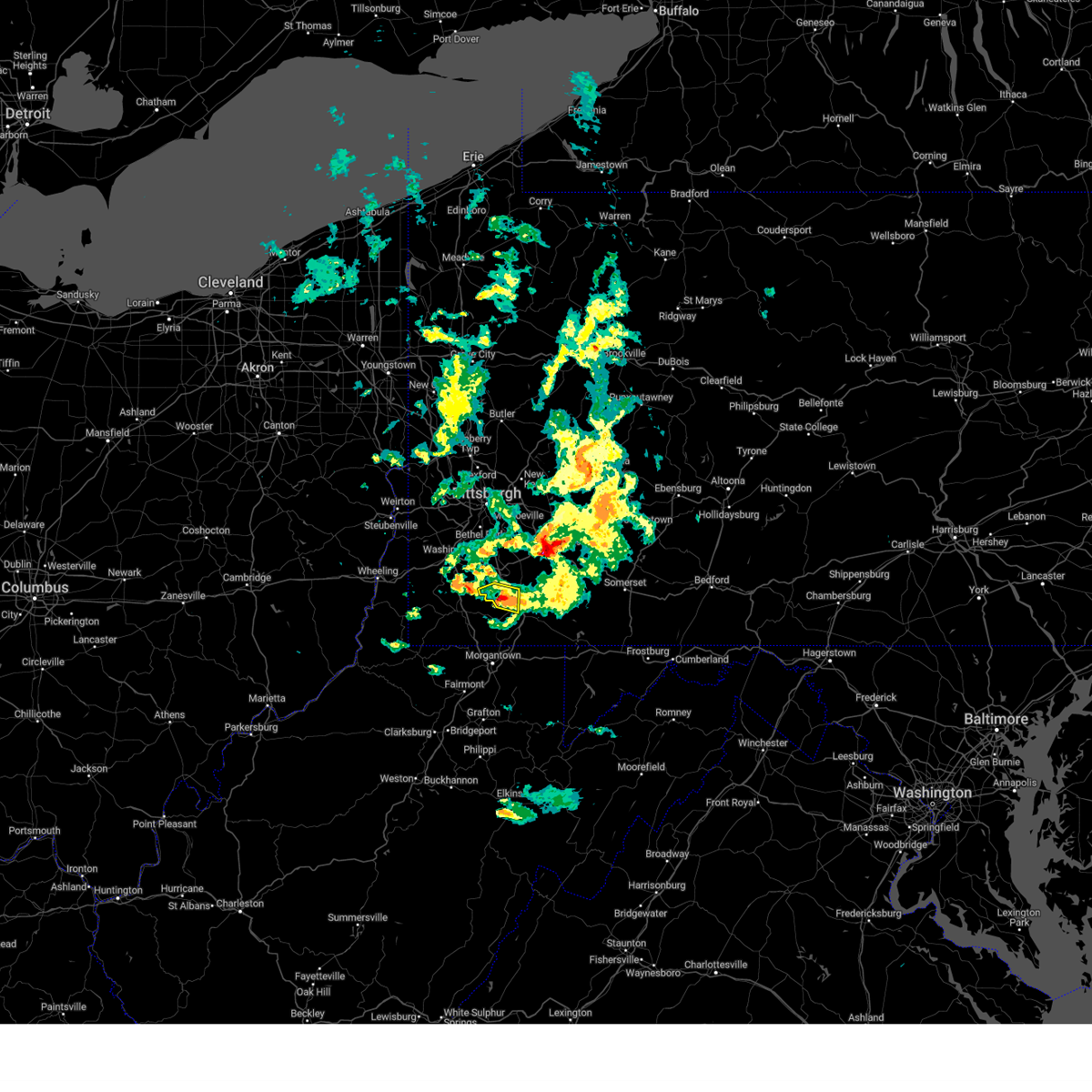 The storm which prompted the warning has been replaced with another warning. hail and winds are still a threat. The storm which prompted the warning has been replaced with another warning. hail and winds are still a threat.
|
| 5/11/2024 6:58 PM EDT |
 Svrpbz the national weather service in pittsburgh has issued a * severe thunderstorm warning for, southeastern washington county in southwestern pennsylvania, northeastern greene county in southwestern pennsylvania, central fayette county in southwestern pennsylvania, * until 800 pm edt. * at 657 pm edt, a severe thunderstorm was located near brownsville, or 10 miles northwest of uniontown, moving east at 30 mph (radar indicated). Hazards include 60 mph wind gusts and half dollar size hail. Minor hail damage to vehicles is possible. Expect wind damage to trees and power lines, resulting in some power outages. Svrpbz the national weather service in pittsburgh has issued a * severe thunderstorm warning for, southeastern washington county in southwestern pennsylvania, northeastern greene county in southwestern pennsylvania, central fayette county in southwestern pennsylvania, * until 800 pm edt. * at 657 pm edt, a severe thunderstorm was located near brownsville, or 10 miles northwest of uniontown, moving east at 30 mph (radar indicated). Hazards include 60 mph wind gusts and half dollar size hail. Minor hail damage to vehicles is possible. Expect wind damage to trees and power lines, resulting in some power outages.
|
| 5/11/2024 6:48 PM EDT |
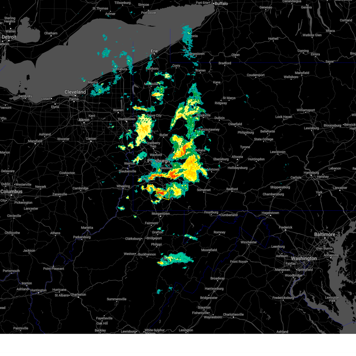 At 648 pm edt, a severe thunderstorm was located over brownsville, or 12 miles northwest of uniontown, moving east at 30 mph (radar indicated). Hazards include 60 mph wind gusts and half dollar size hail. Minor hail damage to vehicles is possible. expect wind damage to trees and power lines, resulting in some power outages. Locations impacted include, california, brownsville, fredericktown-millsboro, isabella, west brownsville, deemston, republic, rices landing, grindstone, new salem, and centerville. At 648 pm edt, a severe thunderstorm was located over brownsville, or 12 miles northwest of uniontown, moving east at 30 mph (radar indicated). Hazards include 60 mph wind gusts and half dollar size hail. Minor hail damage to vehicles is possible. expect wind damage to trees and power lines, resulting in some power outages. Locations impacted include, california, brownsville, fredericktown-millsboro, isabella, west brownsville, deemston, republic, rices landing, grindstone, new salem, and centerville.
|
| 5/11/2024 6:41 PM EDT |
 At 641 pm edt, a severe thunderstorm was located over fredericktown-millsboro, or 12 miles northeast of waynesburg, moving east at 30 mph (radar indicated). Hazards include ping pong ball size hail and 60 mph wind gusts. People and animals outdoors will be injured. expect hail damage to roofs, siding, windows, and vehicles. expect wind damage to trees and power lines, resulting in some power outages. Locations impacted include, california, charleroi, bentleyville, brownsville, fredericktown-millsboro, north belle vernon, north charleroi, speers, isabella, belle vernon, ellsworth, lynnwood-pricedale, west brownsville, roscoe, deemston, cokeburg, fayette city, newell, allenport, and stockdale. At 641 pm edt, a severe thunderstorm was located over fredericktown-millsboro, or 12 miles northeast of waynesburg, moving east at 30 mph (radar indicated). Hazards include ping pong ball size hail and 60 mph wind gusts. People and animals outdoors will be injured. expect hail damage to roofs, siding, windows, and vehicles. expect wind damage to trees and power lines, resulting in some power outages. Locations impacted include, california, charleroi, bentleyville, brownsville, fredericktown-millsboro, north belle vernon, north charleroi, speers, isabella, belle vernon, ellsworth, lynnwood-pricedale, west brownsville, roscoe, deemston, cokeburg, fayette city, newell, allenport, and stockdale.
|
| 5/11/2024 6:22 PM EDT |
 At 621 pm edt, a severe thunderstorm was located 7 miles south of east washington, or 8 miles south of washington, moving southeast at 30 mph (radar indicated). Hazards include golf ball size hail and 60 mph wind gusts. People and animals outdoors will be injured. expect hail damage to roofs, siding, windows, and vehicles. expect wind damage to trees and power lines, resulting in some power outages. Locations impacted include, california, charleroi, bentleyville, brownsville, fredericktown-millsboro, north belle vernon, north charleroi, speers, isabella, belle vernon, ellsworth, lynnwood-pricedale, west brownsville, roscoe, deemston, eighty four, cokeburg, fayette city, newell, and allenport. At 621 pm edt, a severe thunderstorm was located 7 miles south of east washington, or 8 miles south of washington, moving southeast at 30 mph (radar indicated). Hazards include golf ball size hail and 60 mph wind gusts. People and animals outdoors will be injured. expect hail damage to roofs, siding, windows, and vehicles. expect wind damage to trees and power lines, resulting in some power outages. Locations impacted include, california, charleroi, bentleyville, brownsville, fredericktown-millsboro, north belle vernon, north charleroi, speers, isabella, belle vernon, ellsworth, lynnwood-pricedale, west brownsville, roscoe, deemston, eighty four, cokeburg, fayette city, newell, and allenport.
|
| 5/11/2024 6:14 PM EDT |
 At 613 pm edt, a severe thunderstorm was located near east washington, or near washington, moving east at 30 mph (radar indicated). Hazards include 60 mph wind gusts and quarter size hail. Minor hail damage to vehicles is possible. expect wind damage to trees and power lines, resulting in some power outages. Locations impacted include, washington, california, charleroi, wolfdale, bentleyville, brownsville, east washington, fredericktown-millsboro, north belle vernon, north charleroi, speers, isabella, belle vernon, ellsworth, lynnwood-pricedale, west brownsville, roscoe, deemston, eighty four, and cokeburg. At 613 pm edt, a severe thunderstorm was located near east washington, or near washington, moving east at 30 mph (radar indicated). Hazards include 60 mph wind gusts and quarter size hail. Minor hail damage to vehicles is possible. expect wind damage to trees and power lines, resulting in some power outages. Locations impacted include, washington, california, charleroi, wolfdale, bentleyville, brownsville, east washington, fredericktown-millsboro, north belle vernon, north charleroi, speers, isabella, belle vernon, ellsworth, lynnwood-pricedale, west brownsville, roscoe, deemston, eighty four, and cokeburg.
|
| 5/11/2024 6:09 PM EDT |
 Svrpbz the national weather service in pittsburgh has issued a * severe thunderstorm warning for, southern washington county in southwestern pennsylvania, northwestern fayette county in southwestern pennsylvania, * until 700 pm edt. * at 608 pm edt, a severe thunderstorm was located near washington, moving east at 30 mph (radar indicated). Hazards include 60 mph wind gusts and quarter size hail. Minor hail damage to vehicles is possible. Expect wind damage to trees and power lines, resulting in some power outages. Svrpbz the national weather service in pittsburgh has issued a * severe thunderstorm warning for, southern washington county in southwestern pennsylvania, northwestern fayette county in southwestern pennsylvania, * until 700 pm edt. * at 608 pm edt, a severe thunderstorm was located near washington, moving east at 30 mph (radar indicated). Hazards include 60 mph wind gusts and quarter size hail. Minor hail damage to vehicles is possible. Expect wind damage to trees and power lines, resulting in some power outages.
|
| 4/15/2024 4:00 PM EDT |
 Svrctp the national weather service in state college pa has issued a * severe thunderstorm warning for, southern york county in south central pennsylvania, * until 500 pm edt. * at 359 pm edt, a severe thunderstorm was located over spring grove, moving southeast at 30 mph (radar indicated). Hazards include ping pong ball size hail and 60 mph wind gusts. People and animals outdoors will be injured. expect hail damage to roofs, siding, windows, and vehicles. Expect wind damage to roofs, siding, and trees. Svrctp the national weather service in state college pa has issued a * severe thunderstorm warning for, southern york county in south central pennsylvania, * until 500 pm edt. * at 359 pm edt, a severe thunderstorm was located over spring grove, moving southeast at 30 mph (radar indicated). Hazards include ping pong ball size hail and 60 mph wind gusts. People and animals outdoors will be injured. expect hail damage to roofs, siding, windows, and vehicles. Expect wind damage to roofs, siding, and trees.
|
| 4/15/2024 3:37 PM EDT |
 Svrctp the national weather service in state college pa has issued a * severe thunderstorm warning for, northeastern adams county in south central pennsylvania, southwestern york county in south central pennsylvania, * until 400 pm edt. * at 336 pm edt, a severe thunderstorm was located over hampton, moving southeast at 45 mph (radar indicated). Hazards include 60 mph wind gusts and quarter size hail. Hail damage to vehicles is expected. Expect wind damage to roofs, siding, and trees. Svrctp the national weather service in state college pa has issued a * severe thunderstorm warning for, northeastern adams county in south central pennsylvania, southwestern york county in south central pennsylvania, * until 400 pm edt. * at 336 pm edt, a severe thunderstorm was located over hampton, moving southeast at 45 mph (radar indicated). Hazards include 60 mph wind gusts and quarter size hail. Hail damage to vehicles is expected. Expect wind damage to roofs, siding, and trees.
|
| 2/28/2024 8:55 AM EST |
 The storm which prompted the warning has weakened below severe limits, and has exited the warned area. therefore, the warning will be allowed to expire. however, gusty winds are still possible with this thunderstorm. The storm which prompted the warning has weakened below severe limits, and has exited the warned area. therefore, the warning will be allowed to expire. however, gusty winds are still possible with this thunderstorm.
|
| 2/28/2024 8:40 AM EST |
 At 840 am est, a severe thunderstorm was located near uniontown, moving east at 60 mph (radar indicated). Hazards include 60 mph wind gusts. Expect damage to trees and power lines, resulting in some power outages. Locations impacted include, uniontown, connellsville, masontown, brownsville, south connellsville, farmington, point marion, seven springs, fairchance, isabella, dunbar, smithfield, republic, nemacolin, grindstone, new salem, markleysburg, greensboro, chalkhill, and ohiopyle. At 840 am est, a severe thunderstorm was located near uniontown, moving east at 60 mph (radar indicated). Hazards include 60 mph wind gusts. Expect damage to trees and power lines, resulting in some power outages. Locations impacted include, uniontown, connellsville, masontown, brownsville, south connellsville, farmington, point marion, seven springs, fairchance, isabella, dunbar, smithfield, republic, nemacolin, grindstone, new salem, markleysburg, greensboro, chalkhill, and ohiopyle.
|
| 2/28/2024 8:25 AM EST |
 Svrpbz the national weather service in pittsburgh has issued a * severe thunderstorm warning for, eastern greene county in southwestern pennsylvania, fayette county in southwestern pennsylvania, * until 900 am est. * at 824 am est, a severe thunderstorm was located near fairdale, or 9 miles southeast of waynesburg, moving east at 60 mph (radar indicated). Hazards include 60 mph wind gusts. expect damage to trees and power lines, resulting in some power outages Svrpbz the national weather service in pittsburgh has issued a * severe thunderstorm warning for, eastern greene county in southwestern pennsylvania, fayette county in southwestern pennsylvania, * until 900 am est. * at 824 am est, a severe thunderstorm was located near fairdale, or 9 miles southeast of waynesburg, moving east at 60 mph (radar indicated). Hazards include 60 mph wind gusts. expect damage to trees and power lines, resulting in some power outages
|
| 9/7/2023 6:16 PM EDT |
 At 616 pm edt, a severe thunderstorm was located over jacobus, moving northeast at 25 mph (radar indicated). Hazards include 60 mph wind gusts. expect damage to roofs, siding, and trees At 616 pm edt, a severe thunderstorm was located over jacobus, moving northeast at 25 mph (radar indicated). Hazards include 60 mph wind gusts. expect damage to roofs, siding, and trees
|
| 9/7/2023 5:37 PM EDT |
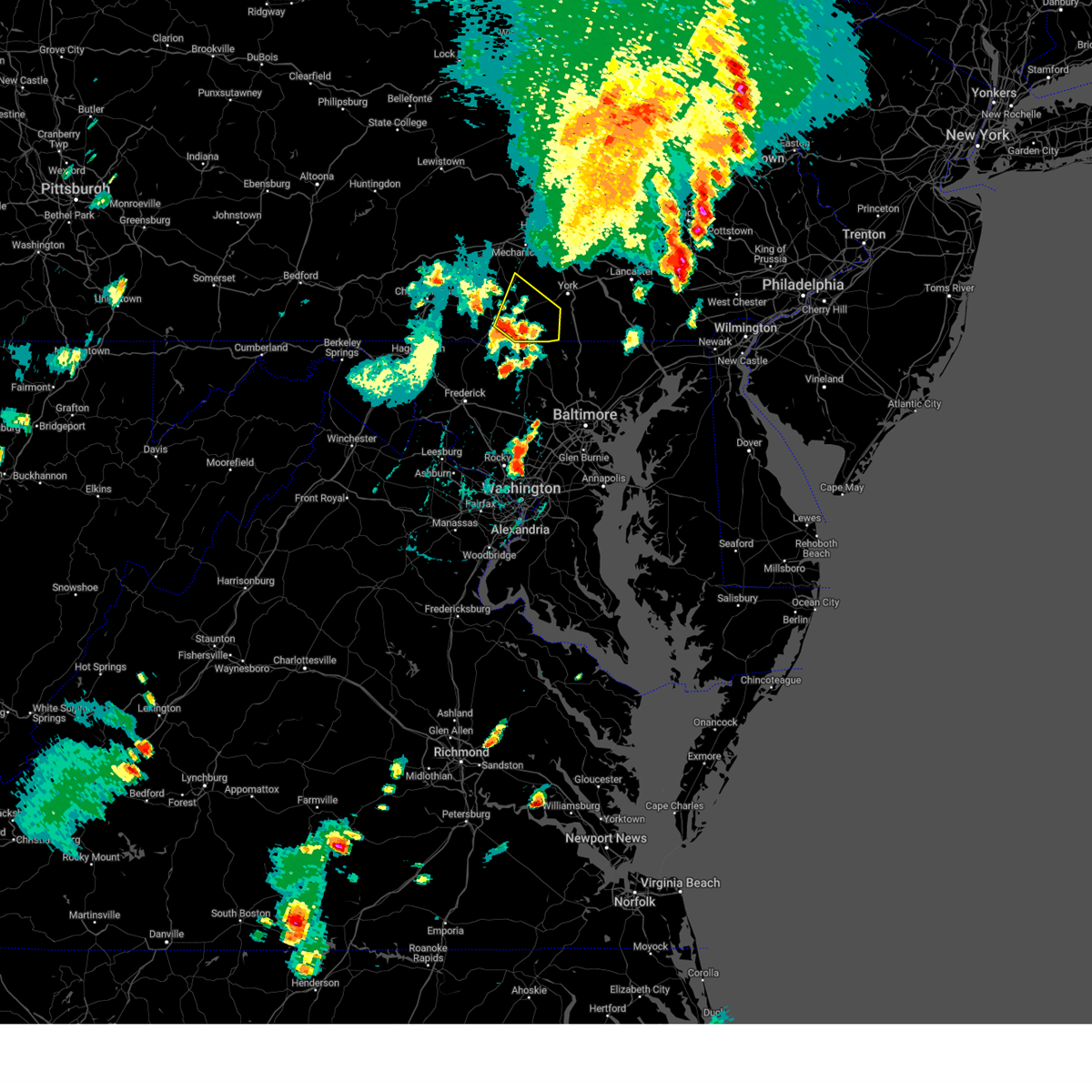 At 537 pm edt, a severe thunderstorm was located over mcsherrystown, moving northeast at 55 mph (radar indicated). Hazards include 60 mph wind gusts and penny size hail. expect damage to roofs, siding, and trees At 537 pm edt, a severe thunderstorm was located over mcsherrystown, moving northeast at 55 mph (radar indicated). Hazards include 60 mph wind gusts and penny size hail. expect damage to roofs, siding, and trees
|
| 9/7/2023 3:42 PM EDT |
 At 342 pm edt, severe thunderstorms were located along a line extending from lower allen to new oxford to near manchester, moving northeast at 25 mph (radar indicated). Hazards include 60 mph wind gusts and quarter size hail. Hail damage to vehicles is expected. Expect wind damage to roofs, siding, and trees. At 342 pm edt, severe thunderstorms were located along a line extending from lower allen to new oxford to near manchester, moving northeast at 25 mph (radar indicated). Hazards include 60 mph wind gusts and quarter size hail. Hail damage to vehicles is expected. Expect wind damage to roofs, siding, and trees.
|
| 8/25/2023 2:42 AM EDT |
 At 242 am edt, severe thunderstorms were located along a line extending from near uniontown to mannington, moving southeast at 45 mph (radar indicated). Hazards include 60 mph wind gusts and quarter size hail. Minor hail damage to vehicles is possible. Expect wind damage to trees and power lines, resulting in some power outages. At 242 am edt, severe thunderstorms were located along a line extending from near uniontown to mannington, moving southeast at 45 mph (radar indicated). Hazards include 60 mph wind gusts and quarter size hail. Minor hail damage to vehicles is possible. Expect wind damage to trees and power lines, resulting in some power outages.
|
| 8/25/2023 2:35 AM EDT |
 At 234 am edt, severe thunderstorms were located along a line extending from near ligonier to near connellsville to near uniontown, moving east at 40 mph (radar indicated). Hazards include 60 mph wind gusts and half dollar size hail. Minor hail damage to vehicles is possible. expect wind damage to trees and power lines, resulting in some power outages. locations impacted include, uniontown, latrobe, connellsville, mount pleasant, scottdale, mcchesneytown-loyalhanna, lawson heights, south connellsville, farmington, ligonier, seven springs, calumet-norvelt, isabella, dunbar, everson, republic, vanderbilt, dawson, youngstown, and new salem. hail threat, radar indicated max hail size, 1. 25 in wind threat, radar indicated max wind gust, 60 mph. At 234 am edt, severe thunderstorms were located along a line extending from near ligonier to near connellsville to near uniontown, moving east at 40 mph (radar indicated). Hazards include 60 mph wind gusts and half dollar size hail. Minor hail damage to vehicles is possible. expect wind damage to trees and power lines, resulting in some power outages. locations impacted include, uniontown, latrobe, connellsville, mount pleasant, scottdale, mcchesneytown-loyalhanna, lawson heights, south connellsville, farmington, ligonier, seven springs, calumet-norvelt, isabella, dunbar, everson, republic, vanderbilt, dawson, youngstown, and new salem. hail threat, radar indicated max hail size, 1. 25 in wind threat, radar indicated max wind gust, 60 mph.
|
| 8/25/2023 2:22 AM EDT |
 At 222 am edt, severe thunderstorms were located along a line extending from near lawson heights to near perryopolis to near brownsville, moving east at 40 mph (radar indicated). Hazards include 60 mph wind gusts and quarter size hail. Minor hail damage to vehicles is possible. Expect wind damage to trees and power lines, resulting in some power outages. At 222 am edt, severe thunderstorms were located along a line extending from near lawson heights to near perryopolis to near brownsville, moving east at 40 mph (radar indicated). Hazards include 60 mph wind gusts and quarter size hail. Minor hail damage to vehicles is possible. Expect wind damage to trees and power lines, resulting in some power outages.
|
| 8/12/2023 9:28 PM EDT |
 At 928 pm edt, a severe thunderstorm was located over uniontown, moving east at 40 mph (radar indicated). Hazards include 60 mph wind gusts and nickel size hail. expect damage to trees and power lines, resulting in some power outages At 928 pm edt, a severe thunderstorm was located over uniontown, moving east at 40 mph (radar indicated). Hazards include 60 mph wind gusts and nickel size hail. expect damage to trees and power lines, resulting in some power outages
|
| 8/12/2023 9:23 PM EDT |
 At 922 pm edt, a confirmed tornado was located near uniontown, moving east at 35 mph (emergency management confirmed tornado). Hazards include damaging tornado. Flying debris will be dangerous to those caught without shelter. mobile homes will be damaged or destroyed. damage to roofs, windows, and vehicles will occur. tree damage is likely. this tornado will be near, uniontown around 930 pm edt. Other locations impacted by this tornadic thunderstorm include new salem, republic, and fairchance. At 922 pm edt, a confirmed tornado was located near uniontown, moving east at 35 mph (emergency management confirmed tornado). Hazards include damaging tornado. Flying debris will be dangerous to those caught without shelter. mobile homes will be damaged or destroyed. damage to roofs, windows, and vehicles will occur. tree damage is likely. this tornado will be near, uniontown around 930 pm edt. Other locations impacted by this tornadic thunderstorm include new salem, republic, and fairchance.
|
| 8/12/2023 9:08 PM EDT |
 At 908 pm edt, a severe thunderstorm capable of producing a tornado was located near fredericktown-millsboro, or 12 miles east of waynesburg, moving east at 35 mph (radar indicated rotation). Hazards include tornado. Flying debris will be dangerous to those caught without shelter. mobile homes will be damaged or destroyed. damage to roofs, windows, and vehicles will occur. tree damage is likely. this dangerous storm will be near, uniontown around 920 pm edt. Other locations impacted by this tornadic thunderstorm include fairchance, new salem, isabella, rices landing, republic, nemacolin, and centerville. At 908 pm edt, a severe thunderstorm capable of producing a tornado was located near fredericktown-millsboro, or 12 miles east of waynesburg, moving east at 35 mph (radar indicated rotation). Hazards include tornado. Flying debris will be dangerous to those caught without shelter. mobile homes will be damaged or destroyed. damage to roofs, windows, and vehicles will occur. tree damage is likely. this dangerous storm will be near, uniontown around 920 pm edt. Other locations impacted by this tornadic thunderstorm include fairchance, new salem, isabella, rices landing, republic, nemacolin, and centerville.
|
| 8/12/2023 9:07 PM EDT |
 At 907 pm edt, a severe thunderstorm was located over brownsville, or 12 miles northwest of uniontown, moving east at 30 mph (radar indicated). Hazards include 60 mph wind gusts and quarter size hail. Minor hail damage to vehicles is possible. expect wind damage to trees and power lines, resulting in some power outages. Locations impacted include, uniontown, california, bentleyville, brownsville, fredericktown-millsboro, perryopolis, speers, isabella, belle vernon, ellsworth, lynnwood-pricedale, west brownsville, roscoe, deemston, cokeburg, fayette city, newell, allenport, stockdale, and republic. At 907 pm edt, a severe thunderstorm was located over brownsville, or 12 miles northwest of uniontown, moving east at 30 mph (radar indicated). Hazards include 60 mph wind gusts and quarter size hail. Minor hail damage to vehicles is possible. expect wind damage to trees and power lines, resulting in some power outages. Locations impacted include, uniontown, california, bentleyville, brownsville, fredericktown-millsboro, perryopolis, speers, isabella, belle vernon, ellsworth, lynnwood-pricedale, west brownsville, roscoe, deemston, cokeburg, fayette city, newell, allenport, stockdale, and republic.
|
| 8/12/2023 9:06 PM EDT |
 At 906 pm edt, a severe thunderstorm was located over brownsville, or 13 miles northwest of uniontown, moving east at 30 mph (radar indicated). Hazards include 60 mph wind gusts and quarter size hail. Minor hail damage to vehicles is possible. expect wind damage to trees and power lines, resulting in some power outages. locations impacted include, uniontown, california, bentleyville, brownsville, fredericktown-millsboro, perryopolis, speers, isabella, belle vernon, ellsworth, lynnwood-pricedale, west brownsville, roscoe, deemston, cokeburg, fayette city, newell, allenport, stockdale, and republic. hail threat, radar indicated max hail size, 1. 00 in wind threat, radar indicated max wind gust, 60 mph. At 906 pm edt, a severe thunderstorm was located over brownsville, or 13 miles northwest of uniontown, moving east at 30 mph (radar indicated). Hazards include 60 mph wind gusts and quarter size hail. Minor hail damage to vehicles is possible. expect wind damage to trees and power lines, resulting in some power outages. locations impacted include, uniontown, california, bentleyville, brownsville, fredericktown-millsboro, perryopolis, speers, isabella, belle vernon, ellsworth, lynnwood-pricedale, west brownsville, roscoe, deemston, cokeburg, fayette city, newell, allenport, stockdale, and republic. hail threat, radar indicated max hail size, 1. 00 in wind threat, radar indicated max wind gust, 60 mph.
|
| 8/12/2023 8:52 PM EDT |
 At 851 pm edt, a severe thunderstorm was located near fredericktown-millsboro, or 12 miles northeast of waynesburg, moving east at 30 mph (radar indicated). Hazards include 60 mph wind gusts and half dollar size hail. Minor hail damage to vehicles is possible. Expect wind damage to trees and power lines, resulting in some power outages. At 851 pm edt, a severe thunderstorm was located near fredericktown-millsboro, or 12 miles northeast of waynesburg, moving east at 30 mph (radar indicated). Hazards include 60 mph wind gusts and half dollar size hail. Minor hail damage to vehicles is possible. Expect wind damage to trees and power lines, resulting in some power outages.
|
| 8/7/2023 5:10 PM EDT |
 At 509 pm edt, severe thunderstorms were located along a line extending from dillsburg to codorus to near hampstead, moving east at 45 mph (radar indicated). Hazards include 70 mph wind gusts and quarter size hail. Hail damage to vehicles is expected. expect considerable tree damage. Wind damage is also likely to mobile homes, roofs, and outbuildings. At 509 pm edt, severe thunderstorms were located along a line extending from dillsburg to codorus to near hampstead, moving east at 45 mph (radar indicated). Hazards include 70 mph wind gusts and quarter size hail. Hail damage to vehicles is expected. expect considerable tree damage. Wind damage is also likely to mobile homes, roofs, and outbuildings.
|
| 8/7/2023 4:40 PM EDT |
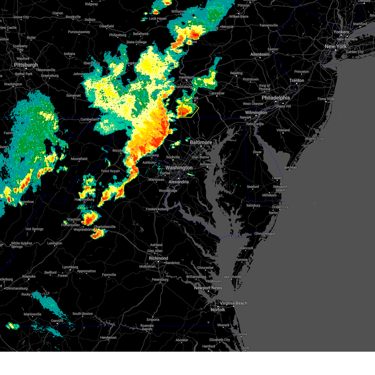 At 440 pm edt, a severe thunderstorm was located over pennville, moving east at 20 mph (radar indicated). Hazards include 60 mph wind gusts and quarter size hail. Hail damage to vehicles is expected. Expect wind damage to roofs, siding, and trees. At 440 pm edt, a severe thunderstorm was located over pennville, moving east at 20 mph (radar indicated). Hazards include 60 mph wind gusts and quarter size hail. Hail damage to vehicles is expected. Expect wind damage to roofs, siding, and trees.
|
| 7/21/2023 1:48 AM EDT |
 At 147 am edt, severe thunderstorms were located along a line extending from fredericksburg to annville to lawn to bainbridge to shiloh to near parkville, moving east at 20 mph (radar indicated). Hazards include 60 mph wind gusts. Expect damage to roofs, siding, and trees. severe thunderstorms will be near, annville, elizabethtown and bainbridge around 150 am edt. cornwall, lebanon and myerstown around 200 am edt. spry, dallastown and mount joy around 210 am edt. red lion, columbia and manheim around 220 am edt. lititz, mountville and kleinfeltersville around 230 am edt. other locations impacted by these severe thunderstorms include york haven, buck, east prospect, bowmansville and peach bottom. this includes the following interstates, the pennsylvania turnpike from mile markers 256 to 295. interstate 78 from mile markers 7 to 8. interstate 83 from mile markers 1 to 27. hail threat, radar indicated max hail size, <. 75 in wind threat, radar indicated max wind gust, 60 mph. At 147 am edt, severe thunderstorms were located along a line extending from fredericksburg to annville to lawn to bainbridge to shiloh to near parkville, moving east at 20 mph (radar indicated). Hazards include 60 mph wind gusts. Expect damage to roofs, siding, and trees. severe thunderstorms will be near, annville, elizabethtown and bainbridge around 150 am edt. cornwall, lebanon and myerstown around 200 am edt. spry, dallastown and mount joy around 210 am edt. red lion, columbia and manheim around 220 am edt. lititz, mountville and kleinfeltersville around 230 am edt. other locations impacted by these severe thunderstorms include york haven, buck, east prospect, bowmansville and peach bottom. this includes the following interstates, the pennsylvania turnpike from mile markers 256 to 295. interstate 78 from mile markers 7 to 8. interstate 83 from mile markers 1 to 27. hail threat, radar indicated max hail size, <. 75 in wind threat, radar indicated max wind gust, 60 mph.
|
| 6/26/2023 7:08 PM EDT |
 At 707 pm edt, a severe thunderstorm was located near stewartstown, moving north at 30 mph (radar indicated). Hazards include 60 mph wind gusts and quarter size hail. Hail damage to vehicles is expected. Expect wind damage to roofs, siding, and trees. At 707 pm edt, a severe thunderstorm was located near stewartstown, moving north at 30 mph (radar indicated). Hazards include 60 mph wind gusts and quarter size hail. Hail damage to vehicles is expected. Expect wind damage to roofs, siding, and trees.
|
| 4/22/2023 2:33 PM EDT |
 At 233 pm edt, a severe thunderstorm was located over codorus, moving north at 50 mph (radar indicated). Hazards include 60 mph wind gusts and quarter size hail. Hail damage to vehicles is expected. expect wind damage to roofs, siding, and trees. this severe thunderstorm will be near, york airport and jacobus around 240 pm edt. weigelstown, york and spry around 250 pm edt. manchester, mount wolf and valley green around 300 pm edt. other locations impacted by this severe thunderstorm include york haven, seven valleys, capital city airport, glenville and loganville. this includes the following interstates, the pennsylvania turnpike from mile markers 242 to 245. interstate 83 from mile markers 11 to 39. hail threat, radar indicated max hail size, 1. 00 in wind threat, radar indicated max wind gust, 60 mph. At 233 pm edt, a severe thunderstorm was located over codorus, moving north at 50 mph (radar indicated). Hazards include 60 mph wind gusts and quarter size hail. Hail damage to vehicles is expected. expect wind damage to roofs, siding, and trees. this severe thunderstorm will be near, york airport and jacobus around 240 pm edt. weigelstown, york and spry around 250 pm edt. manchester, mount wolf and valley green around 300 pm edt. other locations impacted by this severe thunderstorm include york haven, seven valleys, capital city airport, glenville and loganville. this includes the following interstates, the pennsylvania turnpike from mile markers 242 to 245. interstate 83 from mile markers 11 to 39. hail threat, radar indicated max hail size, 1. 00 in wind threat, radar indicated max wind gust, 60 mph.
|
| 4/1/2023 5:39 PM EDT |
 At 538 pm edt, severe thunderstorms were located along a line extending from adamstown to lancaster to jacobus, moving east at 40 mph (radar indicated). Hazards include 60 mph wind gusts. Expect damage to roofs, siding, and trees. locations impacted include, lancaster, york, hanover, ephrata, weigelstown, columbia, lititz, millersville, willow street, mount joy, parkville and red lion. this includes the following interstates, the pennsylvania turnpike from mile markers 273 to 295. interstate 83 from mile markers 1 to 24. hail threat, radar indicated max hail size, <. 75 in wind threat, radar indicated max wind gust, 60 mph. At 538 pm edt, severe thunderstorms were located along a line extending from adamstown to lancaster to jacobus, moving east at 40 mph (radar indicated). Hazards include 60 mph wind gusts. Expect damage to roofs, siding, and trees. locations impacted include, lancaster, york, hanover, ephrata, weigelstown, columbia, lititz, millersville, willow street, mount joy, parkville and red lion. this includes the following interstates, the pennsylvania turnpike from mile markers 273 to 295. interstate 83 from mile markers 1 to 24. hail threat, radar indicated max hail size, <. 75 in wind threat, radar indicated max wind gust, 60 mph.
|
| 4/1/2023 5:33 PM EDT |
 At 531 pm edt, severe thunderstorms were located along a line extending from myerstown to east petersburg to spring grove, moving east at 60 mph (radar indicated). Hazards include 60 mph wind gusts. Expect damage to roofs, siding, and trees. locations impacted include, lancaster, york, lebanon, hanover, ephrata, weigelstown, elizabethtown, columbia, lititz, millersville, willow street and mount joy. this includes the following interstates, the pennsylvania turnpike from mile markers 253 to 295. interstate 78 from mile markers 0 to 8. interstate 81 from mile markers 86 to 102. interstate 83 from mile markers 1 to 32. hail threat, radar indicated max hail size, <. 75 in wind threat, radar indicated max wind gust, 60 mph. At 531 pm edt, severe thunderstorms were located along a line extending from myerstown to east petersburg to spring grove, moving east at 60 mph (radar indicated). Hazards include 60 mph wind gusts. Expect damage to roofs, siding, and trees. locations impacted include, lancaster, york, lebanon, hanover, ephrata, weigelstown, elizabethtown, columbia, lititz, millersville, willow street and mount joy. this includes the following interstates, the pennsylvania turnpike from mile markers 253 to 295. interstate 78 from mile markers 0 to 8. interstate 81 from mile markers 86 to 102. interstate 83 from mile markers 1 to 32. hail threat, radar indicated max hail size, <. 75 in wind threat, radar indicated max wind gust, 60 mph.
|
| 4/1/2023 5:16 PM EDT |
 At 516 pm edt, severe thunderstorms were located along a line extending from pine grove to bonneauville, moving east at 40 mph (radar indicated). Hazards include 60 mph wind gusts. expect damage to roofs, siding, and trees At 516 pm edt, severe thunderstorms were located along a line extending from pine grove to bonneauville, moving east at 40 mph (radar indicated). Hazards include 60 mph wind gusts. expect damage to roofs, siding, and trees
|
| 8/1/2022 7:16 PM EDT |
 At 715 pm edt, a severe thunderstorm was located near brownsville, or 11 miles northwest of uniontown, moving east at 10 mph (radar indicated). Hazards include 60 mph wind gusts and quarter size hail. Hail damage to vehicles is expected. Expect wind damage to roofs, siding, and trees. At 715 pm edt, a severe thunderstorm was located near brownsville, or 11 miles northwest of uniontown, moving east at 10 mph (radar indicated). Hazards include 60 mph wind gusts and quarter size hail. Hail damage to vehicles is expected. Expect wind damage to roofs, siding, and trees.
|
| 8/1/2022 7:06 PM EDT |
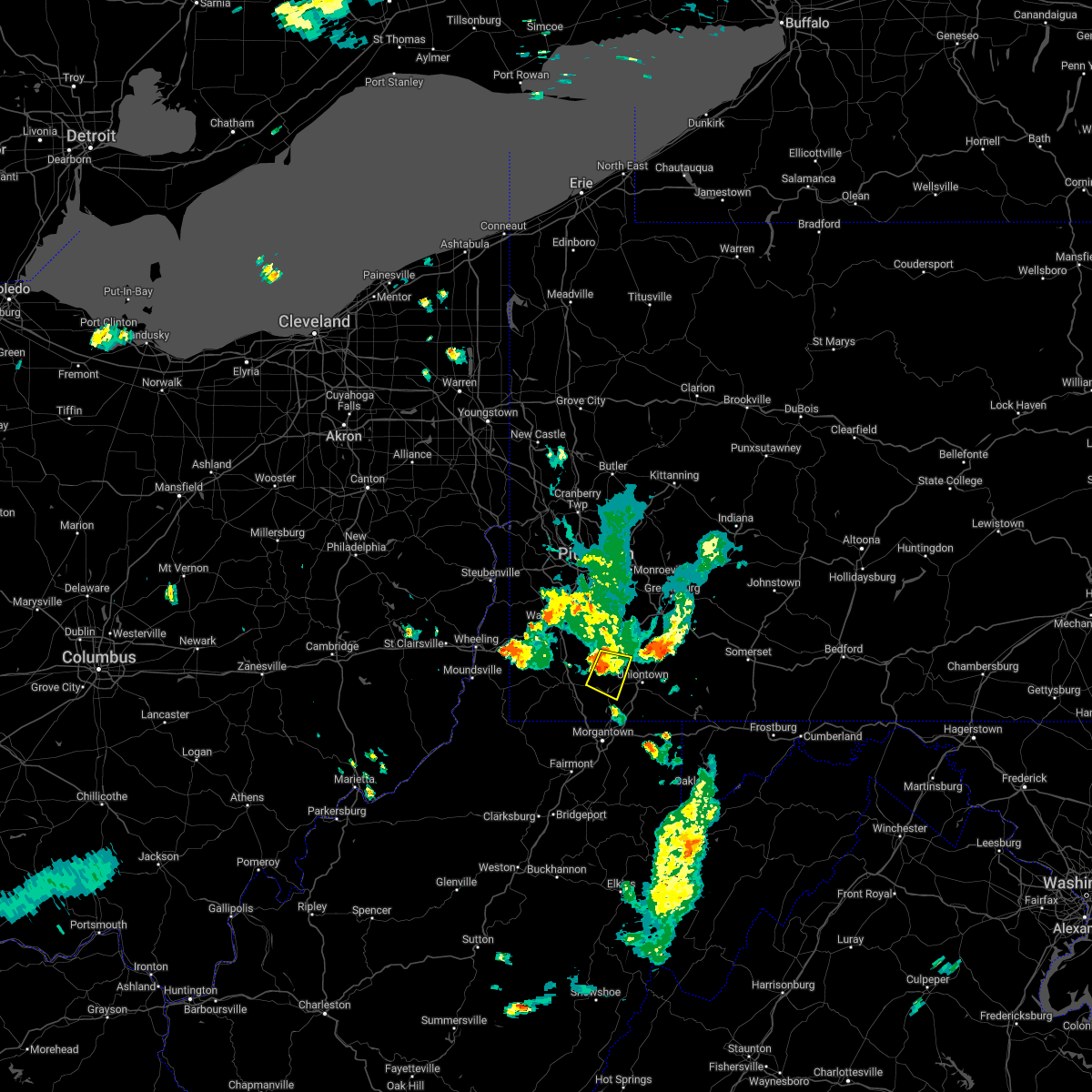 At 706 pm edt, a severe thunderstorm was located near fairdale, or 11 miles west of uniontown, moving east at 35 mph (radar indicated). Hazards include quarter size hail. Damage to vehicles is expected. locations impacted include, california, masontown, brownsville, fredericktown-millsboro, fairdale, isabella, west brownsville, republic, nemacolin, carmichaels, rices landing, and grindstone. hail threat, radar indicated max hail size, 1. 00 in wind threat, radar indicated max wind gust, <50 mph. At 706 pm edt, a severe thunderstorm was located near fairdale, or 11 miles west of uniontown, moving east at 35 mph (radar indicated). Hazards include quarter size hail. Damage to vehicles is expected. locations impacted include, california, masontown, brownsville, fredericktown-millsboro, fairdale, isabella, west brownsville, republic, nemacolin, carmichaels, rices landing, and grindstone. hail threat, radar indicated max hail size, 1. 00 in wind threat, radar indicated max wind gust, <50 mph.
|
| 8/1/2022 6:48 PM EDT |
 At 648 pm edt, a severe thunderstorm was located near fredericktown-millsboro, or 9 miles north of waynesburg, moving east at 20 mph (radar indicated). Hazards include quarter size hail. damage to vehicles is expected At 648 pm edt, a severe thunderstorm was located near fredericktown-millsboro, or 9 miles north of waynesburg, moving east at 20 mph (radar indicated). Hazards include quarter size hail. damage to vehicles is expected
|
| 7/24/2022 8:41 AM EDT |
 The severe thunderstorm warning for southeastern washington, eastern greene and southwestern fayette counties will expire at 845 am edt, the storm which prompted the warning has weakened below severe limits, and no longer poses an immediate threat to life or property. therefore, the warning will be allowed to expire. however gusty winds are still possible with this thunderstorm. The severe thunderstorm warning for southeastern washington, eastern greene and southwestern fayette counties will expire at 845 am edt, the storm which prompted the warning has weakened below severe limits, and no longer poses an immediate threat to life or property. therefore, the warning will be allowed to expire. however gusty winds are still possible with this thunderstorm.
|
| 7/24/2022 8:25 AM EDT |
 At 825 am edt, a severe thunderstorm was located over fairdale, or 11 miles east of waynesburg, moving east at 25 mph (radar indicated). Hazards include 60 mph wind gusts and penny size hail. Expect damage to trees and power lines, resulting in some power outages. locations impacted include, uniontown, masontown, fredericktown-millsboro, fairdale, jefferson boro, point marion, fairchance, isabella, smithfield, deemston, bobtown, and republic. hail threat, radar indicated max hail size, 0. 75 in wind threat, radar indicated max wind gust, 60 mph. At 825 am edt, a severe thunderstorm was located over fairdale, or 11 miles east of waynesburg, moving east at 25 mph (radar indicated). Hazards include 60 mph wind gusts and penny size hail. Expect damage to trees and power lines, resulting in some power outages. locations impacted include, uniontown, masontown, fredericktown-millsboro, fairdale, jefferson boro, point marion, fairchance, isabella, smithfield, deemston, bobtown, and republic. hail threat, radar indicated max hail size, 0. 75 in wind threat, radar indicated max wind gust, 60 mph.
|
| 7/24/2022 8:08 AM EDT |
 At 808 am edt, a severe thunderstorm was located over fairdale, or 11 miles east of waynesburg, moving east at 25 mph (radar indicated). Hazards include 60 mph wind gusts and penny size hail. expect damage to trees and power lines, resulting in some power outages At 808 am edt, a severe thunderstorm was located over fairdale, or 11 miles east of waynesburg, moving east at 25 mph (radar indicated). Hazards include 60 mph wind gusts and penny size hail. expect damage to trees and power lines, resulting in some power outages
|
| 7/24/2022 7:52 AM EDT |
 At 752 am edt, a severe thunderstorm was located over fredericktown-millsboro, or 11 miles northeast of waynesburg, moving east at 35 mph (radar indicated). Hazards include 60 mph wind gusts and penny size hail. Expect damage to trees and power lines, resulting in some power outages. locations impacted include, waynesburg, california, masontown, bentleyville, brownsville, fredericktown-millsboro, fairdale, jefferson boro, isabella, ellsworth, rogersville, and west brownsville. hail threat, radar indicated max hail size, 0. 75 in wind threat, radar indicated max wind gust, 60 mph. At 752 am edt, a severe thunderstorm was located over fredericktown-millsboro, or 11 miles northeast of waynesburg, moving east at 35 mph (radar indicated). Hazards include 60 mph wind gusts and penny size hail. Expect damage to trees and power lines, resulting in some power outages. locations impacted include, waynesburg, california, masontown, bentleyville, brownsville, fredericktown-millsboro, fairdale, jefferson boro, isabella, ellsworth, rogersville, and west brownsville. hail threat, radar indicated max hail size, 0. 75 in wind threat, radar indicated max wind gust, 60 mph.
|
| 7/24/2022 7:35 AM EDT |
 At 735 am edt, a severe thunderstorm was located near waynesburg, moving east at 30 mph (radar indicated). Hazards include 60 mph wind gusts and penny size hail. expect damage to trees and power lines, resulting in some power outages At 735 am edt, a severe thunderstorm was located near waynesburg, moving east at 30 mph (radar indicated). Hazards include 60 mph wind gusts and penny size hail. expect damage to trees and power lines, resulting in some power outages
|
| 7/23/2022 3:37 PM EDT |
 At 337 pm edt, a severe thunderstorm was located over morgantown, moving east at 50 mph (radar indicated). Hazards include 60 mph wind gusts and quarter size hail. Minor hail damage to vehicles is possible. Expect wind damage to trees and power lines, resulting in some power outages. At 337 pm edt, a severe thunderstorm was located over morgantown, moving east at 50 mph (radar indicated). Hazards include 60 mph wind gusts and quarter size hail. Minor hail damage to vehicles is possible. Expect wind damage to trees and power lines, resulting in some power outages.
|
| 7/23/2022 3:30 PM EDT |
 At 330 pm edt, a severe thunderstorm was located near delmont, or 8 miles north of greensburg, moving east at 40 mph (radar indicated). Hazards include 60 mph wind gusts and quarter size hail. Minor hail damage to vehicles is possible. expect wind damage to trees and power lines, resulting in some power outages. locations impacted include, pittsburgh, penn hills, monroeville, greensburg, mckeesport, uniontown, jeannette, connellsville, vandergrift, waynesburg, apollo, and plum. hail threat, radar indicated max hail size, 1. 00 in wind threat, radar indicated max wind gust, 60 mph. At 330 pm edt, a severe thunderstorm was located near delmont, or 8 miles north of greensburg, moving east at 40 mph (radar indicated). Hazards include 60 mph wind gusts and quarter size hail. Minor hail damage to vehicles is possible. expect wind damage to trees and power lines, resulting in some power outages. locations impacted include, pittsburgh, penn hills, monroeville, greensburg, mckeesport, uniontown, jeannette, connellsville, vandergrift, waynesburg, apollo, and plum. hail threat, radar indicated max hail size, 1. 00 in wind threat, radar indicated max wind gust, 60 mph.
|
| 7/23/2022 3:02 PM EDT |
 At 302 pm edt, a severe thunderstorm was located over north braddock, or near mckeesport, moving east at 40 mph (radar indicated). Hazards include 70 mph wind gusts and quarter size hail. Minor hail damage to vehicles is possible. trees snapped and uprooted. Power outages can be expected. At 302 pm edt, a severe thunderstorm was located over north braddock, or near mckeesport, moving east at 40 mph (radar indicated). Hazards include 70 mph wind gusts and quarter size hail. Minor hail damage to vehicles is possible. trees snapped and uprooted. Power outages can be expected.
|
| 7/1/2022 2:42 PM EDT |
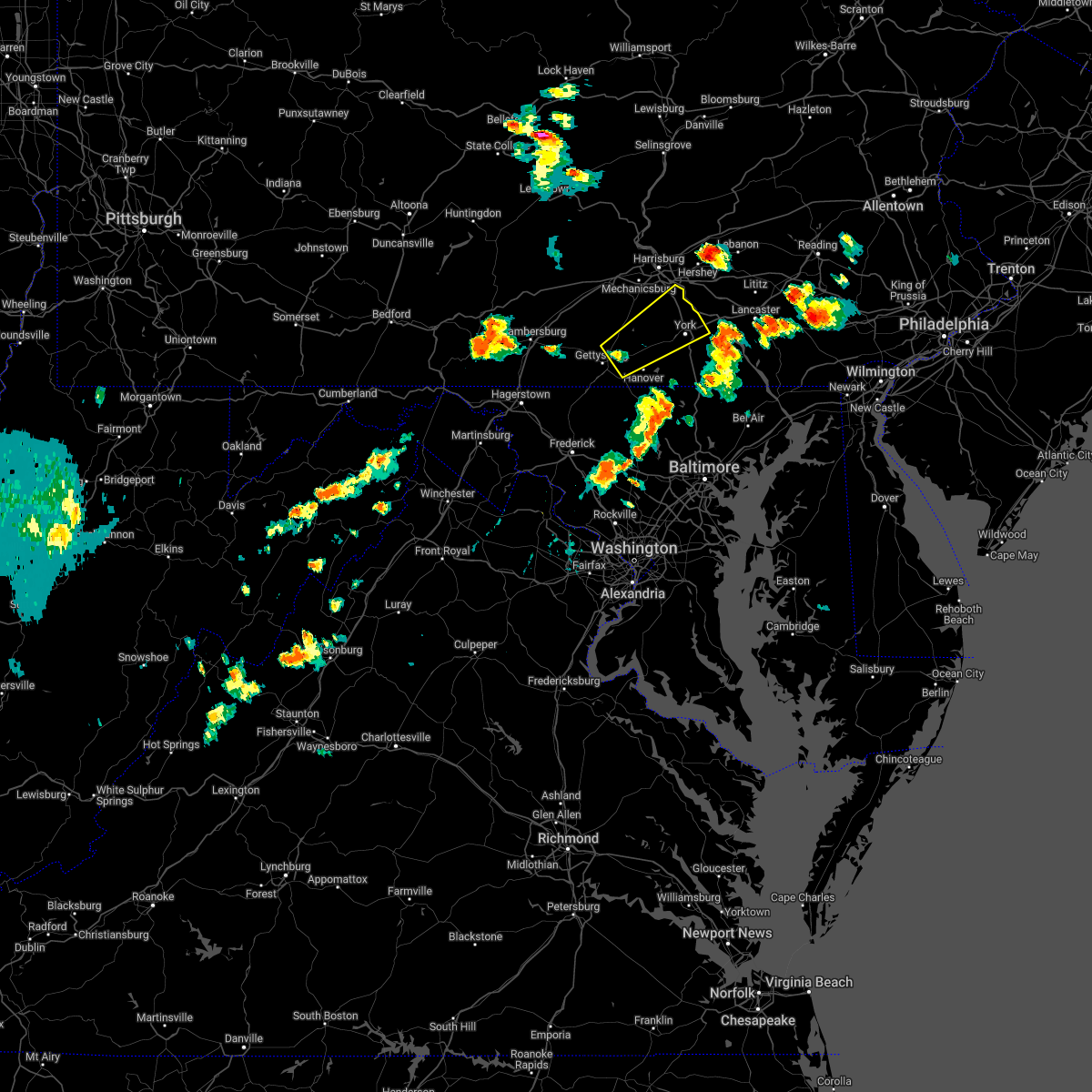 At 241 pm edt, a severe thunderstorm was located over new oxford, moving northeast at 25 mph (radar indicated). Hazards include 60 mph wind gusts and quarter size hail. Hail damage to vehicles is expected. expect wind damage to roofs, siding, and trees. this severe thunderstorm will be near, hampton around 250 pm edt. east berlin and lake meade around 300 pm edt. york airport and spring grove around 310 pm edt. weigelstown, dover and shiloh around 320 pm edt. york, emigsville and manchester around 330 pm edt. other locations impacted by this severe thunderstorm include york haven, heidlersburg, abbottstown, new salem and lewisberry. this includes interstate 83 from mile markers 15 to 34. hail threat, radar indicated max hail size, 1. 00 in wind threat, radar indicated max wind gust, 60 mph. At 241 pm edt, a severe thunderstorm was located over new oxford, moving northeast at 25 mph (radar indicated). Hazards include 60 mph wind gusts and quarter size hail. Hail damage to vehicles is expected. expect wind damage to roofs, siding, and trees. this severe thunderstorm will be near, hampton around 250 pm edt. east berlin and lake meade around 300 pm edt. york airport and spring grove around 310 pm edt. weigelstown, dover and shiloh around 320 pm edt. york, emigsville and manchester around 330 pm edt. other locations impacted by this severe thunderstorm include york haven, heidlersburg, abbottstown, new salem and lewisberry. this includes interstate 83 from mile markers 15 to 34. hail threat, radar indicated max hail size, 1. 00 in wind threat, radar indicated max wind gust, 60 mph.
|
| 6/22/2022 6:26 PM EDT |
 At 626 pm edt, a severe thunderstorm was located near masontown, or near uniontown, moving southeast at 30 mph (radar indicated). Hazards include 60 mph wind gusts. Expect damage to trees and power lines, resulting in some power outages. locations impacted include, uniontown, masontown, farmington, point marion, fairchance, smithfield, nemacolin, new salem, markleysburg, greensboro, brandonville, and chalkhill. hail threat, radar indicated max hail size, <. 75 in wind threat, radar indicated max wind gust, 60 mph. At 626 pm edt, a severe thunderstorm was located near masontown, or near uniontown, moving southeast at 30 mph (radar indicated). Hazards include 60 mph wind gusts. Expect damage to trees and power lines, resulting in some power outages. locations impacted include, uniontown, masontown, farmington, point marion, fairchance, smithfield, nemacolin, new salem, markleysburg, greensboro, brandonville, and chalkhill. hail threat, radar indicated max hail size, <. 75 in wind threat, radar indicated max wind gust, 60 mph.
|
| 6/22/2022 6:15 PM EDT |
 At 615 pm edt, a severe thunderstorm was located near fairdale, or 9 miles west of uniontown, moving southeast at 30 mph (radar indicated). Hazards include 60 mph wind gusts. Expect damage to trees and power lines, resulting in some power outages. locations impacted include, morgantown, uniontown, masontown, farmington, fairdale, point marion, brookhaven, fairchance, isabella, smithfield, bobtown, and republic. hail threat, radar indicated max hail size, <. 75 in wind threat, radar indicated max wind gust, 60 mph. At 615 pm edt, a severe thunderstorm was located near fairdale, or 9 miles west of uniontown, moving southeast at 30 mph (radar indicated). Hazards include 60 mph wind gusts. Expect damage to trees and power lines, resulting in some power outages. locations impacted include, morgantown, uniontown, masontown, farmington, fairdale, point marion, brookhaven, fairchance, isabella, smithfield, bobtown, and republic. hail threat, radar indicated max hail size, <. 75 in wind threat, radar indicated max wind gust, 60 mph.
|
| 6/22/2022 6:02 PM EDT |
 At 602 pm edt, a cluster of severe thunderstorms were located over fredericktown-millsboro, or 11 miles east of waynesburg, moving southeast at 30 mph (radar indicated). Hazards include 60 mph wind gusts. Expect damage to trees and power lines, resulting in some power outages. locations impacted include, morgantown, uniontown, waynesburg, california, masontown, brownsville, fredericktown-millsboro, farmington, fairdale, jefferson boro, point marion, and brookhaven. hail threat, radar indicated max hail size, <. 75 in wind threat, radar indicated max wind gust, 60 mph. At 602 pm edt, a cluster of severe thunderstorms were located over fredericktown-millsboro, or 11 miles east of waynesburg, moving southeast at 30 mph (radar indicated). Hazards include 60 mph wind gusts. Expect damage to trees and power lines, resulting in some power outages. locations impacted include, morgantown, uniontown, waynesburg, california, masontown, brownsville, fredericktown-millsboro, farmington, fairdale, jefferson boro, point marion, and brookhaven. hail threat, radar indicated max hail size, <. 75 in wind threat, radar indicated max wind gust, 60 mph.
|
| 6/22/2022 5:53 PM EDT |
 At 552 pm edt, a cluster of severe thunderstorms was centered over fredericktown-millsboro, or 9 miles northeast of waynesburg, moving southeast at 30 mph (radar indicated). Hazards include 60 mph wind gusts. expect damage to trees and power lines, resulting in some power outages At 552 pm edt, a cluster of severe thunderstorms was centered over fredericktown-millsboro, or 9 miles northeast of waynesburg, moving southeast at 30 mph (radar indicated). Hazards include 60 mph wind gusts. expect damage to trees and power lines, resulting in some power outages
|
| 6/14/2022 5:27 AM EDT |
 At 527 am edt, severe thunderstorms were located along a line extending from siddonsburg to near dover to east berlin to manchester, moving east at 35 mph (radar indicated). Hazards include 60 mph wind gusts and nickel size hail. Expect damage to roofs, siding, and trees. locations impacted include, york, hanover, weigelstown, parkville, spry, dallastown, hampton, shiloh, east york, west york, littlestown and shrewsbury. this includes interstate 83 from mile markers 6 to 24. hail threat, radar indicated max hail size, 0. 88 in wind threat, radar indicated max wind gust, 60 mph. At 527 am edt, severe thunderstorms were located along a line extending from siddonsburg to near dover to east berlin to manchester, moving east at 35 mph (radar indicated). Hazards include 60 mph wind gusts and nickel size hail. Expect damage to roofs, siding, and trees. locations impacted include, york, hanover, weigelstown, parkville, spry, dallastown, hampton, shiloh, east york, west york, littlestown and shrewsbury. this includes interstate 83 from mile markers 6 to 24. hail threat, radar indicated max hail size, 0. 88 in wind threat, radar indicated max wind gust, 60 mph.
|
| 6/14/2022 4:57 AM EDT |
 At 456 am edt, severe thunderstorms were located along a line extending from walnut bottom to pine grove furnace to gettysburg to emmitsburg, moving east at 30 mph (radar indicated). Hazards include 60 mph wind gusts and nickel size hail. expect damage to roofs, siding, and trees At 456 am edt, severe thunderstorms were located along a line extending from walnut bottom to pine grove furnace to gettysburg to emmitsburg, moving east at 30 mph (radar indicated). Hazards include 60 mph wind gusts and nickel size hail. expect damage to roofs, siding, and trees
|
| 5/27/2022 1:27 PM EDT |
 The severe thunderstorm warning for york county will expire at 130 pm edt, the storm which prompted the warning has moved out of the area. therefore, the warning will be allowed to expire. a severe thunderstorm watch remains in effect until 700 pm edt for south central pennsylvania. to report severe weather, contact your nearest law enforcement agency. they will relay your report to the national weather service state college pa. The severe thunderstorm warning for york county will expire at 130 pm edt, the storm which prompted the warning has moved out of the area. therefore, the warning will be allowed to expire. a severe thunderstorm watch remains in effect until 700 pm edt for south central pennsylvania. to report severe weather, contact your nearest law enforcement agency. they will relay your report to the national weather service state college pa.
|
| 5/27/2022 12:33 PM EDT |
 At 1233 pm edt, a severe thunderstorm was located over new oxford, moving northeast at 50 mph (radar indicated). Hazards include 60 mph wind gusts. expect damage to roofs, siding, and trees At 1233 pm edt, a severe thunderstorm was located over new oxford, moving northeast at 50 mph (radar indicated). Hazards include 60 mph wind gusts. expect damage to roofs, siding, and trees
|
| 5/20/2022 2:16 PM EDT |
 At 216 pm edt, severe thunderstorms were located along a line extending from grantley to codorus to near glen rock, moving east at 45 mph (radar indicated). Hazards include 60 mph wind gusts and quarter size hail. Hail damage to vehicles is expected. expect wind damage to roofs, siding, and trees. severe thunderstorms will be near, spry, york and tyler run-queens gate around 220 pm edt. red lion, dallastown and yorkana around 230 pm edt. brogue, safe harbor and shenks ferry around 240 pm edt. other locations impacted by these severe thunderstorms include seven valleys, east prospect, winterstown, fawn grove and glenville. This includes interstate 83 from mile markers 0 to 20. At 216 pm edt, severe thunderstorms were located along a line extending from grantley to codorus to near glen rock, moving east at 45 mph (radar indicated). Hazards include 60 mph wind gusts and quarter size hail. Hail damage to vehicles is expected. expect wind damage to roofs, siding, and trees. severe thunderstorms will be near, spry, york and tyler run-queens gate around 220 pm edt. red lion, dallastown and yorkana around 230 pm edt. brogue, safe harbor and shenks ferry around 240 pm edt. other locations impacted by these severe thunderstorms include seven valleys, east prospect, winterstown, fawn grove and glenville. This includes interstate 83 from mile markers 0 to 20.
|
| 5/1/2022 8:43 PM EDT |
 At 843 pm edt, a severe thunderstorm was located over friendsville, or 12 miles northwest of bittinger, moving east at 50 mph (radar indicated). Hazards include 60 mph wind gusts and quarter size hail. Minor hail damage to vehicles is possible. expect wind damage to trees and power lines, resulting in some power outages. locations impacted include, morgantown, uniontown, connellsville, south connellsville, farmington, seven springs, brookhaven, fairchance, dunbar, smithfield, masontown, and republic. hail threat, radar indicated max hail size, 1. 00 in wind threat, radar indicated max wind gust, 60 mph. At 843 pm edt, a severe thunderstorm was located over friendsville, or 12 miles northwest of bittinger, moving east at 50 mph (radar indicated). Hazards include 60 mph wind gusts and quarter size hail. Minor hail damage to vehicles is possible. expect wind damage to trees and power lines, resulting in some power outages. locations impacted include, morgantown, uniontown, connellsville, south connellsville, farmington, seven springs, brookhaven, fairchance, dunbar, smithfield, masontown, and republic. hail threat, radar indicated max hail size, 1. 00 in wind threat, radar indicated max wind gust, 60 mph.
|
| 5/1/2022 8:32 PM EDT |
 At 832 pm edt, a severe thunderstorm was located 10 miles west of friendsville, or 13 miles north of kingwood, moving east at 50 mph (radar indicated). Hazards include 60 mph wind gusts and quarter size hail. Minor hail damage to vehicles is possible. expect wind damage to trees and power lines, resulting in some power outages. locations impacted include, morgantown, uniontown, connellsville, westover, kingwood, star city, south connellsville, farmington, fairdale, point marion, granville, and seven springs. hail threat, radar indicated max hail size, 1. 00 in wind threat, radar indicated max wind gust, 60 mph. At 832 pm edt, a severe thunderstorm was located 10 miles west of friendsville, or 13 miles north of kingwood, moving east at 50 mph (radar indicated). Hazards include 60 mph wind gusts and quarter size hail. Minor hail damage to vehicles is possible. expect wind damage to trees and power lines, resulting in some power outages. locations impacted include, morgantown, uniontown, connellsville, westover, kingwood, star city, south connellsville, farmington, fairdale, point marion, granville, and seven springs. hail threat, radar indicated max hail size, 1. 00 in wind threat, radar indicated max wind gust, 60 mph.
|
| 5/1/2022 8:15 PM EDT |
 At 815 pm edt, a severe thunderstorm was located over brookhaven, or near morgantown, moving east at 50 mph (radar indicated). Hazards include 60 mph wind gusts and nickel size hail. expect damage to trees and power lines, resulting in some power outages At 815 pm edt, a severe thunderstorm was located over brookhaven, or near morgantown, moving east at 50 mph (radar indicated). Hazards include 60 mph wind gusts and nickel size hail. expect damage to trees and power lines, resulting in some power outages
|
| 3/31/2022 7:54 PM EDT |
 The severe thunderstorm warning for southeastern adams, southeastern dauphin, lancaster, southern lebanon and york counties will expire at 800 pm edt, the storms which prompted the warning have moved out of the area. therefore, the warning will be allowed to expire. however gusty winds and heavy rain are still possible with these thunderstorms. a severe thunderstorm watch remains in effect until 1000 pm edt for south central pennsylvania. remember, a severe thunderstorm warning still remains in effect for eastern york, northern lancaster, and southern lebanon counties. The severe thunderstorm warning for southeastern adams, southeastern dauphin, lancaster, southern lebanon and york counties will expire at 800 pm edt, the storms which prompted the warning have moved out of the area. therefore, the warning will be allowed to expire. however gusty winds and heavy rain are still possible with these thunderstorms. a severe thunderstorm watch remains in effect until 1000 pm edt for south central pennsylvania. remember, a severe thunderstorm warning still remains in effect for eastern york, northern lancaster, and southern lebanon counties.
|
| 3/31/2022 7:39 PM EDT |
 At 738 pm edt, severe thunderstorms were located along a line extending from strausstown to glen rock, moving northeast at 65 mph (radar indicated). Hazards include 60 mph wind gusts and nickel size hail. Expect damage to roofs, siding, and trees. locations impacted include, lancaster, york, lebanon, hanover, ephrata, weigelstown, elizabethtown, columbia, lititz, millersville, mount joy and palmyra. this includes the following interstates, the pennsylvania turnpike from mile markers 255 to 291. interstate 78 from mile markers 6 to 7. Interstate 83 from mile markers 0 to 29. At 738 pm edt, severe thunderstorms were located along a line extending from strausstown to glen rock, moving northeast at 65 mph (radar indicated). Hazards include 60 mph wind gusts and nickel size hail. Expect damage to roofs, siding, and trees. locations impacted include, lancaster, york, lebanon, hanover, ephrata, weigelstown, elizabethtown, columbia, lititz, millersville, mount joy and palmyra. this includes the following interstates, the pennsylvania turnpike from mile markers 255 to 291. interstate 78 from mile markers 6 to 7. Interstate 83 from mile markers 0 to 29.
|
| 3/31/2022 7:20 PM EDT |
 At 720 pm edt, severe thunderstorms were located along a line extending from fredericksburg to littlestown, moving northeast at 65 mph (radar indicated). Hazards include 60 mph wind gusts and nickel size hail. expect damage to roofs, siding, and trees At 720 pm edt, severe thunderstorms were located along a line extending from fredericksburg to littlestown, moving northeast at 65 mph (radar indicated). Hazards include 60 mph wind gusts and nickel size hail. expect damage to roofs, siding, and trees
|
| 3/31/2022 7:05 PM EDT |
 At 704 pm edt, severe thunderstorms were located along a line extending from branchdale to pine grove to fredericksburg to harper tavern to hummelstown to near lake meade, moving northeast at 65 mph (radar indicated). Hazards include 60 mph wind gusts and penny size hail. Expect damage to roofs, siding, and trees. locations impacted include, harrisburg, york, lebanon, hanover, hershey, weigelstown, elizabethtown, mechanicsburg, middletown, camp hill, gettysburg and mount joy. this includes the following interstates, the pennsylvania turnpike from mile markers 234 to 271. interstate 78 from mile markers 0 to 8. interstate 81 near mile marker 60, and from mile markers 64 to 97. interstate 83 from mile markers 14 to 50. interstate 283 from mile markers 0 to 2. hail threat, radar indicated max hail size, 0. 75 in wind threat, radar indicated max wind gust, 60 mph. At 704 pm edt, severe thunderstorms were located along a line extending from branchdale to pine grove to fredericksburg to harper tavern to hummelstown to near lake meade, moving northeast at 65 mph (radar indicated). Hazards include 60 mph wind gusts and penny size hail. Expect damage to roofs, siding, and trees. locations impacted include, harrisburg, york, lebanon, hanover, hershey, weigelstown, elizabethtown, mechanicsburg, middletown, camp hill, gettysburg and mount joy. this includes the following interstates, the pennsylvania turnpike from mile markers 234 to 271. interstate 78 from mile markers 0 to 8. interstate 81 near mile marker 60, and from mile markers 64 to 97. interstate 83 from mile markers 14 to 50. interstate 283 from mile markers 0 to 2. hail threat, radar indicated max hail size, 0. 75 in wind threat, radar indicated max wind gust, 60 mph.
|
| 3/31/2022 6:33 PM EDT |
 At 632 pm edt, severe thunderstorms were located along a line extending from near rockville to harrisburg to shiremanstown to boiling springs to aspers to rouzerville, moving northeast at 65 mph (radar indicated). Hazards include 60 mph wind gusts and penny size hail. expect damage to roofs, siding, and trees At 632 pm edt, severe thunderstorms were located along a line extending from near rockville to harrisburg to shiremanstown to boiling springs to aspers to rouzerville, moving northeast at 65 mph (radar indicated). Hazards include 60 mph wind gusts and penny size hail. expect damage to roofs, siding, and trees
|
| 3/7/2022 8:20 PM EST |
 The severe thunderstorm warning for lancaster, southeastern york and southeastern lebanon counties will expire at 830 pm est, the storms which prompted the warning have weakened below severe limits, and no longer pose an immediate threat to life or property. therefore, the warning will be allowed to expire. however gusty winds are still possible with these thunderstorms. The severe thunderstorm warning for lancaster, southeastern york and southeastern lebanon counties will expire at 830 pm est, the storms which prompted the warning have weakened below severe limits, and no longer pose an immediate threat to life or property. therefore, the warning will be allowed to expire. however gusty winds are still possible with these thunderstorms.
|
| 3/7/2022 7:56 PM EST |
 At 755 pm est, severe thunderstorms were located along a line extending from timber hills to glen rock, moving east at 55 mph (radar indicated). Hazards include 60 mph wind gusts. Expect damage to roofs, siding, and trees. locations impacted include, lancaster, york, ephrata, elizabethtown, columbia, lititz, millersville, mount joy, red lion, new holland, manheim, akron, east york, willow street, leola, stonybrook-wilshire, paradise, west york, salunga-landisville and east petersburg. this includes the following interstates, the pennsylvania turnpike from mile markers 260 to 295. interstate 83 from mile markers 0 to 21. hail threat, radar indicated max hail size, <. 75 in wind threat, radar indicated max wind gust, 60 mph. At 755 pm est, severe thunderstorms were located along a line extending from timber hills to glen rock, moving east at 55 mph (radar indicated). Hazards include 60 mph wind gusts. Expect damage to roofs, siding, and trees. locations impacted include, lancaster, york, ephrata, elizabethtown, columbia, lititz, millersville, mount joy, red lion, new holland, manheim, akron, east york, willow street, leola, stonybrook-wilshire, paradise, west york, salunga-landisville and east petersburg. this includes the following interstates, the pennsylvania turnpike from mile markers 260 to 295. interstate 83 from mile markers 0 to 21. hail threat, radar indicated max hail size, <. 75 in wind threat, radar indicated max wind gust, 60 mph.
|
| 3/7/2022 7:33 PM EST |
 At 733 pm est, severe thunderstorms were located along a line extending from steelton to bonneauville, moving east at 55 mph (radar indicated). Hazards include 60 mph wind gusts. expect damage to roofs, siding, and trees At 733 pm est, severe thunderstorms were located along a line extending from steelton to bonneauville, moving east at 55 mph (radar indicated). Hazards include 60 mph wind gusts. expect damage to roofs, siding, and trees
|
| 3/7/2022 4:51 PM EST |
 At 450 pm est, severe thunderstorms were located along a line extending from 7 miles west of homer city to near uniontown, moving east at 55 mph (radar indicated). Hazards include 60 mph wind gusts. Expect damage to trees and power lines, resulting in some power outages. locations impacted include, greensburg, indiana, uniontown, jeannette, latrobe, connellsville, homer city, mount pleasant, scottdale, mcchesneytown-loyalhanna, blairsville, and youngwood. hail threat, radar indicated max hail size, <. 75 in wind threat, radar indicated max wind gust, 60 mph. At 450 pm est, severe thunderstorms were located along a line extending from 7 miles west of homer city to near uniontown, moving east at 55 mph (radar indicated). Hazards include 60 mph wind gusts. Expect damage to trees and power lines, resulting in some power outages. locations impacted include, greensburg, indiana, uniontown, jeannette, latrobe, connellsville, homer city, mount pleasant, scottdale, mcchesneytown-loyalhanna, blairsville, and youngwood. hail threat, radar indicated max hail size, <. 75 in wind threat, radar indicated max wind gust, 60 mph.
|
| 3/7/2022 4:28 PM EST |
 At 428 pm est, severe rated winds were located along a line extending from near leechburg to fredericktown-millsboro, moving east at 55 mph (radar indicated). Hazards include 60 mph wind gusts. expect damage to trees and power lines, resulting in some power outages At 428 pm est, severe rated winds were located along a line extending from near leechburg to fredericktown-millsboro, moving east at 55 mph (radar indicated). Hazards include 60 mph wind gusts. expect damage to trees and power lines, resulting in some power outages
|
| 8/18/2021 6:47 PM EDT |
 At 646 pm edt, severe thunderstorms were located along a line extending from near new buffalo to near dehart dam to linglestown to highspire to near emigsville to spring grove to hanover to near taneytown, moving northeast at 35 mph (radar indicated). Hazards include 60 mph wind gusts. Expect damage to roofs, siding, and trees. severe thunderstorms will be near, middletown, york, hummelstown, linglestown, weigelstown, colonial park, steelton, progress, emigsville and skyline view around 650 pm edt. spry, hershey, elizabethtown, tyler run-queens gate, valley view, fort indiantown gap, penn national race course, east york, grantley and bainbridge around 700 pm edt. mount joy, palmyra, yorkana, lickdale, maytown, jacobus, rheems, yorklyn, harper tavern and marietta around 710 pm edt. dallastown, cornwall, lebanon, red lion, columbia, annville, lebanon south, salunga-landisville, yoe and quentin around 720 pm edt. other locations impacted by these severe thunderstorms include york haven, ravine, three mile island, east prospect, mount gretna, glenville, newtown, ono, schoeneck and loganville. this includes the following interstates, the pennsylvania turnpike from mile markers 243 to 281. interstate 78 from mile markers 0 to 8. interstate 81 from mile markers 69 to 113. interstate 83 between mile markers 2 and 37, and from mile markers 44 to 50. Interstate 283 from mile markers 0 to 2. At 646 pm edt, severe thunderstorms were located along a line extending from near new buffalo to near dehart dam to linglestown to highspire to near emigsville to spring grove to hanover to near taneytown, moving northeast at 35 mph (radar indicated). Hazards include 60 mph wind gusts. Expect damage to roofs, siding, and trees. severe thunderstorms will be near, middletown, york, hummelstown, linglestown, weigelstown, colonial park, steelton, progress, emigsville and skyline view around 650 pm edt. spry, hershey, elizabethtown, tyler run-queens gate, valley view, fort indiantown gap, penn national race course, east york, grantley and bainbridge around 700 pm edt. mount joy, palmyra, yorkana, lickdale, maytown, jacobus, rheems, yorklyn, harper tavern and marietta around 710 pm edt. dallastown, cornwall, lebanon, red lion, columbia, annville, lebanon south, salunga-landisville, yoe and quentin around 720 pm edt. other locations impacted by these severe thunderstorms include york haven, ravine, three mile island, east prospect, mount gretna, glenville, newtown, ono, schoeneck and loganville. this includes the following interstates, the pennsylvania turnpike from mile markers 243 to 281. interstate 78 from mile markers 0 to 8. interstate 81 from mile markers 69 to 113. interstate 83 between mile markers 2 and 37, and from mile markers 44 to 50. Interstate 283 from mile markers 0 to 2.
|
| 8/18/2021 6:13 PM EDT |
 At 612 pm edt, severe thunderstorms were located along a line extending from near shermansdale to hogestown to near dillsburg to near lake meade to hampton to near mcsherrystown to near lake heritage to emmitsburg, moving east at 35 mph (radar indicated). Hazards include 60 mph wind gusts. Expect damage to roofs, siding, and trees. severe thunderstorms will be near, hanover, mechanicsburg, camp hill, east berlin, shiremanstown, siddonsburg, wertzville, hogestown, dillsburg and new kingstown around 620 pm edt. new cumberland, lemoyne, steelton, enola, lower allen, harrisburg, progress, marysville, rockville and penbrook around 630 pm edt. middletown, linglestown, parkville, york, hummelstown, colonial park, weigelstown, west york, shiloh and royalton around 640 pm edt. hershey, dallastown, spry, elizabethtown, codorus, stonybrook-wilshire, yorklyn, skyline view, yoe and jacobus around 650 pm edt. other locations impacted by these severe thunderstorms include york haven, three mile island, dauphin, glenville, loganville, new salem, lewisberry, goldsboro, newberrytown and seven valleys. this includes the following interstates, the pennsylvania turnpike from mile markers 227 to 258. interstate 81 from mile markers 51 to 81. interstate 83 from mile markers 0 to 50. Interstate 283 from mile markers 0 to 2. At 612 pm edt, severe thunderstorms were located along a line extending from near shermansdale to hogestown to near dillsburg to near lake meade to hampton to near mcsherrystown to near lake heritage to emmitsburg, moving east at 35 mph (radar indicated). Hazards include 60 mph wind gusts. Expect damage to roofs, siding, and trees. severe thunderstorms will be near, hanover, mechanicsburg, camp hill, east berlin, shiremanstown, siddonsburg, wertzville, hogestown, dillsburg and new kingstown around 620 pm edt. new cumberland, lemoyne, steelton, enola, lower allen, harrisburg, progress, marysville, rockville and penbrook around 630 pm edt. middletown, linglestown, parkville, york, hummelstown, colonial park, weigelstown, west york, shiloh and royalton around 640 pm edt. hershey, dallastown, spry, elizabethtown, codorus, stonybrook-wilshire, yorklyn, skyline view, yoe and jacobus around 650 pm edt. other locations impacted by these severe thunderstorms include york haven, three mile island, dauphin, glenville, loganville, new salem, lewisberry, goldsboro, newberrytown and seven valleys. this includes the following interstates, the pennsylvania turnpike from mile markers 227 to 258. interstate 81 from mile markers 51 to 81. interstate 83 from mile markers 0 to 50. Interstate 283 from mile markers 0 to 2.
|
| 8/13/2021 4:33 PM EDT |
 At 432 pm edt, severe thunderstorms were located along a line extending from yorklyn to near codorus, moving east at 20 mph (radar indicated). Hazards include 60 mph wind gusts and quarter size hail. Hail damage to vehicles is expected. expect wind damage to roofs, siding, and trees. locations impacted include, york, weigelstown, columbia, millersville, mount joy, parkville, red lion, spry, east petersburg, dallastown, shiloh, east york, stonybrook-wilshire, west york, salunga-landisville, maytown, shrewsbury, codorus, grantley and tyler run-queens gate. this includes interstate 83 from mile markers 0 to 29. hail threat, radar indicated max hail size, 1. 00 in wind threat, radar indicated max wind gust, 60 mph. At 432 pm edt, severe thunderstorms were located along a line extending from yorklyn to near codorus, moving east at 20 mph (radar indicated). Hazards include 60 mph wind gusts and quarter size hail. Hail damage to vehicles is expected. expect wind damage to roofs, siding, and trees. locations impacted include, york, weigelstown, columbia, millersville, mount joy, parkville, red lion, spry, east petersburg, dallastown, shiloh, east york, stonybrook-wilshire, west york, salunga-landisville, maytown, shrewsbury, codorus, grantley and tyler run-queens gate. this includes interstate 83 from mile markers 0 to 29. hail threat, radar indicated max hail size, 1. 00 in wind threat, radar indicated max wind gust, 60 mph.
|
| 8/10/2021 6:47 PM EDT |
 At 647 pm edt, severe thunderstorms were located along a line extending from mount joy to windsor to near railroad, moving east at 15 mph (radar indicated). Hazards include 60 mph wind gusts. Expect damage to roofs, siding, and trees. locations impacted include, york, hanover, weigelstown, columbia, mount joy, parkville, red lion, spry, dallastown, shiloh, east york, stonybrook-wilshire, west york, maytown, shrewsbury, codorus, grantley, tyler run-queens gate, manchester and hallam. this includes interstate 83 from mile markers 2 to 28. hail threat, radar indicated max hail size, <. 75 in wind threat, radar indicated max wind gust, 60 mph. At 647 pm edt, severe thunderstorms were located along a line extending from mount joy to windsor to near railroad, moving east at 15 mph (radar indicated). Hazards include 60 mph wind gusts. Expect damage to roofs, siding, and trees. locations impacted include, york, hanover, weigelstown, columbia, mount joy, parkville, red lion, spry, dallastown, shiloh, east york, stonybrook-wilshire, west york, maytown, shrewsbury, codorus, grantley, tyler run-queens gate, manchester and hallam. this includes interstate 83 from mile markers 2 to 28. hail threat, radar indicated max hail size, <. 75 in wind threat, radar indicated max wind gust, 60 mph.
|
| 8/10/2021 6:29 PM EDT |
 At 629 pm edt, severe thunderstorms were located along a line extending from near bainbridge to west york to near parkville, moving east at 15 mph (radar indicated). Hazards include 60 mph wind gusts. expect damage to roofs, siding, and trees At 629 pm edt, severe thunderstorms were located along a line extending from near bainbridge to west york to near parkville, moving east at 15 mph (radar indicated). Hazards include 60 mph wind gusts. expect damage to roofs, siding, and trees
|
| 7/29/2021 6:26 PM EDT |
 At 625 pm edt, a severe thunderstorm was located near uniontown, moving east at 20 mph (radar). Hazards include wind gusts to 60 mph. Expect damage to trees and power lines, resulting in some power outages. Locations impacted include, uniontown, farmington, fairchance, dunbar, smithfield, new salem, chalkhill, ohiopyle, clifton mills,. At 625 pm edt, a severe thunderstorm was located near uniontown, moving east at 20 mph (radar). Hazards include wind gusts to 60 mph. Expect damage to trees and power lines, resulting in some power outages. Locations impacted include, uniontown, farmington, fairchance, dunbar, smithfield, new salem, chalkhill, ohiopyle, clifton mills,.
|
| 7/29/2021 6:22 PM EDT |
 At 622 pm edt, a severe thunderstorm was located near masontown, or near uniontown, moving east at 20 mph (radar). Hazards include wind gusts to 60 mph and quarter-size hail. Minor hail damage to vehicles is possible. expect wind damage to trees and power lines, resulting in some power outages. Locations impacted include, uniontown, farmington, fairchance, dunbar, smithfield, republic, nemacolin, new salem, chalkhill, ohiopyle, clifton mills,. At 622 pm edt, a severe thunderstorm was located near masontown, or near uniontown, moving east at 20 mph (radar). Hazards include wind gusts to 60 mph and quarter-size hail. Minor hail damage to vehicles is possible. expect wind damage to trees and power lines, resulting in some power outages. Locations impacted include, uniontown, farmington, fairchance, dunbar, smithfield, republic, nemacolin, new salem, chalkhill, ohiopyle, clifton mills,.
|
| 7/29/2021 6:14 PM EDT |
 At 614 pm edt, a severe thunderstorm was located near fairdale, or 9 miles west of uniontown, moving east at 20 mph (radar). Hazards include wind gusts to 60 mph and quarter-size hail. Minor hail damage to vehicles is possible. expect wind damage to trees and power lines, resulting in some power outages. Locations impacted include, uniontown, masontown, farmington, fairdale, fairchance, isabella, dunbar, smithfield, republic, nemacolin, carmichaels, new salem,. At 614 pm edt, a severe thunderstorm was located near fairdale, or 9 miles west of uniontown, moving east at 20 mph (radar). Hazards include wind gusts to 60 mph and quarter-size hail. Minor hail damage to vehicles is possible. expect wind damage to trees and power lines, resulting in some power outages. Locations impacted include, uniontown, masontown, farmington, fairdale, fairchance, isabella, dunbar, smithfield, republic, nemacolin, carmichaels, new salem,.
|
| 7/29/2021 6:08 PM EDT |
 At 607 pm edt, a severe thunderstorm was located near fairdale, or 12 miles west of uniontown, moving east at 20 mph (radar). Hazards include wind gusts to 60 mph and quarter-size hail. Minor hail damage to vehicles is possible. Expect wind damage to trees and power lines, resulting in some power outages. At 607 pm edt, a severe thunderstorm was located near fairdale, or 12 miles west of uniontown, moving east at 20 mph (radar). Hazards include wind gusts to 60 mph and quarter-size hail. Minor hail damage to vehicles is possible. Expect wind damage to trees and power lines, resulting in some power outages.
|
| 7/17/2021 8:20 PM EDT |
 The severe thunderstorm warning for york county will expire at 830 pm edt, the storms which prompted the warning have weakened below severe limits, and no longer pose an immediate threat to life or property. therefore, the warning will be allowed to expire. however heavy rain is still possible with these thunderstorms. a severe thunderstorm watch remains in effect until 1100 pm edt for south central pennsylvania. The severe thunderstorm warning for york county will expire at 830 pm edt, the storms which prompted the warning have weakened below severe limits, and no longer pose an immediate threat to life or property. therefore, the warning will be allowed to expire. however heavy rain is still possible with these thunderstorms. a severe thunderstorm watch remains in effect until 1100 pm edt for south central pennsylvania.
|
| 7/17/2021 8:04 PM EDT |
 At 804 pm edt, severe thunderstorms were located along a line extending from near east berlin to near spring grove to near codorus, moving northeast at 40 mph (radar indicated). Hazards include 60 mph wind gusts. Expect damage to roofs, siding, and trees. locations impacted include, york, weigelstown, red lion, spry, dallastown, shiloh, east york, stonybrook-wilshire, west york, shrewsbury, codorus, grantley, tyler run-queens gate, manchester, hallam, emigsville, wrightsville, spring grove, stewartstown and glen rock. This includes interstate 83 from mile markers 0 to 26. At 804 pm edt, severe thunderstorms were located along a line extending from near east berlin to near spring grove to near codorus, moving northeast at 40 mph (radar indicated). Hazards include 60 mph wind gusts. Expect damage to roofs, siding, and trees. locations impacted include, york, weigelstown, red lion, spry, dallastown, shiloh, east york, stonybrook-wilshire, west york, shrewsbury, codorus, grantley, tyler run-queens gate, manchester, hallam, emigsville, wrightsville, spring grove, stewartstown and glen rock. This includes interstate 83 from mile markers 0 to 26.
|
| 7/17/2021 7:34 PM EDT |
 At 734 pm edt, severe thunderstorms were located along a line extending from near gettysburg to 6 miles south of taneytown, moving northeast at 45 mph (radar indicated). Hazards include 60 mph wind gusts. expect damage to roofs, siding, and trees At 734 pm edt, severe thunderstorms were located along a line extending from near gettysburg to 6 miles south of taneytown, moving northeast at 45 mph (radar indicated). Hazards include 60 mph wind gusts. expect damage to roofs, siding, and trees
|
| 7/17/2021 6:44 PM EDT |
 At 644 pm edt, a severe thunderstorm was located near hampton, moving northeast at 35 mph (radar indicated). Hazards include 60 mph wind gusts and penny size hail. expect damage to roofs, siding, and trees At 644 pm edt, a severe thunderstorm was located near hampton, moving northeast at 35 mph (radar indicated). Hazards include 60 mph wind gusts and penny size hail. expect damage to roofs, siding, and trees
|
| 7/12/2021 4:42 PM EDT |
 At 442 pm edt, severe thunderstorms were located along a line extending from hershey to royalton to near mount wolf to dover, moving southeast at 25 mph (radar indicated). Hazards include 60 mph wind gusts and penny size hail. Expect damage to roofs, siding, and trees. severe thunderstorms will be near, elizabethtown, palmyra, bainbridge, mount wolf, manchester and campbelltown around 450 pm edt. york, annville, west york, north york, rheems, lawn and emigsville around 500 pm edt. mount joy, spry, cornwall, valley view, tyler run-queens gate, east york, wrightsville, marietta, grantley and stonybrook-wilshire around 510 pm edt. red lion, columbia, dallastown, salunga-landisville, yoe and yorkana around 520 pm edt. other locations impacted by these severe thunderstorms include york haven, buck, three mile island, east prospect, mount gretna, rawlinsville, schoeneck, loganville, new salem and goldsboro. this includes the following interstates, the pennsylvania turnpike from mile markers 249 to 286. interstate 81 from mile markers 76 to 77. Interstate 83 from mile markers 9 to 32. At 442 pm edt, severe thunderstorms were located along a line extending from hershey to royalton to near mount wolf to dover, moving southeast at 25 mph (radar indicated). Hazards include 60 mph wind gusts and penny size hail. Expect damage to roofs, siding, and trees. severe thunderstorms will be near, elizabethtown, palmyra, bainbridge, mount wolf, manchester and campbelltown around 450 pm edt. york, annville, west york, north york, rheems, lawn and emigsville around 500 pm edt. mount joy, spry, cornwall, valley view, tyler run-queens gate, east york, wrightsville, marietta, grantley and stonybrook-wilshire around 510 pm edt. red lion, columbia, dallastown, salunga-landisville, yoe and yorkana around 520 pm edt. other locations impacted by these severe thunderstorms include york haven, buck, three mile island, east prospect, mount gretna, rawlinsville, schoeneck, loganville, new salem and goldsboro. this includes the following interstates, the pennsylvania turnpike from mile markers 249 to 286. interstate 81 from mile markers 76 to 77. Interstate 83 from mile markers 9 to 32.
|
| 7/8/2021 4:24 PM EDT |
 At 424 pm edt, a severe thunderstorm was located over lickdale, moving north at 35 mph (radar indicated). Hazards include 60 mph wind gusts and quarter size hail. Hail damage to vehicles is expected. expect wind damage to roofs, siding, and trees. locations impacted include, york, hershey, elizabethtown, palmyra, spry, annville, shiloh, east york, stonybrook-wilshire, west york, maytown, grantley, campbelltown, tyler run-queens gate, valley view, manchester, hallam, emigsville, pleasant hill and marietta. this includes the following interstates, the pennsylvania turnpike from mile markers 253 to 263. interstate 78 from mile markers 0 to 6. interstate 81 from mile markers 80 to 94. Interstate 83 from mile markers 12 to 25. At 424 pm edt, a severe thunderstorm was located over lickdale, moving north at 35 mph (radar indicated). Hazards include 60 mph wind gusts and quarter size hail. Hail damage to vehicles is expected. expect wind damage to roofs, siding, and trees. locations impacted include, york, hershey, elizabethtown, palmyra, spry, annville, shiloh, east york, stonybrook-wilshire, west york, maytown, grantley, campbelltown, tyler run-queens gate, valley view, manchester, hallam, emigsville, pleasant hill and marietta. this includes the following interstates, the pennsylvania turnpike from mile markers 253 to 263. interstate 78 from mile markers 0 to 6. interstate 81 from mile markers 80 to 94. Interstate 83 from mile markers 12 to 25.
|
| 7/8/2021 3:38 PM EDT |
 At 338 pm edt, a severe thunderstorm was located over bainbridge, moving north at 35 mph (radar indicated). Hazards include 60 mph wind gusts and nickel size hail. expect damage to roofs, siding, and trees At 338 pm edt, a severe thunderstorm was located over bainbridge, moving north at 35 mph (radar indicated). Hazards include 60 mph wind gusts and nickel size hail. expect damage to roofs, siding, and trees
|
| 7/7/2021 7:31 PM EDT |
 At 731 pm edt, a severe thunderstorm was located over fairdale, or 11 miles east of waynesburg, moving northeast at 20 mph (radar). Hazards include wind gusts to 60 mph. Expect damage to trees and power lines, resulting in some power outages. Locations impacted include, uniontown, california, masontown, brownsville, fairdale, isabella, west brownsville, bobtown, republic, nemacolin, carmichaels, rices landing, this includes interstate 79 in pennsylvania between mile markers 5 and 8. At 731 pm edt, a severe thunderstorm was located over fairdale, or 11 miles east of waynesburg, moving northeast at 20 mph (radar). Hazards include wind gusts to 60 mph. Expect damage to trees and power lines, resulting in some power outages. Locations impacted include, uniontown, california, masontown, brownsville, fairdale, isabella, west brownsville, bobtown, republic, nemacolin, carmichaels, rices landing, this includes interstate 79 in pennsylvania between mile markers 5 and 8.
|
| 7/7/2021 7:22 PM EDT |
 At 722 pm edt, a severe thunderstorm was located near fairdale, or 10 miles southeast of waynesburg, moving northeast at 20 mph (radar). Hazards include wind gusts to 60 mph and quarter-size hail. Minor hail damage to vehicles is possible. Expect wind damage to trees and power lines, resulting in some power outages. At 722 pm edt, a severe thunderstorm was located near fairdale, or 10 miles southeast of waynesburg, moving northeast at 20 mph (radar). Hazards include wind gusts to 60 mph and quarter-size hail. Minor hail damage to vehicles is possible. Expect wind damage to trees and power lines, resulting in some power outages.
|
| 6/21/2021 5:41 PM EDT |
 At 541 pm edt, severe thunderstorms were located along a line extending from weigelstown to near jacobus to near codorus, moving east at 40 mph (trained weather spotters). Hazards include 70 mph wind gusts and quarter size hail. Hail damage to vehicles is expected. expect considerable tree damage. Wind damage is also likely to mobile homes, roofs, and outbuildings. At 541 pm edt, severe thunderstorms were located along a line extending from weigelstown to near jacobus to near codorus, moving east at 40 mph (trained weather spotters). Hazards include 70 mph wind gusts and quarter size hail. Hail damage to vehicles is expected. expect considerable tree damage. Wind damage is also likely to mobile homes, roofs, and outbuildings.
|
| 6/21/2021 5:05 PM EDT |
 At 504 pm edt, severe thunderstorms were located along a line extending from near aspers to near lake heritage, moving northeast at 50 mph (trained weather spotters). Hazards include 70 mph wind gusts and quarter size hail. Hail damage to vehicles is expected. expect considerable tree damage. Wind damage is also likely to mobile homes, roofs, and outbuildings. At 504 pm edt, severe thunderstorms were located along a line extending from near aspers to near lake heritage, moving northeast at 50 mph (trained weather spotters). Hazards include 70 mph wind gusts and quarter size hail. Hail damage to vehicles is expected. expect considerable tree damage. Wind damage is also likely to mobile homes, roofs, and outbuildings.
|
| 6/21/2021 5:05 PM EDT |
 At 505 pm edt, severe thunderstorms were located along a line extending from 7 miles east of mount pleasant to near south connellsville, moving east at 45 mph (radar). Hazards include wind gusts to 60 mph. Expect damage to trees and power lines, resulting in some power outages. Locations impacted include, uniontown, connellsville, scottdale, masontown, south connellsville, perryopolis, fairdale, fairchance, dunbar, smithfield, everson, republic,. At 505 pm edt, severe thunderstorms were located along a line extending from 7 miles east of mount pleasant to near south connellsville, moving east at 45 mph (radar). Hazards include wind gusts to 60 mph. Expect damage to trees and power lines, resulting in some power outages. Locations impacted include, uniontown, connellsville, scottdale, masontown, south connellsville, perryopolis, fairdale, fairchance, dunbar, smithfield, everson, republic,.
|
| 6/21/2021 4:41 PM EDT |
 At 441 pm edt, severe thunderstorms were located along a line extending from near west newton to brownsville, moving east at 45 mph (radar). Hazards include wind gusts to 60 mph. expect damage to trees and power lines, resulting in some power outages At 441 pm edt, severe thunderstorms were located along a line extending from near west newton to brownsville, moving east at 45 mph (radar). Hazards include wind gusts to 60 mph. expect damage to trees and power lines, resulting in some power outages
|
| 6/21/2021 4:33 PM EDT |
 At 433 pm edt, severe thunderstorms were located along a line extending from near lawson heights to jefferson boro, moving east at 45 mph (radar). Hazards include wind gusts to 60 mph. Expect damage to trees and power lines, resulting in some power outages. locations impacted include, monessen, california, charleroi, bentleyville, brownsville, fredericktown-millsboro, perryopolis, fairdale, jefferson boro, north belle vernon, north charleroi, speers, this includes the following highways, interstate 70 in pennsylvania between mile markers 35 and 43. Interstate 79 in pennsylvania between mile markers 16 and 24. At 433 pm edt, severe thunderstorms were located along a line extending from near lawson heights to jefferson boro, moving east at 45 mph (radar). Hazards include wind gusts to 60 mph. Expect damage to trees and power lines, resulting in some power outages. locations impacted include, monessen, california, charleroi, bentleyville, brownsville, fredericktown-millsboro, perryopolis, fairdale, jefferson boro, north belle vernon, north charleroi, speers, this includes the following highways, interstate 70 in pennsylvania between mile markers 35 and 43. Interstate 79 in pennsylvania between mile markers 16 and 24.
|
| 6/21/2021 4:18 PM EDT |
 At 418 pm edt, severe thunderstorms were located along a line extending from near youngwood to 6 miles northwest of waynesburg, moving east at 40 mph (radar). Hazards include wind gusts to 60 mph. expect damage to trees and power lines, resulting in some power outages At 418 pm edt, severe thunderstorms were located along a line extending from near youngwood to 6 miles northwest of waynesburg, moving east at 40 mph (radar). Hazards include wind gusts to 60 mph. expect damage to trees and power lines, resulting in some power outages
|
| 6/14/2021 3:52 PM EDT |
 At 352 pm edt, a severe thunderstorm was located over bentleyville, or 11 miles southeast of washington, moving southeast at 20 mph (radar). Hazards include wind gusts to 60 mph and quarter-size hail. Minor hail damage to vehicles is possible. Expect wind damage to trees and power lines, resulting in some power outages. At 352 pm edt, a severe thunderstorm was located over bentleyville, or 11 miles southeast of washington, moving southeast at 20 mph (radar). Hazards include wind gusts to 60 mph and quarter-size hail. Minor hail damage to vehicles is possible. Expect wind damage to trees and power lines, resulting in some power outages.
|
| 11/15/2020 5:51 PM EST |
 At 551 pm est, severe thunderstorms were located along a line extending from near fort indiantown gap to bainbridge to near hanover, moving east at 40 mph (trained weather spotters). Hazards include 60 mph wind gusts. expect damage to trees, roofs, and siding At 551 pm est, severe thunderstorms were located along a line extending from near fort indiantown gap to bainbridge to near hanover, moving east at 40 mph (trained weather spotters). Hazards include 60 mph wind gusts. expect damage to trees, roofs, and siding
|
| 11/15/2020 3:16 PM EST |
 At 315 pm est, severe thunderstorms were located along a line extending from near masontown to near bridgeport, moving east at 55 mph (radar). Hazards include wind gusts to 60 mph. expect damage to trees and power lines, resulting in some power outages At 315 pm est, severe thunderstorms were located along a line extending from near masontown to near bridgeport, moving east at 55 mph (radar). Hazards include wind gusts to 60 mph. expect damage to trees and power lines, resulting in some power outages
|
| 11/15/2020 3:08 PM EST |
 At 308 pm est, severe thunderstorms were located along a line extending from near leechburg to near point marion, moving east at 50 mph (law enforcement). Hazards include wind gusts to 60 mph. Expect damage to trees and power lines, resulting in some power outages. locations impacted include, pittsburgh, penn hills, bethel park, monroeville, mckeesport, gastonville, shaler township, plum, west mifflin, baldwin, murrysville, hampton township, this includes the following highways, interstate 70 in pennsylvania between mile markers 29 and 48. pennsylvania turnpike between mile markers 40 and 60. interstate 79 in pennsylvania between mile markers 8 and 14. Interstate 376 in pennsylvania between mile markers 72 and 84. At 308 pm est, severe thunderstorms were located along a line extending from near leechburg to near point marion, moving east at 50 mph (law enforcement). Hazards include wind gusts to 60 mph. Expect damage to trees and power lines, resulting in some power outages. locations impacted include, pittsburgh, penn hills, bethel park, monroeville, mckeesport, gastonville, shaler township, plum, west mifflin, baldwin, murrysville, hampton township, this includes the following highways, interstate 70 in pennsylvania between mile markers 29 and 48. pennsylvania turnpike between mile markers 40 and 60. interstate 79 in pennsylvania between mile markers 8 and 14. Interstate 376 in pennsylvania between mile markers 72 and 84.
|
| 11/15/2020 2:51 PM EST |
 At 251 pm est, severe thunderstorms were located along a line extending from near sarver to 6 miles north of cassville, moving east at 50 mph (law enforcement). Hazards include wind gusts to 60 mph. Expect damage to trees and power lines, resulting in some power outages. locations impacted include, pittsburgh, penn hills, mount lebanon, bethel park, ross township, mccandless township, monroeville, cranberry, moon township, mcmurray, mckeesport, washington, this includes the following highways, interstate 70 in pennsylvania between mile markers 8 and 48. pennsylvania turnpike between mile markers 23 and 60. interstate 79 in pennsylvania between mile markers 8 and 86. Interstate 376 in pennsylvania between mile markers 54 and 84. At 251 pm est, severe thunderstorms were located along a line extending from near sarver to 6 miles north of cassville, moving east at 50 mph (law enforcement). Hazards include wind gusts to 60 mph. Expect damage to trees and power lines, resulting in some power outages. locations impacted include, pittsburgh, penn hills, mount lebanon, bethel park, ross township, mccandless township, monroeville, cranberry, moon township, mcmurray, mckeesport, washington, this includes the following highways, interstate 70 in pennsylvania between mile markers 8 and 48. pennsylvania turnpike between mile markers 23 and 60. interstate 79 in pennsylvania between mile markers 8 and 86. Interstate 376 in pennsylvania between mile markers 54 and 84.
|
| 11/15/2020 2:36 PM EST |
 At 236 pm est, severe thunderstorms were located along a line extending from mars to 9 miles southwest of waynesburg, moving east at 50 mph (law enforcement). Hazards include wind gusts to 60 mph. expect damage to trees and power lines, resulting in some power outages At 236 pm est, severe thunderstorms were located along a line extending from mars to 9 miles southwest of waynesburg, moving east at 50 mph (law enforcement). Hazards include wind gusts to 60 mph. expect damage to trees and power lines, resulting in some power outages
|
| 8/28/2020 3:24 PM EDT |
 At 323 pm edt, severe thunderstorms were located along a line extending from near mount wolf to grantley to near codorus to near pennville to 6 miles east of thurmont, moving east at 40 mph (radar indicated). Hazards include 60 mph wind gusts and penny size hail. Expect damage to trees, roofs, and siding. locations impacted include, york, hanover, weigelstown, parkville, red lion, spry, dallastown, shiloh, east york, stonybrook-wilshire, west york, littlestown, shrewsbury, codorus, grantley, valley green, tyler run-queens gate, mcsherrystown, manchester and hallam. This includes interstate 83 from mile markers 1 to 35. At 323 pm edt, severe thunderstorms were located along a line extending from near mount wolf to grantley to near codorus to near pennville to 6 miles east of thurmont, moving east at 40 mph (radar indicated). Hazards include 60 mph wind gusts and penny size hail. Expect damage to trees, roofs, and siding. locations impacted include, york, hanover, weigelstown, parkville, red lion, spry, dallastown, shiloh, east york, stonybrook-wilshire, west york, littlestown, shrewsbury, codorus, grantley, valley green, tyler run-queens gate, mcsherrystown, manchester and hallam. This includes interstate 83 from mile markers 1 to 35.
|
| 8/28/2020 3:00 PM EDT |
 At 258 pm edt, a few severe thunderstorms were located along a line extending from near dillsburg to lake meade to near new oxford to near rouzerville to near waynesboro, moving east at 45 mph (radar indicated). Hazards include 60 mph wind gusts and penny size hail. expect damage to trees, roofs, and siding At 258 pm edt, a few severe thunderstorms were located along a line extending from near dillsburg to lake meade to near new oxford to near rouzerville to near waynesboro, moving east at 45 mph (radar indicated). Hazards include 60 mph wind gusts and penny size hail. expect damage to trees, roofs, and siding
|
| 8/27/2020 8:42 PM EDT |
 At 842 pm edt, severe thunderstorms were located along a line extending from 6 miles south of jefferson boro to near farmington, moving south at 25 mph (radar). Hazards include wind gusts to 60 mph. expect damage to trees and power lines, resulting in some power outages At 842 pm edt, severe thunderstorms were located along a line extending from 6 miles south of jefferson boro to near farmington, moving south at 25 mph (radar). Hazards include wind gusts to 60 mph. expect damage to trees and power lines, resulting in some power outages
|
| 8/27/2020 8:24 PM EDT |
 At 824 pm edt, severe thunderstorms were located along a line extending from near meyersdale to near ursina to fairdale to near waynesburg, moving southeast at 30 mph (radar). Hazards include wind gusts to 60 mph. Expect damage to trees and power lines, resulting in some power outages. locations impacted include, morgantown, uniontown, waynesburg, westover, star city, bittinger, masontown, farmington, fairdale, jefferson boro, point marion, granville, this includes the following highways, interstate 68 in maryland between mile markers 1 and 30. interstate 68 in west virginia between mile markers 4 and 32. interstate 79 in pennsylvania between mile markers 0 and 20. Interstate 79 in west virginia between mile markers 152 and 160. At 824 pm edt, severe thunderstorms were located along a line extending from near meyersdale to near ursina to fairdale to near waynesburg, moving southeast at 30 mph (radar). Hazards include wind gusts to 60 mph. Expect damage to trees and power lines, resulting in some power outages. locations impacted include, morgantown, uniontown, waynesburg, westover, star city, bittinger, masontown, farmington, fairdale, jefferson boro, point marion, granville, this includes the following highways, interstate 68 in maryland between mile markers 1 and 30. interstate 68 in west virginia between mile markers 4 and 32. interstate 79 in pennsylvania between mile markers 0 and 20. Interstate 79 in west virginia between mile markers 152 and 160.
|
| 8/27/2020 8:13 PM EDT |
 At 813 pm edt, severe thunderstorms were located along a line extending from near new centerville to near ursina to near fredericktown-millsboro to 11 miles northeast of cameron, moving southeast at 30 mph (radar). Hazards include wind gusts to 60 mph. Expect damage to trees and power lines, resulting in some power outages. locations impacted include, morgantown, uniontown, connellsville, waynesburg, westover, star city, valley grove, bittinger, california, masontown, bentleyville, brownsville, this includes the following highways, interstate 68 in maryland between mile markers 1 and 30. interstate 68 in west virginia between mile markers 4 and 32. interstate 70 in west virginia between mile markers 11 and 14. interstate 70 in pennsylvania between mile markers 0 and 2, and between mile markers 37 and 39. interstate 79 in pennsylvania between mile markers 0 and 28. Interstate 79 in west virginia between mile markers 152 and 160. At 813 pm edt, severe thunderstorms were located along a line extending from near new centerville to near ursina to near fredericktown-millsboro to 11 miles northeast of cameron, moving southeast at 30 mph (radar). Hazards include wind gusts to 60 mph. Expect damage to trees and power lines, resulting in some power outages. locations impacted include, morgantown, uniontown, connellsville, waynesburg, westover, star city, valley grove, bittinger, california, masontown, bentleyville, brownsville, this includes the following highways, interstate 68 in maryland between mile markers 1 and 30. interstate 68 in west virginia between mile markers 4 and 32. interstate 70 in west virginia between mile markers 11 and 14. interstate 70 in pennsylvania between mile markers 0 and 2, and between mile markers 37 and 39. interstate 79 in pennsylvania between mile markers 0 and 28. Interstate 79 in west virginia between mile markers 152 and 160.
|
| 8/27/2020 7:40 PM EDT |
 At 739 pm edt, severe thunderstorms were located along a line extending from 6 miles northeast of seven springs to near connellsville to near east washington to near west liberty, moving southeast at 30 mph (radar). Hazards include wind gusts to 60 mph. expect damage to trees and power lines, resulting in some power outages At 739 pm edt, severe thunderstorms were located along a line extending from 6 miles northeast of seven springs to near connellsville to near east washington to near west liberty, moving southeast at 30 mph (radar). Hazards include wind gusts to 60 mph. expect damage to trees and power lines, resulting in some power outages
|
| 8/27/2020 7:37 PM EDT |
 At 736 pm edt, severe thunderstorms were located along a line extending from near mount pleasant to near scottdale to near california, moving southeast at 45 mph (law enforcement). Hazards include wind gusts to 60 mph. Expect damage to trees and power lines, resulting in some power outages. locations impacted include, uniontown, connellsville, monessen, california, donora, mount pleasant, scottdale, monongahela, charleroi, bentleyville, brownsville, south connellsville, this includes the following highways, interstate 70 in pennsylvania between mile markers 29 and 51. Pennsylvania turnpike between mile markers 79 and 96. At 736 pm edt, severe thunderstorms were located along a line extending from near mount pleasant to near scottdale to near california, moving southeast at 45 mph (law enforcement). Hazards include wind gusts to 60 mph. Expect damage to trees and power lines, resulting in some power outages. locations impacted include, uniontown, connellsville, monessen, california, donora, mount pleasant, scottdale, monongahela, charleroi, bentleyville, brownsville, south connellsville, this includes the following highways, interstate 70 in pennsylvania between mile markers 29 and 51. Pennsylvania turnpike between mile markers 79 and 96.
|
| 8/27/2020 7:13 PM EDT |
 At 712 pm edt, severe thunderstorms were located along a line extending from near irwin to near clairton to near gastonville, moving southeast at 40 mph (law enforcement). Hazards include wind gusts to 60 mph. Expect damage to trees and power lines, resulting in some power outages. locations impacted include, bethel park, monroeville, mcmurray, greensburg, mckeesport, uniontown, jeannette, latrobe, connellsville, gastonville, west mifflin, baldwin, this includes the following highways, interstate 70 in pennsylvania between mile markers 29 and 57. Pennsylvania turnpike between mile markers 57 and 95. At 712 pm edt, severe thunderstorms were located along a line extending from near irwin to near clairton to near gastonville, moving southeast at 40 mph (law enforcement). Hazards include wind gusts to 60 mph. Expect damage to trees and power lines, resulting in some power outages. locations impacted include, bethel park, monroeville, mcmurray, greensburg, mckeesport, uniontown, jeannette, latrobe, connellsville, gastonville, west mifflin, baldwin, this includes the following highways, interstate 70 in pennsylvania between mile markers 29 and 57. Pennsylvania turnpike between mile markers 57 and 95.
|
| 8/27/2020 6:41 PM EDT |
 At 641 pm edt, severe thunderstorms were located along a line extending from bellevue to near sturgeon-noblestown to 6 miles west of mcdonald, moving southeast at 45 mph (radar). Hazards include wind gusts to 60 mph. expect damage to trees and power lines, resulting in some power outages At 641 pm edt, severe thunderstorms were located along a line extending from bellevue to near sturgeon-noblestown to 6 miles west of mcdonald, moving southeast at 45 mph (radar). Hazards include wind gusts to 60 mph. expect damage to trees and power lines, resulting in some power outages
|
| 7/22/2020 2:35 PM EDT |
 The severe thunderstorm warning for southwestern york county will expire at 245 pm edt, the storm which prompted the warning has weakened below severe limits, and no longer poses an immediate threat to life or property. therefore, the warning will be allowed to expire. however heavy rain is still possible with this thunderstorm. a severe thunderstorm watch remains in effect until 700 pm edt for south central pennsylvania. to report severe weather, contact your nearest law enforcement agency. they will relay your report to the national weather service state college pa. The severe thunderstorm warning for southwestern york county will expire at 245 pm edt, the storm which prompted the warning has weakened below severe limits, and no longer poses an immediate threat to life or property. therefore, the warning will be allowed to expire. however heavy rain is still possible with this thunderstorm. a severe thunderstorm watch remains in effect until 700 pm edt for south central pennsylvania. to report severe weather, contact your nearest law enforcement agency. they will relay your report to the national weather service state college pa.
|
| 7/22/2020 1:51 PM EDT |
 At 151 pm edt, a severe thunderstorm was located near spring grove, moving east at 10 mph (radar indicated). Hazards include 60 mph wind gusts. Expect damage to trees, roofs, and siding. locations impacted include, york, hanover, parkville, red lion, spry, dallastown, east york, stonybrook-wilshire, shrewsbury, codorus, grantley, tyler run-queens gate, spring grove, stewartstown, glen rock, pennville, jacobus, windsor, yoe and cross roads. This includes interstate 83 from mile markers 1 to 18. At 151 pm edt, a severe thunderstorm was located near spring grove, moving east at 10 mph (radar indicated). Hazards include 60 mph wind gusts. Expect damage to trees, roofs, and siding. locations impacted include, york, hanover, parkville, red lion, spry, dallastown, east york, stonybrook-wilshire, shrewsbury, codorus, grantley, tyler run-queens gate, spring grove, stewartstown, glen rock, pennville, jacobus, windsor, yoe and cross roads. This includes interstate 83 from mile markers 1 to 18.
|
| 7/22/2020 1:38 PM EDT |
 At 137 pm edt, a severe thunderstorm was located near hanover, moving east at 20 mph (radar indicated). Hazards include 60 mph wind gusts. expect damage to trees, roofs, and siding At 137 pm edt, a severe thunderstorm was located near hanover, moving east at 20 mph (radar indicated). Hazards include 60 mph wind gusts. expect damage to trees, roofs, and siding
|
| 7/10/2020 6:41 PM EDT |
 At 640 pm edt, severe thunderstorms were located along a line extending from near ellwood city to etna to near white oak to near uniontown, moving east at 20 mph. several trees and power lines have been reported down with this line of thunderstorms (trained weather spotters). Hazards include wind gusts to 60 mph. Expect damage to trees and power lines, resulting in some power outages. locations impacted include, pittsburgh, penn hills, mount lebanon, bethel park, ross township, mccandless township, monroeville, cranberry, greensburg, mckeesport, butler, franklin park, this includes the following highways, interstate 70 in pennsylvania between mile markers 39 and 57. pennsylvania turnpike between mile markers 21 and 99. interstate 79 in pennsylvania between mile markers 70 and 104. Interstate 376 in pennsylvania between mile markers 67 and 84. At 640 pm edt, severe thunderstorms were located along a line extending from near ellwood city to etna to near white oak to near uniontown, moving east at 20 mph. several trees and power lines have been reported down with this line of thunderstorms (trained weather spotters). Hazards include wind gusts to 60 mph. Expect damage to trees and power lines, resulting in some power outages. locations impacted include, pittsburgh, penn hills, mount lebanon, bethel park, ross township, mccandless township, monroeville, cranberry, greensburg, mckeesport, butler, franklin park, this includes the following highways, interstate 70 in pennsylvania between mile markers 39 and 57. pennsylvania turnpike between mile markers 21 and 99. interstate 79 in pennsylvania between mile markers 70 and 104. Interstate 376 in pennsylvania between mile markers 67 and 84.
|
| 7/10/2020 6:38 PM EDT |
 At 637 pm edt, severe thunderstorms were located along a line extending from west newton to near connellsville, moving east at 10 mph (radar). Hazards include wind gusts to 60 mph. Expect damage to trees and power lines, resulting in some power outages. locations impacted include, greensburg, uniontown, jeannette, connellsville, monessen, donora, mount pleasant, scottdale, monongahela, charleroi, irwin, manor, this includes the following highways, interstate 70 in pennsylvania between mile markers 39 and 57. Pennsylvania turnpike between mile markers 67 and 86. At 637 pm edt, severe thunderstorms were located along a line extending from west newton to near connellsville, moving east at 10 mph (radar). Hazards include wind gusts to 60 mph. Expect damage to trees and power lines, resulting in some power outages. locations impacted include, greensburg, uniontown, jeannette, connellsville, monessen, donora, mount pleasant, scottdale, monongahela, charleroi, irwin, manor, this includes the following highways, interstate 70 in pennsylvania between mile markers 39 and 57. Pennsylvania turnpike between mile markers 67 and 86.
|
| 7/10/2020 6:30 PM EDT |
 At 629 pm edt, severe thunderstorms were located along a line extending from near ellwood city to millvale to near liberty to near uniontown, moving east at 20 mph (radar). Hazards include wind gusts to 60 mph. expect damage to trees and power lines, resulting in some power outages At 629 pm edt, severe thunderstorms were located along a line extending from near ellwood city to millvale to near liberty to near uniontown, moving east at 20 mph (radar). Hazards include wind gusts to 60 mph. expect damage to trees and power lines, resulting in some power outages
|
| 7/10/2020 6:12 PM EDT |
 At 612 pm edt, severe thunderstorms were located along a line extending from donora to 6 miles south of perryopolis, moving east at 30 mph (radar). Hazards include wind gusts to 60 mph. expect damage to trees and power lines, resulting in some power outages At 612 pm edt, severe thunderstorms were located along a line extending from donora to 6 miles south of perryopolis, moving east at 30 mph (radar). Hazards include wind gusts to 60 mph. expect damage to trees and power lines, resulting in some power outages
|
| 7/10/2020 5:45 PM EDT |
 At 545 pm edt, a severe thunderstorm was located near uniontown, and is nearly stationary (radar). Hazards include wind gusts to 60 mph. Expect damage to trees and power lines, resulting in some power outages. Locations impacted include, uniontown, connellsville, south connellsville, fairchance, dunbar, vanderbilt, dawson, grindstone, new salem, chalkhill, mill run,. At 545 pm edt, a severe thunderstorm was located near uniontown, and is nearly stationary (radar). Hazards include wind gusts to 60 mph. Expect damage to trees and power lines, resulting in some power outages. Locations impacted include, uniontown, connellsville, south connellsville, fairchance, dunbar, vanderbilt, dawson, grindstone, new salem, chalkhill, mill run,.
|
| 7/10/2020 5:27 PM EDT |
 At 526 pm edt, a severe thunderstorm was located near uniontown, and is nearly stationary (radar). Hazards include wind gusts to 60 mph. expect damage to trees and power lines, resulting in some power outages At 526 pm edt, a severe thunderstorm was located near uniontown, and is nearly stationary (radar). Hazards include wind gusts to 60 mph. expect damage to trees and power lines, resulting in some power outages
|
| 7/6/2020 8:56 PM EDT |
 At 856 pm edt, a severe thunderstorm was located over hanover, moving southeast at 20 mph (radar indicated). Hazards include 60 mph wind gusts and quarter size hail. Hail damage to vehicles is expected. Expect wind damage to trees, roofs, and siding. At 856 pm edt, a severe thunderstorm was located over hanover, moving southeast at 20 mph (radar indicated). Hazards include 60 mph wind gusts and quarter size hail. Hail damage to vehicles is expected. Expect wind damage to trees, roofs, and siding.
|
| 6/4/2020 7:59 PM EDT |
 At 759 pm edt, severe thunderstorms were located along a line extending from emigsville, md, to 6 miles east of manchester, moving northeast at 25 mph (radar indicated). Hazards include 60 mph wind gusts. expect damage to trees, roofs, and siding At 759 pm edt, severe thunderstorms were located along a line extending from emigsville, md, to 6 miles east of manchester, moving northeast at 25 mph (radar indicated). Hazards include 60 mph wind gusts. expect damage to trees, roofs, and siding
|
| 6/4/2020 6:43 PM EDT |
 At 641 pm edt, a severe thunderstorm was located over grantley, moving east at 40 mph (radar indicated). Hazards include 60 mph wind gusts and quarter size hail. Hail damage to vehicles is expected. expect wind damage to trees, roofs, and siding. locations impacted include, york, weigelstown, red lion, spry, dallastown, shiloh, east york, stonybrook-wilshire, west york, shrewsbury, codorus, grantley, tyler run-queens gate, manchester, hallam, emigsville, spring grove, glen rock, dover and north york. This includes interstate 83 from mile markers 4 to 25. At 641 pm edt, a severe thunderstorm was located over grantley, moving east at 40 mph (radar indicated). Hazards include 60 mph wind gusts and quarter size hail. Hail damage to vehicles is expected. expect wind damage to trees, roofs, and siding. locations impacted include, york, weigelstown, red lion, spry, dallastown, shiloh, east york, stonybrook-wilshire, west york, shrewsbury, codorus, grantley, tyler run-queens gate, manchester, hallam, emigsville, spring grove, glen rock, dover and north york. This includes interstate 83 from mile markers 4 to 25.
|
| 6/4/2020 6:31 PM EDT |
 At 629 pm edt, a severe thunderstorm was located over york airport, moving east at 40 mph (radar indicated). Hazards include 60 mph wind gusts and quarter size hail. Hail damage to vehicles is expected. Expect wind damage to trees, roofs, and siding. At 629 pm edt, a severe thunderstorm was located over york airport, moving east at 40 mph (radar indicated). Hazards include 60 mph wind gusts and quarter size hail. Hail damage to vehicles is expected. Expect wind damage to trees, roofs, and siding.
|
| 6/3/2020 8:15 PM EDT |
 At 814 pm edt, a severe thunderstorm was located over north york, moving southeast at 45 mph (radar indicated). Hazards include 60 mph wind gusts and quarter size hail. Hail damage to vehicles is expected. expect wind damage to trees, roofs, and siding. this severe thunderstorm will be near, spry, dallastown, east york, tyler run-queens gate, stonybrook-wilshire, yorklyn, jacobus and hallam around 820 pm edt. red lion, windsor, yoe, yorkana and cross roads around 830 pm edt. brogue, shenks ferry and safe harbor around 840 pm edt. holtwood, sunnyburn and delta around 850 pm edt. other locations impacted by this severe thunderstorm include buck, east prospect, peach bottom, rawlinsville, winterstown, fawn grove, felton, loganville, new salem and little britain. this includes interstate 83 from mile markers 8 to 29. This includes the following covid-19 test sites, manchester, old memorial hospital, rite aid, wellspan health, wellspan pediatrics/wellspan ob/gyn, windsor health center, york expo center, and york va community clinic. At 814 pm edt, a severe thunderstorm was located over north york, moving southeast at 45 mph (radar indicated). Hazards include 60 mph wind gusts and quarter size hail. Hail damage to vehicles is expected. expect wind damage to trees, roofs, and siding. this severe thunderstorm will be near, spry, dallastown, east york, tyler run-queens gate, stonybrook-wilshire, yorklyn, jacobus and hallam around 820 pm edt. red lion, windsor, yoe, yorkana and cross roads around 830 pm edt. brogue, shenks ferry and safe harbor around 840 pm edt. holtwood, sunnyburn and delta around 850 pm edt. other locations impacted by this severe thunderstorm include buck, east prospect, peach bottom, rawlinsville, winterstown, fawn grove, felton, loganville, new salem and little britain. this includes interstate 83 from mile markers 8 to 29. This includes the following covid-19 test sites, manchester, old memorial hospital, rite aid, wellspan health, wellspan pediatrics/wellspan ob/gyn, windsor health center, york expo center, and york va community clinic.
|
| 6/3/2020 7:54 PM EDT |
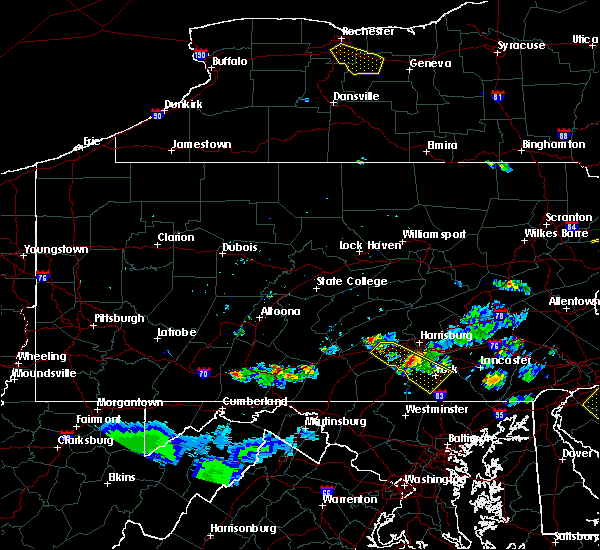 At 754 pm edt, a severe thunderstorm was located near siddonsburg, moving southeast at 40 mph (radar indicated). Hazards include 60 mph wind gusts and quarter size hail. Hail damage to vehicles is expected. expect wind damage to trees, roofs, and siding. this severe storm will be near, dover around 800 pm edt. york, weigelstown, shiloh, west york, north york, emigsville, york airport, mount wolf and manchester around 810 pm edt. spry, tyler run-queens gate, east york, jacobus, valley view, grantley, stonybrook-wilshire, yorklyn and hallam around 820 pm edt. other locations impacted by this severe thunderstorm include seven valleys, new salem, lewisberry, franklintown, wellsville, messiah college, york college of pennsylvania, penn state york, ski roundtop ski area and loganville. This includes interstate 83 from mile markers 11 to 31. At 754 pm edt, a severe thunderstorm was located near siddonsburg, moving southeast at 40 mph (radar indicated). Hazards include 60 mph wind gusts and quarter size hail. Hail damage to vehicles is expected. expect wind damage to trees, roofs, and siding. this severe storm will be near, dover around 800 pm edt. york, weigelstown, shiloh, west york, north york, emigsville, york airport, mount wolf and manchester around 810 pm edt. spry, tyler run-queens gate, east york, jacobus, valley view, grantley, stonybrook-wilshire, yorklyn and hallam around 820 pm edt. other locations impacted by this severe thunderstorm include seven valleys, new salem, lewisberry, franklintown, wellsville, messiah college, york college of pennsylvania, penn state york, ski roundtop ski area and loganville. This includes interstate 83 from mile markers 11 to 31.
|
| 6/3/2020 7:27 PM EDT |
 At 726 pm edt, a severe thunderstorm was located over carlisle, moving southeast at 30 mph (radar indicated). Hazards include 60 mph wind gusts and quarter size hail. Hail damage to vehicles is expected. expect wind damage to trees, roofs, and siding. this severe thunderstorm will be near, mechanicsburg, boiling springs, new kingstown, mount holly springs and hogestown around 740 pm edt. dillsburg and siddonsburg around 750 pm edt. dover around 810 pm edt. weigelstown, shiloh, york airport, manchester and mount wolf around 820 pm edt. other locations impacted by this severe thunderstorm include seven valleys, new salem, lewisberry, franklintown, wellsville, messiah college, penn state dickinson school of law, york college of pennsylvania, penn state york and ski roundtop ski area. this includes the following interstates, the pennsylvania turnpike from mile markers 218 to 237. interstate 81 from mile markers 41 to 55. interstate 83 from mile markers 11 to 31. This includes the following covid-19 test sites, geisinger holy spirit jennifer court, manchester, old memorial hospital, rite aid, upmc carlisle outpatient surgery center, wellspan health, wellspan pediatrics/wellspan ob/gyn, york expo center, and york va community clinic. At 726 pm edt, a severe thunderstorm was located over carlisle, moving southeast at 30 mph (radar indicated). Hazards include 60 mph wind gusts and quarter size hail. Hail damage to vehicles is expected. expect wind damage to trees, roofs, and siding. this severe thunderstorm will be near, mechanicsburg, boiling springs, new kingstown, mount holly springs and hogestown around 740 pm edt. dillsburg and siddonsburg around 750 pm edt. dover around 810 pm edt. weigelstown, shiloh, york airport, manchester and mount wolf around 820 pm edt. other locations impacted by this severe thunderstorm include seven valleys, new salem, lewisberry, franklintown, wellsville, messiah college, penn state dickinson school of law, york college of pennsylvania, penn state york and ski roundtop ski area. this includes the following interstates, the pennsylvania turnpike from mile markers 218 to 237. interstate 81 from mile markers 41 to 55. interstate 83 from mile markers 11 to 31. This includes the following covid-19 test sites, geisinger holy spirit jennifer court, manchester, old memorial hospital, rite aid, upmc carlisle outpatient surgery center, wellspan health, wellspan pediatrics/wellspan ob/gyn, york expo center, and york va community clinic.
|
| 4/13/2020 2:40 PM EDT |
 The severe thunderstorm warning for york county will expire at 245 pm edt, the storms which prompted the warning have moved out of the area. therefore, the warning will be allowed to expire. to report severe weather, contact your nearest law enforcement agency. they will relay your report to the national weather service state college pa. The severe thunderstorm warning for york county will expire at 245 pm edt, the storms which prompted the warning have moved out of the area. therefore, the warning will be allowed to expire. to report severe weather, contact your nearest law enforcement agency. they will relay your report to the national weather service state college pa.
|
| 4/13/2020 2:02 PM EDT |
 At 201 pm edt, severe thunderstorms were located along a line extending from mount wolf to yorklyn to near jacobus to hampstead, moving east at 50 mph. these are very dangerous storms (radar indicated). Hazards include 80 mph wind gusts and quarter size hail. Extensive tree damage and power outages are likely. expect considerable damage to roofs, windows, and vehicles. flying debris will be dangerous to those caught without shelter. mobile homes will be heavily damaged. locations impacted include, york, lower allen, hanover, weigelstown, parkville, red lion, spry, dallastown, shiloh, east york, stonybrook-wilshire, west york, shrewsbury, codorus, grantley, valley green, tyler run-queens gate, manchester, hallam and emigsville. this includes the following interstates, the pennsylvania turnpike from mile markers 239 to 245. Interstate 83 from mile markers 0 to 39. At 201 pm edt, severe thunderstorms were located along a line extending from mount wolf to yorklyn to near jacobus to hampstead, moving east at 50 mph. these are very dangerous storms (radar indicated). Hazards include 80 mph wind gusts and quarter size hail. Extensive tree damage and power outages are likely. expect considerable damage to roofs, windows, and vehicles. flying debris will be dangerous to those caught without shelter. mobile homes will be heavily damaged. locations impacted include, york, lower allen, hanover, weigelstown, parkville, red lion, spry, dallastown, shiloh, east york, stonybrook-wilshire, west york, shrewsbury, codorus, grantley, valley green, tyler run-queens gate, manchester, hallam and emigsville. this includes the following interstates, the pennsylvania turnpike from mile markers 239 to 245. Interstate 83 from mile markers 0 to 39.
|
| 4/13/2020 1:37 PM EDT |
 At 136 pm edt, severe thunderstorms were located along a line extending from lake meade to hampton to littlestown to 7 miles northeast of walkersville, moving east at 50 mph. these are very dangerous storms (radar indicated). Hazards include 80 mph wind gusts and quarter size hail. Extensive tree damage and power outages are likely. expect considerable damage to roofs, windows, and vehicles. flying debris will be dangerous to those caught without shelter. Mobile homes will be heavily damaged. At 136 pm edt, severe thunderstorms were located along a line extending from lake meade to hampton to littlestown to 7 miles northeast of walkersville, moving east at 50 mph. these are very dangerous storms (radar indicated). Hazards include 80 mph wind gusts and quarter size hail. Extensive tree damage and power outages are likely. expect considerable damage to roofs, windows, and vehicles. flying debris will be dangerous to those caught without shelter. Mobile homes will be heavily damaged.
|
| 4/13/2020 11:18 AM EDT |
 At 1117 am edt, a severe thunderstorm was located over masontown, or 10 miles west of uniontown, moving northeast at 50 mph (radar). Hazards include wind gusts to 70 mph. Trees snapped and uprooted. Power outages can be expected. At 1117 am edt, a severe thunderstorm was located over masontown, or 10 miles west of uniontown, moving northeast at 50 mph (radar). Hazards include wind gusts to 70 mph. Trees snapped and uprooted. Power outages can be expected.
|
| 3/28/2020 6:06 PM EDT |
 The severe thunderstorm warning for southwestern westmoreland, east central greene and central fayette counties will expire at 615 pm edt, the storm that prompted the warning has moved out of the area. therefore, the warning will be allowed to expire. however gusty winds and heavy rain are still possible with this thunderstorm. a severe thunderstorm watch remains in effect until 800 pm edt for southwestern pennsylvania. The severe thunderstorm warning for southwestern westmoreland, east central greene and central fayette counties will expire at 615 pm edt, the storm that prompted the warning has moved out of the area. therefore, the warning will be allowed to expire. however gusty winds and heavy rain are still possible with this thunderstorm. a severe thunderstorm watch remains in effect until 800 pm edt for southwestern pennsylvania.
|
| 3/28/2020 5:56 PM EDT |
 At 555 pm edt, a severe thunderstorm was located 8 miles southwest of seven springs, or 10 miles southeast of connellsville, moving east at 45 mph (radar). Hazards include wind gusts to 60 mph and quarter-size hail. Minor hail damage to vehicles is possible. expect wind damage to trees and power lines, resulting in some power outages. Locations impacted include, uniontown, connellsville, scottdale, south connellsville, farmington, seven springs, dunbar, everson, republic, vanderbilt, dawson, grindstone,. At 555 pm edt, a severe thunderstorm was located 8 miles southwest of seven springs, or 10 miles southeast of connellsville, moving east at 45 mph (radar). Hazards include wind gusts to 60 mph and quarter-size hail. Minor hail damage to vehicles is possible. expect wind damage to trees and power lines, resulting in some power outages. Locations impacted include, uniontown, connellsville, scottdale, south connellsville, farmington, seven springs, dunbar, everson, republic, vanderbilt, dawson, grindstone,.
|
| 3/28/2020 5:40 PM EDT |
 At 540 pm edt, a severe thunderstorm was located over south connellsville, or over connellsville, moving east at 45 mph (radar). Hazards include wind gusts to 60 mph and quarter-size hail. Minor hail damage to vehicles is possible. expect wind damage to trees and power lines, resulting in some power outages. Locations impacted include, uniontown, connellsville, california, scottdale, brownsville, fredericktown-millsboro, south connellsville, farmington, perryopolis, seven springs, isabella, dunbar,. At 540 pm edt, a severe thunderstorm was located over south connellsville, or over connellsville, moving east at 45 mph (radar). Hazards include wind gusts to 60 mph and quarter-size hail. Minor hail damage to vehicles is possible. expect wind damage to trees and power lines, resulting in some power outages. Locations impacted include, uniontown, connellsville, california, scottdale, brownsville, fredericktown-millsboro, south connellsville, farmington, perryopolis, seven springs, isabella, dunbar,.
|
| 3/28/2020 5:38 PM EDT |
 At 538 pm edt, a severe thunderstorm was located near connellsville, moving east at 45 mph (radar). Hazards include wind gusts to 60 mph and quarter-size hail. Minor hail damage to vehicles is possible. Expect wind damage to trees and power lines, resulting in some power outages. At 538 pm edt, a severe thunderstorm was located near connellsville, moving east at 45 mph (radar). Hazards include wind gusts to 60 mph and quarter-size hail. Minor hail damage to vehicles is possible. Expect wind damage to trees and power lines, resulting in some power outages.
|
| 3/28/2020 5:33 PM EDT |
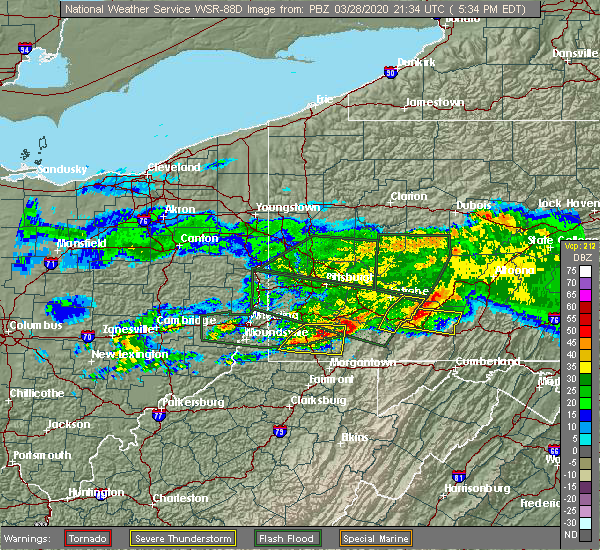 At 532 pm edt, a severe thunderstorm was located near waynesburg, moving east at 45 mph (radar). Hazards include wind gusts to 60 mph and quarter-size hail. Minor hail damage to vehicles is possible. expect wind damage to trees and power lines, resulting in some power outages. Locations impacted include, waynesburg, california, masontown, brownsville, fredericktown-millsboro, fairdale, jefferson boro, isabella, rogersville, west brownsville, deemston, republic, this includes interstate 79 in pennsylvania between mile markers 6 and 26. At 532 pm edt, a severe thunderstorm was located near waynesburg, moving east at 45 mph (radar). Hazards include wind gusts to 60 mph and quarter-size hail. Minor hail damage to vehicles is possible. expect wind damage to trees and power lines, resulting in some power outages. Locations impacted include, waynesburg, california, masontown, brownsville, fredericktown-millsboro, fairdale, jefferson boro, isabella, rogersville, west brownsville, deemston, republic, this includes interstate 79 in pennsylvania between mile markers 6 and 26.
|
| 3/28/2020 5:04 PM EDT |
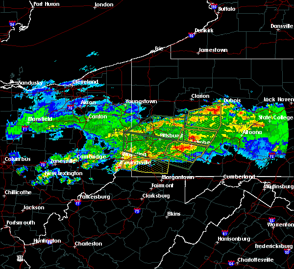 At 504 pm edt, a severe thunderstorm was located near triadelphia, moving east at 40 mph (radar). Hazards include wind gusts to 60 mph and quarter-size hail. Minor hail damage to vehicles is possible. Expect wind damage to trees and power lines, resulting in some power outages. At 504 pm edt, a severe thunderstorm was located near triadelphia, moving east at 40 mph (radar). Hazards include wind gusts to 60 mph and quarter-size hail. Minor hail damage to vehicles is possible. Expect wind damage to trees and power lines, resulting in some power outages.
|
| 2/7/2020 8:17 AM EST |
 At 817 am est, a severe thunderstorm was located near manchester, moving northeast at 65 mph (radar indicated). Hazards include 60 mph wind gusts. expect damage to trees, roofs, and siding At 817 am est, a severe thunderstorm was located near manchester, moving northeast at 65 mph (radar indicated). Hazards include 60 mph wind gusts. expect damage to trees, roofs, and siding
|
| 10/31/2019 8:05 PM EDT |
 At 804 pm edt, severe thunderstorms were located along a line extending from fountain springs to near pine grove to harper tavern to royalton to near lake heritage, moving northeast at 50 mph (radar indicated). Hazards include 60 mph wind gusts. expect damage to trees, roofs, and siding At 804 pm edt, severe thunderstorms were located along a line extending from fountain springs to near pine grove to harper tavern to royalton to near lake heritage, moving northeast at 50 mph (radar indicated). Hazards include 60 mph wind gusts. expect damage to trees, roofs, and siding
|
| 10/31/2019 7:56 PM EDT |
 At 755 pm edt, severe thunderstorms were located along a line extending from near pine grove to near penn national race course to near valley green to near hampton to near littlestown, moving east at 30 mph (radar indicated). Hazards include 60 mph wind gusts. Expect damage to trees, roofs, and siding. Locations impacted include, harrisburg, york, lower allen, hanover, hershey, colonial park, weigelstown, progress, mechanicsburg, middletown, camp hill, gettysburg, palmyra, new cumberland, parkville, linglestown, enola, steelton, annville and lemoyne. At 755 pm edt, severe thunderstorms were located along a line extending from near pine grove to near penn national race course to near valley green to near hampton to near littlestown, moving east at 30 mph (radar indicated). Hazards include 60 mph wind gusts. Expect damage to trees, roofs, and siding. Locations impacted include, harrisburg, york, lower allen, hanover, hershey, colonial park, weigelstown, progress, mechanicsburg, middletown, camp hill, gettysburg, palmyra, new cumberland, parkville, linglestown, enola, steelton, annville and lemoyne.
|
| 10/31/2019 7:08 PM EDT |
 At 706 pm edt, severe thunderstorms were located along a line extending from 7 miles northwest of millersburg to newport to near duncannon to pine grove furnace to near mont alto, moving northeast at 65 mph (radar indicated). Hazards include 70 mph wind gusts. Expect considerable tree damage. Damage is likely to mobile homes, roofs, and outbuildings. At 706 pm edt, severe thunderstorms were located along a line extending from 7 miles northwest of millersburg to newport to near duncannon to pine grove furnace to near mont alto, moving northeast at 65 mph (radar indicated). Hazards include 70 mph wind gusts. Expect considerable tree damage. Damage is likely to mobile homes, roofs, and outbuildings.
|
| 9/1/2019 5:54 PM EDT |
 The severe thunderstorm warning for western fayette county will expire at 600 pm edt, the storm that prompted the warning has weakened below severe limits and has exited the warned area. therefore, the warning will be allowed to expire. however small hail, gusty winds and heavy rain are still possible with this thunderstorm. The severe thunderstorm warning for western fayette county will expire at 600 pm edt, the storm that prompted the warning has weakened below severe limits and has exited the warned area. therefore, the warning will be allowed to expire. however small hail, gusty winds and heavy rain are still possible with this thunderstorm.
|
| 9/1/2019 5:35 PM EDT |
 At 534 pm edt, a severe thunderstorm was located near uniontown, moving northeast at 25 mph (radar). Hazards include wind gusts to 60 mph and quarter-size hail. Minor hail damage to vehicles is possible. expect wind damage to trees and power lines, resulting in some power outages. Locations impacted include, uniontown, california, masontown, brownsville, perryopolis, point marion, fairchance, isabella, west brownsville, smithfield, roscoe, fayette city,. At 534 pm edt, a severe thunderstorm was located near uniontown, moving northeast at 25 mph (radar). Hazards include wind gusts to 60 mph and quarter-size hail. Minor hail damage to vehicles is possible. expect wind damage to trees and power lines, resulting in some power outages. Locations impacted include, uniontown, california, masontown, brownsville, perryopolis, point marion, fairchance, isabella, west brownsville, smithfield, roscoe, fayette city,.
|
| 9/1/2019 5:26 PM EDT |
 At 526 pm edt, a severe thunderstorm was located near masontown, or near uniontown, moving north at 20 mph (radar). Hazards include wind gusts to 60 mph and quarter-size hail. Minor hail damage to vehicles is possible. expect wind damage to trees and power lines, resulting in some power outages. Locations impacted include, uniontown, california, masontown, brownsville, perryopolis, point marion, fairchance, isabella, west brownsville, smithfield, roscoe, fayette city,. At 526 pm edt, a severe thunderstorm was located near masontown, or near uniontown, moving north at 20 mph (radar). Hazards include wind gusts to 60 mph and quarter-size hail. Minor hail damage to vehicles is possible. expect wind damage to trees and power lines, resulting in some power outages. Locations impacted include, uniontown, california, masontown, brownsville, perryopolis, point marion, fairchance, isabella, west brownsville, smithfield, roscoe, fayette city,.
|
| 9/1/2019 5:17 PM EDT |
 At 517 pm edt, a severe thunderstorm was located near masontown, or 9 miles southwest of uniontown, moving north at 20 mph (radar). Hazards include wind gusts to 60 mph and quarter-size hail. Minor hail damage to vehicles is possible. Expect wind damage to trees and power lines, resulting in some power outages. At 517 pm edt, a severe thunderstorm was located near masontown, or 9 miles southwest of uniontown, moving north at 20 mph (radar). Hazards include wind gusts to 60 mph and quarter-size hail. Minor hail damage to vehicles is possible. Expect wind damage to trees and power lines, resulting in some power outages.
|
| 8/18/2019 3:04 PM EDT |
 At 304 pm edt, a severe thunderstorm was located over masontown, or 9 miles west of uniontown, moving east at 10 mph (radar). Hazards include wind gusts to 60 mph and quarter-size hail. Minor hail damage to vehicles is possible. expect wind damage to trees and power lines, resulting in some power outages. Locations impacted include, uniontown, masontown, fairchance, smithfield, new salem, chalkhill,. At 304 pm edt, a severe thunderstorm was located over masontown, or 9 miles west of uniontown, moving east at 10 mph (radar). Hazards include wind gusts to 60 mph and quarter-size hail. Minor hail damage to vehicles is possible. expect wind damage to trees and power lines, resulting in some power outages. Locations impacted include, uniontown, masontown, fairchance, smithfield, new salem, chalkhill,.
|
| 8/18/2019 3:00 PM EDT |
 At 259 pm edt, a severe thunderstorm was located over masontown, or 10 miles west of uniontown, moving east at 10 mph (radar). Hazards include wind gusts to 60 mph and quarter-size hail. Minor hail damage to vehicles is possible. Expect wind damage to trees and power lines, resulting in some power outages. At 259 pm edt, a severe thunderstorm was located over masontown, or 10 miles west of uniontown, moving east at 10 mph (radar). Hazards include wind gusts to 60 mph and quarter-size hail. Minor hail damage to vehicles is possible. Expect wind damage to trees and power lines, resulting in some power outages.
|
| 8/18/2019 3:00 PM EDT |
 At 304 pm edt, a severe thunderstorm was located over masontown, or 9 miles west of uniontown, moving east at 10 mph (radar). Hazards include wind gusts to 60 mph and quarter-size hail. Minor hail damage to vehicles is possible. expect wind damage to trees and power lines, resulting in some power outages. Locations impacted include, uniontown, masontown, fairchance, smithfield, new salem, chalkhill,. At 304 pm edt, a severe thunderstorm was located over masontown, or 9 miles west of uniontown, moving east at 10 mph (radar). Hazards include wind gusts to 60 mph and quarter-size hail. Minor hail damage to vehicles is possible. expect wind damage to trees and power lines, resulting in some power outages. Locations impacted include, uniontown, masontown, fairchance, smithfield, new salem, chalkhill,.
|
| 8/15/2019 10:03 PM EDT |
 The national weather service in state college pa has issued a * severe thunderstorm warning for. northeastern adams county in south central pennsylvania. western york county in south central pennsylvania. southeastern dauphin county in south central pennsylvania. Eastern cumberland county in south central pennsylvania. The national weather service in state college pa has issued a * severe thunderstorm warning for. northeastern adams county in south central pennsylvania. western york county in south central pennsylvania. southeastern dauphin county in south central pennsylvania. Eastern cumberland county in south central pennsylvania.
|
| 7/21/2019 7:46 PM EDT |
 At 746 pm edt, severe thunderstorms were located along a line extending from near dover to codorus, moving east at 20 mph (radar indicated). Hazards include 60 mph wind gusts and quarter size hail. Hail damage to vehicles is expected. expect wind damage to trees, roofs, and siding. locations impacted include, york, hanover, weigelstown, parkville, red lion, spry, dallastown, shiloh, east york, stonybrook-wilshire, west york, shrewsbury, codorus, grantley, tyler run-queens gate, manchester, emigsville, spring grove, stewartstown and glen rock. This includes interstate 83 from mile markers 3 to 27. At 746 pm edt, severe thunderstorms were located along a line extending from near dover to codorus, moving east at 20 mph (radar indicated). Hazards include 60 mph wind gusts and quarter size hail. Hail damage to vehicles is expected. expect wind damage to trees, roofs, and siding. locations impacted include, york, hanover, weigelstown, parkville, red lion, spry, dallastown, shiloh, east york, stonybrook-wilshire, west york, shrewsbury, codorus, grantley, tyler run-queens gate, manchester, emigsville, spring grove, stewartstown and glen rock. This includes interstate 83 from mile markers 3 to 27.
|
| 7/21/2019 7:26 PM EDT |
 At 726 pm edt, severe thunderstorms were located along a line extending from near dillsburg to hanover, moving east at 20 mph (radar indicated). Hazards include 60 mph wind gusts and quarter size hail. Hail damage to vehicles is expected. Expect wind damage to trees, roofs, and siding. At 726 pm edt, severe thunderstorms were located along a line extending from near dillsburg to hanover, moving east at 20 mph (radar indicated). Hazards include 60 mph wind gusts and quarter size hail. Hail damage to vehicles is expected. Expect wind damage to trees, roofs, and siding.
|
| 7/21/2019 7:03 PM EDT |
 At 703 pm edt, a severe thunderstorm was located over uniontown, moving east at 10 mph (radar). Hazards include wind gusts to 60 mph. Expect damage to trees and power lines, resulting in some power outages. Locations impacted include, uniontown, connellsville, south connellsville, farmington, fairchance, dunbar, new salem, chalkhill, ohiopyle,. At 703 pm edt, a severe thunderstorm was located over uniontown, moving east at 10 mph (radar). Hazards include wind gusts to 60 mph. Expect damage to trees and power lines, resulting in some power outages. Locations impacted include, uniontown, connellsville, south connellsville, farmington, fairchance, dunbar, new salem, chalkhill, ohiopyle,.
|
| 7/21/2019 6:54 PM EDT |
 At 654 pm edt, a severe thunderstorm was located over uniontown, moving east at 10 mph (radar). Hazards include wind gusts to 60 mph. expect damage to trees and power lines, resulting in some power outages At 654 pm edt, a severe thunderstorm was located over uniontown, moving east at 10 mph (radar). Hazards include wind gusts to 60 mph. expect damage to trees and power lines, resulting in some power outages
|
| 7/17/2019 5:16 PM EDT |
 At 515 pm edt, severe thunderstorms were located along a line extending from bonneauville to near pennville to near hampstead, moving northeast at 35 mph (radar indicated). Hazards include 60 mph wind gusts. expect damage to trees, roofs, and siding At 515 pm edt, severe thunderstorms were located along a line extending from bonneauville to near pennville to near hampstead, moving northeast at 35 mph (radar indicated). Hazards include 60 mph wind gusts. expect damage to trees, roofs, and siding
|
| 7/6/2019 7:24 PM EDT |
 At 724 pm edt, severe thunderstorms were located along a line extending from near churchtown to greencastle, moving east at 30 mph (radar indicated). Hazards include 60 mph wind gusts and quarter size hail. Hail damage to vehicles is expected. expect wind damage to trees, roofs, and siding. locations impacted include, york, chambersburg, hanover, weigelstown, waynesboro, gettysburg, parkville, greencastle, hampton, guilford, shiloh, west york, littlestown, carroll valley, codorus, grantley, fayetteville, mcsherrystown, manchester and emigsville. this includes the following interstates, interstate 81 from mile markers 0 to 16. Interstate 83 from mile markers 20 to 25. At 724 pm edt, severe thunderstorms were located along a line extending from near churchtown to greencastle, moving east at 30 mph (radar indicated). Hazards include 60 mph wind gusts and quarter size hail. Hail damage to vehicles is expected. expect wind damage to trees, roofs, and siding. locations impacted include, york, chambersburg, hanover, weigelstown, waynesboro, gettysburg, parkville, greencastle, hampton, guilford, shiloh, west york, littlestown, carroll valley, codorus, grantley, fayetteville, mcsherrystown, manchester and emigsville. this includes the following interstates, interstate 81 from mile markers 0 to 16. Interstate 83 from mile markers 20 to 25.
|
| 7/6/2019 6:44 PM EDT |
 At 644 pm edt, severe thunderstorms were located along a line extending from near cornwall to big cove tannery, moving east at 30 mph (radar indicated). Hazards include 60 mph wind gusts and quarter size hail. Hail damage to vehicles is expected. Expect wind damage to trees, roofs, and siding. At 644 pm edt, severe thunderstorms were located along a line extending from near cornwall to big cove tannery, moving east at 30 mph (radar indicated). Hazards include 60 mph wind gusts and quarter size hail. Hail damage to vehicles is expected. Expect wind damage to trees, roofs, and siding.
|
| 7/6/2019 5:34 PM EDT |
 At 533 pm edt, severe thunderstorms were located along a line extending from near urban to near duncannon to mount holly springs to near emmitsburg, moving east at 30 mph (radar indicated). Hazards include 60 mph wind gusts and quarter size hail. Hail damage to vehicles is expected. Expect wind damage to trees, roofs, and siding. At 533 pm edt, severe thunderstorms were located along a line extending from near urban to near duncannon to mount holly springs to near emmitsburg, moving east at 30 mph (radar indicated). Hazards include 60 mph wind gusts and quarter size hail. Hail damage to vehicles is expected. Expect wind damage to trees, roofs, and siding.
|
| 7/2/2019 5:43 PM EDT |
 At 543 pm edt, a severe thunderstorm was located over siddonsburg, moving southeast at 25 mph (radar indicated). Hazards include 60 mph wind gusts and nickel size hail. expect damage to trees, roofs, and siding At 543 pm edt, a severe thunderstorm was located over siddonsburg, moving southeast at 25 mph (radar indicated). Hazards include 60 mph wind gusts and nickel size hail. expect damage to trees, roofs, and siding
|
| 6/29/2019 9:50 PM EDT |
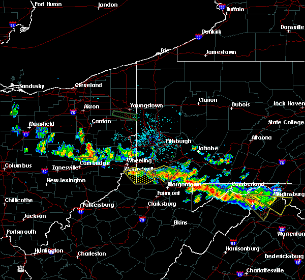 The severe thunderstorm warning for southeastern washington, eastern greene and west central fayette counties will expire at 1000 pm edt, the storm that prompted the warning has weakened below severe limits and no longer pose an immediate threat to life and property. therefore, the warning will be allowed to expire. however gusty winds and heavy rain are still possible with this thunderstorm. The severe thunderstorm warning for southeastern washington, eastern greene and west central fayette counties will expire at 1000 pm edt, the storm that prompted the warning has weakened below severe limits and no longer pose an immediate threat to life and property. therefore, the warning will be allowed to expire. however gusty winds and heavy rain are still possible with this thunderstorm.
|
| 6/29/2019 9:44 PM EDT |
 At 944 pm edt, a severe thunderstorm was located over fairdale, or 10 miles east of waynesburg, moving southeast at 30 mph (radar). Hazards include wind gusts to 60 mph and quarter-size hail. Minor hail damage to vehicles is possible. expect wind damage to trees and power lines, resulting in some power outages. Locations impacted include, waynesburg, masontown, brownsville, fredericktown-millsboro, fairdale, jefferson boro, isabella, deemston, bobtown, republic, nemacolin, marianna,. At 944 pm edt, a severe thunderstorm was located over fairdale, or 10 miles east of waynesburg, moving southeast at 30 mph (radar). Hazards include wind gusts to 60 mph and quarter-size hail. Minor hail damage to vehicles is possible. expect wind damage to trees and power lines, resulting in some power outages. Locations impacted include, waynesburg, masontown, brownsville, fredericktown-millsboro, fairdale, jefferson boro, isabella, deemston, bobtown, republic, nemacolin, marianna,.
|
| 6/29/2019 9:30 PM EDT |
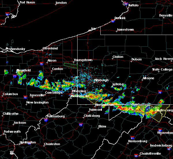 At 930 pm edt, a severe thunderstorm was located over jefferson boro, or 7 miles northeast of waynesburg, moving southeast at 30 mph (radar). Hazards include wind gusts to 60 mph and quarter-size hail. Minor hail damage to vehicles is possible. expect wind damage to trees and power lines, resulting in some power outages. Locations impacted include, waynesburg, masontown, brownsville, fredericktown-millsboro, fairdale, jefferson boro, isabella, west brownsville, deemston, bobtown, republic, nemacolin,. At 930 pm edt, a severe thunderstorm was located over jefferson boro, or 7 miles northeast of waynesburg, moving southeast at 30 mph (radar). Hazards include wind gusts to 60 mph and quarter-size hail. Minor hail damage to vehicles is possible. expect wind damage to trees and power lines, resulting in some power outages. Locations impacted include, waynesburg, masontown, brownsville, fredericktown-millsboro, fairdale, jefferson boro, isabella, west brownsville, deemston, bobtown, republic, nemacolin,.
|
| 6/29/2019 9:17 PM EDT |
 At 917 pm edt, a severe thunderstorm was located 8 miles northwest of jefferson boro, or 8 miles north of waynesburg, moving southeast at 30 mph (radar). Hazards include wind gusts to 60 mph and quarter-size hail. Minor hail damage to vehicles is possible. Expect wind damage to trees and power lines, resulting in some power outages. At 917 pm edt, a severe thunderstorm was located 8 miles northwest of jefferson boro, or 8 miles north of waynesburg, moving southeast at 30 mph (radar). Hazards include wind gusts to 60 mph and quarter-size hail. Minor hail damage to vehicles is possible. Expect wind damage to trees and power lines, resulting in some power outages.
|
| 5/29/2019 5:49 PM EDT | Numerous trees dow in york county PA, 0.3 miles NNW of New Salem, PA |
| 5/29/2019 5:39 PM EDT |
 The national weather service in state college pa has issued a * severe thunderstorm warning for. lancaster county in south central pennsylvania. southeastern adams county in south central pennsylvania. york county in south central pennsylvania. Southern dauphin county in south central pennsylvania. The national weather service in state college pa has issued a * severe thunderstorm warning for. lancaster county in south central pennsylvania. southeastern adams county in south central pennsylvania. york county in south central pennsylvania. Southern dauphin county in south central pennsylvania.
|
| 5/29/2019 4:58 PM EDT |
 At 458 pm edt, severe thunderstorms were located along a line extending from near perulack to near shippensburg to near st. thomas to near gamber, moving east at 65 mph (radar indicated). Hazards include 60 mph wind gusts and quarter size hail. Hail damage to vehicles is expected. expect wind damage to trees, roofs, and siding. severe thunderstorms will be near, waynesboro, pine grove furnace, bloserville, mont alto, plainfield, newville, fayetteville, wayne heights, guilford and rouzerville around 510 pm edt. carlisle, schlusser, carroll valley, boiling springs, carlisle springs, lake meade, orrtanna, hampton, aspers and new kingstown around 520 pm edt. mechanicsburg, lower allen, camp hill, gettysburg, lemoyne, siddonsburg, east berlin, york airport, dillsburg and shiremanstown around 530 pm edt. spry, dallastown, red lion, york, weigelstown, jacobus, valley green, grantley, manchester and valley view around 540 pm edt. other locations impacted by these severe thunderstorms include arendtsville, orrstown, quincy, east prospect, blain, gardners, fawn grove, glenville, heidlersburg and biglerville. this includes the following interstates, the pennsylvania turnpike from mile markers 200 to 246. interstate 81 from mile markers 7 to 58. Interstate 83 between mile markers 0 and 39, and near mile marker 41. At 458 pm edt, severe thunderstorms were located along a line extending from near perulack to near shippensburg to near st. thomas to near gamber, moving east at 65 mph (radar indicated). Hazards include 60 mph wind gusts and quarter size hail. Hail damage to vehicles is expected. expect wind damage to trees, roofs, and siding. severe thunderstorms will be near, waynesboro, pine grove furnace, bloserville, mont alto, plainfield, newville, fayetteville, wayne heights, guilford and rouzerville around 510 pm edt. carlisle, schlusser, carroll valley, boiling springs, carlisle springs, lake meade, orrtanna, hampton, aspers and new kingstown around 520 pm edt. mechanicsburg, lower allen, camp hill, gettysburg, lemoyne, siddonsburg, east berlin, york airport, dillsburg and shiremanstown around 530 pm edt. spry, dallastown, red lion, york, weigelstown, jacobus, valley green, grantley, manchester and valley view around 540 pm edt. other locations impacted by these severe thunderstorms include arendtsville, orrstown, quincy, east prospect, blain, gardners, fawn grove, glenville, heidlersburg and biglerville. this includes the following interstates, the pennsylvania turnpike from mile markers 200 to 246. interstate 81 from mile markers 7 to 58. Interstate 83 between mile markers 0 and 39, and near mile marker 41.
|
| 5/25/2019 8:34 PM EDT |
 At 834 pm edt, a severe thunderstorm was located over fairdale, or 11 miles east of waynesburg, moving east at 30 mph (radar). Hazards include wind gusts to 60 mph and quarter-size hail. Minor hail damage to vehicles is possible. expect wind damage to trees and power lines, resulting in some power outages. Locations impacted include, uniontown, masontown, fairdale, nemacolin, carmichaels, new salem,. At 834 pm edt, a severe thunderstorm was located over fairdale, or 11 miles east of waynesburg, moving east at 30 mph (radar). Hazards include wind gusts to 60 mph and quarter-size hail. Minor hail damage to vehicles is possible. expect wind damage to trees and power lines, resulting in some power outages. Locations impacted include, uniontown, masontown, fairdale, nemacolin, carmichaels, new salem,.
|
| 5/25/2019 8:21 PM EDT |
 At 821 pm edt, a severe thunderstorm was located over jefferson boro, or near waynesburg, moving east at 30 mph (radar). Hazards include wind gusts to 60 mph. expect damage to trees and power lines, resulting in some power outages At 821 pm edt, a severe thunderstorm was located over jefferson boro, or near waynesburg, moving east at 30 mph (radar). Hazards include wind gusts to 60 mph. expect damage to trees and power lines, resulting in some power outages
|
| 5/25/2019 2:35 PM EDT |
 At 235 pm edt, a severe thunderstorm was located over south connellsville, or near connellsville, moving east at 25 mph (radar). Hazards include wind gusts to 60 mph. Expect damage to trees and power lines, resulting in some power outages. Locations impacted include, uniontown, connellsville, south connellsville, seven springs, fairchance, dunbar, vanderbilt, dawson, new salem, grindstone, donegal, champion, this includes pennsylvania turnpike between mile markers 89 and 99. At 235 pm edt, a severe thunderstorm was located over south connellsville, or near connellsville, moving east at 25 mph (radar). Hazards include wind gusts to 60 mph. Expect damage to trees and power lines, resulting in some power outages. Locations impacted include, uniontown, connellsville, south connellsville, seven springs, fairchance, dunbar, vanderbilt, dawson, new salem, grindstone, donegal, champion, this includes pennsylvania turnpike between mile markers 89 and 99.
|
| 5/25/2019 2:24 PM EDT |
 At 224 pm edt, a severe thunderstorm was located over uniontown, moving east at 45 mph (radar). Hazards include wind gusts to 60 mph. expect damage to trees and power lines, resulting in some power outages At 224 pm edt, a severe thunderstorm was located over uniontown, moving east at 45 mph (radar). Hazards include wind gusts to 60 mph. expect damage to trees and power lines, resulting in some power outages
|
| 5/23/2019 10:23 PM EDT |
 At 1022 pm edt, a severe thunderstorm was located near valley green, moving southeast at 45 mph (radar indicated). Hazards include 60 mph wind gusts and quarter size hail. Hail damage to vehicles is expected. Expect wind damage to trees, roofs, and siding. At 1022 pm edt, a severe thunderstorm was located near valley green, moving southeast at 45 mph (radar indicated). Hazards include 60 mph wind gusts and quarter size hail. Hail damage to vehicles is expected. Expect wind damage to trees, roofs, and siding.
|
| 5/19/2019 8:05 PM EDT |
 At 804 pm edt, severe thunderstorms were located along a line extending from hummelstown to near elizabethtown to near maytown to east york to grantley, moving east at 50 mph (radar indicated). Hazards include 70 mph wind gusts and quarter size hail. Hail damage to vehicles is expected. expect considerable tree damage. wind damage is also likely to mobile homes, roofs, and outbuildings. severe thunderstorms will be near, columbia, mount joy, rheems, marietta, maytown, wrightsville, campbelltown and lawn around 810 pm edt. manheim, east petersburg, cornwall, lancaster, annville, lititz, palmyra, timber hills, mount gretna heights and quentin around 820 pm edt. willow street, millersville, akron, myerstown, lebanon, leacock, schaefferstown, brickerville, leola and rothsville around 830 pm edt. new holland, ephrata, strasburg, adamstown, paradise, reamstown, denver, terre hill, newmanstown and churchtown around 840 pm edt. other locations impacted by these severe thunderstorms include east prospect, bowmansville, mount gretna, reinholds, goodville, schoeneck, new salem, avon heights, blue ball and georgetown. this includes the following interstates, the pennsylvania turnpike from mile markers 259 to 295. Interstate 83 from mile markers 11 to 21. At 804 pm edt, severe thunderstorms were located along a line extending from hummelstown to near elizabethtown to near maytown to east york to grantley, moving east at 50 mph (radar indicated). Hazards include 70 mph wind gusts and quarter size hail. Hail damage to vehicles is expected. expect considerable tree damage. wind damage is also likely to mobile homes, roofs, and outbuildings. severe thunderstorms will be near, columbia, mount joy, rheems, marietta, maytown, wrightsville, campbelltown and lawn around 810 pm edt. manheim, east petersburg, cornwall, lancaster, annville, lititz, palmyra, timber hills, mount gretna heights and quentin around 820 pm edt. willow street, millersville, akron, myerstown, lebanon, leacock, schaefferstown, brickerville, leola and rothsville around 830 pm edt. new holland, ephrata, strasburg, adamstown, paradise, reamstown, denver, terre hill, newmanstown and churchtown around 840 pm edt. other locations impacted by these severe thunderstorms include east prospect, bowmansville, mount gretna, reinholds, goodville, schoeneck, new salem, avon heights, blue ball and georgetown. this includes the following interstates, the pennsylvania turnpike from mile markers 259 to 295. Interstate 83 from mile markers 11 to 21.
|
| 4/14/2019 8:17 PM EDT |
 At 815 pm edt, a severe thunderstorm capable of producing a tornado was located over yorkana, moving northeast at 45 mph (radar indicated rotation). Hazards include tornado and quarter size hail. Flying debris will be dangerous to those caught without shelter. mobile homes will be damaged or destroyed. damage to roofs, windows, and vehicles will occur. tree damage is likely. this tornadic thunderstorm will remain over mainly rural areas of southern york county, including the following locations, winterstown, glenville, felton, seven valleys, loganville, new salem, york college of pennsylvania and penn state york. This includes interstate 83 from mile markers 0 to 25. At 815 pm edt, a severe thunderstorm capable of producing a tornado was located over yorkana, moving northeast at 45 mph (radar indicated rotation). Hazards include tornado and quarter size hail. Flying debris will be dangerous to those caught without shelter. mobile homes will be damaged or destroyed. damage to roofs, windows, and vehicles will occur. tree damage is likely. this tornadic thunderstorm will remain over mainly rural areas of southern york county, including the following locations, winterstown, glenville, felton, seven valleys, loganville, new salem, york college of pennsylvania and penn state york. This includes interstate 83 from mile markers 0 to 25.
|
| 4/14/2019 7:45 PM EDT |
 At 744 pm edt, a severe thunderstorm capable of producing a tornado was located near manchester, moving northeast at 45 mph (radar indicated rotation). Hazards include tornado and quarter size hail. Flying debris will be dangerous to those caught without shelter. mobile homes will be damaged or destroyed. damage to roofs, windows, and vehicles will occur. tree damage is likely. this dangerous storm will be near, codorus around 750 pm edt. glen rock, shrewsbury, jacobus and railroad around 800 pm edt. red lion, dallastown, spry, yoe, windsor, east york, tyler run-queens gate, stonybrook-wilshire, valley view and yorklyn around 810 pm edt. yorkana and hallam around 820 pm edt. other locations impacted by this tornadic thunderstorm include winterstown, glenville, felton, seven valleys, loganville, new salem, york college of pennsylvania and penn state york. This includes interstate 83 from mile markers 0 to 25. At 744 pm edt, a severe thunderstorm capable of producing a tornado was located near manchester, moving northeast at 45 mph (radar indicated rotation). Hazards include tornado and quarter size hail. Flying debris will be dangerous to those caught without shelter. mobile homes will be damaged or destroyed. damage to roofs, windows, and vehicles will occur. tree damage is likely. this dangerous storm will be near, codorus around 750 pm edt. glen rock, shrewsbury, jacobus and railroad around 800 pm edt. red lion, dallastown, spry, yoe, windsor, east york, tyler run-queens gate, stonybrook-wilshire, valley view and yorklyn around 810 pm edt. yorkana and hallam around 820 pm edt. other locations impacted by this tornadic thunderstorm include winterstown, glenville, felton, seven valleys, loganville, new salem, york college of pennsylvania and penn state york. This includes interstate 83 from mile markers 0 to 25.
|
| 4/14/2019 7:27 PM EDT |
 At 725 pm edt, a severe thunderstorm was located over codorus, moving northeast at 45 mph. this storm has weaken some, but additional storms over northern maryland are quickly lifting northeast toward the first storm and are showing signs of rotation (radar indicated). Hazards include 60 mph wind gusts and quarter size hail. Hail damage to vehicles is expected. expect wind damage to roofs, siding, and trees. locations impacted include, york, hanover, parkville, red lion, spry, dallastown, east york, stonybrook-wilshire, west york, littlestown, shrewsbury, codorus, grantley, tyler run-queens gate, spring grove, stewartstown, glen rock, pennville, yorklyn and jacobus. this includes interstate 83 from mile markers 0 to 19. A tornado watch remains in effect until 300 am edt for south central pennsylvania. At 725 pm edt, a severe thunderstorm was located over codorus, moving northeast at 45 mph. this storm has weaken some, but additional storms over northern maryland are quickly lifting northeast toward the first storm and are showing signs of rotation (radar indicated). Hazards include 60 mph wind gusts and quarter size hail. Hail damage to vehicles is expected. expect wind damage to roofs, siding, and trees. locations impacted include, york, hanover, parkville, red lion, spry, dallastown, east york, stonybrook-wilshire, west york, littlestown, shrewsbury, codorus, grantley, tyler run-queens gate, spring grove, stewartstown, glen rock, pennville, yorklyn and jacobus. this includes interstate 83 from mile markers 0 to 19. A tornado watch remains in effect until 300 am edt for south central pennsylvania.
|
| 4/14/2019 7:06 PM EDT |
 At 704 pm edt, a severe thunderstorm was located near westminster, moving northeast at 45 mph (radar indicated). Hazards include 60 mph wind gusts and quarter size hail. Hail damage to vehicles is expected. Expect wind damage to roofs, siding, and trees. At 704 pm edt, a severe thunderstorm was located near westminster, moving northeast at 45 mph (radar indicated). Hazards include 60 mph wind gusts and quarter size hail. Hail damage to vehicles is expected. Expect wind damage to roofs, siding, and trees.
|
| 10/2/2018 6:02 PM EDT |
 At 601 pm edt, a severe thunderstorm capable of producing a tornado was located near jefferson boro, or near waynesburg, moving southeast at 30 mph (radar indicated rotation). Hazards include tornado. Flying debris will be dangerous to those caught without shelter. mobile homes will be damaged or destroyed. damage to roofs, windows, and vehicles will occur. tree damage is likely. this dangerous storm will be near, fairdale around 610 pm edt. masontown around 620 pm edt. point marion around 625 pm edt. other locations impacted by this tornadic thunderstorm include smithfield, greensboro, fairchance, new salem, bobtown, isabella, carmichaels, rices landing, nemacolin and clarksville. this includes interstate 79 in pennsylvania between mile markers 5 and 13. Please report severe weather by calling 412-262-1988, posting to the nws pittsburgh facebook page, or using twitter @nwspittsburgh. At 601 pm edt, a severe thunderstorm capable of producing a tornado was located near jefferson boro, or near waynesburg, moving southeast at 30 mph (radar indicated rotation). Hazards include tornado. Flying debris will be dangerous to those caught without shelter. mobile homes will be damaged or destroyed. damage to roofs, windows, and vehicles will occur. tree damage is likely. this dangerous storm will be near, fairdale around 610 pm edt. masontown around 620 pm edt. point marion around 625 pm edt. other locations impacted by this tornadic thunderstorm include smithfield, greensboro, fairchance, new salem, bobtown, isabella, carmichaels, rices landing, nemacolin and clarksville. this includes interstate 79 in pennsylvania between mile markers 5 and 13. Please report severe weather by calling 412-262-1988, posting to the nws pittsburgh facebook page, or using twitter @nwspittsburgh.
|
| 8/7/2018 12:58 PM EDT |
 At 1258 pm edt, severe thunderstorms were located along a line extending from near perryopolis to brownsville, moving east at 10 mph (radar). Hazards include wind gusts to 60 mph. expect damage to trees and power lines, resulting in some power outages At 1258 pm edt, severe thunderstorms were located along a line extending from near perryopolis to brownsville, moving east at 10 mph (radar). Hazards include wind gusts to 60 mph. expect damage to trees and power lines, resulting in some power outages
|
| 7/24/2018 10:19 PM EDT |
 At 1019 pm edt, a severe thunderstorm was located over jacobus, moving north at 35 mph (radar indicated). Hazards include 60 mph wind gusts. Expect damage to roofs, siding, and trees. this severe thunderstorm will be near, dallastown, red lion and yoe around 1020 pm edt. york, spry, weigelstown, valley view, east york, stonybrook-wilshire, tyler run-queens gate, north york, grantley and west york around 1030 pm edt. bainbridge, mount wolf, manchester, hallam, marietta, maytown and wrightsville around 1040 pm edt. elizabethtown, middletown, mount joy, rheems and royalton around 1050 pm edt. other locations impacted by this severe thunderstorm include york haven, seven valleys, three mile island, winterstown, loganville, new salem, goldsboro, newberrytown, penn state harrisburg and harrisburg international airport. this includes the following interstates, the pennsylvania turnpike from mile markers 245 to 258. interstate 83 between mile markers 5 and 34, and near mile marker 46. Interstate 283 from mile markers 0 to 2. At 1019 pm edt, a severe thunderstorm was located over jacobus, moving north at 35 mph (radar indicated). Hazards include 60 mph wind gusts. Expect damage to roofs, siding, and trees. this severe thunderstorm will be near, dallastown, red lion and yoe around 1020 pm edt. york, spry, weigelstown, valley view, east york, stonybrook-wilshire, tyler run-queens gate, north york, grantley and west york around 1030 pm edt. bainbridge, mount wolf, manchester, hallam, marietta, maytown and wrightsville around 1040 pm edt. elizabethtown, middletown, mount joy, rheems and royalton around 1050 pm edt. other locations impacted by this severe thunderstorm include york haven, seven valleys, three mile island, winterstown, loganville, new salem, goldsboro, newberrytown, penn state harrisburg and harrisburg international airport. this includes the following interstates, the pennsylvania turnpike from mile markers 245 to 258. interstate 83 between mile markers 5 and 34, and near mile marker 46. Interstate 283 from mile markers 0 to 2.
|
| 6/24/2018 6:10 PM EDT |
 At 610 pm edt, a severe thunderstorm was located over glen rock, moving east at 30 mph (radar indicated). Hazards include 60 mph wind gusts and quarter size hail. Hail damage to vehicles is expected. Expect wind damage to roofs, siding, and trees. At 610 pm edt, a severe thunderstorm was located over glen rock, moving east at 30 mph (radar indicated). Hazards include 60 mph wind gusts and quarter size hail. Hail damage to vehicles is expected. Expect wind damage to roofs, siding, and trees.
|
| 5/15/2018 6:13 PM EDT |
 At 612 pm edt, severe thunderstorms were located along a line extending from near mount vernon to near littlestown, moving very slowly to the south (radar indicated). Hazards include 60 mph wind gusts and quarter size hail. Hail damage to vehicles is possible. expect wind damage to trees and power lines. very heavy rain is also occurring with these storms and may cause flooding. Locations impacted include, parkville, red lion, spry, dallastown, hanover, gettysburg, quarryville, smithville, york airport and new oxford. At 612 pm edt, severe thunderstorms were located along a line extending from near mount vernon to near littlestown, moving very slowly to the south (radar indicated). Hazards include 60 mph wind gusts and quarter size hail. Hail damage to vehicles is possible. expect wind damage to trees and power lines. very heavy rain is also occurring with these storms and may cause flooding. Locations impacted include, parkville, red lion, spry, dallastown, hanover, gettysburg, quarryville, smithville, york airport and new oxford.
|
| 5/15/2018 5:07 PM EDT |
 At 506 pm edt, severe thunderstorms were located along a line extending from near elverson to near bonneauville, moving southeast at 25 mph (radar indicated). Hazards include 60 mph wind gusts and quarter size hail. Hail damage to vehicles is possible. Expect wind damage to trees and power lines. At 506 pm edt, severe thunderstorms were located along a line extending from near elverson to near bonneauville, moving southeast at 25 mph (radar indicated). Hazards include 60 mph wind gusts and quarter size hail. Hail damage to vehicles is possible. Expect wind damage to trees and power lines.
|
| 5/15/2018 4:31 PM EDT |
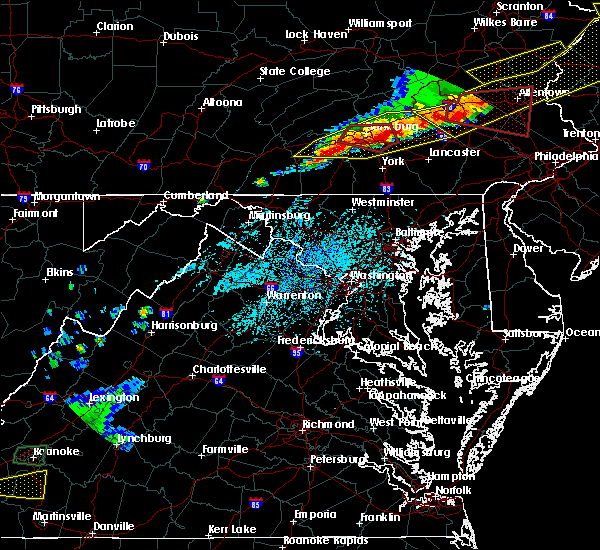 At 431 pm edt, a severe thunderstorm was located over pine grove furnace, moving east at 45 mph (radar indicated). Hazards include 70 mph wind gusts and quarter size hail. Hail damage to vehicles is possible. expect considerable tree damage. Wind damage is also likely to mobile homes, roofs, and outbuildings. At 431 pm edt, a severe thunderstorm was located over pine grove furnace, moving east at 45 mph (radar indicated). Hazards include 70 mph wind gusts and quarter size hail. Hail damage to vehicles is possible. expect considerable tree damage. Wind damage is also likely to mobile homes, roofs, and outbuildings.
|
| 5/13/2018 5:41 PM EDT |
 The severe thunderstorm warning for southeastern washington, east central greene and southwestern fayette counties will expire at 545 pm edt, the storm that prompted the warning has weakened below severe limits and no longer pose an immediate threat to life and property. therefore, the warning will be allowed to expire. a severe thunderstorm watch remains in effect until 1100 pm edt for southwestern pennsylvania. The severe thunderstorm warning for southeastern washington, east central greene and southwestern fayette counties will expire at 545 pm edt, the storm that prompted the warning has weakened below severe limits and no longer pose an immediate threat to life and property. therefore, the warning will be allowed to expire. a severe thunderstorm watch remains in effect until 1100 pm edt for southwestern pennsylvania.
|
| 5/13/2018 5:25 PM EDT |
 At 525 pm edt, a severe thunderstorm was located near brownsville, or 10 miles west of uniontown, moving east-southeast at 30 mph (radar). Hazards include wind gusts to 60 mph and quarter-size hail. Minor hail damage to vehicles is possible. expect wind damage to trees and power lines, resulting in some power outages. Locations impacted include, uniontown, california, brownsville, fairchance, isabella, dunbar, west brownsville, republic, nemacolin, grindstone, new salem, centerville,. At 525 pm edt, a severe thunderstorm was located near brownsville, or 10 miles west of uniontown, moving east-southeast at 30 mph (radar). Hazards include wind gusts to 60 mph and quarter-size hail. Minor hail damage to vehicles is possible. expect wind damage to trees and power lines, resulting in some power outages. Locations impacted include, uniontown, california, brownsville, fairchance, isabella, dunbar, west brownsville, republic, nemacolin, grindstone, new salem, centerville,.
|
| 5/13/2018 5:10 PM EDT |
 At 510 pm edt, a severe thunderstorm was located over fredericktown-millsboro, or 10 miles northeast of waynesburg, moving east-southeast at 35 mph (radar). Hazards include wind gusts to 60 mph and quarter-size hail. Minor hail damage to vehicles is possible. expect wind damage to trees and power lines, resulting in some power outages. Locations impacted include, uniontown, california, brownsville, fredericktown-millsboro, jefferson boro, fairdale, fairchance, isabella, dunbar, west brownsville, deemston, republic,. At 510 pm edt, a severe thunderstorm was located over fredericktown-millsboro, or 10 miles northeast of waynesburg, moving east-southeast at 35 mph (radar). Hazards include wind gusts to 60 mph and quarter-size hail. Minor hail damage to vehicles is possible. expect wind damage to trees and power lines, resulting in some power outages. Locations impacted include, uniontown, california, brownsville, fredericktown-millsboro, jefferson boro, fairdale, fairchance, isabella, dunbar, west brownsville, deemston, republic,.
|
| 5/13/2018 4:53 PM EDT |
 At 453 pm edt, a severe thunderstorm was located 8 miles west of fredericktown-millsboro, or 9 miles north of waynesburg, moving east at 40 mph (radar). Hazards include wind gusts to 60 mph and quarter-size hail. Minor hail damage to vehicles is possible. Expect wind damage to trees and power lines, resulting in some power outages. At 453 pm edt, a severe thunderstorm was located 8 miles west of fredericktown-millsboro, or 9 miles north of waynesburg, moving east at 40 mph (radar). Hazards include wind gusts to 60 mph and quarter-size hail. Minor hail damage to vehicles is possible. Expect wind damage to trees and power lines, resulting in some power outages.
|
| 5/12/2018 7:21 PM EDT |
 At 720 pm edt, severe thunderstorms were located along a line extending from safe harbor to near red lion to near codorus to littlestown, moving east at 40 mph (radar indicated). Hazards include 60 mph wind gusts and quarter size hail. Hail damage to vehicles is possible. expect wind damage to trees and power lines. locations impacted include, dallastown, hanover, parkville, red lion, spry, york, brogue, windsor, york airport and spring grove. A tornado watch remains in effect until 100 am edt for south central pennsylvania. At 720 pm edt, severe thunderstorms were located along a line extending from safe harbor to near red lion to near codorus to littlestown, moving east at 40 mph (radar indicated). Hazards include 60 mph wind gusts and quarter size hail. Hail damage to vehicles is possible. expect wind damage to trees and power lines. locations impacted include, dallastown, hanover, parkville, red lion, spry, york, brogue, windsor, york airport and spring grove. A tornado watch remains in effect until 100 am edt for south central pennsylvania.
|
| 5/12/2018 6:52 PM EDT |
 At 652 pm edt, severe thunderstorms were located along a line extending from columbia to hampton to near taneytown, moving east at 45 mph (radar indicated). Hazards include 60 mph wind gusts and quarter size hail. Hail damage to vehicles is possible. Expect wind damage to trees and power lines. At 652 pm edt, severe thunderstorms were located along a line extending from columbia to hampton to near taneytown, moving east at 45 mph (radar indicated). Hazards include 60 mph wind gusts and quarter size hail. Hail damage to vehicles is possible. Expect wind damage to trees and power lines.
|
| 5/10/2018 5:45 PM EDT |
 At 543 pm edt, a severe thunderstorm was located over glen rock, moving east at 35 mph (radar indicated). Hazards include 60 mph wind gusts and quarter size hail. Hail damage to vehicles is possible. Expect wind damage to trees and power lines. At 543 pm edt, a severe thunderstorm was located over glen rock, moving east at 35 mph (radar indicated). Hazards include 60 mph wind gusts and quarter size hail. Hail damage to vehicles is possible. Expect wind damage to trees and power lines.
|
| 5/10/2018 5:34 PM EDT |
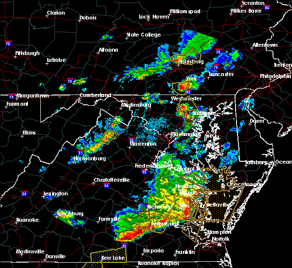 At 533 pm edt, a severe thunderstorm was located over spring grove, moving east at 25 mph (radar indicated). Hazards include 60 mph wind gusts and quarter size hail. Hail damage to vehicles is possible. expect wind damage to trees and power lines. Locations impacted include, spry, york, grantley, york airport, jacobus, spring grove, tyler run-queens gate, glen rock, codorus and east berlin. At 533 pm edt, a severe thunderstorm was located over spring grove, moving east at 25 mph (radar indicated). Hazards include 60 mph wind gusts and quarter size hail. Hail damage to vehicles is possible. expect wind damage to trees and power lines. Locations impacted include, spry, york, grantley, york airport, jacobus, spring grove, tyler run-queens gate, glen rock, codorus and east berlin.
|
| 5/10/2018 5:11 PM EDT |
 At 510 pm edt, a severe thunderstorm was located over hampton, moving east at 25 mph (radar indicated). Hazards include 60 mph wind gusts and quarter size hail. Hail damage to vehicles is possible. Expect wind damage to trees and power lines. At 510 pm edt, a severe thunderstorm was located over hampton, moving east at 25 mph (radar indicated). Hazards include 60 mph wind gusts and quarter size hail. Hail damage to vehicles is possible. Expect wind damage to trees and power lines.
|
| 9/5/2017 4:51 PM EDT |
 At 448 pm edt, severe thunderstorms were located along a line extending from near manchester to glen rock, moving east at 50 mph (radar indicated). Hazards include 70 mph wind gusts and penny size hail. Expect considerable tree damage. damage is likely to mobile homes, roofs, and outbuildings. Locations impacted include, parkville, red lion, spry, weigelstown, dallastown, york, lower allen, new cumberland, york airport and siddonsburg. At 448 pm edt, severe thunderstorms were located along a line extending from near manchester to glen rock, moving east at 50 mph (radar indicated). Hazards include 70 mph wind gusts and penny size hail. Expect considerable tree damage. damage is likely to mobile homes, roofs, and outbuildings. Locations impacted include, parkville, red lion, spry, weigelstown, dallastown, york, lower allen, new cumberland, york airport and siddonsburg.
|
| 9/5/2017 3:51 PM EDT |
 At 350 pm edt, severe thunderstorms were located along a line extending from near walnut bottom to carroll valley, moving east at 35 mph (radar indicated). Hazards include 60 mph wind gusts and nickel size hail. Expect damage to trees and power lines. severe thunderstorms will be near, gettysburg and pine grove furnace around 400 pm edt. aspers, bonneauville, lake heritage and mount holly springs around 410 pm edt. littlestown, mcsherrystown, lake meade, dillsburg, hampton and new oxford around 420 pm edt. parkville, hanover, pennville and siddonsburg around 430 pm edt. other locations impacted by these severe thunderstorms include arendtsville, east prospect, gardners, fawn grove, glenville, heidlersburg, biglerville, loganville, new salem and lewisberry. this includes the following interstates, the pennsylvania turnpike from mile markers 237 to 245. Interstate 83 from mile markers 0 to 40. At 350 pm edt, severe thunderstorms were located along a line extending from near walnut bottom to carroll valley, moving east at 35 mph (radar indicated). Hazards include 60 mph wind gusts and nickel size hail. Expect damage to trees and power lines. severe thunderstorms will be near, gettysburg and pine grove furnace around 400 pm edt. aspers, bonneauville, lake heritage and mount holly springs around 410 pm edt. littlestown, mcsherrystown, lake meade, dillsburg, hampton and new oxford around 420 pm edt. parkville, hanover, pennville and siddonsburg around 430 pm edt. other locations impacted by these severe thunderstorms include arendtsville, east prospect, gardners, fawn grove, glenville, heidlersburg, biglerville, loganville, new salem and lewisberry. this includes the following interstates, the pennsylvania turnpike from mile markers 237 to 245. Interstate 83 from mile markers 0 to 40.
|
| 8/19/2017 8:07 PM EDT |
 At 807 pm edt, severe thunderstorms were located along a line extending from pleasant hill to elizabethtown to emigsville to near spring grove, moving east at 45 mph (radar indicated). Hazards include 60 mph wind gusts. Expect damage to trees and power lines. severe thunderstorms will be near, mount joy, elizabethtown and rheems around 810 pm edt. manheim, columbia, east petersburg, wrightsville, jacobus, hallam, yorkana, salunga-landisville, marietta and maytown around 820 pm edt. red lion, millersville, akron, lititz, dallastown, lancaster, rothsville, mountville, windsor and yoe around 830 pm edt. willow street, new holland, ephrata, brogue, terre hill, shenks ferry, strasburg, safe harbor, leola and bareville around 840 pm edt. this includes the following interstates, the pennsylvania turnpike from mile markers 268 to 295. Interstate 83 from mile markers 7 to 30. At 807 pm edt, severe thunderstorms were located along a line extending from pleasant hill to elizabethtown to emigsville to near spring grove, moving east at 45 mph (radar indicated). Hazards include 60 mph wind gusts. Expect damage to trees and power lines. severe thunderstorms will be near, mount joy, elizabethtown and rheems around 810 pm edt. manheim, columbia, east petersburg, wrightsville, jacobus, hallam, yorkana, salunga-landisville, marietta and maytown around 820 pm edt. red lion, millersville, akron, lititz, dallastown, lancaster, rothsville, mountville, windsor and yoe around 830 pm edt. willow street, new holland, ephrata, brogue, terre hill, shenks ferry, strasburg, safe harbor, leola and bareville around 840 pm edt. this includes the following interstates, the pennsylvania turnpike from mile markers 268 to 295. Interstate 83 from mile markers 7 to 30.
|
| 8/19/2017 5:50 PM EDT |
 At 550 pm edt, a severe thunderstorm was located over south connellsville, or near connellsville, moving southeast at 30 mph (radar). Hazards include 60 mph wind gusts. Expect damage to trees and power lines, resulting in some power outages. Locations impacted include, uniontown, connellsville, monessen, donora, brownsville, fredericktown-millsboro, south connellsville, farmington, perryopolis, north belle vernon, speers, isabella, this includes interstate 70 in pennsylvania between mile markers 41 and 46. At 550 pm edt, a severe thunderstorm was located over south connellsville, or near connellsville, moving southeast at 30 mph (radar). Hazards include 60 mph wind gusts. Expect damage to trees and power lines, resulting in some power outages. Locations impacted include, uniontown, connellsville, monessen, donora, brownsville, fredericktown-millsboro, south connellsville, farmington, perryopolis, north belle vernon, speers, isabella, this includes interstate 70 in pennsylvania between mile markers 41 and 46.
|
| 8/19/2017 5:16 PM EDT |
 At 516 pm edt, a severe thunderstorm was located near california, or 13 miles west of connellsville, moving southeast at 40 mph (radar). Hazards include 60 mph wind gusts and quarter-size hail. Minor hail damage to vehicles is possible. Expect wind damage to trees and power lines, resulting in some power outages. At 516 pm edt, a severe thunderstorm was located near california, or 13 miles west of connellsville, moving southeast at 40 mph (radar). Hazards include 60 mph wind gusts and quarter-size hail. Minor hail damage to vehicles is possible. Expect wind damage to trees and power lines, resulting in some power outages.
|
| 8/4/2017 10:50 PM EDT |
 At 1049 pm edt, a severe thunderstorm was located over lake heritage, moving northeast at 30 mph (radar indicated). Hazards include 60 mph wind gusts. expect damage to trees and power lines At 1049 pm edt, a severe thunderstorm was located over lake heritage, moving northeast at 30 mph (radar indicated). Hazards include 60 mph wind gusts. expect damage to trees and power lines
|
| 8/4/2017 9:53 PM EDT |
 At 952 pm edt, a severe thunderstorm was located over rouzerville, moving east at 45 mph (radar indicated). Hazards include 60 mph wind gusts and quarter size hail. Hail damage to vehicles is possible. Expect wind damage to trees and power lines. At 952 pm edt, a severe thunderstorm was located over rouzerville, moving east at 45 mph (radar indicated). Hazards include 60 mph wind gusts and quarter size hail. Hail damage to vehicles is possible. Expect wind damage to trees and power lines.
|
| 8/2/2017 2:25 PM EDT |
 At 224 pm edt, a severe thunderstorm was located over cross roads, moving southeast at 20 mph (radar indicated). Hazards include 60 mph wind gusts and quarter size hail. Hail damage to vehicles is possible. expect wind damage to trees and power lines. Locations impacted include, dallastown, york, red lion, spry, north york, west york, windsor, york airport, spring grove and stonybrook-wilshire. At 224 pm edt, a severe thunderstorm was located over cross roads, moving southeast at 20 mph (radar indicated). Hazards include 60 mph wind gusts and quarter size hail. Hail damage to vehicles is possible. expect wind damage to trees and power lines. Locations impacted include, dallastown, york, red lion, spry, north york, west york, windsor, york airport, spring grove and stonybrook-wilshire.
|
| 8/2/2017 2:18 PM EDT | Trees and large branches down in york county PA, 0.3 miles NNW of New Salem, PA |
| 8/2/2017 1:59 PM EDT |
 At 159 pm edt, a severe thunderstorm was located over jacobus, moving southeast at 20 mph (radar indicated). Hazards include 60 mph wind gusts and quarter size hail. Hail damage to vehicles is possible. Expect wind damage to trees and power lines. At 159 pm edt, a severe thunderstorm was located over jacobus, moving southeast at 20 mph (radar indicated). Hazards include 60 mph wind gusts and quarter size hail. Hail damage to vehicles is possible. Expect wind damage to trees and power lines.
|
| 7/7/2017 3:47 PM EDT |
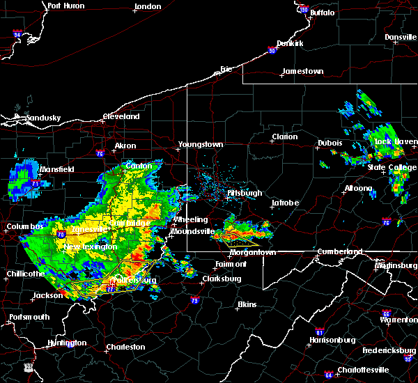 At 347 pm edt, a severe thunderstorm was located over masontown, or 10 miles west of uniontown, moving southeast at 40 mph (radar). Hazards include 60 mph wind gusts. Expect damage to trees and power lines, resulting in some power outages. Locations impacted include, uniontown, masontown, farmington, fairdale, jefferson boro, fairchance, isabella, smithfield, nemacolin, carmichaels, rices landing, new salem,. At 347 pm edt, a severe thunderstorm was located over masontown, or 10 miles west of uniontown, moving southeast at 40 mph (radar). Hazards include 60 mph wind gusts. Expect damage to trees and power lines, resulting in some power outages. Locations impacted include, uniontown, masontown, farmington, fairdale, jefferson boro, fairchance, isabella, smithfield, nemacolin, carmichaels, rices landing, new salem,.
|
| 7/7/2017 3:36 PM EDT |
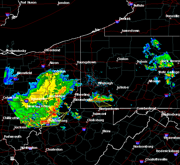 At 336 pm edt, a severe thunderstorm was located over jefferson boro, or 9 miles east of waynesburg, moving southeast at 35 mph (radar). Hazards include 60 mph wind gusts. expect damage to trees and power lines, resulting in some power outages At 336 pm edt, a severe thunderstorm was located over jefferson boro, or 9 miles east of waynesburg, moving southeast at 35 mph (radar). Hazards include 60 mph wind gusts. expect damage to trees and power lines, resulting in some power outages
|
| 6/23/2017 5:48 PM EDT |
 At 548 pm edt, a confirmed tornado was located over uniontown, moving east at 40 mph (weather spotters confirmed tornado). Hazards include damaging tornado. Flying debris will be dangerous to those caught without shelter. mobile homes will be damaged or destroyed. damage to roofs, windows, and vehicles will occur. tree damage is likely. this tornado will be near, connellsville and south connellsville around 600 pm edt. Other locations impacted by this tornadic thunderstorm include mill run, ohiopyle, chalkhill, new salem, dunbar, nemacolin, isabella, republic, fairchance and normalville. At 548 pm edt, a confirmed tornado was located over uniontown, moving east at 40 mph (weather spotters confirmed tornado). Hazards include damaging tornado. Flying debris will be dangerous to those caught without shelter. mobile homes will be damaged or destroyed. damage to roofs, windows, and vehicles will occur. tree damage is likely. this tornado will be near, connellsville and south connellsville around 600 pm edt. Other locations impacted by this tornadic thunderstorm include mill run, ohiopyle, chalkhill, new salem, dunbar, nemacolin, isabella, republic, fairchance and normalville.
|
| 6/23/2017 5:35 PM EDT |
 At 535 pm edt, a severe thunderstorm capable of producing a tornado was located near masontown, or 7 miles west of uniontown, moving east at 40 mph (radar indicated rotation). Hazards include tornado. Flying debris will be dangerous to those caught without shelter. mobile homes will be damaged or destroyed. damage to roofs, windows, and vehicles will occur. tree damage is likely. this dangerous storm will be near, uniontown around 545 pm edt. connellsville and south connellsville around 600 pm edt. other locations impacted by this tornadic thunderstorm include mill run, ohiopyle, chalkhill, new salem, dunbar, nemacolin, isabella, republic, fairchance and normalville. Please report severe weather by calling 412-262-1988, posting to the nws pittsburgh facebook page, or using twitter @nwspittsburgh. At 535 pm edt, a severe thunderstorm capable of producing a tornado was located near masontown, or 7 miles west of uniontown, moving east at 40 mph (radar indicated rotation). Hazards include tornado. Flying debris will be dangerous to those caught without shelter. mobile homes will be damaged or destroyed. damage to roofs, windows, and vehicles will occur. tree damage is likely. this dangerous storm will be near, uniontown around 545 pm edt. connellsville and south connellsville around 600 pm edt. other locations impacted by this tornadic thunderstorm include mill run, ohiopyle, chalkhill, new salem, dunbar, nemacolin, isabella, republic, fairchance and normalville. Please report severe weather by calling 412-262-1988, posting to the nws pittsburgh facebook page, or using twitter @nwspittsburgh.
|
| 6/23/2017 5:29 PM EDT |
 At 528 pm edt, severe thunderstorms were located along a line extending from near waynesburg to near cassville to mannington, moving east at 50 mph (radar). Hazards include 60 mph wind gusts. expect damage to trees and power lines, resulting in some power outages At 528 pm edt, severe thunderstorms were located along a line extending from near waynesburg to near cassville to mannington, moving east at 50 mph (radar). Hazards include 60 mph wind gusts. expect damage to trees and power lines, resulting in some power outages
|
| 6/23/2017 5:08 PM EDT |
 At 507 pm edt, severe thunderstorms were located along a line extending from near cameron to near hundred to jacksonburg, moving east at 55 mph (radar). Hazards include 60 mph wind gusts. Expect damage to trees and power lines, resulting in some power outages. locations impacted include, morgantown, fairmont, waynesburg, westover, mannington, star city, masontown, pleasant valley, winfield, fredericktown-millsboro, fairdale, jefferson boro, this includes the following highways, interstate 68 in west virginia near mile marker 1. interstate 79 in pennsylvania between mile markers 0 and 19. Interstate 79 in west virginia between mile markers 130 and 160. At 507 pm edt, severe thunderstorms were located along a line extending from near cameron to near hundred to jacksonburg, moving east at 55 mph (radar). Hazards include 60 mph wind gusts. Expect damage to trees and power lines, resulting in some power outages. locations impacted include, morgantown, fairmont, waynesburg, westover, mannington, star city, masontown, pleasant valley, winfield, fredericktown-millsboro, fairdale, jefferson boro, this includes the following highways, interstate 68 in west virginia near mile marker 1. interstate 79 in pennsylvania between mile markers 0 and 19. Interstate 79 in west virginia between mile markers 130 and 160.
|
| 6/23/2017 4:46 PM EDT |
 At 446 pm edt, severe thunderstorms were located along a line extending from near cameron to middlebourne, moving east at 45 mph (radar). Hazards include 60 mph wind gusts. expect damage to trees and power lines, resulting in some power outages At 446 pm edt, severe thunderstorms were located along a line extending from near cameron to middlebourne, moving east at 45 mph (radar). Hazards include 60 mph wind gusts. expect damage to trees and power lines, resulting in some power outages
|
| 6/23/2017 4:22 PM EDT |
 At 421 pm edt, a severe thunderstorm was located over uniontown, moving east at 45 mph (radar). Hazards include 60 mph wind gusts. Expect damage to trees and power lines, resulting in some power outages. Locations impacted include, uniontown, connellsville, masontown, south connellsville, farmington, fairchance, isabella, dunbar, smithfield, republic, nemacolin, new salem,. At 421 pm edt, a severe thunderstorm was located over uniontown, moving east at 45 mph (radar). Hazards include 60 mph wind gusts. Expect damage to trees and power lines, resulting in some power outages. Locations impacted include, uniontown, connellsville, masontown, south connellsville, farmington, fairchance, isabella, dunbar, smithfield, republic, nemacolin, new salem,.
|
| 6/23/2017 3:59 PM EDT |
 At 358 pm edt, a severe thunderstorm was located over fairdale, or 10 miles east of waynesburg, moving east at 55 mph (radar). Hazards include 60 mph wind gusts. expect damage to trees and power lines, resulting in some power outages At 358 pm edt, a severe thunderstorm was located over fairdale, or 10 miles east of waynesburg, moving east at 55 mph (radar). Hazards include 60 mph wind gusts. expect damage to trees and power lines, resulting in some power outages
|
| 6/19/2017 1:49 PM EDT |
 At 148 pm edt, severe thunderstorms were located along a line extending from near littlestown to royalton to penbrook to near dehart dam, moving east at 40 mph (radar indicated). Hazards include 70 mph wind gusts and quarter size hail. Hail damage to vehicles is possible. expect considerable tree damage. Wind damage is also likely to mobile homes, roofs, and outbuildings. At 148 pm edt, severe thunderstorms were located along a line extending from near littlestown to royalton to penbrook to near dehart dam, moving east at 40 mph (radar indicated). Hazards include 70 mph wind gusts and quarter size hail. Hail damage to vehicles is possible. expect considerable tree damage. Wind damage is also likely to mobile homes, roofs, and outbuildings.
|
| 6/19/2017 1:28 PM EDT |
 At 125 pm edt, severe thunderstorms were located along a line extending from new kingstown to boiling springs to near dillsburg to near lake heritage, moving northeast at 45 mph (radar indicated). Hazards include 70 mph wind gusts. Expect considerable tree damage. damage is likely to mobile homes, roofs, and outbuildings. Locations impacted include, parkville, red lion, weigelstown, dallastown, hanover, carlisle, lower allen, spry, enola and mechanicsburg. At 125 pm edt, severe thunderstorms were located along a line extending from new kingstown to boiling springs to near dillsburg to near lake heritage, moving northeast at 45 mph (radar indicated). Hazards include 70 mph wind gusts. Expect considerable tree damage. damage is likely to mobile homes, roofs, and outbuildings. Locations impacted include, parkville, red lion, weigelstown, dallastown, hanover, carlisle, lower allen, spry, enola and mechanicsburg.
|
| 6/19/2017 12:40 PM EDT |
 At 1239 pm edt, severe thunderstorms were located along a line extending from near walnut bottom to mont alto to near paramount-long meadow, moving east at 50 mph (radar indicated). Hazards include 70 mph wind gusts. Expect considerable tree damage. Damage is likely to mobile homes, roofs, and outbuildings. At 1239 pm edt, severe thunderstorms were located along a line extending from near walnut bottom to mont alto to near paramount-long meadow, moving east at 50 mph (radar indicated). Hazards include 70 mph wind gusts. Expect considerable tree damage. Damage is likely to mobile homes, roofs, and outbuildings.
|
| 5/19/2017 5:12 PM EDT |
 At 512 pm edt, a severe thunderstorm was located near uniontown, moving northeast at 15 mph (radar). Hazards include 60 mph wind gusts and quarter-size hail. Minor hail damage to vehicles is possible. Expect wind damage to trees and power lines, resulting in some power outages. At 512 pm edt, a severe thunderstorm was located near uniontown, moving northeast at 15 mph (radar). Hazards include 60 mph wind gusts and quarter-size hail. Minor hail damage to vehicles is possible. Expect wind damage to trees and power lines, resulting in some power outages.
|
| 5/1/2017 3:19 PM EDT |
 At 319 pm edt, severe thunderstorms were located along a line extending from white oak to near pleasant valley, moving east at 30 mph (radar). Hazards include 60 mph wind gusts. Expect damage to trees and power lines, resulting in some power outages. locations impacted include, morgantown, uniontown, connellsville, westover, star city, monessen, california, donora, mount pleasant, scottdale, charleroi, masontown, this includes the following highways, interstate 68 in west virginia between mile markers 1 and 14. interstate 70 in pennsylvania between mile markers 39 and 57. pennsylvania turnpike between mile markers 70 and 85. interstate 79 in pennsylvania between mile markers 0 and 2. interstate 79 in west virginia between mile markers 148 and 160. A tornado watch remains in effect until 700 pm edt for southwestern pennsylvania, and northern and northeastern west virginia. At 319 pm edt, severe thunderstorms were located along a line extending from white oak to near pleasant valley, moving east at 30 mph (radar). Hazards include 60 mph wind gusts. Expect damage to trees and power lines, resulting in some power outages. locations impacted include, morgantown, uniontown, connellsville, westover, star city, monessen, california, donora, mount pleasant, scottdale, charleroi, masontown, this includes the following highways, interstate 68 in west virginia between mile markers 1 and 14. interstate 70 in pennsylvania between mile markers 39 and 57. pennsylvania turnpike between mile markers 70 and 85. interstate 79 in pennsylvania between mile markers 0 and 2. interstate 79 in west virginia between mile markers 148 and 160. A tornado watch remains in effect until 700 pm edt for southwestern pennsylvania, and northern and northeastern west virginia.
|
| 5/1/2017 3:16 PM EDT |
 At 319 pm edt, severe thunderstorms were located along a line extending from white oak to near pleasant valley, moving east at 30 mph (radar). Hazards include 60 mph wind gusts. Expect damage to trees and power lines, resulting in some power outages. locations impacted include, morgantown, uniontown, connellsville, westover, star city, monessen, california, donora, mount pleasant, scottdale, charleroi, masontown, this includes the following highways, interstate 68 in west virginia between mile markers 1 and 14. interstate 70 in pennsylvania between mile markers 39 and 57. pennsylvania turnpike between mile markers 70 and 85. interstate 79 in pennsylvania between mile markers 0 and 2. interstate 79 in west virginia between mile markers 148 and 160. A tornado watch remains in effect until 700 pm edt for southwestern pennsylvania, and northern and northeastern west virginia. At 319 pm edt, severe thunderstorms were located along a line extending from white oak to near pleasant valley, moving east at 30 mph (radar). Hazards include 60 mph wind gusts. Expect damage to trees and power lines, resulting in some power outages. locations impacted include, morgantown, uniontown, connellsville, westover, star city, monessen, california, donora, mount pleasant, scottdale, charleroi, masontown, this includes the following highways, interstate 68 in west virginia between mile markers 1 and 14. interstate 70 in pennsylvania between mile markers 39 and 57. pennsylvania turnpike between mile markers 70 and 85. interstate 79 in pennsylvania between mile markers 0 and 2. interstate 79 in west virginia between mile markers 148 and 160. A tornado watch remains in effect until 700 pm edt for southwestern pennsylvania, and northern and northeastern west virginia.
|
| 5/1/2017 2:54 PM EDT |
 At 254 pm edt, severe thunderstorms were located along a line extending from castle shannon to near lumberport, moving east at 35 mph (radar). Hazards include 60 mph wind gusts. expect damage to trees and power lines, resulting in some power outages At 254 pm edt, severe thunderstorms were located along a line extending from castle shannon to near lumberport, moving east at 35 mph (radar). Hazards include 60 mph wind gusts. expect damage to trees and power lines, resulting in some power outages
|
| 5/1/2017 2:54 PM EDT |
 The national weather service in pittsburgh has issued a * severe thunderstorm warning for. southeastern washington county in southwestern pennsylvania. southeastern allegheny county in southwestern pennsylvania. southwestern westmoreland county in southwestern pennsylvania. Eastern greene county in southwestern pennsylvania. The national weather service in pittsburgh has issued a * severe thunderstorm warning for. southeastern washington county in southwestern pennsylvania. southeastern allegheny county in southwestern pennsylvania. southwestern westmoreland county in southwestern pennsylvania. Eastern greene county in southwestern pennsylvania.
|
| 4/16/2017 7:11 PM EDT |
 At 711 pm edt, a severe thunderstorm was located near masontown, or near uniontown, moving southeast at 35 mph (radar). Hazards include 60 mph wind gusts. Expect damage to trees and power lines, resulting in some power outages. Locations impacted include, uniontown, masontown, farmington, fairchance, smithfield, new salem, markleysburg, greensboro, chalkhill, ohiopyle,. At 711 pm edt, a severe thunderstorm was located near masontown, or near uniontown, moving southeast at 35 mph (radar). Hazards include 60 mph wind gusts. Expect damage to trees and power lines, resulting in some power outages. Locations impacted include, uniontown, masontown, farmington, fairchance, smithfield, new salem, markleysburg, greensboro, chalkhill, ohiopyle,.
|
| 4/16/2017 6:53 PM EDT |
 At 652 pm edt, a severe thunderstorm was located over fairdale, or 10 miles east of waynesburg, moving southeast at 30 mph (radar). Hazards include 60 mph wind gusts. expect damage to trees and power lines, resulting in some power outages At 652 pm edt, a severe thunderstorm was located over fairdale, or 10 miles east of waynesburg, moving southeast at 30 mph (radar). Hazards include 60 mph wind gusts. expect damage to trees and power lines, resulting in some power outages
|
| 3/1/2017 1:35 PM EST |
 At 129 pm est, severe thunderstorms were located along a line extending from near dillsburg to near hampton to near lake heritage, moving east at 65 mph (radar indicated). Hazards include 60 mph wind gusts. expect damage to roofs, siding, and trees At 129 pm est, severe thunderstorms were located along a line extending from near dillsburg to near hampton to near lake heritage, moving east at 65 mph (radar indicated). Hazards include 60 mph wind gusts. expect damage to roofs, siding, and trees
|
| 3/1/2017 10:50 AM EST |
 At 1049 am est, severe thunderstorms were located along a line extending from 6 miles west of connellsville to 7 miles southwest of cassville, moving east at 50 mph (radar). Hazards include 60 mph wind gusts. Expect damage to trees and power lines, resulting in some power outages. locations impacted include, morgantown, uniontown, connellsville, westover, star city, california, scottdale, masontown, brownsville, south connellsville, perryopolis, fairdale, this includes the following highways, interstate 68 in west virginia between mile markers 3 and 11. interstate 79 in pennsylvania between mile markers 0 and 7. Interstate 79 in west virginia between mile markers 150 and 160. At 1049 am est, severe thunderstorms were located along a line extending from 6 miles west of connellsville to 7 miles southwest of cassville, moving east at 50 mph (radar). Hazards include 60 mph wind gusts. Expect damage to trees and power lines, resulting in some power outages. locations impacted include, morgantown, uniontown, connellsville, westover, star city, california, scottdale, masontown, brownsville, south connellsville, perryopolis, fairdale, this includes the following highways, interstate 68 in west virginia between mile markers 3 and 11. interstate 79 in pennsylvania between mile markers 0 and 7. Interstate 79 in west virginia between mile markers 150 and 160.
|
| 3/1/2017 10:40 AM EST |
 At 1039 am est, severe thunderstorms were located along a line extending from near brownsville to near mannington, moving east at 70 mph (radar). Hazards include 60 mph wind gusts. a brief tornado may be possible with individual cells embedded in the line. Expect damage to trees and power lines, resulting in some power outages. locations impacted include, morgantown, uniontown, connellsville, waynesburg, westover, star city, california, scottdale, masontown, brownsville, fredericktown-millsboro, south connellsville, this includes the following highways, interstate 68 in west virginia between mile markers 3 and 11. interstate 79 in pennsylvania between mile markers 0 and 21. Interstate 79 in west virginia between mile markers 150 and 160. At 1039 am est, severe thunderstorms were located along a line extending from near brownsville to near mannington, moving east at 70 mph (radar). Hazards include 60 mph wind gusts. a brief tornado may be possible with individual cells embedded in the line. Expect damage to trees and power lines, resulting in some power outages. locations impacted include, morgantown, uniontown, connellsville, waynesburg, westover, star city, california, scottdale, masontown, brownsville, fredericktown-millsboro, south connellsville, this includes the following highways, interstate 68 in west virginia between mile markers 3 and 11. interstate 79 in pennsylvania between mile markers 0 and 21. Interstate 79 in west virginia between mile markers 150 and 160.
|
| 3/1/2017 10:17 AM EST |
 At 1015 am est, severe thunderstorms were located along a line extending from 7 miles north of waynesburg to near pine grove, moving east at 50 mph (radar). Hazards include 60 mph wind gusts. a brief tornado may be possible with individual cells embedded in the line. expect damage to trees and power lines, resulting in some power outages At 1015 am est, severe thunderstorms were located along a line extending from 7 miles north of waynesburg to near pine grove, moving east at 50 mph (radar). Hazards include 60 mph wind gusts. a brief tornado may be possible with individual cells embedded in the line. expect damage to trees and power lines, resulting in some power outages
|
| 3/1/2017 8:32 AM EST |
 At 832 am est, a severe thunderstorm was located over bethlehem, moving east at 45 mph (radar). Hazards include 60 mph wind gusts. Expect damage to trees and power lines, resulting in some power outages. locations impacted include, bethel park, wheeling, mcmurray, washington, moundsville, canonsburg, martins ferry, st. clairsville, bellaire, warwood, bethlehem, west liberty, this includes the following highways, interstate 70 in ohio between mile markers 217 and 225. interstate 70 in west virginia between mile markers 0 and 14. interstate 70 in pennsylvania between mile markers 0 and 42. Interstate 79 in pennsylvania between mile markers 16 and 21. At 832 am est, a severe thunderstorm was located over bethlehem, moving east at 45 mph (radar). Hazards include 60 mph wind gusts. Expect damage to trees and power lines, resulting in some power outages. locations impacted include, bethel park, wheeling, mcmurray, washington, moundsville, canonsburg, martins ferry, st. clairsville, bellaire, warwood, bethlehem, west liberty, this includes the following highways, interstate 70 in ohio between mile markers 217 and 225. interstate 70 in west virginia between mile markers 0 and 14. interstate 70 in pennsylvania between mile markers 0 and 42. Interstate 79 in pennsylvania between mile markers 16 and 21.
|
| 3/1/2017 8:15 AM EST |
 At 814 am est, a severe thunderstorm was located over wheeling, moving east at 85 mph (radar). Hazards include 60 mph wind gusts. expect damage to trees and power lines, resulting in some power outages At 814 am est, a severe thunderstorm was located over wheeling, moving east at 85 mph (radar). Hazards include 60 mph wind gusts. expect damage to trees and power lines, resulting in some power outages
|
| 2/25/2017 2:37 PM EST |
 At 236 pm est, a severe thunderstorm was located near littlestown, moving northeast at 50 mph (radar indicated). Hazards include 60 mph wind gusts and quarter size hail. Hail damage to vehicles is expected. Expect wind damage to roofs, siding, and trees. At 236 pm est, a severe thunderstorm was located near littlestown, moving northeast at 50 mph (radar indicated). Hazards include 60 mph wind gusts and quarter size hail. Hail damage to vehicles is expected. Expect wind damage to roofs, siding, and trees.
|
| 2/25/2017 2:15 PM EST |
 At 214 pm est, a severe thunderstorm was located over grantley, moving northeast at 30 mph (radar indicated). Hazards include 60 mph wind gusts and penny size hail. Expect damage to roofs, siding, and trees. Locations impacted include, mount joy, manheim, spry, columbia, dallastown, ephrata, york, east petersburg, elizabethtown, lititz, akron, red lion, weigelstown, stonybrook-wilshire, salunga-landisville, bainbridge, east york, rothsville, hallam and jacobus. At 214 pm est, a severe thunderstorm was located over grantley, moving northeast at 30 mph (radar indicated). Hazards include 60 mph wind gusts and penny size hail. Expect damage to roofs, siding, and trees. Locations impacted include, mount joy, manheim, spry, columbia, dallastown, ephrata, york, east petersburg, elizabethtown, lititz, akron, red lion, weigelstown, stonybrook-wilshire, salunga-landisville, bainbridge, east york, rothsville, hallam and jacobus.
|
| 2/25/2017 2:05 PM EST |
 At 205 pm est, a severe thunderstorm was located over tyler run-queens gate, moving northeast at 40 mph (radar indicated). Hazards include 60 mph wind gusts and penny size hail. expect damage to roofs, siding, and trees At 205 pm est, a severe thunderstorm was located over tyler run-queens gate, moving northeast at 40 mph (radar indicated). Hazards include 60 mph wind gusts and penny size hail. expect damage to roofs, siding, and trees
|
| 2/12/2017 8:32 PM EST |
 At 831 pm est, severe thunderstorms were located along a line extending from east conemaugh to near jefferson boro, moving east at 45 mph (public). Hazards include 60 mph wind gusts. Expect damage to trees and power lines, resulting in some power outages. locations impacted include, uniontown, latrobe, connellsville, waynesburg, california, mount pleasant, scottdale, masontown, mcchesneytown-loyalhanna, youngwood, derry, lawson heights, this includes the following highways, interstate 70 in pennsylvania between mile markers 46 and 52, and between mile markers 55 and 57. pennsylvania turnpike between mile markers 75 and 100. Interstate 79 in pennsylvania between mile markers 10 and 20. At 831 pm est, severe thunderstorms were located along a line extending from east conemaugh to near jefferson boro, moving east at 45 mph (public). Hazards include 60 mph wind gusts. Expect damage to trees and power lines, resulting in some power outages. locations impacted include, uniontown, latrobe, connellsville, waynesburg, california, mount pleasant, scottdale, masontown, mcchesneytown-loyalhanna, youngwood, derry, lawson heights, this includes the following highways, interstate 70 in pennsylvania between mile markers 46 and 52, and between mile markers 55 and 57. pennsylvania turnpike between mile markers 75 and 100. Interstate 79 in pennsylvania between mile markers 10 and 20.
|
| 2/12/2017 8:18 PM EST |
 At 817 pm est, severe thunderstorms were located along a line extending from 7 miles northwest of westmont to near waynesburg, moving east at 45 mph (public, law enforcement, and automated weather sensors). Hazards include 60 mph wind gusts. Expect damage to trees and power lines, resulting in some power outages. locations impacted include, greensburg, uniontown, jeannette, latrobe, connellsville, waynesburg, homer city, gastonville, murrysville, jefferson hills, monessen, california, this includes the following highways, interstate 70 in pennsylvania between mile markers 23 and 57. pennsylvania turnpike between mile markers 62 and 100. Interstate 79 in pennsylvania between mile markers 10 and 21, and between mile markers 155 and 166. At 817 pm est, severe thunderstorms were located along a line extending from 7 miles northwest of westmont to near waynesburg, moving east at 45 mph (public, law enforcement, and automated weather sensors). Hazards include 60 mph wind gusts. Expect damage to trees and power lines, resulting in some power outages. locations impacted include, greensburg, uniontown, jeannette, latrobe, connellsville, waynesburg, homer city, gastonville, murrysville, jefferson hills, monessen, california, this includes the following highways, interstate 70 in pennsylvania between mile markers 23 and 57. pennsylvania turnpike between mile markers 62 and 100. Interstate 79 in pennsylvania between mile markers 10 and 21, and between mile markers 155 and 166.
|
| 2/12/2017 7:59 PM EST |
 At 758 pm est, severe thunderstorms were located along a line extending from near blairsville to 7 miles southeast of valley grove, moving east at 45 mph (radar). Hazards include 60 mph wind gusts. expect damage to trees and power lines, resulting in some power outages At 758 pm est, severe thunderstorms were located along a line extending from near blairsville to 7 miles southeast of valley grove, moving east at 45 mph (radar). Hazards include 60 mph wind gusts. expect damage to trees and power lines, resulting in some power outages
|
| 10/30/2016 4:32 PM EDT |
 At 432 pm edt, severe thunderstorms were located along a line extending from near strausstown to near elizabethtown to near emmitsburg, moving east at 50 mph (radar indicated). Hazards include 60 mph wind gusts. Expect damage to roofs. siding. And trees. At 432 pm edt, severe thunderstorms were located along a line extending from near strausstown to near elizabethtown to near emmitsburg, moving east at 50 mph (radar indicated). Hazards include 60 mph wind gusts. Expect damage to roofs. siding. And trees.
|
| 10/20/2016 5:27 PM EDT |
 At 527 pm edt, a severe thunderstorm was located 8 miles southwest of waynesburg, moving northeast at 45 mph (radar indicated). Hazards include 60 mph wind gusts and quarter size hail. Hail damage to vehicles is expected. Expect wind damage to trees and power lines, resulting in some power outages. At 527 pm edt, a severe thunderstorm was located 8 miles southwest of waynesburg, moving northeast at 45 mph (radar indicated). Hazards include 60 mph wind gusts and quarter size hail. Hail damage to vehicles is expected. Expect wind damage to trees and power lines, resulting in some power outages.
|
| 8/28/2016 8:01 PM EDT |
 At 801 pm edt, a severe thunderstorm was located near brownsville, or 9 miles northwest of uniontown, and is nearly stationary (radar indicated). Hazards include 60 mph wind gusts and quarter size hail. Hail damage to vehicles is expected. Expect wind damage to trees and power lines, resulting in some power outages. At 801 pm edt, a severe thunderstorm was located near brownsville, or 9 miles northwest of uniontown, and is nearly stationary (radar indicated). Hazards include 60 mph wind gusts and quarter size hail. Hail damage to vehicles is expected. Expect wind damage to trees and power lines, resulting in some power outages.
|
| 8/16/2016 7:57 PM EDT | The severe thunderstorm warning for northwestern garrett, fayette and northeastern preston counties will expire at 800 pm edt, the storms which prompted the warning have moved out of the area. therefore, the warning will be allowed to expire. to report severe weather, contact your nearest law enforcement agency. they will relay your report to the national weather service pittsburgh. |
| 8/16/2016 7:57 PM EDT | The severe thunderstorm warning for northwestern garrett, fayette and northeastern preston counties will expire at 800 pm edt, the storms which prompted the warning have moved out of the area. therefore, the warning will be allowed to expire. to report severe weather, contact your nearest law enforcement agency. they will relay your report to the national weather service pittsburgh. |
| 8/16/2016 7:57 PM EDT | The severe thunderstorm warning for northwestern garrett, fayette and northeastern preston counties will expire at 800 pm edt, the storms which prompted the warning have moved out of the area. therefore, the warning will be allowed to expire. to report severe weather, contact your nearest law enforcement agency. they will relay your report to the national weather service pittsburgh. |
| 8/16/2016 7:31 PM EDT |
 At 730 pm edt, severe thunderstorms were located along a line extending from near farmington to near friendsville, moving northeast at 45 mph (radar indicated). Hazards include 60 mph wind gusts. Expect damage to trees and power lines. resulting in some power outages. locations impacted include, uniontown, connellsville, south connellsville, farmington, grantsville, friendsville, accident, seven springs, fairchance, dunbar, smithfield, new salem, markleysburg, brandonville, chalkhill, bruceton mills, ohiopyle, mill run, indian head and hazelton. this includes the following highways, interstate 68 in maryland between mile markers 1 and 22. interstate 68 in west virginia between mile markers 18 and 32. Please report severe weather by calling 4 1 2, 2 6 2, 1 9 8 8, posting to the nws pittsburgh facebook page, or using twitter @nwspittsburgh. At 730 pm edt, severe thunderstorms were located along a line extending from near farmington to near friendsville, moving northeast at 45 mph (radar indicated). Hazards include 60 mph wind gusts. Expect damage to trees and power lines. resulting in some power outages. locations impacted include, uniontown, connellsville, south connellsville, farmington, grantsville, friendsville, accident, seven springs, fairchance, dunbar, smithfield, new salem, markleysburg, brandonville, chalkhill, bruceton mills, ohiopyle, mill run, indian head and hazelton. this includes the following highways, interstate 68 in maryland between mile markers 1 and 22. interstate 68 in west virginia between mile markers 18 and 32. Please report severe weather by calling 4 1 2, 2 6 2, 1 9 8 8, posting to the nws pittsburgh facebook page, or using twitter @nwspittsburgh.
|
| 8/16/2016 7:00 PM EDT |
 At 700 pm edt, severe thunderstorms were located along a line extending from near fairdale to near morgantown to near winfield, moving east at 45 mph (radar indicated). Hazards include 60 mph wind gusts. Expect damage to trees and power lines. Resulting in some power outages. At 700 pm edt, severe thunderstorms were located along a line extending from near fairdale to near morgantown to near winfield, moving east at 45 mph (radar indicated). Hazards include 60 mph wind gusts. Expect damage to trees and power lines. Resulting in some power outages.
|
| 8/16/2016 3:56 PM EDT |
 At 355 pm edt, severe thunderstorms were located along a line extending from near dehart dam to hallam, moving northeast at 40 mph (radar indicated). Hazards include 60 mph wind gusts. Expect damage to roofs. siding. And trees. At 355 pm edt, severe thunderstorms were located along a line extending from near dehart dam to hallam, moving northeast at 40 mph (radar indicated). Hazards include 60 mph wind gusts. Expect damage to roofs. siding. And trees.
|
| 7/25/2016 7:03 PM EDT |
 At 702 pm edt, severe thunderstorms were located along a line extending from near newmanstown to near elizabethtown to near boiling springs, moving southeast at 25 mph (radar indicated). Hazards include 60 mph wind gusts. Expect damage to roofs. siding. And trees. At 702 pm edt, severe thunderstorms were located along a line extending from near newmanstown to near elizabethtown to near boiling springs, moving southeast at 25 mph (radar indicated). Hazards include 60 mph wind gusts. Expect damage to roofs. siding. And trees.
|
| 7/25/2016 5:00 PM EDT |
 At 500 pm edt, a severe thunderstorm was located near uniontown, moving southeast at 25 mph (radar indicated). Hazards include 60 mph wind gusts. Expect damage to trees and power lines. Resulting in some power outages. At 500 pm edt, a severe thunderstorm was located near uniontown, moving southeast at 25 mph (radar indicated). Hazards include 60 mph wind gusts. Expect damage to trees and power lines. Resulting in some power outages.
|
| 7/23/2016 6:21 PM EDT |
 At 621 pm edt, a severe thunderstorm was located over fredericktown- millsboro, or 12 miles northeast of waynesburg, moving southeast at 5 mph (radar indicated). Hazards include 60 mph wind gusts. Expect damage to trees and power lines. resulting in some power outages. locations impacted include, brownsville, isabella and republic. Please report severe weather by calling 4 1 2, 2 6 2, 1 9 8 8, posting to the nws pittsburgh facebook page, or using twitter @nwspittsburgh. At 621 pm edt, a severe thunderstorm was located over fredericktown- millsboro, or 12 miles northeast of waynesburg, moving southeast at 5 mph (radar indicated). Hazards include 60 mph wind gusts. Expect damage to trees and power lines. resulting in some power outages. locations impacted include, brownsville, isabella and republic. Please report severe weather by calling 4 1 2, 2 6 2, 1 9 8 8, posting to the nws pittsburgh facebook page, or using twitter @nwspittsburgh.
|
| 7/23/2016 6:11 PM EDT |
 At 611 pm edt, a severe thunderstorm was located over fredericktown- millsboro, or 12 miles northeast of waynesburg, moving southeast at 5 mph (radar indicated). Hazards include 60 mph wind gusts. Expect damage to trees and power lines. resulting in some power outages. locations impacted include, california, brownsville, fredericktown-millsboro, fairdale, isabella, west brownsville, deemston, republic, carmichaels, rices landing, new salem and centerville. Please report severe weather by calling 4 1 2, 2 6 2, 1 9 8 8, posting to the nws pittsburgh facebook page, or using twitter @nwspittsburgh. At 611 pm edt, a severe thunderstorm was located over fredericktown- millsboro, or 12 miles northeast of waynesburg, moving southeast at 5 mph (radar indicated). Hazards include 60 mph wind gusts. Expect damage to trees and power lines. resulting in some power outages. locations impacted include, california, brownsville, fredericktown-millsboro, fairdale, isabella, west brownsville, deemston, republic, carmichaels, rices landing, new salem and centerville. Please report severe weather by calling 4 1 2, 2 6 2, 1 9 8 8, posting to the nws pittsburgh facebook page, or using twitter @nwspittsburgh.
|
| 7/23/2016 6:09 PM EDT |
 At 608 pm edt, severe thunderstorms were located along a line extending from mcsherrystown to jacobus to cross roads to near sunnyburn, moving southeast at 15 mph (radar indicated). Hazards include 60 mph wind gusts and quarter size hail. Hail damage to vehicles is expected. Expect wind damage to roofs, siding, and trees. At 608 pm edt, severe thunderstorms were located along a line extending from mcsherrystown to jacobus to cross roads to near sunnyburn, moving southeast at 15 mph (radar indicated). Hazards include 60 mph wind gusts and quarter size hail. Hail damage to vehicles is expected. Expect wind damage to roofs, siding, and trees.
|
| 7/23/2016 5:53 PM EDT |
 At 553 pm edt, a severe thunderstorm was located near fredericktown- millsboro, or 13 miles northeast of waynesburg, moving southeast at 5 mph (radar indicated). Hazards include 60 mph wind gusts and quarter size hail. Hail damage to vehicles is expected. expect wind damage to trees and power lines, resulting in some power outages. locations impacted include, brownsville, fredericktown-millsboro, fairdale, isabella, deemston, republic, carmichaels, beallsville, rices landing, new salem, clarksville and centerville. Please report severe weather by calling 4 1 2, 2 6 2, 1 9 8 8, posting to the nws pittsburgh facebook page, or using twitter @nwspittsburgh. At 553 pm edt, a severe thunderstorm was located near fredericktown- millsboro, or 13 miles northeast of waynesburg, moving southeast at 5 mph (radar indicated). Hazards include 60 mph wind gusts and quarter size hail. Hail damage to vehicles is expected. expect wind damage to trees and power lines, resulting in some power outages. locations impacted include, brownsville, fredericktown-millsboro, fairdale, isabella, deemston, republic, carmichaels, beallsville, rices landing, new salem, clarksville and centerville. Please report severe weather by calling 4 1 2, 2 6 2, 1 9 8 8, posting to the nws pittsburgh facebook page, or using twitter @nwspittsburgh.
|
| 7/23/2016 5:48 PM EDT |
 At 548 pm edt, a severe thunderstorm was located near bentleyville, or 12 miles southeast of washington, moving southeast at 5 mph (radar indicated). Hazards include 60 mph wind gusts and quarter size hail. Hail damage to vehicles is expected. Expect wind damage to trees and power lines, resulting in some power outages. At 548 pm edt, a severe thunderstorm was located near bentleyville, or 12 miles southeast of washington, moving southeast at 5 mph (radar indicated). Hazards include 60 mph wind gusts and quarter size hail. Hail damage to vehicles is expected. Expect wind damage to trees and power lines, resulting in some power outages.
|
| 7/14/2016 9:14 PM EDT |
 At 913 pm edt, a severe thunderstorm was located near masontown, or 9 miles west of uniontown, moving east at 30 mph (radar indicated). Hazards include 60 mph wind gusts. Expect damage to trees and power lines. resulting in some power outages. locations impacted include, uniontown, masontown, brownsville, fredericktown-millsboro, fairdale, fairchance, isabella, smithfield, nemacolin, republic, carmichaels, rices landing, new salem, grindstone and centerville. Please report severe weather by calling 4 1 2, 2 6 2, 1 9 8 8, posting to the nws pittsburgh facebook page, or using twitter @nwspittsburgh. At 913 pm edt, a severe thunderstorm was located near masontown, or 9 miles west of uniontown, moving east at 30 mph (radar indicated). Hazards include 60 mph wind gusts. Expect damage to trees and power lines. resulting in some power outages. locations impacted include, uniontown, masontown, brownsville, fredericktown-millsboro, fairdale, fairchance, isabella, smithfield, nemacolin, republic, carmichaels, rices landing, new salem, grindstone and centerville. Please report severe weather by calling 4 1 2, 2 6 2, 1 9 8 8, posting to the nws pittsburgh facebook page, or using twitter @nwspittsburgh.
|
| 7/14/2016 8:58 PM EDT |
 At 857 pm edt, a severe thunderstorm was located over jefferson boro, or 8 miles east of waynesburg, moving east at 25 mph (radar indicated). Hazards include 60 mph wind gusts. Expect damage to trees and power lines. Resulting in some power outages. At 857 pm edt, a severe thunderstorm was located over jefferson boro, or 8 miles east of waynesburg, moving east at 25 mph (radar indicated). Hazards include 60 mph wind gusts. Expect damage to trees and power lines. Resulting in some power outages.
|
| 6/21/2016 8:27 PM EDT |
 At 827 pm edt, a severe thunderstorm was located over york airport, moving east at 30 mph (radar indicated). Hazards include 60 mph wind gusts and quarter size hail. Hail damage to vehicles is expected. expect wind damage to roofs, siding, and trees. Locations impacted include, dallastown, spry, parkville, red lion, hanover, york, shrewsbury, jacobus, spring grove, new freedom, grantley, tyler run-queens gate, stewartstown, yorkana, cross roads, codorus, glen rock, yoe, york airport and railroad. At 827 pm edt, a severe thunderstorm was located over york airport, moving east at 30 mph (radar indicated). Hazards include 60 mph wind gusts and quarter size hail. Hail damage to vehicles is expected. expect wind damage to roofs, siding, and trees. Locations impacted include, dallastown, spry, parkville, red lion, hanover, york, shrewsbury, jacobus, spring grove, new freedom, grantley, tyler run-queens gate, stewartstown, yorkana, cross roads, codorus, glen rock, yoe, york airport and railroad.
|
| 6/21/2016 7:59 PM EDT |
 At 759 pm edt, a severe thunderstorm was located near bonneauville, moving east at 30 mph (radar indicated). Hazards include 60 mph wind gusts and quarter size hail. Hail damage to vehicles is expected. Expect wind damage to roofs, siding, and trees. At 759 pm edt, a severe thunderstorm was located near bonneauville, moving east at 30 mph (radar indicated). Hazards include 60 mph wind gusts and quarter size hail. Hail damage to vehicles is expected. Expect wind damage to roofs, siding, and trees.
|
| 6/21/2016 8:11 AM EDT |
 At 811 am edt, a severe thunderstorm was located over spring grove, moving southeast at 35 mph (radar indicated). Hazards include 70 mph wind gusts and quarter size hail. Hail damage to vehicles is expected. expect considerable tree damage. Wind damage is also likely to mobile homes, roofs, and outbuildings. At 811 am edt, a severe thunderstorm was located over spring grove, moving southeast at 35 mph (radar indicated). Hazards include 70 mph wind gusts and quarter size hail. Hail damage to vehicles is expected. expect considerable tree damage. Wind damage is also likely to mobile homes, roofs, and outbuildings.
|
| 6/21/2016 8:07 AM EDT |
 At 807 am edt, a severe thunderstorm was located over shiloh, moving southeast at 40 mph (law enforcement). Hazards include 70 mph wind gusts and quarter size hail. Hail damage to vehicles is expected. expect considerable tree damage. wind damage is also likely to mobile homes, roofs, and outbuildings. Locations impacted include, weigelstown, york, spry, yorklyn, west york, east york, dover, shiloh, spring grove, codorus, grantley, tyler run-queens gate, york airport, stonybrook-wilshire, emigsville, north york, hallam, manchester, east berlin and seven valleys. At 807 am edt, a severe thunderstorm was located over shiloh, moving southeast at 40 mph (law enforcement). Hazards include 70 mph wind gusts and quarter size hail. Hail damage to vehicles is expected. expect considerable tree damage. wind damage is also likely to mobile homes, roofs, and outbuildings. Locations impacted include, weigelstown, york, spry, yorklyn, west york, east york, dover, shiloh, spring grove, codorus, grantley, tyler run-queens gate, york airport, stonybrook-wilshire, emigsville, north york, hallam, manchester, east berlin and seven valleys.
|
| 6/21/2016 7:47 AM EDT |
 At 745 am edt, a severe thunderstorm was located near dillsburg, moving southeast at 40 mph (law enforcement). Hazards include 70 mph wind gusts and quarter size hail. Hail damage to vehicles is expected. expect considerable tree damage. wind damage is also likely to mobile homes, roofs, and outbuildings. Locations impacted include, weigelstown, york, spry, yorklyn, east berlin, dover, shiloh, spring grove, grantley, tyler run-queens gate, stonybrook-wilshire, dillsburg, north york, siddonsburg, west york, east york, codorus, hampton, york airport and lake meade. At 745 am edt, a severe thunderstorm was located near dillsburg, moving southeast at 40 mph (law enforcement). Hazards include 70 mph wind gusts and quarter size hail. Hail damage to vehicles is expected. expect considerable tree damage. wind damage is also likely to mobile homes, roofs, and outbuildings. Locations impacted include, weigelstown, york, spry, yorklyn, east berlin, dover, shiloh, spring grove, grantley, tyler run-queens gate, stonybrook-wilshire, dillsburg, north york, siddonsburg, west york, east york, codorus, hampton, york airport and lake meade.
|
| 6/21/2016 7:37 AM EDT |
 At 737 am edt, a severe thunderstorm was located near mount holly springs, moving southeast at 40 mph (radar indicated). Hazards include 60 mph wind gusts and quarter size hail. Hail damage to vehicles is expected. expect wind damage to roofs, siding, and trees. Locations impacted include, weigelstown, york, spry, carlisle, mount holly springs, yorklyn, east berlin, dover, shiloh, spring grove, boiling springs, grantley, tyler run-queens gate, stonybrook-wilshire, dillsburg, north york, siddonsburg, west york, east york and codorus. At 737 am edt, a severe thunderstorm was located near mount holly springs, moving southeast at 40 mph (radar indicated). Hazards include 60 mph wind gusts and quarter size hail. Hail damage to vehicles is expected. expect wind damage to roofs, siding, and trees. Locations impacted include, weigelstown, york, spry, carlisle, mount holly springs, yorklyn, east berlin, dover, shiloh, spring grove, boiling springs, grantley, tyler run-queens gate, stonybrook-wilshire, dillsburg, north york, siddonsburg, west york, east york and codorus.
|
| 6/21/2016 7:22 AM EDT |
 At 722 am edt, a severe thunderstorm was located over plainfield, moving southeast at 40 mph (radar indicated). Hazards include 60 mph wind gusts and quarter size hail. Hail damage to vehicles is expected. Expect wind damage to roofs, siding, and trees. At 722 am edt, a severe thunderstorm was located over plainfield, moving southeast at 40 mph (radar indicated). Hazards include 60 mph wind gusts and quarter size hail. Hail damage to vehicles is expected. Expect wind damage to roofs, siding, and trees.
|
| 6/16/2016 4:49 PM EDT |
 At 449 pm edt, severe thunderstorms were located along a line extending from near perryopolis to near uniontown, moving east at 40 mph (radar indicated). Hazards include 60 mph wind gusts and nickel size hail. Expect damage to trees and power lines. resulting in some power outages. locations impacted include, uniontown, connellsville, mount pleasant, scottdale, south connellsville, perryopolis, dunbar, everson, republic, vanderbilt, dawson, grindstone, new salem, donegal, ohiopyle, indian head, mill run, normalville, acme and jones mills. this includes pennsylvania turnpike between mile markers 88 and 92. Please report severe weather by calling 4 1 2, 2 6 2, 1 9 8 8, posting to the nws pittsburgh facebook page, or using twitter @nwspittsburgh. At 449 pm edt, severe thunderstorms were located along a line extending from near perryopolis to near uniontown, moving east at 40 mph (radar indicated). Hazards include 60 mph wind gusts and nickel size hail. Expect damage to trees and power lines. resulting in some power outages. locations impacted include, uniontown, connellsville, mount pleasant, scottdale, south connellsville, perryopolis, dunbar, everson, republic, vanderbilt, dawson, grindstone, new salem, donegal, ohiopyle, indian head, mill run, normalville, acme and jones mills. this includes pennsylvania turnpike between mile markers 88 and 92. Please report severe weather by calling 4 1 2, 2 6 2, 1 9 8 8, posting to the nws pittsburgh facebook page, or using twitter @nwspittsburgh.
|
| 6/16/2016 4:43 PM EDT |
 At 442 pm edt, severe thunderstorms were located along a line extending from near perryopolis to cassville to near salem, moving east at 45 mph (radar indicated). Hazards include 60 mph wind gusts and quarter size hail. Hail damage to vehicles is expected. Expect wind damage to trees and power lines, resulting in some power outages. At 442 pm edt, severe thunderstorms were located along a line extending from near perryopolis to cassville to near salem, moving east at 45 mph (radar indicated). Hazards include 60 mph wind gusts and quarter size hail. Hail damage to vehicles is expected. Expect wind damage to trees and power lines, resulting in some power outages.
|
| 6/16/2016 4:16 PM EDT |
 At 416 pm edt, severe thunderstorms were located along a line extending from 6 miles west of bentleyville to near waynesburg, moving east at 40 mph (radar indicated). Hazards include 60 mph wind gusts and nickel size hail. Expect damage to trees and power lines. Resulting in some power outages. At 416 pm edt, severe thunderstorms were located along a line extending from 6 miles west of bentleyville to near waynesburg, moving east at 40 mph (radar indicated). Hazards include 60 mph wind gusts and nickel size hail. Expect damage to trees and power lines. Resulting in some power outages.
|
| 6/5/2016 4:01 PM EDT |
 At 400 pm edt, severe thunderstorms were located along a line extending from highspire to near dover to shiloh to near pennville, moving east at 35 mph (radar indicated). Hazards include 60 mph wind gusts. Expect damage to roofs. siding. and trees. Locations impacted include, weigelstown, york, parkville, red lion, dallastown, spry, hanover, jacobus, valley green, shiloh, yorkana, wrightsville, pennville, hallam, glen rock, york airport, windsor, manchester, shrewsbury and yorklyn. At 400 pm edt, severe thunderstorms were located along a line extending from highspire to near dover to shiloh to near pennville, moving east at 35 mph (radar indicated). Hazards include 60 mph wind gusts. Expect damage to roofs. siding. and trees. Locations impacted include, weigelstown, york, parkville, red lion, dallastown, spry, hanover, jacobus, valley green, shiloh, yorkana, wrightsville, pennville, hallam, glen rock, york airport, windsor, manchester, shrewsbury and yorklyn.
|
| 6/5/2016 3:53 PM EDT |
 At 352 pm edt, severe thunderstorms were located along a line extending from steelton to near lake meade to near york airport to littlestown, moving east at 50 mph (radar indicated). Hazards include 60 mph wind gusts. Expect damage to roofs. siding. and trees. Locations impacted include, weigelstown, york, parkville, red lion, dallastown, spry, hanover, lower allen, jacobus, valley green, shiloh, littlestown, yorkana, wrightsville, mcsherrystown, siddonsburg, pennville, hallam, glen rock and york airport. At 352 pm edt, severe thunderstorms were located along a line extending from steelton to near lake meade to near york airport to littlestown, moving east at 50 mph (radar indicated). Hazards include 60 mph wind gusts. Expect damage to roofs. siding. and trees. Locations impacted include, weigelstown, york, parkville, red lion, dallastown, spry, hanover, lower allen, jacobus, valley green, shiloh, littlestown, yorkana, wrightsville, mcsherrystown, siddonsburg, pennville, hallam, glen rock and york airport.
|
| 6/5/2016 3:37 PM EDT |
 At 336 pm edt, severe thunderstorms were located along a line extending from near boiling springs to near aspers to near hampton to near emmitsburg, moving east at 40 mph (radar indicated). Hazards include 60 mph wind gusts. Expect damage to roofs. siding. And trees. At 336 pm edt, severe thunderstorms were located along a line extending from near boiling springs to near aspers to near hampton to near emmitsburg, moving east at 40 mph (radar indicated). Hazards include 60 mph wind gusts. Expect damage to roofs. siding. And trees.
|
| 2/24/2016 6:10 PM EST |
 At 607 pm est, doppler radar indicated a line of severe thunderstorms capable of producing damaging winds around 60 mph. these storms were located along a line extending from mechanicsburg to near westminster to fairland, and moving northeast at 50 mph. At 607 pm est, doppler radar indicated a line of severe thunderstorms capable of producing damaging winds around 60 mph. these storms were located along a line extending from mechanicsburg to near westminster to fairland, and moving northeast at 50 mph.
|
| 2/24/2016 5:36 PM EST |
 At 535 pm est, doppler radar indicated a line of strong to severe thunderstorms capable of producing damaging winds around 60 mph. these storms were located along a line extending from near rouzerville to near thurmont to near point of rocks, and moving northeast at 50 mph. At 535 pm est, doppler radar indicated a line of strong to severe thunderstorms capable of producing damaging winds around 60 mph. these storms were located along a line extending from near rouzerville to near thurmont to near point of rocks, and moving northeast at 50 mph.
|
| 10/28/2015 8:54 PM EDT |
 At 853 pm edt, doppler radar indicated a severe thunderstorm capable of producing damaging winds around 60 mph. this storm was located near manchester, and moving northeast at 45 mph. At 853 pm edt, doppler radar indicated a severe thunderstorm capable of producing damaging winds around 60 mph. this storm was located near manchester, and moving northeast at 45 mph.
|
| 10/9/2015 4:33 PM EDT |
 At 433 pm edt, doppler radar indicated a line of severe thunderstorms capable of producing damaging winds in excess of 60 mph. these storms were located along a line extending from near salunga-landisville to near manchester, moving east at 35 mph. locations impacted include, spry, york, parkville, hanover, shrewsbury, jacobus, shiloh, spring grove, new freedom, grantley, littlestown, tyler run-queens gate, north york, pennville, west york, codorus, glen rock, railroad, emigsville and mcsherrystown. At 433 pm edt, doppler radar indicated a line of severe thunderstorms capable of producing damaging winds in excess of 60 mph. these storms were located along a line extending from near salunga-landisville to near manchester, moving east at 35 mph. locations impacted include, spry, york, parkville, hanover, shrewsbury, jacobus, shiloh, spring grove, new freedom, grantley, littlestown, tyler run-queens gate, north york, pennville, west york, codorus, glen rock, railroad, emigsville and mcsherrystown.
|
| 10/9/2015 4:10 PM EDT |
 At 410 pm edt, doppler radar indicated a line of severe thunderstorms capable of producing damaging winds in excess of 60 mph. these storms were located along a line extending from near manchester to near emmitsburg, moving east at 35 mph. locations impacted include, spry, weigelstown, york, parkville, hanover, gettysburg, lake heritage, shrewsbury, jacobus, east berlin, valley green, dover, shiloh, spring grove, new freedom, bonneauville, grantley, littlestown, tyler run-queens gate and north york. At 410 pm edt, doppler radar indicated a line of severe thunderstorms capable of producing damaging winds in excess of 60 mph. these storms were located along a line extending from near manchester to near emmitsburg, moving east at 35 mph. locations impacted include, spry, weigelstown, york, parkville, hanover, gettysburg, lake heritage, shrewsbury, jacobus, east berlin, valley green, dover, shiloh, spring grove, new freedom, bonneauville, grantley, littlestown, tyler run-queens gate and north york.
|
| 10/9/2015 3:50 PM EDT |
 At 350 pm edt, doppler radar indicated a severe thunderstorm capable of producing damaging winds around 60 mph. this storm was located over orrtanna, and moving east at 45 mph. At 350 pm edt, doppler radar indicated a severe thunderstorm capable of producing damaging winds around 60 mph. this storm was located over orrtanna, and moving east at 45 mph.
|
| 8/20/2015 2:07 PM EDT |
 At 204 pm edt, doppler radar indicated a line of severe thunderstorms capable of producing damaging winds in excess of 60 mph. these storms were located along a line extending from near colonial park to dallastown, moving northeast at 25 mph. locations impacted include, camp hill, elizabethtown, enola, hanover, harrisburg, hershey, hummelstown, linglestown, mechanicsburg, middletown, palmyra, and red lion. At 204 pm edt, doppler radar indicated a line of severe thunderstorms capable of producing damaging winds in excess of 60 mph. these storms were located along a line extending from near colonial park to dallastown, moving northeast at 25 mph. locations impacted include, camp hill, elizabethtown, enola, hanover, harrisburg, hershey, hummelstown, linglestown, mechanicsburg, middletown, palmyra, and red lion.
|
| 8/20/2015 1:33 PM EDT |
 At 132 pm edt, doppler radar indicated a line of severe thunderstorms capable of producing damaging winds around 60 mph. these storms were located along a line extending from near siddonsburg to near glen rock, and moving northeast at 25 mph. At 132 pm edt, doppler radar indicated a line of severe thunderstorms capable of producing damaging winds around 60 mph. these storms were located along a line extending from near siddonsburg to near glen rock, and moving northeast at 25 mph.
|
| 8/4/2015 2:52 AM EDT |
 At 251 am edt, doppler radar indicated a severe thunderstorm capable of producing quarter size hail and damaging winds around 60 mph. this storm was located near emmitsburg, and moving east at 45 mph. At 251 am edt, doppler radar indicated a severe thunderstorm capable of producing quarter size hail and damaging winds around 60 mph. this storm was located near emmitsburg, and moving east at 45 mph.
|
| 8/3/2015 6:52 PM EDT |
 At 651 pm edt, a severe thunderstorm was located over fredericktown-millsboro, or 13 miles northeast of waynesburg, moving southeast at 30 mph (radar indicated). Hazards include 60 mph wind gusts and quarter size hail. Hail damage to vehicles is expected. Expect wind damage to trees and some power outages. At 651 pm edt, a severe thunderstorm was located over fredericktown-millsboro, or 13 miles northeast of waynesburg, moving southeast at 30 mph (radar indicated). Hazards include 60 mph wind gusts and quarter size hail. Hail damage to vehicles is expected. Expect wind damage to trees and some power outages.
|
| 7/27/2015 12:30 AM EDT |
 At 1226 am edt, doppler radar indicated a line of severe thunderstorms capable of producing quarter size hail and damaging winds in excess of 60 mph. these storms were located along a line extending from near mount wolf to near lake meade, aspers and scotland, moving southeast at 15 mph. locations impacted include, chambersburg, dallastown, gettysburg, hanover, red lion, shippensburg, spry, weigelstown, york, aspers, bonneauville, brogue, cashtown, codorus, cross roads, dillsburg, dover, east berlin, east york and emigsville. At 1226 am edt, doppler radar indicated a line of severe thunderstorms capable of producing quarter size hail and damaging winds in excess of 60 mph. these storms were located along a line extending from near mount wolf to near lake meade, aspers and scotland, moving southeast at 15 mph. locations impacted include, chambersburg, dallastown, gettysburg, hanover, red lion, shippensburg, spry, weigelstown, york, aspers, bonneauville, brogue, cashtown, codorus, cross roads, dillsburg, dover, east berlin, east york and emigsville.
|
| 7/27/2015 12:02 AM EDT |
 At 1201 am edt, doppler radar indicated a line of severe thunderstorms capable of producing quarter size hail and damaging winds around 60 mph. these storms were located along a line extending from near valley green to near pine grove furnace to near upper strasburg, and moving southeast at 25 mph. At 1201 am edt, doppler radar indicated a line of severe thunderstorms capable of producing quarter size hail and damaging winds around 60 mph. these storms were located along a line extending from near valley green to near pine grove furnace to near upper strasburg, and moving southeast at 25 mph.
|
| 7/9/2015 6:05 PM EDT |
 At 605 pm edt, doppler radar indicated a line of severe thunderstorms capable of producing damaging winds in excess of 60 mph. these storms were located along a line extending from penn national race course to near campbelltown to near manchester, moving east at 50 mph. locations impacted include, dallastown, hershey, hummelstown, middletown, palmyra, red lion, spry, york, brogue, codorus, cross roads, east york, emigsville, glen rock, grantley, hallam, jacobus, manchester, mount wolf and new freedom. At 605 pm edt, doppler radar indicated a line of severe thunderstorms capable of producing damaging winds in excess of 60 mph. these storms were located along a line extending from penn national race course to near campbelltown to near manchester, moving east at 50 mph. locations impacted include, dallastown, hershey, hummelstown, middletown, palmyra, red lion, spry, york, brogue, codorus, cross roads, east york, emigsville, glen rock, grantley, hallam, jacobus, manchester, mount wolf and new freedom.
|
| 7/9/2015 5:07 PM EDT |
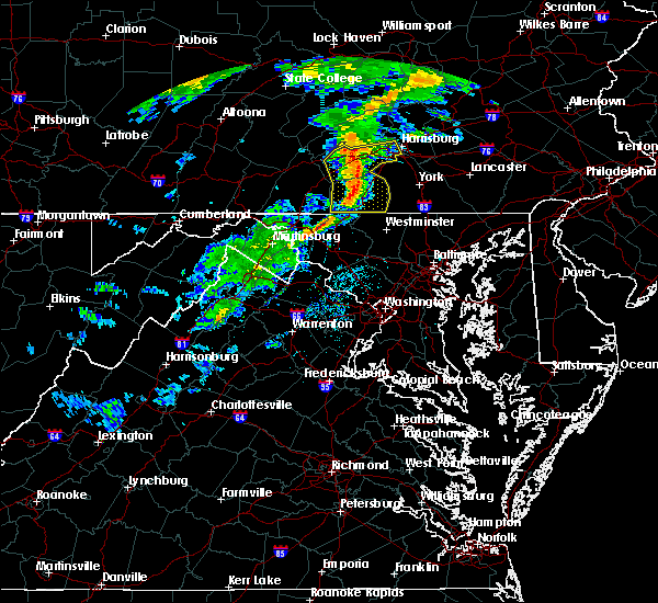 At 507 pm edt, doppler radar indicated a line of severe thunderstorms capable of producing damaging winds around 60 mph. these storms were located along a line extending from near loysville to near carroll valley, and moving east at 40 mph. At 507 pm edt, doppler radar indicated a line of severe thunderstorms capable of producing damaging winds around 60 mph. these storms were located along a line extending from near loysville to near carroll valley, and moving east at 40 mph.
|
| 7/9/2015 2:07 PM EDT |
 At 206 pm edt, severe thunderstorms were located along a line extending from near brownsville to near uniontown to 6 miles northwest of newburg to near bridgeport, moving east at 45 mph (radar indicated). Hazards include 60 mph wind gusts. Expect damage to trees and some power outages locations impacted include, morgantown, fairmont, uniontown, connellsville, westover, kingwood, terra alta, rowlesburg, california, mount pleasant, scottdale, pleasant valley, brownsville, winfield, south connellsville, farmington, perryopolis, point marion, newburg and seven springs. A tornado watch remains in effect until 900 pm edt for western maryland, southwestern pennsylvania and northern west virginia. At 206 pm edt, severe thunderstorms were located along a line extending from near brownsville to near uniontown to 6 miles northwest of newburg to near bridgeport, moving east at 45 mph (radar indicated). Hazards include 60 mph wind gusts. Expect damage to trees and some power outages locations impacted include, morgantown, fairmont, uniontown, connellsville, westover, kingwood, terra alta, rowlesburg, california, mount pleasant, scottdale, pleasant valley, brownsville, winfield, south connellsville, farmington, perryopolis, point marion, newburg and seven springs. A tornado watch remains in effect until 900 pm edt for western maryland, southwestern pennsylvania and northern west virginia.
|
| 7/9/2015 1:44 PM EDT |
 At 143 pm edt, severe thunderstorms were located along a line extending from 6 miles west of fredericktown-millsboro to near fairdale to monongah to near salem, moving east at 45 mph (radar indicated). Hazards include 60 mph wind gusts. expect damage to trees and some power outages At 143 pm edt, severe thunderstorms were located along a line extending from 6 miles west of fredericktown-millsboro to near fairdale to monongah to near salem, moving east at 45 mph (radar indicated). Hazards include 60 mph wind gusts. expect damage to trees and some power outages
|
| 6/30/2015 11:28 PM EDT |
 At 1128 pm edt, doppler radar indicated a severe thunderstorm capable of producing damaging winds in excess of 60 mph. this storm was located near the york airport, moving northeast at 30 mph. locations impacted include, dallastown, hanover, parkville, red lion, spry, weigelstown, york, codorus, cross roads, dover, east york, emigsville, glen rock, grantley, jacobus, manchester, mount wolf, new freedom, north york and pennville. At 1128 pm edt, doppler radar indicated a severe thunderstorm capable of producing damaging winds in excess of 60 mph. this storm was located near the york airport, moving northeast at 30 mph. locations impacted include, dallastown, hanover, parkville, red lion, spry, weigelstown, york, codorus, cross roads, dover, east york, emigsville, glen rock, grantley, jacobus, manchester, mount wolf, new freedom, north york and pennville.
|
| 6/30/2015 11:08 PM EDT |
 At 1107 pm edt, doppler radar indicated a severe thunderstorm capable of producing damaging winds around 60 mph. this storm was located over new oxford, and moving northeast at 30 mph. At 1107 pm edt, doppler radar indicated a severe thunderstorm capable of producing damaging winds around 60 mph. this storm was located over new oxford, and moving northeast at 30 mph.
|
| 6/23/2015 4:54 PM EDT |
 At 454 pm edt, doppler radar indicated a severe thunderstorm capable of producing quarter size hail and damaging winds around 60 mph. this storm was located over mountville, and moving east at 35 mph. At 454 pm edt, doppler radar indicated a severe thunderstorm capable of producing quarter size hail and damaging winds around 60 mph. this storm was located over mountville, and moving east at 35 mph.
|
| 6/23/2015 4:35 PM EDT |
 At 434 pm edt, doppler radar indicated a severe thunderstorm capable of producing quarter size hail and destructive winds in excess of 70 mph. this storm was located near dillsburg, moving east at 35 mph. locations impacted include, carlisle, dallastown, gettysburg, hanover, mechanicsburg, middletown, parkville, red lion, spry, weigelstown, york, aspers, boiling springs, bonneauville, brogue, cashtown, codorus, cross roads, delta and dillsburg. At 434 pm edt, doppler radar indicated a severe thunderstorm capable of producing quarter size hail and destructive winds in excess of 70 mph. this storm was located near dillsburg, moving east at 35 mph. locations impacted include, carlisle, dallastown, gettysburg, hanover, mechanicsburg, middletown, parkville, red lion, spry, weigelstown, york, aspers, boiling springs, bonneauville, brogue, cashtown, codorus, cross roads, delta and dillsburg.
|
| 6/23/2015 4:15 PM EDT |
 At 414 pm edt, doppler radar indicated a severe thunderstorm capable of producing quarter size hail and damaging winds of 60 to 70 mph. this storm was located near pine grove furnace, and moving east at 35 mph. At 414 pm edt, doppler radar indicated a severe thunderstorm capable of producing quarter size hail and damaging winds of 60 to 70 mph. this storm was located near pine grove furnace, and moving east at 35 mph.
|
| 6/14/2015 11:01 PM EDT |
 A severe thunderstorm warning remains in effect until 1145 pm edt for southern fayette and east central greene counties. at 1100 pm edt. a severe thunderstorm was located near uniontown. moving southeast at 40 mph. hazard. 60 mph wind gusts. source. Radar indicated. A severe thunderstorm warning remains in effect until 1145 pm edt for southern fayette and east central greene counties. at 1100 pm edt. a severe thunderstorm was located near uniontown. moving southeast at 40 mph. hazard. 60 mph wind gusts. source. Radar indicated.
|
| 6/14/2015 10:49 PM EDT |
 At 1048 pm edt, a severe thunderstorm was located near brownsville, or 11 miles northwest of uniontown, moving southeast at 40 mph (radar indicated). Hazards include 60 mph wind gusts. Expect damage to roofs. Siding and trees. At 1048 pm edt, a severe thunderstorm was located near brownsville, or 11 miles northwest of uniontown, moving southeast at 40 mph (radar indicated). Hazards include 60 mph wind gusts. Expect damage to roofs. Siding and trees.
|
| 6/12/2015 7:54 PM EDT |
 At 754 pm edt, a severe thunderstorm was located over uniontown, moving east at 40 mph (radar indicated). Hazards include 60 mph wind gusts. Expect damage to roofs. siding and trees. Locations impacted include, uniontown, farmington, fairchance, dunbar, new salem, chalkhill, ohiopyle and mill run. At 754 pm edt, a severe thunderstorm was located over uniontown, moving east at 40 mph (radar indicated). Hazards include 60 mph wind gusts. Expect damage to roofs. siding and trees. Locations impacted include, uniontown, farmington, fairchance, dunbar, new salem, chalkhill, ohiopyle and mill run.
|
| 6/12/2015 7:42 PM EDT |
 At 742 pm edt, a severe thunderstorm was located over uniontown, moving east at 45 mph (radar indicated). Hazards include 60 mph wind gusts. Expect damage to roofs. Siding and trees. At 742 pm edt, a severe thunderstorm was located over uniontown, moving east at 45 mph (radar indicated). Hazards include 60 mph wind gusts. Expect damage to roofs. Siding and trees.
|
| 6/8/2015 6:53 PM EDT | At 652 pm edt, doppler radar indicated a line of severe thunderstorms capable of producing damaging winds in excess of 60 mph. these storms were located along a line extending from near terre hill to near wrightsville to pennville, moving southeast at 20 mph. locations impacted include, akron, columbia, dallastown, east petersburg, ephrata, hanover, lancaster, lititz, millersville, new holland, parkville, red lion, spry, weigelstown, willow street, york, bareville, brogue, codorus and cross roads. |
| 6/8/2015 6:11 PM EDT | At 610 pm edt, doppler radar indicated a line of severe thunderstorms capable of producing damaging winds around 60 mph. these storms were located along a line extending from near campbelltown to maytown to near spring grove, and moving southeast at 35 mph. |
| 6/8/2015 5:54 PM EDT | At 553 pm edt, doppler radar indicated a line of severe thunderstorms capable of producing destructive winds in excess of 70 mph. these storms were located along a line extending from womelsdorf to shiremanstown, moving east at 35 mph. locations impacted include, akron, annville, camp hill, carlisle, colonial park, columbia, cornwall, dallastown, east petersburg, elizabethtown, enola, ephrata, harrisburg, hershey, hummelstown, lancaster, lebanon, lemoyne, linglestown and lititz. |
| 6/8/2015 5:08 PM EDT | At 508 pm edt, doppler radar indicated a line of severe thunderstorms capable of producing damaging winds of 60 to 70 mph. these storms were located along a line extending from near donaldson to near boiling springs, and moving southeast at 25 mph. |
| 5/27/2015 2:15 PM EDT | At 213 pm edt, doppler radar indicated a severe thunderstorm capable of producing quarter size hail and damaging winds in excess of 60 mph. this storm was located near york airport, moving northeast at 35 mph. locations impacted include, york, hanover, weigelstown, parkville, red lion, spry, dallastown, shiloh, east york, stonybrook-wilshire, west york, codorus, grantley, tyler run-queens gate, manchester, hallam, emigsville, wrightsville, spring grove and glen rock. |
| 5/27/2015 1:50 PM EDT | At 149 pm edt, doppler radar indicated a severe thunderstorm capable of producing quarter size hail and damaging winds around 60 mph. this storm was located near new oxford, and moving northeast at 35 mph. |
| 4/9/2015 6:43 PM EDT | The national weather service in pittsburgh has issued a * severe thunderstorm warning for. indiana county in west central pennsylvania. southern jefferson county in west central pennsylvania. northern fayette county in southwestern pennsylvania. Armstrong county in west central pennsylvania. |
| 9/8/2012 2:00 PM EDT | 6-8 inch tree limbs down in york county PA, 1.3 miles SSW of New Salem, PA |
Hail Maps for New Salem, PA


Connect with Interactive Hail Maps