

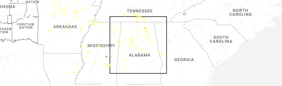
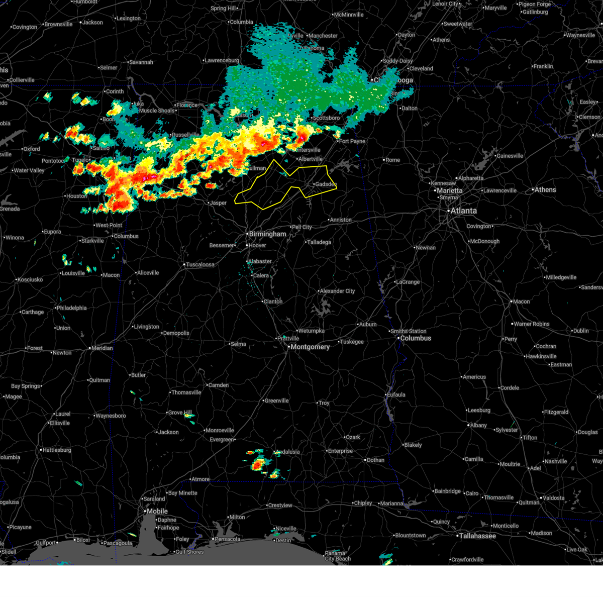
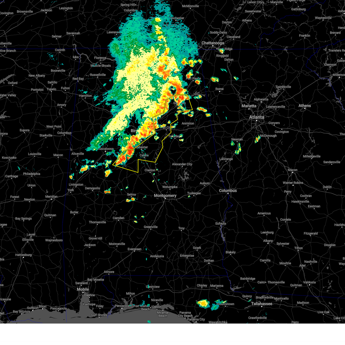
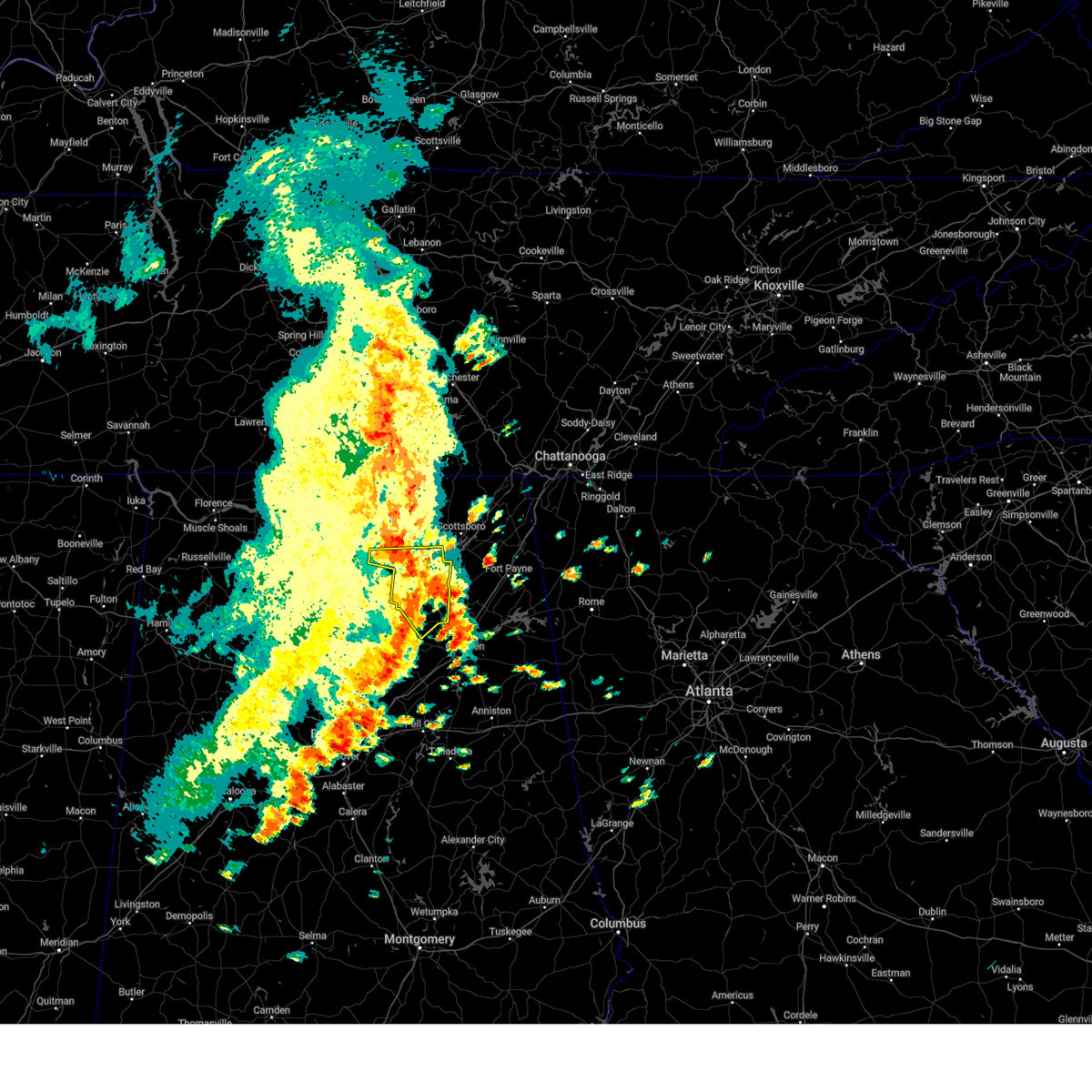
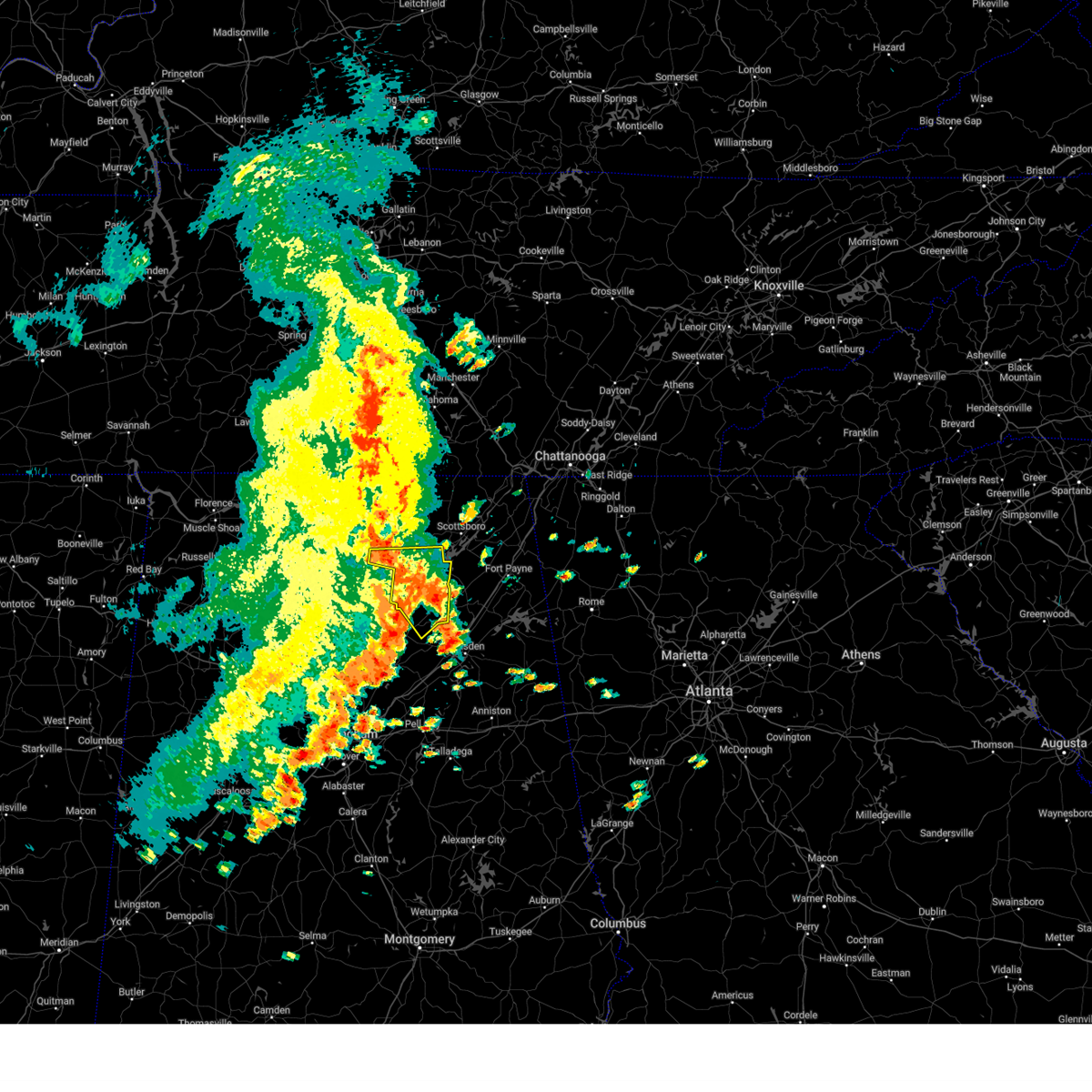
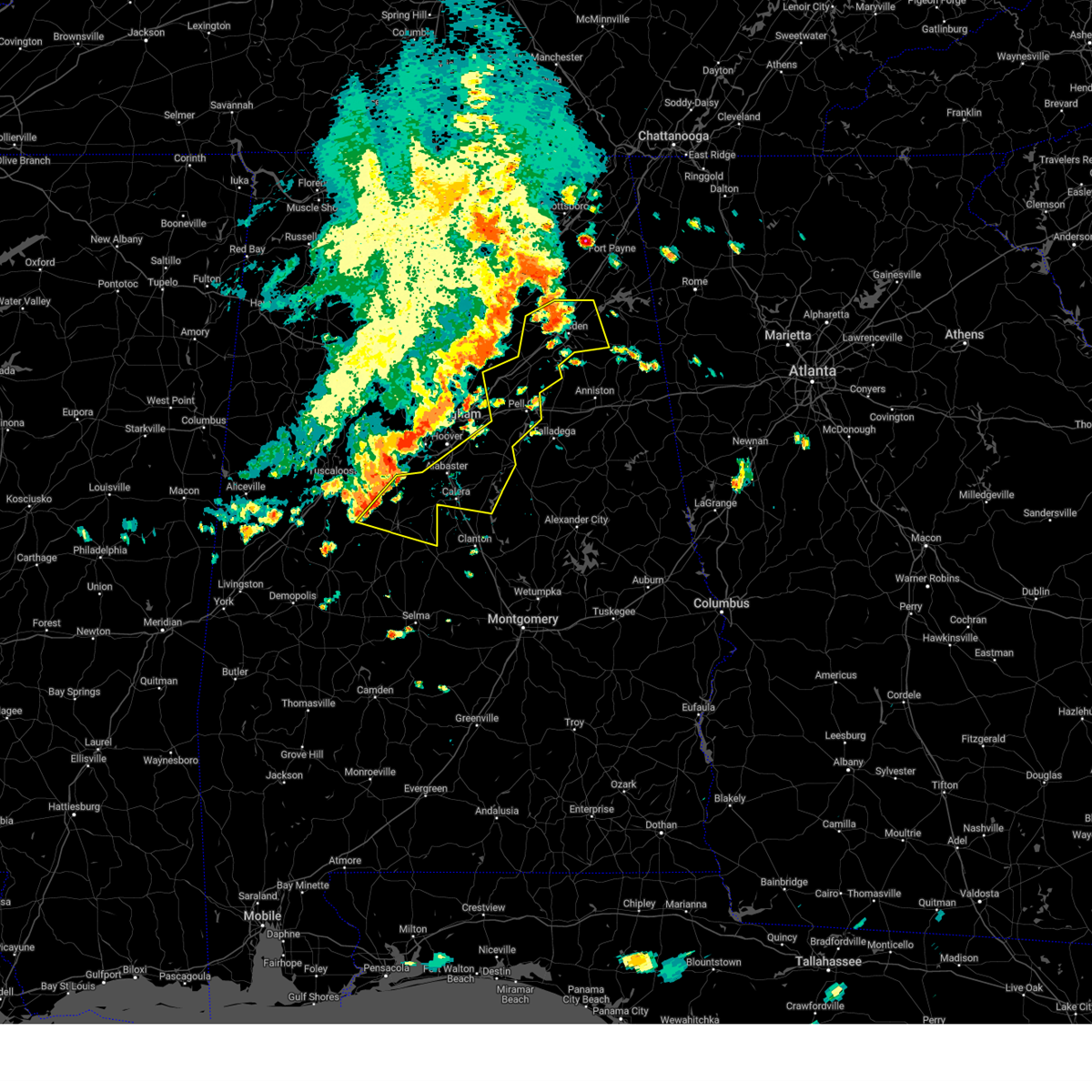
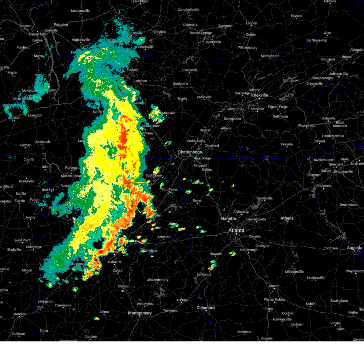
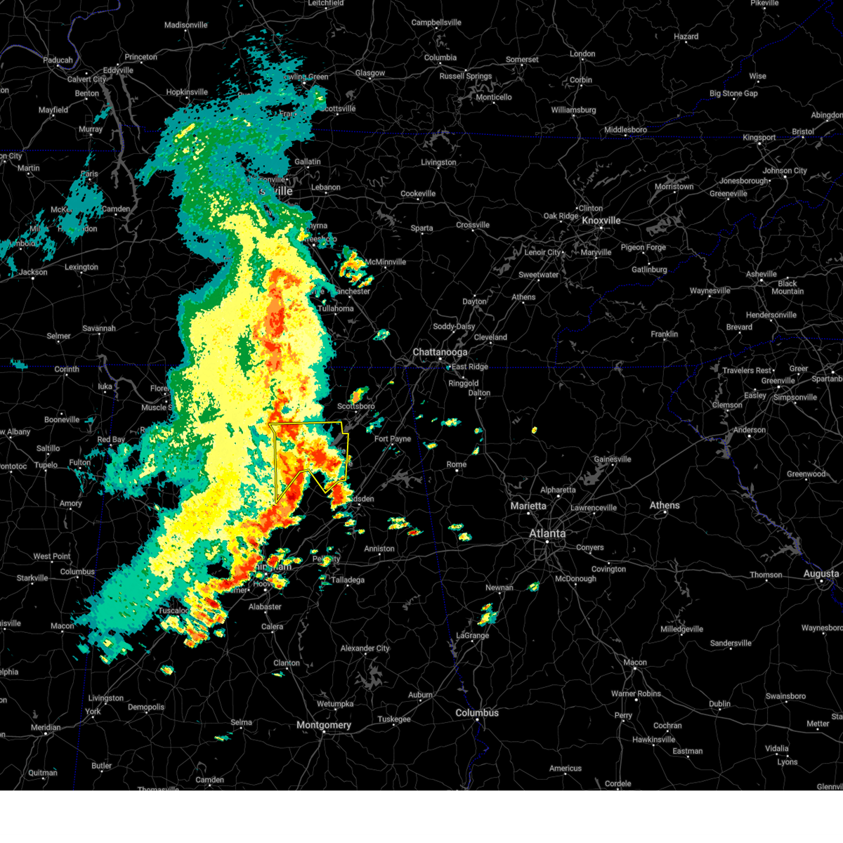
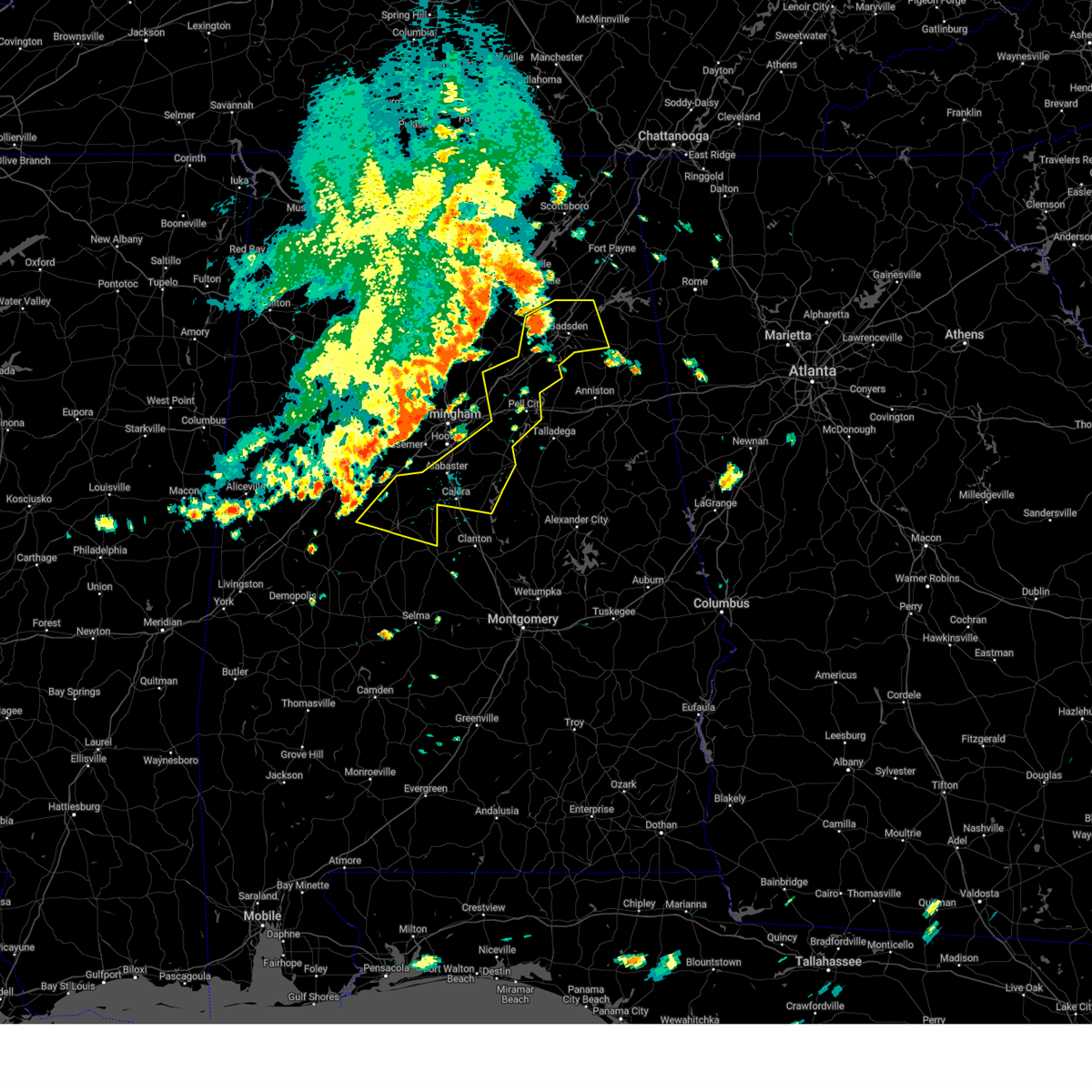
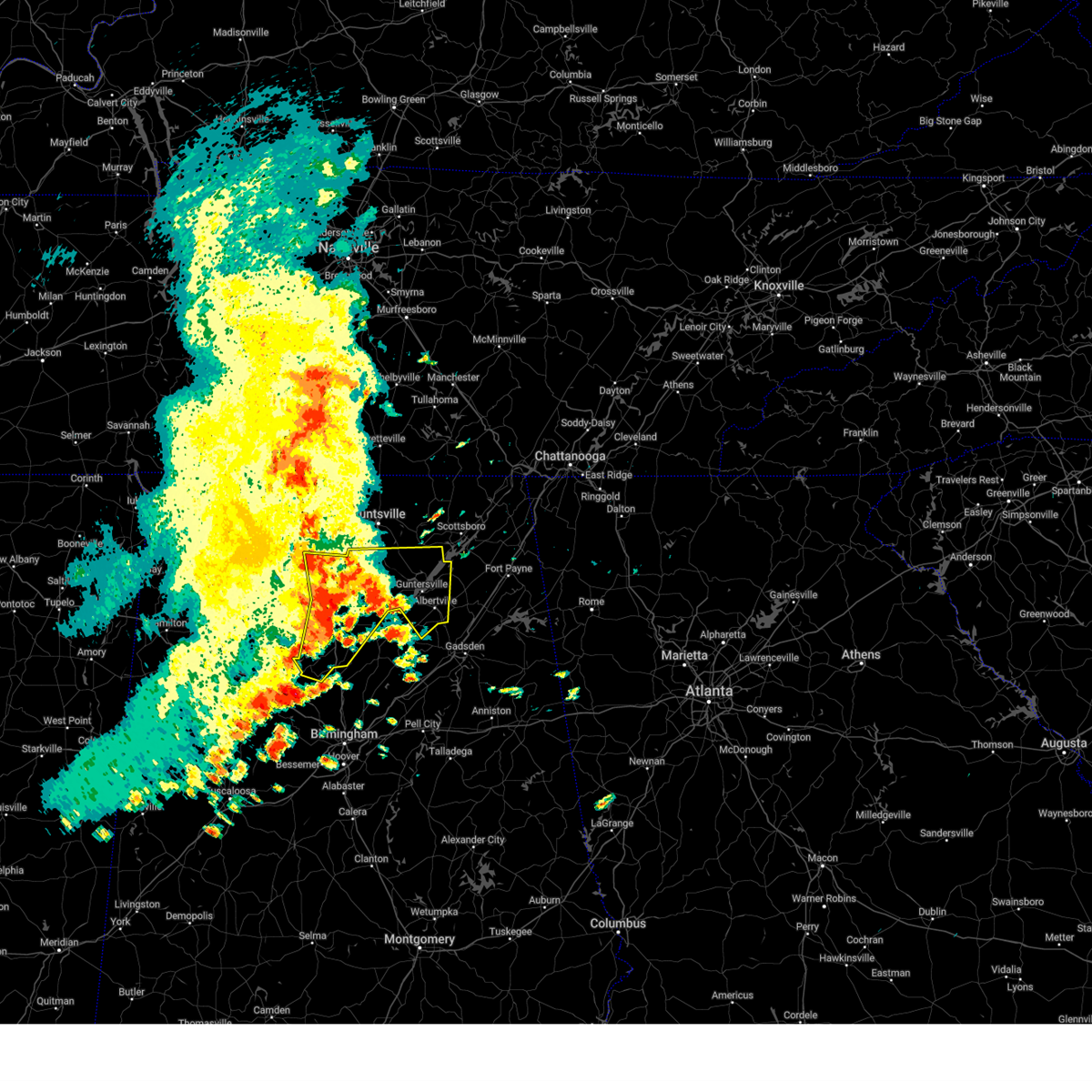
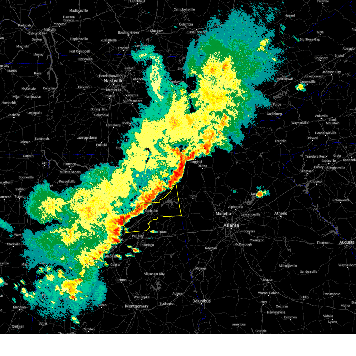
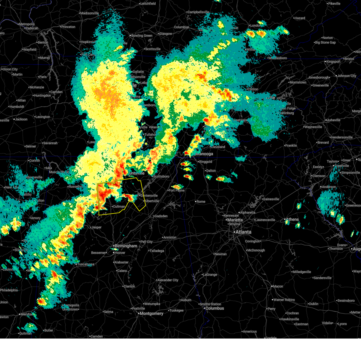
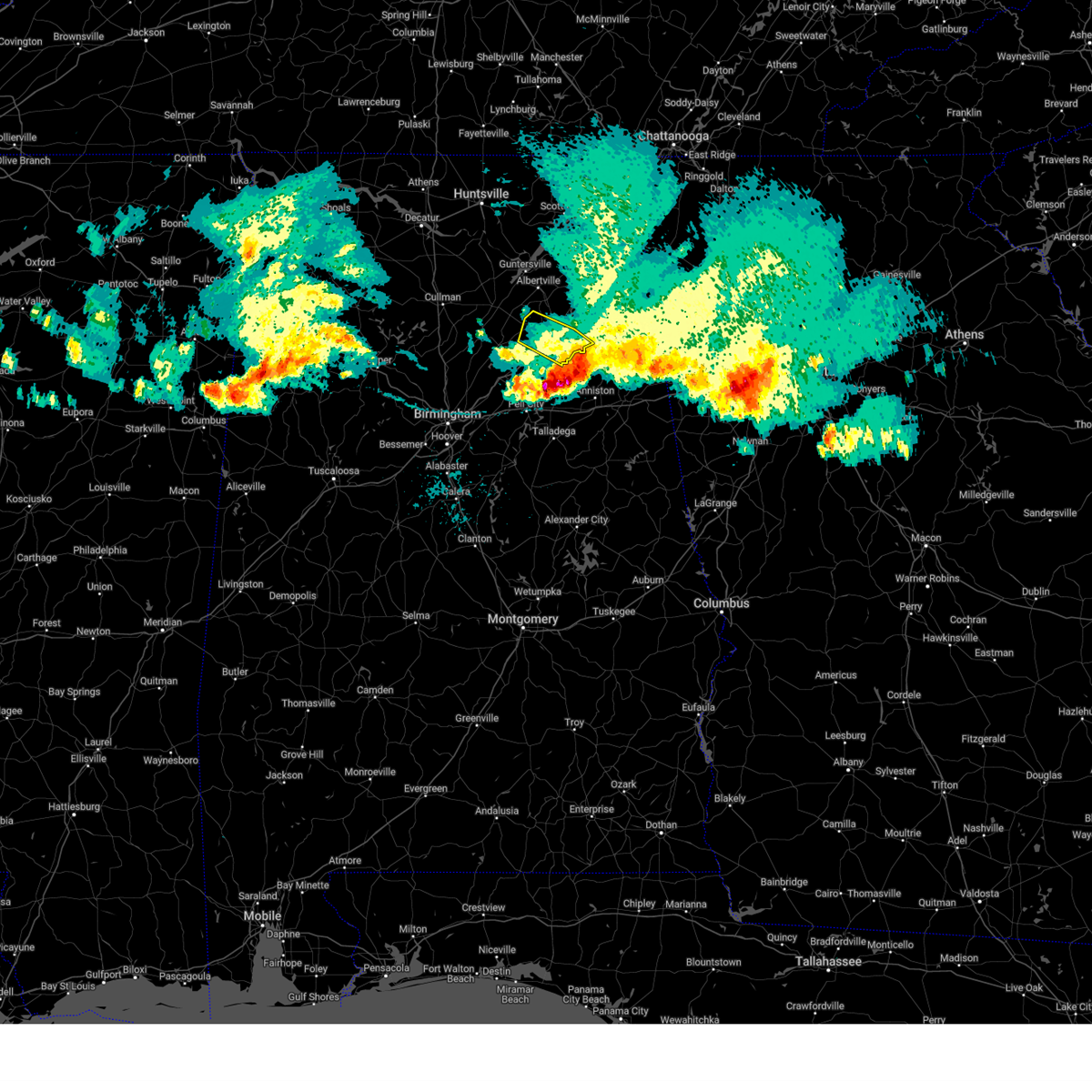
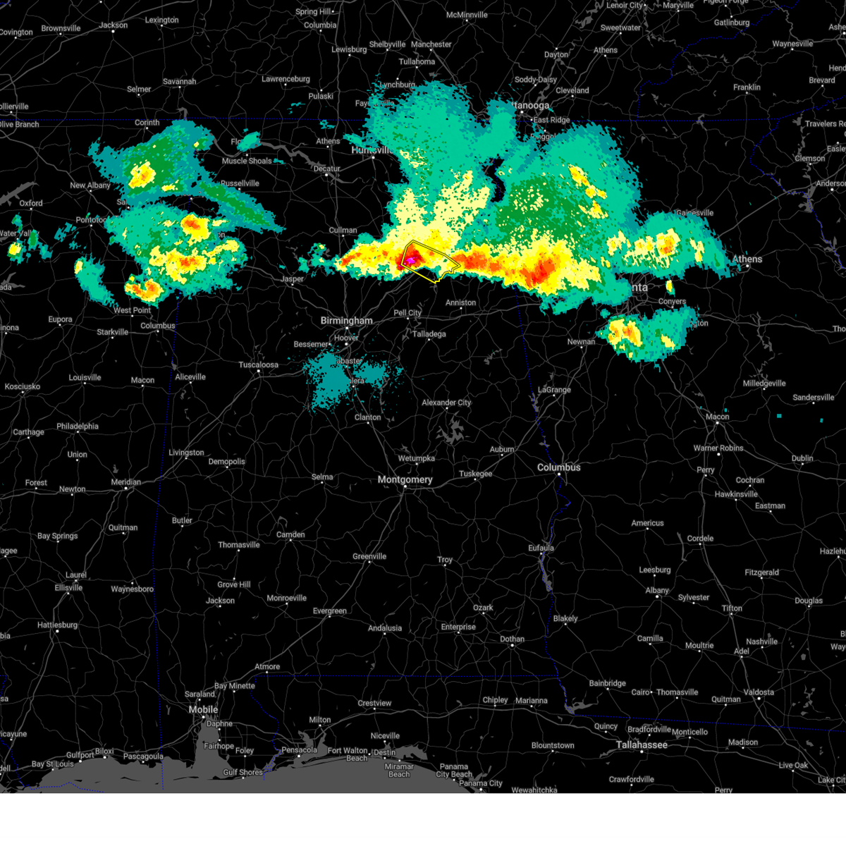
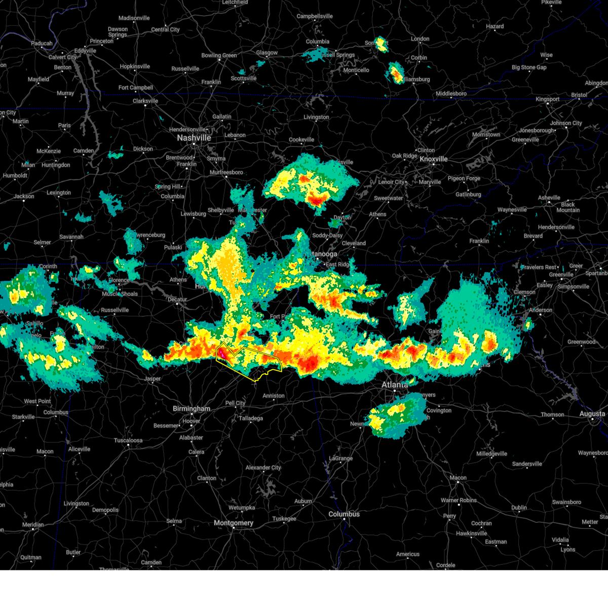
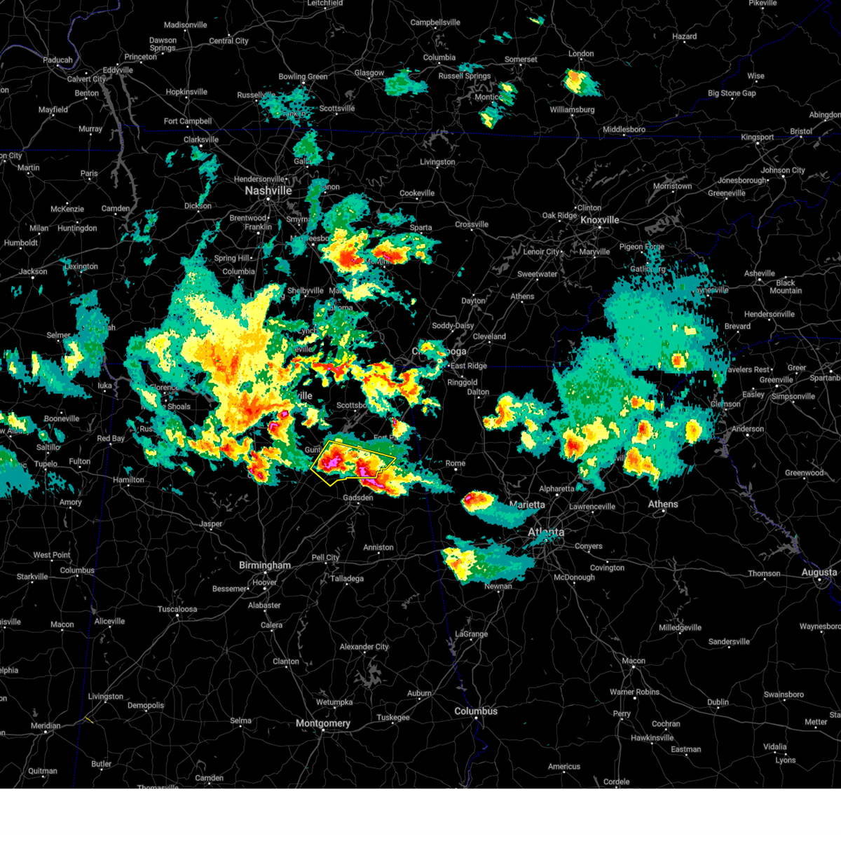
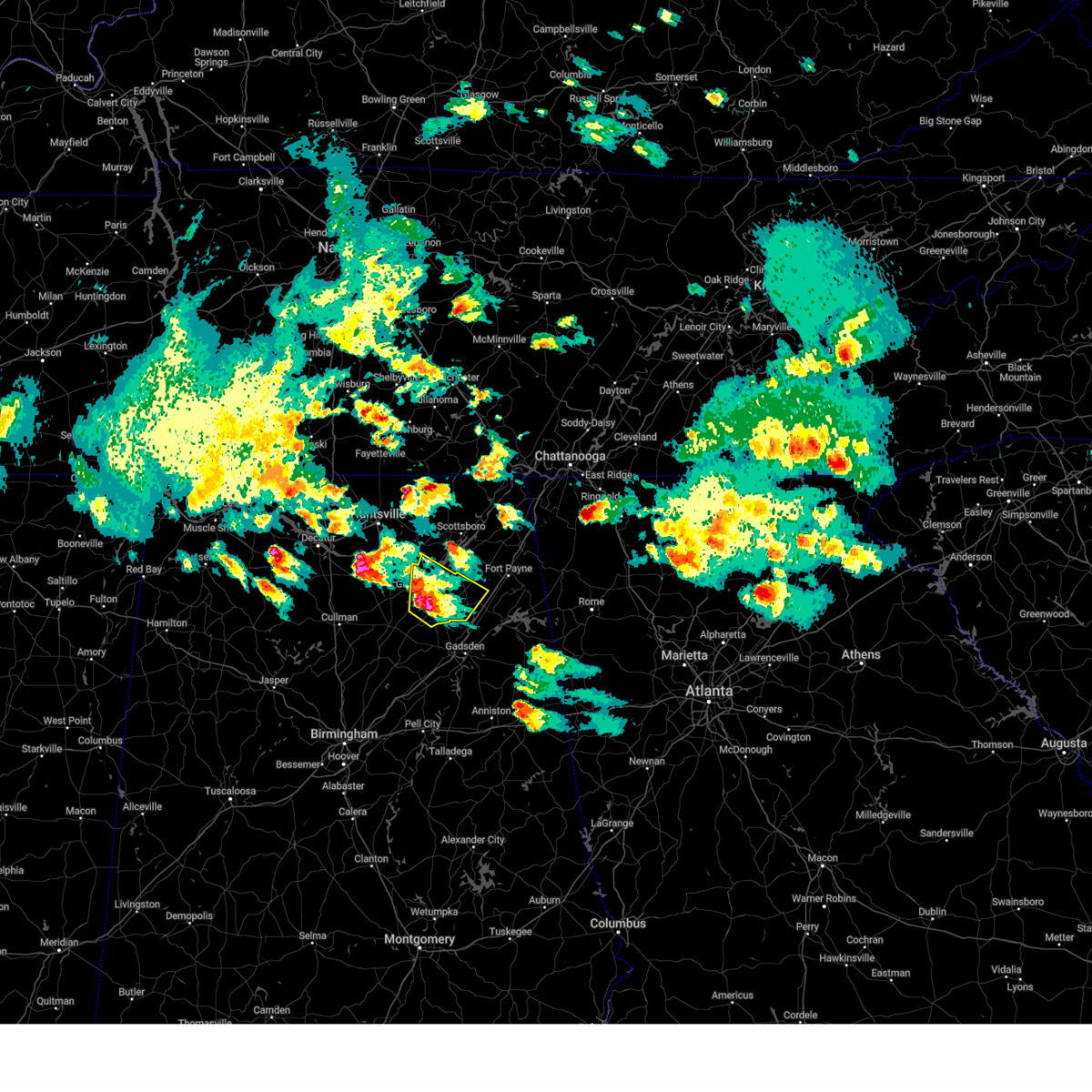
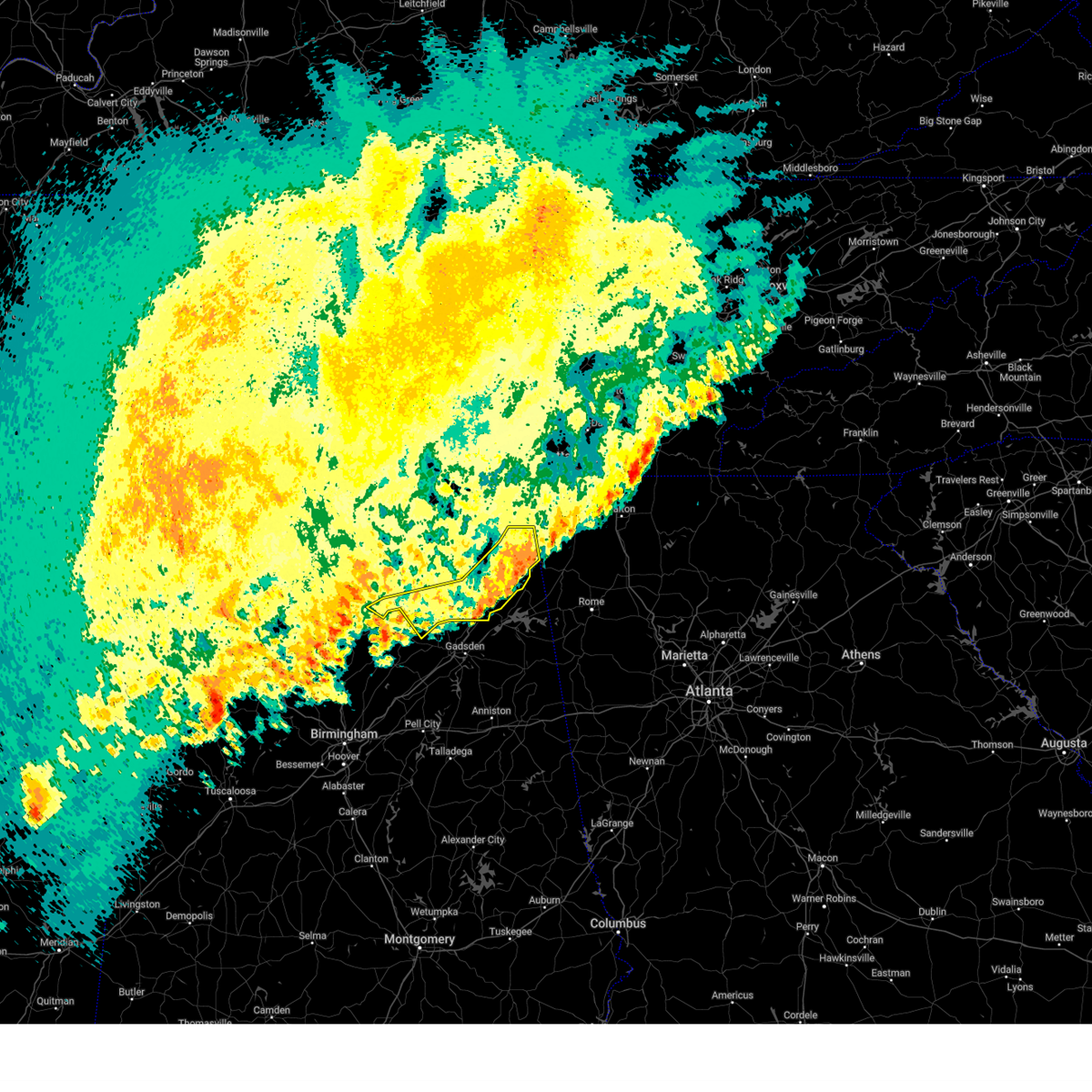
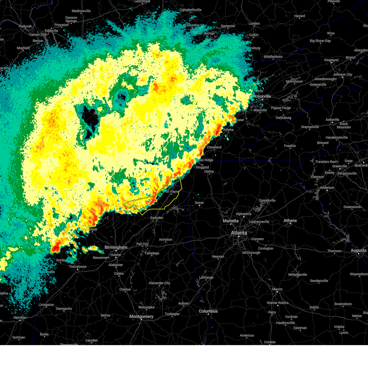
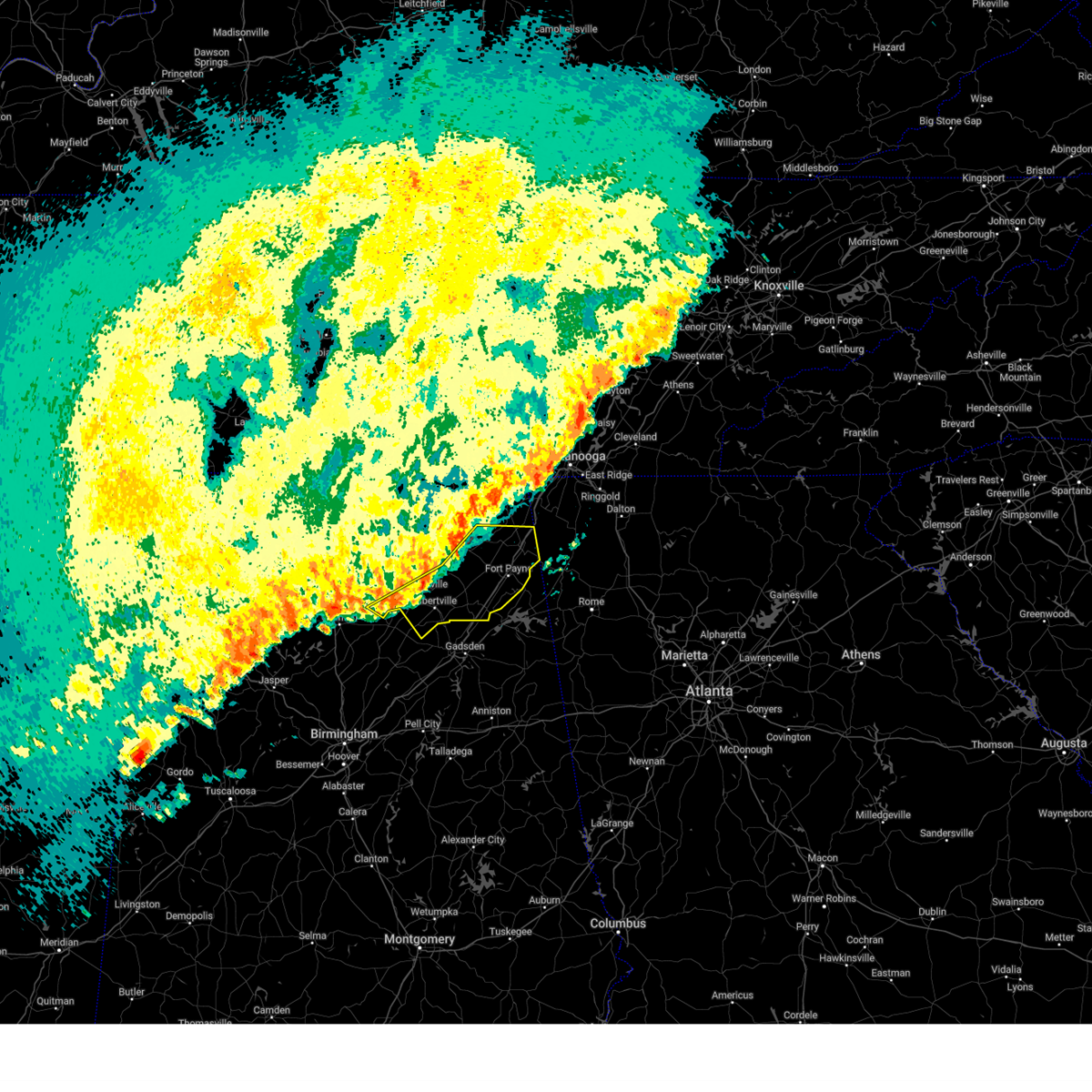
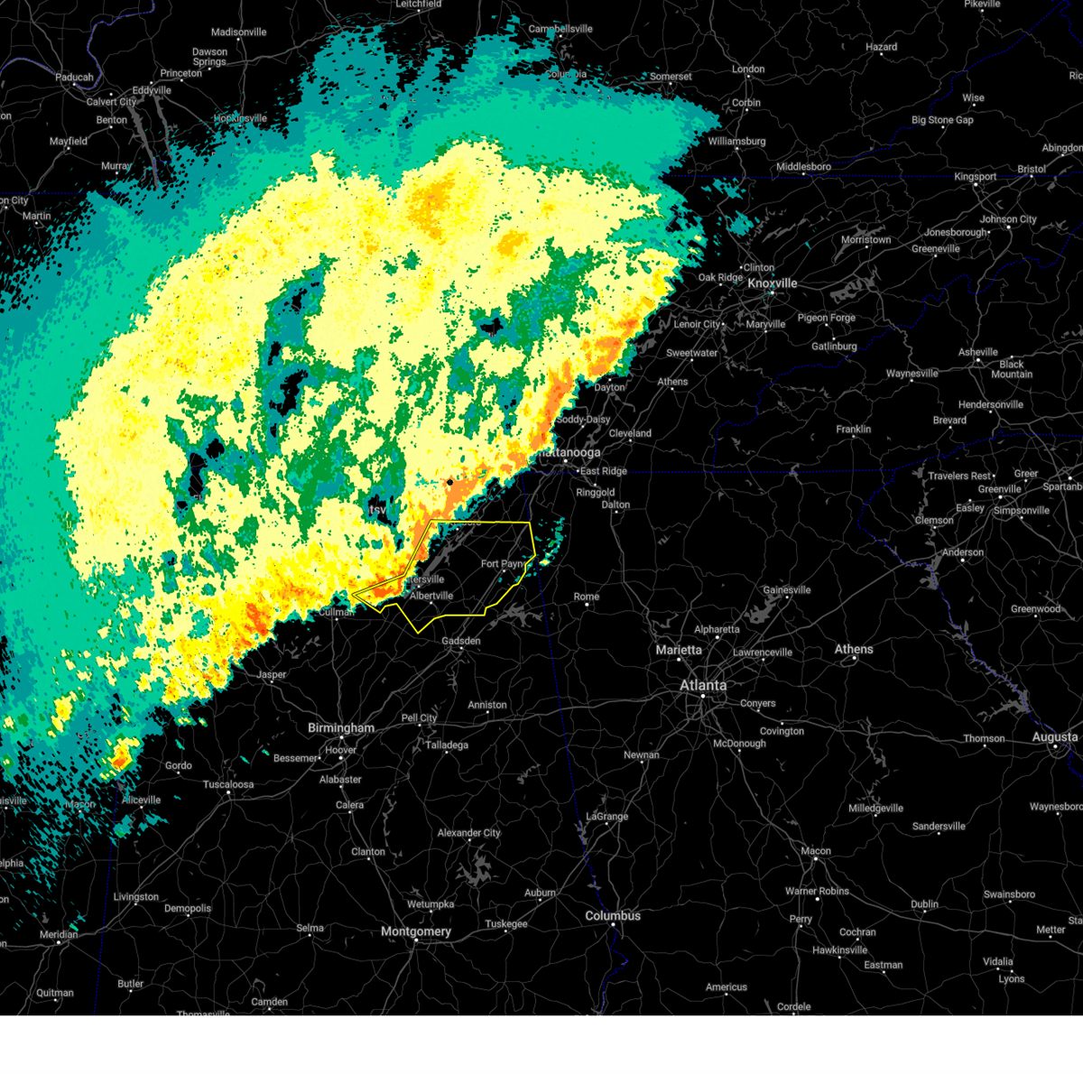
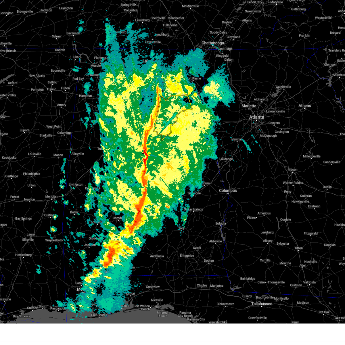
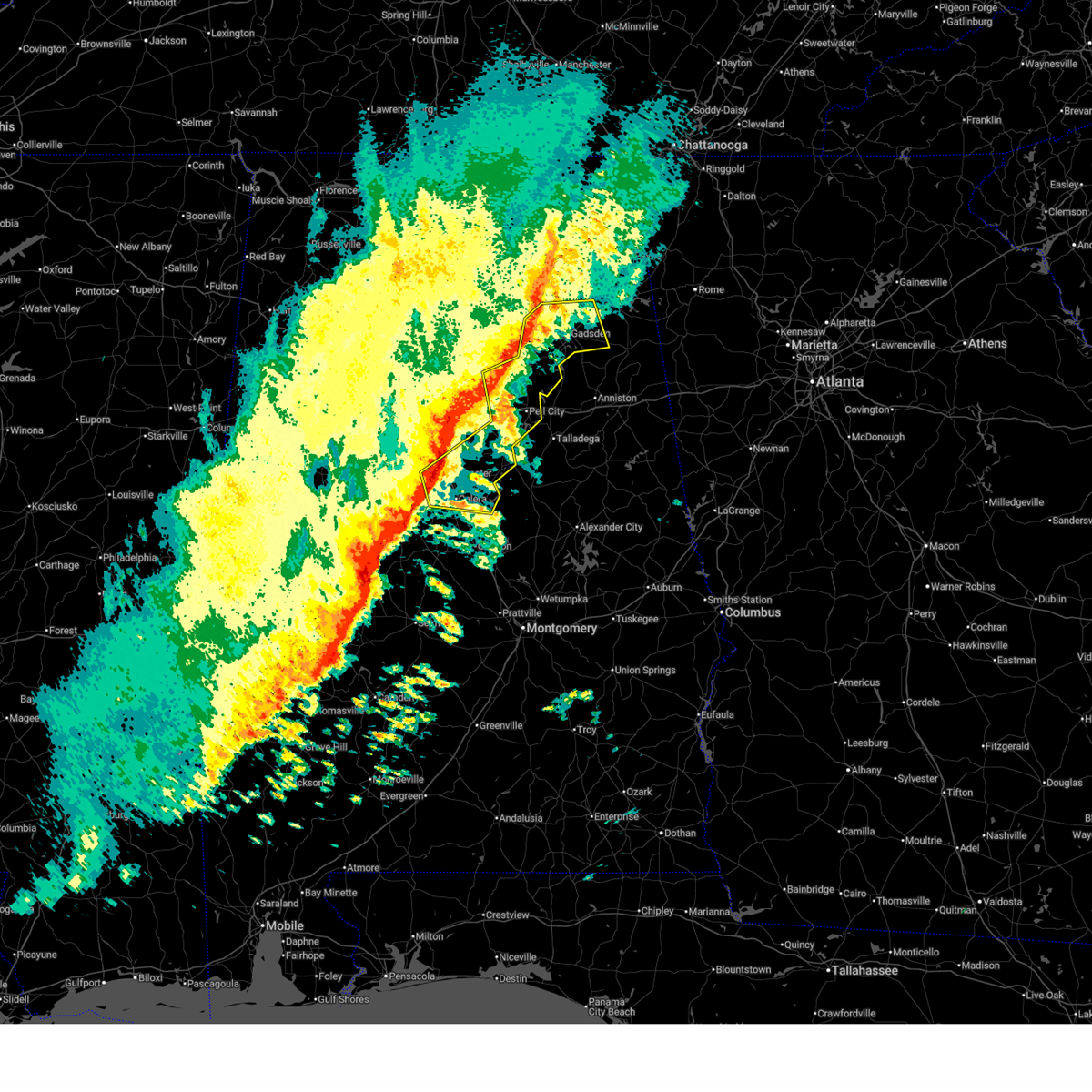
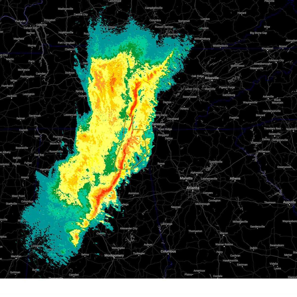
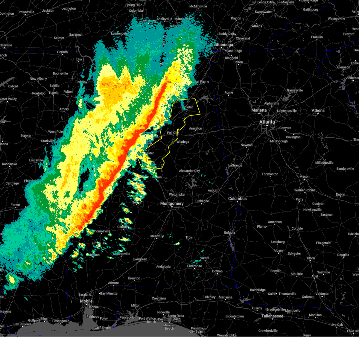
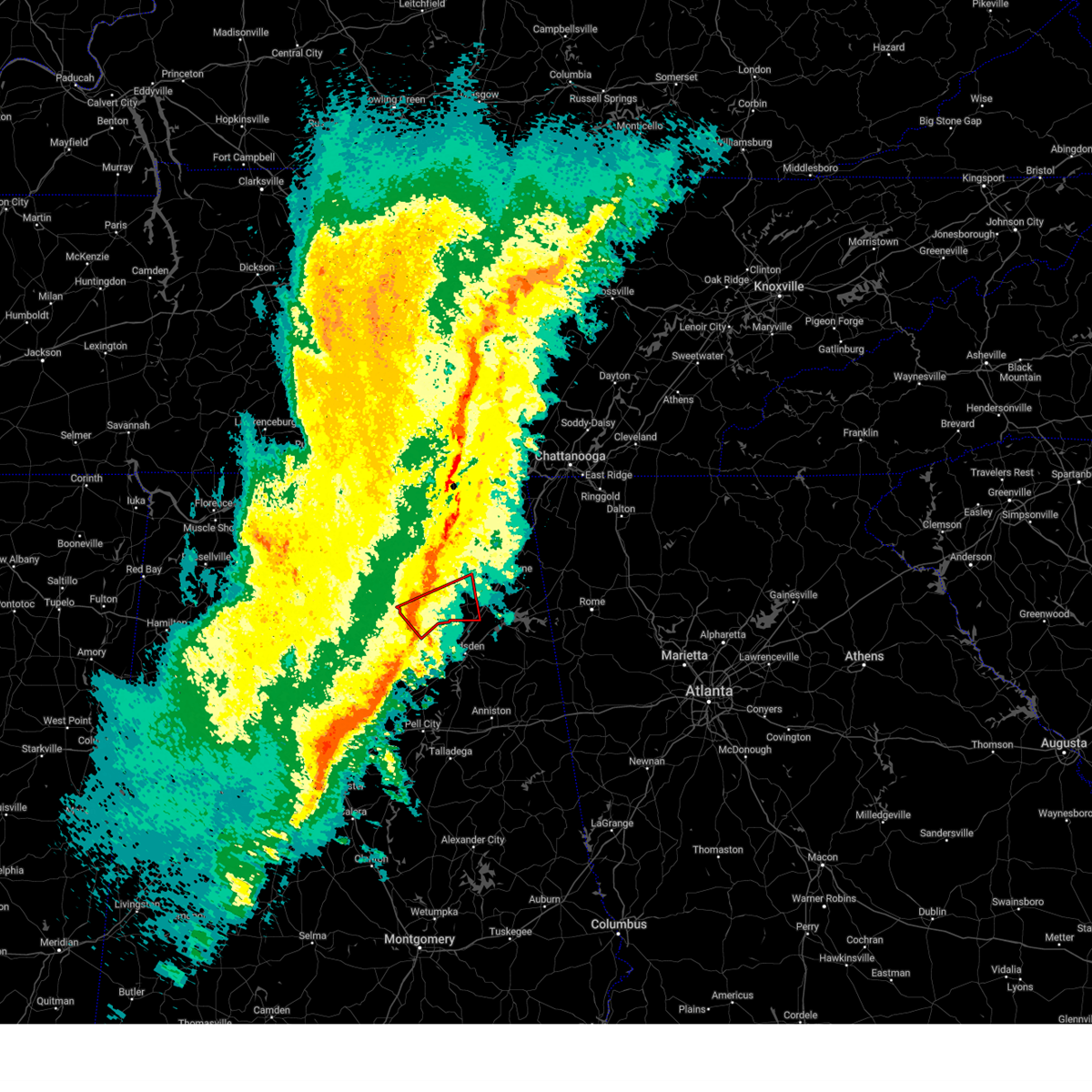
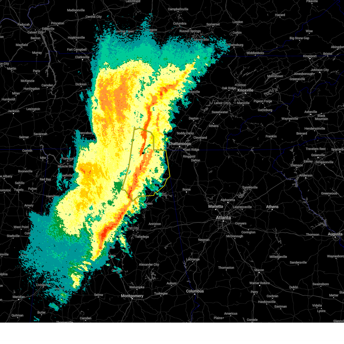
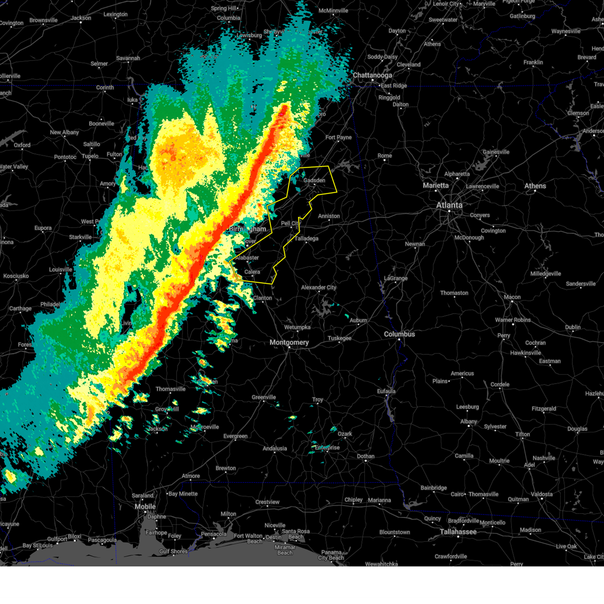
Hail Map for New Union, AL
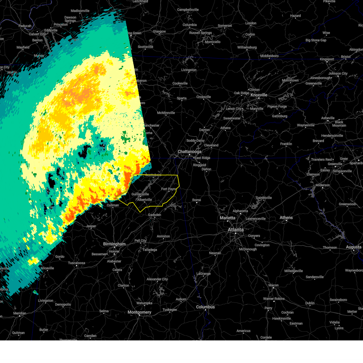
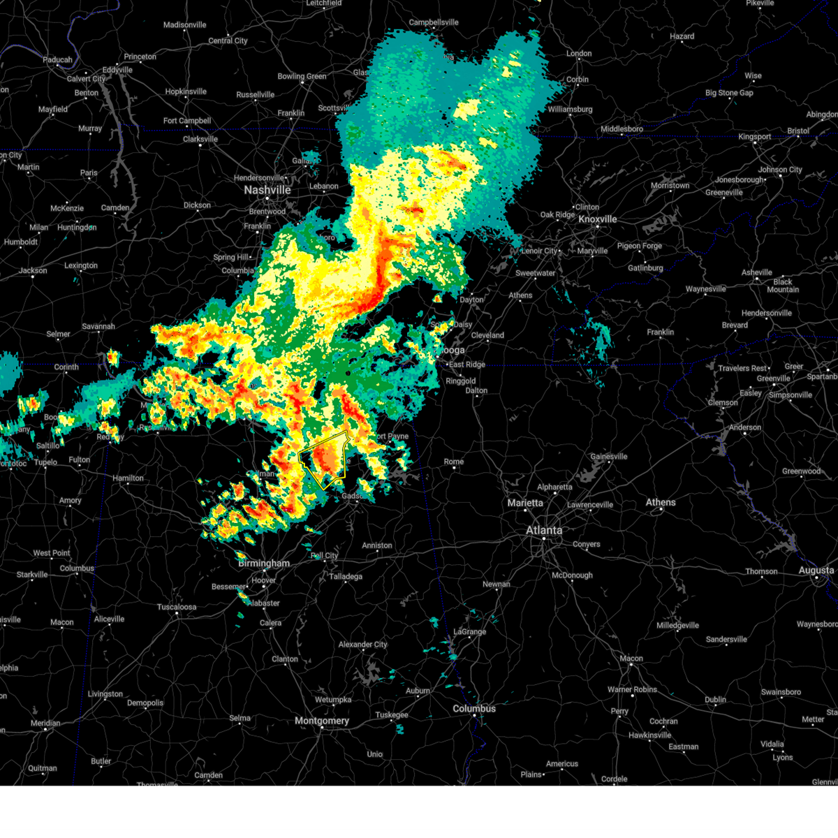
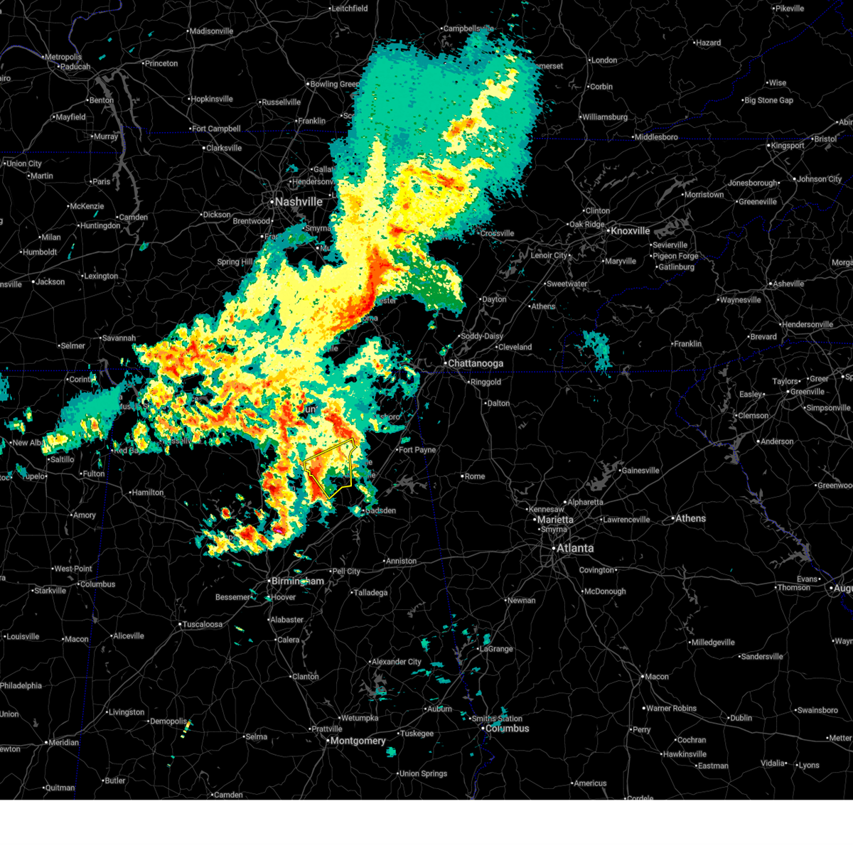
The New Union, AL area has had 0 reports of on-the-ground hail by trained spotters, and has been under severe weather warnings 21 times during the past 12 months. Doppler radar has detected hail at or near New Union, AL on 52 occasions, including 3 occasions during the past year.
| Name: | New Union, AL |
| Where Located: | 56.1 miles NE of Birmingham, AL |
| Map: | Google Map for New Union, AL |
| Population: | 955 |
| Housing Units: | 446 |
| More Info: | Search Google for New Union, AL |
1
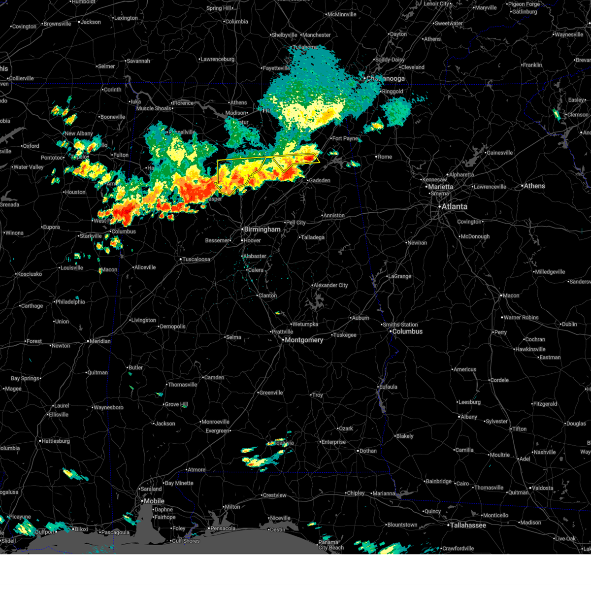
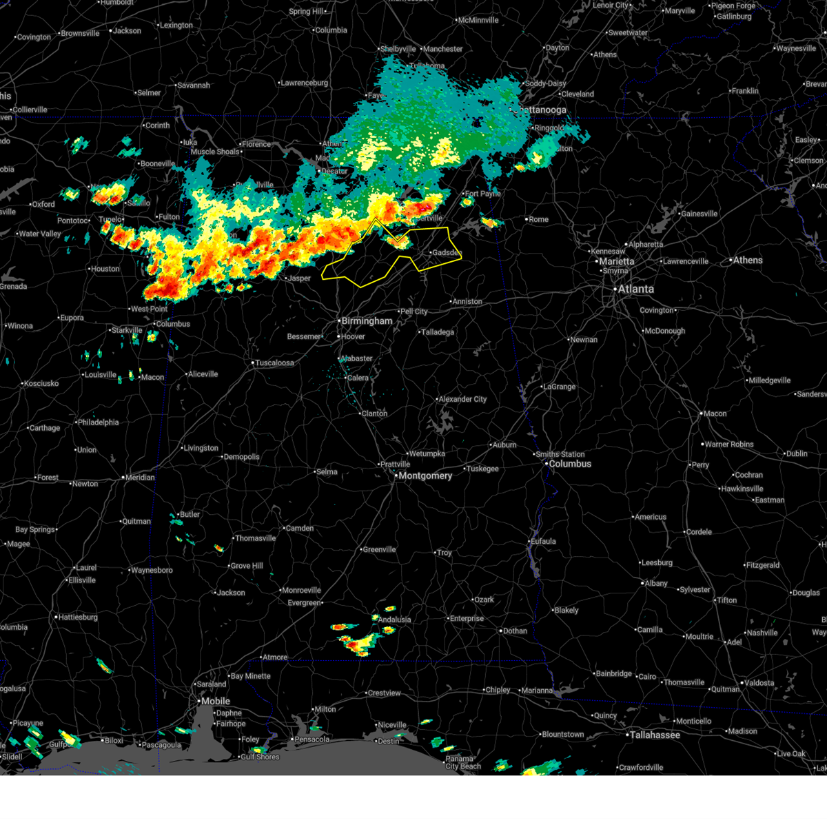
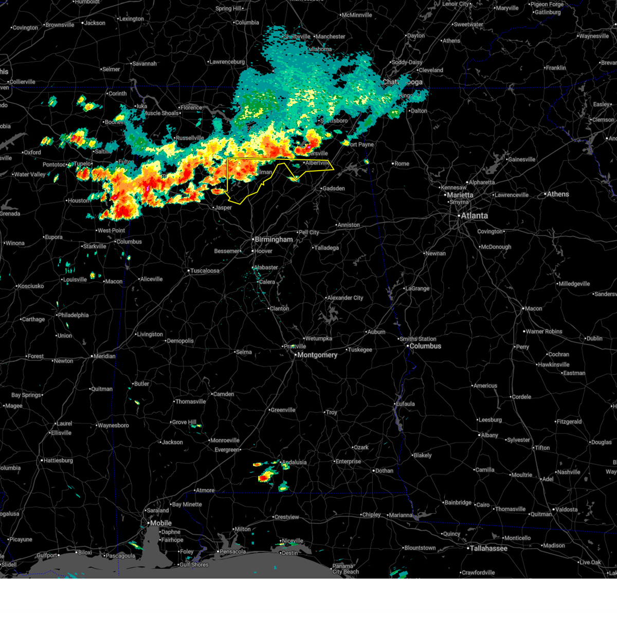
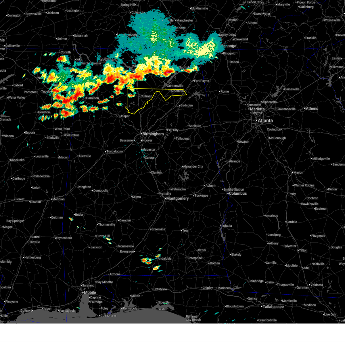
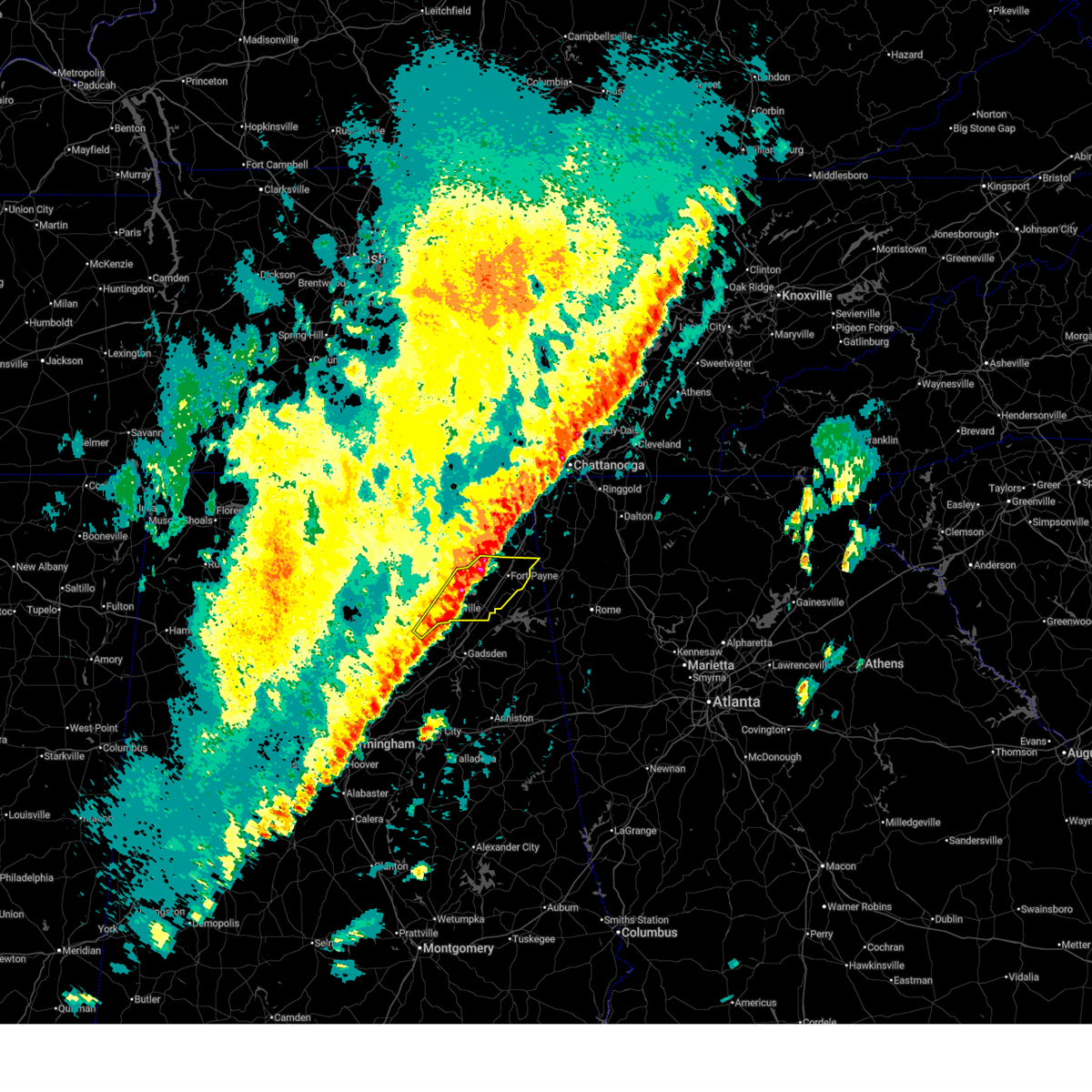
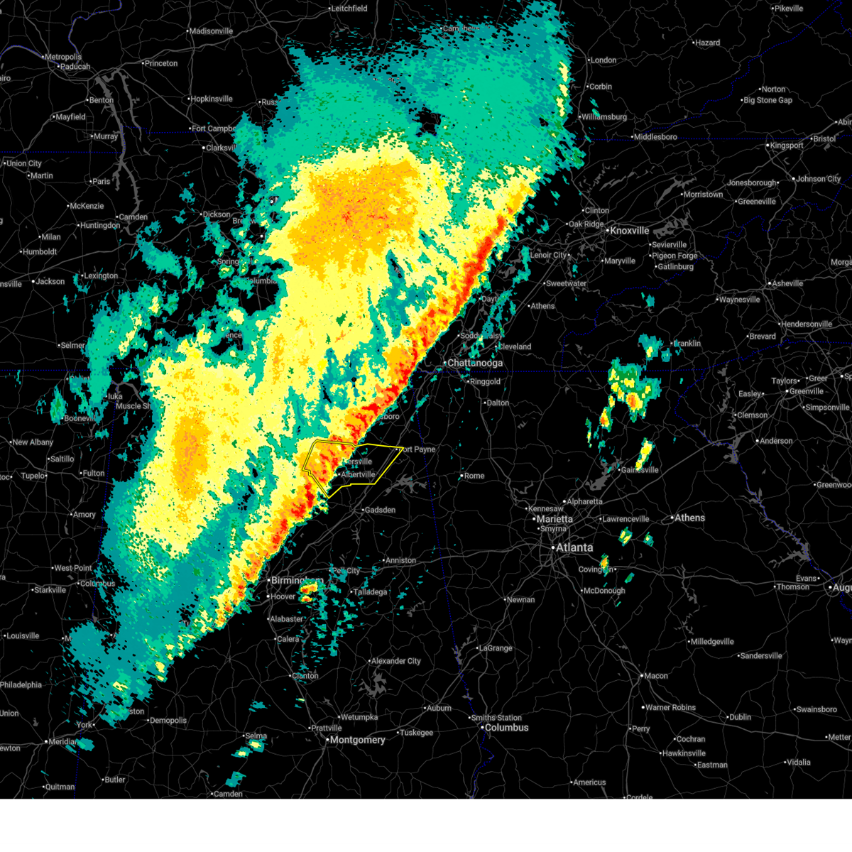
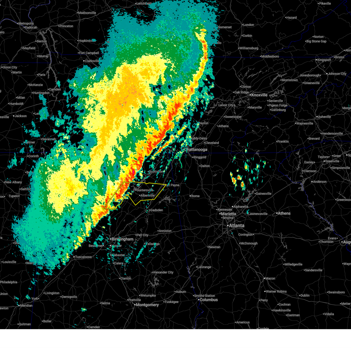
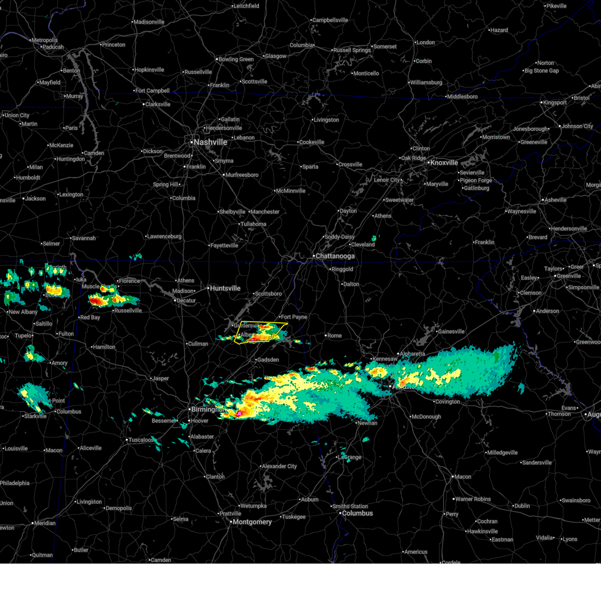
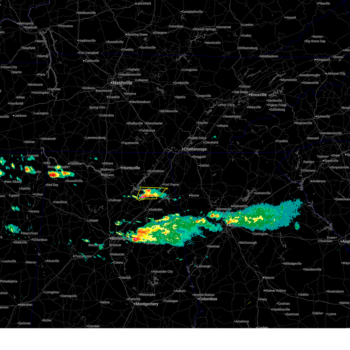
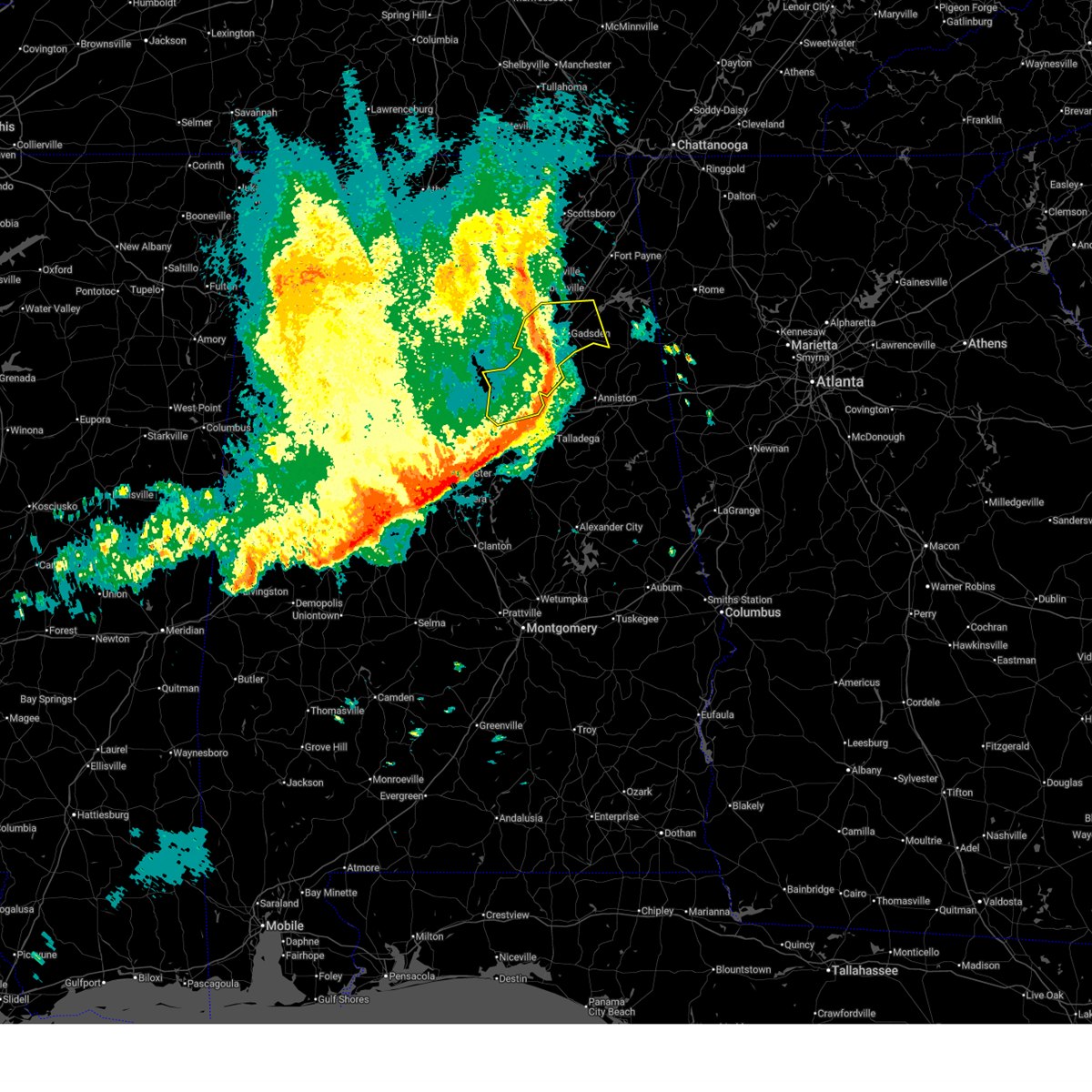
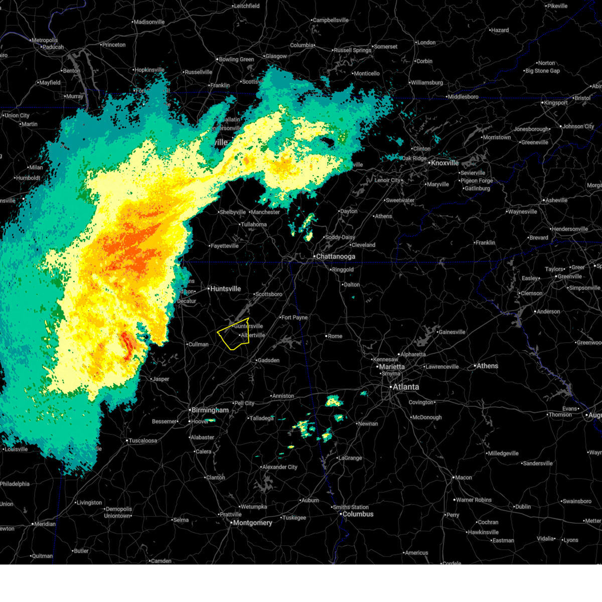
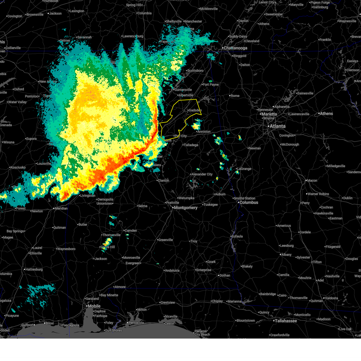
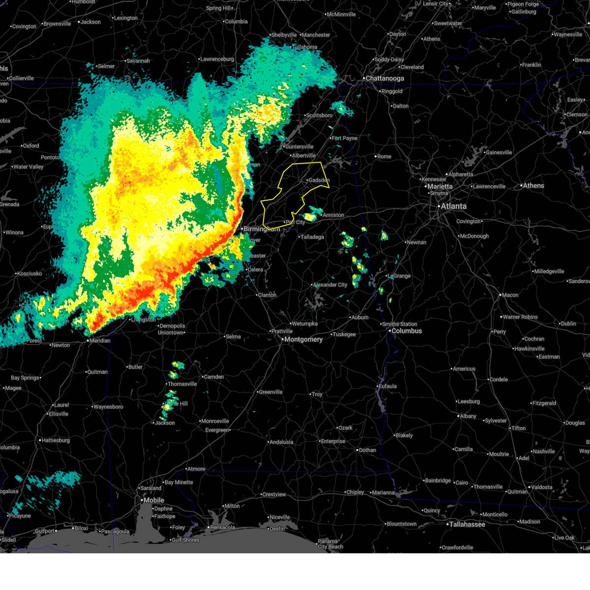
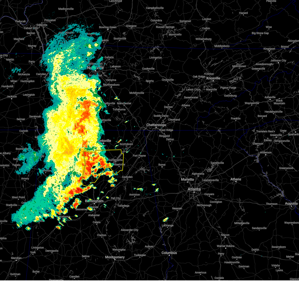
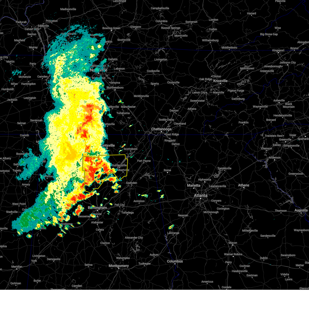
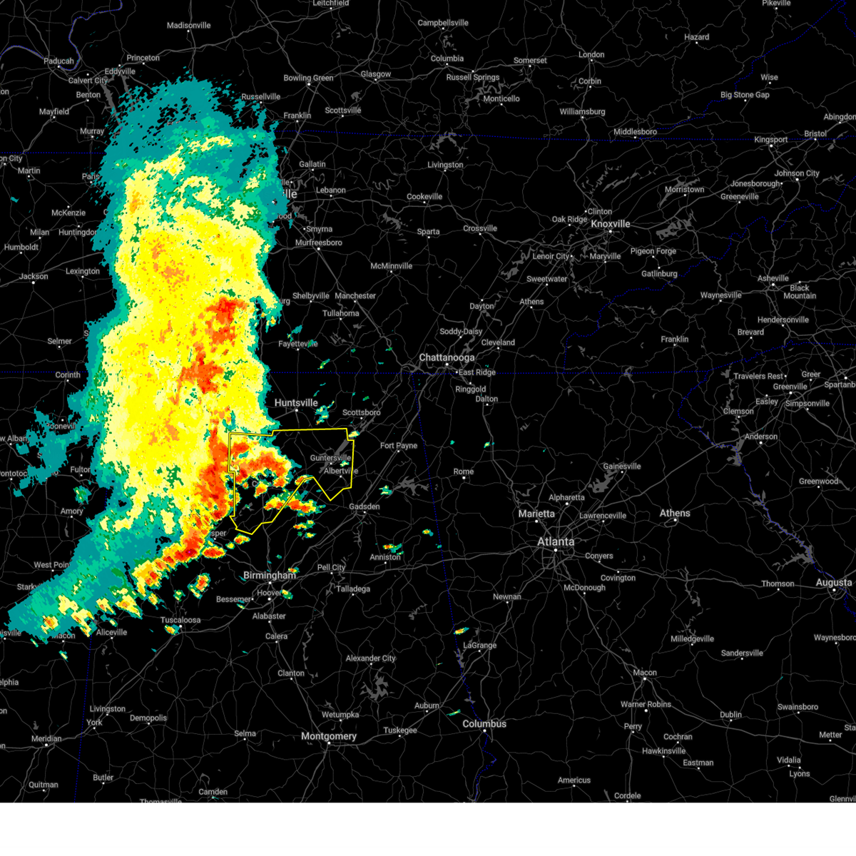
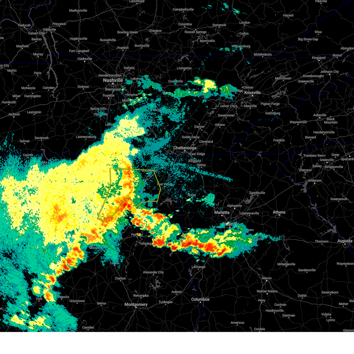
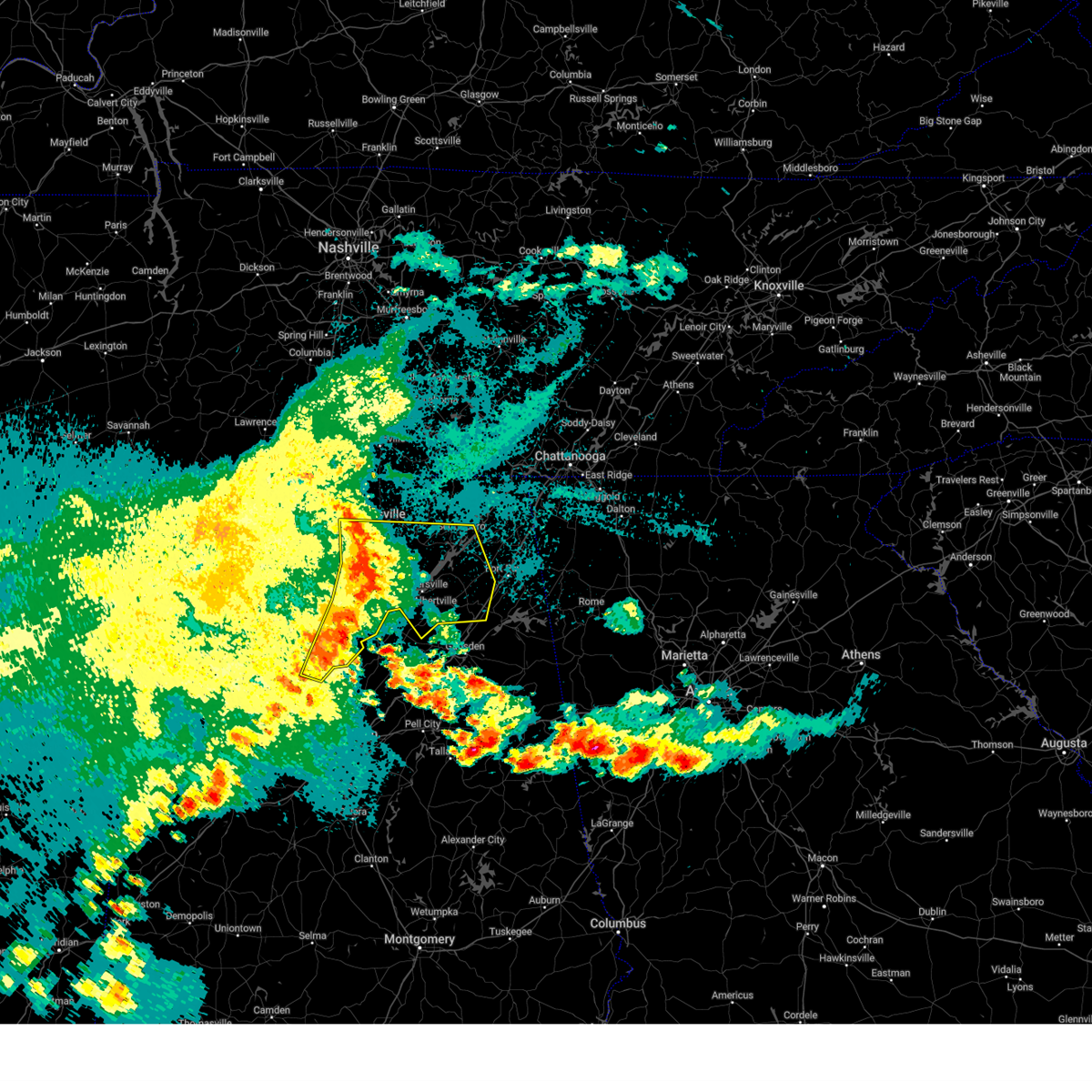
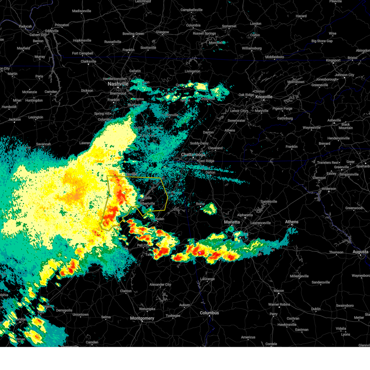
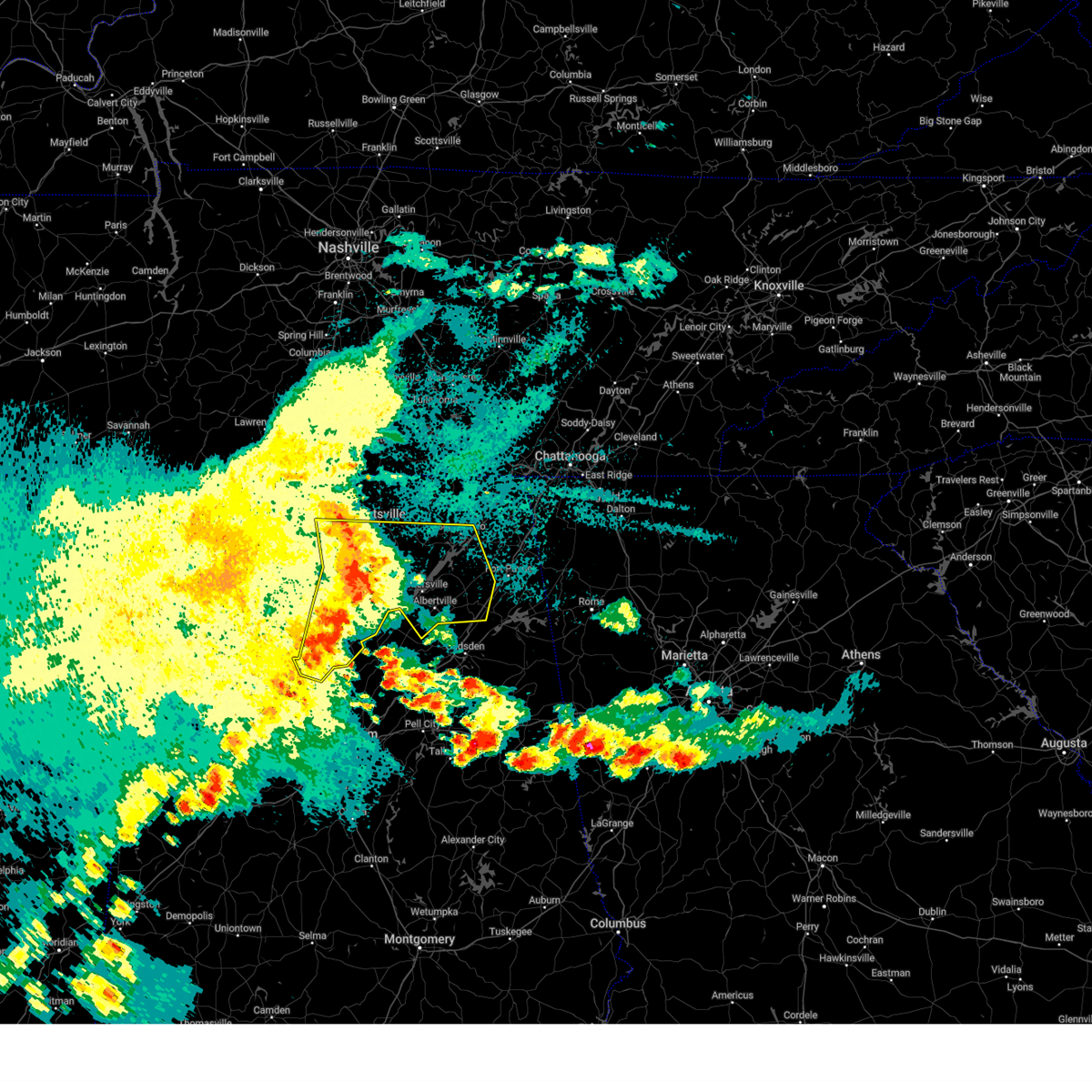
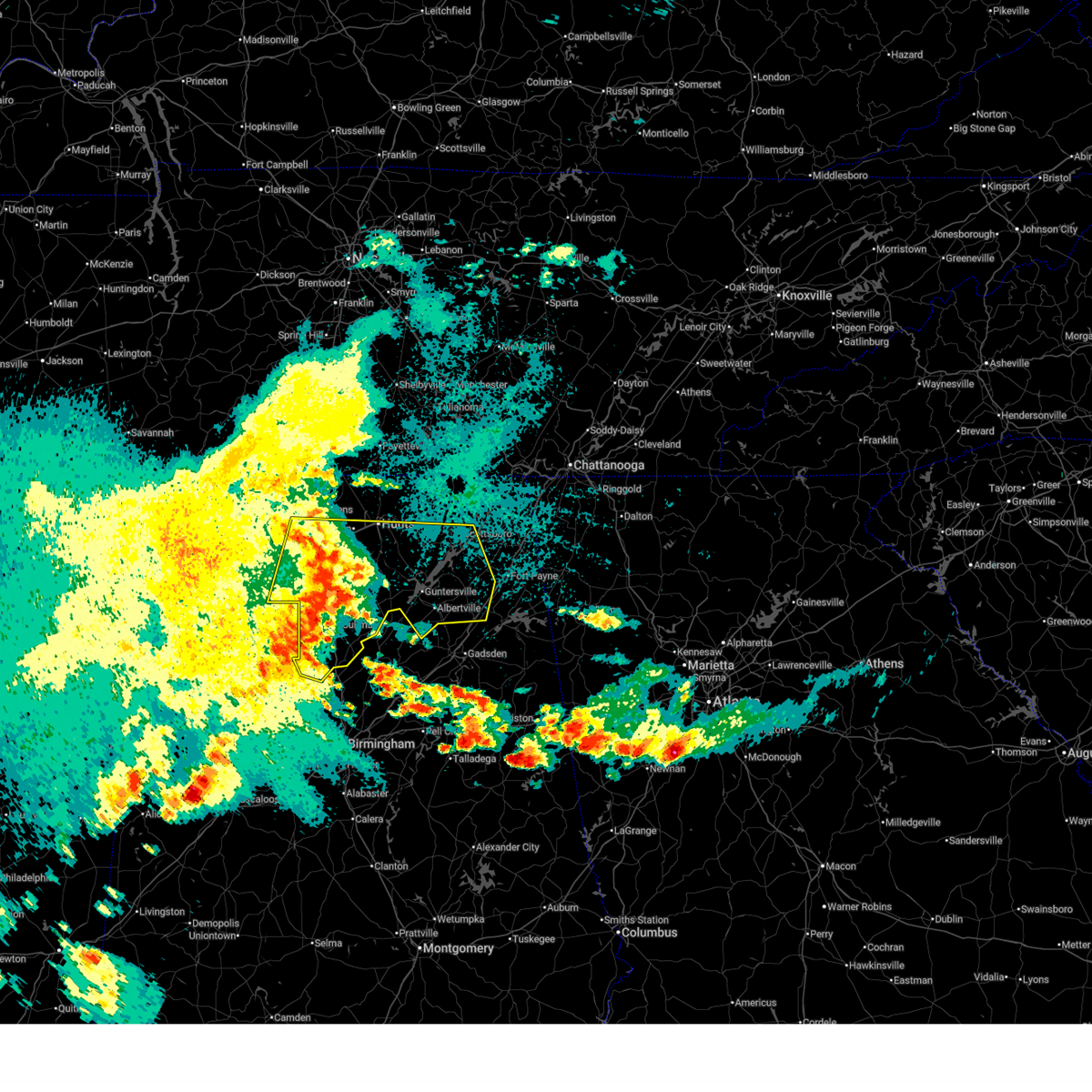
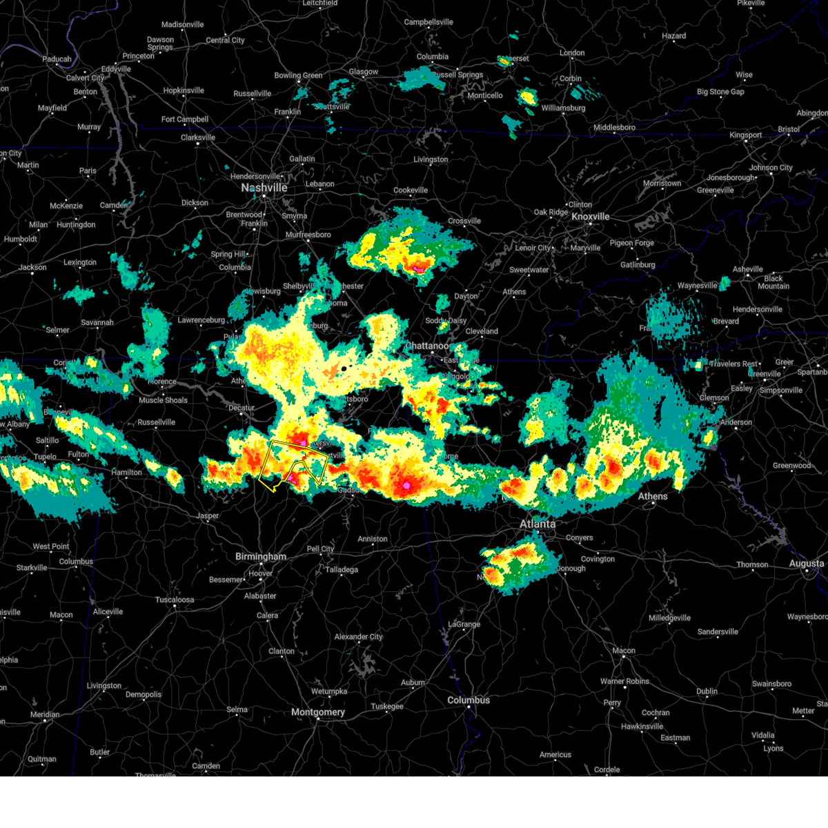
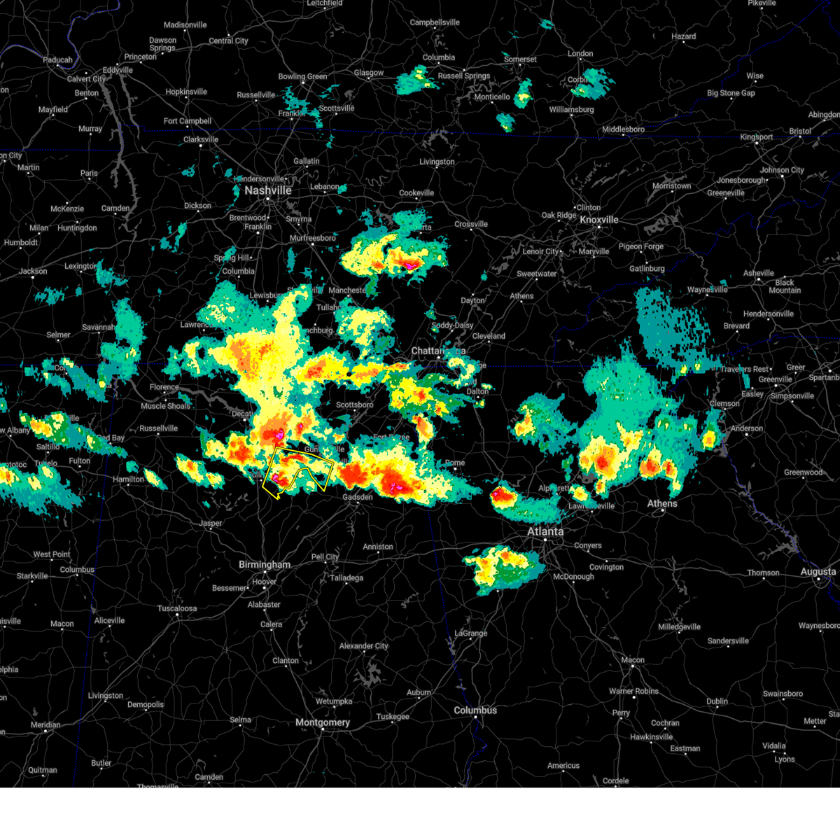
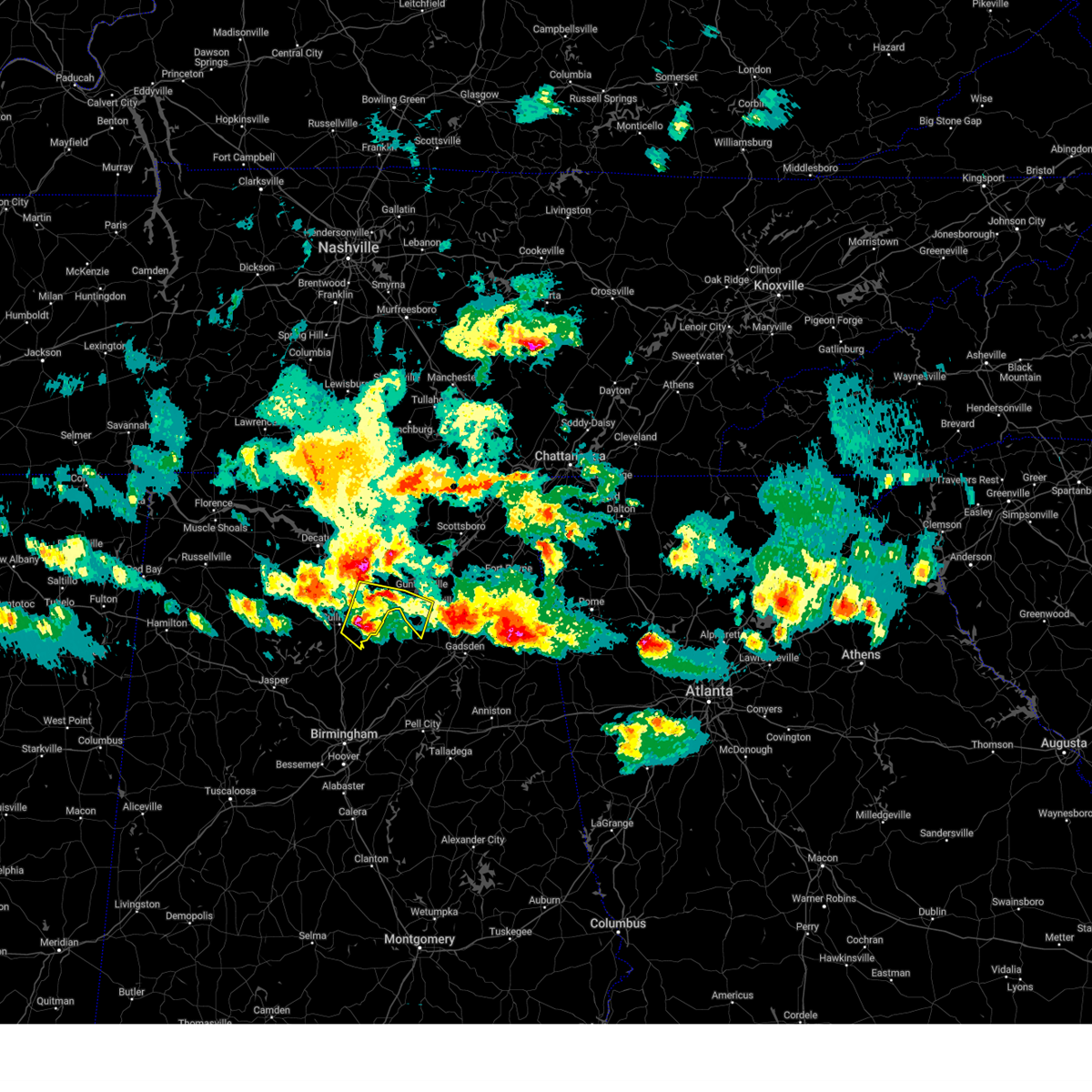
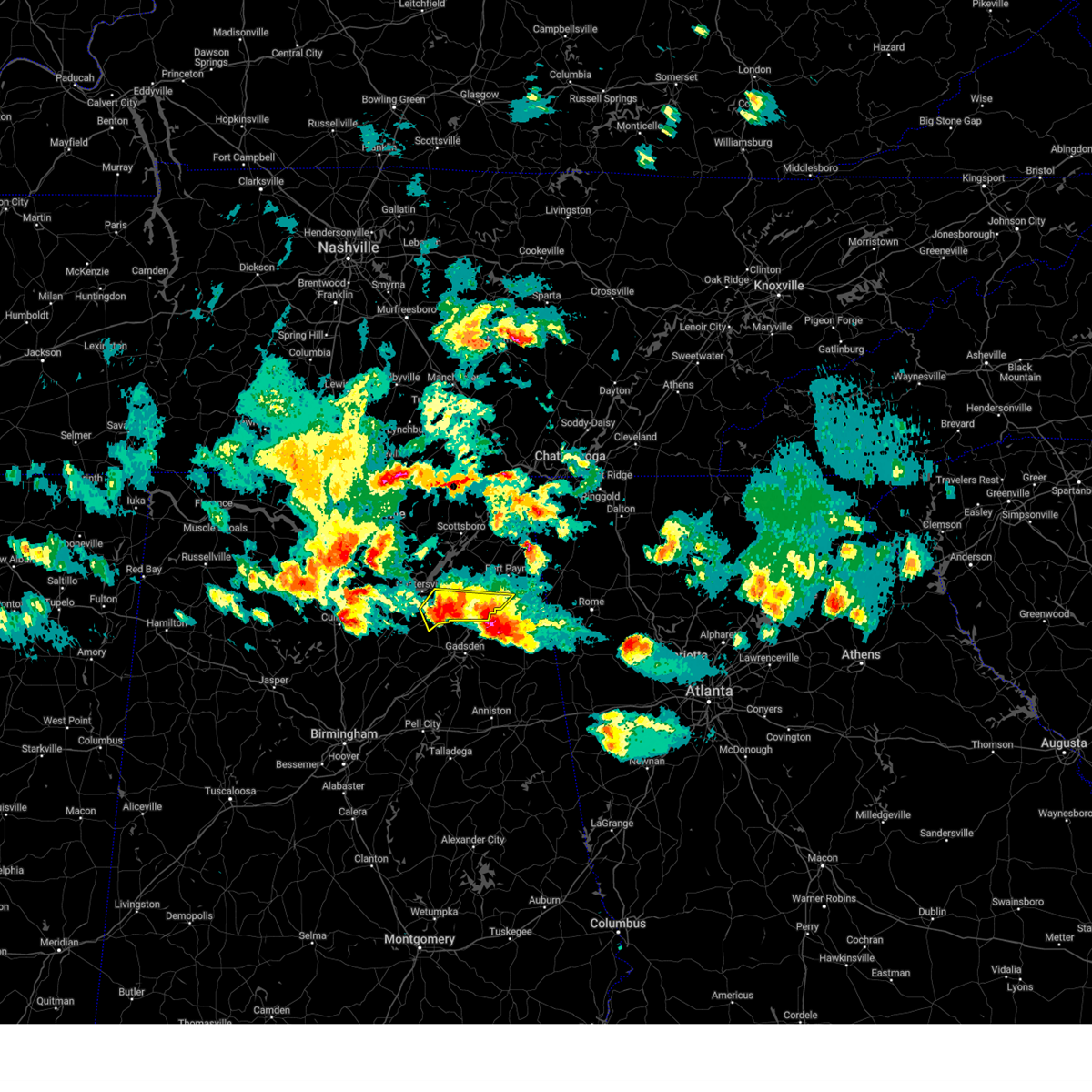
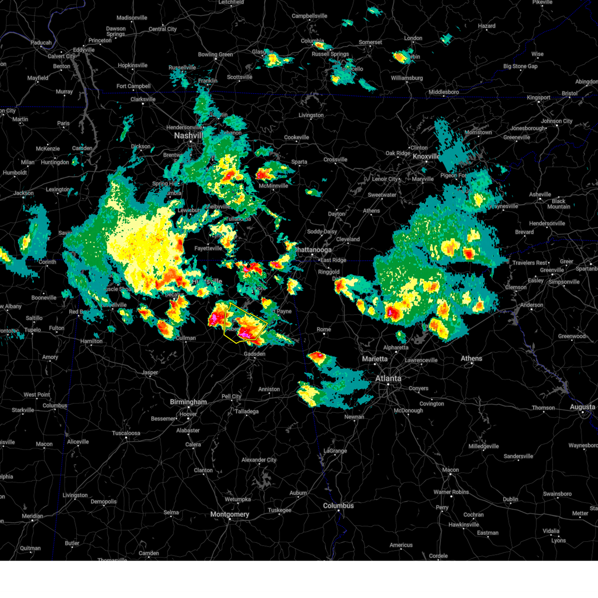
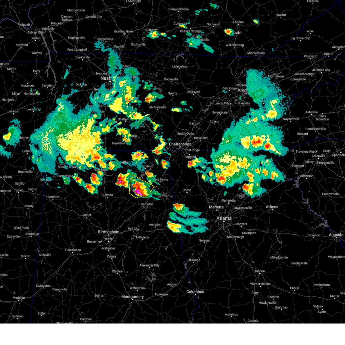
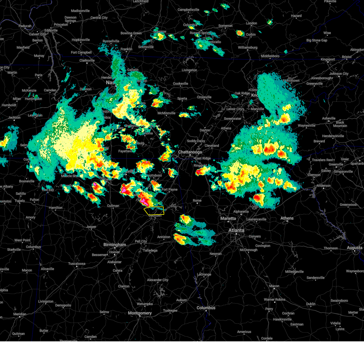
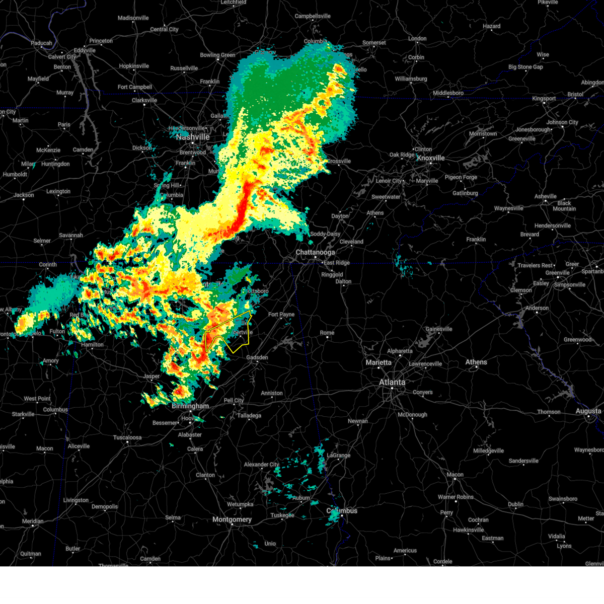
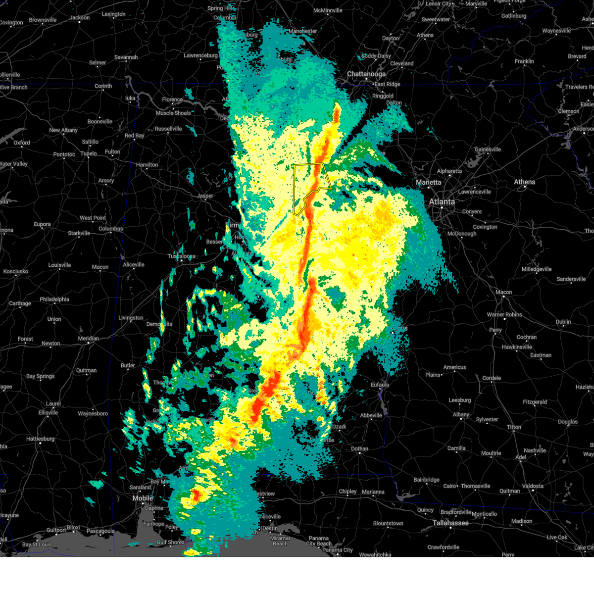
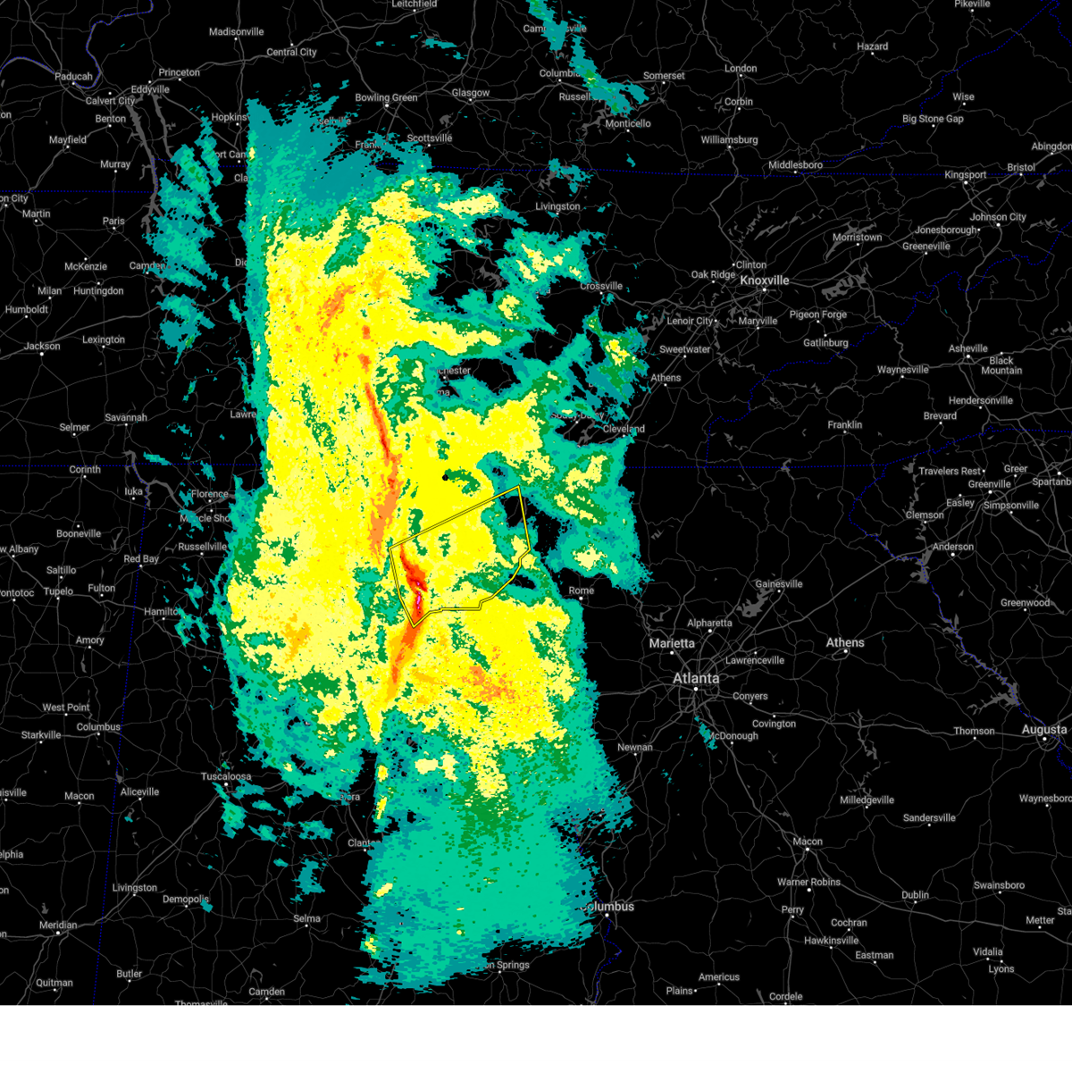
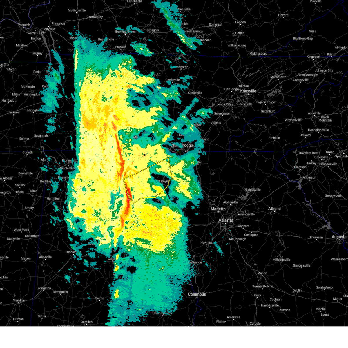
The Top Recent Hail Date for New Union, AL is Monday, June 1, 2026 (9th out of 52)
Hail and Wind Damage Spotted near New Union, AL
| Date / Time | Report Details |
|---|---|
| 6/1/2026 2:10 PM CDT |
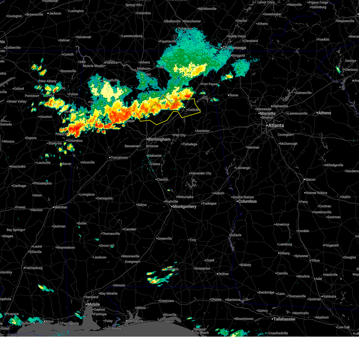 At 209 pm cdt, severe thunderstorms were located along a line extending from 6 miles west of slackland to near bangor, moving southeast at 40 mph (emergency management). Hazards include 60 mph wind gusts and quarter size hail. Hail damage to vehicles is expected. expect wind damage to roofs, siding, and trees. Locations impacted include, gadsden, rainbow city, oneonta, attalla, hokes bluff, blountsville, cleveland, dallas, glencoe, warrior, sardis city, locust fork, steele, altoona, snead, susan moore, walnut grove, reece city, trafford, and allgood. At 209 pm cdt, severe thunderstorms were located along a line extending from 6 miles west of slackland to near bangor, moving southeast at 40 mph (emergency management). Hazards include 60 mph wind gusts and quarter size hail. Hail damage to vehicles is expected. expect wind damage to roofs, siding, and trees. Locations impacted include, gadsden, rainbow city, oneonta, attalla, hokes bluff, blountsville, cleveland, dallas, glencoe, warrior, sardis city, locust fork, steele, altoona, snead, susan moore, walnut grove, reece city, trafford, and allgood.
|
| 6/1/2026 2:09 PM CDT |
 At 208 pm cdt, severe thunderstorms were located along a line extending from near crossville to near sipsey, moving southeast at 25 mph (emergency management). Hazards include 60 mph wind gusts and penny size hail. Expect damage to roofs, siding, and trees. Locations impacted include, albertville, cullman, boaz, hanceville, good hope, crossville, holly pond, dodge city, baldwin, and vinemont. At 208 pm cdt, severe thunderstorms were located along a line extending from near crossville to near sipsey, moving southeast at 25 mph (emergency management). Hazards include 60 mph wind gusts and penny size hail. Expect damage to roofs, siding, and trees. Locations impacted include, albertville, cullman, boaz, hanceville, good hope, crossville, holly pond, dodge city, baldwin, and vinemont.
|
| 6/1/2026 1:50 PM CDT |
 At 149 pm cdt, severe thunderstorms were located along a line extending from near crossville to near good hope, moving southeast at 40 mph (radar indicated). Hazards include 60 mph wind gusts and quarter size hail. Hail damage to vehicles is expected. expect wind damage to roofs, siding, and trees. Locations impacted include, gadsden, rainbow city, oneonta, attalla, hokes bluff, blountsville, cleveland, dallas, glencoe, warrior, sardis city, locust fork, steele, altoona, snead, susan moore, walnut grove, reece city, trafford, and allgood. At 149 pm cdt, severe thunderstorms were located along a line extending from near crossville to near good hope, moving southeast at 40 mph (radar indicated). Hazards include 60 mph wind gusts and quarter size hail. Hail damage to vehicles is expected. expect wind damage to roofs, siding, and trees. Locations impacted include, gadsden, rainbow city, oneonta, attalla, hokes bluff, blountsville, cleveland, dallas, glencoe, warrior, sardis city, locust fork, steele, altoona, snead, susan moore, walnut grove, reece city, trafford, and allgood.
|
| 6/1/2026 1:35 PM CDT |
 Svrbmx the national weather service in birmingham has issued a * severe thunderstorm warning for, blount county in central alabama, etowah county in northeastern alabama, * until 230 pm cdt. * at 135 pm cdt, severe thunderstorms were located along a line extending from 8 miles west of geraldine to 6 miles northwest of cullman, moving southeast at 40 mph (radar indicated). Hazards include 60 mph wind gusts and quarter size hail. Hail damage to vehicles is expected. Expect wind damage to roofs, siding, and trees. Svrbmx the national weather service in birmingham has issued a * severe thunderstorm warning for, blount county in central alabama, etowah county in northeastern alabama, * until 230 pm cdt. * at 135 pm cdt, severe thunderstorms were located along a line extending from 8 miles west of geraldine to 6 miles northwest of cullman, moving southeast at 40 mph (radar indicated). Hazards include 60 mph wind gusts and quarter size hail. Hail damage to vehicles is expected. Expect wind damage to roofs, siding, and trees.
|
| 6/1/2026 1:34 PM CDT |
 At 133 pm cdt, severe thunderstorms were located along a line extending from near geraldine to curry, moving southeast at 40 mph. these storms are producing widespread tree damage and occasionally producing small hail (emergency management). Hazards include 60 mph wind gusts and penny size hail. Expect damage to roofs, siding, and trees. Locations impacted include, albertville, cullman, boaz, hanceville, good hope, crossville, holly pond, dodge city, baldwin, and vinemont. At 133 pm cdt, severe thunderstorms were located along a line extending from near geraldine to curry, moving southeast at 40 mph. these storms are producing widespread tree damage and occasionally producing small hail (emergency management). Hazards include 60 mph wind gusts and penny size hail. Expect damage to roofs, siding, and trees. Locations impacted include, albertville, cullman, boaz, hanceville, good hope, crossville, holly pond, dodge city, baldwin, and vinemont.
|
| 6/1/2026 1:15 PM CDT |
 Svrhun the national weather service in huntsville alabama has issued a * severe thunderstorm warning for, southern marshall county in northeastern alabama, southwestern dekalb county in northeastern alabama, cullman county in north central alabama, * until 215 pm cdt. * at 114 pm cdt, severe thunderstorms were located along a line extending from near grant to 9 miles north of ashridge, moving southeast at 25 mph (emergency management). Hazards include 60 mph wind gusts and penny size hail. expect damage to roofs, siding, and trees Svrhun the national weather service in huntsville alabama has issued a * severe thunderstorm warning for, southern marshall county in northeastern alabama, southwestern dekalb county in northeastern alabama, cullman county in north central alabama, * until 215 pm cdt. * at 114 pm cdt, severe thunderstorms were located along a line extending from near grant to 9 miles north of ashridge, moving southeast at 25 mph (emergency management). Hazards include 60 mph wind gusts and penny size hail. expect damage to roofs, siding, and trees
|
| 3/16/2026 1:54 AM CDT |
 Svrhun the national weather service in huntsville alabama has issued a * severe thunderstorm warning for, southeastern marshall county in northeastern alabama, dekalb county in northeastern alabama, * until 245 am cdt. * at 154 am cdt, severe thunderstorms were located along a line extending from rainsville to near aurora, moving east at 35 mph (radar indicated). Hazards include 60 mph wind gusts and penny size hail. expect damage to roofs, siding, and trees Svrhun the national weather service in huntsville alabama has issued a * severe thunderstorm warning for, southeastern marshall county in northeastern alabama, dekalb county in northeastern alabama, * until 245 am cdt. * at 154 am cdt, severe thunderstorms were located along a line extending from rainsville to near aurora, moving east at 35 mph (radar indicated). Hazards include 60 mph wind gusts and penny size hail. expect damage to roofs, siding, and trees
|
| 3/16/2026 1:48 AM CDT |
 At 147 am cdt, severe thunderstorms were located along a line extending from fyffe to altoona, moving east at 35 mph (radar indicated). Hazards include 60 mph wind gusts and penny size hail. Expect damage to roofs, siding, and trees. Locations impacted include, albertville, fort payne, boaz, guntersville, rainsville, crossville, fyffe, geraldine, douglas, and pine ridge. At 147 am cdt, severe thunderstorms were located along a line extending from fyffe to altoona, moving east at 35 mph (radar indicated). Hazards include 60 mph wind gusts and penny size hail. Expect damage to roofs, siding, and trees. Locations impacted include, albertville, fort payne, boaz, guntersville, rainsville, crossville, fyffe, geraldine, douglas, and pine ridge.
|
| 3/16/2026 1:31 AM CDT |
 the severe thunderstorm warning has been cancelled and is no longer in effect the severe thunderstorm warning has been cancelled and is no longer in effect
|
| 3/16/2026 1:31 AM CDT |
 At 130 am cdt, severe thunderstorms were located along a line extending from 7 miles southwest of section to near susan moore, moving east at 35 mph (radar indicated). Hazards include 60 mph wind gusts and penny size hail. Expect damage to roofs, siding, and trees. Locations impacted include, albertville, fort payne, boaz, guntersville, arab, rainsville, crossville, fyffe, geraldine, and douglas. At 130 am cdt, severe thunderstorms were located along a line extending from 7 miles southwest of section to near susan moore, moving east at 35 mph (radar indicated). Hazards include 60 mph wind gusts and penny size hail. Expect damage to roofs, siding, and trees. Locations impacted include, albertville, fort payne, boaz, guntersville, arab, rainsville, crossville, fyffe, geraldine, and douglas.
|
| 3/16/2026 1:05 AM CDT |
 Svrhun the national weather service in huntsville alabama has issued a * severe thunderstorm warning for, marshall county in northeastern alabama, southwestern dekalb county in northeastern alabama, northeastern cullman county in north central alabama, southeastern morgan county in north central alabama, * until 200 am cdt. * at 103 am cdt, severe thunderstorms were located along a line extending from near grant to hanceville, moving east at 35 mph (radar indicated). Hazards include 60 mph wind gusts and penny size hail. expect damage to roofs, siding, and trees Svrhun the national weather service in huntsville alabama has issued a * severe thunderstorm warning for, marshall county in northeastern alabama, southwestern dekalb county in northeastern alabama, northeastern cullman county in north central alabama, southeastern morgan county in north central alabama, * until 200 am cdt. * at 103 am cdt, severe thunderstorms were located along a line extending from near grant to hanceville, moving east at 35 mph (radar indicated). Hazards include 60 mph wind gusts and penny size hail. expect damage to roofs, siding, and trees
|
| 2/26/2026 7:46 PM CST |
 At 746 pm cst, a severe thunderstorm was located near altoona, or 8 miles west of attalla, moving east at 30 mph (radar indicated). Hazards include 60 mph wind gusts and quarter size hail. Hail damage to vehicles is expected. expect wind damage to roofs, siding, and trees. Locations impacted include, gadsden, rainbow city, attalla, hokes bluff, glencoe, ashville, steele, altoona, walnut grove, reece city, gadsden mall, noccalula falls, neely henry lake, southside, alabama international dragway, gadsden steam plant, northside, gadsden water works, ramsey, and big wills creek. At 746 pm cst, a severe thunderstorm was located near altoona, or 8 miles west of attalla, moving east at 30 mph (radar indicated). Hazards include 60 mph wind gusts and quarter size hail. Hail damage to vehicles is expected. expect wind damage to roofs, siding, and trees. Locations impacted include, gadsden, rainbow city, attalla, hokes bluff, glencoe, ashville, steele, altoona, walnut grove, reece city, gadsden mall, noccalula falls, neely henry lake, southside, alabama international dragway, gadsden steam plant, northside, gadsden water works, ramsey, and big wills creek.
|
| 2/26/2026 7:24 PM CST |
 Svrbmx the national weather service in birmingham has issued a * severe thunderstorm warning for, central etowah county in northeastern alabama, northeastern st. clair county in central alabama, * until 830 pm cst. * at 723 pm cst, a severe thunderstorm was located over susan moore, or 8 miles east of blountsville, moving east at 30 mph (radar indicated). Hazards include golf ball size hail and 60 mph wind gusts. People and animals outdoors may be injured. expect hail damage to roofs, siding, windows, and vehicles. Expect wind damage to roofs, siding, and trees. Svrbmx the national weather service in birmingham has issued a * severe thunderstorm warning for, central etowah county in northeastern alabama, northeastern st. clair county in central alabama, * until 830 pm cst. * at 723 pm cst, a severe thunderstorm was located over susan moore, or 8 miles east of blountsville, moving east at 30 mph (radar indicated). Hazards include golf ball size hail and 60 mph wind gusts. People and animals outdoors may be injured. expect hail damage to roofs, siding, windows, and vehicles. Expect wind damage to roofs, siding, and trees.
|
| 2/26/2026 4:40 PM CST |
 the severe thunderstorm warning has been cancelled and is no longer in effect the severe thunderstorm warning has been cancelled and is no longer in effect
|
| 2/26/2026 4:25 PM CST |
 Svrhun the national weather service in huntsville alabama has issued a * severe thunderstorm warning for, southeastern marshall county in northeastern alabama, southern dekalb county in northeastern alabama, * until 515 pm cst. * at 425 pm cst, a severe thunderstorm was located over boaz, moving southeast at 25 mph (radar indicated). Hazards include quarter size hail. damage to vehicles is expected Svrhun the national weather service in huntsville alabama has issued a * severe thunderstorm warning for, southeastern marshall county in northeastern alabama, southern dekalb county in northeastern alabama, * until 515 pm cst. * at 425 pm cst, a severe thunderstorm was located over boaz, moving southeast at 25 mph (radar indicated). Hazards include quarter size hail. damage to vehicles is expected
|
| 11/25/2025 5:38 AM CST |
 the severe thunderstorm warning has been cancelled and is no longer in effect the severe thunderstorm warning has been cancelled and is no longer in effect
|
| 11/25/2025 5:38 AM CST |
 At 538 am cst, severe thunderstorms were located along a line extending from sardis city to noccalula falls to near glencoe, moving northeast at 50 mph (radar indicated). Hazards include 70 mph wind gusts. Expect considerable tree damage. damage is likely to mobile homes, roofs, and outbuildings. Locations impacted include, gadsden, rainbow city, attalla, hokes bluff, glencoe, sardis city, reece city, tabor road, aurora, ballplay, gadsden mall, noccalula falls, neely henry lake, southside, gadsden steam plant, mountainboro, rockledge, northside, gadsden water works, and reaves. At 538 am cst, severe thunderstorms were located along a line extending from sardis city to noccalula falls to near glencoe, moving northeast at 50 mph (radar indicated). Hazards include 70 mph wind gusts. Expect considerable tree damage. damage is likely to mobile homes, roofs, and outbuildings. Locations impacted include, gadsden, rainbow city, attalla, hokes bluff, glencoe, sardis city, reece city, tabor road, aurora, ballplay, gadsden mall, noccalula falls, neely henry lake, southside, gadsden steam plant, mountainboro, rockledge, northside, gadsden water works, and reaves.
|
| 11/25/2025 5:27 AM CST |
 At 527 am cst, severe thunderstorms were located along a line extending from near aurora to neely henry lake to near lincoln, moving east at 60 mph (radar indicated). Hazards include 70 mph wind gusts. Expect considerable tree damage. damage is likely to mobile homes, roofs, and outbuildings. Locations impacted include, gadsden, pell city, leeds, moody, rainbow city, attalla, hokes bluff, springville, odenville, lincoln, glencoe, margaret, argo, ashville, riverside, sardis city, ragland, ohatchee, steele, and altoona. At 527 am cst, severe thunderstorms were located along a line extending from near aurora to neely henry lake to near lincoln, moving east at 60 mph (radar indicated). Hazards include 70 mph wind gusts. Expect considerable tree damage. damage is likely to mobile homes, roofs, and outbuildings. Locations impacted include, gadsden, pell city, leeds, moody, rainbow city, attalla, hokes bluff, springville, odenville, lincoln, glencoe, margaret, argo, ashville, riverside, sardis city, ragland, ohatchee, steele, and altoona.
|
| 11/25/2025 5:10 AM CST |
 Svrhun the national weather service in huntsville alabama has issued a * severe thunderstorm warning for, southern marshall county in northeastern alabama, * until 600 am cst. * at 508 am cst, a severe thunderstorm was located over strawberry, or near arab, moving east at 45 mph (radar indicated). Hazards include 60 mph wind gusts. expect damage to roofs, siding, and trees Svrhun the national weather service in huntsville alabama has issued a * severe thunderstorm warning for, southern marshall county in northeastern alabama, * until 600 am cst. * at 508 am cst, a severe thunderstorm was located over strawberry, or near arab, moving east at 45 mph (radar indicated). Hazards include 60 mph wind gusts. expect damage to roofs, siding, and trees
|
| 11/25/2025 5:03 AM CST |
 At 503 am cst, severe thunderstorms were located along a line extending from near blountsville to springville to near barber motorsports park, moving east at 55 mph (radar indicated). Hazards include 70 mph wind gusts. Expect considerable tree damage. damage is likely to mobile homes, roofs, and outbuildings. Locations impacted include, gadsden, pell city, leeds, moody, rainbow city, attalla, hokes bluff, springville, odenville, lincoln, glencoe, margaret, argo, ashville, riverside, sardis city, ragland, ohatchee, steele, and altoona. At 503 am cst, severe thunderstorms were located along a line extending from near blountsville to springville to near barber motorsports park, moving east at 55 mph (radar indicated). Hazards include 70 mph wind gusts. Expect considerable tree damage. damage is likely to mobile homes, roofs, and outbuildings. Locations impacted include, gadsden, pell city, leeds, moody, rainbow city, attalla, hokes bluff, springville, odenville, lincoln, glencoe, margaret, argo, ashville, riverside, sardis city, ragland, ohatchee, steele, and altoona.
|
| 11/25/2025 4:49 AM CST |
 Svrbmx the national weather service in birmingham has issued a * severe thunderstorm warning for, etowah county in northeastern alabama, st. clair county in central alabama, * until 600 am cst. * at 448 am cst, severe thunderstorms were located along a line extending from near hanceville to near pinson to birmingham, moving east at 55 mph (radar indicated). Hazards include 70 mph wind gusts. Expect considerable tree damage. Damage is likely to mobile homes, roofs, and outbuildings. Svrbmx the national weather service in birmingham has issued a * severe thunderstorm warning for, etowah county in northeastern alabama, st. clair county in central alabama, * until 600 am cst. * at 448 am cst, severe thunderstorms were located along a line extending from near hanceville to near pinson to birmingham, moving east at 55 mph (radar indicated). Hazards include 70 mph wind gusts. Expect considerable tree damage. Damage is likely to mobile homes, roofs, and outbuildings.
|
| 6/25/2025 3:04 PM CDT |
 the severe thunderstorm warning has been cancelled and is no longer in effect the severe thunderstorm warning has been cancelled and is no longer in effect
|
| 6/25/2025 2:28 PM CDT |
 Svrhun the national weather service in huntsville alabama has issued a * severe thunderstorm warning for, eastern marshall county in northeastern alabama, south central jackson county in northeastern alabama, southwestern dekalb county in northeastern alabama, * until 330 pm cdt. * at 227 pm cdt, a cluster of severe thunderstorms was extending from albertville to fyffe and is nearly stationary (radar indicated). Hazards include 60 mph wind gusts and penny size hail. expect damage to roofs, siding, and trees Svrhun the national weather service in huntsville alabama has issued a * severe thunderstorm warning for, eastern marshall county in northeastern alabama, south central jackson county in northeastern alabama, southwestern dekalb county in northeastern alabama, * until 330 pm cdt. * at 227 pm cdt, a cluster of severe thunderstorms was extending from albertville to fyffe and is nearly stationary (radar indicated). Hazards include 60 mph wind gusts and penny size hail. expect damage to roofs, siding, and trees
|
| 6/7/2025 2:48 PM CDT |
 At 248 pm cdt, severe thunderstorms were located along a line extending from near sardis city to near steele to near greystone to centreville, moving east at 55 mph (radar indicated). Hazards include 60 mph wind gusts and penny size hail. Expect damage to roofs, siding, and trees. Locations impacted include, hoover, gadsden, alabaster, pelham, helena, pell city, leeds, moody, calera, chelsea, rainbow city, montevallo, attalla, childersburg, brent, hokes bluff, columbiana, springville, odenville, and centreville. At 248 pm cdt, severe thunderstorms were located along a line extending from near sardis city to near steele to near greystone to centreville, moving east at 55 mph (radar indicated). Hazards include 60 mph wind gusts and penny size hail. Expect damage to roofs, siding, and trees. Locations impacted include, hoover, gadsden, alabaster, pelham, helena, pell city, leeds, moody, calera, chelsea, rainbow city, montevallo, attalla, childersburg, brent, hokes bluff, columbiana, springville, odenville, and centreville.
|
| 6/7/2025 2:42 PM CDT |
 The storms which prompted the warning have moved out of the warned area. therefore, the warning will be allowed to expire. a new severe thunderstorm warning has been issued for parts of marshall county. a severe thunderstorm watch remains in effect until 600 pm cdt for north central and northeastern alabama. The storms which prompted the warning have moved out of the warned area. therefore, the warning will be allowed to expire. a new severe thunderstorm warning has been issued for parts of marshall county. a severe thunderstorm watch remains in effect until 600 pm cdt for north central and northeastern alabama.
|
| 6/7/2025 2:40 PM CDT |
 Svrhun the national weather service in huntsville alabama has issued a * severe thunderstorm warning for, eastern marshall county in northeastern alabama, southwestern jackson county in northeastern alabama, dekalb county in northeastern alabama, * until 345 pm cdt. * at 239 pm cdt, a severe thunderstorm was located over guntersville, moving east at 50 mph (radar indicated). Hazards include 60 mph wind gusts. expect damage to roofs, siding, and trees Svrhun the national weather service in huntsville alabama has issued a * severe thunderstorm warning for, eastern marshall county in northeastern alabama, southwestern jackson county in northeastern alabama, dekalb county in northeastern alabama, * until 345 pm cdt. * at 239 pm cdt, a severe thunderstorm was located over guntersville, moving east at 50 mph (radar indicated). Hazards include 60 mph wind gusts. expect damage to roofs, siding, and trees
|
| 6/7/2025 2:32 PM CDT |
 At 231 pm cdt, severe thunderstorms were located along a line extending from near morgan city to near rosa to near morris, moving east at 55 mph (emergency management). Hazards include 70 mph wind gusts. Expect considerable tree damage. damage is likely to mobile homes, roofs, and outbuildings. Locations impacted include, southern huntsville, albertville, boaz, guntersville, arab, redstone arsenal, owens cross roads, grant, douglas, and union grove. At 231 pm cdt, severe thunderstorms were located along a line extending from near morgan city to near rosa to near morris, moving east at 55 mph (emergency management). Hazards include 70 mph wind gusts. Expect considerable tree damage. damage is likely to mobile homes, roofs, and outbuildings. Locations impacted include, southern huntsville, albertville, boaz, guntersville, arab, redstone arsenal, owens cross roads, grant, douglas, and union grove.
|
| 6/7/2025 2:32 PM CDT |
 At 232 pm cdt, severe thunderstorms were located along a line extending from 6 miles west of albertville to oneonta to birmingham to low gap, moving east at 45 mph (radar indicated). Hazards include 60 mph wind gusts and penny size hail. Expect damage to roofs, siding, and trees. Locations impacted include, hoover, gadsden, alabaster, pelham, helena, pell city, leeds, moody, calera, chelsea, rainbow city, montevallo, attalla, childersburg, brent, hokes bluff, columbiana, springville, odenville, and centreville. At 232 pm cdt, severe thunderstorms were located along a line extending from 6 miles west of albertville to oneonta to birmingham to low gap, moving east at 45 mph (radar indicated). Hazards include 60 mph wind gusts and penny size hail. Expect damage to roofs, siding, and trees. Locations impacted include, hoover, gadsden, alabaster, pelham, helena, pell city, leeds, moody, calera, chelsea, rainbow city, montevallo, attalla, childersburg, brent, hokes bluff, columbiana, springville, odenville, and centreville.
|
| 6/7/2025 2:32 PM CDT |
 the severe thunderstorm warning has been cancelled and is no longer in effect the severe thunderstorm warning has been cancelled and is no longer in effect
|
| 6/7/2025 2:26 PM CDT |
 At 225 pm cdt, severe thunderstorms were located along a line extending from morgan city to near cleveland to near morris, moving east at 55 mph (emergency management). Hazards include 70 mph wind gusts. Expect considerable tree damage. damage is likely to mobile homes, roofs, and outbuildings. Locations impacted include, southern huntsville, albertville, boaz, guntersville, arab, redstone arsenal, owens cross roads, grant, holly pond, and triana. At 225 pm cdt, severe thunderstorms were located along a line extending from morgan city to near cleveland to near morris, moving east at 55 mph (emergency management). Hazards include 70 mph wind gusts. Expect considerable tree damage. damage is likely to mobile homes, roofs, and outbuildings. Locations impacted include, southern huntsville, albertville, boaz, guntersville, arab, redstone arsenal, owens cross roads, grant, holly pond, and triana.
|
| 6/7/2025 2:18 PM CDT |
 Svrbmx the national weather service in birmingham has issued a * severe thunderstorm warning for, shelby county in central alabama, etowah county in northeastern alabama, bibb county in central alabama, st. clair county in central alabama, * until 330 pm cdt. * at 218 pm cdt, severe thunderstorms were located along a line extending from near strawberry to near cleveland to mcdonald chapel to near shelton state community college, moving east at 55 mph (radar indicated). Hazards include 60 mph wind gusts and penny size hail. expect damage to roofs, siding, and trees Svrbmx the national weather service in birmingham has issued a * severe thunderstorm warning for, shelby county in central alabama, etowah county in northeastern alabama, bibb county in central alabama, st. clair county in central alabama, * until 330 pm cdt. * at 218 pm cdt, severe thunderstorms were located along a line extending from near strawberry to near cleveland to mcdonald chapel to near shelton state community college, moving east at 55 mph (radar indicated). Hazards include 60 mph wind gusts and penny size hail. expect damage to roofs, siding, and trees
|
| 6/7/2025 2:05 PM CDT |
 At 204 pm cdt, severe thunderstorms were located along a line extending from near priceville to dodge city to near beloit, moving east at 55 mph (emergency management). Hazards include 70 mph wind gusts. Expect considerable tree damage. damage is likely to mobile homes, roofs, and outbuildings. Locations impacted include, southern huntsville, decatur, albertville, cullman, hartselle, boaz, guntersville, arab, redstone arsenal, and hanceville. At 204 pm cdt, severe thunderstorms were located along a line extending from near priceville to dodge city to near beloit, moving east at 55 mph (emergency management). Hazards include 70 mph wind gusts. Expect considerable tree damage. damage is likely to mobile homes, roofs, and outbuildings. Locations impacted include, southern huntsville, decatur, albertville, cullman, hartselle, boaz, guntersville, arab, redstone arsenal, and hanceville.
|
| 6/7/2025 2:05 PM CDT |
 the severe thunderstorm warning has been cancelled and is no longer in effect the severe thunderstorm warning has been cancelled and is no longer in effect
|
| 6/7/2025 1:55 PM CDT |
 At 154 pm cdt, severe thunderstorms were located along a line extending from near hartselle to 6 miles west of dodge city to parrish, moving east at 55 mph. multiple trees reported down in western cullman (emergency management). Hazards include 70 mph wind gusts. Expect considerable tree damage. damage is likely to mobile homes, roofs, and outbuildings. Locations impacted include, southern huntsville, decatur, albertville, cullman, hartselle, boaz, guntersville, arab, redstone arsenal, and hanceville. At 154 pm cdt, severe thunderstorms were located along a line extending from near hartselle to 6 miles west of dodge city to parrish, moving east at 55 mph. multiple trees reported down in western cullman (emergency management). Hazards include 70 mph wind gusts. Expect considerable tree damage. damage is likely to mobile homes, roofs, and outbuildings. Locations impacted include, southern huntsville, decatur, albertville, cullman, hartselle, boaz, guntersville, arab, redstone arsenal, and hanceville.
|
| 6/7/2025 1:47 PM CDT |
 Svrhun the national weather service in huntsville alabama has issued a * severe thunderstorm warning for, marshall county in northeastern alabama, southern madison county in north central alabama, cullman county in north central alabama, morgan county in north central alabama, southeastern lawrence county in northwestern alabama, * until 245 pm cdt. * at 147 pm cdt, severe thunderstorms were located along a line extending from 6 miles south of trinity to near smith dam to oakman, moving east at 55 mph (radar indicated). Hazards include 60 mph wind gusts. expect damage to roofs, siding, and trees Svrhun the national weather service in huntsville alabama has issued a * severe thunderstorm warning for, marshall county in northeastern alabama, southern madison county in north central alabama, cullman county in north central alabama, morgan county in north central alabama, southeastern lawrence county in northwestern alabama, * until 245 pm cdt. * at 147 pm cdt, severe thunderstorms were located along a line extending from 6 miles south of trinity to near smith dam to oakman, moving east at 55 mph (radar indicated). Hazards include 60 mph wind gusts. expect damage to roofs, siding, and trees
|
| 5/25/2025 10:29 PM CDT |
 The storms which prompted the warning have weakened below severe limits, and no longer pose an immediate threat to life or property. therefore, the warning will be allowed to expire. however, gusty winds and heavy rain are still possible with these thunderstorms. a severe thunderstorm watch remains in effect until 1100 pm cdt for north central and northeastern alabama. The storms which prompted the warning have weakened below severe limits, and no longer pose an immediate threat to life or property. therefore, the warning will be allowed to expire. however, gusty winds and heavy rain are still possible with these thunderstorms. a severe thunderstorm watch remains in effect until 1100 pm cdt for north central and northeastern alabama.
|
| 5/25/2025 10:04 PM CDT |
 At 1003 pm cdt, severe thunderstorms were located along a line extending from huntsville to 6 miles west of arab to near blount springs, moving east at 45 mph (radar indicated). Hazards include 60 mph wind gusts. Expect damage to roofs, siding, and trees. Locations impacted include, wilburn, high point, lim rock, valhermoso springs, cullman, painter, joppa, union grove, crossville, and rabbit town. At 1003 pm cdt, severe thunderstorms were located along a line extending from huntsville to 6 miles west of arab to near blount springs, moving east at 45 mph (radar indicated). Hazards include 60 mph wind gusts. Expect damage to roofs, siding, and trees. Locations impacted include, wilburn, high point, lim rock, valhermoso springs, cullman, painter, joppa, union grove, crossville, and rabbit town.
|
| 5/25/2025 9:54 PM CDT |
 At 953 pm cdt, severe thunderstorms were located along a line extending from near madison to 8 miles southwest of morgan city to near bangor, moving east at 50 mph (radar indicated). Hazards include 60 mph wind gusts. Expect damage to roofs, siding, and trees. Locations impacted include, wilburn, lim rock, valhermoso springs, crane hill, priceville, painter, union grove, rabbit town, whitesburg, and mcville. At 953 pm cdt, severe thunderstorms were located along a line extending from near madison to 8 miles southwest of morgan city to near bangor, moving east at 50 mph (radar indicated). Hazards include 60 mph wind gusts. Expect damage to roofs, siding, and trees. Locations impacted include, wilburn, lim rock, valhermoso springs, crane hill, priceville, painter, union grove, rabbit town, whitesburg, and mcville.
|
| 5/25/2025 9:54 PM CDT |
 the severe thunderstorm warning has been cancelled and is no longer in effect the severe thunderstorm warning has been cancelled and is no longer in effect
|
| 5/25/2025 9:37 PM CDT |
 Svrhun the national weather service in huntsville alabama has issued a * severe thunderstorm warning for, marshall county in northeastern alabama, southwestern jackson county in northeastern alabama, southern madison county in north central alabama, southern limestone county in north central alabama, southwestern dekalb county in northeastern alabama, cullman county in north central alabama, morgan county in north central alabama, eastern lawrence county in northwestern alabama, * until 1030 pm cdt. * at 937 pm cdt, severe thunderstorms were located along a line extending from near tanner to falkville to near dodge city, moving east at 50 mph (radar indicated). Hazards include 60 mph wind gusts. expect damage to roofs, siding, and trees Svrhun the national weather service in huntsville alabama has issued a * severe thunderstorm warning for, marshall county in northeastern alabama, southwestern jackson county in northeastern alabama, southern madison county in north central alabama, southern limestone county in north central alabama, southwestern dekalb county in northeastern alabama, cullman county in north central alabama, morgan county in north central alabama, eastern lawrence county in northwestern alabama, * until 1030 pm cdt. * at 937 pm cdt, severe thunderstorms were located along a line extending from near tanner to falkville to near dodge city, moving east at 50 mph (radar indicated). Hazards include 60 mph wind gusts. expect damage to roofs, siding, and trees
|
| 5/2/2025 5:48 PM CDT |
 At 548 pm cdt, severe thunderstorms were located along a line extending from near trion to near steele, moving east at 55 mph (radar indicated). Hazards include 60 mph wind gusts and quarter size hail. Hail damage to vehicles is expected. expect wind damage to roofs, siding, and trees. Locations impacted include, whitney junction, weiss dam, gadsden steam plant, hokes bluff, yellow creek falls, rockledge, cherokee rock village, spring garden, fairview, aurora, little river canyon national preserve, pleasant gap, cornwall furnace park, cobb city, attalla, gadsden water works, blanche, eastern weiss lake, forney, and glencoe. At 548 pm cdt, severe thunderstorms were located along a line extending from near trion to near steele, moving east at 55 mph (radar indicated). Hazards include 60 mph wind gusts and quarter size hail. Hail damage to vehicles is expected. expect wind damage to roofs, siding, and trees. Locations impacted include, whitney junction, weiss dam, gadsden steam plant, hokes bluff, yellow creek falls, rockledge, cherokee rock village, spring garden, fairview, aurora, little river canyon national preserve, pleasant gap, cornwall furnace park, cobb city, attalla, gadsden water works, blanche, eastern weiss lake, forney, and glencoe.
|
| 5/2/2025 5:21 PM CDT |
 Svrbmx the national weather service in birmingham has issued a * severe thunderstorm warning for, eastern blount county in central alabama, etowah county in northeastern alabama, northern st. clair county in central alabama, cherokee county in northeastern alabama, * until 630 pm cdt. * at 520 pm cdt, severe thunderstorms were located along a line extending from near henagar to near nectar, moving east at 55 mph (radar indicated). Hazards include 60 mph wind gusts and half dollar size hail. Hail damage to vehicles is expected. Expect wind damage to roofs, siding, and trees. Svrbmx the national weather service in birmingham has issued a * severe thunderstorm warning for, eastern blount county in central alabama, etowah county in northeastern alabama, northern st. clair county in central alabama, cherokee county in northeastern alabama, * until 630 pm cdt. * at 520 pm cdt, severe thunderstorms were located along a line extending from near henagar to near nectar, moving east at 55 mph (radar indicated). Hazards include 60 mph wind gusts and half dollar size hail. Hail damage to vehicles is expected. Expect wind damage to roofs, siding, and trees.
|
| 5/2/2025 5:05 PM CDT |
 At 504 pm cdt, a severe thunderstorm was located near grant, or 13 miles north of guntersville, moving east at 45 mph (public). Hazards include 60 mph wind gusts and quarter size hail. Hail damage to vehicles is expected. expect wind damage to roofs, siding, and trees. Locations impacted include, phelan, high point, good hope, cullman, hulaco, cole springs, holly pond, ryan crossroads, joppa, and union grove. At 504 pm cdt, a severe thunderstorm was located near grant, or 13 miles north of guntersville, moving east at 45 mph (public). Hazards include 60 mph wind gusts and quarter size hail. Hail damage to vehicles is expected. expect wind damage to roofs, siding, and trees. Locations impacted include, phelan, high point, good hope, cullman, hulaco, cole springs, holly pond, ryan crossroads, joppa, and union grove.
|
| 5/2/2025 5:05 PM CDT |
 the severe thunderstorm warning has been cancelled and is no longer in effect the severe thunderstorm warning has been cancelled and is no longer in effect
|
| 5/2/2025 4:38 PM CDT |
 the severe thunderstorm warning has been cancelled and is no longer in effect the severe thunderstorm warning has been cancelled and is no longer in effect
|
| 5/2/2025 4:38 PM CDT |
 At 438 pm cdt, a severe thunderstorm was located near morgan city, or 11 miles south of redstone arsenal, moving east at 45 mph. powerlines were reported down near eva, al (public). Hazards include 60 mph wind gusts and quarter size hail. Hail damage to vehicles is expected. expect wind damage to roofs, siding, and trees. Locations impacted include, high point, valhermoso springs, cullman, crane hill, falkville, battleground, lacon, priceville, hartselle, and joppa. At 438 pm cdt, a severe thunderstorm was located near morgan city, or 11 miles south of redstone arsenal, moving east at 45 mph. powerlines were reported down near eva, al (public). Hazards include 60 mph wind gusts and quarter size hail. Hail damage to vehicles is expected. expect wind damage to roofs, siding, and trees. Locations impacted include, high point, valhermoso springs, cullman, crane hill, falkville, battleground, lacon, priceville, hartselle, and joppa.
|
| 5/2/2025 4:14 PM CDT |
 Svrhun the national weather service in huntsville alabama has issued a * severe thunderstorm warning for, marshall county in northeastern alabama, southern madison county in north central alabama, cullman county in north central alabama, morgan county in north central alabama, southeastern lawrence county in northwestern alabama, * until 515 pm cdt. * at 414 pm cdt, a severe thunderstorm was located over falkville, or near hartselle, moving east at 45 mph (radar indicated). Hazards include 60 mph wind gusts and quarter size hail. Hail damage to vehicles is expected. Expect wind damage to roofs, siding, and trees. Svrhun the national weather service in huntsville alabama has issued a * severe thunderstorm warning for, marshall county in northeastern alabama, southern madison county in north central alabama, cullman county in north central alabama, morgan county in north central alabama, southeastern lawrence county in northwestern alabama, * until 515 pm cdt. * at 414 pm cdt, a severe thunderstorm was located over falkville, or near hartselle, moving east at 45 mph (radar indicated). Hazards include 60 mph wind gusts and quarter size hail. Hail damage to vehicles is expected. Expect wind damage to roofs, siding, and trees.
|
| 4/10/2025 7:55 PM CDT |
 the severe thunderstorm warning has been cancelled and is no longer in effect the severe thunderstorm warning has been cancelled and is no longer in effect
|
| 4/10/2025 7:32 PM CDT |
 the severe thunderstorm warning has been cancelled and is no longer in effect the severe thunderstorm warning has been cancelled and is no longer in effect
|
| 4/10/2025 7:32 PM CDT |
 At 731 pm cdt, a severe thunderstorm was located over attalla, moving southeast at 40 mph (radar indicated). Hazards include 60 mph wind gusts and half dollar size hail. Hail damage to vehicles is expected. expect wind damage to roofs, siding, and trees. Locations impacted include, alabama international dragway, walnut grove, gadsden steam plant, rainbow city, rockledge, altoona, aurora, cobb city, attalla, gadsden water works, northside, ramsey, glencoe, big wills creek, howelton, southside, gallant, gadsden municipal airport, camp sumatanga, and steele. At 731 pm cdt, a severe thunderstorm was located over attalla, moving southeast at 40 mph (radar indicated). Hazards include 60 mph wind gusts and half dollar size hail. Hail damage to vehicles is expected. expect wind damage to roofs, siding, and trees. Locations impacted include, alabama international dragway, walnut grove, gadsden steam plant, rainbow city, rockledge, altoona, aurora, cobb city, attalla, gadsden water works, northside, ramsey, glencoe, big wills creek, howelton, southside, gallant, gadsden municipal airport, camp sumatanga, and steele.
|
| 4/10/2025 7:09 PM CDT |
 Svrbmx the national weather service in birmingham has issued a * severe thunderstorm warning for, northeastern blount county in central alabama, etowah county in northeastern alabama, northeastern st. clair county in central alabama, * until 815 pm cdt. * at 709 pm cdt, a severe thunderstorm was located over susan moore, or 9 miles northeast of oneonta, moving southeast at 40 mph (radar indicated). Hazards include 60 mph wind gusts and quarter size hail. Hail damage to vehicles is expected. Expect wind damage to roofs, siding, and trees. Svrbmx the national weather service in birmingham has issued a * severe thunderstorm warning for, northeastern blount county in central alabama, etowah county in northeastern alabama, northeastern st. clair county in central alabama, * until 815 pm cdt. * at 709 pm cdt, a severe thunderstorm was located over susan moore, or 9 miles northeast of oneonta, moving southeast at 40 mph (radar indicated). Hazards include 60 mph wind gusts and quarter size hail. Hail damage to vehicles is expected. Expect wind damage to roofs, siding, and trees.
|
| 4/10/2025 7:03 PM CDT |
 the severe thunderstorm warning has been cancelled and is no longer in effect the severe thunderstorm warning has been cancelled and is no longer in effect
|
| 4/10/2025 7:00 PM CDT |
 the severe thunderstorm warning has been cancelled and is no longer in effect the severe thunderstorm warning has been cancelled and is no longer in effect
|
| 4/10/2025 6:45 PM CDT |
 At 644 pm cdt, a severe thunderstorm was located over holly pond, or near blountsville, moving east at 45 mph (radar indicated. at 640 pm, ping pong size hail was reported). Hazards include ping pong ball size hail and 60 mph wind gusts. People and animals outdoors will be injured. expect hail damage to roofs, siding, windows, and vehicles. expect wind damage to roofs, siding, and trees. Locations impacted include, phelan, walter, high point, baileyton, horton, arab, hulaco, douglas, holly pond, and eddy. At 644 pm cdt, a severe thunderstorm was located over holly pond, or near blountsville, moving east at 45 mph (radar indicated. at 640 pm, ping pong size hail was reported). Hazards include ping pong ball size hail and 60 mph wind gusts. People and animals outdoors will be injured. expect hail damage to roofs, siding, windows, and vehicles. expect wind damage to roofs, siding, and trees. Locations impacted include, phelan, walter, high point, baileyton, horton, arab, hulaco, douglas, holly pond, and eddy.
|
| 4/10/2025 6:41 PM CDT |
 Svrhun the national weather service in huntsville alabama has issued a * severe thunderstorm warning for, southwestern marshall county in northeastern alabama, northeastern cullman county in north central alabama, southeastern morgan county in north central alabama, * until 730 pm cdt. * at 640 pm cdt, a severe thunderstorm was located near holly pond, or 8 miles east of cullman, moving east at 45 mph (radar indicated). Hazards include ping pong ball size hail and 60 mph wind gusts. People and animals outdoors will be injured. expect hail damage to roofs, siding, windows, and vehicles. Expect wind damage to roofs, siding, and trees. Svrhun the national weather service in huntsville alabama has issued a * severe thunderstorm warning for, southwestern marshall county in northeastern alabama, northeastern cullman county in north central alabama, southeastern morgan county in north central alabama, * until 730 pm cdt. * at 640 pm cdt, a severe thunderstorm was located near holly pond, or 8 miles east of cullman, moving east at 45 mph (radar indicated). Hazards include ping pong ball size hail and 60 mph wind gusts. People and animals outdoors will be injured. expect hail damage to roofs, siding, windows, and vehicles. Expect wind damage to roofs, siding, and trees.
|
| 4/10/2025 6:35 PM CDT |
 At 635 pm cdt, a severe thunderstorm was located near boaz, moving southeast at 40 mph (radar indicated). Hazards include two inch hail and 70 mph wind gusts. People and animals outdoors will be injured. expect hail damage to roofs, siding, windows, and vehicles. expect considerable tree damage. wind damage is also likely to mobile homes, roofs, and outbuildings. Locations impacted include, mcville, high point, geraldine, skirum, arona, hustleville, kilpatrick, painter, boaz, and rodentown. At 635 pm cdt, a severe thunderstorm was located near boaz, moving southeast at 40 mph (radar indicated). Hazards include two inch hail and 70 mph wind gusts. People and animals outdoors will be injured. expect hail damage to roofs, siding, windows, and vehicles. expect considerable tree damage. wind damage is also likely to mobile homes, roofs, and outbuildings. Locations impacted include, mcville, high point, geraldine, skirum, arona, hustleville, kilpatrick, painter, boaz, and rodentown.
|
| 4/10/2025 6:25 PM CDT |
 Svrhun the national weather service in huntsville alabama has issued a * severe thunderstorm warning for, southeastern marshall county in northeastern alabama, southwestern dekalb county in northeastern alabama, * until 715 pm cdt. * at 625 pm cdt, a severe thunderstorm was located over albertville, moving southeast at 40 mph (radar indicated). Hazards include 70 mph wind gusts and ping pong ball size hail. People and animals outdoors will be injured. expect hail damage to roofs, siding, windows, and vehicles. expect considerable tree damage. Wind damage is also likely to mobile homes, roofs, and outbuildings. Svrhun the national weather service in huntsville alabama has issued a * severe thunderstorm warning for, southeastern marshall county in northeastern alabama, southwestern dekalb county in northeastern alabama, * until 715 pm cdt. * at 625 pm cdt, a severe thunderstorm was located over albertville, moving southeast at 40 mph (radar indicated). Hazards include 70 mph wind gusts and ping pong ball size hail. People and animals outdoors will be injured. expect hail damage to roofs, siding, windows, and vehicles. expect considerable tree damage. Wind damage is also likely to mobile homes, roofs, and outbuildings.
|
| 4/10/2025 6:10 PM CDT |
 At 610 pm cdt, a severe thunderstorm was located near slackland, or 9 miles north of hokes bluff, moving southeast at 50 mph (emergency management). Hazards include two inch hail and 60 mph wind gusts. People and animals outdoors will be injured. expect hail damage to roofs, siding, windows, and vehicles. expect wind damage to roofs, siding, and trees. Locations impacted include, high point, skirum, lake guntersville st park, painter, whiton, crossville, rabbit town, lathamville, mcville, and grant. At 610 pm cdt, a severe thunderstorm was located near slackland, or 9 miles north of hokes bluff, moving southeast at 50 mph (emergency management). Hazards include two inch hail and 60 mph wind gusts. People and animals outdoors will be injured. expect hail damage to roofs, siding, windows, and vehicles. expect wind damage to roofs, siding, and trees. Locations impacted include, high point, skirum, lake guntersville st park, painter, whiton, crossville, rabbit town, lathamville, mcville, and grant.
|
| 4/10/2025 6:05 PM CDT |
 At 604 pm cdt, a severe thunderstorm was located 7 miles north of reece city, or 10 miles east of boaz, moving southeast at 50 mph (emergency management). Hazards include ping pong ball size hail and 60 mph wind gusts. People and animals outdoors will be injured. expect hail damage to roofs, siding, windows, and vehicles. expect wind damage to roofs, siding, and trees. Locations impacted include, high point, skirum, lake guntersville st park, painter, whiton, crossville, rabbit town, lathamville, mcville, and grant. At 604 pm cdt, a severe thunderstorm was located 7 miles north of reece city, or 10 miles east of boaz, moving southeast at 50 mph (emergency management). Hazards include ping pong ball size hail and 60 mph wind gusts. People and animals outdoors will be injured. expect hail damage to roofs, siding, windows, and vehicles. expect wind damage to roofs, siding, and trees. Locations impacted include, high point, skirum, lake guntersville st park, painter, whiton, crossville, rabbit town, lathamville, mcville, and grant.
|
| 4/10/2025 5:53 PM CDT |
 Svrbmx the national weather service in birmingham has issued a * severe thunderstorm warning for, northeastern etowah county in northeastern alabama, * until 645 pm cdt. * at 552 pm cdt, a severe thunderstorm was located over boaz, moving east at 35 mph (radar indicated). Hazards include golf ball size hail and 60 mph wind gusts. People and animals outdoors will be injured. expect hail damage to roofs, siding, windows, and vehicles. Expect wind damage to roofs, siding, and trees. Svrbmx the national weather service in birmingham has issued a * severe thunderstorm warning for, northeastern etowah county in northeastern alabama, * until 645 pm cdt. * at 552 pm cdt, a severe thunderstorm was located over boaz, moving east at 35 mph (radar indicated). Hazards include golf ball size hail and 60 mph wind gusts. People and animals outdoors will be injured. expect hail damage to roofs, siding, windows, and vehicles. Expect wind damage to roofs, siding, and trees.
|
| 4/10/2025 5:48 PM CDT |
 Svrhun the national weather service in huntsville alabama has issued a * severe thunderstorm warning for, eastern marshall county in northeastern alabama, southwestern dekalb county in northeastern alabama, * until 630 pm cdt. * at 548 pm cdt, a severe thunderstorm was located over albertville, moving southeast at 50 mph (emergency management. at 5:45 pm, marshall county ema reported quarter sized hail in guntersville). Hazards include 60 mph wind gusts and quarter size hail. Hail damage to vehicles is expected. Expect wind damage to roofs, siding, and trees. Svrhun the national weather service in huntsville alabama has issued a * severe thunderstorm warning for, eastern marshall county in northeastern alabama, southwestern dekalb county in northeastern alabama, * until 630 pm cdt. * at 548 pm cdt, a severe thunderstorm was located over albertville, moving southeast at 50 mph (emergency management. at 5:45 pm, marshall county ema reported quarter sized hail in guntersville). Hazards include 60 mph wind gusts and quarter size hail. Hail damage to vehicles is expected. Expect wind damage to roofs, siding, and trees.
|
| 4/6/2025 2:54 AM CDT |
 The storms which prompted the warning have moved out of the area. therefore, the warning will be allowed to expire. a tornado watch remains in effect until 500 am cdt for north central and northeastern alabama. The storms which prompted the warning have moved out of the area. therefore, the warning will be allowed to expire. a tornado watch remains in effect until 500 am cdt for north central and northeastern alabama.
|
| 4/6/2025 2:27 AM CDT |
 At 227 am cdt, severe thunderstorms were located along a line extending from near ider to near fyffe to near albertville, moving east at 20 mph (radar indicated). Hazards include 60 mph wind gusts. Expect damage to roofs, siding, and trees. Locations impacted include, fyffe, fort payne, high point, ider, little river canyon np, skirum, pine ridge, painter, rainsville, and joppa. At 227 am cdt, severe thunderstorms were located along a line extending from near ider to near fyffe to near albertville, moving east at 20 mph (radar indicated). Hazards include 60 mph wind gusts. Expect damage to roofs, siding, and trees. Locations impacted include, fyffe, fort payne, high point, ider, little river canyon np, skirum, pine ridge, painter, rainsville, and joppa.
|
| 4/6/2025 2:27 AM CDT |
 the severe thunderstorm warning has been cancelled and is no longer in effect the severe thunderstorm warning has been cancelled and is no longer in effect
|
| 4/6/2025 2:07 AM CDT |
 Svrhun the national weather service in huntsville alabama has issued a * severe thunderstorm warning for, marshall county in northeastern alabama, southeastern jackson county in northeastern alabama, dekalb county in northeastern alabama, northeastern cullman county in north central alabama, * until 300 am cdt. * at 207 am cdt, severe thunderstorms were located along a line extending from near henagar to near geraldine to near strawberry, moving east at 20 mph (radar indicated). Hazards include 60 mph wind gusts. expect damage to roofs, siding, and trees Svrhun the national weather service in huntsville alabama has issued a * severe thunderstorm warning for, marshall county in northeastern alabama, southeastern jackson county in northeastern alabama, dekalb county in northeastern alabama, northeastern cullman county in north central alabama, * until 300 am cdt. * at 207 am cdt, severe thunderstorms were located along a line extending from near henagar to near geraldine to near strawberry, moving east at 20 mph (radar indicated). Hazards include 60 mph wind gusts. expect damage to roofs, siding, and trees
|
| 4/6/2025 1:46 AM CDT |
 At 145 am cdt, severe thunderstorms were located along a line extending from scottsboro to 7 miles southeast of grant to 6 miles southwest of guntersville, moving east at 40 mph (radar indicated). Hazards include 60 mph wind gusts. Expect damage to roofs, siding, and trees. Locations impacted include, high point, lim rock, ider, pine ridge, pisgah, rosalie, painter, joppa, desoto state park, and crossville. At 145 am cdt, severe thunderstorms were located along a line extending from scottsboro to 7 miles southeast of grant to 6 miles southwest of guntersville, moving east at 40 mph (radar indicated). Hazards include 60 mph wind gusts. Expect damage to roofs, siding, and trees. Locations impacted include, high point, lim rock, ider, pine ridge, pisgah, rosalie, painter, joppa, desoto state park, and crossville.
|
| 4/6/2025 1:46 AM CDT |
 the severe thunderstorm warning has been cancelled and is no longer in effect the severe thunderstorm warning has been cancelled and is no longer in effect
|
| 4/6/2025 1:23 AM CDT |
 Svrhun the national weather service in huntsville alabama has issued a * severe thunderstorm warning for, marshall county in northeastern alabama, southern jackson county in northeastern alabama, southeastern madison county in north central alabama, dekalb county in northeastern alabama, northeastern cullman county in north central alabama, southeastern morgan county in north central alabama, * until 215 am cdt. * at 122 am cdt, severe thunderstorms were located along a line extending from near gurley to 6 miles east of morgan city to 9 miles west of arab, moving east at 40 mph (radar indicated). Hazards include 60 mph wind gusts. expect damage to roofs, siding, and trees Svrhun the national weather service in huntsville alabama has issued a * severe thunderstorm warning for, marshall county in northeastern alabama, southern jackson county in northeastern alabama, southeastern madison county in north central alabama, dekalb county in northeastern alabama, northeastern cullman county in north central alabama, southeastern morgan county in north central alabama, * until 215 am cdt. * at 122 am cdt, severe thunderstorms were located along a line extending from near gurley to 6 miles east of morgan city to 9 miles west of arab, moving east at 40 mph (radar indicated). Hazards include 60 mph wind gusts. expect damage to roofs, siding, and trees
|
| 3/15/2025 6:02 AM CDT |
 the severe thunderstorm warning has been cancelled and is no longer in effect the severe thunderstorm warning has been cancelled and is no longer in effect
|
| 3/15/2025 5:43 AM CDT |
 At 543 am cdt, a severe thunderstorm was located near strawberry, or near arab, moving northeast at 35 mph (radar indicated). Hazards include 60 mph wind gusts and quarter size hail. Hail damage to vehicles is expected. expect wind damage to roofs, siding, and trees. Locations impacted include, mcville, high point, horton, guntersville, arab, columbus city, lake guntersville st park, douglas, hustleville, and boaz. At 543 am cdt, a severe thunderstorm was located near strawberry, or near arab, moving northeast at 35 mph (radar indicated). Hazards include 60 mph wind gusts and quarter size hail. Hail damage to vehicles is expected. expect wind damage to roofs, siding, and trees. Locations impacted include, mcville, high point, horton, guntersville, arab, columbus city, lake guntersville st park, douglas, hustleville, and boaz.
|
| 3/15/2025 5:43 AM CDT |
 the severe thunderstorm warning has been cancelled and is no longer in effect the severe thunderstorm warning has been cancelled and is no longer in effect
|
| 3/15/2025 5:27 AM CDT |
 Svrhun the national weather service in huntsville alabama has issued a * severe thunderstorm warning for, marshall county in northeastern alabama, northeastern cullman county in north central alabama, * until 630 am cdt. * at 526 am cdt, a severe thunderstorm was located near strawberry, or near arab, moving northeast at 40 mph (radar indicated). Hazards include 60 mph wind gusts and quarter size hail. Hail damage to vehicles is expected. Expect wind damage to roofs, siding, and trees. Svrhun the national weather service in huntsville alabama has issued a * severe thunderstorm warning for, marshall county in northeastern alabama, northeastern cullman county in north central alabama, * until 630 am cdt. * at 526 am cdt, a severe thunderstorm was located near strawberry, or near arab, moving northeast at 40 mph (radar indicated). Hazards include 60 mph wind gusts and quarter size hail. Hail damage to vehicles is expected. Expect wind damage to roofs, siding, and trees.
|
| 3/4/2025 10:29 PM CST |
 the severe thunderstorm warning has been cancelled and is no longer in effect the severe thunderstorm warning has been cancelled and is no longer in effect
|
| 3/4/2025 10:29 PM CST |
 At 1028 pm cst, severe thunderstorms were located along a line extending from 6 miles southwest of little river canyon national preserve to near west end-cobb town, moving east at 40 mph (radar indicated). Hazards include 60 mph wind gusts. Expect damage to roofs, siding, and trees. Locations impacted include, ragland, gadsden steam plant, hokes bluff, rainbow city, tabor road, mountainboro, rockledge, cobb city, sardis city, attalla, gadsden water works, northside, reaves, ramsey, glencoe, big wills creek, howelton, ballplay, crudup, and southside. At 1028 pm cst, severe thunderstorms were located along a line extending from 6 miles southwest of little river canyon national preserve to near west end-cobb town, moving east at 40 mph (radar indicated). Hazards include 60 mph wind gusts. Expect damage to roofs, siding, and trees. Locations impacted include, ragland, gadsden steam plant, hokes bluff, rainbow city, tabor road, mountainboro, rockledge, cobb city, sardis city, attalla, gadsden water works, northside, reaves, ramsey, glencoe, big wills creek, howelton, ballplay, crudup, and southside.
|
| 3/4/2025 9:34 PM CST |
 At 932 pm cst, severe thunderstorms were located along a line extending from 7 miles west of grant to near albertville to altoona, moving east at 50 mph (radar indicated. at 9:30 pm ema reported pea sized hail with this storm in douglas al). Hazards include 60 mph wind gusts and penny size hail. Expect damage to roofs, siding, and trees. Locations impacted include, high point, ider, pine ridge, pisgah, rosalie, painter, desoto state park, crossville, henagar, and rabbit town. At 932 pm cst, severe thunderstorms were located along a line extending from 7 miles west of grant to near albertville to altoona, moving east at 50 mph (radar indicated. at 9:30 pm ema reported pea sized hail with this storm in douglas al). Hazards include 60 mph wind gusts and penny size hail. Expect damage to roofs, siding, and trees. Locations impacted include, high point, ider, pine ridge, pisgah, rosalie, painter, desoto state park, crossville, henagar, and rabbit town.
|
| 3/4/2025 9:27 PM CST |
 The storms which prompted the warning have moved out of the area. therefore, the warning will be allowed to expire. however, a downstream severe thunderstorm warning remains in effect for marshall, jackson, and dekalb counties. a severe thunderstorm watch remains in effect until 300 am cst for northeastern alabama. The storms which prompted the warning have moved out of the area. therefore, the warning will be allowed to expire. however, a downstream severe thunderstorm warning remains in effect for marshall, jackson, and dekalb counties. a severe thunderstorm watch remains in effect until 300 am cst for northeastern alabama.
|
| 3/4/2025 9:26 PM CST |
 Svrhun the national weather service in huntsville alabama has issued a * severe thunderstorm warning for, marshall county in northeastern alabama, southern jackson county in northeastern alabama, southeastern madison county in north central alabama, dekalb county in northeastern alabama, * until 1030 pm cst. * at 926 pm cst, severe thunderstorms were located along a line extending from 8 miles east of morgan city to 6 miles northeast of mclarty to near altoona, moving east at 50 mph (radar indicated). Hazards include 60 mph wind gusts. expect damage to roofs, siding, and trees Svrhun the national weather service in huntsville alabama has issued a * severe thunderstorm warning for, marshall county in northeastern alabama, southern jackson county in northeastern alabama, southeastern madison county in north central alabama, dekalb county in northeastern alabama, * until 1030 pm cst. * at 926 pm cst, severe thunderstorms were located along a line extending from 8 miles east of morgan city to 6 miles northeast of mclarty to near altoona, moving east at 50 mph (radar indicated). Hazards include 60 mph wind gusts. expect damage to roofs, siding, and trees
|
| 3/4/2025 9:23 PM CST |
 Svrbmx the national weather service in birmingham has issued a * severe thunderstorm warning for, southeastern blount county in central alabama, etowah county in northeastern alabama, st. clair county in central alabama, * until 1045 pm cst. * at 922 pm cst, severe thunderstorms were located along a line extending from mclarty to shops of grand river, moving east at 40 mph (radar indicated). Hazards include 60 mph wind gusts. expect damage to roofs, siding, and trees Svrbmx the national weather service in birmingham has issued a * severe thunderstorm warning for, southeastern blount county in central alabama, etowah county in northeastern alabama, st. clair county in central alabama, * until 1045 pm cst. * at 922 pm cst, severe thunderstorms were located along a line extending from mclarty to shops of grand river, moving east at 40 mph (radar indicated). Hazards include 60 mph wind gusts. expect damage to roofs, siding, and trees
|
| 3/4/2025 9:11 PM CST |
 At 911 pm cst, severe thunderstorms were located along a line extending from near morgan city to near rosa to near moody, moving east at 50 mph (radar indicated). Hazards include 60 mph wind gusts. Expect damage to roofs, siding, and trees. Locations impacted include, high point, hulaco, morgan city, lake guntersville st park, holly pond, painter, ryan crossroads, joppa, union grove, and whiton. At 911 pm cst, severe thunderstorms were located along a line extending from near morgan city to near rosa to near moody, moving east at 50 mph (radar indicated). Hazards include 60 mph wind gusts. Expect damage to roofs, siding, and trees. Locations impacted include, high point, hulaco, morgan city, lake guntersville st park, holly pond, painter, ryan crossroads, joppa, union grove, and whiton.
|
| 3/4/2025 8:43 PM CST |
 At 842 pm cst, severe thunderstorms were located along a line extending from near hartselle to near dodge city to adamsville, moving east at 50 mph (radar indicated). Hazards include 60 mph wind gusts. Expect damage to roofs, siding, and trees. Locations impacted include, high point, valhermoso springs, cullman, falkville, battleground, lacon, hartselle, painter, joppa, and union grove. At 842 pm cst, severe thunderstorms were located along a line extending from near hartselle to near dodge city to adamsville, moving east at 50 mph (radar indicated). Hazards include 60 mph wind gusts. Expect damage to roofs, siding, and trees. Locations impacted include, high point, valhermoso springs, cullman, falkville, battleground, lacon, hartselle, painter, joppa, and union grove.
|
| 3/4/2025 8:43 PM CST |
 the severe thunderstorm warning has been cancelled and is no longer in effect the severe thunderstorm warning has been cancelled and is no longer in effect
|
| 3/4/2025 8:27 PM CST |
 Svrhun the national weather service in huntsville alabama has issued a * severe thunderstorm warning for, marshall county in northeastern alabama, southwestern dekalb county in northeastern alabama, cullman county in north central alabama, morgan county in north central alabama, southeastern lawrence county in northwestern alabama, * until 930 pm cst. * at 826 pm cst, severe thunderstorms were located along a line extending from 8 miles west of hartselle to near smith dam to 6 miles west of sylvan springs, moving east at 50 mph (radar indicated). Hazards include 60 mph wind gusts. expect damage to roofs, siding, and trees Svrhun the national weather service in huntsville alabama has issued a * severe thunderstorm warning for, marshall county in northeastern alabama, southwestern dekalb county in northeastern alabama, cullman county in north central alabama, morgan county in north central alabama, southeastern lawrence county in northwestern alabama, * until 930 pm cst. * at 826 pm cst, severe thunderstorms were located along a line extending from 8 miles west of hartselle to near smith dam to 6 miles west of sylvan springs, moving east at 50 mph (radar indicated). Hazards include 60 mph wind gusts. expect damage to roofs, siding, and trees
|
| 2/16/2025 1:34 AM CST |
 the tornado warning has been cancelled and is no longer in effect the tornado warning has been cancelled and is no longer in effect
|
| 2/16/2025 1:19 AM CST |
 At 119 am cst, severe thunderstorms were located along a line extending from near boaz to margaret to near wilton, moving east at 55 mph (radar indicated). Hazards include 70 mph wind gusts. Expect considerable tree damage. damage is likely to mobile homes, roofs, and outbuildings. Locations impacted include, hoover, gadsden, alabaster, pelham, helena, pell city, leeds, moody, calera, chelsea, rainbow city, montevallo, attalla, childersburg, hokes bluff, columbiana, springville, odenville, wilsonville, and lincoln. At 119 am cst, severe thunderstorms were located along a line extending from near boaz to margaret to near wilton, moving east at 55 mph (radar indicated). Hazards include 70 mph wind gusts. Expect considerable tree damage. damage is likely to mobile homes, roofs, and outbuildings. Locations impacted include, hoover, gadsden, alabaster, pelham, helena, pell city, leeds, moody, calera, chelsea, rainbow city, montevallo, attalla, childersburg, hokes bluff, columbiana, springville, odenville, wilsonville, and lincoln.
|
| 2/16/2025 1:18 AM CST |
 At 118 am cst, a severe thunderstorm capable of producing a tornado was located over boaz, moving east at 65 mph (radar indicated rotation). Hazards include tornado and quarter size hail. Flying debris will be dangerous to those caught without shelter. mobile homes will be damaged or destroyed. damage to roofs, windows, and vehicles will occur. tree damage is likely. this dangerous storm will be near, crossville and geraldine around 125 am cst. Other locations impacted by this tornadic thunderstorm include mcville, lakeview, hopewell, skirum, arona, hustleville, kilpatrick, painter, rodentown, and whiton. At 118 am cst, a severe thunderstorm capable of producing a tornado was located over boaz, moving east at 65 mph (radar indicated rotation). Hazards include tornado and quarter size hail. Flying debris will be dangerous to those caught without shelter. mobile homes will be damaged or destroyed. damage to roofs, windows, and vehicles will occur. tree damage is likely. this dangerous storm will be near, crossville and geraldine around 125 am cst. Other locations impacted by this tornadic thunderstorm include mcville, lakeview, hopewell, skirum, arona, hustleville, kilpatrick, painter, rodentown, and whiton.
|
| 2/16/2025 1:17 AM CST |
 the severe thunderstorm warning has been cancelled and is no longer in effect the severe thunderstorm warning has been cancelled and is no longer in effect
|
| 2/16/2025 1:17 AM CST |
 At 117 am cst, severe thunderstorms were located along a line extending from 10 miles southeast of mcminnville to bridgeport to near fyffe to near ashville, moving east at 75 mph (radar indicated). Hazards include 70 mph wind gusts and quarter size hail. Hail damage to vehicles is expected. expect considerable tree damage. wind damage is also likely to mobile homes, roofs, and outbuildings. Locations impacted include, albertville, scottsboro, fort payne, boaz, guntersville, rainsville, bridgeport, henagar, stevenson, and crossville. At 117 am cst, severe thunderstorms were located along a line extending from 10 miles southeast of mcminnville to bridgeport to near fyffe to near ashville, moving east at 75 mph (radar indicated). Hazards include 70 mph wind gusts and quarter size hail. Hail damage to vehicles is expected. expect considerable tree damage. wind damage is also likely to mobile homes, roofs, and outbuildings. Locations impacted include, albertville, scottsboro, fort payne, boaz, guntersville, rainsville, bridgeport, henagar, stevenson, and crossville.
|
| 2/16/2025 1:06 AM CST |
 At 106 am cst, severe thunderstorms were located along a line extending from near albertville to chalkville to near west blocton, moving east at 50 mph (radar indicated). Hazards include 70 mph wind gusts. Expect considerable tree damage. damage is likely to mobile homes, roofs, and outbuildings. Locations impacted include, hoover, gadsden, alabaster, pelham, helena, pell city, leeds, moody, calera, chelsea, rainbow city, montevallo, attalla, childersburg, hokes bluff, columbiana, springville, odenville, wilsonville, and lincoln. At 106 am cst, severe thunderstorms were located along a line extending from near albertville to chalkville to near west blocton, moving east at 50 mph (radar indicated). Hazards include 70 mph wind gusts. Expect considerable tree damage. damage is likely to mobile homes, roofs, and outbuildings. Locations impacted include, hoover, gadsden, alabaster, pelham, helena, pell city, leeds, moody, calera, chelsea, rainbow city, montevallo, attalla, childersburg, hokes bluff, columbiana, springville, odenville, wilsonville, and lincoln.
|
| 2/16/2025 1:06 AM CST |
 Torhun the national weather service in huntsville alabama has issued a * tornado warning for, southeastern marshall county in northeastern alabama, southwestern dekalb county in northeastern alabama, * until 145 am cst. * at 105 am cst, a severe thunderstorm capable of producing a tornado was located over mclarty, or 11 miles northeast of blountsville, moving east at 35 mph (radar indicated rotation). Hazards include tornado and quarter size hail. Flying debris will be dangerous to those caught without shelter. mobile homes will be damaged or destroyed. damage to roofs, windows, and vehicles will occur. tree damage is likely. this dangerous storm will be near, albertville around 115 am cst. boaz around 125 am cst. Other locations impacted by this tornadic thunderstorm include mcville, high point, lakeview, horton, hopewell, skirum, douglas, arona, hustleville, and kilpatrick. Torhun the national weather service in huntsville alabama has issued a * tornado warning for, southeastern marshall county in northeastern alabama, southwestern dekalb county in northeastern alabama, * until 145 am cst. * at 105 am cst, a severe thunderstorm capable of producing a tornado was located over mclarty, or 11 miles northeast of blountsville, moving east at 35 mph (radar indicated rotation). Hazards include tornado and quarter size hail. Flying debris will be dangerous to those caught without shelter. mobile homes will be damaged or destroyed. damage to roofs, windows, and vehicles will occur. tree damage is likely. this dangerous storm will be near, albertville around 115 am cst. boaz around 125 am cst. Other locations impacted by this tornadic thunderstorm include mcville, high point, lakeview, horton, hopewell, skirum, douglas, arona, hustleville, and kilpatrick.
|
| 2/16/2025 1:04 AM CST |
 At 103 am cst, severe thunderstorms were located along a line extending from 9 miles southwest of mcminnville to 7 miles northeast of skyline to 6 miles south of grant to near dallas, moving east at 70 mph. multiple areas of rotation are present within this line. this line of storms has a history of producing confirmed winds of 65-75 mph (radar indicated). Hazards include 70 mph wind gusts and quarter size hail. Hail damage to vehicles is expected. expect considerable tree damage. wind damage is also likely to mobile homes, roofs, and outbuildings. Locations impacted include, albertville, scottsboro, fort payne, boaz, winchester, guntersville, arab, rainsville, bridgeport, and decherd. At 103 am cst, severe thunderstorms were located along a line extending from 9 miles southwest of mcminnville to 7 miles northeast of skyline to 6 miles south of grant to near dallas, moving east at 70 mph. multiple areas of rotation are present within this line. this line of storms has a history of producing confirmed winds of 65-75 mph (radar indicated). Hazards include 70 mph wind gusts and quarter size hail. Hail damage to vehicles is expected. expect considerable tree damage. wind damage is also likely to mobile homes, roofs, and outbuildings. Locations impacted include, albertville, scottsboro, fort payne, boaz, winchester, guntersville, arab, rainsville, bridgeport, and decherd.
|
| 2/16/2025 1:04 AM CST |
 the severe thunderstorm warning has been cancelled and is no longer in effect the severe thunderstorm warning has been cancelled and is no longer in effect
|
| 2/16/2025 12:52 AM CST |
 Svrbmx the national weather service in birmingham has issued a * severe thunderstorm warning for, shelby county in central alabama, etowah county in northeastern alabama, st. clair county in central alabama, * until 200 am cst. * at 1252 am cst, severe thunderstorms were located along a line extending from strawberry to gardendale to 6 miles south of coaling, moving east at 55 mph (radar indicated). Hazards include 70 mph wind gusts. Expect considerable tree damage. Damage is likely to mobile homes, roofs, and outbuildings. Svrbmx the national weather service in birmingham has issued a * severe thunderstorm warning for, shelby county in central alabama, etowah county in northeastern alabama, st. clair county in central alabama, * until 200 am cst. * at 1252 am cst, severe thunderstorms were located along a line extending from strawberry to gardendale to 6 miles south of coaling, moving east at 55 mph (radar indicated). Hazards include 70 mph wind gusts. Expect considerable tree damage. Damage is likely to mobile homes, roofs, and outbuildings.
|
| 2/16/2025 12:45 AM CST |
 Svrhun the national weather service in huntsville alabama has issued a * severe thunderstorm warning for, marshall county in northeastern alabama, jackson county in northeastern alabama, madison county in north central alabama, dekalb county in northeastern alabama, cullman county in north central alabama, southeastern morgan county in north central alabama, moore county in middle tennessee, eastern lincoln county in middle tennessee, franklin county in middle tennessee, * until 145 am cst. * at 1243 am cst, severe thunderstorms were located along a line extending from 11 miles northwest of manchester to near new market to near morgan city to near arkadelphia, moving east at 75 mph. multiple areas of rotation are present within this line. this line of storms has a history of producing confirmed winds of 65-75 mph (radar indicated). Hazards include 70 mph wind gusts and quarter size hail. Hail damage to vehicles is expected. expect considerable tree damage. Wind damage is also likely to mobile homes, roofs, and outbuildings. Svrhun the national weather service in huntsville alabama has issued a * severe thunderstorm warning for, marshall county in northeastern alabama, jackson county in northeastern alabama, madison county in north central alabama, dekalb county in northeastern alabama, cullman county in north central alabama, southeastern morgan county in north central alabama, moore county in middle tennessee, eastern lincoln county in middle tennessee, franklin county in middle tennessee, * until 145 am cst. * at 1243 am cst, severe thunderstorms were located along a line extending from 11 miles northwest of manchester to near new market to near morgan city to near arkadelphia, moving east at 75 mph. multiple areas of rotation are present within this line. this line of storms has a history of producing confirmed winds of 65-75 mph (radar indicated). Hazards include 70 mph wind gusts and quarter size hail. Hail damage to vehicles is expected. expect considerable tree damage. Wind damage is also likely to mobile homes, roofs, and outbuildings.
|
| 8/16/2024 7:29 PM CDT |
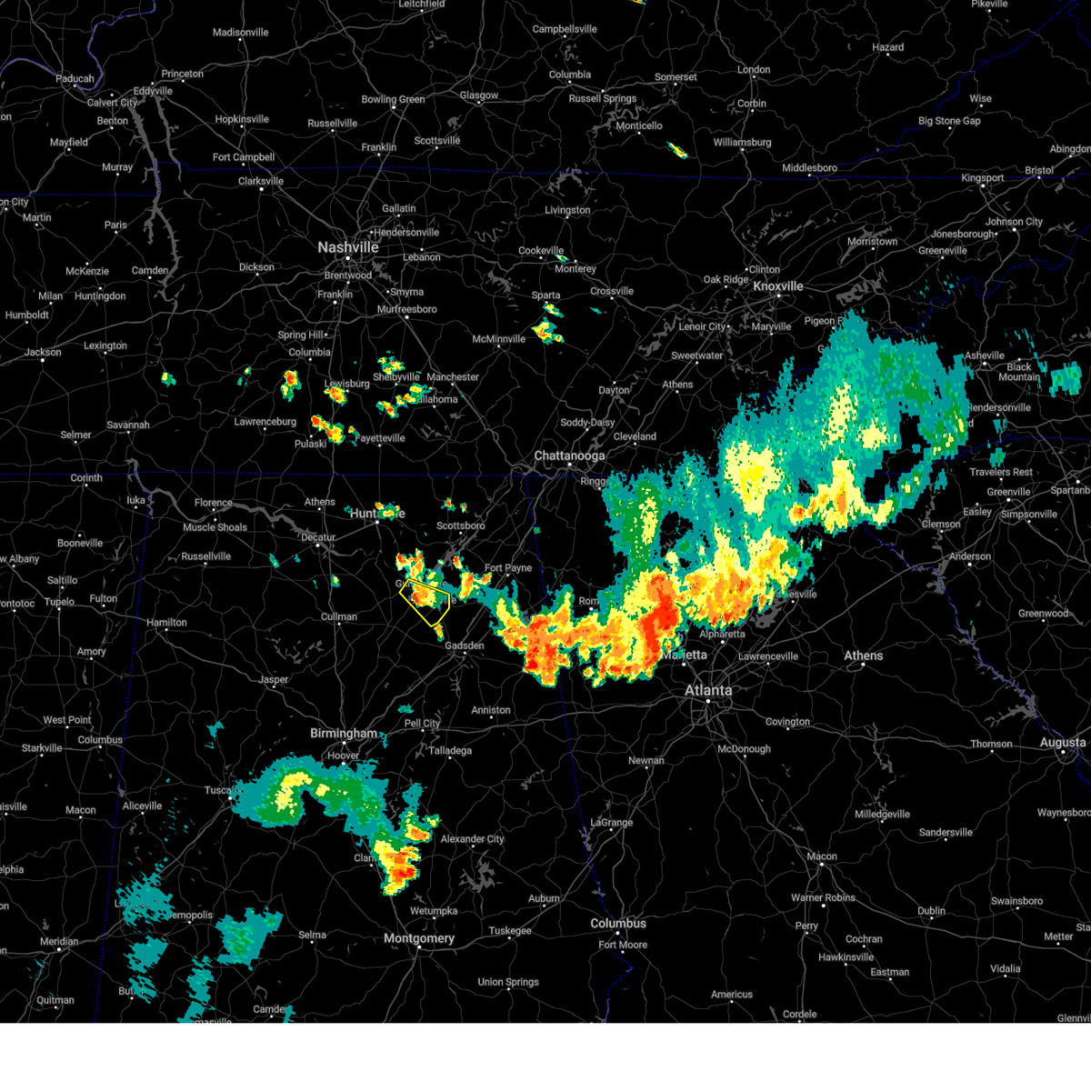 The storm which prompted the warning has weakened below severe limits, and no longer poses an immediate threat to life or property. therefore, the warning will be allowed to expire. however, gusty winds are still possible with this thunderstorm. The storm which prompted the warning has weakened below severe limits, and no longer poses an immediate threat to life or property. therefore, the warning will be allowed to expire. however, gusty winds are still possible with this thunderstorm.
|
| 8/16/2024 7:19 PM CDT |
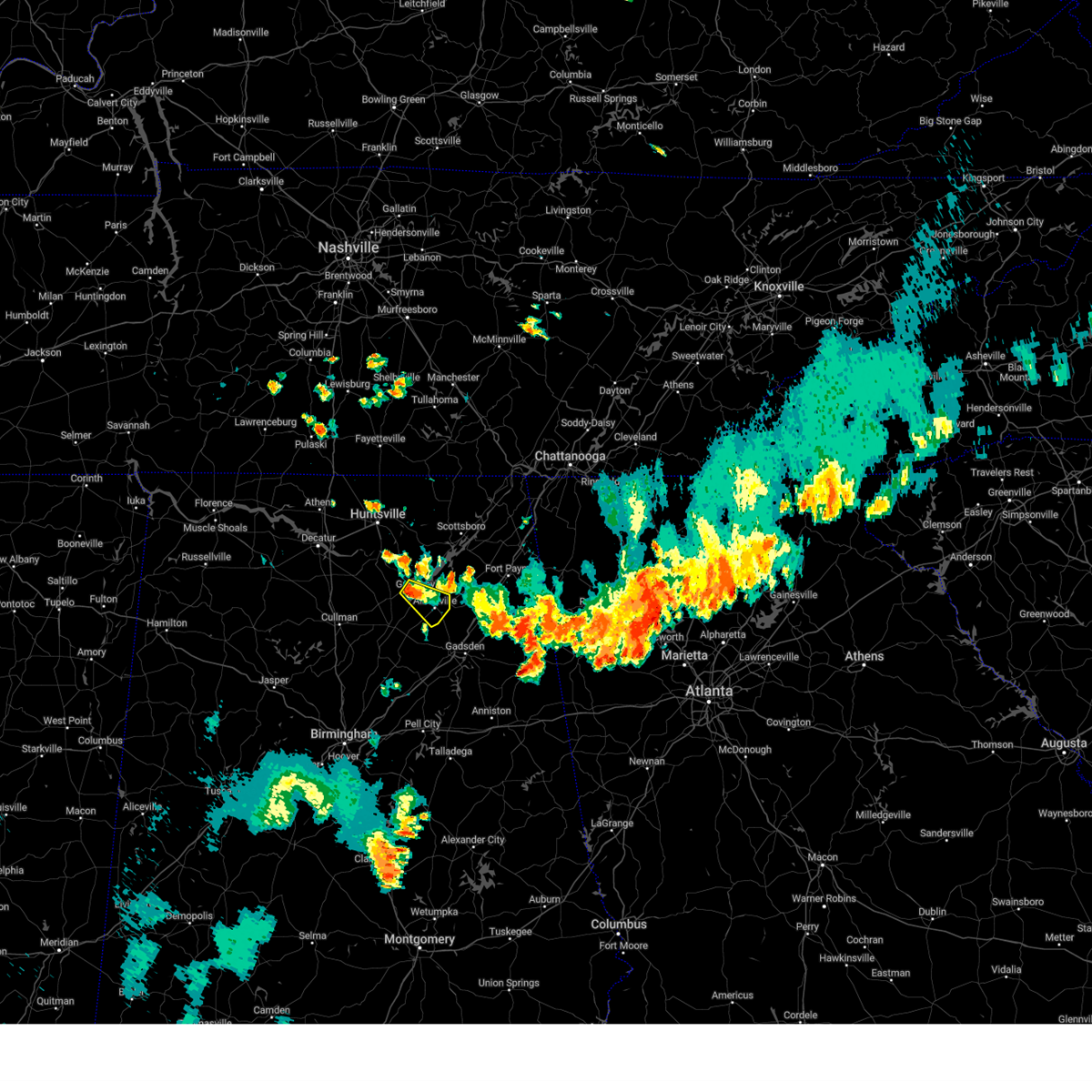 At 719 pm cdt, a severe thunderstorm was located near guntersville, moving southeast at 25 mph (radar indicated). Hazards include 60 mph wind gusts and nickel size hail. Expect damage to roofs, siding, and trees. Locations impacted include, albertville, boaz, guntersville, mcville, high point, hustleville, rabbit town, mountain view, and lake guntersville st park. At 719 pm cdt, a severe thunderstorm was located near guntersville, moving southeast at 25 mph (radar indicated). Hazards include 60 mph wind gusts and nickel size hail. Expect damage to roofs, siding, and trees. Locations impacted include, albertville, boaz, guntersville, mcville, high point, hustleville, rabbit town, mountain view, and lake guntersville st park.
|
| 8/16/2024 7:00 PM CDT |
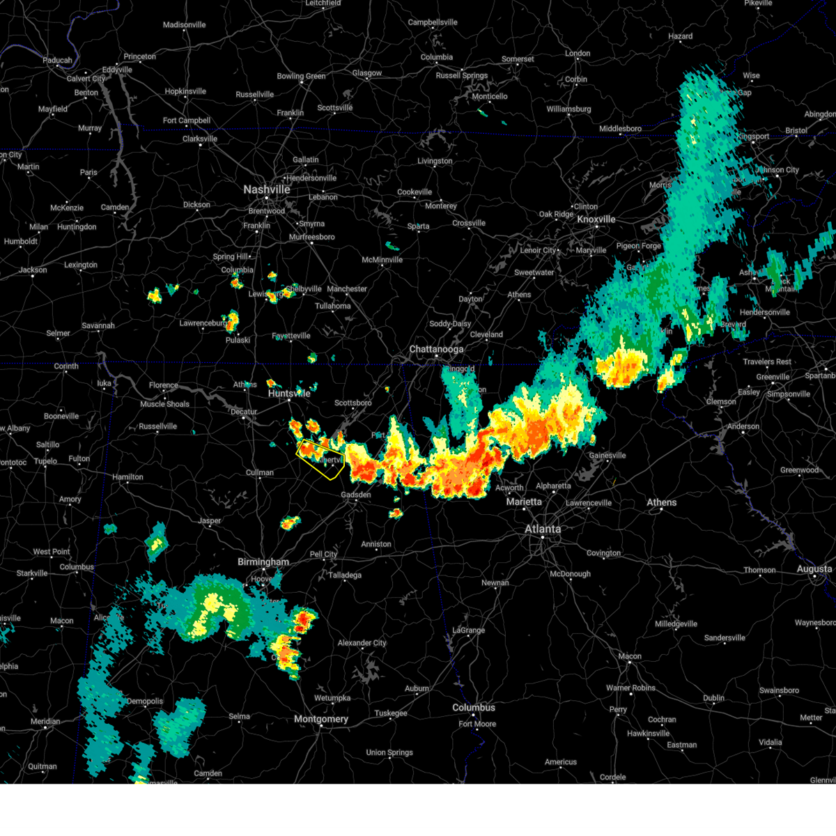 Svrhun the national weather service in huntsville alabama has issued a * severe thunderstorm warning for, central marshall county in northeastern alabama, * until 730 pm cdt. * at 700 pm cdt, a severe thunderstorm was located near arab, moving southeast at 25 mph (radar indicated). Hazards include 60 mph wind gusts and nickel size hail. expect damage to roofs, siding, and trees Svrhun the national weather service in huntsville alabama has issued a * severe thunderstorm warning for, central marshall county in northeastern alabama, * until 730 pm cdt. * at 700 pm cdt, a severe thunderstorm was located near arab, moving southeast at 25 mph (radar indicated). Hazards include 60 mph wind gusts and nickel size hail. expect damage to roofs, siding, and trees
|
| 8/16/2024 6:30 PM CDT |
 The storm which prompted the warning has weakened below severe limits, and no longer poses an immediate threat to life or property. therefore, the warning will be allowed to expire. however, gusty winds are still possible with this thunderstorm. The storm which prompted the warning has weakened below severe limits, and no longer poses an immediate threat to life or property. therefore, the warning will be allowed to expire. however, gusty winds are still possible with this thunderstorm.
|
| 8/16/2024 6:28 PM CDT |
 Svrbmx the national weather service in birmingham has issued a * severe thunderstorm warning for, northeastern etowah county in northeastern alabama, cherokee county in northeastern alabama, * until 730 pm cdt. * at 627 pm cdt, severe thunderstorms were located along a line extending from near little river canyon national preserve to near crossville to albertville, moving southeast at 30 mph (radar indicated). Hazards include 60 mph wind gusts. expect damage to roofs, siding, and trees Svrbmx the national weather service in birmingham has issued a * severe thunderstorm warning for, northeastern etowah county in northeastern alabama, cherokee county in northeastern alabama, * until 730 pm cdt. * at 627 pm cdt, severe thunderstorms were located along a line extending from near little river canyon national preserve to near crossville to albertville, moving southeast at 30 mph (radar indicated). Hazards include 60 mph wind gusts. expect damage to roofs, siding, and trees
|
| 8/16/2024 6:23 PM CDT |
 At 623 pm cdt, a severe thunderstorm was located over albertville, moving southeast at 20 mph (radar indicated). Hazards include 60 mph wind gusts. Expect damage to roofs, siding, and trees. Locations impacted include, albertville, boaz, guntersville, mcville, high point, arona, hustleville, kilpatrick, rodentown, and rabbit town. At 623 pm cdt, a severe thunderstorm was located over albertville, moving southeast at 20 mph (radar indicated). Hazards include 60 mph wind gusts. Expect damage to roofs, siding, and trees. Locations impacted include, albertville, boaz, guntersville, mcville, high point, arona, hustleville, kilpatrick, rodentown, and rabbit town.
|
| 8/16/2024 6:03 PM CDT |
 Svrhun the national weather service in huntsville alabama has issued a * severe thunderstorm warning for, southeastern marshall county in northeastern alabama, southwestern dekalb county in northeastern alabama, * until 630 pm cdt. * at 602 pm cdt, a severe thunderstorm was located near guntersville, moving southeast at 20 mph (radar indicated). Hazards include 60 mph wind gusts. expect damage to roofs, siding, and trees Svrhun the national weather service in huntsville alabama has issued a * severe thunderstorm warning for, southeastern marshall county in northeastern alabama, southwestern dekalb county in northeastern alabama, * until 630 pm cdt. * at 602 pm cdt, a severe thunderstorm was located near guntersville, moving southeast at 20 mph (radar indicated). Hazards include 60 mph wind gusts. expect damage to roofs, siding, and trees
|
| 8/2/2024 12:57 PM CDT |
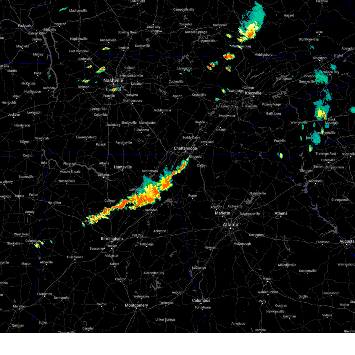 the severe thunderstorm warning has been cancelled and is no longer in effect the severe thunderstorm warning has been cancelled and is no longer in effect
|
| 8/2/2024 12:50 PM CDT |
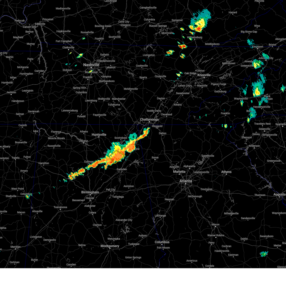 the severe thunderstorm warning has been cancelled and is no longer in effect the severe thunderstorm warning has been cancelled and is no longer in effect
|
| 8/2/2024 12:43 PM CDT |
 At 1243 pm cdt, a severe thunderstorm was located near albertville, moving southeast at 30 mph (trained weather spotters). Hazards include 60 mph wind gusts and quarter size hail. Hail damage to vehicles is expected. expect wind damage to roofs, siding, and trees. Locations impacted include, albertville, boaz, guntersville, crossville, geraldine, mcville, hopewell, skirum, lake guntersville st park, and hustleville. At 1243 pm cdt, a severe thunderstorm was located near albertville, moving southeast at 30 mph (trained weather spotters). Hazards include 60 mph wind gusts and quarter size hail. Hail damage to vehicles is expected. expect wind damage to roofs, siding, and trees. Locations impacted include, albertville, boaz, guntersville, crossville, geraldine, mcville, hopewell, skirum, lake guntersville st park, and hustleville.
|
| 8/2/2024 12:40 PM CDT |
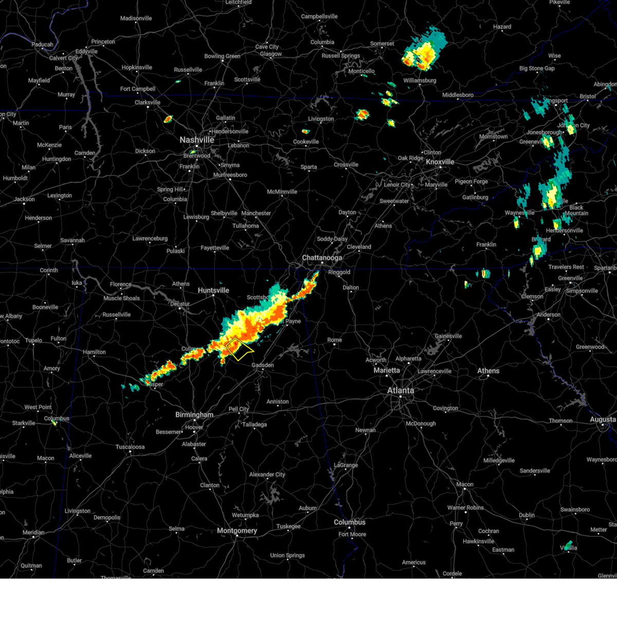 Svrhun the national weather service in huntsville alabama has issued a * severe thunderstorm warning for, southeastern marshall county in northeastern alabama, * until 115 pm cdt. * at 1240 pm cdt, a severe thunderstorm was located near mclarty, or near albertville, moving southeast at 30 mph (radar indicated). Hazards include 60 mph wind gusts and quarter size hail. Hail damage to vehicles is expected. Expect wind damage to roofs, siding, and trees. Svrhun the national weather service in huntsville alabama has issued a * severe thunderstorm warning for, southeastern marshall county in northeastern alabama, * until 115 pm cdt. * at 1240 pm cdt, a severe thunderstorm was located near mclarty, or near albertville, moving southeast at 30 mph (radar indicated). Hazards include 60 mph wind gusts and quarter size hail. Hail damage to vehicles is expected. Expect wind damage to roofs, siding, and trees.
|
| 8/2/2024 12:25 PM CDT |
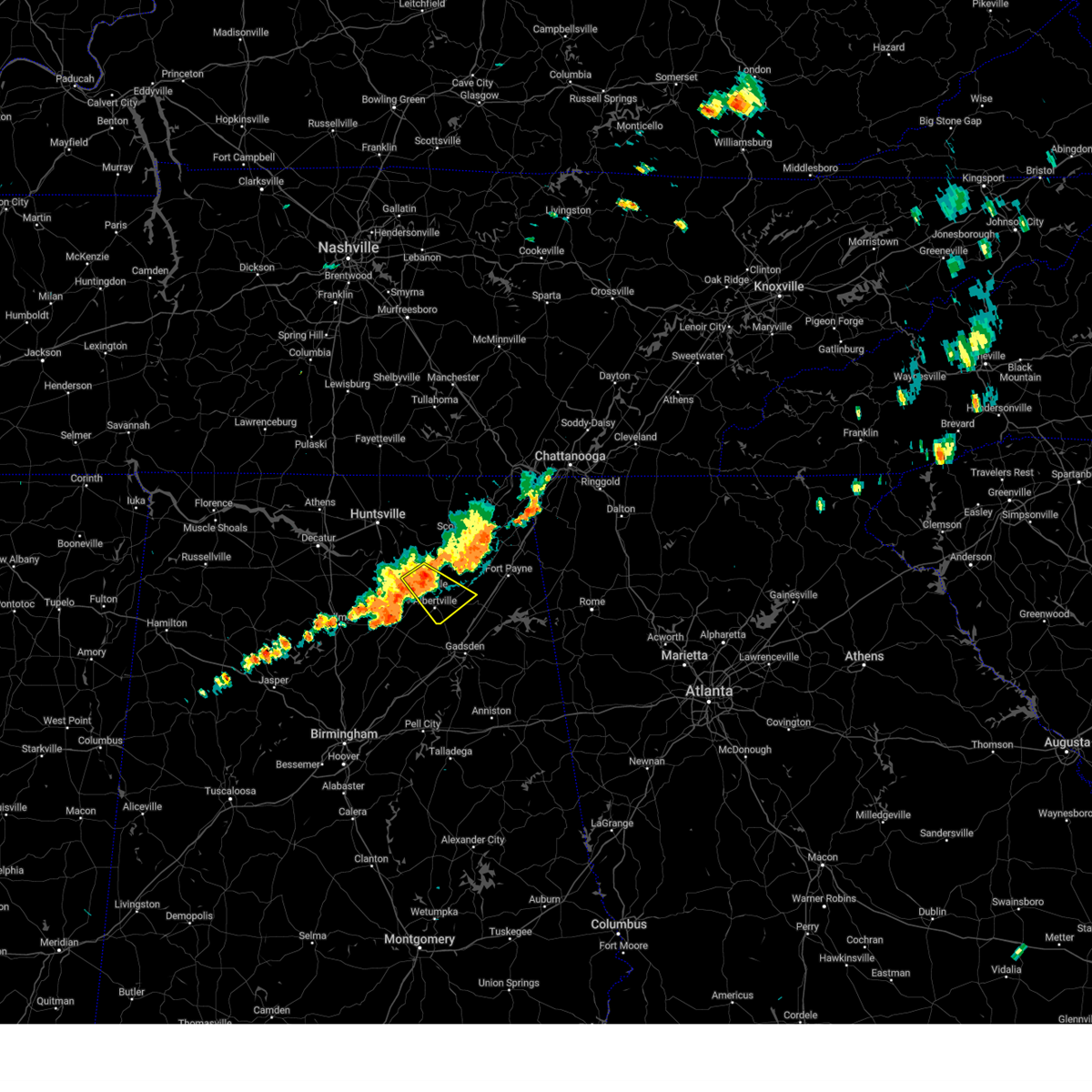 At 1224 pm cdt, a severe thunderstorm was located near guntersville, moving southeast at 25 mph (trained weather spotters). Hazards include 60 mph wind gusts and quarter size hail. Hail damage to vehicles is expected. expect wind damage to roofs, siding, and trees. Locations impacted include, albertville, boaz, guntersville, crossville, geraldine, mcville, hopewell, columbus city, skirum, and lake guntersville st park. At 1224 pm cdt, a severe thunderstorm was located near guntersville, moving southeast at 25 mph (trained weather spotters). Hazards include 60 mph wind gusts and quarter size hail. Hail damage to vehicles is expected. expect wind damage to roofs, siding, and trees. Locations impacted include, albertville, boaz, guntersville, crossville, geraldine, mcville, hopewell, columbus city, skirum, and lake guntersville st park.
|
| 8/2/2024 12:16 PM CDT |
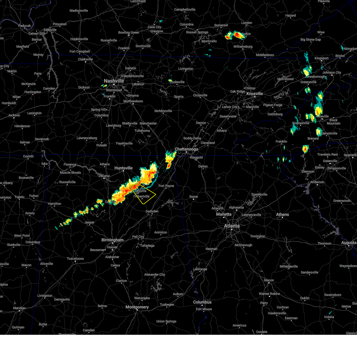 Svrhun the national weather service in huntsville alabama has issued a * severe thunderstorm warning for, eastern marshall county in northeastern alabama, southwestern dekalb county in northeastern alabama, * until 100 pm cdt. * at 1215 pm cdt, a severe thunderstorm was located near grant, or 7 miles north of guntersville, moving southeast at 20 mph (radar indicated). Hazards include 60 mph wind gusts and quarter size hail. Hail damage to vehicles is expected. Expect wind damage to roofs, siding, and trees. Svrhun the national weather service in huntsville alabama has issued a * severe thunderstorm warning for, eastern marshall county in northeastern alabama, southwestern dekalb county in northeastern alabama, * until 100 pm cdt. * at 1215 pm cdt, a severe thunderstorm was located near grant, or 7 miles north of guntersville, moving southeast at 20 mph (radar indicated). Hazards include 60 mph wind gusts and quarter size hail. Hail damage to vehicles is expected. Expect wind damage to roofs, siding, and trees.
|
| 7/29/2024 5:09 PM CDT |
 Svrhun the national weather service in huntsville alabama has issued a * severe thunderstorm warning for, eastern marshall county in northeastern alabama, central jackson county in northeastern alabama, dekalb county in northeastern alabama, * until 600 pm cdt. * at 508 pm cdt, severe thunderstorms were located along a line extending from 6 miles northeast of grant to near pisgah to near trenton, moving east at 25 mph (radar indicated). Hazards include 60 mph wind gusts. expect damage to roofs, siding, and trees Svrhun the national weather service in huntsville alabama has issued a * severe thunderstorm warning for, eastern marshall county in northeastern alabama, central jackson county in northeastern alabama, dekalb county in northeastern alabama, * until 600 pm cdt. * at 508 pm cdt, severe thunderstorms were located along a line extending from 6 miles northeast of grant to near pisgah to near trenton, moving east at 25 mph (radar indicated). Hazards include 60 mph wind gusts. expect damage to roofs, siding, and trees
|
| 7/29/2024 4:40 PM CDT |
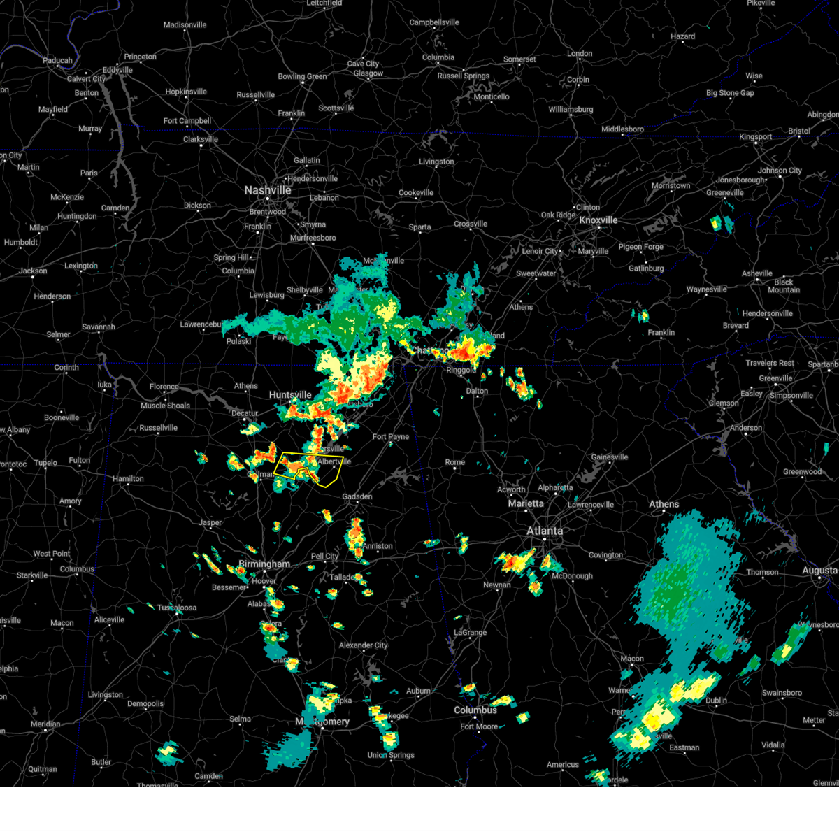 the severe thunderstorm warning has been cancelled and is no longer in effect the severe thunderstorm warning has been cancelled and is no longer in effect
|
| 7/29/2024 4:27 PM CDT |
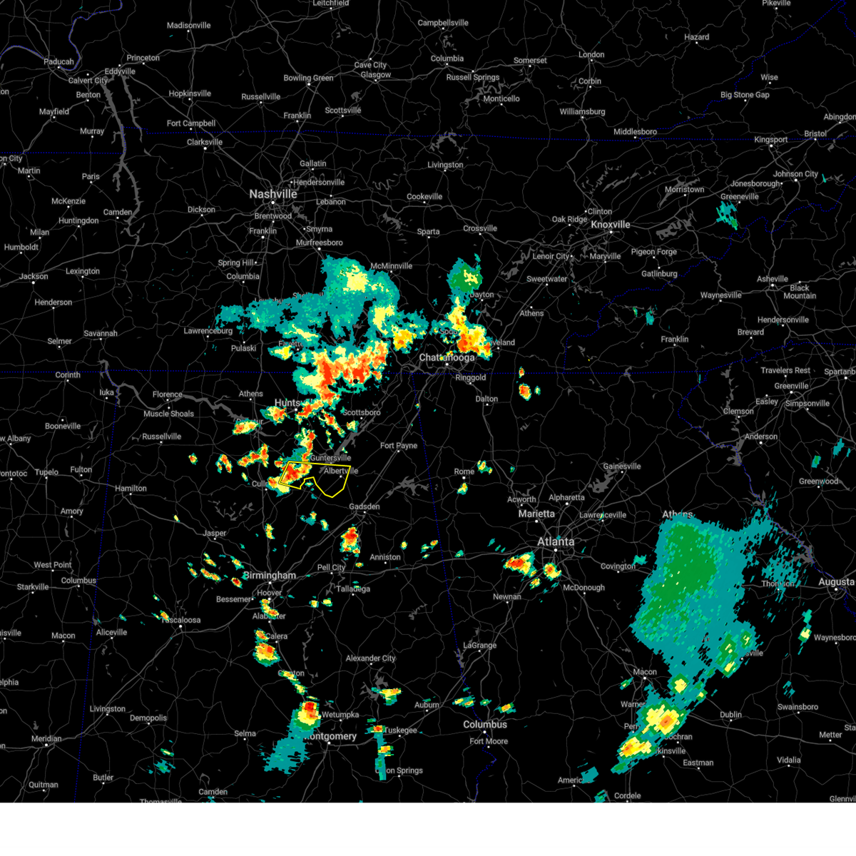 Svrhun the national weather service in huntsville alabama has issued a * severe thunderstorm warning for, southern marshall county in northeastern alabama, northeastern cullman county in north central alabama, southeastern morgan county in north central alabama, * until 515 pm cdt. * at 427 pm cdt, a severe thunderstorm was located near strawberry, or near arab, moving east at 25 mph (radar indicated). Hazards include 60 mph wind gusts and quarter size hail. Hail damage to vehicles is expected. Expect wind damage to roofs, siding, and trees. Svrhun the national weather service in huntsville alabama has issued a * severe thunderstorm warning for, southern marshall county in northeastern alabama, northeastern cullman county in north central alabama, southeastern morgan county in north central alabama, * until 515 pm cdt. * at 427 pm cdt, a severe thunderstorm was located near strawberry, or near arab, moving east at 25 mph (radar indicated). Hazards include 60 mph wind gusts and quarter size hail. Hail damage to vehicles is expected. Expect wind damage to roofs, siding, and trees.
|
| 6/30/2024 1:42 PM CDT |
 The storm which prompted the warning has weakened below severe limits, and no longer poses an immediate threat to life or property. therefore, the warning will be allowed to expire. however, gusty winds and heavy rain are still possible with this thunderstorm. The storm which prompted the warning has weakened below severe limits, and no longer poses an immediate threat to life or property. therefore, the warning will be allowed to expire. however, gusty winds and heavy rain are still possible with this thunderstorm.
|
| 6/30/2024 1:30 PM CDT |
 At 129 pm cdt, a severe thunderstorm was located near geraldine, or 10 miles northeast of albertville, moving southeast at 20 mph. heavy rainfall and frequent lightning are occurring within this storm (radar indicated). Hazards include 60 mph wind gusts. Expect damage to roofs, siding, and trees. Locations impacted include, albertville, boaz, guntersville, crossville, fyffe, geraldine, lakeview, mcville, hopewell, and skirum. At 129 pm cdt, a severe thunderstorm was located near geraldine, or 10 miles northeast of albertville, moving southeast at 20 mph. heavy rainfall and frequent lightning are occurring within this storm (radar indicated). Hazards include 60 mph wind gusts. Expect damage to roofs, siding, and trees. Locations impacted include, albertville, boaz, guntersville, crossville, fyffe, geraldine, lakeview, mcville, hopewell, and skirum.
|
| 6/30/2024 1:30 PM CDT |
 the severe thunderstorm warning has been cancelled and is no longer in effect the severe thunderstorm warning has been cancelled and is no longer in effect
|
| 6/30/2024 1:06 PM CDT |
 the severe thunderstorm warning has been cancelled and is no longer in effect the severe thunderstorm warning has been cancelled and is no longer in effect
|
| 6/30/2024 1:06 PM CDT |
 At 105 pm cdt, a severe thunderstorm was located near grant, or 11 miles northeast of guntersville, moving southeast at 20 mph. this storm is producing frequent lightning and heavy rainfall (radar indicated). Hazards include 60 mph wind gusts. Expect damage to roofs, siding, and trees. Locations impacted include, albertville, scottsboro, fort payne, boaz, guntersville, rainsville, crossville, fyffe, powell, and grant. At 105 pm cdt, a severe thunderstorm was located near grant, or 11 miles northeast of guntersville, moving southeast at 20 mph. this storm is producing frequent lightning and heavy rainfall (radar indicated). Hazards include 60 mph wind gusts. Expect damage to roofs, siding, and trees. Locations impacted include, albertville, scottsboro, fort payne, boaz, guntersville, rainsville, crossville, fyffe, powell, and grant.
|
| 6/30/2024 12:49 PM CDT |
 Svrhun the national weather service in huntsville alabama has issued a * severe thunderstorm warning for, eastern marshall county in northeastern alabama, southwestern jackson county in northeastern alabama, southeastern madison county in north central alabama, southwestern dekalb county in northeastern alabama, * until 145 pm cdt. * at 1248 pm cdt, a severe thunderstorm was located near grant, or 12 miles southwest of scottsboro, moving southeast at 20 mph. there is frequent lightning and heavy rainfall occurring with this storm (radar indicated). Hazards include 60 mph wind gusts. expect damage to roofs, siding, and trees Svrhun the national weather service in huntsville alabama has issued a * severe thunderstorm warning for, eastern marshall county in northeastern alabama, southwestern jackson county in northeastern alabama, southeastern madison county in north central alabama, southwestern dekalb county in northeastern alabama, * until 145 pm cdt. * at 1248 pm cdt, a severe thunderstorm was located near grant, or 12 miles southwest of scottsboro, moving southeast at 20 mph. there is frequent lightning and heavy rainfall occurring with this storm (radar indicated). Hazards include 60 mph wind gusts. expect damage to roofs, siding, and trees
|
| 5/27/2024 5:02 AM CDT |
 the severe thunderstorm warning has been cancelled and is no longer in effect the severe thunderstorm warning has been cancelled and is no longer in effect
|
| 5/27/2024 4:48 AM CDT |
 At 448 am cdt, severe thunderstorms were located along a line extending from 9 miles north of cave spring to 6 miles northwest of ashville, moving southeast at 40 mph (radar indicated). Hazards include 60 mph wind gusts and penny size hail. Expect damage to roofs, siding, and trees. Locations impacted include, gadsden, rainbow city, oneonta, attalla, hokes bluff, centre, cedar bluff, blountsville, cleveland, little river canyon national preserve, forney, centre municipal airport, glencoe, sardis city, steele, leesburg, altoona, snead, susan moore, and walnut grove. At 448 am cdt, severe thunderstorms were located along a line extending from 9 miles north of cave spring to 6 miles northwest of ashville, moving southeast at 40 mph (radar indicated). Hazards include 60 mph wind gusts and penny size hail. Expect damage to roofs, siding, and trees. Locations impacted include, gadsden, rainbow city, oneonta, attalla, hokes bluff, centre, cedar bluff, blountsville, cleveland, little river canyon national preserve, forney, centre municipal airport, glencoe, sardis city, steele, leesburg, altoona, snead, susan moore, and walnut grove.
|
| 5/27/2024 4:40 AM CDT |
 The storms which prompted the warning have weakened below severe limits, and have exited the warned area. therefore, the warning will be allowed to expire. however, small hail is still possible with these thunderstorms. a tornado watch remains in effect until 800 am cdt for north central and northeastern alabama. The storms which prompted the warning have weakened below severe limits, and have exited the warned area. therefore, the warning will be allowed to expire. however, small hail is still possible with these thunderstorms. a tornado watch remains in effect until 800 am cdt for north central and northeastern alabama.
|
| 5/27/2024 4:29 AM CDT |
 At 428 am cdt, severe thunderstorms were located along a line extending from 6 miles east of trion to near aurora to near holly pond, moving east at 60 mph. emergency managers continue to report multiple trees down and pea size hail with these storms (emergency management). Hazards include 60 mph wind gusts and penny size hail. Expect damage to roofs, siding, and trees. Locations impacted include, albertville, cullman, fort payne, boaz, guntersville, arab, rainsville, hanceville, henagar, and good hope. At 428 am cdt, severe thunderstorms were located along a line extending from 6 miles east of trion to near aurora to near holly pond, moving east at 60 mph. emergency managers continue to report multiple trees down and pea size hail with these storms (emergency management). Hazards include 60 mph wind gusts and penny size hail. Expect damage to roofs, siding, and trees. Locations impacted include, albertville, cullman, fort payne, boaz, guntersville, arab, rainsville, hanceville, henagar, and good hope.
|
| 5/27/2024 4:27 AM CDT |
 At 426 am cdt, severe thunderstorms were located along a line extending from 7 miles east of blanche to near susan moore, moving southeast at 40 mph (radar indicated). Hazards include 60 mph wind gusts and quarter size hail. Hail damage to vehicles is expected. expect wind damage to roofs, siding, and trees. Locations impacted include, gadsden, rainbow city, oneonta, attalla, hokes bluff, centre, cedar bluff, blountsville, cleveland, little river canyon national preserve, forney, centre municipal airport, glencoe, sardis city, steele, leesburg, altoona, snead, susan moore, and walnut grove. At 426 am cdt, severe thunderstorms were located along a line extending from 7 miles east of blanche to near susan moore, moving southeast at 40 mph (radar indicated). Hazards include 60 mph wind gusts and quarter size hail. Hail damage to vehicles is expected. expect wind damage to roofs, siding, and trees. Locations impacted include, gadsden, rainbow city, oneonta, attalla, hokes bluff, centre, cedar bluff, blountsville, cleveland, little river canyon national preserve, forney, centre municipal airport, glencoe, sardis city, steele, leesburg, altoona, snead, susan moore, and walnut grove.
|
| 5/27/2024 4:12 AM CDT |
 The storm which prompted the warning has moved out of the area. therefore, the warning will be allowed to expire. a tornado watch remains in effect until 800 am cdt for north central and northeastern alabama. remember, a severe thunderstorm warning still remains in effect for cullman, marshall, and dekalb counties until 445 am. The storm which prompted the warning has moved out of the area. therefore, the warning will be allowed to expire. a tornado watch remains in effect until 800 am cdt for north central and northeastern alabama. remember, a severe thunderstorm warning still remains in effect for cullman, marshall, and dekalb counties until 445 am.
|
| 5/27/2024 4:12 AM CDT |
 Svrhun the national weather service in huntsville alabama has issued a * severe thunderstorm warning for, central marshall county in northeastern alabama, dekalb county in northeastern alabama, cullman county in north central alabama, * until 445 am cdt. * at 411 am cdt, a line of severe thunderstorms were extending from 10 miles northwest of summerville to near snead to near cullman, moving east at 60 mph. emergency management has reported multiple trees down, power outages, and small hail associated with these storms (emergency management). Hazards include 60 mph wind gusts and penny size hail. expect damage to roofs, siding, and trees Svrhun the national weather service in huntsville alabama has issued a * severe thunderstorm warning for, central marshall county in northeastern alabama, dekalb county in northeastern alabama, cullman county in north central alabama, * until 445 am cdt. * at 411 am cdt, a line of severe thunderstorms were extending from 10 miles northwest of summerville to near snead to near cullman, moving east at 60 mph. emergency management has reported multiple trees down, power outages, and small hail associated with these storms (emergency management). Hazards include 60 mph wind gusts and penny size hail. expect damage to roofs, siding, and trees
|
| 5/27/2024 4:12 AM CDT |
 Svrbmx the national weather service in birmingham has issued a * severe thunderstorm warning for, eastern blount county in central alabama, etowah county in northeastern alabama, cherokee county in northeastern alabama, * until 515 am cdt. * at 412 am cdt, severe thunderstorms were located along a line extending from 8 miles northeast of little river falls to near holly pond, moving southeast at 40 mph (radar indicated). Hazards include 60 mph wind gusts and quarter size hail. Hail damage to vehicles is expected. Expect wind damage to roofs, siding, and trees. Svrbmx the national weather service in birmingham has issued a * severe thunderstorm warning for, eastern blount county in central alabama, etowah county in northeastern alabama, cherokee county in northeastern alabama, * until 515 am cdt. * at 412 am cdt, severe thunderstorms were located along a line extending from 8 miles northeast of little river falls to near holly pond, moving southeast at 40 mph (radar indicated). Hazards include 60 mph wind gusts and quarter size hail. Hail damage to vehicles is expected. Expect wind damage to roofs, siding, and trees.
|
| 5/27/2024 3:58 AM CDT |
 The storm which prompted the warning has weakened below severe limits, and no longer appears capable of producing a tornado. therefore, the warning will be allowed to expire. a severe warning remains in effect. a tornado watch remains in effect until 800 am cdt for north central and northeastern alabama. The storm which prompted the warning has weakened below severe limits, and no longer appears capable of producing a tornado. therefore, the warning will be allowed to expire. a severe warning remains in effect. a tornado watch remains in effect until 800 am cdt for north central and northeastern alabama.
|
| 5/27/2024 3:30 AM CDT |
 Torhun the national weather service in huntsville alabama has issued a * tornado warning for, central marshall county in northeastern alabama, northeastern cullman county in north central alabama, southeastern morgan county in north central alabama, * until 400 am cdt. * at 330 am cdt, a severe thunderstorm capable of producing a tornado was located 9 miles east of falkville, or 12 miles east of hartselle, moving southeast at 50 mph (radar indicated rotation). Hazards include tornado. Flying debris will be dangerous to those caught without shelter. mobile homes will be damaged or destroyed. damage to roofs, windows, and vehicles will occur. tree damage is likely. this dangerous storm will be near, arab around 340 am cdt. Other locations impacted by this tornadic thunderstorm include high point, baileyton, horton, hulaco, cole springs, eva, douglas, eddy, ryan crossroads, and joppa. Torhun the national weather service in huntsville alabama has issued a * tornado warning for, central marshall county in northeastern alabama, northeastern cullman county in north central alabama, southeastern morgan county in north central alabama, * until 400 am cdt. * at 330 am cdt, a severe thunderstorm capable of producing a tornado was located 9 miles east of falkville, or 12 miles east of hartselle, moving southeast at 50 mph (radar indicated rotation). Hazards include tornado. Flying debris will be dangerous to those caught without shelter. mobile homes will be damaged or destroyed. damage to roofs, windows, and vehicles will occur. tree damage is likely. this dangerous storm will be near, arab around 340 am cdt. Other locations impacted by this tornadic thunderstorm include high point, baileyton, horton, hulaco, cole springs, eva, douglas, eddy, ryan crossroads, and joppa.
|
| 5/27/2024 3:27 AM CDT |
 Svrhun the national weather service in huntsville alabama has issued a * severe thunderstorm warning for, marshall county in northeastern alabama, south central jackson county in northeastern alabama, southwestern dekalb county in northeastern alabama, northeastern cullman county in north central alabama, southeastern morgan county in north central alabama, * until 415 am cdt. * at 327 am cdt, a severe thunderstorm was located 9 miles east of falkville, or 12 miles southeast of hartselle, moving east at 55 mph (radar indicated). Hazards include 60 mph wind gusts and penny size hail. expect damage to roofs, siding, and trees Svrhun the national weather service in huntsville alabama has issued a * severe thunderstorm warning for, marshall county in northeastern alabama, south central jackson county in northeastern alabama, southwestern dekalb county in northeastern alabama, northeastern cullman county in north central alabama, southeastern morgan county in north central alabama, * until 415 am cdt. * at 327 am cdt, a severe thunderstorm was located 9 miles east of falkville, or 12 miles southeast of hartselle, moving east at 55 mph (radar indicated). Hazards include 60 mph wind gusts and penny size hail. expect damage to roofs, siding, and trees
|
| 5/9/2024 8:48 AM CDT |
 the severe thunderstorm warning has been cancelled and is no longer in effect the severe thunderstorm warning has been cancelled and is no longer in effect
|
| 5/9/2024 8:42 AM CDT |
 At 841 am cdt, a severe thunderstorm was located near crossville, or 13 miles south of rainsville, moving east at 55 mph (radar indicated). Hazards include 60 mph wind gusts and quarter size hail. Hail damage to vehicles is expected. expect wind damage to roofs, siding, and trees. Locations impacted include, albertville, fort payne, boaz, crossville, geraldine, mcville, dog town, collbran, little river canyon np, and skirum. At 841 am cdt, a severe thunderstorm was located near crossville, or 13 miles south of rainsville, moving east at 55 mph (radar indicated). Hazards include 60 mph wind gusts and quarter size hail. Hail damage to vehicles is expected. expect wind damage to roofs, siding, and trees. Locations impacted include, albertville, fort payne, boaz, crossville, geraldine, mcville, dog town, collbran, little river canyon np, and skirum.
|
| 5/9/2024 8:30 AM CDT |
 The storm which prompted the warning has moved out of the area. therefore, the warning will be allowed to expire. a tornado watch remains in effect until 1000 am cdt for north central and northeastern alabama. remember, a severe thunderstorm warning still remains in effect for portions of dekalb and marshall county. remember, a tornado warning still remains in effect for jackson and dekalb county. The storm which prompted the warning has moved out of the area. therefore, the warning will be allowed to expire. a tornado watch remains in effect until 1000 am cdt for north central and northeastern alabama. remember, a severe thunderstorm warning still remains in effect for portions of dekalb and marshall county. remember, a tornado warning still remains in effect for jackson and dekalb county.
|
| 5/9/2024 8:28 AM CDT |
 Svrhun the national weather service in huntsville alabama has issued a * severe thunderstorm warning for, southeastern marshall county in northeastern alabama, southern dekalb county in northeastern alabama, * until 900 am cdt. * at 828 am cdt, a severe thunderstorm was located over albertville, moving east at 60 mph (radar indicated). Hazards include 60 mph wind gusts and quarter size hail. Hail damage to vehicles is expected. Expect wind damage to roofs, siding, and trees. Svrhun the national weather service in huntsville alabama has issued a * severe thunderstorm warning for, southeastern marshall county in northeastern alabama, southern dekalb county in northeastern alabama, * until 900 am cdt. * at 828 am cdt, a severe thunderstorm was located over albertville, moving east at 60 mph (radar indicated). Hazards include 60 mph wind gusts and quarter size hail. Hail damage to vehicles is expected. Expect wind damage to roofs, siding, and trees.
|
| 5/9/2024 8:27 AM CDT |
 Svrbmx the national weather service in birmingham has issued a * severe thunderstorm warning for, etowah county in northeastern alabama, st. clair county in central alabama, * until 915 am cdt. * at 827 am cdt, severe thunderstorms were located along a line extending from albertville to near susan moore to near dallas, moving east at 55 mph (radar indicated). Hazards include 60 mph wind gusts and quarter size hail. Hail damage to vehicles is expected. Expect wind damage to roofs, siding, and trees. Svrbmx the national weather service in birmingham has issued a * severe thunderstorm warning for, etowah county in northeastern alabama, st. clair county in central alabama, * until 915 am cdt. * at 827 am cdt, severe thunderstorms were located along a line extending from albertville to near susan moore to near dallas, moving east at 55 mph (radar indicated). Hazards include 60 mph wind gusts and quarter size hail. Hail damage to vehicles is expected. Expect wind damage to roofs, siding, and trees.
|
| 5/9/2024 8:11 AM CDT |
 At 810 am cdt, a severe thunderstorm was located near guntersville, moving east at 60 mph (emergency management). Hazards include 60 mph wind gusts and quarter size hail. Hail damage to vehicles is expected. expect wind damage to roofs, siding, and trees. Locations impacted include, albertville, cullman, scottsboro, fort payne, boaz, guntersville, arab, rainsville, hanceville, and henagar. At 810 am cdt, a severe thunderstorm was located near guntersville, moving east at 60 mph (emergency management). Hazards include 60 mph wind gusts and quarter size hail. Hail damage to vehicles is expected. expect wind damage to roofs, siding, and trees. Locations impacted include, albertville, cullman, scottsboro, fort payne, boaz, guntersville, arab, rainsville, hanceville, and henagar.
|
| 5/9/2024 8:04 AM CDT |
 Svrhun the national weather service in huntsville alabama has issued a * severe thunderstorm warning for, marshall county in northeastern alabama, southern jackson county in northeastern alabama, dekalb county in northeastern alabama, central cullman county in north central alabama, southeastern morgan county in north central alabama, * until 830 am cdt. * at 804 am cdt, a severe thunderstorm was located over strawberry, or near arab, moving east at 60 mph (radar indicated). Hazards include 60 mph wind gusts and quarter size hail. Hail damage to vehicles is expected. Expect wind damage to roofs, siding, and trees. Svrhun the national weather service in huntsville alabama has issued a * severe thunderstorm warning for, marshall county in northeastern alabama, southern jackson county in northeastern alabama, dekalb county in northeastern alabama, central cullman county in north central alabama, southeastern morgan county in north central alabama, * until 830 am cdt. * at 804 am cdt, a severe thunderstorm was located over strawberry, or near arab, moving east at 60 mph (radar indicated). Hazards include 60 mph wind gusts and quarter size hail. Hail damage to vehicles is expected. Expect wind damage to roofs, siding, and trees.
|
| 3/15/2024 7:05 AM CDT |
 the severe thunderstorm warning has been cancelled and is no longer in effect the severe thunderstorm warning has been cancelled and is no longer in effect
|
| 3/15/2024 7:05 AM CDT |
 At 705 am cdt, severe thunderstorms were located along a line extending from near sardis city to steele, moving east at 45 mph (radar indicated). Hazards include 60 mph wind gusts. Expect damage to roofs, siding, and trees. Locations impacted include, gadsden, rainbow city, attalla, ashville, sardis city, steele, altoona, walnut grove, reece city, tabor road, aurora, gadsden mall, noccalula falls, neely henry lake, southside, whitney junction, alabama international dragway, mountainboro, rockledge, and northside. At 705 am cdt, severe thunderstorms were located along a line extending from near sardis city to steele, moving east at 45 mph (radar indicated). Hazards include 60 mph wind gusts. Expect damage to roofs, siding, and trees. Locations impacted include, gadsden, rainbow city, attalla, ashville, sardis city, steele, altoona, walnut grove, reece city, tabor road, aurora, gadsden mall, noccalula falls, neely henry lake, southside, whitney junction, alabama international dragway, mountainboro, rockledge, and northside.
|
| 3/15/2024 6:48 AM CDT |
 At 648 am cdt, severe thunderstorms were located along a line extending from snead to allgood, moving east at 40 mph (radar indicated). Hazards include 60 mph wind gusts. Expect damage to roofs, siding, and trees. Locations impacted include, gadsden, rainbow city, oneonta, attalla, ashville, sardis city, ragland, steele, altoona, snead, susan moore, walnut grove, reece city, allgood, rosa, tabor road, aurora, gadsden mall, noccalula falls, and neely henry lake. At 648 am cdt, severe thunderstorms were located along a line extending from snead to allgood, moving east at 40 mph (radar indicated). Hazards include 60 mph wind gusts. Expect damage to roofs, siding, and trees. Locations impacted include, gadsden, rainbow city, oneonta, attalla, ashville, sardis city, ragland, steele, altoona, snead, susan moore, walnut grove, reece city, allgood, rosa, tabor road, aurora, gadsden mall, noccalula falls, and neely henry lake.
|
| 3/15/2024 6:46 AM CDT |
 At 645 am cdt, severe thunderstorms were located along a line extending from near powell to near altoona, moving east at 55 mph. there are several broad areas of rotation along this line and rapid tornado formation may occur. tornado warnings may be needed (radar indicated). Hazards include 60 mph wind gusts. Expect damage to roofs, siding, and trees. Locations impacted include, albertville, scottsboro, fort payne, boaz, guntersville, rainsville, crossville, sylvania, fyffe, and powell. At 645 am cdt, severe thunderstorms were located along a line extending from near powell to near altoona, moving east at 55 mph. there are several broad areas of rotation along this line and rapid tornado formation may occur. tornado warnings may be needed (radar indicated). Hazards include 60 mph wind gusts. Expect damage to roofs, siding, and trees. Locations impacted include, albertville, scottsboro, fort payne, boaz, guntersville, rainsville, crossville, sylvania, fyffe, and powell.
|
| 3/15/2024 6:38 AM CDT |
 Svrbmx the national weather service in birmingham has issued a * severe thunderstorm warning for, blount county in central alabama, etowah county in northeastern alabama, northern st. clair county in central alabama, * until 745 am cdt. * at 638 am cdt, severe thunderstorms were located along a line extending from near mclarty to dallas, moving east at 40 mph (radar indicated). Hazards include 60 mph wind gusts. expect damage to roofs, siding, and trees Svrbmx the national weather service in birmingham has issued a * severe thunderstorm warning for, blount county in central alabama, etowah county in northeastern alabama, northern st. clair county in central alabama, * until 745 am cdt. * at 638 am cdt, severe thunderstorms were located along a line extending from near mclarty to dallas, moving east at 40 mph (radar indicated). Hazards include 60 mph wind gusts. expect damage to roofs, siding, and trees
|
| 3/15/2024 6:26 AM CDT |
 the severe thunderstorm warning has been cancelled and is no longer in effect the severe thunderstorm warning has been cancelled and is no longer in effect
|
| 3/15/2024 6:26 AM CDT |
 At 625 am cdt, severe thunderstorms were located along a line extending from grant to near nectar, moving east at 45 mph. several trees down have been reported in harselle and falkville (radar indicated). Hazards include 60 mph wind gusts. Expect damage to roofs, siding, and trees. Locations impacted include, albertville, scottsboro, fort payne, boaz, guntersville, rainsville, crossville, sylvania, fyffe, and powell. At 625 am cdt, severe thunderstorms were located along a line extending from grant to near nectar, moving east at 45 mph. several trees down have been reported in harselle and falkville (radar indicated). Hazards include 60 mph wind gusts. Expect damage to roofs, siding, and trees. Locations impacted include, albertville, scottsboro, fort payne, boaz, guntersville, rainsville, crossville, sylvania, fyffe, and powell.
|
| 3/15/2024 6:07 AM CDT |
 Svrhun the national weather service in huntsville alabama has issued a * severe thunderstorm warning for, marshall county in northeastern alabama, southwestern jackson county in northeastern alabama, southeastern madison county in north central alabama, southwestern dekalb county in northeastern alabama, central cullman county in north central alabama, southeastern morgan county in north central alabama, * until 700 am cdt. * at 607 am cdt, severe thunderstorms were located along a line extending from near owens cross roads to dodge city, moving east at 45 mph (radar indicated). Hazards include 60 mph wind gusts. expect damage to roofs, siding, and trees Svrhun the national weather service in huntsville alabama has issued a * severe thunderstorm warning for, marshall county in northeastern alabama, southwestern jackson county in northeastern alabama, southeastern madison county in north central alabama, southwestern dekalb county in northeastern alabama, central cullman county in north central alabama, southeastern morgan county in north central alabama, * until 700 am cdt. * at 607 am cdt, severe thunderstorms were located along a line extending from near owens cross roads to dodge city, moving east at 45 mph (radar indicated). Hazards include 60 mph wind gusts. expect damage to roofs, siding, and trees
|
| 12/10/2023 12:59 AM CST |
 At 1258 am cst, severe thunderstorms were located along a line extending from 7 miles south of altoona to near ashville to near riverside, moving northeast at 60 mph (public. tree and structural damage reported in jefferson county). Hazards include 60 mph wind gusts and quarter size hail. Hail damage to vehicles is expected. expect wind damage to roofs, siding, and trees. locations impacted include, gadsden, pell city, rainbow city, attalla, glencoe, ashville, riverside, ragland, ohatchee, steele, altoona, walnut grove, aurora, neely henry lake, alexandria, logan martin lake, southside, whitney junction, alabama international dragway, and i 59 rest areas at oneonta. hail threat, radar indicated max hail size, 1. 00 in wind threat, radar indicated max wind gust, 60 mph. At 1258 am cst, severe thunderstorms were located along a line extending from 7 miles south of altoona to near ashville to near riverside, moving northeast at 60 mph (public. tree and structural damage reported in jefferson county). Hazards include 60 mph wind gusts and quarter size hail. Hail damage to vehicles is expected. expect wind damage to roofs, siding, and trees. locations impacted include, gadsden, pell city, rainbow city, attalla, glencoe, ashville, riverside, ragland, ohatchee, steele, altoona, walnut grove, aurora, neely henry lake, alexandria, logan martin lake, southside, whitney junction, alabama international dragway, and i 59 rest areas at oneonta. hail threat, radar indicated max hail size, 1. 00 in wind threat, radar indicated max wind gust, 60 mph.
|
| 12/10/2023 12:44 AM CST |
 At 1244 am cst, severe thunderstorms were located along a line extending from near inland lake to argo to near bald rock, moving northeast at 45 mph (public. numerous trees were reported down in the hoover and vestavia hills areas). Hazards include 60 mph wind gusts and quarter size hail. Hail damage to vehicles is expected. Expect wind damage to roofs, siding, and trees. At 1244 am cst, severe thunderstorms were located along a line extending from near inland lake to argo to near bald rock, moving northeast at 45 mph (public. numerous trees were reported down in the hoover and vestavia hills areas). Hazards include 60 mph wind gusts and quarter size hail. Hail damage to vehicles is expected. Expect wind damage to roofs, siding, and trees.
|
| 8/13/2023 6:05 PM CDT |
 At 605 pm cdt, a severe thunderstorm was located near reece city, or 8 miles north of gadsden, moving east at 25 mph (radar indicated). Hazards include 60 mph wind gusts. Expect damage to roofs, siding, and trees. locations impacted include, gadsden, sardis city, walnut grove, reece city, ballplay, tabor road, aurora, crudup, mountainboro, keener, rockledge, black creek and wilsonia. hail threat, radar indicated max hail size, <. 75 in wind threat, radar indicated max wind gust, 60 mph. At 605 pm cdt, a severe thunderstorm was located near reece city, or 8 miles north of gadsden, moving east at 25 mph (radar indicated). Hazards include 60 mph wind gusts. Expect damage to roofs, siding, and trees. locations impacted include, gadsden, sardis city, walnut grove, reece city, ballplay, tabor road, aurora, crudup, mountainboro, keener, rockledge, black creek and wilsonia. hail threat, radar indicated max hail size, <. 75 in wind threat, radar indicated max wind gust, 60 mph.
|
| 8/13/2023 5:53 PM CDT |
 The severe thunderstorm warning for southeastern marshall county will expire at 600 pm cdt, the storm which prompted the warning has weakened below severe limits, and no longer poses an immediate threat to life or property. therefore, the warning will be allowed to expire. however gusty winds are still possible with this thunderstorm. a severe thunderstorm watch remains in effect until 800 pm cdt for northeastern alabama. The severe thunderstorm warning for southeastern marshall county will expire at 600 pm cdt, the storm which prompted the warning has weakened below severe limits, and no longer poses an immediate threat to life or property. therefore, the warning will be allowed to expire. however gusty winds are still possible with this thunderstorm. a severe thunderstorm watch remains in effect until 800 pm cdt for northeastern alabama.
|
| 8/13/2023 5:48 PM CDT |
 At 548 pm cdt, a severe thunderstorm was located near albertville, moving east at 25 mph (radar indicated). Hazards include 60 mph wind gusts. expect damage to roofs, siding, and trees At 548 pm cdt, a severe thunderstorm was located near albertville, moving east at 25 mph (radar indicated). Hazards include 60 mph wind gusts. expect damage to roofs, siding, and trees
|
| 8/13/2023 5:36 PM CDT |
 At 536 pm cdt, a severe thunderstorm was located near mclarty, or 8 miles southeast of arab, moving east at 10 mph (radar indicated). Hazards include 60 mph wind gusts and quarter size hail. Hail damage to vehicles is expected. Expect wind damage to roofs, siding, and trees. At 536 pm cdt, a severe thunderstorm was located near mclarty, or 8 miles southeast of arab, moving east at 10 mph (radar indicated). Hazards include 60 mph wind gusts and quarter size hail. Hail damage to vehicles is expected. Expect wind damage to roofs, siding, and trees.
|
| 8/12/2023 3:02 PM CDT |
 At 301 pm cdt, a severe thunderstorm was located near walnut grove, or 8 miles west of attalla, moving east at 30 mph (emergency management). Hazards include 60 mph wind gusts. this storm has a history of blowing down trees in blount county. Expect damage to roofs, siding, and trees. locations impacted include, gadsden, rainbow city, attalla, glencoe, steele, altoona, walnut grove, reece city, aurora, gadsden mall, noccalula falls, neely henry lake, southside, gadsden steam plant, big wills creek, howelton, gallant, gadsden municipal airport, rockledge and camp sumatanga. hail threat, radar indicated max hail size, <. 75 in wind threat, observed max wind gust, 60 mph. At 301 pm cdt, a severe thunderstorm was located near walnut grove, or 8 miles west of attalla, moving east at 30 mph (emergency management). Hazards include 60 mph wind gusts. this storm has a history of blowing down trees in blount county. Expect damage to roofs, siding, and trees. locations impacted include, gadsden, rainbow city, attalla, glencoe, steele, altoona, walnut grove, reece city, aurora, gadsden mall, noccalula falls, neely henry lake, southside, gadsden steam plant, big wills creek, howelton, gallant, gadsden municipal airport, rockledge and camp sumatanga. hail threat, radar indicated max hail size, <. 75 in wind threat, observed max wind gust, 60 mph.
|
| 8/12/2023 2:47 PM CDT |
 At 247 pm cdt, a severe thunderstorm was located over susan moore, or 9 miles north of oneonta, moving east at 30 mph (radar indicated). Hazards include 60 mph wind gusts. expect damage to roofs, siding, and trees At 247 pm cdt, a severe thunderstorm was located over susan moore, or 9 miles north of oneonta, moving east at 30 mph (radar indicated). Hazards include 60 mph wind gusts. expect damage to roofs, siding, and trees
|
| 8/7/2023 3:39 PM CDT |
 At 338 pm cdt, severe thunderstorms were located along a line extending from 8 miles west of rome to near allgood, moving southeast at 25 mph (radar indicated). Hazards include 60 mph wind gusts. Expect damage to roofs, siding, and trees. locations impacted include, gadsden, rainbow city, attalla, hokes bluff, centre, cedar bluff, little river canyon national preserve, forney, centre municipal airport, glencoe, sardis city, leesburg, reece city, sand rock, gaylesville, cherokee rock village, pleasant gap, cornwall furnace park, blanche and eastern weiss lake. hail threat, radar indicated max hail size, <. 75 in wind threat, radar indicated max wind gust, 60 mph. At 338 pm cdt, severe thunderstorms were located along a line extending from 8 miles west of rome to near allgood, moving southeast at 25 mph (radar indicated). Hazards include 60 mph wind gusts. Expect damage to roofs, siding, and trees. locations impacted include, gadsden, rainbow city, attalla, hokes bluff, centre, cedar bluff, little river canyon national preserve, forney, centre municipal airport, glencoe, sardis city, leesburg, reece city, sand rock, gaylesville, cherokee rock village, pleasant gap, cornwall furnace park, blanche and eastern weiss lake. hail threat, radar indicated max hail size, <. 75 in wind threat, radar indicated max wind gust, 60 mph.
|
| 8/7/2023 2:50 PM CDT |
 At 250 pm cdt, severe thunderstorms were located along a line extending from little river canyon national preserve to near bangor, moving southeast at 25 mph (radar indicated). Hazards include 60 mph wind gusts. expect damage to roofs, siding, and trees At 250 pm cdt, severe thunderstorms were located along a line extending from little river canyon national preserve to near bangor, moving southeast at 25 mph (radar indicated). Hazards include 60 mph wind gusts. expect damage to roofs, siding, and trees
|
| 8/6/2023 4:02 PM CDT |
 At 402 pm cdt, severe thunderstorms were located along a line extending from 6 miles north of little river falls to western weiss lake to ashville, moving east at 40 mph (radar indicated). Hazards include 60 mph wind gusts. Expect damage to roofs, siding, and trees. locations impacted include, gadsden, anniston, jacksonville, rainbow city, attalla, piedmont, hokes bluff, centre, cedar bluff, little river canyon national preserve, forney, centre municipal airport, saks, glencoe, weaver, ashville, sardis city, ohatchee, steele and leesburg. hail threat, radar indicated max hail size, <. 75 in wind threat, radar indicated max wind gust, 60 mph. At 402 pm cdt, severe thunderstorms were located along a line extending from 6 miles north of little river falls to western weiss lake to ashville, moving east at 40 mph (radar indicated). Hazards include 60 mph wind gusts. Expect damage to roofs, siding, and trees. locations impacted include, gadsden, anniston, jacksonville, rainbow city, attalla, piedmont, hokes bluff, centre, cedar bluff, little river canyon national preserve, forney, centre municipal airport, saks, glencoe, weaver, ashville, sardis city, ohatchee, steele and leesburg. hail threat, radar indicated max hail size, <. 75 in wind threat, radar indicated max wind gust, 60 mph.
|
| 8/6/2023 3:53 PM CDT |
 At 353 pm cdt, severe thunderstorms were located along a line extending from near fort payne to near ashville, moving east at 35 mph (radar indicated). Hazards include 60 mph wind gusts. Expect damage to roofs, siding, and trees. locations impacted include, gadsden, anniston, jacksonville, rainbow city, attalla, piedmont, hokes bluff, centre, cedar bluff, little river canyon national preserve, forney, centre municipal airport, saks, glencoe, weaver, ashville, sardis city, ohatchee, steele and leesburg. hail threat, radar indicated max hail size, <. 75 in wind threat, radar indicated max wind gust, 60 mph. At 353 pm cdt, severe thunderstorms were located along a line extending from near fort payne to near ashville, moving east at 35 mph (radar indicated). Hazards include 60 mph wind gusts. Expect damage to roofs, siding, and trees. locations impacted include, gadsden, anniston, jacksonville, rainbow city, attalla, piedmont, hokes bluff, centre, cedar bluff, little river canyon national preserve, forney, centre municipal airport, saks, glencoe, weaver, ashville, sardis city, ohatchee, steele and leesburg. hail threat, radar indicated max hail size, <. 75 in wind threat, radar indicated max wind gust, 60 mph.
|
| 8/6/2023 3:40 PM CDT |
 The severe thunderstorm warning for southern marshall, central cullman and southeastern morgan counties will expire at 345 pm cdt, the storms which prompted the warning have weakened below severe limits, and have exited the warned area. therefore, the warning will be allowed to expire. however gusty winds are still possible with these thunderstorms. a severe thunderstorm watch remains in effect until 800 pm cdt for north central and northeastern alabama. The severe thunderstorm warning for southern marshall, central cullman and southeastern morgan counties will expire at 345 pm cdt, the storms which prompted the warning have weakened below severe limits, and have exited the warned area. therefore, the warning will be allowed to expire. however gusty winds are still possible with these thunderstorms. a severe thunderstorm watch remains in effect until 800 pm cdt for north central and northeastern alabama.
|
| 8/6/2023 3:38 PM CDT |
 At 338 pm cdt, severe thunderstorms were located along a line extending from near mclarty to near inland lake, moving east at 50 mph (radar indicated). Hazards include 60 mph wind gusts. expect damage to roofs, siding, and trees At 338 pm cdt, severe thunderstorms were located along a line extending from near mclarty to near inland lake, moving east at 50 mph (radar indicated). Hazards include 60 mph wind gusts. expect damage to roofs, siding, and trees
|
| 8/6/2023 3:11 PM CDT |
 At 311 pm cdt, severe thunderstorms were located along a line extending from 8 miles north of holly pond to near arkadelphia, moving east at 45 mph (radar indicated). Hazards include 60 mph wind gusts. expect damage to roofs, siding, and trees At 311 pm cdt, severe thunderstorms were located along a line extending from 8 miles north of holly pond to near arkadelphia, moving east at 45 mph (radar indicated). Hazards include 60 mph wind gusts. expect damage to roofs, siding, and trees
|
| 8/3/2023 2:03 PM CDT |
 At 202 pm cdt, severe thunderstorms were located along a line extending from near boaz to susan moore, moving southeast at 30 mph (radar indicated). Hazards include 60 mph wind gusts. expect damage to roofs, siding, and trees At 202 pm cdt, severe thunderstorms were located along a line extending from near boaz to susan moore, moving southeast at 30 mph (radar indicated). Hazards include 60 mph wind gusts. expect damage to roofs, siding, and trees
|
| 7/21/2023 4:45 PM CDT |
 At 444 pm cdt, severe thunderstorms were located along a line extending from near aurora to near oneonta to near pinson, moving southeast at 25 mph (radar indicated). Hazards include 60 mph wind gusts and quarter size hail. Hail damage to vehicles is expected. expect wind damage to roofs, siding, and trees. locations impacted include, trussville, gardendale, oneonta, springville, dallas, center point, clay, pinson, margaret, argo, warrior, kimberly, ashville, morris, sardis city, locust fork, steele, altoona, snead and susan moore. hail threat, radar indicated max hail size, 1. 00 in wind threat, radar indicated max wind gust, 60 mph. At 444 pm cdt, severe thunderstorms were located along a line extending from near aurora to near oneonta to near pinson, moving southeast at 25 mph (radar indicated). Hazards include 60 mph wind gusts and quarter size hail. Hail damage to vehicles is expected. expect wind damage to roofs, siding, and trees. locations impacted include, trussville, gardendale, oneonta, springville, dallas, center point, clay, pinson, margaret, argo, warrior, kimberly, ashville, morris, sardis city, locust fork, steele, altoona, snead and susan moore. hail threat, radar indicated max hail size, 1. 00 in wind threat, radar indicated max wind gust, 60 mph.
|
| 7/21/2023 4:30 PM CDT |
 At 430 pm cdt, severe thunderstorms were located along a line extending from mclarty to fairview to near kimberly, moving southeast at 25 mph (radar indicated). Hazards include 60 mph wind gusts and quarter size hail. Hail damage to vehicles is expected. Expect wind damage to roofs, siding, and trees. At 430 pm cdt, severe thunderstorms were located along a line extending from mclarty to fairview to near kimberly, moving southeast at 25 mph (radar indicated). Hazards include 60 mph wind gusts and quarter size hail. Hail damage to vehicles is expected. Expect wind damage to roofs, siding, and trees.
|
| 7/20/2023 4:40 PM CDT |
 At 440 pm cdt, a severe thunderstorm was located over fyffe, or 7 miles southwest of rainsville, moving south at 25 mph (radar indicated). Hazards include 60 mph wind gusts and quarter size hail. Hail damage to vehicles is expected. Expect wind damage to roofs, siding, and trees. At 440 pm cdt, a severe thunderstorm was located over fyffe, or 7 miles southwest of rainsville, moving south at 25 mph (radar indicated). Hazards include 60 mph wind gusts and quarter size hail. Hail damage to vehicles is expected. Expect wind damage to roofs, siding, and trees.
|
| 7/3/2023 3:15 PM CDT |
 At 315 pm cdt, a severe thunderstorm was located near albertville, moving east at 20 mph (radar indicated). Hazards include 60 mph wind gusts and quarter size hail. Hail damage to vehicles is expected. Expect wind damage to roofs, siding, and trees. At 315 pm cdt, a severe thunderstorm was located near albertville, moving east at 20 mph (radar indicated). Hazards include 60 mph wind gusts and quarter size hail. Hail damage to vehicles is expected. Expect wind damage to roofs, siding, and trees.
|
| 6/25/2023 4:34 PM CDT |
 At 434 pm cdt, severe thunderstorms were located along a line extending from tennala to gadsden mall to cleveland, moving southeast at 30 mph (radar indicated). Hazards include 60 mph wind gusts and quarter size hail. Hail damage to vehicles is expected. expect wind damage to roofs, siding, and trees. locations impacted include, gadsden, rainbow city, oneonta, attalla, hokes bluff, centre, cedar bluff, blountsville, cleveland, forney, centre municipal airport, glencoe, leesburg, altoona, snead, susan moore, walnut grove, reece city, allgood and fairview. hail threat, radar indicated max hail size, 1. 00 in wind threat, radar indicated max wind gust, 60 mph. At 434 pm cdt, severe thunderstorms were located along a line extending from tennala to gadsden mall to cleveland, moving southeast at 30 mph (radar indicated). Hazards include 60 mph wind gusts and quarter size hail. Hail damage to vehicles is expected. expect wind damage to roofs, siding, and trees. locations impacted include, gadsden, rainbow city, oneonta, attalla, hokes bluff, centre, cedar bluff, blountsville, cleveland, forney, centre municipal airport, glencoe, leesburg, altoona, snead, susan moore, walnut grove, reece city, allgood and fairview. hail threat, radar indicated max hail size, 1. 00 in wind threat, radar indicated max wind gust, 60 mph.
|
| 6/25/2023 4:19 PM CDT |
 At 419 pm cdt, severe thunderstorms were located along a line extending from sand rock to near reece city to near blountsville, moving southeast at 30 mph (radar indicated). Hazards include 60 mph wind gusts and quarter size hail. Hail damage to vehicles is expected. expect wind damage to roofs, siding, and trees. locations impacted include, gadsden, rainbow city, oneonta, attalla, hokes bluff, centre, cedar bluff, blountsville, cleveland, forney, centre municipal airport, glencoe, sardis city, leesburg, altoona, snead, susan moore, walnut grove, reece city and allgood. hail threat, radar indicated max hail size, 1. 00 in wind threat, radar indicated max wind gust, 60 mph. At 419 pm cdt, severe thunderstorms were located along a line extending from sand rock to near reece city to near blountsville, moving southeast at 30 mph (radar indicated). Hazards include 60 mph wind gusts and quarter size hail. Hail damage to vehicles is expected. expect wind damage to roofs, siding, and trees. locations impacted include, gadsden, rainbow city, oneonta, attalla, hokes bluff, centre, cedar bluff, blountsville, cleveland, forney, centre municipal airport, glencoe, sardis city, leesburg, altoona, snead, susan moore, walnut grove, reece city and allgood. hail threat, radar indicated max hail size, 1. 00 in wind threat, radar indicated max wind gust, 60 mph.
|
| 6/25/2023 4:14 PM CDT |
 At 414 pm cdt, a severe thunderstorm was located near crossville, or 11 miles east of boaz, moving east at 15 mph (radar indicated). Hazards include 60 mph wind gusts and quarter size hail. Hail damage to vehicles is expected. expect wind damage to roofs, siding, and trees. locations impacted include, albertville, boaz, crossville, geraldine, douglas, mcville, high point, horton, skirum and arona. hail threat, radar indicated max hail size, 1. 00 in wind threat, radar indicated max wind gust, 60 mph. At 414 pm cdt, a severe thunderstorm was located near crossville, or 11 miles east of boaz, moving east at 15 mph (radar indicated). Hazards include 60 mph wind gusts and quarter size hail. Hail damage to vehicles is expected. expect wind damage to roofs, siding, and trees. locations impacted include, albertville, boaz, crossville, geraldine, douglas, mcville, high point, horton, skirum and arona. hail threat, radar indicated max hail size, 1. 00 in wind threat, radar indicated max wind gust, 60 mph.
|
| 6/25/2023 4:12 PM CDT |
 At 412 pm cdt, severe thunderstorms were located along a line extending from near cullman to near strawberry to near mclarty, moving south at 20 mph (radar indicated). Hazards include 60 mph wind gusts and half dollar size hail. Hail damage to vehicles is expected. Expect wind damage to roofs, siding, and trees. At 412 pm cdt, severe thunderstorms were located along a line extending from near cullman to near strawberry to near mclarty, moving south at 20 mph (radar indicated). Hazards include 60 mph wind gusts and half dollar size hail. Hail damage to vehicles is expected. Expect wind damage to roofs, siding, and trees.
|
| 6/25/2023 4:03 PM CDT |
 At 403 pm cdt, severe thunderstorms were located along a line extending from near crossville to near aurora to near hanceville, moving southeast at 25 mph (radar indicated). Hazards include 60 mph wind gusts and quarter size hail. Hail damage to vehicles is expected. expect wind damage to roofs, siding, and trees. locations impacted include, gadsden, rainbow city, oneonta, attalla, hokes bluff, centre, cedar bluff, blountsville, cleveland, forney, centre municipal airport, glencoe, sardis city, leesburg, altoona, snead, susan moore, walnut grove, reece city and allgood. hail threat, radar indicated max hail size, 1. 00 in wind threat, radar indicated max wind gust, 60 mph. At 403 pm cdt, severe thunderstorms were located along a line extending from near crossville to near aurora to near hanceville, moving southeast at 25 mph (radar indicated). Hazards include 60 mph wind gusts and quarter size hail. Hail damage to vehicles is expected. expect wind damage to roofs, siding, and trees. locations impacted include, gadsden, rainbow city, oneonta, attalla, hokes bluff, centre, cedar bluff, blountsville, cleveland, forney, centre municipal airport, glencoe, sardis city, leesburg, altoona, snead, susan moore, walnut grove, reece city and allgood. hail threat, radar indicated max hail size, 1. 00 in wind threat, radar indicated max wind gust, 60 mph.
|
| 6/25/2023 3:54 PM CDT |
 At 353 pm cdt, a severe thunderstorm was located near boaz, moving east at 15 mph (radar indicated). Hazards include 60 mph wind gusts and quarter size hail. Hail damage to vehicles is expected. Expect wind damage to roofs, siding, and trees. At 353 pm cdt, a severe thunderstorm was located near boaz, moving east at 15 mph (radar indicated). Hazards include 60 mph wind gusts and quarter size hail. Hail damage to vehicles is expected. Expect wind damage to roofs, siding, and trees.
|
| 6/25/2023 3:48 PM CDT |
 At 348 pm cdt, severe thunderstorms were located along a line extending from near geraldine to 6 miles northeast of strawberry to 8 miles northeast of cullman, moving southeast at 25 mph (radar indicated). Hazards include 60 mph wind gusts and quarter size hail. Hail damage to vehicles is expected. Expect wind damage to roofs, siding, and trees. At 348 pm cdt, severe thunderstorms were located along a line extending from near geraldine to 6 miles northeast of strawberry to 8 miles northeast of cullman, moving southeast at 25 mph (radar indicated). Hazards include 60 mph wind gusts and quarter size hail. Hail damage to vehicles is expected. Expect wind damage to roofs, siding, and trees.
|
| 6/14/2023 12:30 PM CDT |
 At 1230 pm cdt, a severe thunderstorm was located near altoona, or 10 miles east of oneonta, moving east at 45 mph (radar indicated). Hazards include 60 mph wind gusts and quarter size hail. Hail damage to vehicles is expected. Expect wind damage to roofs, siding, and trees. At 1230 pm cdt, a severe thunderstorm was located near altoona, or 10 miles east of oneonta, moving east at 45 mph (radar indicated). Hazards include 60 mph wind gusts and quarter size hail. Hail damage to vehicles is expected. Expect wind damage to roofs, siding, and trees.
|
| 3/3/2023 12:43 PM CST |
 At 1242 pm cst, severe thunderstorms were located along a line extending from near geraldine to near ashville to near moody, moving east at 50 mph (radar indicated). Hazards include 60 mph wind gusts. Expect damage to roofs, siding, and trees. locations impacted include, gadsden, pell city, leeds, moody, rainbow city, attalla, hokes bluff, springville, odenville, glencoe, margaret, argo, ashville, sardis city, ragland, steele, altoona, walnut grove, reece city and aurora. hail threat, radar indicated max hail size, <. 75 in wind threat, radar indicated max wind gust, 60 mph. At 1242 pm cst, severe thunderstorms were located along a line extending from near geraldine to near ashville to near moody, moving east at 50 mph (radar indicated). Hazards include 60 mph wind gusts. Expect damage to roofs, siding, and trees. locations impacted include, gadsden, pell city, leeds, moody, rainbow city, attalla, hokes bluff, springville, odenville, glencoe, margaret, argo, ashville, sardis city, ragland, steele, altoona, walnut grove, reece city and aurora. hail threat, radar indicated max hail size, <. 75 in wind threat, radar indicated max wind gust, 60 mph.
|
| 3/3/2023 12:37 PM CST |
 At 1237 pm cst, severe thunderstorms were located along a line extending from near stevenson to near section, moving northeast at 60 mph (radar indicated). Hazards include 70 mph wind gusts. Expect considerable tree damage. damage is likely to mobile homes, roofs, and outbuildings. locations impacted include, albertville, scottsboro, fort payne, boaz, rainsville, henagar, stevenson, crossville, sylvania and fyffe. thunderstorm damage threat, considerable hail threat, radar indicated max hail size, <. 75 in wind threat, radar indicated max wind gust, 70 mph. At 1237 pm cst, severe thunderstorms were located along a line extending from near stevenson to near section, moving northeast at 60 mph (radar indicated). Hazards include 70 mph wind gusts. Expect considerable tree damage. damage is likely to mobile homes, roofs, and outbuildings. locations impacted include, albertville, scottsboro, fort payne, boaz, rainsville, henagar, stevenson, crossville, sylvania and fyffe. thunderstorm damage threat, considerable hail threat, radar indicated max hail size, <. 75 in wind threat, radar indicated max wind gust, 70 mph.
|
| 3/3/2023 12:26 PM CST |
 At 1225 pm cst, severe thunderstorms were located along a line extending from near guntersville to near argo to near west blocton, moving east at 40 mph (radar indicated). Hazards include 60 mph wind gusts. these storms have a history of producing wind damage including downed trees. the birmingham airport recently reported a wind gust to 53 mph. Expect damage to roofs, siding, and trees. locations impacted include, hoover, gadsden, alabaster, pelham, helena, pell city, leeds, moody, chelsea, rainbow city, attalla, hokes bluff, springville, odenville, wilsonville, lincoln, glencoe, margaret, argo and indian springs village. hail threat, radar indicated max hail size, <. 75 in wind threat, radar indicated max wind gust, 60 mph. At 1225 pm cst, severe thunderstorms were located along a line extending from near guntersville to near argo to near west blocton, moving east at 40 mph (radar indicated). Hazards include 60 mph wind gusts. these storms have a history of producing wind damage including downed trees. the birmingham airport recently reported a wind gust to 53 mph. Expect damage to roofs, siding, and trees. locations impacted include, hoover, gadsden, alabaster, pelham, helena, pell city, leeds, moody, chelsea, rainbow city, attalla, hokes bluff, springville, odenville, wilsonville, lincoln, glencoe, margaret, argo and indian springs village. hail threat, radar indicated max hail size, <. 75 in wind threat, radar indicated max wind gust, 60 mph.
|
| 3/3/2023 12:14 PM CST |
 At 1214 pm cst, severe thunderstorms were located along a line extending from near skyline to near guntersville, moving northeast at 60 mph (radar indicated). Hazards include 70 mph wind gusts. Expect considerable tree damage. Damage is likely to mobile homes, roofs, and outbuildings. At 1214 pm cst, severe thunderstorms were located along a line extending from near skyline to near guntersville, moving northeast at 60 mph (radar indicated). Hazards include 70 mph wind gusts. Expect considerable tree damage. Damage is likely to mobile homes, roofs, and outbuildings.
|
| 3/3/2023 12:07 PM CST |
 At 1206 pm cst, severe thunderstorms were located along a line extending from 8 miles north of skyline to near arab, moving east at 70 mph (radar indicated). Hazards include 70 mph wind gusts and quarter size hail. Hail damage to vehicles is expected. expect considerable tree damage. wind damage is also likely to mobile homes, roofs, and outbuildings. locations impacted include, albertville, scottsboro, boaz, guntersville, arab, rainsville, stevenson, crossville, sylvania and owens cross roads. thunderstorm damage threat, considerable hail threat, radar indicated max hail size, 1. 00 in wind threat, radar indicated max wind gust, 70 mph. At 1206 pm cst, severe thunderstorms were located along a line extending from 8 miles north of skyline to near arab, moving east at 70 mph (radar indicated). Hazards include 70 mph wind gusts and quarter size hail. Hail damage to vehicles is expected. expect considerable tree damage. wind damage is also likely to mobile homes, roofs, and outbuildings. locations impacted include, albertville, scottsboro, boaz, guntersville, arab, rainsville, stevenson, crossville, sylvania and owens cross roads. thunderstorm damage threat, considerable hail threat, radar indicated max hail size, 1. 00 in wind threat, radar indicated max wind gust, 70 mph.
|
| 3/3/2023 12:05 PM CST |
 At 1205 pm cst, severe thunderstorms were located along a line extending from near strawberry to near fultondale to near eoline, moving east at 45 mph (radar indicated). Hazards include 60 mph wind gusts. expect damage to roofs, siding, and trees At 1205 pm cst, severe thunderstorms were located along a line extending from near strawberry to near fultondale to near eoline, moving east at 45 mph (radar indicated). Hazards include 60 mph wind gusts. expect damage to roofs, siding, and trees
|
| 3/3/2023 11:49 AM CST |
 At 1148 am cst, severe thunderstorms were located along a line extending from near new market to 7 miles northwest of holly pond, moving northeast at 60 mph (radar indicated). Hazards include 70 mph wind gusts and quarter size hail. Hail damage to vehicles is expected. expect considerable tree damage. wind damage is also likely to mobile homes, roofs, and outbuildings. locations impacted include, huntsville, madison, albertville, cullman, scottsboro, boaz, guntersville, arab, rainsville and redstone arsenal. thunderstorm damage threat, considerable hail threat, radar indicated max hail size, 1. 00 in wind threat, radar indicated max wind gust, 70 mph. At 1148 am cst, severe thunderstorms were located along a line extending from near new market to 7 miles northwest of holly pond, moving northeast at 60 mph (radar indicated). Hazards include 70 mph wind gusts and quarter size hail. Hail damage to vehicles is expected. expect considerable tree damage. wind damage is also likely to mobile homes, roofs, and outbuildings. locations impacted include, huntsville, madison, albertville, cullman, scottsboro, boaz, guntersville, arab, rainsville and redstone arsenal. thunderstorm damage threat, considerable hail threat, radar indicated max hail size, 1. 00 in wind threat, radar indicated max wind gust, 70 mph.
|
| 3/3/2023 11:22 AM CST |
 At 1121 am cst, severe thunderstorms were located along a line extending from near huntsville international airport to near arley, moving east at 80 mph. decatur has reported a wind gust of 77 mph with this line. these are tornado-like wind speeds! these are destructive storms for north-central and northeast alabama (radar indicated). Hazards include 80 mph wind gusts and quarter size hail. Flying debris will be dangerous to those caught without shelter. mobile homes will be heavily damaged. expect considerable damage to roofs, windows, and vehicles. Extensive tree damage and power outages are likely. At 1121 am cst, severe thunderstorms were located along a line extending from near huntsville international airport to near arley, moving east at 80 mph. decatur has reported a wind gust of 77 mph with this line. these are tornado-like wind speeds! these are destructive storms for north-central and northeast alabama (radar indicated). Hazards include 80 mph wind gusts and quarter size hail. Flying debris will be dangerous to those caught without shelter. mobile homes will be heavily damaged. expect considerable damage to roofs, windows, and vehicles. Extensive tree damage and power outages are likely.
|
| 1/12/2023 9:43 AM CST |
 At 942 am cst, a severe thunderstorm was located over dodge city, or 8 miles south of cullman, moving east at 60 mph (radar indicated). Hazards include 60 mph wind gusts. expect damage to roofs, siding, and trees At 942 am cst, a severe thunderstorm was located over dodge city, or 8 miles south of cullman, moving east at 60 mph (radar indicated). Hazards include 60 mph wind gusts. expect damage to roofs, siding, and trees
|
| 7/9/2022 4:52 PM CDT |
 At 451 pm cdt, a severe thunderstorm was located over steele, or near rainbow city, moving southeast at 20 mph (radar indicated). Hazards include 70 mph wind gusts. Expect considerable tree damage. damage is likely to mobile homes, roofs, and outbuildings. locations impacted include, gadsden, rainbow city, attalla, hokes bluff, glencoe, ashville, ragland, steele, altoona, walnut grove, reece city, gadsden mall, neely henry lake, southside, whitney junction, alabama international dragway, gadsden steam plant, i 59 rest areas at oneonta, cobb city and ramsey. thunderstorm damage threat, considerable hail threat, radar indicated max hail size, <. 75 in wind threat, radar indicated max wind gust, 70 mph. At 451 pm cdt, a severe thunderstorm was located over steele, or near rainbow city, moving southeast at 20 mph (radar indicated). Hazards include 70 mph wind gusts. Expect considerable tree damage. damage is likely to mobile homes, roofs, and outbuildings. locations impacted include, gadsden, rainbow city, attalla, hokes bluff, glencoe, ashville, ragland, steele, altoona, walnut grove, reece city, gadsden mall, neely henry lake, southside, whitney junction, alabama international dragway, gadsden steam plant, i 59 rest areas at oneonta, cobb city and ramsey. thunderstorm damage threat, considerable hail threat, radar indicated max hail size, <. 75 in wind threat, radar indicated max wind gust, 70 mph.
|
| 7/9/2022 4:31 PM CDT |
 At 431 pm cdt, a severe thunderstorm was located near altoona, or 10 miles west of attalla, moving southeast at 20 mph (radar indicated). Hazards include 60 mph wind gusts. expect damage to roofs, siding, and trees At 431 pm cdt, a severe thunderstorm was located near altoona, or 10 miles west of attalla, moving southeast at 20 mph (radar indicated). Hazards include 60 mph wind gusts. expect damage to roofs, siding, and trees
|
| 7/9/2022 4:28 PM CDT |
 At 419 pm cdt, a severe thunderstorm was located over snead, or 12 miles southwest of albertville, moving southeast at 15 mph (radar indicated). Hazards include 60 mph wind gusts. Expect damage to roofs, siding, and trees. locations impacted include, douglas and horton. hail threat, radar indicated max hail size, <. 75 in wind threat, radar indicated max wind gust, 60 mph. At 419 pm cdt, a severe thunderstorm was located over snead, or 12 miles southwest of albertville, moving southeast at 15 mph (radar indicated). Hazards include 60 mph wind gusts. Expect damage to roofs, siding, and trees. locations impacted include, douglas and horton. hail threat, radar indicated max hail size, <. 75 in wind threat, radar indicated max wind gust, 60 mph.
|
| 7/9/2022 4:19 PM CDT |
 At 419 pm cdt, a severe thunderstorm was located over snead, or 12 miles southwest of albertville, moving southeast at 15 mph (radar indicated). Hazards include 60 mph wind gusts. Expect damage to roofs, siding, and trees. locations impacted include, douglas and horton. hail threat, radar indicated max hail size, <. 75 in wind threat, radar indicated max wind gust, 60 mph. At 419 pm cdt, a severe thunderstorm was located over snead, or 12 miles southwest of albertville, moving southeast at 15 mph (radar indicated). Hazards include 60 mph wind gusts. Expect damage to roofs, siding, and trees. locations impacted include, douglas and horton. hail threat, radar indicated max hail size, <. 75 in wind threat, radar indicated max wind gust, 60 mph.
|
| 7/9/2022 4:16 PM CDT |
 At 416 pm cdt, a severe thunderstorm was located near walnut grove, or 12 miles southwest of boaz, moving southeast at 25 mph (radar indicated). Hazards include 60 mph wind gusts. Expect damage to roofs, siding, and trees. locations impacted include, attalla, sardis city, altoona, snead, walnut grove, aurora, howelton, mountainboro, rockledge and ramsey. hail threat, radar indicated max hail size, <. 75 in wind threat, radar indicated max wind gust, 60 mph. At 416 pm cdt, a severe thunderstorm was located near walnut grove, or 12 miles southwest of boaz, moving southeast at 25 mph (radar indicated). Hazards include 60 mph wind gusts. Expect damage to roofs, siding, and trees. locations impacted include, attalla, sardis city, altoona, snead, walnut grove, aurora, howelton, mountainboro, rockledge and ramsey. hail threat, radar indicated max hail size, <. 75 in wind threat, radar indicated max wind gust, 60 mph.
|
| 7/9/2022 4:03 PM CDT |
 At 403 pm cdt, a severe thunderstorm was located over mclarty, or 11 miles southeast of arab, moving southeast at 20 mph (radar indicated). Hazards include 60 mph wind gusts. Expect damage to roofs, siding, and trees. locations impacted include, attalla, sardis city, altoona, snead, susan moore, walnut grove, mclarty, aurora, howelton, mountainboro, rockledge and ramsey. hail threat, radar indicated max hail size, <. 75 in wind threat, radar indicated max wind gust, 60 mph. At 403 pm cdt, a severe thunderstorm was located over mclarty, or 11 miles southeast of arab, moving southeast at 20 mph (radar indicated). Hazards include 60 mph wind gusts. Expect damage to roofs, siding, and trees. locations impacted include, attalla, sardis city, altoona, snead, susan moore, walnut grove, mclarty, aurora, howelton, mountainboro, rockledge and ramsey. hail threat, radar indicated max hail size, <. 75 in wind threat, radar indicated max wind gust, 60 mph.
|
| 7/9/2022 3:57 PM CDT |
 At 356 pm cdt, a severe thunderstorm was located over mclarty, or 9 miles southeast of arab, moving southeast at 15 mph (radar indicated). Hazards include 60 mph wind gusts. expect damage to roofs, siding, and trees At 356 pm cdt, a severe thunderstorm was located over mclarty, or 9 miles southeast of arab, moving southeast at 15 mph (radar indicated). Hazards include 60 mph wind gusts. expect damage to roofs, siding, and trees
|
| 7/9/2022 3:49 PM CDT |
 At 348 pm cdt, a severe thunderstorm was located near brooksville, or 7 miles south of arab, moving east at 20 mph (radar indicated). Hazards include 60 mph wind gusts. expect damage to roofs, siding, and trees At 348 pm cdt, a severe thunderstorm was located near brooksville, or 7 miles south of arab, moving east at 20 mph (radar indicated). Hazards include 60 mph wind gusts. expect damage to roofs, siding, and trees
|
| 6/15/2022 9:56 PM CDT |
 At 956 pm cdt, a severe thunderstorm was located near sardis city, or 8 miles east of boaz, moving northwest at 30 mph (radar indicated). Hazards include 60 mph wind gusts. expect damage to roofs, siding, and trees At 956 pm cdt, a severe thunderstorm was located near sardis city, or 8 miles east of boaz, moving northwest at 30 mph (radar indicated). Hazards include 60 mph wind gusts. expect damage to roofs, siding, and trees
|
| 6/15/2022 9:42 PM CDT |
 At 942 pm cdt, severe thunderstorms were located along a line extending from near sardis city to near springville, moving northwest at 30 mph (radar indicated). Hazards include 60 mph wind gusts. Expect damage to roofs, siding, and trees. locations impacted include, gadsden, rainbow city, attalla, springville, ashville, sardis city, steele, altoona, walnut grove, reece city, tabor road, aurora, gadsden mall, noccalula falls, neely henry lake, whitney junction, alabama international dragway, mountainboro, rockledge and i 59 rest areas at oneonta. hail threat, radar indicated max hail size, <. 75 in wind threat, radar indicated max wind gust, 60 mph. At 942 pm cdt, severe thunderstorms were located along a line extending from near sardis city to near springville, moving northwest at 30 mph (radar indicated). Hazards include 60 mph wind gusts. Expect damage to roofs, siding, and trees. locations impacted include, gadsden, rainbow city, attalla, springville, ashville, sardis city, steele, altoona, walnut grove, reece city, tabor road, aurora, gadsden mall, noccalula falls, neely henry lake, whitney junction, alabama international dragway, mountainboro, rockledge and i 59 rest areas at oneonta. hail threat, radar indicated max hail size, <. 75 in wind threat, radar indicated max wind gust, 60 mph.
|
| 6/15/2022 9:31 PM CDT |
 At 931 pm cdt, severe thunderstorms were located along a line extending from near gadsden to 6 miles south of ashville, moving west at 35 mph (radar indicated). Hazards include 60 mph wind gusts. Expect damage to roofs, siding, and trees. locations impacted include, gadsden, rainbow city, attalla, hokes bluff, springville, glencoe, ashville, sardis city, ragland, steele, altoona, walnut grove, reece city, tabor road, aurora, ballplay, gadsden mall, noccalula falls, neely henry lake and southside. hail threat, radar indicated max hail size, <. 75 in wind threat, radar indicated max wind gust, 60 mph. At 931 pm cdt, severe thunderstorms were located along a line extending from near gadsden to 6 miles south of ashville, moving west at 35 mph (radar indicated). Hazards include 60 mph wind gusts. Expect damage to roofs, siding, and trees. locations impacted include, gadsden, rainbow city, attalla, hokes bluff, springville, glencoe, ashville, sardis city, ragland, steele, altoona, walnut grove, reece city, tabor road, aurora, ballplay, gadsden mall, noccalula falls, neely henry lake and southside. hail threat, radar indicated max hail size, <. 75 in wind threat, radar indicated max wind gust, 60 mph.
|
| 6/15/2022 9:06 PM CDT |
 At 906 pm cdt, severe thunderstorms were located along a line extending from near ball flat to near bynum, moving west at 35 mph (radar indicated). Hazards include 60 mph wind gusts. expect damage to roofs, siding, and trees At 906 pm cdt, severe thunderstorms were located along a line extending from near ball flat to near bynum, moving west at 35 mph (radar indicated). Hazards include 60 mph wind gusts. expect damage to roofs, siding, and trees
|
| 4/6/2022 5:43 PM CDT |
 At 543 pm cdt, a severe thunderstorm was located over rosa, or over cleveland, moving east at 35 mph (radar indicated). Hazards include 60 mph wind gusts and quarter size hail. Hail damage to vehicles is expected. Expect wind damage to roofs, siding, and trees. At 543 pm cdt, a severe thunderstorm was located over rosa, or over cleveland, moving east at 35 mph (radar indicated). Hazards include 60 mph wind gusts and quarter size hail. Hail damage to vehicles is expected. Expect wind damage to roofs, siding, and trees.
|
| 12/29/2021 8:45 PM CST |
 At 845 pm cst, severe thunderstorms were located along a line extending from 6 miles south of crossville to steele, moving east at 55 mph (radar indicated). Hazards include 60 mph wind gusts. Expect damage to roofs, siding, and trees. locations impacted include, gadsden, rainbow city, attalla, hokes bluff, glencoe, sardis city, steele, reece city, tabor road, ballplay, gadsden mall, noccalula falls, southside, alabama international dragway, gadsden steam plant, mountainboro, rockledge, gadsden water works, reaves and ramsey. hail threat, radar indicated max hail size, <. 75 in wind threat, radar indicated max wind gust, 60 mph. At 845 pm cst, severe thunderstorms were located along a line extending from 6 miles south of crossville to steele, moving east at 55 mph (radar indicated). Hazards include 60 mph wind gusts. Expect damage to roofs, siding, and trees. locations impacted include, gadsden, rainbow city, attalla, hokes bluff, glencoe, sardis city, steele, reece city, tabor road, ballplay, gadsden mall, noccalula falls, southside, alabama international dragway, gadsden steam plant, mountainboro, rockledge, gadsden water works, reaves and ramsey. hail threat, radar indicated max hail size, <. 75 in wind threat, radar indicated max wind gust, 60 mph.
|
| 12/29/2021 8:27 PM CST |
 At 826 pm cst, a severe thunderstorm was located near altoona, or near oneonta, moving east at 50 mph (radar indicated). Hazards include 60 mph wind gusts. expect damage to roofs, siding, and trees At 826 pm cst, a severe thunderstorm was located near altoona, or near oneonta, moving east at 50 mph (radar indicated). Hazards include 60 mph wind gusts. expect damage to roofs, siding, and trees
|
| 7/30/2021 8:06 PM CDT |
 At 806 pm cdt, severe thunderstorms were located along a line extending from cherokee rock village to near walnut grove, moving southeast at 20 mph (radar indicated). Hazards include 60 mph wind gusts. Expect damage to roofs, siding, and trees. Locations impacted include, gadsden, attalla, centre, centre municipal airport, sardis city, leesburg, walnut grove, reece city, sand rock, tennala, tabor road, cherokee rock village, aurora, ballplay, slackland, western weiss lake, noccalula falls, moshat, weiss dam and yellow creek falls. At 806 pm cdt, severe thunderstorms were located along a line extending from cherokee rock village to near walnut grove, moving southeast at 20 mph (radar indicated). Hazards include 60 mph wind gusts. Expect damage to roofs, siding, and trees. Locations impacted include, gadsden, attalla, centre, centre municipal airport, sardis city, leesburg, walnut grove, reece city, sand rock, tennala, tabor road, cherokee rock village, aurora, ballplay, slackland, western weiss lake, noccalula falls, moshat, weiss dam and yellow creek falls.
|
| 7/30/2021 7:56 PM CDT |
 At 756 pm cdt, a severe thunderstorm was located over albertville, moving south at 20 mph (radar indicated). Hazards include 60 mph wind gusts. Expect damage to roofs, siding, and trees. Locations impacted include, albertville, boaz, guntersville, douglas, mcville, high point, horton, hustleville, rabbit town and hyatt. At 756 pm cdt, a severe thunderstorm was located over albertville, moving south at 20 mph (radar indicated). Hazards include 60 mph wind gusts. Expect damage to roofs, siding, and trees. Locations impacted include, albertville, boaz, guntersville, douglas, mcville, high point, horton, hustleville, rabbit town and hyatt.
|
| 7/30/2021 7:45 PM CDT |
 At 745 pm cdt, a severe thunderstorm was located near guntersville, moving south at 20 mph (radar indicated). Hazards include 60 mph wind gusts. expect damage to roofs, siding, and trees At 745 pm cdt, a severe thunderstorm was located near guntersville, moving south at 20 mph (radar indicated). Hazards include 60 mph wind gusts. expect damage to roofs, siding, and trees
|
| 7/30/2021 7:45 PM CDT |
 At 744 pm cdt, severe thunderstorms were located along a line extending from cherokee rock village to 6 miles east of mclarty, moving southeast at 30 mph (radar indicated). Hazards include 60 mph wind gusts. expect damage to roofs, siding, and trees At 744 pm cdt, severe thunderstorms were located along a line extending from cherokee rock village to 6 miles east of mclarty, moving southeast at 30 mph (radar indicated). Hazards include 60 mph wind gusts. expect damage to roofs, siding, and trees
|
| 7/30/2021 7:19 PM CDT |
 At 719 pm cdt, a severe thunderstorm was located over grant, or 10 miles north of guntersville, moving south at 15 mph (radar indicated). Hazards include 60 mph wind gusts. expect damage to roofs, siding, and trees At 719 pm cdt, a severe thunderstorm was located over grant, or 10 miles north of guntersville, moving south at 15 mph (radar indicated). Hazards include 60 mph wind gusts. expect damage to roofs, siding, and trees
|
| 5/6/2021 7:34 PM CDT |
 At 733 pm cdt, severe thunderstorms were located along a line extending from stevenson to 6 miles east of guntersville to near cleveland, moving east at 45 mph (emergency management and doppler radar). Hazards include 60 mph wind gusts. Expect damage to roofs, siding, and trees. Locations impacted include, albertville, scottsboro, fort payne, boaz, guntersville, rainsville, bridgeport, henagar, stevenson and crossville. At 733 pm cdt, severe thunderstorms were located along a line extending from stevenson to 6 miles east of guntersville to near cleveland, moving east at 45 mph (emergency management and doppler radar). Hazards include 60 mph wind gusts. Expect damage to roofs, siding, and trees. Locations impacted include, albertville, scottsboro, fort payne, boaz, guntersville, rainsville, bridgeport, henagar, stevenson and crossville.
|
| 5/6/2021 7:13 PM CDT |
 At 711 pm cdt, severe thunderstorms were located along a line extending from 8 miles north of skyline to 8 miles east of morgan city to near good hope, moving east at 55 mph (emergency management and doppler radar). Hazards include 60 mph wind gusts. expect damage to roofs, siding, and trees At 711 pm cdt, severe thunderstorms were located along a line extending from 8 miles north of skyline to 8 miles east of morgan city to near good hope, moving east at 55 mph (emergency management and doppler radar). Hazards include 60 mph wind gusts. expect damage to roofs, siding, and trees
|
| 3/28/2021 6:15 AM CDT |
 At 614 am cdt, a severe thunderstorm was located near albertville, moving east at 45 mph (radar indicated). Hazards include 60 mph wind gusts. Expect damage to roofs, siding, and trees. Locations impacted include, albertville, boaz, guntersville, crossville, geraldine, douglas, lakeview, mcville, high point and horton. At 614 am cdt, a severe thunderstorm was located near albertville, moving east at 45 mph (radar indicated). Hazards include 60 mph wind gusts. Expect damage to roofs, siding, and trees. Locations impacted include, albertville, boaz, guntersville, crossville, geraldine, douglas, lakeview, mcville, high point and horton.
|
| 3/28/2021 5:57 AM CDT |
 At 557 am cdt, a severe thunderstorm was located over strawberry, or near arab, moving east at 45 mph (radar indicated). Hazards include 60 mph wind gusts. expect damage to roofs, siding, and trees At 557 am cdt, a severe thunderstorm was located over strawberry, or near arab, moving east at 45 mph (radar indicated). Hazards include 60 mph wind gusts. expect damage to roofs, siding, and trees
|
| 3/25/2021 9:11 PM CDT |
 At 910 pm cdt, a severe thunderstorm was located near sardis city, or 8 miles east of boaz, moving northeast at 95 mph (radar indicated). Hazards include 60 mph wind gusts and quarter size hail. Hail damage to vehicles is expected. expect wind damage to roofs, siding, and trees. Locations impacted include, sardis city, tabor road, mountainboro, keener and black creek. At 910 pm cdt, a severe thunderstorm was located near sardis city, or 8 miles east of boaz, moving northeast at 95 mph (radar indicated). Hazards include 60 mph wind gusts and quarter size hail. Hail damage to vehicles is expected. expect wind damage to roofs, siding, and trees. Locations impacted include, sardis city, tabor road, mountainboro, keener and black creek.
|
| 3/25/2021 9:01 PM CDT |
 At 900 pm cdt, severe thunderstorms were located along a line extending from near walnut grove to reece city, moving northeast at 90 mph (radar indicated). Hazards include golf ball size hail and 60 mph wind gusts. People and animals outdoors will be injured. expect hail damage to roofs, siding, windows, and vehicles. expect wind damage to roofs, siding, and trees. Locations impacted include, gadsden, attalla, sardis city, altoona, walnut grove, reece city, tabor road, aurora, noccalula falls, howelton, crudup, mountainboro, gallant, keener, rockledge, black creek, wilsonia and ramsey. At 900 pm cdt, severe thunderstorms were located along a line extending from near walnut grove to reece city, moving northeast at 90 mph (radar indicated). Hazards include golf ball size hail and 60 mph wind gusts. People and animals outdoors will be injured. expect hail damage to roofs, siding, windows, and vehicles. expect wind damage to roofs, siding, and trees. Locations impacted include, gadsden, attalla, sardis city, altoona, walnut grove, reece city, tabor road, aurora, noccalula falls, howelton, crudup, mountainboro, gallant, keener, rockledge, black creek, wilsonia and ramsey.
|
| 3/25/2021 9:00 PM CDT |
 At 859 pm cdt, a severe thunderstorm was located over walnut grove, or 10 miles southwest of boaz, moving northeast at 90 mph (radar indicated). Hazards include 60 mph wind gusts and half dollar size hail. Hail damage to vehicles is expected. Expect wind damage to roofs, siding, and trees. At 859 pm cdt, a severe thunderstorm was located over walnut grove, or 10 miles southwest of boaz, moving northeast at 90 mph (radar indicated). Hazards include 60 mph wind gusts and half dollar size hail. Hail damage to vehicles is expected. Expect wind damage to roofs, siding, and trees.
|
| 3/25/2021 8:51 PM CDT |
 At 851 pm cdt, severe thunderstorms were located along a line extending from near oneonta to steele, moving northeast at 75 mph (radar indicated). Hazards include 60 mph wind gusts and quarter size hail. Hail damage to vehicles is expected. Expect wind damage to roofs, siding, and trees. At 851 pm cdt, severe thunderstorms were located along a line extending from near oneonta to steele, moving northeast at 75 mph (radar indicated). Hazards include 60 mph wind gusts and quarter size hail. Hail damage to vehicles is expected. Expect wind damage to roofs, siding, and trees.
|
| 3/17/2021 10:43 PM CDT |
 At 1042 pm cdt, severe thunderstorms were located along a line extending from near crossville to near talladega municipal airport, moving east at 50 mph (radar indicated). Hazards include 60 mph wind gusts. Expect damage to roofs, siding, and trees. Locations impacted include, gadsden, anniston, oxford, jacksonville, rainbow city, attalla, piedmont, hokes bluff, centre, cedar bluff, little river canyon national preserve, forney, west end-cobb town, centre municipal airport, cobb town, fort mcclellan, saks, glencoe, weaver and sardis city. At 1042 pm cdt, severe thunderstorms were located along a line extending from near crossville to near talladega municipal airport, moving east at 50 mph (radar indicated). Hazards include 60 mph wind gusts. Expect damage to roofs, siding, and trees. Locations impacted include, gadsden, anniston, oxford, jacksonville, rainbow city, attalla, piedmont, hokes bluff, centre, cedar bluff, little river canyon national preserve, forney, west end-cobb town, centre municipal airport, cobb town, fort mcclellan, saks, glencoe, weaver and sardis city.
|
| 3/17/2021 10:22 PM CDT |
 At 1022 pm cdt, severe thunderstorms were located along a line extending from near albertville to near pell city, moving east at 50 mph (radar indicated). Hazards include 60 mph wind gusts. expect damage to roofs, siding, and trees At 1022 pm cdt, severe thunderstorms were located along a line extending from near albertville to near pell city, moving east at 50 mph (radar indicated). Hazards include 60 mph wind gusts. expect damage to roofs, siding, and trees
|
| 3/17/2021 6:05 PM CDT |
 At 605 pm cdt, a severe thunderstorm was located over susan moore, or 8 miles northeast of oneonta, moving northeast at 45 mph (radar indicated). Hazards include 60 mph wind gusts and quarter size hail. Hail damage to vehicles is expected. Expect wind damage to roofs, siding, and trees. At 605 pm cdt, a severe thunderstorm was located over susan moore, or 8 miles northeast of oneonta, moving northeast at 45 mph (radar indicated). Hazards include 60 mph wind gusts and quarter size hail. Hail damage to vehicles is expected. Expect wind damage to roofs, siding, and trees.
|
| 8/20/2020 7:06 PM CDT |
 The severe thunderstorm warning for south central marshall county will expire at 715 pm cdt, the storm which prompted the warning has weakened below severe limits, and no longer poses an immediate threat to life or property. therefore, the warning will be allowed to expire. The severe thunderstorm warning for south central marshall county will expire at 715 pm cdt, the storm which prompted the warning has weakened below severe limits, and no longer poses an immediate threat to life or property. therefore, the warning will be allowed to expire.
|
| 8/20/2020 7:04 PM CDT |
 At 704 pm cdt, a severe thunderstorm was located near mclarty, or 7 miles west of albertville, moving northwest at 20 mph (radar indicated). Hazards include 60 mph wind gusts. Expect damage to roofs, siding, and trees. Locations impacted include, albertville, guntersville, douglas, high point, horton, rabbit town, hyatt and mountain view. At 704 pm cdt, a severe thunderstorm was located near mclarty, or 7 miles west of albertville, moving northwest at 20 mph (radar indicated). Hazards include 60 mph wind gusts. Expect damage to roofs, siding, and trees. Locations impacted include, albertville, guntersville, douglas, high point, horton, rabbit town, hyatt and mountain view.
|
| 8/20/2020 6:46 PM CDT |
 At 646 pm cdt, a severe thunderstorm was located over aurora, or 7 miles southwest of boaz, moving northwest at 10 mph (radar indicated). Hazards include 60 mph wind gusts and nickel size hail. Expect damage to roofs, siding, and trees. Locations impacted include, boaz, sardis city, walnut grove, aurora and mountainboro. At 646 pm cdt, a severe thunderstorm was located over aurora, or 7 miles southwest of boaz, moving northwest at 10 mph (radar indicated). Hazards include 60 mph wind gusts and nickel size hail. Expect damage to roofs, siding, and trees. Locations impacted include, boaz, sardis city, walnut grove, aurora and mountainboro.
|
| 8/20/2020 6:39 PM CDT |
 At 638 pm cdt, a severe thunderstorm was located near aurora, or near boaz, moving northwest at 20 mph (radar indicated). Hazards include 60 mph wind gusts and penny size hail. expect damage to roofs, siding, and trees At 638 pm cdt, a severe thunderstorm was located near aurora, or near boaz, moving northwest at 20 mph (radar indicated). Hazards include 60 mph wind gusts and penny size hail. expect damage to roofs, siding, and trees
|
| 8/20/2020 6:29 PM CDT |
 At 629 pm cdt, a severe thunderstorm was located near aurora, or near attalla, moving northwest at 10 mph (radar indicated). Hazards include 60 mph wind gusts and quarter size hail. Hail damage to vehicles is expected. Expect wind damage to roofs, siding, and trees. At 629 pm cdt, a severe thunderstorm was located near aurora, or near attalla, moving northwest at 10 mph (radar indicated). Hazards include 60 mph wind gusts and quarter size hail. Hail damage to vehicles is expected. Expect wind damage to roofs, siding, and trees.
|
| 7/12/2020 12:25 PM CDT |
 At 1224 pm cdt, a severe thunderstorm was located over locust fork, or near cleveland, moving southeast at 30 mph (radar indicated). Hazards include 60 mph wind gusts and quarter size hail. Hail damage to vehicles is expected. Expect wind damage to roofs, siding, and trees. At 1224 pm cdt, a severe thunderstorm was located over locust fork, or near cleveland, moving southeast at 30 mph (radar indicated). Hazards include 60 mph wind gusts and quarter size hail. Hail damage to vehicles is expected. Expect wind damage to roofs, siding, and trees.
|
| 6/3/2020 5:00 PM CDT |
 At 500 pm cdt, a severe thunderstorm was located near attalla, moving northeast at 5 mph (radar indicated). Hazards include 60 mph wind gusts and quarter size hail. Hail damage to vehicles is expected. Expect wind damage to roofs, siding, and trees. At 500 pm cdt, a severe thunderstorm was located near attalla, moving northeast at 5 mph (radar indicated). Hazards include 60 mph wind gusts and quarter size hail. Hail damage to vehicles is expected. Expect wind damage to roofs, siding, and trees.
|
| 5/22/2020 8:30 PM CDT |
 At 830 pm cdt, a severe thunderstorm was located near mclarty, or 8 miles southwest of albertville, moving east at 30 mph (radar indicated). Hazards include 60 mph wind gusts and quarter size hail. Hail damage to vehicles is expected. Expect wind damage to roofs, siding, and trees. At 830 pm cdt, a severe thunderstorm was located near mclarty, or 8 miles southwest of albertville, moving east at 30 mph (radar indicated). Hazards include 60 mph wind gusts and quarter size hail. Hail damage to vehicles is expected. Expect wind damage to roofs, siding, and trees.
|
| 4/12/2020 10:00 PM CDT |
 At 959 pm cdt, severe thunderstorms were located along a line extending from near geraldine to reece city to near rainbow city to near bald rock, moving east at 45 mph (radar indicated). Hazards include 60 mph wind gusts. Expect damage to roofs, siding, and trees. Locations impacted include, birmingham, hoover, gadsden, vestavia hills, bessemer, homewood, mountain brook, trussville, hueytown, gardendale, pell city, irondale, leeds, moody, fairfield, chelsea, rainbow city, fultondale, oneonta and attalla. At 959 pm cdt, severe thunderstorms were located along a line extending from near geraldine to reece city to near rainbow city to near bald rock, moving east at 45 mph (radar indicated). Hazards include 60 mph wind gusts. Expect damage to roofs, siding, and trees. Locations impacted include, birmingham, hoover, gadsden, vestavia hills, bessemer, homewood, mountain brook, trussville, hueytown, gardendale, pell city, irondale, leeds, moody, fairfield, chelsea, rainbow city, fultondale, oneonta and attalla.
|
| 4/12/2020 9:59 PM CDT |
 The national weather service in huntsville alabama has issued a * severe thunderstorm warning for. eastern jackson county in northeastern alabama. southeastern marshall county in northeastern alabama. dekalb county in northeastern alabama. Until 1030 pm cdt. The national weather service in huntsville alabama has issued a * severe thunderstorm warning for. eastern jackson county in northeastern alabama. southeastern marshall county in northeastern alabama. dekalb county in northeastern alabama. Until 1030 pm cdt.
|
| 4/12/2020 9:19 PM CDT |
 At 919 pm cdt, severe thunderstorms were located along a line extending from near strawberry to fairview to near dallas to birmingham, moving east at 45 mph (radar indicated). Hazards include 60 mph wind gusts. expect damage to roofs, siding, and trees At 919 pm cdt, severe thunderstorms were located along a line extending from near strawberry to fairview to near dallas to birmingham, moving east at 45 mph (radar indicated). Hazards include 60 mph wind gusts. expect damage to roofs, siding, and trees
|
| 4/12/2020 6:24 PM CDT |
 At 624 pm cdt, a tornado producing storm was located over boaz, moving northeast at 40 mph (radar confirmed tornado). Hazards include damaging tornado. Flying debris will be dangerous to those caught without shelter. mobile homes will be damaged or destroyed. damage to roofs, windows, and vehicles will occur. Tree damage is likely. At 624 pm cdt, a tornado producing storm was located over boaz, moving northeast at 40 mph (radar confirmed tornado). Hazards include damaging tornado. Flying debris will be dangerous to those caught without shelter. mobile homes will be damaged or destroyed. damage to roofs, windows, and vehicles will occur. Tree damage is likely.
|
| 4/12/2020 6:15 PM CDT |
 At 615 pm cdt, a severe thunderstorm was located near reece city, or near gadsden, moving northeast at 65 mph (radar indicated). Hazards include 70 mph wind gusts and quarter size hail. Hail damage to vehicles is expected. expect considerable tree damage. wind damage is also likely to mobile homes, roofs, and outbuildings. Locations impacted include, gadsden, rainbow city, attalla, hokes bluff, glencoe, sardis city, reece city, ballplay, tabor road, aurora, gadsden mall, noccalula falls, gadsden steam plant, big wills creek, howelton, crudup, mountainboro, gadsden municipal airport, keener and rockledge. At 615 pm cdt, a severe thunderstorm was located near reece city, or near gadsden, moving northeast at 65 mph (radar indicated). Hazards include 70 mph wind gusts and quarter size hail. Hail damage to vehicles is expected. expect considerable tree damage. wind damage is also likely to mobile homes, roofs, and outbuildings. Locations impacted include, gadsden, rainbow city, attalla, hokes bluff, glencoe, sardis city, reece city, ballplay, tabor road, aurora, gadsden mall, noccalula falls, gadsden steam plant, big wills creek, howelton, crudup, mountainboro, gadsden municipal airport, keener and rockledge.
|
| 4/12/2020 6:15 PM CDT |
 At 615 pm cdt, a severe thunderstorm capable of producing a tornado was located over attalla, moving northeast at 55 mph (radar indicated rotation). Hazards include tornado. Flying debris will be dangerous to those caught without shelter. mobile homes will be damaged or destroyed. damage to roofs, windows, and vehicles will occur. tree damage is likely. Locations impacted include, gadsden, rainbow city, attalla, sardis city, reece city, tabor road, aurora, gadsden mall, noccalula falls, gadsden steam plant, big wills creek, howelton, crudup, mountainboro, gadsden municipal airport, keener, rockledge, black creek, gadsden water works and wilsonia. At 615 pm cdt, a severe thunderstorm capable of producing a tornado was located over attalla, moving northeast at 55 mph (radar indicated rotation). Hazards include tornado. Flying debris will be dangerous to those caught without shelter. mobile homes will be damaged or destroyed. damage to roofs, windows, and vehicles will occur. tree damage is likely. Locations impacted include, gadsden, rainbow city, attalla, sardis city, reece city, tabor road, aurora, gadsden mall, noccalula falls, gadsden steam plant, big wills creek, howelton, crudup, mountainboro, gadsden municipal airport, keener, rockledge, black creek, gadsden water works and wilsonia.
|
| 4/12/2020 5:59 PM CDT |
 The national weather service in birmingham has issued a * tornado warning for. etowah county in northeastern alabama. until 645 pm cdt. At 558 pm cdt, a severe thunderstorm capable of producing a tornado was located near altoona, or 8 miles east of oneonta, moving. The national weather service in birmingham has issued a * tornado warning for. etowah county in northeastern alabama. until 645 pm cdt. At 558 pm cdt, a severe thunderstorm capable of producing a tornado was located near altoona, or 8 miles east of oneonta, moving.
|
| 4/12/2020 5:54 PM CDT |
 At 554 pm cdt, a severe thunderstorm was located near altoona, or 8 miles east of oneonta, moving northeast at 70 mph (radar indicated). Hazards include 70 mph wind gusts and quarter size hail. Hail damage to vehicles is expected. expect considerable tree damage. wind damage is also likely to mobile homes, roofs, and outbuildings. Locations impacted include, gadsden, rainbow city, attalla, hokes bluff, glencoe, sardis city, altoona, walnut grove, reece city, tabor road, aurora, ballplay, gadsden mall, noccalula falls, neely henry lake, southside, gadsden steam plant, mountainboro, rockledge and gadsden water works. At 554 pm cdt, a severe thunderstorm was located near altoona, or 8 miles east of oneonta, moving northeast at 70 mph (radar indicated). Hazards include 70 mph wind gusts and quarter size hail. Hail damage to vehicles is expected. expect considerable tree damage. wind damage is also likely to mobile homes, roofs, and outbuildings. Locations impacted include, gadsden, rainbow city, attalla, hokes bluff, glencoe, sardis city, altoona, walnut grove, reece city, tabor road, aurora, ballplay, gadsden mall, noccalula falls, neely henry lake, southside, gadsden steam plant, mountainboro, rockledge and gadsden water works.
|
| 4/12/2020 5:50 PM CDT |
 At 550 pm cdt, a severe thunderstorm was located near allgood, or near oneonta, moving northeast at 65 mph (radar indicated). Hazards include 70 mph wind gusts. Expect considerable tree damage. Damage is likely to mobile homes, roofs, and outbuildings. At 550 pm cdt, a severe thunderstorm was located near allgood, or near oneonta, moving northeast at 65 mph (radar indicated). Hazards include 70 mph wind gusts. Expect considerable tree damage. Damage is likely to mobile homes, roofs, and outbuildings.
|
| 1/11/2020 1:36 PM CST |
 At 135 pm cst, severe thunderstorms were located along a line extending from 6 miles south of grant to near sardis city to near steele, moving northeast at 60 mph (radar indicated). Hazards include 70 mph wind gusts. Expect considerable tree damage. damage is likely to mobile homes, roofs, and outbuildings. Locations impacted include, gadsden, rainbow city, attalla, hokes bluff, glencoe, sardis city, steele, walnut grove, reece city, tabor road, aurora, ballplay, gadsden mall, noccalula falls, neely henry lake, southside, gadsden steam plant, mountainboro, rockledge and cobb city. At 135 pm cst, severe thunderstorms were located along a line extending from 6 miles south of grant to near sardis city to near steele, moving northeast at 60 mph (radar indicated). Hazards include 70 mph wind gusts. Expect considerable tree damage. damage is likely to mobile homes, roofs, and outbuildings. Locations impacted include, gadsden, rainbow city, attalla, hokes bluff, glencoe, sardis city, steele, walnut grove, reece city, tabor road, aurora, ballplay, gadsden mall, noccalula falls, neely henry lake, southside, gadsden steam plant, mountainboro, rockledge and cobb city.
|
| 1/11/2020 1:31 PM CST |
 At 131 pm cst, severe thunderstorms were located along a line extending from near owens cross roads to near arab to snead, moving east at 35 mph (radar indicated). Hazards include 60 mph wind gusts. Expect damage to roofs, siding, and trees. Locations impacted include, albertville, guntersville, arab, grant, douglas, union grove, high point, horton, rabbit town and hyatt. At 131 pm cst, severe thunderstorms were located along a line extending from near owens cross roads to near arab to snead, moving east at 35 mph (radar indicated). Hazards include 60 mph wind gusts. Expect damage to roofs, siding, and trees. Locations impacted include, albertville, guntersville, arab, grant, douglas, union grove, high point, horton, rabbit town and hyatt.
|
| 1/11/2020 1:28 PM CST |
 At 127 pm cst, severe thunderstorms were located along a line extending from near new market to near aurora, moving east at 45 mph (radar indicated). Hazards include 70 mph wind gusts. Expect considerable tree damage. Damage is likely to mobile homes, roofs, and outbuildings. At 127 pm cst, severe thunderstorms were located along a line extending from near new market to near aurora, moving east at 45 mph (radar indicated). Hazards include 70 mph wind gusts. Expect considerable tree damage. Damage is likely to mobile homes, roofs, and outbuildings.
|
| 1/11/2020 1:09 PM CST |
 At 109 pm cst, severe thunderstorms were located along a line extending from near holly pond to oneonta to near argo, moving northeast at 60 mph (radar indicated). Hazards include 70 mph wind gusts. Expect considerable tree damage. Damage is likely to mobile homes, roofs, and outbuildings. At 109 pm cst, severe thunderstorms were located along a line extending from near holly pond to oneonta to near argo, moving northeast at 60 mph (radar indicated). Hazards include 70 mph wind gusts. Expect considerable tree damage. Damage is likely to mobile homes, roofs, and outbuildings.
|
| 1/11/2020 1:01 PM CST |
 At 101 pm cst, severe thunderstorms were located along a line extending from triana to 7 miles northwest of holly pond to near hanceville, moving east at 35 mph (radar indicated). Hazards include 60 mph wind gusts. expect damage to roofs, siding, and trees At 101 pm cst, severe thunderstorms were located along a line extending from triana to 7 miles northwest of holly pond to near hanceville, moving east at 35 mph (radar indicated). Hazards include 60 mph wind gusts. expect damage to roofs, siding, and trees
|
| 8/27/2019 5:31 PM CDT |
 At 531 pm cdt, severe thunderstorms were located along a line extending from walnut grove to near springville, moving southeast at 30 mph (radar indicated). Hazards include 60 mph wind gusts and quarter size hail. Hail damage to vehicles is expected. Expect wind damage to roofs, siding, and trees. At 531 pm cdt, severe thunderstorms were located along a line extending from walnut grove to near springville, moving southeast at 30 mph (radar indicated). Hazards include 60 mph wind gusts and quarter size hail. Hail damage to vehicles is expected. Expect wind damage to roofs, siding, and trees.
|
| 6/22/2019 3:40 PM CDT |
 At 340 pm cdt, severe thunderstorms were located along a line extending from near mclarty to near altoona, moving east at 30 mph (radar indicated). Hazards include 60 mph wind gusts and penny size hail. expect damage to roofs, siding, and trees At 340 pm cdt, severe thunderstorms were located along a line extending from near mclarty to near altoona, moving east at 30 mph (radar indicated). Hazards include 60 mph wind gusts and penny size hail. expect damage to roofs, siding, and trees
|
| 6/20/2019 3:50 AM CDT |
 At 350 am cdt, severe thunderstorms were located along a line extending from sardis city to attalla to near riverside, moving east at 50 mph (radar indicated). Hazards include 60 mph wind gusts. Expect damage to roofs, siding, and trees. Locations impacted include, gadsden, pell city, rainbow city, attalla, hokes bluff, springville, odenville, lincoln, glencoe, margaret, ashville, riverside, sardis city, ragland, ohatchee, steele, altoona, walnut grove, reece city and aurora. At 350 am cdt, severe thunderstorms were located along a line extending from sardis city to attalla to near riverside, moving east at 50 mph (radar indicated). Hazards include 60 mph wind gusts. Expect damage to roofs, siding, and trees. Locations impacted include, gadsden, pell city, rainbow city, attalla, hokes bluff, springville, odenville, lincoln, glencoe, margaret, ashville, riverside, sardis city, ragland, ohatchee, steele, altoona, walnut grove, reece city and aurora.
|
| 6/20/2019 3:49 AM CDT |
 At 348 am cdt, severe thunderstorms were located along a line extending from 6 miles southeast of huntland to near aurora, moving northeast at 40 mph (radar indicated). Hazards include 60 mph wind gusts. Expect damage to roofs, siding, and trees. Locations impacted include, albertville, scottsboro, fort payne, boaz, guntersville, rainsville, moores mill, meridianville, hazel green and henagar. At 348 am cdt, severe thunderstorms were located along a line extending from 6 miles southeast of huntland to near aurora, moving northeast at 40 mph (radar indicated). Hazards include 60 mph wind gusts. Expect damage to roofs, siding, and trees. Locations impacted include, albertville, scottsboro, fort payne, boaz, guntersville, rainsville, moores mill, meridianville, hazel green and henagar.
|
| 6/20/2019 3:25 AM CDT |
 At 324 am cdt, severe thunderstorms were located along a line extending from brooksville to argo, moving east at 55 mph (radar indicated). Hazards include 60 mph wind gusts. expect damage to roofs, siding, and trees At 324 am cdt, severe thunderstorms were located along a line extending from brooksville to argo, moving east at 55 mph (radar indicated). Hazards include 60 mph wind gusts. expect damage to roofs, siding, and trees
|
| 6/20/2019 3:21 AM CDT |
 At 320 am cdt, severe thunderstorms were located along a line extending from near new market to near oneonta, moving east at 45 mph (radar indicated). Hazards include 60 mph wind gusts. expect damage to roofs, siding, and trees At 320 am cdt, severe thunderstorms were located along a line extending from near new market to near oneonta, moving east at 45 mph (radar indicated). Hazards include 60 mph wind gusts. expect damage to roofs, siding, and trees
|
| 5/9/2019 1:26 PM CDT |
 A severe thunderstorm warning remains in effect until 200 pm cdt for southwestern jackson. eastern marshall and southwestern dekalb counties. At 125 pm cdt, severe thunderstorms were located along a line extending from near grant to near guntersville to boaz, moving east at 40 mph. A severe thunderstorm warning remains in effect until 200 pm cdt for southwestern jackson. eastern marshall and southwestern dekalb counties. At 125 pm cdt, severe thunderstorms were located along a line extending from near grant to near guntersville to boaz, moving east at 40 mph.
|
| 5/9/2019 1:18 PM CDT |
 A severe thunderstorm warning remains in effect until 200 pm cdt for etowah and northeastern st. clair counties. at 118 pm cdt, severe thunderstorms were located along a line extending from near boaz to near ashville, moving northeast at 50 mph. hazard. 60 mph wind gusts. A severe thunderstorm warning remains in effect until 200 pm cdt for etowah and northeastern st. clair counties. at 118 pm cdt, severe thunderstorms were located along a line extending from near boaz to near ashville, moving northeast at 50 mph. hazard. 60 mph wind gusts.
|
| 5/9/2019 1:09 PM CDT |
 A severe thunderstorm warning remains in effect until 200 pm cdt for etowah and northeastern st. clair counties. at 109 pm cdt, severe thunderstorms were located along a line extending from near aurora to near ashville, moving east at 45 mph. hazard. 60 mph wind gusts. source. Radar indicated. A severe thunderstorm warning remains in effect until 200 pm cdt for etowah and northeastern st. clair counties. at 109 pm cdt, severe thunderstorms were located along a line extending from near aurora to near ashville, moving east at 45 mph. hazard. 60 mph wind gusts. source. Radar indicated.
|
| 5/9/2019 1:08 PM CDT |
 The national weather service in huntsville alabama has issued a * severe thunderstorm warning for. southwestern jackson county in northeastern alabama. marshall county in northeastern alabama. southeastern madison county in north central alabama. Southwestern dekalb county in northeastern alabama. The national weather service in huntsville alabama has issued a * severe thunderstorm warning for. southwestern jackson county in northeastern alabama. marshall county in northeastern alabama. southeastern madison county in north central alabama. Southwestern dekalb county in northeastern alabama.
|
| 5/9/2019 12:57 PM CDT |
 The national weather service in birmingham has issued a * severe thunderstorm warning for. etowah county in northeastern alabama. northern st. clair county in central alabama. until 200 pm cdt. At 1256 pm cdt, severe thunderstorms were located along a line. The national weather service in birmingham has issued a * severe thunderstorm warning for. etowah county in northeastern alabama. northern st. clair county in central alabama. until 200 pm cdt. At 1256 pm cdt, severe thunderstorms were located along a line.
|
| 4/18/2019 8:21 PM CDT |
 At 821 pm cdt, severe thunderstorms were located along a line extending from near aurora to near ohatchee, moving northeast at 50 mph (radar indicated). Hazards include 60 mph wind gusts. Expect damage to roofs, siding, and trees. locations impacted include, gadsden, rainbow city, boaz, attalla, hokes bluff, glencoe, sardis city, steele, altoona, walnut grove, reece city, tabor road, aurora, ballplay, gadsden mall, noccalula falls, neely henry lake, southside, gadsden steam plant and mountainboro. A tornado watch remains in effect until 1100 pm cdt for central alabama. At 821 pm cdt, severe thunderstorms were located along a line extending from near aurora to near ohatchee, moving northeast at 50 mph (radar indicated). Hazards include 60 mph wind gusts. Expect damage to roofs, siding, and trees. locations impacted include, gadsden, rainbow city, boaz, attalla, hokes bluff, glencoe, sardis city, steele, altoona, walnut grove, reece city, tabor road, aurora, ballplay, gadsden mall, noccalula falls, neely henry lake, southside, gadsden steam plant and mountainboro. A tornado watch remains in effect until 1100 pm cdt for central alabama.
|
| 4/18/2019 8:02 PM CDT |
 At 802 pm cdt, severe thunderstorms were located along a line extending from rosa to near ragland, moving northeast at 50 mph (radar indicated). Hazards include 60 mph wind gusts. expect damage to roofs, siding, and trees At 802 pm cdt, severe thunderstorms were located along a line extending from rosa to near ragland, moving northeast at 50 mph (radar indicated). Hazards include 60 mph wind gusts. expect damage to roofs, siding, and trees
|
| 3/14/2019 5:54 PM CDT |
 At 553 pm cdt, a severe thunderstorm was located over gadsden, moving east at 35 mph (radar indicated). Hazards include 60 mph wind gusts and quarter size hail. Hail damage to vehicles is expected. expect wind damage to roofs, siding, and trees. locations impacted include, gadsden, rainbow city, attalla, hokes bluff, glencoe, ashville, sardis city, steele, altoona, walnut grove, reece city, tabor road, aurora, ballplay, gadsden mall, noccalula falls, neely henry lake, southside, whitney junction and alabama international dragway. A tornado watch remains in effect until 700 pm cdt for central, northeastern and east central alabama. At 553 pm cdt, a severe thunderstorm was located over gadsden, moving east at 35 mph (radar indicated). Hazards include 60 mph wind gusts and quarter size hail. Hail damage to vehicles is expected. expect wind damage to roofs, siding, and trees. locations impacted include, gadsden, rainbow city, attalla, hokes bluff, glencoe, ashville, sardis city, steele, altoona, walnut grove, reece city, tabor road, aurora, ballplay, gadsden mall, noccalula falls, neely henry lake, southside, whitney junction and alabama international dragway. A tornado watch remains in effect until 700 pm cdt for central, northeastern and east central alabama.
|
| 3/14/2019 5:07 PM CDT |
 The severe thunderstorm warning for southeastern marshall and southwestern dekalb counties will expire at 515 pm cdt, the storm which prompted the warning has weakened below severe limits, and no longer poses an immediate threat to life or property. therefore, the warning will be allowed to expire. a tornado watch remains in effect until 700 pm cdt for north central and northeastern alabama. The severe thunderstorm warning for southeastern marshall and southwestern dekalb counties will expire at 515 pm cdt, the storm which prompted the warning has weakened below severe limits, and no longer poses an immediate threat to life or property. therefore, the warning will be allowed to expire. a tornado watch remains in effect until 700 pm cdt for north central and northeastern alabama.
|
| 3/14/2019 4:55 PM CDT |
 The severe thunderstorm warning for southern marshall and northeastern cullman counties will expire at 500 pm cdt, the storm which prompted the warning has moved out of the area. therefore, the warning will be allowed to expire. a tornado watch remains in effect until 700 pm cdt for north central and northeastern alabama. The severe thunderstorm warning for southern marshall and northeastern cullman counties will expire at 500 pm cdt, the storm which prompted the warning has moved out of the area. therefore, the warning will be allowed to expire. a tornado watch remains in effect until 700 pm cdt for north central and northeastern alabama.
|
| 3/14/2019 4:53 PM CDT |
 At 452 pm cdt, a severe thunderstorm was located over locust fork, or 8 miles southwest of cleveland, moving east at 35 mph (radar indicated). Hazards include 60 mph wind gusts and quarter size hail. Hail damage to vehicles is expected. Expect wind damage to roofs, siding, and trees. At 452 pm cdt, a severe thunderstorm was located over locust fork, or 8 miles southwest of cleveland, moving east at 35 mph (radar indicated). Hazards include 60 mph wind gusts and quarter size hail. Hail damage to vehicles is expected. Expect wind damage to roofs, siding, and trees.
|
| 3/14/2019 4:52 PM CDT |
 At 452 pm cdt, a severe thunderstorm was located over mclarty, or 11 miles southwest of albertville, moving east at 40 mph (radar indicated). Hazards include 60 mph wind gusts and quarter size hail. Hail damage to vehicles is expected. Expect wind damage to roofs, siding, and trees. At 452 pm cdt, a severe thunderstorm was located over mclarty, or 11 miles southwest of albertville, moving east at 40 mph (radar indicated). Hazards include 60 mph wind gusts and quarter size hail. Hail damage to vehicles is expected. Expect wind damage to roofs, siding, and trees.
|
| 3/14/2019 4:25 PM CDT |
 At 425 pm cdt, a severe thunderstorm was located over holly pond, or near blountsville, moving northeast at 55 mph (radar indicated). Hazards include 60 mph wind gusts and quarter size hail. Hail damage to vehicles is expected. Expect wind damage to roofs, siding, and trees. At 425 pm cdt, a severe thunderstorm was located over holly pond, or near blountsville, moving northeast at 55 mph (radar indicated). Hazards include 60 mph wind gusts and quarter size hail. Hail damage to vehicles is expected. Expect wind damage to roofs, siding, and trees.
|
| 6/28/2018 2:12 PM CDT |
 At 211 pm cdt, severe thunderstorms were located along a line extending from near gurley to near hartselle, moving southeast at 60 mph (radar indicated). Hazards include 70 mph wind gusts and penny size hail. Expect considerable tree damage. Damage is likely to mobile homes, roofs, and outbuildings. At 211 pm cdt, severe thunderstorms were located along a line extending from near gurley to near hartselle, moving southeast at 60 mph (radar indicated). Hazards include 70 mph wind gusts and penny size hail. Expect considerable tree damage. Damage is likely to mobile homes, roofs, and outbuildings.
|
| 6/28/2018 1:52 PM CDT |
 At 151 pm cdt, severe thunderstorms were located along a line extending from nectar to steele to near hokes bluff, moving south at 35 mph (emergency management). Hazards include 70 mph wind gusts and penny size hail. Expect considerable tree damage. damage is likely to mobile homes, roofs, and outbuildings. Locations impacted include, gadsden, rainbow city, oneonta, attalla, hokes bluff, blountsville, cleveland, dallas, glencoe, sardis city, locust fork, altoona, snead, susan moore, walnut grove, reece city, allgood, fairview, nectar and rosa. At 151 pm cdt, severe thunderstorms were located along a line extending from nectar to steele to near hokes bluff, moving south at 35 mph (emergency management). Hazards include 70 mph wind gusts and penny size hail. Expect considerable tree damage. damage is likely to mobile homes, roofs, and outbuildings. Locations impacted include, gadsden, rainbow city, oneonta, attalla, hokes bluff, blountsville, cleveland, dallas, glencoe, sardis city, locust fork, altoona, snead, susan moore, walnut grove, reece city, allgood, fairview, nectar and rosa.
|
| 6/28/2018 1:27 PM CDT |
 At 127 pm cdt, severe thunderstorms were located along a line extending from near brooksville to near aurora to near slackland, moving south at 35 mph (radar indicated). Hazards include 60 to 70 mph wind gusts and penny size hail. Expect considerable tree damage. damage is likely to mobile homes, roofs, and outbuildings. Locations impacted include, gadsden, rainbow city, oneonta, attalla, hokes bluff, blountsville, cleveland, dallas, glencoe, sardis city, locust fork, altoona, snead, susan moore, walnut grove, reece city, allgood, fairview, nectar and rosa. At 127 pm cdt, severe thunderstorms were located along a line extending from near brooksville to near aurora to near slackland, moving south at 35 mph (radar indicated). Hazards include 60 to 70 mph wind gusts and penny size hail. Expect considerable tree damage. damage is likely to mobile homes, roofs, and outbuildings. Locations impacted include, gadsden, rainbow city, oneonta, attalla, hokes bluff, blountsville, cleveland, dallas, glencoe, sardis city, locust fork, altoona, snead, susan moore, walnut grove, reece city, allgood, fairview, nectar and rosa.
|
| 6/28/2018 1:05 PM CDT |
 At 104 pm cdt, severe thunderstorms were located along a line extending from near henagar to near grant to near priceville, moving south at 30 mph (radar indicated). Hazards include 70 mph wind gusts and penny size hail. Expect considerable tree damage. Damage is likely to mobile homes, roofs, and outbuildings. At 104 pm cdt, severe thunderstorms were located along a line extending from near henagar to near grant to near priceville, moving south at 30 mph (radar indicated). Hazards include 70 mph wind gusts and penny size hail. Expect considerable tree damage. Damage is likely to mobile homes, roofs, and outbuildings.
|
| 6/28/2018 1:05 PM CDT |
 At 104 pm cdt, severe thunderstorms were located along a line extending from near arab to near guntersville to near fyffe, moving south at 35 mph (radar indicated). Hazards include 70 mph wind gusts. Expect considerable tree damage. Damage is likely to mobile homes, roofs, and outbuildings. At 104 pm cdt, severe thunderstorms were located along a line extending from near arab to near guntersville to near fyffe, moving south at 35 mph (radar indicated). Hazards include 70 mph wind gusts. Expect considerable tree damage. Damage is likely to mobile homes, roofs, and outbuildings.
|
| 6/28/2018 12:35 PM CDT |
 At 1234 pm cdt, severe thunderstorms were located along a line extending from near scottsboro to near owens cross roads to huntsville international airport, moving southeast at 45 mph (radar indicated). Hazards include 60 mph wind gusts and penny size hail. expect damage to roofs, siding, and trees At 1234 pm cdt, severe thunderstorms were located along a line extending from near scottsboro to near owens cross roads to huntsville international airport, moving southeast at 45 mph (radar indicated). Hazards include 60 mph wind gusts and penny size hail. expect damage to roofs, siding, and trees
|
| 6/22/2018 8:33 PM CDT |
 At 833 pm cdt, a severe thunderstorm was located near mclarty, or 9 miles southwest of albertville, moving east at 30 mph (radar indicated). Hazards include 60 mph wind gusts and penny size hail. expect damage to roofs, siding, and trees At 833 pm cdt, a severe thunderstorm was located near mclarty, or 9 miles southwest of albertville, moving east at 30 mph (radar indicated). Hazards include 60 mph wind gusts and penny size hail. expect damage to roofs, siding, and trees
|
| 4/3/2018 11:35 PM CDT |
 At 1132 pm cdt, severe thunderstorms were located along a line extending from near sewanee to near boaz, moving east at 60 mph (emergency managers. at 1132 pm cdt, emergency managers reported a tree down on a house in scottsboro. this line of storms has a history of producing widespread wind damage across much of north alabama). Hazards include 60 mph wind gusts. Expect damage to roofs, siding, and trees. Locations impacted include, albertville, scottsboro, boaz, winchester, guntersville, rainsville, decherd, estill springs, stevenson and crossville. At 1132 pm cdt, severe thunderstorms were located along a line extending from near sewanee to near boaz, moving east at 60 mph (emergency managers. at 1132 pm cdt, emergency managers reported a tree down on a house in scottsboro. this line of storms has a history of producing widespread wind damage across much of north alabama). Hazards include 60 mph wind gusts. Expect damage to roofs, siding, and trees. Locations impacted include, albertville, scottsboro, boaz, winchester, guntersville, rainsville, decherd, estill springs, stevenson and crossville.
|
| 4/3/2018 11:24 PM CDT |
 At 1123 pm cdt, severe thunderstorms were located along a line extending from near estill springs tennessee to douglas alabama, moving east at 50 mph (radar indicated. this line of storms has a history of producing widespread wind damage across the shoals and huntsville areas). Hazards include 60 mph wind gusts. Expect damage to roofs, siding, and trees. Locations impacted include, albertville, scottsboro, boaz, winchester, guntersville, rainsville, decherd, estill springs, stevenson and crossville. At 1123 pm cdt, severe thunderstorms were located along a line extending from near estill springs tennessee to douglas alabama, moving east at 50 mph (radar indicated. this line of storms has a history of producing widespread wind damage across the shoals and huntsville areas). Hazards include 60 mph wind gusts. Expect damage to roofs, siding, and trees. Locations impacted include, albertville, scottsboro, boaz, winchester, guntersville, rainsville, decherd, estill springs, stevenson and crossville.
|
| 4/3/2018 11:17 PM CDT |
 At 1115 pm cdt, severe thunderstorms were located along a line extending from near estill springs to near arab, moving east at 60 mph (radar indicated. this line of storms has a history of producing widespread wind damage across the shoals and huntsville areas). Hazards include 60 mph wind gusts. Expect damage to roofs, siding, and trees. Locations impacted include, albertville, scottsboro, boaz, winchester, guntersville, arab, rainsville, decherd, estill springs and stevenson. At 1115 pm cdt, severe thunderstorms were located along a line extending from near estill springs to near arab, moving east at 60 mph (radar indicated. this line of storms has a history of producing widespread wind damage across the shoals and huntsville areas). Hazards include 60 mph wind gusts. Expect damage to roofs, siding, and trees. Locations impacted include, albertville, scottsboro, boaz, winchester, guntersville, arab, rainsville, decherd, estill springs and stevenson.
|
| 4/3/2018 11:01 PM CDT |
 At 1059 pm cdt, severe thunderstorms were located along a line extending from near lynchburg to holly pond, moving east at 60 mph (emergency management. there have been numerous reports of downed trees and power lines across northwest and north central alabama, and the decatur and huntsville airports have reported wind gusts of at least 70 mph). Hazards include 70 mph wind gusts. Expect considerable tree damage. Damage is likely to mobile homes, roofs, and outbuildings. At 1059 pm cdt, severe thunderstorms were located along a line extending from near lynchburg to holly pond, moving east at 60 mph (emergency management. there have been numerous reports of downed trees and power lines across northwest and north central alabama, and the decatur and huntsville airports have reported wind gusts of at least 70 mph). Hazards include 70 mph wind gusts. Expect considerable tree damage. Damage is likely to mobile homes, roofs, and outbuildings.
|
| 3/19/2018 8:55 PM CDT |
 The severe thunderstorm warning for southeastern marshall and central cullman counties will expire at 900 pm cdt, the storm which prompted the warning has moved out of the area. therefore the warning will be allowed to expire. however small hail, gusty winds and heavy rain are still possible with this thunderstorm. The severe thunderstorm warning for southeastern marshall and central cullman counties will expire at 900 pm cdt, the storm which prompted the warning has moved out of the area. therefore the warning will be allowed to expire. however small hail, gusty winds and heavy rain are still possible with this thunderstorm.
|
| 3/19/2018 8:13 PM CDT |
 At 813 pm cdt, nws doppler radar indicated several clusters of severe thunderstorms moving eastward at 60 mph along an axis from extending from nesmith to holly pond to douglas (radar indicated). Hazards include 70 mph wind gusts and golfball size hail. Hail damage to vehicles is expected. expect considerable tree damage. Wind damage is also likely to mobile homes, roofs, and outbuildings. At 813 pm cdt, nws doppler radar indicated several clusters of severe thunderstorms moving eastward at 60 mph along an axis from extending from nesmith to holly pond to douglas (radar indicated). Hazards include 70 mph wind gusts and golfball size hail. Hail damage to vehicles is expected. expect considerable tree damage. Wind damage is also likely to mobile homes, roofs, and outbuildings.
|
| 3/19/2018 8:09 PM CDT |
 At 809 pm cdt, a severe thunderstorm was located over noccalula falls, or near gadsden, moving east at 45 mph (radar indicated). Hazards include golf ball size hail and 60 mph wind gusts. People and animals outdoors will be injured. expect hail damage to roofs, siding, windows, and vehicles. expect wind damage to roofs, siding, and trees. locations impacted include, gadsden, rainbow city, attalla, hokes bluff, glencoe, steele, altoona, walnut grove, reece city, aurora, ballplay, gadsden mall, noccalula falls, neely henry lake, southside, gadsden steam plant, rockledge, cobb city, gadsden water works and reaves. A tornado watch remains in effect until 1100 pm cdt for central, northeastern and east central alabama. At 809 pm cdt, a severe thunderstorm was located over noccalula falls, or near gadsden, moving east at 45 mph (radar indicated). Hazards include golf ball size hail and 60 mph wind gusts. People and animals outdoors will be injured. expect hail damage to roofs, siding, windows, and vehicles. expect wind damage to roofs, siding, and trees. locations impacted include, gadsden, rainbow city, attalla, hokes bluff, glencoe, steele, altoona, walnut grove, reece city, aurora, ballplay, gadsden mall, noccalula falls, neely henry lake, southside, gadsden steam plant, rockledge, cobb city, gadsden water works and reaves. A tornado watch remains in effect until 1100 pm cdt for central, northeastern and east central alabama.
|
| 3/19/2018 7:43 PM CDT |
 At 742 pm cdt, a severe thunderstorm was located over walnut grove, or 11 miles northeast of oneonta, moving east at 50 mph (radar indicated). Hazards include golf ball size hail and 60 mph wind gusts. People and animals outdoors will be injured. expect hail damage to roofs, siding, windows, and vehicles. Expect wind damage to roofs, siding, and trees. At 742 pm cdt, a severe thunderstorm was located over walnut grove, or 11 miles northeast of oneonta, moving east at 50 mph (radar indicated). Hazards include golf ball size hail and 60 mph wind gusts. People and animals outdoors will be injured. expect hail damage to roofs, siding, windows, and vehicles. Expect wind damage to roofs, siding, and trees.
|
| 3/19/2018 7:41 PM CDT |
 At 741 pm cdt, a severe thunderstorm capable of producing a tornado was located over albertville, moving east at 25 mph (radar indicated rotation). Hazards include tornado and hail up to two inches in diameter. Flying debris will be dangerous to those caught without shelter. mobile homes will be damaged or destroyed. damage to roofs, windows, and vehicles will occur. Tree damage is likely. At 741 pm cdt, a severe thunderstorm capable of producing a tornado was located over albertville, moving east at 25 mph (radar indicated rotation). Hazards include tornado and hail up to two inches in diameter. Flying debris will be dangerous to those caught without shelter. mobile homes will be damaged or destroyed. damage to roofs, windows, and vehicles will occur. Tree damage is likely.
|
| 3/19/2018 7:40 PM CDT |
 At 740 pm cdt, a severe thunderstorm capable of producing a tornado was located over sardis city, or over boaz, moving east at 40 mph (radar indicated rotation). Hazards include tornado and golf ball size hail. Flying debris will be dangerous to those caught without shelter. mobile homes will be damaged or destroyed. damage to roofs, windows, and vehicles will occur. tree damage is likely. Locations impacted include, sardis city, reece city, tabor road, black creek, wilsonia, crudup, mountainboro and keener. At 740 pm cdt, a severe thunderstorm capable of producing a tornado was located over sardis city, or over boaz, moving east at 40 mph (radar indicated rotation). Hazards include tornado and golf ball size hail. Flying debris will be dangerous to those caught without shelter. mobile homes will be damaged or destroyed. damage to roofs, windows, and vehicles will occur. tree damage is likely. Locations impacted include, sardis city, reece city, tabor road, black creek, wilsonia, crudup, mountainboro and keener.
|
| 3/19/2018 7:29 PM CDT |
 At 728 pm cdt, a severe thunderstorm capable of producing a tornado was located near albertville, moving east at 40 mph (radar indicated rotation). Hazards include tornado and golf ball size hail. Flying debris will be dangerous to those caught without shelter. mobile homes will be damaged or destroyed. damage to roofs, windows, and vehicles will occur. Tree damage is likely. At 728 pm cdt, a severe thunderstorm capable of producing a tornado was located near albertville, moving east at 40 mph (radar indicated rotation). Hazards include tornado and golf ball size hail. Flying debris will be dangerous to those caught without shelter. mobile homes will be damaged or destroyed. damage to roofs, windows, and vehicles will occur. Tree damage is likely.
|
| 3/19/2018 7:26 PM CDT |
 At 724 pm cdt, a severe thunderstorm capable of producing a tornado was located near mclarty, or 7 miles southwest of albertville, moving east at 45 mph (weather spotters reported a funnel cloud). Hazards include tornado and tennis ball size hail. Flying debris will be dangerous to those caught without shelter. mobile homes will be damaged or destroyed. damage to roofs, windows, and vehicles will occur. tree damage is likely. Locations impacted include, albertville, boaz, guntersville, arab, douglas, union grove, mcville, high point, horton and lake guntersville st park. At 724 pm cdt, a severe thunderstorm capable of producing a tornado was located near mclarty, or 7 miles southwest of albertville, moving east at 45 mph (weather spotters reported a funnel cloud). Hazards include tornado and tennis ball size hail. Flying debris will be dangerous to those caught without shelter. mobile homes will be damaged or destroyed. damage to roofs, windows, and vehicles will occur. tree damage is likely. Locations impacted include, albertville, boaz, guntersville, arab, douglas, union grove, mcville, high point, horton and lake guntersville st park.
|
| 3/19/2018 7:11 PM CDT |
 At 710 pm cdt, a severe thunderstorm capable of producing a tornado was located over baileyton, or near joppa, moving east at 45 mph (weather spotters reported funnel cloud). Hazards include tornado and tennis ball size hail. Flying debris will be dangerous to those caught without shelter. mobile homes will be damaged or destroyed. damage to roofs, windows, and vehicles will occur. tree damage is likely. this dangerous storm will be near, albertville around 730 pm cdt. boaz around 735 pm cdt. Other locations impacted by this tornadic thunderstorm include mcville, high point, horton, lake guntersville st park and douglas. At 710 pm cdt, a severe thunderstorm capable of producing a tornado was located over baileyton, or near joppa, moving east at 45 mph (weather spotters reported funnel cloud). Hazards include tornado and tennis ball size hail. Flying debris will be dangerous to those caught without shelter. mobile homes will be damaged or destroyed. damage to roofs, windows, and vehicles will occur. tree damage is likely. this dangerous storm will be near, albertville around 730 pm cdt. boaz around 735 pm cdt. Other locations impacted by this tornadic thunderstorm include mcville, high point, horton, lake guntersville st park and douglas.
|
| 6/15/2017 3:02 PM CDT |
 At 302 pm cdt, a severe thunderstorm was located near boaz, moving southeast at 40 mph (radar indicated). Hazards include 60 mph wind gusts. Expect damage to roofs, siding, and trees. Locations impacted include, albertville, boaz, douglas, high point, rabbit town, lathamville, mcville, horton, hustleville and kilpatrick. At 302 pm cdt, a severe thunderstorm was located near boaz, moving southeast at 40 mph (radar indicated). Hazards include 60 mph wind gusts. Expect damage to roofs, siding, and trees. Locations impacted include, albertville, boaz, douglas, high point, rabbit town, lathamville, mcville, horton, hustleville and kilpatrick.
|
| 6/15/2017 2:47 PM CDT |
 At 246 pm cdt, severe thunderstorms were located along a line extending from albertville to 7 miles southwest of bankhead lock and dam, moving southeast at 35 mph. there have been a few reports of downed trees with these storms (radar indicated). Hazards include 60 mph wind gusts. expect damage to roofs, siding, and trees At 246 pm cdt, severe thunderstorms were located along a line extending from albertville to 7 miles southwest of bankhead lock and dam, moving southeast at 35 mph. there have been a few reports of downed trees with these storms (radar indicated). Hazards include 60 mph wind gusts. expect damage to roofs, siding, and trees
|
| 6/15/2017 2:43 PM CDT |
 At 243 pm cdt, a severe thunderstorm was located near mclarty, or near albertville, moving southeast at 30 mph (radar indicated). Hazards include 60 mph wind gusts. expect damage to roofs, siding, and trees At 243 pm cdt, a severe thunderstorm was located near mclarty, or near albertville, moving southeast at 30 mph (radar indicated). Hazards include 60 mph wind gusts. expect damage to roofs, siding, and trees
|
| 5/28/2017 3:05 AM CDT |
 At 305 am cdt, severe thunderstorms were located along a line extending from near springville to steele to near crossville, moving east at 50 mph (radar indicated). Hazards include 70 mph wind gusts. Expect considerable tree damage. damage is likely to mobile homes, roofs, and outbuildings. Locations impacted include, gadsden, pell city, rainbow city, hokes bluff, springville, odenville, lincoln, attalla, glencoe, margaret, argo, ashville, riverside, sardis city, ragland, steele, altoona, walnut grove, reece city and aurora. At 305 am cdt, severe thunderstorms were located along a line extending from near springville to steele to near crossville, moving east at 50 mph (radar indicated). Hazards include 70 mph wind gusts. Expect considerable tree damage. damage is likely to mobile homes, roofs, and outbuildings. Locations impacted include, gadsden, pell city, rainbow city, hokes bluff, springville, odenville, lincoln, attalla, glencoe, margaret, argo, ashville, riverside, sardis city, ragland, steele, altoona, walnut grove, reece city and aurora.
|
| 5/28/2017 2:47 AM CDT |
 At 246 am cdt, severe thunderstorms were located along a line extending from county line to near rosa to near guntersville, moving east at 50 mph (radar indicated). Hazards include 70 mph wind gusts. Expect considerable tree damage. Damage is likely to mobile homes, roofs, and outbuildings. At 246 am cdt, severe thunderstorms were located along a line extending from county line to near rosa to near guntersville, moving east at 50 mph (radar indicated). Hazards include 70 mph wind gusts. Expect considerable tree damage. Damage is likely to mobile homes, roofs, and outbuildings.
|
| 5/28/2017 2:44 AM CDT |
 At 243 am cdt, severe thunderstorms were located along a line extending from near grant to cleveland, moving east at 60 mph (radar indicated). Hazards include 60 to 70 mph wind gusts and penny size hail. Expect considerable tree damage. Damage is likely to mobile homes, roofs, and outbuildings. At 243 am cdt, severe thunderstorms were located along a line extending from near grant to cleveland, moving east at 60 mph (radar indicated). Hazards include 60 to 70 mph wind gusts and penny size hail. Expect considerable tree damage. Damage is likely to mobile homes, roofs, and outbuildings.
|
| 5/28/2017 2:15 AM CDT |
 At 215 am cdt, severe thunderstorms were located along a line extending from near triana to 6 miles southeast of helicon, moving southeast at 50 mph (radar indicated). Hazards include 60 to 70 mph wind gusts and penny size hail. Expect considerable tree damage. Damage is likely to mobile homes, roofs, and outbuildings. At 215 am cdt, severe thunderstorms were located along a line extending from near triana to 6 miles southeast of helicon, moving southeast at 50 mph (radar indicated). Hazards include 60 to 70 mph wind gusts and penny size hail. Expect considerable tree damage. Damage is likely to mobile homes, roofs, and outbuildings.
|
| 4/30/2017 3:38 PM CDT |
 The severe thunderstorm warning for northwestern etowah county will expire at 345 pm cdt, the storms which prompted the warning have weakened below severe limits, and have exited the warned area. therefore the warning will be allowed to expire. however gusty winds are still possible with these thunderstorms. a tornado watch remains in effect until 700 pm cdt for northeastern alabama. The severe thunderstorm warning for northwestern etowah county will expire at 345 pm cdt, the storms which prompted the warning have weakened below severe limits, and have exited the warned area. therefore the warning will be allowed to expire. however gusty winds are still possible with these thunderstorms. a tornado watch remains in effect until 700 pm cdt for northeastern alabama.
|
| 4/30/2017 3:17 PM CDT |
 At 316 pm cdt, severe thunderstorms were located along a line extending from near mclarty to near steele, moving northeast at 35 mph (radar indicated). Hazards include 60 mph wind gusts. Expect damage to roofs, siding, and trees. locations impacted include, gadsden, attalla, sardis city, altoona, walnut grove, aurora, ridgeville, howelton, mountainboro, gallant, rockledge and ramsey. A tornado watch remains in effect until 700 pm cdt for northeastern alabama. At 316 pm cdt, severe thunderstorms were located along a line extending from near mclarty to near steele, moving northeast at 35 mph (radar indicated). Hazards include 60 mph wind gusts. Expect damage to roofs, siding, and trees. locations impacted include, gadsden, attalla, sardis city, altoona, walnut grove, aurora, ridgeville, howelton, mountainboro, gallant, rockledge and ramsey. A tornado watch remains in effect until 700 pm cdt for northeastern alabama.
|
| 4/30/2017 3:17 PM CDT |
 At 317 pm cdt, severe thunderstorms were located along a line extending from lynchburg to albertville, moving northeast at 40 mph (radar indicated). Hazards include 60 mph wind gusts. Expect damage to roofs, siding, and trees. locations impacted include, albertville, scottsboro, fort payne, boaz, winchester, guntersville, fayetteville, rainsville, bridgeport and lynchburg. A tornado watch remains in effect until 700 pm cdt for north central and northeastern alabama, and middle tennessee. At 317 pm cdt, severe thunderstorms were located along a line extending from lynchburg to albertville, moving northeast at 40 mph (radar indicated). Hazards include 60 mph wind gusts. Expect damage to roofs, siding, and trees. locations impacted include, albertville, scottsboro, fort payne, boaz, winchester, guntersville, fayetteville, rainsville, bridgeport and lynchburg. A tornado watch remains in effect until 700 pm cdt for north central and northeastern alabama, and middle tennessee.
|
| 4/30/2017 3:05 PM CDT |
 At 305 pm cdt, severe thunderstorms were located along a line extending from mclarty to near altoona, moving northeast at 40 mph (radar indicated). Hazards include 60 mph wind gusts. Expect damage to roofs, siding, and trees. locations impacted include, gadsden, rainbow city, boaz, attalla, sardis city, steele, altoona, snead, susan moore, walnut grove, mclarty, aurora, brooksville, southside, highland lake, ridgeville, howelton, holly springs, mountainboro and gallant. a tornado watch remains in effect until 700 pm cdt for alabama. A tornado watch also remains in effect until 700 pm cdt for northeastern, east central alabama. At 305 pm cdt, severe thunderstorms were located along a line extending from mclarty to near altoona, moving northeast at 40 mph (radar indicated). Hazards include 60 mph wind gusts. Expect damage to roofs, siding, and trees. locations impacted include, gadsden, rainbow city, boaz, attalla, sardis city, steele, altoona, snead, susan moore, walnut grove, mclarty, aurora, brooksville, southside, highland lake, ridgeville, howelton, holly springs, mountainboro and gallant. a tornado watch remains in effect until 700 pm cdt for alabama. A tornado watch also remains in effect until 700 pm cdt for northeastern, east central alabama.
|
| 4/30/2017 2:54 PM CDT |
 At 252 pm cdt, severe thunderstorms were located along a line extending from near petersburg to near altoona, moving northeast at 55 mph (radar indicated). Hazards include 60 mph wind gusts. expect damage to roofs, siding, and trees At 252 pm cdt, severe thunderstorms were located along a line extending from near petersburg to near altoona, moving northeast at 55 mph (radar indicated). Hazards include 60 mph wind gusts. expect damage to roofs, siding, and trees
|
| 4/30/2017 2:41 PM CDT |
 At 241 pm cdt, severe thunderstorms were located along a line extending from near blountsville to clay, moving northeast at 35 mph (radar indicated). Hazards include 60 mph wind gusts. expect damage to roofs, siding, and trees At 241 pm cdt, severe thunderstorms were located along a line extending from near blountsville to clay, moving northeast at 35 mph (radar indicated). Hazards include 60 mph wind gusts. expect damage to roofs, siding, and trees
|
| 4/30/2017 2:29 PM CDT |
 At 228 pm cdt, severe thunderstorms were located along a line extending from near ardmore to near blountsville, moving northeast at 35 mph (emergency management. at 223 pm cdt, cullman county emergency management reported numerous trees down in the city of cullman area). Hazards include 60 mph wind gusts. Expect damage to roofs, siding, and trees. locations impacted include, huntsville, madison, athens, albertville, boaz, guntersville, arab, fayetteville, moores mill and meridianville. a tornado watch remains in effect until 700 pm cdt for north central and northwestern alabama. A tornado watch also remains in effect until 700 pm cdt for north central and northeastern alabama, and middle tennessee. At 228 pm cdt, severe thunderstorms were located along a line extending from near ardmore to near blountsville, moving northeast at 35 mph (emergency management. at 223 pm cdt, cullman county emergency management reported numerous trees down in the city of cullman area). Hazards include 60 mph wind gusts. Expect damage to roofs, siding, and trees. locations impacted include, huntsville, madison, athens, albertville, boaz, guntersville, arab, fayetteville, moores mill and meridianville. a tornado watch remains in effect until 700 pm cdt for north central and northwestern alabama. A tornado watch also remains in effect until 700 pm cdt for north central and northeastern alabama, and middle tennessee.
|
| 4/30/2017 2:21 PM CDT |
 At 220 pm cdt, severe thunderstorms were located along a line extending from ardmore to holly pond, moving northeast at 35 mph (radar indicated. this line of storms has downed trees across portions of northwest alabama). Hazards include 60 mph wind gusts. expect damage to roofs, siding, and trees At 220 pm cdt, severe thunderstorms were located along a line extending from ardmore to holly pond, moving northeast at 35 mph (radar indicated. this line of storms has downed trees across portions of northwest alabama). Hazards include 60 mph wind gusts. expect damage to roofs, siding, and trees
|
| 3/27/2017 7:12 PM CDT |
 At 712 pm cdt, severe thunderstorms were located along a line extending from near boaz to gadsden mall, moving east at 30 mph (radar indicated). Hazards include golf ball size hail. People and animals outdoors will be injured. Expect damage to roofs, siding, windows, and vehicles. At 712 pm cdt, severe thunderstorms were located along a line extending from near boaz to gadsden mall, moving east at 30 mph (radar indicated). Hazards include golf ball size hail. People and animals outdoors will be injured. Expect damage to roofs, siding, windows, and vehicles.
|
| 3/27/2017 7:05 PM CDT |
 At 705 pm cdt, a severe thunderstorm was located near walnut grove, or 8 miles southwest of boaz, moving east at 30 mph (radar indicated). Hazards include 60 mph wind gusts and half dollar size hail. Hail damage to vehicles is expected. Expect wind damage to roofs, siding, and trees. At 705 pm cdt, a severe thunderstorm was located near walnut grove, or 8 miles southwest of boaz, moving east at 30 mph (radar indicated). Hazards include 60 mph wind gusts and half dollar size hail. Hail damage to vehicles is expected. Expect wind damage to roofs, siding, and trees.
|
| 3/27/2017 6:43 PM CDT |
 At 642 pm cdt, severe thunderstorms were located along a line extending from near aurora to near steele to near reece city, moving east at 35 mph (radar indicated). Hazards include quarter size hail. Damage to vehicles is expected. Locations impacted include, gadsden, rainbow city, boaz, hokes bluff, attalla, glencoe, sardis city, altoona, walnut grove, reece city, aurora, gadsden mall, noccalula falls, neely henry lake, southside, ridgeville, gadsden steam plant, mountainboro, rockledge and cobb city. At 642 pm cdt, severe thunderstorms were located along a line extending from near aurora to near steele to near reece city, moving east at 35 mph (radar indicated). Hazards include quarter size hail. Damage to vehicles is expected. Locations impacted include, gadsden, rainbow city, boaz, hokes bluff, attalla, glencoe, sardis city, altoona, walnut grove, reece city, aurora, gadsden mall, noccalula falls, neely henry lake, southside, ridgeville, gadsden steam plant, mountainboro, rockledge and cobb city.
|
| 3/27/2017 6:19 PM CDT |
 At 618 pm cdt, severe thunderstorms were located along a line extending from near susan moore to near inland lake to near steele, moving east at 35 mph (radar indicated). Hazards include quarter size hail. damage to vehicles is expected At 618 pm cdt, severe thunderstorms were located along a line extending from near susan moore to near inland lake to near steele, moving east at 35 mph (radar indicated). Hazards include quarter size hail. damage to vehicles is expected
|
| 3/10/2017 1:39 AM CST |
 At 138 am cst, severe thunderstorms were located along a line extending from 9 miles northwest of plainville to near boaz, moving east at 45 mph (radar indicated). Hazards include 60 mph wind gusts and quarter size hail. Hail damage to vehicles is expected. expect wind damage to roofs, siding, and trees. Locations impacted include, albertville, fort payne, boaz, guntersville, arab, rainsville, little river canyon national preserve, henagar, collinsville and crossville. At 138 am cst, severe thunderstorms were located along a line extending from 9 miles northwest of plainville to near boaz, moving east at 45 mph (radar indicated). Hazards include 60 mph wind gusts and quarter size hail. Hail damage to vehicles is expected. expect wind damage to roofs, siding, and trees. Locations impacted include, albertville, fort payne, boaz, guntersville, arab, rainsville, little river canyon national preserve, henagar, collinsville and crossville.
|
| 3/10/2017 1:29 AM CST |
 At 128 am cst, severe thunderstorms were located along a line extending from near trion to near albertville, moving east at 45 mph (radar indicated). Hazards include 60 mph wind gusts and quarter size hail. Hail damage to vehicles is expected. expect wind damage to roofs, siding, and trees. Locations impacted include, albertville, scottsboro, fort payne, boaz, guntersville, arab, rainsville, little river canyon national preserve, henagar and collinsville. At 128 am cst, severe thunderstorms were located along a line extending from near trion to near albertville, moving east at 45 mph (radar indicated). Hazards include 60 mph wind gusts and quarter size hail. Hail damage to vehicles is expected. expect wind damage to roofs, siding, and trees. Locations impacted include, albertville, scottsboro, fort payne, boaz, guntersville, arab, rainsville, little river canyon national preserve, henagar and collinsville.
|
| 3/10/2017 1:14 AM CST |
 At 114 am cst, severe thunderstorms were located along a line extending from 10 miles northwest of trion to near arab, moving east at 65 mph (radar indicated). Hazards include 60 mph wind gusts and quarter size hail. Hail damage to vehicles is expected. Expect wind damage to roofs, siding, and trees. At 114 am cst, severe thunderstorms were located along a line extending from 10 miles northwest of trion to near arab, moving east at 65 mph (radar indicated). Hazards include 60 mph wind gusts and quarter size hail. Hail damage to vehicles is expected. Expect wind damage to roofs, siding, and trees.
|
| 3/1/2017 3:23 PM CST |
 The severe thunderstorm warning for southern marshall county will expire at 330 pm cst, the storm which prompted the warning has weakened below severe limits, and no longer pose an immediate threat to life or property. therefore, the warning will be allowed to expire. however gusty winds and heavy rain are still possible with this thunderstorm. a tornado watch remains in effect until 600 pm cst for north central and northeastern alabama. The severe thunderstorm warning for southern marshall county will expire at 330 pm cst, the storm which prompted the warning has weakened below severe limits, and no longer pose an immediate threat to life or property. therefore, the warning will be allowed to expire. however gusty winds and heavy rain are still possible with this thunderstorm. a tornado watch remains in effect until 600 pm cst for north central and northeastern alabama.
|
| 3/1/2017 3:10 PM CST |
 At 308 pm cst, a severe thunderstorm was located near mclarty, or 7 miles southeast of arab, moving east at 55 mph (radar indicated). Hazards include 60 mph wind gusts and quarter size hail. Hail damage to vehicles is expected. expect wind damage to roofs, siding, and trees. locations impacted include, albertville, boaz, guntersville, arab, douglas, high point, rabbit town, mcville, horton and hustleville. A tornado watch remains in effect until 600 pm cst for north central and northeastern alabama. At 308 pm cst, a severe thunderstorm was located near mclarty, or 7 miles southeast of arab, moving east at 55 mph (radar indicated). Hazards include 60 mph wind gusts and quarter size hail. Hail damage to vehicles is expected. expect wind damage to roofs, siding, and trees. locations impacted include, albertville, boaz, guntersville, arab, douglas, high point, rabbit town, mcville, horton and hustleville. A tornado watch remains in effect until 600 pm cst for north central and northeastern alabama.
|
| 3/1/2017 2:54 PM CST |
 At 253 pm cst, a severe thunderstorm was located near holly pond, or 9 miles northwest of blountsville, moving east at 55 mph (radar indicated). Hazards include 60 mph wind gusts and quarter size hail. Hail damage to vehicles is expected. Expect wind damage to roofs, siding, and trees. At 253 pm cst, a severe thunderstorm was located near holly pond, or 9 miles northwest of blountsville, moving east at 55 mph (radar indicated). Hazards include 60 mph wind gusts and quarter size hail. Hail damage to vehicles is expected. Expect wind damage to roofs, siding, and trees.
|
| 1/22/2017 1:59 AM CST |
 At 158 am cst, a severe thunderstorm was located over reece city, or near gadsden, moving northeast at 60 mph (radar indicated). Hazards include 60 mph wind gusts. Expect damage to roofs, siding, and trees. Locations impacted include, gadsden, rainbow city, boaz, hokes bluff, attalla, glencoe, sardis city, steele, altoona, walnut grove, reece city, gadsden mall, tabor road, aurora, noccalula falls, ballplay, neely henry lake, southside, ridgeville and gadsden steam plant. At 158 am cst, a severe thunderstorm was located over reece city, or near gadsden, moving northeast at 60 mph (radar indicated). Hazards include 60 mph wind gusts. Expect damage to roofs, siding, and trees. Locations impacted include, gadsden, rainbow city, boaz, hokes bluff, attalla, glencoe, sardis city, steele, altoona, walnut grove, reece city, gadsden mall, tabor road, aurora, noccalula falls, ballplay, neely henry lake, southside, ridgeville and gadsden steam plant.
|
| 1/22/2017 1:31 AM CST |
 At 130 am cst, a severe thunderstorm was located near inland lake, or near springville, moving northeast at 60 mph. this storm has a history of producing high winds and wind damage (radar indicated). Hazards include 70 mph wind gusts. Expect considerable tree damage. Damage is likely to mobile homes, roofs, and outbuildings. At 130 am cst, a severe thunderstorm was located near inland lake, or near springville, moving northeast at 60 mph. this storm has a history of producing high winds and wind damage (radar indicated). Hazards include 70 mph wind gusts. Expect considerable tree damage. Damage is likely to mobile homes, roofs, and outbuildings.
|
| 6/17/2016 2:24 PM CDT |
 At 224 pm cdt, severe thunderstorms were located along a line extending from blountsville to rainbow city, moving southeast at 20 mph (radar indicated). Hazards include 60 mph wind gusts and quarter size hail. Hail damage to vehicles is expected. Expect wind damage to roofs, siding, and trees. At 224 pm cdt, severe thunderstorms were located along a line extending from blountsville to rainbow city, moving southeast at 20 mph (radar indicated). Hazards include 60 mph wind gusts and quarter size hail. Hail damage to vehicles is expected. Expect wind damage to roofs, siding, and trees.
|
| 6/15/2016 7:56 PM CDT |
 At 756 pm cdt, severe thunderstorms were located along a line extending from 8 miles north of cave spring to near walnut grove to near arkadelphia, moving south at 45 mph (radar indicated). Hazards include 60 mph wind gusts. Expect damage to roofs. siding. and trees. Locations impacted include, gadsden, rainbow city, oneonta, hokes bluff, centre, cedar bluff, blountsville, cleveland, forney, centre municipal airport, dallas, attalla, glencoe, warrior, locust fork, leesburg, altoona, susan moore, walnut grove and reece city. At 756 pm cdt, severe thunderstorms were located along a line extending from 8 miles north of cave spring to near walnut grove to near arkadelphia, moving south at 45 mph (radar indicated). Hazards include 60 mph wind gusts. Expect damage to roofs. siding. and trees. Locations impacted include, gadsden, rainbow city, oneonta, hokes bluff, centre, cedar bluff, blountsville, cleveland, forney, centre municipal airport, dallas, attalla, glencoe, warrior, locust fork, leesburg, altoona, susan moore, walnut grove and reece city.
|
| 6/15/2016 7:45 PM CDT |
 At 745 pm cdt, severe thunderstorms were located along a line extending from 8 miles east of gaylesville to aurora to near smith dam, moving southeast at 40 mph (radar indicated). Hazards include 60 mph wind gusts. Expect damage to roofs. siding. and trees. Locations impacted include, gadsden, rainbow city, oneonta, hokes bluff, centre, cedar bluff, blountsville, cleveland, forney, little river canyon national preserve, centre municipal airport, dallas, attalla, glencoe, warrior, sardis city, locust fork, leesburg, altoona and snead. At 745 pm cdt, severe thunderstorms were located along a line extending from 8 miles east of gaylesville to aurora to near smith dam, moving southeast at 40 mph (radar indicated). Hazards include 60 mph wind gusts. Expect damage to roofs. siding. and trees. Locations impacted include, gadsden, rainbow city, oneonta, hokes bluff, centre, cedar bluff, blountsville, cleveland, forney, little river canyon national preserve, centre municipal airport, dallas, attalla, glencoe, warrior, sardis city, locust fork, leesburg, altoona and snead.
|
| 6/15/2016 7:34 PM CDT |
 At 733 pm cdt, a severe thunderstorm was located near little river canyon national preserve, moving southeast at 30 mph (radar indicated). Hazards include 60 mph wind gusts. Expect damage to roofs. siding. and trees. Locations impacted include, albertville, fort payne, boaz, guntersville, rainsville, little river canyon national preserve, henagar, collinsville, crossville and sylvania. At 733 pm cdt, a severe thunderstorm was located near little river canyon national preserve, moving southeast at 30 mph (radar indicated). Hazards include 60 mph wind gusts. Expect damage to roofs. siding. and trees. Locations impacted include, albertville, fort payne, boaz, guntersville, rainsville, little river canyon national preserve, henagar, collinsville, crossville and sylvania.
|
| 6/15/2016 7:27 PM CDT |
 At 727 pm cdt, severe thunderstorms were located along a line extending from 7 miles southwest of summerville to near albertville to 7 miles northwest of dodge city, moving south at 35 mph (radar indicated). Hazards include 60 mph wind gusts. Expect damage to roofs. siding. and trees. Locations impacted include, gadsden, rainbow city, oneonta, hokes bluff, centre, cedar bluff, blountsville, cleveland, forney, little river canyon national preserve, centre municipal airport, dallas, attalla, glencoe, warrior, sardis city, locust fork, leesburg, altoona and snead. At 727 pm cdt, severe thunderstorms were located along a line extending from 7 miles southwest of summerville to near albertville to 7 miles northwest of dodge city, moving south at 35 mph (radar indicated). Hazards include 60 mph wind gusts. Expect damage to roofs. siding. and trees. Locations impacted include, gadsden, rainbow city, oneonta, hokes bluff, centre, cedar bluff, blountsville, cleveland, forney, little river canyon national preserve, centre municipal airport, dallas, attalla, glencoe, warrior, sardis city, locust fork, leesburg, altoona and snead.
|
| 6/15/2016 7:26 PM CDT |
 At 725 pm cdt, a severe thunderstorm was located over fort payne, moving southeast at 30 mph (radar indicated). Hazards include 60 mph wind gusts. Expect damage to roofs. siding. and trees. Locations impacted include, albertville, fort payne, boaz, guntersville, rainsville, little river canyon national preserve, henagar, collinsville, crossville and sylvania. At 725 pm cdt, a severe thunderstorm was located over fort payne, moving southeast at 30 mph (radar indicated). Hazards include 60 mph wind gusts. Expect damage to roofs. siding. and trees. Locations impacted include, albertville, fort payne, boaz, guntersville, rainsville, little river canyon national preserve, henagar, collinsville, crossville and sylvania.
|
| 6/15/2016 7:13 PM CDT |
 At 713 pm cdt, severe thunderstorms were located along a line extending from 11 miles northwest of summerville to near guntersville to 6 miles east of nesmith, moving south at 45 mph (radar indicated). Hazards include 60 mph wind gusts. Expect damage to roofs. siding. And trees. At 713 pm cdt, severe thunderstorms were located along a line extending from 11 miles northwest of summerville to near guntersville to 6 miles east of nesmith, moving south at 45 mph (radar indicated). Hazards include 60 mph wind gusts. Expect damage to roofs. siding. And trees.
|
| 6/15/2016 7:11 PM CDT |
 At 710 pm cdt, a severe thunderstorm was located over sylvania, or over rainsville, moving southeast at 30 mph (radar indicated). Hazards include 60 mph wind gusts. Expect damage to roofs. siding. And trees. At 710 pm cdt, a severe thunderstorm was located over sylvania, or over rainsville, moving southeast at 30 mph (radar indicated). Hazards include 60 mph wind gusts. Expect damage to roofs. siding. And trees.
|
| 12/25/2015 11:21 AM CST |
 The severe thunderstorm warning for southwestern dekalb and southeastern marshall counties will expire at 1130 am cst, the storm which prompted the warning has weakened below severe limits, and no longer pose an immediate threat to life or property. therefore the warning will be allowed to expire. however heavy rain is still possible with this thunderstorm. The severe thunderstorm warning for southwestern dekalb and southeastern marshall counties will expire at 1130 am cst, the storm which prompted the warning has weakened below severe limits, and no longer pose an immediate threat to life or property. therefore the warning will be allowed to expire. however heavy rain is still possible with this thunderstorm.
|
| 12/25/2015 11:07 AM CST |
 At 1107 am cst, a severe thunderstorm was located near albertville, moving northeast at 45 mph (radar indicated). Hazards include 60 mph wind gusts. Expect damage to roofs. siding and trees. Locations impacted include, albertville, boaz, guntersville, crossville, fyffe, powell, geraldine, shiloh, lakeview and kilpatrick. At 1107 am cst, a severe thunderstorm was located near albertville, moving northeast at 45 mph (radar indicated). Hazards include 60 mph wind gusts. Expect damage to roofs. siding and trees. Locations impacted include, albertville, boaz, guntersville, crossville, fyffe, powell, geraldine, shiloh, lakeview and kilpatrick.
|
| 12/25/2015 10:58 AM CST |
 At 1058 am cst, a severe thunderstorm was located near mclarty, or 7 miles south of guntersville, moving northeast at 45 mph (radar indicated). Hazards include 60 mph wind gusts. Expect damage to roofs. Siding and trees. At 1058 am cst, a severe thunderstorm was located near mclarty, or 7 miles south of guntersville, moving northeast at 45 mph (radar indicated). Hazards include 60 mph wind gusts. Expect damage to roofs. Siding and trees.
|
| 7/14/2015 7:36 PM CDT |
 At 735 pm cdt, a severe thunderstorm was located near mclarty, or 8 miles west of albertville, moving southeast at 35 mph (radar indicated). Hazards include 60 mph wind gusts. Expect damage to roofs. siding and trees. Locations impacted include, albertville, boaz, guntersville, douglas, rabbit town, mountain view, high point, horton and hyatt. At 735 pm cdt, a severe thunderstorm was located near mclarty, or 8 miles west of albertville, moving southeast at 35 mph (radar indicated). Hazards include 60 mph wind gusts. Expect damage to roofs. siding and trees. Locations impacted include, albertville, boaz, guntersville, douglas, rabbit town, mountain view, high point, horton and hyatt.
|
| 7/14/2015 7:15 PM CDT |
 At 715 pm cdt, a severe thunderstorm was located near arab, moving southeast at 35 mph (radar indicated). Hazards include 60 mph wind gusts. Expect damage to roofs. Siding and trees. At 715 pm cdt, a severe thunderstorm was located near arab, moving southeast at 35 mph (radar indicated). Hazards include 60 mph wind gusts. Expect damage to roofs. Siding and trees.
|
| 6/30/2015 10:09 AM CDT |
 The severe thunderstorm warning for southwestern dekalb and marshall counties will expire at 1015 am cdt, the severe thunderstorm which prompted the warning has weakened. therefore the warning will be allowed to expire. The severe thunderstorm warning for southwestern dekalb and marshall counties will expire at 1015 am cdt, the severe thunderstorm which prompted the warning has weakened. therefore the warning will be allowed to expire.
|
| 6/30/2015 9:55 AM CDT |
 At 955 am cdt, a severe thunderstorm was located over guntersville, moving northeast at 30 mph (radar indicated). Hazards include 60 mph wind gusts and quarter size hail. Hail damage to vehicles is expected. expect wind damage to roofs, siding and trees. Locations impacted include, albertville, boaz, guntersville, arab, collinsville, crossville, geraldine, grant, douglas and lakeview. At 955 am cdt, a severe thunderstorm was located over guntersville, moving northeast at 30 mph (radar indicated). Hazards include 60 mph wind gusts and quarter size hail. Hail damage to vehicles is expected. expect wind damage to roofs, siding and trees. Locations impacted include, albertville, boaz, guntersville, arab, collinsville, crossville, geraldine, grant, douglas and lakeview.
|
| 6/30/2015 9:35 AM CDT |
 At 934 am cdt, a severe thunderstorm was located near strawberry, or near arab, moving northeast at 30 mph. another severe thunderstorm was located just northeast of boaz and moving northeast at 30 mph (radar indicated). Hazards include 60 mph wind gusts and quarter size hail. Hail damage to vehicles is expected. Expect wind damage to roofs, siding and trees. At 934 am cdt, a severe thunderstorm was located near strawberry, or near arab, moving northeast at 30 mph. another severe thunderstorm was located just northeast of boaz and moving northeast at 30 mph (radar indicated). Hazards include 60 mph wind gusts and quarter size hail. Hail damage to vehicles is expected. Expect wind damage to roofs, siding and trees.
|
| 6/26/2015 4:09 PM CDT | The severe thunderstorm warning for southeastern morgan, central marshall and northeastern cullman counties will expire at 415 pm cdt, the cluster of storms which prompted the warning has weakened below severe limits, and no longer pose an immediate threat to life or property. therefore the warning will be allowed to expire. however gusty winds are still possible with this thunderstorm. power lines were downed earlier this cluster of storms in marshall county. |
| 6/26/2015 3:55 PM CDT | At 353 pm cdt, a cluster of severe thunderstorms were located just west of baileyton to near albertville. these storms were moving to the northeast at around 30 mph (radar indicated). Hazards include 60 mph wind gusts and penny size hail. Expect damage to roofs. siding and trees. Locations impacted include, albertville, cullman, boaz, guntersville, arab, holly pond, morgan city, vinemont, douglas and baileyton. |
| 6/26/2015 3:42 PM CDT | At 341 pm cdt, a cluster of severe thunderstorms extended from near holly pond to just west of albertville, moving northeast at 30 mph (radar indicated). Hazards include 60 mph wind gusts and penny size hail. Expect damage to roofs. Siding and trees. |
| 5/31/2015 10:35 PM CDT | At 1035 pm cdt, a severe thunderstorm was located near springville, moving north at 30 mph (radar indicated). Hazards include 60 mph wind gusts and penny size hail. Expect damage to roofs. Siding and trees. |
| 4/20/2015 2:51 AM CDT | At 250 am cdt, a severe thunderstorm was located near guntersville, moving northeast at 55 mph (radar indicated). Hazards include 60 mph wind gusts. Expect damage to roofs. siding and trees. this severe thunderstorm will remain over mainly rural areas of marshall county, including the following locations, rabbit town, mountain view, columbus city, lake guntersville st park, douglas, high point, horton, hustleville, mcville and hyatt. 75in. |
| 4/20/2015 2:23 AM CDT | At 223 am cdt, a severe thunderstorm was located over holly pond, or near blountsville, moving northeast at 60 mph (radar indicated). Hazards include 60 mph wind gusts. Expect damage to roofs. siding and trees. this severe thunderstorm will be near, arab around 235 am cdt. albertville around 245 am cdt. guntersville around 250 am cdt. other locations impacted by this severe thunderstorm include rabbit town, mountain view, columbus city, lake guntersville st park, hebron, eddy, high point, douglas, union grove and horton. 75in. |
| 3/31/2015 6:33 PM CDT | A severe thunderstorm warning remains in effect until 700 pm cdt for southwestern dekalb and marshall counties. at 632 pm cdt. doppler radar indicated a severe thunderstorm capable of producing half dollar size hail and damaging winds in excess of 60 mph. this storm was located near guntersville. Moving southeast at 50 mph. |
| 3/31/2015 6:21 PM CDT | The national weather service in huntsville has issued a * severe thunderstorm warning for. southwestern dekalb county in northeastern alabama. marshall county in northeastern alabama. until 700 pm cdt * at 621 pm cdt. Doppler radar indicated a severe thunderstorm. |
| 3/31/2015 6:04 PM CDT | A severe thunderstorm warning remains in effect until 645 pm cdt for southern marshall and northeastern cullman counties. at 602 pm cdt. doppler radar indicated a severe thunderstorm capable of producing quarter size hail and damaging winds in excess of 60 mph. this storm was located over mclarty. or 9 miles southeast of arab. moving east at 35 mph. This storm produced quarter size hail. |
| 3/31/2015 5:54 PM CDT | The severe thunderstorm warning for southeastern marshall county will expire at 600 pm cdt. this severe thunderstorm warning will expire because there is another severe thunderstorm warning that has replaced it. The storms moving into marshall county are still capable of quarter to half dollar size hail and damaging winds. |
| 3/31/2015 5:44 PM CDT | The national weather service in huntsville has issued a * severe thunderstorm warning for. southeastern morgan county in north central alabama. southern marshall county in northeastern alabama. northeastern cullman county in north central alabama. Until 645 pm cdt. |
| 3/31/2015 5:34 PM CDT | The national weather service in birmingham has issued a * severe thunderstorm warning for. etowah county in northeastern alabama. until 630 pm cdt * at 534 pm cdt. a severe thunderstorm was located near walnut grove. or 11 miles southwest of boaz. Moving east at 30 mph. |
| 3/31/2015 5:25 PM CDT | The national weather service in huntsville has issued a * severe thunderstorm warning for. southeastern marshall county in northeastern alabama. until 600 pm cdt * at 524 pm cdt. Doppler radar indicated a severe thunderstorm capable of producing half dollar size hail and damaging winds in. |
| 3/31/2015 3:06 PM CDT | The national weather service in birmingham has issued a * severe thunderstorm warning for. central etowah county in northeastern alabama. until 345 pm cdt * at 305 pm cdt. a severe thunderstorm was located near walnut grove. or 12 miles southwest of boaz. Moving southeast at 35 mph. |
| 3/31/2015 3:01 PM CDT | The national weather service in huntsville has issued a * severe thunderstorm warning for. south central marshall county in northeastern alabama. until 315 pm cdt * at 301 pm cdt. doppler radar indicated a severe thunderstorm capable of producing quarter size hail. This storm was located over. |
| 1/1/0001 12:00 AM | Dime size hail and wind gusts to 60 mph in far northwestern etowah count in etowah county AL, 2 miles E of New Union, AL |
Hail Maps for New Union, AL
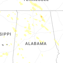

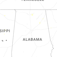


Connect with Interactive Hail Maps