

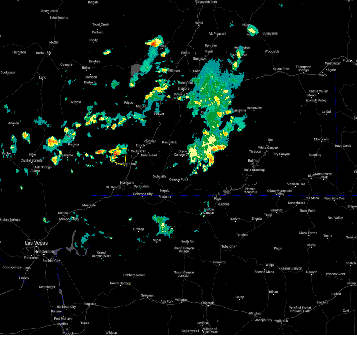
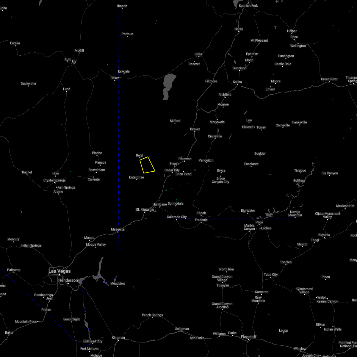
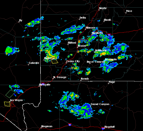
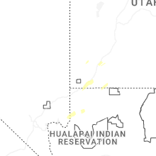
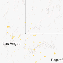
Hail Map for Newcastle, UT
The Newcastle, UT area has had 0 reports of on-the-ground hail by trained spotters, and has been under severe weather warnings 0 times during the past 12 months. Doppler radar has detected hail at or near Newcastle, UT on 23 occasions.
| Name: | Newcastle, UT |
| Where Located: | 38.5 miles N of Saint George, UT |
| Map: | Google Map for Newcastle, UT |
| Population: | 247 |
| Housing Units: | 92 |
| More Info: | Search Google for Newcastle, UT |
0
The Top Recent Hail Date for Newcastle, UT is Thursday, October 17, 2024 (17th out of 23)

Hail and Wind Damage Spotted near Newcastle, UT
| Date / Time | Report Details |
|---|---|
| 6/15/2023 1:43 PM MDT |
 At 142 pm mdt, a severe thunderstorm was located 17 miles northwest of new harmony, or 24 miles west of cedar city, moving east at 10 mph (radar indicated). Hazards include 60 mph wind gusts and quarter size hail. Hail damage to vehicles is expected. Expect wind damage to roofs, siding, and trees. At 142 pm mdt, a severe thunderstorm was located 17 miles northwest of new harmony, or 24 miles west of cedar city, moving east at 10 mph (radar indicated). Hazards include 60 mph wind gusts and quarter size hail. Hail damage to vehicles is expected. Expect wind damage to roofs, siding, and trees.
|
| 6/15/2023 1:35 PM MDT |
 At 135 pm mdt, a severe thunderstorm was located 22 miles northwest of new harmony, or 28 miles west of cedar city, moving east at 10 mph (radar indicated). Hazards include 60 mph wind gusts and half dollar size hail. Hail damage to vehicles is expected. expect wind damage to roofs, siding, and trees. locations impacted include, newcastle. this includes the following highways, utah route 18 between mile markers 45 and 51. utah route 56 between mile markers 24 and 38. hail threat, radar indicated max hail size, 1. 25 in wind threat, radar indicated max wind gust, 60 mph. At 135 pm mdt, a severe thunderstorm was located 22 miles northwest of new harmony, or 28 miles west of cedar city, moving east at 10 mph (radar indicated). Hazards include 60 mph wind gusts and half dollar size hail. Hail damage to vehicles is expected. expect wind damage to roofs, siding, and trees. locations impacted include, newcastle. this includes the following highways, utah route 18 between mile markers 45 and 51. utah route 56 between mile markers 24 and 38. hail threat, radar indicated max hail size, 1. 25 in wind threat, radar indicated max wind gust, 60 mph.
|
| 6/15/2023 1:21 PM MDT |
 At 120 pm mdt, a severe thunderstorm was located 24 miles northwest of new harmony, or 26 miles northeast of beaver dam, moving east at 10 mph (radar indicated). Hazards include 60 mph wind gusts and quarter size hail. Hail damage to vehicles is expected. Expect wind damage to roofs, siding, and trees. At 120 pm mdt, a severe thunderstorm was located 24 miles northwest of new harmony, or 26 miles northeast of beaver dam, moving east at 10 mph (radar indicated). Hazards include 60 mph wind gusts and quarter size hail. Hail damage to vehicles is expected. Expect wind damage to roofs, siding, and trees.
|
| 10/2/2022 5:15 PM MDT |
 At 514 pm mdt, a severe thunderstorm was located 20 miles northwest of new harmony, or 21 miles west of cedar city, moving east at 20 mph (radar indicated). Hazards include 60 mph wind gusts and quarter size hail. Hail damage to vehicles is expected. expect wind damage to roofs, siding, and trees. locations impacted include, newcastle. this includes the following highways, utah route 18 between mile markers 47 and 51. utah route 56 between mile markers 20 and 45. hail threat, radar indicated max hail size, 1. 00 in wind threat, radar indicated max wind gust, 60 mph. At 514 pm mdt, a severe thunderstorm was located 20 miles northwest of new harmony, or 21 miles west of cedar city, moving east at 20 mph (radar indicated). Hazards include 60 mph wind gusts and quarter size hail. Hail damage to vehicles is expected. expect wind damage to roofs, siding, and trees. locations impacted include, newcastle. this includes the following highways, utah route 18 between mile markers 47 and 51. utah route 56 between mile markers 20 and 45. hail threat, radar indicated max hail size, 1. 00 in wind threat, radar indicated max wind gust, 60 mph.
|
| 10/2/2022 4:54 PM MDT |
 At 454 pm mdt, a severe thunderstorm was located 24 miles northwest of new harmony, or 28 miles west of cedar city, moving east at 20 mph (radar indicated). Hazards include 60 mph wind gusts and quarter size hail. Hail damage to vehicles is expected. Expect wind damage to roofs, siding, and trees. At 454 pm mdt, a severe thunderstorm was located 24 miles northwest of new harmony, or 28 miles west of cedar city, moving east at 20 mph (radar indicated). Hazards include 60 mph wind gusts and quarter size hail. Hail damage to vehicles is expected. Expect wind damage to roofs, siding, and trees.
|
| 8/21/2022 3:05 PM MDT |
 At 305 pm mdt, a severe thunderstorm was located 21 miles east of beaver dam, moving southwest at 10 mph (radar indicated). Hazards include 60 mph wind gusts and half dollar size hail. Hail damage to vehicles is expected. expect wind damage to roofs, siding, and trees. locations impacted include, enterprise and pinto. this includes the following highways, utah route 18 between mile markers 31 and 51. utah route 56 between mile markers 26 and 31. hail threat, radar indicated max hail size, 1. 25 in wind threat, radar indicated max wind gust, 60 mph. At 305 pm mdt, a severe thunderstorm was located 21 miles east of beaver dam, moving southwest at 10 mph (radar indicated). Hazards include 60 mph wind gusts and half dollar size hail. Hail damage to vehicles is expected. expect wind damage to roofs, siding, and trees. locations impacted include, enterprise and pinto. this includes the following highways, utah route 18 between mile markers 31 and 51. utah route 56 between mile markers 26 and 31. hail threat, radar indicated max hail size, 1. 25 in wind threat, radar indicated max wind gust, 60 mph.
|
| 8/21/2022 2:52 PM MDT |
 At 252 pm mdt, a severe thunderstorm was located 19 miles northwest of new harmony, or 24 miles east of beaver dam, moving south at 15 mph (radar indicated). Hazards include 60 mph wind gusts and half dollar size hail. Hail damage to vehicles is expected. Expect wind damage to roofs, siding, and trees. At 252 pm mdt, a severe thunderstorm was located 19 miles northwest of new harmony, or 24 miles east of beaver dam, moving south at 15 mph (radar indicated). Hazards include 60 mph wind gusts and half dollar size hail. Hail damage to vehicles is expected. Expect wind damage to roofs, siding, and trees.
|
| 8/18/2022 5:26 PM MDT |
 The severe thunderstorm warning for north central washington and southwestern iron counties will expire at 530 pm mdt, the storm which prompted the warning has weakened below severe limits, and no longer poses an immediate threat to life or property. therefore, the warning will be allowed to expire. The severe thunderstorm warning for north central washington and southwestern iron counties will expire at 530 pm mdt, the storm which prompted the warning has weakened below severe limits, and no longer poses an immediate threat to life or property. therefore, the warning will be allowed to expire.
|
| 8/18/2022 5:13 PM MDT |
 At 513 pm mdt, a severe thunderstorm was located 20 miles northeast of beaver dam, moving northeast at 10 mph (radar indicated). Hazards include 60 mph wind gusts and quarter size hail. Hail damage to vehicles is expected. expect wind damage to roofs, siding, and trees. locations impacted include, enterprise. this includes the following highways, utah route 18 between mile markers 38 and 51. utah route 56 between mile markers 22 and 29. hail threat, radar indicated max hail size, 1. 00 in wind threat, radar indicated max wind gust, 60 mph. At 513 pm mdt, a severe thunderstorm was located 20 miles northeast of beaver dam, moving northeast at 10 mph (radar indicated). Hazards include 60 mph wind gusts and quarter size hail. Hail damage to vehicles is expected. expect wind damage to roofs, siding, and trees. locations impacted include, enterprise. this includes the following highways, utah route 18 between mile markers 38 and 51. utah route 56 between mile markers 22 and 29. hail threat, radar indicated max hail size, 1. 00 in wind threat, radar indicated max wind gust, 60 mph.
|
| 8/18/2022 4:55 PM MDT |
 At 455 pm mdt, a severe thunderstorm was located 17 miles northeast of beaver dam, moving east at 10 mph (radar indicated). Hazards include 60 mph wind gusts and quarter size hail. Hail damage to vehicles is expected. Expect wind damage to roofs, siding, and trees. At 455 pm mdt, a severe thunderstorm was located 17 miles northeast of beaver dam, moving east at 10 mph (radar indicated). Hazards include 60 mph wind gusts and quarter size hail. Hail damage to vehicles is expected. Expect wind damage to roofs, siding, and trees.
|
| 7/22/2021 4:56 PM MDT |
 The severe thunderstorm warning for western iron county will expire at 500 pm mdt, the storm which prompted the warning has weakened below severe limits, and no longer poses an immediate threat to life or property. therefore, the warning will be allowed to expire. however small hail is still possible with this thunderstorm. The severe thunderstorm warning for western iron county will expire at 500 pm mdt, the storm which prompted the warning has weakened below severe limits, and no longer poses an immediate threat to life or property. therefore, the warning will be allowed to expire. however small hail is still possible with this thunderstorm.
|
| 7/22/2021 4:45 PM MDT |
 At 444 pm mdt, a severe thunderstorm was located 25 miles northwest of enoch, or 27 miles northwest of cedar city (radar indicated). Hazards include quarter size hail. Damage to vehicles is expected. locations impacted include, newcastle. this includes the following highways, utah route 18 between mile markers 50 and 51. Utah route 56 between mile markers 22 and 36. At 444 pm mdt, a severe thunderstorm was located 25 miles northwest of enoch, or 27 miles northwest of cedar city (radar indicated). Hazards include quarter size hail. Damage to vehicles is expected. locations impacted include, newcastle. this includes the following highways, utah route 18 between mile markers 50 and 51. Utah route 56 between mile markers 22 and 36.
|
| 7/22/2021 4:28 PM MDT |
 At 426 pm mdt, a severe thunderstorm was located 26 miles west of enoch, or 27 miles northwest of cedar city, moving northeast at 20 mph (radar indicated). Hazards include quarter size hail. damage to vehicles is expected At 426 pm mdt, a severe thunderstorm was located 26 miles west of enoch, or 27 miles northwest of cedar city, moving northeast at 20 mph (radar indicated). Hazards include quarter size hail. damage to vehicles is expected
|
| 7/22/2021 4:13 PM MDT |
 At 413 pm mdt, a severe thunderstorm was located 26 miles northwest of new harmony, or 27 miles west of cedar city, moving northeast at 20 mph (radar indicated). Hazards include quarter size hail. Damage to vehicles is expected. locations impacted include, newcastle. this includes the following highways, utah route 18 between mile markers 50 and 51. Utah route 56 between mile markers 22 and 36. At 413 pm mdt, a severe thunderstorm was located 26 miles northwest of new harmony, or 27 miles west of cedar city, moving northeast at 20 mph (radar indicated). Hazards include quarter size hail. Damage to vehicles is expected. locations impacted include, newcastle. this includes the following highways, utah route 18 between mile markers 50 and 51. Utah route 56 between mile markers 22 and 36.
|
| 7/22/2021 4:02 PM MDT |
 At 401 pm mdt, a severe thunderstorm was located 24 miles northwest of new harmony, or 28 miles west of cedar city, moving northeast at 20 mph (radar indicated). Hazards include quarter size hail. damage to vehicles is expected At 401 pm mdt, a severe thunderstorm was located 24 miles northwest of new harmony, or 28 miles west of cedar city, moving northeast at 20 mph (radar indicated). Hazards include quarter size hail. damage to vehicles is expected
|
| 7/14/2021 7:02 PM MDT |
 At 702 pm mdt, a severe thunderstorm was located 14 miles northwest of new harmony, or 21 miles west of cedar city, moving southeast at 15 mph (radar indicated). Hazards include 60 mph wind gusts and quarter size hail. Hail damage to vehicles is expected. expect wind damage to roofs, siding, and trees. locations impacted include, enterprise, pinto and newcastle. this includes the following highways, utah route 18 between mile markers 34 and 51. Utah route 56 between mile markers 17 and 43. At 702 pm mdt, a severe thunderstorm was located 14 miles northwest of new harmony, or 21 miles west of cedar city, moving southeast at 15 mph (radar indicated). Hazards include 60 mph wind gusts and quarter size hail. Hail damage to vehicles is expected. expect wind damage to roofs, siding, and trees. locations impacted include, enterprise, pinto and newcastle. this includes the following highways, utah route 18 between mile markers 34 and 51. Utah route 56 between mile markers 17 and 43.
|
| 7/14/2021 6:34 PM MDT |
 At 633 pm mdt, a severe thunderstorm was located 21 miles northwest of new harmony, or 27 miles west of cedar city, moving southeast at 15 mph (radar indicated). Hazards include 60 mph wind gusts and quarter size hail. Hail damage to vehicles is expected. expect wind damage to roofs, siding, and trees. locations impacted include, enterprise, pinto and newcastle. this includes the following highways, utah route 18 between mile markers 34 and 51. Utah route 56 between mile markers 17 and 48. At 633 pm mdt, a severe thunderstorm was located 21 miles northwest of new harmony, or 27 miles west of cedar city, moving southeast at 15 mph (radar indicated). Hazards include 60 mph wind gusts and quarter size hail. Hail damage to vehicles is expected. expect wind damage to roofs, siding, and trees. locations impacted include, enterprise, pinto and newcastle. this includes the following highways, utah route 18 between mile markers 34 and 51. Utah route 56 between mile markers 17 and 48.
|
| 7/14/2021 6:25 PM MDT |
 At 624 pm mdt, a severe thunderstorm was located 24 miles northwest of new harmony, or 29 miles west of cedar city, moving southeast at 15 mph (radar indicated). Hazards include 60 mph wind gusts and quarter size hail. Hail damage to vehicles is expected. Expect wind damage to roofs, siding, and trees. At 624 pm mdt, a severe thunderstorm was located 24 miles northwest of new harmony, or 29 miles west of cedar city, moving southeast at 15 mph (radar indicated). Hazards include 60 mph wind gusts and quarter size hail. Hail damage to vehicles is expected. Expect wind damage to roofs, siding, and trees.
|
| 7/31/2016 4:26 PM MDT |
 The severe thunderstorm warning for central iron county will expire at 430 pm mdt, the storm which prompted the warning has weakened below severe limits, and no longer poses an immediate threat to life or property. therefore the warning will be allowed to expire. however small hail, gusty winds and heavy rain are still possible with this thunderstorm. The severe thunderstorm warning for central iron county will expire at 430 pm mdt, the storm which prompted the warning has weakened below severe limits, and no longer poses an immediate threat to life or property. therefore the warning will be allowed to expire. however small hail, gusty winds and heavy rain are still possible with this thunderstorm.
|
| 7/31/2016 4:14 PM MDT |
 At 413 pm mdt, doppler radar indicated a severe thunderstorm capable of producing quarter size hail and damaging winds in excess of 60 mph. this storm was located 30 miles northwest of new harmony, or 31 miles west of cedar city, moving south at 10 mph. this severe thunderstorm will remain over mainly rural areas of central iron county. At 413 pm mdt, doppler radar indicated a severe thunderstorm capable of producing quarter size hail and damaging winds in excess of 60 mph. this storm was located 30 miles northwest of new harmony, or 31 miles west of cedar city, moving south at 10 mph. this severe thunderstorm will remain over mainly rural areas of central iron county.
|
| 7/31/2016 3:59 PM MDT |
 At 358 pm mdt, doppler radar indicated a severe thunderstorm capable of producing quarter size hail and damaging winds in excess of 60 mph. this storm was located 31 miles east of eagle valley, or 31 miles east of ursine, and moving south at 10 mph. * this severe thunderstorm will remain over mainly rural areas of west central iron county. At 358 pm mdt, doppler radar indicated a severe thunderstorm capable of producing quarter size hail and damaging winds in excess of 60 mph. this storm was located 31 miles east of eagle valley, or 31 miles east of ursine, and moving south at 10 mph. * this severe thunderstorm will remain over mainly rural areas of west central iron county.
|
Hail Maps for Newcastle, UT


Connect with Interactive Hail Maps