

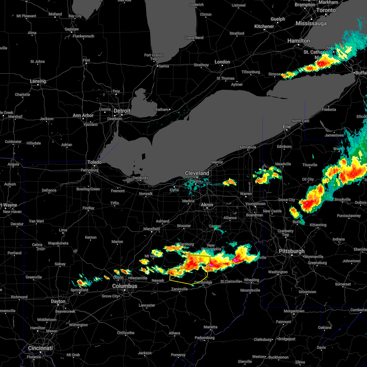
Hail Map for Newcomerstown, OH
The Newcomerstown, OH area has had 3 reports of on-the-ground hail by trained spotters, and has been under severe weather warnings 28 times during the past 12 months. Doppler radar has detected hail at or near Newcomerstown, OH on 31 occasions, including 4 occasions during the past year.
| Name: | Newcomerstown, OH |
| Where Located: | 78 miles ENE of Columbus, OH |
| Map: | Google Map for Newcomerstown, OH |
| Population: | 3822 |
| Housing Units: | 1798 |
| More Info: | Search Google for Newcomerstown, OH |
1
The Top Recent Hail Date for Newcomerstown, OH is Thursday, March 14, 2024 (6th out of 31)

Hail and Wind Damage Spotted near Newcomerstown, OH
| Date / Time | Report Details |
|---|---|
| 4/17/2024 6:14 PM EDT |
 At 614 pm edt, severe thunderstorms were located along a line extending from near waynesburg to new philadelphia to near newcomerstown, moving east at 40 mph (radar indicated). Hazards include 70 mph wind gusts and quarter size hail. Minor hail damage to vehicles is possible. trees snapped and uprooted. power outages can be expected. Locations impacted include, new philadelphia, dover, east liverpool, uhrichsville, east palestine, wellsville, cadiz, carrollton, calcutta, newcomerstown, minerva, lisbon, dennison, strasburg, new waterford, big beaver, augusta, new beaver, salineville, and gnadenhutten. At 614 pm edt, severe thunderstorms were located along a line extending from near waynesburg to new philadelphia to near newcomerstown, moving east at 40 mph (radar indicated). Hazards include 70 mph wind gusts and quarter size hail. Minor hail damage to vehicles is possible. trees snapped and uprooted. power outages can be expected. Locations impacted include, new philadelphia, dover, east liverpool, uhrichsville, east palestine, wellsville, cadiz, carrollton, calcutta, newcomerstown, minerva, lisbon, dennison, strasburg, new waterford, big beaver, augusta, new beaver, salineville, and gnadenhutten.
|
| 4/17/2024 6:00 PM EDT |
 Svrpbz the national weather service in pittsburgh has issued a * severe thunderstorm warning for, northern harrison county in east central ohio, northern jefferson county in east central ohio, columbiana county in east central ohio, northeastern coshocton county in east central ohio, carroll county in east central ohio, tuscarawas county in east central ohio, south central lawrence county in western pennsylvania, hancock county in northern west virginia, * until 700 pm edt. * at 600 pm edt, severe thunderstorms were located along a line extending from near east sparta to near sugarcreek to near west lafayette, moving east at 40 mph (radar indicated). Hazards include 70 mph wind gusts and quarter size hail. Minor hail damage to vehicles is possible. trees snapped and uprooted. Power outages can be expected. Svrpbz the national weather service in pittsburgh has issued a * severe thunderstorm warning for, northern harrison county in east central ohio, northern jefferson county in east central ohio, columbiana county in east central ohio, northeastern coshocton county in east central ohio, carroll county in east central ohio, tuscarawas county in east central ohio, south central lawrence county in western pennsylvania, hancock county in northern west virginia, * until 700 pm edt. * at 600 pm edt, severe thunderstorms were located along a line extending from near east sparta to near sugarcreek to near west lafayette, moving east at 40 mph (radar indicated). Hazards include 70 mph wind gusts and quarter size hail. Minor hail damage to vehicles is possible. trees snapped and uprooted. Power outages can be expected.
|
| 4/2/2024 9:06 PM EDT |
 At 906 pm edt, severe thunderstorms were located along a line extending from 7 miles south of newcomerstown to cambridge to near new concord, moving east at 40 mph (radar indicated). Hazards include 70 mph wind gusts and penny size hail. Trees snapped and uprooted. power outages can be expected. Locations impacted include, cambridge, newcomerstown, new concord, byesville, antrim, senecaville, pleasant city, lore city, old washington, plainfield, otsego, birmingham, boden, seneca lake park, salt fork state park, and kimbolton. At 906 pm edt, severe thunderstorms were located along a line extending from 7 miles south of newcomerstown to cambridge to near new concord, moving east at 40 mph (radar indicated). Hazards include 70 mph wind gusts and penny size hail. Trees snapped and uprooted. power outages can be expected. Locations impacted include, cambridge, newcomerstown, new concord, byesville, antrim, senecaville, pleasant city, lore city, old washington, plainfield, otsego, birmingham, boden, seneca lake park, salt fork state park, and kimbolton.
|
| 4/2/2024 8:47 PM EDT |
 At 846 pm edt, severe thunderstorms were located along a line extending from 8 miles east of dresden to near new concord to 6 miles east of zanesville, moving east at 40 mph (radar indicated). Hazards include 70 mph wind gusts and quarter size hail. Minor hail damage to vehicles is possible. trees snapped and uprooted. power outages can be expected. Locations impacted include, cambridge, newcomerstown, new concord, byesville, antrim, senecaville, pleasant city, conesville, lore city, old washington, plainfield, norwich, chandlersville, otsego, birmingham, boden, seneca lake park, salt fork state park, and kimbolton. At 846 pm edt, severe thunderstorms were located along a line extending from 8 miles east of dresden to near new concord to 6 miles east of zanesville, moving east at 40 mph (radar indicated). Hazards include 70 mph wind gusts and quarter size hail. Minor hail damage to vehicles is possible. trees snapped and uprooted. power outages can be expected. Locations impacted include, cambridge, newcomerstown, new concord, byesville, antrim, senecaville, pleasant city, conesville, lore city, old washington, plainfield, norwich, chandlersville, otsego, birmingham, boden, seneca lake park, salt fork state park, and kimbolton.
|
| 4/2/2024 8:34 PM EDT |
 Svrpbz the national weather service in pittsburgh has issued a * severe thunderstorm warning for, guernsey county in east central ohio, southeastern coshocton county in east central ohio, northeastern muskingum county in east central ohio, south central tuscarawas county in east central ohio, north central noble county in east central ohio, * until 915 pm edt. * at 834 pm edt, severe thunderstorms were located along a line extending from dresden to north zanesville to south zanesville, moving east at 40 mph (radar indicated). Hazards include 70 mph wind gusts and quarter size hail. Hail damage to vehicles. trees snapped and uprooted. Power outages. Svrpbz the national weather service in pittsburgh has issued a * severe thunderstorm warning for, guernsey county in east central ohio, southeastern coshocton county in east central ohio, northeastern muskingum county in east central ohio, south central tuscarawas county in east central ohio, north central noble county in east central ohio, * until 915 pm edt. * at 834 pm edt, severe thunderstorms were located along a line extending from dresden to north zanesville to south zanesville, moving east at 40 mph (radar indicated). Hazards include 70 mph wind gusts and quarter size hail. Hail damage to vehicles. trees snapped and uprooted. Power outages.
|
| 3/30/2024 5:57 PM EDT |
 At 557 pm edt, a severe thunderstorm was located near coshocton, moving east at 45 mph (radar indicated). Hazards include golf ball size hail and 60 mph wind gusts. People and animals outdoors will be injured. expect hail damage to roofs, siding, windows, and vehicles. expect wind damage to trees and power lines, resulting in some power outages. Locations impacted include, coshocton, west lafayette, warsaw, conesville, plainfield, nellie, walhonding, new guilford, and cooperdale. At 557 pm edt, a severe thunderstorm was located near coshocton, moving east at 45 mph (radar indicated). Hazards include golf ball size hail and 60 mph wind gusts. People and animals outdoors will be injured. expect hail damage to roofs, siding, windows, and vehicles. expect wind damage to trees and power lines, resulting in some power outages. Locations impacted include, coshocton, west lafayette, warsaw, conesville, plainfield, nellie, walhonding, new guilford, and cooperdale.
|
| 3/30/2024 5:50 PM EDT |
 At 549 pm edt, a severe thunderstorm was located 11 miles west of coshocton, moving east at 45 mph (radar indicated). Hazards include golf ball size hail and 60 mph wind gusts. People and animals outdoors will be injured. expect hail damage to roofs, siding, windows, and vehicles. expect wind damage to trees and power lines, resulting in some power outages. Locations impacted include, coshocton, west lafayette, warsaw, conesville, plainfield, nellie, walhonding, new guilford, and cooperdale. At 549 pm edt, a severe thunderstorm was located 11 miles west of coshocton, moving east at 45 mph (radar indicated). Hazards include golf ball size hail and 60 mph wind gusts. People and animals outdoors will be injured. expect hail damage to roofs, siding, windows, and vehicles. expect wind damage to trees and power lines, resulting in some power outages. Locations impacted include, coshocton, west lafayette, warsaw, conesville, plainfield, nellie, walhonding, new guilford, and cooperdale.
|
| 3/30/2024 5:32 PM EDT |
 Svrpbz the national weather service in pittsburgh has issued a * severe thunderstorm warning for, coshocton county in east central ohio, * until 615 pm edt. * at 530 pm edt, a severe thunderstorm was located near gambier, or 8 miles east of mount vernon, moving east at 45 mph (radar indicated). Hazards include 60 mph wind gusts and half dollar size hail. quarter size hail has been reported in this storm. Minor hail damage to vehicles is possible. Expect wind damage to trees and power lines, resulting in some power outages. Svrpbz the national weather service in pittsburgh has issued a * severe thunderstorm warning for, coshocton county in east central ohio, * until 615 pm edt. * at 530 pm edt, a severe thunderstorm was located near gambier, or 8 miles east of mount vernon, moving east at 45 mph (radar indicated). Hazards include 60 mph wind gusts and half dollar size hail. quarter size hail has been reported in this storm. Minor hail damage to vehicles is possible. Expect wind damage to trees and power lines, resulting in some power outages.
|
| 3/14/2024 9:45 PM EDT |
 Svrpbz the national weather service in pittsburgh has issued a * severe thunderstorm warning for, harrison county in east central ohio, southeastern tuscarawas county in east central ohio, * until 1015 pm edt. * at 945 pm edt, a severe thunderstorm was located near newcomerstown, or 12 miles southwest of uhrichsville, moving east at 65 mph (radar indicated). Hazards include half dollar size hail. minor damage to vehicles is possible Svrpbz the national weather service in pittsburgh has issued a * severe thunderstorm warning for, harrison county in east central ohio, southeastern tuscarawas county in east central ohio, * until 1015 pm edt. * at 945 pm edt, a severe thunderstorm was located near newcomerstown, or 12 miles southwest of uhrichsville, moving east at 65 mph (radar indicated). Hazards include half dollar size hail. minor damage to vehicles is possible
|
| 8/12/2023 7:31 PM EDT |
 At 731 pm edt, severe thunderstorms were located along a line extending from near ohioville to 6 miles west of new cumberland to 8 miles east of dennison, moving east at 45 mph (radar indicated). Hazards include 60 mph wind gusts and quarter size hail. Minor hail damage to vehicles is possible. expect wind damage to trees and power lines, resulting in some power outages. locations impacted include, new philadelphia, east liverpool, uhrichsville, wellsville, freeport, toronto, calcutta, newcomerstown, ohioville, dennison, midland, chester, industry, new cumberland, salineville, gnadenhutten, tuscarawas, newell, scio, and midvale. hail threat, radar indicated max hail size, 1. 00 in wind threat, radar indicated max wind gust, 60 mph. At 731 pm edt, severe thunderstorms were located along a line extending from near ohioville to 6 miles west of new cumberland to 8 miles east of dennison, moving east at 45 mph (radar indicated). Hazards include 60 mph wind gusts and quarter size hail. Minor hail damage to vehicles is possible. expect wind damage to trees and power lines, resulting in some power outages. locations impacted include, new philadelphia, east liverpool, uhrichsville, wellsville, freeport, toronto, calcutta, newcomerstown, ohioville, dennison, midland, chester, industry, new cumberland, salineville, gnadenhutten, tuscarawas, newell, scio, and midvale. hail threat, radar indicated max hail size, 1. 00 in wind threat, radar indicated max wind gust, 60 mph.
|
| 8/12/2023 7:04 PM EDT | Trees down on stone creek rd... including on a vehicle with two trapped occupants in tuscarawas county OH, 7.7 miles SSW of Newcomerstown, OH |
| 8/12/2023 7:00 PM EDT |
 At 700 pm edt, severe thunderstorms were located along a line extending from 7 miles northeast of minerva to near carrollton to 7 miles southeast of farmerstown, moving east at 45 mph (radar indicated). Hazards include 60 mph wind gusts and quarter size hail. Minor hail damage to vehicles is possible. Expect wind damage to trees and power lines, resulting in some power outages. At 700 pm edt, severe thunderstorms were located along a line extending from 7 miles northeast of minerva to near carrollton to 7 miles southeast of farmerstown, moving east at 45 mph (radar indicated). Hazards include 60 mph wind gusts and quarter size hail. Minor hail damage to vehicles is possible. Expect wind damage to trees and power lines, resulting in some power outages.
|
| 8/12/2023 5:05 PM EDT |
 At 505 pm edt, a severe thunderstorm was located near coshocton, moving east at 30 mph (radar indicated). Hazards include 60 mph wind gusts and quarter size hail. Minor hail damage to vehicles is possible. expect wind damage to trees and power lines, resulting in some power outages. locations impacted include, coshocton, west lafayette, warsaw, conesville, plainfield, chili, and bakersville. hail threat, radar indicated max hail size, 1. 00 in wind threat, radar indicated max wind gust, 60 mph. At 505 pm edt, a severe thunderstorm was located near coshocton, moving east at 30 mph (radar indicated). Hazards include 60 mph wind gusts and quarter size hail. Minor hail damage to vehicles is possible. expect wind damage to trees and power lines, resulting in some power outages. locations impacted include, coshocton, west lafayette, warsaw, conesville, plainfield, chili, and bakersville. hail threat, radar indicated max hail size, 1. 00 in wind threat, radar indicated max wind gust, 60 mph.
|
| 8/12/2023 4:53 PM EDT |
 At 453 pm edt, a severe thunderstorm was located 10 miles north of dresden, or 10 miles west of coshocton, moving east at 30 mph (radar indicated). Hazards include 60 mph wind gusts and quarter size hail. Minor hail damage to vehicles is possible. Expect wind damage to trees and power lines, resulting in some power outages. At 453 pm edt, a severe thunderstorm was located 10 miles north of dresden, or 10 miles west of coshocton, moving east at 30 mph (radar indicated). Hazards include 60 mph wind gusts and quarter size hail. Minor hail damage to vehicles is possible. Expect wind damage to trees and power lines, resulting in some power outages.
|
| 7/29/2023 6:36 AM EDT |
 The severe thunderstorm warning for northwestern guernsey, eastern coshocton, northeastern muskingum, west central carroll and tuscarawas counties will expire at 645 am edt, the storms which prompted the warning have weakened below severe limits, and no longer pose an immediate threat to life or property. therefore, the warning will be allowed to expire. however, gusty winds and heavy rain are still possible with these thunderstorms. a severe thunderstorm watch remains in effect until 1100 am edt for east central ohio. The severe thunderstorm warning for northwestern guernsey, eastern coshocton, northeastern muskingum, west central carroll and tuscarawas counties will expire at 645 am edt, the storms which prompted the warning have weakened below severe limits, and no longer pose an immediate threat to life or property. therefore, the warning will be allowed to expire. however, gusty winds and heavy rain are still possible with these thunderstorms. a severe thunderstorm watch remains in effect until 1100 am edt for east central ohio.
|
| 7/29/2023 6:23 AM EDT |
 At 622 am edt, severe thunderstorms were located along a line extending from 6 miles west of green to sugarcreek to near coshocton, moving east at 45 mph (radar indicated). Hazards include 60 mph wind gusts. Expect damage to trees and power lines, resulting in some power outages. locations impacted include, new philadelphia, dover, coshocton, uhrichsville, newcomerstown, strasburg, west lafayette, sugarcreek, gnadenhutten, tuscarawas, bolivar, baltic, midvale, mineral city, port washington, barnhill, conesville, roswell, parral, and stone creek. hail threat, radar indicated max hail size, <. 75 in wind threat, radar indicated max wind gust, 60 mph. At 622 am edt, severe thunderstorms were located along a line extending from 6 miles west of green to sugarcreek to near coshocton, moving east at 45 mph (radar indicated). Hazards include 60 mph wind gusts. Expect damage to trees and power lines, resulting in some power outages. locations impacted include, new philadelphia, dover, coshocton, uhrichsville, newcomerstown, strasburg, west lafayette, sugarcreek, gnadenhutten, tuscarawas, bolivar, baltic, midvale, mineral city, port washington, barnhill, conesville, roswell, parral, and stone creek. hail threat, radar indicated max hail size, <. 75 in wind threat, radar indicated max wind gust, 60 mph.
|
| 7/29/2023 6:12 AM EDT |
 At 612 am edt, severe thunderstorms were located along a line extending from near doylestown to near walnut creek to near dresden, moving east at 45 mph (radar indicated). Hazards include 60 mph wind gusts. Expect damage to trees and power lines, resulting in some power outages. locations impacted include, new philadelphia, dover, coshocton, cambridge, uhrichsville, newcomerstown, strasburg, west lafayette, sugarcreek, dresden, gnadenhutten, tuscarawas, bolivar, baltic, midvale, mineral city, warsaw, port washington, barnhill, and conesville. hail threat, radar indicated max hail size, <. 75 in wind threat, radar indicated max wind gust, 60 mph. At 612 am edt, severe thunderstorms were located along a line extending from near doylestown to near walnut creek to near dresden, moving east at 45 mph (radar indicated). Hazards include 60 mph wind gusts. Expect damage to trees and power lines, resulting in some power outages. locations impacted include, new philadelphia, dover, coshocton, cambridge, uhrichsville, newcomerstown, strasburg, west lafayette, sugarcreek, dresden, gnadenhutten, tuscarawas, bolivar, baltic, midvale, mineral city, warsaw, port washington, barnhill, and conesville. hail threat, radar indicated max hail size, <. 75 in wind threat, radar indicated max wind gust, 60 mph.
|
| 7/29/2023 6:00 AM EDT |
 At 600 am edt, severe thunderstorms were located along a line extending from near creston to killbuck to 6 miles north of frazeysburg, moving east at 45 mph (radar indicated). Hazards include 60 mph wind gusts. Expect damage to trees and power lines, resulting in some power outages. locations impacted include, new philadelphia, dover, coshocton, cambridge, uhrichsville, newcomerstown, strasburg, west lafayette, sugarcreek, dresden, frazeysburg, gnadenhutten, tuscarawas, bolivar, baltic, midvale, mineral city, warsaw, port washington, and barnhill. hail threat, radar indicated max hail size, <. 75 in wind threat, radar indicated max wind gust, 60 mph. At 600 am edt, severe thunderstorms were located along a line extending from near creston to killbuck to 6 miles north of frazeysburg, moving east at 45 mph (radar indicated). Hazards include 60 mph wind gusts. Expect damage to trees and power lines, resulting in some power outages. locations impacted include, new philadelphia, dover, coshocton, cambridge, uhrichsville, newcomerstown, strasburg, west lafayette, sugarcreek, dresden, frazeysburg, gnadenhutten, tuscarawas, bolivar, baltic, midvale, mineral city, warsaw, port washington, and barnhill. hail threat, radar indicated max hail size, <. 75 in wind threat, radar indicated max wind gust, 60 mph.
|
| 7/29/2023 5:50 AM EDT |
 At 550 am edt, severe thunderstorms were located along a line extending from near west salem to glenmont to 8 miles north of hanover, moving east at 45 mph (radar indicated). Hazards include 60 mph wind gusts. Expect damage to trees and power lines, resulting in some power outages. locations impacted include, new philadelphia, dover, coshocton, cambridge, uhrichsville, newcomerstown, strasburg, west lafayette, sugarcreek, dresden, frazeysburg, gnadenhutten, tuscarawas, bolivar, baltic, midvale, mineral city, warsaw, port washington, and barnhill. hail threat, radar indicated max hail size, <. 75 in wind threat, radar indicated max wind gust, 60 mph. At 550 am edt, severe thunderstorms were located along a line extending from near west salem to glenmont to 8 miles north of hanover, moving east at 45 mph (radar indicated). Hazards include 60 mph wind gusts. Expect damage to trees and power lines, resulting in some power outages. locations impacted include, new philadelphia, dover, coshocton, cambridge, uhrichsville, newcomerstown, strasburg, west lafayette, sugarcreek, dresden, frazeysburg, gnadenhutten, tuscarawas, bolivar, baltic, midvale, mineral city, warsaw, port washington, and barnhill. hail threat, radar indicated max hail size, <. 75 in wind threat, radar indicated max wind gust, 60 mph.
|
| 7/29/2023 5:40 AM EDT |
 At 538 am edt, severe thunderstorms were located along a line extending from polk to 6 miles north of danville to utica, moving east at 45 mph (radar indicated). Hazards include 60 mph wind gusts. expect damage to trees and power lines, resulting in some power outages At 538 am edt, severe thunderstorms were located along a line extending from polk to 6 miles north of danville to utica, moving east at 45 mph (radar indicated). Hazards include 60 mph wind gusts. expect damage to trees and power lines, resulting in some power outages
|
| 7/29/2023 3:05 AM EDT |
 The severe thunderstorm warning for northwestern guernsey, southeastern coshocton, northeastern muskingum and south central tuscarawas counties will expire at 315 am edt, the storm which prompted the warning has weakened below severe limits, and no longer poses an immediate threat to life or property. therefore, the warning will be allowed to expire. however, gusty winds and heavy rain are still possible with this thunderstorm. a severe thunderstorm watch remains in effect until 1100 am edt for east central ohio. The severe thunderstorm warning for northwestern guernsey, southeastern coshocton, northeastern muskingum and south central tuscarawas counties will expire at 315 am edt, the storm which prompted the warning has weakened below severe limits, and no longer poses an immediate threat to life or property. therefore, the warning will be allowed to expire. however, gusty winds and heavy rain are still possible with this thunderstorm. a severe thunderstorm watch remains in effect until 1100 am edt for east central ohio.
|
| 7/29/2023 2:54 AM EDT |
 At 254 am edt, a severe thunderstorm was located 9 miles north of new concord, or 10 miles southeast of coshocton, moving east at 30 mph (radar indicated). Hazards include 60 mph wind gusts and penny size hail. Expect damage to trees and power lines, resulting in some power outages. locations impacted include, coshocton, cambridge, newcomerstown, new concord, byesville, west lafayette, lore city, old washington, plainfield, gilmore, otsego, birmingham, boden, salt fork state park, and kimbolton. hail threat, radar indicated max hail size, 0. 75 in wind threat, radar indicated max wind gust, 60 mph. At 254 am edt, a severe thunderstorm was located 9 miles north of new concord, or 10 miles southeast of coshocton, moving east at 30 mph (radar indicated). Hazards include 60 mph wind gusts and penny size hail. Expect damage to trees and power lines, resulting in some power outages. locations impacted include, coshocton, cambridge, newcomerstown, new concord, byesville, west lafayette, lore city, old washington, plainfield, gilmore, otsego, birmingham, boden, salt fork state park, and kimbolton. hail threat, radar indicated max hail size, 0. 75 in wind threat, radar indicated max wind gust, 60 mph.
|
| 7/29/2023 2:37 AM EDT |
 At 237 am edt, a severe thunderstorm was located near dresden, or 8 miles southwest of coshocton, moving east at 30 mph (radar indicated). Hazards include 60 mph wind gusts and penny size hail. expect damage to trees and power lines, resulting in some power outages At 237 am edt, a severe thunderstorm was located near dresden, or 8 miles southwest of coshocton, moving east at 30 mph (radar indicated). Hazards include 60 mph wind gusts and penny size hail. expect damage to trees and power lines, resulting in some power outages
|
| 6/15/2023 10:26 PM EDT |
 At 1026 pm edt, severe thunderstorms were located along a line extending from near east sparta to sugarcreek to near farmerstown to killbuck, moving southeast at 35 mph (radar indicated). Hazards include 60 mph wind gusts and half dollar size hail. Minor hail damage to vehicles is possible. expect wind damage to trees and power lines, resulting in some power outages. locations impacted include, new philadelphia, dover, uhrichsville, dennison, strasburg, sugarcreek, gnadenhutten, tuscarawas, bolivar, baltic, midvale, and mineral city. hail threat, radar indicated max hail size, 1. 25 in wind threat, radar indicated max wind gust, 60 mph. At 1026 pm edt, severe thunderstorms were located along a line extending from near east sparta to sugarcreek to near farmerstown to killbuck, moving southeast at 35 mph (radar indicated). Hazards include 60 mph wind gusts and half dollar size hail. Minor hail damage to vehicles is possible. expect wind damage to trees and power lines, resulting in some power outages. locations impacted include, new philadelphia, dover, uhrichsville, dennison, strasburg, sugarcreek, gnadenhutten, tuscarawas, bolivar, baltic, midvale, and mineral city. hail threat, radar indicated max hail size, 1. 25 in wind threat, radar indicated max wind gust, 60 mph.
|
| 6/15/2023 10:09 PM EDT |
 At 1008 pm edt, severe thunderstorms were located along a line extending from near navarre to near berlin to near millersburg to near glenmont, moving southeast at 35 mph (radar indicated). Hazards include 60 mph wind gusts and quarter size hail. Minor hail damage to vehicles is possible. Expect wind damage to trees and power lines, resulting in some power outages. At 1008 pm edt, severe thunderstorms were located along a line extending from near navarre to near berlin to near millersburg to near glenmont, moving southeast at 35 mph (radar indicated). Hazards include 60 mph wind gusts and quarter size hail. Minor hail damage to vehicles is possible. Expect wind damage to trees and power lines, resulting in some power outages.
|
| 4/5/2023 6:32 PM EDT |
 At 631 pm edt, severe thunderstorms were located along a line extending from west lafayette to near cambridge to near new concord, moving east at 60 mph (radar indicated). Hazards include 60 mph wind gusts. Expect damage to trees and power lines, resulting in some power outages. locations impacted include, coshocton, cambridge, newcomerstown, new concord, byesville, west lafayette, antrim, port washington, old washington, stone creek, plainfield, and gilmore. hail threat, radar indicated max hail size, <. 75 in wind threat, radar indicated max wind gust, 60 mph. At 631 pm edt, severe thunderstorms were located along a line extending from west lafayette to near cambridge to near new concord, moving east at 60 mph (radar indicated). Hazards include 60 mph wind gusts. Expect damage to trees and power lines, resulting in some power outages. locations impacted include, coshocton, cambridge, newcomerstown, new concord, byesville, west lafayette, antrim, port washington, old washington, stone creek, plainfield, and gilmore. hail threat, radar indicated max hail size, <. 75 in wind threat, radar indicated max wind gust, 60 mph.
|
| 4/5/2023 6:24 PM EDT |
 At 624 pm edt, severe thunderstorms were located along a line extending from coshocton to 9 miles west of cambridge to near new concord, moving northeast at 60 mph (radar indicated). Hazards include 60 mph wind gusts. Expect damage to trees and power lines, resulting in some power outages. locations impacted include, coshocton, cambridge, newcomerstown, new concord, byesville, west lafayette, north zanesville, dresden, antrim, port washington, pleasant grove, and conesville. hail threat, radar indicated max hail size, <. 75 in wind threat, radar indicated max wind gust, 60 mph. At 624 pm edt, severe thunderstorms were located along a line extending from coshocton to 9 miles west of cambridge to near new concord, moving northeast at 60 mph (radar indicated). Hazards include 60 mph wind gusts. Expect damage to trees and power lines, resulting in some power outages. locations impacted include, coshocton, cambridge, newcomerstown, new concord, byesville, west lafayette, north zanesville, dresden, antrim, port washington, pleasant grove, and conesville. hail threat, radar indicated max hail size, <. 75 in wind threat, radar indicated max wind gust, 60 mph.
|
| 4/5/2023 6:13 PM EDT |
 At 613 pm edt, severe thunderstorms were located along a line extending from 6 miles north of dresden to 6 miles east of zanesville to 6 miles southeast of south zanesville, moving east at 60 mph (radar indicated). Hazards include 60 mph wind gusts. Expect damage to trees and power lines, resulting in some power outages. locations impacted include, zanesville, coshocton, cambridge, newcomerstown, new concord, byesville, west lafayette, south zanesville, north zanesville, dresden, frazeysburg, and antrim. hail threat, radar indicated max hail size, <. 75 in wind threat, radar indicated max wind gust, 60 mph. At 613 pm edt, severe thunderstorms were located along a line extending from 6 miles north of dresden to 6 miles east of zanesville to 6 miles southeast of south zanesville, moving east at 60 mph (radar indicated). Hazards include 60 mph wind gusts. Expect damage to trees and power lines, resulting in some power outages. locations impacted include, zanesville, coshocton, cambridge, newcomerstown, new concord, byesville, west lafayette, south zanesville, north zanesville, dresden, frazeysburg, and antrim. hail threat, radar indicated max hail size, <. 75 in wind threat, radar indicated max wind gust, 60 mph.
|
| 4/5/2023 6:02 PM EDT |
 At 602 pm edt, severe thunderstorms were located along a line extending from 7 miles northwest of frazeysburg to south zanesville to near perry state forest, moving east at 60 mph (radar indicated). Hazards include 60 mph wind gusts. Expect damage to trees and power lines, resulting in some power outages. locations impacted include, zanesville, coshocton, cambridge, newcomerstown, new concord, byesville, west lafayette, south zanesville, north zanesville, dresden, frazeysburg, and antrim. hail threat, radar indicated max hail size, <. 75 in wind threat, radar indicated max wind gust, 60 mph. At 602 pm edt, severe thunderstorms were located along a line extending from 7 miles northwest of frazeysburg to south zanesville to near perry state forest, moving east at 60 mph (radar indicated). Hazards include 60 mph wind gusts. Expect damage to trees and power lines, resulting in some power outages. locations impacted include, zanesville, coshocton, cambridge, newcomerstown, new concord, byesville, west lafayette, south zanesville, north zanesville, dresden, frazeysburg, and antrim. hail threat, radar indicated max hail size, <. 75 in wind threat, radar indicated max wind gust, 60 mph.
|
| 4/5/2023 5:51 PM EDT |
 At 550 pm edt, severe thunderstorms were located along a line extending from near utica to 7 miles northwest of perry state forest to near somerset, moving east at 60 mph (radar indicated). Hazards include 60 mph wind gusts. expect damage to trees and power lines, resulting in some power outages At 550 pm edt, severe thunderstorms were located along a line extending from near utica to 7 miles northwest of perry state forest to near somerset, moving east at 60 mph (radar indicated). Hazards include 60 mph wind gusts. expect damage to trees and power lines, resulting in some power outages
|
| 4/1/2023 12:33 PM EDT |
 At 1232 pm edt, severe thunderstorms were located along a line extending from near barberton to near newcomerstown, moving northeast at 60 mph (radar indicated). Hazards include 60 mph wind gusts. Expect damage to trees and power lines, resulting in some power outages. locations impacted include, new philadelphia, dover, cambridge, uhrichsville, st. clairsville, barnesville, cadiz, carrollton, freeport, newcomerstown, minerva, and dennison. hail threat, radar indicated max hail size, <. 75 in wind threat, radar indicated max wind gust, 60 mph. At 1232 pm edt, severe thunderstorms were located along a line extending from near barberton to near newcomerstown, moving northeast at 60 mph (radar indicated). Hazards include 60 mph wind gusts. Expect damage to trees and power lines, resulting in some power outages. locations impacted include, new philadelphia, dover, cambridge, uhrichsville, st. clairsville, barnesville, cadiz, carrollton, freeport, newcomerstown, minerva, and dennison. hail threat, radar indicated max hail size, <. 75 in wind threat, radar indicated max wind gust, 60 mph.
|
| 4/1/2023 12:13 PM EDT |
 At 1212 pm edt, severe thunderstorms were located along a line extending from near creston to near dresden, moving east at 90 mph (radar indicated). Hazards include 60 mph wind gusts. expect damage to trees and power lines, resulting in some power outages At 1212 pm edt, severe thunderstorms were located along a line extending from near creston to near dresden, moving east at 90 mph (radar indicated). Hazards include 60 mph wind gusts. expect damage to trees and power lines, resulting in some power outages
|
| 9/21/2022 9:38 PM EDT |
 At 938 pm edt, a severe thunderstorm was located 10 miles west of freeport, moving east at 40 mph (radar indicated). Hazards include 60 mph wind gusts. Damage to trees and power lines. locations impacted include, cambridge, freeport, newcomerstown, antrim, old washington, gilmore, tippecanoe, birmingham, salt fork state park, kimbolton, and clendening lake. hail threat, radar indicated max hail size, <. 75 in wind threat, radar indicated max wind gust, 60 mph. At 938 pm edt, a severe thunderstorm was located 10 miles west of freeport, moving east at 40 mph (radar indicated). Hazards include 60 mph wind gusts. Damage to trees and power lines. locations impacted include, cambridge, freeport, newcomerstown, antrim, old washington, gilmore, tippecanoe, birmingham, salt fork state park, kimbolton, and clendening lake. hail threat, radar indicated max hail size, <. 75 in wind threat, radar indicated max wind gust, 60 mph.
|
| 9/21/2022 9:23 PM EDT |
 At 922 pm edt, a severe thunderstorm was located 8 miles south of newcomerstown, or 9 miles north of cambridge, moving east at 30 mph (radar indicated). Hazards include 60 mph wind gusts and penny size hail. Damage to trees and power lines. locations impacted include, cambridge, freeport, newcomerstown, antrim, old washington, plainfield, gilmore, tippecanoe, otsego, birmingham, boden, and salt fork state park. hail threat, radar indicated max hail size, 0. 75 in wind threat, radar indicated max wind gust, 60 mph. At 922 pm edt, a severe thunderstorm was located 8 miles south of newcomerstown, or 9 miles north of cambridge, moving east at 30 mph (radar indicated). Hazards include 60 mph wind gusts and penny size hail. Damage to trees and power lines. locations impacted include, cambridge, freeport, newcomerstown, antrim, old washington, plainfield, gilmore, tippecanoe, otsego, birmingham, boden, and salt fork state park. hail threat, radar indicated max hail size, 0. 75 in wind threat, radar indicated max wind gust, 60 mph.
|
| 9/21/2022 8:57 PM EDT |
 At 856 pm edt, a severe thunderstorm was located near coshocton, moving east at 40 mph (radar indicated). Hazards include 60 mph wind gusts and quarter size hail. Hail damage to vehicles. Damage to trees and power lines. At 856 pm edt, a severe thunderstorm was located near coshocton, moving east at 40 mph (radar indicated). Hazards include 60 mph wind gusts and quarter size hail. Hail damage to vehicles. Damage to trees and power lines.
|
| 8/20/2022 8:41 PM EDT |
 The severe thunderstorm warning for northwestern guernsey, coshocton and tuscarawas counties will expire at 845 pm edt, the storm which prompted the warning has moved out of the area. therefore, the warning will be allowed to expire. however gusty winds and heavy rain are still possible with this thunderstorm. remember, a severe thunderstorm warning still remains in effect for tuscarawas county until 930 pm. The severe thunderstorm warning for northwestern guernsey, coshocton and tuscarawas counties will expire at 845 pm edt, the storm which prompted the warning has moved out of the area. therefore, the warning will be allowed to expire. however gusty winds and heavy rain are still possible with this thunderstorm. remember, a severe thunderstorm warning still remains in effect for tuscarawas county until 930 pm.
|
| 8/20/2022 8:21 PM EDT |
 At 820 pm edt, a severe thunderstorm was located over newcomerstown, or 13 miles southwest of uhrichsville, moving east at 55 mph (radar indicated). Hazards include 60 mph wind gusts and quarter size hail. Minor hail damage to vehicles is possible. expect wind damage to trees and power lines, resulting in some power outages. locations impacted include, new philadelphia, dover, coshocton, uhrichsville, newcomerstown, dennison, strasburg, west lafayette, sugarcreek, gnadenhutten, tuscarawas, and baltic. hail threat, radar indicated max hail size, 1. 00 in wind threat, radar indicated max wind gust, 60 mph. At 820 pm edt, a severe thunderstorm was located over newcomerstown, or 13 miles southwest of uhrichsville, moving east at 55 mph (radar indicated). Hazards include 60 mph wind gusts and quarter size hail. Minor hail damage to vehicles is possible. expect wind damage to trees and power lines, resulting in some power outages. locations impacted include, new philadelphia, dover, coshocton, uhrichsville, newcomerstown, dennison, strasburg, west lafayette, sugarcreek, gnadenhutten, tuscarawas, and baltic. hail threat, radar indicated max hail size, 1. 00 in wind threat, radar indicated max wind gust, 60 mph.
|
| 8/20/2022 8:01 PM EDT |
 At 801 pm edt, a severe thunderstorm was located near coshocton, moving east at 55 mph (radar indicated). Hazards include 60 mph wind gusts and quarter size hail. Minor hail damage to vehicles is possible. Expect wind damage to trees and power lines, resulting in some power outages. At 801 pm edt, a severe thunderstorm was located near coshocton, moving east at 55 mph (radar indicated). Hazards include 60 mph wind gusts and quarter size hail. Minor hail damage to vehicles is possible. Expect wind damage to trees and power lines, resulting in some power outages.
|
| 7/23/2022 1:21 PM EDT |
 At 120 pm edt, severe thunderstorms were located along a line extending from uhrichsville to new concord, moving east at 25 mph (radar indicated). Hazards include 60 mph wind gusts. Expect damage to trees and power lines, resulting in some power outages. locations impacted include, zanesville, cambridge, uhrichsville, barnesville, cadiz, freeport, newcomerstown, dennison, new concord, byesville, gnadenhutten, and antrim. hail threat, radar indicated max hail size, <. 75 in wind threat, radar indicated max wind gust, 60 mph. At 120 pm edt, severe thunderstorms were located along a line extending from uhrichsville to new concord, moving east at 25 mph (radar indicated). Hazards include 60 mph wind gusts. Expect damage to trees and power lines, resulting in some power outages. locations impacted include, zanesville, cambridge, uhrichsville, barnesville, cadiz, freeport, newcomerstown, dennison, new concord, byesville, gnadenhutten, and antrim. hail threat, radar indicated max hail size, <. 75 in wind threat, radar indicated max wind gust, 60 mph.
|
| 7/23/2022 1:15 PM EDT | Storm damage reported in tuscarawas county OH, 0.9 miles NE of Newcomerstown, OH |
| 7/23/2022 1:12 PM EDT | Report of power lines down. time estimated based on rada in tuscarawas county OH, 0.9 miles NE of Newcomerstown, OH |
| 7/23/2022 1:05 PM EDT |
 At 105 pm edt, severe thunderstorms were located along a line extending from 7 miles southwest of new philadelphia to 6 miles east of zanesville, moving east at 50 mph (radar indicated). Hazards include 60 mph wind gusts. expect damage to trees and power lines, resulting in some power outages At 105 pm edt, severe thunderstorms were located along a line extending from 7 miles southwest of new philadelphia to 6 miles east of zanesville, moving east at 50 mph (radar indicated). Hazards include 60 mph wind gusts. expect damage to trees and power lines, resulting in some power outages
|
| 7/20/2022 10:50 PM EDT |
 At 1050 pm edt, severe thunderstorms were located along a line extending from new cumberland to 7 miles north of cadiz to 6 miles northeast of newcomerstown, moving east at 40 mph (radar indicated). Hazards include 60 mph wind gusts. Expect damage to trees and power lines, resulting in some power outages. locations impacted include, new philadelphia, coshocton, uhrichsville, cadiz, wintersville, newcomerstown, dennison, west lafayette, gnadenhutten, tuscarawas, hopedale, and smithfield. hail threat, radar indicated max hail size, <. 75 in wind threat, radar indicated max wind gust, 60 mph. At 1050 pm edt, severe thunderstorms were located along a line extending from new cumberland to 7 miles north of cadiz to 6 miles northeast of newcomerstown, moving east at 40 mph (radar indicated). Hazards include 60 mph wind gusts. Expect damage to trees and power lines, resulting in some power outages. locations impacted include, new philadelphia, coshocton, uhrichsville, cadiz, wintersville, newcomerstown, dennison, west lafayette, gnadenhutten, tuscarawas, hopedale, and smithfield. hail threat, radar indicated max hail size, <. 75 in wind threat, radar indicated max wind gust, 60 mph.
|
| 7/20/2022 10:49 PM EDT |
 At 1048 pm edt, severe thunderstorms were located along a line extending from near farmerstown to near coshocton to 6 miles northwest of frazeysburg, moving east at 40 mph (radar indicated). Hazards include 60 mph wind gusts. expect damage to trees and power lines, resulting in some power outages At 1048 pm edt, severe thunderstorms were located along a line extending from near farmerstown to near coshocton to 6 miles northwest of frazeysburg, moving east at 40 mph (radar indicated). Hazards include 60 mph wind gusts. expect damage to trees and power lines, resulting in some power outages
|
| 7/20/2022 9:54 PM EDT |
 At 954 pm edt, severe thunderstorms were located along a line extending from 6 miles south of waynesburg to near farmerstown to near danville, moving east at 40 mph (radar indicated). Hazards include 60 mph wind gusts and quarter size hail. Minor hail damage to vehicles is possible. Expect wind damage to trees and power lines, resulting in some power outages. At 954 pm edt, severe thunderstorms were located along a line extending from 6 miles south of waynesburg to near farmerstown to near danville, moving east at 40 mph (radar indicated). Hazards include 60 mph wind gusts and quarter size hail. Minor hail damage to vehicles is possible. Expect wind damage to trees and power lines, resulting in some power outages.
|
| 6/16/2022 5:02 PM EDT |
 At 502 pm edt, a severe thunderstorm was located near freeport, moving southeast at 30 mph. this is a destructive storm! (trained weather spotters). Hazards include baseball size hail and 60 mph wind gusts. People and animals outdoors will be severely injured. expect shattered windows, extensive damage to roofs, siding, and vehicles. locations impacted include, uhrichsville, barnesville, cadiz, freeport, dennison, gnadenhutten, bethesda, antrim, tuscarawas, flushing, adena, and port washington. thunderstorm damage threat, destructive hail threat, observed max hail size, 2. 75 in wind threat, radar indicated max wind gust, 60 mph. At 502 pm edt, a severe thunderstorm was located near freeport, moving southeast at 30 mph. this is a destructive storm! (trained weather spotters). Hazards include baseball size hail and 60 mph wind gusts. People and animals outdoors will be severely injured. expect shattered windows, extensive damage to roofs, siding, and vehicles. locations impacted include, uhrichsville, barnesville, cadiz, freeport, dennison, gnadenhutten, bethesda, antrim, tuscarawas, flushing, adena, and port washington. thunderstorm damage threat, destructive hail threat, observed max hail size, 2. 75 in wind threat, radar indicated max wind gust, 60 mph.
|
| 6/16/2022 4:59 PM EDT |
 At 459 pm edt, a severe thunderstorm was located near newcomerstown, or 9 miles southwest of uhrichsville, moving east at 45 mph (radar indicated). Hazards include ping pong ball size hail and 60 mph wind gusts. People and animals outdoors will be injured. expect hail damage to roofs, siding, windows, and vehicles. expect wind damage to trees and power lines, resulting in some power outages. locations impacted include, coshocton, newcomerstown, west lafayette, dresden, frazeysburg, port washington, conesville, plainfield, otsego, boden, cooperdale, and bakersville. hail threat, radar indicated max hail size, 1. 50 in wind threat, radar indicated max wind gust, 60 mph. At 459 pm edt, a severe thunderstorm was located near newcomerstown, or 9 miles southwest of uhrichsville, moving east at 45 mph (radar indicated). Hazards include ping pong ball size hail and 60 mph wind gusts. People and animals outdoors will be injured. expect hail damage to roofs, siding, windows, and vehicles. expect wind damage to trees and power lines, resulting in some power outages. locations impacted include, coshocton, newcomerstown, west lafayette, dresden, frazeysburg, port washington, conesville, plainfield, otsego, boden, cooperdale, and bakersville. hail threat, radar indicated max hail size, 1. 50 in wind threat, radar indicated max wind gust, 60 mph.
|
| 6/16/2022 4:49 PM EDT |
 At 449 pm edt, a severe thunderstorm was located near newcomerstown, or 11 miles east of coshocton, moving east at 45 mph (radar indicated). Hazards include golf ball size hail and 60 mph wind gusts. People and animals outdoors will be injured. expect hail damage to roofs, siding, windows, and vehicles. expect wind damage to trees and power lines, resulting in some power outages. locations impacted include, coshocton, newcomerstown, west lafayette, dresden, frazeysburg, baltic, port washington, conesville, stone creek, plainfield, otsego, and chili. thunderstorm damage threat, considerable hail threat, radar indicated max hail size, 1. 75 in wind threat, radar indicated max wind gust, 60 mph. At 449 pm edt, a severe thunderstorm was located near newcomerstown, or 11 miles east of coshocton, moving east at 45 mph (radar indicated). Hazards include golf ball size hail and 60 mph wind gusts. People and animals outdoors will be injured. expect hail damage to roofs, siding, windows, and vehicles. expect wind damage to trees and power lines, resulting in some power outages. locations impacted include, coshocton, newcomerstown, west lafayette, dresden, frazeysburg, baltic, port washington, conesville, stone creek, plainfield, otsego, and chili. thunderstorm damage threat, considerable hail threat, radar indicated max hail size, 1. 75 in wind threat, radar indicated max wind gust, 60 mph.
|
| 6/16/2022 4:43 PM EDT |
 At 443 pm edt, a severe thunderstorm was located near freeport, moving southeast at 30 mph. this is a destructive storm (radar indicated). Hazards include baseball size hail and 60 mph wind gusts. People and animals outdoors will be severely injured. expect shattered windows, extensive damage to roofs, siding, and vehicles. locations impacted include, uhrichsville, barnesville, cadiz, freeport, dennison, gnadenhutten, bethesda, antrim, tuscarawas, flushing, adena, and port washington. thunderstorm damage threat, destructive hail threat, radar indicated max hail size, 2. 75 in wind threat, radar indicated max wind gust, 60 mph. At 443 pm edt, a severe thunderstorm was located near freeport, moving southeast at 30 mph. this is a destructive storm (radar indicated). Hazards include baseball size hail and 60 mph wind gusts. People and animals outdoors will be severely injured. expect shattered windows, extensive damage to roofs, siding, and vehicles. locations impacted include, uhrichsville, barnesville, cadiz, freeport, dennison, gnadenhutten, bethesda, antrim, tuscarawas, flushing, adena, and port washington. thunderstorm damage threat, destructive hail threat, radar indicated max hail size, 2. 75 in wind threat, radar indicated max wind gust, 60 mph.
|
| 6/16/2022 4:42 PM EDT |
 At 442 pm edt, a severe thunderstorm was located near west lafayette, or near coshocton, moving east at 45 mph (radar indicated). Hazards include 60 mph wind gusts and quarter size hail. Minor hail damage to vehicles is possible. Expect wind damage to trees and power lines, resulting in some power outages. At 442 pm edt, a severe thunderstorm was located near west lafayette, or near coshocton, moving east at 45 mph (radar indicated). Hazards include 60 mph wind gusts and quarter size hail. Minor hail damage to vehicles is possible. Expect wind damage to trees and power lines, resulting in some power outages.
|
| 6/16/2022 4:37 PM EDT |
 At 436 pm edt, a severe thunderstorm was located 8 miles southwest of uhrichsville, moving southeast at 30 mph. this is a destructive storm (radar indicated). Hazards include baseball size hail and 60 mph wind gusts. People and animals outdoors will be severely injured. expect shattered windows, extensive damage to roofs, siding, and vehicles. locations impacted include, uhrichsville, barnesville, cadiz, freeport, newcomerstown, dennison, gnadenhutten, bethesda, antrim, tuscarawas, flushing, and adena. thunderstorm damage threat, destructive hail threat, radar indicated max hail size, 2. 75 in wind threat, radar indicated max wind gust, 60 mph. At 436 pm edt, a severe thunderstorm was located 8 miles southwest of uhrichsville, moving southeast at 30 mph. this is a destructive storm (radar indicated). Hazards include baseball size hail and 60 mph wind gusts. People and animals outdoors will be severely injured. expect shattered windows, extensive damage to roofs, siding, and vehicles. locations impacted include, uhrichsville, barnesville, cadiz, freeport, newcomerstown, dennison, gnadenhutten, bethesda, antrim, tuscarawas, flushing, and adena. thunderstorm damage threat, destructive hail threat, radar indicated max hail size, 2. 75 in wind threat, radar indicated max wind gust, 60 mph.
|
| 6/16/2022 4:34 PM EDT |
 At 433 pm edt, a severe thunderstorm was located near newcomerstown, or 9 miles southwest of uhrichsville, moving southeast at 30 mph (radar indicated). Hazards include golf ball size hail and 60 mph wind gusts. People and animals outdoors will be injured. expect hail damage to roofs, siding, windows, and vehicles. Expect wind damage to trees and power lines, resulting in some power outages. At 433 pm edt, a severe thunderstorm was located near newcomerstown, or 9 miles southwest of uhrichsville, moving southeast at 30 mph (radar indicated). Hazards include golf ball size hail and 60 mph wind gusts. People and animals outdoors will be injured. expect hail damage to roofs, siding, windows, and vehicles. Expect wind damage to trees and power lines, resulting in some power outages.
|
| 6/16/2022 4:12 PM EDT | Report of multiple trees and power lines down in the are in coshocton county OH, 6.8 miles SE of Newcomerstown, OH |
| 6/16/2022 4:05 PM EDT |
 At 404 pm edt, severe thunderstorms were located along a line extending from near farmerstown to near gambier, moving east at 40 mph (radar indicated). Hazards include 60 mph wind gusts and half dollar size hail. Minor hail damage to vehicles is possible. Expect wind damage to trees and power lines, resulting in some power outages. At 404 pm edt, severe thunderstorms were located along a line extending from near farmerstown to near gambier, moving east at 40 mph (radar indicated). Hazards include 60 mph wind gusts and half dollar size hail. Minor hail damage to vehicles is possible. Expect wind damage to trees and power lines, resulting in some power outages.
|
| 6/16/2022 3:34 PM EDT |
 At 334 pm edt, a severe thunderstorm was located over glenmont, or 10 miles west of millersburg, moving east at 25 mph (radar indicated). Hazards include 60 mph wind gusts and half dollar size hail. Minor hail damage to vehicles is possible. Expect wind damage to trees and power lines, resulting in some power outages. At 334 pm edt, a severe thunderstorm was located over glenmont, or 10 miles west of millersburg, moving east at 25 mph (radar indicated). Hazards include 60 mph wind gusts and half dollar size hail. Minor hail damage to vehicles is possible. Expect wind damage to trees and power lines, resulting in some power outages.
|
| 6/14/2022 4:26 AM EDT |
 At 426 am edt, severe thunderstorms were located along a line extending from 8 miles northeast of dennison to 8 miles west of freeport to near cambridge to near north zanesville to 8 miles south of hanover, moving east at 60 mph (radar indicated). Hazards include 60 mph wind gusts and nickel size hail. Expect damage to trees and power lines, resulting in some power outages. locations impacted include, zanesville, new philadelphia, cambridge, uhrichsville, newcomerstown, dennison, new concord, south zanesville, north zanesville, gnadenhutten, tuscarawas, and midvale. hail threat, radar indicated max hail size, 0. 88 in wind threat, observed max wind gust, 60 mph. At 426 am edt, severe thunderstorms were located along a line extending from 8 miles northeast of dennison to 8 miles west of freeport to near cambridge to near north zanesville to 8 miles south of hanover, moving east at 60 mph (radar indicated). Hazards include 60 mph wind gusts and nickel size hail. Expect damage to trees and power lines, resulting in some power outages. locations impacted include, zanesville, new philadelphia, cambridge, uhrichsville, newcomerstown, dennison, new concord, south zanesville, north zanesville, gnadenhutten, tuscarawas, and midvale. hail threat, radar indicated max hail size, 0. 88 in wind threat, observed max wind gust, 60 mph.
|
| 6/14/2022 4:11 AM EDT |
 At 410 am edt, severe thunderstorms were located along a line extending from near dover to near newcomerstown to near coshocton to frazeysburg to newark, moving southeast at 70 mph (radar indicated). Hazards include 60 mph wind gusts and nickel size hail. Expect damage to trees and power lines, resulting in some power outages. locations impacted include, zanesville, new philadelphia, dover, coshocton, cambridge, uhrichsville, newcomerstown, dennison, strasburg, new concord, west lafayette, and sugarcreek. hail threat, radar indicated max hail size, 0. 88 in wind threat, observed max wind gust, 60 mph. At 410 am edt, severe thunderstorms were located along a line extending from near dover to near newcomerstown to near coshocton to frazeysburg to newark, moving southeast at 70 mph (radar indicated). Hazards include 60 mph wind gusts and nickel size hail. Expect damage to trees and power lines, resulting in some power outages. locations impacted include, zanesville, new philadelphia, dover, coshocton, cambridge, uhrichsville, newcomerstown, dennison, strasburg, new concord, west lafayette, and sugarcreek. hail threat, radar indicated max hail size, 0. 88 in wind threat, observed max wind gust, 60 mph.
|
| 6/14/2022 3:42 AM EDT |
 At 341 am edt, severe thunderstorms were located along a line extending from near wooster to near nashville to 9 miles southeast of bellville to near mount vernon to 7 miles north of sunbury, moving southeast at 60 mph (radar indicated). Hazards include 60 mph wind gusts and penny size hail. expect damage to trees and power lines, resulting in some power outages At 341 am edt, severe thunderstorms were located along a line extending from near wooster to near nashville to 9 miles southeast of bellville to near mount vernon to 7 miles north of sunbury, moving southeast at 60 mph (radar indicated). Hazards include 60 mph wind gusts and penny size hail. expect damage to trees and power lines, resulting in some power outages
|
| 6/14/2022 12:24 AM EDT |
 At 1223 am edt, severe thunderstorms were located along a line extending from massillon to near west lafayette to 8 miles west of south zanesville, moving southeast at 50 mph (radar indicated). Hazards include 70 mph wind gusts and quarter size hail. Minor hail damage to vehicles is possible. trees snapped and uprooted. power outages can be expected. Locations impacted include, zanesville, new philadelphia, dover, coshocton, cambridge, uhrichsville, newcomerstown, minerva, dennison, strasburg, new concord, and byesville. At 1223 am edt, severe thunderstorms were located along a line extending from massillon to near west lafayette to 8 miles west of south zanesville, moving southeast at 50 mph (radar indicated). Hazards include 70 mph wind gusts and quarter size hail. Minor hail damage to vehicles is possible. trees snapped and uprooted. power outages can be expected. Locations impacted include, zanesville, new philadelphia, dover, coshocton, cambridge, uhrichsville, newcomerstown, minerva, dennison, strasburg, new concord, and byesville.
|
| 6/13/2022 11:43 PM EDT |
 At 1143 pm edt, severe thunderstorms were located along a line extending from lodi to 6 miles south of loudonville to near johnstown, moving southeast at 50 mph (radar indicated). Hazards include 70 mph wind gusts and nickel size hail. Trees snapped and uprooted. Power outages can be expected. At 1143 pm edt, severe thunderstorms were located along a line extending from lodi to 6 miles south of loudonville to near johnstown, moving southeast at 50 mph (radar indicated). Hazards include 70 mph wind gusts and nickel size hail. Trees snapped and uprooted. Power outages can be expected.
|
| 5/3/2022 6:48 PM EDT |
 At 647 pm edt, severe thunderstorms were located along a line extending from near uhrichsville to 6 miles east of caldwell, moving northeast at 55 mph (radar indicated). Hazards include 60 mph wind gusts. Expect damage to trees and power lines, resulting in some power outages. locations impacted include, wheeling, weirton, steubenville, new philadelphia, moundsville, martins ferry, uhrichsville, st. clairsville, bellaire, barnesville, wellsville, and cadiz. hail threat, radar indicated max hail size, <. 75 in wind threat, radar indicated max wind gust, 60 mph. At 647 pm edt, severe thunderstorms were located along a line extending from near uhrichsville to 6 miles east of caldwell, moving northeast at 55 mph (radar indicated). Hazards include 60 mph wind gusts. Expect damage to trees and power lines, resulting in some power outages. locations impacted include, wheeling, weirton, steubenville, new philadelphia, moundsville, martins ferry, uhrichsville, st. clairsville, bellaire, barnesville, wellsville, and cadiz. hail threat, radar indicated max hail size, <. 75 in wind threat, radar indicated max wind gust, 60 mph.
|
| 5/3/2022 6:36 PM EDT |
 At 635 pm edt, severe thunderstorms were located along a line extending from near west lafayette to near caldwell, moving northeast at 65 mph (radar indicated). Hazards include 60 mph wind gusts and quarter size hail. Minor hail damage to vehicles is possible. Expect wind damage to trees and power lines, resulting in some power outages. At 635 pm edt, severe thunderstorms were located along a line extending from near west lafayette to near caldwell, moving northeast at 65 mph (radar indicated). Hazards include 60 mph wind gusts and quarter size hail. Minor hail damage to vehicles is possible. Expect wind damage to trees and power lines, resulting in some power outages.
|
| 4/25/2022 7:35 PM EDT |
 At 734 pm edt, a severe thunderstorm was located near newcomerstown, or 12 miles southwest of uhrichsville, moving northeast at 40 mph (radar indicated). Hazards include 60 mph wind gusts. Expect damage to trees and power lines, resulting in some power outages. locations impacted include, new philadelphia, uhrichsville, freeport, newcomerstown, dennison, gnadenhutten, tuscarawas, midvale, port washington, barnhill, stone creek, and gilmore. hail threat, radar indicated max hail size, <. 75 in wind threat, radar indicated max wind gust, 60 mph. At 734 pm edt, a severe thunderstorm was located near newcomerstown, or 12 miles southwest of uhrichsville, moving northeast at 40 mph (radar indicated). Hazards include 60 mph wind gusts. Expect damage to trees and power lines, resulting in some power outages. locations impacted include, new philadelphia, uhrichsville, freeport, newcomerstown, dennison, gnadenhutten, tuscarawas, midvale, port washington, barnhill, stone creek, and gilmore. hail threat, radar indicated max hail size, <. 75 in wind threat, radar indicated max wind gust, 60 mph.
|
| 4/25/2022 7:22 PM EDT |
 At 722 pm edt, a severe thunderstorm was located near newcomerstown, or 11 miles east of coshocton, moving northeast at 40 mph (radar indicated). Hazards include 60 mph wind gusts and penny size hail. expect damage to trees and power lines, resulting in some power outages At 722 pm edt, a severe thunderstorm was located near newcomerstown, or 11 miles east of coshocton, moving northeast at 40 mph (radar indicated). Hazards include 60 mph wind gusts and penny size hail. expect damage to trees and power lines, resulting in some power outages
|
| 10/21/2021 5:51 PM EDT |
 At 550 pm edt, a severe thunderstorm was located near cambridge, moving east at 45 mph (radar indicated). Hazards include 60 mph wind gusts. Expect damage to trees and power lines, resulting in some power outages. locations impacted include, cambridge, birmingham, boden, kimbolton, and salt fork state park. hail threat, radar indicated max hail size, <. 75 in wind threat, radar indicated max wind gust, 60 mph. At 550 pm edt, a severe thunderstorm was located near cambridge, moving east at 45 mph (radar indicated). Hazards include 60 mph wind gusts. Expect damage to trees and power lines, resulting in some power outages. locations impacted include, cambridge, birmingham, boden, kimbolton, and salt fork state park. hail threat, radar indicated max hail size, <. 75 in wind threat, radar indicated max wind gust, 60 mph.
|
| 10/21/2021 5:42 PM EDT |
 At 541 pm edt, a severe thunderstorm was located near sugarcreek, or 10 miles southwest of dover, moving northeast at 45 mph (radar indicated). Hazards include 60 mph wind gusts. Expect damage to trees and power lines, resulting in some power outages. locations impacted include, new philadelphia, dover, uhrichsville, newcomerstown, dennison, strasburg, west lafayette, sugarcreek, gnadenhutten, tuscarawas, bolivar, and baltic. hail threat, radar indicated max hail size, <. 75 in wind threat, radar indicated max wind gust, 60 mph. At 541 pm edt, a severe thunderstorm was located near sugarcreek, or 10 miles southwest of dover, moving northeast at 45 mph (radar indicated). Hazards include 60 mph wind gusts. Expect damage to trees and power lines, resulting in some power outages. locations impacted include, new philadelphia, dover, uhrichsville, newcomerstown, dennison, strasburg, west lafayette, sugarcreek, gnadenhutten, tuscarawas, bolivar, and baltic. hail threat, radar indicated max hail size, <. 75 in wind threat, radar indicated max wind gust, 60 mph.
|
| 10/21/2021 5:38 PM EDT |
 At 537 pm edt, a severe thunderstorm was located 8 miles northwest of new concord, or 12 miles northeast of zanesville, moving east at 35 mph (radar indicated). Hazards include 60 mph wind gusts and penny size hail. expect damage to trees and power lines, resulting in some power outages At 537 pm edt, a severe thunderstorm was located 8 miles northwest of new concord, or 12 miles northeast of zanesville, moving east at 35 mph (radar indicated). Hazards include 60 mph wind gusts and penny size hail. expect damage to trees and power lines, resulting in some power outages
|
| 10/21/2021 5:24 PM EDT |
 At 523 pm edt, a severe thunderstorm was located 8 miles southeast of killbuck, or 8 miles north of coshocton, moving northeast at 45 mph (radar indicated). Hazards include 60 mph wind gusts. Expect damage to trees and power lines, resulting in some power outages. locations impacted include, new philadelphia, dover, coshocton, uhrichsville, newcomerstown, dennison, strasburg, west lafayette, sugarcreek, gnadenhutten, tuscarawas, and bolivar. hail threat, radar indicated max hail size, <. 75 in wind threat, radar indicated max wind gust, 60 mph. At 523 pm edt, a severe thunderstorm was located 8 miles southeast of killbuck, or 8 miles north of coshocton, moving northeast at 45 mph (radar indicated). Hazards include 60 mph wind gusts. Expect damage to trees and power lines, resulting in some power outages. locations impacted include, new philadelphia, dover, coshocton, uhrichsville, newcomerstown, dennison, strasburg, west lafayette, sugarcreek, gnadenhutten, tuscarawas, and bolivar. hail threat, radar indicated max hail size, <. 75 in wind threat, radar indicated max wind gust, 60 mph.
|
| 10/21/2021 5:16 PM EDT |
 At 515 pm edt, a severe thunderstorm was located 10 miles northwest of coshocton, moving east at 45 mph (radar indicated). Hazards include 60 mph wind gusts. expect damage to trees and power lines, resulting in some power outages At 515 pm edt, a severe thunderstorm was located 10 miles northwest of coshocton, moving east at 45 mph (radar indicated). Hazards include 60 mph wind gusts. expect damage to trees and power lines, resulting in some power outages
|
| 8/12/2021 8:15 PM EDT |
 At 815 pm edt, severe thunderstorms were located along a line extending from 6 miles east of newcomerstown to 9 miles northeast of barnesville, moving east at 15 mph (radar indicated). Hazards include 60 mph wind gusts. Expect damage to trees and power lines, resulting in some power outages. locations impacted include, st. clairsville, cadiz, freeport, newcomerstown, antrim, flushing, scio, jewett, holloway, new athens, morristown, and gilmore. hail threat, radar indicated max hail size, <. 75 in wind threat, radar indicated max wind gust, 60 mph. At 815 pm edt, severe thunderstorms were located along a line extending from 6 miles east of newcomerstown to 9 miles northeast of barnesville, moving east at 15 mph (radar indicated). Hazards include 60 mph wind gusts. Expect damage to trees and power lines, resulting in some power outages. locations impacted include, st. clairsville, cadiz, freeport, newcomerstown, antrim, flushing, scio, jewett, holloway, new athens, morristown, and gilmore. hail threat, radar indicated max hail size, <. 75 in wind threat, radar indicated max wind gust, 60 mph.
|
| 8/12/2021 7:50 PM EDT | Report of trees down and power outages. time estimated based on rada in guernsey county OH, 6.6 miles NNW of Newcomerstown, OH |
| 8/10/2021 11:44 AM EDT |
 At 1144 am edt, a severe thunderstorm was located near west lafayette, or near coshocton, moving east at 25 mph (radar). Hazards include wind gusts to 60 mph. Expect damage to trees and power lines, resulting in some power outages. Locations impacted include, new philadelphia, newcomerstown, sugarcreek, gnadenhutten, tuscarawas, port washington, stone creek, gilmore, chili, bakersville, this includes interstate 77 in ohio between mile markers 65 and 81. At 1144 am edt, a severe thunderstorm was located near west lafayette, or near coshocton, moving east at 25 mph (radar). Hazards include wind gusts to 60 mph. Expect damage to trees and power lines, resulting in some power outages. Locations impacted include, new philadelphia, newcomerstown, sugarcreek, gnadenhutten, tuscarawas, port washington, stone creek, gilmore, chili, bakersville, this includes interstate 77 in ohio between mile markers 65 and 81.
|
| 8/10/2021 11:30 AM EDT |
 At 1130 am edt, a severe thunderstorm was located 7 miles southwest of farmerstown, or 10 miles north of coshocton, moving east at 30 mph (radar indicated). Hazards include 60 mph wind gusts. expect damage to trees and power lines, resulting in some power outages At 1130 am edt, a severe thunderstorm was located 7 miles southwest of farmerstown, or 10 miles north of coshocton, moving east at 30 mph (radar indicated). Hazards include 60 mph wind gusts. expect damage to trees and power lines, resulting in some power outages
|
| 7/16/2021 5:29 PM EDT |
 At 529 pm edt, severe thunderstorms were located along a line extending from near strasburg to near freeport, moving east at 40 mph (radar). Hazards include wind gusts to 60 mph. Expect damage to trees and power lines, resulting in some power outages. Locations impacted include, new philadelphia, dover, uhrichsville, freeport, newcomerstown, dennison, strasburg, sugarcreek, gnadenhutten, antrim, tuscarawas, bolivar, this includes interstate 77 in ohio between mile markers 54 and 94. At 529 pm edt, severe thunderstorms were located along a line extending from near strasburg to near freeport, moving east at 40 mph (radar). Hazards include wind gusts to 60 mph. Expect damage to trees and power lines, resulting in some power outages. Locations impacted include, new philadelphia, dover, uhrichsville, freeport, newcomerstown, dennison, strasburg, sugarcreek, gnadenhutten, antrim, tuscarawas, bolivar, this includes interstate 77 in ohio between mile markers 54 and 94.
|
| 7/16/2021 5:10 PM EDT |
 At 509 pm edt, severe thunderstorms were located along a line extending from 6 miles west of coshocton to near new concord, moving northeast at 40 mph (radar). Hazards include wind gusts to 60 mph. Expect damage to trees and power lines, resulting in some power outages. locations impacted include, coshocton, cambridge, newcomerstown, new concord, byesville, west lafayette, warsaw, senecaville, conesville, lore city, old washington, plainfield, this includes the following highways, interstate 70 in ohio between mile markers 165 and 186. Interstate 77 in ohio between mile markers 39 and 59. At 509 pm edt, severe thunderstorms were located along a line extending from 6 miles west of coshocton to near new concord, moving northeast at 40 mph (radar). Hazards include wind gusts to 60 mph. Expect damage to trees and power lines, resulting in some power outages. locations impacted include, coshocton, cambridge, newcomerstown, new concord, byesville, west lafayette, warsaw, senecaville, conesville, lore city, old washington, plainfield, this includes the following highways, interstate 70 in ohio between mile markers 165 and 186. Interstate 77 in ohio between mile markers 39 and 59.
|
| 7/16/2021 5:08 PM EDT |
 At 508 pm edt, severe thunderstorms were located along a line extending from farmerstown to 7 miles north of cambridge, moving northeast at 40 mph (radar). Hazards include wind gusts to 60 mph. expect damage to trees and power lines, resulting in some power outages At 508 pm edt, severe thunderstorms were located along a line extending from farmerstown to 7 miles north of cambridge, moving northeast at 40 mph (radar). Hazards include wind gusts to 60 mph. expect damage to trees and power lines, resulting in some power outages
|
| 7/16/2021 5:02 PM EDT |
 At 502 pm edt, severe thunderstorms were located along a line extending from 8 miles north of dresden to 7 miles southeast of north zanesville, moving northeast at 35 mph (radar). Hazards include wind gusts to 60 mph. Expect damage to trees and power lines, resulting in some power outages. locations impacted include, coshocton, cambridge, newcomerstown, new concord, byesville, west lafayette, warsaw, senecaville, conesville, lore city, old washington, plainfield, this includes the following highways, interstate 70 in ohio between mile markers 162 and 186. Interstate 77 in ohio between mile markers 39 and 60. At 502 pm edt, severe thunderstorms were located along a line extending from 8 miles north of dresden to 7 miles southeast of north zanesville, moving northeast at 35 mph (radar). Hazards include wind gusts to 60 mph. Expect damage to trees and power lines, resulting in some power outages. locations impacted include, coshocton, cambridge, newcomerstown, new concord, byesville, west lafayette, warsaw, senecaville, conesville, lore city, old washington, plainfield, this includes the following highways, interstate 70 in ohio between mile markers 162 and 186. Interstate 77 in ohio between mile markers 39 and 60.
|
| 7/16/2021 4:54 PM EDT |
 At 453 pm edt, severe thunderstorms were located along a line extending from 7 miles north of frazeysburg to near south zanesville, moving east at 35 mph (radar). Hazards include wind gusts to 60 mph. Expect damage to trees and power lines, resulting in some power outages. locations impacted include, zanesville, coshocton, cambridge, newcomerstown, new concord, byesville, west lafayette, north zanesville, dresden, philo, warsaw, pleasant grove, this includes the following highways, interstate 70 in ohio between mile markers 155 and 186. Interstate 77 in ohio between mile markers 39 and 60. At 453 pm edt, severe thunderstorms were located along a line extending from 7 miles north of frazeysburg to near south zanesville, moving east at 35 mph (radar). Hazards include wind gusts to 60 mph. Expect damage to trees and power lines, resulting in some power outages. locations impacted include, zanesville, coshocton, cambridge, newcomerstown, new concord, byesville, west lafayette, north zanesville, dresden, philo, warsaw, pleasant grove, this includes the following highways, interstate 70 in ohio between mile markers 155 and 186. Interstate 77 in ohio between mile markers 39 and 60.
|
| 7/16/2021 4:45 PM EDT |
 At 445 pm edt, severe thunderstorms were located along a line extending from near frazeysburg to near south zanesville, moving northeast at 35 mph (radar). Hazards include wind gusts to 60 mph. Expect damage to trees and power lines, resulting in some power outages. locations impacted include, zanesville, coshocton, cambridge, newcomerstown, new concord, byesville, west lafayette, south zanesville, north zanesville, dresden, frazeysburg, philo, this includes the following highways, interstate 70 in ohio between mile markers 152 and 186. Interstate 77 in ohio between mile markers 38 and 59. At 445 pm edt, severe thunderstorms were located along a line extending from near frazeysburg to near south zanesville, moving northeast at 35 mph (radar). Hazards include wind gusts to 60 mph. Expect damage to trees and power lines, resulting in some power outages. locations impacted include, zanesville, coshocton, cambridge, newcomerstown, new concord, byesville, west lafayette, south zanesville, north zanesville, dresden, frazeysburg, philo, this includes the following highways, interstate 70 in ohio between mile markers 152 and 186. Interstate 77 in ohio between mile markers 38 and 59.
|
| 7/16/2021 4:26 PM EDT |
 At 426 pm edt, severe thunderstorms were located along a line extending from near hanover to 6 miles northeast of perry state forest, moving northeast at 35 mph (radar). Hazards include wind gusts to 60 mph. expect damage to trees and power lines, resulting in some power outages At 426 pm edt, severe thunderstorms were located along a line extending from near hanover to 6 miles northeast of perry state forest, moving northeast at 35 mph (radar). Hazards include wind gusts to 60 mph. expect damage to trees and power lines, resulting in some power outages
|
| 7/16/2021 3:26 PM EDT |
 At 326 pm edt, a severe thunderstorm was located near freeport, moving east at 45 mph (radar). Hazards include wind gusts to 60 mph. Expect damage to trees and power lines, resulting in some power outages. Locations impacted include, cadiz, freeport, newcomerstown, antrim, flushing, scio, holloway, gilmore, tippecanoe, piedmont, stillwater, deersville, this includes interstate 77 in ohio between mile markers 52 and 66. At 326 pm edt, a severe thunderstorm was located near freeport, moving east at 45 mph (radar). Hazards include wind gusts to 60 mph. Expect damage to trees and power lines, resulting in some power outages. Locations impacted include, cadiz, freeport, newcomerstown, antrim, flushing, scio, holloway, gilmore, tippecanoe, piedmont, stillwater, deersville, this includes interstate 77 in ohio between mile markers 52 and 66.
|
| 7/16/2021 3:15 PM EDT |
 At 315 pm edt, a severe thunderstorm was located 7 miles northwest of freeport, moving east at 45 mph (radar). Hazards include wind gusts to 60 mph. Expect damage to trees and power lines, resulting in some power outages. locations impacted include, cadiz, freeport, newcomerstown, gnadenhutten, antrim, flushing, scio, port washington, holloway, morristown, plainfield, gilmore, this includes the following highways, interstate 70 in ohio between mile markers 192 and 208. Interstate 77 in ohio between mile markers 49 and 66. At 315 pm edt, a severe thunderstorm was located 7 miles northwest of freeport, moving east at 45 mph (radar). Hazards include wind gusts to 60 mph. Expect damage to trees and power lines, resulting in some power outages. locations impacted include, cadiz, freeport, newcomerstown, gnadenhutten, antrim, flushing, scio, port washington, holloway, morristown, plainfield, gilmore, this includes the following highways, interstate 70 in ohio between mile markers 192 and 208. Interstate 77 in ohio between mile markers 49 and 66.
|
| 7/16/2021 2:57 PM EDT |
 At 257 pm edt, a severe thunderstorm was located near newcomerstown, or 11 miles east of coshocton, moving east at 45 mph (radar). Hazards include wind gusts to 60 mph. expect damage to trees and power lines, resulting in some power outages At 257 pm edt, a severe thunderstorm was located near newcomerstown, or 11 miles east of coshocton, moving east at 45 mph (radar). Hazards include wind gusts to 60 mph. expect damage to trees and power lines, resulting in some power outages
|
| 7/7/2021 9:21 PM EDT |
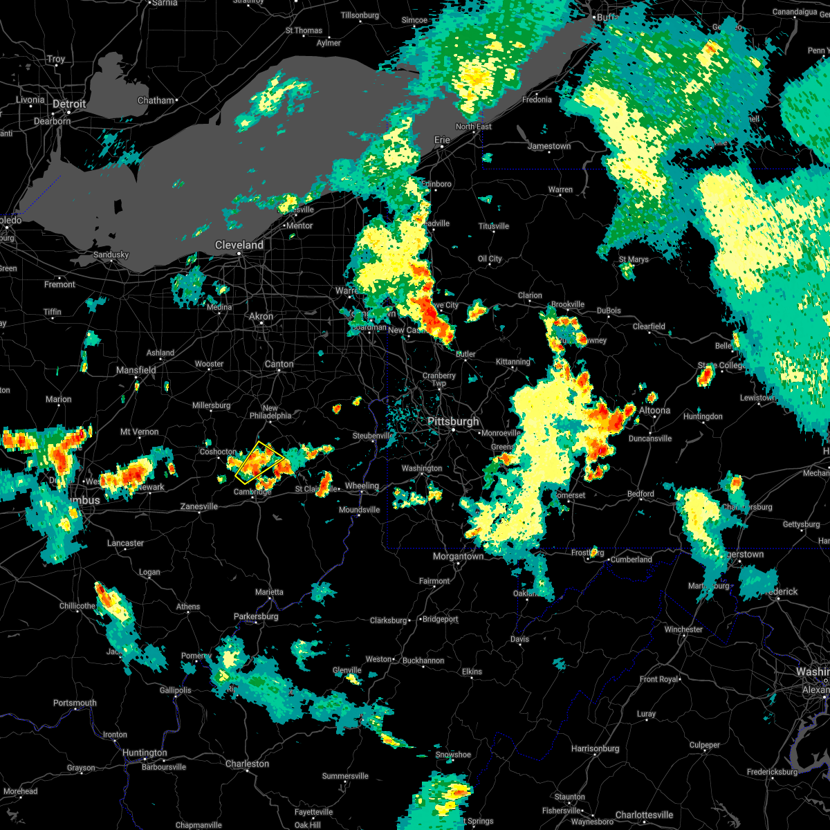 At 921 pm edt, a severe thunderstorm was located over newcomerstown, or 12 miles east of coshocton, moving northeast at 35 mph (radar). Hazards include wind gusts to 60 mph. Expect damage to trees and power lines, resulting in some power outages. Locations impacted include, newcomerstown, port washington, gilmore, kimbolton, this includes interstate 77 in ohio between mile markers 57 and 68. At 921 pm edt, a severe thunderstorm was located over newcomerstown, or 12 miles east of coshocton, moving northeast at 35 mph (radar). Hazards include wind gusts to 60 mph. Expect damage to trees and power lines, resulting in some power outages. Locations impacted include, newcomerstown, port washington, gilmore, kimbolton, this includes interstate 77 in ohio between mile markers 57 and 68.
|
| 7/7/2021 9:14 PM EDT |
 At 914 pm edt, a severe thunderstorm was located near newcomerstown, or 10 miles east of coshocton, moving northeast at 35 mph (radar). Hazards include wind gusts to 60 mph. Expect damage to trees and power lines, resulting in some power outages. Locations impacted include, newcomerstown, west lafayette, port washington, plainfield, gilmore, otsego, boden, bakersville, kimbolton, this includes interstate 77 in ohio between mile markers 56 and 71. At 914 pm edt, a severe thunderstorm was located near newcomerstown, or 10 miles east of coshocton, moving northeast at 35 mph (radar). Hazards include wind gusts to 60 mph. Expect damage to trees and power lines, resulting in some power outages. Locations impacted include, newcomerstown, west lafayette, port washington, plainfield, gilmore, otsego, boden, bakersville, kimbolton, this includes interstate 77 in ohio between mile markers 56 and 71.
|
| 7/7/2021 9:04 PM EDT |
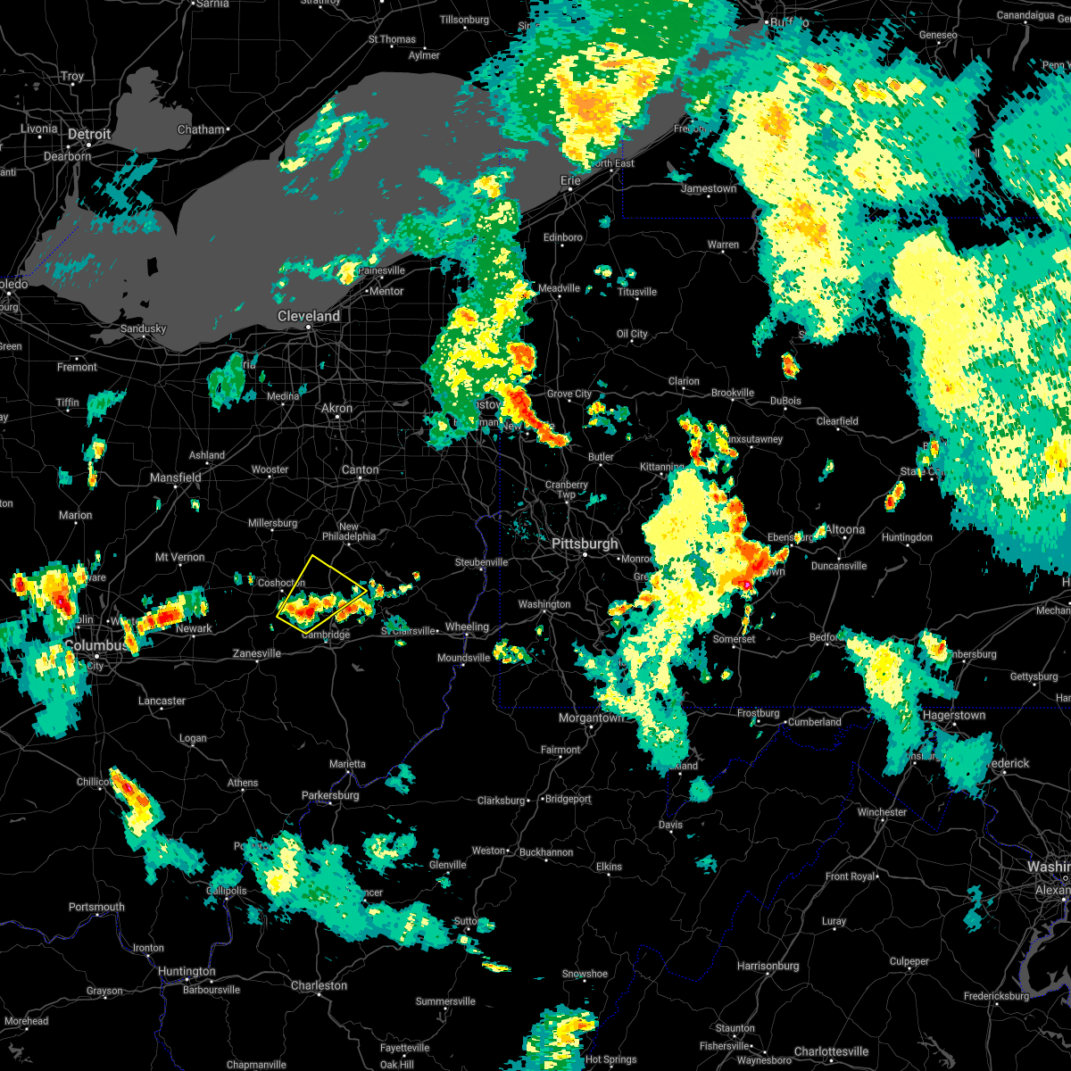 At 904 pm edt, a severe thunderstorm was located near west lafayette, or 8 miles southeast of coshocton, moving northeast at 35 mph (radar). Hazards include wind gusts to 60 mph and quarter-size hail. Minor hail damage to vehicles is possible. Expect wind damage to trees and power lines, resulting in some power outages. At 904 pm edt, a severe thunderstorm was located near west lafayette, or 8 miles southeast of coshocton, moving northeast at 35 mph (radar). Hazards include wind gusts to 60 mph and quarter-size hail. Minor hail damage to vehicles is possible. Expect wind damage to trees and power lines, resulting in some power outages.
|
| 7/7/2021 2:56 PM EDT |
 At 255 pm edt, a severe thunderstorm was located near new philadelphia, moving northeast at 20 mph (radar). Hazards include wind gusts to 60 mph. Expect damage to trees and power lines, resulting in some power outages. Locations impacted include, new philadelphia, dover, uhrichsville, newcomerstown, dennison, sugarcreek, gnadenhutten, tuscarawas, midvale, mineral city, port washington, barnhill, this includes interstate 77 in ohio between mile markers 66 and 86. At 255 pm edt, a severe thunderstorm was located near new philadelphia, moving northeast at 20 mph (radar). Hazards include wind gusts to 60 mph. Expect damage to trees and power lines, resulting in some power outages. Locations impacted include, new philadelphia, dover, uhrichsville, newcomerstown, dennison, sugarcreek, gnadenhutten, tuscarawas, midvale, mineral city, port washington, barnhill, this includes interstate 77 in ohio between mile markers 66 and 86.
|
| 7/7/2021 2:49 PM EDT |
 At 249 pm edt, a severe thunderstorm was located 7 miles southeast of sugarcreek, or 7 miles southwest of new philadelphia, moving northeast at 20 mph (radar). Hazards include wind gusts to 60 mph. expect damage to trees and power lines, resulting in some power outages At 249 pm edt, a severe thunderstorm was located 7 miles southeast of sugarcreek, or 7 miles southwest of new philadelphia, moving northeast at 20 mph (radar). Hazards include wind gusts to 60 mph. expect damage to trees and power lines, resulting in some power outages
|
| 6/30/2021 1:18 PM EDT |
 At 118 pm edt, a severe thunderstorm was located near newcomerstown, or 11 miles west of freeport, moving northeast at 45 mph (radar). Hazards include wind gusts to 60 mph. Expect damage to trees and power lines, resulting in some power outages. locations impacted include, coshocton, cambridge, newcomerstown, new concord, byesville, west lafayette, old washington, plainfield, otsego, birmingham, boden, bakersville, this includes the following highways, interstate 70 in ohio between mile markers 170 and 188. Interstate 77 in ohio between mile markers 44 and 68. At 118 pm edt, a severe thunderstorm was located near newcomerstown, or 11 miles west of freeport, moving northeast at 45 mph (radar). Hazards include wind gusts to 60 mph. Expect damage to trees and power lines, resulting in some power outages. locations impacted include, coshocton, cambridge, newcomerstown, new concord, byesville, west lafayette, old washington, plainfield, otsego, birmingham, boden, bakersville, this includes the following highways, interstate 70 in ohio between mile markers 170 and 188. Interstate 77 in ohio between mile markers 44 and 68.
|
| 6/30/2021 12:54 PM EDT |
 At 1253 pm edt, a severe thunderstorm was located 8 miles north of new concord, or 11 miles south of coshocton, moving northeast at 45 mph (radar). Hazards include wind gusts to 70 mph. Trees snapped and uprooted. Power outages can be expected. At 1253 pm edt, a severe thunderstorm was located 8 miles north of new concord, or 11 miles south of coshocton, moving northeast at 45 mph (radar). Hazards include wind gusts to 70 mph. Trees snapped and uprooted. Power outages can be expected.
|
| 6/30/2021 12:52 PM EDT |
 At 1252 pm edt, a severe thunderstorm was located near cambridge, moving east at 45 mph (radar). Hazards include wind gusts to 60 mph. Expect damage to trees and power lines, resulting in some power outages. locations impacted include, zanesville, coshocton, cambridge, newcomerstown, new concord, byesville, west lafayette, north zanesville, dresden, philo, pleasant grove, senecaville, this includes the following highways, interstate 70 in ohio between mile markers 155 and 188. Interstate 77 in ohio between mile markers 30 and 61. At 1252 pm edt, a severe thunderstorm was located near cambridge, moving east at 45 mph (radar). Hazards include wind gusts to 60 mph. Expect damage to trees and power lines, resulting in some power outages. locations impacted include, zanesville, coshocton, cambridge, newcomerstown, new concord, byesville, west lafayette, north zanesville, dresden, philo, pleasant grove, senecaville, this includes the following highways, interstate 70 in ohio between mile markers 155 and 188. Interstate 77 in ohio between mile markers 30 and 61.
|
| 6/30/2021 12:37 PM EDT |
 At 1237 pm edt, a severe thunderstorm was located near new concord, or 9 miles west of cambridge, moving east at 45 mph (radar). Hazards include wind gusts to 70 mph. Trees snapped and uprooted. Power outages can be expected. At 1237 pm edt, a severe thunderstorm was located near new concord, or 9 miles west of cambridge, moving east at 45 mph (radar). Hazards include wind gusts to 70 mph. Trees snapped and uprooted. Power outages can be expected.
|
| 6/13/2021 3:55 PM EDT |
 The severe thunderstorm warning for northwestern guernsey, southeastern coshocton, northeastern muskingum and south central tuscarawas counties will expire at 400 pm edt, the storm which prompted the warning has weakened below severe limits, and no longer poses an immediate threat to life or property. therefore, the warning will be allowed to expire. however small hail, gusty winds and heavy rain are still possible with this thunderstorm. a severe thunderstorm watch remains in effect until 700 pm edt for east central ohio. The severe thunderstorm warning for northwestern guernsey, southeastern coshocton, northeastern muskingum and south central tuscarawas counties will expire at 400 pm edt, the storm which prompted the warning has weakened below severe limits, and no longer poses an immediate threat to life or property. therefore, the warning will be allowed to expire. however small hail, gusty winds and heavy rain are still possible with this thunderstorm. a severe thunderstorm watch remains in effect until 700 pm edt for east central ohio.
|
| 6/13/2021 3:46 PM EDT |
 At 346 pm edt, a severe thunderstorm was located 7 miles north of cambridge, moving southeast at 35 mph (radar). Hazards include wind gusts to 60 mph and quarter-size hail. Minor hail damage to vehicles is possible. expect wind damage to trees and power lines, resulting in some power outages. locations impacted include, cambridge, newcomerstown, byesville, antrim, lore city, old washington, plainfield, otsego, boden, salt fork state park, kimbolton, this includes the following highways, interstate 70 in ohio between mile markers 173 and 192. Interstate 77 in ohio between mile markers 41 and 61. At 346 pm edt, a severe thunderstorm was located 7 miles north of cambridge, moving southeast at 35 mph (radar). Hazards include wind gusts to 60 mph and quarter-size hail. Minor hail damage to vehicles is possible. expect wind damage to trees and power lines, resulting in some power outages. locations impacted include, cambridge, newcomerstown, byesville, antrim, lore city, old washington, plainfield, otsego, boden, salt fork state park, kimbolton, this includes the following highways, interstate 70 in ohio between mile markers 173 and 192. Interstate 77 in ohio between mile markers 41 and 61.
|
| 6/13/2021 3:35 PM EDT |
 At 335 pm edt, a severe thunderstorm was located near west lafayette, or 9 miles southeast of coshocton, moving southeast at 35 mph (radar). Hazards include wind gusts to 60 mph and quarter-size hail. Minor hail damage to vehicles is possible. Expect wind damage to trees and power lines, resulting in some power outages. At 335 pm edt, a severe thunderstorm was located near west lafayette, or 9 miles southeast of coshocton, moving southeast at 35 mph (radar). Hazards include wind gusts to 60 mph and quarter-size hail. Minor hail damage to vehicles is possible. Expect wind damage to trees and power lines, resulting in some power outages.
|
| 11/15/2020 1:23 PM EST |
 At 122 pm est, severe thunderstorms were located along a line extending from mount eaton to 9 miles southeast of south zanesville, and are nearly stationary (radar). Hazards include wind gusts to 60 mph. Expect damage to trees and power lines, resulting in some power outages. locations impacted include, new philadelphia, dover, cambridge, uhrichsville, caldwell, freeport, newcomerstown, dennison, strasburg, new concord, byesville, west lafayette, this includes the following highways, interstate 70 in ohio between mile markers 166 and 196. Interstate 77 in ohio between mile markers 18 and 95. At 122 pm est, severe thunderstorms were located along a line extending from mount eaton to 9 miles southeast of south zanesville, and are nearly stationary (radar). Hazards include wind gusts to 60 mph. Expect damage to trees and power lines, resulting in some power outages. locations impacted include, new philadelphia, dover, cambridge, uhrichsville, caldwell, freeport, newcomerstown, dennison, strasburg, new concord, byesville, west lafayette, this includes the following highways, interstate 70 in ohio between mile markers 166 and 196. Interstate 77 in ohio between mile markers 18 and 95.
|
| 11/15/2020 1:07 PM EST |
 At 107 pm est, severe thunderstorms were located along a line extending from mount eaton to 9 miles southeast of south zanesville, moving east at 45 mph (radar). Hazards include wind gusts to 70 mph. Trees snapped and uprooted. Power outages can be expected. At 107 pm est, severe thunderstorms were located along a line extending from mount eaton to 9 miles southeast of south zanesville, moving east at 45 mph (radar). Hazards include wind gusts to 70 mph. Trees snapped and uprooted. Power outages can be expected.
|
| 8/28/2020 1:54 PM EDT |
 At 153 pm edt, a severe thunderstorm was located near frazeysburg, or 14 miles west of coshocton, moving northeast at 35 mph (radar). Hazards include wind gusts to 60 mph. expect damage to trees and power lines, resulting in some power outages At 153 pm edt, a severe thunderstorm was located near frazeysburg, or 14 miles west of coshocton, moving northeast at 35 mph (radar). Hazards include wind gusts to 60 mph. expect damage to trees and power lines, resulting in some power outages
|
| 8/26/2020 2:34 PM EDT |
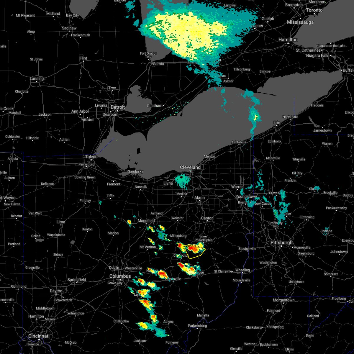 At 234 pm edt, a severe thunderstorm was located near farmerstown, or 12 miles southwest of dover, moving southeast at 15 mph (radar). Hazards include wind gusts to 60 mph. Expect damage to trees and power lines, resulting in some power outages. Locations impacted include, newcomerstown, baltic, port washington, stone creek, chili, bakersville, this includes interstate 77 in ohio between mile markers 66 and 75. At 234 pm edt, a severe thunderstorm was located near farmerstown, or 12 miles southwest of dover, moving southeast at 15 mph (radar). Hazards include wind gusts to 60 mph. Expect damage to trees and power lines, resulting in some power outages. Locations impacted include, newcomerstown, baltic, port washington, stone creek, chili, bakersville, this includes interstate 77 in ohio between mile markers 66 and 75.
|
| 8/26/2020 2:17 PM EDT |
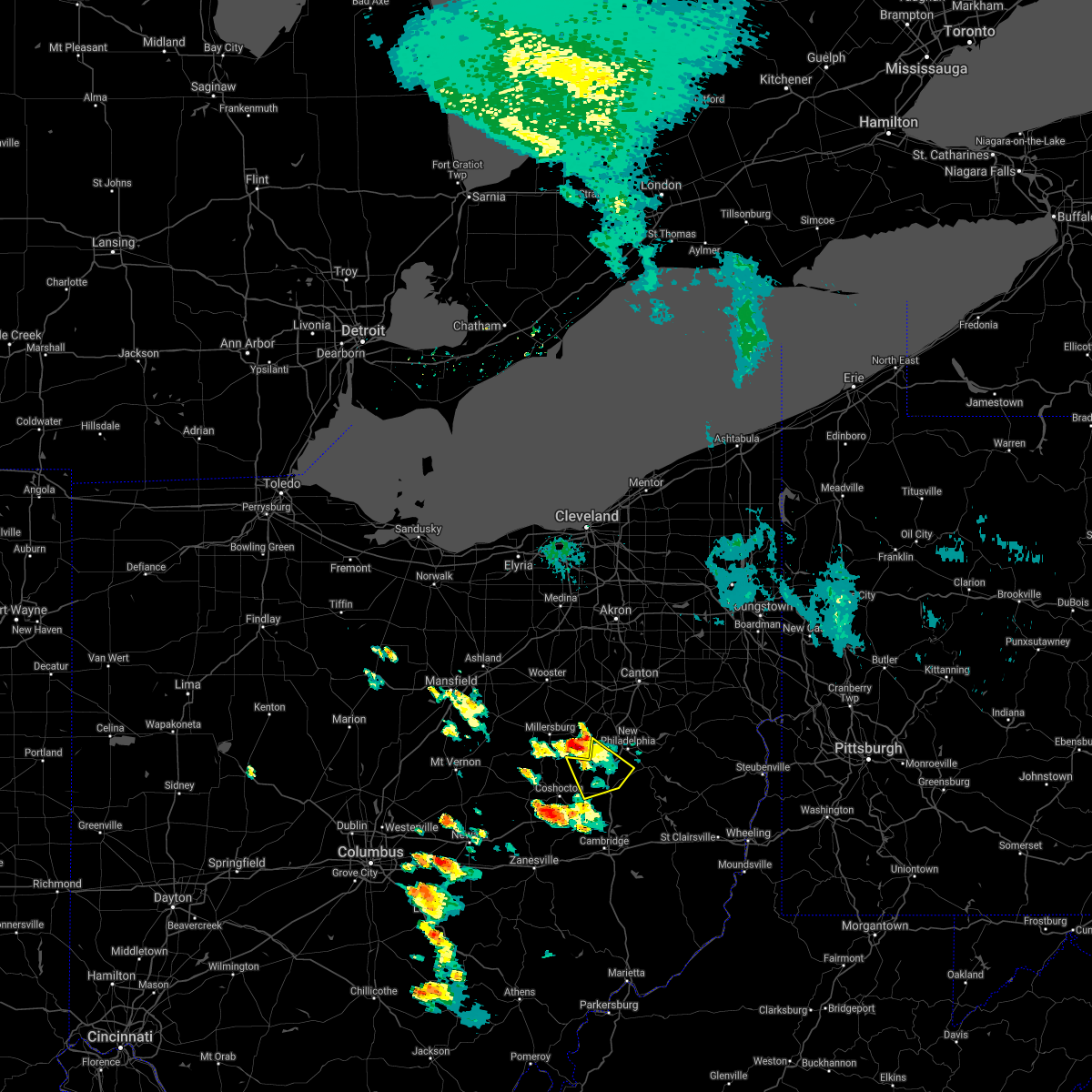 At 217 pm edt, a severe thunderstorm was located over farmerstown, or 10 miles southeast of millersburg, moving southeast at 15 mph (radar). Hazards include wind gusts to 60 mph and half dollar-size hail. Minor hail damage to vehicles is possible. Expect wind damage to trees and power lines, resulting in some power outages. At 217 pm edt, a severe thunderstorm was located over farmerstown, or 10 miles southeast of millersburg, moving southeast at 15 mph (radar). Hazards include wind gusts to 60 mph and half dollar-size hail. Minor hail damage to vehicles is possible. Expect wind damage to trees and power lines, resulting in some power outages.
|
| 8/25/2020 3:43 PM EDT |
 At 343 pm edt, a severe thunderstorm was located 7 miles south of west lafayette, or 10 miles southeast of coshocton, moving southeast at 25 mph (radar). Hazards include wind gusts to 60 mph and quarter-size hail. Minor hail damage to vehicles is possible. expect wind damage to trees and power lines, resulting in some power outages. locations impacted include, coshocton, cambridge, freeport, newcomerstown, byesville, west lafayette, dresden, antrim, warsaw, senecaville, conesville, holloway, this includes the following highways, interstate 70 in ohio between mile markers 174 and 196. Interstate 77 in ohio between mile markers 41 and 64. At 343 pm edt, a severe thunderstorm was located 7 miles south of west lafayette, or 10 miles southeast of coshocton, moving southeast at 25 mph (radar). Hazards include wind gusts to 60 mph and quarter-size hail. Minor hail damage to vehicles is possible. expect wind damage to trees and power lines, resulting in some power outages. locations impacted include, coshocton, cambridge, freeport, newcomerstown, byesville, west lafayette, dresden, antrim, warsaw, senecaville, conesville, holloway, this includes the following highways, interstate 70 in ohio between mile markers 174 and 196. Interstate 77 in ohio between mile markers 41 and 64.
|
| 8/25/2020 3:26 PM EDT |
 At 325 pm edt, a severe thunderstorm was located near coshocton, moving southeast at 25 mph (radar). Hazards include wind gusts to 60 mph and quarter-size hail. Minor hail damage to vehicles is possible. Expect wind damage to trees and power lines, resulting in some power outages. At 325 pm edt, a severe thunderstorm was located near coshocton, moving southeast at 25 mph (radar). Hazards include wind gusts to 60 mph and quarter-size hail. Minor hail damage to vehicles is possible. Expect wind damage to trees and power lines, resulting in some power outages.
|
| 8/25/2020 2:33 PM EDT |
 At 233 pm edt, a severe thunderstorm was located 7 miles southwest of uhrichsville, moving southeast at 25 mph (radar). Hazards include wind gusts to 60 mph and quarter-size hail. Minor hail damage to vehicles is possible. expect wind damage to trees and power lines, resulting in some power outages. Locations impacted include, new philadelphia, coshocton, uhrichsville, freeport, newcomerstown, dennison, west lafayette, sugarcreek, gnadenhutten, tuscarawas, baltic, midvale, this includes interstate 77 in ohio between mile markers 52 and 79. At 233 pm edt, a severe thunderstorm was located 7 miles southwest of uhrichsville, moving southeast at 25 mph (radar). Hazards include wind gusts to 60 mph and quarter-size hail. Minor hail damage to vehicles is possible. expect wind damage to trees and power lines, resulting in some power outages. Locations impacted include, new philadelphia, coshocton, uhrichsville, freeport, newcomerstown, dennison, west lafayette, sugarcreek, gnadenhutten, tuscarawas, baltic, midvale, this includes interstate 77 in ohio between mile markers 52 and 79.
|
| 8/25/2020 2:13 PM EDT |
 At 213 pm edt, a severe thunderstorm was located 7 miles northeast of newcomerstown, or 9 miles southwest of new philadelphia, moving southeast at 25 mph (radar). Hazards include wind gusts to 60 mph. Expect damage to trees and power lines, resulting in some power outages. Locations impacted include, new philadelphia, coshocton, uhrichsville, freeport, newcomerstown, dennison, west lafayette, sugarcreek, gnadenhutten, tuscarawas, baltic, midvale, this includes interstate 77 in ohio between mile markers 52 and 79. At 213 pm edt, a severe thunderstorm was located 7 miles northeast of newcomerstown, or 9 miles southwest of new philadelphia, moving southeast at 25 mph (radar). Hazards include wind gusts to 60 mph. Expect damage to trees and power lines, resulting in some power outages. Locations impacted include, new philadelphia, coshocton, uhrichsville, freeport, newcomerstown, dennison, west lafayette, sugarcreek, gnadenhutten, tuscarawas, baltic, midvale, this includes interstate 77 in ohio between mile markers 52 and 79.
|
| 8/25/2020 1:57 PM EDT |
 At 157 pm edt, a severe thunderstorm was located near farmerstown, or 11 miles southwest of dover, moving southeast at 25 mph (radar). Hazards include wind gusts to 60 mph. expect damage to trees and power lines, resulting in some power outages At 157 pm edt, a severe thunderstorm was located near farmerstown, or 11 miles southwest of dover, moving southeast at 25 mph (radar). Hazards include wind gusts to 60 mph. expect damage to trees and power lines, resulting in some power outages
|
| 7/7/2020 3:11 PM EDT |
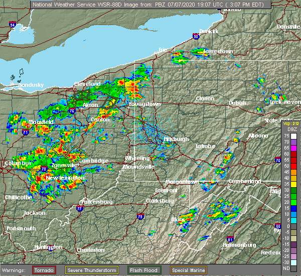 The severe thunderstorm warning for northwestern guernsey, southeastern coshocton, northeastern muskingum and southwestern tuscarawas counties will expire at 315 pm edt, the storm which prompted the warning has weakened below severe limits, and no longer poses an immediate threat to life or property. therefore, the warning will be allowed to expire. however, a new severe thunderstorm warning was issued for a storm near coshocton, in effect until 3:45 pm. The severe thunderstorm warning for northwestern guernsey, southeastern coshocton, northeastern muskingum and southwestern tuscarawas counties will expire at 315 pm edt, the storm which prompted the warning has weakened below severe limits, and no longer poses an immediate threat to life or property. therefore, the warning will be allowed to expire. however, a new severe thunderstorm warning was issued for a storm near coshocton, in effect until 3:45 pm.
|
| 7/7/2020 3:02 PM EDT |
 At 301 pm edt, a severe thunderstorm was located near newcomerstown, or 11 miles north of cambridge, moving east at 10 mph (radar). Hazards include wind gusts to 60 mph and quarter-size hail. Minor hail damage to vehicles is possible. expect wind damage to trees and power lines, resulting in some power outages. Locations impacted include, newcomerstown, west lafayette, plainfield, boden, bakersville, birmingham, kimbolton, this includes interstate 77 in ohio between mile markers 53 and 68. At 301 pm edt, a severe thunderstorm was located near newcomerstown, or 11 miles north of cambridge, moving east at 10 mph (radar). Hazards include wind gusts to 60 mph and quarter-size hail. Minor hail damage to vehicles is possible. expect wind damage to trees and power lines, resulting in some power outages. Locations impacted include, newcomerstown, west lafayette, plainfield, boden, bakersville, birmingham, kimbolton, this includes interstate 77 in ohio between mile markers 53 and 68.
|
| 7/7/2020 2:52 PM EDT |
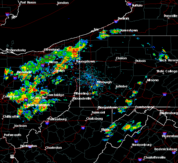 At 252 pm edt, a severe thunderstorm was located 7 miles southeast of west lafayette, or 11 miles northwest of cambridge, moving east at 10 mph (radar). Hazards include wind gusts to 60 mph and quarter-size hail. Minor hail damage to vehicles is possible. Expect wind damage to trees and power lines, resulting in some power outages. At 252 pm edt, a severe thunderstorm was located 7 miles southeast of west lafayette, or 11 miles northwest of cambridge, moving east at 10 mph (radar). Hazards include wind gusts to 60 mph and quarter-size hail. Minor hail damage to vehicles is possible. Expect wind damage to trees and power lines, resulting in some power outages.
|
| 6/27/2020 1:35 PM EDT |
 The severe thunderstorm warning for western harrison, north central guernsey, east central coshocton, southwestern carroll and southern tuscarawas counties will expire at 145 pm edt, the storm which prompted the warning has weakened below severe limits, and no longer poses an immediate threat to life or property. therefore, the warning will be allowed to expire. however heavy rain is still possible with this thunderstorm. The severe thunderstorm warning for western harrison, north central guernsey, east central coshocton, southwestern carroll and southern tuscarawas counties will expire at 145 pm edt, the storm which prompted the warning has weakened below severe limits, and no longer poses an immediate threat to life or property. therefore, the warning will be allowed to expire. however heavy rain is still possible with this thunderstorm.
|
| 6/27/2020 1:26 PM EDT |
 At 126 pm edt, a severe thunderstorm was located over dennison, or over uhrichsville, moving east at 40 mph (radar). Hazards include quarter-size hail. Minor damage to vehicles is possible. Locations impacted include, new philadelphia, uhrichsville, freeport, newcomerstown, dennison, gnadenhutten, tuscarawas, midvale, port washington, bowerston, barnhill, dellroy, this includes interstate 77 in ohio between mile markers 56 and 77. At 126 pm edt, a severe thunderstorm was located over dennison, or over uhrichsville, moving east at 40 mph (radar). Hazards include quarter-size hail. Minor damage to vehicles is possible. Locations impacted include, new philadelphia, uhrichsville, freeport, newcomerstown, dennison, gnadenhutten, tuscarawas, midvale, port washington, bowerston, barnhill, dellroy, this includes interstate 77 in ohio between mile markers 56 and 77.
|
| 6/27/2020 1:13 PM EDT |
 At 112 pm edt, a severe thunderstorm was located near newcomerstown, or 9 miles southwest of uhrichsville, moving east at 40 mph (radar). Hazards include wind gusts to 60 mph and quarter-size hail. Minor hail damage to vehicles is possible. Expect wind damage to trees and power lines, resulting in some power outages. At 112 pm edt, a severe thunderstorm was located near newcomerstown, or 9 miles southwest of uhrichsville, moving east at 40 mph (radar). Hazards include wind gusts to 60 mph and quarter-size hail. Minor hail damage to vehicles is possible. Expect wind damage to trees and power lines, resulting in some power outages.
|
| 6/10/2020 8:24 PM EDT |
 At 823 pm edt, severe thunderstorms were located along a line extending from near wilmot to near caldwell, moving northeast at 65 mph (radar). Hazards include wind gusts to 60 mph and quarter-size hail. Minor hail damage to vehicles is possible. Expect wind damage to trees and power lines, resulting in some power outages. At 823 pm edt, severe thunderstorms were located along a line extending from near wilmot to near caldwell, moving northeast at 65 mph (radar). Hazards include wind gusts to 60 mph and quarter-size hail. Minor hail damage to vehicles is possible. Expect wind damage to trees and power lines, resulting in some power outages.
|
| 6/10/2020 8:16 PM EDT |
 At 815 pm edt, severe thunderstorms were located along a line extending from near newcomerstown to near cambridge to near byesville to near caldwell, moving northeast at 50 mph (radar). Hazards include wind gusts to 60 mph and quarter-size hail. Minor hail damage to vehicles is possible. expect wind damage to trees and power lines, resulting in some power outages. locations impacted include, cambridge, caldwell, newcomerstown, new concord, byesville, west lafayette, sugarcreek, baltic, port washington, senecaville, pleasant city, cumberland, this includes the following highways, interstate 70 in ohio between mile markers 166 and 188. Interstate 77 in ohio between mile markers 25 and 77. At 815 pm edt, severe thunderstorms were located along a line extending from near newcomerstown to near cambridge to near byesville to near caldwell, moving northeast at 50 mph (radar). Hazards include wind gusts to 60 mph and quarter-size hail. Minor hail damage to vehicles is possible. expect wind damage to trees and power lines, resulting in some power outages. locations impacted include, cambridge, caldwell, newcomerstown, new concord, byesville, west lafayette, sugarcreek, baltic, port washington, senecaville, pleasant city, cumberland, this includes the following highways, interstate 70 in ohio between mile markers 166 and 188. Interstate 77 in ohio between mile markers 25 and 77.
|
| 6/10/2020 7:59 PM EDT |
 At 758 pm edt, severe thunderstorms were located along a line extending from near coshocton to new concord to 10 miles southeast of south zanesville to 6 miles northeast of mcconnelsville, moving northeast at 50 mph (radar). Hazards include wind gusts to 60 mph and quarter-size hail. Minor hail damage to vehicles is possible. Expect wind damage to trees and power lines, resulting in some power outages. At 758 pm edt, severe thunderstorms were located along a line extending from near coshocton to new concord to 10 miles southeast of south zanesville to 6 miles northeast of mcconnelsville, moving northeast at 50 mph (radar). Hazards include wind gusts to 60 mph and quarter-size hail. Minor hail damage to vehicles is possible. Expect wind damage to trees and power lines, resulting in some power outages.
|
| 6/4/2020 3:19 PM EDT |
 At 318 pm edt, a severe thunderstorm was located near cambridge, moving northeast at 35 mph (radar). Hazards include wind gusts to 60 mph. Expect damage to trees and power lines, resulting in some power outages. locations impacted include, zanesville, cambridge, newcomerstown, new concord, byesville, south zanesville, north zanesville, antrim, philo, pleasant grove, lore city, old washington, this includes the following highways, interstate 70 in ohio between mile markers 154 and 192. Interstate 77 in ohio between mile markers 41 and 65. At 318 pm edt, a severe thunderstorm was located near cambridge, moving northeast at 35 mph (radar). Hazards include wind gusts to 60 mph. Expect damage to trees and power lines, resulting in some power outages. locations impacted include, zanesville, cambridge, newcomerstown, new concord, byesville, south zanesville, north zanesville, antrim, philo, pleasant grove, lore city, old washington, this includes the following highways, interstate 70 in ohio between mile markers 154 and 192. Interstate 77 in ohio between mile markers 41 and 65.
|
| 6/4/2020 3:09 PM EDT |
 At 308 pm edt, a severe thunderstorm was located near new concord, or 8 miles west of cambridge, moving northeast at 35 mph (radar). Hazards include wind gusts to 60 mph and quarter-size hail. Minor hail damage to vehicles is possible. expect wind damage to trees and power lines, resulting in some power outages. locations impacted include, zanesville, cambridge, newcomerstown, new concord, byesville, south zanesville, north zanesville, antrim, philo, pleasant grove, lore city, old washington, this includes the following highways, interstate 70 in ohio between mile markers 152 and 192. Interstate 77 in ohio between mile markers 41 and 66. At 308 pm edt, a severe thunderstorm was located near new concord, or 8 miles west of cambridge, moving northeast at 35 mph (radar). Hazards include wind gusts to 60 mph and quarter-size hail. Minor hail damage to vehicles is possible. expect wind damage to trees and power lines, resulting in some power outages. locations impacted include, zanesville, cambridge, newcomerstown, new concord, byesville, south zanesville, north zanesville, antrim, philo, pleasant grove, lore city, old washington, this includes the following highways, interstate 70 in ohio between mile markers 152 and 192. Interstate 77 in ohio between mile markers 41 and 66.
|
| 6/4/2020 2:49 PM EDT |
 At 248 pm edt, a severe thunderstorm was located over north zanesville, or near zanesville, moving northeast at 45 mph (radar). Hazards include wind gusts to 60 mph and quarter-size hail. Minor hail damage to vehicles is possible. Expect wind damage to trees and power lines, resulting in some power outages. At 248 pm edt, a severe thunderstorm was located over north zanesville, or near zanesville, moving northeast at 45 mph (radar). Hazards include wind gusts to 60 mph and quarter-size hail. Minor hail damage to vehicles is possible. Expect wind damage to trees and power lines, resulting in some power outages.
|
| 5/10/2020 6:51 PM EDT |
 The severe thunderstorm warning for guernsey, eastern coshocton, northeastern muskingum and tuscarawas counties will expire at 700 pm edt, the storm which prompted the warning has weakened below severe limits, and has exited the warned area. therefore, the warning will be allowed to expire. The severe thunderstorm warning for guernsey, eastern coshocton, northeastern muskingum and tuscarawas counties will expire at 700 pm edt, the storm which prompted the warning has weakened below severe limits, and has exited the warned area. therefore, the warning will be allowed to expire.
|
| 5/10/2020 6:35 PM EDT |
 At 633 pm edt, a severe thunderstorm was located near new philadelphia, moving east at 45 mph (radar). Hazards include wind gusts to 60 mph and quarter-size hail. Minor hail damage to vehicles is possible. expect wind damage to trees and power lines, resulting in some power outages. locations impacted include, new philadelphia, dover, cambridge, uhrichsville, newcomerstown, dennison, strasburg, new concord, byesville, sugarcreek, gnadenhutten, antrim, this includes the following highways, interstate 70 in ohio between mile markers 170 and 194. Interstate 77 in ohio between mile markers 41 and 88. At 633 pm edt, a severe thunderstorm was located near new philadelphia, moving east at 45 mph (radar). Hazards include wind gusts to 60 mph and quarter-size hail. Minor hail damage to vehicles is possible. expect wind damage to trees and power lines, resulting in some power outages. locations impacted include, new philadelphia, dover, cambridge, uhrichsville, newcomerstown, dennison, strasburg, new concord, byesville, sugarcreek, gnadenhutten, antrim, this includes the following highways, interstate 70 in ohio between mile markers 170 and 194. Interstate 77 in ohio between mile markers 41 and 88.
|
| 5/10/2020 6:09 PM EDT |
 At 609 pm edt, a severe thunderstorm was located near west lafayette, or near coshocton, moving east at 45 mph (radar). Hazards include wind gusts to 60 mph and quarter-size hail. Minor hail damage to vehicles is possible. Expect wind damage to trees and power lines, resulting in some power outages. At 609 pm edt, a severe thunderstorm was located near west lafayette, or near coshocton, moving east at 45 mph (radar). Hazards include wind gusts to 60 mph and quarter-size hail. Minor hail damage to vehicles is possible. Expect wind damage to trees and power lines, resulting in some power outages.
|
| 4/8/2020 1:07 AM EDT |
 At 107 am edt, a severe thunderstorm was located near new philadelphia, moving southeast at 55 mph (radar). Hazards include wind gusts to 60 mph and quarter-size hail. Minor hail damage to vehicles is possible. Expect wind damage to trees and power lines, resulting in some power outages. At 107 am edt, a severe thunderstorm was located near new philadelphia, moving southeast at 55 mph (radar). Hazards include wind gusts to 60 mph and quarter-size hail. Minor hail damage to vehicles is possible. Expect wind damage to trees and power lines, resulting in some power outages.
|
| 3/28/2020 9:04 PM EDT |
 At 903 pm edt, a severe thunderstorm was located 9 miles southeast of gambier, or 13 miles southeast of mount vernon, moving east at 45 mph (radar). Hazards include quarter-size hail. minor damage to vehicles is possible At 903 pm edt, a severe thunderstorm was located 9 miles southeast of gambier, or 13 miles southeast of mount vernon, moving east at 45 mph (radar). Hazards include quarter-size hail. minor damage to vehicles is possible
|
| 8/20/2019 7:18 PM EDT |
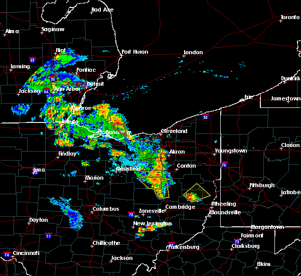 At 642 pm edt, a severe thunderstorm was located 7 miles south of killbuck, or 9 miles northwest of coshocton, moving northeast at 25 mph (radar). Hazards include wind gusts to 60 mph and quarter-size hail. Minor hail damage to vehicles is possible. Expect wind damage to trees and power lines, resulting in some power outages. At 642 pm edt, a severe thunderstorm was located 7 miles south of killbuck, or 9 miles northwest of coshocton, moving northeast at 25 mph (radar). Hazards include wind gusts to 60 mph and quarter-size hail. Minor hail damage to vehicles is possible. Expect wind damage to trees and power lines, resulting in some power outages.
|
| 8/20/2019 7:00 PM EDT |
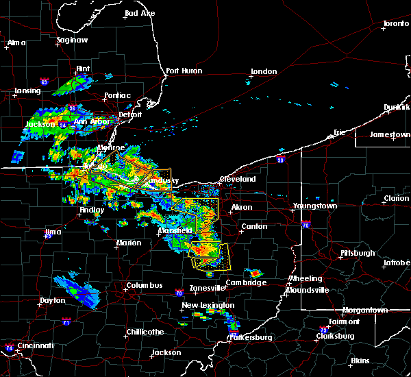 At 700 pm edt, a severe thunderstorm was located near berlin, or near millersburg, moving northeast at 25 mph (radar). Hazards include wind gusts to 60 mph and quarter-size hail. Minor hail damage to vehicles is possible. expect wind damage to trees and power lines, resulting in some power outages. Locations impacted include, newcomerstown, west lafayette, sugarcreek, baltic, port washington, stone creek, chili, bakersville, this includes interstate 77 in ohio between mile markers 65 and 75. At 700 pm edt, a severe thunderstorm was located near berlin, or near millersburg, moving northeast at 25 mph (radar). Hazards include wind gusts to 60 mph and quarter-size hail. Minor hail damage to vehicles is possible. expect wind damage to trees and power lines, resulting in some power outages. Locations impacted include, newcomerstown, west lafayette, sugarcreek, baltic, port washington, stone creek, chili, bakersville, this includes interstate 77 in ohio between mile markers 65 and 75.
|
| 8/20/2019 6:42 PM EDT |
 At 642 pm edt, a severe thunderstorm was located 7 miles south of killbuck, or 9 miles northwest of coshocton, moving northeast at 25 mph (radar). Hazards include wind gusts to 60 mph and quarter-size hail. Minor hail damage to vehicles is possible. Expect wind damage to trees and power lines, resulting in some power outages. At 642 pm edt, a severe thunderstorm was located 7 miles south of killbuck, or 9 miles northwest of coshocton, moving northeast at 25 mph (radar). Hazards include wind gusts to 60 mph and quarter-size hail. Minor hail damage to vehicles is possible. Expect wind damage to trees and power lines, resulting in some power outages.
|
| 8/19/2019 1:22 AM EDT |
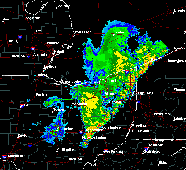 At 121 am edt, severe thunderstorms were located along a line extending from near farmerstown to near zanesville, moving east at 40 mph (radar). Hazards include wind gusts to 60 mph. Expect damage to trees and power lines, resulting in some power outages. locations impacted include, zanesville, coshocton, newcomerstown, new concord, west lafayette, south zanesville, north zanesville, dresden, philo, pleasant grove, conesville, fultonham, this includes the following highways, interstate 70 in ohio between mile markers 148 and 169. Interstate 77 in ohio between mile markers 61 and 62. At 121 am edt, severe thunderstorms were located along a line extending from near farmerstown to near zanesville, moving east at 40 mph (radar). Hazards include wind gusts to 60 mph. Expect damage to trees and power lines, resulting in some power outages. locations impacted include, zanesville, coshocton, newcomerstown, new concord, west lafayette, south zanesville, north zanesville, dresden, philo, pleasant grove, conesville, fultonham, this includes the following highways, interstate 70 in ohio between mile markers 148 and 169. Interstate 77 in ohio between mile markers 61 and 62.
|
| 8/19/2019 1:13 AM EDT |
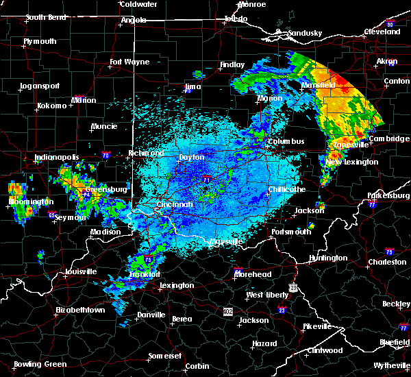 At 113 am edt, severe thunderstorms were located along a line extending from near farmerstown to south zanesville, moving east at 40 mph (radar). Hazards include wind gusts to 60 mph. Expect damage to trees and power lines, resulting in some power outages. locations impacted include, zanesville, coshocton, newcomerstown, new concord, west lafayette, south zanesville, north zanesville, dresden, philo, pleasant grove, conesville, gratiot, this includes the following highways, interstate 70 in ohio near mile marker 143, and between mile markers 145 and 169. Interstate 77 in ohio between mile markers 61 and 62. At 113 am edt, severe thunderstorms were located along a line extending from near farmerstown to south zanesville, moving east at 40 mph (radar). Hazards include wind gusts to 60 mph. Expect damage to trees and power lines, resulting in some power outages. locations impacted include, zanesville, coshocton, newcomerstown, new concord, west lafayette, south zanesville, north zanesville, dresden, philo, pleasant grove, conesville, gratiot, this includes the following highways, interstate 70 in ohio near mile marker 143, and between mile markers 145 and 169. Interstate 77 in ohio between mile markers 61 and 62.
|
| 8/19/2019 12:54 AM EDT |
 At 1254 am edt, severe thunderstorms were located along a line extending from near coshocton to near perry state forest, moving northeast at 40 mph (radar). Hazards include wind gusts to 60 mph. expect damage to trees and power lines, resulting in some power outages At 1254 am edt, severe thunderstorms were located along a line extending from near coshocton to near perry state forest, moving northeast at 40 mph (radar). Hazards include wind gusts to 60 mph. expect damage to trees and power lines, resulting in some power outages
|
| 8/6/2019 8:51 PM EDT | Wind damage to shed and deck... along with missing shingles from roof. several downed tree in tuscarawas county OH, 6.2 miles WNW of Newcomerstown, OH |
| 7/15/2019 8:52 PM EDT |
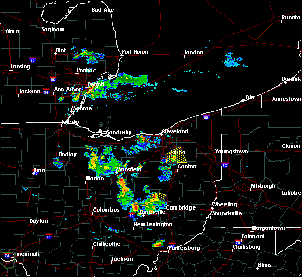 At 852 pm edt, a severe thunderstorm was located over west lafayette, or near coshocton, moving east at 25 mph (radar). Hazards include wind gusts to 60 mph. Damage to trees and power lines. Locations impacted include, coshocton, west lafayette,. At 852 pm edt, a severe thunderstorm was located over west lafayette, or near coshocton, moving east at 25 mph (radar). Hazards include wind gusts to 60 mph. Damage to trees and power lines. Locations impacted include, coshocton, west lafayette,.
|
| 7/15/2019 8:34 PM EDT |
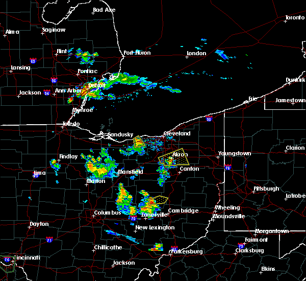 At 834 pm edt, a severe thunderstorm was located over coshocton, moving east at 25 mph (radar). Hazards include wind gusts to 60 mph and quarter-size hail. Hail damage to vehicles. damage to trees and power lines. Locations impacted include, coshocton, newcomerstown, west lafayette,. At 834 pm edt, a severe thunderstorm was located over coshocton, moving east at 25 mph (radar). Hazards include wind gusts to 60 mph and quarter-size hail. Hail damage to vehicles. damage to trees and power lines. Locations impacted include, coshocton, newcomerstown, west lafayette,.
|
| 7/15/2019 8:23 PM EDT |
 At 823 pm edt, a severe thunderstorm was located near coshocton, moving east at 25 mph (radar). Hazards include wind gusts to 60 mph and quarter-size hail. Hail damage to vehicles. Damage to trees and power lines. At 823 pm edt, a severe thunderstorm was located near coshocton, moving east at 25 mph (radar). Hazards include wind gusts to 60 mph and quarter-size hail. Hail damage to vehicles. Damage to trees and power lines.
|
| 7/2/2019 7:23 PM EDT |
 At 722 pm edt, severe thunderstorms were located along a line extending from newcomerstown to near hanover to pleasantville, moving southeast at 25 mph (radar). Hazards include wind gusts to 60 mph. expect damage to trees and power lines, resulting in some power outages At 722 pm edt, severe thunderstorms were located along a line extending from newcomerstown to near hanover to pleasantville, moving southeast at 25 mph (radar). Hazards include wind gusts to 60 mph. expect damage to trees and power lines, resulting in some power outages
|
| 7/2/2019 6:28 PM EDT |
 At 628 pm edt, severe thunderstorms were located along a line extending from near minerva to near waynesburg to near dover, moving southeast at 20 mph (radar). Hazards include wind gusts to 60 mph and quarter-size hail. Minor hail damage to vehicles is possible. expect wind damage to trees and power lines, resulting in some power outages. Locations impacted include, new philadelphia, dover, uhrichsville, carrollton, minerva, lisbon, dennison, strasburg, sugarcreek, augusta, salineville, gnadenhutten,. At 628 pm edt, severe thunderstorms were located along a line extending from near minerva to near waynesburg to near dover, moving southeast at 20 mph (radar). Hazards include wind gusts to 60 mph and quarter-size hail. Minor hail damage to vehicles is possible. expect wind damage to trees and power lines, resulting in some power outages. Locations impacted include, new philadelphia, dover, uhrichsville, carrollton, minerva, lisbon, dennison, strasburg, sugarcreek, augusta, salineville, gnadenhutten,.
|
| 7/2/2019 6:20 PM EDT |
 At 619 pm edt, a cluster of severe thunderstorms was located along a line extending from near minerva to waynesburg to near dover, moving southeast at 20 mph (radar). Hazards include wind gusts to 60 mph and quarter-size hail. Minor hail damage to vehicles is possible. Expect wind damage to trees and power lines, resulting in some power outages. At 619 pm edt, a cluster of severe thunderstorms was located along a line extending from near minerva to waynesburg to near dover, moving southeast at 20 mph (radar). Hazards include wind gusts to 60 mph and quarter-size hail. Minor hail damage to vehicles is possible. Expect wind damage to trees and power lines, resulting in some power outages.
|
| 6/24/2019 5:27 PM EDT |
 At 526 pm edt, severe thunderstorms were located along a line extending from near newcomerstown to 8 miles west of freeport to 8 miles west of barnesville, moving northeast at 45 mph (radar). Hazards include wind gusts to 60 mph. Expect damage to trees and power lines, resulting in some power outages. Locations impacted include, new philadelphia, dover, uhrichsville, newcomerstown, dennison, gnadenhutten, antrim, tuscarawas, baltic, midvale, mineral city, port washington,. At 526 pm edt, severe thunderstorms were located along a line extending from near newcomerstown to 8 miles west of freeport to 8 miles west of barnesville, moving northeast at 45 mph (radar). Hazards include wind gusts to 60 mph. Expect damage to trees and power lines, resulting in some power outages. Locations impacted include, new philadelphia, dover, uhrichsville, newcomerstown, dennison, gnadenhutten, antrim, tuscarawas, baltic, midvale, mineral city, port washington,.
|
| 6/24/2019 5:17 PM EDT | Numerous trees down in tuscarawas county OH, 0.9 miles NE of Newcomerstown, OH |
| 6/24/2019 5:05 PM EDT |
 At 502 pm edt, severe thunderstorms were located along a line extending from near coshocton to 7 miles northwest of cambridge to near byesville, moving northeast at 45 mph (radar). Hazards include wind gusts to 60 mph. expect damage to trees and power lines, resulting in some power outages At 502 pm edt, severe thunderstorms were located along a line extending from near coshocton to 7 miles northwest of cambridge to near byesville, moving northeast at 45 mph (radar). Hazards include wind gusts to 60 mph. expect damage to trees and power lines, resulting in some power outages
|
| 6/5/2019 7:15 PM EDT |
 At 715 pm edt, a severe thunderstorm was located 7 miles southwest of uhrichsville, moving southeast at 30 mph (radar). Hazards include wind gusts to 60 mph. Expect damage to trees and power lines, resulting in some power outages. Locations impacted include, newcomerstown, gnadenhutten, port washington, gilmore, this includes interstate 77 in ohio between mile markers 62 and 71. At 715 pm edt, a severe thunderstorm was located 7 miles southwest of uhrichsville, moving southeast at 30 mph (radar). Hazards include wind gusts to 60 mph. Expect damage to trees and power lines, resulting in some power outages. Locations impacted include, newcomerstown, gnadenhutten, port washington, gilmore, this includes interstate 77 in ohio between mile markers 62 and 71.
|
| 6/5/2019 7:02 PM EDT |
 At 702 pm edt, a severe thunderstorm was located 7 miles north of newcomerstown, or 11 miles southwest of new philadelphia, moving southeast at 25 mph (radar). Hazards include wind gusts to 60 mph. expect damage to trees and power lines, resulting in some power outages At 702 pm edt, a severe thunderstorm was located 7 miles north of newcomerstown, or 11 miles southwest of new philadelphia, moving southeast at 25 mph (radar). Hazards include wind gusts to 60 mph. expect damage to trees and power lines, resulting in some power outages
|
| 5/25/2019 4:52 PM EDT |
 At 451 pm edt, a severe thunderstorm was located near uhrichsville, moving east at 35 mph. tornado warning is in effect for this storm (radar). Hazards include wind gusts to 60 mph and quarter-size hail. Minor hail damage to vehicles is possible. expect wind damage to trees and power lines, resulting in some power outages. locations impacted include, new philadelphia, uhrichsville, newcomerstown, dennison, gnadenhutten, tuscarawas, scio, midvale, port washington, bowerston, barnhill, sherrodsville, this includes interstate 77 in ohio between mile markers 66 and 77. tornadoes can develop unexpectedly from severe thunderstorms. if a tornado is reported, move to a basement or small, central room in a sturdy structure. please report severe weather by calling 412-262-1988, posting to the nws pittsburgh facebook page, or using twitter @nwspittsburgh. At 451 pm edt, a severe thunderstorm was located near uhrichsville, moving east at 35 mph. tornado warning is in effect for this storm (radar). Hazards include wind gusts to 60 mph and quarter-size hail. Minor hail damage to vehicles is possible. expect wind damage to trees and power lines, resulting in some power outages. locations impacted include, new philadelphia, uhrichsville, newcomerstown, dennison, gnadenhutten, tuscarawas, scio, midvale, port washington, bowerston, barnhill, sherrodsville, this includes interstate 77 in ohio between mile markers 66 and 77. tornadoes can develop unexpectedly from severe thunderstorms. if a tornado is reported, move to a basement or small, central room in a sturdy structure. please report severe weather by calling 412-262-1988, posting to the nws pittsburgh facebook page, or using twitter @nwspittsburgh.
|
| 5/25/2019 4:46 PM EDT |
 At 446 pm edt, a severe thunderstorm capable of producing a tornado was located near newcomerstown, or 11 miles west of uhrichsville, moving east at 35 mph (radar indicated rotation). Hazards include tornado and quarter size hail. Flying debris will be dangerous to those caught without shelter. mobile homes will be damaged or destroyed. damage to roofs, windows, and vehicles will occur. tree damage is likely. this dangerous storm will be near, uhrichsville around 505 pm edt. dennison around 510 pm edt. other locations impacted by this tornadic thunderstorm include tuscarawas, deersville, stone creek, scio, gilmore, tippecanoe, bowerston, gnadenhutten, clendening lake and port washington. this includes interstate 77 in ohio between mile markers 63 and 73. Please report severe weather by calling 412-262-1988, posting to the nws pittsburgh facebook page, or using twitter @nwspittsburgh. At 446 pm edt, a severe thunderstorm capable of producing a tornado was located near newcomerstown, or 11 miles west of uhrichsville, moving east at 35 mph (radar indicated rotation). Hazards include tornado and quarter size hail. Flying debris will be dangerous to those caught without shelter. mobile homes will be damaged or destroyed. damage to roofs, windows, and vehicles will occur. tree damage is likely. this dangerous storm will be near, uhrichsville around 505 pm edt. dennison around 510 pm edt. other locations impacted by this tornadic thunderstorm include tuscarawas, deersville, stone creek, scio, gilmore, tippecanoe, bowerston, gnadenhutten, clendening lake and port washington. this includes interstate 77 in ohio between mile markers 63 and 73. Please report severe weather by calling 412-262-1988, posting to the nws pittsburgh facebook page, or using twitter @nwspittsburgh.
|
| 5/25/2019 4:31 PM EDT |
 At 431 pm edt, a severe thunderstorm was located near newcomerstown, or 12 miles southwest of new philadelphia, moving east at 35 mph (radar). Hazards include wind gusts to 60 mph and quarter-size hail. Minor hail damage to vehicles is possible. Expect wind damage to trees and power lines, resulting in some power outages. At 431 pm edt, a severe thunderstorm was located near newcomerstown, or 12 miles southwest of new philadelphia, moving east at 35 mph (radar). Hazards include wind gusts to 60 mph and quarter-size hail. Minor hail damage to vehicles is possible. Expect wind damage to trees and power lines, resulting in some power outages.
|
| 4/14/2019 6:02 PM EDT |
 At 602 pm edt, a severe thunderstorm was located near newcomerstown, or 10 miles southwest of uhrichsville, moving northeast at 50 mph (radar). Hazards include wind gusts to 60 mph and half dollar-size hail. Minor hail damage to vehicles is possible. expect wind damage to trees and power lines, resulting in some power outages. locations impacted include, cambridge, newcomerstown, new concord, antrim, port washington, gilmore, boden, birmingham, salt fork state park, kimbolton, this includes the following highways, interstate 70 in ohio between mile markers 170 and 178. interstate 77 in ohio between mile markers 46 and 69. A tornado watch remains in effect until 900 pm edt for east central ohio. At 602 pm edt, a severe thunderstorm was located near newcomerstown, or 10 miles southwest of uhrichsville, moving northeast at 50 mph (radar). Hazards include wind gusts to 60 mph and half dollar-size hail. Minor hail damage to vehicles is possible. expect wind damage to trees and power lines, resulting in some power outages. locations impacted include, cambridge, newcomerstown, new concord, antrim, port washington, gilmore, boden, birmingham, salt fork state park, kimbolton, this includes the following highways, interstate 70 in ohio between mile markers 170 and 178. interstate 77 in ohio between mile markers 46 and 69. A tornado watch remains in effect until 900 pm edt for east central ohio.
|
| 4/14/2019 5:58 PM EDT |
 At 558 pm edt, severe thunderstorms were located along a line extending from near newcomerstown to 11 miles southwest of uhrichsville to 10 miles north of cambridge, moving northeast at 55 mph (radar). Hazards include wind gusts to 60 mph and quarter-size hail. Minor hail damage to vehicles is possible. Expect wind damage to trees and power lines, resulting in some power outages. At 558 pm edt, severe thunderstorms were located along a line extending from near newcomerstown to 11 miles southwest of uhrichsville to 10 miles north of cambridge, moving northeast at 55 mph (radar). Hazards include wind gusts to 60 mph and quarter-size hail. Minor hail damage to vehicles is possible. Expect wind damage to trees and power lines, resulting in some power outages.
|
| 4/14/2019 5:53 PM EDT |
 At 553 pm edt, a severe thunderstorm was located near newcomerstown, or 13 miles east of coshocton, moving northeast at 50 mph (radar). Hazards include wind gusts to 60 mph and half dollar-size hail. Minor hail damage to vehicles is possible. expect wind damage to trees and power lines, resulting in some power outages. locations impacted include, cambridge, newcomerstown, new concord, antrim, port washington, plainfield, gilmore, otsego, boden, birmingham, salt fork state park, kimbolton, this includes the following highways, interstate 70 in ohio between mile markers 170 and 178. interstate 77 in ohio between mile markers 46 and 70. A tornado watch remains in effect until 900 pm edt for east central ohio. At 553 pm edt, a severe thunderstorm was located near newcomerstown, or 13 miles east of coshocton, moving northeast at 50 mph (radar). Hazards include wind gusts to 60 mph and half dollar-size hail. Minor hail damage to vehicles is possible. expect wind damage to trees and power lines, resulting in some power outages. locations impacted include, cambridge, newcomerstown, new concord, antrim, port washington, plainfield, gilmore, otsego, boden, birmingham, salt fork state park, kimbolton, this includes the following highways, interstate 70 in ohio between mile markers 170 and 178. interstate 77 in ohio between mile markers 46 and 70. A tornado watch remains in effect until 900 pm edt for east central ohio.
|
| 4/14/2019 5:45 PM EDT |
 At 545 pm edt, a severe thunderstorm was located near newcomerstown, or 11 miles east of coshocton, moving northeast at 35 mph (radar). Hazards include wind gusts to 60 mph and half dollar-size hail. Minor hail damage to vehicles is possible. expect wind damage to trees and power lines, resulting in some power outages. locations impacted include, new philadelphia, dover, uhrichsville, newcomerstown, strasburg, west lafayette, sugarcreek, gnadenhutten, tuscarawas, baltic, midvale, port washington, this includes interstate 77 in ohio between mile markers 61 and 89. A tornado watch remains in effect until 900 pm edt for east central ohio. At 545 pm edt, a severe thunderstorm was located near newcomerstown, or 11 miles east of coshocton, moving northeast at 35 mph (radar). Hazards include wind gusts to 60 mph and half dollar-size hail. Minor hail damage to vehicles is possible. expect wind damage to trees and power lines, resulting in some power outages. locations impacted include, new philadelphia, dover, uhrichsville, newcomerstown, strasburg, west lafayette, sugarcreek, gnadenhutten, tuscarawas, baltic, midvale, port washington, this includes interstate 77 in ohio between mile markers 61 and 89. A tornado watch remains in effect until 900 pm edt for east central ohio.
|
| 4/14/2019 5:38 PM EDT |
 At 538 pm edt, a severe thunderstorm was located 9 miles northwest of new concord, or 11 miles south of coshocton, moving northeast at 50 mph (radar). Hazards include wind gusts to 60 mph and half dollar-size hail. Minor hail damage to vehicles is possible. expect wind damage to trees and power lines, resulting in some power outages. locations impacted include, cambridge, newcomerstown, new concord, antrim, port washington, plainfield, norwich, gilmore, otsego, birmingham, boden, salt fork state park, this includes the following highways, interstate 70 in ohio between mile markers 163 and 178. interstate 77 in ohio between mile markers 46 and 70. A tornado watch remains in effect until 900 pm edt for east central ohio. At 538 pm edt, a severe thunderstorm was located 9 miles northwest of new concord, or 11 miles south of coshocton, moving northeast at 50 mph (radar). Hazards include wind gusts to 60 mph and half dollar-size hail. Minor hail damage to vehicles is possible. expect wind damage to trees and power lines, resulting in some power outages. locations impacted include, cambridge, newcomerstown, new concord, antrim, port washington, plainfield, norwich, gilmore, otsego, birmingham, boden, salt fork state park, this includes the following highways, interstate 70 in ohio between mile markers 163 and 178. interstate 77 in ohio between mile markers 46 and 70. A tornado watch remains in effect until 900 pm edt for east central ohio.
|
| 4/14/2019 5:31 PM EDT |
 At 531 pm edt, a severe thunderstorm was located over west lafayette, or near coshocton, moving east at 35 mph (radar). Hazards include wind gusts to 60 mph and quarter-size hail. Minor hail damage to vehicles is possible. expect wind damage to trees and power lines, resulting in some power outages. locations impacted include, new philadelphia, dover, coshocton, uhrichsville, newcomerstown, strasburg, west lafayette, sugarcreek, gnadenhutten, tuscarawas, baltic, midvale, this includes interstate 77 in ohio between mile markers 61 and 89. A tornado watch remains in effect until 900 pm edt for east central ohio. At 531 pm edt, a severe thunderstorm was located over west lafayette, or near coshocton, moving east at 35 mph (radar). Hazards include wind gusts to 60 mph and quarter-size hail. Minor hail damage to vehicles is possible. expect wind damage to trees and power lines, resulting in some power outages. locations impacted include, new philadelphia, dover, coshocton, uhrichsville, newcomerstown, strasburg, west lafayette, sugarcreek, gnadenhutten, tuscarawas, baltic, midvale, this includes interstate 77 in ohio between mile markers 61 and 89. A tornado watch remains in effect until 900 pm edt for east central ohio.
|
| 4/14/2019 5:23 PM EDT |
 At 523 pm edt, a severe thunderstorm was located over north zanesville, or near zanesville, moving northeast at 50 mph (radar). Hazards include wind gusts to 60 mph and quarter-size hail. Minor hail damage to vehicles is possible. Expect wind damage to trees and power lines, resulting in some power outages. At 523 pm edt, a severe thunderstorm was located over north zanesville, or near zanesville, moving northeast at 50 mph (radar). Hazards include wind gusts to 60 mph and quarter-size hail. Minor hail damage to vehicles is possible. Expect wind damage to trees and power lines, resulting in some power outages.
|
| 4/14/2019 5:20 PM EDT |
 At 520 pm edt, a severe thunderstorm was located near coshocton, moving northeast at 35 mph (radar). Hazards include wind gusts to 60 mph and quarter-size hail. Minor hail damage to vehicles is possible. Expect wind damage to trees and power lines, resulting in some power outages. At 520 pm edt, a severe thunderstorm was located near coshocton, moving northeast at 35 mph (radar). Hazards include wind gusts to 60 mph and quarter-size hail. Minor hail damage to vehicles is possible. Expect wind damage to trees and power lines, resulting in some power outages.
|
| 3/14/2019 9:15 PM EDT |
 At 914 pm edt, a severe thunderstorm was located near new philadelphia, moving east at 50 mph (radar). Hazards include wind gusts to 60 mph and quarter-size hail. Minor hail damage to vehicles is possible. expect wind damage to trees and power lines, resulting in some power outages. Locations impacted include, new philadelphia, uhrichsville, newcomerstown, dennison, gnadenhutten, tuscarawas, midvale, port washington, barnhill, roswell, stone creek, gilmore, this includes interstate 77 in ohio between mile markers 62 and 79. At 914 pm edt, a severe thunderstorm was located near new philadelphia, moving east at 50 mph (radar). Hazards include wind gusts to 60 mph and quarter-size hail. Minor hail damage to vehicles is possible. expect wind damage to trees and power lines, resulting in some power outages. Locations impacted include, new philadelphia, uhrichsville, newcomerstown, dennison, gnadenhutten, tuscarawas, midvale, port washington, barnhill, roswell, stone creek, gilmore, this includes interstate 77 in ohio between mile markers 62 and 79.
|
| 3/14/2019 9:02 PM EDT |
 At 901 pm edt, a severe thunderstorm was located near newcomerstown, or 11 miles east of coshocton, moving east at 50 mph (radar). Hazards include wind gusts to 60 mph and quarter-size hail. Minor hail damage to vehicles is possible. Expect wind damage to trees and power lines, resulting in some power outages. At 901 pm edt, a severe thunderstorm was located near newcomerstown, or 11 miles east of coshocton, moving east at 50 mph (radar). Hazards include wind gusts to 60 mph and quarter-size hail. Minor hail damage to vehicles is possible. Expect wind damage to trees and power lines, resulting in some power outages.
|
| 3/14/2019 8:45 PM EDT |
 At 844 pm edt, a severe thunderstorm was located near coshocton, moving northeast at 60 mph (radar). Hazards include wind gusts to 60 mph and half dollar-size hail. Minor hail damage to vehicles is possible. expect wind damage to trees and power lines, resulting in some power outages. Locations impacted include, coshocton, west lafayette, warsaw, conesville, plainfield, otsego, chili, bakersville, cooperdale,. At 844 pm edt, a severe thunderstorm was located near coshocton, moving northeast at 60 mph (radar). Hazards include wind gusts to 60 mph and half dollar-size hail. Minor hail damage to vehicles is possible. expect wind damage to trees and power lines, resulting in some power outages. Locations impacted include, coshocton, west lafayette, warsaw, conesville, plainfield, otsego, chili, bakersville, cooperdale,.
|
| 3/14/2019 8:39 PM EDT |
 At 839 pm edt, a severe thunderstorm was located near dresden, or 9 miles southwest of coshocton, moving northeast at 60 mph (radar). Hazards include wind gusts to 60 mph and half dollar-size hail. Minor hail damage to vehicles is possible. expect wind damage to trees and power lines, resulting in some power outages. Locations impacted include, zanesville, coshocton, west lafayette, dresden, frazeysburg, warsaw, conesville, gratiot, plainfield, otsego, drake, chili, this includes interstate 70 in ohio near mile marker 143, and between mile markers 145 and 146. At 839 pm edt, a severe thunderstorm was located near dresden, or 9 miles southwest of coshocton, moving northeast at 60 mph (radar). Hazards include wind gusts to 60 mph and half dollar-size hail. Minor hail damage to vehicles is possible. expect wind damage to trees and power lines, resulting in some power outages. Locations impacted include, zanesville, coshocton, west lafayette, dresden, frazeysburg, warsaw, conesville, gratiot, plainfield, otsego, drake, chili, this includes interstate 70 in ohio near mile marker 143, and between mile markers 145 and 146.
|
| 3/14/2019 8:31 PM EDT |
 At 831 pm edt, a severe thunderstorm was located near frazeysburg, or 15 miles southwest of coshocton, moving northeast at 60 mph (radar). Hazards include wind gusts to 60 mph and half dollar-size hail. Minor hail damage to vehicles is possible. expect wind damage to trees and power lines, resulting in some power outages. Locations impacted include, zanesville, coshocton, west lafayette, dresden, frazeysburg, warsaw, conesville, gratiot, plainfield, otsego, drake, chili, this includes interstate 70 in ohio near mile marker 143, and between mile markers 145 and 146. At 831 pm edt, a severe thunderstorm was located near frazeysburg, or 15 miles southwest of coshocton, moving northeast at 60 mph (radar). Hazards include wind gusts to 60 mph and half dollar-size hail. Minor hail damage to vehicles is possible. expect wind damage to trees and power lines, resulting in some power outages. Locations impacted include, zanesville, coshocton, west lafayette, dresden, frazeysburg, warsaw, conesville, gratiot, plainfield, otsego, drake, chili, this includes interstate 70 in ohio near mile marker 143, and between mile markers 145 and 146.
|
| 3/14/2019 8:20 PM EDT |
 At 820 pm edt, a severe thunderstorm was located over marne, or near newark, moving northeast at 60 mph (radar). Hazards include wind gusts to 60 mph and quarter-size hail. Minor hail damage to vehicles is possible. Expect wind damage to trees and power lines, resulting in some power outages. At 820 pm edt, a severe thunderstorm was located over marne, or near newark, moving northeast at 60 mph (radar). Hazards include wind gusts to 60 mph and quarter-size hail. Minor hail damage to vehicles is possible. Expect wind damage to trees and power lines, resulting in some power outages.
|
| 10/2/2018 6:29 PM EDT |
 At 629 pm edt, a severe thunderstorm was located 7 miles north of newcomerstown, or 9 miles southwest of new philadelphia, moving east at 35 mph (radar). Hazards include wind gusts to 60 mph. expect damage to trees and power lines, resulting in some power outages At 629 pm edt, a severe thunderstorm was located 7 miles north of newcomerstown, or 9 miles southwest of new philadelphia, moving east at 35 mph (radar). Hazards include wind gusts to 60 mph. expect damage to trees and power lines, resulting in some power outages
|
| 10/2/2018 6:08 PM EDT |
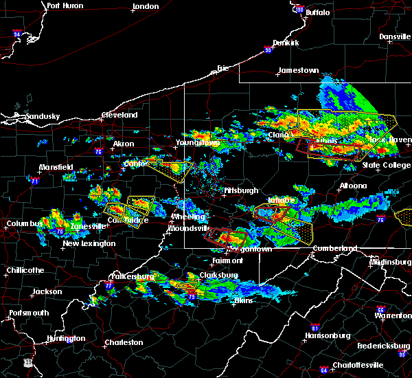 At 608 pm edt, a severe thunderstorm was located 8 miles east of newcomerstown, or 9 miles southwest of uhrichsville, moving east at 30 mph (radar). Hazards include wind gusts to 60 mph and quarter-size hail. Minor hail damage to vehicles is possible. expect wind damage to trees and power lines, resulting in some power outages. Locations impacted include, newcomerstown, port washington, gilmore, birmingham, this includes interstate 77 in ohio between mile markers 58 and 68. At 608 pm edt, a severe thunderstorm was located 8 miles east of newcomerstown, or 9 miles southwest of uhrichsville, moving east at 30 mph (radar). Hazards include wind gusts to 60 mph and quarter-size hail. Minor hail damage to vehicles is possible. expect wind damage to trees and power lines, resulting in some power outages. Locations impacted include, newcomerstown, port washington, gilmore, birmingham, this includes interstate 77 in ohio between mile markers 58 and 68.
|
| 10/2/2018 6:07 PM EDT |
 At 607 pm edt, a severe thunderstorm was located near newcomerstown, or 11 miles southwest of uhrichsville, moving southeast at 30 mph (radar). Hazards include wind gusts to 60 mph and quarter-size hail. Minor hail damage to vehicles is possible. Expect wind damage to trees and power lines, resulting in some power outages. At 607 pm edt, a severe thunderstorm was located near newcomerstown, or 11 miles southwest of uhrichsville, moving southeast at 30 mph (radar). Hazards include wind gusts to 60 mph and quarter-size hail. Minor hail damage to vehicles is possible. Expect wind damage to trees and power lines, resulting in some power outages.
|
| 10/2/2018 5:31 PM EDT |
 At 531 pm edt, a severe thunderstorm was located near west lafayette, or 8 miles northeast of coshocton, moving east at 30 mph (radar). Hazards include wind gusts to 60 mph. expect damage to trees and power lines, resulting in some power outages At 531 pm edt, a severe thunderstorm was located near west lafayette, or 8 miles northeast of coshocton, moving east at 30 mph (radar). Hazards include wind gusts to 60 mph. expect damage to trees and power lines, resulting in some power outages
|
| 9/6/2018 2:24 PM EDT |
 At 223 pm edt, a severe thunderstorm was located 7 miles south of coshocton, moving east at 25 mph (radar). Hazards include wind gusts to 60 mph and quarter-size hail. Minor hail damage to vehicles is possible. Expect wind damage to trees and power lines, resulting in some power outages. At 223 pm edt, a severe thunderstorm was located 7 miles south of coshocton, moving east at 25 mph (radar). Hazards include wind gusts to 60 mph and quarter-size hail. Minor hail damage to vehicles is possible. Expect wind damage to trees and power lines, resulting in some power outages.
|
| 5/22/2018 6:17 PM EDT |
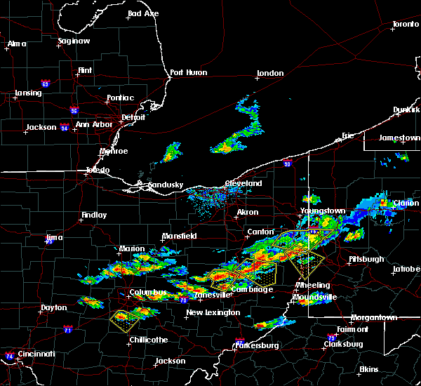 At 617 pm edt, a cluster of severe thunderstorms was located from near west lafayette to near newcomerstown to 9 miles north of new concord, moving east at 40 mph (radar). Hazards include wind gusts to 60 mph and quarter-size hail. Hail damage to vehicles. damage to trees and power lines. Locations impacted include, coshocton, newcomerstown, west lafayette, plainfield, otsego, boden, bakersville, this includes interstate 77 in ohio between mile markers 58 and 68. At 617 pm edt, a cluster of severe thunderstorms was located from near west lafayette to near newcomerstown to 9 miles north of new concord, moving east at 40 mph (radar). Hazards include wind gusts to 60 mph and quarter-size hail. Hail damage to vehicles. damage to trees and power lines. Locations impacted include, coshocton, newcomerstown, west lafayette, plainfield, otsego, boden, bakersville, this includes interstate 77 in ohio between mile markers 58 and 68.
|
| 5/22/2018 6:02 PM EDT |
 At 602 pm edt, severe thunderstorms were located along a line extending from 6 miles northwest of coshocton to west lafayette to 11 miles east of dresden, moving east at 30 mph (radar). Hazards include wind gusts to 60 mph and quarter-size hail. Hail damage to vehicles. Damage to trees and power lines. At 602 pm edt, severe thunderstorms were located along a line extending from 6 miles northwest of coshocton to west lafayette to 11 miles east of dresden, moving east at 30 mph (radar). Hazards include wind gusts to 60 mph and quarter-size hail. Hail damage to vehicles. Damage to trees and power lines.
|
| 11/5/2017 8:28 PM EST |
 At 828 pm est, severe thunderstorms were located along a line extending from near strasburg to 7 miles west of uhrichsville to near cambridge, moving east at 45 mph (radar). Hazards include 60 mph wind gusts. expect damage to trees and power lines, resulting in some power outages At 828 pm est, severe thunderstorms were located along a line extending from near strasburg to 7 miles west of uhrichsville to near cambridge, moving east at 45 mph (radar). Hazards include 60 mph wind gusts. expect damage to trees and power lines, resulting in some power outages
|
| 8/19/2017 3:22 PM EDT |
 The severe thunderstorm warning for southwestern tuscarawas county will expire at 330 pm edt, the storm that prompted the warning has weakened below severe limits and no longer pose an immediate threat to life and property. therefore, the warning will be allowed to expire. a severe thunderstorm watch remains in effect until 900 pm edt for east central ohio. The severe thunderstorm warning for southwestern tuscarawas county will expire at 330 pm edt, the storm that prompted the warning has weakened below severe limits and no longer pose an immediate threat to life and property. therefore, the warning will be allowed to expire. a severe thunderstorm watch remains in effect until 900 pm edt for east central ohio.
|
| 8/19/2017 3:18 PM EDT |
 At 317 pm edt, a severe thunderstorm was located near uhrichsville, moving east at 25 mph (radar). Hazards include 60 mph wind gusts and quarter-size hail. Minor hail damage to vehicles is possible. expect wind damage to trees and power lines, resulting in some power outages. Locations impacted include, newcomerstown, gnadenhutten, tuscarawas, port washington, stone creek, gilmore, this includes interstate 77 in ohio between mile markers 60 and 73. At 317 pm edt, a severe thunderstorm was located near uhrichsville, moving east at 25 mph (radar). Hazards include 60 mph wind gusts and quarter-size hail. Minor hail damage to vehicles is possible. expect wind damage to trees and power lines, resulting in some power outages. Locations impacted include, newcomerstown, gnadenhutten, tuscarawas, port washington, stone creek, gilmore, this includes interstate 77 in ohio between mile markers 60 and 73.
|
| 8/19/2017 3:04 PM EDT |
 At 303 pm edt, a severe thunderstorm was located over west lafayette, or near coshocton, moving east at 35 mph (radar). Hazards include 60 mph wind gusts and quarter-size hail. Minor hail damage to vehicles is possible. expect wind damage to trees and power lines, resulting in some power outages. Locations impacted include, coshocton, newcomerstown, west lafayette, gnadenhutten, tuscarawas, port washington, stone creek, plainfield, gilmore, chili, bakersville, this includes interstate 77 in ohio between mile markers 60 and 73. At 303 pm edt, a severe thunderstorm was located over west lafayette, or near coshocton, moving east at 35 mph (radar). Hazards include 60 mph wind gusts and quarter-size hail. Minor hail damage to vehicles is possible. expect wind damage to trees and power lines, resulting in some power outages. Locations impacted include, coshocton, newcomerstown, west lafayette, gnadenhutten, tuscarawas, port washington, stone creek, plainfield, gilmore, chili, bakersville, this includes interstate 77 in ohio between mile markers 60 and 73.
|
| 8/19/2017 2:41 PM EDT |
 At 241 pm edt, a severe thunderstorm was located 7 miles west of coshocton, moving east at 35 mph (radar). Hazards include 60 mph wind gusts and quarter-size hail. Minor hail damage to vehicles is possible. Expect wind damage to trees and power lines, resulting in some power outages. At 241 pm edt, a severe thunderstorm was located 7 miles west of coshocton, moving east at 35 mph (radar). Hazards include 60 mph wind gusts and quarter-size hail. Minor hail damage to vehicles is possible. Expect wind damage to trees and power lines, resulting in some power outages.
|
| 7/7/2017 3:00 PM EDT |
 At 300 pm edt, severe thunderstorms were located along a line extending from near newcomerstown to near byesville to 10 miles west of caldwell, moving east at 35 mph (radar). Hazards include 60 mph wind gusts. Expect damage to trees and power lines, resulting in some power outages. locations impacted include, cambridge, caldwell, newcomerstown, byesville, gnadenhutten, antrim, tuscarawas, port washington, senecaville, pleasant city, cumberland, lore city, this includes the following highways, interstate 70 in ohio between mile markers 175 and 192. Interstate 77 in ohio between mile markers 27 and 71. At 300 pm edt, severe thunderstorms were located along a line extending from near newcomerstown to near byesville to 10 miles west of caldwell, moving east at 35 mph (radar). Hazards include 60 mph wind gusts. Expect damage to trees and power lines, resulting in some power outages. locations impacted include, cambridge, caldwell, newcomerstown, byesville, gnadenhutten, antrim, tuscarawas, port washington, senecaville, pleasant city, cumberland, lore city, this includes the following highways, interstate 70 in ohio between mile markers 175 and 192. Interstate 77 in ohio between mile markers 27 and 71.
|
| 7/7/2017 2:58 PM EDT | Larger branch crashed into vehicle windshield in tuscarawas county OH, 0.9 miles NE of Newcomerstown, OH |
| 7/7/2017 2:42 PM EDT |
 At 242 pm edt, severe thunderstorms were located along a line extending from 7 miles northeast of west lafayette to near new concord to 9 miles southeast of south zanesville, moving east at 35 mph (radar). Hazards include 60 mph wind gusts. expect damage to trees and power lines, resulting in some power outages At 242 pm edt, severe thunderstorms were located along a line extending from 7 miles northeast of west lafayette to near new concord to 9 miles southeast of south zanesville, moving east at 35 mph (radar). Hazards include 60 mph wind gusts. expect damage to trees and power lines, resulting in some power outages
|
| 5/1/2017 12:51 PM EDT |
 At 1251 pm edt, severe thunderstorms were located along a line extending from newcomerstown to 6 miles northeast of byesville to 6 miles east of caldwell, moving northeast at 55 mph (radar). Hazards include 60 mph wind gusts. expect damage to trees and power lines, resulting in some power outages At 1251 pm edt, severe thunderstorms were located along a line extending from newcomerstown to 6 miles northeast of byesville to 6 miles east of caldwell, moving northeast at 55 mph (radar). Hazards include 60 mph wind gusts. expect damage to trees and power lines, resulting in some power outages
|
| 5/1/2017 12:29 PM EDT |
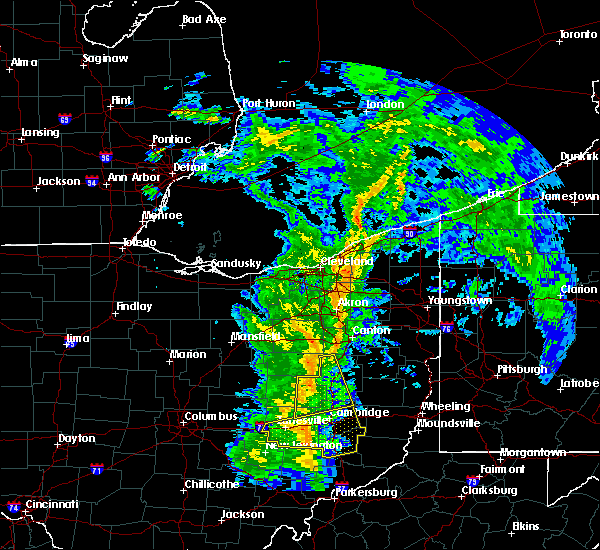 At 1229 pm edt, severe thunderstorms were located along a line extending from near millersburg to near west lafayette, moving northeast at 45 mph (radar). Hazards include 60 mph wind gusts. Expect damage to trees and power lines, resulting in some power outages. Locations impacted include, new philadelphia, dover, coshocton, newcomerstown, strasburg, west lafayette, sugarcreek, gnadenhutten, baltic, port washington, conesville, parral, this includes interstate 77 in ohio between mile markers 53 and 88. At 1229 pm edt, severe thunderstorms were located along a line extending from near millersburg to near west lafayette, moving northeast at 45 mph (radar). Hazards include 60 mph wind gusts. Expect damage to trees and power lines, resulting in some power outages. Locations impacted include, new philadelphia, dover, coshocton, newcomerstown, strasburg, west lafayette, sugarcreek, gnadenhutten, baltic, port washington, conesville, parral, this includes interstate 77 in ohio between mile markers 53 and 88.
|
| 5/1/2017 11:58 AM EDT |
 At 1158 am edt, severe thunderstorms were located along a line extending from danville to near frazeysburg, moving northeast at 45 mph (radar). Hazards include 60 mph wind gusts. expect damage to trees and power lines, resulting in some power outages At 1158 am edt, severe thunderstorms were located along a line extending from danville to near frazeysburg, moving northeast at 45 mph (radar). Hazards include 60 mph wind gusts. expect damage to trees and power lines, resulting in some power outages
|
| 4/30/2017 3:37 PM EDT |
 The severe thunderstorm warning for eastern coshocton and central tuscarawas counties will expire at 345 pm edt, the storm that prompted the warning has weakened below severe limits and no longer pose an immediate threat to life and property. therefore, the warning will be allowed to expire. however small hail and gusty winds are still possible with this thunderstorm. The severe thunderstorm warning for eastern coshocton and central tuscarawas counties will expire at 345 pm edt, the storm that prompted the warning has weakened below severe limits and no longer pose an immediate threat to life and property. therefore, the warning will be allowed to expire. however small hail and gusty winds are still possible with this thunderstorm.
|
| 4/30/2017 3:17 PM EDT |
 At 317 pm edt, a severe thunderstorm was located near west lafayette, or near coshocton, moving northeast at 50 mph. another strong to severe thunderstorm was located near new philadelphia (radar). Hazards include 60 mph wind gusts. Expect damage to trees and power lines, resulting in some power outages. Locations impacted include, new philadelphia, dover, coshocton, uhrichsville, newcomerstown, dennison, west lafayette, sugarcreek, gnadenhutten, tuscarawas, baltic, midvale, this includes interstate 77 in ohio between mile markers 66 and 87. At 317 pm edt, a severe thunderstorm was located near west lafayette, or near coshocton, moving northeast at 50 mph. another strong to severe thunderstorm was located near new philadelphia (radar). Hazards include 60 mph wind gusts. Expect damage to trees and power lines, resulting in some power outages. Locations impacted include, new philadelphia, dover, coshocton, uhrichsville, newcomerstown, dennison, west lafayette, sugarcreek, gnadenhutten, tuscarawas, baltic, midvale, this includes interstate 77 in ohio between mile markers 66 and 87.
|
| 4/30/2017 3:02 PM EDT |
 At 301 pm edt, a severe thunderstorm was located 7 miles north of dresden, or 7 miles southwest of coshocton, moving northeast at 50 mph (radar). Hazards include 60 mph wind gusts. expect damage to trees and power lines, resulting in some power outages At 301 pm edt, a severe thunderstorm was located 7 miles north of dresden, or 7 miles southwest of coshocton, moving northeast at 50 mph (radar). Hazards include 60 mph wind gusts. expect damage to trees and power lines, resulting in some power outages
|
| 9/10/2016 7:24 PM EDT |
 At 724 pm edt, a severe thunderstorm was located 7 miles north of cambridge, moving northeast at 55 mph (radar indicated). Hazards include 60 mph wind gusts. Expect damage to trees and power lines. resulting in some power outages. locations impacted include, cambridge, newcomerstown, new concord, byesville, antrim, port washington, old washington, plainfield, otsego, birmingham, boden, salt fork state park and kimbolton. this includes the following highways, interstate 70 in ohio between mile markers 168 and 193. interstate 77 in ohio between mile markers 42 and 67. Please report severe weather by calling 4 1 2, 2 6 2, 1 9 8 8, posting to the nws pittsburgh facebook page, or using twitter @nwspittsburgh. At 724 pm edt, a severe thunderstorm was located 7 miles north of cambridge, moving northeast at 55 mph (radar indicated). Hazards include 60 mph wind gusts. Expect damage to trees and power lines. resulting in some power outages. locations impacted include, cambridge, newcomerstown, new concord, byesville, antrim, port washington, old washington, plainfield, otsego, birmingham, boden, salt fork state park and kimbolton. this includes the following highways, interstate 70 in ohio between mile markers 168 and 193. interstate 77 in ohio between mile markers 42 and 67. Please report severe weather by calling 4 1 2, 2 6 2, 1 9 8 8, posting to the nws pittsburgh facebook page, or using twitter @nwspittsburgh.
|
| 9/10/2016 7:07 PM EDT |
 At 707 pm edt, a severe thunderstorm was located 7 miles northwest of new concord, or 10 miles northeast of zanesville, moving northeast at 55 mph (radar indicated). Hazards include 60 mph wind gusts. Expect damage to trees and power lines. Resulting in some power outages. At 707 pm edt, a severe thunderstorm was located 7 miles northwest of new concord, or 10 miles northeast of zanesville, moving northeast at 55 mph (radar indicated). Hazards include 60 mph wind gusts. Expect damage to trees and power lines. Resulting in some power outages.
|
| 8/25/2016 5:17 PM EDT |
 At 516 pm edt, a severe thunderstorm was located 10 miles north of dresden, or 10 miles west of coshocton, moving east at 40 mph (radar indicated). Hazards include 60 mph wind gusts and quarter size hail. Hail damage to vehicles is expected. Expect wind damage to trees and power lines, resulting in some power outages. At 516 pm edt, a severe thunderstorm was located 10 miles north of dresden, or 10 miles west of coshocton, moving east at 40 mph (radar indicated). Hazards include 60 mph wind gusts and quarter size hail. Hail damage to vehicles is expected. Expect wind damage to trees and power lines, resulting in some power outages.
|
| 6/6/2016 7:25 PM EDT |
 The severe thunderstorm warning for northern guernsey, northeastern muskingum, southeastern coshocton, southwestern harrison and southeastern tuscarawas counties will expire at 730 pm edt, the storm which prompted the warning has weakened below severe limits, and no longer pose an immediate threat to life or property. therefore, the warning will be allowed to expire. however gusty winds and heavy rain are still possible. The severe thunderstorm warning for northern guernsey, northeastern muskingum, southeastern coshocton, southwestern harrison and southeastern tuscarawas counties will expire at 730 pm edt, the storm which prompted the warning has weakened below severe limits, and no longer pose an immediate threat to life or property. therefore, the warning will be allowed to expire. however gusty winds and heavy rain are still possible.
|
| 6/6/2016 7:01 PM EDT |
 At 701 pm edt, a severe thunderstorm was located near west lafayette, or 7 miles southeast of coshocton, moving east at 40 mph (radar indicated). Hazards include 60 mph wind gusts and quarter size hail. Hail damage to vehicles is expected. expect wind damage to trees and power lines, resulting in some power outages. locations impacted include, coshocton, freeport, newcomerstown, west lafayette, gnadenhutten, antrim, port washington, plainfield, stillwater, gilmore, otsego, tippecanoe, boden, birmingham, kimbolton and clendening lake. this includes interstate 77 in ohio between mile markers 52 and 67. Please report severe weather by calling 4 1 2, 2 6 2, 1 9 8 8, posting to the nws pittsburgh facebook page, or using twitter @nwspittsburgh. At 701 pm edt, a severe thunderstorm was located near west lafayette, or 7 miles southeast of coshocton, moving east at 40 mph (radar indicated). Hazards include 60 mph wind gusts and quarter size hail. Hail damage to vehicles is expected. expect wind damage to trees and power lines, resulting in some power outages. locations impacted include, coshocton, freeport, newcomerstown, west lafayette, gnadenhutten, antrim, port washington, plainfield, stillwater, gilmore, otsego, tippecanoe, boden, birmingham, kimbolton and clendening lake. this includes interstate 77 in ohio between mile markers 52 and 67. Please report severe weather by calling 4 1 2, 2 6 2, 1 9 8 8, posting to the nws pittsburgh facebook page, or using twitter @nwspittsburgh.
|
| 6/6/2016 6:46 PM EDT |
 At 646 pm edt, a severe thunderstorm was located near dresden, or 7 miles southwest of coshocton, moving east at 40 mph (radar indicated). Hazards include 60 mph wind gusts and quarter size hail. Hail damage to vehicles is expected. Expect wind damage to trees and power lines, resulting in some power outages. At 646 pm edt, a severe thunderstorm was located near dresden, or 7 miles southwest of coshocton, moving east at 40 mph (radar indicated). Hazards include 60 mph wind gusts and quarter size hail. Hail damage to vehicles is expected. Expect wind damage to trees and power lines, resulting in some power outages.
|
| 5/7/2016 9:15 PM EDT |
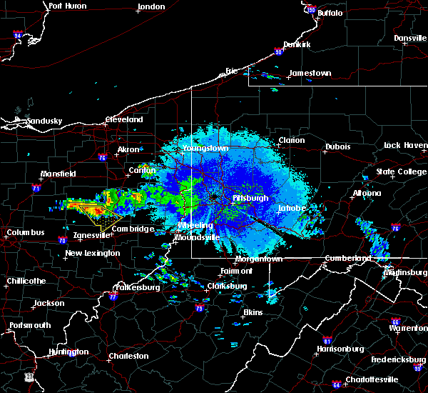 At 914 pm edt, a severe thunderstorm was located near chili, or near coshocton, moving southeast at 30 mph (radar indicated). Hazards include 60 mph wind gusts and quarter size hail. Hail damage to vehicles is expected. expect wind damage to trees and power lines, resulting in some power outages. locations impacted include, coshocton, newcomerstown, west lafayette, plainfield, blissfield, bakersville, chili, boden and kimbolton. this includes interstate 77 in ohio between mile markers 57 and 67. Please report severe weather by calling 4 1 2, 2 6 2, 1 9 8 8, posting to the nws pittsburgh facebook page, or using twitter @nwspittsburgh. At 914 pm edt, a severe thunderstorm was located near chili, or near coshocton, moving southeast at 30 mph (radar indicated). Hazards include 60 mph wind gusts and quarter size hail. Hail damage to vehicles is expected. expect wind damage to trees and power lines, resulting in some power outages. locations impacted include, coshocton, newcomerstown, west lafayette, plainfield, blissfield, bakersville, chili, boden and kimbolton. this includes interstate 77 in ohio between mile markers 57 and 67. Please report severe weather by calling 4 1 2, 2 6 2, 1 9 8 8, posting to the nws pittsburgh facebook page, or using twitter @nwspittsburgh.
|
| 5/7/2016 8:51 PM EDT |
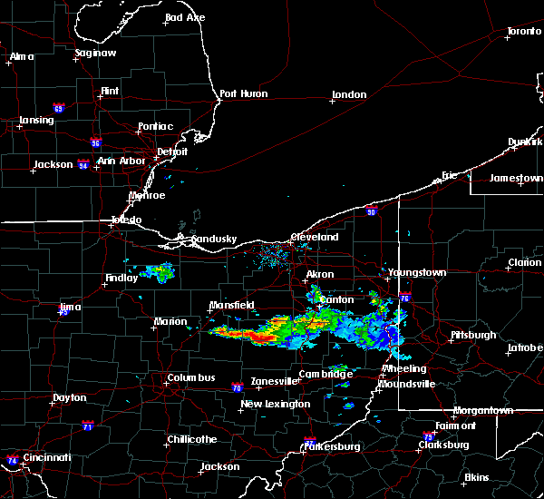 At 850 pm edt, a severe thunderstorm was located near killbuck, or 7 miles south of millersburg, moving southeast at 30 mph (radar indicated). Hazards include 60 mph wind gusts and half dollar size hail. Hail damage to vehicles is expected. Expect wind damage to trees and power lines, resulting in some power outages. At 850 pm edt, a severe thunderstorm was located near killbuck, or 7 miles south of millersburg, moving southeast at 30 mph (radar indicated). Hazards include 60 mph wind gusts and half dollar size hail. Hail damage to vehicles is expected. Expect wind damage to trees and power lines, resulting in some power outages.
|
| 5/1/2016 5:55 PM EDT |
 At 554 pm edt, a severe thunderstorm was located 8 miles southeast of newcomerstown, or 10 miles north of cambridge, moving east at 35 mph (radar indicated). Hazards include 60 mph wind gusts and quarter size hail. Hail damage to vehicles is expected. expect wind damage to trees and power lines, resulting in some power outages. locations impacted include, freeport, newcomerstown, antrim, flushing, holloway, gilmore, tippecanoe, piedmont, deersville, birmingham, clendening lake, kimbolton, piedmont lake and salt fork state park. this includes interstate 77 in ohio between mile markers 52 and 65. Please report severe weather by calling 4 1 2, 2 6 2, 1 9 8 8, posting to the nws pittsburgh facebook page, or using twitter @nwspittsburgh. At 554 pm edt, a severe thunderstorm was located 8 miles southeast of newcomerstown, or 10 miles north of cambridge, moving east at 35 mph (radar indicated). Hazards include 60 mph wind gusts and quarter size hail. Hail damage to vehicles is expected. expect wind damage to trees and power lines, resulting in some power outages. locations impacted include, freeport, newcomerstown, antrim, flushing, holloway, gilmore, tippecanoe, piedmont, deersville, birmingham, clendening lake, kimbolton, piedmont lake and salt fork state park. this includes interstate 77 in ohio between mile markers 52 and 65. Please report severe weather by calling 4 1 2, 2 6 2, 1 9 8 8, posting to the nws pittsburgh facebook page, or using twitter @nwspittsburgh.
|
| 5/1/2016 5:50 PM EDT | Half Dollar sized hail reported 5.9 miles NNW of Newcomerstown, OH |
| 5/1/2016 5:40 PM EDT |
 At 539 pm edt, a severe thunderstorm was located near newcomerstown, or 12 miles north of cambridge, moving east at 35 mph (radar indicated). Hazards include 60 mph wind gusts and quarter size hail. Hail damage to vehicles is expected. Expect wind damage to trees and power lines, resulting in some power outages. At 539 pm edt, a severe thunderstorm was located near newcomerstown, or 12 miles north of cambridge, moving east at 35 mph (radar indicated). Hazards include 60 mph wind gusts and quarter size hail. Hail damage to vehicles is expected. Expect wind damage to trees and power lines, resulting in some power outages.
|
| 12/23/2015 10:25 PM EST | At 1024 pm est, severe thunderstorms were located along a line extending from 6 miles southeast of farmerstown to near newcomerstown to 7 miles northwest of cambridge, moving northeast at 55 mph (radar indicated). Hazards include 60 mph wind gusts. Expect damage to trees and some power outages locations impacted include, new philadelphia, dover, uhrichsville, freeport, newcomerstown, dennison, sugarcreek, gnadenhutten, antrim, tuscarawas, midvale, port washington, barnhill, roswell, stone creek, plainfield, gilmore, stillwater, otsego and tippecanoe. This includes interstate 77 in ohio between mile markers 51 and 84. |
| 12/23/2015 10:24 PM EST | A few tree limbs down in tuscarawas county OH, 0.9 miles NE of Newcomerstown, OH |
| 12/23/2015 10:02 PM EST | At 1001 pm est, severe thunderstorms were located along a line extending from 6 miles west of coshocton to near dresden to near south zanesville, moving east at 55 mph (radar indicated). Hazards include 60 mph wind gusts. expect damage to trees and some power outages |
| 7/14/2015 2:57 PM EDT |
 At 256 pm edt, severe thunderstorms were located along a line extending from 7 miles southeast of killbuck to 9 miles west of zanesville, moving southeast at 40 mph (radar indicated). Hazards include 60 mph wind gusts and quarter size hail. Hail damage to vehicles is expected. expect wind damage to trees and some power outages. Locations impacted include, zanesville, coshocton, cambridge, newcomerstown, new concord, west lafayette, south zanesville, north zanesville, dresden, frazeysburg, gnadenhutten, tuscarawas, baltic, midvale, warsaw, port washington, pleasant grove, cumberland, conesville and gratiot. At 256 pm edt, severe thunderstorms were located along a line extending from 7 miles southeast of killbuck to 9 miles west of zanesville, moving southeast at 40 mph (radar indicated). Hazards include 60 mph wind gusts and quarter size hail. Hail damage to vehicles is expected. expect wind damage to trees and some power outages. Locations impacted include, zanesville, coshocton, cambridge, newcomerstown, new concord, west lafayette, south zanesville, north zanesville, dresden, frazeysburg, gnadenhutten, tuscarawas, baltic, midvale, warsaw, port washington, pleasant grove, cumberland, conesville and gratiot.
|
| 7/14/2015 2:28 PM EDT |
 At 228 pm edt, severe thunderstorms were located along a line extending from danville to near newark, moving east at 50 mph (radar indicated). Hazards include 60 mph wind gusts and quarter size hail. Hail damage to vehicles is expected. Expect wind damage to trees and some power outages. At 228 pm edt, severe thunderstorms were located along a line extending from danville to near newark, moving east at 50 mph (radar indicated). Hazards include 60 mph wind gusts and quarter size hail. Hail damage to vehicles is expected. Expect wind damage to trees and some power outages.
|
| 6/30/2015 3:56 PM EDT | The severe thunderstorm warning for southeastern coshocton, northwestern guernsey and southwestern tuscarawas counties will expire at 400 pm edt, the storms which prompted the warning have weakened and severe weather is no longer an immediate threat. therefore the warning will be allowed to expire. a severe thunderstorm watch remains in effect until 800 pm edt for east central ohio. |
| 6/30/2015 3:46 PM EDT | Branches down on power lines near newcomerstown in tuscarawas county OH, 0.9 miles NE of Newcomerstown, OH |
| 6/30/2015 3:44 PM EDT |
 At 344 pm edt, a severe thunderstorm was located near newcomerstown, or 11 miles east of coshocton, moving east at 50 mph (radar indicated). Hazards include 60 mph wind gusts and quarter size hail. Hail damage to vehicles is expected. expect wind damage to roofs, siding and trees. Locations impacted include, newcomerstown, gnadenhutten, port washington, stone creek, plainfield, gilmore, bakersville, birmingham and kimbolton. At 344 pm edt, a severe thunderstorm was located near newcomerstown, or 11 miles east of coshocton, moving east at 50 mph (radar indicated). Hazards include 60 mph wind gusts and quarter size hail. Hail damage to vehicles is expected. expect wind damage to roofs, siding and trees. Locations impacted include, newcomerstown, gnadenhutten, port washington, stone creek, plainfield, gilmore, bakersville, birmingham and kimbolton.
|
| 6/30/2015 3:33 PM EDT |
 At 333 pm edt, a severe thunderstorm was located over west lafayette, or 7 miles east of coshocton, moving northeast at 30 mph (radar indicated). Hazards include 60 mph wind gusts and quarter size hail. Hail damage to vehicles is expected. Expect wind damage to roofs, siding and trees. At 333 pm edt, a severe thunderstorm was located over west lafayette, or 7 miles east of coshocton, moving northeast at 30 mph (radar indicated). Hazards include 60 mph wind gusts and quarter size hail. Hail damage to vehicles is expected. Expect wind damage to roofs, siding and trees.
|
| 6/12/2015 5:25 PM EDT |
 The severe thunderstorm warning for muskingum, eastern coshocton, western guernsey and southern tuscarawas counties will expire at 530 pm edt, the storms which prompted the warning have weakened below severe limits, and no longer pose an immediate threat to life or property. therefore the warning will be allowed to expire. however gusty winds are still possible with these thunderstorms. a severe thunderstorm watch remains in effect until 900 pm edt for east central ohio. The severe thunderstorm warning for muskingum, eastern coshocton, western guernsey and southern tuscarawas counties will expire at 530 pm edt, the storms which prompted the warning have weakened below severe limits, and no longer pose an immediate threat to life or property. therefore the warning will be allowed to expire. however gusty winds are still possible with these thunderstorms. a severe thunderstorm watch remains in effect until 900 pm edt for east central ohio.
|
| 6/12/2015 5:03 PM EDT |
 At 503 pm edt, severe thunderstorms were located along a line extending from near dover to near newcomerstown to near bremen, moving east at 35 mph (radar indicated). Hazards include 60 mph wind gusts and penny size hail. Expect damage to roofs. siding and trees. Locations impacted include, zanesville, new philadelphia, coshocton, cambridge, uhrichsville, newcomerstown, dennison, new concord, byesville, west lafayette, sugarcreek, south zanesville, north zanesville, dresden, gnadenhutten, tuscarawas, baltic, midvale, philo and port washington. At 503 pm edt, severe thunderstorms were located along a line extending from near dover to near newcomerstown to near bremen, moving east at 35 mph (radar indicated). Hazards include 60 mph wind gusts and penny size hail. Expect damage to roofs. siding and trees. Locations impacted include, zanesville, new philadelphia, coshocton, cambridge, uhrichsville, newcomerstown, dennison, new concord, byesville, west lafayette, sugarcreek, south zanesville, north zanesville, dresden, gnadenhutten, tuscarawas, baltic, midvale, philo and port washington.
|
| 6/12/2015 4:49 PM EDT |
 At 449 pm edt, severe thunderstorms were located along a line extending from near farmerstown to near coshocton to near lancaster, moving east at 40 mph (radar indicated). Hazards include 60 mph wind gusts and penny size hail. Expect damage to roofs. siding and trees. Locations impacted include, zanesville, new philadelphia, coshocton, cambridge, uhrichsville, newcomerstown, dennison, new concord, byesville, west lafayette, sugarcreek, south zanesville, north zanesville, dresden, gnadenhutten, tuscarawas, baltic, midvale, philo and port washington. At 449 pm edt, severe thunderstorms were located along a line extending from near farmerstown to near coshocton to near lancaster, moving east at 40 mph (radar indicated). Hazards include 60 mph wind gusts and penny size hail. Expect damage to roofs. siding and trees. Locations impacted include, zanesville, new philadelphia, coshocton, cambridge, uhrichsville, newcomerstown, dennison, new concord, byesville, west lafayette, sugarcreek, south zanesville, north zanesville, dresden, gnadenhutten, tuscarawas, baltic, midvale, philo and port washington.
|
| 6/12/2015 4:39 PM EDT |
 At 439 pm edt, severe thunderstorms were located along a line extending from near farmerstown to near dresden to lancaster, moving east at 35 mph (radar indicated). Hazards include 60 mph wind gusts and penny size hail. Expect damage to roofs. Siding and trees. At 439 pm edt, severe thunderstorms were located along a line extending from near farmerstown to near dresden to lancaster, moving east at 35 mph (radar indicated). Hazards include 60 mph wind gusts and penny size hail. Expect damage to roofs. Siding and trees.
|
| 5/26/2015 10:41 PM EDT | The severe thunderstorm warning for harrison, southwestern carroll, tuscarawas and northwestern belmont counties will expire at 1045 pm edt, the storm which prompted the warning has weakened below severe limits and exited the warned area. therefore the warning will be allowed to expire. |
| 5/26/2015 10:20 PM EDT | At 1020 pm edt, a severe thunderstorm was located near freeport, moving northeast at 45 mph (radar indicated). Hazards include 60 mph wind gusts. Expect damage to roofs. siding and trees. Locations impacted include, new philadelphia, dover, uhrichsville, cadiz, freeport, newcomerstown, dennison, gnadenhutten, tuscarawas, hopedale, scio, midvale, mineral city, jewett, port washington, bowerston, barnhill, holloway, sherrodsville and roswell. |
| 5/26/2015 10:15 PM EDT | Damage to a roof reported to harrison county sheriff in peoli in tuscarawas county in tuscarawas county OH, 8.6 miles WNW of Newcomerstown, OH |
| 5/26/2015 10:01 PM EDT | At 1001 pm edt, a severe thunderstorm was located 9 miles northeast of cambridge, moving northeast at 45 mph (radar indicated). Hazards include 60 mph wind gusts. Expect damage to roofs. Siding and trees. |
| 5/11/2015 6:54 PM EDT | The severe thunderstorm warning for northeastern muskingum, eastern coshocton, northwestern guernsey and western tuscarawas counties will expire at 700 pm edt, the storms which prompted the warning have weakened. therefore the warning will be allowed to expire. a severe thunderstorm watch remains in effect until 1000 pm edt for east central ohio. |
| 5/11/2015 6:34 PM EDT | At 633 pm edt, severe thunderstorms were located along a line extending from farmerstown to 6 miles southwest of west lafayette, moving northeast at 45 mph (radar indicated). Hazards include 60 mph wind gusts. Expect damage to roofs. siding and trees. locations impacted include, new philadelphia, dover, coshocton, newcomerstown, strasburg, west lafayette, sugarcreek, bolivar, baltic, port washington, parral, stone creek, zoar, plainfield, adamsville, otsego, gilmore, chili, boden and bakersville. 75in. |
| 5/11/2015 6:29 PM EDT | At 628 pm edt, severe thunderstorms were located along a line extending from near farmerstown to 6 miles east of dresden, moving northeast at 20 mph (radar indicated). Hazards include 60 mph wind gusts. Expect damage to roofs. Siding and trees. |
| 4/9/2015 4:48 PM EDT | The national weather service in pittsburgh has issued a * severe thunderstorm warning for. noble county in east central ohio. western jefferson county in east central ohio. northeastern coshocton county in east central ohio. Guernsey county in east central ohio. |
| 4/9/2015 4:45 PM EDT | A severe thunderstorm warning remains in effect until 500 pm edt for western noble. eastern muskingum. eastern coshocton. guernsey and southwestern tuscarawas counties. at 445 pm edt. severe thunderstorms were located along a line extending from near walnut creek to near salt fork state park to near mcconnelsville. Moving east at 55 mph. |
| 4/9/2015 4:28 PM EDT | A severe thunderstorm warning remains in effect until 500 pm edt for western noble. muskingum. coshocton. guernsey and southwestern tuscarawas counties. at 426 pm edt. severe thunderstorms were located along a line extending from conesville to near ruraldale to 6 miles east of lake hope state park. Moving east at 50 mph. |
| 4/9/2015 4:11 PM EDT | The national weather service in pittsburgh has issued a * severe thunderstorm warning for. western noble county in east central ohio. muskingum county in east central ohio. coshocton county in east central ohio. Guernsey county in east central ohio. |
| 4/9/2015 4:01 PM EDT | A severe thunderstorm warning remains in effect until 430 pm edt for northeastern muskingum. southeastern coshocton and western guernsey counties. at 401 pm edt. a severe thunderstorm was located over new concord. moving northeast at 45 mph. hazard. 70 mph wind gusts and quarter size hail. |
| 4/9/2015 3:34 PM EDT | The national weather service in pittsburgh has issued a * severe thunderstorm warning for. eastern muskingum county in east central ohio. southeastern coshocton county in east central ohio. western guernsey county in east central ohio. Until 430 pm edt. |
| 12/24/2014 6:28 PM EST | Multiple trees and wires down. time estimated by radar in tuscarawas county OH, 0.9 miles NE of Newcomerstown, OH |
| 7/10/2013 5:03 PM EDT | Nimersous trees down in coshocton county OH, 3.8 miles E of Newcomerstown, OH |
| 7/10/2013 4:58 PM EDT | Numerous large branches down in coshocton county OH, 2.7 miles E of Newcomerstown, OH |
| 6/25/2013 4:53 PM EDT | Multiple trees down on east state s in tuscarawas county OH, 0.9 miles NE of Newcomerstown, OH |
| 6/25/2013 4:47 PM EDT | Trees down along route 751 in coshocton county OH, 3.5 miles ESE of Newcomerstown, OH |
| 6/13/2013 12:25 AM EDT | Quarter sized hail reported 0.9 miles NE of Newcomerstown, OH, quarter sized hail |
| 7/18/2012 5:45 PM EDT | Trees down in coshocton county OH, 4.4 miles SE of Newcomerstown, OH |
| 6/29/2012 6:15 PM EDT | Numerous trees down in tuscarawas county OH, 1.3 miles ENE of Newcomerstown, OH |
| 1/1/0001 12:00 AM | Trees down in guernsey county OH, 6.7 miles NW of Newcomerstown, OH |
| 1/1/0001 12:00 AM | Quarter sized hail reported 6.4 miles SSE of Newcomerstown, OH, event occurred between 812 am 05 12 2011 and 827 am 05 12 2011 |
| 1/1/0001 12:00 AM | Garage destroyed on beagle club road in tuscarawas county OH, 1.7 miles SW of Newcomerstown, OH |
| 1/1/0001 12:00 AM | Garage destroyed on beagle club road in tuscarawas county OH, 1.7 miles SW of Newcomerstown, OH |
Hail Maps for Newcomerstown, OH


Connect with Interactive Hail Maps