

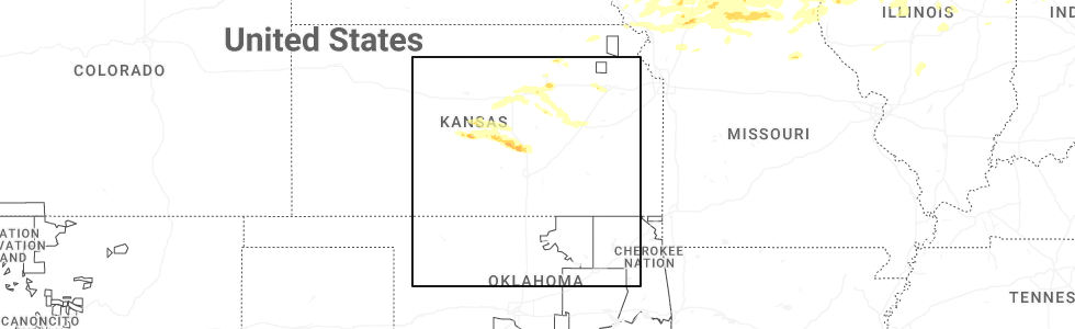
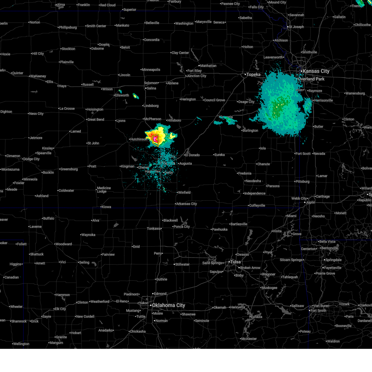
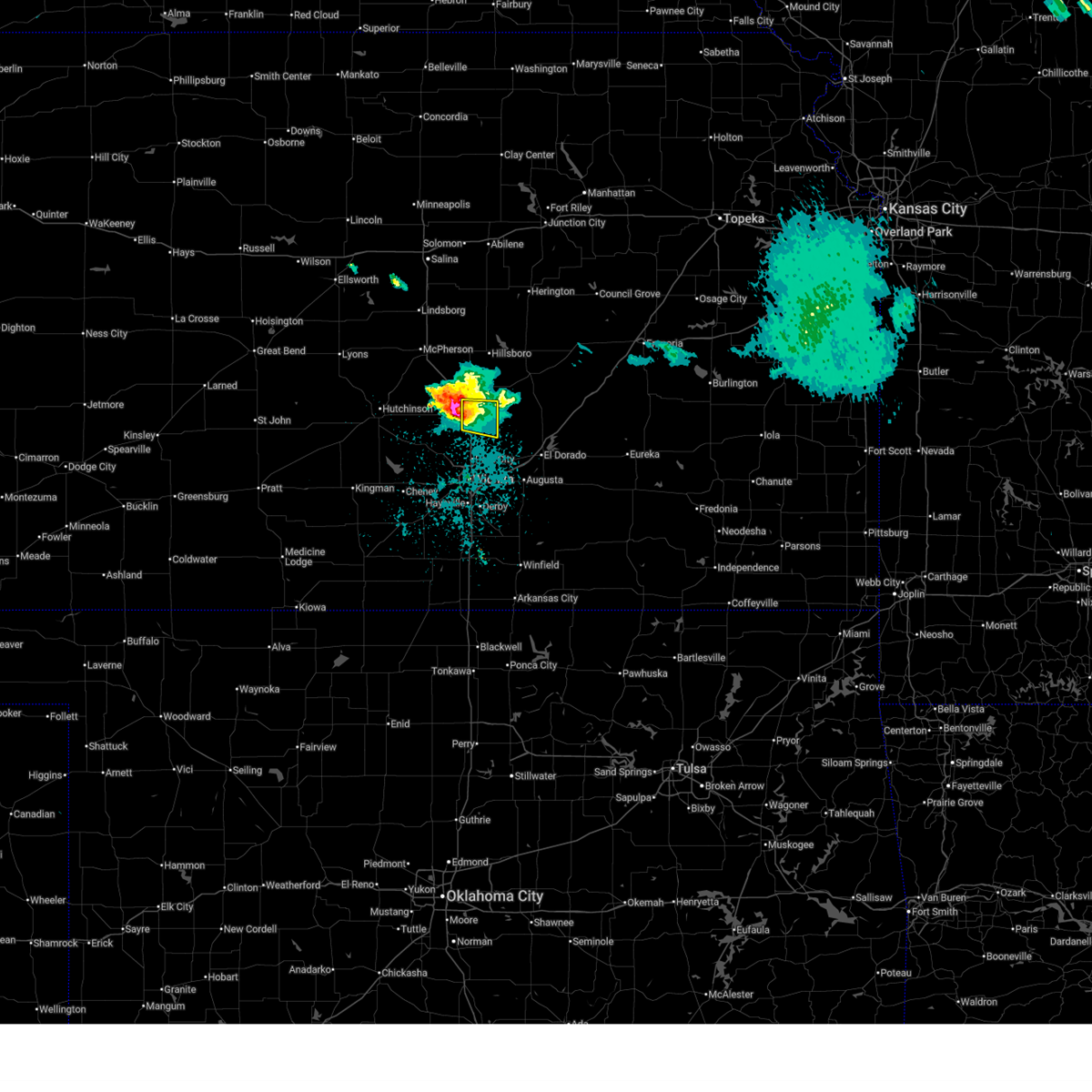
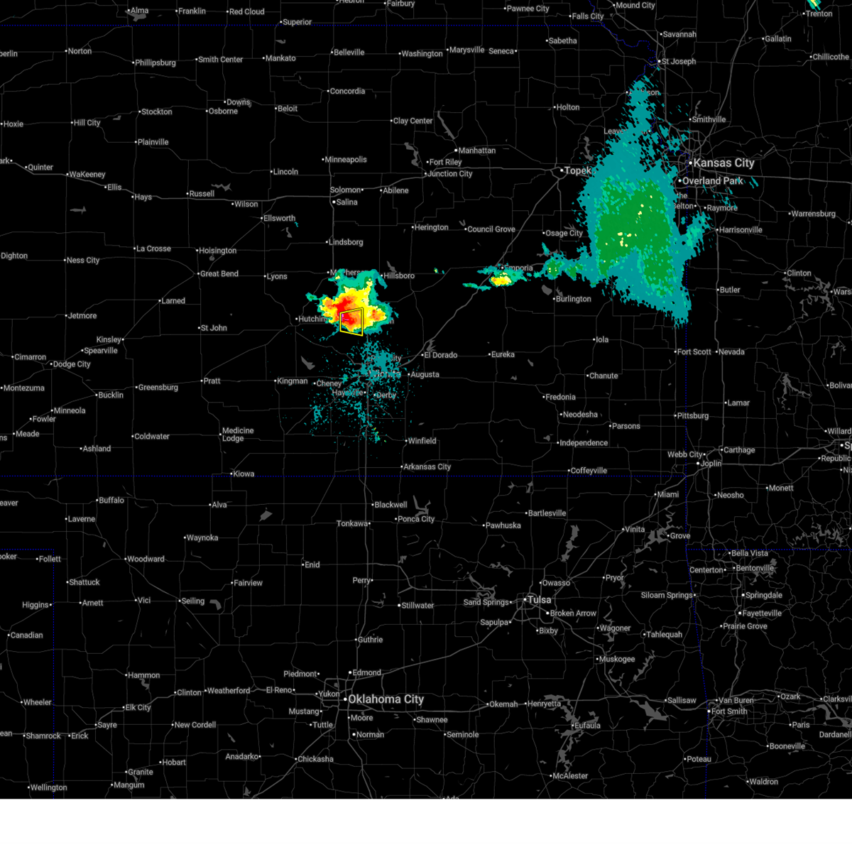
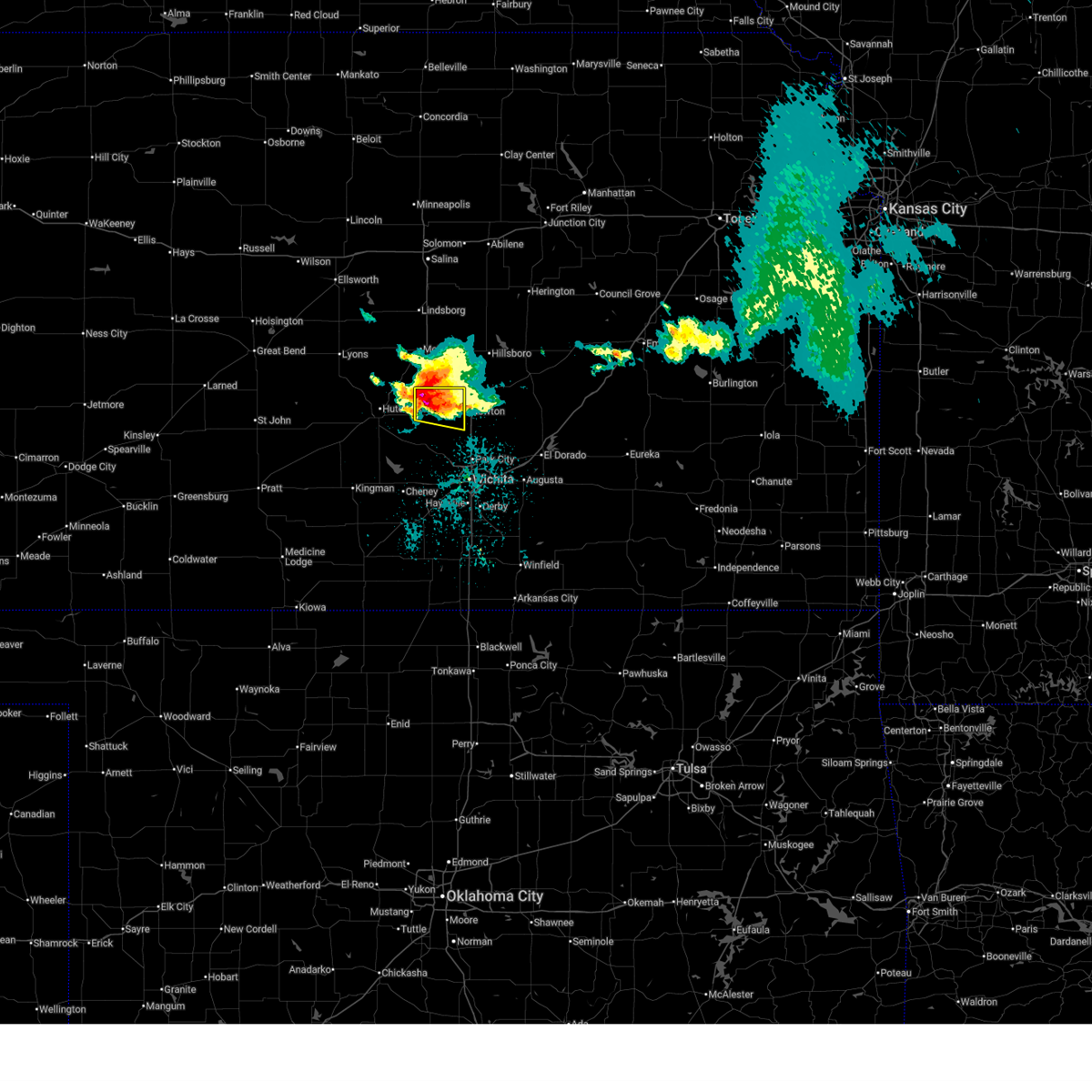
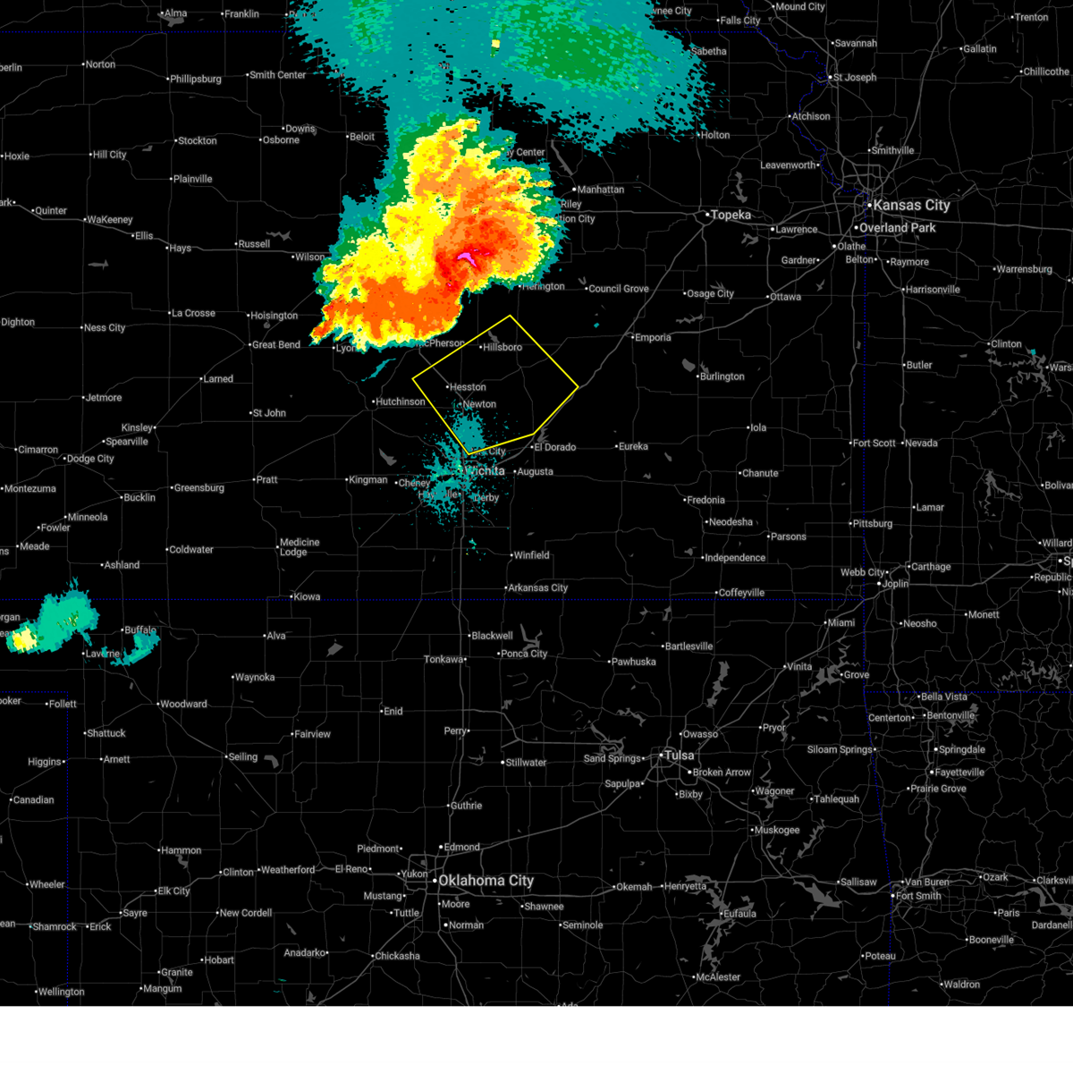
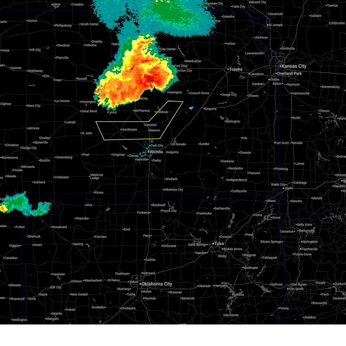
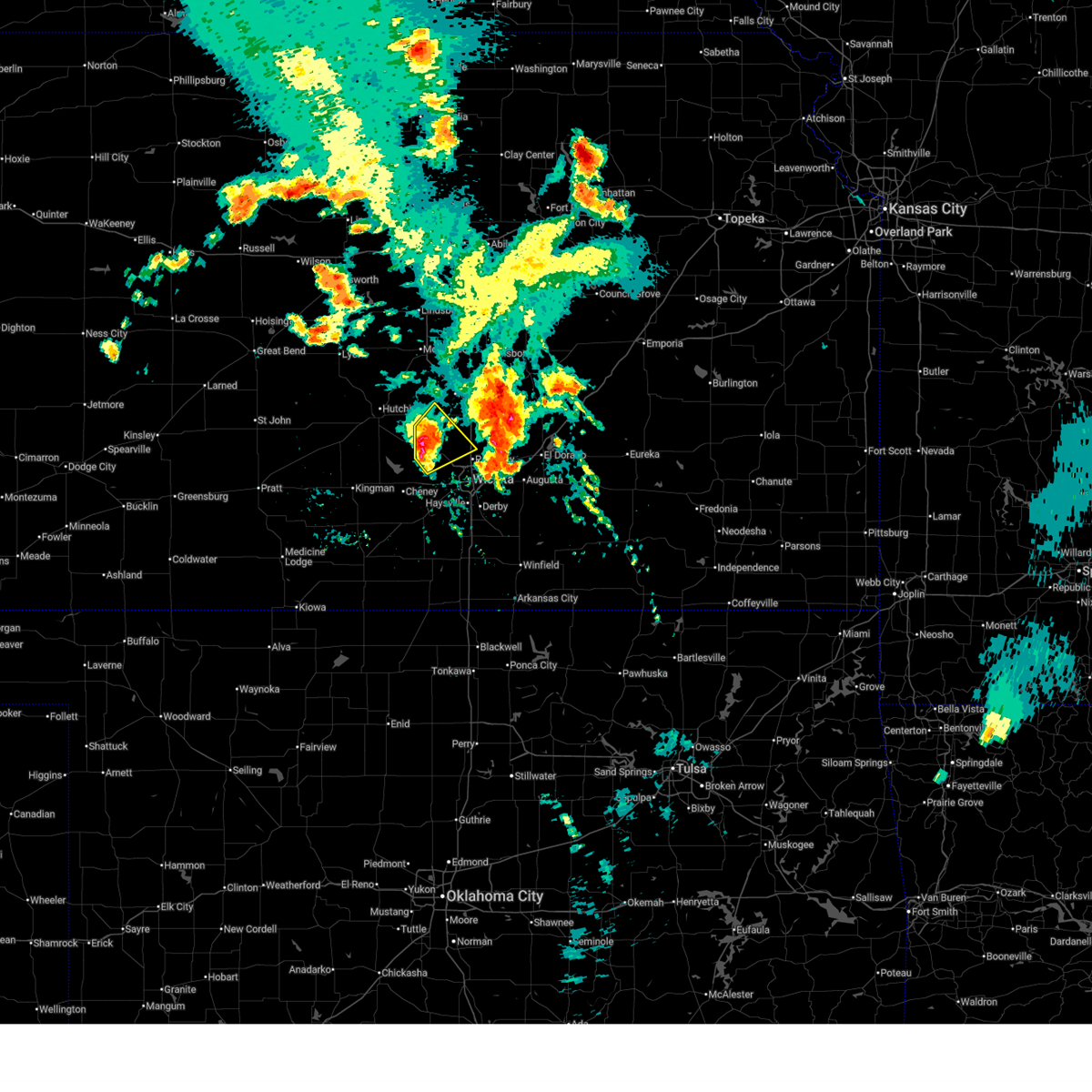
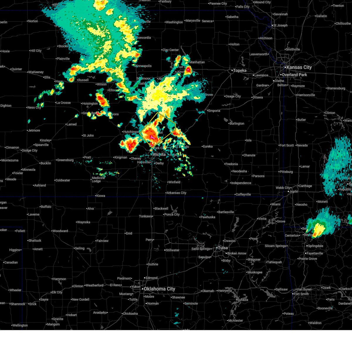
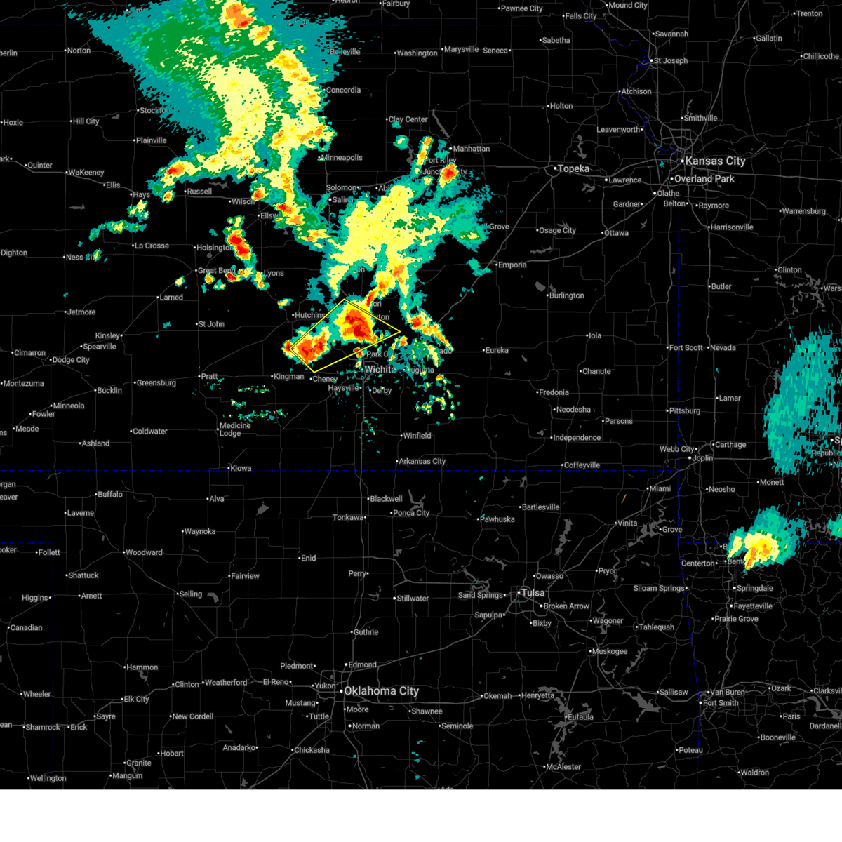
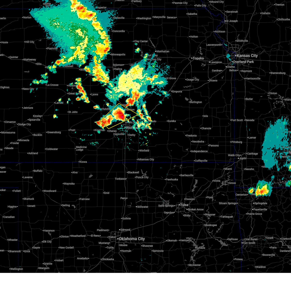
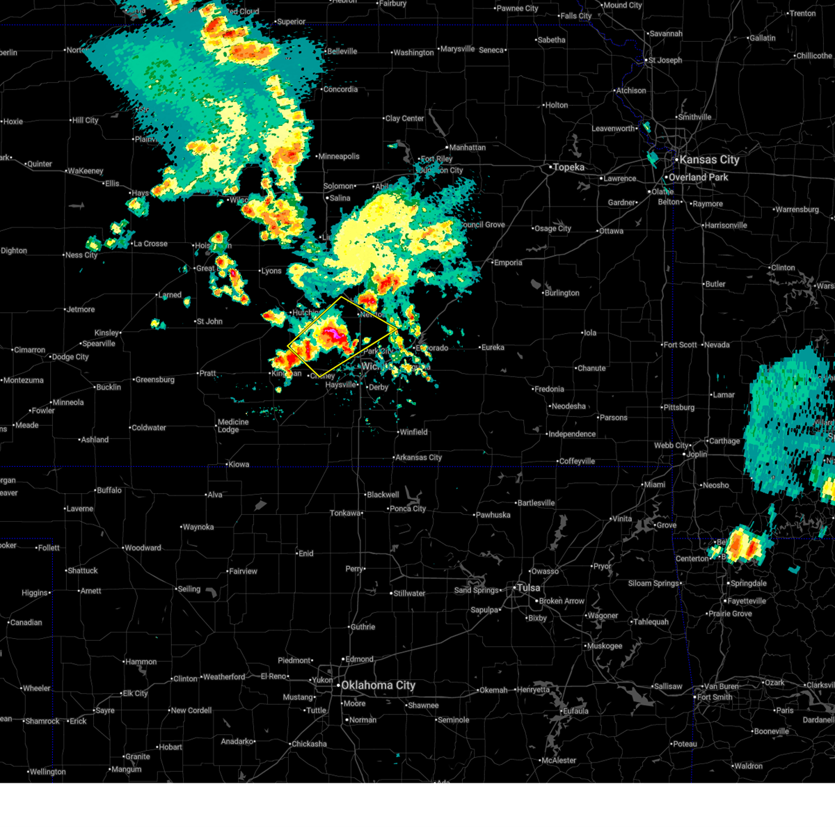
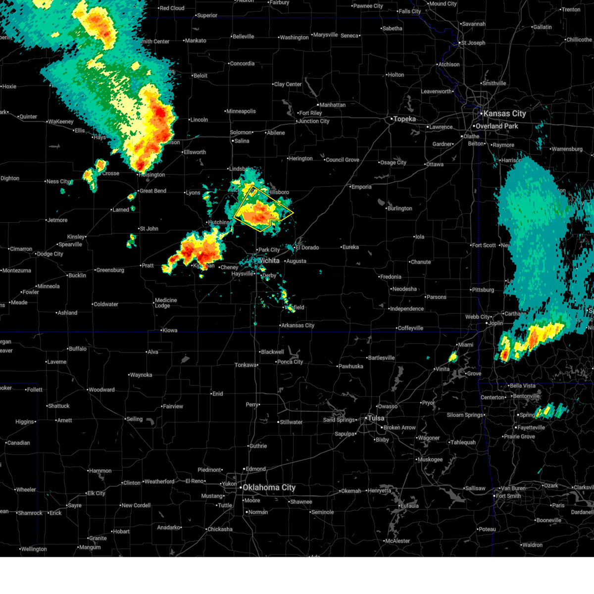
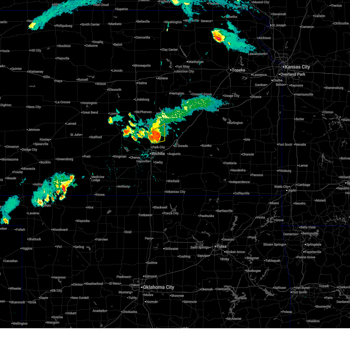
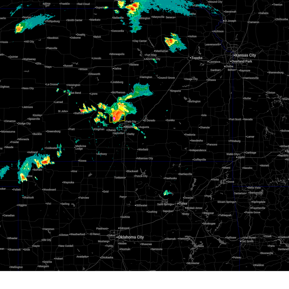
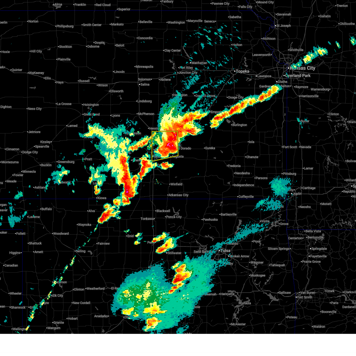
Hail Map for Newton, KS
The Newton, KS area has had 37 reports of on-the-ground hail by trained spotters, and has been under severe weather warnings 88 times during the past 12 months. Doppler radar has detected hail at or near Newton, KS on 156 occasions, including 15 occasions during the past year.
| Name: | Newton, KS |
| Where Located: | 23.9 miles N of Wichita, KS |
| Map: | Google Map for Newton, KS |
| Population: | 19132 |
| Housing Units: | 8237 |
| More Info: | Search Google for Newton, KS |
3
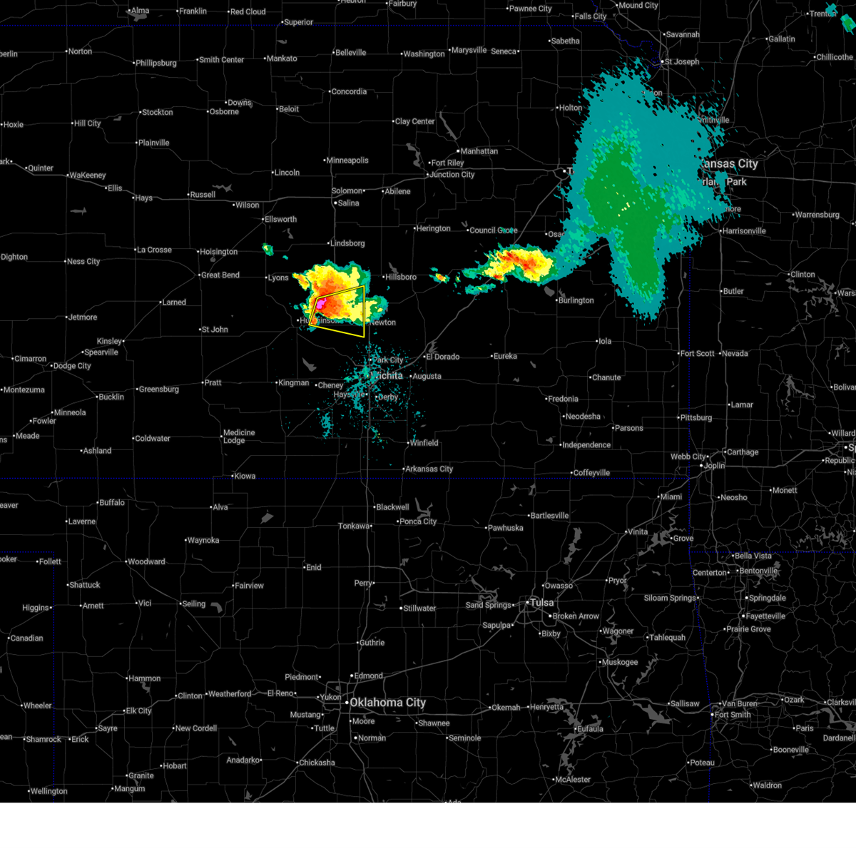
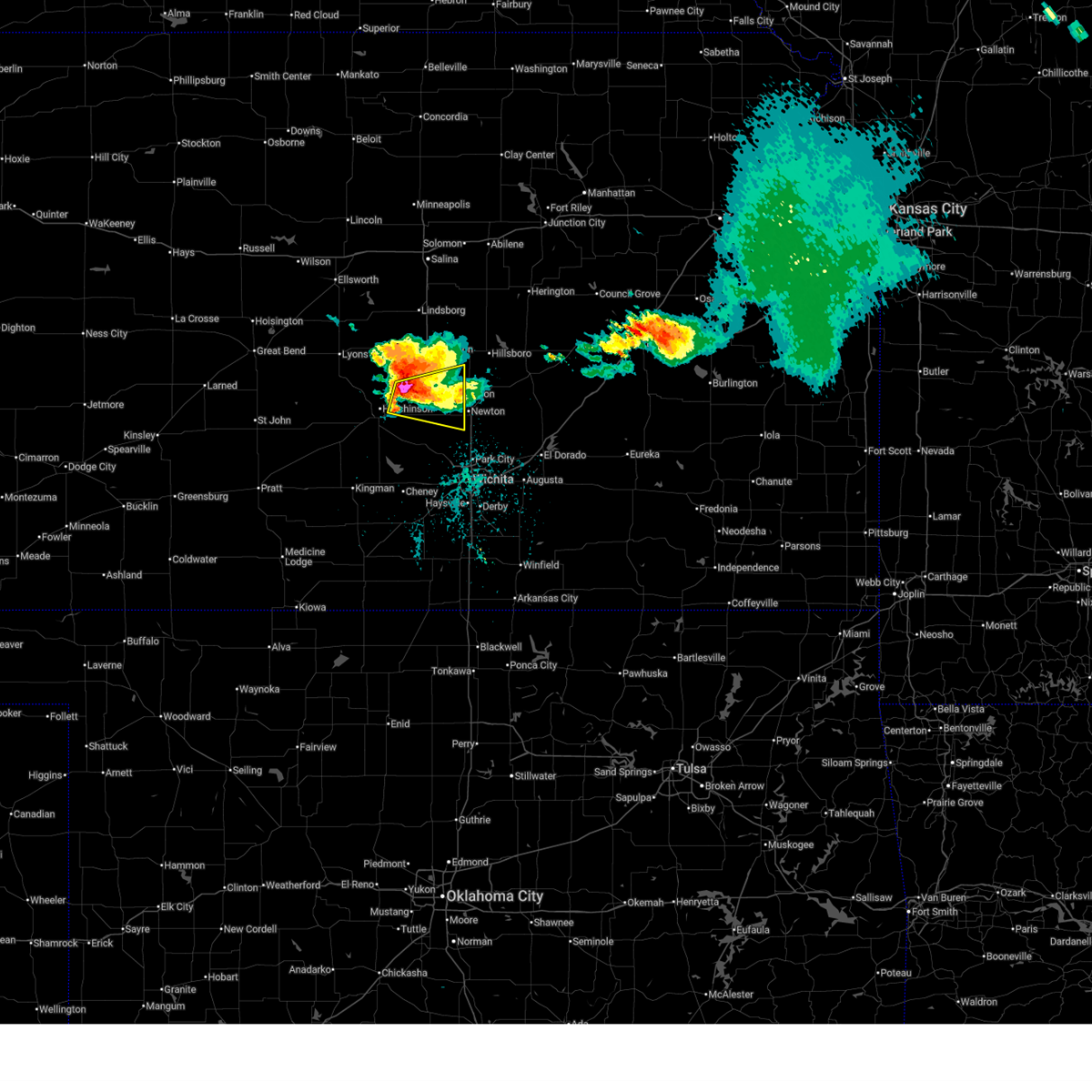
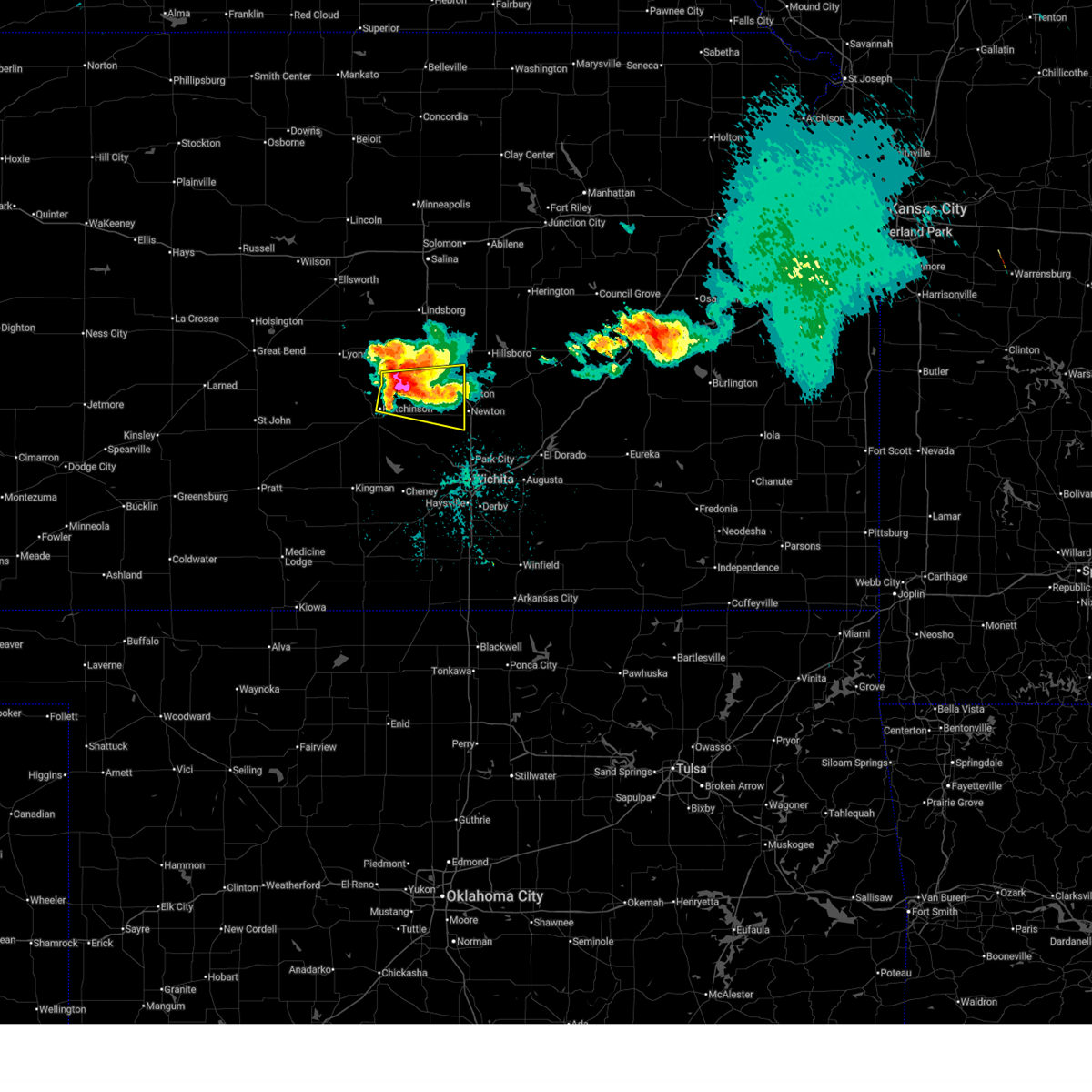
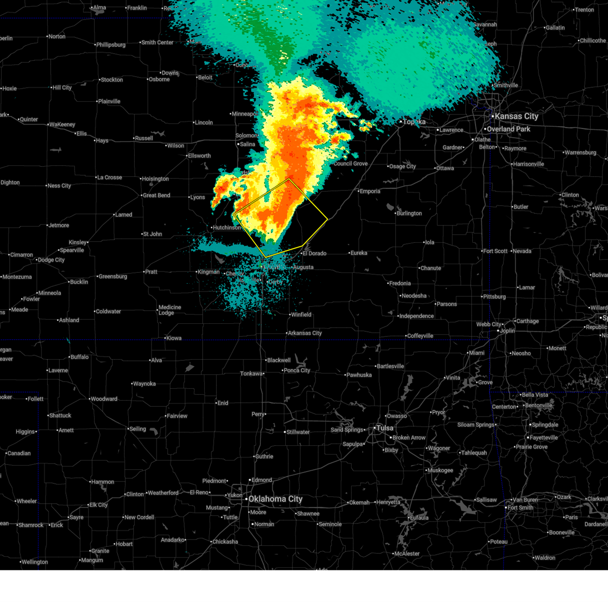
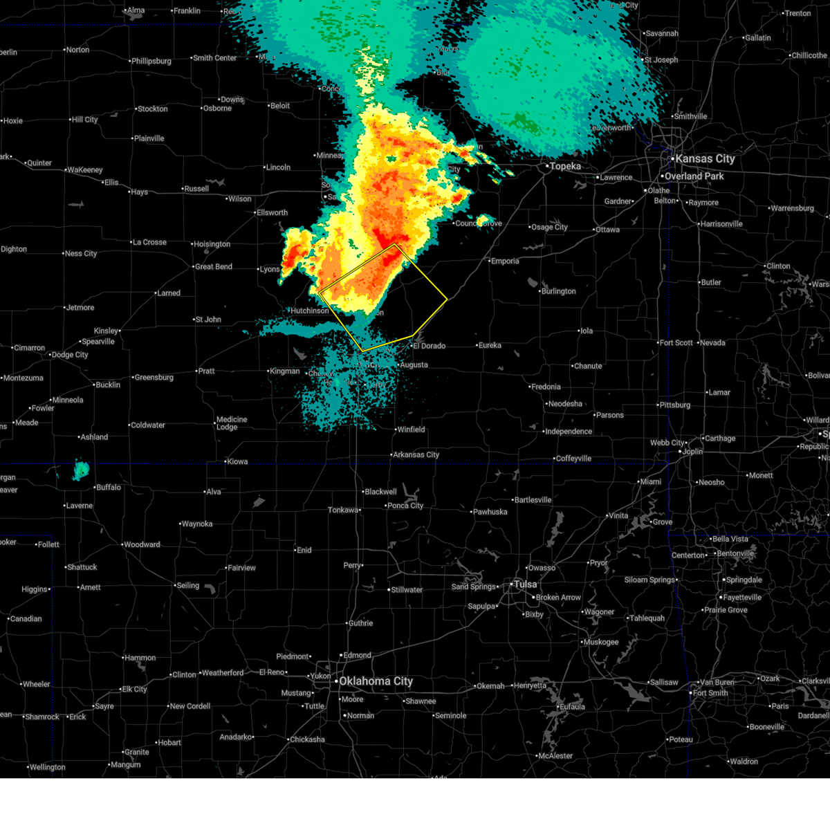
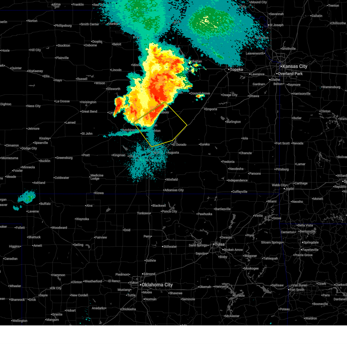
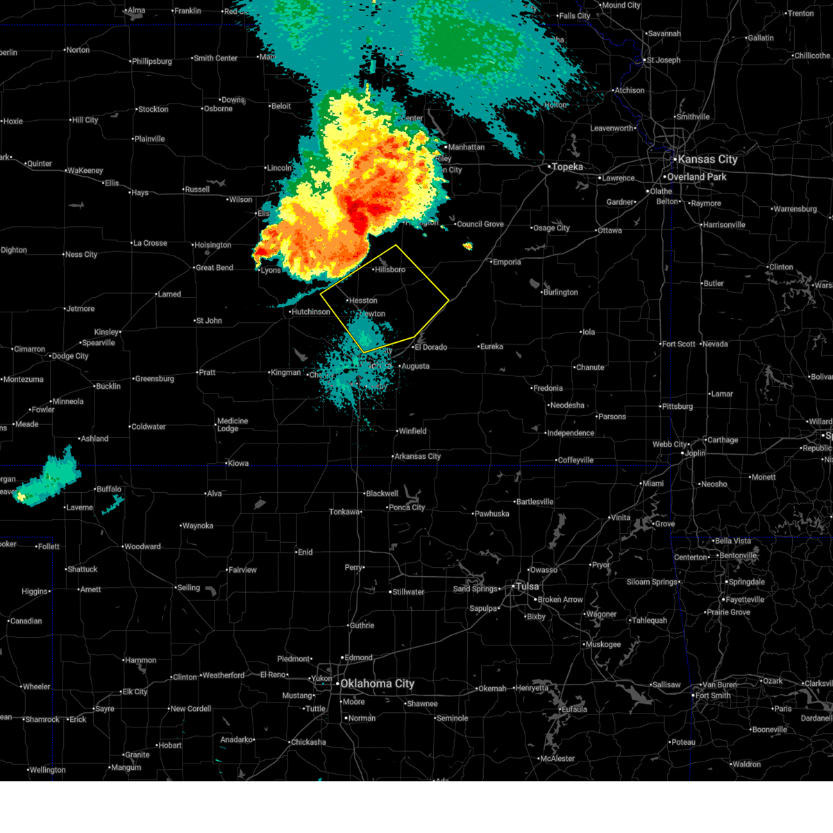
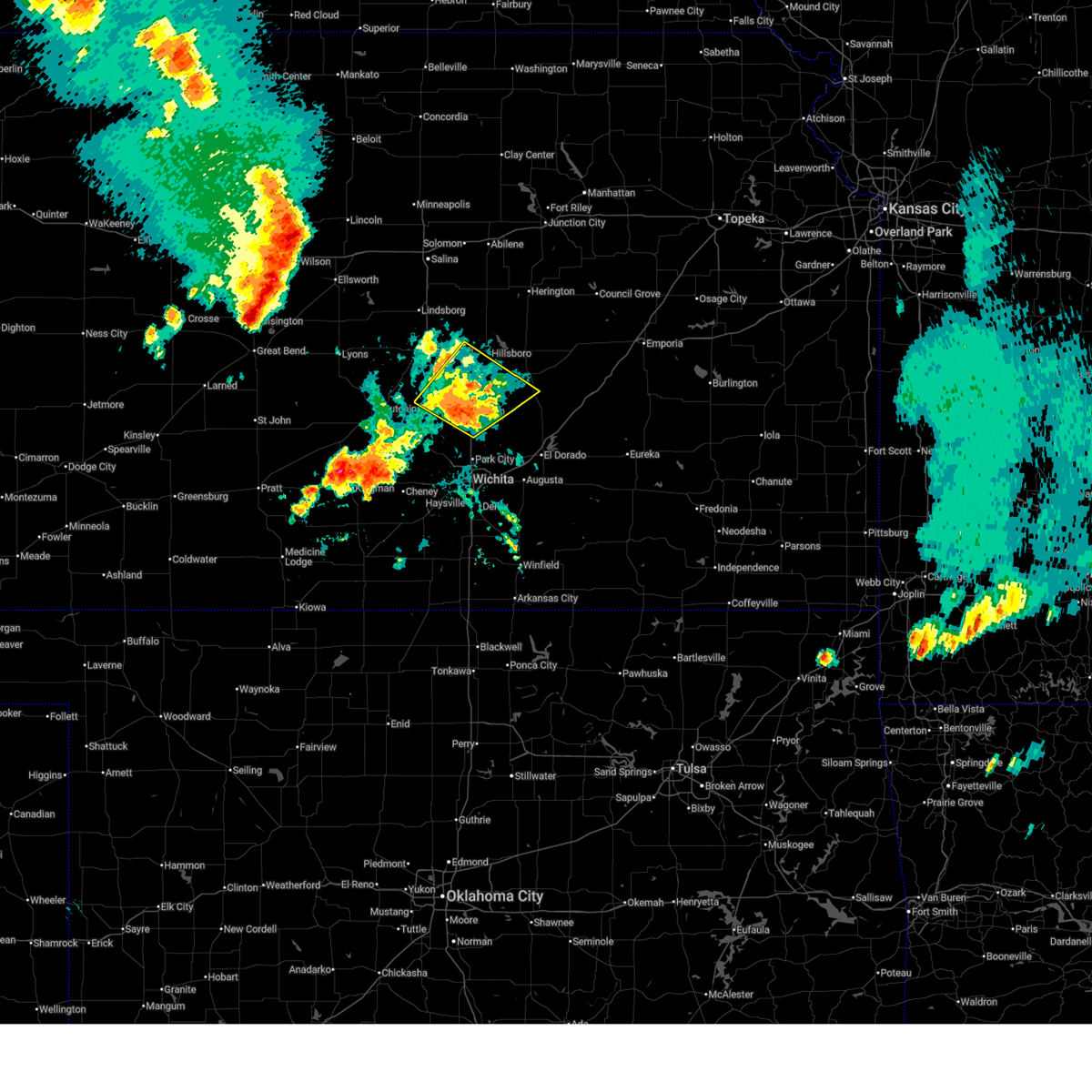
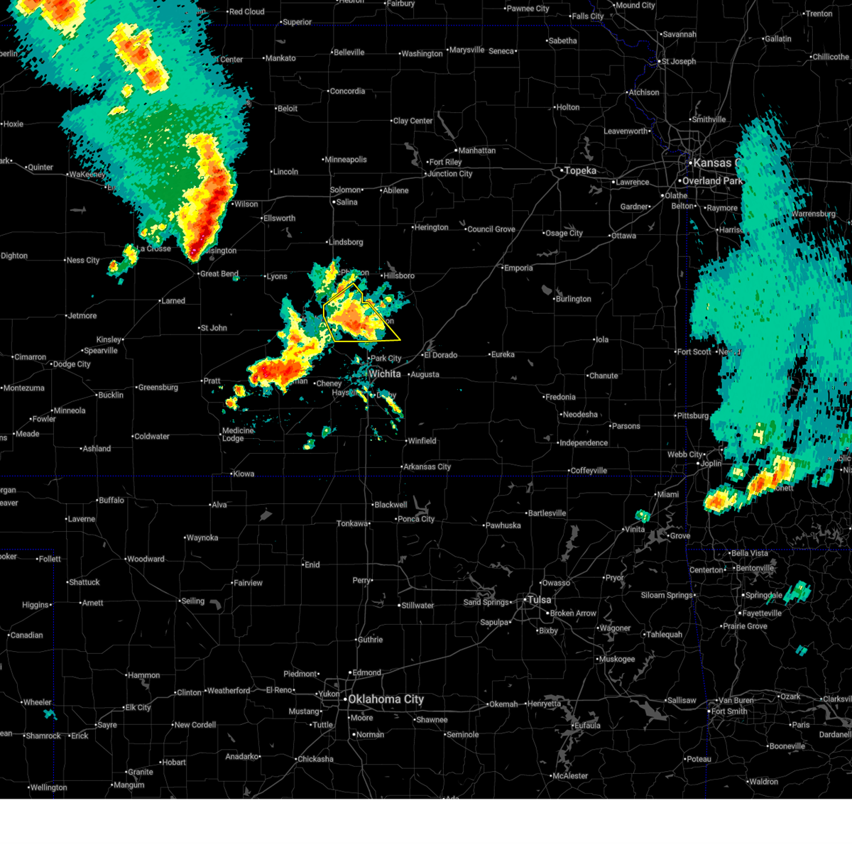
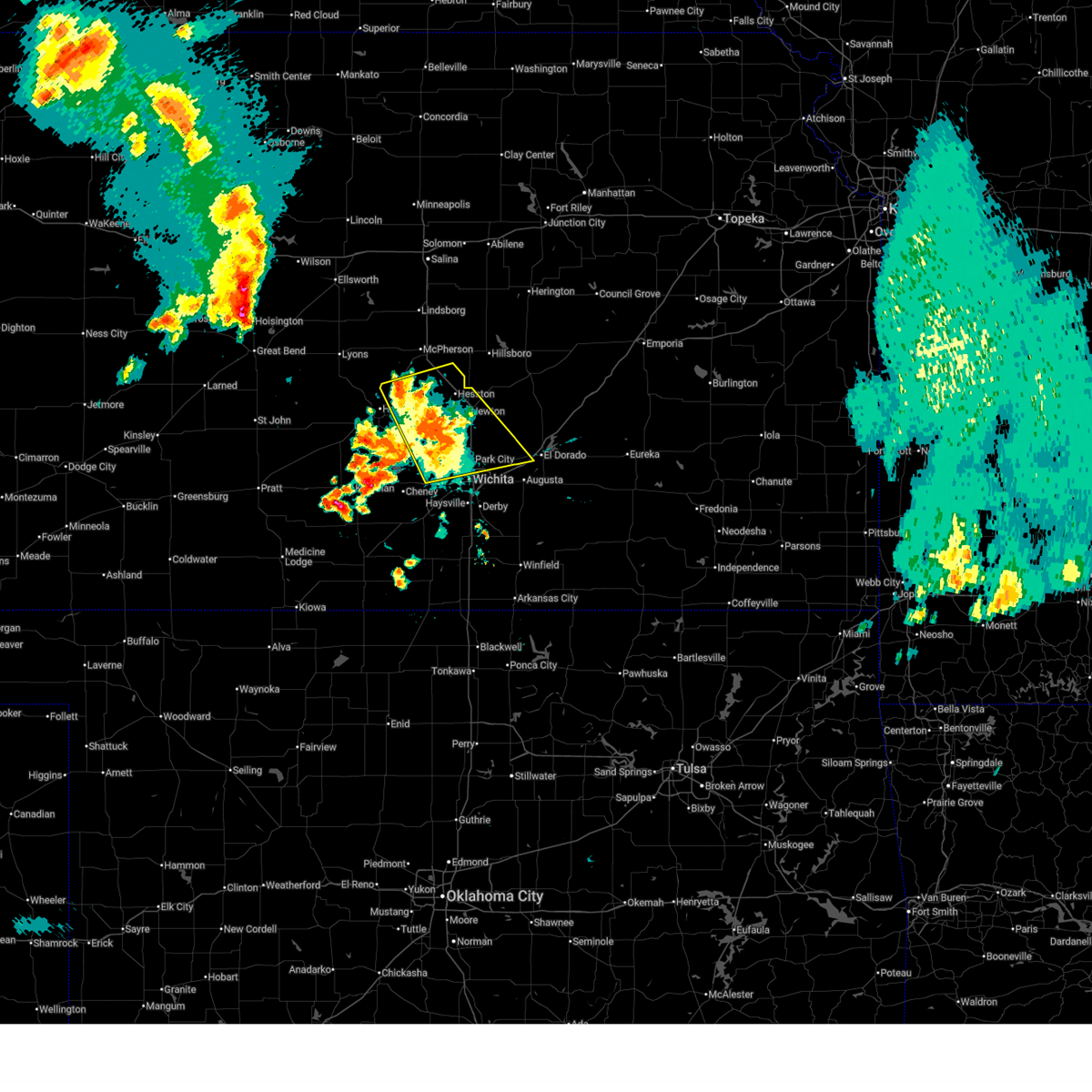
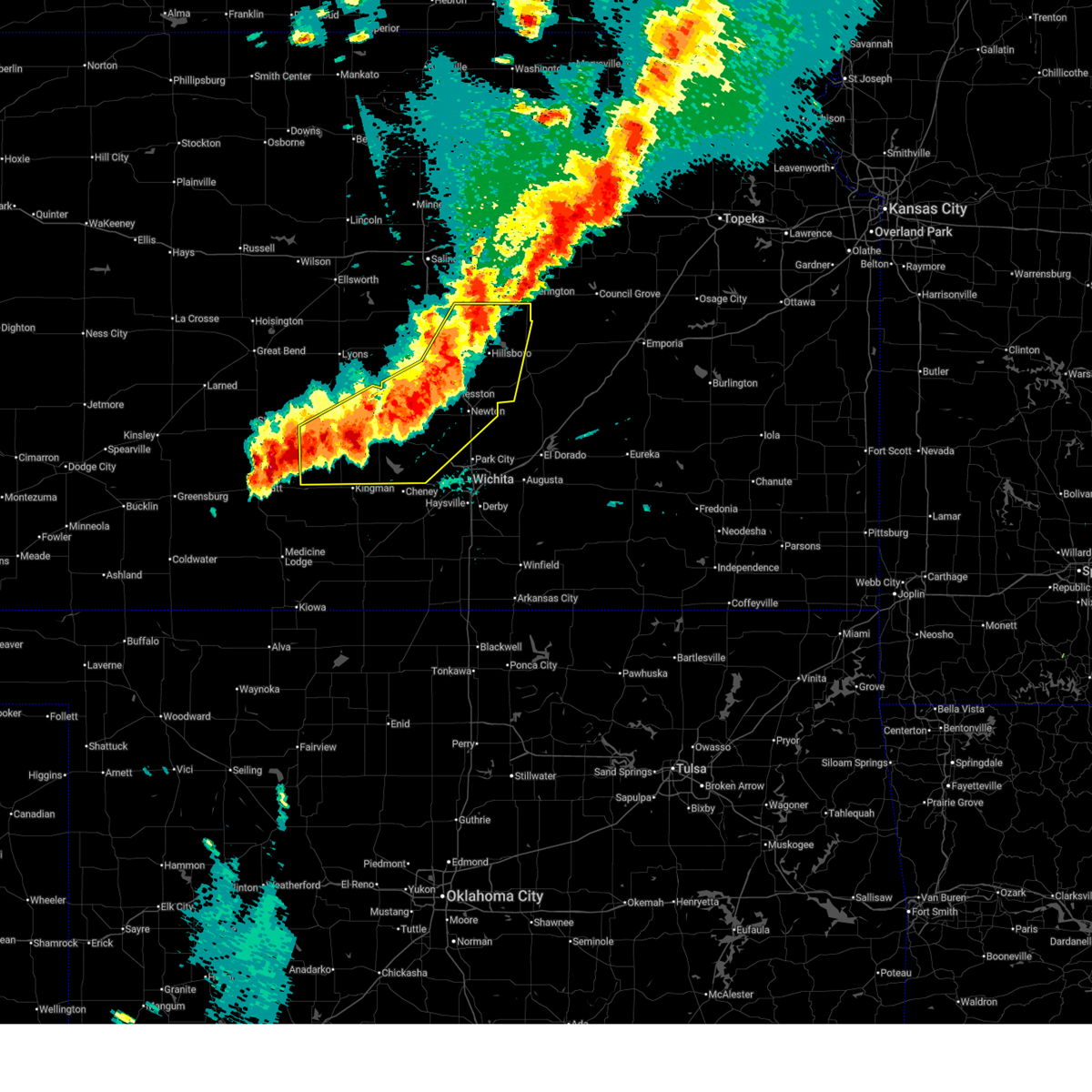
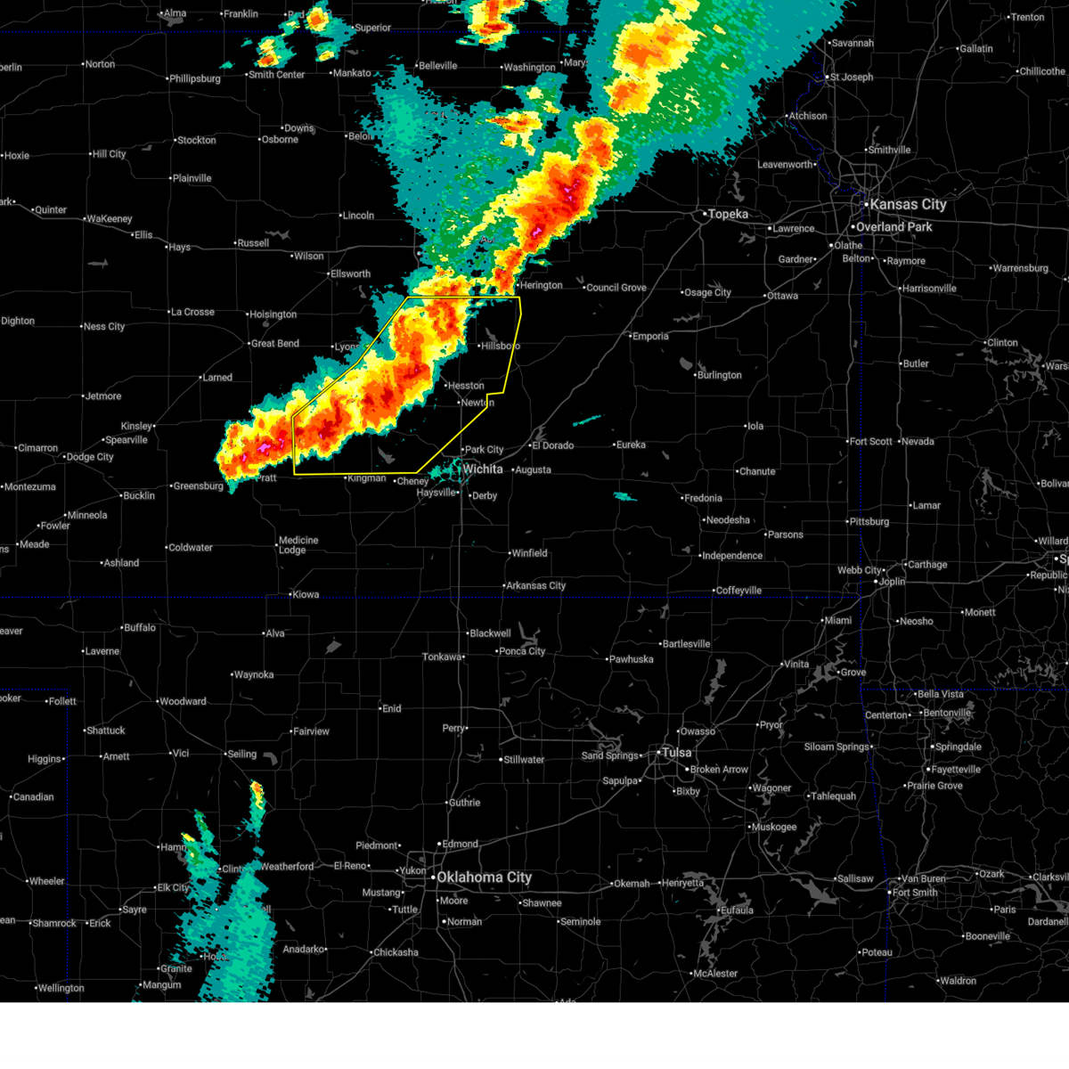
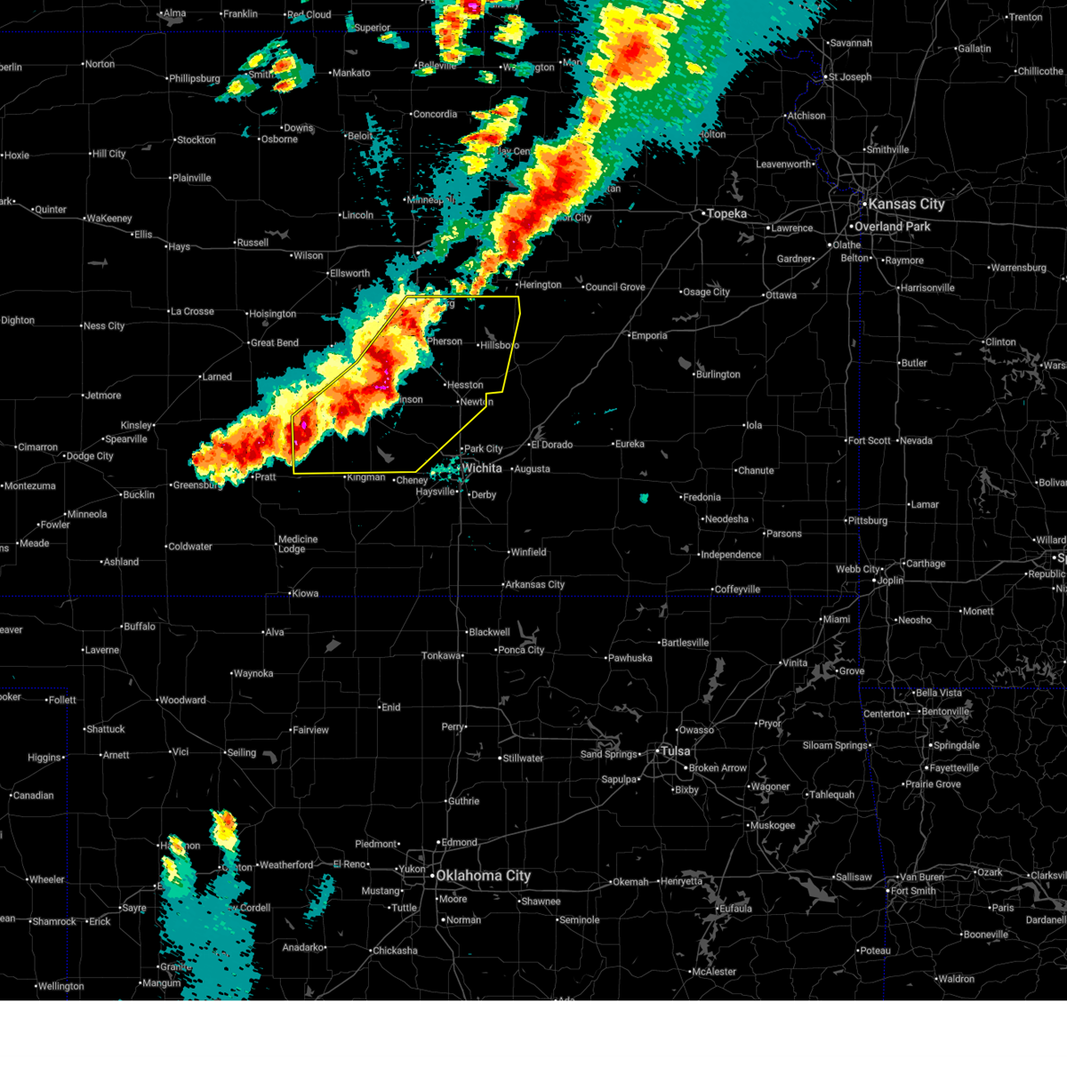
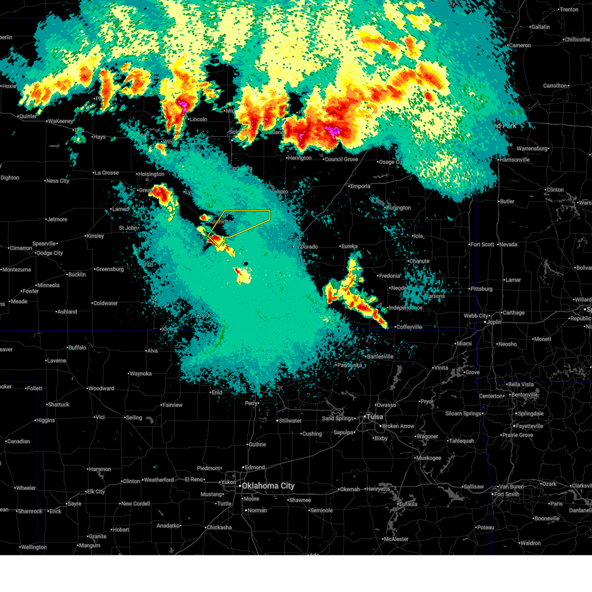
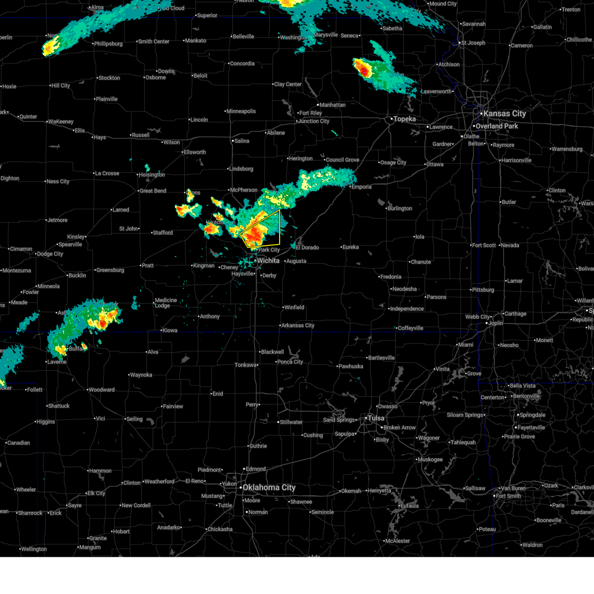
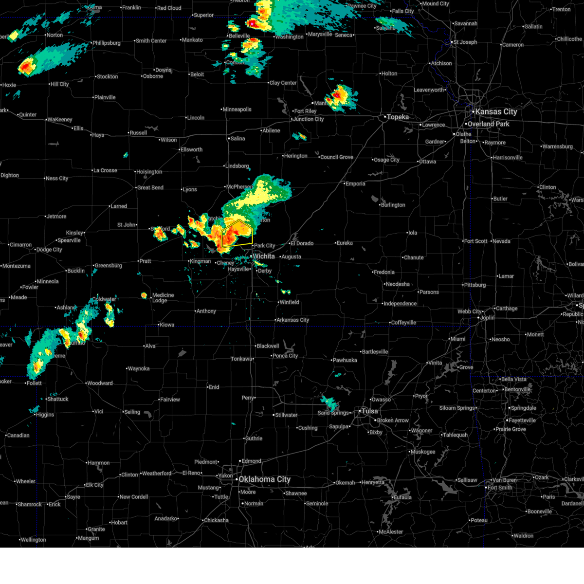
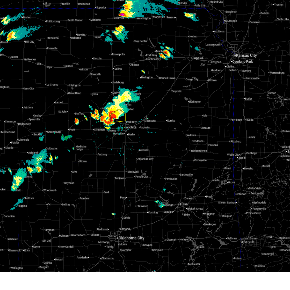
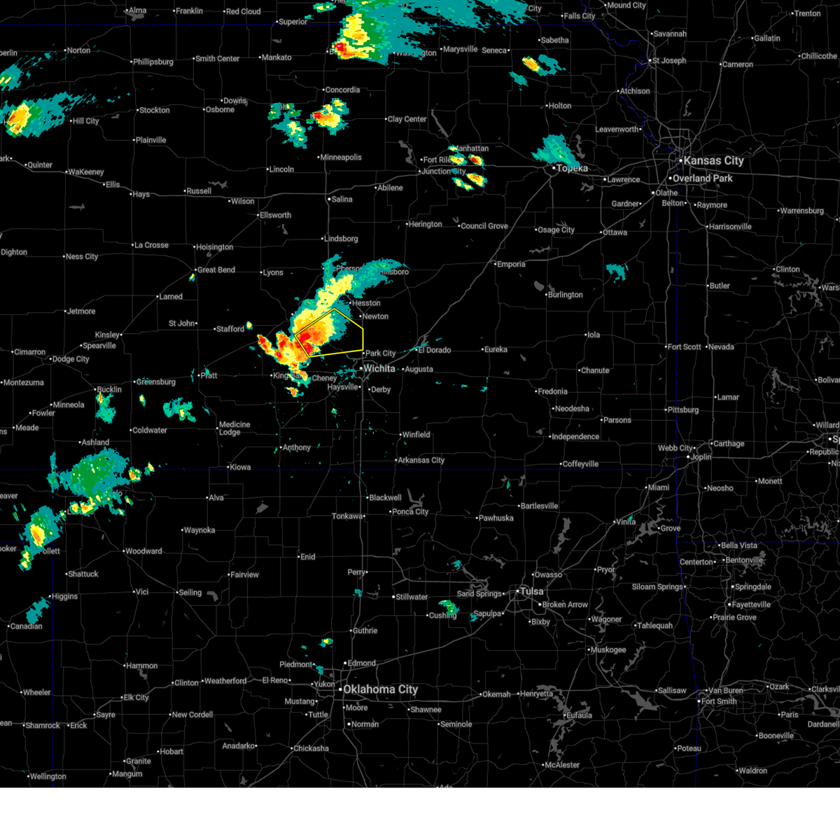
The Top Recent Hail Date for Newton, KS is Wednesday, June 10, 2026 (10th out of 156)
Hail and Wind Damage Spotted near Newton, KS
| Date / Time | Report Details |
|---|---|
| 6/21/2026 1:26 AM CDT |
 At 125 am cdt, severe thunderstorms were located along a line extending from 6 miles southwest of moundridge to 5 miles north of benton to near andover to 5 miles west of belle plaine to 8 miles east of anthony, moving southeast at 55 mph (trained weather spotters. several reports of 60 to 70 mph wind gusts were reported around wichita). Hazards include 70 mph wind gusts. Expect considerable tree damage. damage is likely to mobile homes, roofs, and outbuildings. locations impacted include, wichita, derby, newton, andover, haysville, wellington, park city, valley center, bel aire, mulvane, goddard, rose hill, hesston, maize, kingman, clearwater, anthony, cheney, halstead, and north newton. this includes the following highways, interstate 135 between mile markers 0 and 42. Interstate 35 between mile markers 18 and 54. At 125 am cdt, severe thunderstorms were located along a line extending from 6 miles southwest of moundridge to 5 miles north of benton to near andover to 5 miles west of belle plaine to 8 miles east of anthony, moving southeast at 55 mph (trained weather spotters. several reports of 60 to 70 mph wind gusts were reported around wichita). Hazards include 70 mph wind gusts. Expect considerable tree damage. damage is likely to mobile homes, roofs, and outbuildings. locations impacted include, wichita, derby, newton, andover, haysville, wellington, park city, valley center, bel aire, mulvane, goddard, rose hill, hesston, maize, kingman, clearwater, anthony, cheney, halstead, and north newton. this includes the following highways, interstate 135 between mile markers 0 and 42. Interstate 35 between mile markers 18 and 54.
|
| 6/21/2026 12:55 AM CDT |
 At 1254 am cdt, severe thunderstorms were located along a line extending from near buhler to near mount hope to 5 miles northwest of viola to near harper, moving east at 45 mph (trained weather spotters reported 60 mph winds near cheney reservoir and 65 mph 2 miles northwest of andale). Hazards include 70 mph wind gusts. Expect considerable tree damage. damage is likely to mobile homes, roofs, and outbuildings. locations impacted include, wichita, hutchinson, derby, newton, andover, haysville, wellington, park city, valley center, bel aire, mulvane, goddard, rose hill, hesston, maize, kingman, clearwater, south hutchinson, anthony, and cheney. this includes the following highways, interstate 135 between mile markers 0 and 42. Interstate 35 between mile markers 18 and 54. At 1254 am cdt, severe thunderstorms were located along a line extending from near buhler to near mount hope to 5 miles northwest of viola to near harper, moving east at 45 mph (trained weather spotters reported 60 mph winds near cheney reservoir and 65 mph 2 miles northwest of andale). Hazards include 70 mph wind gusts. Expect considerable tree damage. damage is likely to mobile homes, roofs, and outbuildings. locations impacted include, wichita, hutchinson, derby, newton, andover, haysville, wellington, park city, valley center, bel aire, mulvane, goddard, rose hill, hesston, maize, kingman, clearwater, south hutchinson, anthony, and cheney. this includes the following highways, interstate 135 between mile markers 0 and 42. Interstate 35 between mile markers 18 and 54.
|
| 6/21/2026 12:32 AM CDT |
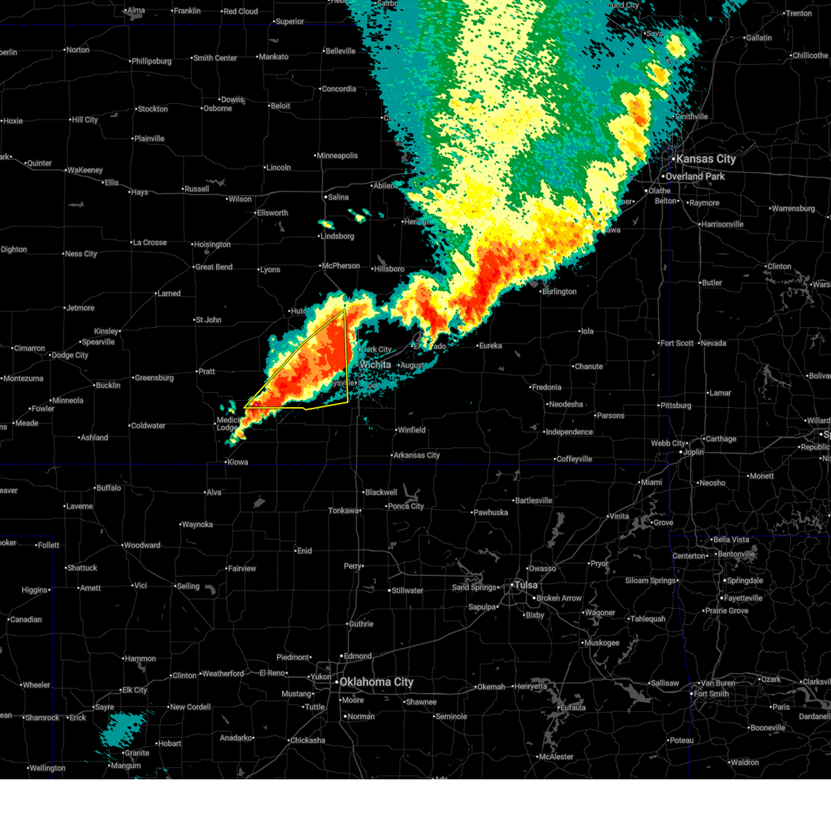
 Svrict the national weather service in wichita has issued a * severe thunderstorm warning for, reno county in south central kansas, sedgwick county in south central kansas, harvey county in south central kansas, harper county in south central kansas, kingman county in south central kansas, sumner county in south central kansas, * until 145 am cdt. * at 1232 am cdt, severe thunderstorms were located along a line extending from near nickerson to 6 miles west of haven to 9 miles east of kingman to 7 miles southeast of nashville, moving east at 45 mph (trained weather spotters reported 60 mph winds in kingman at 12:26 am). Hazards include 70 mph wind gusts. Expect considerable tree damage. Damage is likely to mobile homes, roofs, and outbuildings. Svrict the national weather service in wichita has issued a * severe thunderstorm warning for, reno county in south central kansas, sedgwick county in south central kansas, harvey county in south central kansas, harper county in south central kansas, kingman county in south central kansas, sumner county in south central kansas, * until 145 am cdt. * at 1232 am cdt, severe thunderstorms were located along a line extending from near nickerson to 6 miles west of haven to 9 miles east of kingman to 7 miles southeast of nashville, moving east at 45 mph (trained weather spotters reported 60 mph winds in kingman at 12:26 am). Hazards include 70 mph wind gusts. Expect considerable tree damage. Damage is likely to mobile homes, roofs, and outbuildings.
|
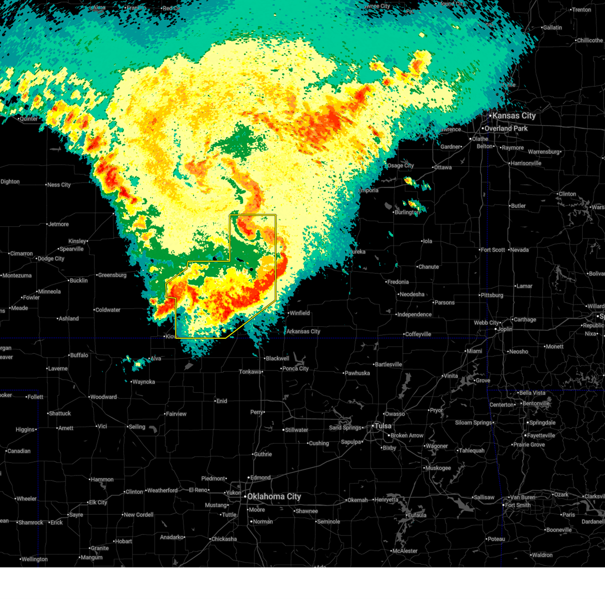
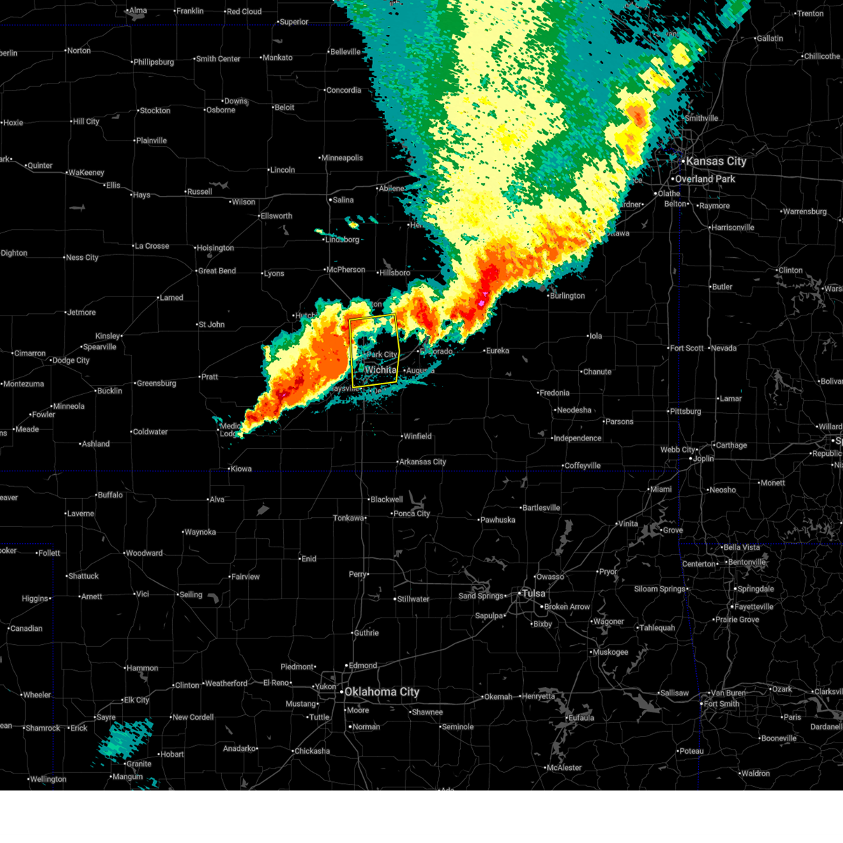
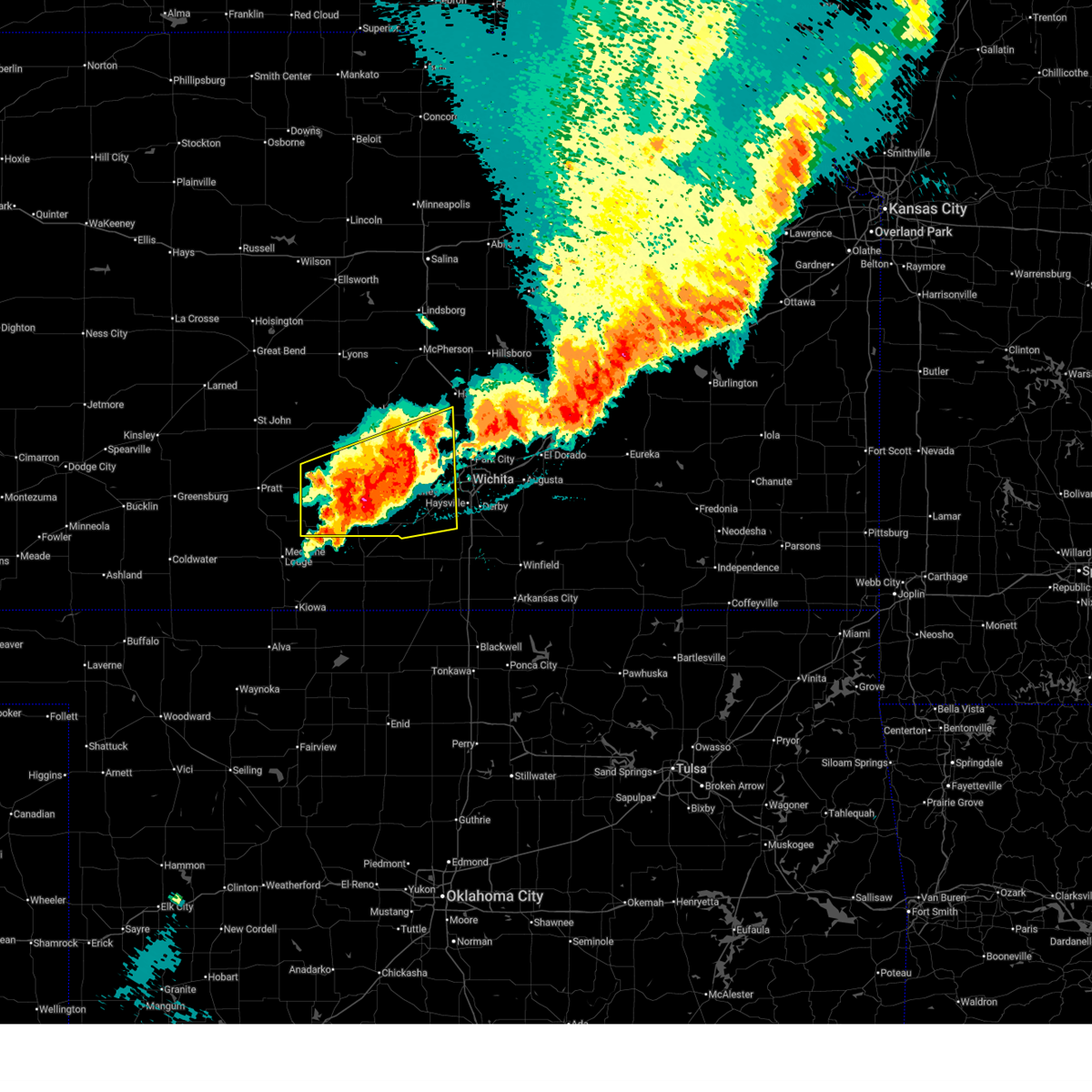
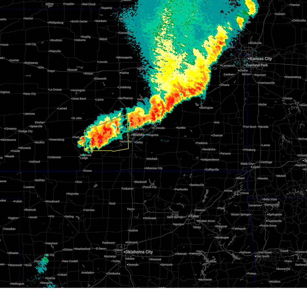
| 6/10/2026 11:35 PM CDT |
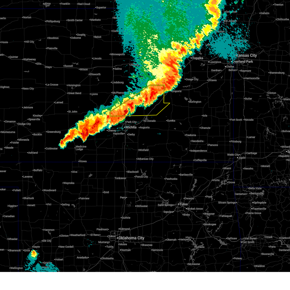
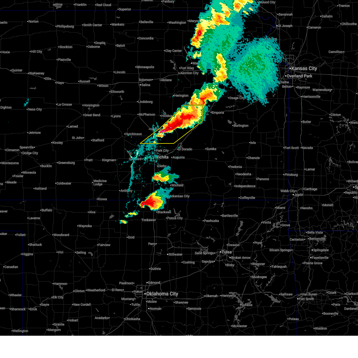
 At 1135 pm cdt, a severe thunderstorm was located over newton, moving east at 25 mph (trained weather spotters reported quarter size hail in newton at 1134 pm). Hazards include 60 mph wind gusts and quarter size hail. Hail damage to vehicles is expected. expect wind damage to roofs, siding, and trees. locations impacted include, newton, north newton, whitewater, and newton airport. This includes interstate 135 between mile markers 28 and 35. At 1135 pm cdt, a severe thunderstorm was located over newton, moving east at 25 mph (trained weather spotters reported quarter size hail in newton at 1134 pm). Hazards include 60 mph wind gusts and quarter size hail. Hail damage to vehicles is expected. expect wind damage to roofs, siding, and trees. locations impacted include, newton, north newton, whitewater, and newton airport. This includes interstate 135 between mile markers 28 and 35.
|
| 6/10/2026 11:34 PM CDT | Quarter sized hail reported 1.5 miles SW of Newton, KS |
| 6/10/2026 11:24 PM CDT |
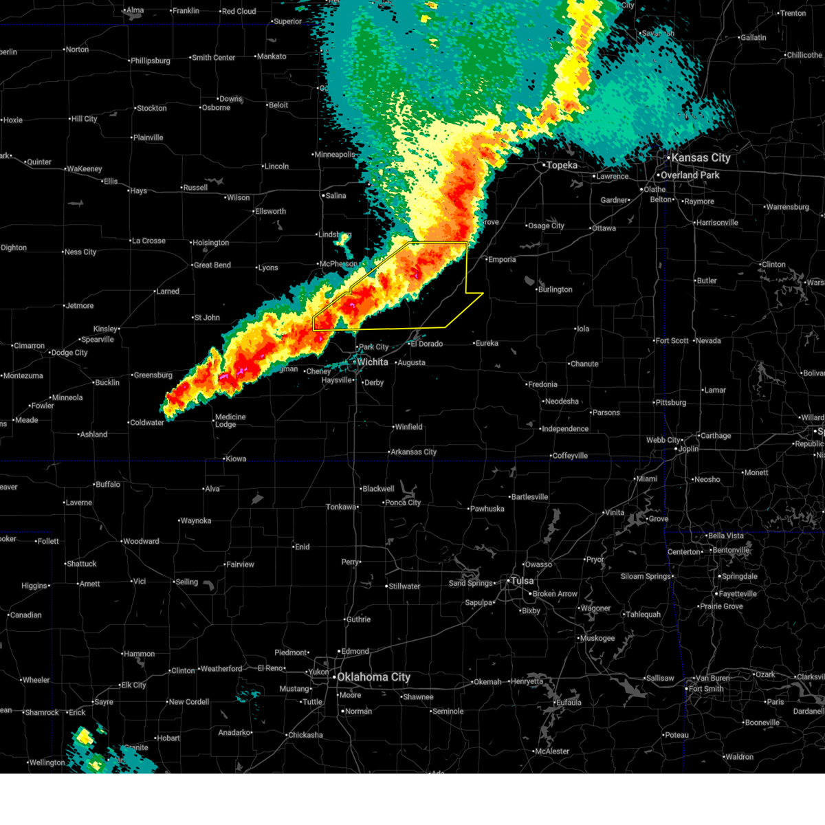
 At 1124 pm cdt, a severe thunderstorm was located over newton, moving east at 30 mph (radar indicated). Hazards include golf ball size hail and 60 mph wind gusts. People and animals outdoors will be injured. expect hail damage to roofs, siding, windows, and vehicles. expect wind damage to roofs, siding, and trees. locations impacted include, newton. This includes interstate 135 between mile markers 37 and 38. At 1124 pm cdt, a severe thunderstorm was located over newton, moving east at 30 mph (radar indicated). Hazards include golf ball size hail and 60 mph wind gusts. People and animals outdoors will be injured. expect hail damage to roofs, siding, windows, and vehicles. expect wind damage to roofs, siding, and trees. locations impacted include, newton. This includes interstate 135 between mile markers 37 and 38.
|
| 6/10/2026 11:17 PM CDT |
 Svrict the national weather service in wichita has issued a * severe thunderstorm warning for, southeastern harvey county in south central kansas, * until 1215 am cdt. * at 1117 pm cdt, a severe thunderstorm was located near halstead, moving east at 30 mph (trained weather spotters reported ping pong ball size hail 5 miles north of halstead at 1113 pm). Hazards include golf ball size hail and 60 mph wind gusts. People and animals outdoors will be injured. expect hail damage to roofs, siding, windows, and vehicles. Expect wind damage to roofs, siding, and trees. Svrict the national weather service in wichita has issued a * severe thunderstorm warning for, southeastern harvey county in south central kansas, * until 1215 am cdt. * at 1117 pm cdt, a severe thunderstorm was located near halstead, moving east at 30 mph (trained weather spotters reported ping pong ball size hail 5 miles north of halstead at 1113 pm). Hazards include golf ball size hail and 60 mph wind gusts. People and animals outdoors will be injured. expect hail damage to roofs, siding, windows, and vehicles. Expect wind damage to roofs, siding, and trees.
|
| 6/10/2026 11:15 PM CDT |
 At 1114 pm cdt, a severe thunderstorm was located near halstead, moving east at 30 mph (trained weather spotters reported ping pong ball size hail 5 miles north of halstead at 1113 pm). Hazards include golf ball size hail and 60 mph wind gusts. People and animals outdoors will be injured. expect hail damage to roofs, siding, windows, and vehicles. expect wind damage to roofs, siding, and trees. locations impacted include, newton and halstead. This includes interstate 135 between mile markers 37 and 38. At 1114 pm cdt, a severe thunderstorm was located near halstead, moving east at 30 mph (trained weather spotters reported ping pong ball size hail 5 miles north of halstead at 1113 pm). Hazards include golf ball size hail and 60 mph wind gusts. People and animals outdoors will be injured. expect hail damage to roofs, siding, windows, and vehicles. expect wind damage to roofs, siding, and trees. locations impacted include, newton and halstead. This includes interstate 135 between mile markers 37 and 38.
|
| 6/10/2026 11:00 PM CDT |
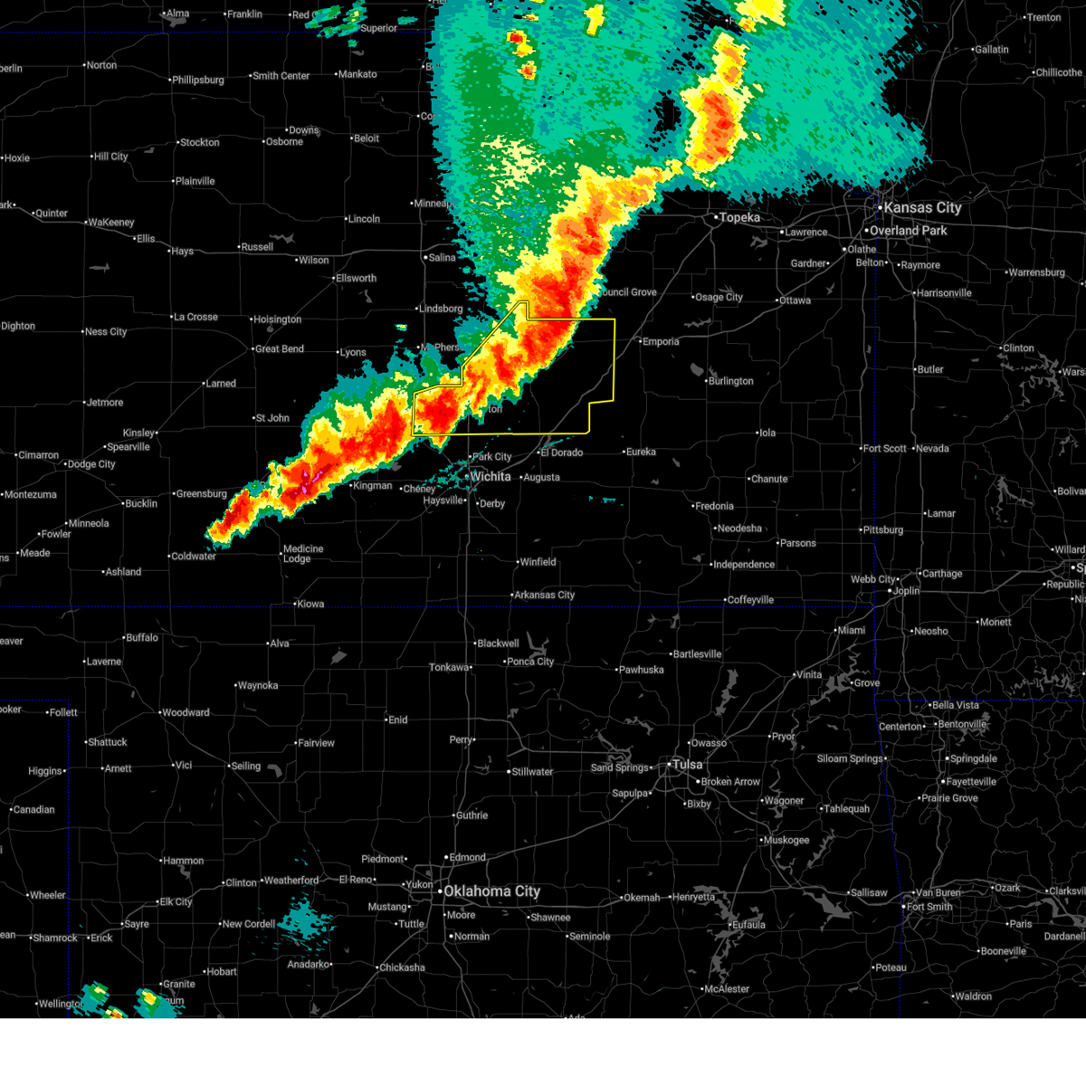
 At 1100 pm cdt, a severe thunderstorm was located near burrton, moving southeast at 30 mph (radar indicated). Hazards include golf ball size hail and 60 mph wind gusts. People and animals outdoors will be injured. expect hail damage to roofs, siding, windows, and vehicles. expect wind damage to roofs, siding, and trees. locations impacted include, newton, hesston, halstead, and burrton. This includes interstate 135 between mile markers 37 and 42. At 1100 pm cdt, a severe thunderstorm was located near burrton, moving southeast at 30 mph (radar indicated). Hazards include golf ball size hail and 60 mph wind gusts. People and animals outdoors will be injured. expect hail damage to roofs, siding, windows, and vehicles. expect wind damage to roofs, siding, and trees. locations impacted include, newton, hesston, halstead, and burrton. This includes interstate 135 between mile markers 37 and 42.
|
| 6/10/2026 10:52 PM CDT |
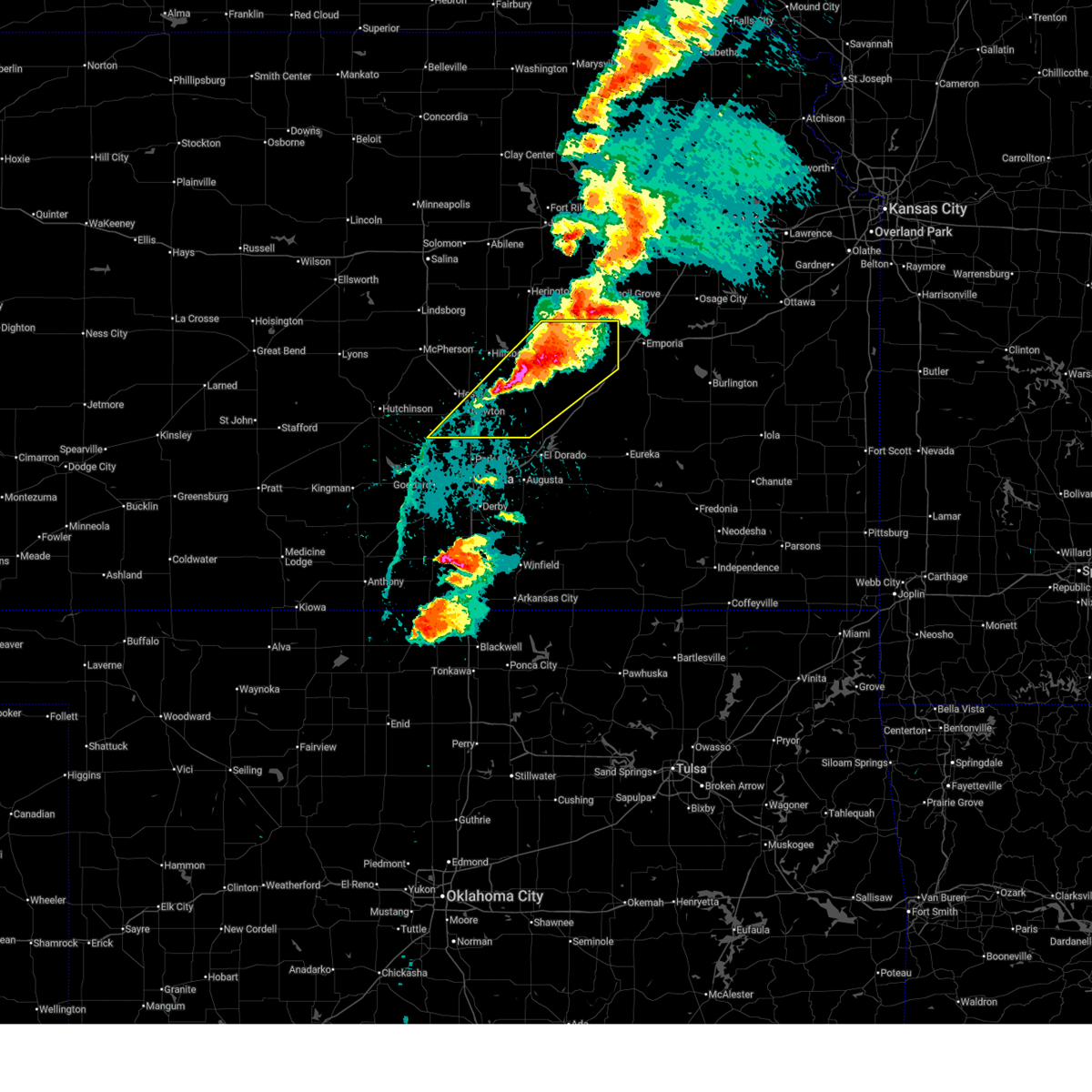
 At 1051 pm cdt, a severe thunderstorm was located near burrton, moving southeast at 30 mph (half dollar size hail was reported in buhler at 1040 pm. the hail was covering the ground). Hazards include two inch hail and 70 mph wind gusts. People and animals outdoors will be injured. expect hail damage to roofs, siding, windows, and vehicles. expect considerable tree damage. wind damage is also likely to mobile homes, roofs, and outbuildings. locations impacted include, newton, hesston, halstead, moundridge, buhler, and burrton. This includes interstate 135 between mile markers 37 and 49. At 1051 pm cdt, a severe thunderstorm was located near burrton, moving southeast at 30 mph (half dollar size hail was reported in buhler at 1040 pm. the hail was covering the ground). Hazards include two inch hail and 70 mph wind gusts. People and animals outdoors will be injured. expect hail damage to roofs, siding, windows, and vehicles. expect considerable tree damage. wind damage is also likely to mobile homes, roofs, and outbuildings. locations impacted include, newton, hesston, halstead, moundridge, buhler, and burrton. This includes interstate 135 between mile markers 37 and 49.
|
| 6/10/2026 10:44 PM CDT |
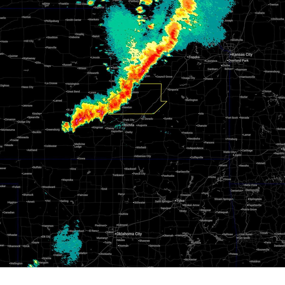
 At 1043 pm cdt, a severe thunderstorm was located near buhler, moving east at 30 mph (a 63 mph wind gust was reported at the hutchinson airport at 1043 pm). Hazards include tennis ball size hail and 70 mph wind gusts. People and animals outdoors will be injured. expect hail damage to roofs, siding, windows, and vehicles. expect considerable tree damage. wind damage is also likely to mobile homes, roofs, and outbuildings. locations impacted include, newton, hesston, halstead, moundridge, buhler, and burrton. This includes interstate 135 between mile markers 37 and 50. At 1043 pm cdt, a severe thunderstorm was located near buhler, moving east at 30 mph (a 63 mph wind gust was reported at the hutchinson airport at 1043 pm). Hazards include tennis ball size hail and 70 mph wind gusts. People and animals outdoors will be injured. expect hail damage to roofs, siding, windows, and vehicles. expect considerable tree damage. wind damage is also likely to mobile homes, roofs, and outbuildings. locations impacted include, newton, hesston, halstead, moundridge, buhler, and burrton. This includes interstate 135 between mile markers 37 and 50.
|
| 6/10/2026 10:40 PM CDT |
 At 1039 pm cdt, a severe thunderstorm was located over buhler, moving east at 30 mph (trained weather spotters reported golf ball size hail on the k-61 at the mcpherson county, reno county line). Hazards include tennis ball size hail and 70 mph wind gusts. People and animals outdoors will be injured. expect hail damage to roofs, siding, windows, and vehicles. expect considerable tree damage. wind damage is also likely to mobile homes, roofs, and outbuildings. locations impacted include, hutchinson, newton, hesston, halstead, moundridge, buhler, burrton, and hutchinson airport. This includes interstate 135 between mile markers 37 and 51. At 1039 pm cdt, a severe thunderstorm was located over buhler, moving east at 30 mph (trained weather spotters reported golf ball size hail on the k-61 at the mcpherson county, reno county line). Hazards include tennis ball size hail and 70 mph wind gusts. People and animals outdoors will be injured. expect hail damage to roofs, siding, windows, and vehicles. expect considerable tree damage. wind damage is also likely to mobile homes, roofs, and outbuildings. locations impacted include, hutchinson, newton, hesston, halstead, moundridge, buhler, burrton, and hutchinson airport. This includes interstate 135 between mile markers 37 and 51.
|
| 6/10/2026 10:29 PM CDT |
 Svrict the national weather service in wichita has issued a * severe thunderstorm warning for, southern mcpherson county in central kansas, northeastern reno county in south central kansas, western harvey county in south central kansas, * until 1130 pm cdt. * at 1029 pm cdt, a severe thunderstorm was located near buhler, moving east at 30 mph (radar indicated). Hazards include tennis ball size hail and 70 mph wind gusts. People and animals outdoors will be injured. expect hail damage to roofs, siding, windows, and vehicles. expect considerable tree damage. Wind damage is also likely to mobile homes, roofs, and outbuildings. Svrict the national weather service in wichita has issued a * severe thunderstorm warning for, southern mcpherson county in central kansas, northeastern reno county in south central kansas, western harvey county in south central kansas, * until 1130 pm cdt. * at 1029 pm cdt, a severe thunderstorm was located near buhler, moving east at 30 mph (radar indicated). Hazards include tennis ball size hail and 70 mph wind gusts. People and animals outdoors will be injured. expect hail damage to roofs, siding, windows, and vehicles. expect considerable tree damage. Wind damage is also likely to mobile homes, roofs, and outbuildings.
|
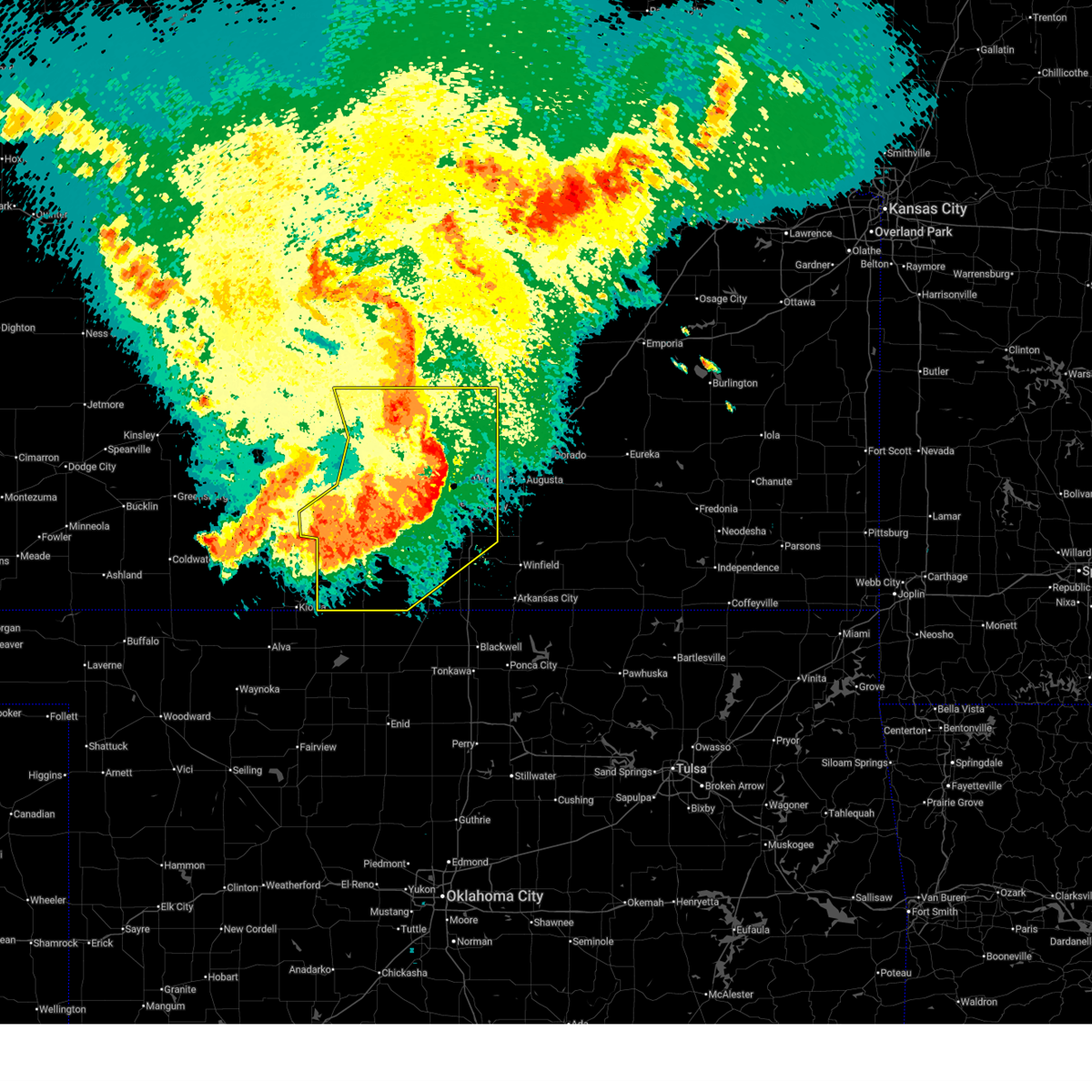
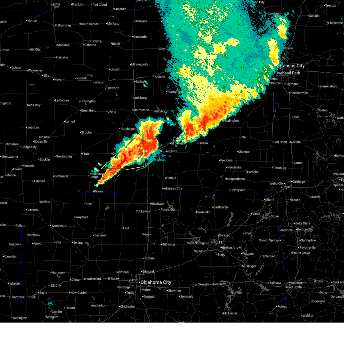
| 6/8/2026 10:42 PM CDT |
 At 1040 pm cdt, severe thunderstorms were located along a line extending from 9 miles east of florence to near potwin to near park city, moving southeast at 45 mph. these are destructive storms for peabody, florence, burns, whitewater, and other rural areas of marion, chase, butler, sedgwick counties (emergency management reported 80 to 90 mph wind gusts 5 miles west of florence). Hazards include 80 to 90 mph wind gusts and quarter size hail. Flying debris will be dangerous to those caught without shelter. mobile homes will be heavily damaged. expect considerable damage to roofs, windows, and vehicles. extensive tree damage and power outages are likely. locations impacted include, newton, park city, valley center, hesston, hillsboro, halstead, marion, north newton, moundridge, sedgwick, peabody, whitewater, florence, kechi, goessel, potwin, walton, elbing, burns, and cedar point. This includes interstate 135 between mile markers 16 and 50. At 1040 pm cdt, severe thunderstorms were located along a line extending from 9 miles east of florence to near potwin to near park city, moving southeast at 45 mph. these are destructive storms for peabody, florence, burns, whitewater, and other rural areas of marion, chase, butler, sedgwick counties (emergency management reported 80 to 90 mph wind gusts 5 miles west of florence). Hazards include 80 to 90 mph wind gusts and quarter size hail. Flying debris will be dangerous to those caught without shelter. mobile homes will be heavily damaged. expect considerable damage to roofs, windows, and vehicles. extensive tree damage and power outages are likely. locations impacted include, newton, park city, valley center, hesston, hillsboro, halstead, marion, north newton, moundridge, sedgwick, peabody, whitewater, florence, kechi, goessel, potwin, walton, elbing, burns, and cedar point. This includes interstate 135 between mile markers 16 and 50.
|
| 6/8/2026 10:34 PM CDT |
 At 1032 pm cdt, severe thunderstorms were located along a line extending from 7 miles northeast of florence to whitewater to near sedgwick, moving southeast at 45 mph. these are destructive storms for newton, marion, hillsboro, and other rural areas of harvey, butler, marion, and chase county (an 84 mph wind gust was measured at the newton airport at 1028 pm). Hazards include 80 mph wind gusts and quarter size hail. Flying debris will be dangerous to those caught without shelter. mobile homes will be heavily damaged. expect considerable damage to roofs, windows, and vehicles. extensive tree damage and power outages are likely. locations impacted include, newton, park city, valley center, hesston, hillsboro, halstead, marion, north newton, moundridge, sedgwick, peabody, whitewater, florence, kechi, goessel, potwin, walton, elbing, burns, and cedar point. This includes interstate 135 between mile markers 16 and 50. At 1032 pm cdt, severe thunderstorms were located along a line extending from 7 miles northeast of florence to whitewater to near sedgwick, moving southeast at 45 mph. these are destructive storms for newton, marion, hillsboro, and other rural areas of harvey, butler, marion, and chase county (an 84 mph wind gust was measured at the newton airport at 1028 pm). Hazards include 80 mph wind gusts and quarter size hail. Flying debris will be dangerous to those caught without shelter. mobile homes will be heavily damaged. expect considerable damage to roofs, windows, and vehicles. extensive tree damage and power outages are likely. locations impacted include, newton, park city, valley center, hesston, hillsboro, halstead, marion, north newton, moundridge, sedgwick, peabody, whitewater, florence, kechi, goessel, potwin, walton, elbing, burns, and cedar point. This includes interstate 135 between mile markers 16 and 50.
|
| 6/8/2026 10:25 PM CDT | Ewk reported 84 mp in harvey county KS, 4.5 miles WSW of Newton, KS |
| 6/8/2026 10:23 PM CDT |
 At 1023 pm cdt, severe thunderstorms were located along a line extending from 6 miles east of marion to 5 miles west of elbing to near halstead, moving southeast at 45 mph (emergency management reported a 65 mph wind gust at marion reservoir). Hazards include 70 mph wind gusts and quarter size hail. Hail damage to vehicles is expected. expect considerable tree damage. wind damage is also likely to mobile homes, roofs, and outbuildings. locations impacted include, newton, park city, valley center, hesston, hillsboro, halstead, marion, north newton, moundridge, sedgwick, peabody, whitewater, florence, kechi, goessel, potwin, walton, elbing, burns, and cedar point. This includes interstate 135 between mile markers 16 and 50. At 1023 pm cdt, severe thunderstorms were located along a line extending from 6 miles east of marion to 5 miles west of elbing to near halstead, moving southeast at 45 mph (emergency management reported a 65 mph wind gust at marion reservoir). Hazards include 70 mph wind gusts and quarter size hail. Hail damage to vehicles is expected. expect considerable tree damage. wind damage is also likely to mobile homes, roofs, and outbuildings. locations impacted include, newton, park city, valley center, hesston, hillsboro, halstead, marion, north newton, moundridge, sedgwick, peabody, whitewater, florence, kechi, goessel, potwin, walton, elbing, burns, and cedar point. This includes interstate 135 between mile markers 16 and 50.
|
| 6/8/2026 10:13 PM CDT |
 At 1012 pm cdt, severe thunderstorms were located along a line extending from near lincolnville to near walton to near halstead, moving southeast at 45 mph. these are destructive storms for moundridge, hesston, newton, marion, hillsboro, peabody and rural portions of mcpherson, marion, harvey, butler, chase, and sedgwick counties. (radar indicated). Hazards include 80 mph wind gusts and quarter size hail. Flying debris will be dangerous to those caught without shelter. mobile homes will be heavily damaged. expect considerable damage to roofs, windows, and vehicles. extensive tree damage and power outages are likely. locations impacted include, newton, park city, valley center, hesston, hillsboro, halstead, marion, north newton, moundridge, sedgwick, peabody, whitewater, florence, kechi, goessel, potwin, walton, elbing, burns, and cedar point. This includes interstate 135 between mile markers 16 and 50. At 1012 pm cdt, severe thunderstorms were located along a line extending from near lincolnville to near walton to near halstead, moving southeast at 45 mph. these are destructive storms for moundridge, hesston, newton, marion, hillsboro, peabody and rural portions of mcpherson, marion, harvey, butler, chase, and sedgwick counties. (radar indicated). Hazards include 80 mph wind gusts and quarter size hail. Flying debris will be dangerous to those caught without shelter. mobile homes will be heavily damaged. expect considerable damage to roofs, windows, and vehicles. extensive tree damage and power outages are likely. locations impacted include, newton, park city, valley center, hesston, hillsboro, halstead, marion, north newton, moundridge, sedgwick, peabody, whitewater, florence, kechi, goessel, potwin, walton, elbing, burns, and cedar point. This includes interstate 135 between mile markers 16 and 50.
|
| 6/8/2026 10:04 PM CDT |
 At 1003 pm cdt, severe thunderstorms were located along a line extending from near hillsboro to near goessel to moundridge, moving southeast at 45 mph. these are destructive storms for marion, hillsboro, moundridge, hesston, newton and other rural areas of mcpherson, marion, harvey butler and sedgwick counties (radar indicated). Hazards include 90 mph wind gusts and quarter size hail. You are in a life-threatening situation. flying debris may be deadly to those caught without shelter. mobile homes will be heavily damaged or destroyed. homes and businesses will have substantial roof and window damage. expect extensive tree damage and power outages. locations impacted include, newton, park city, valley center, hesston, hillsboro, halstead, marion, north newton, moundridge, sedgwick, peabody, whitewater, florence, kechi, goessel, potwin, walton, elbing, burns, and cedar point. This includes interstate 135 between mile markers 16 and 50. At 1003 pm cdt, severe thunderstorms were located along a line extending from near hillsboro to near goessel to moundridge, moving southeast at 45 mph. these are destructive storms for marion, hillsboro, moundridge, hesston, newton and other rural areas of mcpherson, marion, harvey butler and sedgwick counties (radar indicated). Hazards include 90 mph wind gusts and quarter size hail. You are in a life-threatening situation. flying debris may be deadly to those caught without shelter. mobile homes will be heavily damaged or destroyed. homes and businesses will have substantial roof and window damage. expect extensive tree damage and power outages. locations impacted include, newton, park city, valley center, hesston, hillsboro, halstead, marion, north newton, moundridge, sedgwick, peabody, whitewater, florence, kechi, goessel, potwin, walton, elbing, burns, and cedar point. This includes interstate 135 between mile markers 16 and 50.
|
| 6/8/2026 9:43 PM CDT |
 Svrict the national weather service in wichita has issued a * severe thunderstorm warning for, southeastern mcpherson county in central kansas, northeastern sedgwick county in south central kansas, harvey county in south central kansas, southwestern chase county in east central kansas, northwestern butler county in south central kansas, marion county in central kansas, * until 1100 pm cdt. * at 942 pm cdt, severe thunderstorms were located along a line extending from 8 miles northwest of durham to near canton to near mcpherson, moving southeast at 45 mph. these are destructive storms for moundridge, hillsboro, marion, newton, hesston and rural areas of mcpherson, marion, harvey, butler, and sedgwick counties (radar indicated). Hazards include 90 mph wind gusts and quarter size hail. You are in a life-threatening situation. flying debris may be deadly to those caught without shelter. mobile homes will be heavily damaged or destroyed. homes and businesses will have substantial roof and window damage. Expect extensive tree damage and power outages. Svrict the national weather service in wichita has issued a * severe thunderstorm warning for, southeastern mcpherson county in central kansas, northeastern sedgwick county in south central kansas, harvey county in south central kansas, southwestern chase county in east central kansas, northwestern butler county in south central kansas, marion county in central kansas, * until 1100 pm cdt. * at 942 pm cdt, severe thunderstorms were located along a line extending from 8 miles northwest of durham to near canton to near mcpherson, moving southeast at 45 mph. these are destructive storms for moundridge, hillsboro, marion, newton, hesston and rural areas of mcpherson, marion, harvey, butler, and sedgwick counties (radar indicated). Hazards include 90 mph wind gusts and quarter size hail. You are in a life-threatening situation. flying debris may be deadly to those caught without shelter. mobile homes will be heavily damaged or destroyed. homes and businesses will have substantial roof and window damage. Expect extensive tree damage and power outages.
|
| 6/8/2026 9:30 PM CDT |
 Svrict the national weather service in wichita has issued a * severe thunderstorm warning for, southern mcpherson county in central kansas, northern reno county in south central kansas, harvey county in south central kansas, northwestern chase county in east central kansas, northwestern butler county in south central kansas, southern rice county in central kansas, central marion county in central kansas, * until 1045 pm cdt. * at 930 pm cdt, severe thunderstorms were located along a line extending from 5 miles south of solomon to 6 miles northwest of mcpherson to 5 miles northwest of chase, moving southeast at 40 mph (radar indicated). Hazards include 70 mph wind gusts and quarter size hail. Hail damage to vehicles is expected. expect considerable tree damage. Wind damage is also likely to mobile homes, roofs, and outbuildings. Svrict the national weather service in wichita has issued a * severe thunderstorm warning for, southern mcpherson county in central kansas, northern reno county in south central kansas, harvey county in south central kansas, northwestern chase county in east central kansas, northwestern butler county in south central kansas, southern rice county in central kansas, central marion county in central kansas, * until 1045 pm cdt. * at 930 pm cdt, severe thunderstorms were located along a line extending from 5 miles south of solomon to 6 miles northwest of mcpherson to 5 miles northwest of chase, moving southeast at 40 mph (radar indicated). Hazards include 70 mph wind gusts and quarter size hail. Hail damage to vehicles is expected. expect considerable tree damage. Wind damage is also likely to mobile homes, roofs, and outbuildings.
|
| 5/30/2026 8:44 PM CDT |
 Svrict the national weather service in wichita has issued a * severe thunderstorm warning for, northwestern sedgwick county in south central kansas, southwestern harvey county in south central kansas, * until 915 pm cdt. * at 843 pm cdt, a severe thunderstorm was located over mount hope, moving northeast at 25 mph. this warning replaces the previous severe thunderstorm warning (radar indicated). Hazards include 60 mph wind gusts and half dollar size hail. Hail damage to vehicles is expected. Expect wind damage to roofs, siding, and trees. Svrict the national weather service in wichita has issued a * severe thunderstorm warning for, northwestern sedgwick county in south central kansas, southwestern harvey county in south central kansas, * until 915 pm cdt. * at 843 pm cdt, a severe thunderstorm was located over mount hope, moving northeast at 25 mph. this warning replaces the previous severe thunderstorm warning (radar indicated). Hazards include 60 mph wind gusts and half dollar size hail. Hail damage to vehicles is expected. Expect wind damage to roofs, siding, and trees.
|
| 5/30/2026 8:25 PM CDT | Quarter sized hail reported 5.1 miles NNW of Newton, KS |
| 5/30/2026 8:24 PM CDT |
 Svrict the national weather service in wichita has issued a * severe thunderstorm warning for, northeastern sedgwick county in south central kansas, harvey county in south central kansas, northwestern butler county in south central kansas, southern marion county in central kansas, * until 915 pm cdt. * at 824 pm cdt, a severe thunderstorm was located near newton, moving northeast at 25 mph (radar indicated). Hazards include 60 mph wind gusts and half dollar size hail. Hail damage to vehicles is expected. Expect wind damage to roofs, siding, and trees. Svrict the national weather service in wichita has issued a * severe thunderstorm warning for, northeastern sedgwick county in south central kansas, harvey county in south central kansas, northwestern butler county in south central kansas, southern marion county in central kansas, * until 915 pm cdt. * at 824 pm cdt, a severe thunderstorm was located near newton, moving northeast at 25 mph (radar indicated). Hazards include 60 mph wind gusts and half dollar size hail. Hail damage to vehicles is expected. Expect wind damage to roofs, siding, and trees.
|
| 5/30/2026 8:16 PM CDT |
 At 816 pm cdt, a severe thunderstorm was located over newton, moving northeast at 25 mph (law enforcement. at 805 pm, half dollar size hail was reported in sedgwick). Hazards include 70 mph wind gusts and half dollar size hail. Hail damage to vehicles is expected. expect considerable tree damage. wind damage is also likely to mobile homes, roofs, and outbuildings. locations impacted include, newton, park city, valley center, hesston, maize, halstead, north newton, sedgwick, colwich, haven, burrton, mount hope, whitewater, andale, bentley, newton airport, cheney lake, and cheney state park. This includes interstate 135 between mile markers 17 and 39. At 816 pm cdt, a severe thunderstorm was located over newton, moving northeast at 25 mph (law enforcement. at 805 pm, half dollar size hail was reported in sedgwick). Hazards include 70 mph wind gusts and half dollar size hail. Hail damage to vehicles is expected. expect considerable tree damage. wind damage is also likely to mobile homes, roofs, and outbuildings. locations impacted include, newton, park city, valley center, hesston, maize, halstead, north newton, sedgwick, colwich, haven, burrton, mount hope, whitewater, andale, bentley, newton airport, cheney lake, and cheney state park. This includes interstate 135 between mile markers 17 and 39.
|
| 5/30/2026 8:11 PM CDT |
 At 811 pm cdt, a severe thunderstorm was located near newton, moving northeast at 35 mph (radar indicated). Hazards include 70 mph wind gusts and half dollar size hail. Hail damage to vehicles is expected. expect considerable tree damage. wind damage is also likely to mobile homes, roofs, and outbuildings. locations impacted include, newton, park city, valley center, hesston, maize, halstead, north newton, sedgwick, colwich, haven, burrton, mount hope, whitewater, andale, bentley, newton airport, cheney lake, and cheney state park. This includes interstate 135 between mile markers 17 and 39. At 811 pm cdt, a severe thunderstorm was located near newton, moving northeast at 35 mph (radar indicated). Hazards include 70 mph wind gusts and half dollar size hail. Hail damage to vehicles is expected. expect considerable tree damage. wind damage is also likely to mobile homes, roofs, and outbuildings. locations impacted include, newton, park city, valley center, hesston, maize, halstead, north newton, sedgwick, colwich, haven, burrton, mount hope, whitewater, andale, bentley, newton airport, cheney lake, and cheney state park. This includes interstate 135 between mile markers 17 and 39.
|
| 5/30/2026 7:54 PM CDT |
 Svrict the national weather service in wichita has issued a * severe thunderstorm warning for, southeastern reno county in south central kansas, northern sedgwick county in south central kansas, harvey county in south central kansas, northwestern butler county in south central kansas, * until 845 pm cdt. * at 753 pm cdt, a severe thunderstorm was located over bentley, or 6 miles north of colwich, moving northeast at 25 mph. this warning replaces the previous severe thunderstorm warning (radar indicated). Hazards include 70 mph wind gusts and half dollar size hail. Hail damage to vehicles is expected. expect considerable tree damage. Wind damage is also likely to mobile homes, roofs, and outbuildings. Svrict the national weather service in wichita has issued a * severe thunderstorm warning for, southeastern reno county in south central kansas, northern sedgwick county in south central kansas, harvey county in south central kansas, northwestern butler county in south central kansas, * until 845 pm cdt. * at 753 pm cdt, a severe thunderstorm was located over bentley, or 6 miles north of colwich, moving northeast at 25 mph. this warning replaces the previous severe thunderstorm warning (radar indicated). Hazards include 70 mph wind gusts and half dollar size hail. Hail damage to vehicles is expected. expect considerable tree damage. Wind damage is also likely to mobile homes, roofs, and outbuildings.
|
| 5/30/2026 6:53 PM CDT |
 At 653 pm cdt, a severe thunderstorm was located over north newton, moving northeast at 30 mph (radar indicated). Hazards include 60 mph wind gusts. Expect damage to roofs, siding, and trees. locations impacted include, newton, hesston, north newton, moundridge, peabody, goessel, walton, lehigh, and newton airport. This includes interstate 135 between mile markers 28 and 48. At 653 pm cdt, a severe thunderstorm was located over north newton, moving northeast at 30 mph (radar indicated). Hazards include 60 mph wind gusts. Expect damage to roofs, siding, and trees. locations impacted include, newton, hesston, north newton, moundridge, peabody, goessel, walton, lehigh, and newton airport. This includes interstate 135 between mile markers 28 and 48.
|
| 5/30/2026 6:45 PM CDT |
 Svrict the national weather service in wichita has issued a * severe thunderstorm warning for, southeastern mcpherson county in central kansas, harvey county in south central kansas, northwestern butler county in south central kansas, southern marion county in central kansas, * until 730 pm cdt. * at 644 pm cdt, a severe thunderstorm was located over north newton, moving northeast at 30 mph (radar indicated). Hazards include 60 mph wind gusts. expect damage to roofs, siding, and trees Svrict the national weather service in wichita has issued a * severe thunderstorm warning for, southeastern mcpherson county in central kansas, harvey county in south central kansas, northwestern butler county in south central kansas, southern marion county in central kansas, * until 730 pm cdt. * at 644 pm cdt, a severe thunderstorm was located over north newton, moving northeast at 30 mph (radar indicated). Hazards include 60 mph wind gusts. expect damage to roofs, siding, and trees
|
| 5/30/2026 6:36 PM CDT |
 At 635 pm cdt, a severe thunderstorm was located near halstead, moving northeast at 30 mph (public. at 628 pm, 70 mph wind gusts were reported 5 miles northwest of halstead). Hazards include 70 mph wind gusts and quarter size hail. Hail damage to vehicles is expected. expect considerable tree damage. wind damage is also likely to mobile homes, roofs, and outbuildings. locations impacted include, newton, hesston, halstead, north newton, moundridge, sedgwick, burrton, whitewater, and newton airport. This includes interstate 135 between mile markers 23 and 50. At 635 pm cdt, a severe thunderstorm was located near halstead, moving northeast at 30 mph (public. at 628 pm, 70 mph wind gusts were reported 5 miles northwest of halstead). Hazards include 70 mph wind gusts and quarter size hail. Hail damage to vehicles is expected. expect considerable tree damage. wind damage is also likely to mobile homes, roofs, and outbuildings. locations impacted include, newton, hesston, halstead, north newton, moundridge, sedgwick, burrton, whitewater, and newton airport. This includes interstate 135 between mile markers 23 and 50.
|
| 5/30/2026 6:14 PM CDT |
 Svrict the national weather service in wichita has issued a * severe thunderstorm warning for, southern mcpherson county in central kansas, northeastern reno county in south central kansas, northern sedgwick county in south central kansas, harvey county in south central kansas, west central butler county in south central kansas, * until 645 pm cdt. * at 613 pm cdt, severe thunderstorms were located along a line extending from near buhler to near maize, moving northeast at 45 mph (radar indicated). Hazards include 60 mph wind gusts. expect damage to roofs, siding, and trees Svrict the national weather service in wichita has issued a * severe thunderstorm warning for, southern mcpherson county in central kansas, northeastern reno county in south central kansas, northern sedgwick county in south central kansas, harvey county in south central kansas, west central butler county in south central kansas, * until 645 pm cdt. * at 613 pm cdt, severe thunderstorms were located along a line extending from near buhler to near maize, moving northeast at 45 mph (radar indicated). Hazards include 60 mph wind gusts. expect damage to roofs, siding, and trees
|
| 5/18/2026 9:28 PM CDT |
 At 928 pm cdt, a severe thunderstorm was located near cheney, moving east at 20 mph (broadcast media. at 924 pm, 70 mph wind gusts were reported just west of garden plain). Hazards include golf ball size hail and 70 mph wind gusts. People and animals outdoors will be injured. expect hail damage to roofs, siding, windows, and vehicles. expect considerable tree damage. wind damage is also likely to mobile homes, roofs, and outbuildings. Locations impacted include, wichita, goddard, maize, clearwater, cheney, colwich, garden plain, mount hope, andale, bentley, norwich, viola, west wichita, eisenhower national airport, murdock, spivey, mt vernon, lake afton, rago, and cheney state park. At 928 pm cdt, a severe thunderstorm was located near cheney, moving east at 20 mph (broadcast media. at 924 pm, 70 mph wind gusts were reported just west of garden plain). Hazards include golf ball size hail and 70 mph wind gusts. People and animals outdoors will be injured. expect hail damage to roofs, siding, windows, and vehicles. expect considerable tree damage. wind damage is also likely to mobile homes, roofs, and outbuildings. Locations impacted include, wichita, goddard, maize, clearwater, cheney, colwich, garden plain, mount hope, andale, bentley, norwich, viola, west wichita, eisenhower national airport, murdock, spivey, mt vernon, lake afton, rago, and cheney state park.
|
| 5/18/2026 9:14 PM CDT |
 At 914 pm cdt, a severe thunderstorm was located over cheney, moving east at 30 mph (radar indicated). Hazards include golf ball size hail and 70 mph wind gusts. People and animals outdoors will be injured. expect hail damage to roofs, siding, windows, and vehicles. expect considerable tree damage. wind damage is also likely to mobile homes, roofs, and outbuildings. Locations impacted include, wichita, goddard, maize, clearwater, cheney, halstead, colwich, garden plain, mount hope, andale, bentley, norwich, viola, west wichita, eisenhower national airport, murdock, waterloo, spivey, cleveland, and cheney lake. At 914 pm cdt, a severe thunderstorm was located over cheney, moving east at 30 mph (radar indicated). Hazards include golf ball size hail and 70 mph wind gusts. People and animals outdoors will be injured. expect hail damage to roofs, siding, windows, and vehicles. expect considerable tree damage. wind damage is also likely to mobile homes, roofs, and outbuildings. Locations impacted include, wichita, goddard, maize, clearwater, cheney, halstead, colwich, garden plain, mount hope, andale, bentley, norwich, viola, west wichita, eisenhower national airport, murdock, waterloo, spivey, cleveland, and cheney lake.
|
| 5/18/2026 9:05 PM CDT |
 Svrict the national weather service in wichita has issued a * severe thunderstorm warning for, eastern sedgwick county in south central kansas, southeastern harvey county in south central kansas, northwestern butler county in south central kansas, * until 945 pm cdt. * at 905 pm cdt, severe thunderstorms were located along a line extending from near bentley to near colwich to near goddard, moving east at 40 mph (radar indicated). Hazards include 70 mph wind gusts. Expect considerable tree damage. Damage is likely to mobile homes, roofs, and outbuildings. Svrict the national weather service in wichita has issued a * severe thunderstorm warning for, eastern sedgwick county in south central kansas, southeastern harvey county in south central kansas, northwestern butler county in south central kansas, * until 945 pm cdt. * at 905 pm cdt, severe thunderstorms were located along a line extending from near bentley to near colwich to near goddard, moving east at 40 mph (radar indicated). Hazards include 70 mph wind gusts. Expect considerable tree damage. Damage is likely to mobile homes, roofs, and outbuildings.
|
| 5/18/2026 8:51 PM CDT |
 At 851 pm cdt, a severe thunderstorm was located 8 miles southeast of kingman, moving east at 30 mph (radar indicated). Hazards include golf ball size hail and 70 mph wind gusts. People and animals outdoors will be injured. expect hail damage to roofs, siding, windows, and vehicles. expect considerable tree damage. wind damage is also likely to mobile homes, roofs, and outbuildings. Locations impacted include, wichita, goddard, maize, kingman, clearwater, cheney, halstead, colwich, haven, garden plain, mount hope, pretty prairie, andale, bentley, norwich, cunningham, viola, nashville, west wichita, and eisenhower national airport. At 851 pm cdt, a severe thunderstorm was located 8 miles southeast of kingman, moving east at 30 mph (radar indicated). Hazards include golf ball size hail and 70 mph wind gusts. People and animals outdoors will be injured. expect hail damage to roofs, siding, windows, and vehicles. expect considerable tree damage. wind damage is also likely to mobile homes, roofs, and outbuildings. Locations impacted include, wichita, goddard, maize, kingman, clearwater, cheney, halstead, colwich, haven, garden plain, mount hope, pretty prairie, andale, bentley, norwich, cunningham, viola, nashville, west wichita, and eisenhower national airport.
|
| 5/18/2026 8:41 PM CDT |
 Svrict the national weather service in wichita has issued a * severe thunderstorm warning for, southern reno county in south central kansas, western sedgwick county in south central kansas, southwestern harvey county in south central kansas, kingman county in south central kansas, northwestern sumner county in south central kansas, * until 945 pm cdt. * at 840 pm cdt, a severe thunderstorm was located 6 miles southeast of kingman, moving east at 30 mph (radar indicated). Hazards include golf ball size hail and 60 mph wind gusts. People and animals outdoors will be injured. expect hail damage to roofs, siding, windows, and vehicles. Expect wind damage to roofs, siding, and trees. Svrict the national weather service in wichita has issued a * severe thunderstorm warning for, southern reno county in south central kansas, western sedgwick county in south central kansas, southwestern harvey county in south central kansas, kingman county in south central kansas, northwestern sumner county in south central kansas, * until 945 pm cdt. * at 840 pm cdt, a severe thunderstorm was located 6 miles southeast of kingman, moving east at 30 mph (radar indicated). Hazards include golf ball size hail and 60 mph wind gusts. People and animals outdoors will be injured. expect hail damage to roofs, siding, windows, and vehicles. Expect wind damage to roofs, siding, and trees.
|
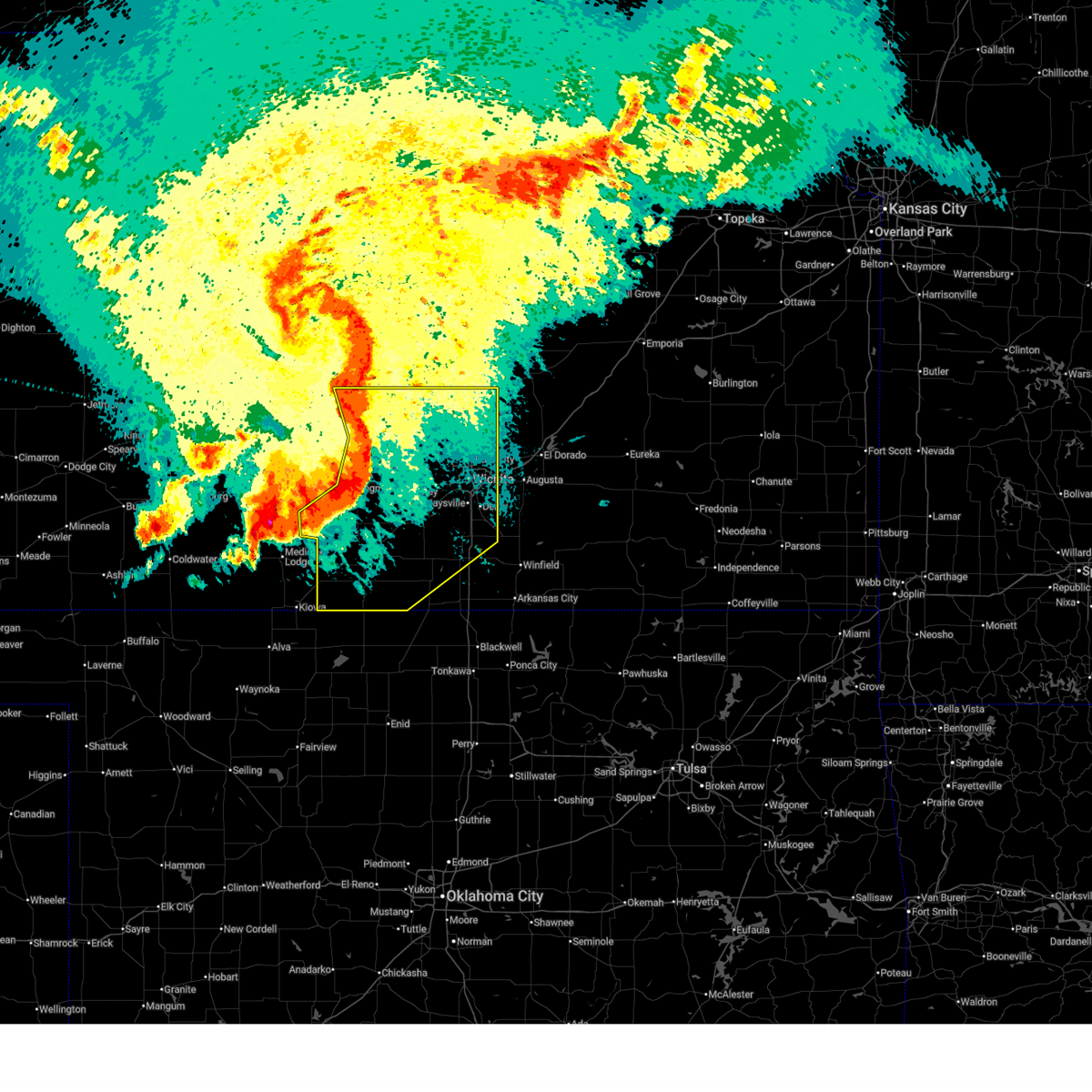
| 5/18/2026 8:10 PM CDT |
 At 810 pm cdt, a severe thunderstorm was located near newton, moving east at 40 mph (radar indicated). Hazards include 60 mph wind gusts and half dollar size hail. Hail damage to vehicles is expected. expect wind damage to roofs, siding, and trees. locations impacted include, newton, hesston, halstead, marion, north newton, sedgwick, peabody, cottonwood falls, whitewater, strong city, florence, potwin, walton, elbing, burns, cassoday, bazaar, elmdale, matfield green, and cedar point. this includes the following highways, interstate 135 between mile markers 23 and 40. Interstate 35 between mile markers 81 and 116. At 810 pm cdt, a severe thunderstorm was located near newton, moving east at 40 mph (radar indicated). Hazards include 60 mph wind gusts and half dollar size hail. Hail damage to vehicles is expected. expect wind damage to roofs, siding, and trees. locations impacted include, newton, hesston, halstead, marion, north newton, sedgwick, peabody, cottonwood falls, whitewater, strong city, florence, potwin, walton, elbing, burns, cassoday, bazaar, elmdale, matfield green, and cedar point. this includes the following highways, interstate 135 between mile markers 23 and 40. Interstate 35 between mile markers 81 and 116.
|
| 5/18/2026 7:56 PM CDT |
 Svrict the national weather service in wichita has issued a * severe thunderstorm warning for, harvey county in south central kansas, chase county in east central kansas, northern butler county in south central kansas, southern marion county in central kansas, northwestern greenwood county in southeastern kansas, * until 845 pm cdt. * at 755 pm cdt, a severe thunderstorm was located over north newton, moving northeast at 40 mph (radar indicated. at 751 pm, 60 mph winds were reported in newton). Hazards include 60 mph wind gusts and quarter size hail. Hail damage to vehicles is expected. Expect wind damage to roofs, siding, and trees. Svrict the national weather service in wichita has issued a * severe thunderstorm warning for, harvey county in south central kansas, chase county in east central kansas, northern butler county in south central kansas, southern marion county in central kansas, northwestern greenwood county in southeastern kansas, * until 845 pm cdt. * at 755 pm cdt, a severe thunderstorm was located over north newton, moving northeast at 40 mph (radar indicated. at 751 pm, 60 mph winds were reported in newton). Hazards include 60 mph wind gusts and quarter size hail. Hail damage to vehicles is expected. Expect wind damage to roofs, siding, and trees.
|
| 5/18/2026 7:53 PM CDT | Kewk asos repor in harvey county KS, 4.5 miles WSW of Newton, KS |
| 5/18/2026 7:41 PM CDT | Storm damage reported in harvey county KS, 1.8 miles S of Newton, KS |
| 5/18/2026 7:37 PM CDT |
 At 737 pm cdt, a severe thunderstorm was located near newton, moving east at 45 mph (radar indicated). Hazards include 60 mph wind gusts and half dollar size hail. Hail damage to vehicles is expected. expect wind damage to roofs, siding, and trees. locations impacted include, newton, hesston, hillsboro, halstead, marion, north newton, sedgwick, peabody, cottonwood falls, burrton, whitewater, strong city, florence, goessel, potwin, walton, elbing, burns, lincolnville, and cassoday. this includes the following highways, interstate 135 between mile markers 23 and 42. Interstate 35 between mile markers 80 and 116. At 737 pm cdt, a severe thunderstorm was located near newton, moving east at 45 mph (radar indicated). Hazards include 60 mph wind gusts and half dollar size hail. Hail damage to vehicles is expected. expect wind damage to roofs, siding, and trees. locations impacted include, newton, hesston, hillsboro, halstead, marion, north newton, sedgwick, peabody, cottonwood falls, burrton, whitewater, strong city, florence, goessel, potwin, walton, elbing, burns, lincolnville, and cassoday. this includes the following highways, interstate 135 between mile markers 23 and 42. Interstate 35 between mile markers 80 and 116.
|
| 5/18/2026 7:17 PM CDT | Power line down; time estimated from rada in harvey county KS, 1.1 miles WSW of Newton, KS |
| 5/18/2026 7:12 PM CDT |
 Svrict the national weather service in wichita has issued a * severe thunderstorm warning for, southeastern mcpherson county in central kansas, harvey county in south central kansas, chase county in east central kansas, northern butler county in south central kansas, marion county in central kansas, northwestern greenwood county in southeastern kansas, * until 800 pm cdt. * at 712 pm cdt, severe thunderstorms were located along a line extending from 6 miles south of burdick to elbing to 5 miles east of sedgwick, moving east at 50 mph (radar indicated). Hazards include 60 mph wind gusts and quarter size hail. Hail damage to vehicles is expected. Expect wind damage to roofs, siding, and trees. Svrict the national weather service in wichita has issued a * severe thunderstorm warning for, southeastern mcpherson county in central kansas, harvey county in south central kansas, chase county in east central kansas, northern butler county in south central kansas, marion county in central kansas, northwestern greenwood county in southeastern kansas, * until 800 pm cdt. * at 712 pm cdt, severe thunderstorms were located along a line extending from 6 miles south of burdick to elbing to 5 miles east of sedgwick, moving east at 50 mph (radar indicated). Hazards include 60 mph wind gusts and quarter size hail. Hail damage to vehicles is expected. Expect wind damage to roofs, siding, and trees.
|
| 5/18/2026 7:00 PM CDT | 911 report of power lines dow in harvey county KS, 1.1 miles WNW of Newton, KS |
| 5/18/2026 6:52 PM CDT |
 At 652 pm cdt, severe thunderstorms were located along a line extending from durham to north newton to 6 miles north of pretty prairie, moving east at 45 mph (radar indicated). Hazards include 70 mph wind gusts and half dollar size hail. Hail damage to vehicles is expected. expect considerable tree damage. wind damage is also likely to mobile homes, roofs, and outbuildings. locations impacted include, hutchinson, newton, hesston, maize, kingman, hillsboro, south hutchinson, halstead, marion, north newton, moundridge, sedgwick, inman, colwich, buhler, haven, peabody, burrton, galva, and mount hope. This includes interstate 135 between mile markers 21 and 60. At 652 pm cdt, severe thunderstorms were located along a line extending from durham to north newton to 6 miles north of pretty prairie, moving east at 45 mph (radar indicated). Hazards include 70 mph wind gusts and half dollar size hail. Hail damage to vehicles is expected. expect considerable tree damage. wind damage is also likely to mobile homes, roofs, and outbuildings. locations impacted include, hutchinson, newton, hesston, maize, kingman, hillsboro, south hutchinson, halstead, marion, north newton, moundridge, sedgwick, inman, colwich, buhler, haven, peabody, burrton, galva, and mount hope. This includes interstate 135 between mile markers 21 and 60.
|
| 5/18/2026 6:37 PM CDT |
 At 636 pm cdt, severe thunderstorms were located along a line extending from 5 miles north of canton to 5 miles northwest of halstead to near arlington, moving east at 45 mph (trained weather spotters. multiple quarter to ping pong ball size hail reports have been received, with a two inch hail report reported to the east of inman). Hazards include golf ball size hail and 70 mph wind gusts. People and animals outdoors will be injured. expect hail damage to roofs, siding, windows, and vehicles. expect considerable tree damage. wind damage is also likely to mobile homes, roofs, and outbuildings. locations impacted include, hutchinson, newton, mcpherson, hesston, lindsborg, maize, kingman, hillsboro, south hutchinson, halstead, marion, north newton, moundridge, sedgwick, inman, colwich, buhler, haven, peabody, and nickerson. This includes interstate 135 between mile markers 21 and 77. At 636 pm cdt, severe thunderstorms were located along a line extending from 5 miles north of canton to 5 miles northwest of halstead to near arlington, moving east at 45 mph (trained weather spotters. multiple quarter to ping pong ball size hail reports have been received, with a two inch hail report reported to the east of inman). Hazards include golf ball size hail and 70 mph wind gusts. People and animals outdoors will be injured. expect hail damage to roofs, siding, windows, and vehicles. expect considerable tree damage. wind damage is also likely to mobile homes, roofs, and outbuildings. locations impacted include, hutchinson, newton, mcpherson, hesston, lindsborg, maize, kingman, hillsboro, south hutchinson, halstead, marion, north newton, moundridge, sedgwick, inman, colwich, buhler, haven, peabody, and nickerson. This includes interstate 135 between mile markers 21 and 77.
|
| 5/18/2026 6:25 PM CDT |
 Svrict the national weather service in wichita has issued a * severe thunderstorm warning for, mcpherson county in central kansas, reno county in south central kansas, northwestern sedgwick county in south central kansas, harvey county in south central kansas, southeastern rice county in central kansas, northern kingman county in south central kansas, marion county in central kansas, * until 715 pm cdt. * at 624 pm cdt, severe thunderstorms were located along a line extending from 5 miles northwest of galva to near burrton to near turon, moving east at 45 mph. this warning replaces the previous severe thunderstorm warning (radar indicated). Hazards include 70 mph wind gusts and half dollar size hail. Hail damage to vehicles is expected. expect considerable tree damage. Wind damage is also likely to mobile homes, roofs, and outbuildings. Svrict the national weather service in wichita has issued a * severe thunderstorm warning for, mcpherson county in central kansas, reno county in south central kansas, northwestern sedgwick county in south central kansas, harvey county in south central kansas, southeastern rice county in central kansas, northern kingman county in south central kansas, marion county in central kansas, * until 715 pm cdt. * at 624 pm cdt, severe thunderstorms were located along a line extending from 5 miles northwest of galva to near burrton to near turon, moving east at 45 mph. this warning replaces the previous severe thunderstorm warning (radar indicated). Hazards include 70 mph wind gusts and half dollar size hail. Hail damage to vehicles is expected. expect considerable tree damage. Wind damage is also likely to mobile homes, roofs, and outbuildings.
|
| 4/27/2026 1:59 AM CDT |
 At 159 am cdt, a severe thunderstorm was located over burrton, moving northeast at 50 mph (radar indicated). Hazards include quarter size hail. Damage to vehicles is expected. locations impacted include, newton, hesston, halstead, north newton, burrton, walton, and newton airport. This includes interstate 135 between mile markers 30 and 42. At 159 am cdt, a severe thunderstorm was located over burrton, moving northeast at 50 mph (radar indicated). Hazards include quarter size hail. Damage to vehicles is expected. locations impacted include, newton, hesston, halstead, north newton, burrton, walton, and newton airport. This includes interstate 135 between mile markers 30 and 42.
|
| 4/27/2026 1:48 AM CDT |
 Svrict the national weather service in wichita has issued a * severe thunderstorm warning for, east central reno county in south central kansas, harvey county in south central kansas, * until 230 am cdt. * at 148 am cdt, a severe thunderstorm was located near burrton, moving northeast at 60 mph (radar indicated). Hazards include quarter size hail. damage to vehicles is expected Svrict the national weather service in wichita has issued a * severe thunderstorm warning for, east central reno county in south central kansas, harvey county in south central kansas, * until 230 am cdt. * at 148 am cdt, a severe thunderstorm was located near burrton, moving northeast at 60 mph (radar indicated). Hazards include quarter size hail. damage to vehicles is expected
|
| 4/23/2026 7:13 PM CDT |
 Svrict the national weather service in wichita has issued a * severe thunderstorm warning for, southeastern harvey county in south central kansas, chase county in east central kansas, northern butler county in south central kansas, southeastern marion county in central kansas, northwestern greenwood county in southeastern kansas, * until 815 pm cdt. * at 713 pm cdt, severe thunderstorms were located along a line extending from 9 miles southeast of cottonwood falls to 5 miles east of burns to 5 miles west of whitewater, moving southeast at 15 mph (radar indicated). Hazards include two inch hail and 60 mph wind gusts. People and animals outdoors will be injured. expect hail damage to roofs, siding, windows, and vehicles. Expect wind damage to roofs, siding, and trees. Svrict the national weather service in wichita has issued a * severe thunderstorm warning for, southeastern harvey county in south central kansas, chase county in east central kansas, northern butler county in south central kansas, southeastern marion county in central kansas, northwestern greenwood county in southeastern kansas, * until 815 pm cdt. * at 713 pm cdt, severe thunderstorms were located along a line extending from 9 miles southeast of cottonwood falls to 5 miles east of burns to 5 miles west of whitewater, moving southeast at 15 mph (radar indicated). Hazards include two inch hail and 60 mph wind gusts. People and animals outdoors will be injured. expect hail damage to roofs, siding, windows, and vehicles. Expect wind damage to roofs, siding, and trees.
|
| 4/23/2026 7:03 PM CDT | Quarter sized hail reported 18 miles W of Newton, KS |
| 4/23/2026 6:59 PM CDT |
 At 658 pm cdt, severe thunderstorms capable of producing tornadoes were located along a line extending from 13 miles east of burns to 5 miles southeast of elbing to 6 miles south of newton, moving southeast at 15 mph (radar indicated rotation. a handful of brief landspout tornadoes have been reported with this line of storms). Hazards include tornado and two inch hail. Expect damage to mobile homes, roofs, and vehicles. locations impacted include, newton, sedgwick, whitewater, potwin, elbing, burns, cassoday, newton airport, and wonsevu. this includes the following highways, interstate 135 between mile markers 23 and 32. Interstate 35 between mile markers 91 and 99. At 658 pm cdt, severe thunderstorms capable of producing tornadoes were located along a line extending from 13 miles east of burns to 5 miles southeast of elbing to 6 miles south of newton, moving southeast at 15 mph (radar indicated rotation. a handful of brief landspout tornadoes have been reported with this line of storms). Hazards include tornado and two inch hail. Expect damage to mobile homes, roofs, and vehicles. locations impacted include, newton, sedgwick, whitewater, potwin, elbing, burns, cassoday, newton airport, and wonsevu. this includes the following highways, interstate 135 between mile markers 23 and 32. Interstate 35 between mile markers 91 and 99.
|
| 4/23/2026 6:46 PM CDT |
 Torict the national weather service in wichita has issued a * tornado warning for, southeastern harvey county in south central kansas, southwestern chase county in east central kansas, northern butler county in south central kansas, southeastern marion county in central kansas, * until 730 pm cdt. * at 645 pm cdt, tornado producing storms were located along a line extending from 7 miles northeast of burns to 5 miles east of newton, moving southeast at 15 mph (emergency management confirmed tornado). Hazards include tornado and golf ball size hail. Expect damage to mobile homes, roofs, and vehicles. these tornadic storms will be near, whitewater, elbing, and burns around 650 pm cdt. potwin around 710 pm cdt. other locations impacted by these tornadic storms include wonsevu, newton airport, and cassoday. this includes the following highways, interstate 135 between mile markers 23 and 32. Interstate 35 between mile markers 91 and 99. Torict the national weather service in wichita has issued a * tornado warning for, southeastern harvey county in south central kansas, southwestern chase county in east central kansas, northern butler county in south central kansas, southeastern marion county in central kansas, * until 730 pm cdt. * at 645 pm cdt, tornado producing storms were located along a line extending from 7 miles northeast of burns to 5 miles east of newton, moving southeast at 15 mph (emergency management confirmed tornado). Hazards include tornado and golf ball size hail. Expect damage to mobile homes, roofs, and vehicles. these tornadic storms will be near, whitewater, elbing, and burns around 650 pm cdt. potwin around 710 pm cdt. other locations impacted by these tornadic storms include wonsevu, newton airport, and cassoday. this includes the following highways, interstate 135 between mile markers 23 and 32. Interstate 35 between mile markers 91 and 99.
|
| 4/23/2026 6:38 PM CDT |
 At 638 pm cdt, severe thunderstorms were located along a line extending from 9 miles east of florence to 5 miles northwest of burns to near newton, moving southeast at 15 mph (radar indicated). Hazards include golf ball size hail and 60 mph wind gusts. People and animals outdoors will be injured. expect hail damage to roofs, siding, windows, and vehicles. expect wind damage to roofs, siding, and trees. locations impacted include, newton, north newton, sedgwick, peabody, cottonwood falls, whitewater, strong city, florence, potwin, walton, elbing, burns, bazaar, elmdale, matfield green, cedar point, newton airport, hymer, wonsevu, and tallgrass prairie. this includes the following highways, interstate 135 between mile markers 23 and 34. Interstate 35 near mile marker 110, and between mile markers 113 and 116. At 638 pm cdt, severe thunderstorms were located along a line extending from 9 miles east of florence to 5 miles northwest of burns to near newton, moving southeast at 15 mph (radar indicated). Hazards include golf ball size hail and 60 mph wind gusts. People and animals outdoors will be injured. expect hail damage to roofs, siding, windows, and vehicles. expect wind damage to roofs, siding, and trees. locations impacted include, newton, north newton, sedgwick, peabody, cottonwood falls, whitewater, strong city, florence, potwin, walton, elbing, burns, bazaar, elmdale, matfield green, cedar point, newton airport, hymer, wonsevu, and tallgrass prairie. this includes the following highways, interstate 135 between mile markers 23 and 34. Interstate 35 near mile marker 110, and between mile markers 113 and 116.
|
| 4/23/2026 6:17 PM CDT |
 Svrict the national weather service in wichita has issued a * severe thunderstorm warning for, eastern harvey county in south central kansas, chase county in east central kansas, northwestern butler county in south central kansas, southern marion county in central kansas, * until 715 pm cdt. * at 617 pm cdt, severe thunderstorms were located along a line extending from 11 miles northeast of florence to near peabody, moving east at 30 mph (radar indicated). Hazards include tennis ball size hail and 60 mph wind gusts. People and animals outdoors will be injured. expect hail damage to roofs, siding, windows, and vehicles. Expect wind damage to roofs, siding, and trees. Svrict the national weather service in wichita has issued a * severe thunderstorm warning for, eastern harvey county in south central kansas, chase county in east central kansas, northwestern butler county in south central kansas, southern marion county in central kansas, * until 715 pm cdt. * at 617 pm cdt, severe thunderstorms were located along a line extending from 11 miles northeast of florence to near peabody, moving east at 30 mph (radar indicated). Hazards include tennis ball size hail and 60 mph wind gusts. People and animals outdoors will be injured. expect hail damage to roofs, siding, windows, and vehicles. Expect wind damage to roofs, siding, and trees.
|
| 4/17/2026 1:53 PM CDT |
 Svrict the national weather service in wichita has issued a * severe thunderstorm warning for, northern sedgwick county in south central kansas, southeastern harvey county in south central kansas, * until 245 pm cdt. * at 152 pm cdt, a severe thunderstorm was located over valley center, moving northeast at 55 mph (radar indicated). Hazards include 60 mph wind gusts and quarter size hail. Hail damage to vehicles is expected. Expect wind damage to roofs, siding, and trees. Svrict the national weather service in wichita has issued a * severe thunderstorm warning for, northern sedgwick county in south central kansas, southeastern harvey county in south central kansas, * until 245 pm cdt. * at 152 pm cdt, a severe thunderstorm was located over valley center, moving northeast at 55 mph (radar indicated). Hazards include 60 mph wind gusts and quarter size hail. Hail damage to vehicles is expected. Expect wind damage to roofs, siding, and trees.
|
| 4/11/2026 7:05 PM CDT |
 The storm which prompted the warning has weakened below severe limits, and no longer poses an immediate threat to life or property. therefore, the warning will be allowed to expire. however, small hail, gusty winds and heavy rain are still possible with this thunderstorm. The storm which prompted the warning has weakened below severe limits, and no longer poses an immediate threat to life or property. therefore, the warning will be allowed to expire. however, small hail, gusty winds and heavy rain are still possible with this thunderstorm.
|
| 4/11/2026 6:56 PM CDT |
 At 656 pm cdt, a severe thunderstorm was located over elbing, or 6 miles northeast of whitewater, moving northeast at 35 mph (radar indicated). Hazards include 60 mph wind gusts and quarter size hail. Hail damage to vehicles is expected. expect wind damage to roofs, siding, and trees. locations impacted include, newton, whitewater, elbing, and newton airport. This includes interstate 135 between mile markers 25 and 31. At 656 pm cdt, a severe thunderstorm was located over elbing, or 6 miles northeast of whitewater, moving northeast at 35 mph (radar indicated). Hazards include 60 mph wind gusts and quarter size hail. Hail damage to vehicles is expected. expect wind damage to roofs, siding, and trees. locations impacted include, newton, whitewater, elbing, and newton airport. This includes interstate 135 between mile markers 25 and 31.
|
| 4/11/2026 6:48 PM CDT |
 At 647 pm cdt, a severe thunderstorm was located over whitewater, moving northeast at 30 mph (trained weather spotters). Hazards include 60 mph wind gusts and quarter size hail. Hail damage to vehicles is expected. expect wind damage to roofs, siding, and trees. locations impacted include, newton, park city, valley center, whitewater, elbing, and newton airport. This includes interstate 135 between mile markers 17 and 31. At 647 pm cdt, a severe thunderstorm was located over whitewater, moving northeast at 30 mph (trained weather spotters). Hazards include 60 mph wind gusts and quarter size hail. Hail damage to vehicles is expected. expect wind damage to roofs, siding, and trees. locations impacted include, newton, park city, valley center, whitewater, elbing, and newton airport. This includes interstate 135 between mile markers 17 and 31.
|
| 4/11/2026 6:33 PM CDT |
 At 633 pm cdt, a severe thunderstorm was located 6 miles east of sedgwick, moving northeast at 30 mph (radar indicated). Hazards include 70 mph wind gusts and quarter size hail. Hail damage to vehicles is expected. expect considerable tree damage. wind damage is also likely to mobile homes, roofs, and outbuildings. locations impacted include, newton, park city, valley center, sedgwick, whitewater, elbing, and newton airport. This includes interstate 135 between mile markers 17 and 31. At 633 pm cdt, a severe thunderstorm was located 6 miles east of sedgwick, moving northeast at 30 mph (radar indicated). Hazards include 70 mph wind gusts and quarter size hail. Hail damage to vehicles is expected. expect considerable tree damage. wind damage is also likely to mobile homes, roofs, and outbuildings. locations impacted include, newton, park city, valley center, sedgwick, whitewater, elbing, and newton airport. This includes interstate 135 between mile markers 17 and 31.
|
| 4/11/2026 6:21 PM CDT |
 At 621 pm cdt, a severe thunderstorm was located over sedgwick, moving northeast at 30 mph (radar indicated). Hazards include 70 mph wind gusts and half dollar size hail. Hail damage to vehicles is expected. expect considerable tree damage. wind damage is also likely to mobile homes, roofs, and outbuildings. locations impacted include, newton, park city, valley center, sedgwick, whitewater, bentley, elbing, and newton airport. This includes interstate 135 between mile markers 16 and 31. At 621 pm cdt, a severe thunderstorm was located over sedgwick, moving northeast at 30 mph (radar indicated). Hazards include 70 mph wind gusts and half dollar size hail. Hail damage to vehicles is expected. expect considerable tree damage. wind damage is also likely to mobile homes, roofs, and outbuildings. locations impacted include, newton, park city, valley center, sedgwick, whitewater, bentley, elbing, and newton airport. This includes interstate 135 between mile markers 16 and 31.
|
| 4/11/2026 6:12 PM CDT |
 Svrict the national weather service in wichita has issued a * severe thunderstorm warning for, northeastern sedgwick county in south central kansas, eastern harvey county in south central kansas, northwestern butler county in south central kansas, south central marion county in central kansas, * until 715 pm cdt. * at 612 pm cdt, a severe thunderstorm was located over bentley, or 6 miles north of colwich, moving northeast at 30 mph (trained weather spotters). Hazards include golf ball size hail and 70 mph wind gusts. People and animals outdoors will be injured. expect hail damage to roofs, siding, windows, and vehicles. expect considerable tree damage. Wind damage is also likely to mobile homes, roofs, and outbuildings. Svrict the national weather service in wichita has issued a * severe thunderstorm warning for, northeastern sedgwick county in south central kansas, eastern harvey county in south central kansas, northwestern butler county in south central kansas, south central marion county in central kansas, * until 715 pm cdt. * at 612 pm cdt, a severe thunderstorm was located over bentley, or 6 miles north of colwich, moving northeast at 30 mph (trained weather spotters). Hazards include golf ball size hail and 70 mph wind gusts. People and animals outdoors will be injured. expect hail damage to roofs, siding, windows, and vehicles. expect considerable tree damage. Wind damage is also likely to mobile homes, roofs, and outbuildings.
|
| 4/11/2026 6:02 PM CDT |
 At 602 pm cdt, a severe thunderstorm was located near mount hope, moving northeast at 30 mph (trained weather spotters). Hazards include golf ball size hail and 70 mph wind gusts. People and animals outdoors will be injured. expect hail damage to roofs, siding, windows, and vehicles. expect considerable tree damage. wind damage is also likely to mobile homes, roofs, and outbuildings. locations impacted include, park city, valley center, halstead, sedgwick, mount hope, andale, and bentley. This includes interstate 135 between mile markers 16 and 25. At 602 pm cdt, a severe thunderstorm was located near mount hope, moving northeast at 30 mph (trained weather spotters). Hazards include golf ball size hail and 70 mph wind gusts. People and animals outdoors will be injured. expect hail damage to roofs, siding, windows, and vehicles. expect considerable tree damage. wind damage is also likely to mobile homes, roofs, and outbuildings. locations impacted include, park city, valley center, halstead, sedgwick, mount hope, andale, and bentley. This includes interstate 135 between mile markers 16 and 25.
|
| 4/11/2026 5:53 PM CDT |
 At 552 pm cdt, a severe thunderstorm was located over bentley, or 6 miles east of mount hope, moving east at 25 mph (trained weather spotters). Hazards include 70 mph wind gusts and ping pong ball size hail. People and animals outdoors will be injured. expect hail damage to roofs, siding, windows, and vehicles. expect considerable tree damage. wind damage is also likely to mobile homes, roofs, and outbuildings. locations impacted include, park city, valley center, halstead, sedgwick, mount hope, andale, and bentley. This includes interstate 135 between mile markers 16 and 25. At 552 pm cdt, a severe thunderstorm was located over bentley, or 6 miles east of mount hope, moving east at 25 mph (trained weather spotters). Hazards include 70 mph wind gusts and ping pong ball size hail. People and animals outdoors will be injured. expect hail damage to roofs, siding, windows, and vehicles. expect considerable tree damage. wind damage is also likely to mobile homes, roofs, and outbuildings. locations impacted include, park city, valley center, halstead, sedgwick, mount hope, andale, and bentley. This includes interstate 135 between mile markers 16 and 25.
|
| 4/11/2026 5:37 PM CDT |
 At 536 pm cdt, a severe thunderstorm was located over mount hope, moving east at 25 mph. this is a destructive storm for mount hope and bentley (trained weather spotters). Hazards include 80 mph wind gusts and golf ball size hail. Flying debris will be dangerous to those caught without shelter. mobile homes will be heavily damaged. expect considerable damage to roofs, windows, and vehicles. extensive tree damage and power outages are likely. locations impacted include, park city, valley center, halstead, sedgwick, mount hope, andale, and bentley. This includes interstate 135 between mile markers 16 and 25. At 536 pm cdt, a severe thunderstorm was located over mount hope, moving east at 25 mph. this is a destructive storm for mount hope and bentley (trained weather spotters). Hazards include 80 mph wind gusts and golf ball size hail. Flying debris will be dangerous to those caught without shelter. mobile homes will be heavily damaged. expect considerable damage to roofs, windows, and vehicles. extensive tree damage and power outages are likely. locations impacted include, park city, valley center, halstead, sedgwick, mount hope, andale, and bentley. This includes interstate 135 between mile markers 16 and 25.
|
| 4/11/2026 5:17 PM CDT |
 Svrict the national weather service in wichita has issued a * severe thunderstorm warning for, southeastern reno county in south central kansas, northwestern sedgwick county in south central kansas, southwestern harvey county in south central kansas, * until 615 pm cdt. * at 516 pm cdt, a severe thunderstorm was located near haven, moving east at 25 mph. this is a destructive storm for haven, mount hope, and bentley (trained weather spotters). Hazards include 80 mph wind gusts and golf ball size hail. Flying debris will be dangerous to those caught without shelter. mobile homes will be heavily damaged. expect considerable damage to roofs, windows, and vehicles. Extensive tree damage and power outages are likely. Svrict the national weather service in wichita has issued a * severe thunderstorm warning for, southeastern reno county in south central kansas, northwestern sedgwick county in south central kansas, southwestern harvey county in south central kansas, * until 615 pm cdt. * at 516 pm cdt, a severe thunderstorm was located near haven, moving east at 25 mph. this is a destructive storm for haven, mount hope, and bentley (trained weather spotters). Hazards include 80 mph wind gusts and golf ball size hail. Flying debris will be dangerous to those caught without shelter. mobile homes will be heavily damaged. expect considerable damage to roofs, windows, and vehicles. Extensive tree damage and power outages are likely.
|
| 3/10/2026 8:59 PM CDT |
 The storms which prompted the warning have weakened below severe limits, and have exited the warned area. therefore, the warning will be allowed to expire. however, small hail, gusty winds and heavy rain are still possible with these thunderstorms. a severe thunderstorm watch remains in effect until 1100 pm cdt for south central, central and east central kansas. The storms which prompted the warning have weakened below severe limits, and have exited the warned area. therefore, the warning will be allowed to expire. however, small hail, gusty winds and heavy rain are still possible with these thunderstorms. a severe thunderstorm watch remains in effect until 1100 pm cdt for south central, central and east central kansas.
|
| 3/10/2026 8:37 PM CDT |
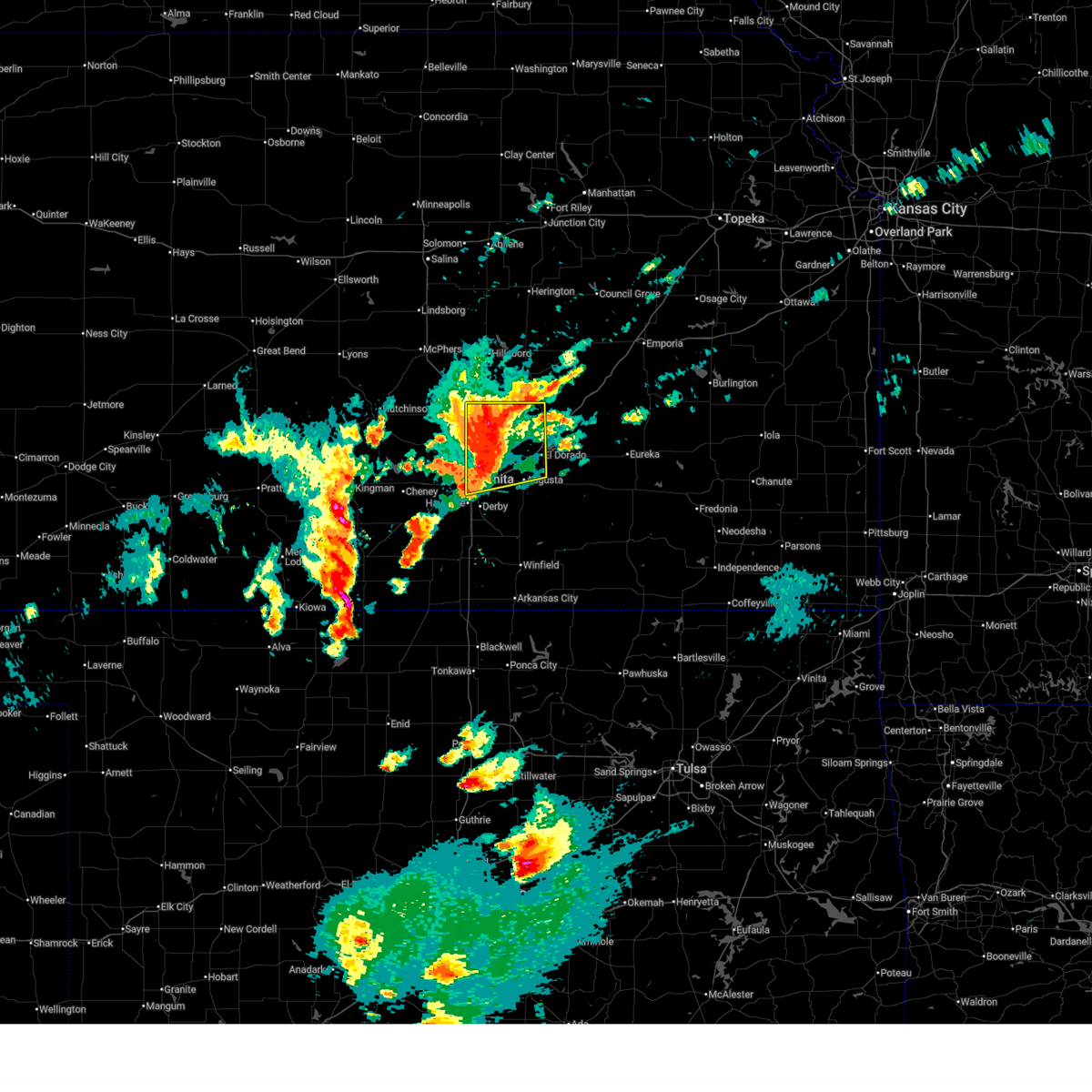 At 837 pm cdt, severe thunderstorms were located along a line extending from near elbing to 5 miles south of whitewater to east wichita, moving northeast at 55 mph (trained weather spotters). Hazards include 60 mph wind gusts and quarter size hail. Hail damage to vehicles is expected. expect wind damage to roofs, siding, and trees. locations impacted include, wichita, newton, el dorado, andover, augusta, park city, valley center, bel aire, north newton, towanda, benton, whitewater, downtown wichita, kechi, eastborough, potwin, elbing, burns, northeast wichita, and east wichita. this includes the following highways, interstate 135 between mile markers 2 and 35. Interstate 35 between mile markers 44 and 77. At 837 pm cdt, severe thunderstorms were located along a line extending from near elbing to 5 miles south of whitewater to east wichita, moving northeast at 55 mph (trained weather spotters). Hazards include 60 mph wind gusts and quarter size hail. Hail damage to vehicles is expected. expect wind damage to roofs, siding, and trees. locations impacted include, wichita, newton, el dorado, andover, augusta, park city, valley center, bel aire, north newton, towanda, benton, whitewater, downtown wichita, kechi, eastborough, potwin, elbing, burns, northeast wichita, and east wichita. this includes the following highways, interstate 135 between mile markers 2 and 35. Interstate 35 between mile markers 44 and 77.
|
| 3/10/2026 8:17 PM CDT |
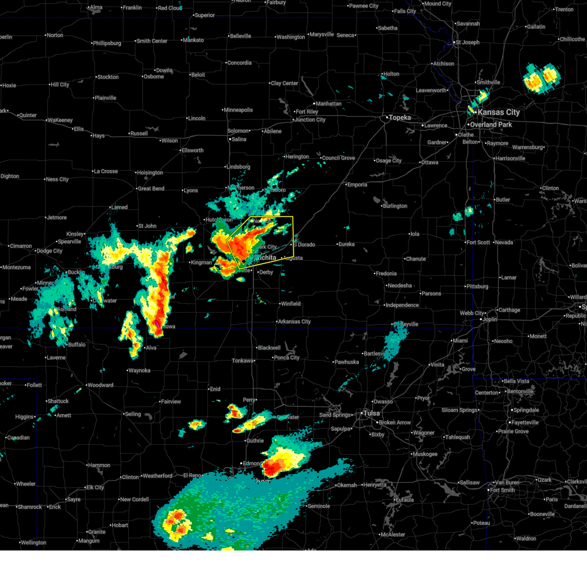 At 817 pm cdt, severe thunderstorms were located along a line extending from near bentley to near maize to near south wichita, moving east at 65 mph (trained weather spotters). Hazards include 60 mph wind gusts and quarter size hail. Hail damage to vehicles is expected. expect wind damage to roofs, siding, and trees. locations impacted include, wichita, newton, el dorado, andover, augusta, park city, valley center, bel aire, goddard, maize, north newton, sedgwick, towanda, colwich, benton, whitewater, downtown wichita, kechi, andale, and eastborough. this includes the following highways, interstate 135 between mile markers 1 and 35. Interstate 35 between mile markers 44 and 77. At 817 pm cdt, severe thunderstorms were located along a line extending from near bentley to near maize to near south wichita, moving east at 65 mph (trained weather spotters). Hazards include 60 mph wind gusts and quarter size hail. Hail damage to vehicles is expected. expect wind damage to roofs, siding, and trees. locations impacted include, wichita, newton, el dorado, andover, augusta, park city, valley center, bel aire, goddard, maize, north newton, sedgwick, towanda, colwich, benton, whitewater, downtown wichita, kechi, andale, and eastborough. this includes the following highways, interstate 135 between mile markers 1 and 35. Interstate 35 between mile markers 44 and 77.
|
| 3/10/2026 8:17 PM CDT |
 the severe thunderstorm warning has been cancelled and is no longer in effect the severe thunderstorm warning has been cancelled and is no longer in effect
|
| 3/10/2026 7:56 PM CDT |
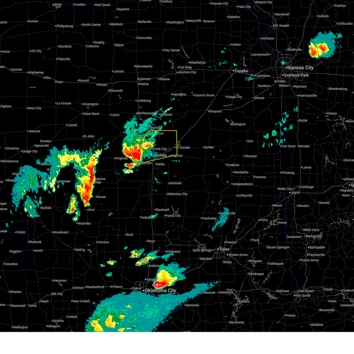 Svrict the national weather service in wichita has issued a * severe thunderstorm warning for, southeastern reno county in south central kansas, sedgwick county in south central kansas, southeastern harvey county in south central kansas, northwestern butler county in south central kansas, * until 900 pm cdt. * at 756 pm cdt, a severe thunderstorm was located over goddard, moving northeast at 45 mph (radar indicated). Hazards include 70 mph wind gusts and quarter size hail. Hail damage to vehicles is expected. expect considerable tree damage. Wind damage is also likely to mobile homes, roofs, and outbuildings. Svrict the national weather service in wichita has issued a * severe thunderstorm warning for, southeastern reno county in south central kansas, sedgwick county in south central kansas, southeastern harvey county in south central kansas, northwestern butler county in south central kansas, * until 900 pm cdt. * at 756 pm cdt, a severe thunderstorm was located over goddard, moving northeast at 45 mph (radar indicated). Hazards include 70 mph wind gusts and quarter size hail. Hail damage to vehicles is expected. expect considerable tree damage. Wind damage is also likely to mobile homes, roofs, and outbuildings.
|
| 9/3/2025 8:02 PM CDT |
 the severe thunderstorm warning has been cancelled and is no longer in effect the severe thunderstorm warning has been cancelled and is no longer in effect
|
| 9/3/2025 7:49 PM CDT |
 At 749 pm cdt, a severe thunderstorm was located near halstead, moving south at 35 mph. this is a destructive storm for southern harvey county (radar indicated). Hazards include baseball size hail and 60 mph wind gusts. People and animals outdoors will be severely injured. expect shattered windows, extensive damage to roofs, siding, and vehicles. locations impacted include, halstead and sedgwick. This includes interstate 135 between mile markers 23 and 25. At 749 pm cdt, a severe thunderstorm was located near halstead, moving south at 35 mph. this is a destructive storm for southern harvey county (radar indicated). Hazards include baseball size hail and 60 mph wind gusts. People and animals outdoors will be severely injured. expect shattered windows, extensive damage to roofs, siding, and vehicles. locations impacted include, halstead and sedgwick. This includes interstate 135 between mile markers 23 and 25.
|
| 9/3/2025 7:42 PM CDT |
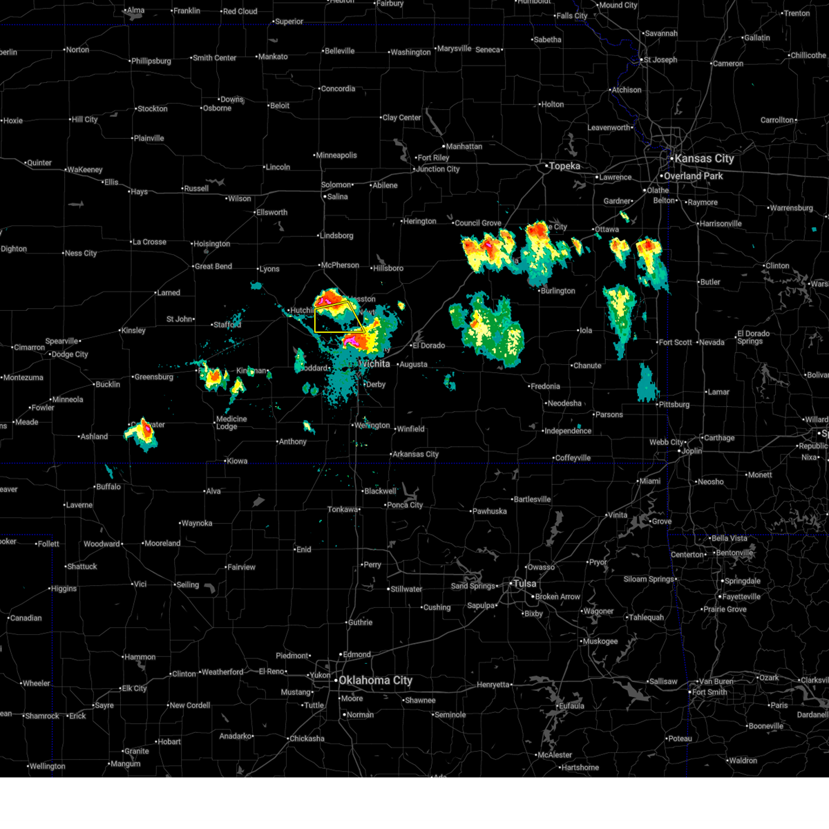 At 741 pm cdt, a severe thunderstorm was located near halstead, moving south at 35 mph. this is a destructive storm for western half of harvey county (radar indicated). Hazards include baseball size hail and 60 mph wind gusts. People and animals outdoors will be severely injured. expect shattered windows, extensive damage to roofs, siding, and vehicles. locations impacted include, newton, halstead, sedgwick, and burrton. This includes interstate 135 between mile markers 23 and 28. At 741 pm cdt, a severe thunderstorm was located near halstead, moving south at 35 mph. this is a destructive storm for western half of harvey county (radar indicated). Hazards include baseball size hail and 60 mph wind gusts. People and animals outdoors will be severely injured. expect shattered windows, extensive damage to roofs, siding, and vehicles. locations impacted include, newton, halstead, sedgwick, and burrton. This includes interstate 135 between mile markers 23 and 28.
|
| 9/3/2025 7:39 PM CDT |
 Svrict the national weather service in wichita has issued a * severe thunderstorm warning for, western harvey county in south central kansas, * until 845 pm cdt. * at 739 pm cdt, a severe thunderstorm was located near halstead, moving south at 35 mph (radar indicated). Hazards include tennis ball size hail and 60 mph wind gusts. People and animals outdoors will be injured. expect hail damage to roofs, siding, windows, and vehicles. Expect wind damage to roofs, siding, and trees. Svrict the national weather service in wichita has issued a * severe thunderstorm warning for, western harvey county in south central kansas, * until 845 pm cdt. * at 739 pm cdt, a severe thunderstorm was located near halstead, moving south at 35 mph (radar indicated). Hazards include tennis ball size hail and 60 mph wind gusts. People and animals outdoors will be injured. expect hail damage to roofs, siding, windows, and vehicles. Expect wind damage to roofs, siding, and trees.
|
| 9/3/2025 7:27 PM CDT |
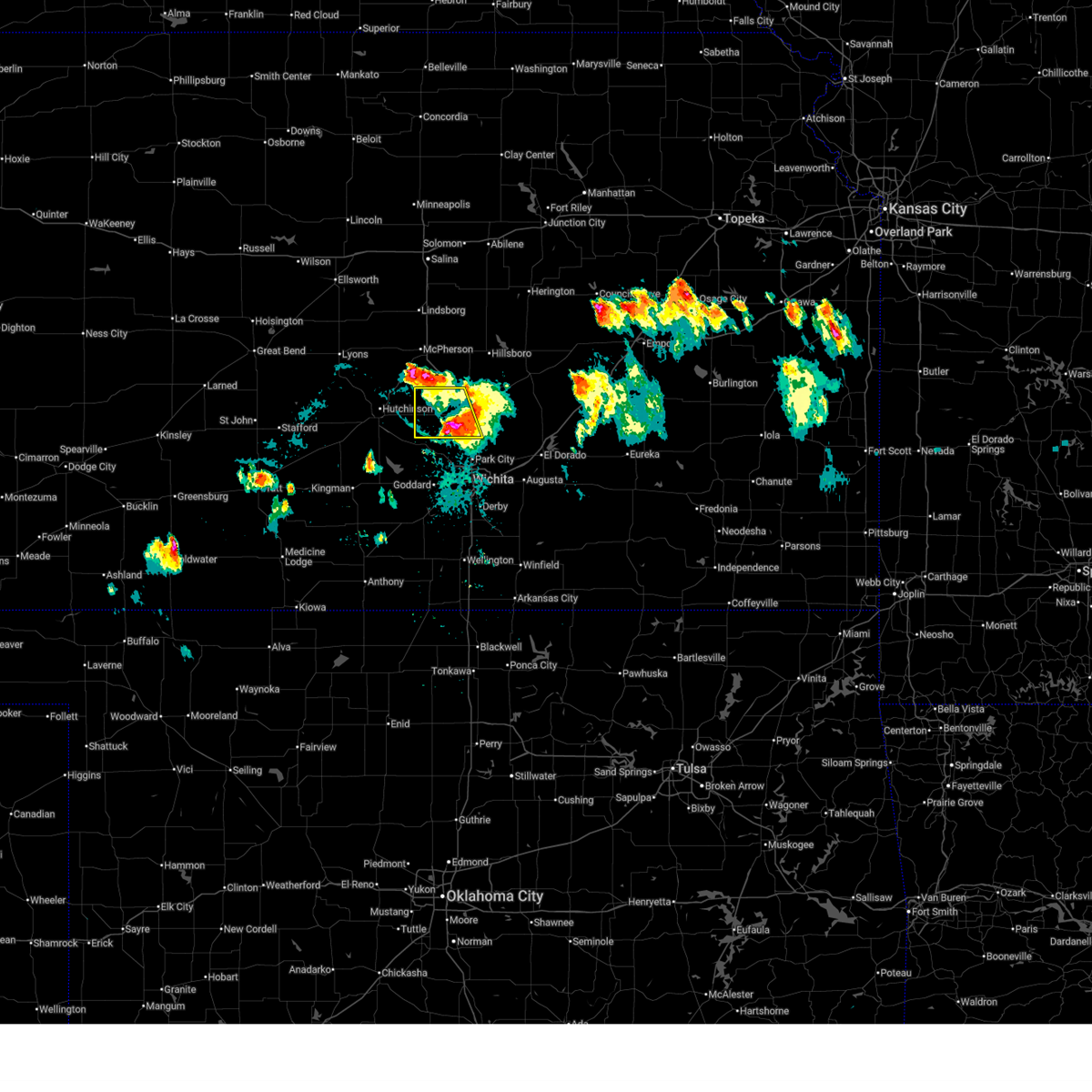 At 727 pm cdt, a severe thunderstorm was located 6 miles southwest of moundridge, moving southeast at 35 mph (radar indicated). Hazards include 60 mph wind gusts and half dollar size hail. Hail damage to vehicles is expected. expect wind damage to roofs, siding, and trees. locations impacted include, newton, hesston, halstead, north newton, sedgwick, and burrton. This includes interstate 135 between mile markers 23 and 42. At 727 pm cdt, a severe thunderstorm was located 6 miles southwest of moundridge, moving southeast at 35 mph (radar indicated). Hazards include 60 mph wind gusts and half dollar size hail. Hail damage to vehicles is expected. expect wind damage to roofs, siding, and trees. locations impacted include, newton, hesston, halstead, north newton, sedgwick, and burrton. This includes interstate 135 between mile markers 23 and 42.
|
| 9/3/2025 6:56 PM CDT |
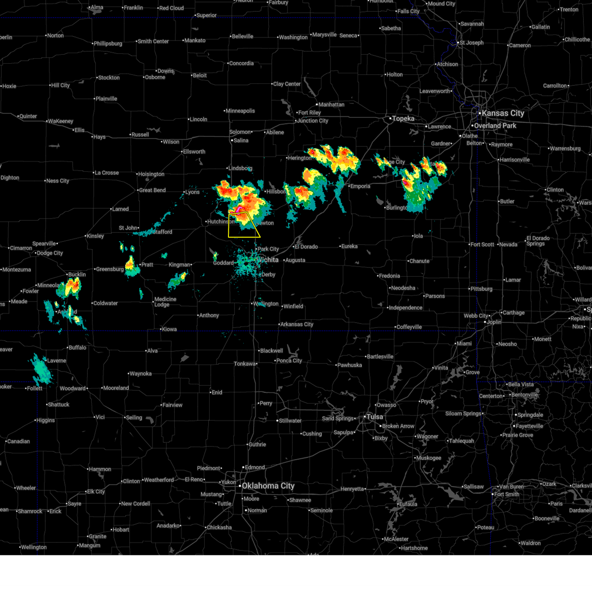 Svrict the national weather service in wichita has issued a * severe thunderstorm warning for, western harvey county in south central kansas, * until 745 pm cdt. * at 656 pm cdt, a severe thunderstorm was located near halstead, moving southeast at 35 mph. this is a destructive storm for central western harvey county (radar indicated). Hazards include baseball size hail and 60 mph wind gusts. People and animals outdoors will be severely injured. Expect shattered windows, extensive damage to roofs, siding, and vehicles. Svrict the national weather service in wichita has issued a * severe thunderstorm warning for, western harvey county in south central kansas, * until 745 pm cdt. * at 656 pm cdt, a severe thunderstorm was located near halstead, moving southeast at 35 mph. this is a destructive storm for central western harvey county (radar indicated). Hazards include baseball size hail and 60 mph wind gusts. People and animals outdoors will be severely injured. Expect shattered windows, extensive damage to roofs, siding, and vehicles.
|
| 9/3/2025 6:52 PM CDT |
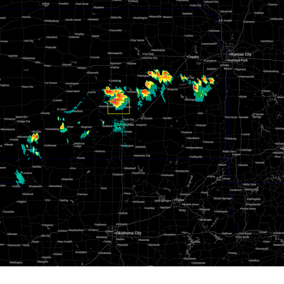 At 652 pm cdt, a severe thunderstorm was located near moundridge, moving southeast at 30 mph (radar indicated). Hazards include tennis ball size hail and 60 mph wind gusts. People and animals outdoors will be injured. expect hail damage to roofs, siding, windows, and vehicles. expect wind damage to roofs, siding, and trees. locations impacted include, newton, hesston, halstead, north newton, sedgwick, burrton, walton, and newton airport. This includes interstate 135 between mile markers 23 and 43. At 652 pm cdt, a severe thunderstorm was located near moundridge, moving southeast at 30 mph (radar indicated). Hazards include tennis ball size hail and 60 mph wind gusts. People and animals outdoors will be injured. expect hail damage to roofs, siding, windows, and vehicles. expect wind damage to roofs, siding, and trees. locations impacted include, newton, hesston, halstead, north newton, sedgwick, burrton, walton, and newton airport. This includes interstate 135 between mile markers 23 and 43.
|
| 9/3/2025 6:38 PM CDT |
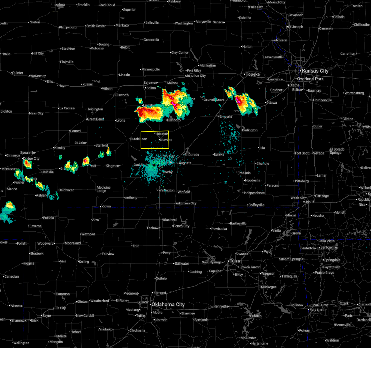 Svrict the national weather service in wichita has issued a * severe thunderstorm warning for, harvey county in south central kansas, * until 745 pm cdt. * at 638 pm cdt, a severe thunderstorm was located near moundridge, moving south at 30 mph (radar indicated). Hazards include tennis ball size hail and 60 mph wind gusts. People and animals outdoors will be injured. expect hail damage to roofs, siding, windows, and vehicles. Expect wind damage to roofs, siding, and trees. Svrict the national weather service in wichita has issued a * severe thunderstorm warning for, harvey county in south central kansas, * until 745 pm cdt. * at 638 pm cdt, a severe thunderstorm was located near moundridge, moving south at 30 mph (radar indicated). Hazards include tennis ball size hail and 60 mph wind gusts. People and animals outdoors will be injured. expect hail damage to roofs, siding, windows, and vehicles. Expect wind damage to roofs, siding, and trees.
|
| 8/11/2025 4:04 AM CDT |
 the severe thunderstorm warning has been cancelled and is no longer in effect the severe thunderstorm warning has been cancelled and is no longer in effect
|
| 8/11/2025 3:52 AM CDT |
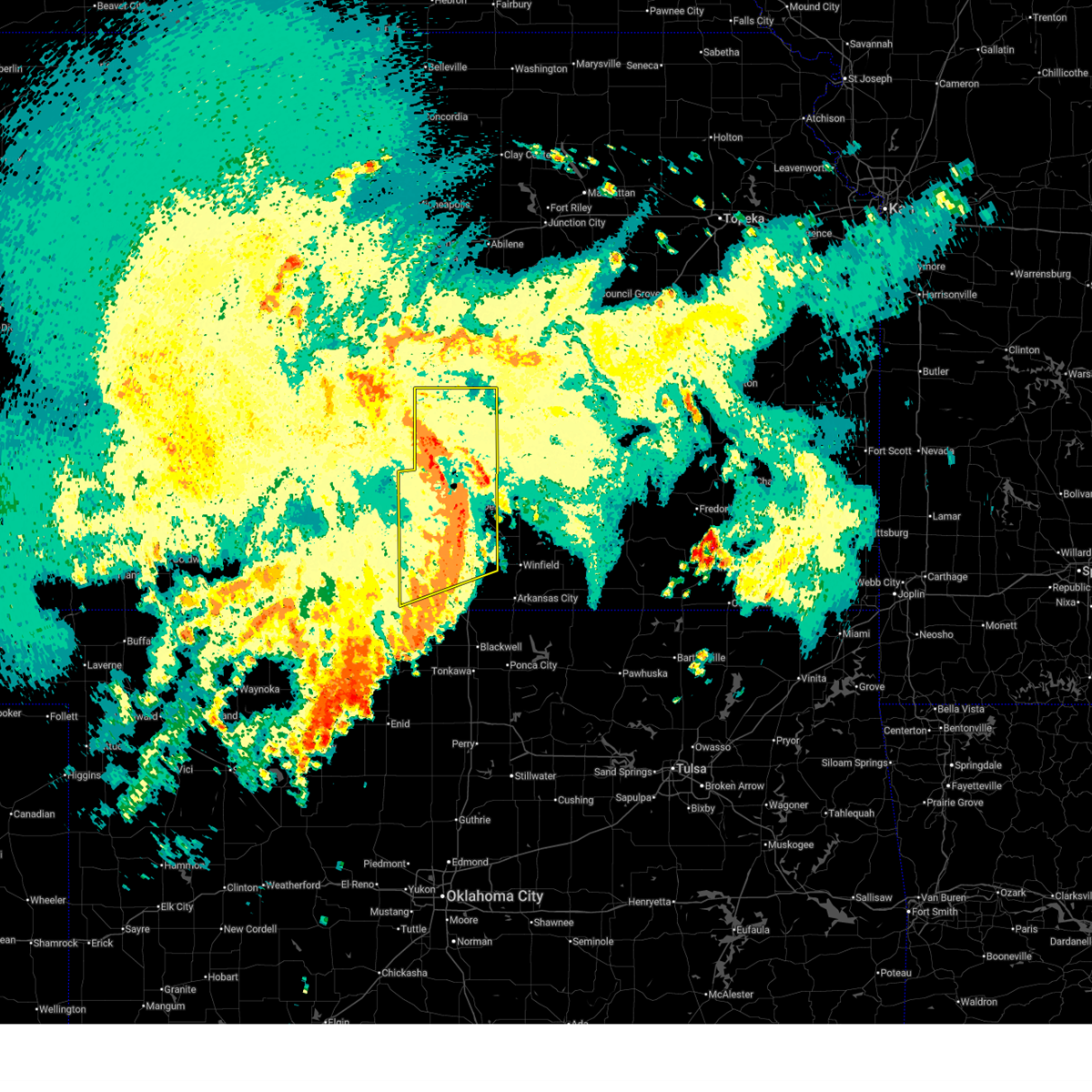 At 352 am cdt, severe thunderstorms were located along a line extending from burrton to near eisenhower national airport to 8 miles northeast of caldwell, moving northeast at 50 mph (radar indicated). Hazards include 60 mph wind gusts. Expect damage to roofs, siding, and trees. locations impacted include, wichita, derby, newton, haysville, wellington, park city, valley center, bel aire, mulvane, goddard, hesston, maize, clearwater, cheney, halstead, north newton, sedgwick, belle plaine, colwich, and conway springs. this includes the following highways, interstate 135 between mile markers 0 and 42. Interstate 35 between mile markers 11 and 54. At 352 am cdt, severe thunderstorms were located along a line extending from burrton to near eisenhower national airport to 8 miles northeast of caldwell, moving northeast at 50 mph (radar indicated). Hazards include 60 mph wind gusts. Expect damage to roofs, siding, and trees. locations impacted include, wichita, derby, newton, haysville, wellington, park city, valley center, bel aire, mulvane, goddard, hesston, maize, clearwater, cheney, halstead, north newton, sedgwick, belle plaine, colwich, and conway springs. this includes the following highways, interstate 135 between mile markers 0 and 42. Interstate 35 between mile markers 11 and 54.
|
| 8/11/2025 3:19 AM CDT |
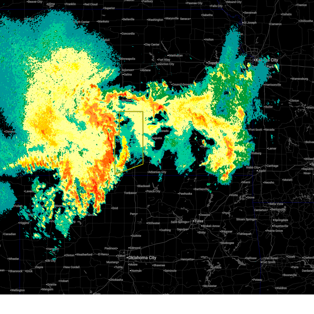 Svrict the national weather service in wichita has issued a * severe thunderstorm warning for, sedgwick county in south central kansas, harvey county in south central kansas, sumner county in south central kansas, * until 415 am cdt. * at 318 am cdt, severe thunderstorms were located along a line extending from near nickerson to 6 miles northwest of cheney to 8 miles southeast of anthony, moving east at 45 mph (radar indicated). Hazards include 60 mph wind gusts. expect damage to roofs, siding, and trees Svrict the national weather service in wichita has issued a * severe thunderstorm warning for, sedgwick county in south central kansas, harvey county in south central kansas, sumner county in south central kansas, * until 415 am cdt. * at 318 am cdt, severe thunderstorms were located along a line extending from near nickerson to 6 miles northwest of cheney to 8 miles southeast of anthony, moving east at 45 mph (radar indicated). Hazards include 60 mph wind gusts. expect damage to roofs, siding, and trees
|
| 7/30/2025 6:44 PM CDT | Quarter sized hail reported 5.1 miles NNW of Newton, KS, mostly nickel size hail but a few quarters. |
| 7/30/2025 6:20 PM CDT |
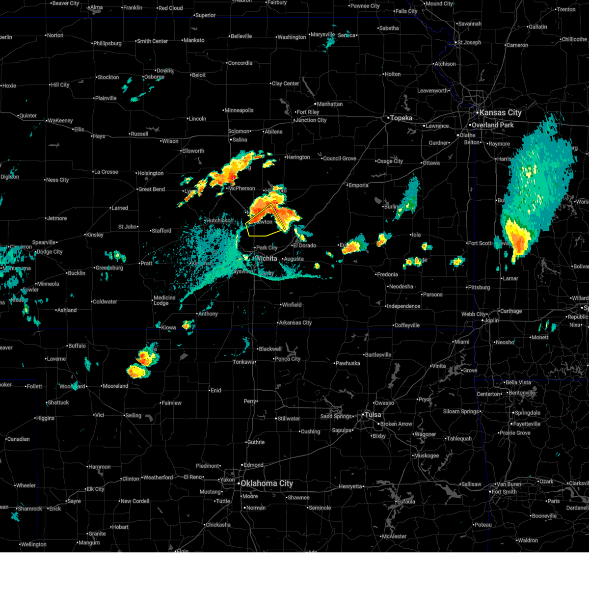 Svrict the national weather service in wichita has issued a * severe thunderstorm warning for, eastern harvey county in south central kansas, northwestern butler county in south central kansas, south central marion county in central kansas, * until 645 pm cdt. * at 620 pm cdt, severe thunderstorms were located along a line extending from near walton to newton, moving south at 25 mph (radar indicated). Hazards include 60 mph wind gusts and quarter size hail. Hail damage to vehicles is expected. Expect wind damage to roofs, siding, and trees. Svrict the national weather service in wichita has issued a * severe thunderstorm warning for, eastern harvey county in south central kansas, northwestern butler county in south central kansas, south central marion county in central kansas, * until 645 pm cdt. * at 620 pm cdt, severe thunderstorms were located along a line extending from near walton to newton, moving south at 25 mph (radar indicated). Hazards include 60 mph wind gusts and quarter size hail. Hail damage to vehicles is expected. Expect wind damage to roofs, siding, and trees.
|
| 7/30/2025 5:59 PM CDT |
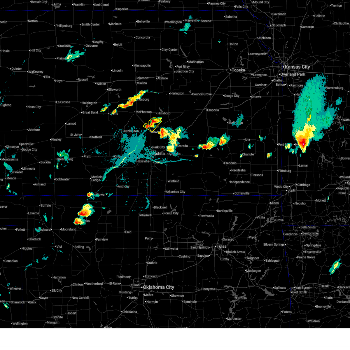 Svrict the national weather service in wichita has issued a * severe thunderstorm warning for, northeastern harvey county in south central kansas, southwestern marion county in central kansas, * until 630 pm cdt. * at 559 pm cdt, severe thunderstorms were located along a line extending from near goessel to hesston, moving southeast at 15 mph (radar indicated). Hazards include 60 mph wind gusts and quarter size hail. Hail damage to vehicles is expected. Expect wind damage to roofs, siding, and trees. Svrict the national weather service in wichita has issued a * severe thunderstorm warning for, northeastern harvey county in south central kansas, southwestern marion county in central kansas, * until 630 pm cdt. * at 559 pm cdt, severe thunderstorms were located along a line extending from near goessel to hesston, moving southeast at 15 mph (radar indicated). Hazards include 60 mph wind gusts and quarter size hail. Hail damage to vehicles is expected. Expect wind damage to roofs, siding, and trees.
|
| 7/30/2025 5:34 PM CDT |
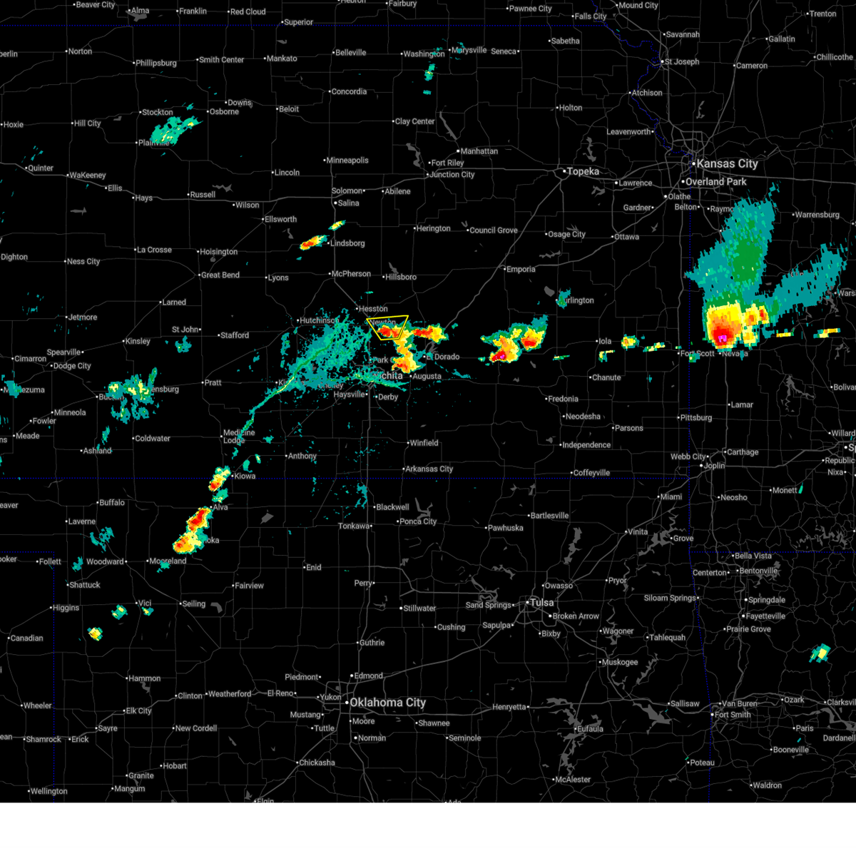 Svrict the national weather service in wichita has issued a * severe thunderstorm warning for, southeastern harvey county in south central kansas, northwestern butler county in south central kansas, * until 630 pm cdt. * at 533 pm cdt, a severe thunderstorm was located over whitewater, moving north at 10 mph (radar indicated). Hazards include 60 mph wind gusts and quarter size hail. Hail damage to vehicles is expected. Expect wind damage to roofs, siding, and trees. Svrict the national weather service in wichita has issued a * severe thunderstorm warning for, southeastern harvey county in south central kansas, northwestern butler county in south central kansas, * until 630 pm cdt. * at 533 pm cdt, a severe thunderstorm was located over whitewater, moving north at 10 mph (radar indicated). Hazards include 60 mph wind gusts and quarter size hail. Hail damage to vehicles is expected. Expect wind damage to roofs, siding, and trees.
|
| 7/24/2025 9:17 PM CDT |
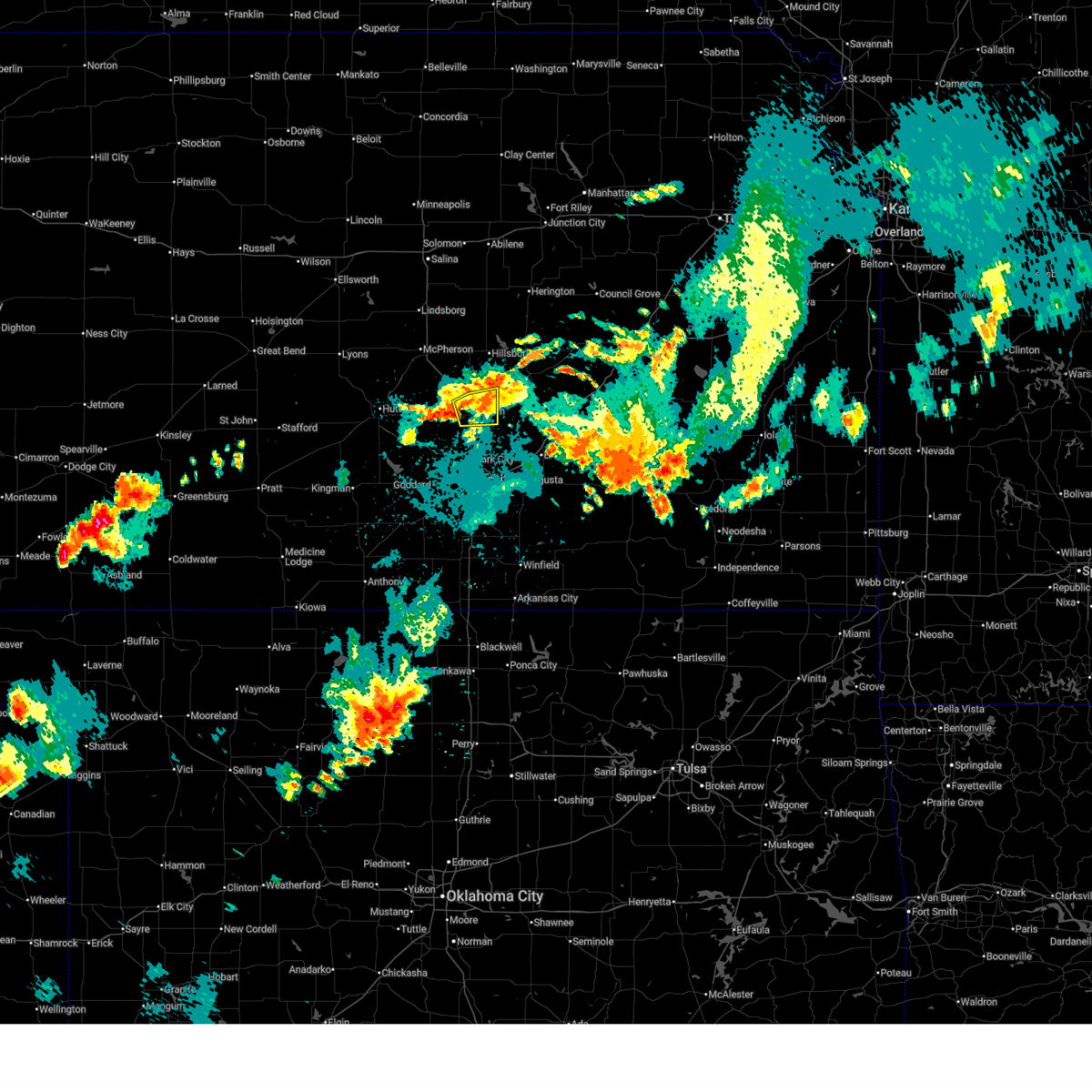 the severe thunderstorm warning has been cancelled and is no longer in effect the severe thunderstorm warning has been cancelled and is no longer in effect
|
| 7/24/2025 9:08 PM CDT |
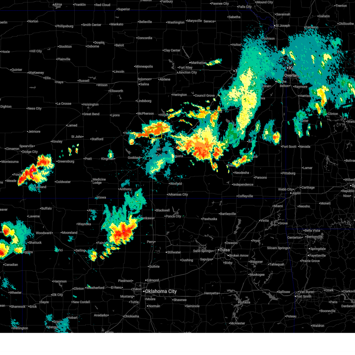 At 908 pm cdt, a severe thunderstorm was located near newton, moving northeast at 10 mph (radar indicated). Hazards include quarter size hail. Damage to vehicles is expected. locations impacted include, newton, north newton, walton, and newton airport. This includes interstate 135 between mile markers 27 and 38. At 908 pm cdt, a severe thunderstorm was located near newton, moving northeast at 10 mph (radar indicated). Hazards include quarter size hail. Damage to vehicles is expected. locations impacted include, newton, north newton, walton, and newton airport. This includes interstate 135 between mile markers 27 and 38.
|
| 7/24/2025 8:49 PM CDT |
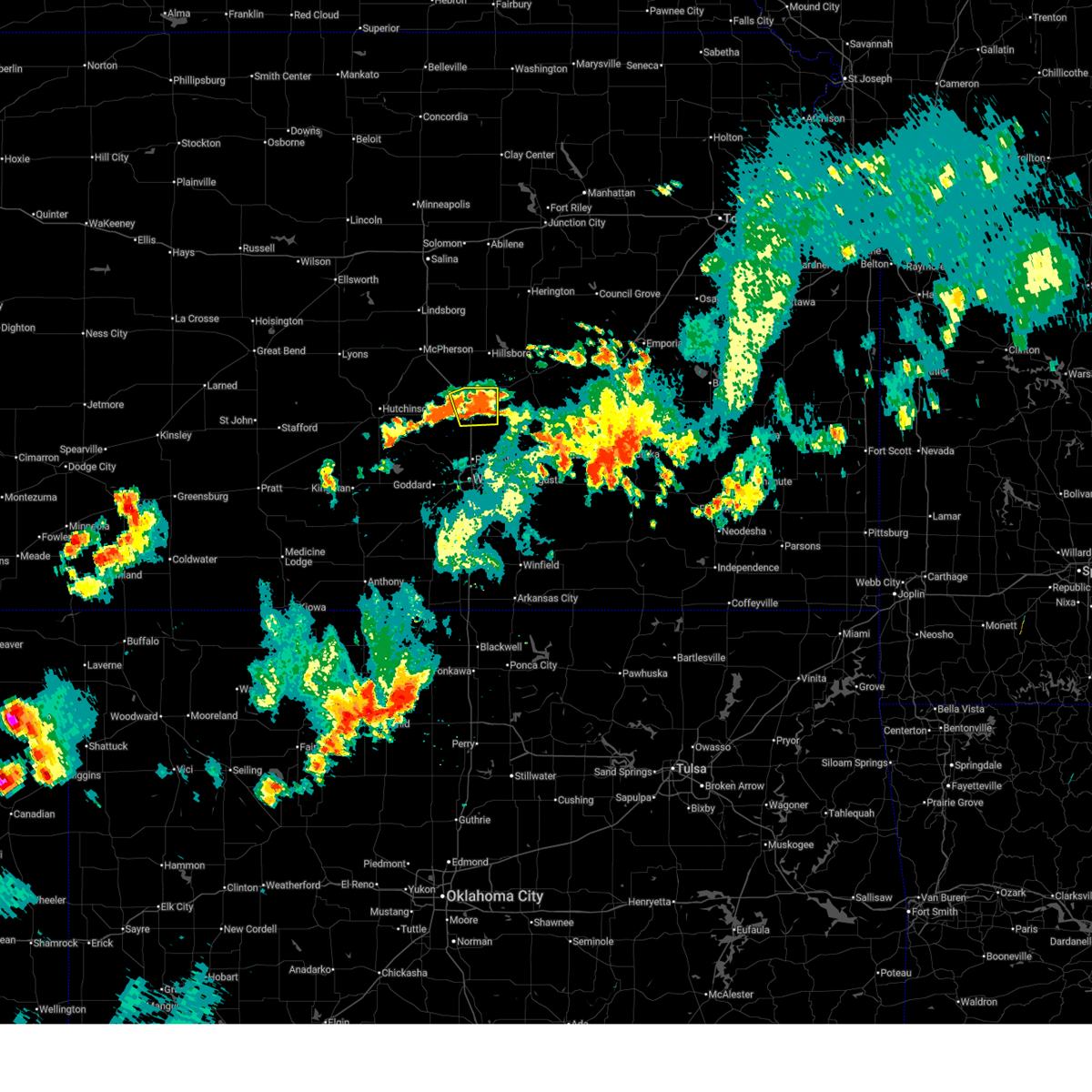 Svrict the national weather service in wichita has issued a * severe thunderstorm warning for, eastern harvey county in south central kansas, * until 930 pm cdt. * at 848 pm cdt, a severe thunderstorm was located over newton, moving northeast at 10 mph (radar indicated). Hazards include quarter size hail. damage to vehicles is expected Svrict the national weather service in wichita has issued a * severe thunderstorm warning for, eastern harvey county in south central kansas, * until 930 pm cdt. * at 848 pm cdt, a severe thunderstorm was located over newton, moving northeast at 10 mph (radar indicated). Hazards include quarter size hail. damage to vehicles is expected
|
| 7/24/2025 8:48 PM CDT | Quarter sized hail reported 1.5 miles SW of Newton, KS |
| 7/24/2025 8:40 PM CDT | Half Dollar sized hail reported 1.2 miles SSW of Newton, KS, courtesy of kwch. |
| 7/18/2025 6:01 PM CDT |
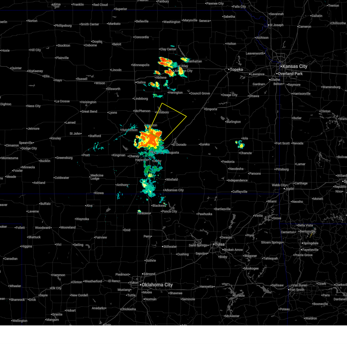 Svrict the national weather service in wichita has issued a * severe thunderstorm warning for, northeastern harvey county in south central kansas, southwestern chase county in east central kansas, northwestern butler county in south central kansas, southeastern marion county in central kansas, * until 645 pm cdt. * at 601 pm cdt, a severe thunderstorm was located over elbing, or 6 miles south of peabody, moving northeast at 40 mph (radar indicated). Hazards include 60 mph wind gusts. expect damage to roofs, siding, and trees Svrict the national weather service in wichita has issued a * severe thunderstorm warning for, northeastern harvey county in south central kansas, southwestern chase county in east central kansas, northwestern butler county in south central kansas, southeastern marion county in central kansas, * until 645 pm cdt. * at 601 pm cdt, a severe thunderstorm was located over elbing, or 6 miles south of peabody, moving northeast at 40 mph (radar indicated). Hazards include 60 mph wind gusts. expect damage to roofs, siding, and trees
|
| 7/8/2025 4:53 PM CDT |
 Svrict the national weather service in wichita has issued a * severe thunderstorm warning for, northern sedgwick county in south central kansas, southern harvey county in south central kansas, * until 600 pm cdt. * at 453 pm cdt, a severe thunderstorm was located over sedgwick, moving south at 20 mph (radar indicated). Hazards include 60 mph wind gusts and quarter size hail. Hail damage to vehicles is expected. Expect wind damage to roofs, siding, and trees. Svrict the national weather service in wichita has issued a * severe thunderstorm warning for, northern sedgwick county in south central kansas, southern harvey county in south central kansas, * until 600 pm cdt. * at 453 pm cdt, a severe thunderstorm was located over sedgwick, moving south at 20 mph (radar indicated). Hazards include 60 mph wind gusts and quarter size hail. Hail damage to vehicles is expected. Expect wind damage to roofs, siding, and trees.
|
| 7/8/2025 4:48 PM CDT |
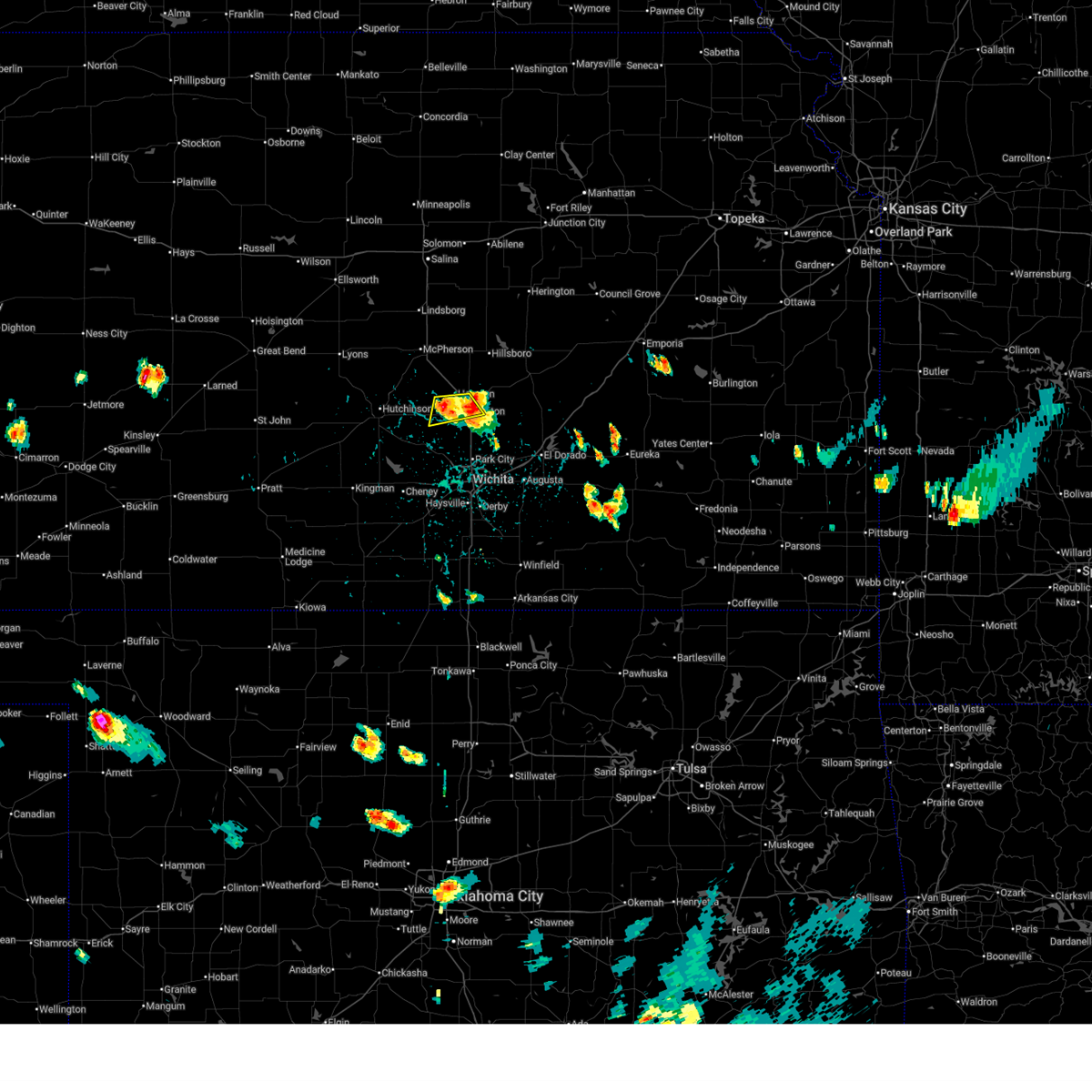 the severe thunderstorm warning has been cancelled and is no longer in effect the severe thunderstorm warning has been cancelled and is no longer in effect
|
| 7/8/2025 4:33 PM CDT |
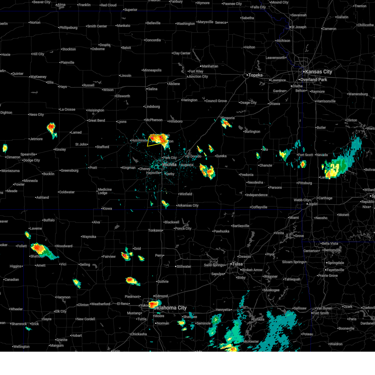 At 432 pm cdt, severe thunderstorms were located along a line extending from newton to 5 miles north of halstead, moving southeast at 10 mph (trained weather spotters). Hazards include 60 mph wind gusts and quarter size hail. Hail damage to vehicles is expected. expect wind damage to roofs, siding, and trees. locations impacted include, newton, hesston, halstead, north newton, and newton airport. This includes interstate 135 between mile markers 30 and 39. At 432 pm cdt, severe thunderstorms were located along a line extending from newton to 5 miles north of halstead, moving southeast at 10 mph (trained weather spotters). Hazards include 60 mph wind gusts and quarter size hail. Hail damage to vehicles is expected. expect wind damage to roofs, siding, and trees. locations impacted include, newton, hesston, halstead, north newton, and newton airport. This includes interstate 135 between mile markers 30 and 39.
|
| 7/8/2025 4:22 PM CDT |
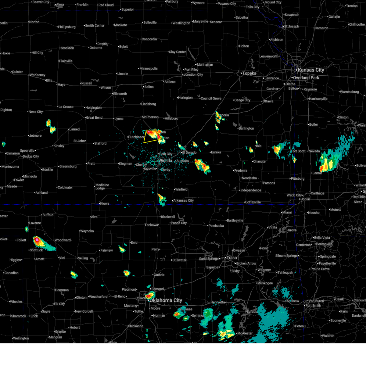 At 422 pm cdt, a severe thunderstorm was located 6 miles southwest of hesston, moving south at 15 mph (trained weather spotters). Hazards include ping pong ball size hail and 60 mph wind gusts. People and animals outdoors will be injured. expect hail damage to roofs, siding, windows, and vehicles. expect wind damage to roofs, siding, and trees. locations impacted include, newton, hesston, halstead, north newton, and newton airport. This includes interstate 135 between mile markers 30 and 42. At 422 pm cdt, a severe thunderstorm was located 6 miles southwest of hesston, moving south at 15 mph (trained weather spotters). Hazards include ping pong ball size hail and 60 mph wind gusts. People and animals outdoors will be injured. expect hail damage to roofs, siding, windows, and vehicles. expect wind damage to roofs, siding, and trees. locations impacted include, newton, hesston, halstead, north newton, and newton airport. This includes interstate 135 between mile markers 30 and 42.
|
| 7/8/2025 4:13 PM CDT |
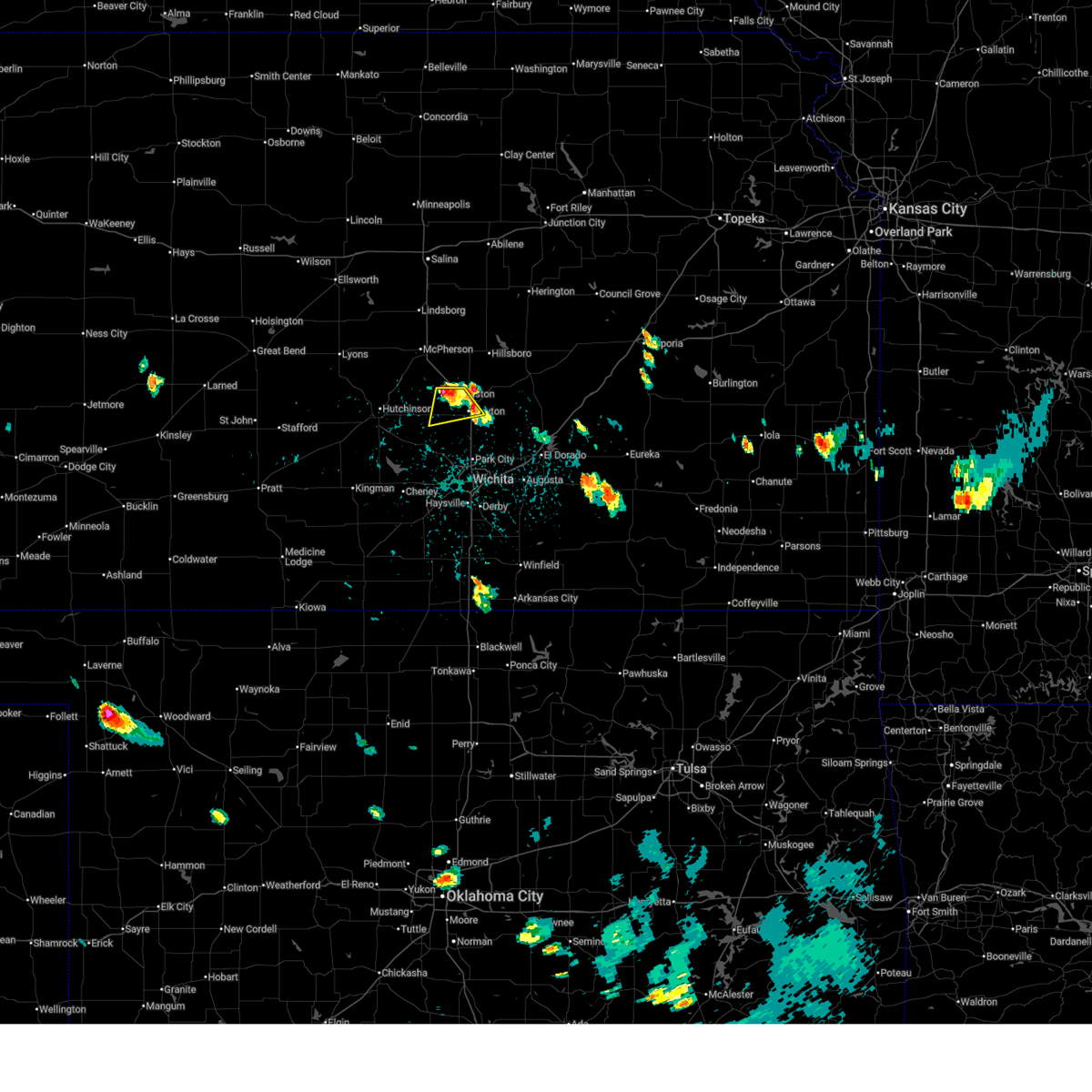 the severe thunderstorm warning has been cancelled and is no longer in effect the severe thunderstorm warning has been cancelled and is no longer in effect
|
| 7/8/2025 4:13 PM CDT |
 At 412 pm cdt, a severe thunderstorm was located near moundridge, moving south at 10 mph (radar indicated). Hazards include 60 mph wind gusts and quarter size hail. Hail damage to vehicles is expected. expect wind damage to roofs, siding, and trees. locations impacted include, newton, hesston, halstead, north newton, and newton airport. This includes interstate 135 between mile markers 30 and 42. At 412 pm cdt, a severe thunderstorm was located near moundridge, moving south at 10 mph (radar indicated). Hazards include 60 mph wind gusts and quarter size hail. Hail damage to vehicles is expected. expect wind damage to roofs, siding, and trees. locations impacted include, newton, hesston, halstead, north newton, and newton airport. This includes interstate 135 between mile markers 30 and 42.
|
| 7/8/2025 3:55 PM CDT |
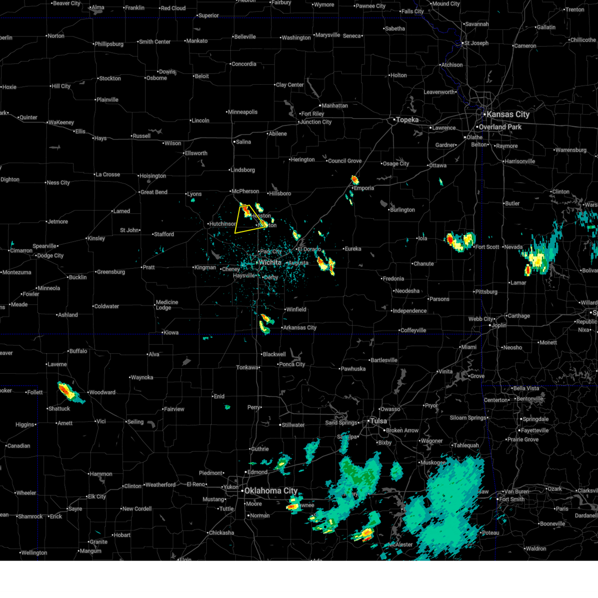 Svrict the national weather service in wichita has issued a * severe thunderstorm warning for, southeastern mcpherson county in central kansas, central harvey county in south central kansas, * until 500 pm cdt. * at 355 pm cdt, a severe thunderstorm was located over moundridge, moving south at 10 mph (radar indicated). Hazards include 60 mph wind gusts and quarter size hail. Hail damage to vehicles is expected. Expect wind damage to roofs, siding, and trees. Svrict the national weather service in wichita has issued a * severe thunderstorm warning for, southeastern mcpherson county in central kansas, central harvey county in south central kansas, * until 500 pm cdt. * at 355 pm cdt, a severe thunderstorm was located over moundridge, moving south at 10 mph (radar indicated). Hazards include 60 mph wind gusts and quarter size hail. Hail damage to vehicles is expected. Expect wind damage to roofs, siding, and trees.
|
| 6/17/2025 4:57 AM CDT |
 At 457 am cdt, severe thunderstorms were located along a line extending from florence to 6 miles east of burns to near leon to near douglass, moving southeast at 45 mph (trained weather spotters). Hazards include 70 mph wind gusts. Expect considerable tree damage. damage is likely to mobile homes, roofs, and outbuildings. locations impacted include, wichita, derby, newton, el dorado, andover, haysville, augusta, park city, valley center, bel aire, mulvane, goddard, rose hill, maize, clearwater, north newton, douglass, sedgwick, towanda, and benton. this includes the following highways, interstate 135 between mile markers 0 and 37. Interstate 35 between mile markers 34 and 95. At 457 am cdt, severe thunderstorms were located along a line extending from florence to 6 miles east of burns to near leon to near douglass, moving southeast at 45 mph (trained weather spotters). Hazards include 70 mph wind gusts. Expect considerable tree damage. damage is likely to mobile homes, roofs, and outbuildings. locations impacted include, wichita, derby, newton, el dorado, andover, haysville, augusta, park city, valley center, bel aire, mulvane, goddard, rose hill, maize, clearwater, north newton, douglass, sedgwick, towanda, and benton. this includes the following highways, interstate 135 between mile markers 0 and 37. Interstate 35 between mile markers 34 and 95.
|
| 6/17/2025 4:57 AM CDT |
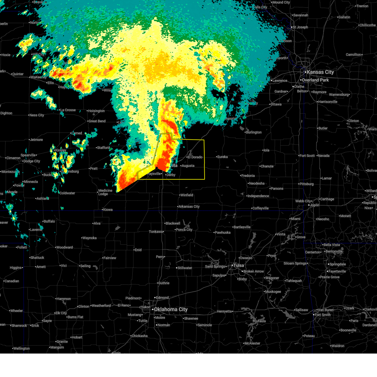 the severe thunderstorm warning has been cancelled and is no longer in effect the severe thunderstorm warning has been cancelled and is no longer in effect
|
| 6/17/2025 4:54 AM CDT | Street light blocking road in the 600 block of e. 36th in newto in harvey county KS, 1.5 miles SW of Newton, KS |
| 6/17/2025 4:40 AM CDT |
 At 440 am cdt, severe thunderstorms were located along a line extending from near hillsboro to near florence to near towanda to derby, moving southeast at 45 mph (trained weather spotters). Hazards include 70 mph wind gusts. Expect considerable tree damage. damage is likely to mobile homes, roofs, and outbuildings. locations impacted include, wichita, derby, newton, el dorado, andover, haysville, augusta, park city, valley center, bel aire, mulvane, goddard, rose hill, hesston, maize, hillsboro, clearwater, cheney, halstead, and marion. this includes the following highways, interstate 135 between mile markers 0 and 42. Interstate 35 between mile markers 34 and 99. At 440 am cdt, severe thunderstorms were located along a line extending from near hillsboro to near florence to near towanda to derby, moving southeast at 45 mph (trained weather spotters). Hazards include 70 mph wind gusts. Expect considerable tree damage. damage is likely to mobile homes, roofs, and outbuildings. locations impacted include, wichita, derby, newton, el dorado, andover, haysville, augusta, park city, valley center, bel aire, mulvane, goddard, rose hill, hesston, maize, hillsboro, clearwater, cheney, halstead, and marion. this includes the following highways, interstate 135 between mile markers 0 and 42. Interstate 35 between mile markers 34 and 99.
|
| 6/17/2025 4:40 AM CDT |
 the severe thunderstorm warning has been cancelled and is no longer in effect the severe thunderstorm warning has been cancelled and is no longer in effect
|
| 6/17/2025 4:36 AM CDT | Power line down at east 4th stree in harvey county KS, 1.5 miles SW of Newton, KS |
| 6/17/2025 4:25 AM CDT |
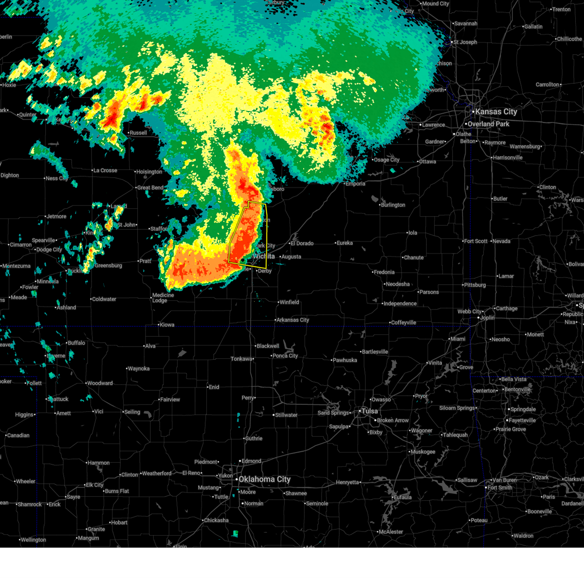 the severe thunderstorm warning has been cancelled and is no longer in effect the severe thunderstorm warning has been cancelled and is no longer in effect
|
| 6/17/2025 4:25 AM CDT |
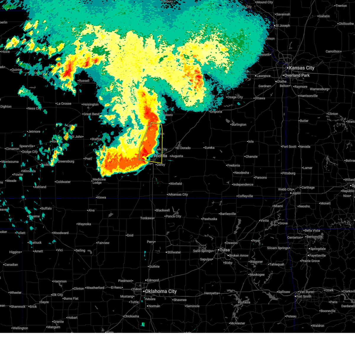 At 424 am cdt, severe thunderstorms were located along a line extending from 6 miles northeast of park city to near south wichita, moving southeast at 45 mph. these are destructive storms for wichita and newton (trained weather spotters). Hazards include 100 mph wind gusts. You are in a life-threatening situation. flying debris may be deadly to those caught without shelter. mobile homes will be destroyed. expect considerable damage to homes and businesses. expect extensive tree damage and power outages. locations impacted include, wichita, newton, andover, park city, valley center, bel aire, goddard, hesston, maize, halstead, north newton, sedgwick, colwich, whitewater, downtown wichita, kechi, eastborough, bentley, walton, and west wichita. this includes the following highways, interstate 135 between mile markers 0 and 41. Interstate 35 between mile markers 42 and 54. At 424 am cdt, severe thunderstorms were located along a line extending from 6 miles northeast of park city to near south wichita, moving southeast at 45 mph. these are destructive storms for wichita and newton (trained weather spotters). Hazards include 100 mph wind gusts. You are in a life-threatening situation. flying debris may be deadly to those caught without shelter. mobile homes will be destroyed. expect considerable damage to homes and businesses. expect extensive tree damage and power outages. locations impacted include, wichita, newton, andover, park city, valley center, bel aire, goddard, hesston, maize, halstead, north newton, sedgwick, colwich, whitewater, downtown wichita, kechi, eastborough, bentley, walton, and west wichita. this includes the following highways, interstate 135 between mile markers 0 and 41. Interstate 35 between mile markers 42 and 54.
|
| 6/17/2025 4:19 AM CDT |
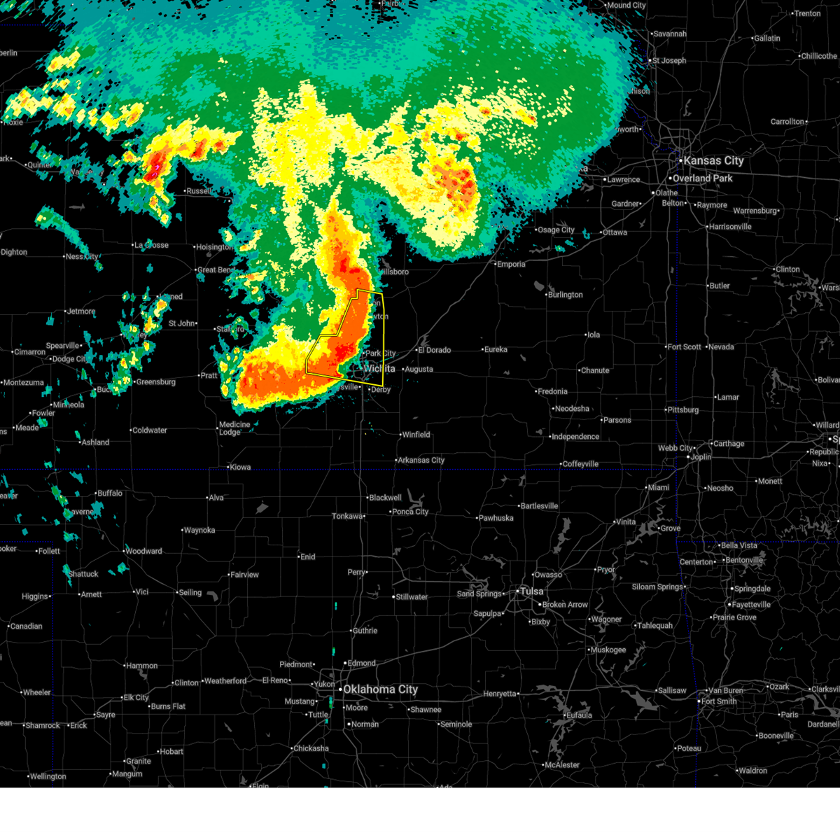 At 418 am cdt, severe thunderstorms were located along a line extending from 6 miles east of sedgwick to near eisenhower national airport, moving southeast at 45 mph. these are destructive storms for wichita and newton (trained weather spotters). Hazards include 80 mph wind gusts. Flying debris will be dangerous to those caught without shelter. mobile homes will be heavily damaged. expect considerable damage to roofs, windows, and vehicles. extensive tree damage and power outages are likely. locations impacted include, wichita, newton, andover, park city, valley center, bel aire, goddard, hesston, maize, halstead, north newton, sedgwick, colwich, garden plain, mount hope, whitewater, downtown wichita, kechi, andale, and eastborough. this includes the following highways, interstate 135 between mile markers 0 and 41. Interstate 35 between mile markers 42 and 54. At 418 am cdt, severe thunderstorms were located along a line extending from 6 miles east of sedgwick to near eisenhower national airport, moving southeast at 45 mph. these are destructive storms for wichita and newton (trained weather spotters). Hazards include 80 mph wind gusts. Flying debris will be dangerous to those caught without shelter. mobile homes will be heavily damaged. expect considerable damage to roofs, windows, and vehicles. extensive tree damage and power outages are likely. locations impacted include, wichita, newton, andover, park city, valley center, bel aire, goddard, hesston, maize, halstead, north newton, sedgwick, colwich, garden plain, mount hope, whitewater, downtown wichita, kechi, andale, and eastborough. this includes the following highways, interstate 135 between mile markers 0 and 41. Interstate 35 between mile markers 42 and 54.
|
| 6/17/2025 4:17 AM CDT |
 Svrict the national weather service in wichita has issued a * severe thunderstorm warning for, eastern mcpherson county in central kansas, sedgwick county in south central kansas, harvey county in south central kansas, southwestern chase county in east central kansas, butler county in south central kansas, marion county in central kansas, * until 515 am cdt. * at 417 am cdt, severe thunderstorms were located along a line extending from near canton to 5 miles southwest of hillsboro to near park city to near eisenhower national airport, moving southeast at 45 mph (radar indicated). Hazards include 70 mph wind gusts. Expect considerable tree damage. Damage is likely to mobile homes, roofs, and outbuildings. Svrict the national weather service in wichita has issued a * severe thunderstorm warning for, eastern mcpherson county in central kansas, sedgwick county in south central kansas, harvey county in south central kansas, southwestern chase county in east central kansas, butler county in south central kansas, marion county in central kansas, * until 515 am cdt. * at 417 am cdt, severe thunderstorms were located along a line extending from near canton to 5 miles southwest of hillsboro to near park city to near eisenhower national airport, moving southeast at 45 mph (radar indicated). Hazards include 70 mph wind gusts. Expect considerable tree damage. Damage is likely to mobile homes, roofs, and outbuildings.
|
| 6/17/2025 4:04 AM CDT |
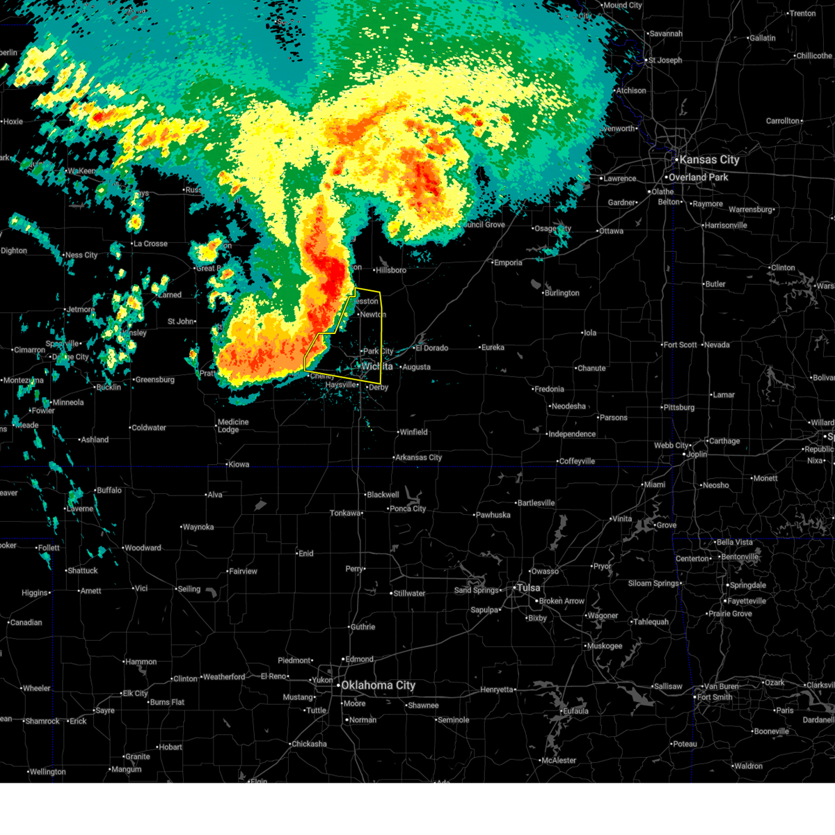 At 404 am cdt, severe thunderstorms were located along a line extending from near halstead to near colwich, moving southeast at 45 mph. these are destructive storms for wichita and newton (trained weather spotters). Hazards include 80 mph wind gusts. Flying debris will be dangerous to those caught without shelter. mobile homes will be heavily damaged. expect considerable damage to roofs, windows, and vehicles. extensive tree damage and power outages are likely. locations impacted include, wichita, newton, andover, park city, valley center, bel aire, goddard, hesston, maize, halstead, north newton, sedgwick, colwich, garden plain, mount hope, whitewater, downtown wichita, kechi, andale, and eastborough. this includes the following highways, interstate 135 between mile markers 0 and 41. Interstate 35 between mile markers 42 and 54. At 404 am cdt, severe thunderstorms were located along a line extending from near halstead to near colwich, moving southeast at 45 mph. these are destructive storms for wichita and newton (trained weather spotters). Hazards include 80 mph wind gusts. Flying debris will be dangerous to those caught without shelter. mobile homes will be heavily damaged. expect considerable damage to roofs, windows, and vehicles. extensive tree damage and power outages are likely. locations impacted include, wichita, newton, andover, park city, valley center, bel aire, goddard, hesston, maize, halstead, north newton, sedgwick, colwich, garden plain, mount hope, whitewater, downtown wichita, kechi, andale, and eastborough. this includes the following highways, interstate 135 between mile markers 0 and 41. Interstate 35 between mile markers 42 and 54.
|
| 6/17/2025 3:50 AM CDT |
 the severe thunderstorm warning has been cancelled and is no longer in effect the severe thunderstorm warning has been cancelled and is no longer in effect
|
| 6/17/2025 3:50 AM CDT |
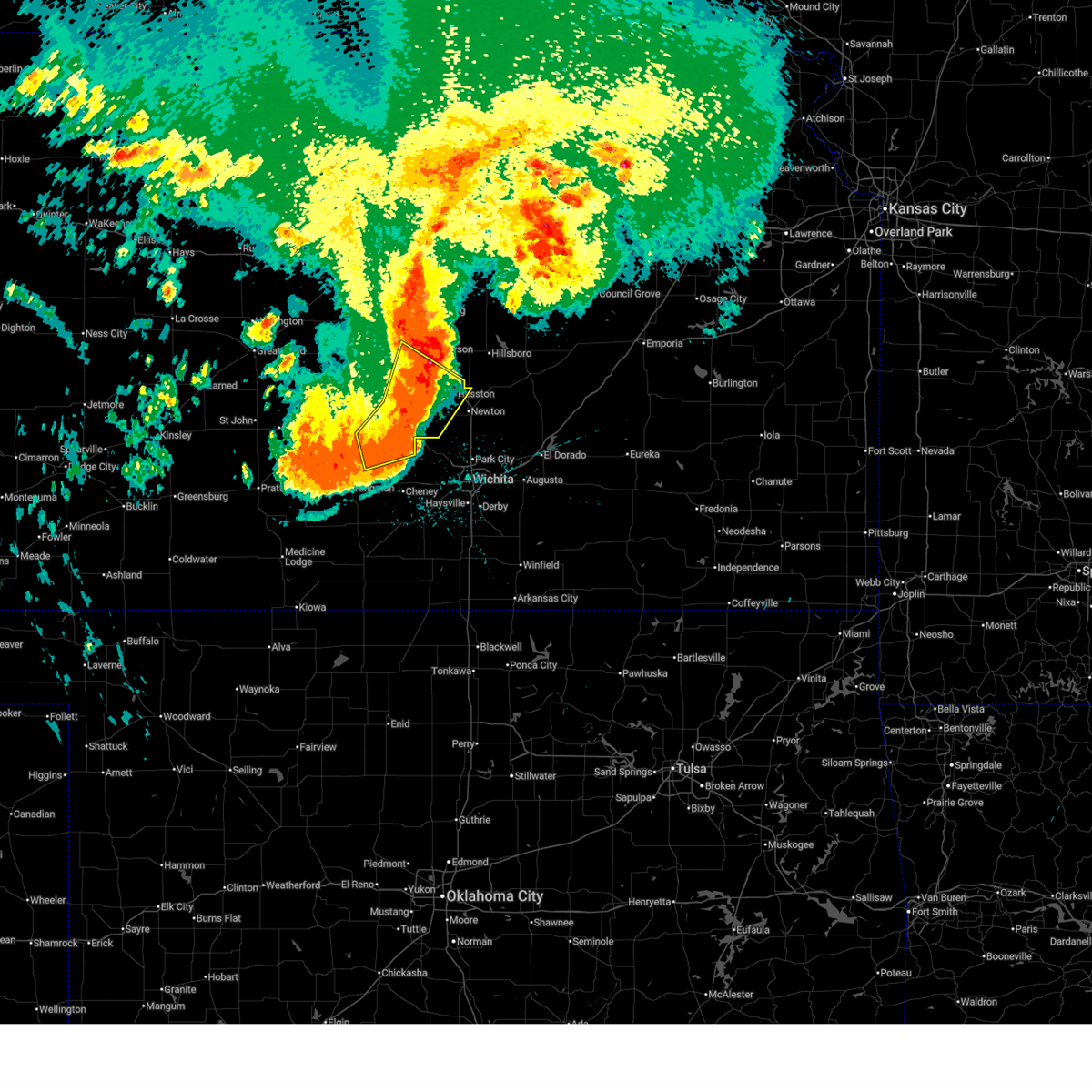 At 349 am cdt, a severe thunderstorm was located near mount hope, moving southeast at 35 mph. this is a destructive storm for burrton and moundridge (trained weather spotters). Hazards include 90 mph wind gusts. You are in a life-threatening situation. flying debris may be deadly to those caught without shelter. mobile homes will be heavily damaged or destroyed. homes and businesses will have substantial roof and window damage. expect extensive tree damage and power outages. locations impacted include, hutchinson, mcpherson, hesston, south hutchinson, halstead, moundridge, inman, buhler, haven, burrton, pretty prairie, yoder, mcpherson airport, hutchinson airport, and cheney lake. This includes interstate 135 between mile markers 38 and 57. At 349 am cdt, a severe thunderstorm was located near mount hope, moving southeast at 35 mph. this is a destructive storm for burrton and moundridge (trained weather spotters). Hazards include 90 mph wind gusts. You are in a life-threatening situation. flying debris may be deadly to those caught without shelter. mobile homes will be heavily damaged or destroyed. homes and businesses will have substantial roof and window damage. expect extensive tree damage and power outages. locations impacted include, hutchinson, mcpherson, hesston, south hutchinson, halstead, moundridge, inman, buhler, haven, burrton, pretty prairie, yoder, mcpherson airport, hutchinson airport, and cheney lake. This includes interstate 135 between mile markers 38 and 57.
|
| 6/17/2025 3:41 AM CDT |
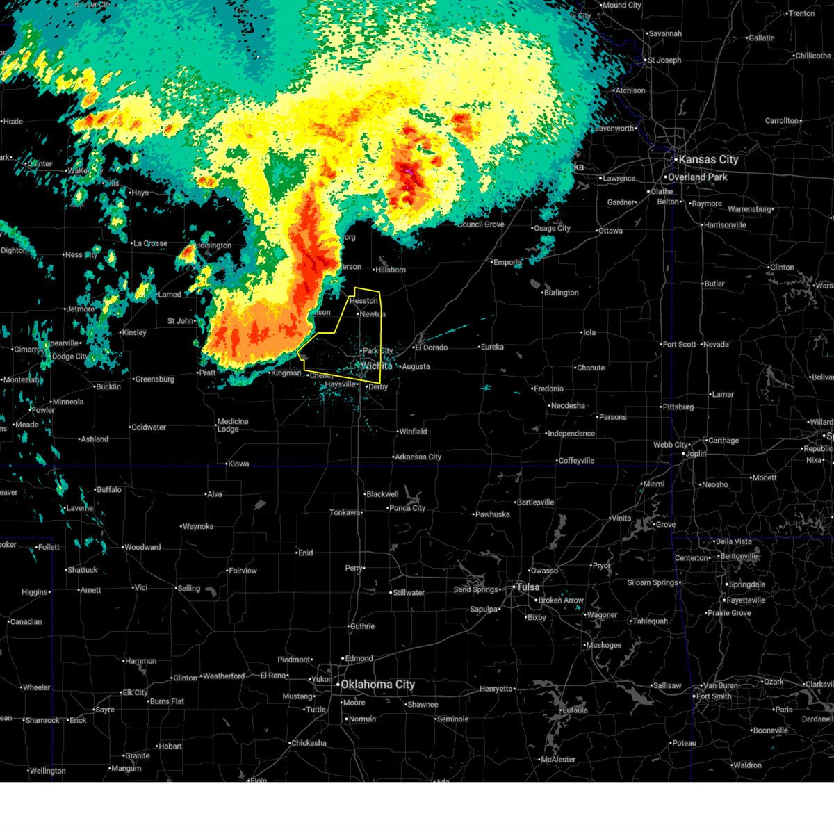 Svrict the national weather service in wichita has issued a * severe thunderstorm warning for, southeastern reno county in south central kansas, sedgwick county in south central kansas, harvey county in south central kansas, southwestern marion county in central kansas, * until 445 am cdt. * at 340 am cdt, severe thunderstorms were located along a line extending from 5 miles northeast of buhler to haven, moving southeast at 45 mph. these are destructive storms for wichita and newton (trained weather spotters). Hazards include 90 mph wind gusts. You are in a life-threatening situation. flying debris may be deadly to those caught without shelter. mobile homes will be heavily damaged or destroyed. homes and businesses will have substantial roof and window damage. Expect extensive tree damage and power outages. Svrict the national weather service in wichita has issued a * severe thunderstorm warning for, southeastern reno county in south central kansas, sedgwick county in south central kansas, harvey county in south central kansas, southwestern marion county in central kansas, * until 445 am cdt. * at 340 am cdt, severe thunderstorms were located along a line extending from 5 miles northeast of buhler to haven, moving southeast at 45 mph. these are destructive storms for wichita and newton (trained weather spotters). Hazards include 90 mph wind gusts. You are in a life-threatening situation. flying debris may be deadly to those caught without shelter. mobile homes will be heavily damaged or destroyed. homes and businesses will have substantial roof and window damage. Expect extensive tree damage and power outages.
|
| 6/17/2025 3:35 AM CDT |
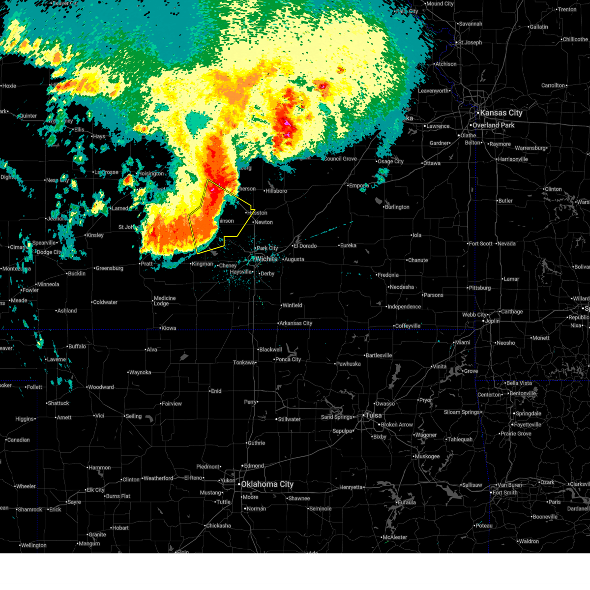 At 335 am cdt, a severe thunderstorm was located near haven, moving southeast at 70 mph. this is a destructive storm for hutchinson, inman, and burrton (trained weather spotters). Hazards include 90 mph wind gusts. You are in a life-threatening situation. flying debris may be deadly to those caught without shelter. mobile homes will be heavily damaged or destroyed. homes and businesses will have substantial roof and window damage. expect extensive tree damage and power outages. locations impacted include, hutchinson, mcpherson, hesston, south hutchinson, halstead, moundridge, inman, buhler, haven, nickerson, burrton, pretty prairie, partridge, windom, yoder, willowbrook, mcpherson airport, hutchinson airport, and cheney lake. This includes interstate 135 between mile markers 38 and 57. At 335 am cdt, a severe thunderstorm was located near haven, moving southeast at 70 mph. this is a destructive storm for hutchinson, inman, and burrton (trained weather spotters). Hazards include 90 mph wind gusts. You are in a life-threatening situation. flying debris may be deadly to those caught without shelter. mobile homes will be heavily damaged or destroyed. homes and businesses will have substantial roof and window damage. expect extensive tree damage and power outages. locations impacted include, hutchinson, mcpherson, hesston, south hutchinson, halstead, moundridge, inman, buhler, haven, nickerson, burrton, pretty prairie, partridge, windom, yoder, willowbrook, mcpherson airport, hutchinson airport, and cheney lake. This includes interstate 135 between mile markers 38 and 57.
|
| 6/17/2025 3:34 AM CDT |
 Svrict the national weather service in wichita has issued a * severe thunderstorm warning for, southern mcpherson county in central kansas, southeastern reno county in south central kansas, sedgwick county in south central kansas, harvey county in south central kansas, harper county in south central kansas, kingman county in south central kansas, southwestern marion county in central kansas, northern sumner county in south central kansas, * until 430 am cdt. * at 333 am cdt, severe thunderstorms were located along a line extending from 6 miles north of mcpherson to 7 miles northeast of pretty prairie to 6 miles east of cunningham, moving southeast at 45 mph (trained weather spotters). Hazards include 70 mph wind gusts. Expect considerable tree damage. Damage is likely to mobile homes, roofs, and outbuildings. Svrict the national weather service in wichita has issued a * severe thunderstorm warning for, southern mcpherson county in central kansas, southeastern reno county in south central kansas, sedgwick county in south central kansas, harvey county in south central kansas, harper county in south central kansas, kingman county in south central kansas, southwestern marion county in central kansas, northern sumner county in south central kansas, * until 430 am cdt. * at 333 am cdt, severe thunderstorms were located along a line extending from 6 miles north of mcpherson to 7 miles northeast of pretty prairie to 6 miles east of cunningham, moving southeast at 45 mph (trained weather spotters). Hazards include 70 mph wind gusts. Expect considerable tree damage. Damage is likely to mobile homes, roofs, and outbuildings.
|
| 6/17/2025 3:31 AM CDT |
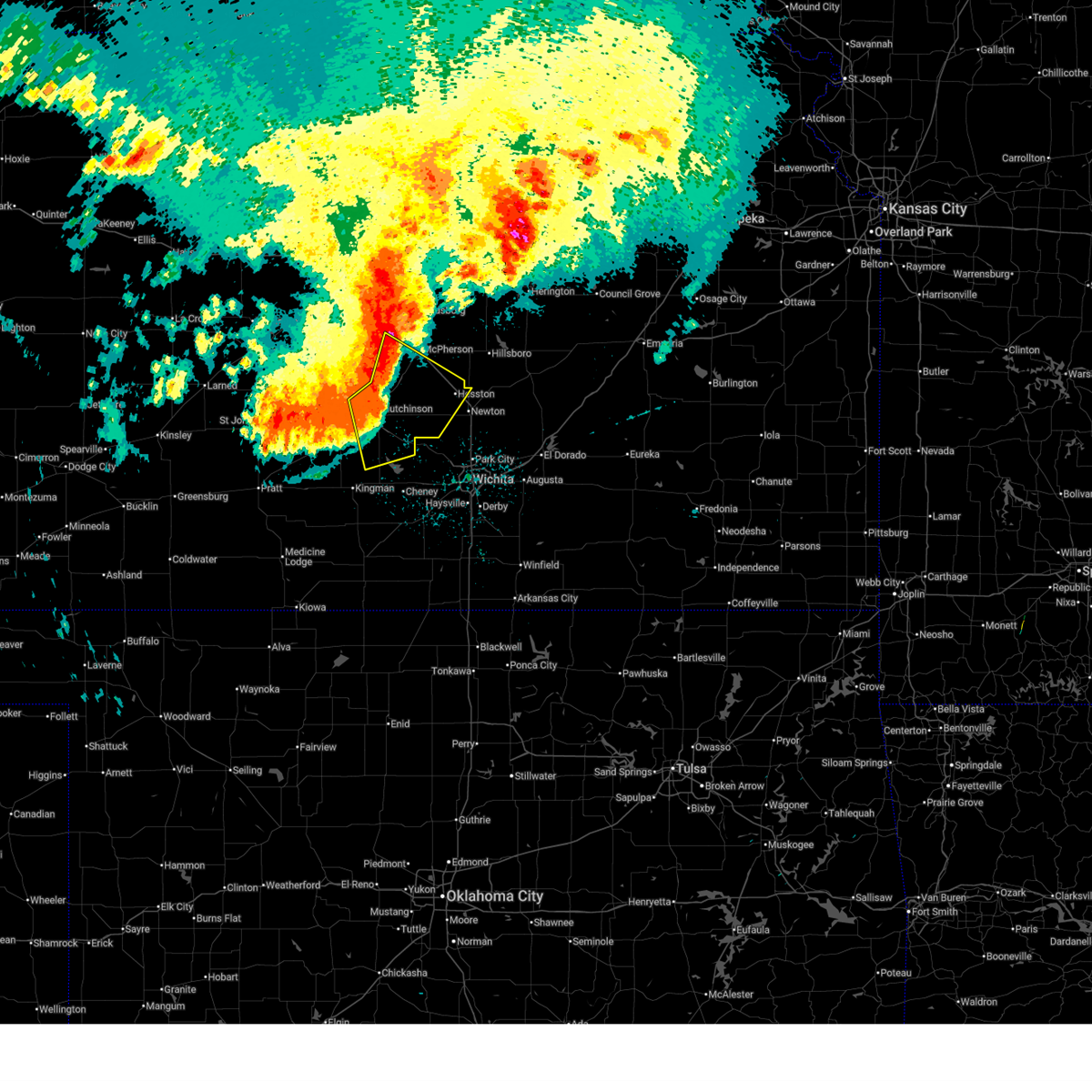 At 330 am cdt, a severe thunderstorm was located near south hutchinson, moving southeast at 35 mph. this is a destructive storm for hutchinson, inman, and burrton (radar indicated). Hazards include 80 mph wind gusts. Flying debris will be dangerous to those caught without shelter. mobile homes will be heavily damaged. expect considerable damage to roofs, windows, and vehicles. extensive tree damage and power outages are likely. locations impacted include, hutchinson, mcpherson, hesston, south hutchinson, halstead, moundridge, inman, buhler, haven, nickerson, burrton, pretty prairie, partridge, windom, yoder, willowbrook, mcpherson airport, hutchinson airport, and cheney lake. This includes interstate 135 between mile markers 38 and 57. At 330 am cdt, a severe thunderstorm was located near south hutchinson, moving southeast at 35 mph. this is a destructive storm for hutchinson, inman, and burrton (radar indicated). Hazards include 80 mph wind gusts. Flying debris will be dangerous to those caught without shelter. mobile homes will be heavily damaged. expect considerable damage to roofs, windows, and vehicles. extensive tree damage and power outages are likely. locations impacted include, hutchinson, mcpherson, hesston, south hutchinson, halstead, moundridge, inman, buhler, haven, nickerson, burrton, pretty prairie, partridge, windom, yoder, willowbrook, mcpherson airport, hutchinson airport, and cheney lake. This includes interstate 135 between mile markers 38 and 57.
|
| 6/17/2025 3:18 AM CDT |
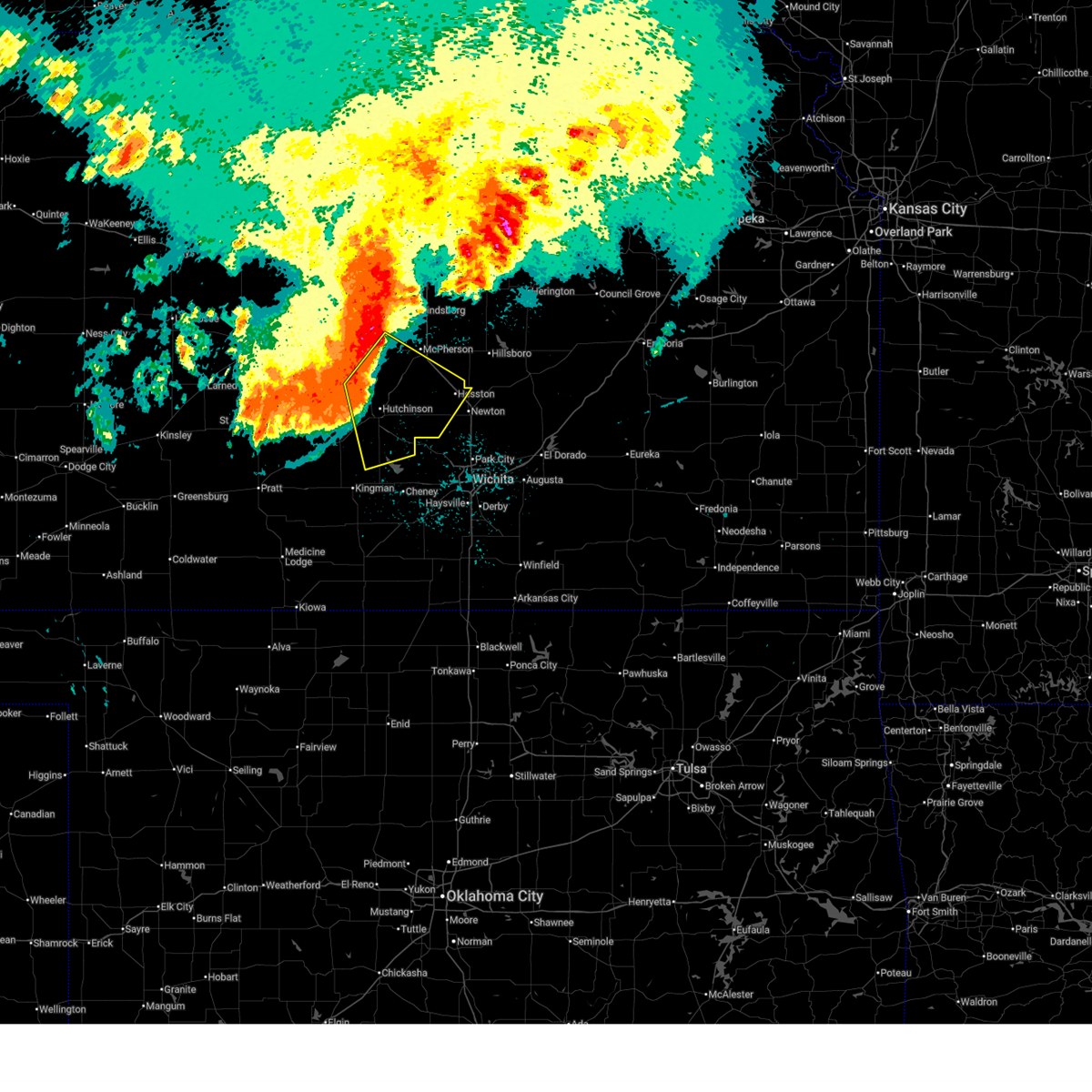 Svrict the national weather service in wichita has issued a * severe thunderstorm warning for, southern mcpherson county in central kansas, eastern reno county in south central kansas, western harvey county in south central kansas, southeastern rice county in central kansas, * until 400 am cdt. * at 318 am cdt, a severe thunderstorm was located near hutchinson, moving southeast at 35 mph. this is a destructive storm for hutchinson (radar indicated). Hazards include 80 mph wind gusts. Flying debris will be dangerous to those caught without shelter. mobile homes will be heavily damaged. expect considerable damage to roofs, windows, and vehicles. Extensive tree damage and power outages are likely. Svrict the national weather service in wichita has issued a * severe thunderstorm warning for, southern mcpherson county in central kansas, eastern reno county in south central kansas, western harvey county in south central kansas, southeastern rice county in central kansas, * until 400 am cdt. * at 318 am cdt, a severe thunderstorm was located near hutchinson, moving southeast at 35 mph. this is a destructive storm for hutchinson (radar indicated). Hazards include 80 mph wind gusts. Flying debris will be dangerous to those caught without shelter. mobile homes will be heavily damaged. expect considerable damage to roofs, windows, and vehicles. Extensive tree damage and power outages are likely.
|
| 6/17/2025 3:10 AM CDT |
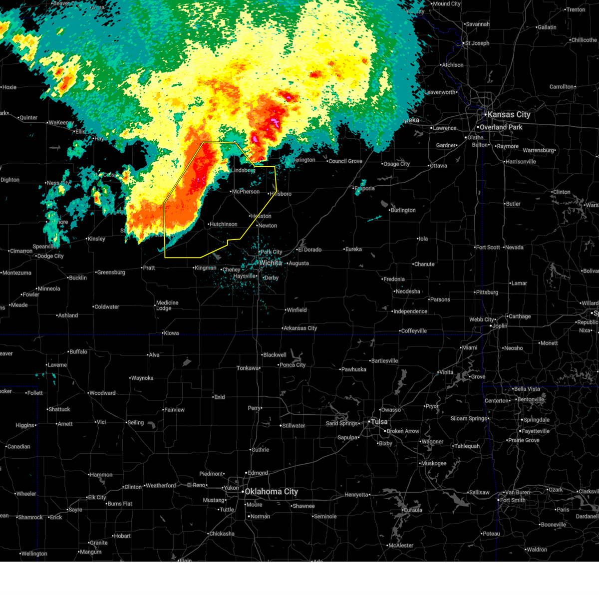 At 309 am cdt, severe thunderstorms were located along a line extending from near marquette to near abbyville to near st. john, moving southeast at 60 mph (trained weather spotters). Hazards include 70 mph wind gusts. Expect considerable tree damage. damage is likely to mobile homes, roofs, and outbuildings. locations impacted include, salina, hutchinson, mcpherson, lyons, hesston, lindsborg, hillsboro, south hutchinson, sterling, halstead, moundridge, inman, buhler, haven, nickerson, burrton, galva, canton, pretty prairie, and marquette. This includes interstate 135 between mile markers 37 and 92. At 309 am cdt, severe thunderstorms were located along a line extending from near marquette to near abbyville to near st. john, moving southeast at 60 mph (trained weather spotters). Hazards include 70 mph wind gusts. Expect considerable tree damage. damage is likely to mobile homes, roofs, and outbuildings. locations impacted include, salina, hutchinson, mcpherson, lyons, hesston, lindsborg, hillsboro, south hutchinson, sterling, halstead, moundridge, inman, buhler, haven, nickerson, burrton, galva, canton, pretty prairie, and marquette. This includes interstate 135 between mile markers 37 and 92.
|
| 6/17/2025 3:10 AM CDT |
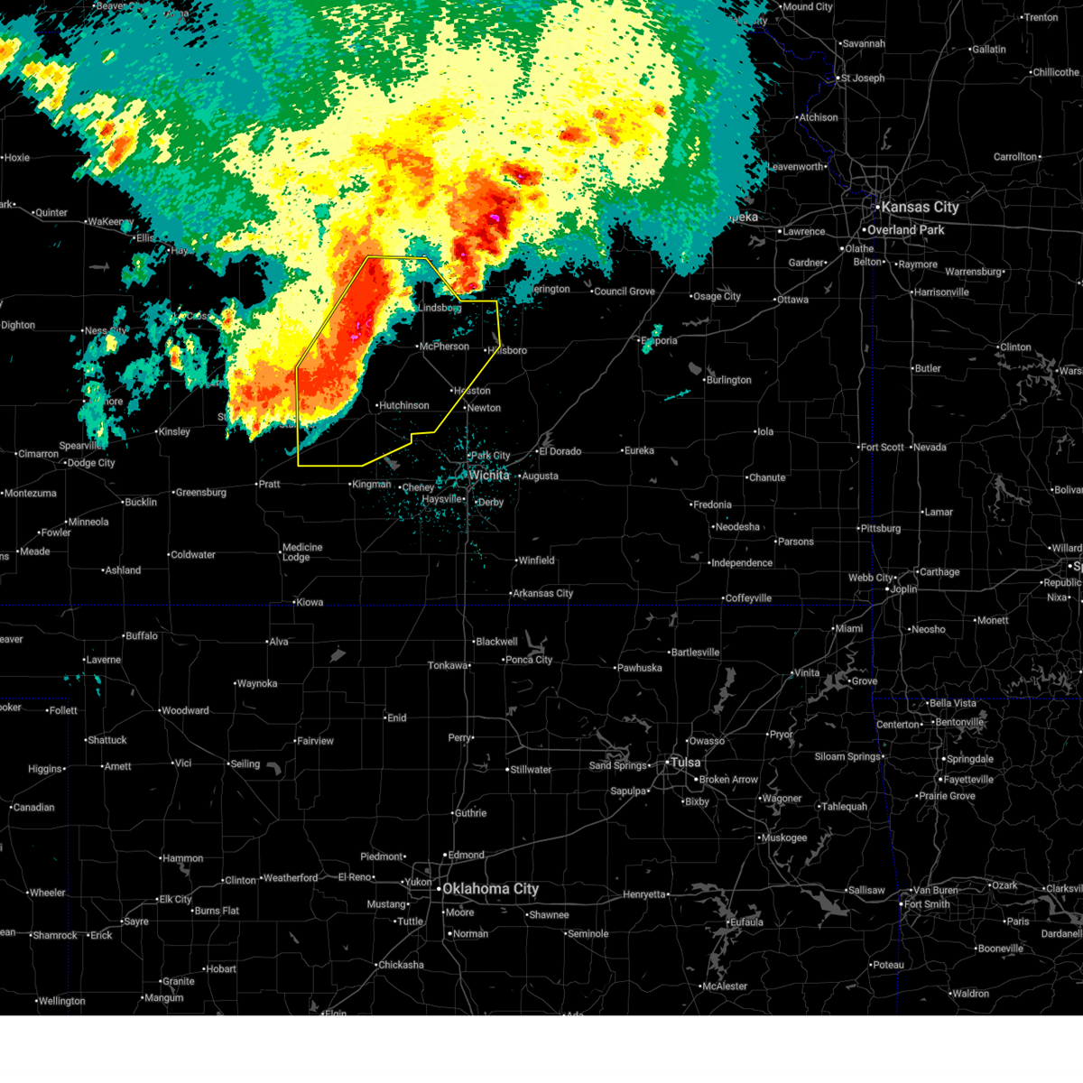 the severe thunderstorm warning has been cancelled and is no longer in effect the severe thunderstorm warning has been cancelled and is no longer in effect
|
| 6/17/2025 2:59 AM CDT |
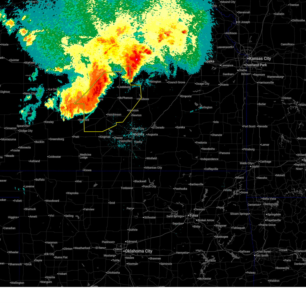 At 258 am cdt, severe thunderstorms were located along a line extending from 8 miles southwest of brookville to near sterling to near st. john, moving southeast at 55 mph (asos weather station). Hazards include 70 mph wind gusts. Expect considerable tree damage. damage is likely to mobile homes, roofs, and outbuildings. locations impacted include, salina, hutchinson, mcpherson, lyons, hesston, lindsborg, hillsboro, south hutchinson, sterling, ellinwood, halstead, moundridge, inman, buhler, haven, nickerson, burrton, galva, canton, and pretty prairie. this includes the following highways, interstate 135 between mile markers 37 and 94. Interstate 70 between mile markers 256 and 266. At 258 am cdt, severe thunderstorms were located along a line extending from 8 miles southwest of brookville to near sterling to near st. john, moving southeast at 55 mph (asos weather station). Hazards include 70 mph wind gusts. Expect considerable tree damage. damage is likely to mobile homes, roofs, and outbuildings. locations impacted include, salina, hutchinson, mcpherson, lyons, hesston, lindsborg, hillsboro, south hutchinson, sterling, ellinwood, halstead, moundridge, inman, buhler, haven, nickerson, burrton, galva, canton, and pretty prairie. this includes the following highways, interstate 135 between mile markers 37 and 94. Interstate 70 between mile markers 256 and 266.
|
| 6/17/2025 2:41 AM CDT |
 Svrict the national weather service in wichita has issued a * severe thunderstorm warning for, mcpherson county in central kansas, reno county in south central kansas, western harvey county in south central kansas, rice county in central kansas, ellsworth county in central kansas, northwestern marion county in central kansas, southern barton county in central kansas, saline county in central kansas, * until 345 am cdt. * at 240 am cdt, severe thunderstorms were located along a line extending from 7 miles east of kanopolis to near bushton to near pawnee rock, moving southeast at 45 mph (weather station observed). Hazards include 60 mph wind gusts. expect damage to roofs, siding, and trees Svrict the national weather service in wichita has issued a * severe thunderstorm warning for, mcpherson county in central kansas, reno county in south central kansas, western harvey county in south central kansas, rice county in central kansas, ellsworth county in central kansas, northwestern marion county in central kansas, southern barton county in central kansas, saline county in central kansas, * until 345 am cdt. * at 240 am cdt, severe thunderstorms were located along a line extending from 7 miles east of kanopolis to near bushton to near pawnee rock, moving southeast at 45 mph (weather station observed). Hazards include 60 mph wind gusts. expect damage to roofs, siding, and trees
|
| 6/14/2025 8:30 AM CDT |
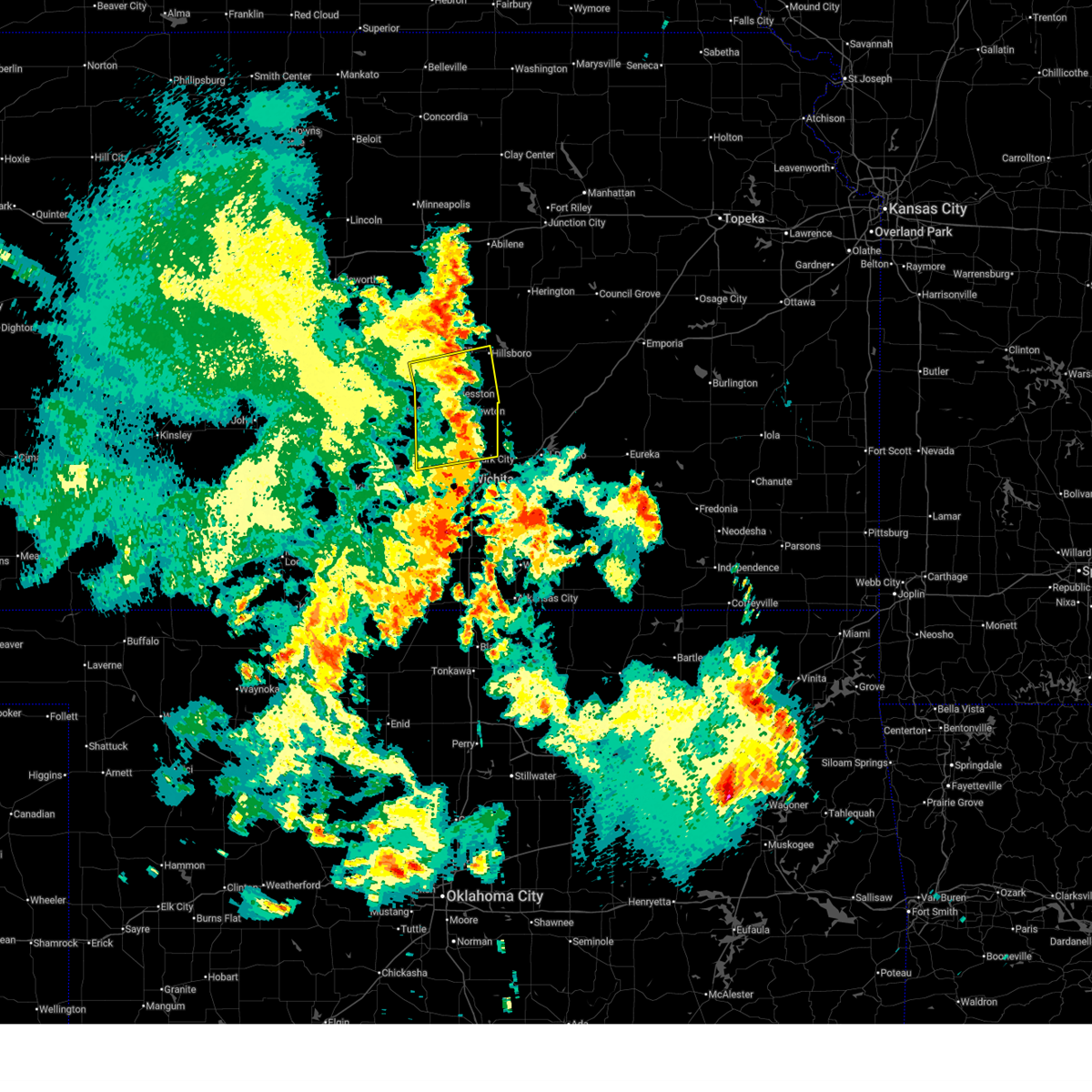 the severe thunderstorm warning has been cancelled and is no longer in effect the severe thunderstorm warning has been cancelled and is no longer in effect
|
| 6/14/2025 8:10 AM CDT |
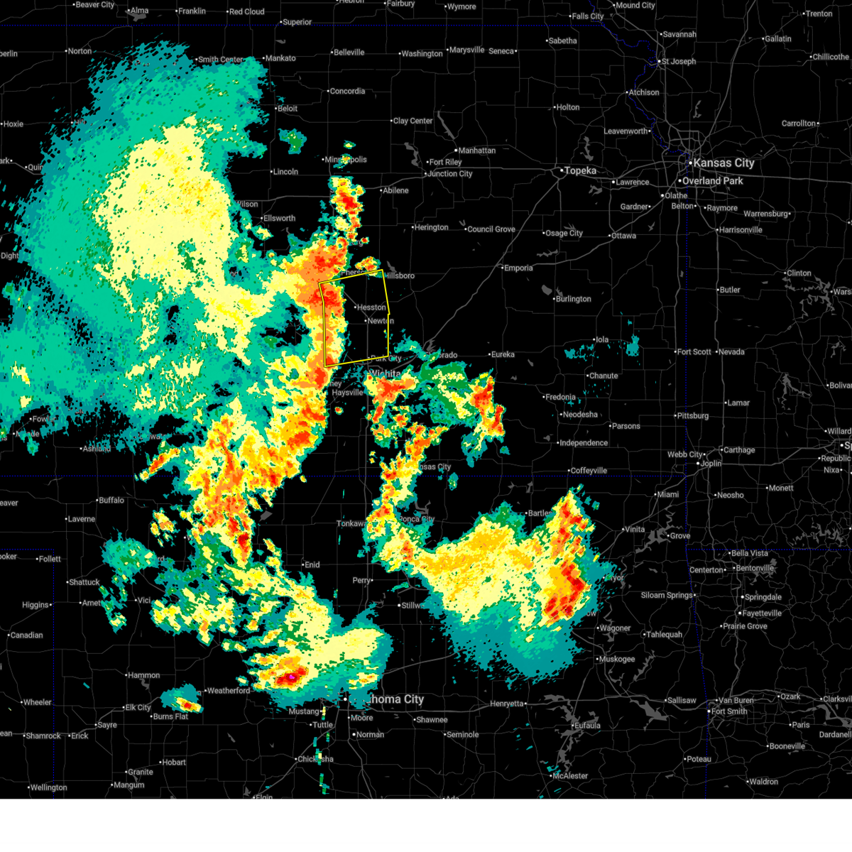 At 809 am cdt, severe thunderstorms were located along a line extending from 6 miles north of moundridge to near sedgwick to near bentley, moving east at 45 mph (radar indicated). Hazards include 60 mph wind gusts. Expect damage to roofs, siding, and trees. locations impacted include, newton, park city, valley center, hesston, maize, hillsboro, halstead, north newton, moundridge, sedgwick, colwich, burrton, mount hope, whitewater, kechi, andale, goessel, bentley, walton, and lehigh. This includes interstate 135 between mile markers 14 and 56. At 809 am cdt, severe thunderstorms were located along a line extending from 6 miles north of moundridge to near sedgwick to near bentley, moving east at 45 mph (radar indicated). Hazards include 60 mph wind gusts. Expect damage to roofs, siding, and trees. locations impacted include, newton, park city, valley center, hesston, maize, hillsboro, halstead, north newton, moundridge, sedgwick, colwich, burrton, mount hope, whitewater, kechi, andale, goessel, bentley, walton, and lehigh. This includes interstate 135 between mile markers 14 and 56.
|
| 6/14/2025 8:04 AM CDT |
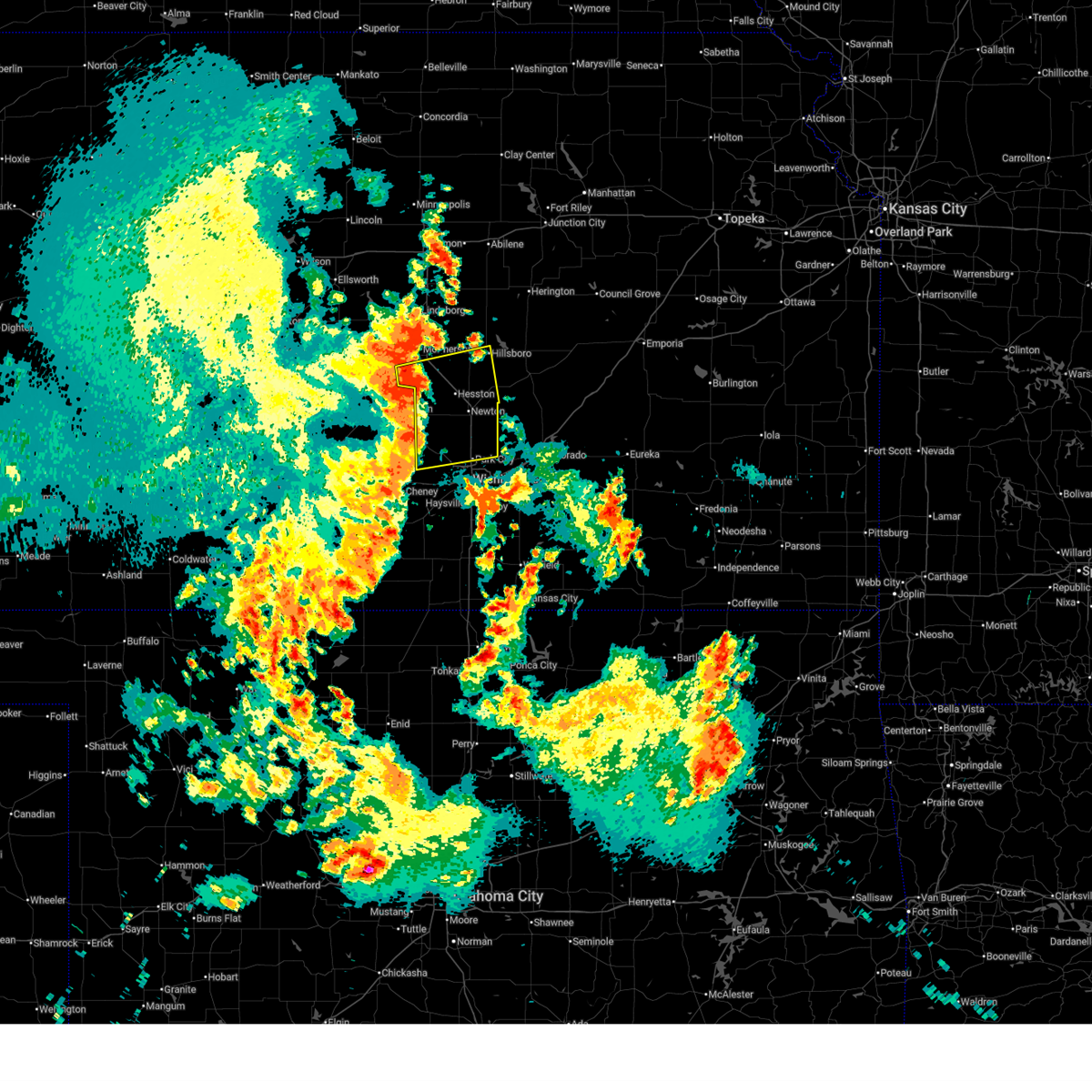 At 803 am cdt, severe thunderstorms were located along a line extending from 5 miles northwest of moundridge to near halstead to near bentley, moving east at 45 mph (a personal weather station 4 miles of moundridge measured a 65 mph wind gust at 801 am). Hazards include 60 mph wind gusts. Expect damage to roofs, siding, and trees. locations impacted include, newton, park city, valley center, hesston, maize, hillsboro, halstead, north newton, moundridge, sedgwick, inman, colwich, burrton, mount hope, whitewater, kechi, andale, goessel, bentley, and walton. This includes interstate 135 between mile markers 14 and 56. At 803 am cdt, severe thunderstorms were located along a line extending from 5 miles northwest of moundridge to near halstead to near bentley, moving east at 45 mph (a personal weather station 4 miles of moundridge measured a 65 mph wind gust at 801 am). Hazards include 60 mph wind gusts. Expect damage to roofs, siding, and trees. locations impacted include, newton, park city, valley center, hesston, maize, hillsboro, halstead, north newton, moundridge, sedgwick, inman, colwich, burrton, mount hope, whitewater, kechi, andale, goessel, bentley, and walton. This includes interstate 135 between mile markers 14 and 56.
|
| 6/14/2025 7:53 AM CDT |
 At 752 am cdt, severe thunderstorms were located along a line extending from near inman to near burrton to near mount hope, moving east at 45 mph (a 62 mph wind gust was measured at the hutchinson regional airport at 751 am). Hazards include 60 mph wind gusts. Expect damage to roofs, siding, and trees. locations impacted include, newton, park city, valley center, hesston, maize, hillsboro, halstead, north newton, moundridge, sedgwick, inman, colwich, burrton, mount hope, whitewater, kechi, andale, goessel, bentley, and walton. This includes interstate 135 between mile markers 14 and 56. At 752 am cdt, severe thunderstorms were located along a line extending from near inman to near burrton to near mount hope, moving east at 45 mph (a 62 mph wind gust was measured at the hutchinson regional airport at 751 am). Hazards include 60 mph wind gusts. Expect damage to roofs, siding, and trees. locations impacted include, newton, park city, valley center, hesston, maize, hillsboro, halstead, north newton, moundridge, sedgwick, inman, colwich, burrton, mount hope, whitewater, kechi, andale, goessel, bentley, and walton. This includes interstate 135 between mile markers 14 and 56.
|
| 6/14/2025 7:49 AM CDT |
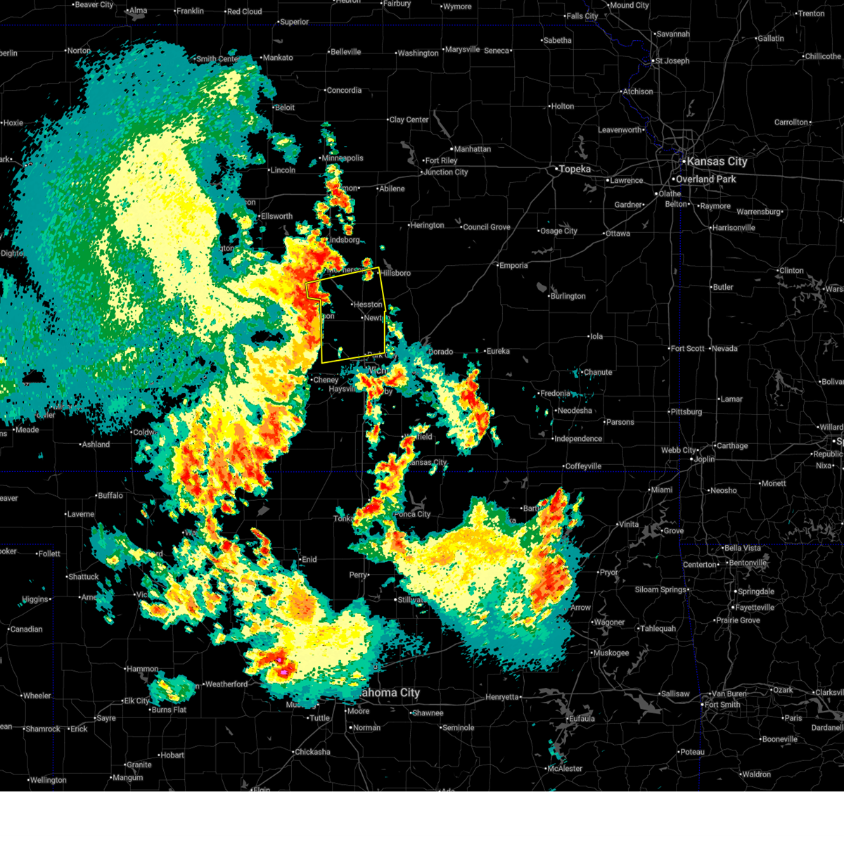 Svrict the national weather service in wichita has issued a * severe thunderstorm warning for, southern mcpherson county in central kansas, northern sedgwick county in south central kansas, harvey county in south central kansas, southwestern marion county in central kansas, * until 845 am cdt. * at 748 am cdt, severe thunderstorms were located along a line extending from near inman to near burrton to 5 miles southwest of mount hope, moving east at 45 mph (automated weather observation station). Hazards include a 56 mph wind gust was reported at hutchinson regional airport at 742 am. expect damage to roofs, siding, and trees Svrict the national weather service in wichita has issued a * severe thunderstorm warning for, southern mcpherson county in central kansas, northern sedgwick county in south central kansas, harvey county in south central kansas, southwestern marion county in central kansas, * until 845 am cdt. * at 748 am cdt, severe thunderstorms were located along a line extending from near inman to near burrton to 5 miles southwest of mount hope, moving east at 45 mph (automated weather observation station). Hazards include a 56 mph wind gust was reported at hutchinson regional airport at 742 am. expect damage to roofs, siding, and trees
|
| 5/25/2025 2:34 AM CDT |
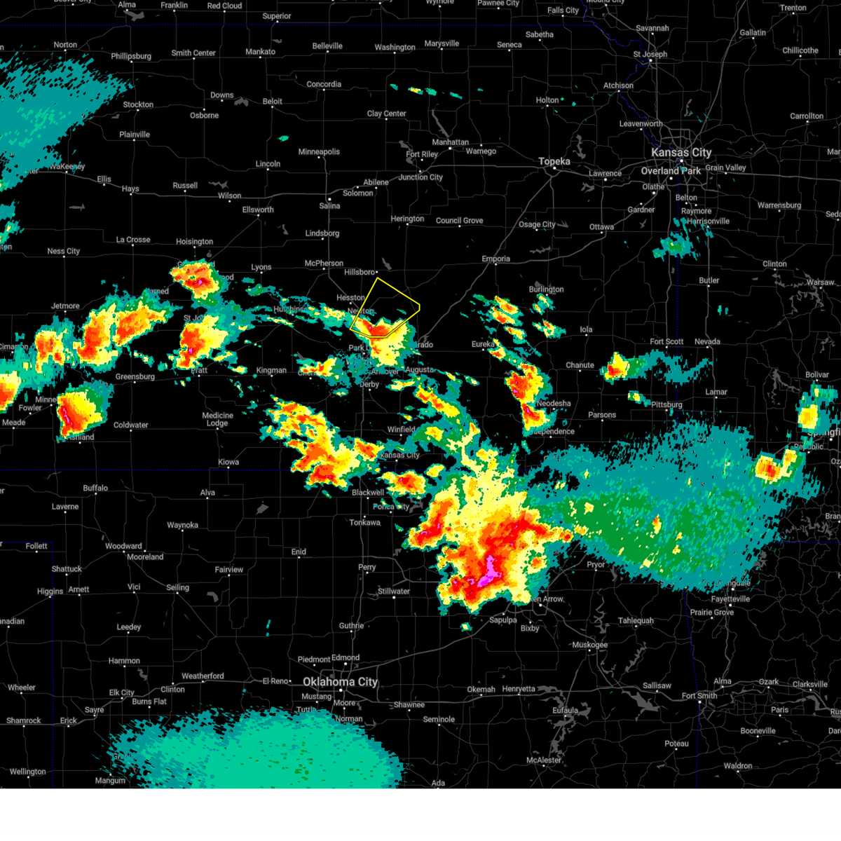 the severe thunderstorm warning has been cancelled and is no longer in effect the severe thunderstorm warning has been cancelled and is no longer in effect
|
| 5/25/2025 2:34 AM CDT |
 At 234 am cdt, a severe thunderstorm was located near whitewater, moving northeast at 30 mph (radar indicated). Hazards include half dollar size hail. Damage to vehicles is expected. locations impacted include, newton, north newton, peabody, whitewater, walton, elbing, burns, and newton airport. This includes interstate 135 between mile markers 24 and 35. At 234 am cdt, a severe thunderstorm was located near whitewater, moving northeast at 30 mph (radar indicated). Hazards include half dollar size hail. Damage to vehicles is expected. locations impacted include, newton, north newton, peabody, whitewater, walton, elbing, burns, and newton airport. This includes interstate 135 between mile markers 24 and 35.
|
| 5/25/2025 2:26 AM CDT |
 Svrict the national weather service in wichita has issued a * severe thunderstorm warning for, northeastern sedgwick county in south central kansas, eastern harvey county in south central kansas, northwestern butler county in south central kansas, southern marion county in central kansas, * until 330 am cdt. * at 226 am cdt, a severe thunderstorm was located 7 miles southeast of newton, moving northeast at 25 mph (radar indicated). Hazards include half dollar size hail. damage to vehicles is expected Svrict the national weather service in wichita has issued a * severe thunderstorm warning for, northeastern sedgwick county in south central kansas, eastern harvey county in south central kansas, northwestern butler county in south central kansas, southern marion county in central kansas, * until 330 am cdt. * at 226 am cdt, a severe thunderstorm was located 7 miles southeast of newton, moving northeast at 25 mph (radar indicated). Hazards include half dollar size hail. damage to vehicles is expected
|
| 5/24/2025 3:05 AM CDT |
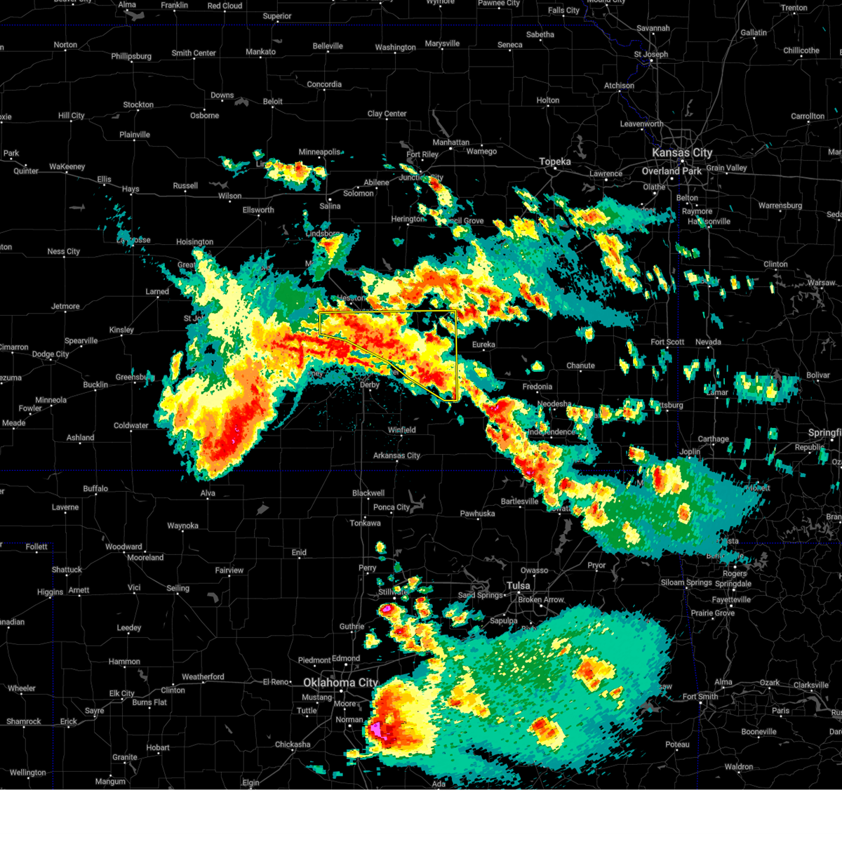 At 304 am cdt, severe thunderstorms were located along a line extending from near newton to near el dorado to 6 miles southeast of leon, moving east at 15 mph (radar indicated). Hazards include ping pong ball size hail. People and animals outdoors will be injured. expect damage to roofs, siding, windows, and vehicles. locations impacted include, newton, el dorado, augusta, park city, valley center, bel aire, halstead, north newton, sedgwick, towanda, burrton, benton, whitewater, leon, kechi, potwin, elbing, burns, latham, and rosalia. this includes the following highways, interstate 135 between mile markers 17 and 34. Interstate 35 between mile markers 59 and 96. At 304 am cdt, severe thunderstorms were located along a line extending from near newton to near el dorado to 6 miles southeast of leon, moving east at 15 mph (radar indicated). Hazards include ping pong ball size hail. People and animals outdoors will be injured. expect damage to roofs, siding, windows, and vehicles. locations impacted include, newton, el dorado, augusta, park city, valley center, bel aire, halstead, north newton, sedgwick, towanda, burrton, benton, whitewater, leon, kechi, potwin, elbing, burns, latham, and rosalia. this includes the following highways, interstate 135 between mile markers 17 and 34. Interstate 35 between mile markers 59 and 96.
|
| 5/24/2025 2:44 AM CDT |
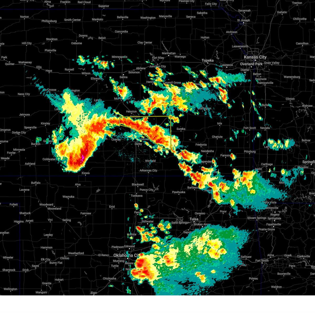 Svrict the national weather service in wichita has issued a * severe thunderstorm warning for, northeastern sedgwick county in south central kansas, harvey county in south central kansas, butler county in south central kansas, * until 330 am cdt. * at 242 am cdt, severe thunderstorms were located along a line extending from near burrton to 5 miles southeast of potwin to 5 miles southeast of leon, moving east at 25 mph. this warning replaces the previous warning in effect for the area, which expires at 245 am cdt (radar indicated). Hazards include ping pong ball size hail. People and animals outdoors will be injured. Expect damage to roofs, siding, windows, and vehicles. Svrict the national weather service in wichita has issued a * severe thunderstorm warning for, northeastern sedgwick county in south central kansas, harvey county in south central kansas, butler county in south central kansas, * until 330 am cdt. * at 242 am cdt, severe thunderstorms were located along a line extending from near burrton to 5 miles southeast of potwin to 5 miles southeast of leon, moving east at 25 mph. this warning replaces the previous warning in effect for the area, which expires at 245 am cdt (radar indicated). Hazards include ping pong ball size hail. People and animals outdoors will be injured. Expect damage to roofs, siding, windows, and vehicles.
|
| 5/20/2025 12:05 AM CDT |
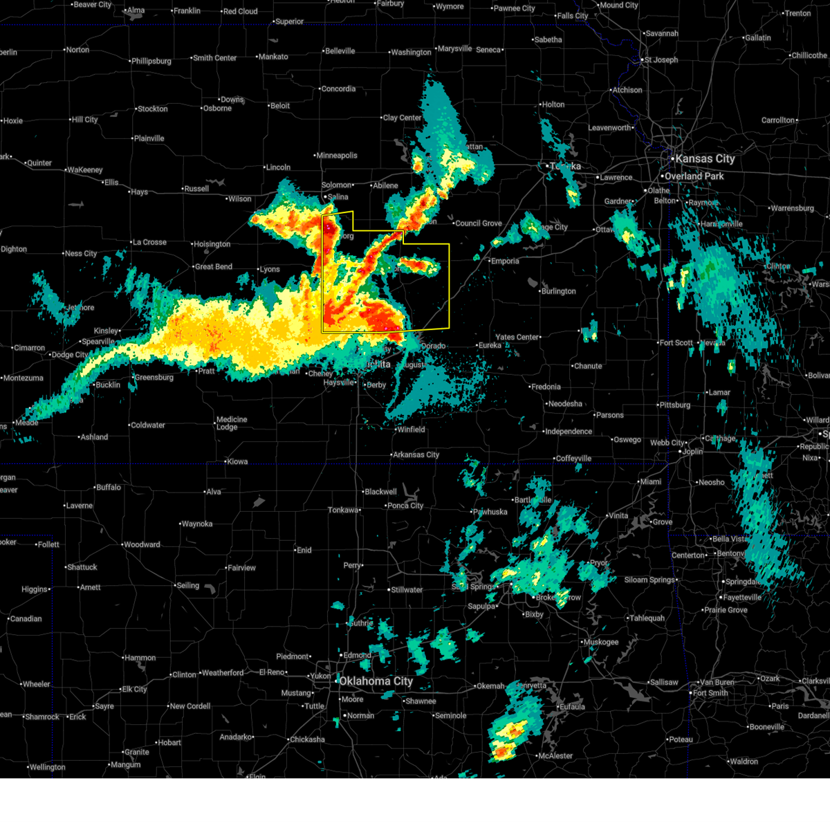 At 1204 am cdt, severe thunderstorms were located along a line extending from near gypsum to galva to 6 miles south of burns, moving northeast at 45 mph (a measured wind gust of 67 mph was recorded in newton). Hazards include 70 mph wind gusts and quarter size hail. Hail damage to vehicles is expected. expect considerable tree damage. wind damage is also likely to mobile homes, roofs, and outbuildings. locations impacted include, newton, mcpherson, hesston, hillsboro, halstead, marion, north newton, moundridge, sedgwick, peabody, cottonwood falls, galva, canton, whitewater, strong city, florence, goessel, potwin, assaria, and gypsum. this includes the following highways, interstate 135 between mile markers 23 and 84. Interstate 35 between mile markers 81 and 101. At 1204 am cdt, severe thunderstorms were located along a line extending from near gypsum to galva to 6 miles south of burns, moving northeast at 45 mph (a measured wind gust of 67 mph was recorded in newton). Hazards include 70 mph wind gusts and quarter size hail. Hail damage to vehicles is expected. expect considerable tree damage. wind damage is also likely to mobile homes, roofs, and outbuildings. locations impacted include, newton, mcpherson, hesston, hillsboro, halstead, marion, north newton, moundridge, sedgwick, peabody, cottonwood falls, galva, canton, whitewater, strong city, florence, goessel, potwin, assaria, and gypsum. this includes the following highways, interstate 135 between mile markers 23 and 84. Interstate 35 between mile markers 81 and 101.
|
| 5/20/2025 12:00 AM CDT |
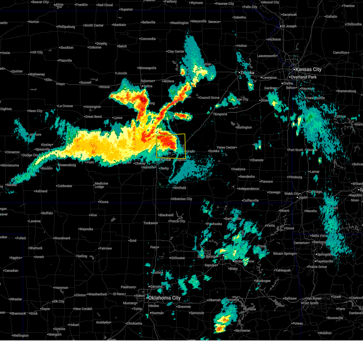 At 1200 am cdt, severe thunderstorms were located along a line extending from near newton to near augusta, moving northeast at 30 mph (a wind gust of 63 mph was reported at jabara airport). Hazards include 60 mph wind gusts and quarter size hail. Hail damage to vehicles is expected. expect wind damage to roofs, siding, and trees. locations impacted include, wichita, newton, el dorado, andover, augusta, park city, bel aire, towanda, benton, whitewater, kechi, potwin, elbing, northeast wichita, newton airport, el dorado state park, el dorado airport, el dorado lake, jabara airport, and santa fe lake. this includes the following highways, interstate 135 between mile markers 9 and 32. Interstate 35 between mile markers 57 and 82. At 1200 am cdt, severe thunderstorms were located along a line extending from near newton to near augusta, moving northeast at 30 mph (a wind gust of 63 mph was reported at jabara airport). Hazards include 60 mph wind gusts and quarter size hail. Hail damage to vehicles is expected. expect wind damage to roofs, siding, and trees. locations impacted include, wichita, newton, el dorado, andover, augusta, park city, bel aire, towanda, benton, whitewater, kechi, potwin, elbing, northeast wichita, newton airport, el dorado state park, el dorado airport, el dorado lake, jabara airport, and santa fe lake. this includes the following highways, interstate 135 between mile markers 9 and 32. Interstate 35 between mile markers 57 and 82.
|
| 5/19/2025 11:57 PM CDT |
 Svrict the national weather service in wichita has issued a * severe thunderstorm warning for, eastern mcpherson county in central kansas, harvey county in south central kansas, chase county in east central kansas, northern butler county in south central kansas, marion county in central kansas, southeastern saline county in central kansas, * until 100 am cdt. * at 1156 pm cdt, severe thunderstorms were located along a line extending from near assaria to near galva to near potwin, moving northeast at 45 mph (trained weather spotters have reported numerous gusts to 60 mph and hail up to quarter size). Hazards include 60 mph wind gusts and quarter size hail. Hail damage to vehicles is expected. Expect wind damage to roofs, siding, and trees. Svrict the national weather service in wichita has issued a * severe thunderstorm warning for, eastern mcpherson county in central kansas, harvey county in south central kansas, chase county in east central kansas, northern butler county in south central kansas, marion county in central kansas, southeastern saline county in central kansas, * until 100 am cdt. * at 1156 pm cdt, severe thunderstorms were located along a line extending from near assaria to near galva to near potwin, moving northeast at 45 mph (trained weather spotters have reported numerous gusts to 60 mph and hail up to quarter size). Hazards include 60 mph wind gusts and quarter size hail. Hail damage to vehicles is expected. Expect wind damage to roofs, siding, and trees.
|
| 5/19/2025 11:56 PM CDT | Awos station kewk newton city county airp in harvey county KS, 4.7 miles WSW of Newton, KS |
| 5/19/2025 11:37 PM CDT |
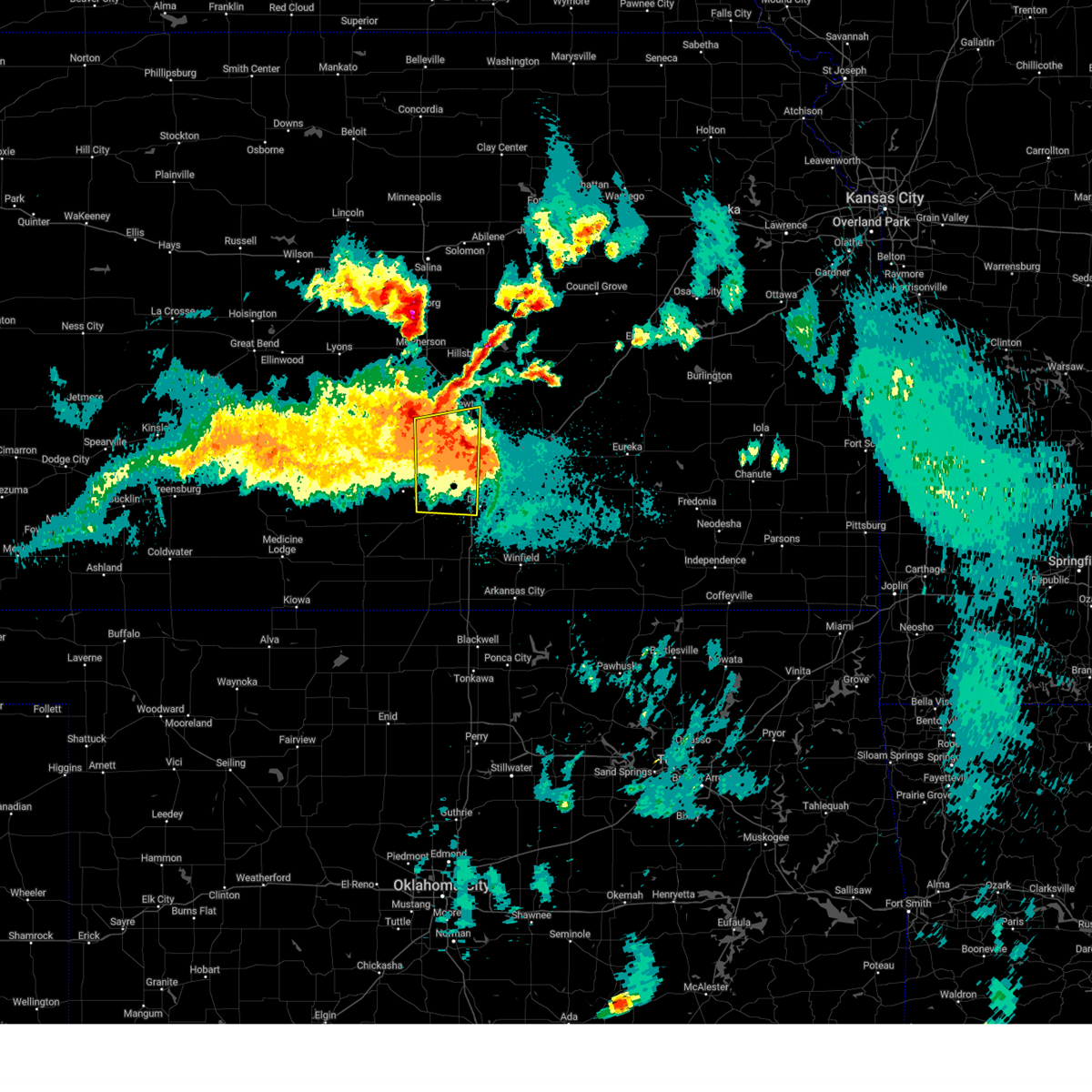 At 1136 pm cdt, severe thunderstorms were located along a line extending from near park city to south wichita, moving east at 55 mph (a 61 mph wind gust was reported at wichita eisenhower national airport). Hazards include 60 mph wind gusts and quarter size hail. Hail damage to vehicles is expected. expect wind damage to roofs, siding, and trees. locations impacted include, wichita, newton, haysville, park city, valley center, goddard, maize, clearwater, halstead, sedgwick, colwich, garden plain, mount hope, downtown wichita, kechi, andale, bentley, west wichita, eisenhower national airport, and south wichita. this includes the following highways, interstate 135 between mile markers 0 and 32. Interstate 35 between mile markers 36 and 45. At 1136 pm cdt, severe thunderstorms were located along a line extending from near park city to south wichita, moving east at 55 mph (a 61 mph wind gust was reported at wichita eisenhower national airport). Hazards include 60 mph wind gusts and quarter size hail. Hail damage to vehicles is expected. expect wind damage to roofs, siding, and trees. locations impacted include, wichita, newton, haysville, park city, valley center, goddard, maize, clearwater, halstead, sedgwick, colwich, garden plain, mount hope, downtown wichita, kechi, andale, bentley, west wichita, eisenhower national airport, and south wichita. this includes the following highways, interstate 135 between mile markers 0 and 32. Interstate 35 between mile markers 36 and 45.
|
| 5/19/2025 11:37 PM CDT |
 the severe thunderstorm warning has been cancelled and is no longer in effect the severe thunderstorm warning has been cancelled and is no longer in effect
|
| 5/19/2025 11:28 PM CDT |
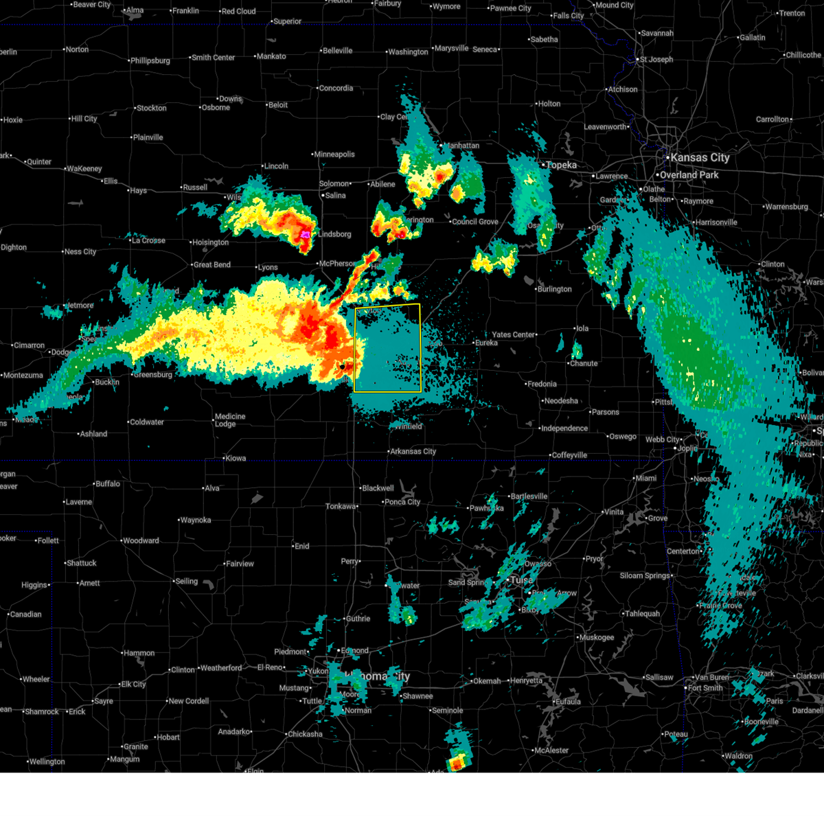 Svrict the national weather service in wichita has issued a * severe thunderstorm warning for, eastern sedgwick county in south central kansas, southeastern harvey county in south central kansas, butler county in south central kansas, * until 1215 am cdt. * at 1127 pm cdt, severe thunderstorms were located along a line extending from 6 miles northeast of valley center to near derby, moving east at 30 mph (a 61 mph wind gust was reported at wichita eisenhower national). Hazards include 60 mph wind gusts and penny size hail. expect damage to roofs, siding, and trees Svrict the national weather service in wichita has issued a * severe thunderstorm warning for, eastern sedgwick county in south central kansas, southeastern harvey county in south central kansas, butler county in south central kansas, * until 1215 am cdt. * at 1127 pm cdt, severe thunderstorms were located along a line extending from 6 miles northeast of valley center to near derby, moving east at 30 mph (a 61 mph wind gust was reported at wichita eisenhower national). Hazards include 60 mph wind gusts and penny size hail. expect damage to roofs, siding, and trees
|
| 5/19/2025 11:01 PM CDT |
 Svrict the national weather service in wichita has issued a * severe thunderstorm warning for, southeastern reno county in south central kansas, sedgwick county in south central kansas, southern harvey county in south central kansas, northeastern kingman county in south central kansas, * until midnight cdt. * at 1100 pm cdt, severe thunderstorms were located along a line extending from near haven to cheney, moving east at 35 mph (radar indicated). Hazards include 60 mph wind gusts and quarter size hail. Hail damage to vehicles is expected. Expect wind damage to roofs, siding, and trees. Svrict the national weather service in wichita has issued a * severe thunderstorm warning for, southeastern reno county in south central kansas, sedgwick county in south central kansas, southern harvey county in south central kansas, northeastern kingman county in south central kansas, * until midnight cdt. * at 1100 pm cdt, severe thunderstorms were located along a line extending from near haven to cheney, moving east at 35 mph (radar indicated). Hazards include 60 mph wind gusts and quarter size hail. Hail damage to vehicles is expected. Expect wind damage to roofs, siding, and trees.
|
| 5/18/2025 4:29 PM CDT |
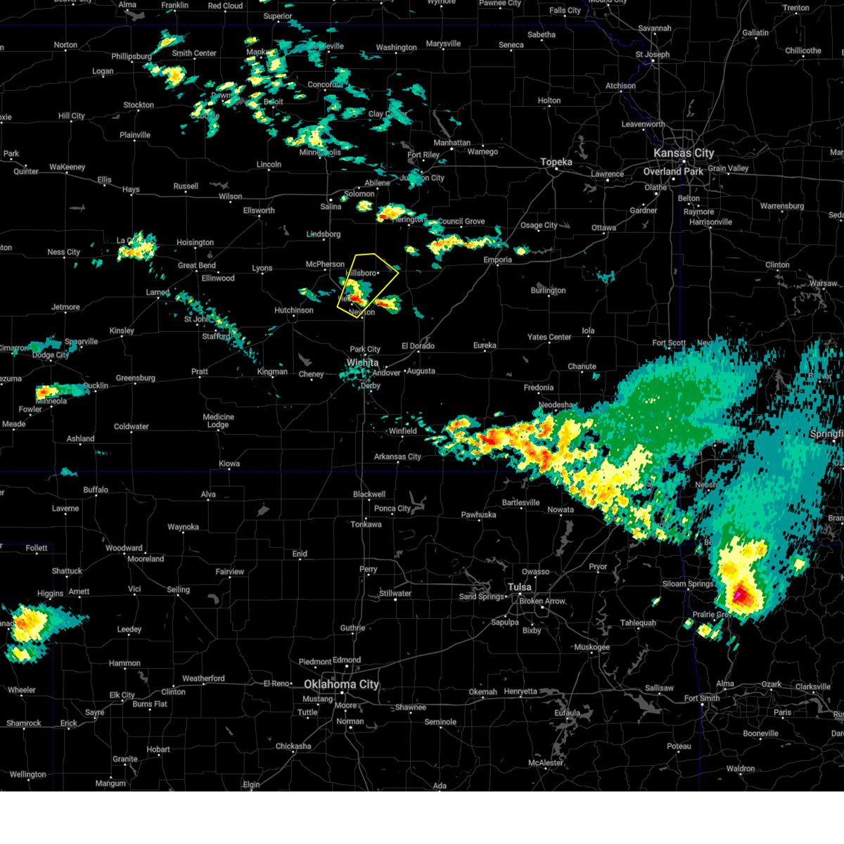 At 429 pm cdt, a severe thunderstorm was located over hesston, moving northeast at 40 mph (radar indicated. at 428 pm cdt, ping pong ball sized hail was reported in hesston). Hazards include ping pong ball size hail. People and animals outdoors will be injured. expect damage to roofs, siding, windows, and vehicles. locations impacted include, hesston, hillsboro, north newton, moundridge, canton, goessel, lehigh, and marion lake. This includes interstate 135 between mile markers 35 and 48. At 429 pm cdt, a severe thunderstorm was located over hesston, moving northeast at 40 mph (radar indicated. at 428 pm cdt, ping pong ball sized hail was reported in hesston). Hazards include ping pong ball size hail. People and animals outdoors will be injured. expect damage to roofs, siding, windows, and vehicles. locations impacted include, hesston, hillsboro, north newton, moundridge, canton, goessel, lehigh, and marion lake. This includes interstate 135 between mile markers 35 and 48.
|
| 5/18/2025 4:28 PM CDT |
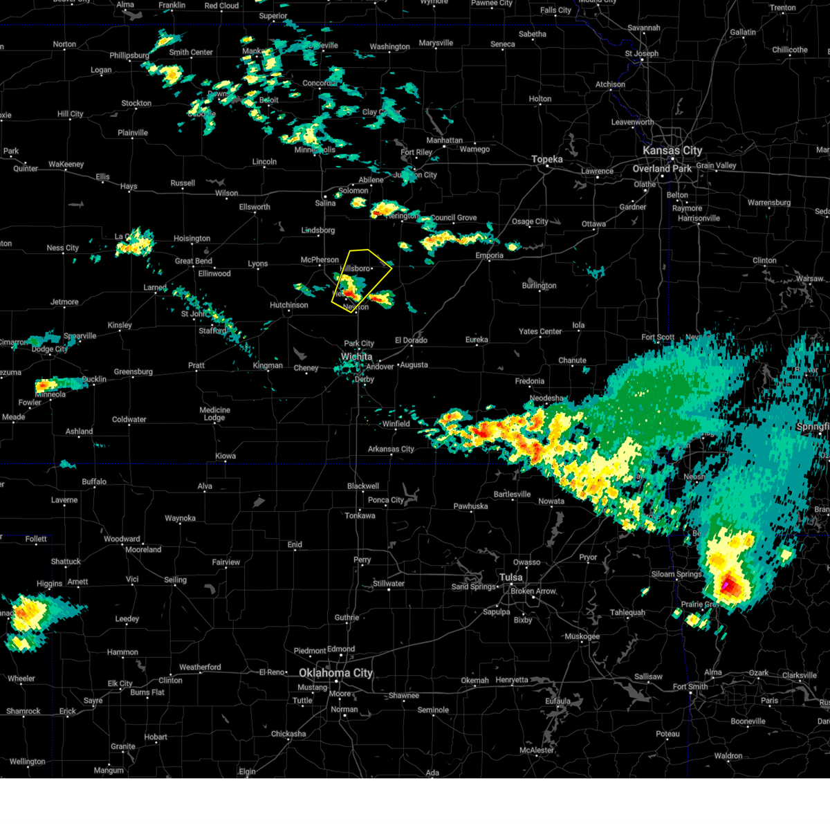 At 427 pm cdt, a severe thunderstorm was located over hesston, moving northeast at 40 mph (radar indicated). Hazards include quarter size hail. Damage to vehicles is expected. locations impacted include, hesston, hillsboro, north newton, moundridge, canton, goessel, lehigh, and marion lake. This includes interstate 135 between mile markers 35 and 48. At 427 pm cdt, a severe thunderstorm was located over hesston, moving northeast at 40 mph (radar indicated). Hazards include quarter size hail. Damage to vehicles is expected. locations impacted include, hesston, hillsboro, north newton, moundridge, canton, goessel, lehigh, and marion lake. This includes interstate 135 between mile markers 35 and 48.
|
| 5/18/2025 4:14 PM CDT |
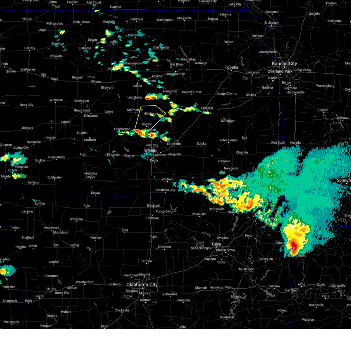 Svrict the national weather service in wichita has issued a * severe thunderstorm warning for, southeastern mcpherson county in central kansas, northwestern harvey county in south central kansas, southwestern marion county in central kansas, * until 500 pm cdt. * at 414 pm cdt, a severe thunderstorm was located 7 miles north of halstead, moving northeast at 40 mph (radar indicated). Hazards include half dollar size hail. damage to vehicles is expected Svrict the national weather service in wichita has issued a * severe thunderstorm warning for, southeastern mcpherson county in central kansas, northwestern harvey county in south central kansas, southwestern marion county in central kansas, * until 500 pm cdt. * at 414 pm cdt, a severe thunderstorm was located 7 miles north of halstead, moving northeast at 40 mph (radar indicated). Hazards include half dollar size hail. damage to vehicles is expected
|
| 5/18/2025 3:33 PM CDT |
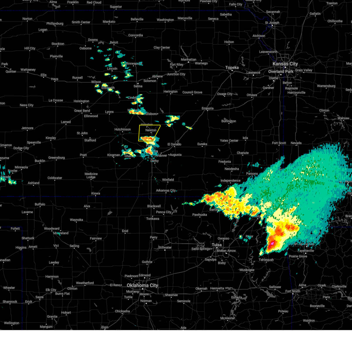 the severe thunderstorm warning has been cancelled and is no longer in effect the severe thunderstorm warning has been cancelled and is no longer in effect
|
| 5/18/2025 3:29 PM CDT |
 At 328 pm cdt, a severe thunderstorm was located near halstead, moving north at 40 mph (radar indicated). Hazards include 60 mph wind gusts and quarter size hail. Hail damage to vehicles is expected. expect wind damage to roofs, siding, and trees. locations impacted include, newton, hesston, halstead, north newton, sedgwick, walton, and newton airport. This includes interstate 135 between mile markers 23 and 42. At 328 pm cdt, a severe thunderstorm was located near halstead, moving north at 40 mph (radar indicated). Hazards include 60 mph wind gusts and quarter size hail. Hail damage to vehicles is expected. expect wind damage to roofs, siding, and trees. locations impacted include, newton, hesston, halstead, north newton, sedgwick, walton, and newton airport. This includes interstate 135 between mile markers 23 and 42.
|
| 5/18/2025 3:29 PM CDT |
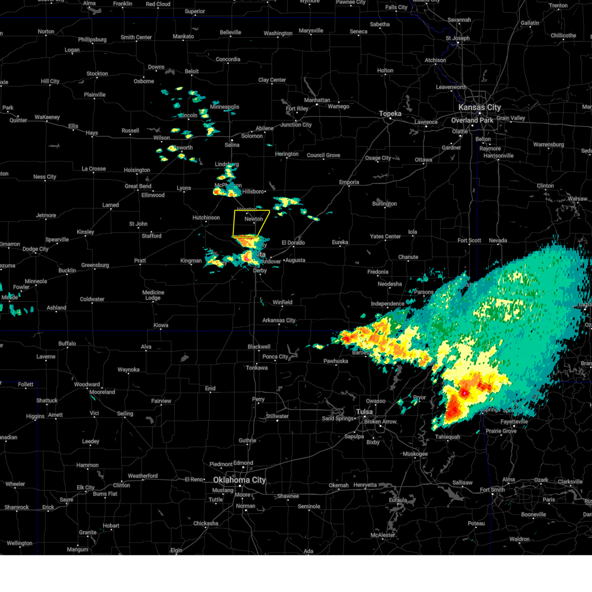 the severe thunderstorm warning has been cancelled and is no longer in effect the severe thunderstorm warning has been cancelled and is no longer in effect
|
| 5/18/2025 3:13 PM CDT |
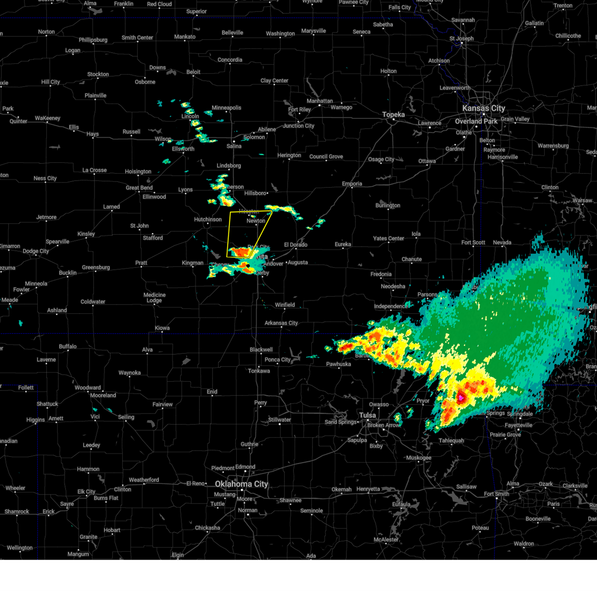 Svrict the national weather service in wichita has issued a * severe thunderstorm warning for, northwestern sedgwick county in south central kansas, harvey county in south central kansas, * until 415 pm cdt. * at 313 pm cdt, a severe thunderstorm was located over colwich, moving north at 40 mph (radar indicated). Hazards include 60 mph wind gusts and half dollar size hail. Hail damage to vehicles is expected. Expect wind damage to roofs, siding, and trees. Svrict the national weather service in wichita has issued a * severe thunderstorm warning for, northwestern sedgwick county in south central kansas, harvey county in south central kansas, * until 415 pm cdt. * at 313 pm cdt, a severe thunderstorm was located over colwich, moving north at 40 mph (radar indicated). Hazards include 60 mph wind gusts and half dollar size hail. Hail damage to vehicles is expected. Expect wind damage to roofs, siding, and trees.
|
| 4/22/2025 9:12 PM CDT |
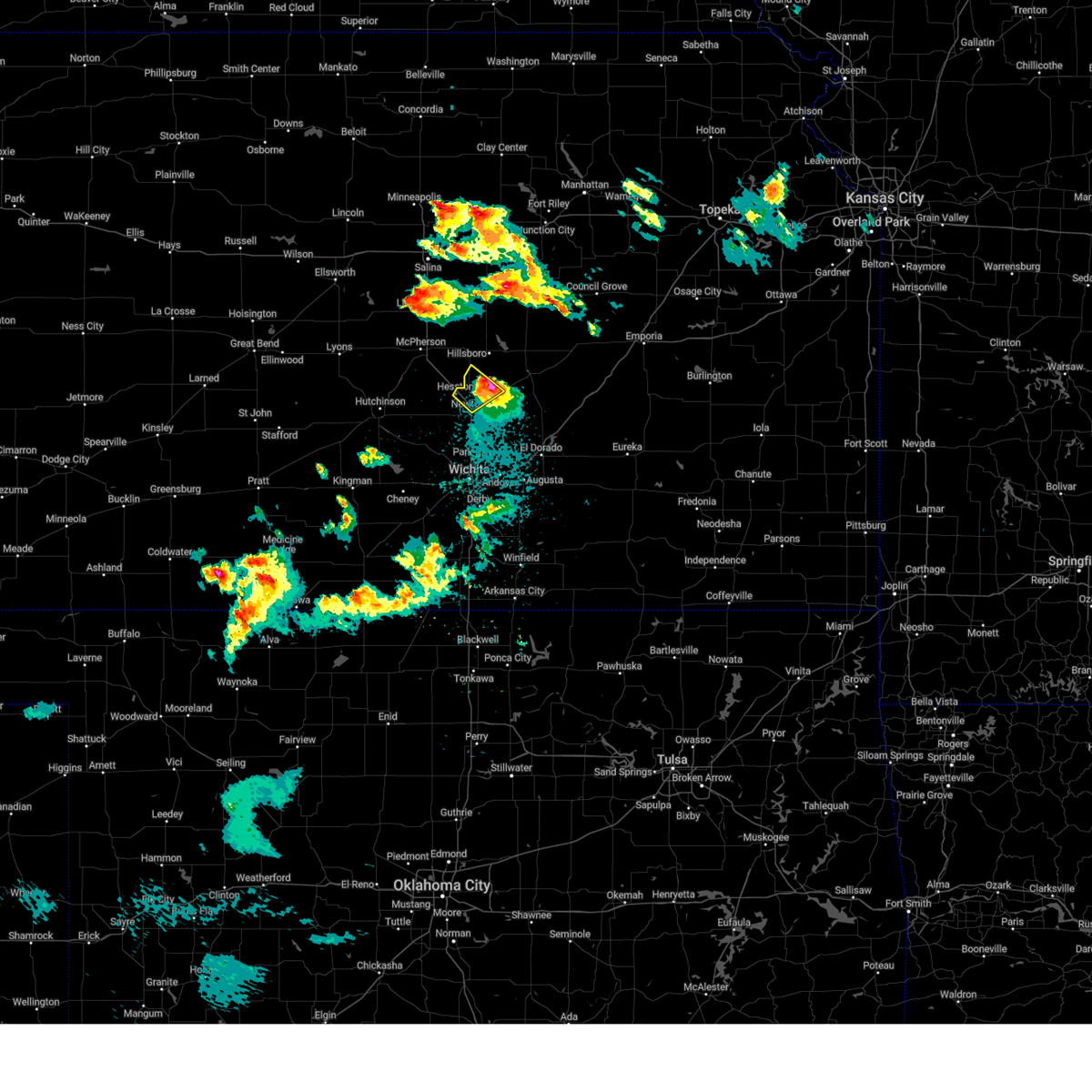 The storm which prompted the warning has moved out of the area. therefore, the warning will be allowed to expire. a severe thunderstorm watch remains in effect until 100 am cdt for south central and central kansas. remember, a severe thunderstorm warning still remains in effect for central marion county until 945 pm. The storm which prompted the warning has moved out of the area. therefore, the warning will be allowed to expire. a severe thunderstorm watch remains in effect until 100 am cdt for south central and central kansas. remember, a severe thunderstorm warning still remains in effect for central marion county until 945 pm.
|
| 4/22/2025 9:02 PM CDT |
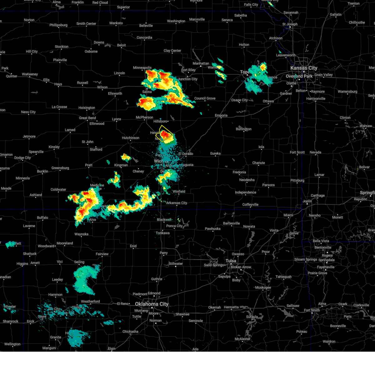 At 901 pm cdt, a severe thunderstorm was located near walton, or 7 miles northeast of north newton, moving northeast at 40 mph (public. at 854 pm, golf ball size hail was reported north of newton). Hazards include golf ball size hail and 60 mph wind gusts. People and animals outdoors will be injured. expect hail damage to roofs, siding, windows, and vehicles. expect wind damage to roofs, siding, and trees. Locations impacted include, hesston, goessel, north newton, walton, and newton. At 901 pm cdt, a severe thunderstorm was located near walton, or 7 miles northeast of north newton, moving northeast at 40 mph (public. at 854 pm, golf ball size hail was reported north of newton). Hazards include golf ball size hail and 60 mph wind gusts. People and animals outdoors will be injured. expect hail damage to roofs, siding, windows, and vehicles. expect wind damage to roofs, siding, and trees. Locations impacted include, hesston, goessel, north newton, walton, and newton.
|
| 4/22/2025 9:02 PM CDT |
 the severe thunderstorm warning has been cancelled and is no longer in effect the severe thunderstorm warning has been cancelled and is no longer in effect
|
| 4/22/2025 8:52 PM CDT | Golf Ball sized hail reported 4.9 miles SSE of Newton, KS |
| 4/22/2025 8:51 PM CDT |
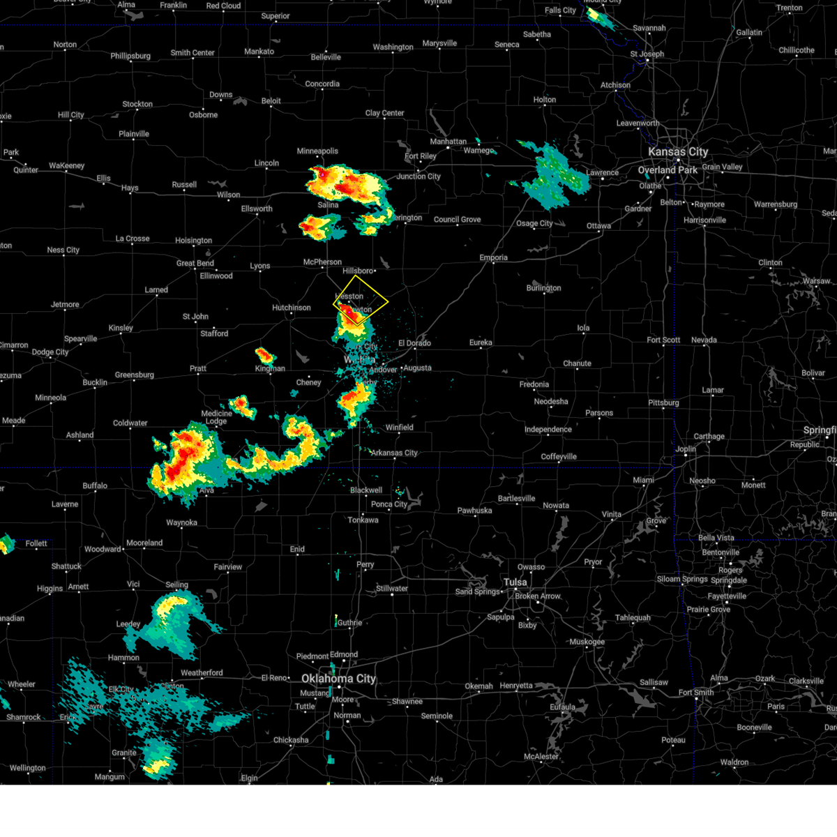 At 851 pm cdt, a severe thunderstorm was located over north newton, moving northeast at 45 mph (radar indicated). Hazards include 60 mph wind gusts and half dollar size hail. Hail damage to vehicles is expected. expect wind damage to roofs, siding, and trees. Locations impacted include, newton airport, newton, hesston, goessel, north newton, and walton. At 851 pm cdt, a severe thunderstorm was located over north newton, moving northeast at 45 mph (radar indicated). Hazards include 60 mph wind gusts and half dollar size hail. Hail damage to vehicles is expected. expect wind damage to roofs, siding, and trees. Locations impacted include, newton airport, newton, hesston, goessel, north newton, and walton.
|
| 4/22/2025 8:45 PM CDT |
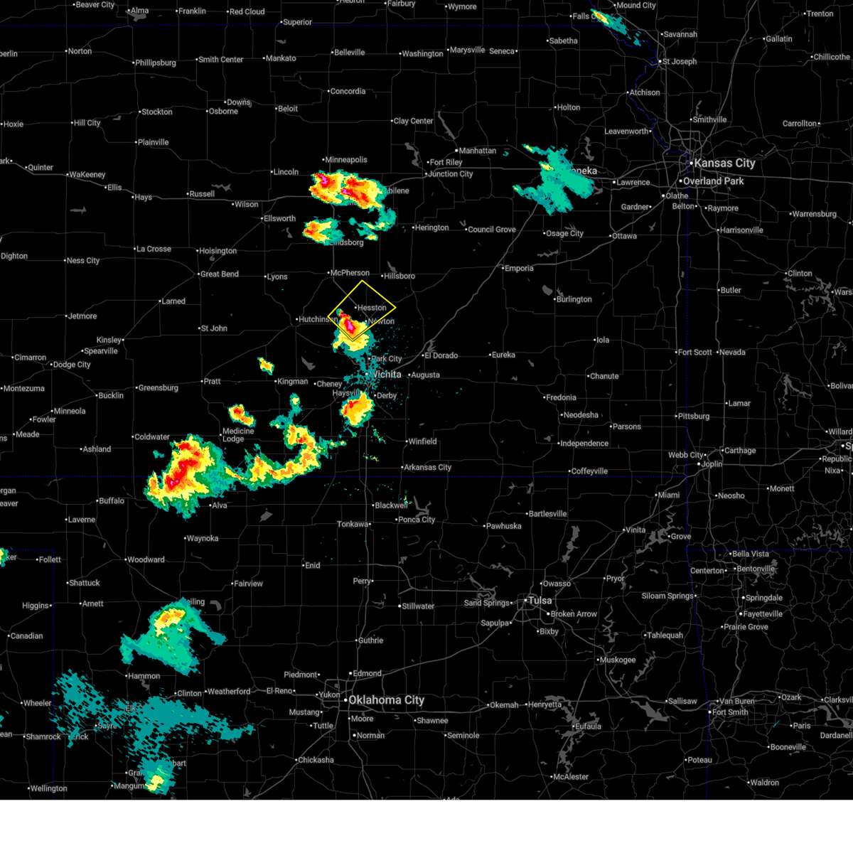 At 844 pm cdt, a severe thunderstorm was located near halstead, moving northeast at 40 mph (public. at 838 pm, half dollar size hail was reported in halstead). Hazards include 60 mph wind gusts and half dollar size hail. Hail damage to vehicles is expected. expect wind damage to roofs, siding, and trees. Locations impacted include, newton airport, newton, hesston, halstead, moundridge, goessel, north newton, and walton. At 844 pm cdt, a severe thunderstorm was located near halstead, moving northeast at 40 mph (public. at 838 pm, half dollar size hail was reported in halstead). Hazards include 60 mph wind gusts and half dollar size hail. Hail damage to vehicles is expected. expect wind damage to roofs, siding, and trees. Locations impacted include, newton airport, newton, hesston, halstead, moundridge, goessel, north newton, and walton.
|
| 4/22/2025 8:41 PM CDT |
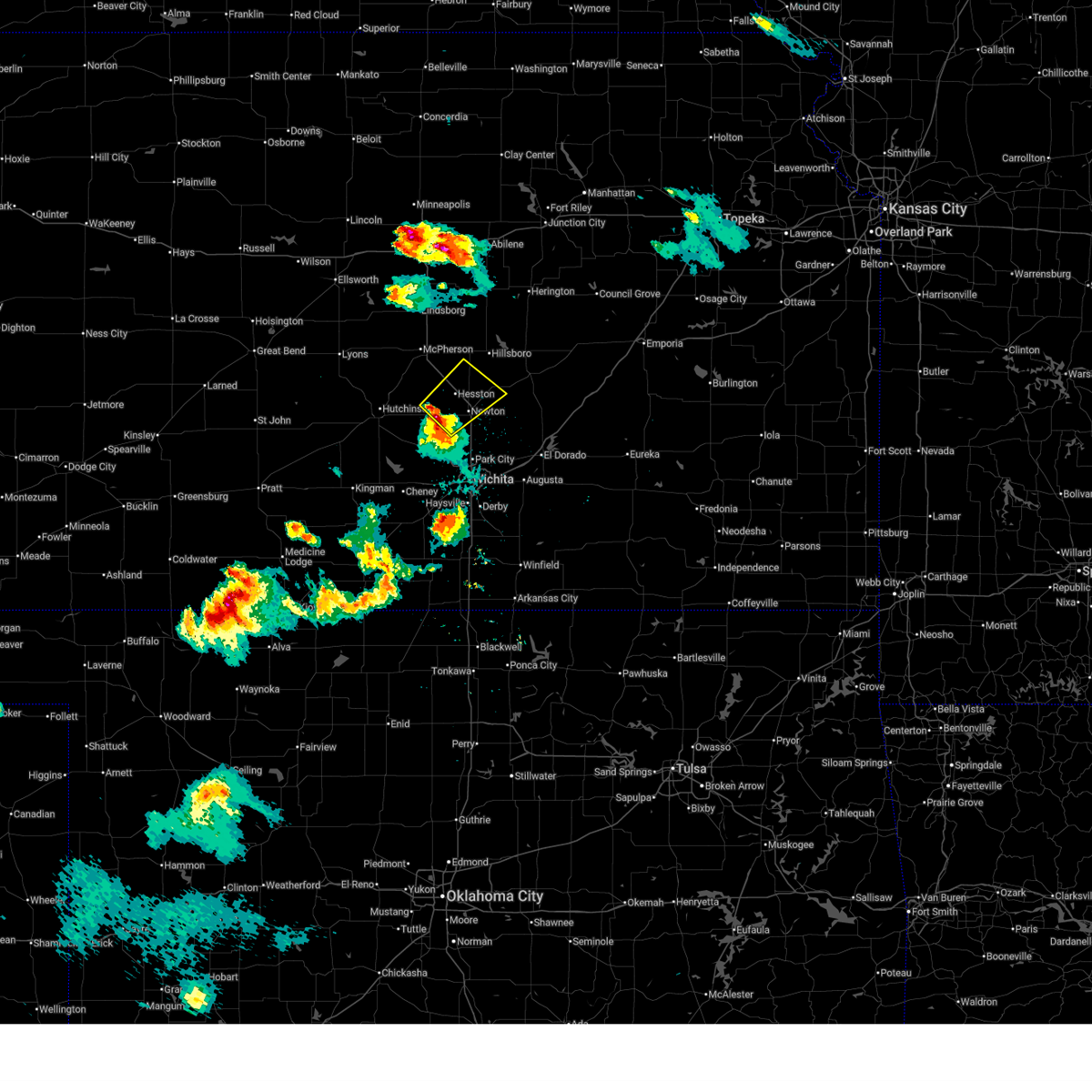 Svrict the national weather service in wichita has issued a * severe thunderstorm warning for, southeastern mcpherson county in central kansas, central harvey county in south central kansas, southwestern marion county in central kansas, * until 915 pm cdt. * at 841 pm cdt, a severe thunderstorm was located near halstead, moving northeast at 40 mph (radar indicated). Hazards include 60 mph wind gusts and quarter size hail. Hail damage to vehicles is expected. Expect wind damage to roofs, siding, and trees. Svrict the national weather service in wichita has issued a * severe thunderstorm warning for, southeastern mcpherson county in central kansas, central harvey county in south central kansas, southwestern marion county in central kansas, * until 915 pm cdt. * at 841 pm cdt, a severe thunderstorm was located near halstead, moving northeast at 40 mph (radar indicated). Hazards include 60 mph wind gusts and quarter size hail. Hail damage to vehicles is expected. Expect wind damage to roofs, siding, and trees.
|
| 4/2/2025 3:08 AM CDT |
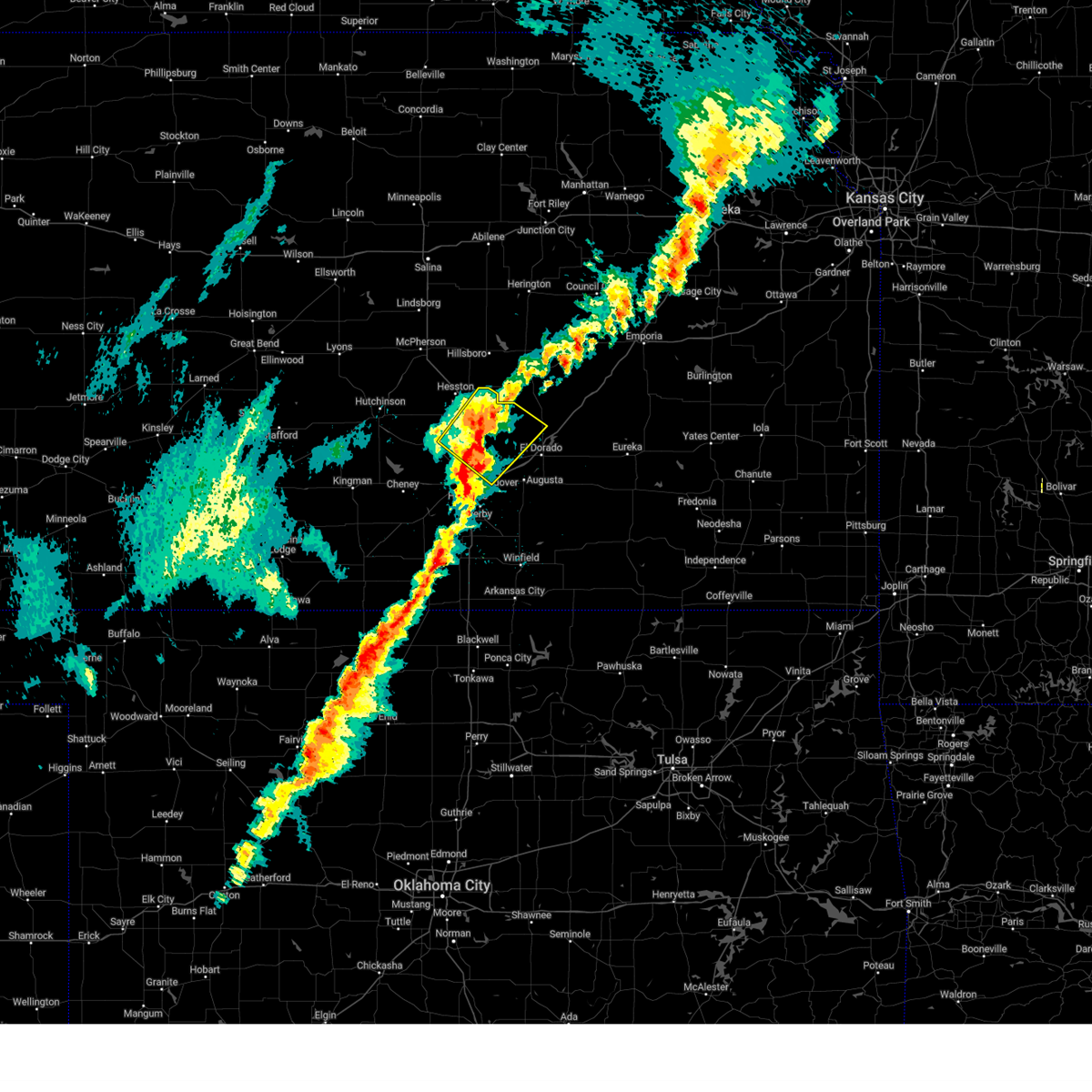 At 307 am cdt, a severe thunderstorm was located over kechi, or near bel aire, moving northeast at 65 mph (radar indicated). Hazards include quarter size hail. Damage to vehicles is expected. Locations impacted include, newton airport, bel aire, northeast wichita, benton, whitewater, north newton, walton, valley center, bentley, potwin, sedgwick, newton, park city, elbing, kechi, jabara airport, andover, and wichita. At 307 am cdt, a severe thunderstorm was located over kechi, or near bel aire, moving northeast at 65 mph (radar indicated). Hazards include quarter size hail. Damage to vehicles is expected. Locations impacted include, newton airport, bel aire, northeast wichita, benton, whitewater, north newton, walton, valley center, bentley, potwin, sedgwick, newton, park city, elbing, kechi, jabara airport, andover, and wichita.
|
| 4/2/2025 2:57 AM CDT |
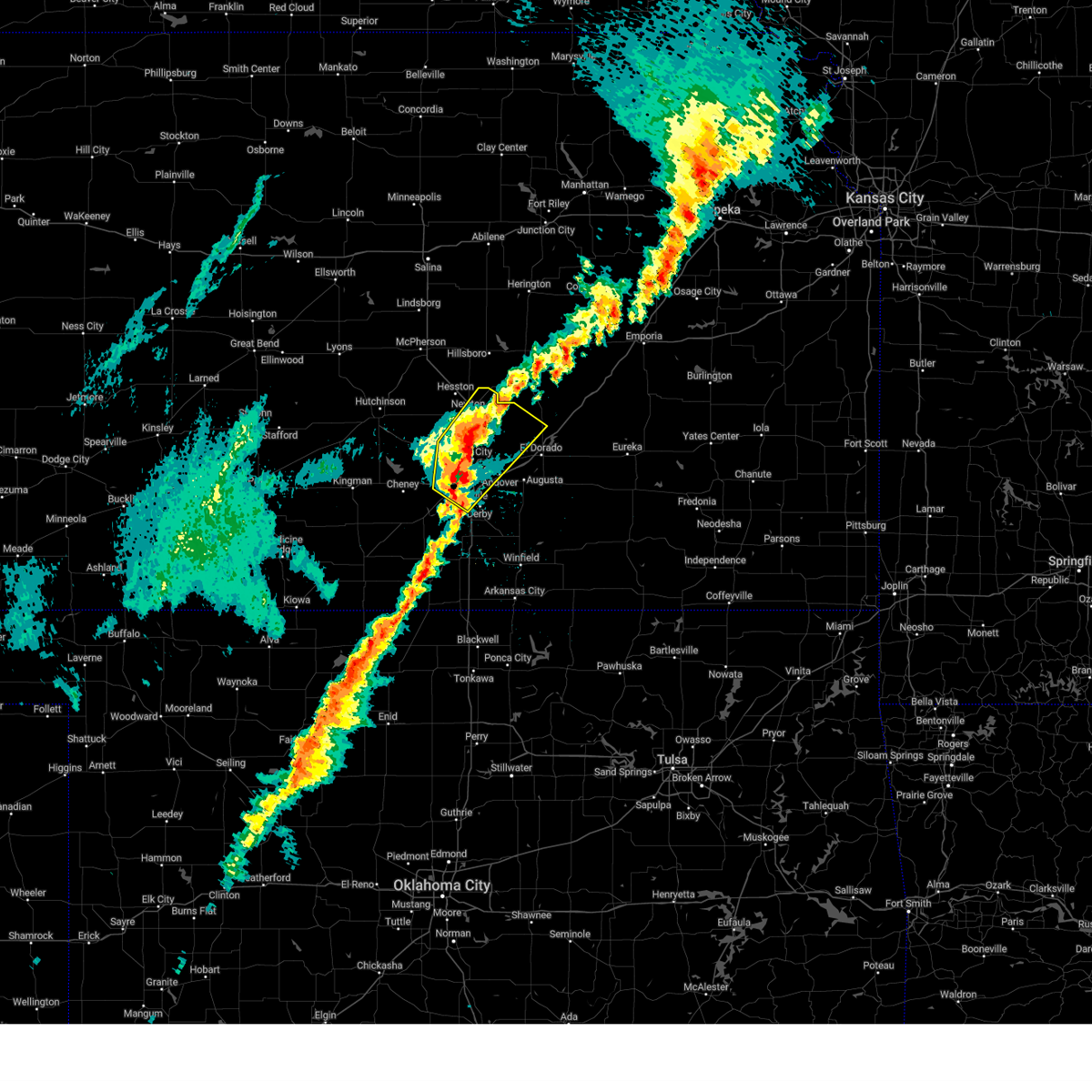 At 256 am cdt, a severe thunderstorm was located over downtown wichita, moving northeast at 65 mph (trained weather spotters. at 255 am, quarter size hail was reported at eisenhower national airport). Hazards include quarter size hail. Damage to vehicles is expected. Locations impacted include, west wichita, bel aire, colwich, eisenhower national airport, northeast wichita, eastborough, maize, north newton, potwin, wichita, park city, elbing, jabara airport, east wichita, newton airport, benton, whitewater, oaklawn, walton, and valley center. At 256 am cdt, a severe thunderstorm was located over downtown wichita, moving northeast at 65 mph (trained weather spotters. at 255 am, quarter size hail was reported at eisenhower national airport). Hazards include quarter size hail. Damage to vehicles is expected. Locations impacted include, west wichita, bel aire, colwich, eisenhower national airport, northeast wichita, eastborough, maize, north newton, potwin, wichita, park city, elbing, jabara airport, east wichita, newton airport, benton, whitewater, oaklawn, walton, and valley center.
|
| 4/2/2025 2:48 AM CDT |
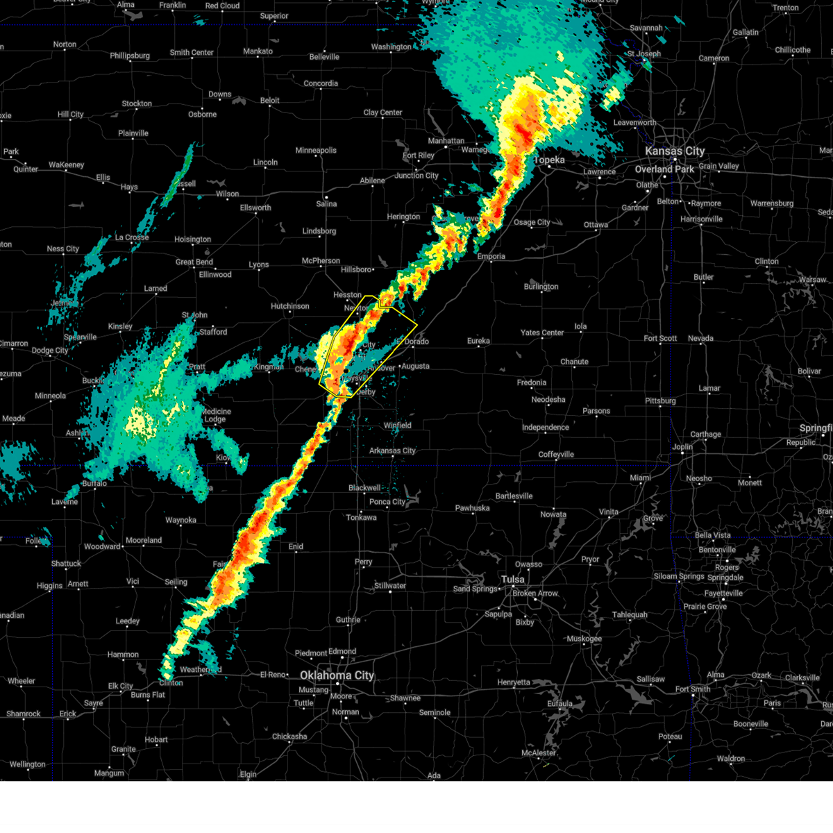 Svrict the national weather service in wichita has issued a * severe thunderstorm warning for, sedgwick county in south central kansas, eastern harvey county in south central kansas, northwestern butler county in south central kansas, * until 330 am cdt. * at 248 am cdt, a severe thunderstorm was located near goddard, moving northeast at 65 mph (radar indicated). Hazards include quarter size hail. damage to vehicles is expected Svrict the national weather service in wichita has issued a * severe thunderstorm warning for, sedgwick county in south central kansas, eastern harvey county in south central kansas, northwestern butler county in south central kansas, * until 330 am cdt. * at 248 am cdt, a severe thunderstorm was located near goddard, moving northeast at 65 mph (radar indicated). Hazards include quarter size hail. damage to vehicles is expected
|
| 4/2/2025 1:51 AM CDT |
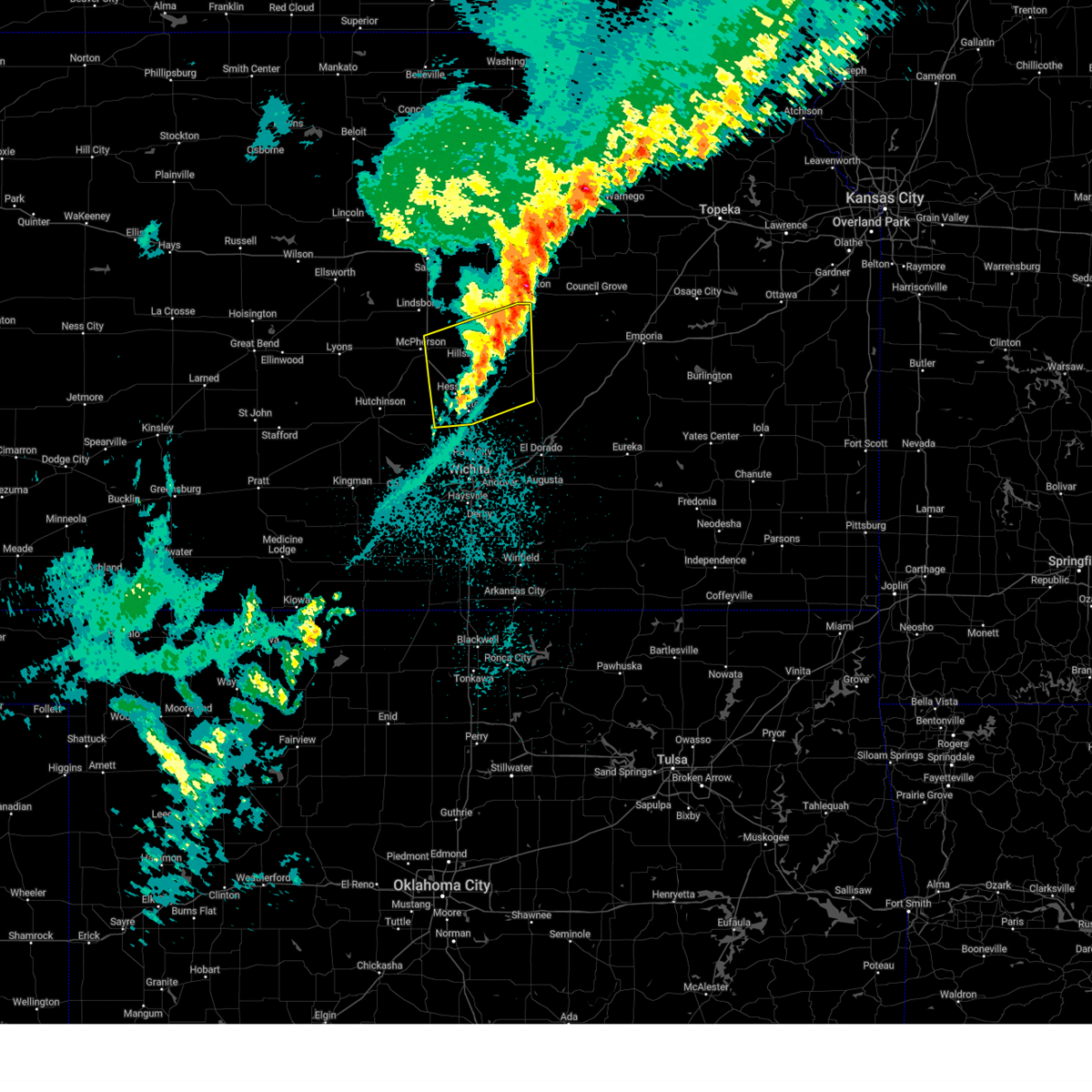 The storms which prompted the warning have weakened below severe limits, and no longer pose an immediate threat to life or property. therefore, the warning will be allowed to expire. however, gusty winds are still possible with these thunderstorms. a tornado watch remains in effect until 700 am cdt for south central and central kansas. The storms which prompted the warning have weakened below severe limits, and no longer pose an immediate threat to life or property. therefore, the warning will be allowed to expire. however, gusty winds are still possible with these thunderstorms. a tornado watch remains in effect until 700 am cdt for south central and central kansas.
|
| 4/2/2025 1:37 AM CDT |
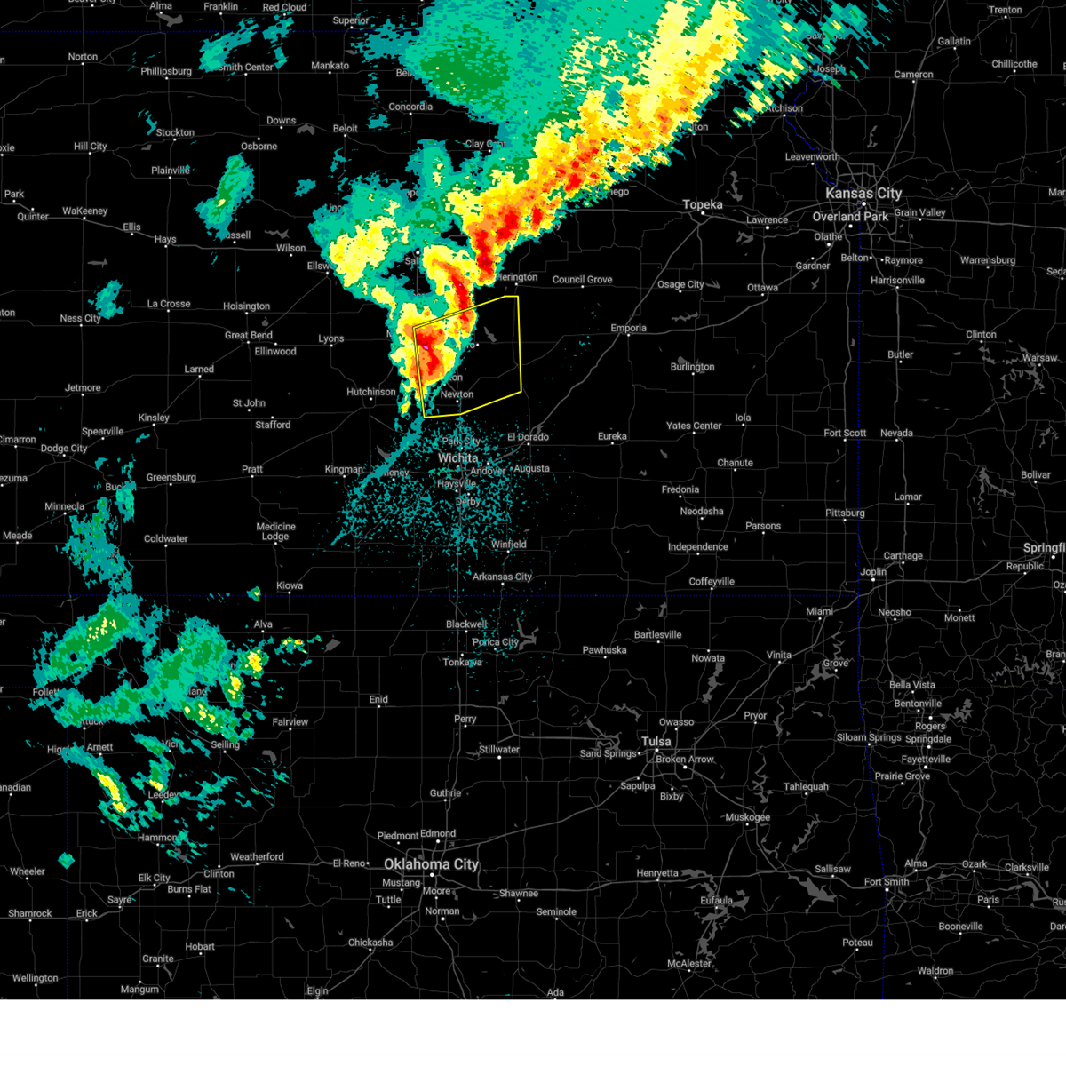 At 135 am cdt, severe thunderstorms were located along a line extending from 5 miles northwest of canton to near goessel to near halstead, moving east at 65 mph (trained weather spotters. at 135 am, 65 mph winds were reported 1 mile north of moundridge). Hazards include 60 mph wind gusts and quarter size hail. Hail damage to vehicles is expected. expect wind damage to roofs, siding, and trees. Locations impacted include, newton airport, lost springs, marion lake, florence, lehigh, galva, lincolnville, goessel, north newton, walton, newton, hesston, ramona, halstead, moundridge, hillsboro, pilsen, elbing, marion, and canton. At 135 am cdt, severe thunderstorms were located along a line extending from 5 miles northwest of canton to near goessel to near halstead, moving east at 65 mph (trained weather spotters. at 135 am, 65 mph winds were reported 1 mile north of moundridge). Hazards include 60 mph wind gusts and quarter size hail. Hail damage to vehicles is expected. expect wind damage to roofs, siding, and trees. Locations impacted include, newton airport, lost springs, marion lake, florence, lehigh, galva, lincolnville, goessel, north newton, walton, newton, hesston, ramona, halstead, moundridge, hillsboro, pilsen, elbing, marion, and canton.
|
| 4/2/2025 1:37 AM CDT |
 the severe thunderstorm warning has been cancelled and is no longer in effect the severe thunderstorm warning has been cancelled and is no longer in effect
|
| 4/2/2025 1:21 AM CDT |
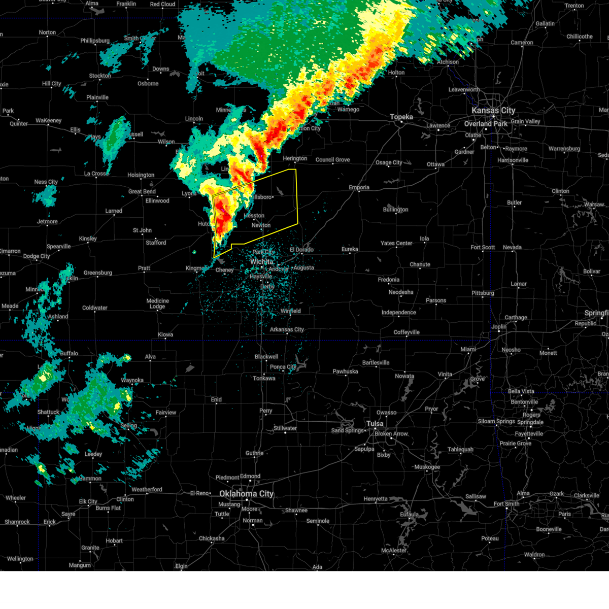 Svrict the national weather service in wichita has issued a * severe thunderstorm warning for, southern mcpherson county in central kansas, eastern reno county in south central kansas, harvey county in south central kansas, northwestern butler county in south central kansas, marion county in central kansas, * until 200 am cdt. * at 121 am cdt, severe thunderstorms were located along a line extending from near mcpherson to near buhler to haven, moving east at 65 mph (trained weather spotters). Hazards include 60 mph wind gusts and quarter size hail. Hail damage to vehicles is expected. Expect wind damage to roofs, siding, and trees. Svrict the national weather service in wichita has issued a * severe thunderstorm warning for, southern mcpherson county in central kansas, eastern reno county in south central kansas, harvey county in south central kansas, northwestern butler county in south central kansas, marion county in central kansas, * until 200 am cdt. * at 121 am cdt, severe thunderstorms were located along a line extending from near mcpherson to near buhler to haven, moving east at 65 mph (trained weather spotters). Hazards include 60 mph wind gusts and quarter size hail. Hail damage to vehicles is expected. Expect wind damage to roofs, siding, and trees.
|
| 10/30/2024 3:54 PM CDT |
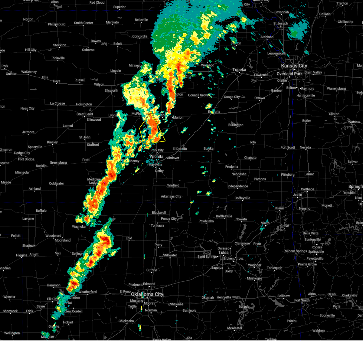 The storms which prompted the warning have weakened below severe limits, and no longer pose an immediate threat to life or property. therefore, the warning will be allowed to expire. however, small hail, gusty winds and heavy rain are still possible with these thunderstorms. a tornado watch remains in effect until 900 pm cdt for south central and central kansas. The storms which prompted the warning have weakened below severe limits, and no longer pose an immediate threat to life or property. therefore, the warning will be allowed to expire. however, small hail, gusty winds and heavy rain are still possible with these thunderstorms. a tornado watch remains in effect until 900 pm cdt for south central and central kansas.
|
| 10/30/2024 3:42 PM CDT |
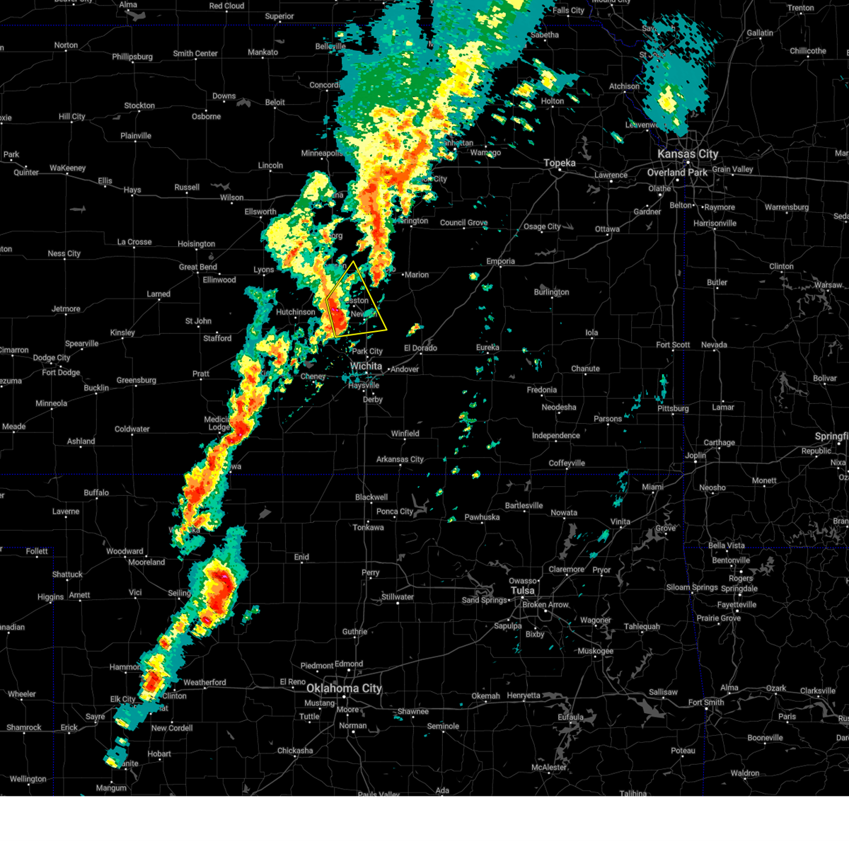 the severe thunderstorm warning has been cancelled and is no longer in effect the severe thunderstorm warning has been cancelled and is no longer in effect
|
| 10/30/2024 3:42 PM CDT |
 At 342 pm cdt, severe thunderstorms were located along a line extending from near moundridge to near halstead, moving northeast at 55 mph (radar indicated). Hazards include 60 mph wind gusts and penny size hail. Expect damage to roofs, siding, and trees. Locations impacted include, newton, hesston, halstead, north newton, moundridge, canton, goessel, walton, and newton airport. At 342 pm cdt, severe thunderstorms were located along a line extending from near moundridge to near halstead, moving northeast at 55 mph (radar indicated). Hazards include 60 mph wind gusts and penny size hail. Expect damage to roofs, siding, and trees. Locations impacted include, newton, hesston, halstead, north newton, moundridge, canton, goessel, walton, and newton airport.
|
| 10/30/2024 3:36 PM CDT |
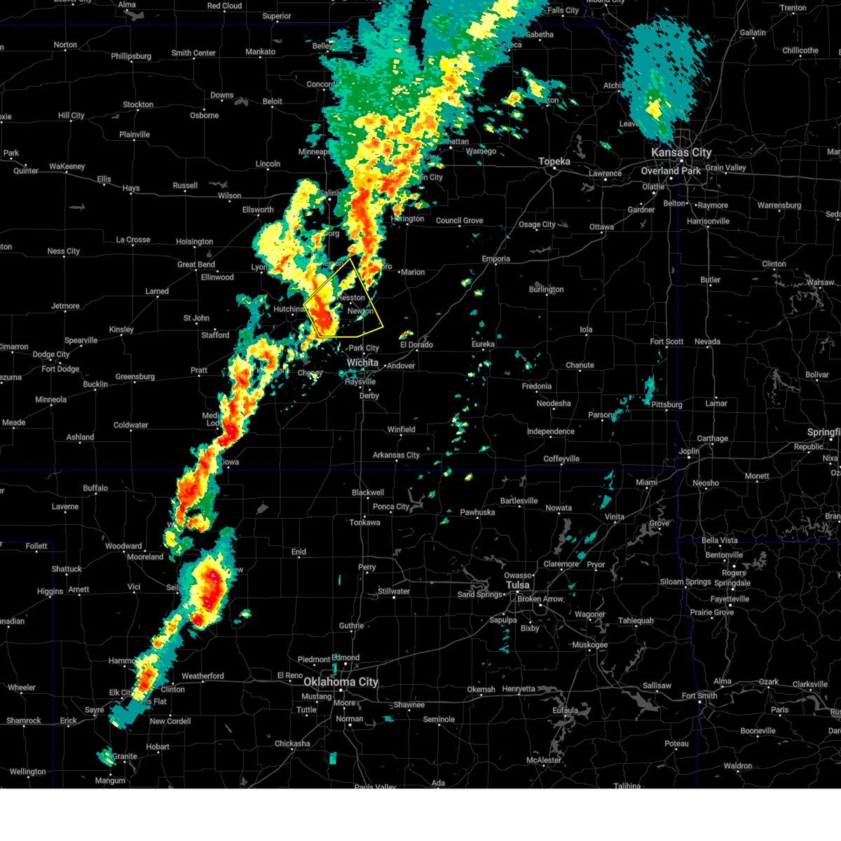 At 336 pm cdt, severe thunderstorms were located along a line extending from 7 miles southwest of moundridge to near halstead, moving northeast at 55 mph (radar indicated). Hazards include 60 mph wind gusts and penny size hail. Expect damage to roofs, siding, and trees. Locations impacted include, newton, hesston, halstead, north newton, moundridge, sedgwick, buhler, burrton, canton, goessel, walton, and newton airport. At 336 pm cdt, severe thunderstorms were located along a line extending from 7 miles southwest of moundridge to near halstead, moving northeast at 55 mph (radar indicated). Hazards include 60 mph wind gusts and penny size hail. Expect damage to roofs, siding, and trees. Locations impacted include, newton, hesston, halstead, north newton, moundridge, sedgwick, buhler, burrton, canton, goessel, walton, and newton airport.
|
| 10/30/2024 3:36 PM CDT |
 the severe thunderstorm warning has been cancelled and is no longer in effect the severe thunderstorm warning has been cancelled and is no longer in effect
|
| 10/30/2024 3:29 PM CDT |
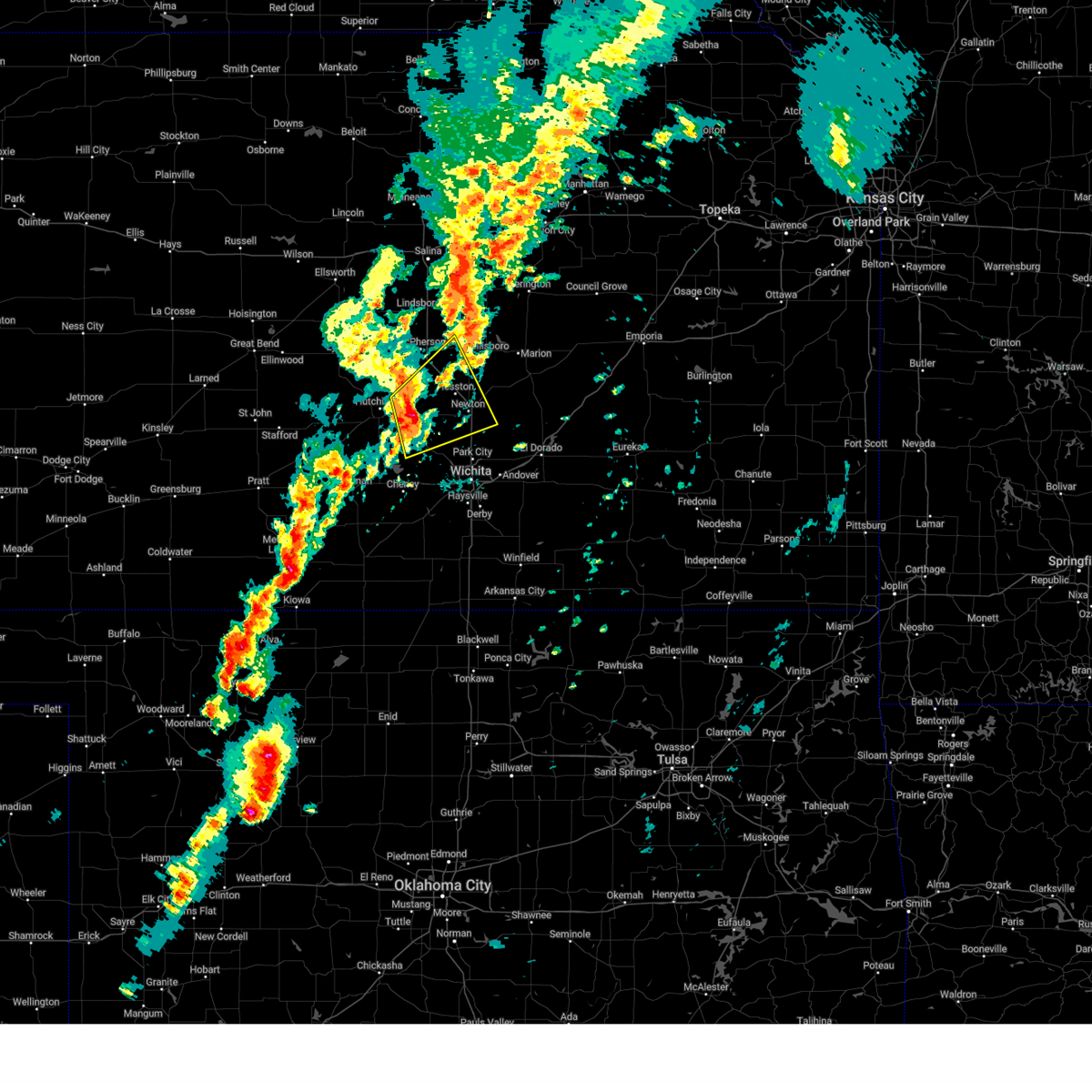 At 329 pm cdt, severe thunderstorms were located along a line extending from near buhler to near burrton, moving northeast at 55 mph (radar indicated). Hazards include 60 mph wind gusts and nickel size hail. Expect damage to roofs, siding, and trees. Locations impacted include, newton, hesston, halstead, north newton, moundridge, sedgwick, buhler, haven, burrton, mount hope, canton, goessel, bentley, walton, and newton airport. At 329 pm cdt, severe thunderstorms were located along a line extending from near buhler to near burrton, moving northeast at 55 mph (radar indicated). Hazards include 60 mph wind gusts and nickel size hail. Expect damage to roofs, siding, and trees. Locations impacted include, newton, hesston, halstead, north newton, moundridge, sedgwick, buhler, haven, burrton, mount hope, canton, goessel, bentley, walton, and newton airport.
|
| 10/30/2024 3:19 PM CDT |
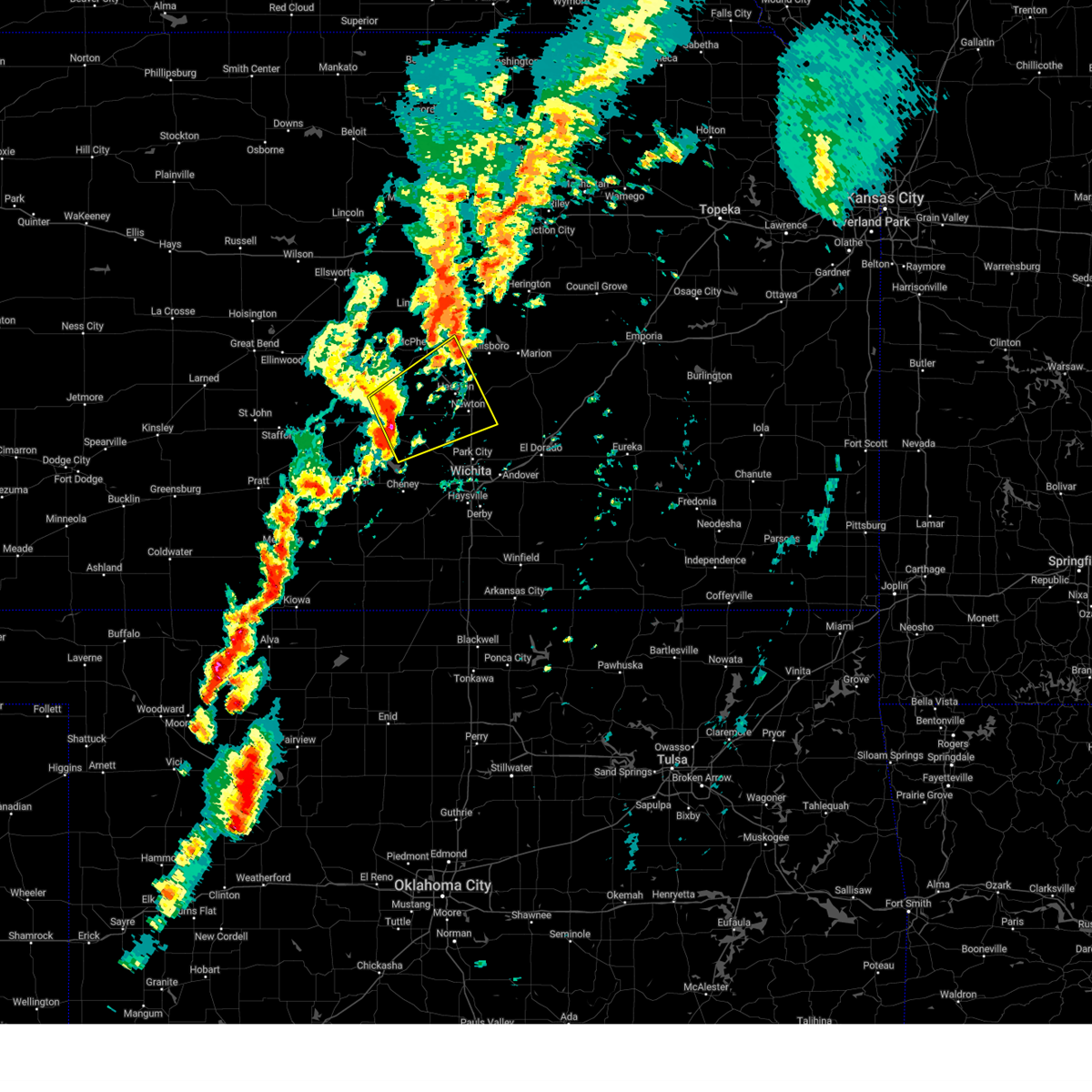 At 319 pm cdt, severe thunderstorms were located along a line extending from near hutchinson to near haven, moving northeast at 55 mph (radar indicated). Hazards include 60 mph wind gusts and quarter size hail. Hail damage to vehicles is expected. expect wind damage to roofs, siding, and trees. Locations impacted include, hutchinson, newton, hesston, south hutchinson, halstead, north newton, moundridge, sedgwick, inman, buhler, haven, burrton, galva, mount hope, canton, goessel, bentley, walton, yoder, and willowbrook. At 319 pm cdt, severe thunderstorms were located along a line extending from near hutchinson to near haven, moving northeast at 55 mph (radar indicated). Hazards include 60 mph wind gusts and quarter size hail. Hail damage to vehicles is expected. expect wind damage to roofs, siding, and trees. Locations impacted include, hutchinson, newton, hesston, south hutchinson, halstead, north newton, moundridge, sedgwick, inman, buhler, haven, burrton, galva, mount hope, canton, goessel, bentley, walton, yoder, and willowbrook.
|
| 10/30/2024 3:16 PM CDT |
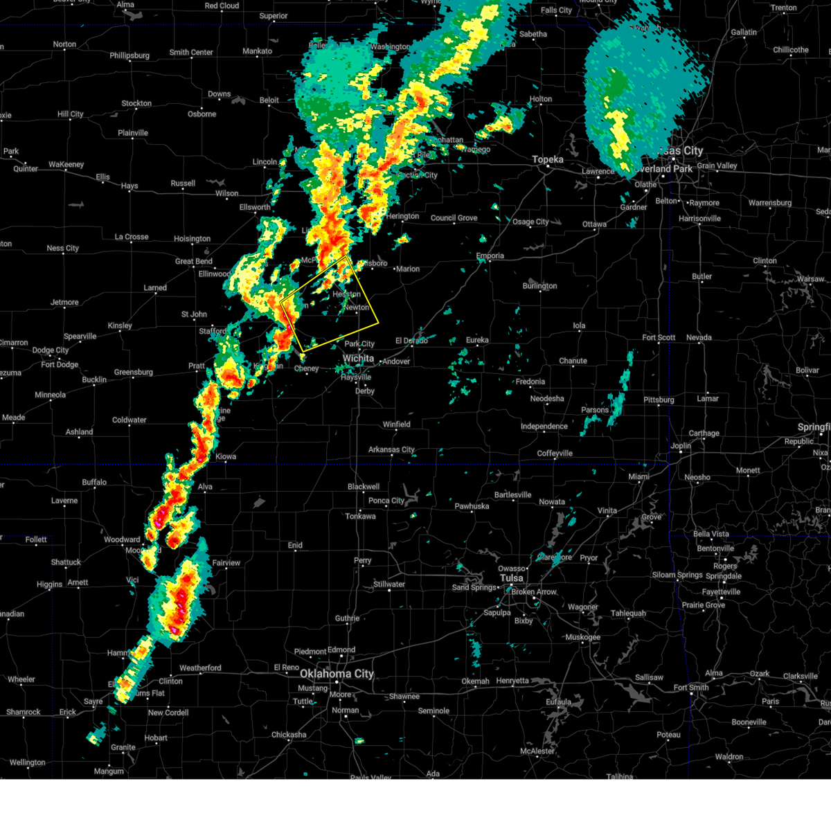 At 316 pm cdt, severe thunderstorms were located along a line extending from hutchinson to near haven, moving northeast at 55 mph (radar indicated). Hazards include 60 mph wind gusts and half dollar size hail. Hail damage to vehicles is expected. expect wind damage to roofs, siding, and trees. Locations impacted include, hutchinson, newton, hesston, south hutchinson, halstead, north newton, moundridge, sedgwick, inman, buhler, haven, burrton, galva, mount hope, canton, goessel, bentley, walton, yoder, and willowbrook. At 316 pm cdt, severe thunderstorms were located along a line extending from hutchinson to near haven, moving northeast at 55 mph (radar indicated). Hazards include 60 mph wind gusts and half dollar size hail. Hail damage to vehicles is expected. expect wind damage to roofs, siding, and trees. Locations impacted include, hutchinson, newton, hesston, south hutchinson, halstead, north newton, moundridge, sedgwick, inman, buhler, haven, burrton, galva, mount hope, canton, goessel, bentley, walton, yoder, and willowbrook.
|
| 10/30/2024 3:02 PM CDT |
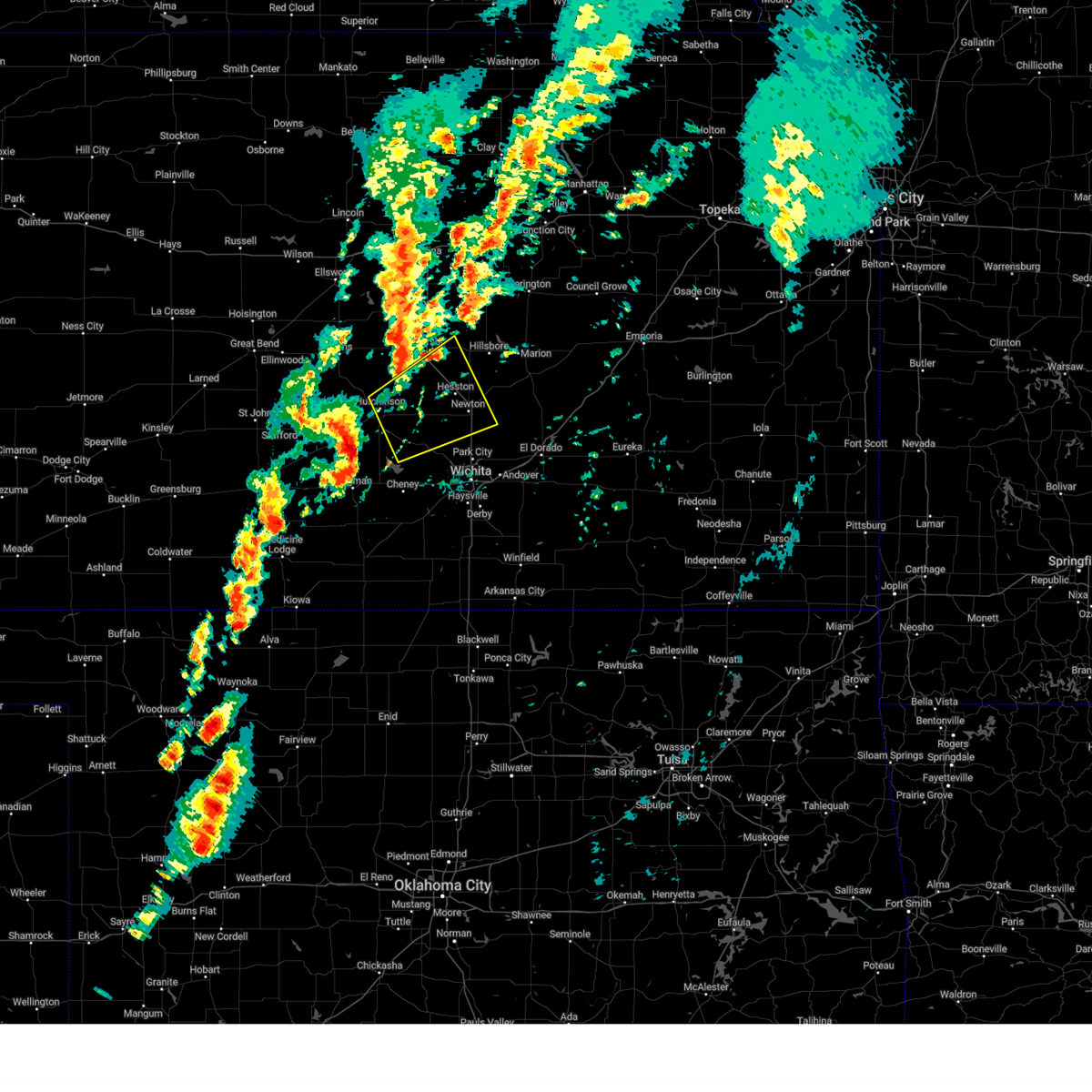 Svrict the national weather service in wichita has issued a * severe thunderstorm warning for, southeastern mcpherson county in central kansas, eastern reno county in south central kansas, northwestern sedgwick county in south central kansas, harvey county in south central kansas, southwestern marion county in central kansas, * until 400 pm cdt. * at 302 pm cdt, severe thunderstorms were located along a line extending from partridge to near pretty prairie, moving northeast at 55 mph (radar indicated). Hazards include ping pong ball size hail and 60 mph wind gusts. People and animals outdoors will be injured. expect hail damage to roofs, siding, windows, and vehicles. Expect wind damage to roofs, siding, and trees. Svrict the national weather service in wichita has issued a * severe thunderstorm warning for, southeastern mcpherson county in central kansas, eastern reno county in south central kansas, northwestern sedgwick county in south central kansas, harvey county in south central kansas, southwestern marion county in central kansas, * until 400 pm cdt. * at 302 pm cdt, severe thunderstorms were located along a line extending from partridge to near pretty prairie, moving northeast at 55 mph (radar indicated). Hazards include ping pong ball size hail and 60 mph wind gusts. People and animals outdoors will be injured. expect hail damage to roofs, siding, windows, and vehicles. Expect wind damage to roofs, siding, and trees.
|
| 9/20/2024 7:56 PM CDT |
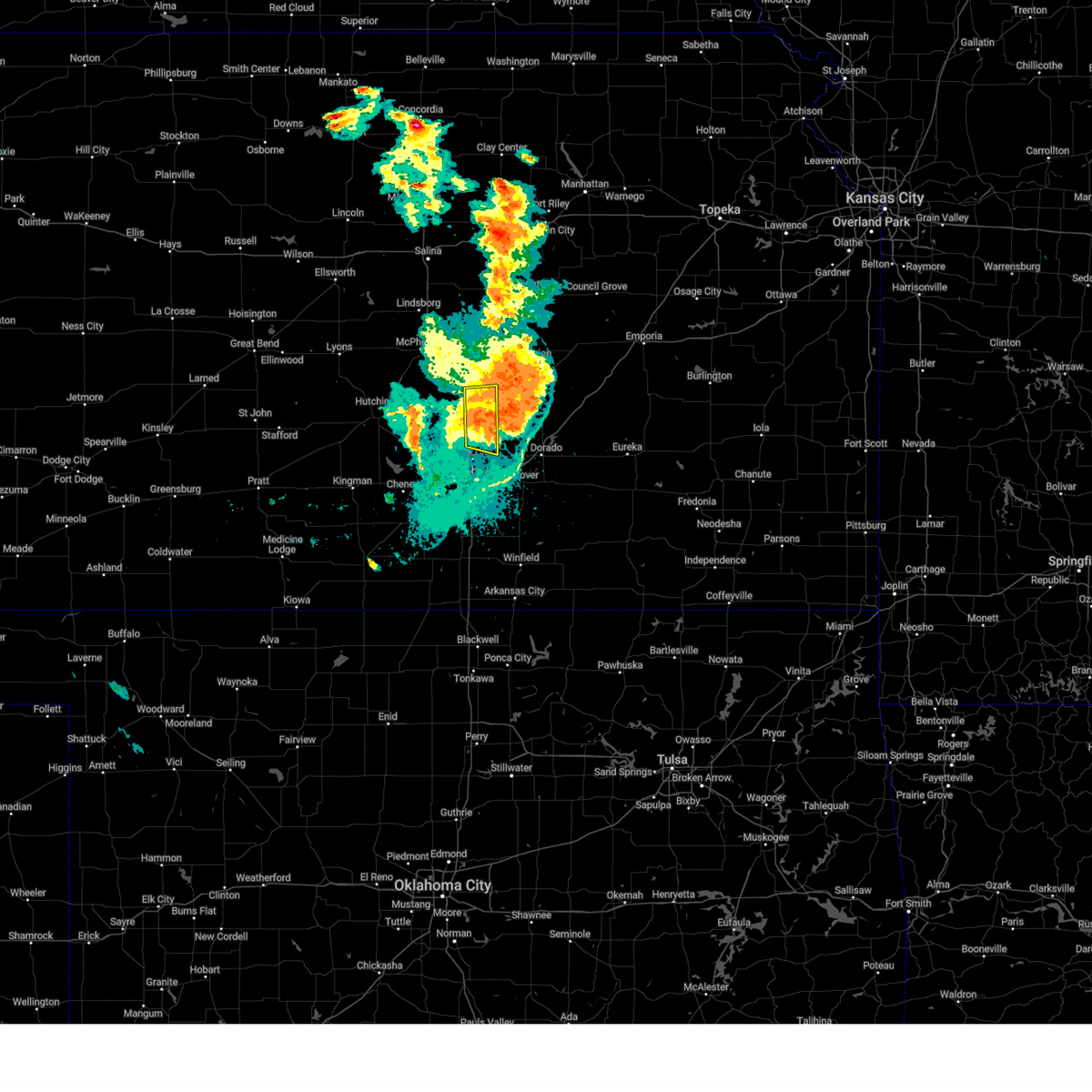 At 756 pm cdt, severe thunderstorms were located along a line extending from near florence to 5 miles southwest of burns to 5 miles north of benton, moving east at 30 mph (radar indicated). Hazards include 60 mph wind gusts. Expect damage to roofs, siding, and trees. Locations impacted include, newton, park city, north newton, walton, and newton airport. At 756 pm cdt, severe thunderstorms were located along a line extending from near florence to 5 miles southwest of burns to 5 miles north of benton, moving east at 30 mph (radar indicated). Hazards include 60 mph wind gusts. Expect damage to roofs, siding, and trees. Locations impacted include, newton, park city, north newton, walton, and newton airport.
|
| 9/20/2024 7:43 PM CDT |
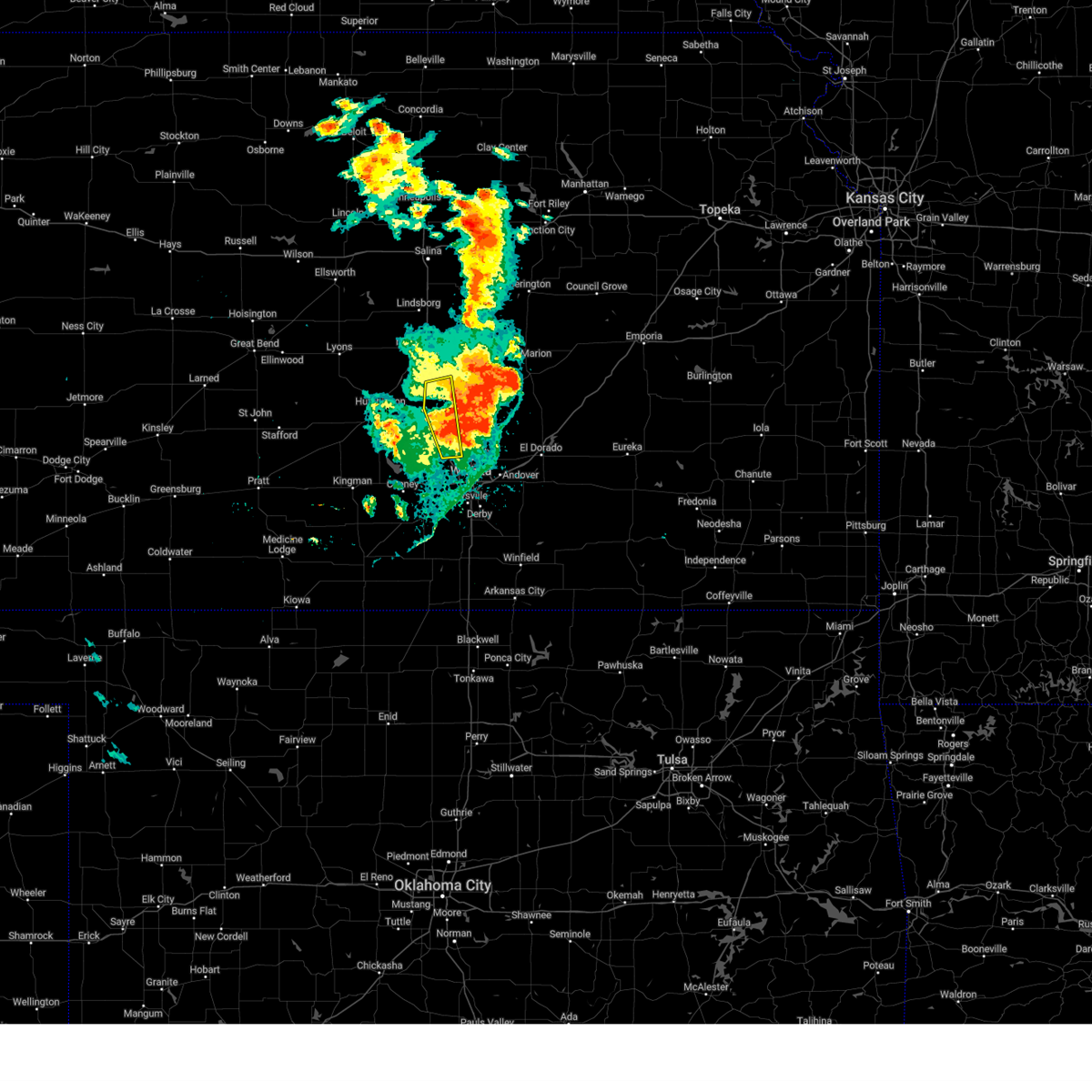 The storms which prompted the warning have moved out of the area. therefore, the warning will be allowed to expire. however, gusty winds are still possible with these thunderstorms. The storms which prompted the warning have moved out of the area. therefore, the warning will be allowed to expire. however, gusty winds are still possible with these thunderstorms.
|
| 9/20/2024 7:38 PM CDT |
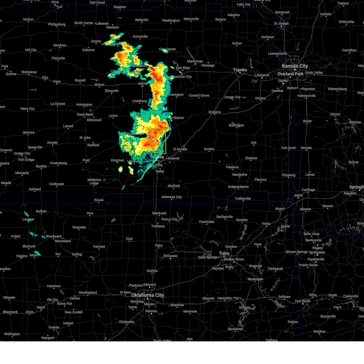 At 738 pm cdt, severe thunderstorms were located along a line extending from 6 miles southeast of hillsboro to elbing to kechi, moving east at 55 mph (radar indicated). Hazards include 70 mph wind gusts. Expect considerable tree damage. damage is likely to mobile homes, roofs, and outbuildings. Locations impacted include, newton, park city, valley center, hesston, north newton, sedgwick, kechi, walton, and newton airport. At 738 pm cdt, severe thunderstorms were located along a line extending from 6 miles southeast of hillsboro to elbing to kechi, moving east at 55 mph (radar indicated). Hazards include 70 mph wind gusts. Expect considerable tree damage. damage is likely to mobile homes, roofs, and outbuildings. Locations impacted include, newton, park city, valley center, hesston, north newton, sedgwick, kechi, walton, and newton airport.
|
| 9/20/2024 7:38 PM CDT |
 At 738 pm cdt, severe thunderstorms were located along a line extending from near hillsboro to near elbing to park city, moving northeast at 30 mph (radar indicated). Hazards include 70 mph wind gusts and nickel size hail. Expect considerable tree damage. damage is likely to mobile homes, roofs, and outbuildings. Locations impacted include, valley center, halstead, moundridge, sedgwick, and bentley. At 738 pm cdt, severe thunderstorms were located along a line extending from near hillsboro to near elbing to park city, moving northeast at 30 mph (radar indicated). Hazards include 70 mph wind gusts and nickel size hail. Expect considerable tree damage. damage is likely to mobile homes, roofs, and outbuildings. Locations impacted include, valley center, halstead, moundridge, sedgwick, and bentley.
|
| 9/20/2024 7:35 PM CDT |
 At 735 pm cdt, severe thunderstorms were located along a line extending from 6 miles south of hillsboro to near elbing to near park city, moving east at 55 mph (radar indicated). Hazards include 70 mph wind gusts. Expect considerable tree damage. damage is likely to mobile homes, roofs, and outbuildings. Locations impacted include, wichita, newton, andover, park city, valley center, bel aire, hesston, maize, north newton, sedgwick, kechi, eastborough, walton, east wichita, northeast wichita, newton airport, and jabara airport. At 735 pm cdt, severe thunderstorms were located along a line extending from 6 miles south of hillsboro to near elbing to near park city, moving east at 55 mph (radar indicated). Hazards include 70 mph wind gusts. Expect considerable tree damage. damage is likely to mobile homes, roofs, and outbuildings. Locations impacted include, wichita, newton, andover, park city, valley center, bel aire, hesston, maize, north newton, sedgwick, kechi, eastborough, walton, east wichita, northeast wichita, newton airport, and jabara airport.
|
| 9/20/2024 7:34 PM CDT |
 the severe thunderstorm warning has been cancelled and is no longer in effect the severe thunderstorm warning has been cancelled and is no longer in effect
|
| 9/20/2024 7:34 PM CDT |
 At 733 pm cdt, severe thunderstorms were located along a line extending from 5 miles south of hillsboro to near elbing to near park city, moving east at 50 mph (radar indicated). Hazards include 70 mph wind gusts and nickel size hail. Expect considerable tree damage. damage is likely to mobile homes, roofs, and outbuildings. Locations impacted include, valley center, maize, halstead, moundridge, sedgwick, colwich, andale, and bentley. At 733 pm cdt, severe thunderstorms were located along a line extending from 5 miles south of hillsboro to near elbing to near park city, moving east at 50 mph (radar indicated). Hazards include 70 mph wind gusts and nickel size hail. Expect considerable tree damage. damage is likely to mobile homes, roofs, and outbuildings. Locations impacted include, valley center, maize, halstead, moundridge, sedgwick, colwich, andale, and bentley.
|
| 9/20/2024 7:25 PM CDT |
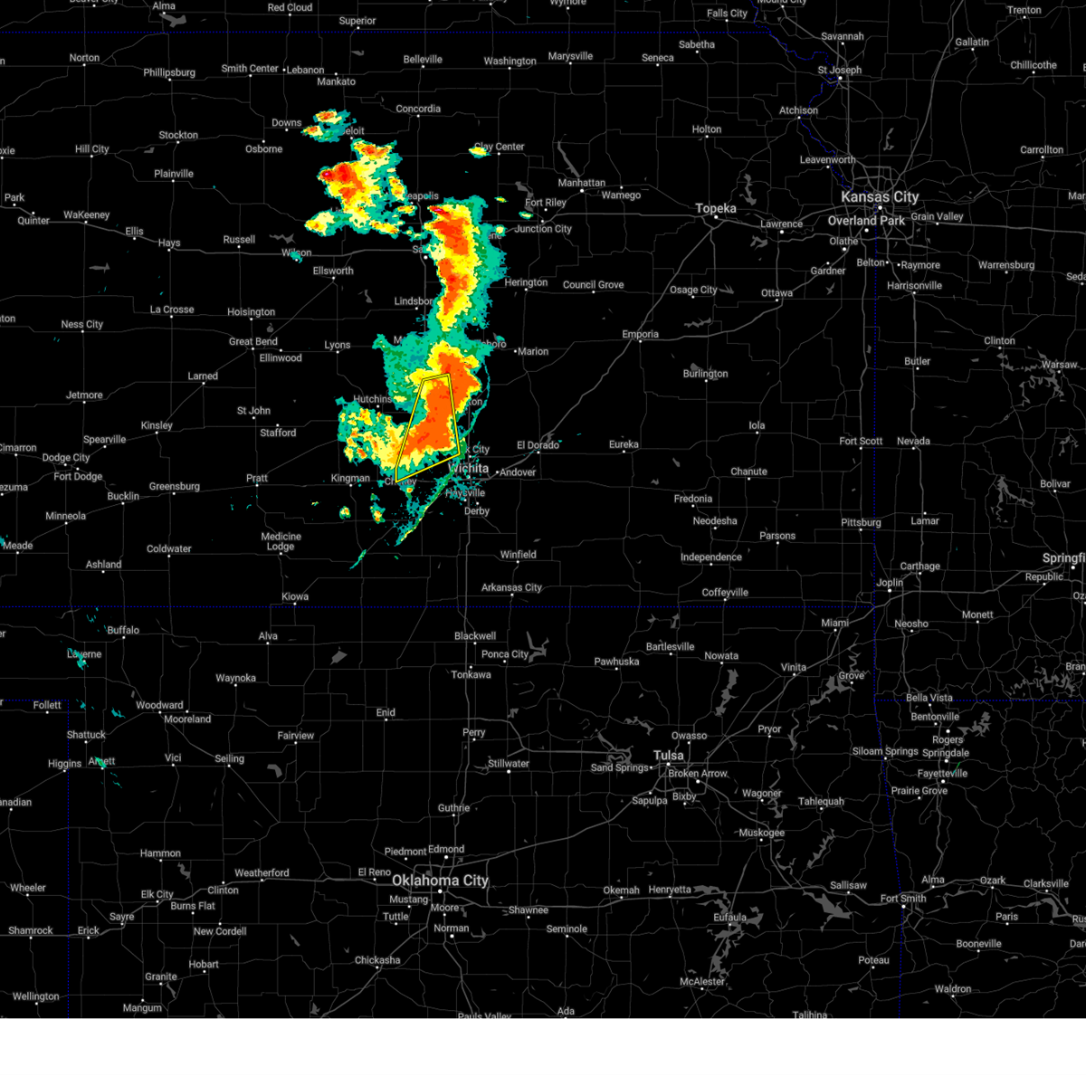 At 724 pm cdt, severe thunderstorms were located along a line extending from near moundridge to halstead to near andale, moving northeast at 35 mph (radar indicated). Hazards include 70 mph wind gusts and nickel size hail. Expect considerable tree damage. damage is likely to mobile homes, roofs, and outbuildings. Locations impacted include, valley center, maize, halstead, moundridge, sedgwick, colwich, burrton, mount hope, andale, bentley, cheney state park, and cheney lake. At 724 pm cdt, severe thunderstorms were located along a line extending from near moundridge to halstead to near andale, moving northeast at 35 mph (radar indicated). Hazards include 70 mph wind gusts and nickel size hail. Expect considerable tree damage. damage is likely to mobile homes, roofs, and outbuildings. Locations impacted include, valley center, maize, halstead, moundridge, sedgwick, colwich, burrton, mount hope, andale, bentley, cheney state park, and cheney lake.
|
| 9/20/2024 7:17 PM CDT |
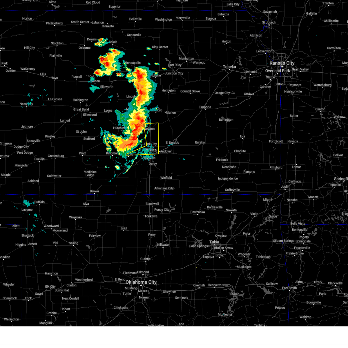 At 717 pm cdt, severe thunderstorms were located along a line extending from moundridge to near halstead to near garden plain, moving east at 40 mph (emergency management reported a 60 mph wind gust in hesston at 716 pm). Hazards include 70 mph wind gusts. Expect considerable tree damage. damage is likely to mobile homes, roofs, and outbuildings. Locations impacted include, wichita, newton, andover, park city, valley center, bel aire, goddard, hesston, maize, north newton, sedgwick, garden plain, downtown wichita, kechi, eastborough, walton, west wichita, east wichita, northeast wichita, and newton airport. At 717 pm cdt, severe thunderstorms were located along a line extending from moundridge to near halstead to near garden plain, moving east at 40 mph (emergency management reported a 60 mph wind gust in hesston at 716 pm). Hazards include 70 mph wind gusts. Expect considerable tree damage. damage is likely to mobile homes, roofs, and outbuildings. Locations impacted include, wichita, newton, andover, park city, valley center, bel aire, goddard, hesston, maize, north newton, sedgwick, garden plain, downtown wichita, kechi, eastborough, walton, west wichita, east wichita, northeast wichita, and newton airport.
|
| 9/20/2024 7:14 PM CDT |
 At 714 pm cdt, severe thunderstorms were located along a line extending from 6 miles southwest of moundridge to near mount hope to near cheney, moving east at 30 mph (at 712 a trained spotter reported a 65 mph wind gust in mount hope). Hazards include 70 mph wind gusts. Expect considerable tree damage. damage is likely to mobile homes, roofs, and outbuildings. Locations impacted include, wichita, newton, andover, park city, valley center, bel aire, goddard, hesston, maize, north newton, sedgwick, garden plain, downtown wichita, kechi, eastborough, walton, west wichita, east wichita, northeast wichita, and newton airport. At 714 pm cdt, severe thunderstorms were located along a line extending from 6 miles southwest of moundridge to near mount hope to near cheney, moving east at 30 mph (at 712 a trained spotter reported a 65 mph wind gust in mount hope). Hazards include 70 mph wind gusts. Expect considerable tree damage. damage is likely to mobile homes, roofs, and outbuildings. Locations impacted include, wichita, newton, andover, park city, valley center, bel aire, goddard, hesston, maize, north newton, sedgwick, garden plain, downtown wichita, kechi, eastborough, walton, west wichita, east wichita, northeast wichita, and newton airport.
|
| 9/20/2024 7:13 PM CDT |
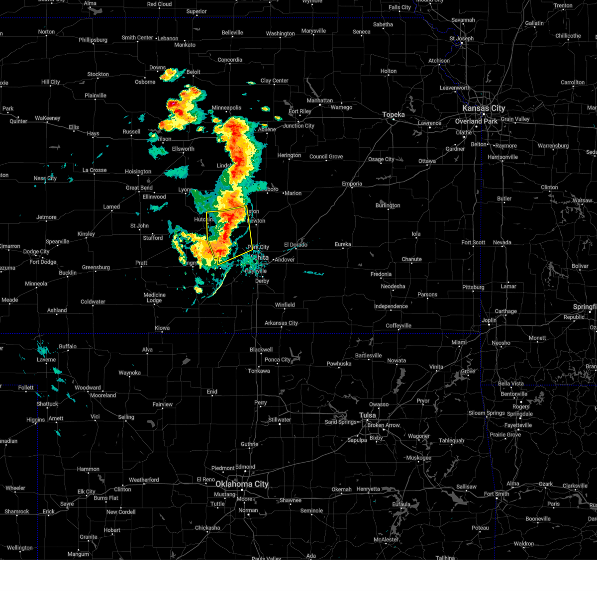 At 713 pm cdt, severe thunderstorms were located along a line extending from 6 miles west of moundridge to 5 miles southeast of burrton to 5 miles north of cheney, moving northeast at 30 mph (at 712 a trained spotter reported a 65 mph wind gust in mount hope). Hazards include 70 mph wind gusts and nickel size hail. Expect considerable tree damage. damage is likely to mobile homes, roofs, and outbuildings. Locations impacted include, hutchinson, valley center, maize, south hutchinson, halstead, moundridge, sedgwick, colwich, buhler, haven, burrton, mount hope, andale, bentley, yoder, cheney lake, hutchinson airport, and cheney state park. At 713 pm cdt, severe thunderstorms were located along a line extending from 6 miles west of moundridge to 5 miles southeast of burrton to 5 miles north of cheney, moving northeast at 30 mph (at 712 a trained spotter reported a 65 mph wind gust in mount hope). Hazards include 70 mph wind gusts and nickel size hail. Expect considerable tree damage. damage is likely to mobile homes, roofs, and outbuildings. Locations impacted include, hutchinson, valley center, maize, south hutchinson, halstead, moundridge, sedgwick, colwich, buhler, haven, burrton, mount hope, andale, bentley, yoder, cheney lake, hutchinson airport, and cheney state park.
|
| 9/20/2024 7:07 PM CDT |
 At 707 pm cdt, severe thunderstorms were located along a line extending from 6 miles northeast of buhler to near mount hope to near cheney, moving east at 30 mph (radar indicated). Hazards include 70 mph wind gusts and nickel size hail. Expect considerable tree damage. damage is likely to mobile homes, roofs, and outbuildings. Locations impacted include, hutchinson, valley center, maize, south hutchinson, halstead, moundridge, sedgwick, colwich, buhler, haven, burrton, mount hope, andale, bentley, yoder, cheney lake, hutchinson airport, and cheney state park. At 707 pm cdt, severe thunderstorms were located along a line extending from 6 miles northeast of buhler to near mount hope to near cheney, moving east at 30 mph (radar indicated). Hazards include 70 mph wind gusts and nickel size hail. Expect considerable tree damage. damage is likely to mobile homes, roofs, and outbuildings. Locations impacted include, hutchinson, valley center, maize, south hutchinson, halstead, moundridge, sedgwick, colwich, buhler, haven, burrton, mount hope, andale, bentley, yoder, cheney lake, hutchinson airport, and cheney state park.
|
| 9/20/2024 7:06 PM CDT |
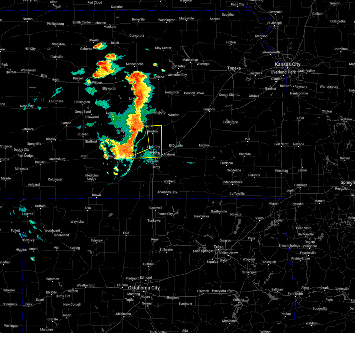 At 706 pm cdt, severe thunderstorms were located along a line extending from near buhler to near haven to 5 miles northwest of cheney, moving east at 30 mph (radar indicated). Hazards include 70 mph wind gusts. Expect considerable tree damage. damage is likely to mobile homes, roofs, and outbuildings. Locations impacted include, wichita, newton, andover, park city, valley center, bel aire, goddard, hesston, maize, north newton, sedgwick, garden plain, downtown wichita, kechi, eastborough, walton, west wichita, east wichita, northeast wichita, and newton airport. At 706 pm cdt, severe thunderstorms were located along a line extending from near buhler to near haven to 5 miles northwest of cheney, moving east at 30 mph (radar indicated). Hazards include 70 mph wind gusts. Expect considerable tree damage. damage is likely to mobile homes, roofs, and outbuildings. Locations impacted include, wichita, newton, andover, park city, valley center, bel aire, goddard, hesston, maize, north newton, sedgwick, garden plain, downtown wichita, kechi, eastborough, walton, west wichita, east wichita, northeast wichita, and newton airport.
|
| 9/20/2024 7:02 PM CDT |
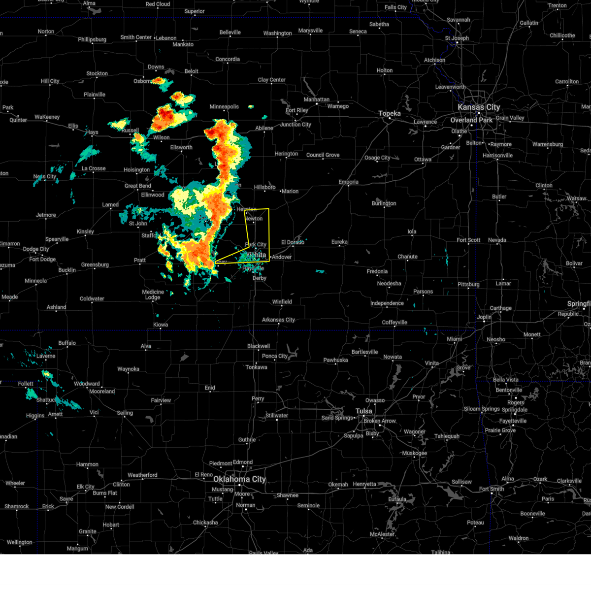 Svrict the national weather service in wichita has issued a * severe thunderstorm warning for, northern sedgwick county in south central kansas, eastern harvey county in south central kansas, * until 815 pm cdt. * at 701 pm cdt, severe thunderstorms were located along a line extending from near buhler to near haven to 6 miles northwest of cheney, moving east at 30 mph (radar indicated). Hazards include 60 mph wind gusts. expect damage to roofs, siding, and trees Svrict the national weather service in wichita has issued a * severe thunderstorm warning for, northern sedgwick county in south central kansas, eastern harvey county in south central kansas, * until 815 pm cdt. * at 701 pm cdt, severe thunderstorms were located along a line extending from near buhler to near haven to 6 miles northwest of cheney, moving east at 30 mph (radar indicated). Hazards include 60 mph wind gusts. expect damage to roofs, siding, and trees
|
| 9/20/2024 6:55 PM CDT |
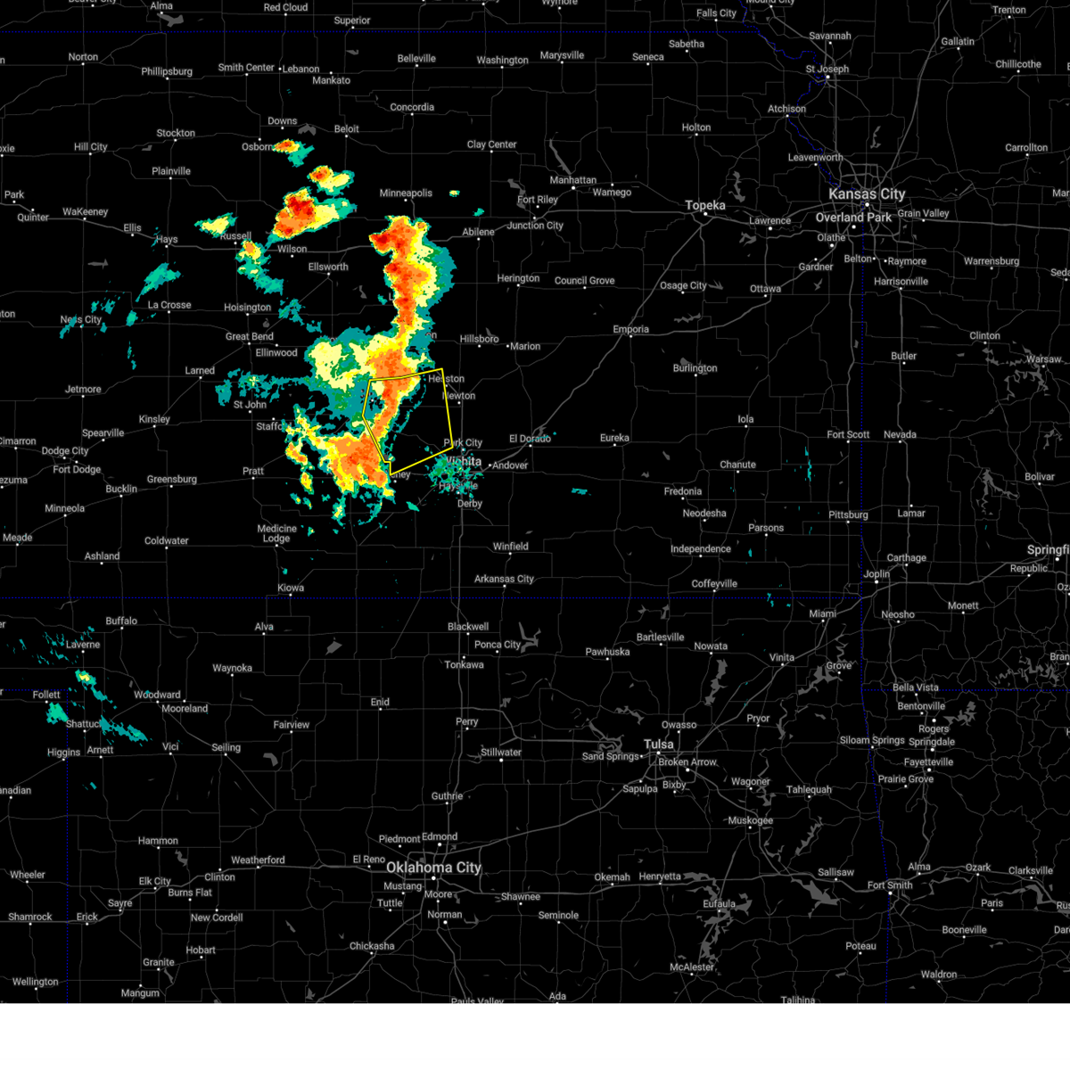 At 655 pm cdt, severe thunderstorms were located along a line extending from near inman to near haven to 6 miles southeast of pretty prairie, moving northeast at 30 mph (at 650 pm a 55 mph wind gust was reported at hutchinson airport). Hazards include 60 mph wind gusts and nickel size hail. Expect damage to roofs, siding, and trees. Locations impacted include, hutchinson, valley center, maize, south hutchinson, halstead, moundridge, sedgwick, colwich, buhler, haven, burrton, mount hope, andale, bentley, yoder, cheney lake, hutchinson airport, and cheney state park. At 655 pm cdt, severe thunderstorms were located along a line extending from near inman to near haven to 6 miles southeast of pretty prairie, moving northeast at 30 mph (at 650 pm a 55 mph wind gust was reported at hutchinson airport). Hazards include 60 mph wind gusts and nickel size hail. Expect damage to roofs, siding, and trees. Locations impacted include, hutchinson, valley center, maize, south hutchinson, halstead, moundridge, sedgwick, colwich, buhler, haven, burrton, mount hope, andale, bentley, yoder, cheney lake, hutchinson airport, and cheney state park.
|
| 9/20/2024 6:43 PM CDT |
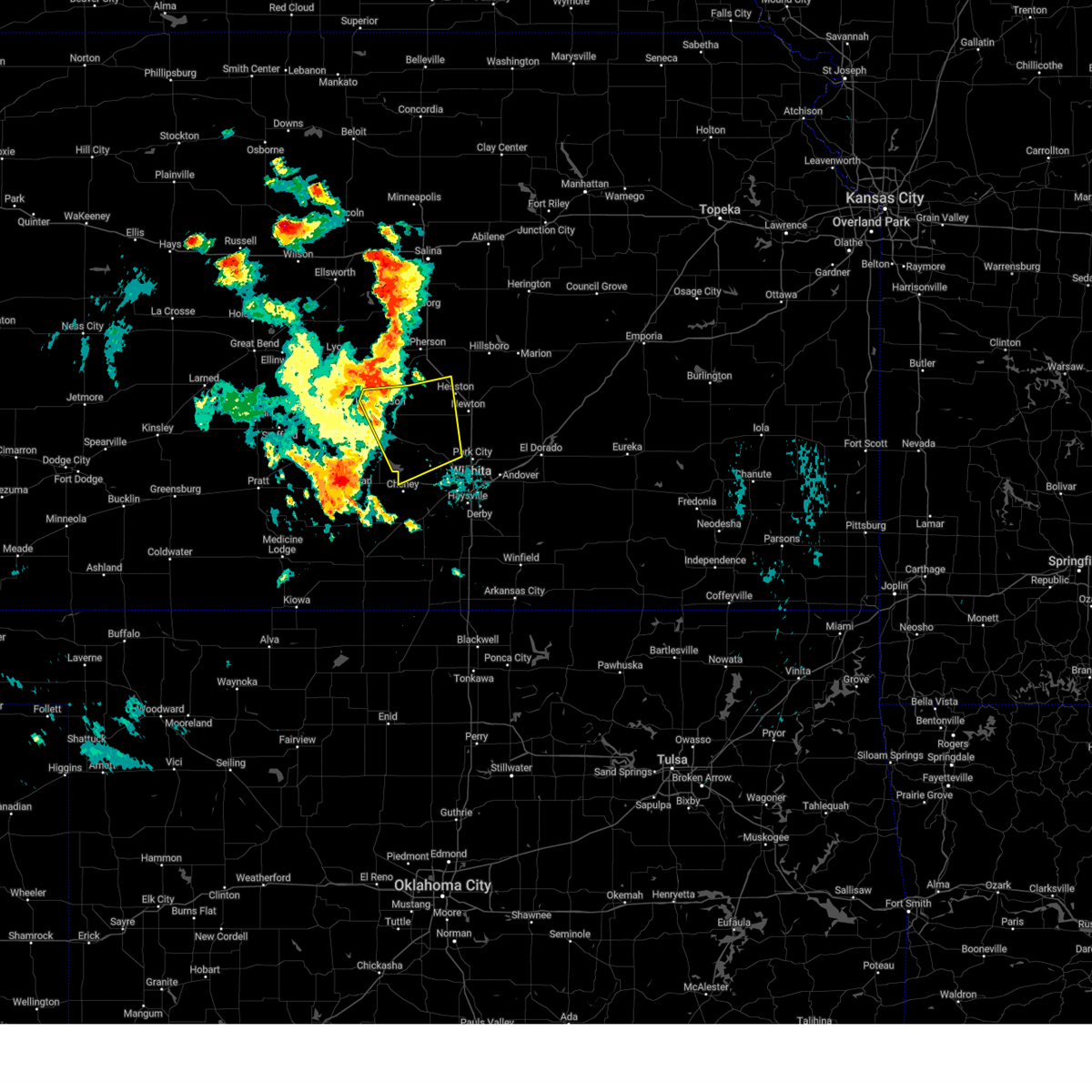 Svrict the national weather service in wichita has issued a * severe thunderstorm warning for, south central mcpherson county in central kansas, eastern reno county in south central kansas, northwestern sedgwick county in south central kansas, western harvey county in south central kansas, * until 745 pm cdt. * at 643 pm cdt, severe thunderstorms were located along a line extending from 6 miles west of buhler to 6 miles west of haven to 7 miles south of kingman, moving northeast at 25 mph (radar indicated). Hazards include 60 mph wind gusts and nickel size hail. expect damage to roofs, siding, and trees Svrict the national weather service in wichita has issued a * severe thunderstorm warning for, south central mcpherson county in central kansas, eastern reno county in south central kansas, northwestern sedgwick county in south central kansas, western harvey county in south central kansas, * until 745 pm cdt. * at 643 pm cdt, severe thunderstorms were located along a line extending from 6 miles west of buhler to 6 miles west of haven to 7 miles south of kingman, moving northeast at 25 mph (radar indicated). Hazards include 60 mph wind gusts and nickel size hail. expect damage to roofs, siding, and trees
|
| 8/14/2024 10:44 PM CDT | Storm damage reported in harvey county KS, 4.7 miles WSW of Newton, KS |
| 8/14/2024 10:16 PM CDT |
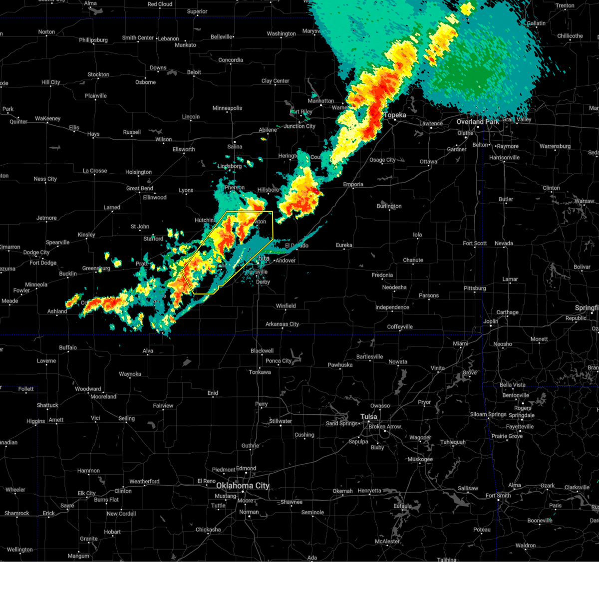 Svrict the national weather service in wichita has issued a * severe thunderstorm warning for, eastern reno county in south central kansas, northwestern sedgwick county in south central kansas, harvey county in south central kansas, eastern kingman county in south central kansas, * until 1100 pm cdt. * at 1015 pm cdt, severe thunderstorms were located along a line extending from 5 miles northeast of burrton to near colwich to 10 miles west of norwich, moving northeast at 40 mph (radar indicated). Hazards include 60 mph wind gusts and nickel size hail. expect damage to roofs, siding, and trees Svrict the national weather service in wichita has issued a * severe thunderstorm warning for, eastern reno county in south central kansas, northwestern sedgwick county in south central kansas, harvey county in south central kansas, eastern kingman county in south central kansas, * until 1100 pm cdt. * at 1015 pm cdt, severe thunderstorms were located along a line extending from 5 miles northeast of burrton to near colwich to 10 miles west of norwich, moving northeast at 40 mph (radar indicated). Hazards include 60 mph wind gusts and nickel size hail. expect damage to roofs, siding, and trees
|
| 8/14/2024 9:54 PM CDT |
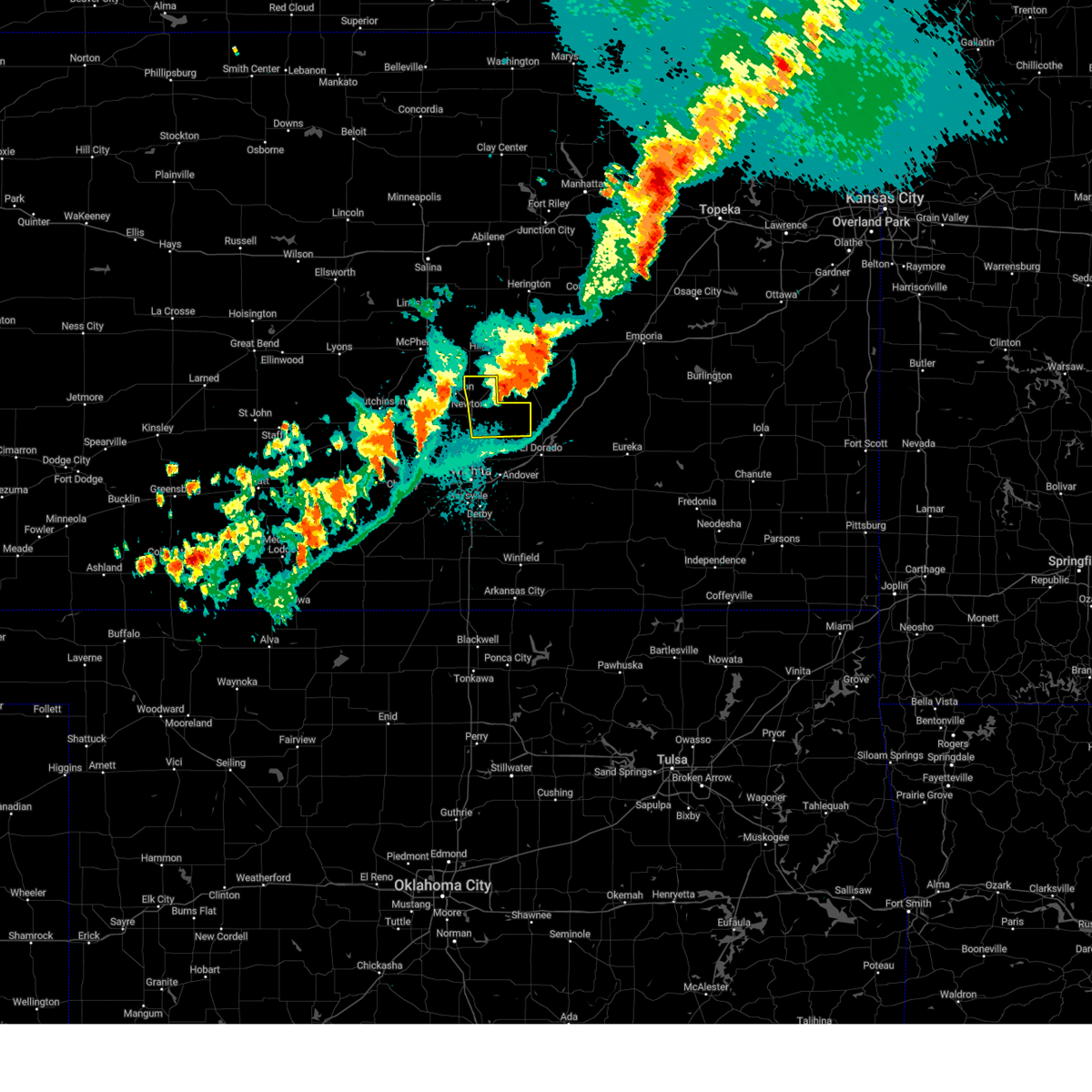 The storm which prompted the warning has exited the warned area. therefore, the warning will be allowed to expire. however, gusty winds are still possible with this thunderstorm. a severe thunderstorm watch remains in effect until 100 am cdt for central kansas. The storm which prompted the warning has exited the warned area. therefore, the warning will be allowed to expire. however, gusty winds are still possible with this thunderstorm. a severe thunderstorm watch remains in effect until 100 am cdt for central kansas.
|
| 8/14/2024 9:46 PM CDT |
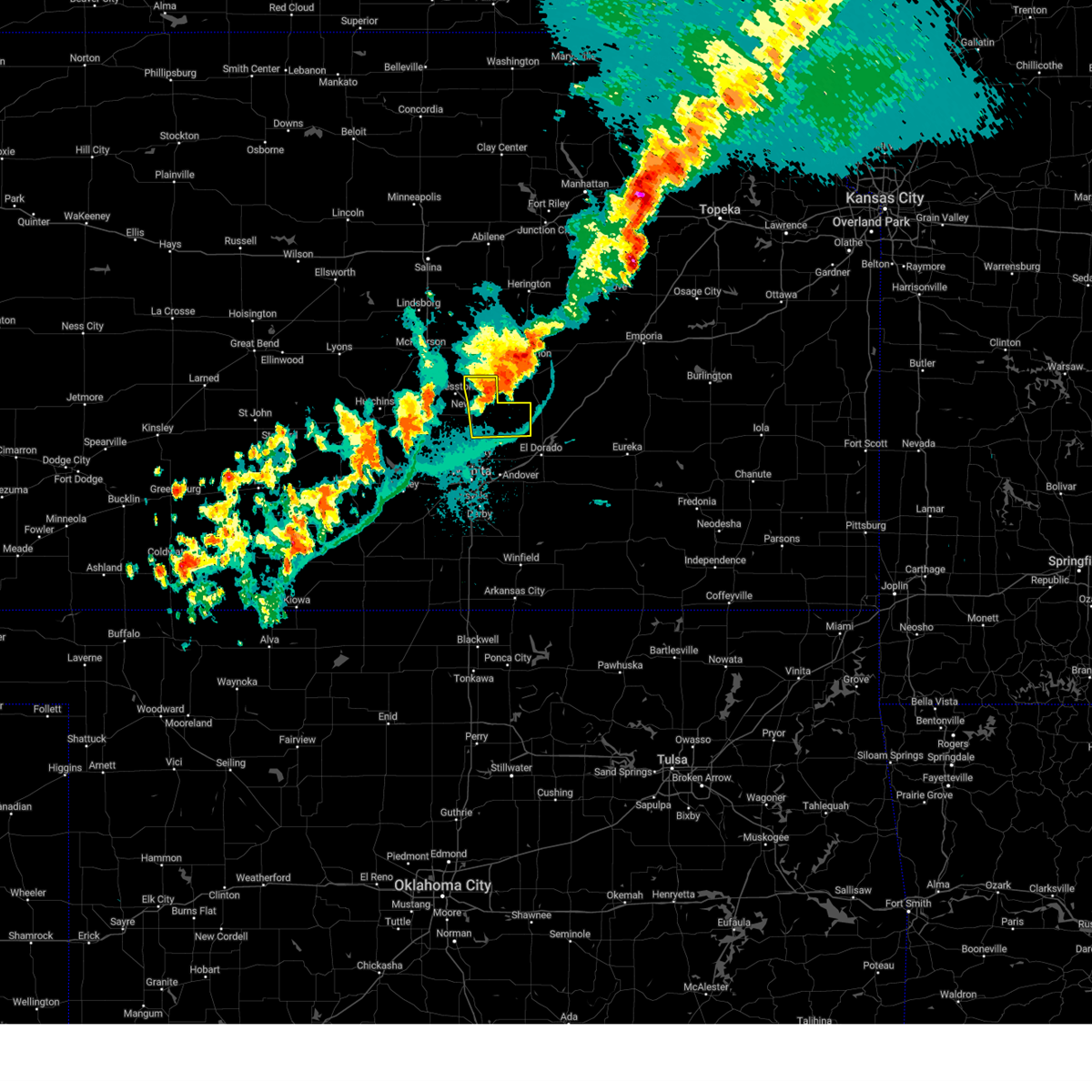 At 946 pm cdt, a severe thunderstorm was located near walton, or 6 miles southwest of peabody, moving east at 25 mph (radar indicated). Hazards include 60 mph wind gusts. Expect damage to roofs, siding, and trees. Locations impacted include, newton, north newton, whitewater, potwin, walton, elbing, and newton airport. At 946 pm cdt, a severe thunderstorm was located near walton, or 6 miles southwest of peabody, moving east at 25 mph (radar indicated). Hazards include 60 mph wind gusts. Expect damage to roofs, siding, and trees. Locations impacted include, newton, north newton, whitewater, potwin, walton, elbing, and newton airport.
|
| 8/14/2024 9:29 PM CDT |
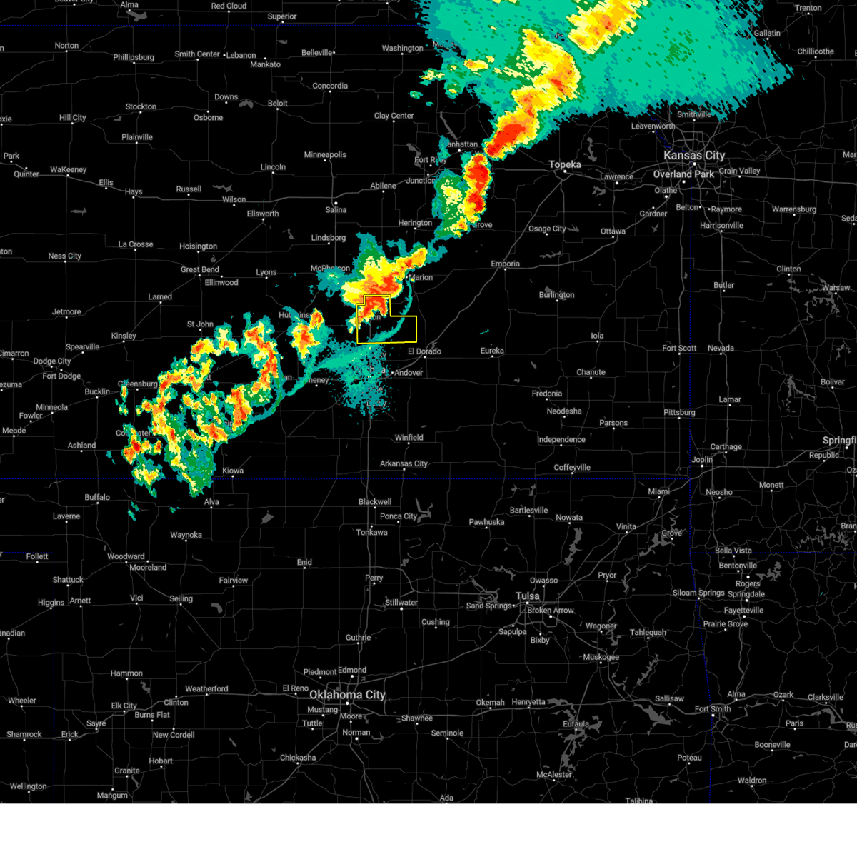 Svrict the national weather service in wichita has issued a * severe thunderstorm warning for, eastern harvey county in south central kansas, northwestern butler county in south central kansas, southwestern marion county in central kansas, * until 1000 pm cdt. * at 929 pm cdt, a severe thunderstorm was located near north newton, moving east at 30 mph (radar indicated). Hazards include 60 mph wind gusts. expect damage to roofs, siding, and trees Svrict the national weather service in wichita has issued a * severe thunderstorm warning for, eastern harvey county in south central kansas, northwestern butler county in south central kansas, southwestern marion county in central kansas, * until 1000 pm cdt. * at 929 pm cdt, a severe thunderstorm was located near north newton, moving east at 30 mph (radar indicated). Hazards include 60 mph wind gusts. expect damage to roofs, siding, and trees
|
| 8/14/2024 9:24 PM CDT |
 the severe thunderstorm warning has been cancelled and is no longer in effect the severe thunderstorm warning has been cancelled and is no longer in effect
|
| 8/14/2024 9:24 PM CDT |
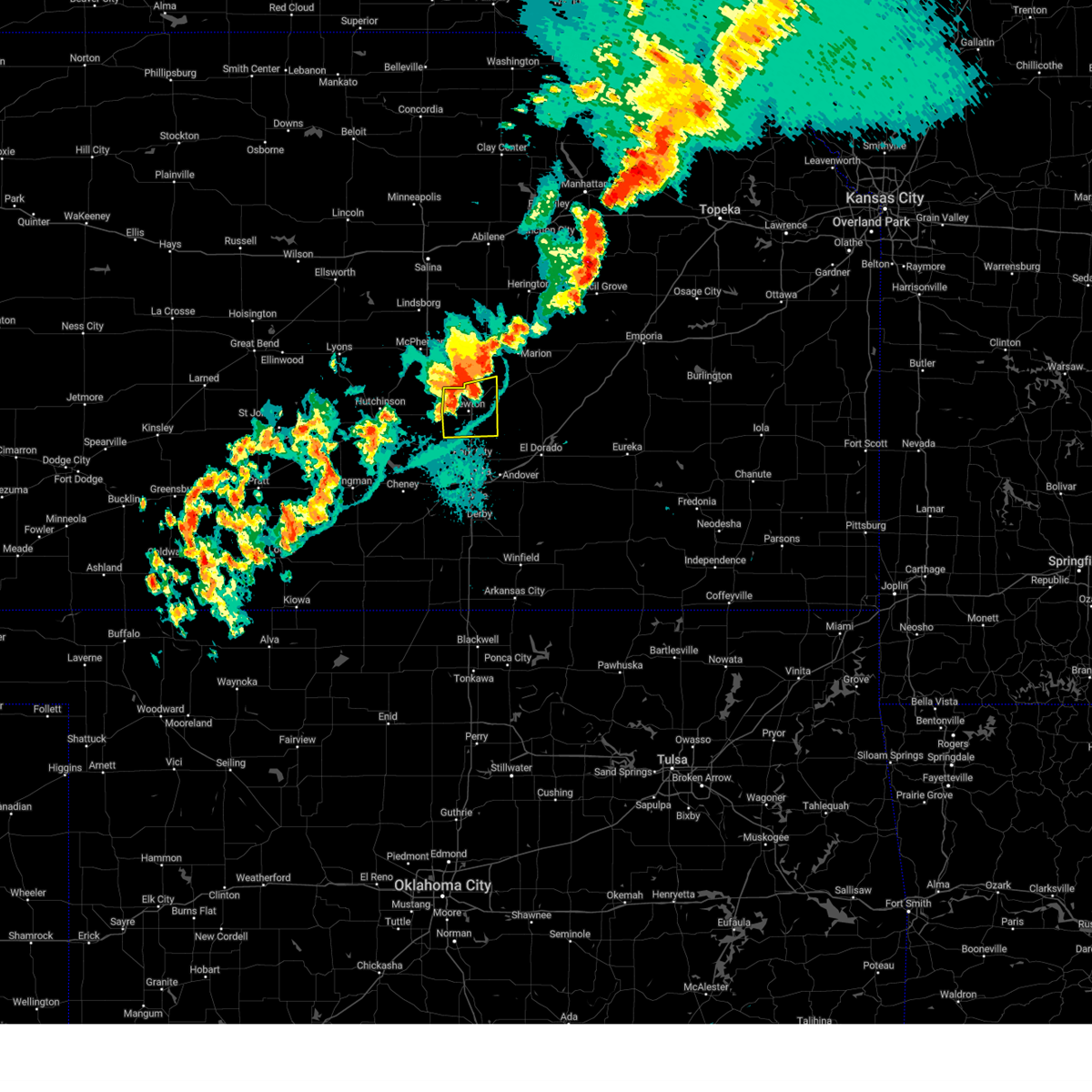 At 923 pm cdt, severe thunderstorms were located along a line extending from 6 miles north of walton to 5 miles east of newton to just north of sedgwick, moving east at 25 mph (radar indicated). Hazards include 60 mph wind gusts. Expect damage to roofs, siding, and trees. Locations impacted include, newton, hesston, halstead, north newton, sedgwick, whitewater, walton, and newton airport. At 923 pm cdt, severe thunderstorms were located along a line extending from 6 miles north of walton to 5 miles east of newton to just north of sedgwick, moving east at 25 mph (radar indicated). Hazards include 60 mph wind gusts. Expect damage to roofs, siding, and trees. Locations impacted include, newton, hesston, halstead, north newton, sedgwick, whitewater, walton, and newton airport.
|
| 8/14/2024 9:21 PM CDT |
 At 921 pm cdt, severe thunderstorms were located along a line extending from 6 miles north of walton to near newton to just north of sedgwick, moving east at 25 mph (radar indicated). Hazards include 60 mph wind gusts. Expect damage to roofs, siding, and trees. Locations impacted include, newton, hesston, halstead, north newton, moundridge, sedgwick, burrton, whitewater, walton, and newton airport. At 921 pm cdt, severe thunderstorms were located along a line extending from 6 miles north of walton to near newton to just north of sedgwick, moving east at 25 mph (radar indicated). Hazards include 60 mph wind gusts. Expect damage to roofs, siding, and trees. Locations impacted include, newton, hesston, halstead, north newton, moundridge, sedgwick, burrton, whitewater, walton, and newton airport.
|
| 8/14/2024 8:52 PM CDT |
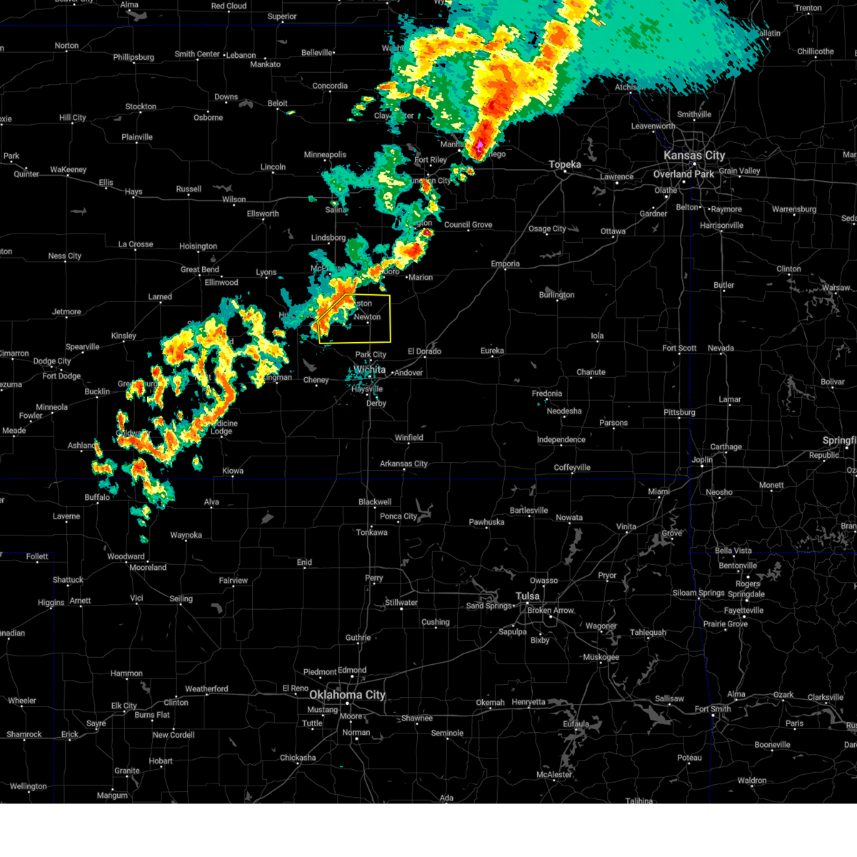 Svrict the national weather service in wichita has issued a * severe thunderstorm warning for, southeastern mcpherson county in central kansas, east central reno county in south central kansas, harvey county in south central kansas, southwestern marion county in central kansas, * until 930 pm cdt. * at 852 pm cdt, severe thunderstorms were located along a line extending from near goessel to near halstead to near mount hope, moving east at 25 mph (radar indicated). Hazards include 60 mph wind gusts. expect damage to roofs, siding, and trees Svrict the national weather service in wichita has issued a * severe thunderstorm warning for, southeastern mcpherson county in central kansas, east central reno county in south central kansas, harvey county in south central kansas, southwestern marion county in central kansas, * until 930 pm cdt. * at 852 pm cdt, severe thunderstorms were located along a line extending from near goessel to near halstead to near mount hope, moving east at 25 mph (radar indicated). Hazards include 60 mph wind gusts. expect damage to roofs, siding, and trees
|
| 8/13/2024 5:09 AM CDT |
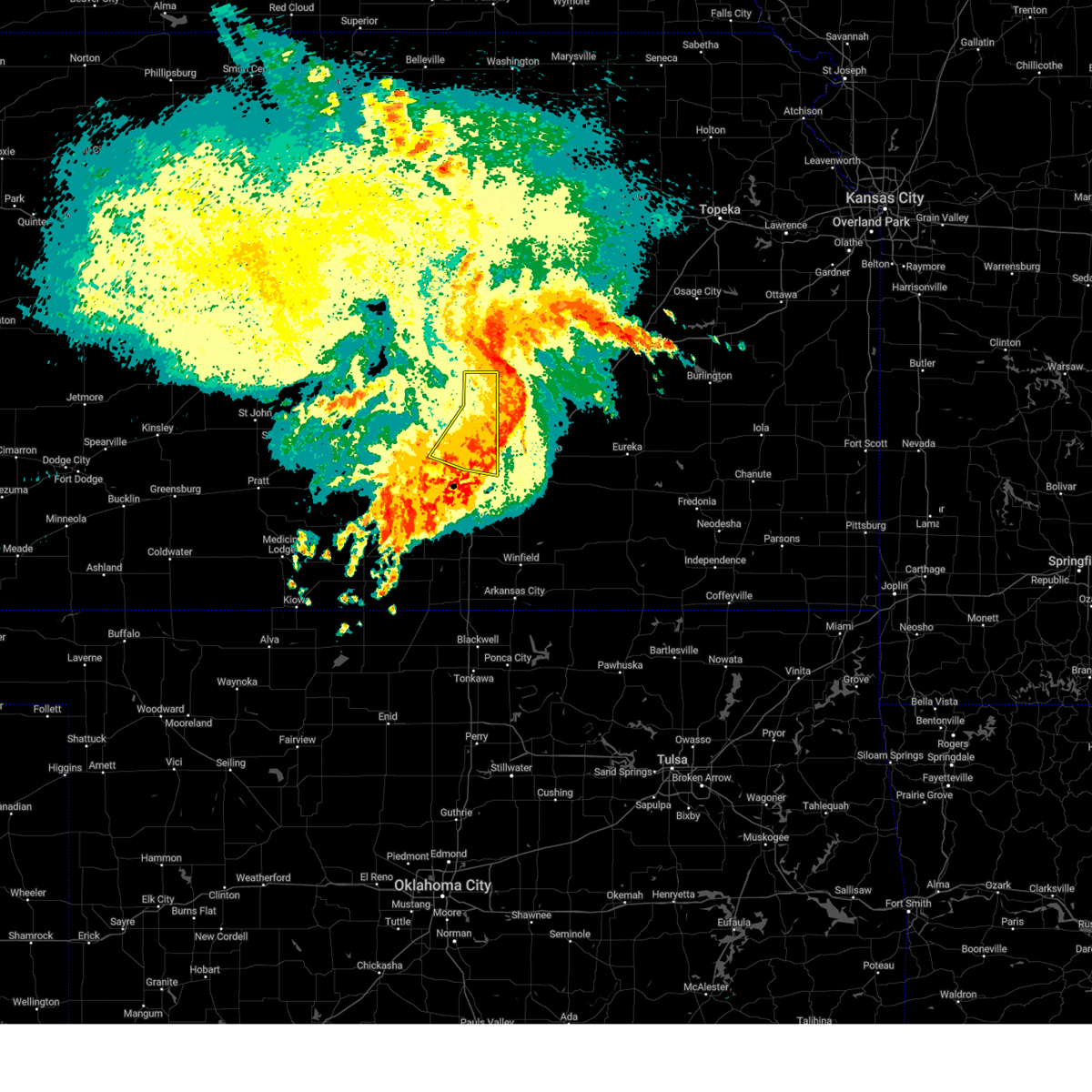 The storms which prompted the warning have moved out of the area. therefore, the warning will be allowed to expire. however, gusty winds and heavy rain are still possible with these thunderstorms. The storms which prompted the warning have moved out of the area. therefore, the warning will be allowed to expire. however, gusty winds and heavy rain are still possible with these thunderstorms.
|
| 8/13/2024 4:51 AM CDT |
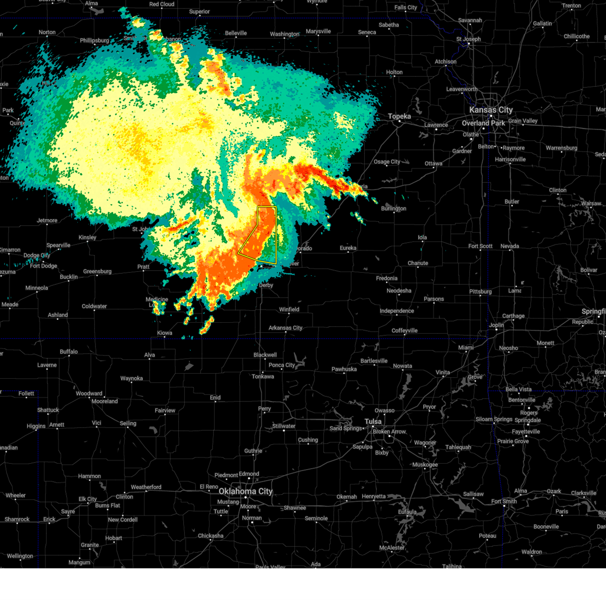 At 450 am cdt, severe thunderstorms were located along a line extending from 5 miles northwest of peabody to near walton to near maize, moving east at 35 mph (radar indicated). Hazards include 60 mph wind gusts. Expect damage to roofs, siding, and trees. Locations impacted include, wichita, newton, park city, valley center, bel aire, maize, north newton, sedgwick, colwich, whitewater, kechi, goessel, bentley, walton, northeast wichita, newton airport, and jabara airport. At 450 am cdt, severe thunderstorms were located along a line extending from 5 miles northwest of peabody to near walton to near maize, moving east at 35 mph (radar indicated). Hazards include 60 mph wind gusts. Expect damage to roofs, siding, and trees. Locations impacted include, wichita, newton, park city, valley center, bel aire, maize, north newton, sedgwick, colwich, whitewater, kechi, goessel, bentley, walton, northeast wichita, newton airport, and jabara airport.
|
| 8/13/2024 4:51 AM CDT |
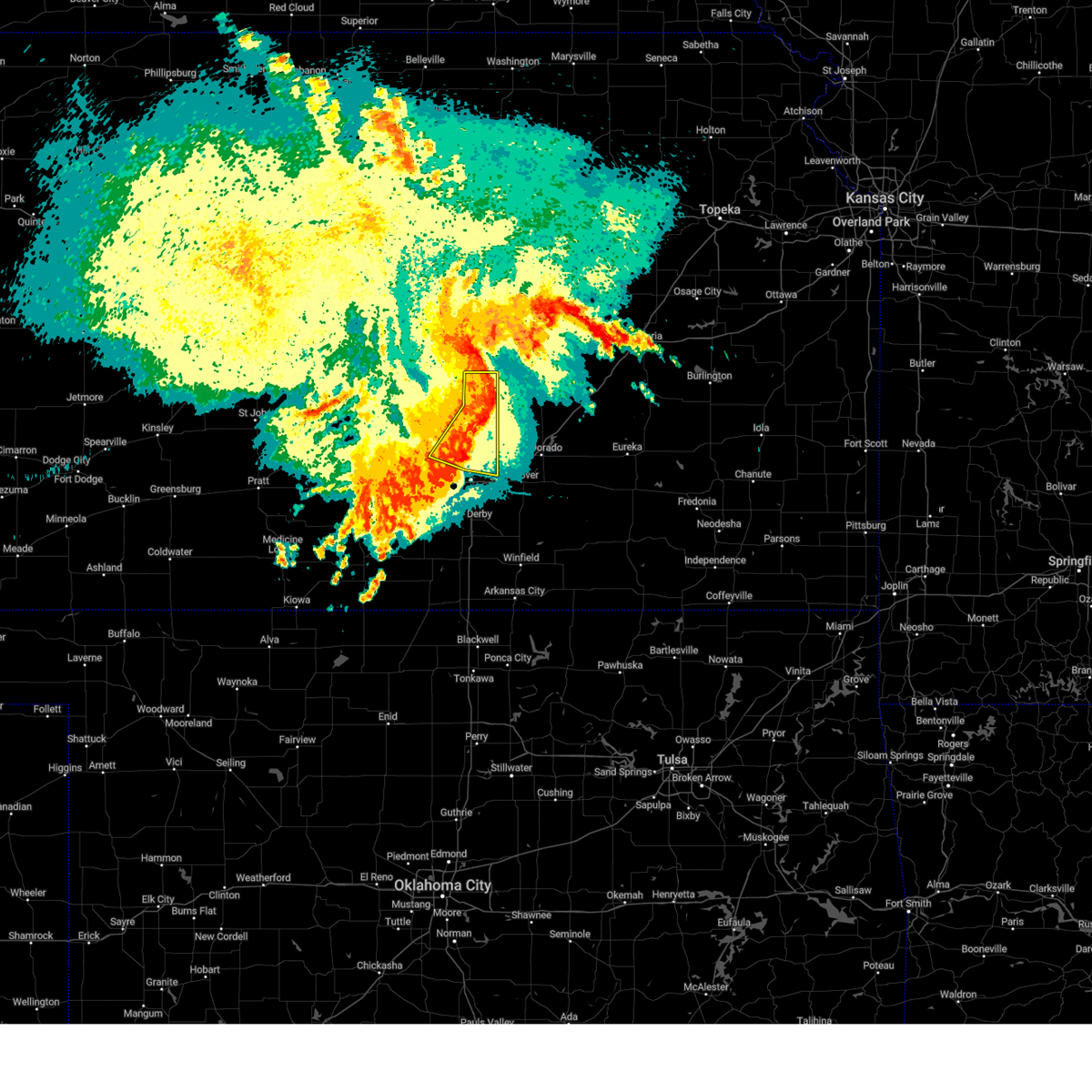 the severe thunderstorm warning has been cancelled and is no longer in effect the severe thunderstorm warning has been cancelled and is no longer in effect
|
| 8/13/2024 4:47 AM CDT | Estimated 55-60 mph wind in harvey county KS, 1.1 miles WSW of Newton, KS |
| 8/13/2024 4:42 AM CDT |
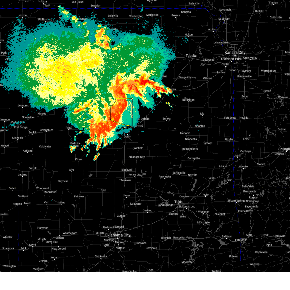 At 441 am cdt, severe thunderstorms were located along a line extending from near goessel to walton to colwich, moving east at 35 mph (radar indicated). Hazards include 60 mph wind gusts. Expect damage to roofs, siding, and trees. Locations impacted include, wichita, newton, park city, valley center, bel aire, hesston, maize, halstead, north newton, moundridge, sedgwick, colwich, burrton, mount hope, whitewater, kechi, goessel, bentley, walton, and northeast wichita. At 441 am cdt, severe thunderstorms were located along a line extending from near goessel to walton to colwich, moving east at 35 mph (radar indicated). Hazards include 60 mph wind gusts. Expect damage to roofs, siding, and trees. Locations impacted include, wichita, newton, park city, valley center, bel aire, hesston, maize, halstead, north newton, moundridge, sedgwick, colwich, burrton, mount hope, whitewater, kechi, goessel, bentley, walton, and northeast wichita.
|
| 8/13/2024 4:42 AM CDT |
 the severe thunderstorm warning has been cancelled and is no longer in effect the severe thunderstorm warning has been cancelled and is no longer in effect
|
| 8/13/2024 4:10 AM CDT |
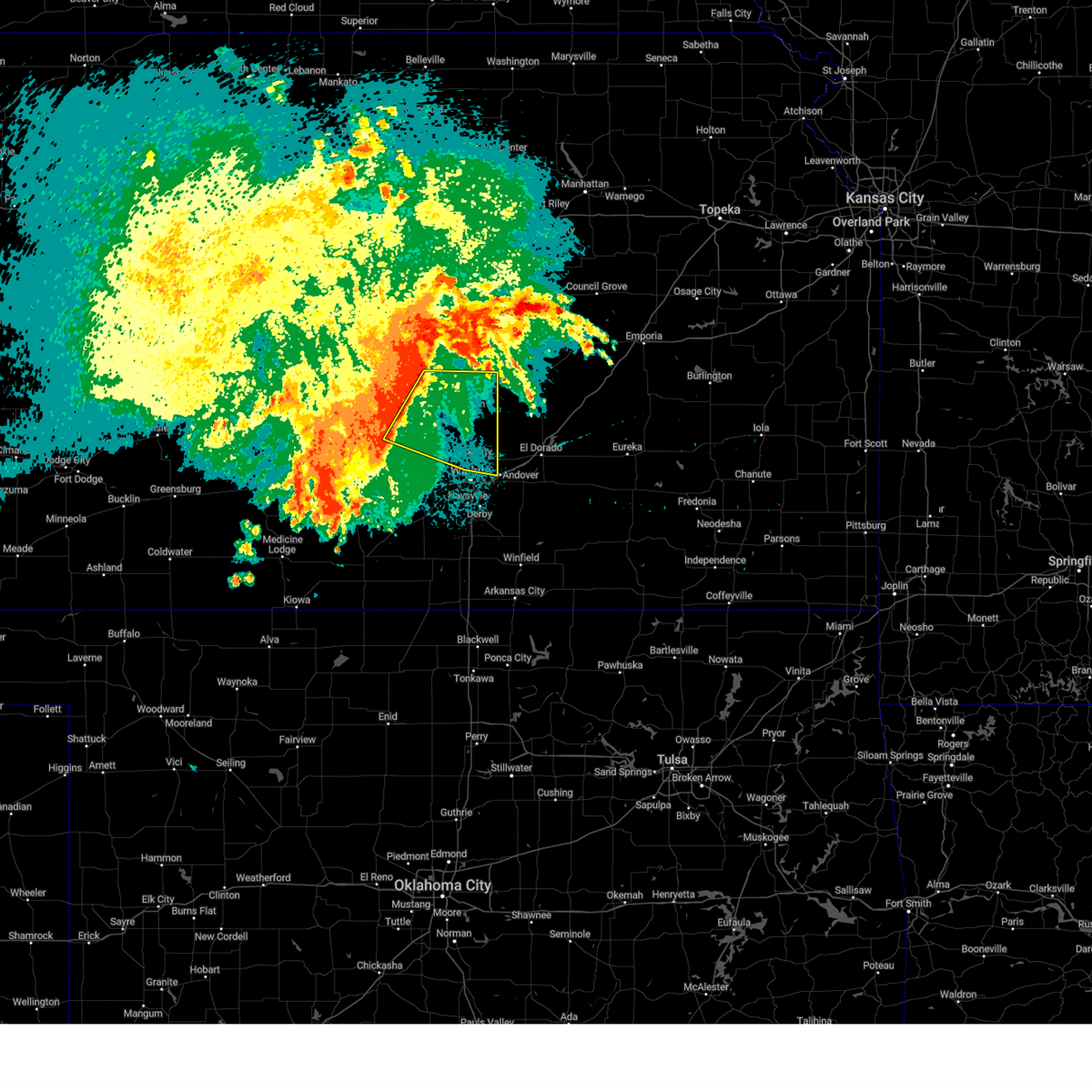 Svrict the national weather service in wichita has issued a * severe thunderstorm warning for, southeastern mcpherson county in central kansas, east central reno county in south central kansas, northern sedgwick county in south central kansas, harvey county in south central kansas, southwestern marion county in central kansas, * until 515 am cdt. * at 410 am cdt, severe thunderstorms were located along a line extending from 6 miles northwest of moundridge to near haven, moving east at 35 mph (radar indicated). Hazards include 60 mph wind gusts. expect damage to roofs, siding, and trees Svrict the national weather service in wichita has issued a * severe thunderstorm warning for, southeastern mcpherson county in central kansas, east central reno county in south central kansas, northern sedgwick county in south central kansas, harvey county in south central kansas, southwestern marion county in central kansas, * until 515 am cdt. * at 410 am cdt, severe thunderstorms were located along a line extending from 6 miles northwest of moundridge to near haven, moving east at 35 mph (radar indicated). Hazards include 60 mph wind gusts. expect damage to roofs, siding, and trees
|
| 7/4/2024 2:07 AM CDT |
 The storms which prompted the warning have moved out of the area. therefore, the warning will be allowed to expire. The storms which prompted the warning have moved out of the area. therefore, the warning will be allowed to expire.
|
| 7/4/2024 1:42 AM CDT | Large tree uproote in harvey county KS, 1.3 miles SSE of Newton, KS |
| 7/4/2024 1:15 AM CDT |
 Svrict the national weather service in wichita has issued a * severe thunderstorm warning for, reno county in south central kansas, harvey county in south central kansas, * until 215 am cdt. * at 115 am cdt, severe thunderstorms were located along a line extending from near galva to 6 miles east of nickerson to near sylvia, moving east at 55 mph (radar indicated). Hazards include 60 mph wind gusts. expect damage to roofs, siding, and trees Svrict the national weather service in wichita has issued a * severe thunderstorm warning for, reno county in south central kansas, harvey county in south central kansas, * until 215 am cdt. * at 115 am cdt, severe thunderstorms were located along a line extending from near galva to 6 miles east of nickerson to near sylvia, moving east at 55 mph (radar indicated). Hazards include 60 mph wind gusts. expect damage to roofs, siding, and trees
|
| 7/2/2024 6:12 PM CDT | 2 inch diameter tree limbs dow in butler county KS, 18 miles W of Newton, KS |
| 7/2/2024 6:01 PM CDT |
 At 601 pm cdt, severe thunderstorms were located along a line extending from near goessel to whitewater, moving northeast at 40 mph (radar indicated). Hazards include 60 mph wind gusts. Expect damage to roofs, siding, and trees. Locations impacted include, newton, hesston, north newton, whitewater, goessel, walton, and newton airport. At 601 pm cdt, severe thunderstorms were located along a line extending from near goessel to whitewater, moving northeast at 40 mph (radar indicated). Hazards include 60 mph wind gusts. Expect damage to roofs, siding, and trees. Locations impacted include, newton, hesston, north newton, whitewater, goessel, walton, and newton airport.
|
| 7/2/2024 5:58 PM CDT | Storm damage reported in harvey county KS, 1.2 miles SSW of Newton, KS |
| 7/2/2024 5:51 PM CDT |
 the severe thunderstorm warning has been cancelled and is no longer in effect the severe thunderstorm warning has been cancelled and is no longer in effect
|
| 7/2/2024 5:51 PM CDT |
 At 551 pm cdt, severe thunderstorms were located along a line extending from hesston to 5 miles southwest of whitewater, moving northeast at 40 mph (radar indicated). Hazards include 60 mph wind gusts. Expect damage to roofs, siding, and trees. Locations impacted include, newton, hesston, halstead, north newton, moundridge, sedgwick, whitewater, goessel, walton, and newton airport. At 551 pm cdt, severe thunderstorms were located along a line extending from hesston to 5 miles southwest of whitewater, moving northeast at 40 mph (radar indicated). Hazards include 60 mph wind gusts. Expect damage to roofs, siding, and trees. Locations impacted include, newton, hesston, halstead, north newton, moundridge, sedgwick, whitewater, goessel, walton, and newton airport.
|
| 7/2/2024 5:47 PM CDT | Storm damage reported in harvey county KS, 4.7 miles WSW of Newton, KS |
| 7/2/2024 5:21 PM CDT |
 Svrict the national weather service in wichita has issued a * severe thunderstorm warning for, southeastern mcpherson county in central kansas, northeastern reno county in south central kansas, harvey county in south central kansas, western marion county in central kansas, * until 615 pm cdt. * at 521 pm cdt, a severe thunderstorm was located over burrton, moving northeast at 40 mph (radar indicated). Hazards include 60 mph wind gusts. expect damage to roofs, siding, and trees Svrict the national weather service in wichita has issued a * severe thunderstorm warning for, southeastern mcpherson county in central kansas, northeastern reno county in south central kansas, harvey county in south central kansas, western marion county in central kansas, * until 615 pm cdt. * at 521 pm cdt, a severe thunderstorm was located over burrton, moving northeast at 40 mph (radar indicated). Hazards include 60 mph wind gusts. expect damage to roofs, siding, and trees
|
| 6/13/2024 8:31 PM CDT |
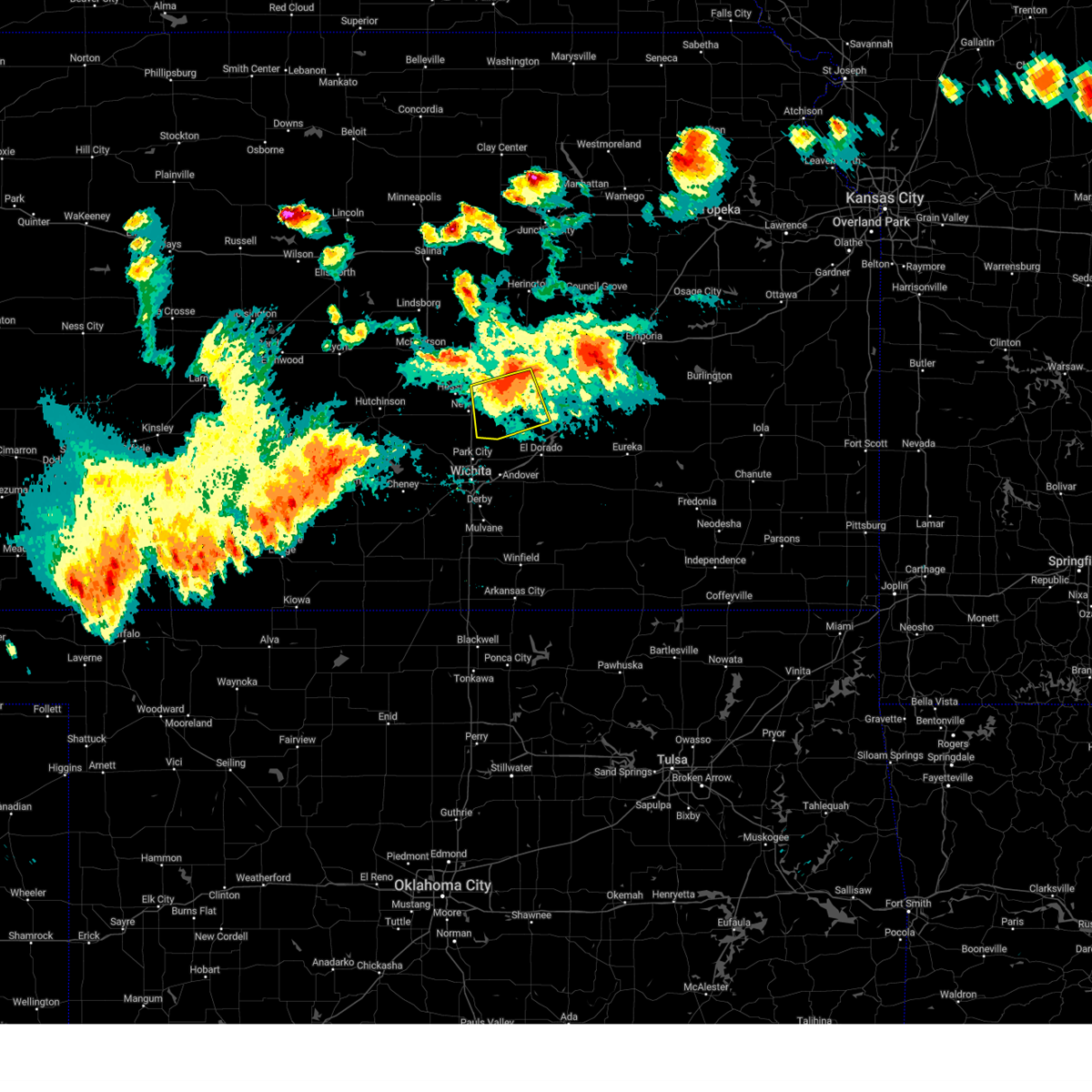 At 829 pm cdt, severe thunderstorms were located along a line extending from 5 miles west of burns to near elbing to 6 miles west of whitewater, moving south at 45 mph (emergency management. at 825 pm cdt, a 60 mph wind gust was reported in peabody). Hazards include 60 mph wind gusts. Expect damage to roofs, siding, and trees. Locations impacted include, peabody, whitewater, florence, potwin, walton, elbing, burns, and newton airport. At 829 pm cdt, severe thunderstorms were located along a line extending from 5 miles west of burns to near elbing to 6 miles west of whitewater, moving south at 45 mph (emergency management. at 825 pm cdt, a 60 mph wind gust was reported in peabody). Hazards include 60 mph wind gusts. Expect damage to roofs, siding, and trees. Locations impacted include, peabody, whitewater, florence, potwin, walton, elbing, burns, and newton airport.
|
| 6/13/2024 8:10 PM CDT |
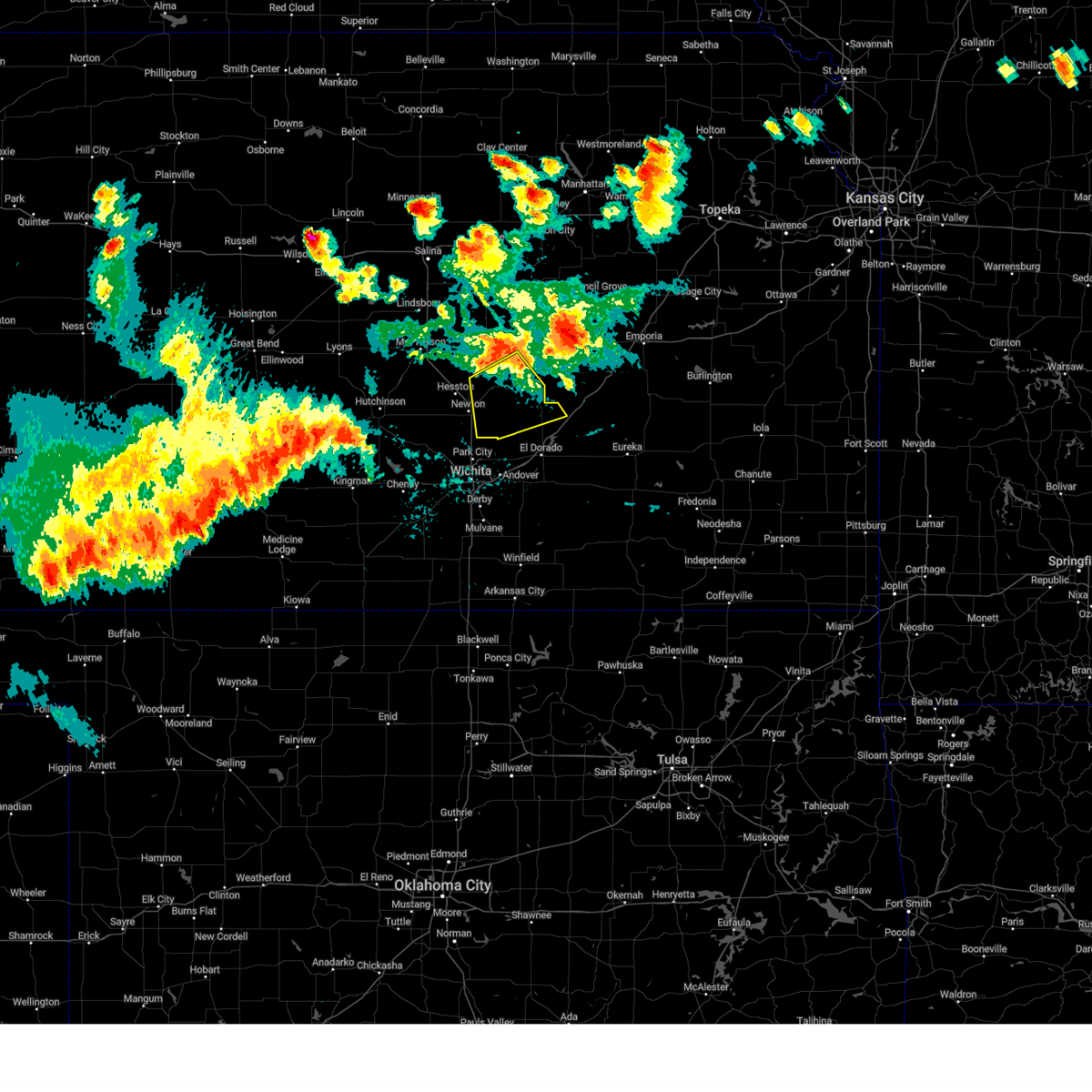 Svrict the national weather service in wichita has issued a * severe thunderstorm warning for, eastern harvey county in south central kansas, northwestern butler county in south central kansas, southern marion county in central kansas, * until 915 pm cdt. * at 810 pm cdt, severe thunderstorms were located along a line extending from 6 miles southwest of marion to walton, moving south at 45 mph (radar indicated). Hazards include 60 mph wind gusts. expect damage to roofs, siding, and trees Svrict the national weather service in wichita has issued a * severe thunderstorm warning for, eastern harvey county in south central kansas, northwestern butler county in south central kansas, southern marion county in central kansas, * until 915 pm cdt. * at 810 pm cdt, severe thunderstorms were located along a line extending from 6 miles southwest of marion to walton, moving south at 45 mph (radar indicated). Hazards include 60 mph wind gusts. expect damage to roofs, siding, and trees
|
| 6/9/2024 3:13 AM CDT |
 the severe thunderstorm warning has been cancelled and is no longer in effect the severe thunderstorm warning has been cancelled and is no longer in effect
|
| 6/9/2024 3:13 AM CDT |
 At 312 am cdt, severe thunderstorms were located along a line extending from near elbing to augusta to 6 miles west of atlanta, moving east at 40 mph (radar indicated). Hazards include 70 mph wind gusts and penny size hail. Expect considerable tree damage. damage is likely to mobile homes, roofs, and outbuildings. Locations impacted include, newton, el dorado, andover, augusta, north newton, douglass, towanda, peabody, benton, whitewater, leon, burden, potwin, walton, elbing, burns, atlanta, latham, rosalia, and rock. At 312 am cdt, severe thunderstorms were located along a line extending from near elbing to augusta to 6 miles west of atlanta, moving east at 40 mph (radar indicated). Hazards include 70 mph wind gusts and penny size hail. Expect considerable tree damage. damage is likely to mobile homes, roofs, and outbuildings. Locations impacted include, newton, el dorado, andover, augusta, north newton, douglass, towanda, peabody, benton, whitewater, leon, burden, potwin, walton, elbing, burns, atlanta, latham, rosalia, and rock.
|
| 6/9/2024 2:47 AM CDT |
 Svrict the national weather service in wichita has issued a * severe thunderstorm warning for, northern cowley county in south central kansas, eastern sedgwick county in south central kansas, harvey county in south central kansas, southwestern chase county in east central kansas, butler county in south central kansas, southern marion county in central kansas, northeastern sumner county in south central kansas, * until 345 am cdt. * at 247 am cdt, severe thunderstorms were located along a line extending from halstead to south wichita to near udall, moving east at 50 mph (radar indicated). Hazards include 70 mph wind gusts and penny size hail. Expect considerable tree damage. Damage is likely to mobile homes, roofs, and outbuildings. Svrict the national weather service in wichita has issued a * severe thunderstorm warning for, northern cowley county in south central kansas, eastern sedgwick county in south central kansas, harvey county in south central kansas, southwestern chase county in east central kansas, butler county in south central kansas, southern marion county in central kansas, northeastern sumner county in south central kansas, * until 345 am cdt. * at 247 am cdt, severe thunderstorms were located along a line extending from halstead to south wichita to near udall, moving east at 50 mph (radar indicated). Hazards include 70 mph wind gusts and penny size hail. Expect considerable tree damage. Damage is likely to mobile homes, roofs, and outbuildings.
|
| 6/7/2024 11:14 PM CDT |
 the severe thunderstorm warning has been cancelled and is no longer in effect the severe thunderstorm warning has been cancelled and is no longer in effect
|
| 6/7/2024 11:14 PM CDT |
 At 1114 pm cdt, a severe thunderstorm was located near halstead, moving southeast at 50 mph (trained weather spotters). Hazards include 60 mph wind gusts. Expect damage to roofs, siding, and trees. Locations impacted include, newton, mcpherson, hesston, halstead, north newton, moundridge, sedgwick, inman, burrton, galva, canton, walton, windom, newton airport, and mcpherson airport. At 1114 pm cdt, a severe thunderstorm was located near halstead, moving southeast at 50 mph (trained weather spotters). Hazards include 60 mph wind gusts. Expect damage to roofs, siding, and trees. Locations impacted include, newton, mcpherson, hesston, halstead, north newton, moundridge, sedgwick, inman, burrton, galva, canton, walton, windom, newton airport, and mcpherson airport.
|
| 6/7/2024 10:52 PM CDT |
 Svrict the national weather service in wichita has issued a * severe thunderstorm warning for, southern mcpherson county in central kansas, northeastern reno county in south central kansas, harvey county in south central kansas, central rice county in central kansas, * until 1145 pm cdt. * at 1051 pm cdt, a severe thunderstorm outflow boundary was located over inman, moving southeast at 50 mph (trained weather spotters). Hazards include 60 mph wind gusts. expect damage to roofs, siding, and trees Svrict the national weather service in wichita has issued a * severe thunderstorm warning for, southern mcpherson county in central kansas, northeastern reno county in south central kansas, harvey county in south central kansas, central rice county in central kansas, * until 1145 pm cdt. * at 1051 pm cdt, a severe thunderstorm outflow boundary was located over inman, moving southeast at 50 mph (trained weather spotters). Hazards include 60 mph wind gusts. expect damage to roofs, siding, and trees
|
| 6/4/2024 7:39 PM CDT |
 At 738 pm cdt, a severe thunderstorm was located near kechi, or near bel aire, moving east at 25 mph (asos observation). Hazards include ping pong ball size hail and 60 mph wind gusts. People and animals outdoors will be injured. expect hail damage to roofs, siding, windows, and vehicles. expect wind damage to roofs, siding, and trees. Locations impacted include, wichita, derby, andover, haysville, park city, valley center, bel aire, goddard, maize, sedgwick, colwich, whitewater, downtown wichita, kechi, eastborough, bentley, west wichita, east wichita, northeast wichita, and eisenhower national airport. At 738 pm cdt, a severe thunderstorm was located near kechi, or near bel aire, moving east at 25 mph (asos observation). Hazards include ping pong ball size hail and 60 mph wind gusts. People and animals outdoors will be injured. expect hail damage to roofs, siding, windows, and vehicles. expect wind damage to roofs, siding, and trees. Locations impacted include, wichita, derby, andover, haysville, park city, valley center, bel aire, goddard, maize, sedgwick, colwich, whitewater, downtown wichita, kechi, eastborough, bentley, west wichita, east wichita, northeast wichita, and eisenhower national airport.
|
| 6/4/2024 7:24 PM CDT |
 At 724 pm cdt, a severe thunderstorm was located over maize, moving east at 20 mph (radar indicated). Hazards include ping pong ball size hail and 60 mph wind gusts. People and animals outdoors will be injured. expect hail damage to roofs, siding, windows, and vehicles. expect wind damage to roofs, siding, and trees. Locations impacted include, wichita, derby, newton, andover, haysville, park city, valley center, bel aire, goddard, maize, cheney, halstead, north newton, sedgwick, colwich, burrton, garden plain, mount hope, whitewater, and downtown wichita. At 724 pm cdt, a severe thunderstorm was located over maize, moving east at 20 mph (radar indicated). Hazards include ping pong ball size hail and 60 mph wind gusts. People and animals outdoors will be injured. expect hail damage to roofs, siding, windows, and vehicles. expect wind damage to roofs, siding, and trees. Locations impacted include, wichita, derby, newton, andover, haysville, park city, valley center, bel aire, goddard, maize, cheney, halstead, north newton, sedgwick, colwich, burrton, garden plain, mount hope, whitewater, and downtown wichita.
|
| 6/4/2024 7:15 PM CDT |
 Svrict the national weather service in wichita has issued a * severe thunderstorm warning for, sedgwick county in south central kansas, harvey county in south central kansas, * until 815 pm cdt. * at 714 pm cdt, severe thunderstorms were located along a line extending from 5 miles northeast of kechi to near mount hope, moving east at 20 mph (radar indicated). Hazards include 60 mph wind gusts and quarter size hail. Hail damage to vehicles is expected. Expect wind damage to roofs, siding, and trees. Svrict the national weather service in wichita has issued a * severe thunderstorm warning for, sedgwick county in south central kansas, harvey county in south central kansas, * until 815 pm cdt. * at 714 pm cdt, severe thunderstorms were located along a line extending from 5 miles northeast of kechi to near mount hope, moving east at 20 mph (radar indicated). Hazards include 60 mph wind gusts and quarter size hail. Hail damage to vehicles is expected. Expect wind damage to roofs, siding, and trees.
|
| 5/25/2024 8:57 PM CDT | Storm damage reported in harvey county KS, 4.7 miles WSW of Newton, KS |
| 5/25/2024 8:56 PM CDT |
 At 856 pm cdt, a severe thunderstorm was located near whitewater, moving northeast at 40 mph (radar indicated). Hazards include 70 mph wind gusts and penny size hail. Expect considerable tree damage. damage is likely to mobile homes, roofs, and outbuildings. Locations impacted include, newton, andover, park city, valley center, halstead, north newton, sedgwick, benton, whitewater, bentley, elbing, newton airport, and santa fe lake. At 856 pm cdt, a severe thunderstorm was located near whitewater, moving northeast at 40 mph (radar indicated). Hazards include 70 mph wind gusts and penny size hail. Expect considerable tree damage. damage is likely to mobile homes, roofs, and outbuildings. Locations impacted include, newton, andover, park city, valley center, halstead, north newton, sedgwick, benton, whitewater, bentley, elbing, newton airport, and santa fe lake.
|
| 5/25/2024 8:54 PM CDT | Storm damage reported in harvey county KS, 4.7 miles WSW of Newton, KS |
| 5/25/2024 8:53 PM CDT | Power lines down reporte in harvey county KS, 1.1 miles WSW of Newton, KS |
| 5/25/2024 8:39 PM CDT |
 At 839 pm cdt, a severe thunderstorm was located over valley center, moving north-northeast at 35 mph (radar indicated). Hazards include 70 mph wind gusts and nickel size hail. Expect considerable tree damage. damage is likely to mobile homes, roofs, and outbuildings. Locations impacted include, newton, andover, park city, valley center, halstead, north newton, sedgwick, benton, whitewater, bentley, elbing, newton airport, and santa fe lake. At 839 pm cdt, a severe thunderstorm was located over valley center, moving north-northeast at 35 mph (radar indicated). Hazards include 70 mph wind gusts and nickel size hail. Expect considerable tree damage. damage is likely to mobile homes, roofs, and outbuildings. Locations impacted include, newton, andover, park city, valley center, halstead, north newton, sedgwick, benton, whitewater, bentley, elbing, newton airport, and santa fe lake.
|
| 5/25/2024 8:26 PM CDT |
 Svrict the national weather service in wichita has issued a * severe thunderstorm warning for, northeastern sedgwick county in south central kansas, southeastern harvey county in south central kansas, northwestern butler county in south central kansas, * until 930 pm cdt. * at 825 pm cdt, a severe thunderstorm was located near west wichita, moving north-northeast at 35 mph (radar indicated). Hazards include 70 mph wind gusts and nickel size hail. Expect considerable tree damage. Damage is likely to mobile homes, roofs, and outbuildings. Svrict the national weather service in wichita has issued a * severe thunderstorm warning for, northeastern sedgwick county in south central kansas, southeastern harvey county in south central kansas, northwestern butler county in south central kansas, * until 930 pm cdt. * at 825 pm cdt, a severe thunderstorm was located near west wichita, moving north-northeast at 35 mph (radar indicated). Hazards include 70 mph wind gusts and nickel size hail. Expect considerable tree damage. Damage is likely to mobile homes, roofs, and outbuildings.
|
| 5/19/2024 10:18 PM CDT | Quarter sized hail reported 3.4 miles SSW of Newton, KS, time estimated by radar. |
| 5/19/2024 8:24 PM CDT |
 The storms which prompted the warning have moved out of the area. therefore, the warning will be allowed to expire. however, gusty winds and heavy rain are still possible with these thunderstorms. a severe thunderstorm watch remains in effect until 1000 pm cdt for south central kansas. The storms which prompted the warning have moved out of the area. therefore, the warning will be allowed to expire. however, gusty winds and heavy rain are still possible with these thunderstorms. a severe thunderstorm watch remains in effect until 1000 pm cdt for south central kansas.
|
| 5/19/2024 8:12 PM CDT |
 the tornado warning has been cancelled and is no longer in effect the tornado warning has been cancelled and is no longer in effect
|
| 5/19/2024 8:08 PM CDT | Extensive tree damage in and around newton... many roads blocked. courtesy of accuweathe in harvey county KS, 1.1 miles WSW of Newton, KS |
| 5/19/2024 8:02 PM CDT | Newton airpor in harvey county KS, 4.7 miles WSW of Newton, KS |
| 5/19/2024 7:47 PM CDT |
 At 747 pm cdt, severe thunderstorms were located along a line extending from 6 miles north of burrton to near andale to near cheney, moving east at 70 mph (radar indicated). Hazards include 90 mph wind gusts and half dollar size hail. You are in a life-threatening situation. flying debris may be deadly to those caught without shelter. mobile homes will be heavily damaged or destroyed. homes and businesses will have substantial roof and window damage. expect extensive tree damage and power outages. Locations impacted include, wichita, derby, newton, haysville, park city, valley center, bel aire, mulvane, goddard, hesston, maize, clearwater, cheney, halstead, north newton, sedgwick, colwich, burrton, garden plain, and mount hope. At 747 pm cdt, severe thunderstorms were located along a line extending from 6 miles north of burrton to near andale to near cheney, moving east at 70 mph (radar indicated). Hazards include 90 mph wind gusts and half dollar size hail. You are in a life-threatening situation. flying debris may be deadly to those caught without shelter. mobile homes will be heavily damaged or destroyed. homes and businesses will have substantial roof and window damage. expect extensive tree damage and power outages. Locations impacted include, wichita, derby, newton, haysville, park city, valley center, bel aire, mulvane, goddard, hesston, maize, clearwater, cheney, halstead, north newton, sedgwick, colwich, burrton, garden plain, and mount hope.
|
| 5/19/2024 7:44 PM CDT |
 Torict the national weather service in wichita has issued a * tornado warning for, harvey county in south central kansas, * until 830 pm cdt. * at 744 pm cdt, a severe thunderstorm capable of producing a tornado was located near halstead, moving northeast at 70 mph (radar indicated rotation). Hazards include tornado and half dollar size hail. Flying debris will be dangerous to those caught without shelter. mobile homes will be damaged or destroyed. damage to roofs, windows, and vehicles will occur. tree damage is likely. this dangerous storm will be near, newton, halstead, and north newton around 750 pm cdt. walton around 800 pm cdt. other locations impacted by this tornadic thunderstorm include newton airport. This includes interstate 135 between mile markers 24 and 37. Torict the national weather service in wichita has issued a * tornado warning for, harvey county in south central kansas, * until 830 pm cdt. * at 744 pm cdt, a severe thunderstorm capable of producing a tornado was located near halstead, moving northeast at 70 mph (radar indicated rotation). Hazards include tornado and half dollar size hail. Flying debris will be dangerous to those caught without shelter. mobile homes will be damaged or destroyed. damage to roofs, windows, and vehicles will occur. tree damage is likely. this dangerous storm will be near, newton, halstead, and north newton around 750 pm cdt. walton around 800 pm cdt. other locations impacted by this tornadic thunderstorm include newton airport. This includes interstate 135 between mile markers 24 and 37.
|
| 5/19/2024 7:33 PM CDT |
 Svrict the national weather service in wichita has issued a * severe thunderstorm warning for, sedgwick county in south central kansas, harvey county in south central kansas, * until 830 pm cdt. * at 732 pm cdt, severe thunderstorms were located along a line extending from near hutchinson to near pretty prairie to 6 miles southwest of kingman, moving east at 55 mph (radar indicated). Hazards include 80 mph wind gusts and half dollar size hail. Flying debris will be dangerous to those caught without shelter. mobile homes will be heavily damaged. expect considerable damage to roofs, windows, and vehicles. Extensive tree damage and power outages are likely. Svrict the national weather service in wichita has issued a * severe thunderstorm warning for, sedgwick county in south central kansas, harvey county in south central kansas, * until 830 pm cdt. * at 732 pm cdt, severe thunderstorms were located along a line extending from near hutchinson to near pretty prairie to 6 miles southwest of kingman, moving east at 55 mph (radar indicated). Hazards include 80 mph wind gusts and half dollar size hail. Flying debris will be dangerous to those caught without shelter. mobile homes will be heavily damaged. expect considerable damage to roofs, windows, and vehicles. Extensive tree damage and power outages are likely.
|
| 4/30/2024 5:57 PM CDT |
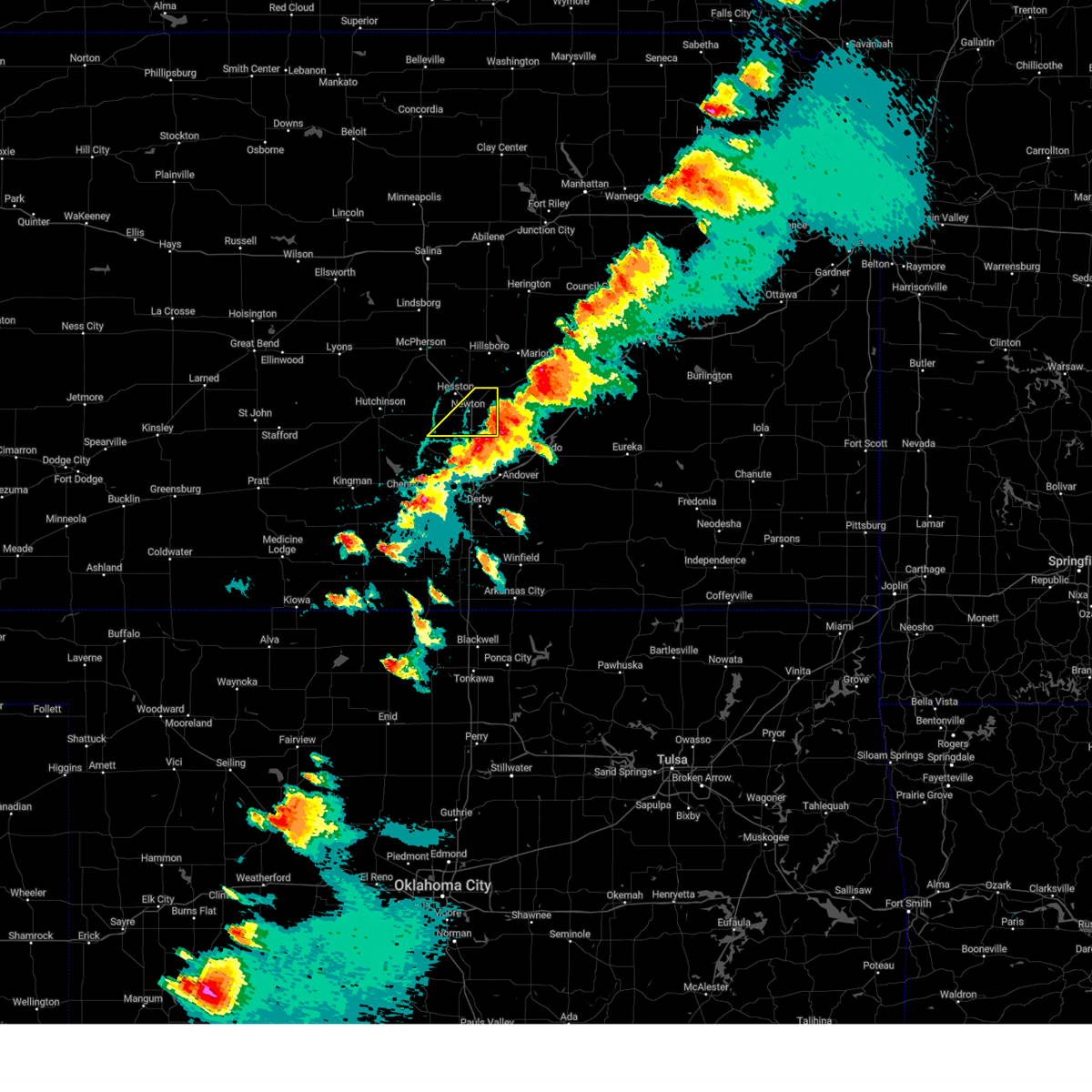 The storms which prompted the warning have moved out of the area. therefore, the warning will be allowed to expire. a tornado watch remains in effect until 1100 pm cdt for south central and central kansas. a severe thunderstorm warning remains in effect for extreme southeast harvey county. The storms which prompted the warning have moved out of the area. therefore, the warning will be allowed to expire. a tornado watch remains in effect until 1100 pm cdt for south central and central kansas. a severe thunderstorm warning remains in effect for extreme southeast harvey county.
|
| 4/30/2024 5:49 PM CDT |
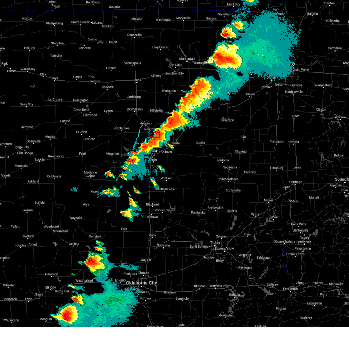 the tornado warning has been cancelled and is no longer in effect the tornado warning has been cancelled and is no longer in effect
|
| 4/30/2024 5:43 PM CDT |
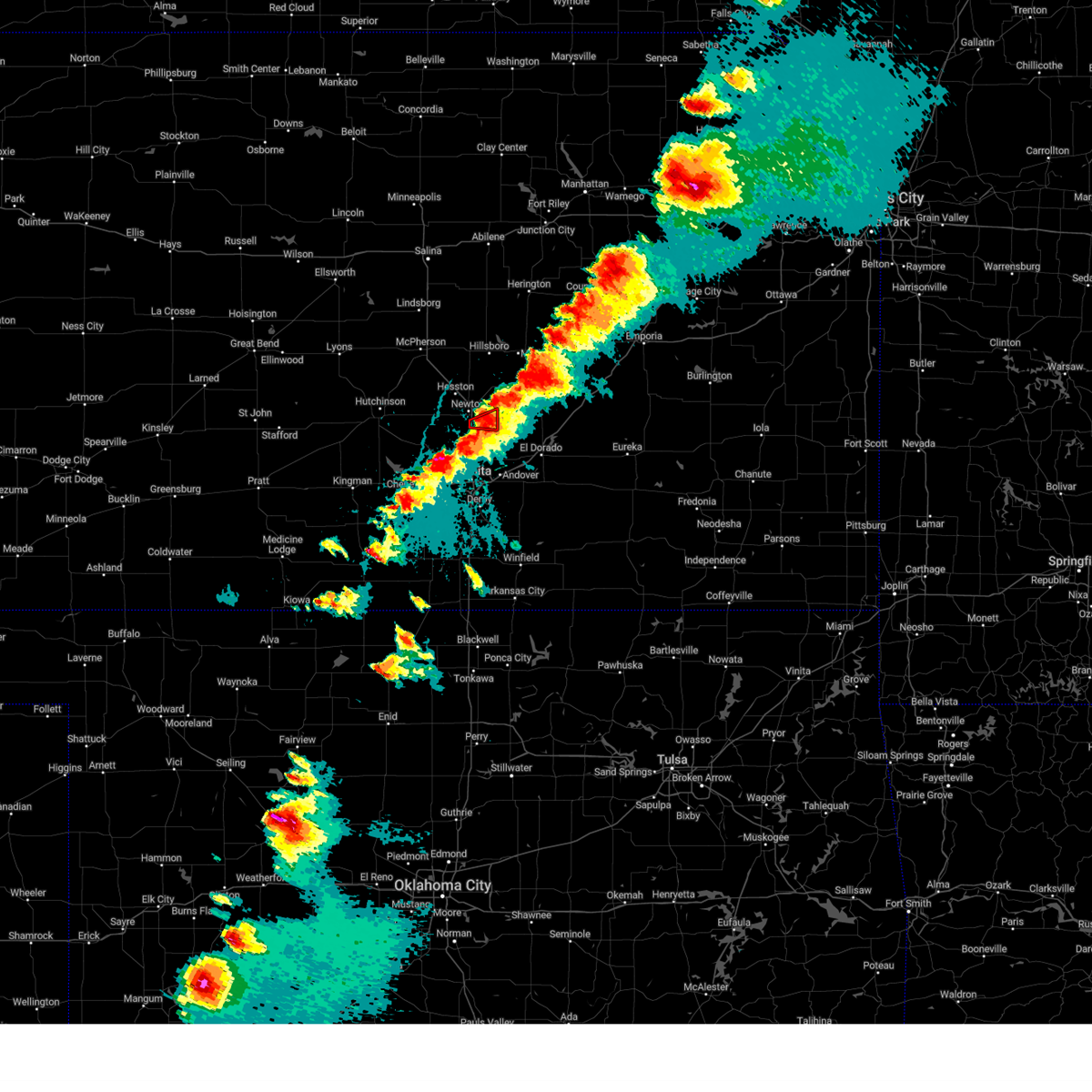 At 542 pm cdt, a severe thunderstorm capable of producing a tornado was located southeast of newton, moving east at 25 mph (radar indicated rotation). Hazards include tornado and golf ball size hail. Flying debris will be dangerous to those caught without shelter. mobile homes will be damaged or destroyed. damage to roofs, windows, and vehicles will occur. tree damage is likely. This tornadic thunderstorm will remain over mainly rural areas of southeastern harvey county. At 542 pm cdt, a severe thunderstorm capable of producing a tornado was located southeast of newton, moving east at 25 mph (radar indicated rotation). Hazards include tornado and golf ball size hail. Flying debris will be dangerous to those caught without shelter. mobile homes will be damaged or destroyed. damage to roofs, windows, and vehicles will occur. tree damage is likely. This tornadic thunderstorm will remain over mainly rural areas of southeastern harvey county.
|
| 4/30/2024 5:36 PM CDT |
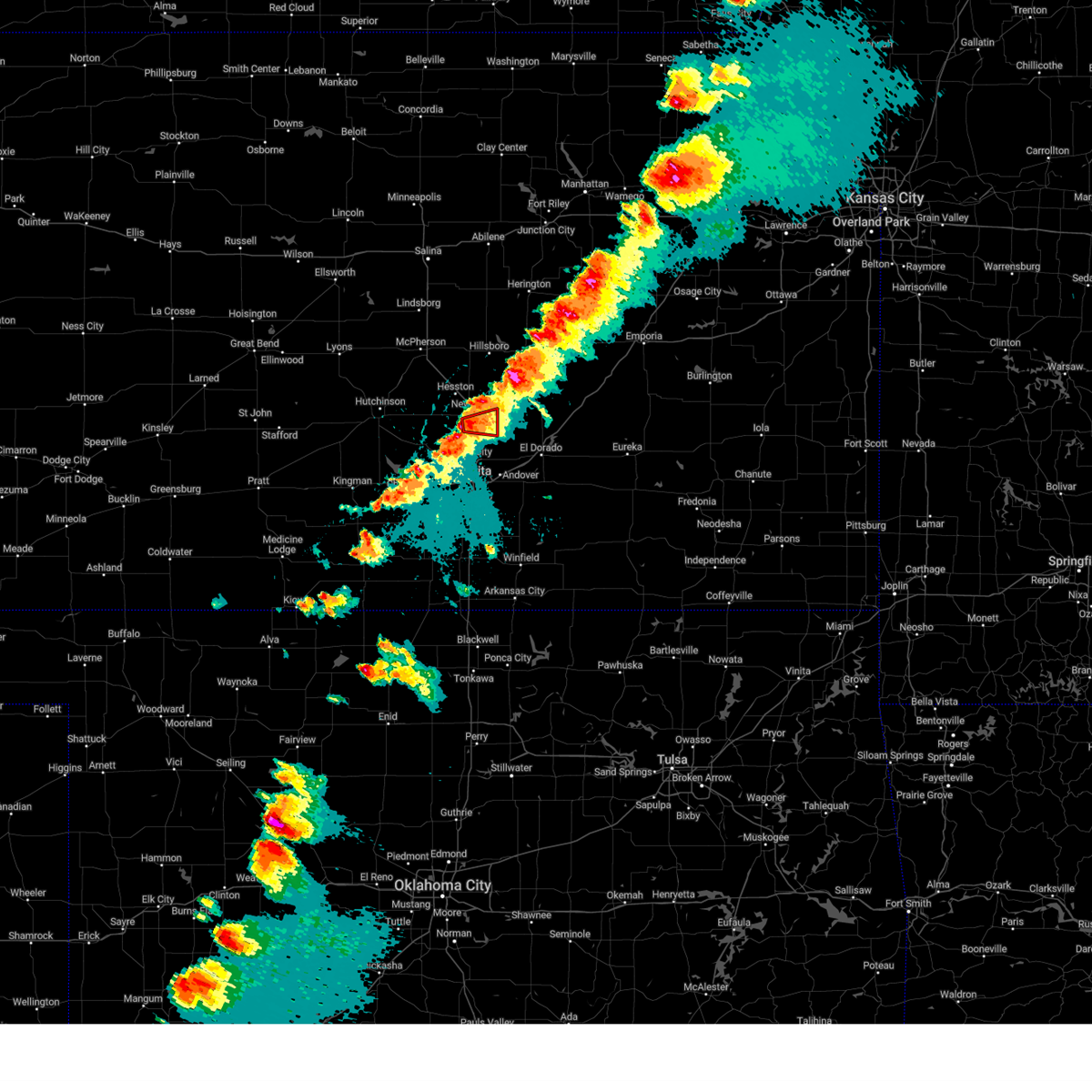 Torict the national weather service in wichita has issued a * tornado warning for, southeastern harvey county in south central kansas, * until 600 pm cdt. * at 536 pm cdt, a severe thunderstorm capable of producing a tornado was located near newton, moving east at 25 mph (radar indicated rotation). Hazards include tornado and golf ball size hail. Flying debris will be dangerous to those caught without shelter. mobile homes will be damaged or destroyed. damage to roofs, windows, and vehicles will occur. tree damage is likely. this dangerous storm will be near, newton around 540 pm cdt. whitewater around 555 pm cdt. This includes interstate 135 between mile markers 24 and 29. Torict the national weather service in wichita has issued a * tornado warning for, southeastern harvey county in south central kansas, * until 600 pm cdt. * at 536 pm cdt, a severe thunderstorm capable of producing a tornado was located near newton, moving east at 25 mph (radar indicated rotation). Hazards include tornado and golf ball size hail. Flying debris will be dangerous to those caught without shelter. mobile homes will be damaged or destroyed. damage to roofs, windows, and vehicles will occur. tree damage is likely. this dangerous storm will be near, newton around 540 pm cdt. whitewater around 555 pm cdt. This includes interstate 135 between mile markers 24 and 29.
|
| 4/30/2024 5:35 PM CDT |
 At 534 pm cdt, severe thunderstorms were located along a line extending from near walton to near sedgwick, moving east at 20 mph (radar indicated). Hazards include golf ball size hail and 70 mph wind gusts. People and animals outdoors will be injured. expect hail damage to roofs, siding, windows, and vehicles. expect considerable tree damage. wind damage is also likely to mobile homes, roofs, and outbuildings. Locations impacted include, newton, halstead, north newton, sedgwick, whitewater, walton, and newton airport. At 534 pm cdt, severe thunderstorms were located along a line extending from near walton to near sedgwick, moving east at 20 mph (radar indicated). Hazards include golf ball size hail and 70 mph wind gusts. People and animals outdoors will be injured. expect hail damage to roofs, siding, windows, and vehicles. expect considerable tree damage. wind damage is also likely to mobile homes, roofs, and outbuildings. Locations impacted include, newton, halstead, north newton, sedgwick, whitewater, walton, and newton airport.
|
| 4/30/2024 5:34 PM CDT | Golf Ball sized hail reported 1.4 miles NW of Newton, KS |
| 4/30/2024 5:34 PM CDT | Quarter sized hail reported 3.9 miles E of Newton, KS, picture received via facebook. |
| 4/30/2024 5:15 PM CDT |
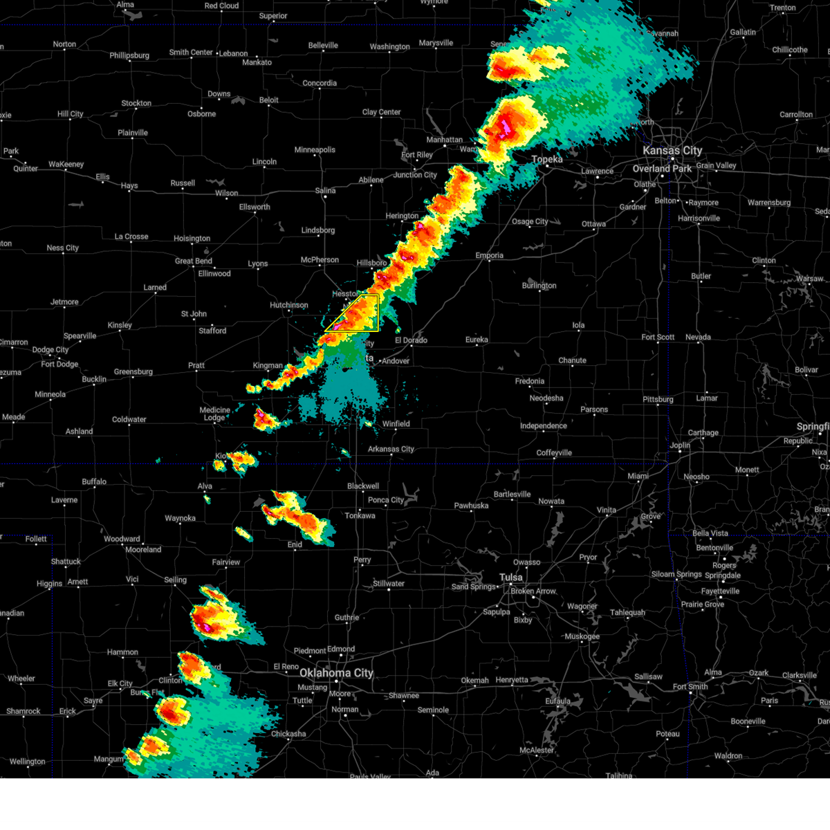 Svrict the national weather service in wichita has issued a * severe thunderstorm warning for, eastern harvey county in south central kansas, * until 600 pm cdt. * at 515 pm cdt, severe thunderstorms were located along a line extending from near walton to near bentley, moving east at 25 mph (radar indicated). Hazards include 60 mph wind gusts and half dollar size hail. Hail damage to vehicles is expected. Expect wind damage to roofs, siding, and trees. Svrict the national weather service in wichita has issued a * severe thunderstorm warning for, eastern harvey county in south central kansas, * until 600 pm cdt. * at 515 pm cdt, severe thunderstorms were located along a line extending from near walton to near bentley, moving east at 25 mph (radar indicated). Hazards include 60 mph wind gusts and half dollar size hail. Hail damage to vehicles is expected. Expect wind damage to roofs, siding, and trees.
|
| 4/30/2024 4:56 PM CDT |
 At 455 pm cdt, a severe thunderstorm was located near hesston, moving northeast at 30 mph. another severe storm was located west of halstead (radar indicated). Hazards include 60 mph wind gusts and half dollar size hail. Hail damage to vehicles is expected. expect wind damage to roofs, siding, and trees. Locations impacted include, newton, hesston, halstead, north newton, sedgwick, burrton, whitewater, walton, and newton airport. At 455 pm cdt, a severe thunderstorm was located near hesston, moving northeast at 30 mph. another severe storm was located west of halstead (radar indicated). Hazards include 60 mph wind gusts and half dollar size hail. Hail damage to vehicles is expected. expect wind damage to roofs, siding, and trees. Locations impacted include, newton, hesston, halstead, north newton, sedgwick, burrton, whitewater, walton, and newton airport.
|
| 4/30/2024 4:38 PM CDT |
 At 437 pm cdt, a severe thunderstorm was located near halstead, moving northeast at 40 mph (radar indicated). Hazards include 60 mph wind gusts and half dollar size hail. Hail damage to vehicles is expected. expect wind damage to roofs, siding, and trees. Locations impacted include, newton, hesston, halstead, north newton, sedgwick, burrton, whitewater, walton, and newton airport. At 437 pm cdt, a severe thunderstorm was located near halstead, moving northeast at 40 mph (radar indicated). Hazards include 60 mph wind gusts and half dollar size hail. Hail damage to vehicles is expected. expect wind damage to roofs, siding, and trees. Locations impacted include, newton, hesston, halstead, north newton, sedgwick, burrton, whitewater, walton, and newton airport.
|
| 4/30/2024 4:34 PM CDT |
 Svrict the national weather service in wichita has issued a * severe thunderstorm warning for, harvey county in south central kansas, * until 515 pm cdt. * at 434 pm cdt, a severe thunderstorm was located near burrton, moving northeast at 40 mph (radar indicated). Hazards include 60 mph wind gusts and half dollar size hail. Hail damage to vehicles is expected. Expect wind damage to roofs, siding, and trees. Svrict the national weather service in wichita has issued a * severe thunderstorm warning for, harvey county in south central kansas, * until 515 pm cdt. * at 434 pm cdt, a severe thunderstorm was located near burrton, moving northeast at 40 mph (radar indicated). Hazards include 60 mph wind gusts and half dollar size hail. Hail damage to vehicles is expected. Expect wind damage to roofs, siding, and trees.
|
| 4/6/2024 6:23 PM CDT |
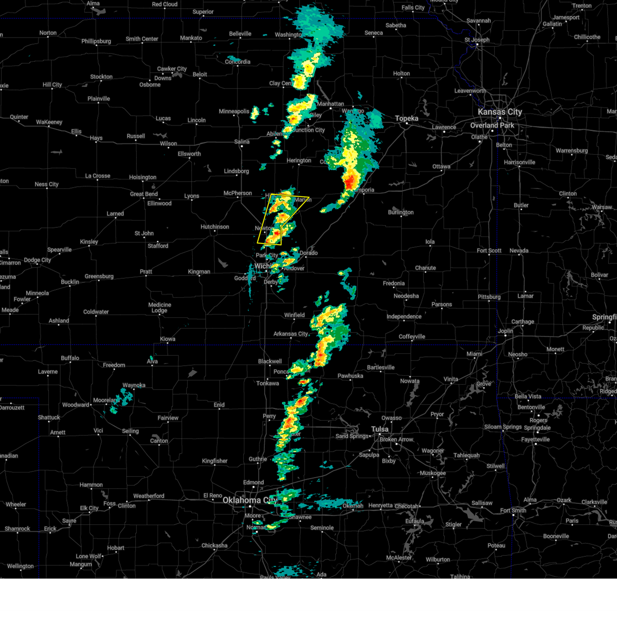 Svrict the national weather service in wichita has issued a * severe thunderstorm warning for, eastern harvey county in south central kansas, southern marion county in central kansas, * until 715 pm cdt. * at 623 pm cdt, a severe thunderstorm was located near newton, moving northeast at 45 mph (radar indicated). Hazards include 60 mph wind gusts. expect damage to roofs, siding, and trees Svrict the national weather service in wichita has issued a * severe thunderstorm warning for, eastern harvey county in south central kansas, southern marion county in central kansas, * until 715 pm cdt. * at 623 pm cdt, a severe thunderstorm was located near newton, moving northeast at 45 mph (radar indicated). Hazards include 60 mph wind gusts. expect damage to roofs, siding, and trees
|
| 8/6/2023 12:03 AM CDT |
 At 1202 am cdt, severe thunderstorms were located along a line extending from 5 miles north of florence to towanda to clearwater, moving east-southeast at 55 mph (radar indicated). Hazards include 70 mph wind gusts and nickel size hail. Expect considerable tree damage. damage is likely to mobile homes, roofs, and outbuildings. locations impacted include, wichita, derby, newton, andover, haysville, augusta, park city, valley center, bel aire, mulvane, goddard, rose hill, hesston, maize, hillsboro, clearwater, cheney, marion, north newton and sedgwick. thunderstorm damage threat, considerable hail threat, radar indicated max hail size, 0. 88 in wind threat, radar indicated max wind gust, 70 mph. At 1202 am cdt, severe thunderstorms were located along a line extending from 5 miles north of florence to towanda to clearwater, moving east-southeast at 55 mph (radar indicated). Hazards include 70 mph wind gusts and nickel size hail. Expect considerable tree damage. damage is likely to mobile homes, roofs, and outbuildings. locations impacted include, wichita, derby, newton, andover, haysville, augusta, park city, valley center, bel aire, mulvane, goddard, rose hill, hesston, maize, hillsboro, clearwater, cheney, marion, north newton and sedgwick. thunderstorm damage threat, considerable hail threat, radar indicated max hail size, 0. 88 in wind threat, radar indicated max wind gust, 70 mph.
|
| 8/5/2023 11:51 PM CDT | Northbound lane of i-135 blocked due to vehicle accident in vicinity of highway 50 exit... vicinity of rest are in harvey county KS, 3.3 miles SW of Newton, KS |
| 8/5/2023 11:47 PM CDT |
 At 1146 pm cdt, severe thunderstorms were located along a line extending from near hillsboro to near bel aire to near cheney, moving east-southeast at 60 mph. these are destructive storms with winds of 70 to 80 mph (radar indicated). Hazards include 80 mph wind gusts and nickel size hail. Flying debris will be dangerous to those caught without shelter. mobile homes will be heavily damaged. expect considerable damage to roofs, windows, and vehicles. extensive tree damage and power outages are likely. locations impacted include, wichita, derby, newton, andover, haysville, augusta, park city, valley center, bel aire, mulvane, goddard, rose hill, hesston, maize, kingman, hillsboro, clearwater, cheney, marion and north newton. thunderstorm damage threat, destructive hail threat, radar indicated max hail size, 0. 88 in wind threat, radar indicated max wind gust, 80 mph. At 1146 pm cdt, severe thunderstorms were located along a line extending from near hillsboro to near bel aire to near cheney, moving east-southeast at 60 mph. these are destructive storms with winds of 70 to 80 mph (radar indicated). Hazards include 80 mph wind gusts and nickel size hail. Flying debris will be dangerous to those caught without shelter. mobile homes will be heavily damaged. expect considerable damage to roofs, windows, and vehicles. extensive tree damage and power outages are likely. locations impacted include, wichita, derby, newton, andover, haysville, augusta, park city, valley center, bel aire, mulvane, goddard, rose hill, hesston, maize, kingman, hillsboro, clearwater, cheney, marion and north newton. thunderstorm damage threat, destructive hail threat, radar indicated max hail size, 0. 88 in wind threat, radar indicated max wind gust, 80 mph.
|
| 8/5/2023 11:41 PM CDT | Storm damage reported in harvey county KS, 1.1 miles WSW of Newton, KS |
| 8/5/2023 11:25 PM CDT |
 At 1124 pm cdt, severe thunderstorms were located along a line extending from 5 miles northeast of galva to near halstead to near kingman, moving east-southeast at 60 mph. these are destructive storms for winds to 80 mph (radar indicated). Hazards include 80 mph wind gusts and nickel size hail. Flying debris will be dangerous to those caught without shelter. mobile homes will be heavily damaged. expect considerable damage to roofs, windows, and vehicles. Extensive tree damage and power outages are likely. At 1124 pm cdt, severe thunderstorms were located along a line extending from 5 miles northeast of galva to near halstead to near kingman, moving east-southeast at 60 mph. these are destructive storms for winds to 80 mph (radar indicated). Hazards include 80 mph wind gusts and nickel size hail. Flying debris will be dangerous to those caught without shelter. mobile homes will be heavily damaged. expect considerable damage to roofs, windows, and vehicles. Extensive tree damage and power outages are likely.
|
| 8/5/2023 11:17 PM CDT |
 At 1116 pm cdt, severe thunderstorms were located along a line extending from 5 miles north of mcpherson to near burrton to 6 miles west of pretty prairie, moving east-southeast at 55 mph. these are destructive storms to 80 mph (radar indicated). Hazards include 80 mph wind gusts and nickel size hail. Flying debris will be dangerous to those caught without shelter. mobile homes will be heavily damaged. expect considerable damage to roofs, windows, and vehicles. extensive tree damage and power outages are likely. locations impacted include, hutchinson, newton, mcpherson, hesston, kingman, south hutchinson, halstead, moundridge, sedgwick, inman, buhler, haven, burrton, galva, mount hope, canton, pretty prairie, andale, bentley and arlington. thunderstorm damage threat, destructive hail threat, radar indicated max hail size, 0. 88 in wind threat, observed max wind gust, 80 mph. At 1116 pm cdt, severe thunderstorms were located along a line extending from 5 miles north of mcpherson to near burrton to 6 miles west of pretty prairie, moving east-southeast at 55 mph. these are destructive storms to 80 mph (radar indicated). Hazards include 80 mph wind gusts and nickel size hail. Flying debris will be dangerous to those caught without shelter. mobile homes will be heavily damaged. expect considerable damage to roofs, windows, and vehicles. extensive tree damage and power outages are likely. locations impacted include, hutchinson, newton, mcpherson, hesston, kingman, south hutchinson, halstead, moundridge, sedgwick, inman, buhler, haven, burrton, galva, mount hope, canton, pretty prairie, andale, bentley and arlington. thunderstorm damage threat, destructive hail threat, radar indicated max hail size, 0. 88 in wind threat, observed max wind gust, 80 mph.
|
| 8/5/2023 10:58 PM CDT |
 At 1057 pm cdt, severe thunderstorms were located along a line extending from near little river to 5 miles south of nickerson to near turon, moving east-southeast at 50 mph (radar indicated). Hazards include 70 mph wind gusts and quarter size hail. Hail damage to vehicles is expected. expect considerable tree damage. Wind damage is also likely to mobile homes, roofs, and outbuildings. At 1057 pm cdt, severe thunderstorms were located along a line extending from near little river to 5 miles south of nickerson to near turon, moving east-southeast at 50 mph (radar indicated). Hazards include 70 mph wind gusts and quarter size hail. Hail damage to vehicles is expected. expect considerable tree damage. Wind damage is also likely to mobile homes, roofs, and outbuildings.
|
| 7/22/2023 8:26 PM CDT |
 At 826 pm cdt, severe thunderstorms were located along a line extending from near andover to south wichita to west wichita, moving south at 55 mph (radar indicated). Hazards include 60 mph wind gusts and penny size hail. Expect damage to roofs, siding, and trees. locations impacted include, newton, hesston, halstead, north newton, sedgwick, walton and newton airport. hail threat, radar indicated max hail size, 0. 75 in wind threat, radar indicated max wind gust, 60 mph. At 826 pm cdt, severe thunderstorms were located along a line extending from near andover to south wichita to west wichita, moving south at 55 mph (radar indicated). Hazards include 60 mph wind gusts and penny size hail. Expect damage to roofs, siding, and trees. locations impacted include, newton, hesston, halstead, north newton, sedgwick, walton and newton airport. hail threat, radar indicated max hail size, 0. 75 in wind threat, radar indicated max wind gust, 60 mph.
|
| 7/22/2023 8:22 PM CDT | Tree down in the street on 7th street in newton. not impacting power line in harvey county KS, 1.5 miles SW of Newton, KS |
| 7/22/2023 7:44 PM CDT |
 At 743 pm cdt, severe thunderstorms were located along a line extending from 6 miles northwest of peabody to near goessel to near moundridge, moving south at 55 mph (radar indicated). Hazards include 60 mph wind gusts and quarter size hail. Hail damage to vehicles is expected. Expect wind damage to roofs, siding, and trees. At 743 pm cdt, severe thunderstorms were located along a line extending from 6 miles northwest of peabody to near goessel to near moundridge, moving south at 55 mph (radar indicated). Hazards include 60 mph wind gusts and quarter size hail. Hail damage to vehicles is expected. Expect wind damage to roofs, siding, and trees.
|
| 7/14/2023 3:52 PM CDT |
 At 352 pm cdt, severe thunderstorms were located along a line extending from near whitewater to near valley center to near bentley, moving east at 40 mph (radar indicated). Hazards include 60 mph wind gusts. Expect damage to roofs, siding, and trees. locations impacted include, park city, valley center, bel aire, maize, sedgwick, kechi and bentley. hail threat, radar indicated max hail size, <. 75 in wind threat, radar indicated max wind gust, 60 mph. At 352 pm cdt, severe thunderstorms were located along a line extending from near whitewater to near valley center to near bentley, moving east at 40 mph (radar indicated). Hazards include 60 mph wind gusts. Expect damage to roofs, siding, and trees. locations impacted include, park city, valley center, bel aire, maize, sedgwick, kechi and bentley. hail threat, radar indicated max hail size, <. 75 in wind threat, radar indicated max wind gust, 60 mph.
|
| 7/14/2023 3:35 PM CDT | Storm damage reported in harvey county KS, 4.5 miles WSW of Newton, KS |
| 7/14/2023 3:34 PM CDT |
 At 333 pm cdt, severe thunderstorms were located along a line extending from near halstead to near bentley to mount hope, moving east at 55 mph (radar indicated). Hazards include 60 mph wind gusts. Expect damage to roofs, siding, and trees. locations impacted include, park city, valley center, bel aire, maize, halstead, sedgwick, burrton, mount hope, kechi and bentley. hail threat, radar indicated max hail size, <. 75 in wind threat, radar indicated max wind gust, 60 mph. At 333 pm cdt, severe thunderstorms were located along a line extending from near halstead to near bentley to mount hope, moving east at 55 mph (radar indicated). Hazards include 60 mph wind gusts. Expect damage to roofs, siding, and trees. locations impacted include, park city, valley center, bel aire, maize, halstead, sedgwick, burrton, mount hope, kechi and bentley. hail threat, radar indicated max hail size, <. 75 in wind threat, radar indicated max wind gust, 60 mph.
|
| 7/14/2023 3:33 PM CDT |
 At 333 pm cdt, severe thunderstorms were located along a line extending from lincolnville to near north newton, moving east at 50 mph (radar indicated). Hazards include 60 mph wind gusts. Expect damage to roofs, siding, and trees. locations impacted include, newton, hesston, hillsboro, marion, north newton, moundridge, peabody, canton, whitewater, goessel, walton, elbing, lincolnville, ramona, lehigh, durham, tampa, lost springs, newton airport and marion lake. hail threat, radar indicated max hail size, <. 75 in wind threat, radar indicated max wind gust, 60 mph. At 333 pm cdt, severe thunderstorms were located along a line extending from lincolnville to near north newton, moving east at 50 mph (radar indicated). Hazards include 60 mph wind gusts. Expect damage to roofs, siding, and trees. locations impacted include, newton, hesston, hillsboro, marion, north newton, moundridge, peabody, canton, whitewater, goessel, walton, elbing, lincolnville, ramona, lehigh, durham, tampa, lost springs, newton airport and marion lake. hail threat, radar indicated max hail size, <. 75 in wind threat, radar indicated max wind gust, 60 mph.
|
| 7/14/2023 3:22 PM CDT |
 At 321 pm cdt, severe thunderstorms were located along a line extending from near burrton to near mount hope to 5 miles south of haven, moving east at 55 mph (radar indicated). Hazards include 60 mph wind gusts. expect damage to roofs, siding, and trees At 321 pm cdt, severe thunderstorms were located along a line extending from near burrton to near mount hope to 5 miles south of haven, moving east at 55 mph (radar indicated). Hazards include 60 mph wind gusts. expect damage to roofs, siding, and trees
|
| 7/14/2023 3:14 PM CDT |
 At 314 pm cdt, severe thunderstorms were located along a line extending from near tampa to near burrton, moving east at 50 mph (radar indicated). Hazards include 60 mph wind gusts. Expect damage to roofs, siding, and trees. locations impacted include, newton, hesston, hillsboro, marion, north newton, moundridge, peabody, galva, canton, whitewater, goessel, walton, elbing, lincolnville, ramona, lehigh, durham, tampa, lost springs and newton airport. hail threat, radar indicated max hail size, <. 75 in wind threat, radar indicated max wind gust, 60 mph. At 314 pm cdt, severe thunderstorms were located along a line extending from near tampa to near burrton, moving east at 50 mph (radar indicated). Hazards include 60 mph wind gusts. Expect damage to roofs, siding, and trees. locations impacted include, newton, hesston, hillsboro, marion, north newton, moundridge, peabody, galva, canton, whitewater, goessel, walton, elbing, lincolnville, ramona, lehigh, durham, tampa, lost springs and newton airport. hail threat, radar indicated max hail size, <. 75 in wind threat, radar indicated max wind gust, 60 mph.
|
| 7/14/2023 3:00 PM CDT |
 At 259 pm cdt, severe thunderstorms were located along a line extending from 9 miles south of gypsum to near buhler, moving east at 55 mph (radar indicated). Hazards include 60 mph wind gusts. expect damage to roofs, siding, and trees At 259 pm cdt, severe thunderstorms were located along a line extending from 9 miles south of gypsum to near buhler, moving east at 55 mph (radar indicated). Hazards include 60 mph wind gusts. expect damage to roofs, siding, and trees
|
| 7/4/2023 11:56 PM CDT |
 At 1155 pm cdt, severe thunderstorms were located along a line extending from 9 miles west of emporia to near walton, moving south at 25 mph (radar indicated). Hazards include 50 to 60 mph wind gusts, and pea to penny size hail. Expect damage to roofs, siding, and trees. locations impacted include, newton, hesston, hillsboro, marion, north newton, peabody, cottonwood falls, whitewater, madison, strong city, florence, goessel, potwin, hamilton, walton, elbing, burns, lehigh, cassoday and bazaar. hail threat, radar indicated max hail size, 0. 75 in wind threat, radar indicated max wind gust, 60 mph. At 1155 pm cdt, severe thunderstorms were located along a line extending from 9 miles west of emporia to near walton, moving south at 25 mph (radar indicated). Hazards include 50 to 60 mph wind gusts, and pea to penny size hail. Expect damage to roofs, siding, and trees. locations impacted include, newton, hesston, hillsboro, marion, north newton, peabody, cottonwood falls, whitewater, madison, strong city, florence, goessel, potwin, hamilton, walton, elbing, burns, lehigh, cassoday and bazaar. hail threat, radar indicated max hail size, 0. 75 in wind threat, radar indicated max wind gust, 60 mph.
|
| 7/4/2023 11:44 PM CDT |
 At 1144 pm cdt, severe thunderstorms were located along a line extending from 5 miles southwest of americus to near goessel, moving southeast at 25 mph (radar indicated). Hazards include 60 mph wind gusts and penny size hail. expect damage to roofs, siding, and trees At 1144 pm cdt, severe thunderstorms were located along a line extending from 5 miles southwest of americus to near goessel, moving southeast at 25 mph (radar indicated). Hazards include 60 mph wind gusts and penny size hail. expect damage to roofs, siding, and trees
|
| 6/27/2023 8:49 AM CDT |
 At 848 am cdt, a severe thunderstorm was located near halstead, moving east at 45 mph (law enforcement). Hazards include 70 mph wind gusts and penny size hail. Expect considerable tree damage. damage is likely to mobile homes, roofs, and outbuildings. locations impacted include, wichita, newton, park city, valley center, hesston, maize, halstead, north newton, sedgwick, colwich, burrton, mount hope, kechi, andale, bentley, walton and newton airport. thunderstorm damage threat, considerable hail threat, radar indicated max hail size, 0. 75 in wind threat, observed max wind gust, 70 mph. At 848 am cdt, a severe thunderstorm was located near halstead, moving east at 45 mph (law enforcement). Hazards include 70 mph wind gusts and penny size hail. Expect considerable tree damage. damage is likely to mobile homes, roofs, and outbuildings. locations impacted include, wichita, newton, park city, valley center, hesston, maize, halstead, north newton, sedgwick, colwich, burrton, mount hope, kechi, andale, bentley, walton and newton airport. thunderstorm damage threat, considerable hail threat, radar indicated max hail size, 0. 75 in wind threat, observed max wind gust, 70 mph.
|
| 6/27/2023 8:32 AM CDT |
 At 832 am cdt, a severe thunderstorm was located near burrton, moving east at 45 mph (radar indicated). Hazards include 60 mph wind gusts and nickel size hail. expect damage to roofs, siding, and trees At 832 am cdt, a severe thunderstorm was located near burrton, moving east at 45 mph (radar indicated). Hazards include 60 mph wind gusts and nickel size hail. expect damage to roofs, siding, and trees
|
| 6/17/2023 11:43 PM CDT |
 At 1143 pm cdt, severe thunderstorms were located along a line extending from 5 miles south of marion to near leon to 6 miles southwest of cedar vale, moving northeast at 55 mph (radar indicated). Hazards include 70 mph wind gusts and quarter size hail. Hail damage to vehicles is expected. expect considerable tree damage. wind damage is also likely to mobile homes, roofs, and outbuildings. locations impacted include, wichita, derby, newton, el dorado, arkansas city, winfield, andover, haysville, augusta, wellington, park city, valley center, bel aire, mulvane, rose hill, hesston, maize, hillsboro, clearwater and marion. thunderstorm damage threat, considerable hail threat, radar indicated max hail size, 1. 00 in wind threat, radar indicated max wind gust, 70 mph. At 1143 pm cdt, severe thunderstorms were located along a line extending from 5 miles south of marion to near leon to 6 miles southwest of cedar vale, moving northeast at 55 mph (radar indicated). Hazards include 70 mph wind gusts and quarter size hail. Hail damage to vehicles is expected. expect considerable tree damage. wind damage is also likely to mobile homes, roofs, and outbuildings. locations impacted include, wichita, derby, newton, el dorado, arkansas city, winfield, andover, haysville, augusta, wellington, park city, valley center, bel aire, mulvane, rose hill, hesston, maize, hillsboro, clearwater and marion. thunderstorm damage threat, considerable hail threat, radar indicated max hail size, 1. 00 in wind threat, radar indicated max wind gust, 70 mph.
|
| 6/17/2023 11:26 PM CDT |
 At 1125 pm cdt, severe thunderstorms were located along a line extending from near potwin to 8 miles east of arkansas city, moving east at 40 mph (radar indicated). Hazards include 70 mph wind gusts and quarter size hail. Hail damage to vehicles is expected. expect considerable tree damage. Wind damage is also likely to mobile homes, roofs, and outbuildings. At 1125 pm cdt, severe thunderstorms were located along a line extending from near potwin to 8 miles east of arkansas city, moving east at 40 mph (radar indicated). Hazards include 70 mph wind gusts and quarter size hail. Hail damage to vehicles is expected. expect considerable tree damage. Wind damage is also likely to mobile homes, roofs, and outbuildings.
|
| 6/17/2023 10:50 PM CDT |
 At 1050 pm cdt, severe thunderstorms were located along a line extending from halstead to 6 miles northeast of braman, moving east at 40 mph (radar indicated). Hazards include 70 mph wind gusts and quarter size hail. Hail damage to vehicles is expected. expect considerable tree damage. wind damage is also likely to mobile homes, roofs, and outbuildings. locations impacted include, wichita, derby, newton, arkansas city, winfield, andover, haysville, augusta, wellington, park city, valley center, bel aire, mulvane, goddard, rose hill, hesston, maize, clearwater, cheney and halstead. thunderstorm damage threat, considerable hail threat, radar indicated max hail size, 1. 00 in wind threat, observed max wind gust, 70 mph. At 1050 pm cdt, severe thunderstorms were located along a line extending from halstead to 6 miles northeast of braman, moving east at 40 mph (radar indicated). Hazards include 70 mph wind gusts and quarter size hail. Hail damage to vehicles is expected. expect considerable tree damage. wind damage is also likely to mobile homes, roofs, and outbuildings. locations impacted include, wichita, derby, newton, arkansas city, winfield, andover, haysville, augusta, wellington, park city, valley center, bel aire, mulvane, goddard, rose hill, hesston, maize, clearwater, cheney and halstead. thunderstorm damage threat, considerable hail threat, radar indicated max hail size, 1. 00 in wind threat, observed max wind gust, 70 mph.
|
| 6/17/2023 10:39 PM CDT |
 At 1038 pm cdt, severe thunderstorms were located along a line extending from near burrton to near south haven, moving east at 40 mph. a 62 mph wind gust was measured 2 miles west of clonmel (radar indicated). Hazards include 60 mph wind gusts and quarter size hail. Hail damage to vehicles is expected. expect wind damage to roofs, siding, and trees. locations impacted include, wichita, derby, newton, arkansas city, winfield, andover, haysville, augusta, wellington, park city, valley center, bel aire, mulvane, goddard, rose hill, hesston, maize, clearwater, cheney and halstead. hail threat, radar indicated max hail size, 1. 00 in wind threat, observed max wind gust, 60 mph. At 1038 pm cdt, severe thunderstorms were located along a line extending from near burrton to near south haven, moving east at 40 mph. a 62 mph wind gust was measured 2 miles west of clonmel (radar indicated). Hazards include 60 mph wind gusts and quarter size hail. Hail damage to vehicles is expected. expect wind damage to roofs, siding, and trees. locations impacted include, wichita, derby, newton, arkansas city, winfield, andover, haysville, augusta, wellington, park city, valley center, bel aire, mulvane, goddard, rose hill, hesston, maize, clearwater, cheney and halstead. hail threat, radar indicated max hail size, 1. 00 in wind threat, observed max wind gust, 60 mph.
|
| 6/17/2023 10:32 PM CDT |
 At 1031 pm cdt, severe thunderstorms were located along a line extending from near burrton to near south haven, moving east at 40 mph (radar indicated). Hazards include 60 mph wind gusts and quarter size hail. Hail damage to vehicles is expected. Expect wind damage to roofs, siding, and trees. At 1031 pm cdt, severe thunderstorms were located along a line extending from near burrton to near south haven, moving east at 40 mph (radar indicated). Hazards include 60 mph wind gusts and quarter size hail. Hail damage to vehicles is expected. Expect wind damage to roofs, siding, and trees.
|
| 6/17/2023 10:23 PM CDT |
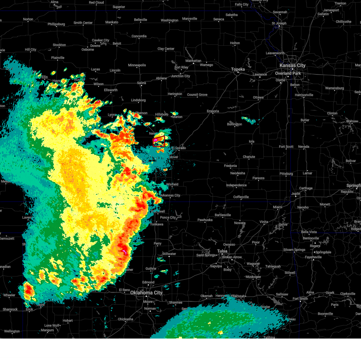 At 1023 pm cdt, a severe thunderstorm capable of producing a tornado was located 5 miles east of sedgwick, moving east at 10 mph (radar indicated rotation). Hazards include tornado and quarter size hail. Flying debris will be dangerous to those caught without shelter. mobile homes will be damaged or destroyed. damage to roofs, windows, and vehicles will occur. tree damage is likely. this dangerous storm will be near, whitewater around 1100 pm cdt. This includes interstate 135 between mile markers 21 and 29. At 1023 pm cdt, a severe thunderstorm capable of producing a tornado was located 5 miles east of sedgwick, moving east at 10 mph (radar indicated rotation). Hazards include tornado and quarter size hail. Flying debris will be dangerous to those caught without shelter. mobile homes will be damaged or destroyed. damage to roofs, windows, and vehicles will occur. tree damage is likely. this dangerous storm will be near, whitewater around 1100 pm cdt. This includes interstate 135 between mile markers 21 and 29.
|
| 6/17/2023 10:20 PM CDT | Quarter sized hail reported 6 miles NNW of Newton, KS, quarter inch hail covering the ground. |
| 6/17/2023 9:54 PM CDT |
 At 953 pm cdt, a severe thunderstorm was located over newton, moving east at 15 mph (radar indicated). Hazards include ping pong ball size hail and 60 mph wind gusts. People and animals outdoors will be injured. expect hail damage to roofs, siding, windows, and vehicles. expect wind damage to roofs, siding, and trees. locations impacted include, newton, hesston, halstead, north newton, walton and newton airport. hail threat, radar indicated max hail size, 1. 50 in wind threat, radar indicated max wind gust, 60 mph. At 953 pm cdt, a severe thunderstorm was located over newton, moving east at 15 mph (radar indicated). Hazards include ping pong ball size hail and 60 mph wind gusts. People and animals outdoors will be injured. expect hail damage to roofs, siding, windows, and vehicles. expect wind damage to roofs, siding, and trees. locations impacted include, newton, hesston, halstead, north newton, walton and newton airport. hail threat, radar indicated max hail size, 1. 50 in wind threat, radar indicated max wind gust, 60 mph.
|
| 6/17/2023 9:43 PM CDT |
 At 943 pm cdt, a severe thunderstorm was located near newton, moving east at 15 mph (radar indicated). Hazards include 60 mph wind gusts and half dollar size hail. Hail damage to vehicles is expected. expect wind damage to roofs, siding, and trees. locations impacted include, newton, hesston, halstead, north newton, peabody, whitewater, walton, elbing and newton airport. hail threat, radar indicated max hail size, 1. 25 in wind threat, radar indicated max wind gust, 60 mph. At 943 pm cdt, a severe thunderstorm was located near newton, moving east at 15 mph (radar indicated). Hazards include 60 mph wind gusts and half dollar size hail. Hail damage to vehicles is expected. expect wind damage to roofs, siding, and trees. locations impacted include, newton, hesston, halstead, north newton, peabody, whitewater, walton, elbing and newton airport. hail threat, radar indicated max hail size, 1. 25 in wind threat, radar indicated max wind gust, 60 mph.
|
| 6/17/2023 9:34 PM CDT |
 At 934 pm cdt, a severe thunderstorm was located near halstead, moving northeast at 15 mph (radar indicated). Hazards include 60 mph wind gusts and half dollar size hail. Hail damage to vehicles is expected. Expect wind damage to roofs, siding, and trees. At 934 pm cdt, a severe thunderstorm was located near halstead, moving northeast at 15 mph (radar indicated). Hazards include 60 mph wind gusts and half dollar size hail. Hail damage to vehicles is expected. Expect wind damage to roofs, siding, and trees.
|
| 6/5/2023 4:50 PM CDT |
 The severe thunderstorm warning for northeastern harvey and southwestern marion counties will expire at 500 pm cdt, the storm which prompted the warning has weakened below severe limits, and no longer poses an immediate threat to life or property. therefore, the warning will be allowed to expire. The severe thunderstorm warning for northeastern harvey and southwestern marion counties will expire at 500 pm cdt, the storm which prompted the warning has weakened below severe limits, and no longer poses an immediate threat to life or property. therefore, the warning will be allowed to expire.
|
| 6/5/2023 4:05 PM CDT |
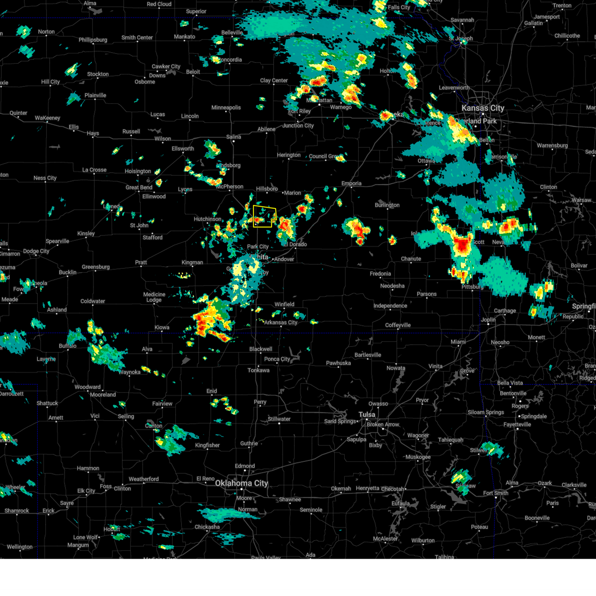 At 405 pm cdt, a severe thunderstorm was located near elbing, or near peabody, and is nearly stationary (radar indicated). Hazards include 60 mph wind gusts and quarter size hail. Hail damage to vehicles is expected. Expect wind damage to roofs, siding, and trees. At 405 pm cdt, a severe thunderstorm was located near elbing, or near peabody, and is nearly stationary (radar indicated). Hazards include 60 mph wind gusts and quarter size hail. Hail damage to vehicles is expected. Expect wind damage to roofs, siding, and trees.
|
| 6/5/2023 3:30 PM CDT | Storm damage reported in harvey county KS, 4.6 miles ESE of Newton, KS |
| 6/5/2023 2:46 PM CDT |
 At 246 pm cdt, a severe thunderstorm was located near halstead, moving southwest at 5 mph (radar indicated). Hazards include 70 mph wind gusts and quarter size hail. Hail damage to vehicles is expected. expect considerable tree damage. Wind damage is also likely to mobile homes, roofs, and outbuildings. At 246 pm cdt, a severe thunderstorm was located near halstead, moving southwest at 5 mph (radar indicated). Hazards include 70 mph wind gusts and quarter size hail. Hail damage to vehicles is expected. expect considerable tree damage. Wind damage is also likely to mobile homes, roofs, and outbuildings.
|
| 5/30/2023 5:33 PM CDT |
 At 533 pm cdt, a severe thunderstorm was located over burrton, moving southeast at 15 mph (radar indicated). Hazards include 60 mph wind gusts and quarter size hail. Hail damage to vehicles is expected. Expect wind damage to roofs, siding, and trees. At 533 pm cdt, a severe thunderstorm was located over burrton, moving southeast at 15 mph (radar indicated). Hazards include 60 mph wind gusts and quarter size hail. Hail damage to vehicles is expected. Expect wind damage to roofs, siding, and trees.
|
| 5/30/2023 4:25 PM CDT |
 At 424 pm cdt, a severe thunderstorm was located near north newton, moving southeast at 15 mph (radar indicated). Hazards include 60 mph wind gusts and quarter size hail. Hail damage to vehicles is expected. expect wind damage to roofs, siding, and trees. locations impacted include, newton, hesston, north newton, walton and newton airport. hail threat, radar indicated max hail size, 1. 00 in wind threat, radar indicated max wind gust, 60 mph. At 424 pm cdt, a severe thunderstorm was located near north newton, moving southeast at 15 mph (radar indicated). Hazards include 60 mph wind gusts and quarter size hail. Hail damage to vehicles is expected. expect wind damage to roofs, siding, and trees. locations impacted include, newton, hesston, north newton, walton and newton airport. hail threat, radar indicated max hail size, 1. 00 in wind threat, radar indicated max wind gust, 60 mph.
|
| 5/30/2023 4:17 PM CDT |
 At 416 pm cdt, a severe thunderstorm was located near hesston, moving southeast at 15 mph (radar indicated). Hazards include quarter size hail. damage to vehicles is expected At 416 pm cdt, a severe thunderstorm was located near hesston, moving southeast at 15 mph (radar indicated). Hazards include quarter size hail. damage to vehicles is expected
|
| 4/19/2023 5:49 PM CDT |
 At 549 pm cdt, a severe thunderstorm was located near newton, moving northeast at 50 mph (radar indicated). Hazards include 60 mph wind gusts and half dollar size hail. Hail damage to vehicles is expected. Expect wind damage to roofs, siding, and trees. At 549 pm cdt, a severe thunderstorm was located near newton, moving northeast at 50 mph (radar indicated). Hazards include 60 mph wind gusts and half dollar size hail. Hail damage to vehicles is expected. Expect wind damage to roofs, siding, and trees.
|
| 2/26/2023 9:33 PM CST |
 At 933 pm cst, a severe thunderstorm was located over clearwater, moving northeast at 45 mph. 70mph gust were recently reported 7 miles south of goddard kansas (law enforcement). Hazards include 70 mph wind gusts. Expect considerable tree damage. Damage is likely to mobile homes, roofs, and outbuildings. At 933 pm cst, a severe thunderstorm was located over clearwater, moving northeast at 45 mph. 70mph gust were recently reported 7 miles south of goddard kansas (law enforcement). Hazards include 70 mph wind gusts. Expect considerable tree damage. Damage is likely to mobile homes, roofs, and outbuildings.
|
| 8/19/2022 6:45 PM CDT |
 At 645 pm cdt, a severe thunderstorm was located over walton, or 6 miles west of peabody, moving southeast at 30 mph (radar indicated). Hazards include 60 mph wind gusts and quarter size hail. Hail damage to vehicles is expected. Expect wind damage to roofs, siding, and trees. At 645 pm cdt, a severe thunderstorm was located over walton, or 6 miles west of peabody, moving southeast at 30 mph (radar indicated). Hazards include 60 mph wind gusts and quarter size hail. Hail damage to vehicles is expected. Expect wind damage to roofs, siding, and trees.
|
| 7/1/2022 5:56 PM CDT | Storm damage reported in harvey county KS, 0.7 miles SE of Newton, KS |
| 7/1/2022 5:56 PM CDT |
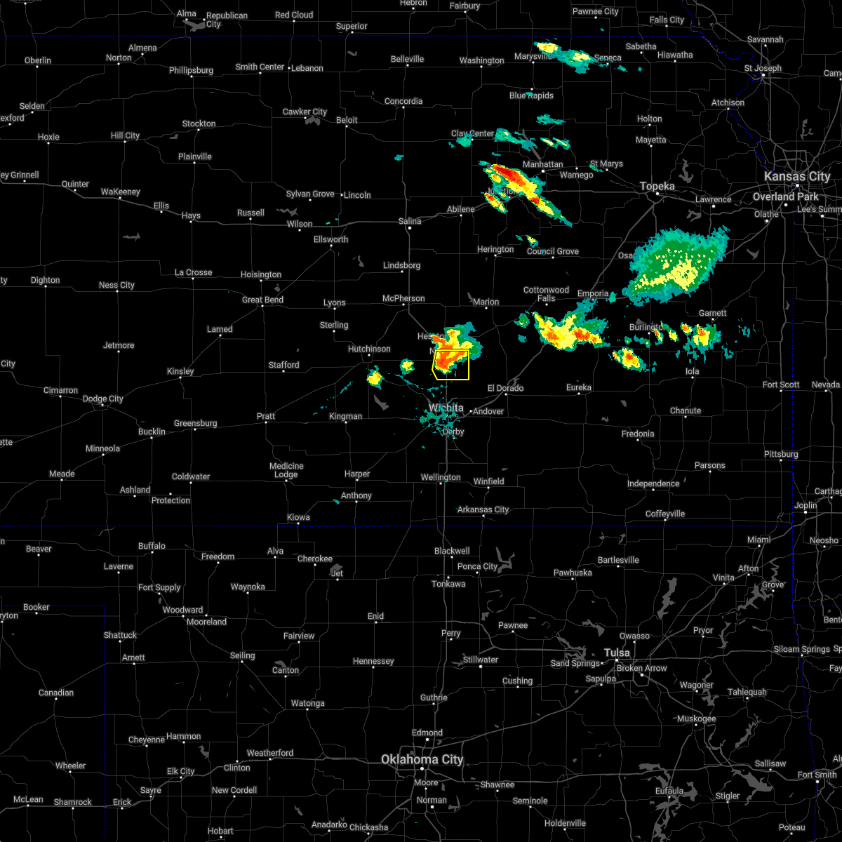 At 556 pm cdt, a severe thunderstorm was located near newton, moving east at 20 mph (radar indicated). Hazards include 60 mph wind gusts. Expect damage to roofs, siding, and trees. locations impacted include, newton, north newton, whitewater and newton airport. hail threat, radar indicated max hail size, <. 75 in wind threat, radar indicated max wind gust, 60 mph. At 556 pm cdt, a severe thunderstorm was located near newton, moving east at 20 mph (radar indicated). Hazards include 60 mph wind gusts. Expect damage to roofs, siding, and trees. locations impacted include, newton, north newton, whitewater and newton airport. hail threat, radar indicated max hail size, <. 75 in wind threat, radar indicated max wind gust, 60 mph.
|
| 7/1/2022 5:32 PM CDT |
 At 532 pm cdt, a severe thunderstorm was located over north newton, moving east at 20 mph (radar indicated). Hazards include 60 mph wind gusts and quarter size hail. Hail damage to vehicles is expected. Expect wind damage to roofs, siding, and trees. At 532 pm cdt, a severe thunderstorm was located over north newton, moving east at 20 mph (radar indicated). Hazards include 60 mph wind gusts and quarter size hail. Hail damage to vehicles is expected. Expect wind damage to roofs, siding, and trees.
|
| 7/1/2022 5:22 PM CDT |
 At 522 pm cdt, a severe thunderstorm was located near hesston, moving southeast at 15 mph (trained weather spotters). Hazards include golf ball size hail and 60 mph wind gusts. People and animals outdoors will be injured. expect hail damage to roofs, siding, windows, and vehicles. expect wind damage to roofs, siding, and trees. locations impacted include, newton, hesston and north newton. thunderstorm damage threat, considerable hail threat, radar indicated max hail size, 1. 75 in wind threat, radar indicated max wind gust, 60 mph. At 522 pm cdt, a severe thunderstorm was located near hesston, moving southeast at 15 mph (trained weather spotters). Hazards include golf ball size hail and 60 mph wind gusts. People and animals outdoors will be injured. expect hail damage to roofs, siding, windows, and vehicles. expect wind damage to roofs, siding, and trees. locations impacted include, newton, hesston and north newton. thunderstorm damage threat, considerable hail threat, radar indicated max hail size, 1. 75 in wind threat, radar indicated max wind gust, 60 mph.
|
| 7/1/2022 5:10 PM CDT |
 At 510 pm cdt, a severe thunderstorm was located near hesston, moving east at 5 mph (trained weather spotters). Hazards include golf ball size hail and 60 mph wind gusts. People and animals outdoors will be injured. expect hail damage to roofs, siding, windows, and vehicles. expect wind damage to roofs, siding, and trees. locations impacted include, newton, hesston, north newton and moundridge. thunderstorm damage threat, considerable hail threat, radar indicated max hail size, 1. 75 in wind threat, radar indicated max wind gust, 60 mph. At 510 pm cdt, a severe thunderstorm was located near hesston, moving east at 5 mph (trained weather spotters). Hazards include golf ball size hail and 60 mph wind gusts. People and animals outdoors will be injured. expect hail damage to roofs, siding, windows, and vehicles. expect wind damage to roofs, siding, and trees. locations impacted include, newton, hesston, north newton and moundridge. thunderstorm damage threat, considerable hail threat, radar indicated max hail size, 1. 75 in wind threat, radar indicated max wind gust, 60 mph.
|
| 7/1/2022 5:06 PM CDT |
 At 506 pm cdt, a severe thunderstorm was located near hesston, moving east at 5 mph (radar indicated). Hazards include 60 mph wind gusts and half dollar size hail. Hail damage to vehicles is expected. Expect wind damage to roofs, siding, and trees. At 506 pm cdt, a severe thunderstorm was located near hesston, moving east at 5 mph (radar indicated). Hazards include 60 mph wind gusts and half dollar size hail. Hail damage to vehicles is expected. Expect wind damage to roofs, siding, and trees.
|
| 6/22/2022 5:35 PM CDT |
 At 535 pm cdt, a severe thunderstorm was located over north newton, moving northeast at 20 mph (radar indicated). Hazards include 60 mph wind gusts. Expect damage to roofs, siding, and trees. locations impacted include, newton, hesston, halstead, north newton, sedgwick, burrton, walton and newton airport. hail threat, radar indicated max hail size, <. 75 in wind threat, radar indicated max wind gust, 60 mph. At 535 pm cdt, a severe thunderstorm was located over north newton, moving northeast at 20 mph (radar indicated). Hazards include 60 mph wind gusts. Expect damage to roofs, siding, and trees. locations impacted include, newton, hesston, halstead, north newton, sedgwick, burrton, walton and newton airport. hail threat, radar indicated max hail size, <. 75 in wind threat, radar indicated max wind gust, 60 mph.
|
| 6/22/2022 5:30 PM CDT | Quarter sized hail reported 0.4 miles S of Newton, KS, also reported 60mph winds. |
| 6/22/2022 5:18 PM CDT |
 At 517 pm cdt, a severe thunderstorm was located southwest of newton, moving northeast at 20 mph (radar indicated). Hazards include 70 mph wind gusts and ping pong ball size hail. People and animals outdoors will be injured. expect hail damage to roofs, siding, windows, and vehicles. expect considerable tree damage. wind damage is also likely to mobile homes, roofs, and outbuildings. locations impacted include, newton, hesston, halstead, north newton, sedgwick, burrton, walton and newton airport. thunderstorm damage threat, considerable hail threat, observed max hail size, 1. 50 in wind threat, observed max wind gust, 70 mph. At 517 pm cdt, a severe thunderstorm was located southwest of newton, moving northeast at 20 mph (radar indicated). Hazards include 70 mph wind gusts and ping pong ball size hail. People and animals outdoors will be injured. expect hail damage to roofs, siding, windows, and vehicles. expect considerable tree damage. wind damage is also likely to mobile homes, roofs, and outbuildings. locations impacted include, newton, hesston, halstead, north newton, sedgwick, burrton, walton and newton airport. thunderstorm damage threat, considerable hail threat, observed max hail size, 1. 50 in wind threat, observed max wind gust, 70 mph.
|
| 6/22/2022 4:55 PM CDT |
 At 454 pm cdt, a severe thunderstorm was located over bentley, or near sedgwick, moving northeast at 20 mph (radar indicated). Hazards include 70 mph wind gusts and ping pong ball size hail. People and animals outdoors will be injured. expect hail damage to roofs, siding, windows, and vehicles. expect considerable tree damage. Wind damage is also likely to mobile homes, roofs, and outbuildings. At 454 pm cdt, a severe thunderstorm was located over bentley, or near sedgwick, moving northeast at 20 mph (radar indicated). Hazards include 70 mph wind gusts and ping pong ball size hail. People and animals outdoors will be injured. expect hail damage to roofs, siding, windows, and vehicles. expect considerable tree damage. Wind damage is also likely to mobile homes, roofs, and outbuildings.
|
| 6/10/2022 2:13 AM CDT |
 At 212 am cdt, a severe thunderstorm was located near haven, moving southeast at 40 mph (radar indicated). Hazards include 60 mph wind gusts and quarter size hail. Hail damage to vehicles is expected. Expect wind damage to roofs, siding, and trees. At 212 am cdt, a severe thunderstorm was located near haven, moving southeast at 40 mph (radar indicated). Hazards include 60 mph wind gusts and quarter size hail. Hail damage to vehicles is expected. Expect wind damage to roofs, siding, and trees.
|
| 6/10/2022 2:05 AM CDT |
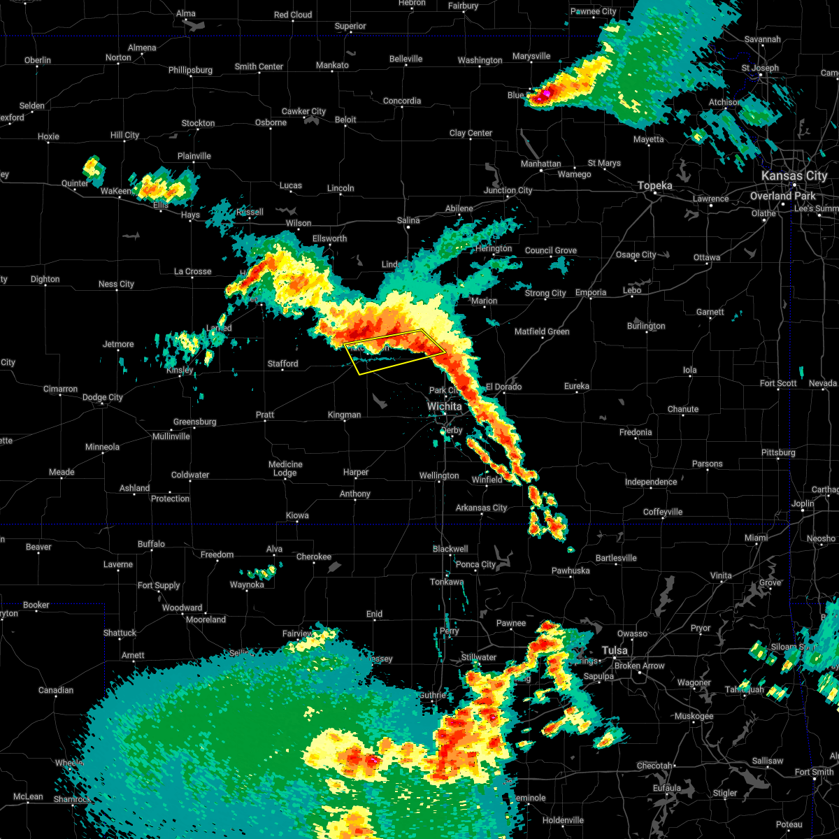 At 205 am cdt, a severe thunderstorm was located near hutchinson, moving south at 35 mph (radar indicated). Hazards include 60 mph wind gusts and quarter size hail. Hail damage to vehicles is expected. expect wind damage to roofs, siding, and trees. locations impacted include, hutchinson, hesston, south hutchinson, north newton, moundridge, buhler, burrton, willowbrook and hutchinson airport. hail threat, radar indicated max hail size, 1. 00 in wind threat, radar indicated max wind gust, 60 mph. At 205 am cdt, a severe thunderstorm was located near hutchinson, moving south at 35 mph (radar indicated). Hazards include 60 mph wind gusts and quarter size hail. Hail damage to vehicles is expected. expect wind damage to roofs, siding, and trees. locations impacted include, hutchinson, hesston, south hutchinson, north newton, moundridge, buhler, burrton, willowbrook and hutchinson airport. hail threat, radar indicated max hail size, 1. 00 in wind threat, radar indicated max wind gust, 60 mph.
|
| 6/10/2022 1:43 AM CDT |
 At 143 am cdt, a severe thunderstorm was located near windom, or 10 miles northwest of inman, moving southeast at 45 mph (radar indicated). Hazards include 60 mph wind gusts and quarter size hail. Hail damage to vehicles is expected. Expect wind damage to roofs, siding, and trees. At 143 am cdt, a severe thunderstorm was located near windom, or 10 miles northwest of inman, moving southeast at 45 mph (radar indicated). Hazards include 60 mph wind gusts and quarter size hail. Hail damage to vehicles is expected. Expect wind damage to roofs, siding, and trees.
|
| 6/5/2022 11:09 PM CDT |
 The severe thunderstorm warning for southeastern mcpherson, harvey and southwestern marion counties will expire at 1115 pm cdt, the storm which prompted the warning has moved out of the area. therefore, the warning will be allowed to expire. however gusty winds and heavy rain are still possible with this thunderstorm. a severe thunderstorm watch remains in effect until 300 am cdt for south central and central kansas. The severe thunderstorm warning for southeastern mcpherson, harvey and southwestern marion counties will expire at 1115 pm cdt, the storm which prompted the warning has moved out of the area. therefore, the warning will be allowed to expire. however gusty winds and heavy rain are still possible with this thunderstorm. a severe thunderstorm watch remains in effect until 300 am cdt for south central and central kansas.
|
| 6/5/2022 10:56 PM CDT |
 At 1056 pm cdt, severe thunderstorms were located along a line extending from newton to near bentley to 6 miles west of andale, moving southeast at 35 mph (radar indicated). Hazards include 60 mph wind gusts and quarter size hail. Hail damage to vehicles is expected. Expect wind damage to roofs, siding, and trees. At 1056 pm cdt, severe thunderstorms were located along a line extending from newton to near bentley to 6 miles west of andale, moving southeast at 35 mph (radar indicated). Hazards include 60 mph wind gusts and quarter size hail. Hail damage to vehicles is expected. Expect wind damage to roofs, siding, and trees.
|
| 6/5/2022 10:17 PM CDT |
 At 1016 pm cdt, a severe thunderstorm was located near moundridge, moving east at 30 mph (radar indicated). Hazards include 60 mph wind gusts and quarter size hail. Hail damage to vehicles is expected. Expect wind damage to roofs, siding, and trees. At 1016 pm cdt, a severe thunderstorm was located near moundridge, moving east at 30 mph (radar indicated). Hazards include 60 mph wind gusts and quarter size hail. Hail damage to vehicles is expected. Expect wind damage to roofs, siding, and trees.
|
| 5/31/2022 8:51 PM CDT |
 At 850 pm cdt, a severe thunderstorm was located near north newton, moving northeast at 40 mph. other strong to severe thunderstorms were located over western sedgwick county (radar indicated). Hazards include ping pong ball size hail. People and animals outdoors will be injured. Expect damage to roofs, siding, windows, and vehicles. At 850 pm cdt, a severe thunderstorm was located near north newton, moving northeast at 40 mph. other strong to severe thunderstorms were located over western sedgwick county (radar indicated). Hazards include ping pong ball size hail. People and animals outdoors will be injured. Expect damage to roofs, siding, windows, and vehicles.
|
| 5/31/2022 8:05 PM CDT |
 At 804 pm cdt, a severe thunderstorm was located over whitewater, moving northeast at 40 mph (radar indicated. this storm has a history of producing large hail). Hazards include golf ball size hail. People and animals outdoors will be injured. expect damage to roofs, siding, windows, and vehicles. locations impacted include, wichita, derby, newton, el dorado, andover, haysville, augusta, park city, valley center, bel aire, mulvane, goddard, rose hill, hesston, maize, hillsboro, clearwater, halstead, marion and north newton. thunderstorm damage threat, considerable hail threat, radar indicated max hail size, 1. 75 in wind threat, radar indicated max wind gust, <50 mph. At 804 pm cdt, a severe thunderstorm was located over whitewater, moving northeast at 40 mph (radar indicated. this storm has a history of producing large hail). Hazards include golf ball size hail. People and animals outdoors will be injured. expect damage to roofs, siding, windows, and vehicles. locations impacted include, wichita, derby, newton, el dorado, andover, haysville, augusta, park city, valley center, bel aire, mulvane, goddard, rose hill, hesston, maize, hillsboro, clearwater, halstead, marion and north newton. thunderstorm damage threat, considerable hail threat, radar indicated max hail size, 1. 75 in wind threat, radar indicated max wind gust, <50 mph.
|
| 5/31/2022 7:43 PM CDT |
 At 743 pm cdt, a severe thunderstorm was located near peabody, moving northeast at 35 mph (radar indicated. this storm has a history of large hail). Hazards include half dollar size hail. Damage to vehicles is expected. locations impacted include, wichita, derby, newton, el dorado, andover, haysville, augusta, park city, valley center, bel aire, mulvane, goddard, rose hill, hesston, maize, hillsboro, clearwater, halstead, marion and north newton. hail threat, radar indicated max hail size, 1. 25 in wind threat, radar indicated max wind gust, <50 mph. At 743 pm cdt, a severe thunderstorm was located near peabody, moving northeast at 35 mph (radar indicated. this storm has a history of large hail). Hazards include half dollar size hail. Damage to vehicles is expected. locations impacted include, wichita, derby, newton, el dorado, andover, haysville, augusta, park city, valley center, bel aire, mulvane, goddard, rose hill, hesston, maize, hillsboro, clearwater, halstead, marion and north newton. hail threat, radar indicated max hail size, 1. 25 in wind threat, radar indicated max wind gust, <50 mph.
|
| 5/31/2022 7:25 PM CDT | Quarter sized hail reported 5.9 miles WSW of Newton, KS |
| 5/31/2022 7:19 PM CDT |
 At 719 pm cdt, a severe thunderstorm was located near eisenhower national airport, or 6 miles northwest of haysville, moving northeast at 25 mph (radar indicated). Hazards include quarter size hail. damage to vehicles is expected At 719 pm cdt, a severe thunderstorm was located near eisenhower national airport, or 6 miles northwest of haysville, moving northeast at 25 mph (radar indicated). Hazards include quarter size hail. damage to vehicles is expected
|
| 5/30/2022 6:30 PM CDT |
 At 629 pm cdt, severe thunderstorms were located along a line extending from 5 miles north of strong city to 6 miles east of elbing, moving northeast at 55 mph (radar indicated). Hazards include 60 mph wind gusts and quarter size hail. Hail damage to vehicles is expected. expect wind damage to roofs, siding, and trees. locations impacted include, marion, peabody, cottonwood falls, whitewater, strong city, florence, elbing, burns, bazaar, elmdale, cedar point, newton airport, hymer, wonsevu, tallgrass prairie and tallgrass prairie preserve. hail threat, radar indicated max hail size, 1. 00 in wind threat, radar indicated max wind gust, 60 mph. At 629 pm cdt, severe thunderstorms were located along a line extending from 5 miles north of strong city to 6 miles east of elbing, moving northeast at 55 mph (radar indicated). Hazards include 60 mph wind gusts and quarter size hail. Hail damage to vehicles is expected. expect wind damage to roofs, siding, and trees. locations impacted include, marion, peabody, cottonwood falls, whitewater, strong city, florence, elbing, burns, bazaar, elmdale, cedar point, newton airport, hymer, wonsevu, tallgrass prairie and tallgrass prairie preserve. hail threat, radar indicated max hail size, 1. 00 in wind threat, radar indicated max wind gust, 60 mph.
|
| 5/30/2022 6:19 PM CDT |
 At 618 pm cdt, severe thunderstorms were located along a line extending from near strong city to whitewater, moving northeast at 40 mph (radar indicated). Hazards include 60 mph wind gusts and quarter size hail. Hail damage to vehicles is expected. expect wind damage to roofs, siding, and trees. locations impacted include, newton, park city, valley center, marion, north newton, sedgwick, peabody, cottonwood falls, whitewater, strong city, florence, bentley, potwin, walton, elbing, burns, lincolnville, bazaar, elmdale and cedar point. hail threat, radar indicated max hail size, 1. 00 in wind threat, radar indicated max wind gust, 60 mph. At 618 pm cdt, severe thunderstorms were located along a line extending from near strong city to whitewater, moving northeast at 40 mph (radar indicated). Hazards include 60 mph wind gusts and quarter size hail. Hail damage to vehicles is expected. expect wind damage to roofs, siding, and trees. locations impacted include, newton, park city, valley center, marion, north newton, sedgwick, peabody, cottonwood falls, whitewater, strong city, florence, bentley, potwin, walton, elbing, burns, lincolnville, bazaar, elmdale and cedar point. hail threat, radar indicated max hail size, 1. 00 in wind threat, radar indicated max wind gust, 60 mph.
|
| 5/30/2022 5:55 PM CDT |
 At 555 pm cdt, severe thunderstorms were located along a line extending from near florence to near valley center, moving northeast at 55 mph (radar indicated). Hazards include 60 mph wind gusts and quarter size hail. Hail damage to vehicles is expected. expect wind damage to roofs, siding, and trees. locations impacted include, wichita, newton, park city, valley center, bel aire, maize, marion, north newton, sedgwick, colwich, peabody, cottonwood falls, whitewater, strong city, florence, kechi, andale, bentley, potwin and walton. hail threat, radar indicated max hail size, 1. 00 in wind threat, radar indicated max wind gust, 60 mph. At 555 pm cdt, severe thunderstorms were located along a line extending from near florence to near valley center, moving northeast at 55 mph (radar indicated). Hazards include 60 mph wind gusts and quarter size hail. Hail damage to vehicles is expected. expect wind damage to roofs, siding, and trees. locations impacted include, wichita, newton, park city, valley center, bel aire, maize, marion, north newton, sedgwick, colwich, peabody, cottonwood falls, whitewater, strong city, florence, kechi, andale, bentley, potwin and walton. hail threat, radar indicated max hail size, 1. 00 in wind threat, radar indicated max wind gust, 60 mph.
|
| 5/30/2022 5:42 PM CDT |
 At 542 pm cdt, severe thunderstorms were located along a line extending from near peabody to colwich, moving northeast at 55 mph (radar indicated). Hazards include 60 mph wind gusts and quarter size hail. Hail damage to vehicles is expected. Expect wind damage to roofs, siding, and trees. At 542 pm cdt, severe thunderstorms were located along a line extending from near peabody to colwich, moving northeast at 55 mph (radar indicated). Hazards include 60 mph wind gusts and quarter size hail. Hail damage to vehicles is expected. Expect wind damage to roofs, siding, and trees.
|
| 5/30/2022 5:40 PM CDT | Getting another bout of 60 mph winds 20 minutes later. some tree limbs being downe in harvey county KS, 6.3 miles SW of Newton, KS |
| 5/30/2022 5:22 PM CDT | Storm damage reported in harvey county KS, 6.3 miles SW of Newton, KS |
| 5/15/2022 8:33 AM CDT |
 At 833 am cdt, a severe thunderstorm was located 12 miles east of burns, or 18 miles northeast of el dorado, moving southeast at 45 mph (radar indicated). Hazards include 60 mph wind gusts and half dollar size hail. Hail damage to vehicles is expected. expect wind damage to roofs, siding, and trees. locations impacted include, newton, hesston, hillsboro, north newton, peabody, florence, goessel, walton, elbing, burns, lehigh, cassoday, matfield green, newton airport, wonsevu, el dorado lake and el dorado state park. hail threat, radar indicated max hail size, 1. 25 in wind threat, radar indicated max wind gust, 60 mph. At 833 am cdt, a severe thunderstorm was located 12 miles east of burns, or 18 miles northeast of el dorado, moving southeast at 45 mph (radar indicated). Hazards include 60 mph wind gusts and half dollar size hail. Hail damage to vehicles is expected. expect wind damage to roofs, siding, and trees. locations impacted include, newton, hesston, hillsboro, north newton, peabody, florence, goessel, walton, elbing, burns, lehigh, cassoday, matfield green, newton airport, wonsevu, el dorado lake and el dorado state park. hail threat, radar indicated max hail size, 1. 25 in wind threat, radar indicated max wind gust, 60 mph.
|
| 5/15/2022 8:17 AM CDT |
 At 817 am cdt, a severe thunderstorm was located near burns, or 8 miles south of florence, moving southeast at 45 mph (radar indicated). Hazards include ping pong ball size hail and 60 mph wind gusts. People and animals outdoors will be injured. expect hail damage to roofs, siding, windows, and vehicles. expect wind damage to roofs, siding, and trees. locations impacted include, newton, hesston, hillsboro, north newton, moundridge, peabody, canton, florence, goessel, walton, elbing, burns, lehigh, cassoday, matfield green, cedar point, newton airport, wonsevu, el dorado lake and el dorado state park. hail threat, radar indicated max hail size, 1. 50 in wind threat, radar indicated max wind gust, 60 mph. At 817 am cdt, a severe thunderstorm was located near burns, or 8 miles south of florence, moving southeast at 45 mph (radar indicated). Hazards include ping pong ball size hail and 60 mph wind gusts. People and animals outdoors will be injured. expect hail damage to roofs, siding, windows, and vehicles. expect wind damage to roofs, siding, and trees. locations impacted include, newton, hesston, hillsboro, north newton, moundridge, peabody, canton, florence, goessel, walton, elbing, burns, lehigh, cassoday, matfield green, cedar point, newton airport, wonsevu, el dorado lake and el dorado state park. hail threat, radar indicated max hail size, 1. 50 in wind threat, radar indicated max wind gust, 60 mph.
|
| 5/15/2022 7:55 AM CDT |
 At 755 am cdt, a severe thunderstorm was located near peabody, moving southeast at 45 mph (radar indicated). Hazards include two inch hail and 60 mph wind gusts. People and animals outdoors will be injured. expect hail damage to roofs, siding, windows, and vehicles. Expect wind damage to roofs, siding, and trees. At 755 am cdt, a severe thunderstorm was located near peabody, moving southeast at 45 mph (radar indicated). Hazards include two inch hail and 60 mph wind gusts. People and animals outdoors will be injured. expect hail damage to roofs, siding, windows, and vehicles. Expect wind damage to roofs, siding, and trees.
|
| 4/29/2022 8:36 PM CDT |
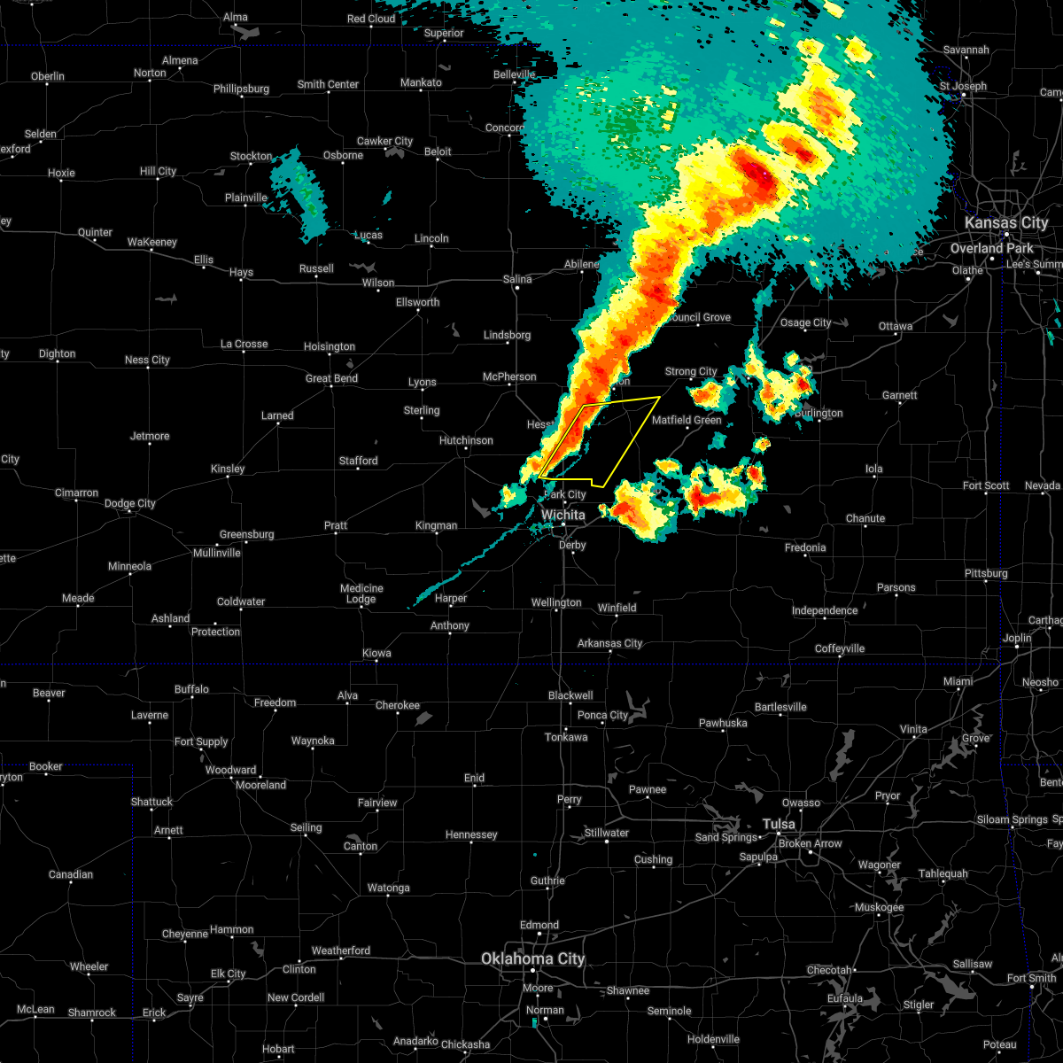 At 836 pm cdt, a severe thunderstorm was located near newton, moving east at 40 mph (radar indicated). Hazards include 60 mph wind gusts. expect damage to roofs, siding, and trees At 836 pm cdt, a severe thunderstorm was located near newton, moving east at 40 mph (radar indicated). Hazards include 60 mph wind gusts. expect damage to roofs, siding, and trees
|
| 4/29/2022 8:23 PM CDT |
 At 822 pm cdt, a confirmed tornado was located near hillsboro, moving northeast at 55 mph (weather spotters confirmed tornado). Hazards include tornado. Expect damage to mobile homes, roofs, and vehicles. This tornadic thunderstorm will remain over mainly rural areas of northeastern harvey and western marion counties, including the following locations, marion lake. At 822 pm cdt, a confirmed tornado was located near hillsboro, moving northeast at 55 mph (weather spotters confirmed tornado). Hazards include tornado. Expect damage to mobile homes, roofs, and vehicles. This tornadic thunderstorm will remain over mainly rural areas of northeastern harvey and western marion counties, including the following locations, marion lake.
|
| 4/29/2022 8:16 PM CDT |
 At 815 pm cdt, a confirmed tornado was located near goessel, or 6 miles south of hillsboro, moving northeast at 55 mph (weather spotters confirmed tornado). Hazards include tornado. Expect damage to mobile homes, roofs, and vehicles. the tornado will be near, hillsboro around 820 pm cdt. other locations impacted by this tornadic thunderstorm include marion lake. This includes interstate 135 between mile markers 33 and 40. At 815 pm cdt, a confirmed tornado was located near goessel, or 6 miles south of hillsboro, moving northeast at 55 mph (weather spotters confirmed tornado). Hazards include tornado. Expect damage to mobile homes, roofs, and vehicles. the tornado will be near, hillsboro around 820 pm cdt. other locations impacted by this tornadic thunderstorm include marion lake. This includes interstate 135 between mile markers 33 and 40.
|
| 4/29/2022 7:05 PM CDT |
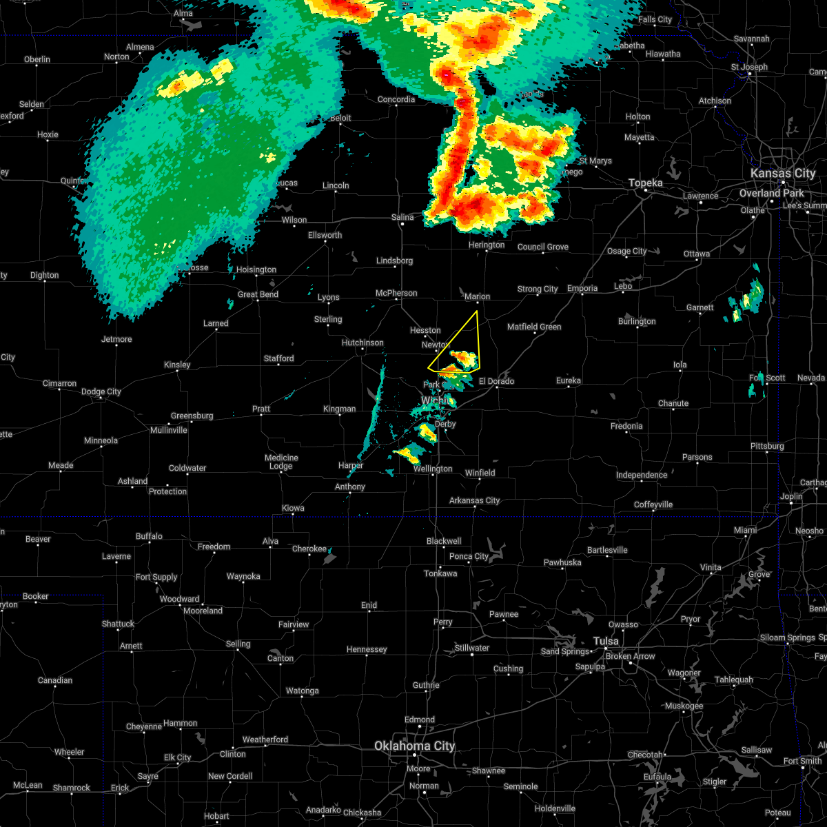 At 704 pm cdt, a severe thunderstorm was located near whitewater, moving northeast at 45 mph (radar indicated). Hazards include 60 mph wind gusts and half dollar size hail. Hail damage to vehicles is expected. expect wind damage to roofs, siding, and trees. locations impacted include, newton, peabody, whitewater, potwin, elbing and newton airport. hail threat, radar indicated max hail size, 1. 25 in wind threat, radar indicated max wind gust, 60 mph. At 704 pm cdt, a severe thunderstorm was located near whitewater, moving northeast at 45 mph (radar indicated). Hazards include 60 mph wind gusts and half dollar size hail. Hail damage to vehicles is expected. expect wind damage to roofs, siding, and trees. locations impacted include, newton, peabody, whitewater, potwin, elbing and newton airport. hail threat, radar indicated max hail size, 1. 25 in wind threat, radar indicated max wind gust, 60 mph.
|
| 4/29/2022 7:00 PM CDT |
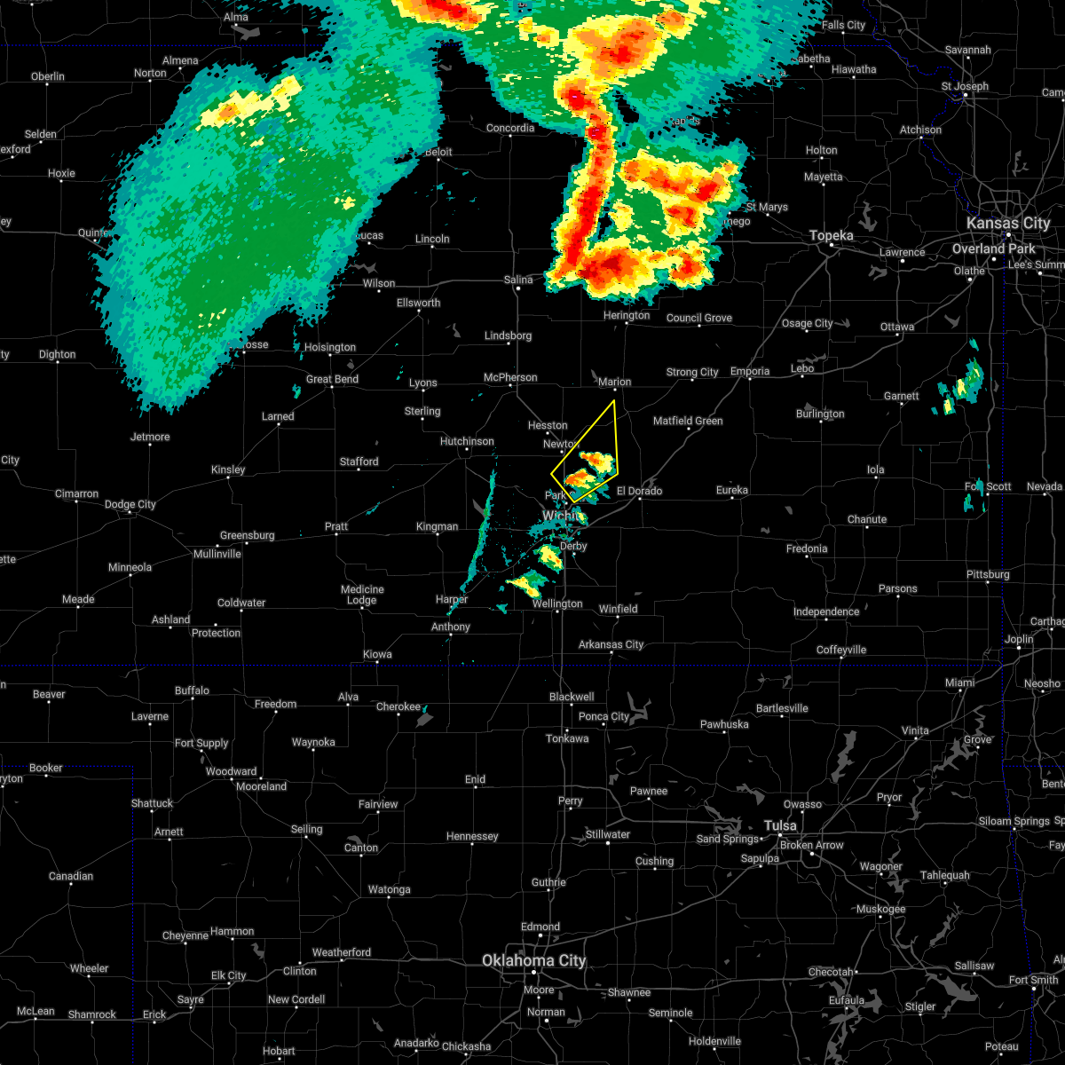 At 700 pm cdt, a severe thunderstorm was located 6 miles west of whitewater, moving northeast at 40 mph (radar indicated). Hazards include 60 mph wind gusts and half dollar size hail. Hail damage to vehicles is expected. Expect wind damage to roofs, siding, and trees. At 700 pm cdt, a severe thunderstorm was located 6 miles west of whitewater, moving northeast at 40 mph (radar indicated). Hazards include 60 mph wind gusts and half dollar size hail. Hail damage to vehicles is expected. Expect wind damage to roofs, siding, and trees.
|
| 4/29/2022 3:05 AM CDT |
 At 304 am cdt, a severe thunderstorm was located over bentley, or near sedgwick, moving northeast at 30 mph (radar indicated). Hazards include half dollar size hail. Damage to vehicles is expected. locations impacted include, newton, park city, valley center, maize, halstead, sedgwick, colwich, burrton, mount hope and bentley. hail threat, radar indicated max hail size, 1. 25 in wind threat, radar indicated max wind gust, <50 mph. At 304 am cdt, a severe thunderstorm was located over bentley, or near sedgwick, moving northeast at 30 mph (radar indicated). Hazards include half dollar size hail. Damage to vehicles is expected. locations impacted include, newton, park city, valley center, maize, halstead, sedgwick, colwich, burrton, mount hope and bentley. hail threat, radar indicated max hail size, 1. 25 in wind threat, radar indicated max wind gust, <50 mph.
|
| 4/29/2022 2:53 AM CDT |
 At 253 am cdt, a severe thunderstorm was located near andale, or near colwich, moving northeast at 30 mph (radar indicated). Hazards include quarter size hail. damage to vehicles is expected At 253 am cdt, a severe thunderstorm was located near andale, or near colwich, moving northeast at 30 mph (radar indicated). Hazards include quarter size hail. damage to vehicles is expected
|
| 3/29/2022 6:35 PM CDT |
 At 634 pm cdt, a severe thunderstorm was located over sedgwick, moving northeast at 35 mph (radar indicated). Hazards include 60 mph wind gusts and penny size hail. expect damage to roofs, siding, and trees At 634 pm cdt, a severe thunderstorm was located over sedgwick, moving northeast at 35 mph (radar indicated). Hazards include 60 mph wind gusts and penny size hail. expect damage to roofs, siding, and trees
|
| 3/29/2022 6:17 PM CDT |
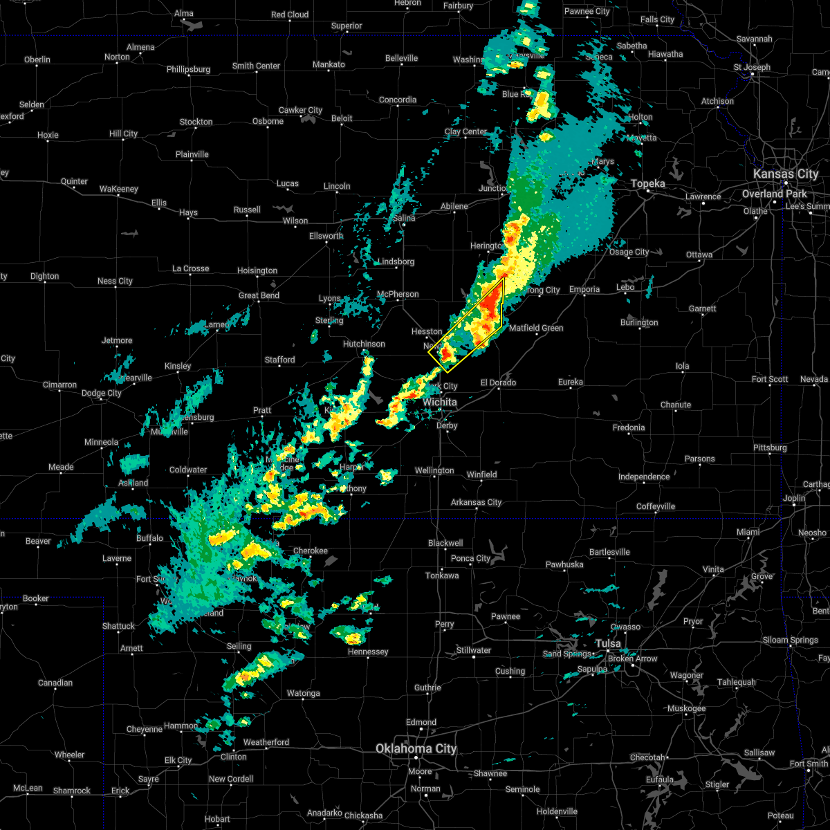 At 617 pm cdt, a severe thunderstorm was located near newton, moving northeast at 50 mph (radar indicated). Hazards include 60 mph wind gusts and nickel size hail. expect damage to roofs, siding, and trees At 617 pm cdt, a severe thunderstorm was located near newton, moving northeast at 50 mph (radar indicated). Hazards include 60 mph wind gusts and nickel size hail. expect damage to roofs, siding, and trees
|
| 3/29/2022 5:47 PM CDT | Estimated 60 mph wind gus in harvey county KS, 5.9 miles WSW of Newton, KS |
| 12/15/2021 3:58 PM CST | Storm damage reported in harvey county KS, 5.2 miles WSW of Newton, KS |
| 12/15/2021 3:43 PM CST | Trees dow in harvey county KS, 1.1 miles WSW of Newton, KS |
| 12/15/2021 3:10 PM CST |
 At 310 pm cst, severe thunderstorms were located along a line extending from 6 miles south of gypsum to moundridge, moving east at 45 mph (radar indicated). Hazards include 70 mph wind gusts. Expect considerable tree damage. Damage is likely to mobile homes, roofs, and outbuildings. At 310 pm cst, severe thunderstorms were located along a line extending from 6 miles south of gypsum to moundridge, moving east at 45 mph (radar indicated). Hazards include 70 mph wind gusts. Expect considerable tree damage. Damage is likely to mobile homes, roofs, and outbuildings.
|
| 10/13/2021 3:14 AM CDT |
 At 313 am cdt, severe thunderstorms were located along a line extending from walton to eisenhower national airport to near conway springs, moving east at 35 mph (automated weather observation. at 310 am, a 58 mph wind gust was measured at the wichita eisenhower airport). Hazards include 60 mph wind gusts. expect damage to roofs, siding, and trees At 313 am cdt, severe thunderstorms were located along a line extending from walton to eisenhower national airport to near conway springs, moving east at 35 mph (automated weather observation. at 310 am, a 58 mph wind gust was measured at the wichita eisenhower airport). Hazards include 60 mph wind gusts. expect damage to roofs, siding, and trees
|
| 8/20/2021 10:55 PM CDT |
 The severe thunderstorm warning for northern sedgwick, harvey, western butler and southeastern marion counties will expire at 1100 pm cdt, the storms which prompted the warning have weakened below severe limits, and no longer pose an immediate threat to life or property. therefore, the warning will be allowed to expire. The severe thunderstorm warning for northern sedgwick, harvey, western butler and southeastern marion counties will expire at 1100 pm cdt, the storms which prompted the warning have weakened below severe limits, and no longer pose an immediate threat to life or property. therefore, the warning will be allowed to expire.
|
| 8/20/2021 10:25 PM CDT |
 At 1024 pm cdt, severe thunderstorms were located along a line extending from near north newton to near sedgwick to near bentley, moving east at 15 mph (radar indicated). Hazards include 60 mph wind gusts. Expect damage to roofs, siding, and trees. locations impacted include, wichita, newton, andover, augusta, park city, valley center, bel aire, goddard, hesston, maize, halstead, north newton, sedgwick, towanda, colwich, peabody, burrton, benton, mount hope and whitewater. hail threat, radar indicated max hail size, <. 75 in wind threat, radar indicated max wind gust, 60 mph. At 1024 pm cdt, severe thunderstorms were located along a line extending from near north newton to near sedgwick to near bentley, moving east at 15 mph (radar indicated). Hazards include 60 mph wind gusts. Expect damage to roofs, siding, and trees. locations impacted include, wichita, newton, andover, augusta, park city, valley center, bel aire, goddard, hesston, maize, halstead, north newton, sedgwick, towanda, colwich, peabody, burrton, benton, mount hope and whitewater. hail threat, radar indicated max hail size, <. 75 in wind threat, radar indicated max wind gust, 60 mph.
|
| 8/20/2021 10:07 PM CDT |
 At 1007 pm cdt, severe thunderstorms were located along a line extending from walton to sedgwick to mount hope, moving east to southeast at 30 mph (radar indicated). Hazards include 60 mph wind gusts. expect damage to roofs, siding, and trees At 1007 pm cdt, severe thunderstorms were located along a line extending from walton to sedgwick to mount hope, moving east to southeast at 30 mph (radar indicated). Hazards include 60 mph wind gusts. expect damage to roofs, siding, and trees
|
| 8/20/2021 9:52 PM CDT |
 At 952 pm cdt, severe thunderstorms were located along a line extending from hesston to sedgwick to 7 miles east of pretty prairie, moving east at 25 mph (radar indicated). Hazards include 60 mph wind gusts and nickel size hail. Expect damage to roofs, siding, and trees. locations impacted include, hutchinson, newton, park city, valley center, hesston, south hutchinson, halstead, north newton, sedgwick, buhler, haven, burrton, mount hope, whitewater, pretty prairie, bentley, arlington, partridge, walton and yoder. hail threat, radar indicated max hail size, 0. 88 in wind threat, radar indicated max wind gust, 60 mph. At 952 pm cdt, severe thunderstorms were located along a line extending from hesston to sedgwick to 7 miles east of pretty prairie, moving east at 25 mph (radar indicated). Hazards include 60 mph wind gusts and nickel size hail. Expect damage to roofs, siding, and trees. locations impacted include, hutchinson, newton, park city, valley center, hesston, south hutchinson, halstead, north newton, sedgwick, buhler, haven, burrton, mount hope, whitewater, pretty prairie, bentley, arlington, partridge, walton and yoder. hail threat, radar indicated max hail size, 0. 88 in wind threat, radar indicated max wind gust, 60 mph.
|
| 8/20/2021 9:32 PM CDT |
 At 931 pm cdt, severe thunderstorms were located along a line extending from near moundridge to near halstead to 6 miles north of pretty prairie, moving east at 30 mph (radar indicated). Hazards include 60 mph wind gusts and penny size hail. Expect damage to roofs, siding, and trees. locations impacted include, hutchinson, newton, park city, valley center, hesston, south hutchinson, halstead, north newton, sedgwick, buhler, haven, burrton, mount hope, whitewater, pretty prairie, bentley, arlington, partridge, walton and yoder. hail threat, radar indicated max hail size, 0. 75 in wind threat, radar indicated max wind gust, 60 mph. At 931 pm cdt, severe thunderstorms were located along a line extending from near moundridge to near halstead to 6 miles north of pretty prairie, moving east at 30 mph (radar indicated). Hazards include 60 mph wind gusts and penny size hail. Expect damage to roofs, siding, and trees. locations impacted include, hutchinson, newton, park city, valley center, hesston, south hutchinson, halstead, north newton, sedgwick, buhler, haven, burrton, mount hope, whitewater, pretty prairie, bentley, arlington, partridge, walton and yoder. hail threat, radar indicated max hail size, 0. 75 in wind threat, radar indicated max wind gust, 60 mph.
|
| 8/20/2021 9:20 PM CDT |
 At 919 pm cdt, severe thunderstorms were located along a line extending from 6 miles southwest of moundridge to near haven, moving east at 25 mph (radar indicated). Hazards include 60 mph wind gusts and quarter size hail. Hail damage to vehicles is expected. Expect wind damage to roofs, siding, and trees. At 919 pm cdt, severe thunderstorms were located along a line extending from 6 miles southwest of moundridge to near haven, moving east at 25 mph (radar indicated). Hazards include 60 mph wind gusts and quarter size hail. Hail damage to vehicles is expected. Expect wind damage to roofs, siding, and trees.
|
| 6/25/2021 8:20 PM CDT |
 At 820 pm cdt, a severe thunderstorm was located 11 miles east of florence, moving east at 40 mph (law enforcement). Hazards include 60 mph wind gusts and penny size hail. Expect damage to roofs, siding, and trees. This severe thunderstorm will remain over mainly rural areas of harvey county, including the following locations, newton airport. At 820 pm cdt, a severe thunderstorm was located 11 miles east of florence, moving east at 40 mph (law enforcement). Hazards include 60 mph wind gusts and penny size hail. Expect damage to roofs, siding, and trees. This severe thunderstorm will remain over mainly rural areas of harvey county, including the following locations, newton airport.
|
| 6/25/2021 7:39 PM CDT | Measured at the newton airpor in harvey county KS, 4.7 miles WSW of Newton, KS |
| 6/25/2021 7:39 PM CDT | Extensive tree damage in downtown newton. multiple trees on home in harvey county KS, 1.5 miles SW of Newton, KS |
| 6/25/2021 7:39 PM CDT | Multiple buildings with lost siding. multiple trees fallen on vehicle in harvey county KS, 1.9 miles SSW of Newton, KS |
| 6/25/2021 7:39 PM CDT | Delayed report. partial roof removal of newton school district bus bar in harvey county KS, 1.1 miles WSW of Newton, KS |
| 6/25/2021 7:30 PM CDT | Multiple powerlines down. multiple trees down and uprooted. local street flooding. multiple railroad crossbars broken off at crossings. this damage occurred near newton in harvey county KS, 5.5 miles SSE of Newton, KS |
| 6/25/2021 7:23 PM CDT |
 At 723 pm cdt, a severe thunderstorm was located over north newton, moving east at 40 mph (law enforcement). Hazards include 60 mph wind gusts and penny size hail. Expect damage to roofs, siding, and trees. this severe thunderstorm will be near, walton around 735 pm cdt. This includes interstate 135 between mile markers 25 and 42. At 723 pm cdt, a severe thunderstorm was located over north newton, moving east at 40 mph (law enforcement). Hazards include 60 mph wind gusts and penny size hail. Expect damage to roofs, siding, and trees. this severe thunderstorm will be near, walton around 735 pm cdt. This includes interstate 135 between mile markers 25 and 42.
|
| 6/25/2021 7:14 PM CDT | Multiple power poles dow in harvey county KS, 1.2 miles ESE of Newton, KS |
| 6/25/2021 7:14 PM CDT | Storm damage reported in harvey county KS, 4.1 miles SW of Newton, KS |
| 6/25/2021 6:55 PM CDT | Tree fell down in newton on residenc in harvey county KS, 1.5 miles SW of Newton, KS |
| 6/25/2021 6:54 PM CDT | Roof torn off machine she in harvey county KS, 4.7 miles SSE of Newton, KS |
| 6/25/2021 6:39 PM CDT | Quarter sized hail reported 11.5 miles S of Newton, KS, intersection of k-15 and 90th. |
| 5/16/2021 1:07 AM CDT |
 A severe thunderstorm warning remains in effect until 115 am cdt for south central harvey county. at 106 am cdt, a severe thunderstorm was located over halstead, moving north at 15 mph. hazard. 60 mph wind gusts and quarter size hail. source. Radar indicated. A severe thunderstorm warning remains in effect until 115 am cdt for south central harvey county. at 106 am cdt, a severe thunderstorm was located over halstead, moving north at 15 mph. hazard. 60 mph wind gusts and quarter size hail. source. Radar indicated.
|
| 5/16/2021 12:58 AM CDT |
 At 1258 am cdt, a severe thunderstorm was located near halstead, moving north at 20 mph (radar indicated). Hazards include 60 mph wind gusts and quarter size hail. Hail damage to vehicles is expected. Expect wind damage to roofs, siding, and trees. At 1258 am cdt, a severe thunderstorm was located near halstead, moving north at 20 mph (radar indicated). Hazards include 60 mph wind gusts and quarter size hail. Hail damage to vehicles is expected. Expect wind damage to roofs, siding, and trees.
|
| 5/16/2021 12:42 AM CDT |
 At 1242 am cdt, a severe thunderstorm was located over sedgwick, moving north at 15 mph (radar indicated). Hazards include 60 mph wind gusts and quarter size hail. Hail damage to vehicles is expected. expect wind damage to roofs, siding, and trees. Locations impacted include, newton, halstead, sedgwick and bentley. At 1242 am cdt, a severe thunderstorm was located over sedgwick, moving north at 15 mph (radar indicated). Hazards include 60 mph wind gusts and quarter size hail. Hail damage to vehicles is expected. expect wind damage to roofs, siding, and trees. Locations impacted include, newton, halstead, sedgwick and bentley.
|
| 5/16/2021 12:14 AM CDT |
 At 1214 am cdt, a severe thunderstorm was located near maize, moving north at 15 mph (radar indicated). Hazards include 60 mph wind gusts and quarter size hail. Hail damage to vehicles is expected. Expect wind damage to roofs, siding, and trees. At 1214 am cdt, a severe thunderstorm was located near maize, moving north at 15 mph (radar indicated). Hazards include 60 mph wind gusts and quarter size hail. Hail damage to vehicles is expected. Expect wind damage to roofs, siding, and trees.
|
| 7/29/2020 10:12 PM CDT |
 At 1011 pm cdt, severe thunderstorms were located along a line extending from halstead to near mount hope to 7 miles northeast of pretty prairie, moving southeast at 40 mph (radar indicated). Hazards include 60 mph wind gusts and nickel size hail. expect damage to roofs, siding, and trees At 1011 pm cdt, severe thunderstorms were located along a line extending from halstead to near mount hope to 7 miles northeast of pretty prairie, moving southeast at 40 mph (radar indicated). Hazards include 60 mph wind gusts and nickel size hail. expect damage to roofs, siding, and trees
|
| 7/15/2020 2:42 AM CDT |
 At 241 am cdt, severe thunderstorms were located along a line extending from 7 miles south of carlton to 5 miles east of hillsboro to near peabody, moving northeast at 50 mph (radar indicated). Hazards include 70 mph wind gusts. Expect considerable tree damage. damage is likely to mobile homes, roofs, and outbuildings. Locations impacted include, hesston, hillsboro, marion, north newton, peabody, florence, goessel, walton, lincolnville, ramona, lehigh, durham, tampa, lost springs, roxbury, marion lake and pilsen. At 241 am cdt, severe thunderstorms were located along a line extending from 7 miles south of carlton to 5 miles east of hillsboro to near peabody, moving northeast at 50 mph (radar indicated). Hazards include 70 mph wind gusts. Expect considerable tree damage. damage is likely to mobile homes, roofs, and outbuildings. Locations impacted include, hesston, hillsboro, marion, north newton, peabody, florence, goessel, walton, lincolnville, ramona, lehigh, durham, tampa, lost springs, roxbury, marion lake and pilsen.
|
| 7/15/2020 2:14 AM CDT |
 At 213 am cdt, severe thunderstorms were located along a line extending from 6 miles south of lindsborg to 5 miles north of galva to near canton to near hesston to near halstead, moving northeast at 55 mph (radar indicated). Hazards include 70 mph wind gusts. Expect considerable tree damage. damage is likely to mobile homes, roofs, and outbuildings. Locations impacted include, mcpherson, hesston, north newton, moundridge, inman and mcpherson airport. At 213 am cdt, severe thunderstorms were located along a line extending from 6 miles south of lindsborg to 5 miles north of galva to near canton to near hesston to near halstead, moving northeast at 55 mph (radar indicated). Hazards include 70 mph wind gusts. Expect considerable tree damage. damage is likely to mobile homes, roofs, and outbuildings. Locations impacted include, mcpherson, hesston, north newton, moundridge, inman and mcpherson airport.
|
| 7/15/2020 2:06 AM CDT |
 At 206 am cdt, a severe thunderstorm was located over moundridge, moving northeast at 50 mph (radar indicated). Hazards include 70 mph wind gusts. Expect considerable tree damage. Damage is likely to mobile homes, roofs, and outbuildings. At 206 am cdt, a severe thunderstorm was located over moundridge, moving northeast at 50 mph (radar indicated). Hazards include 70 mph wind gusts. Expect considerable tree damage. Damage is likely to mobile homes, roofs, and outbuildings.
|
| 7/15/2020 1:54 AM CDT |
 At 154 am cdt, severe thunderstorms were located along a line extending from 7 miles southwest of windom to near inman to near buhler to near burrton to near haven, moving northeast at 55 mph (radar indicated). Hazards include 60 mph wind gusts. Expect damage to roofs, siding, and trees. Locations impacted include, hutchinson, newton, mcpherson, hesston, south hutchinson, sterling, halstead, north newton, moundridge, inman, buhler, haven, nickerson, burrton, windom, yoder, willowbrook, mcpherson airport and hutchinson airport. At 154 am cdt, severe thunderstorms were located along a line extending from 7 miles southwest of windom to near inman to near buhler to near burrton to near haven, moving northeast at 55 mph (radar indicated). Hazards include 60 mph wind gusts. Expect damage to roofs, siding, and trees. Locations impacted include, hutchinson, newton, mcpherson, hesston, south hutchinson, sterling, halstead, north newton, moundridge, inman, buhler, haven, nickerson, burrton, windom, yoder, willowbrook, mcpherson airport and hutchinson airport.
|
| 7/15/2020 1:30 AM CDT |
 At 130 am cdt, severe thunderstorms were located along a line extending from near sterling to near nickerson to near south hutchinson to 8 miles southeast of partridge to near pretty prairie, moving east at 55 mph (radar indicated). Hazards include 70 mph wind gusts. Expect considerable tree damage. Damage is likely to mobile homes, roofs, and outbuildings. At 130 am cdt, severe thunderstorms were located along a line extending from near sterling to near nickerson to near south hutchinson to 8 miles southeast of partridge to near pretty prairie, moving east at 55 mph (radar indicated). Hazards include 70 mph wind gusts. Expect considerable tree damage. Damage is likely to mobile homes, roofs, and outbuildings.
|
| 6/21/2020 8:09 PM CDT |
 At 808 pm cdt, severe thunderstorms were located along a line extending from haven to near norwich, moving east at 25 mph (radar indicated). Hazards include 60 mph wind gusts and penny size hail. expect damage to roofs, siding, and trees At 808 pm cdt, severe thunderstorms were located along a line extending from haven to near norwich, moving east at 25 mph (radar indicated). Hazards include 60 mph wind gusts and penny size hail. expect damage to roofs, siding, and trees
|
| 5/15/2020 6:07 AM CDT |
 The national weather service in wichita has issued a * severe thunderstorm warning for. northern sedgwick county in south central kansas. southern harvey county in south central kansas. until 700 am cdt. At 607 am cdt, a severe thunderstorm was located near mount hope,. The national weather service in wichita has issued a * severe thunderstorm warning for. northern sedgwick county in south central kansas. southern harvey county in south central kansas. until 700 am cdt. At 607 am cdt, a severe thunderstorm was located near mount hope,.
|
| 5/3/2020 6:27 AM CDT |
 The severe thunderstorm warning for harvey county will expire at 630 am cdt, the storm which prompted the warning has moved out of the area. therefore, the warning will be allowed to expire. however gusty winds and heavy rain are still possible with this thunderstorm. The severe thunderstorm warning for harvey county will expire at 630 am cdt, the storm which prompted the warning has moved out of the area. therefore, the warning will be allowed to expire. however gusty winds and heavy rain are still possible with this thunderstorm.
|
| 5/3/2020 6:11 AM CDT |
 At 611 am cdt, a severe thunderstorm was located near newton, moving east at 40 mph (radar indicated). Hazards include quarter size hail. Damage to vehicles is expected. Locations impacted include, newton, hesston, halstead, north newton, sedgwick, burrton, walton and newton airport. At 611 am cdt, a severe thunderstorm was located near newton, moving east at 40 mph (radar indicated). Hazards include quarter size hail. Damage to vehicles is expected. Locations impacted include, newton, hesston, halstead, north newton, sedgwick, burrton, walton and newton airport.
|
| 5/3/2020 5:53 AM CDT |
 At 553 am cdt, a severe thunderstorm was located over burrton, moving east at 30 mph (radar indicated). Hazards include quarter size hail. Damage to vehicles is expected. Locations impacted include, hutchinson, newton, hesston, south hutchinson, halstead, north newton, sedgwick, buhler, haven, burrton, pretty prairie, walton, yoder, newton airport, hutchinson airport, cheney state park and cheney lake. At 553 am cdt, a severe thunderstorm was located over burrton, moving east at 30 mph (radar indicated). Hazards include quarter size hail. Damage to vehicles is expected. Locations impacted include, hutchinson, newton, hesston, south hutchinson, halstead, north newton, sedgwick, buhler, haven, burrton, pretty prairie, walton, yoder, newton airport, hutchinson airport, cheney state park and cheney lake.
|
| 5/3/2020 5:34 AM CDT | Quarter sized hail reported 15.2 miles S of Newton, KS, via mping. |
| 5/3/2020 5:33 AM CDT |
 At 533 am cdt, a severe thunderstorm was located 6 miles southeast of hutchinson, moving east at 40 mph (radar indicated). Hazards include quarter size hail. damage to vehicles is expected At 533 am cdt, a severe thunderstorm was located 6 miles southeast of hutchinson, moving east at 40 mph (radar indicated). Hazards include quarter size hail. damage to vehicles is expected
|
| 4/11/2020 6:33 PM CDT | Quarter sized hail reported 2.8 miles SW of Newton, KS |
| 3/11/2020 3:06 AM CDT |
 The severe thunderstorm warning for eastern harvey, southwestern chase, northern butler and southern marion counties will expire at 315 am cdt, the storm which prompted the warning has weakened below severe limits, and no longer poses an immediate threat to life or property. therefore, the warning will be allowed to expire. however small hail is still possible with this thunderstorm. The severe thunderstorm warning for eastern harvey, southwestern chase, northern butler and southern marion counties will expire at 315 am cdt, the storm which prompted the warning has weakened below severe limits, and no longer poses an immediate threat to life or property. therefore, the warning will be allowed to expire. however small hail is still possible with this thunderstorm.
|
| 3/11/2020 2:42 AM CDT |
 At 242 am cdt, a severe thunderstorm was located 6 miles northeast of potwin, or 11 miles east of whitewater, moving east at 40 mph (radar indicated). Hazards include quarter size hail. Damage to vehicles is expected. Locations impacted include, newton, north newton, peabody, whitewater, potwin, walton, elbing, burns, cassoday, matfield green, newton airport, wonsevu, el dorado lake and el dorado state park. At 242 am cdt, a severe thunderstorm was located 6 miles northeast of potwin, or 11 miles east of whitewater, moving east at 40 mph (radar indicated). Hazards include quarter size hail. Damage to vehicles is expected. Locations impacted include, newton, north newton, peabody, whitewater, potwin, walton, elbing, burns, cassoday, matfield green, newton airport, wonsevu, el dorado lake and el dorado state park.
|
| 3/11/2020 2:20 AM CDT |
 At 219 am cdt, a severe thunderstorm was located near newton, moving east at 40 mph (radar indicated). Hazards include quarter size hail. damage to vehicles is expected At 219 am cdt, a severe thunderstorm was located near newton, moving east at 40 mph (radar indicated). Hazards include quarter size hail. damage to vehicles is expected
|
| 9/27/2019 8:24 PM CDT | Tennis Ball sized hail reported 13.3 miles SSW of Newton, KS, delayed report. the hail dented vehicles and cracked a windshield. report via twitter. time estimated via radar. |
| 9/27/2019 8:19 PM CDT |
 At 819 pm cdt, a severe thunderstorm was located over walton, or near north newton, moving east at 40 mph (radar indicated). Hazards include two inch hail and 60 mph wind gusts. People and animals outdoors will be injured. expect hail damage to roofs, siding, windows, and vehicles. Expect wind damage to roofs, siding, and trees. At 819 pm cdt, a severe thunderstorm was located over walton, or near north newton, moving east at 40 mph (radar indicated). Hazards include two inch hail and 60 mph wind gusts. People and animals outdoors will be injured. expect hail damage to roofs, siding, windows, and vehicles. Expect wind damage to roofs, siding, and trees.
|
| 9/27/2019 7:26 PM CDT |
 At 726 pm cdt, a severe thunderstorm was located near buhler, moving northeast at 30 mph (radar indicated). Hazards include golf ball size hail and 60 mph wind gusts. People and animals outdoors will be injured. expect hail damage to roofs, siding, windows, and vehicles. Expect wind damage to roofs, siding, and trees. At 726 pm cdt, a severe thunderstorm was located near buhler, moving northeast at 30 mph (radar indicated). Hazards include golf ball size hail and 60 mph wind gusts. People and animals outdoors will be injured. expect hail damage to roofs, siding, windows, and vehicles. Expect wind damage to roofs, siding, and trees.
|
| 8/30/2019 12:42 AM CDT |
 The severe thunderstorm warning for southeastern reno, sedgwick, eastern harvey and eastern kingman counties will expire at 1245 am cdt, the storms which prompted the warning have weakened below severe limits, and no longer pose an immediate threat to life or property. therefore, the warning will be allowed to expire. however gusty winds and heavy rain are still possible with these thunderstorms. a severe thunderstorm watch remains in effect until 300 am cdt for south central and central kansas. The severe thunderstorm warning for southeastern reno, sedgwick, eastern harvey and eastern kingman counties will expire at 1245 am cdt, the storms which prompted the warning have weakened below severe limits, and no longer pose an immediate threat to life or property. therefore, the warning will be allowed to expire. however gusty winds and heavy rain are still possible with these thunderstorms. a severe thunderstorm watch remains in effect until 300 am cdt for south central and central kansas.
|
| 8/30/2019 12:35 AM CDT |
 At 1235 am cdt, severe thunderstorms were located along a line extending from near towanda to haysville to 9 miles west of norwich, moving southeast at 50 mph (radar indicated). Hazards include 60 mph wind gusts and penny size hail. Expect damage to roofs, siding, and trees. Locations impacted include, wichita, derby, newton, andover, haysville, park city, valley center, bel aire, mulvane, goddard, rose hill, maize, clearwater, cheney, colwich, garden plain, whitewater, downtown wichita, kechi and andale. At 1235 am cdt, severe thunderstorms were located along a line extending from near towanda to haysville to 9 miles west of norwich, moving southeast at 50 mph (radar indicated). Hazards include 60 mph wind gusts and penny size hail. Expect damage to roofs, siding, and trees. Locations impacted include, wichita, derby, newton, andover, haysville, park city, valley center, bel aire, mulvane, goddard, rose hill, maize, clearwater, cheney, colwich, garden plain, whitewater, downtown wichita, kechi and andale.
|
| 8/30/2019 12:19 AM CDT |
 At 1219 am cdt, severe thunderstorms were located along a line extending from whitewater to near west wichita to near kingman, moving southeast at 50 mph (radar indicated). Hazards include 60 mph wind gusts and penny size hail. Expect damage to roofs, siding, and trees. Locations impacted include, wichita, derby, newton, andover, haysville, park city, valley center, bel aire, mulvane, goddard, rose hill, hesston, maize, kingman, clearwater, cheney, halstead, north newton, sedgwick and colwich. At 1219 am cdt, severe thunderstorms were located along a line extending from whitewater to near west wichita to near kingman, moving southeast at 50 mph (radar indicated). Hazards include 60 mph wind gusts and penny size hail. Expect damage to roofs, siding, and trees. Locations impacted include, wichita, derby, newton, andover, haysville, park city, valley center, bel aire, mulvane, goddard, rose hill, hesston, maize, kingman, clearwater, cheney, halstead, north newton, sedgwick and colwich.
|
| 8/29/2019 11:56 PM CDT |
 At 1156 pm cdt, severe thunderstorms were located along a line extending from near hesston to near mount hope to near turon, moving southeast at 55 mph (radar indicated). Hazards include 60 mph wind gusts and penny size hail. Expect damage to roofs, siding, and trees. Locations impacted include, wichita, hutchinson, derby, newton, andover, haysville, park city, valley center, bel aire, mulvane, goddard, rose hill, hesston, maize, kingman, clearwater, south hutchinson, cheney, halstead and north newton. At 1156 pm cdt, severe thunderstorms were located along a line extending from near hesston to near mount hope to near turon, moving southeast at 55 mph (radar indicated). Hazards include 60 mph wind gusts and penny size hail. Expect damage to roofs, siding, and trees. Locations impacted include, wichita, hutchinson, derby, newton, andover, haysville, park city, valley center, bel aire, mulvane, goddard, rose hill, hesston, maize, kingman, clearwater, south hutchinson, cheney, halstead and north newton.
|
| 8/29/2019 11:16 PM CDT |
 At 1115 pm cdt, severe thunderstorms were located along a line extending from near marquette to near sterling to near radium, moving southeast at 50 mph. these are very dangerous storms (radar indicated). Hazards include 80 mph wind gusts and quarter size hail. Flying debris will be dangerous to those caught without shelter. mobile homes will be heavily damaged. expect considerable damage to roofs, windows, and vehicles. Extensive tree damage and power outages are likely. At 1115 pm cdt, severe thunderstorms were located along a line extending from near marquette to near sterling to near radium, moving southeast at 50 mph. these are very dangerous storms (radar indicated). Hazards include 80 mph wind gusts and quarter size hail. Flying debris will be dangerous to those caught without shelter. mobile homes will be heavily damaged. expect considerable damage to roofs, windows, and vehicles. Extensive tree damage and power outages are likely.
|
| 8/25/2019 2:55 AM CDT |
 The severe thunderstorm warning for southeastern reno, sedgwick, harvey, western butler and marion counties will expire at 300 am cdt, the storms which prompted the warning have weakened below severe limits, and no longer pose an immediate threat to life or property. therefore, the warning will be allowed to expire. however gusty winds to 50 mph and heavy rain are still likely with these thunderstorms. a severe thunderstorm watch remains in effect until 700 am cdt for south central, central and east central kansas. The severe thunderstorm warning for southeastern reno, sedgwick, harvey, western butler and marion counties will expire at 300 am cdt, the storms which prompted the warning have weakened below severe limits, and no longer pose an immediate threat to life or property. therefore, the warning will be allowed to expire. however gusty winds to 50 mph and heavy rain are still likely with these thunderstorms. a severe thunderstorm watch remains in effect until 700 am cdt for south central, central and east central kansas.
|
| 8/25/2019 2:45 AM CDT |
 At 244 am cdt, severe thunderstorms were located along a line extending from 7 miles southeast of lincolnville to near potwin to near northeast wichita to 5 miles southwest of cheney, moving southeast at 40 mph (radar indicated). Hazards include 60 mph wind gusts. Expect damage to roofs, siding, and trees. Locations impacted include, wichita, derby, newton, el dorado, andover, haysville, augusta, park city, valley center, bel aire, mulvane, goddard, rose hill, hesston, maize, clearwater, cheney, halstead, marion and north newton. At 244 am cdt, severe thunderstorms were located along a line extending from 7 miles southeast of lincolnville to near potwin to near northeast wichita to 5 miles southwest of cheney, moving southeast at 40 mph (radar indicated). Hazards include 60 mph wind gusts. Expect damage to roofs, siding, and trees. Locations impacted include, wichita, derby, newton, el dorado, andover, haysville, augusta, park city, valley center, bel aire, mulvane, goddard, rose hill, hesston, maize, clearwater, cheney, halstead, marion and north newton.
|
| 8/25/2019 2:33 AM CDT |
 At 232 am cdt, severe thunderstorms were located along a line extending from near lincolnville to 5 miles southeast of elbing to kechi to 8 miles west of cheney, moving southeast at 40 mph (radar indicated). Hazards include 60 mph wind gusts. Expect damage to roofs, siding, and trees. Locations impacted include, wichita, hutchinson, derby, newton, el dorado, andover, haysville, augusta, park city, valley center, bel aire, mulvane, goddard, rose hill, hesston, maize, kingman, hillsboro, clearwater and south hutchinson. At 232 am cdt, severe thunderstorms were located along a line extending from near lincolnville to 5 miles southeast of elbing to kechi to 8 miles west of cheney, moving southeast at 40 mph (radar indicated). Hazards include 60 mph wind gusts. Expect damage to roofs, siding, and trees. Locations impacted include, wichita, hutchinson, derby, newton, el dorado, andover, haysville, augusta, park city, valley center, bel aire, mulvane, goddard, rose hill, hesston, maize, kingman, hillsboro, clearwater and south hutchinson.
|
| 8/25/2019 2:21 AM CDT |
 At 221 am cdt, severe thunderstorms were located along a line extending from near tampa to near elbing to near valley center to near kingman, moving southeast at 40 mph (radar indicated). Hazards include 60 mph wind gusts. Expect damage to roofs, siding, and trees. Locations impacted include, wichita, hutchinson, derby, newton, el dorado, andover, haysville, augusta, park city, valley center, bel aire, mulvane, goddard, rose hill, hesston, maize, kingman, hillsboro, clearwater and south hutchinson. At 221 am cdt, severe thunderstorms were located along a line extending from near tampa to near elbing to near valley center to near kingman, moving southeast at 40 mph (radar indicated). Hazards include 60 mph wind gusts. Expect damage to roofs, siding, and trees. Locations impacted include, wichita, hutchinson, derby, newton, el dorado, andover, haysville, augusta, park city, valley center, bel aire, mulvane, goddard, rose hill, hesston, maize, kingman, hillsboro, clearwater and south hutchinson.
|
| 8/25/2019 2:00 AM CDT |
 At 159 am cdt, severe thunderstorms were located along a line extending from 5 miles southwest of carlton to near hesston to 5 miles northwest of bentley to near arlington, moving southeast at 40 mph (radar indicated). Hazards include 60 mph wind gusts and penny size hail. Expect damage to roofs, siding, and trees. Locations impacted include, wichita, hutchinson, derby, newton, el dorado, andover, haysville, augusta, park city, valley center, bel aire, mulvane, goddard, rose hill, hesston, maize, kingman, hillsboro, clearwater and south hutchinson. At 159 am cdt, severe thunderstorms were located along a line extending from 5 miles southwest of carlton to near hesston to 5 miles northwest of bentley to near arlington, moving southeast at 40 mph (radar indicated). Hazards include 60 mph wind gusts and penny size hail. Expect damage to roofs, siding, and trees. Locations impacted include, wichita, hutchinson, derby, newton, el dorado, andover, haysville, augusta, park city, valley center, bel aire, mulvane, goddard, rose hill, hesston, maize, kingman, hillsboro, clearwater and south hutchinson.
|
| 8/25/2019 1:44 AM CDT |
 At 144 am cdt, severe thunderstorms were located along a line extending from near gypsum to near moundridge to near burrton to near plevna, moving southeast at 40 mph (radar indicated). Hazards include 60 mph wind gusts and nickel size hail. expect damage to roofs, siding, and trees At 144 am cdt, severe thunderstorms were located along a line extending from near gypsum to near moundridge to near burrton to near plevna, moving southeast at 40 mph (radar indicated). Hazards include 60 mph wind gusts and nickel size hail. expect damage to roofs, siding, and trees
|
| 8/21/2019 7:56 PM CDT |
 At 756 pm cdt, severe thunderstorms were located along a line extending from 5 miles southwest of burns to near viola, moving southeast at 25 mph (public). Hazards include 70 mph wind gusts and half dollar size hail. Hail damage to vehicles is expected. expect considerable tree damage. Wind damage is also likely to mobile homes, roofs, and outbuildings. At 756 pm cdt, severe thunderstorms were located along a line extending from 5 miles southwest of burns to near viola, moving southeast at 25 mph (public). Hazards include 70 mph wind gusts and half dollar size hail. Hail damage to vehicles is expected. expect considerable tree damage. Wind damage is also likely to mobile homes, roofs, and outbuildings.
|
| 8/21/2019 7:43 PM CDT |
 At 742 pm cdt, severe thunderstorms were located along a line extending from near hesston to near sedgwick, moving east at 25 mph (radar indicated). Hazards include 70 mph wind gusts and ping pong ball size hail. People and animals outdoors will be injured. expect hail damage to roofs, siding, windows, and vehicles. expect considerable tree damage. wind damage is also likely to mobile homes, roofs, and outbuildings. Locations impacted include, newton, hesston, halstead, north newton, whitewater, walton and newton airport. At 742 pm cdt, severe thunderstorms were located along a line extending from near hesston to near sedgwick, moving east at 25 mph (radar indicated). Hazards include 70 mph wind gusts and ping pong ball size hail. People and animals outdoors will be injured. expect hail damage to roofs, siding, windows, and vehicles. expect considerable tree damage. wind damage is also likely to mobile homes, roofs, and outbuildings. Locations impacted include, newton, hesston, halstead, north newton, whitewater, walton and newton airport.
|
| 8/21/2019 7:32 PM CDT | Multiple reports of trees down northeast of halstead. report via twitte in harvey county KS, 4.2 miles SE of Newton, KS |
| 8/21/2019 7:20 PM CDT |
 The national weather service in wichita has issued a * severe thunderstorm warning for. harvey county in south central kansas. until 800 pm cdt. At 720 pm cdt, a severe thunderstorm was located 6 miles northwest of halstead, moving southeast at 20 mph. The national weather service in wichita has issued a * severe thunderstorm warning for. harvey county in south central kansas. until 800 pm cdt. At 720 pm cdt, a severe thunderstorm was located 6 miles northwest of halstead, moving southeast at 20 mph.
|
| 8/18/2019 1:23 AM CDT |
 The severe thunderstorm warning for mcpherson, northeastern reno and harvey counties will expire at 130 am cdt, the storms which prompted the warning have weakened below severe limits, and no longer pose an immediate threat to life or property. therefore, the warning will be allowed to expire. however gusty winds and heavy rain are still possible with these thunderstorms. a severe thunderstorm watch remains in effect until 300 am cdt for south central and central kansas. The severe thunderstorm warning for mcpherson, northeastern reno and harvey counties will expire at 130 am cdt, the storms which prompted the warning have weakened below severe limits, and no longer pose an immediate threat to life or property. therefore, the warning will be allowed to expire. however gusty winds and heavy rain are still possible with these thunderstorms. a severe thunderstorm watch remains in effect until 300 am cdt for south central and central kansas.
|
| 8/18/2019 12:17 AM CDT |
 At 1217 am cdt, severe thunderstorms were located along a line extending from near north newton to near little river, moving southeast at 25 mph (radar indicated). Hazards include 70 mph wind gusts and quarter size hail. Hail damage to vehicles is expected. expect considerable tree damage. Wind damage is also likely to mobile homes, roofs, and outbuildings. At 1217 am cdt, severe thunderstorms were located along a line extending from near north newton to near little river, moving southeast at 25 mph (radar indicated). Hazards include 70 mph wind gusts and quarter size hail. Hail damage to vehicles is expected. expect considerable tree damage. Wind damage is also likely to mobile homes, roofs, and outbuildings.
|
| 8/18/2019 12:07 AM CDT | Storm damage reported in harvey county KS, 5.2 miles WSW of Newton, KS |
| 8/18/2019 12:06 AM CDT |
 The severe thunderstorm warning for mcpherson, northwestern harvey and west central marion counties will expire at 1215 am cdt, the storms which prompted the warning have moved out of the area. therefore, the warning will be allowed to expire. however gusty winds and heavy rain are still possible with this area of thunderstorms. a severe thunderstorm watch remains in effect until 300 am cdt for south central and central kansas. The severe thunderstorm warning for mcpherson, northwestern harvey and west central marion counties will expire at 1215 am cdt, the storms which prompted the warning have moved out of the area. therefore, the warning will be allowed to expire. however gusty winds and heavy rain are still possible with this area of thunderstorms. a severe thunderstorm watch remains in effect until 300 am cdt for south central and central kansas.
|
| 8/17/2019 11:56 PM CDT | Two trains derailed near walton. 90 rail cars were derailed on one train and 50 on the other. the rail cars were all empty and many were double stacked. no injuries wer in harvey county KS, 6.7 miles SW of Newton, KS |
| 8/17/2019 11:44 PM CDT |
 At 1143 pm cdt, a severe thunderstorm was located near peabody, moving southeast at 50 mph (radar indicated). Hazards include 60 mph wind gusts and penny size hail. Expect damage to roofs, siding, and trees. Locations impacted include, newton, mcpherson, hesston, lindsborg, moundridge, inman, galva, canton, marquette, windom, mcpherson airport and roxbury. At 1143 pm cdt, a severe thunderstorm was located near peabody, moving southeast at 50 mph (radar indicated). Hazards include 60 mph wind gusts and penny size hail. Expect damage to roofs, siding, and trees. Locations impacted include, newton, mcpherson, hesston, lindsborg, moundridge, inman, galva, canton, marquette, windom, mcpherson airport and roxbury.
|
| 8/17/2019 11:31 PM CDT |
 A severe thunderstorm warning remains in effect until 1215 am cdt for mcpherson. northwestern harvey. west central marion and southeastern saline counties. at 1131 pm cdt, a severe thunderstorm was located over goessel, or 9 miles southeast of canton, moving southeast at 45 mph. hazard. 70 mph wind gusts and nickel size hail. A severe thunderstorm warning remains in effect until 1215 am cdt for mcpherson. northwestern harvey. west central marion and southeastern saline counties. at 1131 pm cdt, a severe thunderstorm was located over goessel, or 9 miles southeast of canton, moving southeast at 45 mph. hazard. 70 mph wind gusts and nickel size hail.
|
| 8/17/2019 11:22 PM CDT |
 The national weather service in wichita has issued a * severe thunderstorm warning for. eastern harvey county in south central kansas. northwestern butler county in south central kansas. marion county in central kansas. Until 1230 am cdt. The national weather service in wichita has issued a * severe thunderstorm warning for. eastern harvey county in south central kansas. northwestern butler county in south central kansas. marion county in central kansas. Until 1230 am cdt.
|
| 8/17/2019 10:43 PM CDT |
 At 1043 pm cdt, a severe thunderstorm was located over little river, or 12 miles northeast of lyons, moving southeast at 50 mph (radar indicated). Hazards include 70 mph wind gusts and nickel size hail. Expect considerable tree damage. Damage is likely to mobile homes, roofs, and outbuildings. At 1043 pm cdt, a severe thunderstorm was located over little river, or 12 miles northeast of lyons, moving southeast at 50 mph (radar indicated). Hazards include 70 mph wind gusts and nickel size hail. Expect considerable tree damage. Damage is likely to mobile homes, roofs, and outbuildings.
|
| 8/14/2019 12:13 AM CDT |
 The severe thunderstorm warning for sedgwick, harvey and sumner counties will expire at 1215 am cdt, the thunderstorms that prompted the warning are no longer severe and no longer pose an immediate threat to life or property. therefore, the warning will be allowed to expire. severe thunderstorm watch number 580 remains in effect until 200 am cdt for south central kansas. to report severe weather, contact your nearest law enforcement agency. they will relay your report to the national weather service in wichita. The severe thunderstorm warning for sedgwick, harvey and sumner counties will expire at 1215 am cdt, the thunderstorms that prompted the warning are no longer severe and no longer pose an immediate threat to life or property. therefore, the warning will be allowed to expire. severe thunderstorm watch number 580 remains in effect until 200 am cdt for south central kansas. to report severe weather, contact your nearest law enforcement agency. they will relay your report to the national weather service in wichita.
|
| 8/13/2019 11:45 PM CDT |
 At 1142 pm cdt, severe thunderstorms were located along a line extending from near burrton to near clearwater to 8 miles northwest of renfrow, moving east at 35 mph (radar indicated). Hazards include 60 mph wind gusts. Expect damage to roofs, siding, and trees. Locations impacted include, wichita, derby, newton, haysville, wellington, park city, valley center, bel aire, goddard, hesston, maize, clearwater, cheney, halstead, north newton, sedgwick, colwich, conway springs, caldwell and burrton. At 1142 pm cdt, severe thunderstorms were located along a line extending from near burrton to near clearwater to 8 miles northwest of renfrow, moving east at 35 mph (radar indicated). Hazards include 60 mph wind gusts. Expect damage to roofs, siding, and trees. Locations impacted include, wichita, derby, newton, haysville, wellington, park city, valley center, bel aire, goddard, hesston, maize, clearwater, cheney, halstead, north newton, sedgwick, colwich, conway springs, caldwell and burrton.
|
| 8/13/2019 11:33 PM CDT |
 At 1130 pm cdt, severe thunderstorms were located along a line extending from 5 miles southwest of burrton to viola to 8 miles northeast of manchester, moving east at 40 mph (radar indicated). Hazards include 60 mph wind gusts. Expect damage to roofs, siding, and trees. Locations impacted include, wichita, hutchinson, derby, newton, haysville, wellington, park city, valley center, bel aire, goddard, hesston, maize, clearwater, south hutchinson, anthony, cheney, halstead, north newton, sedgwick and harper. At 1130 pm cdt, severe thunderstorms were located along a line extending from 5 miles southwest of burrton to viola to 8 miles northeast of manchester, moving east at 40 mph (radar indicated). Hazards include 60 mph wind gusts. Expect damage to roofs, siding, and trees. Locations impacted include, wichita, hutchinson, derby, newton, haysville, wellington, park city, valley center, bel aire, goddard, hesston, maize, clearwater, south hutchinson, anthony, cheney, halstead, north newton, sedgwick and harper.
|
| 8/13/2019 11:10 PM CDT |
 At 1108 pm cdt, severe thunderstorms were located along a line extending from near haven to near norwich to 6 miles southwest of anthony, moving east at 35 mph (radar indicated). Hazards include 60 mph wind gusts. expect damage to roofs, siding, and trees At 1108 pm cdt, severe thunderstorms were located along a line extending from near haven to near norwich to 6 miles southwest of anthony, moving east at 35 mph (radar indicated). Hazards include 60 mph wind gusts. expect damage to roofs, siding, and trees
|
| 8/6/2019 3:33 PM CDT |
 At 332 pm cdt, a severe thunderstorm was located north of valley center, moving southeast at 25 mph (radar indicated). Hazards include 60 mph wind gusts and quarter size hail. Hail damage to vehicles is expected. expect wind damage to roofs, siding, and trees. Locations impacted include, wichita, newton, park city, valley center, bel aire, goddard, maize, halstead, sedgwick, colwich, garden plain, mount hope, whitewater, downtown wichita, kechi, andale, eastborough, bentley, west wichita and east wichita. At 332 pm cdt, a severe thunderstorm was located north of valley center, moving southeast at 25 mph (radar indicated). Hazards include 60 mph wind gusts and quarter size hail. Hail damage to vehicles is expected. expect wind damage to roofs, siding, and trees. Locations impacted include, wichita, newton, park city, valley center, bel aire, goddard, maize, halstead, sedgwick, colwich, garden plain, mount hope, whitewater, downtown wichita, kechi, andale, eastborough, bentley, west wichita and east wichita.
|
| 8/6/2019 3:20 PM CDT |
 At 320 pm cdt, a severe thunderstorm was located over sedgwick, moving southeast at 20 mph (radar indicated). Hazards include 60 mph wind gusts and half dollar size hail. Hail damage to vehicles is expected. Expect wind damage to roofs, siding, and trees. At 320 pm cdt, a severe thunderstorm was located over sedgwick, moving southeast at 20 mph (radar indicated). Hazards include 60 mph wind gusts and half dollar size hail. Hail damage to vehicles is expected. Expect wind damage to roofs, siding, and trees.
|
| 6/22/2019 6:55 PM CDT |
 At 654 pm cdt, a severe thunderstorm was located over eisenhower national airport, or near downtown wichita, moving northeast at 30 mph. this storm has produced winds of 70 to 80 mph (radar indicated). Hazards include 70 mph wind gusts and nickel size hail. Expect considerable tree damage. Damage is likely to mobile homes, roofs, and outbuildings. At 654 pm cdt, a severe thunderstorm was located over eisenhower national airport, or near downtown wichita, moving northeast at 30 mph. this storm has produced winds of 70 to 80 mph (radar indicated). Hazards include 70 mph wind gusts and nickel size hail. Expect considerable tree damage. Damage is likely to mobile homes, roofs, and outbuildings.
|
| 6/22/2019 3:51 AM CDT |
 The severe thunderstorm warning for southeastern mcpherson and harvey counties will expire at 400 am cdt, the storms which prompted the warning have moved out of the area. therefore, the warning will be allowed to expire. a severe thunderstorm watch remains in effect until 500 am cdt for south central and central kansas. The severe thunderstorm warning for southeastern mcpherson and harvey counties will expire at 400 am cdt, the storms which prompted the warning have moved out of the area. therefore, the warning will be allowed to expire. a severe thunderstorm watch remains in effect until 500 am cdt for south central and central kansas.
|
| 6/22/2019 3:17 AM CDT |
 At 317 am cdt, severe thunderstorms were located along a line extending from near mcpherson to near buhler to near south hutchinson, moving southeast at 40 mph (radar indicated). Hazards include 60 mph wind gusts and nickel size hail. expect damage to roofs, siding, and trees At 317 am cdt, severe thunderstorms were located along a line extending from near mcpherson to near buhler to near south hutchinson, moving southeast at 40 mph (radar indicated). Hazards include 60 mph wind gusts and nickel size hail. expect damage to roofs, siding, and trees
|
| 6/18/2019 3:45 PM CDT |
 At 344 pm cdt, a severe thunderstorm was located 6 miles southeast of newton, moving east at 20 mph (radar indicated). Hazards include two inch hail and 60 mph wind gusts. People and animals outdoors will be injured. expect hail damage to roofs, siding, windows, and vehicles. Expect wind damage to roofs, siding, and trees. At 344 pm cdt, a severe thunderstorm was located 6 miles southeast of newton, moving east at 20 mph (radar indicated). Hazards include two inch hail and 60 mph wind gusts. People and animals outdoors will be injured. expect hail damage to roofs, siding, windows, and vehicles. Expect wind damage to roofs, siding, and trees.
|
| 6/18/2019 3:31 PM CDT |
 At 331 pm cdt, a severe thunderstorm was located over bentley, or near mount hope, moving northeast at 30 mph (radar indicated). Hazards include 60 mph wind gusts and quarter size hail. Hail damage to vehicles is expected. expect wind damage to roofs, siding, and trees. Locations impacted include, valley center, maize, halstead, sedgwick, mount hope and bentley. At 331 pm cdt, a severe thunderstorm was located over bentley, or near mount hope, moving northeast at 30 mph (radar indicated). Hazards include 60 mph wind gusts and quarter size hail. Hail damage to vehicles is expected. expect wind damage to roofs, siding, and trees. Locations impacted include, valley center, maize, halstead, sedgwick, mount hope and bentley.
|
| 6/18/2019 3:17 PM CDT |
 At 316 pm cdt, a severe thunderstorm was located over mount hope, moving east at 25 mph (radar indicated). Hazards include 60 mph wind gusts and quarter size hail. Hail damage to vehicles is expected. expect wind damage to roofs, siding, and trees. Locations impacted include, valley center, maize, halstead, sedgwick, burrton, mount hope and bentley. At 316 pm cdt, a severe thunderstorm was located over mount hope, moving east at 25 mph (radar indicated). Hazards include 60 mph wind gusts and quarter size hail. Hail damage to vehicles is expected. expect wind damage to roofs, siding, and trees. Locations impacted include, valley center, maize, halstead, sedgwick, burrton, mount hope and bentley.
|
| 6/18/2019 2:49 PM CDT |
 At 249 pm cdt, a severe thunderstorm was located over haven, moving northeast at 20 mph (radar indicated). Hazards include 60 mph wind gusts and quarter size hail. Hail damage to vehicles is expected. Expect wind damage to roofs, siding, and trees. At 249 pm cdt, a severe thunderstorm was located over haven, moving northeast at 20 mph (radar indicated). Hazards include 60 mph wind gusts and quarter size hail. Hail damage to vehicles is expected. Expect wind damage to roofs, siding, and trees.
|
| 6/15/2019 1:05 AM CDT |
 At 105 am cdt, severe thunderstorms were located along a line extending from near elbing to near rose hill to near chilocco, moving east at 65 mph (radar indicated). Hazards include 70 mph wind gusts. Expect considerable tree damage. damage is likely to mobile homes, roofs, and outbuildings. Locations impacted include, wichita, derby, newton, el dorado, arkansas city, winfield, andover, haysville, augusta, wellington, park city, valley center, bel aire, mulvane, rose hill, hesston, north newton, douglass, sedgwick and belle plaine. At 105 am cdt, severe thunderstorms were located along a line extending from near elbing to near rose hill to near chilocco, moving east at 65 mph (radar indicated). Hazards include 70 mph wind gusts. Expect considerable tree damage. damage is likely to mobile homes, roofs, and outbuildings. Locations impacted include, wichita, derby, newton, el dorado, arkansas city, winfield, andover, haysville, augusta, wellington, park city, valley center, bel aire, mulvane, rose hill, hesston, north newton, douglass, sedgwick and belle plaine.
|
| 6/15/2019 12:58 AM CDT |
 At 1258 am cdt, severe thunderstorms were located along a line extending from near elbing to rose hill to 6 miles southwest of geuda springs, moving east at 60 mph (radar indicated). Hazards include 70 mph wind gusts and penny size hail. Expect considerable tree damage. damage is likely to mobile homes, roofs, and outbuildings. Locations impacted include, wichita, derby, newton, el dorado, arkansas city, winfield, andover, haysville, augusta, wellington, park city, valley center, bel aire, mulvane, rose hill, hesston, maize, clearwater, halstead and north newton. At 1258 am cdt, severe thunderstorms were located along a line extending from near elbing to rose hill to 6 miles southwest of geuda springs, moving east at 60 mph (radar indicated). Hazards include 70 mph wind gusts and penny size hail. Expect considerable tree damage. damage is likely to mobile homes, roofs, and outbuildings. Locations impacted include, wichita, derby, newton, el dorado, arkansas city, winfield, andover, haysville, augusta, wellington, park city, valley center, bel aire, mulvane, rose hill, hesston, maize, clearwater, halstead and north newton.
|
| 6/15/2019 12:16 AM CDT |
 At 1215 am cdt, severe thunderstorms were located along a line extending from 6 miles southeast of pretty prairie to 7 miles northwest of argonia to manchester, moving east at 65 mph (radar indicated). Hazards include 70 mph wind gusts and penny size hail. Expect considerable tree damage. Damage is likely to mobile homes, roofs, and outbuildings. At 1215 am cdt, severe thunderstorms were located along a line extending from 6 miles southeast of pretty prairie to 7 miles northwest of argonia to manchester, moving east at 65 mph (radar indicated). Hazards include 70 mph wind gusts and penny size hail. Expect considerable tree damage. Damage is likely to mobile homes, roofs, and outbuildings.
|
| 6/9/2019 4:11 AM CDT |
 The severe thunderstorm warning for reno, sedgwick, harvey and northeastern kingman counties will expire at 415 am cdt, the storms which prompted the warning have moved out of the area. therefore, the warning will be allowed to expire. a severe thunderstorm watch remains in effect until 500 am cdt for south central kansas. The severe thunderstorm warning for reno, sedgwick, harvey and northeastern kingman counties will expire at 415 am cdt, the storms which prompted the warning have moved out of the area. therefore, the warning will be allowed to expire. a severe thunderstorm watch remains in effect until 500 am cdt for south central kansas.
|
| 6/9/2019 3:50 AM CDT |
 At 349 am cdt, severe thunderstorms were located along a line extending from hesston to near halstead to bentley to near andale to 6 miles east of kingman, moving southeast at 50 mph (radar indicated). Hazards include 60 mph wind gusts and penny size hail. Expect damage to roofs, siding, and trees. Locations impacted include, wichita, hutchinson, derby, newton, haysville, park city, valley center, bel aire, goddard, hesston, maize, kingman, clearwater, south hutchinson, cheney, halstead, north newton, sedgwick, colwich and buhler. At 349 am cdt, severe thunderstorms were located along a line extending from hesston to near halstead to bentley to near andale to 6 miles east of kingman, moving southeast at 50 mph (radar indicated). Hazards include 60 mph wind gusts and penny size hail. Expect damage to roofs, siding, and trees. Locations impacted include, wichita, hutchinson, derby, newton, haysville, park city, valley center, bel aire, goddard, hesston, maize, kingman, clearwater, south hutchinson, cheney, halstead, north newton, sedgwick, colwich and buhler.
|
| 6/9/2019 3:29 AM CDT |
 The national weather service in wichita has issued a * severe thunderstorm warning for. southern mcpherson county in central kansas. reno county in south central kansas. sedgwick county in south central kansas. Harvey county in south central kansas. The national weather service in wichita has issued a * severe thunderstorm warning for. southern mcpherson county in central kansas. reno county in south central kansas. sedgwick county in south central kansas. Harvey county in south central kansas.
|
| 5/28/2019 7:06 PM CDT |
 At 706 pm cdt, a severe thunderstorm was located over newton, moving northeast at 40 mph (radar indicated). Hazards include 60 mph wind gusts and quarter size hail. Hail damage to vehicles is expected. expect wind damage to roofs, siding, and trees. Locations impacted include, wichita, newton, park city, valley center, bel aire, hesston, maize, halstead, north newton, sedgwick, colwich, kechi, andale, bentley, walton and newton airport. At 706 pm cdt, a severe thunderstorm was located over newton, moving northeast at 40 mph (radar indicated). Hazards include 60 mph wind gusts and quarter size hail. Hail damage to vehicles is expected. expect wind damage to roofs, siding, and trees. Locations impacted include, wichita, newton, park city, valley center, bel aire, hesston, maize, halstead, north newton, sedgwick, colwich, kechi, andale, bentley, walton and newton airport.
|
| 5/28/2019 6:46 PM CDT |
 At 645 pm cdt, a severe thunderstorm was located over valley center, moving northeast at 40 mph (radar indicated). Hazards include 60 mph wind gusts and quarter size hail. Hail damage to vehicles is expected. expect wind damage to roofs, siding, and trees. Locations impacted include, wichita, newton, park city, valley center, bel aire, hesston, maize, halstead, north newton, sedgwick, colwich, kechi, andale, bentley, walton and newton airport. At 645 pm cdt, a severe thunderstorm was located over valley center, moving northeast at 40 mph (radar indicated). Hazards include 60 mph wind gusts and quarter size hail. Hail damage to vehicles is expected. expect wind damage to roofs, siding, and trees. Locations impacted include, wichita, newton, park city, valley center, bel aire, hesston, maize, halstead, north newton, sedgwick, colwich, kechi, andale, bentley, walton and newton airport.
|
| 5/28/2019 6:30 PM CDT |
 At 630 pm cdt, a severe thunderstorm was located near west wichita, or near goddard, moving northeast at 40 mph. this storm is rapidly intensifying (radar indicated). Hazards include 60 mph wind gusts and half dollar size hail. Hail damage to vehicles is expected. Expect wind damage to roofs, siding, and trees. At 630 pm cdt, a severe thunderstorm was located near west wichita, or near goddard, moving northeast at 40 mph. this storm is rapidly intensifying (radar indicated). Hazards include 60 mph wind gusts and half dollar size hail. Hail damage to vehicles is expected. Expect wind damage to roofs, siding, and trees.
|
| 5/27/2019 2:07 AM CDT |
 The severe thunderstorm warning for sedgwick, harvey and sumner counties will expire at 215 am cdt, the storms which prompted the warning have moved out of the area. therefore, the warning will be allowed to expire. however gusty winds are still possible with these thunderstorms. a severe thunderstorm watch remains in effect until 500 am cdt for south central kansas. The severe thunderstorm warning for sedgwick, harvey and sumner counties will expire at 215 am cdt, the storms which prompted the warning have moved out of the area. therefore, the warning will be allowed to expire. however gusty winds are still possible with these thunderstorms. a severe thunderstorm watch remains in effect until 500 am cdt for south central kansas.
|
| 5/27/2019 1:53 AM CDT |
 At 153 am cdt, severe thunderstorms were located along a line extending from near elbing to near mulvane to near south haven, moving east at 55 mph (trained weather spotters). Hazards include 70 mph wind gusts and nickel size hail. Expect considerable tree damage. damage is likely to mobile homes, roofs, and outbuildings. Locations impacted include, wichita, derby, newton, haysville, wellington, park city, valley center, bel aire, mulvane, goddard, hesston, maize, clearwater, cheney, halstead, north newton, sedgwick, belle plaine, colwich and conway springs. At 153 am cdt, severe thunderstorms were located along a line extending from near elbing to near mulvane to near south haven, moving east at 55 mph (trained weather spotters). Hazards include 70 mph wind gusts and nickel size hail. Expect considerable tree damage. damage is likely to mobile homes, roofs, and outbuildings. Locations impacted include, wichita, derby, newton, haysville, wellington, park city, valley center, bel aire, mulvane, goddard, hesston, maize, clearwater, cheney, halstead, north newton, sedgwick, belle plaine, colwich and conway springs.
|
| 5/27/2019 1:39 AM CDT |
 At 139 am cdt, severe thunderstorms were located along a line extending from near north newton to near haysville to near caldwell, moving east at 55 mph (trained weather spotters). Hazards include 70 mph wind gusts and nickel size hail. Expect considerable tree damage. damage is likely to mobile homes, roofs, and outbuildings. Locations impacted include, wichita, hutchinson, derby, newton, haysville, wellington, park city, valley center, bel aire, mulvane, goddard, hesston, maize, kingman, clearwater, south hutchinson, anthony, cheney, halstead and north newton. At 139 am cdt, severe thunderstorms were located along a line extending from near north newton to near haysville to near caldwell, moving east at 55 mph (trained weather spotters). Hazards include 70 mph wind gusts and nickel size hail. Expect considerable tree damage. damage is likely to mobile homes, roofs, and outbuildings. Locations impacted include, wichita, hutchinson, derby, newton, haysville, wellington, park city, valley center, bel aire, mulvane, goddard, hesston, maize, kingman, clearwater, south hutchinson, anthony, cheney, halstead and north newton.
|
| 5/27/2019 1:19 AM CDT |
 At 119 am cdt, severe thunderstorms were located along a line extending from near buhler to 5 miles northwest of viola to 8 miles southeast of anthony, moving east at 50 mph (radar indicated). Hazards include 70 mph wind gusts and nickel size hail. Expect considerable tree damage. damage is likely to mobile homes, roofs, and outbuildings. Locations impacted include, wichita, hutchinson, derby, newton, haysville, wellington, park city, valley center, bel aire, mulvane, goddard, hesston, maize, kingman, clearwater, south hutchinson, anthony, cheney, halstead and north newton. At 119 am cdt, severe thunderstorms were located along a line extending from near buhler to 5 miles northwest of viola to 8 miles southeast of anthony, moving east at 50 mph (radar indicated). Hazards include 70 mph wind gusts and nickel size hail. Expect considerable tree damage. damage is likely to mobile homes, roofs, and outbuildings. Locations impacted include, wichita, hutchinson, derby, newton, haysville, wellington, park city, valley center, bel aire, mulvane, goddard, hesston, maize, kingman, clearwater, south hutchinson, anthony, cheney, halstead and north newton.
|
| 5/27/2019 12:54 AM CDT |
 At 1253 am cdt, severe thunderstorms were located along a line extending from near nickerson to 8 miles south of kingman to 7 miles east of hazelton, moving east at 55 mph (radar indicated). Hazards include 70 mph wind gusts and nickel size hail. Expect considerable tree damage. Damage is likely to mobile homes, roofs, and outbuildings. At 1253 am cdt, severe thunderstorms were located along a line extending from near nickerson to 8 miles south of kingman to 7 miles east of hazelton, moving east at 55 mph (radar indicated). Hazards include 70 mph wind gusts and nickel size hail. Expect considerable tree damage. Damage is likely to mobile homes, roofs, and outbuildings.
|
| 5/25/2019 9:20 PM CDT |
 The severe thunderstorm warning for northeastern sedgwick and eastern harvey counties will expire at 930 pm cdt, the storm which prompted the warning has weakened below severe limits, and no longer poses an immediate threat to life or property. therefore, the warning will be allowed to expire. however heavy rain is still possible with this thunderstorm. a severe thunderstorm watch remains in effect until midnight cdt for south central and central kansas. The severe thunderstorm warning for northeastern sedgwick and eastern harvey counties will expire at 930 pm cdt, the storm which prompted the warning has weakened below severe limits, and no longer poses an immediate threat to life or property. therefore, the warning will be allowed to expire. however heavy rain is still possible with this thunderstorm. a severe thunderstorm watch remains in effect until midnight cdt for south central and central kansas.
|
| 5/25/2019 9:14 PM CDT |
 At 913 pm cdt, a severe thunderstorm was located near newton, moving northeast at 35 mph (radar indicated). Hazards include 60 mph wind gusts. Expect damage to roofs, siding, and trees. Locations impacted include, newton, park city, valley center, hesston, north newton, whitewater, walton and newton airport. At 913 pm cdt, a severe thunderstorm was located near newton, moving northeast at 35 mph (radar indicated). Hazards include 60 mph wind gusts. Expect damage to roofs, siding, and trees. Locations impacted include, newton, park city, valley center, hesston, north newton, whitewater, walton and newton airport.
|
| 5/25/2019 9:02 PM CDT |
 At 901 pm cdt, a severe thunderstorm was located over sedgwick, moving northeast at 35 mph (radar indicated). Hazards include 60 mph wind gusts. Expect damage to roofs, siding, and trees. Locations impacted include, newton, park city, valley center, hesston, halstead, north newton, sedgwick, whitewater, bentley, walton and newton airport. At 901 pm cdt, a severe thunderstorm was located over sedgwick, moving northeast at 35 mph (radar indicated). Hazards include 60 mph wind gusts. Expect damage to roofs, siding, and trees. Locations impacted include, newton, park city, valley center, hesston, halstead, north newton, sedgwick, whitewater, bentley, walton and newton airport.
|
| 5/25/2019 8:36 PM CDT |
 At 835 pm cdt, a severe thunderstorm was located near colwich, moving northeast at 35 mph (radar indicated). Hazards include 60 mph wind gusts. expect damage to roofs, siding, and trees At 835 pm cdt, a severe thunderstorm was located near colwich, moving northeast at 35 mph (radar indicated). Hazards include 60 mph wind gusts. expect damage to roofs, siding, and trees
|
| 5/24/2019 5:11 PM CDT |
 At 511 pm cdt, a severe thunderstorm was located over west wichita, or near goddard, moving northeast at 15 mph (radar indicated). Hazards include 70 mph wind gusts and quarter size hail. Hail damage to vehicles is expected. expect considerable tree damage. wind damage is also likely to mobile homes, roofs, and outbuildings. Locations impacted include, wichita, newton, park city, valley center, bel aire, goddard, maize, halstead, sedgwick, colwich, garden plain, downtown wichita, kechi, andale, bentley, west wichita, eisenhower national airport, northeast wichita, lake afton and jabara airport. At 511 pm cdt, a severe thunderstorm was located over west wichita, or near goddard, moving northeast at 15 mph (radar indicated). Hazards include 70 mph wind gusts and quarter size hail. Hail damage to vehicles is expected. expect considerable tree damage. wind damage is also likely to mobile homes, roofs, and outbuildings. Locations impacted include, wichita, newton, park city, valley center, bel aire, goddard, maize, halstead, sedgwick, colwich, garden plain, downtown wichita, kechi, andale, bentley, west wichita, eisenhower national airport, northeast wichita, lake afton and jabara airport.
|
| 5/24/2019 4:56 PM CDT |
 At 456 pm cdt, a severe thunderstorm was located over goddard, moving northeast at 35 mph (radar indicated). Hazards include 60 mph wind gusts and quarter size hail. Hail damage to vehicles is expected. Expect wind damage to roofs, siding, and trees. At 456 pm cdt, a severe thunderstorm was located over goddard, moving northeast at 35 mph (radar indicated). Hazards include 60 mph wind gusts and quarter size hail. Hail damage to vehicles is expected. Expect wind damage to roofs, siding, and trees.
|
| 5/23/2019 6:28 PM CDT | Quarter sized hail reported 1.1 miles S of Newton, KS |
| 5/23/2019 6:27 PM CDT |
 The severe thunderstorm warning for western harvey county will expire at 630 pm cdt, the storm which prompted the warning has weakened below severe limits, and no longer poses an immediate threat to life or property. therefore, the warning will be allowed to expire. however small hail and heavy rain are still possible with this thunderstorm. a tornado watch remains in effect until midnight cdt for south central kansas. The severe thunderstorm warning for western harvey county will expire at 630 pm cdt, the storm which prompted the warning has weakened below severe limits, and no longer poses an immediate threat to life or property. therefore, the warning will be allowed to expire. however small hail and heavy rain are still possible with this thunderstorm. a tornado watch remains in effect until midnight cdt for south central kansas.
|
| 5/23/2019 6:16 PM CDT |
 At 616 pm cdt, a severe thunderstorm was located over halstead, moving northeast at 45 mph (radar indicated). Hazards include 60 mph wind gusts and half dollar size hail. Hail damage to vehicles is expected. expect wind damage to roofs, siding, and trees. Locations impacted include, newton, hesston, halstead and north newton. At 616 pm cdt, a severe thunderstorm was located over halstead, moving northeast at 45 mph (radar indicated). Hazards include 60 mph wind gusts and half dollar size hail. Hail damage to vehicles is expected. expect wind damage to roofs, siding, and trees. Locations impacted include, newton, hesston, halstead and north newton.
|
| 5/23/2019 6:02 PM CDT |
 At 602 pm cdt, a severe thunderstorm was located over mount hope, moving northeast at 30 mph (radar indicated). Hazards include ping pong ball size hail and 60 mph wind gusts. People and animals outdoors will be injured. expect hail damage to roofs, siding, windows, and vehicles. expect wind damage to roofs, siding, and trees. Locations impacted include, newton, hesston, halstead, north newton, burrton, mount hope, andale and bentley. At 602 pm cdt, a severe thunderstorm was located over mount hope, moving northeast at 30 mph (radar indicated). Hazards include ping pong ball size hail and 60 mph wind gusts. People and animals outdoors will be injured. expect hail damage to roofs, siding, windows, and vehicles. expect wind damage to roofs, siding, and trees. Locations impacted include, newton, hesston, halstead, north newton, burrton, mount hope, andale and bentley.
|
| 5/23/2019 5:48 PM CDT |
 At 548 pm cdt, a severe thunderstorm was located near haven, moving northeast at 45 mph (radar indicated). Hazards include ping pong ball size hail and 60 mph wind gusts. People and animals outdoors will be injured. expect hail damage to roofs, siding, windows, and vehicles. expect wind damage to roofs, siding, and trees. Locations impacted include, hutchinson, newton, hesston, south hutchinson, halstead, north newton, buhler, colwich, haven, burrton, garden plain, mount hope, andale, bentley, yoder, hutchinson airport, cheney state park and cheney lake. At 548 pm cdt, a severe thunderstorm was located near haven, moving northeast at 45 mph (radar indicated). Hazards include ping pong ball size hail and 60 mph wind gusts. People and animals outdoors will be injured. expect hail damage to roofs, siding, windows, and vehicles. expect wind damage to roofs, siding, and trees. Locations impacted include, hutchinson, newton, hesston, south hutchinson, halstead, north newton, buhler, colwich, haven, burrton, garden plain, mount hope, andale, bentley, yoder, hutchinson airport, cheney state park and cheney lake.
|
| 5/23/2019 5:43 PM CDT |
 At 543 pm cdt, a severe thunderstorm was located near haven, moving northeast at 45 mph (radar indicated). Hazards include ping pong ball size hail and 60 mph wind gusts. People and animals outdoors will be injured. expect hail damage to roofs, siding, windows, and vehicles. expect wind damage to roofs, siding, and trees. Locations impacted include, hutchinson, newton, hesston, south hutchinson, halstead, north newton, buhler, colwich, haven, burrton, garden plain, mount hope, andale, bentley, yoder, cheney lake, mt vernon, hutchinson airport and cheney state park. At 543 pm cdt, a severe thunderstorm was located near haven, moving northeast at 45 mph (radar indicated). Hazards include ping pong ball size hail and 60 mph wind gusts. People and animals outdoors will be injured. expect hail damage to roofs, siding, windows, and vehicles. expect wind damage to roofs, siding, and trees. Locations impacted include, hutchinson, newton, hesston, south hutchinson, halstead, north newton, buhler, colwich, haven, burrton, garden plain, mount hope, andale, bentley, yoder, cheney lake, mt vernon, hutchinson airport and cheney state park.
|
| 5/23/2019 5:33 PM CDT |
 At 533 pm cdt, a severe thunderstorm was located 9 miles north of cheney, moving northeast at 45 mph (radar indicated). Hazards include 60 mph wind gusts and quarter size hail. Hail damage to vehicles is expected. Expect wind damage to roofs, siding, and trees. At 533 pm cdt, a severe thunderstorm was located 9 miles north of cheney, moving northeast at 45 mph (radar indicated). Hazards include 60 mph wind gusts and quarter size hail. Hail damage to vehicles is expected. Expect wind damage to roofs, siding, and trees.
|
| 5/7/2019 1:53 AM CDT |
 The severe thunderstorm warning for central sedgwick and harvey counties will expire at 200 am cdt, the storms which prompted the warning have weakened below severe limits, and have exited the warned area. therefore, the warning will be allowed to expire. however gusty winds and heavy rain are still possible with these thunderstorms. a severe thunderstorm watch remains in effect until 400 am cdt for south central and central kansas. The severe thunderstorm warning for central sedgwick and harvey counties will expire at 200 am cdt, the storms which prompted the warning have weakened below severe limits, and have exited the warned area. therefore, the warning will be allowed to expire. however gusty winds and heavy rain are still possible with these thunderstorms. a severe thunderstorm watch remains in effect until 400 am cdt for south central and central kansas.
|
| 5/7/2019 1:35 AM CDT |
 At 134 am cdt, severe thunderstorms were located along a line extending from walton to 5 miles north of viola, moving east at 45 mph (radar indicated). Hazards include 60 mph wind gusts. Expect damage to roofs, siding, and trees. Locations impacted include, wichita, newton, park city, valley center, goddard, hesston, maize, halstead, north newton, sedgwick, colwich, garden plain, mount hope, whitewater, kechi, andale, bentley, walton, viola and west wichita. At 134 am cdt, severe thunderstorms were located along a line extending from walton to 5 miles north of viola, moving east at 45 mph (radar indicated). Hazards include 60 mph wind gusts. Expect damage to roofs, siding, and trees. Locations impacted include, wichita, newton, park city, valley center, goddard, hesston, maize, halstead, north newton, sedgwick, colwich, garden plain, mount hope, whitewater, kechi, andale, bentley, walton, viola and west wichita.
|
| 5/7/2019 1:25 AM CDT |
 At 125 am cdt, severe thunderstorms were located along a line extending from near hesston to near viola, moving east at 35 mph (radar indicated). Hazards include 60 mph wind gusts. Expect damage to roofs, siding, and trees. Locations impacted include, wichita, newton, park city, valley center, goddard, hesston, maize, cheney, halstead, north newton, sedgwick, colwich, haven, burrton, garden plain, mount hope, whitewater, kechi, andale and bentley. At 125 am cdt, severe thunderstorms were located along a line extending from near hesston to near viola, moving east at 35 mph (radar indicated). Hazards include 60 mph wind gusts. Expect damage to roofs, siding, and trees. Locations impacted include, wichita, newton, park city, valley center, goddard, hesston, maize, cheney, halstead, north newton, sedgwick, colwich, haven, burrton, garden plain, mount hope, whitewater, kechi, andale and bentley.
|
| 5/7/2019 12:59 AM CDT |
 The national weather service in wichita has issued a * severe thunderstorm warning for. eastern reno county in south central kansas. sedgwick county in south central kansas. harvey county in south central kansas. Eastern kingman county in south central kansas. The national weather service in wichita has issued a * severe thunderstorm warning for. eastern reno county in south central kansas. sedgwick county in south central kansas. harvey county in south central kansas. Eastern kingman county in south central kansas.
|
| 5/5/2019 8:10 PM CDT |
 At 810 pm cdt, a severe thunderstorm was located near bentley, or near colwich, moving east at 20 mph. a trained spotter reported quarter sized hail at 53rd n and 167th w (radar indicated). Hazards include 60 mph wind gusts and half dollar size hail. Hail damage to vehicles is expected. Expect wind damage to roofs, siding, and trees. At 810 pm cdt, a severe thunderstorm was located near bentley, or near colwich, moving east at 20 mph. a trained spotter reported quarter sized hail at 53rd n and 167th w (radar indicated). Hazards include 60 mph wind gusts and half dollar size hail. Hail damage to vehicles is expected. Expect wind damage to roofs, siding, and trees.
|
| 4/29/2019 2:26 AM CDT |
 At 226 am cdt, a severe thunderstorm was located over mount hope, moving east at 55 mph (radar indicated). Hazards include 60 mph wind gusts and quarter size hail. Hail damage to vehicles is expected. expect wind damage to roofs, siding, and trees. Locations impacted include, halstead, haven, burrton, garden plain, mount hope, andale, bentley, yoder, cheney lake, mt vernon and cheney state park. At 226 am cdt, a severe thunderstorm was located over mount hope, moving east at 55 mph (radar indicated). Hazards include 60 mph wind gusts and quarter size hail. Hail damage to vehicles is expected. expect wind damage to roofs, siding, and trees. Locations impacted include, halstead, haven, burrton, garden plain, mount hope, andale, bentley, yoder, cheney lake, mt vernon and cheney state park.
|
| 4/29/2019 2:08 AM CDT |
 At 207 am cdt, a severe thunderstorm was located 6 miles north of pretty prairie, moving east at 55 mph (law enforcement has reported golf ball sized hail and 60 mph in abbyville with this storm). Hazards include 60 mph wind gusts and half dollar size hail. Hail damage to vehicles is expected. Expect wind damage to roofs, siding, and trees. At 207 am cdt, a severe thunderstorm was located 6 miles north of pretty prairie, moving east at 55 mph (law enforcement has reported golf ball sized hail and 60 mph in abbyville with this storm). Hazards include 60 mph wind gusts and half dollar size hail. Hail damage to vehicles is expected. Expect wind damage to roofs, siding, and trees.
|
| 4/29/2019 1:36 AM CDT |
 At 136 am cdt, a severe thunderstorm was located over whitewater, moving east at 45 mph (radar indicated). Hazards include golf ball size hail and 60 mph wind gusts. People and animals outdoors will be injured. expect hail damage to roofs, siding, windows, and vehicles. expect wind damage to roofs, siding, and trees. Locations impacted include, newton, north newton, whitewater, potwin, elbing, newton airport, el dorado lake and el dorado state park. At 136 am cdt, a severe thunderstorm was located over whitewater, moving east at 45 mph (radar indicated). Hazards include golf ball size hail and 60 mph wind gusts. People and animals outdoors will be injured. expect hail damage to roofs, siding, windows, and vehicles. expect wind damage to roofs, siding, and trees. Locations impacted include, newton, north newton, whitewater, potwin, elbing, newton airport, el dorado lake and el dorado state park.
|
| 4/29/2019 1:22 AM CDT |
 At 122 am cdt, a severe thunderstorm was located near sedgwick, moving east at 45 mph (radar indicated). Hazards include golf ball size hail and 60 mph wind gusts. People and animals outdoors will be injured. expect hail damage to roofs, siding, windows, and vehicles. Expect wind damage to roofs, siding, and trees. At 122 am cdt, a severe thunderstorm was located near sedgwick, moving east at 45 mph (radar indicated). Hazards include golf ball size hail and 60 mph wind gusts. People and animals outdoors will be injured. expect hail damage to roofs, siding, windows, and vehicles. Expect wind damage to roofs, siding, and trees.
|
| 4/29/2019 1:18 AM CDT |
 At 117 am cdt, a severe thunderstorm was located over sedgwick, moving east at 45 mph (radar indicated). Hazards include golf ball size hail and 60 mph wind gusts. People and animals outdoors will be injured. expect hail damage to roofs, siding, windows, and vehicles. expect wind damage to roofs, siding, and trees. Locations impacted include, newton, valley center, hesston, halstead, sedgwick, burrton, mount hope and bentley. At 117 am cdt, a severe thunderstorm was located over sedgwick, moving east at 45 mph (radar indicated). Hazards include golf ball size hail and 60 mph wind gusts. People and animals outdoors will be injured. expect hail damage to roofs, siding, windows, and vehicles. expect wind damage to roofs, siding, and trees. Locations impacted include, newton, valley center, hesston, halstead, sedgwick, burrton, mount hope and bentley.
|
| 4/29/2019 1:08 AM CDT |
 At 108 am cdt, a severe thunderstorm was located near halstead, moving east at 45 mph (radar indicated). Hazards include golf ball size hail and 70 mph wind gusts. People and animals outdoors will be injured. expect hail damage to roofs, siding, windows, and vehicles. expect considerable tree damage. wind damage is also likely to mobile homes, roofs, and outbuildings. Locations impacted include, newton, mcpherson, valley center, hesston, halstead, moundridge, sedgwick, inman, burrton, galva, mount hope, canton, bentley and mcpherson airport. At 108 am cdt, a severe thunderstorm was located near halstead, moving east at 45 mph (radar indicated). Hazards include golf ball size hail and 70 mph wind gusts. People and animals outdoors will be injured. expect hail damage to roofs, siding, windows, and vehicles. expect considerable tree damage. wind damage is also likely to mobile homes, roofs, and outbuildings. Locations impacted include, newton, mcpherson, valley center, hesston, halstead, moundridge, sedgwick, inman, burrton, galva, mount hope, canton, bentley and mcpherson airport.
|
| 4/29/2019 12:52 AM CDT |
 At 1252 am cdt, a severe thunderstorm was located near burrton, moving east at 50 mph (radar indicated). Hazards include golf ball size hail and 70 mph wind gusts. People and animals outdoors will be injured. expect hail damage to roofs, siding, windows, and vehicles. expect considerable tree damage. wind damage is also likely to mobile homes, roofs, and outbuildings. Locations impacted include, hutchinson, newton, mcpherson, valley center, hesston, south hutchinson, halstead, moundridge, sedgwick, inman, buhler, haven, burrton, galva, mount hope, canton, bentley, partridge, yoder and willowbrook. At 1252 am cdt, a severe thunderstorm was located near burrton, moving east at 50 mph (radar indicated). Hazards include golf ball size hail and 70 mph wind gusts. People and animals outdoors will be injured. expect hail damage to roofs, siding, windows, and vehicles. expect considerable tree damage. wind damage is also likely to mobile homes, roofs, and outbuildings. Locations impacted include, hutchinson, newton, mcpherson, valley center, hesston, south hutchinson, halstead, moundridge, sedgwick, inman, buhler, haven, burrton, galva, mount hope, canton, bentley, partridge, yoder and willowbrook.
|
| 4/29/2019 12:38 AM CDT |
 At 1237 am cdt, a severe thunderstorm was located over south hutchinson, moving east at 50 mph (radar indicated). Hazards include golf ball size hail and 70 mph wind gusts. People and animals outdoors will be injured. expect hail damage to roofs, siding, windows, and vehicles. expect considerable tree damage. Wind damage is also likely to mobile homes, roofs, and outbuildings. At 1237 am cdt, a severe thunderstorm was located over south hutchinson, moving east at 50 mph (radar indicated). Hazards include golf ball size hail and 70 mph wind gusts. People and animals outdoors will be injured. expect hail damage to roofs, siding, windows, and vehicles. expect considerable tree damage. Wind damage is also likely to mobile homes, roofs, and outbuildings.
|
| 8/30/2018 2:58 AM CDT |
 At 258 am cdt, a severe thunderstorm was located over whitewater, moving northeast at 25 mph (radar indicated). Hazards include 60 mph wind gusts and quarter size hail. Hail damage to vehicles is expected. expect wind damage to roofs, siding, and trees. Locations impacted include, newton, park city, valley center, whitewater, kechi, potwin and elbing. At 258 am cdt, a severe thunderstorm was located over whitewater, moving northeast at 25 mph (radar indicated). Hazards include 60 mph wind gusts and quarter size hail. Hail damage to vehicles is expected. expect wind damage to roofs, siding, and trees. Locations impacted include, newton, park city, valley center, whitewater, kechi, potwin and elbing.
|
| 8/30/2018 2:39 AM CDT |
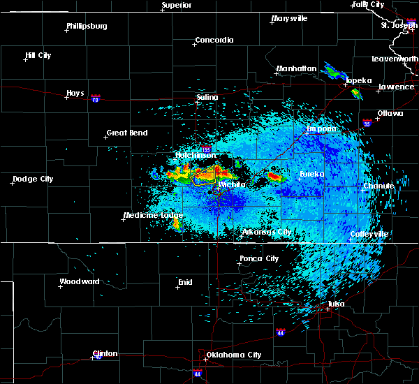 At 239 am cdt, a severe thunderstorm was located 6 miles northeast of valley center, moving northeast at 25 mph (radar indicated). Hazards include 60 mph wind gusts and quarter size hail. Hail damage to vehicles is expected. Expect wind damage to roofs, siding, and trees. At 239 am cdt, a severe thunderstorm was located 6 miles northeast of valley center, moving northeast at 25 mph (radar indicated). Hazards include 60 mph wind gusts and quarter size hail. Hail damage to vehicles is expected. Expect wind damage to roofs, siding, and trees.
|
| 8/25/2018 1:36 AM CDT |
 The severe thunderstorm warning for southeastern mcpherson, harvey and southwestern marion counties will expire at 145 am cdt, the storm which prompted the warning has weakened below severe limits, and no longer poses an immediate threat to life or property. therefore, the warning will be allowed to expire. The severe thunderstorm warning for southeastern mcpherson, harvey and southwestern marion counties will expire at 145 am cdt, the storm which prompted the warning has weakened below severe limits, and no longer poses an immediate threat to life or property. therefore, the warning will be allowed to expire.
|
| 8/25/2018 1:11 AM CDT |
 At 111 am cdt, a severe thunderstorm was located near hesston, moving east at 30 mph (radar indicated). Hazards include 70 mph wind gusts and penny size hail. Expect considerable tree damage. damage is likely to mobile homes, roofs, and outbuildings. Locations impacted include, newton, hesston, halstead, north newton, moundridge, burrton, goessel, walton, lehigh and newton airport. At 111 am cdt, a severe thunderstorm was located near hesston, moving east at 30 mph (radar indicated). Hazards include 70 mph wind gusts and penny size hail. Expect considerable tree damage. damage is likely to mobile homes, roofs, and outbuildings. Locations impacted include, newton, hesston, halstead, north newton, moundridge, burrton, goessel, walton, lehigh and newton airport.
|
| 8/25/2018 12:43 AM CDT |
 At 1243 am cdt, a severe thunderstorm was located near buhler, moving east at 30 mph (radar indicated). Hazards include 70 mph wind gusts and nickel size hail. Expect considerable tree damage. Damage is likely to mobile homes, roofs, and outbuildings. At 1243 am cdt, a severe thunderstorm was located near buhler, moving east at 30 mph (radar indicated). Hazards include 70 mph wind gusts and nickel size hail. Expect considerable tree damage. Damage is likely to mobile homes, roofs, and outbuildings.
|
| 8/16/2018 9:55 PM CDT |
 The severe thunderstorm warning for northeastern harvey, northwestern butler and southwestern marion counties will expire at 1000 pm cdt, the storm which prompted the warning has weakened below severe limits, and no longer poses an immediate threat to life or property. therefore, the warning will be allowed to expire. a severe thunderstorm watch remains in effect until 1100 pm cdt for south central and central kansas. The severe thunderstorm warning for northeastern harvey, northwestern butler and southwestern marion counties will expire at 1000 pm cdt, the storm which prompted the warning has weakened below severe limits, and no longer poses an immediate threat to life or property. therefore, the warning will be allowed to expire. a severe thunderstorm watch remains in effect until 1100 pm cdt for south central and central kansas.
|
| 8/16/2018 9:42 PM CDT |
 At 942 pm cdt, a severe thunderstorm was located near walton, or 7 miles southwest of peabody, moving southeast at 15 mph (radar indicated). Hazards include 60 mph wind gusts and quarter size hail. Hail damage to vehicles is expected. expect wind damage to roofs, siding, and trees. Locations impacted include, newton, north newton, peabody, goessel, walton, elbing and newton airport. At 942 pm cdt, a severe thunderstorm was located near walton, or 7 miles southwest of peabody, moving southeast at 15 mph (radar indicated). Hazards include 60 mph wind gusts and quarter size hail. Hail damage to vehicles is expected. expect wind damage to roofs, siding, and trees. Locations impacted include, newton, north newton, peabody, goessel, walton, elbing and newton airport.
|
| 8/16/2018 9:21 PM CDT |
 At 921 pm cdt, a severe thunderstorm was located near walton, or near peabody, moving southeast at 25 mph (radar indicated). Hazards include 60 mph wind gusts and quarter size hail. Hail damage to vehicles is expected. expect wind damage to roofs, siding, and trees. Locations impacted include, newton, north newton, peabody, goessel, walton, elbing and newton airport. At 921 pm cdt, a severe thunderstorm was located near walton, or near peabody, moving southeast at 25 mph (radar indicated). Hazards include 60 mph wind gusts and quarter size hail. Hail damage to vehicles is expected. expect wind damage to roofs, siding, and trees. Locations impacted include, newton, north newton, peabody, goessel, walton, elbing and newton airport.
|
| 8/16/2018 9:08 PM CDT |
 At 908 pm cdt, a severe thunderstorm was located near walton, or 7 miles west of peabody, moving southeast at 30 mph (radar indicated). Hazards include 60 mph wind gusts and quarter size hail. Hail damage to vehicles is expected. Expect wind damage to roofs, siding, and trees. At 908 pm cdt, a severe thunderstorm was located near walton, or 7 miles west of peabody, moving southeast at 30 mph (radar indicated). Hazards include 60 mph wind gusts and quarter size hail. Hail damage to vehicles is expected. Expect wind damage to roofs, siding, and trees.
|
| 7/29/2018 3:39 AM CDT |
 The severe thunderstorm warning for western harvey county will expire at 345 am cdt, the storm which prompted the warning has weakened below severe limits, and has exited the warned area. therefore, the warning will be allowed to expire. however gusty winds and heavy rain are still possible with this thunderstorm. The severe thunderstorm warning for western harvey county will expire at 345 am cdt, the storm which prompted the warning has weakened below severe limits, and has exited the warned area. therefore, the warning will be allowed to expire. however gusty winds and heavy rain are still possible with this thunderstorm.
|
| 7/29/2018 3:27 AM CDT |
 At 327 am cdt, a severe thunderstorm was located over colwich, moving east at 30 mph (radar indicated). Hazards include 60 mph wind gusts. Expect damage to roofs, siding, and trees. Locations impacted include, wichita, park city, valley center, maize, sedgwick, colwich, garden plain, mount hope, kechi, andale and bentley. At 327 am cdt, a severe thunderstorm was located over colwich, moving east at 30 mph (radar indicated). Hazards include 60 mph wind gusts. Expect damage to roofs, siding, and trees. Locations impacted include, wichita, park city, valley center, maize, sedgwick, colwich, garden plain, mount hope, kechi, andale and bentley.
|
| 7/29/2018 3:22 AM CDT |
 At 322 am cdt, a severe thunderstorm was located near burrton, moving east at 5 mph (radar indicated). Hazards include 60 mph wind gusts. Expect damage to roofs, siding, and trees. Locations impacted include, hesston, halstead and burrton. At 322 am cdt, a severe thunderstorm was located near burrton, moving east at 5 mph (radar indicated). Hazards include 60 mph wind gusts. Expect damage to roofs, siding, and trees. Locations impacted include, hesston, halstead and burrton.
|
| 7/29/2018 3:08 AM CDT |
 At 308 am cdt, a severe thunderstorm was located over mount hope, moving east at 40 mph (radar indicated). Hazards include 60 mph wind gusts. expect damage to roofs, siding, and trees At 308 am cdt, a severe thunderstorm was located over mount hope, moving east at 40 mph (radar indicated). Hazards include 60 mph wind gusts. expect damage to roofs, siding, and trees
|
| 7/29/2018 2:44 AM CDT |
 At 244 am cdt, severe thunderstorms were located along a line extending from 5 miles northeast of turon to partridge to near hutchinson, moving southeast at 45 mph (radar indicated). Hazards include 60 mph wind gusts. expect damage to roofs, siding, and trees At 244 am cdt, severe thunderstorms were located along a line extending from 5 miles northeast of turon to partridge to near hutchinson, moving southeast at 45 mph (radar indicated). Hazards include 60 mph wind gusts. expect damage to roofs, siding, and trees
|
| 6/26/2018 8:38 PM CDT |
 At 838 pm cdt, a severe thunderstorm was located over sedgwick, moving east at 25 mph (radar indicated). Hazards include 60 mph wind gusts and quarter size hail. Hail damage to vehicles is expected. Expect wind damage to roofs, siding, and trees. At 838 pm cdt, a severe thunderstorm was located over sedgwick, moving east at 25 mph (radar indicated). Hazards include 60 mph wind gusts and quarter size hail. Hail damage to vehicles is expected. Expect wind damage to roofs, siding, and trees.
|
| 6/11/2018 10:47 PM CDT |
 At 1046 pm cdt, severe thunderstorms were located along a line extending from near lincolnville to 5 miles northwest of buhler, moving southeast at 15 mph (trained weather spotters). Hazards include 70 mph wind gusts and quarter size hail. Hail damage to vehicles is expected. expect considerable tree damage. wind damage is also likely to mobile homes, roofs, and outbuildings. Locations impacted include, hutchinson, newton, hesston, south hutchinson, halstead, north newton, moundridge, sedgwick, inman, buhler, nickerson, burrton, whitewater, partridge, walton, yoder, willowbrook, newton airport and hutchinson airport. At 1046 pm cdt, severe thunderstorms were located along a line extending from near lincolnville to 5 miles northwest of buhler, moving southeast at 15 mph (trained weather spotters). Hazards include 70 mph wind gusts and quarter size hail. Hail damage to vehicles is expected. expect considerable tree damage. wind damage is also likely to mobile homes, roofs, and outbuildings. Locations impacted include, hutchinson, newton, hesston, south hutchinson, halstead, north newton, moundridge, sedgwick, inman, buhler, nickerson, burrton, whitewater, partridge, walton, yoder, willowbrook, newton airport and hutchinson airport.
|
| 6/11/2018 10:31 PM CDT |
 At 1030 pm cdt, severe thunderstorms were located along a line extending from near ramona to 8 miles west of inman, moving southeast at 15 mph (trained weather spotters have reported 1 inch hail just west of mcpherson with this storm). Hazards include 70 mph wind gusts and half dollar size hail. Hail damage to vehicles is expected. expect considerable tree damage. wind damage is also likely to mobile homes, roofs, and outbuildings. Locations impacted include, hutchinson, newton, hesston, hillsboro, south hutchinson, halstead, marion, north newton, moundridge, sedgwick, inman, buhler, peabody, nickerson, burrton, whitewater, florence, goessel, partridge and walton. At 1030 pm cdt, severe thunderstorms were located along a line extending from near ramona to 8 miles west of inman, moving southeast at 15 mph (trained weather spotters have reported 1 inch hail just west of mcpherson with this storm). Hazards include 70 mph wind gusts and half dollar size hail. Hail damage to vehicles is expected. expect considerable tree damage. wind damage is also likely to mobile homes, roofs, and outbuildings. Locations impacted include, hutchinson, newton, hesston, hillsboro, south hutchinson, halstead, marion, north newton, moundridge, sedgwick, inman, buhler, peabody, nickerson, burrton, whitewater, florence, goessel, partridge and walton.
|
| 6/11/2018 10:14 PM CDT |
 At 1014 pm cdt, severe thunderstorms were located along a line extending from ramona to 8 miles northeast of nickerson, moving southeast at 20 mph (radar indicated). Hazards include 70 mph wind gusts and half dollar size hail. Hail damage to vehicles is expected. expect considerable tree damage. Wind damage is also likely to mobile homes, roofs, and outbuildings. At 1014 pm cdt, severe thunderstorms were located along a line extending from ramona to 8 miles northeast of nickerson, moving southeast at 20 mph (radar indicated). Hazards include 70 mph wind gusts and half dollar size hail. Hail damage to vehicles is expected. expect considerable tree damage. Wind damage is also likely to mobile homes, roofs, and outbuildings.
|
| 5/29/2018 8:24 PM CDT |
 At 824 pm cdt, a severe thunderstorm was located over sedgwick, moving northeast at 20 mph (radar indicated). Hazards include 60 mph wind gusts and half dollar size hail. Hail damage to vehicles is expected. Expect wind damage to roofs, siding, and trees. At 824 pm cdt, a severe thunderstorm was located over sedgwick, moving northeast at 20 mph (radar indicated). Hazards include 60 mph wind gusts and half dollar size hail. Hail damage to vehicles is expected. Expect wind damage to roofs, siding, and trees.
|
| 5/29/2018 8:04 PM CDT | Awos station ewk... newton-city-county airpor in harvey county KS, 4.7 miles WSW of Newton, KS |
| 8/5/2017 6:10 PM CDT |
 At 610 pm cdt, a severe thunderstorm was located over sedgwick, moving northeast at 30 mph (radar indicated). Hazards include 60 mph wind gusts and nickel size hail. Expect damage to roofs, siding, and trees. Locations impacted include, newton, halstead, north newton, sedgwick, bentley and newton airport. At 610 pm cdt, a severe thunderstorm was located over sedgwick, moving northeast at 30 mph (radar indicated). Hazards include 60 mph wind gusts and nickel size hail. Expect damage to roofs, siding, and trees. Locations impacted include, newton, halstead, north newton, sedgwick, bentley and newton airport.
|
| 8/5/2017 5:57 PM CDT |
 At 557 pm cdt, a severe thunderstorm was located near bentley, or near mount hope, moving northeast at 30 mph (radar indicated). Hazards include 60 mph wind gusts and half dollar size hail. Hail damage to vehicles is expected. expect wind damage to roofs, siding, and trees. Locations impacted include, newton, park city, valley center, halstead, north newton, sedgwick, mount hope, bentley and newton airport. At 557 pm cdt, a severe thunderstorm was located near bentley, or near mount hope, moving northeast at 30 mph (radar indicated). Hazards include 60 mph wind gusts and half dollar size hail. Hail damage to vehicles is expected. expect wind damage to roofs, siding, and trees. Locations impacted include, newton, park city, valley center, halstead, north newton, sedgwick, mount hope, bentley and newton airport.
|
| 8/5/2017 5:50 PM CDT |
 At 550 pm cdt, a severe thunderstorm was located over mount hope, moving northeast at 30 mph (radar indicated). Hazards include 60 mph wind gusts and half dollar size hail. Hail damage to vehicles is expected. expect wind damage to roofs, siding, and trees. Locations impacted include, newton, park city, valley center, halstead, north newton, sedgwick, mount hope, andale, bentley and newton airport. At 550 pm cdt, a severe thunderstorm was located over mount hope, moving northeast at 30 mph (radar indicated). Hazards include 60 mph wind gusts and half dollar size hail. Hail damage to vehicles is expected. expect wind damage to roofs, siding, and trees. Locations impacted include, newton, park city, valley center, halstead, north newton, sedgwick, mount hope, andale, bentley and newton airport.
|
| 8/5/2017 5:41 PM CDT |
 At 541 pm cdt, a severe thunderstorm was located near mount hope, moving northeast at 35 mph (radar indicated). Hazards include 60 mph wind gusts and quarter size hail. Hail damage to vehicles is expected. Expect wind damage to roofs, siding, and trees. At 541 pm cdt, a severe thunderstorm was located near mount hope, moving northeast at 35 mph (radar indicated). Hazards include 60 mph wind gusts and quarter size hail. Hail damage to vehicles is expected. Expect wind damage to roofs, siding, and trees.
|
| 6/15/2017 7:36 PM CDT |
 At 734 pm cdt, severe thunderstorms were located along a line extending from near valley center to near garden plain to 5 miles west of kingman, moving southeast at 30 mph. these are very dangerous storms (law enforcement). Hazards include 90 mph wind gusts and quarter size hail. reports of 85 mph winds have been reported in the wichita metro area. You are in a life-threatening situation. flying debris may be deadly to those caught without shelter. mobile homes will be heavily damaged or destroyed. homes and businesses will have substantial roof and window damage. expect extensive tree damage and power outages. Locations impacted include, wichita, newton, park city, valley center, bel aire, goddard, hesston, maize, kingman, cheney, halstead, north newton, sedgwick, colwich, haven, benton, garden plain, mount hope, whitewater and pretty prairie. At 734 pm cdt, severe thunderstorms were located along a line extending from near valley center to near garden plain to 5 miles west of kingman, moving southeast at 30 mph. these are very dangerous storms (law enforcement). Hazards include 90 mph wind gusts and quarter size hail. reports of 85 mph winds have been reported in the wichita metro area. You are in a life-threatening situation. flying debris may be deadly to those caught without shelter. mobile homes will be heavily damaged or destroyed. homes and businesses will have substantial roof and window damage. expect extensive tree damage and power outages. Locations impacted include, wichita, newton, park city, valley center, bel aire, goddard, hesston, maize, kingman, cheney, halstead, north newton, sedgwick, colwich, haven, benton, garden plain, mount hope, whitewater and pretty prairie.
|
| 6/15/2017 7:27 PM CDT |
 At 726 pm cdt, a severe thunderstorm located along a line extending from near valley center to 5 miles southwest of andale to 7 miles northwest of kingman, moving southeast at 30 mph. these are very dangerous storms (radar indicated). Hazards include 90 mph wind gusts and quarter size hail. You are in a life-threatening situation. flying debris may be deadly to those caught without shelter. mobile homes will be heavily damaged or destroyed. homes and businesses will have substantial roof and window damage. expect extensive tree damage and power outages. Locations impacted include, wichita, newton, park city, valley center, bel aire, goddard, hesston, maize, kingman, cheney, halstead, north newton, sedgwick, colwich, haven, benton, garden plain, mount hope, whitewater and pretty prairie. At 726 pm cdt, a severe thunderstorm located along a line extending from near valley center to 5 miles southwest of andale to 7 miles northwest of kingman, moving southeast at 30 mph. these are very dangerous storms (radar indicated). Hazards include 90 mph wind gusts and quarter size hail. You are in a life-threatening situation. flying debris may be deadly to those caught without shelter. mobile homes will be heavily damaged or destroyed. homes and businesses will have substantial roof and window damage. expect extensive tree damage and power outages. Locations impacted include, wichita, newton, park city, valley center, bel aire, goddard, hesston, maize, kingman, cheney, halstead, north newton, sedgwick, colwich, haven, benton, garden plain, mount hope, whitewater and pretty prairie.
|
| 6/15/2017 7:08 PM CDT |
 At 705 pm cdt, a severe thunderstorm was located along a line extending from near halstead to haven to 6 miles northeast of turon, moving southeast at 30 mph. these are very dangerous storms (law enforcement). Hazards include 80 mph wind gusts and quarter size hail. Flying debris will be dangerous to those caught without shelter. mobile homes will be heavily damaged. expect considerable damage to roofs, windows, and vehicles. extensive tree damage and power outages are likely. Locations impacted include, wichita, newton, park city, valley center, bel aire, goddard, hesston, maize, kingman, cheney, halstead, north newton, sedgwick, colwich, haven, benton, garden plain, mount hope, whitewater and pretty prairie. At 705 pm cdt, a severe thunderstorm was located along a line extending from near halstead to haven to 6 miles northeast of turon, moving southeast at 30 mph. these are very dangerous storms (law enforcement). Hazards include 80 mph wind gusts and quarter size hail. Flying debris will be dangerous to those caught without shelter. mobile homes will be heavily damaged. expect considerable damage to roofs, windows, and vehicles. extensive tree damage and power outages are likely. Locations impacted include, wichita, newton, park city, valley center, bel aire, goddard, hesston, maize, kingman, cheney, halstead, north newton, sedgwick, colwich, haven, benton, garden plain, mount hope, whitewater and pretty prairie.
|
| 6/15/2017 7:05 PM CDT | Via social medi in harvey county KS, 6.4 miles WNW of Newton, KS |
| 6/15/2017 7:00 PM CDT |
 At 657 pm cdt, severe thunderstorms were located along a line extending from near hesston to near haven to 5 miles southeast of sylvia, moving southeast at 30 mph (trained spotters). Hazards include 70 mph wind gusts and quarter size hail. Hail damage to vehicles is expected. expect considerable tree damage. wind damage is also likely to mobile homes, roofs, and outbuildings. Locations impacted include, wichita, newton, park city, valley center, bel aire, goddard, hesston, maize, kingman, cheney, halstead, north newton, sedgwick, colwich, haven, benton, garden plain, mount hope, whitewater and pretty prairie. At 657 pm cdt, severe thunderstorms were located along a line extending from near hesston to near haven to 5 miles southeast of sylvia, moving southeast at 30 mph (trained spotters). Hazards include 70 mph wind gusts and quarter size hail. Hail damage to vehicles is expected. expect considerable tree damage. wind damage is also likely to mobile homes, roofs, and outbuildings. Locations impacted include, wichita, newton, park city, valley center, bel aire, goddard, hesston, maize, kingman, cheney, halstead, north newton, sedgwick, colwich, haven, benton, garden plain, mount hope, whitewater and pretty prairie.
|
| 6/15/2017 6:54 PM CDT | Storm damage reported in harvey county KS, 5.2 miles WSW of Newton, KS |
| 6/15/2017 6:39 PM CDT |
 At 638 pm cdt, severe thunderstorms were located along a line extending from moundridge to hutchinson to near sylvia, moving southeast at 30 mph (radar indicated). Hazards include 70 mph wind gusts and quarter size hail. Hail damage to vehicles is expected. expect considerable tree damage. Wind damage is also likely to mobile homes, roofs, and outbuildings. At 638 pm cdt, severe thunderstorms were located along a line extending from moundridge to hutchinson to near sylvia, moving southeast at 30 mph (radar indicated). Hazards include 70 mph wind gusts and quarter size hail. Hail damage to vehicles is expected. expect considerable tree damage. Wind damage is also likely to mobile homes, roofs, and outbuildings.
|
| 5/31/2017 2:39 PM CDT |
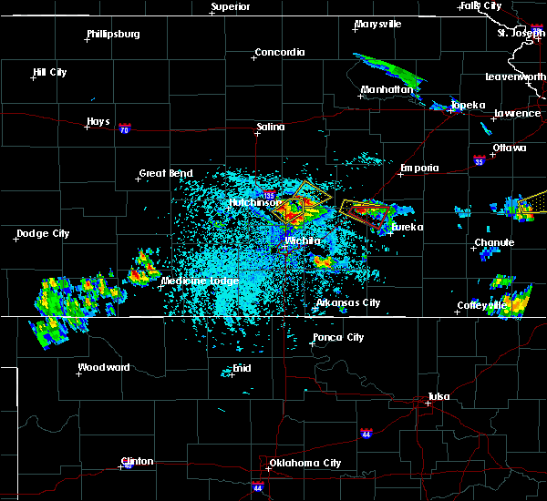 At 239 pm cdt, a severe thunderstorm was located just east of north newton, moving east at 20 mph (radar indicated). Hazards include ping pong ball size hail and 60 mph wind gusts. People and animals outdoors will be injured. expect hail damage to roofs, siding, windows, and vehicles. expect wind damage to roofs, siding, and trees. Locations impacted include, newton, north newton, walton and newton airport. At 239 pm cdt, a severe thunderstorm was located just east of north newton, moving east at 20 mph (radar indicated). Hazards include ping pong ball size hail and 60 mph wind gusts. People and animals outdoors will be injured. expect hail damage to roofs, siding, windows, and vehicles. expect wind damage to roofs, siding, and trees. Locations impacted include, newton, north newton, walton and newton airport.
|
| 5/31/2017 2:36 PM CDT |
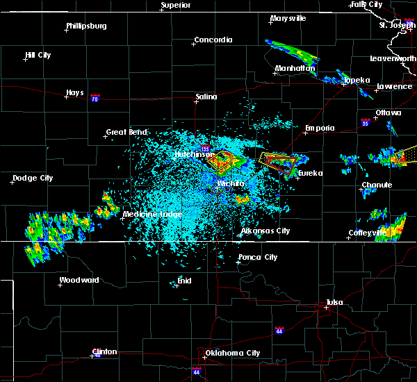 At 235 pm cdt, a severe thunderstorm was located near north newton, moving east at 20 mph (trained weather spotters). Hazards include ping pong ball size hail and 60 mph wind gusts. People and animals outdoors will be injured. expect hail damage to roofs, siding, windows, and vehicles. expect wind damage to roofs, siding, and trees. Locations impacted include, newton, north newton, walton and newton airport. At 235 pm cdt, a severe thunderstorm was located near north newton, moving east at 20 mph (trained weather spotters). Hazards include ping pong ball size hail and 60 mph wind gusts. People and animals outdoors will be injured. expect hail damage to roofs, siding, windows, and vehicles. expect wind damage to roofs, siding, and trees. Locations impacted include, newton, north newton, walton and newton airport.
|
| 5/31/2017 2:25 PM CDT |
 At 224 pm cdt, a severe thunderstorm was located near walton, or 6 miles east of north newton, moving northeast at 15 mph (trained weather spotters). Hazards include ping pong ball size hail and 60 mph wind gusts. People and animals outdoors will be injured. expect hail damage to roofs, siding, windows, and vehicles. expect wind damage to roofs, siding, and trees. Locations impacted include, newton, north newton, walton and newton airport. At 224 pm cdt, a severe thunderstorm was located near walton, or 6 miles east of north newton, moving northeast at 15 mph (trained weather spotters). Hazards include ping pong ball size hail and 60 mph wind gusts. People and animals outdoors will be injured. expect hail damage to roofs, siding, windows, and vehicles. expect wind damage to roofs, siding, and trees. Locations impacted include, newton, north newton, walton and newton airport.
|
| 5/31/2017 2:18 PM CDT | Half Dollar sized hail reported 5.9 miles WSW of Newton, KS |
| 5/31/2017 2:14 PM CDT |
 At 213 pm cdt, a severe thunderstorm was located near newton, moving northeast at 15 mph. there were other storms in the warned area that were also developing (radar indicated). Hazards include golf ball size hail and 60 mph wind gusts. People and animals outdoors will be injured. expect hail damage to roofs, siding, windows, and vehicles. expect wind damage to roofs, siding, and trees. Locations impacted include, newton, north newton, walton and newton airport. At 213 pm cdt, a severe thunderstorm was located near newton, moving northeast at 15 mph. there were other storms in the warned area that were also developing (radar indicated). Hazards include golf ball size hail and 60 mph wind gusts. People and animals outdoors will be injured. expect hail damage to roofs, siding, windows, and vehicles. expect wind damage to roofs, siding, and trees. Locations impacted include, newton, north newton, walton and newton airport.
|
| 5/31/2017 2:03 PM CDT |
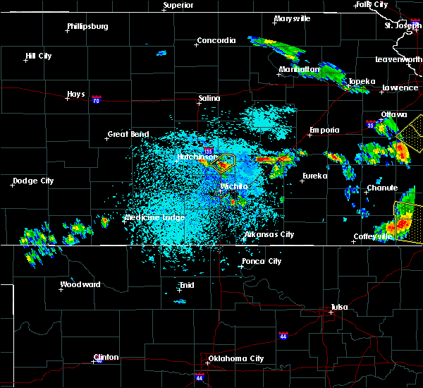 At 203 pm cdt, a severe thunderstorm was located over newton, moving northeast at 15 mph (radar indicated). Hazards include golf ball size hail and 60 mph wind gusts. People and animals outdoors will be injured. expect hail damage to roofs, siding, windows, and vehicles. Expect wind damage to roofs, siding, and trees. At 203 pm cdt, a severe thunderstorm was located over newton, moving northeast at 15 mph (radar indicated). Hazards include golf ball size hail and 60 mph wind gusts. People and animals outdoors will be injured. expect hail damage to roofs, siding, windows, and vehicles. Expect wind damage to roofs, siding, and trees.
|
| 5/31/2017 2:00 PM CDT | Golf Ball sized hail reported 1.1 miles WSW of Newton, KS |
| 5/19/2017 7:00 PM CDT | Delayed report. time estimated from rada in harvey county KS, 1.1 miles WSW of Newton, KS |
| 5/19/2017 6:23 PM CDT |
 A tornado warning remains in effect until 645 pm cdt for central harvey county. at 623 pm cdt, a severe thunderstorm capable of producing a tornado was located over hesston, moving northeast at 30 mph. hazard. tornado. source. Radar indicated rotation. A tornado warning remains in effect until 645 pm cdt for central harvey county. at 623 pm cdt, a severe thunderstorm capable of producing a tornado was located over hesston, moving northeast at 30 mph. hazard. tornado. source. Radar indicated rotation.
|
| 5/19/2017 6:20 PM CDT |
 At 620 pm cdt, a severe thunderstorm capable of producing a tornado was located over hesston, moving northeast at 35 mph (radar indicated rotation). Hazards include tornado. Flying debris will be dangerous to those caught without shelter. mobile homes will be damaged or destroyed. damage to roofs, windows, and vehicles will occur. tree damage is likely. This dangerous storm will be near, north newton around 625 pm cdt. At 620 pm cdt, a severe thunderstorm capable of producing a tornado was located over hesston, moving northeast at 35 mph (radar indicated rotation). Hazards include tornado. Flying debris will be dangerous to those caught without shelter. mobile homes will be damaged or destroyed. damage to roofs, windows, and vehicles will occur. tree damage is likely. This dangerous storm will be near, north newton around 625 pm cdt.
|
| 5/19/2017 6:06 PM CDT |
 At 606 pm cdt, a severe thunderstorm capable of producing a tornado was located over mount hope, moving northeast at 30 mph (radar indicated rotation). Hazards include tornado. Flying debris will be dangerous to those caught without shelter. mobile homes will be damaged or destroyed. damage to roofs, windows, and vehicles will occur. tree damage is likely. this dangerous storm will be near, halstead around 625 pm cdt. newton around 640 pm cdt. North newton around 645 pm cdt. At 606 pm cdt, a severe thunderstorm capable of producing a tornado was located over mount hope, moving northeast at 30 mph (radar indicated rotation). Hazards include tornado. Flying debris will be dangerous to those caught without shelter. mobile homes will be damaged or destroyed. damage to roofs, windows, and vehicles will occur. tree damage is likely. this dangerous storm will be near, halstead around 625 pm cdt. newton around 640 pm cdt. North newton around 645 pm cdt.
|
| 5/19/2017 5:55 PM CDT |
 At 555 pm cdt, a severe thunderstorm capable of producing a tornado was located near mount hope, moving northeast at 45 mph (radar indicated rotation). Hazards include tornado. Flying debris will be dangerous to those caught without shelter. mobile homes will be damaged or destroyed. damage to roofs, windows, and vehicles will occur. tree damage is likely. this dangerous storm will be near, halstead around 610 pm cdt. newton around 620 pm cdt. hesston and north newton around 625 pm cdt. this includes interstate 135 between mile markers 30 and 42. This storm has a history of producing tornadoes. At 555 pm cdt, a severe thunderstorm capable of producing a tornado was located near mount hope, moving northeast at 45 mph (radar indicated rotation). Hazards include tornado. Flying debris will be dangerous to those caught without shelter. mobile homes will be damaged or destroyed. damage to roofs, windows, and vehicles will occur. tree damage is likely. this dangerous storm will be near, halstead around 610 pm cdt. newton around 620 pm cdt. hesston and north newton around 625 pm cdt. this includes interstate 135 between mile markers 30 and 42. This storm has a history of producing tornadoes.
|
| 5/18/2017 6:21 PM CDT | Storm damage reported in harvey county KS, 5.2 miles WSW of Newton, KS |
| 5/18/2017 6:21 PM CDT | Emergency manager reports damage to small sheds on the south side of the city and branches of 1.5 to 2 feet in diameter have fallen down. multiple power lines are down in harvey county KS, 1.1 miles WSW of Newton, KS |
| 5/18/2017 5:13 PM CDT |
 At 513 pm cdt, a severe thunderstorm was located 7 miles northeast of burrton, moving north at 30 mph (radar indicated). Hazards include ping pong ball size hail and 60 mph wind gusts. People and animals outdoors will be injured. expect hail damage to roofs, siding, windows, and vehicles. expect wind damage to roofs, siding, and trees. locations impacted include, mcpherson, hesston, halstead, moundridge, inman, burrton, galva, canton and mcpherson airport. A tornado watch remains in effect until 1100 pm cdt for south central and central kansas. At 513 pm cdt, a severe thunderstorm was located 7 miles northeast of burrton, moving north at 30 mph (radar indicated). Hazards include ping pong ball size hail and 60 mph wind gusts. People and animals outdoors will be injured. expect hail damage to roofs, siding, windows, and vehicles. expect wind damage to roofs, siding, and trees. locations impacted include, mcpherson, hesston, halstead, moundridge, inman, burrton, galva, canton and mcpherson airport. A tornado watch remains in effect until 1100 pm cdt for south central and central kansas.
|
| 5/18/2017 4:57 PM CDT |
 At 457 pm cdt, a severe thunderstorm was located near burrton, moving north at 30 mph (radar indicated). Hazards include 60 mph wind gusts and half dollar size hail. Hail damage to vehicles is expected. Expect wind damage to roofs, siding, and trees. At 457 pm cdt, a severe thunderstorm was located near burrton, moving north at 30 mph (radar indicated). Hazards include 60 mph wind gusts and half dollar size hail. Hail damage to vehicles is expected. Expect wind damage to roofs, siding, and trees.
|
| 3/24/2017 5:25 PM CDT |
 At 524 pm cdt, a severe thunderstorm was located over halstead, moving north at 20 mph (radar indicated). Hazards include quarter size hail. Damage to vehicles is expected. Locations impacted include, halstead. At 524 pm cdt, a severe thunderstorm was located over halstead, moving north at 20 mph (radar indicated). Hazards include quarter size hail. Damage to vehicles is expected. Locations impacted include, halstead.
|
| 3/24/2017 5:13 PM CDT |
 At 513 pm cdt, a severe thunderstorm was located over halstead, moving north at 20 mph (radar indicated). Hazards include half dollar size hail. Damage to vehicles is expected. Locations impacted include, halstead, sedgwick and bentley. At 513 pm cdt, a severe thunderstorm was located over halstead, moving north at 20 mph (radar indicated). Hazards include half dollar size hail. Damage to vehicles is expected. Locations impacted include, halstead, sedgwick and bentley.
|
| 3/24/2017 4:58 PM CDT |
 At 457 pm cdt, a severe thunderstorm was located over bentley, or near sedgwick, moving north at 20 mph (public reported golf ball hail in bentley). Hazards include golf ball size hail. People and animals outdoors will be injured. expect damage to roofs, siding, windows, and vehicles. Locations impacted include, halstead, sedgwick and bentley. At 457 pm cdt, a severe thunderstorm was located over bentley, or near sedgwick, moving north at 20 mph (public reported golf ball hail in bentley). Hazards include golf ball size hail. People and animals outdoors will be injured. expect damage to roofs, siding, windows, and vehicles. Locations impacted include, halstead, sedgwick and bentley.
|
| 3/24/2017 4:49 PM CDT |
 At 449 pm cdt, a severe thunderstorm was located over bentley, or near sedgwick, moving north at 20 mph (radar indicated). Hazards include quarter size hail. damage to vehicles is expected At 449 pm cdt, a severe thunderstorm was located over bentley, or near sedgwick, moving north at 20 mph (radar indicated). Hazards include quarter size hail. damage to vehicles is expected
|
| 9/24/2016 5:56 PM CDT |
 At 555 pm cdt, a severe thunderstorm was located near sedgwick, moving northeast at 35 mph (radar indicated). Hazards include 60 mph wind gusts. Expect damage to roofs. siding. and trees. Locations impacted include, newton, park city, valley center, maize, halstead, north newton, sedgwick, colwich, burrton, mount hope, bentley and newton airport. At 555 pm cdt, a severe thunderstorm was located near sedgwick, moving northeast at 35 mph (radar indicated). Hazards include 60 mph wind gusts. Expect damage to roofs. siding. and trees. Locations impacted include, newton, park city, valley center, maize, halstead, north newton, sedgwick, colwich, burrton, mount hope, bentley and newton airport.
|
| 9/24/2016 5:43 PM CDT |
 At 542 pm cdt, a severe thunderstorm was located over colwich, moving northeast at 30 mph (radar indicated). Hazards include 60 mph wind gusts and penny size hail. Expect damage to roofs. siding. and trees. Locations impacted include, wichita, newton, park city, valley center, goddard, maize, halstead, north newton, sedgwick, colwich, burrton, garden plain, mount hope, andale, bentley, west wichita and newton airport. At 542 pm cdt, a severe thunderstorm was located over colwich, moving northeast at 30 mph (radar indicated). Hazards include 60 mph wind gusts and penny size hail. Expect damage to roofs. siding. and trees. Locations impacted include, wichita, newton, park city, valley center, goddard, maize, halstead, north newton, sedgwick, colwich, burrton, garden plain, mount hope, andale, bentley, west wichita and newton airport.
|
| 9/24/2016 5:30 PM CDT |
 At 530 pm cdt, a severe thunderstorm was located near andale, or near colwich, moving northeast at 35 mph (radar indicated). Hazards include 60 mph wind gusts and quarter size hail. Hail damage to vehicles is expected. Expect wind damage to roofs, siding, and trees. At 530 pm cdt, a severe thunderstorm was located near andale, or near colwich, moving northeast at 35 mph (radar indicated). Hazards include 60 mph wind gusts and quarter size hail. Hail damage to vehicles is expected. Expect wind damage to roofs, siding, and trees.
|
| 8/24/2016 6:24 PM CDT |
 At 623 pm cdt, a severe thunderstorm was located near elbing, or near peabody, moving northeast at 45 mph (radar indicated). Hazards include 70 mph wind gusts and half dollar size hail. Hail damage to vehicles is expected. expect considerable tree damage. wind damage is also likely to mobile homes, roofs, and outbuildings. Locations impacted include, newton, hesston, hillsboro, marion, north newton, peabody, whitewater, florence, goessel, walton, elbing, lehigh, newton airport and marion lake. At 623 pm cdt, a severe thunderstorm was located near elbing, or near peabody, moving northeast at 45 mph (radar indicated). Hazards include 70 mph wind gusts and half dollar size hail. Hail damage to vehicles is expected. expect considerable tree damage. wind damage is also likely to mobile homes, roofs, and outbuildings. Locations impacted include, newton, hesston, hillsboro, marion, north newton, peabody, whitewater, florence, goessel, walton, elbing, lehigh, newton airport and marion lake.
|
| 8/24/2016 6:13 PM CDT |
 At 613 pm cdt, a severe thunderstorm was located near walton, or 6 miles east of newton, moving northeast at 35 mph (radar indicated). Hazards include 70 mph wind gusts and half dollar size hail. Hail damage to vehicles is expected. expect considerable tree damage. Wind damage is also likely to mobile homes, roofs, and outbuildings. At 613 pm cdt, a severe thunderstorm was located near walton, or 6 miles east of newton, moving northeast at 35 mph (radar indicated). Hazards include 70 mph wind gusts and half dollar size hail. Hail damage to vehicles is expected. expect considerable tree damage. Wind damage is also likely to mobile homes, roofs, and outbuildings.
|
| 8/11/2016 10:07 PM CDT |
 At 1006 pm cdt, a severe thunderstorm was located over peabody, and is nearly stationary (radar indicated). Hazards include 60 mph wind gusts. Expect damage to roofs. siding. and trees. Locations impacted include, newton, hesston, hillsboro, north newton, peabody, walton and newton airport. At 1006 pm cdt, a severe thunderstorm was located over peabody, and is nearly stationary (radar indicated). Hazards include 60 mph wind gusts. Expect damage to roofs. siding. and trees. Locations impacted include, newton, hesston, hillsboro, north newton, peabody, walton and newton airport.
|
| 8/11/2016 9:51 PM CDT |
 At 951 pm cdt, a severe thunderstorm was located over walton, or 6 miles northeast of north newton, moving east at 40 mph (radar indicated). Hazards include 60 mph wind gusts. Expect damage to roofs. siding. And trees. At 951 pm cdt, a severe thunderstorm was located over walton, or 6 miles northeast of north newton, moving east at 40 mph (radar indicated). Hazards include 60 mph wind gusts. Expect damage to roofs. siding. And trees.
|
| 7/28/2016 8:28 PM CDT |
 At 827 pm cdt, severe thunderstorms were located along a line extending from 5 miles south of whitewater to near haysville to 11 miles south of kingman, moving southeast at 50 mph. these are very dangerous storms (radar indicated). Hazards include 80 mph wind gusts and golf ball size hail. Flying debris will be dangerous to those caught without shelter. mobile homes will be heavily damaged. expect considerable damage to roofs, windows, and vehicles. extensive tree damage and power outages are likely. Locations impacted include, wichita, derby, el dorado, andover, haysville, augusta, park city, valley center, bel aire, mulvane, goddard, rose hill, maize, kingman, clearwater, cheney, douglass, sedgwick, belle plaine and harper. At 827 pm cdt, severe thunderstorms were located along a line extending from 5 miles south of whitewater to near haysville to 11 miles south of kingman, moving southeast at 50 mph. these are very dangerous storms (radar indicated). Hazards include 80 mph wind gusts and golf ball size hail. Flying debris will be dangerous to those caught without shelter. mobile homes will be heavily damaged. expect considerable damage to roofs, windows, and vehicles. extensive tree damage and power outages are likely. Locations impacted include, wichita, derby, el dorado, andover, haysville, augusta, park city, valley center, bel aire, mulvane, goddard, rose hill, maize, kingman, clearwater, cheney, douglass, sedgwick, belle plaine and harper.
|
| 7/28/2016 8:15 PM CDT |
 At 815 pm cdt, severe thunderstorms were located along a line extending from near walton to west wichita to 10 miles southwest of kingman, moving southeast at 45 mph. these are very dangerous storms (radar indicated). Hazards include 80 mph wind gusts and two inch hail. Flying debris will be dangerous to those caught without shelter. mobile homes will be heavily damaged. expect considerable damage to roofs, windows, and vehicles. Extensive tree damage and power outages are likely. At 815 pm cdt, severe thunderstorms were located along a line extending from near walton to west wichita to 10 miles southwest of kingman, moving southeast at 45 mph. these are very dangerous storms (radar indicated). Hazards include 80 mph wind gusts and two inch hail. Flying debris will be dangerous to those caught without shelter. mobile homes will be heavily damaged. expect considerable damage to roofs, windows, and vehicles. Extensive tree damage and power outages are likely.
|
| 7/28/2016 8:00 PM CDT |
 At 800 pm cdt, severe thunderstorms were located along a line extending from near goessel to near mount hope to 7 miles west of kingman, moving southeast at 45 mph. these are very dangerous storms (radar indicated). Hazards include 80 mph wind gusts and two inch hail. Flying debris will be dangerous to those caught without shelter. mobile homes will be heavily damaged. expect considerable damage to roofs, windows, and vehicles. extensive tree damage and power outages are likely. Locations impacted include, wichita, newton, park city, valley center, bel aire, goddard, hesston, maize, kingman, cheney, halstead, north newton, moundridge, sedgwick, colwich, haven, burrton, garden plain, mount hope and whitewater. At 800 pm cdt, severe thunderstorms were located along a line extending from near goessel to near mount hope to 7 miles west of kingman, moving southeast at 45 mph. these are very dangerous storms (radar indicated). Hazards include 80 mph wind gusts and two inch hail. Flying debris will be dangerous to those caught without shelter. mobile homes will be heavily damaged. expect considerable damage to roofs, windows, and vehicles. extensive tree damage and power outages are likely. Locations impacted include, wichita, newton, park city, valley center, bel aire, goddard, hesston, maize, kingman, cheney, halstead, north newton, moundridge, sedgwick, colwich, haven, burrton, garden plain, mount hope and whitewater.
|
| 7/28/2016 7:50 PM CDT |
 At 749 pm cdt, severe thunderstorms were located along a line extending from near goessel to near mount hope to 9 miles northwest of kingman, moving southeast at 45 mph. these are very dangerous storms (radar indicated). Hazards include 80 mph wind gusts and golf ball size hail. Flying debris will be dangerous to those caught without shelter. mobile homes will be heavily damaged. expect considerable damage to roofs, windows, and vehicles. Extensive tree damage and power outages are likely. At 749 pm cdt, severe thunderstorms were located along a line extending from near goessel to near mount hope to 9 miles northwest of kingman, moving southeast at 45 mph. these are very dangerous storms (radar indicated). Hazards include 80 mph wind gusts and golf ball size hail. Flying debris will be dangerous to those caught without shelter. mobile homes will be heavily damaged. expect considerable damage to roofs, windows, and vehicles. Extensive tree damage and power outages are likely.
|
| 7/28/2016 7:42 PM CDT |
 At 741 pm cdt, severe thunderstorms were located along a line extending from 6 miles north of moundridge to near burrton to near arlington, moving southeast at 45 mph. these are very dangerous storms (radar indicated). Hazards include 80 mph wind gusts and golf ball size hail. Flying debris will be dangerous to those caught without shelter. mobile homes will be heavily damaged. expect considerable damage to roofs, windows, and vehicles. extensive tree damage and power outages are likely. Locations impacted include, hutchinson, mcpherson, hesston, south hutchinson, halstead, moundridge, inman, buhler, haven, nickerson, burrton, galva, canton, arlington, turon, partridge, sylvia, plevna, abbyville and yoder. At 741 pm cdt, severe thunderstorms were located along a line extending from 6 miles north of moundridge to near burrton to near arlington, moving southeast at 45 mph. these are very dangerous storms (radar indicated). Hazards include 80 mph wind gusts and golf ball size hail. Flying debris will be dangerous to those caught without shelter. mobile homes will be heavily damaged. expect considerable damage to roofs, windows, and vehicles. extensive tree damage and power outages are likely. Locations impacted include, hutchinson, mcpherson, hesston, south hutchinson, halstead, moundridge, inman, buhler, haven, nickerson, burrton, galva, canton, arlington, turon, partridge, sylvia, plevna, abbyville and yoder.
|
| 7/28/2016 7:37 PM CDT |
 At 737 pm cdt, severe thunderstorms were located along a line extending from 5 miles south of galva to near burrton to near abbyville, moving southeast at 45 mph. these are very dangerous storms (radar indicated). Hazards include 80 mph wind gusts and golf ball size hail. Flying debris will be dangerous to those caught without shelter. mobile homes will be heavily damaged. expect considerable damage to roofs, windows, and vehicles. extensive tree damage and power outages are likely. Locations impacted include, hutchinson, mcpherson, hesston, south hutchinson, halstead, moundridge, inman, buhler, haven, nickerson, burrton, galva, canton, arlington, turon, partridge, sylvia, plevna, abbyville and yoder. At 737 pm cdt, severe thunderstorms were located along a line extending from 5 miles south of galva to near burrton to near abbyville, moving southeast at 45 mph. these are very dangerous storms (radar indicated). Hazards include 80 mph wind gusts and golf ball size hail. Flying debris will be dangerous to those caught without shelter. mobile homes will be heavily damaged. expect considerable damage to roofs, windows, and vehicles. extensive tree damage and power outages are likely. Locations impacted include, hutchinson, mcpherson, hesston, south hutchinson, halstead, moundridge, inman, buhler, haven, nickerson, burrton, galva, canton, arlington, turon, partridge, sylvia, plevna, abbyville and yoder.
|
| 7/28/2016 7:23 PM CDT |
 At 723 pm cdt, severe thunderstorms were located along a line extending from mcpherson to near hutchinson to 6 miles southwest of alden, moving southeast at 50 mph. these are very dangerous storms (radar indicated). Hazards include 80 mph wind gusts and golf ball size hail. Flying debris will be dangerous to those caught without shelter. mobile homes will be heavily damaged. expect considerable damage to roofs, windows, and vehicles. Extensive tree damage and power outages are likely. At 723 pm cdt, severe thunderstorms were located along a line extending from mcpherson to near hutchinson to 6 miles southwest of alden, moving southeast at 50 mph. these are very dangerous storms (radar indicated). Hazards include 80 mph wind gusts and golf ball size hail. Flying debris will be dangerous to those caught without shelter. mobile homes will be heavily damaged. expect considerable damage to roofs, windows, and vehicles. Extensive tree damage and power outages are likely.
|
| 7/14/2016 8:41 AM CDT |
 At 840 am cdt, a severe thunderstorm was located over valley center, moving east at 25 mph. this is a very dangerous storm (trained weather spotters). Hazards include 80 mph wind gusts and nickel size hail. Flying debris will be dangerous to those caught without shelter. mobile homes will be heavily damaged. expect considerable damage to roofs, windows, and vehicles. extensive tree damage and power outages are likely. Locations impacted include, wichita, derby, andover, haysville, park city, valley center, bel aire, mulvane, rose hill, maize, sedgwick, whitewater, downtown wichita, kechi, eastborough, west wichita, mcconnell air force base, south wichita, northeast wichita and eisenhower national airport. At 840 am cdt, a severe thunderstorm was located over valley center, moving east at 25 mph. this is a very dangerous storm (trained weather spotters). Hazards include 80 mph wind gusts and nickel size hail. Flying debris will be dangerous to those caught without shelter. mobile homes will be heavily damaged. expect considerable damage to roofs, windows, and vehicles. extensive tree damage and power outages are likely. Locations impacted include, wichita, derby, andover, haysville, park city, valley center, bel aire, mulvane, rose hill, maize, sedgwick, whitewater, downtown wichita, kechi, eastborough, west wichita, mcconnell air force base, south wichita, northeast wichita and eisenhower national airport.
|
| 7/14/2016 8:22 AM CDT |
 At 821 am cdt, a severe thunderstorm was located near colwich, moving east at 25 mph. this is a very dangerous storm (trained weather spotters). Hazards include 80 mph wind gusts and nickel size hail. Flying debris will be dangerous to those caught without shelter. mobile homes will be heavily damaged. expect considerable damage to roofs, windows, and vehicles. extensive tree damage and power outages are likely. Locations impacted include, wichita, derby, andover, haysville, park city, valley center, bel aire, mulvane, goddard, rose hill, maize, halstead, sedgwick, colwich, whitewater, downtown wichita, kechi, eastborough, bentley and south wichita. At 821 am cdt, a severe thunderstorm was located near colwich, moving east at 25 mph. this is a very dangerous storm (trained weather spotters). Hazards include 80 mph wind gusts and nickel size hail. Flying debris will be dangerous to those caught without shelter. mobile homes will be heavily damaged. expect considerable damage to roofs, windows, and vehicles. extensive tree damage and power outages are likely. Locations impacted include, wichita, derby, andover, haysville, park city, valley center, bel aire, mulvane, goddard, rose hill, maize, halstead, sedgwick, colwich, whitewater, downtown wichita, kechi, eastborough, bentley and south wichita.
|
| 7/14/2016 8:18 AM CDT |
 At 817 am cdt, a severe thunderstorm was located near colwich, moving east at 25 mph. this is a very dangerous storm (trained weather spotters). Hazards include 80 mph wind gusts and nickel size hail. trained spotters have reported 70mph winds in far western wichita. Flying debris will be dangerous to those caught without shelter. mobile homes will be heavily damaged. expect considerable damage to roofs, windows, and vehicles. extensive tree damage and power outages are likely. Locations impacted include, wichita, derby, andover, haysville, park city, valley center, bel aire, mulvane, goddard, rose hill, maize, halstead, sedgwick, colwich, whitewater, downtown wichita, kechi, eastborough, bentley and south wichita. At 817 am cdt, a severe thunderstorm was located near colwich, moving east at 25 mph. this is a very dangerous storm (trained weather spotters). Hazards include 80 mph wind gusts and nickel size hail. trained spotters have reported 70mph winds in far western wichita. Flying debris will be dangerous to those caught without shelter. mobile homes will be heavily damaged. expect considerable damage to roofs, windows, and vehicles. extensive tree damage and power outages are likely. Locations impacted include, wichita, derby, andover, haysville, park city, valley center, bel aire, mulvane, goddard, rose hill, maize, halstead, sedgwick, colwich, whitewater, downtown wichita, kechi, eastborough, bentley and south wichita.
|
| 7/14/2016 7:57 AM CDT |
 At 756 am cdt, a severe thunderstorm was located over mount hope, moving east at 25 mph (radar indicated). Hazards include 70 mph wind gusts and nickel size hail. Expect considerable tree damage. Damage is likely to mobile homes, roofs, and outbuildings. At 756 am cdt, a severe thunderstorm was located over mount hope, moving east at 25 mph (radar indicated). Hazards include 70 mph wind gusts and nickel size hail. Expect considerable tree damage. Damage is likely to mobile homes, roofs, and outbuildings.
|
| 7/13/2016 8:41 AM CDT |
 At 839 am cdt, a severe thunderstorm was located near peabody, moving northeast at 45 mph (radar indicated). Hazards include 60 mph wind gusts and quarter size hail. Hail damage to vehicles is expected. expect wind damage to roofs, siding, and trees. Locations impacted include, newton, hesston, hillsboro, marion, north newton, peabody, whitewater, florence, goessel, walton, elbing, burns, lincolnville, lost springs, cedar point, newton airport, wonsevu, marion lake and pilsen. At 839 am cdt, a severe thunderstorm was located near peabody, moving northeast at 45 mph (radar indicated). Hazards include 60 mph wind gusts and quarter size hail. Hail damage to vehicles is expected. expect wind damage to roofs, siding, and trees. Locations impacted include, newton, hesston, hillsboro, marion, north newton, peabody, whitewater, florence, goessel, walton, elbing, burns, lincolnville, lost springs, cedar point, newton airport, wonsevu, marion lake and pilsen.
|
| 7/13/2016 8:23 AM CDT |
 At 823 am cdt, a severe thunderstorm was located over north newton, moving east at 40 mph (radar indicated). Hazards include 60 mph wind gusts and quarter size hail. Hail damage to vehicles is expected. Expect wind damage to roofs, siding, and trees. At 823 am cdt, a severe thunderstorm was located over north newton, moving east at 40 mph (radar indicated). Hazards include 60 mph wind gusts and quarter size hail. Hail damage to vehicles is expected. Expect wind damage to roofs, siding, and trees.
|
| 7/12/2016 1:35 AM CDT |
 At 134 am cdt, a severe thunderstorm was located over north newton, moving northeast at 25 mph (radar indicated). Hazards include 60 mph wind gusts and quarter size hail. Hail damage to vehicles is expected. Expect wind damage to roofs, siding, and trees. At 134 am cdt, a severe thunderstorm was located over north newton, moving northeast at 25 mph (radar indicated). Hazards include 60 mph wind gusts and quarter size hail. Hail damage to vehicles is expected. Expect wind damage to roofs, siding, and trees.
|
| 7/6/2016 2:56 AM CDT |
 The severe thunderstorm warning for northern butler, chase, northeastern sedgwick, eastern harvey and marion counties will expire at 300 am cdt, the storms which prompted the warning have weakened below severe limits, and no longer pose an immediate threat to life or property. therefore the warning will be allowed to expire. however heavy rain is still possible with these thunderstorms. a severe thunderstorm watch remains in effect until 400 am cdt for south central and central kansas. a severe thunderstorm watch also remains in effect until 900 am cdt for south central, central and east central kansas. The severe thunderstorm warning for northern butler, chase, northeastern sedgwick, eastern harvey and marion counties will expire at 300 am cdt, the storms which prompted the warning have weakened below severe limits, and no longer pose an immediate threat to life or property. therefore the warning will be allowed to expire. however heavy rain is still possible with these thunderstorms. a severe thunderstorm watch remains in effect until 400 am cdt for south central and central kansas. a severe thunderstorm watch also remains in effect until 900 am cdt for south central, central and east central kansas.
|
| 7/6/2016 2:32 AM CDT |
 At 231 am cdt, severe thunderstorms were located along a line extending from near marion to near whitewater to eastborough, moving east at 55 mph (radar indicated). Hazards include 70 mph wind gusts and nickel size hail. Expect considerable tree damage. damage is likely to mobile homes, roofs, and outbuildings. Locations impacted include, wichita, newton, el dorado, andover, augusta, park city, valley center, bel aire, maize, hillsboro, marion, north newton, sedgwick, towanda, colwich, peabody, cottonwood falls, benton, whitewater and leon. At 231 am cdt, severe thunderstorms were located along a line extending from near marion to near whitewater to eastborough, moving east at 55 mph (radar indicated). Hazards include 70 mph wind gusts and nickel size hail. Expect considerable tree damage. damage is likely to mobile homes, roofs, and outbuildings. Locations impacted include, wichita, newton, el dorado, andover, augusta, park city, valley center, bel aire, maize, hillsboro, marion, north newton, sedgwick, towanda, colwich, peabody, cottonwood falls, benton, whitewater and leon.
|
| 7/6/2016 2:04 AM CDT |
 At 204 am cdt, severe thunderstorms were located along a line extending from 5 miles northwest of tampa to near walton to near colwich, moving east at 50 mph (radar indicated). Hazards include 70 mph wind gusts and nickel size hail. Expect considerable tree damage. Damage is likely to mobile homes, roofs, and outbuildings. At 204 am cdt, severe thunderstorms were located along a line extending from 5 miles northwest of tampa to near walton to near colwich, moving east at 50 mph (radar indicated). Hazards include 70 mph wind gusts and nickel size hail. Expect considerable tree damage. Damage is likely to mobile homes, roofs, and outbuildings.
|
| 7/6/2016 2:01 AM CDT |
 At 200 am cdt, severe thunderstorms were located along a line extending from near new cambria to near mcpherson to near haven, moving east at 55 mph (radar indicated). Hazards include 70 mph wind gusts and nickel size hail. Expect considerable tree damage. damage is likely to mobile homes, roofs, and outbuildings. Locations impacted include, salina, hutchinson, newton, mcpherson, hesston, lindsborg, south hutchinson, halstead, north newton, moundridge, sedgwick, inman, buhler, haven, burrton, galva, canton, marquette, goessel and assaria. At 200 am cdt, severe thunderstorms were located along a line extending from near new cambria to near mcpherson to near haven, moving east at 55 mph (radar indicated). Hazards include 70 mph wind gusts and nickel size hail. Expect considerable tree damage. damage is likely to mobile homes, roofs, and outbuildings. Locations impacted include, salina, hutchinson, newton, mcpherson, hesston, lindsborg, south hutchinson, halstead, north newton, moundridge, sedgwick, inman, buhler, haven, burrton, galva, canton, marquette, goessel and assaria.
|
| 7/6/2016 1:48 AM CDT |
 At 148 am cdt, severe thunderstorms were located along a line extending from near culver to 6 miles east of windom to 7 miles west of haven, moving east at 55 mph (radar indicated). Hazards include 70 mph wind gusts and nickel size hail. Expect considerable tree damage. damage is likely to mobile homes, roofs, and outbuildings. locations impacted include, salina, hutchinson, newton, mcpherson, hesston, lindsborg, south hutchinson, halstead, north newton, moundridge, sedgwick, inman, buhler, haven, burrton, galva, canton, marquette, goessel and assaria. This line of storms has a history of producing severe wind gusts of 60 mph or greater. At 148 am cdt, severe thunderstorms were located along a line extending from near culver to 6 miles east of windom to 7 miles west of haven, moving east at 55 mph (radar indicated). Hazards include 70 mph wind gusts and nickel size hail. Expect considerable tree damage. damage is likely to mobile homes, roofs, and outbuildings. locations impacted include, salina, hutchinson, newton, mcpherson, hesston, lindsborg, south hutchinson, halstead, north newton, moundridge, sedgwick, inman, buhler, haven, burrton, galva, canton, marquette, goessel and assaria. This line of storms has a history of producing severe wind gusts of 60 mph or greater.
|
| 7/6/2016 1:23 AM CDT |
 At 123 am cdt, severe thunderstorms were located along a line extending from near culver to near nickerson, moving east at 55 mph (radar indicated). Hazards include 70 mph wind gusts and nickel size hail. Expect considerable tree damage. Damage is likely to mobile homes, roofs, and outbuildings. At 123 am cdt, severe thunderstorms were located along a line extending from near culver to near nickerson, moving east at 55 mph (radar indicated). Hazards include 70 mph wind gusts and nickel size hail. Expect considerable tree damage. Damage is likely to mobile homes, roofs, and outbuildings.
|
| 7/2/2016 10:35 PM CDT |
 The severe thunderstorm warning for sedgwick and harvey counties will expire at 1045 pm cdt, the storms which prompted the warning have weakened below severe limits, and no longer pose an immediate threat to life or property. therefore the warning will be allowed to expire. however gusty winds and heavy rain are still possible with these thunderstorms. a severe thunderstorm watch remains in effect until 1100 pm cdt for south central and central kansas. The severe thunderstorm warning for sedgwick and harvey counties will expire at 1045 pm cdt, the storms which prompted the warning have weakened below severe limits, and no longer pose an immediate threat to life or property. therefore the warning will be allowed to expire. however gusty winds and heavy rain are still possible with these thunderstorms. a severe thunderstorm watch remains in effect until 1100 pm cdt for south central and central kansas.
|
| 7/2/2016 10:09 PM CDT |
 At 1008 pm cdt, severe thunderstorms were located along a line extending from near hesston to sedgwick to near andale, moving southeast at 40 mph (radar indicated). Hazards include 60 mph wind gusts. Expect damage to roofs. siding. and trees. Locations impacted include, wichita, derby, newton, andover, haysville, park city, valley center, bel aire, mulvane, goddard, rose hill, hesston, maize, halstead, north newton, sedgwick, colwich, burrton, garden plain and mount hope. At 1008 pm cdt, severe thunderstorms were located along a line extending from near hesston to sedgwick to near andale, moving southeast at 40 mph (radar indicated). Hazards include 60 mph wind gusts. Expect damage to roofs. siding. and trees. Locations impacted include, wichita, derby, newton, andover, haysville, park city, valley center, bel aire, mulvane, goddard, rose hill, hesston, maize, halstead, north newton, sedgwick, colwich, burrton, garden plain and mount hope.
|
| 7/2/2016 9:40 PM CDT |
 At 939 pm cdt, severe thunderstorms were located along a line extending from near galva, to near burrton, to 8 miles north of cheney, moving east to southeast at 45 mph (radar indicated). Hazards include 60 mph wind gusts and penny size hail. Expect damage to roofs. siding. And trees. At 939 pm cdt, severe thunderstorms were located along a line extending from near galva, to near burrton, to 8 miles north of cheney, moving east to southeast at 45 mph (radar indicated). Hazards include 60 mph wind gusts and penny size hail. Expect damage to roofs. siding. And trees.
|
| 6/23/2016 2:40 PM CDT | Amateur radio reports the top 15 feet of an elm tree was brought down due to strong winds. time is an approximation from rada in harvey county KS, 1.1 miles WSW of Newton, KS |
| 6/23/2016 2:32 PM CDT |
 At 231 pm cdt, severe thunderstorms were located along a line extending from 5 miles southwest of mcpherson to halstead, moving northeast at 25 mph (radar indicated). Hazards include 60 mph wind gusts and quarter size hail. Hail damage to vehicles is expected. expect wind damage to roofs, siding, and trees. Locations impacted include, mcpherson, hesston, lindsborg, halstead, moundridge, inman, burrton, galva, canton, marquette, mcpherson airport and roxbury. At 231 pm cdt, severe thunderstorms were located along a line extending from 5 miles southwest of mcpherson to halstead, moving northeast at 25 mph (radar indicated). Hazards include 60 mph wind gusts and quarter size hail. Hail damage to vehicles is expected. expect wind damage to roofs, siding, and trees. Locations impacted include, mcpherson, hesston, lindsborg, halstead, moundridge, inman, burrton, galva, canton, marquette, mcpherson airport and roxbury.
|
| 6/23/2016 2:17 PM CDT |
 At 217 pm cdt, a severe thunderstorm was located near buhler, moving northeast at 25 mph (radar indicated). Hazards include 70 mph wind gusts and quarter size hail. Hail damage to vehicles is expected. expect considerable tree damage. Wind damage is also likely to mobile homes, roofs, and outbuildings. At 217 pm cdt, a severe thunderstorm was located near buhler, moving northeast at 25 mph (radar indicated). Hazards include 70 mph wind gusts and quarter size hail. Hail damage to vehicles is expected. expect considerable tree damage. Wind damage is also likely to mobile homes, roofs, and outbuildings.
|
| 6/18/2016 1:36 AM CDT |
 At 135 am cdt, severe thunderstorms were located along a line extending from 6 miles south of newton to west wichita to 8 miles southeast of kingman, moving southeast at 25 mph (radar indicated). Hazards include 60 mph wind gusts. Expect damage to roofs. siding. and trees. Locations impacted include, wichita, derby, newton, el dorado, andover, haysville, augusta, wellington, park city, valley center, bel aire, mulvane, goddard, rose hill, hesston, maize, kingman, clearwater, cheney and halstead. At 135 am cdt, severe thunderstorms were located along a line extending from 6 miles south of newton to west wichita to 8 miles southeast of kingman, moving southeast at 25 mph (radar indicated). Hazards include 60 mph wind gusts. Expect damage to roofs. siding. and trees. Locations impacted include, wichita, derby, newton, el dorado, andover, haysville, augusta, wellington, park city, valley center, bel aire, mulvane, goddard, rose hill, hesston, maize, kingman, clearwater, cheney and halstead.
|
| 6/18/2016 1:22 AM CDT |
 At 121 am cdt, severe thunderstorms were located along a line extending from near newton to near goddard to near kingman, moving southeast at 25 mph (radar indicated). Hazards include 60 mph wind gusts. Expect damage to roofs. siding. and trees. This warning replaces the previous severe warning in effect for the warned area. At 121 am cdt, severe thunderstorms were located along a line extending from near newton to near goddard to near kingman, moving southeast at 25 mph (radar indicated). Hazards include 60 mph wind gusts. Expect damage to roofs. siding. and trees. This warning replaces the previous severe warning in effect for the warned area.
|
| 6/18/2016 1:08 AM CDT |
 At 108 am cdt, severe thunderstorms were located along a line extending from near halstead to near garden plain to 6 miles southeast of kingman, moving southeast at 35 mph (trained weather spotters). Hazards include 60 mph wind gusts. Expect damage to roofs. siding. and trees. Locations impacted include, wichita, newton, park city, valley center, bel aire, goddard, hesston, maize, kingman, cheney, halstead, north newton, sedgwick, colwich, haven, burrton, garden plain, mount hope, pretty prairie and downtown wichita. At 108 am cdt, severe thunderstorms were located along a line extending from near halstead to near garden plain to 6 miles southeast of kingman, moving southeast at 35 mph (trained weather spotters). Hazards include 60 mph wind gusts. Expect damage to roofs. siding. and trees. Locations impacted include, wichita, newton, park city, valley center, bel aire, goddard, hesston, maize, kingman, cheney, halstead, north newton, sedgwick, colwich, haven, burrton, garden plain, mount hope, pretty prairie and downtown wichita.
|
| 6/18/2016 12:56 AM CDT |
 At 1254 am cdt, severe thunderstorms were located along a line extending from 6 miles northwest of halstead to 6 miles west of andale to near kingman, moving southeast at 30 mph (law enforcement). Hazards include 60 mph wind gusts. Expect damage to roofs. siding. and trees. Locations impacted include, wichita, newton, park city, valley center, bel aire, goddard, hesston, maize, kingman, cheney, halstead, north newton, sedgwick, colwich, haven, burrton, garden plain, mount hope, pretty prairie and downtown wichita. At 1254 am cdt, severe thunderstorms were located along a line extending from 6 miles northwest of halstead to 6 miles west of andale to near kingman, moving southeast at 30 mph (law enforcement). Hazards include 60 mph wind gusts. Expect damage to roofs. siding. and trees. Locations impacted include, wichita, newton, park city, valley center, bel aire, goddard, hesston, maize, kingman, cheney, halstead, north newton, sedgwick, colwich, haven, burrton, garden plain, mount hope, pretty prairie and downtown wichita.
|
| 6/18/2016 12:37 AM CDT |
 At 1237 am cdt, severe thunderstorms were located along a line extending from 5 miles southeast of buhler to 7 miles southwest of haven to 8 miles northwest of kingman, moving southeast at 35 mph (radar indicated). Hazards include 60 mph wind gusts. Expect damage to roofs. siding. And trees. At 1237 am cdt, severe thunderstorms were located along a line extending from 5 miles southeast of buhler to 7 miles southwest of haven to 8 miles northwest of kingman, moving southeast at 35 mph (radar indicated). Hazards include 60 mph wind gusts. Expect damage to roofs. siding. And trees.
|
| 6/15/2016 10:36 PM CDT |
 The severe thunderstorm warning for northern sedgwick and southern harvey counties will expire at 1045 pm cdt, the storm which prompted the warning has weakened below severe limits and exited the warned area. therefore the warning will be allowed to expire. however gusty winds and heavy rain are still possible with this thunderstorm. The severe thunderstorm warning for northern sedgwick and southern harvey counties will expire at 1045 pm cdt, the storm which prompted the warning has weakened below severe limits and exited the warned area. therefore the warning will be allowed to expire. however gusty winds and heavy rain are still possible with this thunderstorm.
|
| 6/15/2016 9:44 PM CDT |
 At 944 pm cdt, a severe thunderstorm was located over valley center, moving northeast at 10 mph (radar indicated). Hazards include 60 mph wind gusts and quarter size hail. Hail damage to vehicles is expected. expect wind damage to roofs, siding, and trees. Locations impacted include, newton, park city, valley center, maize, halstead, sedgwick, mount hope, whitewater, kechi, andale and bentley. At 944 pm cdt, a severe thunderstorm was located over valley center, moving northeast at 10 mph (radar indicated). Hazards include 60 mph wind gusts and quarter size hail. Hail damage to vehicles is expected. expect wind damage to roofs, siding, and trees. Locations impacted include, newton, park city, valley center, maize, halstead, sedgwick, mount hope, whitewater, kechi, andale and bentley.
|
| 6/15/2016 9:24 PM CDT |
 At 924 pm cdt, a severe thunderstorm was located over sedgwick, moving northeast at 15 mph (radar indicated). Hazards include 60 mph wind gusts and quarter size hail. Hail damage to vehicles is expected. Expect wind damage to roofs, siding, and trees. At 924 pm cdt, a severe thunderstorm was located over sedgwick, moving northeast at 15 mph (radar indicated). Hazards include 60 mph wind gusts and quarter size hail. Hail damage to vehicles is expected. Expect wind damage to roofs, siding, and trees.
|
| 6/15/2016 7:26 PM CDT |
 The severe thunderstorm warning for harvey county will expire at 730 pm cdt, the storm which prompted the warning has weakened below severe limits, therefore the warning will be allowed to expire. however heavy rain continues and a flash flood warning remains in effect for harvey county. The severe thunderstorm warning for harvey county will expire at 730 pm cdt, the storm which prompted the warning has weakened below severe limits, therefore the warning will be allowed to expire. however heavy rain continues and a flash flood warning remains in effect for harvey county.
|
| 6/15/2016 6:23 PM CDT |
 At 622 pm cdt, a severe thunderstorm was located over halstead, moving east at 15 mph (radar indicated). Hazards include 60 mph wind gusts and quarter size hail. Hail damage to vehicles is expected. Expect wind damage to roofs, siding, and trees. At 622 pm cdt, a severe thunderstorm was located over halstead, moving east at 15 mph (radar indicated). Hazards include 60 mph wind gusts and quarter size hail. Hail damage to vehicles is expected. Expect wind damage to roofs, siding, and trees.
|
| 6/15/2016 6:05 PM CDT |
 At 605 pm cdt, a severe thunderstorm was located over halstead, moving north at 10 mph (radar indicated). Hazards include 70 mph wind gusts and half dollar size hail. Hail damage to vehicles is expected. expect considerable tree damage. wind damage is also likely to mobile homes, roofs, and outbuildings. Locations impacted include, newton, hesston, halstead, north newton, sedgwick, burrton, walton and newton airport. At 605 pm cdt, a severe thunderstorm was located over halstead, moving north at 10 mph (radar indicated). Hazards include 70 mph wind gusts and half dollar size hail. Hail damage to vehicles is expected. expect considerable tree damage. wind damage is also likely to mobile homes, roofs, and outbuildings. Locations impacted include, newton, hesston, halstead, north newton, sedgwick, burrton, walton and newton airport.
|
| 6/15/2016 5:38 PM CDT |
 At 536 pm cdt, a severe thunderstorm was located near halstead, and is nearly stationary (radar indicated). Hazards include 60 mph wind gusts and half dollar size hail. Hail damage to vehicles is expected. Expect wind damage to roofs, siding, and trees. At 536 pm cdt, a severe thunderstorm was located near halstead, and is nearly stationary (radar indicated). Hazards include 60 mph wind gusts and half dollar size hail. Hail damage to vehicles is expected. Expect wind damage to roofs, siding, and trees.
|
| 6/15/2016 5:12 PM CDT |
 At 512 pm cdt, a severe thunderstorm was located near halstead, moving northeast at 5 mph (radar indicated). Hazards include 70 mph wind gusts and half dollar size hail. Hail damage to vehicles is expected. expect considerable tree damage. wind damage is also likely to mobile homes, roofs, and outbuildings. Locations impacted include, newton, hesston, halstead, north newton, sedgwick and newton airport. At 512 pm cdt, a severe thunderstorm was located near halstead, moving northeast at 5 mph (radar indicated). Hazards include 70 mph wind gusts and half dollar size hail. Hail damage to vehicles is expected. expect considerable tree damage. wind damage is also likely to mobile homes, roofs, and outbuildings. Locations impacted include, newton, hesston, halstead, north newton, sedgwick and newton airport.
|
| 6/15/2016 4:49 PM CDT |
 At 448 pm cdt, a severe thunderstorm was located over halstead, moving northeast at 15 mph (radar indicated). Hazards include 70 mph wind gusts and quarter size hail. Hail damage to vehicles is expected. expect considerable tree damage. wind damage is also likely to mobile homes, roofs, and outbuildings. Locations impacted include, newton, hesston, halstead, north newton, sedgwick and newton airport. At 448 pm cdt, a severe thunderstorm was located over halstead, moving northeast at 15 mph (radar indicated). Hazards include 70 mph wind gusts and quarter size hail. Hail damage to vehicles is expected. expect considerable tree damage. wind damage is also likely to mobile homes, roofs, and outbuildings. Locations impacted include, newton, hesston, halstead, north newton, sedgwick and newton airport.
|
| 6/15/2016 4:43 PM CDT |
 At 443 pm cdt, a severe thunderstorm was located over halstead, moving northeast at 15 mph (radar indicated). Hazards include 60 mph wind gusts and nickel size hail. Expect damage to roofs. siding. And trees. At 443 pm cdt, a severe thunderstorm was located over halstead, moving northeast at 15 mph (radar indicated). Hazards include 60 mph wind gusts and nickel size hail. Expect damage to roofs. siding. And trees.
|
| 5/27/2016 4:25 PM CDT | The severe thunderstorm warning for eastern harvey county will expire at 430 pm cdt, the storm which prompted the warning has weakened below severe limits, and no longer pose an immediate threat to life or property. therefore the warning will be allowed to expire. however small hail is still possible with this thunderstorm. a severe thunderstorm watch remains in effect until 1000 pm cdt for south central kansas. |
| 5/27/2016 4:00 PM CDT | Quarter sized hail reported 6.5 miles W of Newton, KS, delayed report. |
| 5/27/2016 3:53 PM CDT | Quarter sized hail reported 1.1 miles WSW of Newton, KS |
| 5/27/2016 3:51 PM CDT |
 At 351 pm cdt, a severe thunderstorm was located near newton, moving north at 20 mph (radar indicated). Hazards include golf ball size hail and 60 mph wind gusts. People and animals outdoors will be injured. expect hail damage to roofs, siding, windows, and vehicles. expect wind damage to roofs, siding, and trees. Locations impacted include, newton, north newton, walton and newton airport. At 351 pm cdt, a severe thunderstorm was located near newton, moving north at 20 mph (radar indicated). Hazards include golf ball size hail and 60 mph wind gusts. People and animals outdoors will be injured. expect hail damage to roofs, siding, windows, and vehicles. expect wind damage to roofs, siding, and trees. Locations impacted include, newton, north newton, walton and newton airport.
|
| 5/27/2016 3:36 PM CDT |
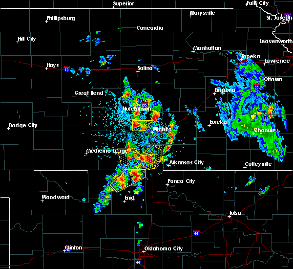 At 336 pm cdt, a severe thunderstorm was located 6 miles east of sedgwick, moving northeast at 10 mph (radar indicated). Hazards include ping pong ball size hail and 60 mph wind gusts. People and animals outdoors will be injured. expect hail damage to roofs, siding, windows, and vehicles. Expect wind damage to roofs, siding, and trees. At 336 pm cdt, a severe thunderstorm was located 6 miles east of sedgwick, moving northeast at 10 mph (radar indicated). Hazards include ping pong ball size hail and 60 mph wind gusts. People and animals outdoors will be injured. expect hail damage to roofs, siding, windows, and vehicles. Expect wind damage to roofs, siding, and trees.
|
| 5/26/2016 6:25 PM CDT |
 At 625 pm cdt, a severe thunderstorm was located 7 miles southwest of moundridge, moving north at 35 mph (radar indicated). Hazards include 60 mph wind gusts and quarter size hail. Hail damage to vehicles is expected. expect wind damage to roofs, siding, and trees. locations impacted include, newton, mcpherson, hesston, lindsborg, north newton, moundridge, burrton, galva, canton, goessel, lehigh, mcpherson airport and roxbury. A tornado watch remains in effect until 1000 pm cdt for south central kansas. At 625 pm cdt, a severe thunderstorm was located 7 miles southwest of moundridge, moving north at 35 mph (radar indicated). Hazards include 60 mph wind gusts and quarter size hail. Hail damage to vehicles is expected. expect wind damage to roofs, siding, and trees. locations impacted include, newton, mcpherson, hesston, lindsborg, north newton, moundridge, burrton, galva, canton, goessel, lehigh, mcpherson airport and roxbury. A tornado watch remains in effect until 1000 pm cdt for south central kansas.
|
| 5/26/2016 6:18 PM CDT |
 At 618 pm cdt, a severe thunderstorm was located near moundridge, moving north at 30 mph (radar indicated). Hazards include 60 mph wind gusts and quarter size hail. Hail damage to vehicles is expected. Expect wind damage to roofs, siding, and trees. At 618 pm cdt, a severe thunderstorm was located near moundridge, moving north at 30 mph (radar indicated). Hazards include 60 mph wind gusts and quarter size hail. Hail damage to vehicles is expected. Expect wind damage to roofs, siding, and trees.
|
| 5/26/2016 5:29 PM CDT |
 At 528 pm cdt, a severe thunderstorm was located over walton, or near north newton, moving north at 35 mph (radar indicated). Hazards include ping pong ball size hail and 60 mph wind gusts. People and animals outdoors will be injured. expect hail damage to roofs, siding, windows, and vehicles. expect wind damage to roofs, siding, and trees. locations impacted include, newton, hesston, hillsboro, marion, north newton, peabody, whitewater, goessel, walton, elbing, lehigh and newton airport. A tornado watch remains in effect until 1000 pm cdt for south central kansas. At 528 pm cdt, a severe thunderstorm was located over walton, or near north newton, moving north at 35 mph (radar indicated). Hazards include ping pong ball size hail and 60 mph wind gusts. People and animals outdoors will be injured. expect hail damage to roofs, siding, windows, and vehicles. expect wind damage to roofs, siding, and trees. locations impacted include, newton, hesston, hillsboro, marion, north newton, peabody, whitewater, goessel, walton, elbing, lehigh and newton airport. A tornado watch remains in effect until 1000 pm cdt for south central kansas.
|
| 5/26/2016 5:09 PM CDT | Ping Pong Ball sized hail reported 3.9 miles S of Newton, KS |
| 5/26/2016 5:09 PM CDT |
 At 508 pm cdt, a severe thunderstorm was located near north newton, moving north at 40 mph (law enforcement). Hazards include tennis ball size hail and 60 mph wind gusts. People and animals outdoors will be injured. expect hail damage to roofs, siding, windows, and vehicles. expect wind damage to roofs, siding, and trees. locations impacted include, newton, park city, valley center, hesston, hillsboro, marion, north newton, sedgwick, peabody, whitewater, goessel, walton, elbing, lehigh and newton airport. A tornado watch remains in effect until 1000 pm cdt for south central kansas. At 508 pm cdt, a severe thunderstorm was located near north newton, moving north at 40 mph (law enforcement). Hazards include tennis ball size hail and 60 mph wind gusts. People and animals outdoors will be injured. expect hail damage to roofs, siding, windows, and vehicles. expect wind damage to roofs, siding, and trees. locations impacted include, newton, park city, valley center, hesston, hillsboro, marion, north newton, sedgwick, peabody, whitewater, goessel, walton, elbing, lehigh and newton airport. A tornado watch remains in effect until 1000 pm cdt for south central kansas.
|
| 5/26/2016 5:08 PM CDT | Baseball sized hail reported 1.1 miles WSW of Newton, KS, law enforcement reporting baseball sized hail at greenwood cemetary. |
| 5/26/2016 5:06 PM CDT |
 At 506 pm cdt, a severe thunderstorm was located over north newton, moving north at 45 mph (trained weather spotters). Hazards include 60 mph wind gusts and quarter size hail. Hail damage to vehicles is expected. expect wind damage to roofs, siding, and trees. locations impacted include, newton, park city, valley center, hesston, hillsboro, marion, north newton, sedgwick, peabody, whitewater, goessel, walton, elbing, lehigh and newton airport. A tornado watch remains in effect until 1000 pm cdt for south central kansas. At 506 pm cdt, a severe thunderstorm was located over north newton, moving north at 45 mph (trained weather spotters). Hazards include 60 mph wind gusts and quarter size hail. Hail damage to vehicles is expected. expect wind damage to roofs, siding, and trees. locations impacted include, newton, park city, valley center, hesston, hillsboro, marion, north newton, sedgwick, peabody, whitewater, goessel, walton, elbing, lehigh and newton airport. A tornado watch remains in effect until 1000 pm cdt for south central kansas.
|
| 5/26/2016 5:05 PM CDT | Golf Ball sized hail reported 1.1 miles WSW of Newton, KS, picture sent via twitter of golf ball sized hail. |
| 5/26/2016 5:04 PM CDT | Quarter sized hail reported 1.1 miles WSW of Newton, KS |
| 5/26/2016 4:55 PM CDT |
 At 455 pm cdt, a severe thunderstorm was located near sedgwick, moving north at 45 mph (trained weather spotters). Hazards include 60 mph wind gusts and quarter size hail. Hail damage to vehicles is expected. expect wind damage to roofs, siding, and trees. locations impacted include, newton, park city, valley center, hesston, hillsboro, marion, north newton, sedgwick, peabody, whitewater, kechi, goessel, walton, elbing, lehigh and newton airport. A tornado watch remains in effect until 1000 pm cdt for south central kansas. At 455 pm cdt, a severe thunderstorm was located near sedgwick, moving north at 45 mph (trained weather spotters). Hazards include 60 mph wind gusts and quarter size hail. Hail damage to vehicles is expected. expect wind damage to roofs, siding, and trees. locations impacted include, newton, park city, valley center, hesston, hillsboro, marion, north newton, sedgwick, peabody, whitewater, kechi, goessel, walton, elbing, lehigh and newton airport. A tornado watch remains in effect until 1000 pm cdt for south central kansas.
|
| 5/26/2016 3:10 PM CDT | Quarter sized hail reported 5.9 miles WSW of Newton, KS |
| 5/24/2016 10:55 PM CDT | Twitter report of estimated 50 to 60 mph wind in harvey county KS, 8.1 miles W of Newton, KS |
| 5/8/2016 5:32 PM CDT |
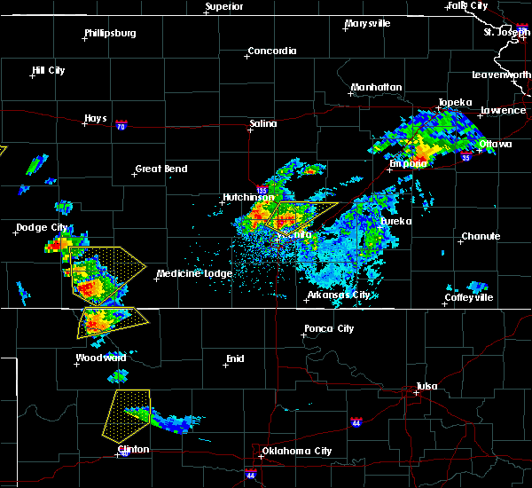 At 532 pm cdt, a severe thunderstorm was located 6 miles north of kechi, or 7 miles northeast of valley center, moving northeast at 30 mph (radar indicated). Hazards include golf ball size hail and 60 mph wind gusts. People and animals outdoors will be injured. expect hail damage to roofs, siding, windows, and vehicles. expect wind damage to roofs, siding, and trees. locations impacted include, wichita, newton, park city, valley center, bel aire, whitewater, kechi, potwin, elbing, northeast wichita, jabara airport and newton airport. A tornado watch remains in effect until 1000 pm cdt for south central kansas. At 532 pm cdt, a severe thunderstorm was located 6 miles north of kechi, or 7 miles northeast of valley center, moving northeast at 30 mph (radar indicated). Hazards include golf ball size hail and 60 mph wind gusts. People and animals outdoors will be injured. expect hail damage to roofs, siding, windows, and vehicles. expect wind damage to roofs, siding, and trees. locations impacted include, wichita, newton, park city, valley center, bel aire, whitewater, kechi, potwin, elbing, northeast wichita, jabara airport and newton airport. A tornado watch remains in effect until 1000 pm cdt for south central kansas.
|
| 5/8/2016 5:23 PM CDT |
 At 523 pm cdt, a severe thunderstorm was located near valley center, moving northeast at 35 mph (radar indicated). Hazards include quarter size hail. damage to vehicles is expected At 523 pm cdt, a severe thunderstorm was located near valley center, moving northeast at 35 mph (radar indicated). Hazards include quarter size hail. damage to vehicles is expected
|
| 4/26/2016 7:24 PM CDT |
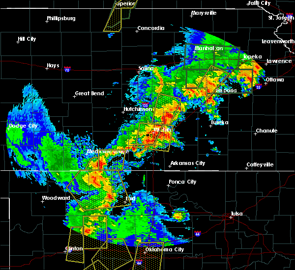 At 724 pm cdt, a severe thunderstorm was located near elbing, or near whitewater, moving northeast at 45 mph (radar indicated). Hazards include 60 mph wind gusts and half dollar size hail. Hail damage to vehicles is expected. expect wind damage to roofs, siding, and trees. locations impacted include, newton, park city, valley center, hillsboro, marion, peabody, whitewater, florence, potwin, walton, elbing, marion lake and newton airport. A tornado watch remains in effect until 900 pm cdt for southeastern kansas. At 724 pm cdt, a severe thunderstorm was located near elbing, or near whitewater, moving northeast at 45 mph (radar indicated). Hazards include 60 mph wind gusts and half dollar size hail. Hail damage to vehicles is expected. expect wind damage to roofs, siding, and trees. locations impacted include, newton, park city, valley center, hillsboro, marion, peabody, whitewater, florence, potwin, walton, elbing, marion lake and newton airport. A tornado watch remains in effect until 900 pm cdt for southeastern kansas.
|
| 4/26/2016 7:14 PM CDT |
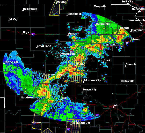 At 714 pm cdt, a severe thunderstorm was located over whitewater, moving northeast at 45 mph (radar indicated). Hazards include ping pong ball size hail and 60 mph wind gusts. People and animals outdoors will be injured. expect hail damage to roofs, siding, windows, and vehicles. expect wind damage to roofs, siding, and trees. locations impacted include, newton, park city, valley center, hillsboro, marion, peabody, whitewater, florence, potwin, walton, elbing, marion lake and newton airport. A tornado watch remains in effect until 900 pm cdt for southeastern kansas. At 714 pm cdt, a severe thunderstorm was located over whitewater, moving northeast at 45 mph (radar indicated). Hazards include ping pong ball size hail and 60 mph wind gusts. People and animals outdoors will be injured. expect hail damage to roofs, siding, windows, and vehicles. expect wind damage to roofs, siding, and trees. locations impacted include, newton, park city, valley center, hillsboro, marion, peabody, whitewater, florence, potwin, walton, elbing, marion lake and newton airport. A tornado watch remains in effect until 900 pm cdt for southeastern kansas.
|
| 4/26/2016 7:05 PM CDT |
 At 704 pm cdt, a severe thunderstorm was located 6 miles northeast of kechi, or 7 miles southwest of whitewater, moving northeast at 45 mph (radar indicated). Hazards include ping pong ball size hail and 60 mph wind gusts. People and animals outdoors will be injured. expect hail damage to roofs, siding, windows, and vehicles. Expect wind damage to roofs, siding, and trees. At 704 pm cdt, a severe thunderstorm was located 6 miles northeast of kechi, or 7 miles southwest of whitewater, moving northeast at 45 mph (radar indicated). Hazards include ping pong ball size hail and 60 mph wind gusts. People and animals outdoors will be injured. expect hail damage to roofs, siding, windows, and vehicles. Expect wind damage to roofs, siding, and trees.
|
| 4/26/2016 6:01 PM CDT |
 At 601 pm cdt, a severe thunderstorm was located near whitewater, moving north at 30 mph (radar indicated). Hazards include 60 mph wind gusts and quarter size hail. Hail damage to vehicles is expected. expect wind damage to roofs, siding, and trees. locations impacted include, newton, hesston, north newton, peabody, whitewater, walton, elbing and newton airport. A tornado watch remains in effect until 900 pm cdt for south central kansas. At 601 pm cdt, a severe thunderstorm was located near whitewater, moving north at 30 mph (radar indicated). Hazards include 60 mph wind gusts and quarter size hail. Hail damage to vehicles is expected. expect wind damage to roofs, siding, and trees. locations impacted include, newton, hesston, north newton, peabody, whitewater, walton, elbing and newton airport. A tornado watch remains in effect until 900 pm cdt for south central kansas.
|
| 4/26/2016 5:56 PM CDT |
 At 555 pm cdt, a severe thunderstorm was located near kechi, or 6 miles northeast of park city, moving north at 30 mph (radar indicated). Hazards include ping pong ball size hail and 60 mph wind gusts. People and animals outdoors will be injured. expect hail damage to roofs, siding, windows, and vehicles. expect wind damage to roofs, siding, and trees. locations impacted include, newton, park city, valley center, hesston, north newton, peabody, whitewater, kechi, walton, elbing and newton airport. A tornado watch remains in effect until 900 pm cdt for south central kansas. At 555 pm cdt, a severe thunderstorm was located near kechi, or 6 miles northeast of park city, moving north at 30 mph (radar indicated). Hazards include ping pong ball size hail and 60 mph wind gusts. People and animals outdoors will be injured. expect hail damage to roofs, siding, windows, and vehicles. expect wind damage to roofs, siding, and trees. locations impacted include, newton, park city, valley center, hesston, north newton, peabody, whitewater, kechi, walton, elbing and newton airport. A tornado watch remains in effect until 900 pm cdt for south central kansas.
|
| 4/26/2016 5:46 PM CDT |
 At 545 pm cdt, a severe thunderstorm was located over kechi, or over bel aire, moving north at 30 mph (radar indicated). Hazards include golf ball size hail and 60 mph wind gusts. People and animals outdoors will be injured. expect hail damage to roofs, siding, windows, and vehicles. expect wind damage to roofs, siding, and trees. locations impacted include, wichita, newton, andover, park city, valley center, bel aire, hesston, north newton, sedgwick, peabody, benton, whitewater, kechi, eastborough, potwin, walton, elbing, northeast wichita, east wichita and jabara airport. A tornado watch remains in effect until 900 pm cdt for south central kansas. At 545 pm cdt, a severe thunderstorm was located over kechi, or over bel aire, moving north at 30 mph (radar indicated). Hazards include golf ball size hail and 60 mph wind gusts. People and animals outdoors will be injured. expect hail damage to roofs, siding, windows, and vehicles. expect wind damage to roofs, siding, and trees. locations impacted include, wichita, newton, andover, park city, valley center, bel aire, hesston, north newton, sedgwick, peabody, benton, whitewater, kechi, eastborough, potwin, walton, elbing, northeast wichita, east wichita and jabara airport. A tornado watch remains in effect until 900 pm cdt for south central kansas.
|
| 4/26/2016 5:39 PM CDT |
 At 538 pm cdt, a severe thunderstorm was located over bel aire, moving north at 30 mph (radar indicated). Hazards include ping pong ball size hail and 60 mph wind gusts. People and animals outdoors will be injured. expect hail damage to roofs, siding, windows, and vehicles. Expect wind damage to roofs, siding, and trees. At 538 pm cdt, a severe thunderstorm was located over bel aire, moving north at 30 mph (radar indicated). Hazards include ping pong ball size hail and 60 mph wind gusts. People and animals outdoors will be injured. expect hail damage to roofs, siding, windows, and vehicles. Expect wind damage to roofs, siding, and trees.
|
| 4/26/2016 4:33 PM CDT |
 At 433 pm cdt, a severe thunderstorm was located near haysville, moving north at 55 mph (radar indicated). Hazards include ping pong ball size hail and 60 mph wind gusts. People and animals outdoors will be injured. expect hail damage to roofs, siding, windows, and vehicles. expect wind damage to roofs, siding, and trees. locations impacted include, wichita, derby, newton, haysville, park city, valley center, bel aire, mulvane, goddard, hesston, maize, clearwater, halstead, north newton, sedgwick, colwich, whitewater, downtown wichita, kechi and eastborough. A tornado watch remains in effect until 900 pm cdt for south central kansas. At 433 pm cdt, a severe thunderstorm was located near haysville, moving north at 55 mph (radar indicated). Hazards include ping pong ball size hail and 60 mph wind gusts. People and animals outdoors will be injured. expect hail damage to roofs, siding, windows, and vehicles. expect wind damage to roofs, siding, and trees. locations impacted include, wichita, derby, newton, haysville, park city, valley center, bel aire, mulvane, goddard, hesston, maize, clearwater, halstead, north newton, sedgwick, colwich, whitewater, downtown wichita, kechi and eastborough. A tornado watch remains in effect until 900 pm cdt for south central kansas.
|
| 4/26/2016 4:28 PM CDT |
 At 428 pm cdt, a severe thunderstorm was located near newton, moving north at 55 mph (radar indicated). Hazards include golf ball size hail and 60 mph wind gusts. People and animals outdoors will be injured. expect hail damage to roofs, siding, windows, and vehicles. expect wind damage to roofs, siding, and trees. locations impacted include, wichita, derby, newton, haysville, park city, valley center, bel aire, mulvane, goddard, hesston, maize, clearwater, halstead, north newton, sedgwick, colwich, whitewater, downtown wichita, kechi and eastborough. A tornado watch remains in effect until 900 pm cdt for south central kansas. At 428 pm cdt, a severe thunderstorm was located near newton, moving north at 55 mph (radar indicated). Hazards include golf ball size hail and 60 mph wind gusts. People and animals outdoors will be injured. expect hail damage to roofs, siding, windows, and vehicles. expect wind damage to roofs, siding, and trees. locations impacted include, wichita, derby, newton, haysville, park city, valley center, bel aire, mulvane, goddard, hesston, maize, clearwater, halstead, north newton, sedgwick, colwich, whitewater, downtown wichita, kechi and eastborough. A tornado watch remains in effect until 900 pm cdt for south central kansas.
|
| 4/26/2016 4:12 PM CDT |
 At 411 pm cdt, a severe thunderstorm was located over maize, moving north at 25 mph (radar indicated). Hazards include golf ball size hail and 60 mph wind gusts. People and animals outdoors will be injured. expect hail damage to roofs, siding, windows, and vehicles. expect wind damage to roofs, siding, and trees. locations impacted include, wichita, derby, newton, haysville, park city, valley center, bel aire, mulvane, goddard, hesston, maize, clearwater, halstead, north newton, sedgwick, colwich, whitewater, downtown wichita, kechi and eastborough. A tornado watch remains in effect until 900 pm cdt for south central kansas. At 411 pm cdt, a severe thunderstorm was located over maize, moving north at 25 mph (radar indicated). Hazards include golf ball size hail and 60 mph wind gusts. People and animals outdoors will be injured. expect hail damage to roofs, siding, windows, and vehicles. expect wind damage to roofs, siding, and trees. locations impacted include, wichita, derby, newton, haysville, park city, valley center, bel aire, mulvane, goddard, hesston, maize, clearwater, halstead, north newton, sedgwick, colwich, whitewater, downtown wichita, kechi and eastborough. A tornado watch remains in effect until 900 pm cdt for south central kansas.
|
| 4/26/2016 4:06 PM CDT |
 At 405 pm cdt, a severe thunderstorm was located over west wichita, or near maize, moving north at 25 mph (radar indicated). Hazards include 60 mph wind gusts and half dollar size hail. Hail damage to vehicles is expected. Expect wind damage to roofs, siding, and trees. At 405 pm cdt, a severe thunderstorm was located over west wichita, or near maize, moving north at 25 mph (radar indicated). Hazards include 60 mph wind gusts and half dollar size hail. Hail damage to vehicles is expected. Expect wind damage to roofs, siding, and trees.
|
| 8/23/2015 12:54 AM CDT |
 At 1253 am cdt, a severe thunderstorm was located over colwich, moving southeast at 40 mph (radar indicated). Hazards include 60 mph wind gusts and quarter size hail. Hail damage to vehicles is expected. Expect wind damage to roofs, siding and trees. At 1253 am cdt, a severe thunderstorm was located over colwich, moving southeast at 40 mph (radar indicated). Hazards include 60 mph wind gusts and quarter size hail. Hail damage to vehicles is expected. Expect wind damage to roofs, siding and trees.
|
| 8/22/2015 11:59 PM CDT |
 At 1159 pm cdt, a severe thunderstorm was located near hesston, moving southeast at 30 mph (radar indicated). Hazards include 60 mph wind gusts and quarter size hail. Hail damage to vehicles is expected. expect wind damage to roofs, siding and trees. Locations impacted include, newton, hesston, halstead, north newton, moundridge, peabody, goessel, walton and newton airport. At 1159 pm cdt, a severe thunderstorm was located near hesston, moving southeast at 30 mph (radar indicated). Hazards include 60 mph wind gusts and quarter size hail. Hail damage to vehicles is expected. expect wind damage to roofs, siding and trees. Locations impacted include, newton, hesston, halstead, north newton, moundridge, peabody, goessel, walton and newton airport.
|
| 8/22/2015 11:48 PM CDT |
 At 1148 pm cdt, a severe thunderstorm was located over moundridge, moving southeast at 40 mph (radar indicated). Hazards include 60 mph wind gusts and quarter size hail. Hail damage to vehicles is expected. Expect wind damage to roofs, siding and trees. At 1148 pm cdt, a severe thunderstorm was located over moundridge, moving southeast at 40 mph (radar indicated). Hazards include 60 mph wind gusts and quarter size hail. Hail damage to vehicles is expected. Expect wind damage to roofs, siding and trees.
|
| 8/5/2015 5:24 AM CDT |
 The severe thunderstorm warning for northwestern butler, harvey, northeastern sedgwick and southwestern marion counties will expire at 530 am cdt, the storms which prompted the warning have weakened below severe limits, and no longer pose an immediate threat to life or property. therefore the warning will be allowed to expire. however gusty winds to 50 mph and heavy rain are still likely with these thunderstorms. a severe thunderstorm watch remains in effect until 1100 am cdt for southeastern kansas. The severe thunderstorm warning for northwestern butler, harvey, northeastern sedgwick and southwestern marion counties will expire at 530 am cdt, the storms which prompted the warning have weakened below severe limits, and no longer pose an immediate threat to life or property. therefore the warning will be allowed to expire. however gusty winds to 50 mph and heavy rain are still likely with these thunderstorms. a severe thunderstorm watch remains in effect until 1100 am cdt for southeastern kansas.
|
| 8/5/2015 5:08 AM CDT |
 At 507 am cdt, severe thunderstorms were located along a line extending from near peabody to 5 miles southwest of whitewater to near bentley, moving southeast at 40 mph (radar indicated). Hazards include 60 mph wind gusts and penny size hail. Expect damage to roofs. siding and trees. Locations impacted include, wichita, newton, park city, valley center, bel aire, hesston, maize, hillsboro, halstead, north newton, sedgwick, colwich, peabody, burrton, benton, whitewater, kechi, bentley, potwin and walton. At 507 am cdt, severe thunderstorms were located along a line extending from near peabody to 5 miles southwest of whitewater to near bentley, moving southeast at 40 mph (radar indicated). Hazards include 60 mph wind gusts and penny size hail. Expect damage to roofs. siding and trees. Locations impacted include, wichita, newton, park city, valley center, bel aire, hesston, maize, hillsboro, halstead, north newton, sedgwick, colwich, peabody, burrton, benton, whitewater, kechi, bentley, potwin and walton.
|
| 8/5/2015 4:51 AM CDT |
 At 451 am cdt, severe thunderstorms were located along a line extending from near hillsboro to newton to near burrton, moving southeast at 40 mph (radar indicated). Hazards include 60 mph wind gusts and penny size hail. Expect damage to roofs. Siding and trees. At 451 am cdt, severe thunderstorms were located along a line extending from near hillsboro to newton to near burrton, moving southeast at 40 mph (radar indicated). Hazards include 60 mph wind gusts and penny size hail. Expect damage to roofs. Siding and trees.
|
| 8/5/2015 4:46 AM CDT |
 At 446 am cdt, severe thunderstorms were located along a line extending from near hillsboro to burrton, moving southeast at 30 mph (radar indicated). Hazards include 60 mph wind gusts and penny size hail. Expect damage to roofs. siding and trees. Locations impacted include, newton, mcpherson, hesston, hillsboro, north newton, moundridge, inman, buhler, peabody, burrton, galva, canton, goessel, walton, lehigh, mcpherson airport, newton airport and marion lake. At 446 am cdt, severe thunderstorms were located along a line extending from near hillsboro to burrton, moving southeast at 30 mph (radar indicated). Hazards include 60 mph wind gusts and penny size hail. Expect damage to roofs. siding and trees. Locations impacted include, newton, mcpherson, hesston, hillsboro, north newton, moundridge, inman, buhler, peabody, burrton, galva, canton, goessel, walton, lehigh, mcpherson airport, newton airport and marion lake.
|
| 8/5/2015 4:32 AM CDT |
 At 431 am cdt, severe thunderstorms were located along a line extending from near lehigh to 5 miles northwest of inman, moving southeast at 30 mph (radar indicated). Hazards include 60 mph wind gusts and penny size hail. Expect damage to roofs. Siding and trees. At 431 am cdt, severe thunderstorms were located along a line extending from near lehigh to 5 miles northwest of inman, moving southeast at 30 mph (radar indicated). Hazards include 60 mph wind gusts and penny size hail. Expect damage to roofs. Siding and trees.
|
| 5/25/2015 3:44 PM CDT | At 344 pm cdt, a severe thunderstorm was located over andale, or near colwich, moving northeast at 35 mph (radar indicated). Hazards include 60 mph wind gusts and quarter size hail. Hail damage to vehicles is expected. Expect wind damage to roofs, siding and trees. |
| 5/6/2015 5:26 PM CDT | At 526 pm cdt, a severe thunderstorm was located over hesston, moving northeast at 40 mph (radar indicated). Hazards include 60 mph wind gusts and half dollar size hail. Hail damage to vehicles is expected. Expect wind damage to roofs, siding and trees. |
| 5/6/2015 5:20 PM CDT | At 520 pm cdt, a severe thunderstorm capable of producing a tornado was located near halstead, moving northeast at 35 mph (radar indicated rotation). Hazards include tornado and half dollar size hail. Flying debris will be dangerous to those caught without shelter. mobile homes will be damaged or destroyed. damage to roofs, windows and vehicles will occur. tree damage is likely. this dangerous storm will be near, newton around 525 pm cdt. hesston, north newton and moundridge around 530 pm cdt. Radar indicated. |
| 5/6/2015 5:06 PM CDT | At 505 pm cdt, a confirmed tornado was located near halstead, moving north at 40 mph (weather spotters confirmed tornado). Hazards include damaging tornado and ping pong ball size hail. Flying debris will be dangerous to those caught without shelter. mobile homes will be damaged or destroyed. damage to roofs, windows and vehicles will occur. tree damage is likely. this tornado will be near, halstead around 510 pm cdt. hesston around 525 pm cdt. moundridge around 530 pm cdt. Observed. |
| 5/6/2015 4:58 PM CDT | At 457 pm cdt, a confirmed tornado was located northeast of mount hope, moving north at 40 mph (weather spotters confirmed tornado). Hazards include damaging tornado and ping pong ball size hail. Flying debris will be dangerous to those caught without shelter. mobile homes will be damaged or destroyed. damage to roofs, windows and vehicles will occur. tree damage is likely. this tornado will be near, burrton around 505 pm cdt. halstead around 510 pm cdt. hesston around 525 pm cdt. moundridge around 530 pm cdt. Observed. |
| 5/6/2015 4:52 PM CDT | At 451 pm cdt, a tornado producing storm was located over mount hope, moving northeast at 40 mph (radar confirmed tornado). Hazards include damaging tornado and ping pong ball size hail. Flying debris will be dangerous to those caught without shelter. mobile homes will be damaged or destroyed. damage to roofs, windows and vehicles will occur. tree damage is likely. this tornadic storm will be near, bentley around 455 pm cdt. halstead and burrton around 505 pm cdt. hesston around 520 pm cdt. moundridge around 525 pm cdt. this includes interstate 135 between mile markers 36 and 49. Observed. |
| 5/6/2015 4:50 PM CDT | At 450 pm cdt, a severe thunderstorm was located over mount hope, moving northeast at 35 mph (radar indicated). Hazards include 60 mph wind gusts and quarter size hail. Hail damage to vehicles is expected. expect wind damage to roofs, siding and trees. locations impacted include, newton, hesston, maize, halstead, north newton, sedgwick, colwich, burrton, mount hope and bentley. a tornado watch remains in effect until 900 pm cdt for south central kansas. Possible. |
| 5/6/2015 4:45 PM CDT | At 445 pm cdt, a severe thunderstorm was located over mount hope, moving north at 45 mph (radar indicated). Hazards include 60 mph wind gusts and quarter size hail. Hail damage to vehicles is expected. Expect wind damage to roofs, siding and trees. |
| 4/16/2015 7:56 PM CDT | The severe thunderstorm warning for northeastern harvey, southwestern marion and southeastern mcpherson counties will expire at 800 pm cdt, the storm which prompted the warning has weakened below severe limits, and no longer pose an immediate threat to life or property. therefore the warning will be allowed to expire. however small. |
| 4/16/2015 7:45 PM CDT | At 745 pm cdt, a severe thunderstorm was located near hesston, moving northeast at 20 mph (radar indicated). Hazards include half dollar size hail. Damage to vehicles is expected. locations impacted include, newton, hesston, north newton, goessel and walton. 1. 25in. |
| 4/16/2015 7:37 PM CDT | At 735 pm cdt, a severe thunderstorm was located over hesston, moving northeast at 20 mph (radar indicated. at 729 pm...golfball size hail was reported 3 miles southwest of hesston). Hazards include ping pong ball size hail and 60 mph wind gusts. People and animals outdoors will be injured. expect hail damage to roofs, siding, windows and vehicles. Expect wind damage to roofs, siding and trees. |
| 4/16/2015 7:20 PM CDT | At 711 pm cdt, a severe thunderstorm was located near halstead, moving northeast at 20 mph (radar indicated). Hazards include ping pong ball size hail and 60 mph wind gusts. People and animals outdoors will be injured. expect hail damage to roofs, siding, windows and vehicles. Expect wind damage to roofs, siding and trees. |
| 4/16/2015 7:12 PM CDT | At 711 pm cdt, a severe thunderstorm was located near halstead, moving northeast at 20 mph (radar indicated). Hazards include ping pong ball size hail and 60 mph wind gusts. People and animals outdoors will be injured. expect hail damage to roofs, siding, windows and vehicles. Expect wind damage to roofs, siding and trees. |
| 4/8/2015 9:16 PM CDT | A tornado warning remains in effect until 930 pm cdt for southeastern harvey county. at 916 pm cdt. a severe thunderstorm capable of producing a tornado was located near sedgwick. moving northeast at 30 mph. hazard. tornado and quarter size hail. source. Radar indicated rotation. |
| 4/8/2015 9:12 PM CDT | A tornado warning remains in effect until 930 pm cdt for southeastern harvey and northeastern sedgwick counties. at 911 pm cdt. a severe thunderstorm capable of producing a tornado was located near sedgwick. moving northeast at 35 mph. hazard. tornado and quarter size hail. source. Radar indicated rotation. |
| 4/8/2015 9:00 PM CDT | A tornado warning remains in effect until 930 pm cdt for southeastern harvey and northeastern sedgwick counties. at 900 pm cdt. a severe thunderstorm capable of producing a tornado was located near maize. moving northeast at 30 mph. hazard. tornado and quarter size hail. source. Radar indicated rotation. |
| 4/8/2015 8:53 PM CDT | The national weather service in wichita has issued a * tornado warning for. southeastern harvey county in south central kansas. northeastern sedgwick county in south central kansas. until 930 pm cdt * at 853 pm cdt. A severe thunderstorm capable of producing a. |
| 4/8/2015 8:35 PM CDT | Awos measured 66 mph wind gus in harvey county KS, 1.1 miles WSW of Newton, KS |
| 4/3/2015 12:36 AM CDT | The severe thunderstorm warning for harvey. sedgwick and southeastern mcpherson counties will expire at 1245 am cdt. the line of storms which prompted the warning have moved out of the area. Therefore the warning will be allowed to expire. |
| 4/2/2015 11:31 PM CST | Estimated 75 mph winds along with power outage in harvey county KS, 1.1 miles WSW of Newton, KS |
| 4/3/2015 12:16 AM CDT | A severe thunderstorm warning remains in effect until 1245 am cdt for harvey. sedgwick and southeastern mcpherson counties. at 1215 am cdt. severe thunderstorms were located along a line extending from near moundridge to near wichita eisenhower national airport to near clearwater. moving east at 70 mph. hazard. Ping pong size hail and 70 mph wind gusts. |
| 4/3/2015 12:06 AM CDT | A severe thunderstorm warning remains in effect until 1245 am cdt for northeastern reno. harvey. sedgwick and southern mcpherson counties. at 1205 am cdt. severe thunderstorms were located along a line extending from near inman to near goddard to viola. Moving east at 70 mph. |
| 4/2/2015 11:57 PM CDT | A severe thunderstorm warning remains in effect until 1245 am cdt for eastern reno. harvey. sedgwick. southern mcpherson and east central kingman counties. at 1156 pm cdt. severe thunderstorms were located along a line extending from near burrton to near andale to near norwich. Moving east at 70 mph. |
| 4/2/2015 11:42 PM CDT | The national weather service in wichita has issued a * severe thunderstorm warning for. eastern reno county in south central kansas. harvey county in south central kansas. sedgwick county in south central kansas. Southern mcpherson county in central kansas. |
| 6/5/2014 5:56 AM CDT | Trained spotter reports winds started at 550a in harvey county KS, 6.4 miles WNW of Newton, KS |
| 5/11/2014 11:45 PM CDT | Law enforcement was driving at interstate 135 and k196 when he encountered 70 to 80 mph winds and rain which limited visibility significantly. time is based on rada in harvey county KS, 5.9 miles N of Newton, KS |
| 4/13/2014 1:28 PM CDT | Quarter sized hail reported 5.9 miles WSW of Newton, KS, mostly dimes and nickels but a few quarters as well. |
| 8/15/2013 6:48 PM CDT | Storm damage reported in harvey county KS, 5.2 miles WSW of Newton, KS |
| 8/5/2013 10:11 PM CDT | Estimated 70 to 80 mph on the southwest side of newton in harvey county KS, 1.1 miles WSW of Newton, KS |
| 8/5/2013 10:06 PM CDT | Delayed report from the newton airport in harvey county KS, 1.1 miles WSW of Newton, KS |
| 6/27/2013 6:37 PM CDT | Storm damage reported in harvey county KS, 5.2 miles WSW of Newton, KS |
| 9/4/2012 10:15 PM CDT | Wind damage to a few hangers at the newton airport. this was likely due to a microburs in harvey county KS, 3.8 miles W of Newton, KS |
| 5/30/2012 7:28 PM CDT | Quarter sized hail reported 1.1 miles WNW of Newton, KS |
| 5/30/2012 7:28 PM CDT | Numerous limbs down across town in addition to a few trees in harvey county KS, 1.1 miles WSW of Newton, KS |
| 5/30/2012 7:28 PM CDT | Small branches dow in harvey county KS, 0.4 miles S of Newton, KS |
| 3/8/2012 12:14 AM CST | Quarter sized hail reported 1.1 miles WSW of Newton, KS, quarter sized hail was partially covering the ground. |
| 1/1/0001 12:00 AM | Tree damage due to strong winds in harvey county KS, 6.4 miles WNW of Newton, KS |
| 1/1/0001 12:00 AM | Storm damage reported in harvey county KS, 1.2 miles SSW of Newton, KS |
| 1/1/0001 12:00 AM | Storm damage reported in harvey county KS, 1.1 miles WSW of Newton, KS |
| 1/1/0001 12:00 AM | Shed lost part of roo in harvey county KS, 5.3 miles NW of Newton, KS |
| 1/1/0001 12:00 AM | Several tree limbs were reported downed from the newton area to several miles southeast of newto in harvey county KS, 1.1 miles WSW of Newton, KS |
| 1/1/0001 12:00 AM | Relayed through harvey county sherif in harvey county KS, 6.6 miles NW of Newton, KS |
| 1/1/0001 12:00 AM | Estimated 60mph wind gust in harvey county KS, 6.7 miles WNW of Newton, KS |
| 1/1/0001 12:00 AM | Quarter sized hail reported 1.1 miles WSW of Newton, KS |
| 1/1/0001 12:00 AM | Quarter sized hail reported 0.4 miles S of Newton, KS |
| 1/1/0001 12:00 AM | Half Dollar sized hail reported 6.6 miles NW of Newton, KS |
| 1/1/0001 12:00 AM | Half Dollar sized hail reported 6.6 miles NW of Newton, KS, spotter reported mostly 1 inch hail. |
| 1/1/0001 12:00 AM | Ping Pong Ball sized hail reported 1.1 miles WNW of Newton, KS, trained spotter reported ping pong ball sized hail on interstate 135 at the newton outlet store. |
| 1/1/0001 12:00 AM | Ping Pong Ball sized hail reported 5.9 miles WSW of Newton, KS |
| 1/1/0001 12:00 AM | Storm damage reported in harvey county KS, 4.5 miles NNW of Newton, KS |
| 1/1/0001 12:00 AM | Quarter sized hail reported 6 miles W of Newton, KS |
Hail Maps for Newton, KS
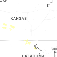
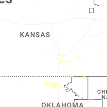
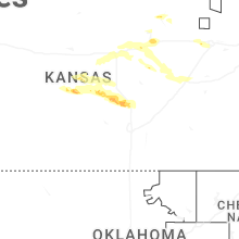
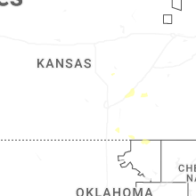

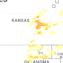
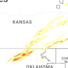
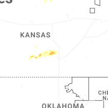
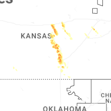

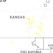

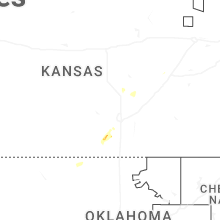
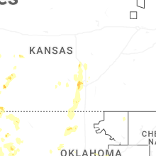


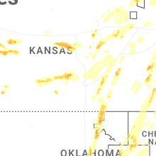


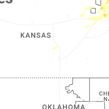


Connect with Interactive Hail Maps