

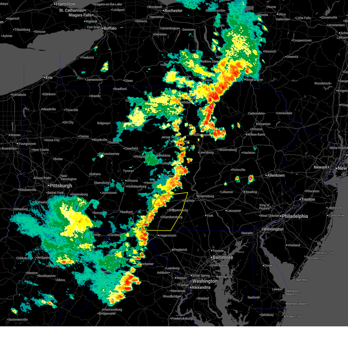
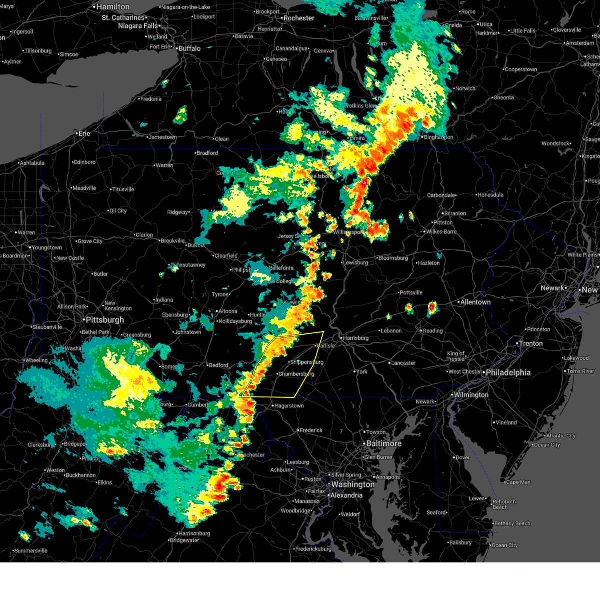
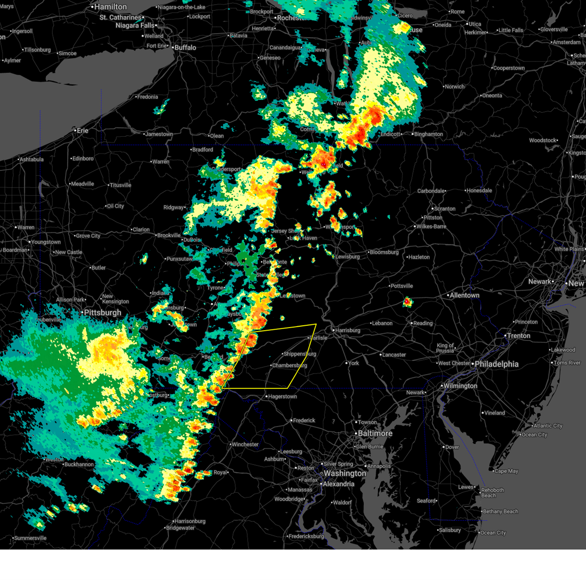
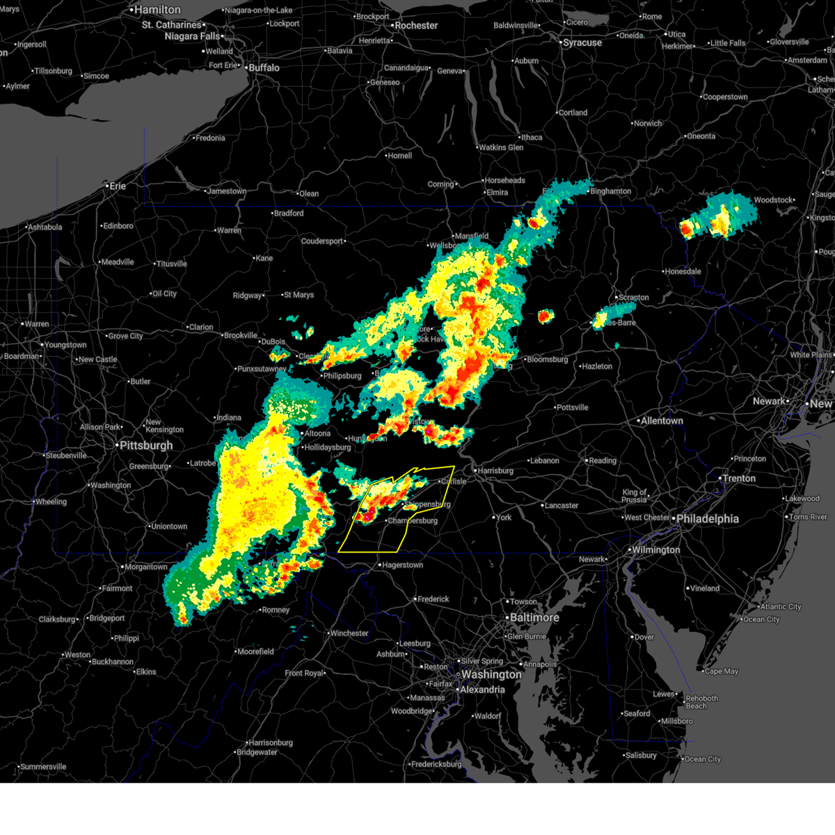
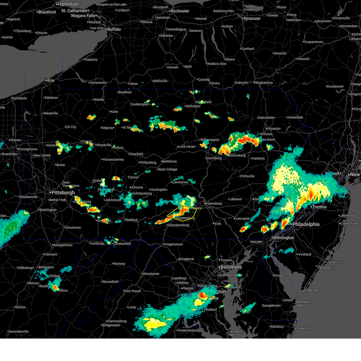
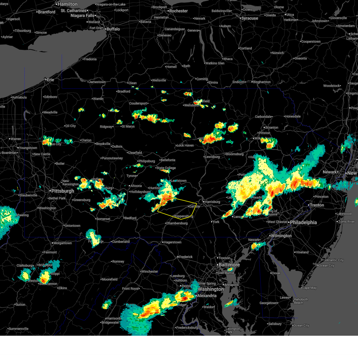
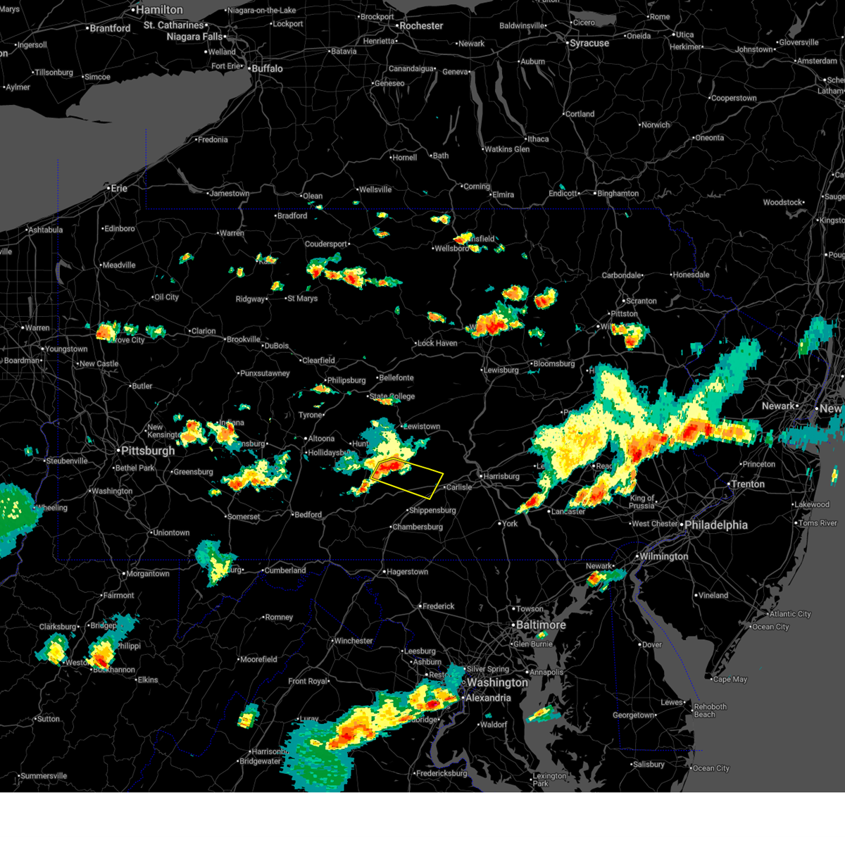
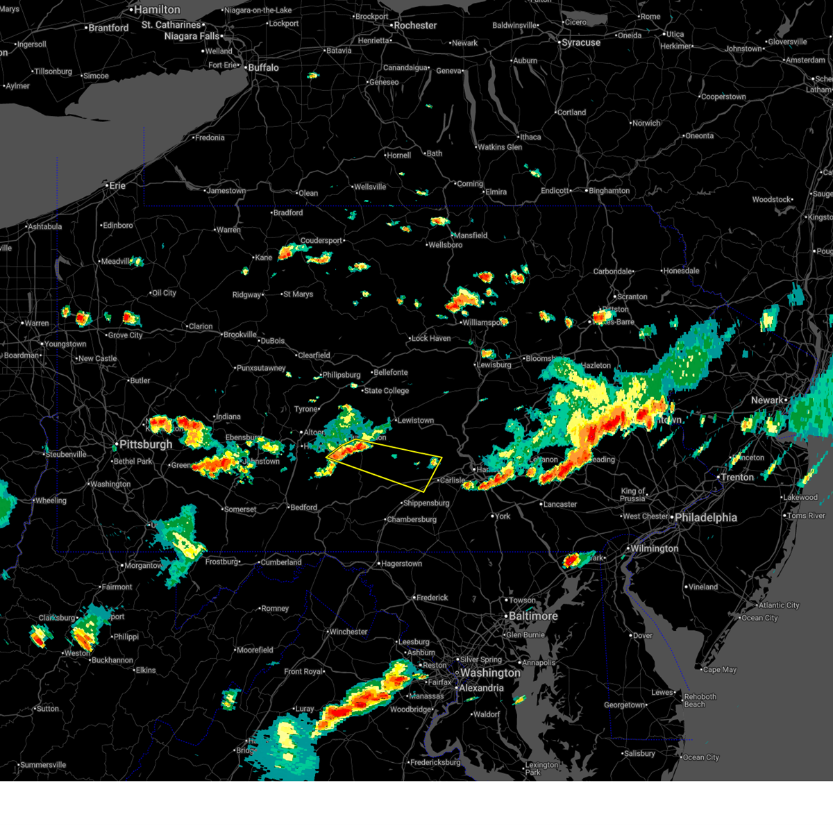
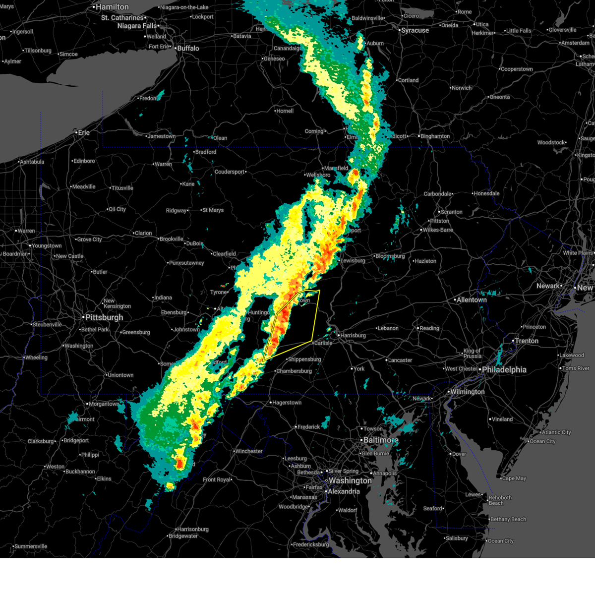
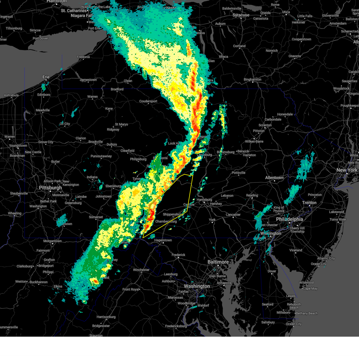
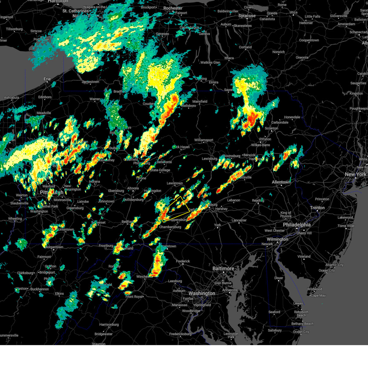
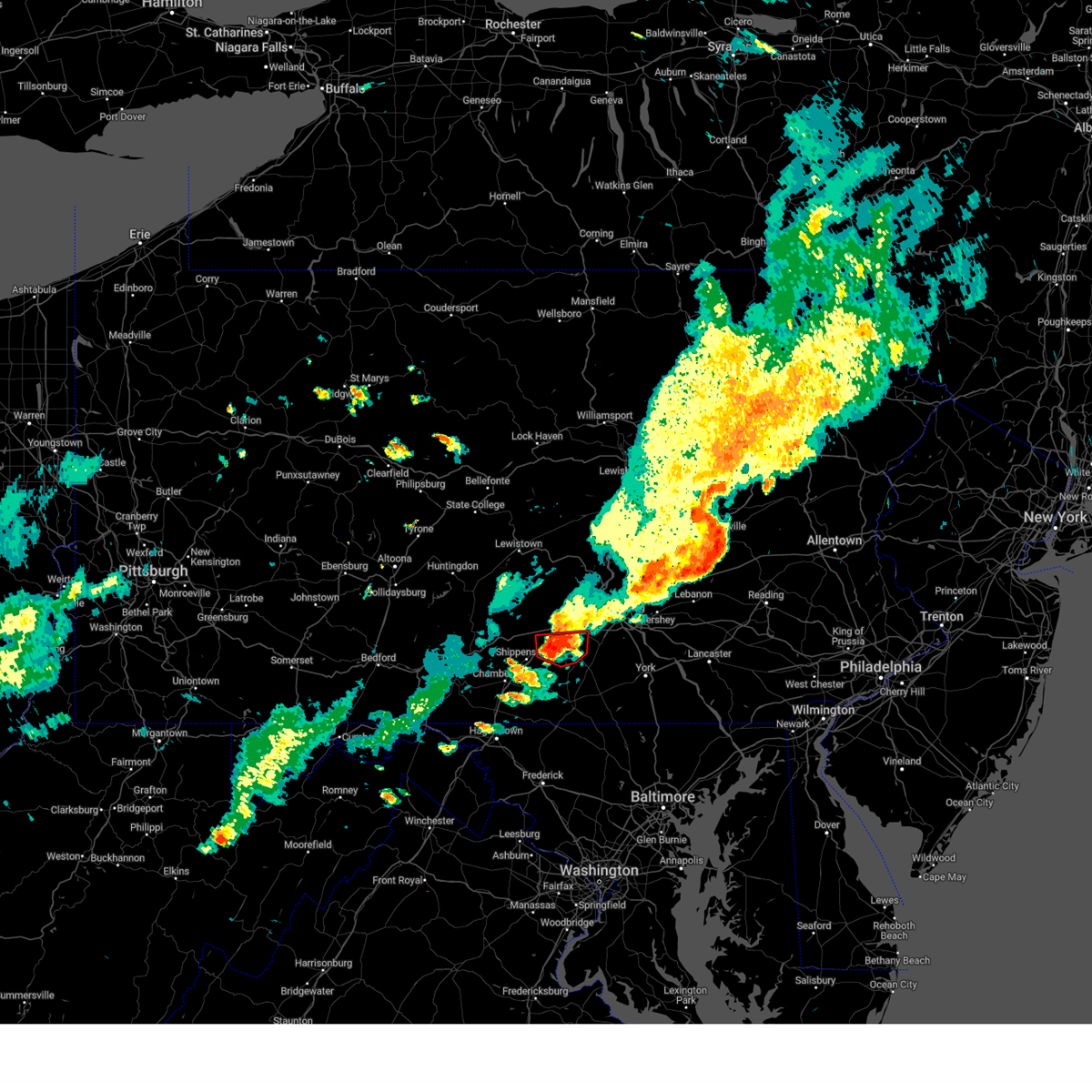
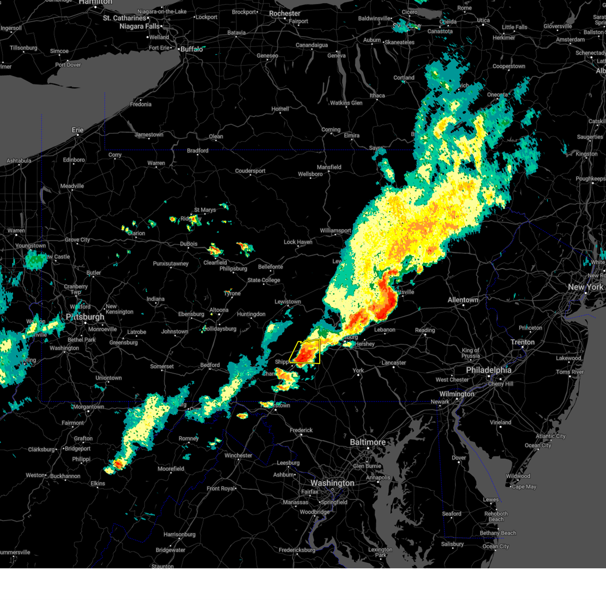
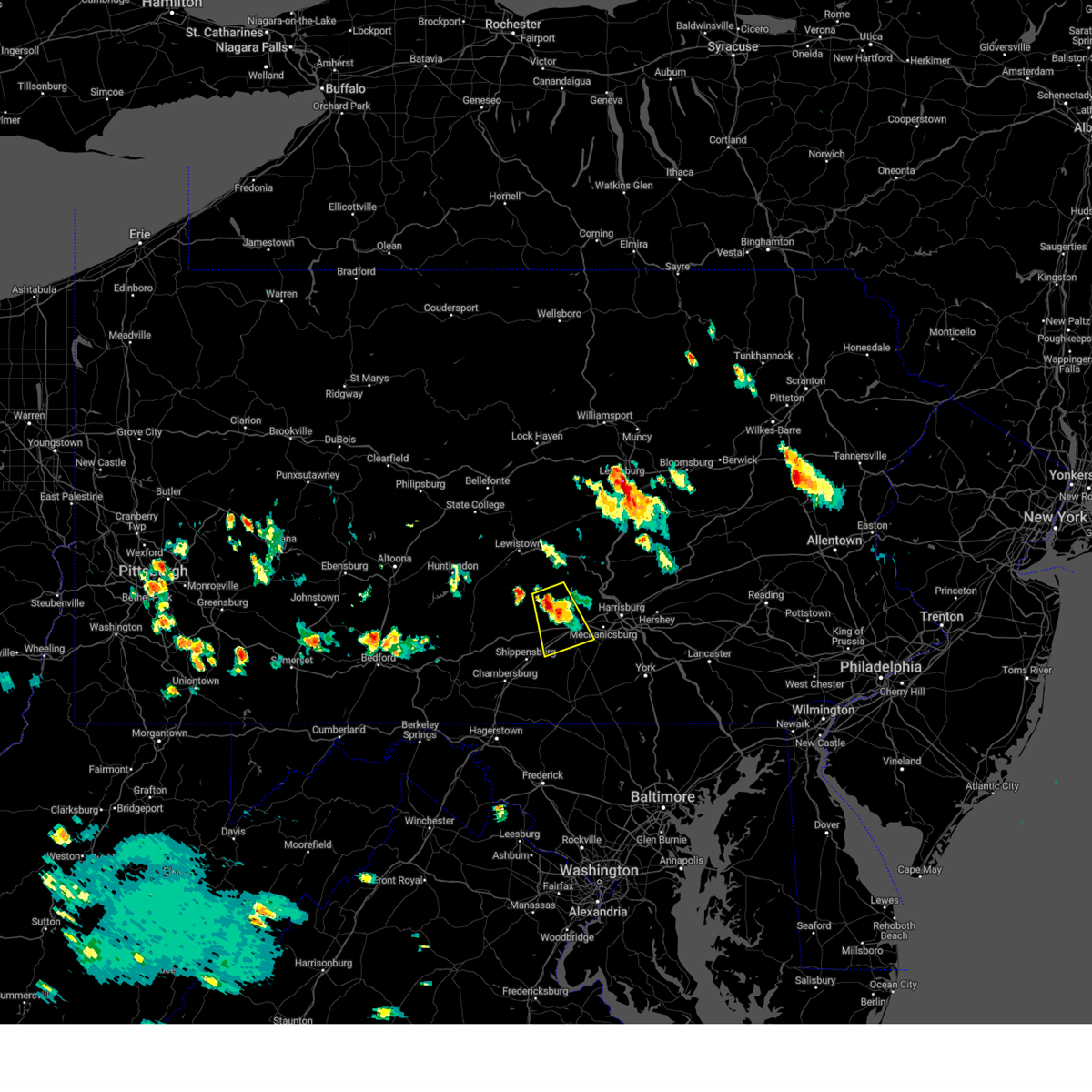
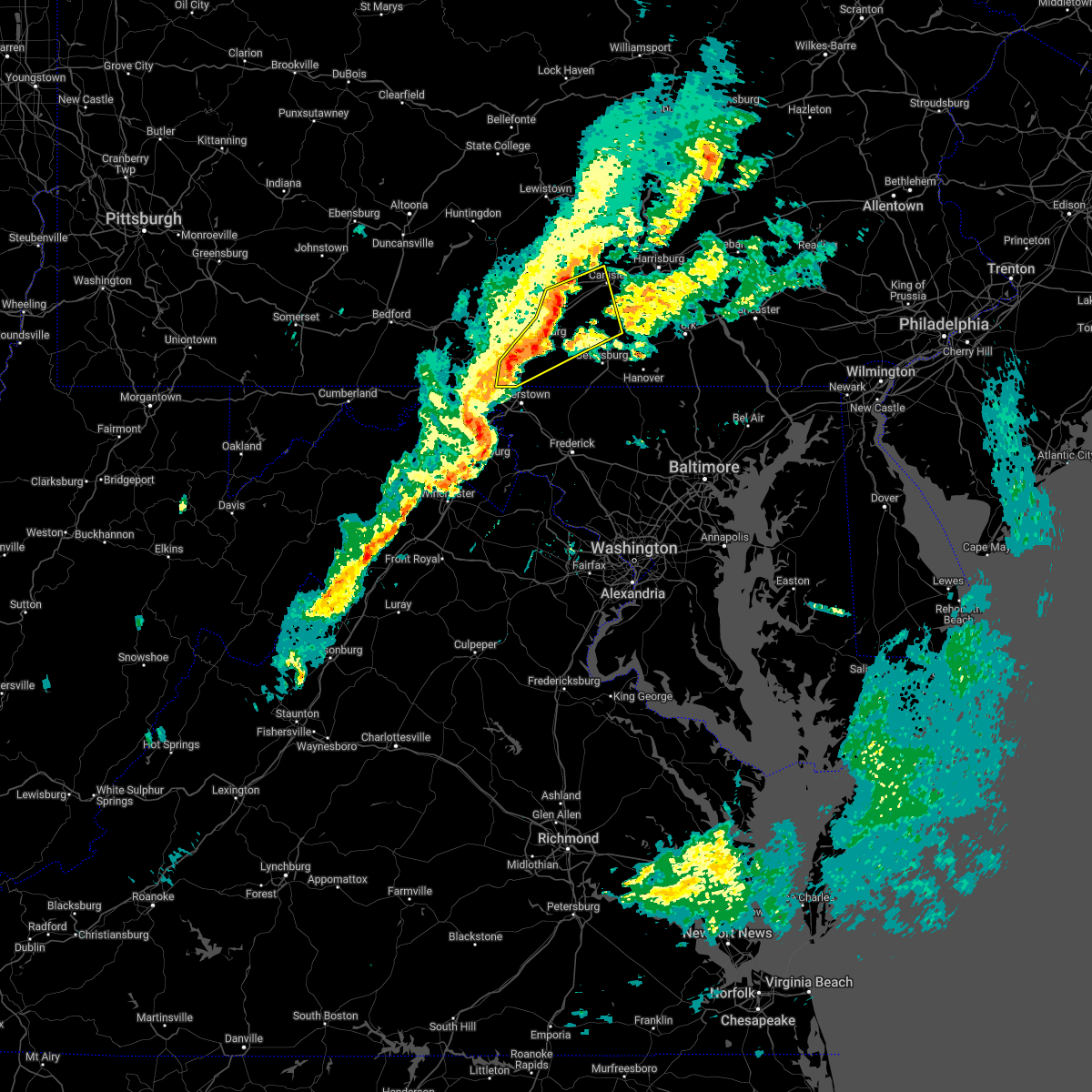
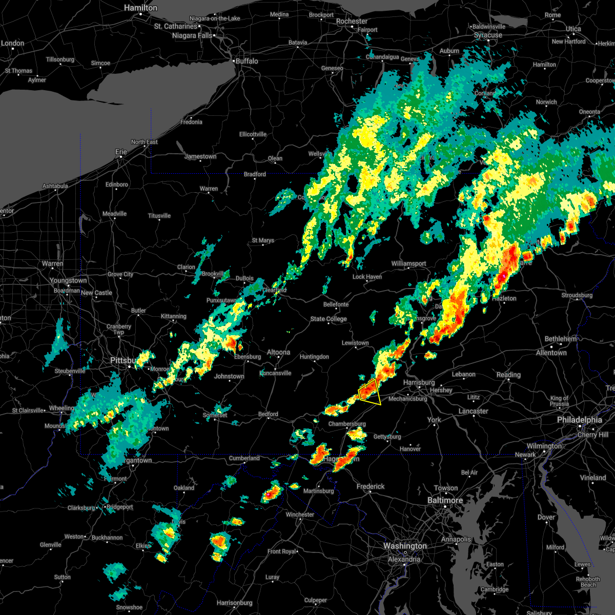
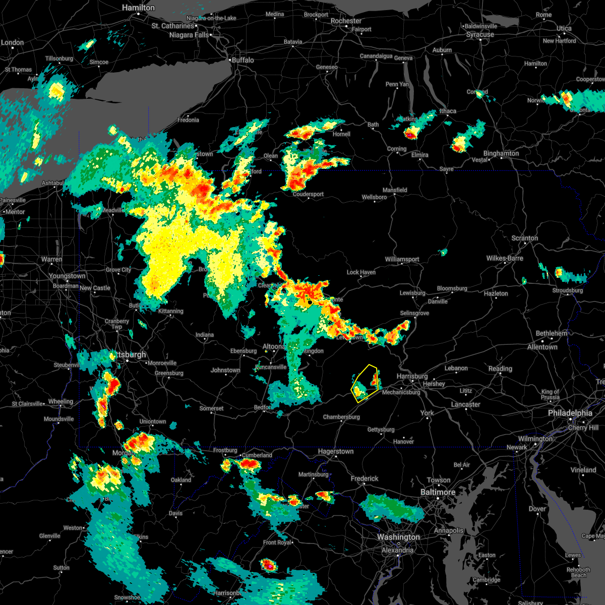
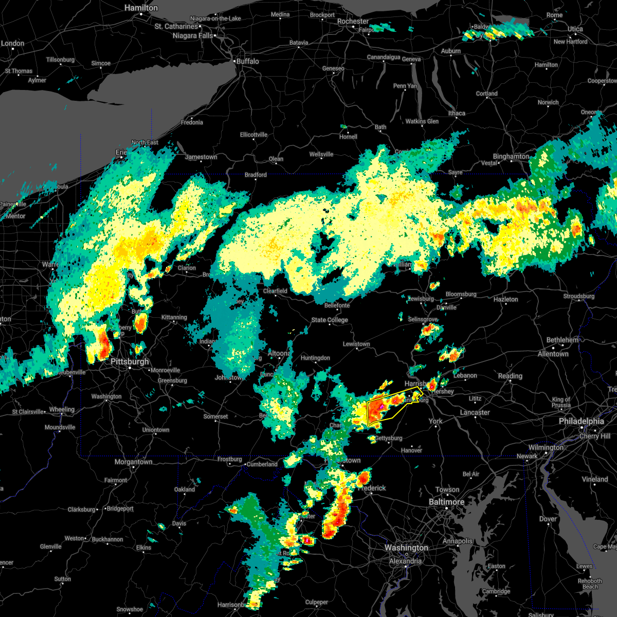
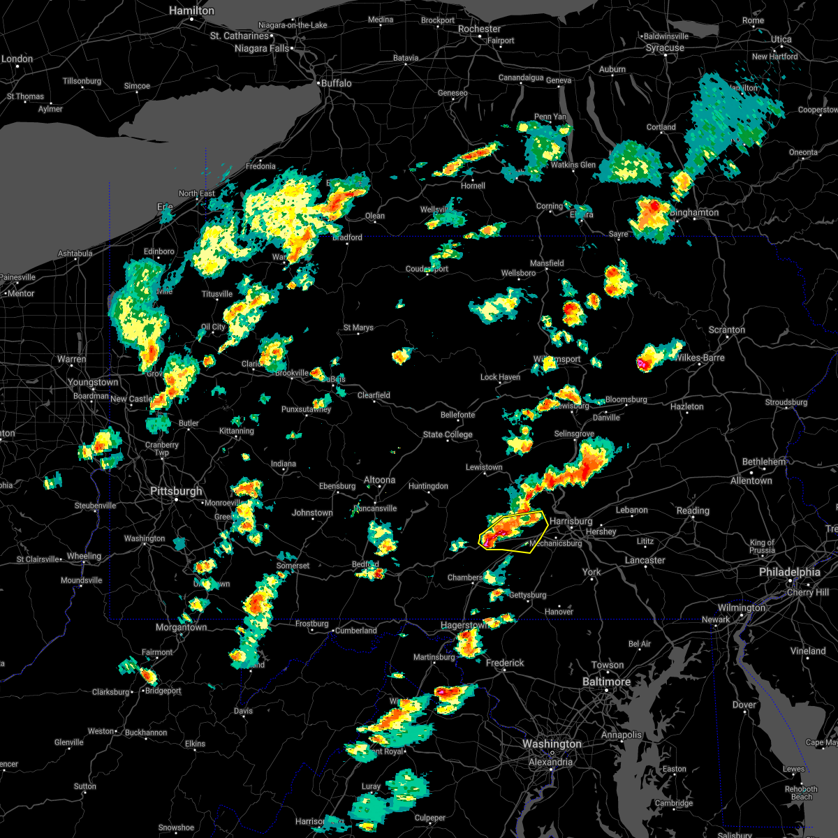
Hail Map for Newville, PA
The Newville, PA area has had 2 reports of on-the-ground hail by trained spotters, and has been under severe weather warnings 13 times during the past 12 months. Doppler radar has detected hail at or near Newville, PA on 31 occasions.
| Name: | Newville, PA |
| Where Located: | 49.4 miles SSE of State College, PA |
| Map: | Google Map for Newville, PA |
| Population: | 1326 |
| Housing Units: | 624 |
| More Info: | Search Google for Newville, PA |
0
The Top Recent Hail Date for Newville, PA is Thursday, August 29, 2024 (17th out of 31)

Hail and Wind Damage Spotted near Newville, PA
| Date / Time | Report Details |
|---|---|
| 6/11/2026 6:52 PM EDT |
 At 652 pm edt, severe thunderstorms were located along a line extending from bloserville to shippensburg to greencastle, moving east at 45 mph (radar indicated). Hazards include 60 mph wind gusts. Expect damage to roofs, siding, and trees. locations impacted include, chambersburg, carlisle, waynesboro, shippensburg, greencastle, guilford, plainfield, st. thomas, schlusser, fayetteville, wayne heights, and mount holly springs. this includes the following interstates, the pennsylvania turnpike from mile markers 187 to 227. Interstate 81 from mile markers 1 to 50. At 652 pm edt, severe thunderstorms were located along a line extending from bloserville to shippensburg to greencastle, moving east at 45 mph (radar indicated). Hazards include 60 mph wind gusts. Expect damage to roofs, siding, and trees. locations impacted include, chambersburg, carlisle, waynesboro, shippensburg, greencastle, guilford, plainfield, st. thomas, schlusser, fayetteville, wayne heights, and mount holly springs. this includes the following interstates, the pennsylvania turnpike from mile markers 187 to 227. Interstate 81 from mile markers 1 to 50.
|
| 6/11/2026 6:52 PM EDT |
 the severe thunderstorm warning has been cancelled and is no longer in effect the severe thunderstorm warning has been cancelled and is no longer in effect
|
| 6/11/2026 6:13 PM EDT |
 Svrctp the national weather service in state college pa has issued a * severe thunderstorm warning for, western adams county in south central pennsylvania, cumberland county in south central pennsylvania, franklin county in south central pennsylvania, central fulton county in south central pennsylvania, southeastern huntingdon county in central pennsylvania, southwestern perry county in south central pennsylvania, * until 715 pm edt. * at 613 pm edt, severe thunderstorms were located along a line extending from rockhill furnace to harrisonville to warfordsburg, moving east at 45 mph (radar indicated). Hazards include 60 mph wind gusts. expect damage to roofs, siding, and trees Svrctp the national weather service in state college pa has issued a * severe thunderstorm warning for, western adams county in south central pennsylvania, cumberland county in south central pennsylvania, franklin county in south central pennsylvania, central fulton county in south central pennsylvania, southeastern huntingdon county in central pennsylvania, southwestern perry county in south central pennsylvania, * until 715 pm edt. * at 613 pm edt, severe thunderstorms were located along a line extending from rockhill furnace to harrisonville to warfordsburg, moving east at 45 mph (radar indicated). Hazards include 60 mph wind gusts. expect damage to roofs, siding, and trees
|
| 6/6/2026 4:30 PM EDT |
 Svrctp the national weather service in state college pa has issued a * severe thunderstorm warning for, cumberland county in south central pennsylvania, franklin county in south central pennsylvania, * until 530 pm edt. * at 426 pm edt, severe thunderstorms were located along a line extending from near colonel denning state park to near newville to shippensburg to fannettsburg to st. thomas to mcconnellsburg, moving east at 35 mph. a second line of severe storms that has produced numerous reports of downed trees and power lines across somerset and bedford counties will follow this initial line of thunderstorms by about 30 minutes (radar indicated). Hazards include 70 mph wind gusts and quarter size hail. Hail damage to vehicles is expected. expect considerable tree damage. Wind damage is also likely to mobile homes, roofs, and outbuildings. Svrctp the national weather service in state college pa has issued a * severe thunderstorm warning for, cumberland county in south central pennsylvania, franklin county in south central pennsylvania, * until 530 pm edt. * at 426 pm edt, severe thunderstorms were located along a line extending from near colonel denning state park to near newville to shippensburg to fannettsburg to st. thomas to mcconnellsburg, moving east at 35 mph. a second line of severe storms that has produced numerous reports of downed trees and power lines across somerset and bedford counties will follow this initial line of thunderstorms by about 30 minutes (radar indicated). Hazards include 70 mph wind gusts and quarter size hail. Hail damage to vehicles is expected. expect considerable tree damage. Wind damage is also likely to mobile homes, roofs, and outbuildings.
|
| 7/25/2025 5:23 PM EDT |
 At 522 pm edt, a severe thunderstorm was located over newville, moving east at 35 mph (radar indicated). Hazards include 60 mph wind gusts. Expect damage to roofs, siding, and trees. locations impacted include, carlisle, shippensburg, plainfield, boiling springs, mount holly springs, newville, pine grove furnace, walnut bottom, bloserville, penn state dickinson school of law, and shippensburg university. this includes the following interstates, the pennsylvania turnpike from mile markers 210 to 223. Interstate 81 from mile markers 27 to 48. At 522 pm edt, a severe thunderstorm was located over newville, moving east at 35 mph (radar indicated). Hazards include 60 mph wind gusts. Expect damage to roofs, siding, and trees. locations impacted include, carlisle, shippensburg, plainfield, boiling springs, mount holly springs, newville, pine grove furnace, walnut bottom, bloserville, penn state dickinson school of law, and shippensburg university. this includes the following interstates, the pennsylvania turnpike from mile markers 210 to 223. Interstate 81 from mile markers 27 to 48.
|
| 7/25/2025 5:23 PM EDT |
 the severe thunderstorm warning has been cancelled and is no longer in effect the severe thunderstorm warning has been cancelled and is no longer in effect
|
| 7/25/2025 5:19 PM EDT | Tree down blocking one lane of big spring roa in cumberland county PA, 1 miles NE of Newville, PA |
| 7/25/2025 4:58 PM EDT |
 Svrctp the national weather service in state college pa has issued a * severe thunderstorm warning for, cumberland county in south central pennsylvania, northeastern franklin county in south central pennsylvania, southwestern perry county in south central pennsylvania, * until 545 pm edt. * at 458 pm edt, a severe thunderstorm was located over big spring state park, moving east at 35 mph (radar indicated). Hazards include 60 mph wind gusts. expect damage to roofs, siding, and trees Svrctp the national weather service in state college pa has issued a * severe thunderstorm warning for, cumberland county in south central pennsylvania, northeastern franklin county in south central pennsylvania, southwestern perry county in south central pennsylvania, * until 545 pm edt. * at 458 pm edt, a severe thunderstorm was located over big spring state park, moving east at 35 mph (radar indicated). Hazards include 60 mph wind gusts. expect damage to roofs, siding, and trees
|
| 7/25/2025 4:45 PM EDT |
 the severe thunderstorm warning has been cancelled and is no longer in effect the severe thunderstorm warning has been cancelled and is no longer in effect
|
| 7/25/2025 4:45 PM EDT |
 At 444 pm edt, a severe thunderstorm was located over big spring state park, moving east at 30 mph (radar indicated). Hazards include 60 mph wind gusts and penny size hail. Expect damage to roofs, siding, and trees. locations impacted include, plainfield, newville, east waterford, bloserville, colonel denning state park, perulack, big spring state park, blain, and new germantown. this includes the following interstates, the pennsylvania turnpike from mile markers 207 to 220. Interstate 81 from mile markers 37 to 39. At 444 pm edt, a severe thunderstorm was located over big spring state park, moving east at 30 mph (radar indicated). Hazards include 60 mph wind gusts and penny size hail. Expect damage to roofs, siding, and trees. locations impacted include, plainfield, newville, east waterford, bloserville, colonel denning state park, perulack, big spring state park, blain, and new germantown. this includes the following interstates, the pennsylvania turnpike from mile markers 207 to 220. Interstate 81 from mile markers 37 to 39.
|
| 7/25/2025 4:19 PM EDT |
 Svrctp the national weather service in state college pa has issued a * severe thunderstorm warning for, northwestern cumberland county in south central pennsylvania, north central franklin county in south central pennsylvania, central huntingdon county in central pennsylvania, southwestern juniata county in central pennsylvania, southwestern mifflin county in central pennsylvania, southwestern perry county in south central pennsylvania, * until 500 pm edt. * at 418 pm edt, a severe thunderstorm was located over mount union, moving east at 55 mph (radar indicated). Hazards include 60 mph wind gusts and penny size hail. expect damage to roofs, siding, and trees Svrctp the national weather service in state college pa has issued a * severe thunderstorm warning for, northwestern cumberland county in south central pennsylvania, north central franklin county in south central pennsylvania, central huntingdon county in central pennsylvania, southwestern juniata county in central pennsylvania, southwestern mifflin county in central pennsylvania, southwestern perry county in south central pennsylvania, * until 500 pm edt. * at 418 pm edt, a severe thunderstorm was located over mount union, moving east at 55 mph (radar indicated). Hazards include 60 mph wind gusts and penny size hail. expect damage to roofs, siding, and trees
|
| 6/30/2025 5:56 PM EDT |
 The storm which prompted the warning has weakened below severe limits, and has exited the warned area. therefore, the warning will be allowed to expire. The storm which prompted the warning has weakened below severe limits, and has exited the warned area. therefore, the warning will be allowed to expire.
|
| 6/30/2025 5:44 PM EDT |
 At 544 pm edt, a severe thunderstorm was located over newville, moving northeast at 10 mph (radar indicated). Hazards include 60 mph wind gusts and penny size hail. Expect damage to roofs, siding, and trees. locations impacted include, plainfield and newville. this includes the following interstates, the pennsylvania turnpike from mile markers 211 to 220. Interstate 81 from mile markers 39 to 43. At 544 pm edt, a severe thunderstorm was located over newville, moving northeast at 10 mph (radar indicated). Hazards include 60 mph wind gusts and penny size hail. Expect damage to roofs, siding, and trees. locations impacted include, plainfield and newville. this includes the following interstates, the pennsylvania turnpike from mile markers 211 to 220. Interstate 81 from mile markers 39 to 43.
|
| 6/30/2025 5:30 PM EDT |
 Svrctp the national weather service in state college pa has issued a * severe thunderstorm warning for, northwestern cumberland county in south central pennsylvania, * until 600 pm edt. * at 530 pm edt, a severe thunderstorm was located over newville, moving northeast at 10 mph (radar indicated). Hazards include 60 mph wind gusts and penny size hail. expect damage to roofs, siding, and trees Svrctp the national weather service in state college pa has issued a * severe thunderstorm warning for, northwestern cumberland county in south central pennsylvania, * until 600 pm edt. * at 530 pm edt, a severe thunderstorm was located over newville, moving northeast at 10 mph (radar indicated). Hazards include 60 mph wind gusts and penny size hail. expect damage to roofs, siding, and trees
|
| 3/16/2025 4:52 PM EDT |
 The storms which prompted the warning have weakened below severe limits, and no longer pose an immediate threat to life or property. therefore, the warning will be allowed to expire. however, gusty winds are still possible with these thunderstorms. a tornado watch remains in effect until 700 pm edt for south central and central pennsylvania. The storms which prompted the warning have weakened below severe limits, and no longer pose an immediate threat to life or property. therefore, the warning will be allowed to expire. however, gusty winds are still possible with these thunderstorms. a tornado watch remains in effect until 700 pm edt for south central and central pennsylvania.
|
| 3/16/2025 4:33 PM EDT |
 the severe thunderstorm warning has been cancelled and is no longer in effect the severe thunderstorm warning has been cancelled and is no longer in effect
|
| 3/16/2025 4:33 PM EDT |
 At 433 pm edt, severe thunderstorms were located along a line extending from walnut to doylesburg, moving northeast at 55 mph (radar indicated). Hazards include 60 mph wind gusts. Expect damage to roofs, siding, and trees. locations impacted include, mcalisterville, plainfield, loysville, ickesburg, blain, mifflintown, east waterford, millerstown, new bloomfield, colonel denning state park, honey grove, and port royal. This includes the pennsylvania turnpike from mile markers 192 to 220. At 433 pm edt, severe thunderstorms were located along a line extending from walnut to doylesburg, moving northeast at 55 mph (radar indicated). Hazards include 60 mph wind gusts. Expect damage to roofs, siding, and trees. locations impacted include, mcalisterville, plainfield, loysville, ickesburg, blain, mifflintown, east waterford, millerstown, new bloomfield, colonel denning state park, honey grove, and port royal. This includes the pennsylvania turnpike from mile markers 192 to 220.
|
| 3/16/2025 3:58 PM EDT |
 Svrctp the national weather service in state college pa has issued a * severe thunderstorm warning for, northwestern cumberland county in south central pennsylvania, central franklin county in south central pennsylvania, eastern fulton county in south central pennsylvania, southeastern huntingdon county in central pennsylvania, juniata county in central pennsylvania, perry county in south central pennsylvania, * until 500 pm edt. * at 358 pm edt, severe thunderstorms were located along a line extending from rockhill furnace to big cove tannery, moving northeast at 50 mph (radar indicated). Hazards include 60 mph wind gusts and penny size hail. expect damage to roofs, siding, and trees Svrctp the national weather service in state college pa has issued a * severe thunderstorm warning for, northwestern cumberland county in south central pennsylvania, central franklin county in south central pennsylvania, eastern fulton county in south central pennsylvania, southeastern huntingdon county in central pennsylvania, juniata county in central pennsylvania, perry county in south central pennsylvania, * until 500 pm edt. * at 358 pm edt, severe thunderstorms were located along a line extending from rockhill furnace to big cove tannery, moving northeast at 50 mph (radar indicated). Hazards include 60 mph wind gusts and penny size hail. expect damage to roofs, siding, and trees
|
| 8/6/2024 5:32 PM EDT |
 Svrctp the national weather service in state college pa has issued a * severe thunderstorm warning for, cumberland county in south central pennsylvania, southern dauphin county in south central pennsylvania, central franklin county in south central pennsylvania, northeastern fulton county in south central pennsylvania, southeastern huntingdon county in central pennsylvania, southwestern juniata county in central pennsylvania, perry county in south central pennsylvania, * until 615 pm edt. * at 531 pm edt, severe thunderstorms were located along a line extending from duncannon to sideling hill rest area, moving east at 35 mph (radar indicated). Hazards include 60 mph wind gusts and quarter size hail. Hail damage to vehicles is expected. Expect wind damage to roofs, siding, and trees. Svrctp the national weather service in state college pa has issued a * severe thunderstorm warning for, cumberland county in south central pennsylvania, southern dauphin county in south central pennsylvania, central franklin county in south central pennsylvania, northeastern fulton county in south central pennsylvania, southeastern huntingdon county in central pennsylvania, southwestern juniata county in central pennsylvania, perry county in south central pennsylvania, * until 615 pm edt. * at 531 pm edt, severe thunderstorms were located along a line extending from duncannon to sideling hill rest area, moving east at 35 mph (radar indicated). Hazards include 60 mph wind gusts and quarter size hail. Hail damage to vehicles is expected. Expect wind damage to roofs, siding, and trees.
|
| 8/3/2024 1:01 PM EDT |
 Svrctp the national weather service in state college pa has issued a * severe thunderstorm warning for, northwestern cumberland county in south central pennsylvania, northeastern franklin county in south central pennsylvania, southeastern huntingdon county in central pennsylvania, southwestern perry county in south central pennsylvania, * until 145 pm edt. * at 101 pm edt, a severe thunderstorm was located over willow hill, moving northeast at 25 mph (radar indicated). Hazards include 60 mph wind gusts and penny size hail. expect damage to roofs, siding, and trees Svrctp the national weather service in state college pa has issued a * severe thunderstorm warning for, northwestern cumberland county in south central pennsylvania, northeastern franklin county in south central pennsylvania, southeastern huntingdon county in central pennsylvania, southwestern perry county in south central pennsylvania, * until 145 pm edt. * at 101 pm edt, a severe thunderstorm was located over willow hill, moving northeast at 25 mph (radar indicated). Hazards include 60 mph wind gusts and penny size hail. expect damage to roofs, siding, and trees
|
| 7/16/2024 5:52 PM EDT | Tree and several power poles down on 300 block of doubling gap r in cumberland county PA, 1.5 miles SSE of Newville, PA |
| 7/10/2024 7:48 PM EDT |
 Svrctp the national weather service in state college pa has issued a * severe thunderstorm warning for, northwestern cumberland county in south central pennsylvania, juniata county in central pennsylvania, perry county in south central pennsylvania, southeastern snyder county in central pennsylvania, * until 900 pm edt. * at 748 pm edt, severe thunderstorms were located along a line extending from ickesburg to colonel denning state park to shippensburg, moving northeast at 35 mph (radar indicated). Hazards include 60 mph wind gusts. expect damage to roofs, siding, and trees Svrctp the national weather service in state college pa has issued a * severe thunderstorm warning for, northwestern cumberland county in south central pennsylvania, juniata county in central pennsylvania, perry county in south central pennsylvania, southeastern snyder county in central pennsylvania, * until 900 pm edt. * at 748 pm edt, severe thunderstorms were located along a line extending from ickesburg to colonel denning state park to shippensburg, moving northeast at 35 mph (radar indicated). Hazards include 60 mph wind gusts. expect damage to roofs, siding, and trees
|
| 6/29/2024 6:23 PM EDT |
 Torctp the national weather service in state college pa has issued a * tornado warning for, central cumberland county in south central pennsylvania, * until 700 pm edt. * at 622 pm edt, a severe thunderstorm capable of producing a tornado was located over walnut bottom, moving east at 25 mph (radar indicated rotation). Hazards include tornado. Flying debris will be dangerous to those caught without shelter. mobile homes will be damaged or destroyed. damage to roofs, windows, and vehicles will occur. tree damage is likely. this dangerous storm will be near, pine grove furnace around 630 pm edt. mount holly springs around 640 pm edt. This includes interstate 81 from mile markers 31 to 43. Torctp the national weather service in state college pa has issued a * tornado warning for, central cumberland county in south central pennsylvania, * until 700 pm edt. * at 622 pm edt, a severe thunderstorm capable of producing a tornado was located over walnut bottom, moving east at 25 mph (radar indicated rotation). Hazards include tornado. Flying debris will be dangerous to those caught without shelter. mobile homes will be damaged or destroyed. damage to roofs, windows, and vehicles will occur. tree damage is likely. this dangerous storm will be near, pine grove furnace around 630 pm edt. mount holly springs around 640 pm edt. This includes interstate 81 from mile markers 31 to 43.
|
| 6/29/2024 6:16 PM EDT |
 At 615 pm edt, a severe thunderstorm was located over plainfield, moving east at 40 mph (radar indicated). Hazards include 60 mph wind gusts and quarter size hail. Hail damage to vehicles is expected. expect wind damage to roofs, siding, and trees. locations impacted include, carlisle, plainfield, schlusser, mount holly springs, newville, bloserville, walnut bottom, and penn state dickinson school of law. this includes the following interstates, the pennsylvania turnpike from mile markers 208 to 224. Interstate 81 from mile markers 31 to 46. At 615 pm edt, a severe thunderstorm was located over plainfield, moving east at 40 mph (radar indicated). Hazards include 60 mph wind gusts and quarter size hail. Hail damage to vehicles is expected. expect wind damage to roofs, siding, and trees. locations impacted include, carlisle, plainfield, schlusser, mount holly springs, newville, bloserville, walnut bottom, and penn state dickinson school of law. this includes the following interstates, the pennsylvania turnpike from mile markers 208 to 224. Interstate 81 from mile markers 31 to 46.
|
| 6/29/2024 6:16 PM EDT |
 the severe thunderstorm warning has been cancelled and is no longer in effect the severe thunderstorm warning has been cancelled and is no longer in effect
|
| 6/29/2024 5:59 PM EDT |
 the severe thunderstorm warning has been cancelled and is no longer in effect the severe thunderstorm warning has been cancelled and is no longer in effect
|
| 6/29/2024 5:59 PM EDT |
 At 559 pm edt, a severe thunderstorm was located over newville, moving east at 40 mph (radar indicated). Hazards include 60 mph wind gusts. Expect damage to roofs, siding, and trees. locations impacted include, carlisle, plainfield, schlusser, mount holly springs, newville, bloserville, colonel denning state park, roxbury, walnut bottom, and penn state dickinson school of law. this includes the following interstates, the pennsylvania turnpike from mile markers 198 to 224. Interstate 81 from mile markers 31 to 46. At 559 pm edt, a severe thunderstorm was located over newville, moving east at 40 mph (radar indicated). Hazards include 60 mph wind gusts. Expect damage to roofs, siding, and trees. locations impacted include, carlisle, plainfield, schlusser, mount holly springs, newville, bloserville, colonel denning state park, roxbury, walnut bottom, and penn state dickinson school of law. this includes the following interstates, the pennsylvania turnpike from mile markers 198 to 224. Interstate 81 from mile markers 31 to 46.
|
| 6/29/2024 5:40 PM EDT |
 Svrctp the national weather service in state college pa has issued a * severe thunderstorm warning for, northwestern cumberland county in south central pennsylvania, northeastern franklin county in south central pennsylvania, southeastern huntingdon county in central pennsylvania, southwestern perry county in south central pennsylvania, * until 630 pm edt. * at 538 pm edt, a severe thunderstorm was located over willow hill, moving east at 40 mph (radar indicated). Hazards include 60 mph wind gusts. expect damage to roofs, siding, and trees Svrctp the national weather service in state college pa has issued a * severe thunderstorm warning for, northwestern cumberland county in south central pennsylvania, northeastern franklin county in south central pennsylvania, southeastern huntingdon county in central pennsylvania, southwestern perry county in south central pennsylvania, * until 630 pm edt. * at 538 pm edt, a severe thunderstorm was located over willow hill, moving east at 40 mph (radar indicated). Hazards include 60 mph wind gusts. expect damage to roofs, siding, and trees
|
| 6/26/2024 11:10 PM EDT |
 The storms which prompted the warning have weakened below severe limits, and have exited the warned area. therefore, the warning will be allowed to expire. The storms which prompted the warning have weakened below severe limits, and have exited the warned area. therefore, the warning will be allowed to expire.
|
| 6/26/2024 10:44 PM EDT |
 the severe thunderstorm warning has been cancelled and is no longer in effect the severe thunderstorm warning has been cancelled and is no longer in effect
|
| 6/26/2024 10:44 PM EDT |
 At 1044 pm edt, severe thunderstorms were located along a line extending from near millersburg to shermansdale to shippensburg, moving east at 45 mph (radar indicated). Hazards include 60 mph wind gusts. Expect damage to roofs, siding, and trees. locations impacted include, harrisburg, carlisle, mechanicsburg, enola, shippensburg, plainfield, schlusser, boiling springs, wormleysburg, millersburg, marysville, and mount holly springs. this includes the following interstates, the pennsylvania turnpike from mile markers 188 to 232. Interstate 81 from mile markers 22 to 66. At 1044 pm edt, severe thunderstorms were located along a line extending from near millersburg to shermansdale to shippensburg, moving east at 45 mph (radar indicated). Hazards include 60 mph wind gusts. Expect damage to roofs, siding, and trees. locations impacted include, harrisburg, carlisle, mechanicsburg, enola, shippensburg, plainfield, schlusser, boiling springs, wormleysburg, millersburg, marysville, and mount holly springs. this includes the following interstates, the pennsylvania turnpike from mile markers 188 to 232. Interstate 81 from mile markers 22 to 66.
|
| 6/26/2024 10:30 PM EDT |
 Svrctp the national weather service in state college pa has issued a * severe thunderstorm warning for, cumberland county in south central pennsylvania, northwestern dauphin county in south central pennsylvania, northeastern franklin county in south central pennsylvania, central juniata county in central pennsylvania, perry county in south central pennsylvania, * until 1115 pm edt. * at 1030 pm edt, severe thunderstorms were located along a line extending from mcalisterville to colonel denning state park to upper strasburg, moving east at 50 mph (radar indicated). Hazards include 60 mph wind gusts. expect damage to roofs, siding, and trees Svrctp the national weather service in state college pa has issued a * severe thunderstorm warning for, cumberland county in south central pennsylvania, northwestern dauphin county in south central pennsylvania, northeastern franklin county in south central pennsylvania, central juniata county in central pennsylvania, perry county in south central pennsylvania, * until 1115 pm edt. * at 1030 pm edt, severe thunderstorms were located along a line extending from mcalisterville to colonel denning state park to upper strasburg, moving east at 50 mph (radar indicated). Hazards include 60 mph wind gusts. expect damage to roofs, siding, and trees
|
| 6/26/2024 10:20 PM EDT |
 At 1019 pm edt, severe thunderstorms were located along a line extending from mexico to honey grove to fannettsburg, moving east at 40 mph (radar indicated). Hazards include 60 mph wind gusts. Expect damage to roofs, siding, and trees. locations impacted include, lewistown, shippensburg, burnham, newport, highland park, newville, honey grove, new bloomfield, yeagertown, mcalisterville, spruce hill, and strodes mills. This includes the pennsylvania turnpike from mile markers 166 to 216. At 1019 pm edt, severe thunderstorms were located along a line extending from mexico to honey grove to fannettsburg, moving east at 40 mph (radar indicated). Hazards include 60 mph wind gusts. Expect damage to roofs, siding, and trees. locations impacted include, lewistown, shippensburg, burnham, newport, highland park, newville, honey grove, new bloomfield, yeagertown, mcalisterville, spruce hill, and strodes mills. This includes the pennsylvania turnpike from mile markers 166 to 216.
|
| 6/26/2024 10:20 PM EDT |
 the severe thunderstorm warning has been cancelled and is no longer in effect the severe thunderstorm warning has been cancelled and is no longer in effect
|
| 6/26/2024 9:52 PM EDT |
 Svrctp the national weather service in state college pa has issued a * severe thunderstorm warning for, east central bedford county in south central pennsylvania, northwestern cumberland county in south central pennsylvania, central franklin county in south central pennsylvania, northeastern fulton county in south central pennsylvania, southeastern huntingdon county in central pennsylvania, juniata county in central pennsylvania, mifflin county in central pennsylvania, perry county in south central pennsylvania, * until 1030 pm edt. * at 951 pm edt, severe thunderstorms were located along a line extending from belleville to mount union to wells tannery, moving east at 40 mph (radar indicated). Hazards include 60 mph wind gusts. expect damage to roofs, siding, and trees Svrctp the national weather service in state college pa has issued a * severe thunderstorm warning for, east central bedford county in south central pennsylvania, northwestern cumberland county in south central pennsylvania, central franklin county in south central pennsylvania, northeastern fulton county in south central pennsylvania, southeastern huntingdon county in central pennsylvania, juniata county in central pennsylvania, mifflin county in central pennsylvania, perry county in south central pennsylvania, * until 1030 pm edt. * at 951 pm edt, severe thunderstorms were located along a line extending from belleville to mount union to wells tannery, moving east at 40 mph (radar indicated). Hazards include 60 mph wind gusts. expect damage to roofs, siding, and trees
|
| 8/7/2023 4:05 PM EDT |
 At 404 pm edt, severe thunderstorms were located along a line extending from near big spring state park to scotland to paramount-long meadow, moving east at 35 mph (radar indicated). Hazards include 60 mph wind gusts and quarter size hail. Hail damage to vehicles is expected. Expect wind damage to roofs, siding, and trees. At 404 pm edt, severe thunderstorms were located along a line extending from near big spring state park to scotland to paramount-long meadow, moving east at 35 mph (radar indicated). Hazards include 60 mph wind gusts and quarter size hail. Hail damage to vehicles is expected. Expect wind damage to roofs, siding, and trees.
|
| 8/4/2023 7:01 PM EDT |
 At 700 pm edt, a severe thunderstorm was located over doylesburg, moving southeast at 30 mph (radar indicated). Hazards include 60 mph wind gusts and quarter size hail. Hail damage to vehicles is expected. expect wind damage to roofs, siding, and trees. locations impacted include, shippensburg, mount union, newville, rockhill furnace, roxbury, big spring state park, doylesburg, mapleton, orbisonia, orrstown, shirleysburg and shippensburg university. this includes the following roadways, the pennsylvania turnpike from mile markers 194 to 216. interstate 81 from mile markers 23 to 30. route 11 from south of chambersburg to shippensburg. route 522 from orbisonia to south of mount union. hail threat, radar indicated max hail size, 1. 00 in wind threat, radar indicated max wind gust, 60 mph. At 700 pm edt, a severe thunderstorm was located over doylesburg, moving southeast at 30 mph (radar indicated). Hazards include 60 mph wind gusts and quarter size hail. Hail damage to vehicles is expected. expect wind damage to roofs, siding, and trees. locations impacted include, shippensburg, mount union, newville, rockhill furnace, roxbury, big spring state park, doylesburg, mapleton, orbisonia, orrstown, shirleysburg and shippensburg university. this includes the following roadways, the pennsylvania turnpike from mile markers 194 to 216. interstate 81 from mile markers 23 to 30. route 11 from south of chambersburg to shippensburg. route 522 from orbisonia to south of mount union. hail threat, radar indicated max hail size, 1. 00 in wind threat, radar indicated max wind gust, 60 mph.
|
| 8/4/2023 6:43 PM EDT |
 At 641 pm edt, a severe thunderstorm was located near mount union, moving southeast at 35 mph (radar indicated). Hazards include 60 mph wind gusts and quarter size hail. Hail damage to vehicles is expected. expect wind damage to roofs, siding, and trees. locations impacted include, shippensburg, mount union, newville, rockhill furnace, roxbury, big spring state park, doylesburg, mapleton, orbisonia, mill creek, kistler and orrstown. this includes the following interstates, the pennsylvania turnpike from mile markers 194 to 216. interstate 81 from mile markers 23 to 30. hail threat, radar indicated max hail size, 1. 00 in wind threat, radar indicated max wind gust, 60 mph. At 641 pm edt, a severe thunderstorm was located near mount union, moving southeast at 35 mph (radar indicated). Hazards include 60 mph wind gusts and quarter size hail. Hail damage to vehicles is expected. expect wind damage to roofs, siding, and trees. locations impacted include, shippensburg, mount union, newville, rockhill furnace, roxbury, big spring state park, doylesburg, mapleton, orbisonia, mill creek, kistler and orrstown. this includes the following interstates, the pennsylvania turnpike from mile markers 194 to 216. interstate 81 from mile markers 23 to 30. hail threat, radar indicated max hail size, 1. 00 in wind threat, radar indicated max wind gust, 60 mph.
|
| 8/4/2023 6:27 PM EDT |
 At 627 pm edt, a severe thunderstorm was located over mount union, moving southeast at 35 mph (radar indicated). Hazards include 60 mph wind gusts and quarter size hail. Hail damage to vehicles is expected. Expect wind damage to roofs, siding, and trees. At 627 pm edt, a severe thunderstorm was located over mount union, moving southeast at 35 mph (radar indicated). Hazards include 60 mph wind gusts and quarter size hail. Hail damage to vehicles is expected. Expect wind damage to roofs, siding, and trees.
|
| 8/4/2023 5:35 PM EDT | Quarter sized hail reported 5.4 miles E of Newville, PA, report from mping: quarter (1.00 in.). |
| 7/28/2023 4:57 PM EDT | Trees/wires dow in cumberland county PA, 0.1 miles ENE of Newville, PA |
| 7/28/2023 4:26 PM EDT |
 At 426 pm edt, a severe thunderstorm was located over big spring state park, moving east at 25 mph (radar indicated). Hazards include 60 mph wind gusts and penny size hail. expect damage to roofs, siding, and trees At 426 pm edt, a severe thunderstorm was located over big spring state park, moving east at 25 mph (radar indicated). Hazards include 60 mph wind gusts and penny size hail. expect damage to roofs, siding, and trees
|
| 7/21/2023 12:57 AM EDT |
 At 1256 am edt, a severe thunderstorm was located over walnut bottom, moving east at 30 mph (radar indicated). Hazards include 60 mph wind gusts and nickel size hail. Expect damage to roofs, siding, and trees. this severe storm will be near, mount holly springs, aspers and boiling springs around 110 am edt. dillsburg around 120 am edt. siddonsburg around 130 am edt. other locations impacted by this severe thunderstorm include biglerville, franklintown, idaville, york springs and gardners. this includes the following interstates, the pennsylvania turnpike from mile markers 208 to 245. interstate 81 from mile markers 29 to 55. Interstate 83 from mile markers 37 to 39. At 1256 am edt, a severe thunderstorm was located over walnut bottom, moving east at 30 mph (radar indicated). Hazards include 60 mph wind gusts and nickel size hail. Expect damage to roofs, siding, and trees. this severe storm will be near, mount holly springs, aspers and boiling springs around 110 am edt. dillsburg around 120 am edt. siddonsburg around 130 am edt. other locations impacted by this severe thunderstorm include biglerville, franklintown, idaville, york springs and gardners. this includes the following interstates, the pennsylvania turnpike from mile markers 208 to 245. interstate 81 from mile markers 29 to 55. Interstate 83 from mile markers 37 to 39.
|
| 7/21/2023 12:44 AM EDT | Tree down on roa in cumberland county PA, 5.6 miles ENE of Newville, PA |
| 7/21/2023 12:39 AM EDT |
 At 1238 am edt, a severe thunderstorm was located over newville, moving east at 25 mph (radar indicated). Hazards include 60 mph wind gusts and nickel size hail. expect damage to roofs, siding, and trees At 1238 am edt, a severe thunderstorm was located over newville, moving east at 25 mph (radar indicated). Hazards include 60 mph wind gusts and nickel size hail. expect damage to roofs, siding, and trees
|
| 6/3/2023 4:36 PM EDT |
 At 436 pm edt, a severe thunderstorm was located over loysville, moving south at 15 mph (radar indicated). Hazards include 60 mph wind gusts and quarter size hail. Hail damage to vehicles is expected. Expect wind damage to roofs, siding, and trees. At 436 pm edt, a severe thunderstorm was located over loysville, moving south at 15 mph (radar indicated). Hazards include 60 mph wind gusts and quarter size hail. Hail damage to vehicles is expected. Expect wind damage to roofs, siding, and trees.
|
| 7/23/2022 6:26 PM EDT |
 At 625 pm edt, a severe thunderstorm was located over big spring state park, moving east at 45 mph (radar indicated). Hazards include 60 mph wind gusts and nickel size hail. expect damage to roofs, siding, and trees At 625 pm edt, a severe thunderstorm was located over big spring state park, moving east at 45 mph (radar indicated). Hazards include 60 mph wind gusts and nickel size hail. expect damage to roofs, siding, and trees
|
| 7/12/2022 3:27 PM EDT |
 At 327 pm edt, a severe thunderstorm was located over mount holly springs, moving east at 35 mph (radar indicated). Hazards include 60 mph wind gusts and nickel size hail. expect damage to roofs, siding, and trees At 327 pm edt, a severe thunderstorm was located over mount holly springs, moving east at 35 mph (radar indicated). Hazards include 60 mph wind gusts and nickel size hail. expect damage to roofs, siding, and trees
|
| 7/12/2022 3:04 PM EDT |
 At 304 pm edt, a severe thunderstorm was located over st. thomas, moving east at 25 mph (radar indicated). Hazards include 60 mph wind gusts and quarter size hail. Hail damage to vehicles is expected. Expect wind damage to roofs, siding, and trees. At 304 pm edt, a severe thunderstorm was located over st. thomas, moving east at 25 mph (radar indicated). Hazards include 60 mph wind gusts and quarter size hail. Hail damage to vehicles is expected. Expect wind damage to roofs, siding, and trees.
|
| 6/14/2022 4:57 AM EDT |
 At 456 am edt, severe thunderstorms were located along a line extending from walnut bottom to pine grove furnace to gettysburg to emmitsburg, moving east at 30 mph (radar indicated). Hazards include 60 mph wind gusts and nickel size hail. expect damage to roofs, siding, and trees At 456 am edt, severe thunderstorms were located along a line extending from walnut bottom to pine grove furnace to gettysburg to emmitsburg, moving east at 30 mph (radar indicated). Hazards include 60 mph wind gusts and nickel size hail. expect damage to roofs, siding, and trees
|
| 3/31/2022 6:03 PM EDT |
 At 603 pm edt, a severe thunderstorm was located over walnut bottom, moving northeast at 40 mph (radar indicated). Hazards include 60 mph wind gusts and nickel size hail. Expect damage to roofs, siding, and trees. locations impacted include, chambersburg, carlisle, shippensburg, greencastle, guilford, plainfield, fayetteville, mount holly springs, mont alto, scotland, newville and marion. this includes the following interstates, the pennsylvania turnpike from mile markers 204 to 223. Interstate 81 from mile markers 1 to 46. At 603 pm edt, a severe thunderstorm was located over walnut bottom, moving northeast at 40 mph (radar indicated). Hazards include 60 mph wind gusts and nickel size hail. Expect damage to roofs, siding, and trees. locations impacted include, chambersburg, carlisle, shippensburg, greencastle, guilford, plainfield, fayetteville, mount holly springs, mont alto, scotland, newville and marion. this includes the following interstates, the pennsylvania turnpike from mile markers 204 to 223. Interstate 81 from mile markers 1 to 46.
|
| 3/31/2022 6:00 PM EDT | Trees down on wire in cumberland county PA, 2.8 miles ENE of Newville, PA |
| 3/31/2022 5:40 PM EDT |
 At 540 pm edt, a severe thunderstorm was located over chambersburg, moving northeast at 40 mph (radar indicated). Hazards include 60 mph wind gusts and nickel size hail. expect damage to roofs, siding, and trees At 540 pm edt, a severe thunderstorm was located over chambersburg, moving northeast at 40 mph (radar indicated). Hazards include 60 mph wind gusts and nickel size hail. expect damage to roofs, siding, and trees
|
| 3/7/2022 6:26 PM EST |
 At 625 pm est, severe thunderstorms were located along a line extending from near rockhill furnace to warfordsburg, moving east at 55 mph (radar indicated). Hazards include 60 mph wind gusts. expect damage to roofs, siding, and trees At 625 pm est, severe thunderstorms were located along a line extending from near rockhill furnace to warfordsburg, moving east at 55 mph (radar indicated). Hazards include 60 mph wind gusts. expect damage to roofs, siding, and trees
|
| 9/15/2021 5:08 PM EDT |
 At 508 pm edt, a severe thunderstorm was located over newville, moving east at 25 mph (radar indicated). Hazards include 60 mph wind gusts and quarter size hail. Hail damage to vehicles is expected. expect wind damage to roofs, siding, and trees. locations impacted include, newville, bloserville and colonel denning state park. this includes the following interstates, the pennsylvania turnpike from mile markers 207 to 217. interstate 81 from mile markers 38 to 39. hail threat, radar indicated max hail size, 1. 00 in wind threat, radar indicated max wind gust, 60 mph. At 508 pm edt, a severe thunderstorm was located over newville, moving east at 25 mph (radar indicated). Hazards include 60 mph wind gusts and quarter size hail. Hail damage to vehicles is expected. expect wind damage to roofs, siding, and trees. locations impacted include, newville, bloserville and colonel denning state park. this includes the following interstates, the pennsylvania turnpike from mile markers 207 to 217. interstate 81 from mile markers 38 to 39. hail threat, radar indicated max hail size, 1. 00 in wind threat, radar indicated max wind gust, 60 mph.
|
| 9/15/2021 4:43 PM EDT |
 At 442 pm edt, a severe thunderstorm was located near roxbury, moving east at 25 mph (radar indicated). Hazards include 60 mph wind gusts and quarter size hail. Hail damage to vehicles is expected. Expect wind damage to roofs, siding, and trees. At 442 pm edt, a severe thunderstorm was located near roxbury, moving east at 25 mph (radar indicated). Hazards include 60 mph wind gusts and quarter size hail. Hail damage to vehicles is expected. Expect wind damage to roofs, siding, and trees.
|
| 8/18/2021 5:10 PM EDT |
 At 510 pm edt, severe thunderstorms were located along a line extending from near newville to walnut bottom to near scotland to mont alto to rouzerville, moving northeast at 45 mph (radar indicated). Hazards include 60 mph wind gusts. Expect damage to roofs, siding, and trees. severe thunderstorms will be near, carlisle, schlusser, plainfield, bloserville, loysville and colonel denning state park around 520 pm edt. mount holly springs, duncannon, boiling springs, carlisle springs, new kingstown, newport, new bloomfield, shermansdale and lake meade around 530 pm edt. camp hill, mechanicsburg, enola, lower allen, lemoyne, harrisburg, new cumberland, siddonsburg, marysville and west fairview around 540 pm edt. other locations impacted by these severe thunderstorms include arendtsville, gardners, heidlersburg, biglerville, millerstown, lewisberry, idaville, mcknightstown, bendersville and hunterstown. this includes the following interstates, the pennsylvania turnpike from mile markers 202 to 242. interstate 81 from mile markers 28 to 65. Interstate 83 from mile markers 38 to 42. At 510 pm edt, severe thunderstorms were located along a line extending from near newville to walnut bottom to near scotland to mont alto to rouzerville, moving northeast at 45 mph (radar indicated). Hazards include 60 mph wind gusts. Expect damage to roofs, siding, and trees. severe thunderstorms will be near, carlisle, schlusser, plainfield, bloserville, loysville and colonel denning state park around 520 pm edt. mount holly springs, duncannon, boiling springs, carlisle springs, new kingstown, newport, new bloomfield, shermansdale and lake meade around 530 pm edt. camp hill, mechanicsburg, enola, lower allen, lemoyne, harrisburg, new cumberland, siddonsburg, marysville and west fairview around 540 pm edt. other locations impacted by these severe thunderstorms include arendtsville, gardners, heidlersburg, biglerville, millerstown, lewisberry, idaville, mcknightstown, bendersville and hunterstown. this includes the following interstates, the pennsylvania turnpike from mile markers 202 to 242. interstate 81 from mile markers 28 to 65. Interstate 83 from mile markers 38 to 42.
|
| 8/18/2021 12:54 PM EDT |
 At 1254 pm edt, a severe thunderstorm was located near walnut bottom, moving north at 35 mph (radar indicated). Hazards include 60 mph wind gusts. Expect damage to roofs, siding, and trees. this severe thunderstorm will be near, newville around 100 pm edt. carlisle, bloserville, plainfield, colonel denning state park and schlusser around 110 pm edt. loysville around 120 pm edt. ickesburg and new bloomfield around 130 pm edt. other locations impacted by this severe thunderstorm include landisburg and penn state dickinson school of law. this includes the following interstates, the pennsylvania turnpike from mile markers 211 to 225. Interstate 81 from mile markers 30 to 46. At 1254 pm edt, a severe thunderstorm was located near walnut bottom, moving north at 35 mph (radar indicated). Hazards include 60 mph wind gusts. Expect damage to roofs, siding, and trees. this severe thunderstorm will be near, newville around 100 pm edt. carlisle, bloserville, plainfield, colonel denning state park and schlusser around 110 pm edt. loysville around 120 pm edt. ickesburg and new bloomfield around 130 pm edt. other locations impacted by this severe thunderstorm include landisburg and penn state dickinson school of law. this includes the following interstates, the pennsylvania turnpike from mile markers 211 to 225. Interstate 81 from mile markers 30 to 46.
|
| 8/13/2021 2:12 PM EDT |
 At 211 pm edt, severe thunderstorms were located along a line extending from near spruce hill to near claylick, moving east at 25 mph (radar indicated). Hazards include 60 mph wind gusts and penny size hail. expect damage to roofs, siding, and trees At 211 pm edt, severe thunderstorms were located along a line extending from near spruce hill to near claylick, moving east at 25 mph (radar indicated). Hazards include 60 mph wind gusts and penny size hail. expect damage to roofs, siding, and trees
|
| 7/17/2021 6:09 PM EDT |
 At 609 pm edt, a severe thunderstorm was located near mount holly springs, moving northeast at 35 mph (radar indicated). Hazards include 60 mph wind gusts and quarter size hail. Hail damage to vehicles is expected. Expect wind damage to roofs, siding, and trees. At 609 pm edt, a severe thunderstorm was located near mount holly springs, moving northeast at 35 mph (radar indicated). Hazards include 60 mph wind gusts and quarter size hail. Hail damage to vehicles is expected. Expect wind damage to roofs, siding, and trees.
|
| 7/17/2021 5:44 PM EDT |
 At 543 pm edt, severe thunderstorms were located along a line extending from near milton to near new buffalo to near newville, moving northeast at 30 mph (radar indicated). Hazards include 60 mph wind gusts and quarter size hail. Hail damage to vehicles is expected. Expect wind damage to roofs, siding, and trees. At 543 pm edt, severe thunderstorms were located along a line extending from near milton to near new buffalo to near newville, moving northeast at 30 mph (radar indicated). Hazards include 60 mph wind gusts and quarter size hail. Hail damage to vehicles is expected. Expect wind damage to roofs, siding, and trees.
|
| 7/11/2021 8:44 PM EDT |
 At 844 pm edt, severe thunderstorms were located along a line extending from near millersburg to near new buffalo to near shippensburg, moving east at 20 mph (radar indicated). Hazards include 60 mph wind gusts. expect damage to roofs, siding, and trees At 844 pm edt, severe thunderstorms were located along a line extending from near millersburg to near new buffalo to near shippensburg, moving east at 20 mph (radar indicated). Hazards include 60 mph wind gusts. expect damage to roofs, siding, and trees
|
| 7/11/2021 7:58 PM EDT |
 The national weather service in state college pa has issued a * severe thunderstorm warning for. southeastern bedford county in south central pennsylvania. southeastern huntingdon county in central pennsylvania. franklin county in south central pennsylvania. Central mifflin county in central pennsylvania. The national weather service in state college pa has issued a * severe thunderstorm warning for. southeastern bedford county in south central pennsylvania. southeastern huntingdon county in central pennsylvania. franklin county in south central pennsylvania. Central mifflin county in central pennsylvania.
|
| 7/8/2021 4:24 PM EDT |
 At 421 pm edt, severe thunderstorms were located about 15 miles either side of a line extending from near walnut bottom to near dehart dam to near fort indiantown gap, moving north at 15 mph (radar indicated). Hazards include 60 mph wind gusts and penny size hail. Expect damage to roofs, siding, and trees. locations impacted include, harrisburg, carlisle, lower allen, hanover, hershey, colonial park, weigelstown, waynesboro, progress, mechanicsburg, middletown, camp hill, gettysburg, new cumberland, linglestown, enola, steelton, lemoyne, hummelstown and hampton. this includes the following interstates, the pennsylvania turnpike from mile markers 213 to 253. interstate 81 from mile markers 30 to 80. interstate 83 from mile markers 25 to 50. Interstate 283 from mile markers 0 to 2. At 421 pm edt, severe thunderstorms were located about 15 miles either side of a line extending from near walnut bottom to near dehart dam to near fort indiantown gap, moving north at 15 mph (radar indicated). Hazards include 60 mph wind gusts and penny size hail. Expect damage to roofs, siding, and trees. locations impacted include, harrisburg, carlisle, lower allen, hanover, hershey, colonial park, weigelstown, waynesboro, progress, mechanicsburg, middletown, camp hill, gettysburg, new cumberland, linglestown, enola, steelton, lemoyne, hummelstown and hampton. this includes the following interstates, the pennsylvania turnpike from mile markers 213 to 253. interstate 81 from mile markers 30 to 80. interstate 83 from mile markers 25 to 50. Interstate 283 from mile markers 0 to 2.
|
| 7/8/2021 3:17 PM EDT |
 At 316 pm edt, the leading edge of an area of severe thunderstorms were located along a line extending from near mont alto to highspire to middletown, moving north at 15 mph (radar indicated). Hazards include 60 mph wind gusts and nickel size hail. expect damage to roofs, siding, and trees At 316 pm edt, the leading edge of an area of severe thunderstorms were located along a line extending from near mont alto to highspire to middletown, moving north at 15 mph (radar indicated). Hazards include 60 mph wind gusts and nickel size hail. expect damage to roofs, siding, and trees
|
| 7/7/2021 7:00 PM EDT |
 At 700 pm edt, a severe thunderstorm was located near newville, moving northeast at 15 mph (radar indicated). Hazards include 60 mph wind gusts and quarter size hail. Hail damage to vehicles is expected. expect wind damage to roofs, siding, and trees. locations impacted include, plainfield, newville, bloserville, colonel denning state park, loysville and landisburg. This includes the pennsylvania turnpike from mile markers 206 to 220. At 700 pm edt, a severe thunderstorm was located near newville, moving northeast at 15 mph (radar indicated). Hazards include 60 mph wind gusts and quarter size hail. Hail damage to vehicles is expected. expect wind damage to roofs, siding, and trees. locations impacted include, plainfield, newville, bloserville, colonel denning state park, loysville and landisburg. This includes the pennsylvania turnpike from mile markers 206 to 220.
|
| 7/7/2021 6:37 PM EDT |
 At 637 pm edt, a severe thunderstorm was located near roxbury, moving northeast at 15 mph (radar indicated). Hazards include 60 mph wind gusts and quarter size hail. Hail damage to vehicles is expected. Expect wind damage to roofs, siding, and trees. At 637 pm edt, a severe thunderstorm was located near roxbury, moving northeast at 15 mph (radar indicated). Hazards include 60 mph wind gusts and quarter size hail. Hail damage to vehicles is expected. Expect wind damage to roofs, siding, and trees.
|
| 7/7/2021 5:50 PM EDT |
 At 550 pm edt, a severe thunderstorm was located over roxbury, moving northeast at 20 mph (radar indicated). Hazards include 70 mph wind gusts and ping pong ball size hail. People and animals outdoors will be injured. expect hail damage to roofs, siding, windows, and vehicles. expect considerable tree damage. wind damage is also likely to mobile homes, roofs, and outbuildings. this severe thunderstorm will be near, shippensburg around 600 pm edt. newville and bloserville around 630 pm edt. other locations impacted by this severe thunderstorm include orrstown and shippensburg university. this includes the following interstates, the pennsylvania turnpike from mile markers 193 to 221. Interstate 81 from mile markers 29 to 30. At 550 pm edt, a severe thunderstorm was located over roxbury, moving northeast at 20 mph (radar indicated). Hazards include 70 mph wind gusts and ping pong ball size hail. People and animals outdoors will be injured. expect hail damage to roofs, siding, windows, and vehicles. expect considerable tree damage. wind damage is also likely to mobile homes, roofs, and outbuildings. this severe thunderstorm will be near, shippensburg around 600 pm edt. newville and bloserville around 630 pm edt. other locations impacted by this severe thunderstorm include orrstown and shippensburg university. this includes the following interstates, the pennsylvania turnpike from mile markers 193 to 221. Interstate 81 from mile markers 29 to 30.
|
| 6/30/2021 6:27 PM EDT |
 At 626 pm edt, a severe thunderstorm was located near walnut bottom, moving east at 45 mph (radar indicated). Hazards include 60 mph wind gusts and quarter size hail. Hail damage to vehicles is expected. Expect wind damage to roofs, siding, and trees. At 626 pm edt, a severe thunderstorm was located near walnut bottom, moving east at 45 mph (radar indicated). Hazards include 60 mph wind gusts and quarter size hail. Hail damage to vehicles is expected. Expect wind damage to roofs, siding, and trees.
|
| 6/14/2021 12:37 AM EDT |
 At 1237 am edt, severe thunderstorms were located along a line extending from loysville to colonel denning state park to 7 miles east of big spring state park, moving southeast at 20 mph (radar indicated). Hazards include 60 mph wind gusts. Expect damage to roofs, siding, and trees. severe thunderstorms will be near, loysville around 1240 am edt. bloserville around 1250 am edt. newville, plainfield and shermansdale around 100 am edt. carlisle, mechanicsburg, carlisle springs, schlusser, new kingstown, wertzville, mount holly springs, boiling springs, walnut bottom and hogestown around 110 am edt. other locations impacted by these severe thunderstorms include landisburg and penn state dickinson school of law. this includes the following interstates, the pennsylvania turnpike from mile markers 207 to 233. interstate 81 from mile markers 31 to 61. This includes route 11 from east of shippensburg to west of camp hill. At 1237 am edt, severe thunderstorms were located along a line extending from loysville to colonel denning state park to 7 miles east of big spring state park, moving southeast at 20 mph (radar indicated). Hazards include 60 mph wind gusts. Expect damage to roofs, siding, and trees. severe thunderstorms will be near, loysville around 1240 am edt. bloserville around 1250 am edt. newville, plainfield and shermansdale around 100 am edt. carlisle, mechanicsburg, carlisle springs, schlusser, new kingstown, wertzville, mount holly springs, boiling springs, walnut bottom and hogestown around 110 am edt. other locations impacted by these severe thunderstorms include landisburg and penn state dickinson school of law. this includes the following interstates, the pennsylvania turnpike from mile markers 207 to 233. interstate 81 from mile markers 31 to 61. This includes route 11 from east of shippensburg to west of camp hill.
|
| 5/26/2021 3:00 PM EDT |
 At 259 pm edt, severe thunderstorms were located along a line extending from near loysville to bloserville to near roxbury, moving east at 30 mph (radar indicated). Hazards include 60 mph wind gusts and penny size hail. Expect damage to trees, roofs, and siding. locations impacted include, carlisle, plainfield, schlusser, newville, carlisle springs, bloserville, colonel denning state park, shermansdale, landisburg and penn state dickinson school of law. this includes the following interstates, the pennsylvania turnpike from mile markers 203 to 228. Interstate 81 from mile markers 38 to 53. At 259 pm edt, severe thunderstorms were located along a line extending from near loysville to bloserville to near roxbury, moving east at 30 mph (radar indicated). Hazards include 60 mph wind gusts and penny size hail. Expect damage to trees, roofs, and siding. locations impacted include, carlisle, plainfield, schlusser, newville, carlisle springs, bloserville, colonel denning state park, shermansdale, landisburg and penn state dickinson school of law. this includes the following interstates, the pennsylvania turnpike from mile markers 203 to 228. Interstate 81 from mile markers 38 to 53.
|
| 5/26/2021 2:42 PM EDT |
 At 242 pm edt, severe thunderstorms were located along a line extending from colonel denning state park to 7 miles west of newville to near roxbury, moving east at 30 mph (radar indicated). Hazards include 60 mph wind gusts. expect damage to trees, roofs, and siding At 242 pm edt, severe thunderstorms were located along a line extending from colonel denning state park to 7 miles west of newville to near roxbury, moving east at 30 mph (radar indicated). Hazards include 60 mph wind gusts. expect damage to trees, roofs, and siding
|
| 11/15/2020 5:27 PM EST |
 At 527 pm est, severe thunderstorms were located along a line extending from enola to near dillsburg to near gettysburg, moving east at 50 mph (radar indicated). Hazards include 60 mph wind gusts. Expect damage to trees, roofs, and siding. locations impacted include, harrisburg, carlisle, lower allen, hanover, weigelstown, mechanicsburg, camp hill, gettysburg, new cumberland, parkville, enola, shippensburg, lemoyne, hampton, shiloh, plainfield, schlusser, littlestown, carroll valley and valley green. this includes the following interstates, the pennsylvania turnpike from mile markers 207 to 245. interstate 81 from mile markers 26 to 65. Interstate 83 from mile markers 25 to 42. At 527 pm est, severe thunderstorms were located along a line extending from enola to near dillsburg to near gettysburg, moving east at 50 mph (radar indicated). Hazards include 60 mph wind gusts. Expect damage to trees, roofs, and siding. locations impacted include, harrisburg, carlisle, lower allen, hanover, weigelstown, mechanicsburg, camp hill, gettysburg, new cumberland, parkville, enola, shippensburg, lemoyne, hampton, shiloh, plainfield, schlusser, littlestown, carroll valley and valley green. this includes the following interstates, the pennsylvania turnpike from mile markers 207 to 245. interstate 81 from mile markers 26 to 65. Interstate 83 from mile markers 25 to 42.
|
| 11/15/2020 4:55 PM EST |
 At 454 pm est, severe thunderstorms were located along a line extending from near bloserville to near shippensburg to near fountainhead-orchard hills, moving northeast at 50 mph (radar indicated). Hazards include 60 mph wind gusts. expect damage to trees, roofs, and siding At 454 pm est, severe thunderstorms were located along a line extending from near bloserville to near shippensburg to near fountainhead-orchard hills, moving northeast at 50 mph (radar indicated). Hazards include 60 mph wind gusts. expect damage to trees, roofs, and siding
|
| 8/28/2020 2:38 PM EDT | Trees down on wire in cumberland county PA, 6.4 miles NW of Newville, PA |
| 8/28/2020 2:22 PM EDT |
 At 221 pm edt, a severe thunderstorm capable of producing a tornado was located near newville, moving southeast at 40 mph (radar indicated rotation). Hazards include tornado and quarter size hail. Tree damage will occur. damage to roofs, windows, and vehicles is likely. flying debris will be dangerous to those caught without shelter. mobile homes will be damaged or destroyed. this dangerous storm will be near, walnut bottom around 230 pm edt. pine grove furnace and mount holly springs around 240 pm edt. aspers around 250 pm edt. other locations impacted by this tornadic thunderstorm include heidlersburg, idaville, york springs, gardners, bendersville and shippensburg university. this includes the following interstates, the pennsylvania turnpike from mile markers 204 to 212. Interstate 81 from mile markers 28 to 41. At 221 pm edt, a severe thunderstorm capable of producing a tornado was located near newville, moving southeast at 40 mph (radar indicated rotation). Hazards include tornado and quarter size hail. Tree damage will occur. damage to roofs, windows, and vehicles is likely. flying debris will be dangerous to those caught without shelter. mobile homes will be damaged or destroyed. this dangerous storm will be near, walnut bottom around 230 pm edt. pine grove furnace and mount holly springs around 240 pm edt. aspers around 250 pm edt. other locations impacted by this tornadic thunderstorm include heidlersburg, idaville, york springs, gardners, bendersville and shippensburg university. this includes the following interstates, the pennsylvania turnpike from mile markers 204 to 212. Interstate 81 from mile markers 28 to 41.
|
| 7/21/2020 5:41 PM EDT |
 At 539 pm edt, a severe thunderstorm was located near st. thomas, moving east at 35 mph (radar indicated). Hazards include 60 mph wind gusts. Expect damage to trees, roofs, and siding. this severe thunderstorm will be near, chambersburg, scotland, upper strasburg, guilford, fayetteville and roxbury around 550 pm edt. shippensburg around 600 pm edt. walnut bottom and pine grove furnace around 610 pm edt. other locations impacted by this severe thunderstorm include orrstown and shippensburg university. this includes the following interstates, the pennsylvania turnpike from mile markers 203 to 209. Interstate 81 from mile markers 11 to 37. At 539 pm edt, a severe thunderstorm was located near st. thomas, moving east at 35 mph (radar indicated). Hazards include 60 mph wind gusts. Expect damage to trees, roofs, and siding. this severe thunderstorm will be near, chambersburg, scotland, upper strasburg, guilford, fayetteville and roxbury around 550 pm edt. shippensburg around 600 pm edt. walnut bottom and pine grove furnace around 610 pm edt. other locations impacted by this severe thunderstorm include orrstown and shippensburg university. this includes the following interstates, the pennsylvania turnpike from mile markers 203 to 209. Interstate 81 from mile markers 11 to 37.
|
| 6/4/2020 7:05 PM EDT |
 At 705 pm edt, a severe thunderstorm was located near colonel denning state park, moving northeast at 35 mph (radar indicated). Hazards include 60 mph wind gusts. Expect damage to trees, roofs, and siding. locations impacted include, newville, big spring state park and new germantown. This includes the pennsylvania turnpike from mile markers 202 to 214. At 705 pm edt, a severe thunderstorm was located near colonel denning state park, moving northeast at 35 mph (radar indicated). Hazards include 60 mph wind gusts. Expect damage to trees, roofs, and siding. locations impacted include, newville, big spring state park and new germantown. This includes the pennsylvania turnpike from mile markers 202 to 214.
|
| 6/4/2020 6:55 PM EDT |
 At 654 pm edt, severe thunderstorms were located along a line extending from near trough creek state park to 7 miles northeast of roxbury, moving northeast at 35 mph (radar indicated). Hazards include 60 mph wind gusts. expect damage to trees, roofs, and siding At 654 pm edt, severe thunderstorms were located along a line extending from near trough creek state park to 7 miles northeast of roxbury, moving northeast at 35 mph (radar indicated). Hazards include 60 mph wind gusts. expect damage to trees, roofs, and siding
|
| 6/4/2020 6:28 PM EDT |
 At 628 pm edt, a severe thunderstorm was located over fannettsburg, moving northeast at 30 mph. this storm has produced wind damage already (radar indicated). Hazards include 60 mph wind gusts. expect damage to trees, roofs, and siding At 628 pm edt, a severe thunderstorm was located over fannettsburg, moving northeast at 30 mph. this storm has produced wind damage already (radar indicated). Hazards include 60 mph wind gusts. expect damage to trees, roofs, and siding
|
| 6/4/2020 6:25 PM EDT |
 At 625 pm edt, a severe thunderstorm was located near shippensburg, moving northeast at 30 mph (radar indicated). Hazards include 60 mph wind gusts. Expect damage to trees, roofs, and siding. this severe thunderstorm will be near, walnut bottom and pine grove furnace around 630 pm edt. newville around 640 pm edt. plainfield and mount holly springs around 650 pm edt. carlisle, schlusser, carlisle springs, boiling springs and new kingstown around 700 pm edt. other locations impacted by this severe thunderstorm include penn state dickinson school of law and shippensburg university. this includes the following interstates, the pennsylvania turnpike from mile markers 217 to 235. interstate 81 from mile markers 26 to 53. This includes the following covid-19 test sites, geisinger holy spirit jennifer court, and upmc carlisle outpatient surgery center. At 625 pm edt, a severe thunderstorm was located near shippensburg, moving northeast at 30 mph (radar indicated). Hazards include 60 mph wind gusts. Expect damage to trees, roofs, and siding. this severe thunderstorm will be near, walnut bottom and pine grove furnace around 630 pm edt. newville around 640 pm edt. plainfield and mount holly springs around 650 pm edt. carlisle, schlusser, carlisle springs, boiling springs and new kingstown around 700 pm edt. other locations impacted by this severe thunderstorm include penn state dickinson school of law and shippensburg university. this includes the following interstates, the pennsylvania turnpike from mile markers 217 to 235. interstate 81 from mile markers 26 to 53. This includes the following covid-19 test sites, geisinger holy spirit jennifer court, and upmc carlisle outpatient surgery center.
|
| 6/3/2020 10:36 AM EDT |
 At 1034 am edt, severe thunderstorms were located along a line extending from mcclure to near juniata terrace to huntingdon, moving east southeast at 70 mph (radar indicated). Hazards include 70 mph wind gusts and nickel size hail. Expect considerable tree damage. damage is likely to mobile homes, roofs, and outbuildings. severe thunderstorms will be near, walnut, richfield, spruce hill, mcalisterville and mcclure around 1040 am edt. perulack, east waterford, ickesburg, blacklog, millersburg, mexico, honey grove and new bloomfield around 1050 am edt. colonel denning state park, duncannon, lykens, dehart dam, elizabethville, bloserville, fort indiantown gap, new buffalo, loysville and newport around 1100 am edt. carlisle, progress, harrisburg, colonial park, linglestown, enola, lemoyne, steelton, new cumberland and camp hill around 1110 am edt. This includes the following covid-19 test sites, central pennsylvania clinic, colonial park harrisburg urgent care, eastside campus, family practice enola, geisinger holy spirit , geisinger holy spirit jennifer court, geisinger lewistown hospital, good samaritan hospital, hershey medical center, lebanon va medical center, medexpress urgent care, mount nittany health, quicklab huntingdon, rite aid, upmc carlisle outpatient surgery center, upmc pinnacle, and wellspan health. At 1034 am edt, severe thunderstorms were located along a line extending from mcclure to near juniata terrace to huntingdon, moving east southeast at 70 mph (radar indicated). Hazards include 70 mph wind gusts and nickel size hail. Expect considerable tree damage. damage is likely to mobile homes, roofs, and outbuildings. severe thunderstorms will be near, walnut, richfield, spruce hill, mcalisterville and mcclure around 1040 am edt. perulack, east waterford, ickesburg, blacklog, millersburg, mexico, honey grove and new bloomfield around 1050 am edt. colonel denning state park, duncannon, lykens, dehart dam, elizabethville, bloserville, fort indiantown gap, new buffalo, loysville and newport around 1100 am edt. carlisle, progress, harrisburg, colonial park, linglestown, enola, lemoyne, steelton, new cumberland and camp hill around 1110 am edt. This includes the following covid-19 test sites, central pennsylvania clinic, colonial park harrisburg urgent care, eastside campus, family practice enola, geisinger holy spirit , geisinger holy spirit jennifer court, geisinger lewistown hospital, good samaritan hospital, hershey medical center, lebanon va medical center, medexpress urgent care, mount nittany health, quicklab huntingdon, rite aid, upmc carlisle outpatient surgery center, upmc pinnacle, and wellspan health.
|
| 10/31/2019 6:59 PM EDT |
 At 625 pm edt, severe thunderstorms were located along a line extending from near big spring state park to near roxbury to near upper strasburg to marion to 8 miles east of hancock, moving northeast at 50 mph (radar indicated). Hazards include 70 mph wind gusts. Expect localized considerable tree damage. Damage is likely to mobile homes, roofs, and outbuildings. At 625 pm edt, severe thunderstorms were located along a line extending from near big spring state park to near roxbury to near upper strasburg to marion to 8 miles east of hancock, moving northeast at 50 mph (radar indicated). Hazards include 70 mph wind gusts. Expect localized considerable tree damage. Damage is likely to mobile homes, roofs, and outbuildings.
|
| 10/31/2019 6:27 PM EDT |
 At 625 pm edt, severe thunderstorms were located along a line extending from near big spring state park to near roxbury to near upper strasburg to marion to 8 miles east of hancock, moving northeast at 50 mph (radar indicated). Hazards include 70 mph wind gusts. Expect localized considerable tree damage. Damage is likely to mobile homes, roofs, and outbuildings. At 625 pm edt, severe thunderstorms were located along a line extending from near big spring state park to near roxbury to near upper strasburg to marion to 8 miles east of hancock, moving northeast at 50 mph (radar indicated). Hazards include 70 mph wind gusts. Expect localized considerable tree damage. Damage is likely to mobile homes, roofs, and outbuildings.
|
| 8/15/2019 9:13 PM EDT |
 The national weather service in state college pa has issued a * severe thunderstorm warning for. northeastern franklin county in south central pennsylvania. cumberland county in south central pennsylvania. until 1015 pm edt. At 913 pm edt, a severe thunderstorm was located near newville,. The national weather service in state college pa has issued a * severe thunderstorm warning for. northeastern franklin county in south central pennsylvania. cumberland county in south central pennsylvania. until 1015 pm edt. At 913 pm edt, a severe thunderstorm was located near newville,.
|
| 8/15/2019 8:53 PM EDT |
 At 852 pm edt, severe thunderstorms were located along a line extending from near newport to near bloserville to near newville, moving east at 30 mph (radar indicated). Hazards include 60 mph wind gusts and quarter size hail. Hail damage to vehicles is expected. expect wind damage to trees, roofs, and siding. locations impacted include, newport, newville, new bloomfield, bloserville, colonel denning state park, loysville, ickesburg, big spring state park, blain, landisburg and new germantown. This includes the pennsylvania turnpike from mile markers 205 to 215. At 852 pm edt, severe thunderstorms were located along a line extending from near newport to near bloserville to near newville, moving east at 30 mph (radar indicated). Hazards include 60 mph wind gusts and quarter size hail. Hail damage to vehicles is expected. expect wind damage to trees, roofs, and siding. locations impacted include, newport, newville, new bloomfield, bloserville, colonel denning state park, loysville, ickesburg, big spring state park, blain, landisburg and new germantown. This includes the pennsylvania turnpike from mile markers 205 to 215.
|
| 8/15/2019 7:59 PM EDT |
 At 758 pm edt, severe thunderstorms were located along a line extending from near mcalisterville to near spruce hill to near big spring state park, moving east at 20 mph (radar indicated). Hazards include 60 mph wind gusts and quarter size hail. Hail damage to vehicles is expected. Expect wind damage to trees, roofs, and siding. At 758 pm edt, severe thunderstorms were located along a line extending from near mcalisterville to near spruce hill to near big spring state park, moving east at 20 mph (radar indicated). Hazards include 60 mph wind gusts and quarter size hail. Hail damage to vehicles is expected. Expect wind damage to trees, roofs, and siding.
|
| 7/6/2019 5:54 PM EDT |
 At 554 pm edt, severe thunderstorms were located along a line extending from near doylesburg to wells tannery, moving southeast at 30 mph (radar indicated). Hazards include 60 mph wind gusts and quarter size hail. Hail damage to vehicles is expected. Expect wind damage to trees, roofs, and siding. At 554 pm edt, severe thunderstorms were located along a line extending from near doylesburg to wells tannery, moving southeast at 30 mph (radar indicated). Hazards include 60 mph wind gusts and quarter size hail. Hail damage to vehicles is expected. Expect wind damage to trees, roofs, and siding.
|
| 6/29/2019 1:51 PM EDT |
 At 151 pm edt, a severe thunderstorm was located near shippensburg, moving southeast at 45 mph (radar indicated). Hazards include 60 mph wind gusts and quarter size hail. Hail damage to vehicles is expected. expect wind damage to trees, roofs, and siding. locations impacted include, chambersburg, shippensburg, guilford, scotland, newville, upper strasburg, roxbury, willow hill, fannettsburg, doylesburg, orrstown and shippensburg university. this includes the following interstates, the pennsylvania turnpike from mile markers 187 to 215. Interstate 81 from mile markers 13 to 29. At 151 pm edt, a severe thunderstorm was located near shippensburg, moving southeast at 45 mph (radar indicated). Hazards include 60 mph wind gusts and quarter size hail. Hail damage to vehicles is expected. expect wind damage to trees, roofs, and siding. locations impacted include, chambersburg, shippensburg, guilford, scotland, newville, upper strasburg, roxbury, willow hill, fannettsburg, doylesburg, orrstown and shippensburg university. this includes the following interstates, the pennsylvania turnpike from mile markers 187 to 215. Interstate 81 from mile markers 13 to 29.
|
| 6/29/2019 1:22 PM EDT |
 At 120 pm edt, a severe thunderstorm was located near rockhill furnace, moving southeast at 45 mph. this storm was part of a band of storms that extended to the west and south (radar indicated). Hazards include 60 mph wind gusts and quarter size hail. Hail damage to vehicles is expected. expect wind damage to trees, roofs, and siding. locations impacted include, chambersburg, shippensburg, guilford, mount union, scotland, newville, rockhill furnace, roxbury, big spring state park, doylesburg, upper strasburg, trough creek state park, willow hill, fannettsburg, three springs, mapleton, orbisonia, saltillo, kistler and orrstown. this includes the following interstates, the pennsylvania turnpike from mile markers 184 to 215. Interstate 81 from mile markers 13 to 29. At 120 pm edt, a severe thunderstorm was located near rockhill furnace, moving southeast at 45 mph. this storm was part of a band of storms that extended to the west and south (radar indicated). Hazards include 60 mph wind gusts and quarter size hail. Hail damage to vehicles is expected. expect wind damage to trees, roofs, and siding. locations impacted include, chambersburg, shippensburg, guilford, mount union, scotland, newville, rockhill furnace, roxbury, big spring state park, doylesburg, upper strasburg, trough creek state park, willow hill, fannettsburg, three springs, mapleton, orbisonia, saltillo, kistler and orrstown. this includes the following interstates, the pennsylvania turnpike from mile markers 184 to 215. Interstate 81 from mile markers 13 to 29.
|
| 6/29/2019 12:59 PM EDT |
 At 1258 pm edt, a severe thunderstorm was located near trough creek state park, moving southeast at 35 mph (radar indicated). Hazards include 60 mph wind gusts and quarter size hail. Hail damage to vehicles is expected. Expect wind damage to trees, roofs, and siding. At 1258 pm edt, a severe thunderstorm was located near trough creek state park, moving southeast at 35 mph (radar indicated). Hazards include 60 mph wind gusts and quarter size hail. Hail damage to vehicles is expected. Expect wind damage to trees, roofs, and siding.
|
| 5/29/2019 4:58 PM EDT |
 At 458 pm edt, severe thunderstorms were located along a line extending from near perulack to near shippensburg to near st. thomas to near gamber, moving east at 65 mph (radar indicated). Hazards include 60 mph wind gusts and quarter size hail. Hail damage to vehicles is expected. expect wind damage to trees, roofs, and siding. severe thunderstorms will be near, waynesboro, pine grove furnace, bloserville, mont alto, plainfield, newville, fayetteville, wayne heights, guilford and rouzerville around 510 pm edt. carlisle, schlusser, carroll valley, boiling springs, carlisle springs, lake meade, orrtanna, hampton, aspers and new kingstown around 520 pm edt. mechanicsburg, lower allen, camp hill, gettysburg, lemoyne, siddonsburg, east berlin, york airport, dillsburg and shiremanstown around 530 pm edt. spry, dallastown, red lion, york, weigelstown, jacobus, valley green, grantley, manchester and valley view around 540 pm edt. other locations impacted by these severe thunderstorms include arendtsville, orrstown, quincy, east prospect, blain, gardners, fawn grove, glenville, heidlersburg and biglerville. this includes the following interstates, the pennsylvania turnpike from mile markers 200 to 246. interstate 81 from mile markers 7 to 58. Interstate 83 between mile markers 0 and 39, and near mile marker 41. At 458 pm edt, severe thunderstorms were located along a line extending from near perulack to near shippensburg to near st. thomas to near gamber, moving east at 65 mph (radar indicated). Hazards include 60 mph wind gusts and quarter size hail. Hail damage to vehicles is expected. expect wind damage to trees, roofs, and siding. severe thunderstorms will be near, waynesboro, pine grove furnace, bloserville, mont alto, plainfield, newville, fayetteville, wayne heights, guilford and rouzerville around 510 pm edt. carlisle, schlusser, carroll valley, boiling springs, carlisle springs, lake meade, orrtanna, hampton, aspers and new kingstown around 520 pm edt. mechanicsburg, lower allen, camp hill, gettysburg, lemoyne, siddonsburg, east berlin, york airport, dillsburg and shiremanstown around 530 pm edt. spry, dallastown, red lion, york, weigelstown, jacobus, valley green, grantley, manchester and valley view around 540 pm edt. other locations impacted by these severe thunderstorms include arendtsville, orrstown, quincy, east prospect, blain, gardners, fawn grove, glenville, heidlersburg and biglerville. this includes the following interstates, the pennsylvania turnpike from mile markers 200 to 246. interstate 81 from mile markers 7 to 58. Interstate 83 between mile markers 0 and 39, and near mile marker 41.
|
| 5/19/2019 5:45 PM EDT |
 At 544 pm edt, severe thunderstorms were located along a line extending from near rockhill furnace to near willow hill to near upper strasburg to near st. thomas, moving northeast at 50 mph (radar indicated). Hazards include 60 mph wind gusts. Expect damage to trees, roofs, and siding. severe thunderstorms will be near, doylesburg, big spring state park and mount union around 550 pm edt. shippensburg, blacklog, east waterford and perulack around 600 pm edt. colonel denning state park, loysville, newville, honey grove, walnut, bloserville, spruce hill and juniata terrace around 610 pm edt. other locations impacted by these severe thunderstorms include orrstown, liverpool, port royal, wagner, landisburg, blain, shade gap, thompsontown, longfellow and east salem. This includes the pennsylvania turnpike from mile markers 190 to 220. At 544 pm edt, severe thunderstorms were located along a line extending from near rockhill furnace to near willow hill to near upper strasburg to near st. thomas, moving northeast at 50 mph (radar indicated). Hazards include 60 mph wind gusts. Expect damage to trees, roofs, and siding. severe thunderstorms will be near, doylesburg, big spring state park and mount union around 550 pm edt. shippensburg, blacklog, east waterford and perulack around 600 pm edt. colonel denning state park, loysville, newville, honey grove, walnut, bloserville, spruce hill and juniata terrace around 610 pm edt. other locations impacted by these severe thunderstorms include orrstown, liverpool, port royal, wagner, landisburg, blain, shade gap, thompsontown, longfellow and east salem. This includes the pennsylvania turnpike from mile markers 190 to 220.
|
| 4/26/2019 3:24 PM EDT |
 At 322 pm edt, severe thunderstorms were located along a line extending from near ickesburg to near colonel denning state park to newville, moving northeast at 40 mph (radar indicated). Hazards include 60 mph wind gusts. Expect damage to trees, roofs, and siding. locations impacted include, carlisle, plainfield, schlusser, newport, duncannon, newville, new bloomfield, new kingstown, bloserville, wertzville, loysville, hogestown, ickesburg, carlisle springs, colonel denning state park, shermansdale, liverpool, thompsontown, millerstown and landisburg. this includes the following interstates, the pennsylvania turnpike from mile markers 209 to 229. interstate 81 near mile marker 44, and from mile markers 50 to 62. A tornado watch remains in effect until 900 pm edt for south central and central pennsylvania. At 322 pm edt, severe thunderstorms were located along a line extending from near ickesburg to near colonel denning state park to newville, moving northeast at 40 mph (radar indicated). Hazards include 60 mph wind gusts. Expect damage to trees, roofs, and siding. locations impacted include, carlisle, plainfield, schlusser, newport, duncannon, newville, new bloomfield, new kingstown, bloserville, wertzville, loysville, hogestown, ickesburg, carlisle springs, colonel denning state park, shermansdale, liverpool, thompsontown, millerstown and landisburg. this includes the following interstates, the pennsylvania turnpike from mile markers 209 to 229. interstate 81 near mile marker 44, and from mile markers 50 to 62. A tornado watch remains in effect until 900 pm edt for south central and central pennsylvania.
|
| 4/26/2019 2:51 PM EDT |
 At 251 pm edt, severe thunderstorms were located along a line extending from near big spring state park to near doylesburg to near upper strasburg, moving northeast at 40 mph (radar indicated). Hazards include 60 mph wind gusts. expect damage to trees, roofs, and siding At 251 pm edt, severe thunderstorms were located along a line extending from near big spring state park to near doylesburg to near upper strasburg, moving northeast at 40 mph (radar indicated). Hazards include 60 mph wind gusts. expect damage to trees, roofs, and siding
|
| 4/23/2019 9:09 PM EDT |
 The severe thunderstorm warning for northwestern york and central cumberland counties will expire at 915 pm edt, the storm which prompted the warning has weakened below severe limits, and no longer poses an immediate threat to life or property. therefore, the warning will be allowed to expire. however gusty winds and heavy rain are still possible with this thunderstorm. The severe thunderstorm warning for northwestern york and central cumberland counties will expire at 915 pm edt, the storm which prompted the warning has weakened below severe limits, and no longer poses an immediate threat to life or property. therefore, the warning will be allowed to expire. however gusty winds and heavy rain are still possible with this thunderstorm.
|
| 4/23/2019 8:53 PM EDT |
 At 850 pm edt, a severe thunderstorm was located over walnut bottom, moving east at 55 mph (radar indicated). Hazards include 60 mph wind gusts and penny size hail. expect damage to trees, roofs, and siding At 850 pm edt, a severe thunderstorm was located over walnut bottom, moving east at 55 mph (radar indicated). Hazards include 60 mph wind gusts and penny size hail. expect damage to trees, roofs, and siding
|
| 4/19/2019 8:52 PM EDT |
 At 852 pm edt, a severe thunderstorm was located over plainfield, moving northeast at 60 mph (radar indicated). Hazards include 70 mph wind gusts. Expect considerable tree damage. damage is likely to mobile homes, roofs, and outbuildings. this severe storm will be near, carlisle springs around 900 pm edt. other locations impacted by this severe thunderstorm include penn state dickinson school of law and shippensburg university. this includes the following interstates, the pennsylvania turnpike from mile markers 210 to 231. Interstate 81 from mile markers 27 to 54. At 852 pm edt, a severe thunderstorm was located over plainfield, moving northeast at 60 mph (radar indicated). Hazards include 70 mph wind gusts. Expect considerable tree damage. damage is likely to mobile homes, roofs, and outbuildings. this severe storm will be near, carlisle springs around 900 pm edt. other locations impacted by this severe thunderstorm include penn state dickinson school of law and shippensburg university. this includes the following interstates, the pennsylvania turnpike from mile markers 210 to 231. Interstate 81 from mile markers 27 to 54.
|
| 4/19/2019 8:34 PM EDT |
 At 833 pm edt, a severe thunderstorm was located near scotland, moving northeast at 30 mph (radar indicated). Hazards include 70 mph wind gusts. Expect considerable tree damage. damage is likely to mobile homes, roofs, and outbuildings. this severe thunderstorm will be near, walnut bottom and pine grove furnace around 850 pm edt. newville around 900 pm edt. carlisle, plainfield, bloserville, schlusser and mount holly springs around 910 pm edt. other locations impacted by this severe thunderstorm include penn state dickinson school of law and shippensburg university. this includes the following interstates, the pennsylvania turnpike from mile markers 209 to 231. Interstate 81 from mile markers 18 to 54. At 833 pm edt, a severe thunderstorm was located near scotland, moving northeast at 30 mph (radar indicated). Hazards include 70 mph wind gusts. Expect considerable tree damage. damage is likely to mobile homes, roofs, and outbuildings. this severe thunderstorm will be near, walnut bottom and pine grove furnace around 850 pm edt. newville around 900 pm edt. carlisle, plainfield, bloserville, schlusser and mount holly springs around 910 pm edt. other locations impacted by this severe thunderstorm include penn state dickinson school of law and shippensburg university. this includes the following interstates, the pennsylvania turnpike from mile markers 209 to 231. Interstate 81 from mile markers 18 to 54.
|
| 4/15/2019 12:01 AM EDT |
 At 1200 am edt, severe thunderstorms were located along a line extending from east waterford to near roxbury to near greencastle, moving east at 55 mph (radar indicated). Hazards include 60 mph wind gusts and penny size hail. Expect damage to roofs, siding, and trees. locations impacted include, chambersburg, waynesboro, shippensburg, greencastle, guilford, plainfield, st. thomas, fayetteville, wayne heights, mont alto, scotland, newville, honey grove, rouzerville, marion, east waterford, loysville, ickesburg, colonel denning state park and claylick. this includes the following interstates, the pennsylvania turnpike from mile markers 195 to 218. interstate 81 from mile markers 0 to 39. A tornado watch remains in effect until 300 am edt for south central and central pennsylvania. At 1200 am edt, severe thunderstorms were located along a line extending from east waterford to near roxbury to near greencastle, moving east at 55 mph (radar indicated). Hazards include 60 mph wind gusts and penny size hail. Expect damage to roofs, siding, and trees. locations impacted include, chambersburg, waynesboro, shippensburg, greencastle, guilford, plainfield, st. thomas, fayetteville, wayne heights, mont alto, scotland, newville, honey grove, rouzerville, marion, east waterford, loysville, ickesburg, colonel denning state park and claylick. this includes the following interstates, the pennsylvania turnpike from mile markers 195 to 218. interstate 81 from mile markers 0 to 39. A tornado watch remains in effect until 300 am edt for south central and central pennsylvania.
|
| 4/14/2019 11:41 PM EDT |
 At 1140 pm edt, severe thunderstorms were located along a line extending from near mount union to near fannettsburg to 6 miles east of hancock, moving east at 50 mph (radar indicated). Hazards include 60 mph wind gusts and penny size hail. expect damage to roofs, siding, and trees At 1140 pm edt, severe thunderstorms were located along a line extending from near mount union to near fannettsburg to 6 miles east of hancock, moving east at 50 mph (radar indicated). Hazards include 60 mph wind gusts and penny size hail. expect damage to roofs, siding, and trees
|
| 10/2/2018 5:17 PM EDT |
 At 517 pm edt, a severe thunderstorm was located near roxbury, moving east at 35 mph (radar indicated). Hazards include 60 mph wind gusts. expect damage to roofs, siding, and trees At 517 pm edt, a severe thunderstorm was located near roxbury, moving east at 35 mph (radar indicated). Hazards include 60 mph wind gusts. expect damage to roofs, siding, and trees
|
| 5/15/2018 4:19 PM EDT |
 At 418 pm edt, severe thunderstorms were located along a line extending from near neffs to near harper tavern to near walnut bottom, moving east at 45 mph (radar indicated). Hazards include 70 mph wind gusts and ping pong ball size hail. People and animals outdoors will be injured. expect hail damage to roofs, siding, windows, and vehicles. expect considerable tree damage. wind damage is also likely to mobile homes, roofs, and outbuildings. Locations impacted include, cornwall, myerstown, palmyra, colonial park, annville, harrisburg, progress, lebanon, hummelstown and carlisle. At 418 pm edt, severe thunderstorms were located along a line extending from near neffs to near harper tavern to near walnut bottom, moving east at 45 mph (radar indicated). Hazards include 70 mph wind gusts and ping pong ball size hail. People and animals outdoors will be injured. expect hail damage to roofs, siding, windows, and vehicles. expect considerable tree damage. wind damage is also likely to mobile homes, roofs, and outbuildings. Locations impacted include, cornwall, myerstown, palmyra, colonial park, annville, harrisburg, progress, lebanon, hummelstown and carlisle.
|
| 5/15/2018 3:59 PM EDT |
 At 359 pm edt, severe thunderstorms were located along a line extending from near snyders to near rockville to roxbury, moving east at 40 mph (radar indicated). Hazards include ping pong ball size hail and 60 mph wind gusts. People and animals outdoors will be injured. expect hail damage to roofs, siding, windows, and vehicles. expect wind damage to trees and power lines. Locations impacted include, cornwall, myerstown, palmyra, colonial park, annville, harrisburg, progress, lebanon, hummelstown and carlisle. At 359 pm edt, severe thunderstorms were located along a line extending from near snyders to near rockville to roxbury, moving east at 40 mph (radar indicated). Hazards include ping pong ball size hail and 60 mph wind gusts. People and animals outdoors will be injured. expect hail damage to roofs, siding, windows, and vehicles. expect wind damage to trees and power lines. Locations impacted include, cornwall, myerstown, palmyra, colonial park, annville, harrisburg, progress, lebanon, hummelstown and carlisle.
|
| 5/15/2018 3:45 PM EDT |
 At 345 pm edt, severe thunderstorms were located along a line extending from new mahoning to near dehart dam to 6 miles west of newville, moving east at 45 mph (radar indicated). Hazards include ping pong ball size hail and 60 mph wind gusts. People and animals outdoors will be injured. expect hail damage to roofs, siding, windows, and vehicles. Expect wind damage to trees and power lines. At 345 pm edt, severe thunderstorms were located along a line extending from new mahoning to near dehart dam to 6 miles west of newville, moving east at 45 mph (radar indicated). Hazards include ping pong ball size hail and 60 mph wind gusts. People and animals outdoors will be injured. expect hail damage to roofs, siding, windows, and vehicles. Expect wind damage to trees and power lines.
|
| 5/15/2018 3:34 PM EDT |
 At 334 pm edt, a severe thunderstorm was located over colonel denning state park, moving east at 60 mph (radar indicated). Hazards include ping pong ball size hail and 60 mph wind gusts. People and animals outdoors will be injured. expect hail damage to roofs, siding, windows, and vehicles. Expect wind damage to trees and power lines. At 334 pm edt, a severe thunderstorm was located over colonel denning state park, moving east at 60 mph (radar indicated). Hazards include ping pong ball size hail and 60 mph wind gusts. People and animals outdoors will be injured. expect hail damage to roofs, siding, windows, and vehicles. Expect wind damage to trees and power lines.
|
| 8/19/2017 7:30 PM EDT |
 At 728 pm edt, severe thunderstorms were located along a line extending from near millersburg to near boiling springs to near scotland, moving east at 45 mph. the strongest westerly wind gusts in this line of storms are near duncannon (radar indicated). Hazards include 70 mph wind gusts and penny size hail. Expect considerable tree damage. damage is likely to mobile homes, roofs, and outbuildings. Locations impacted include, mechanicsburg, camp hill, carlisle, lemoyne, enola, shippensburg, new cumberland, lower allen, chambersburg and newport. At 728 pm edt, severe thunderstorms were located along a line extending from near millersburg to near boiling springs to near scotland, moving east at 45 mph. the strongest westerly wind gusts in this line of storms are near duncannon (radar indicated). Hazards include 70 mph wind gusts and penny size hail. Expect considerable tree damage. damage is likely to mobile homes, roofs, and outbuildings. Locations impacted include, mechanicsburg, camp hill, carlisle, lemoyne, enola, shippensburg, new cumberland, lower allen, chambersburg and newport.
|
| 8/19/2017 6:38 PM EDT |
 At 636 pm edt, severe thunderstorms were located along a line extending from near burnham to near perulack to near waterfall, moving east at 40 mph (radar indicated). Hazards include 70 mph wind gusts and penny size hail. Expect considerable tree damage. Damage is likely to mobile homes, roofs, and outbuildings. At 636 pm edt, severe thunderstorms were located along a line extending from near burnham to near perulack to near waterfall, moving east at 40 mph (radar indicated). Hazards include 70 mph wind gusts and penny size hail. Expect considerable tree damage. Damage is likely to mobile homes, roofs, and outbuildings.
|
| 8/18/2017 2:36 PM EDT |
 At 236 pm edt, severe thunderstorms were located along a line extending from near ickesburg to near carlisle springs to near bloserville, moving east at 40 mph (radar indicated). Hazards include 60 mph wind gusts. expect damage to trees and power lines At 236 pm edt, severe thunderstorms were located along a line extending from near ickesburg to near carlisle springs to near bloserville, moving east at 40 mph (radar indicated). Hazards include 60 mph wind gusts. expect damage to trees and power lines
|
| 8/4/2017 9:30 PM EDT |
 At 930 pm edt, a severe thunderstorm was located over walnut bottom, moving northeast at 30 mph (radar indicated). Hazards include 60 mph wind gusts and quarter size hail. Hail damage to vehicles is possible. Expect wind damage to trees and power lines. At 930 pm edt, a severe thunderstorm was located over walnut bottom, moving northeast at 30 mph (radar indicated). Hazards include 60 mph wind gusts and quarter size hail. Hail damage to vehicles is possible. Expect wind damage to trees and power lines.
|
| 8/4/2017 8:36 PM EDT |
 At 836 pm edt, a severe thunderstorm was located near shippensburg, moving northeast at 20 mph (radar indicated). Hazards include 60 mph wind gusts and quarter size hail. Hail damage to vehicles is possible. Expect wind damage to trees and power lines. At 836 pm edt, a severe thunderstorm was located near shippensburg, moving northeast at 20 mph (radar indicated). Hazards include 60 mph wind gusts and quarter size hail. Hail damage to vehicles is possible. Expect wind damage to trees and power lines.
|
| 8/4/2017 7:08 PM EDT |
 At 708 pm edt, severe thunderstorms were located along a line extending from near east waterford to near newville to greencastle, moving northeast at 35 mph (radar indicated). Hazards include 60 mph wind gusts and quarter size hail. Hail damage to vehicles is possible. Expect wind damage to trees and power lines. At 708 pm edt, severe thunderstorms were located along a line extending from near east waterford to near newville to greencastle, moving northeast at 35 mph (radar indicated). Hazards include 60 mph wind gusts and quarter size hail. Hail damage to vehicles is possible. Expect wind damage to trees and power lines.
|
| 8/3/2017 4:27 PM EDT |
 At 426 pm edt, a severe thunderstorm was located near doylesburg, moving east at 15 mph (radar indicated). Hazards include 60 mph wind gusts. expect damage to trees and power lines At 426 pm edt, a severe thunderstorm was located near doylesburg, moving east at 15 mph (radar indicated). Hazards include 60 mph wind gusts. expect damage to trees and power lines
|
| 7/19/2017 7:32 PM EDT |
 At 732 pm edt, a severe thunderstorm was located near big spring state park, moving southeast at 10 mph (radar indicated). Hazards include 60 mph wind gusts and quarter size hail. Hail damage to vehicles is possible. Expect wind damage to trees and power lines. At 732 pm edt, a severe thunderstorm was located near big spring state park, moving southeast at 10 mph (radar indicated). Hazards include 60 mph wind gusts and quarter size hail. Hail damage to vehicles is possible. Expect wind damage to trees and power lines.
|
| 6/23/2017 3:50 PM EDT |
 At 350 pm edt, a severe thunderstorm was located over carlisle, moving east at 45 mph (radar indicated). Hazards include 60 mph wind gusts. Expect damage to trees and power lines. Locations impacted include, carlisle, mechanicsburg, newville, bloserville, duncannon, wertzville, plainfield, hogestown, new kingstown and schlusser. At 350 pm edt, a severe thunderstorm was located over carlisle, moving east at 45 mph (radar indicated). Hazards include 60 mph wind gusts. Expect damage to trees and power lines. Locations impacted include, carlisle, mechanicsburg, newville, bloserville, duncannon, wertzville, plainfield, hogestown, new kingstown and schlusser.
|
| 6/23/2017 3:31 PM EDT |
 At 331 pm edt, a severe thunderstorm was located near newville, moving east at 45 mph (radar indicated). Hazards include 60 mph wind gusts. Expect damage to trees and power lines. Locations impacted include, carlisle, mechanicsburg, newport, newville, bloserville, duncannon, wertzville, plainfield, loysville and hogestown. At 331 pm edt, a severe thunderstorm was located near newville, moving east at 45 mph (radar indicated). Hazards include 60 mph wind gusts. Expect damage to trees and power lines. Locations impacted include, carlisle, mechanicsburg, newport, newville, bloserville, duncannon, wertzville, plainfield, loysville and hogestown.
|
| 6/23/2017 3:20 PM EDT |
 At 319 pm edt, a severe thunderstorm was located near doylesburg, moving northeast at 55 mph. some rotation has been indicated by radar inside this storm. while not likely, a tornado is possible (radar indicated). Hazards include 60 mph wind gusts. expect damage to trees and power lines At 319 pm edt, a severe thunderstorm was located near doylesburg, moving northeast at 55 mph. some rotation has been indicated by radar inside this storm. while not likely, a tornado is possible (radar indicated). Hazards include 60 mph wind gusts. expect damage to trees and power lines
|
| 6/19/2017 12:40 PM EDT |
 At 1239 pm edt, severe thunderstorms were located along a line extending from near walnut bottom to mont alto to near paramount-long meadow, moving east at 50 mph (radar indicated). Hazards include 70 mph wind gusts. Expect considerable tree damage. Damage is likely to mobile homes, roofs, and outbuildings. At 1239 pm edt, severe thunderstorms were located along a line extending from near walnut bottom to mont alto to near paramount-long meadow, moving east at 50 mph (radar indicated). Hazards include 70 mph wind gusts. Expect considerable tree damage. Damage is likely to mobile homes, roofs, and outbuildings.
|
| 5/30/2017 3:13 PM EDT |
 At 313 pm edt, severe thunderstorms were located along a line extending from near mount union to rockhill furnace to near fannettsburg to mcconnellsburg to near clearville, moving east at 45 mph (radar indicated). Hazards include 70 mph wind gusts and quarter size hail. Hail damage to vehicles is possible. expect considerable tree damage. Wind damage is also likely to mobile homes, roofs, and outbuildings. At 313 pm edt, severe thunderstorms were located along a line extending from near mount union to rockhill furnace to near fannettsburg to mcconnellsburg to near clearville, moving east at 45 mph (radar indicated). Hazards include 70 mph wind gusts and quarter size hail. Hail damage to vehicles is possible. expect considerable tree damage. Wind damage is also likely to mobile homes, roofs, and outbuildings.
|
| 10/30/2016 4:07 PM EDT |
 At 405 pm edt, severe thunderstorms were located along a line extending from near dehart dam to near shippensburg to near mercersburg to near hancock, moving east at 50 mph (radar indicated). Hazards include 60 mph wind gusts. Expect damage to roofs. siding. and trees. these severe storms will be near, linglestown, colonial park, skyline view, pine grove furnace, paxtonia and cashtown around 410 pm edt. waynesboro, palmyra, hershey, aspers and campbelltown around 420 pm edt. hampton, wayne heights, rouzerville, carroll valley, lake meade, new oxford and mont alto around 430 pm edt. hanover, parkville, weigelstown, york airport, spring grove, east berlin and dover around 440 pm edt. Other locations impacted by these severe thunderstorms include hunterstown, york haven, york springs, idaville, three mile island, newberrytown, upton, lewisberry, arendtsville and capital city airport. At 405 pm edt, severe thunderstorms were located along a line extending from near dehart dam to near shippensburg to near mercersburg to near hancock, moving east at 50 mph (radar indicated). Hazards include 60 mph wind gusts. Expect damage to roofs. siding. and trees. these severe storms will be near, linglestown, colonial park, skyline view, pine grove furnace, paxtonia and cashtown around 410 pm edt. waynesboro, palmyra, hershey, aspers and campbelltown around 420 pm edt. hampton, wayne heights, rouzerville, carroll valley, lake meade, new oxford and mont alto around 430 pm edt. hanover, parkville, weigelstown, york airport, spring grove, east berlin and dover around 440 pm edt. Other locations impacted by these severe thunderstorms include hunterstown, york haven, york springs, idaville, three mile island, newberrytown, upton, lewisberry, arendtsville and capital city airport.
|
| 10/30/2016 3:29 PM EDT |
 At 328 pm edt, severe thunderstorms were located along a line extending from near mexico to near fort littleton to near clearville to near lake gordon, moving east at 50 mph (radar indicated). Hazards include 60 mph wind gusts. Expect damage to roofs. siding. and trees. severe thunderstorms will be near, fort littleton, ickesburg and spruce hill around 330 pm edt. fannettsburg, locust grove, willow hill, new bloomfield and crystal springs around 340 pm edt. chambersburg, needmore, upper strasburg, big cove tannery, duncannon, barnes gap, inglesmith and roxbury around 350 pm edt. shippensburg, harrisburg, mercersburg, scotland, claylick, fayetteville, guilford, marysville, warfordsburg and rockville around 400 pm edt. other locations impacted by these severe thunderstorms include york springs, idaville, blain, rainsburg, shirleysburg, wellsville, new germantown, franklintown, bendersville and dauphin. this includes the following interstates, interstate 70 from mile markers 147 to 170. the pennsylvania turnpike from mile markers 151 to 258. interstate 81 from mile markers 1 to 79. interstate 83 from mile markers 22 to 50. Interstate 283 from mile markers 0 to 2. At 328 pm edt, severe thunderstorms were located along a line extending from near mexico to near fort littleton to near clearville to near lake gordon, moving east at 50 mph (radar indicated). Hazards include 60 mph wind gusts. Expect damage to roofs. siding. and trees. severe thunderstorms will be near, fort littleton, ickesburg and spruce hill around 330 pm edt. fannettsburg, locust grove, willow hill, new bloomfield and crystal springs around 340 pm edt. chambersburg, needmore, upper strasburg, big cove tannery, duncannon, barnes gap, inglesmith and roxbury around 350 pm edt. shippensburg, harrisburg, mercersburg, scotland, claylick, fayetteville, guilford, marysville, warfordsburg and rockville around 400 pm edt. other locations impacted by these severe thunderstorms include york springs, idaville, blain, rainsburg, shirleysburg, wellsville, new germantown, franklintown, bendersville and dauphin. this includes the following interstates, interstate 70 from mile markers 147 to 170. the pennsylvania turnpike from mile markers 151 to 258. interstate 81 from mile markers 1 to 79. interstate 83 from mile markers 22 to 50. Interstate 283 from mile markers 0 to 2.
|
| 7/30/2016 4:06 PM EDT |
 At 405 pm edt, severe thunderstorms were located along a line extending from plainfield to near pine grove furnace to near shippensburg, moving east at 25 mph (radar indicated). Hazards include 60 mph wind gusts. Expect damage to roofs. siding. and trees. Locations impacted include, carlisle, mount holly springs, walnut bottom, bloserville, newville, pine grove furnace, plainfield, aspers, schlusser, bendersville, idaville, gardners and penn state dickinson school of law. At 405 pm edt, severe thunderstorms were located along a line extending from plainfield to near pine grove furnace to near shippensburg, moving east at 25 mph (radar indicated). Hazards include 60 mph wind gusts. Expect damage to roofs. siding. and trees. Locations impacted include, carlisle, mount holly springs, walnut bottom, bloserville, newville, pine grove furnace, plainfield, aspers, schlusser, bendersville, idaville, gardners and penn state dickinson school of law.
|
| 7/30/2016 3:36 PM EDT |
 At 335 pm edt, severe thunderstorms were located along a line extending from near big spring state park to near shippensburg to near scotland, moving east at 25 mph (radar indicated). Hazards include 60 mph wind gusts. Expect damage to roofs. siding. And trees. At 335 pm edt, severe thunderstorms were located along a line extending from near big spring state park to near shippensburg to near scotland, moving east at 25 mph (radar indicated). Hazards include 60 mph wind gusts. Expect damage to roofs. siding. And trees.
|
| 6/21/2016 7:22 AM EDT |
 At 722 am edt, a severe thunderstorm was located over plainfield, moving southeast at 40 mph (radar indicated). Hazards include 60 mph wind gusts and quarter size hail. Hail damage to vehicles is expected. Expect wind damage to roofs, siding, and trees. At 722 am edt, a severe thunderstorm was located over plainfield, moving southeast at 40 mph (radar indicated). Hazards include 60 mph wind gusts and quarter size hail. Hail damage to vehicles is expected. Expect wind damage to roofs, siding, and trees.
|
| 7/9/2015 5:03 PM EDT |
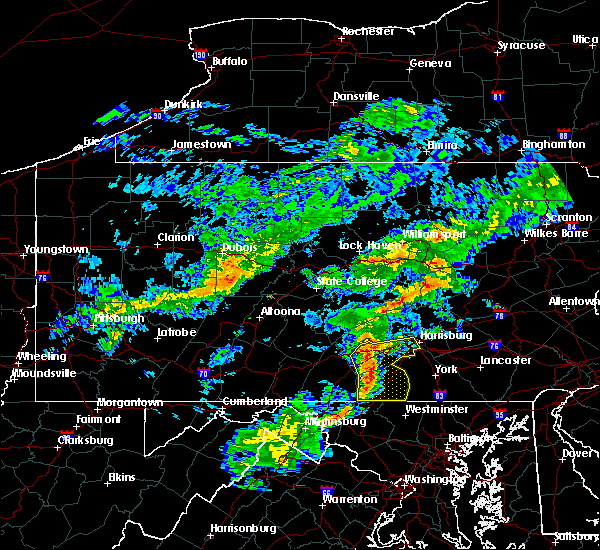 At 503 pm edt, doppler radar indicated a line of severe thunderstorms capable of producing damaging winds in excess of 60 mph. these storms were located along a line extending from near colonel denning state park to near rouzerville, moving east at 40 mph. locations impacted include, camp hill, carlisle, enola, gettysburg, hanover, harrisburg, lemoyne, lower allen, mechanicsburg, new cumberland, parkville, aspers, bloserville, boiling springs, bonneauville, carlisle springs, carroll valley, cashtown, east berlin and hampton. At 503 pm edt, doppler radar indicated a line of severe thunderstorms capable of producing damaging winds in excess of 60 mph. these storms were located along a line extending from near colonel denning state park to near rouzerville, moving east at 40 mph. locations impacted include, camp hill, carlisle, enola, gettysburg, hanover, harrisburg, lemoyne, lower allen, mechanicsburg, new cumberland, parkville, aspers, bloserville, boiling springs, bonneauville, carlisle springs, carroll valley, cashtown, east berlin and hampton.
|
| 7/9/2015 4:50 PM EDT |
 At 450 pm edt, doppler radar indicated a line of severe thunderstorms capable of producing damaging winds around 60 mph. these storms were located along a line extending from near colonel denning state park to wayne heights, and moving east at 40 mph. At 450 pm edt, doppler radar indicated a line of severe thunderstorms capable of producing damaging winds around 60 mph. these storms were located along a line extending from near colonel denning state park to wayne heights, and moving east at 40 mph.
|
| 6/23/2015 4:15 PM EDT |
 At 414 pm edt, doppler radar indicated a severe thunderstorm capable of producing quarter size hail and damaging winds of 60 to 70 mph. this storm was located near pine grove furnace, and moving east at 35 mph. At 414 pm edt, doppler radar indicated a severe thunderstorm capable of producing quarter size hail and damaging winds of 60 to 70 mph. this storm was located near pine grove furnace, and moving east at 35 mph.
|
| 6/20/2015 8:45 PM EDT |
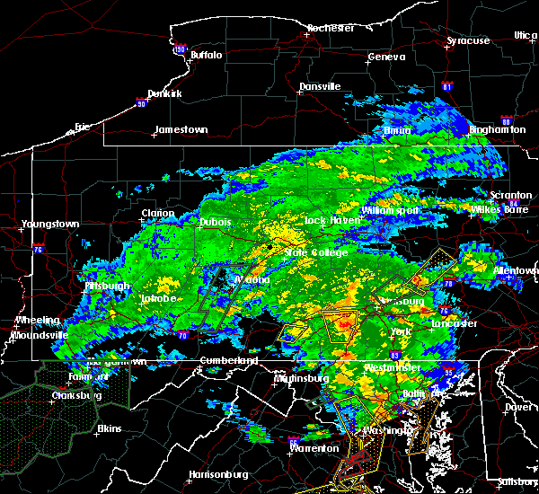 At 845 pm edt, doppler radar indicated a severe thunderstorm capable of producing quarter size hail and damaging winds in excess of 60 mph. this storm was located near mount holly springs, moving north at 15 mph. this severe storm will be near, carlisle, bloserville, boiling springs, plainfield and schlusser around 900 pm edt. other locations impacted by this severe thunderstorm include gardners, idaville and penn state dickinson school of law. At 845 pm edt, doppler radar indicated a severe thunderstorm capable of producing quarter size hail and damaging winds in excess of 60 mph. this storm was located near mount holly springs, moving north at 15 mph. this severe storm will be near, carlisle, bloserville, boiling springs, plainfield and schlusser around 900 pm edt. other locations impacted by this severe thunderstorm include gardners, idaville and penn state dickinson school of law.
|
| 6/20/2015 8:00 PM EDT |
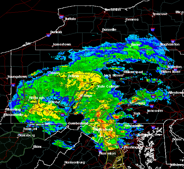 At 800 pm edt, doppler radar indicated a severe thunderstorm capable of producing quarter size hail and damaging winds around 60 mph. this storm was located near aspers, and moving north at 15 mph. * this severe thunderstorm will be near, pine grove furnace around 820 pm edt. mount holly springs around 850 pm edt. carlisle, bloserville, boiling springs, plainfield and schlusser around 900 pm edt. other locations impacted by this severe thunderstorm include arendtsville, bendersville, biglerville, gardners, heidlersburg, idaville and penn state dickinson school of law. this includes the following interstates, the pennsylvania turnpike from mile markers 212 to 230. interstate 81 from mile markers 34 to 54. At 800 pm edt, doppler radar indicated a severe thunderstorm capable of producing quarter size hail and damaging winds around 60 mph. this storm was located near aspers, and moving north at 15 mph. * this severe thunderstorm will be near, pine grove furnace around 820 pm edt. mount holly springs around 850 pm edt. carlisle, bloserville, boiling springs, plainfield and schlusser around 900 pm edt. other locations impacted by this severe thunderstorm include arendtsville, bendersville, biglerville, gardners, heidlersburg, idaville and penn state dickinson school of law. this includes the following interstates, the pennsylvania turnpike from mile markers 212 to 230. interstate 81 from mile markers 34 to 54.
|
| 6/8/2015 5:12 PM EDT | At 511 pm edt, doppler radar indicated a line of severe thunderstorms capable of producing damaging winds of 60 to 70 mph. these storms were located along a line extending from plainfield to near st. thomas to near claylick, and moving southeast at 15 mph. |
| 6/8/2015 4:18 PM EDT |
 At 418 pm edt, doppler radar indicated a line of severe thunderstorms capable of producing damaging winds of 60 to 70 mph. these storms were located along a line extending from near millersburg to near fannettsburg, and moving east at 30 mph. At 418 pm edt, doppler radar indicated a line of severe thunderstorms capable of producing damaging winds of 60 to 70 mph. these storms were located along a line extending from near millersburg to near fannettsburg, and moving east at 30 mph.
|
| 5/16/2015 3:36 PM EDT | At 335 pm edt, doppler radar indicated a severe thunderstorm capable of producing damaging winds of 60 to 70 mph. this storm was located near roxbury, and moving east at 40 mph. |
| 4/20/2015 7:56 PM EDT | At 756 pm edt, doppler radar indicated a severe thunderstorm capable of producing quarter size hail and damaging winds around 60 mph. this storm was located near mcconnellsburg, and moving northeast at 35 mph. |
| 4/20/2015 7:21 PM EDT | At 721 pm edt, doppler radar indicated a severe thunderstorm capable of producing a tornado. this dangerous storm was located near plainfield, and moving northeast at 25 mph. |
| 4/20/2015 7:11 PM EDT | Half Dollar sized hail reported 3 miles SE of Newville, PA |
| 4/20/2015 7:06 PM EDT | At 705 pm edt, doppler radar indicated a severe thunderstorm capable of producing a tornado. this dangerous storm was located near newville, moving northeast at 25 mph. this dangerous storm will be near, newville around 720 pm edt. |
| 4/20/2015 6:48 PM EDT | At 647 pm edt, doppler radar indicated a severe thunderstorm capable of producing a tornado. this dangerous storm was located near roxbury, and moving northeast at 25 mph. * this dangerous storm will be near, newburg around 655 pm edt. newville around 730 pm edt. other locations impacted by this tornadic thunderstorm include shippensburg university and orrstown. this includes the pennsylvania turnpike from mile markers 203 to 215. |
| 6/13/2013 7:13 AM EDT | Trees and wires down in penn tw in cumberland county PA, 5.8 miles NNW of Newville, PA |
| 7/5/2012 7:05 PM EDT | Tree on a house punched hole in the roof in cumberland county PA, 5.8 miles NNW of Newville, PA |
| 5/29/2012 5:05 PM EDT | Large trees down in cumberland county PA, 0.1 miles ENE of Newville, PA |
| 1/1/0001 12:00 AM | Multiple trees and wires down in cumberland county PA, 0.1 miles ENE of Newville, PA |
Hail Maps for Newville, PA


Connect with Interactive Hail Maps