

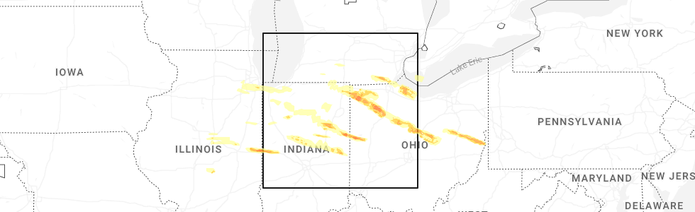
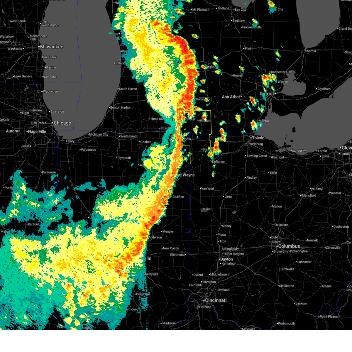
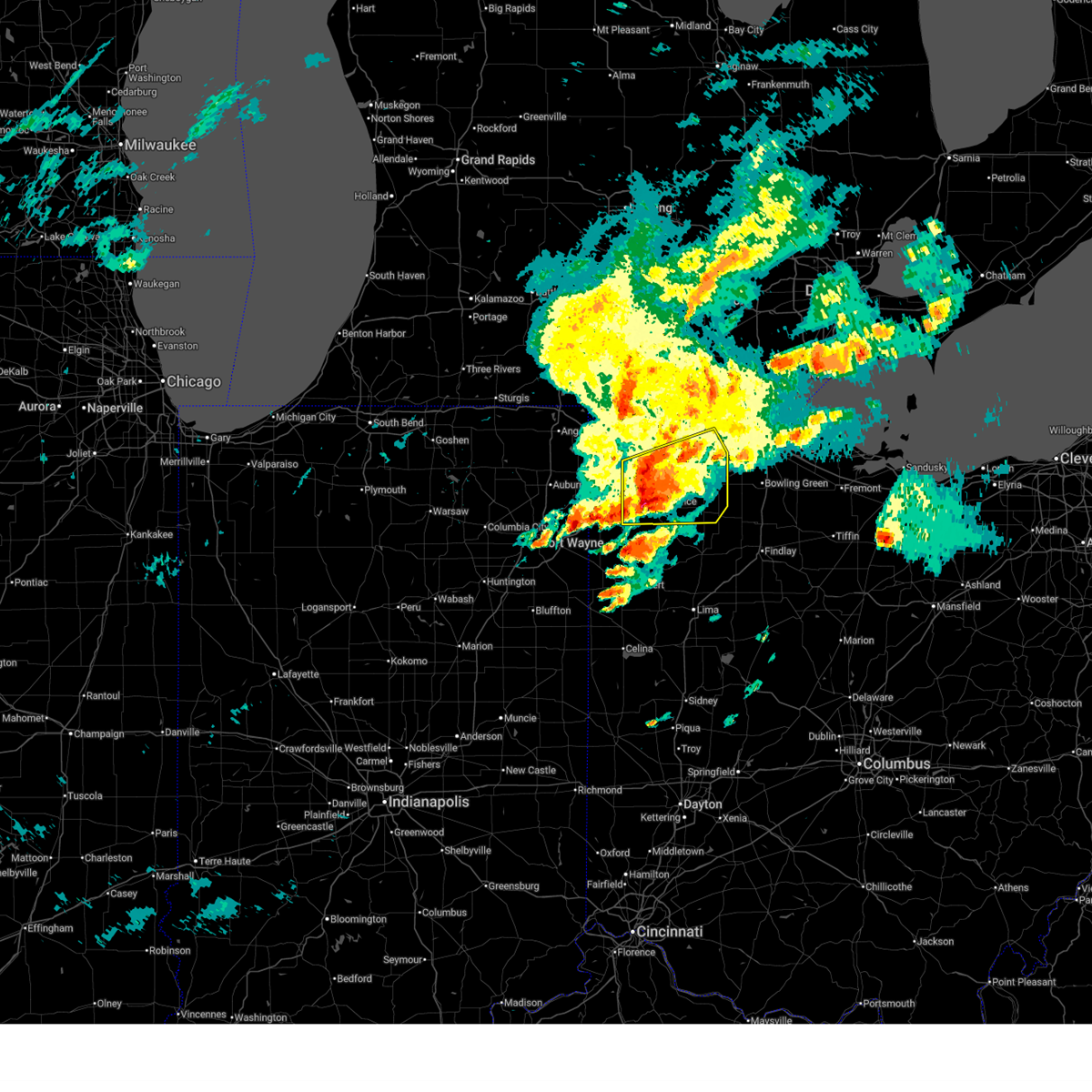
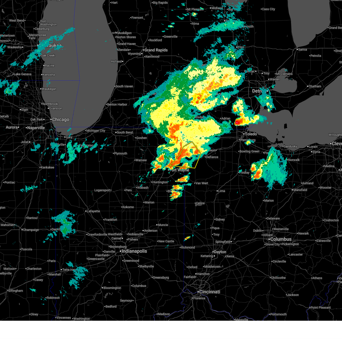
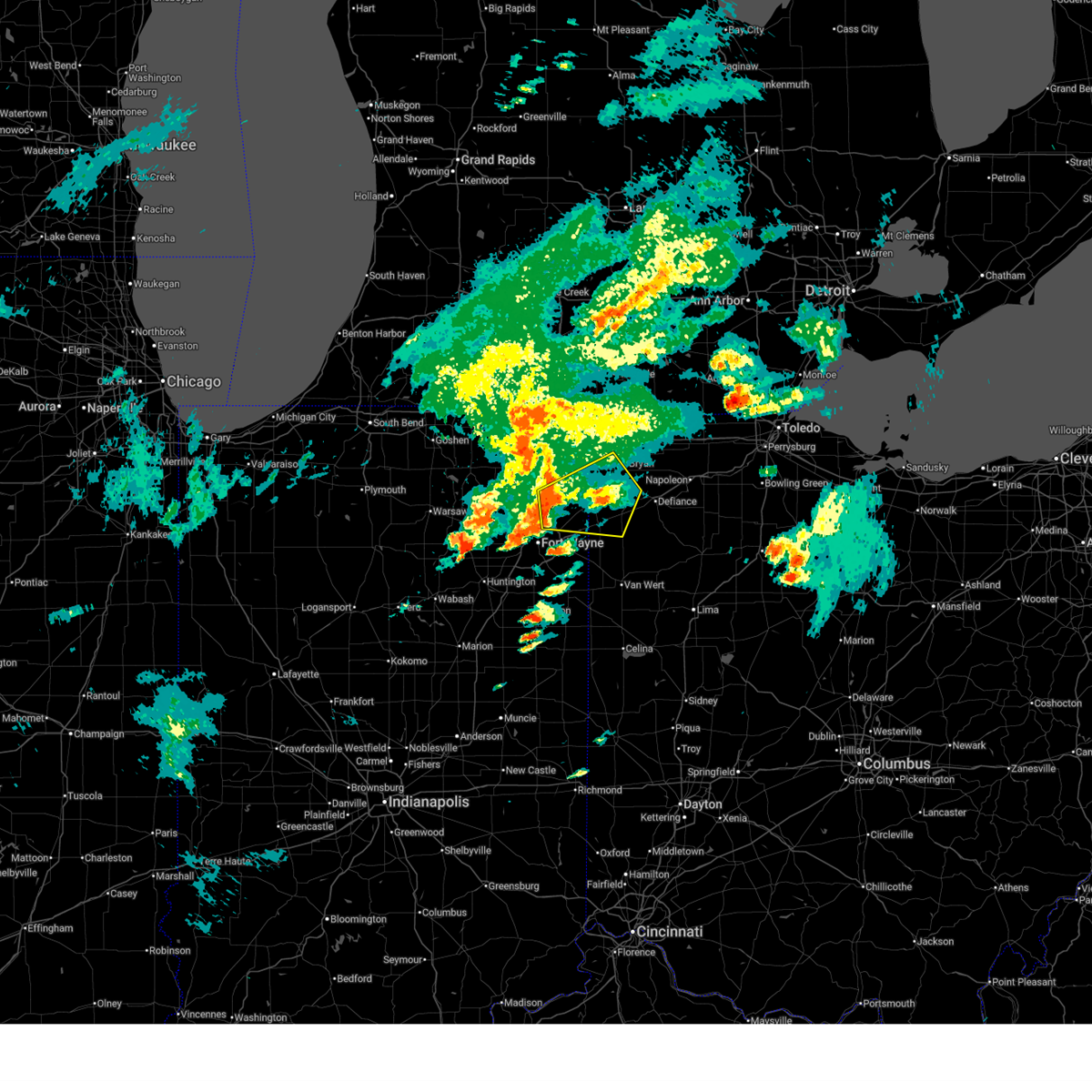
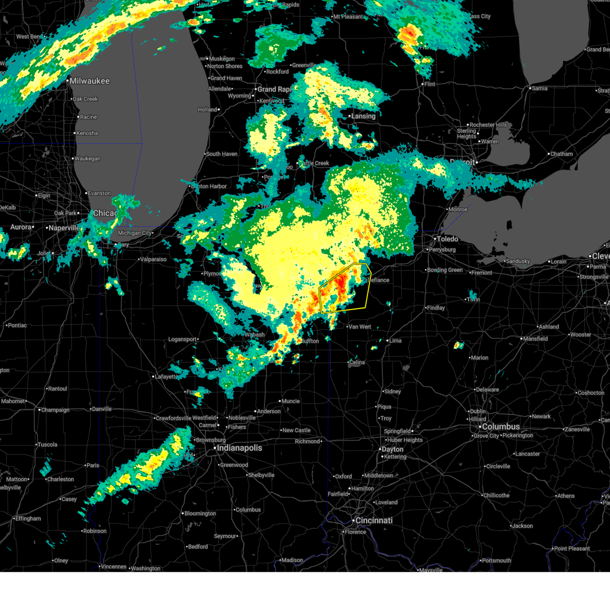
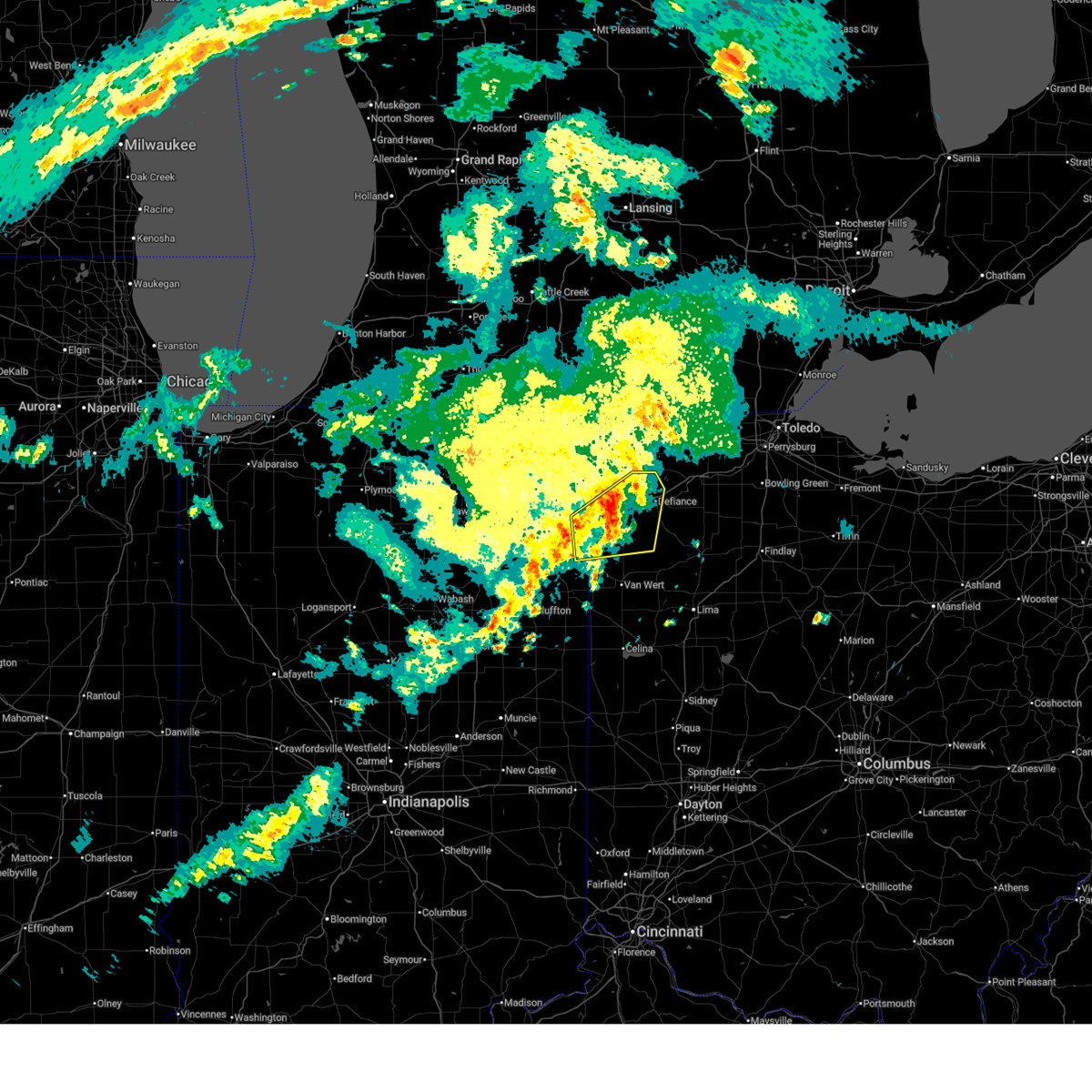
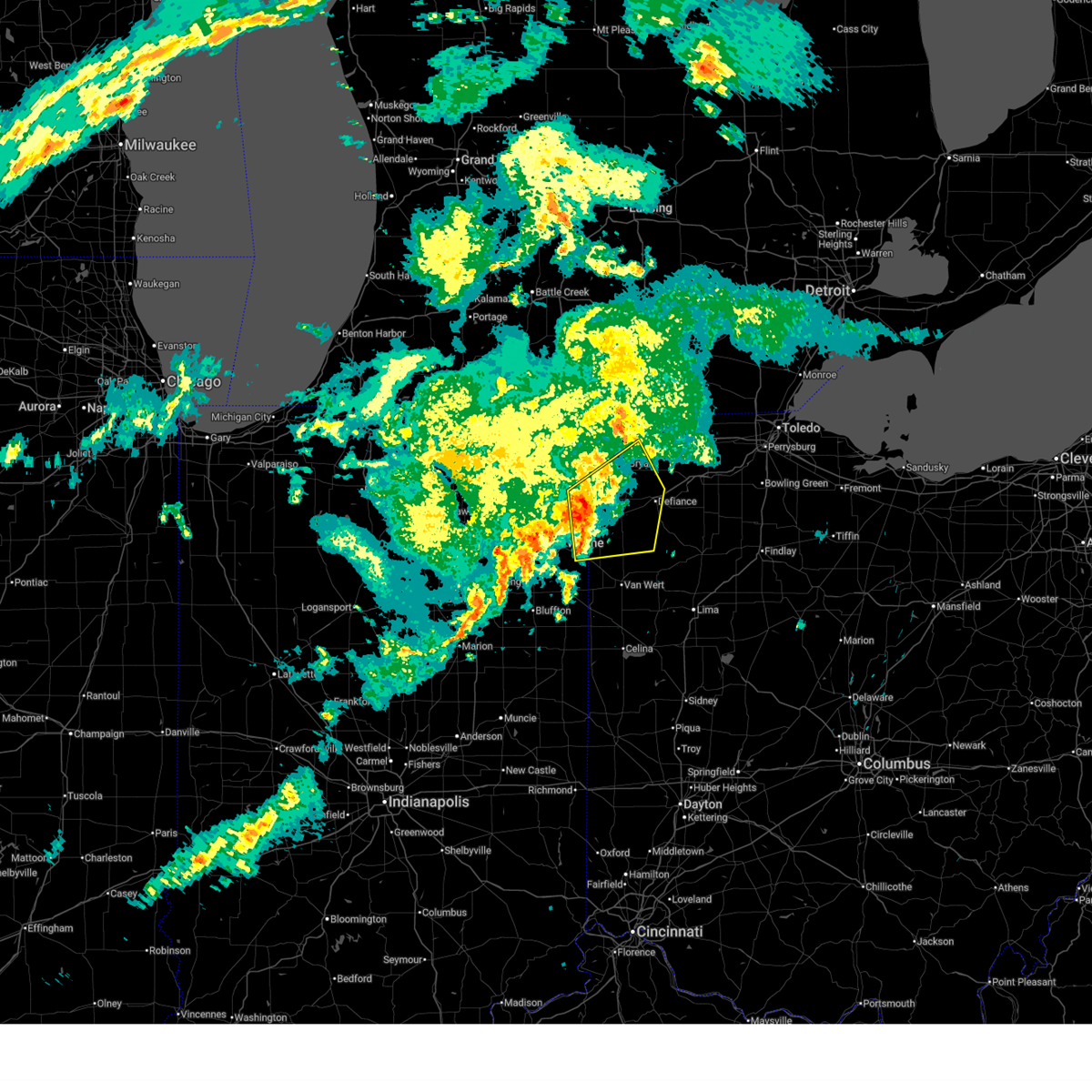
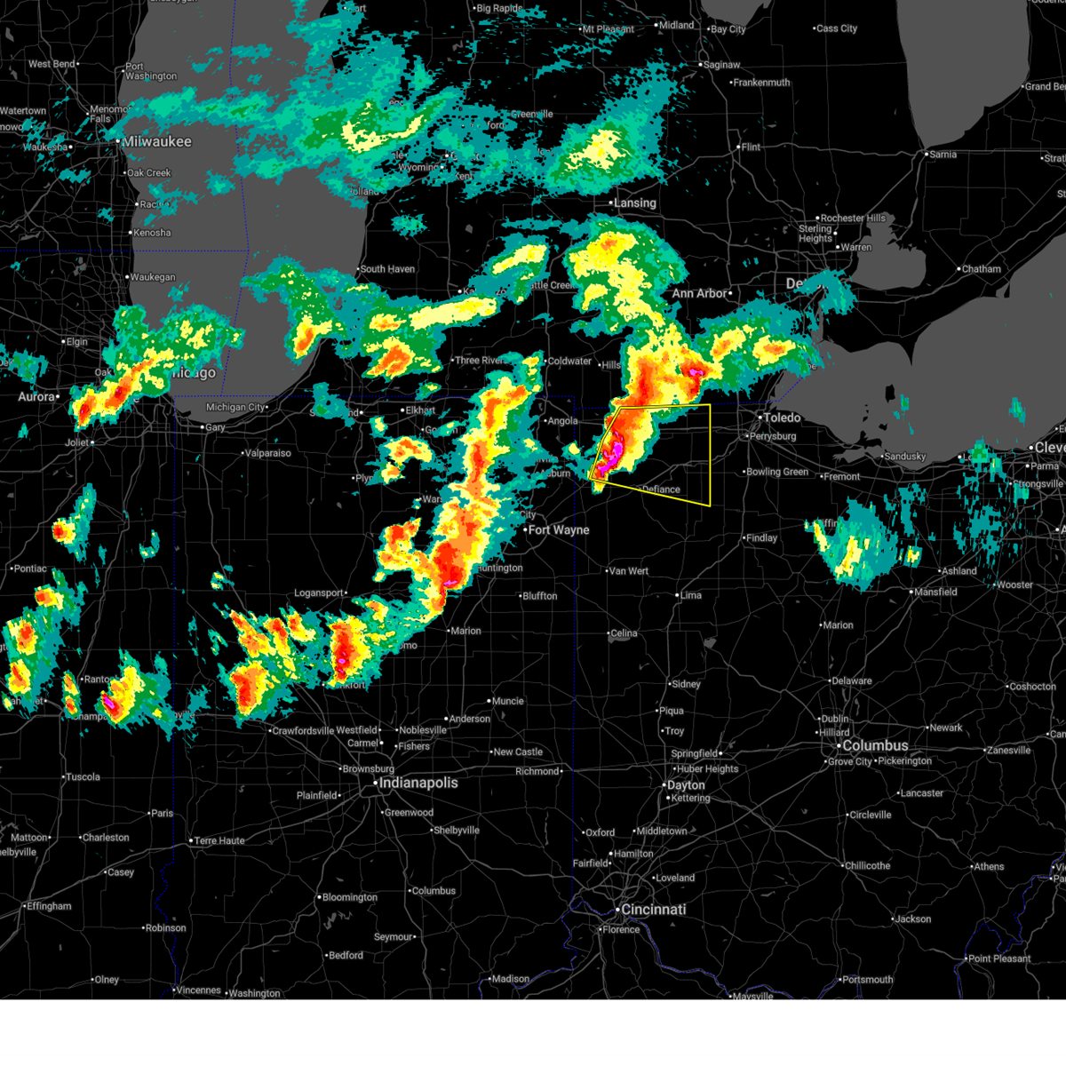
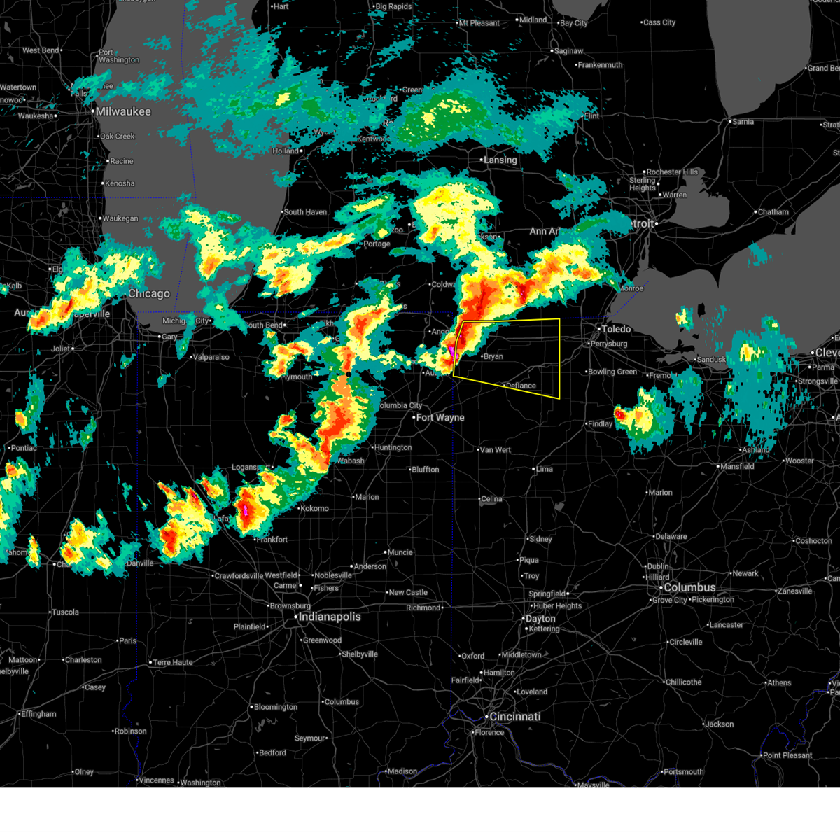
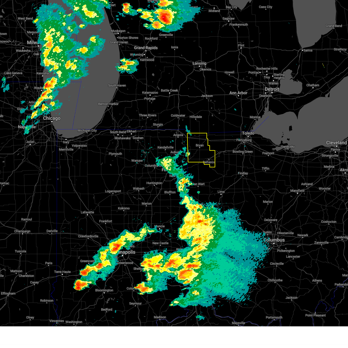
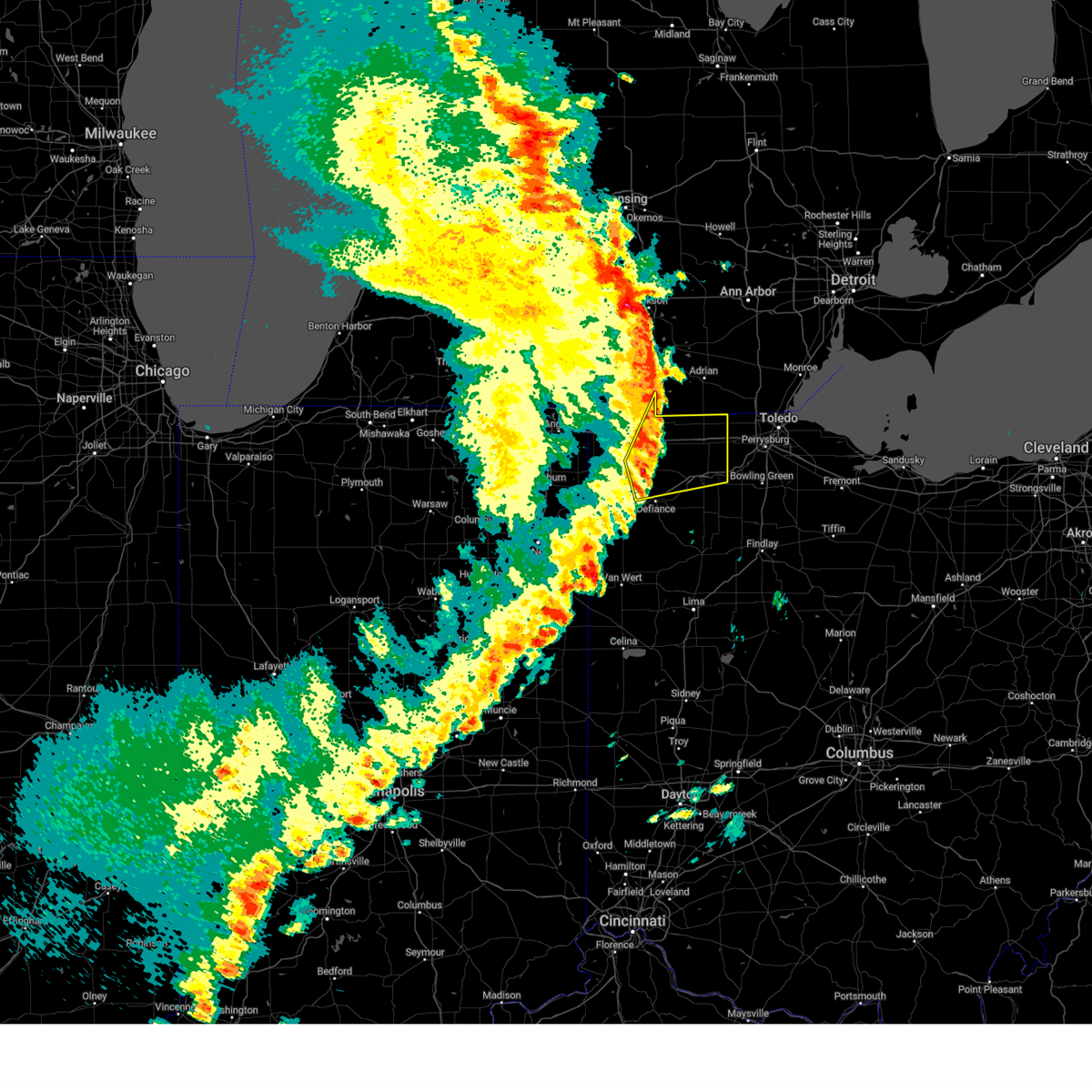
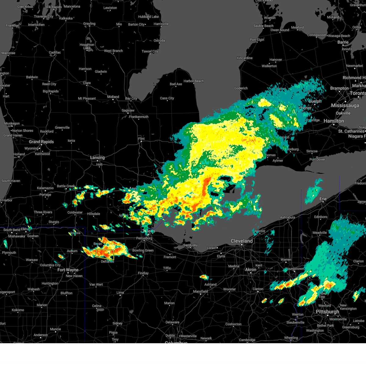
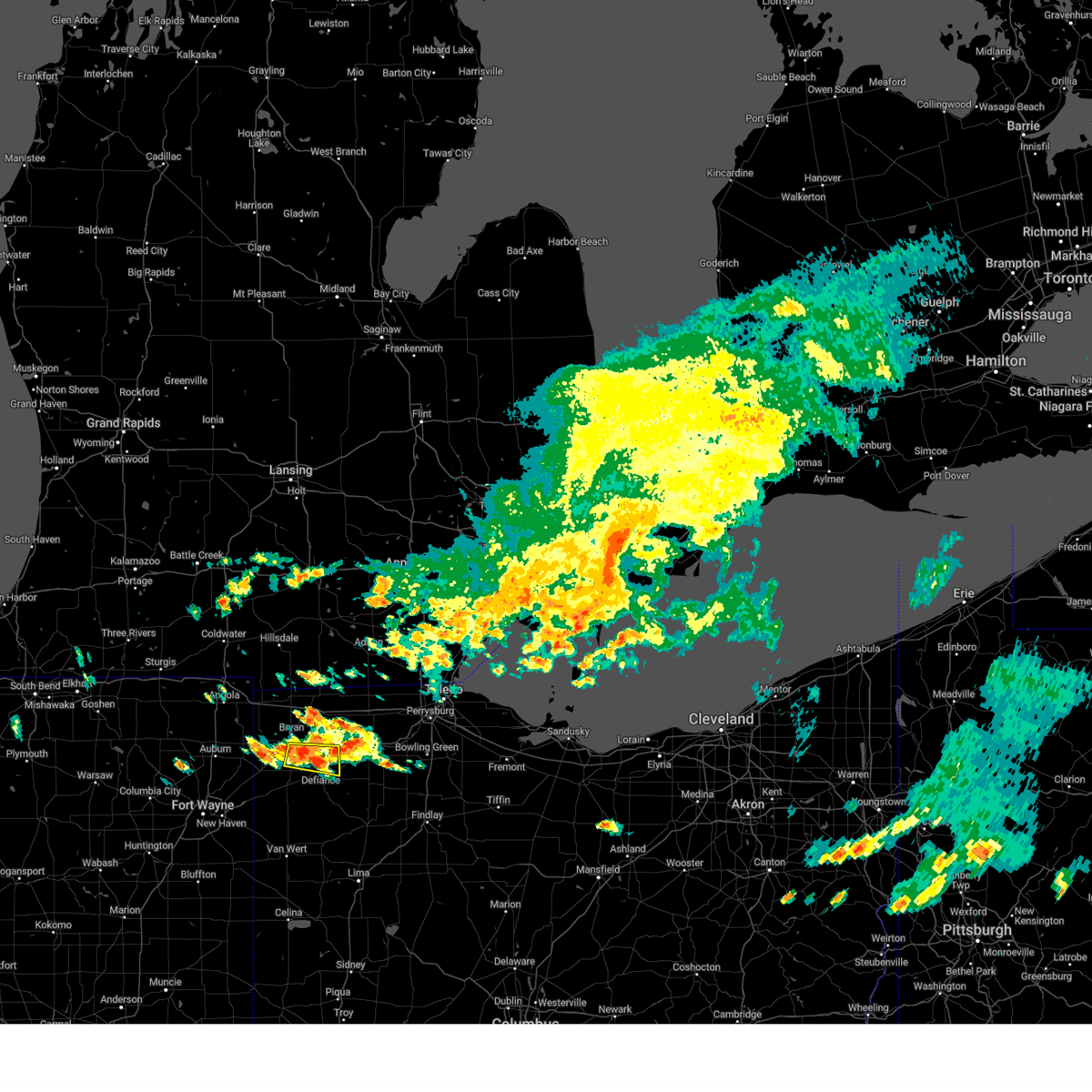
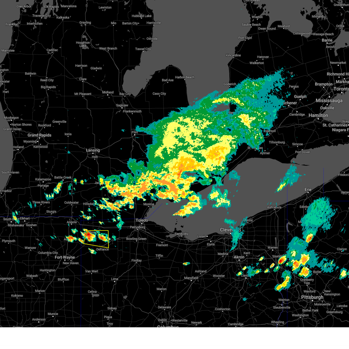
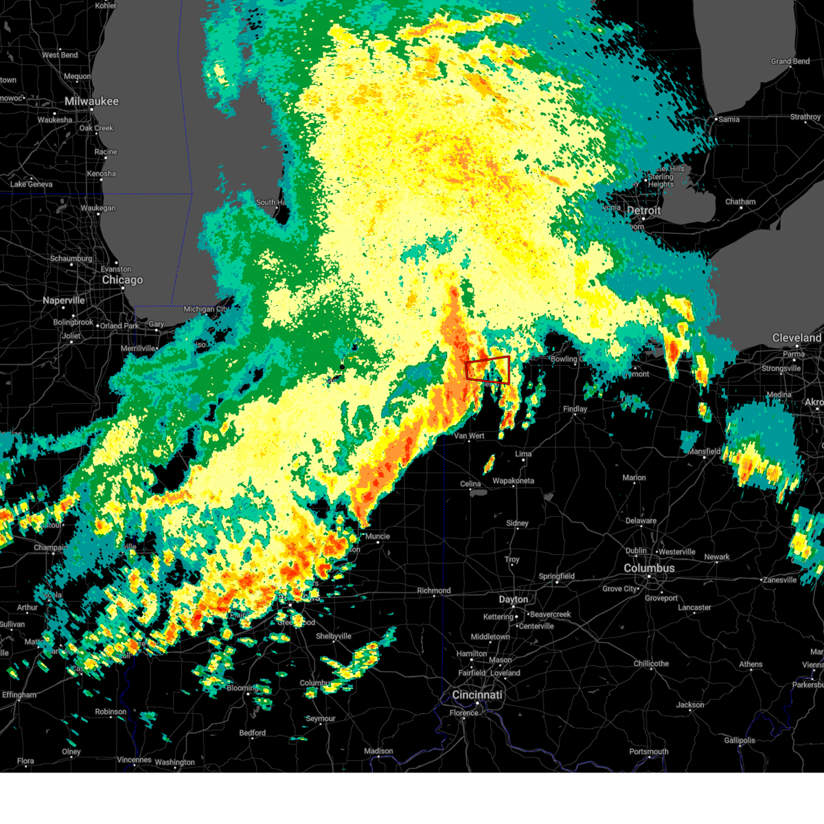
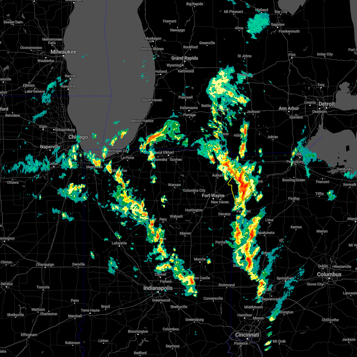
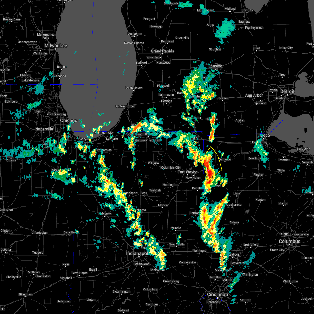
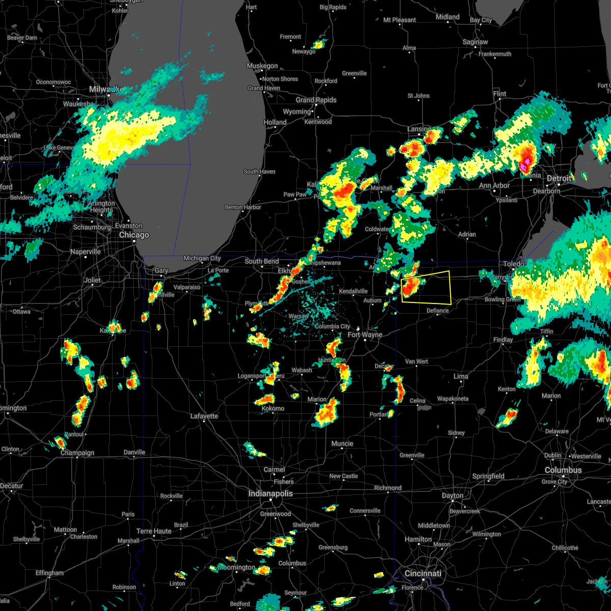
Hail Map for Ney, OH
The Ney, OH area has had 3 reports of on-the-ground hail by trained spotters, and has been under severe weather warnings 13 times during the past 12 months. Doppler radar has detected hail at or near Ney, OH on 42 occasions, including 2 occasions during the past year.
| Name: | Ney, OH |
| Where Located: | 36.8 miles NE of Fort Wayne, IN |
| Map: | Google Map for Ney, OH |
| Population: | 354 |
| Housing Units: | 140 |
| More Info: | Search Google for Ney, OH |
5
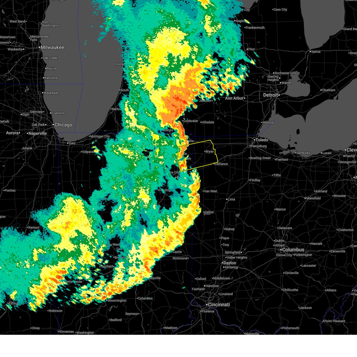
The Top Recent Hail Date for Ney, OH is Thursday, March 26, 2026 (1st out of 42)
Hail and Wind Damage Spotted near Ney, OH
| Date / Time | Report Details |
|---|---|
| 6/11/2026 11:28 PM EDT |
 Svriwx the national weather service in northern indiana has issued a * severe thunderstorm warning for, southeastern steuben county in northeastern indiana, northeastern allen county in northeastern indiana, de kalb county in northeastern indiana, defiance county in northwestern ohio, northwestern paulding county in west central ohio, williams county in northwestern ohio, * until 1215 am edt. * at 1128 pm edt, severe thunderstorms were located along a line extending from near hamilton to near auburn to near st. joe, moving east at 50 mph (radar indicated). Hazards include 60 mph wind gusts. expect damage to roofs, siding, and trees Svriwx the national weather service in northern indiana has issued a * severe thunderstorm warning for, southeastern steuben county in northeastern indiana, northeastern allen county in northeastern indiana, de kalb county in northeastern indiana, defiance county in northwestern ohio, northwestern paulding county in west central ohio, williams county in northwestern ohio, * until 1215 am edt. * at 1128 pm edt, severe thunderstorms were located along a line extending from near hamilton to near auburn to near st. joe, moving east at 50 mph (radar indicated). Hazards include 60 mph wind gusts. expect damage to roofs, siding, and trees
|
| 5/18/2026 3:56 PM EDT |
 Svriwx the national weather service in northern indiana has issued a * severe thunderstorm warning for, eastern hillsdale county in southeastern michigan, northeastern defiance county in northwestern ohio, northern henry county in northwestern ohio, fulton county in northwestern ohio, eastern williams county in northwestern ohio, * until 500 pm edt. * at 356 pm edt, severe thunderstorms were located along a line extending from 8 miles northwest of addison to 6 miles northeast of pioneer to near paulding, moving east at 45 mph (radar indicated). Hazards include 60 mph wind gusts. expect damage to roofs, siding, and trees Svriwx the national weather service in northern indiana has issued a * severe thunderstorm warning for, eastern hillsdale county in southeastern michigan, northeastern defiance county in northwestern ohio, northern henry county in northwestern ohio, fulton county in northwestern ohio, eastern williams county in northwestern ohio, * until 500 pm edt. * at 356 pm edt, severe thunderstorms were located along a line extending from 8 miles northwest of addison to 6 miles northeast of pioneer to near paulding, moving east at 45 mph (radar indicated). Hazards include 60 mph wind gusts. expect damage to roofs, siding, and trees
|
| 5/18/2026 3:40 PM EDT |
 At 339 pm edt, severe thunderstorms were located along a line extending from 7 miles southeast of albion to 7 miles southeast of reading to near hicksville, moving northeast at 45 mph (radar indicated). Hazards include 60 mph wind gusts and penny size hail. Expect damage to roofs, siding, and trees. locations impacted include, defiance, bryan, hillsdale, montpelier, hicksville, jonesville, edgerton, west unity, pioneer, litchfield, stryker, reading, edon, holiday city, edgerton in williams county, long lake, jerome, somerset, columbia, and west jefferson. this includes the following highways, interstate 80 in indiana near mile marker 156. Interstate 80 in ohio between mile markers 0 and 22. At 339 pm edt, severe thunderstorms were located along a line extending from 7 miles southeast of albion to 7 miles southeast of reading to near hicksville, moving northeast at 45 mph (radar indicated). Hazards include 60 mph wind gusts and penny size hail. Expect damage to roofs, siding, and trees. locations impacted include, defiance, bryan, hillsdale, montpelier, hicksville, jonesville, edgerton, west unity, pioneer, litchfield, stryker, reading, edon, holiday city, edgerton in williams county, long lake, jerome, somerset, columbia, and west jefferson. this includes the following highways, interstate 80 in indiana near mile marker 156. Interstate 80 in ohio between mile markers 0 and 22.
|
| 5/18/2026 3:17 PM EDT |
 Svriwx the national weather service in northern indiana has issued a * severe thunderstorm warning for, eastern steuben county in northeastern indiana, eastern branch county in southwestern michigan, hillsdale county in southeastern michigan, defiance county in northwestern ohio, williams county in northwestern ohio, * until 400 pm edt. * at 317 pm edt, severe thunderstorms were located along a line extending from 7 miles southwest of homer to near fremont to near grabill, moving east at 45 mph (radar indicated). Hazards include 60 mph wind gusts and penny size hail. expect damage to roofs, siding, and trees Svriwx the national weather service in northern indiana has issued a * severe thunderstorm warning for, eastern steuben county in northeastern indiana, eastern branch county in southwestern michigan, hillsdale county in southeastern michigan, defiance county in northwestern ohio, williams county in northwestern ohio, * until 400 pm edt. * at 317 pm edt, severe thunderstorms were located along a line extending from 7 miles southwest of homer to near fremont to near grabill, moving east at 45 mph (radar indicated). Hazards include 60 mph wind gusts and penny size hail. expect damage to roofs, siding, and trees
|
| 4/15/2026 3:23 PM EDT |
 At 323 pm edt, a severe thunderstorm was located near defiance, moving east at 50 mph (radar indicated). Hazards include 60 mph wind gusts and quarter size hail. Hail damage to vehicles is expected. expect wind damage to roofs, siding, and trees. locations impacted include, defiance, napoleon, bryan, wauseon, archbold, delta, stryker, liberty center, holgate, mcclure, hamler, texas, ney, malinta, florida, new bavaria, evansport, grelton, arthur, and ridgeville corners. This includes interstate 80 in ohio between mile markers 33 and 45. At 323 pm edt, a severe thunderstorm was located near defiance, moving east at 50 mph (radar indicated). Hazards include 60 mph wind gusts and quarter size hail. Hail damage to vehicles is expected. expect wind damage to roofs, siding, and trees. locations impacted include, defiance, napoleon, bryan, wauseon, archbold, delta, stryker, liberty center, holgate, mcclure, hamler, texas, ney, malinta, florida, new bavaria, evansport, grelton, arthur, and ridgeville corners. This includes interstate 80 in ohio between mile markers 33 and 45.
|
| 4/15/2026 3:15 PM EDT |
 Svriwx the national weather service in northern indiana has issued a * severe thunderstorm warning for, defiance county in northwestern ohio, northeastern paulding county in west central ohio, henry county in northwestern ohio, southeastern williams county in northwestern ohio, southern fulton county in northwestern ohio, * until 400 pm edt. * at 314 pm edt, a severe thunderstorm was located 7 miles northwest of defiance, moving east at 50 mph (radar indicated). Hazards include 60 mph wind gusts and quarter size hail. Hail damage to vehicles is expected. Expect wind damage to roofs, siding, and trees. Svriwx the national weather service in northern indiana has issued a * severe thunderstorm warning for, defiance county in northwestern ohio, northeastern paulding county in west central ohio, henry county in northwestern ohio, southeastern williams county in northwestern ohio, southern fulton county in northwestern ohio, * until 400 pm edt. * at 314 pm edt, a severe thunderstorm was located 7 miles northwest of defiance, moving east at 50 mph (radar indicated). Hazards include 60 mph wind gusts and quarter size hail. Hail damage to vehicles is expected. Expect wind damage to roofs, siding, and trees.
|
| 4/15/2026 3:05 PM EDT |
 At 305 pm edt, a severe thunderstorm was located over hicksville, moving east at 45 mph (radar indicated). Hazards include 60 mph wind gusts and quarter size hail. Hail damage to vehicles is expected. expect wind damage to roofs, siding, and trees. locations impacted include, fort wayne, bryan, hicksville, paulding, edgerton, antwerp, woodburn, grabill, st. joe, edgerton in williams county, leo-cedarville, farmer, newville, ney, cecil, williams center, harlan, melbern, spencerville in dekalb county, and the bend. This includes interstate 469 between mile markers 26 and 29. At 305 pm edt, a severe thunderstorm was located over hicksville, moving east at 45 mph (radar indicated). Hazards include 60 mph wind gusts and quarter size hail. Hail damage to vehicles is expected. expect wind damage to roofs, siding, and trees. locations impacted include, fort wayne, bryan, hicksville, paulding, edgerton, antwerp, woodburn, grabill, st. joe, edgerton in williams county, leo-cedarville, farmer, newville, ney, cecil, williams center, harlan, melbern, spencerville in dekalb county, and the bend. This includes interstate 469 between mile markers 26 and 29.
|
| 4/15/2026 2:46 PM EDT |
 Svriwx the national weather service in northern indiana has issued a * severe thunderstorm warning for, northeastern allen county in northeastern indiana, southern de kalb county in northeastern indiana, northwestern defiance county in northwestern ohio, northwestern paulding county in west central ohio, southwestern williams county in northwestern ohio, * until 315 pm edt. * at 245 pm edt, a severe thunderstorm was located over grabill, or 9 miles south of auburn, moving east at 50 mph (radar indicated). Hazards include 60 mph wind gusts and quarter size hail. Hail damage to vehicles is expected. Expect wind damage to roofs, siding, and trees. Svriwx the national weather service in northern indiana has issued a * severe thunderstorm warning for, northeastern allen county in northeastern indiana, southern de kalb county in northeastern indiana, northwestern defiance county in northwestern ohio, northwestern paulding county in west central ohio, southwestern williams county in northwestern ohio, * until 315 pm edt. * at 245 pm edt, a severe thunderstorm was located over grabill, or 9 miles south of auburn, moving east at 50 mph (radar indicated). Hazards include 60 mph wind gusts and quarter size hail. Hail damage to vehicles is expected. Expect wind damage to roofs, siding, and trees.
|
| 3/31/2026 2:59 PM EDT |
 At 258 pm edt, severe thunderstorms were located along a line extending from 8 miles south of bryan to near paulding, moving east at 50 mph (radar indicated). Hazards include 60 mph wind gusts. Expect damage to roofs, siding, and trees. Locations impacted include, defiance, hicksville, paulding, antwerp, woodburn, payne, ney, melrose, haviland, latty, cecil, broughton, evansport, arthur, charloe, edgerton in allen county, zulu, mcgill, brunersburg, and townley. At 258 pm edt, severe thunderstorms were located along a line extending from 8 miles south of bryan to near paulding, moving east at 50 mph (radar indicated). Hazards include 60 mph wind gusts. Expect damage to roofs, siding, and trees. Locations impacted include, defiance, hicksville, paulding, antwerp, woodburn, payne, ney, melrose, haviland, latty, cecil, broughton, evansport, arthur, charloe, edgerton in allen county, zulu, mcgill, brunersburg, and townley.
|
| 3/31/2026 2:59 PM EDT |
 the severe thunderstorm warning has been cancelled and is no longer in effect the severe thunderstorm warning has been cancelled and is no longer in effect
|
| 3/31/2026 2:43 PM EDT |
 Svriwx the national weather service in northern indiana has issued a * severe thunderstorm warning for, northeastern allen county in northeastern indiana, southeastern de kalb county in northeastern indiana, defiance county in northwestern ohio, paulding county in west central ohio, southeastern williams county in northwestern ohio, * until 330 pm edt. * at 242 pm edt, severe thunderstorms were located along a line extending from near st. joe to near antwerp to near monroeville, moving east at 45 mph (radar indicated). Hazards include 60 mph wind gusts. expect damage to roofs, siding, and trees Svriwx the national weather service in northern indiana has issued a * severe thunderstorm warning for, northeastern allen county in northeastern indiana, southeastern de kalb county in northeastern indiana, defiance county in northwestern ohio, paulding county in west central ohio, southeastern williams county in northwestern ohio, * until 330 pm edt. * at 242 pm edt, severe thunderstorms were located along a line extending from near st. joe to near antwerp to near monroeville, moving east at 45 mph (radar indicated). Hazards include 60 mph wind gusts. expect damage to roofs, siding, and trees
|
| 3/26/2026 7:09 PM EDT | Quarter sized hail reported 0 miles NNE of Ney, OH |
| 3/26/2026 7:08 PM EDT |
 At 707 pm edt, severe thunderstorms were located along a line extending from near fayette to near stryker to 9 miles west of defiance, moving east at 75 mph. reports of quarter size hail have been received near bryan as well as stryker, ohio (radar indicated). Hazards include ping pong ball size hail and 60 mph wind gusts. People and animals outdoors will be injured. expect hail damage to roofs, siding, windows, and vehicles. expect wind damage to roofs, siding, and trees. locations impacted include, defiance, napoleon, bryan, wauseon, archbold, montpelier, swanton, delta, deshler, west unity, stryker, fayette, liberty center, holgate, mcclure, holiday city, west jefferson, pulaski, farmer, and metamora. This includes interstate 80 in ohio between mile markers 14 and 48. At 707 pm edt, severe thunderstorms were located along a line extending from near fayette to near stryker to 9 miles west of defiance, moving east at 75 mph. reports of quarter size hail have been received near bryan as well as stryker, ohio (radar indicated). Hazards include ping pong ball size hail and 60 mph wind gusts. People and animals outdoors will be injured. expect hail damage to roofs, siding, windows, and vehicles. expect wind damage to roofs, siding, and trees. locations impacted include, defiance, napoleon, bryan, wauseon, archbold, montpelier, swanton, delta, deshler, west unity, stryker, fayette, liberty center, holgate, mcclure, holiday city, west jefferson, pulaski, farmer, and metamora. This includes interstate 80 in ohio between mile markers 14 and 48.
|
| 3/26/2026 7:06 PM EDT | Golf Ball sized hail reported 0 miles NNE of Ney, OH, broadcast media relays photos of golf ball size hail in ney. time estimated via radar. |
| 3/26/2026 6:55 PM EDT |
 Svriwx the national weather service in northern indiana has issued a * severe thunderstorm warning for, defiance county in northwestern ohio, henry county in northwestern ohio, williams county in northwestern ohio, fulton county in northwestern ohio, * until 745 pm edt. * at 654 pm edt, severe thunderstorms were located along a line extending from near pioneer to near montpelier to near edgerton in williams county, moving east at 75 mph (radar indicated). Hazards include 60 mph wind gusts and half dollar size hail. Hail damage to vehicles is expected. Expect wind damage to roofs, siding, and trees. Svriwx the national weather service in northern indiana has issued a * severe thunderstorm warning for, defiance county in northwestern ohio, henry county in northwestern ohio, williams county in northwestern ohio, fulton county in northwestern ohio, * until 745 pm edt. * at 654 pm edt, severe thunderstorms were located along a line extending from near pioneer to near montpelier to near edgerton in williams county, moving east at 75 mph (radar indicated). Hazards include 60 mph wind gusts and half dollar size hail. Hail damage to vehicles is expected. Expect wind damage to roofs, siding, and trees.
|
| 6/18/2025 6:24 PM EDT |
 At 623 pm edt, severe thunderstorms were located along a line extending from 7 miles west of pioneer to holiday city to near bryan, moving northeast at 45 mph (radar indicated). Hazards include 60 mph wind gusts. Expect damage to roofs, siding, and trees. locations impacted include, bryan, montpelier, west unity, pioneer, stryker, holiday city, west jefferson, pulaski, farmer, ney, alvordton, bridgewater center, williams center, melbern, hallock, and kunkle. This includes interstate 80 in ohio between mile markers 5 and 22. At 623 pm edt, severe thunderstorms were located along a line extending from 7 miles west of pioneer to holiday city to near bryan, moving northeast at 45 mph (radar indicated). Hazards include 60 mph wind gusts. Expect damage to roofs, siding, and trees. locations impacted include, bryan, montpelier, west unity, pioneer, stryker, holiday city, west jefferson, pulaski, farmer, ney, alvordton, bridgewater center, williams center, melbern, hallock, and kunkle. This includes interstate 80 in ohio between mile markers 5 and 22.
|
| 6/18/2025 6:24 PM EDT |
 the severe thunderstorm warning has been cancelled and is no longer in effect the severe thunderstorm warning has been cancelled and is no longer in effect
|
| 6/18/2025 6:05 PM EDT |
 Svriwx the national weather service in northern indiana has issued a * severe thunderstorm warning for, southeastern steuben county in northeastern indiana, eastern de kalb county in northeastern indiana, northwestern defiance county in northwestern ohio, williams county in northwestern ohio, * until 645 pm edt. * at 604 pm edt, severe thunderstorms were located along a line extending from near hamilton to edgerton to near hicksville, moving northeast at 55 mph (radar indicated). Hazards include 60 mph wind gusts. expect damage to roofs, siding, and trees Svriwx the national weather service in northern indiana has issued a * severe thunderstorm warning for, southeastern steuben county in northeastern indiana, eastern de kalb county in northeastern indiana, northwestern defiance county in northwestern ohio, williams county in northwestern ohio, * until 645 pm edt. * at 604 pm edt, severe thunderstorms were located along a line extending from near hamilton to edgerton to near hicksville, moving northeast at 55 mph (radar indicated). Hazards include 60 mph wind gusts. expect damage to roofs, siding, and trees
|
| 5/16/2025 9:05 PM EDT |
 the severe thunderstorm warning has been cancelled and is no longer in effect the severe thunderstorm warning has been cancelled and is no longer in effect
|
| 5/16/2025 8:29 PM EDT |
 Svriwx the national weather service in northern indiana has issued a * severe thunderstorm warning for, defiance county in northwestern ohio, williams county in northwestern ohio, * until 930 pm edt. * at 829 pm edt, severe thunderstorms were located along a line extending from 8 miles north of edon to near hicksville, moving northeast at 55 mph (radar indicated). Hazards include 70 mph wind gusts. Expect considerable tree damage. Damage is likely to mobile homes, roofs, and outbuildings. Svriwx the national weather service in northern indiana has issued a * severe thunderstorm warning for, defiance county in northwestern ohio, williams county in northwestern ohio, * until 930 pm edt. * at 829 pm edt, severe thunderstorms were located along a line extending from 8 miles north of edon to near hicksville, moving northeast at 55 mph (radar indicated). Hazards include 70 mph wind gusts. Expect considerable tree damage. Damage is likely to mobile homes, roofs, and outbuildings.
|
| 4/2/2025 8:11 AM EDT |
 The storm which prompted the warning has weakened below severe limits, and no longer poses an immediate threat to life or property. therefore, the warning will be allowed to expire. The storm which prompted the warning has weakened below severe limits, and no longer poses an immediate threat to life or property. therefore, the warning will be allowed to expire.
|
| 4/2/2025 8:06 AM EDT |
 At 805 am edt, a severe thunderstorm was located 7 miles west of defiance, moving northeast at 75 mph (emergency management reported hail near dixon, in). Hazards include half dollar size hail. Damage to vehicles is expected. Locations impacted include, evansport, ney, jewell, brunersburg, defiance, cecil, and the bend. At 805 am edt, a severe thunderstorm was located 7 miles west of defiance, moving northeast at 75 mph (emergency management reported hail near dixon, in). Hazards include half dollar size hail. Damage to vehicles is expected. Locations impacted include, evansport, ney, jewell, brunersburg, defiance, cecil, and the bend.
|
| 4/2/2025 7:58 AM EDT |
 Svriwx the national weather service in northern indiana has issued a * severe thunderstorm warning for, eastern defiance county in northwestern ohio, central paulding county in west central ohio, * until 815 am edt. * at 757 am edt, a severe thunderstorm was located over paulding, or 14 miles southeast of hicksville, moving northeast at 75 mph (emergency management reported half dollar size hail near dixon). Hazards include half dollar size hail. damage to vehicles is expected Svriwx the national weather service in northern indiana has issued a * severe thunderstorm warning for, eastern defiance county in northwestern ohio, central paulding county in west central ohio, * until 815 am edt. * at 757 am edt, a severe thunderstorm was located over paulding, or 14 miles southeast of hicksville, moving northeast at 75 mph (emergency management reported half dollar size hail near dixon). Hazards include half dollar size hail. damage to vehicles is expected
|
| 3/30/2025 6:18 PM EDT |
 the severe thunderstorm warning has been cancelled and is no longer in effect the severe thunderstorm warning has been cancelled and is no longer in effect
|
| 3/30/2025 6:18 PM EDT |
 At 618 pm edt, severe thunderstorms were located along a line extending from near west unity to 6 miles southeast of bryan, moving northeast at 45 mph (radar indicated). Hazards include 60 mph wind gusts and nickel size hail. Expect damage to roofs, siding, and trees. locations impacted include, lyons, evansport, oakshade, swanton, ney, alvordton, stryker, seward, ridgeville corners, gerald, denson, waldron, liberty center, fayette, pulaski, assumption, colton, tedrow, brunersburg, and wauseon. This includes interstate 80 in ohio between mile markers 17 and 48. At 618 pm edt, severe thunderstorms were located along a line extending from near west unity to 6 miles southeast of bryan, moving northeast at 45 mph (radar indicated). Hazards include 60 mph wind gusts and nickel size hail. Expect damage to roofs, siding, and trees. locations impacted include, lyons, evansport, oakshade, swanton, ney, alvordton, stryker, seward, ridgeville corners, gerald, denson, waldron, liberty center, fayette, pulaski, assumption, colton, tedrow, brunersburg, and wauseon. This includes interstate 80 in ohio between mile markers 17 and 48.
|
| 3/30/2025 6:08 PM EDT |
 At 608 pm edt, severe thunderstorms were located along a line extending from 7 miles northeast of pioneer to near hicksville, moving northeast at 50 mph (radar indicated). Hazards include 60 mph wind gusts and nickel size hail. Expect damage to roofs, siding, and trees. locations impacted include, ney, grelton, seward, ridgeville corners, gerald, liberty center, fayette, lake seneca, tedrow, brunersburg, wauseon, antwerp, okolona, mark center, ottokee, kunkle, bryan, jewell, pettisville, and bridgewater center. this includes the following highways, interstate 80 in indiana near mile marker 156. Interstate 80 in ohio between mile markers 0 and 48. At 608 pm edt, severe thunderstorms were located along a line extending from 7 miles northeast of pioneer to near hicksville, moving northeast at 50 mph (radar indicated). Hazards include 60 mph wind gusts and nickel size hail. Expect damage to roofs, siding, and trees. locations impacted include, ney, grelton, seward, ridgeville corners, gerald, liberty center, fayette, lake seneca, tedrow, brunersburg, wauseon, antwerp, okolona, mark center, ottokee, kunkle, bryan, jewell, pettisville, and bridgewater center. this includes the following highways, interstate 80 in indiana near mile marker 156. Interstate 80 in ohio between mile markers 0 and 48.
|
| 3/30/2025 6:08 PM EDT |
 the severe thunderstorm warning has been cancelled and is no longer in effect the severe thunderstorm warning has been cancelled and is no longer in effect
|
| 3/30/2025 5:57 PM EDT |
 At 557 pm edt, severe thunderstorms were located along a line extending from 8 miles west of pioneer to woodburn, moving northeast at 45 mph (radar indicated). Hazards include 70 mph wind gusts and nickel size hail. Expect considerable tree damage. damage is likely to mobile homes, roofs, and outbuildings. locations impacted include, paulding, grelton, ridgeville corners, gerald, liberty center, fayette, lake seneca, zulu, tedrow, antwerp, latty, okolona, mark center, kunkle, worstville, bryan, poe, hessen cassel, florida, and winameg. this includes the following highways, interstate 469 between mile markers 12 and 22. interstate 80 in indiana near mile marker 156. Interstate 80 in ohio between mile markers 0 and 48. At 557 pm edt, severe thunderstorms were located along a line extending from 8 miles west of pioneer to woodburn, moving northeast at 45 mph (radar indicated). Hazards include 70 mph wind gusts and nickel size hail. Expect considerable tree damage. damage is likely to mobile homes, roofs, and outbuildings. locations impacted include, paulding, grelton, ridgeville corners, gerald, liberty center, fayette, lake seneca, zulu, tedrow, antwerp, latty, okolona, mark center, kunkle, worstville, bryan, poe, hessen cassel, florida, and winameg. this includes the following highways, interstate 469 between mile markers 12 and 22. interstate 80 in indiana near mile marker 156. Interstate 80 in ohio between mile markers 0 and 48.
|
| 3/30/2025 5:34 PM EDT |
 Svriwx the national weather service in northern indiana has issued a * severe thunderstorm warning for, steuben county in northeastern indiana, allen county in northeastern indiana, de kalb county in northeastern indiana, southern hillsdale county in southeastern michigan, northern putnam county in west central ohio, defiance county in northwestern ohio, paulding county in west central ohio, henry county in northwestern ohio, northwestern van wert county in west central ohio, williams county in northwestern ohio, fulton county in northwestern ohio, * until 630 pm edt. * at 533 pm edt, severe thunderstorms were located along a line extending from angola to near ossian, moving east at 70 mph (radar indicated). Hazards include 70 mph wind gusts and nickel size hail. Expect considerable tree damage. Damage is likely to mobile homes, roofs, and outbuildings. Svriwx the national weather service in northern indiana has issued a * severe thunderstorm warning for, steuben county in northeastern indiana, allen county in northeastern indiana, de kalb county in northeastern indiana, southern hillsdale county in southeastern michigan, northern putnam county in west central ohio, defiance county in northwestern ohio, paulding county in west central ohio, henry county in northwestern ohio, northwestern van wert county in west central ohio, williams county in northwestern ohio, fulton county in northwestern ohio, * until 630 pm edt. * at 533 pm edt, severe thunderstorms were located along a line extending from angola to near ossian, moving east at 70 mph (radar indicated). Hazards include 70 mph wind gusts and nickel size hail. Expect considerable tree damage. Damage is likely to mobile homes, roofs, and outbuildings.
|
| 8/6/2024 2:20 PM EDT |
 At 219 pm edt, a severe thunderstorm was located near bryan, moving southeast at 20 mph (radar indicated). Hazards include 60 mph wind gusts and penny size hail. Expect damage to roofs, siding, and trees. Locations impacted include, defiance, ney, jewell, and brunersburg. At 219 pm edt, a severe thunderstorm was located near bryan, moving southeast at 20 mph (radar indicated). Hazards include 60 mph wind gusts and penny size hail. Expect damage to roofs, siding, and trees. Locations impacted include, defiance, ney, jewell, and brunersburg.
|
| 8/6/2024 2:20 PM EDT |
 the severe thunderstorm warning has been cancelled and is no longer in effect the severe thunderstorm warning has been cancelled and is no longer in effect
|
| 8/6/2024 2:04 PM EDT |
 Svriwx the national weather service in northern indiana has issued a * severe thunderstorm warning for, northern defiance county in northwestern ohio, northwestern henry county in northwestern ohio, southwestern fulton county in northwestern ohio, southeastern williams county in northwestern ohio, * until 245 pm edt. * at 204 pm edt, a severe thunderstorm was located near edgerton, or near bryan, moving east at 30 mph (radar indicated). Hazards include 60 mph wind gusts and penny size hail. damage to roofs, siding, and trees possible Svriwx the national weather service in northern indiana has issued a * severe thunderstorm warning for, northern defiance county in northwestern ohio, northwestern henry county in northwestern ohio, southwestern fulton county in northwestern ohio, southeastern williams county in northwestern ohio, * until 245 pm edt. * at 204 pm edt, a severe thunderstorm was located near edgerton, or near bryan, moving east at 30 mph (radar indicated). Hazards include 60 mph wind gusts and penny size hail. damage to roofs, siding, and trees possible
|
| 4/17/2024 2:06 PM EDT |
 The storms which prompted the warning will be moving out of the warned area. therefore, the warning will be allowed to expire. a tornado watch remains in effect until 700 pm edt for northeastern indiana, and northwestern and west central ohio. The storms which prompted the warning will be moving out of the warned area. therefore, the warning will be allowed to expire. a tornado watch remains in effect until 700 pm edt for northeastern indiana, and northwestern and west central ohio.
|
| 4/17/2024 1:47 PM EDT |
 Svriwx the national weather service in northern indiana has issued a * severe thunderstorm warning for, northeastern allen county in northeastern indiana, southeastern de kalb county in northeastern indiana, defiance county in northwestern ohio, northwestern paulding county in west central ohio, southern williams county in northwestern ohio, * until 215 pm edt. * at 146 pm edt, severe thunderstorms were located along a line extending from near edgerton in williams county to near hicksville, moving east at 40 mph (radar indicated). Hazards include 60 mph wind gusts. expect damage to roofs, siding, and trees Svriwx the national weather service in northern indiana has issued a * severe thunderstorm warning for, northeastern allen county in northeastern indiana, southeastern de kalb county in northeastern indiana, defiance county in northwestern ohio, northwestern paulding county in west central ohio, southern williams county in northwestern ohio, * until 215 pm edt. * at 146 pm edt, severe thunderstorms were located along a line extending from near edgerton in williams county to near hicksville, moving east at 40 mph (radar indicated). Hazards include 60 mph wind gusts. expect damage to roofs, siding, and trees
|
| 7/29/2023 3:07 AM EDT |
 At 307 am edt, a severe thunderstorm capable of producing a tornado was located 9 miles east of hicksville, moving east at 40 mph (radar indicated rotation). Hazards include tornado. Flying debris will be dangerous to those caught without shelter. mobile homes will be damaged or destroyed. damage to roofs, windows, and vehicles will occur. Tree damage is likely. At 307 am edt, a severe thunderstorm capable of producing a tornado was located 9 miles east of hicksville, moving east at 40 mph (radar indicated rotation). Hazards include tornado. Flying debris will be dangerous to those caught without shelter. mobile homes will be damaged or destroyed. damage to roofs, windows, and vehicles will occur. Tree damage is likely.
|
| 7/29/2023 3:02 AM EDT |
 At 302 am edt, severe thunderstorms were located along a line extending from holiday city to near paulding, moving east at 60 mph (radar indicated). Hazards include 60 mph wind gusts. Expect damage to roofs, siding, and trees. locations impacted include, defiance, bryan, montpelier, hicksville, butler, paulding, edgerton, antwerp, west unity, woodburn, stryker, edon, st. joe, holiday city, edgerton in williams county, columbia, west jefferson, pulaski, farmer, and newville. this includes the following highways, interstate 80 in indiana near mile marker 156. Interstate 80 in ohio between mile markers 0 and 22. At 302 am edt, severe thunderstorms were located along a line extending from holiday city to near paulding, moving east at 60 mph (radar indicated). Hazards include 60 mph wind gusts. Expect damage to roofs, siding, and trees. locations impacted include, defiance, bryan, montpelier, hicksville, butler, paulding, edgerton, antwerp, west unity, woodburn, stryker, edon, st. joe, holiday city, edgerton in williams county, columbia, west jefferson, pulaski, farmer, and newville. this includes the following highways, interstate 80 in indiana near mile marker 156. Interstate 80 in ohio between mile markers 0 and 22.
|
| 7/29/2023 2:38 AM EDT |
 At 238 am edt, severe thunderstorms were located along a line extending from angola to near fort wayne, moving east at 60 mph (radar indicated). Hazards include 60 mph wind gusts. expect damage to roofs, siding, and trees At 238 am edt, severe thunderstorms were located along a line extending from angola to near fort wayne, moving east at 60 mph (radar indicated). Hazards include 60 mph wind gusts. expect damage to roofs, siding, and trees
|
| 7/26/2023 10:36 PM EDT |
 The severe thunderstorm warning for northern defiance and southern williams counties will expire at 1045 pm edt, the storms which prompted the warning have weakened below severe limits, and have exited the warned area. therefore, the warning will be allowed to expire. a severe thunderstorm watch remains in effect until midnight edt for northwestern ohio. The severe thunderstorm warning for northern defiance and southern williams counties will expire at 1045 pm edt, the storms which prompted the warning have weakened below severe limits, and have exited the warned area. therefore, the warning will be allowed to expire. a severe thunderstorm watch remains in effect until midnight edt for northwestern ohio.
|
| 7/26/2023 10:15 PM EDT |
 At 1015 pm edt, severe thunderstorms were located along a line extending from near bryan to 8 miles southeast of edgerton in williams county to near hicksville, moving east at 55 mph (radar indicated). Hazards include 60 mph wind gusts. Expect damage to roofs, siding, and trees. locations impacted include, defiance, bryan, edgerton, stryker, edgerton in williams county, farmer, ney, evansport, brunersburg, williams center, melbern, and the bend. hail threat, radar indicated max hail size, <. 75 in wind threat, radar indicated max wind gust, 60 mph. At 1015 pm edt, severe thunderstorms were located along a line extending from near bryan to 8 miles southeast of edgerton in williams county to near hicksville, moving east at 55 mph (radar indicated). Hazards include 60 mph wind gusts. Expect damage to roofs, siding, and trees. locations impacted include, defiance, bryan, edgerton, stryker, edgerton in williams county, farmer, ney, evansport, brunersburg, williams center, melbern, and the bend. hail threat, radar indicated max hail size, <. 75 in wind threat, radar indicated max wind gust, 60 mph.
|
| 7/26/2023 10:01 PM EDT |
 At 1000 pm edt, severe thunderstorms were located along a line extending from near hamilton to near butler to near st. joe, moving east at 50 mph (radar indicated). Hazards include 60 mph wind gusts. expect damage to roofs, siding, and trees At 1000 pm edt, severe thunderstorms were located along a line extending from near hamilton to near butler to near st. joe, moving east at 50 mph (radar indicated). Hazards include 60 mph wind gusts. expect damage to roofs, siding, and trees
|
| 7/22/2023 5:25 PM EDT | Power poles leaning and powerlines in the road at the intersection of cr 15 and blosser r in defiance county OH, 2.6 miles NE of Ney, OH |
| 4/5/2023 1:46 PM EDT |
 At 146 pm edt, severe thunderstorms were located along a line extending from fayette to paulding, moving northeast at 55 mph (radar indicated). Hazards include 60 mph wind gusts. Expect damage to roofs, siding, and trees. locations impacted include, defiance, napoleon, bryan, wauseon, ottawa, archbold, swanton, paulding, delta, leipsic, deshler, west unity, kalida, stryker, fayette, payne, liberty center, continental, holgate and glandorf. This includes interstate 80 in ohio between mile markers 16 and 47. At 146 pm edt, severe thunderstorms were located along a line extending from fayette to paulding, moving northeast at 55 mph (radar indicated). Hazards include 60 mph wind gusts. Expect damage to roofs, siding, and trees. locations impacted include, defiance, napoleon, bryan, wauseon, ottawa, archbold, swanton, paulding, delta, leipsic, deshler, west unity, kalida, stryker, fayette, payne, liberty center, continental, holgate and glandorf. This includes interstate 80 in ohio between mile markers 16 and 47.
|
| 4/5/2023 1:41 PM EDT |
 At 141 pm edt, severe thunderstorms were located along a line extending from near fayette to near paulding, moving northeast at 55 mph (radar indicated). Hazards include 60 mph wind gusts. expect damage to roofs, siding, and trees At 141 pm edt, severe thunderstorms were located along a line extending from near fayette to near paulding, moving northeast at 55 mph (radar indicated). Hazards include 60 mph wind gusts. expect damage to roofs, siding, and trees
|
| 4/5/2023 1:37 PM EDT | Report of tree on house. 164 north water street in ney... oh. time estimated from rada in defiance county OH, 0 miles NNE of Ney, OH |
| 4/1/2023 12:23 AM EDT | Amatuer radio reports town of ney has no powe in defiance county OH, 0 miles NNE of Ney, OH |
| 8/29/2022 5:04 PM EDT |
 At 503 pm edt, severe thunderstorms were located along a line extending from near edgerton to near woodburn to 6 miles northeast of ossian, moving east at 50 mph (radar indicated). Hazards include 70 mph wind gusts. Expect considerable tree damage. Damage is likely to mobile homes, roofs, and outbuildings. At 503 pm edt, severe thunderstorms were located along a line extending from near edgerton to near woodburn to 6 miles northeast of ossian, moving east at 50 mph (radar indicated). Hazards include 70 mph wind gusts. Expect considerable tree damage. Damage is likely to mobile homes, roofs, and outbuildings.
|
| 6/13/2022 9:40 PM EDT |
 A severe thunderstorm warning remains in effect until 1015 pm edt for defiance and southern williams counties. at 940 pm edt, a severe thunderstorm was located near hicksville, moving southeast at 75 mph. hazard. 70 mph wind gusts and half dollar size hail. source. Radar indicated. A severe thunderstorm warning remains in effect until 1015 pm edt for defiance and southern williams counties. at 940 pm edt, a severe thunderstorm was located near hicksville, moving southeast at 75 mph. hazard. 70 mph wind gusts and half dollar size hail. source. Radar indicated.
|
| 6/13/2022 9:33 PM EDT |
 At 933 pm edt, a severe thunderstorm was located 7 miles southeast of edgerton, or 7 miles southwest of bryan, moving southeast at 70 mph (radar indicated). Hazards include 70 mph wind gusts and half dollar size hail. Hail damage to vehicles is expected. expect considerable tree damage. Wind damage is also likely to mobile homes, roofs, and outbuildings. At 933 pm edt, a severe thunderstorm was located 7 miles southeast of edgerton, or 7 miles southwest of bryan, moving southeast at 70 mph (radar indicated). Hazards include 70 mph wind gusts and half dollar size hail. Hail damage to vehicles is expected. expect considerable tree damage. Wind damage is also likely to mobile homes, roofs, and outbuildings.
|
| 3/23/2022 3:32 PM EDT |
 At 331 pm edt, severe thunderstorms were located along a line extending from near bryan to 6 miles southwest of defiance, moving northeast at 45 mph (radar indicated). Hazards include 60 mph wind gusts and quarter size hail. Hail damage to vehicles is expected. Expect wind damage to roofs, siding, and trees. At 331 pm edt, severe thunderstorms were located along a line extending from near bryan to 6 miles southwest of defiance, moving northeast at 45 mph (radar indicated). Hazards include 60 mph wind gusts and quarter size hail. Hail damage to vehicles is expected. Expect wind damage to roofs, siding, and trees.
|
| 3/23/2022 3:27 PM EDT |
 At 327 pm edt, severe thunderstorms were located along a line extending from 6 miles southwest of bryan to 10 miles west of defiance to near paulding, moving northeast at 40 mph (radar indicated). Hazards include 60 mph wind gusts and quarter size hail. Hail damage to vehicles is expected. Expect wind damage to roofs, siding, and trees. At 327 pm edt, severe thunderstorms were located along a line extending from 6 miles southwest of bryan to 10 miles west of defiance to near paulding, moving northeast at 40 mph (radar indicated). Hazards include 60 mph wind gusts and quarter size hail. Hail damage to vehicles is expected. Expect wind damage to roofs, siding, and trees.
|
| 3/23/2022 3:10 PM EDT |
 At 310 pm edt, severe thunderstorms were located along a line extending from hicksville to near paulding to 6 miles east of payne, moving northeast at 45 mph. up to quarter size hail was reported near new haven and monroeville indiana (radar indicated). Hazards include 60 mph wind gusts and quarter size hail. Hail damage to vehicles is expected. expect wind damage to roofs, siding, and trees. Locations impacted include, hicksville, paulding, antwerp, payne, farmer, ney, latty, cecil, broughton, worstville, williams center, melbern, tipton, the bend, mark center and briceton. At 310 pm edt, severe thunderstorms were located along a line extending from hicksville to near paulding to 6 miles east of payne, moving northeast at 45 mph. up to quarter size hail was reported near new haven and monroeville indiana (radar indicated). Hazards include 60 mph wind gusts and quarter size hail. Hail damage to vehicles is expected. expect wind damage to roofs, siding, and trees. Locations impacted include, hicksville, paulding, antwerp, payne, farmer, ney, latty, cecil, broughton, worstville, williams center, melbern, tipton, the bend, mark center and briceton.
|
| 3/23/2022 2:42 PM EDT |
 At 242 pm edt, severe thunderstorms were located along a line extending from near grabill to 6 miles south of woodburn to near monroeville, moving northeast at 40 mph (radar indicated). Hazards include 60 mph wind gusts and nickel size hail. expect damage to roofs, siding, and trees At 242 pm edt, severe thunderstorms were located along a line extending from near grabill to 6 miles south of woodburn to near monroeville, moving northeast at 40 mph (radar indicated). Hazards include 60 mph wind gusts and nickel size hail. expect damage to roofs, siding, and trees
|
| 3/6/2022 3:53 AM EST |
 At 352 am est, severe thunderstorms were located along a line extending from wauseon to near kalida to near fort recovery, moving east at 65 mph (radar indicated). Hazards include 70 mph wind gusts. Expect considerable tree damage. damage is likely to mobile homes, roofs, and outbuildings. locations impacted include, lima, defiance, van wert, napoleon, bryan, wauseon, delphos, portland, ottawa, archbold, fort shawnee, paulding, delta, spencerville, columbus grove, elida, kalida, stryker, geneva and payne. This includes interstate 75 between mile markers 119 and 132. At 352 am est, severe thunderstorms were located along a line extending from wauseon to near kalida to near fort recovery, moving east at 65 mph (radar indicated). Hazards include 70 mph wind gusts. Expect considerable tree damage. damage is likely to mobile homes, roofs, and outbuildings. locations impacted include, lima, defiance, van wert, napoleon, bryan, wauseon, delphos, portland, ottawa, archbold, fort shawnee, paulding, delta, spencerville, columbus grove, elida, kalida, stryker, geneva and payne. This includes interstate 75 between mile markers 119 and 132.
|
| 3/6/2022 3:21 AM EST |
 At 321 am est, severe thunderstorms were located along a line extending from near auburn to near monroeville to near matthews, moving east at 80 mph (radar indicated). Hazards include 70 mph wind gusts. Expect considerable tree damage. Damage is likely to mobile homes, roofs, and outbuildings. At 321 am est, severe thunderstorms were located along a line extending from near auburn to near monroeville to near matthews, moving east at 80 mph (radar indicated). Hazards include 70 mph wind gusts. Expect considerable tree damage. Damage is likely to mobile homes, roofs, and outbuildings.
|
| 8/11/2021 2:44 PM EDT |
 At 244 pm edt, severe thunderstorms were located along a line extending from near cement city to near fayette to 7 miles north of defiance, moving east at 50 mph (radar indicated). Hazards include 60 mph wind gusts and penny size hail. expect damage to roofs, siding, and trees At 244 pm edt, severe thunderstorms were located along a line extending from near cement city to near fayette to 7 miles north of defiance, moving east at 50 mph (radar indicated). Hazards include 60 mph wind gusts and penny size hail. expect damage to roofs, siding, and trees
|
| 8/11/2021 2:36 PM EDT |
 At 236 pm edt, severe thunderstorms were located along a line extending from 6 miles northeast of antwerp to near ohio city to near geneva, moving southeast at 40 mph (radar indicated). Hazards include 60 mph wind gusts and penny size hail. Expect damage to roofs, siding, and trees. locations impacted include, fort wayne, defiance, new haven, van wert, bluffton, decatur, berne, hicksville, ossian, paulding, antwerp, woodburn, geneva, monroeville, payne, markle, convoy, monroe, ohio city and westchester. this includes the following highways, interstate 469 near mile marker 6, and between mile markers 9 and 23. interstate 69 in indiana between mile markers 276 and 282. hail threat, radar indicated max hail size, 0. 75 in wind threat, radar indicated max wind gust, 60 mph. At 236 pm edt, severe thunderstorms were located along a line extending from 6 miles northeast of antwerp to near ohio city to near geneva, moving southeast at 40 mph (radar indicated). Hazards include 60 mph wind gusts and penny size hail. Expect damage to roofs, siding, and trees. locations impacted include, fort wayne, defiance, new haven, van wert, bluffton, decatur, berne, hicksville, ossian, paulding, antwerp, woodburn, geneva, monroeville, payne, markle, convoy, monroe, ohio city and westchester. this includes the following highways, interstate 469 near mile marker 6, and between mile markers 9 and 23. interstate 69 in indiana between mile markers 276 and 282. hail threat, radar indicated max hail size, 0. 75 in wind threat, radar indicated max wind gust, 60 mph.
|
| 8/11/2021 2:36 PM EDT |
 At 224 pm edt, severe thunderstorms were located along a line extending from near litchfield to 8 miles north of pioneer to near bryan, moving east at 45 mph (radar indicated). Hazards include 60 mph wind gusts and penny size hail. Expect damage to roofs, siding, and trees. locations impacted include, napoleon, bryan, hillsdale, wauseon, archbold, montpelier, butler, jonesville, waterloo, edgerton, west unity, hamilton, pioneer, litchfield, stryker, fayette, reading, edon, holiday city and edgerton in williams county. this includes the following highways, interstate 80 in indiana between mile markers 150 and 156. interstate 80 in ohio between mile markers 0 and 36. hail threat, radar indicated max hail size, 0. 75 in wind threat, radar indicated max wind gust, 60 mph. At 224 pm edt, severe thunderstorms were located along a line extending from near litchfield to 8 miles north of pioneer to near bryan, moving east at 45 mph (radar indicated). Hazards include 60 mph wind gusts and penny size hail. Expect damage to roofs, siding, and trees. locations impacted include, napoleon, bryan, hillsdale, wauseon, archbold, montpelier, butler, jonesville, waterloo, edgerton, west unity, hamilton, pioneer, litchfield, stryker, fayette, reading, edon, holiday city and edgerton in williams county. this includes the following highways, interstate 80 in indiana between mile markers 150 and 156. interstate 80 in ohio between mile markers 0 and 36. hail threat, radar indicated max hail size, 0. 75 in wind threat, radar indicated max wind gust, 60 mph.
|
| 8/11/2021 2:36 PM EDT |
 A severe thunderstorm warning remains in effect until 245 pm edt for hillsdale. northern defiance. northwestern henry. williams and western fulton counties. At 235 pm edt, severe thunderstorms were located along a line extending from 8 miles northeast of jonesville to near hudson to near stryker, moving east at 45 mph. A severe thunderstorm warning remains in effect until 245 pm edt for hillsdale. northern defiance. northwestern henry. williams and western fulton counties. At 235 pm edt, severe thunderstorms were located along a line extending from 8 miles northeast of jonesville to near hudson to near stryker, moving east at 45 mph.
|
| 8/11/2021 2:36 PM EDT |
 At 236 pm edt, severe thunderstorms were located along a line extending from 6 miles northeast of antwerp to near ohio city to near geneva, moving southeast at 40 mph (radar indicated). Hazards include 60 mph wind gusts and penny size hail. Expect damage to roofs, siding, and trees. locations impacted include, fort wayne, defiance, new haven, van wert, bluffton, decatur, berne, hicksville, ossian, paulding, antwerp, woodburn, geneva, monroeville, payne, markle, convoy, monroe, ohio city and westchester. this includes the following highways, interstate 469 near mile marker 6, and between mile markers 9 and 23. interstate 69 in indiana between mile markers 276 and 282. hail threat, radar indicated max hail size, 0. 75 in wind threat, radar indicated max wind gust, 60 mph. At 236 pm edt, severe thunderstorms were located along a line extending from 6 miles northeast of antwerp to near ohio city to near geneva, moving southeast at 40 mph (radar indicated). Hazards include 60 mph wind gusts and penny size hail. Expect damage to roofs, siding, and trees. locations impacted include, fort wayne, defiance, new haven, van wert, bluffton, decatur, berne, hicksville, ossian, paulding, antwerp, woodburn, geneva, monroeville, payne, markle, convoy, monroe, ohio city and westchester. this includes the following highways, interstate 469 near mile marker 6, and between mile markers 9 and 23. interstate 69 in indiana between mile markers 276 and 282. hail threat, radar indicated max hail size, 0. 75 in wind threat, radar indicated max wind gust, 60 mph.
|
| 8/11/2021 2:24 PM EDT |
 At 224 pm edt, severe thunderstorms were located along a line extending from near litchfield to 8 miles north of pioneer to near bryan, moving east at 45 mph (radar indicated). Hazards include 60 mph wind gusts and penny size hail. Expect damage to roofs, siding, and trees. locations impacted include, napoleon, bryan, hillsdale, wauseon, archbold, montpelier, butler, jonesville, waterloo, edgerton, west unity, hamilton, pioneer, litchfield, stryker, fayette, reading, edon, holiday city and edgerton in williams county. this includes the following highways, interstate 80 in indiana between mile markers 150 and 156. interstate 80 in ohio between mile markers 0 and 36. hail threat, radar indicated max hail size, 0. 75 in wind threat, radar indicated max wind gust, 60 mph. At 224 pm edt, severe thunderstorms were located along a line extending from near litchfield to 8 miles north of pioneer to near bryan, moving east at 45 mph (radar indicated). Hazards include 60 mph wind gusts and penny size hail. Expect damage to roofs, siding, and trees. locations impacted include, napoleon, bryan, hillsdale, wauseon, archbold, montpelier, butler, jonesville, waterloo, edgerton, west unity, hamilton, pioneer, litchfield, stryker, fayette, reading, edon, holiday city and edgerton in williams county. this includes the following highways, interstate 80 in indiana between mile markers 150 and 156. interstate 80 in ohio between mile markers 0 and 36. hail threat, radar indicated max hail size, 0. 75 in wind threat, radar indicated max wind gust, 60 mph.
|
| 8/11/2021 2:14 PM EDT |
 At 214 pm edt, severe thunderstorms were located along a line extending from st. joe to near decatur to 7 miles north of montpelier, moving southeast at 40 mph (radar indicated). Hazards include 60 mph wind gusts and penny size hail. expect damage to roofs, siding, and trees At 214 pm edt, severe thunderstorms were located along a line extending from st. joe to near decatur to 7 miles north of montpelier, moving southeast at 40 mph (radar indicated). Hazards include 60 mph wind gusts and penny size hail. expect damage to roofs, siding, and trees
|
| 8/11/2021 2:02 PM EDT |
 At 202 pm edt, severe thunderstorms were located along a line extending from near burlington to near reading to butler, moving east at 45 mph (radar indicated). Hazards include 60 mph wind gusts and penny size hail. expect damage to roofs, siding, and trees At 202 pm edt, severe thunderstorms were located along a line extending from near burlington to near reading to butler, moving east at 45 mph (radar indicated). Hazards include 60 mph wind gusts and penny size hail. expect damage to roofs, siding, and trees
|
| 7/29/2021 6:32 AM EDT |
 At 632 am edt, severe thunderstorms were located along a line extending from near bryan to near paulding to near monroeville, moving east at 55 mph (radar indicated). Hazards include 60 mph wind gusts. Expect damage to roofs, siding, and trees. Locations impacted include, defiance, paulding, antwerp, woodburn, monroeville, payne, continental, convoy, ottoville, oakwood, dixon, grover hill, ney, dupont, scott, melrose, haviland, latty, cecil and cloverdale. At 632 am edt, severe thunderstorms were located along a line extending from near bryan to near paulding to near monroeville, moving east at 55 mph (radar indicated). Hazards include 60 mph wind gusts. Expect damage to roofs, siding, and trees. Locations impacted include, defiance, paulding, antwerp, woodburn, monroeville, payne, continental, convoy, ottoville, oakwood, dixon, grover hill, ney, dupont, scott, melrose, haviland, latty, cecil and cloverdale.
|
| 7/29/2021 6:07 AM EDT |
 At 607 am edt, severe thunderstorms were located along a line extending from near butler to near grabill to near fort wayne, moving east at 50 mph (radar indicated). Hazards include 60 mph wind gusts. expect damage to roofs, siding, and trees At 607 am edt, severe thunderstorms were located along a line extending from near butler to near grabill to near fort wayne, moving east at 50 mph (radar indicated). Hazards include 60 mph wind gusts. expect damage to roofs, siding, and trees
|
| 7/7/2021 6:20 PM EDT |
 At 619 pm edt, a severe thunderstorm was located near defiance, moving east at 35 mph (radar indicated). Hazards include 60 mph wind gusts and quarter size hail. Hail damage to vehicles is expected. expect wind damage to roofs, siding, and trees. Locations impacted include, defiance, napoleon, wauseon, archbold, swanton, paulding, delta, antwerp, liberty center, ney, melrose, florida, cecil, evansport, arthur, ridgeville corners, charloe, gerald, ayersville and brunersburg. At 619 pm edt, a severe thunderstorm was located near defiance, moving east at 35 mph (radar indicated). Hazards include 60 mph wind gusts and quarter size hail. Hail damage to vehicles is expected. expect wind damage to roofs, siding, and trees. Locations impacted include, defiance, napoleon, wauseon, archbold, swanton, paulding, delta, antwerp, liberty center, ney, melrose, florida, cecil, evansport, arthur, ridgeville corners, charloe, gerald, ayersville and brunersburg.
|
| 7/7/2021 5:54 PM EDT |
 At 553 pm edt, severe thunderstorms were located along a line extending from archbold to woodburn, moving east at 20 mph (radar indicated). Hazards include 60 mph wind gusts and quarter size hail. Hail damage to vehicles is expected. Expect wind damage to roofs, siding, and trees. At 553 pm edt, severe thunderstorms were located along a line extending from archbold to woodburn, moving east at 20 mph (radar indicated). Hazards include 60 mph wind gusts and quarter size hail. Hail damage to vehicles is expected. Expect wind damage to roofs, siding, and trees.
|
| 7/7/2021 5:24 PM EDT |
 At 523 pm edt, a severe thunderstorm was located over stryker, or near bryan, moving east at 30 mph (radar indicated). Hazards include 60 mph wind gusts and quarter size hail. Hail damage to vehicles is expected. expect wind damage to roofs, siding, and trees. Locations impacted include, bryan, archbold, montpelier, west unity, stryker, west jefferson, pulaski, ney, evansport, pettisville, zone, ridgeville corners, williams center, melbern, elmira and hallock. At 523 pm edt, a severe thunderstorm was located over stryker, or near bryan, moving east at 30 mph (radar indicated). Hazards include 60 mph wind gusts and quarter size hail. Hail damage to vehicles is expected. expect wind damage to roofs, siding, and trees. Locations impacted include, bryan, archbold, montpelier, west unity, stryker, west jefferson, pulaski, ney, evansport, pettisville, zone, ridgeville corners, williams center, melbern, elmira and hallock.
|
| 7/7/2021 4:53 PM EDT |
 At 453 pm edt, a severe thunderstorm was located near bryan, moving east at 20 mph (radar indicated). Hazards include 60 mph wind gusts and penny size hail. expect damage to roofs, siding, and trees At 453 pm edt, a severe thunderstorm was located near bryan, moving east at 20 mph (radar indicated). Hazards include 60 mph wind gusts and penny size hail. expect damage to roofs, siding, and trees
|
| 6/21/2021 3:39 AM EDT |
 At 339 am edt, severe thunderstorms were located along a line extending from near onsted to near morenci to 7 miles southeast of bryan, moving east at 55 mph (radar indicated). Hazards include 60 mph wind gusts. expect damage to roofs, siding, and trees At 339 am edt, severe thunderstorms were located along a line extending from near onsted to near morenci to 7 miles southeast of bryan, moving east at 55 mph (radar indicated). Hazards include 60 mph wind gusts. expect damage to roofs, siding, and trees
|
| 8/10/2020 8:26 PM EDT |
 At 824 pm edt, severe thunderstorms were located along a line extending from near stryker to 7 miles east of paulding to near van wert, moving east at 45 mph (emergency management has reported trees and branches down in hicksville, ohio). Hazards include 60 mph wind gusts. Expect damage to roofs, siding, and trees. these severe storms will be near, ottoville around 840 pm edt. Other locations impacted by these severe thunderstorms include evansport, ney, melrose, arthur, charloe, oakwood, wren, cavett, haviland and dull. At 824 pm edt, severe thunderstorms were located along a line extending from near stryker to 7 miles east of paulding to near van wert, moving east at 45 mph (emergency management has reported trees and branches down in hicksville, ohio). Hazards include 60 mph wind gusts. Expect damage to roofs, siding, and trees. these severe storms will be near, ottoville around 840 pm edt. Other locations impacted by these severe thunderstorms include evansport, ney, melrose, arthur, charloe, oakwood, wren, cavett, haviland and dull.
|
| 8/10/2020 7:51 PM EDT |
 At 751 pm edt, severe thunderstorms were located along a line extending from near butler to near woodburn to near decatur, moving east at 45 mph (radar indicated). Hazards include 70 mph wind gusts. Expect considerable tree damage. damage is likely to mobile homes, roofs, and outbuildings. severe thunderstorms will be near, edgerton in williams county around 800 pm edt. antwerp and payne around 805 pm edt. convoy around 810 pm edt. bryan, paulding and ohio city around 815 pm edt. van wert around 820 pm edt. Ottoville around 835 pm edt. At 751 pm edt, severe thunderstorms were located along a line extending from near butler to near woodburn to near decatur, moving east at 45 mph (radar indicated). Hazards include 70 mph wind gusts. Expect considerable tree damage. damage is likely to mobile homes, roofs, and outbuildings. severe thunderstorms will be near, edgerton in williams county around 800 pm edt. antwerp and payne around 805 pm edt. convoy around 810 pm edt. bryan, paulding and ohio city around 815 pm edt. van wert around 820 pm edt. Ottoville around 835 pm edt.
|
| 7/19/2020 3:32 PM EDT |
 At 332 pm edt, severe thunderstorms were located along a line extending from near stryker to near defiance to paulding, moving northeast at 55 mph (radar indicated). Hazards include 60 mph wind gusts. Expect damage to roofs, siding, and trees. Locations impacted include, defiance, bryan, archbold, paulding, stryker, pulaski, ney, cecil, evansport, ridgeville corners, the bend, elmira and brunersburg. At 332 pm edt, severe thunderstorms were located along a line extending from near stryker to near defiance to paulding, moving northeast at 55 mph (radar indicated). Hazards include 60 mph wind gusts. Expect damage to roofs, siding, and trees. Locations impacted include, defiance, bryan, archbold, paulding, stryker, pulaski, ney, cecil, evansport, ridgeville corners, the bend, elmira and brunersburg.
|
| 7/19/2020 3:08 PM EDT |
 At 308 pm edt, severe thunderstorms were located along a line extending from near butler to near hicksville to near new haven, moving northeast at 40 mph (radar indicated). Hazards include 60 mph wind gusts. expect damage to roofs, siding, and trees At 308 pm edt, severe thunderstorms were located along a line extending from near butler to near hicksville to near new haven, moving northeast at 40 mph (radar indicated). Hazards include 60 mph wind gusts. expect damage to roofs, siding, and trees
|
| 6/26/2020 11:44 PM EDT |
 At 1144 pm edt, severe thunderstorms were located along a line extending from near fayette to stryker to near bryan, moving east at 65 mph (radar indicated). Hazards include 70 mph wind gusts. Expect considerable tree damage. damage is likely to mobile homes, roofs, and outbuildings. these severe storms will be near, archbold and fayette around 1150 pm edt. wauseon around 1200 am edt. delta around 1205 am edt. napoleon around 1210 am edt. Other locations impacted by these severe thunderstorms include lyons, evansport, oakshade, ney, alvordton, pettisville, zone, seward, ridgeville corners and williams center. At 1144 pm edt, severe thunderstorms were located along a line extending from near fayette to stryker to near bryan, moving east at 65 mph (radar indicated). Hazards include 70 mph wind gusts. Expect considerable tree damage. damage is likely to mobile homes, roofs, and outbuildings. these severe storms will be near, archbold and fayette around 1150 pm edt. wauseon around 1200 am edt. delta around 1205 am edt. napoleon around 1210 am edt. Other locations impacted by these severe thunderstorms include lyons, evansport, oakshade, ney, alvordton, pettisville, zone, seward, ridgeville corners and williams center.
|
| 6/26/2020 11:22 PM EDT |
 At 1121 pm edt, severe thunderstorms were located along a line extending from 7 miles southeast of fremont to near hamilton to near waterloo, moving east at 65 mph (radar indicated). Hazards include 70 mph wind gusts. Expect considerable tree damage. damage is likely to mobile homes, roofs, and outbuildings. severe thunderstorms will be near, edon around 1125 pm edt. bryan, montpelier, edgerton, pioneer and holiday city around 1135 pm edt. west unity around 1140 pm edt. stryker and fayette around 1145 pm edt. archbold around 1150 pm edt. wauseon around 1155 pm edt. napoleon and delta around 1200 am edt. This includes interstate 80 in ohio between mile markers 0 and 44. At 1121 pm edt, severe thunderstorms were located along a line extending from 7 miles southeast of fremont to near hamilton to near waterloo, moving east at 65 mph (radar indicated). Hazards include 70 mph wind gusts. Expect considerable tree damage. damage is likely to mobile homes, roofs, and outbuildings. severe thunderstorms will be near, edon around 1125 pm edt. bryan, montpelier, edgerton, pioneer and holiday city around 1135 pm edt. west unity around 1140 pm edt. stryker and fayette around 1145 pm edt. archbold around 1150 pm edt. wauseon around 1155 pm edt. napoleon and delta around 1200 am edt. This includes interstate 80 in ohio between mile markers 0 and 44.
|
| 6/10/2020 4:32 PM EDT |
 At 431 pm edt, severe thunderstorms were located along a line extending from hicksville to near fayette, moving northeast at 55 mph (radar indicated). Hazards include 70 mph wind gusts and quarter size hail. Hail damage to vehicles is expected. expect considerable tree damage. wind damage is also likely to mobile homes, roofs, and outbuildings. severe thunderstorms will be near, edgerton around 445 pm edt. bryan around 450 pm edt. montpelier and stryker around 455 pm edt. west unity and holiday city around 500 pm edt. pioneer around 505 pm edt. fayette around 510 pm edt. other locations impacted by these severe thunderstorms include lyons, evansport, oakshade, west jefferson, ney, alvordton, pettisville, zone, seward and ridgeville corners. This includes interstate 80 in ohio between mile markers 11 and 36. At 431 pm edt, severe thunderstorms were located along a line extending from hicksville to near fayette, moving northeast at 55 mph (radar indicated). Hazards include 70 mph wind gusts and quarter size hail. Hail damage to vehicles is expected. expect considerable tree damage. wind damage is also likely to mobile homes, roofs, and outbuildings. severe thunderstorms will be near, edgerton around 445 pm edt. bryan around 450 pm edt. montpelier and stryker around 455 pm edt. west unity and holiday city around 500 pm edt. pioneer around 505 pm edt. fayette around 510 pm edt. other locations impacted by these severe thunderstorms include lyons, evansport, oakshade, west jefferson, ney, alvordton, pettisville, zone, seward and ridgeville corners. This includes interstate 80 in ohio between mile markers 11 and 36.
|
| 6/10/2020 3:17 PM EDT |
 At 316 pm edt, a severe thunderstorm was located over bryan, moving north at 50 mph. another thunderstorm was near defiance moving north northeast at 50 mph and could rapidly become severe (radar indicated). Hazards include golf ball size hail and 70 mph wind gusts. People and animals outdoors will be injured. expect hail damage to roofs, siding, windows, and vehicles. expect considerable tree damage. wind damage is also likely to mobile homes, roofs, and outbuildings. Locations impacted include, bryan, archbold, montpelier, hudson, west unity, stryker, fayette, holiday city, west jefferson, pulaski, farmer, waldron, ney, prattville, evansport, alvordton, zone, williams center, melbern and elmira. At 316 pm edt, a severe thunderstorm was located over bryan, moving north at 50 mph. another thunderstorm was near defiance moving north northeast at 50 mph and could rapidly become severe (radar indicated). Hazards include golf ball size hail and 70 mph wind gusts. People and animals outdoors will be injured. expect hail damage to roofs, siding, windows, and vehicles. expect considerable tree damage. wind damage is also likely to mobile homes, roofs, and outbuildings. Locations impacted include, bryan, archbold, montpelier, hudson, west unity, stryker, fayette, holiday city, west jefferson, pulaski, farmer, waldron, ney, prattville, evansport, alvordton, zone, williams center, melbern and elmira.
|
| 6/10/2020 3:07 PM EDT |
 At 307 pm edt, a severe thunderstorm was located near bryan, moving north at 50 mph (radar indicated). Hazards include 70 mph wind gusts and quarter size hail. Hail damage to vehicles is expected. expect considerable tree damage. Wind damage is also likely to mobile homes, roofs, and outbuildings. At 307 pm edt, a severe thunderstorm was located near bryan, moving north at 50 mph (radar indicated). Hazards include 70 mph wind gusts and quarter size hail. Hail damage to vehicles is expected. expect considerable tree damage. Wind damage is also likely to mobile homes, roofs, and outbuildings.
|
| 5/10/2020 3:22 PM EDT |
 At 320 pm edt, severe thunderstorms were located along a line extending from 7 miles southeast of reading to near west unity to near defiance, moving northeast at 45 mph (radar indicated. at 247 pm, a 61 mph gust was reported by a mesonet station 4 miles northeast of antwerp). Hazards include 60 mph wind gusts. Expect damage to roofs, siding, and trees. Locations impacted include, defiance, napoleon, bryan, wauseon, archbold, montpelier, hicksville, paulding, delta, edgerton, west unity, hamilton, pioneer, stryker, fayette, liberty center, continental, holgate, edon and mcclure. At 320 pm edt, severe thunderstorms were located along a line extending from 7 miles southeast of reading to near west unity to near defiance, moving northeast at 45 mph (radar indicated. at 247 pm, a 61 mph gust was reported by a mesonet station 4 miles northeast of antwerp). Hazards include 60 mph wind gusts. Expect damage to roofs, siding, and trees. Locations impacted include, defiance, napoleon, bryan, wauseon, archbold, montpelier, hicksville, paulding, delta, edgerton, west unity, hamilton, pioneer, stryker, fayette, liberty center, continental, holgate, edon and mcclure.
|
| 5/10/2020 2:53 PM EDT |
 At 252 pm edt, severe thunderstorms were located along a line extending from near waterloo to near hicksville to near paulding, moving northeast at 45 mph (radar indicated. at 247 pm, a 61 mph gust was reported by a mesonet station 4 miles northeast of antwerp). Hazards include 60 mph wind gusts. Expect damage to roofs, siding, and trees. Locations impacted include, defiance, auburn, napoleon, bryan, wauseon, garrett, archbold, montpelier, hicksville, butler, paulding, delta, waterloo, edgerton, antwerp, west unity, hamilton, pioneer, stryker and fayette. At 252 pm edt, severe thunderstorms were located along a line extending from near waterloo to near hicksville to near paulding, moving northeast at 45 mph (radar indicated. at 247 pm, a 61 mph gust was reported by a mesonet station 4 miles northeast of antwerp). Hazards include 60 mph wind gusts. Expect damage to roofs, siding, and trees. Locations impacted include, defiance, auburn, napoleon, bryan, wauseon, garrett, archbold, montpelier, hicksville, butler, paulding, delta, waterloo, edgerton, antwerp, west unity, hamilton, pioneer, stryker and fayette.
|
| 5/10/2020 2:41 PM EDT |
 At 241 pm edt, severe thunderstorms were located along a line extending from near auburn to near antwerp to near convoy, moving northeast at 45 mph (radar indicated). Hazards include 60 mph wind gusts. expect damage to roofs, siding, and trees At 241 pm edt, severe thunderstorms were located along a line extending from near auburn to near antwerp to near convoy, moving northeast at 45 mph (radar indicated). Hazards include 60 mph wind gusts. expect damage to roofs, siding, and trees
|
| 9/13/2019 3:45 PM EDT | Grain silo tossed near the intersection of state route 15 and mulligans bluff roa in defiance county OH, 1.3 miles NW of Ney, OH |
| 9/4/2019 12:57 AM EDT |
 The severe thunderstorm warning for defiance, western henry, southwestern fulton and southeastern williams counties will expire at 100 am edt, the storms which prompted the warning have weakened below severe limits. therefore, the warning will be allowed to expire. however gusty winds in excess of 40 mph are still possible with these thunderstorms through 130 am edt. The severe thunderstorm warning for defiance, western henry, southwestern fulton and southeastern williams counties will expire at 100 am edt, the storms which prompted the warning have weakened below severe limits. therefore, the warning will be allowed to expire. however gusty winds in excess of 40 mph are still possible with these thunderstorms through 130 am edt.
|
| 9/4/2019 12:48 AM EDT |
 At 1247 am edt, severe thunderstorms were located along a line extending from near archbold to 8 miles southeast of stryker to near defiance, moving east at 45 mph (radar indicated). Hazards include 60 mph wind gusts. Expect damage to roofs, siding, and trees. Locations impacted include, defiance, napoleon, archbold, stryker, farmer, ney, florida, evansport, jewell, ridgeville corners, gerald, ayersville, the bend, brunersburg, okolona and standley. At 1247 am edt, severe thunderstorms were located along a line extending from near archbold to 8 miles southeast of stryker to near defiance, moving east at 45 mph (radar indicated). Hazards include 60 mph wind gusts. Expect damage to roofs, siding, and trees. Locations impacted include, defiance, napoleon, archbold, stryker, farmer, ney, florida, evansport, jewell, ridgeville corners, gerald, ayersville, the bend, brunersburg, okolona and standley.
|
| 9/4/2019 12:27 AM EDT |
 At 1227 am edt, severe thunderstorms were located along a line extending from holiday city to near bryan to near hicksville, moving east at 50 mph (radar indicated). Hazards include 60 mph wind gusts. expect damage to roofs, siding, and trees At 1227 am edt, severe thunderstorms were located along a line extending from holiday city to near bryan to near hicksville, moving east at 50 mph (radar indicated). Hazards include 60 mph wind gusts. expect damage to roofs, siding, and trees
|
| 8/18/2019 2:21 PM EDT |
 The national weather service in northern indiana has issued a * severe thunderstorm warning for. northeastern defiance county in northwestern ohio. northwestern henry county in northwestern ohio. south central fulton county in northwestern ohio. Southeastern williams county in northwestern ohio. The national weather service in northern indiana has issued a * severe thunderstorm warning for. northeastern defiance county in northwestern ohio. northwestern henry county in northwestern ohio. south central fulton county in northwestern ohio. Southeastern williams county in northwestern ohio.
|
| 6/1/2019 9:04 PM EDT |
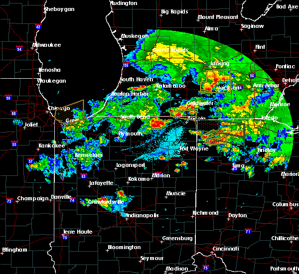 At 904 pm edt, a severe thunderstorm was located near bryan, moving northeast at 35 mph (radar indicated). Hazards include quarter size hail. Damage to vehicles is expected. Locations impacted include, bryan, farmer, ney, evansport and williams center. At 904 pm edt, a severe thunderstorm was located near bryan, moving northeast at 35 mph (radar indicated). Hazards include quarter size hail. Damage to vehicles is expected. Locations impacted include, bryan, farmer, ney, evansport and williams center.
|
| 6/1/2019 8:52 PM EDT |
 At 852 pm edt, a severe thunderstorm was located near edgerton, or near hicksville, moving northeast at 35 mph (radar indicated). Hazards include quarter size hail. Damage to vehicles is expected. Locations impacted include, bryan, hicksville, pulaski, farmer, ney, evansport and williams center. At 852 pm edt, a severe thunderstorm was located near edgerton, or near hicksville, moving northeast at 35 mph (radar indicated). Hazards include quarter size hail. Damage to vehicles is expected. Locations impacted include, bryan, hicksville, pulaski, farmer, ney, evansport and williams center.
|
| 6/1/2019 8:43 PM EDT |
 At 843 pm edt, a severe thunderstorm was located over st. joe, or near hicksville, moving northeast at 35 mph (radar indicated). Hazards include half dollar size hail. damage to vehicles is expected At 843 pm edt, a severe thunderstorm was located over st. joe, or near hicksville, moving northeast at 35 mph (radar indicated). Hazards include half dollar size hail. damage to vehicles is expected
|
| 6/1/2019 8:43 PM EDT |
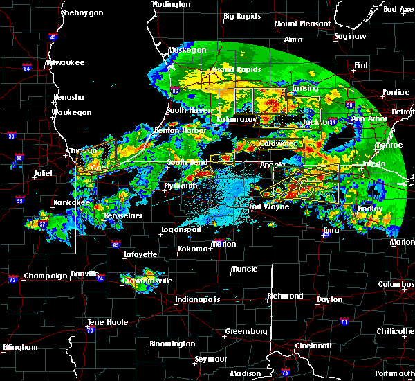 At 843 pm edt, a severe thunderstorm was located over st. joe, or near hicksville, moving northeast at 35 mph (radar indicated). Hazards include half dollar size hail. damage to vehicles is expected At 843 pm edt, a severe thunderstorm was located over st. joe, or near hicksville, moving northeast at 35 mph (radar indicated). Hazards include half dollar size hail. damage to vehicles is expected
|
| 6/1/2019 8:15 PM EDT |
 At 814 pm edt, a severe thunderstorm was located over hicksville, moving east at 40 mph (radar indicated). Hazards include half dollar size hail. damage to vehicles is expected At 814 pm edt, a severe thunderstorm was located over hicksville, moving east at 40 mph (radar indicated). Hazards include half dollar size hail. damage to vehicles is expected
|
| 6/1/2019 7:51 PM EDT |
 The severe thunderstorm warning for northwestern defiance county will expire at 800 pm edt, the storm which prompted the warning has moved out of the area. therefore, the warning will be allowed to expire. a severe thunderstorm watch remains in effect until 1100 pm edt for northwestern ohio. The severe thunderstorm warning for northwestern defiance county will expire at 800 pm edt, the storm which prompted the warning has moved out of the area. therefore, the warning will be allowed to expire. a severe thunderstorm watch remains in effect until 1100 pm edt for northwestern ohio.
|
| 6/1/2019 7:28 PM EDT |
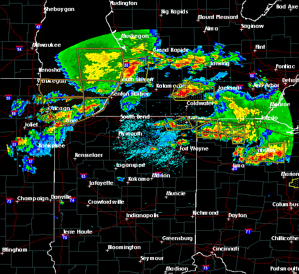 At 728 pm edt, a severe thunderstorm was located near bryan, moving east at 40 mph (radar indicated). Hazards include half dollar size hail. Damage to vehicles is expected. Locations impacted include, farmer, ney, evansport and williams center. At 728 pm edt, a severe thunderstorm was located near bryan, moving east at 40 mph (radar indicated). Hazards include half dollar size hail. Damage to vehicles is expected. Locations impacted include, farmer, ney, evansport and williams center.
|
| 6/1/2019 7:14 PM EDT |
 At 714 pm edt, a severe thunderstorm was located over edgerton, or near butler, moving east at 30 mph (radar indicated). Hazards include ping pong ball size hail. People and animals outdoors will be injured. Expect damage to roofs, siding, windows, and vehicles. At 714 pm edt, a severe thunderstorm was located over edgerton, or near butler, moving east at 30 mph (radar indicated). Hazards include ping pong ball size hail. People and animals outdoors will be injured. Expect damage to roofs, siding, windows, and vehicles.
|
| 5/23/2019 5:57 AM EDT |
 The severe thunderstorm warning for hillsdale, northern defiance, northwestern henry, western fulton and williams counties will expire at 600 am edt, the storms which prompted the warning have weakened below severe limits. therefore, the warning will be allowed to expire. however gusty winds of around 50 mph and pea sized hail are still possible with these thunderstorms through 630 am edt. The severe thunderstorm warning for hillsdale, northern defiance, northwestern henry, western fulton and williams counties will expire at 600 am edt, the storms which prompted the warning have weakened below severe limits. therefore, the warning will be allowed to expire. however gusty winds of around 50 mph and pea sized hail are still possible with these thunderstorms through 630 am edt.
|
| 5/23/2019 5:47 AM EDT |
 At 546 am edt, severe thunderstorms were located along a line extending from near vandercook lake to near hudson to 10 miles south of bryan, moving east at 60 mph (radar indicated). Hazards include 60 mph wind gusts. Expect damage to roofs, siding, and trees. Locations impacted include, napoleon, bryan, hillsdale, wauseon, archbold, montpelier, hicksville, jonesville, edgerton, west unity, pioneer, stryker, fayette, holiday city, jerome, somerset, west jefferson, pulaski, pittsford and moscow. At 546 am edt, severe thunderstorms were located along a line extending from near vandercook lake to near hudson to 10 miles south of bryan, moving east at 60 mph (radar indicated). Hazards include 60 mph wind gusts. Expect damage to roofs, siding, and trees. Locations impacted include, napoleon, bryan, hillsdale, wauseon, archbold, montpelier, hicksville, jonesville, edgerton, west unity, pioneer, stryker, fayette, holiday city, jerome, somerset, west jefferson, pulaski, pittsford and moscow.
|
| 5/23/2019 5:19 AM EDT |
 At 518 am edt, severe thunderstorms were located along a line extending from near burlington to near fremont to near grabill, moving east at 65 mph (radar indicated). Hazards include 60 mph wind gusts. expect damage to roofs, siding, and trees At 518 am edt, severe thunderstorms were located along a line extending from near burlington to near fremont to near grabill, moving east at 65 mph (radar indicated). Hazards include 60 mph wind gusts. expect damage to roofs, siding, and trees
|
| 5/14/2018 11:26 PM EDT |
 At 1126 pm edt, a severe thunderstorm was located near edgerton, or 8 miles north of hicksville, moving east at 45 mph (public). Hazards include 60 mph wind gusts and quarter size hail. Hail damage to vehicles is expected. expect wind damage to roofs, siding, and trees. Locations impacted include, bryan, montpelier, edgerton, west unity, stryker, edon, holiday city, edgerton in williams county, west jefferson, pulaski, farmer, ney, blakeslee, evansport, alvordton, williams center, melbern, hallock and kunkle. At 1126 pm edt, a severe thunderstorm was located near edgerton, or 8 miles north of hicksville, moving east at 45 mph (public). Hazards include 60 mph wind gusts and quarter size hail. Hail damage to vehicles is expected. expect wind damage to roofs, siding, and trees. Locations impacted include, bryan, montpelier, edgerton, west unity, stryker, edon, holiday city, edgerton in williams county, west jefferson, pulaski, farmer, ney, blakeslee, evansport, alvordton, williams center, melbern, hallock and kunkle.
|
| 5/14/2018 11:00 PM EDT |
 At 1100 pm edt, a severe thunderstorm was located near waterloo, or near auburn, moving east at 45 mph (public). Hazards include golf ball size hail and 60 mph wind gusts. People and animals outdoors will be injured. expect hail damage to roofs, siding, windows, and vehicles. Expect wind damage to roofs, siding, and trees. At 1100 pm edt, a severe thunderstorm was located near waterloo, or near auburn, moving east at 45 mph (public). Hazards include golf ball size hail and 60 mph wind gusts. People and animals outdoors will be injured. expect hail damage to roofs, siding, windows, and vehicles. Expect wind damage to roofs, siding, and trees.
|
| 11/5/2017 1:06 PM EDT |
 The severe thunderstorm warning for southeastern steuben, northeastern allen, eastern de kalb, defiance, western paulding and williams counties will expire at 1215 pm est, the storms which prompted the warning have moved out of the area. therefore the warning will be allowed to expire. however heavy rain is still possible with these thunderstorms. The severe thunderstorm warning for southeastern steuben, northeastern allen, eastern de kalb, defiance, western paulding and williams counties will expire at 1215 pm est, the storms which prompted the warning have moved out of the area. therefore the warning will be allowed to expire. however heavy rain is still possible with these thunderstorms.
|
| 11/5/2017 12:35 PM EDT |
 At 1134 am est, severe thunderstorms were located along a line extending from near edon to near butler to near grabill, moving east at 30 mph. this line has a history of producing isolated wind damage (radar indicated). Hazards include 70 mph wind gusts and quarter size hail. Hail damage to vehicles is expected. expect considerable tree damage. Wind damage is also likely to mobile homes, roofs, and outbuildings. At 1134 am est, severe thunderstorms were located along a line extending from near edon to near butler to near grabill, moving east at 30 mph. this line has a history of producing isolated wind damage (radar indicated). Hazards include 70 mph wind gusts and quarter size hail. Hail damage to vehicles is expected. expect considerable tree damage. Wind damage is also likely to mobile homes, roofs, and outbuildings.
|
| 7/3/2017 3:53 PM EDT |
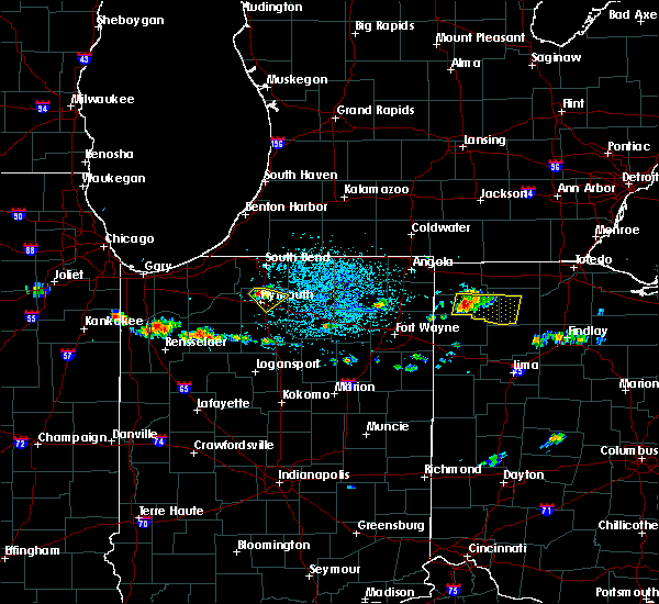 At 353 pm edt, a severe thunderstorm was located 8 miles northwest of defiance, moving east at 25 mph (radar indicated). Hazards include 60 mph wind gusts and quarter size hail. Hail damage to vehicles is expected. Expect wind damage to roofs, siding, and trees. At 353 pm edt, a severe thunderstorm was located 8 miles northwest of defiance, moving east at 25 mph (radar indicated). Hazards include 60 mph wind gusts and quarter size hail. Hail damage to vehicles is expected. Expect wind damage to roofs, siding, and trees.
|
| 6/19/2017 2:53 PM EDT |
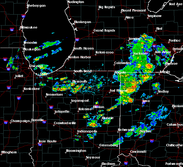 The severe thunderstorm warning for central defiance and north central paulding counties will expire at 300 pm edt, the severe thunderstorm which prompted the warning has weakened. therefore, the warning will be allowed to expire. The severe thunderstorm warning for central defiance and north central paulding counties will expire at 300 pm edt, the severe thunderstorm which prompted the warning has weakened. therefore, the warning will be allowed to expire.
|
| 6/19/2017 2:42 PM EDT |
 At 241 pm edt, a severe thunderstorm was located 10 miles east of hicksville, moving east at 35 mph (radar indicated). Hazards include 60 mph wind gusts and quarter size hail. Hail damage to vehicles is expected. expect wind damage to roofs, siding, and trees. Locations impacted include, defiance, farmer, ney, cecil, brunersburg, mark center and the bend. At 241 pm edt, a severe thunderstorm was located 10 miles east of hicksville, moving east at 35 mph (radar indicated). Hazards include 60 mph wind gusts and quarter size hail. Hail damage to vehicles is expected. expect wind damage to roofs, siding, and trees. Locations impacted include, defiance, farmer, ney, cecil, brunersburg, mark center and the bend.
|
| 6/19/2017 2:19 PM EDT |
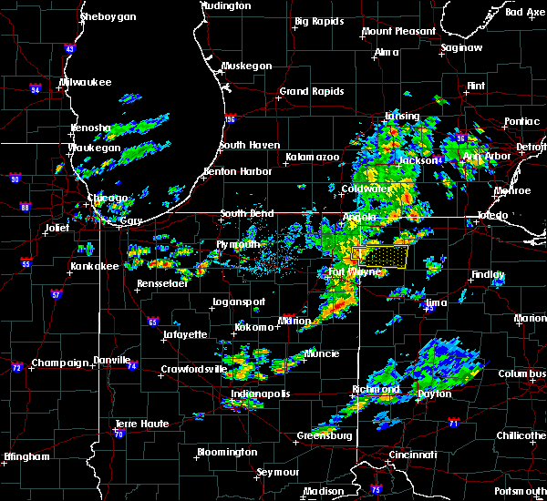 At 219 pm edt, a severe thunderstorm was located over hicksville, moving east at 30 mph (radar indicated). Hazards include 60 mph wind gusts and quarter size hail. Hail damage to vehicles is expected. Expect wind damage to roofs, siding, and trees. At 219 pm edt, a severe thunderstorm was located over hicksville, moving east at 30 mph (radar indicated). Hazards include 60 mph wind gusts and quarter size hail. Hail damage to vehicles is expected. Expect wind damage to roofs, siding, and trees.
|
| 5/28/2017 3:22 PM EDT |
 At 322 pm edt, a severe thunderstorm was located 7 miles northwest of defiance, moving east at 25 mph (trained weather spotters). Hazards include 60 mph wind gusts and quarter size hail. Hail damage to vehicles is expected. expect wind damage to roofs, siding, and trees. Locations impacted include, defiance, ney, ridgeville corners, evansport, jewell and brunersburg. At 322 pm edt, a severe thunderstorm was located 7 miles northwest of defiance, moving east at 25 mph (trained weather spotters). Hazards include 60 mph wind gusts and quarter size hail. Hail damage to vehicles is expected. expect wind damage to roofs, siding, and trees. Locations impacted include, defiance, ney, ridgeville corners, evansport, jewell and brunersburg.
|
| 5/28/2017 3:18 PM EDT | Quarter sized hail reported 2 miles S of Ney, OH |
| 5/28/2017 3:08 PM EDT |
 At 307 pm edt, a severe thunderstorm was located 9 miles south of bryan, moving east at 25 mph (radar indicated). Hazards include 60 mph wind gusts, quarter size hail, and heavy rainfall. Hail damage to vehicles is expected. Expect wind damage to roofs, siding, and trees. At 307 pm edt, a severe thunderstorm was located 9 miles south of bryan, moving east at 25 mph (radar indicated). Hazards include 60 mph wind gusts, quarter size hail, and heavy rainfall. Hail damage to vehicles is expected. Expect wind damage to roofs, siding, and trees.
|
| 5/28/2017 2:43 PM EDT |
 At 242 pm edt, a severe thunderstorm was located near edgerton, or 7 miles northeast of hicksville, moving east at 30 mph (emergency management). Hazards include ping pong ball size hail and 60 mph wind gusts. People and animals outdoors may be injured. expect hail damage to roofs, siding, windows, and vehicles. expect wind damage to roofs, siding, and trees. Locations impacted include, bryan, hicksville, edgerton, stryker, edgerton in williams county, pulaski, farmer, ney, evansport, williams center and melbern. At 242 pm edt, a severe thunderstorm was located near edgerton, or 7 miles northeast of hicksville, moving east at 30 mph (emergency management). Hazards include ping pong ball size hail and 60 mph wind gusts. People and animals outdoors may be injured. expect hail damage to roofs, siding, windows, and vehicles. expect wind damage to roofs, siding, and trees. Locations impacted include, bryan, hicksville, edgerton, stryker, edgerton in williams county, pulaski, farmer, ney, evansport, williams center and melbern.
|
| 5/28/2017 2:29 PM EDT |
 At 228 pm edt, a severe thunderstorm was located near butler, moving east at 25 mph (radar indicated). Hazards include 60 mph wind gusts and quarter size hail. Hail damage to vehicles is possible. Expect wind damage to roofs, siding, and trees. At 228 pm edt, a severe thunderstorm was located near butler, moving east at 25 mph (radar indicated). Hazards include 60 mph wind gusts and quarter size hail. Hail damage to vehicles is possible. Expect wind damage to roofs, siding, and trees.
|
| 4/20/2017 3:49 PM EDT |
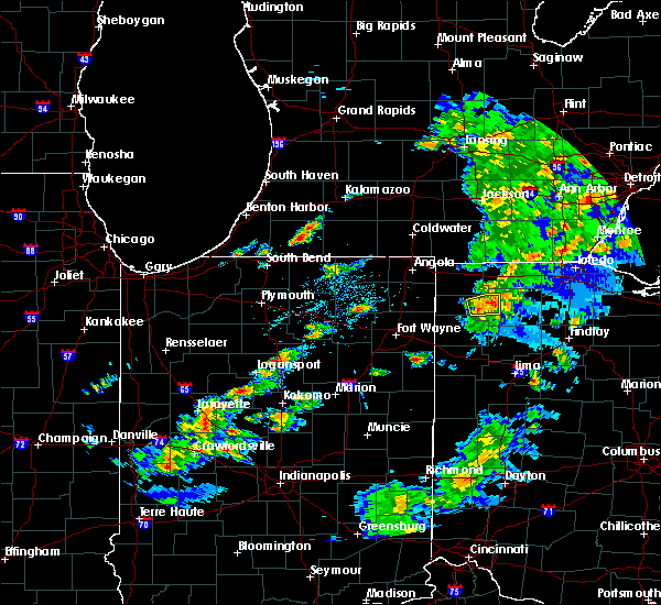 At 348 pm edt, a severe thunderstorm was located over defiance, moving east at 45 mph (radar indicated). Hazards include 60 mph wind gusts and penny size hail. Expect damage to roofs, siding, and trees. This severe thunderstorm will remain over mainly rural areas of northeastern defiance county, including the following locations: jewell, brunersburg and ney. At 348 pm edt, a severe thunderstorm was located over defiance, moving east at 45 mph (radar indicated). Hazards include 60 mph wind gusts and penny size hail. Expect damage to roofs, siding, and trees. This severe thunderstorm will remain over mainly rural areas of northeastern defiance county, including the following locations: jewell, brunersburg and ney.
|
| 4/20/2017 3:38 PM EDT |
 At 338 pm edt, a severe thunderstorm was located 9 miles north of paulding, or 9 miles west of defiance, moving east at 50 mph (radar indicated). Hazards include 60 mph wind gusts and penny size hail. Expect damage to roofs, siding, and trees. this severe thunderstorm will be near, defiance around 350 pm edt. Other locations impacted by this severe thunderstorm include mark center, jewell, the bend, brunersburg and ney. At 338 pm edt, a severe thunderstorm was located 9 miles north of paulding, or 9 miles west of defiance, moving east at 50 mph (radar indicated). Hazards include 60 mph wind gusts and penny size hail. Expect damage to roofs, siding, and trees. this severe thunderstorm will be near, defiance around 350 pm edt. Other locations impacted by this severe thunderstorm include mark center, jewell, the bend, brunersburg and ney.
|
| 3/1/2017 3:09 AM EST |
 At 309 am est, severe thunderstorms were located along a line extending from 6 miles southeast of morenci to 6 miles southeast of defiance to convoy, moving east at 65 mph (radar indicated). Hazards include 60 mph wind gusts. Expect damage to roofs, siding, and trees. locations impacted include, fort wayne, defiance, new haven, napoleon, bryan, wauseon, ottawa, archbold, bluffton, swanton, hicksville, paulding, delta, columbus grove, leipsic, deshler, antwerp, west unity, kalida and woodburn. this includes the following highways, interstate 469 between mile markers 10 and 22. interstate 75 between mile markers 134 and 141. interstate 80 in ohio between mile markers 17 and 48. A tornado watch remains in effect until 700 am est for northeastern indiana, and northwestern and west central ohio. At 309 am est, severe thunderstorms were located along a line extending from 6 miles southeast of morenci to 6 miles southeast of defiance to convoy, moving east at 65 mph (radar indicated). Hazards include 60 mph wind gusts. Expect damage to roofs, siding, and trees. locations impacted include, fort wayne, defiance, new haven, napoleon, bryan, wauseon, ottawa, archbold, bluffton, swanton, hicksville, paulding, delta, columbus grove, leipsic, deshler, antwerp, west unity, kalida and woodburn. this includes the following highways, interstate 469 between mile markers 10 and 22. interstate 75 between mile markers 134 and 141. interstate 80 in ohio between mile markers 17 and 48. A tornado watch remains in effect until 700 am est for northeastern indiana, and northwestern and west central ohio.
|
| 3/1/2017 2:54 AM EST |
 At 253 am est, severe thunderstorms were located along a line extending from near pioneer to 7 miles north of paulding to near monroeville, moving east at 70 mph (radar indicated). Hazards include 70 mph wind gusts and penny size hail. Expect considerable tree damage. damage is likely to mobile homes, roofs, and outbuildings. locations impacted include, fort wayne, defiance, new haven, napoleon, bryan, wauseon, delphos, ottawa, archbold, bluffton, montpelier, swanton, hicksville, paulding, delta, columbus grove, leipsic, edgerton, deshler and antwerp. this includes the following highways, interstate 469 between mile markers 9 and 24. interstate 75 between mile markers 133 and 141. interstate 80 in ohio between mile markers 2 and 48. This storm has a history of producing 70 to 80 mph wind gusts! a tornado watch remains in effect until 700 am est for northeastern indiana, and northwestern and west central ohio. At 253 am est, severe thunderstorms were located along a line extending from near pioneer to 7 miles north of paulding to near monroeville, moving east at 70 mph (radar indicated). Hazards include 70 mph wind gusts and penny size hail. Expect considerable tree damage. damage is likely to mobile homes, roofs, and outbuildings. locations impacted include, fort wayne, defiance, new haven, napoleon, bryan, wauseon, delphos, ottawa, archbold, bluffton, montpelier, swanton, hicksville, paulding, delta, columbus grove, leipsic, edgerton, deshler and antwerp. this includes the following highways, interstate 469 between mile markers 9 and 24. interstate 75 between mile markers 133 and 141. interstate 80 in ohio between mile markers 2 and 48. This storm has a history of producing 70 to 80 mph wind gusts! a tornado watch remains in effect until 700 am est for northeastern indiana, and northwestern and west central ohio.
|
| 3/1/2017 2:29 AM EST |
 At 227 am est, severe thunderstorms were located along a line extending from fremont to near auburn to 10 miles west of fort wayne, moving east at 70 mph. these are very dangerous storms (radar indicated). Hazards include 80 mph wind gusts and nickel size hail. Flying debris will be dangerous to those caught without shelter. mobile homes will be heavily damaged. expect considerable damage to roofs, windows, and vehicles. Extensive tree damage and power outages are likely. At 227 am est, severe thunderstorms were located along a line extending from fremont to near auburn to 10 miles west of fort wayne, moving east at 70 mph. these are very dangerous storms (radar indicated). Hazards include 80 mph wind gusts and nickel size hail. Flying debris will be dangerous to those caught without shelter. mobile homes will be heavily damaged. expect considerable damage to roofs, windows, and vehicles. Extensive tree damage and power outages are likely.
|
| 8/24/2016 6:18 PM EDT |
 A tornado warning remains in effect until 630 pm edt for northeastern defiance and northwestern henry counties. at 616 pm edt. a confirmed large and extremely dangerous tornado was located near defiance. moving northeast at 35 mph. this is a particularly dangerous situation. take cover now! hazard. Damaging tornado. A tornado warning remains in effect until 630 pm edt for northeastern defiance and northwestern henry counties. at 616 pm edt. a confirmed large and extremely dangerous tornado was located near defiance. moving northeast at 35 mph. this is a particularly dangerous situation. take cover now! hazard. Damaging tornado.
|
| 8/24/2016 5:59 PM EDT |
 At 558 pm edt, a confirmed large and extremely dangerous tornado was located 4 miles southwest cecil, moving northeast at 30 mph. this is a particularly dangerous situation. take cover now! (weather spotters confirmed tornado). Hazards include damaging tornado. You are in a life-threatening situation. flying debris may be deadly to those caught without shelter. mobile homes will be destroyed. considerable damage to homes, businesses, and vehicles is likely and complete destruction is possible. the tornado will be near, defiance around 630 pm edt. Other locations impacted by this tornadic thunderstorm include mark center, brunersburg, standley, cecil, ridgeville corners, the bend, jewell, ney and evansport. At 558 pm edt, a confirmed large and extremely dangerous tornado was located 4 miles southwest cecil, moving northeast at 30 mph. this is a particularly dangerous situation. take cover now! (weather spotters confirmed tornado). Hazards include damaging tornado. You are in a life-threatening situation. flying debris may be deadly to those caught without shelter. mobile homes will be destroyed. considerable damage to homes, businesses, and vehicles is likely and complete destruction is possible. the tornado will be near, defiance around 630 pm edt. Other locations impacted by this tornadic thunderstorm include mark center, brunersburg, standley, cecil, ridgeville corners, the bend, jewell, ney and evansport.
|
| 6/20/2016 10:46 PM EDT |
 At 1046 pm edt, a severe thunderstorm was located near butler, moving east at 35 mph (radar indicated). Hazards include 60 mph wind gusts and quarter size hail. Hail damage to vehicles is expected. Expect wind damage to roofs, siding and trees. At 1046 pm edt, a severe thunderstorm was located near butler, moving east at 35 mph (radar indicated). Hazards include 60 mph wind gusts and quarter size hail. Hail damage to vehicles is expected. Expect wind damage to roofs, siding and trees.
|
| 6/18/2015 6:04 PM EDT | At 604 pm edt, severe thunderstorms were located along a line extending from near edgerton to near payne, moving east at 45 mph (radar indicated). Hazards include 60 mph wind gusts. Damage to roofs. Siding and trees possible. |
| 6/15/2015 4:20 PM EDT |
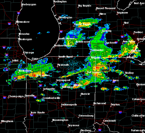 At 419 pm edt, a severe thunderstorm was located 8 miles west of defiance, moving east at 55 mph (radar indicated). Hazards include 60 mph wind gusts. Expect damage to roofs. siding and trees. Locations impacted include, defiance, hicksville, paulding, antwerp, independence, farmer, sherwood, ney, cecil, mark center, the bend, jewell, brunersburg, ayersville and arthur. At 419 pm edt, a severe thunderstorm was located 8 miles west of defiance, moving east at 55 mph (radar indicated). Hazards include 60 mph wind gusts. Expect damage to roofs. siding and trees. Locations impacted include, defiance, hicksville, paulding, antwerp, independence, farmer, sherwood, ney, cecil, mark center, the bend, jewell, brunersburg, ayersville and arthur.
|
| 6/15/2015 4:02 PM EDT |
 At 402 pm edt, a severe thunderstorm was located near hicksville, moving east at 55 mph (radar indicated). Hazards include 60 mph wind gusts. Expect damage to roofs. Siding and trees. At 402 pm edt, a severe thunderstorm was located near hicksville, moving east at 55 mph (radar indicated). Hazards include 60 mph wind gusts. Expect damage to roofs. Siding and trees.
|
| 6/15/2015 4:02 PM EDT |
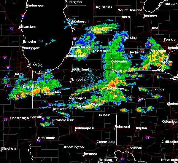 At 402 pm edt, a severe thunderstorm was located near hicksville, moving east at 55 mph (radar indicated). Hazards include 60 mph wind gusts. Expect damage to roofs. Siding and trees. At 402 pm edt, a severe thunderstorm was located near hicksville, moving east at 55 mph (radar indicated). Hazards include 60 mph wind gusts. Expect damage to roofs. Siding and trees.
|
| 5/27/2015 3:15 PM EDT | Report of downed power lines near intersection of sr-15 and blosser r in defiance county OH, 3.4 miles WNW of Ney, OH |
| 5/27/2015 2:31 PM EDT | At 228 pm edt, a severe thunderstorm was located near bryan, and moving east at 45 mph (radar indicated). Hazards include 60 mph wind gusts and nickel size hail. Expect damage to roofs. siding and trees. the severe thunderstorm will be near, archbold around 240 pm edt. other locations in the warning include burlington, elmira, ridgeville corners and pettisville. This includes interstate 80 90 in ohio between mile markers 14 and 32. |
| 5/27/2015 2:12 PM EDT | At 210 pm edt, severe thunderstorms were located along a line extending from edon to hicksville, and moving east at 50 mph (radar indicated). Hazards include 60 mph wind gusts and nickel size hail. Expect damage to roofs. siding and trees. severe thunderstorms will be near, montpelier and bryan around 220 pm edt. west unity and stryker around 230 pm edt. archbold around 240 pm edt. napoleon around 245 pm edt. other locations in the warning include hallock, williams center, sherwood, the bend, west jefferson, pulaski, ney, evansport, brunersburg and jewell. This includes interstate 80 90 in ohio between mile markers 10 and 32. |
| 5/27/2015 1:59 PM EDT | At 155 pm edt, severe thunderstorms were located along a line extending from hamilton to 6 miles southwest of butler to grabill, and moving east at 50 mph (radar indicated). Hazards include 60 mph wind gusts and nickel size hail. Expect damage to roofs. Siding and trees. |
| 5/27/2015 1:59 PM EDT | At 155 pm edt, severe thunderstorms were located along a line extending from hamilton to 6 miles southwest of butler to grabill, and moving east at 50 mph (radar indicated). Hazards include 60 mph wind gusts and nickel size hail. Expect damage to roofs. Siding and trees. |
| 5/11/2015 2:11 PM EDT | At 209 pm edt, a severe thunderstorm was located 10 miles south of bryan, and moving northeast at 45 mph (radar indicated). Hazards include half dollar size hail and 70 mph wind gusts. Hail damage to vehicles is expected. expect considerable tree damage. wind damage is also likely to mobile homes, roofs and outbuildings. the severe thunderstorm will be near, bryan around 220 pm edt. stryker around 225 pm edt. archbold around 235 pm edt. wauseon around 245 pm edt. delta around 255 pm edt. other locations in the warning include evansport, ridgeville corners, burlington, elmira, pettisville, tedrow, ottokee, oakshade, winameg and lyons. this includes interstate 80 90 in ohio between mile markers 23 and 48. 1. 25in. |
| 5/11/2015 2:02 PM EDT | At 159 pm edt, a severe thunderstorm was located near hicksville, and moving northeast at 55 mph (radar indicated). Hazards include golf ball size hail and 60 mph wind gusts. People and animals outdoors will be injured. expect hail damage to roofs, siding, windows and vehicles. expect wind damage to roofs, siding and trees. the severe thunderstorm will affect mainly rural areas of north central paulding and northwestern defiance counties, including the following locations, ney. 1. 75in. |
| 5/11/2015 1:50 PM EDT | At 147 pm edt, a severe thunderstorm was located near woodburn, and moving northeast at 55 mph (radar indicated). Hazards include golf ball size hail and 60 mph wind gusts. People and animals outdoors will be injured. expect hail damage to roofs, siding, windows and vehicles. expect wind damage to roofs, siding and trees. the severe thunderstorm will be near, hicksville around 155 pm edt. other locations in the warning include mark center, farmer and ney. 1. 75in. |
| 5/11/2015 1:50 PM EDT | At 147 pm edt, a severe thunderstorm was located near woodburn, and moving northeast at 55 mph (radar indicated). Hazards include golf ball size hail and 60 mph wind gusts. People and animals outdoors will be injured. expect hail damage to roofs, siding, windows and vehicles. expect wind damage to roofs, siding and trees. the severe thunderstorm will be near, hicksville around 155 pm edt. other locations in the warning include mark center, farmer and ney. 1. 75in. |
| 5/11/2015 1:41 PM EDT | At 138 pm edt, a severe thunderstorm was located 5 miles southwest of woodburn, and moving northeast at 55 mph (radar indicated). Hazards include quarter size hail and 60 mph wind gusts. Hail damage to vehicles is expected. expect wind damage to roofs, siding and trees. the severe thunderstorm will be near, antwerp around 150 pm edt. hicksville around 155 pm edt. other locations in the warning include georgetown, mark center, farmer and ney. this includes interstate 469 between mile markers 23 and 25. 1. 00in. |
| 5/11/2015 1:41 PM EDT | At 138 pm edt, a severe thunderstorm was located 5 miles southwest of woodburn, and moving northeast at 55 mph (radar indicated). Hazards include quarter size hail and 60 mph wind gusts. Hail damage to vehicles is expected. expect wind damage to roofs, siding and trees. the severe thunderstorm will be near, antwerp around 150 pm edt. hicksville around 155 pm edt. other locations in the warning include georgetown, mark center, farmer and ney. this includes interstate 469 between mile markers 23 and 25. 1. 00in. |
| 6/29/2013 4:35 PM EDT | Trees down and steel roof off barn. roof partially torn off home. garage leveled at another locatio in defiance county OH, 1.3 miles S of Ney, OH |
Hail Maps for Ney, OH
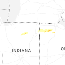


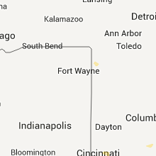


Connect with Interactive Hail Maps