

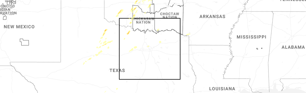
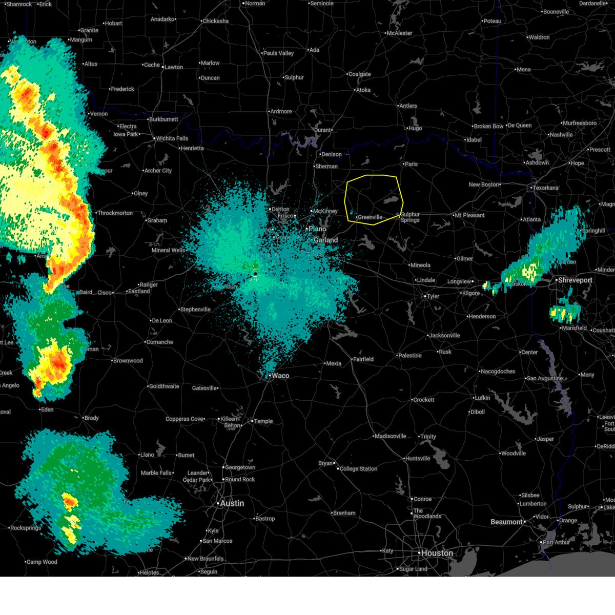
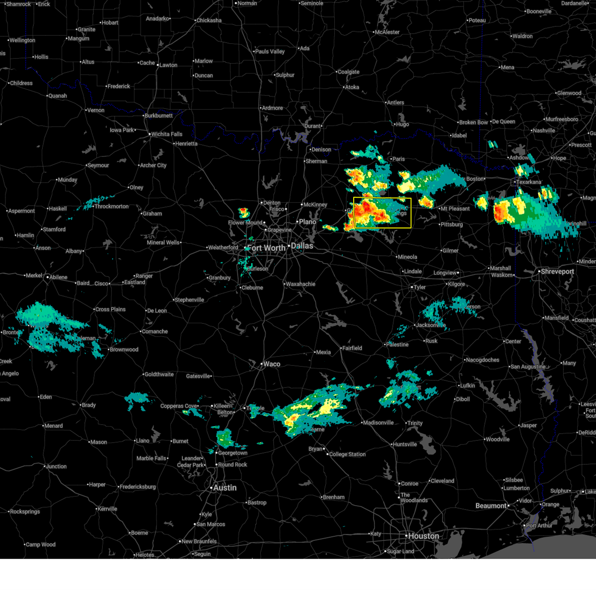
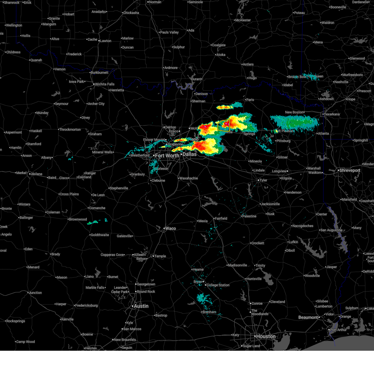
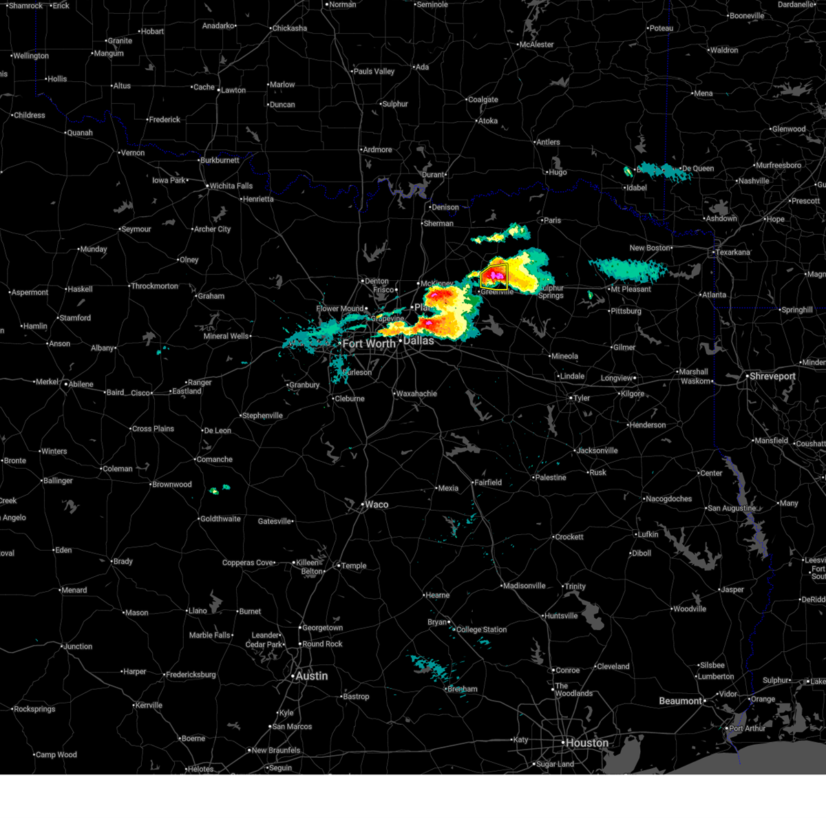
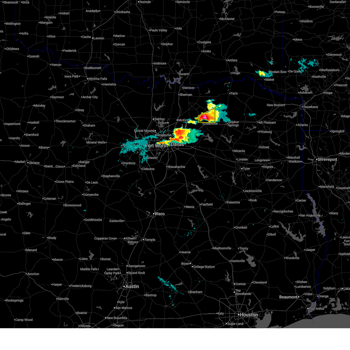
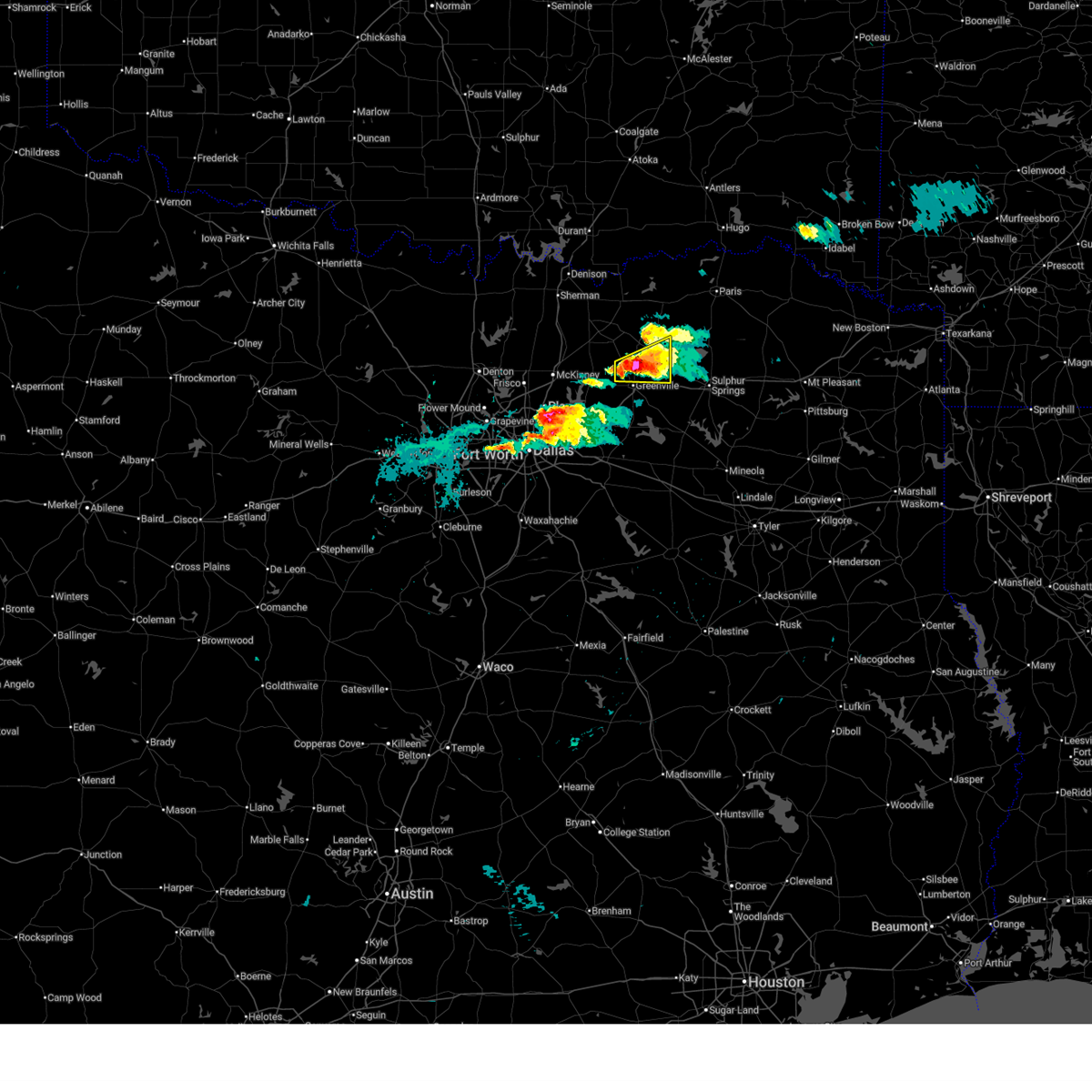
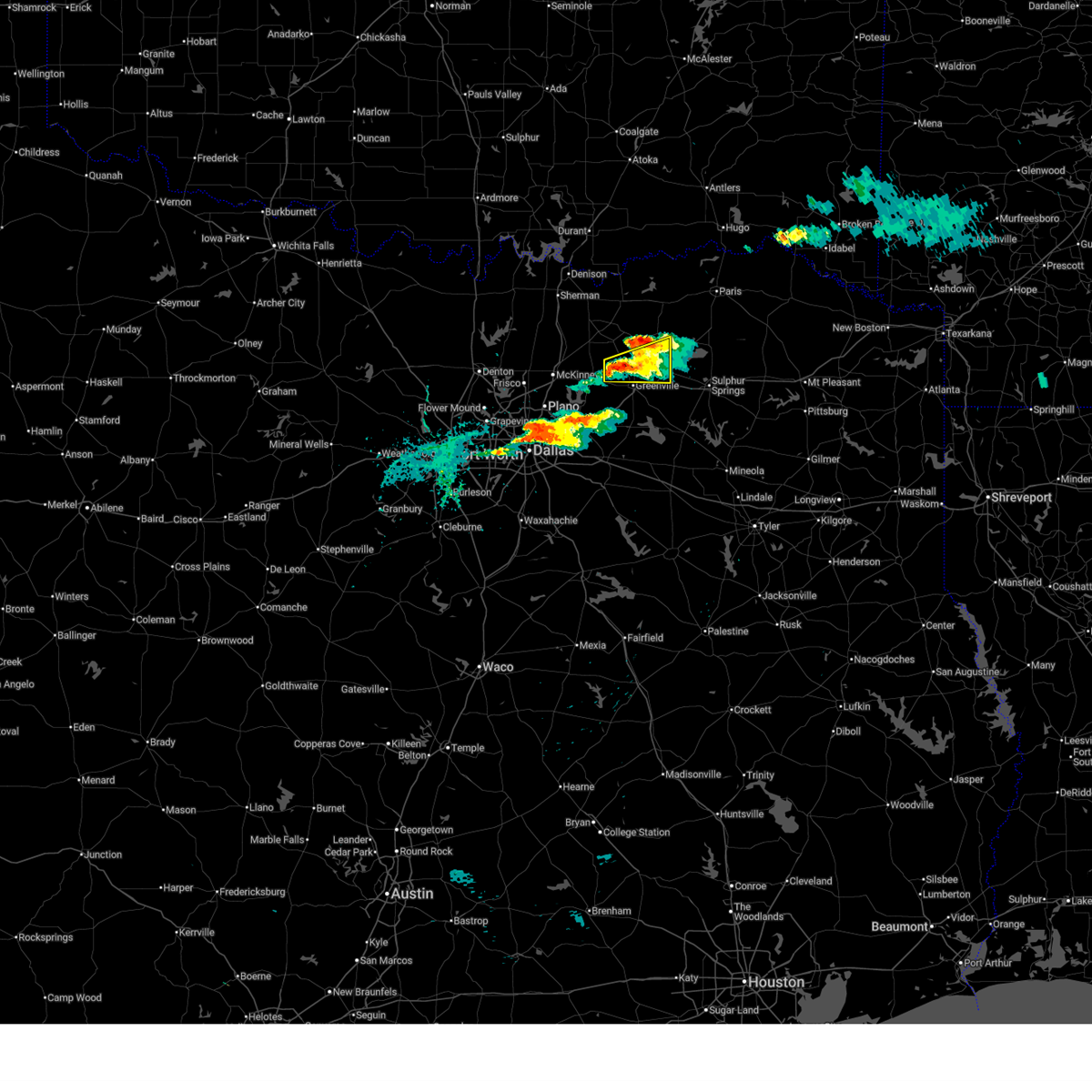
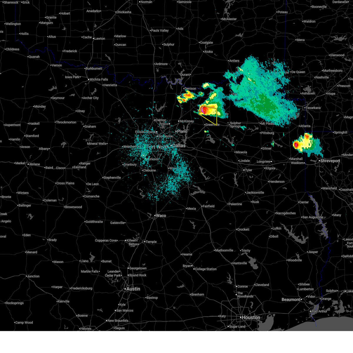
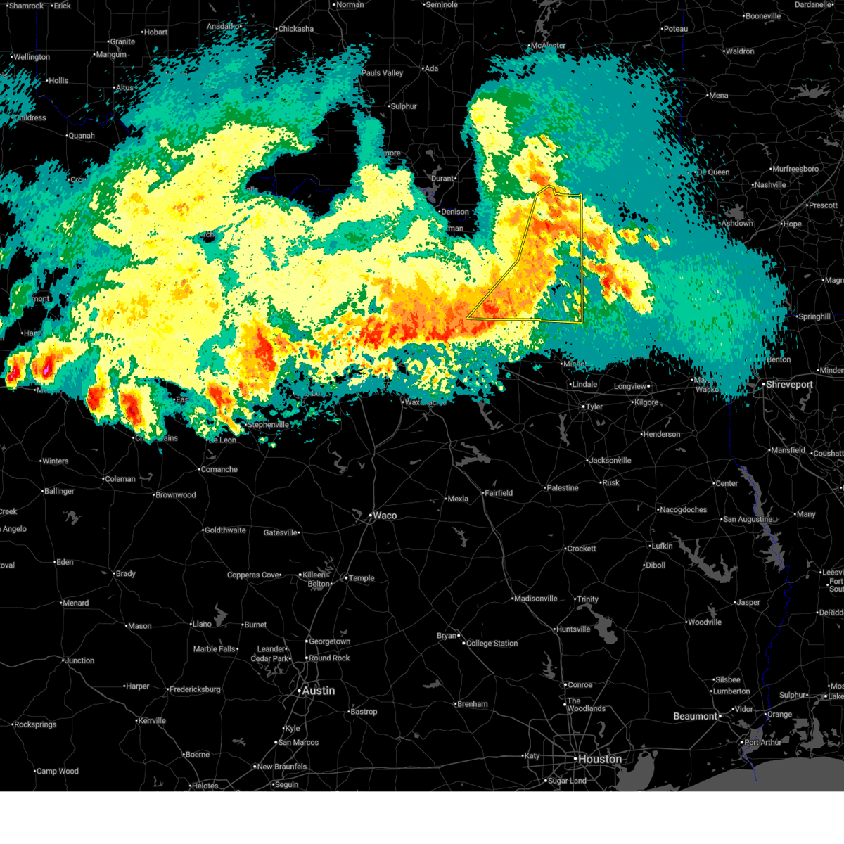
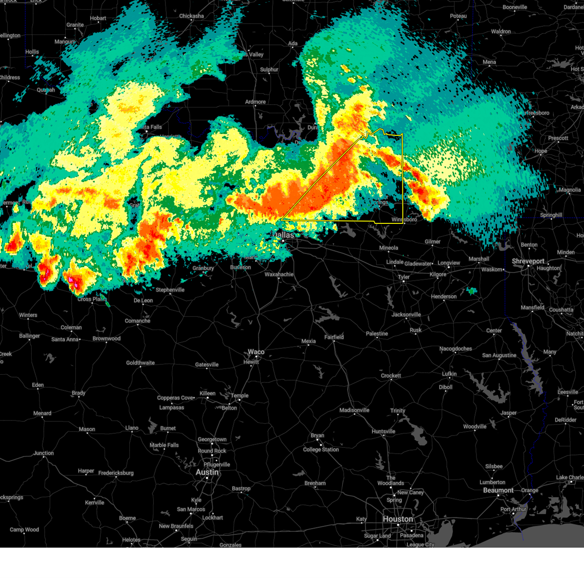
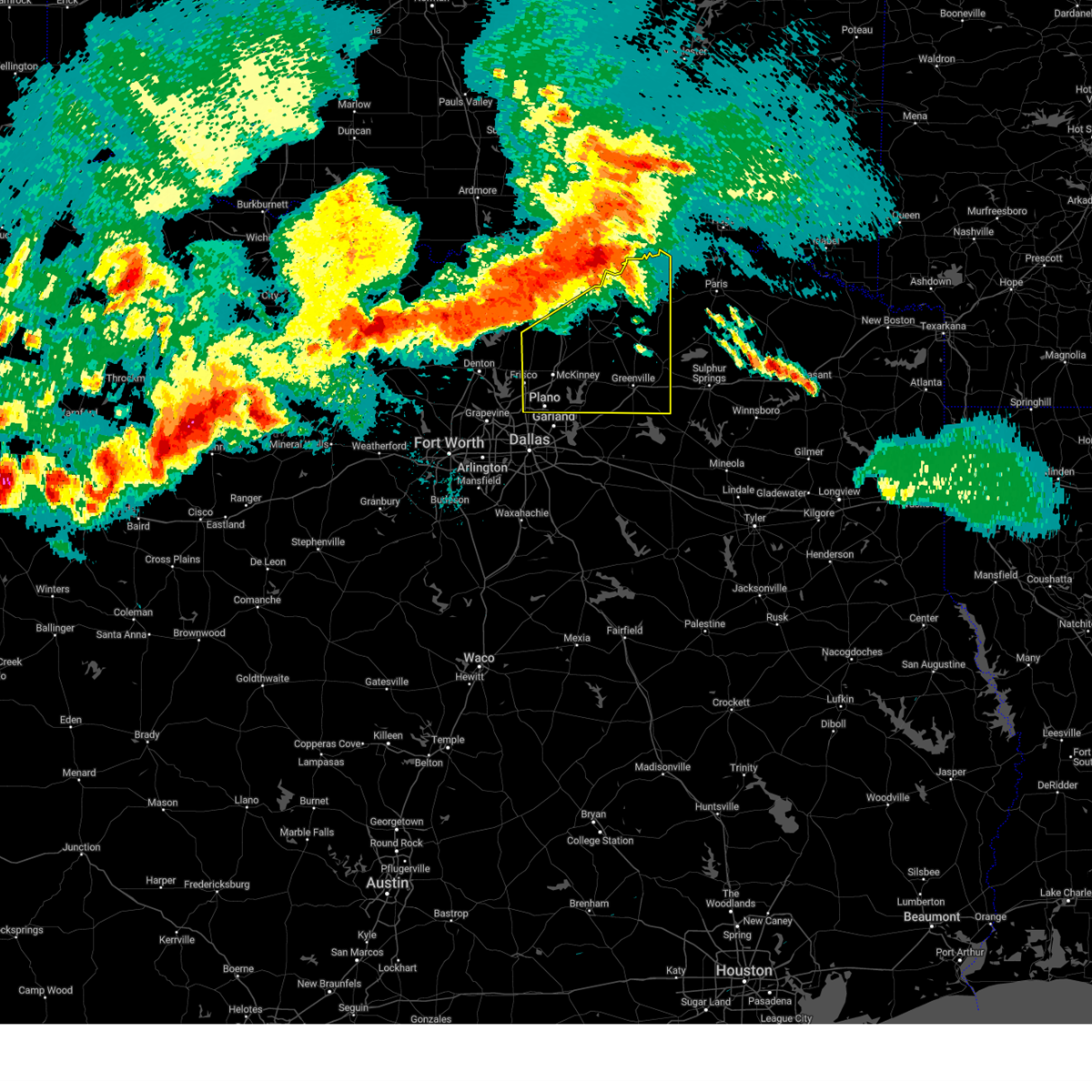
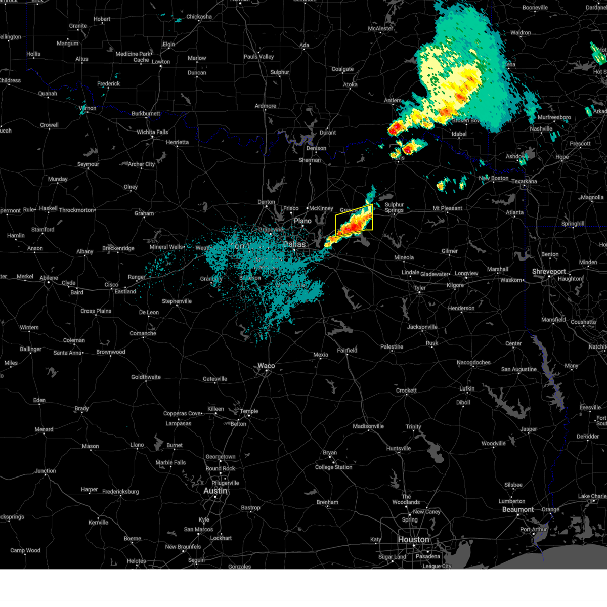
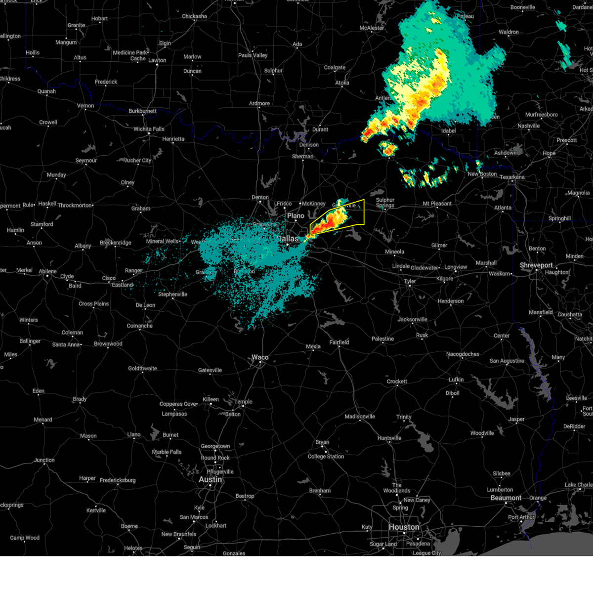
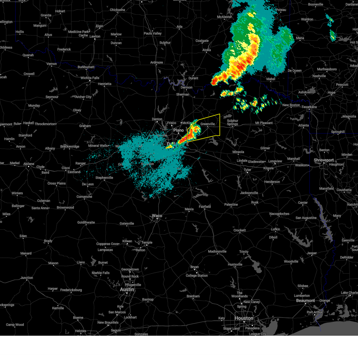
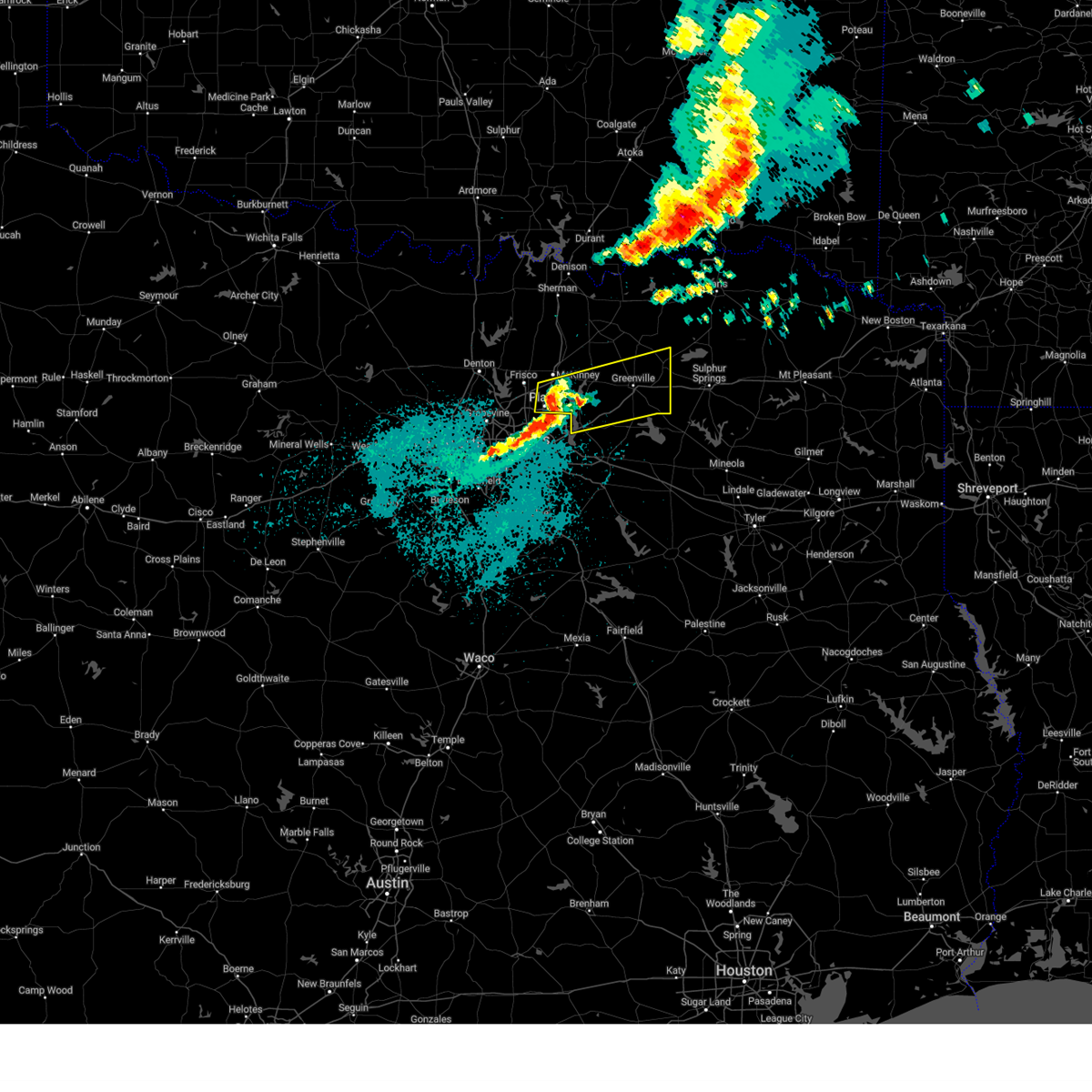
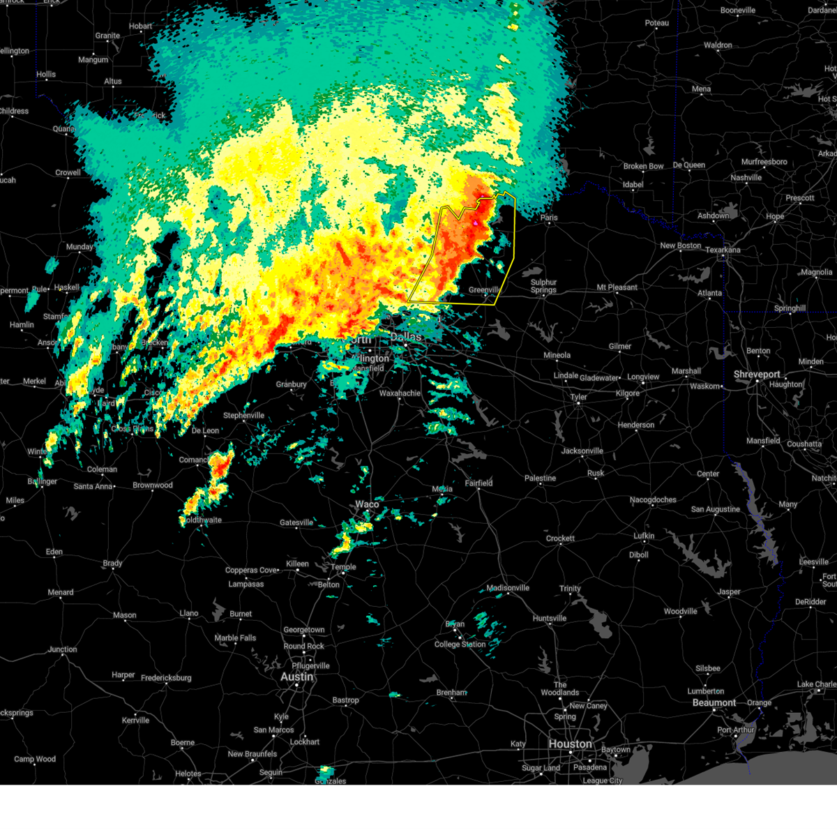
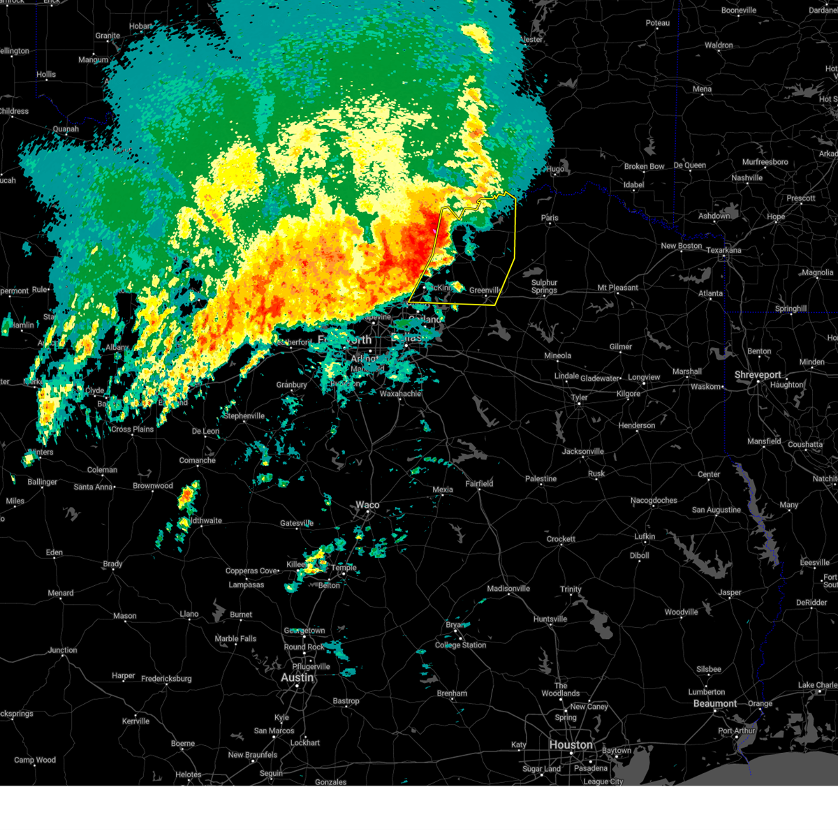
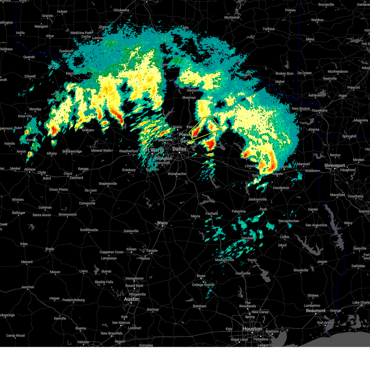
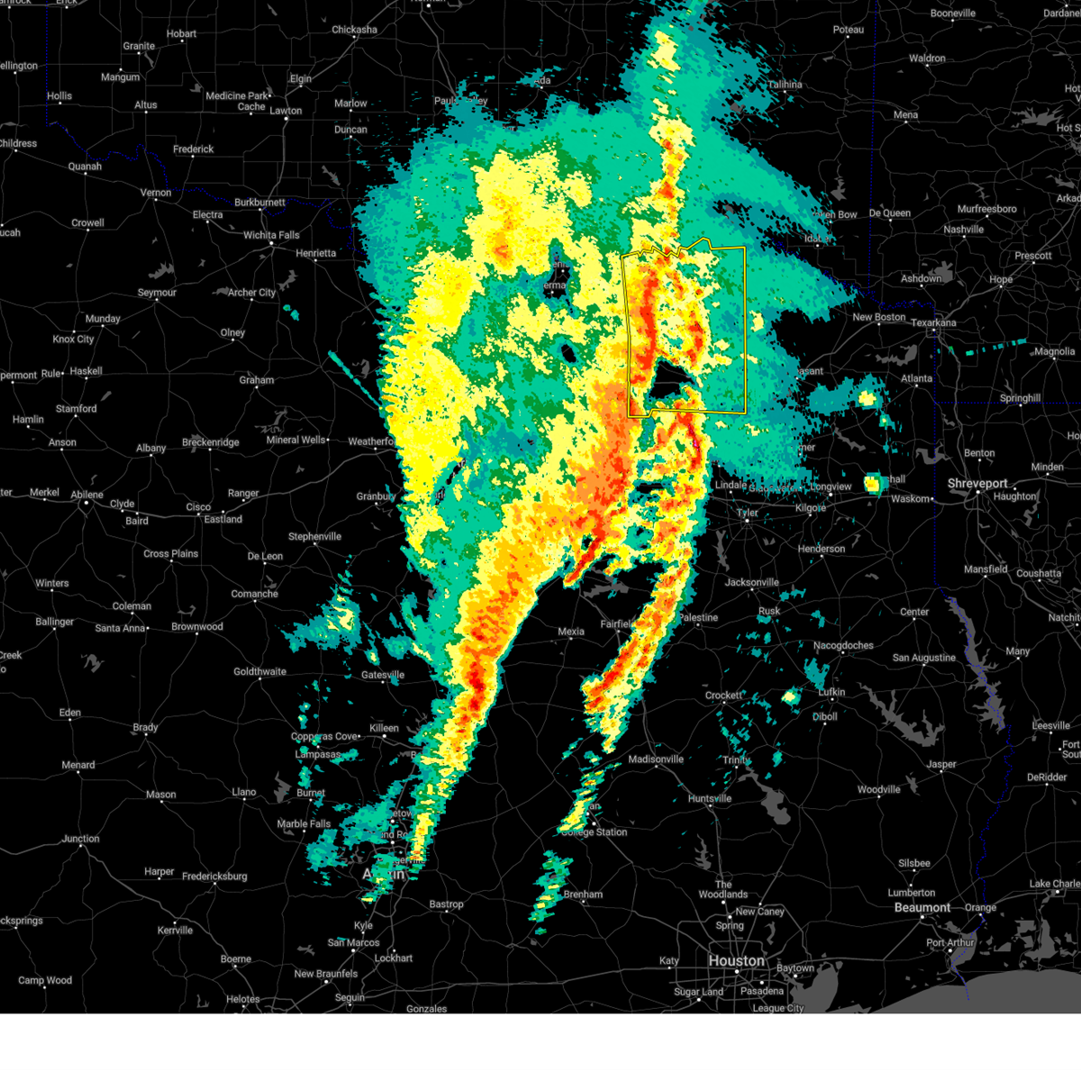
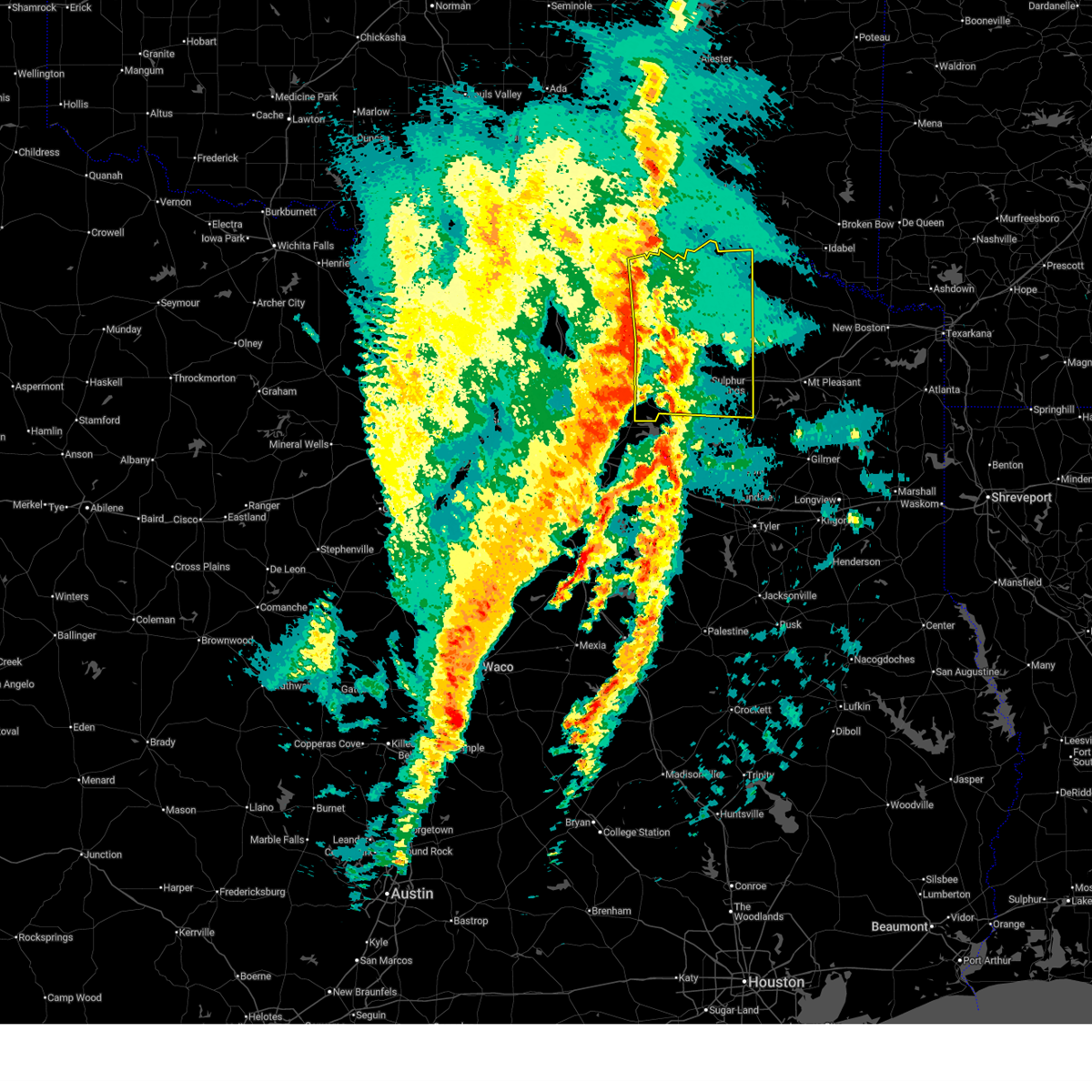
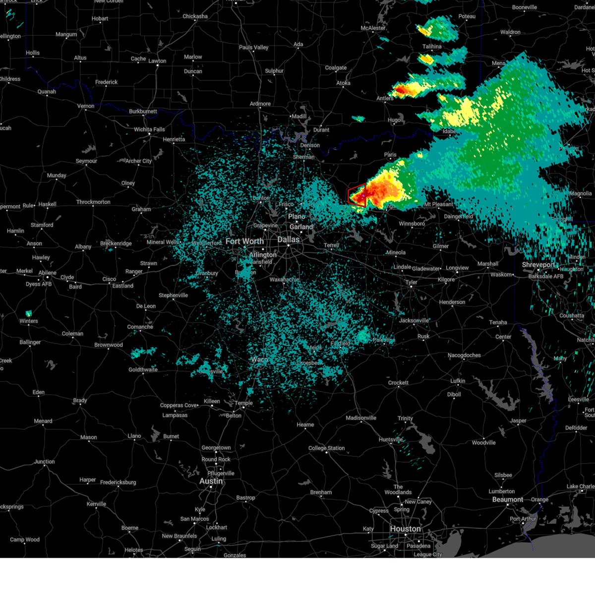
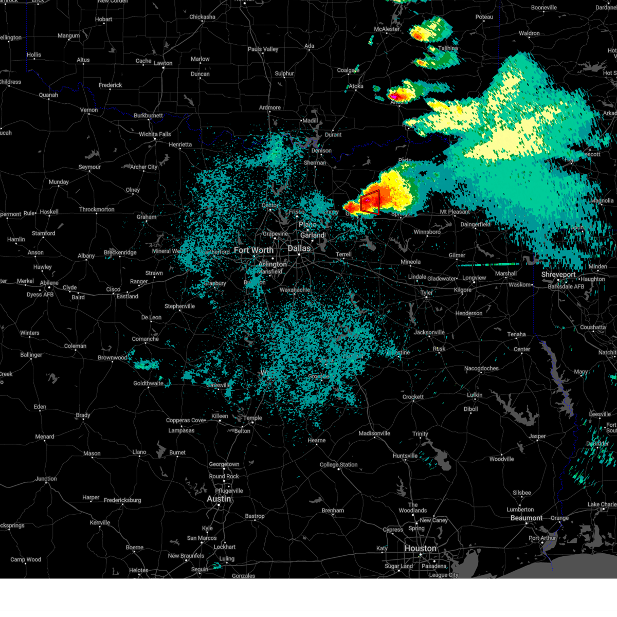
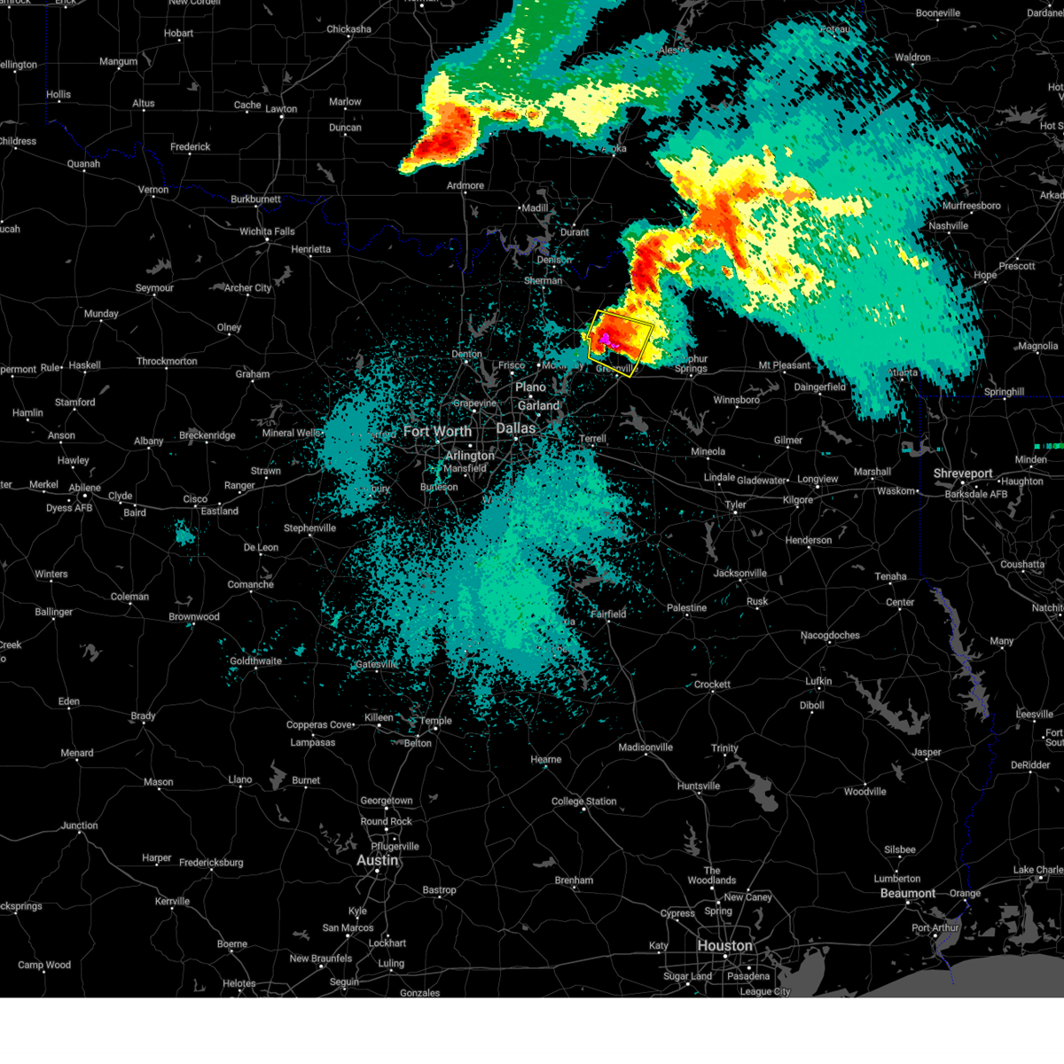
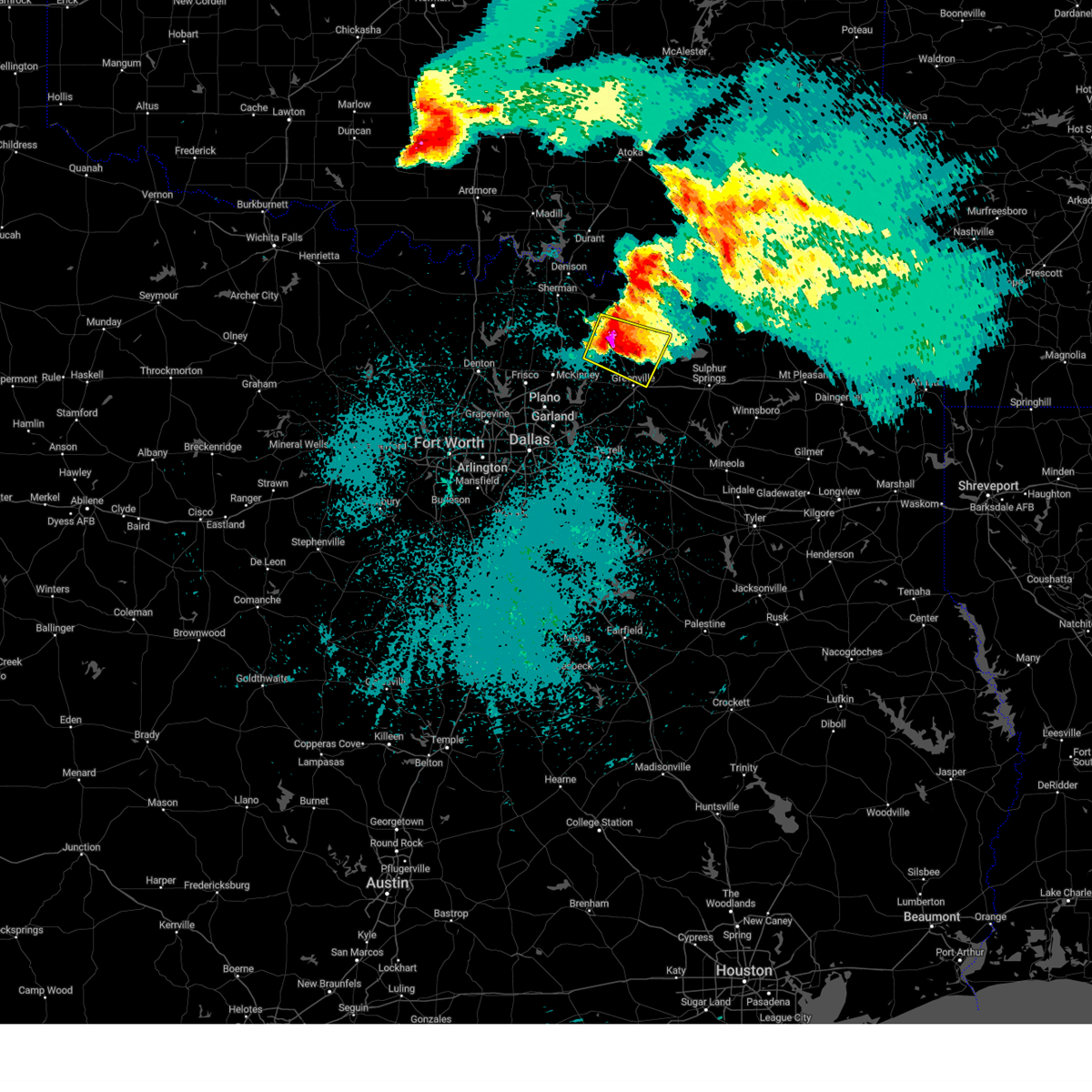
Hail Map for Neylandville, TX
The Neylandville, TX area has had 0 reports of on-the-ground hail by trained spotters, and has been under severe weather warnings 13 times during the past 12 months. Doppler radar has detected hail at or near Neylandville, TX on 63 occasions, including 3 occasions during the past year.
| Name: | Neylandville, TX |
| Where Located: | 54.5 miles ENE of Dallas, TX |
| Map: | Google Map for Neylandville, TX |
| Population: | 97 |
| Housing Units: | 40 |
| More Info: | Search Google for Neylandville, TX |
1
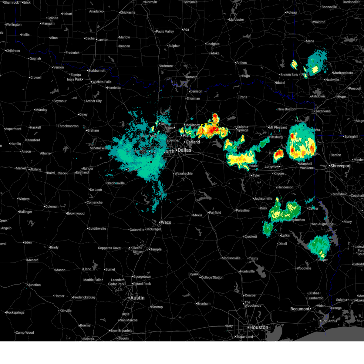
The Top Recent Hail Date for Neylandville, TX is Wednesday, November 19, 2025 (15th out of 63)
Hail and Wind Damage Spotted near Neylandville, TX
| Date / Time | Report Details |
|---|---|
| 7/6/2026 10:08 PM CDT |
 The storm which prompted the warning has weakened below severe limits, and has exited the warned area. therefore, the warning will be allowed to expire. The storm which prompted the warning has weakened below severe limits, and has exited the warned area. therefore, the warning will be allowed to expire.
|
| 7/6/2026 9:57 PM CDT |
 At 957 pm cdt, a severe thunderstorm was located over greenville, moving east at 10 mph (radar indicated). Hazards include 60 mph wind gusts and quarter size hail. Hail damage to vehicles is expected. expect wind damage to roofs, siding, and trees. this severe storm will be near, greenville around 1000 pm cdt. Other locations impacted by this severe thunderstorm include neylandville, kellogg, center point, floyd, clinton, cash, and josephine. At 957 pm cdt, a severe thunderstorm was located over greenville, moving east at 10 mph (radar indicated). Hazards include 60 mph wind gusts and quarter size hail. Hail damage to vehicles is expected. expect wind damage to roofs, siding, and trees. this severe storm will be near, greenville around 1000 pm cdt. Other locations impacted by this severe thunderstorm include neylandville, kellogg, center point, floyd, clinton, cash, and josephine.
|
| 7/6/2026 9:25 PM CDT |
 Svrfwd the national weather service in fort worth has issued a * severe thunderstorm warning for, southern hunt county in north central texas, * until 1015 pm cdt. * at 925 pm cdt, a severe thunderstorm was located near merit, or 8 miles northwest of greenville, moving southeast at 10 mph (radar indicated). Hazards include 60 mph wind gusts and half dollar size hail. Hail damage to vehicles is expected. expect wind damage to roofs, siding, and trees. this severe thunderstorm will be near, greenville around 940 pm cdt. greenville city lakes around 1005 pm cdt. other locations impacted by this severe thunderstorm include neylandville, kellogg, center point, floyd, clinton, kingston, cash, and josephine. This includes interstate 30 between mile markers 85 and 100. Svrfwd the national weather service in fort worth has issued a * severe thunderstorm warning for, southern hunt county in north central texas, * until 1015 pm cdt. * at 925 pm cdt, a severe thunderstorm was located near merit, or 8 miles northwest of greenville, moving southeast at 10 mph (radar indicated). Hazards include 60 mph wind gusts and half dollar size hail. Hail damage to vehicles is expected. expect wind damage to roofs, siding, and trees. this severe thunderstorm will be near, greenville around 940 pm cdt. greenville city lakes around 1005 pm cdt. other locations impacted by this severe thunderstorm include neylandville, kellogg, center point, floyd, clinton, kingston, cash, and josephine. This includes interstate 30 between mile markers 85 and 100.
|
| 5/23/2026 4:16 AM CDT |
 Svrfwd the national weather service in fort worth has issued a * severe thunderstorm warning for, northern hunt county in north central texas, northwestern hopkins county in north central texas, delta county in north central texas, southwestern lamar county in north central texas, southeastern fannin county in north central texas, * until 515 am cdt. * at 416 am cdt, a severe thunderstorm was located near greenville city lakes, or 7 miles north of greenville, moving east at 25 mph (radar indicated). Hazards include 60 mph wind gusts and half dollar size hail. Hail damage to vehicles is expected. expect wind damage to roofs, siding, and trees. this severe thunderstorm will be near, commerce around 430 am cdt. campbell around 435 am cdt. cooper lake and klondike around 450 am cdt. cooper lake state park around 500 am cdt. other locations impacted by this severe thunderstorm include neylandville, kellogg, new birthright, enloe, ridgeway, kingston, cotton center, dial, bug tussle, and ladonia. This includes interstate 30 between mile markers 92 and 117. Svrfwd the national weather service in fort worth has issued a * severe thunderstorm warning for, northern hunt county in north central texas, northwestern hopkins county in north central texas, delta county in north central texas, southwestern lamar county in north central texas, southeastern fannin county in north central texas, * until 515 am cdt. * at 416 am cdt, a severe thunderstorm was located near greenville city lakes, or 7 miles north of greenville, moving east at 25 mph (radar indicated). Hazards include 60 mph wind gusts and half dollar size hail. Hail damage to vehicles is expected. expect wind damage to roofs, siding, and trees. this severe thunderstorm will be near, commerce around 430 am cdt. campbell around 435 am cdt. cooper lake and klondike around 450 am cdt. cooper lake state park around 500 am cdt. other locations impacted by this severe thunderstorm include neylandville, kellogg, new birthright, enloe, ridgeway, kingston, cotton center, dial, bug tussle, and ladonia. This includes interstate 30 between mile markers 92 and 117.
|
| 4/29/2026 11:23 AM CDT |
 Svrfwd the national weather service in fort worth has issued a * severe thunderstorm warning for, southeastern hunt county in north central texas, hopkins county in north central texas, north central rains county in north central texas, southwestern delta county in north central texas, * until 1230 pm cdt. * at 1123 am cdt, a severe thunderstorm was located over cumby, or 8 miles southeast of commerce, moving east at 30 mph (radar indicated). Hazards include 60 mph wind gusts and quarter size hail. Hail damage to vehicles is expected. expect wind damage to roofs, siding, and trees. this severe thunderstorm will be near, sulphur springs, lake sulphur springs, and brashear around 1130 am cdt. saltillo around 1210 pm cdt. other locations impacted by this severe thunderstorm include martin springs, neylandville, weaver, seymore, ridgeway, pine forest, miller grove, lone oak, flora, and arabla. This includes interstate 30 between mile markers 101 and 142. Svrfwd the national weather service in fort worth has issued a * severe thunderstorm warning for, southeastern hunt county in north central texas, hopkins county in north central texas, north central rains county in north central texas, southwestern delta county in north central texas, * until 1230 pm cdt. * at 1123 am cdt, a severe thunderstorm was located over cumby, or 8 miles southeast of commerce, moving east at 30 mph (radar indicated). Hazards include 60 mph wind gusts and quarter size hail. Hail damage to vehicles is expected. expect wind damage to roofs, siding, and trees. this severe thunderstorm will be near, sulphur springs, lake sulphur springs, and brashear around 1130 am cdt. saltillo around 1210 pm cdt. other locations impacted by this severe thunderstorm include martin springs, neylandville, weaver, seymore, ridgeway, pine forest, miller grove, lone oak, flora, and arabla. This includes interstate 30 between mile markers 101 and 142.
|
| 4/27/2026 8:01 PM CDT |
 At 801 pm cdt, a severe thunderstorm was located over commerce, moving east at 25 mph (trained weather spotters). Hazards include two inch hail and 60 mph wind gusts. People and animals outdoors will be injured. expect hail damage to roofs, siding, windows, and vehicles. expect wind damage to roofs, siding, and trees. Locations impacted include, commerce, campbell, neylandville, south sulphur, and fairlie. At 801 pm cdt, a severe thunderstorm was located over commerce, moving east at 25 mph (trained weather spotters). Hazards include two inch hail and 60 mph wind gusts. People and animals outdoors will be injured. expect hail damage to roofs, siding, windows, and vehicles. expect wind damage to roofs, siding, and trees. Locations impacted include, commerce, campbell, neylandville, south sulphur, and fairlie.
|
| 4/27/2026 8:00 PM CDT |
 At 759 pm cdt, a severe thunderstorm was located over commerce, moving east at 30 mph (trained weather spotters. at 758 pm cdt, 2-inch hail was reported 1 mile northeast of neylandville). Hazards include two inch hail and 60 mph wind gusts. People and animals outdoors will be injured. expect hail damage to roofs, siding, windows, and vehicles. expect wind damage to roofs, siding, and trees. this severe storm will be near, cooper lake around 805 pm cdt. cooper lake state park around 810 pm cdt. Other locations impacted by this severe thunderstorm include charleston, neylandville, weaver, tira, new birthright, ridgeway, pine forest, fairlie, birthright, and flora. At 759 pm cdt, a severe thunderstorm was located over commerce, moving east at 30 mph (trained weather spotters. at 758 pm cdt, 2-inch hail was reported 1 mile northeast of neylandville). Hazards include two inch hail and 60 mph wind gusts. People and animals outdoors will be injured. expect hail damage to roofs, siding, windows, and vehicles. expect wind damage to roofs, siding, and trees. this severe storm will be near, cooper lake around 805 pm cdt. cooper lake state park around 810 pm cdt. Other locations impacted by this severe thunderstorm include charleston, neylandville, weaver, tira, new birthright, ridgeway, pine forest, fairlie, birthright, and flora.
|
| 4/27/2026 7:53 PM CDT |
 At 752 pm cdt, a severe thunderstorm was located over commerce, moving east at 35 mph (radar indicated). Hazards include golf ball size hail and 60 mph wind gusts. People and animals outdoors will be injured. expect hail damage to roofs, siding, windows, and vehicles. expect wind damage to roofs, siding, and trees. This severe thunderstorm will remain over mainly rural areas of northeastern hunt county, including the following locations, south sulphur, neylandville, and fairlie. At 752 pm cdt, a severe thunderstorm was located over commerce, moving east at 35 mph (radar indicated). Hazards include golf ball size hail and 60 mph wind gusts. People and animals outdoors will be injured. expect hail damage to roofs, siding, windows, and vehicles. expect wind damage to roofs, siding, and trees. This severe thunderstorm will remain over mainly rural areas of northeastern hunt county, including the following locations, south sulphur, neylandville, and fairlie.
|
| 4/27/2026 7:52 PM CDT |
 Svrfwd the national weather service in fort worth has issued a * severe thunderstorm warning for, northeastern hunt county in north central texas, central hopkins county in north central texas, southern delta county in north central texas, * until 900 pm cdt. * at 752 pm cdt, a severe thunderstorm was located over commerce, moving east at 35 mph (radar indicated). Hazards include golf ball size hail and 60 mph wind gusts. People and animals outdoors will be injured. expect hail damage to roofs, siding, windows, and vehicles. expect wind damage to roofs, siding, and trees. this severe thunderstorm will be near, cooper lake around 755 pm cdt. cooper lake state park around 805 pm cdt. other locations impacted by this severe thunderstorm include charleston, neylandville, weaver, tira, new birthright, ridgeway, pine forest, fairlie, birthright, and flora. This includes interstate 30 between mile markers 121 and 142. Svrfwd the national weather service in fort worth has issued a * severe thunderstorm warning for, northeastern hunt county in north central texas, central hopkins county in north central texas, southern delta county in north central texas, * until 900 pm cdt. * at 752 pm cdt, a severe thunderstorm was located over commerce, moving east at 35 mph (radar indicated). Hazards include golf ball size hail and 60 mph wind gusts. People and animals outdoors will be injured. expect hail damage to roofs, siding, windows, and vehicles. expect wind damage to roofs, siding, and trees. this severe thunderstorm will be near, cooper lake around 755 pm cdt. cooper lake state park around 805 pm cdt. other locations impacted by this severe thunderstorm include charleston, neylandville, weaver, tira, new birthright, ridgeway, pine forest, fairlie, birthright, and flora. This includes interstate 30 between mile markers 121 and 142.
|
| 4/27/2026 7:36 PM CDT |
 At 736 pm cdt, a severe thunderstorm was located near commerce, moving east at 20 mph (radar indicated). Hazards include golf ball size hail and 60 mph wind gusts. People and animals outdoors will be injured. expect hail damage to roofs, siding, windows, and vehicles. expect wind damage to roofs, siding, and trees. this severe storm will be near, commerce around 740 pm cdt. Other locations impacted by this severe thunderstorm include south sulphur, neylandville, kingston, fairlie, and kellogg. At 736 pm cdt, a severe thunderstorm was located near commerce, moving east at 20 mph (radar indicated). Hazards include golf ball size hail and 60 mph wind gusts. People and animals outdoors will be injured. expect hail damage to roofs, siding, windows, and vehicles. expect wind damage to roofs, siding, and trees. this severe storm will be near, commerce around 740 pm cdt. Other locations impacted by this severe thunderstorm include south sulphur, neylandville, kingston, fairlie, and kellogg.
|
| 4/27/2026 7:30 PM CDT |
 At 730 pm cdt, a severe thunderstorm was located near greenville city lakes, or 8 miles west of commerce, moving east at 25 mph (radar indicated). Hazards include ping pong ball size hail and 60 mph wind gusts. People and animals outdoors will be injured. expect hail damage to roofs, siding, windows, and vehicles. expect wind damage to roofs, siding, and trees. this severe storm will be near, commerce around 740 pm cdt. Other locations impacted by this severe thunderstorm include south sulphur, neylandville, kingston, fairlie, and kellogg. At 730 pm cdt, a severe thunderstorm was located near greenville city lakes, or 8 miles west of commerce, moving east at 25 mph (radar indicated). Hazards include ping pong ball size hail and 60 mph wind gusts. People and animals outdoors will be injured. expect hail damage to roofs, siding, windows, and vehicles. expect wind damage to roofs, siding, and trees. this severe storm will be near, commerce around 740 pm cdt. Other locations impacted by this severe thunderstorm include south sulphur, neylandville, kingston, fairlie, and kellogg.
|
| 4/27/2026 7:17 PM CDT |
 Svrfwd the national weather service in fort worth has issued a * severe thunderstorm warning for, northern hunt county in north central texas, * until 815 pm cdt. * at 717 pm cdt, a severe thunderstorm was located near celeste, or 9 miles northwest of greenville, moving east at 20 mph (radar indicated). Hazards include 60 mph wind gusts and quarter size hail. Hail damage to vehicles is expected. expect wind damage to roofs, siding, and trees. this severe thunderstorm will be near, commerce around 750 pm cdt. Other locations impacted by this severe thunderstorm include south sulphur, neylandville, kingston, fairlie, and kellogg. Svrfwd the national weather service in fort worth has issued a * severe thunderstorm warning for, northern hunt county in north central texas, * until 815 pm cdt. * at 717 pm cdt, a severe thunderstorm was located near celeste, or 9 miles northwest of greenville, moving east at 20 mph (radar indicated). Hazards include 60 mph wind gusts and quarter size hail. Hail damage to vehicles is expected. expect wind damage to roofs, siding, and trees. this severe thunderstorm will be near, commerce around 750 pm cdt. Other locations impacted by this severe thunderstorm include south sulphur, neylandville, kingston, fairlie, and kellogg.
|
| 4/26/2026 7:19 AM CDT |
 Svrfwd the national weather service in fort worth has issued a * severe thunderstorm warning for, northern hunt county in north central texas, southeastern fannin county in north central texas, * until 815 am cdt. * at 719 am cdt, a severe thunderstorm was located near wolfe city, or 15 miles northwest of commerce, moving southeast at 20 mph (radar indicated). Hazards include ping pong ball size hail and 60 mph wind gusts. People and animals outdoors will be injured. expect hail damage to roofs, siding, windows, and vehicles. expect wind damage to roofs, siding, and trees. this severe thunderstorm will be near, wolfe city around 725 am cdt. commerce around 750 am cdt. other locations impacted by this severe thunderstorm include south sulphur, fairlie, neylandville, and ladonia. This includes interstate 30 near mile marker 109. Svrfwd the national weather service in fort worth has issued a * severe thunderstorm warning for, northern hunt county in north central texas, southeastern fannin county in north central texas, * until 815 am cdt. * at 719 am cdt, a severe thunderstorm was located near wolfe city, or 15 miles northwest of commerce, moving southeast at 20 mph (radar indicated). Hazards include ping pong ball size hail and 60 mph wind gusts. People and animals outdoors will be injured. expect hail damage to roofs, siding, windows, and vehicles. expect wind damage to roofs, siding, and trees. this severe thunderstorm will be near, wolfe city around 725 am cdt. commerce around 750 am cdt. other locations impacted by this severe thunderstorm include south sulphur, fairlie, neylandville, and ladonia. This includes interstate 30 near mile marker 109.
|
| 6/8/2025 10:58 PM CDT |
 At 1057 pm cdt, severe thunderstorms were located along a line extending from near paris to near greenville club lake, moving east at 55 mph (radar indicated). Hazards include 70 mph wind gusts and penny size hail. Expect considerable tree damage. damage is likely to mobile homes, roofs, and outbuildings. These severe thunderstorms will impact areas of northern hunt, hopkins, delta and lamar counties, including the following locations, neylandville, new birthright, ridgeway, pacio, midcity, taylor town, sun valley, peerless, dike, and atlas. At 1057 pm cdt, severe thunderstorms were located along a line extending from near paris to near greenville club lake, moving east at 55 mph (radar indicated). Hazards include 70 mph wind gusts and penny size hail. Expect considerable tree damage. damage is likely to mobile homes, roofs, and outbuildings. These severe thunderstorms will impact areas of northern hunt, hopkins, delta and lamar counties, including the following locations, neylandville, new birthright, ridgeway, pacio, midcity, taylor town, sun valley, peerless, dike, and atlas.
|
| 6/8/2025 10:58 PM CDT |
 the severe thunderstorm warning has been cancelled and is no longer in effect the severe thunderstorm warning has been cancelled and is no longer in effect
|
| 6/8/2025 10:28 PM CDT |
 Svrfwd the national weather service in fort worth has issued a * severe thunderstorm warning for, hunt county in north central texas, hopkins county in north central texas, delta county in north central texas, lamar county in north central texas, southeastern collin county in north central texas, southern fannin county in north central texas, * until 1145 pm cdt. * at 1026 pm cdt, severe thunderstorms were located along a line extending from near dodd city to fairview, moving southeast at 45 mph (radar indicated). Hazards include 70 mph wind gusts and penny size hail. Expect considerable tree damage. damage is likely to mobile homes, roofs, and outbuildings. these severe thunderstorms will affect areas from plano to blue ridge to wolfe city to paris, including the following locations, neylandville, new birthright, ridgeway, pacio, nobility, midcity, direct, forest hill, taylor town, and floyd. This includes interstate 30 between mile markers 82 and 142. Svrfwd the national weather service in fort worth has issued a * severe thunderstorm warning for, hunt county in north central texas, hopkins county in north central texas, delta county in north central texas, lamar county in north central texas, southeastern collin county in north central texas, southern fannin county in north central texas, * until 1145 pm cdt. * at 1026 pm cdt, severe thunderstorms were located along a line extending from near dodd city to fairview, moving southeast at 45 mph (radar indicated). Hazards include 70 mph wind gusts and penny size hail. Expect considerable tree damage. damage is likely to mobile homes, roofs, and outbuildings. these severe thunderstorms will affect areas from plano to blue ridge to wolfe city to paris, including the following locations, neylandville, new birthright, ridgeway, pacio, nobility, midcity, direct, forest hill, taylor town, and floyd. This includes interstate 30 between mile markers 82 and 142.
|
| 6/8/2025 9:35 PM CDT |
 Svrfwd the national weather service in fort worth has issued a * severe thunderstorm warning for, hunt county in north central texas, collin county in north central texas, southeastern grayson county in north central texas, fannin county in north central texas, * until 1030 pm cdt. * at 934 pm cdt, a severe thunderstorm was located near dorchester, or 10 miles southwest of sherman, moving southeast at 50 mph (radar indicated). Hazards include 70 mph wind gusts and nickel size hail. Expect considerable tree damage. damage is likely to mobile homes, roofs, and outbuildings. this severe thunderstorm will be near, van alstyne, howe, and gunter around 940 pm cdt. anna around 945 pm cdt. farmersville around 1000 pm cdt. merit around 1005 pm cdt. greenville and greenville city lakes around 1015 pm cdt. Other locations impacted by this severe thunderstorm include westminster, neylandville, ida, nobility, ely, white mound, floyd, gober, new hope, and lamasco. Svrfwd the national weather service in fort worth has issued a * severe thunderstorm warning for, hunt county in north central texas, collin county in north central texas, southeastern grayson county in north central texas, fannin county in north central texas, * until 1030 pm cdt. * at 934 pm cdt, a severe thunderstorm was located near dorchester, or 10 miles southwest of sherman, moving southeast at 50 mph (radar indicated). Hazards include 70 mph wind gusts and nickel size hail. Expect considerable tree damage. damage is likely to mobile homes, roofs, and outbuildings. this severe thunderstorm will be near, van alstyne, howe, and gunter around 940 pm cdt. anna around 945 pm cdt. farmersville around 1000 pm cdt. merit around 1005 pm cdt. greenville and greenville city lakes around 1015 pm cdt. Other locations impacted by this severe thunderstorm include westminster, neylandville, ida, nobility, ely, white mound, floyd, gober, new hope, and lamasco.
|
| 5/20/2025 1:43 AM CDT |
 the severe thunderstorm warning has been cancelled and is no longer in effect the severe thunderstorm warning has been cancelled and is no longer in effect
|
| 5/20/2025 1:43 AM CDT |
 At 143 am cdt, a severe thunderstorm was located over greenville club lake, or 7 miles south of greenville, moving east at 45 mph (radar indicated). Hazards include 65 mph wind gusts and quarter size hail. Hail damage to vehicles is expected. expect wind damage to roofs, siding, and trees. this severe storm will be near, lake tawakoni around 150 am cdt. Other locations impacted by this severe thunderstorm include neylandville, lone oak, center point, cash, clinton, dixon, union valley, and josephine. At 143 am cdt, a severe thunderstorm was located over greenville club lake, or 7 miles south of greenville, moving east at 45 mph (radar indicated). Hazards include 65 mph wind gusts and quarter size hail. Hail damage to vehicles is expected. expect wind damage to roofs, siding, and trees. this severe storm will be near, lake tawakoni around 150 am cdt. Other locations impacted by this severe thunderstorm include neylandville, lone oak, center point, cash, clinton, dixon, union valley, and josephine.
|
| 5/20/2025 1:28 AM CDT |
 At 128 am cdt, a severe thunderstorm was located over royse city, or 9 miles east of rockwall, moving east at 40 mph (radar indicated). Hazards include 60 mph wind gusts and quarter size hail. Hail damage to vehicles is expected. expect wind damage to roofs, siding, and trees. this severe storm will be near, caddo mills around 130 am cdt. lake tawakoni and greenville club lake around 145 am cdt. Other locations impacted by this severe thunderstorm include neylandville, lone oak, lake ray hubbard, center point, josephine, cash, lavon, clinton, dixon, and nevada. At 128 am cdt, a severe thunderstorm was located over royse city, or 9 miles east of rockwall, moving east at 40 mph (radar indicated). Hazards include 60 mph wind gusts and quarter size hail. Hail damage to vehicles is expected. expect wind damage to roofs, siding, and trees. this severe storm will be near, caddo mills around 130 am cdt. lake tawakoni and greenville club lake around 145 am cdt. Other locations impacted by this severe thunderstorm include neylandville, lone oak, lake ray hubbard, center point, josephine, cash, lavon, clinton, dixon, and nevada.
|
| 5/20/2025 1:15 AM CDT |
 At 114 am cdt, a severe thunderstorm was located near fate, or near rockwall, moving east at 45 mph (radar indicated). Hazards include 60 mph wind gusts and penny size hail. Expect damage to roofs, siding, and trees. this severe storm will be near, caddo mills, fate, and royse city around 120 am cdt. greenville around 130 am cdt. greenville club lake around 140 am cdt. Other locations impacted by this severe thunderstorm include neylandville, kellogg, lake ray hubbard, kingston, cash, clinton, union valley, lone oak, fairlie, and south sulphur. At 114 am cdt, a severe thunderstorm was located near fate, or near rockwall, moving east at 45 mph (radar indicated). Hazards include 60 mph wind gusts and penny size hail. Expect damage to roofs, siding, and trees. this severe storm will be near, caddo mills, fate, and royse city around 120 am cdt. greenville around 130 am cdt. greenville club lake around 140 am cdt. Other locations impacted by this severe thunderstorm include neylandville, kellogg, lake ray hubbard, kingston, cash, clinton, union valley, lone oak, fairlie, and south sulphur.
|
| 5/20/2025 12:57 AM CDT |
 Svrfwd the national weather service in fort worth has issued a * severe thunderstorm warning for, northern rockwall county in north central texas, hunt county in north central texas, southern collin county in north central texas, * until 215 am cdt. * at 1256 am cdt, a severe thunderstorm was located over murphy, or near sachse, moving east at 45 mph (radar indicated). Hazards include 65 mph wind gusts. Expect damage to roofs, siding, and trees. this severe thunderstorm will be near, murphy, sachse, wylie, and lucas around 100 am cdt. rockwall around 105 am cdt. royse city around 115 am cdt. caddo mills around 125 am cdt. greenville around 130 am cdt. greenville club lake around 140 am cdt. other locations impacted by this severe thunderstorm include neylandville, kellogg, st. paul, lake ray hubbard, kingston, cash, clinton, union valley, lone oak, and fairlie. This includes interstate 30 between mile markers 65 and 109. Svrfwd the national weather service in fort worth has issued a * severe thunderstorm warning for, northern rockwall county in north central texas, hunt county in north central texas, southern collin county in north central texas, * until 215 am cdt. * at 1256 am cdt, a severe thunderstorm was located over murphy, or near sachse, moving east at 45 mph (radar indicated). Hazards include 65 mph wind gusts. Expect damage to roofs, siding, and trees. this severe thunderstorm will be near, murphy, sachse, wylie, and lucas around 100 am cdt. rockwall around 105 am cdt. royse city around 115 am cdt. caddo mills around 125 am cdt. greenville around 130 am cdt. greenville club lake around 140 am cdt. other locations impacted by this severe thunderstorm include neylandville, kellogg, st. paul, lake ray hubbard, kingston, cash, clinton, union valley, lone oak, and fairlie. This includes interstate 30 between mile markers 65 and 109.
|
| 4/30/2025 10:29 AM CDT |
 the severe thunderstorm warning has been cancelled and is no longer in effect the severe thunderstorm warning has been cancelled and is no longer in effect
|
| 4/30/2025 10:03 AM CDT |
 Svrfwd the national weather service in fort worth has issued a * severe thunderstorm warning for, northern hunt county in north central texas, central collin county in north central texas, southeastern grayson county in north central texas, fannin county in north central texas, * until 1100 am cdt. * at 1002 am cdt, severe thunderstorms were located along a line extending from kemp to near trenton to near fairview, moving east at 30 mph (radar indicated). Hazards include 65 mph wind gusts and penny size hail. expect damage to roofs, siding, and trees Svrfwd the national weather service in fort worth has issued a * severe thunderstorm warning for, northern hunt county in north central texas, central collin county in north central texas, southeastern grayson county in north central texas, fannin county in north central texas, * until 1100 am cdt. * at 1002 am cdt, severe thunderstorms were located along a line extending from kemp to near trenton to near fairview, moving east at 30 mph (radar indicated). Hazards include 65 mph wind gusts and penny size hail. expect damage to roofs, siding, and trees
|
| 3/8/2025 7:22 AM CST |
 Svrfwd the national weather service in fort worth has issued a * severe thunderstorm warning for, northwestern hunt county in north central texas, southeastern collin county in north central texas, * until 800 am cst. * at 722 am cst, a severe thunderstorm was located near wylie, moving northeast at 35 mph (radar indicated). Hazards include quarter size hail. damage to vehicles is possible Svrfwd the national weather service in fort worth has issued a * severe thunderstorm warning for, northwestern hunt county in north central texas, southeastern collin county in north central texas, * until 800 am cst. * at 722 am cst, a severe thunderstorm was located near wylie, moving northeast at 35 mph (radar indicated). Hazards include quarter size hail. damage to vehicles is possible
|
| 3/4/2025 6:31 AM CST |
 At 629 am cst, severe thunderstorms were located along a line extending from near crockett lake to pecan gap to cumby, moving east at 60 mph. several reports of wind damage have been received with this line of storms (emergency management). Hazards include 65 mph wind gusts and quarter size hail. Hail damage to vehicles is expected. expect wind damage to roofs, siding, and trees. These severe thunderstorms will move over most of hunt, hopkins, delta, lamar and eastern fannin counties, including the following locations, neylandville, new birthright, ridgeway, pacio, midcity, direct, forest hill, taylor town, sun valley, and gober. At 629 am cst, severe thunderstorms were located along a line extending from near crockett lake to pecan gap to cumby, moving east at 60 mph. several reports of wind damage have been received with this line of storms (emergency management). Hazards include 65 mph wind gusts and quarter size hail. Hail damage to vehicles is expected. expect wind damage to roofs, siding, and trees. These severe thunderstorms will move over most of hunt, hopkins, delta, lamar and eastern fannin counties, including the following locations, neylandville, new birthright, ridgeway, pacio, midcity, direct, forest hill, taylor town, sun valley, and gober.
|
| 3/4/2025 6:19 AM CST |
 Svrfwd the national weather service in fort worth has issued a * severe thunderstorm warning for, eastern hunt county in north central texas, hopkins county in north central texas, delta county in north central texas, lamar county in north central texas, eastern fannin county in north central texas, * until 730 am cst. * at 618 am cst, severe thunderstorms were located along a line extending from near dodd city to wolfe city to near greenville, moving east at 60 mph (radar indicated). Hazards include 65 mph wind gusts and quarter size hail. Hail damage to vehicles is expected. expect wind damage to roofs, siding, and trees. other locations impacted by this severe thunderstorm include neylandville, new birthright, ridgeway, pacio, midcity, direct, forest hill, taylor town, sun valley, and gober. This includes interstate 30 between mile markers 95 and 142. Svrfwd the national weather service in fort worth has issued a * severe thunderstorm warning for, eastern hunt county in north central texas, hopkins county in north central texas, delta county in north central texas, lamar county in north central texas, eastern fannin county in north central texas, * until 730 am cst. * at 618 am cst, severe thunderstorms were located along a line extending from near dodd city to wolfe city to near greenville, moving east at 60 mph (radar indicated). Hazards include 65 mph wind gusts and quarter size hail. Hail damage to vehicles is expected. expect wind damage to roofs, siding, and trees. other locations impacted by this severe thunderstorm include neylandville, new birthright, ridgeway, pacio, midcity, direct, forest hill, taylor town, sun valley, and gober. This includes interstate 30 between mile markers 95 and 142.
|
| 6/3/2024 6:16 PM CDT |
 The severe thunderstorm that prompted the warning has weakened to below severe limits. however, small hail, gusty winds, and heavy rain are still possible the thunderstorms remaining in hunt county. The severe thunderstorm that prompted the warning has weakened to below severe limits. however, small hail, gusty winds, and heavy rain are still possible the thunderstorms remaining in hunt county.
|
| 6/3/2024 5:56 PM CDT |
 the severe thunderstorm warning has been cancelled and is no longer in effect the severe thunderstorm warning has been cancelled and is no longer in effect
|
| 6/3/2024 5:56 PM CDT |
 At 556 pm cdt, a severe thunderstorm was located near caddo mills, or 11 miles southwest of greenville, moving northeast at 15 mph (radar indicated). Hazards include 60 mph wind gusts and quarter size hail. Hail damage to vehicles is expected. expect wind damage to roofs, siding, and trees. this severe storm will be near, caddo mills around 600 pm cdt. greenville around 610 pm cdt. Other locations impacted by this severe thunderstorm include neylandville, lone oak, kellogg, center point, floyd, cash, dixon, clinton, and josephine. At 556 pm cdt, a severe thunderstorm was located near caddo mills, or 11 miles southwest of greenville, moving northeast at 15 mph (radar indicated). Hazards include 60 mph wind gusts and quarter size hail. Hail damage to vehicles is expected. expect wind damage to roofs, siding, and trees. this severe storm will be near, caddo mills around 600 pm cdt. greenville around 610 pm cdt. Other locations impacted by this severe thunderstorm include neylandville, lone oak, kellogg, center point, floyd, cash, dixon, clinton, and josephine.
|
| 6/3/2024 5:42 PM CDT |
 Svrfwd the national weather service in fort worth has issued a * severe thunderstorm warning for, northeastern rockwall county in north central texas, central hunt county in north central texas, southeastern collin county in north central texas, * until 615 pm cdt. * at 542 pm cdt, a severe thunderstorm was located over caddo mills, or 10 miles southwest of greenville, moving east at 40 mph (radar indicated). Hazards include 60 mph wind gusts and quarter size hail. Hail damage to vehicles is expected. expect wind damage to roofs, siding, and trees. this severe thunderstorm will be near, greenville around 550 pm cdt. campbell around 600 pm cdt. other locations impacted by this severe thunderstorm include neylandville, lone oak, kellogg, center point, floyd, josephine, cash, dixon, clinton, and nevada. This includes interstate 30 between mile markers 75 and 109. Svrfwd the national weather service in fort worth has issued a * severe thunderstorm warning for, northeastern rockwall county in north central texas, central hunt county in north central texas, southeastern collin county in north central texas, * until 615 pm cdt. * at 542 pm cdt, a severe thunderstorm was located over caddo mills, or 10 miles southwest of greenville, moving east at 40 mph (radar indicated). Hazards include 60 mph wind gusts and quarter size hail. Hail damage to vehicles is expected. expect wind damage to roofs, siding, and trees. this severe thunderstorm will be near, greenville around 550 pm cdt. campbell around 600 pm cdt. other locations impacted by this severe thunderstorm include neylandville, lone oak, kellogg, center point, floyd, josephine, cash, dixon, clinton, and nevada. This includes interstate 30 between mile markers 75 and 109.
|
| 5/28/2024 6:30 AM CDT |
 Svrfwd the national weather service in fort worth has issued a * severe thunderstorm warning for, rockwall county in north central texas, hunt county in north central texas, kaufman county in north central texas, van zandt county in north central texas, northwestern henderson county in central texas, southeastern tarrant county in north central texas, rains county in north central texas, ellis county in north central texas, southeastern collin county in north central texas, dallas county in north central texas, north central navarro county in north central texas, * until 730 am cdt. * at 630 am cdt, a severe thunderstorm was located near seagoville, moving southeast at 45 mph (radar indicated). Hazards include 70 mph wind gusts and ping pong ball size hail. People and animals outdoors will be injured. expect hail damage to roofs, siding, windows, and vehicles. expect considerable tree damage. wind damage is also likely to mobile homes, roofs, and outbuildings. this severe thunderstorm will be near, seagoville, crandall, and combine around 635 am cdt. kaufman around 645 am cdt. grays prairie and cottonwood around 650 am cdt. kemp around 655 am cdt. cedar creek reservoir around 700 am cdt. mabank and seven points around 705 am cdt. gun barrel city and tool around 710 am cdt. enchanted oaks around 715 am cdt. other locations impacted by this severe thunderstorm include ola, avalon, elmo, tolosa, jackson, sand branch, oakland, mountain creek lake, howard, and bristol. this includes the following highways, interstate 35w between mile markers 59 and 60. interstate 35e between mile markers 384 and 437. interstate 20 between mile markers 444 and 538. interstate 30 between mile markers 19 and 108. Interstate 45 between mile markers 239 and 284. Svrfwd the national weather service in fort worth has issued a * severe thunderstorm warning for, rockwall county in north central texas, hunt county in north central texas, kaufman county in north central texas, van zandt county in north central texas, northwestern henderson county in central texas, southeastern tarrant county in north central texas, rains county in north central texas, ellis county in north central texas, southeastern collin county in north central texas, dallas county in north central texas, north central navarro county in north central texas, * until 730 am cdt. * at 630 am cdt, a severe thunderstorm was located near seagoville, moving southeast at 45 mph (radar indicated). Hazards include 70 mph wind gusts and ping pong ball size hail. People and animals outdoors will be injured. expect hail damage to roofs, siding, windows, and vehicles. expect considerable tree damage. wind damage is also likely to mobile homes, roofs, and outbuildings. this severe thunderstorm will be near, seagoville, crandall, and combine around 635 am cdt. kaufman around 645 am cdt. grays prairie and cottonwood around 650 am cdt. kemp around 655 am cdt. cedar creek reservoir around 700 am cdt. mabank and seven points around 705 am cdt. gun barrel city and tool around 710 am cdt. enchanted oaks around 715 am cdt. other locations impacted by this severe thunderstorm include ola, avalon, elmo, tolosa, jackson, sand branch, oakland, mountain creek lake, howard, and bristol. this includes the following highways, interstate 35w between mile markers 59 and 60. interstate 35e between mile markers 384 and 437. interstate 20 between mile markers 444 and 538. interstate 30 between mile markers 19 and 108. Interstate 45 between mile markers 239 and 284.
|
| 5/26/2024 12:57 AM CDT |
 The rotation associated with the storm that prompted the tornado warning has weakened, and no longer appears capable of producing a tornado at this time. therefore the tornado warning will be allowed to expire. gusty winds and heavy rain are still possible with this thunderstorm. a tornado watch remains in effect until 200 am cdt for north central texas. The rotation associated with the storm that prompted the tornado warning has weakened, and no longer appears capable of producing a tornado at this time. therefore the tornado warning will be allowed to expire. gusty winds and heavy rain are still possible with this thunderstorm. a tornado watch remains in effect until 200 am cdt for north central texas.
|
| 5/26/2024 12:45 AM CDT |
 At 1244 am cdt, a severe thunderstorm capable of producing a tornado was located about 5 miles west of commerce, moving east at 30 mph (radar indicated rotation). Hazards include tornado. Flying debris will be dangerous to those caught without shelter. mobile homes will be damaged or destroyed. damage to roofs, windows, and vehicles will occur. tree damage is likely. this dangerous storm will be near, commerce and campbell around 1250 am cdt. Other locations impacted by this tornadic thunderstorm include south sulphur, neylandville, and fairlie. At 1244 am cdt, a severe thunderstorm capable of producing a tornado was located about 5 miles west of commerce, moving east at 30 mph (radar indicated rotation). Hazards include tornado. Flying debris will be dangerous to those caught without shelter. mobile homes will be damaged or destroyed. damage to roofs, windows, and vehicles will occur. tree damage is likely. this dangerous storm will be near, commerce and campbell around 1250 am cdt. Other locations impacted by this tornadic thunderstorm include south sulphur, neylandville, and fairlie.
|
| 5/26/2024 12:32 AM CDT |
 At 1231 am cdt, a severe thunderstorm capable of producing a tornado was located near greenville city lakes, or 10 miles north of greenville, moving east at 35 mph (radar indicated rotation). Hazards include tornado and quarter size hail. Flying debris will be dangerous to those caught without shelter. mobile homes will be damaged or destroyed. damage to roofs, windows, and vehicles will occur. tree damage is likely. this dangerous storm will be near, commerce around 1240 am cdt. campbell around 1245 am cdt. Other locations impacted by this tornadic thunderstorm include south sulphur, neylandville, kingston, fairlie, and kellogg. At 1231 am cdt, a severe thunderstorm capable of producing a tornado was located near greenville city lakes, or 10 miles north of greenville, moving east at 35 mph (radar indicated rotation). Hazards include tornado and quarter size hail. Flying debris will be dangerous to those caught without shelter. mobile homes will be damaged or destroyed. damage to roofs, windows, and vehicles will occur. tree damage is likely. this dangerous storm will be near, commerce around 1240 am cdt. campbell around 1245 am cdt. Other locations impacted by this tornadic thunderstorm include south sulphur, neylandville, kingston, fairlie, and kellogg.
|
| 5/26/2024 12:32 AM CDT |
 the tornado warning has been cancelled and is no longer in effect the tornado warning has been cancelled and is no longer in effect
|
| 5/26/2024 12:21 AM CDT |
 At 1220 am cdt, a severe thunderstorm capable of producing a tornado was located over celeste, or 15 miles northwest of greenville, moving east at 30 mph (radar indicated rotation). Hazards include tornado and ping pong ball size hail. Flying debris will be dangerous to those caught without shelter. mobile homes will be damaged or destroyed. damage to roofs, windows, and vehicles will occur. tree damage is likely. this dangerous storm will be near, celeste around 1225 am cdt. commerce around 1250 am cdt. Other locations impacted by this tornadic thunderstorm include dial, neylandville, ladonia, bug tussle, fairlie, kellogg, south sulphur, kingston, bailey, and gober. At 1220 am cdt, a severe thunderstorm capable of producing a tornado was located over celeste, or 15 miles northwest of greenville, moving east at 30 mph (radar indicated rotation). Hazards include tornado and ping pong ball size hail. Flying debris will be dangerous to those caught without shelter. mobile homes will be damaged or destroyed. damage to roofs, windows, and vehicles will occur. tree damage is likely. this dangerous storm will be near, celeste around 1225 am cdt. commerce around 1250 am cdt. Other locations impacted by this tornadic thunderstorm include dial, neylandville, ladonia, bug tussle, fairlie, kellogg, south sulphur, kingston, bailey, and gober.
|
| 5/26/2024 12:21 AM CDT |
 the tornado warning has been cancelled and is no longer in effect the tornado warning has been cancelled and is no longer in effect
|
| 5/26/2024 12:11 AM CDT |
 Torfwd the national weather service in fort worth has issued a * tornado warning for, northern hunt county in north central texas, east central collin county in north central texas, southern fannin county in north central texas, * until 100 am cdt. * at 1211 am cdt, a severe thunderstorm capable of producing a tornado was located near blue ridge, or 15 miles northwest of greenville, moving east at 30 mph (radar indicated rotation). Hazards include tornado and ping pong ball size hail. Flying debris will be dangerous to those caught without shelter. mobile homes will be damaged or destroyed. damage to roofs, windows, and vehicles will occur. tree damage is likely. this dangerous storm will be near, celeste around 1215 am cdt. wolfe city around 1225 am cdt. commerce around 1245 am cdt. Other locations impacted by this tornadic thunderstorm include dial, neylandville, ladonia, bug tussle, fairlie, kellogg, frognot, south sulphur, kingston, and bailey. Torfwd the national weather service in fort worth has issued a * tornado warning for, northern hunt county in north central texas, east central collin county in north central texas, southern fannin county in north central texas, * until 100 am cdt. * at 1211 am cdt, a severe thunderstorm capable of producing a tornado was located near blue ridge, or 15 miles northwest of greenville, moving east at 30 mph (radar indicated rotation). Hazards include tornado and ping pong ball size hail. Flying debris will be dangerous to those caught without shelter. mobile homes will be damaged or destroyed. damage to roofs, windows, and vehicles will occur. tree damage is likely. this dangerous storm will be near, celeste around 1215 am cdt. wolfe city around 1225 am cdt. commerce around 1245 am cdt. Other locations impacted by this tornadic thunderstorm include dial, neylandville, ladonia, bug tussle, fairlie, kellogg, frognot, south sulphur, kingston, and bailey.
|
| 5/24/2024 1:53 AM CDT |
 The storm which prompted the warning has weakened below severe limits. therefore the warning will be allowed to expire. however small hail and gusty winds are still possible with this thunderstorm. a severe thunderstorm watch remains in effect until 500 am cdt for north central texas. The storm which prompted the warning has weakened below severe limits. therefore the warning will be allowed to expire. however small hail and gusty winds are still possible with this thunderstorm. a severe thunderstorm watch remains in effect until 500 am cdt for north central texas.
|
| 5/24/2024 1:39 AM CDT |
 At 139 am cdt, a severe thunderstorm was located near commerce, moving east at 25 mph (radar indicated). Hazards include 60 mph wind gusts and quarter size hail. Hail damage to vehicles is expected. expect wind damage to roofs, siding, and trees. Locations impacted include, commerce, cumby, campbell, klondike, cooper lake, cooper lake state park, neylandville, ridgeway, and peerless. At 139 am cdt, a severe thunderstorm was located near commerce, moving east at 25 mph (radar indicated). Hazards include 60 mph wind gusts and quarter size hail. Hail damage to vehicles is expected. expect wind damage to roofs, siding, and trees. Locations impacted include, commerce, cumby, campbell, klondike, cooper lake, cooper lake state park, neylandville, ridgeway, and peerless.
|
| 5/24/2024 1:26 AM CDT |
 At 126 am cdt, a severe thunderstorm was located over commerce, moving southeast at 30 mph (radar indicated). Hazards include ping pong ball size hail and 60 mph wind gusts. People and animals outdoors will be injured. expect hail damage to roofs, siding, windows, and vehicles. expect wind damage to roofs, siding, and trees. Locations impacted include, commerce, cumby, campbell, klondike, cooper lake, cooper lake state park, neylandville, fairlie, south sulphur, ridgeway, and peerless. At 126 am cdt, a severe thunderstorm was located over commerce, moving southeast at 30 mph (radar indicated). Hazards include ping pong ball size hail and 60 mph wind gusts. People and animals outdoors will be injured. expect hail damage to roofs, siding, windows, and vehicles. expect wind damage to roofs, siding, and trees. Locations impacted include, commerce, cumby, campbell, klondike, cooper lake, cooper lake state park, neylandville, fairlie, south sulphur, ridgeway, and peerless.
|
| 5/24/2024 1:10 AM CDT |
 the severe thunderstorm warning has been cancelled and is no longer in effect the severe thunderstorm warning has been cancelled and is no longer in effect
|
| 5/24/2024 1:10 AM CDT |
 At 109 am cdt, a severe thunderstorm was located 7 miles northeast of greenville city lakes, or 8 miles west of commerce, moving southeast at 30 mph (radar indicated). Hazards include golf ball size hail and 60 mph wind gusts. People and animals outdoors will be injured. expect hail damage to roofs, siding, windows, and vehicles. expect wind damage to roofs, siding, and trees. Locations impacted include, greenville, commerce, wolfe city, celeste, cumby, campbell, greenville city lakes, klondike, cooper lake, cooper lake state park, neylandville, kellogg, kingston, ridgeway, fairlie, south sulphur, and peerless. At 109 am cdt, a severe thunderstorm was located 7 miles northeast of greenville city lakes, or 8 miles west of commerce, moving southeast at 30 mph (radar indicated). Hazards include golf ball size hail and 60 mph wind gusts. People and animals outdoors will be injured. expect hail damage to roofs, siding, windows, and vehicles. expect wind damage to roofs, siding, and trees. Locations impacted include, greenville, commerce, wolfe city, celeste, cumby, campbell, greenville city lakes, klondike, cooper lake, cooper lake state park, neylandville, kellogg, kingston, ridgeway, fairlie, south sulphur, and peerless.
|
| 5/24/2024 12:58 AM CDT |
 Svrfwd the national weather service in fort worth has issued a * severe thunderstorm warning for, northern hunt county in north central texas, northwestern hopkins county in north central texas, southwestern delta county in north central texas, south central fannin county in north central texas, * until 200 am cdt. * at 1258 am cdt, a severe thunderstorm was located near celeste, or 12 miles north of greenville, moving southeast at 30 mph (radar indicated). Hazards include golf ball size hail and 60 mph wind gusts. People and animals outdoors will be injured. expect hail damage to roofs, siding, windows, and vehicles. Expect wind damage to roofs, siding, and trees. Svrfwd the national weather service in fort worth has issued a * severe thunderstorm warning for, northern hunt county in north central texas, northwestern hopkins county in north central texas, southwestern delta county in north central texas, south central fannin county in north central texas, * until 200 am cdt. * at 1258 am cdt, a severe thunderstorm was located near celeste, or 12 miles north of greenville, moving southeast at 30 mph (radar indicated). Hazards include golf ball size hail and 60 mph wind gusts. People and animals outdoors will be injured. expect hail damage to roofs, siding, windows, and vehicles. Expect wind damage to roofs, siding, and trees.
|
| 5/24/2024 12:51 AM CDT |
 At 1251 am cdt, a severe thunderstorm was located near celeste, or 14 miles north of greenville, moving southeast at 30 mph (radar indicated). Hazards include golf ball size hail and 60 mph wind gusts. People and animals outdoors will be injured. expect hail damage to roofs, siding, windows, and vehicles. expect wind damage to roofs, siding, and trees. Locations impacted include, greenville, leonard, wolfe city, celeste, randolph, greenville city lakes, ladonia, bailey, neylandville, kellogg, kingston, fairlie, south sulphur, and gober. At 1251 am cdt, a severe thunderstorm was located near celeste, or 14 miles north of greenville, moving southeast at 30 mph (radar indicated). Hazards include golf ball size hail and 60 mph wind gusts. People and animals outdoors will be injured. expect hail damage to roofs, siding, windows, and vehicles. expect wind damage to roofs, siding, and trees. Locations impacted include, greenville, leonard, wolfe city, celeste, randolph, greenville city lakes, ladonia, bailey, neylandville, kellogg, kingston, fairlie, south sulphur, and gober.
|
| 5/24/2024 12:51 AM CDT |
 the severe thunderstorm warning has been cancelled and is no longer in effect the severe thunderstorm warning has been cancelled and is no longer in effect
|
| 5/24/2024 12:37 AM CDT |
 the severe thunderstorm warning has been cancelled and is no longer in effect the severe thunderstorm warning has been cancelled and is no longer in effect
|
| 5/24/2024 12:37 AM CDT |
 At 1237 am cdt, a severe thunderstorm was located over leonard, or 15 miles south of bonham, moving southeast at 25 mph (radar indicated). Hazards include golf ball size hail and 60 mph wind gusts. People and animals outdoors will be injured. expect hail damage to roofs, siding, windows, and vehicles. expect wind damage to roofs, siding, and trees. Locations impacted include, greenville, leonard, wolfe city, celeste, trenton, randolph, greenville city lakes, blue ridge, ladonia, bailey, neylandville, kellogg, frognot, kingston, nobility, fairlie, ely, south sulphur, gober, and westminster. At 1237 am cdt, a severe thunderstorm was located over leonard, or 15 miles south of bonham, moving southeast at 25 mph (radar indicated). Hazards include golf ball size hail and 60 mph wind gusts. People and animals outdoors will be injured. expect hail damage to roofs, siding, windows, and vehicles. expect wind damage to roofs, siding, and trees. Locations impacted include, greenville, leonard, wolfe city, celeste, trenton, randolph, greenville city lakes, blue ridge, ladonia, bailey, neylandville, kellogg, frognot, kingston, nobility, fairlie, ely, south sulphur, gober, and westminster.
|
| 5/24/2024 12:11 AM CDT |
 Svrfwd the national weather service in fort worth has issued a * severe thunderstorm warning for, northern hunt county in north central texas, northeastern collin county in north central texas, southeastern grayson county in north central texas, southern fannin county in north central texas, * until 100 am cdt. * at 1211 am cdt, a severe thunderstorm was located near trenton, or 11 miles southwest of bonham, moving southeast at 40 mph (radar indicated). Hazards include two inch hail and 60 mph wind gusts. People and animals outdoors will be injured. expect hail damage to roofs, siding, windows, and vehicles. Expect wind damage to roofs, siding, and trees. Svrfwd the national weather service in fort worth has issued a * severe thunderstorm warning for, northern hunt county in north central texas, northeastern collin county in north central texas, southeastern grayson county in north central texas, southern fannin county in north central texas, * until 100 am cdt. * at 1211 am cdt, a severe thunderstorm was located near trenton, or 11 miles southwest of bonham, moving southeast at 40 mph (radar indicated). Hazards include two inch hail and 60 mph wind gusts. People and animals outdoors will be injured. expect hail damage to roofs, siding, windows, and vehicles. Expect wind damage to roofs, siding, and trees.
|
| 5/22/2024 7:19 PM CDT |
 At 719 pm cdt, a severe thunderstorm was located over commerce, moving east at 35 mph (radar indicated). Hazards include 60 mph wind gusts and half dollar size hail. Hail damage to vehicles is expected. expect wind damage to roofs, siding, and trees. This severe thunderstorm will remain over mainly rural areas of northeastern hunt, central hopkins and delta counties, including the following locations, neylandville, weaver, tira, new birthright, ridgeway, pacio, fairlie, flora, ben franklin, and pecan gap. At 719 pm cdt, a severe thunderstorm was located over commerce, moving east at 35 mph (radar indicated). Hazards include 60 mph wind gusts and half dollar size hail. Hail damage to vehicles is expected. expect wind damage to roofs, siding, and trees. This severe thunderstorm will remain over mainly rural areas of northeastern hunt, central hopkins and delta counties, including the following locations, neylandville, weaver, tira, new birthright, ridgeway, pacio, fairlie, flora, ben franklin, and pecan gap.
|
| 5/22/2024 7:06 PM CDT |
 Svrfwd the national weather service in fort worth has issued a * severe thunderstorm warning for, northeastern hunt county in north central texas, central hopkins county in north central texas, delta county in north central texas, * until 800 pm cdt. * at 706 pm cdt, a severe thunderstorm was located near commerce, moving northeast at 35 mph (radar indicated). Hazards include 60 mph wind gusts and half dollar size hail. Hail damage to vehicles is expected. expect wind damage to roofs, siding, and trees. this severe thunderstorm will be near, commerce and campbell around 710 pm cdt. cooper lake around 715 pm cdt. klondike around 720 pm cdt. cooper, big creek lake, and cooper lake state park around 730 pm cdt. other locations impacted by this severe thunderstorm include neylandville, weaver, tira, new birthright, ridgeway, pacio, fairlie, flora, ben franklin, and pecan gap. This includes interstate 30 between mile markers 90 and 142. Svrfwd the national weather service in fort worth has issued a * severe thunderstorm warning for, northeastern hunt county in north central texas, central hopkins county in north central texas, delta county in north central texas, * until 800 pm cdt. * at 706 pm cdt, a severe thunderstorm was located near commerce, moving northeast at 35 mph (radar indicated). Hazards include 60 mph wind gusts and half dollar size hail. Hail damage to vehicles is expected. expect wind damage to roofs, siding, and trees. this severe thunderstorm will be near, commerce and campbell around 710 pm cdt. cooper lake around 715 pm cdt. klondike around 720 pm cdt. cooper, big creek lake, and cooper lake state park around 730 pm cdt. other locations impacted by this severe thunderstorm include neylandville, weaver, tira, new birthright, ridgeway, pacio, fairlie, flora, ben franklin, and pecan gap. This includes interstate 30 between mile markers 90 and 142.
|
| 5/22/2024 4:14 PM CDT |
 At 414 pm cdt, a severe thunderstorm was located near greenville, moving east at 25 mph (radar indicated). Hazards include 60 mph wind gusts and quarter size hail. Hail damage to vehicles is expected. expect wind damage to roofs, siding, and trees. this severe storm will be near, greenville club lake around 420 pm cdt. campbell around 425 pm cdt. Other locations impacted by this severe thunderstorm include center point, lone oak, cash, dixon, and neylandville. At 414 pm cdt, a severe thunderstorm was located near greenville, moving east at 25 mph (radar indicated). Hazards include 60 mph wind gusts and quarter size hail. Hail damage to vehicles is expected. expect wind damage to roofs, siding, and trees. this severe storm will be near, greenville club lake around 420 pm cdt. campbell around 425 pm cdt. Other locations impacted by this severe thunderstorm include center point, lone oak, cash, dixon, and neylandville.
|
| 5/22/2024 4:14 PM CDT |
 the severe thunderstorm warning has been cancelled and is no longer in effect the severe thunderstorm warning has been cancelled and is no longer in effect
|
| 5/22/2024 3:40 PM CDT |
 Svrfwd the national weather service in fort worth has issued a * severe thunderstorm warning for, hunt county in north central texas, southeastern collin county in north central texas, * until 445 pm cdt. * at 339 pm cdt, a severe thunderstorm was located near farmersville, or 8 miles east of wylie, moving east at 25 mph (radar indicated). Hazards include 60 mph wind gusts and half dollar size hail. Hail damage to vehicles is expected. expect wind damage to roofs, siding, and trees. this severe thunderstorm will be near, caddo mills around 345 pm cdt. greenville around 400 pm cdt. greenville club lake around 425 pm cdt. campbell around 430 pm cdt. other locations impacted by this severe thunderstorm include neylandville, lone oak, kellogg, south sulphur, center point, floyd, josephine, cash, dixon, and clinton. This includes interstate 30 between mile markers 79 and 108. Svrfwd the national weather service in fort worth has issued a * severe thunderstorm warning for, hunt county in north central texas, southeastern collin county in north central texas, * until 445 pm cdt. * at 339 pm cdt, a severe thunderstorm was located near farmersville, or 8 miles east of wylie, moving east at 25 mph (radar indicated). Hazards include 60 mph wind gusts and half dollar size hail. Hail damage to vehicles is expected. expect wind damage to roofs, siding, and trees. this severe thunderstorm will be near, caddo mills around 345 pm cdt. greenville around 400 pm cdt. greenville club lake around 425 pm cdt. campbell around 430 pm cdt. other locations impacted by this severe thunderstorm include neylandville, lone oak, kellogg, south sulphur, center point, floyd, josephine, cash, dixon, and clinton. This includes interstate 30 between mile markers 79 and 108.
|
| 5/8/2024 8:39 PM CDT |
 Svrfwd the national weather service in fort worth has issued a * severe thunderstorm warning for, central hunt county in north central texas, southwestern hopkins county in north central texas, northern rains county in north central texas, * until 945 pm cdt. * at 839 pm cdt, a severe thunderstorm was located near greenville, moving east at 25 mph (radar indicated). Hazards include ping pong ball size hail and 60 mph wind gusts. People and animals outdoors will be injured. expect hail damage to roofs, siding, windows, and vehicles. Expect wind damage to roofs, siding, and trees. Svrfwd the national weather service in fort worth has issued a * severe thunderstorm warning for, central hunt county in north central texas, southwestern hopkins county in north central texas, northern rains county in north central texas, * until 945 pm cdt. * at 839 pm cdt, a severe thunderstorm was located near greenville, moving east at 25 mph (radar indicated). Hazards include ping pong ball size hail and 60 mph wind gusts. People and animals outdoors will be injured. expect hail damage to roofs, siding, windows, and vehicles. Expect wind damage to roofs, siding, and trees.
|
| 5/8/2024 8:32 PM CDT |
 At 832 pm cdt, a severe thunderstorm was located over greenville, moving east at 30 mph (radar indicated). Hazards include ping pong ball size hail and 60 mph wind gusts. People and animals outdoors will be injured. expect hail damage to roofs, siding, windows, and vehicles. expect wind damage to roofs, siding, and trees. Locations impacted include, greenville, caddo mills, cumby, campbell, greenville club lake, greenville city lakes, josephine, neylandville, kellogg, ridgeway, clinton, center point, floyd, and dixon. At 832 pm cdt, a severe thunderstorm was located over greenville, moving east at 30 mph (radar indicated). Hazards include ping pong ball size hail and 60 mph wind gusts. People and animals outdoors will be injured. expect hail damage to roofs, siding, windows, and vehicles. expect wind damage to roofs, siding, and trees. Locations impacted include, greenville, caddo mills, cumby, campbell, greenville club lake, greenville city lakes, josephine, neylandville, kellogg, ridgeway, clinton, center point, floyd, and dixon.
|
| 5/8/2024 8:32 PM CDT |
 the severe thunderstorm warning has been cancelled and is no longer in effect the severe thunderstorm warning has been cancelled and is no longer in effect
|
| 5/8/2024 8:22 PM CDT |
 the severe thunderstorm warning has been cancelled and is no longer in effect the severe thunderstorm warning has been cancelled and is no longer in effect
|
| 5/8/2024 8:22 PM CDT |
 At 821 pm cdt, a severe thunderstorm was located over greenville city lakes, or over greenville, moving east at 20 mph (radar indicated). Hazards include ping pong ball size hail and 60 mph wind gusts. People and animals outdoors will be injured. expect hail damage to roofs, siding, windows, and vehicles. expect wind damage to roofs, siding, and trees. Locations impacted include, greenville, commerce, farmersville, caddo mills, cumby, campbell, greenville club lake, merit, greenville city lakes, nevada, josephine, neylandville, kellogg, ridgeway, clinton, center point, floyd, and dixon. At 821 pm cdt, a severe thunderstorm was located over greenville city lakes, or over greenville, moving east at 20 mph (radar indicated). Hazards include ping pong ball size hail and 60 mph wind gusts. People and animals outdoors will be injured. expect hail damage to roofs, siding, windows, and vehicles. expect wind damage to roofs, siding, and trees. Locations impacted include, greenville, commerce, farmersville, caddo mills, cumby, campbell, greenville club lake, merit, greenville city lakes, nevada, josephine, neylandville, kellogg, ridgeway, clinton, center point, floyd, and dixon.
|
| 5/8/2024 7:55 PM CDT |
 Svrfwd the national weather service in fort worth has issued a * severe thunderstorm warning for, hunt county in north central texas, west central hopkins county in north central texas, southwestern delta county in north central texas, southeastern collin county in north central texas, * until 845 pm cdt. * at 755 pm cdt, a severe thunderstorm was located over merit, or 10 miles west of greenville, moving east at 15 mph (radar indicated). Hazards include ping pong ball size hail and 60 mph wind gusts. People and animals outdoors will be injured. expect hail damage to roofs, siding, windows, and vehicles. Expect wind damage to roofs, siding, and trees. Svrfwd the national weather service in fort worth has issued a * severe thunderstorm warning for, hunt county in north central texas, west central hopkins county in north central texas, southwestern delta county in north central texas, southeastern collin county in north central texas, * until 845 pm cdt. * at 755 pm cdt, a severe thunderstorm was located over merit, or 10 miles west of greenville, moving east at 15 mph (radar indicated). Hazards include ping pong ball size hail and 60 mph wind gusts. People and animals outdoors will be injured. expect hail damage to roofs, siding, windows, and vehicles. Expect wind damage to roofs, siding, and trees.
|
| 5/8/2024 7:06 PM CDT |
 Svrfwd the national weather service in fort worth has issued a * severe thunderstorm warning for, northwestern hunt county in north central texas, northeastern collin county in north central texas, * until 800 pm cdt. * at 705 pm cdt, a severe thunderstorm was located near merit, or 16 miles northwest of greenville, moving east at 20 mph (radar indicated). Hazards include 60 mph wind gusts and half dollar size hail. Hail damage to vehicles is expected. Expect wind damage to roofs, siding, and trees. Svrfwd the national weather service in fort worth has issued a * severe thunderstorm warning for, northwestern hunt county in north central texas, northeastern collin county in north central texas, * until 800 pm cdt. * at 705 pm cdt, a severe thunderstorm was located near merit, or 16 miles northwest of greenville, moving east at 20 mph (radar indicated). Hazards include 60 mph wind gusts and half dollar size hail. Hail damage to vehicles is expected. Expect wind damage to roofs, siding, and trees.
|
| 4/8/2024 8:28 PM CDT |
 Svrfwd the national weather service in fort worth has issued a * severe thunderstorm warning for, northern hunt county in north central texas, southeastern fannin county in north central texas, * until 915 pm cdt. * at 828 pm cdt, a severe thunderstorm was located over greenville city lakes, or near greenville, moving north at 35 mph (radar indicated). Hazards include 60 mph wind gusts and half dollar size hail. Hail damage to vehicles is expected. expect wind damage to roofs, siding, and trees. this severe thunderstorm will be near, wolfe city around 845 pm cdt. other locations impacted by this severe thunderstorm include neylandville, kellogg, kingston, clinton, dial, ladonia, bug tussle, fairlie, south sulphur, and center point. This includes interstate 30 between mile markers 90 and 106. Svrfwd the national weather service in fort worth has issued a * severe thunderstorm warning for, northern hunt county in north central texas, southeastern fannin county in north central texas, * until 915 pm cdt. * at 828 pm cdt, a severe thunderstorm was located over greenville city lakes, or near greenville, moving north at 35 mph (radar indicated). Hazards include 60 mph wind gusts and half dollar size hail. Hail damage to vehicles is expected. expect wind damage to roofs, siding, and trees. this severe thunderstorm will be near, wolfe city around 845 pm cdt. other locations impacted by this severe thunderstorm include neylandville, kellogg, kingston, clinton, dial, ladonia, bug tussle, fairlie, south sulphur, and center point. This includes interstate 30 between mile markers 90 and 106.
|
| 10/4/2023 9:04 PM CDT |
 At 904 pm cdt, severe thunderstorms were located along a line extending from near wolfe city to near greenville city lakes to near caddo mills, moving east at 30 mph (radar indicated). Hazards include 60 mph wind gusts and quarter size hail. Hail damage to vehicles is expected. Expect wind damage to roofs, siding, and trees. At 904 pm cdt, severe thunderstorms were located along a line extending from near wolfe city to near greenville city lakes to near caddo mills, moving east at 30 mph (radar indicated). Hazards include 60 mph wind gusts and quarter size hail. Hail damage to vehicles is expected. Expect wind damage to roofs, siding, and trees.
|
| 9/24/2023 7:29 PM CDT |
 At 729 pm cdt, severe thunderstorms were located along a line extending from near cumby to near greenville, moving southeast at 25 mph (radar indicated). Hazards include 60 mph wind gusts and half dollar size hail. Hail damage to vehicles is expected. Expect wind damage to roofs, siding, and trees. At 729 pm cdt, severe thunderstorms were located along a line extending from near cumby to near greenville, moving southeast at 25 mph (radar indicated). Hazards include 60 mph wind gusts and half dollar size hail. Hail damage to vehicles is expected. Expect wind damage to roofs, siding, and trees.
|
| 9/24/2023 6:46 PM CDT |
 At 645 pm cdt, a severe thunderstorm capable of producing a tornado was located over commerce, moving southeast at 25 mph (radar indicated rotation). Hazards include tornado and half dollar size hail. Flying debris will be dangerous to those caught without shelter. mobile homes will be damaged or destroyed. damage to roofs, windows, and vehicles will occur. Tree damage is likely. At 645 pm cdt, a severe thunderstorm capable of producing a tornado was located over commerce, moving southeast at 25 mph (radar indicated rotation). Hazards include tornado and half dollar size hail. Flying debris will be dangerous to those caught without shelter. mobile homes will be damaged or destroyed. damage to roofs, windows, and vehicles will occur. Tree damage is likely.
|
| 9/24/2023 6:45 PM CDT |
 At 644 pm cdt, a severe thunderstorm capable of producing a tornado was located over commerce, moving southeast at 25 mph (radar indicated rotation). Hazards include tornado and half dollar size hail. Flying debris will be dangerous to those caught without shelter. mobile homes will be damaged or destroyed. damage to roofs, windows, and vehicles will occur. tree damage is likely. this tornadic thunderstorm will remain over mainly rural areas of northeastern hunt and southwestern hopkins counties, including the following locations, south sulphur, neylandville, ridgeway, and lone oak. This includes interstate 30 between mile markers 100 and 117. At 644 pm cdt, a severe thunderstorm capable of producing a tornado was located over commerce, moving southeast at 25 mph (radar indicated rotation). Hazards include tornado and half dollar size hail. Flying debris will be dangerous to those caught without shelter. mobile homes will be damaged or destroyed. damage to roofs, windows, and vehicles will occur. tree damage is likely. this tornadic thunderstorm will remain over mainly rural areas of northeastern hunt and southwestern hopkins counties, including the following locations, south sulphur, neylandville, ridgeway, and lone oak. This includes interstate 30 between mile markers 100 and 117.
|
| 7/16/2023 11:48 AM CDT |
 At 1148 am cdt, a severe thunderstorm was located over paris, moving east at 35 mph (radar indicated). Hazards include 60 mph wind gusts and penny size hail. Expect damage to roofs, siding, and trees. locations impacted include, paris, commerce, cooper, honey grove, blossom, roxton, campbell, cooper lake, pat mayse lake, lake crook, powderly, sumner, lake gibbons, big creek lake, cooper lake state park, pattonville, arthur city, camp maxey, klondike and forest hill. hail threat, radar indicated max hail size, 0. 75 in wind threat, radar indicated max wind gust, 60 mph. At 1148 am cdt, a severe thunderstorm was located over paris, moving east at 35 mph (radar indicated). Hazards include 60 mph wind gusts and penny size hail. Expect damage to roofs, siding, and trees. locations impacted include, paris, commerce, cooper, honey grove, blossom, roxton, campbell, cooper lake, pat mayse lake, lake crook, powderly, sumner, lake gibbons, big creek lake, cooper lake state park, pattonville, arthur city, camp maxey, klondike and forest hill. hail threat, radar indicated max hail size, 0. 75 in wind threat, radar indicated max wind gust, 60 mph.
|
| 7/16/2023 11:22 AM CDT |
 At 1122 am cdt, a severe thunderstorm was located 7 miles northwest of roxton, or 13 miles west of paris, moving east at 35 mph (radar indicated). Hazards include 60 mph wind gusts and penny size hail. expect damage to roofs, siding, and trees At 1122 am cdt, a severe thunderstorm was located 7 miles northwest of roxton, or 13 miles west of paris, moving east at 35 mph (radar indicated). Hazards include 60 mph wind gusts and penny size hail. expect damage to roofs, siding, and trees
|
| 6/16/2023 2:43 AM CDT |
 At 242 am cdt, severe thunderstorms were located along a line extending from klondike to near greenville city lakes to near celeste, moving southeast at 45 mph (radar indicated). Hazards include quarter size hail. Damage to vehicles is possible. locations impacted include, commerce, celeste, campbell, neylandville, fairlie, kellogg, south sulphur and kingston. hail threat, observed max hail size, 1. 00 in wind threat, radar indicated max wind gust, <50 mph. At 242 am cdt, severe thunderstorms were located along a line extending from klondike to near greenville city lakes to near celeste, moving southeast at 45 mph (radar indicated). Hazards include quarter size hail. Damage to vehicles is possible. locations impacted include, commerce, celeste, campbell, neylandville, fairlie, kellogg, south sulphur and kingston. hail threat, observed max hail size, 1. 00 in wind threat, radar indicated max wind gust, <50 mph.
|
| 6/16/2023 2:32 AM CDT |
 At 231 am cdt, severe thunderstorms were located along a line extending from near blue ridge to celeste to pecan gap, moving southeast at 45 mph (radar indicated). Hazards include quarter size hail. Damage to vehicles is possible. locations impacted include, commerce, leonard, wolfe city, celeste, campbell, trenton, ladonia, bailey, pecan gap, neylandville, kellogg, frognot, kingston, nobility, fairlie, south sulphur, gober and westminster. hail threat, observed max hail size, 1. 00 in wind threat, radar indicated max wind gust, <50 mph. At 231 am cdt, severe thunderstorms were located along a line extending from near blue ridge to celeste to pecan gap, moving southeast at 45 mph (radar indicated). Hazards include quarter size hail. Damage to vehicles is possible. locations impacted include, commerce, leonard, wolfe city, celeste, campbell, trenton, ladonia, bailey, pecan gap, neylandville, kellogg, frognot, kingston, nobility, fairlie, south sulphur, gober and westminster. hail threat, observed max hail size, 1. 00 in wind threat, radar indicated max wind gust, <50 mph.
|
| 6/16/2023 2:20 AM CDT |
 At 218 am cdt, severe thunderstorms were located along a line extending from near anna to ladonia, moving southeast at 50 mph. at 215 am, quarter size hail was reported with this storm (radar indicated). Hazards include quarter size hail. Damage to vehicles is possible. locations impacted include, commerce, van alstyne, leonard, whitewright, wolfe city, tom bean, celeste, campbell, trenton, randolph, bonham state park, ladonia, bailey, pecan gap, neylandville, westminster, cannon, frognot, kingston and cotton center. hail threat, observed max hail size, 1. 00 in wind threat, radar indicated max wind gust, <50 mph. At 218 am cdt, severe thunderstorms were located along a line extending from near anna to ladonia, moving southeast at 50 mph. at 215 am, quarter size hail was reported with this storm (radar indicated). Hazards include quarter size hail. Damage to vehicles is possible. locations impacted include, commerce, van alstyne, leonard, whitewright, wolfe city, tom bean, celeste, campbell, trenton, randolph, bonham state park, ladonia, bailey, pecan gap, neylandville, westminster, cannon, frognot, kingston and cotton center. hail threat, observed max hail size, 1. 00 in wind threat, radar indicated max wind gust, <50 mph.
|
| 6/16/2023 2:00 AM CDT |
 At 200 am cdt, severe thunderstorms were located along a line extending from near savoy to van alstyne, moving southeast at 45 mph (radar indicated). Hazards include quarter size hail. damage to vehicles is possible At 200 am cdt, severe thunderstorms were located along a line extending from near savoy to van alstyne, moving southeast at 45 mph (radar indicated). Hazards include quarter size hail. damage to vehicles is possible
|
| 6/16/2023 12:56 AM CDT |
 At 1256 am cdt, a severe thunderstorm was located near farmersville, moving east at 45 mph (radar indicated). Hazards include two inch hail. People and animals outdoors will be injured. expect damage to roofs, siding, windows, and vehicles. locations impacted include, wylie, greenville, royse city, princeton, farmersville, west tawakoni, quinlan, caddo mills, east tawakoni, campbell, merit, greenville city lakes, greenville club lake, lake tawakoni, lavon, nevada, josephine, lone oak, neylandville and cash. thunderstorm damage threat, considerable hail threat, observed max hail size, 2. 00 in wind threat, radar indicated max wind gust, <50 mph. At 1256 am cdt, a severe thunderstorm was located near farmersville, moving east at 45 mph (radar indicated). Hazards include two inch hail. People and animals outdoors will be injured. expect damage to roofs, siding, windows, and vehicles. locations impacted include, wylie, greenville, royse city, princeton, farmersville, west tawakoni, quinlan, caddo mills, east tawakoni, campbell, merit, greenville city lakes, greenville club lake, lake tawakoni, lavon, nevada, josephine, lone oak, neylandville and cash. thunderstorm damage threat, considerable hail threat, observed max hail size, 2. 00 in wind threat, radar indicated max wind gust, <50 mph.
|
| 6/16/2023 12:46 AM CDT |
 At 1246 am cdt, a severe thunderstorm was located near princeton, or near wylie, moving east at 45 mph. at 1240 am, 2 inch hail was reported with this storm (radar indicated). Hazards include two inch hail. People and animals outdoors will be injured. expect damage to roofs, siding, windows, and vehicles. locations impacted include, mckinney, allen, wylie, greenville, commerce, royse city, anna, fairview, princeton, lucas, melissa, parker, farmersville, lowry crossing, west tawakoni, quinlan, caddo mills, east tawakoni, celeste and campbell. thunderstorm damage threat, considerable hail threat, observed max hail size, 2. 00 in wind threat, radar indicated max wind gust, <50 mph. At 1246 am cdt, a severe thunderstorm was located near princeton, or near wylie, moving east at 45 mph. at 1240 am, 2 inch hail was reported with this storm (radar indicated). Hazards include two inch hail. People and animals outdoors will be injured. expect damage to roofs, siding, windows, and vehicles. locations impacted include, mckinney, allen, wylie, greenville, commerce, royse city, anna, fairview, princeton, lucas, melissa, parker, farmersville, lowry crossing, west tawakoni, quinlan, caddo mills, east tawakoni, celeste and campbell. thunderstorm damage threat, considerable hail threat, observed max hail size, 2. 00 in wind threat, radar indicated max wind gust, <50 mph.
|
| 6/16/2023 12:31 AM CDT |
 At 1231 am cdt, a severe thunderstorm was located near melissa, or near mckinney, moving east at 45 mph (radar indicated). Hazards include half dollar size hail. damage to vehicles is possible At 1231 am cdt, a severe thunderstorm was located near melissa, or near mckinney, moving east at 45 mph (radar indicated). Hazards include half dollar size hail. damage to vehicles is possible
|
| 6/15/2023 11:23 PM CDT |
 At 1122 pm cdt, severe thunderstorms were located along a line extending from 12 miles northeast of cooper lake state park to near quinlan, moving southeast at 30 mph (radar indicated). Hazards include 70 mph wind gusts and ping pong ball size hail. People and animals outdoors will be injured. expect hail damage to roofs, siding, windows, and vehicles. expect considerable tree damage. wind damage is also likely to mobile homes, roofs, and outbuildings. locations impacted include, rowlett, wylie, rockwall, greenville, terrell, sulphur springs, forney, commerce, wills point, royse city, heath, fate, farmersville, grand saline, crandall, cooper, west tawakoni, talty, edgewood and quinlan. thunderstorm damage threat, considerable hail threat, radar indicated max hail size, 1. 50 in wind threat, radar indicated max wind gust, 70 mph. At 1122 pm cdt, severe thunderstorms were located along a line extending from 12 miles northeast of cooper lake state park to near quinlan, moving southeast at 30 mph (radar indicated). Hazards include 70 mph wind gusts and ping pong ball size hail. People and animals outdoors will be injured. expect hail damage to roofs, siding, windows, and vehicles. expect considerable tree damage. wind damage is also likely to mobile homes, roofs, and outbuildings. locations impacted include, rowlett, wylie, rockwall, greenville, terrell, sulphur springs, forney, commerce, wills point, royse city, heath, fate, farmersville, grand saline, crandall, cooper, west tawakoni, talty, edgewood and quinlan. thunderstorm damage threat, considerable hail threat, radar indicated max hail size, 1. 50 in wind threat, radar indicated max wind gust, 70 mph.
|
| 6/15/2023 10:57 PM CDT |
 At 1056 pm cdt, severe thunderstorms were located along a line extending from near roxton to near caddo mills, moving southeast at 25 mph (radar indicated). Hazards include two inch hail and 70 mph wind gusts. People and animals outdoors will be injured. expect hail damage to roofs, siding, windows, and vehicles. expect considerable tree damage. Wind damage is also likely to mobile homes, roofs, and outbuildings. At 1056 pm cdt, severe thunderstorms were located along a line extending from near roxton to near caddo mills, moving southeast at 25 mph (radar indicated). Hazards include two inch hail and 70 mph wind gusts. People and animals outdoors will be injured. expect hail damage to roofs, siding, windows, and vehicles. expect considerable tree damage. Wind damage is also likely to mobile homes, roofs, and outbuildings.
|
| 6/15/2023 9:58 PM CDT |
 At 958 pm cdt, a severe thunderstorm was located near trenton, or 18 miles southwest of bonham, moving southeast at 30 mph (radar indicated). Hazards include golf ball size hail and 70 mph wind gusts. People and animals outdoors will be injured. expect hail damage to roofs, siding, windows, and vehicles. expect considerable tree damage. Wind damage is also likely to mobile homes, roofs, and outbuildings. At 958 pm cdt, a severe thunderstorm was located near trenton, or 18 miles southwest of bonham, moving southeast at 30 mph (radar indicated). Hazards include golf ball size hail and 70 mph wind gusts. People and animals outdoors will be injured. expect hail damage to roofs, siding, windows, and vehicles. expect considerable tree damage. Wind damage is also likely to mobile homes, roofs, and outbuildings.
|
| 6/13/2023 3:23 PM CDT |
 At 322 pm cdt, a severe thunderstorm was located over cumby, or 7 miles southeast of commerce, moving northeast at 50 mph (radar indicated). Hazards include two inch hail. People and animals outdoors will be injured. expect damage to roofs, siding, windows, and vehicles. locations impacted include, sulphur springs, commerce, cooper, cumby, como, campbell, cooper lake, big creek lake, cooper lake state park, lake sulphur springs, klondike, lone oak, pine forest, tira, neylandville, new birthright, ridgeway, pacio, nelta and peerless. thunderstorm damage threat, considerable hail threat, radar indicated max hail size, 2. 00 in wind threat, radar indicated max wind gust, <50 mph. At 322 pm cdt, a severe thunderstorm was located over cumby, or 7 miles southeast of commerce, moving northeast at 50 mph (radar indicated). Hazards include two inch hail. People and animals outdoors will be injured. expect damage to roofs, siding, windows, and vehicles. locations impacted include, sulphur springs, commerce, cooper, cumby, como, campbell, cooper lake, big creek lake, cooper lake state park, lake sulphur springs, klondike, lone oak, pine forest, tira, neylandville, new birthright, ridgeway, pacio, nelta and peerless. thunderstorm damage threat, considerable hail threat, radar indicated max hail size, 2. 00 in wind threat, radar indicated max wind gust, <50 mph.
|
| 6/13/2023 3:01 PM CDT |
 At 300 pm cdt, a severe thunderstorm was located near greenville club lake, or near greenville, moving northeast at 50 mph (radar indicated). Hazards include golf ball size hail. People and animals outdoors will be injured. Expect damage to roofs, siding, windows, and vehicles. At 300 pm cdt, a severe thunderstorm was located near greenville club lake, or near greenville, moving northeast at 50 mph (radar indicated). Hazards include golf ball size hail. People and animals outdoors will be injured. Expect damage to roofs, siding, windows, and vehicles.
|
| 6/11/2023 9:49 PM CDT |
 At 949 pm cdt, a severe thunderstorm was located over campbell, or 7 miles east of greenville, moving east at 35 mph (radar indicated). Hazards include 60 mph wind gusts and quarter size hail. Hail damage to vehicles is expected. expect wind damage to roofs, siding, and trees. locations impacted include, greenville, commerce, royse city, caddo mills, campbell, greenville club lake, merit, greenville city lakes, lake tawakoni, josephine, lone oak, neylandville, kellogg, kingston, cash, clinton, center point, floyd and dixon. hail threat, radar indicated max hail size, 1. 00 in wind threat, radar indicated max wind gust, 60 mph. At 949 pm cdt, a severe thunderstorm was located over campbell, or 7 miles east of greenville, moving east at 35 mph (radar indicated). Hazards include 60 mph wind gusts and quarter size hail. Hail damage to vehicles is expected. expect wind damage to roofs, siding, and trees. locations impacted include, greenville, commerce, royse city, caddo mills, campbell, greenville club lake, merit, greenville city lakes, lake tawakoni, josephine, lone oak, neylandville, kellogg, kingston, cash, clinton, center point, floyd and dixon. hail threat, radar indicated max hail size, 1. 00 in wind threat, radar indicated max wind gust, 60 mph.
|
| 6/11/2023 9:37 PM CDT |
 At 937 pm cdt, a severe thunderstorm was located over greenville city lakes, or near greenville, moving east at 30 mph (radar indicated). Hazards include 60 mph wind gusts and quarter size hail. Hail damage to vehicles is expected. expect wind damage to roofs, siding, and trees. locations impacted include, greenville, commerce, royse city, caddo mills, campbell, greenville club lake, merit, greenville city lakes, lake tawakoni, josephine, lone oak, neylandville, kellogg, kingston, cash, clinton, center point, floyd and dixon. hail threat, radar indicated max hail size, 1. 00 in wind threat, radar indicated max wind gust, 60 mph. At 937 pm cdt, a severe thunderstorm was located over greenville city lakes, or near greenville, moving east at 30 mph (radar indicated). Hazards include 60 mph wind gusts and quarter size hail. Hail damage to vehicles is expected. expect wind damage to roofs, siding, and trees. locations impacted include, greenville, commerce, royse city, caddo mills, campbell, greenville club lake, merit, greenville city lakes, lake tawakoni, josephine, lone oak, neylandville, kellogg, kingston, cash, clinton, center point, floyd and dixon. hail threat, radar indicated max hail size, 1. 00 in wind threat, radar indicated max wind gust, 60 mph.
|
| 6/11/2023 9:29 PM CDT |
 At 929 pm cdt, a severe thunderstorm was located near greenville city lakes, or near greenville, moving east at 30 mph (radar indicated). Hazards include 60 mph wind gusts and quarter size hail. Hail damage to vehicles is expected. Expect wind damage to roofs, siding, and trees. At 929 pm cdt, a severe thunderstorm was located near greenville city lakes, or near greenville, moving east at 30 mph (radar indicated). Hazards include 60 mph wind gusts and quarter size hail. Hail damage to vehicles is expected. Expect wind damage to roofs, siding, and trees.
|
| 6/11/2023 9:21 PM CDT |
 At 921 pm cdt, a severe thunderstorm was located near merit, or 10 miles west of greenville, moving east at 30 mph (radar indicated). Hazards include ping pong ball size hail and 60 mph wind gusts. People and animals outdoors will be injured. expect hail damage to roofs, siding, windows, and vehicles. expect wind damage to roofs, siding, and trees. locations impacted include, wylie, greenville, commerce, royse city, princeton, farmersville, caddo mills, celeste, campbell, merit, greenville city lakes, greenville club lake, lake tawakoni, lavon, nevada, josephine, lone oak, neylandville, kingston and cash. hail threat, radar indicated max hail size, 1. 50 in wind threat, radar indicated max wind gust, 60 mph. At 921 pm cdt, a severe thunderstorm was located near merit, or 10 miles west of greenville, moving east at 30 mph (radar indicated). Hazards include ping pong ball size hail and 60 mph wind gusts. People and animals outdoors will be injured. expect hail damage to roofs, siding, windows, and vehicles. expect wind damage to roofs, siding, and trees. locations impacted include, wylie, greenville, commerce, royse city, princeton, farmersville, caddo mills, celeste, campbell, merit, greenville city lakes, greenville club lake, lake tawakoni, lavon, nevada, josephine, lone oak, neylandville, kingston and cash. hail threat, radar indicated max hail size, 1. 50 in wind threat, radar indicated max wind gust, 60 mph.
|
| 6/11/2023 9:04 PM CDT |
 At 904 pm cdt, a severe thunderstorm was located near farmersville, or 8 miles northeast of wylie, moving east at 30 mph (radar indicated). Hazards include two inch hail and 65 mph wind gusts. People and animals outdoors will be injured. expect hail damage to roofs, siding, windows, and vehicles. Expect wind damage to roofs, siding, and trees. At 904 pm cdt, a severe thunderstorm was located near farmersville, or 8 miles northeast of wylie, moving east at 30 mph (radar indicated). Hazards include two inch hail and 65 mph wind gusts. People and animals outdoors will be injured. expect hail damage to roofs, siding, windows, and vehicles. Expect wind damage to roofs, siding, and trees.
|
| 6/11/2023 8:38 PM CDT |
 At 838 pm cdt, a severe thunderstorm was located near campbell, or 8 miles east of greenville, moving northeast at 25 mph (radar indicated). Hazards include quarter size hail. Damage to vehicles is possible. locations impacted include, greenville, commerce, royse city, caddo mills, campbell, greenville club lake, greenville city lakes, josephine, neylandville, kellogg, kingston, cash, clinton, center point, floyd, dixon and south sulphur. hail threat, radar indicated max hail size, 1. 00 in wind threat, radar indicated max wind gust, <50 mph. At 838 pm cdt, a severe thunderstorm was located near campbell, or 8 miles east of greenville, moving northeast at 25 mph (radar indicated). Hazards include quarter size hail. Damage to vehicles is possible. locations impacted include, greenville, commerce, royse city, caddo mills, campbell, greenville club lake, greenville city lakes, josephine, neylandville, kellogg, kingston, cash, clinton, center point, floyd, dixon and south sulphur. hail threat, radar indicated max hail size, 1. 00 in wind threat, radar indicated max wind gust, <50 mph.
|
| 6/11/2023 8:07 PM CDT |
 At 807 pm cdt, a severe thunderstorm was located near caddo mills, or 7 miles southwest of greenville, moving northeast at 30 mph (radar indicated). Hazards include golf ball size hail and 60 mph wind gusts. People and animals outdoors will be injured. expect hail damage to roofs, siding, windows, and vehicles. expect wind damage to roofs, siding, and trees. locations impacted include, greenville, commerce, royse city, caddo mills, campbell, greenville club lake, greenville city lakes, josephine, neylandville, kellogg, kingston, cash, clinton, fairlie, south sulphur, center point, floyd and dixon. thunderstorm damage threat, considerable hail threat, radar indicated max hail size, 1. 75 in wind threat, radar indicated max wind gust, 60 mph. At 807 pm cdt, a severe thunderstorm was located near caddo mills, or 7 miles southwest of greenville, moving northeast at 30 mph (radar indicated). Hazards include golf ball size hail and 60 mph wind gusts. People and animals outdoors will be injured. expect hail damage to roofs, siding, windows, and vehicles. expect wind damage to roofs, siding, and trees. locations impacted include, greenville, commerce, royse city, caddo mills, campbell, greenville club lake, greenville city lakes, josephine, neylandville, kellogg, kingston, cash, clinton, fairlie, south sulphur, center point, floyd and dixon. thunderstorm damage threat, considerable hail threat, radar indicated max hail size, 1. 75 in wind threat, radar indicated max wind gust, 60 mph.
|
| 6/11/2023 8:02 PM CDT |
 At 802 pm cdt, a severe thunderstorm was located near caddo mills, or 9 miles southwest of greenville, moving east at 25 mph (radar indicated). Hazards include golf ball size hail and 60 mph wind gusts. People and animals outdoors will be injured. expect hail damage to roofs, siding, windows, and vehicles. expect wind damage to roofs, siding, and trees. locations impacted include, greenville, commerce, royse city, fate, farmersville, caddo mills, campbell, greenville club lake, greenville city lakes, lavon, nevada, josephine, union valley, neylandville, kellogg, kingston, cash, clinton, fairlie and south sulphur. thunderstorm damage threat, considerable hail threat, radar indicated max hail size, 1. 75 in wind threat, radar indicated max wind gust, 60 mph. At 802 pm cdt, a severe thunderstorm was located near caddo mills, or 9 miles southwest of greenville, moving east at 25 mph (radar indicated). Hazards include golf ball size hail and 60 mph wind gusts. People and animals outdoors will be injured. expect hail damage to roofs, siding, windows, and vehicles. expect wind damage to roofs, siding, and trees. locations impacted include, greenville, commerce, royse city, fate, farmersville, caddo mills, campbell, greenville club lake, greenville city lakes, lavon, nevada, josephine, union valley, neylandville, kellogg, kingston, cash, clinton, fairlie and south sulphur. thunderstorm damage threat, considerable hail threat, radar indicated max hail size, 1. 75 in wind threat, radar indicated max wind gust, 60 mph.
|
| 6/11/2023 7:53 PM CDT |
 At 753 pm cdt, a severe thunderstorm was located near caddo mills, or 11 miles southwest of greenville, moving northeast at 25 mph (radar indicated). Hazards include tennis ball size hail and 60 mph wind gusts. People and animals outdoors will be injured. expect hail damage to roofs, siding, windows, and vehicles. Expect wind damage to roofs, siding, and trees. At 753 pm cdt, a severe thunderstorm was located near caddo mills, or 11 miles southwest of greenville, moving northeast at 25 mph (radar indicated). Hazards include tennis ball size hail and 60 mph wind gusts. People and animals outdoors will be injured. expect hail damage to roofs, siding, windows, and vehicles. Expect wind damage to roofs, siding, and trees.
|
| 5/19/2023 4:53 PM CDT |
 The severe thunderstorm warning for central hunt county will expire at 500 pm cdt, the storm which prompted the warning has weakened below severe limits. therefore the warning will be allowed to expire. however small hail and gusty winds are still possible with this thunderstorm. a severe thunderstorm watch remains in effect until 800 pm cdt for north central texas. The severe thunderstorm warning for central hunt county will expire at 500 pm cdt, the storm which prompted the warning has weakened below severe limits. therefore the warning will be allowed to expire. however small hail and gusty winds are still possible with this thunderstorm. a severe thunderstorm watch remains in effect until 800 pm cdt for north central texas.
|
| 5/19/2023 4:26 PM CDT |
 At 425 pm cdt, a severe thunderstorm was located near greenville city lakes, or near greenville, moving east at 35 mph (radar indicated). Hazards include 60 mph wind gusts and quarter size hail. Hail damage to vehicles is expected. Expect wind damage to roofs, siding, and trees. At 425 pm cdt, a severe thunderstorm was located near greenville city lakes, or near greenville, moving east at 35 mph (radar indicated). Hazards include 60 mph wind gusts and quarter size hail. Hail damage to vehicles is expected. Expect wind damage to roofs, siding, and trees.
|
| 4/2/2023 4:45 PM CDT |
 At 445 pm cdt, a severe thunderstorm was located over farmersville, or 13 miles northeast of wylie, moving northeast at 55 mph (radar indicated). Hazards include 60 mph wind gusts and quarter size hail. Hail damage to vehicles is expected. Expect wind damage to roofs, siding, and trees. At 445 pm cdt, a severe thunderstorm was located over farmersville, or 13 miles northeast of wylie, moving northeast at 55 mph (radar indicated). Hazards include 60 mph wind gusts and quarter size hail. Hail damage to vehicles is expected. Expect wind damage to roofs, siding, and trees.
|
| 3/2/2023 7:44 PM CST |
 At 742 pm cst, severe thunderstorms were located along a line extending from klondike to hawk cove, moving east at 30 mph. at 740 pm cst, a 69 mph wind gust was observed in greenville (public). Hazards include 70 mph wind gusts. Expect considerable tree damage. damage is likely to mobile homes, roofs, and outbuildings. locations impacted include, greenville, commerce, west tawakoni, wolfe city, quinlan, caddo mills, east tawakoni, celeste, campbell, hawk cove, merit, lake tawakoni, greenville city lakes, greenville club lake, lake tawakoni state park, josephine, lone oak, union valley, neylandville and kingston. thunderstorm damage threat, considerable hail threat, radar indicated max hail size, <. 75 in wind threat, observed max wind gust, 70 mph. At 742 pm cst, severe thunderstorms were located along a line extending from klondike to hawk cove, moving east at 30 mph. at 740 pm cst, a 69 mph wind gust was observed in greenville (public). Hazards include 70 mph wind gusts. Expect considerable tree damage. damage is likely to mobile homes, roofs, and outbuildings. locations impacted include, greenville, commerce, west tawakoni, wolfe city, quinlan, caddo mills, east tawakoni, celeste, campbell, hawk cove, merit, lake tawakoni, greenville city lakes, greenville club lake, lake tawakoni state park, josephine, lone oak, union valley, neylandville and kingston. thunderstorm damage threat, considerable hail threat, radar indicated max hail size, <. 75 in wind threat, observed max wind gust, 70 mph.
|
| 3/2/2023 6:49 PM CST |
 At 648 pm cst, severe thunderstorms were located along a line extending from near trenton to sunnyvale, moving east at 45 mph (radar indicated). Hazards include 70 mph wind gusts. Expect considerable tree damage. Damage is likely to mobile homes, roofs, and outbuildings. At 648 pm cst, severe thunderstorms were located along a line extending from near trenton to sunnyvale, moving east at 45 mph (radar indicated). Hazards include 70 mph wind gusts. Expect considerable tree damage. Damage is likely to mobile homes, roofs, and outbuildings.
|
| 12/13/2022 10:29 AM CST |
 At 1028 am cst, severe thunderstorms were located along a line extending from near honey grove to greenville club lake, moving east at 55 mph (radar indicated). Hazards include 60 mph wind gusts and half dollar size hail. Hail damage to vehicles is expected. Expect wind damage to roofs, siding, and trees. At 1028 am cst, severe thunderstorms were located along a line extending from near honey grove to greenville club lake, moving east at 55 mph (radar indicated). Hazards include 60 mph wind gusts and half dollar size hail. Hail damage to vehicles is expected. Expect wind damage to roofs, siding, and trees.
|
| 12/13/2022 10:08 AM CST |
 At 1008 am cst, a severe thunderstorm was located over leonard, or 14 miles south of bonham, moving northeast at 40 mph (radar indicated). Hazards include 60 mph wind gusts and penny size hail. Expect damage to roofs, siding, and trees. locations impacted include, wylie, greenville, commerce, royse city, princeton, farmersville, leonard, honey grove, wolfe city, caddo mills, celeste, campbell, trenton, dodd city, bonham state park, merit, greenville city lakes, randolph, lavon and nevada. hail threat, radar indicated max hail size, 0. 75 in wind threat, radar indicated max wind gust, 60 mph. At 1008 am cst, a severe thunderstorm was located over leonard, or 14 miles south of bonham, moving northeast at 40 mph (radar indicated). Hazards include 60 mph wind gusts and penny size hail. Expect damage to roofs, siding, and trees. locations impacted include, wylie, greenville, commerce, royse city, princeton, farmersville, leonard, honey grove, wolfe city, caddo mills, celeste, campbell, trenton, dodd city, bonham state park, merit, greenville city lakes, randolph, lavon and nevada. hail threat, radar indicated max hail size, 0. 75 in wind threat, radar indicated max wind gust, 60 mph.
|
| 12/13/2022 9:35 AM CST |
 At 934 am cst, a severe thunderstorm was located over lowry crossing, or near mckinney, moving northeast at 40 mph (radar indicated). Hazards include 60 mph wind gusts and penny size hail. expect damage to roofs, siding, and trees At 934 am cst, a severe thunderstorm was located over lowry crossing, or near mckinney, moving northeast at 40 mph (radar indicated). Hazards include 60 mph wind gusts and penny size hail. expect damage to roofs, siding, and trees
|
| 11/4/2022 6:10 PM CDT |
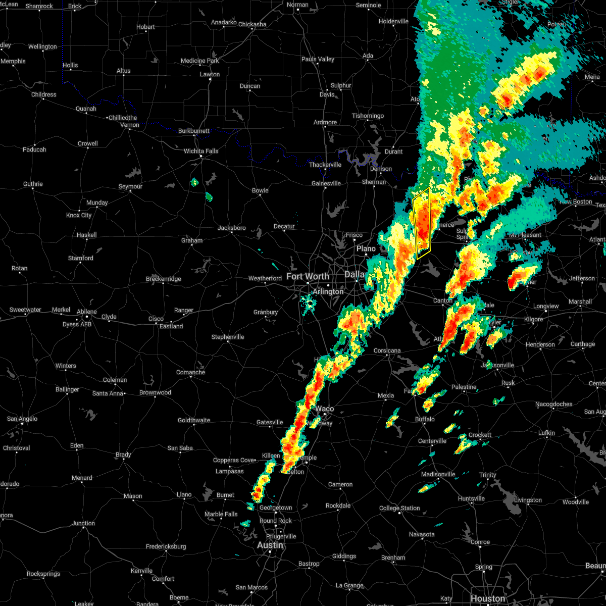 At 610 pm cdt, a severe thunderstorm was located near wolfe city, or 8 miles northwest of commerce, moving northeast at 55 mph (radar indicated). Hazards include 65 mph wind gusts and penny size hail. Expect damage to roofs, siding, and trees. locations impacted include, greenville, wolfe city, dodd city, bonham state park, greenville city lakes, greenville club lake, bailey, neylandville, kellogg, cash, cotton center, center point, south sulphur, gober and dixon. hail threat, radar indicated max hail size, 0. 75 in wind threat, radar indicated max wind gust, 65 mph. At 610 pm cdt, a severe thunderstorm was located near wolfe city, or 8 miles northwest of commerce, moving northeast at 55 mph (radar indicated). Hazards include 65 mph wind gusts and penny size hail. Expect damage to roofs, siding, and trees. locations impacted include, greenville, wolfe city, dodd city, bonham state park, greenville city lakes, greenville club lake, bailey, neylandville, kellogg, cash, cotton center, center point, south sulphur, gober and dixon. hail threat, radar indicated max hail size, 0. 75 in wind threat, radar indicated max wind gust, 65 mph.
|
| 11/4/2022 6:08 PM CDT |
 At 608 pm cdt, severe thunderstorms were located along a line extending from near dodd city to greenville club lake, moving northeast at 50 mph (radar indicated). Hazards include 60 mph wind gusts and quarter size hail. Hail damage to vehicles is expected. Expect wind damage to roofs, siding, and trees. At 608 pm cdt, severe thunderstorms were located along a line extending from near dodd city to greenville club lake, moving northeast at 50 mph (radar indicated). Hazards include 60 mph wind gusts and quarter size hail. Hail damage to vehicles is expected. Expect wind damage to roofs, siding, and trees.
|
| 11/4/2022 5:41 PM CDT |
 At 541 pm cdt, severe thunderstorms were located along a line extending from near merit to fate, moving northeast at 60 mph (radar indicated). Hazards include 65 mph wind gusts and penny size hail. Expect damage to roofs, siding, and trees. locations impacted include, wylie, rockwall, greenville, royse city, heath, princeton, fate, farmersville, leonard, wolfe city, caddo mills, celeste, trenton, dodd city, mobile city, merit, greenville city lakes, bonham state park, randolph and greenville club lake. hail threat, radar indicated max hail size, 0. 75 in wind threat, radar indicated max wind gust, 65 mph. At 541 pm cdt, severe thunderstorms were located along a line extending from near merit to fate, moving northeast at 60 mph (radar indicated). Hazards include 65 mph wind gusts and penny size hail. Expect damage to roofs, siding, and trees. locations impacted include, wylie, rockwall, greenville, royse city, heath, princeton, fate, farmersville, leonard, wolfe city, caddo mills, celeste, trenton, dodd city, mobile city, merit, greenville city lakes, bonham state park, randolph and greenville club lake. hail threat, radar indicated max hail size, 0. 75 in wind threat, radar indicated max wind gust, 65 mph.
|
| 11/4/2022 5:24 PM CDT |
 At 524 pm cdt, severe thunderstorms were located along a line extending from near lucas to sunnyvale, moving northeast at 55 mph (radar indicated). Hazards include 65 mph wind gusts and penny size hail. expect damage to roofs, siding, and trees At 524 pm cdt, severe thunderstorms were located along a line extending from near lucas to sunnyvale, moving northeast at 55 mph (radar indicated). Hazards include 65 mph wind gusts and penny size hail. expect damage to roofs, siding, and trees
|
| 5/15/2022 10:43 PM CDT |
 At 1043 pm cdt, severe thunderstorms were located along a line extending from near east tawakoni to 8 miles southeast of fate, moving southeast at 65 mph (radar indicated). Hazards include 65 mph wind gusts and nickel size hail. Expect damage to roofs, siding, and trees. locations impacted include, dallas, garland, mesquite, rowlett, wylie, rockwall, greenville, balch springs, sachse, terrell, seagoville, forney, commerce, kaufman, hutchins, canton, wills point, royse city, heath and princeton. hail threat, radar indicated max hail size, 0. 88 in wind threat, radar indicated max wind gust, 65 mph. At 1043 pm cdt, severe thunderstorms were located along a line extending from near east tawakoni to 8 miles southeast of fate, moving southeast at 65 mph (radar indicated). Hazards include 65 mph wind gusts and nickel size hail. Expect damage to roofs, siding, and trees. locations impacted include, dallas, garland, mesquite, rowlett, wylie, rockwall, greenville, balch springs, sachse, terrell, seagoville, forney, commerce, kaufman, hutchins, canton, wills point, royse city, heath and princeton. hail threat, radar indicated max hail size, 0. 88 in wind threat, radar indicated max wind gust, 65 mph.
|
| 5/15/2022 10:30 PM CDT |
 At 1029 pm cdt, severe thunderstorms were located along a line extending from 6 miles south of campbell to near royse city, moving southeast at 65 mph (radar indicated). Hazards include 60 mph wind gusts and nickel size hail. expect damage to roofs, siding, and trees At 1029 pm cdt, severe thunderstorms were located along a line extending from 6 miles south of campbell to near royse city, moving southeast at 65 mph (radar indicated). Hazards include 60 mph wind gusts and nickel size hail. expect damage to roofs, siding, and trees
|
| 5/15/2022 10:14 PM CDT |
 At 1013 pm cdt, severe thunderstorms were located along a line extending from 7 miles northwest of greenville to fairview, moving south at 60 mph (radar indicated). Hazards include 60 mph wind gusts and quarter size hail. Hail damage to vehicles is expected. expect wind damage to roofs, siding, and trees. locations impacted include, plano, mckinney, carrollton, frisco, denton, richardson, lewisville, allen, flower mound, wylie, coppell, sherman, the colony, greenville, sachse, corinth, highland village, commerce, lake dallas and lake lewisville. hail threat, radar indicated max hail size, 1. 00 in wind threat, radar indicated max wind gust, 60 mph. At 1013 pm cdt, severe thunderstorms were located along a line extending from 7 miles northwest of greenville to fairview, moving south at 60 mph (radar indicated). Hazards include 60 mph wind gusts and quarter size hail. Hail damage to vehicles is expected. expect wind damage to roofs, siding, and trees. locations impacted include, plano, mckinney, carrollton, frisco, denton, richardson, lewisville, allen, flower mound, wylie, coppell, sherman, the colony, greenville, sachse, corinth, highland village, commerce, lake dallas and lake lewisville. hail threat, radar indicated max hail size, 1. 00 in wind threat, radar indicated max wind gust, 60 mph.
|
| 5/15/2022 9:30 PM CDT |
 At 929 pm cdt, severe thunderstorms were located along a line extending from near honey grove to collinsville, moving south at 40 mph (radar indicated). Hazards include 70 mph wind gusts and ping pong ball size hail. People and animals outdoors will be injured. expect hail damage to roofs, siding, windows, and vehicles. expect considerable tree damage. Wind damage is also likely to mobile homes, roofs, and outbuildings. At 929 pm cdt, severe thunderstorms were located along a line extending from near honey grove to collinsville, moving south at 40 mph (radar indicated). Hazards include 70 mph wind gusts and ping pong ball size hail. People and animals outdoors will be injured. expect hail damage to roofs, siding, windows, and vehicles. expect considerable tree damage. Wind damage is also likely to mobile homes, roofs, and outbuildings.
|
| 4/13/2022 12:08 PM CDT |
 At 1207 pm cdt, a severe thunderstorm was located 7 miles south of wolfe city, or 9 miles west of commerce, moving east at 30 mph (trained weather spotters). Hazards include quarter size hail. Damage to vehicles is possible. locations impacted include, greenville, commerce, cooper, wolfe city, campbell, cooper lake park doctors creek, roxton, ladonia, pecan gap and neylandville. hail threat, radar indicated max hail size, 1. 00 in wind threat, radar indicated max wind gust, <50 mph. At 1207 pm cdt, a severe thunderstorm was located 7 miles south of wolfe city, or 9 miles west of commerce, moving east at 30 mph (trained weather spotters). Hazards include quarter size hail. Damage to vehicles is possible. locations impacted include, greenville, commerce, cooper, wolfe city, campbell, cooper lake park doctors creek, roxton, ladonia, pecan gap and neylandville. hail threat, radar indicated max hail size, 1. 00 in wind threat, radar indicated max wind gust, <50 mph.
|
| 4/13/2022 11:45 AM CDT |
 At 1144 am cdt, severe thunderstorms were located from farmersville to leonard, moving east at 30 mph (radar indicated). Hazards include quarter size hail. damage to vehicles is possible At 1144 am cdt, severe thunderstorms were located from farmersville to leonard, moving east at 30 mph (radar indicated). Hazards include quarter size hail. damage to vehicles is possible
|
| 4/4/2022 10:23 PM CDT |
 At 1022 pm cdt, a severe thunderstorm was located near commerce, moving east at 45 mph (radar indicated). Hazards include 65 mph wind gusts and quarter size hail. Hail damage to vehicles is expected. expect wind damage to roofs, siding, and trees. locations impacted include, sulphur springs, commerce, cooper, cumby, campbell, deport, cooper lake park south sulphur, cooper lake park doctors creek, roxton, ladonia, tira, pecan gap and neylandville. hail threat, radar indicated max hail size, 1. 00 in wind threat, radar indicated max wind gust, 65 mph. At 1022 pm cdt, a severe thunderstorm was located near commerce, moving east at 45 mph (radar indicated). Hazards include 65 mph wind gusts and quarter size hail. Hail damage to vehicles is expected. expect wind damage to roofs, siding, and trees. locations impacted include, sulphur springs, commerce, cooper, cumby, campbell, deport, cooper lake park south sulphur, cooper lake park doctors creek, roxton, ladonia, tira, pecan gap and neylandville. hail threat, radar indicated max hail size, 1. 00 in wind threat, radar indicated max wind gust, 65 mph.
|
| 4/4/2022 10:06 PM CDT |
 At 1005 pm cdt, a severe thunderstorm was located over wolfe city, or 10 miles northwest of commerce, moving east at 40 mph (radar indicated). Hazards include 65 mph wind gusts and half dollar size hail. Hail damage to vehicles is expected. Expect wind damage to roofs, siding, and trees. At 1005 pm cdt, a severe thunderstorm was located over wolfe city, or 10 miles northwest of commerce, moving east at 40 mph (radar indicated). Hazards include 65 mph wind gusts and half dollar size hail. Hail damage to vehicles is expected. Expect wind damage to roofs, siding, and trees.
|
| 3/21/2022 7:51 PM CDT |
 The severe thunderstorm warning for hunt, collin, southeastern grayson and fannin counties will expire at 800 pm cdt, the storms which prompted the warning have weakened below severe limits. therefore the warning will be allowed to expire. however small hail, gusty winds and heavy rain are still possible with these thunderstorms. a tornado watch remains in effect until 1000 pm cdt for north central texas. The severe thunderstorm warning for hunt, collin, southeastern grayson and fannin counties will expire at 800 pm cdt, the storms which prompted the warning have weakened below severe limits. therefore the warning will be allowed to expire. however small hail, gusty winds and heavy rain are still possible with these thunderstorms. a tornado watch remains in effect until 1000 pm cdt for north central texas.
|
| 3/21/2022 7:17 PM CDT |
 At 715 pm cdt, a cluster of severe thunderstorms were located from near mckinney to bonham, moving northeast at 55 mph (radar indicated). Hazards include 60 mph wind gusts and quarter size hail. Hail damage to vehicles is expected. Expect wind damage to roofs, siding, and trees. At 715 pm cdt, a cluster of severe thunderstorms were located from near mckinney to bonham, moving northeast at 55 mph (radar indicated). Hazards include 60 mph wind gusts and quarter size hail. Hail damage to vehicles is expected. Expect wind damage to roofs, siding, and trees.
|
| 12/10/2021 5:23 PM CST |
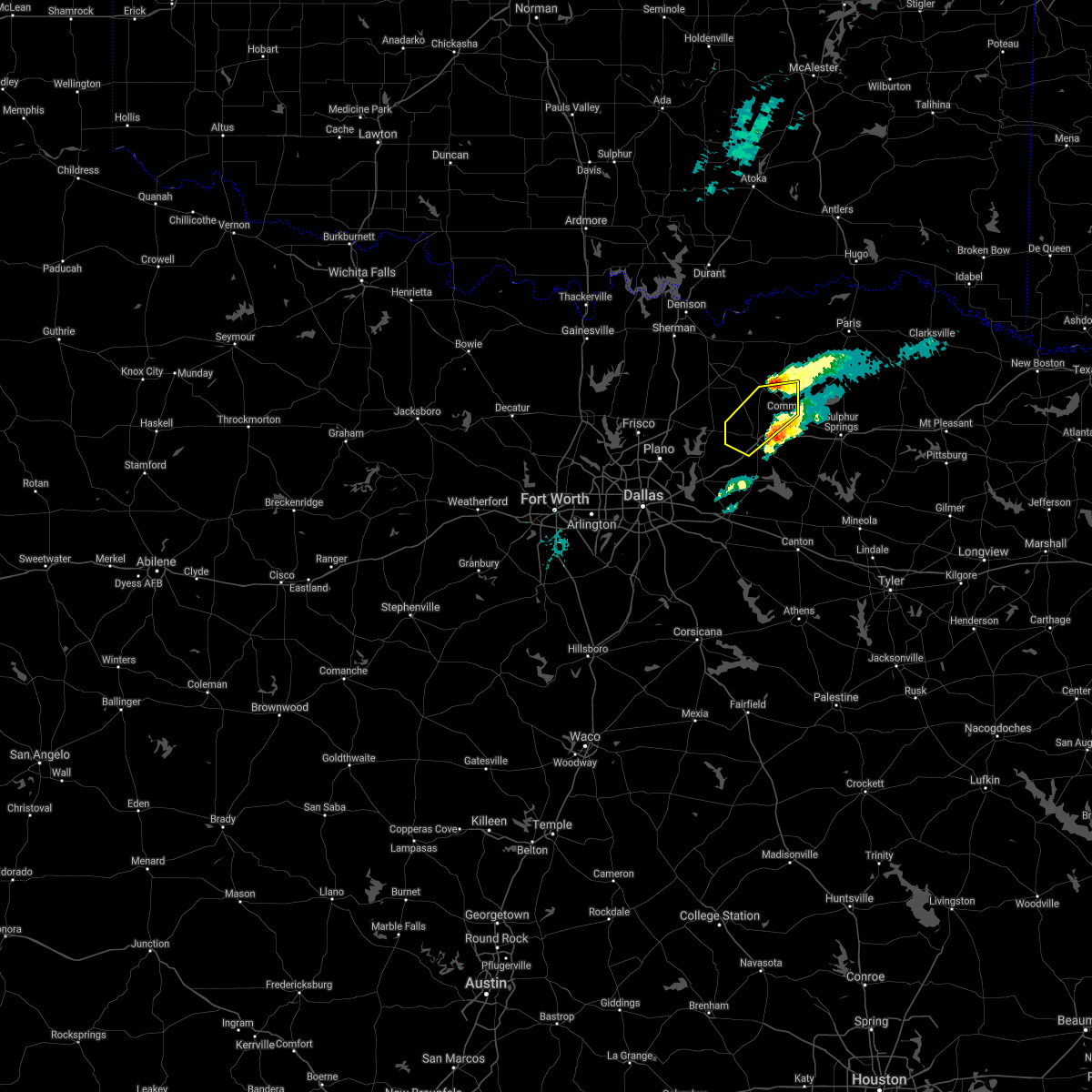 The severe thunderstorm warning for northern hunt county will expire at 530 pm cst, the storm which prompted the warning has weakened below severe limits. therefore the warning will be allowed to expire. The severe thunderstorm warning for northern hunt county will expire at 530 pm cst, the storm which prompted the warning has weakened below severe limits. therefore the warning will be allowed to expire.
|
| 12/10/2021 5:00 PM CST |
 At 459 pm cst, a severe thunderstorm was located near greenville, moving northeast at 55 mph (radar indicated). Hazards include 60 mph wind gusts and quarter size hail. Hail damage to vehicles is expected. expect wind damage to roofs, siding, and trees. locations impacted include, greenville, commerce, wolfe city, caddo mills, celeste, campbell and neylandville. hail threat, radar indicated max hail size, 1. 00 in wind threat, radar indicated max wind gust, 60 mph. At 459 pm cst, a severe thunderstorm was located near greenville, moving northeast at 55 mph (radar indicated). Hazards include 60 mph wind gusts and quarter size hail. Hail damage to vehicles is expected. expect wind damage to roofs, siding, and trees. locations impacted include, greenville, commerce, wolfe city, caddo mills, celeste, campbell and neylandville. hail threat, radar indicated max hail size, 1. 00 in wind threat, radar indicated max wind gust, 60 mph.
|
| 12/10/2021 4:43 PM CST |
 At 443 pm cst, a severe thunderstorm was located over fate, or near rockwall, moving northeast at 50 mph (radar indicated). Hazards include 60 mph wind gusts and quarter size hail. Hail damage to vehicles is expected. Expect wind damage to roofs, siding, and trees. At 443 pm cst, a severe thunderstorm was located over fate, or near rockwall, moving northeast at 50 mph (radar indicated). Hazards include 60 mph wind gusts and quarter size hail. Hail damage to vehicles is expected. Expect wind damage to roofs, siding, and trees.
|
| 10/10/2021 10:34 PM CDT |
 At 1034 pm cdt, severe thunderstorms were located along a line extending from 11 miles southeast of albany to near greenville to near combine, moving east at 60 mph (radar indicated). Hazards include 60 mph wind gusts and penny size hail. expect damage to roofs, siding, and trees At 1034 pm cdt, severe thunderstorms were located along a line extending from 11 miles southeast of albany to near greenville to near combine, moving east at 60 mph (radar indicated). Hazards include 60 mph wind gusts and penny size hail. expect damage to roofs, siding, and trees
|
| 10/10/2021 10:16 PM CDT |
 At 1015 pm cdt, severe thunderstorms were located along a line extending from near utica to farmersville to near lancaster, moving east at 45 mph (radar indicated). Hazards include 60 mph wind gusts and penny size hail. Expect damage to roofs, siding, and trees. locations impacted include, dallas, plano, garland, irving, grand prairie, mesquite, mckinney, carrollton, frisco, richardson, allen, rowlett, desoto, cedar hill, wylie, duncanville, rockwall, lancaster, farmers branch and greenville. hail threat, radar indicated max hail size, 0. 75 in wind threat, radar indicated max wind gust, 60 mph. At 1015 pm cdt, severe thunderstorms were located along a line extending from near utica to farmersville to near lancaster, moving east at 45 mph (radar indicated). Hazards include 60 mph wind gusts and penny size hail. Expect damage to roofs, siding, and trees. locations impacted include, dallas, plano, garland, irving, grand prairie, mesquite, mckinney, carrollton, frisco, richardson, allen, rowlett, desoto, cedar hill, wylie, duncanville, rockwall, lancaster, farmers branch and greenville. hail threat, radar indicated max hail size, 0. 75 in wind threat, radar indicated max wind gust, 60 mph.
|
| 10/10/2021 9:40 PM CDT |
 At 938 pm cdt, severe thunderstorms were located along a line extending from near pottsboro to frisco to rendon, moving east at 40 mph (radar indicated and observations. at 9:35 pm cdt, a wind gust to 70 mph was measured at dallas/fort worth international airport). Hazards include 60 mph wind gusts and penny size hail. expect damage to roofs, siding, and trees At 938 pm cdt, severe thunderstorms were located along a line extending from near pottsboro to frisco to rendon, moving east at 40 mph (radar indicated and observations. at 9:35 pm cdt, a wind gust to 70 mph was measured at dallas/fort worth international airport). Hazards include 60 mph wind gusts and penny size hail. expect damage to roofs, siding, and trees
|
| 7/27/2021 7:11 PM CDT |
 At 711 pm cdt, a severe thunderstorm was located near campbell, or near greenville, moving southwest at 10 mph (radar indicated). Hazards include 60 mph wind gusts. Expect damage to roofs, siding, and trees. Locations impacted include, greenville, campbell, lone oak and neylandville. At 711 pm cdt, a severe thunderstorm was located near campbell, or near greenville, moving southwest at 10 mph (radar indicated). Hazards include 60 mph wind gusts. Expect damage to roofs, siding, and trees. Locations impacted include, greenville, campbell, lone oak and neylandville.
|
| 7/27/2021 6:40 PM CDT |
 At 640 pm cdt, a severe thunderstorm was located near campbell, or near commerce, moving southwest at 10 mph (radar indicated). Hazards include 60 mph wind gusts. expect damage to roofs, siding, and trees At 640 pm cdt, a severe thunderstorm was located near campbell, or near commerce, moving southwest at 10 mph (radar indicated). Hazards include 60 mph wind gusts. expect damage to roofs, siding, and trees
|
| 5/10/2021 10:40 PM CDT |
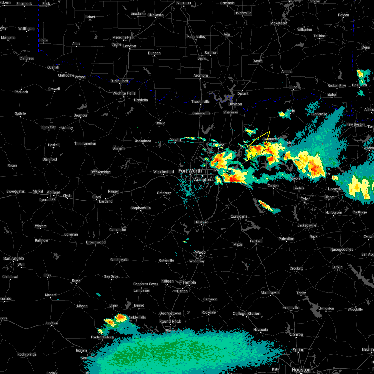 At 1039 pm cdt, a severe thunderstorm was located near greenville, moving northeast at 45 mph (trained weather spotters reported golf ball size hail around 10:12 pm near lavon). Hazards include half dollar size hail. Damage to vehicles is possible. Locations impacted include, greenville, royse city, caddo mills, josephine and neylandville. At 1039 pm cdt, a severe thunderstorm was located near greenville, moving northeast at 45 mph (trained weather spotters reported golf ball size hail around 10:12 pm near lavon). Hazards include half dollar size hail. Damage to vehicles is possible. Locations impacted include, greenville, royse city, caddo mills, josephine and neylandville.
|
| 5/10/2021 10:21 PM CDT |
 A severe thunderstorm warning remains in effect until 1100 pm cdt for northwestern hunt and southeastern collin counties. at 1020 pm cdt, a severe thunderstorm was located near farmersville, or 8 miles east of wylie, moving northeast at 40 mph. hazard. half dollar size hail. source. Trained weather spotters reported half dollar size hail in. A severe thunderstorm warning remains in effect until 1100 pm cdt for northwestern hunt and southeastern collin counties. at 1020 pm cdt, a severe thunderstorm was located near farmersville, or 8 miles east of wylie, moving northeast at 40 mph. hazard. half dollar size hail. source. Trained weather spotters reported half dollar size hail in.
|
| 5/10/2021 10:07 PM CDT |
 At 1007 pm cdt, a severe thunderstorm was located over wylie, moving northeast at 45 mph (radar indicated). Hazards include half dollar size hail. damage to vehicles is possible At 1007 pm cdt, a severe thunderstorm was located over wylie, moving northeast at 45 mph (radar indicated). Hazards include half dollar size hail. damage to vehicles is possible
|
| 5/3/2021 10:36 PM CDT |
 At 1036 pm cdt, a severe thunderstorm was located near cumby, or 8 miles south of commerce, moving northeast at 40 mph (radar indicated). Hazards include 60 mph wind gusts and quarter size hail. Hail damage to vehicles is expected. Expect wind damage to roofs, siding, and trees. At 1036 pm cdt, a severe thunderstorm was located near cumby, or 8 miles south of commerce, moving northeast at 40 mph (radar indicated). Hazards include 60 mph wind gusts and quarter size hail. Hail damage to vehicles is expected. Expect wind damage to roofs, siding, and trees.
|
| 4/23/2021 4:07 PM CDT |
 The severe thunderstorm warning for northeastern hunt county will expire at 415 pm cdt, the storm which prompted the warning has weakened below severe limits. therefore the warning will be allowed to expire. however small hail is still possible with this thunderstorm. a severe thunderstorm watch remains in effect until 800 pm cdt for north central texas. The severe thunderstorm warning for northeastern hunt county will expire at 415 pm cdt, the storm which prompted the warning has weakened below severe limits. therefore the warning will be allowed to expire. however small hail is still possible with this thunderstorm. a severe thunderstorm watch remains in effect until 800 pm cdt for north central texas.
|
| 4/23/2021 3:55 PM CDT |
 At 355 pm cdt, a severe thunderstorm was located near greenville, moving northeast at 25 mph (radar indicated). Hazards include quarter size hail. Damage to vehicles is possible. Locations impacted include, greenville, commerce, wolfe city, celeste, campbell and neylandville. At 355 pm cdt, a severe thunderstorm was located near greenville, moving northeast at 25 mph (radar indicated). Hazards include quarter size hail. Damage to vehicles is possible. Locations impacted include, greenville, commerce, wolfe city, celeste, campbell and neylandville.
|
| 4/23/2021 3:12 PM CDT |
 At 312 pm cdt, a severe thunderstorm was located near farmersville, or 12 miles west of greenville, moving east at 35 mph (radar indicated). Hazards include 60 mph wind gusts and quarter size hail. Hail damage to vehicles is expected. Expect wind damage to roofs, siding, and trees. At 312 pm cdt, a severe thunderstorm was located near farmersville, or 12 miles west of greenville, moving east at 35 mph (radar indicated). Hazards include 60 mph wind gusts and quarter size hail. Hail damage to vehicles is expected. Expect wind damage to roofs, siding, and trees.
|
| 4/9/2021 10:43 PM CDT |
 At 1043 pm cdt, a cluster of severe thunderstorms was located along a line from near commerce to cooper, moving east at 50 mph (radar indicated). Hazards include 60 mph wind gusts and quarter size hail. Hail damage to vehicles is expected. Expect wind damage to roofs, siding, and trees. At 1043 pm cdt, a cluster of severe thunderstorms was located along a line from near commerce to cooper, moving east at 50 mph (radar indicated). Hazards include 60 mph wind gusts and quarter size hail. Hail damage to vehicles is expected. Expect wind damage to roofs, siding, and trees.
|
| 3/22/2021 10:28 PM CDT |
 At 1027 pm cdt, a severe thunderstorm was located near greenville, moving northeast at 45 mph (radar indicated). Hazards include 60 mph wind gusts and quarter size hail. Hail damage to vehicles is expected. Expect wind damage to roofs, siding, and trees. At 1027 pm cdt, a severe thunderstorm was located near greenville, moving northeast at 45 mph (radar indicated). Hazards include 60 mph wind gusts and quarter size hail. Hail damage to vehicles is expected. Expect wind damage to roofs, siding, and trees.
|
| 3/17/2021 6:06 AM CDT |
 At 605 am cdt, severe thunderstorms were located along a line extending from greenville to canton, moving northeast at 55 mph (radar indicated). Hazards include 60 mph wind gusts and penny size hail. expect damage to roofs, siding, and trees At 605 am cdt, severe thunderstorms were located along a line extending from greenville to canton, moving northeast at 55 mph (radar indicated). Hazards include 60 mph wind gusts and penny size hail. expect damage to roofs, siding, and trees
|
| 3/17/2021 5:53 AM CDT |
 At 552 am cdt, severe thunderstorms were located along a line extending from farmersville to kemp, moving northeast at 45 mph (radar indicated). Hazards include 65 mph wind gusts and penny size hail. Expect damage to roofs, siding, and trees. Locations impacted include, wylie, rockwall, greenville, terrell, commerce, kaufman, canton, wills point, royse city, heath, princeton, fate, lucas, farmersville, mabank, lowry crossing, west tawakoni, talty, edgewood and wolfe city. At 552 am cdt, severe thunderstorms were located along a line extending from farmersville to kemp, moving northeast at 45 mph (radar indicated). Hazards include 65 mph wind gusts and penny size hail. Expect damage to roofs, siding, and trees. Locations impacted include, wylie, rockwall, greenville, terrell, commerce, kaufman, canton, wills point, royse city, heath, princeton, fate, lucas, farmersville, mabank, lowry crossing, west tawakoni, talty, edgewood and wolfe city.
|
| 3/17/2021 5:19 AM CDT |
 At 518 am cdt, severe thunderstorms were located along a line extending from near garland to ennis, moving northeast at 50 mph (radar indicated). Hazards include 70 mph wind gusts and penny size hail. Expect considerable tree damage. Damage is likely to mobile homes, roofs, and outbuildings. At 518 am cdt, severe thunderstorms were located along a line extending from near garland to ennis, moving northeast at 50 mph (radar indicated). Hazards include 70 mph wind gusts and penny size hail. Expect considerable tree damage. Damage is likely to mobile homes, roofs, and outbuildings.
|
| 11/24/2020 8:52 PM CST |
 At 852 pm cst, severe thunderstorms were located along a line extending from near whitewright to near hebron, moving east at 50 mph (radar indicated). Hazards include 60 mph wind gusts. expect damage to roofs, siding, and trees At 852 pm cst, severe thunderstorms were located along a line extending from near whitewright to near hebron, moving east at 50 mph (radar indicated). Hazards include 60 mph wind gusts. expect damage to roofs, siding, and trees
|
| 9/27/2020 11:35 PM CDT |
 At 1134 pm cdt, severe thunderstorms were located along a line extending from 7 miles northwest of hagansport to 7 miles north of commerce, moving southeast at 35 mph (radar indicated). Hazards include 60 mph wind gusts and quarter size hail. Hail damage to vehicles is expected. expect wind damage to roofs, siding, and trees. Locations impacted include, sulphur springs, commerce, cooper, wolfe city, cumby, como, campbell, cooper lake park south sulphur, cooper lake park doctors creek, lone oak, tira, pecan gap and neylandville. At 1134 pm cdt, severe thunderstorms were located along a line extending from 7 miles northwest of hagansport to 7 miles north of commerce, moving southeast at 35 mph (radar indicated). Hazards include 60 mph wind gusts and quarter size hail. Hail damage to vehicles is expected. expect wind damage to roofs, siding, and trees. Locations impacted include, sulphur springs, commerce, cooper, wolfe city, cumby, como, campbell, cooper lake park south sulphur, cooper lake park doctors creek, lone oak, tira, pecan gap and neylandville.
|
| 9/27/2020 11:14 PM CDT |
 At 1114 pm cdt, severe thunderstorms were located along a line extending from near deport to 8 miles southwest of honey grove, moving southeast at 35 mph (radar indicated). Hazards include 60 mph wind gusts and quarter size hail. Hail damage to vehicles is expected. Expect wind damage to roofs, siding, and trees. At 1114 pm cdt, severe thunderstorms were located along a line extending from near deport to 8 miles southwest of honey grove, moving southeast at 35 mph (radar indicated). Hazards include 60 mph wind gusts and quarter size hail. Hail damage to vehicles is expected. Expect wind damage to roofs, siding, and trees.
|
| 5/24/2020 3:43 PM CDT |
 At 343 pm cdt, a severe thunderstorm was located over greenville, moving north at 20 mph (radar indicated). Hazards include 60 mph wind gusts and quarter size hail. Hail damage to vehicles is expected. expect wind damage to roofs, siding, and trees. Locations impacted include, greenville, commerce, wolfe city, caddo mills, celeste, campbell, lone oak and neylandville. At 343 pm cdt, a severe thunderstorm was located over greenville, moving north at 20 mph (radar indicated). Hazards include 60 mph wind gusts and quarter size hail. Hail damage to vehicles is expected. expect wind damage to roofs, siding, and trees. Locations impacted include, greenville, commerce, wolfe city, caddo mills, celeste, campbell, lone oak and neylandville.
|
| 5/24/2020 3:25 PM CDT |
 At 325 pm cdt, a severe thunderstorm was located near greenville, moving north at 20 mph (radar indicated). Hazards include 60 mph wind gusts and quarter size hail. Hail damage to vehicles is expected. Expect wind damage to roofs, siding, and trees. At 325 pm cdt, a severe thunderstorm was located near greenville, moving north at 20 mph (radar indicated). Hazards include 60 mph wind gusts and quarter size hail. Hail damage to vehicles is expected. Expect wind damage to roofs, siding, and trees.
|
| 5/8/2020 4:45 AM CDT |
 At 444 am cdt, severe thunderstorms were located along a line extending from 8 miles northwest of cooper to near leonard to gunter, moving southeast at 35 mph (radar indicated). Hazards include 60 mph wind gusts and quarter size hail. Hail damage to vehicles is expected. expect wind damage to roofs, siding, and trees. Locations impacted include, mckinney, frisco, denton, sherman, greenville, paris, sulphur springs, bonham, commerce, prosper, anna, princeton, celina, pilot point, farmersville, van alstyne, howe, aubrey, leonard and cooper. At 444 am cdt, severe thunderstorms were located along a line extending from 8 miles northwest of cooper to near leonard to gunter, moving southeast at 35 mph (radar indicated). Hazards include 60 mph wind gusts and quarter size hail. Hail damage to vehicles is expected. expect wind damage to roofs, siding, and trees. Locations impacted include, mckinney, frisco, denton, sherman, greenville, paris, sulphur springs, bonham, commerce, prosper, anna, princeton, celina, pilot point, farmersville, van alstyne, howe, aubrey, leonard and cooper.
|
| 5/8/2020 4:08 AM CDT |
 At 407 am cdt, severe thunderstorms were located along a line extending from near blossom to 7 miles north of dodd city to 6 miles west of knollwood to lindsay, moving southeast at 30 mph (radar indicated). Hazards include 60 mph wind gusts and quarter size hail. Hail damage to vehicles is expected. Expect wind damage to roofs, siding, and trees. At 407 am cdt, severe thunderstorms were located along a line extending from near blossom to 7 miles north of dodd city to 6 miles west of knollwood to lindsay, moving southeast at 30 mph (radar indicated). Hazards include 60 mph wind gusts and quarter size hail. Hail damage to vehicles is expected. Expect wind damage to roofs, siding, and trees.
|
| 5/8/2020 3:50 AM CDT |
 At 349 am cdt, severe thunderstorms were located along a line extending from 8 miles west of broken bow to near clarksville to near paris to near ravenna, moving southeast at 50 mph (radar indicated). Hazards include 70 mph wind gusts and quarter size hail. Hail damage to vehicles is expected. expect considerable tree damage. wind damage is also likely to mobile homes, roofs, and outbuildings. Locations impacted include, greenville, paris, sulphur springs, bonham, commerce, leonard, cooper, honey grove, whitewright, blossom, wolfe city, savoy, celeste, ector, campbell, deport, dodd city, bailey, ravenna and bonham state park. At 349 am cdt, severe thunderstorms were located along a line extending from 8 miles west of broken bow to near clarksville to near paris to near ravenna, moving southeast at 50 mph (radar indicated). Hazards include 70 mph wind gusts and quarter size hail. Hail damage to vehicles is expected. expect considerable tree damage. wind damage is also likely to mobile homes, roofs, and outbuildings. Locations impacted include, greenville, paris, sulphur springs, bonham, commerce, leonard, cooper, honey grove, whitewright, blossom, wolfe city, savoy, celeste, ector, campbell, deport, dodd city, bailey, ravenna and bonham state park.
|
| 5/8/2020 3:13 AM CDT |
 At 312 am cdt, severe thunderstorms were located along a line extending from 7 miles southeast of kosoma to 7 miles south of soper to near durant, moving southeast at 65 mph (radar indicated). Hazards include 70 mph wind gusts and quarter size hail. Hail damage to vehicles is expected. expect considerable tree damage. Wind damage is also likely to mobile homes, roofs, and outbuildings. At 312 am cdt, severe thunderstorms were located along a line extending from 7 miles southeast of kosoma to 7 miles south of soper to near durant, moving southeast at 65 mph (radar indicated). Hazards include 70 mph wind gusts and quarter size hail. Hail damage to vehicles is expected. expect considerable tree damage. Wind damage is also likely to mobile homes, roofs, and outbuildings.
|
| 4/28/2020 11:37 PM CDT |
 At 1136 pm cdt, severe thunderstorms were located along a line extending from 6 miles southeast of hagansport to 6 miles southwest of cooper lake park south sulphur to near caddo mills, moving southeast at 30 mph (radar indicated). Hazards include 60 mph wind gusts and quarter size hail. Hail damage to vehicles is expected. expect wind damage to roofs, siding, and trees. Locations impacted include, mckinney, greenville, sulphur springs, commerce, royse city, princeton, farmersville, cooper, lowry crossing, west tawakoni, wolfe city, quinlan, caddo mills, emory, east tawakoni, celeste, cumby, como, campbell and hawk cove. At 1136 pm cdt, severe thunderstorms were located along a line extending from 6 miles southeast of hagansport to 6 miles southwest of cooper lake park south sulphur to near caddo mills, moving southeast at 30 mph (radar indicated). Hazards include 60 mph wind gusts and quarter size hail. Hail damage to vehicles is expected. expect wind damage to roofs, siding, and trees. Locations impacted include, mckinney, greenville, sulphur springs, commerce, royse city, princeton, farmersville, cooper, lowry crossing, west tawakoni, wolfe city, quinlan, caddo mills, emory, east tawakoni, celeste, cumby, como, campbell and hawk cove.
|
| 4/28/2020 11:05 PM CDT |
 At 1105 pm cdt, severe thunderstorms were located along a line extending from near deport to 9 miles south of honey grove to mckinney, moving southeast at 30 mph (radar indicated). Hazards include 60 mph wind gusts and quarter size hail. Hail damage to vehicles is expected. Expect wind damage to roofs, siding, and trees. At 1105 pm cdt, severe thunderstorms were located along a line extending from near deport to 9 miles south of honey grove to mckinney, moving southeast at 30 mph (radar indicated). Hazards include 60 mph wind gusts and quarter size hail. Hail damage to vehicles is expected. Expect wind damage to roofs, siding, and trees.
|
| 10/21/2019 1:39 AM CDT |
 At 138 am cdt, a severe thunderstorm was located 10 miles north of sulphur springs, moving east at 40 mph (radar indicated). Hazards include 60 mph wind gusts. Expect damage to roofs, siding, and trees. locations impacted include, greenville, sulphur springs, commerce, cooper, caddo mills, cumby, campbell, deport, cooper lake park south sulphur, cooper lake park doctors creek, tira and neylandville. A tornado watch remains in effect until 200 am cdt for north central texas. At 138 am cdt, a severe thunderstorm was located 10 miles north of sulphur springs, moving east at 40 mph (radar indicated). Hazards include 60 mph wind gusts. Expect damage to roofs, siding, and trees. locations impacted include, greenville, sulphur springs, commerce, cooper, caddo mills, cumby, campbell, deport, cooper lake park south sulphur, cooper lake park doctors creek, tira and neylandville. A tornado watch remains in effect until 200 am cdt for north central texas.
|
| 10/21/2019 1:04 AM CDT |
 At 104 am cdt, a line of severe thunderstorms extends from wolfe city to greenville, moving east at 40 mph (radar indicated). Hazards include 65 mph wind gusts. expect damage to roofs, siding, and trees At 104 am cdt, a line of severe thunderstorms extends from wolfe city to greenville, moving east at 40 mph (radar indicated). Hazards include 65 mph wind gusts. expect damage to roofs, siding, and trees
|
| 10/20/2019 10:38 PM CDT |
 The severe thunderstorm warning for central hunt county will expire at 1045 pm cdt, the storm which prompted the warning has weakened below severe limits. therefore the warning will be allowed to expire. however gusty winds and heavy rain are still possible with this thunderstorm. a tornado watch remains in effect until 200 am cdt for north central texas. The severe thunderstorm warning for central hunt county will expire at 1045 pm cdt, the storm which prompted the warning has weakened below severe limits. therefore the warning will be allowed to expire. however gusty winds and heavy rain are still possible with this thunderstorm. a tornado watch remains in effect until 200 am cdt for north central texas.
|
| 10/20/2019 10:27 PM CDT |
 At 1027 pm cdt, a severe thunderstorm was located over greenville, moving east at 35 mph (radar indicated). Hazards include 60 mph wind gusts and quarter size hail. Hail damage to vehicles is expected. expect wind damage to roofs, siding, and trees. locations impacted include, greenville, caddo mills, campbell and neylandville. A tornado watch remains in effect until 200 am cdt for north central texas. At 1027 pm cdt, a severe thunderstorm was located over greenville, moving east at 35 mph (radar indicated). Hazards include 60 mph wind gusts and quarter size hail. Hail damage to vehicles is expected. expect wind damage to roofs, siding, and trees. locations impacted include, greenville, caddo mills, campbell and neylandville. A tornado watch remains in effect until 200 am cdt for north central texas.
|
| 10/20/2019 10:07 PM CDT |
 At 1006 pm cdt, a severe thunderstorm was located near royse city, or 9 miles east of wylie, moving northeast at 40 mph (radar indicated). Hazards include 65 mph wind gusts and quarter size hail. Hail damage to vehicles is expected. expect wind damage to roofs, siding, and trees. locations impacted include, wylie, rockwall, greenville, royse city, princeton, fate, farmersville, caddo mills, campbell, lavon, nevada, josephine and neylandville. A tornado watch remains in effect until 200 am cdt for north central texas. At 1006 pm cdt, a severe thunderstorm was located near royse city, or 9 miles east of wylie, moving northeast at 40 mph (radar indicated). Hazards include 65 mph wind gusts and quarter size hail. Hail damage to vehicles is expected. expect wind damage to roofs, siding, and trees. locations impacted include, wylie, rockwall, greenville, royse city, princeton, fate, farmersville, caddo mills, campbell, lavon, nevada, josephine and neylandville. A tornado watch remains in effect until 200 am cdt for north central texas.
|
| 10/20/2019 9:49 PM CDT |
 At 948 pm cdt, a severe thunderstorm was located near wylie, moving east at 30 mph (radar indicated). Hazards include 60 mph wind gusts and quarter size hail. Hail damage to vehicles is expected. Expect wind damage to roofs, siding, and trees. At 948 pm cdt, a severe thunderstorm was located near wylie, moving east at 30 mph (radar indicated). Hazards include 60 mph wind gusts and quarter size hail. Hail damage to vehicles is expected. Expect wind damage to roofs, siding, and trees.
|
| 6/19/2019 5:59 PM CDT |
 The national weather service in fort worth has issued a * severe thunderstorm warning for. eastern hunt county in north central texas. western hopkins county in north central texas. northern rains county in north central texas. Southwestern delta county in north central texas. The national weather service in fort worth has issued a * severe thunderstorm warning for. eastern hunt county in north central texas. western hopkins county in north central texas. northern rains county in north central texas. Southwestern delta county in north central texas.
|
| 6/19/2019 5:46 PM CDT |
 At 546 pm cdt, a severe thunderstorm capable of producing a tornado was located near greenville, moving southeast at 25 mph (radar indicated rotation). Hazards include tornado. Flying debris will be dangerous to those caught without shelter. mobile homes will be damaged or destroyed. damage to roofs, windows, and vehicles will occur. tree damage is likely. this dangerous storm will be near, campbell around 550 pm cdt. other locations impacted by this tornadic thunderstorm include lone oak and neylandville. This includes interstate 30 between mile markers 89 and 109. At 546 pm cdt, a severe thunderstorm capable of producing a tornado was located near greenville, moving southeast at 25 mph (radar indicated rotation). Hazards include tornado. Flying debris will be dangerous to those caught without shelter. mobile homes will be damaged or destroyed. damage to roofs, windows, and vehicles will occur. tree damage is likely. this dangerous storm will be near, campbell around 550 pm cdt. other locations impacted by this tornadic thunderstorm include lone oak and neylandville. This includes interstate 30 between mile markers 89 and 109.
|
| 6/19/2019 5:44 PM CDT |
 At 542 pm cdt, a severe thunderstorm was located 5 miles southeast of celeste, or 7 miles north of greenville, moving east-southeast at 15 mph. this is a very dangerous storm (radar indicated). Hazards include baseball size hail and 60 mph wind gusts. People and animals outdoors will be severely injured. expect shattered windows, extensive damage to roofs, siding, and vehicles. locations impacted include, greenville, commerce, wolfe city, celeste, campbell and neylandville. A tornado watch remains in effect until midnight cdt for north central texas. At 542 pm cdt, a severe thunderstorm was located 5 miles southeast of celeste, or 7 miles north of greenville, moving east-southeast at 15 mph. this is a very dangerous storm (radar indicated). Hazards include baseball size hail and 60 mph wind gusts. People and animals outdoors will be severely injured. expect shattered windows, extensive damage to roofs, siding, and vehicles. locations impacted include, greenville, commerce, wolfe city, celeste, campbell and neylandville. A tornado watch remains in effect until midnight cdt for north central texas.
|
| 6/19/2019 5:27 PM CDT |
 At 527 pm cdt, a severe thunderstorm was located near celeste, or 8 miles northwest of greenville, moving east at 20 mph. this is a very dangerous storm (radar indicated). Hazards include baseball size hail and 60 mph wind gusts. People and animals outdoors will be severely injured. expect shattered windows, extensive damage to roofs, siding, and vehicles. locations impacted include, greenville, commerce, wolfe city, celeste, campbell and neylandville. A tornado watch remains in effect until midnight cdt for north central texas. At 527 pm cdt, a severe thunderstorm was located near celeste, or 8 miles northwest of greenville, moving east at 20 mph. this is a very dangerous storm (radar indicated). Hazards include baseball size hail and 60 mph wind gusts. People and animals outdoors will be severely injured. expect shattered windows, extensive damage to roofs, siding, and vehicles. locations impacted include, greenville, commerce, wolfe city, celeste, campbell and neylandville. A tornado watch remains in effect until midnight cdt for north central texas.
|
| 6/19/2019 5:12 PM CDT |
 At 511 pm cdt, a severe thunderstorm was located near celeste, or 10 miles northwest of greenville, moving east at 25 mph. this storm has a history of producing baseball size hail. this is a very dangerous storm (trained weather spotters). Hazards include baseball size hail and 60 mph wind gusts. People and animals outdoors will be severely injured. expect shattered windows, extensive damage to roofs, siding, and vehicles. locations impacted include, greenville, commerce, wolfe city, celeste, campbell and neylandville. A tornado watch remains in effect until midnight cdt for north central texas. At 511 pm cdt, a severe thunderstorm was located near celeste, or 10 miles northwest of greenville, moving east at 25 mph. this storm has a history of producing baseball size hail. this is a very dangerous storm (trained weather spotters). Hazards include baseball size hail and 60 mph wind gusts. People and animals outdoors will be severely injured. expect shattered windows, extensive damage to roofs, siding, and vehicles. locations impacted include, greenville, commerce, wolfe city, celeste, campbell and neylandville. A tornado watch remains in effect until midnight cdt for north central texas.
|
| 6/19/2019 5:06 PM CDT |
 At 506 pm cdt, a severe thunderstorm was located near celeste, or 11 miles northwest of greenville, moving east at 25 mph (radar indicated). Hazards include golf ball size hail and 60 mph wind gusts. People and animals outdoors will be injured. expect hail damage to roofs, siding, windows, and vehicles. expect wind damage to roofs, siding, and trees. locations impacted include, greenville, commerce, wolfe city, celeste, campbell and neylandville. A tornado watch remains in effect until midnight cdt for north central texas. At 506 pm cdt, a severe thunderstorm was located near celeste, or 11 miles northwest of greenville, moving east at 25 mph (radar indicated). Hazards include golf ball size hail and 60 mph wind gusts. People and animals outdoors will be injured. expect hail damage to roofs, siding, windows, and vehicles. expect wind damage to roofs, siding, and trees. locations impacted include, greenville, commerce, wolfe city, celeste, campbell and neylandville. A tornado watch remains in effect until midnight cdt for north central texas.
|
| 6/19/2019 5:02 PM CDT |
 At 501 pm cdt, a severe thunderstorm was located near celeste, or 13 miles northwest of greenville, moving east at 25 mph (radar indicated). Hazards include 60 mph wind gusts and quarter size hail. Hail damage to vehicles is expected. Expect wind damage to roofs, siding, and trees. At 501 pm cdt, a severe thunderstorm was located near celeste, or 13 miles northwest of greenville, moving east at 25 mph (radar indicated). Hazards include 60 mph wind gusts and quarter size hail. Hail damage to vehicles is expected. Expect wind damage to roofs, siding, and trees.
|
| 5/18/2019 3:57 PM CDT |
 At 356 pm cdt, a severe thunderstorm was located near commerce, moving northeast at 30 mph (radar indicated). Hazards include 65 mph wind gusts and quarter size hail. Hail damage to vehicles is expected. Expect wind damage to roofs, siding, and trees. At 356 pm cdt, a severe thunderstorm was located near commerce, moving northeast at 30 mph (radar indicated). Hazards include 65 mph wind gusts and quarter size hail. Hail damage to vehicles is expected. Expect wind damage to roofs, siding, and trees.
|
| 5/18/2019 3:02 PM CDT |
 At 301 pm cdt, a severe thunderstorm was located near campbell, or near greenville, moving northeast at 35 mph (radar indicated. 62 mph winds were measured at the greenville airport a few minutes ago). Hazards include 65 mph wind gusts and half dollar size hail. Hail damage to vehicles is expected. Expect wind damage to roofs, siding, and trees. At 301 pm cdt, a severe thunderstorm was located near campbell, or near greenville, moving northeast at 35 mph (radar indicated. 62 mph winds were measured at the greenville airport a few minutes ago). Hazards include 65 mph wind gusts and half dollar size hail. Hail damage to vehicles is expected. Expect wind damage to roofs, siding, and trees.
|
| 5/1/2019 9:58 PM CDT |
 At 958 pm cdt, a severe thunderstorm was located near como, or 10 miles northwest of winnsboro, moving north at 35 mph (radar indicated). Hazards include 65 mph wind gusts and quarter size hail. Hail damage to vehicles is expected. expect wind damage to roofs, siding, and trees. Locations impacted include, greenville, sulphur springs, commerce, west tawakoni, east tawakoni, cumby, como, campbell, cooper lake park south sulphur, point, lone oak, tira and neylandville. At 958 pm cdt, a severe thunderstorm was located near como, or 10 miles northwest of winnsboro, moving north at 35 mph (radar indicated). Hazards include 65 mph wind gusts and quarter size hail. Hail damage to vehicles is expected. expect wind damage to roofs, siding, and trees. Locations impacted include, greenville, sulphur springs, commerce, west tawakoni, east tawakoni, cumby, como, campbell, cooper lake park south sulphur, point, lone oak, tira and neylandville.
|
| 5/1/2019 9:15 PM CDT |
 At 914 pm cdt, severe thunderstorms were located along a line extending from near cumby to sulphur springs to 10 miles east of cooper lake park south sulphur, moving east at 25 mph (trained weather spotters reported quarter sized hail near cumby at 909 pm). Hazards include 65 mph wind gusts and quarter size hail. Hail damage to vehicles is expected. expect wind damage to roofs, siding, and trees. Locations impacted include, greenville, sulphur springs, commerce, west tawakoni, east tawakoni, cumby, como, campbell, cooper lake park south sulphur, point, lone oak, tira and neylandville. At 914 pm cdt, severe thunderstorms were located along a line extending from near cumby to sulphur springs to 10 miles east of cooper lake park south sulphur, moving east at 25 mph (trained weather spotters reported quarter sized hail near cumby at 909 pm). Hazards include 65 mph wind gusts and quarter size hail. Hail damage to vehicles is expected. expect wind damage to roofs, siding, and trees. Locations impacted include, greenville, sulphur springs, commerce, west tawakoni, east tawakoni, cumby, como, campbell, cooper lake park south sulphur, point, lone oak, tira and neylandville.
|
| 5/1/2019 9:04 PM CDT |
 At 904 pm cdt, a severe thunderstorm was located near cooper lake park south sulphur, or near sulphur springs, moving northeast at 25 mph (radar indicated). Hazards include 65 mph wind gusts. expect damage to roofs, siding, and trees At 904 pm cdt, a severe thunderstorm was located near cooper lake park south sulphur, or near sulphur springs, moving northeast at 25 mph (radar indicated). Hazards include 65 mph wind gusts. expect damage to roofs, siding, and trees
|
| 3/25/2019 12:16 AM CDT |
 At 1216 am cdt, a severe thunderstorm was located near greenville, moving southeast at 30 mph (radar indicated). Hazards include 60 mph wind gusts and quarter size hail. Hail damage to vehicles is expected. expect wind damage to roofs, siding, and trees. Locations impacted include, greenville, commerce, celeste, campbell and neylandville. At 1216 am cdt, a severe thunderstorm was located near greenville, moving southeast at 30 mph (radar indicated). Hazards include 60 mph wind gusts and quarter size hail. Hail damage to vehicles is expected. expect wind damage to roofs, siding, and trees. Locations impacted include, greenville, commerce, celeste, campbell and neylandville.
|
| 3/24/2019 11:48 PM CDT |
 At 1147 pm cdt, a severe thunderstorm was located near campbell, or near commerce, moving east at 40 mph. low-level rotation is increasing with this storm, particularly just northwest of campbell (radar indicated). Hazards include ping pong ball size hail and 60 mph wind gusts. People and animals outdoors will be injured. expect hail damage to roofs, siding, windows, and vehicles. expect wind damage to roofs, siding, and trees. Locations impacted include, greenville, commerce, wolfe city, celeste, campbell and neylandville. At 1147 pm cdt, a severe thunderstorm was located near campbell, or near commerce, moving east at 40 mph. low-level rotation is increasing with this storm, particularly just northwest of campbell (radar indicated). Hazards include ping pong ball size hail and 60 mph wind gusts. People and animals outdoors will be injured. expect hail damage to roofs, siding, windows, and vehicles. expect wind damage to roofs, siding, and trees. Locations impacted include, greenville, commerce, wolfe city, celeste, campbell and neylandville.
|
| 3/24/2019 11:42 PM CDT |
 At 1141 pm cdt, a severe thunderstorm was located near campbell, or 7 miles west of commerce, moving east at 40 mph (radar indicated). Hazards include 60 mph wind gusts and half dollar size hail. Hail damage to vehicles is expected. expect wind damage to roofs, siding, and trees. Locations impacted include, greenville, commerce, wolfe city, celeste, campbell and neylandville. At 1141 pm cdt, a severe thunderstorm was located near campbell, or 7 miles west of commerce, moving east at 40 mph (radar indicated). Hazards include 60 mph wind gusts and half dollar size hail. Hail damage to vehicles is expected. expect wind damage to roofs, siding, and trees. Locations impacted include, greenville, commerce, wolfe city, celeste, campbell and neylandville.
|
| 3/24/2019 11:26 PM CDT |
 At 1125 pm cdt, a severe thunderstorm was located over celeste, or 12 miles northwest of greenville, moving east at 30 mph (radar indicated). Hazards include 60 mph wind gusts and half dollar size hail. Hail damage to vehicles is expected. Expect wind damage to roofs, siding, and trees. At 1125 pm cdt, a severe thunderstorm was located over celeste, or 12 miles northwest of greenville, moving east at 30 mph (radar indicated). Hazards include 60 mph wind gusts and half dollar size hail. Hail damage to vehicles is expected. Expect wind damage to roofs, siding, and trees.
|
| 3/24/2019 11:07 PM CDT |
 At 1107 pm cdt, a severe thunderstorm was located 9 miles north of farmersville, or 15 miles east of mckinney, moving southeast at 25 mph (radar indicated). Hazards include quarter size hail. Damage to vehicles is possible. Locations impacted include, mckinney, greenville, princeton, farmersville, lowry crossing, caddo mills, celeste, melissa, blue ridge, nevada, josephine, new hope, neylandville and westminster. At 1107 pm cdt, a severe thunderstorm was located 9 miles north of farmersville, or 15 miles east of mckinney, moving southeast at 25 mph (radar indicated). Hazards include quarter size hail. Damage to vehicles is possible. Locations impacted include, mckinney, greenville, princeton, farmersville, lowry crossing, caddo mills, celeste, melissa, blue ridge, nevada, josephine, new hope, neylandville and westminster.
|
| 3/24/2019 10:39 PM CDT |
 At 1039 pm cdt, a severe thunderstorm was located near anna, or 10 miles north of mckinney, moving southeast at 40 mph (radar indicated). Hazards include golf ball size hail. People and animals outdoors will be injured. expect damage to roofs, siding, windows, and vehicles. Locations impacted include, mckinney, greenville, anna, princeton, celina, farmersville, van alstyne, lowry crossing, caddo mills, celeste, melissa, blue ridge, nevada, josephine, new hope, weston, neylandville and westminster. At 1039 pm cdt, a severe thunderstorm was located near anna, or 10 miles north of mckinney, moving southeast at 40 mph (radar indicated). Hazards include golf ball size hail. People and animals outdoors will be injured. expect damage to roofs, siding, windows, and vehicles. Locations impacted include, mckinney, greenville, anna, princeton, celina, farmersville, van alstyne, lowry crossing, caddo mills, celeste, melissa, blue ridge, nevada, josephine, new hope, weston, neylandville and westminster.
|
| 3/24/2019 10:36 PM CDT |
 At 1036 pm cdt, a severe thunderstorm was located near anna, or 10 miles north of mckinney, moving east at 40 mph (radar indicated). Hazards include half dollar size hail. damage to vehicles is possible At 1036 pm cdt, a severe thunderstorm was located near anna, or 10 miles north of mckinney, moving east at 40 mph (radar indicated). Hazards include half dollar size hail. damage to vehicles is possible
|
| 3/24/2019 9:23 PM CDT |
 At 921 pm cdt, a severe thunderstorm was located 7 miles northeast of quinlan, or 7 miles south of greenville, moving southeast at 25 mph (radar indicated). Hazards include golf ball size hail and 65 mph wind gusts. People and animals outdoors will be injured. expect hail and damage to trees, roofs, siding, windows, and vehicles. Locations impacted include, greenville, campbell, lone oak and weiland. At 921 pm cdt, a severe thunderstorm was located 7 miles northeast of quinlan, or 7 miles south of greenville, moving southeast at 25 mph (radar indicated). Hazards include golf ball size hail and 65 mph wind gusts. People and animals outdoors will be injured. expect hail and damage to trees, roofs, siding, windows, and vehicles. Locations impacted include, greenville, campbell, lone oak and weiland.
|
| 3/24/2019 9:00 PM CDT |
 At 858 pm cdt, a severe thunderstorm was located over caddo mills, or 7 miles west of greenville, moving southeast at 30 mph (radar indicated). Hazards include golf ball size hail and 65 mph wind gusts. People and animals outdoors will be injured. expect hail and wind damage to trees, roofs, siding, windows, and vehicles. Locations impacted include, greenville, commerce, caddo mills, celeste, campbell, lone oak and neylandville. At 858 pm cdt, a severe thunderstorm was located over caddo mills, or 7 miles west of greenville, moving southeast at 30 mph (radar indicated). Hazards include golf ball size hail and 65 mph wind gusts. People and animals outdoors will be injured. expect hail and wind damage to trees, roofs, siding, windows, and vehicles. Locations impacted include, greenville, commerce, caddo mills, celeste, campbell, lone oak and neylandville.
|
| 3/24/2019 8:40 PM CDT |
 At 839 pm cdt, a severe thunderstorm was located near farmersville, or 8 miles northeast of wylie, moving east-southeast at 25 mph (radar indicated). Hazards include ping pong ball size hail and 65 mph wind gusts. People and animals outdoors will be injured. expect hail and hail damage to roofs, siding, windows, and vehicles. Locations impacted include, mckinney, frisco, allen, wylie, greenville, commerce, anna, fairview, princeton, lucas, farmersville, van alstyne, lowry crossing, caddo mills, celeste, campbell, melissa, lavon, nevada and blue ridge. At 839 pm cdt, a severe thunderstorm was located near farmersville, or 8 miles northeast of wylie, moving east-southeast at 25 mph (radar indicated). Hazards include ping pong ball size hail and 65 mph wind gusts. People and animals outdoors will be injured. expect hail and hail damage to roofs, siding, windows, and vehicles. Locations impacted include, mckinney, frisco, allen, wylie, greenville, commerce, anna, fairview, princeton, lucas, farmersville, van alstyne, lowry crossing, caddo mills, celeste, campbell, melissa, lavon, nevada and blue ridge.
|
| 3/24/2019 8:31 PM CDT |
 At 831 pm cdt, a severe thunderstorm was located near farmersville, or 10 miles northeast of wylie, moving east at 25 mph. another storm near mckinney is moving towards the northeast and may impact melissa and westminster with quarter sized hail (radar indicated). Hazards include quarter size hail. damage to vehicles is possible At 831 pm cdt, a severe thunderstorm was located near farmersville, or 10 miles northeast of wylie, moving east at 25 mph. another storm near mckinney is moving towards the northeast and may impact melissa and westminster with quarter sized hail (radar indicated). Hazards include quarter size hail. damage to vehicles is possible
|
| 3/13/2019 5:35 AM CDT |
 At 534 am cdt, severe thunderstorms were located along a line extending from denison to rockwall, moving east at 45 mph. a 67 mph wind gust was reported at sherman aiport (radar indicated). Hazards include 65 mph wind gusts. expect damage to roofs, siding, and trees At 534 am cdt, severe thunderstorms were located along a line extending from denison to rockwall, moving east at 45 mph. a 67 mph wind gust was reported at sherman aiport (radar indicated). Hazards include 65 mph wind gusts. expect damage to roofs, siding, and trees
|
| 3/9/2019 8:13 AM CST |
 At 812 am cst, severe thunderstorms were located along a line extending from near campbell to near quinlan to near talty, moving east at 50 mph (radar indicated). Hazards include 60 mph wind gusts and quarter size hail. Hail damage to vehicles is expected. expect wind damage to roofs, siding, and trees. Locations impacted include, greenville, terrell, sulphur springs, commerce, kaufman, canton, wills point, crandall, cooper, combine, west tawakoni, talty, edgewood, quinlan, emory, east tawakoni, cumby, campbell, hawk cove and fruitvale. At 812 am cst, severe thunderstorms were located along a line extending from near campbell to near quinlan to near talty, moving east at 50 mph (radar indicated). Hazards include 60 mph wind gusts and quarter size hail. Hail damage to vehicles is expected. expect wind damage to roofs, siding, and trees. Locations impacted include, greenville, terrell, sulphur springs, commerce, kaufman, canton, wills point, crandall, cooper, combine, west tawakoni, talty, edgewood, quinlan, emory, east tawakoni, cumby, campbell, hawk cove and fruitvale.
|
| 3/9/2019 7:57 AM CST |
 At 756 am cst, severe thunderstorms were located along a line extending from near caddo mills to 6 miles southeast of mobile city to near seagoville, moving east at 50 mph (radar indicated). Hazards include 60 mph wind gusts and quarter size hail. Hail damage to vehicles is expected. Expect wind damage to roofs, siding, and trees. At 756 am cst, severe thunderstorms were located along a line extending from near caddo mills to 6 miles southeast of mobile city to near seagoville, moving east at 50 mph (radar indicated). Hazards include 60 mph wind gusts and quarter size hail. Hail damage to vehicles is expected. Expect wind damage to roofs, siding, and trees.
|
| 3/11/2018 4:05 AM CDT |
 At 404 am cdt, a severe thunderstorm was located near cumby, or 9 miles south of commerce, moving southeast at 35 mph (radar indicated). Hazards include 60 mph wind gusts and quarter size hail. Hail damage to vehicles is expected. Expect wind damage to roofs, siding, and trees. At 404 am cdt, a severe thunderstorm was located near cumby, or 9 miles south of commerce, moving southeast at 35 mph (radar indicated). Hazards include 60 mph wind gusts and quarter size hail. Hail damage to vehicles is expected. Expect wind damage to roofs, siding, and trees.
|
| 7/23/2017 9:38 PM CDT |
 At 938 pm cdt, severe thunderstorms were located along a line extending from 6 miles west of boxelder to near mount vernon to near sulphur springs to near wylie, moving southeast at 45 mph (radar indicated). Hazards include up to 60 mph wind gusts. Expect damage to roofs, siding, and trees. Locations impacted include, mckinney, allen, wylie, greenville, sulphur springs, commerce, royse city, anna, fairview, princeton, celina, lucas, parker, farmersville, van alstyne, cooper, lowry crossing, west tawakoni, wolfe city and quinlan. At 938 pm cdt, severe thunderstorms were located along a line extending from 6 miles west of boxelder to near mount vernon to near sulphur springs to near wylie, moving southeast at 45 mph (radar indicated). Hazards include up to 60 mph wind gusts. Expect damage to roofs, siding, and trees. Locations impacted include, mckinney, allen, wylie, greenville, sulphur springs, commerce, royse city, anna, fairview, princeton, celina, lucas, parker, farmersville, van alstyne, cooper, lowry crossing, west tawakoni, wolfe city and quinlan.
|
| 7/23/2017 8:56 PM CDT |
 At 855 pm cdt, severe thunderstorms were located along a line extending from near manchester to 6 miles west of deport to 7 miles west of cooper to near van alstyne, moving southeast at 40 mph (radar indicated). Hazards include 60 mph wind gusts and half inch to penny size hail. expect damage to roofs, siding, and trees At 855 pm cdt, severe thunderstorms were located along a line extending from near manchester to 6 miles west of deport to 7 miles west of cooper to near van alstyne, moving southeast at 40 mph (radar indicated). Hazards include 60 mph wind gusts and half inch to penny size hail. expect damage to roofs, siding, and trees
|
| 6/23/2017 11:00 PM CDT |
 At 1059 pm cdt, severe thunderstorms were located along a line extending from lowry crossing to near farmersville to near campbell, moving southwest at 20 mph (radar indicated). Hazards include 65 mph wind gusts and nickel size hail. expect damage to roofs, siding, and trees At 1059 pm cdt, severe thunderstorms were located along a line extending from lowry crossing to near farmersville to near campbell, moving southwest at 20 mph (radar indicated). Hazards include 65 mph wind gusts and nickel size hail. expect damage to roofs, siding, and trees
|
| 6/23/2017 10:39 PM CDT |
 At 1039 pm cdt, a severe thunderstorm was located near commerce, moving south at 20 mph (radar indicated). Hazards include 65 mph wind gusts and quarter size hail. Hail damage to vehicles is expected. expect wind damage to roofs, siding, and trees. Locations impacted include, commerce, cooper, cooper lake park doctors creek, pecan gap and neylandville. At 1039 pm cdt, a severe thunderstorm was located near commerce, moving south at 20 mph (radar indicated). Hazards include 65 mph wind gusts and quarter size hail. Hail damage to vehicles is expected. expect wind damage to roofs, siding, and trees. Locations impacted include, commerce, cooper, cooper lake park doctors creek, pecan gap and neylandville.
|
| 6/23/2017 9:58 PM CDT |
 At 958 pm cdt, a severe thunderstorm was located 8 miles northwest of cooper, or 14 miles north of commerce, moving south at 20 mph (radar indicated). Hazards include 65 mph wind gusts and quarter size hail. Hail damage to vehicles is expected. Expect wind damage to roofs, siding, and trees. At 958 pm cdt, a severe thunderstorm was located 8 miles northwest of cooper, or 14 miles north of commerce, moving south at 20 mph (radar indicated). Hazards include 65 mph wind gusts and quarter size hail. Hail damage to vehicles is expected. Expect wind damage to roofs, siding, and trees.
|
| 5/11/2017 2:50 PM CDT |
 At 249 pm cdt, a severe thunderstorm was located over leonard, or 16 miles south of bonham, moving northeast at 45 mph (radar indicated). Hazards include quarter size hail. Damage to vehicles is possible. Locations impacted include, commerce, wolfe city, celeste, campbell and neylandville. At 249 pm cdt, a severe thunderstorm was located over leonard, or 16 miles south of bonham, moving northeast at 45 mph (radar indicated). Hazards include quarter size hail. Damage to vehicles is possible. Locations impacted include, commerce, wolfe city, celeste, campbell and neylandville.
|
| 5/11/2017 2:43 PM CDT |
 At 243 pm cdt, a severe thunderstorm was located just west of celeste, or 16 miles northwest of greenville, moving northeast at 35 mph (radar indicated). Hazards include quarter size hail. Damage to vehicles is possible. Locations impacted include, greenville, commerce, farmersville, wolfe city, celeste, campbell and neylandville. At 243 pm cdt, a severe thunderstorm was located just west of celeste, or 16 miles northwest of greenville, moving northeast at 35 mph (radar indicated). Hazards include quarter size hail. Damage to vehicles is possible. Locations impacted include, greenville, commerce, farmersville, wolfe city, celeste, campbell and neylandville.
|
| 5/11/2017 2:31 PM CDT |
 At 231 pm cdt, a severe thunderstorm with confirmed large hail was located near celeste, or 12 miles north of greenville, moving northeast at 55 mph (trained weather spotters). Hazards include ping pong ball size hail. People and animals outdoors will be injured. expect damage to roofs, siding, windows, and vehicles. Locations impacted include, greenville, commerce, farmersville, wolfe city, celeste, campbell and neylandville. At 231 pm cdt, a severe thunderstorm with confirmed large hail was located near celeste, or 12 miles north of greenville, moving northeast at 55 mph (trained weather spotters). Hazards include ping pong ball size hail. People and animals outdoors will be injured. expect damage to roofs, siding, windows, and vehicles. Locations impacted include, greenville, commerce, farmersville, wolfe city, celeste, campbell and neylandville.
|
| 5/11/2017 2:13 PM CDT |
 At 212 pm cdt, a severe thunderstorm was located near farmersville, or 9 miles east of wylie, moving northeast at 45 mph (radar indicated). Hazards include quarter size hail. damage to vehicles is possible At 212 pm cdt, a severe thunderstorm was located near farmersville, or 9 miles east of wylie, moving northeast at 45 mph (radar indicated). Hazards include quarter size hail. damage to vehicles is possible
|
| 4/29/2017 6:01 PM CDT |
 At 601 pm cdt, severe thunderstorms were located along a line extending from near bennington to near farmersville, moving northeast at 30 mph (radar indicated). Hazards include 60 mph wind gusts and quarter size hail. Hail damage to vehicles is expected. Expect wind damage to roofs, siding, and trees. At 601 pm cdt, severe thunderstorms were located along a line extending from near bennington to near farmersville, moving northeast at 30 mph (radar indicated). Hazards include 60 mph wind gusts and quarter size hail. Hail damage to vehicles is expected. Expect wind damage to roofs, siding, and trees.
|
| 4/29/2017 5:12 PM CDT |
 At 511 pm cdt, a severe thunderstorm was located over commerce, moving north at 40 mph (radar indicated). Hazards include 60 mph wind gusts and quarter size hail. Hail damage to vehicles is expected. Expect wind damage to roofs, siding, and trees. At 511 pm cdt, a severe thunderstorm was located over commerce, moving north at 40 mph (radar indicated). Hazards include 60 mph wind gusts and quarter size hail. Hail damage to vehicles is expected. Expect wind damage to roofs, siding, and trees.
|
| 4/26/2017 8:51 AM CDT |
 At 848 am cdt, a severe thunderstorm was located over west tawakoni, or 11 miles north of wills point, moving northeast at 40 mph (radar indicated). Hazards include quarter size hail. Damage to vehicles is possible. Locations impacted include, greenville, commerce, west tawakoni, quinlan, east tawakoni, cumby, campbell, hawk cove, point, lone oak and neylandville. At 848 am cdt, a severe thunderstorm was located over west tawakoni, or 11 miles north of wills point, moving northeast at 40 mph (radar indicated). Hazards include quarter size hail. Damage to vehicles is possible. Locations impacted include, greenville, commerce, west tawakoni, quinlan, east tawakoni, cumby, campbell, hawk cove, point, lone oak and neylandville.
|
| 4/26/2017 8:28 AM CDT |
 At 828 am cdt, a severe thunderstorm was located near terrell, moving northeast at 40 mph (radar indicated). Hazards include quarter size hail. damage to vehicles is possible At 828 am cdt, a severe thunderstorm was located near terrell, moving northeast at 40 mph (radar indicated). Hazards include quarter size hail. damage to vehicles is possible
|
| 4/26/2017 7:32 AM CDT |
 At 730 am cdt, a severe thunderstorm was located near cooper, or 17 miles south of paris, moving northeast at 65 mph (trained weather spotters). Hazards include golf ball size hail. People and animals outdoors will be injured. expect damage to roofs, siding, windows, and vehicles. Locations impacted include, commerce, cooper, roxton, toco and paris. At 730 am cdt, a severe thunderstorm was located near cooper, or 17 miles south of paris, moving northeast at 65 mph (trained weather spotters). Hazards include golf ball size hail. People and animals outdoors will be injured. expect damage to roofs, siding, windows, and vehicles. Locations impacted include, commerce, cooper, roxton, toco and paris.
|
| 4/26/2017 7:02 AM CDT |
 At 702 am cdt, a severe thunderstorm was located near greenville, moving northeast at 55 mph (radar indicated). Hazards include quarter size hail. damage to vehicles is possible At 702 am cdt, a severe thunderstorm was located near greenville, moving northeast at 55 mph (radar indicated). Hazards include quarter size hail. damage to vehicles is possible
|
| 4/21/2017 10:41 PM CDT |
 At 1041 pm cdt, a severe thunderstorm was located over celeste, or 11 miles north of greenville, moving east at 40 mph (radar indicated). Hazards include quarter size hail. Damage to vehicles is possible. this severe storm will be near, greenville around 1045 pm cdt. commerce and campbell around 1100 pm cdt. other locations impacted by this severe thunderstorm include neylandville, trenton, ladonia and pecan gap. A tornado watch remains in effect until 100 am cdt for north central texas. At 1041 pm cdt, a severe thunderstorm was located over celeste, or 11 miles north of greenville, moving east at 40 mph (radar indicated). Hazards include quarter size hail. Damage to vehicles is possible. this severe storm will be near, greenville around 1045 pm cdt. commerce and campbell around 1100 pm cdt. other locations impacted by this severe thunderstorm include neylandville, trenton, ladonia and pecan gap. A tornado watch remains in effect until 100 am cdt for north central texas.
|
| 4/21/2017 10:21 PM CDT |
 At 1021 pm cdt, a severe thunderstorm was located 8 miles west of leonard, or 18 miles northeast of mckinney, moving east at 35 mph (radar indicated). Hazards include quarter size hail. Damage to vehicles is possible. this severe storm will be near, leonard around 1035 pm cdt. celeste and bailey around 1040 pm cdt. wolfe city around 1050 pm cdt. commerce around 1100 pm cdt. A tornado watch remains in effect until 100 am cdt for north central texas. At 1021 pm cdt, a severe thunderstorm was located 8 miles west of leonard, or 18 miles northeast of mckinney, moving east at 35 mph (radar indicated). Hazards include quarter size hail. Damage to vehicles is possible. this severe storm will be near, leonard around 1035 pm cdt. celeste and bailey around 1040 pm cdt. wolfe city around 1050 pm cdt. commerce around 1100 pm cdt. A tornado watch remains in effect until 100 am cdt for north central texas.
|
| 4/21/2017 10:03 PM CDT |
 At 1003 pm cdt, a severe thunderstorm was located over anna, or 13 miles northeast of mckinney, moving east at 45 mph (radar indicated). Hazards include quarter size hail. damage to vehicles is possible At 1003 pm cdt, a severe thunderstorm was located over anna, or 13 miles northeast of mckinney, moving east at 45 mph (radar indicated). Hazards include quarter size hail. damage to vehicles is possible
|
| 3/29/2017 3:54 AM CDT |
 The severe thunderstorm warning for hunt, eastern kaufman, van zandt and rains counties will expire at 400 am cdt, the storms which prompted the warning have moved out of the area. therefore the warning will be allowed to expire. however gusty winds are still possible with these thunderstorms. a severe thunderstorm watch remains in effect until 500 am cdt for north central texas. The severe thunderstorm warning for hunt, eastern kaufman, van zandt and rains counties will expire at 400 am cdt, the storms which prompted the warning have moved out of the area. therefore the warning will be allowed to expire. however gusty winds are still possible with these thunderstorms. a severe thunderstorm watch remains in effect until 500 am cdt for north central texas.
|
| 3/29/2017 3:16 AM CDT |
 At 316 am cdt, severe thunderstorms were located along a line extending from 8 miles north of farmersville to kemp, moving northeast at 60 mph (radar indicated). Hazards include 65 mph wind gusts and penny size hail. Expect damage to roofs, siding, and trees. severe thunderstorms will be near, celeste around 325 am cdt. wolfe city around 335 am cdt. canton around 340 am cdt. edgewood and fruitvale around 345 am cdt. grand saline around 350 am cdt. other locations impacted by these severe thunderstorms include neylandville, lone oak, point and josephine. this includes the following interstates, interstate 20 between mile markers 502 and 542. Interstate 30 between mile markers 80 and 109. At 316 am cdt, severe thunderstorms were located along a line extending from 8 miles north of farmersville to kemp, moving northeast at 60 mph (radar indicated). Hazards include 65 mph wind gusts and penny size hail. Expect damage to roofs, siding, and trees. severe thunderstorms will be near, celeste around 325 am cdt. wolfe city around 335 am cdt. canton around 340 am cdt. edgewood and fruitvale around 345 am cdt. grand saline around 350 am cdt. other locations impacted by these severe thunderstorms include neylandville, lone oak, point and josephine. this includes the following interstates, interstate 20 between mile markers 502 and 542. Interstate 30 between mile markers 80 and 109.
|
| 3/26/2017 9:22 PM CDT |
 At 921 pm cdt, a severe thunderstorm was located near blue ridge, or 15 miles east of mckinney, moving northeast at 35 mph (radar indicated). Hazards include golf ball size hail and 60 mph wind gusts. People and animals outdoors will be injured. expect hail damage to roofs, siding, windows, and vehicles. expect wind damage to roofs, siding, and trees. this severe thunderstorm will be near, leonard and celeste around 940 pm cdt. bailey around 950 pm cdt. wolfe city around 955 pm cdt. other locations impacted by this severe thunderstorm include westminster, ladonia, windom, blue ridge, trenton, neylandville and pecan gap. A tornado watch remains in effect until 1100 pm cdt for north central texas. At 921 pm cdt, a severe thunderstorm was located near blue ridge, or 15 miles east of mckinney, moving northeast at 35 mph (radar indicated). Hazards include golf ball size hail and 60 mph wind gusts. People and animals outdoors will be injured. expect hail damage to roofs, siding, windows, and vehicles. expect wind damage to roofs, siding, and trees. this severe thunderstorm will be near, leonard and celeste around 940 pm cdt. bailey around 950 pm cdt. wolfe city around 955 pm cdt. other locations impacted by this severe thunderstorm include westminster, ladonia, windom, blue ridge, trenton, neylandville and pecan gap. A tornado watch remains in effect until 1100 pm cdt for north central texas.
|
| 1/2/2017 6:47 AM CST |
 At 646 am cst, severe thunderstorms were located along a line extending from 6 miles south of wolfe city to 6 miles east of emory to near coffee city, moving northeast at 45 mph (radar indicated). Hazards include 60 mph wind gusts. Expect damage to roofs, siding, and trees. Locations impacted include, greenville, commerce, grand saline, chandler, van, wolfe city, emory, brownsboro, berryville, east tawakoni, celeste, campbell, fruitvale, edom, coffee city, point, lone oak, poynor, moore station and neylandville. At 646 am cst, severe thunderstorms were located along a line extending from 6 miles south of wolfe city to 6 miles east of emory to near coffee city, moving northeast at 45 mph (radar indicated). Hazards include 60 mph wind gusts. Expect damage to roofs, siding, and trees. Locations impacted include, greenville, commerce, grand saline, chandler, van, wolfe city, emory, brownsboro, berryville, east tawakoni, celeste, campbell, fruitvale, edom, coffee city, point, lone oak, poynor, moore station and neylandville.
|
| 1/2/2017 6:22 AM CST |
 At 621 am cst, severe thunderstorms were located along a line extending from near farmersville to near wills point to near athens, moving northeast at 50 mph (radar indicated). Hazards include 60 mph wind gusts. Expect damage to roofs, siding, and trees. Locations impacted include, greenville, athens, commerce, gun barrel city, canton, wills point, grand saline, mabank, chandler, van, malakoff, west tawakoni, edgewood, wolfe city, quinlan, caddo mills, emory, brownsboro, eustace and berryville. At 621 am cst, severe thunderstorms were located along a line extending from near farmersville to near wills point to near athens, moving northeast at 50 mph (radar indicated). Hazards include 60 mph wind gusts. Expect damage to roofs, siding, and trees. Locations impacted include, greenville, athens, commerce, gun barrel city, canton, wills point, grand saline, mabank, chandler, van, malakoff, west tawakoni, edgewood, wolfe city, quinlan, caddo mills, emory, brownsboro, eustace and berryville.
|
| 7/25/2016 5:27 PM CDT | The severe thunderstorm warning for central hunt county will expire at 530 pm cdt, the storm which prompted the warning has weakened below severe limits. therefore the warning will be allowed to expire. however heavy rain and gusty winds in excess of 30 mph are still possible with this thunderstorm. |
| 7/25/2016 5:07 PM CDT |
 At 506 pm cdt, a severe thunderstorm was located over campbell, or near greenville, moving southwest at 25 mph (radar indicated). Hazards include 60 mph wind gusts and nickel size hail. Expect damage to roofs. siding. and trees. this severe thunderstorm will be near, greenville around 520 pm cdt. caddo mills around 530 pm cdt. Other locations impacted by this severe thunderstorm include neylandville and josephine. At 506 pm cdt, a severe thunderstorm was located over campbell, or near greenville, moving southwest at 25 mph (radar indicated). Hazards include 60 mph wind gusts and nickel size hail. Expect damage to roofs. siding. and trees. this severe thunderstorm will be near, greenville around 520 pm cdt. caddo mills around 530 pm cdt. Other locations impacted by this severe thunderstorm include neylandville and josephine.
|
| 4/11/2016 6:17 PM CDT |
 At 616 pm cdt, a severe thunderstorm was located near fate, or near rockwall, moving east at 45 mph. this is a very dangerous storm (radar indicated. at 617 pm softball size hail was reported just southeast of wylie). Hazards include softball size hail and 70 mph wind gusts. People and animals outdoors will be severely injured. expect shattered windows, extensive damage to roofs, siding, and vehicles. this severe storm will be near, royse city around 620 pm cdt. quinlan and hawk cove around 640 pm cdt. west tawakoni around 650 pm cdt. other locations impacted by this severe thunderstorm include lone oak, josephine, neylandville, st. Paul, lawrence, nevada, mclendon-chisholm and lavon. At 616 pm cdt, a severe thunderstorm was located near fate, or near rockwall, moving east at 45 mph. this is a very dangerous storm (radar indicated. at 617 pm softball size hail was reported just southeast of wylie). Hazards include softball size hail and 70 mph wind gusts. People and animals outdoors will be severely injured. expect shattered windows, extensive damage to roofs, siding, and vehicles. this severe storm will be near, royse city around 620 pm cdt. quinlan and hawk cove around 640 pm cdt. west tawakoni around 650 pm cdt. other locations impacted by this severe thunderstorm include lone oak, josephine, neylandville, st. Paul, lawrence, nevada, mclendon-chisholm and lavon.
|
| 4/11/2016 5:59 PM CDT |
 At 559 pm cdt, a severe thunderstorm was located over murphy, or near sachse, moving east at 55 mph. this is a very dangerous storm (radar indicated). Hazards include baseball size hail and 70 mph wind gusts. People and animals outdoors will be severely injured. expect shattered windows, extensive damage to roofs, siding, and vehicles. this severe thunderstorm will be near, rowlett and wylie around 605 pm cdt. rockwall around 610 pm cdt. royse city, fate and mobile city around 615 pm cdt. caddo mills around 625 pm cdt. quinlan around 630 pm cdt. hawk cove around 635 pm cdt. west tawakoni around 640 pm cdt. other locations impacted by this severe thunderstorm include buckingham, lone oak, josephine, new hope, neylandville, st. paul, lawrence, nevada, mclendon-chisholm and lavon. this includes the following interstates, interstate 20 between mile markers 496 and 511. interstate 30 between mile markers 57 and 104. Interstate 635 between mile markers 9 and 25. At 559 pm cdt, a severe thunderstorm was located over murphy, or near sachse, moving east at 55 mph. this is a very dangerous storm (radar indicated). Hazards include baseball size hail and 70 mph wind gusts. People and animals outdoors will be severely injured. expect shattered windows, extensive damage to roofs, siding, and vehicles. this severe thunderstorm will be near, rowlett and wylie around 605 pm cdt. rockwall around 610 pm cdt. royse city, fate and mobile city around 615 pm cdt. caddo mills around 625 pm cdt. quinlan around 630 pm cdt. hawk cove around 635 pm cdt. west tawakoni around 640 pm cdt. other locations impacted by this severe thunderstorm include buckingham, lone oak, josephine, new hope, neylandville, st. paul, lawrence, nevada, mclendon-chisholm and lavon. this includes the following interstates, interstate 20 between mile markers 496 and 511. interstate 30 between mile markers 57 and 104. Interstate 635 between mile markers 9 and 25.
|
| 4/11/2016 4:40 PM CDT |
 At 440 pm cdt, a severe thunderstorm was located near campbell, or 8 miles east of greenville, moving east at 40 mph (radar indicated). Hazards include 60 mph wind gusts and half dollar size hail. Hail damage to vehicles is expected. expect wind damage to roofs, siding, and trees. this severe thunderstorm will be near, cumby around 450 pm cdt. sulphur springs around 510 pm cdt. como around 525 pm cdt. other locations impacted by this severe thunderstorm include lone oak, neylandville and point. This includes interstate 30 between mile markers 99 and 142. At 440 pm cdt, a severe thunderstorm was located near campbell, or 8 miles east of greenville, moving east at 40 mph (radar indicated). Hazards include 60 mph wind gusts and half dollar size hail. Hail damage to vehicles is expected. expect wind damage to roofs, siding, and trees. this severe thunderstorm will be near, cumby around 450 pm cdt. sulphur springs around 510 pm cdt. como around 525 pm cdt. other locations impacted by this severe thunderstorm include lone oak, neylandville and point. This includes interstate 30 between mile markers 99 and 142.
|
| 4/11/2016 4:08 PM CDT |
 At 407 pm cdt, a severe thunderstorm was located near caddo mills, or 8 miles west of greenville, moving east at 20 mph (radar indicated). Hazards include 60 mph wind gusts and quarter size hail. Hail damage to vehicles is expected. expect wind damage to roofs, siding, and trees. this severe storm will be near, caddo mills around 410 pm cdt. greenville around 430 pm cdt. campbell around 445 pm cdt. Other locations impacted by this severe thunderstorm include lone oak, neylandville and josephine. At 407 pm cdt, a severe thunderstorm was located near caddo mills, or 8 miles west of greenville, moving east at 20 mph (radar indicated). Hazards include 60 mph wind gusts and quarter size hail. Hail damage to vehicles is expected. expect wind damage to roofs, siding, and trees. this severe storm will be near, caddo mills around 410 pm cdt. greenville around 430 pm cdt. campbell around 445 pm cdt. Other locations impacted by this severe thunderstorm include lone oak, neylandville and josephine.
|
| 4/11/2016 3:47 PM CDT |
 At 346 pm cdt, a severe thunderstorm was located over farmersville, or 12 miles northeast of wylie, moving east at 20 mph (radar indicated). Hazards include 60 mph wind gusts and quarter size hail. Hail damage to vehicles is expected. expect wind damage to roofs, siding, and trees. this severe thunderstorm will be near, caddo mills around 405 pm cdt. greenville around 420 pm cdt. campbell around 440 pm cdt. other locations impacted by this severe thunderstorm include josephine, neylandville, lone oak and nevada. This includes interstate 30 between mile markers 84 and 109. At 346 pm cdt, a severe thunderstorm was located over farmersville, or 12 miles northeast of wylie, moving east at 20 mph (radar indicated). Hazards include 60 mph wind gusts and quarter size hail. Hail damage to vehicles is expected. expect wind damage to roofs, siding, and trees. this severe thunderstorm will be near, caddo mills around 405 pm cdt. greenville around 420 pm cdt. campbell around 440 pm cdt. other locations impacted by this severe thunderstorm include josephine, neylandville, lone oak and nevada. This includes interstate 30 between mile markers 84 and 109.
|
| 3/24/2016 12:00 AM CDT |
 At 1159 pm cdt, severe thunderstorms were located along a line extending from near cooper to near cumby to near edgewood, moving east at 55 mph (radar indicated). Hazards include 60 mph wind gusts and quarter size hail. Hail damage to vehicles is expected. expect wind damage to roofs, siding, and trees. Locations impacted include, sulphur springs, commerce, wills point, cooper, west tawakoni, edgewood, emory, east tawakoni, cumby, como, campbell, deport, fruitvale, lake tawakoni state park, cooper lake park south sulphur, cooper lake park doctors creek, point, lone oak, tira and pecan gap. At 1159 pm cdt, severe thunderstorms were located along a line extending from near cooper to near cumby to near edgewood, moving east at 55 mph (radar indicated). Hazards include 60 mph wind gusts and quarter size hail. Hail damage to vehicles is expected. expect wind damage to roofs, siding, and trees. Locations impacted include, sulphur springs, commerce, wills point, cooper, west tawakoni, edgewood, emory, east tawakoni, cumby, como, campbell, deport, fruitvale, lake tawakoni state park, cooper lake park south sulphur, cooper lake park doctors creek, point, lone oak, tira and pecan gap.
|
| 3/23/2016 11:55 PM CDT |
 At 1154 pm cdt, severe thunderstorms were located along a line extending from near cooper to near cumby to near edgewood, moving east at 55 mph (radar indicated). Hazards include 60 mph wind gusts and quarter size hail. Hail damage to vehicles is expected. Expect wind damage to roofs, siding, and trees. At 1154 pm cdt, severe thunderstorms were located along a line extending from near cooper to near cumby to near edgewood, moving east at 55 mph (radar indicated). Hazards include 60 mph wind gusts and quarter size hail. Hail damage to vehicles is expected. Expect wind damage to roofs, siding, and trees.
|
| 3/23/2016 11:26 PM CDT |
 At 1126 pm cdt, a severe thunderstorm was located near greenville, moving east at 40 mph (radar indicated). Hazards include 70 mph wind gusts and ping pong ball size hail. People and animals outdoors will be injured. expect hail damage to roofs, siding, windows, and vehicles. expect considerable tree damage. Wind damage is also likely to mobile homes, roofs, and outbuildings. At 1126 pm cdt, a severe thunderstorm was located near greenville, moving east at 40 mph (radar indicated). Hazards include 70 mph wind gusts and ping pong ball size hail. People and animals outdoors will be injured. expect hail damage to roofs, siding, windows, and vehicles. expect considerable tree damage. Wind damage is also likely to mobile homes, roofs, and outbuildings.
|
| 3/8/2016 10:06 AM CST |
 At 1005 am cst, a severe thunderstorm was located over dodd city, or 7 miles east of bonham, moving northeast at 45 mph (radar indicated). Hazards include 60 mph wind gusts and penny size hail. Expect damage to roofs. siding. and trees. this severe storm will be near, honey grove around 1015 am cst. other locations impacted by this severe thunderstorm include neylandville, ladonia, windom and pecan gap. This includes interstate 30 between mile markers 85 and 109. At 1005 am cst, a severe thunderstorm was located over dodd city, or 7 miles east of bonham, moving northeast at 45 mph (radar indicated). Hazards include 60 mph wind gusts and penny size hail. Expect damage to roofs. siding. and trees. this severe storm will be near, honey grove around 1015 am cst. other locations impacted by this severe thunderstorm include neylandville, ladonia, windom and pecan gap. This includes interstate 30 between mile markers 85 and 109.
|
| 3/8/2016 9:32 AM CST |
 At 931 am cst, a line of severe thunderstorms extends from near pottsboro to blue ridge to rockwall, moving northeast at 50 mph. this line of storms will move across all of fannin and most of northern hunt county (radar indicated). Hazards include 60 mph wind gusts and penny size hail. Expect damage to roofs. siding. and trees. this severe thunderstorm will be near, leonard and celeste around 940 am cst. bailey around 945 am cst. bonham state park around 955 am cst. dodd city around 1000 am cst. honey grove around 1005 am cst. This includes interstate 30 between mile markers 84 and 109. At 931 am cst, a line of severe thunderstorms extends from near pottsboro to blue ridge to rockwall, moving northeast at 50 mph. this line of storms will move across all of fannin and most of northern hunt county (radar indicated). Hazards include 60 mph wind gusts and penny size hail. Expect damage to roofs. siding. and trees. this severe thunderstorm will be near, leonard and celeste around 940 am cst. bailey around 945 am cst. bonham state park around 955 am cst. dodd city around 1000 am cst. honey grove around 1005 am cst. This includes interstate 30 between mile markers 84 and 109.
|
| 12/13/2015 4:39 AM CST |
 The severe thunderstorm warning for southeastern fannin and eastern hunt counties will expire at 445 am cst. the storms which prompted the warning have weakened below severe limits. and no longer pose an immediate threat to life or property. therefore the warning will be allowed to expire. However gusty winds and heavy rain are still possible with these thunderstorms. The severe thunderstorm warning for southeastern fannin and eastern hunt counties will expire at 445 am cst. the storms which prompted the warning have weakened below severe limits. and no longer pose an immediate threat to life or property. therefore the warning will be allowed to expire. However gusty winds and heavy rain are still possible with these thunderstorms.
|
| 12/13/2015 4:34 AM CST |
 At 432 am cst, doppler radar indicated a line of storms capable of producing 50 to 60 mph wind gusts. these storms were located along a line extending from 11 miles north of honey grove to near commerce, moving northeast at 45 mph (doppler radar). Hazards include 60 mph wind gusts. Expect damage to roofs. siding and trees. locations impacted include, commerce, honey grove, west tawakoni, wolfe city, campbell, dodd city, ladonia, lone oak, pecan gap, windom and neylandville. This includes interstate 30 between mile markers 98 and 108. At 432 am cst, doppler radar indicated a line of storms capable of producing 50 to 60 mph wind gusts. these storms were located along a line extending from 11 miles north of honey grove to near commerce, moving northeast at 45 mph (doppler radar). Hazards include 60 mph wind gusts. Expect damage to roofs. siding and trees. locations impacted include, commerce, honey grove, west tawakoni, wolfe city, campbell, dodd city, ladonia, lone oak, pecan gap, windom and neylandville. This includes interstate 30 between mile markers 98 and 108.
|
| 12/13/2015 3:43 AM CST |
 At 343 am cst, severe thunderstorms were located along a line extending from 7 miles southwest of leonard to 7 miles southeast of mobile city, moving northeast at 45 mph (airport measured wind gust). Hazards include 60 mph wind gusts. Expect damage to roofs. Siding and trees. At 343 am cst, severe thunderstorms were located along a line extending from 7 miles southwest of leonard to 7 miles southeast of mobile city, moving northeast at 45 mph (airport measured wind gust). Hazards include 60 mph wind gusts. Expect damage to roofs. Siding and trees.
|
| 11/17/2015 5:50 AM CST |
 The severe thunderstorm warning for hunt county will expire at 600 am cst, the storm which prompted the warning has weakened below severe limits and exited the warned area. therefore the warning will be allowed to expire. however heavy rain is still possible with this thunderstorm. The severe thunderstorm warning for hunt county will expire at 600 am cst, the storm which prompted the warning has weakened below severe limits and exited the warned area. therefore the warning will be allowed to expire. however heavy rain is still possible with this thunderstorm.
|
| 11/17/2015 5:32 AM CST |
 At 532 am cst, a severe thunderstorm was located near campbell, or near greenville, moving northeast at 55 mph (radar indicated). Hazards include 60 mph wind gusts. Expect damage to roofs. siding and trees. locations impacted include, greenville, commerce, west tawakoni, wolfe city, quinlan, celeste, campbell, hawk cove, lone oak and neylandville. A tornado watch remains in effect until 900 am cst for north central texas. At 532 am cst, a severe thunderstorm was located near campbell, or near greenville, moving northeast at 55 mph (radar indicated). Hazards include 60 mph wind gusts. Expect damage to roofs. siding and trees. locations impacted include, greenville, commerce, west tawakoni, wolfe city, quinlan, celeste, campbell, hawk cove, lone oak and neylandville. A tornado watch remains in effect until 900 am cst for north central texas.
|
| 11/17/2015 4:54 AM CST |
 At 453 am cst, severe thunderstorms were located along a line extending from near leonard to near fate, moving east at 35 mph (radar indicated). Hazards include 60 mph wind gusts and penny size hail. Expect damage to roofs. Siding and trees. At 453 am cst, severe thunderstorms were located along a line extending from near leonard to near fate, moving east at 35 mph (radar indicated). Hazards include 60 mph wind gusts and penny size hail. Expect damage to roofs. Siding and trees.
|
| 5/25/2015 4:43 PM CDT | At 442 pm cdt, severe thunderstorms were located along a line extending from near cooper to 8 miles northeast of emory, moving east at 50 mph (radar indicated). Hazards include 70 mph wind gusts and penny size hail. Expect considerable tree damage. damage is likely to mobile homes, roofs and outbuildings. locations impacted include, greenville, sulphur springs, commerce, cooper, west tawakoni, wolfe city, emory, east tawakoni, cumby, como, campbell, hawk cove, cooper lake park south sulphur, cooper lake park doctors creek, point, ladonia, lone oak, tira, pecan gap and neylandville. this includes interstate 30 between mile markers 96 and 142. A tornado watch remains in effect until 1000 pm cdt for north central texas. |
| 5/25/2015 4:00 PM CDT | At 400 pm cdt, severe thunderstorms were located along a line extending from farmersville to 8 miles north of terrell, moving east at 45 mph (radar indicated). Hazards include 60 mph wind gusts and penny size hail. Expect damage to roofs. Siding and trees. |
| 5/10/2015 9:43 AM CDT | The severe thunderstorm warning for rockwall, eastern dallas, northeastern ellis, hunt, northwestern kaufman and southeastern collin counties will expire at 945 am cdt, the storms which prompted the warning have weakened below severe limits, and no longer pose an immediate threat to life or property. therefore the warning will be allowed to expire. however small. |
| 5/10/2015 8:57 AM CDT | At 857 am cdt, severe thunderstorms were located along a line extending from near rockwall to near heath to near combine, moving northeast at 45 mph (radar indicated). Hazards include 60 mph wind gusts. Expect damage to roofs. Siding and trees. |
Hail Maps for Neylandville, TX
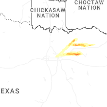
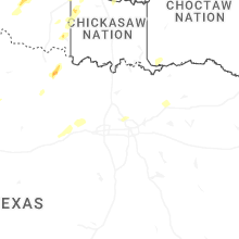


Connect with Interactive Hail Maps