

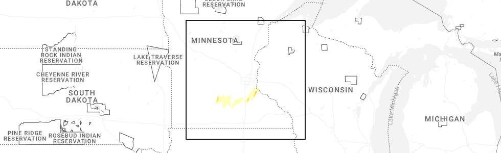
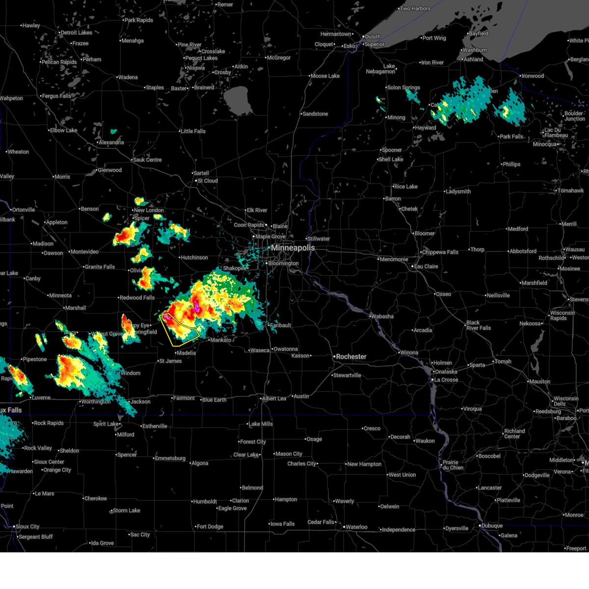
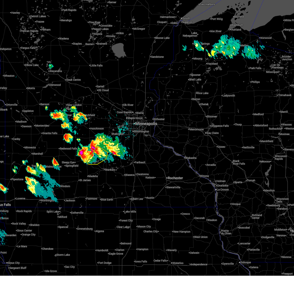
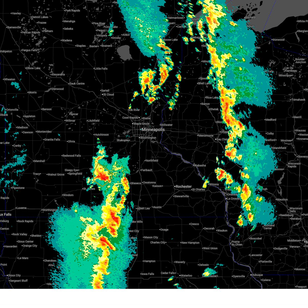
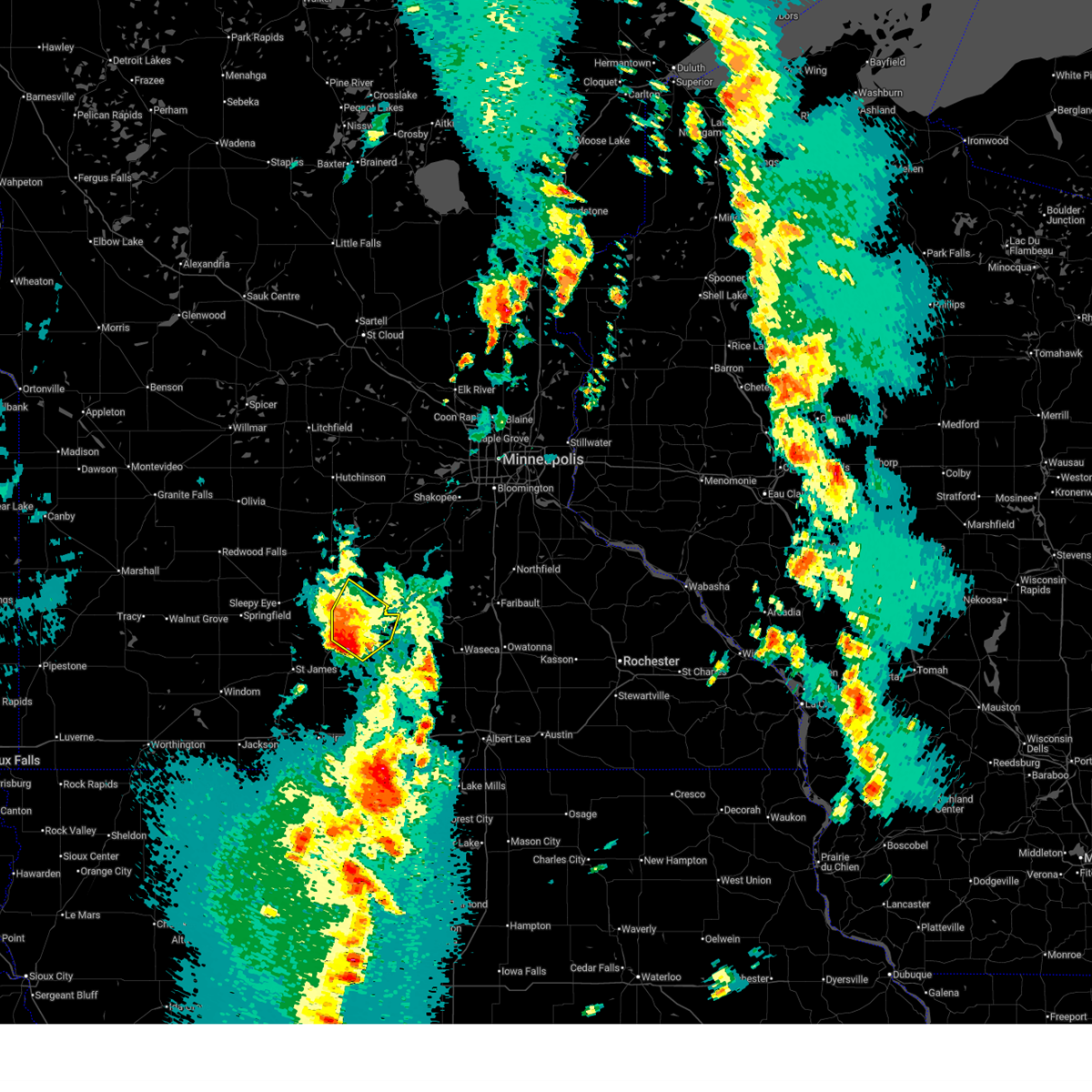
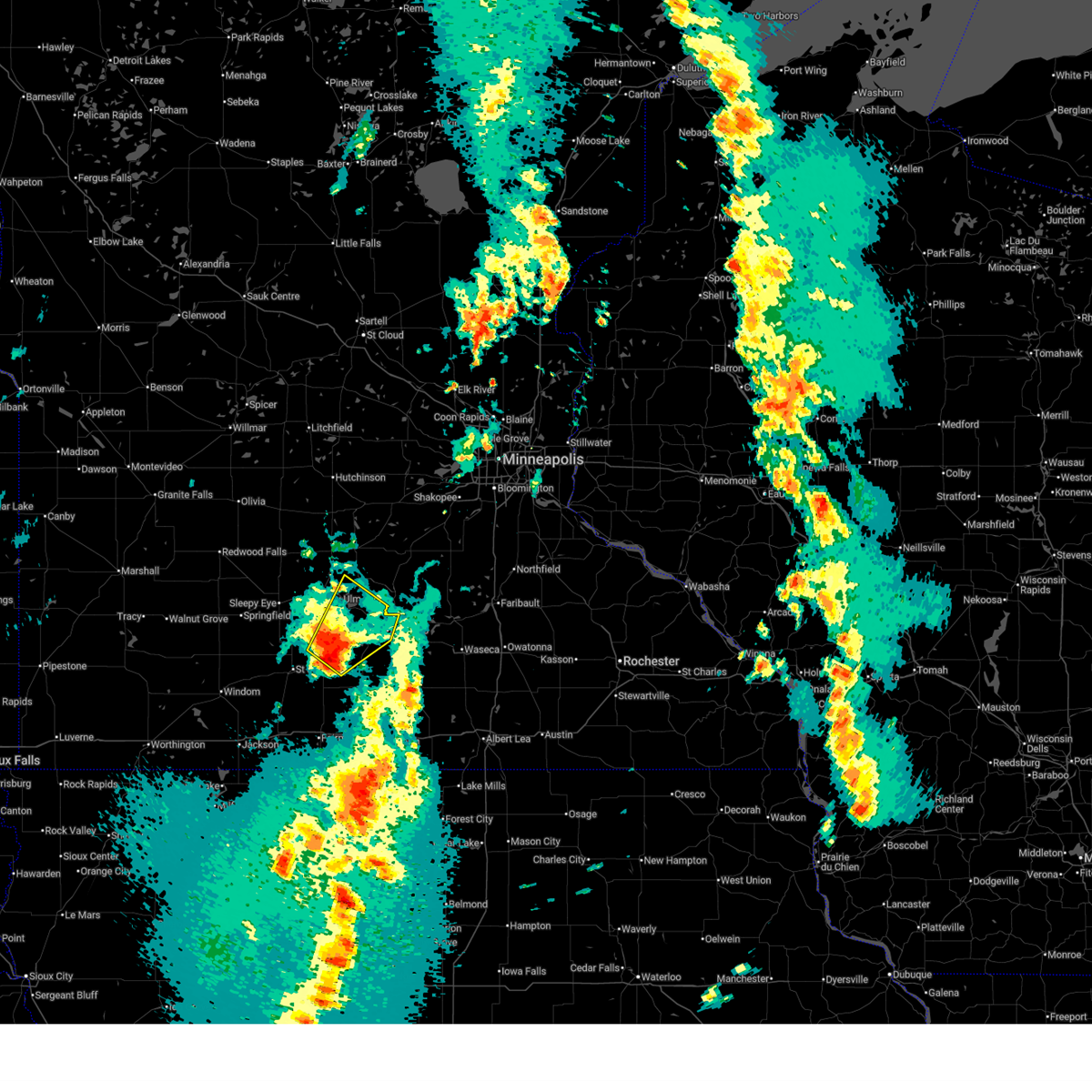
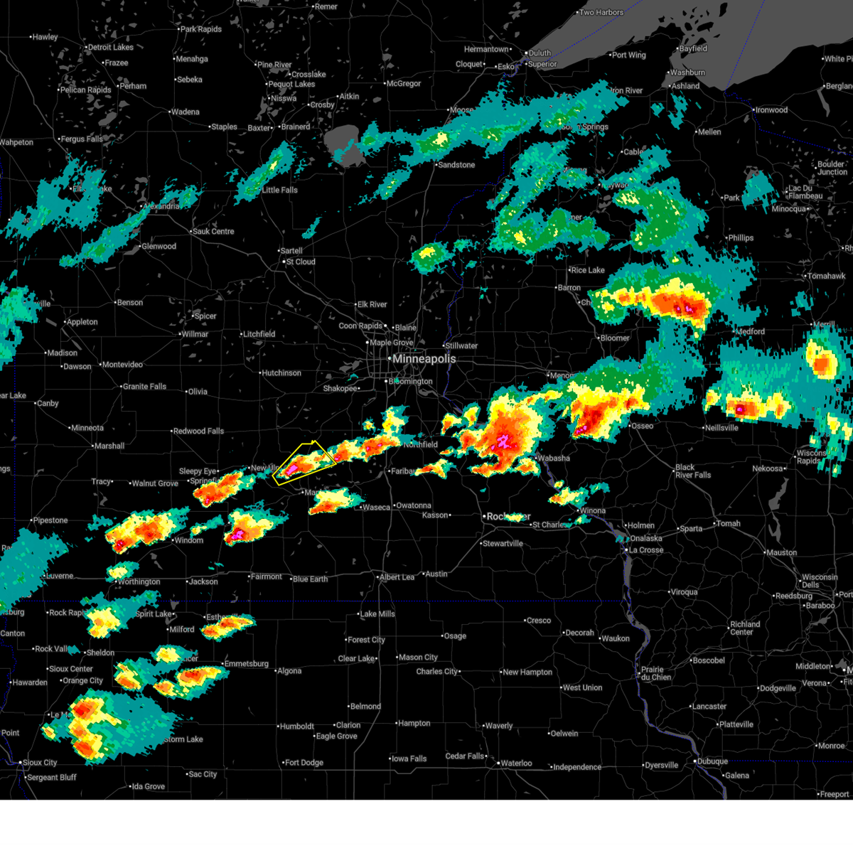
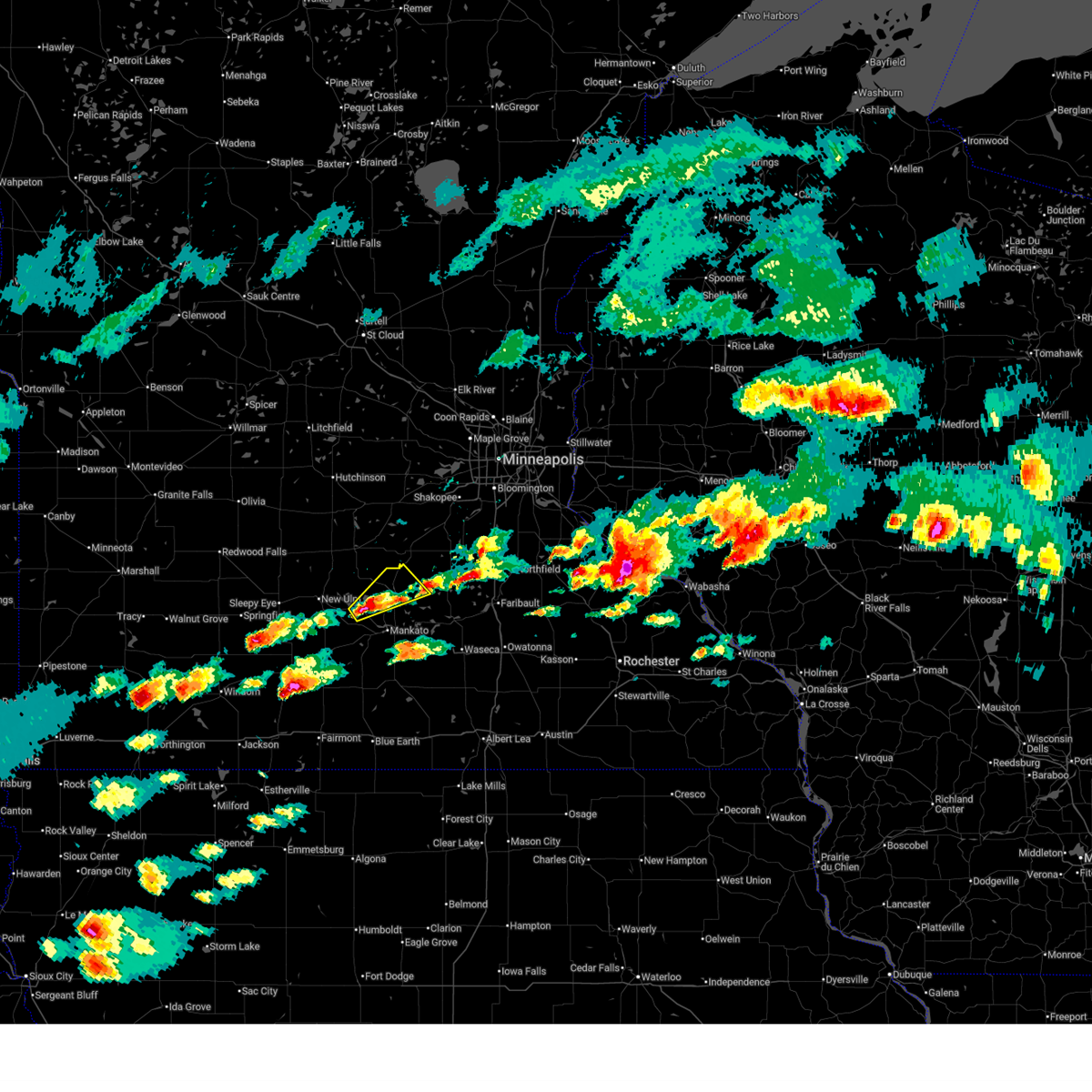
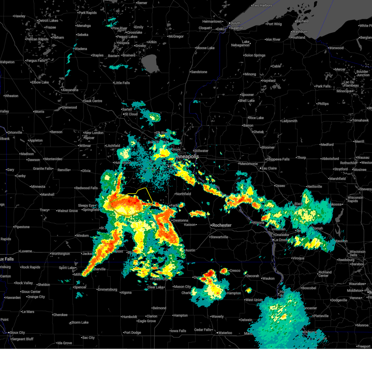
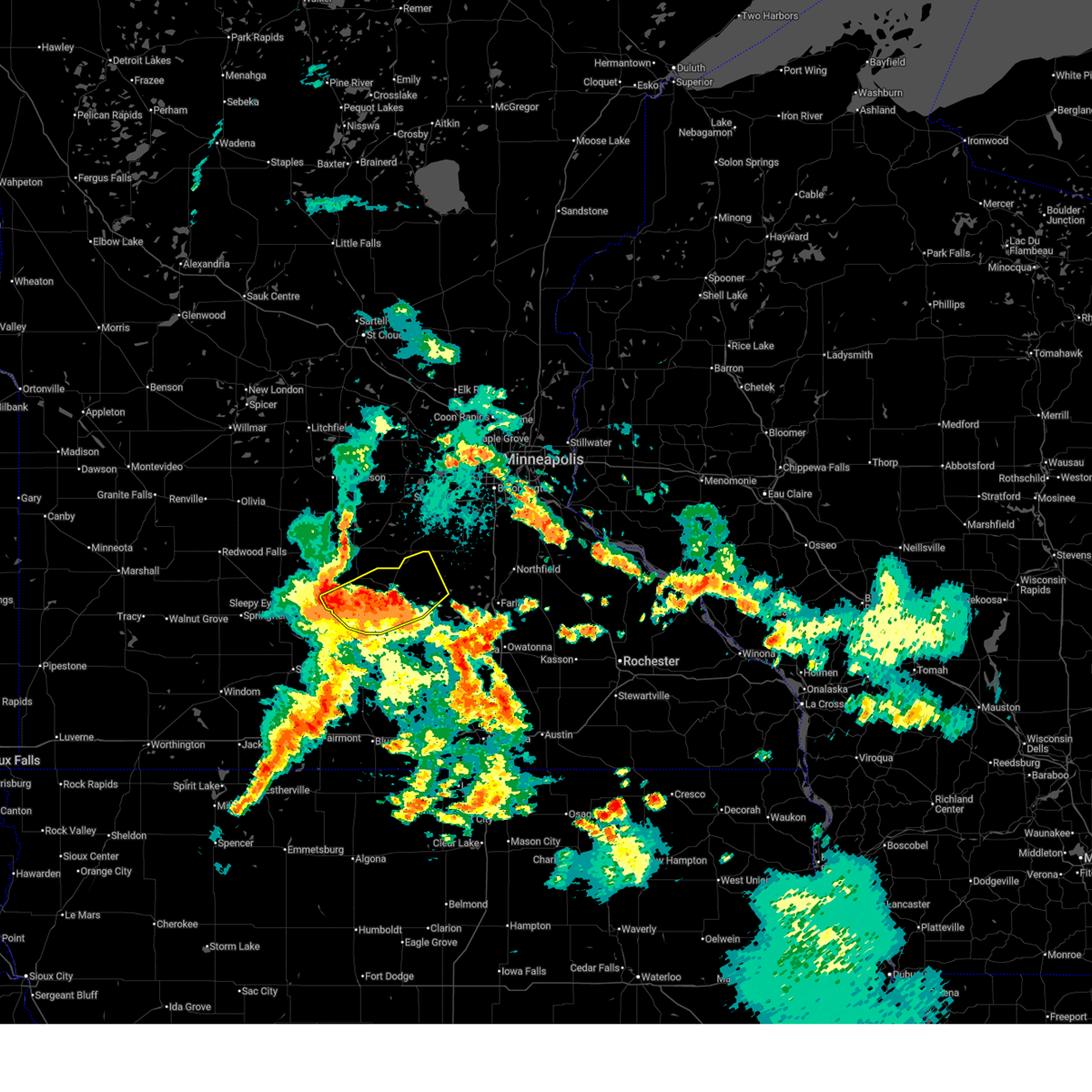
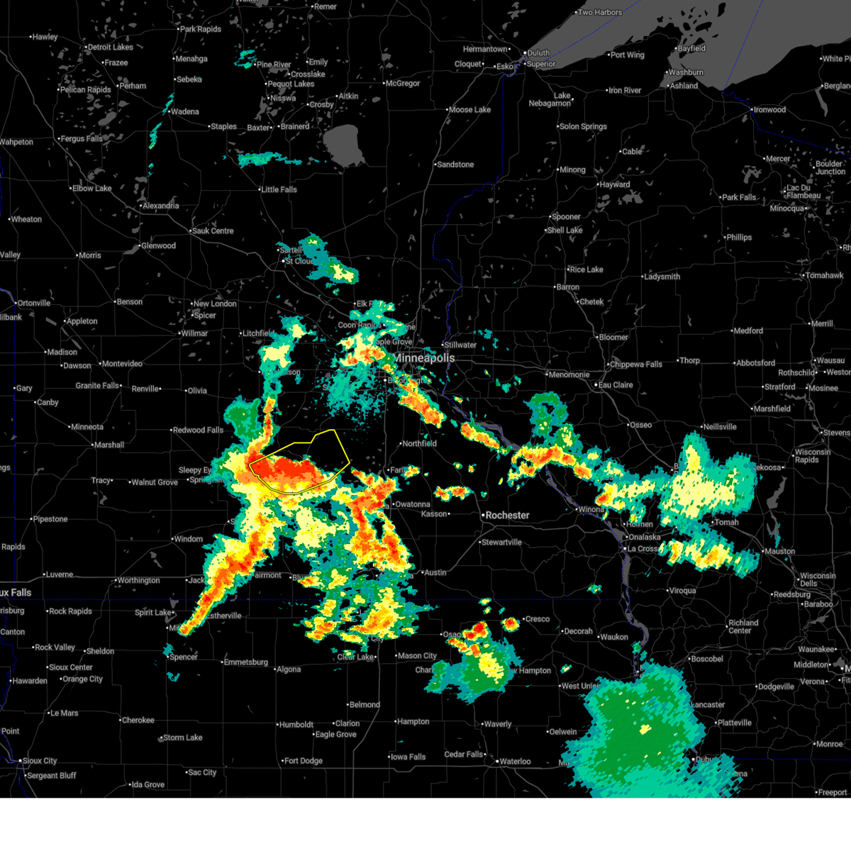
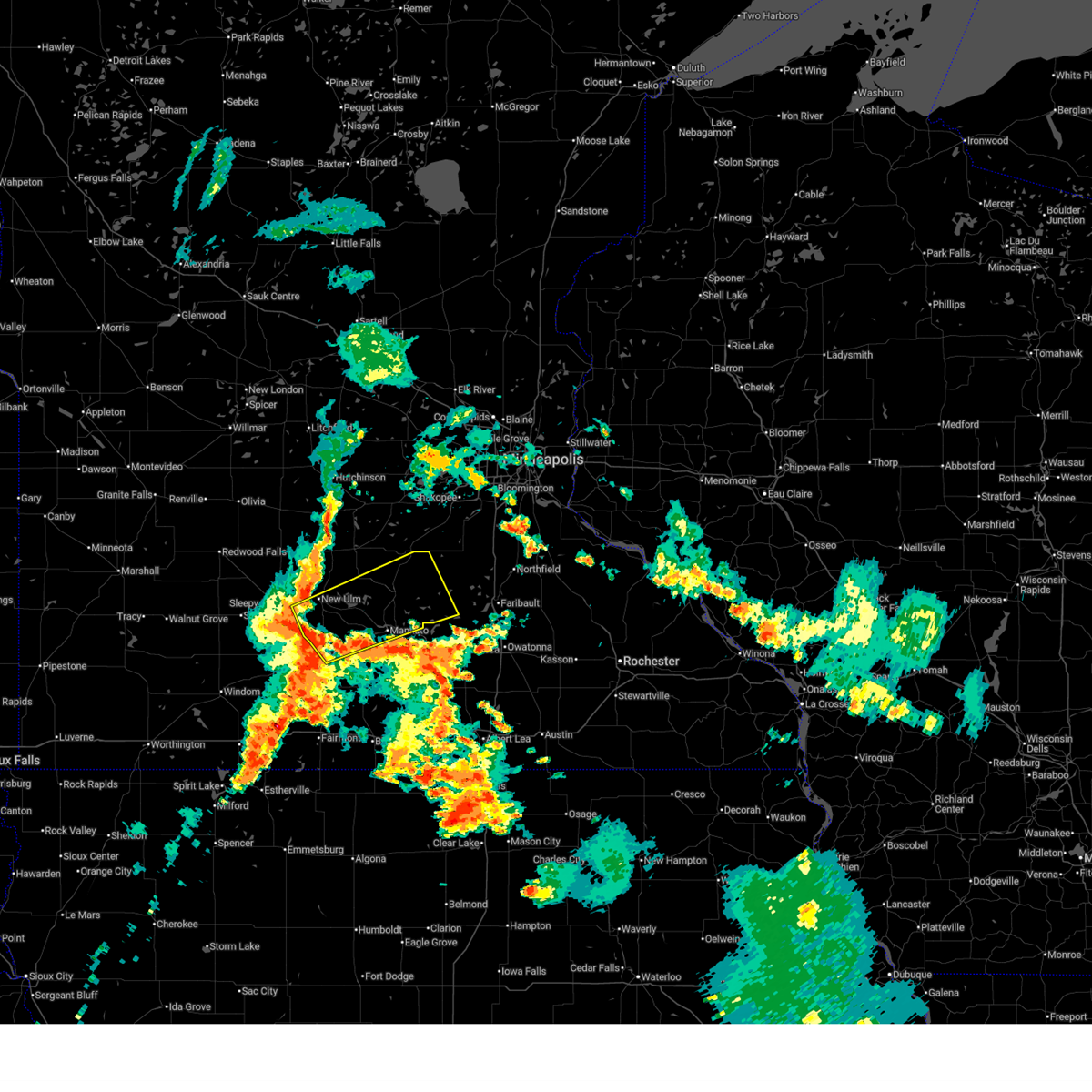
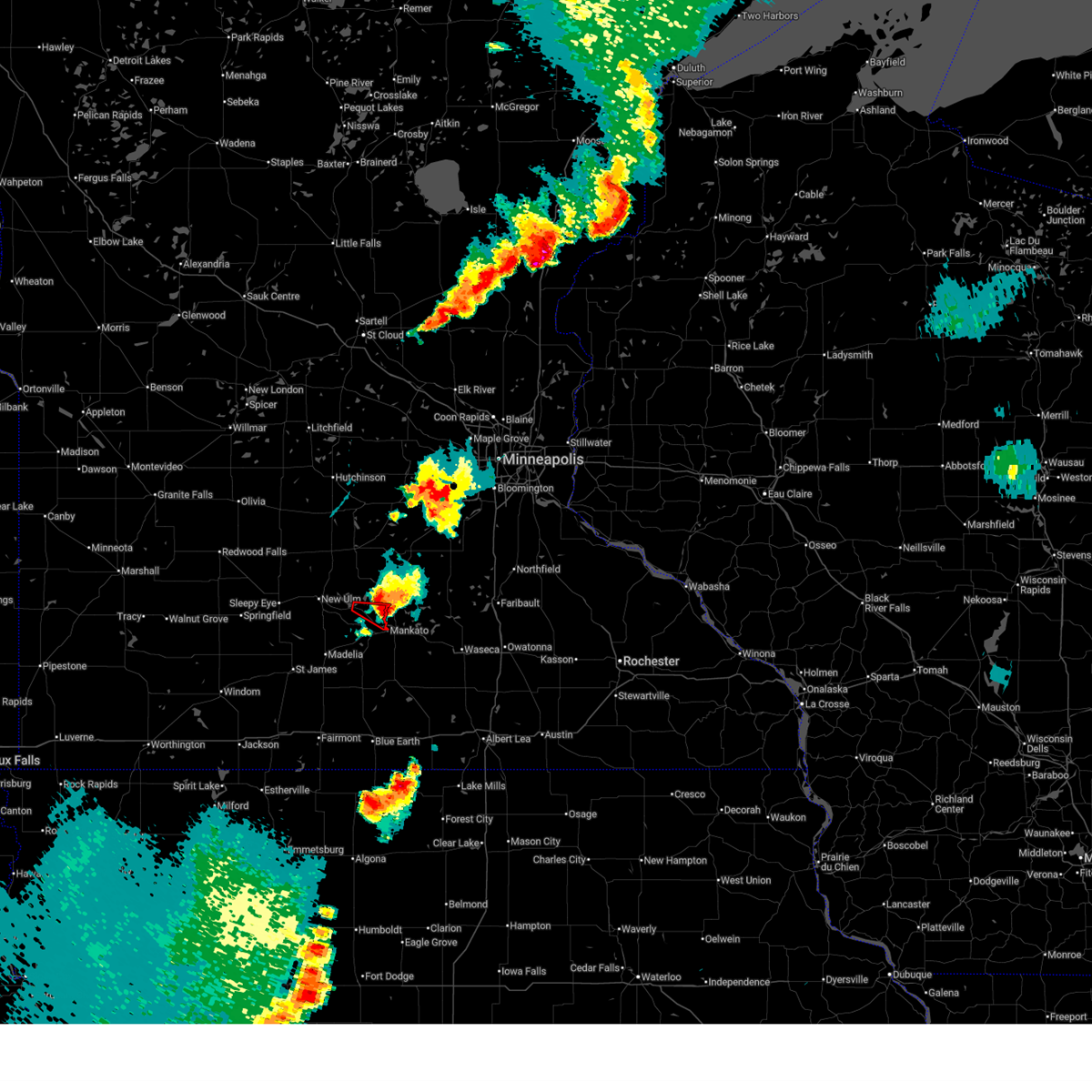
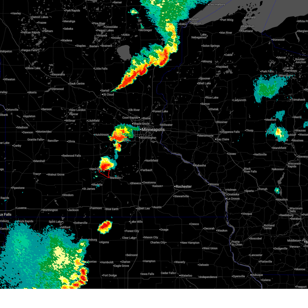
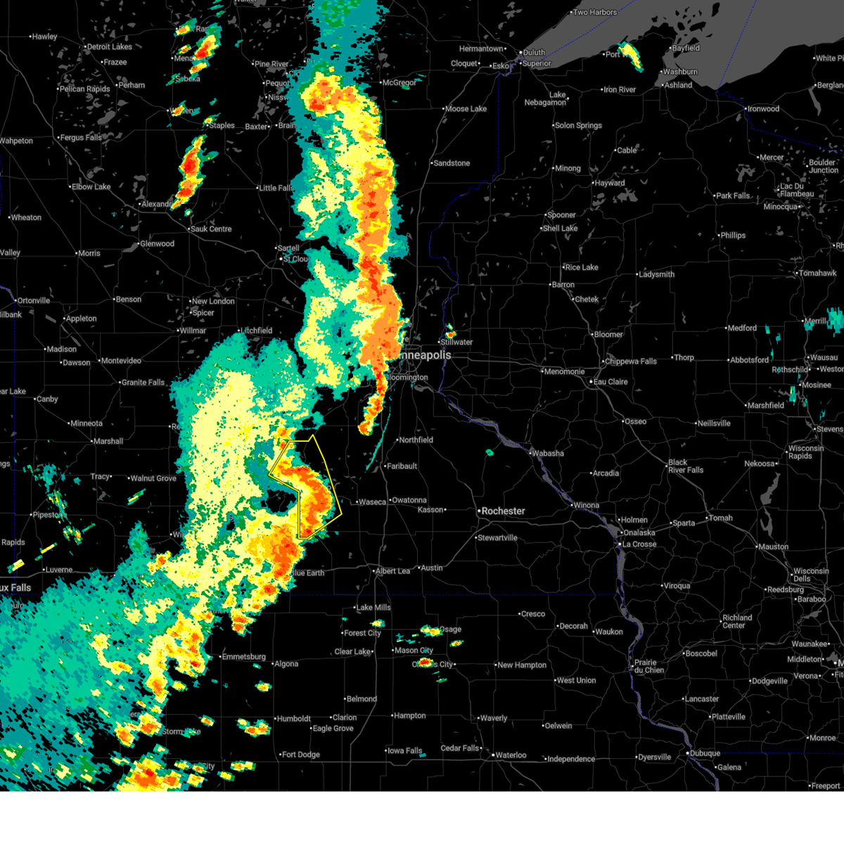
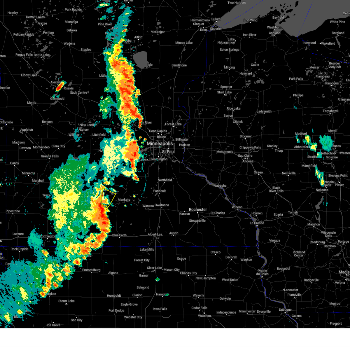
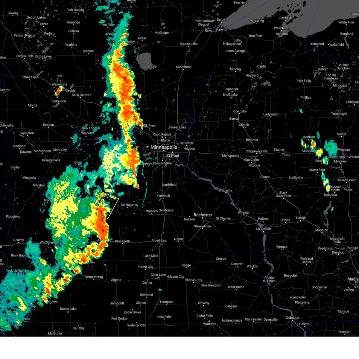
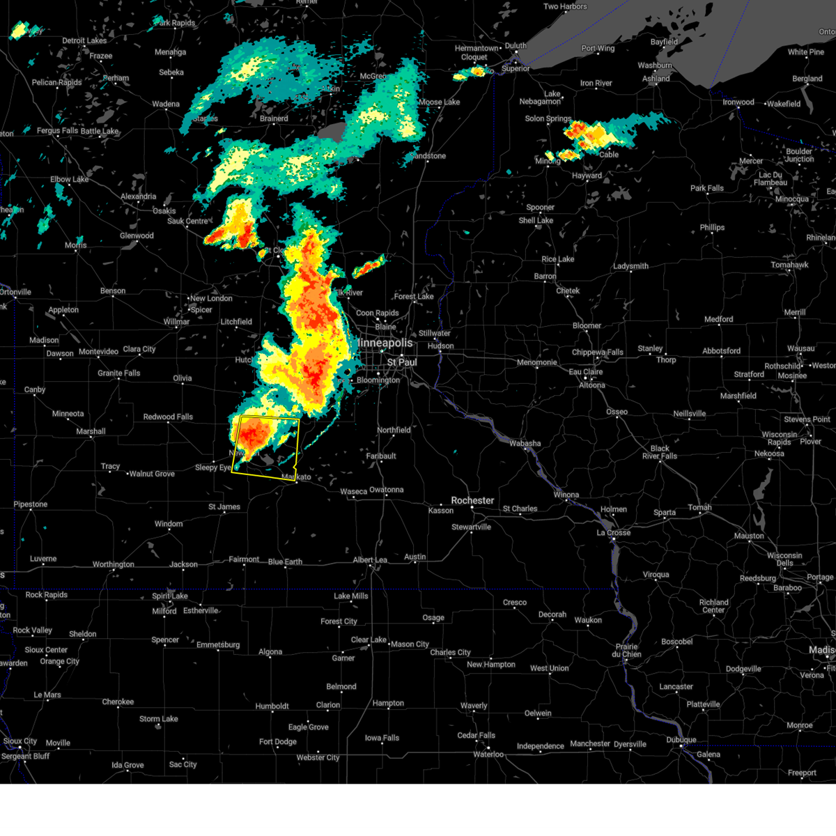
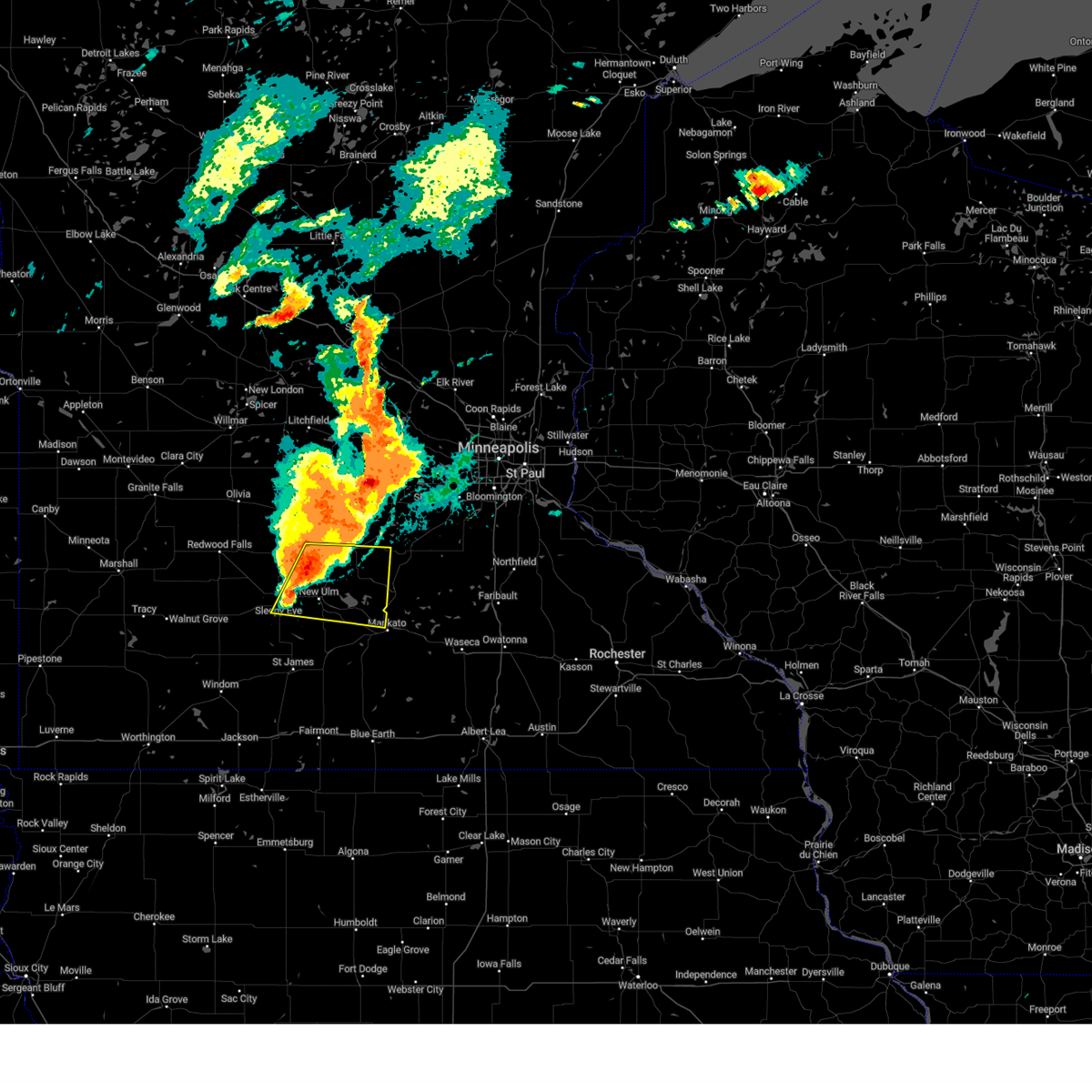
Hail Map for Nicollet, MN
The Nicollet, MN area has had 6 reports of on-the-ground hail by trained spotters, and has been under severe weather warnings 18 times during the past 12 months. Doppler radar has detected hail at or near Nicollet, MN on 58 occasions, including 8 occasions during the past year.
| Name: | Nicollet, MN |
| Where Located: | 66.9 miles SW of Minneapolis, MN |
| Map: | Google Map for Nicollet, MN |
| Population: | 1093 |
| Housing Units: | 445 |
| More Info: | Search Google for Nicollet, MN |
1
The Top Recent Hail Date for Nicollet, MN is Friday, April 17, 2026 (17th out of 58)
Hail and Wind Damage Spotted near Nicollet, MN
| Date / Time | Report Details |
|---|---|
| 5/24/2026 7:29 PM CDT |
 At 729 pm cdt, a severe thunderstorm was located 6 miles northwest of lake crystal, or 12 miles southeast of new ulm, moving southeast at 30 mph (radar indicated). Hazards include 60 mph wind gusts and quarter size hail. Hail damage to vehicles is expected. expect wind damage to roofs, siding, and trees. Locations impacted include, courtland, judson and minneopa state park. At 729 pm cdt, a severe thunderstorm was located 6 miles northwest of lake crystal, or 12 miles southeast of new ulm, moving southeast at 30 mph (radar indicated). Hazards include 60 mph wind gusts and quarter size hail. Hail damage to vehicles is expected. expect wind damage to roofs, siding, and trees. Locations impacted include, courtland, judson and minneopa state park.
|
| 5/24/2026 7:14 PM CDT |
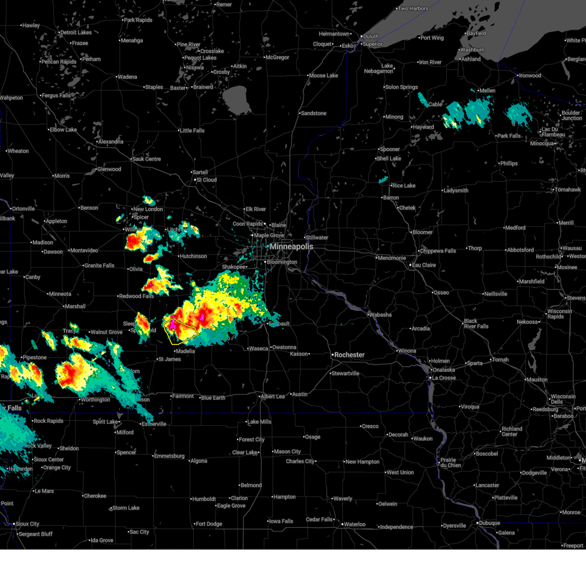 At 714 pm cdt, a severe thunderstorm was located over courtland, or 6 miles southeast of new ulm, moving southeast at 30 mph (at 7:08pm, trained spotters reported nickle to quarter size hail in new ulm). Hazards include 60 mph wind gusts and quarter size hail. Hail damage to vehicles is expected. expect wind damage to roofs, siding, and trees. Locations impacted include, new ulm, flandrau state park, searles, courtland, judson and minneopa state park. At 714 pm cdt, a severe thunderstorm was located over courtland, or 6 miles southeast of new ulm, moving southeast at 30 mph (at 7:08pm, trained spotters reported nickle to quarter size hail in new ulm). Hazards include 60 mph wind gusts and quarter size hail. Hail damage to vehicles is expected. expect wind damage to roofs, siding, and trees. Locations impacted include, new ulm, flandrau state park, searles, courtland, judson and minneopa state park.
|
| 5/24/2026 7:03 PM CDT |
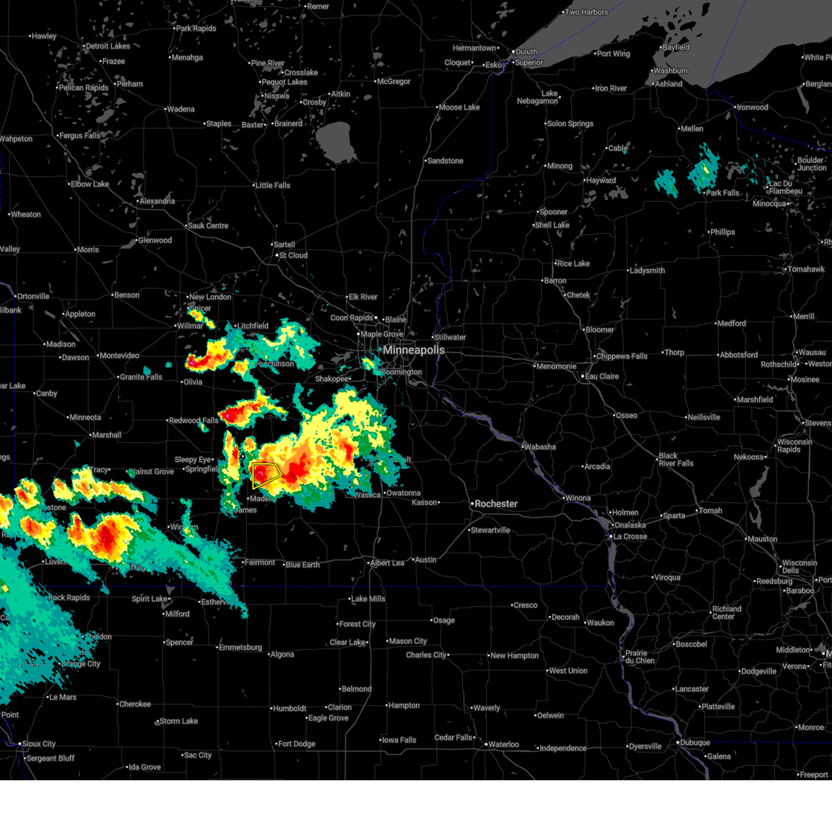
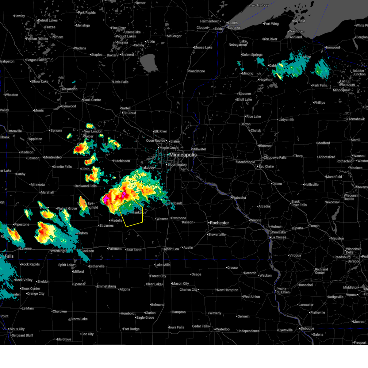 Svrmpx the national weather service in the twin cities has issued a * severe thunderstorm warning for, northeastern blue earth county in south central minnesota, southwestern le sueur county in south central minnesota, southeastern nicollet county in south central minnesota, * until 800 pm cdt. * at 703 pm cdt, a severe thunderstorm was located near north mankato, or 7 miles northwest of mankato, moving southeast at 35 mph (radar indicated). Hazards include 60 mph wind gusts and quarter size hail. Hail damage to vehicles is expected. Expect wind damage to roofs, siding, and trees. Svrmpx the national weather service in the twin cities has issued a * severe thunderstorm warning for, northeastern blue earth county in south central minnesota, southwestern le sueur county in south central minnesota, southeastern nicollet county in south central minnesota, * until 800 pm cdt. * at 703 pm cdt, a severe thunderstorm was located near north mankato, or 7 miles northwest of mankato, moving southeast at 35 mph (radar indicated). Hazards include 60 mph wind gusts and quarter size hail. Hail damage to vehicles is expected. Expect wind damage to roofs, siding, and trees.
|
| 5/24/2026 7:00 PM CDT |
 At 700 pm cdt, a severe thunderstorm was located 7 miles northeast of nicollet, or 16 miles northwest of mankato, moving southeast at 25 mph (radar indicated). Hazards include 60 mph wind gusts and quarter size hail. Hail damage to vehicles is expected. expect wind damage to roofs, siding, and trees. Locations impacted include, courtland, norseland, nicollet and oshawa. At 700 pm cdt, a severe thunderstorm was located 7 miles northeast of nicollet, or 16 miles northwest of mankato, moving southeast at 25 mph (radar indicated). Hazards include 60 mph wind gusts and quarter size hail. Hail damage to vehicles is expected. expect wind damage to roofs, siding, and trees. Locations impacted include, courtland, norseland, nicollet and oshawa.
|
| 5/24/2026 6:53 PM CDT |
 Svrmpx the national weather service in the twin cities has issued a * severe thunderstorm warning for, northwestern blue earth county in south central minnesota, southeastern brown county in south central minnesota, central nicollet county in south central minnesota, * until 745 pm cdt. * at 653 pm cdt, a severe thunderstorm was located over new ulm, moving southeast at 30 mph (trained spotters reported). Hazards include 60 mph wind gusts and quarter size hail. Hail damage to vehicles is expected. Expect wind damage to roofs, siding, and trees. Svrmpx the national weather service in the twin cities has issued a * severe thunderstorm warning for, northwestern blue earth county in south central minnesota, southeastern brown county in south central minnesota, central nicollet county in south central minnesota, * until 745 pm cdt. * at 653 pm cdt, a severe thunderstorm was located over new ulm, moving southeast at 30 mph (trained spotters reported). Hazards include 60 mph wind gusts and quarter size hail. Hail damage to vehicles is expected. Expect wind damage to roofs, siding, and trees.
|
| 5/24/2026 6:46 PM CDT | Lots of blowing dust ahead of severe warned thunderstorms. spotter estimated 50-60 mph wind in nicollet county MN, 1.3 miles S of Nicollet, MN |
| 5/24/2026 6:37 PM CDT |
 Svrmpx the national weather service in the twin cities has issued a * severe thunderstorm warning for, south central sibley county in central minnesota, northeastern nicollet county in south central minnesota, * until 730 pm cdt. * at 637 pm cdt, a severe thunderstorm was located near gaylord, or 16 miles northeast of new ulm, moving east at 20 mph (radar indicated). Hazards include 60 mph wind gusts and quarter size hail. Hail damage to vehicles is expected. Expect wind damage to roofs, siding, and trees. Svrmpx the national weather service in the twin cities has issued a * severe thunderstorm warning for, south central sibley county in central minnesota, northeastern nicollet county in south central minnesota, * until 730 pm cdt. * at 637 pm cdt, a severe thunderstorm was located near gaylord, or 16 miles northeast of new ulm, moving east at 20 mph (radar indicated). Hazards include 60 mph wind gusts and quarter size hail. Hail damage to vehicles is expected. Expect wind damage to roofs, siding, and trees.
|
| 4/23/2026 6:12 PM CDT |
 The storm which prompted the warning has weakened below severe limits, and no longer poses an immediate threat to life or property. therefore, the warning will be allowed to expire. however, small hail and gusty winds are still possible with this thunderstorm. a severe thunderstorm watch remains in effect until 800 pm cdt for a portion of south central minnesota. The storm which prompted the warning has weakened below severe limits, and no longer poses an immediate threat to life or property. therefore, the warning will be allowed to expire. however, small hail and gusty winds are still possible with this thunderstorm. a severe thunderstorm watch remains in effect until 800 pm cdt for a portion of south central minnesota.
|
| 4/23/2026 6:01 PM CDT |
 At 601 pm cdt, a severe thunderstorm was located over nicollet, or 12 miles northwest of mankato, moving northeast at 45 mph (radar indicated). Hazards include 60 mph wind gusts and quarter size hail. Hail damage to vehicles is expected. expect wind damage to roofs, siding, and trees. Locations impacted include, garden city, lake crystal, courtland, judson, minneopa state park, mankato, skyline, nicollet, north mankato and oshawa. At 601 pm cdt, a severe thunderstorm was located over nicollet, or 12 miles northwest of mankato, moving northeast at 45 mph (radar indicated). Hazards include 60 mph wind gusts and quarter size hail. Hail damage to vehicles is expected. expect wind damage to roofs, siding, and trees. Locations impacted include, garden city, lake crystal, courtland, judson, minneopa state park, mankato, skyline, nicollet, north mankato and oshawa.
|
| 4/23/2026 5:45 PM CDT |
 Svrmpx the national weather service in the twin cities has issued a * severe thunderstorm warning for, northwestern blue earth county in south central minnesota, southeastern brown county in south central minnesota, eastern nicollet county in south central minnesota, northeastern watonwan county in south central minnesota, * until 615 pm cdt. * at 545 pm cdt, a severe thunderstorm was located 5 miles northeast of madelia, or 15 miles south of new ulm, moving northeast at 45 mph (radar indicated). Hazards include 60 mph wind gusts and quarter size hail. Hail damage to vehicles is expected. Expect wind damage to roofs, siding, and trees. Svrmpx the national weather service in the twin cities has issued a * severe thunderstorm warning for, northwestern blue earth county in south central minnesota, southeastern brown county in south central minnesota, eastern nicollet county in south central minnesota, northeastern watonwan county in south central minnesota, * until 615 pm cdt. * at 545 pm cdt, a severe thunderstorm was located 5 miles northeast of madelia, or 15 miles south of new ulm, moving northeast at 45 mph (radar indicated). Hazards include 60 mph wind gusts and quarter size hail. Hail damage to vehicles is expected. Expect wind damage to roofs, siding, and trees.
|
| 4/13/2026 5:53 PM CDT |
 At 553 pm cdt, a severe thunderstorm was located near st. peter, or 12 miles north of mankato, moving northeast at 20 mph (public reported). Hazards include two inch hail and 60 mph wind gusts. People and animals outdoors will be injured. expect hail damage to roofs, siding, windows, and vehicles. expect wind damage to roofs, siding, and trees. locations impacted include, nicollet, oshawa, kasota, st. Peter, ottawa, cleveland, le sueur and st henry. At 553 pm cdt, a severe thunderstorm was located near st. peter, or 12 miles north of mankato, moving northeast at 20 mph (public reported). Hazards include two inch hail and 60 mph wind gusts. People and animals outdoors will be injured. expect hail damage to roofs, siding, windows, and vehicles. expect wind damage to roofs, siding, and trees. locations impacted include, nicollet, oshawa, kasota, st. Peter, ottawa, cleveland, le sueur and st henry.
|
| 4/13/2026 5:48 PM CDT | Hen Egg sized hail reported 3 miles WSW of Nicollet, MN |
| 4/13/2026 5:40 PM CDT |
 Svrmpx the national weather service in the twin cities has issued a * severe thunderstorm warning for, northwestern le sueur county in south central minnesota, eastern nicollet county in south central minnesota, * until 630 pm cdt. * at 540 pm cdt, a severe thunderstorm was located near nicollet, or 11 miles northwest of mankato, moving northeast at 20 mph (radar indicated). Hazards include 60 mph wind gusts and quarter size hail. Hail damage to vehicles is expected. Expect wind damage to roofs, siding, and trees. Svrmpx the national weather service in the twin cities has issued a * severe thunderstorm warning for, northwestern le sueur county in south central minnesota, eastern nicollet county in south central minnesota, * until 630 pm cdt. * at 540 pm cdt, a severe thunderstorm was located near nicollet, or 11 miles northwest of mankato, moving northeast at 20 mph (radar indicated). Hazards include 60 mph wind gusts and quarter size hail. Hail damage to vehicles is expected. Expect wind damage to roofs, siding, and trees.
|
| 8/17/2025 8:58 PM CDT |
 The severe thunderstorm warning that was previously in effect has been reissued for nicollet and le sueur counties and is in effect until 945 pm cdt. please refer to that bulletin for the latest severe weather information. however, gusty winds are still possible with this thunderstorm. The severe thunderstorm warning that was previously in effect has been reissued for nicollet and le sueur counties and is in effect until 945 pm cdt. please refer to that bulletin for the latest severe weather information. however, gusty winds are still possible with this thunderstorm.
|
| 8/17/2025 8:46 PM CDT |
 the severe thunderstorm warning has been cancelled and is no longer in effect the severe thunderstorm warning has been cancelled and is no longer in effect
|
| 8/17/2025 8:46 PM CDT |
 At 846 pm cdt, a severe thunderstorm was located 6 miles south of le sueur, or 15 miles north of mankato, moving northeast at 55 mph (radar indicated). Hazards include 60 mph wind gusts and small hail. Expect damage to roofs, siding, and trees. locations impacted include, mankato, new ulm, north mankato, st. Peter, le sueur, le center, nicollet, kasota, courtland, cleveland, judson, oshawa, ottawa, norseland, mankato airport, minneopa state park, st thomas, st henry and lake jefferson. At 846 pm cdt, a severe thunderstorm was located 6 miles south of le sueur, or 15 miles north of mankato, moving northeast at 55 mph (radar indicated). Hazards include 60 mph wind gusts and small hail. Expect damage to roofs, siding, and trees. locations impacted include, mankato, new ulm, north mankato, st. Peter, le sueur, le center, nicollet, kasota, courtland, cleveland, judson, oshawa, ottawa, norseland, mankato airport, minneopa state park, st thomas, st henry and lake jefferson.
|
| 8/17/2025 8:21 PM CDT |
 Svrmpx the national weather service in the twin cities has issued a * severe thunderstorm warning for, southeastern sibley county in central minnesota, northern blue earth county in south central minnesota, southeastern brown county in south central minnesota, le sueur county in south central minnesota, nicollet county in south central minnesota, northeastern watonwan county in south central minnesota, * until 900 pm cdt. * at 821 pm cdt, a severe thunderstorm was located near courtland, or 10 miles southeast of new ulm, moving northeast at 55 mph (radar indicated). Hazards include 60 mph wind gusts and small hail. expect damage to roofs, siding, and trees Svrmpx the national weather service in the twin cities has issued a * severe thunderstorm warning for, southeastern sibley county in central minnesota, northern blue earth county in south central minnesota, southeastern brown county in south central minnesota, le sueur county in south central minnesota, nicollet county in south central minnesota, northeastern watonwan county in south central minnesota, * until 900 pm cdt. * at 821 pm cdt, a severe thunderstorm was located near courtland, or 10 miles southeast of new ulm, moving northeast at 55 mph (radar indicated). Hazards include 60 mph wind gusts and small hail. expect damage to roofs, siding, and trees
|
| 6/16/2025 7:10 PM CDT |
 The storm which prompted the warning has moved out of the area. therefore, the warning will be allowed to expire. a tornado watch remains in effect until 900 pm cdt for a portion of south central minnesota. The storm which prompted the warning has moved out of the area. therefore, the warning will be allowed to expire. a tornado watch remains in effect until 900 pm cdt for a portion of south central minnesota.
|
| 6/16/2025 7:03 PM CDT |
 At 703 pm cdt, a confirmed tornado was located near nicollet, or 9 miles northwest of mankato, moving southeast at 25 mph (weather spotters confirmed tornado). Hazards include damaging tornado and quarter size hail. Flying debris will be dangerous to those caught without shelter. mobile homes will be damaged or destroyed. damage to roofs, windows and vehicles will occur. tree damage is likely. Locations impacted include, mankato, north mankato and nicollet. At 703 pm cdt, a confirmed tornado was located near nicollet, or 9 miles northwest of mankato, moving southeast at 25 mph (weather spotters confirmed tornado). Hazards include damaging tornado and quarter size hail. Flying debris will be dangerous to those caught without shelter. mobile homes will be damaged or destroyed. damage to roofs, windows and vehicles will occur. tree damage is likely. Locations impacted include, mankato, north mankato and nicollet.
|
| 6/16/2025 6:53 PM CDT |
 Tormpx the national weather service in the twin cities has issued a * tornado warning for, southeastern nicollet county in south central minnesota, * until 715 pm cdt. * at 653 pm cdt, a severe thunderstorm capable of producing a tornado was located over nicollet, or 13 miles northwest of mankato, moving southeast at 30 mph (radar indicated rotation). Hazards include tornado. Flying debris will be dangerous to those caught without shelter. mobile homes will be damaged or destroyed. damage to roofs, windows and vehicles will occur. Tree damage is likely. Tormpx the national weather service in the twin cities has issued a * tornado warning for, southeastern nicollet county in south central minnesota, * until 715 pm cdt. * at 653 pm cdt, a severe thunderstorm capable of producing a tornado was located over nicollet, or 13 miles northwest of mankato, moving southeast at 30 mph (radar indicated rotation). Hazards include tornado. Flying debris will be dangerous to those caught without shelter. mobile homes will be damaged or destroyed. damage to roofs, windows and vehicles will occur. Tree damage is likely.
|
| 4/28/2025 4:29 PM CDT |
 The storms which prompted the warning have weakened below severe limits, and have exited the warned area. therefore, the warning will be allowed to expire. however, gusty winds are still possible with these thunderstorms. to report severe weather, contact your nearest law enforcement agency. they will send your report to the national weather service office. a tornado watch remains in effect until 800 pm cdt for a portion of south central minnesota. The storms which prompted the warning have weakened below severe limits, and have exited the warned area. therefore, the warning will be allowed to expire. however, gusty winds are still possible with these thunderstorms. to report severe weather, contact your nearest law enforcement agency. they will send your report to the national weather service office. a tornado watch remains in effect until 800 pm cdt for a portion of south central minnesota.
|
| 4/28/2025 3:45 PM CDT |
 Svrmpx the national weather service in the twin cities has issued a * severe thunderstorm warning for, western blue earth county in south central minnesota, southeastern brown county in south central minnesota, eastern nicollet county in south central minnesota, watonwan county in south central minnesota, * until 430 pm cdt. * at 345 pm cdt, severe thunderstorms were located along a line from near new ulm to 5 miles northwest of trimont, or along a line from near new ulm to 20 miles northwest of fairmont, moving east at 45 mph (radar indicated). Hazards include 60 mph wind gusts and quarter size hail. Hail damage to vehicles is expected. Expect wind damage to roofs, siding, and trees. Svrmpx the national weather service in the twin cities has issued a * severe thunderstorm warning for, western blue earth county in south central minnesota, southeastern brown county in south central minnesota, eastern nicollet county in south central minnesota, watonwan county in south central minnesota, * until 430 pm cdt. * at 345 pm cdt, severe thunderstorms were located along a line from near new ulm to 5 miles northwest of trimont, or along a line from near new ulm to 20 miles northwest of fairmont, moving east at 45 mph (radar indicated). Hazards include 60 mph wind gusts and quarter size hail. Hail damage to vehicles is expected. Expect wind damage to roofs, siding, and trees.
|
| 8/29/2024 4:44 PM CDT |
 the severe thunderstorm warning has been cancelled and is no longer in effect the severe thunderstorm warning has been cancelled and is no longer in effect
|
| 8/29/2024 4:37 PM CDT |
 At 437 pm cdt, severe thunderstorms were located along a line extending from near st. peter to kasota to near madison lake to janesville to pemberton, moving east at 40 mph (radar indicated). Hazards include 60 mph wind gusts. Expect damage to roofs, siding, and trees. locations impacted include, mankato, north mankato, st. peter, le sueur, eagle lake, janesville, mapleton, nicollet, madison lake, st. Clair, kasota, and pemberton. At 437 pm cdt, severe thunderstorms were located along a line extending from near st. peter to kasota to near madison lake to janesville to pemberton, moving east at 40 mph (radar indicated). Hazards include 60 mph wind gusts. Expect damage to roofs, siding, and trees. locations impacted include, mankato, north mankato, st. peter, le sueur, eagle lake, janesville, mapleton, nicollet, madison lake, st. Clair, kasota, and pemberton.
|
| 8/29/2024 4:23 PM CDT |
 the severe thunderstorm warning has been cancelled and is no longer in effect the severe thunderstorm warning has been cancelled and is no longer in effect
|
| 8/29/2024 4:23 PM CDT |
 At 423 pm cdt, severe thunderstorms were located along a line extending from near nicollet to near north mankato to near mankato to mapleton, moving northeast at 40 mph (radar indicated). Hazards include 60 mph wind gusts. Expect damage to roofs, siding, and trees. locations impacted include, mankato, north mankato, st. peter, le sueur, lake crystal, eagle lake, janesville, mapleton, nicollet, madison lake, st. Clair, and kasota. At 423 pm cdt, severe thunderstorms were located along a line extending from near nicollet to near north mankato to near mankato to mapleton, moving northeast at 40 mph (radar indicated). Hazards include 60 mph wind gusts. Expect damage to roofs, siding, and trees. locations impacted include, mankato, north mankato, st. peter, le sueur, lake crystal, eagle lake, janesville, mapleton, nicollet, madison lake, st. Clair, and kasota.
|
| 8/29/2024 4:08 PM CDT |
 Svrmpx the national weather service in the twin cities has issued a * severe thunderstorm warning for, north central faribault county in south central minnesota, western le sueur county in south central minnesota, blue earth county in south central minnesota, northwestern waseca county in south central minnesota, eastern nicollet county in south central minnesota, * until 500 pm cdt. * at 407 pm cdt, severe thunderstorms were located along a line extending from near lake crystal to near vernon center to near delavan, moving northeast at 40 mph (radar indicated). Hazards include 60 mph wind gusts. expect damage to roofs, siding, and trees Svrmpx the national weather service in the twin cities has issued a * severe thunderstorm warning for, north central faribault county in south central minnesota, western le sueur county in south central minnesota, blue earth county in south central minnesota, northwestern waseca county in south central minnesota, eastern nicollet county in south central minnesota, * until 500 pm cdt. * at 407 pm cdt, severe thunderstorms were located along a line extending from near lake crystal to near vernon center to near delavan, moving northeast at 40 mph (radar indicated). Hazards include 60 mph wind gusts. expect damage to roofs, siding, and trees
|
| 8/29/2024 4:04 PM CDT |
 the severe thunderstorm warning has been cancelled and is no longer in effect the severe thunderstorm warning has been cancelled and is no longer in effect
|
| 8/29/2024 4:04 PM CDT |
 At 403 pm cdt, a severe thunderstorm was located near hanska, or 9 miles south of new ulm, moving northeast at 25 mph (radar indicated). Hazards include 60 mph wind gusts. Expect damage to roofs, siding, and trees. Locations impacted include, new ulm, nicollet, courtland, searles, and flandrau state park. At 403 pm cdt, a severe thunderstorm was located near hanska, or 9 miles south of new ulm, moving northeast at 25 mph (radar indicated). Hazards include 60 mph wind gusts. Expect damage to roofs, siding, and trees. Locations impacted include, new ulm, nicollet, courtland, searles, and flandrau state park.
|
| 8/29/2024 3:50 PM CDT |
 Svrmpx the national weather service in the twin cities has issued a * severe thunderstorm warning for, southeastern brown county in south central minnesota, northwestern blue earth county in south central minnesota, northeastern watonwan county in south central minnesota, central nicollet county in south central minnesota, * until 415 pm cdt. * at 350 pm cdt, a severe thunderstorm was located over hanska, or 13 miles south of new ulm, moving north at 20 mph (radar indicated). Hazards include 60 mph wind gusts. expect damage to roofs, siding, and trees Svrmpx the national weather service in the twin cities has issued a * severe thunderstorm warning for, southeastern brown county in south central minnesota, northwestern blue earth county in south central minnesota, northeastern watonwan county in south central minnesota, central nicollet county in south central minnesota, * until 415 pm cdt. * at 350 pm cdt, a severe thunderstorm was located over hanska, or 13 miles south of new ulm, moving north at 20 mph (radar indicated). Hazards include 60 mph wind gusts. expect damage to roofs, siding, and trees
|
| 8/26/2024 6:51 PM CDT |
 At 651 pm cdt, a severe thunderstorm was located 7 miles northwest of nicollet, or 11 miles northeast of new ulm, moving east at 25 mph (radar indicated). Hazards include 60 mph wind gusts and quarter size hail. Hail damage to vehicles is expected. expect wind damage to roofs, siding, and trees. Locations impacted include, new ulm, north mankato, gaylord, winthrop, nicollet, courtland, lafayette, judson, oshawa, new sweden, klossner, and rush river. At 651 pm cdt, a severe thunderstorm was located 7 miles northwest of nicollet, or 11 miles northeast of new ulm, moving east at 25 mph (radar indicated). Hazards include 60 mph wind gusts and quarter size hail. Hail damage to vehicles is expected. expect wind damage to roofs, siding, and trees. Locations impacted include, new ulm, north mankato, gaylord, winthrop, nicollet, courtland, lafayette, judson, oshawa, new sweden, klossner, and rush river.
|
| 8/26/2024 6:29 PM CDT |
 Svrmpx the national weather service in the twin cities has issued a * severe thunderstorm warning for, southwestern sibley county in central minnesota, east central brown county in south central minnesota, northwestern blue earth county in south central minnesota, nicollet county in south central minnesota, * until 715 pm cdt. * at 628 pm cdt, a severe thunderstorm was located near lafayette, or 7 miles northeast of new ulm, moving east at 25 mph (radar indicated). Hazards include 60 mph wind gusts and quarter size hail. Hail damage to vehicles is expected. Expect wind damage to roofs, siding, and trees. Svrmpx the national weather service in the twin cities has issued a * severe thunderstorm warning for, southwestern sibley county in central minnesota, east central brown county in south central minnesota, northwestern blue earth county in south central minnesota, nicollet county in south central minnesota, * until 715 pm cdt. * at 628 pm cdt, a severe thunderstorm was located near lafayette, or 7 miles northeast of new ulm, moving east at 25 mph (radar indicated). Hazards include 60 mph wind gusts and quarter size hail. Hail damage to vehicles is expected. Expect wind damage to roofs, siding, and trees.
|
| 8/3/2024 11:57 PM CDT | the severe thunderstorm warning has been cancelled and is no longer in effect |
| 8/3/2024 11:53 PM CDT | At 1153 pm cdt, a severe thunderstorm was located over lafayette, or 8 miles north of new ulm, moving southeast at 35 mph (radar indicated). Hazards include 60 mph wind gusts and quarter size hail. Hail damage to vehicles is expected. expect wind damage to roofs, siding, and trees. Locations impacted include, new ulm, nicollet, courtland, lafayette, judson, oshawa, klossner, st george, new ulm airport, searles, flandrau state park, and minneopa state park. |
| 8/3/2024 11:53 PM CDT | the severe thunderstorm warning has been cancelled and is no longer in effect |
| 8/3/2024 11:44 PM CDT | Svrmpx the national weather service in the twin cities has issued a * severe thunderstorm warning for, southwestern sibley county in central minnesota, east central brown county in south central minnesota, northwestern blue earth county in south central minnesota, nicollet county in south central minnesota, * until 1230 am cdt. * at 1143 pm cdt, a severe thunderstorm was located near gibbon where the public reported quarter sized hail, or 13 miles north of new ulm, moving southeast at 35 mph (public). Hazards include 60 mph wind gusts and quarter size hail. Hail damage to vehicles is expected. Expect wind damage to roofs, siding, and trees. |
| 7/28/2023 12:09 AM CDT |
 At 1209 am cdt, severe thunderstorms were located along a line extending from 7 miles northwest of st. peter to near nicollet to 5 miles north of lake crystal, moving southeast at 30 mph (radar indicated). Hazards include 60 mph wind gusts and half dollar size hail. Hail damage to vehicles is expected. expect wind damage to roofs, siding, and trees. locations impacted include, mankato, north mankato, st. peter, nicollet, kasota, cleveland, judson, oshawa, skyline, ottawa, mankato airport and st henry. hail threat, radar indicated max hail size, 1. 25 in wind threat, radar indicated max wind gust, 60 mph. At 1209 am cdt, severe thunderstorms were located along a line extending from 7 miles northwest of st. peter to near nicollet to 5 miles north of lake crystal, moving southeast at 30 mph (radar indicated). Hazards include 60 mph wind gusts and half dollar size hail. Hail damage to vehicles is expected. expect wind damage to roofs, siding, and trees. locations impacted include, mankato, north mankato, st. peter, nicollet, kasota, cleveland, judson, oshawa, skyline, ottawa, mankato airport and st henry. hail threat, radar indicated max hail size, 1. 25 in wind threat, radar indicated max wind gust, 60 mph.
|
| 7/27/2023 11:58 PM CDT |
 At 1158 pm cdt, severe thunderstorms were located along a line extending from 8 miles south of gaylord to near nicollet to near courtland, moving southeast at 30 mph (radar indicated). Hazards include ping pong ball size hail and 60 mph wind gusts. People and animals outdoors will be injured. expect hail damage to roofs, siding, windows, and vehicles. expect wind damage to roofs, siding, and trees. locations impacted include, st. peter, north mankato, kasota, mankato and cleveland. hail threat, radar indicated max hail size, 1. 50 in wind threat, radar indicated max wind gust, 60 mph. At 1158 pm cdt, severe thunderstorms were located along a line extending from 8 miles south of gaylord to near nicollet to near courtland, moving southeast at 30 mph (radar indicated). Hazards include ping pong ball size hail and 60 mph wind gusts. People and animals outdoors will be injured. expect hail damage to roofs, siding, windows, and vehicles. expect wind damage to roofs, siding, and trees. locations impacted include, st. peter, north mankato, kasota, mankato and cleveland. hail threat, radar indicated max hail size, 1. 50 in wind threat, radar indicated max wind gust, 60 mph.
|
| 7/27/2023 11:49 PM CDT |
 At 1149 pm cdt, severe thunderstorms were located along a line extending from near gaylord to 6 miles southeast of lafayette to courtland, moving southeast at 30 mph (radar indicated). Hazards include 60 mph wind gusts and quarter size hail. Hail damage to vehicles is expected. expect wind damage to roofs, siding, and trees. severe thunderstorms will be near, nicollet around 1205 am cdt. other locations in the path of these severe thunderstorms include st. peter, kasota, north mankato, mankato and cleveland. hail threat, radar indicated max hail size, 1. 00 in wind threat, radar indicated max wind gust, 60 mph. At 1149 pm cdt, severe thunderstorms were located along a line extending from near gaylord to 6 miles southeast of lafayette to courtland, moving southeast at 30 mph (radar indicated). Hazards include 60 mph wind gusts and quarter size hail. Hail damage to vehicles is expected. expect wind damage to roofs, siding, and trees. severe thunderstorms will be near, nicollet around 1205 am cdt. other locations in the path of these severe thunderstorms include st. peter, kasota, north mankato, mankato and cleveland. hail threat, radar indicated max hail size, 1. 00 in wind threat, radar indicated max wind gust, 60 mph.
|
| 7/13/2023 6:35 PM CDT | Half Dollar sized hail reported 9.4 miles SSE of Nicollet, MN, report from mping: half dollar (1.25 in.). |
| 7/23/2022 11:01 AM CDT |
 At 1101 am cdt, a severe thunderstorm was located over nicollet, or 10 miles northwest of mankato, moving northeast at 30 mph (radar indicated). Hazards include 60 mph wind gusts and quarter size hail. Hail damage to vehicles is expected. expect wind damage to roofs, siding, and trees. this severe thunderstorm will be near, st. peter and kasota around 1120 am cdt. hail threat, radar indicated max hail size, 1. 00 in wind threat, radar indicated max wind gust, 60 mph. At 1101 am cdt, a severe thunderstorm was located over nicollet, or 10 miles northwest of mankato, moving northeast at 30 mph (radar indicated). Hazards include 60 mph wind gusts and quarter size hail. Hail damage to vehicles is expected. expect wind damage to roofs, siding, and trees. this severe thunderstorm will be near, st. peter and kasota around 1120 am cdt. hail threat, radar indicated max hail size, 1. 00 in wind threat, radar indicated max wind gust, 60 mph.
|
| 7/23/2022 10:52 AM CDT |
 At 1052 am cdt, a severe thunderstorm was located near nicollet, or 10 miles east of new ulm, moving east at 35 mph (radar indicated). Hazards include 60 mph wind gusts and quarter size hail. Hail damage to vehicles is expected. expect wind damage to roofs, siding, and trees. locations impacted include, nicollet. hail threat, radar indicated max hail size, 1. 00 in wind threat, radar indicated max wind gust, 60 mph. At 1052 am cdt, a severe thunderstorm was located near nicollet, or 10 miles east of new ulm, moving east at 35 mph (radar indicated). Hazards include 60 mph wind gusts and quarter size hail. Hail damage to vehicles is expected. expect wind damage to roofs, siding, and trees. locations impacted include, nicollet. hail threat, radar indicated max hail size, 1. 00 in wind threat, radar indicated max wind gust, 60 mph.
|
| 7/23/2022 10:26 AM CDT |
 At 1026 am cdt, a severe thunderstorm was located near hanska, or 8 miles southwest of new ulm, moving northeast at 45 mph (radar indicated). Hazards include 60 mph wind gusts and quarter size hail. Hail damage to vehicles is expected. expect wind damage to roofs, siding, and trees. this severe thunderstorm will be near, new ulm around 1035 am cdt. courtland around 1045 am cdt. other locations in the path of this severe thunderstorm include nicollet. hail threat, radar indicated max hail size, 1. 00 in wind threat, radar indicated max wind gust, 60 mph. At 1026 am cdt, a severe thunderstorm was located near hanska, or 8 miles southwest of new ulm, moving northeast at 45 mph (radar indicated). Hazards include 60 mph wind gusts and quarter size hail. Hail damage to vehicles is expected. expect wind damage to roofs, siding, and trees. this severe thunderstorm will be near, new ulm around 1035 am cdt. courtland around 1045 am cdt. other locations in the path of this severe thunderstorm include nicollet. hail threat, radar indicated max hail size, 1. 00 in wind threat, radar indicated max wind gust, 60 mph.
|
| 5/30/2022 6:43 PM CDT |
 The severe thunderstorm warning for western hennepin, southeastern wright, eastern sibley, east central mcleod, carver and northeastern nicollet counties will expire at 645 pm cdt, the storms which prompted the warning have weakened below severe limits, and no longer pose an immediate threat to life or property. therefore, the warning will be allowed to expire. however gusty winds and heavy rain are still possible with these thunderstorms. a tornado watch remains in effect until 1000 pm cdt for south central, central and east central minnesota. The severe thunderstorm warning for western hennepin, southeastern wright, eastern sibley, east central mcleod, carver and northeastern nicollet counties will expire at 645 pm cdt, the storms which prompted the warning have weakened below severe limits, and no longer pose an immediate threat to life or property. therefore, the warning will be allowed to expire. however gusty winds and heavy rain are still possible with these thunderstorms. a tornado watch remains in effect until 1000 pm cdt for south central, central and east central minnesota.
|
| 5/30/2022 6:30 PM CDT |
 At 630 pm cdt, severe thunderstorms were located along a line extending from near watertown to waconia to near belle plaine, moving northeast at 70 mph (public). Hazards include 70 mph wind gusts and quarter size hail. Hail damage to vehicles is expected. expect considerable tree damage. wind damage is also likely to mobile homes, roofs, and outbuildings. locations impacted include, delano, montrose, st. bonifacius, mound, orono, minnetrista, rockford, maple plain, chaska, medina, independence, chanhassen, st. michael, victoria and corcoran. thunderstorm damage threat, considerable hail threat, radar indicated max hail size, 1. 00 in wind threat, radar indicated max wind gust, 70 mph. At 630 pm cdt, severe thunderstorms were located along a line extending from near watertown to waconia to near belle plaine, moving northeast at 70 mph (public). Hazards include 70 mph wind gusts and quarter size hail. Hail damage to vehicles is expected. expect considerable tree damage. wind damage is also likely to mobile homes, roofs, and outbuildings. locations impacted include, delano, montrose, st. bonifacius, mound, orono, minnetrista, rockford, maple plain, chaska, medina, independence, chanhassen, st. michael, victoria and corcoran. thunderstorm damage threat, considerable hail threat, radar indicated max hail size, 1. 00 in wind threat, radar indicated max wind gust, 70 mph.
|
| 5/30/2022 6:08 PM CDT |
 At 607 pm cdt, severe thunderstorms were located along a line extending from 5 miles southwest of glencoe to near arlington to 5 miles north of nicollet, moving northeast at 70 mph (public). Hazards include 70 mph wind gusts and quarter size hail. Hail damage to vehicles is expected. expect considerable tree damage. wind damage is also likely to mobile homes, roofs, and outbuildings. severe thunderstorms will be near, glencoe and green isle around 615 pm cdt. lester prairie around 620 pm cdt. norwood young america, mayer and henderson around 625 pm cdt. other locations in the path of these severe thunderstorms include waconia, watertown, delano, st. bonifacius, mound, orono, rockford, maple plain, chaska, victoria and corcoran. thunderstorm damage threat, considerable hail threat, radar indicated max hail size, 1. 00 in wind threat, radar indicated max wind gust, 70 mph. At 607 pm cdt, severe thunderstorms were located along a line extending from 5 miles southwest of glencoe to near arlington to 5 miles north of nicollet, moving northeast at 70 mph (public). Hazards include 70 mph wind gusts and quarter size hail. Hail damage to vehicles is expected. expect considerable tree damage. wind damage is also likely to mobile homes, roofs, and outbuildings. severe thunderstorms will be near, glencoe and green isle around 615 pm cdt. lester prairie around 620 pm cdt. norwood young america, mayer and henderson around 625 pm cdt. other locations in the path of these severe thunderstorms include waconia, watertown, delano, st. bonifacius, mound, orono, rockford, maple plain, chaska, victoria and corcoran. thunderstorm damage threat, considerable hail threat, radar indicated max hail size, 1. 00 in wind threat, radar indicated max wind gust, 70 mph.
|
| 5/12/2022 7:23 PM CDT |
 At 723 pm cdt, severe thunderstorms were located along a line extending from near hutchinson to winthrop to lake crystal, moving northeast at 55 mph (radar indicated). Hazards include 70 mph wind gusts. Expect considerable tree damage. damage is likely to mobile homes, roofs, and outbuildings. these severe storms will be near, hutchinson and silver lake around 730 pm cdt. arlington around 735 pm cdt. winsted around 740 pm cdt. st. peter and green isle around 745 pm cdt. thunderstorm damage threat, considerable hail threat, radar indicated max hail size, <. 75 in wind threat, radar indicated max wind gust, 70 mph. At 723 pm cdt, severe thunderstorms were located along a line extending from near hutchinson to winthrop to lake crystal, moving northeast at 55 mph (radar indicated). Hazards include 70 mph wind gusts. Expect considerable tree damage. damage is likely to mobile homes, roofs, and outbuildings. these severe storms will be near, hutchinson and silver lake around 730 pm cdt. arlington around 735 pm cdt. winsted around 740 pm cdt. st. peter and green isle around 745 pm cdt. thunderstorm damage threat, considerable hail threat, radar indicated max hail size, <. 75 in wind threat, radar indicated max wind gust, 70 mph.
|
| 5/12/2022 6:52 PM CDT |
 At 651 pm cdt, severe thunderstorms were located along a line extending from near bird island to near sleepy eye to near st. james, moving east at 55 mph (radar indicated). Hazards include 70 mph wind gusts. Expect considerable tree damage. damage is likely to mobile homes, roofs, and outbuildings. severe thunderstorms will be near, hector around 700 pm cdt. new ulm and buffalo lake around 705 pm cdt. courtland and lafayette around 715 pm cdt. hutchinson and nicollet around 720 pm cdt. thunderstorm damage threat, considerable hail threat, radar indicated max hail size, <. 75 in wind threat, observed max wind gust, 70 mph. At 651 pm cdt, severe thunderstorms were located along a line extending from near bird island to near sleepy eye to near st. james, moving east at 55 mph (radar indicated). Hazards include 70 mph wind gusts. Expect considerable tree damage. damage is likely to mobile homes, roofs, and outbuildings. severe thunderstorms will be near, hector around 700 pm cdt. new ulm and buffalo lake around 705 pm cdt. courtland and lafayette around 715 pm cdt. hutchinson and nicollet around 720 pm cdt. thunderstorm damage threat, considerable hail threat, radar indicated max hail size, <. 75 in wind threat, observed max wind gust, 70 mph.
|
| 5/11/2022 7:21 PM CDT |
 At 720 pm cdt, a severe thunderstorm was located near lake crystal, or 8 miles west of mankato, moving northeast at 50 mph. this is a destructive storm for mankato and surrounding towns (radar indicated). Hazards include 80 mph wind gusts. Flying debris will be dangerous to those caught without shelter. mobile homes will be heavily damaged. expect considerable damage to roofs, windows, and vehicles. extensive tree damage and power outages are likely. this severe thunderstorm will be near, mankato around 725 pm cdt. st. peter, eagle lake and kasota around 735 pm cdt. madison lake around 740 pm cdt. Other locations in the path of this severe thunderstorm include cleveland. At 720 pm cdt, a severe thunderstorm was located near lake crystal, or 8 miles west of mankato, moving northeast at 50 mph. this is a destructive storm for mankato and surrounding towns (radar indicated). Hazards include 80 mph wind gusts. Flying debris will be dangerous to those caught without shelter. mobile homes will be heavily damaged. expect considerable damage to roofs, windows, and vehicles. extensive tree damage and power outages are likely. this severe thunderstorm will be near, mankato around 725 pm cdt. st. peter, eagle lake and kasota around 735 pm cdt. madison lake around 740 pm cdt. Other locations in the path of this severe thunderstorm include cleveland.
|
| 5/11/2022 7:12 PM CDT |
 At 711 pm cdt, a severe thunderstorm was located near lake crystal, or 15 miles southeast of new ulm, moving east at 40 mph (radar indicated). Hazards include 70 mph wind gusts and quarter size hail. Hail damage to vehicles is expected. expect considerable tree damage. wind damage is also likely to mobile homes, roofs, and outbuildings. this severe thunderstorm will be near, lake crystal around 720 pm cdt. nicollet around 725 pm cdt. other locations in the path of this severe thunderstorm include mankato, kasota, st. Peter, eagle lake, madison lake and cleveland. At 711 pm cdt, a severe thunderstorm was located near lake crystal, or 15 miles southeast of new ulm, moving east at 40 mph (radar indicated). Hazards include 70 mph wind gusts and quarter size hail. Hail damage to vehicles is expected. expect considerable tree damage. wind damage is also likely to mobile homes, roofs, and outbuildings. this severe thunderstorm will be near, lake crystal around 720 pm cdt. nicollet around 725 pm cdt. other locations in the path of this severe thunderstorm include mankato, kasota, st. Peter, eagle lake, madison lake and cleveland.
|
| 5/11/2022 6:52 PM CDT |
 At 652 pm cdt, a severe thunderstorm was located over st. james, or 22 miles south of new ulm, moving east at 35 mph (radar indicated). Hazards include 70 mph wind gusts and quarter size hail. Hail damage to vehicles is expected. expect considerable tree damage. wind damage is also likely to mobile homes, roofs, and outbuildings. this severe thunderstorm will be near, lewisville around 705 pm cdt. madelia around 710 pm cdt. Other locations in the path of this severe thunderstorm include lake crystal and vernon center. At 652 pm cdt, a severe thunderstorm was located over st. james, or 22 miles south of new ulm, moving east at 35 mph (radar indicated). Hazards include 70 mph wind gusts and quarter size hail. Hail damage to vehicles is expected. expect considerable tree damage. wind damage is also likely to mobile homes, roofs, and outbuildings. this severe thunderstorm will be near, lewisville around 705 pm cdt. madelia around 710 pm cdt. Other locations in the path of this severe thunderstorm include lake crystal and vernon center.
|
| 4/23/2022 7:37 AM CDT |
 At 736 am cdt, a severe thunderstorm was located over nicollet, or 12 miles northwest of mankato, moving northeast at 65 mph (radar indicated). Hazards include 60 mph wind gusts and quarter size hail. Hail damage to vehicles is expected. expect wind damage to roofs, siding, and trees. this severe thunderstorm will be near, le sueur around 750 am cdt. henderson around 755 am cdt. hail threat, radar indicated max hail size, 1. 00 in wind threat, radar indicated max wind gust, 60 mph. At 736 am cdt, a severe thunderstorm was located over nicollet, or 12 miles northwest of mankato, moving northeast at 65 mph (radar indicated). Hazards include 60 mph wind gusts and quarter size hail. Hail damage to vehicles is expected. expect wind damage to roofs, siding, and trees. this severe thunderstorm will be near, le sueur around 750 am cdt. henderson around 755 am cdt. hail threat, radar indicated max hail size, 1. 00 in wind threat, radar indicated max wind gust, 60 mph.
|
| 8/28/2021 7:35 PM CDT |
 The severe thunderstorm warning for sibley, eastern brown, northern blue earth, northeastern watonwan and nicollet counties will expire at 745 pm cdt, the storms which prompted the warning have weakened below severe limits, and no longer pose an immediate threat to life or property. therefore, the warning will be allowed to expire. however gusty winds and heavy rain are still possible with these thunderstorms. a severe thunderstorm watch remains in effect until 1100 pm cdt for south central, central and east central minnesota. The severe thunderstorm warning for sibley, eastern brown, northern blue earth, northeastern watonwan and nicollet counties will expire at 745 pm cdt, the storms which prompted the warning have weakened below severe limits, and no longer pose an immediate threat to life or property. therefore, the warning will be allowed to expire. however gusty winds and heavy rain are still possible with these thunderstorms. a severe thunderstorm watch remains in effect until 1100 pm cdt for south central, central and east central minnesota.
|
| 8/28/2021 7:17 PM CDT |
 At 716 pm cdt, severe thunderstorms were located along a line extending from 5 miles west of kasota to 7 miles south of gaylord to near gibbon, moving northeast at 50 mph (radar indicated). Hazards include 60 mph wind gusts. Expect damage to roofs, siding, and trees. locations impacted include, st. Peter, winthrop, le sueur, henderson and gaylord. At 716 pm cdt, severe thunderstorms were located along a line extending from 5 miles west of kasota to 7 miles south of gaylord to near gibbon, moving northeast at 50 mph (radar indicated). Hazards include 60 mph wind gusts. Expect damage to roofs, siding, and trees. locations impacted include, st. Peter, winthrop, le sueur, henderson and gaylord.
|
| 8/28/2021 6:43 PM CDT |
 At 642 pm cdt, severe thunderstorms were located along a line extending from near hanska to sleepy eye to 8 miles northwest of springfield, moving northeast at 50 mph (radar indicated). Hazards include 60 mph wind gusts. Expect damage to roofs, siding, and trees. severe thunderstorms will be near, hanska around 650 pm cdt. new ulm around 655 pm cdt. courtland and franklin around 700 pm cdt. other locations in the path of these severe thunderstorms include lafayette, fairfax, nicollet, north mankato, gibbon and st. Peter. At 642 pm cdt, severe thunderstorms were located along a line extending from near hanska to sleepy eye to 8 miles northwest of springfield, moving northeast at 50 mph (radar indicated). Hazards include 60 mph wind gusts. Expect damage to roofs, siding, and trees. severe thunderstorms will be near, hanska around 650 pm cdt. new ulm around 655 pm cdt. courtland and franklin around 700 pm cdt. other locations in the path of these severe thunderstorms include lafayette, fairfax, nicollet, north mankato, gibbon and st. Peter.
|
| 6/17/2021 8:05 PM CDT | Quarter sized hail reported 7.5 miles S of Nicollet, MN, reported via twitter with photo. |
| 6/17/2021 7:48 PM CDT |
 At 748 pm cdt, a severe thunderstorm was located near lafayette, or 12 miles northeast of new ulm, moving east at 35 mph (radar indicated). Hazards include 60 mph wind gusts and half dollar size hail. Hail damage to vehicles is expected. expect wind damage to roofs, siding, and trees. locations impacted include, st. Peter, nicollet, lafayette, oshawa, new sweden, klossner, rush river and norseland. At 748 pm cdt, a severe thunderstorm was located near lafayette, or 12 miles northeast of new ulm, moving east at 35 mph (radar indicated). Hazards include 60 mph wind gusts and half dollar size hail. Hail damage to vehicles is expected. expect wind damage to roofs, siding, and trees. locations impacted include, st. Peter, nicollet, lafayette, oshawa, new sweden, klossner, rush river and norseland.
|
| 6/17/2021 7:41 PM CDT |
 At 741 pm cdt, a severe thunderstorm was located over lafayette, or 9 miles northeast of new ulm, moving east at 35 mph (radar indicated). Hazards include 60 mph wind gusts and half dollar size hail. Hail damage to vehicles is expected. expect wind damage to roofs, siding, and trees. This severe thunderstorm will remain over mainly rural areas of southeastern sibley and nicollet counties, including the following locations, klossner, rush river, oshawa, new sweden and norseland. At 741 pm cdt, a severe thunderstorm was located over lafayette, or 9 miles northeast of new ulm, moving east at 35 mph (radar indicated). Hazards include 60 mph wind gusts and half dollar size hail. Hail damage to vehicles is expected. expect wind damage to roofs, siding, and trees. This severe thunderstorm will remain over mainly rural areas of southeastern sibley and nicollet counties, including the following locations, klossner, rush river, oshawa, new sweden and norseland.
|
| 9/6/2020 1:24 AM CDT |
 At 124 am cdt, severe thunderstorms were located along a line extending from near new ulm to near nicollet to 5 miles northwest of mankato, moving southeast at 50 mph (radar indicated). Hazards include 60 mph wind gusts and half dollar size hail. Hail damage to vehicles is expected. expect wind damage to roofs, siding, and trees. locations impacted include, mankato, new ulm, north mankato, st. peter, lake crystal, eagle lake, nicollet, madison lake, st. Clair, kasota, courtland and pemberton. At 124 am cdt, severe thunderstorms were located along a line extending from near new ulm to near nicollet to 5 miles northwest of mankato, moving southeast at 50 mph (radar indicated). Hazards include 60 mph wind gusts and half dollar size hail. Hail damage to vehicles is expected. expect wind damage to roofs, siding, and trees. locations impacted include, mankato, new ulm, north mankato, st. peter, lake crystal, eagle lake, nicollet, madison lake, st. Clair, kasota, courtland and pemberton.
|
| 9/6/2020 1:09 AM CDT |
 At 109 am cdt, severe thunderstorms were located along a line extending from 7 miles southeast of fairfax to near new ulm to near nicollet, moving east at 50 mph (radar indicated). Hazards include 60 mph wind gusts and half dollar size hail. Hail damage to vehicles is expected. Expect wind damage to roofs, siding, and trees. At 109 am cdt, severe thunderstorms were located along a line extending from 7 miles southeast of fairfax to near new ulm to near nicollet, moving east at 50 mph (radar indicated). Hazards include 60 mph wind gusts and half dollar size hail. Hail damage to vehicles is expected. Expect wind damage to roofs, siding, and trees.
|
| 7/11/2020 3:03 PM CDT |
 At 302 pm cdt, a severe thunderstorm was located near nicollet, or 12 miles west of mankato, moving southeast at 40 mph (radar indicated). Hazards include 70 mph wind gusts and quarter size hail. Hail damage to vehicles is expected. expect considerable tree damage. Wind damage is also likely to mobile homes, roofs, and outbuildings. At 302 pm cdt, a severe thunderstorm was located near nicollet, or 12 miles west of mankato, moving southeast at 40 mph (radar indicated). Hazards include 70 mph wind gusts and quarter size hail. Hail damage to vehicles is expected. expect considerable tree damage. Wind damage is also likely to mobile homes, roofs, and outbuildings.
|
| 7/11/2020 2:23 PM CDT |
 At 223 pm cdt, a severe thunderstorm was located over winthrop, or 15 miles north of new ulm, moving southeast at 30 mph (trained weather spotters). Hazards include tennis ball size hail and 70 mph wind gusts. People and animals outdoors will be injured. expect hail damage to roofs, siding, windows, and vehicles. expect considerable tree damage. Wind damage is also likely to mobile homes, roofs, and outbuildings. At 223 pm cdt, a severe thunderstorm was located over winthrop, or 15 miles north of new ulm, moving southeast at 30 mph (trained weather spotters). Hazards include tennis ball size hail and 70 mph wind gusts. People and animals outdoors will be injured. expect hail damage to roofs, siding, windows, and vehicles. expect considerable tree damage. Wind damage is also likely to mobile homes, roofs, and outbuildings.
|
| 6/28/2020 11:10 PM CDT |
 The severe thunderstorm warning for southeastern nicollet county will expire at 1115 pm cdt, the storm which prompted the warning has weakened below severe limits, and no longer poses an immediate threat to life or property. therefore, the warning will be allowed to expire. however heavy rain is still possible with this thunderstorm. The severe thunderstorm warning for southeastern nicollet county will expire at 1115 pm cdt, the storm which prompted the warning has weakened below severe limits, and no longer poses an immediate threat to life or property. therefore, the warning will be allowed to expire. however heavy rain is still possible with this thunderstorm.
|
| 6/28/2020 11:00 PM CDT |
 At 1100 pm cdt, a severe thunderstorm was located over nicollet, or 12 miles east of new ulm, moving northeast at 20 mph (radar indicated). Hazards include 60 mph wind gusts and quarter size hail. Hail damage to vehicles is expected. expect wind damage to roofs, siding, and trees. Locations impacted include, nicollet, courtland, judson and oshawa. At 1100 pm cdt, a severe thunderstorm was located over nicollet, or 12 miles east of new ulm, moving northeast at 20 mph (radar indicated). Hazards include 60 mph wind gusts and quarter size hail. Hail damage to vehicles is expected. expect wind damage to roofs, siding, and trees. Locations impacted include, nicollet, courtland, judson and oshawa.
|
| 6/28/2020 10:52 PM CDT |
 At 1052 pm cdt, a severe thunderstorm was located near nicollet, or 11 miles southeast of new ulm, moving northeast at 20 mph (radar indicated). Hazards include ping pong ball size hail and 60 mph wind gusts. People and animals outdoors will be injured. expect hail damage to roofs, siding, windows, and vehicles. Expect wind damage to roofs, siding, and trees. At 1052 pm cdt, a severe thunderstorm was located near nicollet, or 11 miles southeast of new ulm, moving northeast at 20 mph (radar indicated). Hazards include ping pong ball size hail and 60 mph wind gusts. People and animals outdoors will be injured. expect hail damage to roofs, siding, windows, and vehicles. Expect wind damage to roofs, siding, and trees.
|
| 6/2/2020 4:59 PM CDT |
 At 459 pm cdt, a severe thunderstorm was located near good thunder, or near mankato, moving east at 20 mph. this is a very dangerous storm (radar indicated). Hazards include baseball size hail and 60 mph wind gusts. People and animals outdoors will be severely injured. expect shattered windows, extensive damage to roofs, siding, and vehicles. locations impacted include, mankato, north mankato, lake crystal, eagle lake, nicollet, st. Clair, good thunder, vernon center, pemberton, garden city, judson and skyline. At 459 pm cdt, a severe thunderstorm was located near good thunder, or near mankato, moving east at 20 mph. this is a very dangerous storm (radar indicated). Hazards include baseball size hail and 60 mph wind gusts. People and animals outdoors will be severely injured. expect shattered windows, extensive damage to roofs, siding, and vehicles. locations impacted include, mankato, north mankato, lake crystal, eagle lake, nicollet, st. Clair, good thunder, vernon center, pemberton, garden city, judson and skyline.
|
| 6/2/2020 4:48 PM CDT |
 At 448 pm cdt, a severe thunderstorm was located near lake crystal, or 8 miles southwest of mankato, moving east at 20 mph (radar indicated). Hazards include two inch hail and 60 mph wind gusts. People and animals outdoors will be injured. expect hail damage to roofs, siding, windows, and vehicles. Expect wind damage to roofs, siding, and trees. At 448 pm cdt, a severe thunderstorm was located near lake crystal, or 8 miles southwest of mankato, moving east at 20 mph (radar indicated). Hazards include two inch hail and 60 mph wind gusts. People and animals outdoors will be injured. expect hail damage to roofs, siding, windows, and vehicles. Expect wind damage to roofs, siding, and trees.
|
| 6/4/2019 3:58 PM CDT |
 At 357 pm cdt, a severe thunderstorm was located 8 miles southeast of lafayette, or 12 miles northeast of new ulm, moving east at 55 mph (radar indicated). Hazards include ping pong ball size hail and 60 mph wind gusts. People and animals outdoors will be injured. expect hail damage to roofs, siding, windows, and vehicles. Expect wind damage to roofs, siding, and trees. At 357 pm cdt, a severe thunderstorm was located 8 miles southeast of lafayette, or 12 miles northeast of new ulm, moving east at 55 mph (radar indicated). Hazards include ping pong ball size hail and 60 mph wind gusts. People and animals outdoors will be injured. expect hail damage to roofs, siding, windows, and vehicles. Expect wind damage to roofs, siding, and trees.
|
| 9/17/2018 4:27 PM CDT |
 The severe thunderstorm warning for eastern sibley, southeastern brown, blue earth, northern watonwan and nicollet counties will expire at 430 pm cdt, the severe thunderstorm which prompted the warning has weakened. therefore, the warning will be allowed to expire. The severe thunderstorm warning for eastern sibley, southeastern brown, blue earth, northern watonwan and nicollet counties will expire at 430 pm cdt, the severe thunderstorm which prompted the warning has weakened. therefore, the warning will be allowed to expire.
|
| 9/17/2018 4:21 PM CDT |
 At 420 pm cdt, a severe thunderstorm was located over st. peter, or 12 miles north of mankato, moving east at 60 mph (radar indicated). Hazards include 60 mph wind gusts. Expect damage to roofs, siding, and trees. locations impacted include, mankato, north mankato, st. peter, st. James, lake crystal, madelia, gaylord, arlington, mapleton, nicollet, henderson and courtland. At 420 pm cdt, a severe thunderstorm was located over st. peter, or 12 miles north of mankato, moving east at 60 mph (radar indicated). Hazards include 60 mph wind gusts. Expect damage to roofs, siding, and trees. locations impacted include, mankato, north mankato, st. peter, st. James, lake crystal, madelia, gaylord, arlington, mapleton, nicollet, henderson and courtland.
|
| 9/17/2018 4:13 PM CDT |
 At 411 pm cdt, a severe thunderstorm was located near nicollet, or 13 miles east of new ulm, moving east at 60 mph (wind gust of 59 mph observed at new ulm. otherwise, radar indicated). Hazards include 60 mph wind gusts. Expect damage to roofs, siding, and trees. locations impacted include, mankato, new ulm, north mankato, st. peter, st. James, lake crystal, madelia, gaylord, arlington, mapleton, winthrop and nicollet. At 411 pm cdt, a severe thunderstorm was located near nicollet, or 13 miles east of new ulm, moving east at 60 mph (wind gust of 59 mph observed at new ulm. otherwise, radar indicated). Hazards include 60 mph wind gusts. Expect damage to roofs, siding, and trees. locations impacted include, mankato, new ulm, north mankato, st. peter, st. James, lake crystal, madelia, gaylord, arlington, mapleton, winthrop and nicollet.
|
| 9/17/2018 4:03 PM CDT |
 At 403 pm cdt, a severe thunderstorm was located near courtland, or near new ulm, moving east at 55 mph (radar indicated). Hazards include 60 mph wind gusts. expect damage to roofs, siding, and trees At 403 pm cdt, a severe thunderstorm was located near courtland, or near new ulm, moving east at 55 mph (radar indicated). Hazards include 60 mph wind gusts. expect damage to roofs, siding, and trees
|
| 8/27/2018 4:39 PM CDT |
 The severe thunderstorm warning for northeastern blue earth, northwestern waseca and southeastern nicollet counties will expire at 445 pm cdt, the storms which prompted the warning have moved out of the area. therefore, the warning will be allowed to expire. a severe thunderstorm watch remains in effect until 1000 pm cdt for south central minnesota. to report severe weather, contact your nearest law enforcement agency. they will relay your report to the national weather service the twin cities. The severe thunderstorm warning for northeastern blue earth, northwestern waseca and southeastern nicollet counties will expire at 445 pm cdt, the storms which prompted the warning have moved out of the area. therefore, the warning will be allowed to expire. a severe thunderstorm watch remains in effect until 1000 pm cdt for south central minnesota. to report severe weather, contact your nearest law enforcement agency. they will relay your report to the national weather service the twin cities.
|
| 8/27/2018 4:29 PM CDT |
 At 428 pm cdt, severe thunderstorms were located along a line extending from near oshawa to smiths mill, moving northeast at 55 mph (radar indicated). Hazards include 70 mph wind gusts and quarter size hail. Hail damage to vehicles is expected. expect considerable tree damage. wind damage is also likely to mobile homes, roofs, and outbuildings. these severe storms will be near, elysian around 435 pm cdt. Other locations impacted by these severe thunderstorms include skyline, alma city, mankato airport, smiths mill and judson. At 428 pm cdt, severe thunderstorms were located along a line extending from near oshawa to smiths mill, moving northeast at 55 mph (radar indicated). Hazards include 70 mph wind gusts and quarter size hail. Hail damage to vehicles is expected. expect considerable tree damage. wind damage is also likely to mobile homes, roofs, and outbuildings. these severe storms will be near, elysian around 435 pm cdt. Other locations impacted by these severe thunderstorms include skyline, alma city, mankato airport, smiths mill and judson.
|
| 8/27/2018 4:22 PM CDT |
 At 422 pm cdt, severe thunderstorms were located along a line extending from oshawa to near st. clair, moving northeast at 55 mph (radar indicated). Hazards include 70 mph wind gusts and quarter size hail. Hail damage to vehicles is expected. expect considerable tree damage. wind damage is also likely to mobile homes, roofs, and outbuildings. these severe storms will be near, janesville around 425 pm cdt. madison lake around 430 pm cdt. elysian around 435 pm cdt. Other locations impacted by these severe thunderstorms include skyline, alma city, garden city, mankato airport, smiths mill and judson. At 422 pm cdt, severe thunderstorms were located along a line extending from oshawa to near st. clair, moving northeast at 55 mph (radar indicated). Hazards include 70 mph wind gusts and quarter size hail. Hail damage to vehicles is expected. expect considerable tree damage. wind damage is also likely to mobile homes, roofs, and outbuildings. these severe storms will be near, janesville around 425 pm cdt. madison lake around 430 pm cdt. elysian around 435 pm cdt. Other locations impacted by these severe thunderstorms include skyline, alma city, garden city, mankato airport, smiths mill and judson.
|
| 8/27/2018 4:04 PM CDT |
 At 403 pm cdt, severe thunderstorms were located along a line extending from near lake crystal to near mapleton, moving northeast at 55 mph (public). Hazards include 70 mph wind gusts and quarter size hail. Hail damage to vehicles is expected. expect considerable tree damage. wind damage is also likely to mobile homes, roofs, and outbuildings. these severe storms will be near, nicollet around 415 pm cdt. st. clair and pemberton around 420 pm cdt. eagle lake, janesville and madison lake around 425 pm cdt. elysian around 430 pm cdt. Other locations impacted by these severe thunderstorms include skyline, alma city, garden city, mankato airport, smiths mill and judson. At 403 pm cdt, severe thunderstorms were located along a line extending from near lake crystal to near mapleton, moving northeast at 55 mph (public). Hazards include 70 mph wind gusts and quarter size hail. Hail damage to vehicles is expected. expect considerable tree damage. wind damage is also likely to mobile homes, roofs, and outbuildings. these severe storms will be near, nicollet around 415 pm cdt. st. clair and pemberton around 420 pm cdt. eagle lake, janesville and madison lake around 425 pm cdt. elysian around 430 pm cdt. Other locations impacted by these severe thunderstorms include skyline, alma city, garden city, mankato airport, smiths mill and judson.
|
| 8/27/2018 3:52 PM CDT |
 At 352 pm cdt, severe thunderstorms were located along a line extending from madelia to near winnebago, moving northeast at 55 mph (radar indicated). Hazards include 60 mph wind gusts. Expect damage to roofs, siding, and trees. severe thunderstorms will be near, lake crystal, mapleton and good thunder around 405 pm cdt. nicollet and pemberton around 415 pm cdt. eagle lake and st. clair around 420 pm cdt. janesville and madison lake around 425 pm cdt. Elysian around 430 pm cdt. At 352 pm cdt, severe thunderstorms were located along a line extending from madelia to near winnebago, moving northeast at 55 mph (radar indicated). Hazards include 60 mph wind gusts. Expect damage to roofs, siding, and trees. severe thunderstorms will be near, lake crystal, mapleton and good thunder around 405 pm cdt. nicollet and pemberton around 415 pm cdt. eagle lake and st. clair around 420 pm cdt. janesville and madison lake around 425 pm cdt. Elysian around 430 pm cdt.
|
| 6/6/2018 4:34 AM CDT |
 At 433 am cdt, severe thunderstorms were located along a line extending from near winthrop to near new ulm to near st. james, moving east at 50 mph (radar indicated). Hazards include 60 mph wind gusts and penny size hail. Expect damage to roofs, siding, and trees. severe thunderstorms will be near, gaylord around 440 am cdt. arlington and nicollet around 445 am cdt. lewisville around 450 am cdt. le sueur and henderson around 455 am cdt. mankato, st. peter and kasota around 500 am cdt. Other locations impacted by these severe thunderstorms include klossner, skyline, st thomas, rush river, lake jefferson, garden city, st henry and norseland. At 433 am cdt, severe thunderstorms were located along a line extending from near winthrop to near new ulm to near st. james, moving east at 50 mph (radar indicated). Hazards include 60 mph wind gusts and penny size hail. Expect damage to roofs, siding, and trees. severe thunderstorms will be near, gaylord around 440 am cdt. arlington and nicollet around 445 am cdt. lewisville around 450 am cdt. le sueur and henderson around 455 am cdt. mankato, st. peter and kasota around 500 am cdt. Other locations impacted by these severe thunderstorms include klossner, skyline, st thomas, rush river, lake jefferson, garden city, st henry and norseland.
|
| 8/16/2017 5:14 PM CDT |
 At 513 pm cdt, a confirmed tornado was located over nicollet, or 12 miles northwest of mankato, moving north at 25 mph (weather spotters confirmed tornado). Hazards include damaging tornado. Flying debris will be dangerous to those caught without shelter. mobile homes will be damaged or destroyed. damage to roofs, windows, and vehicles will occur. tree damage is likely. this tornadic thunderstorm will remain over mainly rural areas of northeastern nicollet county. this includes u. s. Highway 14 between mile markers 116 and 121. At 513 pm cdt, a confirmed tornado was located over nicollet, or 12 miles northwest of mankato, moving north at 25 mph (weather spotters confirmed tornado). Hazards include damaging tornado. Flying debris will be dangerous to those caught without shelter. mobile homes will be damaged or destroyed. damage to roofs, windows, and vehicles will occur. tree damage is likely. this tornadic thunderstorm will remain over mainly rural areas of northeastern nicollet county. this includes u. s. Highway 14 between mile markers 116 and 121.
|
| 8/16/2017 4:55 PM CDT |
 At 454 pm cdt, a confirmed tornado was located over nicollet, or 12 miles east of new ulm, moving north at 25 mph (law enforcement confirmed tornado). Hazards include damaging tornado. Flying debris will be dangerous to those caught without shelter. mobile homes will be damaged or destroyed. damage to roofs, windows, and vehicles will occur. tree damage is likely. This tornadic thunderstorm will remain over mainly rural areas of central nicollet county. At 454 pm cdt, a confirmed tornado was located over nicollet, or 12 miles east of new ulm, moving north at 25 mph (law enforcement confirmed tornado). Hazards include damaging tornado. Flying debris will be dangerous to those caught without shelter. mobile homes will be damaged or destroyed. damage to roofs, windows, and vehicles will occur. tree damage is likely. This tornadic thunderstorm will remain over mainly rural areas of central nicollet county.
|
| 8/16/2017 4:45 PM CDT |
 At 445 pm cdt, a severe thunderstorm capable of producing a tornado was located over judson, or 10 miles northwest of mankato, moving north at 25 mph (radar indicated rotation). Hazards include tornado. Flying debris will be dangerous to those caught without shelter. mobile homes will be damaged or destroyed. damage to roofs, windows, and vehicles will occur. tree damage is likely. this dangerous storm will be near, nicollet around 450 pm cdt. Other locations impacted by this tornadic thunderstorm include oshawa. At 445 pm cdt, a severe thunderstorm capable of producing a tornado was located over judson, or 10 miles northwest of mankato, moving north at 25 mph (radar indicated rotation). Hazards include tornado. Flying debris will be dangerous to those caught without shelter. mobile homes will be damaged or destroyed. damage to roofs, windows, and vehicles will occur. tree damage is likely. this dangerous storm will be near, nicollet around 450 pm cdt. Other locations impacted by this tornadic thunderstorm include oshawa.
|
| 8/16/2017 4:37 PM CDT |
 At 437 pm cdt, a severe thunderstorm capable of producing a tornado was located over judson, or 9 miles west of mankato, moving north at 25 mph (radar indicated rotation). Hazards include tornado. Flying debris will be dangerous to those caught without shelter. mobile homes will be damaged or destroyed. damage to roofs, windows, and vehicles will occur. tree damage is likely. this dangerous storm will be near, nicollet around 450 pm cdt. other locations impacted by this tornadic thunderstorm include judson and oshawa. this includes the following highways, u. s. highway 14 between mile markers 113 and 126. u. s. Highway 169 near mile marker 50. At 437 pm cdt, a severe thunderstorm capable of producing a tornado was located over judson, or 9 miles west of mankato, moving north at 25 mph (radar indicated rotation). Hazards include tornado. Flying debris will be dangerous to those caught without shelter. mobile homes will be damaged or destroyed. damage to roofs, windows, and vehicles will occur. tree damage is likely. this dangerous storm will be near, nicollet around 450 pm cdt. other locations impacted by this tornadic thunderstorm include judson and oshawa. this includes the following highways, u. s. highway 14 between mile markers 113 and 126. u. s. Highway 169 near mile marker 50.
|
| 7/10/2017 1:09 AM CDT |
 At 106 am cdt, a severe thunderstorm was located near nicollet, or 12 miles east of new ulm, moving east at 25 mph (radar indicated). Hazards include 60 mph wind gusts and quarter size hail. Hail damage to vehicles is expected. expect wind damage to roofs, siding, and trees. A tornado watch remains in effect until 200 am cdt for south central minnesota. At 106 am cdt, a severe thunderstorm was located near nicollet, or 12 miles east of new ulm, moving east at 25 mph (radar indicated). Hazards include 60 mph wind gusts and quarter size hail. Hail damage to vehicles is expected. expect wind damage to roofs, siding, and trees. A tornado watch remains in effect until 200 am cdt for south central minnesota.
|
| 7/10/2017 12:47 AM CDT |
 At 1246 am cdt, a severe thunderstorm was located over klossner, or near new ulm, moving east at 25 mph (radar indicated). Hazards include ping pong ball size hail and 60 mph wind gusts. People and animals outdoors will be injured. expect hail damage to roofs, siding, windows, and vehicles. expect wind damage to roofs, siding, and trees. this severe thunderstorm will be near, courtland around 100 am cdt. nicollet around 115 am cdt. other locations impacted by this severe thunderstorm include klossner and oshawa. this includes u. s. highway 14 between mile markers 107 and 124. A tornado watch remains in effect until 100 am cdt for south central minnesota. At 1246 am cdt, a severe thunderstorm was located over klossner, or near new ulm, moving east at 25 mph (radar indicated). Hazards include ping pong ball size hail and 60 mph wind gusts. People and animals outdoors will be injured. expect hail damage to roofs, siding, windows, and vehicles. expect wind damage to roofs, siding, and trees. this severe thunderstorm will be near, courtland around 100 am cdt. nicollet around 115 am cdt. other locations impacted by this severe thunderstorm include klossner and oshawa. this includes u. s. highway 14 between mile markers 107 and 124. A tornado watch remains in effect until 100 am cdt for south central minnesota.
|
| 7/9/2017 11:39 PM CDT |
 At 1139 pm cdt, a severe thunderstorm was located over searles, or near new ulm, moving southeast at 40 mph (radar indicated). Hazards include 60 mph wind gusts and quarter size hail. Hail damage to vehicles is expected. expect wind damage to roofs, siding, and trees. this severe thunderstorm will be near, madelia around 1155 pm cdt. lake crystal around 1200 am cdt. vernon center around 1210 am cdt. good thunder around 1215 am cdt. other locations impacted by this severe thunderstorm include new ulm airport, grogan, garden city, searles, la salle and judson. this includes the following highways, u. s. highway 14 between mile markers 100 and 124. u. s. highway 169 between mile markers 33 and 50. A tornado watch remains in effect until 100 am cdt for south central minnesota. At 1139 pm cdt, a severe thunderstorm was located over searles, or near new ulm, moving southeast at 40 mph (radar indicated). Hazards include 60 mph wind gusts and quarter size hail. Hail damage to vehicles is expected. expect wind damage to roofs, siding, and trees. this severe thunderstorm will be near, madelia around 1155 pm cdt. lake crystal around 1200 am cdt. vernon center around 1210 am cdt. good thunder around 1215 am cdt. other locations impacted by this severe thunderstorm include new ulm airport, grogan, garden city, searles, la salle and judson. this includes the following highways, u. s. highway 14 between mile markers 100 and 124. u. s. highway 169 between mile markers 33 and 50. A tornado watch remains in effect until 100 am cdt for south central minnesota.
|
| 7/9/2017 10:32 PM CDT |
 At 1032 pm cdt, a severe thunderstorm was located over judson, or 10 miles west of mankato, moving southeast at 15 mph (radar indicated). Hazards include golf ball size hail and 70 mph wind gusts. People and animals outdoors will be injured. expect hail damage to roofs, siding, windows, and vehicles. expect considerable tree damage. wind damage is also likely to mobile homes, roofs, and outbuildings. A tornado watch remains in effect until 100 am cdt for south central minnesota. At 1032 pm cdt, a severe thunderstorm was located over judson, or 10 miles west of mankato, moving southeast at 15 mph (radar indicated). Hazards include golf ball size hail and 70 mph wind gusts. People and animals outdoors will be injured. expect hail damage to roofs, siding, windows, and vehicles. expect considerable tree damage. wind damage is also likely to mobile homes, roofs, and outbuildings. A tornado watch remains in effect until 100 am cdt for south central minnesota.
|
| 7/9/2017 10:10 PM CDT |
 At 1010 pm cdt, a severe thunderstorm was located over nicollet, or 11 miles east of new ulm, moving southeast at 15 mph (radar indicated). Hazards include two inch hail and 70 mph wind gusts. People and animals outdoors will be injured. expect hail damage to roofs, siding, windows, and vehicles. expect considerable tree damage. wind damage is also likely to mobile homes, roofs, and outbuildings. this severe thunderstorm will be near, mankato and lake crystal around 1045 pm cdt. other locations impacted by this severe thunderstorm include skyline, oshawa, garden city and judson. A tornado watch remains in effect until 100 am cdt for south central minnesota. At 1010 pm cdt, a severe thunderstorm was located over nicollet, or 11 miles east of new ulm, moving southeast at 15 mph (radar indicated). Hazards include two inch hail and 70 mph wind gusts. People and animals outdoors will be injured. expect hail damage to roofs, siding, windows, and vehicles. expect considerable tree damage. wind damage is also likely to mobile homes, roofs, and outbuildings. this severe thunderstorm will be near, mankato and lake crystal around 1045 pm cdt. other locations impacted by this severe thunderstorm include skyline, oshawa, garden city and judson. A tornado watch remains in effect until 100 am cdt for south central minnesota.
|
| 7/9/2017 10:07 PM CDT | Quarter sized hail reported 0.6 miles S of Nicollet, MN |
| 7/9/2017 9:26 PM CDT |
 At 926 pm cdt, a severe thunderstorm was located near klossner, or near new ulm, moving south at 35 mph (radar indicated). Hazards include tennis ball size hail and 70 mph wind gusts. People and animals outdoors will be injured. expect hail damage to roofs, siding, windows, and vehicles. expect considerable tree damage. wind damage is also likely to mobile homes, roofs, and outbuildings. this severe thunderstorm will be near, nicollet and courtland around 935 pm cdt. lake crystal around 955 pm cdt. other locations impacted by this severe thunderstorm include klossner, oshawa, searles and judson. this includes the following highways, u. s. highway 14 between mile markers 103 and 125. u. s. highway 169 between mile markers 42 and 48. A tornado watch remains in effect until 100 am cdt for south central minnesota. At 926 pm cdt, a severe thunderstorm was located near klossner, or near new ulm, moving south at 35 mph (radar indicated). Hazards include tennis ball size hail and 70 mph wind gusts. People and animals outdoors will be injured. expect hail damage to roofs, siding, windows, and vehicles. expect considerable tree damage. wind damage is also likely to mobile homes, roofs, and outbuildings. this severe thunderstorm will be near, nicollet and courtland around 935 pm cdt. lake crystal around 955 pm cdt. other locations impacted by this severe thunderstorm include klossner, oshawa, searles and judson. this includes the following highways, u. s. highway 14 between mile markers 103 and 125. u. s. highway 169 between mile markers 42 and 48. A tornado watch remains in effect until 100 am cdt for south central minnesota.
|
| 7/9/2017 9:03 PM CDT |
 At 903 pm cdt, a severe thunderstorm was located near winthrop, or 13 miles north of new ulm, moving south at 30 mph (trained weather spotters). Hazards include tennis ball size hail and 60 mph wind gusts. People and animals outdoors will be injured. expect hail damage to roofs, siding, windows, and vehicles. expect wind damage to roofs, siding, and trees. this severe thunderstorm will be near, lafayette around 910 pm cdt. courtland around 935 pm cdt. nicollet around 940 pm cdt. other locations impacted by this severe thunderstorm include klossner. this includes u. s. highway 14 between mile markers 104 and 120. A tornado watch remains in effect until 100 am cdt for south central and central minnesota. At 903 pm cdt, a severe thunderstorm was located near winthrop, or 13 miles north of new ulm, moving south at 30 mph (trained weather spotters). Hazards include tennis ball size hail and 60 mph wind gusts. People and animals outdoors will be injured. expect hail damage to roofs, siding, windows, and vehicles. expect wind damage to roofs, siding, and trees. this severe thunderstorm will be near, lafayette around 910 pm cdt. courtland around 935 pm cdt. nicollet around 940 pm cdt. other locations impacted by this severe thunderstorm include klossner. this includes u. s. highway 14 between mile markers 104 and 120. A tornado watch remains in effect until 100 am cdt for south central and central minnesota.
|
| 9/20/2016 10:45 PM CDT |
 At 1045 pm cdt, a severe thunderstorm was located near new sweden, or 12 miles northeast of new ulm, moving northeast at 40 mph (radar indicated). Hazards include 60 mph wind gusts and quarter size hail. Hail damage to vehicles is expected. expect wind damage to roofs, siding, and trees. locations impacted include, st. Peter, nicollet, kasota, oshawa, new sweden, ottawa, norseland, rush river and new rome. At 1045 pm cdt, a severe thunderstorm was located near new sweden, or 12 miles northeast of new ulm, moving northeast at 40 mph (radar indicated). Hazards include 60 mph wind gusts and quarter size hail. Hail damage to vehicles is expected. expect wind damage to roofs, siding, and trees. locations impacted include, st. Peter, nicollet, kasota, oshawa, new sweden, ottawa, norseland, rush river and new rome.
|
| 9/20/2016 10:32 PM CDT |
 At 1032 pm cdt, a severe thunderstorm was located near klossner, or near new ulm, moving northeast at 40 mph (radar indicated). Hazards include 60 mph wind gusts and half dollar size hail. Hail damage to vehicles is expected. expect wind damage to roofs, siding, and trees. this severe thunderstorm will remain over mainly rural areas of south central sibley, east central brown, northwestern blue earth, nicollet and west central le sueur counties, including the following locations: norseland, new ulm airport, rush river, klossner, new rome, searles, oshawa, ottawa and new sweden. this includes the following highways, u. s. highway 14 between mile markers 100 and 121. u. s. Highway 169 between mile markers 61 and 72. At 1032 pm cdt, a severe thunderstorm was located near klossner, or near new ulm, moving northeast at 40 mph (radar indicated). Hazards include 60 mph wind gusts and half dollar size hail. Hail damage to vehicles is expected. expect wind damage to roofs, siding, and trees. this severe thunderstorm will remain over mainly rural areas of south central sibley, east central brown, northwestern blue earth, nicollet and west central le sueur counties, including the following locations: norseland, new ulm airport, rush river, klossner, new rome, searles, oshawa, ottawa and new sweden. this includes the following highways, u. s. highway 14 between mile markers 100 and 121. u. s. Highway 169 between mile markers 61 and 72.
|
| 9/5/2016 3:21 AM CDT |
 The severe thunderstorm warning for eastern sibley and eastern nicollet counties will expire at 330 am cdt, the storms which prompted the warning have weakened below severe limits, and no longer pose an immediate threat to life or property. therefore the warning will be allowed to expire. The severe thunderstorm warning for eastern sibley and eastern nicollet counties will expire at 330 am cdt, the storms which prompted the warning have weakened below severe limits, and no longer pose an immediate threat to life or property. therefore the warning will be allowed to expire.
|
| 9/5/2016 3:14 AM CDT |
 At 313 am cdt, severe thunderstorms were located along a line extending from hamburg to ottawa, moving east at 55 mph (radar indicated). Hazards include 60 mph wind gusts. Expect damage to roofs. siding. and trees. These severe thunderstorms will remain over mainly rural areas of eastern sibley and eastern nicollet counties, including the following locations: norseland, oshawa, rush river and new rome. At 313 am cdt, severe thunderstorms were located along a line extending from hamburg to ottawa, moving east at 55 mph (radar indicated). Hazards include 60 mph wind gusts. Expect damage to roofs. siding. and trees. These severe thunderstorms will remain over mainly rural areas of eastern sibley and eastern nicollet counties, including the following locations: norseland, oshawa, rush river and new rome.
|
| 9/5/2016 3:04 AM CDT |
 At 304 am cdt, severe thunderstorms were located along a line extending from near glencoe airport to near oshawa, moving east at 60 mph (radar indicated). Hazards include 60 mph wind gusts. Expect damage to roofs. siding. and trees. these severe storms will be near, le sueur around 315 am cdt. Other locations impacted by these severe thunderstorms include norseland, rush river, klossner, new rome, new auburn, oshawa and new sweden. At 304 am cdt, severe thunderstorms were located along a line extending from near glencoe airport to near oshawa, moving east at 60 mph (radar indicated). Hazards include 60 mph wind gusts. Expect damage to roofs. siding. and trees. these severe storms will be near, le sueur around 315 am cdt. Other locations impacted by these severe thunderstorms include norseland, rush river, klossner, new rome, new auburn, oshawa and new sweden.
|
| 9/5/2016 2:54 AM CDT |
 At 253 am cdt, severe thunderstorms were located along a line extending from near new auburn to near courtland, moving northeast at 60 mph (radar indicated). Hazards include 60 mph wind gusts. Expect damage to roofs. siding. and trees. these severe storms will be near, arlington around 300 am cdt. st. peter and green isle around 310 am cdt. le sueur around 315 am cdt. Other locations impacted by these severe thunderstorms include norseland, rush river, klossner, new rome, new auburn, oshawa, st george and new sweden. At 253 am cdt, severe thunderstorms were located along a line extending from near new auburn to near courtland, moving northeast at 60 mph (radar indicated). Hazards include 60 mph wind gusts. Expect damage to roofs. siding. and trees. these severe storms will be near, arlington around 300 am cdt. st. peter and green isle around 310 am cdt. le sueur around 315 am cdt. Other locations impacted by these severe thunderstorms include norseland, rush river, klossner, new rome, new auburn, oshawa, st george and new sweden.
|
| 9/5/2016 2:46 AM CDT |
 At 246 am cdt, severe thunderstorms were located along a line extending from near winthrop to near searles, moving east at 65 mph (radar indicated). Hazards include 70 mph wind gusts. Expect considerable tree damage. damage is likely to mobile homes, roofs, and outbuildings. these severe storms will be near, winthrop around 250 am cdt. gaylord around 255 am cdt. arlington and nicollet around 300 am cdt. north mankato and green isle around 305 am cdt. st. peter around 310 am cdt. Other locations impacted by these severe thunderstorms include norseland, rush river, klossner, new rome, new auburn, oshawa, st george and new sweden. At 246 am cdt, severe thunderstorms were located along a line extending from near winthrop to near searles, moving east at 65 mph (radar indicated). Hazards include 70 mph wind gusts. Expect considerable tree damage. damage is likely to mobile homes, roofs, and outbuildings. these severe storms will be near, winthrop around 250 am cdt. gaylord around 255 am cdt. arlington and nicollet around 300 am cdt. north mankato and green isle around 305 am cdt. st. peter around 310 am cdt. Other locations impacted by these severe thunderstorms include norseland, rush river, klossner, new rome, new auburn, oshawa, st george and new sweden.
|
| 9/5/2016 2:34 AM CDT |
 At 234 am cdt, severe thunderstorms were located along a line extending from near fairfax to near sveadahl, moving east at 55 mph (radar indicated). Hazards include 70 mph wind gusts. Expect considerable tree damage. damage is likely to mobile homes, roofs, and outbuildings. severe thunderstorms will be near, fairfax around 240 am cdt. gibbon around 250 am cdt. lafayette around 255 am cdt. winthrop and courtland around 300 am cdt. gaylord around 305 am cdt. nicollet around 310 am cdt. north mankato and arlington around 315 am cdt. st. peter and green isle around 320 am cdt. other locations impacted by these severe thunderstorms include norseland, rush river, klossner, new rome, new auburn, oshawa, st george and new sweden. this includes the following highways, u. s. highway 14 between mile markers 104 and 130. u. s. Highway 169 between mile markers 56 and 58, and between mile markers 61 and 79. At 234 am cdt, severe thunderstorms were located along a line extending from near fairfax to near sveadahl, moving east at 55 mph (radar indicated). Hazards include 70 mph wind gusts. Expect considerable tree damage. damage is likely to mobile homes, roofs, and outbuildings. severe thunderstorms will be near, fairfax around 240 am cdt. gibbon around 250 am cdt. lafayette around 255 am cdt. winthrop and courtland around 300 am cdt. gaylord around 305 am cdt. nicollet around 310 am cdt. north mankato and arlington around 315 am cdt. st. peter and green isle around 320 am cdt. other locations impacted by these severe thunderstorms include norseland, rush river, klossner, new rome, new auburn, oshawa, st george and new sweden. this includes the following highways, u. s. highway 14 between mile markers 104 and 130. u. s. Highway 169 between mile markers 56 and 58, and between mile markers 61 and 79.
|
| 8/18/2016 3:23 PM CDT |
 At 322 pm cdt, a severe thunderstorm was located near judson, or near mankato, moving east at 40 mph (radar indicated). Hazards include 60 mph wind gusts and half dollar size hail. Hail damage to vehicles is expected. expect wind damage to roofs, siding, and trees. locations impacted include, mankato, north mankato, st. peter, lake crystal, eagle lake, nicollet, madison lake, st. Clair, kasota, courtland, pemberton and garden city. At 322 pm cdt, a severe thunderstorm was located near judson, or near mankato, moving east at 40 mph (radar indicated). Hazards include 60 mph wind gusts and half dollar size hail. Hail damage to vehicles is expected. expect wind damage to roofs, siding, and trees. locations impacted include, mankato, north mankato, st. peter, lake crystal, eagle lake, nicollet, madison lake, st. Clair, kasota, courtland, pemberton and garden city.
|
| 8/18/2016 2:59 PM CDT |
 At 258 pm cdt, a severe thunderstorm was located over searles, or near new ulm, moving east at 40 mph (radar indicated). Hazards include 60 mph wind gusts and half dollar size hail. Hail damage to vehicles is expected. Expect wind damage to roofs, siding, and trees. At 258 pm cdt, a severe thunderstorm was located over searles, or near new ulm, moving east at 40 mph (radar indicated). Hazards include 60 mph wind gusts and half dollar size hail. Hail damage to vehicles is expected. Expect wind damage to roofs, siding, and trees.
|
| 7/16/2016 10:21 PM CDT |
 The severe thunderstorm warning for southeastern sibley and eastern nicollet counties will expire at 1030 pm cdt, the storms which prompted the warning have weakened below severe limits, and have exited the warned area. therefore the warning will be allowed to expire. a severe thunderstorm watch remains in effect until 200 am cdt for south central, central and east central minnesota. The severe thunderstorm warning for southeastern sibley and eastern nicollet counties will expire at 1030 pm cdt, the storms which prompted the warning have weakened below severe limits, and have exited the warned area. therefore the warning will be allowed to expire. a severe thunderstorm watch remains in effect until 200 am cdt for south central, central and east central minnesota.
|
| 7/16/2016 10:10 PM CDT |
 At 1009 pm cdt, severe thunderstorms were located along a line extending from near new rome to near oshawa to near nicollet, moving southeast at 40 mph (radar indicated). Hazards include 60 mph wind gusts. Expect damage to roofs. siding. and trees. these severe storms will be near, st. peter around 1025 pm cdt. le sueur and henderson around 1030 pm cdt. Other locations impacted by these severe thunderstorms include norseland, oshawa, rush river, new rome and new sweden. At 1009 pm cdt, severe thunderstorms were located along a line extending from near new rome to near oshawa to near nicollet, moving southeast at 40 mph (radar indicated). Hazards include 60 mph wind gusts. Expect damage to roofs. siding. and trees. these severe storms will be near, st. peter around 1025 pm cdt. le sueur and henderson around 1030 pm cdt. Other locations impacted by these severe thunderstorms include norseland, oshawa, rush river, new rome and new sweden.
|
| 7/16/2016 9:47 PM CDT |
 At 947 pm cdt, severe thunderstorms were located along a line extending from near fernando to near lafayette to klossner, moving southeast at 30 mph (radar indicated). Hazards include 60 mph wind gusts and quarter size hail. Hail damage to vehicles is expected. expect wind damage to roofs, siding, and trees. these severe storms will be near, new ulm and lafayette around 950 pm cdt. gaylord and courtland around 1005 pm cdt. arlington and nicollet around 1015 pm cdt. st. peter, le sueur and henderson around 1030 pm cdt. Other locations impacted by these severe thunderstorms include norseland, rush river, klossner, new rome, fernando, new auburn, oshawa, st george and new sweden. At 947 pm cdt, severe thunderstorms were located along a line extending from near fernando to near lafayette to klossner, moving southeast at 30 mph (radar indicated). Hazards include 60 mph wind gusts and quarter size hail. Hail damage to vehicles is expected. expect wind damage to roofs, siding, and trees. these severe storms will be near, new ulm and lafayette around 950 pm cdt. gaylord and courtland around 1005 pm cdt. arlington and nicollet around 1015 pm cdt. st. peter, le sueur and henderson around 1030 pm cdt. Other locations impacted by these severe thunderstorms include norseland, rush river, klossner, new rome, fernando, new auburn, oshawa, st george and new sweden.
|
| 7/16/2016 9:30 PM CDT |
 At 930 pm cdt, severe thunderstorms were located along a line extending from fernando to gibbon to near fairfax, moving east at 35 mph (radar indicated). Hazards include 60 mph wind gusts. Expect damage to roofs. siding. and trees. severe thunderstorms will be near, brownton around 935 pm cdt. winthrop around 940 pm cdt. gaylord and lafayette around 955 pm cdt. arlington around 1000 pm cdt. Le sueur, nicollet and henderson around 1020 pm cdt. At 930 pm cdt, severe thunderstorms were located along a line extending from fernando to gibbon to near fairfax, moving east at 35 mph (radar indicated). Hazards include 60 mph wind gusts. Expect damage to roofs. siding. and trees. severe thunderstorms will be near, brownton around 935 pm cdt. winthrop around 940 pm cdt. gaylord and lafayette around 955 pm cdt. arlington around 1000 pm cdt. Le sueur, nicollet and henderson around 1020 pm cdt.
|
| 7/5/2016 7:39 PM CDT |
 At 739 pm cdt, a severe thunderstorm was located near elysian, or 16 miles northeast of mankato, moving east at 35 mph (radar indicated). Hazards include 60 mph wind gusts and quarter size hail. Hail damage to vehicles is expected. expect wind damage to roofs, siding, and trees. this severe storm will be near, waterville around 750 pm cdt. other locations impacted by this severe thunderstorm include greenland, judson, lake jefferson, smiths mill, oshawa, mankato airport and kilkenny. A tornado watch remains in effect until 900 pm cdt for south central minnesota. At 739 pm cdt, a severe thunderstorm was located near elysian, or 16 miles northeast of mankato, moving east at 35 mph (radar indicated). Hazards include 60 mph wind gusts and quarter size hail. Hail damage to vehicles is expected. expect wind damage to roofs, siding, and trees. this severe storm will be near, waterville around 750 pm cdt. other locations impacted by this severe thunderstorm include greenland, judson, lake jefferson, smiths mill, oshawa, mankato airport and kilkenny. A tornado watch remains in effect until 900 pm cdt for south central minnesota.
|
| 7/5/2016 7:26 PM CDT |
 At 726 pm cdt, a severe thunderstorm was located over cleveland, or 12 miles northeast of mankato, moving east at 30 mph (radar indicated). Hazards include 60 mph wind gusts and quarter size hail. Hail damage to vehicles is expected. expect wind damage to roofs, siding, and trees. this severe storm will be near, le center and madison lake around 730 pm cdt. elysian around 745 pm cdt. waterville around 755 pm cdt. other locations impacted by this severe thunderstorm include greenland, st henry, judson, lake jefferson, smiths mill, oshawa, mankato airport, ottawa and kilkenny. A tornado watch remains in effect until 900 pm cdt for south central minnesota. At 726 pm cdt, a severe thunderstorm was located over cleveland, or 12 miles northeast of mankato, moving east at 30 mph (radar indicated). Hazards include 60 mph wind gusts and quarter size hail. Hail damage to vehicles is expected. expect wind damage to roofs, siding, and trees. this severe storm will be near, le center and madison lake around 730 pm cdt. elysian around 745 pm cdt. waterville around 755 pm cdt. other locations impacted by this severe thunderstorm include greenland, st henry, judson, lake jefferson, smiths mill, oshawa, mankato airport, ottawa and kilkenny. A tornado watch remains in effect until 900 pm cdt for south central minnesota.
|
| 7/5/2016 6:57 PM CDT |
 At 657 pm cdt, a severe thunderstorm was located near oshawa, or 13 miles north of mankato, moving east at 35 mph (radar indicated). Hazards include 60 mph wind gusts and quarter size hail. Hail damage to vehicles is expected. expect wind damage to roofs, siding, and trees. this severe thunderstorm will be near, st. peter and kasota around 710 pm cdt. cleveland around 720 pm cdt. le center and madison lake around 725 pm cdt. elysian around 735 pm cdt. waterville around 740 pm cdt. A tornado watch remains in effect until 900 pm cdt for south central and central minnesota. At 657 pm cdt, a severe thunderstorm was located near oshawa, or 13 miles north of mankato, moving east at 35 mph (radar indicated). Hazards include 60 mph wind gusts and quarter size hail. Hail damage to vehicles is expected. expect wind damage to roofs, siding, and trees. this severe thunderstorm will be near, st. peter and kasota around 710 pm cdt. cleveland around 720 pm cdt. le center and madison lake around 725 pm cdt. elysian around 735 pm cdt. waterville around 740 pm cdt. A tornado watch remains in effect until 900 pm cdt for south central and central minnesota.
|
| 6/17/2016 6:21 PM CDT |
 At 620 pm cdt, a severe thunderstorm was located over new ulm, moving east at 55 mph (radar indicated). Hazards include 60 mph wind gusts and quarter size hail. Hail damage to vehicles is expected. expect wind damage to roofs, siding, and trees. this severe thunderstorm will be near, courtland around 630 pm cdt. nicollet around 635 pm cdt. other locations impacted by this severe thunderstorm include new ulm airport, oshawa and searles. this includes u. s. Highway 14 between mile markers 97 and 124. At 620 pm cdt, a severe thunderstorm was located over new ulm, moving east at 55 mph (radar indicated). Hazards include 60 mph wind gusts and quarter size hail. Hail damage to vehicles is expected. expect wind damage to roofs, siding, and trees. this severe thunderstorm will be near, courtland around 630 pm cdt. nicollet around 635 pm cdt. other locations impacted by this severe thunderstorm include new ulm airport, oshawa and searles. this includes u. s. Highway 14 between mile markers 97 and 124.
|
| 6/10/2016 3:20 PM CDT |
 At 319 pm cdt, severe thunderstorms were located along a line extending from norseland to near hanska, moving east at 40 mph (radar indicated). Hazards include 60 mph wind gusts and quarter size hail. Hail damage to vehicles is expected. expect wind damage to roofs, siding, and trees. Locations impacted include, mankato, new ulm, north mankato, lake crystal, nicollet, courtland, hanska, judson, oshawa, new sweden, norseland and rush river. At 319 pm cdt, severe thunderstorms were located along a line extending from norseland to near hanska, moving east at 40 mph (radar indicated). Hazards include 60 mph wind gusts and quarter size hail. Hail damage to vehicles is expected. expect wind damage to roofs, siding, and trees. Locations impacted include, mankato, new ulm, north mankato, lake crystal, nicollet, courtland, hanska, judson, oshawa, new sweden, norseland and rush river.
|
| 6/10/2016 3:05 PM CDT |
 At 304 pm cdt, severe thunderstorms were located along a line extending from new sweden to near hanska, moving east at 40 mph. the strongest storm is northwest of mankato which will likely produce the two inch hail. all of the storms are moving to the east at 40 mph (radar indicated). Hazards include two inch hail and 60 mph wind gusts. People and animals outdoors will be injured. expect hail damage to roofs, siding, windows, and vehicles. expect wind damage to roofs, siding, and trees. Locations impacted include, mankato, new ulm, north mankato, sleepy eye, lake crystal, nicollet, courtland, lafayette, hanska, judson, oshawa and new sweden. At 304 pm cdt, severe thunderstorms were located along a line extending from new sweden to near hanska, moving east at 40 mph. the strongest storm is northwest of mankato which will likely produce the two inch hail. all of the storms are moving to the east at 40 mph (radar indicated). Hazards include two inch hail and 60 mph wind gusts. People and animals outdoors will be injured. expect hail damage to roofs, siding, windows, and vehicles. expect wind damage to roofs, siding, and trees. Locations impacted include, mankato, new ulm, north mankato, sleepy eye, lake crystal, nicollet, courtland, lafayette, hanska, judson, oshawa and new sweden.
|
| 6/10/2016 3:01 PM CDT |
 At 301 pm cdt, severe thunderstorms were located along a line extending from near lafayette to near sveadahl, moving east at 40 mph (radar indicated). Hazards include 60 mph wind gusts and quarter size hail. Hail damage to vehicles is expected. expect wind damage to roofs, siding, and trees. Locations impacted include, mankato, new ulm, north mankato, sleepy eye, lake crystal, nicollet, courtland, lafayette, hanska, judson, oshawa and new sweden. At 301 pm cdt, severe thunderstorms were located along a line extending from near lafayette to near sveadahl, moving east at 40 mph (radar indicated). Hazards include 60 mph wind gusts and quarter size hail. Hail damage to vehicles is expected. expect wind damage to roofs, siding, and trees. Locations impacted include, mankato, new ulm, north mankato, sleepy eye, lake crystal, nicollet, courtland, lafayette, hanska, judson, oshawa and new sweden.
|
| 6/10/2016 2:50 PM CDT |
 At 249 pm cdt, severe thunderstorms were located along a line extending from near lafayette to 7 miles north of sveadahl, moving east at 20 mph (radar indicated). Hazards include 60 mph wind gusts and quarter size hail. Hail damage to vehicles is expected. expect wind damage to roofs, siding, and trees. Locations impacted include, mankato, new ulm, north mankato, sleepy eye, lake crystal, nicollet, courtland, lafayette, hanska, judson, oshawa and new sweden. At 249 pm cdt, severe thunderstorms were located along a line extending from near lafayette to 7 miles north of sveadahl, moving east at 20 mph (radar indicated). Hazards include 60 mph wind gusts and quarter size hail. Hail damage to vehicles is expected. expect wind damage to roofs, siding, and trees. Locations impacted include, mankato, new ulm, north mankato, sleepy eye, lake crystal, nicollet, courtland, lafayette, hanska, judson, oshawa and new sweden.
|
| 6/10/2016 2:41 PM CDT |
 At 239 pm cdt, a severe thunderstorm was located over sleepy eye, or 14 miles west of new ulm, moving east at 35 mph. additional strong storms were developing in nicollet county near new ulm moving to the east-northeast at 35 mph (radar indicated). Hazards include 60 mph wind gusts and quarter size hail. Hail damage to vehicles is expected. Expect wind damage to roofs, siding, and trees. At 239 pm cdt, a severe thunderstorm was located over sleepy eye, or 14 miles west of new ulm, moving east at 35 mph. additional strong storms were developing in nicollet county near new ulm moving to the east-northeast at 35 mph (radar indicated). Hazards include 60 mph wind gusts and quarter size hail. Hail damage to vehicles is expected. Expect wind damage to roofs, siding, and trees.
|
| 5/26/2016 1:38 AM CDT |
 The national weather service in the twin cities has issued a * severe thunderstorm warning for. northwestern blue earth county in south central minnesota. southeastern nicollet county in south central minnesota. until 230 am cdt * at 138 am cdt. A severe thunderstorm was located over lake crystal. The national weather service in the twin cities has issued a * severe thunderstorm warning for. northwestern blue earth county in south central minnesota. southeastern nicollet county in south central minnesota. until 230 am cdt * at 138 am cdt. A severe thunderstorm was located over lake crystal.
|
| 5/26/2016 12:46 AM CDT |
 At 1246 am cdt, a severe thunderstorm was located over oshawa, or 13 miles northwest of mankato, moving east at 25 mph (radar indicated). Hazards include golf ball size hail and 60 mph wind gusts. People and animals outdoors will be injured. expect hail damage to roofs, siding, windows, and vehicles. expect wind damage to roofs, siding, and trees. this severe storm will be near, st. peter around 115 am cdt. Other locations impacted by this severe thunderstorm include oshawa. At 1246 am cdt, a severe thunderstorm was located over oshawa, or 13 miles northwest of mankato, moving east at 25 mph (radar indicated). Hazards include golf ball size hail and 60 mph wind gusts. People and animals outdoors will be injured. expect hail damage to roofs, siding, windows, and vehicles. expect wind damage to roofs, siding, and trees. this severe storm will be near, st. peter around 115 am cdt. Other locations impacted by this severe thunderstorm include oshawa.
|
| 5/26/2016 12:44 AM CDT | Quarter sized hail reported 0.5 miles W of Nicollet, MN, nickel to quarter size hail reported. |
| 5/26/2016 12:30 AM CDT |
 At 1230 am cdt, a severe thunderstorm was located near nicollet, or 9 miles east of new ulm, moving east at 20 mph (law enforcement). Hazards include 60 mph wind gusts and half dollar size hail. Hail damage to vehicles is expected. expect wind damage to roofs, siding, and trees. this severe thunderstorm will be near, nicollet around 1240 am cdt. st. peter around 110 am cdt. other locations impacted by this severe thunderstorm include norseland and oshawa. this includes the following highways, u. s. highway 14 between mile markers 112 and 124. u. s. Highway 169 between mile markers 58 and 61, between mile markers 64 and 68, and between mile markers 70 and 75. At 1230 am cdt, a severe thunderstorm was located near nicollet, or 9 miles east of new ulm, moving east at 20 mph (law enforcement). Hazards include 60 mph wind gusts and half dollar size hail. Hail damage to vehicles is expected. expect wind damage to roofs, siding, and trees. this severe thunderstorm will be near, nicollet around 1240 am cdt. st. peter around 110 am cdt. other locations impacted by this severe thunderstorm include norseland and oshawa. this includes the following highways, u. s. highway 14 between mile markers 112 and 124. u. s. Highway 169 between mile markers 58 and 61, between mile markers 64 and 68, and between mile markers 70 and 75.
|
| 7/18/2015 12:20 AM CDT |
 At 1220 am cdt, severe thunderstorms were located along a line extending from chanhassen to heidelberg to near judson, moving east at 50 mph (radar indicated). Hazards include 60 mph wind gusts and penny size hail. Expect damage to roofs. siding and trees. these severe storms will be near, eden prairie, chaska, chanhassen, new prague and carver around 1225 am cdt. shakopee, prior lake and kasota around 1230 am cdt. other locations impacted by these severe thunderstorms include norseland, marystown, st thomas, rush river, st benedict, st henry, new rome, mn valley state rec area, hamburg and lake waconia. this includes the following highways, u. s. highway 14 between mile markers 105 and 125. u. s. highway 169 between mile markers 58 and 116. u. s. Highway 212 between mile markers 130 and 154. At 1220 am cdt, severe thunderstorms were located along a line extending from chanhassen to heidelberg to near judson, moving east at 50 mph (radar indicated). Hazards include 60 mph wind gusts and penny size hail. Expect damage to roofs. siding and trees. these severe storms will be near, eden prairie, chaska, chanhassen, new prague and carver around 1225 am cdt. shakopee, prior lake and kasota around 1230 am cdt. other locations impacted by these severe thunderstorms include norseland, marystown, st thomas, rush river, st benedict, st henry, new rome, mn valley state rec area, hamburg and lake waconia. this includes the following highways, u. s. highway 14 between mile markers 105 and 125. u. s. highway 169 between mile markers 58 and 116. u. s. Highway 212 between mile markers 130 and 154.
|
| 7/17/2015 11:44 PM CDT |
 At 1144 pm cdt, severe thunderstorms were located along a line extending from silver lake to near new auburn to near evan, moving east at 45 mph (radar indicated). Hazards include 60 mph wind gusts and penny size hail. Expect damage to roofs. siding and trees. severe thunderstorms will be near, winsted, gaylord and silver lake around 1150 pm cdt. arlington and lester prairie around 1155 pm cdt. green isle around 1200 am cdt. new ulm, watertown, norwood young america and mayer around 1205 am cdt. waconia, henderson and lafayette around 1210 am cdt. belle plaine and cologne around 1215 am cdt. chaska, chanhassen, victoria and courtland around 1220 am cdt. jordan and carver around 1225 am cdt. other locations impacted by these severe thunderstorms include norseland, marystown, klossner, st benedict, new germany, new rome, essig, evan, hamburg and lake waconia. this includes the following highways, u. s. highway 14 between mile markers 93 and 125. u. s. highway 169 between mile markers 58 and 116. u. s. Highway 212 between mile markers 110 and 154. At 1144 pm cdt, severe thunderstorms were located along a line extending from silver lake to near new auburn to near evan, moving east at 45 mph (radar indicated). Hazards include 60 mph wind gusts and penny size hail. Expect damage to roofs. siding and trees. severe thunderstorms will be near, winsted, gaylord and silver lake around 1150 pm cdt. arlington and lester prairie around 1155 pm cdt. green isle around 1200 am cdt. new ulm, watertown, norwood young america and mayer around 1205 am cdt. waconia, henderson and lafayette around 1210 am cdt. belle plaine and cologne around 1215 am cdt. chaska, chanhassen, victoria and courtland around 1220 am cdt. jordan and carver around 1225 am cdt. other locations impacted by these severe thunderstorms include norseland, marystown, klossner, st benedict, new germany, new rome, essig, evan, hamburg and lake waconia. this includes the following highways, u. s. highway 14 between mile markers 93 and 125. u. s. highway 169 between mile markers 58 and 116. u. s. Highway 212 between mile markers 110 and 154.
|
| 6/22/2015 6:21 AM CDT |
 At 620 am cdt, severe thunderstorms were located along a line extending from near rush river to near mapleton to frost, moving east at 70 mph (radar indicated). Hazards include 70 mph wind gusts and quarter size hail. Hail damage to vehicles is expected. expect considerable tree damage. wind damage is also likely to mobile homes, roofs and outbuildings. locations impacted include, mankato, albert lea, new ulm, north mankato, st. peter, waseca, blue earth, montgomery, lake crystal, le center, eagle lake and wells. This includes interstate 90 between mile markers 108 and 156. At 620 am cdt, severe thunderstorms were located along a line extending from near rush river to near mapleton to frost, moving east at 70 mph (radar indicated). Hazards include 70 mph wind gusts and quarter size hail. Hail damage to vehicles is expected. expect considerable tree damage. wind damage is also likely to mobile homes, roofs and outbuildings. locations impacted include, mankato, albert lea, new ulm, north mankato, st. peter, waseca, blue earth, montgomery, lake crystal, le center, eagle lake and wells. This includes interstate 90 between mile markers 108 and 156.
|
| 6/22/2015 6:00 AM CDT |
 At 559 am cdt, severe thunderstorms were located along a line extending from near lafayette to near lewisville to near east chain, moving east at 70 mph (radar indicated). Hazards include 70 mph wind gusts and quarter size hail. Hail damage to vehicles is expected. expect considerable tree damage. wind damage is also likely to mobile homes, roofs and outbuildings. severe thunderstorms will be near, amboy and vernon center around 605 am cdt. blue earth, elmore and good thunder around 610 am cdt. mapleton and frost around 615 am cdt. minnesota lake and bricelyn around 620 am cdt. pemberton around 625 am cdt. le center, mansfield and waldorf around 630 am cdt. waseca, montgomery, new richland, alden and emmons around 635 am cdt. albert lea and twin lakes around 640 am cdt. other locations impacted by these severe thunderstorms include norseland, klossner, matawan, alma city, kilkenny, brush creek, guckeen, greenland, east chain and lake jefferson. This includes interstate 90 between mile markers 108 and 156. At 559 am cdt, severe thunderstorms were located along a line extending from near lafayette to near lewisville to near east chain, moving east at 70 mph (radar indicated). Hazards include 70 mph wind gusts and quarter size hail. Hail damage to vehicles is expected. expect considerable tree damage. wind damage is also likely to mobile homes, roofs and outbuildings. severe thunderstorms will be near, amboy and vernon center around 605 am cdt. blue earth, elmore and good thunder around 610 am cdt. mapleton and frost around 615 am cdt. minnesota lake and bricelyn around 620 am cdt. pemberton around 625 am cdt. le center, mansfield and waldorf around 630 am cdt. waseca, montgomery, new richland, alden and emmons around 635 am cdt. albert lea and twin lakes around 640 am cdt. other locations impacted by these severe thunderstorms include norseland, klossner, matawan, alma city, kilkenny, brush creek, guckeen, greenland, east chain and lake jefferson. This includes interstate 90 between mile markers 108 and 156.
|
| 5/3/2015 4:31 PM CDT | At 431 pm cdt, severe thunderstorms were located along a line extending from near belle plaine to near oshawa, moving southeast at 30 mph (radar indicated). Hazards include half dollar size hail. damage to vehicles is expected |
| 6/21/2013 8:40 PM CDT | Quarter sized hail reported 8.1 miles SSW of Nicollet, MN |
Hail Maps for Nicollet, MN
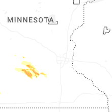
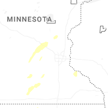
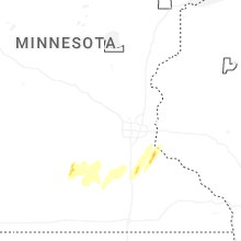


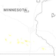
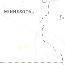


Connect with Interactive Hail Maps