

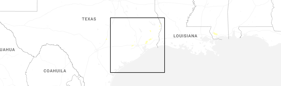
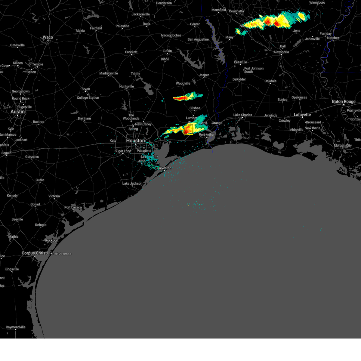
Hail Map for Nome, TX
The Nome, TX area has had 2 reports of on-the-ground hail by trained spotters, and has been under severe weather warnings 7 times during the past 12 months. Doppler radar has detected hail at or near Nome, TX on 47 occasions, including 3 occasions during the past year.
| Name: | Nome, TX |
| Where Located: | 40.3 miles W of Beaumont, TX |
| Map: | Google Map for Nome, TX |
| Population: | 588 |
| Housing Units: | 236 |
| More Info: | Search Google for Nome, TX |
0
The Top Recent Hail Date for Nome, TX is Saturday, May 9, 2026 (32nd out of 47)
Hail and Wind Damage Spotted near Nome, TX
| Date / Time | Report Details |
|---|---|
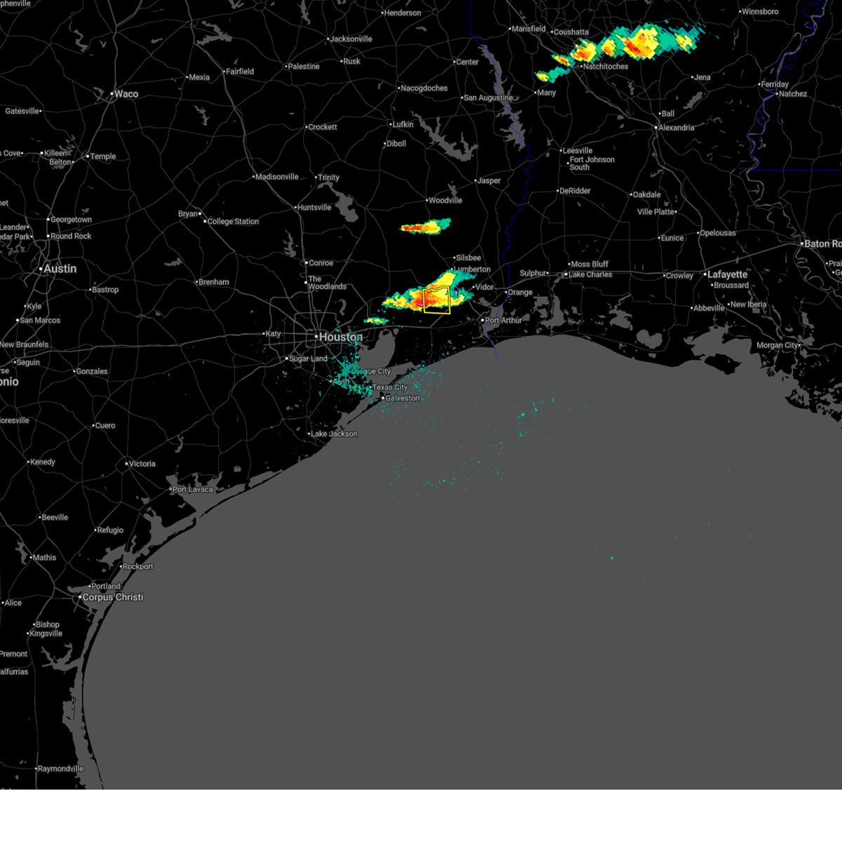
| 5/9/2026 7:20 PM CDT |
 the severe thunderstorm warning has been cancelled and is no longer in effect the severe thunderstorm warning has been cancelled and is no longer in effect
|
| 5/9/2026 7:05 PM CDT |
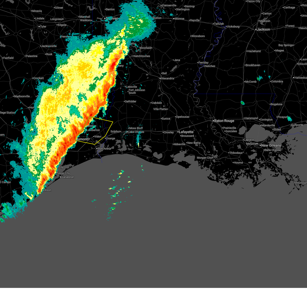
 Svrlch the national weather service in lake charles has issued a * severe thunderstorm warning for, northwestern jefferson county in southeastern texas, south central hardin county in southeastern texas, * until 745 pm cdt. * at 705 pm cdt, a severe thunderstorm was located over sour lake, moving southeast at 10 mph (radar indicated). Hazards include quarter size hail. damage to vehicles is expected Svrlch the national weather service in lake charles has issued a * severe thunderstorm warning for, northwestern jefferson county in southeastern texas, south central hardin county in southeastern texas, * until 745 pm cdt. * at 705 pm cdt, a severe thunderstorm was located over sour lake, moving southeast at 10 mph (radar indicated). Hazards include quarter size hail. damage to vehicles is expected
|
| 2/14/2026 7:36 PM CST |
 At 736 pm cst, severe thunderstorms were located along a line extending from near old salem to near pine forest to near china, moving southeast at 40 mph (radar indicated). Hazards include 70 mph wind gusts. Expect considerable tree damage. damage is likely to mobile homes, roofs, and outbuildings. Locations impacted include, beaumont, orange, nederland, port neches, lumberton, vidor, bridge city, silsbee, deweyville, evadale, central gardens, starks, mauriceville, buna, bevil oaks, china, rose city, pine forest, lakeview, and weiss bluff. At 736 pm cst, severe thunderstorms were located along a line extending from near old salem to near pine forest to near china, moving southeast at 40 mph (radar indicated). Hazards include 70 mph wind gusts. Expect considerable tree damage. damage is likely to mobile homes, roofs, and outbuildings. Locations impacted include, beaumont, orange, nederland, port neches, lumberton, vidor, bridge city, silsbee, deweyville, evadale, central gardens, starks, mauriceville, buna, bevil oaks, china, rose city, pine forest, lakeview, and weiss bluff.
|
| 2/14/2026 7:21 PM CST |
 Svrlch the national weather service in lake charles has issued a * severe thunderstorm warning for, southwestern beauregard parish in southwestern louisiana, northwestern calcasieu parish in southwestern louisiana, northern jefferson county in southeastern texas, southwestern newton county in southeastern texas, eastern hardin county in southeastern texas, orange county in southeastern texas, southeastern jasper county in southeastern texas, * until 800 pm cst. * at 721 pm cst, severe thunderstorms were located along a line extending from 7 miles southwest of call to near lumberton to near sour lake, moving southeast at 40 mph (radar indicated). Hazards include 60 mph wind gusts. expect damage to roofs, siding, and trees Svrlch the national weather service in lake charles has issued a * severe thunderstorm warning for, southwestern beauregard parish in southwestern louisiana, northwestern calcasieu parish in southwestern louisiana, northern jefferson county in southeastern texas, southwestern newton county in southeastern texas, eastern hardin county in southeastern texas, orange county in southeastern texas, southeastern jasper county in southeastern texas, * until 800 pm cst. * at 721 pm cst, severe thunderstorms were located along a line extending from 7 miles southwest of call to near lumberton to near sour lake, moving southeast at 40 mph (radar indicated). Hazards include 60 mph wind gusts. expect damage to roofs, siding, and trees
|
| 2/14/2026 6:52 PM CST |
 the severe thunderstorm warning has been cancelled and is no longer in effect the severe thunderstorm warning has been cancelled and is no longer in effect
|
| 2/14/2026 6:29 PM CST |
 Svrlch the national weather service in lake charles has issued a * severe thunderstorm warning for, northwestern jefferson county in southeastern texas, hardin county in southeastern texas, southeastern jasper county in southeastern texas, * until 715 pm cst. * at 629 pm cst, severe thunderstorms were located along a line extending from near votaw to near dayton lakes to near lake houston dam, moving southeast at 25 mph (radar indicated). Hazards include 60 mph wind gusts. expect damage to roofs, siding, and trees Svrlch the national weather service in lake charles has issued a * severe thunderstorm warning for, northwestern jefferson county in southeastern texas, hardin county in southeastern texas, southeastern jasper county in southeastern texas, * until 715 pm cst. * at 629 pm cst, severe thunderstorms were located along a line extending from near votaw to near dayton lakes to near lake houston dam, moving southeast at 25 mph (radar indicated). Hazards include 60 mph wind gusts. expect damage to roofs, siding, and trees
|
| 10/25/2025 4:51 AM CDT | Svrlch the national weather service in lake charles has issued a * severe thunderstorm warning for, jefferson county in southeastern texas, orange county in southeastern texas, * until 545 am cdt. * at 451 am cdt, severe thunderstorms were located along a line extending from near devers to near smith point, moving east at 35 mph (radar indicated). Hazards include 60 mph wind gusts and penny size hail. expect damage to roofs, siding, and trees |
| 5/20/2025 6:10 PM CDT |
 the severe thunderstorm warning has been cancelled and is no longer in effect the severe thunderstorm warning has been cancelled and is no longer in effect
|
| 5/20/2025 6:01 PM CDT |
 At 601 pm cdt, a severe thunderstorm was located near china, or near nome, moving east at 25 mph (radar indicated). Hazards include 60 mph wind gusts and quarter size hail. Hail damage to vehicles is expected. expect wind damage to roofs, siding, and trees. Locations impacted include, china. At 601 pm cdt, a severe thunderstorm was located near china, or near nome, moving east at 25 mph (radar indicated). Hazards include 60 mph wind gusts and quarter size hail. Hail damage to vehicles is expected. expect wind damage to roofs, siding, and trees. Locations impacted include, china.
|
| 5/20/2025 5:42 PM CDT |
 Svrlch the national weather service in lake charles has issued a * severe thunderstorm warning for, northwestern jefferson county in southeastern texas, * until 630 pm cdt. * at 541 pm cdt, a severe thunderstorm was located near nome, moving east at 20 mph (radar indicated). Hazards include 60 mph wind gusts and half dollar size hail. Hail damage to vehicles is expected. Expect wind damage to roofs, siding, and trees. Svrlch the national weather service in lake charles has issued a * severe thunderstorm warning for, northwestern jefferson county in southeastern texas, * until 630 pm cdt. * at 541 pm cdt, a severe thunderstorm was located near nome, moving east at 20 mph (radar indicated). Hazards include 60 mph wind gusts and half dollar size hail. Hail damage to vehicles is expected. Expect wind damage to roofs, siding, and trees.
|
| 12/26/2024 6:09 PM CST |
 Svrlch the national weather service in lake charles has issued a * severe thunderstorm warning for, northwestern jefferson county in southeastern texas, * until 700 pm cst. * at 608 pm cst, a severe thunderstorm was located near nome, moving east at 25 mph (radar indicated). Hazards include 60 mph wind gusts and penny size hail. expect damage to roofs, siding, and trees Svrlch the national weather service in lake charles has issued a * severe thunderstorm warning for, northwestern jefferson county in southeastern texas, * until 700 pm cst. * at 608 pm cst, a severe thunderstorm was located near nome, moving east at 25 mph (radar indicated). Hazards include 60 mph wind gusts and penny size hail. expect damage to roofs, siding, and trees
|
| 12/26/2024 11:10 AM CST |
 Svrlch the national weather service in lake charles has issued a * severe thunderstorm warning for, northwestern jefferson county in southeastern texas, eastern hardin county in southeastern texas, * until noon cst. * at 1110 am cst, a severe thunderstorm was located over nome, moving northeast at 35 mph (radar indicated). Hazards include 60 mph wind gusts and quarter size hail. Hail damage to vehicles is expected. Expect wind damage to roofs, siding, and trees. Svrlch the national weather service in lake charles has issued a * severe thunderstorm warning for, northwestern jefferson county in southeastern texas, eastern hardin county in southeastern texas, * until noon cst. * at 1110 am cst, a severe thunderstorm was located over nome, moving northeast at 35 mph (radar indicated). Hazards include 60 mph wind gusts and quarter size hail. Hail damage to vehicles is expected. Expect wind damage to roofs, siding, and trees.
|
| 7/8/2024 10:55 AM CDT |
 The tornado warning that was previously in effect has been reissued for hardin county and is in effect until 1115 am cdt. please refer to that bulletin for the latest severe weather information. a tornado watch remains in effect until 1000 pm cdt for southeastern texas. The tornado warning that was previously in effect has been reissued for hardin county and is in effect until 1115 am cdt. please refer to that bulletin for the latest severe weather information. a tornado watch remains in effect until 1000 pm cdt for southeastern texas.
|
| 7/8/2024 10:45 AM CDT |
 At 1045 am cdt, a severe thunderstorm capable of producing a tornado was located over china, or near nome, moving north at 60 mph (radar indicated rotation). Hazards include tornado. Flying debris will be dangerous to those caught without shelter. mobile homes will be damaged or destroyed. damage to roofs, windows, and vehicles will occur. tree damage is likely. This dangerous storm will be near, sour lake, bevil oaks, and china around 1050 am cdt. At 1045 am cdt, a severe thunderstorm capable of producing a tornado was located over china, or near nome, moving north at 60 mph (radar indicated rotation). Hazards include tornado. Flying debris will be dangerous to those caught without shelter. mobile homes will be damaged or destroyed. damage to roofs, windows, and vehicles will occur. tree damage is likely. This dangerous storm will be near, sour lake, bevil oaks, and china around 1050 am cdt.
|
| 7/8/2024 10:36 AM CDT |
 Torlch the national weather service in lake charles has issued a * tornado warning for, northwestern jefferson county in southeastern texas, south central hardin county in southeastern texas, * until 1100 am cdt. * at 1035 am cdt, a severe thunderstorm capable of producing a tornado was located over hamshire, moving north at 75 mph (radar indicated rotation). Hazards include tornado. Flying debris will be dangerous to those caught without shelter. mobile homes will be damaged or destroyed. damage to roofs, windows, and vehicles will occur. tree damage is likely. this dangerous storm will be near, beaumont, nome, and china around 1040 am cdt. sour lake and bevil oaks around 1045 am cdt. This includes interstate 10 in texas between mile markers 839 and 832. Torlch the national weather service in lake charles has issued a * tornado warning for, northwestern jefferson county in southeastern texas, south central hardin county in southeastern texas, * until 1100 am cdt. * at 1035 am cdt, a severe thunderstorm capable of producing a tornado was located over hamshire, moving north at 75 mph (radar indicated rotation). Hazards include tornado. Flying debris will be dangerous to those caught without shelter. mobile homes will be damaged or destroyed. damage to roofs, windows, and vehicles will occur. tree damage is likely. this dangerous storm will be near, beaumont, nome, and china around 1040 am cdt. sour lake and bevil oaks around 1045 am cdt. This includes interstate 10 in texas between mile markers 839 and 832.
|
| 5/30/2024 8:40 PM CDT |
 The storms which prompted the warning have weakened below severe limits, and no longer pose an immediate threat to life or property. therefore, the warning will be allowed to expire. a severe thunderstorm watch remains in effect until 1100 pm cdt for southwestern and west central louisiana, and southeastern texas. The storms which prompted the warning have weakened below severe limits, and no longer pose an immediate threat to life or property. therefore, the warning will be allowed to expire. a severe thunderstorm watch remains in effect until 1100 pm cdt for southwestern and west central louisiana, and southeastern texas.
|
| 5/30/2024 8:11 PM CDT |
 Svrlch the national weather service in lake charles has issued a * severe thunderstorm warning for, western beauregard parish in southwestern louisiana, southwestern vernon parish in west central louisiana, northwestern jefferson county in southeastern texas, southern tyler county in southeastern texas, newton county in southeastern texas, hardin county in southeastern texas, northwestern orange county in southeastern texas, jasper county in southeastern texas, * until 845 pm cdt. * at 811 pm cdt, severe thunderstorms were located along a line extending from near newton to near fred to near honey island, moving south at 45 mph (radar indicated). Hazards include 60 mph wind gusts and nickel size hail. expect damage to roofs, siding, and trees Svrlch the national weather service in lake charles has issued a * severe thunderstorm warning for, western beauregard parish in southwestern louisiana, southwestern vernon parish in west central louisiana, northwestern jefferson county in southeastern texas, southern tyler county in southeastern texas, newton county in southeastern texas, hardin county in southeastern texas, northwestern orange county in southeastern texas, jasper county in southeastern texas, * until 845 pm cdt. * at 811 pm cdt, severe thunderstorms were located along a line extending from near newton to near fred to near honey island, moving south at 45 mph (radar indicated). Hazards include 60 mph wind gusts and nickel size hail. expect damage to roofs, siding, and trees
|
| 5/28/2024 1:37 PM CDT |
 Svrlch the national weather service in lake charles has issued a * severe thunderstorm warning for, jefferson county in southeastern texas, southeastern tyler county in southeastern texas, southwestern newton county in southeastern texas, hardin county in southeastern texas, orange county in southeastern texas, southeastern jasper county in southeastern texas, * until 215 pm cdt. * at 136 pm cdt, severe thunderstorms were located along a line extending from 6 miles southwest of spurger to near kountze to hardin, moving southeast at 35 mph (radar indicated). Hazards include 60 mph wind gusts and quarter size hail. Hail damage to vehicles is expected. Expect wind damage to roofs, siding, and trees. Svrlch the national weather service in lake charles has issued a * severe thunderstorm warning for, jefferson county in southeastern texas, southeastern tyler county in southeastern texas, southwestern newton county in southeastern texas, hardin county in southeastern texas, orange county in southeastern texas, southeastern jasper county in southeastern texas, * until 215 pm cdt. * at 136 pm cdt, severe thunderstorms were located along a line extending from 6 miles southwest of spurger to near kountze to hardin, moving southeast at 35 mph (radar indicated). Hazards include 60 mph wind gusts and quarter size hail. Hail damage to vehicles is expected. Expect wind damage to roofs, siding, and trees.
|
| 5/12/2024 12:56 PM CDT |
 The severe thunderstorm which prompted the warning continues. please see severe number 116 for more information. therefore, the warning will be allowed to expire. a tornado watch remains in effect until 700 pm cdt for southeastern texas. The severe thunderstorm which prompted the warning continues. please see severe number 116 for more information. therefore, the warning will be allowed to expire. a tornado watch remains in effect until 700 pm cdt for southeastern texas.
|
| 5/12/2024 12:40 PM CDT |
 At 1240 pm cdt, a severe thunderstorm was located over fannett, or near hamshire, moving east at 25 mph (radar indicated). Hazards include two inch hail and 60 mph wind gusts. People and animals outdoors will be injured. expect hail damage to roofs, siding, windows, and vehicles. expect wind damage to roofs, siding, and trees. Locations impacted include, beaumont, port arthur, sour lake, nome, hamshire, bevil oaks, china, rose city, lakeview, port acres, fannett, la belle, and southeast texas regional airport. At 1240 pm cdt, a severe thunderstorm was located over fannett, or near hamshire, moving east at 25 mph (radar indicated). Hazards include two inch hail and 60 mph wind gusts. People and animals outdoors will be injured. expect hail damage to roofs, siding, windows, and vehicles. expect wind damage to roofs, siding, and trees. Locations impacted include, beaumont, port arthur, sour lake, nome, hamshire, bevil oaks, china, rose city, lakeview, port acres, fannett, la belle, and southeast texas regional airport.
|
| 5/12/2024 12:25 PM CDT |
 At 1225 pm cdt, a severe thunderstorm was located near hamshire, moving east at 35 mph (radar indicated). Hazards include ping pong ball size hail and 60 mph wind gusts. People and animals outdoors will be injured. expect hail damage to roofs, siding, windows, and vehicles. expect wind damage to roofs, siding, and trees. Locations impacted include, beaumont, port arthur, sour lake, nome, hamshire, bevil oaks, china, rose city, lakeview, port acres, fannett, la belle, and southeast texas regional airport. At 1225 pm cdt, a severe thunderstorm was located near hamshire, moving east at 35 mph (radar indicated). Hazards include ping pong ball size hail and 60 mph wind gusts. People and animals outdoors will be injured. expect hail damage to roofs, siding, windows, and vehicles. expect wind damage to roofs, siding, and trees. Locations impacted include, beaumont, port arthur, sour lake, nome, hamshire, bevil oaks, china, rose city, lakeview, port acres, fannett, la belle, and southeast texas regional airport.
|
| 5/12/2024 11:57 AM CDT |
 Svrlch the national weather service in lake charles has issued a * severe thunderstorm warning for, jefferson county in southeastern texas, southeastern hardin county in southeastern texas, northwestern orange county in southeastern texas, * until 100 pm cdt. * at 1157 am cdt, a severe thunderstorm was located 9 miles southwest of devers, or 12 miles southeast of liberty, moving east at 30 mph (radar indicated). Hazards include 60 mph wind gusts and quarter size hail. Hail damage to vehicles is expected. Expect wind damage to roofs, siding, and trees. Svrlch the national weather service in lake charles has issued a * severe thunderstorm warning for, jefferson county in southeastern texas, southeastern hardin county in southeastern texas, northwestern orange county in southeastern texas, * until 100 pm cdt. * at 1157 am cdt, a severe thunderstorm was located 9 miles southwest of devers, or 12 miles southeast of liberty, moving east at 30 mph (radar indicated). Hazards include 60 mph wind gusts and quarter size hail. Hail damage to vehicles is expected. Expect wind damage to roofs, siding, and trees.
|
| 4/10/2024 6:00 AM CDT |
 the severe thunderstorm warning has been cancelled and is no longer in effect the severe thunderstorm warning has been cancelled and is no longer in effect
|
| 4/10/2024 5:55 AM CDT |
 The storms which prompted the warning continues and is replaced by warning number 67. therefore, the warning will be allowed to expire. a tornado watch remains in effect until 900 am cdt for southeastern texas. remember, a severe thunderstorm warning still remains in effect for jefferson county. The storms which prompted the warning continues and is replaced by warning number 67. therefore, the warning will be allowed to expire. a tornado watch remains in effect until 900 am cdt for southeastern texas. remember, a severe thunderstorm warning still remains in effect for jefferson county.
|
| 4/10/2024 5:20 AM CDT |
 the severe thunderstorm warning has been cancelled and is no longer in effect the severe thunderstorm warning has been cancelled and is no longer in effect
|
| 4/10/2024 5:19 AM CDT |
 Svrlch the national weather service in lake charles has issued a * severe thunderstorm warning for, west central calcasieu parish in southwestern louisiana, northwestern jefferson county in southeastern texas, southeastern tyler county in southeastern texas, southwestern newton county in southeastern texas, hardin county in southeastern texas, northern orange county in southeastern texas, southeastern jasper county in southeastern texas, * until 615 am cdt. * at 518 am cdt, severe thunderstorms were located along a line extending from village mills to near kountze to near nome, moving east at 35 mph (radar indicated). Hazards include 60 mph wind gusts. expect damage to roofs, siding, and trees Svrlch the national weather service in lake charles has issued a * severe thunderstorm warning for, west central calcasieu parish in southwestern louisiana, northwestern jefferson county in southeastern texas, southeastern tyler county in southeastern texas, southwestern newton county in southeastern texas, hardin county in southeastern texas, northern orange county in southeastern texas, southeastern jasper county in southeastern texas, * until 615 am cdt. * at 518 am cdt, severe thunderstorms were located along a line extending from village mills to near kountze to near nome, moving east at 35 mph (radar indicated). Hazards include 60 mph wind gusts. expect damage to roofs, siding, and trees
|
| 4/10/2024 5:11 AM CDT |
 At 511 am cdt, severe thunderstorms were located along a line extending from 7 miles west of winnie to 6 miles north of high island to 7 miles southeast of gilchrist, moving east at 45 mph (radar indicated). Hazards include 60 mph wind gusts. Expect damage to roofs, siding, and trees. Locations impacted include, beaumont, port arthur, nederland, groves, port neches, vidor, hamshire, central gardens, sabine pass, china, rose city, port acres, fannett, la belle, southeast texas regional airport, and sea rim state park. At 511 am cdt, severe thunderstorms were located along a line extending from 7 miles west of winnie to 6 miles north of high island to 7 miles southeast of gilchrist, moving east at 45 mph (radar indicated). Hazards include 60 mph wind gusts. Expect damage to roofs, siding, and trees. Locations impacted include, beaumont, port arthur, nederland, groves, port neches, vidor, hamshire, central gardens, sabine pass, china, rose city, port acres, fannett, la belle, southeast texas regional airport, and sea rim state park.
|
| 4/10/2024 5:03 AM CDT |
 At 503 am cdt, severe thunderstorms were located along a line extending from near wildwood to near honey island to devers, moving east at 40 mph (radar indicated). Hazards include 60 mph wind gusts. Expect damage to roofs, siding, and trees. Locations impacted include, beaumont, lumberton, silsbee, kountze, sour lake, nome, saratoga, hamshire, wildwood, thicket, bevil oaks, china, votaw, honey island, batson, and village mills. At 503 am cdt, severe thunderstorms were located along a line extending from near wildwood to near honey island to devers, moving east at 40 mph (radar indicated). Hazards include 60 mph wind gusts. Expect damage to roofs, siding, and trees. Locations impacted include, beaumont, lumberton, silsbee, kountze, sour lake, nome, saratoga, hamshire, wildwood, thicket, bevil oaks, china, votaw, honey island, batson, and village mills.
|
| 4/10/2024 5:01 AM CDT |
 Svrlch the national weather service in lake charles has issued a * severe thunderstorm warning for, jefferson county in southeastern texas, southwestern orange county in southeastern texas, * until 600 am cdt. * at 500 am cdt, severe thunderstorms were located along a line extending from near anahuac to 7 miles north of gilchrist to 7 miles south of bolivar peninsula, moving east at 45 mph (radar indicated). Hazards include 60 mph wind gusts. expect damage to roofs, siding, and trees Svrlch the national weather service in lake charles has issued a * severe thunderstorm warning for, jefferson county in southeastern texas, southwestern orange county in southeastern texas, * until 600 am cdt. * at 500 am cdt, severe thunderstorms were located along a line extending from near anahuac to 7 miles north of gilchrist to 7 miles south of bolivar peninsula, moving east at 45 mph (radar indicated). Hazards include 60 mph wind gusts. expect damage to roofs, siding, and trees
|
| 4/10/2024 4:36 AM CDT |
 Svrlch the national weather service in lake charles has issued a * severe thunderstorm warning for, northwestern jefferson county in southeastern texas, south central tyler county in southeastern texas, hardin county in southeastern texas, * until 530 am cdt. * at 436 am cdt, severe thunderstorms were located along a line extending from 9 miles west of votaw to near hardin to near mont belvieu, moving east at 35 mph (radar indicated). Hazards include 60 mph wind gusts. expect damage to roofs, siding, and trees Svrlch the national weather service in lake charles has issued a * severe thunderstorm warning for, northwestern jefferson county in southeastern texas, south central tyler county in southeastern texas, hardin county in southeastern texas, * until 530 am cdt. * at 436 am cdt, severe thunderstorms were located along a line extending from 9 miles west of votaw to near hardin to near mont belvieu, moving east at 35 mph (radar indicated). Hazards include 60 mph wind gusts. expect damage to roofs, siding, and trees
|
| 3/21/2024 10:55 PM CDT |
 The storm which prompted the warning has weakened below severe limits, and has exited the warned area. therefore, the warning will be allowed to expire. remember, a severe thunderstorm warning still remains in effect for portions of hardin and jefferson counties. The storm which prompted the warning has weakened below severe limits, and has exited the warned area. therefore, the warning will be allowed to expire. remember, a severe thunderstorm warning still remains in effect for portions of hardin and jefferson counties.
|
| 3/21/2024 10:53 PM CDT |
 Svrlch the national weather service in lake charles has issued a * severe thunderstorm warning for, northwestern jefferson county in southeastern texas, southeastern hardin county in southeastern texas, west central orange county in southeastern texas, * until midnight cdt. * at 1053 pm cdt, a severe thunderstorm was located near devers, or 7 miles west of nome, moving east at 25 mph (radar indicated). Hazards include half dollar size hail. damage to vehicles is expected Svrlch the national weather service in lake charles has issued a * severe thunderstorm warning for, northwestern jefferson county in southeastern texas, southeastern hardin county in southeastern texas, west central orange county in southeastern texas, * until midnight cdt. * at 1053 pm cdt, a severe thunderstorm was located near devers, or 7 miles west of nome, moving east at 25 mph (radar indicated). Hazards include half dollar size hail. damage to vehicles is expected
|
| 3/21/2024 10:49 PM CDT |
 At 1049 pm cdt, a severe thunderstorm was located near sour lake, moving east at 30 mph (radar indicated). Hazards include quarter size hail. Damage to vehicles is expected. Locations impacted include, kountze, sour lake, nome, saratoga, bevil oaks, china, and batson. At 1049 pm cdt, a severe thunderstorm was located near sour lake, moving east at 30 mph (radar indicated). Hazards include quarter size hail. Damage to vehicles is expected. Locations impacted include, kountze, sour lake, nome, saratoga, bevil oaks, china, and batson.
|
| 3/21/2024 10:00 PM CDT |
 Svrlch the national weather service in lake charles has issued a * severe thunderstorm warning for, northwestern jefferson county in southeastern texas, western hardin county in southeastern texas, * until 1100 pm cdt. * at 959 pm cdt, a severe thunderstorm was located near dayton lakes, or 9 miles north of dayton, moving east at 30 mph (radar indicated). Hazards include ping pong ball size hail and 60 mph wind gusts. People and animals outdoors will be injured. expect hail damage to roofs, siding, windows, and vehicles. Expect wind damage to roofs, siding, and trees. Svrlch the national weather service in lake charles has issued a * severe thunderstorm warning for, northwestern jefferson county in southeastern texas, western hardin county in southeastern texas, * until 1100 pm cdt. * at 959 pm cdt, a severe thunderstorm was located near dayton lakes, or 9 miles north of dayton, moving east at 30 mph (radar indicated). Hazards include ping pong ball size hail and 60 mph wind gusts. People and animals outdoors will be injured. expect hail damage to roofs, siding, windows, and vehicles. Expect wind damage to roofs, siding, and trees.
|
| 12/9/2023 7:22 PM CST |
 The severe thunderstorm warning for northwestern jefferson and southeastern hardin counties will expire at 730 pm cst, the storm which prompted the warning has weakened below severe limits, and no longer poses an immediate threat to life or property. therefore, the warning will be allowed to expire. &&. The severe thunderstorm warning for northwestern jefferson and southeastern hardin counties will expire at 730 pm cst, the storm which prompted the warning has weakened below severe limits, and no longer poses an immediate threat to life or property. therefore, the warning will be allowed to expire. &&.
|
| 12/9/2023 6:51 PM CST |
 At 651 pm cst, a severe thunderstorm was located over nome, moving east at 25 mph (radar indicated). Hazards include 60 mph wind gusts and quarter size hail. Hail damage to vehicles is expected. Expect wind damage to roofs, siding, and trees. At 651 pm cst, a severe thunderstorm was located over nome, moving east at 25 mph (radar indicated). Hazards include 60 mph wind gusts and quarter size hail. Hail damage to vehicles is expected. Expect wind damage to roofs, siding, and trees.
|
| 9/8/2023 2:07 PM CDT |
 At 207 pm cdt, severe thunderstorms were located along a line extending from near village mills to near vinton, moving southwest at 30 mph (radar indicated). Hazards include 60 mph wind gusts and penny size hail. expect damage to roofs, siding, and trees At 207 pm cdt, severe thunderstorms were located along a line extending from near village mills to near vinton, moving southwest at 30 mph (radar indicated). Hazards include 60 mph wind gusts and penny size hail. expect damage to roofs, siding, and trees
|
| 5/6/2023 3:21 AM CDT |
 The severe thunderstorm warning for northwestern jefferson and hardin counties will expire at 330 am cdt, the storm which prompted the warning has weakened below severe limits, and no longer poses an immediate threat to life or property. therefore, the warning will be allowed to expire. however small hail and gusty winds are still possible with this thunderstorm. to report severe weather, contact your nearest law enforcement agency. they will relay your report to the national weather service lake charles. The severe thunderstorm warning for northwestern jefferson and hardin counties will expire at 330 am cdt, the storm which prompted the warning has weakened below severe limits, and no longer poses an immediate threat to life or property. therefore, the warning will be allowed to expire. however small hail and gusty winds are still possible with this thunderstorm. to report severe weather, contact your nearest law enforcement agency. they will relay your report to the national weather service lake charles.
|
| 5/6/2023 2:43 AM CDT |
 At 242 am cdt, a severe thunderstorm was located over hardin, or near liberty, moving east at 40 mph (radar indicated). Hazards include 60 mph wind gusts and quarter size hail. Hail damage to vehicles is expected. Expect wind damage to roofs, siding, and trees. At 242 am cdt, a severe thunderstorm was located over hardin, or near liberty, moving east at 40 mph (radar indicated). Hazards include 60 mph wind gusts and quarter size hail. Hail damage to vehicles is expected. Expect wind damage to roofs, siding, and trees.
|
| 1/24/2023 3:45 PM CST | Significant structural damage in the nome area possibly from a tornad in jefferson county TX, 1.4 miles E of Nome, TX |
| 1/24/2023 3:41 PM CST |
 At 341 pm cst, severe thunderstorms were located along a line extending from 6 miles west of lumberton to near beaumont to near stowell, moving northeast at 50 mph (radar indicated). Hazards include 60 mph wind gusts. Expect damage to roofs, siding, and trees. Locations impacted include, beaumont, port arthur, nederland, groves, port neches, lumberton, vidor, bridge city, silsbee, sour lake, nome, hamshire, evadale, central gardens, bevil oaks, china, rose city, pine forest, lakeview and weiss bluff. At 341 pm cst, severe thunderstorms were located along a line extending from 6 miles west of lumberton to near beaumont to near stowell, moving northeast at 50 mph (radar indicated). Hazards include 60 mph wind gusts. Expect damage to roofs, siding, and trees. Locations impacted include, beaumont, port arthur, nederland, groves, port neches, lumberton, vidor, bridge city, silsbee, sour lake, nome, hamshire, evadale, central gardens, bevil oaks, china, rose city, pine forest, lakeview and weiss bluff.
|
| 1/24/2023 3:25 PM CST |
 At 325 pm cst, a severe thunderstorm capable of producing a tornado was located near nome, moving northeast at 45 mph (radar indicated rotation). Hazards include tornado. Flying debris will be dangerous to those caught without shelter. mobile homes will be damaged or destroyed. damage to roofs, windows, and vehicles will occur. tree damage is likely. this dangerous storm will be near, nome around 330 pm cst. sour lake around 335 pm cst. china around 340 pm cst. bevil oaks around 345 pm cst. beaumont around 355 pm cst. vidor, rose city, pine forest and lakeview around 400 pm cst. This includes interstate 10 in texas between mile markers 862 and 844. At 325 pm cst, a severe thunderstorm capable of producing a tornado was located near nome, moving northeast at 45 mph (radar indicated rotation). Hazards include tornado. Flying debris will be dangerous to those caught without shelter. mobile homes will be damaged or destroyed. damage to roofs, windows, and vehicles will occur. tree damage is likely. this dangerous storm will be near, nome around 330 pm cst. sour lake around 335 pm cst. china around 340 pm cst. bevil oaks around 345 pm cst. beaumont around 355 pm cst. vidor, rose city, pine forest and lakeview around 400 pm cst. This includes interstate 10 in texas between mile markers 862 and 844.
|
| 1/24/2023 3:19 PM CST |
 At 318 pm cst, severe thunderstorms were located along a line extending from near daisetta to 6 miles southeast of devers to 9 miles north of bolivar peninsula, moving northeast at 45 mph (radar indicated). Hazards include 60 mph wind gusts and penny size hail. expect damage to roofs, siding, and trees At 318 pm cst, severe thunderstorms were located along a line extending from near daisetta to 6 miles southeast of devers to 9 miles north of bolivar peninsula, moving northeast at 45 mph (radar indicated). Hazards include 60 mph wind gusts and penny size hail. expect damage to roofs, siding, and trees
|
| 12/30/2022 1:49 AM CST |
 At 149 am cst, a severe thunderstorm was located near fannett, or 7 miles north of hamshire, moving northeast at 55 mph (radar indicated). Hazards include 60 mph wind gusts and nickel size hail. Expect damage to roofs, siding, and trees. locations impacted include, beaumont, port arthur, nederland, port neches, vidor, bridge city, nome, hamshire, central gardens, china, rose city, pine forest, orangefield, fannett, la belle and southeast texas regional airport. hail threat, radar indicated max hail size, 0. 88 in wind threat, radar indicated max wind gust, 60 mph. At 149 am cst, a severe thunderstorm was located near fannett, or 7 miles north of hamshire, moving northeast at 55 mph (radar indicated). Hazards include 60 mph wind gusts and nickel size hail. Expect damage to roofs, siding, and trees. locations impacted include, beaumont, port arthur, nederland, port neches, vidor, bridge city, nome, hamshire, central gardens, china, rose city, pine forest, orangefield, fannett, la belle and southeast texas regional airport. hail threat, radar indicated max hail size, 0. 88 in wind threat, radar indicated max wind gust, 60 mph.
|
| 12/30/2022 1:27 AM CST |
 At 127 am cst, a severe thunderstorm was located 8 miles west of winnie, or 12 miles west of hamshire, moving northeast at 55 mph (radar indicated). Hazards include 60 mph wind gusts and nickel size hail. expect damage to roofs, siding, and trees At 127 am cst, a severe thunderstorm was located 8 miles west of winnie, or 12 miles west of hamshire, moving northeast at 55 mph (radar indicated). Hazards include 60 mph wind gusts and nickel size hail. expect damage to roofs, siding, and trees
|
| 3/22/2022 8:39 AM CDT |
 At 839 am cdt, a severe thunderstorm was located over bevil oaks, or near sour lake, moving northeast at 60 mph (radar indicated). Hazards include 60 mph wind gusts and penny size hail. expect damage to roofs, siding, and trees At 839 am cdt, a severe thunderstorm was located over bevil oaks, or near sour lake, moving northeast at 60 mph (radar indicated). Hazards include 60 mph wind gusts and penny size hail. expect damage to roofs, siding, and trees
|
| 11/11/2021 7:33 AM CST |
 At 733 am cst, a severe thunderstorm was located near beaumont, moving southeast at 30 mph (radar indicated). Hazards include 60 mph wind gusts and penny size hail. Expect damage to roofs, siding, and trees. locations impacted include, beaumont, china and fannett. hail threat, radar indicated max hail size, 0. 75 in wind threat, radar indicated max wind gust, 60 mph. At 733 am cst, a severe thunderstorm was located near beaumont, moving southeast at 30 mph (radar indicated). Hazards include 60 mph wind gusts and penny size hail. Expect damage to roofs, siding, and trees. locations impacted include, beaumont, china and fannett. hail threat, radar indicated max hail size, 0. 75 in wind threat, radar indicated max wind gust, 60 mph.
|
| 11/11/2021 7:20 AM CST |
 At 719 am cst, a severe thunderstorm was located over bevil oaks, or near sour lake, moving southeast at 30 mph (radar indicated). Hazards include 60 mph wind gusts and penny size hail. Expect damage to roofs, siding, and trees. locations impacted include, beaumont, sour lake, bevil oaks, china and fannett. hail threat, radar indicated max hail size, 0. 75 in wind threat, radar indicated max wind gust, 60 mph. At 719 am cst, a severe thunderstorm was located over bevil oaks, or near sour lake, moving southeast at 30 mph (radar indicated). Hazards include 60 mph wind gusts and penny size hail. Expect damage to roofs, siding, and trees. locations impacted include, beaumont, sour lake, bevil oaks, china and fannett. hail threat, radar indicated max hail size, 0. 75 in wind threat, radar indicated max wind gust, 60 mph.
|
| 11/11/2021 7:05 AM CST |
 At 704 am cst, a severe thunderstorm was located near sour lake, moving southeast at 30 mph (radar indicated). Hazards include 60 mph wind gusts and penny size hail. expect damage to roofs, siding, and trees At 704 am cst, a severe thunderstorm was located near sour lake, moving southeast at 30 mph (radar indicated). Hazards include 60 mph wind gusts and penny size hail. expect damage to roofs, siding, and trees
|
| 10/27/2021 10:35 AM CDT |
 At 1035 am cdt, a severe thunderstorm was located near fannett, or 7 miles north of hamshire, moving northeast at 30 mph (radar indicated). Hazards include 60 mph wind gusts. expect damage to roofs, siding, and trees At 1035 am cdt, a severe thunderstorm was located near fannett, or 7 miles north of hamshire, moving northeast at 30 mph (radar indicated). Hazards include 60 mph wind gusts. expect damage to roofs, siding, and trees
|
| 6/15/2021 5:39 PM CDT |
 At 538 pm cdt, severe thunderstorms were located along a line extending from near sour lake to near bevil oaks to near beaumont to near la belle, moving southwest at 15 mph (radar indicated). Hazards include 60 mph wind gusts and quarter size hail. Hail damage to vehicles is expected. Expect wind damage to roofs, siding, and trees. At 538 pm cdt, severe thunderstorms were located along a line extending from near sour lake to near bevil oaks to near beaumont to near la belle, moving southwest at 15 mph (radar indicated). Hazards include 60 mph wind gusts and quarter size hail. Hail damage to vehicles is expected. Expect wind damage to roofs, siding, and trees.
|
| 8/28/2020 3:49 PM CDT |
 At 348 pm cdt, a severe thunderstorm was located near sour lake, moving east at 15 mph (radar indicated). Hazards include 60 mph wind gusts and penny size hail. Expect damage to roofs, siding, and trees. locations impacted include, beaumont, lumberton, silsbee, sour lake, nome, bevil oaks and china. This includes interstate 10 in texas between mile markers 854 and 839. At 348 pm cdt, a severe thunderstorm was located near sour lake, moving east at 15 mph (radar indicated). Hazards include 60 mph wind gusts and penny size hail. Expect damage to roofs, siding, and trees. locations impacted include, beaumont, lumberton, silsbee, sour lake, nome, bevil oaks and china. This includes interstate 10 in texas between mile markers 854 and 839.
|
| 8/28/2020 3:32 PM CDT |
 At 331 pm cdt, a severe thunderstorm was located over sour lake, moving east at 15 mph (radar indicated). Hazards include 60 mph wind gusts and penny size hail. expect damage to roofs, siding, and trees At 331 pm cdt, a severe thunderstorm was located over sour lake, moving east at 15 mph (radar indicated). Hazards include 60 mph wind gusts and penny size hail. expect damage to roofs, siding, and trees
|
| 5/28/2020 1:29 PM CDT |
 At 129 pm cdt, a severe thunderstorm was located near china, or near sour lake, moving northeast at 15 mph (radar indicated). Hazards include 60 mph wind gusts and quarter size hail. Hail damage to vehicles is expected. Expect wind damage to roofs, siding, and trees. At 129 pm cdt, a severe thunderstorm was located near china, or near sour lake, moving northeast at 15 mph (radar indicated). Hazards include 60 mph wind gusts and quarter size hail. Hail damage to vehicles is expected. Expect wind damage to roofs, siding, and trees.
|
| 5/28/2020 12:24 PM CDT |
 At 1223 pm cdt, a severe thunderstorm was located near china, or near sour lake, moving northeast at 15 mph (radar indicated). Hazards include 60 mph wind gusts and quarter size hail. Hail damage to vehicles is expected. Expect wind damage to roofs, siding, and trees. At 1223 pm cdt, a severe thunderstorm was located near china, or near sour lake, moving northeast at 15 mph (radar indicated). Hazards include 60 mph wind gusts and quarter size hail. Hail damage to vehicles is expected. Expect wind damage to roofs, siding, and trees.
|
| 5/27/2020 4:49 PM CDT |
 At 449 pm cdt, a severe thunderstorm was located over china, or near nome, moving east at 15 mph (radar indicated). Hazards include quarter size hail. damage to vehicles is expected At 449 pm cdt, a severe thunderstorm was located over china, or near nome, moving east at 15 mph (radar indicated). Hazards include quarter size hail. damage to vehicles is expected
|
| 5/26/2020 8:09 PM CDT |
 At 809 pm cdt, a severe thunderstorm was located near nome, moving northeast at 25 mph (radar indicated). Hazards include quarter size hail. Damage to vehicles is expected. Locations impacted include, sour lake, nome and bevil oaks. At 809 pm cdt, a severe thunderstorm was located near nome, moving northeast at 25 mph (radar indicated). Hazards include quarter size hail. Damage to vehicles is expected. Locations impacted include, sour lake, nome and bevil oaks.
|
| 5/26/2020 7:46 PM CDT |
 At 746 pm cdt, a severe thunderstorm was located near devers, or 10 miles west of nome, moving northeast at 25 mph (radar indicated). Hazards include quarter size hail. damage to vehicles is expected At 746 pm cdt, a severe thunderstorm was located near devers, or 10 miles west of nome, moving northeast at 25 mph (radar indicated). Hazards include quarter size hail. damage to vehicles is expected
|
| 5/26/2020 7:31 PM CDT |
 At 731 pm cdt, a severe thunderstorm was located near nome, moving east at 25 mph (radar indicated). Hazards include quarter size hail. Damage to vehicles is expected. locations impacted include, sour lake, nome, hamshire, bevil oaks, china, fannett and la belle. This includes interstate 10 in texas between mile markers 844 and 832. At 731 pm cdt, a severe thunderstorm was located near nome, moving east at 25 mph (radar indicated). Hazards include quarter size hail. Damage to vehicles is expected. locations impacted include, sour lake, nome, hamshire, bevil oaks, china, fannett and la belle. This includes interstate 10 in texas between mile markers 844 and 832.
|
| 5/26/2020 7:21 PM CDT |
 At 721 pm cdt, a severe thunderstorm was located near devers, or 9 miles southwest of nome, moving east at 25 mph (radar indicated). Hazards include quarter size hail. damage to vehicles is expected At 721 pm cdt, a severe thunderstorm was located near devers, or 9 miles southwest of nome, moving east at 25 mph (radar indicated). Hazards include quarter size hail. damage to vehicles is expected
|
| 4/18/2020 6:33 PM CDT | Quarter sized hail reported 9.5 miles N of Nome, TX, report received via social media. |
| 4/18/2020 6:27 PM CDT |
 At 627 pm cdt, a severe thunderstorm was located near hamshire, moving east at 35 mph (radar indicated). Hazards include two inch hail and 60 mph wind gusts. People and animals outdoors will be injured. expect hail damage to roofs, siding, windows, and vehicles. expect wind damage to roofs, siding, and trees. locations impacted include, beaumont, port arthur, nederland, groves, port neches, vidor, nome, hamshire, central gardens, china, rose city, port acres, fannett, la belle and southeast texas regional airport. This includes interstate 10 in texas between mile markers 857 and 856, and between mile markers 852 and 832. At 627 pm cdt, a severe thunderstorm was located near hamshire, moving east at 35 mph (radar indicated). Hazards include two inch hail and 60 mph wind gusts. People and animals outdoors will be injured. expect hail damage to roofs, siding, windows, and vehicles. expect wind damage to roofs, siding, and trees. locations impacted include, beaumont, port arthur, nederland, groves, port neches, vidor, nome, hamshire, central gardens, china, rose city, port acres, fannett, la belle and southeast texas regional airport. This includes interstate 10 in texas between mile markers 857 and 856, and between mile markers 852 and 832.
|
| 4/18/2020 6:12 PM CDT |
 At 611 pm cdt, a severe thunderstorm was located 8 miles southeast of devers, or 9 miles southwest of nome, moving east at 35 mph (radar indicated). Hazards include golf ball size hail and 60 mph wind gusts. People and animals outdoors will be injured. expect hail damage to roofs, siding, windows, and vehicles. Expect wind damage to roofs, siding, and trees. At 611 pm cdt, a severe thunderstorm was located 8 miles southeast of devers, or 9 miles southwest of nome, moving east at 35 mph (radar indicated). Hazards include golf ball size hail and 60 mph wind gusts. People and animals outdoors will be injured. expect hail damage to roofs, siding, windows, and vehicles. Expect wind damage to roofs, siding, and trees.
|
| 1/11/2020 1:57 AM CST |
 At 155 am cst, severe thunderstorms were located along a line extending from near pineland to magnolia springs to near gilchrist, moving east at 35 mph (radar indicated. at 1:40 am cst a wind gust to 59 mph was reported by local media at pinewood, texas). Hazards include 60 mph wind gusts. Expect damage to roofs, siding, and trees. locations impacted include, beaumont, port arthur, lumberton, jasper, silsbee, kirbyville, kountze, sour lake, nome, evadale, town bluff, hamshire, fred, buna, bevil oaks, china, rose city, pine forest, browndell and lakeview. This includes interstate 10 in texas between mile markers 860 and 832. At 155 am cst, severe thunderstorms were located along a line extending from near pineland to magnolia springs to near gilchrist, moving east at 35 mph (radar indicated. at 1:40 am cst a wind gust to 59 mph was reported by local media at pinewood, texas). Hazards include 60 mph wind gusts. Expect damage to roofs, siding, and trees. locations impacted include, beaumont, port arthur, lumberton, jasper, silsbee, kirbyville, kountze, sour lake, nome, evadale, town bluff, hamshire, fred, buna, bevil oaks, china, rose city, pine forest, browndell and lakeview. This includes interstate 10 in texas between mile markers 860 and 832.
|
| 1/11/2020 1:31 AM CST |
 At 130 am cst, severe thunderstorms were located along a line extending from 9 miles west of pineland to near spurger to near crystal beach, moving east at 35 mph (radar indicated). Hazards include 60 mph wind gusts. expect damage to roofs, siding, and trees At 130 am cst, severe thunderstorms were located along a line extending from 9 miles west of pineland to near spurger to near crystal beach, moving east at 35 mph (radar indicated). Hazards include 60 mph wind gusts. expect damage to roofs, siding, and trees
|
| 1/11/2020 1:09 AM CST |
 At 109 am cst, severe thunderstorms were located along a line extending from 7 miles east of colmesneil to warren to near batson to 6 miles east of old river-winfree, moving east at 40 mph (radar indicated). Hazards include 60 mph wind gusts. expect damage to roofs, siding, and trees At 109 am cst, severe thunderstorms were located along a line extending from 7 miles east of colmesneil to warren to near batson to 6 miles east of old river-winfree, moving east at 40 mph (radar indicated). Hazards include 60 mph wind gusts. expect damage to roofs, siding, and trees
|
| 4/7/2019 1:56 PM CDT |
 At 155 pm cdt, severe thunderstorms were located along a line extending from 7 miles east of shepherd to near saratoga to 11 miles east of high island, moving northeast at 55 mph (radar indicated). Hazards include 60 mph wind gusts and quarter size hail. Hail damage to vehicles is expected. expect wind damage to roofs, siding, and trees. Locations impacted include, beaumont, port arthur, nederland, groves, port neches, lumberton, vidor, bridge city, silsbee, woodville, kountze, sour lake, nome, central gardens, warren, thicket, saratoga, hamshire, fred and wildwood. At 155 pm cdt, severe thunderstorms were located along a line extending from 7 miles east of shepherd to near saratoga to 11 miles east of high island, moving northeast at 55 mph (radar indicated). Hazards include 60 mph wind gusts and quarter size hail. Hail damage to vehicles is expected. expect wind damage to roofs, siding, and trees. Locations impacted include, beaumont, port arthur, nederland, groves, port neches, lumberton, vidor, bridge city, silsbee, woodville, kountze, sour lake, nome, central gardens, warren, thicket, saratoga, hamshire, fred and wildwood.
|
| 4/7/2019 1:37 PM CDT |
 At 137 pm cdt, severe thunderstorms were located along a line extending from near cleveland to daisetta to 13 miles southeast of gilchrist, moving northeast at 55 mph (radar indicated). Hazards include 60 mph wind gusts and quarter size hail. Hail damage to vehicles is expected. Expect wind damage to roofs, siding, and trees. At 137 pm cdt, severe thunderstorms were located along a line extending from near cleveland to daisetta to 13 miles southeast of gilchrist, moving northeast at 55 mph (radar indicated). Hazards include 60 mph wind gusts and quarter size hail. Hail damage to vehicles is expected. Expect wind damage to roofs, siding, and trees.
|
| 5/26/2018 7:14 PM CDT |
 At 714 pm cdt, a severe thunderstorm was located near hamshire, moving southwest at 25 mph (radar indicated). Hazards include golf ball size hail and 60 mph wind gusts. People and animals outdoors will be injured. expect hail damage to roofs, siding, windows, and vehicles. Expect wind damage to roofs, siding, and trees. At 714 pm cdt, a severe thunderstorm was located near hamshire, moving southwest at 25 mph (radar indicated). Hazards include golf ball size hail and 60 mph wind gusts. People and animals outdoors will be injured. expect hail damage to roofs, siding, windows, and vehicles. Expect wind damage to roofs, siding, and trees.
|
| 8/27/2017 7:24 PM CDT |
 At 723 pm cdt, severe thunderstorms capable of producing a tornado were located along a line extending from near china to 14 miles south of la belle, moving north at 25 mph (radar indicated rotation). Hazards include tornado. Flying debris will be dangerous to those caught without shelter. mobile homes will be damaged or destroyed. damage to roofs, windows, and vehicles will occur. tree damage is likely. these dangerous storms will be near, nome and china around 735 pm cdt. la belle around 755 pm cdt. hamshire around 800 pm cdt. fannett around 805 pm cdt. Other locations impacted by these tornadic storms include sea rim state park. At 723 pm cdt, severe thunderstorms capable of producing a tornado were located along a line extending from near china to 14 miles south of la belle, moving north at 25 mph (radar indicated rotation). Hazards include tornado. Flying debris will be dangerous to those caught without shelter. mobile homes will be damaged or destroyed. damage to roofs, windows, and vehicles will occur. tree damage is likely. these dangerous storms will be near, nome and china around 735 pm cdt. la belle around 755 pm cdt. hamshire around 800 pm cdt. fannett around 805 pm cdt. Other locations impacted by these tornadic storms include sea rim state park.
|
| 8/27/2017 7:00 PM CDT |
 At 659 pm cdt, a band of severe thunderstorms capable of producing a tornado were located along a line extending from near hamshire to 10 miles southeast of stowell, moving north at 30 mph (radar indicated rotation). Hazards include tornado. Flying debris will be dangerous to those caught without shelter. mobile homes will be damaged or destroyed. damage to roofs, windows, and vehicles will occur. tree damage is likely. these dangerous storms will be near, nome and china around 715 pm cdt. hamshire and la belle around 720 pm cdt. fannett around 730 pm cdt. Other locations impacted by these tornadic storms include sea rim state park. At 659 pm cdt, a band of severe thunderstorms capable of producing a tornado were located along a line extending from near hamshire to 10 miles southeast of stowell, moving north at 30 mph (radar indicated rotation). Hazards include tornado. Flying debris will be dangerous to those caught without shelter. mobile homes will be damaged or destroyed. damage to roofs, windows, and vehicles will occur. tree damage is likely. these dangerous storms will be near, nome and china around 715 pm cdt. hamshire and la belle around 720 pm cdt. fannett around 730 pm cdt. Other locations impacted by these tornadic storms include sea rim state park.
|
| 8/27/2017 6:27 PM CDT |
 At 626 pm cdt, a severe thunderstorm capable of producing a tornado was located 7 miles east of stowell, or 8 miles southeast of hamshire, moving northwest at 25 mph (radar indicated rotation). Hazards include tornado. Flying debris will be dangerous to those caught without shelter. mobile homes will be damaged or destroyed. damage to roofs, windows, and vehicles will occur. tree damage is likely. this dangerous storm will be near, hamshire and winnie around 645 pm cdt. fannett around 650 pm cdt. nome and china around 700 pm cdt. Other locations impacted by this tornadic thunderstorm include sea rim state park. At 626 pm cdt, a severe thunderstorm capable of producing a tornado was located 7 miles east of stowell, or 8 miles southeast of hamshire, moving northwest at 25 mph (radar indicated rotation). Hazards include tornado. Flying debris will be dangerous to those caught without shelter. mobile homes will be damaged or destroyed. damage to roofs, windows, and vehicles will occur. tree damage is likely. this dangerous storm will be near, hamshire and winnie around 645 pm cdt. fannett around 650 pm cdt. nome and china around 700 pm cdt. Other locations impacted by this tornadic thunderstorm include sea rim state park.
|
| 8/27/2017 6:02 PM CDT |
 At 602 pm cdt, a severe thunderstorm capable of producing a tornado was located 8 miles northeast of high island, or 16 miles south of hamshire, moving northwest at 25 mph (radar indicated rotation). Hazards include tornado. Flying debris will be dangerous to those caught without shelter. mobile homes will be damaged or destroyed. damage to roofs, windows, and vehicles will occur. tree damage is likely. This dangerous storm will be near, hamshire and winnie around 630 pm cdt. At 602 pm cdt, a severe thunderstorm capable of producing a tornado was located 8 miles northeast of high island, or 16 miles south of hamshire, moving northwest at 25 mph (radar indicated rotation). Hazards include tornado. Flying debris will be dangerous to those caught without shelter. mobile homes will be damaged or destroyed. damage to roofs, windows, and vehicles will occur. tree damage is likely. This dangerous storm will be near, hamshire and winnie around 630 pm cdt.
|
| 8/27/2017 8:52 AM CDT |
 At 851 am cdt, a severe thunderstorm capable of producing a tornado was located over port acres, or 7 miles southwest of nederland, moving north at 30 mph (radar indicated rotation). Hazards include tornado. Flying debris will be dangerous to those caught without shelter. mobile homes will be damaged or destroyed. damage to roofs, windows, and vehicles will occur. tree damage is likely. this dangerous storm will be near, nederland and southeast texas regional airport around 900 am cdt. central gardens around 905 am cdt. Other locations impacted by this tornadic thunderstorm include sea rim state park. At 851 am cdt, a severe thunderstorm capable of producing a tornado was located over port acres, or 7 miles southwest of nederland, moving north at 30 mph (radar indicated rotation). Hazards include tornado. Flying debris will be dangerous to those caught without shelter. mobile homes will be damaged or destroyed. damage to roofs, windows, and vehicles will occur. tree damage is likely. this dangerous storm will be near, nederland and southeast texas regional airport around 900 am cdt. central gardens around 905 am cdt. Other locations impacted by this tornadic thunderstorm include sea rim state park.
|
| 4/29/2017 9:16 AM CDT | Quarter sized hail reported 8.8 miles N of Nome, TX, social media video showed quarter size hail in jefferson county between nome and winnie. |
| 3/29/2017 5:00 PM CDT |
 At 500 pm cdt, severe thunderstorms were located along a line extending from china to near hamshire, moving east at 30 mph (radar indicated). Hazards include 60 mph wind gusts. expect damage to roofs, siding, and trees At 500 pm cdt, severe thunderstorms were located along a line extending from china to near hamshire, moving east at 30 mph (radar indicated). Hazards include 60 mph wind gusts. expect damage to roofs, siding, and trees
|
| 3/29/2017 4:36 PM CDT |
 The severe thunderstorm warning for jefferson, southeastern hardin and western orange counties will expire at 445 pm cdt, the storms which prompted the warning have weakened below severe limits, and no longer pose an immediate threat to life or property. therefore the warning will be allowed to expire. however gusty winds are still possible with these thunderstorms. a tornado watch remains in effect until 900 pm cdt for southeastern texas. The severe thunderstorm warning for jefferson, southeastern hardin and western orange counties will expire at 445 pm cdt, the storms which prompted the warning have weakened below severe limits, and no longer pose an immediate threat to life or property. therefore the warning will be allowed to expire. however gusty winds are still possible with these thunderstorms. a tornado watch remains in effect until 900 pm cdt for southeastern texas.
|
| 3/29/2017 4:20 PM CDT |
 At 420 pm cdt, severe thunderstorms were located along a line extending from 8 miles northwest of bevil oaks to near china to near hamshire, moving northeast at 30 mph (radar indicated). Hazards include 60 mph wind gusts and nickel size hail. Expect damage to roofs, siding, and trees. locations impacted include, beaumont, port arthur, nederland, lumberton, silsbee, sour lake, nome, hamshire, central gardens, bevil oaks, china, rose city, pine forest, lakeview, port acres, fannett, la belle and southeast texas regional airport. A tornado watch remains in effect until 900 pm cdt for southeastern texas. At 420 pm cdt, severe thunderstorms were located along a line extending from 8 miles northwest of bevil oaks to near china to near hamshire, moving northeast at 30 mph (radar indicated). Hazards include 60 mph wind gusts and nickel size hail. Expect damage to roofs, siding, and trees. locations impacted include, beaumont, port arthur, nederland, lumberton, silsbee, sour lake, nome, hamshire, central gardens, bevil oaks, china, rose city, pine forest, lakeview, port acres, fannett, la belle and southeast texas regional airport. A tornado watch remains in effect until 900 pm cdt for southeastern texas.
|
| 3/29/2017 3:50 PM CDT |
 At 350 pm cdt, severe thunderstorms were located along a line extending from 6 miles northeast of daisetta to 7 miles southwest of nome to 7 miles east of anahuac, moving northeast at 30 mph (radar indicated). Hazards include 60 mph wind gusts and quarter size hail. Hail damage to vehicles is expected. Expect wind damage to roofs, siding, and trees. At 350 pm cdt, severe thunderstorms were located along a line extending from 6 miles northeast of daisetta to 7 miles southwest of nome to 7 miles east of anahuac, moving northeast at 30 mph (radar indicated). Hazards include 60 mph wind gusts and quarter size hail. Hail damage to vehicles is expected. Expect wind damage to roofs, siding, and trees.
|
| 1/20/2017 8:10 PM CST |
 The severe thunderstorm warning for northwestern jefferson and south central hardin counties will expire at 815 pm cst, the storm which prompted the warning has moved out of the area. therefore the warning will be allowed to expire. a tornado watch remains in effect until 200 am cst for southeastern texas. The severe thunderstorm warning for northwestern jefferson and south central hardin counties will expire at 815 pm cst, the storm which prompted the warning has moved out of the area. therefore the warning will be allowed to expire. a tornado watch remains in effect until 200 am cst for southeastern texas.
|
| 1/20/2017 7:48 PM CST |
 At 748 pm cst, a severe thunderstorm capable of producing a tornado was located near china, or near nome, moving northeast at 35 mph (radar indicated rotation). Hazards include tornado and quarter size hail. Flying debris will be dangerous to those caught without shelter. mobile homes will be damaged or destroyed. damage to roofs, windows, and vehicles will occur. tree damage is likely. This tornadic thunderstorm will remain over mainly rural areas of northwestern jefferson county. At 748 pm cst, a severe thunderstorm capable of producing a tornado was located near china, or near nome, moving northeast at 35 mph (radar indicated rotation). Hazards include tornado and quarter size hail. Flying debris will be dangerous to those caught without shelter. mobile homes will be damaged or destroyed. damage to roofs, windows, and vehicles will occur. tree damage is likely. This tornadic thunderstorm will remain over mainly rural areas of northwestern jefferson county.
|
| 1/20/2017 7:41 PM CST |
 At 741 pm cst, a severe thunderstorm was located near nome, moving northeast at 45 mph (radar indicated). Hazards include 60 mph wind gusts and quarter size hail. Hail damage to vehicles is expected. Expect wind damage to roofs, siding, and trees. At 741 pm cst, a severe thunderstorm was located near nome, moving northeast at 45 mph (radar indicated). Hazards include 60 mph wind gusts and quarter size hail. Hail damage to vehicles is expected. Expect wind damage to roofs, siding, and trees.
|
| 1/20/2017 7:16 PM CST |
 At 716 pm cst, a severe thunderstorm was located near china, or 8 miles east of nome, moving northeast at 45 mph (radar indicated). Hazards include 60 mph wind gusts and quarter size hail. Hail damage to vehicles is expected. Expect wind damage to roofs, siding, and trees. At 716 pm cst, a severe thunderstorm was located near china, or 8 miles east of nome, moving northeast at 45 mph (radar indicated). Hazards include 60 mph wind gusts and quarter size hail. Hail damage to vehicles is expected. Expect wind damage to roofs, siding, and trees.
|
| 1/2/2017 10:28 AM CST |
 At 1028 am cst, severe thunderstorms were located along a line extending from near ragley to near buhler to near gilchrist, moving east at 45 mph (radar indicated). Hazards include 70 mph wind gusts. Expect considerable tree damage. damage is likely to mobile homes, roofs, and outbuildings. locations impacted include, beaumont, lake charles, port arthur, orange, nederland, groves, port neches, vidor, bridge city, west orange, vinton, sour lake, nome, starks, central gardens, hamshire, sabine pass, de quincy, mauriceville and dequincy. A tornado watch remains in effect until 200 pm cst for southwestern louisiana, and southeastern texas. At 1028 am cst, severe thunderstorms were located along a line extending from near ragley to near buhler to near gilchrist, moving east at 45 mph (radar indicated). Hazards include 70 mph wind gusts. Expect considerable tree damage. damage is likely to mobile homes, roofs, and outbuildings. locations impacted include, beaumont, lake charles, port arthur, orange, nederland, groves, port neches, vidor, bridge city, west orange, vinton, sour lake, nome, starks, central gardens, hamshire, sabine pass, de quincy, mauriceville and dequincy. A tornado watch remains in effect until 200 pm cst for southwestern louisiana, and southeastern texas.
|
| 1/2/2017 10:28 AM CST |
 A severe thunderstorm warning remains in effect until 1045 am cst for northwestern cameron and western calcasieu parishes. orange. jefferson. southeastern hardin. southeastern jasper and southwestern newton counties. At 1028 am cst, severe thunderstorms were located along a line extending from near ragley to near buhler to near gilchrist, moving. A severe thunderstorm warning remains in effect until 1045 am cst for northwestern cameron and western calcasieu parishes. orange. jefferson. southeastern hardin. southeastern jasper and southwestern newton counties. At 1028 am cst, severe thunderstorms were located along a line extending from near ragley to near buhler to near gilchrist, moving.
|
| 1/2/2017 10:28 AM CST |
 At 1028 am cst, severe thunderstorms were located along a line extending from near ragley to near buhler to near gilchrist, moving east at 45 mph (radar indicated). Hazards include 70 mph wind gusts. Expect considerable tree damage. damage is likely to mobile homes, roofs, and outbuildings. locations impacted include, beaumont, lake charles, port arthur, orange, nederland, groves, port neches, vidor, bridge city, west orange, vinton, sour lake, nome, starks, central gardens, hamshire, sabine pass, de quincy, mauriceville and dequincy. A tornado watch remains in effect until 200 pm cst for southwestern louisiana, and southeastern texas. At 1028 am cst, severe thunderstorms were located along a line extending from near ragley to near buhler to near gilchrist, moving east at 45 mph (radar indicated). Hazards include 70 mph wind gusts. Expect considerable tree damage. damage is likely to mobile homes, roofs, and outbuildings. locations impacted include, beaumont, lake charles, port arthur, orange, nederland, groves, port neches, vidor, bridge city, west orange, vinton, sour lake, nome, starks, central gardens, hamshire, sabine pass, de quincy, mauriceville and dequincy. A tornado watch remains in effect until 200 pm cst for southwestern louisiana, and southeastern texas.
|
| 1/2/2017 9:57 AM CST |
 At 957 am cst, severe thunderstorms were located along a line extending from near fields to near starks to near smith point, moving east at 45 mph (radar indicated). Hazards include 70 mph wind gusts. Expect considerable tree damage. Damage is likely to mobile homes, roofs, and outbuildings. At 957 am cst, severe thunderstorms were located along a line extending from near fields to near starks to near smith point, moving east at 45 mph (radar indicated). Hazards include 70 mph wind gusts. Expect considerable tree damage. Damage is likely to mobile homes, roofs, and outbuildings.
|
| 1/2/2017 9:34 AM CST |
 At 933 am cst, severe thunderstorms were located along a line extending from near evadale to near devers to near beach city, moving east at 45 mph (radar indicated). Hazards include 70 mph wind gusts and nickel size hail. Expect considerable tree damage. Damage is likely to mobile homes, roofs, and outbuildings. At 933 am cst, severe thunderstorms were located along a line extending from near evadale to near devers to near beach city, moving east at 45 mph (radar indicated). Hazards include 70 mph wind gusts and nickel size hail. Expect considerable tree damage. Damage is likely to mobile homes, roofs, and outbuildings.
|
| 5/27/2016 4:04 PM CDT |
 At 403 pm cdt, severe thunderstorms were located along a line extending from near burkeville to near devers, moving southeast at 15 mph (radar indicated). Hazards include 60 mph wind gusts and nickel size hail. Expect damage to roofs. siding. and trees. Locations impacted include, beaumont, lumberton, vidor, jasper, silsbee, newton, kirbyville, kountze, sour lake, thicket, fred, saratoga, bon weir, buna, burkeville, evadale, call, bevil oaks, china and rose city. At 403 pm cdt, severe thunderstorms were located along a line extending from near burkeville to near devers, moving southeast at 15 mph (radar indicated). Hazards include 60 mph wind gusts and nickel size hail. Expect damage to roofs. siding. and trees. Locations impacted include, beaumont, lumberton, vidor, jasper, silsbee, newton, kirbyville, kountze, sour lake, thicket, fred, saratoga, bon weir, buna, burkeville, evadale, call, bevil oaks, china and rose city.
|
| 5/27/2016 3:23 PM CDT |
 At 323 pm cdt, severe thunderstorms were located along a line extending from near mayflower to near daisetta, moving southeast at 15 mph (radar indicated). Hazards include 60 mph wind gusts. Expect damage to roofs. siding. And trees. At 323 pm cdt, severe thunderstorms were located along a line extending from near mayflower to near daisetta, moving southeast at 15 mph (radar indicated). Hazards include 60 mph wind gusts. Expect damage to roofs. siding. And trees.
|
| 5/26/2016 7:23 PM CDT |
 At 721 pm cdt, severe thunderstorms were located along a line extending from near shepherd to 9 miles northwest of dayton lakes to 7 miles south of plum grove, moving east at 25 mph (radar indicated). Hazards include 60 mph wind gusts and quarter size hail. Hail damage to vehicles is expected. Expect wind damage to roofs, siding, and trees. At 721 pm cdt, severe thunderstorms were located along a line extending from near shepherd to 9 miles northwest of dayton lakes to 7 miles south of plum grove, moving east at 25 mph (radar indicated). Hazards include 60 mph wind gusts and quarter size hail. Hail damage to vehicles is expected. Expect wind damage to roofs, siding, and trees.
|
| 4/27/2016 6:42 AM CDT |
 At 639 am cdt, severe thunderstorms were located along a line extending from hemphill to near jamestown to near kirbyville to 6 miles west of old salem to 6 miles southeast of buna to wrights settlement to near gist to near vidor to 6 miles east of high island, moving east at 45 mph (radar indicated). Hazards include 60 mph wind gusts and penny size hail. Expect damage to roofs. siding. and trees. Locations impacted include, beaumont, port arthur, orange, nederland, groves, port neches, lumberton, vidor, bridge city, jasper, silsbee, west orange, newton, kirbyville, nome, deweyville, fred, bon weir, hamshire and burkeville. At 639 am cdt, severe thunderstorms were located along a line extending from hemphill to near jamestown to near kirbyville to 6 miles west of old salem to 6 miles southeast of buna to wrights settlement to near gist to near vidor to 6 miles east of high island, moving east at 45 mph (radar indicated). Hazards include 60 mph wind gusts and penny size hail. Expect damage to roofs. siding. and trees. Locations impacted include, beaumont, port arthur, orange, nederland, groves, port neches, lumberton, vidor, bridge city, jasper, silsbee, west orange, newton, kirbyville, nome, deweyville, fred, bon weir, hamshire and burkeville.
|
| 4/27/2016 6:15 AM CDT |
 At 614 am cdt, severe thunderstorms were located along a line extending from 6 miles south of macune to 6 miles west of jasper to near spurger to caney head to 7 miles east of kountze to 8 miles northwest of evadale to silsbee to near lumberton to bevil oaks to near winnie to 7 miles southeast of anahuac, moving east at 45 mph (radar indicated). Hazards include 60 mph wind gusts. Expect damage to roofs. siding. And trees. At 614 am cdt, severe thunderstorms were located along a line extending from 6 miles south of macune to 6 miles west of jasper to near spurger to caney head to 7 miles east of kountze to 8 miles northwest of evadale to silsbee to near lumberton to bevil oaks to near winnie to 7 miles southeast of anahuac, moving east at 45 mph (radar indicated). Hazards include 60 mph wind gusts. Expect damage to roofs. siding. And trees.
|
| 4/27/2016 5:49 AM CDT |
 At 547 am cdt, severe thunderstorms were located along a line extending from 9 miles north of chester to near warren to near saratoga to daisetta to near la porte, moving east at 50 mph (radar indicated). Hazards include 60 mph wind gusts and penny size hail. Expect damage to roofs. siding. and trees. Locations impacted include, beaumont, lumberton, silsbee, woodville, kountze, sour lake, colmesneil, nome, chester, thicket, fred, saratoga, ebenezer, rockland, town bluff, warren, wildwood, bevil oaks, china and lakeview. At 547 am cdt, severe thunderstorms were located along a line extending from 9 miles north of chester to near warren to near saratoga to daisetta to near la porte, moving east at 50 mph (radar indicated). Hazards include 60 mph wind gusts and penny size hail. Expect damage to roofs. siding. and trees. Locations impacted include, beaumont, lumberton, silsbee, woodville, kountze, sour lake, colmesneil, nome, chester, thicket, fred, saratoga, ebenezer, rockland, town bluff, warren, wildwood, bevil oaks, china and lakeview.
|
| 4/27/2016 5:17 AM CDT |
 At 516 am cdt, severe thunderstorms were located along a line extending from 8 miles east of groveton to near goodrich to 8 miles east of cleveland to near plum grove to brays oaks, moving east at 50 mph (radar indicated). Hazards include 60 mph wind gusts and penny size hail. Expect damage to roofs. siding. And trees. At 516 am cdt, severe thunderstorms were located along a line extending from 8 miles east of groveton to near goodrich to 8 miles east of cleveland to near plum grove to brays oaks, moving east at 50 mph (radar indicated). Hazards include 60 mph wind gusts and penny size hail. Expect damage to roofs. siding. And trees.
|
| 1/8/2016 5:59 PM CST |
 At 558 pm cst, a severe thunderstorm was located near nome, moving north at 25 mph (radar indicated). Hazards include 60 mph wind gusts and quarter size hail. Hail damage to vehicles is expected. Expect wind damage to roofs, siding and trees. At 558 pm cst, a severe thunderstorm was located near nome, moving north at 25 mph (radar indicated). Hazards include 60 mph wind gusts and quarter size hail. Hail damage to vehicles is expected. Expect wind damage to roofs, siding and trees.
|
| 5/27/2015 6:18 AM CDT | At 617 am cdt, doppler radar indicated a line of severe thunderstorms capable of producing quarter size hail and damaging winds in excess of 60 mph. these storms were located along a line extending from near edgerly to bridge city to near gilchrist, moving southeast at 30 mph. locations impacted include, beaumont, lake charles, port arthur, sulphur, orange, nederland, groves, port neches, vidor, bridge city, westlake, west orange, vinton, deweyville, moss bluff, lake charles regional airport, starks, central gardens, hamshire and fields. |
| 5/27/2015 6:18 AM CDT | At 617 am cdt, doppler radar indicated a line of severe thunderstorms capable of producing quarter size hail and damaging winds in excess of 60 mph. these storms were located along a line extending from near edgerly to bridge city to near gilchrist, moving southeast at 30 mph. locations impacted include, beaumont, lake charles, port arthur, sulphur, orange, nederland, groves, port neches, vidor, bridge city, westlake, west orange, vinton, deweyville, moss bluff, lake charles regional airport, starks, central gardens, hamshire and fields. |
| 5/27/2015 5:30 AM CDT | At 530 am cdt, doppler radar indicated a line of severe thunderstorms capable of producing quarter size hail and damaging winds in excess of 60 mph. these storms were located along a line extending from near bancroft to near weiss bluff to near cove, and moving southeast at 30 mph. |
| 5/27/2015 5:30 AM CDT | At 530 am cdt, doppler radar indicated a line of severe thunderstorms capable of producing quarter size hail and damaging winds in excess of 60 mph. these storms were located along a line extending from near bancroft to near weiss bluff to near cove, and moving southeast at 30 mph. |
| 5/25/2015 11:17 PM CDT | At 1117 pm cdt, doppler radar indicated a line of severe thunderstorms capable of producing quarter size hail and damaging winds in excess of 60 mph. these storms were located along a line extending from libuse to near cheneyville to near lake charles to near port acres, moving southeast at 50 mph. locations impacted include, beaumont, lake charles, port arthur, alexandria, sulphur, orange, nederland, groves, pineville, port neches, vidor, jennings, bridge city, oakdale, ville platte, westlake, west orange, mamou, welsh and vinton. a tornado watch remains in effect until 200 am cdt for southwestern louisiana and southeastern texas. a tornado watch also remains in effect until 500 am cdt for central louisiana. |
| 5/25/2015 11:17 PM CDT | At 1117 pm cdt, doppler radar indicated a line of severe thunderstorms capable of producing quarter size hail and damaging winds in excess of 60 mph. these storms were located along a line extending from libuse to near cheneyville to near lake charles to near port acres, moving southeast at 50 mph. locations impacted include, beaumont, lake charles, port arthur, alexandria, sulphur, orange, nederland, groves, pineville, port neches, vidor, jennings, bridge city, oakdale, ville platte, westlake, west orange, mamou, welsh and vinton. a tornado watch remains in effect until 200 am cdt for southwestern louisiana and southeastern texas. a tornado watch also remains in effect until 500 am cdt for central louisiana. |
| 5/25/2015 10:59 PM CDT | At 1058 pm cdt, doppler radar indicated a line of severe thunderstorms capable of producing quarter size hail and damaging winds in excess of 60 mph. these storms were located along a line extending from near boyce to near glenmora to near vinton to hamshire, and moving southeast at 45 mph. |
| 5/25/2015 10:59 PM CDT | At 1058 pm cdt, doppler radar indicated a line of severe thunderstorms capable of producing quarter size hail and damaging winds in excess of 60 mph. these storms were located along a line extending from near boyce to near glenmora to near vinton to hamshire, and moving southeast at 45 mph. |
| 5/25/2015 10:45 PM CDT | At 1045 pm cdt, doppler radar indicated a line of severe thunderstorms capable of producing quarter size hail and damaging winds in excess of 60 mph. these storms were located along a line extending from near boyce to near buhler to near fannett, moving east at 30 mph. locations impacted include, beaumont, port arthur, alexandria, orange, lumberton, vidor, bridge city, west orange, vinton, sour lake, rosepine, merryville, boyce, nome, deweyville, lena, dry creek, ragley, fort polk and evadale. a tornado watch remains in effect until 200 am cdt for southwestern louisiana and southeastern texas. |
| 5/25/2015 10:45 PM CDT | At 1045 pm cdt, doppler radar indicated a line of severe thunderstorms capable of producing quarter size hail and damaging winds in excess of 60 mph. these storms were located along a line extending from near boyce to near buhler to near fannett, moving east at 30 mph. locations impacted include, beaumont, port arthur, alexandria, orange, lumberton, vidor, bridge city, west orange, vinton, sour lake, rosepine, merryville, boyce, nome, deweyville, lena, dry creek, ragley, fort polk and evadale. a tornado watch remains in effect until 200 am cdt for southwestern louisiana and southeastern texas. |
| 5/25/2015 10:19 PM CDT | At 1018 pm cdt, doppler radar indicated a line of severe thunderstorms capable of producing quarter size hail and damaging winds in excess of 60 mph. these storms were located along a line extending from near de ridder to near lunita to nome. these storms were nearly stationary. |
| 5/25/2015 10:19 PM CDT | At 1018 pm cdt, doppler radar indicated a line of severe thunderstorms capable of producing quarter size hail and damaging winds in excess of 60 mph. these storms were located along a line extending from near de ridder to near lunita to nome. these storms were nearly stationary. |
| 4/27/2015 5:00 PM CDT | At 500 pm cdt, doppler radar indicated a line of severe thunderstorms capable of producing large damaging hail up to golf ball size and destructive winds in excess of 70 mph. these storms were located along a line extending from 8 miles southeast of high island to 16 miles southeast of gilchrist, and moving northeast at 45 mph. |
| 4/19/2015 8:31 PM CDT | At 814 pm cdt, doppler radar indicated a severe thunderstorm capable of producing quarter size hail and damaging winds in excess of 60 mph. this storm was located over hamshire, and moving east at 40 mph. |
| 4/19/2015 8:14 PM CDT | The national weather service in lake charles has issued a * severe thunderstorm warning for. central orange county in southeastern texas. jefferson county in southeastern texas. until 900 pm cdt * at 814 pm cdt. Doppler radar indicated a severe thunderstorm. |
| 4/17/2015 9:36 PM CDT | At 934 pm cdt, doppler radar indicated a line of severe thunderstorms capable of producing quarter size hail and damaging winds in excess of 60 mph. these storms were located along a line extending from near winnie to 24 miles south of sabine pass, and moving east at 40 mph. |
Hail Maps for Nome, TX
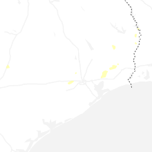
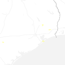
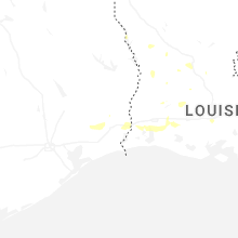
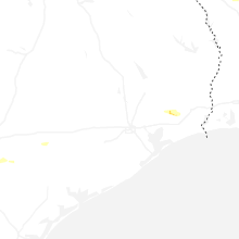
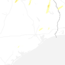


Connect with Interactive Hail Maps