

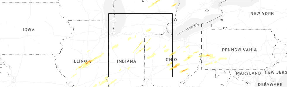
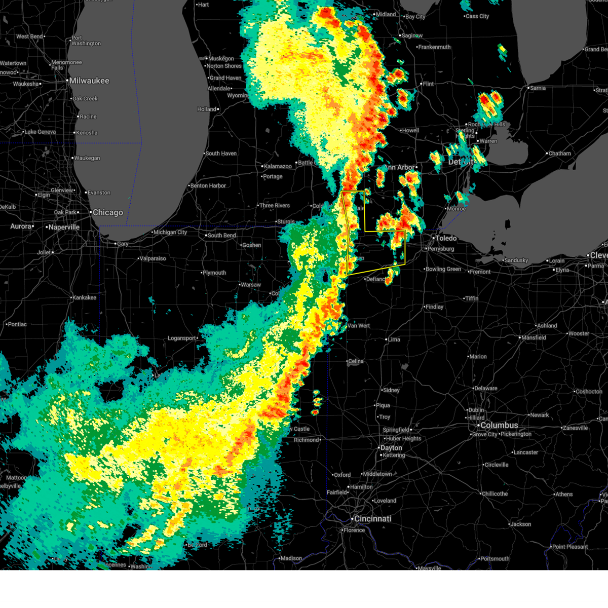
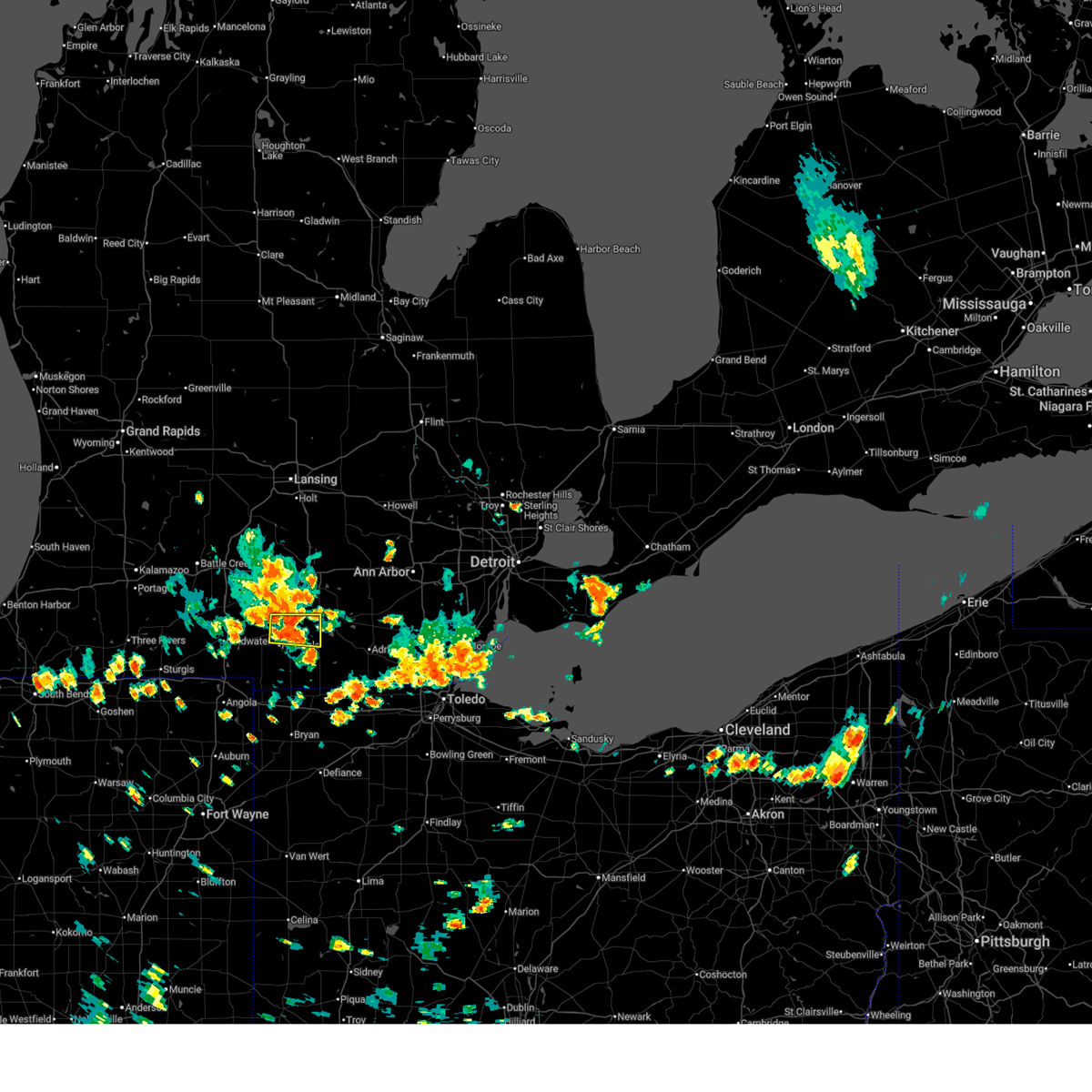
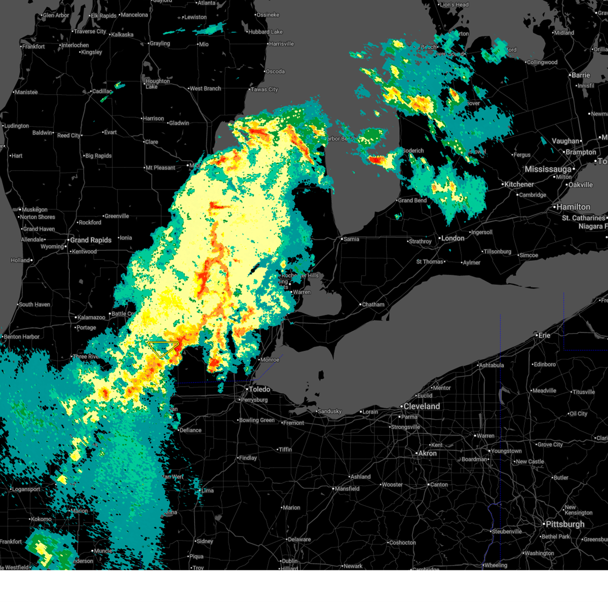
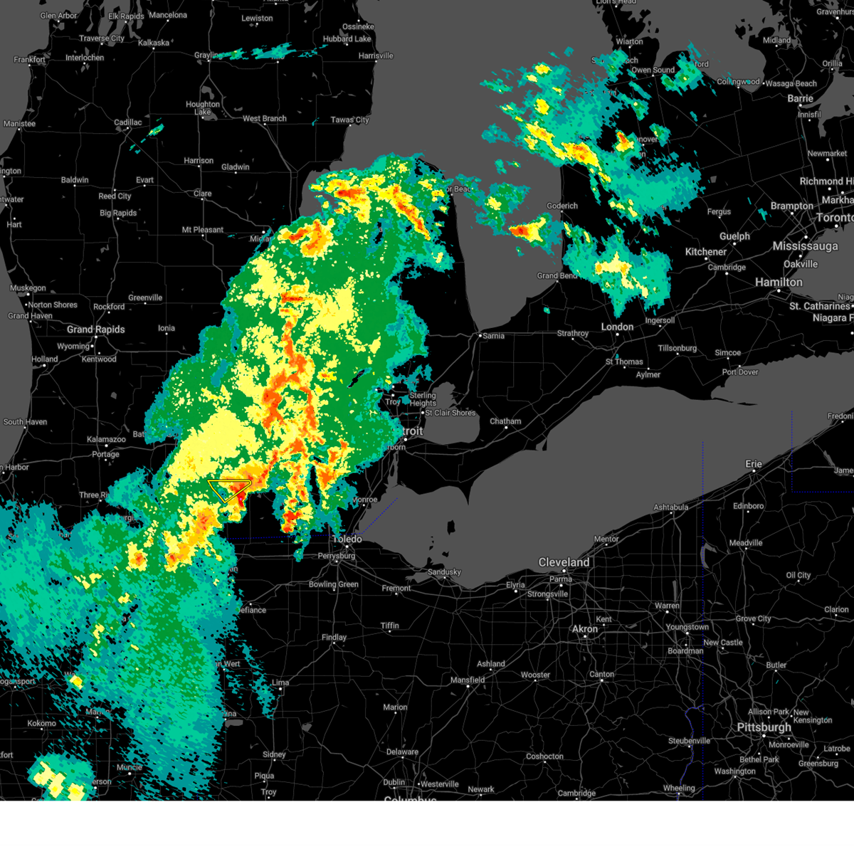
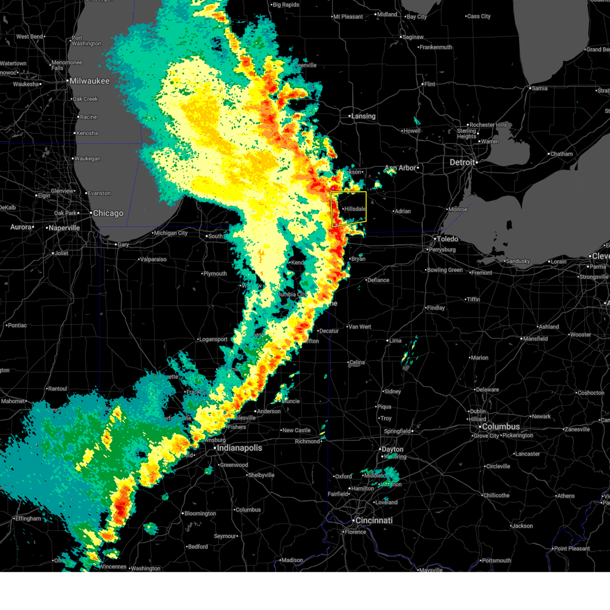
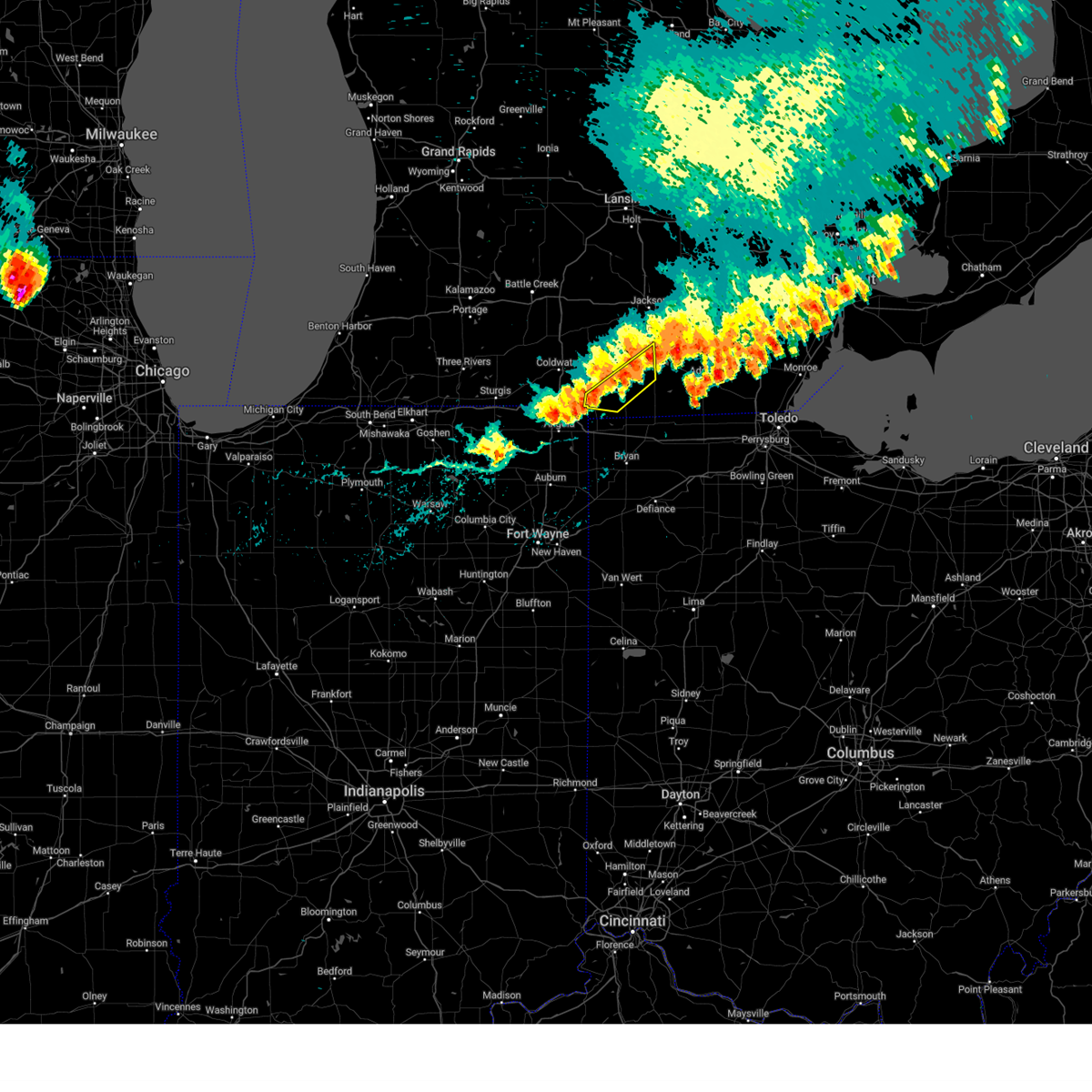
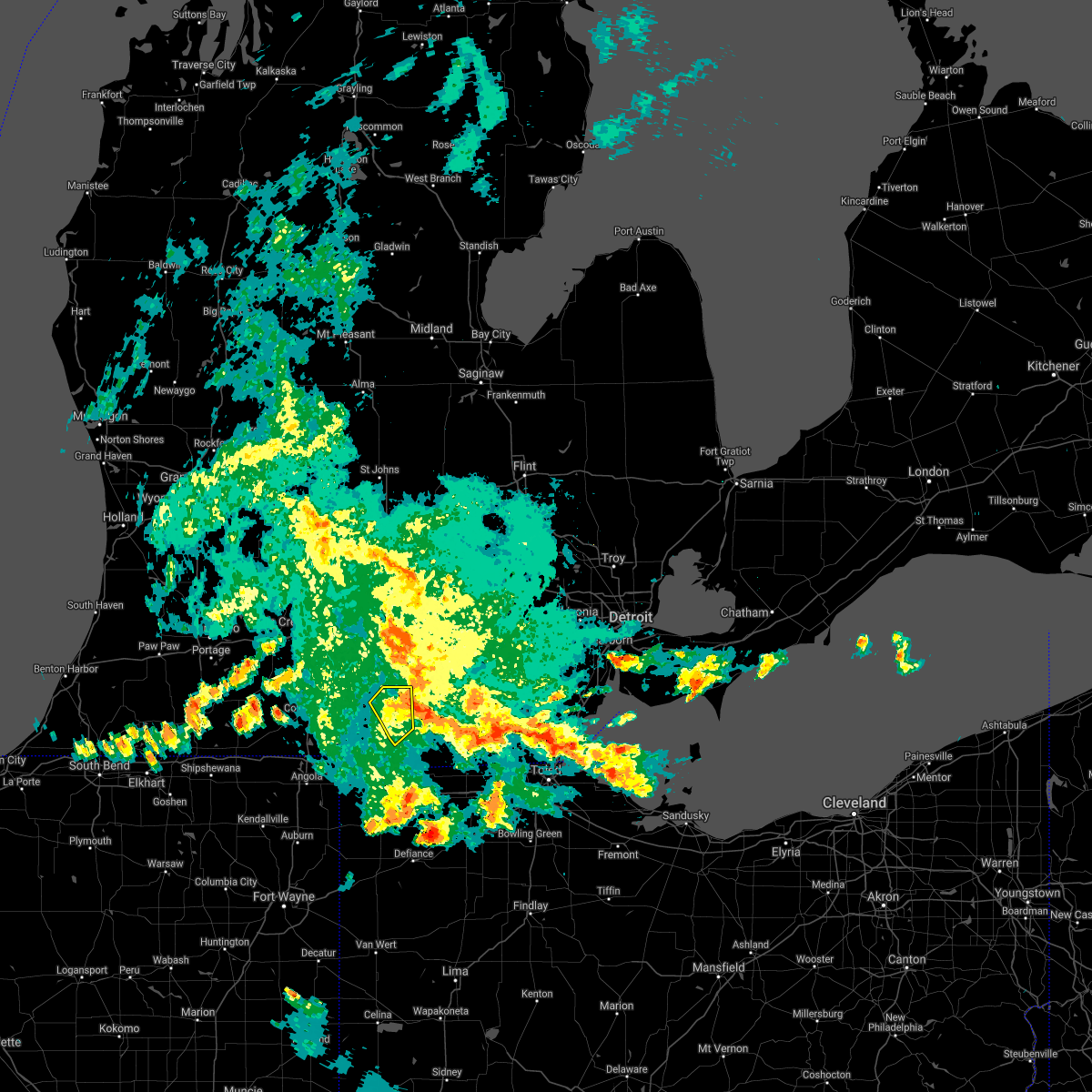
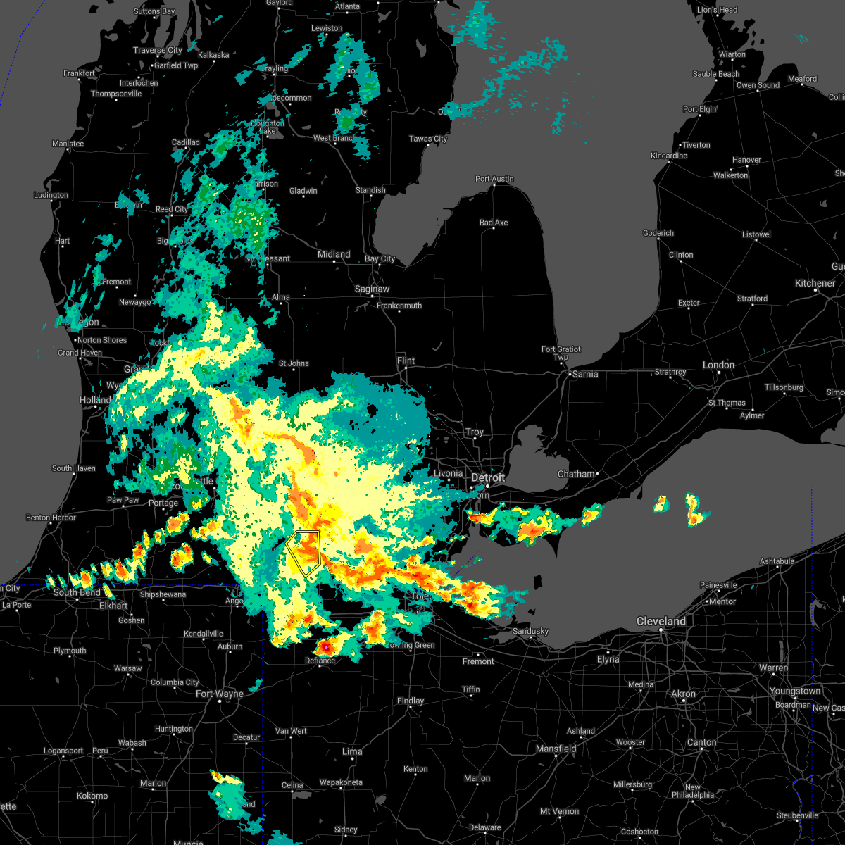
Hail Map for North Adams, MI
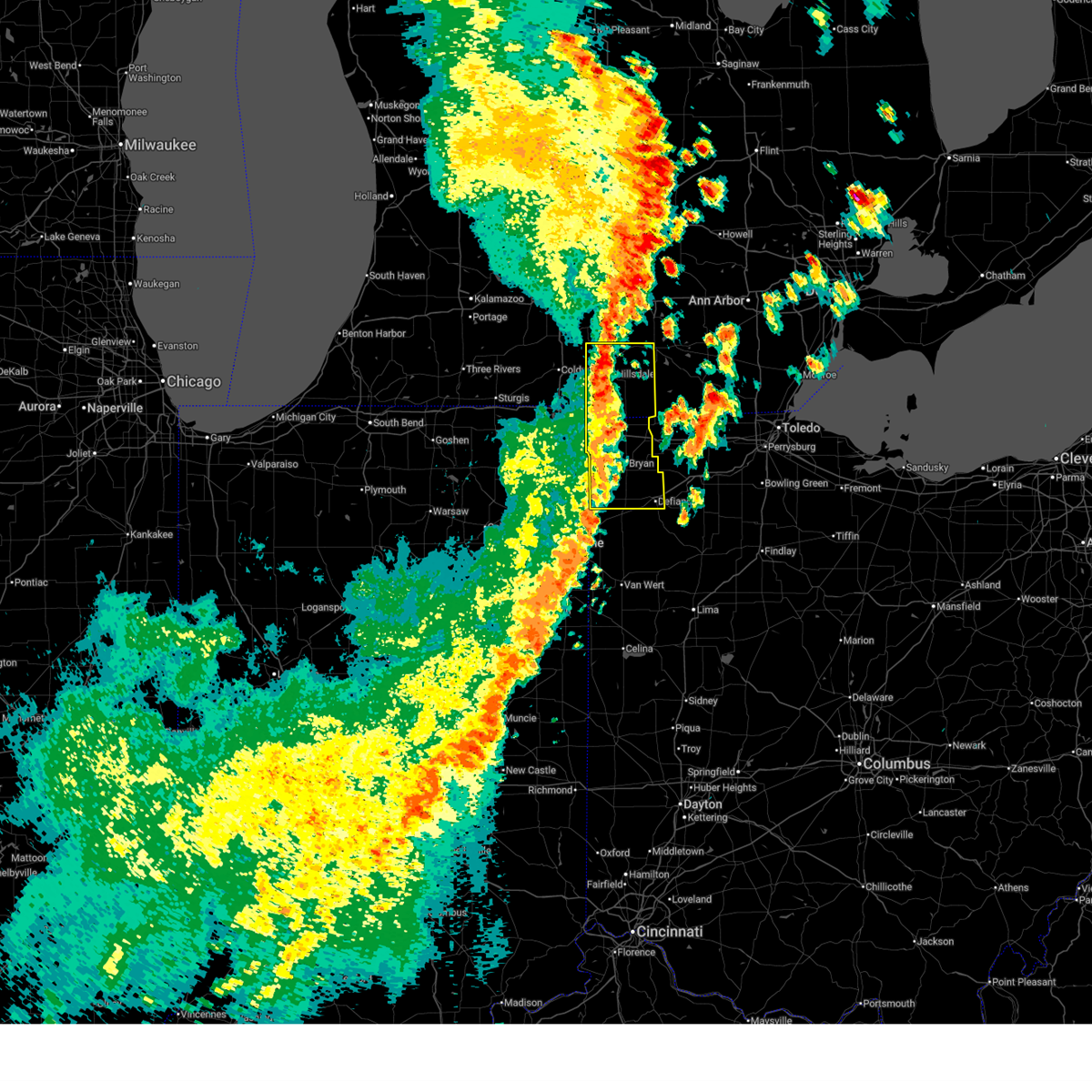
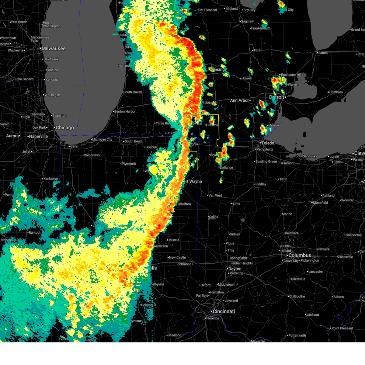
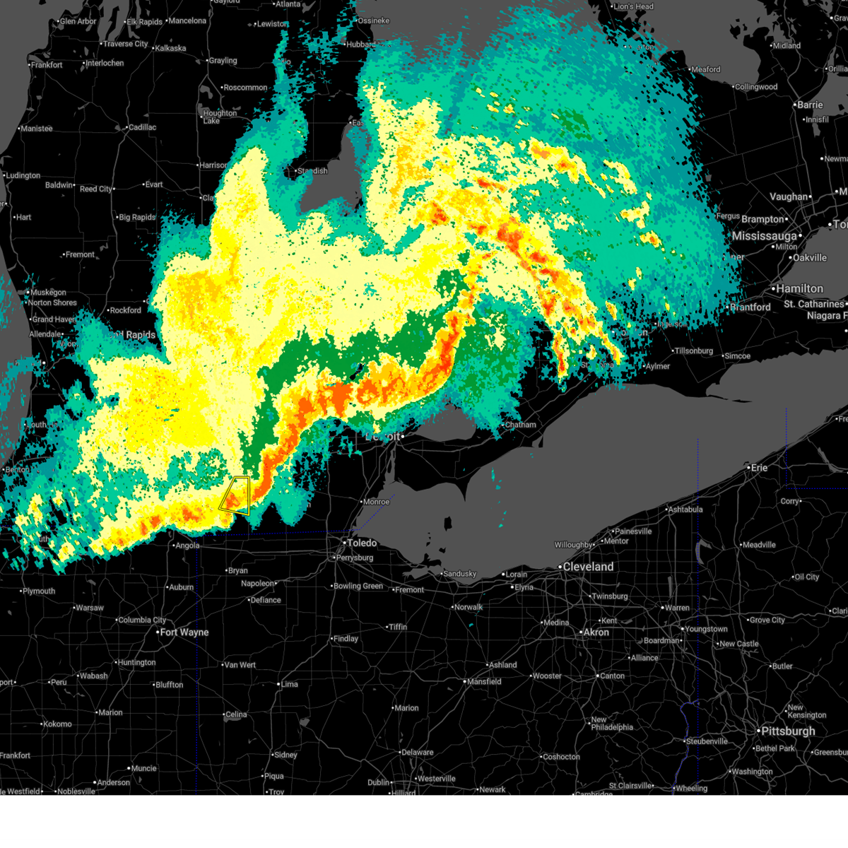
The North Adams, MI area has had 0 reports of on-the-ground hail by trained spotters, and has been under severe weather warnings 21 times during the past 12 months. Doppler radar has detected hail at or near North Adams, MI on 28 occasions.
| Name: | North Adams, MI |
| Where Located: | 68.7 miles NNE of Fort Wayne, IN |
| Map: | Google Map for North Adams, MI |
| Population: | 477 |
| Housing Units: | 219 |
| More Info: | Search Google for North Adams, MI |
4
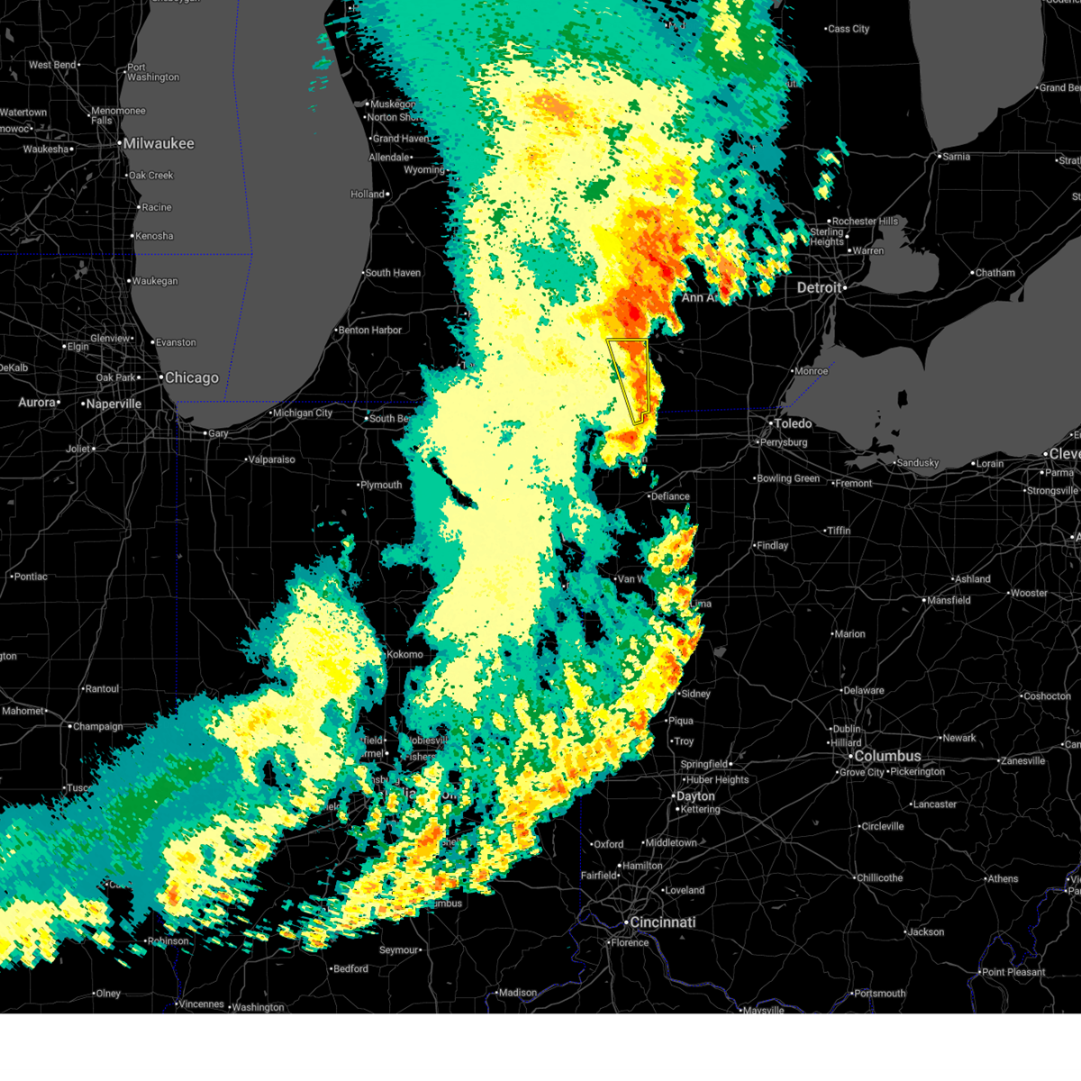
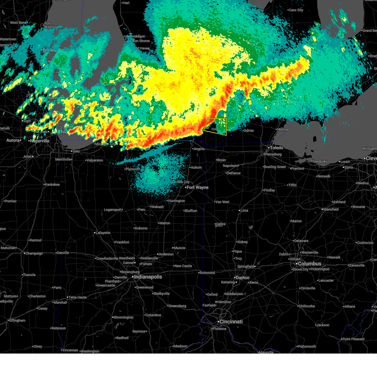
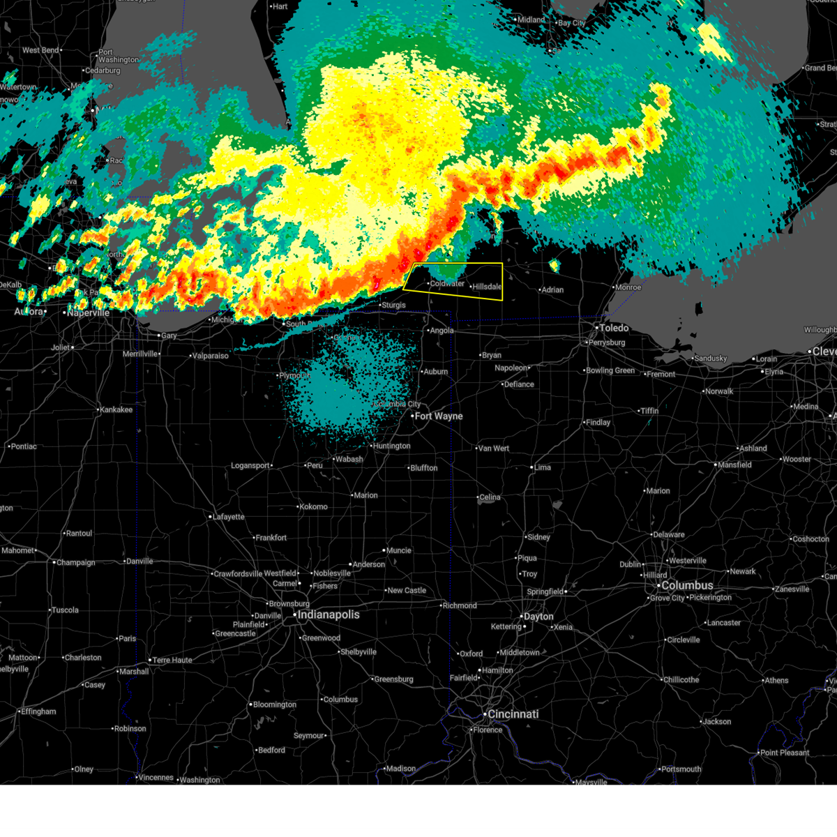
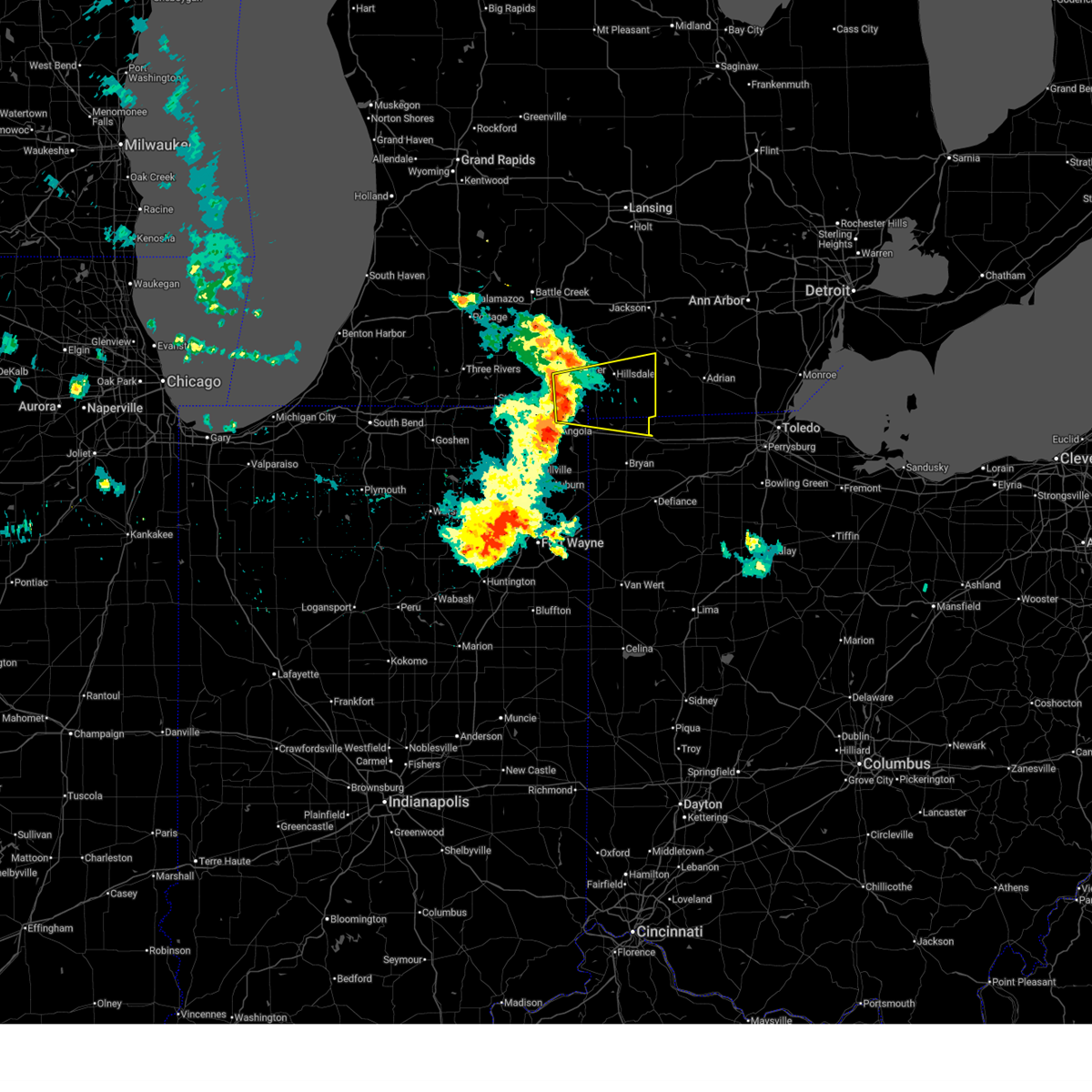
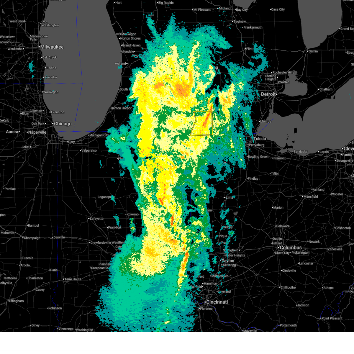
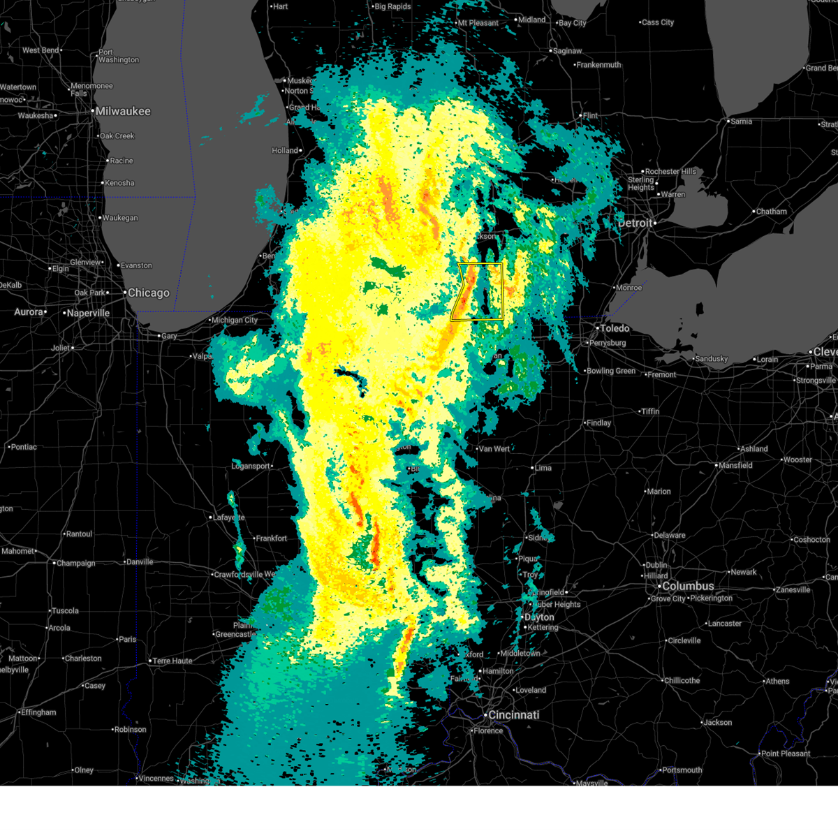
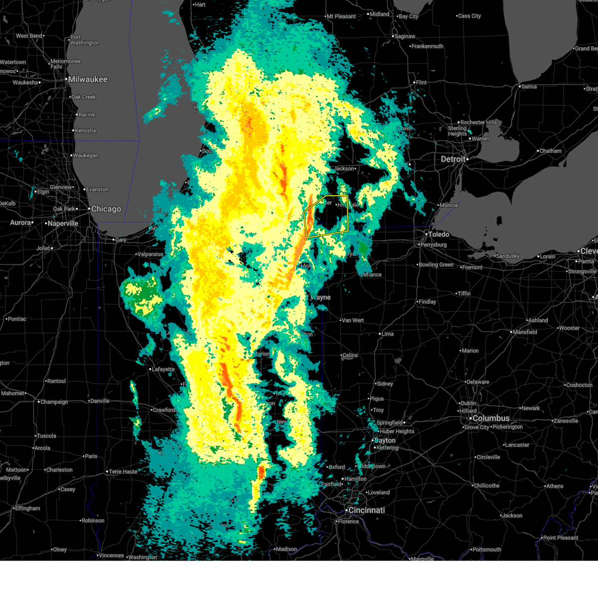
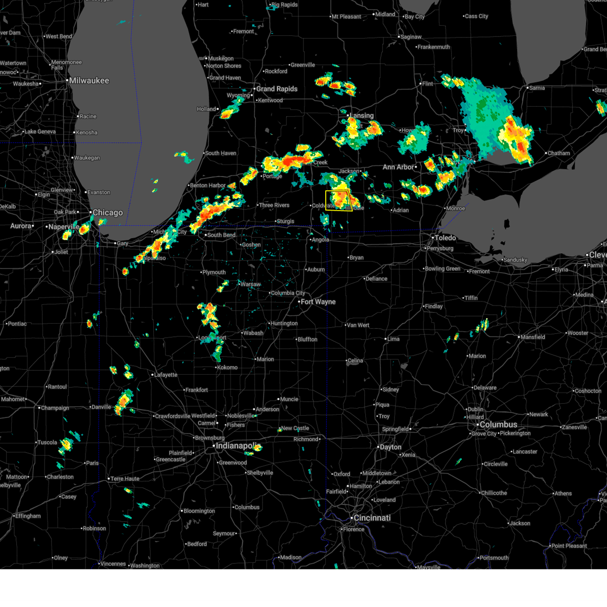
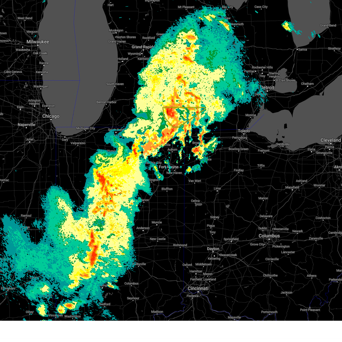
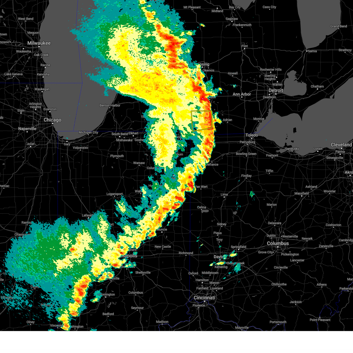
The Top Recent Hail Date for North Adams, MI is Wednesday, April 2, 2025 (8th out of 28)
Hail and Wind Damage Spotted near North Adams, MI
| Date / Time | Report Details |
|---|---|
| 6/12/2026 12:07 AM EDT |
 At 1207 am edt, severe thunderstorms were located along a line extending from 6 miles southwest of vandercook lake to near morenci, moving east at 55 mph (radar indicated). Hazards include 70 mph wind gusts. Expect considerable tree damage. damage is likely to mobile homes, roofs, and outbuildings. Locations impacted include, jerome, somerset, pittsford, moscow, waldron, north adams, prattville, alvordton, betzer, osseo, and somerset center. At 1207 am edt, severe thunderstorms were located along a line extending from 6 miles southwest of vandercook lake to near morenci, moving east at 55 mph (radar indicated). Hazards include 70 mph wind gusts. Expect considerable tree damage. damage is likely to mobile homes, roofs, and outbuildings. Locations impacted include, jerome, somerset, pittsford, moscow, waldron, north adams, prattville, alvordton, betzer, osseo, and somerset center.
|
| 6/11/2026 11:53 PM EDT |
 At 1153 pm edt, severe thunderstorms were located along a line extending from near litchfield to near pioneer, moving east at 55 mph (radar indicated). Hazards include 70 mph wind gusts. Expect considerable tree damage. damage is likely to mobile homes, roofs, and outbuildings. Locations impacted include, hillsdale, jonesville, pioneer, litchfield, reading, long lake, jerome, somerset, cambria, pittsford, moscow, ransom, waldron, north adams, bear lake, allen, prattville, alvordton, lake wilson, and lake seneca. At 1153 pm edt, severe thunderstorms were located along a line extending from near litchfield to near pioneer, moving east at 55 mph (radar indicated). Hazards include 70 mph wind gusts. Expect considerable tree damage. damage is likely to mobile homes, roofs, and outbuildings. Locations impacted include, hillsdale, jonesville, pioneer, litchfield, reading, long lake, jerome, somerset, cambria, pittsford, moscow, ransom, waldron, north adams, bear lake, allen, prattville, alvordton, lake wilson, and lake seneca.
|
| 6/11/2026 11:32 PM EDT |
 Svriwx the national weather service in northern indiana has issued a * severe thunderstorm warning for, hillsdale county in southeastern michigan, northern williams county in northwestern ohio, * until 1230 am edt. * at 1132 pm edt, severe thunderstorms were located along a line extending from near burlington to near hamilton, moving east at 55 mph (radar indicated). Hazards include 70 mph wind gusts. Expect considerable tree damage. Damage is likely to mobile homes, roofs, and outbuildings. Svriwx the national weather service in northern indiana has issued a * severe thunderstorm warning for, hillsdale county in southeastern michigan, northern williams county in northwestern ohio, * until 1230 am edt. * at 1132 pm edt, severe thunderstorms were located along a line extending from near burlington to near hamilton, moving east at 55 mph (radar indicated). Hazards include 70 mph wind gusts. Expect considerable tree damage. Damage is likely to mobile homes, roofs, and outbuildings.
|
| 5/18/2026 3:56 PM EDT |
 Svriwx the national weather service in northern indiana has issued a * severe thunderstorm warning for, eastern hillsdale county in southeastern michigan, northeastern defiance county in northwestern ohio, northern henry county in northwestern ohio, fulton county in northwestern ohio, eastern williams county in northwestern ohio, * until 500 pm edt. * at 356 pm edt, severe thunderstorms were located along a line extending from 8 miles northwest of addison to 6 miles northeast of pioneer to near paulding, moving east at 45 mph (radar indicated). Hazards include 60 mph wind gusts. expect damage to roofs, siding, and trees Svriwx the national weather service in northern indiana has issued a * severe thunderstorm warning for, eastern hillsdale county in southeastern michigan, northeastern defiance county in northwestern ohio, northern henry county in northwestern ohio, fulton county in northwestern ohio, eastern williams county in northwestern ohio, * until 500 pm edt. * at 356 pm edt, severe thunderstorms were located along a line extending from 8 miles northwest of addison to 6 miles northeast of pioneer to near paulding, moving east at 45 mph (radar indicated). Hazards include 60 mph wind gusts. expect damage to roofs, siding, and trees
|
| 5/18/2026 3:40 PM EDT |
 At 339 pm edt, severe thunderstorms were located along a line extending from 7 miles southeast of albion to 7 miles southeast of reading to near hicksville, moving northeast at 45 mph (radar indicated). Hazards include 60 mph wind gusts and penny size hail. Expect damage to roofs, siding, and trees. locations impacted include, defiance, bryan, hillsdale, montpelier, hicksville, jonesville, edgerton, west unity, pioneer, litchfield, stryker, reading, edon, holiday city, edgerton in williams county, long lake, jerome, somerset, columbia, and west jefferson. this includes the following highways, interstate 80 in indiana near mile marker 156. Interstate 80 in ohio between mile markers 0 and 22. At 339 pm edt, severe thunderstorms were located along a line extending from 7 miles southeast of albion to 7 miles southeast of reading to near hicksville, moving northeast at 45 mph (radar indicated). Hazards include 60 mph wind gusts and penny size hail. Expect damage to roofs, siding, and trees. locations impacted include, defiance, bryan, hillsdale, montpelier, hicksville, jonesville, edgerton, west unity, pioneer, litchfield, stryker, reading, edon, holiday city, edgerton in williams county, long lake, jerome, somerset, columbia, and west jefferson. this includes the following highways, interstate 80 in indiana near mile marker 156. Interstate 80 in ohio between mile markers 0 and 22.
|
| 5/18/2026 3:17 PM EDT |
 Svriwx the national weather service in northern indiana has issued a * severe thunderstorm warning for, eastern steuben county in northeastern indiana, eastern branch county in southwestern michigan, hillsdale county in southeastern michigan, defiance county in northwestern ohio, williams county in northwestern ohio, * until 400 pm edt. * at 317 pm edt, severe thunderstorms were located along a line extending from 7 miles southwest of homer to near fremont to near grabill, moving east at 45 mph (radar indicated). Hazards include 60 mph wind gusts and penny size hail. expect damage to roofs, siding, and trees Svriwx the national weather service in northern indiana has issued a * severe thunderstorm warning for, eastern steuben county in northeastern indiana, eastern branch county in southwestern michigan, hillsdale county in southeastern michigan, defiance county in northwestern ohio, williams county in northwestern ohio, * until 400 pm edt. * at 317 pm edt, severe thunderstorms were located along a line extending from 7 miles southwest of homer to near fremont to near grabill, moving east at 45 mph (radar indicated). Hazards include 60 mph wind gusts and penny size hail. expect damage to roofs, siding, and trees
|
| 4/15/2026 1:34 AM EDT |
 At 134 am edt, severe thunderstorms were located along a line extending from near grass lake to 6 miles southeast of hillsdale, moving east at 60 mph (radar indicated). Hazards include 60 mph wind gusts. Expect damage to roofs, siding, and trees. Locations impacted include, jerome, somerset, pittsford, north adams, somerset center, and osseo. At 134 am edt, severe thunderstorms were located along a line extending from near grass lake to 6 miles southeast of hillsdale, moving east at 60 mph (radar indicated). Hazards include 60 mph wind gusts. Expect damage to roofs, siding, and trees. Locations impacted include, jerome, somerset, pittsford, north adams, somerset center, and osseo.
|
| 4/15/2026 1:22 AM EDT |
 At 122 am edt, severe thunderstorms were located along a line extending from near jackson to near reading, moving east at 50 mph (radar indicated). Hazards include 60 mph wind gusts. Expect damage to roofs, siding, and trees. Locations impacted include, hillsdale, jonesville, jerome, somerset, pittsford, moscow, north adams, allen, osseo, and somerset center. At 122 am edt, severe thunderstorms were located along a line extending from near jackson to near reading, moving east at 50 mph (radar indicated). Hazards include 60 mph wind gusts. Expect damage to roofs, siding, and trees. Locations impacted include, hillsdale, jonesville, jerome, somerset, pittsford, moscow, north adams, allen, osseo, and somerset center.
|
| 4/15/2026 1:22 AM EDT |
 the severe thunderstorm warning has been cancelled and is no longer in effect the severe thunderstorm warning has been cancelled and is no longer in effect
|
| 4/15/2026 12:57 AM EDT |
 Svriwx the national weather service in northern indiana has issued a * severe thunderstorm warning for, northern branch county in southwestern michigan, hillsdale county in southeastern michigan, * until 145 am edt. * at 1256 am edt, severe thunderstorms were located along a line extending from near marshall to near bronson, moving east at 60 mph (radar indicated). Hazards include 60 mph wind gusts. expect damage to roofs, siding, and trees Svriwx the national weather service in northern indiana has issued a * severe thunderstorm warning for, northern branch county in southwestern michigan, hillsdale county in southeastern michigan, * until 145 am edt. * at 1256 am edt, severe thunderstorms were located along a line extending from near marshall to near bronson, moving east at 60 mph (radar indicated). Hazards include 60 mph wind gusts. expect damage to roofs, siding, and trees
|
| 4/13/2026 6:45 PM EDT |
 Svriwx the national weather service in northern indiana has issued a * severe thunderstorm warning for, northeastern steuben county in northeastern indiana, southeastern branch county in southwestern michigan, hillsdale county in southeastern michigan, northern williams county in northwestern ohio, * until 745 pm edt. * at 645 pm edt, a severe thunderstorm was located near fremont, or 10 miles northeast of angola, moving east at 40 mph (radar indicated). Hazards include 60 mph wind gusts and penny size hail. expect damage to roofs, siding, and trees Svriwx the national weather service in northern indiana has issued a * severe thunderstorm warning for, northeastern steuben county in northeastern indiana, southeastern branch county in southwestern michigan, hillsdale county in southeastern michigan, northern williams county in northwestern ohio, * until 745 pm edt. * at 645 pm edt, a severe thunderstorm was located near fremont, or 10 miles northeast of angola, moving east at 40 mph (radar indicated). Hazards include 60 mph wind gusts and penny size hail. expect damage to roofs, siding, and trees
|
| 3/16/2026 12:36 AM EDT |
 The storms which prompted the warning have weakened below severe limits, and no longer pose an immediate threat to life or property. therefore, the warning will be allowed to expire. however, heavy rain and gusty winds are still possible with these thunderstorms. a severe thunderstorm watch remains in effect until 200 am edt for northeastern indiana, and southeastern michigan. The storms which prompted the warning have weakened below severe limits, and no longer pose an immediate threat to life or property. therefore, the warning will be allowed to expire. however, heavy rain and gusty winds are still possible with these thunderstorms. a severe thunderstorm watch remains in effect until 200 am edt for northeastern indiana, and southeastern michigan.
|
| 3/16/2026 12:10 AM EDT |
 Svriwx the national weather service in northern indiana has issued a * severe thunderstorm warning for, hillsdale county in southeastern michigan, * until 1245 am edt. * at 1209 am edt, severe thunderstorms were located along a line extending from near litchfield to hillsdale to 6 miles southeast of reading, moving northeast at 55 mph (radar indicated). Hazards include 60 mph wind gusts. expect damage to roofs, siding, and trees Svriwx the national weather service in northern indiana has issued a * severe thunderstorm warning for, hillsdale county in southeastern michigan, * until 1245 am edt. * at 1209 am edt, severe thunderstorms were located along a line extending from near litchfield to hillsdale to 6 miles southeast of reading, moving northeast at 55 mph (radar indicated). Hazards include 60 mph wind gusts. expect damage to roofs, siding, and trees
|
| 3/15/2026 11:51 PM EDT |
 Svriwx the national weather service in northern indiana has issued a * severe thunderstorm warning for, northeastern steuben county in northeastern indiana, southeastern branch county in southwestern michigan, western hillsdale county in southeastern michigan, northwestern williams county in northwestern ohio, * until 1215 am edt. * at 1151 pm edt, a severe thunderstorm was located near fremont, or 11 miles northeast of angola, moving northeast at 55 mph (radar indicated). Hazards include 60 mph wind gusts. expect damage to roofs, siding, and trees Svriwx the national weather service in northern indiana has issued a * severe thunderstorm warning for, northeastern steuben county in northeastern indiana, southeastern branch county in southwestern michigan, western hillsdale county in southeastern michigan, northwestern williams county in northwestern ohio, * until 1215 am edt. * at 1151 pm edt, a severe thunderstorm was located near fremont, or 11 miles northeast of angola, moving northeast at 55 mph (radar indicated). Hazards include 60 mph wind gusts. expect damage to roofs, siding, and trees
|
| 3/6/2026 5:43 PM EST |
 Toriwx the national weather service in northern indiana has issued a * tornado warning for, northeastern hillsdale county in southeastern michigan, * until 630 pm est. * at 543 pm est, a severe thunderstorm capable of producing a tornado was located near jonesville, or near hillsdale, moving northeast at 35 mph (radar indicated rotation). Hazards include tornado and quarter size hail. Flying debris will be dangerous to those caught without shelter. mobile homes will be damaged or destroyed. damage to roofs, windows, and vehicles will occur. tree damage is likely. This tornadic thunderstorm will remain over mainly rural areas of northeastern hillsdale county, including the following locations, jerome, somerset center, moscow, somerset, and north adams. Toriwx the national weather service in northern indiana has issued a * tornado warning for, northeastern hillsdale county in southeastern michigan, * until 630 pm est. * at 543 pm est, a severe thunderstorm capable of producing a tornado was located near jonesville, or near hillsdale, moving northeast at 35 mph (radar indicated rotation). Hazards include tornado and quarter size hail. Flying debris will be dangerous to those caught without shelter. mobile homes will be damaged or destroyed. damage to roofs, windows, and vehicles will occur. tree damage is likely. This tornadic thunderstorm will remain over mainly rural areas of northeastern hillsdale county, including the following locations, jerome, somerset center, moscow, somerset, and north adams.
|
| 6/26/2025 1:48 PM EDT |
 At 148 pm edt, a severe thunderstorm was located near addison, or 12 miles north of hudson, moving east at 25 mph (radar indicated). Hazards include 60 mph wind gusts and quarter size hail. Hail damage to vehicles is expected. expect wind damage to roofs, siding, and trees. Locations impacted include, jerome, somerset, moscow, north adams, and somerset center. At 148 pm edt, a severe thunderstorm was located near addison, or 12 miles north of hudson, moving east at 25 mph (radar indicated). Hazards include 60 mph wind gusts and quarter size hail. Hail damage to vehicles is expected. expect wind damage to roofs, siding, and trees. Locations impacted include, jerome, somerset, moscow, north adams, and somerset center.
|
| 6/26/2025 1:36 PM EDT |
 Svriwx the national weather service in northern indiana has issued a * severe thunderstorm warning for, northeastern hillsdale county in southeastern michigan, * until 200 pm edt. * at 136 pm edt, a severe thunderstorm was located 8 miles northeast of jonesville, or 9 miles northeast of hillsdale, moving east at 25 mph (radar indicated). Hazards include 60 mph wind gusts and quarter size hail. Hail damage to vehicles is expected. Expect wind damage to roofs, siding, and trees. Svriwx the national weather service in northern indiana has issued a * severe thunderstorm warning for, northeastern hillsdale county in southeastern michigan, * until 200 pm edt. * at 136 pm edt, a severe thunderstorm was located 8 miles northeast of jonesville, or 9 miles northeast of hillsdale, moving east at 25 mph (radar indicated). Hazards include 60 mph wind gusts and quarter size hail. Hail damage to vehicles is expected. Expect wind damage to roofs, siding, and trees.
|
| 6/24/2025 4:25 PM EDT |
 The storm which prompted the warning has weakened below severe limits, and no longer poses an immediate threat to life or property. therefore, the warning will be allowed to expire. to report severe weather, contact your nearest law enforcement agency. they will relay your report to the national weather service northern indiana. The storm which prompted the warning has weakened below severe limits, and no longer poses an immediate threat to life or property. therefore, the warning will be allowed to expire. to report severe weather, contact your nearest law enforcement agency. they will relay your report to the national weather service northern indiana.
|
| 6/24/2025 4:06 PM EDT |
 At 406 pm edt, a severe thunderstorm was located over litchfield, or 7 miles northwest of hillsdale, moving east at 25 mph (radar indicated). Hazards include 60 mph wind gusts and penny size hail. Expect damage to roofs, siding, and trees. Locations impacted include, hillsdale, jonesville, litchfield, north adams, and allen. At 406 pm edt, a severe thunderstorm was located over litchfield, or 7 miles northwest of hillsdale, moving east at 25 mph (radar indicated). Hazards include 60 mph wind gusts and penny size hail. Expect damage to roofs, siding, and trees. Locations impacted include, hillsdale, jonesville, litchfield, north adams, and allen.
|
| 6/24/2025 4:06 PM EDT |
 the severe thunderstorm warning has been cancelled and is no longer in effect the severe thunderstorm warning has been cancelled and is no longer in effect
|
| 6/24/2025 3:52 PM EDT |
 Svriwx the national weather service in northern indiana has issued a * severe thunderstorm warning for, northeastern branch county in southwestern michigan, northwestern hillsdale county in southeastern michigan, * until 430 pm edt. * at 352 pm edt, severe thunderstorms were located along a line extending from 7 miles west of litchfield to near quincy, moving east at 20 mph (radar indicated). Hazards include 60 mph wind gusts and quarter size hail. Hail damage to vehicles is expected. Expect wind damage to roofs, siding, and trees. Svriwx the national weather service in northern indiana has issued a * severe thunderstorm warning for, northeastern branch county in southwestern michigan, northwestern hillsdale county in southeastern michigan, * until 430 pm edt. * at 352 pm edt, severe thunderstorms were located along a line extending from 7 miles west of litchfield to near quincy, moving east at 20 mph (radar indicated). Hazards include 60 mph wind gusts and quarter size hail. Hail damage to vehicles is expected. Expect wind damage to roofs, siding, and trees.
|
| 4/2/2025 9:45 PM EDT |
 the severe thunderstorm warning has been cancelled and is no longer in effect the severe thunderstorm warning has been cancelled and is no longer in effect
|
| 4/2/2025 9:39 PM EDT |
 At 938 pm edt, severe thunderstorms were located along a line extending from near mason to 7 miles northeast of leslie to near stockbridge to grass lake, moving northeast at 70 mph (radar indicated). Hazards include 60 mph wind gusts and penny size hail. Expect damage to roofs, siding, and trees. Locations impacted include, jerome, somerset center, moscow, somerset, and north adams. At 938 pm edt, severe thunderstorms were located along a line extending from near mason to 7 miles northeast of leslie to near stockbridge to grass lake, moving northeast at 70 mph (radar indicated). Hazards include 60 mph wind gusts and penny size hail. Expect damage to roofs, siding, and trees. Locations impacted include, jerome, somerset center, moscow, somerset, and north adams.
|
| 4/2/2025 9:39 PM EDT |
 the severe thunderstorm warning has been cancelled and is no longer in effect the severe thunderstorm warning has been cancelled and is no longer in effect
|
| 4/2/2025 8:54 PM EDT |
 Svriwx the national weather service in northern indiana has issued a * severe thunderstorm warning for, branch county in southwestern michigan, northern hillsdale county in southeastern michigan, * until 1000 pm edt. * at 853 pm edt, severe thunderstorms were located along a line extending from 7 miles west of burlington to near union city to near coldwater to near fremont, moving northeast at 70 mph (radar indicated). Hazards include 60 mph wind gusts. expect damage to roofs, siding, and trees Svriwx the national weather service in northern indiana has issued a * severe thunderstorm warning for, branch county in southwestern michigan, northern hillsdale county in southeastern michigan, * until 1000 pm edt. * at 853 pm edt, severe thunderstorms were located along a line extending from 7 miles west of burlington to near union city to near coldwater to near fremont, moving northeast at 70 mph (radar indicated). Hazards include 60 mph wind gusts. expect damage to roofs, siding, and trees
|
| 3/30/2025 6:17 PM EDT |
 The storms which prompted the warning have moved out of the area. therefore, the warning has been allowed to expire. however, gusty winds are still possible with these thunderstorms. a severe thunderstorm watch remains in effect until 1000 pm edt for southeastern michigan. The storms which prompted the warning have moved out of the area. therefore, the warning has been allowed to expire. however, gusty winds are still possible with these thunderstorms. a severe thunderstorm watch remains in effect until 1000 pm edt for southeastern michigan.
|
| 3/30/2025 6:06 PM EDT |
 the severe thunderstorm warning has been cancelled and is no longer in effect the severe thunderstorm warning has been cancelled and is no longer in effect
|
| 3/30/2025 6:06 PM EDT |
 At 606 pm edt, severe thunderstorms were located along a line extending from near albion to 8 miles northeast of jonesville, moving east at 75 mph (radar indicated). Hazards include 60 mph wind gusts and nickel size hail. Expect damage to roofs, siding, and trees. Locations impacted include, hillsdale, cambria, north adams, litchfield, lake wilson, frontier, allen, moscow, jonesville, reading, pittsford, shadyside, osseo, jerome, somerset center, bear lake, somerset, and camden. At 606 pm edt, severe thunderstorms were located along a line extending from near albion to 8 miles northeast of jonesville, moving east at 75 mph (radar indicated). Hazards include 60 mph wind gusts and nickel size hail. Expect damage to roofs, siding, and trees. Locations impacted include, hillsdale, cambria, north adams, litchfield, lake wilson, frontier, allen, moscow, jonesville, reading, pittsford, shadyside, osseo, jerome, somerset center, bear lake, somerset, and camden.
|
| 3/30/2025 5:51 PM EDT |
 the severe thunderstorm warning has been cancelled and is no longer in effect the severe thunderstorm warning has been cancelled and is no longer in effect
|
| 3/30/2025 5:51 PM EDT |
 At 549 pm edt, severe thunderstorms were located along a line extending from near burlington to near quincy, moving northeast at 75 mph. there have been numerous reports of damage in st joseph county, mi of trees and powerlines down as well as power outages (public). Hazards include 60 mph wind gusts and nickel size hail. Expect damage to roofs, siding, and trees. locations impacted include, quincy, girard, north adams, lake wilson, ray, union city, moscow, kinderhook, shadyside, osseo, coldwater, lake of the woods, bear lake, hodunk, coldwater lake, fremont, somerset, camden, hillsdale, and cambria. this includes the following highways, interstate 69 in michigan between mile markers 1 and 21. Interstate 80 in indiana near mile marker 145. At 549 pm edt, severe thunderstorms were located along a line extending from near burlington to near quincy, moving northeast at 75 mph. there have been numerous reports of damage in st joseph county, mi of trees and powerlines down as well as power outages (public). Hazards include 60 mph wind gusts and nickel size hail. Expect damage to roofs, siding, and trees. locations impacted include, quincy, girard, north adams, lake wilson, ray, union city, moscow, kinderhook, shadyside, osseo, coldwater, lake of the woods, bear lake, hodunk, coldwater lake, fremont, somerset, camden, hillsdale, and cambria. this includes the following highways, interstate 69 in michigan between mile markers 1 and 21. Interstate 80 in indiana near mile marker 145.
|
| 3/30/2025 5:30 PM EDT |
 At 529 pm edt, severe thunderstorms were located along a line extending from 6 miles west of colon to near sturgis, moving northeast at 75 mph. at 529 pm edt, the public reported trees down and a center pivot flipped and twisted in sturgis (public). Hazards include 60 mph wind gusts and nickel size hail. Expect damage to roofs, siding, and trees. locations impacted include, nottawa, girard, ray, sturgis, leonidas, kinderhook, shadyside, howe, coldwater, matteson lake, hodunk, coldwater lake, camden, mongo, montgomery, orland, burr oak, california, allen, and fairfax. this includes the following highways, interstate 69 in indiana between mile markers 355 and 357. interstate 69 in michigan between mile markers 1 and 21. Interstate 80 in indiana between mile markers 120 and 146. At 529 pm edt, severe thunderstorms were located along a line extending from 6 miles west of colon to near sturgis, moving northeast at 75 mph. at 529 pm edt, the public reported trees down and a center pivot flipped and twisted in sturgis (public). Hazards include 60 mph wind gusts and nickel size hail. Expect damage to roofs, siding, and trees. locations impacted include, nottawa, girard, ray, sturgis, leonidas, kinderhook, shadyside, howe, coldwater, matteson lake, hodunk, coldwater lake, camden, mongo, montgomery, orland, burr oak, california, allen, and fairfax. this includes the following highways, interstate 69 in indiana between mile markers 355 and 357. interstate 69 in michigan between mile markers 1 and 21. Interstate 80 in indiana between mile markers 120 and 146.
|
| 3/30/2025 5:20 PM EDT |
 Svriwx the national weather service in northern indiana has issued a * severe thunderstorm warning for, northern steuben county in northeastern indiana, northern lagrange county in northeastern indiana, st. joseph county in southwestern michigan, branch county in southwestern michigan, hillsdale county in southeastern michigan, * until 615 pm edt. * at 520 pm edt, severe thunderstorms were located along a line extending from three rivers to near white pigeon, moving east at 75 mph (radar indicated). Hazards include 60 mph wind gusts and nickel size hail. expect damage to roofs, siding, and trees Svriwx the national weather service in northern indiana has issued a * severe thunderstorm warning for, northern steuben county in northeastern indiana, northern lagrange county in northeastern indiana, st. joseph county in southwestern michigan, branch county in southwestern michigan, hillsdale county in southeastern michigan, * until 615 pm edt. * at 520 pm edt, severe thunderstorms were located along a line extending from three rivers to near white pigeon, moving east at 75 mph (radar indicated). Hazards include 60 mph wind gusts and nickel size hail. expect damage to roofs, siding, and trees
|
| 8/27/2024 6:15 PM EDT |
 the severe thunderstorm warning has been cancelled and is no longer in effect the severe thunderstorm warning has been cancelled and is no longer in effect
|
| 8/27/2024 6:15 PM EDT |
 At 615 pm edt, severe thunderstorms were located along a line extending from near addison to reading, moving east at 35 mph (radar indicated). Hazards include 60 mph wind gusts and penny size hail. Expect damage to roofs, siding, and trees. These severe thunderstorms will remain over mainly rural areas of central hillsdale county, including the following locations, camden, cambria, pittsford, shadyside, montgomery, osseo, north adams, lake wilson, frontier, and bear lake. At 615 pm edt, severe thunderstorms were located along a line extending from near addison to reading, moving east at 35 mph (radar indicated). Hazards include 60 mph wind gusts and penny size hail. Expect damage to roofs, siding, and trees. These severe thunderstorms will remain over mainly rural areas of central hillsdale county, including the following locations, camden, cambria, pittsford, shadyside, montgomery, osseo, north adams, lake wilson, frontier, and bear lake.
|
| 8/27/2024 5:50 PM EDT |
 Svriwx the national weather service in northern indiana has issued a * severe thunderstorm warning for, southeastern branch county in southwestern michigan, hillsdale county in southeastern michigan, * until 630 pm edt. * at 550 pm edt, severe thunderstorms were located along a line extending from near jonesville to near coldwater, moving east at 30 mph (radar indicated). Hazards include 60 mph wind gusts and penny size hail. Expect damage to roofs, siding, and trees. severe thunderstorms will be near, hillsdale, jonesville, and quincy around 555 pm edt. reading around 605 pm edt. other locations impacted by these severe thunderstorms include camden, cambria, montgomery, north adams, lake wilson, frontier, california, allen, moscow, and kinderhook. This includes interstate 69 in michigan between mile markers 2 and 12. Svriwx the national weather service in northern indiana has issued a * severe thunderstorm warning for, southeastern branch county in southwestern michigan, hillsdale county in southeastern michigan, * until 630 pm edt. * at 550 pm edt, severe thunderstorms were located along a line extending from near jonesville to near coldwater, moving east at 30 mph (radar indicated). Hazards include 60 mph wind gusts and penny size hail. Expect damage to roofs, siding, and trees. severe thunderstorms will be near, hillsdale, jonesville, and quincy around 555 pm edt. reading around 605 pm edt. other locations impacted by these severe thunderstorms include camden, cambria, montgomery, north adams, lake wilson, frontier, california, allen, moscow, and kinderhook. This includes interstate 69 in michigan between mile markers 2 and 12.
|
| 5/7/2024 8:05 PM EDT |
 The storm which prompted the warning has weakened below severe limits, and has exited the warned area. therefore, the warning will be allowed to expire. a tornado watch remains in effect until 1100 pm edt for southeastern michigan. The storm which prompted the warning has weakened below severe limits, and has exited the warned area. therefore, the warning will be allowed to expire. a tornado watch remains in effect until 1100 pm edt for southeastern michigan.
|
| 5/7/2024 7:57 PM EDT |
 At 756 pm edt, a severe thunderstorm was located near hillsdale, moving northeast at 45 mph (radar indicated). Hazards include ping pong ball size hail and 60 mph wind gusts. People and animals outdoors will be injured. expect hail damage to roofs, siding, windows, and vehicles. expect wind damage to roofs, siding, and trees. Locations impacted include, jerome, somerset, north adams, and somerset center. At 756 pm edt, a severe thunderstorm was located near hillsdale, moving northeast at 45 mph (radar indicated). Hazards include ping pong ball size hail and 60 mph wind gusts. People and animals outdoors will be injured. expect hail damage to roofs, siding, windows, and vehicles. expect wind damage to roofs, siding, and trees. Locations impacted include, jerome, somerset, north adams, and somerset center.
|
| 5/7/2024 7:46 PM EDT |
 At 746 pm edt, a severe thunderstorm was located near reading, or 7 miles south of hillsdale, moving northeast at 45 mph (radar indicated). Hazards include two inch hail and 60 mph wind gusts. People and animals outdoors will be injured. expect hail damage to roofs, siding, windows, and vehicles. expect wind damage to roofs, siding, and trees. Locations impacted include, hillsdale, jerome, somerset, cambria, pittsford, ransom, north adams, bear lake, lake wilson, frontier, shadyside, osseo, and somerset center. At 746 pm edt, a severe thunderstorm was located near reading, or 7 miles south of hillsdale, moving northeast at 45 mph (radar indicated). Hazards include two inch hail and 60 mph wind gusts. People and animals outdoors will be injured. expect hail damage to roofs, siding, windows, and vehicles. expect wind damage to roofs, siding, and trees. Locations impacted include, hillsdale, jerome, somerset, cambria, pittsford, ransom, north adams, bear lake, lake wilson, frontier, shadyside, osseo, and somerset center.
|
| 5/7/2024 7:37 PM EDT |
 the severe thunderstorm warning has been cancelled and is no longer in effect the severe thunderstorm warning has been cancelled and is no longer in effect
|
| 5/7/2024 7:37 PM EDT |
 At 737 pm edt, a severe thunderstorm was located near reading, or 13 miles northwest of montpelier, moving northeast at 45 mph (radar indicated). Hazards include two inch hail and 60 mph wind gusts. People and animals outdoors will be injured. expect hail damage to roofs, siding, windows, and vehicles. expect wind damage to roofs, siding, and trees. Locations impacted include, hillsdale, reading, jerome, somerset, cambria, pittsford, ransom, camden, north adams, bear lake, lake wilson, frontier, shadyside, osseo, and somerset center. At 737 pm edt, a severe thunderstorm was located near reading, or 13 miles northwest of montpelier, moving northeast at 45 mph (radar indicated). Hazards include two inch hail and 60 mph wind gusts. People and animals outdoors will be injured. expect hail damage to roofs, siding, windows, and vehicles. expect wind damage to roofs, siding, and trees. Locations impacted include, hillsdale, reading, jerome, somerset, cambria, pittsford, ransom, camden, north adams, bear lake, lake wilson, frontier, shadyside, osseo, and somerset center.
|
| 5/7/2024 7:24 PM EDT |
 Svriwx the national weather service in northern indiana has issued a * severe thunderstorm warning for, eastern steuben county in northeastern indiana, hillsdale county in southeastern michigan, northwestern williams county in northwestern ohio, * until 815 pm edt. * at 722 pm edt, a severe thunderstorm was located near angola, moving northeast at 45 mph. ping pong hail was reported in angola around 720 pm edt. this storm has had a history of producing hail up to 2 to 3 inches in diameter. this is a destructive storm for berlien, camden, osseo, and clear lake (radar indicated). Hazards include baseball size hail and 60 mph wind gusts. People and animals outdoors will be severely injured. Expect shattered windows, extensive damage to roofs, siding, and vehicles. Svriwx the national weather service in northern indiana has issued a * severe thunderstorm warning for, eastern steuben county in northeastern indiana, hillsdale county in southeastern michigan, northwestern williams county in northwestern ohio, * until 815 pm edt. * at 722 pm edt, a severe thunderstorm was located near angola, moving northeast at 45 mph. ping pong hail was reported in angola around 720 pm edt. this storm has had a history of producing hail up to 2 to 3 inches in diameter. this is a destructive storm for berlien, camden, osseo, and clear lake (radar indicated). Hazards include baseball size hail and 60 mph wind gusts. People and animals outdoors will be severely injured. Expect shattered windows, extensive damage to roofs, siding, and vehicles.
|
| 7/26/2023 7:00 PM EDT |
 At 700 pm edt, a severe thunderstorm was located near addison, or 11 miles north of hudson, moving east at 60 mph (radar indicated). Hazards include 60 mph wind gusts. expect damage to roofs, siding, and trees At 700 pm edt, a severe thunderstorm was located near addison, or 11 miles north of hudson, moving east at 60 mph (radar indicated). Hazards include 60 mph wind gusts. expect damage to roofs, siding, and trees
|
| 7/26/2023 6:38 PM EDT |
 At 637 pm edt, a severe thunderstorm was located over litchfield, or 10 miles northwest of hillsdale, moving east at 60 mph (trained spotters). Hazards include 70 mph wind gusts. Expect considerable tree damage. damage is likely to mobile homes, roofs, and outbuildings. this severe thunderstorm will be near, jonesville and litchfield around 640 pm edt. Other locations impacted by this severe thunderstorm include cambria, north adams, lake wilson, allen, moscow, pittsford, shadyside, osseo, long lake, and jerome. At 637 pm edt, a severe thunderstorm was located over litchfield, or 10 miles northwest of hillsdale, moving east at 60 mph (trained spotters). Hazards include 70 mph wind gusts. Expect considerable tree damage. damage is likely to mobile homes, roofs, and outbuildings. this severe thunderstorm will be near, jonesville and litchfield around 640 pm edt. Other locations impacted by this severe thunderstorm include cambria, north adams, lake wilson, allen, moscow, pittsford, shadyside, osseo, long lake, and jerome.
|
| 7/26/2023 2:30 PM EDT | Delayed report. several large trees snapped on jerome road and at the jerome rd and sandhill rd intersectio in hillsdale county MI, 4.7 miles SW of North Adams, MI |
| 7/26/2023 2:25 PM EDT | Several large tree branches down. a few trees also downed. time estimated from rada in hillsdale county MI, 4.9 miles SW of North Adams, MI |
| 7/26/2023 2:21 PM EDT |
 At 221 pm edt, a severe thunderstorm was located 8 miles southeast of hillsdale, moving east at 50 mph (radar indicated). Hazards include 60 mph wind gusts and penny size hail. Expect damage to roofs, siding, and trees. this severe thunderstorm will remain over mainly rural areas of hillsdale county, including the following locations, prattville, cambria, north adams, lake wilson, waldron, frontier, ransom, moscow, pittsford, and shadyside. hail threat, radar indicated max hail size, 0. 75 in wind threat, radar indicated max wind gust, 60 mph. At 221 pm edt, a severe thunderstorm was located 8 miles southeast of hillsdale, moving east at 50 mph (radar indicated). Hazards include 60 mph wind gusts and penny size hail. Expect damage to roofs, siding, and trees. this severe thunderstorm will remain over mainly rural areas of hillsdale county, including the following locations, prattville, cambria, north adams, lake wilson, waldron, frontier, ransom, moscow, pittsford, and shadyside. hail threat, radar indicated max hail size, 0. 75 in wind threat, radar indicated max wind gust, 60 mph.
|
| 7/26/2023 1:56 PM EDT |
 At 155 pm edt, a severe thunderstorm was located near reading, or 12 miles southeast of coldwater, moving east at 55 mph (radar indicated). Hazards include 60 mph wind gusts and penny size hail. Expect damage to roofs, siding, and trees. this severe thunderstorm will be near, reading around 200 pm edt. hillsdale around 205 pm edt. other locations impacted by this severe thunderstorm include camden, prattville, cambria, montgomery, north adams, lake wilson, waldron, frontier, ransom, and allen. hail threat, radar indicated max hail size, 0. 75 in wind threat, radar indicated max wind gust, 60 mph. At 155 pm edt, a severe thunderstorm was located near reading, or 12 miles southeast of coldwater, moving east at 55 mph (radar indicated). Hazards include 60 mph wind gusts and penny size hail. Expect damage to roofs, siding, and trees. this severe thunderstorm will be near, reading around 200 pm edt. hillsdale around 205 pm edt. other locations impacted by this severe thunderstorm include camden, prattville, cambria, montgomery, north adams, lake wilson, waldron, frontier, ransom, and allen. hail threat, radar indicated max hail size, 0. 75 in wind threat, radar indicated max wind gust, 60 mph.
|
| 7/20/2023 3:29 PM EDT |
 At 328 pm edt, a severe thunderstorm was located over quincy, or near coldwater, moving east at 45 mph (radar indicated). Hazards include 60 mph wind gusts and quarter size hail. Hail damage to vehicles is expected. expect wind damage to roofs, siding, and trees. locations impacted include, coldwater, hillsdale, jonesville, quincy, litchfield, jerome, somerset, pittsford, moscow, north adams, bear lake, allen, lake wilson, shadyside, osseo, south butler, and somerset center. this includes interstate 69 in michigan between mile markers 13 and 16. hail threat, radar indicated max hail size, 1. 00 in wind threat, radar indicated max wind gust, 60 mph. At 328 pm edt, a severe thunderstorm was located over quincy, or near coldwater, moving east at 45 mph (radar indicated). Hazards include 60 mph wind gusts and quarter size hail. Hail damage to vehicles is expected. expect wind damage to roofs, siding, and trees. locations impacted include, coldwater, hillsdale, jonesville, quincy, litchfield, jerome, somerset, pittsford, moscow, north adams, bear lake, allen, lake wilson, shadyside, osseo, south butler, and somerset center. this includes interstate 69 in michigan between mile markers 13 and 16. hail threat, radar indicated max hail size, 1. 00 in wind threat, radar indicated max wind gust, 60 mph.
|
| 7/20/2023 3:14 PM EDT |
 At 313 pm edt, a severe thunderstorm was located near union city, or near coldwater, moving east at 45 mph (radar indicated). Hazards include two inch hail and 60 mph wind gusts. People and animals outdoors will be injured. expect hail damage to roofs, siding, windows, and vehicles. Expect wind damage to roofs, siding, and trees. At 313 pm edt, a severe thunderstorm was located near union city, or near coldwater, moving east at 45 mph (radar indicated). Hazards include two inch hail and 60 mph wind gusts. People and animals outdoors will be injured. expect hail damage to roofs, siding, windows, and vehicles. Expect wind damage to roofs, siding, and trees.
|
| 7/20/2023 3:13 PM EDT |
 At 312 pm edt, a severe thunderstorm was located near union city, or 7 miles northwest of coldwater, moving east at 45 mph (radar indicated). Hazards include two inch hail and 60 mph wind gusts. People and animals outdoors will be injured. expect hail damage to roofs, siding, windows, and vehicles. Expect wind damage to roofs, siding, and trees. At 312 pm edt, a severe thunderstorm was located near union city, or 7 miles northwest of coldwater, moving east at 45 mph (radar indicated). Hazards include two inch hail and 60 mph wind gusts. People and animals outdoors will be injured. expect hail damage to roofs, siding, windows, and vehicles. Expect wind damage to roofs, siding, and trees.
|
| 8/29/2022 5:06 PM EDT |
 At 506 pm edt, severe thunderstorms were located along a line extending from 6 miles east of jonesville to near montpelier, moving east at 50 mph (radar indicated). Hazards include 60 mph wind gusts. Expect damage to roofs, siding, and trees. locations impacted include, bryan, hillsdale, montpelier, jonesville, edgerton, west unity, pioneer, litchfield, stryker, reading, edon, holiday city, edgerton in williams county, long lake, jerome, somerset, columbia, west jefferson, cambria and pulaski. this includes interstate 80 in ohio between mile markers 1 and 22. hail threat, radar indicated max hail size, <. 75 in wind threat, radar indicated max wind gust, 60 mph. At 506 pm edt, severe thunderstorms were located along a line extending from 6 miles east of jonesville to near montpelier, moving east at 50 mph (radar indicated). Hazards include 60 mph wind gusts. Expect damage to roofs, siding, and trees. locations impacted include, bryan, hillsdale, montpelier, jonesville, edgerton, west unity, pioneer, litchfield, stryker, reading, edon, holiday city, edgerton in williams county, long lake, jerome, somerset, columbia, west jefferson, cambria and pulaski. this includes interstate 80 in ohio between mile markers 1 and 22. hail threat, radar indicated max hail size, <. 75 in wind threat, radar indicated max wind gust, 60 mph.
|
| 8/29/2022 4:42 PM EDT |
 At 441 pm edt, severe thunderstorms were located along a line extending from near quincy to 6 miles west of hamilton, moving east at 55 mph (radar indicated). Hazards include 60 mph wind gusts. expect damage to roofs, siding, and trees At 441 pm edt, severe thunderstorms were located along a line extending from near quincy to 6 miles west of hamilton, moving east at 55 mph (radar indicated). Hazards include 60 mph wind gusts. expect damage to roofs, siding, and trees
|
| 8/3/2022 6:30 PM EDT | Tree limb dow in hillsdale county MI, 4.9 miles SW of North Adams, MI |
| 9/7/2021 8:07 PM EDT |
 The severe thunderstorm warning for northern hillsdale county will expire at 815 pm edt, the storm which prompted the warning has moved out of the area. therefore, the warning will be allowed to expire. a severe thunderstorm watch remains in effect until 1100 pm edt for southeastern michigan. to report severe weather, contact your nearest law enforcement agency. they will relay your report to the national weather service northern indiana. The severe thunderstorm warning for northern hillsdale county will expire at 815 pm edt, the storm which prompted the warning has moved out of the area. therefore, the warning will be allowed to expire. a severe thunderstorm watch remains in effect until 1100 pm edt for southeastern michigan. to report severe weather, contact your nearest law enforcement agency. they will relay your report to the national weather service northern indiana.
|
| 9/7/2021 7:46 PM EDT |
 At 746 pm edt, a severe thunderstorm was located over jonesville, moving east at 50 mph (radar indicated). Hazards include 60 mph wind gusts and quarter size hail. Hail damage to vehicles is expected. Expect wind damage to roofs, siding, and trees. At 746 pm edt, a severe thunderstorm was located over jonesville, moving east at 50 mph (radar indicated). Hazards include 60 mph wind gusts and quarter size hail. Hail damage to vehicles is expected. Expect wind damage to roofs, siding, and trees.
|
| 8/12/2021 6:20 PM EDT | Delayed report. a few trees down (size and health unknown) on moreland road just west of jerome roa in hillsdale county MI, 4.9 miles SW of North Adams, MI |
| 8/12/2021 6:42 AM EDT |
 The severe thunderstorm warning for northeastern steuben, eastern branch and hillsdale counties will expire at 645 am edt, the storms which prompted the warning have moved out of the area. therefore, the warning will be allowed to expire. however gusty winds are still possible with these thunderstorms through 7 am edt. The severe thunderstorm warning for northeastern steuben, eastern branch and hillsdale counties will expire at 645 am edt, the storms which prompted the warning have moved out of the area. therefore, the warning will be allowed to expire. however gusty winds are still possible with these thunderstorms through 7 am edt.
|
| 8/12/2021 6:12 AM EDT |
 At 612 am edt, severe thunderstorms were located along a line extending from near litchfield to near fremont, moving northeast at 60 mph (radar indicated). Hazards include 60 mph wind gusts. Expect damage to roofs, siding, and trees. severe thunderstorms will be near, litchfield around 615 am edt. jonesville around 620 am edt. hillsdale around 625 am edt. hail threat, radar indicated max hail size, <. 75 in wind threat, radar indicated max wind gust, 60 mph. At 612 am edt, severe thunderstorms were located along a line extending from near litchfield to near fremont, moving northeast at 60 mph (radar indicated). Hazards include 60 mph wind gusts. Expect damage to roofs, siding, and trees. severe thunderstorms will be near, litchfield around 615 am edt. jonesville around 620 am edt. hillsdale around 625 am edt. hail threat, radar indicated max hail size, <. 75 in wind threat, radar indicated max wind gust, 60 mph.
|
| 8/11/2021 2:44 PM EDT |
 At 244 pm edt, severe thunderstorms were located along a line extending from near cement city to near fayette to 7 miles north of defiance, moving east at 50 mph (radar indicated). Hazards include 60 mph wind gusts and penny size hail. expect damage to roofs, siding, and trees At 244 pm edt, severe thunderstorms were located along a line extending from near cement city to near fayette to 7 miles north of defiance, moving east at 50 mph (radar indicated). Hazards include 60 mph wind gusts and penny size hail. expect damage to roofs, siding, and trees
|
| 8/11/2021 2:36 PM EDT |
 A severe thunderstorm warning remains in effect until 245 pm edt for hillsdale. northern defiance. northwestern henry. williams and western fulton counties. At 235 pm edt, severe thunderstorms were located along a line extending from 8 miles northeast of jonesville to near hudson to near stryker, moving east at 45 mph. A severe thunderstorm warning remains in effect until 245 pm edt for hillsdale. northern defiance. northwestern henry. williams and western fulton counties. At 235 pm edt, severe thunderstorms were located along a line extending from 8 miles northeast of jonesville to near hudson to near stryker, moving east at 45 mph.
|
| 8/11/2021 2:36 PM EDT |
 At 224 pm edt, severe thunderstorms were located along a line extending from near litchfield to 8 miles north of pioneer to near bryan, moving east at 45 mph (radar indicated). Hazards include 60 mph wind gusts and penny size hail. Expect damage to roofs, siding, and trees. locations impacted include, napoleon, bryan, hillsdale, wauseon, archbold, montpelier, butler, jonesville, waterloo, edgerton, west unity, hamilton, pioneer, litchfield, stryker, fayette, reading, edon, holiday city and edgerton in williams county. this includes the following highways, interstate 80 in indiana between mile markers 150 and 156. interstate 80 in ohio between mile markers 0 and 36. hail threat, radar indicated max hail size, 0. 75 in wind threat, radar indicated max wind gust, 60 mph. At 224 pm edt, severe thunderstorms were located along a line extending from near litchfield to 8 miles north of pioneer to near bryan, moving east at 45 mph (radar indicated). Hazards include 60 mph wind gusts and penny size hail. Expect damage to roofs, siding, and trees. locations impacted include, napoleon, bryan, hillsdale, wauseon, archbold, montpelier, butler, jonesville, waterloo, edgerton, west unity, hamilton, pioneer, litchfield, stryker, fayette, reading, edon, holiday city and edgerton in williams county. this includes the following highways, interstate 80 in indiana between mile markers 150 and 156. interstate 80 in ohio between mile markers 0 and 36. hail threat, radar indicated max hail size, 0. 75 in wind threat, radar indicated max wind gust, 60 mph.
|
| 8/11/2021 2:24 PM EDT |
 At 224 pm edt, severe thunderstorms were located along a line extending from near litchfield to 8 miles north of pioneer to near bryan, moving east at 45 mph (radar indicated). Hazards include 60 mph wind gusts and penny size hail. Expect damage to roofs, siding, and trees. locations impacted include, napoleon, bryan, hillsdale, wauseon, archbold, montpelier, butler, jonesville, waterloo, edgerton, west unity, hamilton, pioneer, litchfield, stryker, fayette, reading, edon, holiday city and edgerton in williams county. this includes the following highways, interstate 80 in indiana between mile markers 150 and 156. interstate 80 in ohio between mile markers 0 and 36. hail threat, radar indicated max hail size, 0. 75 in wind threat, radar indicated max wind gust, 60 mph. At 224 pm edt, severe thunderstorms were located along a line extending from near litchfield to 8 miles north of pioneer to near bryan, moving east at 45 mph (radar indicated). Hazards include 60 mph wind gusts and penny size hail. Expect damage to roofs, siding, and trees. locations impacted include, napoleon, bryan, hillsdale, wauseon, archbold, montpelier, butler, jonesville, waterloo, edgerton, west unity, hamilton, pioneer, litchfield, stryker, fayette, reading, edon, holiday city and edgerton in williams county. this includes the following highways, interstate 80 in indiana between mile markers 150 and 156. interstate 80 in ohio between mile markers 0 and 36. hail threat, radar indicated max hail size, 0. 75 in wind threat, radar indicated max wind gust, 60 mph.
|
| 8/11/2021 2:02 PM EDT |
 At 202 pm edt, severe thunderstorms were located along a line extending from near burlington to near reading to butler, moving east at 45 mph (radar indicated). Hazards include 60 mph wind gusts and penny size hail. expect damage to roofs, siding, and trees At 202 pm edt, severe thunderstorms were located along a line extending from near burlington to near reading to butler, moving east at 45 mph (radar indicated). Hazards include 60 mph wind gusts and penny size hail. expect damage to roofs, siding, and trees
|
| 6/20/2021 10:54 PM EDT |
 The tornado warning for northern hillsdale county will expire at 1100 pm edt, the storm which prompted the warning has exited the warned area. therefore, the warning will be allowed to expire. however gusty winds and heavy rain are still possible with this thunderstorm. a severe thunderstorm watch remains in effect until 100 am edt for southeastern michigan. The tornado warning for northern hillsdale county will expire at 1100 pm edt, the storm which prompted the warning has exited the warned area. therefore, the warning will be allowed to expire. however gusty winds and heavy rain are still possible with this thunderstorm. a severe thunderstorm watch remains in effect until 100 am edt for southeastern michigan.
|
| 6/20/2021 10:36 PM EDT |
 At 1036 pm edt, a severe thunderstorm capable of producing a tornado was located near jonesville, or near hillsdale, moving east at 35 mph (radar indicated rotation). Hazards include tornado. Flying debris will be dangerous to those caught without shelter. mobile homes will be damaged or destroyed. damage to roofs, windows, and vehicles will occur. tree damage is likely. This tornadic thunderstorm will remain over mainly rural areas of northern hillsdale county, including the following locations, jerome, somerset center, allen, moscow, somerset and north adams. At 1036 pm edt, a severe thunderstorm capable of producing a tornado was located near jonesville, or near hillsdale, moving east at 35 mph (radar indicated rotation). Hazards include tornado. Flying debris will be dangerous to those caught without shelter. mobile homes will be damaged or destroyed. damage to roofs, windows, and vehicles will occur. tree damage is likely. This tornadic thunderstorm will remain over mainly rural areas of northern hillsdale county, including the following locations, jerome, somerset center, allen, moscow, somerset and north adams.
|
| 6/20/2021 10:15 PM EDT |
 At 1014 pm edt, a severe thunderstorm capable of producing a tornado was located near quincy, or 8 miles east of coldwater, moving east at 35 mph (radar indicated rotation). Hazards include tornado. Flying debris will be dangerous to those caught without shelter. mobile homes will be damaged or destroyed. damage to roofs, windows, and vehicles will occur. tree damage is likely. this dangerous storm will be near, litchfield around 1025 pm edt. Hillsdale and jonesville around 1030 pm edt. At 1014 pm edt, a severe thunderstorm capable of producing a tornado was located near quincy, or 8 miles east of coldwater, moving east at 35 mph (radar indicated rotation). Hazards include tornado. Flying debris will be dangerous to those caught without shelter. mobile homes will be damaged or destroyed. damage to roofs, windows, and vehicles will occur. tree damage is likely. this dangerous storm will be near, litchfield around 1025 pm edt. Hillsdale and jonesville around 1030 pm edt.
|
| 6/20/2021 9:25 PM EDT |
 The severe thunderstorm warning for northeastern hillsdale county will expire at 930 pm edt, the storm which prompted the warning has moved out of the area. therefore, the warning will be allowed to expire. however heavy rain is still possible with this thunderstorm. a severe thunderstorm watch remains in effect until 100 am edt for southeastern michigan. to report severe weather, contact your nearest law enforcement agency. they will relay your report to the national weather service northern indiana. The severe thunderstorm warning for northeastern hillsdale county will expire at 930 pm edt, the storm which prompted the warning has moved out of the area. therefore, the warning will be allowed to expire. however heavy rain is still possible with this thunderstorm. a severe thunderstorm watch remains in effect until 100 am edt for southeastern michigan. to report severe weather, contact your nearest law enforcement agency. they will relay your report to the national weather service northern indiana.
|
| 6/20/2021 9:19 PM EDT |
 At 919 pm edt, a severe thunderstorm was located near addison, or 10 miles north of hudson, moving northeast at 50 mph (radar indicated). Hazards include 60 mph wind gusts and penny size hail. Expect damage to roofs, siding, and trees. Locations impacted include, jerome, somerset, pittsford, moscow, north adams and somerset center. At 919 pm edt, a severe thunderstorm was located near addison, or 10 miles north of hudson, moving northeast at 50 mph (radar indicated). Hazards include 60 mph wind gusts and penny size hail. Expect damage to roofs, siding, and trees. Locations impacted include, jerome, somerset, pittsford, moscow, north adams and somerset center.
|
| 6/20/2021 9:10 PM EDT |
 At 910 pm edt, a severe thunderstorm was located near hillsdale, moving northeast at 50 mph (radar indicated). Hazards include 60 mph wind gusts and penny size hail. Expect damage to roofs, siding, and trees. Locations impacted include, hillsdale, jonesville, jerome, somerset, cambria, pittsford, moscow, north adams, bear lake, lake wilson, frontier, shadyside, osseo and somerset center. At 910 pm edt, a severe thunderstorm was located near hillsdale, moving northeast at 50 mph (radar indicated). Hazards include 60 mph wind gusts and penny size hail. Expect damage to roofs, siding, and trees. Locations impacted include, hillsdale, jonesville, jerome, somerset, cambria, pittsford, moscow, north adams, bear lake, lake wilson, frontier, shadyside, osseo and somerset center.
|
| 6/20/2021 8:57 PM EDT |
 At 857 pm edt, a severe thunderstorm was located near reading, or 8 miles south of hillsdale, moving northeast at 50 mph (radar indicated). Hazards include 60 mph wind gusts and penny size hail. expect damage to roofs, siding, and trees At 857 pm edt, a severe thunderstorm was located near reading, or 8 miles south of hillsdale, moving northeast at 50 mph (radar indicated). Hazards include 60 mph wind gusts and penny size hail. expect damage to roofs, siding, and trees
|
| 6/26/2020 11:12 PM EDT |
 At 1112 pm edt, severe thunderstorms were located along a line extending from near cement city to 8 miles south of hillsdale, moving east at 50 mph (radar indicated). Hazards include 70 mph wind gusts. Expect considerable tree damage. damage is likely to mobile homes, roofs, and outbuildings. these severe storms will be near, hudson around 1130 pm edt. Other locations impacted by these severe thunderstorms include camden, prattville, cambria, north adams, waldron, frontier, ransom, moscow, pittsford and shadyside. At 1112 pm edt, severe thunderstorms were located along a line extending from near cement city to 8 miles south of hillsdale, moving east at 50 mph (radar indicated). Hazards include 70 mph wind gusts. Expect considerable tree damage. damage is likely to mobile homes, roofs, and outbuildings. these severe storms will be near, hudson around 1130 pm edt. Other locations impacted by these severe thunderstorms include camden, prattville, cambria, north adams, waldron, frontier, ransom, moscow, pittsford and shadyside.
|
| 6/26/2020 10:46 PM EDT |
 At 1046 pm edt, severe thunderstorms were located along a line extending from near litchfield to near coldwater, moving east at 55 mph (radar indicated). Hazards include 70 mph wind gusts. Expect considerable tree damage. damage is likely to mobile homes, roofs, and outbuildings. these severe storms will be near, litchfield around 1050 pm edt. hillsdale and jonesville around 1055 pm edt. reading around 1100 pm edt. Hudson around 1120 pm edt. At 1046 pm edt, severe thunderstorms were located along a line extending from near litchfield to near coldwater, moving east at 55 mph (radar indicated). Hazards include 70 mph wind gusts. Expect considerable tree damage. damage is likely to mobile homes, roofs, and outbuildings. these severe storms will be near, litchfield around 1050 pm edt. hillsdale and jonesville around 1055 pm edt. reading around 1100 pm edt. Hudson around 1120 pm edt.
|
| 6/26/2020 10:26 PM EDT |
 At 1026 pm edt, severe thunderstorms were located along a line extending from union city to near sturgis, moving east at 50 mph (radar indicated). Hazards include 70 mph wind gusts. Expect considerable tree damage. damage is likely to mobile homes, roofs, and outbuildings. severe thunderstorms will be near, union city around 1030 pm edt. coldwater around 1045 pm edt. litchfield around 1050 pm edt. jonesville and quincy around 1055 pm edt. reading around 1100 pm edt. hillsdale around 1105 pm edt. hudson around 1125 pm edt. other locations impacted by these severe thunderstorms include prattville, girard, north adams, lake wilson, waldron, ransom, moscow, kinderhook, shadyside and osseo. This includes interstate 69 in michigan between mile markers 3 and 21. At 1026 pm edt, severe thunderstorms were located along a line extending from union city to near sturgis, moving east at 50 mph (radar indicated). Hazards include 70 mph wind gusts. Expect considerable tree damage. damage is likely to mobile homes, roofs, and outbuildings. severe thunderstorms will be near, union city around 1030 pm edt. coldwater around 1045 pm edt. litchfield around 1050 pm edt. jonesville and quincy around 1055 pm edt. reading around 1100 pm edt. hillsdale around 1105 pm edt. hudson around 1125 pm edt. other locations impacted by these severe thunderstorms include prattville, girard, north adams, lake wilson, waldron, ransom, moscow, kinderhook, shadyside and osseo. This includes interstate 69 in michigan between mile markers 3 and 21.
|
| 6/10/2020 3:51 PM EDT |
 At 351 pm edt, severe thunderstorms were located along a line extending from hudson to near edon, moving north at 55 mph (radar indicated). Hazards include 70 mph wind gusts and quarter size hail. Hail damage to vehicles is expected. expect considerable tree damage. wind damage is also likely to mobile homes, roofs, and outbuildings. severe thunderstorms will be near, pioneer around 405 pm edt. other locations impacted by these severe thunderstorms include prattville, cambria, west jefferson, alvordton, bridgewater center, lake wilson, waldron, frontier, melbern and ransom. This includes interstate 80 in ohio between mile markers 5 and 24. At 351 pm edt, severe thunderstorms were located along a line extending from hudson to near edon, moving north at 55 mph (radar indicated). Hazards include 70 mph wind gusts and quarter size hail. Hail damage to vehicles is expected. expect considerable tree damage. wind damage is also likely to mobile homes, roofs, and outbuildings. severe thunderstorms will be near, pioneer around 405 pm edt. other locations impacted by these severe thunderstorms include prattville, cambria, west jefferson, alvordton, bridgewater center, lake wilson, waldron, frontier, melbern and ransom. This includes interstate 80 in ohio between mile markers 5 and 24.
|
| 6/10/2020 3:16 PM EDT |
 At 315 pm edt, severe thunderstorms were located along a line extending from near reading to near butler, moving northeast at 65 mph. these are very dangerous storms (radar indicated). Hazards include 80 mph wind gusts and quarter size hail. Flying debris will be dangerous to those caught without shelter. mobile homes will be heavily damaged. expect considerable damage to roofs, windows, and vehicles. extensive tree damage and power outages are likely. severe thunderstorms will be near, quincy and reading around 320 pm edt. hillsdale, jonesville and litchfield around 325 pm edt. montpelier around 330 pm edt. pioneer around 335 pm edt. other locations impacted by these severe thunderstorms include york, alvarado, north adams, lake wilson, ransom, pleasant lake, ray, hamilton lake, moscow and lake seneca. this includes the following highways, interstate 69 in indiana between mile markers 331 and 336, and between mile markers 352 and 357. interstate 69 in michigan between mile markers 1 and 2. interstate 80 in indiana between mile markers 144 and 156. Interstate 80 in ohio between mile markers 0 and 12. At 315 pm edt, severe thunderstorms were located along a line extending from near reading to near butler, moving northeast at 65 mph. these are very dangerous storms (radar indicated). Hazards include 80 mph wind gusts and quarter size hail. Flying debris will be dangerous to those caught without shelter. mobile homes will be heavily damaged. expect considerable damage to roofs, windows, and vehicles. extensive tree damage and power outages are likely. severe thunderstorms will be near, quincy and reading around 320 pm edt. hillsdale, jonesville and litchfield around 325 pm edt. montpelier around 330 pm edt. pioneer around 335 pm edt. other locations impacted by these severe thunderstorms include york, alvarado, north adams, lake wilson, ransom, pleasant lake, ray, hamilton lake, moscow and lake seneca. this includes the following highways, interstate 69 in indiana between mile markers 331 and 336, and between mile markers 352 and 357. interstate 69 in michigan between mile markers 1 and 2. interstate 80 in indiana between mile markers 144 and 156. Interstate 80 in ohio between mile markers 0 and 12.
|
| 5/26/2020 6:03 PM EDT |
 At 603 pm edt, a severe thunderstorm was located 8 miles west of hudson, moving northwest at 20 mph (radar indicated). Hazards include 60 mph wind gusts and quarter size hail. Hail damage to vehicles is expected. Expect wind damage to roofs, siding, and trees. At 603 pm edt, a severe thunderstorm was located 8 miles west of hudson, moving northwest at 20 mph (radar indicated). Hazards include 60 mph wind gusts and quarter size hail. Hail damage to vehicles is expected. Expect wind damage to roofs, siding, and trees.
|
| 4/7/2020 10:30 PM EDT |
 At 1029 pm edt, a severe thunderstorm was located 7 miles southeast of hillsdale, moving southeast at 40 mph (radar indicated). Hazards include 60 mph wind gusts and half dollar size hail. Hail damage to vehicles is expected. expect wind damage to roofs, siding, and trees. Locations impacted include, hillsdale, hudson, jonesville, quincy, pioneer, litchfield, reading, long lake, jerome, somerset, cambria, girard, pittsford, moscow, ransom, waldron, north adams, bear lake, allen and prattville. At 1029 pm edt, a severe thunderstorm was located 7 miles southeast of hillsdale, moving southeast at 40 mph (radar indicated). Hazards include 60 mph wind gusts and half dollar size hail. Hail damage to vehicles is expected. expect wind damage to roofs, siding, and trees. Locations impacted include, hillsdale, hudson, jonesville, quincy, pioneer, litchfield, reading, long lake, jerome, somerset, cambria, girard, pittsford, moscow, ransom, waldron, north adams, bear lake, allen and prattville.
|
| 4/7/2020 9:57 PM EDT |
 At 957 pm edt, a severe thunderstorm was located near litchfield, or 11 miles northeast of coldwater, moving southeast at 50 mph (radar indicated). Hazards include ping pong ball size hail and 60 mph wind gusts. People and animals outdoors will be injured. expect hail damage to roofs, siding, windows, and vehicles. Expect wind damage to roofs, siding, and trees. At 957 pm edt, a severe thunderstorm was located near litchfield, or 11 miles northeast of coldwater, moving southeast at 50 mph (radar indicated). Hazards include ping pong ball size hail and 60 mph wind gusts. People and animals outdoors will be injured. expect hail damage to roofs, siding, windows, and vehicles. Expect wind damage to roofs, siding, and trees.
|
| 7/20/2019 3:26 AM EDT |
 At 324 am edt, severe thunderstorms were located along a line extending from near grass lake to near colon to near centreville, moving southeast at 55 mph (radar indicated). Hazards include 60 mph wind gusts. Expect damage to roofs, siding, and trees. Locations impacted include, sturgis, coldwater, hillsdale, bronson, jonesville, quincy, union city, centreville, litchfield, colon, long lake, jerome, somerset, nottawa, girard, moscow, batavia, leonidas, mendon and burr oak. At 324 am edt, severe thunderstorms were located along a line extending from near grass lake to near colon to near centreville, moving southeast at 55 mph (radar indicated). Hazards include 60 mph wind gusts. Expect damage to roofs, siding, and trees. Locations impacted include, sturgis, coldwater, hillsdale, bronson, jonesville, quincy, union city, centreville, litchfield, colon, long lake, jerome, somerset, nottawa, girard, moscow, batavia, leonidas, mendon and burr oak.
|
| 7/20/2019 2:56 AM EDT |
 At 255 am edt, severe thunderstorms were located along a line extending from near leslie to near battle creek to near mattawan, moving southeast at 65 mph (radar indicated). Hazards include 60 mph wind gusts. expect damage to roofs, siding, and trees At 255 am edt, severe thunderstorms were located along a line extending from near leslie to near battle creek to near mattawan, moving southeast at 65 mph (radar indicated). Hazards include 60 mph wind gusts. expect damage to roofs, siding, and trees
|
| 7/2/2019 7:57 PM EDT |
 At 756 pm edt, severe thunderstorms were located along a line extending from hillsdale to near fayette to archbold, moving east at 40 mph. these storms have a history of knocking down trees and powerlines in the fremont area mainly along sr-120 as well as in the northwest corner of williams county (radar indicated). Hazards include 60 mph wind gusts. expect damage to roofs, siding, and trees At 756 pm edt, severe thunderstorms were located along a line extending from hillsdale to near fayette to archbold, moving east at 40 mph. these storms have a history of knocking down trees and powerlines in the fremont area mainly along sr-120 as well as in the northwest corner of williams county (radar indicated). Hazards include 60 mph wind gusts. expect damage to roofs, siding, and trees
|
| 7/2/2019 7:21 PM EDT |
 At 720 pm edt, a severe thunderstorm was located over coldwater, moving east at 40 mph (radar indicated). Hazards include 60 mph wind gusts and penny size hail. expect damage to roofs, siding, and trees At 720 pm edt, a severe thunderstorm was located over coldwater, moving east at 40 mph (radar indicated). Hazards include 60 mph wind gusts and penny size hail. expect damage to roofs, siding, and trees
|
| 6/1/2019 8:04 PM EDT |
 At 804 pm edt, severe thunderstorms were located along a line extending from near vandercook lake to near jonesville to near union city, moving east at 30 mph (radar indicated). Hazards include 60 mph wind gusts and half dollar size hail. Hail damage to vehicles is expected. expect wind damage to roofs, siding, and trees. Locations impacted include, coldwater, hillsdale, jonesville, quincy, union city, litchfield, jerome, somerset, girard, moscow, north adams, allen, south butler, somerset center and hodunk. At 804 pm edt, severe thunderstorms were located along a line extending from near vandercook lake to near jonesville to near union city, moving east at 30 mph (radar indicated). Hazards include 60 mph wind gusts and half dollar size hail. Hail damage to vehicles is expected. expect wind damage to roofs, siding, and trees. Locations impacted include, coldwater, hillsdale, jonesville, quincy, union city, litchfield, jerome, somerset, girard, moscow, north adams, allen, south butler, somerset center and hodunk.
|
| 6/1/2019 7:39 PM EDT |
 At 738 pm edt, severe thunderstorms were located along a line extending from 6 miles east of albion to near homer to near union city, moving east at 30 mph (radar indicated). Hazards include 60 mph wind gusts and half dollar size hail. Hail damage to vehicles is expected. Expect wind damage to roofs, siding, and trees. At 738 pm edt, severe thunderstorms were located along a line extending from 6 miles east of albion to near homer to near union city, moving east at 30 mph (radar indicated). Hazards include 60 mph wind gusts and half dollar size hail. Hail damage to vehicles is expected. Expect wind damage to roofs, siding, and trees.
|
| 5/23/2019 5:57 AM EDT |
 The severe thunderstorm warning for hillsdale, northern defiance, northwestern henry, western fulton and williams counties will expire at 600 am edt, the storms which prompted the warning have weakened below severe limits. therefore, the warning will be allowed to expire. however gusty winds of around 50 mph and pea sized hail are still possible with these thunderstorms through 630 am edt. The severe thunderstorm warning for hillsdale, northern defiance, northwestern henry, western fulton and williams counties will expire at 600 am edt, the storms which prompted the warning have weakened below severe limits. therefore, the warning will be allowed to expire. however gusty winds of around 50 mph and pea sized hail are still possible with these thunderstorms through 630 am edt.
|
| 5/23/2019 5:47 AM EDT |
 At 546 am edt, severe thunderstorms were located along a line extending from near vandercook lake to near hudson to 10 miles south of bryan, moving east at 60 mph (radar indicated). Hazards include 60 mph wind gusts. Expect damage to roofs, siding, and trees. Locations impacted include, napoleon, bryan, hillsdale, wauseon, archbold, montpelier, hicksville, jonesville, edgerton, west unity, pioneer, stryker, fayette, holiday city, jerome, somerset, west jefferson, pulaski, pittsford and moscow. At 546 am edt, severe thunderstorms were located along a line extending from near vandercook lake to near hudson to 10 miles south of bryan, moving east at 60 mph (radar indicated). Hazards include 60 mph wind gusts. Expect damage to roofs, siding, and trees. Locations impacted include, napoleon, bryan, hillsdale, wauseon, archbold, montpelier, hicksville, jonesville, edgerton, west unity, pioneer, stryker, fayette, holiday city, jerome, somerset, west jefferson, pulaski, pittsford and moscow.
|
| 5/23/2019 5:19 AM EDT |
 At 518 am edt, severe thunderstorms were located along a line extending from near burlington to near fremont to near grabill, moving east at 65 mph (radar indicated). Hazards include 60 mph wind gusts. expect damage to roofs, siding, and trees At 518 am edt, severe thunderstorms were located along a line extending from near burlington to near fremont to near grabill, moving east at 65 mph (radar indicated). Hazards include 60 mph wind gusts. expect damage to roofs, siding, and trees
|
| 5/2/2018 9:48 PM EDT | Large tree down on waldron roa in hillsdale county MI, 5.3 miles W of North Adams, MI |
| 5/2/2018 9:16 PM EDT |
 At 916 pm edt, a severe thunderstorm was located near quincy, or 9 miles west of hillsdale, moving east at 60 mph (radar indicated). Hazards include 70 mph wind gusts. Expect considerable tree damage. Damage is likely to mobile homes, roofs, and outbuildings. At 916 pm edt, a severe thunderstorm was located near quincy, or 9 miles west of hillsdale, moving east at 60 mph (radar indicated). Hazards include 70 mph wind gusts. Expect considerable tree damage. Damage is likely to mobile homes, roofs, and outbuildings.
|
| 9/4/2017 5:11 PM EDT |
 The severe thunderstorm warning for northeastern branch and northern hillsdale counties will expire at 515 pm edt, the storm which prompted the warning has weakened below severe limits, and no longer poses an immediate threat to life or property. therefore the warning will be allowed to expire. a severe thunderstorm watch remains in effect until 1100 pm edt for southeastern and southwestern michigan. The severe thunderstorm warning for northeastern branch and northern hillsdale counties will expire at 515 pm edt, the storm which prompted the warning has weakened below severe limits, and no longer poses an immediate threat to life or property. therefore the warning will be allowed to expire. a severe thunderstorm watch remains in effect until 1100 pm edt for southeastern and southwestern michigan.
|
| 9/4/2017 4:52 PM EDT |
 At 452 pm edt, a severe thunderstorm was located near coldwater, moving east at 45 mph (radar indicated). Hazards include 60 mph wind gusts and quarter size hail. Hail damage to vehicles is expected. expect wind damage to roofs, siding, and trees. Locations impacted include, coldwater, hillsdale, jonesville, quincy, litchfield, girard, moscow, north adams, allen, south butler and marble lake. At 452 pm edt, a severe thunderstorm was located near coldwater, moving east at 45 mph (radar indicated). Hazards include 60 mph wind gusts and quarter size hail. Hail damage to vehicles is expected. expect wind damage to roofs, siding, and trees. Locations impacted include, coldwater, hillsdale, jonesville, quincy, litchfield, girard, moscow, north adams, allen, south butler and marble lake.
|
| 9/4/2017 4:31 PM EDT |
 At 431 pm edt, a severe thunderstorm was located near colon, or 13 miles west of coldwater, moving east at 45 mph (radar indicated). Hazards include 60 mph wind gusts and quarter size hail. Hail damage to vehicles is expected. Expect wind damage to roofs, siding, and trees. At 431 pm edt, a severe thunderstorm was located near colon, or 13 miles west of coldwater, moving east at 45 mph (radar indicated). Hazards include 60 mph wind gusts and quarter size hail. Hail damage to vehicles is expected. Expect wind damage to roofs, siding, and trees.
|
| 7/18/2015 8:48 PM EDT |
 At 847 pm edt, severe thunderstorms were located along a line extending from near addison to near holiday city, moving east at 40 mph (emergency management. at 835 pm edt...emergency management reported power lines downed east of camden). Hazards include 60 mph wind gusts. Expect damage to roofs. siding and trees. locations impacted include, hillsdale, hudson, jonesville, pioneer, litchfield, reading, holiday city, long lake, jerome, columbia, cambria, pittsford, ransom, waldron, camden, north adams, montgomery, bear lake, allen and betzer. this includes interstate 80 in ohio between mile markers 0 and 15. A tornado watch remains in effect until midnight edt for northeastern indiana, southern michigan and northwestern ohio. At 847 pm edt, severe thunderstorms were located along a line extending from near addison to near holiday city, moving east at 40 mph (emergency management. at 835 pm edt...emergency management reported power lines downed east of camden). Hazards include 60 mph wind gusts. Expect damage to roofs. siding and trees. locations impacted include, hillsdale, hudson, jonesville, pioneer, litchfield, reading, holiday city, long lake, jerome, columbia, cambria, pittsford, ransom, waldron, camden, north adams, montgomery, bear lake, allen and betzer. this includes interstate 80 in ohio between mile markers 0 and 15. A tornado watch remains in effect until midnight edt for northeastern indiana, southern michigan and northwestern ohio.
|
| 7/18/2015 8:19 PM EDT |
 At 817 pm edt, severe thunderstorms were located along a line extending from near litchfield to angola, moving east at 35 mph (emergency management. at 813 pm edt...emergency management reported trees down in bronson). Hazards include 60 mph wind gusts. Expect damage to roofs. siding and trees. locations impacted include, coldwater, angola, hillsdale, hudson, jonesville, fremont, quincy, pioneer, litchfield, reading, holiday city, long lake, jerome, somerset, columbia, ray, cambria, girard, pittsford and kinderhook. this includes the following highways, interstate 69 in indiana between mile markers 346 and 357. interstate 69 in michigan between mile markers 1 and 21. interstate 80 in indiana between mile markers 136 and 156. interstate 80 in ohio between mile markers 0 and 15. A tornado watch remains in effect until midnight edt for northeastern indiana, southern michigan and northwestern ohio. At 817 pm edt, severe thunderstorms were located along a line extending from near litchfield to angola, moving east at 35 mph (emergency management. at 813 pm edt...emergency management reported trees down in bronson). Hazards include 60 mph wind gusts. Expect damage to roofs. siding and trees. locations impacted include, coldwater, angola, hillsdale, hudson, jonesville, fremont, quincy, pioneer, litchfield, reading, holiday city, long lake, jerome, somerset, columbia, ray, cambria, girard, pittsford and kinderhook. this includes the following highways, interstate 69 in indiana between mile markers 346 and 357. interstate 69 in michigan between mile markers 1 and 21. interstate 80 in indiana between mile markers 136 and 156. interstate 80 in ohio between mile markers 0 and 15. A tornado watch remains in effect until midnight edt for northeastern indiana, southern michigan and northwestern ohio.
|
| 7/18/2015 8:10 PM EDT |
 At 806 pm edt, severe thunderstorms were located along a line extending from near homer to 8 miles west of angola, moving east at 40 mph (trained spotters. at 805 pm edt...trained spotters reported numerous trees down in and near coldwater). Hazards include 60 mph wind gusts. Expect damage to roofs. siding and trees. locations impacted include, coldwater, angola, hillsdale, lagrange, bronson, hudson, jonesville, fremont, quincy, union city, pioneer, litchfield, reading, holiday city, long lake, jerome, somerset, columbia, ray and cambria. this includes the following highways, interstate 69 in indiana between mile markers 346 and 357. interstate 69 in michigan between mile markers 1 and 21. interstate 80 in indiana between mile markers 124 and 156. interstate 80 in ohio between mile markers 0 and 15. A tornado watch remains in effect until midnight edt for northeastern indiana, southern michigan and northwestern ohio. At 806 pm edt, severe thunderstorms were located along a line extending from near homer to 8 miles west of angola, moving east at 40 mph (trained spotters. at 805 pm edt...trained spotters reported numerous trees down in and near coldwater). Hazards include 60 mph wind gusts. Expect damage to roofs. siding and trees. locations impacted include, coldwater, angola, hillsdale, lagrange, bronson, hudson, jonesville, fremont, quincy, union city, pioneer, litchfield, reading, holiday city, long lake, jerome, somerset, columbia, ray and cambria. this includes the following highways, interstate 69 in indiana between mile markers 346 and 357. interstate 69 in michigan between mile markers 1 and 21. interstate 80 in indiana between mile markers 124 and 156. interstate 80 in ohio between mile markers 0 and 15. A tornado watch remains in effect until midnight edt for northeastern indiana, southern michigan and northwestern ohio.
|
| 7/18/2015 7:57 PM EDT |
 At 756 pm edt, severe thunderstorms were located along a line extending from near burlington to 7 miles east of lagrange, moving east at 40 mph (radar indicated). Hazards include 60 mph wind gusts. Expect damage to roofs. Siding and trees. At 756 pm edt, severe thunderstorms were located along a line extending from near burlington to 7 miles east of lagrange, moving east at 40 mph (radar indicated). Hazards include 60 mph wind gusts. Expect damage to roofs. Siding and trees.
|
| 6/8/2015 5:18 PM EDT | At 514 pm edt, a severe thunderstorm was located 6 miles northwest of hudson, and moving east at 35 mph (radar indicated). Hazards include quarter size hail and 60 mph wind gusts. Hail damage to vehicles is expected. expect wind damage to roofs, siding and trees. Locations impacted include, mainly rural areas of eastern hillsdale county. |
| 6/8/2015 5:08 PM EDT | Three 13 inch diameter limbs downed in adams township (estimated diameter in hillsdale county MI, 2.9 miles N of North Adams, MI |
| 6/8/2015 5:03 PM EDT | At 501 pm edt, a severe thunderstorm was located near hillsdale, and moving east at 35 mph (radar indicated). Hazards include quarter size hail and 60 mph wind gusts. Hail damage to vehicles is expected. Expect wind damage to roofs, siding and trees. |
| 7/5/2012 2:45 PM EDT | Report of trees and power lines down along north adams road between jonesville and north adams in hillsdale county MI, 2.4 miles E of North Adams, MI |
Hail Maps for North Adams, MI


Connect with Interactive Hail Maps