

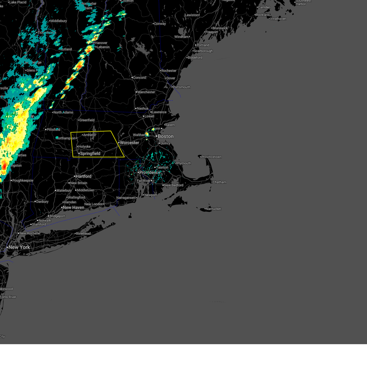
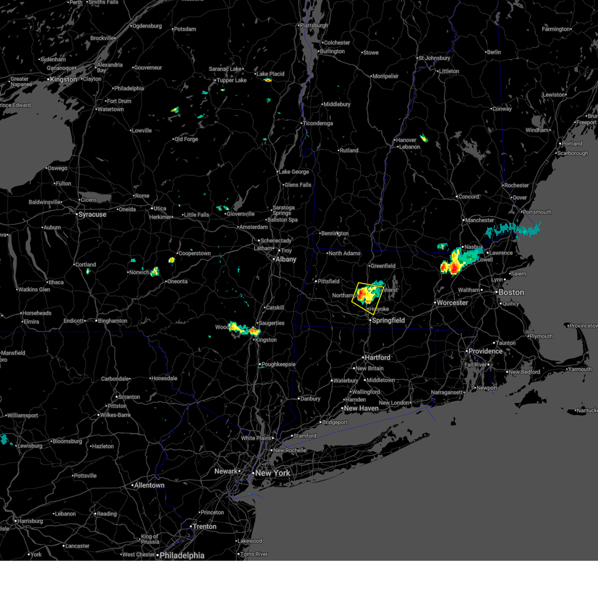
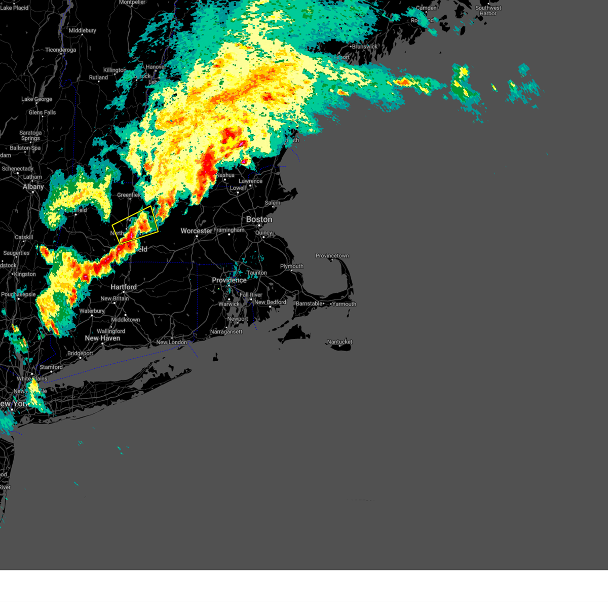
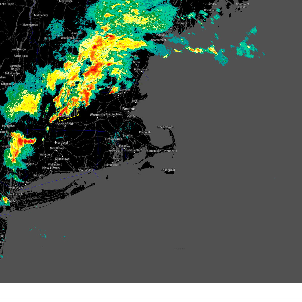
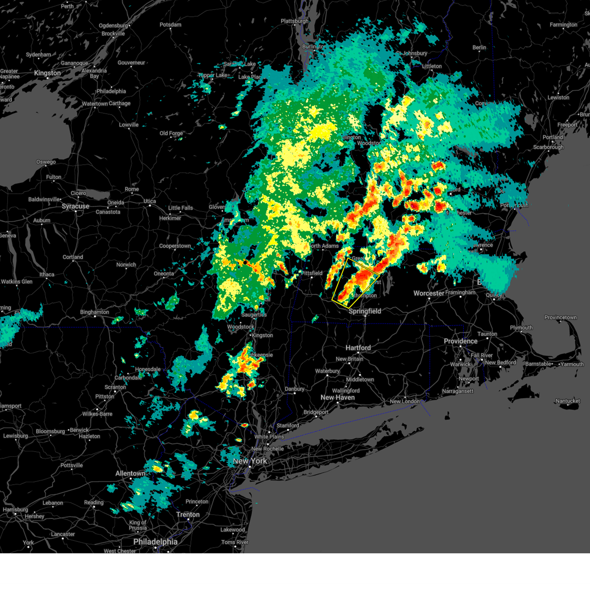
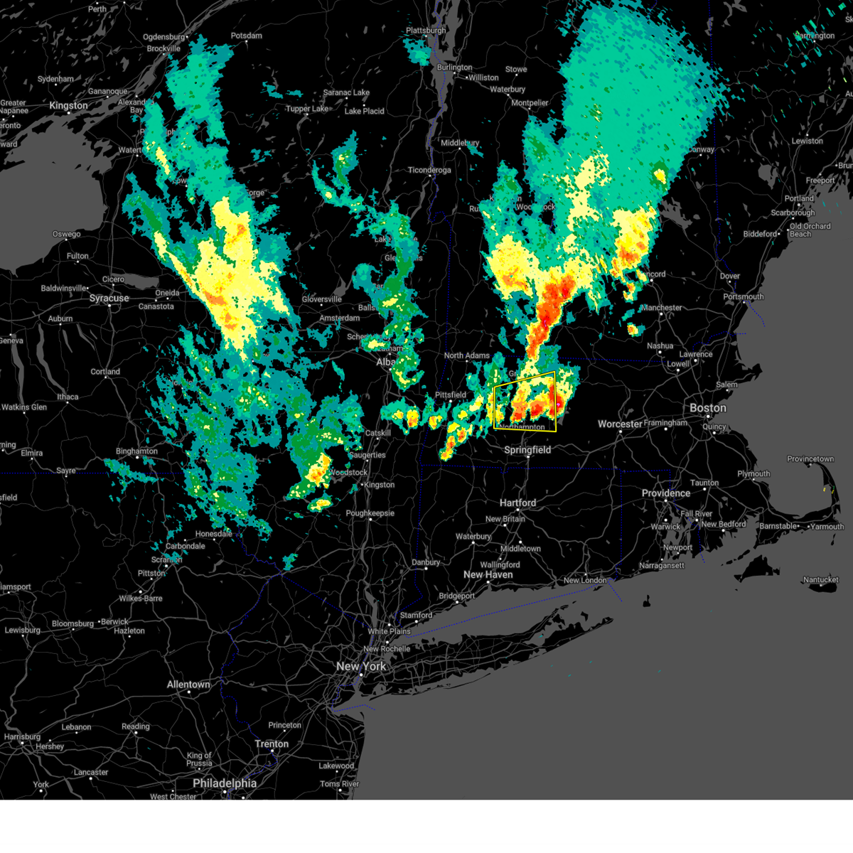
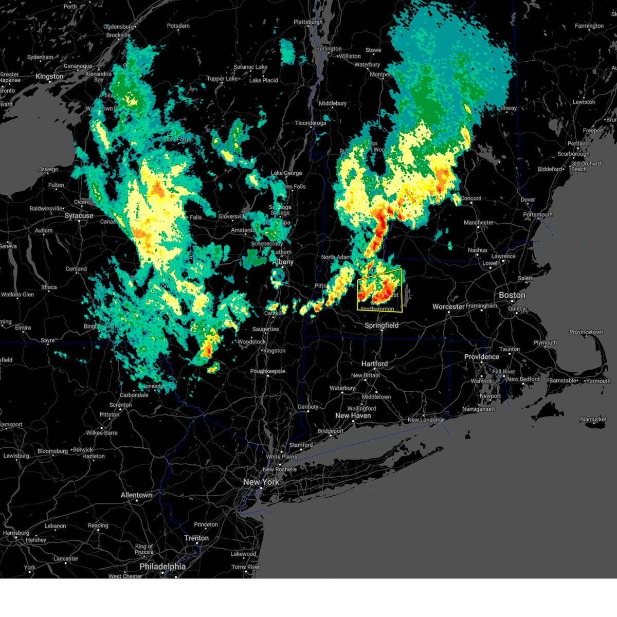
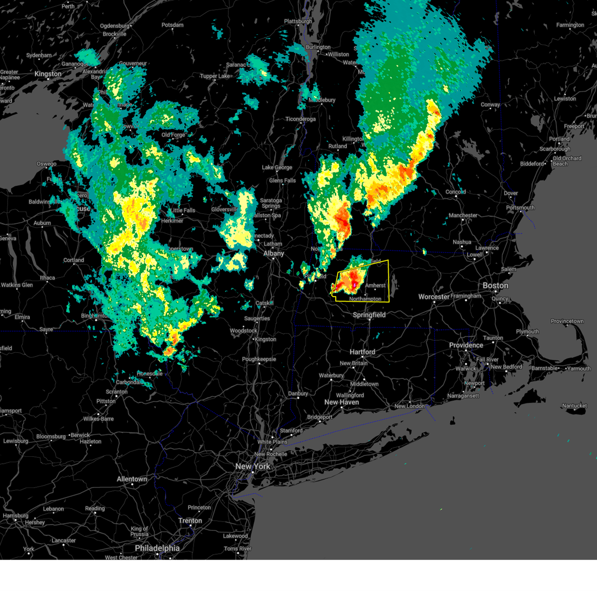
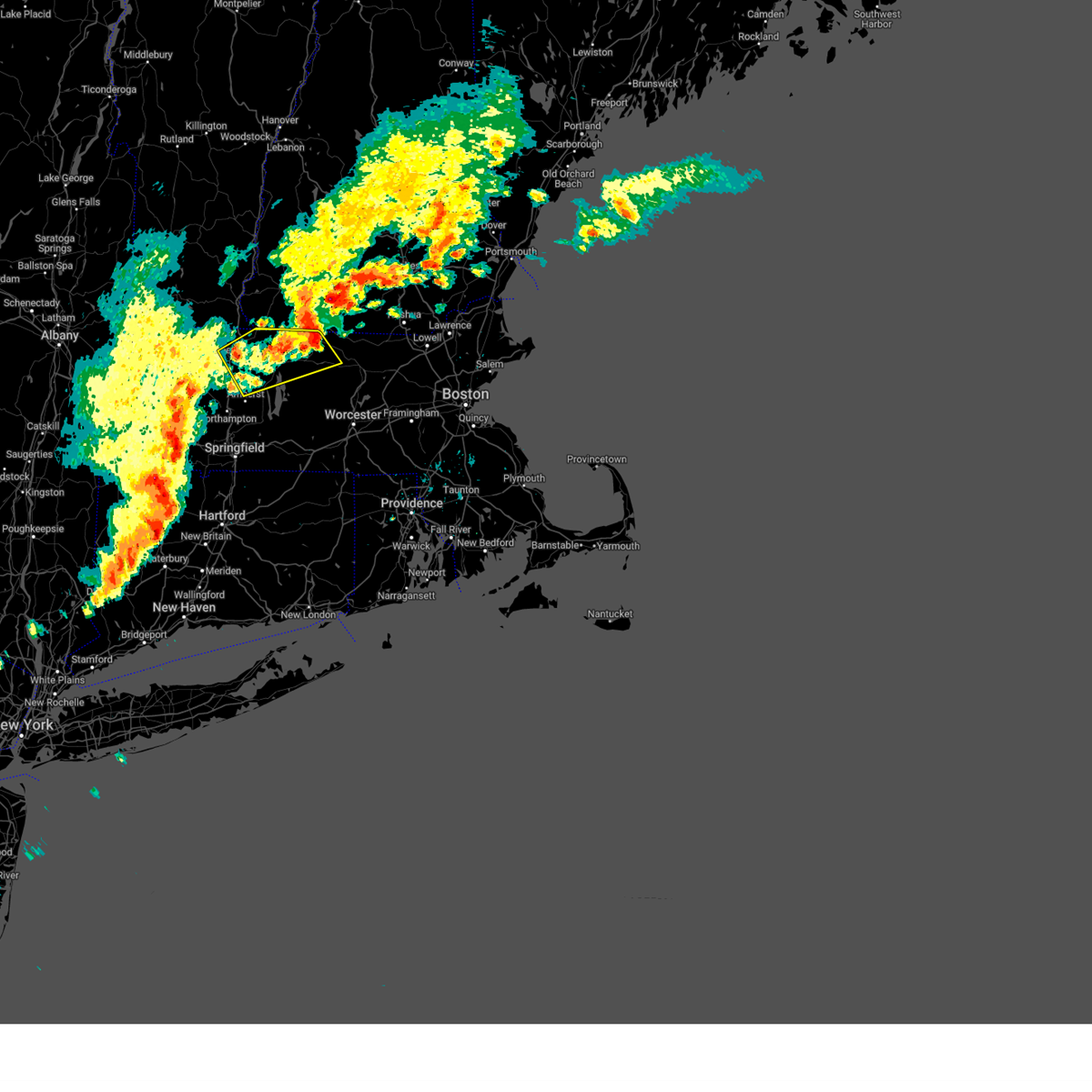
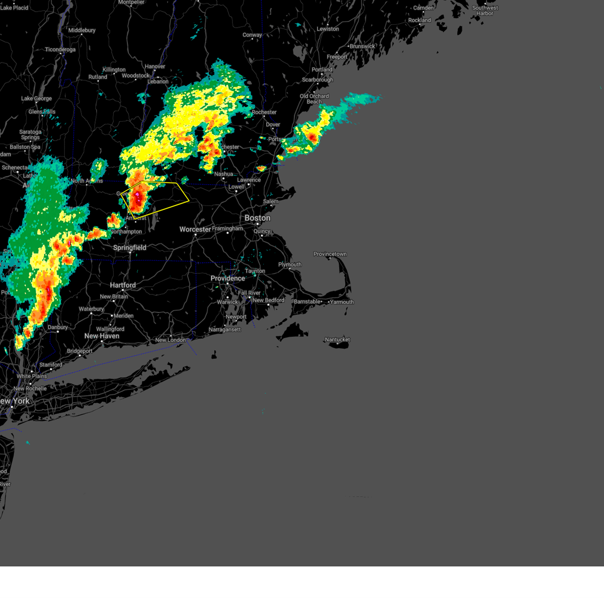
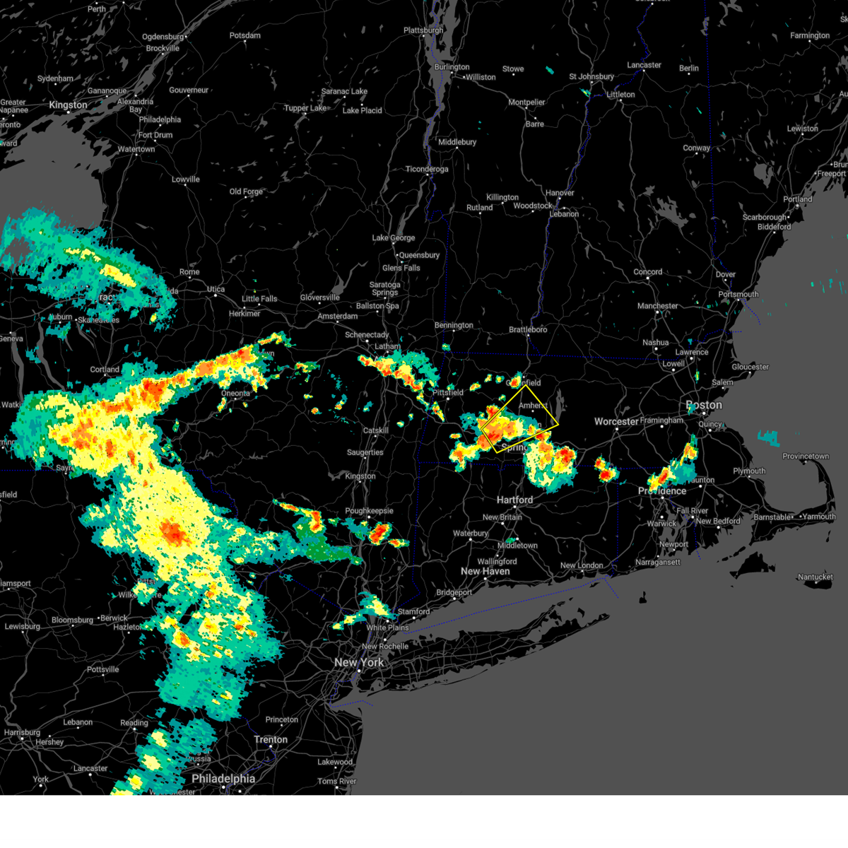
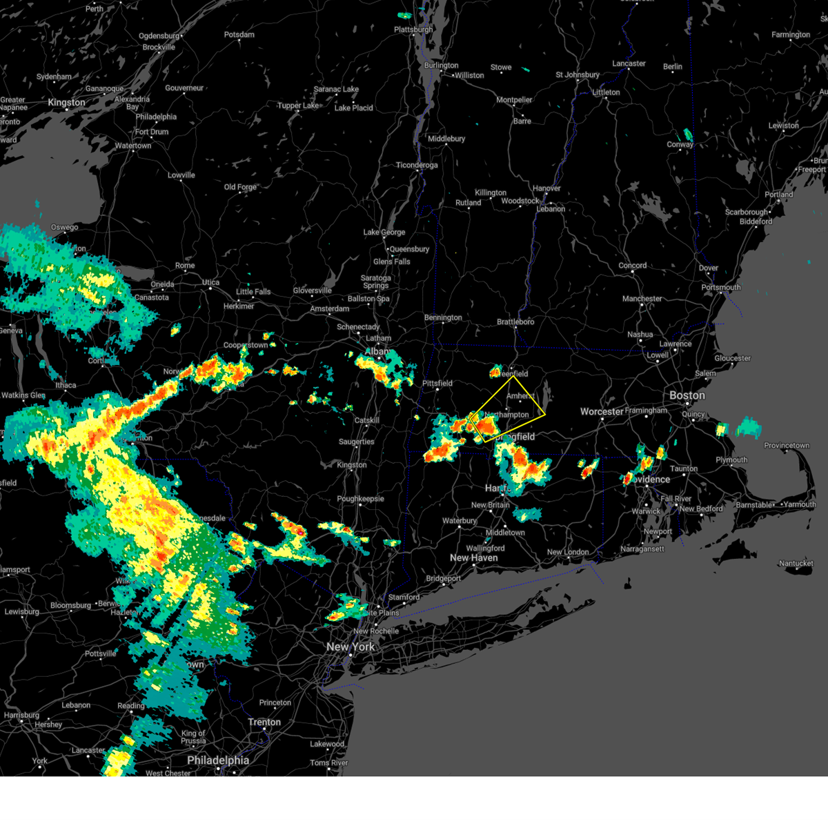
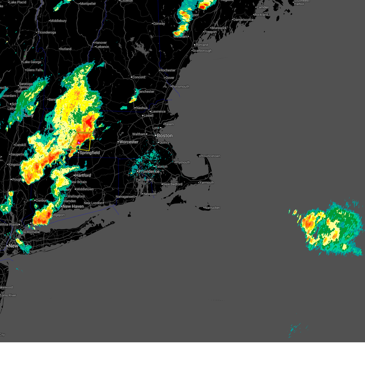
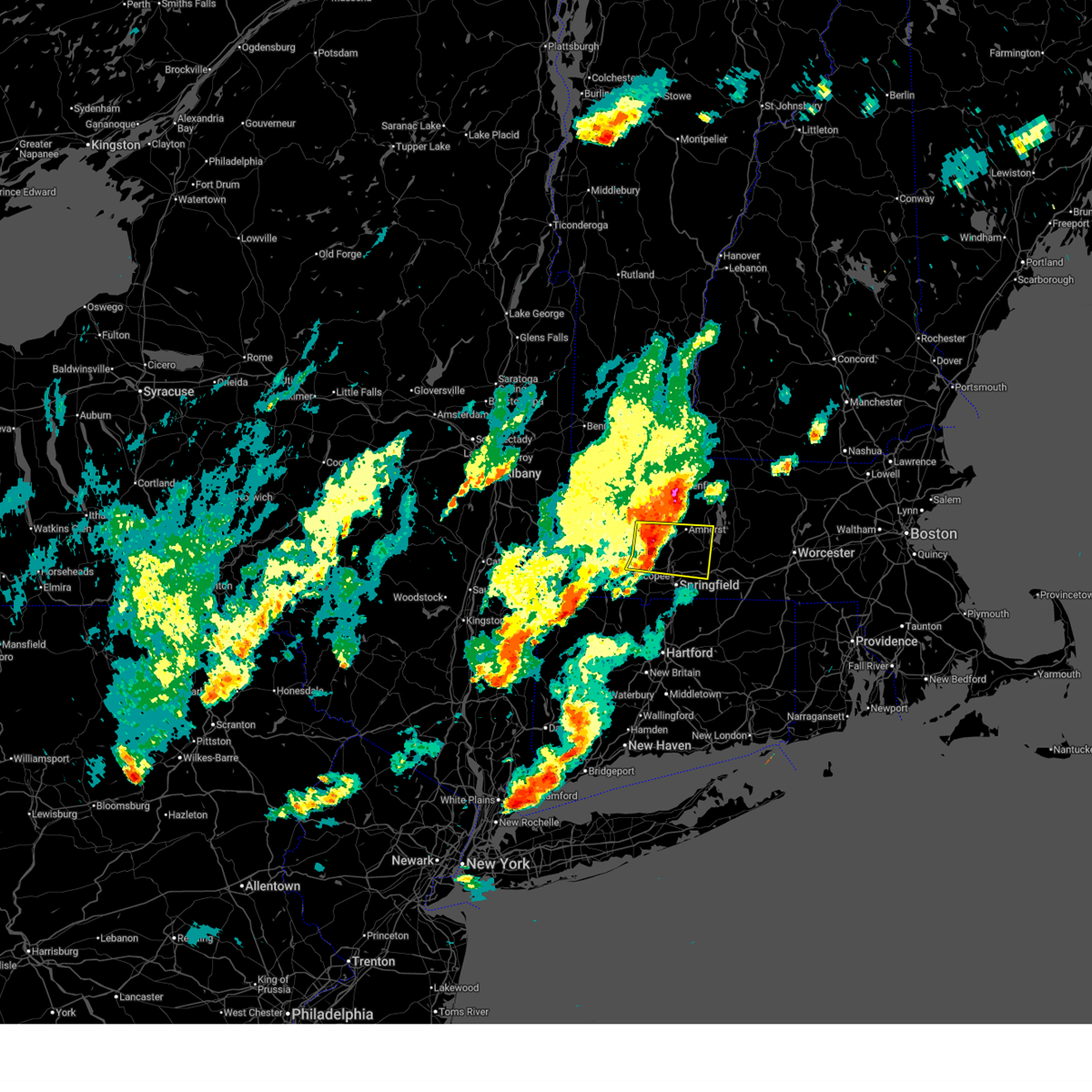
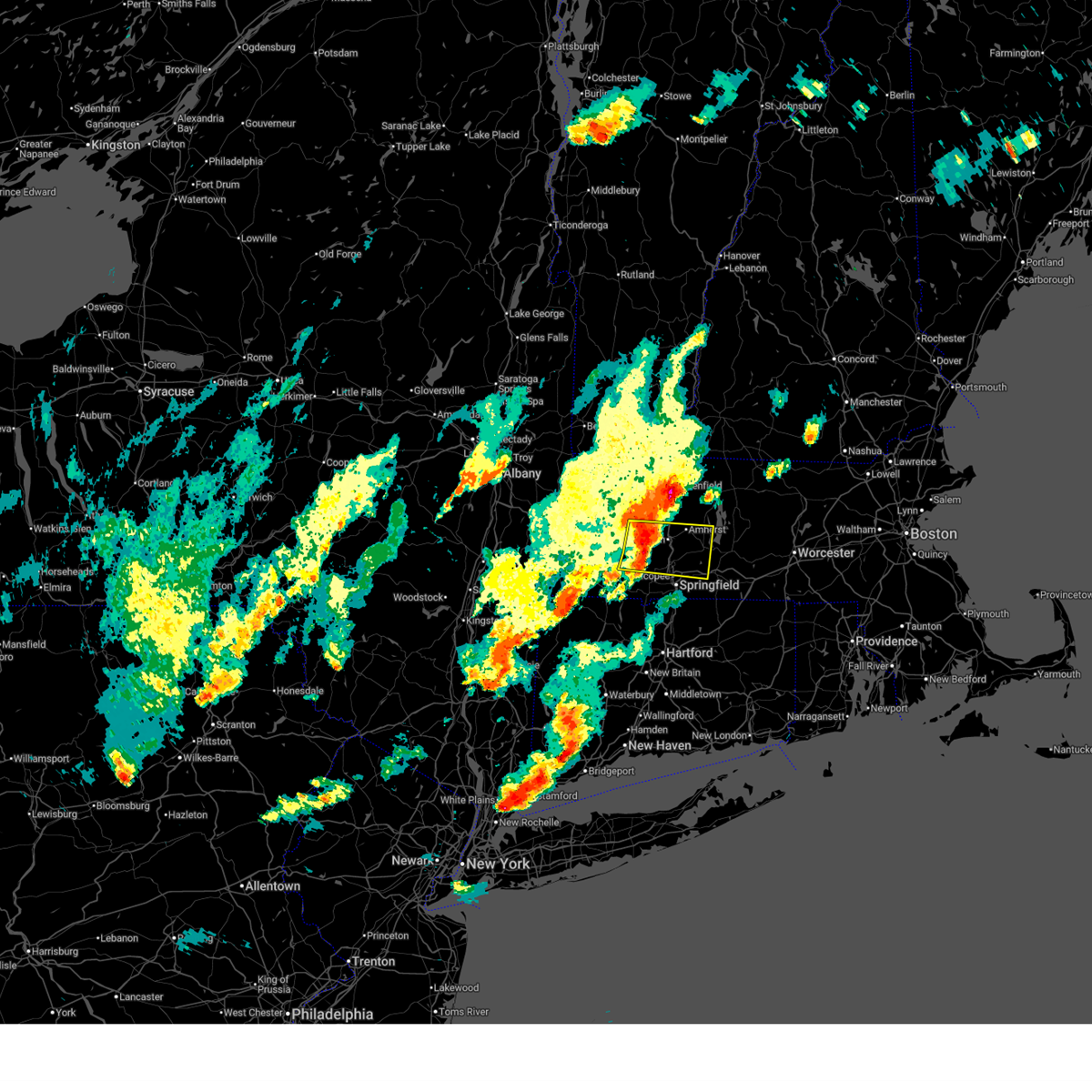
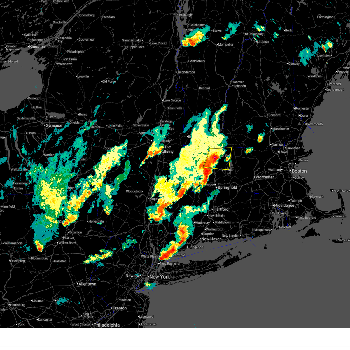
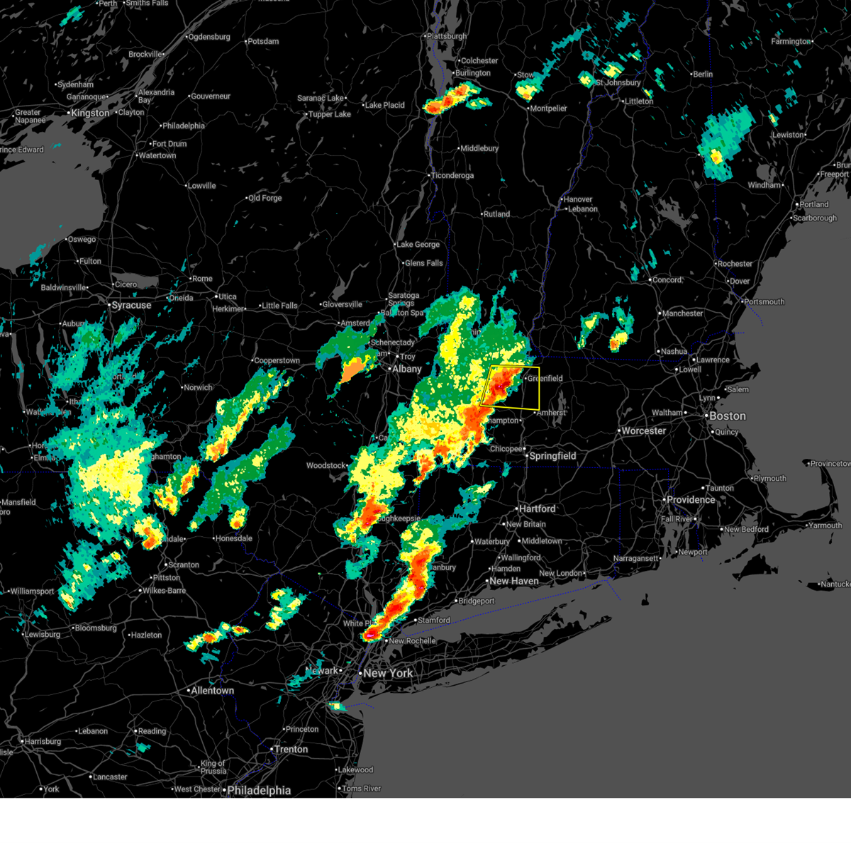
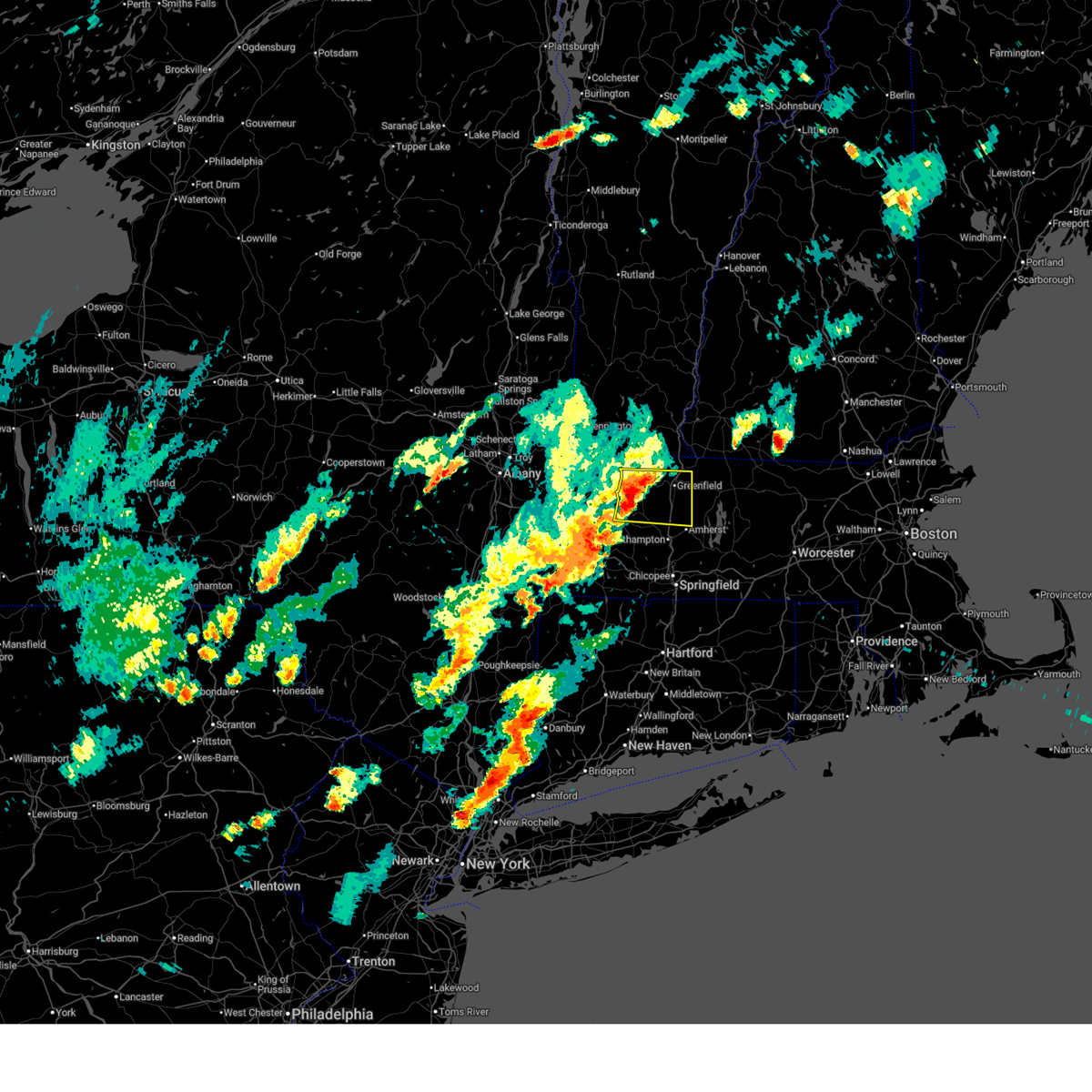
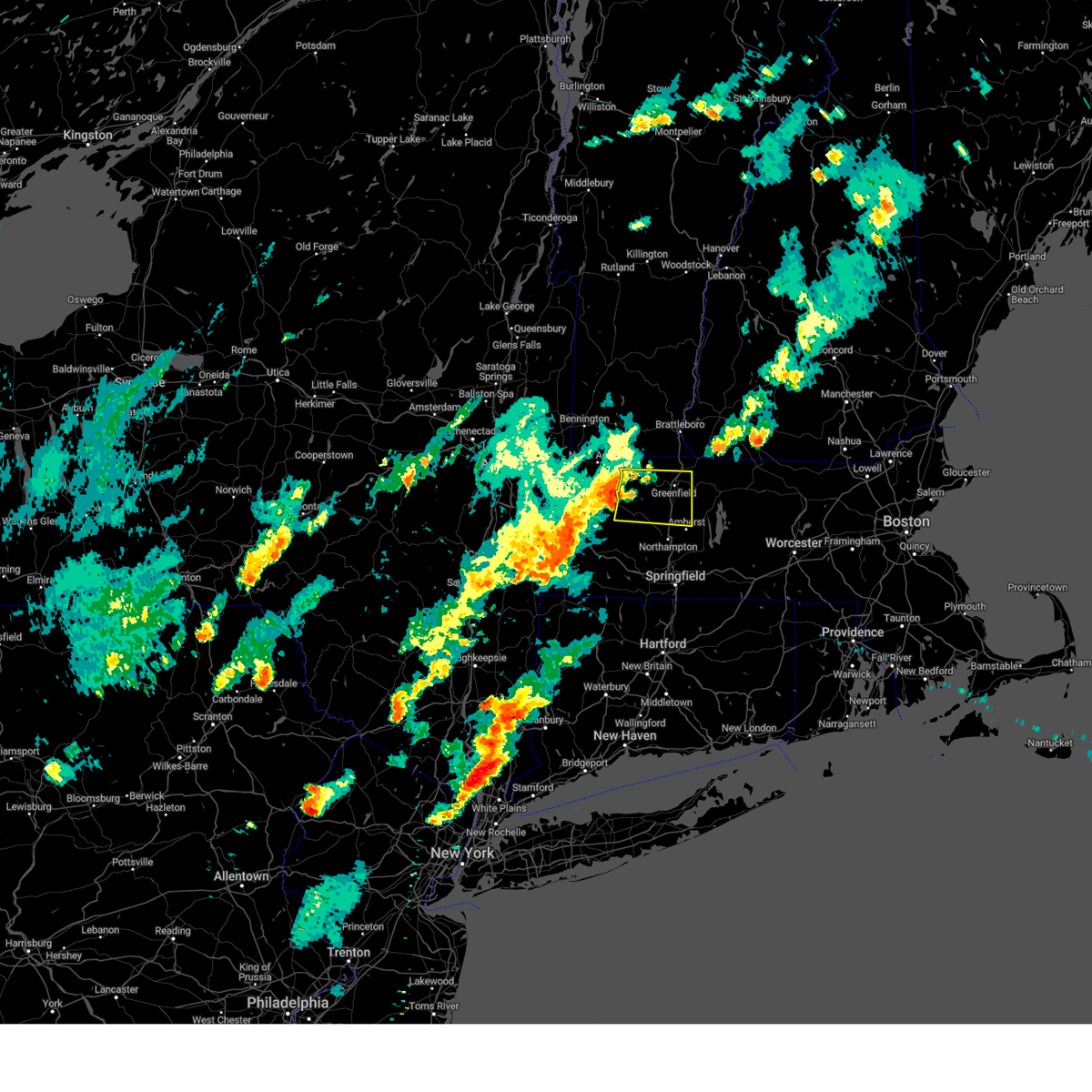
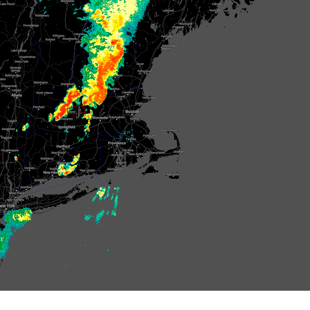
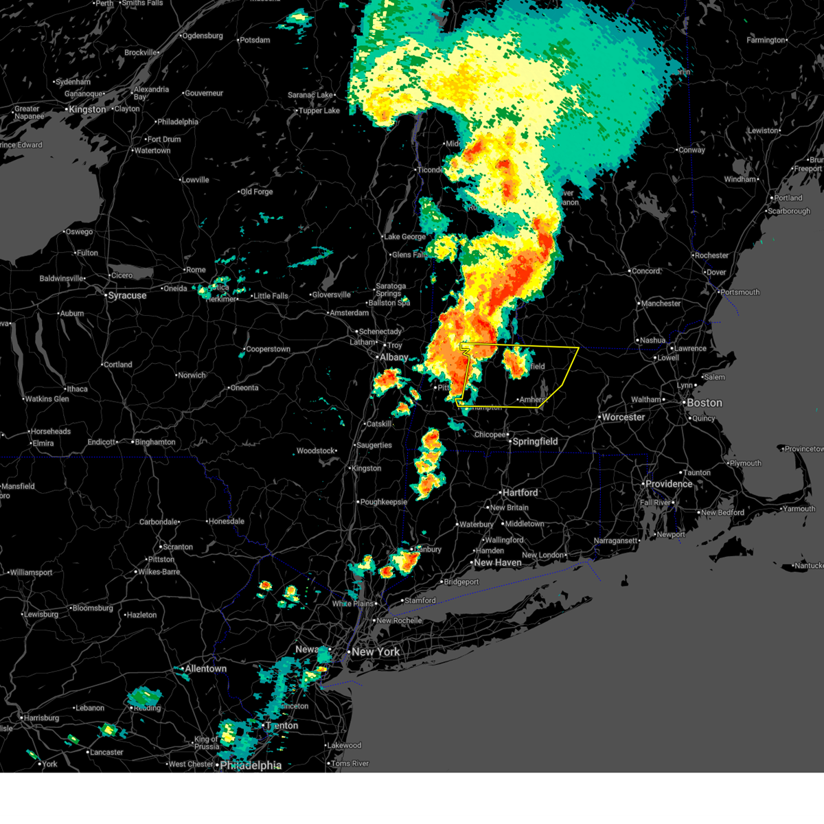
Hail Map for North Amherst, MA
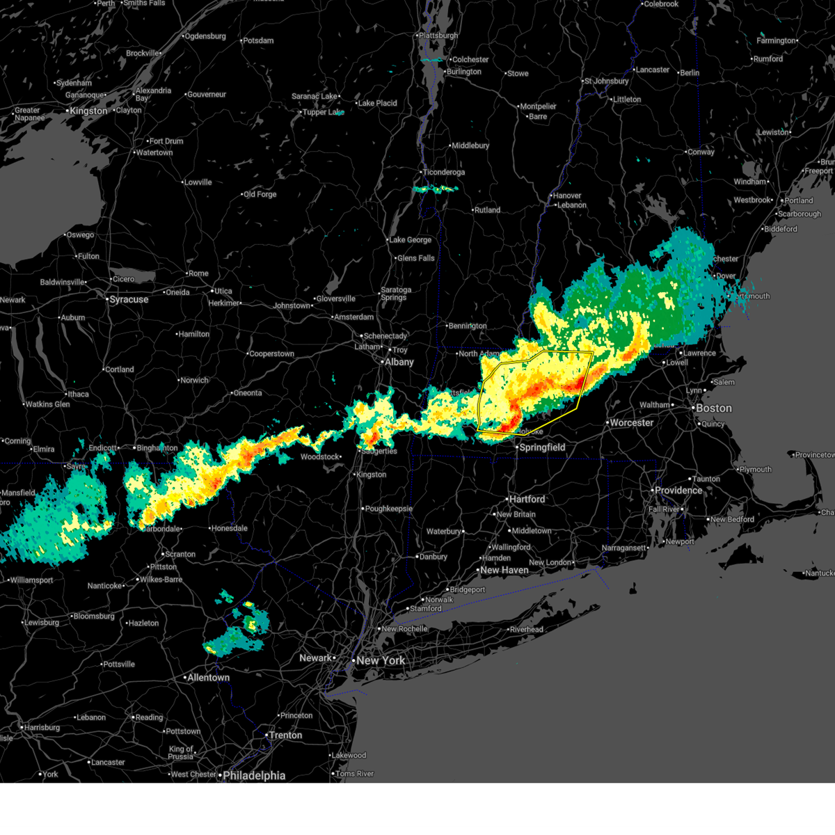
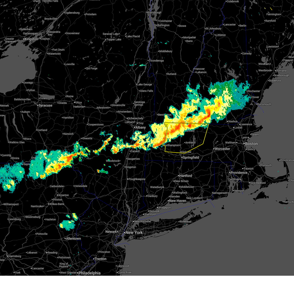
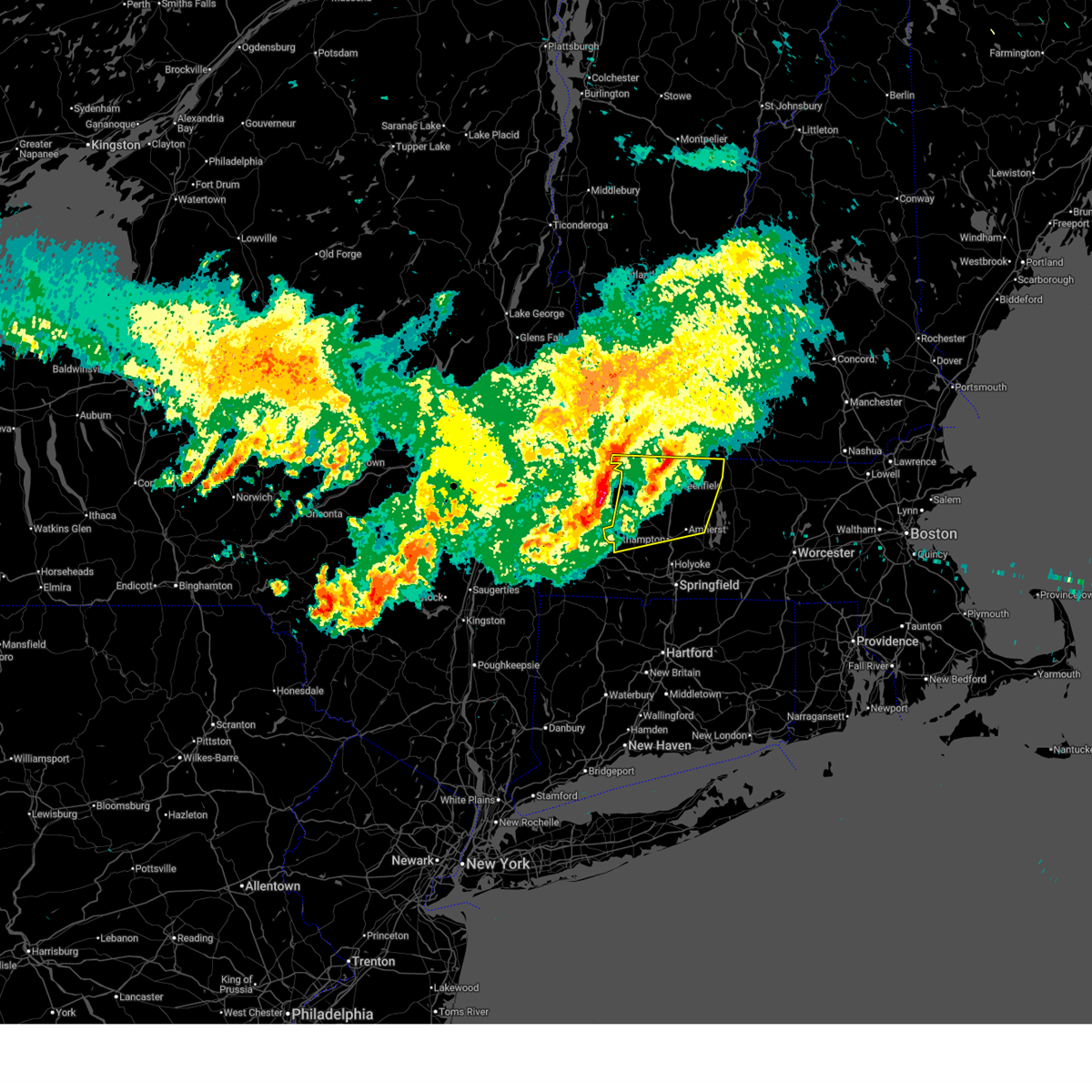
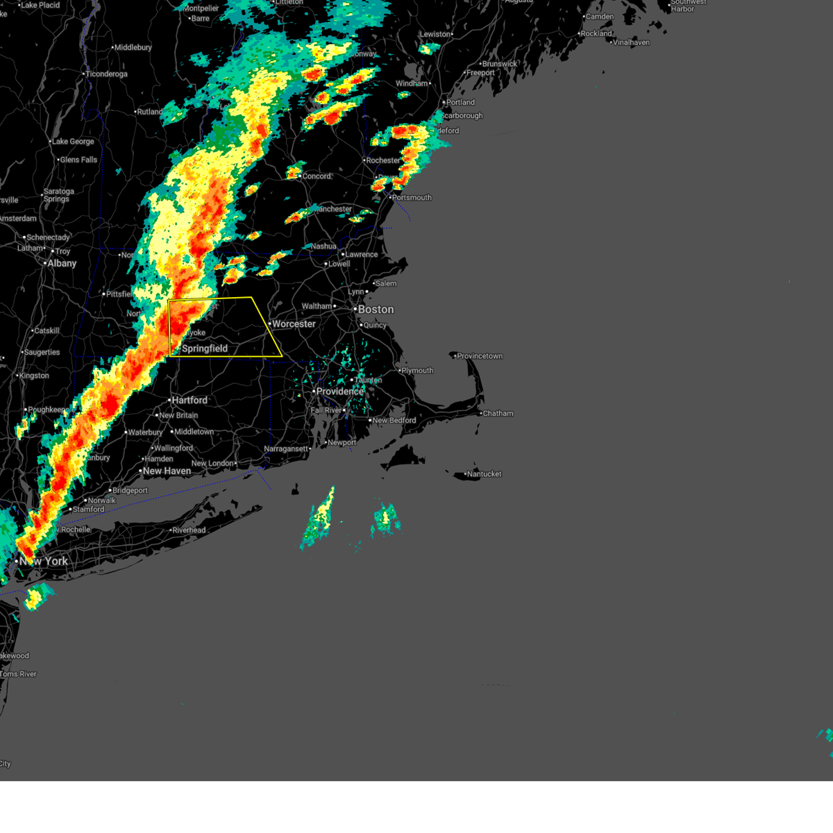
The North Amherst, MA area has had 4 reports of on-the-ground hail by trained spotters, and has been under severe weather warnings 6 times during the past 12 months. Doppler radar has detected hail at or near North Amherst, MA on 29 occasions.
| Name: | North Amherst, MA |
| Where Located: | 69.9 miles NW of Providence, RI |
| Map: | Google Map for North Amherst, MA |
| Population: | 6819 |
| Housing Units: | 1935 |
| More Info: | Search Google for North Amherst, MA |
0
The Top Recent Hail Date for North Amherst, MA is Friday, June 6, 2025 (14th out of 29)

Hail and Wind Damage Spotted near North Amherst, MA
| Date / Time | Report Details |
|---|---|
| 4/14/2026 7:42 PM EDT |
 At 741 pm edt, severe thunderstorms were located along a line extending from ashburnham to near hadley to near chester, moving east at 45 mph (law enforcement and doppler radar. these storms have downed trees in hawley, greenfield and deerfield between 725 and 730 pm). Hazards include 60 mph wind gusts. Expect damage to trees and power lines. Locations impacted include, chicopee, holyoke, amherst, northampton, greenfield, orange, deerfield, ludlow, gardner, south hadley, easthampton, belchertown, athol, winchendon, ware, montague, templeton, granby, ashburnham, and southampton. At 741 pm edt, severe thunderstorms were located along a line extending from ashburnham to near hadley to near chester, moving east at 45 mph (law enforcement and doppler radar. these storms have downed trees in hawley, greenfield and deerfield between 725 and 730 pm). Hazards include 60 mph wind gusts. Expect damage to trees and power lines. Locations impacted include, chicopee, holyoke, amherst, northampton, greenfield, orange, deerfield, ludlow, gardner, south hadley, easthampton, belchertown, athol, winchendon, ware, montague, templeton, granby, ashburnham, and southampton.
|
| 4/14/2026 7:09 PM EDT |
 Svrbox the national weather service in boston/norton has issued a * severe thunderstorm warning for, northwestern worcester county in central massachusetts, hampshire county in western massachusetts, franklin county in western massachusetts, northwestern hampden county in western massachusetts, * until 815 pm edt. * at 708 pm edt, severe thunderstorms were located along a line extending from near colrain to near east windsor to housatonic, moving east at 45 mph (radar indicated). Hazards include 60 mph wind gusts. a wind gust to 59 mph was observed in pittsfield as of 658 pm. expect damage to trees and power lines Svrbox the national weather service in boston/norton has issued a * severe thunderstorm warning for, northwestern worcester county in central massachusetts, hampshire county in western massachusetts, franklin county in western massachusetts, northwestern hampden county in western massachusetts, * until 815 pm edt. * at 708 pm edt, severe thunderstorms were located along a line extending from near colrain to near east windsor to housatonic, moving east at 45 mph (radar indicated). Hazards include 60 mph wind gusts. a wind gust to 59 mph was observed in pittsfield as of 658 pm. expect damage to trees and power lines
|
| 3/31/2026 8:40 PM EDT |
 Svrbox the national weather service in boston/norton has issued a * severe thunderstorm warning for, northwestern worcester county in central massachusetts, northern hampshire county in western massachusetts, franklin county in western massachusetts, northwestern hampden county in western massachusetts, * until 945 pm edt. * at 839 pm edt, severe thunderstorms were located along a line extending from near stamford to near cheshire to near becket, moving east at 40 mph (radar indicated). Hazards include 60 mph wind gusts and quarter size hail. a wind gust to 51 mph was reported in pittsfield from these thunderstorms. Hail damage to vehicles is expected. Expect wind damage to trees and power lines. Svrbox the national weather service in boston/norton has issued a * severe thunderstorm warning for, northwestern worcester county in central massachusetts, northern hampshire county in western massachusetts, franklin county in western massachusetts, northwestern hampden county in western massachusetts, * until 945 pm edt. * at 839 pm edt, severe thunderstorms were located along a line extending from near stamford to near cheshire to near becket, moving east at 40 mph (radar indicated). Hazards include 60 mph wind gusts and quarter size hail. a wind gust to 51 mph was reported in pittsfield from these thunderstorms. Hail damage to vehicles is expected. Expect wind damage to trees and power lines.
|
| 9/6/2025 3:09 PM EDT |
 At 307 pm edt, a severe thunderstorm was located over ludlow, or 8 miles east of chicopee, moving east at 45 mph (numerous reports of wind damage). Hazards include 60 mph wind gusts and quarter size hail. Hail damage to vehicles is expected. expect wind damage to trees and power lines. Locations impacted include, worcester, springfield, chicopee, holyoke, amherst, northampton, agawam, west springfield, ludlow, south hadley, holden, webster, southbridge, auburn, easthampton, longmeadow, east longmeadow, belchertown, wilbraham, and oxford. At 307 pm edt, a severe thunderstorm was located over ludlow, or 8 miles east of chicopee, moving east at 45 mph (numerous reports of wind damage). Hazards include 60 mph wind gusts and quarter size hail. Hail damage to vehicles is expected. expect wind damage to trees and power lines. Locations impacted include, worcester, springfield, chicopee, holyoke, amherst, northampton, agawam, west springfield, ludlow, south hadley, holden, webster, southbridge, auburn, easthampton, longmeadow, east longmeadow, belchertown, wilbraham, and oxford.
|
| 9/6/2025 2:50 PM EDT |
 Svrbox the national weather service in boston/norton has issued a * severe thunderstorm warning for, southwestern worcester county in central massachusetts, southeastern hampshire county in western massachusetts, southeastern franklin county in western massachusetts, eastern hampden county in western massachusetts, * until 345 pm edt. * at 249 pm edt, a severe thunderstorm was located near west springfield, moving east at 40 mph (radar indicated). Hazards include 60 mph wind gusts and quarter size hail. Hail damage to vehicles is expected. Expect wind damage to trees and power lines. Svrbox the national weather service in boston/norton has issued a * severe thunderstorm warning for, southwestern worcester county in central massachusetts, southeastern hampshire county in western massachusetts, southeastern franklin county in western massachusetts, eastern hampden county in western massachusetts, * until 345 pm edt. * at 249 pm edt, a severe thunderstorm was located near west springfield, moving east at 40 mph (radar indicated). Hazards include 60 mph wind gusts and quarter size hail. Hail damage to vehicles is expected. Expect wind damage to trees and power lines.
|
| 7/11/2025 6:39 PM EDT |
 Svrbox the national weather service in boston/norton has issued a * severe thunderstorm warning for, south central hampshire county in western massachusetts, central franklin county in western massachusetts, central hampden county in western massachusetts, * until 745 pm edt. * at 638 pm edt, a severe thunderstorm was located over northampton, and is nearly stationary (radar indicated. this storm has had a history of downing powerlines in willamsburg). Hazards include 60 mph wind gusts and penny size hail. expect damage to trees and power lines Svrbox the national weather service in boston/norton has issued a * severe thunderstorm warning for, south central hampshire county in western massachusetts, central franklin county in western massachusetts, central hampden county in western massachusetts, * until 745 pm edt. * at 638 pm edt, a severe thunderstorm was located over northampton, and is nearly stationary (radar indicated. this storm has had a history of downing powerlines in willamsburg). Hazards include 60 mph wind gusts and penny size hail. expect damage to trees and power lines
|
| 6/6/2025 6:28 PM EDT |
 The storm which prompted the warning has weakened below severe limits, and no longer poses an immediate threat to life or property. therefore, the warning will be allowed to expire. The storm which prompted the warning has weakened below severe limits, and no longer poses an immediate threat to life or property. therefore, the warning will be allowed to expire.
|
| 6/6/2025 5:44 PM EDT |
 Svrbox the national weather service in boston/norton has issued a * severe thunderstorm warning for, west central worcester county in central massachusetts, southeastern hampshire county in western massachusetts, southeastern franklin county in western massachusetts, north central hampden county in western massachusetts, * until 630 pm edt. * at 543 pm edt, a severe thunderstorm was located over northampton, moving east at 25 mph (radar indicated). Hazards include 60 mph wind gusts and quarter size hail. Hail damage to vehicles is expected. Expect wind damage to trees and power lines. Svrbox the national weather service in boston/norton has issued a * severe thunderstorm warning for, west central worcester county in central massachusetts, southeastern hampshire county in western massachusetts, southeastern franklin county in western massachusetts, north central hampden county in western massachusetts, * until 630 pm edt. * at 543 pm edt, a severe thunderstorm was located over northampton, moving east at 25 mph (radar indicated). Hazards include 60 mph wind gusts and quarter size hail. Hail damage to vehicles is expected. Expect wind damage to trees and power lines.
|
| 6/6/2025 4:52 PM EDT |
 Svrbox the national weather service in boston/norton has issued a * severe thunderstorm warning for, western hampshire county in western massachusetts, central franklin county in western massachusetts, northwestern hampden county in western massachusetts, * until 545 pm edt. * at 452 pm edt, a severe thunderstorm was located over huntington, or 11 miles west of northampton, moving northeast at 25 mph (radar indicated). Hazards include 60 mph wind gusts and quarter size hail. Hail damage to vehicles is expected. Expect wind damage to trees and power lines. Svrbox the national weather service in boston/norton has issued a * severe thunderstorm warning for, western hampshire county in western massachusetts, central franklin county in western massachusetts, northwestern hampden county in western massachusetts, * until 545 pm edt. * at 452 pm edt, a severe thunderstorm was located over huntington, or 11 miles west of northampton, moving northeast at 25 mph (radar indicated). Hazards include 60 mph wind gusts and quarter size hail. Hail damage to vehicles is expected. Expect wind damage to trees and power lines.
|
| 5/17/2025 7:41 PM EDT |
 the severe thunderstorm warning has been cancelled and is no longer in effect the severe thunderstorm warning has been cancelled and is no longer in effect
|
| 5/17/2025 7:26 PM EDT |
 At 725 pm edt, a severe thunderstorm was located over williamsburg, or near northampton, moving east at 25 mph (radar indicated). Hazards include 60 mph wind gusts. Expect damage to trees and power lines. Locations impacted include, holyoke, amherst, northampton, greenfield, deerfield, south hadley, easthampton, belchertown, montague, granby, hadley, sunderland, hatfield, northfield, williamsburg, huntington, conway, shelburne, leverett, and erving. At 725 pm edt, a severe thunderstorm was located over williamsburg, or near northampton, moving east at 25 mph (radar indicated). Hazards include 60 mph wind gusts. Expect damage to trees and power lines. Locations impacted include, holyoke, amherst, northampton, greenfield, deerfield, south hadley, easthampton, belchertown, montague, granby, hadley, sunderland, hatfield, northfield, williamsburg, huntington, conway, shelburne, leverett, and erving.
|
| 5/17/2025 6:59 PM EDT |
 Svrbox the national weather service in boston/norton has issued a * severe thunderstorm warning for, hampshire county in western massachusetts, central franklin county in western massachusetts, northwestern hampden county in western massachusetts, * until 800 pm edt. * at 659 pm edt, a severe thunderstorm was located over worthington, or 15 miles west of northampton, moving east at 25 mph (radar indicated). Hazards include 60 mph wind gusts and quarter size hail. Hail damage to vehicles is expected. Expect wind damage to trees and power lines. Svrbox the national weather service in boston/norton has issued a * severe thunderstorm warning for, hampshire county in western massachusetts, central franklin county in western massachusetts, northwestern hampden county in western massachusetts, * until 800 pm edt. * at 659 pm edt, a severe thunderstorm was located over worthington, or 15 miles west of northampton, moving east at 25 mph (radar indicated). Hazards include 60 mph wind gusts and quarter size hail. Hail damage to vehicles is expected. Expect wind damage to trees and power lines.
|
| 5/3/2025 3:36 PM EDT |
 The storm which prompted the warning has moved out of the area. therefore, the warning will be allowed to expire. a severe thunderstorm watch remains in effect until 800 pm edt for western and central massachusetts. The storm which prompted the warning has moved out of the area. therefore, the warning will be allowed to expire. a severe thunderstorm watch remains in effect until 800 pm edt for western and central massachusetts.
|
| 5/3/2025 3:06 PM EDT |
 Svrbox the national weather service in boston/norton has issued a * severe thunderstorm warning for, northwestern worcester county in central massachusetts, northeastern hampshire county in western massachusetts, northeastern franklin county in western massachusetts, * until 345 pm edt. * at 306 pm edt, a severe thunderstorm was located over montague, or 8 miles southeast of greenfield, moving northeast at 35 mph (radar indicated). Hazards include 60 mph wind gusts and quarter size hail. Hail damage to vehicles is expected. Expect wind damage to trees and power lines. Svrbox the national weather service in boston/norton has issued a * severe thunderstorm warning for, northwestern worcester county in central massachusetts, northeastern hampshire county in western massachusetts, northeastern franklin county in western massachusetts, * until 345 pm edt. * at 306 pm edt, a severe thunderstorm was located over montague, or 8 miles southeast of greenfield, moving northeast at 35 mph (radar indicated). Hazards include 60 mph wind gusts and quarter size hail. Hail damage to vehicles is expected. Expect wind damage to trees and power lines.
|
| 8/2/2024 3:34 PM EDT |
 the severe thunderstorm warning has been cancelled and is no longer in effect the severe thunderstorm warning has been cancelled and is no longer in effect
|
| 8/2/2024 3:08 PM EDT |
 Svrbox the national weather service in boston/norton has issued a * severe thunderstorm warning for, hampshire county in western massachusetts, south central franklin county in western massachusetts, northwestern hampden county in western massachusetts, * until 415 pm edt. * at 308 pm edt, a severe thunderstorm was located over southampton, or 7 miles west of holyoke, moving northeast at 20 mph (radar indicated). Hazards include 60 mph wind gusts and penny size hail. expect damage to trees and power lines Svrbox the national weather service in boston/norton has issued a * severe thunderstorm warning for, hampshire county in western massachusetts, south central franklin county in western massachusetts, northwestern hampden county in western massachusetts, * until 415 pm edt. * at 308 pm edt, a severe thunderstorm was located over southampton, or 7 miles west of holyoke, moving northeast at 20 mph (radar indicated). Hazards include 60 mph wind gusts and penny size hail. expect damage to trees and power lines
|
| 7/17/2024 5:35 PM EDT |
 At 535 pm edt, a severe thunderstorm was located over granby, or near chicopee, moving east at 35 mph (trained weather spotters). Hazards include 60 mph wind gusts and penny size hail. Expect damage to roofs, siding, and trees. Locations impacted include, springfield, chicopee, westfield, holyoke, amherst, northampton, west springfield, ludlow, south hadley, easthampton, belchertown, wilbraham, palmer, monson, granby, southampton, hadley, hatfield, pelham, and new salem. At 535 pm edt, a severe thunderstorm was located over granby, or near chicopee, moving east at 35 mph (trained weather spotters). Hazards include 60 mph wind gusts and penny size hail. Expect damage to roofs, siding, and trees. Locations impacted include, springfield, chicopee, westfield, holyoke, amherst, northampton, west springfield, ludlow, south hadley, easthampton, belchertown, wilbraham, palmer, monson, granby, southampton, hadley, hatfield, pelham, and new salem.
|
| 7/17/2024 5:26 PM EDT |
 Svrbox the national weather service in boston/norton has issued a * severe thunderstorm warning for, worcester county in central massachusetts, southeastern hampshire county in western massachusetts, eastern franklin county in western massachusetts, northeastern hampden county in western massachusetts, * until 630 pm edt. * at 525 pm edt, severe thunderstorms were located along a line extending from near erving to hadley to westfield, moving east at 55 mph (radar indicated). Hazards include 60 mph wind gusts and penny size hail. expect damage to roofs, siding, and trees Svrbox the national weather service in boston/norton has issued a * severe thunderstorm warning for, worcester county in central massachusetts, southeastern hampshire county in western massachusetts, eastern franklin county in western massachusetts, northeastern hampden county in western massachusetts, * until 630 pm edt. * at 525 pm edt, severe thunderstorms were located along a line extending from near erving to hadley to westfield, moving east at 55 mph (radar indicated). Hazards include 60 mph wind gusts and penny size hail. expect damage to roofs, siding, and trees
|
| 7/17/2024 5:13 PM EDT |
 At 513 pm edt, a severe thunderstorm was located over hadley, or near northampton, moving east at 30 mph (trained weather spotters). Hazards include 60 mph wind gusts and penny size hail. Expect damage to roofs, siding, and trees. Locations impacted include, springfield, chicopee, westfield, holyoke, amherst, northampton, west springfield, ludlow, south hadley, easthampton, belchertown, wilbraham, palmer, monson, granby, southampton, hadley, hatfield, williamsburg, and huntington. At 513 pm edt, a severe thunderstorm was located over hadley, or near northampton, moving east at 30 mph (trained weather spotters). Hazards include 60 mph wind gusts and penny size hail. Expect damage to roofs, siding, and trees. Locations impacted include, springfield, chicopee, westfield, holyoke, amherst, northampton, west springfield, ludlow, south hadley, easthampton, belchertown, wilbraham, palmer, monson, granby, southampton, hadley, hatfield, williamsburg, and huntington.
|
| 7/17/2024 5:06 PM EDT |
 At 506 pm edt, a severe thunderstorm was located over northampton, moving east at 30 mph (trained weather spotters). Hazards include 60 mph wind gusts and penny size hail. Expect damage to roofs, siding, and trees. Locations impacted include, springfield, chicopee, westfield, holyoke, amherst, northampton, west springfield, ludlow, south hadley, easthampton, belchertown, wilbraham, palmer, monson, granby, southampton, hadley, hatfield, williamsburg, and huntington. At 506 pm edt, a severe thunderstorm was located over northampton, moving east at 30 mph (trained weather spotters). Hazards include 60 mph wind gusts and penny size hail. Expect damage to roofs, siding, and trees. Locations impacted include, springfield, chicopee, westfield, holyoke, amherst, northampton, west springfield, ludlow, south hadley, easthampton, belchertown, wilbraham, palmer, monson, granby, southampton, hadley, hatfield, williamsburg, and huntington.
|
| 7/17/2024 5:05 PM EDT |
 Svrbox the national weather service in boston/norton has issued a * severe thunderstorm warning for, central hampshire county in western massachusetts, franklin county in western massachusetts, * until 530 pm edt. * at 505 pm edt, a severe thunderstorm was located over deerfield, or near greenfield, moving east at 25 mph (radar indicated). Hazards include 60 mph wind gusts and quarter size hail. Hail damage to vehicles is expected. Expect wind damage to roofs, siding, and trees. Svrbox the national weather service in boston/norton has issued a * severe thunderstorm warning for, central hampshire county in western massachusetts, franklin county in western massachusetts, * until 530 pm edt. * at 505 pm edt, a severe thunderstorm was located over deerfield, or near greenfield, moving east at 25 mph (radar indicated). Hazards include 60 mph wind gusts and quarter size hail. Hail damage to vehicles is expected. Expect wind damage to roofs, siding, and trees.
|
| 7/17/2024 4:47 PM EDT |
 Svrbox the national weather service in boston/norton has issued a * severe thunderstorm warning for, hampshire county in western massachusetts, southeastern franklin county in western massachusetts, northwestern hampden county in western massachusetts, * until 545 pm edt. * at 447 pm edt, a severe thunderstorm was located over chesterfield, or 8 miles west of northampton, moving east at 30 mph (radar indicated). Hazards include 60 mph wind gusts and penny size hail. expect damage to roofs, siding, and trees Svrbox the national weather service in boston/norton has issued a * severe thunderstorm warning for, hampshire county in western massachusetts, southeastern franklin county in western massachusetts, northwestern hampden county in western massachusetts, * until 545 pm edt. * at 447 pm edt, a severe thunderstorm was located over chesterfield, or 8 miles west of northampton, moving east at 30 mph (radar indicated). Hazards include 60 mph wind gusts and penny size hail. expect damage to roofs, siding, and trees
|
| 7/17/2024 4:44 PM EDT |
 At 443 pm edt, a severe thunderstorm was located over conway, or 8 miles southwest of greenfield, moving east at 20 mph (radar indicated). Hazards include ping pong ball size hail and 60 mph wind gusts. People and animals outdoors will be injured. expect hail damage to roofs, siding, windows, and vehicles. expect wind damage to roofs, siding, and trees. Locations impacted include, amherst, greenfield, deerfield, montague, hadley, sunderland, hatfield, northfield, williamsburg, bernardston, buckland, conway, shelburne, leverett, erving, shutesbury, ashfield, colrain, gill, and whately. At 443 pm edt, a severe thunderstorm was located over conway, or 8 miles southwest of greenfield, moving east at 20 mph (radar indicated). Hazards include ping pong ball size hail and 60 mph wind gusts. People and animals outdoors will be injured. expect hail damage to roofs, siding, windows, and vehicles. expect wind damage to roofs, siding, and trees. Locations impacted include, amherst, greenfield, deerfield, montague, hadley, sunderland, hatfield, northfield, williamsburg, bernardston, buckland, conway, shelburne, leverett, erving, shutesbury, ashfield, colrain, gill, and whately.
|
| 7/17/2024 4:30 PM EDT |
 At 429 pm edt, a severe thunderstorm was located over plainfield, or 15 miles southwest of greenfield, moving east at 20 mph (radar indicated). Hazards include ping pong ball size hail and 60 mph wind gusts. People and animals outdoors will be injured. expect hail damage to roofs, siding, windows, and vehicles. expect wind damage to roofs, siding, and trees. Locations impacted include, amherst, greenfield, deerfield, montague, hadley, sunderland, hatfield, northfield, williamsburg, bernardston, buckland, conway, shelburne, leverett, erving, shutesbury, ashfield, colrain, gill, and whately. At 429 pm edt, a severe thunderstorm was located over plainfield, or 15 miles southwest of greenfield, moving east at 20 mph (radar indicated). Hazards include ping pong ball size hail and 60 mph wind gusts. People and animals outdoors will be injured. expect hail damage to roofs, siding, windows, and vehicles. expect wind damage to roofs, siding, and trees. Locations impacted include, amherst, greenfield, deerfield, montague, hadley, sunderland, hatfield, northfield, williamsburg, bernardston, buckland, conway, shelburne, leverett, erving, shutesbury, ashfield, colrain, gill, and whately.
|
| 7/17/2024 4:13 PM EDT |
 Svrbox the national weather service in boston/norton has issued a * severe thunderstorm warning for, northwestern hampshire county in western massachusetts, central franklin county in western massachusetts, * until 515 pm edt. * at 411 pm edt, a severe thunderstorm was located near east windsor, or 12 miles southeast of north adams, moving east at 20 mph (radar indicated). Hazards include 60 mph wind gusts and penny size hail. expect damage to roofs, siding, and trees Svrbox the national weather service in boston/norton has issued a * severe thunderstorm warning for, northwestern hampshire county in western massachusetts, central franklin county in western massachusetts, * until 515 pm edt. * at 411 pm edt, a severe thunderstorm was located near east windsor, or 12 miles southeast of north adams, moving east at 20 mph (radar indicated). Hazards include 60 mph wind gusts and penny size hail. expect damage to roofs, siding, and trees
|
| 7/16/2024 8:15 PM EDT |
 At 813 pm edt, severe thunderstorms were located along a line extending from fitzwilliam to near phillipston to granby, moving east at 35 mph (radar indicated). Hazards include 60 mph wind gusts. Expect damage to roofs, siding, and trees. Locations impacted include, holyoke, amherst, northampton, orange, ludlow, gardner, south hadley, easthampton, belchertown, palmer, athol, winchendon, ware, montague, templeton, granby, ashburnham, barre, hadley, and warren. At 813 pm edt, severe thunderstorms were located along a line extending from fitzwilliam to near phillipston to granby, moving east at 35 mph (radar indicated). Hazards include 60 mph wind gusts. Expect damage to roofs, siding, and trees. Locations impacted include, holyoke, amherst, northampton, orange, ludlow, gardner, south hadley, easthampton, belchertown, palmer, athol, winchendon, ware, montague, templeton, granby, ashburnham, barre, hadley, and warren.
|
| 7/16/2024 8:01 PM EDT |
 Torbox the national weather service in boston/norton has issued a * tornado warning for, northwestern worcester county in central massachusetts, east central hampshire county in western massachusetts, east central franklin county in western massachusetts, * until 830 pm edt. * at 801 pm edt, a severe thunderstorm capable of producing a tornado was located over leverett, or near amherst, moving east at 55 mph (radar indicated rotation). Hazards include tornado. Flying debris will be dangerous to those caught without shelter. mobile homes will be damaged or destroyed. damage to roofs, windows, and vehicles will occur. tree damage is likely. this dangerous storm will be near, hardwick, leverett, shutesbury, pelham, petersham, new salem, and wendell around 805 pm edt. Barre around 810 pm edt. Torbox the national weather service in boston/norton has issued a * tornado warning for, northwestern worcester county in central massachusetts, east central hampshire county in western massachusetts, east central franklin county in western massachusetts, * until 830 pm edt. * at 801 pm edt, a severe thunderstorm capable of producing a tornado was located over leverett, or near amherst, moving east at 55 mph (radar indicated rotation). Hazards include tornado. Flying debris will be dangerous to those caught without shelter. mobile homes will be damaged or destroyed. damage to roofs, windows, and vehicles will occur. tree damage is likely. this dangerous storm will be near, hardwick, leverett, shutesbury, pelham, petersham, new salem, and wendell around 805 pm edt. Barre around 810 pm edt.
|
| 7/16/2024 7:56 PM EDT |
 Svrbox the national weather service in boston/norton has issued a * severe thunderstorm warning for, western worcester county in central massachusetts, hampshire county in western massachusetts, franklin county in western massachusetts, northern hampden county in western massachusetts, * until 900 pm edt. * at 755 pm edt, severe thunderstorms were located along a line extending from near vernon to near montague to near huntington, moving east at 45 mph (radar indicated). Hazards include 60 mph wind gusts. expect damage to roofs, siding, and trees Svrbox the national weather service in boston/norton has issued a * severe thunderstorm warning for, western worcester county in central massachusetts, hampshire county in western massachusetts, franklin county in western massachusetts, northern hampden county in western massachusetts, * until 900 pm edt. * at 755 pm edt, severe thunderstorms were located along a line extending from near vernon to near montague to near huntington, moving east at 45 mph (radar indicated). Hazards include 60 mph wind gusts. expect damage to roofs, siding, and trees
|
| 7/16/2024 7:43 PM EDT |
 At 743 pm edt, a severe thunderstorm was located over chester, or 13 miles west of northampton, moving east at 45 mph (radar indicated). Hazards include 60 mph wind gusts and penny size hail. Expect damage to roofs, siding, and trees. Locations impacted include, chicopee, holyoke, amherst, northampton, ludlow, south hadley, easthampton, belchertown, wilbraham, palmer, ware, monson, granby, southampton, hadley, sunderland, hatfield, hardwick, williamsburg, and huntington. At 743 pm edt, a severe thunderstorm was located over chester, or 13 miles west of northampton, moving east at 45 mph (radar indicated). Hazards include 60 mph wind gusts and penny size hail. Expect damage to roofs, siding, and trees. Locations impacted include, chicopee, holyoke, amherst, northampton, ludlow, south hadley, easthampton, belchertown, wilbraham, palmer, ware, monson, granby, southampton, hadley, sunderland, hatfield, hardwick, williamsburg, and huntington.
|
| 7/16/2024 7:36 PM EDT |
 Svrbox the national weather service in boston/norton has issued a * severe thunderstorm warning for, west central worcester county in central massachusetts, hampshire county in western massachusetts, southeastern franklin county in western massachusetts, northern hampden county in western massachusetts, * until 815 pm edt. * at 735 pm edt, a severe thunderstorm was located over becket, or 13 miles southeast of pittsfield, moving east at 45 mph (radar indicated). Hazards include 60 mph wind gusts and penny size hail. expect damage to roofs, siding, and trees Svrbox the national weather service in boston/norton has issued a * severe thunderstorm warning for, west central worcester county in central massachusetts, hampshire county in western massachusetts, southeastern franklin county in western massachusetts, northern hampden county in western massachusetts, * until 815 pm edt. * at 735 pm edt, a severe thunderstorm was located over becket, or 13 miles southeast of pittsfield, moving east at 45 mph (radar indicated). Hazards include 60 mph wind gusts and penny size hail. expect damage to roofs, siding, and trees
|
| 7/16/2024 7:33 PM EDT |
 At 732 pm edt, severe thunderstorms were located along a line extending from near northfield to wendell to williamsburg, moving east at 45 mph (trained weather spotters). Hazards include 70 mph wind gusts. Expect considerable tree damage. damage is likely to mobile homes, roofs, and outbuildings. Locations impacted include, leominster, fitchburg, amherst, orange, deerfield, gardner, hudson, holden, clinton, athol, pepperell, groton, winchendon, lunenburg, townsend, littleton, montague, lancaster, templeton, and rutland. At 732 pm edt, severe thunderstorms were located along a line extending from near northfield to wendell to williamsburg, moving east at 45 mph (trained weather spotters). Hazards include 70 mph wind gusts. Expect considerable tree damage. damage is likely to mobile homes, roofs, and outbuildings. Locations impacted include, leominster, fitchburg, amherst, orange, deerfield, gardner, hudson, holden, clinton, athol, pepperell, groton, winchendon, lunenburg, townsend, littleton, montague, lancaster, templeton, and rutland.
|
| 7/16/2024 7:21 PM EDT |
 Svrbox the national weather service in boston/norton has issued a * severe thunderstorm warning for, northern worcester county in central massachusetts, central hampshire county in western massachusetts, northwestern middlesex county in northeastern massachusetts, eastern franklin county in western massachusetts, * until 815 pm edt. * at 721 pm edt, severe thunderstorms were located along a line extending from near warwick to near wendell to whately, moving east at 45 mph (trained weather spotters). Hazards include 70 mph wind gusts. Expect considerable tree damage. Damage is likely to mobile homes, roofs, and outbuildings. Svrbox the national weather service in boston/norton has issued a * severe thunderstorm warning for, northern worcester county in central massachusetts, central hampshire county in western massachusetts, northwestern middlesex county in northeastern massachusetts, eastern franklin county in western massachusetts, * until 815 pm edt. * at 721 pm edt, severe thunderstorms were located along a line extending from near warwick to near wendell to whately, moving east at 45 mph (trained weather spotters). Hazards include 70 mph wind gusts. Expect considerable tree damage. Damage is likely to mobile homes, roofs, and outbuildings.
|
| 7/16/2024 7:07 PM EDT |
 At 707 pm edt, severe thunderstorms were located along a line extending from near hinsdale to near deerfield to near becket, moving east at 45 mph (trained weather spotters). Hazards include 70 mph wind gusts. Expect considerable tree damage. damage is likely to mobile homes, roofs, and outbuildings. Locations impacted include, amherst, northampton, greenfield, orange, deerfield, belchertown, athol, winchendon, montague, templeton, hadley, sunderland, hatfield, northfield, hardwick, williamsburg, huntington, bernardston, conway, and shelburne. At 707 pm edt, severe thunderstorms were located along a line extending from near hinsdale to near deerfield to near becket, moving east at 45 mph (trained weather spotters). Hazards include 70 mph wind gusts. Expect considerable tree damage. damage is likely to mobile homes, roofs, and outbuildings. Locations impacted include, amherst, northampton, greenfield, orange, deerfield, belchertown, athol, winchendon, montague, templeton, hadley, sunderland, hatfield, northfield, hardwick, williamsburg, huntington, bernardston, conway, and shelburne.
|
| 7/16/2024 6:48 PM EDT |
 At 647 pm edt, severe thunderstorms were located along a line extending from 6 miles northwest of guilford center to hawley to near lee, moving east at 45 mph (radar indicated). Hazards include 70 mph wind gusts. Expect considerable tree damage. damage is likely to mobile homes, roofs, and outbuildings. Locations impacted include, amherst, northampton, greenfield, orange, deerfield, belchertown, monroe, athol, winchendon, montague, templeton, hadley, sunderland, hatfield, northfield, hardwick, williamsburg, huntington, bernardston, and buckland. At 647 pm edt, severe thunderstorms were located along a line extending from 6 miles northwest of guilford center to hawley to near lee, moving east at 45 mph (radar indicated). Hazards include 70 mph wind gusts. Expect considerable tree damage. damage is likely to mobile homes, roofs, and outbuildings. Locations impacted include, amherst, northampton, greenfield, orange, deerfield, belchertown, monroe, athol, winchendon, montague, templeton, hadley, sunderland, hatfield, northfield, hardwick, williamsburg, huntington, bernardston, and buckland.
|
| 7/16/2024 6:23 PM EDT |
 Svrbox the national weather service in boston/norton has issued a * severe thunderstorm warning for, northwestern worcester county in central massachusetts, hampshire county in western massachusetts, franklin county in western massachusetts, northwestern hampden county in western massachusetts, * until 730 pm edt. * at 622 pm edt, severe thunderstorms were located along a line extending from 7 miles west of wilmington to near new ashford to near chatham, moving east at 45 mph (radar indicated). Hazards include 70 mph wind gusts. Expect considerable tree damage. Damage is likely to mobile homes, roofs, and outbuildings. Svrbox the national weather service in boston/norton has issued a * severe thunderstorm warning for, northwestern worcester county in central massachusetts, hampshire county in western massachusetts, franklin county in western massachusetts, northwestern hampden county in western massachusetts, * until 730 pm edt. * at 622 pm edt, severe thunderstorms were located along a line extending from 7 miles west of wilmington to near new ashford to near chatham, moving east at 45 mph (radar indicated). Hazards include 70 mph wind gusts. Expect considerable tree damage. Damage is likely to mobile homes, roofs, and outbuildings.
|
| 6/21/2024 5:18 PM EDT |
 the severe thunderstorm warning has been cancelled and is no longer in effect the severe thunderstorm warning has been cancelled and is no longer in effect
|
| 6/21/2024 4:52 PM EDT |
 At 451 pm edt, a severe thunderstorm was located over easthampton, or near holyoke, moving east at 30 mph (radar indicated). Hazards include 60 mph wind gusts and penny size hail. Expect damage to roofs, siding, and trees. Locations impacted include, springfield, chicopee, westfield, holyoke, amherst, northampton, west springfield, ludlow, south hadley, easthampton, belchertown, wilbraham, palmer, ware, monson, granby, southampton, hadley, hatfield, and westhampton. At 451 pm edt, a severe thunderstorm was located over easthampton, or near holyoke, moving east at 30 mph (radar indicated). Hazards include 60 mph wind gusts and penny size hail. Expect damage to roofs, siding, and trees. Locations impacted include, springfield, chicopee, westfield, holyoke, amherst, northampton, west springfield, ludlow, south hadley, easthampton, belchertown, wilbraham, palmer, ware, monson, granby, southampton, hadley, hatfield, and westhampton.
|
| 6/21/2024 4:29 PM EDT |
 Svrbox the national weather service in boston/norton has issued a * severe thunderstorm warning for, hampshire county in western massachusetts, southeastern franklin county in western massachusetts, central hampden county in western massachusetts, * until 530 pm edt. * at 429 pm edt, a severe thunderstorm was located over chester, or 12 miles northwest of westfield, moving east at 30 mph (radar indicated). Hazards include 60 mph wind gusts and nickel size hail. expect damage to roofs, siding, and trees Svrbox the national weather service in boston/norton has issued a * severe thunderstorm warning for, hampshire county in western massachusetts, southeastern franklin county in western massachusetts, central hampden county in western massachusetts, * until 530 pm edt. * at 429 pm edt, a severe thunderstorm was located over chester, or 12 miles northwest of westfield, moving east at 30 mph (radar indicated). Hazards include 60 mph wind gusts and nickel size hail. expect damage to roofs, siding, and trees
|
| 6/20/2024 8:26 PM EDT |
 At 826 pm edt, severe thunderstorms were located along a line extending from clinton to new braintree to south hadley, moving east at 40 mph (radar indicated). Hazards include 60 mph wind gusts. Expect damage to roofs, siding, and trees. Locations impacted include, worcester, framingham, leominster, holyoke, marlborough, amherst, shrewsbury, northampton, ludlow, hudson, westborough, grafton, sudbury, south hadley, holden, auburn, easthampton, belchertown, wilbraham, and northborough. At 826 pm edt, severe thunderstorms were located along a line extending from clinton to new braintree to south hadley, moving east at 40 mph (radar indicated). Hazards include 60 mph wind gusts. Expect damage to roofs, siding, and trees. Locations impacted include, worcester, framingham, leominster, holyoke, marlborough, amherst, shrewsbury, northampton, ludlow, hudson, westborough, grafton, sudbury, south hadley, holden, auburn, easthampton, belchertown, wilbraham, and northborough.
|
| 6/20/2024 8:10 PM EDT |
 Svrbox the national weather service in boston/norton has issued a * severe thunderstorm warning for, central worcester county in central massachusetts, southeastern hampshire county in western massachusetts, central middlesex county in northeastern massachusetts, southeastern franklin county in western massachusetts, northeastern hampden county in western massachusetts, * until 915 pm edt. * at 809 pm edt, severe thunderstorms were located along a line extending from near princeton to hardwick to near hadley, moving southeast at 20 mph (radar indicated). Hazards include 60 mph wind gusts. expect damage to roofs, siding, and trees Svrbox the national weather service in boston/norton has issued a * severe thunderstorm warning for, central worcester county in central massachusetts, southeastern hampshire county in western massachusetts, central middlesex county in northeastern massachusetts, southeastern franklin county in western massachusetts, northeastern hampden county in western massachusetts, * until 915 pm edt. * at 809 pm edt, severe thunderstorms were located along a line extending from near princeton to hardwick to near hadley, moving southeast at 20 mph (radar indicated). Hazards include 60 mph wind gusts. expect damage to roofs, siding, and trees
|
| 6/14/2024 4:26 PM EDT |
 the severe thunderstorm warning has been cancelled and is no longer in effect the severe thunderstorm warning has been cancelled and is no longer in effect
|
| 6/14/2024 3:59 PM EDT |
 Svrbox the national weather service in boston/norton has issued a * severe thunderstorm warning for, western worcester county in central massachusetts, southeastern hampshire county in western massachusetts, southeastern franklin county in western massachusetts, northeastern hampden county in western massachusetts, * until 500 pm edt. * at 358 pm edt, a severe thunderstorm was located over amherst, moving northeast at 10 mph (radar indicated). Hazards include 60 mph wind gusts and penny size hail. expect damage to roofs, siding, and trees Svrbox the national weather service in boston/norton has issued a * severe thunderstorm warning for, western worcester county in central massachusetts, southeastern hampshire county in western massachusetts, southeastern franklin county in western massachusetts, northeastern hampden county in western massachusetts, * until 500 pm edt. * at 358 pm edt, a severe thunderstorm was located over amherst, moving northeast at 10 mph (radar indicated). Hazards include 60 mph wind gusts and penny size hail. expect damage to roofs, siding, and trees
|
| 5/21/2024 6:25 PM EDT |
 the severe thunderstorm warning has been cancelled and is no longer in effect the severe thunderstorm warning has been cancelled and is no longer in effect
|
| 5/21/2024 5:57 PM EDT |
 Svrbox the national weather service in boston/norton has issued a * severe thunderstorm warning for, east central hampshire county in western massachusetts, east central franklin county in western massachusetts, * until 645 pm edt. * at 557 pm edt, a severe thunderstorm was located over sunderland, or 9 miles south of greenfield, moving southeast at 15 mph (radar indicated). Hazards include 60 mph wind gusts and quarter size hail. Hail damage to vehicles is expected. Expect wind damage to roofs, siding, and trees. Svrbox the national weather service in boston/norton has issued a * severe thunderstorm warning for, east central hampshire county in western massachusetts, east central franklin county in western massachusetts, * until 645 pm edt. * at 557 pm edt, a severe thunderstorm was located over sunderland, or 9 miles south of greenfield, moving southeast at 15 mph (radar indicated). Hazards include 60 mph wind gusts and quarter size hail. Hail damage to vehicles is expected. Expect wind damage to roofs, siding, and trees.
|
| 9/8/2023 6:38 PM EDT |
 At 638 pm edt, severe thunderstorms were located along a line extending from near royalston to near orange to near pelham, moving northeast at 30 mph (radar indicated). Hazards include 60 mph wind gusts and penny size hail. expect damage to roofs, siding, and trees At 638 pm edt, severe thunderstorms were located along a line extending from near royalston to near orange to near pelham, moving northeast at 30 mph (radar indicated). Hazards include 60 mph wind gusts and penny size hail. expect damage to roofs, siding, and trees
|
| 9/8/2023 6:26 PM EDT |
 At 626 pm edt, a severe thunderstorm was located over hadley, or over amherst, moving northeast at 35 mph (radar indicated). Hazards include 60 mph wind gusts and quarter size hail. Hail damage to vehicles is expected. expect wind damage to roofs, siding, and trees. locations impacted include, holyoke, amherst, northampton, orange, deerfield, south hadley, easthampton, belchertown, montague, granby, hadley, sunderland, hatfield, northfield, williamsburg, conway, leverett, erving, shutesbury, and gill. hail threat, radar indicated max hail size, 1. 00 in wind threat, radar indicated max wind gust, 60 mph. At 626 pm edt, a severe thunderstorm was located over hadley, or over amherst, moving northeast at 35 mph (radar indicated). Hazards include 60 mph wind gusts and quarter size hail. Hail damage to vehicles is expected. expect wind damage to roofs, siding, and trees. locations impacted include, holyoke, amherst, northampton, orange, deerfield, south hadley, easthampton, belchertown, montague, granby, hadley, sunderland, hatfield, northfield, williamsburg, conway, leverett, erving, shutesbury, and gill. hail threat, radar indicated max hail size, 1. 00 in wind threat, radar indicated max wind gust, 60 mph.
|
| 9/8/2023 6:12 PM EDT |
 At 612 pm edt, severe thunderstorms were located along a line extending from near winchester to near erving to hadley, moving northeast at 25 mph (radar indicated). Hazards include 60 mph wind gusts and quarter size hail. Hail damage to vehicles is expected. expect wind damage to roofs, siding, and trees. locations impacted include, amherst, northampton, greenfield, orange, deerfield, gardner, south hadley, belchertown, athol, winchendon, montague, templeton, granby, ashburnham, hadley, sunderland, hatfield, northfield, williamsburg, and bernardston. hail threat, radar indicated max hail size, 1. 00 in wind threat, radar indicated max wind gust, 60 mph. At 612 pm edt, severe thunderstorms were located along a line extending from near winchester to near erving to hadley, moving northeast at 25 mph (radar indicated). Hazards include 60 mph wind gusts and quarter size hail. Hail damage to vehicles is expected. expect wind damage to roofs, siding, and trees. locations impacted include, amherst, northampton, greenfield, orange, deerfield, gardner, south hadley, belchertown, athol, winchendon, montague, templeton, granby, ashburnham, hadley, sunderland, hatfield, northfield, williamsburg, and bernardston. hail threat, radar indicated max hail size, 1. 00 in wind threat, radar indicated max wind gust, 60 mph.
|
| 9/8/2023 6:06 PM EDT |
 At 606 pm edt, a severe thunderstorm was located over southampton, or near holyoke, moving northeast at 30 mph (radar indicated). Hazards include 60 mph wind gusts and quarter size hail. Hail damage to vehicles is expected. Expect wind damage to roofs, siding, and trees. At 606 pm edt, a severe thunderstorm was located over southampton, or near holyoke, moving northeast at 30 mph (radar indicated). Hazards include 60 mph wind gusts and quarter size hail. Hail damage to vehicles is expected. Expect wind damage to roofs, siding, and trees.
|
| 9/8/2023 5:43 PM EDT |
 At 542 pm edt, severe thunderstorms were located along a line extending from near guilford center to near buckland to near hadley, moving northeast at 30 mph (radar indicated). Hazards include 60 mph wind gusts and quarter size hail. Hail damage to vehicles is expected. Expect wind damage to roofs, siding, and trees. At 542 pm edt, severe thunderstorms were located along a line extending from near guilford center to near buckland to near hadley, moving northeast at 30 mph (radar indicated). Hazards include 60 mph wind gusts and quarter size hail. Hail damage to vehicles is expected. Expect wind damage to roofs, siding, and trees.
|
| 9/8/2023 5:33 PM EDT |
 At 533 pm edt, a severe thunderstorm was located over northampton, moving northeast at 30 mph (radar indicated). Hazards include 60 mph wind gusts and half dollar size hail. Hail damage to vehicles is expected. expect wind damage to roofs, siding, and trees. locations impacted include, holyoke, amherst, northampton, deerfield, south hadley, easthampton, montague, hadley, sunderland, hatfield, williamsburg, leverett, shutesbury, westhampton, whately, pelham, and new salem. hail threat, radar indicated max hail size, 1. 25 in wind threat, radar indicated max wind gust, 60 mph. At 533 pm edt, a severe thunderstorm was located over northampton, moving northeast at 30 mph (radar indicated). Hazards include 60 mph wind gusts and half dollar size hail. Hail damage to vehicles is expected. expect wind damage to roofs, siding, and trees. locations impacted include, holyoke, amherst, northampton, deerfield, south hadley, easthampton, montague, hadley, sunderland, hatfield, williamsburg, leverett, shutesbury, westhampton, whately, pelham, and new salem. hail threat, radar indicated max hail size, 1. 25 in wind threat, radar indicated max wind gust, 60 mph.
|
| 9/8/2023 5:01 PM EDT |
 At 501 pm edt, a severe thunderstorm was located over northampton, moving northeast at 20 mph (radar indicated). Hazards include 60 mph wind gusts and quarter size hail. Hail damage to vehicles is expected. Expect wind damage to roofs, siding, and trees. At 501 pm edt, a severe thunderstorm was located over northampton, moving northeast at 20 mph (radar indicated). Hazards include 60 mph wind gusts and quarter size hail. Hail damage to vehicles is expected. Expect wind damage to roofs, siding, and trees.
|
| 9/7/2023 9:57 PM EDT |
 The severe thunderstorm warning for northwestern worcester, central hampshire and franklin counties will expire at 1000 pm edt, the storms which prompted the warning have moved out of the area. therefore, the warning will be allowed to expire. however gusty winds and heavy rain are still possible with these thunderstorms. The severe thunderstorm warning for northwestern worcester, central hampshire and franklin counties will expire at 1000 pm edt, the storms which prompted the warning have moved out of the area. therefore, the warning will be allowed to expire. however gusty winds and heavy rain are still possible with these thunderstorms.
|
| 9/7/2023 9:50 PM EDT |
 At 947 pm edt, severe thunderstorms were located along a line extending from near stratton to near leyden to sunderland, moving northeast at 50 mph (law enforcement and fire departments. several reports of downed trees and powerlines have been reported in russell, rowe, worthington, huntington, charlemont and deerfield). Hazards include 60 mph wind gusts. Expect damage to roofs, siding, and trees. locations impacted include, amherst, northampton, greenfield, orange, deerfield, athol, montague, hadley, sunderland, hatfield, northfield, williamsburg, bernardston, buckland, conway, shelburne, leverett, erving, shutesbury, and ashfield. hail threat, radar indicated max hail size, <. 75 in wind threat, observed max wind gust, 60 mph. At 947 pm edt, severe thunderstorms were located along a line extending from near stratton to near leyden to sunderland, moving northeast at 50 mph (law enforcement and fire departments. several reports of downed trees and powerlines have been reported in russell, rowe, worthington, huntington, charlemont and deerfield). Hazards include 60 mph wind gusts. Expect damage to roofs, siding, and trees. locations impacted include, amherst, northampton, greenfield, orange, deerfield, athol, montague, hadley, sunderland, hatfield, northfield, williamsburg, bernardston, buckland, conway, shelburne, leverett, erving, shutesbury, and ashfield. hail threat, radar indicated max hail size, <. 75 in wind threat, observed max wind gust, 60 mph.
|
| 9/7/2023 9:33 PM EDT |
 At 932 pm edt, severe thunderstorms were located along a line extending from 6 miles east of bennington to near heath to williamsburg, moving northeast at 50 mph (law enforcement reported trees downed in huntington, worthington and russell between 915 and 920 pm). Hazards include 60 mph wind gusts. Expect damage to roofs, siding, and trees. locations impacted include, amherst, northampton, greenfield, orange, deerfield, easthampton, monroe, athol, montague, templeton, southampton, hadley, sunderland, hatfield, northfield, williamsburg, huntington, bernardston, buckland, and conway. hail threat, radar indicated max hail size, <. 75 in wind threat, observed max wind gust, 60 mph. At 932 pm edt, severe thunderstorms were located along a line extending from 6 miles east of bennington to near heath to williamsburg, moving northeast at 50 mph (law enforcement reported trees downed in huntington, worthington and russell between 915 and 920 pm). Hazards include 60 mph wind gusts. Expect damage to roofs, siding, and trees. locations impacted include, amherst, northampton, greenfield, orange, deerfield, easthampton, monroe, athol, montague, templeton, southampton, hadley, sunderland, hatfield, northfield, williamsburg, huntington, bernardston, buckland, and conway. hail threat, radar indicated max hail size, <. 75 in wind threat, observed max wind gust, 60 mph.
|
| 9/7/2023 9:03 PM EDT |
 At 902 pm edt, severe thunderstorms were located along a line extending from near berlin to near east windsor to near blandford, moving northeast at 50 mph (radar indicated. these storms have a history of producing downed trees in richmond and pittsfield, ma as of 845 pm). Hazards include 60 mph wind gusts. expect damage to roofs, siding, and trees At 902 pm edt, severe thunderstorms were located along a line extending from near berlin to near east windsor to near blandford, moving northeast at 50 mph (radar indicated. these storms have a history of producing downed trees in richmond and pittsfield, ma as of 845 pm). Hazards include 60 mph wind gusts. expect damage to roofs, siding, and trees
|
| 7/13/2023 10:09 PM EDT |
 The severe thunderstorm warning for northwestern worcester, east central hampshire and northeastern franklin counties will expire at 1015 pm edt, the storm which prompted the warning has moved out of the area. therefore, the warning will be allowed to expire. The severe thunderstorm warning for northwestern worcester, east central hampshire and northeastern franklin counties will expire at 1015 pm edt, the storm which prompted the warning has moved out of the area. therefore, the warning will be allowed to expire.
|
| 7/13/2023 9:42 PM EDT |
 At 942 pm edt, a severe thunderstorm was located near athol, or near orange, moving east at 60 mph (radar indicated). Hazards include 60 mph wind gusts. Expect damage to trees and power lines. locations impacted include, amherst, orange, montague, hadley, sunderland, hatfield, northfield, leverett, erving, shutesbury, gill, pelham, royalston, petersham, new salem, wendell and warwick. hail threat, radar indicated max hail size, <. 75 in wind threat, radar indicated max wind gust, 60 mph. At 942 pm edt, a severe thunderstorm was located near athol, or near orange, moving east at 60 mph (radar indicated). Hazards include 60 mph wind gusts. Expect damage to trees and power lines. locations impacted include, amherst, orange, montague, hadley, sunderland, hatfield, northfield, leverett, erving, shutesbury, gill, pelham, royalston, petersham, new salem, wendell and warwick. hail threat, radar indicated max hail size, <. 75 in wind threat, radar indicated max wind gust, 60 mph.
|
| 7/13/2023 9:08 PM EDT |
 At 907 pm edt, a severe thunderstorm was located over goshen, or 9 miles northwest of northampton, moving east at 25 mph (radar indicated). Hazards include 60 mph wind gusts and penny size hail. expect damage to trees and power lines At 907 pm edt, a severe thunderstorm was located over goshen, or 9 miles northwest of northampton, moving east at 25 mph (radar indicated). Hazards include 60 mph wind gusts and penny size hail. expect damage to trees and power lines
|
| 7/8/2023 5:42 PM EDT |
 The severe thunderstorm warning for west central worcester, southeastern hampshire, southeastern franklin and north central hampden counties will expire at 545 pm edt, the storm which prompted the warning has weakened below severe limits, and no longer poses an immediate threat to life or property. therefore, the warning will be allowed to expire. however gusty winds and heavy rain are still possible with this thunderstorm. The severe thunderstorm warning for west central worcester, southeastern hampshire, southeastern franklin and north central hampden counties will expire at 545 pm edt, the storm which prompted the warning has weakened below severe limits, and no longer poses an immediate threat to life or property. therefore, the warning will be allowed to expire. however gusty winds and heavy rain are still possible with this thunderstorm.
|
| 7/8/2023 5:25 PM EDT |
 At 525 pm edt, a severe thunderstorm was located over belchertown, or near amherst, moving southeast at 10 mph (radar indicated). Hazards include 60 mph wind gusts and penny size hail. Expect damage to trees and power lines. locations impacted include, holyoke, amherst, northampton, ludlow, south hadley, easthampton, belchertown, wilbraham, palmer, ware, granby, hadley, hatfield, hardwick, pelham, petersham and new salem. hail threat, radar indicated max hail size, 0. 75 in wind threat, radar indicated max wind gust, 60 mph. At 525 pm edt, a severe thunderstorm was located over belchertown, or near amherst, moving southeast at 10 mph (radar indicated). Hazards include 60 mph wind gusts and penny size hail. Expect damage to trees and power lines. locations impacted include, holyoke, amherst, northampton, ludlow, south hadley, easthampton, belchertown, wilbraham, palmer, ware, granby, hadley, hatfield, hardwick, pelham, petersham and new salem. hail threat, radar indicated max hail size, 0. 75 in wind threat, radar indicated max wind gust, 60 mph.
|
| 7/8/2023 5:06 PM EDT |
 At 505 pm edt, a severe thunderstorm was located over granby, or near amherst, moving southeast at 15 mph (radar indicated). Hazards include 60 mph wind gusts and penny size hail. Expect damage to trees and power lines. locations impacted include, holyoke, amherst, northampton, ludlow, south hadley, easthampton, belchertown, wilbraham, palmer, ware, granby, hadley, sunderland, hatfield, hardwick, leverett, shutesbury, pelham, petersham and new salem. hail threat, radar indicated max hail size, 0. 75 in wind threat, radar indicated max wind gust, 60 mph. At 505 pm edt, a severe thunderstorm was located over granby, or near amherst, moving southeast at 15 mph (radar indicated). Hazards include 60 mph wind gusts and penny size hail. Expect damage to trees and power lines. locations impacted include, holyoke, amherst, northampton, ludlow, south hadley, easthampton, belchertown, wilbraham, palmer, ware, granby, hadley, sunderland, hatfield, hardwick, leverett, shutesbury, pelham, petersham and new salem. hail threat, radar indicated max hail size, 0. 75 in wind threat, radar indicated max wind gust, 60 mph.
|
| 7/8/2023 4:44 PM EDT |
 At 444 pm edt, a severe thunderstorm was located over hadley, or over amherst, moving southeast at 10 mph (radar indicated). Hazards include 60 mph wind gusts and penny size hail. expect damage to trees and power lines At 444 pm edt, a severe thunderstorm was located over hadley, or over amherst, moving southeast at 10 mph (radar indicated). Hazards include 60 mph wind gusts and penny size hail. expect damage to trees and power lines
|
| 6/14/2023 4:28 PM EDT |
 At 425 pm edt, a severe thunderstorm was located over erving, or near orange, moving northeast at 30 mph (at 407 pm a spotter reported two trees down along with wires in leverett ma. at 412 pm another spotter reported a tree was down on wires in whately ma). Hazards include 60 mph wind gusts and quarter size hail. Expect wind damage to trees and power lines. minor hail damage to vehicles is possible. locations impacted include, springfield, chicopee, amherst, greenfield, orange, deerfield, ludlow, south hadley, belchertown, wilbraham, palmer, athol, winchendon, ware, monson, montague, templeton, granby, barre and hadley. hail threat, radar indicated max hail size, 1. 00 in wind threat, radar indicated max wind gust, 60 mph. At 425 pm edt, a severe thunderstorm was located over erving, or near orange, moving northeast at 30 mph (at 407 pm a spotter reported two trees down along with wires in leverett ma. at 412 pm another spotter reported a tree was down on wires in whately ma). Hazards include 60 mph wind gusts and quarter size hail. Expect wind damage to trees and power lines. minor hail damage to vehicles is possible. locations impacted include, springfield, chicopee, amherst, greenfield, orange, deerfield, ludlow, south hadley, belchertown, wilbraham, palmer, athol, winchendon, ware, monson, montague, templeton, granby, barre and hadley. hail threat, radar indicated max hail size, 1. 00 in wind threat, radar indicated max wind gust, 60 mph.
|
| 6/14/2023 4:17 PM EDT | Trees and wires downed on shutesbury road. time estimated by rada in franklin county MA, 3.4 miles SSW of North Amherst, MA |
| 6/14/2023 4:15 PM EDT |
 At 415 pm edt, a severe thunderstorm was located over gill, or near greenfield, moving north at 35 mph (radar indicated). Hazards include 60 mph wind gusts and quarter size hail. Expect wind damage to trees and power lines. minor hail damage to vehicles is possible. locations impacted include, springfield, chicopee, holyoke, amherst, northampton, west springfield, greenfield, orange, deerfield, ludlow, south hadley, easthampton, belchertown, wilbraham, palmer, athol, winchendon, ware, monson and montague. hail threat, radar indicated max hail size, 1. 00 in wind threat, radar indicated max wind gust, 60 mph. At 415 pm edt, a severe thunderstorm was located over gill, or near greenfield, moving north at 35 mph (radar indicated). Hazards include 60 mph wind gusts and quarter size hail. Expect wind damage to trees and power lines. minor hail damage to vehicles is possible. locations impacted include, springfield, chicopee, holyoke, amherst, northampton, west springfield, greenfield, orange, deerfield, ludlow, south hadley, easthampton, belchertown, wilbraham, palmer, athol, winchendon, ware, monson and montague. hail threat, radar indicated max hail size, 1. 00 in wind threat, radar indicated max wind gust, 60 mph.
|
| 6/14/2023 4:10 PM EDT | Large tree branch and wires were downed on sunderland r in hampshire county MA, 0.9 miles SSE of North Amherst, MA |
| 6/14/2023 4:06 PM EDT |
 At 406 pm edt, a severe thunderstorm was located over montague, or near greenfield, moving north at 30 mph (radar indicated). Hazards include 60 mph wind gusts and quarter size hail. Expect wind damage to trees and power lines. Minor hail damage to vehicles is possible. At 406 pm edt, a severe thunderstorm was located over montague, or near greenfield, moving north at 30 mph (radar indicated). Hazards include 60 mph wind gusts and quarter size hail. Expect wind damage to trees and power lines. Minor hail damage to vehicles is possible.
|
| 9/22/2022 7:43 AM EDT |
 The severe thunderstorm warning for southwestern hampshire and western hampden counties will expire at 745 am edt, the storms which prompted the warning have weakened below severe limits, and no longer pose an immediate threat to life or property. therefore, the warning will be allowed to expire. however heavy rain may result in minor flooding of roadways and other poor drainage areas this morning. &&. The severe thunderstorm warning for southwestern hampshire and western hampden counties will expire at 745 am edt, the storms which prompted the warning have weakened below severe limits, and no longer pose an immediate threat to life or property. therefore, the warning will be allowed to expire. however heavy rain may result in minor flooding of roadways and other poor drainage areas this morning. &&.
|
| 9/22/2022 7:11 AM EDT |
 At 710 am edt, severe thunderstorms were located along a line extending from near westhampton to granville, moving east at 25 mph (radar indicated). Hazards include 60 mph wind gusts and quarter size hail. Expect wind damage to trees and power lines. minor hail damage to vehicles is possible. these severe storms will be near, westhampton and chesterfield around 715 am edt. southampton around 720 am edt. easthampton around 725 am edt. northampton and williamsburg around 730 am edt. westfield and agawam around 735 am edt. west springfield, south hadley, longmeadow and hatfield around 740 am edt. hadley, holyoke, and granby around 745 am edt. hail threat, radar indicated max hail size, 1. 00 in wind threat, radar indicated max wind gust, 60 mph. At 710 am edt, severe thunderstorms were located along a line extending from near westhampton to granville, moving east at 25 mph (radar indicated). Hazards include 60 mph wind gusts and quarter size hail. Expect wind damage to trees and power lines. minor hail damage to vehicles is possible. these severe storms will be near, westhampton and chesterfield around 715 am edt. southampton around 720 am edt. easthampton around 725 am edt. northampton and williamsburg around 730 am edt. westfield and agawam around 735 am edt. west springfield, south hadley, longmeadow and hatfield around 740 am edt. hadley, holyoke, and granby around 745 am edt. hail threat, radar indicated max hail size, 1. 00 in wind threat, radar indicated max wind gust, 60 mph.
|
| 9/22/2022 6:48 AM EDT |
 At 647 am edt, severe thunderstorms were located along a line extending from near chester to near tolland, moving east at 25 mph (radar indicated). Hazards include 60 mph wind gusts and quarter size hail. Expect wind damage to trees and power lines. minor hail damage to vehicles is possible. severe thunderstorms will be near, chester, blandford and middlefield around 655 am edt. montgomery around 705 am edt. huntington around 710 am edt. granby, westhampton, granville and chesterfield around 715 am edt. southampton and russell around 720 am edt. easthampton and southwick around 725 am edt. northampton and williamsburg around 730 am edt. westfield and agawam around 735 am edt. hail threat, radar indicated max hail size, 1. 00 in wind threat, radar indicated max wind gust, 60 mph. At 647 am edt, severe thunderstorms were located along a line extending from near chester to near tolland, moving east at 25 mph (radar indicated). Hazards include 60 mph wind gusts and quarter size hail. Expect wind damage to trees and power lines. minor hail damage to vehicles is possible. severe thunderstorms will be near, chester, blandford and middlefield around 655 am edt. montgomery around 705 am edt. huntington around 710 am edt. granby, westhampton, granville and chesterfield around 715 am edt. southampton and russell around 720 am edt. easthampton and southwick around 725 am edt. northampton and williamsburg around 730 am edt. westfield and agawam around 735 am edt. hail threat, radar indicated max hail size, 1. 00 in wind threat, radar indicated max wind gust, 60 mph.
|
| 9/13/2022 7:28 PM EDT |
 The severe thunderstorm warning for northwestern worcester, central hampshire and east central franklin counties will expire at 730 pm edt, the storm which prompted the warning has weakened below severe limits, and no longer poses an immediate threat to life or property. therefore, the warning will be allowed to expire. however gusty winds are still possible with this thunderstorm. The severe thunderstorm warning for northwestern worcester, central hampshire and east central franklin counties will expire at 730 pm edt, the storm which prompted the warning has weakened below severe limits, and no longer poses an immediate threat to life or property. therefore, the warning will be allowed to expire. however gusty winds are still possible with this thunderstorm.
|
| 9/13/2022 7:02 PM EDT |
 At 701 pm edt, a severe thunderstorm was located over wendell, or 7 miles southwest of orange, moving northeast at 35 mph (radar indicated). Hazards include 60 mph wind gusts and quarter size hail. Expect wind damage to trees and power lines. minor hail damage to vehicles is possible. locations impacted include, amherst, orange, athol, montague, templeton, hadley, sunderland, leverett, erving, shutesbury, phillipston, pelham, royalston, petersham, new salem, wendell and warwick. hail threat, radar indicated max hail size, 1. 00 in wind threat, radar indicated max wind gust, 60 mph. At 701 pm edt, a severe thunderstorm was located over wendell, or 7 miles southwest of orange, moving northeast at 35 mph (radar indicated). Hazards include 60 mph wind gusts and quarter size hail. Expect wind damage to trees and power lines. minor hail damage to vehicles is possible. locations impacted include, amherst, orange, athol, montague, templeton, hadley, sunderland, leverett, erving, shutesbury, phillipston, pelham, royalston, petersham, new salem, wendell and warwick. hail threat, radar indicated max hail size, 1. 00 in wind threat, radar indicated max wind gust, 60 mph.
|
| 9/13/2022 6:38 PM EDT |
 At 638 pm edt, a severe thunderstorm was located over whately, or near amherst, moving northeast at 35 mph (radar indicated). Hazards include 60 mph wind gusts and quarter size hail. Expect wind damage to trees and power lines. Minor hail damage to vehicles is possible. At 638 pm edt, a severe thunderstorm was located over whately, or near amherst, moving northeast at 35 mph (radar indicated). Hazards include 60 mph wind gusts and quarter size hail. Expect wind damage to trees and power lines. Minor hail damage to vehicles is possible.
|
| 8/26/2022 1:15 PM EDT | At 114 pm edt, a severe thunderstorm was located over amherst, moving northeast at 35 mph (radar indicated). Hazards include 60 mph wind gusts and quarter size hail. Expect wind damage to trees and power lines. Minor hail damage to vehicles is possible. |
| 7/12/2022 5:52 PM EDT |
 The severe thunderstorm warning for hampshire and hampden counties will expire at 600 pm edt, the storms which prompted the warning have moved out of the area. therefore, the warning will be allowed to expire. however gusty winds are still possible with these thunderstorms. The severe thunderstorm warning for hampshire and hampden counties will expire at 600 pm edt, the storms which prompted the warning have moved out of the area. therefore, the warning will be allowed to expire. however gusty winds are still possible with these thunderstorms.
|
| 7/12/2022 5:26 PM EDT |
 At 525 pm edt, severe thunderstorms were located along a line extending from greenfield to near norfolk, moving east at 50 mph (radar indicated. amateur radio reported several trees down in lenox, ma). Hazards include 60 mph wind gusts and quarter size hail. Expect wind damage to trees and power lines. minor hail damage to vehicles is possible. locations impacted include, springfield, chicopee, westfield, holyoke, amherst, northampton, agawam, west springfield, ludlow, south hadley, easthampton, longmeadow, east longmeadow, belchertown, wilbraham, palmer, ware, southwick, monson and granby. hail threat, radar indicated max hail size, 1. 00 in wind threat, observed max wind gust, 60 mph. At 525 pm edt, severe thunderstorms were located along a line extending from greenfield to near norfolk, moving east at 50 mph (radar indicated. amateur radio reported several trees down in lenox, ma). Hazards include 60 mph wind gusts and quarter size hail. Expect wind damage to trees and power lines. minor hail damage to vehicles is possible. locations impacted include, springfield, chicopee, westfield, holyoke, amherst, northampton, agawam, west springfield, ludlow, south hadley, easthampton, longmeadow, east longmeadow, belchertown, wilbraham, palmer, ware, southwick, monson and granby. hail threat, radar indicated max hail size, 1. 00 in wind threat, observed max wind gust, 60 mph.
|
| 7/12/2022 5:05 PM EDT |
 At 505 pm edt, severe thunderstorms were located along a line extending from hawley to near millerton, moving east at 50 mph (radar indicated). Hazards include 60 mph wind gusts and quarter size hail. Expect wind damage to trees and power lines. Minor hail damage to vehicles is possible. At 505 pm edt, severe thunderstorms were located along a line extending from hawley to near millerton, moving east at 50 mph (radar indicated). Hazards include 60 mph wind gusts and quarter size hail. Expect wind damage to trees and power lines. Minor hail damage to vehicles is possible.
|
| 5/22/2022 6:56 PM EDT |
 At 655 pm edt, a severe thunderstorm was located near becket, or 7 miles southeast of pittsfield, moving east at 45 mph (radar indicated). Hazards include 60 mph wind gusts and quarter size hail. Expect wind damage to trees and power lines. Minor hail damage to vehicles is possible. At 655 pm edt, a severe thunderstorm was located near becket, or 7 miles southeast of pittsfield, moving east at 45 mph (radar indicated). Hazards include 60 mph wind gusts and quarter size hail. Expect wind damage to trees and power lines. Minor hail damage to vehicles is possible.
|
| 3/7/2022 9:24 PM EST |
 The severe thunderstorm warning for northwestern tolland, northwestern worcester, hampshire, franklin and hampden counties will expire at 930 pm est, the storms which prompted the warning have moved out of the area. therefore, the warning will be allowed to expire. however gusty winds are still possible with these thunderstorms. The severe thunderstorm warning for northwestern tolland, northwestern worcester, hampshire, franklin and hampden counties will expire at 930 pm est, the storms which prompted the warning have moved out of the area. therefore, the warning will be allowed to expire. however gusty winds are still possible with these thunderstorms.
|
| 3/7/2022 9:23 PM EST |
 At 923 pm est, severe thunderstorms were located along a line extending from nelson to near whately to near norfolk, moving east at 75 mph (radar indicated). Hazards include 60 mph wind gusts. expect damage to trees and power lines At 923 pm est, severe thunderstorms were located along a line extending from nelson to near whately to near norfolk, moving east at 75 mph (radar indicated). Hazards include 60 mph wind gusts. expect damage to trees and power lines
|
| 3/7/2022 8:47 PM EST |
 At 847 pm est, severe thunderstorms were located along a line extending from 6 miles northwest of townshend to williamstown to catskill, moving east at 70 mph (radar indicated). Hazards include 60 mph wind gusts. expect damage to trees and power lines At 847 pm est, severe thunderstorms were located along a line extending from 6 miles northwest of townshend to williamstown to catskill, moving east at 70 mph (radar indicated). Hazards include 60 mph wind gusts. expect damage to trees and power lines
|
| 8/12/2021 5:27 PM EDT |
 At 525 pm edt, a severe thunderstorm was located over westhampton, or near northampton, moving east at 30 mph (radar indicated). Hazards include 70 mph wind gusts. Expect considerable damage to trees and power lines. damage is likely to mobile homes and outbuildings. locations impacted include, springfield, chicopee, westfield, holyoke, amherst, northampton, agawam, west springfield, ludlow, south hadley, easthampton, east longmeadow, belchertown, wilbraham, palmer, ware, monson, granby, southampton and hadley. thunderstorm damage threat, considerable hail threat, radar indicated max hail size, <. 75 in wind threat, radar indicated max wind gust, 70 mph. At 525 pm edt, a severe thunderstorm was located over westhampton, or near northampton, moving east at 30 mph (radar indicated). Hazards include 70 mph wind gusts. Expect considerable damage to trees and power lines. damage is likely to mobile homes and outbuildings. locations impacted include, springfield, chicopee, westfield, holyoke, amherst, northampton, agawam, west springfield, ludlow, south hadley, easthampton, east longmeadow, belchertown, wilbraham, palmer, ware, monson, granby, southampton and hadley. thunderstorm damage threat, considerable hail threat, radar indicated max hail size, <. 75 in wind threat, radar indicated max wind gust, 70 mph.
|
| 8/12/2021 5:02 PM EDT |
 At 502 pm edt, a severe thunderstorm was located near middlefield, or 16 miles southeast of pittsfield, moving east at 30 mph (radar indicated). Hazards include 60 mph wind gusts. expect damage to trees and power lines At 502 pm edt, a severe thunderstorm was located near middlefield, or 16 miles southeast of pittsfield, moving east at 30 mph (radar indicated). Hazards include 60 mph wind gusts. expect damage to trees and power lines
|
| 7/27/2021 5:57 PM EDT |
 The severe thunderstorm warning for hampshire, central franklin and north central hampden counties will expire at 600 pm edt, the storm which prompted the warning has weakened below severe limits, and no longer poses an immediate threat to life or property. therefore, the warning will be allowed to expire. a severe thunderstorm watch remains in effect until 1000 pm edt for western and central massachusetts. The severe thunderstorm warning for hampshire, central franklin and north central hampden counties will expire at 600 pm edt, the storm which prompted the warning has weakened below severe limits, and no longer poses an immediate threat to life or property. therefore, the warning will be allowed to expire. a severe thunderstorm watch remains in effect until 1000 pm edt for western and central massachusetts.
|
| 7/27/2021 5:40 PM EDT |
 At 538 pm edt, a severe thunderstorm was located over northampton, moving southeast at 40 mph (trained weather spotters. trees were reported downed in whately and goshen between 523 and 531 pm. powerlines were downed in cummington at 520 pm). Hazards include 60 mph wind gusts and penny size hail. Expect damage to trees and power lines. Locations impacted include, holyoke, amherst, northampton, deerfield, ludlow, south hadley, easthampton, belchertown, ware, montague, granby, hadley, sunderland, hatfield, williamsburg, buckland, conway, leverett, shutesbury and ashfield. At 538 pm edt, a severe thunderstorm was located over northampton, moving southeast at 40 mph (trained weather spotters. trees were reported downed in whately and goshen between 523 and 531 pm. powerlines were downed in cummington at 520 pm). Hazards include 60 mph wind gusts and penny size hail. Expect damage to trees and power lines. Locations impacted include, holyoke, amherst, northampton, deerfield, ludlow, south hadley, easthampton, belchertown, ware, montague, granby, hadley, sunderland, hatfield, williamsburg, buckland, conway, leverett, shutesbury and ashfield.
|
| 7/27/2021 5:25 PM EDT |
 At 524 pm edt, a severe thunderstorm was located over goshen, or 7 miles northwest of northampton, moving southeast at 35 mph (trained weather spotters. at 518 pm, powerline wires were downed in cummington from this severe thunderstorm). Hazards include 60 mph wind gusts and quarter size hail. Expect wind damage to trees and power lines. minor hail damage to vehicles is possible. Locations impacted include, springfield, chicopee, holyoke, amherst, northampton, deerfield, ludlow, south hadley, easthampton, belchertown, wilbraham, ware, montague, granby, southampton, hadley, sunderland, hatfield, williamsburg and huntington. At 524 pm edt, a severe thunderstorm was located over goshen, or 7 miles northwest of northampton, moving southeast at 35 mph (trained weather spotters. at 518 pm, powerline wires were downed in cummington from this severe thunderstorm). Hazards include 60 mph wind gusts and quarter size hail. Expect wind damage to trees and power lines. minor hail damage to vehicles is possible. Locations impacted include, springfield, chicopee, holyoke, amherst, northampton, deerfield, ludlow, south hadley, easthampton, belchertown, wilbraham, ware, montague, granby, southampton, hadley, sunderland, hatfield, williamsburg and huntington.
|
| 7/27/2021 5:04 PM EDT |
 At 503 pm edt, a severe thunderstorm was located over east windsor, or 15 miles east of pittsfield, moving southeast at 40 mph (radar indicated. this storm has downed trees in portions of central berkshire county). Hazards include 60 mph wind gusts and quarter size hail. Expect wind damage to trees and power lines. Minor hail damage to vehicles is possible. At 503 pm edt, a severe thunderstorm was located over east windsor, or 15 miles east of pittsfield, moving southeast at 40 mph (radar indicated. this storm has downed trees in portions of central berkshire county). Hazards include 60 mph wind gusts and quarter size hail. Expect wind damage to trees and power lines. Minor hail damage to vehicles is possible.
|
| 7/14/2021 6:24 PM EDT | Tree down on montague rd in franklin county MA, 7 miles WSW of North Amherst, MA |
| 7/14/2021 6:21 PM EDT |
 At 620 pm edt, a severe thunderstorm was located over shutesbury, or near amherst, moving southeast at 15 mph (radar indicated). Hazards include 60 mph wind gusts and quarter size hail. Expect wind damage to trees and power lines. minor hail damage to vehicles is possible. Locations impacted include, amherst, belchertown, palmer, ware, granby, barre, hadley, west brookfield, hatfield, hardwick, leverett, shutesbury, pelham, petersham, new braintree, new salem and wendell. At 620 pm edt, a severe thunderstorm was located over shutesbury, or near amherst, moving southeast at 15 mph (radar indicated). Hazards include 60 mph wind gusts and quarter size hail. Expect wind damage to trees and power lines. minor hail damage to vehicles is possible. Locations impacted include, amherst, belchertown, palmer, ware, granby, barre, hadley, west brookfield, hatfield, hardwick, leverett, shutesbury, pelham, petersham, new braintree, new salem and wendell.
|
| 7/14/2021 6:05 PM EDT |
 At 605 pm edt, a severe thunderstorm was located over leverett, or 7 miles north of amherst, moving southeast at 15 mph (radar indicated). Hazards include 60 mph wind gusts and nickel size hail. expect damage to trees and power lines At 605 pm edt, a severe thunderstorm was located over leverett, or 7 miles north of amherst, moving southeast at 15 mph (radar indicated). Hazards include 60 mph wind gusts and nickel size hail. expect damage to trees and power lines
|
| 7/14/2021 6:00 PM EDT | Tree and wires down on long plain road in franklin county MA, 3.1 miles SSW of North Amherst, MA |
| 7/14/2021 5:54 PM EDT |
 At 553 pm edt, a severe thunderstorm was located over wendell, or 7 miles southwest of orange, moving southeast at 15 mph (radar indicated). Hazards include 60 mph wind gusts and quarter size hail. Expect wind damage to trees and power lines. minor hail damage to vehicles is possible. Locations impacted include, amherst, orange, deerfield, belchertown, athol, ware, montague, hadley, sunderland, hatfield, northfield, hardwick, leverett, erving, shutesbury, phillipston, gill, whately, pelham and petersham. At 553 pm edt, a severe thunderstorm was located over wendell, or 7 miles southwest of orange, moving southeast at 15 mph (radar indicated). Hazards include 60 mph wind gusts and quarter size hail. Expect wind damage to trees and power lines. minor hail damage to vehicles is possible. Locations impacted include, amherst, orange, deerfield, belchertown, athol, ware, montague, hadley, sunderland, hatfield, northfield, hardwick, leverett, erving, shutesbury, phillipston, gill, whately, pelham and petersham.
|
| 7/14/2021 5:30 PM EDT |
 At 530 pm edt, a severe thunderstorm was located over montague, or near greenfield, moving southeast at 15 mph (radar indicated). Hazards include ping pong ball size hail and 60 mph wind gusts. Expect wind damage to trees and power lines. Minor hail damage to vehicles is possible. At 530 pm edt, a severe thunderstorm was located over montague, or near greenfield, moving southeast at 15 mph (radar indicated). Hazards include ping pong ball size hail and 60 mph wind gusts. Expect wind damage to trees and power lines. Minor hail damage to vehicles is possible.
|
| 7/7/2021 4:46 PM EDT |
 At 446 pm edt, a severe thunderstorm was located over williamsburg, or 7 miles north of northampton, moving east at 20 mph (radar indicated). Hazards include 60 mph wind gusts and quarter size hail. Expect wind damage to trees and power lines. minor hail damage to vehicles is possible. Locations impacted include, amherst, northampton, deerfield, south hadley, granby, hadley, sunderland, hatfield, williamsburg, huntington, conway, leverett, shutesbury, ashfield, westhampton, whately, chesterfield, worthington, goshen and middlefield. At 446 pm edt, a severe thunderstorm was located over williamsburg, or 7 miles north of northampton, moving east at 20 mph (radar indicated). Hazards include 60 mph wind gusts and quarter size hail. Expect wind damage to trees and power lines. minor hail damage to vehicles is possible. Locations impacted include, amherst, northampton, deerfield, south hadley, granby, hadley, sunderland, hatfield, williamsburg, huntington, conway, leverett, shutesbury, ashfield, westhampton, whately, chesterfield, worthington, goshen and middlefield.
|
| 7/7/2021 4:01 PM EDT |
 At 401 pm edt, a severe thunderstorm was located over east windsor, or 12 miles east of pittsfield, moving east at 20 mph (radar indicated). Hazards include 60 mph wind gusts and quarter size hail. Expect wind damage to trees and power lines. Minor hail damage to vehicles is possible. At 401 pm edt, a severe thunderstorm was located over east windsor, or 12 miles east of pittsfield, moving east at 20 mph (radar indicated). Hazards include 60 mph wind gusts and quarter size hail. Expect wind damage to trees and power lines. Minor hail damage to vehicles is possible.
|
| 7/6/2021 4:13 PM EDT |
 At 413 pm edt, a severe thunderstorm was located near northampton, moving east at 15 mph (radar indicated). Hazards include 60 mph wind gusts and penny size hail. expect damage to trees and power lines At 413 pm edt, a severe thunderstorm was located near northampton, moving east at 15 mph (radar indicated). Hazards include 60 mph wind gusts and penny size hail. expect damage to trees and power lines
|
| 7/6/2021 3:51 PM EDT |
 At 350 pm edt, a severe thunderstorm was located over goshen, or 12 miles northwest of northampton, moving east at 20 mph (radar indicated). Hazards include 60 mph wind gusts and nickel size hail. Expect damage to trees and power lines. Locations impacted include, chicopee, holyoke, amherst, northampton, deerfield, south hadley, easthampton, montague, granby, southampton, hadley, sunderland, hatfield, williamsburg, huntington, buckland, conway, shelburne, leverett and shutesbury. At 350 pm edt, a severe thunderstorm was located over goshen, or 12 miles northwest of northampton, moving east at 20 mph (radar indicated). Hazards include 60 mph wind gusts and nickel size hail. Expect damage to trees and power lines. Locations impacted include, chicopee, holyoke, amherst, northampton, deerfield, south hadley, easthampton, montague, granby, southampton, hadley, sunderland, hatfield, williamsburg, huntington, buckland, conway, shelburne, leverett and shutesbury.
|
| 7/6/2021 3:12 PM EDT |
 At 311 pm edt, a severe thunderstorm was located near cheshire, or 8 miles east of pittsfield, moving east at 20 mph (radar indicated). Hazards include 60 mph wind gusts and nickel size hail. expect damage to trees and power lines At 311 pm edt, a severe thunderstorm was located near cheshire, or 8 miles east of pittsfield, moving east at 20 mph (radar indicated). Hazards include 60 mph wind gusts and nickel size hail. expect damage to trees and power lines
|
| 6/30/2021 5:06 PM EDT |
 At 506 pm edt, a severe thunderstorm was located near ware, or 9 miles east of amherst, moving east at 35 mph (radar indicated). Hazards include 60 mph wind gusts. Expect damage to trees and power lines. Locations impacted include, amherst, south hadley, belchertown, spencer, ware, rutland, granby, barre, hadley, north brookfield, hubbardston, west brookfield, sunderland, hatfield, hardwick, east brookfield, oakham, leverett, shutesbury and pelham. At 506 pm edt, a severe thunderstorm was located near ware, or 9 miles east of amherst, moving east at 35 mph (radar indicated). Hazards include 60 mph wind gusts. Expect damage to trees and power lines. Locations impacted include, amherst, south hadley, belchertown, spencer, ware, rutland, granby, barre, hadley, north brookfield, hubbardston, west brookfield, sunderland, hatfield, hardwick, east brookfield, oakham, leverett, shutesbury and pelham.
|
| 6/30/2021 4:54 PM EDT |
 At 454 pm edt, a severe thunderstorm was located over hadley, or near amherst, moving east at 25 mph (radar indicated). Hazards include 60 mph wind gusts. Expect damage to trees and power lines. Locations impacted include, holyoke, amherst, northampton, deerfield, south hadley, easthampton, belchertown, palmer, spencer, ware, rutland, granby, southampton, barre, hadley, warren, north brookfield, hubbardston, west brookfield and sunderland. At 454 pm edt, a severe thunderstorm was located over hadley, or near amherst, moving east at 25 mph (radar indicated). Hazards include 60 mph wind gusts. Expect damage to trees and power lines. Locations impacted include, holyoke, amherst, northampton, deerfield, south hadley, easthampton, belchertown, palmer, spencer, ware, rutland, granby, southampton, barre, hadley, warren, north brookfield, hubbardston, west brookfield and sunderland.
|
| 6/30/2021 4:39 PM EDT |
 At 439 pm edt, a severe thunderstorm was located over northampton, moving east at 25 mph (radar indicated). Hazards include 60 mph wind gusts and quarter size hail. Expect wind damage to trees and power lines. Minor hail damage to vehicles is possible. At 439 pm edt, a severe thunderstorm was located over northampton, moving east at 25 mph (radar indicated). Hazards include 60 mph wind gusts and quarter size hail. Expect wind damage to trees and power lines. Minor hail damage to vehicles is possible.
|
| 5/26/2021 6:50 PM EDT |
 At 648 pm edt, severe thunderstorms were located along a line extending from hubbardston to near granby, moving east at 30 mph (trained weather spotters. at 640 pm edt trees down in pelham, ma on amherst and jones roads). Hazards include 60 mph wind gusts. Expect damage to trees and power lines. Locations impacted include, worcester, springfield, chicopee, westfield, leominster, holyoke, amherst, shrewsbury, northampton, west springfield, ludlow, south hadley, holden, southbridge, auburn, easthampton, belchertown, wilbraham, northborough and oxford. At 648 pm edt, severe thunderstorms were located along a line extending from hubbardston to near granby, moving east at 30 mph (trained weather spotters. at 640 pm edt trees down in pelham, ma on amherst and jones roads). Hazards include 60 mph wind gusts. Expect damage to trees and power lines. Locations impacted include, worcester, springfield, chicopee, westfield, leominster, holyoke, amherst, shrewsbury, northampton, west springfield, ludlow, south hadley, holden, southbridge, auburn, easthampton, belchertown, wilbraham, northborough and oxford.
|
| 5/26/2021 6:39 PM EDT |
 At 638 pm edt, severe thunderstorms were located along a line extending from near templeton to near south hadley, moving east at 30 mph (radar indicated). Hazards include 60 mph wind gusts. expect damage to trees and power lines At 638 pm edt, severe thunderstorms were located along a line extending from near templeton to near south hadley, moving east at 30 mph (radar indicated). Hazards include 60 mph wind gusts. expect damage to trees and power lines
|
| 5/26/2021 6:29 PM EDT |
 At 628 pm edt, severe thunderstorms were located along a line extending from near royalston to near pelham, moving east at 35 mph (radar indicated). Hazards include 60 mph wind gusts. Expect damage to trees and power lines. Locations impacted include, amherst, northampton, orange, belchertown, athol, winchendon, ware, templeton, hadley, sunderland, hatfield, hardwick, williamsburg, leverett, shutesbury, phillipston, westhampton, pelham, royalston and petersham. At 628 pm edt, severe thunderstorms were located along a line extending from near royalston to near pelham, moving east at 35 mph (radar indicated). Hazards include 60 mph wind gusts. Expect damage to trees and power lines. Locations impacted include, amherst, northampton, orange, belchertown, athol, winchendon, ware, templeton, hadley, sunderland, hatfield, hardwick, williamsburg, leverett, shutesbury, phillipston, westhampton, pelham, royalston and petersham.
|
| 5/26/2021 6:08 PM EDT |
 At 608 pm edt, severe thunderstorms were located along a line extending from near warwick to near hatfield, moving east at 35 mph (law enforcement reported trees down on a county road in huntington). Hazards include 60 mph wind gusts. Expect damage to trees and power lines. Locations impacted include, amherst, northampton, greenfield, orange, deerfield, belchertown, athol, winchendon, ware, montague, templeton, hadley, sunderland, hatfield, northfield, hardwick, williamsburg, huntington, bernardston and conway. At 608 pm edt, severe thunderstorms were located along a line extending from near warwick to near hatfield, moving east at 35 mph (law enforcement reported trees down on a county road in huntington). Hazards include 60 mph wind gusts. Expect damage to trees and power lines. Locations impacted include, amherst, northampton, greenfield, orange, deerfield, belchertown, athol, winchendon, ware, montague, templeton, hadley, sunderland, hatfield, northfield, hardwick, williamsburg, huntington, bernardston and conway.
|
| 5/26/2021 6:00 PM EDT |
 At 559 pm edt, severe thunderstorms were located along a line extending from near northfield to near whately, moving east at 40 mph (radar indicated). Hazards include 60 mph wind gusts. Expect damage to trees and power lines. Locations impacted include, amherst, northampton, greenfield, orange, deerfield, belchertown, athol, winchendon, ware, montague, templeton, hadley, sunderland, hatfield, northfield, hardwick, williamsburg, huntington, bernardston and conway. At 559 pm edt, severe thunderstorms were located along a line extending from near northfield to near whately, moving east at 40 mph (radar indicated). Hazards include 60 mph wind gusts. Expect damage to trees and power lines. Locations impacted include, amherst, northampton, greenfield, orange, deerfield, belchertown, athol, winchendon, ware, montague, templeton, hadley, sunderland, hatfield, northfield, hardwick, williamsburg, huntington, bernardston and conway.
|
| 5/26/2021 5:47 PM EDT |
 At 547 pm edt, severe thunderstorms were located along a line extending from bernardston to near chesterfield, moving east at 35 mph (radar indicated). Hazards include 60 mph wind gusts. expect damage to trees and power lines At 547 pm edt, severe thunderstorms were located along a line extending from bernardston to near chesterfield, moving east at 35 mph (radar indicated). Hazards include 60 mph wind gusts. expect damage to trees and power lines
|
| 11/15/2020 9:53 PM EST |
 At 952 pm est, severe thunderstorms were located along a line extending from sunderland to near ludlow to longmeadow, moving east at 45 mph (radar indicated. trained spotters also reported downed trees in agawam and westfield, ma). Hazards include 60 mph wind gusts. Expect damage to trees and power lines. Locations impacted include, springfield, chicopee, enfield, holyoke, amherst, northampton, agawam, west springfield, ludlow, south hadley, easthampton, longmeadow, suffield, east longmeadow, belchertown, wilbraham, palmer, stafford, somers and ware. At 952 pm est, severe thunderstorms were located along a line extending from sunderland to near ludlow to longmeadow, moving east at 45 mph (radar indicated. trained spotters also reported downed trees in agawam and westfield, ma). Hazards include 60 mph wind gusts. Expect damage to trees and power lines. Locations impacted include, springfield, chicopee, enfield, holyoke, amherst, northampton, agawam, west springfield, ludlow, south hadley, easthampton, longmeadow, suffield, east longmeadow, belchertown, wilbraham, palmer, stafford, somers and ware.
|
| 11/15/2020 9:29 PM EST |
 At 928 pm est, severe thunderstorms were located along a line extending from near goshen to westfield to near granby, moving east at 45 mph (radar indicated). Hazards include 60 mph wind gusts. expect damage to trees and power lines At 928 pm est, severe thunderstorms were located along a line extending from near goshen to westfield to near granby, moving east at 45 mph (radar indicated). Hazards include 60 mph wind gusts. expect damage to trees and power lines
|
| 10/7/2020 4:50 PM EDT |
 At 450 pm edt, severe thunderstorms were located along a line extending from near northfield to near sunderland to near williamsburg, moving east at 50 mph (radar indicated). Hazards include 60 mph wind gusts. expect damage to trees and power lines At 450 pm edt, severe thunderstorms were located along a line extending from near northfield to near sunderland to near williamsburg, moving east at 50 mph (radar indicated). Hazards include 60 mph wind gusts. expect damage to trees and power lines
|
| 10/7/2020 4:46 PM EDT |
 At 446 pm edt, severe thunderstorms were located along a line extending from brattleboro to greenfield to east windsor, moving east at 55 mph (radar indicated). Hazards include 60 mph wind gusts. Expect damage to trees and power lines. Locations impacted include, amherst, northampton, greenfield, orange, deerfield, montague, hadley, sunderland, hatfield, northfield, williamsburg, bernardston, conway, shelburne, leverett, erving, shutesbury, ashfield, gill and whately. At 446 pm edt, severe thunderstorms were located along a line extending from brattleboro to greenfield to east windsor, moving east at 55 mph (radar indicated). Hazards include 60 mph wind gusts. Expect damage to trees and power lines. Locations impacted include, amherst, northampton, greenfield, orange, deerfield, montague, hadley, sunderland, hatfield, northfield, williamsburg, bernardston, conway, shelburne, leverett, erving, shutesbury, ashfield, gill and whately.
|
| 10/7/2020 4:13 PM EDT |
 At 412 pm edt, severe thunderstorms were located along a line extending from near shaftsbury to near williamstown to near nassau, moving east at 55 mph (radar indicated). Hazards include 70 mph wind gusts. Expect considerable damage to trees and power lines. Damage is likely to mobile homes and outbuildings. At 412 pm edt, severe thunderstorms were located along a line extending from near shaftsbury to near williamstown to near nassau, moving east at 55 mph (radar indicated). Hazards include 70 mph wind gusts. Expect considerable damage to trees and power lines. Damage is likely to mobile homes and outbuildings.
|
| 8/29/2020 8:44 PM EDT |
 At 843 pm edt, severe thunderstorms were located along a line extending from bernardston to cummington, moving east at 40 mph (radar indicated). Hazards include 60 mph wind gusts. Expect damage to trees and power lines. Locations impacted include, chicopee, holyoke, amherst, northampton, greenfield, orange, deerfield, south hadley, easthampton, belchertown, athol, montague, granby, hadley, sunderland, hatfield, northfield, williamsburg, huntington and bernardston. At 843 pm edt, severe thunderstorms were located along a line extending from bernardston to cummington, moving east at 40 mph (radar indicated). Hazards include 60 mph wind gusts. Expect damage to trees and power lines. Locations impacted include, chicopee, holyoke, amherst, northampton, greenfield, orange, deerfield, south hadley, easthampton, belchertown, athol, montague, granby, hadley, sunderland, hatfield, northfield, williamsburg, huntington and bernardston.
|
| 8/29/2020 8:14 PM EDT |
 At 814 pm edt, severe thunderstorms were located along a line extending from readsboro to near hancock, moving southeast at 50 mph (radar indicated). Hazards include 60 mph wind gusts. expect damage to trees and power lines At 814 pm edt, severe thunderstorms were located along a line extending from readsboro to near hancock, moving southeast at 50 mph (radar indicated). Hazards include 60 mph wind gusts. expect damage to trees and power lines
|
| 8/2/2020 8:25 PM EDT |
 At 825 pm edt, a severe thunderstorm was located over hatfield, or near amherst, moving northeast at 25 mph (radar indicated). Hazards include 60 mph wind gusts. Expect damage to trees and power lines. Locations impacted include, amherst, northampton, deerfield, montague, hadley, sunderland, hatfield, williamsburg, conway, leverett, shutesbury, whately, pelham, new salem and wendell. At 825 pm edt, a severe thunderstorm was located over hatfield, or near amherst, moving northeast at 25 mph (radar indicated). Hazards include 60 mph wind gusts. Expect damage to trees and power lines. Locations impacted include, amherst, northampton, deerfield, montague, hadley, sunderland, hatfield, williamsburg, conway, leverett, shutesbury, whately, pelham, new salem and wendell.
|
| 8/2/2020 8:09 PM EDT |
 At 807 pm edt, a severe thunderstorm was located over northampton, moving northeast at 25 mph (radar indicated). Hazards include 60 mph wind gusts and penny size hail. Expect damage to trees and power lines. Locations impacted include, amherst, northampton, deerfield, easthampton, montague, southampton, hadley, sunderland, hatfield, williamsburg, conway, leverett, shutesbury, westhampton, whately, pelham, chesterfield, goshen, new salem and wendell. At 807 pm edt, a severe thunderstorm was located over northampton, moving northeast at 25 mph (radar indicated). Hazards include 60 mph wind gusts and penny size hail. Expect damage to trees and power lines. Locations impacted include, amherst, northampton, deerfield, easthampton, montague, southampton, hadley, sunderland, hatfield, williamsburg, conway, leverett, shutesbury, westhampton, whately, pelham, chesterfield, goshen, new salem and wendell.
|
| 8/2/2020 7:54 PM EDT |
 At 753 pm edt, a severe thunderstorm was located over westhampton, or near northampton, moving northeast at 25 mph (radar indicated. this storm has had a history of producing damage in sandisfield, tolland and blandford, massachusetts). Hazards include 60 mph wind gusts and quarter size hail. Expect wind damage to trees and power lines. Minor hail damage to vehicles is possible. At 753 pm edt, a severe thunderstorm was located over westhampton, or near northampton, moving northeast at 25 mph (radar indicated. this storm has had a history of producing damage in sandisfield, tolland and blandford, massachusetts). Hazards include 60 mph wind gusts and quarter size hail. Expect wind damage to trees and power lines. Minor hail damage to vehicles is possible.
|
| 7/23/2020 2:33 PM EDT |
 At 233 pm edt, a severe thunderstorm was located near amherst, moving east at 30 mph (radar indicated). Hazards include 60 mph wind gusts and quarter size hail. Expect wind damage to trees and power lines. Minor hail damage to vehicles is possible. At 233 pm edt, a severe thunderstorm was located near amherst, moving east at 30 mph (radar indicated). Hazards include 60 mph wind gusts and quarter size hail. Expect wind damage to trees and power lines. Minor hail damage to vehicles is possible.
|
| 7/22/2020 7:26 PM EDT | Tree and wires downed blocking part of polpuit hill rd in amhers in hampshire county MA, 0.8 miles SSW of North Amherst, MA |
| 7/22/2020 7:17 PM EDT |
 At 716 pm edt, a severe thunderstorm was located over shutesbury, or 7 miles northeast of amherst, moving east at 25 mph (public. at 710 pm numerous trees were reported down in hadley). Hazards include 60 mph wind gusts and quarter size hail. Expect wind damage to trees and power lines. minor hail damage to vehicles is possible. Locations impacted include, amherst, northampton, orange, deerfield, belchertown, athol, ware, barre, hadley, sunderland, hatfield, hardwick, williamsburg, conway, leverett, shutesbury, phillipston, whately, pelham and petersham. At 716 pm edt, a severe thunderstorm was located over shutesbury, or 7 miles northeast of amherst, moving east at 25 mph (public. at 710 pm numerous trees were reported down in hadley). Hazards include 60 mph wind gusts and quarter size hail. Expect wind damage to trees and power lines. minor hail damage to vehicles is possible. Locations impacted include, amherst, northampton, orange, deerfield, belchertown, athol, ware, barre, hadley, sunderland, hatfield, hardwick, williamsburg, conway, leverett, shutesbury, phillipston, whately, pelham and petersham.
|
| 7/22/2020 6:30 PM EDT |
 At 629 pm edt, a severe thunderstorm was located near williamsburg, or near northampton, moving east at 25 mph (radar indicated). Hazards include 60 mph wind gusts and quarter size hail. Expect wind damage to trees and power lines. Minor hail damage to vehicles is possible. At 629 pm edt, a severe thunderstorm was located near williamsburg, or near northampton, moving east at 25 mph (radar indicated). Hazards include 60 mph wind gusts and quarter size hail. Expect wind damage to trees and power lines. Minor hail damage to vehicles is possible.
|
| 7/14/2020 12:25 PM EDT |
 The severe thunderstorm warning for northwestern worcester, central hampshire and central franklin counties will expire at 1230 pm edt, the storm which prompted the warning has weakened below severe limits, and no longer poses an immediate threat to life or property. therefore, the warning will be allowed to expire. however gusty winds, up to penny sized hail and heavy rain are still possible with this thunderstorm so it will be followed by a special weather statement. The severe thunderstorm warning for northwestern worcester, central hampshire and central franklin counties will expire at 1230 pm edt, the storm which prompted the warning has weakened below severe limits, and no longer poses an immediate threat to life or property. therefore, the warning will be allowed to expire. however gusty winds, up to penny sized hail and heavy rain are still possible with this thunderstorm so it will be followed by a special weather statement.
|
| 7/14/2020 12:13 PM EDT |
 At 1213 pm edt, a severe thunderstorm was located over greenfield, moving southeast at 15 mph (radar indicated). Hazards include 60 mph wind gusts and nickel size hail. Expect damage to trees and power lines. Locations impacted include, amherst, greenfield, deerfield, montague, hadley, sunderland, hatfield, northfield, bernardston, buckland, conway, shelburne, leverett, erving, shutesbury, colrain, gill, whately, pelham and charlemont. At 1213 pm edt, a severe thunderstorm was located over greenfield, moving southeast at 15 mph (radar indicated). Hazards include 60 mph wind gusts and nickel size hail. Expect damage to trees and power lines. Locations impacted include, amherst, greenfield, deerfield, montague, hadley, sunderland, hatfield, northfield, bernardston, buckland, conway, shelburne, leverett, erving, shutesbury, colrain, gill, whately, pelham and charlemont.
|
| 7/14/2020 11:35 AM EDT |
 At 1134 am edt, a severe thunderstorm was located over leyden, or near greenfield, moving southeast at 20 mph (radar indicated). Hazards include 60 mph wind gusts and quarter size hail. Expect wind damage to trees and power lines. Minor hail damage to vehicles is possible. At 1134 am edt, a severe thunderstorm was located over leyden, or near greenfield, moving southeast at 20 mph (radar indicated). Hazards include 60 mph wind gusts and quarter size hail. Expect wind damage to trees and power lines. Minor hail damage to vehicles is possible.
|
| 5/15/2020 8:04 PM EDT |
 At 803 pm edt, a severe thunderstorm was located over ashburnham, or 8 miles west of fitchburg, moving east at 50 mph (radar indicated). Hazards include 60 mph wind gusts and quarter size hail. Expect wind damage to trees and power lines. minor hail damage to vehicles is possible. Locations impacted include, leominster, fitchburg, amherst, greenfield, orange, deerfield, gardner, athol, pepperell, winchendon, lunenburg, townsend, montague, templeton, rutland, westminster, ashburnham, barre, hadley and hubbardston. At 803 pm edt, a severe thunderstorm was located over ashburnham, or 8 miles west of fitchburg, moving east at 50 mph (radar indicated). Hazards include 60 mph wind gusts and quarter size hail. Expect wind damage to trees and power lines. minor hail damage to vehicles is possible. Locations impacted include, leominster, fitchburg, amherst, greenfield, orange, deerfield, gardner, athol, pepperell, winchendon, lunenburg, townsend, montague, templeton, rutland, westminster, ashburnham, barre, hadley and hubbardston.
|
| 5/15/2020 7:57 PM EDT |
 At 735 pm edt, a severe thunderstorm was located near otis, or 16 miles east of great barrington, moving east at 55 mph (radar indicated). Hazards include 60 mph wind gusts and quarter size hail. Expect wind damage to trees and power lines. minor hail damage to vehicles is possible. Locations impacted include, springfield, chicopee, enfield, westfield, holyoke, amherst, northampton, agawam, west springfield, ludlow, south hadley, easthampton, longmeadow, suffield, east longmeadow, belchertown, southwick, granby, southampton and hadley. At 735 pm edt, a severe thunderstorm was located near otis, or 16 miles east of great barrington, moving east at 55 mph (radar indicated). Hazards include 60 mph wind gusts and quarter size hail. Expect wind damage to trees and power lines. minor hail damage to vehicles is possible. Locations impacted include, springfield, chicopee, enfield, westfield, holyoke, amherst, northampton, agawam, west springfield, ludlow, south hadley, easthampton, longmeadow, suffield, east longmeadow, belchertown, southwick, granby, southampton and hadley.
|
| 5/15/2020 7:48 PM EDT |
 At 748 pm edt, a severe thunderstorm was located near royalston, or near orange, moving east at 50 mph (radar indicated). Hazards include 60 mph wind gusts and quarter size hail. Expect wind damage to trees and power lines. minor hail damage to vehicles is possible. Locations impacted include, leominster, fitchburg, amherst, greenfield, orange, deerfield, gardner, athol, pepperell, winchendon, lunenburg, townsend, montague, templeton, rutland, westminster, ashburnham, barre, hadley and hubbardston. At 748 pm edt, a severe thunderstorm was located near royalston, or near orange, moving east at 50 mph (radar indicated). Hazards include 60 mph wind gusts and quarter size hail. Expect wind damage to trees and power lines. minor hail damage to vehicles is possible. Locations impacted include, leominster, fitchburg, amherst, greenfield, orange, deerfield, gardner, athol, pepperell, winchendon, lunenburg, townsend, montague, templeton, rutland, westminster, ashburnham, barre, hadley and hubbardston.
|
| 5/15/2020 7:35 PM EDT |
 At 735 pm edt, a severe thunderstorm was located near otis, or 16 miles east of great barrington, moving east at 55 mph (radar indicated). Hazards include 60 mph wind gusts and quarter size hail. Expect wind damage to trees and power lines. minor hail damage to vehicles is possible. Locations impacted include, springfield, chicopee, enfield, westfield, holyoke, amherst, northampton, agawam, west springfield, ludlow, south hadley, easthampton, longmeadow, suffield, east longmeadow, belchertown, southwick, granby, southampton and hadley. At 735 pm edt, a severe thunderstorm was located near otis, or 16 miles east of great barrington, moving east at 55 mph (radar indicated). Hazards include 60 mph wind gusts and quarter size hail. Expect wind damage to trees and power lines. minor hail damage to vehicles is possible. Locations impacted include, springfield, chicopee, enfield, westfield, holyoke, amherst, northampton, agawam, west springfield, ludlow, south hadley, easthampton, longmeadow, suffield, east longmeadow, belchertown, southwick, granby, southampton and hadley.
|
| 5/15/2020 7:31 PM EDT |
 At 731 pm edt, a severe thunderstorm was located over gill, or near greenfield, moving east at 50 mph (radar indicated). Hazards include 60 mph wind gusts and quarter size hail. Expect wind damage to trees and power lines. Minor hail damage to vehicles is possible. At 731 pm edt, a severe thunderstorm was located over gill, or near greenfield, moving east at 50 mph (radar indicated). Hazards include 60 mph wind gusts and quarter size hail. Expect wind damage to trees and power lines. Minor hail damage to vehicles is possible.
|
| 5/15/2020 7:26 PM EDT |
 At 726 pm edt, a severe thunderstorm was located over lee, or 9 miles northeast of great barrington, moving east at 50 mph (radar indicated). Hazards include 60 mph wind gusts. Expect damage to trees and power lines. Locations impacted include, springfield, chicopee, enfield, westfield, holyoke, amherst, northampton, agawam, west springfield, ludlow, south hadley, easthampton, longmeadow, suffield, east longmeadow, belchertown, southwick, granby, southampton and hadley. At 726 pm edt, a severe thunderstorm was located over lee, or 9 miles northeast of great barrington, moving east at 50 mph (radar indicated). Hazards include 60 mph wind gusts. Expect damage to trees and power lines. Locations impacted include, springfield, chicopee, enfield, westfield, holyoke, amherst, northampton, agawam, west springfield, ludlow, south hadley, easthampton, longmeadow, suffield, east longmeadow, belchertown, southwick, granby, southampton and hadley.
|
| 5/15/2020 7:23 PM EDT |
 At 722 pm edt, a severe thunderstorm was located over colrain, or near greenfield, moving east at 55 mph (radar indicated). Hazards include 60 mph wind gusts. Expect damage to trees and power lines. Locations impacted include, amherst, northampton, greenfield, orange, deerfield, belchertown, monroe, montague, hadley, sunderland, hatfield, northfield, williamsburg, bernardston, buckland, conway, shelburne, leverett, erving and shutesbury. At 722 pm edt, a severe thunderstorm was located over colrain, or near greenfield, moving east at 55 mph (radar indicated). Hazards include 60 mph wind gusts. Expect damage to trees and power lines. Locations impacted include, amherst, northampton, greenfield, orange, deerfield, belchertown, monroe, montague, hadley, sunderland, hatfield, northfield, williamsburg, bernardston, buckland, conway, shelburne, leverett, erving and shutesbury.
|
| 5/15/2020 7:17 PM EDT |
 At 717 pm edt, a severe thunderstorm was located near great barrington, moving east at 55 mph (radar indicated). Hazards include 60 mph wind gusts. expect damage to trees and power lines At 717 pm edt, a severe thunderstorm was located near great barrington, moving east at 55 mph (radar indicated). Hazards include 60 mph wind gusts. expect damage to trees and power lines
|
| 5/15/2020 7:13 PM EDT |
 At 713 pm edt, a severe thunderstorm was located over heath, or 13 miles east of north adams, moving east at 55 mph (radar indicated). Hazards include 60 mph wind gusts. Expect damage to trees and power lines. Locations impacted include, amherst, northampton, greenfield, orange, deerfield, belchertown, monroe, montague, hadley, sunderland, hatfield, northfield, williamsburg, bernardston, buckland, conway, shelburne, leverett, erving and shutesbury. At 713 pm edt, a severe thunderstorm was located over heath, or 13 miles east of north adams, moving east at 55 mph (radar indicated). Hazards include 60 mph wind gusts. Expect damage to trees and power lines. Locations impacted include, amherst, northampton, greenfield, orange, deerfield, belchertown, monroe, montague, hadley, sunderland, hatfield, northfield, williamsburg, bernardston, buckland, conway, shelburne, leverett, erving and shutesbury.
|
| 5/15/2020 7:02 PM EDT |
 At 702 pm edt, a severe thunderstorm was located over stamford, or near north adams, moving east at 55 mph (radar indicated). Hazards include 60 mph wind gusts. Expect damage to trees and power lines. Locations impacted include, amherst, northampton, greenfield, orange, deerfield, belchertown, monroe, montague, hadley, sunderland, hatfield, northfield, williamsburg, bernardston, buckland, conway, shelburne, leverett, erving and shutesbury. At 702 pm edt, a severe thunderstorm was located over stamford, or near north adams, moving east at 55 mph (radar indicated). Hazards include 60 mph wind gusts. Expect damage to trees and power lines. Locations impacted include, amherst, northampton, greenfield, orange, deerfield, belchertown, monroe, montague, hadley, sunderland, hatfield, northfield, williamsburg, bernardston, buckland, conway, shelburne, leverett, erving and shutesbury.
|
| 5/15/2020 6:49 PM EDT |
 At 649 pm edt, a severe thunderstorm was located near pownal, or 9 miles west of north adams, moving east at 50 mph (radar indicated). Hazards include 60 mph wind gusts. expect damage to trees and power lines At 649 pm edt, a severe thunderstorm was located near pownal, or 9 miles west of north adams, moving east at 50 mph (radar indicated). Hazards include 60 mph wind gusts. expect damage to trees and power lines
|
| 8/21/2019 6:34 PM EDT |
 At 634 pm edt, severe thunderstorms were located along a line extending from near east windsor to falls village, moving east at 40 mph (radar indicated). Hazards include 60 mph wind gusts. expect damage to trees and power lines At 634 pm edt, severe thunderstorms were located along a line extending from near east windsor to falls village, moving east at 40 mph (radar indicated). Hazards include 60 mph wind gusts. expect damage to trees and power lines
|
| 8/17/2019 8:50 PM EDT |
 At 849 pm edt, a severe thunderstorm was located near amherst, moving east at 20 mph (radar indicated). Hazards include 60 mph wind gusts and quarter size hail. Hail damage to vehicles is possible. expect damage to trees and power lines. Locations impacted include, springfield, chicopee, holyoke, amherst, northampton, ludlow, south hadley, easthampton, belchertown, wilbraham, palmer, ware, monson, granby, barre, hadley, warren, west brookfield, brimfield and brookfield. At 849 pm edt, a severe thunderstorm was located near amherst, moving east at 20 mph (radar indicated). Hazards include 60 mph wind gusts and quarter size hail. Hail damage to vehicles is possible. expect damage to trees and power lines. Locations impacted include, springfield, chicopee, holyoke, amherst, northampton, ludlow, south hadley, easthampton, belchertown, wilbraham, palmer, ware, monson, granby, barre, hadley, warren, west brookfield, brimfield and brookfield.
|
| 8/17/2019 8:28 PM EDT |
 At 827 pm edt, a severe thunderstorm was located over northampton, moving east at 15 mph (radar indicated). Hazards include 60 mph wind gusts and quarter size hail. Hail damage to vehicles is possible. Expect damage to trees and power lines. At 827 pm edt, a severe thunderstorm was located over northampton, moving east at 15 mph (radar indicated). Hazards include 60 mph wind gusts and quarter size hail. Hail damage to vehicles is possible. Expect damage to trees and power lines.
|
| 8/17/2019 7:30 PM EDT |
 At 729 pm edt, a severe thunderstorm was located over chesterfield, or 10 miles west of northampton, moving east at 10 mph (radar indicated). Hazards include 60 mph wind gusts and quarter size hail. Hail damage to vehicles is possible. Expect damage to trees and power lines. At 729 pm edt, a severe thunderstorm was located over chesterfield, or 10 miles west of northampton, moving east at 10 mph (radar indicated). Hazards include 60 mph wind gusts and quarter size hail. Hail damage to vehicles is possible. Expect damage to trees and power lines.
|
| 8/8/2019 7:27 PM EDT |
 The severe thunderstorm warning for northwestern tolland, northern hartford, northwestern worcester, southeastern hampshire, eastern franklin and hampden counties will expire at 730 pm edt, the storms which prompted the warning have moved out of the area. therefore, the warning will be allowed to expire. however gusty winds are still possible behind the line of showers and thunderstorms. a severe thunderstorm watch remains in effect until midnight edt for northern connecticut, and western massachusetts. remember, a severe thunderstorm warning still remains in effect for central massachusetts. The severe thunderstorm warning for northwestern tolland, northern hartford, northwestern worcester, southeastern hampshire, eastern franklin and hampden counties will expire at 730 pm edt, the storms which prompted the warning have moved out of the area. therefore, the warning will be allowed to expire. however gusty winds are still possible behind the line of showers and thunderstorms. a severe thunderstorm watch remains in effect until midnight edt for northern connecticut, and western massachusetts. remember, a severe thunderstorm warning still remains in effect for central massachusetts.
|
| 8/8/2019 7:27 PM EDT |
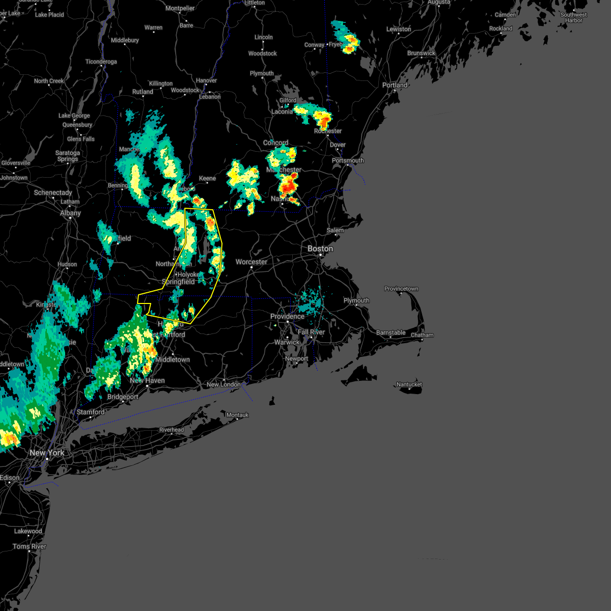 The severe thunderstorm warning for northwestern tolland, northern hartford, northwestern worcester, southeastern hampshire, eastern franklin and hampden counties will expire at 730 pm edt, the storms which prompted the warning have moved out of the area. therefore, the warning will be allowed to expire. however gusty winds are still possible behind the line of showers and thunderstorms. a severe thunderstorm watch remains in effect until midnight edt for northern connecticut, and western massachusetts. remember, a severe thunderstorm warning still remains in effect for central massachusetts. The severe thunderstorm warning for northwestern tolland, northern hartford, northwestern worcester, southeastern hampshire, eastern franklin and hampden counties will expire at 730 pm edt, the storms which prompted the warning have moved out of the area. therefore, the warning will be allowed to expire. however gusty winds are still possible behind the line of showers and thunderstorms. a severe thunderstorm watch remains in effect until midnight edt for northern connecticut, and western massachusetts. remember, a severe thunderstorm warning still remains in effect for central massachusetts.
|
| 8/8/2019 7:02 PM EDT |
 At 659 pm edt, strong to damaging winds are preceding a broken line of showers and thunderstorms. reports of wind gusts as high as around 60 mph have been reported across western massachusetts along with several reports of downed trees and power lines. gusty winds continue to proceed east at 40 mph and in doing so will continue to result in wind damage across the warned area (trained weather spotters). Hazards include 60 mph wind gusts. Expect damage to trees and power lines. Locations impacted include, springfield, chicopee, enfield, westfield, holyoke, amherst, vernon, windsor, northampton, agawam, west springfield, south windsor, orange, simsbury, ludlow, bloomfield, south hadley, easthampton, longmeadow and suffield. At 659 pm edt, strong to damaging winds are preceding a broken line of showers and thunderstorms. reports of wind gusts as high as around 60 mph have been reported across western massachusetts along with several reports of downed trees and power lines. gusty winds continue to proceed east at 40 mph and in doing so will continue to result in wind damage across the warned area (trained weather spotters). Hazards include 60 mph wind gusts. Expect damage to trees and power lines. Locations impacted include, springfield, chicopee, enfield, westfield, holyoke, amherst, vernon, windsor, northampton, agawam, west springfield, south windsor, orange, simsbury, ludlow, bloomfield, south hadley, easthampton, longmeadow and suffield.
|
| 8/8/2019 6:55 PM EDT |
 The severe thunderstorm warning for hampshire, franklin and western hampden counties will expire at 700 pm edt, the storms which prompted the warning have moved out of the area. therefore, the warning will be allowed to expire. however gusty winds are still possible behind the line of thunderstorms. a severe thunderstorm watch remains in effect until midnight edt for western massachusetts. remember, a severe thunderstorm warning still remains in effect for eastern franklin county ma until 730 pm. The severe thunderstorm warning for hampshire, franklin and western hampden counties will expire at 700 pm edt, the storms which prompted the warning have moved out of the area. therefore, the warning will be allowed to expire. however gusty winds are still possible behind the line of thunderstorms. a severe thunderstorm watch remains in effect until midnight edt for western massachusetts. remember, a severe thunderstorm warning still remains in effect for eastern franklin county ma until 730 pm.
|
| 8/8/2019 6:33 PM EDT |
 At 631 pm edt, a line of severe thunderstorms continued to progress east at 40 mph across western massachusetts. already trained weather spotters have reported wind gusts as high as 63 mph at west stockbridge ma and 55 mph at cheshire ma with accompanying reports of downed tree and tree limbs as well as power lines (trained weather spotters). Hazards include 60 mph wind gusts. Expect damage to trees and power lines. Locations impacted include, westfield, holyoke, amherst, northampton, agawam, west springfield, greenfield, deerfield, south hadley, easthampton, monroe, southwick, montague, southampton, hadley, sunderland, hatfield, northfield, williamsburg and huntington. At 631 pm edt, a line of severe thunderstorms continued to progress east at 40 mph across western massachusetts. already trained weather spotters have reported wind gusts as high as 63 mph at west stockbridge ma and 55 mph at cheshire ma with accompanying reports of downed tree and tree limbs as well as power lines (trained weather spotters). Hazards include 60 mph wind gusts. Expect damage to trees and power lines. Locations impacted include, westfield, holyoke, amherst, northampton, agawam, west springfield, greenfield, deerfield, south hadley, easthampton, monroe, southwick, montague, southampton, hadley, sunderland, hatfield, northfield, williamsburg and huntington.
|
| 8/8/2019 6:30 PM EDT |
 At 629 pm edt, severe thunderstorms were located along a line extending from near shaftsbury to plainfield to chester to near tolland to near wingdale, moving east at 40 mph (radar indicated). Hazards include 60 mph wind gusts. expect damage to trees and power lines At 629 pm edt, severe thunderstorms were located along a line extending from near shaftsbury to plainfield to chester to near tolland to near wingdale, moving east at 40 mph (radar indicated). Hazards include 60 mph wind gusts. expect damage to trees and power lines
|
| 8/8/2019 6:08 PM EDT |
 At 605 pm edt, a north to south line of severe thunderstorms across berkshire county ma, from williamstown down south to sheffield, was moving east at 40 mph (radar indicated). Hazards include 60 mph wind gusts. expect damage to trees and power lines At 605 pm edt, a north to south line of severe thunderstorms across berkshire county ma, from williamstown down south to sheffield, was moving east at 40 mph (radar indicated). Hazards include 60 mph wind gusts. expect damage to trees and power lines
|
| 8/7/2019 6:28 PM EDT |
 At 628 pm edt, a severe thunderstorm was located over shutesbury, or near amherst, moving northeast at 25 mph (radar indicated). Hazards include 60 mph wind gusts. Expect damage to trees and power lines. this severe storm will be near, new salem around 650 pm edt. wendell around 655 pm edt. Orange, athol, erving and phillipston around 700 pm edt. At 628 pm edt, a severe thunderstorm was located over shutesbury, or near amherst, moving northeast at 25 mph (radar indicated). Hazards include 60 mph wind gusts. Expect damage to trees and power lines. this severe storm will be near, new salem around 650 pm edt. wendell around 655 pm edt. Orange, athol, erving and phillipston around 700 pm edt.
|
| 8/7/2019 6:15 PM EDT |
 At 615 pm edt, a severe thunderstorm was located near amherst, moving northeast at 25 mph (radar indicated). Hazards include 60 mph wind gusts. Expect damage to trees and power lines. this severe thunderstorm will be near, leverett around 625 pm edt. pelham around 630 pm edt. shutesbury around 645 pm edt. new salem around 650 pm edt. wendell around 655 pm edt. Orange, athol, erving and phillipston around 700 pm edt. At 615 pm edt, a severe thunderstorm was located near amherst, moving northeast at 25 mph (radar indicated). Hazards include 60 mph wind gusts. Expect damage to trees and power lines. this severe thunderstorm will be near, leverett around 625 pm edt. pelham around 630 pm edt. shutesbury around 645 pm edt. new salem around 650 pm edt. wendell around 655 pm edt. Orange, athol, erving and phillipston around 700 pm edt.
|
| 8/7/2019 2:54 PM EDT |
 At 253 pm edt, a severe thunderstorm was located over hadley, or near amherst, moving northeast at 30 mph. winds gusted to 63 mph at a weather station on mt. tom at 238 pm. trees were reported down in southampton, easthampton, and holyoke (radar indicated). Hazards include 60 mph wind gusts. Expect damage to trees and power lines. this severe storm will be near, sunderland around 300 pm edt. amherst, belchertown and leverett around 310 pm edt. pelham around 315 pm edt. shutesbury around 325 pm edt. New salem around 330 pm edt. At 253 pm edt, a severe thunderstorm was located over hadley, or near amherst, moving northeast at 30 mph. winds gusted to 63 mph at a weather station on mt. tom at 238 pm. trees were reported down in southampton, easthampton, and holyoke (radar indicated). Hazards include 60 mph wind gusts. Expect damage to trees and power lines. this severe storm will be near, sunderland around 300 pm edt. amherst, belchertown and leverett around 310 pm edt. pelham around 315 pm edt. shutesbury around 325 pm edt. New salem around 330 pm edt.
|
| 8/7/2019 2:45 PM EDT |
 At 244 pm edt, a severe thunderstorm was located over northampton, moving northeast at 30 mph. this storm downed a tree and wires in easthampton at 240 pm edt (radar indicated). Hazards include 60 mph wind gusts. Expect damage to trees and power lines. this severe storm will be near, granby, sunderland and hatfield around 300 pm edt. hadley around 305 pm edt. amherst, belchertown and leverett around 310 pm edt. pelham around 315 pm edt. shutesbury around 325 pm edt. New salem around 330 pm edt. At 244 pm edt, a severe thunderstorm was located over northampton, moving northeast at 30 mph. this storm downed a tree and wires in easthampton at 240 pm edt (radar indicated). Hazards include 60 mph wind gusts. Expect damage to trees and power lines. this severe storm will be near, granby, sunderland and hatfield around 300 pm edt. hadley around 305 pm edt. amherst, belchertown and leverett around 310 pm edt. pelham around 315 pm edt. shutesbury around 325 pm edt. New salem around 330 pm edt.
|
| 8/7/2019 2:36 PM EDT |
 At 236 pm edt, a severe thunderstorm was located over southampton, or near holyoke, moving northeast at 25 mph (radar indicated). Hazards include 60 mph wind gusts and quarter size hail. Hail damage to vehicles is possible. expect damage to trees and power lines. this severe storm will be near, holyoke around 245 pm edt. easthampton around 250 pm edt. northampton around 255 pm edt. south hadley around 300 pm edt. granby and hatfield around 305 pm edt. sunderland around 310 pm edt. amherst, belchertown, hadley and leverett around 315 pm edt. Pelham around 325 pm edt. At 236 pm edt, a severe thunderstorm was located over southampton, or near holyoke, moving northeast at 25 mph (radar indicated). Hazards include 60 mph wind gusts and quarter size hail. Hail damage to vehicles is possible. expect damage to trees and power lines. this severe storm will be near, holyoke around 245 pm edt. easthampton around 250 pm edt. northampton around 255 pm edt. south hadley around 300 pm edt. granby and hatfield around 305 pm edt. sunderland around 310 pm edt. amherst, belchertown, hadley and leverett around 315 pm edt. Pelham around 325 pm edt.
|
| 8/7/2019 2:26 PM EDT |
 At 225 pm edt, a severe thunderstorm was located near westfield, moving northeast at 25 mph (radar indicated). Hazards include 60 mph wind gusts and quarter size hail. Hail damage to vehicles is possible. expect damage to trees and power lines. this severe thunderstorm will be near, southampton and westhampton around 240 pm edt. holyoke around 245 pm edt. easthampton around 250 pm edt. northampton around 255 pm edt. south hadley around 300 pm edt. granby around 305 pm edt. sunderland and hatfield around 310 pm edt. Amherst, belchertown and hadley around 315 pm edt. At 225 pm edt, a severe thunderstorm was located near westfield, moving northeast at 25 mph (radar indicated). Hazards include 60 mph wind gusts and quarter size hail. Hail damage to vehicles is possible. expect damage to trees and power lines. this severe thunderstorm will be near, southampton and westhampton around 240 pm edt. holyoke around 245 pm edt. easthampton around 250 pm edt. northampton around 255 pm edt. south hadley around 300 pm edt. granby around 305 pm edt. sunderland and hatfield around 310 pm edt. Amherst, belchertown and hadley around 315 pm edt.
|
| 8/3/2019 1:28 PM EDT |
 At 103 pm edt, a severe thunderstorm was located over hadley, or near northampton, moving east at 10 mph (radar indicated). Hazards include 60 mph wind gusts and penny size hail. expect damage to trees and power lines At 103 pm edt, a severe thunderstorm was located over hadley, or near northampton, moving east at 10 mph (radar indicated). Hazards include 60 mph wind gusts and penny size hail. expect damage to trees and power lines
|
| 8/3/2019 1:03 PM EDT |
 At 103 pm edt, a severe thunderstorm was located over hadley, or near northampton, moving east at 10 mph (radar indicated). Hazards include 60 mph wind gusts and penny size hail. expect damage to trees and power lines At 103 pm edt, a severe thunderstorm was located over hadley, or near northampton, moving east at 10 mph (radar indicated). Hazards include 60 mph wind gusts and penny size hail. expect damage to trees and power lines
|
| 5/23/2019 10:42 PM EDT |
 At 1041 pm edt, a severe thunderstorm was located over conway, or near greenfield, moving southeast at 50 mph (radar indicated). Hazards include 60 mph wind gusts and penny size hail. Expect damage to trees and power lines. Locations impacted include, amherst, greenfield, orange, deerfield, belchertown, montague, hadley, sunderland, hatfield, northfield, williamsburg, bernardston, buckland, conway, shelburne, leverett, erving, shutesbury, ashfield and colrain. At 1041 pm edt, a severe thunderstorm was located over conway, or near greenfield, moving southeast at 50 mph (radar indicated). Hazards include 60 mph wind gusts and penny size hail. Expect damage to trees and power lines. Locations impacted include, amherst, greenfield, orange, deerfield, belchertown, montague, hadley, sunderland, hatfield, northfield, williamsburg, bernardston, buckland, conway, shelburne, leverett, erving, shutesbury, ashfield and colrain.
|
| 5/23/2019 10:14 PM EDT |
 At 1014 pm edt, a severe thunderstorm was located over florida, or over north adams, moving east at 55 mph (radar indicated). Hazards include 60 mph wind gusts and penny size hail. expect damage to trees and power lines At 1014 pm edt, a severe thunderstorm was located over florida, or over north adams, moving east at 55 mph (radar indicated). Hazards include 60 mph wind gusts and penny size hail. expect damage to trees and power lines
|
| 4/15/2019 5:24 AM EDT |
 At 523 am edt, severe thunderstorms were located along a line extending from near otis to granville, moving east at 50 mph (radar indicated). Hazards include 60 mph wind gusts. Expect damage to trees and power lines. Locations impacted include, springfield, chicopee, westfield, holyoke, amherst, northampton, agawam, west springfield, greenfield, orange, deerfield, ludlow, south hadley, easthampton, longmeadow, belchertown, southwick, montague, granby and southampton. At 523 am edt, severe thunderstorms were located along a line extending from near otis to granville, moving east at 50 mph (radar indicated). Hazards include 60 mph wind gusts. Expect damage to trees and power lines. Locations impacted include, springfield, chicopee, westfield, holyoke, amherst, northampton, agawam, west springfield, greenfield, orange, deerfield, ludlow, south hadley, easthampton, longmeadow, belchertown, southwick, montague, granby and southampton.
|
| 4/15/2019 5:02 AM EDT |
 At 502 am edt, severe thunderstorms were located along a line extending from near middlefield to near cornwall bridge, moving east at 45 mph (radar indicated). Hazards include 60 mph wind gusts. expect damage to trees and power lines At 502 am edt, severe thunderstorms were located along a line extending from near middlefield to near cornwall bridge, moving east at 45 mph (radar indicated). Hazards include 60 mph wind gusts. expect damage to trees and power lines
|
| 8/18/2018 2:09 PM EDT |
 The severe thunderstorm warning for west central worcester, east central hampshire and southeastern franklin counties will expire at 215 pm edt, the storm which prompted the warning has weakened below severe limits, and has exited the warned area. therefore, the warning will be allowed to expire. however gusty winds and heavy rain are still possible with this thunderstorm. The severe thunderstorm warning for west central worcester, east central hampshire and southeastern franklin counties will expire at 215 pm edt, the storm which prompted the warning has weakened below severe limits, and has exited the warned area. therefore, the warning will be allowed to expire. however gusty winds and heavy rain are still possible with this thunderstorm.
|
| 8/18/2018 1:49 PM EDT |
 The national weather service in boston/norton has issued a * severe thunderstorm warning for. west central worcester county in central massachusetts. east central hampshire county in western massachusetts. southeastern franklin county in western massachusetts. Until 215 pm edt. The national weather service in boston/norton has issued a * severe thunderstorm warning for. west central worcester county in central massachusetts. east central hampshire county in western massachusetts. southeastern franklin county in western massachusetts. Until 215 pm edt.
|
| 7/17/2018 1:24 PM EDT |
 The severe thunderstorm warning for west central worcester, southeastern hampshire and southeastern franklin counties will expire at 130 pm edt, the storm which prompted the warning has weakened below severe limits, and no longer poses an immediate threat to life or property. therefore, the warning will be allowed to expire. a severe thunderstorm watch remains in effect until 700 pm edt for western and central massachusetts. The severe thunderstorm warning for west central worcester, southeastern hampshire and southeastern franklin counties will expire at 130 pm edt, the storm which prompted the warning has weakened below severe limits, and no longer poses an immediate threat to life or property. therefore, the warning will be allowed to expire. a severe thunderstorm watch remains in effect until 700 pm edt for western and central massachusetts.
|
| 7/17/2018 12:45 PM EDT |
 At 1245 pm edt, a severe thunderstorm was located near amherst, moving east at 25 mph (radar indicated). Hazards include 60 mph wind gusts and quarter size hail. Hail damage to vehicles is possible. Expect damage to trees and power lines. At 1245 pm edt, a severe thunderstorm was located near amherst, moving east at 25 mph (radar indicated). Hazards include 60 mph wind gusts and quarter size hail. Hail damage to vehicles is possible. Expect damage to trees and power lines.
|
| 7/17/2018 11:39 AM EDT |
 At 1139 am edt, a severe thunderstorm was located over cummington, or 14 miles northwest of northampton, moving east at 30 mph (radar indicated). Hazards include 60 mph wind gusts. expect damage to trees and power lines At 1139 am edt, a severe thunderstorm was located over cummington, or 14 miles northwest of northampton, moving east at 30 mph (radar indicated). Hazards include 60 mph wind gusts. expect damage to trees and power lines
|
| 6/18/2018 6:20 PM EDT |
 At 619 pm edt, a severe thunderstorm was located over hatfield, or near northampton, moving east at 35 mph (radar indicated). Hazards include 60 mph wind gusts and quarter size hail. Hail damage to vehicles is possible. Expect damage to trees and power lines. At 619 pm edt, a severe thunderstorm was located over hatfield, or near northampton, moving east at 35 mph (radar indicated). Hazards include 60 mph wind gusts and quarter size hail. Hail damage to vehicles is possible. Expect damage to trees and power lines.
|
| 6/18/2018 5:51 PM EDT |
 The tornado warning for central hampshire and central franklin counties will expire at 600 pm edt, the storm which prompted the warning has weakened below severe limits, and no longer appears capable of producing a tornado. therefore, the warning will be allowed to expire. The tornado warning for central hampshire and central franklin counties will expire at 600 pm edt, the storm which prompted the warning has weakened below severe limits, and no longer appears capable of producing a tornado. therefore, the warning will be allowed to expire.
|
| 6/18/2018 5:37 PM EDT |
 At 536 pm edt, a severe thunderstorm capable of producing a tornado was located over stephentown, or 9 miles east of nassau, and is nearly stationary (radar indicated rotation). Hazards include tornado. Flying debris will be dangerous to those caught without shelter. mobile homes will be damaged or destroyed. damage to roofs and vehicles will occur. tree damage is likely. Locations impacted include, amherst, deerfield, montague, hadley, sunderland, hatfield, williamsburg, conway, leverett, shutesbury, ashfield, whately, pelham, chesterfield, goshen and wendell. At 536 pm edt, a severe thunderstorm capable of producing a tornado was located over stephentown, or 9 miles east of nassau, and is nearly stationary (radar indicated rotation). Hazards include tornado. Flying debris will be dangerous to those caught without shelter. mobile homes will be damaged or destroyed. damage to roofs and vehicles will occur. tree damage is likely. Locations impacted include, amherst, deerfield, montague, hadley, sunderland, hatfield, williamsburg, conway, leverett, shutesbury, ashfield, whately, pelham, chesterfield, goshen and wendell.
|
| 6/18/2018 5:34 PM EDT |
 At 534 pm edt, a severe thunderstorm capable of producing a tornado was located near conway, or 10 miles north of northampton, moving east at 55 mph (radar indicated rotation). Hazards include tornado. Flying debris will be dangerous to those caught without shelter. mobile homes will be damaged or destroyed. damage to roofs#commaorellipsis()windows#commaorellipsis()and vehicles will occur. tree damage is likely. this dangerous storm will be near, whately around 540 pm edt. hadley, sunderland and hatfield around 545 pm edt. amherst and leverett around 550 pm edt. Shutesbury and pelham around 555 pm edt. At 534 pm edt, a severe thunderstorm capable of producing a tornado was located near conway, or 10 miles north of northampton, moving east at 55 mph (radar indicated rotation). Hazards include tornado. Flying debris will be dangerous to those caught without shelter. mobile homes will be damaged or destroyed. damage to roofs#commaorellipsis()windows#commaorellipsis()and vehicles will occur. tree damage is likely. this dangerous storm will be near, whately around 540 pm edt. hadley, sunderland and hatfield around 545 pm edt. amherst and leverett around 550 pm edt. Shutesbury and pelham around 555 pm edt.
|
| 5/15/2018 3:33 PM EDT |
 At 333 pm edt, a severe thunderstorm was located over deerfield, or 8 miles south of greenfield, moving east at 45 mph (radar indicated). Hazards include 60 mph wind gusts and quarter size hail. Hail damage to vehicles is possible. Expect damage to trees and power lines. At 333 pm edt, a severe thunderstorm was located over deerfield, or 8 miles south of greenfield, moving east at 45 mph (radar indicated). Hazards include 60 mph wind gusts and quarter size hail. Hail damage to vehicles is possible. Expect damage to trees and power lines.
|
| 5/4/2018 10:20 PM EDT |
 The severe thunderstorm warning for northwestern worcester, central hampshire, northeastern franklin and north central hampden counties will expire at 1030 pm edt, the storms which prompted the warning have weakened below severe limits, and no longer pose an immediate threat to life or property. therefore, the warning will be allowed to expire. however gusty winds are still possible with these thunderstorms. a severe thunderstorm watch remains in effect until 200 am edt for western massachusetts. The severe thunderstorm warning for northwestern worcester, central hampshire, northeastern franklin and north central hampden counties will expire at 1030 pm edt, the storms which prompted the warning have weakened below severe limits, and no longer pose an immediate threat to life or property. therefore, the warning will be allowed to expire. however gusty winds are still possible with these thunderstorms. a severe thunderstorm watch remains in effect until 200 am edt for western massachusetts.
|
| 5/4/2018 10:01 PM EDT |
 At 1000 pm edt, doppler radar indicated a line of strong to severe thunderstorms moving east at 50 mph across franklin county ma (radar indicated). Hazards include 60 mph wind gusts. Expect damage to trees and power lines. Locations impacted include, holyoke, amherst, northampton, greenfield, orange, deerfield, south hadley, easthampton, athol, winchendon, montague, templeton, ashburnham, southampton, hadley, winchester, sunderland, hatfield, northfield and williamsburg. At 1000 pm edt, doppler radar indicated a line of strong to severe thunderstorms moving east at 50 mph across franklin county ma (radar indicated). Hazards include 60 mph wind gusts. Expect damage to trees and power lines. Locations impacted include, holyoke, amherst, northampton, greenfield, orange, deerfield, south hadley, easthampton, athol, winchendon, montague, templeton, ashburnham, southampton, hadley, winchester, sunderland, hatfield, northfield and williamsburg.
|
| 5/4/2018 9:35 PM EDT |
 At 934 pm edt, a line of strong to severe thunderstorms were sweeping into western massachusetts moving east at 50 mph (radar indicated). Hazards include 60 mph wind gusts. expect damage to trees and power lines At 934 pm edt, a line of strong to severe thunderstorms were sweeping into western massachusetts moving east at 50 mph (radar indicated). Hazards include 60 mph wind gusts. expect damage to trees and power lines
|
| 8/22/2017 11:33 PM EDT |
 At 1132 pm edt, severe thunderstorms were located along a line extending from near rindge to granby, moving east at 35 mph (radar indicated). Hazards include 60 mph wind gusts. expect damage to trees and power lines along with torrential downpours and possibly localized flooding At 1132 pm edt, severe thunderstorms were located along a line extending from near rindge to granby, moving east at 35 mph (radar indicated). Hazards include 60 mph wind gusts. expect damage to trees and power lines along with torrential downpours and possibly localized flooding
|
| 8/22/2017 11:25 PM EDT | Tree down along route 63 in franklin county MA, 3.1 miles SSW of North Amherst, MA |
| 8/5/2017 3:42 PM EDT |
 The severe thunderstorm warning for central hampshire, east central franklin and northern hampden counties will expire at 345 pm edt, the storm which prompted the warning has weakened below severe limits, and no longer poses an immediate threat to life or property. therefore the warning will be allowed to expire. however heavy rain is still possible with this thunderstorm. The severe thunderstorm warning for central hampshire, east central franklin and northern hampden counties will expire at 345 pm edt, the storm which prompted the warning has weakened below severe limits, and no longer poses an immediate threat to life or property. therefore the warning will be allowed to expire. however heavy rain is still possible with this thunderstorm.
|
| 8/5/2017 3:35 PM EDT |
 At 334 pm edt, a severe thunderstorm was located over hadley, or over amherst, moving northeast at 30 mph (trained weather spotters reported a few trees down along with large limbs in northampton). Hazards include 60 mph wind gusts. Expect damage to trees and power lines. Locations impacted include, holyoke, amherst, northampton, deerfield, south hadley, easthampton, belchertown, granby, hadley, sunderland, hatfield, leverett, shutesbury, whately, pelham and new salem. At 334 pm edt, a severe thunderstorm was located over hadley, or over amherst, moving northeast at 30 mph (trained weather spotters reported a few trees down along with large limbs in northampton). Hazards include 60 mph wind gusts. Expect damage to trees and power lines. Locations impacted include, holyoke, amherst, northampton, deerfield, south hadley, easthampton, belchertown, granby, hadley, sunderland, hatfield, leverett, shutesbury, whately, pelham and new salem.
|
| 8/5/2017 3:01 PM EDT |
 At 300 pm edt, a severe thunderstorm was located over hadley, or near northampton, moving northeast at 30 mph (radar indicated). Hazards include 60 mph wind gusts and quarter size hail. Hail damage to vehicles is possible. Expect damage to trees and power lines. At 300 pm edt, a severe thunderstorm was located over hadley, or near northampton, moving northeast at 30 mph (radar indicated). Hazards include 60 mph wind gusts and quarter size hail. Hail damage to vehicles is possible. Expect damage to trees and power lines.
|
| 6/27/2017 7:10 PM EDT | Tree and wires down in front of fire statio in franklin county MA, 7 miles WSW of North Amherst, MA |
| 6/27/2017 7:00 PM EDT | Wind gust lofted a portable plastic greenhouse up and over a chicken coop. moved distance of 80 f in franklin county MA, 3.1 miles SSW of North Amherst, MA |
| 6/19/2017 4:29 PM EDT |
 At 429 pm edt, severe thunderstorms were located along a line extending from near lenox to near norfolk to near litchfield, moving northeast at 30 mph (radar indicated). Hazards include 60 mph wind gusts and penny size hail. expect damage to trees and power lines At 429 pm edt, severe thunderstorms were located along a line extending from near lenox to near norfolk to near litchfield, moving northeast at 30 mph (radar indicated). Hazards include 60 mph wind gusts and penny size hail. expect damage to trees and power lines
|
| 5/31/2017 7:02 PM EDT |
 At 700 pm edt, severe thunderstorms were located along a line extending from warwick to near amherst to near tolland, moving east at 25 mph (trained weather spotters...many of whom have reported dime to quarter sized hail from sunderland down to southampton). Hazards include quarter size hail. gusty winds up to 50 mph. Damage to vehicles is possible. Locations impacted include, springfield, chicopee, westfield, holyoke, amherst, northampton, west springfield, deerfield, ludlow, south hadley, easthampton, belchertown, wilbraham, palmer, athol, ware, montague, templeton, granby and southampton. At 700 pm edt, severe thunderstorms were located along a line extending from warwick to near amherst to near tolland, moving east at 25 mph (trained weather spotters...many of whom have reported dime to quarter sized hail from sunderland down to southampton). Hazards include quarter size hail. gusty winds up to 50 mph. Damage to vehicles is possible. Locations impacted include, springfield, chicopee, westfield, holyoke, amherst, northampton, west springfield, deerfield, ludlow, south hadley, easthampton, belchertown, wilbraham, palmer, athol, ware, montague, templeton, granby and southampton.
|
| 5/31/2017 6:42 PM EDT |
 At 640 pm edt, severe thunderstorms were located along a line extending from near bernardston to hatfield to near sandisfield, moving east at 25 mph (radar indicated. though trained spotters have supplied several reports of hail from dime to nickel sized along with trees and wires down across western massachusetts). Hazards include 60 mph wind gusts and quarter size hail. Hail damage to vehicles is possible. Expect damage to trees and power lines. At 640 pm edt, severe thunderstorms were located along a line extending from near bernardston to hatfield to near sandisfield, moving east at 25 mph (radar indicated. though trained spotters have supplied several reports of hail from dime to nickel sized along with trees and wires down across western massachusetts). Hazards include 60 mph wind gusts and quarter size hail. Hail damage to vehicles is possible. Expect damage to trees and power lines.
|
| 5/31/2017 6:26 PM EDT |
 At 625 pm edt, severe thunderstorms were located along a line extending from hinsdale to near deerfield to near otis, moving east at 35 mph (radar indicated. though spotters have reported hail up to the size of nickels with wind gusts as high as 45 mph). Hazards include 60 mph wind gusts and quarter size hail. Hail damage to vehicles is possible. expect damage to trees and power lines. Locations impacted include, westfield, holyoke, amherst, northampton, greenfield, orange, deerfield, south hadley, easthampton, montague, southampton, hadley, sunderland, hatfield, northfield, williamsburg, huntington, bernardston, buckland and conway. At 625 pm edt, severe thunderstorms were located along a line extending from hinsdale to near deerfield to near otis, moving east at 35 mph (radar indicated. though spotters have reported hail up to the size of nickels with wind gusts as high as 45 mph). Hazards include 60 mph wind gusts and quarter size hail. Hail damage to vehicles is possible. expect damage to trees and power lines. Locations impacted include, westfield, holyoke, amherst, northampton, greenfield, orange, deerfield, south hadley, easthampton, montague, southampton, hadley, sunderland, hatfield, northfield, williamsburg, huntington, bernardston, buckland and conway.
|
| 5/31/2017 6:12 PM EDT |
 At 611 pm edt, severe thunderstorms were located along a line extending from near guilford center to ashfield to near lee, moving east at 35 mph (radar indicated). Hazards include 60 mph wind gusts and half dollar size hail. Hail damage to vehicles is possible. Expect damage to trees and power lines. At 611 pm edt, severe thunderstorms were located along a line extending from near guilford center to ashfield to near lee, moving east at 35 mph (radar indicated). Hazards include 60 mph wind gusts and half dollar size hail. Hail damage to vehicles is possible. Expect damage to trees and power lines.
|
| 5/18/2017 9:05 PM EDT |
 At 905 pm edt, a severe thunderstorm was located near ashfield, or 13 miles west of greenfield, moving east at 45 mph (radar indicated). Hazards include 60 mph wind gusts and penny size hail. expect damage to trees and power lines At 905 pm edt, a severe thunderstorm was located near ashfield, or 13 miles west of greenfield, moving east at 45 mph (radar indicated). Hazards include 60 mph wind gusts and penny size hail. expect damage to trees and power lines
|
| 2/25/2017 7:53 PM EST |
 The severe thunderstorm warning for northwestern worcester, central hampshire and northeastern franklin counties will expire at 800 pm est, the storm which prompted the warning has weakened below severe limits, and no longer pose an immediate threat to life or property. therefore the warning will be allowed to expire. however gusty winds are still possible with this thunderstorm. The severe thunderstorm warning for northwestern worcester, central hampshire and northeastern franklin counties will expire at 800 pm est, the storm which prompted the warning has weakened below severe limits, and no longer pose an immediate threat to life or property. therefore the warning will be allowed to expire. however gusty winds are still possible with this thunderstorm.
|
| 2/25/2017 7:18 PM EST |
 At 718 pm est, a severe thunderstorm was located over chesterfield, or near northampton, moving northeast at 55 mph (radar indicated). Hazards include 60 mph wind gusts. expect damage to roofs, siding, and trees At 718 pm est, a severe thunderstorm was located over chesterfield, or near northampton, moving northeast at 55 mph (radar indicated). Hazards include 60 mph wind gusts. expect damage to roofs, siding, and trees
|
| 9/11/2016 8:49 AM EDT |
 At 848 am edt, severe thunderstorms were located along a line extending from near danbury to near windsor to near richmond to leverett to new hartford, moving northeast at 45 mph (radar indicated). Hazards include 60 mph wind gusts. Expect damage to roofs. siding. And trees. At 848 am edt, severe thunderstorms were located along a line extending from near danbury to near windsor to near richmond to leverett to new hartford, moving northeast at 45 mph (radar indicated). Hazards include 60 mph wind gusts. Expect damage to roofs. siding. And trees.
|
| 9/11/2016 8:11 AM EDT |
 At 811 am edt, severe thunderstorms were located along a line extending from near claremont to near putney to charlemont to near middlefield to near amenia, moving northeast at 45 mph (radar indicated). Hazards include 60 mph wind gusts. Expect damage to roofs. siding. And trees. At 811 am edt, severe thunderstorms were located along a line extending from near claremont to near putney to charlemont to near middlefield to near amenia, moving northeast at 45 mph (radar indicated). Hazards include 60 mph wind gusts. Expect damage to roofs. siding. And trees.
|
| 8/13/2016 10:07 PM EDT |
 At 1006 pm edt, a severe thunderstorm was located near wendell, or near orange, moving east at 50 mph (radar indicated). Hazards include 60 mph wind gusts. Expect damage to roofs. siding. And trees. At 1006 pm edt, a severe thunderstorm was located near wendell, or near orange, moving east at 50 mph (radar indicated). Hazards include 60 mph wind gusts. Expect damage to roofs. siding. And trees.
|
| 8/13/2016 9:50 PM EDT |
 At 950 pm edt, a severe thunderstorm was located over deerfield, or 8 miles south of greenfield, moving east at 50 mph (radar indicated). Hazards include 60 mph wind gusts. Expect damage to roofs. siding. and trees. Locations impacted include, amherst, northampton, greenfield, orange, deerfield, south hadley, easthampton, belchertown, montague, granby, hadley, sunderland, hatfield, northfield, williamsburg, bernardston, conway, shelburne, leverett and erving. At 950 pm edt, a severe thunderstorm was located over deerfield, or 8 miles south of greenfield, moving east at 50 mph (radar indicated). Hazards include 60 mph wind gusts. Expect damage to roofs. siding. and trees. Locations impacted include, amherst, northampton, greenfield, orange, deerfield, south hadley, easthampton, belchertown, montague, granby, hadley, sunderland, hatfield, northfield, williamsburg, bernardston, conway, shelburne, leverett and erving.
|
| 8/13/2016 9:45 PM EDT | Trees and wires down on route 202 in franklin county MA, 7 miles WSW of North Amherst, MA |
| 8/13/2016 9:43 PM EDT |
 At 941 pm edt, a severe thunderstorm was located near ashfield, or 11 miles north of northampton, moving east at 65 mph (radar indicated). Hazards include 70 mph wind gusts. Expect considerable tree damage. damage is likely to mobile homes, roofs, and outbuildings. locations impacted include, conway, sunderland, deerfield,. montague,. leverett,. Wendell, new salem. At 941 pm edt, a severe thunderstorm was located near ashfield, or 11 miles north of northampton, moving east at 65 mph (radar indicated). Hazards include 70 mph wind gusts. Expect considerable tree damage. damage is likely to mobile homes, roofs, and outbuildings. locations impacted include, conway, sunderland, deerfield,. montague,. leverett,. Wendell, new salem.
|
| 8/13/2016 9:29 PM EDT |
 At 927 pm edt, severe thunderstorms were located along a line extending from near guilford center to plainfield to near blandford to 6 miles south of norfolk, moving east at 45 mph (radar indicated). Hazards include 60 mph wind gusts. Expect damage to roofs. siding. And trees. At 927 pm edt, severe thunderstorms were located along a line extending from near guilford center to plainfield to near blandford to 6 miles south of norfolk, moving east at 45 mph (radar indicated). Hazards include 60 mph wind gusts. Expect damage to roofs. siding. And trees.
|
| 8/13/2016 9:09 PM EDT |
 At 908 pm edt, severe thunderstorms were located along a line extending from near readsboro to near pittsfield to near sandisfield to sharon, moving east at 45 mph (radar indicated). Hazards include 60 mph wind gusts. Expect damage to roofs. siding. And trees. At 908 pm edt, severe thunderstorms were located along a line extending from near readsboro to near pittsfield to near sandisfield to sharon, moving east at 45 mph (radar indicated). Hazards include 60 mph wind gusts. Expect damage to roofs. siding. And trees.
|
| 7/23/2016 8:06 PM EDT |
 The severe thunderstorm warning for hampshire, northern hampden, northwestern worcester and franklin counties will expire at 815 pm edt, the severe thunderstorm which prompted the warning has weakened. however, brief wind gusts to 45 mph from weakening showers may still result in a few downed trees and isolated power outages. a severe thunderstorm watch remains in effect until 1000 pm edt for western and central massachusetts. The severe thunderstorm warning for hampshire, northern hampden, northwestern worcester and franklin counties will expire at 815 pm edt, the severe thunderstorm which prompted the warning has weakened. however, brief wind gusts to 45 mph from weakening showers may still result in a few downed trees and isolated power outages. a severe thunderstorm watch remains in effect until 1000 pm edt for western and central massachusetts.
|
| 7/23/2016 7:15 PM EDT |
 At 713 pm edt, a line of severe thunderstorms with a history of damaging wind gusts will drop south into much of western massachusetts. the strongest winds may occur well out ahead of the thunderstorms (radar indicated). Hazards include 60 mph wind gusts. Expect damage to roofs. siding. And trees. At 713 pm edt, a line of severe thunderstorms with a history of damaging wind gusts will drop south into much of western massachusetts. the strongest winds may occur well out ahead of the thunderstorms (radar indicated). Hazards include 60 mph wind gusts. Expect damage to roofs. siding. And trees.
|
| 7/22/2016 6:53 PM EDT |
 At 653 pm edt, a severe thunderstorm was located over pelham, or near amherst, moving east at 35 mph (radar indicated). Hazards include 60 mph wind gusts. Expect damage to roofs. siding. And trees. At 653 pm edt, a severe thunderstorm was located over pelham, or near amherst, moving east at 35 mph (radar indicated). Hazards include 60 mph wind gusts. Expect damage to roofs. siding. And trees.
|
| 2/25/2016 1:36 AM EST |
 At 135 am est, doppler radar indicated a line of severe thunderstorms producing destructive winds in excess of 70 mph. these storms were located along a line extending from 8 miles northwest of newport to walpole to near conway, moving northeast at 65 mph. locations impacted include, westfield, holyoke, amherst, northampton, agawam, west springfield, greenfield, deerfield, south hadley, easthampton, suffield, southwick, montague, southampton, hadley, sunderland, hatfield, northfield, williamsburg and huntington. At 135 am est, doppler radar indicated a line of severe thunderstorms producing destructive winds in excess of 70 mph. these storms were located along a line extending from 8 miles northwest of newport to walpole to near conway, moving northeast at 65 mph. locations impacted include, westfield, holyoke, amherst, northampton, agawam, west springfield, greenfield, deerfield, south hadley, easthampton, suffield, southwick, montague, southampton, hadley, sunderland, hatfield, northfield, williamsburg and huntington.
|
| 2/25/2016 12:58 AM EST |
 At 1258 am est, doppler radar indicated a severe thunderstorm capable of producing destructive winds in excess of 70 mph. this storm was located over east windsor, or near south windsor, and was moving northeast at 45 mph. At 1258 am est, doppler radar indicated a severe thunderstorm capable of producing destructive winds in excess of 70 mph. this storm was located over east windsor, or near south windsor, and was moving northeast at 45 mph.
|
| 2/25/2016 12:56 AM EST |
 The severe thunderstorm warning for northwestern hartford, hampshire, western hampden and franklin counties will expire at 100 am est, a new severe thunderstorm warning has been issued. The severe thunderstorm warning for northwestern hartford, hampshire, western hampden and franklin counties will expire at 100 am est, a new severe thunderstorm warning has been issued.
|
| 2/25/2016 12:55 AM EST |
 At 1254 am est, doppler radar indicated a line of severe thunderstorms capable of producing destructive winds in excess of 70 mph. these storms were located along a line extending from near newfane to near ashfield to near hartland, and was moving northeast at 45 mph. At 1254 am est, doppler radar indicated a line of severe thunderstorms capable of producing destructive winds in excess of 70 mph. these storms were located along a line extending from near newfane to near ashfield to near hartland, and was moving northeast at 45 mph.
|
| 2/25/2016 12:19 AM EST |
 At 1218 am est, doppler radar indicated a severe thunderstorm capable of producing destructive winds in excess of 70 mph. this storm was located near tolland, or 14 miles north of torrington, and was moving northeast at 45 mph. At 1218 am est, doppler radar indicated a severe thunderstorm capable of producing destructive winds in excess of 70 mph. this storm was located near tolland, or 14 miles north of torrington, and was moving northeast at 45 mph.
|
| 9/9/2015 6:44 PM EDT |
 At 643 pm edt, doppler radar indicated a severe thunderstorm capable of producing quarter size hail and damaging winds in excess of 60 mph. this storm was located over pelham, or near amherst, and was moving east at 20 mph. * some locations impacted include, amherst, belchertown, ware, granby, hardwick, shutesbury, pelham, petersham, new braintree and new salem. At 643 pm edt, doppler radar indicated a severe thunderstorm capable of producing quarter size hail and damaging winds in excess of 60 mph. this storm was located over pelham, or near amherst, and was moving east at 20 mph. * some locations impacted include, amherst, belchertown, ware, granby, hardwick, shutesbury, pelham, petersham, new braintree and new salem.
|
| 8/15/2015 8:23 PM EDT | Tree down on west pelham road in franklin county MA, 6.8 miles WSW of North Amherst, MA |
| 8/15/2015 8:00 PM EDT | Tree and wires down on shutesbury road in franklin county MA, 3.1 miles SSW of North Amherst, MA |
| 8/4/2015 2:28 PM EDT |
 At 227 pm edt, doppler radar indicated a severe thunderstorm capable of producing quarter size hail and damaging winds in excess of 60 mph. this storm was located over new salem, or 9 miles south of orange, moving east at 40 mph. locations impacted include, amherst, northampton, orange, deerfield, belchertown, montague, hadley, sunderland, hatfield, williamsburg, leverett, erving, shutesbury, whately, pelham, new salem, wendell and warwick. At 227 pm edt, doppler radar indicated a severe thunderstorm capable of producing quarter size hail and damaging winds in excess of 60 mph. this storm was located over new salem, or 9 miles south of orange, moving east at 40 mph. locations impacted include, amherst, northampton, orange, deerfield, belchertown, montague, hadley, sunderland, hatfield, williamsburg, leverett, erving, shutesbury, whately, pelham, new salem, wendell and warwick.
|
| 8/4/2015 2:15 PM EDT |
 At 215 pm edt, doppler radar indicated a severe thunderstorm capable of producing large hail up to ping pong ball size and damaging winds in excess of 60 mph. this storm was located over sunderland, or near amherst, moving east at 40 mph. locations impacted include, amherst, northampton, greenfield, orange, deerfield, belchertown, montague, hadley, sunderland, hatfield, williamsburg, conway, shelburne, leverett, erving, shutesbury, ashfield, westhampton, whately and chester. At 215 pm edt, doppler radar indicated a severe thunderstorm capable of producing large hail up to ping pong ball size and damaging winds in excess of 60 mph. this storm was located over sunderland, or near amherst, moving east at 40 mph. locations impacted include, amherst, northampton, greenfield, orange, deerfield, belchertown, montague, hadley, sunderland, hatfield, williamsburg, conway, shelburne, leverett, erving, shutesbury, ashfield, westhampton, whately and chester.
|
| 8/4/2015 1:57 PM EDT |
 At 156 pm edt, doppler radar indicated a severe thunderstorm capable of producing quarter size hail and damaging winds in excess of 60 mph. this storm was located over goshen, or 9 miles northwest of northampton, and was moving east at 40 mph. * some locations impacted include, amherst, northampton, greenfield, orange, deerfield, belchertown, montague, hadley, sunderland, hatfield, williamsburg, conway, shelburne, leverett, erving, shutesbury, ashfield, westhampton, whately and chester. At 156 pm edt, doppler radar indicated a severe thunderstorm capable of producing quarter size hail and damaging winds in excess of 60 mph. this storm was located over goshen, or 9 miles northwest of northampton, and was moving east at 40 mph. * some locations impacted include, amherst, northampton, greenfield, orange, deerfield, belchertown, montague, hadley, sunderland, hatfield, williamsburg, conway, shelburne, leverett, erving, shutesbury, ashfield, westhampton, whately and chester.
|
| 8/4/2015 12:41 PM EDT |
 At 1240 pm edt, doppler radar indicated a severe thunderstorm capable of producing quarter size hail and damaging winds in excess of 60 mph. this storm was located over sunderland, or near amherst, and was moving east at 25 mph. * some locations impacted include, amherst, orange, deerfield, belchertown, athol, winchendon, montague, templeton, rutland, barre, hadley, hubbardston, sunderland, princeton, hatfield, hardwick, conway, leverett, erving and shutesbury. At 1240 pm edt, doppler radar indicated a severe thunderstorm capable of producing quarter size hail and damaging winds in excess of 60 mph. this storm was located over sunderland, or near amherst, and was moving east at 25 mph. * some locations impacted include, amherst, orange, deerfield, belchertown, athol, winchendon, montague, templeton, rutland, barre, hadley, hubbardston, sunderland, princeton, hatfield, hardwick, conway, leverett, erving and shutesbury.
|
| 7/28/2015 2:47 PM EDT |
 At 247 pm edt, doppler radar indicated a severe thunderstorm that has a history of strong winds with localized damage. this storm was located over hatfield, or near amherst. this storm was nearly stationary. locations impacted include, holyoke, amherst, northampton, ludlow, south hadley, easthampton, belchertown, granby, southampton, hadley, sunderland, hatfield, williamsburg, shutesbury, whately and pelham. At 247 pm edt, doppler radar indicated a severe thunderstorm that has a history of strong winds with localized damage. this storm was located over hatfield, or near amherst. this storm was nearly stationary. locations impacted include, holyoke, amherst, northampton, ludlow, south hadley, easthampton, belchertown, granby, southampton, hadley, sunderland, hatfield, williamsburg, shutesbury, whately and pelham.
|
| 7/28/2015 2:18 PM EDT |
 At 217 pm edt, doppler radar indicated a severe thunderstorm capable of producing quarter size hail and damaging winds in excess of 60 mph. this storm was located over deerfield, or 8 miles south of greenfield, and was moving south at 15 mph. * some locations impacted include, holyoke, amherst, northampton, deerfield, ludlow, south hadley, easthampton, belchertown, montague, granby, southampton, hadley, sunderland, hatfield, williamsburg, conway, shelburne, leverett, shutesbury and whately. At 217 pm edt, doppler radar indicated a severe thunderstorm capable of producing quarter size hail and damaging winds in excess of 60 mph. this storm was located over deerfield, or 8 miles south of greenfield, and was moving south at 15 mph. * some locations impacted include, holyoke, amherst, northampton, deerfield, ludlow, south hadley, easthampton, belchertown, montague, granby, southampton, hadley, sunderland, hatfield, williamsburg, conway, shelburne, leverett, shutesbury and whately.
|
| 7/19/2015 8:41 PM EDT |
 The severe thunderstorm warning for west central hampshire and central franklin counties will expire at 845 pm edt, the thunderstorms which had prompted the warning have weakened below severe limits, and no longer pose a threat to life or property. therefore the warning will be allowed to expire. The severe thunderstorm warning for west central hampshire and central franklin counties will expire at 845 pm edt, the thunderstorms which had prompted the warning have weakened below severe limits, and no longer pose a threat to life or property. therefore the warning will be allowed to expire.
|
| 7/19/2015 8:17 PM EDT |
 At 812 pm edt, doppler radar indicated strong to severe thunderstorms over worthington and cummington, moving to the east at 25 mph. wind gusts to 60 mph and hail up to the size of a quarter are still possible with these storms. frequent lightning and torrential downpours also will accompany the storms. locations impacted include, amherst, northampton, hadley, sunderland, hatfield, williamsburg, huntington, conway, leverett, shutesbury, westhampton, whately, chester, chesterfield, worthington, goshen, cummington and middlefield. At 812 pm edt, doppler radar indicated strong to severe thunderstorms over worthington and cummington, moving to the east at 25 mph. wind gusts to 60 mph and hail up to the size of a quarter are still possible with these storms. frequent lightning and torrential downpours also will accompany the storms. locations impacted include, amherst, northampton, hadley, sunderland, hatfield, williamsburg, huntington, conway, leverett, shutesbury, westhampton, whately, chester, chesterfield, worthington, goshen, cummington and middlefield.
|
| 7/19/2015 7:43 PM EDT |
 At 740 pm edt, doppler radar indicated a line of severe thunderstorms capable of producing damaging winds in excess of 60 mph. these storms were located from just west of plainfield and extending southwestward toward lenox. the storms were moving to the east at 25 mph. amateur radio operators reported a tree and wires down in hawley with these storms. * some locations impacted include, amherst, northampton, hadley, sunderland, hatfield, williamsburg, huntington, conway, leverett, shutesbury, westhampton, whately, chester, chesterfield, worthington, goshen, cummington and middlefield. At 740 pm edt, doppler radar indicated a line of severe thunderstorms capable of producing damaging winds in excess of 60 mph. these storms were located from just west of plainfield and extending southwestward toward lenox. the storms were moving to the east at 25 mph. amateur radio operators reported a tree and wires down in hawley with these storms. * some locations impacted include, amherst, northampton, hadley, sunderland, hatfield, williamsburg, huntington, conway, leverett, shutesbury, westhampton, whately, chester, chesterfield, worthington, goshen, cummington and middlefield.
|
| 6/9/2015 3:44 PM EDT |
 At 344 pm edt, doppler radar indicated a severe thunderstorm capable of producing quarter size hail and damaging winds in excess of 60 mph. this storm was located over leverett, or 7 miles north of amherst, and was moving northeast at 40 mph. * some locations impacted include, fitchburg, amherst, orange, deerfield, gardner, athol, winchendon, lunenburg, montague, templeton, westminster, ashburnham, hadley, hubbardston, sunderland, northfield, leverett, erving, shutesbury and phillipston. At 344 pm edt, doppler radar indicated a severe thunderstorm capable of producing quarter size hail and damaging winds in excess of 60 mph. this storm was located over leverett, or 7 miles north of amherst, and was moving northeast at 40 mph. * some locations impacted include, fitchburg, amherst, orange, deerfield, gardner, athol, winchendon, lunenburg, montague, templeton, westminster, ashburnham, hadley, hubbardston, sunderland, northfield, leverett, erving, shutesbury and phillipston.
|
| 5/28/2015 4:03 PM EDT | At 402 pm edt, doppler radar indicated a severe thunderstorm capable of producing quarter size hail and damaging winds in excess of 60 mph. this storm was located over sunderland, or near amherst, and was moving east at 35 mph. * some locations impacted include, amherst, deerfield, montague, hadley, sunderland, hatfield, conway, leverett, shutesbury, whately and pelham. |
| 5/28/2015 3:25 PM EDT | At 325 pm edt, doppler radar indicated a severe thunderstorm capable of producing quarter size hail and damaging winds in excess of 60 mph. this storm was located near warwick, or 7 miles north of orange, moving east at 30 mph. locations impacted include, amherst, orange, athol, montague, templeton, barre, hadley, winchester, sunderland, hatfield, northfield, leverett, erving, shutesbury, phillipston, gill, pelham, royalston, petersham and new salem. |
| 5/28/2015 3:15 PM EDT | At 314 pm edt, doppler radar indicated a severe thunderstorm capable of producing quarter size hail and damaging winds in excess of 60 mph. this storm was located near warwick, or 9 miles northwest of orange, and was moving east at 35 mph. * some locations impacted include, amherst, greenfield, orange, deerfield, athol, montague, templeton, barre, hadley, winchester, sunderland, hatfield, northfield, bernardston, leverett, erving, shutesbury, phillipston, gill and whately. |
| 5/27/2015 6:57 PM EDT | Tree down on north leverett roa in franklin county MA, 3.1 miles SSW of North Amherst, MA |
| 5/27/2015 6:57 PM EDT | At 656 pm edt, doppler radar indicated a line of severe thunderstorms capable of producing damaging winds in excess of 60 mph. these storms were located along a line extending from near richmond to pelham, moving northeast at 45 mph. these storms have a history of producing wind damage. a number of trees and wires were downed in franklin county. locations impacted include, fitchburg, amherst, orange, gardner, belchertown, athol, winchendon, templeton, rutland, westminster, ashburnham, barre, hadley, hubbardston, princeton, northfield, hardwick, oakham, leverett and erving. |
| 5/27/2015 6:46 PM EDT | At 645 pm edt, doppler radar indicated a line of severe thunderstorms capable of producing damaging winds in excess of 60 mph. these storms were located along a line extending from northfield to amherst, moving east at 50 mph. these storms have a history of producing wind damage, including trees and wires down throughout portions of franklin county. locations impacted include, fitchburg, holyoke, amherst, northampton, greenfield, orange, deerfield, gardner, south hadley, easthampton, belchertown, athol, winchendon, ware, montague, templeton, rutland, westminster, granby and ashburnham. |
| 5/27/2015 6:27 PM EDT | At 626 pm edt, doppler radar indicated a line of severe thunderstorms capable of producing quarter size hail and damaging winds in excess of 60 mph. these storms were located along a line extending from shelburne to near westhampton, and was moving east at 55 mph. * some locations impacted include, fitchburg, holyoke, amherst, northampton, greenfield, orange, deerfield, gardner, south hadley, easthampton, belchertown, athol, winchendon, ware, montague, templeton, rutland, westminster, granby and ashburnham. |
| 7/7/2014 8:10 PM EDT | Large limb down on wires on west pelham road in franklin county MA, 7 miles WSW of North Amherst, MA |
| 7/3/2014 9:58 PM EDT | Tree down on dudley roa in franklin county MA, 3.1 miles SSW of North Amherst, MA |
| 7/3/2014 8:30 PM EDT | Tree down on house on gas light lan in franklin county MA, 7 miles WSW of North Amherst, MA |
| 7/3/2014 6:30 PM EDT | Tree down on house on gas light lan in franklin county MA, 7 miles WSW of North Amherst, MA |
| 10/7/2013 5:25 PM EDT | Tree down on wires on long plain roa in franklin county MA, 3.1 miles SSW of North Amherst, MA |
| 6/24/2013 6:14 PM EDT | Quarter sized hail reported 3.1 miles SSW of North Amherst, MA, skywarn spotter |
| 1/1/0001 12:00 AM | Quarter sized hail reported 7 miles WSW of North Amherst, MA |
| 1/1/0001 12:00 AM | Tree on power lines in franklin county MA, 3.1 miles SSW of North Amherst, MA |
| 1/1/0001 12:00 AM | Quarter sized hail reported 3.1 miles SSW of North Amherst, MA |
| 1/1/0001 12:00 AM | Ping Pong Ball sized hail reported 6.8 miles WSW of North Amherst, MA, general public |
Hail Maps for North Amherst, MA


Connect with Interactive Hail Maps