

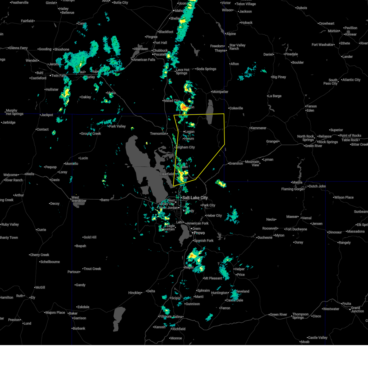
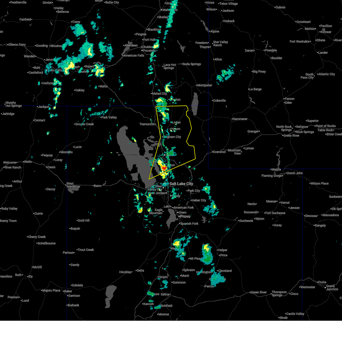
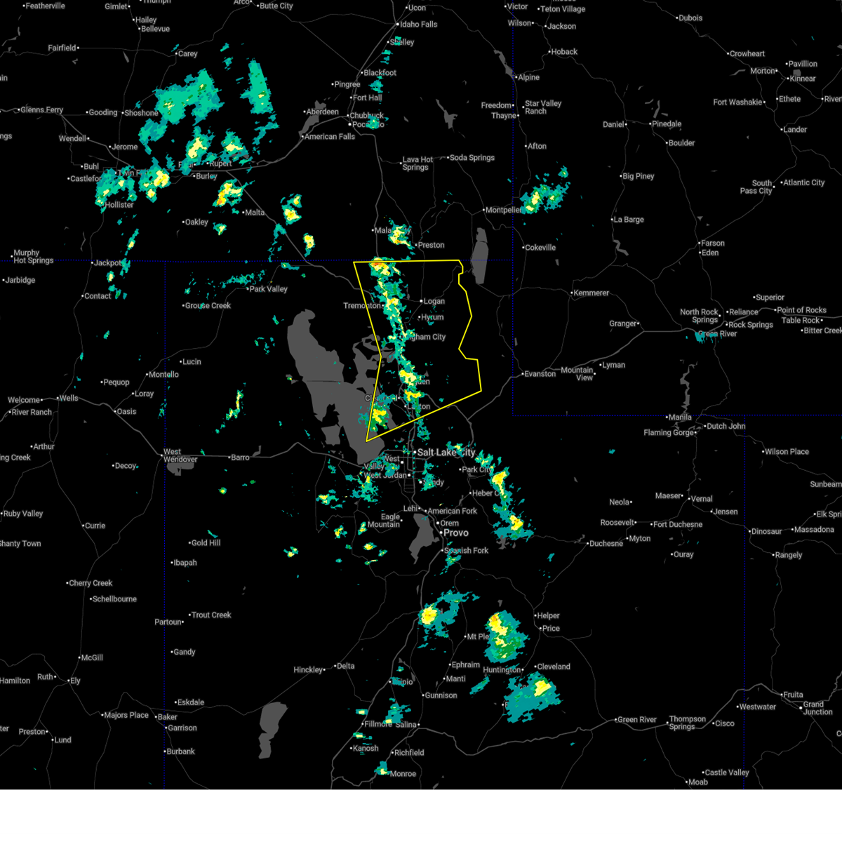
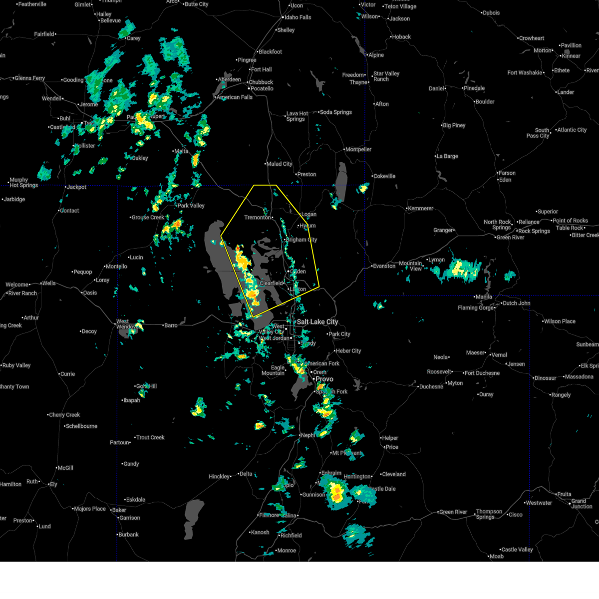
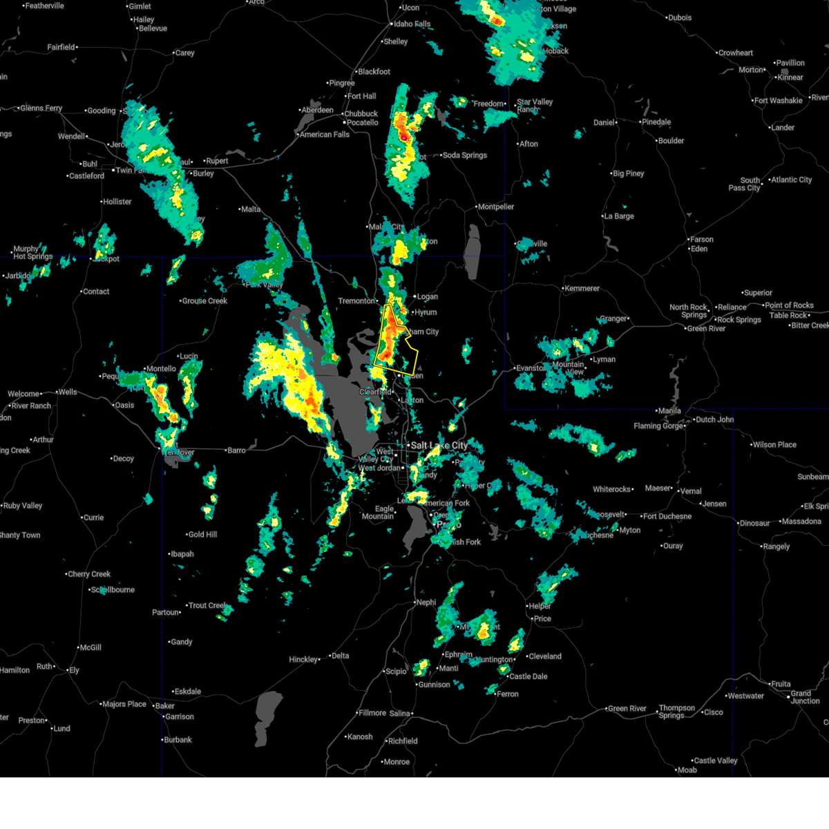
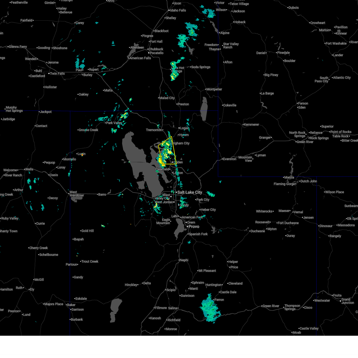
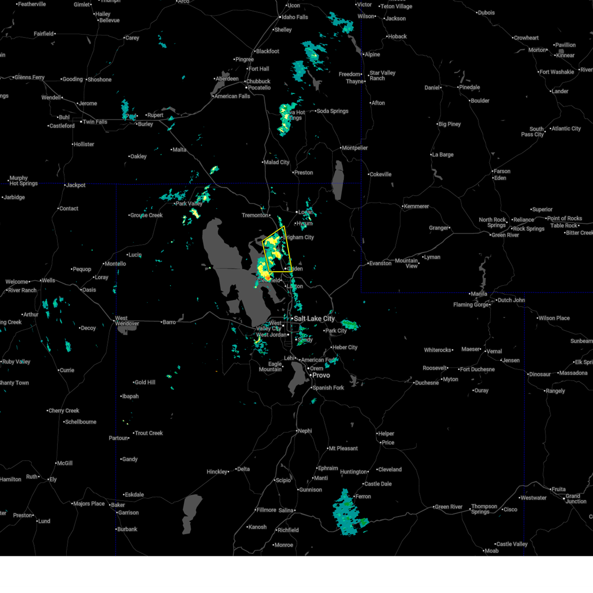
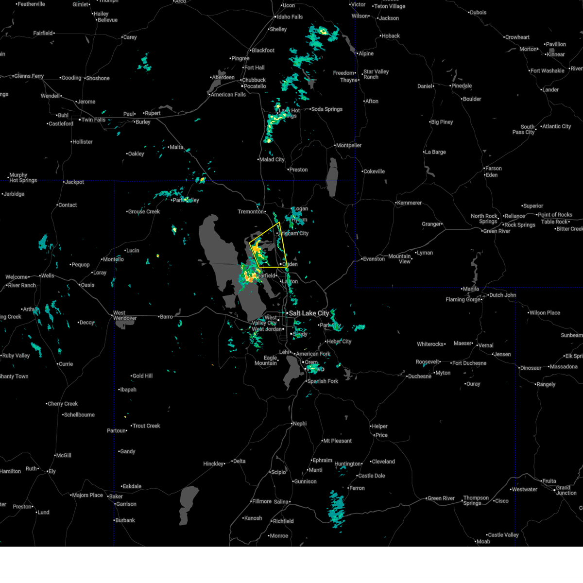
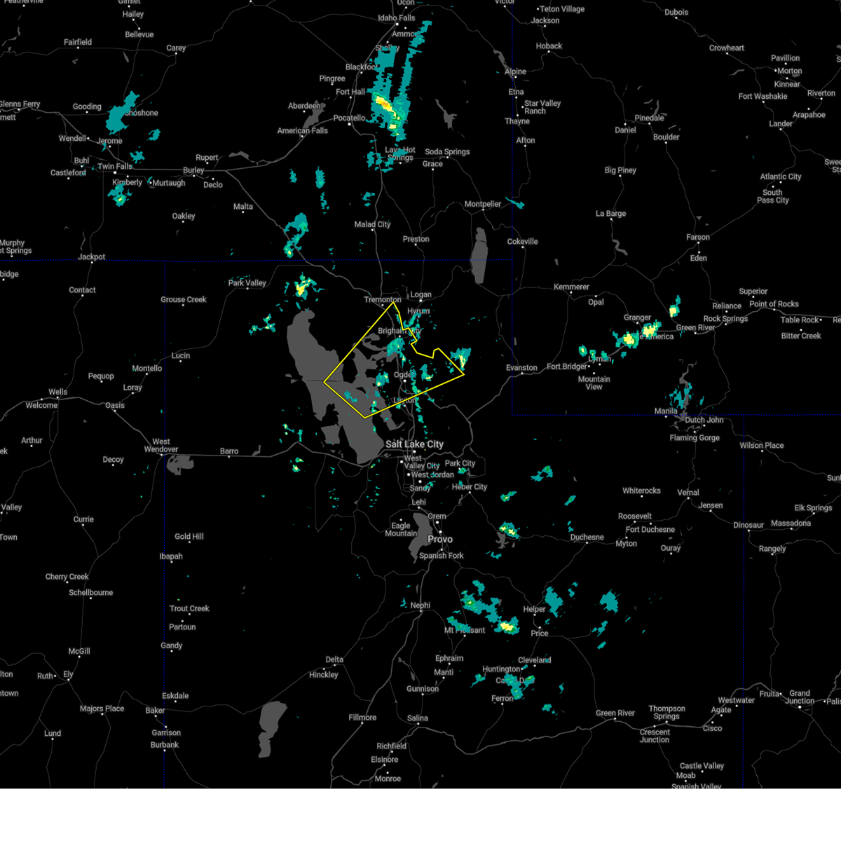
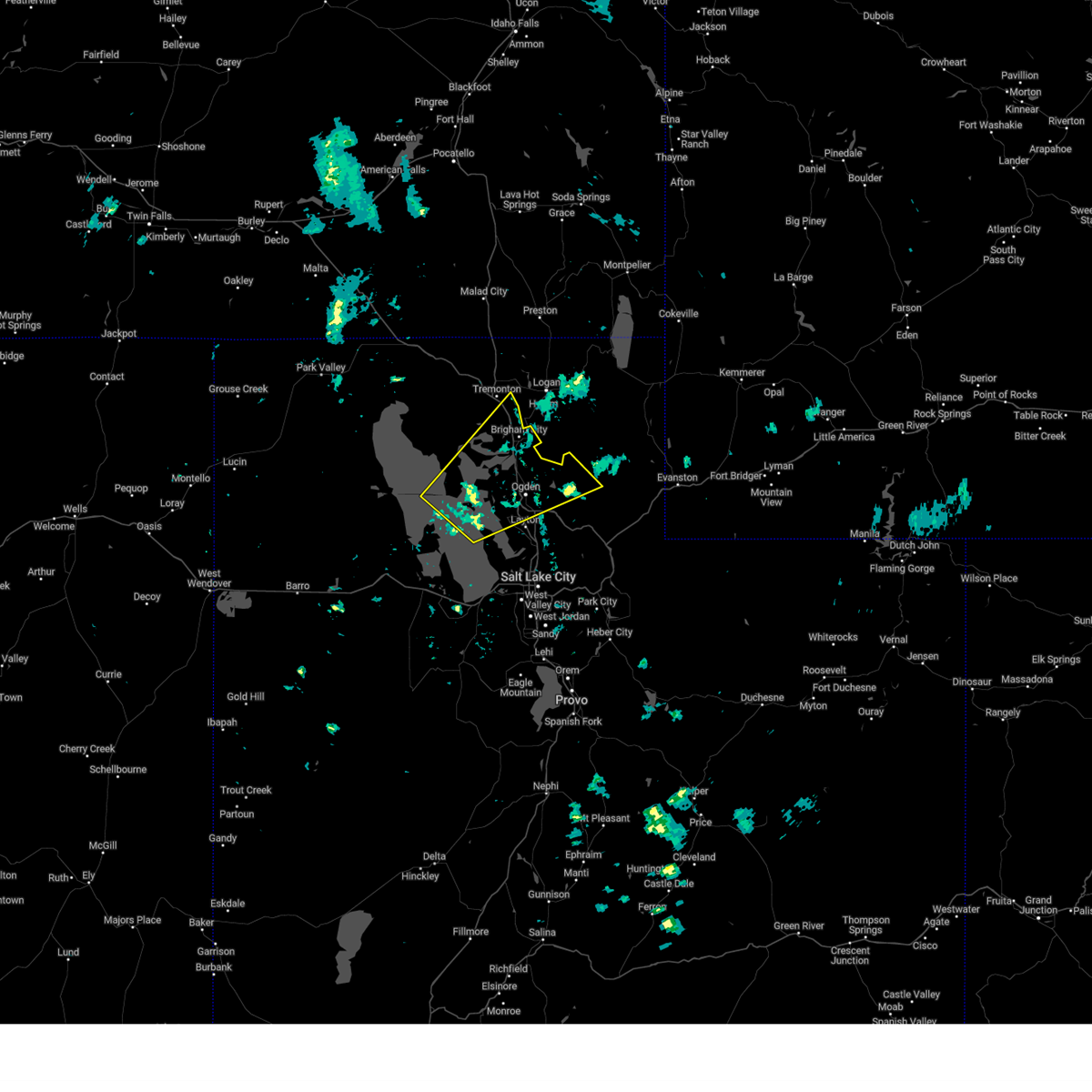
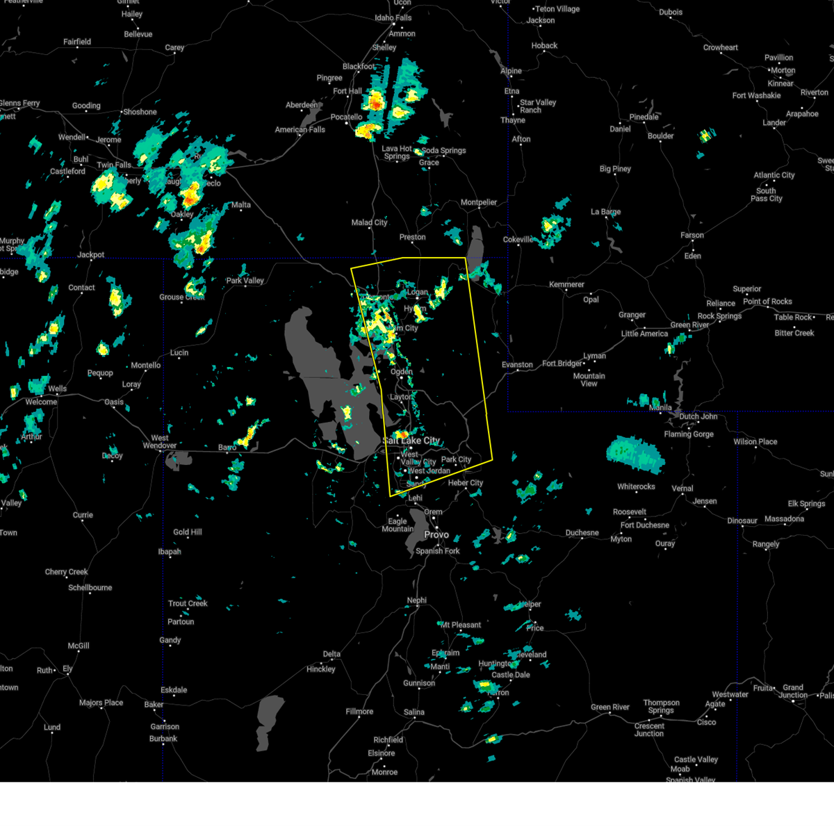
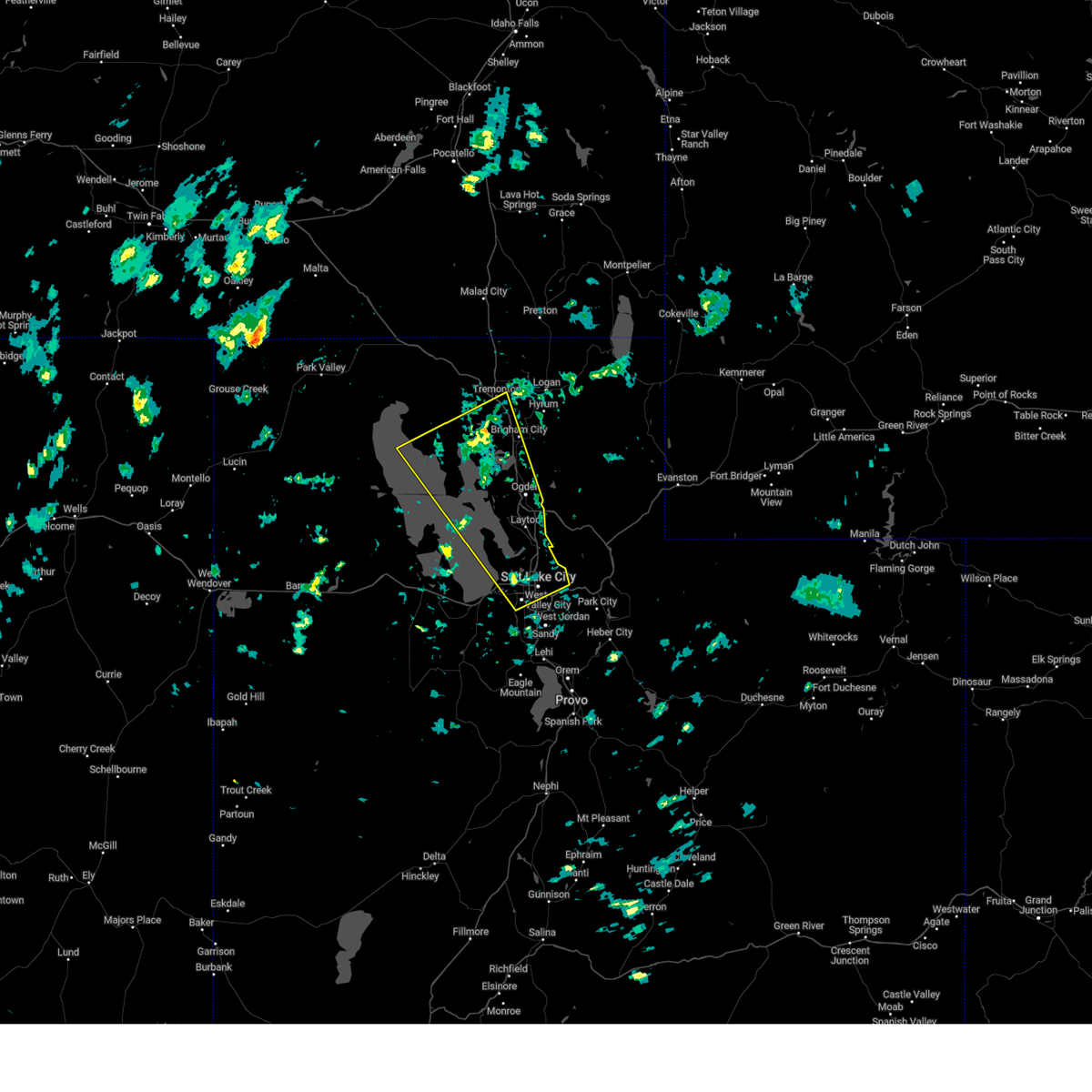
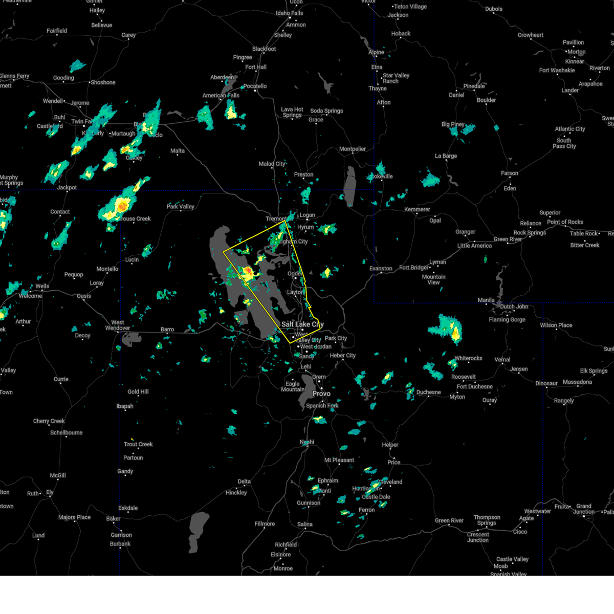
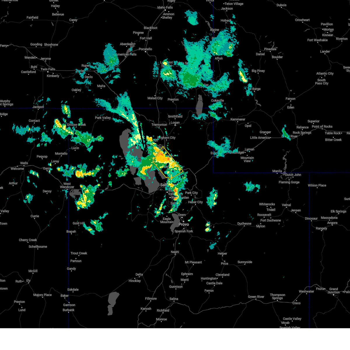
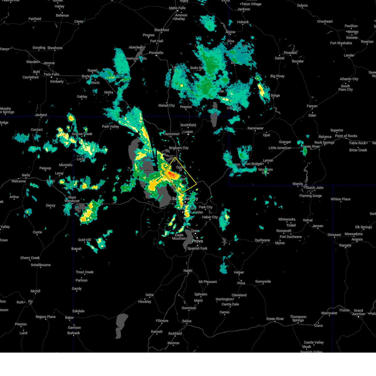
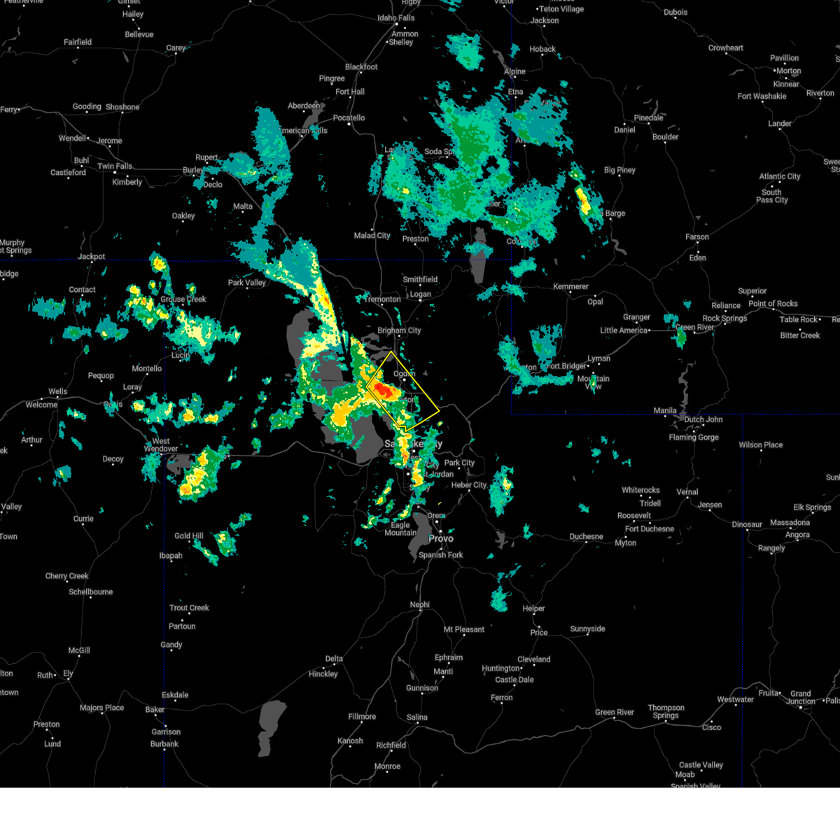
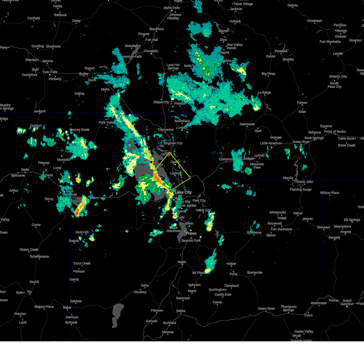
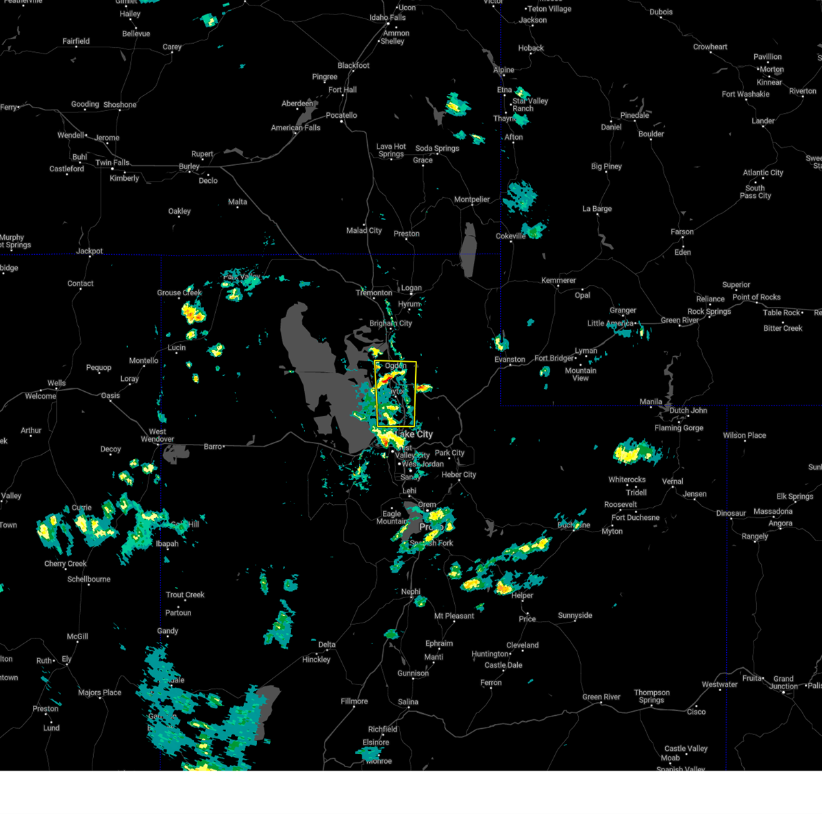
Hail Map for North Ogden, UT
The North Ogden, UT area has had 0 reports of on-the-ground hail by trained spotters, and has been under severe weather warnings 12 times during the past 12 months. Doppler radar has detected hail at or near North Ogden, UT on 11 occasions.
| Name: | North Ogden, UT |
| Where Located: | 37.8 miles N of Salt Lake City, UT |
| Map: | Google Map for North Ogden, UT |
| Population: | 17357 |
| Housing Units: | 5799 |
| More Info: | Search Google for North Ogden, UT |
0
The Top Recent Hail Date for North Ogden, UT is Saturday, July 27, 2024 (8th out of 11)

Hail and Wind Damage Spotted near North Ogden, UT
| Date / Time | Report Details |
|---|---|
| 5/13/2026 4:08 PM MDT |
 Svrslc the national weather service in salt lake city has issued a * severe thunderstorm warning for, weber county in northern utah, cache county in northern utah, east central box elder county in northern utah, rich county in northern utah, northeastern davis county in northern utah, central morgan county in northern utah, * until 500 pm mdt. * at 407 pm mdt, elevated thunderstorms with a history of producing gusty and erratic outflow winds in excess of 70 mph were located along a line extending from franklin to 6 miles east of centerville, moving northeast at 55 mph (radar indicated. logan-cache airport recorded a peak wind gust of 75 mph). Hazards include 70 mph wind gusts. Expect considerable tree damage. Damage is likely to mobile homes, roofs, and outbuildings. Svrslc the national weather service in salt lake city has issued a * severe thunderstorm warning for, weber county in northern utah, cache county in northern utah, east central box elder county in northern utah, rich county in northern utah, northeastern davis county in northern utah, central morgan county in northern utah, * until 500 pm mdt. * at 407 pm mdt, elevated thunderstorms with a history of producing gusty and erratic outflow winds in excess of 70 mph were located along a line extending from franklin to 6 miles east of centerville, moving northeast at 55 mph (radar indicated. logan-cache airport recorded a peak wind gust of 75 mph). Hazards include 70 mph wind gusts. Expect considerable tree damage. Damage is likely to mobile homes, roofs, and outbuildings.
|
| 5/13/2026 3:59 PM MDT |
 At 358 pm mdt, elevated thunderstorms with a history of producing gusty and erratic outflow winds to 70 mph were located along a line extending from 7 miles west of preston to 9 miles northeast of north ogden, moving northeast at 50 mph (radar indicated. logan-cache airport asos observed a wind gust of 70 mph). Hazards include 70 mph wind gusts. Expect considerable tree damage. damage is likely to mobile homes, roofs, and outbuildings. locations impacted include, ogden, layton, logan, farmington, brigham city, morgan, hill air force base, cache, roy, clearfield, kaysville, syracuse, clinton, north ogden, south ogden, smithfield, washington terrace, riverdale, hyrum, and hooper. this includes the following highways, interstate 15 between mile markers 323 and 370. interstate 84 between mile markers 82 and 103. Us route 89 between mile markers 459 and 491. At 358 pm mdt, elevated thunderstorms with a history of producing gusty and erratic outflow winds to 70 mph were located along a line extending from 7 miles west of preston to 9 miles northeast of north ogden, moving northeast at 50 mph (radar indicated. logan-cache airport asos observed a wind gust of 70 mph). Hazards include 70 mph wind gusts. Expect considerable tree damage. damage is likely to mobile homes, roofs, and outbuildings. locations impacted include, ogden, layton, logan, farmington, brigham city, morgan, hill air force base, cache, roy, clearfield, kaysville, syracuse, clinton, north ogden, south ogden, smithfield, washington terrace, riverdale, hyrum, and hooper. this includes the following highways, interstate 15 between mile markers 323 and 370. interstate 84 between mile markers 82 and 103. Us route 89 between mile markers 459 and 491.
|
| 5/13/2026 3:44 PM MDT |
 Svrslc the national weather service in salt lake city has issued a * severe thunderstorm warning for, weber county in northern utah, cache county in northern utah, northeastern box elder county in northern utah, eastern davis county in northern utah, central morgan county in northern utah, * until 430 pm mdt. * at 343 pm mdt, elevated thunderstorms with a history of producing gusty and erratic outflow winds in excess to 70 mph were located along a line extending from near plymouth to near ogden, moving northeast at 50 mph (radar indicated). Hazards include 70 mph wind gusts. Expect considerable tree damage. Damage is likely to mobile homes, roofs, and outbuildings. Svrslc the national weather service in salt lake city has issued a * severe thunderstorm warning for, weber county in northern utah, cache county in northern utah, northeastern box elder county in northern utah, eastern davis county in northern utah, central morgan county in northern utah, * until 430 pm mdt. * at 343 pm mdt, elevated thunderstorms with a history of producing gusty and erratic outflow winds in excess to 70 mph were located along a line extending from near plymouth to near ogden, moving northeast at 50 mph (radar indicated). Hazards include 70 mph wind gusts. Expect considerable tree damage. Damage is likely to mobile homes, roofs, and outbuildings.
|
| 5/13/2026 3:04 PM MDT |
 Svrslc the national weather service in salt lake city has issued a * severe thunderstorm warning for, weber county in northern utah, western cache county in northern utah, eastern box elder county in northern utah, davis county in northern utah, west central morgan county in northern utah, northeastern tooele county in northern utah, * until 345 pm mdt. * at 302 pm mdt, elevated thunderstorms with a history of producing gusty and erratic outflow winds in excess of 60 mph were located along a line extending from 15 miles east of great salt lake north of the causeway to 7 miles east of great salt lake south of the causeway, moving northeast at 45 mph (radar indicated). Hazards include 60 mph wind gusts. expect damage to roofs, siding, and trees Svrslc the national weather service in salt lake city has issued a * severe thunderstorm warning for, weber county in northern utah, western cache county in northern utah, eastern box elder county in northern utah, davis county in northern utah, west central morgan county in northern utah, northeastern tooele county in northern utah, * until 345 pm mdt. * at 302 pm mdt, elevated thunderstorms with a history of producing gusty and erratic outflow winds in excess of 60 mph were located along a line extending from 15 miles east of great salt lake north of the causeway to 7 miles east of great salt lake south of the causeway, moving northeast at 45 mph (radar indicated). Hazards include 60 mph wind gusts. expect damage to roofs, siding, and trees
|
| 4/11/2026 1:42 PM MDT |
 The storms which prompted the warning have moved out of the area. therefore, the warning will be allowed to expire. however gusty winds and heavy rain are still possible with these thunderstorms. The storms which prompted the warning have moved out of the area. therefore, the warning will be allowed to expire. however gusty winds and heavy rain are still possible with these thunderstorms.
|
| 4/11/2026 1:35 PM MDT |
 the severe thunderstorm warning has been cancelled and is no longer in effect the severe thunderstorm warning has been cancelled and is no longer in effect
|
| 4/11/2026 1:35 PM MDT |
 At 135 pm mdt, severe thunderstorms were located along a line extending from near bear river city to south willard to 12 miles southeast of great salt lake south of the causeway, moving east at 20 mph (radar indicated). Hazards include 60 mph wind gusts and quarter size hail. Hail damage to vehicles is expected. expect wind damage to roofs, siding, and trees. locations impacted include, ogden, brigham city, north ogden, perry, willard, marriott-slaterville, mantua, corinne, south willard, pleasant view, farr west, harrisville, plain city, honeyville, deweyville, liberty, mantua reservoir, warren, slaterville, and eden. This includes interstate 15 between mile markers 346 and 373. At 135 pm mdt, severe thunderstorms were located along a line extending from near bear river city to south willard to 12 miles southeast of great salt lake south of the causeway, moving east at 20 mph (radar indicated). Hazards include 60 mph wind gusts and quarter size hail. Hail damage to vehicles is expected. expect wind damage to roofs, siding, and trees. locations impacted include, ogden, brigham city, north ogden, perry, willard, marriott-slaterville, mantua, corinne, south willard, pleasant view, farr west, harrisville, plain city, honeyville, deweyville, liberty, mantua reservoir, warren, slaterville, and eden. This includes interstate 15 between mile markers 346 and 373.
|
| 4/11/2026 1:22 PM MDT |
 At 121 pm mdt, severe thunderstorms were located along a line extending from near corinne to near south willard to 12 miles southeast of great salt lake south of the causeway, moving east at 20 mph (radar indicated). Hazards include 60 mph wind gusts and quarter size hail. Hail damage to vehicles is expected. expect wind damage to roofs, siding, and trees. locations impacted include, ogden, layton, farmington, brigham city, hill air force base, roy, clearfield, kaysville, syracuse, clinton, north ogden, south ogden, washington terrace, riverdale, hooper, south weber, perry, willard, marriott-slaterville, and uintah. this includes the following highways, interstate 15 between mile markers 325 and 375. Interstate 84 between mile markers 82 and 90. At 121 pm mdt, severe thunderstorms were located along a line extending from near corinne to near south willard to 12 miles southeast of great salt lake south of the causeway, moving east at 20 mph (radar indicated). Hazards include 60 mph wind gusts and quarter size hail. Hail damage to vehicles is expected. expect wind damage to roofs, siding, and trees. locations impacted include, ogden, layton, farmington, brigham city, hill air force base, roy, clearfield, kaysville, syracuse, clinton, north ogden, south ogden, washington terrace, riverdale, hooper, south weber, perry, willard, marriott-slaterville, and uintah. this includes the following highways, interstate 15 between mile markers 325 and 375. Interstate 84 between mile markers 82 and 90.
|
| 4/11/2026 1:08 PM MDT |
 Svrslc the national weather service in salt lake city has issued a * severe thunderstorm warning for, central weber county in northern utah, east central box elder county in northern utah, davis county in northern utah, * until 145 pm mdt. * at 107 pm mdt, severe thunderstorms were located along a line extending from 6 miles west of corinne to near marriott-slaterville to 13 miles north of stansbury park, moving northeast at 20 mph (radar indicated). Hazards include 60 mph wind gusts and quarter size hail. Hail damage to vehicles is expected. Expect wind damage to roofs, siding, and trees. Svrslc the national weather service in salt lake city has issued a * severe thunderstorm warning for, central weber county in northern utah, east central box elder county in northern utah, davis county in northern utah, * until 145 pm mdt. * at 107 pm mdt, severe thunderstorms were located along a line extending from 6 miles west of corinne to near marriott-slaterville to 13 miles north of stansbury park, moving northeast at 20 mph (radar indicated). Hazards include 60 mph wind gusts and quarter size hail. Hail damage to vehicles is expected. Expect wind damage to roofs, siding, and trees.
|
| 7/21/2025 8:42 PM MDT |
 The storms which prompted the warning have weakened below severe limits, and no longer pose an immediate threat to life or property. therefore, the warning will be allowed to expire. however gusty winds are still possible with these thunderstorms. The storms which prompted the warning have weakened below severe limits, and no longer pose an immediate threat to life or property. therefore, the warning will be allowed to expire. however gusty winds are still possible with these thunderstorms.
|
| 7/21/2025 8:32 PM MDT |
 At 831 pm mdt, severe thunderstorms were located along a line extending from 6 miles west of perry to marriott-slaterville, moving east at 25 mph (radar indicated). Hazards include 60 mph wind gusts. Expect damage to roofs, siding, and trees. locations impacted include, ogden, brigham city, roy, north ogden, south ogden, riverdale, hooper, perry, willard, marriott-slaterville, corinne, weber state university, south willard, west haven, pleasant view, farr west, harrisville, plain city, west warren, and wilson. This includes interstate 15 between mile markers 341 and 367. At 831 pm mdt, severe thunderstorms were located along a line extending from 6 miles west of perry to marriott-slaterville, moving east at 25 mph (radar indicated). Hazards include 60 mph wind gusts. Expect damage to roofs, siding, and trees. locations impacted include, ogden, brigham city, roy, north ogden, south ogden, riverdale, hooper, perry, willard, marriott-slaterville, corinne, weber state university, south willard, west haven, pleasant view, farr west, harrisville, plain city, west warren, and wilson. This includes interstate 15 between mile markers 341 and 367.
|
| 7/21/2025 8:13 PM MDT |
 Svrslc the national weather service in salt lake city has issued a * severe thunderstorm warning for, central weber county in northern utah, southwestern cache county in northern utah, east central box elder county in northern utah, * until 845 pm mdt. * at 812 pm mdt, severe thunderstorms were located along a line extending from 11 miles southwest of corinne to near hooper, moving east at 25 mph (radar indicated). Hazards include 60 mph wind gusts. expect damage to roofs, siding, and trees Svrslc the national weather service in salt lake city has issued a * severe thunderstorm warning for, central weber county in northern utah, southwestern cache county in northern utah, east central box elder county in northern utah, * until 845 pm mdt. * at 812 pm mdt, severe thunderstorms were located along a line extending from 11 miles southwest of corinne to near hooper, moving east at 25 mph (radar indicated). Hazards include 60 mph wind gusts. expect damage to roofs, siding, and trees
|
| 5/11/2025 6:10 PM MDT |
 The storm which prompted the warning has weakened below severe limits, and no longer poses an immediate threat to life or property. therefore, the warning will be allowed to expire. however gusty winds are still possible with this thunderstorm. a severe thunderstorm watch remains in effect until 800 pm mdt for northern utah. The storm which prompted the warning has weakened below severe limits, and no longer poses an immediate threat to life or property. therefore, the warning will be allowed to expire. however gusty winds are still possible with this thunderstorm. a severe thunderstorm watch remains in effect until 800 pm mdt for northern utah.
|
| 5/11/2025 5:37 PM MDT |
 Svrslc the national weather service in salt lake city has issued a * severe thunderstorm warning for, weber county in northern utah, southwestern cache county in northern utah, southeastern box elder county in northern utah, northwestern davis county in northern utah, west central morgan county in northern utah, * until 615 pm mdt. * at 536 pm mdt, a severe thunderstorm was located 9 miles northeast of great salt lake south of the causeway, or 17 miles west of hill air force base, moving northeast at 45 mph (radar indicated). Hazards include 60 mph wind gusts. expect damage to roofs, siding, and trees Svrslc the national weather service in salt lake city has issued a * severe thunderstorm warning for, weber county in northern utah, southwestern cache county in northern utah, southeastern box elder county in northern utah, northwestern davis county in northern utah, west central morgan county in northern utah, * until 615 pm mdt. * at 536 pm mdt, a severe thunderstorm was located 9 miles northeast of great salt lake south of the causeway, or 17 miles west of hill air force base, moving northeast at 45 mph (radar indicated). Hazards include 60 mph wind gusts. expect damage to roofs, siding, and trees
|
| 5/11/2025 3:45 PM MDT |
 At 344 pm mdt, severe thunderstorms were located along a line extending from 9 miles south of snowville to near east canyon state park, moving east at 45 mph (radar indicated). Hazards include 70 mph wind gusts. Expect considerable tree damage. damage is likely to mobile homes, roofs, and outbuildings. Locations impacted include, salt lake city, west valley city, ogden, layton, murray, bountiful, tooele, farmington, brigham city, grantsville, hill air force base, west jordan, taylorsville, roy, clearfield, kaysville, syracuse, south salt lake, clinton, and north ogden. At 344 pm mdt, severe thunderstorms were located along a line extending from 9 miles south of snowville to near east canyon state park, moving east at 45 mph (radar indicated). Hazards include 70 mph wind gusts. Expect considerable tree damage. damage is likely to mobile homes, roofs, and outbuildings. Locations impacted include, salt lake city, west valley city, ogden, layton, murray, bountiful, tooele, farmington, brigham city, grantsville, hill air force base, west jordan, taylorsville, roy, clearfield, kaysville, syracuse, south salt lake, clinton, and north ogden.
|
| 5/11/2025 3:14 PM MDT |
 Svrslc the national weather service in salt lake city has issued a * severe thunderstorm warning for, western weber county in northern utah, central box elder county in northern utah, northern salt lake county in northern utah, davis county in northern utah, west central morgan county in northern utah, northeastern tooele county in northern utah, * until 400 pm mdt. * at 311 pm mdt, severe thunderstorms were located along a line extending from 20 miles northwest of great salt lake north of the causeway to salt lake valley, moving northeast at 40 mph. widespread gusts in excess of 60 mph have been observed, including isolated gusts up to 75 mph (radar indicated). Hazards include 70 mph wind gusts. Expect considerable tree damage. Damage is likely to mobile homes, roofs, and outbuildings. Svrslc the national weather service in salt lake city has issued a * severe thunderstorm warning for, western weber county in northern utah, central box elder county in northern utah, northern salt lake county in northern utah, davis county in northern utah, west central morgan county in northern utah, northeastern tooele county in northern utah, * until 400 pm mdt. * at 311 pm mdt, severe thunderstorms were located along a line extending from 20 miles northwest of great salt lake north of the causeway to salt lake valley, moving northeast at 40 mph. widespread gusts in excess of 60 mph have been observed, including isolated gusts up to 75 mph (radar indicated). Hazards include 70 mph wind gusts. Expect considerable tree damage. Damage is likely to mobile homes, roofs, and outbuildings.
|
| 5/11/2025 2:46 PM MDT |
 The storms which prompted the warning have moved out of the area. therefore, the warning has been allowed to expire. a severe thunderstorm watch remains in effect until 800 pm mdt for northern utah. The storms which prompted the warning have moved out of the area. therefore, the warning has been allowed to expire. a severe thunderstorm watch remains in effect until 800 pm mdt for northern utah.
|
| 5/11/2025 2:00 PM MDT |
 Svrslc the national weather service in salt lake city has issued a * severe thunderstorm warning for, weber county in northern utah, cache county in northern utah, northeastern box elder county in northern utah, western rich county in northern utah, northwestern wasatch county in northern utah, salt lake county in northern utah, eastern davis county in northern utah, morgan county in northern utah, western summit county in northern utah, northwestern utah county in northern utah, * until 245 pm mdt. * at 159 pm mdt, severe thunderstorms were located along a line extending from near riverside to near bluffdale, moving northeast at 40 mph. gusts up to 70 mph have been observed (radar indicated). Hazards include 70 mph wind gusts. Expect considerable tree damage. Damage is likely to mobile homes, roofs, and outbuildings. Svrslc the national weather service in salt lake city has issued a * severe thunderstorm warning for, weber county in northern utah, cache county in northern utah, northeastern box elder county in northern utah, western rich county in northern utah, northwestern wasatch county in northern utah, salt lake county in northern utah, eastern davis county in northern utah, morgan county in northern utah, western summit county in northern utah, northwestern utah county in northern utah, * until 245 pm mdt. * at 159 pm mdt, severe thunderstorms were located along a line extending from near riverside to near bluffdale, moving northeast at 40 mph. gusts up to 70 mph have been observed (radar indicated). Hazards include 70 mph wind gusts. Expect considerable tree damage. Damage is likely to mobile homes, roofs, and outbuildings.
|
| 5/11/2025 1:43 PM MDT |
 At 143 pm mdt, severe thunderstorms were located along a line extending from 9 miles northeast of great salt lake north of the causeway to salt lake city, moving northeast at 35 mph (radar indicated). Hazards include 70 mph wind gusts. Expect considerable tree damage. damage is likely to mobile homes, roofs, and outbuildings. Locations impacted include, salt lake city, west valley city, ogden, layton, bountiful, farmington, brigham city, tremonton, hill air force base, taylorsville, roy, clearfield, kaysville, syracuse, south salt lake, clinton, north ogden, south ogden, north salt lake, and centerville. At 143 pm mdt, severe thunderstorms were located along a line extending from 9 miles northeast of great salt lake north of the causeway to salt lake city, moving northeast at 35 mph (radar indicated). Hazards include 70 mph wind gusts. Expect considerable tree damage. damage is likely to mobile homes, roofs, and outbuildings. Locations impacted include, salt lake city, west valley city, ogden, layton, bountiful, farmington, brigham city, tremonton, hill air force base, taylorsville, roy, clearfield, kaysville, syracuse, south salt lake, clinton, north ogden, south ogden, north salt lake, and centerville.
|
| 5/11/2025 1:25 PM MDT |
 Svrslc the national weather service in salt lake city has issued a * severe thunderstorm warning for, western weber county in northern utah, southeastern box elder county in northern utah, northern salt lake county in northern utah, davis county in northern utah, * until 200 pm mdt. * at 124 pm mdt, severe thunderstorms were located along a line extending from near great salt lake north of the causeway to near magna, moving northeast at 35 mph. multiple gusts in excess of 60 mph have been observed (radar indicated). Hazards include 60 mph wind gusts. expect damage to roofs, siding, and trees Svrslc the national weather service in salt lake city has issued a * severe thunderstorm warning for, western weber county in northern utah, southeastern box elder county in northern utah, northern salt lake county in northern utah, davis county in northern utah, * until 200 pm mdt. * at 124 pm mdt, severe thunderstorms were located along a line extending from near great salt lake north of the causeway to near magna, moving northeast at 35 mph. multiple gusts in excess of 60 mph have been observed (radar indicated). Hazards include 60 mph wind gusts. expect damage to roofs, siding, and trees
|
| 9/17/2024 12:43 PM MDT |
 The storms which prompted the warning have weakened below severe limits, and no longer pose an immediate threat to life or property. therefore, the warning will be allowed to expire. The storms which prompted the warning have weakened below severe limits, and no longer pose an immediate threat to life or property. therefore, the warning will be allowed to expire.
|
| 9/17/2024 12:36 PM MDT |
 the severe thunderstorm warning has been cancelled and is no longer in effect the severe thunderstorm warning has been cancelled and is no longer in effect
|
| 9/17/2024 12:36 PM MDT |
 At 1235 pm mdt, severe thunderstorms were located along a line extending from near hooper to near west bountiful, moving northeast at 30 mph (radar indicated). Hazards include 60 mph wind gusts. Expect damage to roofs, siding, and trees. locations impacted include, ogden, layton, farmington, morgan, hill air force base, roy, clearfield, kaysville, syracuse, clinton, north ogden, south ogden, centerville, washington terrace, riverdale, hooper, south weber, west bountiful, marriott-slaterville, and uintah. this includes the following highways, interstate 15 between mile markers 320 and 353. Interstate 84 between mile markers 82 and 94. At 1235 pm mdt, severe thunderstorms were located along a line extending from near hooper to near west bountiful, moving northeast at 30 mph (radar indicated). Hazards include 60 mph wind gusts. Expect damage to roofs, siding, and trees. locations impacted include, ogden, layton, farmington, morgan, hill air force base, roy, clearfield, kaysville, syracuse, clinton, north ogden, south ogden, centerville, washington terrace, riverdale, hooper, south weber, west bountiful, marriott-slaterville, and uintah. this includes the following highways, interstate 15 between mile markers 320 and 353. Interstate 84 between mile markers 82 and 94.
|
| 9/17/2024 12:13 PM MDT |
 Svrslc the national weather service in salt lake city has issued a * severe thunderstorm warning for, southwestern weber county in northern utah, east central box elder county in northern utah, davis county in northern utah, north central salt lake county in northern utah, west central morgan county in northern utah, * until 1245 pm mdt. * at 1212 pm mdt, severe thunderstorms were located along a line extending from 8 miles northeast of great salt lake south of the causeway to near salt lake city international airport, moving northeast at 30 mph (radar indicated). Hazards include 60 mph wind gusts. expect damage to roofs, siding, and trees Svrslc the national weather service in salt lake city has issued a * severe thunderstorm warning for, southwestern weber county in northern utah, east central box elder county in northern utah, davis county in northern utah, north central salt lake county in northern utah, west central morgan county in northern utah, * until 1245 pm mdt. * at 1212 pm mdt, severe thunderstorms were located along a line extending from 8 miles northeast of great salt lake south of the causeway to near salt lake city international airport, moving northeast at 30 mph (radar indicated). Hazards include 60 mph wind gusts. expect damage to roofs, siding, and trees
|
| 8/9/2024 6:02 PM MDT |
 At 601 pm mdt, severe thunderstorms were located along a line extending from marriott-slaterville to near salt lake city international airport, moving east at 20 mph. a weather station in syracuse has reported a wind gust to 58 mph (radar indicated). Hazards include 60 mph wind gusts. Expect damage to roofs, siding, and trees. locations impacted include, ogden, layton, bountiful, farmington, hill air force base, roy, clearfield, kaysville, syracuse, clinton, north ogden, south ogden, north salt lake, centerville, woods cross, washington terrace, riverdale, hooper, south weber, and west bountiful. this includes the following highways, interstate 15 between mile markers 316 and 348. Interstate 84 between mile markers 82 and 94. At 601 pm mdt, severe thunderstorms were located along a line extending from marriott-slaterville to near salt lake city international airport, moving east at 20 mph. a weather station in syracuse has reported a wind gust to 58 mph (radar indicated). Hazards include 60 mph wind gusts. Expect damage to roofs, siding, and trees. locations impacted include, ogden, layton, bountiful, farmington, hill air force base, roy, clearfield, kaysville, syracuse, clinton, north ogden, south ogden, north salt lake, centerville, woods cross, washington terrace, riverdale, hooper, south weber, and west bountiful. this includes the following highways, interstate 15 between mile markers 316 and 348. Interstate 84 between mile markers 82 and 94.
|
| 8/9/2024 5:57 PM MDT |
 Svrslc the national weather service in salt lake city has issued a * severe thunderstorm warning for, central weber county in northern utah, northeastern davis county in northern utah, north central salt lake county in northern utah, west central morgan county in northern utah, * until 645 pm mdt. * at 556 pm mdt, severe thunderstorms were located along a line extending from marriott-slaterville to near salt lake city international airport, moving east at 20 mph (radar indicated). Hazards include 60 mph wind gusts. expect damage to roofs, siding, and trees Svrslc the national weather service in salt lake city has issued a * severe thunderstorm warning for, central weber county in northern utah, northeastern davis county in northern utah, north central salt lake county in northern utah, west central morgan county in northern utah, * until 645 pm mdt. * at 556 pm mdt, severe thunderstorms were located along a line extending from marriott-slaterville to near salt lake city international airport, moving east at 20 mph (radar indicated). Hazards include 60 mph wind gusts. expect damage to roofs, siding, and trees
|
| 3/2/2024 12:09 PM MST |
 Svrslc the national weather service in salt lake city has issued a * severe thunderstorm warning for, weber county in northern utah, southern cache county in northern utah, east central box elder county in northern utah, northwestern rich county in northern utah, * until 100 pm mst. * at 1208 pm mst, severe thunderstorms were located along a line extending from wellsville to near hooper, moving east at 50 mph (weather station observed. at 1155 am mst the brigham city airport reported a wind gust to 70 mph). Hazards include 70 mph wind gusts. Expect considerable tree damage. Damage is likely to mobile homes, roofs, and outbuildings. Svrslc the national weather service in salt lake city has issued a * severe thunderstorm warning for, weber county in northern utah, southern cache county in northern utah, east central box elder county in northern utah, northwestern rich county in northern utah, * until 100 pm mst. * at 1208 pm mst, severe thunderstorms were located along a line extending from wellsville to near hooper, moving east at 50 mph (weather station observed. at 1155 am mst the brigham city airport reported a wind gust to 70 mph). Hazards include 70 mph wind gusts. Expect considerable tree damage. Damage is likely to mobile homes, roofs, and outbuildings.
|
| 8/2/2023 4:36 PM MDT |
 At 435 pm mdt, severe thunderstorms were located along a line extending from 11 miles north of delle to near great salt lake south of the causeway to kaysville, moving north at 35 mph (radar indicated). Hazards include 60 mph wind gusts and penny size hail. Expect damage to roofs, siding, and trees. locations impacted include, salt lake city, ogden, layton, bountiful, farmington, hill air force base, roy, clearfield, kaysville, syracuse, clinton, north ogden, south ogden, north salt lake, centerville, woods cross, washington terrace, riverdale, hooper and south weber. this includes the following highways, interstate 15 between mile markers 307 and 350. interstate 84 between mile markers 82 and 91. interstate 80 in utah between mile markers 62 and 68, between mile markers 71 and 90, and between mile markers 100 and 119. hail threat, radar indicated max hail size, 0. 75 in wind threat, radar indicated max wind gust, 60 mph. At 435 pm mdt, severe thunderstorms were located along a line extending from 11 miles north of delle to near great salt lake south of the causeway to kaysville, moving north at 35 mph (radar indicated). Hazards include 60 mph wind gusts and penny size hail. Expect damage to roofs, siding, and trees. locations impacted include, salt lake city, ogden, layton, bountiful, farmington, hill air force base, roy, clearfield, kaysville, syracuse, clinton, north ogden, south ogden, north salt lake, centerville, woods cross, washington terrace, riverdale, hooper and south weber. this includes the following highways, interstate 15 between mile markers 307 and 350. interstate 84 between mile markers 82 and 91. interstate 80 in utah between mile markers 62 and 68, between mile markers 71 and 90, and between mile markers 100 and 119. hail threat, radar indicated max hail size, 0. 75 in wind threat, radar indicated max wind gust, 60 mph.
|
| 8/2/2023 4:12 PM MDT |
 At 411 pm mdt, severe thunderstorms were located along a line extending from near delle to 9 miles north of stansbury park to near north salt lake, moving northwest at 35 mph (radar indicated). Hazards include 60 mph wind gusts and penny size hail. Expect damage to roofs, siding, and trees. locations impacted include, salt lake city, ogden, layton, bountiful, farmington, hill air force base, roy, clearfield, kaysville, syracuse, clinton, north ogden, south ogden, north salt lake, centerville, woods cross, washington terrace, riverdale, hooper and south weber. this includes the following highways, interstate 15 between mile markers 307 and 350. interstate 84 between mile markers 82 and 91. interstate 80 in utah between mile markers 43 and 90, and between mile markers 100 and 119. hail threat, radar indicated max hail size, 0. 75 in wind threat, radar indicated max wind gust, 60 mph. At 411 pm mdt, severe thunderstorms were located along a line extending from near delle to 9 miles north of stansbury park to near north salt lake, moving northwest at 35 mph (radar indicated). Hazards include 60 mph wind gusts and penny size hail. Expect damage to roofs, siding, and trees. locations impacted include, salt lake city, ogden, layton, bountiful, farmington, hill air force base, roy, clearfield, kaysville, syracuse, clinton, north ogden, south ogden, north salt lake, centerville, woods cross, washington terrace, riverdale, hooper and south weber. this includes the following highways, interstate 15 between mile markers 307 and 350. interstate 84 between mile markers 82 and 91. interstate 80 in utah between mile markers 43 and 90, and between mile markers 100 and 119. hail threat, radar indicated max hail size, 0. 75 in wind threat, radar indicated max wind gust, 60 mph.
|
| 8/2/2023 3:45 PM MDT |
 At 344 pm mdt, severe thunderstorms were located along a line extending from 10 miles north of skull valley to near magna to near mount olympus, moving north at 35 mph (radar indicated). Hazards include 60 mph wind gusts and penny size hail. expect damage to roofs, siding, and trees At 344 pm mdt, severe thunderstorms were located along a line extending from 10 miles north of skull valley to near magna to near mount olympus, moving north at 35 mph (radar indicated). Hazards include 60 mph wind gusts and penny size hail. expect damage to roofs, siding, and trees
|
| 7/3/2023 6:12 PM MDT |
 At 611 pm mdt, a severe thunderstorm was located over riverdale, or near ogden, moving northeast at 25 mph (radar indicated). Hazards include 60 mph wind gusts and penny size hail. Expect damage to roofs, siding, and trees. locations impacted include, ogden, layton, brigham city, hill air force base, roy, clearfield, syracuse, clinton, north ogden, south ogden, washington terrace, riverdale, hooper, south weber, perry, willard, marriott-slaterville, uintah, weber state university and south willard. this includes the following highways, interstate 15 between mile markers 332 and 362. interstate 84 between mile markers 82 and 92. hail threat, radar indicated max hail size, 0. 75 in wind threat, radar indicated max wind gust, 60 mph. At 611 pm mdt, a severe thunderstorm was located over riverdale, or near ogden, moving northeast at 25 mph (radar indicated). Hazards include 60 mph wind gusts and penny size hail. Expect damage to roofs, siding, and trees. locations impacted include, ogden, layton, brigham city, hill air force base, roy, clearfield, syracuse, clinton, north ogden, south ogden, washington terrace, riverdale, hooper, south weber, perry, willard, marriott-slaterville, uintah, weber state university and south willard. this includes the following highways, interstate 15 between mile markers 332 and 362. interstate 84 between mile markers 82 and 92. hail threat, radar indicated max hail size, 0. 75 in wind threat, radar indicated max wind gust, 60 mph.
|
| 7/3/2023 6:10 PM MDT |
 At 610 pm mdt, a severe thunderstorm was located over ogden, moving northeast at 40 mph (radar indicated). Hazards include 60 mph wind gusts and penny size hail. expect damage to roofs, siding, and trees At 610 pm mdt, a severe thunderstorm was located over ogden, moving northeast at 40 mph (radar indicated). Hazards include 60 mph wind gusts and penny size hail. expect damage to roofs, siding, and trees
|
| 7/3/2023 5:57 PM MDT |
 At 557 pm mdt, a severe thunderstorm was located over hooper, or 7 miles west of hill air force base, moving northeast at 30 mph (radar indicated). Hazards include 60 mph wind gusts and quarter size hail. Hail damage to vehicles is expected. expect wind damage to roofs, siding, and trees. locations impacted include, ogden, layton, brigham city, hill air force base, roy, clearfield, syracuse, clinton, north ogden, south ogden, washington terrace, riverdale, hooper, south weber, perry, willard, marriott-slaterville, uintah, weber state university and south willard. this includes the following highways, interstate 15 between mile markers 331 and 362. interstate 84 between mile markers 82 and 92. hail threat, radar indicated max hail size, 1. 00 in wind threat, radar indicated max wind gust, 60 mph. At 557 pm mdt, a severe thunderstorm was located over hooper, or 7 miles west of hill air force base, moving northeast at 30 mph (radar indicated). Hazards include 60 mph wind gusts and quarter size hail. Hail damage to vehicles is expected. expect wind damage to roofs, siding, and trees. locations impacted include, ogden, layton, brigham city, hill air force base, roy, clearfield, syracuse, clinton, north ogden, south ogden, washington terrace, riverdale, hooper, south weber, perry, willard, marriott-slaterville, uintah, weber state university and south willard. this includes the following highways, interstate 15 between mile markers 331 and 362. interstate 84 between mile markers 82 and 92. hail threat, radar indicated max hail size, 1. 00 in wind threat, radar indicated max wind gust, 60 mph.
|
| 7/3/2023 5:38 PM MDT |
 At 538 pm mdt, a severe thunderstorm was located 8 miles northeast of great salt lake south of the causeway, or 19 miles west of hill air force base, moving northeast at 25 mph (radar indicated). Hazards include 60 mph wind gusts. expect damage to roofs, siding, and trees At 538 pm mdt, a severe thunderstorm was located 8 miles northeast of great salt lake south of the causeway, or 19 miles west of hill air force base, moving northeast at 25 mph (radar indicated). Hazards include 60 mph wind gusts. expect damage to roofs, siding, and trees
|
| 9/28/2022 8:54 PM MDT |
 The severe thunderstorm warning for southwestern weber, southeastern box elder, northwestern salt lake, davis and northeastern tooele counties will expire at 900 pm mdt, the storm which prompted the warning has weakened below severe limits, and no longer poses an immediate threat to life or property. therefore, the warning will be allowed to expire. however, wind gusts around 40 mph are still possible. The severe thunderstorm warning for southwestern weber, southeastern box elder, northwestern salt lake, davis and northeastern tooele counties will expire at 900 pm mdt, the storm which prompted the warning has weakened below severe limits, and no longer poses an immediate threat to life or property. therefore, the warning will be allowed to expire. however, wind gusts around 40 mph are still possible.
|
| 9/28/2022 8:35 PM MDT |
 At 832 pm mdt, a severe thunderstorm was located over kaysville, or over layton, moving northeast at 30 mph (mesonet sites near i-80 and sr-201 reported wind gusts around 60 mph at 820 pm). Hazards include 60 mph wind gusts. Expect damage to roofs, siding, and trees. locations impacted include, salt lake city, west valley city, ogden, layton, bountiful, farmington, hill air force base, roy, clearfield, kaysville, syracuse, clinton, north ogden, south ogden, north salt lake, centerville, woods cross, washington terrace, riverdale and hooper. this includes the following highways, interstate 15 between mile markers 310 and 346. interstate 84 between mile markers 82 and 91. interstate 80 in utah between mile markers 101 and 117. hail threat, radar indicated max hail size, <. 75 in wind threat, observed max wind gust, 60 mph. At 832 pm mdt, a severe thunderstorm was located over kaysville, or over layton, moving northeast at 30 mph (mesonet sites near i-80 and sr-201 reported wind gusts around 60 mph at 820 pm). Hazards include 60 mph wind gusts. Expect damage to roofs, siding, and trees. locations impacted include, salt lake city, west valley city, ogden, layton, bountiful, farmington, hill air force base, roy, clearfield, kaysville, syracuse, clinton, north ogden, south ogden, north salt lake, centerville, woods cross, washington terrace, riverdale and hooper. this includes the following highways, interstate 15 between mile markers 310 and 346. interstate 84 between mile markers 82 and 91. interstate 80 in utah between mile markers 101 and 117. hail threat, radar indicated max hail size, <. 75 in wind threat, observed max wind gust, 60 mph.
|
| 9/28/2022 8:11 PM MDT |
 At 809 pm mdt, a severe thunderstorm was located 10 miles south of syracuse, or 11 miles west of farmington, moving northeast at 30 mph (kennecottt beach mesonet site reported a wind gust 75 mph at 800 pm). Hazards include 75 mph wind gusts. Expect considerable tree damage. damage is likely to mobile homes, roofs, and outbuildings. locations impacted include, salt lake city, west valley city, ogden, layton, bountiful, farmington, hill air force base, roy, clearfield, kaysville, syracuse, clinton, north ogden, south ogden, north salt lake, centerville, woods cross, washington terrace, riverdale and hooper. this includes the following highways, interstate 15 between mile markers 310 and 346. interstate 84 between mile markers 82 and 91. interstate 80 in utah between mile markers 101 and 117. thunderstorm damage threat, considerable hail threat, radar indicated max hail size, <. 75 in wind threat, observed max wind gust, 70 mph. At 809 pm mdt, a severe thunderstorm was located 10 miles south of syracuse, or 11 miles west of farmington, moving northeast at 30 mph (kennecottt beach mesonet site reported a wind gust 75 mph at 800 pm). Hazards include 75 mph wind gusts. Expect considerable tree damage. damage is likely to mobile homes, roofs, and outbuildings. locations impacted include, salt lake city, west valley city, ogden, layton, bountiful, farmington, hill air force base, roy, clearfield, kaysville, syracuse, clinton, north ogden, south ogden, north salt lake, centerville, woods cross, washington terrace, riverdale and hooper. this includes the following highways, interstate 15 between mile markers 310 and 346. interstate 84 between mile markers 82 and 91. interstate 80 in utah between mile markers 101 and 117. thunderstorm damage threat, considerable hail threat, radar indicated max hail size, <. 75 in wind threat, observed max wind gust, 70 mph.
|
| 9/28/2022 8:01 PM MDT |
 At 800 pm mdt, a severe thunderstorm was located 12 miles northwest of salt lake city international airport, or 15 miles northwest of salt lake city, moving northeast at 30 mph (mesonet station reported gust up to 65 mph). Hazards include 60 mph wind gusts. expect damage to roofs, siding, and trees At 800 pm mdt, a severe thunderstorm was located 12 miles northwest of salt lake city international airport, or 15 miles northwest of salt lake city, moving northeast at 30 mph (mesonet station reported gust up to 65 mph). Hazards include 60 mph wind gusts. expect damage to roofs, siding, and trees
|
| 9/21/2022 1:39 PM MDT |
 The severe thunderstorm warning for north central weber and east central box elder counties will expire at 145 pm mdt, the storm which prompted the warning has weakened below severe limits, and no longer poses an immediate threat to life or property. therefore, the warning will be allowed to expire. however small hail, gusty winds and heavy rain are still possible with this thunderstorm. a severe thunderstorm watch remains in effect until 800 pm mdt for northern utah. The severe thunderstorm warning for north central weber and east central box elder counties will expire at 145 pm mdt, the storm which prompted the warning has weakened below severe limits, and no longer poses an immediate threat to life or property. therefore, the warning will be allowed to expire. however small hail, gusty winds and heavy rain are still possible with this thunderstorm. a severe thunderstorm watch remains in effect until 800 pm mdt for northern utah.
|
| 9/21/2022 1:31 PM MDT |
 At 130 pm mdt, a severe thunderstorm was located over south willard, or 8 miles northwest of ogden, moving northeast at 30 mph (radar indicated). Hazards include 60 mph wind gusts and quarter size hail. Hail damage to vehicles is expected. expect wind damage to roofs, siding, and trees. locations impacted include, ogden, brigham city, north ogden, perry, willard, marriott-slaterville, mantua, south willard, west haven, pleasant view, farr west, harrisville, plain city, wilson, liberty, slaterville and west weber. this includes interstate 15 between mile markers 344 and 365. hail threat, radar indicated max hail size, 1. 00 in wind threat, radar indicated max wind gust, 60 mph. At 130 pm mdt, a severe thunderstorm was located over south willard, or 8 miles northwest of ogden, moving northeast at 30 mph (radar indicated). Hazards include 60 mph wind gusts and quarter size hail. Hail damage to vehicles is expected. expect wind damage to roofs, siding, and trees. locations impacted include, ogden, brigham city, north ogden, perry, willard, marriott-slaterville, mantua, south willard, west haven, pleasant view, farr west, harrisville, plain city, wilson, liberty, slaterville and west weber. this includes interstate 15 between mile markers 344 and 365. hail threat, radar indicated max hail size, 1. 00 in wind threat, radar indicated max wind gust, 60 mph.
|
| 9/21/2022 1:10 PM MDT |
 At 110 pm mdt, a severe thunderstorm was located near hooper, or 8 miles west of ogden, moving northeast at 30 mph (radar indicated). Hazards include 60 mph wind gusts and quarter size hail. Hail damage to vehicles is expected. Expect wind damage to roofs, siding, and trees. At 110 pm mdt, a severe thunderstorm was located near hooper, or 8 miles west of ogden, moving northeast at 30 mph (radar indicated). Hazards include 60 mph wind gusts and quarter size hail. Hail damage to vehicles is expected. Expect wind damage to roofs, siding, and trees.
|
| 7/17/2022 6:28 PM MDT |
 At 627 pm mdt, severe thunderstorms were located along a line extending from 12 miles northwest of hooper to near draper, moving northeast at 35 mph (trained weather spotters). Hazards include 60 mph wind gusts. Expect damage to roofs, siding, and trees. locations impacted include, salt lake city, west valley city, sandy, ogden, layton, murray, bountiful, farmington, brigham city, park city, morgan, hill air force base, west jordan, taylorsville, south jordan, draper, riverton, roy, cottonwood heights and clearfield. this includes the following highways, interstate 15 between mile markers 287 and 361. interstate 84 between mile markers 82 and 100. interstate 80 in utah between mile markers 107 and 146. hail threat, radar indicated max hail size, <. 75 in wind threat, radar indicated max wind gust, 60 mph. At 627 pm mdt, severe thunderstorms were located along a line extending from 12 miles northwest of hooper to near draper, moving northeast at 35 mph (trained weather spotters). Hazards include 60 mph wind gusts. Expect damage to roofs, siding, and trees. locations impacted include, salt lake city, west valley city, sandy, ogden, layton, murray, bountiful, farmington, brigham city, park city, morgan, hill air force base, west jordan, taylorsville, south jordan, draper, riverton, roy, cottonwood heights and clearfield. this includes the following highways, interstate 15 between mile markers 287 and 361. interstate 84 between mile markers 82 and 100. interstate 80 in utah between mile markers 107 and 146. hail threat, radar indicated max hail size, <. 75 in wind threat, radar indicated max wind gust, 60 mph.
|
| 7/17/2022 6:11 PM MDT |
 At 611 pm mdt, severe thunderstorms were located along a line extending from 14 miles north of great salt lake south of the causeway to near camp williams, moving northeast at 30 mph (trained weather spotters). Hazards include 60 mph wind gusts. Expect damage to roofs, siding, and trees. Blowing dust may reduce visibility to a mile or less. At 611 pm mdt, severe thunderstorms were located along a line extending from 14 miles north of great salt lake south of the causeway to near camp williams, moving northeast at 30 mph (trained weather spotters). Hazards include 60 mph wind gusts. Expect damage to roofs, siding, and trees. Blowing dust may reduce visibility to a mile or less.
|
| 6/19/2022 4:13 PM MDT |
 The severe thunderstorm warning for southwestern weber, southeastern box elder and northwestern davis counties will expire at 415 pm mdt, the storm which prompted the warning has weakened below severe limits, and no longer poses an immediate threat to life or property. therefore, the warning will be allowed to expire. however gusty winds of 50 to 58 mph are still expected through 5pm mdt. The severe thunderstorm warning for southwestern weber, southeastern box elder and northwestern davis counties will expire at 415 pm mdt, the storm which prompted the warning has weakened below severe limits, and no longer poses an immediate threat to life or property. therefore, the warning will be allowed to expire. however gusty winds of 50 to 58 mph are still expected through 5pm mdt.
|
| 6/19/2022 3:58 PM MDT |
 At 357 pm mdt, a severe thunderstorm was located near hyrum, or 10 miles east of brigham city, moving east northeast at 45 mph (radar indicated). Hazards include 70 mph wind gusts. Expect considerable tree damage. Damage is likely to mobile homes, roofs, and outbuildings. At 357 pm mdt, a severe thunderstorm was located near hyrum, or 10 miles east of brigham city, moving east northeast at 45 mph (radar indicated). Hazards include 70 mph wind gusts. Expect considerable tree damage. Damage is likely to mobile homes, roofs, and outbuildings.
|
| 6/19/2022 3:42 PM MDT |
 At 341 pm mdt, a severe thunderstorm was located over perry, or over brigham city, moving east northeast at 40 mph (radar indicated and mesonet confirmed). Hazards include 70 mph wind gusts. Expect considerable tree damage. damage is likely to mobile homes, roofs, and outbuildings. locations impacted include, ogden, brigham city, tremonton, roy, clinton, north ogden, south ogden, washington terrace, riverdale, hooper, perry, willard, marriott-slaterville, bear river city, corinne, weber state university, south willard, great salt lake south of the causeway, west haven and pleasant view. this includes the following highways, interstate 15 between mile markers 339 and 380. interstate 84 between mile markers 42 and 82. thunderstorm damage threat, considerable hail threat, radar indicated max hail size, <. 75 in wind threat, radar indicated max wind gust, 70 mph. At 341 pm mdt, a severe thunderstorm was located over perry, or over brigham city, moving east northeast at 40 mph (radar indicated and mesonet confirmed). Hazards include 70 mph wind gusts. Expect considerable tree damage. damage is likely to mobile homes, roofs, and outbuildings. locations impacted include, ogden, brigham city, tremonton, roy, clinton, north ogden, south ogden, washington terrace, riverdale, hooper, perry, willard, marriott-slaterville, bear river city, corinne, weber state university, south willard, great salt lake south of the causeway, west haven and pleasant view. this includes the following highways, interstate 15 between mile markers 339 and 380. interstate 84 between mile markers 42 and 82. thunderstorm damage threat, considerable hail threat, radar indicated max hail size, <. 75 in wind threat, radar indicated max wind gust, 70 mph.
|
| 6/19/2022 3:25 PM MDT |
 At 324 pm mdt, a severe thunderstorm was located 9 miles west of willard, or 13 miles southwest of brigham city, moving east at 40 mph (radar indicated and mesonet confirmed). Hazards include 70 mph wind gusts. Expect considerable tree damage. Damage is likely to mobile homes, roofs, and outbuildings. At 324 pm mdt, a severe thunderstorm was located 9 miles west of willard, or 13 miles southwest of brigham city, moving east at 40 mph (radar indicated and mesonet confirmed). Hazards include 70 mph wind gusts. Expect considerable tree damage. Damage is likely to mobile homes, roofs, and outbuildings.
|
| 9/10/2021 6:37 PM MDT |
 At 636 pm mdt, outflow winds associated with strong thunderstorms were located along a line extending from ogden to 8 miles west of west bountiful, moving east at 40 mph (radar indicated). Hazards include 60 mph wind gusts. Expect damage to roofs, siding, and trees. locations impacted include, ogden, layton, farmington, hill air force base, roy, clearfield, kaysville, syracuse, clinton, north ogden, south ogden, centerville, washington terrace, riverdale, hooper, south weber, marriott-slaterville, uintah, weber state university and south willard. this includes the following highways, interstate 15 between mile markers 322 and 351. interstate 84 between mile markers 82 and 91. hail threat, radar indicated max hail size, <. 75 in wind threat, radar indicated max wind gust, 60 mph. At 636 pm mdt, outflow winds associated with strong thunderstorms were located along a line extending from ogden to 8 miles west of west bountiful, moving east at 40 mph (radar indicated). Hazards include 60 mph wind gusts. Expect damage to roofs, siding, and trees. locations impacted include, ogden, layton, farmington, hill air force base, roy, clearfield, kaysville, syracuse, clinton, north ogden, south ogden, centerville, washington terrace, riverdale, hooper, south weber, marriott-slaterville, uintah, weber state university and south willard. this includes the following highways, interstate 15 between mile markers 322 and 351. interstate 84 between mile markers 82 and 91. hail threat, radar indicated max hail size, <. 75 in wind threat, radar indicated max wind gust, 60 mph.
|
| 9/10/2021 6:20 PM MDT |
 At 620 pm mdt, strong outflow winds associated with thunderstorms were located along a line extending from 6 miles west of hooper to 9 miles southwest of syracuse, moving northeast at 25 mph (radar indicated). Hazards include 60 mph wind gusts. expect damage to roofs, siding, and trees At 620 pm mdt, strong outflow winds associated with thunderstorms were located along a line extending from 6 miles west of hooper to 9 miles southwest of syracuse, moving northeast at 25 mph (radar indicated). Hazards include 60 mph wind gusts. expect damage to roofs, siding, and trees
|
| 8/21/2021 6:40 PM MDT |
 At 639 pm mdt, severe thunderstorms were located along a line extending from 12 miles east of hyrum to farmington to 7 miles southeast of skull valley, moving east at 40 mph (trained weather spotters reported wind gusts to 73 mph with widespread property damage). Hazards include 70 mph wind gusts and penny size hail. Expect considerable tree damage. Damage is likely to mobile homes, roofs, and outbuildings. At 639 pm mdt, severe thunderstorms were located along a line extending from 12 miles east of hyrum to farmington to 7 miles southeast of skull valley, moving east at 40 mph (trained weather spotters reported wind gusts to 73 mph with widespread property damage). Hazards include 70 mph wind gusts and penny size hail. Expect considerable tree damage. Damage is likely to mobile homes, roofs, and outbuildings.
|
| 8/21/2021 6:23 PM MDT |
 At 622 pm mdt, severe thunderstorms were located along a line extending from near hyrum to 7 miles south of syracuse to near skull valley, moving east at 40 mph (trained weather spotters have reported wind gusts to 65 mph and large branches down causing property damage). Hazards include 70 mph wind gusts. Expect considerable tree damage. damage is likely to mobile homes, roofs, and outbuildings. locations impacted include, salt lake city, west valley city, ogden, layton, murray, bountiful, tooele, farmington, brigham city, grantsville, morgan, randolph, hill air force base, dugway english village, west jordan, taylorsville, south jordan, roy, clearfield and midvale. this includes the following highways, interstate 15 between mile markers 299 and 371. interstate 84 between mile markers 82 and 113. interstate 80 in utah between mile markers 48 and 127. thunderstorm damage threat, considerable hail threat, radar indicated max hail size, <. 75 in wind threat, observed max wind gust, 70 mph. At 622 pm mdt, severe thunderstorms were located along a line extending from near hyrum to 7 miles south of syracuse to near skull valley, moving east at 40 mph (trained weather spotters have reported wind gusts to 65 mph and large branches down causing property damage). Hazards include 70 mph wind gusts. Expect considerable tree damage. damage is likely to mobile homes, roofs, and outbuildings. locations impacted include, salt lake city, west valley city, ogden, layton, murray, bountiful, tooele, farmington, brigham city, grantsville, morgan, randolph, hill air force base, dugway english village, west jordan, taylorsville, south jordan, roy, clearfield and midvale. this includes the following highways, interstate 15 between mile markers 299 and 371. interstate 84 between mile markers 82 and 113. interstate 80 in utah between mile markers 48 and 127. thunderstorm damage threat, considerable hail threat, radar indicated max hail size, <. 75 in wind threat, observed max wind gust, 70 mph.
|
| 8/21/2021 6:06 PM MDT |
 At 605 pm mdt, severe thunderstorms were located along a line extending from near wellsville to 7 miles east of great salt lake south of the causeway to 13 miles west of skull valley, moving east at 40 mph (trained weather spotters). Hazards include 70 mph wind gusts. Expect considerable tree damage. Damage is likely to mobile homes, roofs, and outbuildings. At 605 pm mdt, severe thunderstorms were located along a line extending from near wellsville to 7 miles east of great salt lake south of the causeway to 13 miles west of skull valley, moving east at 40 mph (trained weather spotters). Hazards include 70 mph wind gusts. Expect considerable tree damage. Damage is likely to mobile homes, roofs, and outbuildings.
|
| 8/21/2021 5:58 PM MDT |
 At 557 pm mdt, severe thunderstorms were located along a line extending from near hyrum to south ogden, moving east at 45 mph (weather station reported). Hazards include 60 mph wind gusts. Expect damage to roofs, siding, and trees. locations impacted include, ogden, layton, brigham city, hill air force base, roy, clearfield, syracuse, clinton, north ogden, south ogden, washington terrace, riverdale, hyrum, hooper, south weber, perry, wellsville, willard, marriott-slaterville and uintah. this includes the following highways, interstate 15 between mile markers 331 and 370. interstate 84 between mile markers 82 and 94. hail threat, radar indicated max hail size, <. 75 in wind threat, observed max wind gust, 60 mph. At 557 pm mdt, severe thunderstorms were located along a line extending from near hyrum to south ogden, moving east at 45 mph (weather station reported). Hazards include 60 mph wind gusts. Expect damage to roofs, siding, and trees. locations impacted include, ogden, layton, brigham city, hill air force base, roy, clearfield, syracuse, clinton, north ogden, south ogden, washington terrace, riverdale, hyrum, hooper, south weber, perry, wellsville, willard, marriott-slaterville and uintah. this includes the following highways, interstate 15 between mile markers 331 and 370. interstate 84 between mile markers 82 and 94. hail threat, radar indicated max hail size, <. 75 in wind threat, observed max wind gust, 60 mph.
|
| 8/21/2021 5:27 PM MDT |
 At 526 pm mdt, severe thunderstorms were located along a line extending from 7 miles west of corinne to 10 miles north of great salt lake south of the causeway, moving east at 45 mph (radar indicated). Hazards include 60 mph wind gusts. expect damage to roofs, siding, and trees At 526 pm mdt, severe thunderstorms were located along a line extending from 7 miles west of corinne to 10 miles north of great salt lake south of the causeway, moving east at 45 mph (radar indicated). Hazards include 60 mph wind gusts. expect damage to roofs, siding, and trees
|
| 7/31/2021 3:16 PM MDT |
 At 316 pm mdt, a severe thunderstorm was located near mantua, or 8 miles east of brigham city, moving southwest at 5 mph (radar indicated). Hazards include 60 mph wind gusts and quarter size hail. Hail damage to vehicles is expected. Expect wind damage to roofs, siding, and trees. At 316 pm mdt, a severe thunderstorm was located near mantua, or 8 miles east of brigham city, moving southwest at 5 mph (radar indicated). Hazards include 60 mph wind gusts and quarter size hail. Hail damage to vehicles is expected. Expect wind damage to roofs, siding, and trees.
|
| 5/16/2021 3:00 PM MDT |
 At 259 pm mdt, a severe thunderstorm was located over south willard, or 9 miles south of brigham city, moving northwest at 20 mph (radar indicated). Hazards include 60 mph wind gusts and quarter size hail. Hail damage to vehicles is expected. Expect wind damage to roofs, siding, and trees. At 259 pm mdt, a severe thunderstorm was located over south willard, or 9 miles south of brigham city, moving northwest at 20 mph (radar indicated). Hazards include 60 mph wind gusts and quarter size hail. Hail damage to vehicles is expected. Expect wind damage to roofs, siding, and trees.
|
| 5/16/2021 2:46 PM MDT |
 At 246 pm mdt, a severe thunderstorm was located over north ogden, or near ogden, moving northwest at 25 mph (radar indicated). Hazards include 60 mph wind gusts and half dollar size hail. Hail damage to vehicles is expected. expect wind damage to roofs, siding, and trees. locations impacted include, ogden, brigham city, north ogden, perry, willard, marriott-slaterville, south willard, west haven, pleasant view, farr west, harrisville, plain city, eden, liberty, warren and slaterville. This includes interstate 15 between mile markers 345 and 362. At 246 pm mdt, a severe thunderstorm was located over north ogden, or near ogden, moving northwest at 25 mph (radar indicated). Hazards include 60 mph wind gusts and half dollar size hail. Hail damage to vehicles is expected. expect wind damage to roofs, siding, and trees. locations impacted include, ogden, brigham city, north ogden, perry, willard, marriott-slaterville, south willard, west haven, pleasant view, farr west, harrisville, plain city, eden, liberty, warren and slaterville. This includes interstate 15 between mile markers 345 and 362.
|
| 5/16/2021 2:29 PM MDT |
 At 229 pm mdt, a severe thunderstorm was located 7 miles east of ogden, moving northwest at 25 mph (radar indicated). Hazards include 60 mph wind gusts and half dollar size hail. Hail damage to vehicles is expected. Expect wind damage to roofs, siding, and trees. At 229 pm mdt, a severe thunderstorm was located 7 miles east of ogden, moving northwest at 25 mph (radar indicated). Hazards include 60 mph wind gusts and half dollar size hail. Hail damage to vehicles is expected. Expect wind damage to roofs, siding, and trees.
|
| 6/7/2020 9:50 AM MDT |
 At 950 am mdt, a severe thunderstorm was located near perry, or near brigham city, moving northeast at 30 mph (public reported up to half dollar size hail in south willard). Hazards include 70 mph wind gusts and half dollar size hail. Hail damage to vehicles is expected. expect considerable tree damage. wind damage is also likely to mobile homes, roofs, and outbuildings. locations impacted include, brigham city, north ogden, hyrum, perry, wellsville, willard, mantua, south willard, pleasant view, nibley, millville, paradise, avon, mantua reservoir and liberty. This includes interstate 15 between mile markers 355 and 362. At 950 am mdt, a severe thunderstorm was located near perry, or near brigham city, moving northeast at 30 mph (public reported up to half dollar size hail in south willard). Hazards include 70 mph wind gusts and half dollar size hail. Hail damage to vehicles is expected. expect considerable tree damage. wind damage is also likely to mobile homes, roofs, and outbuildings. locations impacted include, brigham city, north ogden, hyrum, perry, wellsville, willard, mantua, south willard, pleasant view, nibley, millville, paradise, avon, mantua reservoir and liberty. This includes interstate 15 between mile markers 355 and 362.
|
| 6/7/2020 9:40 AM MDT |
 At 939 am mdt, a severe thunderstorm was located over south willard, or 9 miles south of brigham city, moving northeast at 30 mph (radar indicated). Hazards include 60 mph wind gusts and quarter size hail. Hail damage to vehicles is expected. Expect wind damage to roofs, siding, and trees. At 939 am mdt, a severe thunderstorm was located over south willard, or 9 miles south of brigham city, moving northeast at 30 mph (radar indicated). Hazards include 60 mph wind gusts and quarter size hail. Hail damage to vehicles is expected. Expect wind damage to roofs, siding, and trees.
|
| 6/5/2020 7:02 PM MDT |
 At 702 pm mdt, a severe thunderstorm was located over clinton, or near hill air force base, moving north at 35 mph (radar indicated). Hazards include 70 mph wind gusts. Expect considerable tree damage. damage is likely to mobile homes, roofs, and outbuildings. locations impacted include, ogden, layton, farmington, hill air force base, roy, clearfield, kaysville, syracuse, clinton, north ogden, south ogden, centerville, washington terrace, riverdale, hooper, south weber, west bountiful, marriott-slaterville, uintah and weber state university. this includes the following highways, interstate 15 between mile markers 320 and 351. Interstate 84 between mile markers 82 and 89. At 702 pm mdt, a severe thunderstorm was located over clinton, or near hill air force base, moving north at 35 mph (radar indicated). Hazards include 70 mph wind gusts. Expect considerable tree damage. damage is likely to mobile homes, roofs, and outbuildings. locations impacted include, ogden, layton, farmington, hill air force base, roy, clearfield, kaysville, syracuse, clinton, north ogden, south ogden, centerville, washington terrace, riverdale, hooper, south weber, west bountiful, marriott-slaterville, uintah and weber state university. this includes the following highways, interstate 15 between mile markers 320 and 351. Interstate 84 between mile markers 82 and 89.
|
| 6/5/2020 6:33 PM MDT |
 At 633 pm mdt, a severe thunderstorm was located near west bountiful, or near bountiful, moving north at 35 mph (radar indicated). Hazards include 60 mph wind gusts. expect damage to roofs, siding, and trees At 633 pm mdt, a severe thunderstorm was located near west bountiful, or near bountiful, moving north at 35 mph (radar indicated). Hazards include 60 mph wind gusts. expect damage to roofs, siding, and trees
|
| 7/4/2019 6:24 PM MDT |
 At 621 pm mdt, a severe thunderstorm was located near morgan, moving east at 50 mph (radar indicated). Hazards include 60 mph wind gusts. Expect damage to roofs, siding, and trees. Locations impacted include, salt lake city, west valley city, ogden, layton, bountiful, farmington, park city, morgan, coalville, roy, clearfield, kaysville, syracuse, south salt lake, clinton, north ogden, south ogden, north salt lake, centerville and woods cross. At 621 pm mdt, a severe thunderstorm was located near morgan, moving east at 50 mph (radar indicated). Hazards include 60 mph wind gusts. Expect damage to roofs, siding, and trees. Locations impacted include, salt lake city, west valley city, ogden, layton, bountiful, farmington, park city, morgan, coalville, roy, clearfield, kaysville, syracuse, south salt lake, clinton, north ogden, south ogden, north salt lake, centerville and woods cross.
|
| 7/4/2019 6:08 PM MDT |
 At 607 pm mdt, a severe thunderstorm was located over kaysville, or near layton, moving east at 50 mph (radar indicated). Hazards include 60 mph wind gusts. expect damage to roofs, siding, and trees At 607 pm mdt, a severe thunderstorm was located over kaysville, or near layton, moving east at 50 mph (radar indicated). Hazards include 60 mph wind gusts. expect damage to roofs, siding, and trees
|
| 6/6/2019 5:56 PM MDT |
 The severe thunderstorm warning for weber, central cache, eastern box elder, northeastern salt lake, eastern davis, morgan and west central summit counties will expire at 600 pm mdt, the storms which prompted the warning have weakened below severe limits, and no longer pose an immediate threat to life or property. therefore, the warning will be allowed to expire. however gusty winds and heavy rain are still possible with these thunderstorms. a severe thunderstorm watch remains in effect until 1100 pm mdt for northern utah. The severe thunderstorm warning for weber, central cache, eastern box elder, northeastern salt lake, eastern davis, morgan and west central summit counties will expire at 600 pm mdt, the storms which prompted the warning have weakened below severe limits, and no longer pose an immediate threat to life or property. therefore, the warning will be allowed to expire. however gusty winds and heavy rain are still possible with these thunderstorms. a severe thunderstorm watch remains in effect until 1100 pm mdt for northern utah.
|
| 6/6/2019 5:49 PM MDT |
 At 549 pm mdt, severe thunderstorms were located along a line extending from near clarkston to 10 miles north of summit park, moving east at 45 mph (radar indicated). Hazards include 60 mph wind gusts. Expect damage to roofs, siding, and trees. Locations impacted include, salt lake city, ogden, layton, logan, bountiful, farmington, morgan, cache, roy, clearfield, kaysville, syracuse, clinton, north ogden, south ogden, north salt lake, centerville, woods cross, smithfield and washington terrace. At 549 pm mdt, severe thunderstorms were located along a line extending from near clarkston to 10 miles north of summit park, moving east at 45 mph (radar indicated). Hazards include 60 mph wind gusts. Expect damage to roofs, siding, and trees. Locations impacted include, salt lake city, ogden, layton, logan, bountiful, farmington, morgan, cache, roy, clearfield, kaysville, syracuse, clinton, north ogden, south ogden, north salt lake, centerville, woods cross, smithfield and washington terrace.
|
| 6/6/2019 5:30 PM MDT |
 At 530 pm mdt, severe thunderstorms were located along a line extending from 9 miles northwest of plymouth to north salt lake, moving east at 45 mph (radar indicated). Hazards include 60 mph wind gusts. expect damage to roofs, siding, and trees At 530 pm mdt, severe thunderstorms were located along a line extending from 9 miles northwest of plymouth to north salt lake, moving east at 45 mph (radar indicated). Hazards include 60 mph wind gusts. expect damage to roofs, siding, and trees
|
| 6/6/2019 5:18 PM MDT |
 At 518 pm mdt, severe thunderstorms were located along a line extending from 11 miles northwest of plymouth to near south weber, moving northeast at 50 mph (radar indicated). Hazards include 60 mph wind gusts. Expect damage to roofs, siding, and trees. Locations impacted include, ogden, layton, farmington, brigham city, tremonton, roy, clearfield, kaysville, syracuse, clinton, north ogden, south ogden, centerville, washington terrace, riverdale, hooper, south weber, perry, wellsville and willard. At 518 pm mdt, severe thunderstorms were located along a line extending from 11 miles northwest of plymouth to near south weber, moving northeast at 50 mph (radar indicated). Hazards include 60 mph wind gusts. Expect damage to roofs, siding, and trees. Locations impacted include, ogden, layton, farmington, brigham city, tremonton, roy, clearfield, kaysville, syracuse, clinton, north ogden, south ogden, centerville, washington terrace, riverdale, hooper, south weber, perry, wellsville and willard.
|
| 6/6/2019 4:49 PM MDT |
 At 448 pm mdt, severe thunderstorms were located along a line extending from 12 miles west of howell to 11 miles northwest of magna, moving northeast at 50 mph (radar indicated). Hazards include 60 mph wind gusts and quarter size hail. Hail damage to vehicles is expected. Expect wind damage to roofs, siding, and trees. At 448 pm mdt, severe thunderstorms were located along a line extending from 12 miles west of howell to 11 miles northwest of magna, moving northeast at 50 mph (radar indicated). Hazards include 60 mph wind gusts and quarter size hail. Hail damage to vehicles is expected. Expect wind damage to roofs, siding, and trees.
|
| 5/24/2017 7:30 PM MDT |
 At 730 pm mdt, a severe thunderstorm was located 7 miles north of morgan, moving northeast at 50 mph (radar indicated). Hazards include 60 mph wind gusts. Expect damage to roofs, siding, and trees. Locations impacted include, ogden, layton, bountiful, farmington, morgan, roy, clearfield, kaysville, syracuse, clinton, north ogden, south ogden, centerville, woods cross, washington terrace, riverdale, hooper, south weber, west bountiful and marriott-slaterville. At 730 pm mdt, a severe thunderstorm was located 7 miles north of morgan, moving northeast at 50 mph (radar indicated). Hazards include 60 mph wind gusts. Expect damage to roofs, siding, and trees. Locations impacted include, ogden, layton, bountiful, farmington, morgan, roy, clearfield, kaysville, syracuse, clinton, north ogden, south ogden, centerville, woods cross, washington terrace, riverdale, hooper, south weber, west bountiful and marriott-slaterville.
|
| 5/24/2017 7:13 PM MDT |
 At 713 pm mdt, a severe thunderstorm was located near kaysville, or near layton, moving northeast at 60 mph. this storm has a history of producing gusts over 60 mph (radar indicated). Hazards include 70 mph wind gusts. Expect considerable tree damage. Damage is likely to mobile homes, roofs, and outbuildings. At 713 pm mdt, a severe thunderstorm was located near kaysville, or near layton, moving northeast at 60 mph. this storm has a history of producing gusts over 60 mph (radar indicated). Hazards include 70 mph wind gusts. Expect considerable tree damage. Damage is likely to mobile homes, roofs, and outbuildings.
|
| 4/8/2017 3:34 PM MDT |
 At 333 pm mdt, doppler radar indicated a severe thunderstorm capable of producing quarter size hail and damaging winds in excess of 60 mph. this storm was located over washington terrace, or near ogden, and moving northeast at 40 mph. At 333 pm mdt, doppler radar indicated a severe thunderstorm capable of producing quarter size hail and damaging winds in excess of 60 mph. this storm was located over washington terrace, or near ogden, and moving northeast at 40 mph.
|
| 12/16/2016 11:20 AM MST |
 At 1119 am mst, doppler radar indicated a line of severe thunderstorms capable of producing damaging winds in excess of 60 mph. these storms were located along a line extending from north ogden to 6 miles north of dugway, and moving east at 40 mph. At 1119 am mst, doppler radar indicated a line of severe thunderstorms capable of producing damaging winds in excess of 60 mph. these storms were located along a line extending from north ogden to 6 miles north of dugway, and moving east at 40 mph.
|
| 9/22/2016 4:18 PM MDT |
 At 417 pm mdt, doppler radar indicated severe thunderstorms capable of producing destructive winds in excess of 70 mph. these storms were located along a line extending from near cherry creek rest area to near mantua, moving northeast at 35 mph. penny size hail may also accompany the damaging winds. locations impacted include, logan, brigham city, tremonton, cache, north ogden, hyrum, perry, wellsville, willard, bear river city, mantua, corinne, clarkston, trenton, plymouth, riverside, peter, benson, south willard and pleasant view. At 417 pm mdt, doppler radar indicated severe thunderstorms capable of producing destructive winds in excess of 70 mph. these storms were located along a line extending from near cherry creek rest area to near mantua, moving northeast at 35 mph. penny size hail may also accompany the damaging winds. locations impacted include, logan, brigham city, tremonton, cache, north ogden, hyrum, perry, wellsville, willard, bear river city, mantua, corinne, clarkston, trenton, plymouth, riverside, peter, benson, south willard and pleasant view.
|
| 9/22/2016 3:54 PM MDT |
 At 353 pm mdt, doppler radar indicated a line of severe thunderstorms capable of producing destructive winds in excess of 70 mph. these storms were located along a line extending from 7 miles east of howell to roy, and moving northeast at 35 mph. penny size hail may also accompany the damaging winds. * this line of storms has a history of producing wind gusts up to 75 mph. At 353 pm mdt, doppler radar indicated a line of severe thunderstorms capable of producing destructive winds in excess of 70 mph. these storms were located along a line extending from 7 miles east of howell to roy, and moving northeast at 35 mph. penny size hail may also accompany the damaging winds. * this line of storms has a history of producing wind gusts up to 75 mph.
|
| 9/22/2016 3:43 PM MDT |
 At 341 pm mdt, doppler radar indicated severe thunderstorms capable of producing damaging winds in excess of 60 mph and nickel sized hail. these storms were located along a line extending from near south willard to near salt lake city, moving east northeast at 35 mph. gusts into the upper 60 mph range have been recorded on automated weather stations over the great salt lake and antelope island. locations impacted include, ogden, layton, farmington, brigham city, roy, clearfield, kaysville, syracuse, clinton, north ogden, south ogden, centerville, washington terrace, riverdale, hooper, south weber, west bountiful, perry, willard and marriott-slaterville. At 341 pm mdt, doppler radar indicated severe thunderstorms capable of producing damaging winds in excess of 60 mph and nickel sized hail. these storms were located along a line extending from near south willard to near salt lake city, moving east northeast at 35 mph. gusts into the upper 60 mph range have been recorded on automated weather stations over the great salt lake and antelope island. locations impacted include, ogden, layton, farmington, brigham city, roy, clearfield, kaysville, syracuse, clinton, north ogden, south ogden, centerville, washington terrace, riverdale, hooper, south weber, west bountiful, perry, willard and marriott-slaterville.
|
| 9/22/2016 3:25 PM MDT |
 At 323 pm mdt, doppler radar indicated a line of severe thunderstorms capable of producing damaging winds in excess of 60 mph. these storms were located along a line extending from 14 miles southwest of corinne to 10 miles north of magna, and moving east at 35 mph. penny size hail may also accompany the damaging winds. At 323 pm mdt, doppler radar indicated a line of severe thunderstorms capable of producing damaging winds in excess of 60 mph. these storms were located along a line extending from 14 miles southwest of corinne to 10 miles north of magna, and moving east at 35 mph. penny size hail may also accompany the damaging winds.
|
| 6/12/2016 8:16 PM MDT |
 At 816 pm mdt, doppler radar indicated a severe thunderstorm capable of producing half dollar size hail and damaging winds in excess of 60 mph. this storm was located 9 miles west of hooper, or 17 miles west of ogden, moving northeast at 35 mph. locations impacted include, ogden, roy, north ogden, riverdale, hooper, perry, willard, marriott-slaterville, south willard, west haven, pleasant view, farr west, harrisville, plain city, slaterville, west warren, warren, west weber and wilson. At 816 pm mdt, doppler radar indicated a severe thunderstorm capable of producing half dollar size hail and damaging winds in excess of 60 mph. this storm was located 9 miles west of hooper, or 17 miles west of ogden, moving northeast at 35 mph. locations impacted include, ogden, roy, north ogden, riverdale, hooper, perry, willard, marriott-slaterville, south willard, west haven, pleasant view, farr west, harrisville, plain city, slaterville, west warren, warren, west weber and wilson.
|
| 6/12/2016 7:56 PM MDT |
 At 756 pm mdt, doppler radar indicated a severe thunderstorm capable of producing half dollar size hail and damaging winds in excess of 60 mph. this storm was located 20 miles west of hooper, or 28 miles west of layton, and moving northeast at 35 mph. At 756 pm mdt, doppler radar indicated a severe thunderstorm capable of producing half dollar size hail and damaging winds in excess of 60 mph. this storm was located 20 miles west of hooper, or 28 miles west of layton, and moving northeast at 35 mph.
|
| 8/7/2015 7:58 PM MDT |
 At 757 pm mdt, doppler radar indicated a line of severe thunderstorms capable of producing destructive winds in excess of 70 mph. these storms were located along a line extending from 13 miles east of north ogden to 10 miles north of coalville to oakley, moving east at 45 mph. at 740pm, an 80 mph gust occured at sr-65 at big mountain pass. locations impacted include, park city, morgan, coalville, north ogden, summit park, kamas, oakley, francis, south snyderville basin, wanship, samak, north snyderville basin, henefer, huntsville, croydon, pineview reservoir, peterson, liberty, mountain green and echo reservoir. At 757 pm mdt, doppler radar indicated a line of severe thunderstorms capable of producing destructive winds in excess of 70 mph. these storms were located along a line extending from 13 miles east of north ogden to 10 miles north of coalville to oakley, moving east at 45 mph. at 740pm, an 80 mph gust occured at sr-65 at big mountain pass. locations impacted include, park city, morgan, coalville, north ogden, summit park, kamas, oakley, francis, south snyderville basin, wanship, samak, north snyderville basin, henefer, huntsville, croydon, pineview reservoir, peterson, liberty, mountain green and echo reservoir.
|
| 8/7/2015 7:45 PM MDT |
 At 744 pm mdt, doppler radar indicated a line of severe thunderstorms capable of producing destructive winds in excess of 70 mph. these storms were located along a line extending from near north ogden to near morgan to near park city, moving east at 35 mph. these storms have a long history of producing 70 mph winds, copious lightning, and a brief heavy rain. locations impacted include, ogden, park city, morgan, coalville, roy, clinton, north ogden, south ogden, washington terrace, riverdale, hooper, summit park, south weber, kamas, marriott-slaterville, oakley, uintah, francis, south snyderville basin and samak. At 744 pm mdt, doppler radar indicated a line of severe thunderstorms capable of producing destructive winds in excess of 70 mph. these storms were located along a line extending from near north ogden to near morgan to near park city, moving east at 35 mph. these storms have a long history of producing 70 mph winds, copious lightning, and a brief heavy rain. locations impacted include, ogden, park city, morgan, coalville, roy, clinton, north ogden, south ogden, washington terrace, riverdale, hooper, summit park, south weber, kamas, marriott-slaterville, oakley, uintah, francis, south snyderville basin and samak.
|
| 8/7/2015 7:25 PM MDT |
 At 724 pm mdt, doppler radar indicated a line of severe thunderstorms capable of producing destructive winds in excess of 70 mph. these storms were located along a line extending from near south willard to north salt lake, moving east at 30 mph. at 716 mph farmington gusted to 65 mph. locations impacted include, ogden, layton, bountiful, tooele, farmington, brigham city, tremonton, cache, roy, clearfield, kaysville, syracuse, clinton, north ogden, south ogden, north salt lake, centerville, woods cross, washington terrace and stansbury park. At 724 pm mdt, doppler radar indicated a line of severe thunderstorms capable of producing destructive winds in excess of 70 mph. these storms were located along a line extending from near south willard to north salt lake, moving east at 30 mph. at 716 mph farmington gusted to 65 mph. locations impacted include, ogden, layton, bountiful, tooele, farmington, brigham city, tremonton, cache, roy, clearfield, kaysville, syracuse, clinton, north ogden, south ogden, north salt lake, centerville, woods cross, washington terrace and stansbury park.
|
| 8/7/2015 7:18 PM MDT |
 At 717 pm mdt, doppler radar indicated a line of severe thunderstorms capable of producing destructive winds in excess of 70 mph. these storms were located along a line extending from 12 miles west of willard to near farmington to holladay, and moving northeast at 35 mph. At 717 pm mdt, doppler radar indicated a line of severe thunderstorms capable of producing destructive winds in excess of 70 mph. these storms were located along a line extending from 12 miles west of willard to near farmington to holladay, and moving northeast at 35 mph.
|
| 8/7/2015 6:54 PM MDT |
 At 652 pm mdt, doppler radar indicated a line of severe thunderstorms capable of producing destructive winds in excess of 70 mph. these storms were located over the central portion of the great salt lake, moving northeast at 45 mph. these storms have recently produced winds in the 60 to 75 mph range as well as copious lightning and brief heavy rainfall. locations impacted include, ogden, layton, bountiful, tooele, farmington, brigham city, grantsville, tremonton, cache, roy, clearfield, kaysville, syracuse, clinton, north ogden, south ogden, north salt lake, centerville, woods cross and washington terrace. At 652 pm mdt, doppler radar indicated a line of severe thunderstorms capable of producing destructive winds in excess of 70 mph. these storms were located over the central portion of the great salt lake, moving northeast at 45 mph. these storms have recently produced winds in the 60 to 75 mph range as well as copious lightning and brief heavy rainfall. locations impacted include, ogden, layton, bountiful, tooele, farmington, brigham city, grantsville, tremonton, cache, roy, clearfield, kaysville, syracuse, clinton, north ogden, south ogden, north salt lake, centerville, woods cross and washington terrace.
|
| 8/7/2015 6:15 PM MDT |
 At 613 pm mdt, doppler radar indicated a line of severe thunderstorms capable of producing quarter size hail and destructive winds in excess of 70 mph. these storms were located over the great salt lake, nearing grantsville, and dugway , and moving northeast at 40 mph. At 613 pm mdt, doppler radar indicated a line of severe thunderstorms capable of producing quarter size hail and destructive winds in excess of 70 mph. these storms were located over the great salt lake, nearing grantsville, and dugway , and moving northeast at 40 mph.
|
| 5/28/2015 3:52 PM MDT | The severe thunderstorm warning for central weber county will expire at 400 pm mdt, the storm which prompted the warning has weakened below severe limits, and no longer poses an immediate threat to life or property. therefore the warning will be allowed to expire. heavy rain is still possible with this thunderstorm. |
| 5/28/2015 3:45 PM MDT | At 344 pm mdt, doppler radar indicated a severe thunderstorm capable of producing quarter size hail and damaging winds in excess of 60 mph. this storm was located over north ogden, or 8 miles north of ogden, moving southeast at 15 mph. locations impacted include, ogden, roy, north ogden, south ogden, washington terrace, riverdale, south weber, marriott-slaterville, uintah, south willard, west haven, pleasant view, farr west, harrisville, plain city, huntsville, pineview reservoir, liberty, slaterville and snowbasin. |
| 5/28/2015 3:27 PM MDT | At 327 pm mdt, doppler radar indicated a severe thunderstorm capable of producing quarter size hail and damaging winds in excess of 60 mph. this storm was located near willard, or near brigham city, and moving southeast at 20 mph. |
| 5/28/2015 3:18 PM MDT | At 318 pm mdt, doppler radar indicated a severe thunderstorm capable of producing quarter size hail and damaging winds in excess of 60 mph. this storm was located over perry, or near brigham city, moving south at 20 mph. locations impacted include, ogden, brigham city, north ogden, perry, willard, marriott-slaterville, mantua, south willard, pleasant view, farr west, harrisville, plain city, paradise, liberty, slaterville, mantua reservoir, powder mountain, avon and nordic valley. |
| 5/28/2015 2:58 PM MDT | At 258 pm mdt, doppler radar indicated a severe thunderstorm capable of producing quarter size hail and damaging winds in excess of 60 mph. this storm was located over mantua, or over brigham city, and moving southeast at 15 mph. |
| 5/27/2015 8:35 PM MDT | At 835 pm mdt, doppler radar indicated a line of severe thunderstorms capable of producing damaging winds in excess of 60 mph. these storms were located along a line extending from 9 miles southeast of hyrum to 12 miles east of north ogden to near morgan, moving east at 30 mph. penny size hail may also accompany the damaging winds. locations impacted include, ogden, layton, bountiful, farmington, brigham city, morgan, kaysville, north ogden, south ogden, north salt lake, centerville, woods cross, south weber, west bountiful, uintah, mantua, pleasant view, harrisville, fruit heights and paradise. |
| 5/27/2015 8:11 PM MDT | At 811 pm mdt, doppler radar indicated a line of severe thunderstorms capable of producing damaging winds in excess of 60 mph. these storms were located along a line extending from near mantua to near ogden to farmington, and moving east at 30 mph. penny size hail may also accompany the damaging winds. |
| 5/27/2015 7:49 PM MDT | At 749 pm mdt, doppler radar indicated a line of severe thunderstorms capable of producing damaging winds in excess of 60 mph. these storms were located along a line extending from 15 miles west of south willard to 10 miles southwest of syracuse, moving east at 20 mph. locations impacted include, ogden, layton, bountiful, farmington, brigham city, roy, clearfield, kaysville, syracuse, clinton, north ogden, south ogden, centerville, washington terrace, riverdale, hooper, south weber, west bountiful, perry and willard. |
| 5/27/2015 7:31 PM MDT | At 731 pm mdt, doppler radar indicated a line of severe thunderstorms capable of producing damaging winds in excess of 60 mph. these storms were located along a line extending from 18 miles northwest of hooper to 15 miles west of syracuse, and moving east at 20 mph. |
Hail Maps for North Ogden, UT


Connect with Interactive Hail Maps