

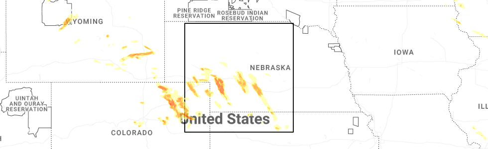
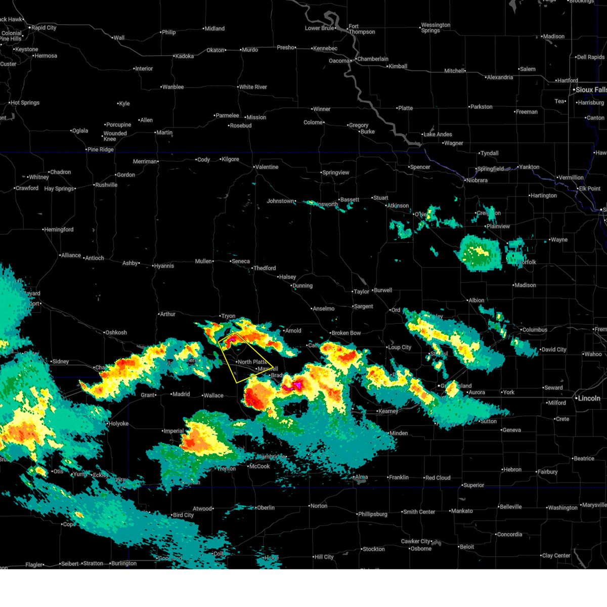
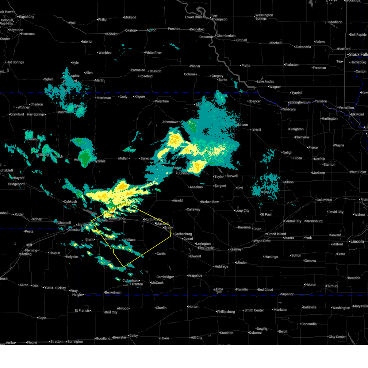
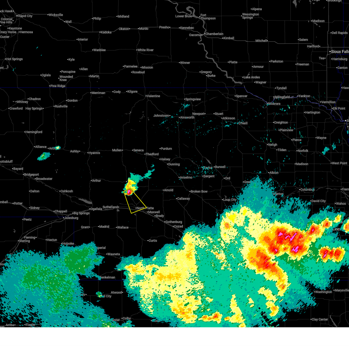
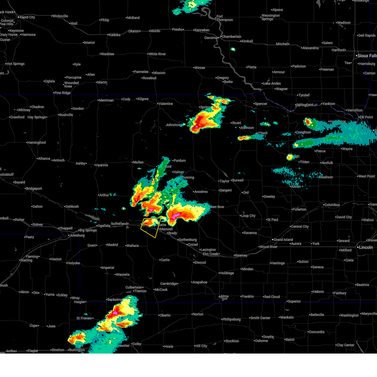
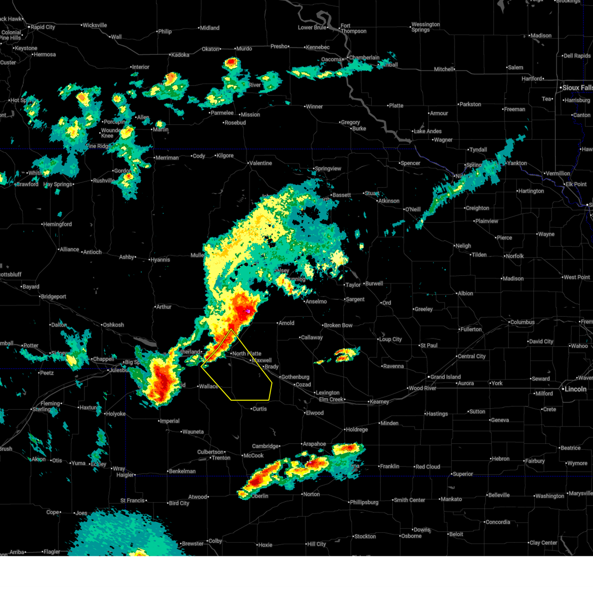
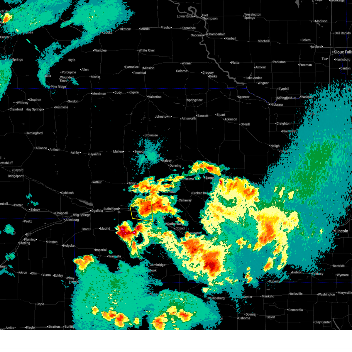
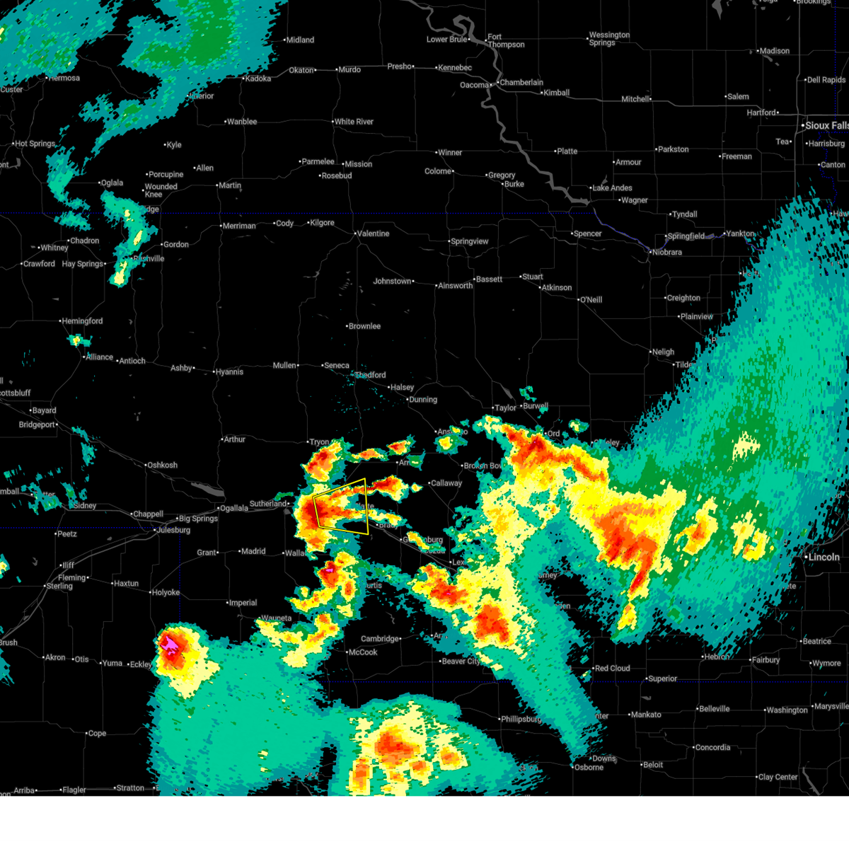
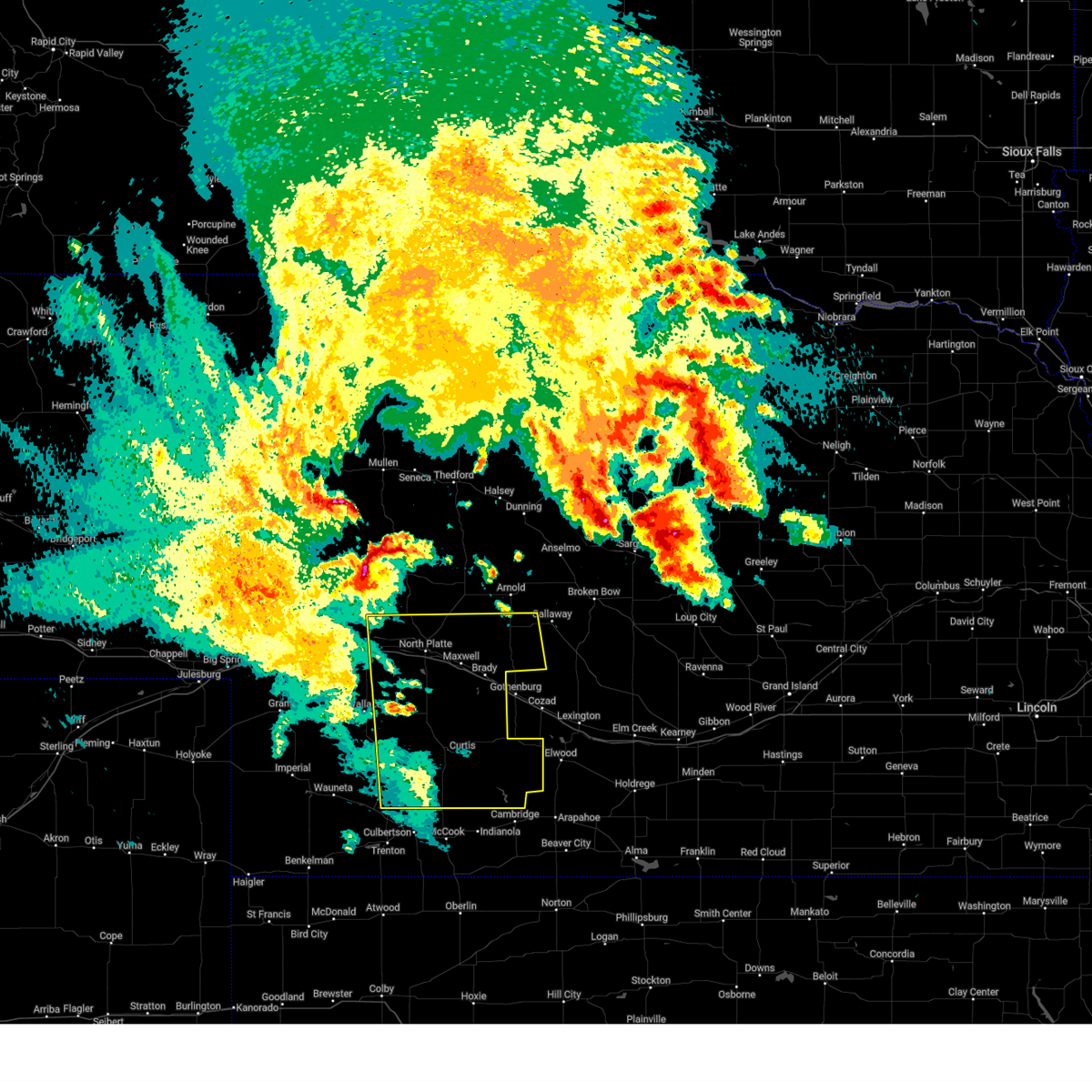
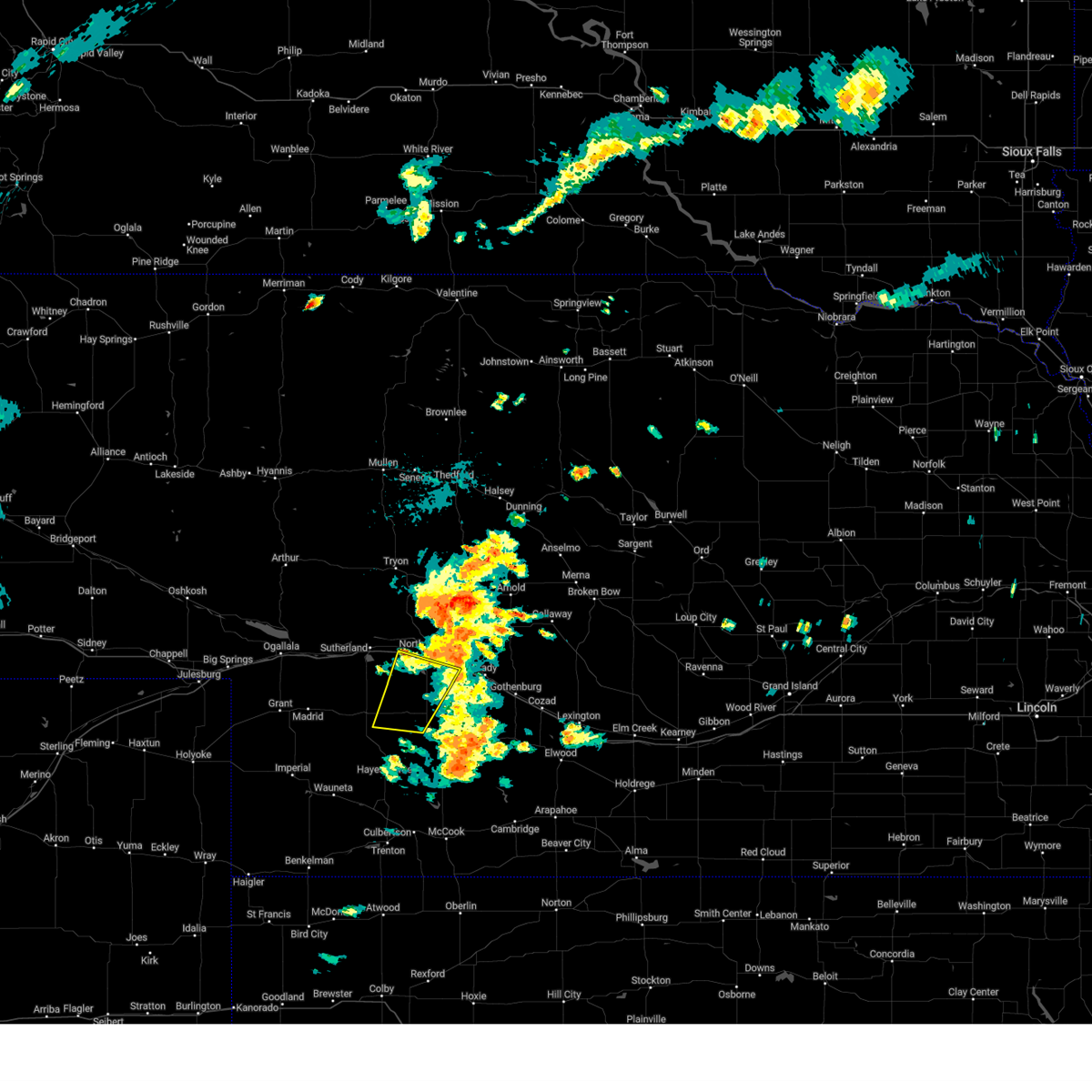
Hail Map for North Platte, NE
The North Platte, NE area has had 178 reports of on-the-ground hail by trained spotters, and has been under severe weather warnings 30 times during the past 12 months. Doppler radar has detected hail at or near North Platte, NE on 140 occasions, including 9 occasions during the past year.
| Name: | North Platte, NE |
| Where Located: | 0.7 miles S of North Platte, NE |
| Map: | Google Map for North Platte, NE |
| Population: | 24733 |
| Housing Units: | 11450 |
| More Info: | Search Google for North Platte, NE |
1
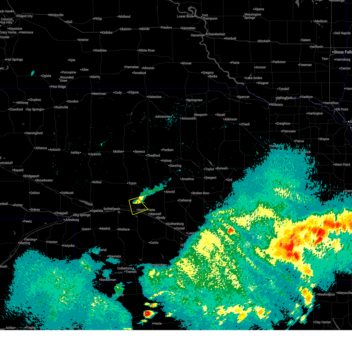
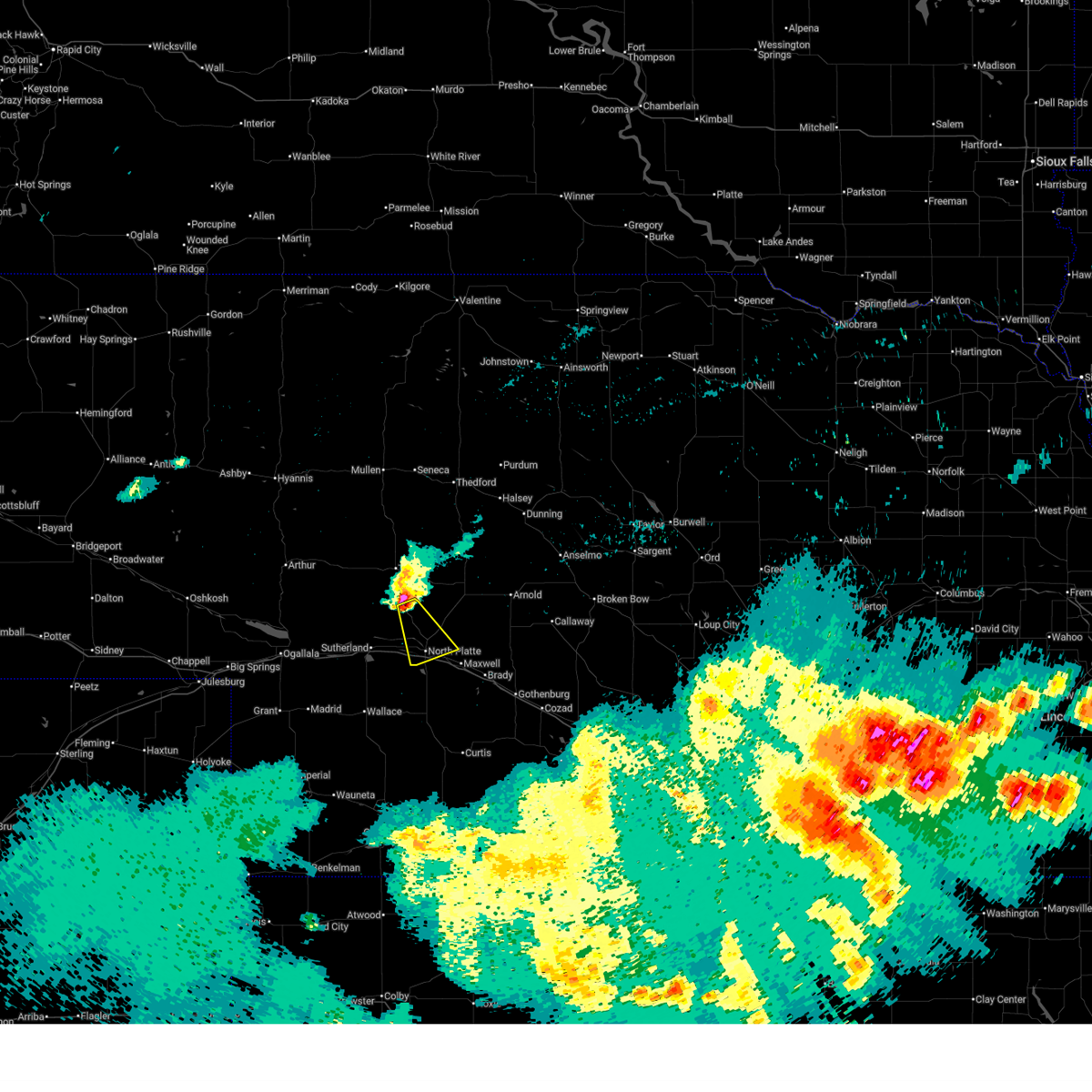
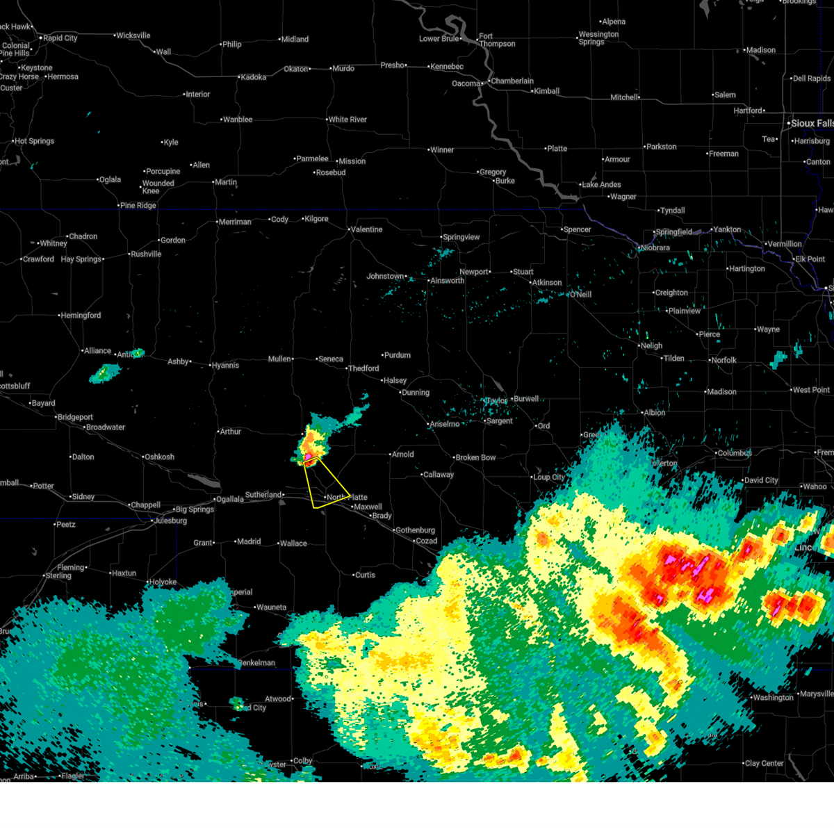
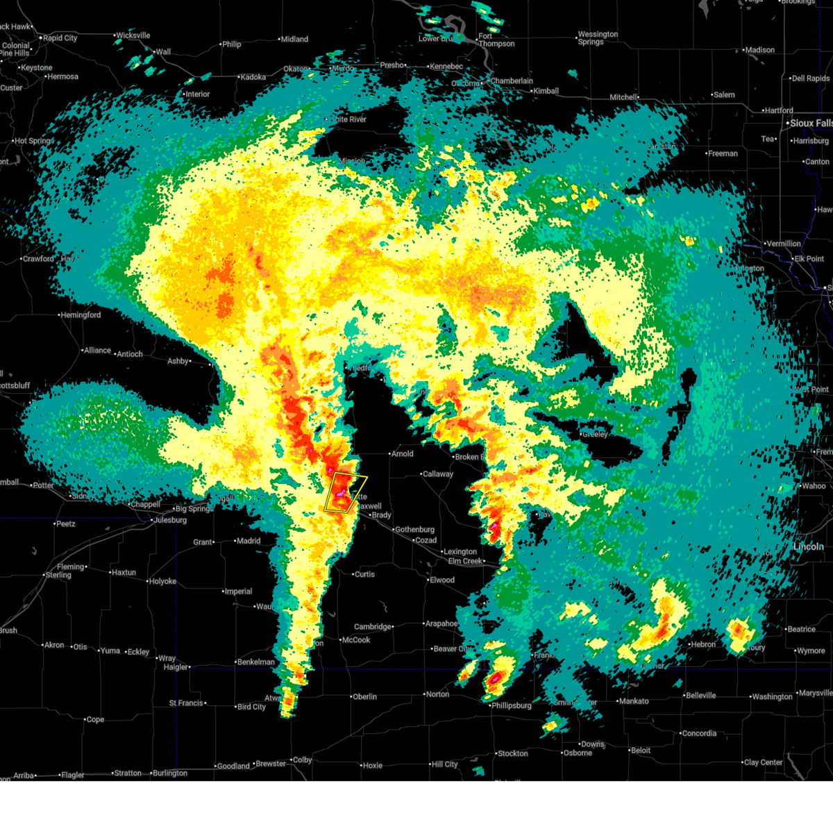
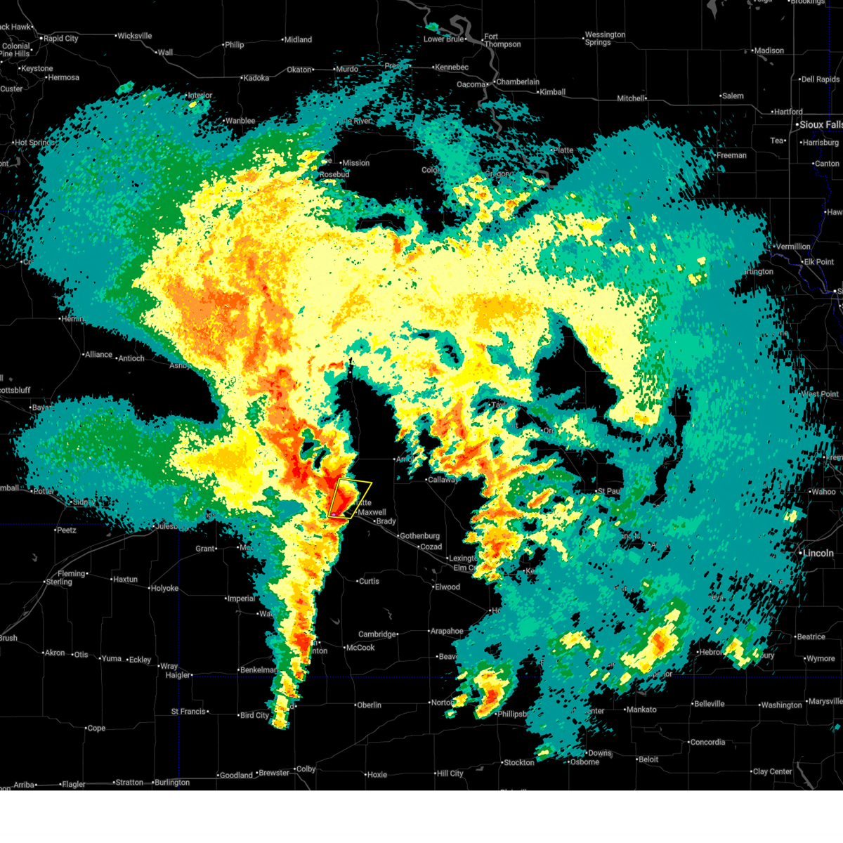
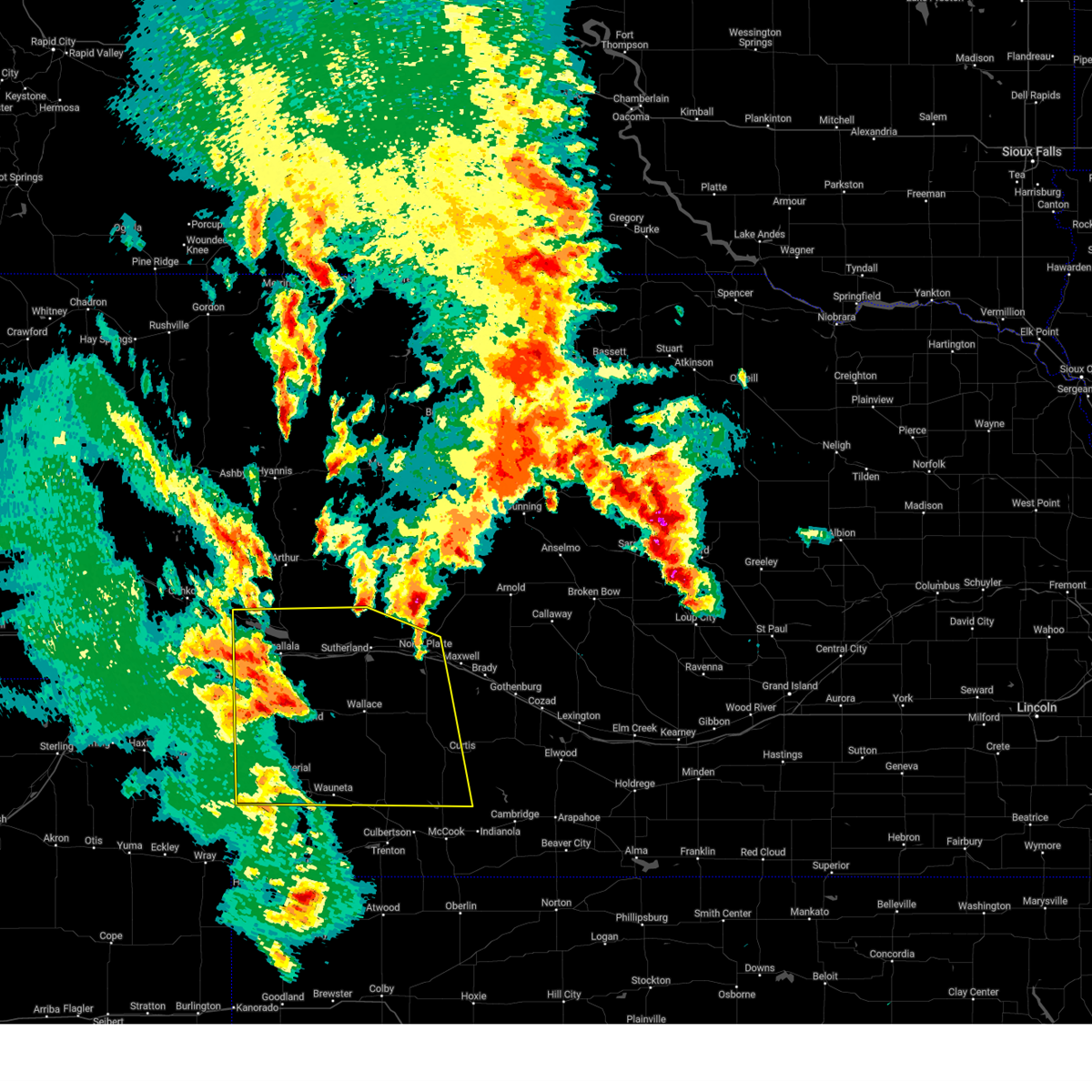
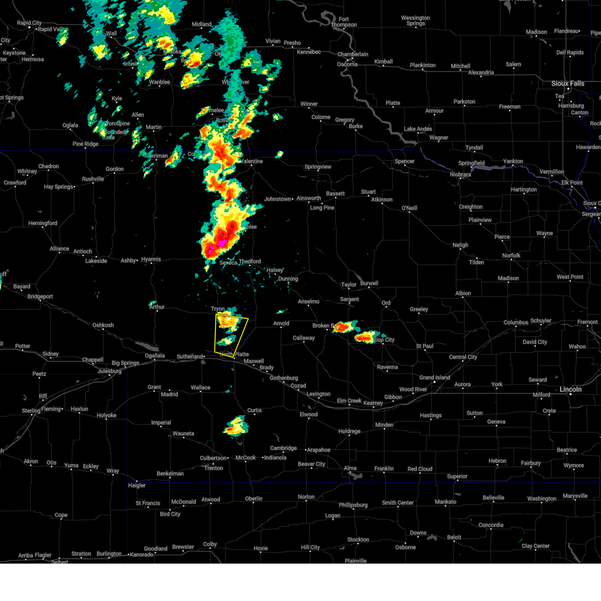
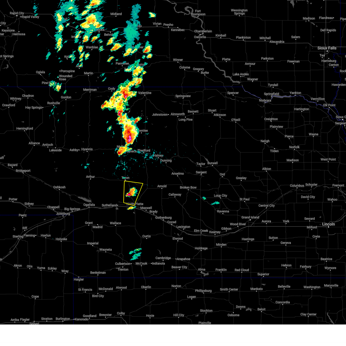
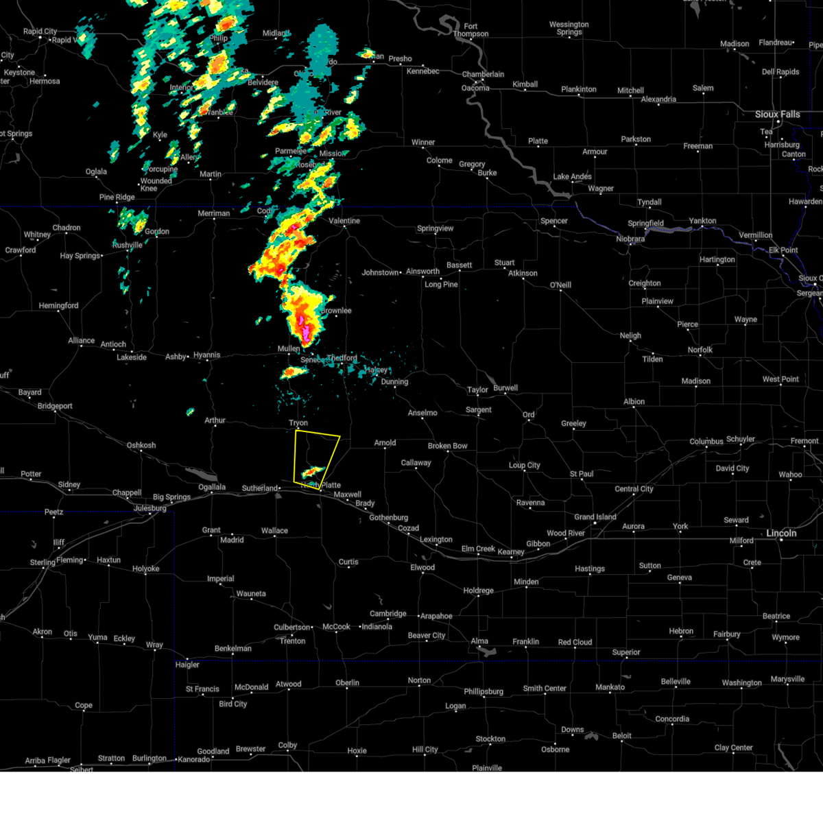
The Top Recent Hail Date for North Platte, NE is Wednesday, June 24, 2026 (13th out of 140)
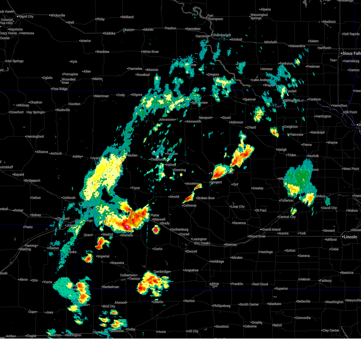
Hail and Wind Damage Spotted near North Platte, NE
| Date / Time | Report Details |
|---|---|
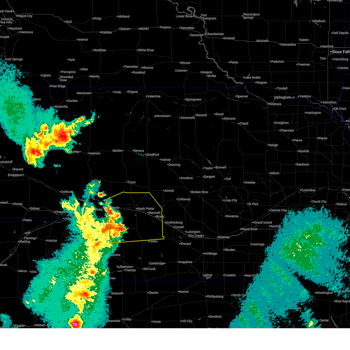
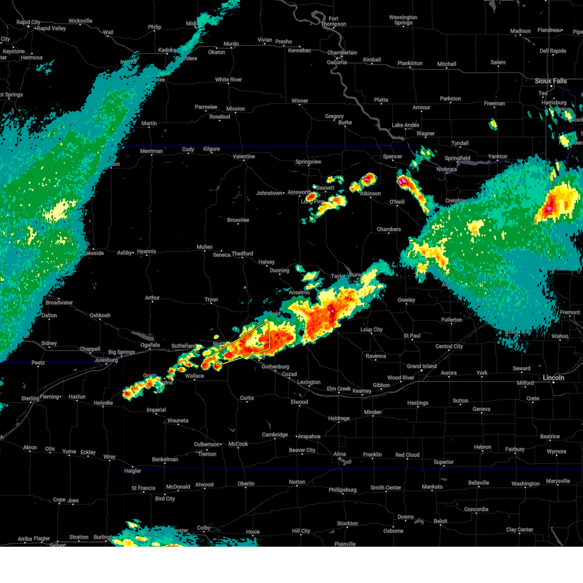
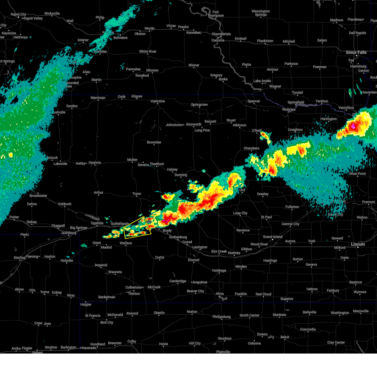
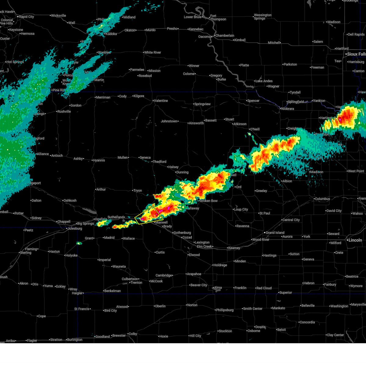
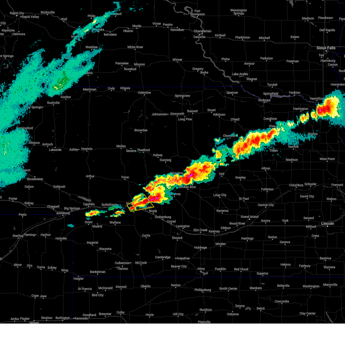
| 6/24/2026 9:50 PM CDT |
 The storm which prompted the warning has moved out of the area. therefore, the warning will be allowed to expire. a severe thunderstorm watch remains in effect until 200 am cdt for southwestern and west central nebraska. The storm which prompted the warning has moved out of the area. therefore, the warning will be allowed to expire. a severe thunderstorm watch remains in effect until 200 am cdt for southwestern and west central nebraska.
|
| 6/24/2026 9:40 PM CDT |
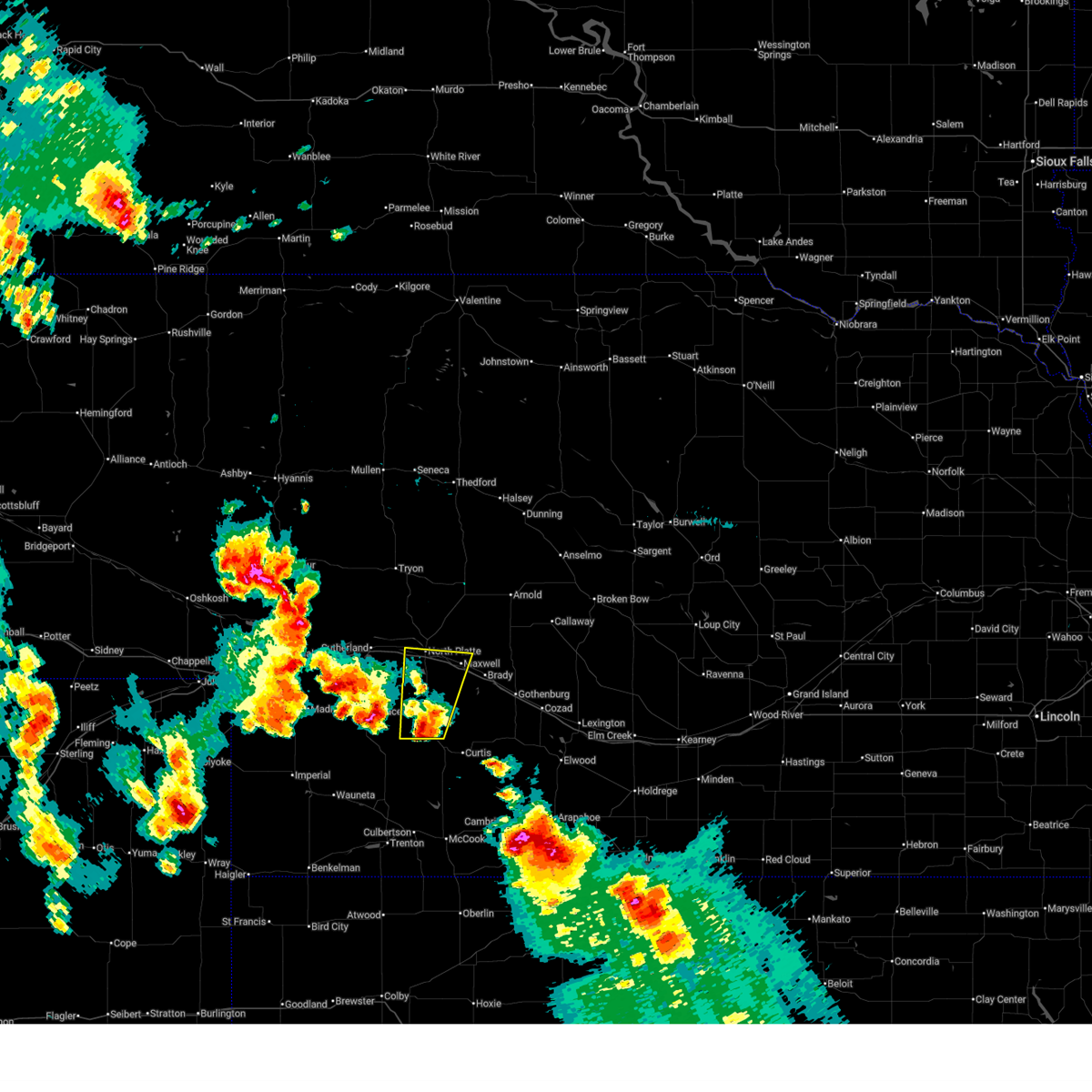
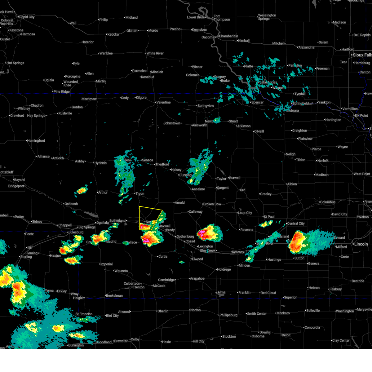
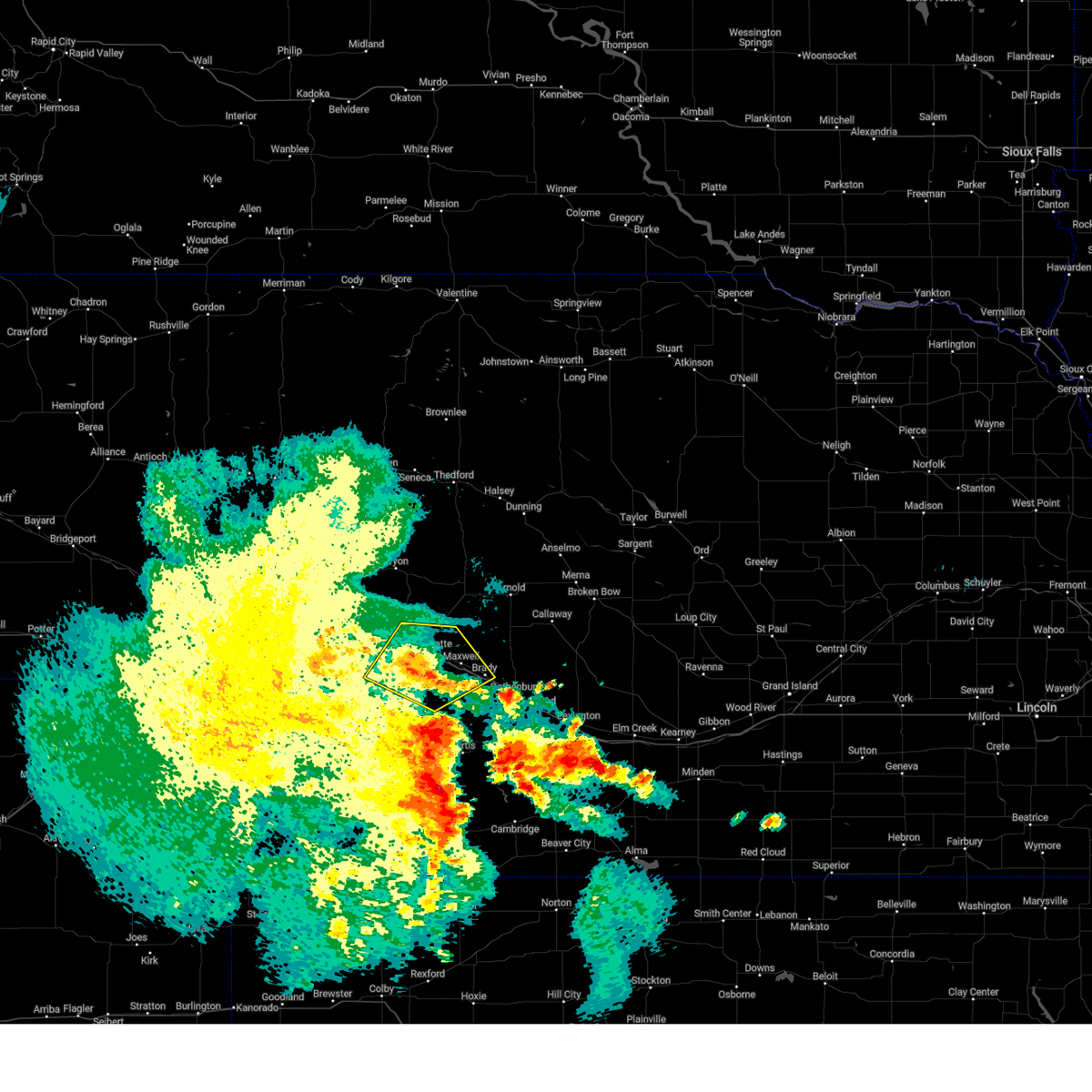
 Svrlbf the national weather service in north platte has issued a * severe thunderstorm warning for, southeastern lincoln county in southwestern nebraska, * until 1030 pm cdt. * at 940 pm cdt, a severe thunderstorm was located near maxwell, or 9 miles southeast of north platte, moving southeast at 35 mph (radar indicated). Hazards include 60 mph wind gusts and quarter size hail. Hail damage to vehicles is expected. Expect wind damage to roofs, siding, and trees. Svrlbf the national weather service in north platte has issued a * severe thunderstorm warning for, southeastern lincoln county in southwestern nebraska, * until 1030 pm cdt. * at 940 pm cdt, a severe thunderstorm was located near maxwell, or 9 miles southeast of north platte, moving southeast at 35 mph (radar indicated). Hazards include 60 mph wind gusts and quarter size hail. Hail damage to vehicles is expected. Expect wind damage to roofs, siding, and trees.
|
| 6/24/2026 9:39 PM CDT | Storm damage reported in lincoln county NE, 4.3 miles W of North Platte, NE |
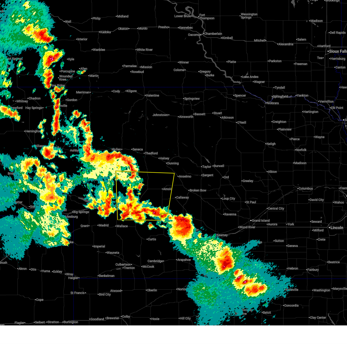
| 6/24/2026 9:33 PM CDT |
 At 932 pm cdt, a severe thunderstorm was located near north platte airport, moving southeast at 40 mph (radar indicated). Hazards include 60 mph wind gusts and half dollar size hail. Hail damage to vehicles is expected. expect wind damage to roofs, siding, and trees. this severe storm will be near, maxwell and north platte airport around 940 pm cdt. other locations impacted by this severe thunderstorm include keith. this includes the following highways, highway 97 between mile markers 1 and 14. interstate 80 in nebraska between mile markers 173 and 192. Highway 83 between mile markers 71 and 97. At 932 pm cdt, a severe thunderstorm was located near north platte airport, moving southeast at 40 mph (radar indicated). Hazards include 60 mph wind gusts and half dollar size hail. Hail damage to vehicles is expected. expect wind damage to roofs, siding, and trees. this severe storm will be near, maxwell and north platte airport around 940 pm cdt. other locations impacted by this severe thunderstorm include keith. this includes the following highways, highway 97 between mile markers 1 and 14. interstate 80 in nebraska between mile markers 173 and 192. Highway 83 between mile markers 71 and 97.
|
| 6/24/2026 9:10 PM CDT |
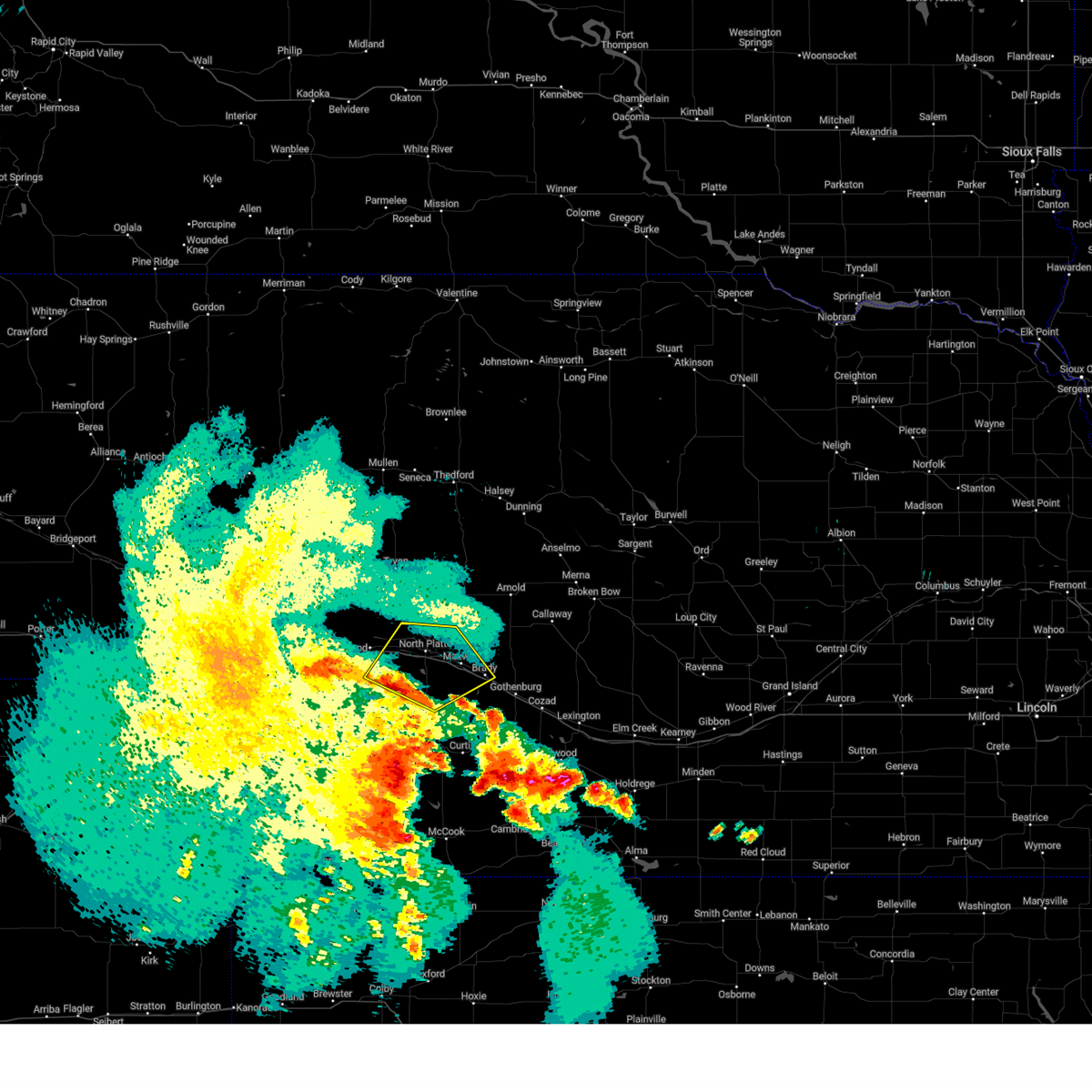
 Svrlbf the national weather service in north platte has issued a * severe thunderstorm warning for, northeastern lincoln county in southwestern nebraska, * until 1000 pm cdt. * at 909 pm cdt, a severe thunderstorm was located 12 miles south of ringgold, or 14 miles north of north platte, moving southeast at 30 mph (radar indicated). Hazards include 60 mph wind gusts and half dollar size hail. Hail damage to vehicles is expected. expect wind damage to roofs, siding, and trees. this severe thunderstorm will be near, north platte airport around 940 pm cdt. other locations impacted by this severe thunderstorm include keith. this includes the following highways, highway 97 between mile markers 1 and 14. interstate 80 in nebraska between mile markers 173 and 192. Highway 83 between mile markers 71 and 97. Svrlbf the national weather service in north platte has issued a * severe thunderstorm warning for, northeastern lincoln county in southwestern nebraska, * until 1000 pm cdt. * at 909 pm cdt, a severe thunderstorm was located 12 miles south of ringgold, or 14 miles north of north platte, moving southeast at 30 mph (radar indicated). Hazards include 60 mph wind gusts and half dollar size hail. Hail damage to vehicles is expected. expect wind damage to roofs, siding, and trees. this severe thunderstorm will be near, north platte airport around 940 pm cdt. other locations impacted by this severe thunderstorm include keith. this includes the following highways, highway 97 between mile markers 1 and 14. interstate 80 in nebraska between mile markers 173 and 192. Highway 83 between mile markers 71 and 97.
|
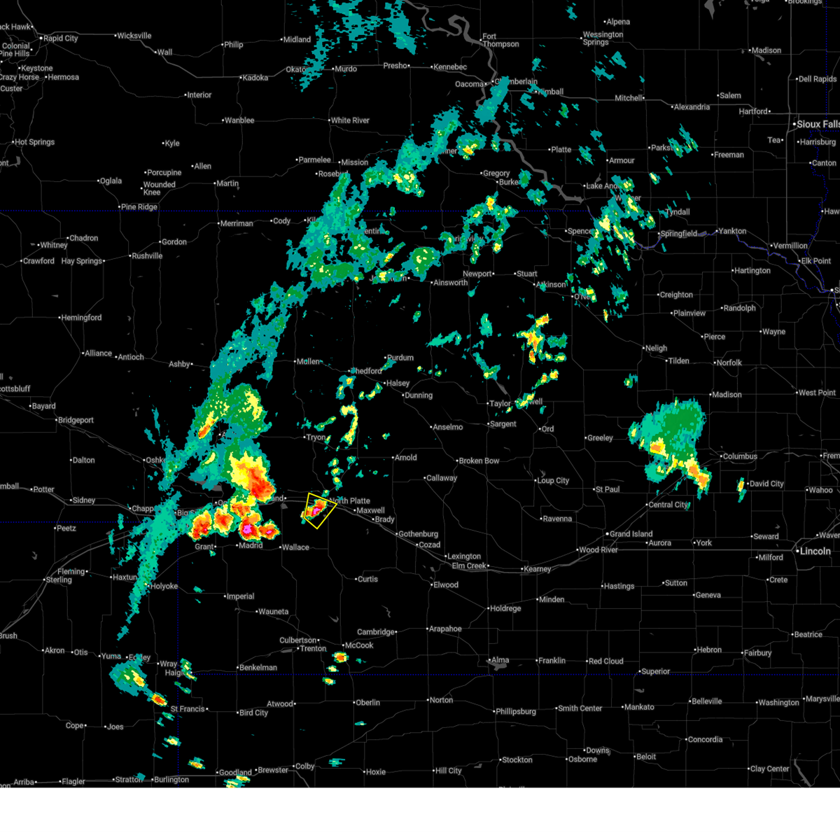
| 6/24/2026 8:41 PM CDT | Power poles down/broken via mping report. time estimated from rada in lincoln county NE, 11.5 miles N of North Platte, NE |
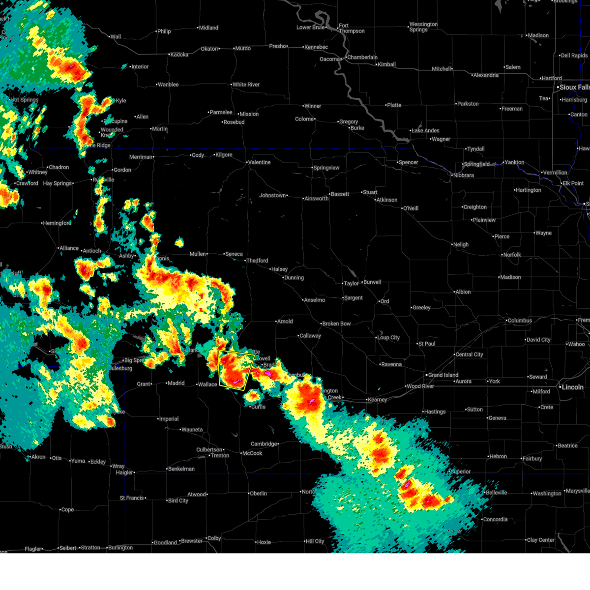
| 6/24/2026 8:39 PM CDT | Caller reported 8 inch diameter branch on healthy tree downed. time estimated from rada in lincoln county NE, 10.8 miles N of North Platte, NE |
| 6/24/2026 8:39 PM CDT | Quarter sized hail reported 10.8 miles N of North Platte, NE, time estimated from radar. |
| 6/24/2026 8:37 PM CDT | Report via social media. approximately 7 to 8 power poles snapped along highway 83. video from different report confirms this. time estimated from rada in lincoln county NE, 11.5 miles N of North Platte, NE |
| 6/24/2026 8:36 PM CDT | Quarter sized hail reported 7.8 miles NNW of North Platte, NE, time estimated from radar. |
| 6/24/2026 8:31 PM CDT |
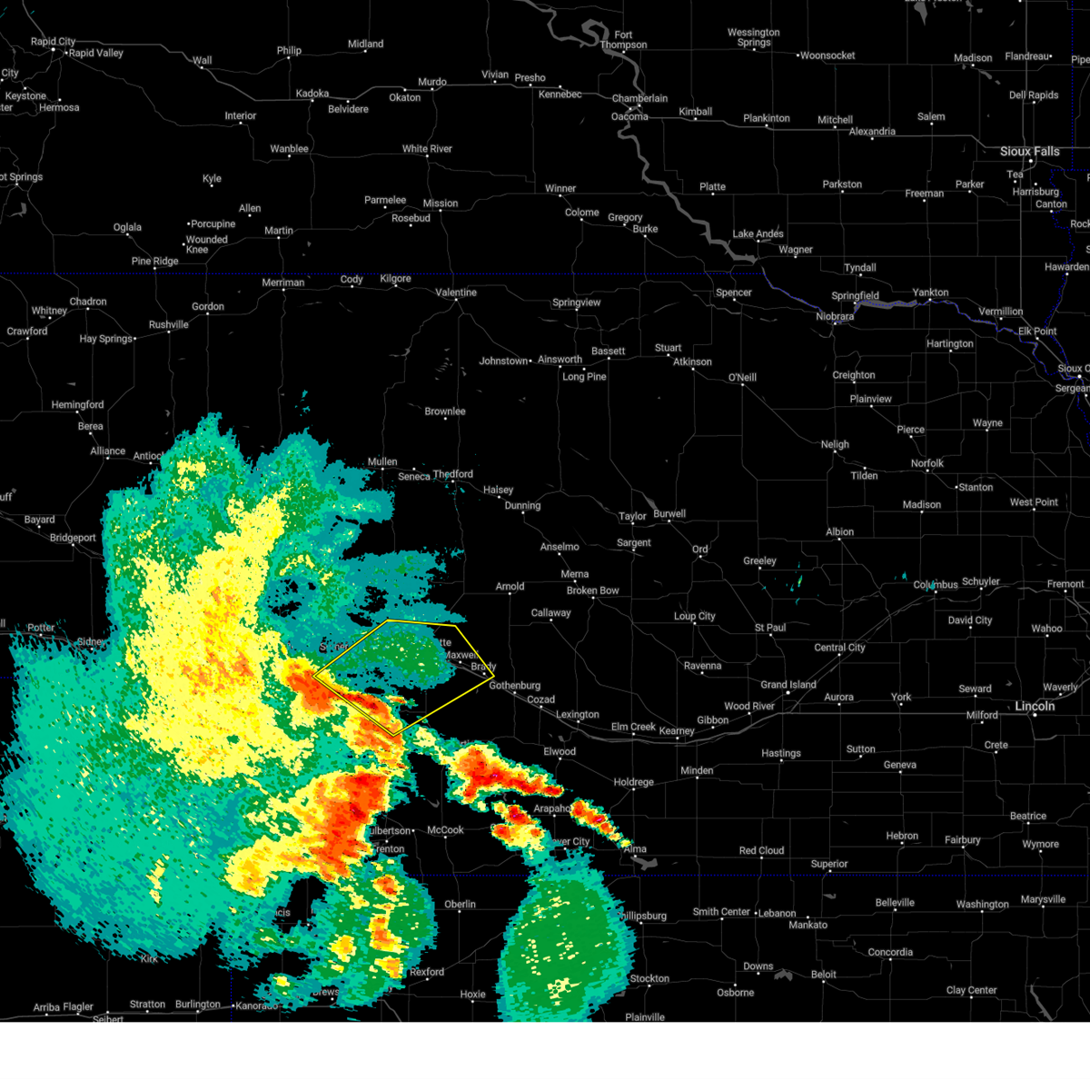
 Svrlbf the national weather service in north platte has issued a * severe thunderstorm warning for, southeastern lincoln county in southwestern nebraska, * until 915 pm cdt. * at 830 pm cdt, a severe thunderstorm was located over lake maloney state recreation area, moving southeast at 25 mph (radar indicated). Hazards include ping pong ball size hail and 60 mph wind gusts. People and animals outdoors will be injured. expect hail damage to roofs, siding, windows, and vehicles. Expect wind damage to roofs, siding, and trees. Svrlbf the national weather service in north platte has issued a * severe thunderstorm warning for, southeastern lincoln county in southwestern nebraska, * until 915 pm cdt. * at 830 pm cdt, a severe thunderstorm was located over lake maloney state recreation area, moving southeast at 25 mph (radar indicated). Hazards include ping pong ball size hail and 60 mph wind gusts. People and animals outdoors will be injured. expect hail damage to roofs, siding, windows, and vehicles. Expect wind damage to roofs, siding, and trees.
|
| 6/24/2026 8:30 PM CDT | Hen Egg sized hail reported 5.3 miles N of North Platte, NE, delayed report with photo via social media. time estimated from radar. |
| 6/24/2026 8:20 PM CDT | Quarter sized hail reported 3.2 miles W of North Platte, NE |
| 6/24/2026 8:09 PM CDT |
 Svrlbf the national weather service in north platte has issued a * severe thunderstorm warning for, central lincoln county in southwestern nebraska, * until 900 pm cdt. * at 809 pm cdt, severe thunderstorms were located along a line extending from hershey to near maxwell, moving southeast at 25 mph (radar indicated). Hazards include quarter size hail. damage to vehicles is expected Svrlbf the national weather service in north platte has issued a * severe thunderstorm warning for, central lincoln county in southwestern nebraska, * until 900 pm cdt. * at 809 pm cdt, severe thunderstorms were located along a line extending from hershey to near maxwell, moving southeast at 25 mph (radar indicated). Hazards include quarter size hail. damage to vehicles is expected
|
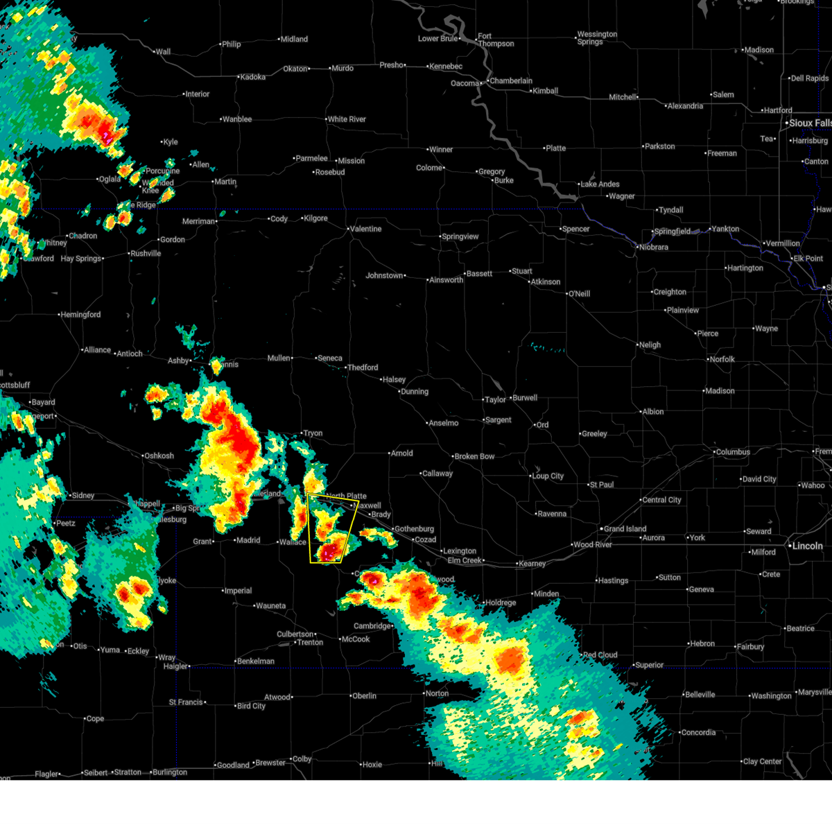
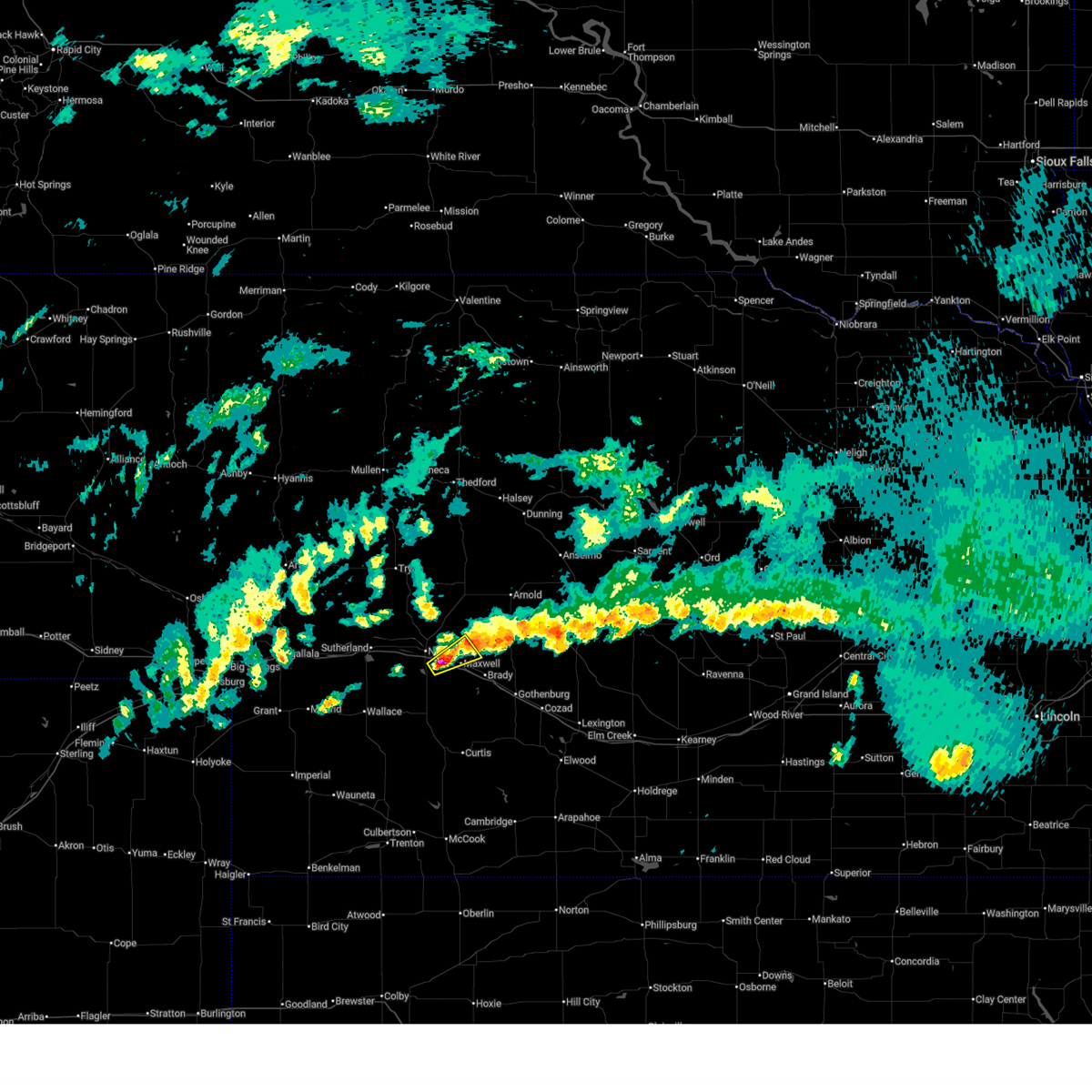
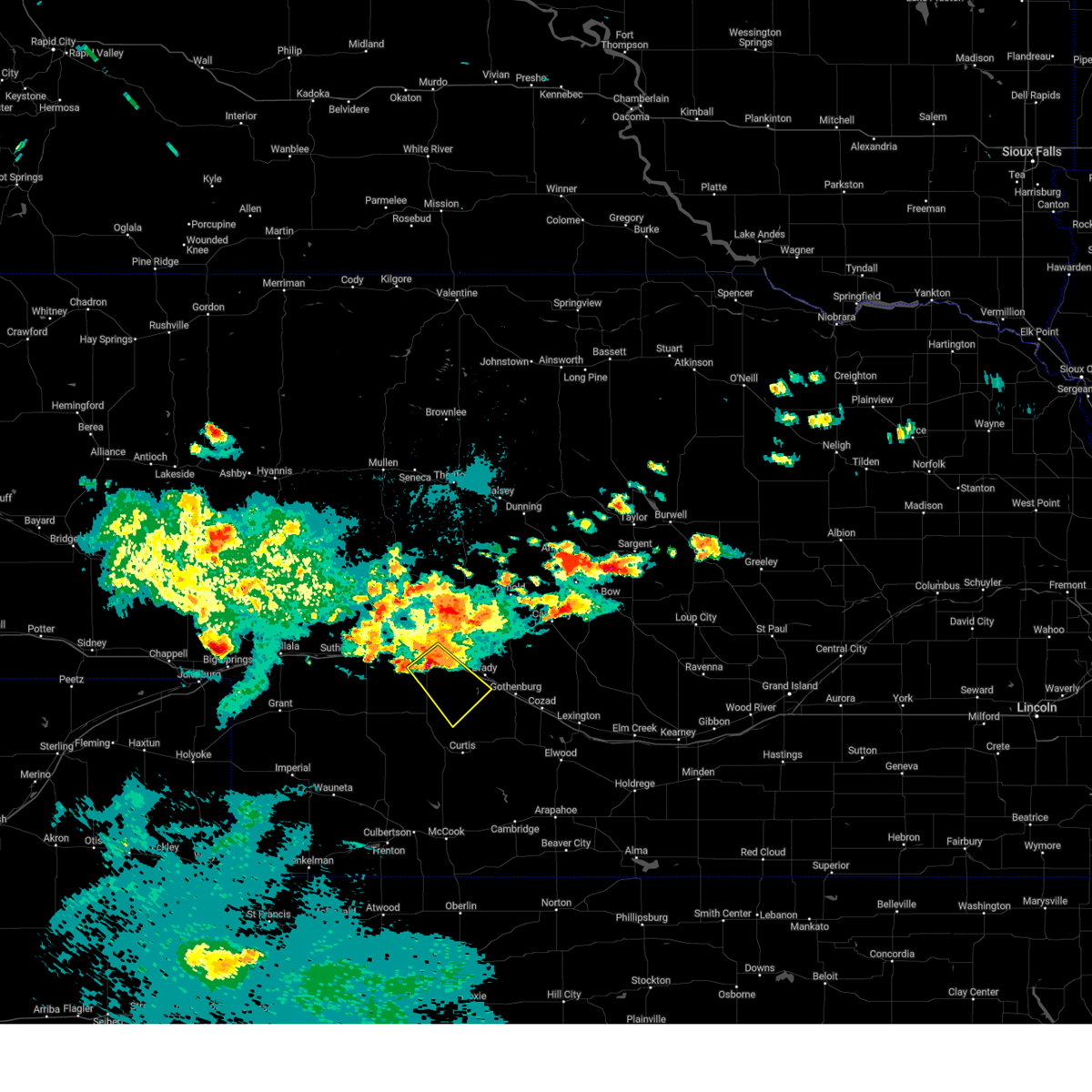
| 6/8/2026 10:50 PM CDT |
 At 1049 pm cdt, outflow from severe thunderstorms was located along a line extending from 10 miles south of ringgold to 7 miles north of brady to 10 miles southwest of gothenburg, moving east at 45 mph (radar indicated). Hazards include 60 mph wind gusts. Expect damage to roofs, siding, and trees. locations impacted include, north platte, sutherland, hershey, brady, wallace, maxwell, wellfleet, dickens, sutherland reservoir state recreation area, lake maloney state recreation area, north platte airport, keith, cottonwood canyon state wildlife management area, coker, hansen memorial reserve state wildlife management area, jeffrey canyon state wildlife management area, o'fallons, birdwood, and somerset. this includes the following highways, highway 97 between mile markers 1 and 16. interstate 80 in nebraska between mile markers 151 and 207. Highway 83 between mile markers 52 and 105. At 1049 pm cdt, outflow from severe thunderstorms was located along a line extending from 10 miles south of ringgold to 7 miles north of brady to 10 miles southwest of gothenburg, moving east at 45 mph (radar indicated). Hazards include 60 mph wind gusts. Expect damage to roofs, siding, and trees. locations impacted include, north platte, sutherland, hershey, brady, wallace, maxwell, wellfleet, dickens, sutherland reservoir state recreation area, lake maloney state recreation area, north platte airport, keith, cottonwood canyon state wildlife management area, coker, hansen memorial reserve state wildlife management area, jeffrey canyon state wildlife management area, o'fallons, birdwood, and somerset. this includes the following highways, highway 97 between mile markers 1 and 16. interstate 80 in nebraska between mile markers 151 and 207. Highway 83 between mile markers 52 and 105.
|
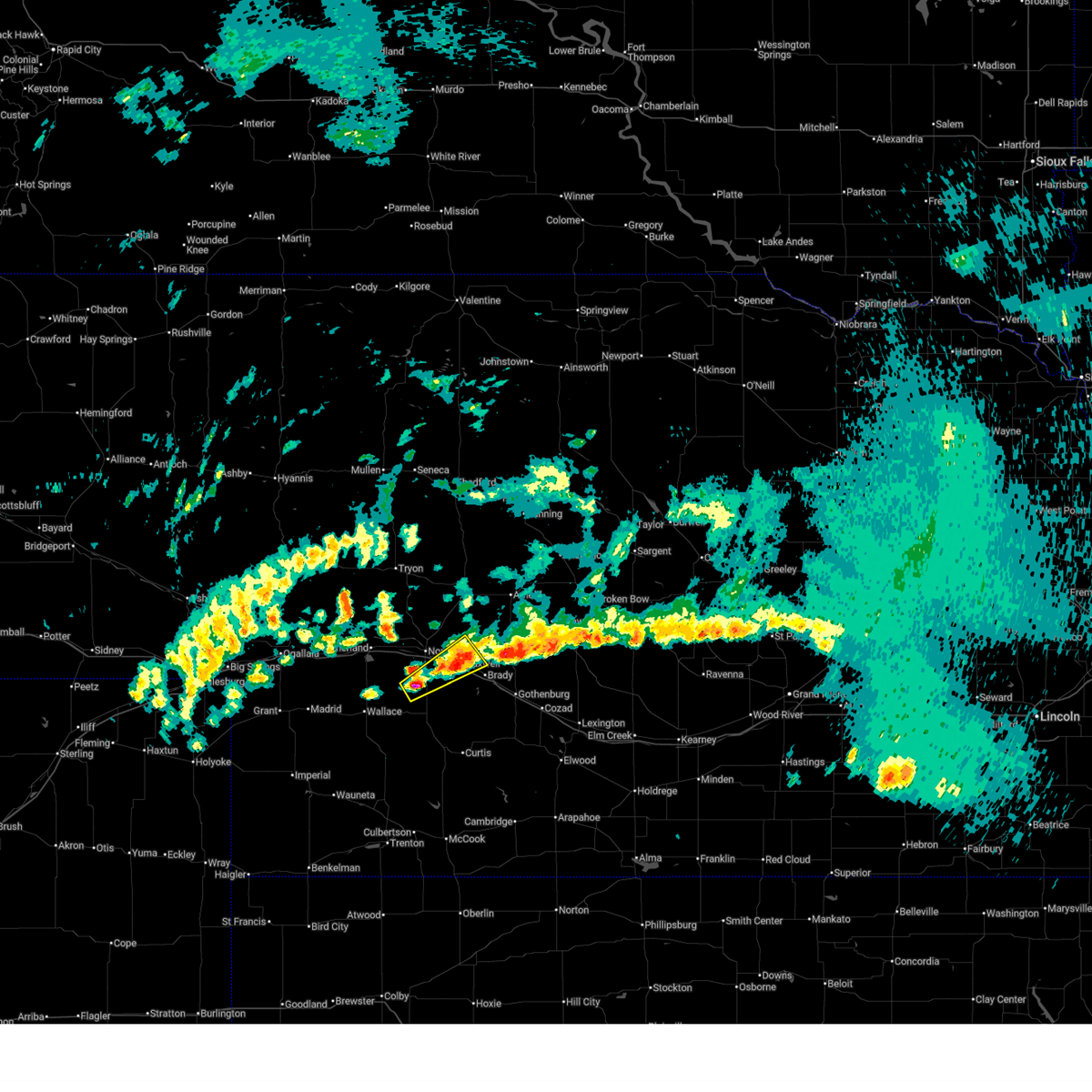
| 6/8/2026 10:10 PM CDT |
 Svrlbf the national weather service in north platte has issued a * severe thunderstorm warning for, northwestern frontier county in southwestern nebraska, eastern perkins county in southwestern nebraska, southeastern keith county in southwestern nebraska, lincoln county in southwestern nebraska, northern hayes county in southwestern nebraska, * until 1115 pm cdt/1015 pm mdt/. * at 1010 pm cdt/910 pm mdt/, severe thunderstorms were located along a line extending from near sutherland to near dickens to 10 miles north of hayes center, moving northeast at 40 mph (radar indicated). Hazards include 60 mph wind gusts. expect damage to roofs, siding, and trees Svrlbf the national weather service in north platte has issued a * severe thunderstorm warning for, northwestern frontier county in southwestern nebraska, eastern perkins county in southwestern nebraska, southeastern keith county in southwestern nebraska, lincoln county in southwestern nebraska, northern hayes county in southwestern nebraska, * until 1115 pm cdt/1015 pm mdt/. * at 1010 pm cdt/910 pm mdt/, severe thunderstorms were located along a line extending from near sutherland to near dickens to 10 miles north of hayes center, moving northeast at 40 mph (radar indicated). Hazards include 60 mph wind gusts. expect damage to roofs, siding, and trees
|
| 5/30/2026 7:59 PM CDT |
 Svrlbf the national weather service in north platte has issued a * severe thunderstorm warning for, northern lincoln county in southwestern nebraska, logan county in west central nebraska, eastern mcpherson county in west central nebraska, western custer county in central nebraska, * until 845 pm cdt. * at 759 pm cdt, severe thunderstorms were located along a line extending from near hershey to 7 miles northeast of brady, moving north at 40 mph (radar indicated). Hazards include ping pong ball size hail and 60 mph wind gusts. People and animals outdoors will be injured. expect hail damage to roofs, siding, windows, and vehicles. Expect wind damage to roofs, siding, and trees. Svrlbf the national weather service in north platte has issued a * severe thunderstorm warning for, northern lincoln county in southwestern nebraska, logan county in west central nebraska, eastern mcpherson county in west central nebraska, western custer county in central nebraska, * until 845 pm cdt. * at 759 pm cdt, severe thunderstorms were located along a line extending from near hershey to 7 miles northeast of brady, moving north at 40 mph (radar indicated). Hazards include ping pong ball size hail and 60 mph wind gusts. People and animals outdoors will be injured. expect hail damage to roofs, siding, windows, and vehicles. Expect wind damage to roofs, siding, and trees.
|
| 5/30/2026 7:49 PM CDT |
 At 748 pm cdt, a severe thunderstorm was located 10 miles north of wellfleet, or 16 miles south of north platte, moving north at 25 mph (radar indicated. at 735 pm cdt, two inch hail was reported five miles north of wellfleet). Hazards include tennis ball size hail and 60 mph wind gusts. People and animals outdoors will be injured. expect hail damage to roofs, siding, windows, and vehicles. expect wind damage to roofs, siding, and trees. locations impacted include, north platte, maxwell, lake maloney state recreation area, north platte airport, keith, cottonwood canyon state wildlife management area, birdwood, and somerset. this includes the following highways, interstate 80 in nebraska between mile markers 170 and 192. Highway 83 between mile markers 61 and 83. At 748 pm cdt, a severe thunderstorm was located 10 miles north of wellfleet, or 16 miles south of north platte, moving north at 25 mph (radar indicated. at 735 pm cdt, two inch hail was reported five miles north of wellfleet). Hazards include tennis ball size hail and 60 mph wind gusts. People and animals outdoors will be injured. expect hail damage to roofs, siding, windows, and vehicles. expect wind damage to roofs, siding, and trees. locations impacted include, north platte, maxwell, lake maloney state recreation area, north platte airport, keith, cottonwood canyon state wildlife management area, birdwood, and somerset. this includes the following highways, interstate 80 in nebraska between mile markers 170 and 192. Highway 83 between mile markers 61 and 83.
|
| 5/30/2026 7:24 PM CDT |
 Svrlbf the national weather service in north platte has issued a * severe thunderstorm warning for, southeastern lincoln county in southwestern nebraska, * until 815 pm cdt. * at 723 pm cdt, a severe thunderstorm was located over wellfleet, or 14 miles northwest of curtis, moving north at 25 mph (radar indicated). Hazards include two inch hail and 60 mph wind gusts. People and animals outdoors will be injured. expect hail damage to roofs, siding, windows, and vehicles. Expect wind damage to roofs, siding, and trees. Svrlbf the national weather service in north platte has issued a * severe thunderstorm warning for, southeastern lincoln county in southwestern nebraska, * until 815 pm cdt. * at 723 pm cdt, a severe thunderstorm was located over wellfleet, or 14 miles northwest of curtis, moving north at 25 mph (radar indicated). Hazards include two inch hail and 60 mph wind gusts. People and animals outdoors will be injured. expect hail damage to roofs, siding, windows, and vehicles. Expect wind damage to roofs, siding, and trees.
|
| 5/30/2026 6:44 PM CDT |
 Svrlbf the national weather service in north platte has issued a * severe thunderstorm warning for, southeastern lincoln county in southwestern nebraska, * until 730 pm cdt. * at 643 pm cdt, a severe thunderstorm was located near wellfleet, or 17 miles northwest of curtis, moving north at 30 mph (radar indicated). Hazards include golf ball size hail and 60 mph wind gusts. People and animals outdoors will be injured. expect hail damage to roofs, siding, windows, and vehicles. Expect wind damage to roofs, siding, and trees. Svrlbf the national weather service in north platte has issued a * severe thunderstorm warning for, southeastern lincoln county in southwestern nebraska, * until 730 pm cdt. * at 643 pm cdt, a severe thunderstorm was located near wellfleet, or 17 miles northwest of curtis, moving north at 30 mph (radar indicated). Hazards include golf ball size hail and 60 mph wind gusts. People and animals outdoors will be injured. expect hail damage to roofs, siding, windows, and vehicles. Expect wind damage to roofs, siding, and trees.
|
| 5/17/2026 2:37 AM CDT |
 At 236 am cdt, a severe thunderstorm was located immediately southeast of north platte airport, or 7 miles east of north platte, moving northeast at 40 mph (radar indicated). Hazards include quarter size hail. Damage to vehicles is expected. locations impacted include, maxwell, north platte airport, and keith. This includes interstate 80 in nebraska between mile markers 180 and 188. At 236 am cdt, a severe thunderstorm was located immediately southeast of north platte airport, or 7 miles east of north platte, moving northeast at 40 mph (radar indicated). Hazards include quarter size hail. Damage to vehicles is expected. locations impacted include, maxwell, north platte airport, and keith. This includes interstate 80 in nebraska between mile markers 180 and 188.
|
| 5/17/2026 2:16 AM CDT |
 Svrlbf the national weather service in north platte has issued a * severe thunderstorm warning for, central lincoln county in southwestern nebraska, * until 300 am cdt. * at 216 am cdt, a severe thunderstorm was located near lake maloney state recreation area, or 10 miles south of north platte, moving northeast at 40 mph (radar indicated). Hazards include quarter size hail. damage to vehicles is expected Svrlbf the national weather service in north platte has issued a * severe thunderstorm warning for, central lincoln county in southwestern nebraska, * until 300 am cdt. * at 216 am cdt, a severe thunderstorm was located near lake maloney state recreation area, or 10 miles south of north platte, moving northeast at 40 mph (radar indicated). Hazards include quarter size hail. damage to vehicles is expected
|
| 5/16/2026 5:09 PM CDT |
 At 508 pm cdt, a severe thunderstorm was located near north platte, moving north at 25 mph (radar indicated). Hazards include quarter size hail. Damage to vehicles is expected. locations impacted include, north platte and north platte airport. this includes the following highways, highway 97 between mile markers 1 and 5. interstate 80 in nebraska between mile markers 174 and 178. Highway 83 between mile markers 82 and 100. At 508 pm cdt, a severe thunderstorm was located near north platte, moving north at 25 mph (radar indicated). Hazards include quarter size hail. Damage to vehicles is expected. locations impacted include, north platte and north platte airport. this includes the following highways, highway 97 between mile markers 1 and 5. interstate 80 in nebraska between mile markers 174 and 178. Highway 83 between mile markers 82 and 100.
|
| 5/16/2026 4:52 PM CDT | Quarter sized hail reported 1.1 miles SSE of North Platte, NE |
| 5/16/2026 4:51 PM CDT |
 Svrlbf the national weather service in north platte has issued a * severe thunderstorm warning for, north central lincoln county in southwestern nebraska, * until 530 pm cdt. * at 451 pm cdt, a severe thunderstorm was located over north platte, moving northeast at 30 mph (radar indicated). Hazards include quarter size hail. damage to vehicles is expected Svrlbf the national weather service in north platte has issued a * severe thunderstorm warning for, north central lincoln county in southwestern nebraska, * until 530 pm cdt. * at 451 pm cdt, a severe thunderstorm was located over north platte, moving northeast at 30 mph (radar indicated). Hazards include quarter size hail. damage to vehicles is expected
|
| 2/25/2026 3:11 PM CST |
 Svrlbf the national weather service in north platte has issued a * severe thunderstorm warning for, northern frontier county in southwestern nebraska, southern lincoln county in southwestern nebraska, southwestern custer county in central nebraska, * until 400 pm cst. * at 310 pm cst, severe thunderstorms were located along a line extending from 9 miles northeast of brady to near dickens, moving southeast at 40 mph (radar indicated). Hazards include 60 mph wind gusts. expect damage to roofs, siding, and trees Svrlbf the national weather service in north platte has issued a * severe thunderstorm warning for, northern frontier county in southwestern nebraska, southern lincoln county in southwestern nebraska, southwestern custer county in central nebraska, * until 400 pm cst. * at 310 pm cst, severe thunderstorms were located along a line extending from 9 miles northeast of brady to near dickens, moving southeast at 40 mph (radar indicated). Hazards include 60 mph wind gusts. expect damage to roofs, siding, and trees
|
| 2/25/2026 3:01 PM CST |
 the severe thunderstorm warning has been cancelled and is no longer in effect the severe thunderstorm warning has been cancelled and is no longer in effect
|
| 2/25/2026 3:01 PM CST |
 At 301 pm cst/201 pm mst/, severe thunderstorms were located along a line extending from north platte airport to near wallace, moving southeast at 50 mph (radar indicated). Hazards include 60 mph wind gusts. Expect damage to roofs, siding, and trees. locations impacted include, north platte, hayes center, sutherland, hershey, brady, wallace, maxwell, madrid, elsie, wellfleet, dickens, sutherland reservoir state recreation area, lake maloney state recreation area, north platte airport, keith, cottonwood canyon state wildlife management area, grainton, jeffrey canyon state wildlife management area, o'fallons, and hayes center state wildlife management area. this includes the following highways, highway 97 between mile markers 1 and 7. interstate 80 in nebraska between mile markers 158 and 207. Highway 83 between mile markers 50 and 90. At 301 pm cst/201 pm mst/, severe thunderstorms were located along a line extending from north platte airport to near wallace, moving southeast at 50 mph (radar indicated). Hazards include 60 mph wind gusts. Expect damage to roofs, siding, and trees. locations impacted include, north platte, hayes center, sutherland, hershey, brady, wallace, maxwell, madrid, elsie, wellfleet, dickens, sutherland reservoir state recreation area, lake maloney state recreation area, north platte airport, keith, cottonwood canyon state wildlife management area, grainton, jeffrey canyon state wildlife management area, o'fallons, and hayes center state wildlife management area. this includes the following highways, highway 97 between mile markers 1 and 7. interstate 80 in nebraska between mile markers 158 and 207. Highway 83 between mile markers 50 and 90.
|
| 2/25/2026 3:00 PM CST | Pws-knenorth15 in lincoln county NE, 5.4 miles ESE of North Platte, NE |
| 2/25/2026 2:34 PM CST |
 Svrlbf the national weather service in north platte has issued a * severe thunderstorm warning for, northwestern frontier county in southwestern nebraska, eastern perkins county in southwestern nebraska, southeastern keith county in southwestern nebraska, lincoln county in southwestern nebraska, northern hayes county in southwestern nebraska, * until 315 pm cst/215 pm mst/. * at 233 pm cst/133 pm mst/, severe thunderstorms were located along a line extending from 11 miles north of sutherland to near ogallala, moving southeast at 60 mph (radar indicated). Hazards include 60 mph wind gusts. expect damage to roofs, siding, and trees Svrlbf the national weather service in north platte has issued a * severe thunderstorm warning for, northwestern frontier county in southwestern nebraska, eastern perkins county in southwestern nebraska, southeastern keith county in southwestern nebraska, lincoln county in southwestern nebraska, northern hayes county in southwestern nebraska, * until 315 pm cst/215 pm mst/. * at 233 pm cst/133 pm mst/, severe thunderstorms were located along a line extending from 11 miles north of sutherland to near ogallala, moving southeast at 60 mph (radar indicated). Hazards include 60 mph wind gusts. expect damage to roofs, siding, and trees
|
| 8/10/2025 1:35 AM CDT |
 The storm which prompted the warning has weakened below severe limits, and no longer poses an immediate threat to life or property. therefore, the warning will be allowed to expire. The storm which prompted the warning has weakened below severe limits, and no longer poses an immediate threat to life or property. therefore, the warning will be allowed to expire.
|
| 8/10/2025 1:21 AM CDT |
 At 121 am cdt, a severe thunderstorm was located 8 miles north of north platte, moving southeast at 25 mph (radar indicated). Hazards include 60 mph wind gusts and quarter size hail. Hail damage to vehicles is expected. expect wind damage to roofs, siding, and trees. locations impacted include, north platte, north platte airport, and birdwood. this includes the following highways, highway 97 between mile markers 1 and 9. interstate 80 in nebraska between mile markers 172 and 180. Highway 83 between mile markers 80 and 93. At 121 am cdt, a severe thunderstorm was located 8 miles north of north platte, moving southeast at 25 mph (radar indicated). Hazards include 60 mph wind gusts and quarter size hail. Hail damage to vehicles is expected. expect wind damage to roofs, siding, and trees. locations impacted include, north platte, north platte airport, and birdwood. this includes the following highways, highway 97 between mile markers 1 and 9. interstate 80 in nebraska between mile markers 172 and 180. Highway 83 between mile markers 80 and 93.
|
| 8/10/2025 1:10 AM CDT |
 At 110 am cdt, a severe thunderstorm was located 12 miles north of north platte, moving southeast at 25 mph (radar indicated). Hazards include 60 mph wind gusts and quarter size hail. Hail damage to vehicles is expected. expect wind damage to roofs, siding, and trees. locations impacted include, north platte and north platte airport. this includes the following highways, highway 97 between mile markers 1 and 16. interstate 80 in nebraska between mile markers 172 and 180. Highway 83 between mile markers 80 and 93. At 110 am cdt, a severe thunderstorm was located 12 miles north of north platte, moving southeast at 25 mph (radar indicated). Hazards include 60 mph wind gusts and quarter size hail. Hail damage to vehicles is expected. expect wind damage to roofs, siding, and trees. locations impacted include, north platte and north platte airport. this includes the following highways, highway 97 between mile markers 1 and 16. interstate 80 in nebraska between mile markers 172 and 180. Highway 83 between mile markers 80 and 93.
|
| 8/10/2025 1:10 AM CDT |
 the severe thunderstorm warning has been cancelled and is no longer in effect the severe thunderstorm warning has been cancelled and is no longer in effect
|
| 8/10/2025 12:57 AM CDT |
 Svrlbf the national weather service in north platte has issued a * severe thunderstorm warning for, north central lincoln county in southwestern nebraska, south central mcpherson county in west central nebraska, * until 145 am cdt. * at 1257 am cdt, a severe thunderstorm was located 12 miles southwest of ringgold, or 14 miles south of tryon, moving southeast at 30 mph (radar indicated). Hazards include 60 mph wind gusts and half dollar size hail. Hail damage to vehicles is expected. Expect wind damage to roofs, siding, and trees. Svrlbf the national weather service in north platte has issued a * severe thunderstorm warning for, north central lincoln county in southwestern nebraska, south central mcpherson county in west central nebraska, * until 145 am cdt. * at 1257 am cdt, a severe thunderstorm was located 12 miles southwest of ringgold, or 14 miles south of tryon, moving southeast at 30 mph (radar indicated). Hazards include 60 mph wind gusts and half dollar size hail. Hail damage to vehicles is expected. Expect wind damage to roofs, siding, and trees.
|
| 7/23/2025 4:13 PM CDT |
 The storm which prompted the warning has weakened below severe limits, and no longer poses an immediate threat to life or property. therefore, the warning will be allowed to expire. however, small hail and heavy rain are still possible with this thunderstorm. remember, a severe thunderstorm warning still remains in effect for southwestern lincoln county through 430 pm cdt. The storm which prompted the warning has weakened below severe limits, and no longer poses an immediate threat to life or property. therefore, the warning will be allowed to expire. however, small hail and heavy rain are still possible with this thunderstorm. remember, a severe thunderstorm warning still remains in effect for southwestern lincoln county through 430 pm cdt.
|
| 7/23/2025 3:54 PM CDT | Ping Pong Ball sized hail reported 4 miles ENE of North Platte, NE, ems reports ping pong ball sized hail. picture sent via nwschat. |
| 7/23/2025 3:36 PM CDT |
 Svrlbf the national weather service in north platte has issued a * severe thunderstorm warning for, central lincoln county in southwestern nebraska, * until 415 pm cdt. * at 336 pm cdt, a severe thunderstorm was located near north platte, and is nearly stationary (radar indicated). Hazards include half dollar size hail. damage to vehicles is expected Svrlbf the national weather service in north platte has issued a * severe thunderstorm warning for, central lincoln county in southwestern nebraska, * until 415 pm cdt. * at 336 pm cdt, a severe thunderstorm was located near north platte, and is nearly stationary (radar indicated). Hazards include half dollar size hail. damage to vehicles is expected
|
| 7/19/2025 5:21 PM CDT |
 At 520 pm cdt, a severe thunderstorm was located over north platte, moving east at 10 mph (radar indicated). Hazards include two inch hail. People and animals outdoors will be injured. expect damage to roofs, siding, windows, and vehicles. locations impacted include, north platte, north platte airport, lake maloney state recreation area, and keith. this includes the following highways, highway 97 between mile markers 1 and 3. interstate 80 in nebraska between mile markers 172 and 188. Highway 83 between mile markers 76 and 91. At 520 pm cdt, a severe thunderstorm was located over north platte, moving east at 10 mph (radar indicated). Hazards include two inch hail. People and animals outdoors will be injured. expect damage to roofs, siding, windows, and vehicles. locations impacted include, north platte, north platte airport, lake maloney state recreation area, and keith. this includes the following highways, highway 97 between mile markers 1 and 3. interstate 80 in nebraska between mile markers 172 and 188. Highway 83 between mile markers 76 and 91.
|
| 7/19/2025 5:18 PM CDT | Golf Ball sized hail reported 3.2 miles W of North Platte, NE |
| 7/19/2025 5:17 PM CDT | Quarter sized hail reported 1.7 miles SSE of North Platte, NE |
| 7/19/2025 5:17 PM CDT | Golf Ball sized hail reported 2.3 miles S of North Platte, NE |
| 7/19/2025 5:16 PM CDT | Quarter sized hail reported 1.5 miles E of North Platte, NE |
| 7/19/2025 5:11 PM CDT |
 Svrlbf the national weather service in north platte has issued a * severe thunderstorm warning for, central lincoln county in southwestern nebraska, * until 600 pm cdt. * at 511 pm cdt, a severe thunderstorm was located over north platte, moving east at 5 mph (radar indicated). Hazards include ping pong ball size hail. People and animals outdoors will be injured. Expect damage to roofs, siding, windows, and vehicles. Svrlbf the national weather service in north platte has issued a * severe thunderstorm warning for, central lincoln county in southwestern nebraska, * until 600 pm cdt. * at 511 pm cdt, a severe thunderstorm was located over north platte, moving east at 5 mph (radar indicated). Hazards include ping pong ball size hail. People and animals outdoors will be injured. Expect damage to roofs, siding, windows, and vehicles.
|
| 6/30/2025 12:31 AM CDT |
 Svrlbf the national weather service in north platte has issued a * severe thunderstorm warning for, central lincoln county in southwestern nebraska, * until 115 am cdt. * at 1231 am cdt, severe thunderstorms were located along a line extending from 11 miles north of north platte airport to near north platte to 8 miles southeast of sutherland reservoir state recreation area, moving southeast at 45 mph (radar indicated). Hazards include 60 mph wind gusts and quarter size hail. Hail damage to vehicles is expected. expect wind damage to roofs, siding, and trees. severe thunderstorms will be near, north platte and north platte airport around 1235 am cdt. lake maloney state recreation area around 1240 am cdt. maxwell around 1250 am cdt. wellfleet around 100 am cdt. other locations impacted by these severe thunderstorms include hansen memorial reserve state wildlife management area, jeffrey canyon state wildlife management area, cottonwood canyon state wildlife management area, birdwood, keith, and somerset. this includes the following highways, highway 97 between mile markers 1 and 7. interstate 80 in nebraska between mile markers 166 and 197. Highway 83 between mile markers 53 and 94. Svrlbf the national weather service in north platte has issued a * severe thunderstorm warning for, central lincoln county in southwestern nebraska, * until 115 am cdt. * at 1231 am cdt, severe thunderstorms were located along a line extending from 11 miles north of north platte airport to near north platte to 8 miles southeast of sutherland reservoir state recreation area, moving southeast at 45 mph (radar indicated). Hazards include 60 mph wind gusts and quarter size hail. Hail damage to vehicles is expected. expect wind damage to roofs, siding, and trees. severe thunderstorms will be near, north platte and north platte airport around 1235 am cdt. lake maloney state recreation area around 1240 am cdt. maxwell around 1250 am cdt. wellfleet around 100 am cdt. other locations impacted by these severe thunderstorms include hansen memorial reserve state wildlife management area, jeffrey canyon state wildlife management area, cottonwood canyon state wildlife management area, birdwood, keith, and somerset. this includes the following highways, highway 97 between mile markers 1 and 7. interstate 80 in nebraska between mile markers 166 and 197. Highway 83 between mile markers 53 and 94.
|
| 6/16/2025 10:41 PM CDT |
 The storm which prompted the warning has weakened below severe limits, and no longer poses an immediate threat to life or property. therefore, the warning will be allowed to expire. a severe thunderstorm watch remains in effect until midnight cdt for southwestern nebraska. The storm which prompted the warning has weakened below severe limits, and no longer poses an immediate threat to life or property. therefore, the warning will be allowed to expire. a severe thunderstorm watch remains in effect until midnight cdt for southwestern nebraska.
|
| 6/16/2025 10:23 PM CDT |
 At 1023 pm cdt, a severe thunderstorm was located over north platte, moving east at 25 mph (radar indicated). Hazards include 60 mph wind gusts and quarter size hail. Hail damage to vehicles is expected. expect wind damage to roofs, siding, and trees. locations impacted include, north platte, maxwell, lake maloney state recreation area, north platte airport, keith, cottonwood canyon state wildlife management area, and birdwood. this includes the following highways, highway 97 between mile markers 1 and 3. interstate 80 in nebraska between mile markers 171 and 194. Highway 83 between mile markers 74 and 94. At 1023 pm cdt, a severe thunderstorm was located over north platte, moving east at 25 mph (radar indicated). Hazards include 60 mph wind gusts and quarter size hail. Hail damage to vehicles is expected. expect wind damage to roofs, siding, and trees. locations impacted include, north platte, maxwell, lake maloney state recreation area, north platte airport, keith, cottonwood canyon state wildlife management area, and birdwood. this includes the following highways, highway 97 between mile markers 1 and 3. interstate 80 in nebraska between mile markers 171 and 194. Highway 83 between mile markers 74 and 94.
|
| 6/16/2025 10:04 PM CDT |
 Svrlbf the national weather service in north platte has issued a * severe thunderstorm warning for, central lincoln county in southwestern nebraska, * until 1045 pm cdt. * at 1004 pm cdt, a severe thunderstorm was located near hershey, or 8 miles west of north platte, moving east at 25 mph (radar indicated). Hazards include golf ball size hail and 60 mph wind gusts. People and animals outdoors will be injured. expect hail damage to roofs, siding, windows, and vehicles. Expect wind damage to roofs, siding, and trees. Svrlbf the national weather service in north platte has issued a * severe thunderstorm warning for, central lincoln county in southwestern nebraska, * until 1045 pm cdt. * at 1004 pm cdt, a severe thunderstorm was located near hershey, or 8 miles west of north platte, moving east at 25 mph (radar indicated). Hazards include golf ball size hail and 60 mph wind gusts. People and animals outdoors will be injured. expect hail damage to roofs, siding, windows, and vehicles. Expect wind damage to roofs, siding, and trees.
|
| 6/15/2025 10:43 PM CDT | Klbf aso in lincoln county NE, 4.8 miles W of North Platte, NE |
| 6/2/2025 7:26 PM CDT |
 Svrlbf the national weather service in north platte has issued a * severe thunderstorm warning for, northeastern lincoln county in southwestern nebraska, * until 815 pm cdt. * at 726 pm cdt, a severe thunderstorm was located near lake maloney state recreation area, or near north platte, moving northeast at 20 mph (radar indicated). Hazards include 60 mph wind gusts and half dollar size hail. Hail damage to vehicles is expected. Expect wind damage to roofs, siding, and trees. Svrlbf the national weather service in north platte has issued a * severe thunderstorm warning for, northeastern lincoln county in southwestern nebraska, * until 815 pm cdt. * at 726 pm cdt, a severe thunderstorm was located near lake maloney state recreation area, or near north platte, moving northeast at 20 mph (radar indicated). Hazards include 60 mph wind gusts and half dollar size hail. Hail damage to vehicles is expected. Expect wind damage to roofs, siding, and trees.
|
| 6/2/2025 6:59 PM CDT |
 Svrlbf the national weather service in north platte has issued a * severe thunderstorm warning for, northwestern lincoln county in southwestern nebraska, * until 745 pm cdt. * at 658 pm cdt, a severe thunderstorm was located 7 miles south of sutherland reservoir state recreation area, or 17 miles southwest of north platte, moving northeast at 10 mph (radar indicated). Hazards include 60 mph wind gusts and half dollar size hail. Hail damage to vehicles is expected. Expect wind damage to roofs, siding, and trees. Svrlbf the national weather service in north platte has issued a * severe thunderstorm warning for, northwestern lincoln county in southwestern nebraska, * until 745 pm cdt. * at 658 pm cdt, a severe thunderstorm was located 7 miles south of sutherland reservoir state recreation area, or 17 miles southwest of north platte, moving northeast at 10 mph (radar indicated). Hazards include 60 mph wind gusts and half dollar size hail. Hail damage to vehicles is expected. Expect wind damage to roofs, siding, and trees.
|
| 6/2/2025 6:48 PM CDT | Quarter sized hail reported 0.5 miles ESE of North Platte, NE, photo of several 1 inch hail stones and report of minor street flooding 638 to 648pm cdt. |
| 6/2/2025 6:39 PM CDT |
 At 638 pm cdt, a severe thunderstorm was located over north platte, moving northeast at 15 mph (trained weather spotters. at 635 golf ball size hail was reported in north platte). Hazards include golf ball size hail. People and animals outdoors will be injured. expect damage to roofs, siding, windows, and vehicles. locations impacted include, north platte, north platte airport, keith, and birdwood. this includes the following highways, highway 97 between mile markers 1 and 2. interstate 80 in nebraska between mile markers 170 and 185. Highway 83 between mile markers 79 and 95. At 638 pm cdt, a severe thunderstorm was located over north platte, moving northeast at 15 mph (trained weather spotters. at 635 golf ball size hail was reported in north platte). Hazards include golf ball size hail. People and animals outdoors will be injured. expect damage to roofs, siding, windows, and vehicles. locations impacted include, north platte, north platte airport, keith, and birdwood. this includes the following highways, highway 97 between mile markers 1 and 2. interstate 80 in nebraska between mile markers 170 and 185. Highway 83 between mile markers 79 and 95.
|
| 6/2/2025 6:34 PM CDT | Quarter sized hail reported 0.5 miles ESE of North Platte, NE |
| 6/2/2025 6:34 PM CDT | Golf Ball sized hail reported 0.5 miles ESE of North Platte, NE |
| 6/2/2025 6:26 PM CDT |
 Svrlbf the national weather service in north platte has issued a * severe thunderstorm warning for, northeastern lincoln county in southwestern nebraska, * until 715 pm cdt. * at 626 pm cdt, a severe thunderstorm was located over north platte, moving northeast at 15 mph (radar indicated). Hazards include 60 mph wind gusts and half dollar size hail. Hail damage to vehicles is expected. Expect wind damage to roofs, siding, and trees. Svrlbf the national weather service in north platte has issued a * severe thunderstorm warning for, northeastern lincoln county in southwestern nebraska, * until 715 pm cdt. * at 626 pm cdt, a severe thunderstorm was located over north platte, moving northeast at 15 mph (radar indicated). Hazards include 60 mph wind gusts and half dollar size hail. Hail damage to vehicles is expected. Expect wind damage to roofs, siding, and trees.
|
| 5/18/2025 9:45 PM CDT |
 At 945 pm cdt, a severe thunderstorm was located near maxwell, or 10 miles east of north platte, moving northeast at 30 mph (radar indicated). Hazards include 60 mph wind gusts and half dollar size hail. Hail damage to vehicles is expected. expect wind damage to roofs, siding, and trees. locations impacted include, north platte, north platte airport, and keith. this includes the following highways, interstate 80 in nebraska between mile markers 179 and 188. Highway 83 near mile marker 78, and between mile markers 92 and 96. At 945 pm cdt, a severe thunderstorm was located near maxwell, or 10 miles east of north platte, moving northeast at 30 mph (radar indicated). Hazards include 60 mph wind gusts and half dollar size hail. Hail damage to vehicles is expected. expect wind damage to roofs, siding, and trees. locations impacted include, north platte, north platte airport, and keith. this includes the following highways, interstate 80 in nebraska between mile markers 179 and 188. Highway 83 near mile marker 78, and between mile markers 92 and 96.
|
| 5/18/2025 9:40 PM CDT | Storm damage reported in lincoln county NE, 7.5 miles W of North Platte, NE |
| 5/18/2025 9:38 PM CDT | Quarter sized hail reported 3.2 miles W of North Platte, NE |
| 5/18/2025 9:35 PM CDT |
 Svrlbf the national weather service in north platte has issued a * severe thunderstorm warning for, northeastern lincoln county in southwestern nebraska, * until 1015 pm cdt. * at 935 pm cdt, a severe thunderstorm was located over north platte airport, or near north platte, moving northeast at 25 mph (radar indicated). Hazards include quarter size hail. damage to vehicles is expected Svrlbf the national weather service in north platte has issued a * severe thunderstorm warning for, northeastern lincoln county in southwestern nebraska, * until 1015 pm cdt. * at 935 pm cdt, a severe thunderstorm was located over north platte airport, or near north platte, moving northeast at 25 mph (radar indicated). Hazards include quarter size hail. damage to vehicles is expected
|
| 5/18/2025 8:51 PM CDT |
 At 851 pm cdt, a severe thunderstorm was located over lake maloney state recreation area, or near north platte, moving north at 45 mph (radar indicated). Hazards include 60 mph wind gusts and half dollar size hail. Hail damage to vehicles is expected. expect wind damage to roofs, siding, and trees. locations impacted include, north platte, hershey, north platte airport, lake maloney state recreation area, and birdwood. this includes the following highways, highway 97 between mile markers 1 and 16. interstate 80 in nebraska between mile markers 164 and 183. Highway 83 between mile markers 65 and 104. At 851 pm cdt, a severe thunderstorm was located over lake maloney state recreation area, or near north platte, moving north at 45 mph (radar indicated). Hazards include 60 mph wind gusts and half dollar size hail. Hail damage to vehicles is expected. expect wind damage to roofs, siding, and trees. locations impacted include, north platte, hershey, north platte airport, lake maloney state recreation area, and birdwood. this includes the following highways, highway 97 between mile markers 1 and 16. interstate 80 in nebraska between mile markers 164 and 183. Highway 83 between mile markers 65 and 104.
|
| 5/18/2025 8:48 PM CDT | Quarter sized hail reported 2.5 miles E of North Platte, NE |
| 5/18/2025 8:32 PM CDT |
 Svrlbf the national weather service in north platte has issued a * severe thunderstorm warning for, north central lincoln county in southwestern nebraska, * until 915 pm cdt. * at 831 pm cdt, a severe thunderstorm was located 8 miles southwest of lake maloney state recreation area, or 14 miles southwest of north platte, moving north at 50 mph (radar indicated). Hazards include 60 mph wind gusts and half dollar size hail. Hail damage to vehicles is expected. Expect wind damage to roofs, siding, and trees. Svrlbf the national weather service in north platte has issued a * severe thunderstorm warning for, north central lincoln county in southwestern nebraska, * until 915 pm cdt. * at 831 pm cdt, a severe thunderstorm was located 8 miles southwest of lake maloney state recreation area, or 14 miles southwest of north platte, moving north at 50 mph (radar indicated). Hazards include 60 mph wind gusts and half dollar size hail. Hail damage to vehicles is expected. Expect wind damage to roofs, siding, and trees.
|
| 5/14/2025 9:56 PM CDT |
 The storms which prompted the warning have weakened below severe limits, and no longer pose an immediate threat to life or property. therefore, the warning will be allowed to expire. however, gusty winds to around 50 mph are still possible. a severe thunderstorm watch remains in effect until 1100 pm cdt for central and southwestern nebraska. The storms which prompted the warning have weakened below severe limits, and no longer pose an immediate threat to life or property. therefore, the warning will be allowed to expire. however, gusty winds to around 50 mph are still possible. a severe thunderstorm watch remains in effect until 1100 pm cdt for central and southwestern nebraska.
|
| 5/14/2025 9:39 PM CDT |
 At 938 pm cdt, the leading edge of damaging winds were located along a line extending from 8 miles southwest of stapleton to 11 miles northeast of brady to 7 miles southwest of elwood, moving east at 60 mph (radar indicated). Hazards include 70 mph wind gusts. Expect considerable tree damage. damage is likely to mobile homes, roofs, and outbuildings. locations impacted include, north platte, curtis, hayes center, sutherland, hershey, brady, eustis, maxwell, wellfleet, moorefield, stockville, dickens, lake maloney state recreation area, medicine creek reservoir state recreation area, sutherland reservoir state recreation area, north platte airport. this includes the following highways, highway 97 between mile markers 1 and 11. interstate 80 in nebraska between mile markers 158 and 207. Highway 83 between mile markers 27 and 99. At 938 pm cdt, the leading edge of damaging winds were located along a line extending from 8 miles southwest of stapleton to 11 miles northeast of brady to 7 miles southwest of elwood, moving east at 60 mph (radar indicated). Hazards include 70 mph wind gusts. Expect considerable tree damage. damage is likely to mobile homes, roofs, and outbuildings. locations impacted include, north platte, curtis, hayes center, sutherland, hershey, brady, eustis, maxwell, wellfleet, moorefield, stockville, dickens, lake maloney state recreation area, medicine creek reservoir state recreation area, sutherland reservoir state recreation area, north platte airport. this includes the following highways, highway 97 between mile markers 1 and 11. interstate 80 in nebraska between mile markers 158 and 207. Highway 83 between mile markers 27 and 99.
|
| 5/14/2025 9:25 PM CDT |
 At 923 pm cdt, damaging winds were located along a line extending from 13 miles north of north platte to maxwell to near medicine creek reservoir state recreation area, moving east at 60 mph (radar indicated). Hazards include 80 mph wind gusts and blowing dust. Flying debris will be dangerous to those caught without shelter. mobile homes will be heavily damaged. expect considerable damage to roofs, windows, and vehicles. extensive tree damage and power outages are likely. locations impacted include, north platte, curtis, hayes center, sutherland, hershey, brady, eustis, maxwell, wellfleet, moorefield, stockville, dickens, lake maloney state recreation area, medicine creek reservoir state recreation area, sutherland reservoir state recreation area, north platte airport, keith, maywood, cottonwood canyon state wildlife management area, and o'fallons. this includes the following highways, highway 97 between mile markers 1 and 11. interstate 80 in nebraska between mile markers 158 and 207. Highway 83 between mile markers 27 and 99. At 923 pm cdt, damaging winds were located along a line extending from 13 miles north of north platte to maxwell to near medicine creek reservoir state recreation area, moving east at 60 mph (radar indicated). Hazards include 80 mph wind gusts and blowing dust. Flying debris will be dangerous to those caught without shelter. mobile homes will be heavily damaged. expect considerable damage to roofs, windows, and vehicles. extensive tree damage and power outages are likely. locations impacted include, north platte, curtis, hayes center, sutherland, hershey, brady, eustis, maxwell, wellfleet, moorefield, stockville, dickens, lake maloney state recreation area, medicine creek reservoir state recreation area, sutherland reservoir state recreation area, north platte airport, keith, maywood, cottonwood canyon state wildlife management area, and o'fallons. this includes the following highways, highway 97 between mile markers 1 and 11. interstate 80 in nebraska between mile markers 158 and 207. Highway 83 between mile markers 27 and 99.
|
| 5/14/2025 9:08 PM CDT |
 Svrlbf the national weather service in north platte has issued a * severe thunderstorm warning for, frontier county in southwestern nebraska, lincoln county in southwestern nebraska, southwestern custer county in central nebraska, eastern hayes county in southwestern nebraska, * until 1000 pm cdt. * at 906 pm cdt, severe thunderstorms were located along a line extending from 9 miles north of hershey to north platte to 14 miles southwest of stockville, moving east at 55 mph (radar indicated). Hazards include 80 mph wind gusts. Flying debris will be dangerous to those caught without shelter. mobile homes will be heavily damaged. expect considerable damage to roofs, windows, and vehicles. Extensive tree damage and power outages are likely. Svrlbf the national weather service in north platte has issued a * severe thunderstorm warning for, frontier county in southwestern nebraska, lincoln county in southwestern nebraska, southwestern custer county in central nebraska, eastern hayes county in southwestern nebraska, * until 1000 pm cdt. * at 906 pm cdt, severe thunderstorms were located along a line extending from 9 miles north of hershey to north platte to 14 miles southwest of stockville, moving east at 55 mph (radar indicated). Hazards include 80 mph wind gusts. Flying debris will be dangerous to those caught without shelter. mobile homes will be heavily damaged. expect considerable damage to roofs, windows, and vehicles. Extensive tree damage and power outages are likely.
|
| 5/14/2025 7:57 PM MDT |
 At 855 pm cdt/755 pm mdt/, damaging winds were located along a line extending from 14 miles north of sarben to 8 miles west of lake maloney state recreation area to 8 miles west of stockville, moving northeast at 55 mph (radar indicated). Hazards include 80 mph wind gusts. Flying debris will be dangerous to those caught without shelter. mobile homes will be heavily damaged. expect considerable damage to roofs, windows, and vehicles. extensive tree damage and power outages are likely. locations impacted include, north platte, ogallala, imperial, grant, curtis, hayes center, sutherland, hershey, wauneta, paxton, wallace, brule, madrid, elsie, wellfleet, lamar, dickens, lake maloney state recreation area, kingsley dam, and enders. this includes the following highways, highway 61 between mile markers 26 and 107. highway 92 between mile markers 120 and 138. highway 97 between mile markers 1 and 5. interstate 80 in nebraska between mile markers 110 and 184. Highway 83 between mile markers 28 and 90. At 855 pm cdt/755 pm mdt/, damaging winds were located along a line extending from 14 miles north of sarben to 8 miles west of lake maloney state recreation area to 8 miles west of stockville, moving northeast at 55 mph (radar indicated). Hazards include 80 mph wind gusts. Flying debris will be dangerous to those caught without shelter. mobile homes will be heavily damaged. expect considerable damage to roofs, windows, and vehicles. extensive tree damage and power outages are likely. locations impacted include, north platte, ogallala, imperial, grant, curtis, hayes center, sutherland, hershey, wauneta, paxton, wallace, brule, madrid, elsie, wellfleet, lamar, dickens, lake maloney state recreation area, kingsley dam, and enders. this includes the following highways, highway 61 between mile markers 26 and 107. highway 92 between mile markers 120 and 138. highway 97 between mile markers 1 and 5. interstate 80 in nebraska between mile markers 110 and 184. Highway 83 between mile markers 28 and 90.
|
| 5/14/2025 7:28 PM MDT |
 Svrlbf the national weather service in north platte has issued a * severe thunderstorm warning for, western frontier county in southwestern nebraska, perkins county in southwestern nebraska, keith county in southwestern nebraska, chase county in southwestern nebraska, western lincoln county in southwestern nebraska, hayes county in southwestern nebraska, * until 930 pm cdt/830 pm mdt/. * at 827 pm cdt/727 pm mdt/, severe thunderstorms were located along a line extending from roscoe to 7 miles northwest of palisade, moving east at 55 mph (radar indicated). Hazards include 80 mph wind gusts. Flying debris will be dangerous to those caught without shelter. mobile homes will be heavily damaged. expect considerable damage to roofs, windows, and vehicles. Extensive tree damage and power outages are likely. Svrlbf the national weather service in north platte has issued a * severe thunderstorm warning for, western frontier county in southwestern nebraska, perkins county in southwestern nebraska, keith county in southwestern nebraska, chase county in southwestern nebraska, western lincoln county in southwestern nebraska, hayes county in southwestern nebraska, * until 930 pm cdt/830 pm mdt/. * at 827 pm cdt/727 pm mdt/, severe thunderstorms were located along a line extending from roscoe to 7 miles northwest of palisade, moving east at 55 mph (radar indicated). Hazards include 80 mph wind gusts. Flying debris will be dangerous to those caught without shelter. mobile homes will be heavily damaged. expect considerable damage to roofs, windows, and vehicles. Extensive tree damage and power outages are likely.
|
| 5/14/2025 8:12 PM CDT | Golf Ball sized hail reported 4.7 miles SE of North Platte, NE |
| 5/14/2025 5:31 PM CDT |
 The severe thunderstorm which prompted the warning has weakened. therefore, the warning has been allowed to expire. a severe thunderstorm watch remains in effect until 1100 pm cdt for southwestern and west central nebraska. to report severe weather, contact your nearest law enforcement agency. they will relay your report to the national weather service north platte. The severe thunderstorm which prompted the warning has weakened. therefore, the warning has been allowed to expire. a severe thunderstorm watch remains in effect until 1100 pm cdt for southwestern and west central nebraska. to report severe weather, contact your nearest law enforcement agency. they will relay your report to the national weather service north platte.
|
| 5/14/2025 5:06 PM CDT |
 At 505 pm cdt, a severe thunderstorm was located 11 miles southwest of ringgold, or 13 miles south of tryon, moving north at 25 mph (radar indicated). Hazards include 60 mph wind gusts and half dollar size hail. Hail damage to vehicles is expected. expect wind damage to roofs, siding, and trees. locations impacted include, north platte and ringgold. this includes the following highways, highway 92 between mile markers 208 and 223. Highway 97 between mile markers 1 and 26. At 505 pm cdt, a severe thunderstorm was located 11 miles southwest of ringgold, or 13 miles south of tryon, moving north at 25 mph (radar indicated). Hazards include 60 mph wind gusts and half dollar size hail. Hail damage to vehicles is expected. expect wind damage to roofs, siding, and trees. locations impacted include, north platte and ringgold. this includes the following highways, highway 92 between mile markers 208 and 223. Highway 97 between mile markers 1 and 26.
|
| 5/14/2025 4:49 PM CDT |
 Svrlbf the national weather service in north platte has issued a * severe thunderstorm warning for, north central lincoln county in southwestern nebraska, southwestern logan county in west central nebraska, southeastern mcpherson county in west central nebraska, * until 530 pm cdt. * at 448 pm cdt, a severe thunderstorm was located 10 miles northeast of hershey, or 11 miles northwest of north platte, moving north at 25 mph (radar indicated). Hazards include golf ball size hail. People and animals outdoors will be injured. Expect damage to roofs, siding, windows, and vehicles. Svrlbf the national weather service in north platte has issued a * severe thunderstorm warning for, north central lincoln county in southwestern nebraska, southwestern logan county in west central nebraska, southeastern mcpherson county in west central nebraska, * until 530 pm cdt. * at 448 pm cdt, a severe thunderstorm was located 10 miles northeast of hershey, or 11 miles northwest of north platte, moving north at 25 mph (radar indicated). Hazards include golf ball size hail. People and animals outdoors will be injured. Expect damage to roofs, siding, windows, and vehicles.
|
| 8/13/2024 11:10 PM CDT |
 The storms which prompted the warning have weakened below severe limits, and no longer pose an immediate threat to life or property. therefore, the warning will be allowed to expire. however, gusty winds are still possible with these thunderstorms. a severe thunderstorm watch remains in effect until 200 am cdt for southwestern nebraska. The storms which prompted the warning have weakened below severe limits, and no longer pose an immediate threat to life or property. therefore, the warning will be allowed to expire. however, gusty winds are still possible with these thunderstorms. a severe thunderstorm watch remains in effect until 200 am cdt for southwestern nebraska.
|
| 8/13/2024 11:00 PM CDT |
 At 1100 pm cdt, severe thunderstorms were located along a line extending from near hershey to near north platte to 10 miles southeast of lake maloney state recreation area, moving northeast at 45 mph (radar indicated). Hazards include 60 mph wind gusts and penny size hail. Expect damage to roofs, siding, and trees. locations impacted include, north platte, hershey, brady, maxwell, lake maloney state recreation area, north platte airport, keith, cottonwood canyon state wildlife management area, and birdwood. this includes the following highways, highway 97 between mile markers 1 and 7. interstate 80 in nebraska between mile markers 162 and 201. Highway 83 between mile markers 64 and 94. At 1100 pm cdt, severe thunderstorms were located along a line extending from near hershey to near north platte to 10 miles southeast of lake maloney state recreation area, moving northeast at 45 mph (radar indicated). Hazards include 60 mph wind gusts and penny size hail. Expect damage to roofs, siding, and trees. locations impacted include, north platte, hershey, brady, maxwell, lake maloney state recreation area, north platte airport, keith, cottonwood canyon state wildlife management area, and birdwood. this includes the following highways, highway 97 between mile markers 1 and 7. interstate 80 in nebraska between mile markers 162 and 201. Highway 83 between mile markers 64 and 94.
|
| 8/13/2024 11:00 PM CDT |
 the severe thunderstorm warning has been cancelled and is no longer in effect the severe thunderstorm warning has been cancelled and is no longer in effect
|
| 8/13/2024 10:53 PM CDT |
 At 1053 pm cdt/953 pm mdt/, severe thunderstorms were located along a line extending from near sarben to 6 miles west of lake maloney state recreation area to 10 miles north of wellfleet, moving northeast at 45 mph (radar indicated). Hazards include 60 mph wind gusts and penny size hail. Expect damage to roofs, siding, and trees. locations impacted include, north platte, sutherland, hershey, brady, maxwell, sutherland reservoir state recreation area, lake maloney state recreation area, north platte airport, keith, cottonwood canyon state wildlife management area, coker, o'fallons, and birdwood. this includes the following highways, highway 97 between mile markers 1 and 7. interstate 80 in nebraska between mile markers 148 and 201. Highway 83 between mile markers 61 and 94. At 1053 pm cdt/953 pm mdt/, severe thunderstorms were located along a line extending from near sarben to 6 miles west of lake maloney state recreation area to 10 miles north of wellfleet, moving northeast at 45 mph (radar indicated). Hazards include 60 mph wind gusts and penny size hail. Expect damage to roofs, siding, and trees. locations impacted include, north platte, sutherland, hershey, brady, maxwell, sutherland reservoir state recreation area, lake maloney state recreation area, north platte airport, keith, cottonwood canyon state wildlife management area, coker, o'fallons, and birdwood. this includes the following highways, highway 97 between mile markers 1 and 7. interstate 80 in nebraska between mile markers 148 and 201. Highway 83 between mile markers 61 and 94.
|
| 8/13/2024 10:53 PM CDT |
 the severe thunderstorm warning has been cancelled and is no longer in effect the severe thunderstorm warning has been cancelled and is no longer in effect
|
| 8/13/2024 10:36 PM CDT |
 Svrlbf the national weather service in north platte has issued a * severe thunderstorm warning for, northeastern perkins county in southwestern nebraska, southeastern keith county in southwestern nebraska, central lincoln county in southwestern nebraska, * until 1115 pm cdt/1015 pm mdt/. * at 1036 pm cdt/936 pm mdt/, severe thunderstorms were located along a line extending from 7 miles southwest of paxton to 8 miles northeast of wallace to near dickens, moving northeast at 45 mph (radar indicated). Hazards include 60 mph wind gusts and penny size hail. expect damage to roofs, siding, and trees Svrlbf the national weather service in north platte has issued a * severe thunderstorm warning for, northeastern perkins county in southwestern nebraska, southeastern keith county in southwestern nebraska, central lincoln county in southwestern nebraska, * until 1115 pm cdt/1015 pm mdt/. * at 1036 pm cdt/936 pm mdt/, severe thunderstorms were located along a line extending from 7 miles southwest of paxton to 8 miles northeast of wallace to near dickens, moving northeast at 45 mph (radar indicated). Hazards include 60 mph wind gusts and penny size hail. expect damage to roofs, siding, and trees
|
| 8/7/2024 9:23 PM CDT |
 Svrlbf the national weather service in north platte has issued a * severe thunderstorm warning for, central lincoln county in southwestern nebraska, * until 1015 pm cdt. * at 923 pm cdt, a severe thunderstorm was located over lake maloney state recreation area, or near north platte, moving southeast at 20 mph (radar indicated). Hazards include 60 mph wind gusts and half dollar size hail. Hail damage to vehicles is expected. Expect wind damage to roofs, siding, and trees. Svrlbf the national weather service in north platte has issued a * severe thunderstorm warning for, central lincoln county in southwestern nebraska, * until 1015 pm cdt. * at 923 pm cdt, a severe thunderstorm was located over lake maloney state recreation area, or near north platte, moving southeast at 20 mph (radar indicated). Hazards include 60 mph wind gusts and half dollar size hail. Hail damage to vehicles is expected. Expect wind damage to roofs, siding, and trees.
|
| 7/27/2024 11:48 PM CDT | Asos station klbf north platte airpor in lincoln county NE, 4.8 miles W of North Platte, NE |
| 7/6/2024 11:05 AM CDT | Quarter sized hail reported 10.4 miles SSW of North Platte, NE, via spotternetwork. |
| 7/3/2024 6:10 PM CDT | Large tree limb blocking road on east side of north platte. estimated time from rada in lincoln county NE, 0.7 miles WSW of North Platte, NE |
| 7/3/2024 6:03 PM CDT |
 At 602 pm cdt/502 pm mdt/, severe thunderstorms were located along a line extending from 11 miles north of maxwell to north platte to 7 miles south of sutherland reservoir state recreation area, moving east at 45 mph (radar indicated). Hazards include 60 mph wind gusts and penny size hail. Expect damage to roofs, siding, and trees. these severe storms will be near, north platte, lake maloney state recreation area, and north platte airport around 610 pm cdt. maxwell around 620 pm cdt. other locations impacted by these severe thunderstorms include o'fallons, keith, and birdwood. this includes the following highways, highway 97 between mile markers 1 and 10. interstate 80 in nebraska between mile markers 158 and 190. Highway 83 between mile markers 70 and 97. At 602 pm cdt/502 pm mdt/, severe thunderstorms were located along a line extending from 11 miles north of maxwell to north platte to 7 miles south of sutherland reservoir state recreation area, moving east at 45 mph (radar indicated). Hazards include 60 mph wind gusts and penny size hail. Expect damage to roofs, siding, and trees. these severe storms will be near, north platte, lake maloney state recreation area, and north platte airport around 610 pm cdt. maxwell around 620 pm cdt. other locations impacted by these severe thunderstorms include o'fallons, keith, and birdwood. this includes the following highways, highway 97 between mile markers 1 and 10. interstate 80 in nebraska between mile markers 158 and 190. Highway 83 between mile markers 70 and 97.
|
| 7/3/2024 6:03 PM CDT |
 the severe thunderstorm warning has been cancelled and is no longer in effect the severe thunderstorm warning has been cancelled and is no longer in effect
|
| 7/3/2024 5:44 PM CDT |
 Svrlbf the national weather service in north platte has issued a * severe thunderstorm warning for, northeastern perkins county in southwestern nebraska, southeastern keith county in southwestern nebraska, central lincoln county in southwestern nebraska, * until 630 pm cdt/530 pm mdt/. * at 544 pm cdt/444 pm mdt/, severe thunderstorms were located along a line extending from 12 miles south of ringgold to near hershey to near paxton, moving southeast at 45 mph (radar indicated). Hazards include 60 mph wind gusts and penny size hail. Expect damage to roofs, siding, and trees. severe thunderstorms will be near, sutherland, hershey, and sutherland reservoir state recreation area around 550 pm cdt. north platte around 555 pm cdt. north platte airport around 600 pm cdt. lake maloney state recreation area around 605 pm cdt. maxwell around 610 pm cdt. other locations impacted by these severe thunderstorms include coker, o'fallons, keith, and birdwood. this includes the following highways, highway 97 between mile markers 1 and 16. interstate 80 in nebraska between mile markers 141 and 190. Highway 83 between mile markers 70 and 97. Svrlbf the national weather service in north platte has issued a * severe thunderstorm warning for, northeastern perkins county in southwestern nebraska, southeastern keith county in southwestern nebraska, central lincoln county in southwestern nebraska, * until 630 pm cdt/530 pm mdt/. * at 544 pm cdt/444 pm mdt/, severe thunderstorms were located along a line extending from 12 miles south of ringgold to near hershey to near paxton, moving southeast at 45 mph (radar indicated). Hazards include 60 mph wind gusts and penny size hail. Expect damage to roofs, siding, and trees. severe thunderstorms will be near, sutherland, hershey, and sutherland reservoir state recreation area around 550 pm cdt. north platte around 555 pm cdt. north platte airport around 600 pm cdt. lake maloney state recreation area around 605 pm cdt. maxwell around 610 pm cdt. other locations impacted by these severe thunderstorms include coker, o'fallons, keith, and birdwood. this includes the following highways, highway 97 between mile markers 1 and 16. interstate 80 in nebraska between mile markers 141 and 190. Highway 83 between mile markers 70 and 97.
|
| 6/22/2024 3:17 AM CDT |
 At 317 am cdt, a severe thunderstorm was located 8 miles north of maxwell, or 15 miles east of north platte, moving east at 40 mph (radar indicated). Hazards include golf ball size hail and 70 mph wind gusts. People and animals outdoors will be injured. expect hail damage to roofs, siding, windows, and vehicles. expect considerable tree damage. wind damage is also likely to mobile homes, roofs, and outbuildings. locations impacted include, north platte, brady, maxwell, north platte airport, keith, vroman, and jeffrey canyon state wildlife management area. this includes the following highways, interstate 80 in nebraska between mile markers 180 and 207. Highway 83 between mile markers 82 and 105. At 317 am cdt, a severe thunderstorm was located 8 miles north of maxwell, or 15 miles east of north platte, moving east at 40 mph (radar indicated). Hazards include golf ball size hail and 70 mph wind gusts. People and animals outdoors will be injured. expect hail damage to roofs, siding, windows, and vehicles. expect considerable tree damage. wind damage is also likely to mobile homes, roofs, and outbuildings. locations impacted include, north platte, brady, maxwell, north platte airport, keith, vroman, and jeffrey canyon state wildlife management area. this includes the following highways, interstate 80 in nebraska between mile markers 180 and 207. Highway 83 between mile markers 82 and 105.
|
| 6/22/2024 3:07 AM CDT | Klbf aso in lincoln county NE, 2.7 miles SW of North Platte, NE |
| 6/22/2024 3:07 AM CDT | Lee bird field north platte. several hanger doors bent. one removed. 2 dumpsters moved about 40 fee in lincoln county NE, 2.7 miles W of North Platte, NE |
| 6/22/2024 3:04 AM CDT |
 Svrlbf the national weather service in north platte has issued a * severe thunderstorm warning for, northeastern lincoln county in southwestern nebraska, southwestern custer county in central nebraska, * until 345 am cdt. * at 304 am cdt, a severe thunderstorm was located 8 miles north of north platte airport, or 9 miles northeast of north platte, moving east at 40 mph (radar indicated). Hazards include 60 mph wind gusts and nickel size hail. expect damage to roofs, siding, and trees Svrlbf the national weather service in north platte has issued a * severe thunderstorm warning for, northeastern lincoln county in southwestern nebraska, southwestern custer county in central nebraska, * until 345 am cdt. * at 304 am cdt, a severe thunderstorm was located 8 miles north of north platte airport, or 9 miles northeast of north platte, moving east at 40 mph (radar indicated). Hazards include 60 mph wind gusts and nickel size hail. expect damage to roofs, siding, and trees
|
| 6/21/2024 4:55 PM CDT |
 The storms which prompted the warning have moved out of the area. therefore, the warning will be allowed to expire. however, heavy rain is still possible with these thunderstorms. a severe thunderstorm watch remains in effect until 1100 pm cdt for southwestern nebraska. to report severe weather, contact your nearest law enforcement agency. they will relay your report to the national weather service north platte. The storms which prompted the warning have moved out of the area. therefore, the warning will be allowed to expire. however, heavy rain is still possible with these thunderstorms. a severe thunderstorm watch remains in effect until 1100 pm cdt for southwestern nebraska. to report severe weather, contact your nearest law enforcement agency. they will relay your report to the national weather service north platte.
|
| 6/21/2024 4:33 PM CDT |
 At 433 pm cdt, severe thunderstorms were located along a line extending from 8 miles southwest of stapleton to near maxwell, moving northeast at 45 mph (radar indicated). Hazards include 60 mph wind gusts. Expect damage to roofs, siding, and trees. locations impacted include, north platte, maxwell, north platte airport, keith, and birdwood. this includes the following highways, highway 97 between mile markers 1 and 16. interstate 80 in nebraska between mile markers 168 and 188. Highway 83 between mile markers 81 and 105. At 433 pm cdt, severe thunderstorms were located along a line extending from 8 miles southwest of stapleton to near maxwell, moving northeast at 45 mph (radar indicated). Hazards include 60 mph wind gusts. Expect damage to roofs, siding, and trees. locations impacted include, north platte, maxwell, north platte airport, keith, and birdwood. this includes the following highways, highway 97 between mile markers 1 and 16. interstate 80 in nebraska between mile markers 168 and 188. Highway 83 between mile markers 81 and 105.
|
| 6/21/2024 4:31 PM CDT |
 the severe thunderstorm warning has been cancelled and is no longer in effect the severe thunderstorm warning has been cancelled and is no longer in effect
|
| 6/21/2024 4:06 PM CDT | Storm damage reported in lincoln county NE, 3.7 miles W of North Platte, NE |
| 6/21/2024 4:04 PM CDT |
 Svrlbf the national weather service in north platte has issued a * severe thunderstorm warning for, northeastern lincoln county in southwestern nebraska, * until 500 pm cdt. * at 404 pm cdt, a severe thunderstorm was located near north platte airport, or 8 miles east of north platte, moving northeast at 25 mph (radar indicated). Hazards include 60 mph wind gusts. expect damage to roofs, siding, and trees Svrlbf the national weather service in north platte has issued a * severe thunderstorm warning for, northeastern lincoln county in southwestern nebraska, * until 500 pm cdt. * at 404 pm cdt, a severe thunderstorm was located near north platte airport, or 8 miles east of north platte, moving northeast at 25 mph (radar indicated). Hazards include 60 mph wind gusts. expect damage to roofs, siding, and trees
|
| 6/21/2024 3:56 PM CDT |
 Svrlbf the national weather service in north platte has issued a * severe thunderstorm warning for, southwestern lincoln county in southwestern nebraska, * until 445 pm cdt. * at 356 pm cdt, a severe thunderstorm was located near dickens, or 20 miles southwest of north platte, moving northeast at 25 mph (radar indicated). Hazards include 60 mph wind gusts. expect damage to roofs, siding, and trees Svrlbf the national weather service in north platte has issued a * severe thunderstorm warning for, southwestern lincoln county in southwestern nebraska, * until 445 pm cdt. * at 356 pm cdt, a severe thunderstorm was located near dickens, or 20 miles southwest of north platte, moving northeast at 25 mph (radar indicated). Hazards include 60 mph wind gusts. expect damage to roofs, siding, and trees
|
| 6/2/2024 7:45 PM CDT |
 the severe thunderstorm warning has been cancelled and is no longer in effect the severe thunderstorm warning has been cancelled and is no longer in effect
|
| 6/2/2024 7:27 PM CDT | Reports of trees down all over town... power outage across almsot entire town. a powerline is down on front street in north platt in lincoln county NE, 0.5 miles ESE of North Platte, NE |
| 6/2/2024 7:22 PM CDT | Klbf gusted to 81 mph at 722 pm cd in lincoln county NE, 4.4 miles WSW of North Platte, NE |
| 6/2/2024 7:21 PM CDT | Storm damage reported in lincoln county NE, 4.6 miles N of North Platte, NE |
| 6/2/2024 7:18 PM CDT | Storm damage reported in lincoln county NE, 4.1 miles NNE of North Platte, NE |
| 6/2/2024 7:12 PM CDT |
 Svrlbf the national weather service in north platte has issued a * severe thunderstorm warning for, central lincoln county in southwestern nebraska, * until 800 pm cdt. * at 712 pm cdt, severe thunderstorms were located along a line extending from 8 miles south of ringgold to 7 miles west of wellfleet, moving east at 40 mph. these are destructive storms for central lincoln county including north platte! (radar indicated). Hazards include 80 mph wind gusts and penny size hail. Flying debris will be dangerous to those caught without shelter. mobile homes will be heavily damaged. expect considerable damage to roofs, windows, and vehicles. Extensive tree damage and power outages are likely. Svrlbf the national weather service in north platte has issued a * severe thunderstorm warning for, central lincoln county in southwestern nebraska, * until 800 pm cdt. * at 712 pm cdt, severe thunderstorms were located along a line extending from 8 miles south of ringgold to 7 miles west of wellfleet, moving east at 40 mph. these are destructive storms for central lincoln county including north platte! (radar indicated). Hazards include 80 mph wind gusts and penny size hail. Flying debris will be dangerous to those caught without shelter. mobile homes will be heavily damaged. expect considerable damage to roofs, windows, and vehicles. Extensive tree damage and power outages are likely.
|
| 6/2/2024 7:11 PM CDT | Storm damage reported in lincoln county NE, 4.6 miles NNE of North Platte, NE |
| 6/2/2024 6:49 PM CDT |
 Svrlbf the national weather service in north platte has issued a * severe thunderstorm warning for, lincoln county in southwestern nebraska, northeastern hayes county in southwestern nebraska, * until 730 pm cdt. * at 648 pm cdt, severe thunderstorms were located along a line extending from 14 miles southwest of tryon to 6 miles south of wallace, moving east at 40 mph (radar indicated). Hazards include 70 mph wind gusts and penny size hail. Expect considerable tree damage. Damage is likely to mobile homes, roofs, and outbuildings. Svrlbf the national weather service in north platte has issued a * severe thunderstorm warning for, lincoln county in southwestern nebraska, northeastern hayes county in southwestern nebraska, * until 730 pm cdt. * at 648 pm cdt, severe thunderstorms were located along a line extending from 14 miles southwest of tryon to 6 miles south of wallace, moving east at 40 mph (radar indicated). Hazards include 70 mph wind gusts and penny size hail. Expect considerable tree damage. Damage is likely to mobile homes, roofs, and outbuildings.
|
| 6/1/2024 7:41 AM CDT |
 The storm which prompted the warning has weakened below severe limits, and no longer poses an immediate threat to life or property. therefore, the warning will be allowed to expire. however, small hail is still possible with this thunderstorm. a severe thunderstorm watch remains in effect until 800 am cdt for southwestern nebraska. The storm which prompted the warning has weakened below severe limits, and no longer poses an immediate threat to life or property. therefore, the warning will be allowed to expire. however, small hail is still possible with this thunderstorm. a severe thunderstorm watch remains in effect until 800 am cdt for southwestern nebraska.
|
| 6/1/2024 7:31 AM CDT |
 At 730 am cdt, a severe thunderstorm was located over north platte airport, or near north platte, moving east at 30 mph (radar indicated). Hazards include 60 mph wind gusts and quarter size hail. Hail damage to vehicles is expected. expect wind damage to roofs, siding, and trees. locations impacted include, north platte, brady, maxwell, lake maloney state recreation area, north platte airport, keith, cottonwood canyon state wildlife management area, and jeffrey canyon state wildlife management area. this includes the following highways, highway 97 between mile markers 1 and 5. interstate 80 in nebraska between mile markers 174 and 199. Highway 83 between mile markers 76 and 98. At 730 am cdt, a severe thunderstorm was located over north platte airport, or near north platte, moving east at 30 mph (radar indicated). Hazards include 60 mph wind gusts and quarter size hail. Hail damage to vehicles is expected. expect wind damage to roofs, siding, and trees. locations impacted include, north platte, brady, maxwell, lake maloney state recreation area, north platte airport, keith, cottonwood canyon state wildlife management area, and jeffrey canyon state wildlife management area. this includes the following highways, highway 97 between mile markers 1 and 5. interstate 80 in nebraska between mile markers 174 and 199. Highway 83 between mile markers 76 and 98.
|
| 6/1/2024 7:21 AM CDT |
 At 721 am cdt, a severe thunderstorm was located near north platte, moving east at 25 mph (radar indicated). Hazards include 60 mph wind gusts and half dollar size hail. Hail damage to vehicles is expected. expect wind damage to roofs, siding, and trees. locations impacted include, north platte, brady, maxwell, lake maloney state recreation area, north platte airport, keith, cottonwood canyon state wildlife management area, jeffrey canyon state wildlife management area, and birdwood. this includes the following highways, highway 97 between mile markers 1 and 12. interstate 80 in nebraska between mile markers 170 and 199. Highway 83 between mile markers 73 and 98. At 721 am cdt, a severe thunderstorm was located near north platte, moving east at 25 mph (radar indicated). Hazards include 60 mph wind gusts and half dollar size hail. Hail damage to vehicles is expected. expect wind damage to roofs, siding, and trees. locations impacted include, north platte, brady, maxwell, lake maloney state recreation area, north platte airport, keith, cottonwood canyon state wildlife management area, jeffrey canyon state wildlife management area, and birdwood. this includes the following highways, highway 97 between mile markers 1 and 12. interstate 80 in nebraska between mile markers 170 and 199. Highway 83 between mile markers 73 and 98.
|
| 6/1/2024 7:01 AM CDT | Svrlbf the national weather service in north platte has issued a * severe thunderstorm warning for, central lincoln county in southwestern nebraska, * until 745 am cdt. * at 700 am cdt, a severe thunderstorm was located near hershey, or 7 miles northwest of north platte, moving southeast at 35 mph (radar indicated). Hazards include ping pong ball size hail and 60 mph wind gusts. People and animals outdoors will be injured. expect hail damage to roofs, siding, windows, and vehicles. Expect wind damage to roofs, siding, and trees. |
| 5/23/2024 9:27 PM CDT |
 At 926 pm cdt, severe thunderstorms were located along a line extending from 10 miles northeast of north platte airport to near maxwell to 7 miles southeast of lake maloney state recreation area, moving east at 25 mph (radar indicated). Hazards include 60 mph wind gusts and quarter size hail. Hail damage to vehicles is expected. expect wind damage to roofs, siding, and trees. locations impacted include, north platte, brady, maxwell, lake maloney state recreation area, north platte airport, keith, cottonwood canyon state wildlife management area, and jeffrey canyon state wildlife management area. this includes the following highways, interstate 80 in nebraska between mile markers 179 and 199. Highway 83 between mile markers 70 and 78, and between mile markers 100 and 104. At 926 pm cdt, severe thunderstorms were located along a line extending from 10 miles northeast of north platte airport to near maxwell to 7 miles southeast of lake maloney state recreation area, moving east at 25 mph (radar indicated). Hazards include 60 mph wind gusts and quarter size hail. Hail damage to vehicles is expected. expect wind damage to roofs, siding, and trees. locations impacted include, north platte, brady, maxwell, lake maloney state recreation area, north platte airport, keith, cottonwood canyon state wildlife management area, and jeffrey canyon state wildlife management area. this includes the following highways, interstate 80 in nebraska between mile markers 179 and 199. Highway 83 between mile markers 70 and 78, and between mile markers 100 and 104.
|
| 5/23/2024 9:10 PM CDT |
 Svrlbf the national weather service in north platte has issued a * severe thunderstorm warning for, eastern lincoln county in southwestern nebraska, * until 1015 pm cdt. * at 909 pm cdt, severe thunderstorms were located along a line extending from 9 miles southwest of stapleton to near north platte airport to 7 miles south of lake maloney state recreation area, moving east at 25 mph (radar indicated). Hazards include 60 mph wind gusts and quarter size hail. Hail damage to vehicles is expected. Expect wind damage to roofs, siding, and trees. Svrlbf the national weather service in north platte has issued a * severe thunderstorm warning for, eastern lincoln county in southwestern nebraska, * until 1015 pm cdt. * at 909 pm cdt, severe thunderstorms were located along a line extending from 9 miles southwest of stapleton to near north platte airport to 7 miles south of lake maloney state recreation area, moving east at 25 mph (radar indicated). Hazards include 60 mph wind gusts and quarter size hail. Hail damage to vehicles is expected. Expect wind damage to roofs, siding, and trees.
|
| 5/23/2024 9:06 PM CDT | Quarter sized hail reported 8.7 miles N of North Platte, NE, report of quarter size hail 3 miles south of lake maloney. |
| 5/23/2024 8:50 PM CDT |
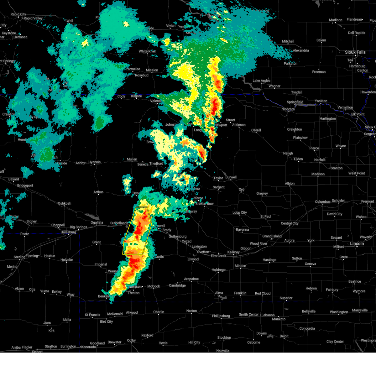 At 849 pm cdt, severe thunderstorms were located along a line extending from 8 miles north of north platte to 7 miles northeast of dickens, moving northeast at 35 mph (radar indicated). Hazards include 60 mph wind gusts and quarter size hail. Hail damage to vehicles is expected. expect wind damage to roofs, siding, and trees. locations impacted include, north platte, hershey, wallace, dickens, lake maloney state recreation area, north platte airport, birdwood, and somerset. this includes the following highways, highway 97 between mile markers 1 and 16. interstate 80 in nebraska between mile markers 161 and 181. Highway 83 between mile markers 68 and 91. At 849 pm cdt, severe thunderstorms were located along a line extending from 8 miles north of north platte to 7 miles northeast of dickens, moving northeast at 35 mph (radar indicated). Hazards include 60 mph wind gusts and quarter size hail. Hail damage to vehicles is expected. expect wind damage to roofs, siding, and trees. locations impacted include, north platte, hershey, wallace, dickens, lake maloney state recreation area, north platte airport, birdwood, and somerset. this includes the following highways, highway 97 between mile markers 1 and 16. interstate 80 in nebraska between mile markers 161 and 181. Highway 83 between mile markers 68 and 91.
|
| 5/23/2024 8:44 PM CDT |
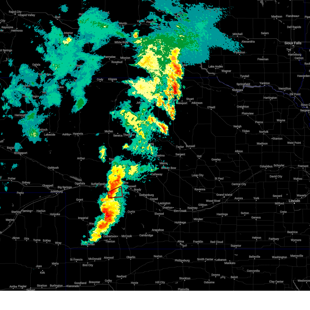 At 844 pm cdt, a severe thunderstorm capable of producing a tornado was located 9 miles west of lake maloney state recreation area, or 12 miles southwest of north platte, moving east at 30 mph (radar indicated rotation). Hazards include tornado and ping pong ball size hail. Flying debris will be dangerous to those caught without shelter. mobile homes will be damaged or destroyed. damage to roofs, windows, and vehicles will occur. tree damage is likely. locations impacted include, north platte and lake maloney state recreation area. This includes highway 83 between mile markers 69 and 81. At 844 pm cdt, a severe thunderstorm capable of producing a tornado was located 9 miles west of lake maloney state recreation area, or 12 miles southwest of north platte, moving east at 30 mph (radar indicated rotation). Hazards include tornado and ping pong ball size hail. Flying debris will be dangerous to those caught without shelter. mobile homes will be damaged or destroyed. damage to roofs, windows, and vehicles will occur. tree damage is likely. locations impacted include, north platte and lake maloney state recreation area. This includes highway 83 between mile markers 69 and 81.
|
| 5/23/2024 8:34 PM CDT |
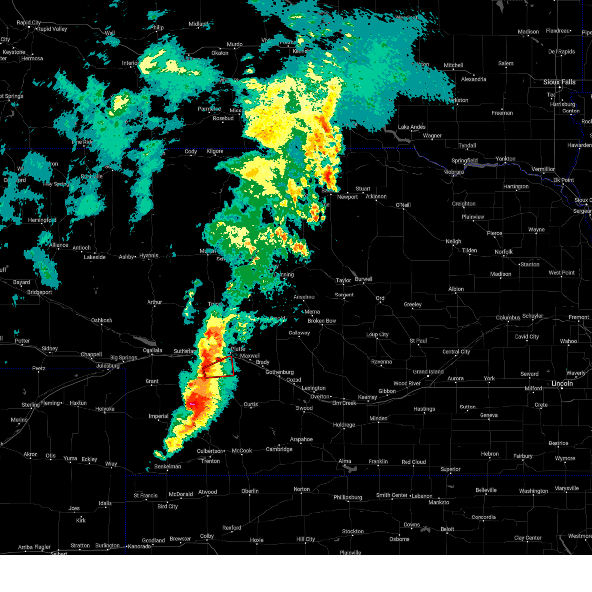 Torlbf the national weather service in north platte has issued a * tornado warning for, west central lincoln county in southwestern nebraska, * until 900 pm cdt. * at 834 pm cdt, a severe thunderstorm capable of producing a tornado was located 10 miles north of dickens, or 16 miles southwest of north platte, moving northeast at 25 mph (radar indicated rotation). Hazards include tornado and ping pong ball size hail. Flying debris will be dangerous to those caught without shelter. mobile homes will be damaged or destroyed. damage to roofs, windows, and vehicles will occur. tree damage is likely. this tornadic thunderstorm will remain over mainly rural areas of west central lincoln county. This includes highway 83 between mile markers 69 and 81. Torlbf the national weather service in north platte has issued a * tornado warning for, west central lincoln county in southwestern nebraska, * until 900 pm cdt. * at 834 pm cdt, a severe thunderstorm capable of producing a tornado was located 10 miles north of dickens, or 16 miles southwest of north platte, moving northeast at 25 mph (radar indicated rotation). Hazards include tornado and ping pong ball size hail. Flying debris will be dangerous to those caught without shelter. mobile homes will be damaged or destroyed. damage to roofs, windows, and vehicles will occur. tree damage is likely. this tornadic thunderstorm will remain over mainly rural areas of west central lincoln county. This includes highway 83 between mile markers 69 and 81.
|
| 5/23/2024 8:31 PM CDT |
 Svrlbf the national weather service in north platte has issued a * severe thunderstorm warning for, western lincoln county in southwestern nebraska, * until 915 pm cdt. * at 831 pm cdt, severe thunderstorms were located along a line extending from 9 miles north of hershey to 10 miles west of lake maloney state recreation area to near wallace, moving northeast at 25 mph (radar indicated). Hazards include 60 mph wind gusts and quarter size hail. Hail damage to vehicles is expected. Expect wind damage to roofs, siding, and trees. Svrlbf the national weather service in north platte has issued a * severe thunderstorm warning for, western lincoln county in southwestern nebraska, * until 915 pm cdt. * at 831 pm cdt, severe thunderstorms were located along a line extending from 9 miles north of hershey to 10 miles west of lake maloney state recreation area to near wallace, moving northeast at 25 mph (radar indicated). Hazards include 60 mph wind gusts and quarter size hail. Hail damage to vehicles is expected. Expect wind damage to roofs, siding, and trees.
|
| 5/20/2024 11:58 PM CDT |
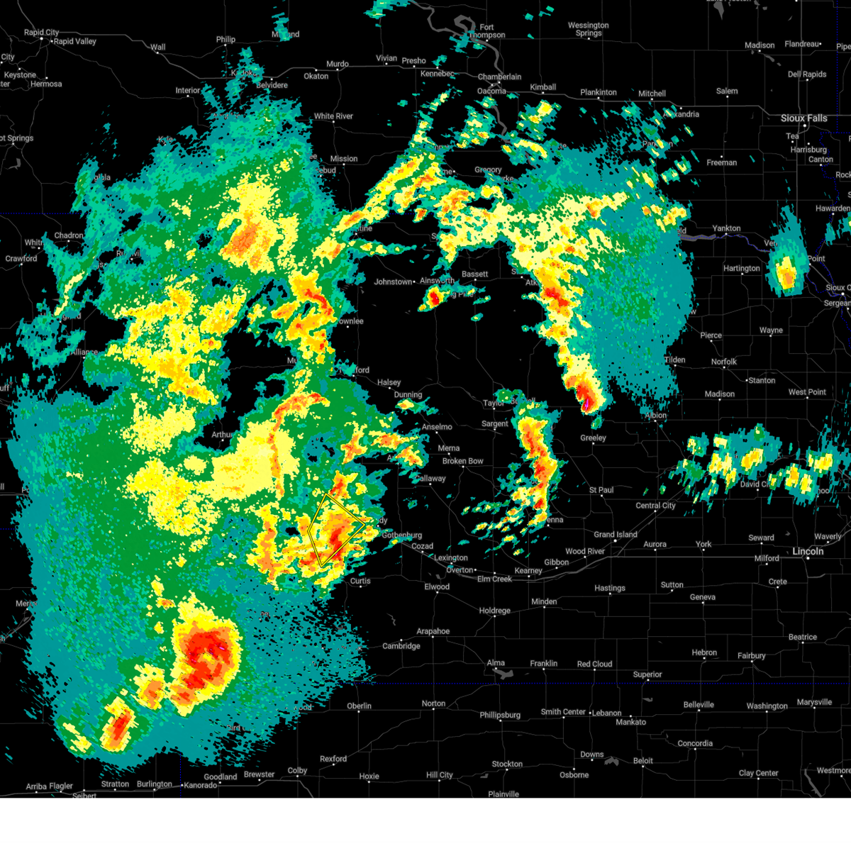 The storm which prompted the warning has weakened below severe limits, and no longer poses an immediate threat to life or property. therefore, the warning will be allowed to expire. however, small hail, gusty winds and heavy rain are still possible with this thunderstorm. a tornado watch remains in effect until 300 am cdt for southwestern nebraska. The storm which prompted the warning has weakened below severe limits, and no longer poses an immediate threat to life or property. therefore, the warning will be allowed to expire. however, small hail, gusty winds and heavy rain are still possible with this thunderstorm. a tornado watch remains in effect until 300 am cdt for southwestern nebraska.
|
| 5/20/2024 11:50 PM CDT |
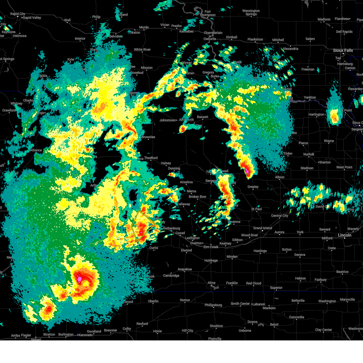 At 1150 pm cdt, a severe thunderstorm was located over lake maloney state recreation area, or 8 miles south of north platte, moving northeast at 35 mph (radar indicated). Hazards include quarter size hail. Damage to vehicles is expected. locations impacted include, north platte, north platte airport, lake maloney state recreation area, cottonwood canyon state wildlife management area, and somerset. this includes the following highways, interstate 80 in nebraska between mile markers 172 and 191. Highway 83 between mile markers 62 and 87. At 1150 pm cdt, a severe thunderstorm was located over lake maloney state recreation area, or 8 miles south of north platte, moving northeast at 35 mph (radar indicated). Hazards include quarter size hail. Damage to vehicles is expected. locations impacted include, north platte, north platte airport, lake maloney state recreation area, cottonwood canyon state wildlife management area, and somerset. this includes the following highways, interstate 80 in nebraska between mile markers 172 and 191. Highway 83 between mile markers 62 and 87.
|
| 5/20/2024 11:41 PM CDT |
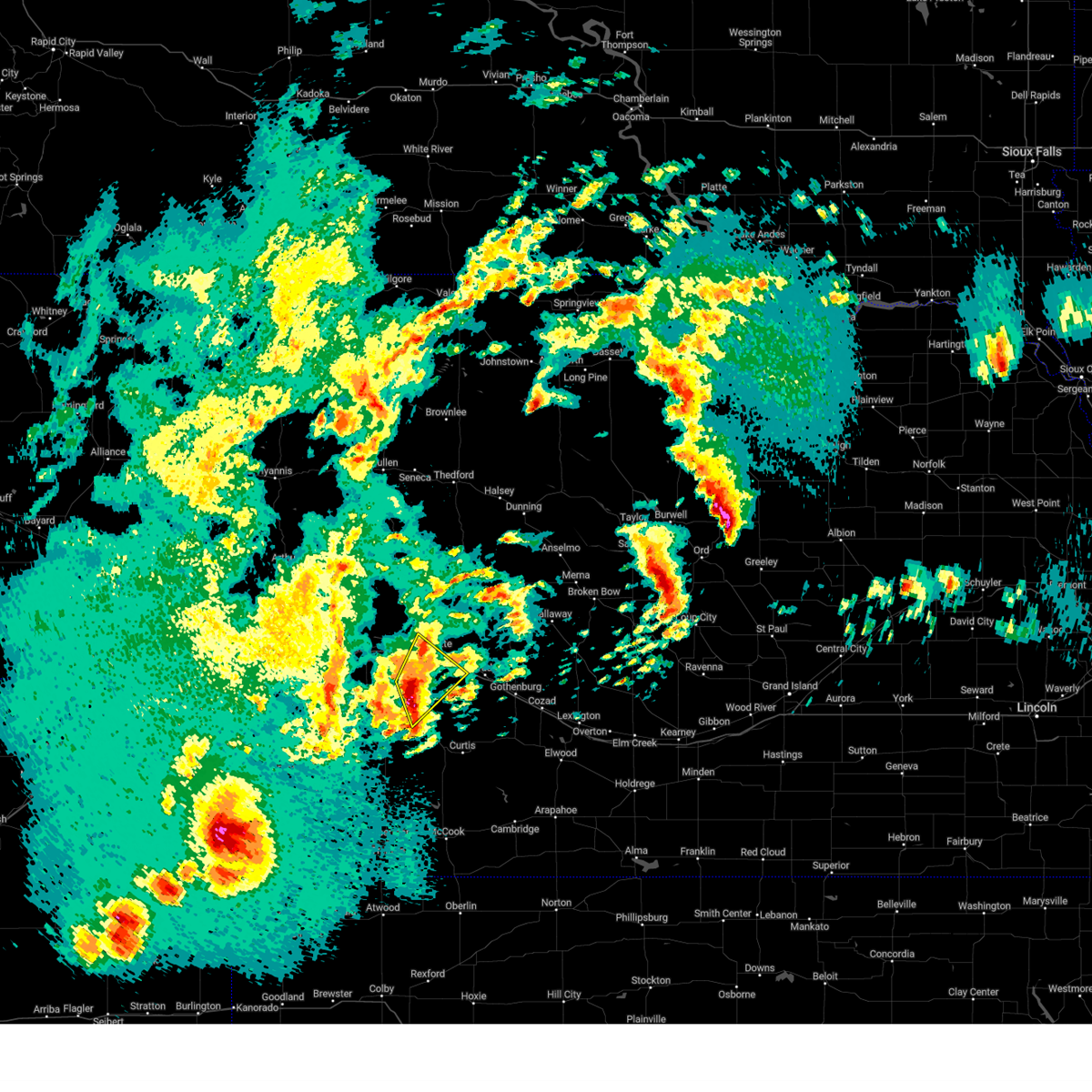 At 1140 pm cdt, a severe thunderstorm was located 8 miles southwest of lake maloney state recreation area, or 13 miles south of north platte, moving northeast at 30 mph (radar indicated). Hazards include golf ball size hail and 60 mph wind gusts. People and animals outdoors will be injured. expect hail damage to roofs, siding, windows, and vehicles. expect wind damage to roofs, siding, and trees. locations impacted include, north platte, north platte airport, lake maloney state recreation area, cottonwood canyon state wildlife management area, and somerset. this includes the following highways, interstate 80 in nebraska between mile markers 172 and 191. Highway 83 between mile markers 62 and 87. At 1140 pm cdt, a severe thunderstorm was located 8 miles southwest of lake maloney state recreation area, or 13 miles south of north platte, moving northeast at 30 mph (radar indicated). Hazards include golf ball size hail and 60 mph wind gusts. People and animals outdoors will be injured. expect hail damage to roofs, siding, windows, and vehicles. expect wind damage to roofs, siding, and trees. locations impacted include, north platte, north platte airport, lake maloney state recreation area, cottonwood canyon state wildlife management area, and somerset. this includes the following highways, interstate 80 in nebraska between mile markers 172 and 191. Highway 83 between mile markers 62 and 87.
|
| 5/20/2024 11:27 PM CDT |
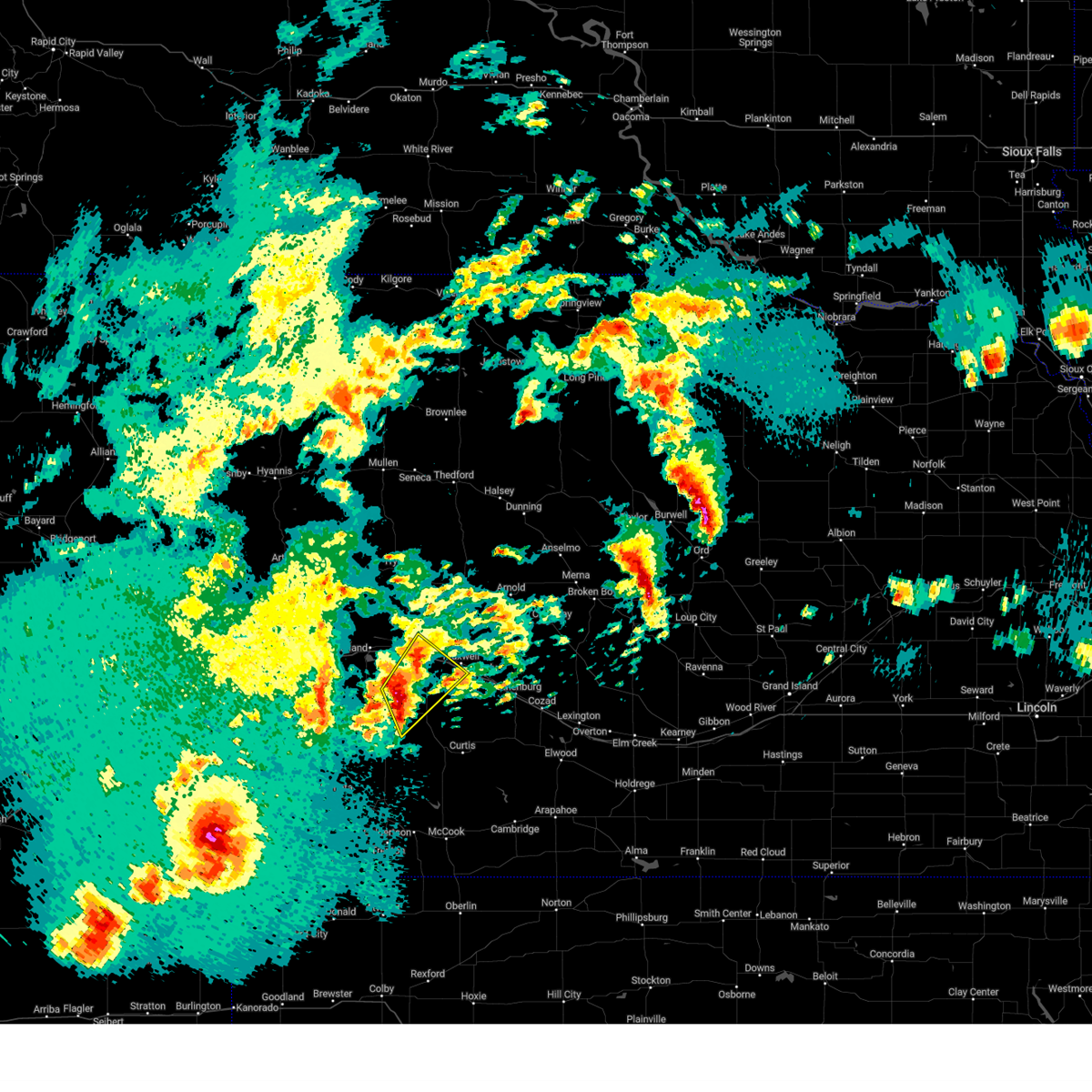 Svrlbf the national weather service in north platte has issued a * severe thunderstorm warning for, central lincoln county in southwestern nebraska, * until midnight cdt. * at 1127 pm cdt, a severe thunderstorm was located 8 miles northeast of dickens, or 15 miles southwest of north platte, moving northeast at 35 mph (radar indicated). Hazards include 60 mph wind gusts and quarter size hail. Hail damage to vehicles is expected. Expect wind damage to roofs, siding, and trees. Svrlbf the national weather service in north platte has issued a * severe thunderstorm warning for, central lincoln county in southwestern nebraska, * until midnight cdt. * at 1127 pm cdt, a severe thunderstorm was located 8 miles northeast of dickens, or 15 miles southwest of north platte, moving northeast at 35 mph (radar indicated). Hazards include 60 mph wind gusts and quarter size hail. Hail damage to vehicles is expected. Expect wind damage to roofs, siding, and trees.
|
| 5/14/2024 9:56 PM CDT |
 The storm which prompted the warning has weakened below severe limits, and no longer poses an immediate threat to life or property. therefore, the warning will be allowed to expire. The storm which prompted the warning has weakened below severe limits, and no longer poses an immediate threat to life or property. therefore, the warning will be allowed to expire.
|
| 5/14/2024 9:40 PM CDT |
 At 939 pm cdt, a severe thunderstorm was located near maxwell, or 16 miles east of north platte, moving east at 40 mph (radar indicated). Hazards include 60 mph wind gusts and quarter size hail. Hail damage to vehicles is expected. expect wind damage to roofs, siding, and trees. locations impacted include, north platte, brady, maxwell, north platte airport, keith, and cottonwood canyon state wildlife management area. This includes interstate 80 in nebraska between mile markers 179 and 205. At 939 pm cdt, a severe thunderstorm was located near maxwell, or 16 miles east of north platte, moving east at 40 mph (radar indicated). Hazards include 60 mph wind gusts and quarter size hail. Hail damage to vehicles is expected. expect wind damage to roofs, siding, and trees. locations impacted include, north platte, brady, maxwell, north platte airport, keith, and cottonwood canyon state wildlife management area. This includes interstate 80 in nebraska between mile markers 179 and 205.
|
| 5/14/2024 9:31 PM CDT |
 At 930 pm cdt, a severe thunderstorm was located near maxwell, or 10 miles east of north platte, moving east at 45 mph (radar indicated). Hazards include 60 mph wind gusts and quarter size hail. Hail damage to vehicles is expected. expect wind damage to roofs, siding, and trees. locations impacted include, north platte, brady, maxwell, lake maloney state recreation area, north platte airport, keith, cottonwood canyon state wildlife management area, and jeffrey canyon state wildlife management area. this includes the following highways, interstate 80 in nebraska between mile markers 177 and 205. Highway 83 between mile markers 69 and 81. At 930 pm cdt, a severe thunderstorm was located near maxwell, or 10 miles east of north platte, moving east at 45 mph (radar indicated). Hazards include 60 mph wind gusts and quarter size hail. Hail damage to vehicles is expected. expect wind damage to roofs, siding, and trees. locations impacted include, north platte, brady, maxwell, lake maloney state recreation area, north platte airport, keith, cottonwood canyon state wildlife management area, and jeffrey canyon state wildlife management area. this includes the following highways, interstate 80 in nebraska between mile markers 177 and 205. Highway 83 between mile markers 69 and 81.
|
| 5/14/2024 9:23 PM CDT | Quarter sized hail reported 3.7 miles W of North Platte, NE, mostly nickel sized hail with quarters mixed in at the nws office. |
| 5/14/2024 9:21 PM CDT | Quarter sized hail reported 0.4 miles NNW of North Platte, NE |
| 5/14/2024 9:17 PM CDT | Half Dollar sized hail reported 0.7 miles WSW of North Platte, NE, time estimated from radar. |
| 5/14/2024 9:16 PM CDT |
 Svrlbf the national weather service in north platte has issued a * severe thunderstorm warning for, northeastern lincoln county in southwestern nebraska, * until 1000 pm cdt. * at 916 pm cdt, a severe thunderstorm was located near north platte airport, or 8 miles east of north platte, moving east at 30 mph (radar indicated). Hazards include 60 mph wind gusts and quarter size hail. Hail damage to vehicles is expected. Expect wind damage to roofs, siding, and trees. Svrlbf the national weather service in north platte has issued a * severe thunderstorm warning for, northeastern lincoln county in southwestern nebraska, * until 1000 pm cdt. * at 916 pm cdt, a severe thunderstorm was located near north platte airport, or 8 miles east of north platte, moving east at 30 mph (radar indicated). Hazards include 60 mph wind gusts and quarter size hail. Hail damage to vehicles is expected. Expect wind damage to roofs, siding, and trees.
|
| 5/14/2024 9:13 PM CDT | Quarter sized hail reported 2.2 miles ESE of North Platte, NE, report from mping: quarter (1.00 in.). |
| 5/3/2024 7:13 PM CDT |
 At 713 pm cdt, severe thunderstorms were located along a line extending from 6 miles south of brady to moorefield to 10 miles northeast of culbertson, moving east at 45 mph (radar indicated). Hazards include 60 mph wind gusts and quarter size hail. Hail damage to vehicles is expected. expect wind damage to roofs, siding, and trees. locations impacted include, north platte, curtis, hayes center, brady, maxwell, wellfleet, moorefield, stockville, lake maloney state recreation area, north platte airport, keith, maywood, quick, cottonwood canyon state wildlife management area, hansen memorial reserve state wildlife management area, jeffrey canyon state wildlife management area, willow view campground, hayes center state wildlife management area, bluegill haven campground, and vroman. this includes the following highways, interstate 80 in nebraska between mile markers 178 and 208. Highway 83 between mile markers 27 and 81, and near mile marker 87. At 713 pm cdt, severe thunderstorms were located along a line extending from 6 miles south of brady to moorefield to 10 miles northeast of culbertson, moving east at 45 mph (radar indicated). Hazards include 60 mph wind gusts and quarter size hail. Hail damage to vehicles is expected. expect wind damage to roofs, siding, and trees. locations impacted include, north platte, curtis, hayes center, brady, maxwell, wellfleet, moorefield, stockville, lake maloney state recreation area, north platte airport, keith, maywood, quick, cottonwood canyon state wildlife management area, hansen memorial reserve state wildlife management area, jeffrey canyon state wildlife management area, willow view campground, hayes center state wildlife management area, bluegill haven campground, and vroman. this includes the following highways, interstate 80 in nebraska between mile markers 178 and 208. Highway 83 between mile markers 27 and 81, and near mile marker 87.
|
| 5/3/2024 6:50 PM CDT | Rsois measuremen in lincoln county NE, 3.7 miles W of North Platte, NE |
| 5/3/2024 6:49 PM CDT |
 Svrlbf the national weather service in north platte has issued a * severe thunderstorm warning for, frontier county in southwestern nebraska, southeastern lincoln county in southwestern nebraska, eastern hayes county in southwestern nebraska, * until 730 pm cdt. * at 649 pm cdt, severe thunderstorms were located along a line extending from near lake maloney state recreation area to near wellfleet to near palisade, moving east at 45 mph (radar indicated). Hazards include 60 mph wind gusts and quarter size hail. Hail damage to vehicles is expected. Expect wind damage to roofs, siding, and trees. Svrlbf the national weather service in north platte has issued a * severe thunderstorm warning for, frontier county in southwestern nebraska, southeastern lincoln county in southwestern nebraska, eastern hayes county in southwestern nebraska, * until 730 pm cdt. * at 649 pm cdt, severe thunderstorms were located along a line extending from near lake maloney state recreation area to near wellfleet to near palisade, moving east at 45 mph (radar indicated). Hazards include 60 mph wind gusts and quarter size hail. Hail damage to vehicles is expected. Expect wind damage to roofs, siding, and trees.
|
| 5/3/2024 6:43 PM CDT | Asos station klbf north platte airpor in lincoln county NE, 4.8 miles W of North Platte, NE |
| 4/6/2024 2:49 PM CDT | Storm damage reported in lincoln county NE, 2.7 miles SW of North Platte, NE |
| 4/6/2024 2:46 PM CDT |
 Svrlbf the national weather service in north platte has issued a * severe thunderstorm warning for, northeastern lincoln county in southwestern nebraska, southwestern logan county in west central nebraska, southeastern mcpherson county in west central nebraska, * until 330 pm cdt. * at 246 pm cdt, a severe thunderstorm was located 7 miles southwest of brady, or 18 miles southeast of north platte, moving north at 55 mph (radar indicated). Hazards include 70 mph wind gusts. Expect considerable tree damage. Damage is likely to mobile homes, roofs, and outbuildings. Svrlbf the national weather service in north platte has issued a * severe thunderstorm warning for, northeastern lincoln county in southwestern nebraska, southwestern logan county in west central nebraska, southeastern mcpherson county in west central nebraska, * until 330 pm cdt. * at 246 pm cdt, a severe thunderstorm was located 7 miles southwest of brady, or 18 miles southeast of north platte, moving north at 55 mph (radar indicated). Hazards include 70 mph wind gusts. Expect considerable tree damage. Damage is likely to mobile homes, roofs, and outbuildings.
|
| 9/9/2023 5:30 PM CDT | Quarter sized hail reported 9.4 miles N of North Platte, NE |
| 9/4/2023 9:02 PM CDT | Storm damage reported in lincoln county NE, 4.8 miles W of North Platte, NE |
| 8/10/2023 9:43 PM CDT |
 The severe thunderstorm warning for central lincoln county will expire at 945 pm cdt, the storms which prompted the warning have weakened below severe limits, and no longer pose an immediate threat to life or property. therefore, the warning will be allowed to expire. to report severe weather, contact your nearest law enforcement agency. they will relay your report to the national weather service north platte. The severe thunderstorm warning for central lincoln county will expire at 945 pm cdt, the storms which prompted the warning have weakened below severe limits, and no longer pose an immediate threat to life or property. therefore, the warning will be allowed to expire. to report severe weather, contact your nearest law enforcement agency. they will relay your report to the national weather service north platte.
|
| 8/10/2023 9:25 PM CDT |
 At 924 pm cdt, severe thunderstorms were located along a line extending from near hershey to 9 miles west of lake maloney state recreation area to 10 miles north of dickens, moving southeast at 50 mph (radar indicated). Hazards include 70 mph wind gusts. Expect considerable tree damage. damage is likely to mobile homes, roofs, and outbuildings. locations impacted include, north platte, sutherland, hershey, maxwell, sutherland reservoir state recreation area, lake maloney state recreation area, north platte airport, keith, coker, o`fallons and birdwood. this includes the following highways, highway 97 between mile markers 1 and 9. interstate 80 in nebraska between mile markers 153 and 189. highway 83 between mile markers 63 and 93. thunderstorm damage threat, considerable hail threat, radar indicated max hail size, <. 75 in wind threat, radar indicated max wind gust, 70 mph. At 924 pm cdt, severe thunderstorms were located along a line extending from near hershey to 9 miles west of lake maloney state recreation area to 10 miles north of dickens, moving southeast at 50 mph (radar indicated). Hazards include 70 mph wind gusts. Expect considerable tree damage. damage is likely to mobile homes, roofs, and outbuildings. locations impacted include, north platte, sutherland, hershey, maxwell, sutherland reservoir state recreation area, lake maloney state recreation area, north platte airport, keith, coker, o`fallons and birdwood. this includes the following highways, highway 97 between mile markers 1 and 9. interstate 80 in nebraska between mile markers 153 and 189. highway 83 between mile markers 63 and 93. thunderstorm damage threat, considerable hail threat, radar indicated max hail size, <. 75 in wind threat, radar indicated max wind gust, 70 mph.
|
| 8/10/2023 9:16 PM CDT |
 At 915 pm cdt/815 pm mdt/, a severe thunderstorm was located over sutherland, or 17 miles west of north platte, moving southeast at 55 mph. at 910 pm cdt, a 67 mph wind gust occurred at sutherland (radar indicated). Hazards include 70 mph wind gusts. Expect considerable tree damage. damage is likely to mobile homes, roofs, and outbuildings. locations impacted include, north platte, sutherland, hershey, maxwell, sutherland reservoir state recreation area, lake maloney state recreation area, north platte airport, sarben, keith, coker, o`fallons and birdwood. this includes the following highways, highway 97 between mile markers 1 and 10. interstate 80 in nebraska between mile markers 147 and 189. highway 83 between mile markers 63 and 93. thunderstorm damage threat, considerable hail threat, radar indicated max hail size, <. 75 in wind threat, radar indicated max wind gust, 70 mph. At 915 pm cdt/815 pm mdt/, a severe thunderstorm was located over sutherland, or 17 miles west of north platte, moving southeast at 55 mph. at 910 pm cdt, a 67 mph wind gust occurred at sutherland (radar indicated). Hazards include 70 mph wind gusts. Expect considerable tree damage. damage is likely to mobile homes, roofs, and outbuildings. locations impacted include, north platte, sutherland, hershey, maxwell, sutherland reservoir state recreation area, lake maloney state recreation area, north platte airport, sarben, keith, coker, o`fallons and birdwood. this includes the following highways, highway 97 between mile markers 1 and 10. interstate 80 in nebraska between mile markers 147 and 189. highway 83 between mile markers 63 and 93. thunderstorm damage threat, considerable hail threat, radar indicated max hail size, <. 75 in wind threat, radar indicated max wind gust, 70 mph.
|
| 8/10/2023 9:03 PM CDT |
 At 902 pm cdt/802 pm mdt/, a severe thunderstorm was located near sarben, or 23 miles east of ogallala, moving east-southeast at 50 mph (radar indicated). Hazards include 60 mph wind gusts and penny size hail. expect damage to roofs, siding, and trees At 902 pm cdt/802 pm mdt/, a severe thunderstorm was located near sarben, or 23 miles east of ogallala, moving east-southeast at 50 mph (radar indicated). Hazards include 60 mph wind gusts and penny size hail. expect damage to roofs, siding, and trees
|
| 8/7/2023 9:25 PM CDT |
 The severe thunderstorm warning for east central lincoln county will expire at 930 pm cdt, the storm which prompted the warning has weakened below severe limits, and has exited the warned area. therefore, the warning will be allowed to expire. a severe thunderstorm watch remains in effect until 1000 pm cdt for southwestern nebraska. The severe thunderstorm warning for east central lincoln county will expire at 930 pm cdt, the storm which prompted the warning has weakened below severe limits, and has exited the warned area. therefore, the warning will be allowed to expire. a severe thunderstorm watch remains in effect until 1000 pm cdt for southwestern nebraska.
|
| 8/7/2023 9:18 PM CDT |
 At 918 pm cdt, a severe thunderstorm was located near maxwell, or 11 miles southeast of north platte, moving southeast at 30 mph (radar indicated). Hazards include 60 mph wind gusts and quarter size hail. Hail damage to vehicles is expected. expect wind damage to roofs, siding, and trees. locations impacted include, brady, maxwell, lake maloney state recreation area, north platte airport, keith, cottonwood canyon state wildlife management area and jeffrey canyon state wildlife management area. this includes the following highways, interstate 80 in nebraska between mile markers 180 and 201. highway 83 between mile markers 70 and 78. hail threat, radar indicated max hail size, 1. 00 in wind threat, radar indicated max wind gust, 60 mph. At 918 pm cdt, a severe thunderstorm was located near maxwell, or 11 miles southeast of north platte, moving southeast at 30 mph (radar indicated). Hazards include 60 mph wind gusts and quarter size hail. Hail damage to vehicles is expected. expect wind damage to roofs, siding, and trees. locations impacted include, brady, maxwell, lake maloney state recreation area, north platte airport, keith, cottonwood canyon state wildlife management area and jeffrey canyon state wildlife management area. this includes the following highways, interstate 80 in nebraska between mile markers 180 and 201. highway 83 between mile markers 70 and 78. hail threat, radar indicated max hail size, 1. 00 in wind threat, radar indicated max wind gust, 60 mph.
|
| 8/7/2023 8:59 PM CDT |
 At 859 pm cdt, a severe thunderstorm was located over north platte airport, or near north platte, moving southeast at 20 mph (radar indicated). Hazards include 60 mph wind gusts and quarter size hail. Hail damage to vehicles is expected. expect wind damage to roofs, siding, and trees. locations impacted include, north platte, brady, maxwell, lake maloney state recreation area, north platte airport, keith, cottonwood canyon state wildlife management area and jeffrey canyon state wildlife management area. this includes the following highways, highway 97 between mile markers 1 and 4. interstate 80 in nebraska between mile markers 175 and 201. highway 83 between mile markers 70 and 93. hail threat, radar indicated max hail size, 1. 00 in wind threat, radar indicated max wind gust, 60 mph. At 859 pm cdt, a severe thunderstorm was located over north platte airport, or near north platte, moving southeast at 20 mph (radar indicated). Hazards include 60 mph wind gusts and quarter size hail. Hail damage to vehicles is expected. expect wind damage to roofs, siding, and trees. locations impacted include, north platte, brady, maxwell, lake maloney state recreation area, north platte airport, keith, cottonwood canyon state wildlife management area and jeffrey canyon state wildlife management area. this includes the following highways, highway 97 between mile markers 1 and 4. interstate 80 in nebraska between mile markers 175 and 201. highway 83 between mile markers 70 and 93. hail threat, radar indicated max hail size, 1. 00 in wind threat, radar indicated max wind gust, 60 mph.
|
| 8/7/2023 8:40 PM CDT |
 At 839 pm cdt, a severe thunderstorm was located near north platte, moving southeast at 30 mph (radar indicated). Hazards include 60 mph wind gusts and half dollar size hail. Hail damage to vehicles is expected. Expect wind damage to roofs, siding, and trees. At 839 pm cdt, a severe thunderstorm was located near north platte, moving southeast at 30 mph (radar indicated). Hazards include 60 mph wind gusts and half dollar size hail. Hail damage to vehicles is expected. Expect wind damage to roofs, siding, and trees.
|
| 8/4/2023 8:26 PM CDT | Storm damage reported in lincoln county NE, 8.6 miles NNW of North Platte, NE |
| 7/22/2023 7:50 PM CDT | Quarter sized hail reported 6.6 miles N of North Platte, NE |
| 7/22/2023 7:43 PM CDT | Ping Pong Ball sized hail reported 0.5 miles ESE of North Platte, NE, report of quarter size hail covering the ground with some ping pong size hail. |
| 7/22/2023 7:42 PM CDT |
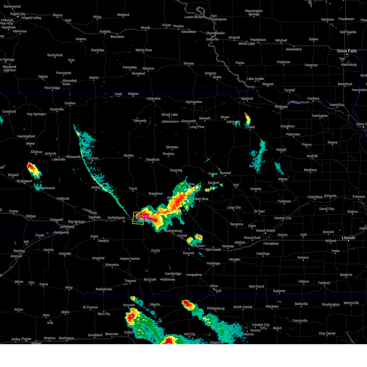 At 742 pm cdt, a severe thunderstorm was located over north platte, moving south at 45 mph (public). Hazards include golf ball size hail and 70 mph wind gusts. People and animals outdoors will be injured. expect hail damage to roofs, siding, windows, and vehicles. expect considerable tree damage. wind damage is also likely to mobile homes, roofs, and outbuildings. locations impacted include, north platte and birdwood. this includes the following highways, highway 97 between mile markers 2 and 4. interstate 80 in nebraska between mile markers 167 and 177. highway 83 between mile markers 78 and 84. thunderstorm damage threat, considerable hail threat, radar indicated max hail size, 1. 75 in wind threat, radar indicated max wind gust, 70 mph. At 742 pm cdt, a severe thunderstorm was located over north platte, moving south at 45 mph (public). Hazards include golf ball size hail and 70 mph wind gusts. People and animals outdoors will be injured. expect hail damage to roofs, siding, windows, and vehicles. expect considerable tree damage. wind damage is also likely to mobile homes, roofs, and outbuildings. locations impacted include, north platte and birdwood. this includes the following highways, highway 97 between mile markers 2 and 4. interstate 80 in nebraska between mile markers 167 and 177. highway 83 between mile markers 78 and 84. thunderstorm damage threat, considerable hail threat, radar indicated max hail size, 1. 75 in wind threat, radar indicated max wind gust, 70 mph.
|
| 7/22/2023 7:41 PM CDT | Gust measured on the nws weather station at the office. the gust at the airport reporting weather station was 54 mp in lincoln county NE, 2.7 miles SW of North Platte, NE |
| 7/22/2023 7:41 PM CDT | Golf Ball sized hail reported 0.5 miles ESE of North Platte, NE |
| 7/22/2023 7:41 PM CDT | Half Dollar sized hail reported 1.5 miles E of North Platte, NE |
| 7/22/2023 7:41 PM CDT |
 At 741 pm cdt, severe thunderstorms were located along a line extending from near maxwell to near north platte, moving south at 35 mph (radar indicated). Hazards include 70 mph wind gusts and quarter size hail. Hail damage to vehicles is expected. expect considerable tree damage. wind damage is also likely to mobile homes, roofs, and outbuildings. locations impacted include, north platte, brady, maxwell, north platte airport and keith. this includes the following highways, highway 97 near mile marker 1. interstate 80 in nebraska between mile markers 178 and 202. highway 83 between mile markers 85 and 91. thunderstorm damage threat, considerable hail threat, radar indicated max hail size, 1. 00 in wind threat, radar indicated max wind gust, 70 mph. At 741 pm cdt, severe thunderstorms were located along a line extending from near maxwell to near north platte, moving south at 35 mph (radar indicated). Hazards include 70 mph wind gusts and quarter size hail. Hail damage to vehicles is expected. expect considerable tree damage. wind damage is also likely to mobile homes, roofs, and outbuildings. locations impacted include, north platte, brady, maxwell, north platte airport and keith. this includes the following highways, highway 97 near mile marker 1. interstate 80 in nebraska between mile markers 178 and 202. highway 83 between mile markers 85 and 91. thunderstorm damage threat, considerable hail threat, radar indicated max hail size, 1. 00 in wind threat, radar indicated max wind gust, 70 mph.
|
| 7/22/2023 7:40 PM CDT | Quarter sized hail reported 0.5 miles ESE of North Platte, NE, quarter size hail in town from 735 to 745. |
| 7/22/2023 7:32 PM CDT | 67 mph winds recorded on a home weather station with near penny size hai in lincoln county NE, 9.2 miles S of North Platte, NE |
| 7/22/2023 7:27 PM CDT |
 At 726 pm cdt, severe thunderstorms were located along a line extending from 7 miles southeast of gandy to 10 miles northeast of north platte airport to 10 miles southeast of ringgold, moving south at 40 mph (radar indicated). Hazards include 70 mph wind gusts and penny size hail. Expect considerable tree damage. damage is likely to mobile homes, roofs, and outbuildings. locations impacted include, north platte, brady, maxwell, north platte airport, keith and etna. this includes the following highways, interstate 80 in nebraska between mile markers 178 and 202. highway 83 between mile markers 85 and 105. thunderstorm damage threat, considerable hail threat, radar indicated max hail size, 0. 75 in wind threat, radar indicated max wind gust, 70 mph. At 726 pm cdt, severe thunderstorms were located along a line extending from 7 miles southeast of gandy to 10 miles northeast of north platte airport to 10 miles southeast of ringgold, moving south at 40 mph (radar indicated). Hazards include 70 mph wind gusts and penny size hail. Expect considerable tree damage. damage is likely to mobile homes, roofs, and outbuildings. locations impacted include, north platte, brady, maxwell, north platte airport, keith and etna. this includes the following highways, interstate 80 in nebraska between mile markers 178 and 202. highway 83 between mile markers 85 and 105. thunderstorm damage threat, considerable hail threat, radar indicated max hail size, 0. 75 in wind threat, radar indicated max wind gust, 70 mph.
|
| 7/22/2023 7:24 PM CDT |
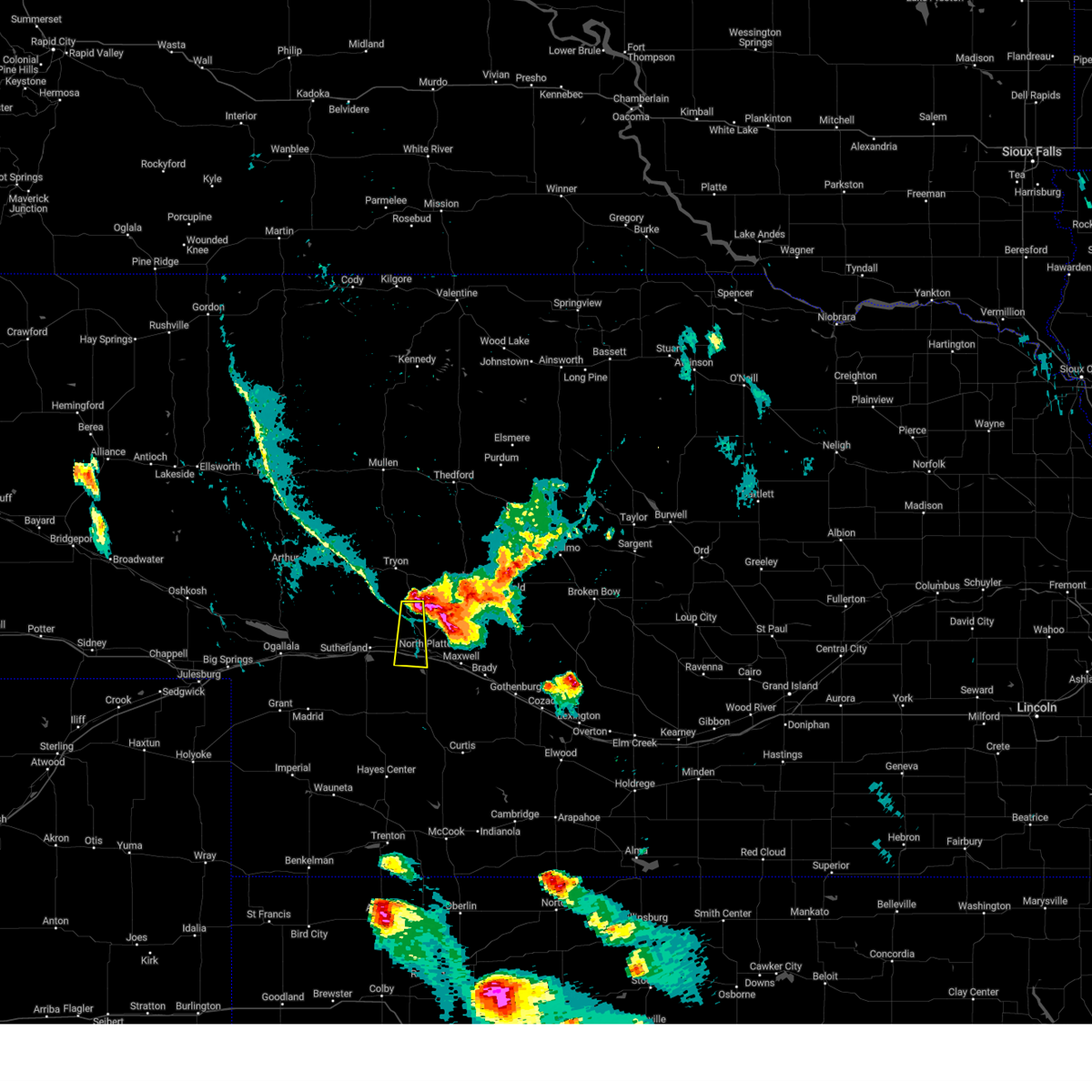 At 724 pm cdt, a severe thunderstorm was located 12 miles south of ringgold, or 13 miles north of north platte, moving south at 45 mph (radar indicated). Hazards include 70 mph wind gusts and quarter size hail. Hail damage to vehicles is expected. expect considerable tree damage. Wind damage is also likely to mobile homes, roofs, and outbuildings. At 724 pm cdt, a severe thunderstorm was located 12 miles south of ringgold, or 13 miles north of north platte, moving south at 45 mph (radar indicated). Hazards include 70 mph wind gusts and quarter size hail. Hail damage to vehicles is expected. expect considerable tree damage. Wind damage is also likely to mobile homes, roofs, and outbuildings.
|
| 7/22/2023 7:08 PM CDT |
 At 708 pm cdt, severe thunderstorms were located along a line extending from near stapleton to 8 miles west of gandy to ringgold, moving south at 40 mph (radar indicated). Hazards include 60 mph wind gusts and quarter size hail. Hail damage to vehicles is expected. Expect wind damage to roofs, siding, and trees. At 708 pm cdt, severe thunderstorms were located along a line extending from near stapleton to 8 miles west of gandy to ringgold, moving south at 40 mph (radar indicated). Hazards include 60 mph wind gusts and quarter size hail. Hail damage to vehicles is expected. Expect wind damage to roofs, siding, and trees.
|
| 7/14/2023 9:22 AM CDT |
 At 921 am cdt, severe thunderstorms were located along a line extending from near lake maloney state recreation area to 8 miles south of dickens, moving southeast at 25 mph (radar indicated). Hazards include 60 mph wind gusts and quarter size hail. Hail damage to vehicles is expected. expect wind damage to roofs, siding, and trees. locations impacted include, north platte, sutherland, hershey, wallace, maxwell, wellfleet, dickens, sutherland reservoir state recreation area, lake maloney state recreation area, north platte airport, keith, o`fallons, birdwood and somerset. this includes the following highways, interstate 80 in nebraska between mile markers 159 and 191. highway 83 between mile markers 57 and 83. hail threat, observed max hail size, 1. 00 in wind threat, radar indicated max wind gust, 60 mph. At 921 am cdt, severe thunderstorms were located along a line extending from near lake maloney state recreation area to 8 miles south of dickens, moving southeast at 25 mph (radar indicated). Hazards include 60 mph wind gusts and quarter size hail. Hail damage to vehicles is expected. expect wind damage to roofs, siding, and trees. locations impacted include, north platte, sutherland, hershey, wallace, maxwell, wellfleet, dickens, sutherland reservoir state recreation area, lake maloney state recreation area, north platte airport, keith, o`fallons, birdwood and somerset. this includes the following highways, interstate 80 in nebraska between mile markers 159 and 191. highway 83 between mile markers 57 and 83. hail threat, observed max hail size, 1. 00 in wind threat, radar indicated max wind gust, 60 mph.
|
| 7/14/2023 9:07 AM CDT |
 At 907 am cdt, a severe thunderstorm was located near sutherland reservoir state recreation area, or 14 miles west of north platte, moving east at 30 mph (public). Hazards include ping pong ball size hail and 60 mph wind gusts. People and animals outdoors will be injured. expect hail damage to roofs, siding, windows, and vehicles. Expect wind damage to roofs, siding, and trees. At 907 am cdt, a severe thunderstorm was located near sutherland reservoir state recreation area, or 14 miles west of north platte, moving east at 30 mph (public). Hazards include ping pong ball size hail and 60 mph wind gusts. People and animals outdoors will be injured. expect hail damage to roofs, siding, windows, and vehicles. Expect wind damage to roofs, siding, and trees.
|
| 7/14/2023 8:49 AM CDT | Quarter sized hail reported 12.1 miles SSW of North Platte, NE |
| 7/14/2023 8:40 AM CDT | Quarter sized hail reported 12.1 miles SSW of North Platte, NE |
| 7/13/2023 8:58 PM CDT |
 At 858 pm cdt, severe thunderstorms were located along a line extending from 6 miles southwest of brady to near hayes center, moving southeast at 35 mph (radar indicated). Hazards include 60 mph wind gusts. Expect damage to roofs, siding, and trees. locations impacted include, north platte, curtis, hayes center, wellfleet, moorefield, dickens, lake maloney state recreation area, north platte airport, maywood, cottonwood canyon state wildlife management area, hansen memorial reserve state wildlife management area, hayes center state wildlife management area, marengo and somerset. this includes the following highways, interstate 80 in nebraska between mile markers 176 and 189. highway 83 between mile markers 37 and 83. hail threat, radar indicated max hail size, <. 75 in wind threat, observed max wind gust, 60 mph. At 858 pm cdt, severe thunderstorms were located along a line extending from 6 miles southwest of brady to near hayes center, moving southeast at 35 mph (radar indicated). Hazards include 60 mph wind gusts. Expect damage to roofs, siding, and trees. locations impacted include, north platte, curtis, hayes center, wellfleet, moorefield, dickens, lake maloney state recreation area, north platte airport, maywood, cottonwood canyon state wildlife management area, hansen memorial reserve state wildlife management area, hayes center state wildlife management area, marengo and somerset. this includes the following highways, interstate 80 in nebraska between mile markers 176 and 189. highway 83 between mile markers 37 and 83. hail threat, radar indicated max hail size, <. 75 in wind threat, observed max wind gust, 60 mph.
|
| 1/1/0001 12:00 AM | Tree damage with power lines down on the southeast side of north platt in lincoln county NE, 1.1 miles N of North Platte, NE |
| 7/13/2023 8:40 PM CDT |
 At 840 pm cdt, severe thunderstorms were located along a line extending from near maxwell to 10 miles northwest of hayes center, moving southeast at 40 mph (public). Hazards include 60 mph wind gusts. Expect damage to roofs, siding, and trees. locations impacted include, north platte, curtis, hayes center, wellfleet, moorefield, dickens, lake maloney state recreation area, north platte airport, maywood, cottonwood canyon state wildlife management area, hansen memorial reserve state wildlife management area, hayes center state wildlife management area, marengo and somerset. this includes the following highways, interstate 80 in nebraska between mile markers 176 and 189. highway 83 between mile markers 37 and 83. hail threat, radar indicated max hail size, <. 75 in wind threat, observed max wind gust, 60 mph. At 840 pm cdt, severe thunderstorms were located along a line extending from near maxwell to 10 miles northwest of hayes center, moving southeast at 40 mph (public). Hazards include 60 mph wind gusts. Expect damage to roofs, siding, and trees. locations impacted include, north platte, curtis, hayes center, wellfleet, moorefield, dickens, lake maloney state recreation area, north platte airport, maywood, cottonwood canyon state wildlife management area, hansen memorial reserve state wildlife management area, hayes center state wildlife management area, marengo and somerset. this includes the following highways, interstate 80 in nebraska between mile markers 176 and 189. highway 83 between mile markers 37 and 83. hail threat, radar indicated max hail size, <. 75 in wind threat, observed max wind gust, 60 mph.
|
| 1/1/0001 12:00 AM | Storm damage reported in lincoln county NE, 4.4 miles WNW of North Platte, NE |
| 7/13/2023 8:35 PM CDT |
 At 835 pm cdt, severe thunderstorms were located along a line extending from near lake maloney state recreation area to 13 miles south of wallace, moving south at 45 mph (radar indicated). Hazards include 60 mph wind gusts. expect damage to roofs, siding, and trees At 835 pm cdt, severe thunderstorms were located along a line extending from near lake maloney state recreation area to 13 miles south of wallace, moving south at 45 mph (radar indicated). Hazards include 60 mph wind gusts. expect damage to roofs, siding, and trees
|
| 1/1/0001 12:00 AM | Tree damage with power lines down on the southeast side of north platt in lincoln county NE, 1.1 miles N of North Platte, NE |
| 7/10/2023 7:53 PM CDT |
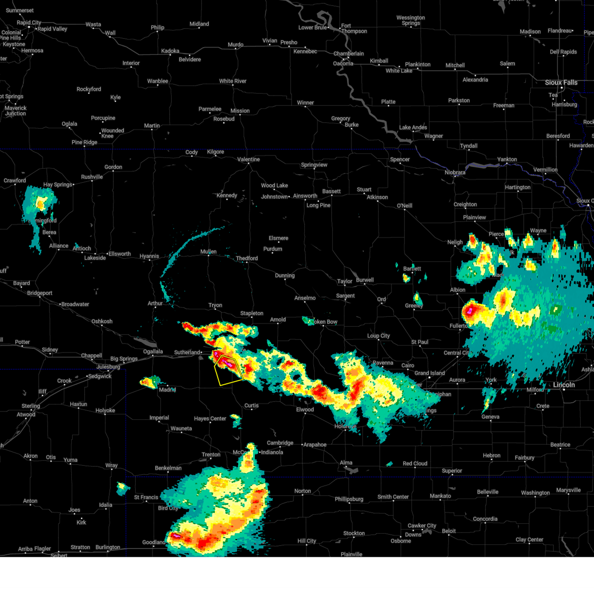 At 752 pm cdt, a severe thunderstorm was located near lake maloney state recreation area, or near north platte, moving south at 15 mph (radar indicated). Hazards include two inch hail and 60 mph wind gusts. People and animals outdoors will be injured. expect hail damage to roofs, siding, windows, and vehicles. Expect wind damage to roofs, siding, and trees. At 752 pm cdt, a severe thunderstorm was located near lake maloney state recreation area, or near north platte, moving south at 15 mph (radar indicated). Hazards include two inch hail and 60 mph wind gusts. People and animals outdoors will be injured. expect hail damage to roofs, siding, windows, and vehicles. Expect wind damage to roofs, siding, and trees.
|
| 7/10/2023 7:37 PM CDT |
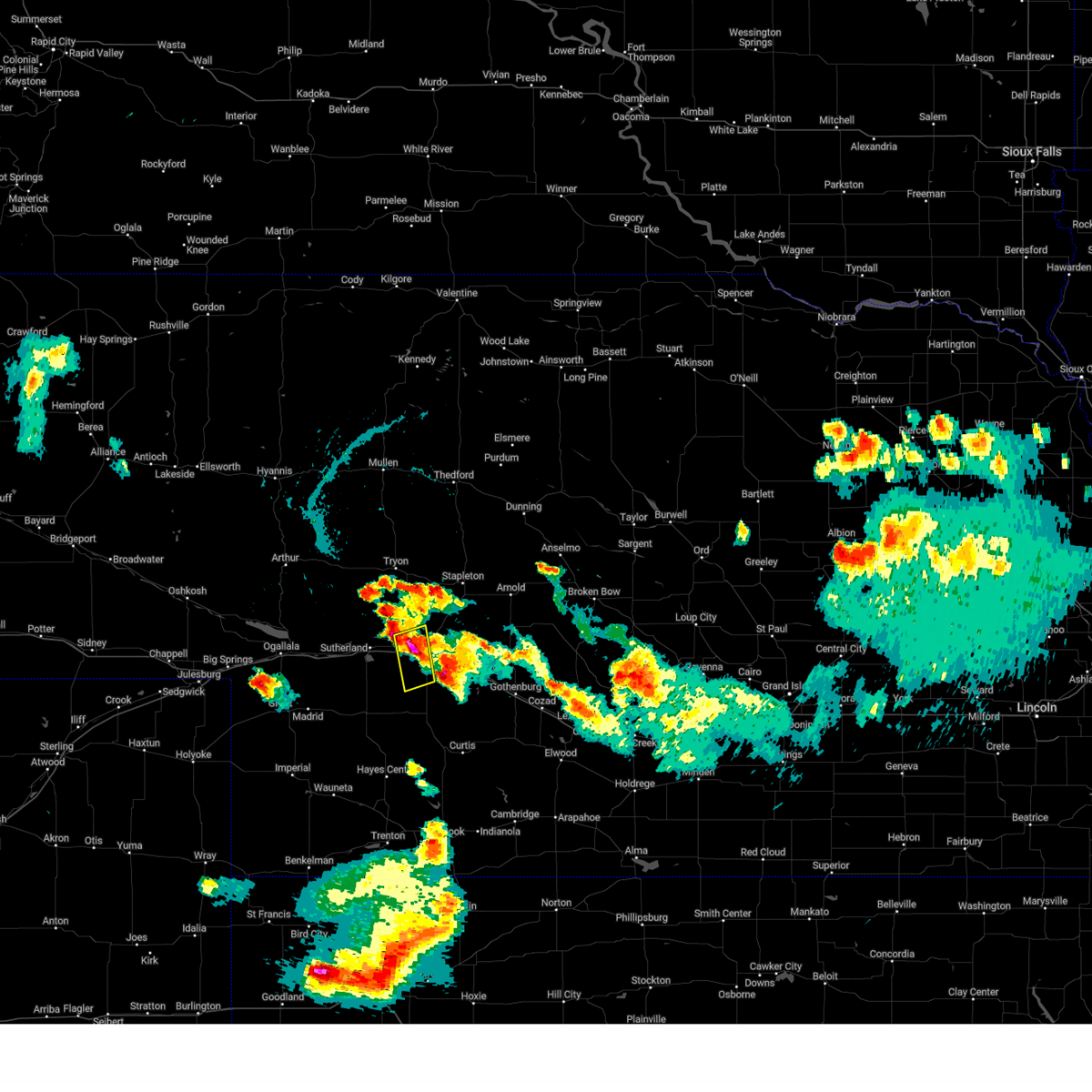 At 736 pm cdt, a severe thunderstorm was located near north platte, moving south at 20 mph (radar indicated). Hazards include tennis ball size hail and 60 mph wind gusts. People and animals outdoors will be injured. expect hail damage to roofs, siding, windows, and vehicles. expect wind damage to roofs, siding, and trees. locations impacted include, north platte, lake maloney state recreation area and birdwood. this includes the following highways, highway 97 between mile markers 1 and 5. interstate 80 in nebraska between mile markers 168 and 179. highway 83 between mile markers 72 and 87. thunderstorm damage threat, considerable hail threat, radar indicated max hail size, 2. 50 in wind threat, radar indicated max wind gust, 60 mph. At 736 pm cdt, a severe thunderstorm was located near north platte, moving south at 20 mph (radar indicated). Hazards include tennis ball size hail and 60 mph wind gusts. People and animals outdoors will be injured. expect hail damage to roofs, siding, windows, and vehicles. expect wind damage to roofs, siding, and trees. locations impacted include, north platte, lake maloney state recreation area and birdwood. this includes the following highways, highway 97 between mile markers 1 and 5. interstate 80 in nebraska between mile markers 168 and 179. highway 83 between mile markers 72 and 87. thunderstorm damage threat, considerable hail threat, radar indicated max hail size, 2. 50 in wind threat, radar indicated max wind gust, 60 mph.
|
| 7/10/2023 7:31 PM CDT | Half Dollar sized hail reported 3.6 miles E of North Platte, NE |
| 7/10/2023 7:25 PM CDT |
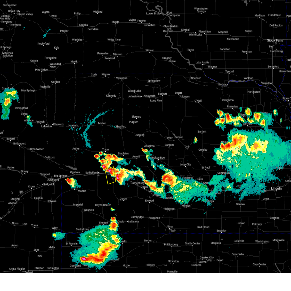 At 725 pm cdt, a severe thunderstorm was located near north platte, moving southeast at 20 mph (radar indicated). Hazards include two inch hail and 60 mph wind gusts. People and animals outdoors will be injured. expect hail damage to roofs, siding, windows, and vehicles. expect wind damage to roofs, siding, and trees. locations impacted include, north platte, lake maloney state recreation area and birdwood. this includes the following highways, highway 97 between mile markers 1 and 5. interstate 80 in nebraska between mile markers 168 and 179. highway 83 between mile markers 72 and 87. thunderstorm damage threat, considerable hail threat, radar indicated max hail size, 2. 00 in wind threat, radar indicated max wind gust, 60 mph. At 725 pm cdt, a severe thunderstorm was located near north platte, moving southeast at 20 mph (radar indicated). Hazards include two inch hail and 60 mph wind gusts. People and animals outdoors will be injured. expect hail damage to roofs, siding, windows, and vehicles. expect wind damage to roofs, siding, and trees. locations impacted include, north platte, lake maloney state recreation area and birdwood. this includes the following highways, highway 97 between mile markers 1 and 5. interstate 80 in nebraska between mile markers 168 and 179. highway 83 between mile markers 72 and 87. thunderstorm damage threat, considerable hail threat, radar indicated max hail size, 2. 00 in wind threat, radar indicated max wind gust, 60 mph.
|
| 7/10/2023 7:20 PM CDT |
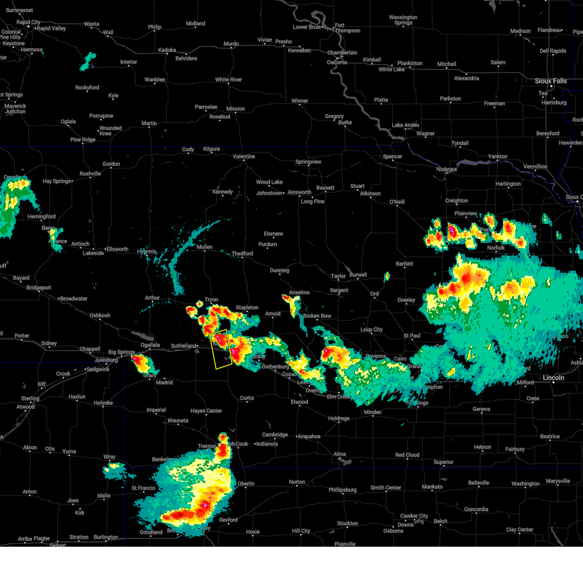 At 719 pm cdt, a severe thunderstorm was located 7 miles northwest of north platte, moving southeast at 20 mph (radar indicated). Hazards include golf ball size hail and 60 mph wind gusts. People and animals outdoors will be injured. expect hail damage to roofs, siding, windows, and vehicles. Expect wind damage to roofs, siding, and trees. At 719 pm cdt, a severe thunderstorm was located 7 miles northwest of north platte, moving southeast at 20 mph (radar indicated). Hazards include golf ball size hail and 60 mph wind gusts. People and animals outdoors will be injured. expect hail damage to roofs, siding, windows, and vehicles. Expect wind damage to roofs, siding, and trees.
|
| 7/10/2023 7:15 PM CDT | Golf Ball sized hail reported 0.5 miles ESE of North Platte, NE |
| 7/10/2023 7:14 PM CDT | Ping Pong Ball sized hail reported 1.9 miles SSE of North Platte, NE |
| 7/10/2023 7:13 PM CDT | Golf Ball sized hail reported 2.7 miles SW of North Platte, NE |
| 7/10/2023 7:11 PM CDT | Hen Egg sized hail reported 1.7 miles W of North Platte, NE, mping report |
| 7/10/2023 7:10 PM CDT | Tennis Ball sized hail reported 1.1 miles SSW of North Platte, NE |
| 7/10/2023 7:09 PM CDT |
 At 709 pm cdt, a severe thunderstorm was located over north platte airport, or near north platte, moving south at 25 mph (radar indicated). Hazards include tennis ball size hail and 60 mph wind gusts. People and animals outdoors will be injured. expect hail damage to roofs, siding, windows, and vehicles. Expect wind damage to roofs, siding, and trees. At 709 pm cdt, a severe thunderstorm was located over north platte airport, or near north platte, moving south at 25 mph (radar indicated). Hazards include tennis ball size hail and 60 mph wind gusts. People and animals outdoors will be injured. expect hail damage to roofs, siding, windows, and vehicles. Expect wind damage to roofs, siding, and trees.
|
| 7/10/2023 7:06 PM CDT | Quarter sized hail reported 0.4 miles NNW of North Platte, NE |
| 7/10/2023 7:03 PM CDT | Ping Pong Ball sized hail reported 5.1 miles S of North Platte, NE |
| 7/10/2023 7:03 PM CDT | Quarter sized hail reported 0.5 miles ESE of North Platte, NE, tree limbs were also knocked down. |
| 7/10/2023 6:50 PM CDT | Hen Egg sized hail reported 4.4 miles S of North Platte, NE |
| 7/10/2023 6:48 PM CDT | Baseball sized hail reported 6.5 miles S of North Platte, NE, baseball size hail... possibly larger. |
| 7/10/2023 6:35 PM CDT |
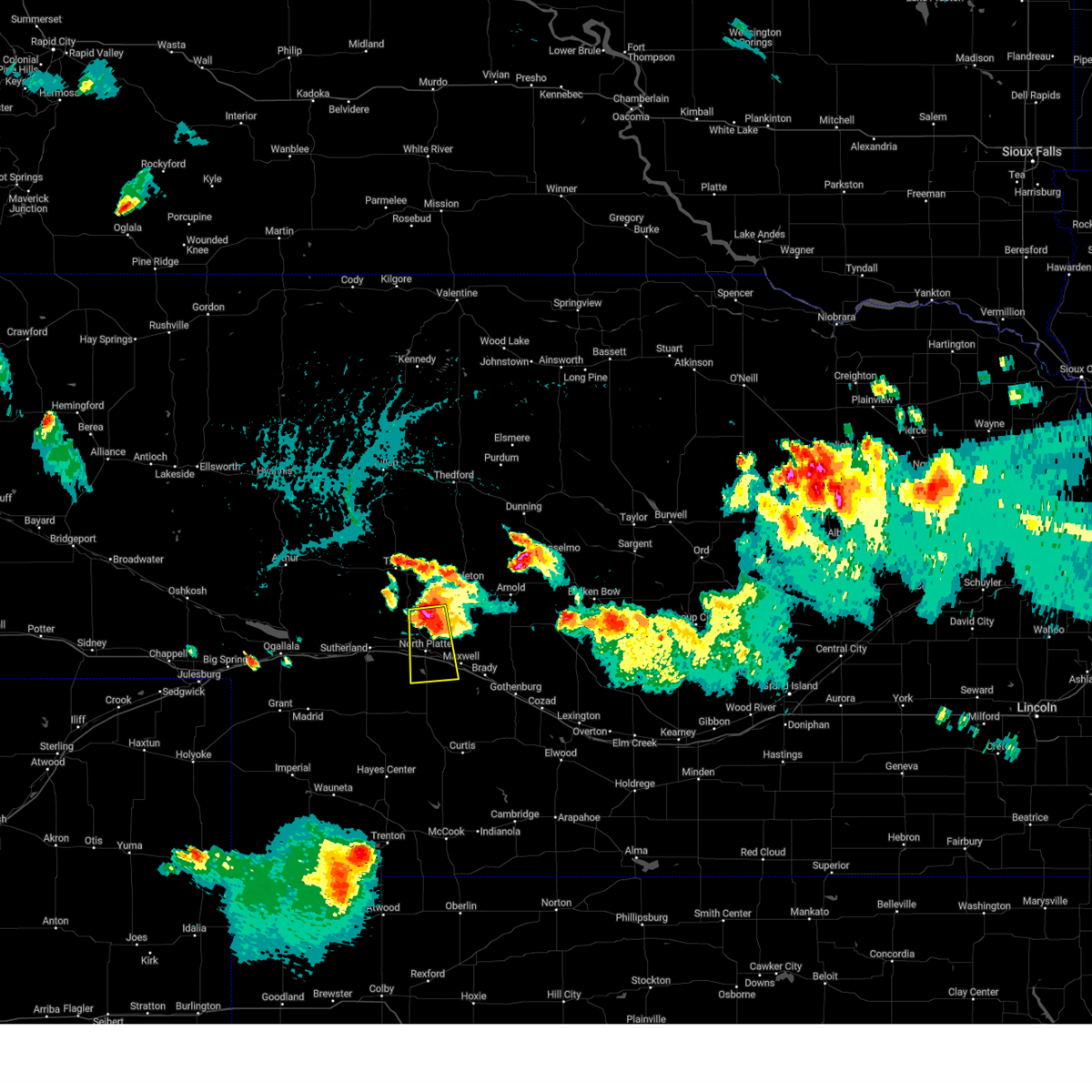 At 634 pm cdt, a severe thunderstorm was located 11 miles north of north platte, moving south at 25 mph. this is a destructive storm for north platte (at 633 pm cdt, an nws employee reported baseball sized hail 11 miles north of north platte). Hazards include baseball size hail and 60 mph wind gusts. People and animals outdoors will be severely injured. Expect shattered windows, extensive damage to roofs, siding, and vehicles. At 634 pm cdt, a severe thunderstorm was located 11 miles north of north platte, moving south at 25 mph. this is a destructive storm for north platte (at 633 pm cdt, an nws employee reported baseball sized hail 11 miles north of north platte). Hazards include baseball size hail and 60 mph wind gusts. People and animals outdoors will be severely injured. Expect shattered windows, extensive damage to roofs, siding, and vehicles.
|
| 7/10/2023 6:33 PM CDT | Baseball sized hail reported 11.3 miles S of North Platte, NE |
| 7/10/2023 6:29 PM CDT |
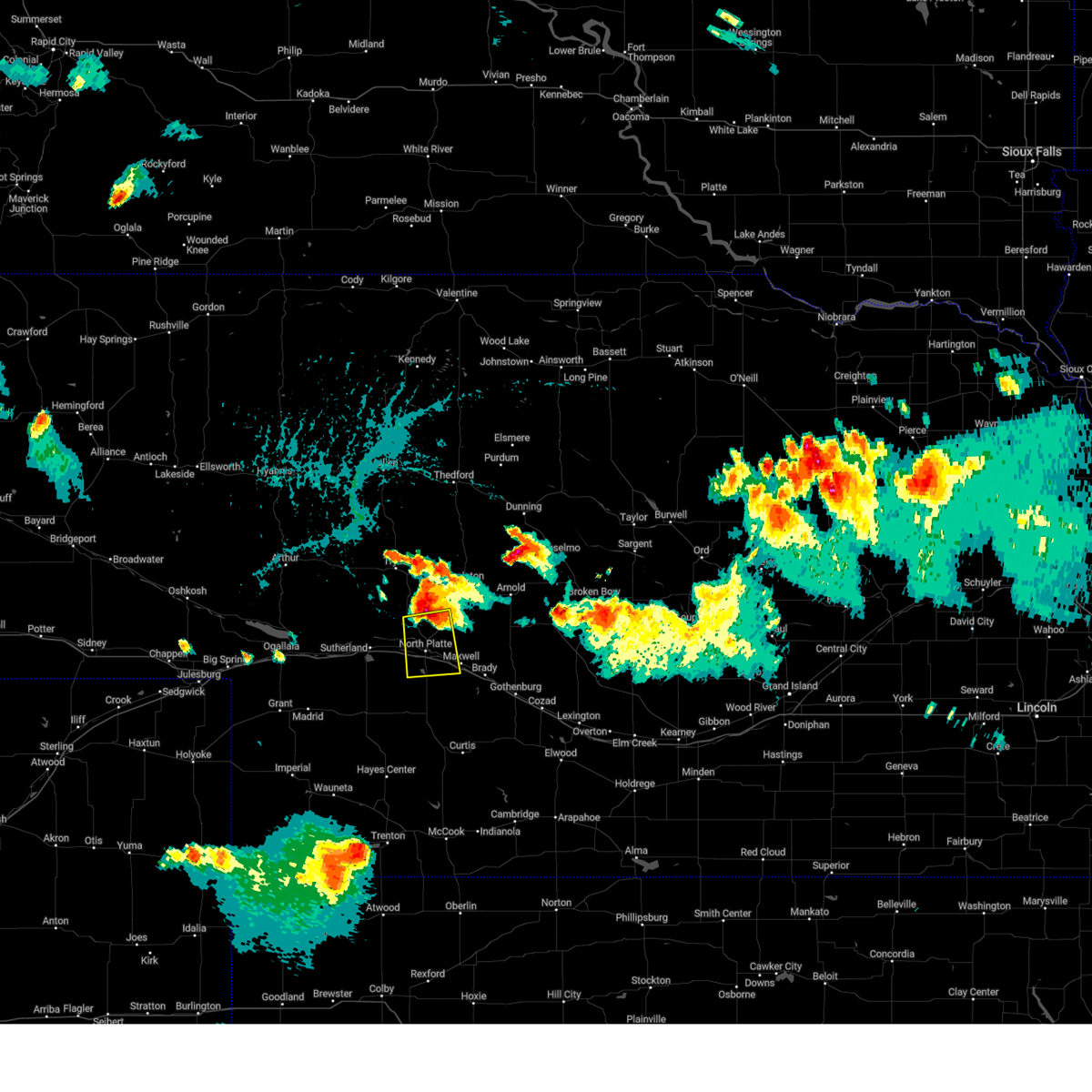 At 629 pm cdt, a severe thunderstorm was located 12 miles north of north platte, moving south at 25 mph (radar indicated). Hazards include golf ball size hail and 60 mph wind gusts. People and animals outdoors will be injured. expect hail damage to roofs, siding, windows, and vehicles. Expect wind damage to roofs, siding, and trees. At 629 pm cdt, a severe thunderstorm was located 12 miles north of north platte, moving south at 25 mph (radar indicated). Hazards include golf ball size hail and 60 mph wind gusts. People and animals outdoors will be injured. expect hail damage to roofs, siding, windows, and vehicles. Expect wind damage to roofs, siding, and trees.
|
| 1/1/0001 12:00 AM | Storm damage reported in lincoln county NE, 2.7 miles W of North Platte, NE |
| 6/24/2023 12:34 AM CDT | Em relayed report from north platte police of a large tree down across 2300 block west leota street. tree was a foot in diamte in lincoln county NE, 0.5 miles ESE of North Platte, NE |
| 6/24/2023 12:19 AM CDT | Pws via wundermap reports 60 mph peak gus in lincoln county NE, 7.2 miles S of North Platte, NE |
| 6/24/2023 12:19 AM CDT |
 At 1217 am cdt/1117 pm mdt/, severe thunderstorms were located along a line extending from 12 miles north of tryon to near ringgold to 10 miles north of north platte to near dickens, moving east at 50 mph. these are destructive storms for mcpherson county, logan county, and lincoln county to include much of the interstate 80 corridor east of sutherland (public. at 1155 pm cdt, a mesonet station reported an 82 mph gust at sutherland). Hazards include 80 mph wind gusts. Flying debris will be dangerous to those caught without shelter. mobile homes will be heavily damaged. expect considerable damage to roofs, windows, and vehicles. extensive tree damage and power outages are likely. locations impacted include, north platte, stapleton, tryon, sutherland, hershey, brady, maxwell, gandy, lake maloney state recreation area, ringgold, sutherland reservoir state recreation area, north platte airport, keith, logan, highway 83 crossing the dismal river, cottonwood canyon state wildlife management area, o`fallons, tarboz lake, shanklin bluff and brown lake. this includes the following highways, highway 92 between mile markers 193 and 246. highway 97 between mile markers 1 and 51. interstate 80 in nebraska between mile markers 157 and 206. highway 83 between mile markers 65 and 140. thunderstorm damage threat, destructive hail threat, radar indicated max hail size, <. 75 in wind threat, observed max wind gust, 80 mph. At 1217 am cdt/1117 pm mdt/, severe thunderstorms were located along a line extending from 12 miles north of tryon to near ringgold to 10 miles north of north platte to near dickens, moving east at 50 mph. these are destructive storms for mcpherson county, logan county, and lincoln county to include much of the interstate 80 corridor east of sutherland (public. at 1155 pm cdt, a mesonet station reported an 82 mph gust at sutherland). Hazards include 80 mph wind gusts. Flying debris will be dangerous to those caught without shelter. mobile homes will be heavily damaged. expect considerable damage to roofs, windows, and vehicles. extensive tree damage and power outages are likely. locations impacted include, north platte, stapleton, tryon, sutherland, hershey, brady, maxwell, gandy, lake maloney state recreation area, ringgold, sutherland reservoir state recreation area, north platte airport, keith, logan, highway 83 crossing the dismal river, cottonwood canyon state wildlife management area, o`fallons, tarboz lake, shanklin bluff and brown lake. this includes the following highways, highway 92 between mile markers 193 and 246. highway 97 between mile markers 1 and 51. interstate 80 in nebraska between mile markers 157 and 206. highway 83 between mile markers 65 and 140. thunderstorm damage threat, destructive hail threat, radar indicated max hail size, <. 75 in wind threat, observed max wind gust, 80 mph.
|
| 6/23/2023 11:57 PM CDT |
 At 1156 pm cdt/1056 pm mdt/, severe thunderstorms were located along a line extending from 14 miles east of swan lake to 10 miles southwest of ringgold to near wallace, moving northeast at 65 mph. these are destructive storms for the sutherland to north platte areas (public). Hazards include 80 mph wind gusts. Flying debris will be dangerous to those caught without shelter. mobile homes will be heavily damaged. expect considerable damage to roofs, windows, and vehicles. Extensive tree damage and power outages are likely. At 1156 pm cdt/1056 pm mdt/, severe thunderstorms were located along a line extending from 14 miles east of swan lake to 10 miles southwest of ringgold to near wallace, moving northeast at 65 mph. these are destructive storms for the sutherland to north platte areas (public). Hazards include 80 mph wind gusts. Flying debris will be dangerous to those caught without shelter. mobile homes will be heavily damaged. expect considerable damage to roofs, windows, and vehicles. Extensive tree damage and power outages are likely.
|
| 6/23/2023 11:43 PM CDT |
 At 1143 pm cdt/1043 pm mdt/, severe thunderstorms were located along a line extending from near swan lake to 14 miles north of sarben to 9 miles northeast of elsie, moving east at 60 mph (radar indicated). Hazards include 70 mph wind gusts and quarter size hail. Hail damage to vehicles is expected. expect considerable tree damage. Wind damage is also likely to mobile homes, roofs, and outbuildings. At 1143 pm cdt/1043 pm mdt/, severe thunderstorms were located along a line extending from near swan lake to 14 miles north of sarben to 9 miles northeast of elsie, moving east at 60 mph (radar indicated). Hazards include 70 mph wind gusts and quarter size hail. Hail damage to vehicles is expected. expect considerable tree damage. Wind damage is also likely to mobile homes, roofs, and outbuildings.
|
| 5/30/2023 11:51 PM CDT |
 The severe thunderstorm warning for northeastern lincoln, logan, southeastern mcpherson and northwestern custer counties will expire at midnight cdt, the storms which prompted the warning have moved out of the area. therefore, the warning will be allowed to expire. however gusty winds are still possible with these thunderstorms. The severe thunderstorm warning for northeastern lincoln, logan, southeastern mcpherson and northwestern custer counties will expire at midnight cdt, the storms which prompted the warning have moved out of the area. therefore, the warning will be allowed to expire. however gusty winds are still possible with these thunderstorms.
|
| 5/30/2023 11:39 PM CDT | Storm damage reported in lincoln county NE, 0.7 miles WSW of North Platte, NE |
| 5/30/2023 11:39 PM CDT | Storm damage reported in lincoln county NE, 0.7 miles WSW of North Platte, NE |
| 5/30/2023 11:33 PM CDT |
 At 1133 pm cdt, severe thunderstorms were located along a line extending from 12 miles northeast of gandy to 9 miles southwest of maxwell, moving east at 35 mph (radar indicated). Hazards include 60 mph wind gusts. Expect damage to roofs, siding, and trees. locations impacted include, north platte, stapleton, arnold, brady, maxwell, gandy, ringgold, lake maloney state recreation area, north platte airport, keith, logan, cottonwood canyon state wildlife management area, jeffrey canyon state wildlife management area, tarboz lake, shanklin bluff, hoagland, brown lake and birdwood. this includes the following highways, highway 92 between mile markers 214 and 250. highway 97 between mile markers 1 and 10. interstate 80 in nebraska between mile markers 169 and 201. highway 83 between mile markers 71 and 127. hail threat, radar indicated max hail size, <. 75 in wind threat, radar indicated max wind gust, 60 mph. At 1133 pm cdt, severe thunderstorms were located along a line extending from 12 miles northeast of gandy to 9 miles southwest of maxwell, moving east at 35 mph (radar indicated). Hazards include 60 mph wind gusts. Expect damage to roofs, siding, and trees. locations impacted include, north platte, stapleton, arnold, brady, maxwell, gandy, ringgold, lake maloney state recreation area, north platte airport, keith, logan, cottonwood canyon state wildlife management area, jeffrey canyon state wildlife management area, tarboz lake, shanklin bluff, hoagland, brown lake and birdwood. this includes the following highways, highway 92 between mile markers 214 and 250. highway 97 between mile markers 1 and 10. interstate 80 in nebraska between mile markers 169 and 201. highway 83 between mile markers 71 and 127. hail threat, radar indicated max hail size, <. 75 in wind threat, radar indicated max wind gust, 60 mph.
|
| 5/30/2023 11:33 PM CDT |
 At 1133 pm cdt, severe thunderstorms were located along a line extending from 14 miles north of gandy to near lake maloney state recreation area, moving east at 25 mph (radar indicated). Hazards include 60 mph wind gusts. Expect damage to roofs, siding, and trees. locations impacted include, north platte, stapleton, arnold, brady, maxwell, gandy, ringgold, lake maloney state recreation area, north platte airport, keith, logan, cottonwood canyon state wildlife management area, jeffrey canyon state wildlife management area, tarboz lake, shanklin bluff, hoagland, brown lake and birdwood. this includes the following highways, highway 92 between mile markers 214 and 250. highway 97 between mile markers 1 and 10. interstate 80 in nebraska between mile markers 169 and 201. highway 83 between mile markers 71 and 127. hail threat, radar indicated max hail size, <. 75 in wind threat, radar indicated max wind gust, 60 mph. At 1133 pm cdt, severe thunderstorms were located along a line extending from 14 miles north of gandy to near lake maloney state recreation area, moving east at 25 mph (radar indicated). Hazards include 60 mph wind gusts. Expect damage to roofs, siding, and trees. locations impacted include, north platte, stapleton, arnold, brady, maxwell, gandy, ringgold, lake maloney state recreation area, north platte airport, keith, logan, cottonwood canyon state wildlife management area, jeffrey canyon state wildlife management area, tarboz lake, shanklin bluff, hoagland, brown lake and birdwood. this includes the following highways, highway 92 between mile markers 214 and 250. highway 97 between mile markers 1 and 10. interstate 80 in nebraska between mile markers 169 and 201. highway 83 between mile markers 71 and 127. hail threat, radar indicated max hail size, <. 75 in wind threat, radar indicated max wind gust, 60 mph.
|
| 5/30/2023 11:09 PM CDT | 65 mph on at home weather statio in lincoln county NE, 4.6 miles NNE of North Platte, NE |
| 5/30/2023 11:09 PM CDT | At home weather station... old miller school... reported 65 mph wind gus in lincoln county NE, 5.2 miles ENE of North Platte, NE |
| 5/30/2023 10:59 PM CDT |
 At 1058 pm cdt, severe thunderstorms were located along a line extending from 12 miles north of ringgold to 9 miles north of dickens, moving east at 25 mph (radar indicated). Hazards include 70 mph wind gusts and penny size hail. Expect considerable tree damage. Damage is likely to mobile homes, roofs, and outbuildings. At 1058 pm cdt, severe thunderstorms were located along a line extending from 12 miles north of ringgold to 9 miles north of dickens, moving east at 25 mph (radar indicated). Hazards include 70 mph wind gusts and penny size hail. Expect considerable tree damage. Damage is likely to mobile homes, roofs, and outbuildings.
|
| 5/30/2023 10:56 PM CDT |
 At 1055 pm cdt, severe thunderstorms were located along a line extending from 6 miles north of ringgold to 7 miles north of dickens, moving east at 35 mph (radar indicated). Hazards include 70 mph wind gusts and penny size hail. Expect considerable tree damage. Damage is likely to mobile homes, roofs, and outbuildings. At 1055 pm cdt, severe thunderstorms were located along a line extending from 6 miles north of ringgold to 7 miles north of dickens, moving east at 35 mph (radar indicated). Hazards include 70 mph wind gusts and penny size hail. Expect considerable tree damage. Damage is likely to mobile homes, roofs, and outbuildings.
|
| 5/29/2023 8:56 PM CDT |
 The severe thunderstorm warning for eastern lincoln and logan counties will expire at 900 pm cdt, the storms which prompted the warning have moved out of the area. therefore, the warning will be allowed to expire. however hail and gusty winds are still possible with these thunderstorms. a severe thunderstorm watch remains in effect until 1000 pm cdt for central, southwestern and west central nebraska. The severe thunderstorm warning for eastern lincoln and logan counties will expire at 900 pm cdt, the storms which prompted the warning have moved out of the area. therefore, the warning will be allowed to expire. however hail and gusty winds are still possible with these thunderstorms. a severe thunderstorm watch remains in effect until 1000 pm cdt for central, southwestern and west central nebraska.
|
| 5/29/2023 8:17 PM CDT | Cwop reports wind gust of 59 mp in lincoln county NE, 4.1 miles NNE of North Platte, NE |
| 5/29/2023 8:17 PM CDT | Corrects previous tstm wnd gst report from 5 ssw north platte. mesonet reports 75 mph wind gust for a time of 817 in lincoln county NE, 4.6 miles NNE of North Platte, NE |
| 5/29/2023 8:17 PM CDT |
 At 816 pm cdt, severe thunderstorms were located along a line extending from near stapleton to 6 miles southwest of wellfleet, moving east at 35 mph (radar indicated). Hazards include 60 mph wind gusts and quarter size hail. Hail damage to vehicles is expected. Expect wind damage to roofs, siding, and trees. At 816 pm cdt, severe thunderstorms were located along a line extending from near stapleton to 6 miles southwest of wellfleet, moving east at 35 mph (radar indicated). Hazards include 60 mph wind gusts and quarter size hail. Hail damage to vehicles is expected. Expect wind damage to roofs, siding, and trees.
|
| 5/29/2023 8:15 PM CDT | Corrects previous tstm wnd gst report from 4 ssw north platte. cwop reports wind gust of 59 mph for time of 815 in lincoln county NE, 4.1 miles NNE of North Platte, NE |
| 5/29/2023 8:15 PM CDT | Mesonet reports 75 mph wind gus in lincoln county NE, 4.6 miles NNE of North Platte, NE |
| 5/5/2023 9:25 PM CDT |
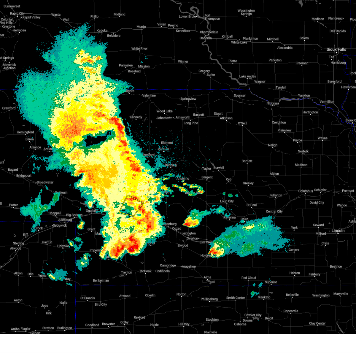 The severe thunderstorm warning for northwestern lincoln county will expire at 930 pm cdt, the storm which prompted the warning has weakened below severe limits, and has exited the warned area. therefore, the warning will be allowed to expire. a severe thunderstorm watch remains in effect until midnight cdt for southwestern and west central nebraska. The severe thunderstorm warning for northwestern lincoln county will expire at 930 pm cdt, the storm which prompted the warning has weakened below severe limits, and has exited the warned area. therefore, the warning will be allowed to expire. a severe thunderstorm watch remains in effect until midnight cdt for southwestern and west central nebraska.
|
| 5/5/2023 9:05 PM CDT |
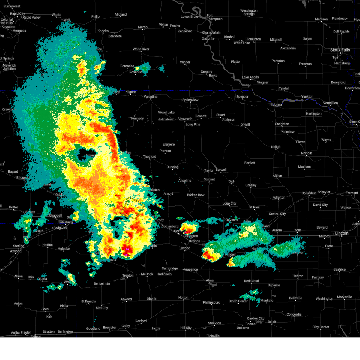 At 905 pm cdt, a severe thunderstorm was located over hershey, or 10 miles west of north platte, moving northeast at 20 mph (radar indicated). Hazards include 60 mph wind gusts and penny size hail. Expect damage to roofs, siding, and trees. locations impacted include, north platte, sutherland, hershey, coker, o`fallons and birdwood. this includes the following highways, highway 97 between mile markers 1 and 14. interstate 80 in nebraska between mile markers 157 and 173. hail threat, radar indicated max hail size, 0. 75 in wind threat, radar indicated max wind gust, 60 mph. At 905 pm cdt, a severe thunderstorm was located over hershey, or 10 miles west of north platte, moving northeast at 20 mph (radar indicated). Hazards include 60 mph wind gusts and penny size hail. Expect damage to roofs, siding, and trees. locations impacted include, north platte, sutherland, hershey, coker, o`fallons and birdwood. this includes the following highways, highway 97 between mile markers 1 and 14. interstate 80 in nebraska between mile markers 157 and 173. hail threat, radar indicated max hail size, 0. 75 in wind threat, radar indicated max wind gust, 60 mph.
|
| 5/5/2023 9:04 PM CDT | Personal weather station reports wind gust of 70 mp in lincoln county NE, 2.6 miles SE of North Platte, NE |
| 5/5/2023 8:51 PM CDT |
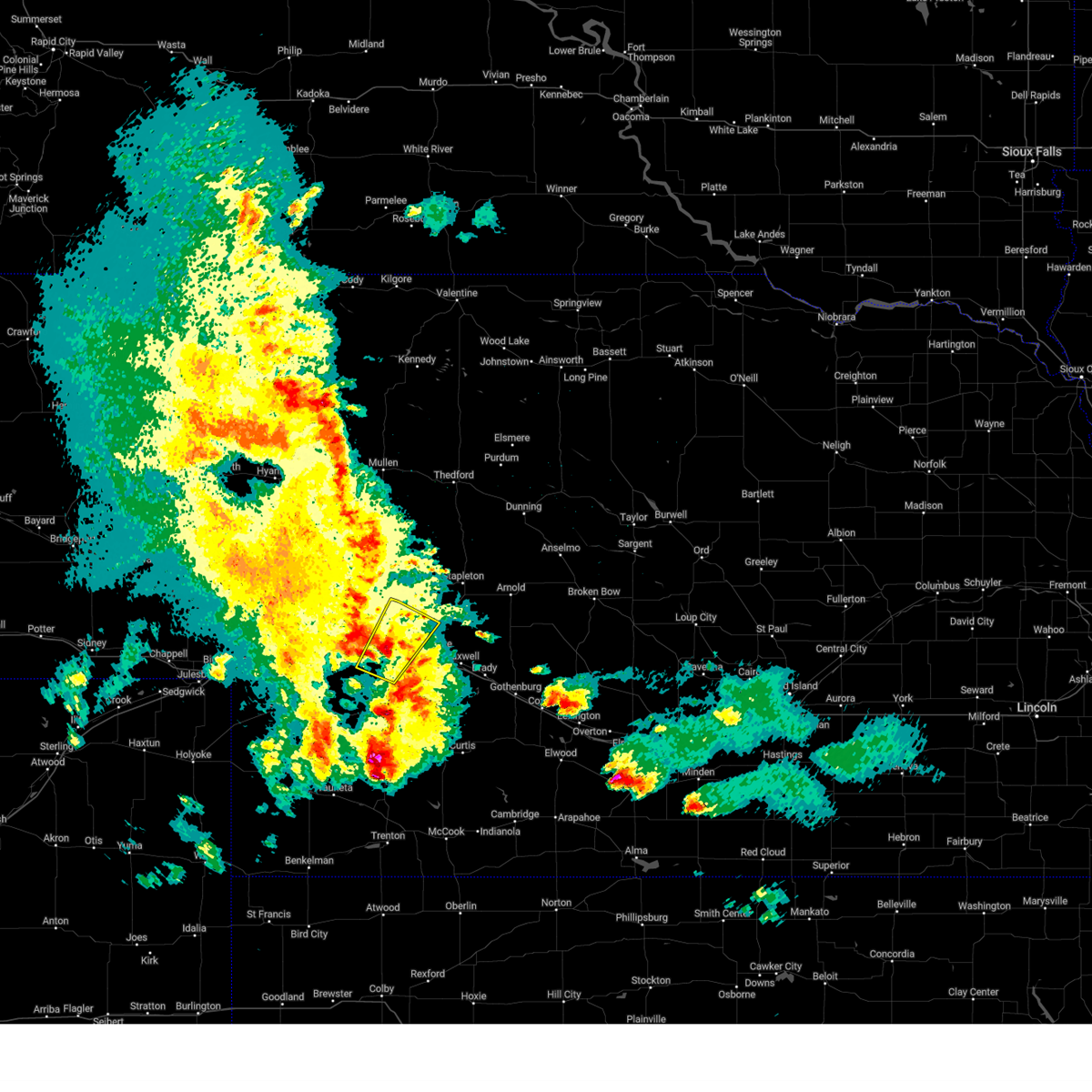 At 850 pm cdt, a severe thunderstorm was located near hershey, or 11 miles west of north platte, moving northeast at 20 mph (radar indicated). Hazards include 60 mph wind gusts and quarter size hail. Hail damage to vehicles is expected. Expect wind damage to roofs, siding, and trees. At 850 pm cdt, a severe thunderstorm was located near hershey, or 11 miles west of north platte, moving northeast at 20 mph (radar indicated). Hazards include 60 mph wind gusts and quarter size hail. Hail damage to vehicles is expected. Expect wind damage to roofs, siding, and trees.
|
| 4/13/2023 7:27 PM CDT |
 The severe thunderstorm warning for northern lincoln county will expire at 730 pm cdt, the storms which prompted the warning have weakened below severe limits, and no longer pose an immediate threat to life or property. therefore, the warning will be allowed to expire. however gusty winds are still possible with these thunderstorms. The severe thunderstorm warning for northern lincoln county will expire at 730 pm cdt, the storms which prompted the warning have weakened below severe limits, and no longer pose an immediate threat to life or property. therefore, the warning will be allowed to expire. however gusty winds are still possible with these thunderstorms.
|
| 4/13/2023 6:55 PM CDT | Storm damage reported in lincoln county NE, 0.5 miles ESE of North Platte, NE |
| 4/13/2023 6:48 PM CDT | Significant blowing dus in lincoln county NE, 1.9 miles NNE of North Platte, NE |
| 4/13/2023 6:43 PM CDT |
 At 643 pm cdt, severe thunderstorms were located along a line extending from 6 miles south of sutherland reservoir state recreation area to near lake maloney state recreation area to near maxwell, moving northeast at 40 mph (radar indicated). Hazards include 60 mph wind gusts. areas of blowing dust. expect damage to roofs, siding, and trees At 643 pm cdt, severe thunderstorms were located along a line extending from 6 miles south of sutherland reservoir state recreation area to near lake maloney state recreation area to near maxwell, moving northeast at 40 mph (radar indicated). Hazards include 60 mph wind gusts. areas of blowing dust. expect damage to roofs, siding, and trees
|
| 4/13/2023 6:00 PM CDT | Storm damage reported in lincoln county NE, 0.5 miles ESE of North Platte, NE |
| 9/16/2022 11:56 PM CDT | Quarter sized hail reported 2.7 miles SW of North Platte, NE |
| 9/16/2022 11:51 PM CDT |
 At 1151 pm cdt, a severe thunderstorm was located near north platte airport, or near north platte, moving east at 30 mph (radar indicated). Hazards include quarter size hail. damage to vehicles is expected At 1151 pm cdt, a severe thunderstorm was located near north platte airport, or near north platte, moving east at 30 mph (radar indicated). Hazards include quarter size hail. damage to vehicles is expected
|
| 9/16/2022 11:50 PM CDT | Quarter sized hail reported 0.7 miles WSW of North Platte, NE |
| 9/16/2022 9:14 PM CDT |
 At 914 pm cdt, a severe thunderstorm was located near north platte airport, or near north platte, moving northeast at 35 mph (radar indicated). Hazards include 60 mph wind gusts and quarter size hail. Hail damage to vehicles is expected. Expect wind damage to roofs, siding, and trees. At 914 pm cdt, a severe thunderstorm was located near north platte airport, or near north platte, moving northeast at 35 mph (radar indicated). Hazards include 60 mph wind gusts and quarter size hail. Hail damage to vehicles is expected. Expect wind damage to roofs, siding, and trees.
|
| 9/16/2022 9:10 PM CDT | Quarter sized hail reported 3.7 miles W of North Platte, NE |
| 9/16/2022 9:04 PM CDT |
 At 903 pm cdt, a severe thunderstorm was located over north platte airport, or over north platte, moving east at 40 mph (radar indicated). Hazards include 60 mph wind gusts and quarter size hail. Hail damage to vehicles is expected. expect wind damage to roofs, siding, and trees. locations impacted include, north platte, maxwell, north platte airport, lake maloney state recreation area, keith and birdwood. this includes the following highways, highway 97 between mile markers 1 and 6. interstate 80 in nebraska between mile markers 168 and 192. highway 83 between mile markers 75 and 94. hail threat, radar indicated max hail size, 1. 00 in wind threat, radar indicated max wind gust, 60 mph. At 903 pm cdt, a severe thunderstorm was located over north platte airport, or over north platte, moving east at 40 mph (radar indicated). Hazards include 60 mph wind gusts and quarter size hail. Hail damage to vehicles is expected. expect wind damage to roofs, siding, and trees. locations impacted include, north platte, maxwell, north platte airport, lake maloney state recreation area, keith and birdwood. this includes the following highways, highway 97 between mile markers 1 and 6. interstate 80 in nebraska between mile markers 168 and 192. highway 83 between mile markers 75 and 94. hail threat, radar indicated max hail size, 1. 00 in wind threat, radar indicated max wind gust, 60 mph.
|
| 9/16/2022 8:50 PM CDT |
 At 850 pm cdt, a severe thunderstorm was located near north platte, moving east at 35 mph (radar indicated). Hazards include 60 mph wind gusts and quarter size hail. Hail damage to vehicles is expected. expect wind damage to roofs, siding, and trees. locations impacted include, north platte, hershey, maxwell, lake maloney state recreation area, north platte airport, keith and birdwood. this includes the following highways, highway 97 between mile markers 1 and 7. interstate 80 in nebraska between mile markers 161 and 192. highway 83 between mile markers 73 and 94. hail threat, radar indicated max hail size, 1. 00 in wind threat, radar indicated max wind gust, 60 mph. At 850 pm cdt, a severe thunderstorm was located near north platte, moving east at 35 mph (radar indicated). Hazards include 60 mph wind gusts and quarter size hail. Hail damage to vehicles is expected. expect wind damage to roofs, siding, and trees. locations impacted include, north platte, hershey, maxwell, lake maloney state recreation area, north platte airport, keith and birdwood. this includes the following highways, highway 97 between mile markers 1 and 7. interstate 80 in nebraska between mile markers 161 and 192. highway 83 between mile markers 73 and 94. hail threat, radar indicated max hail size, 1. 00 in wind threat, radar indicated max wind gust, 60 mph.
|
| 9/16/2022 8:31 PM CDT |
 At 831 pm cdt, a severe thunderstorm was located near sutherland reservoir state recreation area, or 15 miles southwest of north platte, moving northeast at 40 mph (radar indicated). Hazards include 60 mph wind gusts and quarter size hail. Hail damage to vehicles is expected. Expect wind damage to roofs, siding, and trees. At 831 pm cdt, a severe thunderstorm was located near sutherland reservoir state recreation area, or 15 miles southwest of north platte, moving northeast at 40 mph (radar indicated). Hazards include 60 mph wind gusts and quarter size hail. Hail damage to vehicles is expected. Expect wind damage to roofs, siding, and trees.
|
| 7/27/2022 11:52 PM CDT |
 At 1151 pm cdt, severe thunderstorms were located along a line extending from 8 miles southwest of callaway to near lake maloney state recreation area, moving south at 45 mph (radar indicated). Hazards include 70 mph wind gusts and quarter size hail. Hail damage to vehicles is expected. expect considerable tree damage. wind damage is also likely to mobile homes, roofs, and outbuildings. locations impacted include, north platte, hershey, brady, maxwell, wellfleet, lake maloney state recreation area, north platte airport, keith, cottonwood canyon state wildlife management area, etna, milldale, hansen memorial reserve state wildlife management area, jeffrey canyon state wildlife management area, finchville, birdwood, vroman and somerset. this includes the following highways, highway 97 between mile markers 1 and 5. interstate 80 in nebraska between mile markers 162 and 208. Highway 83 between mile markers 52 and 96. At 1151 pm cdt, severe thunderstorms were located along a line extending from 8 miles southwest of callaway to near lake maloney state recreation area, moving south at 45 mph (radar indicated). Hazards include 70 mph wind gusts and quarter size hail. Hail damage to vehicles is expected. expect considerable tree damage. wind damage is also likely to mobile homes, roofs, and outbuildings. locations impacted include, north platte, hershey, brady, maxwell, wellfleet, lake maloney state recreation area, north platte airport, keith, cottonwood canyon state wildlife management area, etna, milldale, hansen memorial reserve state wildlife management area, jeffrey canyon state wildlife management area, finchville, birdwood, vroman and somerset. this includes the following highways, highway 97 between mile markers 1 and 5. interstate 80 in nebraska between mile markers 162 and 208. Highway 83 between mile markers 52 and 96.
|
| 7/27/2022 11:40 PM CDT | 68 mph thunderstorm wind gust recorded by mesonet station 4 miles n of north platte in lincoln county NE, 4.4 miles S of North Platte, NE |
| 7/27/2022 11:29 PM CDT |
 At 1129 pm cdt, severe thunderstorms were located along a line extending from near arnold to 6 miles northeast of hershey, moving south at 40 mph (radar indicated). Hazards include 60 mph wind gusts and quarter size hail. Hail damage to vehicles is expected. Expect wind damage to roofs, siding, and trees. At 1129 pm cdt, severe thunderstorms were located along a line extending from near arnold to 6 miles northeast of hershey, moving south at 40 mph (radar indicated). Hazards include 60 mph wind gusts and quarter size hail. Hail damage to vehicles is expected. Expect wind damage to roofs, siding, and trees.
|
| 7/21/2022 8:16 PM CDT |
 At 815 pm cdt, severe thunderstorms were located along a line extending from 9 miles southwest of arnold to 6 miles west of lake maloney state recreation area, moving southeast at 35 mph (radar indicated). Hazards include 60 mph wind gusts. expect damage to roofs, siding, and trees At 815 pm cdt, severe thunderstorms were located along a line extending from 9 miles southwest of arnold to 6 miles west of lake maloney state recreation area, moving southeast at 35 mph (radar indicated). Hazards include 60 mph wind gusts. expect damage to roofs, siding, and trees
|
| 7/21/2022 8:14 PM CDT | Storm damage reported in lincoln county NE, 3.7 miles W of North Platte, NE |
| 6/24/2022 9:25 PM CDT |
 At 925 pm cdt, severe thunderstorms were located along a line extending from near lake maloney state recreation area to 7 miles northwest of wellfleet to 6 miles south of dickens, moving east at 35 mph (radar indicated). Hazards include 60 mph wind gusts and nickel size hail. Expect damage to roofs, siding, and trees. locations impacted include, north platte, brady, wallace, maxwell, wellfleet, dickens, lake maloney state recreation area, north platte airport, keith, cottonwood canyon state wildlife management area, hansen memorial reserve state wildlife management area, jeffrey canyon state wildlife management area, birdwood and somerset. this includes the following highways, interstate 80 in nebraska between mile markers 164 and 202. highway 83 between mile markers 53 and 86. hail threat, radar indicated max hail size, 0. 88 in wind threat, radar indicated max wind gust, 60 mph. At 925 pm cdt, severe thunderstorms were located along a line extending from near lake maloney state recreation area to 7 miles northwest of wellfleet to 6 miles south of dickens, moving east at 35 mph (radar indicated). Hazards include 60 mph wind gusts and nickel size hail. Expect damage to roofs, siding, and trees. locations impacted include, north platte, brady, wallace, maxwell, wellfleet, dickens, lake maloney state recreation area, north platte airport, keith, cottonwood canyon state wildlife management area, hansen memorial reserve state wildlife management area, jeffrey canyon state wildlife management area, birdwood and somerset. this includes the following highways, interstate 80 in nebraska between mile markers 164 and 202. highway 83 between mile markers 53 and 86. hail threat, radar indicated max hail size, 0. 88 in wind threat, radar indicated max wind gust, 60 mph.
|
| 6/24/2022 9:08 PM CDT |
 At 908 pm cdt, severe thunderstorms were located along a line extending from near hershey to 7 miles southwest of lake maloney state recreation area to near wallace, moving east at 40 mph (trained weather spotters). Hazards include 60 mph wind gusts and nickel size hail. Expect damage to roofs, siding, and trees. severe thunderstorms will be near, north platte and lake maloney state recreation area around 915 pm cdt. north platte airport around 920 pm cdt. maxwell and wellfleet around 930 pm cdt. brady around 940 pm cdt. other locations impacted by these severe thunderstorms include cottonwood canyon state wildlife management area, keith, hansen memorial reserve state wildlife management area, jeffrey canyon state wildlife management area, o`fallons, birdwood and somerset. this includes the following highways, highway 97 between mile markers 1 and 2. interstate 80 in nebraska between mile markers 159 and 202. highway 83 between mile markers 53 and 90. hail threat, radar indicated max hail size, 0. 88 in wind threat, observed max wind gust, 60 mph. At 908 pm cdt, severe thunderstorms were located along a line extending from near hershey to 7 miles southwest of lake maloney state recreation area to near wallace, moving east at 40 mph (trained weather spotters). Hazards include 60 mph wind gusts and nickel size hail. Expect damage to roofs, siding, and trees. severe thunderstorms will be near, north platte and lake maloney state recreation area around 915 pm cdt. north platte airport around 920 pm cdt. maxwell and wellfleet around 930 pm cdt. brady around 940 pm cdt. other locations impacted by these severe thunderstorms include cottonwood canyon state wildlife management area, keith, hansen memorial reserve state wildlife management area, jeffrey canyon state wildlife management area, o`fallons, birdwood and somerset. this includes the following highways, highway 97 between mile markers 1 and 2. interstate 80 in nebraska between mile markers 159 and 202. highway 83 between mile markers 53 and 90. hail threat, radar indicated max hail size, 0. 88 in wind threat, observed max wind gust, 60 mph.
|
| 6/24/2022 9:03 PM CDT |
 At 902 pm cdt/802 pm mdt/, severe thunderstorms were located along a line extending from near hershey to near north platte to near dickens, moving east at 40 mph (trained weather spotters). Hazards include 60 mph wind gusts and nickel size hail. Expect damage to roofs, siding, and trees. locations impacted include, north platte, sutherland, hershey, wallace, elsie, dickens, sarben, sutherland reservoir state recreation area, lake maloney state recreation area, coker, o`fallons, birdwood and somerset. this includes the following highways, highway 97 between mile markers 3 and 9. interstate 80 in nebraska between mile markers 147 and 178. highway 83 between mile markers 71 and 84. hail threat, radar indicated max hail size, 0. 88 in wind threat, observed max wind gust, 60 mph. At 902 pm cdt/802 pm mdt/, severe thunderstorms were located along a line extending from near hershey to near north platte to near dickens, moving east at 40 mph (trained weather spotters). Hazards include 60 mph wind gusts and nickel size hail. Expect damage to roofs, siding, and trees. locations impacted include, north platte, sutherland, hershey, wallace, elsie, dickens, sarben, sutherland reservoir state recreation area, lake maloney state recreation area, coker, o`fallons, birdwood and somerset. this includes the following highways, highway 97 between mile markers 3 and 9. interstate 80 in nebraska between mile markers 147 and 178. highway 83 between mile markers 71 and 84. hail threat, radar indicated max hail size, 0. 88 in wind threat, observed max wind gust, 60 mph.
|
| 6/24/2022 8:55 PM CDT |
 At 855 pm cdt/755 pm mdt/, severe thunderstorms were located along a line extending from 8 miles northeast of sutherland to near hershey to 6 miles northeast of wallace, moving east at 45 mph (radar indicated). Hazards include 60 mph wind gusts and quarter size hail. Hail damage to vehicles is expected. expect wind damage to roofs, siding, and trees. locations impacted include, north platte, sutherland, hershey, wallace, elsie, dickens, sarben, sutherland reservoir state recreation area, lake maloney state recreation area, coker, o`fallons, birdwood and somerset. this includes the following highways, highway 97 between mile markers 3 and 9. interstate 80 in nebraska between mile markers 147 and 178. highway 83 between mile markers 71 and 84. hail threat, radar indicated max hail size, 1. 00 in wind threat, radar indicated max wind gust, 60 mph. At 855 pm cdt/755 pm mdt/, severe thunderstorms were located along a line extending from 8 miles northeast of sutherland to near hershey to 6 miles northeast of wallace, moving east at 45 mph (radar indicated). Hazards include 60 mph wind gusts and quarter size hail. Hail damage to vehicles is expected. expect wind damage to roofs, siding, and trees. locations impacted include, north platte, sutherland, hershey, wallace, elsie, dickens, sarben, sutherland reservoir state recreation area, lake maloney state recreation area, coker, o`fallons, birdwood and somerset. this includes the following highways, highway 97 between mile markers 3 and 9. interstate 80 in nebraska between mile markers 147 and 178. highway 83 between mile markers 71 and 84. hail threat, radar indicated max hail size, 1. 00 in wind threat, radar indicated max wind gust, 60 mph.
|
| 6/24/2022 8:38 PM CDT |
 At 837 pm cdt/737 pm mdt/, severe thunderstorms were located along a line extending from 6 miles northeast of sarben to sutherland reservoir state recreation area to 6 miles northeast of elsie, moving east at 45 mph (radar indicated). Hazards include ping pong ball size hail and 60 mph wind gusts. People and animals outdoors will be injured. expect hail damage to roofs, siding, windows, and vehicles. Expect wind damage to roofs, siding, and trees. At 837 pm cdt/737 pm mdt/, severe thunderstorms were located along a line extending from 6 miles northeast of sarben to sutherland reservoir state recreation area to 6 miles northeast of elsie, moving east at 45 mph (radar indicated). Hazards include ping pong ball size hail and 60 mph wind gusts. People and animals outdoors will be injured. expect hail damage to roofs, siding, windows, and vehicles. Expect wind damage to roofs, siding, and trees.
|
| 6/9/2022 8:00 PM CDT | Tennis Ball sized hail reported 19.3 miles NNE of North Platte, NE |
| 6/9/2022 7:51 PM CDT |
 At 751 pm cdt, severe thunderstorms were located along a line extending from 12 miles north of brady to 8 miles south of maxwell to 8 miles northwest of wellfleet, moving east at 50 mph (radar indicated). Hazards include ping pong ball size hail and 60 mph wind gusts. People and animals outdoors will be injured. expect hail damage to roofs, siding, windows, and vehicles. expect wind damage to roofs, siding, and trees. locations impacted include, north platte, curtis, brady, eustis, wallace, maxwell, oconto, wellfleet, moorefield, stockville, dickens, lake maloney state recreation area, medicine creek reservoir state recreation area, north platte airport, keith, maywood, cottonwood canyon state wildlife management area, lodi, willow view campground and freedom. this includes the following highways, interstate 80 in nebraska between mile markers 177 and 207. highway 83 between mile markers 27 and 86, and between mile markers 88 and 93. hail threat, radar indicated max hail size, 1. 50 in wind threat, radar indicated max wind gust, 60 mph. At 751 pm cdt, severe thunderstorms were located along a line extending from 12 miles north of brady to 8 miles south of maxwell to 8 miles northwest of wellfleet, moving east at 50 mph (radar indicated). Hazards include ping pong ball size hail and 60 mph wind gusts. People and animals outdoors will be injured. expect hail damage to roofs, siding, windows, and vehicles. expect wind damage to roofs, siding, and trees. locations impacted include, north platte, curtis, brady, eustis, wallace, maxwell, oconto, wellfleet, moorefield, stockville, dickens, lake maloney state recreation area, medicine creek reservoir state recreation area, north platte airport, keith, maywood, cottonwood canyon state wildlife management area, lodi, willow view campground and freedom. this includes the following highways, interstate 80 in nebraska between mile markers 177 and 207. highway 83 between mile markers 27 and 86, and between mile markers 88 and 93. hail threat, radar indicated max hail size, 1. 50 in wind threat, radar indicated max wind gust, 60 mph.
|
| 6/9/2022 7:23 PM CDT |
 At 722 pm cdt, severe thunderstorms were located along a line extending from near north platte to 7 miles west of lake maloney state recreation area to near wallace, moving southeast at 35 mph (radar indicated). Hazards include ping pong ball size hail and 60 mph wind gusts. People and animals outdoors will be injured. expect hail damage to roofs, siding, windows, and vehicles. Expect wind damage to roofs, siding, and trees. At 722 pm cdt, severe thunderstorms were located along a line extending from near north platte to 7 miles west of lake maloney state recreation area to near wallace, moving southeast at 35 mph (radar indicated). Hazards include ping pong ball size hail and 60 mph wind gusts. People and animals outdoors will be injured. expect hail damage to roofs, siding, windows, and vehicles. Expect wind damage to roofs, siding, and trees.
|
| 6/4/2022 9:00 PM CDT |
 At 859 pm cdt, a severe thunderstorm was located 8 miles northeast of sutherland, or 18 miles northwest of north platte, moving east at 25 mph (radar indicated). Hazards include half dollar size hail. damage to vehicles is expected At 859 pm cdt, a severe thunderstorm was located 8 miles northeast of sutherland, or 18 miles northwest of north platte, moving east at 25 mph (radar indicated). Hazards include half dollar size hail. damage to vehicles is expected
|
| 5/29/2022 9:25 PM CDT | Quarter sized hail reported 7.2 miles S of North Platte, NE |
| 5/7/2022 9:54 PM CDT |
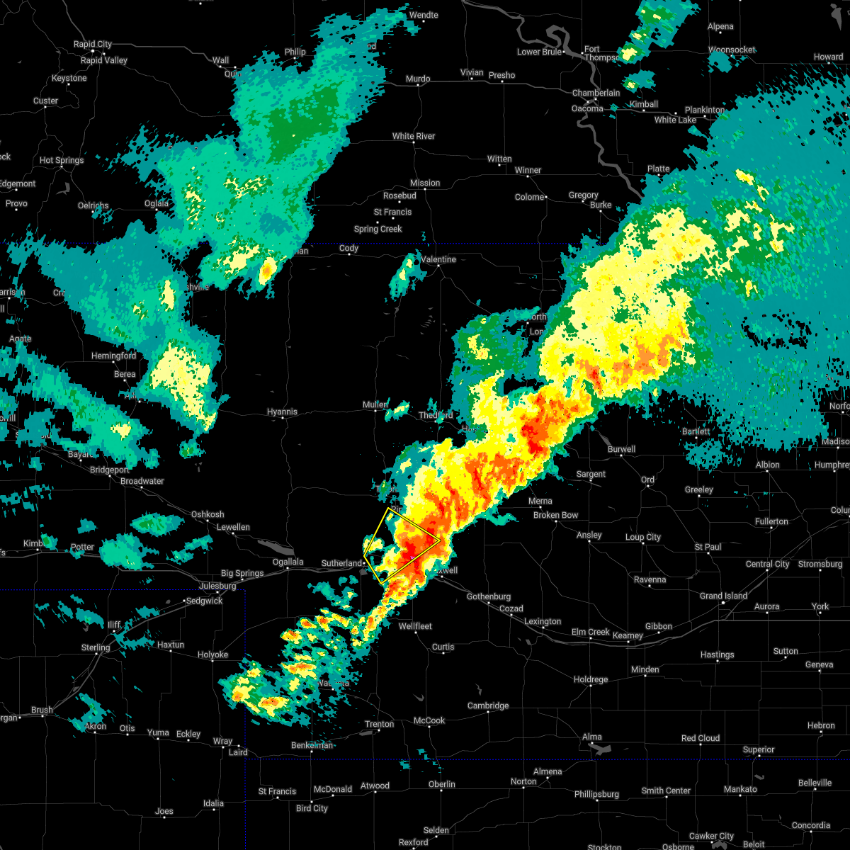 The severe thunderstorm warning for northwestern lincoln and south central mcpherson counties will expire at 1000 pm cdt, the storm which prompted the warning has weakened below severe limits, and no longer poses an immediate threat to life or property. therefore, the warning will be allowed to expire. however small hail, gusty winds and heavy rain are still expected with this thunderstorm. a severe thunderstorm watch remains in effect until 1100 pm cdt for southwestern and west central nebraska. The severe thunderstorm warning for northwestern lincoln and south central mcpherson counties will expire at 1000 pm cdt, the storm which prompted the warning has weakened below severe limits, and no longer poses an immediate threat to life or property. therefore, the warning will be allowed to expire. however small hail, gusty winds and heavy rain are still expected with this thunderstorm. a severe thunderstorm watch remains in effect until 1100 pm cdt for southwestern and west central nebraska.
|
| 5/7/2022 9:36 PM CDT |
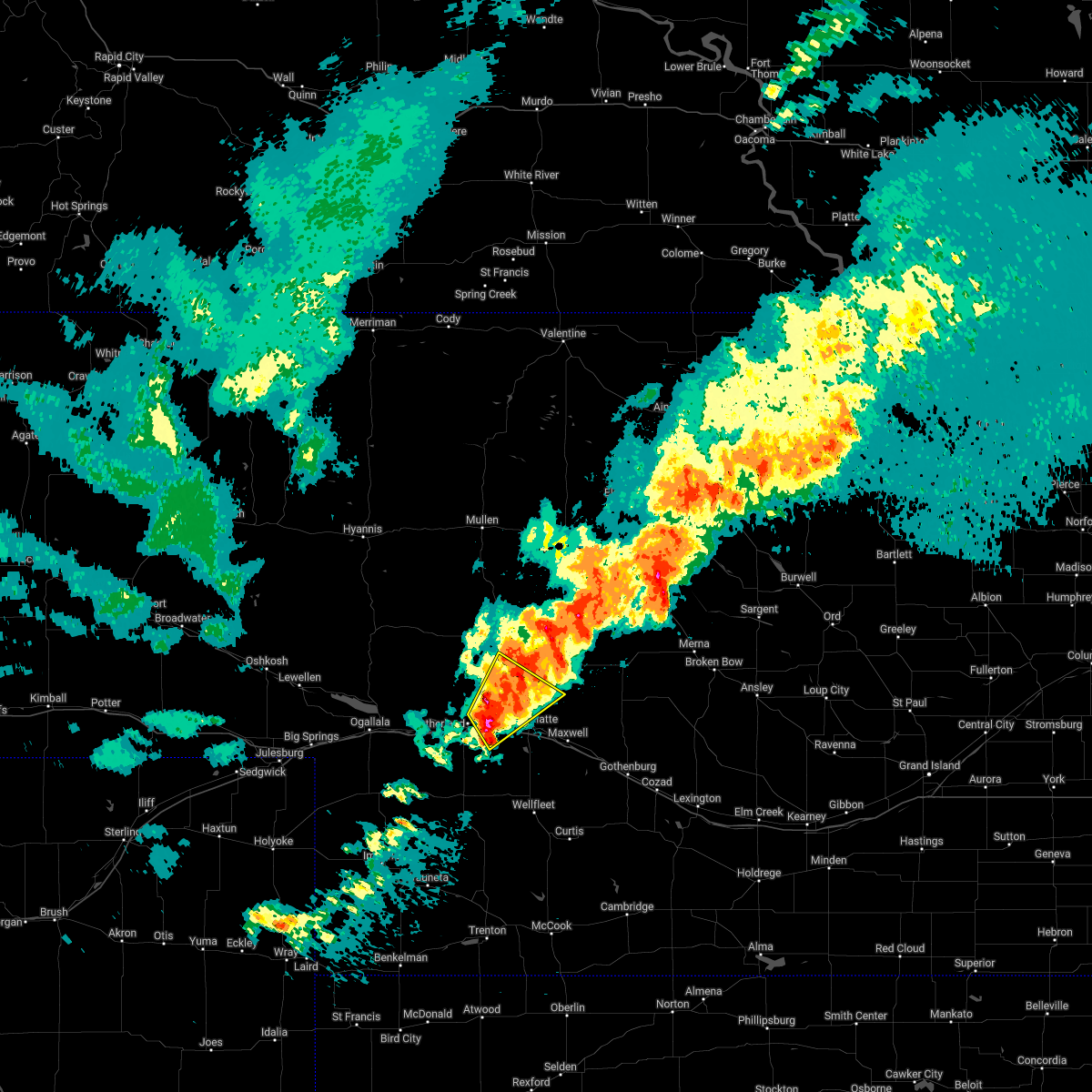 At 935 pm cdt, a severe thunderstorm was located near hershey, or 7 miles northwest of north platte, moving northeast at 40 mph (trained weather spotters). Hazards include ping pong ball size hail and 60 mph wind gusts. People and animals outdoors will be injured. expect hail damage to roofs, siding, windows, and vehicles. expect wind damage to roofs, siding, and trees. locations impacted include, north platte, sutherland, hershey, o`fallons, birdwood and coker. this includes the following highways, highway 97 between mile markers 1 and 20. interstate 80 in nebraska between mile markers 161 and 172. highway 83 between mile markers 86 and 99. hail threat, observed max hail size, 1. 50 in wind threat, radar indicated max wind gust, 60 mph. At 935 pm cdt, a severe thunderstorm was located near hershey, or 7 miles northwest of north platte, moving northeast at 40 mph (trained weather spotters). Hazards include ping pong ball size hail and 60 mph wind gusts. People and animals outdoors will be injured. expect hail damage to roofs, siding, windows, and vehicles. expect wind damage to roofs, siding, and trees. locations impacted include, north platte, sutherland, hershey, o`fallons, birdwood and coker. this includes the following highways, highway 97 between mile markers 1 and 20. interstate 80 in nebraska between mile markers 161 and 172. highway 83 between mile markers 86 and 99. hail threat, observed max hail size, 1. 50 in wind threat, radar indicated max wind gust, 60 mph.
|
| 5/7/2022 9:22 PM CDT |
 At 922 pm cdt, a severe thunderstorm was located over sutherland reservoir state recreation area, or 17 miles west of north platte, moving northeast at 40 mph (radar indicated). Hazards include ping pong ball size hail and 60 mph wind gusts. People and animals outdoors will be injured. expect hail damage to roofs, siding, windows, and vehicles. Expect wind damage to roofs, siding, and trees. At 922 pm cdt, a severe thunderstorm was located over sutherland reservoir state recreation area, or 17 miles west of north platte, moving northeast at 40 mph (radar indicated). Hazards include ping pong ball size hail and 60 mph wind gusts. People and animals outdoors will be injured. expect hail damage to roofs, siding, windows, and vehicles. Expect wind damage to roofs, siding, and trees.
|
| 4/29/2022 6:00 PM CDT | Measured at north platte airport in lincoln county NE, 3.7 miles W of North Platte, NE |
| 4/29/2022 5:51 PM CDT |
 At 551 pm cdt, a severe thunderstorm was located over north platte, moving east at 20 mph (radar indicated). Hazards include 60 mph wind gusts. expect damage to roofs, siding, and trees At 551 pm cdt, a severe thunderstorm was located over north platte, moving east at 20 mph (radar indicated). Hazards include 60 mph wind gusts. expect damage to roofs, siding, and trees
|
| 4/29/2022 5:47 PM CDT | Measured at north platte airport in lincoln county NE, 3.7 miles W of North Platte, NE |
| 4/23/2022 1:43 AM CDT |
 At 143 am cdt, severe thunderstorms were located along a line extending from 11 miles north of tryon to 6 miles southeast of sutherland reservoir state recreation area, moving east at 25 mph (radar indicated). Hazards include 70 mph wind gusts. Expect considerable tree damage. damage is likely to mobile homes, roofs, and outbuildings. locations impacted include, north platte, tryon, sutherland, hershey, sutherland reservoir state recreation area, ringgold, coker, big lamunyon flats, o`fallons, birdwood and schnick lake. this includes the following highways, highway 92 between mile markers 186 and 215. highway 97 between mile markers 2 and 43. interstate 80 in nebraska between mile markers 154 and 176. thunderstorm damage threat, considerable hail threat, radar indicated max hail size, <. 75 in wind threat, radar indicated max wind gust, 70 mph. At 143 am cdt, severe thunderstorms were located along a line extending from 11 miles north of tryon to 6 miles southeast of sutherland reservoir state recreation area, moving east at 25 mph (radar indicated). Hazards include 70 mph wind gusts. Expect considerable tree damage. damage is likely to mobile homes, roofs, and outbuildings. locations impacted include, north platte, tryon, sutherland, hershey, sutherland reservoir state recreation area, ringgold, coker, big lamunyon flats, o`fallons, birdwood and schnick lake. this includes the following highways, highway 92 between mile markers 186 and 215. highway 97 between mile markers 2 and 43. interstate 80 in nebraska between mile markers 154 and 176. thunderstorm damage threat, considerable hail threat, radar indicated max hail size, <. 75 in wind threat, radar indicated max wind gust, 70 mph.
|
| 4/23/2022 1:11 AM CDT |
 At 110 am cdt/1210 am mdt/, severe thunderstorms were located along a line extending from 19 miles northwest of tryon to 7 miles southeast of paxton, moving east at 25 mph (radar indicated). Hazards include 70 mph wind gusts. Expect considerable tree damage. Damage is likely to mobile homes, roofs, and outbuildings. At 110 am cdt/1210 am mdt/, severe thunderstorms were located along a line extending from 19 miles northwest of tryon to 7 miles southeast of paxton, moving east at 25 mph (radar indicated). Hazards include 70 mph wind gusts. Expect considerable tree damage. Damage is likely to mobile homes, roofs, and outbuildings.
|
| 10/13/2021 2:10 PM CDT | Home weather station in lincoln county NE, 10.2 miles ESE of North Platte, NE |
| 9/16/2021 9:20 PM CDT |
 The severe thunderstorm warning for northern lincoln, logan, eastern mcpherson, northwestern custer, southwestern blaine and southern thomas counties will expire at 930 pm cdt, the storms which prompted the warning have weakened below severe limits, and no longer pose an immediate threat to life or property. therefore, the warning will be allowed to expire. however gusty winds are still possible with these thunderstorms. a severe thunderstorm watch remains in effect until 300 am cdt for central, southwestern, north central and west central nebraska. The severe thunderstorm warning for northern lincoln, logan, eastern mcpherson, northwestern custer, southwestern blaine and southern thomas counties will expire at 930 pm cdt, the storms which prompted the warning have weakened below severe limits, and no longer pose an immediate threat to life or property. therefore, the warning will be allowed to expire. however gusty winds are still possible with these thunderstorms. a severe thunderstorm watch remains in effect until 300 am cdt for central, southwestern, north central and west central nebraska.
|
| 9/16/2021 9:03 PM CDT |
 At 902 pm cdt, severe thunderstorms were located along a line extending from 14 miles south of thedford to 10 miles south of ringgold, moving east at 40 mph (radar indicated). Hazards include 60 mph wind gusts. Expect damage to roofs, siding, and trees. locations impacted include, north platte, stapleton, hershey, arnold, brady, maxwell, dunning, gandy, ringgold, sutherland reservoir state recreation area, north platte airport, keith, logan, highway 83 crossing the dismal river, o`fallons, shanklin bluff, tarboz lake, hoagland, brown lake and birdwood. this includes the following highways, highway 2 between mile markers 229 and 243. highway 92 between mile markers 207 and 249. highway 97 between mile markers 1 and 26. interstate 80 in nebraska between mile markers 160 and 196. highway 83 between mile markers 78 and 139. hail threat, radar indicated max hail size, <. 75 in wind threat, radar indicated max wind gust, 60 mph. At 902 pm cdt, severe thunderstorms were located along a line extending from 14 miles south of thedford to 10 miles south of ringgold, moving east at 40 mph (radar indicated). Hazards include 60 mph wind gusts. Expect damage to roofs, siding, and trees. locations impacted include, north platte, stapleton, hershey, arnold, brady, maxwell, dunning, gandy, ringgold, sutherland reservoir state recreation area, north platte airport, keith, logan, highway 83 crossing the dismal river, o`fallons, shanklin bluff, tarboz lake, hoagland, brown lake and birdwood. this includes the following highways, highway 2 between mile markers 229 and 243. highway 92 between mile markers 207 and 249. highway 97 between mile markers 1 and 26. interstate 80 in nebraska between mile markers 160 and 196. highway 83 between mile markers 78 and 139. hail threat, radar indicated max hail size, <. 75 in wind threat, radar indicated max wind gust, 60 mph.
|
| 9/16/2021 8:42 PM CDT | Personal weather statio in lincoln county NE, 7.2 miles S of North Platte, NE |
| 9/16/2021 8:35 PM CDT |
 At 835 pm cdt/735 pm mdt/, severe thunderstorms were located along a line extending from 9 miles north of tryon to 9 miles north of hershey, moving east at 40 mph (radar indicated). Hazards include 60 mph wind gusts. expect damage to roofs, siding, and trees At 835 pm cdt/735 pm mdt/, severe thunderstorms were located along a line extending from 9 miles north of tryon to 9 miles north of hershey, moving east at 40 mph (radar indicated). Hazards include 60 mph wind gusts. expect damage to roofs, siding, and trees
|
| 8/19/2021 10:42 PM CDT |
 The severe thunderstorm warning for northeastern lincoln county will expire at 1045 pm cdt, the storms which prompted the warning have weakened below severe limits, and no longer pose an immediate threat to life or property. therefore, the warning will be allowed to expire. however small hail, gusty winds and heavy rain are still possible with these thunderstorms. a tornado watch remains in effect until midnight cdt for southwestern nebraska. to report severe weather, contact your nearest law enforcement agency. they will relay your report to the national weather service north platte. The severe thunderstorm warning for northeastern lincoln county will expire at 1045 pm cdt, the storms which prompted the warning have weakened below severe limits, and no longer pose an immediate threat to life or property. therefore, the warning will be allowed to expire. however small hail, gusty winds and heavy rain are still possible with these thunderstorms. a tornado watch remains in effect until midnight cdt for southwestern nebraska. to report severe weather, contact your nearest law enforcement agency. they will relay your report to the national weather service north platte.
|
| 8/19/2021 9:56 PM CDT |
 At 955 pm cdt, severe thunderstorms were located along a line extending from 12 miles south of ringgold to 6 miles east of hershey to 8 miles southeast of sutherland reservoir state recreation area, moving east at 30 mph (radar indicated). Hazards include 60 mph wind gusts and nickel size hail. expect damage to roofs, siding, and trees At 955 pm cdt, severe thunderstorms were located along a line extending from 12 miles south of ringgold to 6 miles east of hershey to 8 miles southeast of sutherland reservoir state recreation area, moving east at 30 mph (radar indicated). Hazards include 60 mph wind gusts and nickel size hail. expect damage to roofs, siding, and trees
|
| 7/10/2021 11:18 AM CDT | Delayed report - 200 lb trampoline picked up and blown over about 3ft fence and moved about half bloc in lincoln county NE, 0.5 miles ESE of North Platte, NE |
| 7/10/2021 11:18 AM CDT | Delayed report - large steel dumpster blown over at lb in lincoln county NE, 2.7 miles W of North Platte, NE |
| 7/10/2021 11:12 AM CDT | Delayed report large branches and trees broken off or blown over at cody park via wc in lincoln county NE, 2.4 miles S of North Platte, NE |
| 7/10/2021 10:12 AM CDT | Delayed report - about 6 in diameter tree limbs torn off and blown about a block just east of tow in lincoln county NE, 0.7 miles WSW of North Platte, NE |
| 7/10/2021 2:53 AM CDT |
 At 252 am cdt, a severe thunderstorm was located near brady, or 24 miles north of curtis, moving southeast at 35 mph (radar indicated). Hazards include 70 mph wind gusts. Expect considerable tree damage. damage is likely to mobile homes, roofs, and outbuildings. locations impacted include, north platte, brady, maxwell, lake maloney state recreation area, north platte airport, keith, cottonwood canyon state wildlife management area, jeffrey canyon state wildlife management area and birdwood. this includes the following highways, highway 97 between mile markers 1 and 5. interstate 80 in nebraska between mile markers 170 and 207. Highway 83 between mile markers 74 and 91. At 252 am cdt, a severe thunderstorm was located near brady, or 24 miles north of curtis, moving southeast at 35 mph (radar indicated). Hazards include 70 mph wind gusts. Expect considerable tree damage. damage is likely to mobile homes, roofs, and outbuildings. locations impacted include, north platte, brady, maxwell, lake maloney state recreation area, north platte airport, keith, cottonwood canyon state wildlife management area, jeffrey canyon state wildlife management area and birdwood. this includes the following highways, highway 97 between mile markers 1 and 5. interstate 80 in nebraska between mile markers 170 and 207. Highway 83 between mile markers 74 and 91.
|
| 7/10/2021 2:38 AM CDT |
 At 238 am cdt, a severe thunderstorm was located near maxwell, or 16 miles southeast of north platte, moving southeast at 35 mph (radar indicated). Hazards include 70 mph wind gusts. Expect considerable tree damage. damage is likely to mobile homes, roofs, and outbuildings. locations impacted include, north platte, brady, maxwell, lake maloney state recreation area, north platte airport, keith, cottonwood canyon state wildlife management area, jeffrey canyon state wildlife management area and birdwood. this includes the following highways, highway 97 between mile markers 1 and 5. interstate 80 in nebraska between mile markers 170 and 207. Highway 83 between mile markers 74 and 91. At 238 am cdt, a severe thunderstorm was located near maxwell, or 16 miles southeast of north platte, moving southeast at 35 mph (radar indicated). Hazards include 70 mph wind gusts. Expect considerable tree damage. damage is likely to mobile homes, roofs, and outbuildings. locations impacted include, north platte, brady, maxwell, lake maloney state recreation area, north platte airport, keith, cottonwood canyon state wildlife management area, jeffrey canyon state wildlife management area and birdwood. this includes the following highways, highway 97 between mile markers 1 and 5. interstate 80 in nebraska between mile markers 170 and 207. Highway 83 between mile markers 74 and 91.
|
| 7/10/2021 2:30 AM CDT | Sustained at 50 mph gusting to 69 mph on the backside of a thunderstorm comple in lincoln county NE, 2.7 miles W of North Platte, NE |
| 7/10/2021 2:22 AM CDT |
 At 222 am cdt, a severe thunderstorm was located over north platte, moving southeast at 40 mph (radar indicated). Hazards include 70 mph wind gusts. Expect considerable tree damage. Damage is likely to mobile homes, roofs, and outbuildings. At 222 am cdt, a severe thunderstorm was located over north platte, moving southeast at 40 mph (radar indicated). Hazards include 70 mph wind gusts. Expect considerable tree damage. Damage is likely to mobile homes, roofs, and outbuildings.
|
| 7/10/2021 2:20 AM CDT | Storm damage reported in lincoln county NE, 3.7 miles W of North Platte, NE |
| 7/9/2021 9:09 PM CDT | 62 knot in lincoln county NE, 0.5 miles ESE of North Platte, NE |
| 7/9/2021 9:07 PM CDT | Storm damage reported in lincoln county NE, 7.5 miles W of North Platte, NE |
| 7/9/2021 9:04 PM CDT | Storm damage reported in lincoln county NE, 4.4 miles S of North Platte, NE |
| 7/9/2021 9:00 PM CDT | Roof damage in town. picture provided via social media in lincoln county NE, 0.5 miles ESE of North Platte, NE |
| 7/9/2021 9:00 PM CDT | Significant blowing dust reducing visibilit in lincoln county NE, 1.5 miles E of North Platte, NE |
| 7/9/2021 8:59 PM CDT |
 The national weather service in north platte has issued a * severe thunderstorm warning for. eastern lincoln county in southwestern nebraska. southeastern logan county in west central nebraska. southwestern custer county in central nebraska. Until 945 pm cdt. The national weather service in north platte has issued a * severe thunderstorm warning for. eastern lincoln county in southwestern nebraska. southeastern logan county in west central nebraska. southwestern custer county in central nebraska. Until 945 pm cdt.
|
| 7/9/2021 8:58 PM CDT | Estimated 70 mph wind gust... with significant blowing dust as storms approach north platt in lincoln county NE, 0.5 miles ESE of North Platte, NE |
| 5/15/2021 10:12 PM CDT |
 The severe thunderstorm warning for northeastern lincoln county will expire at 1015 pm cdt, the storm which prompted the warning has weakened below severe limits, and no longer poses an immediate threat to life or property. therefore, the warning will be allowed to expire. however small hail, gusty winds and heavy rain are still possible with this thunderstorm. to report severe weather, contact your nearest law enforcement agency. they will relay your report to the national weather service north platte. The severe thunderstorm warning for northeastern lincoln county will expire at 1015 pm cdt, the storm which prompted the warning has weakened below severe limits, and no longer poses an immediate threat to life or property. therefore, the warning will be allowed to expire. however small hail, gusty winds and heavy rain are still possible with this thunderstorm. to report severe weather, contact your nearest law enforcement agency. they will relay your report to the national weather service north platte.
|
| 5/15/2021 9:44 PM CDT |
 At 944 pm cdt, a severe thunderstorm was located near maxwell, or 10 miles east of north platte, moving southeast at 15 mph (radar indicated). Hazards include 70 mph wind gusts and quarter size hail. Hail damage to vehicles is expected. expect considerable tree damage. wind damage is also likely to mobile homes, roofs, and outbuildings. locations impacted include, north platte, maxwell, north platte airport, keith and cottonwood canyon state wildlife management area. this includes the following highways, interstate 80 in nebraska between mile markers 181 and 198. Highway 83 between mile markers 91 and 95. At 944 pm cdt, a severe thunderstorm was located near maxwell, or 10 miles east of north platte, moving southeast at 15 mph (radar indicated). Hazards include 70 mph wind gusts and quarter size hail. Hail damage to vehicles is expected. expect considerable tree damage. wind damage is also likely to mobile homes, roofs, and outbuildings. locations impacted include, north platte, maxwell, north platte airport, keith and cottonwood canyon state wildlife management area. this includes the following highways, interstate 80 in nebraska between mile markers 181 and 198. Highway 83 between mile markers 91 and 95.
|
| 5/15/2021 9:23 PM CDT |
 The national weather service in north platte has issued a * severe thunderstorm warning for. northeastern lincoln county in southwestern nebraska. until 1015 pm cdt. At 923 pm cdt, a severe thunderstorm was located near north platte airport, or 7 miles east of north platte, moving southeast at 15. The national weather service in north platte has issued a * severe thunderstorm warning for. northeastern lincoln county in southwestern nebraska. until 1015 pm cdt. At 923 pm cdt, a severe thunderstorm was located near north platte airport, or 7 miles east of north platte, moving southeast at 15.
|
| 5/15/2021 9:20 PM CDT | Hillcrest ew7235 in lincoln county NE, 4.5 miles SSW of North Platte, NE |
| 7/25/2020 8:31 PM CDT | 4 to 6 inch tree limb broken. 0.75 inch hail... est 50+mph in lincoln county NE, 4.6 miles N of North Platte, NE |
| 7/25/2020 8:30 PM CDT | 70 mph wind gusts. w side of north platte in lincoln county NE, 0.5 miles ESE of North Platte, NE |
| 7/25/2020 8:23 PM CDT | Estimated 70 mph wind gust. 4 to 6 inch tree limb broke in lincoln county NE, 2.5 miles N of North Platte, NE |
| 7/25/2020 8:22 PM CDT |
 At 822 pm cdt, a severe thunderstorm was located over north platte, moving northeast at 40 mph (public). Hazards include 70 mph wind gusts and nickel size hail. Expect considerable tree damage. Damage is likely to mobile homes, roofs, and outbuildings. At 822 pm cdt, a severe thunderstorm was located over north platte, moving northeast at 40 mph (public). Hazards include 70 mph wind gusts and nickel size hail. Expect considerable tree damage. Damage is likely to mobile homes, roofs, and outbuildings.
|
| 7/25/2020 8:20 PM CDT | Estimated 70 mph wind gust. 4 to 6 inch tree limb broke in lincoln county NE, 2.5 miles N of North Platte, NE |
| 7/19/2020 8:40 PM CDT | Golf Ball sized hail reported 20.6 miles SSE of North Platte, NE |
| 7/13/2020 9:00 PM CDT |
 At 859 pm cdt, a severe thunderstorm was located near north platte airport, or 7 miles east of north platte, moving east at 25 mph (radar indicated). Hazards include 70 mph wind gusts and penny size hail. Expect considerable tree damage. Damage is likely to mobile homes, roofs, and outbuildings. At 859 pm cdt, a severe thunderstorm was located near north platte airport, or 7 miles east of north platte, moving east at 25 mph (radar indicated). Hazards include 70 mph wind gusts and penny size hail. Expect considerable tree damage. Damage is likely to mobile homes, roofs, and outbuildings.
|
| 7/13/2020 8:45 PM CDT | Trained spotter reports flag pole snapped at bas in lincoln county NE, 2.5 miles E of North Platte, NE |
| 7/13/2020 8:43 PM CDT |
 At 843 pm cdt, a severe thunderstorm was located over north platte airport, or near north platte, moving east at 35 mph. this is a very dangerous storm (radar indicated). Hazards include 90 mph wind gusts and penny size hail. You are in a life-threatening situation. flying debris may be deadly to those caught without shelter. mobile homes will be heavily damaged or destroyed. homes and businesses will have substantial roof and window damage. expect extensive tree damage and power outages. locations impacted include, north platte, sutherland, hershey, maxwell, sutherland reservoir state recreation area, lake maloney state recreation area, north platte airport, keith, coker, o`fallons and birdwood. this includes the following highways, highway 97 between mile markers 1 and 5. interstate 80 in nebraska between mile markers 156 and 194. Highway 83 between mile markers 77 and 94. At 843 pm cdt, a severe thunderstorm was located over north platte airport, or near north platte, moving east at 35 mph. this is a very dangerous storm (radar indicated). Hazards include 90 mph wind gusts and penny size hail. You are in a life-threatening situation. flying debris may be deadly to those caught without shelter. mobile homes will be heavily damaged or destroyed. homes and businesses will have substantial roof and window damage. expect extensive tree damage and power outages. locations impacted include, north platte, sutherland, hershey, maxwell, sutherland reservoir state recreation area, lake maloney state recreation area, north platte airport, keith, coker, o`fallons and birdwood. this includes the following highways, highway 97 between mile markers 1 and 5. interstate 80 in nebraska between mile markers 156 and 194. Highway 83 between mile markers 77 and 94.
|
| 7/13/2020 8:42 PM CDT | 12 inch tree limb downed in lincoln county NE, 1 miles ESE of North Platte, NE |
| 7/13/2020 8:41 PM CDT | Klbf aso in lincoln county NE, 3.7 miles W of North Platte, NE |
| 7/13/2020 8:37 PM CDT |
 At 836 pm cdt, a severe thunderstorm was located near lake maloney state recreation area, or near north platte, moving east at 35 mph. this is a very dangerous storm (radar indicated). Hazards include 80 mph wind gusts and quarter size hail. Flying debris will be dangerous to those caught without shelter. mobile homes will be heavily damaged. expect considerable damage to roofs, windows, and vehicles. extensive tree damage and power outages are likely. locations impacted include, north platte, sutherland, hershey, maxwell, sutherland reservoir state recreation area, lake maloney state recreation area, north platte airport, keith, coker, o`fallons and birdwood. this includes the following highways, highway 97 between mile markers 1 and 5. interstate 80 in nebraska between mile markers 156 and 194. Highway 83 between mile markers 77 and 94. At 836 pm cdt, a severe thunderstorm was located near lake maloney state recreation area, or near north platte, moving east at 35 mph. this is a very dangerous storm (radar indicated). Hazards include 80 mph wind gusts and quarter size hail. Flying debris will be dangerous to those caught without shelter. mobile homes will be heavily damaged. expect considerable damage to roofs, windows, and vehicles. extensive tree damage and power outages are likely. locations impacted include, north platte, sutherland, hershey, maxwell, sutherland reservoir state recreation area, lake maloney state recreation area, north platte airport, keith, coker, o`fallons and birdwood. this includes the following highways, highway 97 between mile markers 1 and 5. interstate 80 in nebraska between mile markers 156 and 194. Highway 83 between mile markers 77 and 94.
|
| 7/13/2020 8:35 PM CDT | Lots of tree damage along highway 8 in lincoln county NE, 2.5 miles N of North Platte, NE |
| 7/13/2020 8:34 PM CDT | Nws rsois gust to 73 mph in lincoln county NE, 3.2 miles W of North Platte, NE |
| 7/13/2020 8:30 PM CDT | Storm damage reported in lincoln county NE, 0.6 miles NE of North Platte, NE |
| 7/13/2020 8:29 PM CDT |
 At 828 pm cdt, a severe thunderstorm was located near north platte, moving east at 25 mph (public report). Hazards include 70 mph wind gusts and quarter size hail. Hail damage to vehicles is expected. expect considerable tree damage. wind damage is also likely to mobile homes, roofs, and outbuildings. locations impacted include, north platte, sutherland, hershey, maxwell, sutherland reservoir state recreation area, lake maloney state recreation area, north platte airport, keith, coker, o`fallons and birdwood. this includes the following highways, highway 97 between mile markers 1 and 5. interstate 80 in nebraska between mile markers 156 and 194. highway 83 between mile markers 77 and 94. At 825 pm cdt, 70 mph winds were reported at bailey yard west of north platte. At 828 pm cdt, a severe thunderstorm was located near north platte, moving east at 25 mph (public report). Hazards include 70 mph wind gusts and quarter size hail. Hail damage to vehicles is expected. expect considerable tree damage. wind damage is also likely to mobile homes, roofs, and outbuildings. locations impacted include, north platte, sutherland, hershey, maxwell, sutherland reservoir state recreation area, lake maloney state recreation area, north platte airport, keith, coker, o`fallons and birdwood. this includes the following highways, highway 97 between mile markers 1 and 5. interstate 80 in nebraska between mile markers 156 and 194. highway 83 between mile markers 77 and 94. At 825 pm cdt, 70 mph winds were reported at bailey yard west of north platte.
|
| 7/13/2020 8:25 PM CDT | Reported from bailey yar in lincoln county NE, 3.9 miles ESE of North Platte, NE |
| 7/13/2020 8:23 PM CDT | Home weather station pws-knenorth15 in lincoln county NE, 4.6 miles N of North Platte, NE |
| 7/13/2020 8:17 PM CDT |
 At 817 pm cdt, a severe thunderstorm was located near hershey, or 8 miles west of north platte, moving east at 25 mph (radar indicated). Hazards include 60 mph wind gusts and quarter size hail. Hail damage to vehicles is expected. Expect wind damage to roofs, siding, and trees. At 817 pm cdt, a severe thunderstorm was located near hershey, or 8 miles west of north platte, moving east at 25 mph (radar indicated). Hazards include 60 mph wind gusts and quarter size hail. Hail damage to vehicles is expected. Expect wind damage to roofs, siding, and trees.
|
| 7/13/2020 7:33 PM CDT |
 At 733 pm cdt, severe thunderstorms were located along a line extending from 12 miles north of north platte to near hershey to near sutherland, moving southeast at 30 mph (radar indicated). Hazards include 60 mph wind gusts and quarter size hail. Hail damage to vehicles is expected. expect wind damage to roofs, siding, and trees. locations impacted include, north platte, sutherland, hershey, maxwell, sutherland reservoir state recreation area, lake maloney state recreation area, north platte airport, keith, coker, o`fallons and birdwood. this includes the following highways, highway 97 between mile markers 1 and 15. interstate 80 in nebraska between mile markers 151 and 190. Highway 83 between mile markers 72 and 104. At 733 pm cdt, severe thunderstorms were located along a line extending from 12 miles north of north platte to near hershey to near sutherland, moving southeast at 30 mph (radar indicated). Hazards include 60 mph wind gusts and quarter size hail. Hail damage to vehicles is expected. expect wind damage to roofs, siding, and trees. locations impacted include, north platte, sutherland, hershey, maxwell, sutherland reservoir state recreation area, lake maloney state recreation area, north platte airport, keith, coker, o`fallons and birdwood. this includes the following highways, highway 97 between mile markers 1 and 15. interstate 80 in nebraska between mile markers 151 and 190. Highway 83 between mile markers 72 and 104.
|
| 7/13/2020 7:16 PM CDT |
 At 716 pm cdt, severe thunderstorms were located along a line extending from 6 miles southeast of tryon to 11 miles north of hershey to near sutherland, moving southeast at 30 mph (radar indicated). Hazards include golf ball size hail and 70 mph wind gusts. People and animals outdoors will be injured. expect hail damage to roofs, siding, windows, and vehicles. expect considerable tree damage. Wind damage is also likely to mobile homes, roofs, and outbuildings. At 716 pm cdt, severe thunderstorms were located along a line extending from 6 miles southeast of tryon to 11 miles north of hershey to near sutherland, moving southeast at 30 mph (radar indicated). Hazards include golf ball size hail and 70 mph wind gusts. People and animals outdoors will be injured. expect hail damage to roofs, siding, windows, and vehicles. expect considerable tree damage. Wind damage is also likely to mobile homes, roofs, and outbuildings.
|
| 7/10/2020 12:30 AM CDT | Union pacific up101 in lincoln county NE, 5.7 miles WSW of North Platte, NE |
| 7/10/2020 12:30 AM CDT | Union pacific up101 in lincoln county NE, 7.5 miles W of North Platte, NE |
| 7/10/2020 12:26 AM CDT |
 At 1225 am cdt, a severe thunderstorm was located near north platte, moving southeast at 35 mph. this is a very dangerous storm (trained weather spotters. at 1224 am cdt a wind gust to 87 mph was measured at north platte airport). Hazards include 90 mph wind gusts and quarter size hail. You are in a life-threatening situation. flying debris may be deadly to those caught without shelter. mobile homes will be heavily damaged or destroyed. homes and businesses will have substantial roof and window damage. expect extensive tree damage and power outages. locations impacted include, north platte, sutherland, hershey, maxwell, sutherland reservoir state recreation area, lake maloney state recreation area, north platte airport, keith, coker, o`fallons and birdwood. this includes the following highways, highway 97 between mile markers 1 and 9. interstate 80 in nebraska between mile markers 152 and 192. Highway 83 between mile markers 75 and 102. At 1225 am cdt, a severe thunderstorm was located near north platte, moving southeast at 35 mph. this is a very dangerous storm (trained weather spotters. at 1224 am cdt a wind gust to 87 mph was measured at north platte airport). Hazards include 90 mph wind gusts and quarter size hail. You are in a life-threatening situation. flying debris may be deadly to those caught without shelter. mobile homes will be heavily damaged or destroyed. homes and businesses will have substantial roof and window damage. expect extensive tree damage and power outages. locations impacted include, north platte, sutherland, hershey, maxwell, sutherland reservoir state recreation area, lake maloney state recreation area, north platte airport, keith, coker, o`fallons and birdwood. this includes the following highways, highway 97 between mile markers 1 and 9. interstate 80 in nebraska between mile markers 152 and 192. Highway 83 between mile markers 75 and 102.
|
| 7/10/2020 12:24 AM CDT | Corrects previous tstm wnd gst report from 6 wnw maxwell. asos station klbf north platte airpor in lincoln county NE, 7 miles W of North Platte, NE |
| 7/10/2020 12:20 AM CDT | Rsois gusted to 51 knot in lincoln county NE, 3.2 miles W of North Platte, NE |
| 7/10/2020 12:04 AM CDT | Home weather station pws-knenorth14 in lincoln county NE, 7.2 miles S of North Platte, NE |
| 7/10/2020 12:03 AM CDT |
 At 1201 am cdt, a severe thunderstorm was located 12 miles south of tryon, moving southeast at 25 mph (trained weather spotters. at midnight cdt, a power outage was reported sutherland). Hazards include 70 mph wind gusts and quarter size hail. Hail damage to vehicles is expected. expect considerable tree damage. wind damage is also likely to mobile homes, roofs, and outbuildings. locations impacted include, north platte, sutherland, hershey, maxwell, sutherland reservoir state recreation area, lake maloney state recreation area, north platte airport, keith, coker, o`fallons and birdwood. this includes the following highways, highway 97 between mile markers 1 and 16. interstate 80 in nebraska between mile markers 152 and 192. Highway 83 between mile markers 75 and 105. At 1201 am cdt, a severe thunderstorm was located 12 miles south of tryon, moving southeast at 25 mph (trained weather spotters. at midnight cdt, a power outage was reported sutherland). Hazards include 70 mph wind gusts and quarter size hail. Hail damage to vehicles is expected. expect considerable tree damage. wind damage is also likely to mobile homes, roofs, and outbuildings. locations impacted include, north platte, sutherland, hershey, maxwell, sutherland reservoir state recreation area, lake maloney state recreation area, north platte airport, keith, coker, o`fallons and birdwood. this includes the following highways, highway 97 between mile markers 1 and 16. interstate 80 in nebraska between mile markers 152 and 192. Highway 83 between mile markers 75 and 105.
|
| 7/9/2020 11:46 PM CDT |
 At 1146 pm cdt, a severe thunderstorm was located 10 miles southwest of tryon, moving southeast at 25 mph (radar indicated). Hazards include 60 mph wind gusts and quarter size hail. Hail damage to vehicles is expected. Expect wind damage to roofs, siding, and trees. At 1146 pm cdt, a severe thunderstorm was located 10 miles southwest of tryon, moving southeast at 25 mph (radar indicated). Hazards include 60 mph wind gusts and quarter size hail. Hail damage to vehicles is expected. Expect wind damage to roofs, siding, and trees.
|
| 7/8/2020 8:49 PM CDT | Storm damage reported in lincoln county NE, 11.5 miles N of North Platte, NE |
| 6/24/2020 8:58 PM CDT |
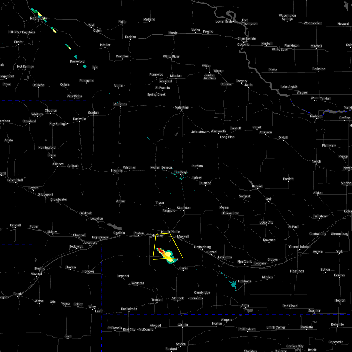 The severe thunderstorm warning for southwestern lincoln county will expire at 900 pm cdt, the storm which prompted the warning has weakened below severe limits, and no longer poses an immediate threat to life or property. therefore, the warning will be allowed to expire. to report severe weather, contact your nearest law enforcement agency. they will relay your report to the national weather service north platte. The severe thunderstorm warning for southwestern lincoln county will expire at 900 pm cdt, the storm which prompted the warning has weakened below severe limits, and no longer poses an immediate threat to life or property. therefore, the warning will be allowed to expire. to report severe weather, contact your nearest law enforcement agency. they will relay your report to the national weather service north platte.
|
| 6/24/2020 8:22 PM CDT |
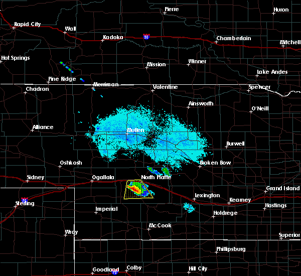 At 820 pm cdt, a severe thunderstorm was located 9 miles northeast of dickens, or 15 miles south of north platte, moving south at 30 mph (radar indicated). Hazards include 60 mph wind gusts and quarter size hail. Hail damage to vehicles is expected. expect wind damage to roofs, siding, and trees. locations impacted include, north platte, dickens, lake maloney state recreation area and somerset. this includes the following highways, interstate 80 in nebraska between mile markers 164 and 178. Highway 83 between mile markers 60 and 83. At 820 pm cdt, a severe thunderstorm was located 9 miles northeast of dickens, or 15 miles south of north platte, moving south at 30 mph (radar indicated). Hazards include 60 mph wind gusts and quarter size hail. Hail damage to vehicles is expected. expect wind damage to roofs, siding, and trees. locations impacted include, north platte, dickens, lake maloney state recreation area and somerset. this includes the following highways, interstate 80 in nebraska between mile markers 164 and 178. Highway 83 between mile markers 60 and 83.
|
| 6/24/2020 8:07 PM CDT |
 At 807 pm cdt, a severe thunderstorm was located near lake maloney state recreation area, or 9 miles southwest of north platte, moving south at 30 mph (radar indicated). Hazards include golf ball size hail and 60 mph wind gusts. People and animals outdoors will be injured. expect hail damage to roofs, siding, windows, and vehicles. expect wind damage to roofs, siding, and trees. locations impacted include, north platte, hershey, dickens, lake maloney state recreation area, birdwood and somerset. this includes the following highways, interstate 80 in nebraska between mile markers 164 and 178. Highway 83 between mile markers 60 and 84. At 807 pm cdt, a severe thunderstorm was located near lake maloney state recreation area, or 9 miles southwest of north platte, moving south at 30 mph (radar indicated). Hazards include golf ball size hail and 60 mph wind gusts. People and animals outdoors will be injured. expect hail damage to roofs, siding, windows, and vehicles. expect wind damage to roofs, siding, and trees. locations impacted include, north platte, hershey, dickens, lake maloney state recreation area, birdwood and somerset. this includes the following highways, interstate 80 in nebraska between mile markers 164 and 178. Highway 83 between mile markers 60 and 84.
|
| 6/24/2020 8:05 PM CDT | Tennis Ball sized hail reported 7.3 miles NE of North Platte, NE, 2.5 inch hail |
| 6/24/2020 8:02 PM CDT | Golf Ball sized hail reported 7.4 miles ENE of North Platte, NE, quarter to golf ball sized hail. |
| 6/24/2020 8:00 PM CDT | Golf Ball sized hail reported 7.3 miles NE of North Platte, NE, 3 miles west lake maloney golf ball hail |
| 6/24/2020 7:56 PM CDT |
 At 756 pm cdt, a severe thunderstorm was located near hershey, or near north platte, moving south at 30 mph (radar indicated). Hazards include 60 mph wind gusts and quarter size hail. Hail damage to vehicles is expected. Expect wind damage to roofs, siding, and trees. At 756 pm cdt, a severe thunderstorm was located near hershey, or near north platte, moving south at 30 mph (radar indicated). Hazards include 60 mph wind gusts and quarter size hail. Hail damage to vehicles is expected. Expect wind damage to roofs, siding, and trees.
|
| 6/24/2020 7:38 PM CDT |
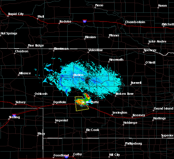 At 738 pm cdt, a severe thunderstorm was located over north platte, moving south at 30 mph (radar indicated). Hazards include 60 mph wind gusts and quarter size hail. Hail damage to vehicles is expected. expect wind damage to roofs, siding, and trees. locations impacted include, north platte, north platte airport, lake maloney state recreation area and birdwood. this includes the following highways, highway 97 between mile markers 1 and 11. interstate 80 in nebraska between mile markers 167 and 188. Highway 83 between mile markers 70 and 93. At 738 pm cdt, a severe thunderstorm was located over north platte, moving south at 30 mph (radar indicated). Hazards include 60 mph wind gusts and quarter size hail. Hail damage to vehicles is expected. expect wind damage to roofs, siding, and trees. locations impacted include, north platte, north platte airport, lake maloney state recreation area and birdwood. this includes the following highways, highway 97 between mile markers 1 and 11. interstate 80 in nebraska between mile markers 167 and 188. Highway 83 between mile markers 70 and 93.
|
| 6/24/2020 7:20 PM CDT |
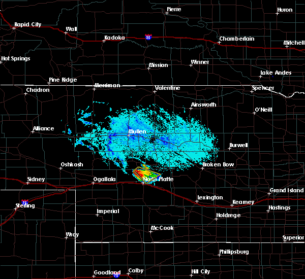 At 720 pm cdt, a severe thunderstorm was located 8 miles north of north platte, moving south at 30 mph (radar indicated). Hazards include 60 mph wind gusts and half dollar size hail. Hail damage to vehicles is expected. Expect wind damage to roofs, siding, and trees. At 720 pm cdt, a severe thunderstorm was located 8 miles north of north platte, moving south at 30 mph (radar indicated). Hazards include 60 mph wind gusts and half dollar size hail. Hail damage to vehicles is expected. Expect wind damage to roofs, siding, and trees.
|
| 6/21/2020 9:58 PM CDT |
 The severe thunderstorm warning for east central lincoln and southwestern custer counties will expire at 1000 pm cdt, the storm which prompted the warning has weakened below severe limits, and no longer poses an immediate threat to life or property. therefore, the warning will be allowed to expire. however small hail and gusty winds are still possible with this thunderstorm. The severe thunderstorm warning for east central lincoln and southwestern custer counties will expire at 1000 pm cdt, the storm which prompted the warning has weakened below severe limits, and no longer poses an immediate threat to life or property. therefore, the warning will be allowed to expire. however small hail and gusty winds are still possible with this thunderstorm.
|
| 6/21/2020 9:29 PM CDT | Quarter sized hail reported 6.2 miles WNW of North Platte, NE, report with photo via soical media. largest stone the size of a quarter |
| 6/21/2020 9:24 PM CDT |
 At 923 pm cdt, a severe thunderstorm was located near maxwell, or 9 miles southeast of north platte, moving southeast at 30 mph (radar indicated). Hazards include 60 mph wind gusts and quarter size hail. Hail damage to vehicles is expected. expect wind damage to roofs, siding, and trees. locations impacted include, north platte, brady, maxwell, north platte airport, keith, cottonwood canyon state wildlife management area, jeffrey canyon state wildlife management area and vroman. this includes the following highways, interstate 80 in nebraska between mile markers 180 and 207. Highway 83 near mile marker 77. At 923 pm cdt, a severe thunderstorm was located near maxwell, or 9 miles southeast of north platte, moving southeast at 30 mph (radar indicated). Hazards include 60 mph wind gusts and quarter size hail. Hail damage to vehicles is expected. expect wind damage to roofs, siding, and trees. locations impacted include, north platte, brady, maxwell, north platte airport, keith, cottonwood canyon state wildlife management area, jeffrey canyon state wildlife management area and vroman. this includes the following highways, interstate 80 in nebraska between mile markers 180 and 207. Highway 83 near mile marker 77.
|
| 6/21/2020 9:15 PM CDT | Half Dollar sized hail reported 6.2 miles WNW of North Platte, NE |
| 6/21/2020 9:11 PM CDT |
 At 910 pm cdt, a severe thunderstorm was located over north platte airport, or near north platte, moving southeast at 30 mph (radar indicated). Hazards include 60 mph wind gusts and nickel size hail. expect damage to roofs, siding, and trees At 910 pm cdt, a severe thunderstorm was located over north platte airport, or near north platte, moving southeast at 30 mph (radar indicated). Hazards include 60 mph wind gusts and nickel size hail. expect damage to roofs, siding, and trees
|
| 6/21/2020 9:10 PM CDT | Corrects previous non-tstm wnd gst report from 4 nne north platte. mesonet station ew7235 north platte 4 in lincoln county NE, 4.4 miles S of North Platte, NE |
| 6/8/2020 8:15 PM CDT | Tennis Ball sized hail reported 8.6 miles SW of North Platte, NE, mostly quarter sized hail... but reached tennis ball size. |
| 6/8/2020 8:00 PM CDT |
 At 759 pm cdt, a severe thunderstorm was located over north platte airport, or near north platte, moving north at 25 mph (radar indicated). Hazards include half dollar size hail. damage to vehicles is expected At 759 pm cdt, a severe thunderstorm was located over north platte airport, or near north platte, moving north at 25 mph (radar indicated). Hazards include half dollar size hail. damage to vehicles is expected
|
| 6/6/2020 3:07 PM CDT |
 At 307 pm cdt, a severe thunderstorm was located near north platte, moving northeast at 45 mph (radar indicated). Hazards include 60 mph wind gusts and quarter size hail. Hail damage to vehicles is expected. Expect wind damage to roofs, siding, and trees. At 307 pm cdt, a severe thunderstorm was located near north platte, moving northeast at 45 mph (radar indicated). Hazards include 60 mph wind gusts and quarter size hail. Hail damage to vehicles is expected. Expect wind damage to roofs, siding, and trees.
|
| 6/4/2020 6:28 PM CDT | Emergency manager reported a semi rollover caused by wind. semi was empty at time of rollove in lincoln county NE, 4.6 miles N of North Platte, NE |
| 6/4/2020 6:22 PM CDT | Storm damage reported in lincoln county NE, 9.4 miles N of North Platte, NE |
| 6/4/2020 6:18 PM CDT | Storm damage reported in lincoln county NE, 2.7 miles SW of North Platte, NE |
| 6/4/2020 6:17 PM CDT | Storm damage reported in lincoln county NE, 0.5 miles ESE of North Platte, NE |
| 6/4/2020 6:13 PM CDT | Several large trees down. time estimated from rada in lincoln county NE, 2.5 miles N of North Platte, NE |
| 6/4/2020 6:06 PM CDT |
 At 605 pm cdt, a severe thunderstorm was located 9 miles northeast of dickens, or 14 miles southwest of north platte, moving east at 45 mph (radar indicated). Hazards include 60 mph wind gusts and a large cloud of blinding dust. expect damage to roofs, siding, and trees At 605 pm cdt, a severe thunderstorm was located 9 miles northeast of dickens, or 14 miles southwest of north platte, moving east at 45 mph (radar indicated). Hazards include 60 mph wind gusts and a large cloud of blinding dust. expect damage to roofs, siding, and trees
|
| 6/4/2020 5:05 PM CDT | 1/4 mile visibility and 70 mph winds in lincoln county NE, 5 miles ENE of North Platte, NE |
| 5/23/2020 10:01 PM MDT |
 At 1101 pm cdt/1001 pm mdt/, severe thunderstorms were located along a line extending from near mullen to sarben to 7 miles north of grant, moving east at 25 mph (radar indicated). Hazards include 60 mph wind gusts and half dollar size hail. Hail damage to vehicles is expected. expect wind damage to roofs, siding, and trees. locations impacted include, north platte, mullen, tryon, sutherland, hershey, paxton, wallace, madrid, elsie, seneca, lake maloney state recreation area, sarben, ringgold, sutherland reservoir state recreation area, roscoe, flatts, o`fallons, kelso, shimmons lake and grainton. this includes the following highways, highway 2 between mile markers 177 and 201. highway 61 between mile markers 71 and 82. highway 92 between mile markers 181 and 217. highway 97 between mile markers 1 and 70. interstate 80 in nebraska between mile markers 132 and 179. Highway 83 between mile markers 70 and 89. At 1101 pm cdt/1001 pm mdt/, severe thunderstorms were located along a line extending from near mullen to sarben to 7 miles north of grant, moving east at 25 mph (radar indicated). Hazards include 60 mph wind gusts and half dollar size hail. Hail damage to vehicles is expected. expect wind damage to roofs, siding, and trees. locations impacted include, north platte, mullen, tryon, sutherland, hershey, paxton, wallace, madrid, elsie, seneca, lake maloney state recreation area, sarben, ringgold, sutherland reservoir state recreation area, roscoe, flatts, o`fallons, kelso, shimmons lake and grainton. this includes the following highways, highway 2 between mile markers 177 and 201. highway 61 between mile markers 71 and 82. highway 92 between mile markers 181 and 217. highway 97 between mile markers 1 and 70. interstate 80 in nebraska between mile markers 132 and 179. Highway 83 between mile markers 70 and 89.
|
| 5/23/2020 9:44 PM MDT |
 At 1044 pm cdt/944 pm mdt/, severe thunderstorms were located along a line extending from near mullen to near paxton to 6 miles south of ogallala, moving east at 30 mph (radar indicated). Hazards include ping pong ball size hail and 60 mph wind gusts. People and animals outdoors will be injured. expect hail damage to roofs, siding, windows, and vehicles. Expect wind damage to roofs, siding, and trees. At 1044 pm cdt/944 pm mdt/, severe thunderstorms were located along a line extending from near mullen to near paxton to 6 miles south of ogallala, moving east at 30 mph (radar indicated). Hazards include ping pong ball size hail and 60 mph wind gusts. People and animals outdoors will be injured. expect hail damage to roofs, siding, windows, and vehicles. Expect wind damage to roofs, siding, and trees.
|
| 5/21/2020 4:20 AM CDT | Quarter sized hail reported 8.6 miles ESE of North Platte, NE |
| 9/30/2019 8:30 PM CDT | Hen Egg sized hail reported 0.3 miles SSW of North Platte, NE |
| 9/30/2019 8:25 PM CDT | Golf Ball sized hail reported 0.5 miles ESE of North Platte, NE |
| 9/30/2019 8:21 PM CDT | Ping Pong Ball sized hail reported 0.3 miles SSW of North Platte, NE |
| 9/30/2019 8:20 PM CDT | Half Dollar sized hail reported 0.7 miles NW of North Platte, NE, report from mping: half dollar (1.25 in.). |
| 9/30/2019 8:18 PM CDT |
 At 818 pm cdt, a severe thunderstorm was located over north platte airport, or near north platte, moving northeast at 45 mph (radar and spotter indicated). Hazards include two inch hail and 60 mph wind gusts. People and animals outdoors will be injured. expect hail damage to roofs, siding, windows, and vehicles. Expect wind damage to roofs, siding, and trees. At 818 pm cdt, a severe thunderstorm was located over north platte airport, or near north platte, moving northeast at 45 mph (radar and spotter indicated). Hazards include two inch hail and 60 mph wind gusts. People and animals outdoors will be injured. expect hail damage to roofs, siding, windows, and vehicles. Expect wind damage to roofs, siding, and trees.
|
| 9/30/2019 8:15 PM CDT | Hen Egg sized hail reported 3.3 miles NNE of North Platte, NE |
| 9/30/2019 8:13 PM CDT | Golf Ball sized hail reported 4.1 miles NNE of North Platte, NE |
| 9/11/2019 10:39 PM CDT | Storm damage reported in lincoln county NE, 2.7 miles SW of North Platte, NE |
| 9/11/2019 10:36 PM CDT |
 At 1036 pm cdt, severe thunderstorms were located along a line extending from near north platte airport to 8 miles south of maxwell to near curtis to 11 miles north of culbertson, moving east at 55 mph (radar indicated). Hazards include 70 mph wind gusts and penny size hail. Expect considerable tree damage. Damage is likely to mobile homes, roofs, and outbuildings. At 1036 pm cdt, severe thunderstorms were located along a line extending from near north platte airport to 8 miles south of maxwell to near curtis to 11 miles north of culbertson, moving east at 55 mph (radar indicated). Hazards include 70 mph wind gusts and penny size hail. Expect considerable tree damage. Damage is likely to mobile homes, roofs, and outbuildings.
|
| 9/11/2019 9:02 PM CDT | Quarter sized hail reported 19.6 miles NE of North Platte, NE |
| 8/5/2019 8:25 PM CDT |
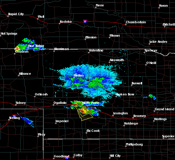 The severe thunderstorm warning for southeastern lincoln county will expire at 830 pm cdt, the storm which prompted the warning has moved out of the area. therefore, the warning will be allowed to expire. remember, a severe thunderstorm warning still remains in effect for lincoln county. The severe thunderstorm warning for southeastern lincoln county will expire at 830 pm cdt, the storm which prompted the warning has moved out of the area. therefore, the warning will be allowed to expire. remember, a severe thunderstorm warning still remains in effect for lincoln county.
|
| 8/5/2019 8:15 PM CDT |
 At 815 pm cdt, a severe thunderstorm was located near lake maloney state recreation area, or 10 miles south of north platte, moving southeast at 25 mph (radar indicated). Hazards include 60 mph wind gusts and quarter size hail. Hail damage to vehicles is expected. expect wind damage to roofs, siding, and trees. locations impacted include, north platte and lake maloney state recreation area. this includes the following highways, interstate 80 in nebraska between mile markers 172 and 176. Highway 83 between mile markers 57 and 81. At 815 pm cdt, a severe thunderstorm was located near lake maloney state recreation area, or 10 miles south of north platte, moving southeast at 25 mph (radar indicated). Hazards include 60 mph wind gusts and quarter size hail. Hail damage to vehicles is expected. expect wind damage to roofs, siding, and trees. locations impacted include, north platte and lake maloney state recreation area. this includes the following highways, interstate 80 in nebraska between mile markers 172 and 176. Highway 83 between mile markers 57 and 81.
|
| 8/5/2019 8:04 PM CDT |
 At 803 pm cdt, a severe thunderstorm was located over lake maloney state recreation area, or near north platte, moving southeast at 25 mph (radar indicated). Hazards include 60 mph wind gusts and quarter size hail. Hail damage to vehicles is expected. Expect wind damage to roofs, siding, and trees. At 803 pm cdt, a severe thunderstorm was located over lake maloney state recreation area, or near north platte, moving southeast at 25 mph (radar indicated). Hazards include 60 mph wind gusts and quarter size hail. Hail damage to vehicles is expected. Expect wind damage to roofs, siding, and trees.
|
| 7/12/2019 11:27 PM CDT |
 The severe thunderstorm warning for eastern lincoln, southwestern logan, southeastern mcpherson and southwestern custer counties will expire at 1130 pm cdt, the storms which prompted the warning have moved out of the area. therefore, the warning will be allowed to expire. however gusty winds are still possible with these thunderstorms. a severe thunderstorm watch remains in effect until 200 am cdt for central, southwestern and west central nebraska. to report severe weather, contact your nearest law enforcement agency. they will relay your report to the national weather service north platte. The severe thunderstorm warning for eastern lincoln, southwestern logan, southeastern mcpherson and southwestern custer counties will expire at 1130 pm cdt, the storms which prompted the warning have moved out of the area. therefore, the warning will be allowed to expire. however gusty winds are still possible with these thunderstorms. a severe thunderstorm watch remains in effect until 200 am cdt for central, southwestern and west central nebraska. to report severe weather, contact your nearest law enforcement agency. they will relay your report to the national weather service north platte.
|
| 7/12/2019 11:14 PM CDT |
 At 1114 pm cdt, severe thunderstorms were located along a line extending from near stapleton to 11 miles southwest of arnold to near brady to near moorefield, moving east at 40 mph (radar indicated). Hazards include 70 mph wind gusts and penny size hail. Expect considerable tree damage. damage is likely to mobile homes, roofs, and outbuildings. locations impacted include, north platte, brady, maxwell, wellfleet, lake maloney state recreation area, north platte airport, keith, cottonwood canyon state wildlife management area, etna, hansen memorial reserve state wildlife management area, jeffrey canyon state wildlife management area and vroman. this includes the following highways, highway 92 between mile markers 233 and 236. highway 97 between mile markers 1 and 24. interstate 80 in nebraska between mile markers 174 and 207. Highway 83 between mile markers 56 and 110. At 1114 pm cdt, severe thunderstorms were located along a line extending from near stapleton to 11 miles southwest of arnold to near brady to near moorefield, moving east at 40 mph (radar indicated). Hazards include 70 mph wind gusts and penny size hail. Expect considerable tree damage. damage is likely to mobile homes, roofs, and outbuildings. locations impacted include, north platte, brady, maxwell, wellfleet, lake maloney state recreation area, north platte airport, keith, cottonwood canyon state wildlife management area, etna, hansen memorial reserve state wildlife management area, jeffrey canyon state wildlife management area and vroman. this includes the following highways, highway 92 between mile markers 233 and 236. highway 97 between mile markers 1 and 24. interstate 80 in nebraska between mile markers 174 and 207. Highway 83 between mile markers 56 and 110.
|
| 7/12/2019 10:55 PM CDT | Multiple power lines down around east d and east e streets. fire department reports tree limbs have knocked lines down. also power transformer on east d street is on fi in lincoln county NE, 0.5 miles ESE of North Platte, NE |
| 7/12/2019 10:54 PM CDT |
 At 1053 pm cdt, severe thunderstorms were located along a line extending from 7 miles southeast of ringgold to 9 miles south of gandy to brady to near moorefield, moving east at 45 mph (radar indicated). Hazards include 70 mph wind gusts and penny size hail. Expect considerable tree damage. damage is likely to mobile homes, roofs, and outbuildings. locations impacted include, north platte, sutherland, hershey, brady, eustis, maxwell, wellfleet, moorefield, dickens, lake maloney state recreation area, north platte airport, keith, cottonwood canyon state wildlife management area, etna, hansen memorial reserve state wildlife management area, jeffrey canyon state wildlife management area, o`fallons, birdwood, vroman and somerset. this includes the following highways, highway 92 between mile markers 233 and 236. highway 97 between mile markers 1 and 24. interstate 80 in nebraska between mile markers 161 and 207. Highway 83 between mile markers 51 and 110. At 1053 pm cdt, severe thunderstorms were located along a line extending from 7 miles southeast of ringgold to 9 miles south of gandy to brady to near moorefield, moving east at 45 mph (radar indicated). Hazards include 70 mph wind gusts and penny size hail. Expect considerable tree damage. damage is likely to mobile homes, roofs, and outbuildings. locations impacted include, north platte, sutherland, hershey, brady, eustis, maxwell, wellfleet, moorefield, dickens, lake maloney state recreation area, north platte airport, keith, cottonwood canyon state wildlife management area, etna, hansen memorial reserve state wildlife management area, jeffrey canyon state wildlife management area, o`fallons, birdwood, vroman and somerset. this includes the following highways, highway 92 between mile markers 233 and 236. highway 97 between mile markers 1 and 24. interstate 80 in nebraska between mile markers 161 and 207. Highway 83 between mile markers 51 and 110.
|
| 7/12/2019 10:34 PM CDT |
 At 1032 pm cdt, severe thunderstorms were located along a line extending from near tryon to 12 miles south of ringgold to near north platte airport to near wellfleet, moving east at 30 mph (radar indicated). Hazards include 70 mph wind gusts and penny size hail. Expect considerable tree damage. Damage is likely to mobile homes, roofs, and outbuildings. At 1032 pm cdt, severe thunderstorms were located along a line extending from near tryon to 12 miles south of ringgold to near north platte airport to near wellfleet, moving east at 30 mph (radar indicated). Hazards include 70 mph wind gusts and penny size hail. Expect considerable tree damage. Damage is likely to mobile homes, roofs, and outbuildings.
|
| 7/7/2019 2:54 AM CDT |
 The severe thunderstorm warning for western frontier, lincoln and hayes counties will expire at 300 am cdt, the storms which prompted the warning have weakened below severe limits, and no longer pose an immediate threat to life or property. therefore, the warning will be allowed to expire. however gusty winds and heavy rain are still possible with these thunderstorms. a severe thunderstorm watch remains in effect until 500 am cdt for southwestern nebraska. The severe thunderstorm warning for western frontier, lincoln and hayes counties will expire at 300 am cdt, the storms which prompted the warning have weakened below severe limits, and no longer pose an immediate threat to life or property. therefore, the warning will be allowed to expire. however gusty winds and heavy rain are still possible with these thunderstorms. a severe thunderstorm watch remains in effect until 500 am cdt for southwestern nebraska.
|
| 7/7/2019 2:30 AM CDT |
 At 229 am cdt, severe thunderstorms were located along a line extending from 6 miles north of north platte to near hayes center to near wauneta, moving southeast at 35 mph (radar indicated). Hazards include 60 mph wind gusts and penny size hail. Expect damage to roofs, siding, and trees. locations impacted include, north platte, curtis, hayes center, sutherland, hershey, brady, wallace, maxwell, wellfleet, dickens, lake maloney, maywood, hamlet, o`fallons, willow view campground and red willow reservoir. this includes the following highways, highway 97 between mile markers 1 and 9. interstate 80 in nebraska between mile markers 160 and 202. Highway 83 between mile markers 27 and 93. At 229 am cdt, severe thunderstorms were located along a line extending from 6 miles north of north platte to near hayes center to near wauneta, moving southeast at 35 mph (radar indicated). Hazards include 60 mph wind gusts and penny size hail. Expect damage to roofs, siding, and trees. locations impacted include, north platte, curtis, hayes center, sutherland, hershey, brady, wallace, maxwell, wellfleet, dickens, lake maloney, maywood, hamlet, o`fallons, willow view campground and red willow reservoir. this includes the following highways, highway 97 between mile markers 1 and 9. interstate 80 in nebraska between mile markers 160 and 202. Highway 83 between mile markers 27 and 93.
|
| 7/7/2019 2:05 AM CDT |
 At 204 am cdt/104 am mdt/, severe thunderstorms were located along a line extending from 12 miles north of hershey to 12 miles south of wallace to near imperial, moving southeast at 35 mph (radar indicated). Hazards include 60 mph wind gusts and penny size hail. expect damage to roofs, siding, and trees At 204 am cdt/104 am mdt/, severe thunderstorms were located along a line extending from 12 miles north of hershey to 12 miles south of wallace to near imperial, moving southeast at 35 mph (radar indicated). Hazards include 60 mph wind gusts and penny size hail. expect damage to roofs, siding, and trees
|
| 7/6/2019 2:57 AM CDT |
 At 236 am cdt/136 am mdt/, severe thunderstorms were located along a line extending from 7 miles northwest of north platte to 9 miles southwest of wellfleet to near enders reservoir, moving southeast at 40 mph (radar indicated). Hazards include 60 mph wind gusts and penny size hail. Expect damage to roofs, siding, and trees. locations impacted include, north platte, imperial, hayes center, sutherland, hershey, wauneta, wallace, wellfleet, dickens, lake maloney, enders reservoir, sutherland reservoir, champion, crete, chase, maywood and hamlet. this includes the following highways, highway 61 between mile markers 25 and 48. highway 97 between mile markers 1 and 3. interstate 80 in nebraska between mile markers 158 and 190. Highway 83 between mile markers 34 and 87. At 236 am cdt/136 am mdt/, severe thunderstorms were located along a line extending from 7 miles northwest of north platte to 9 miles southwest of wellfleet to near enders reservoir, moving southeast at 40 mph (radar indicated). Hazards include 60 mph wind gusts and penny size hail. Expect damage to roofs, siding, and trees. locations impacted include, north platte, imperial, hayes center, sutherland, hershey, wauneta, wallace, wellfleet, dickens, lake maloney, enders reservoir, sutherland reservoir, champion, crete, chase, maywood and hamlet. this includes the following highways, highway 61 between mile markers 25 and 48. highway 97 between mile markers 1 and 3. interstate 80 in nebraska between mile markers 158 and 190. Highway 83 between mile markers 34 and 87.
|
| 7/6/2019 2:37 AM CDT |
 At 236 am cdt/136 am mdt/, severe thunderstorms were located along a line extending from 7 miles northwest of north platte to 9 miles southwest of wellfleet to near enders reservoir, moving southeast at 40 mph (radar indicated). Hazards include 60 mph wind gusts and penny size hail. Expect damage to roofs, siding, and trees. locations impacted include, north platte, imperial, hayes center, sutherland, hershey, wauneta, wallace, wellfleet, dickens, lake maloney, enders reservoir, sutherland reservoir, champion, crete, chase, maywood and hamlet. this includes the following highways, highway 61 between mile markers 25 and 48. highway 97 between mile markers 1 and 3. interstate 80 in nebraska between mile markers 158 and 190. Highway 83 between mile markers 34 and 87. At 236 am cdt/136 am mdt/, severe thunderstorms were located along a line extending from 7 miles northwest of north platte to 9 miles southwest of wellfleet to near enders reservoir, moving southeast at 40 mph (radar indicated). Hazards include 60 mph wind gusts and penny size hail. Expect damage to roofs, siding, and trees. locations impacted include, north platte, imperial, hayes center, sutherland, hershey, wauneta, wallace, wellfleet, dickens, lake maloney, enders reservoir, sutherland reservoir, champion, crete, chase, maywood and hamlet. this includes the following highways, highway 61 between mile markers 25 and 48. highway 97 between mile markers 1 and 3. interstate 80 in nebraska between mile markers 158 and 190. Highway 83 between mile markers 34 and 87.
|
| 7/6/2019 1:56 AM CDT |
 At 155 am cdt/1255 am mdt/, severe thunderstorms were located along a line extending from 14 miles southwest of tryon to 8 miles northwest of wallace to 10 miles north of imperial, moving southeast at 40 mph (radar indicated). Hazards include 60 mph wind gusts and penny size hail. expect damage to roofs, siding, and trees At 155 am cdt/1255 am mdt/, severe thunderstorms were located along a line extending from 14 miles southwest of tryon to 8 miles northwest of wallace to 10 miles north of imperial, moving southeast at 40 mph (radar indicated). Hazards include 60 mph wind gusts and penny size hail. expect damage to roofs, siding, and trees
|
| 7/5/2019 2:18 AM CDT |
 A severe thunderstorm warning remains in effect until 245 am cdt/145 am mdt/ for southeastern hooker. central lincoln. logan. eastern mcpherson. northwestern custer and southern thomas counties. At 217 am cdt/117 am mdt/, severe thunderstorms were located along a line extending from 16 miles south of thedford to 13 miles north of. A severe thunderstorm warning remains in effect until 245 am cdt/145 am mdt/ for southeastern hooker. central lincoln. logan. eastern mcpherson. northwestern custer and southern thomas counties. At 217 am cdt/117 am mdt/, severe thunderstorms were located along a line extending from 16 miles south of thedford to 13 miles north of.
|
| 7/5/2019 1:40 AM CDT |
 At 139 am cdt/1239 am mdt/, severe thunderstorms were located along a line extending from 13 miles west of tryon to 11 miles north of north platte to 10 miles north of hayes center, moving northeast at 50 mph (radar indicated). Hazards include 60 mph wind gusts and quarter size hail. Hail damage to vehicles is expected. Expect wind damage to roofs, siding, and trees. At 139 am cdt/1239 am mdt/, severe thunderstorms were located along a line extending from 13 miles west of tryon to 11 miles north of north platte to 10 miles north of hayes center, moving northeast at 50 mph (radar indicated). Hazards include 60 mph wind gusts and quarter size hail. Hail damage to vehicles is expected. Expect wind damage to roofs, siding, and trees.
|
| 6/8/2019 5:54 PM CDT | Half Dollar sized hail reported 1.9 miles NNE of North Platte, NE |
| 6/8/2019 5:48 PM CDT | Golf Ball sized hail reported 1.9 miles NNE of North Platte, NE |
| 6/8/2019 5:44 PM CDT |
 A severe thunderstorm warning remains in effect until 615 pm cdt for eastern lincoln and southwestern custer counties. at 544 pm cdt, severe thunderstorms were located along a line extending from 12 miles southwest of arnold to near lake maloney state recreation area, moving southeast at 20 mph. hazard. Ping pong ball size hail and 60 mph wind gusts. A severe thunderstorm warning remains in effect until 615 pm cdt for eastern lincoln and southwestern custer counties. at 544 pm cdt, severe thunderstorms were located along a line extending from 12 miles southwest of arnold to near lake maloney state recreation area, moving southeast at 20 mph. hazard. Ping pong ball size hail and 60 mph wind gusts.
|
| 6/8/2019 5:37 PM CDT | Quarter sized hail reported 0.5 miles ESE of North Platte, NE |
| 6/8/2019 5:35 PM CDT | Half Dollar sized hail reported 0.5 miles ESE of North Platte, NE, corrects previous hail report from north platte. |
| 6/8/2019 5:30 PM CDT | Quarter sized hail reported 4.6 miles E of North Platte, NE, bailey yards |
| 6/8/2019 5:27 PM CDT | Quarter sized hail reported 12.2 miles SW of North Platte, NE |
| 6/8/2019 5:25 PM CDT | Storm damage reported in lincoln county NE, 4.4 miles S of North Platte, NE |
| 6/8/2019 5:22 PM CDT |
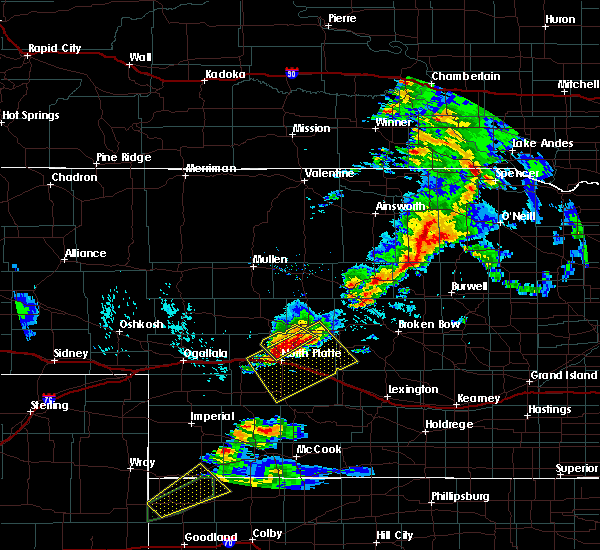 At 521 pm cdt, a severe thunderstorm was located 13 miles north of north platte airport, or 13 miles north of north platte, moving southeast at 10 mph (radar indicated). Hazards include ping pong ball size hail and 60 mph wind gusts. People and animals outdoors will be injured. expect hail damage to roofs, siding, windows, and vehicles. expect wind damage to roofs, siding, and trees. locations impacted include, north platte. this includes the following highways, highway 97 between mile markers 1 and 13. Highway 83 between mile markers 85 and 107. At 521 pm cdt, a severe thunderstorm was located 13 miles north of north platte airport, or 13 miles north of north platte, moving southeast at 10 mph (radar indicated). Hazards include ping pong ball size hail and 60 mph wind gusts. People and animals outdoors will be injured. expect hail damage to roofs, siding, windows, and vehicles. expect wind damage to roofs, siding, and trees. locations impacted include, north platte. this includes the following highways, highway 97 between mile markers 1 and 13. Highway 83 between mile markers 85 and 107.
|
| 6/8/2019 5:17 PM CDT |
 At 516 pm cdt, severe thunderstorms were located along a line extending from near gandy to near hershey, moving southeast at 20 mph (radar indicated). Hazards include ping pong ball size hail and 60 mph wind gusts. People and animals outdoors will be injured. expect hail damage to roofs, siding, windows, and vehicles. Expect wind damage to roofs, siding, and trees. At 516 pm cdt, severe thunderstorms were located along a line extending from near gandy to near hershey, moving southeast at 20 mph (radar indicated). Hazards include ping pong ball size hail and 60 mph wind gusts. People and animals outdoors will be injured. expect hail damage to roofs, siding, windows, and vehicles. Expect wind damage to roofs, siding, and trees.
|
| 6/8/2019 4:45 PM CDT | Ping Pong Ball sized hail reported 18.3 miles SSE of North Platte, NE |
| 6/8/2019 4:44 PM CDT |
 At 443 pm cdt, a severe thunderstorm was located 7 miles south of ringgold, or 13 miles southeast of tryon, moving southeast at 10 mph (radar indicated). Hazards include ping pong ball size hail and 60 mph wind gusts. People and animals outdoors will be injured. expect hail damage to roofs, siding, windows, and vehicles. Expect wind damage to roofs, siding, and trees. At 443 pm cdt, a severe thunderstorm was located 7 miles south of ringgold, or 13 miles southeast of tryon, moving southeast at 10 mph (radar indicated). Hazards include ping pong ball size hail and 60 mph wind gusts. People and animals outdoors will be injured. expect hail damage to roofs, siding, windows, and vehicles. Expect wind damage to roofs, siding, and trees.
|
| 6/4/2019 9:01 PM CDT | Golf Ball sized hail reported 20.4 miles NNE of North Platte, NE, hail lasted 10 to 15 minutes. winds estimated at 50 mph. time estimated from radar. |
| 5/27/2019 9:39 PM CDT |
 At 939 pm cdt, severe thunderstorms were located along a line extending from 7 miles southwest of ringgold to 12 miles north of north platte airport to near north platte, moving northeast at 35 mph (radar indicated). Hazards include 60 mph wind gusts and quarter size hail. Hail damage to vehicles is expected. expect wind damage to roofs, siding, and trees. locations impacted include, north platte, maxwell, north platte airport, lake maloney state recreation area, keith and cottonwood canyon state wildlife management area. this includes the following highways, highway 92 between mile markers 216 and 225, and near mile marker 233. highway 97 between mile markers 1 and 22. interstate 80 in nebraska between mile markers 171 and 190. Highway 83 between mile markers 74 and 109. At 939 pm cdt, severe thunderstorms were located along a line extending from 7 miles southwest of ringgold to 12 miles north of north platte airport to near north platte, moving northeast at 35 mph (radar indicated). Hazards include 60 mph wind gusts and quarter size hail. Hail damage to vehicles is expected. expect wind damage to roofs, siding, and trees. locations impacted include, north platte, maxwell, north platte airport, lake maloney state recreation area, keith and cottonwood canyon state wildlife management area. this includes the following highways, highway 92 between mile markers 216 and 225, and near mile marker 233. highway 97 between mile markers 1 and 22. interstate 80 in nebraska between mile markers 171 and 190. Highway 83 between mile markers 74 and 109.
|
| 5/27/2019 9:20 PM CDT |
 At 919 pm cdt, severe thunderstorms were located along a line extending from 11 miles southwest of ringgold to 6 miles northwest of north platte to 7 miles south of hershey, moving northeast at 30 mph (radar indicated). Hazards include ping pong ball size hail and 60 mph wind gusts. People and animals outdoors will be injured. expect hail damage to roofs, siding, windows, and vehicles. Expect wind damage to roofs, siding, and trees. At 919 pm cdt, severe thunderstorms were located along a line extending from 11 miles southwest of ringgold to 6 miles northwest of north platte to 7 miles south of hershey, moving northeast at 30 mph (radar indicated). Hazards include ping pong ball size hail and 60 mph wind gusts. People and animals outdoors will be injured. expect hail damage to roofs, siding, windows, and vehicles. Expect wind damage to roofs, siding, and trees.
|
| 5/23/2019 9:34 PM CDT | Half Dollar sized hail reported 2.7 miles SW of North Platte, NE |
| 5/23/2019 9:33 PM CDT |
 At 933 pm cdt, a severe thunderstorm was located over north platte airport, or near north platte, moving north at 70 mph (trained weather spotters). Hazards include half dollar size hail. damage to vehicles is expected At 933 pm cdt, a severe thunderstorm was located over north platte airport, or near north platte, moving north at 70 mph (trained weather spotters). Hazards include half dollar size hail. damage to vehicles is expected
|
| 5/16/2019 9:26 PM CDT |
 The severe thunderstorm warning for central lincoln county will expire at 930 pm cdt, the storms which prompted the warning have weakened below severe limits, and have exited the warned area. therefore, the warning will be allowed to expire. The severe thunderstorm warning for central lincoln county will expire at 930 pm cdt, the storms which prompted the warning have weakened below severe limits, and have exited the warned area. therefore, the warning will be allowed to expire.
|
| 5/16/2019 9:06 PM CDT |
 At 905 pm cdt, severe thunderstorms were located along a line extending from near hershey to near lake maloney state recreation area, moving northeast at 35 mph (radar indicated). Hazards include 60 mph wind gusts and quarter size hail. Hail damage to vehicles is expected. expect wind damage to roofs, siding, and trees. locations impacted include, north platte, hershey, maxwell, sutherland reservoir state recreation area, lake maloney state recreation area, north platte airport, keith, cottonwood canyon state wildlife management area, o`fallons and birdwood. this includes the following highways, highway 97 between mile markers 1 and 11. interstate 80 in nebraska between mile markers 159 and 197. Highway 83 between mile markers 60 and 93. At 905 pm cdt, severe thunderstorms were located along a line extending from near hershey to near lake maloney state recreation area, moving northeast at 35 mph (radar indicated). Hazards include 60 mph wind gusts and quarter size hail. Hail damage to vehicles is expected. expect wind damage to roofs, siding, and trees. locations impacted include, north platte, hershey, maxwell, sutherland reservoir state recreation area, lake maloney state recreation area, north platte airport, keith, cottonwood canyon state wildlife management area, o`fallons and birdwood. this includes the following highways, highway 97 between mile markers 1 and 11. interstate 80 in nebraska between mile markers 159 and 197. Highway 83 between mile markers 60 and 93.
|
| 5/16/2019 8:38 PM CDT |
 At 838 pm cdt, severe thunderstorms were located along a line extending from 7 miles southwest of sutherland reservoir state recreation area to near dickens, moving northeast at 35 mph (radar indicated). Hazards include 60 mph wind gusts and quarter size hail. Hail damage to vehicles is expected. Expect wind damage to roofs, siding, and trees. At 838 pm cdt, severe thunderstorms were located along a line extending from 7 miles southwest of sutherland reservoir state recreation area to near dickens, moving northeast at 35 mph (radar indicated). Hazards include 60 mph wind gusts and quarter size hail. Hail damage to vehicles is expected. Expect wind damage to roofs, siding, and trees.
|
| 4/26/2019 8:02 PM CDT |
 At 802 pm cdt, a severe thunderstorm was located near north platte airport, or 7 miles east of north platte, moving east at 45 mph (radar indicated). Hazards include 60 mph wind gusts. expect damage to roofs, siding, and trees At 802 pm cdt, a severe thunderstorm was located near north platte airport, or 7 miles east of north platte, moving east at 45 mph (radar indicated). Hazards include 60 mph wind gusts. expect damage to roofs, siding, and trees
|
| 8/15/2018 7:24 PM CDT |
 At 724 pm cdt, a severe thunderstorm was located near maxwell, or 9 miles southeast of north platte, moving southeast at 35 mph (radar indicated). Hazards include 70 mph wind gusts and half dollar size hail. Hail damage to vehicles is expected. expect considerable tree damage. wind damage is also likely to mobile homes, roofs, and outbuildings. locations impacted include, north platte, brady, maxwell, lake maloney state recreation area, north platte airport, keith, cottonwood canyon state wildlife management area and jeffrey canyon state wildlife management area. this includes the following highways, highway 97 between mile markers 1 and 2. interstate 80 in nebraska between mile markers 172 and 202. Highway 83 between mile markers 70 and 94. At 724 pm cdt, a severe thunderstorm was located near maxwell, or 9 miles southeast of north platte, moving southeast at 35 mph (radar indicated). Hazards include 70 mph wind gusts and half dollar size hail. Hail damage to vehicles is expected. expect considerable tree damage. wind damage is also likely to mobile homes, roofs, and outbuildings. locations impacted include, north platte, brady, maxwell, lake maloney state recreation area, north platte airport, keith, cottonwood canyon state wildlife management area and jeffrey canyon state wildlife management area. this includes the following highways, highway 97 between mile markers 1 and 2. interstate 80 in nebraska between mile markers 172 and 202. Highway 83 between mile markers 70 and 94.
|
| 8/15/2018 7:20 PM CDT | Wind driven hail resulted in crop damage... corn stalks snapped and leaves shredde in lincoln county NE, 4.5 miles NW of North Platte, NE |
| 8/15/2018 7:11 PM CDT | Half Dollar sized hail reported 0.5 miles ESE of North Platte, NE, reported at the 2800 block of west 6th street. |
| 8/15/2018 7:11 PM CDT | Quarter sized hail reported 0.5 miles ESE of North Platte, NE, reported near sunset and buffalo bill road. |
| 8/15/2018 7:11 PM CDT |
 At 711 pm cdt, a severe thunderstorm was located over north platte airport, or near north platte, moving southeast at 35 mph. this is a very dangerous storm (radar indicated). Hazards include 80 mph wind gusts and half dollar size hail. Flying debris will be dangerous to those caught without shelter. mobile homes will be heavily damaged. expect considerable damage to roofs, windows, and vehicles. Extensive tree damage and power outages are likely. At 711 pm cdt, a severe thunderstorm was located over north platte airport, or near north platte, moving southeast at 35 mph. this is a very dangerous storm (radar indicated). Hazards include 80 mph wind gusts and half dollar size hail. Flying debris will be dangerous to those caught without shelter. mobile homes will be heavily damaged. expect considerable damage to roofs, windows, and vehicles. Extensive tree damage and power outages are likely.
|
| 8/15/2018 7:09 PM CDT | Quarter sized hail reported 0.5 miles ESE of North Platte, NE |
| 8/15/2018 7:08 PM CDT |
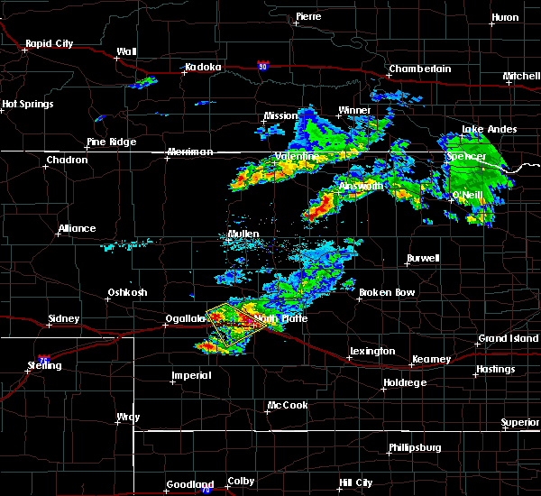 At 708 pm cdt, a severe thunderstorm was located over north platte, moving southeast at 30 mph. this is a very dangerous storm (radar indicated). Hazards include 80 mph wind gusts and half dollar size hail. Flying debris will be dangerous to those caught without shelter. mobile homes will be heavily damaged. expect considerable damage to roofs, windows, and vehicles. extensive tree damage and power outages are likely. locations impacted include, north platte, sutherland, hershey, sutherland reservoir state recreation area, north platte airport, coker, o`fallons and birdwood. this includes the following highways, highway 97 between mile markers 1 and 2. interstate 80 in nebraska between mile markers 155 and 181. Highway 83 between mile markers 78 and 87. At 708 pm cdt, a severe thunderstorm was located over north platte, moving southeast at 30 mph. this is a very dangerous storm (radar indicated). Hazards include 80 mph wind gusts and half dollar size hail. Flying debris will be dangerous to those caught without shelter. mobile homes will be heavily damaged. expect considerable damage to roofs, windows, and vehicles. extensive tree damage and power outages are likely. locations impacted include, north platte, sutherland, hershey, sutherland reservoir state recreation area, north platte airport, coker, o`fallons and birdwood. this includes the following highways, highway 97 between mile markers 1 and 2. interstate 80 in nebraska between mile markers 155 and 181. Highway 83 between mile markers 78 and 87.
|
| 8/15/2018 7:06 PM CDT |
 At 705 pm cdt, a severe thunderstorm was located over north platte, moving southeast at 30 mph (radar indicated). Hazards include 60 mph wind gusts and half dollar size hail. Hail damage to vehicles is expected. expect wind damage to roofs, siding, and trees. locations impacted include, north platte, sutherland, hershey, sutherland reservoir state recreation area, north platte airport, coker, o`fallons and birdwood. this includes the following highways, highway 97 between mile markers 1 and 2. interstate 80 in nebraska between mile markers 155 and 181. Highway 83 between mile markers 78 and 87. At 705 pm cdt, a severe thunderstorm was located over north platte, moving southeast at 30 mph (radar indicated). Hazards include 60 mph wind gusts and half dollar size hail. Hail damage to vehicles is expected. expect wind damage to roofs, siding, and trees. locations impacted include, north platte, sutherland, hershey, sutherland reservoir state recreation area, north platte airport, coker, o`fallons and birdwood. this includes the following highways, highway 97 between mile markers 1 and 2. interstate 80 in nebraska between mile markers 155 and 181. Highway 83 between mile markers 78 and 87.
|
| 8/15/2018 7:05 PM CDT | Estimated 70-80 mph wind gusts on west side of north platte. large tree branch down in lincoln county NE, 1.5 miles E of North Platte, NE |
| 8/15/2018 7:05 PM CDT | Quarter sized hail reported 1.5 miles E of North Platte, NE |
| 8/15/2018 7:00 PM CDT | Golf Ball sized hail reported 8.6 miles ESE of North Platte, NE, report via social media of golf ball size hail and 0.50 inches of rainfall. |
| 8/15/2018 6:55 PM CDT |
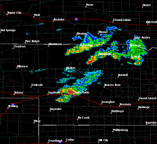 At 655 pm cdt, a severe thunderstorm was located near hershey, or 8 miles northwest of north platte, moving southeast at 35 mph (radar indicated). Hazards include 60 mph wind gusts and half dollar size hail. Hail damage to vehicles is expected. expect wind damage to roofs, siding, and trees. locations impacted include, north platte, sutherland, hershey, sutherland reservoir state recreation area, north platte airport, coker, o`fallons and birdwood. this includes the following highways, highway 97 between mile markers 1 and 2. interstate 80 in nebraska between mile markers 155 and 181. Highway 83 between mile markers 78 and 87. At 655 pm cdt, a severe thunderstorm was located near hershey, or 8 miles northwest of north platte, moving southeast at 35 mph (radar indicated). Hazards include 60 mph wind gusts and half dollar size hail. Hail damage to vehicles is expected. expect wind damage to roofs, siding, and trees. locations impacted include, north platte, sutherland, hershey, sutherland reservoir state recreation area, north platte airport, coker, o`fallons and birdwood. this includes the following highways, highway 97 between mile markers 1 and 2. interstate 80 in nebraska between mile markers 155 and 181. Highway 83 between mile markers 78 and 87.
|
| 8/15/2018 6:50 PM CDT | Storm damage reported in lincoln county NE, 11.5 miles ESE of North Platte, NE |
| 8/15/2018 6:40 PM CDT |
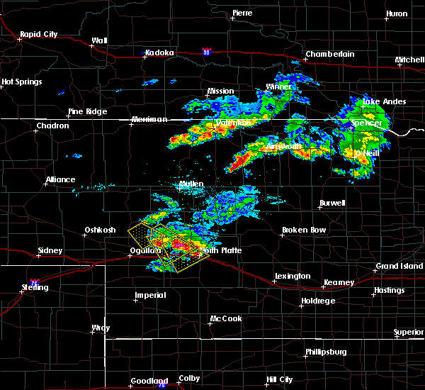 At 639 pm cdt, a severe thunderstorm was located near sutherland, or 17 miles northwest of north platte, moving southeast at 30 mph (radar indicated). Hazards include golf ball size hail. People and animals outdoors will be injured. Expect damage to roofs, siding, windows, and vehicles. At 639 pm cdt, a severe thunderstorm was located near sutherland, or 17 miles northwest of north platte, moving southeast at 30 mph (radar indicated). Hazards include golf ball size hail. People and animals outdoors will be injured. Expect damage to roofs, siding, windows, and vehicles.
|
| 8/3/2018 7:03 PM CDT |
 At 702 pm cdt, a severe thunderstorm was located 7 miles northwest of north platte, moving northeast at 30 mph (trained weather spotters). Hazards include 60 mph wind gusts and quarter size hail. Hail damage to vehicles is expected. expect wind damage to roofs, siding, and trees. locations impacted include, north platte, hershey and birdwood. this includes the following highways, highway 97 between mile markers 1 and 13. interstate 80 in nebraska between mile markers 161 and 176. Highway 83 between mile markers 83 and 89. At 702 pm cdt, a severe thunderstorm was located 7 miles northwest of north platte, moving northeast at 30 mph (trained weather spotters). Hazards include 60 mph wind gusts and quarter size hail. Hail damage to vehicles is expected. expect wind damage to roofs, siding, and trees. locations impacted include, north platte, hershey and birdwood. this includes the following highways, highway 97 between mile markers 1 and 13. interstate 80 in nebraska between mile markers 161 and 176. Highway 83 between mile markers 83 and 89.
|
| 8/3/2018 6:55 PM CDT |
 At 655 pm cdt, severe thunderstorms were located along a line extending from 6 miles south of hershey to near north platte, moving northeast at 20 mph (radar indicated). Hazards include ping pong ball size hail and 60 mph wind gusts. People and animals outdoors will be injured. expect hail damage to roofs, siding, windows, and vehicles. expect wind damage to roofs, siding, and trees. locations impacted include, north platte, hershey and birdwood. this includes the following highways, highway 97 between mile markers 1 and 13. interstate 80 in nebraska between mile markers 161 and 176. Highway 83 between mile markers 83 and 89. At 655 pm cdt, severe thunderstorms were located along a line extending from 6 miles south of hershey to near north platte, moving northeast at 20 mph (radar indicated). Hazards include ping pong ball size hail and 60 mph wind gusts. People and animals outdoors will be injured. expect hail damage to roofs, siding, windows, and vehicles. expect wind damage to roofs, siding, and trees. locations impacted include, north platte, hershey and birdwood. this includes the following highways, highway 97 between mile markers 1 and 13. interstate 80 in nebraska between mile markers 161 and 176. Highway 83 between mile markers 83 and 89.
|
| 8/3/2018 6:54 PM CDT | Quarter sized hail reported 8.6 miles ESE of North Platte, NE |
| 8/3/2018 6:54 PM CDT | Estimated 50 to 60 mph gust in lincoln county NE, 8.6 miles ESE of North Platte, NE |
| 8/3/2018 6:52 PM CDT | Center pivots overturned... buildings and grain bins damaged or destroyed from damaging winds estimated at 80 mph. time estimated from rada in lincoln county NE, 7.7 miles E of North Platte, NE |
| 8/3/2018 6:46 PM CDT | Off duty employee passing through reports 2 campers and 1 semi blown over in area of mm 169 and 171 on interstate 80. time estimated from rada in lincoln county NE, 8.1 miles ENE of North Platte, NE |
| 8/3/2018 6:41 PM CDT |
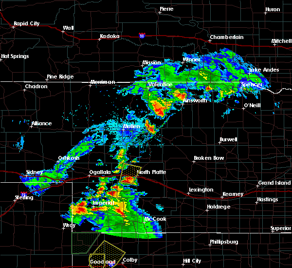 At 640 pm cdt, severe thunderstorms were located along a line extending from near hershey to 9 miles west of lake maloney state recreation area, moving north at 25 mph (radar indicated). Hazards include ping pong ball size hail and 60 mph wind gusts. People and animals outdoors will be injured. expect hail damage to roofs, siding, windows, and vehicles. expect wind damage to roofs, siding, and trees. locations impacted include, north platte, hershey and birdwood. this includes the following highways, highway 97 between mile markers 1 and 13. interstate 80 in nebraska between mile markers 161 and 176. Highway 83 between mile markers 83 and 89. At 640 pm cdt, severe thunderstorms were located along a line extending from near hershey to 9 miles west of lake maloney state recreation area, moving north at 25 mph (radar indicated). Hazards include ping pong ball size hail and 60 mph wind gusts. People and animals outdoors will be injured. expect hail damage to roofs, siding, windows, and vehicles. expect wind damage to roofs, siding, and trees. locations impacted include, north platte, hershey and birdwood. this includes the following highways, highway 97 between mile markers 1 and 13. interstate 80 in nebraska between mile markers 161 and 176. Highway 83 between mile markers 83 and 89.
|
| 8/3/2018 6:30 PM CDT |
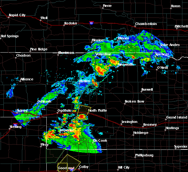 At 629 pm cdt, a severe thunderstorm was located 10 miles southeast of sutherland reservoir state recreation area, or 14 miles southwest of north platte, moving north at 25 mph (radar indicated). Hazards include ping pong ball size hail and 60 mph wind gusts. People and animals outdoors will be injured. expect hail damage to roofs, siding, windows, and vehicles. Expect wind damage to roofs, siding, and trees. At 629 pm cdt, a severe thunderstorm was located 10 miles southeast of sutherland reservoir state recreation area, or 14 miles southwest of north platte, moving north at 25 mph (radar indicated). Hazards include ping pong ball size hail and 60 mph wind gusts. People and animals outdoors will be injured. expect hail damage to roofs, siding, windows, and vehicles. Expect wind damage to roofs, siding, and trees.
|
| 6/30/2018 8:00 PM CDT |
 At 759 pm cdt, severe thunderstorms were located along a line extending from 7 miles northeast of north platte airport to near lake maloney state recreation area to 9 miles south of dickens, moving east at 45 mph (radar indicated). Hazards include 60 mph wind gusts and penny size hail. Expect damage to roofs, siding, and trees. locations impacted include, north platte, sutherland, hershey, wallace, maxwell, wellfleet, dickens, sutherland reservoir state recreation area, lake maloney state recreation area, north platte airport, keith, cottonwood canyon state wildlife management area, coker, o`fallons, birdwood and somerset. this includes the following highways, highway 97 between mile markers 1 and 7. interstate 80 in nebraska between mile markers 153 and 197. Highway 83 between mile markers 55 and 96. At 759 pm cdt, severe thunderstorms were located along a line extending from 7 miles northeast of north platte airport to near lake maloney state recreation area to 9 miles south of dickens, moving east at 45 mph (radar indicated). Hazards include 60 mph wind gusts and penny size hail. Expect damage to roofs, siding, and trees. locations impacted include, north platte, sutherland, hershey, wallace, maxwell, wellfleet, dickens, sutherland reservoir state recreation area, lake maloney state recreation area, north platte airport, keith, cottonwood canyon state wildlife management area, coker, o`fallons, birdwood and somerset. this includes the following highways, highway 97 between mile markers 1 and 7. interstate 80 in nebraska between mile markers 153 and 197. Highway 83 between mile markers 55 and 96.
|
| 6/30/2018 7:53 PM CDT | Storm damage reported in lincoln county NE, 7.6 miles SE of North Platte, NE |
| 6/30/2018 7:33 PM CDT |
 At 733 pm cdt/633 pm mdt/, severe thunderstorms were located along a line extending from near hershey to 8 miles north of dickens to 14 miles south of elsie, moving east at 50 mph (radar indicated). Hazards include 60 mph wind gusts and penny size hail. expect damage to roofs, siding, and trees At 733 pm cdt/633 pm mdt/, severe thunderstorms were located along a line extending from near hershey to 8 miles north of dickens to 14 miles south of elsie, moving east at 50 mph (radar indicated). Hazards include 60 mph wind gusts and penny size hail. expect damage to roofs, siding, and trees
|
| 6/23/2018 10:13 PM MDT |
 At 1113 pm cdt/1013 pm mdt/, severe thunderstorms were located along a line extending from 9 miles south of ringgold to 8 miles northeast of wallace to 8 miles east of lamar, moving east at 40 mph (radar indicated). Hazards include 60 mph wind gusts and penny size hail. Expect damage to roofs, siding, and trees. locations impacted include, north platte, imperial, sutherland, hershey, wallace, madrid, elsie, lamar, sutherland reservoir state recreation area, champion, crete, chase, grainton, coker, o`fallons, wanamaker state wildfire management area and birdwood. this includes the following highways, highway 61 between mile markers 41 and 61. highway 97 between mile markers 1 and 16. interstate 80 in nebraska between mile markers 151 and 177. Highway 83 between mile markers 82 and 91. At 1113 pm cdt/1013 pm mdt/, severe thunderstorms were located along a line extending from 9 miles south of ringgold to 8 miles northeast of wallace to 8 miles east of lamar, moving east at 40 mph (radar indicated). Hazards include 60 mph wind gusts and penny size hail. Expect damage to roofs, siding, and trees. locations impacted include, north platte, imperial, sutherland, hershey, wallace, madrid, elsie, lamar, sutherland reservoir state recreation area, champion, crete, chase, grainton, coker, o`fallons, wanamaker state wildfire management area and birdwood. this includes the following highways, highway 61 between mile markers 41 and 61. highway 97 between mile markers 1 and 16. interstate 80 in nebraska between mile markers 151 and 177. Highway 83 between mile markers 82 and 91.
|
| 6/23/2018 9:52 PM MDT |
 At 1052 pm cdt/952 pm mdt/, severe thunderstorms were located along a line extending from 14 miles south of tryon to near elsie to near lamar, moving east at 30 mph (radar indicated). Hazards include 60 mph wind gusts and penny size hail. expect damage to roofs, siding, and trees At 1052 pm cdt/952 pm mdt/, severe thunderstorms were located along a line extending from 14 miles south of tryon to near elsie to near lamar, moving east at 30 mph (radar indicated). Hazards include 60 mph wind gusts and penny size hail. expect damage to roofs, siding, and trees
|
| 6/17/2018 8:45 PM CDT |
 At 844 pm cdt, severe thunderstorms were located along a line extending from 9 miles northeast of hershey to near north platte to near lake maloney state recreation area, moving east at 35 mph (radar indicated). Hazards include 70 mph wind gusts and quarter size hail. Hail damage to vehicles is expected. expect considerable tree damage. wind damage is also likely to mobile homes, roofs, and outbuildings. these severe storms will be near, north platte airport around 855 pm cdt. other locations impacted by these severe thunderstorms include cottonwood canyon state wildlife management area and birdwood. this includes the following highways, highway 97 between mile markers 1 and 16. interstate 80 in nebraska between mile markers 163 and 188. highway 83 between mile markers 72 and 90. A tornado watch remains in effect until 1000 pm cdt for southwestern nebraska. At 844 pm cdt, severe thunderstorms were located along a line extending from 9 miles northeast of hershey to near north platte to near lake maloney state recreation area, moving east at 35 mph (radar indicated). Hazards include 70 mph wind gusts and quarter size hail. Hail damage to vehicles is expected. expect considerable tree damage. wind damage is also likely to mobile homes, roofs, and outbuildings. these severe storms will be near, north platte airport around 855 pm cdt. other locations impacted by these severe thunderstorms include cottonwood canyon state wildlife management area and birdwood. this includes the following highways, highway 97 between mile markers 1 and 16. interstate 80 in nebraska between mile markers 163 and 188. highway 83 between mile markers 72 and 90. A tornado watch remains in effect until 1000 pm cdt for southwestern nebraska.
|
| 6/17/2018 8:33 PM CDT |
 At 832 pm cdt, severe thunderstorms were located along a line extending from near sutherland to hershey to 8 miles west of lake maloney state recreation area, moving northeast at 35 mph (radar indicated). Hazards include 70 mph wind gusts and half dollar size hail. Hail damage to vehicles is expected. expect considerable tree damage. wind damage is also likely to mobile homes, roofs, and outbuildings. these severe storms will be near, lake maloney state recreation area around 845 pm cdt. north platte around 850 pm cdt. north platte airport around 855 pm cdt. other locations impacted by these severe thunderstorms include coker, o`fallons, cottonwood canyon state wildlife management area and birdwood. this includes the following highways, highway 97 between mile markers 1 and 16. interstate 80 in nebraska between mile markers 158 and 188. highway 83 between mile markers 70 and 90. A tornado watch remains in effect until 1000 pm cdt for southwestern nebraska. At 832 pm cdt, severe thunderstorms were located along a line extending from near sutherland to hershey to 8 miles west of lake maloney state recreation area, moving northeast at 35 mph (radar indicated). Hazards include 70 mph wind gusts and half dollar size hail. Hail damage to vehicles is expected. expect considerable tree damage. wind damage is also likely to mobile homes, roofs, and outbuildings. these severe storms will be near, lake maloney state recreation area around 845 pm cdt. north platte around 850 pm cdt. north platte airport around 855 pm cdt. other locations impacted by these severe thunderstorms include coker, o`fallons, cottonwood canyon state wildlife management area and birdwood. this includes the following highways, highway 97 between mile markers 1 and 16. interstate 80 in nebraska between mile markers 158 and 188. highway 83 between mile markers 70 and 90. A tornado watch remains in effect until 1000 pm cdt for southwestern nebraska.
|
| 6/17/2018 8:21 PM CDT |
 The national weather service in north platte has issued a * severe thunderstorm warning for. central lincoln county in southwestern nebraska. until 900 pm cdt. At 821 pm cdt, severe thunderstorms were located along a line extending from sutherland to near sutherland reservoir state. The national weather service in north platte has issued a * severe thunderstorm warning for. central lincoln county in southwestern nebraska. until 900 pm cdt. At 821 pm cdt, severe thunderstorms were located along a line extending from sutherland to near sutherland reservoir state.
|
| 5/10/2018 10:03 PM CDT |
 At 1003 pm cdt, severe thunderstorms were located along a line extending from near arnold to 9 miles south of gandy to north platte, moving northeast at 35 mph (radar indicated). Hazards include 70 mph wind gusts and penny size hail. Expect considerable tree damage. damage is likely to mobile homes, roofs, and outbuildings. locations impacted include, north platte, hershey, brady, maxwell, lake maloney state recreation area, north platte airport, keith, cottonwood canyon state wildlife management area and birdwood. this includes the following highways, highway 97 between mile markers 1 and 14. interstate 80 in nebraska between mile markers 165 and 197. Highway 83 between mile markers 70 and 103. At 1003 pm cdt, severe thunderstorms were located along a line extending from near arnold to 9 miles south of gandy to north platte, moving northeast at 35 mph (radar indicated). Hazards include 70 mph wind gusts and penny size hail. Expect considerable tree damage. damage is likely to mobile homes, roofs, and outbuildings. locations impacted include, north platte, hershey, brady, maxwell, lake maloney state recreation area, north platte airport, keith, cottonwood canyon state wildlife management area and birdwood. this includes the following highways, highway 97 between mile markers 1 and 14. interstate 80 in nebraska between mile markers 165 and 197. Highway 83 between mile markers 70 and 103.
|
| 5/10/2018 10:01 PM CDT | Storm damage reported in lincoln county NE, 3.2 miles N of North Platte, NE |
| 5/10/2018 9:48 PM CDT | Lee bird field asos still gusting 56kts in lincoln county NE, 2.7 miles SW of North Platte, NE |
| 5/10/2018 9:41 PM CDT |
 At 940 pm cdt, severe thunderstorms were located along a line extending from 8 miles south of gandy to near lake maloney state recreation area, moving northeast at 40 mph (radar indicated). Hazards include 60 mph wind gusts and penny size hail. expect damage to roofs, siding, and trees At 940 pm cdt, severe thunderstorms were located along a line extending from 8 miles south of gandy to near lake maloney state recreation area, moving northeast at 40 mph (radar indicated). Hazards include 60 mph wind gusts and penny size hail. expect damage to roofs, siding, and trees
|
| 5/10/2018 9:39 PM CDT | Klbf asos peak wind gust in lincoln county NE, 0.5 miles ESE of North Platte, NE |
| 10/1/2017 7:30 PM CDT |
 At 730 pm cdt, severe thunderstorms were located along a line extending from near north platte airport to near maxwell to curtis, moving northeast at 20 mph (radar indicated). Hazards include ping pong ball size hail and 60 mph wind gusts. People and animals outdoors will be injured. expect hail damage to roofs, siding, windows, and vehicles. expect wind damage to roofs, siding, and trees. locations impacted include, north platte, curtis, brady, maxwell, wellfleet, moorefield, stockville, lake maloney state recreation area, north platte airport, keith, maywood, cottonwood canyon state wildlife management area, hansen memorial reserve state wildlife management area, jeffrey canyon state wildlife management area and dancing leaf earth lodge. this includes the following highways, highway 97 between mile markers 1 and 4. interstate 80 in nebraska between mile markers 174 and 205. highway 83 between mile markers 33 and 102. A tornado watch remains in effect until 1100 pm cdt for southwestern nebraska. At 730 pm cdt, severe thunderstorms were located along a line extending from near north platte airport to near maxwell to curtis, moving northeast at 20 mph (radar indicated). Hazards include ping pong ball size hail and 60 mph wind gusts. People and animals outdoors will be injured. expect hail damage to roofs, siding, windows, and vehicles. expect wind damage to roofs, siding, and trees. locations impacted include, north platte, curtis, brady, maxwell, wellfleet, moorefield, stockville, lake maloney state recreation area, north platte airport, keith, maywood, cottonwood canyon state wildlife management area, hansen memorial reserve state wildlife management area, jeffrey canyon state wildlife management area and dancing leaf earth lodge. this includes the following highways, highway 97 between mile markers 1 and 4. interstate 80 in nebraska between mile markers 174 and 205. highway 83 between mile markers 33 and 102. A tornado watch remains in effect until 1100 pm cdt for southwestern nebraska.
|
| 10/1/2017 7:10 PM CDT | Storm damage reported in lincoln county NE, 9.4 miles N of North Platte, NE |
| 10/1/2017 6:56 PM CDT |
 At 656 pm cdt, severe thunderstorms were located along a line extending from 6 miles southeast of sutherland reservoir state recreation area to near wellfleet to 10 miles west of curtis, moving northeast at 40 mph (radar indicated). Hazards include ping pong ball size hail and 60 mph wind gusts. People and animals outdoors will be injured. expect hail damage to roofs, siding, windows, and vehicles. Expect wind damage to roofs, siding, and trees. At 656 pm cdt, severe thunderstorms were located along a line extending from 6 miles southeast of sutherland reservoir state recreation area to near wellfleet to 10 miles west of curtis, moving northeast at 40 mph (radar indicated). Hazards include ping pong ball size hail and 60 mph wind gusts. People and animals outdoors will be injured. expect hail damage to roofs, siding, windows, and vehicles. Expect wind damage to roofs, siding, and trees.
|
| 8/15/2017 12:16 PM CDT | Quarter sized hail reported 2.5 miles E of North Platte, NE |
| 8/15/2017 12:16 PM CDT |
 At 1216 pm cdt, a severe thunderstorm was located near north platte, moving north at 20 mph (radar indicated). Hazards include 60 mph wind gusts and quarter size hail. Hail damage to vehicles is expected. expect wind damage to roofs, siding, and trees. locations impacted include, north platte and birdwood. this includes the following highways, highway 97 between mile markers 1 and 12. interstate 80 in nebraska between mile markers 166 and 178. Highway 83 between mile markers 81 and 99. At 1216 pm cdt, a severe thunderstorm was located near north platte, moving north at 20 mph (radar indicated). Hazards include 60 mph wind gusts and quarter size hail. Hail damage to vehicles is expected. expect wind damage to roofs, siding, and trees. locations impacted include, north platte and birdwood. this includes the following highways, highway 97 between mile markers 1 and 12. interstate 80 in nebraska between mile markers 166 and 178. Highway 83 between mile markers 81 and 99.
|
| 8/15/2017 12:06 PM CDT |
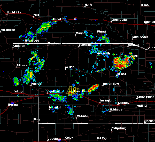 At 1205 pm cdt, a severe thunderstorm was located near north platte, moving northeast at 15 mph (radar indicated). Hazards include 60 mph wind gusts and half dollar size hail. Hail damage to vehicles is expected. Expect wind damage to roofs, siding, and trees. At 1205 pm cdt, a severe thunderstorm was located near north platte, moving northeast at 15 mph (radar indicated). Hazards include 60 mph wind gusts and half dollar size hail. Hail damage to vehicles is expected. Expect wind damage to roofs, siding, and trees.
|
| 8/15/2017 12:05 PM CDT | Near bailey yards diesel shop in lincoln county NE, 3.6 miles E of North Platte, NE |
| 8/15/2017 12:05 PM CDT | Quarter sized hail reported 3.6 miles E of North Platte, NE, near bailey yards diesel shop |
| 8/12/2017 8:55 PM CDT |
 The severe thunderstorm warning for central lincoln county will expire at 900 pm cdt, the storms which prompted the warning have weakened below severe limits, and no longer pose an immediate threat to life or property. therefore the warning will be allowed to expire. however gusty winds and heavy rain are still possible with these thunderstorms. a severe thunderstorm watch remains in effect until midnight cdt for southwestern nebraska. The severe thunderstorm warning for central lincoln county will expire at 900 pm cdt, the storms which prompted the warning have weakened below severe limits, and no longer pose an immediate threat to life or property. therefore the warning will be allowed to expire. however gusty winds and heavy rain are still possible with these thunderstorms. a severe thunderstorm watch remains in effect until midnight cdt for southwestern nebraska.
|
| 8/12/2017 8:33 PM CDT |
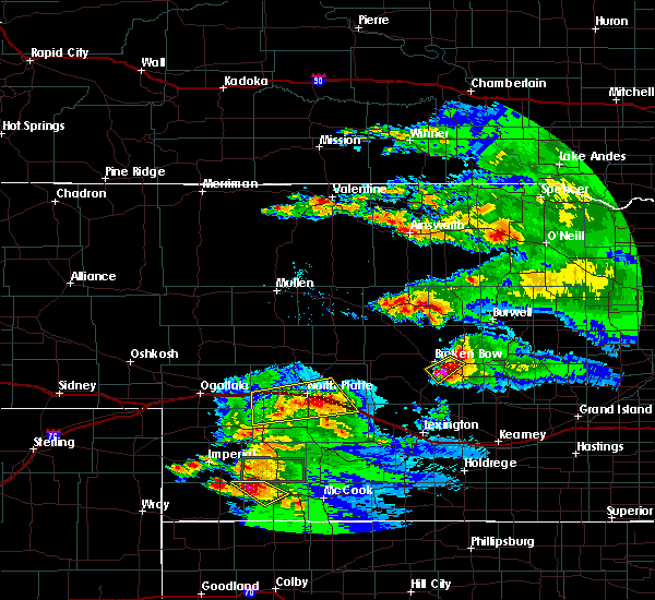 At 833 pm cdt, severe thunderstorms were located along a line extending from near maxwell to 9 miles southeast of sutherland reservoir state recreation area, moving southeast at 20 mph (radar indicated). Hazards include 60 mph wind gusts and penny size hail. Expect damage to roofs, siding, and trees. locations impacted include, north platte, brady, maxwell, sutherland reservoir state recreation area, lake maloney state recreation area, north platte airport, keith and cottonwood canyon state wildlife management area. this includes the following highways, interstate 80 in nebraska between mile markers 167 and 202. Highway 83 between mile markers 68 and 84. At 833 pm cdt, severe thunderstorms were located along a line extending from near maxwell to 9 miles southeast of sutherland reservoir state recreation area, moving southeast at 20 mph (radar indicated). Hazards include 60 mph wind gusts and penny size hail. Expect damage to roofs, siding, and trees. locations impacted include, north platte, brady, maxwell, sutherland reservoir state recreation area, lake maloney state recreation area, north platte airport, keith and cottonwood canyon state wildlife management area. this includes the following highways, interstate 80 in nebraska between mile markers 167 and 202. Highway 83 between mile markers 68 and 84.
|
| 8/12/2017 8:08 PM CDT |
 At 807 pm cdt, severe thunderstorms were located along a line extending from 6 miles northeast of north platte airport to 6 miles southwest of sutherland reservoir state recreation area, moving southeast at 20 mph (radar indicated). Hazards include 70 mph wind gusts. Expect considerable tree damage. Damage is likely to mobile homes, roofs, and outbuildings. At 807 pm cdt, severe thunderstorms were located along a line extending from 6 miles northeast of north platte airport to 6 miles southwest of sutherland reservoir state recreation area, moving southeast at 20 mph (radar indicated). Hazards include 70 mph wind gusts. Expect considerable tree damage. Damage is likely to mobile homes, roofs, and outbuildings.
|
| 7/28/2017 10:47 PM CDT | A national weather service employee reported 60 mph wind gusts and power ou in lincoln county NE, 4.4 miles NE of North Platte, NE |
| 7/28/2017 10:41 PM CDT |
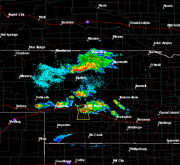 At 1041 pm cdt, a severe thunderstorm was located over lake maloney state recreation area, or 7 miles south of north platte, moving south at 25 mph (trained weather spotters). Hazards include 60 mph wind gusts and penny size hail. expect damage to roofs, siding, and trees At 1041 pm cdt, a severe thunderstorm was located over lake maloney state recreation area, or 7 miles south of north platte, moving south at 25 mph (trained weather spotters). Hazards include 60 mph wind gusts and penny size hail. expect damage to roofs, siding, and trees
|
| 7/28/2017 10:40 PM CDT | Storm damage reported in lincoln county NE, 2.3 miles ENE of North Platte, NE |
| 7/28/2017 10:30 PM CDT | An 8 inch tree limb down at the intersection of phillip and buffalo bil in lincoln county NE, 0.5 miles ESE of North Platte, NE |
| 7/28/2017 10:20 PM CDT |
 At 1019 pm cdt, a severe thunderstorm was located near north platte, moving south at 15 mph (radar indicated). Hazards include half dollar size hail. Damage to vehicles is expected. locations impacted include, north platte, north platte airport and birdwood. this includes the following highways, highway 97 between mile markers 1 and 4. interstate 80 in nebraska between mile markers 166 and 185. Highway 83 between mile markers 78 and 91. At 1019 pm cdt, a severe thunderstorm was located near north platte, moving south at 15 mph (radar indicated). Hazards include half dollar size hail. Damage to vehicles is expected. locations impacted include, north platte, north platte airport and birdwood. this includes the following highways, highway 97 between mile markers 1 and 4. interstate 80 in nebraska between mile markers 166 and 185. Highway 83 between mile markers 78 and 91.
|
| 7/28/2017 10:15 PM CDT | Multiple trees down on the west edge of north platt in lincoln county NE, 2.5 miles E of North Platte, NE |
| 7/28/2017 10:01 PM CDT |
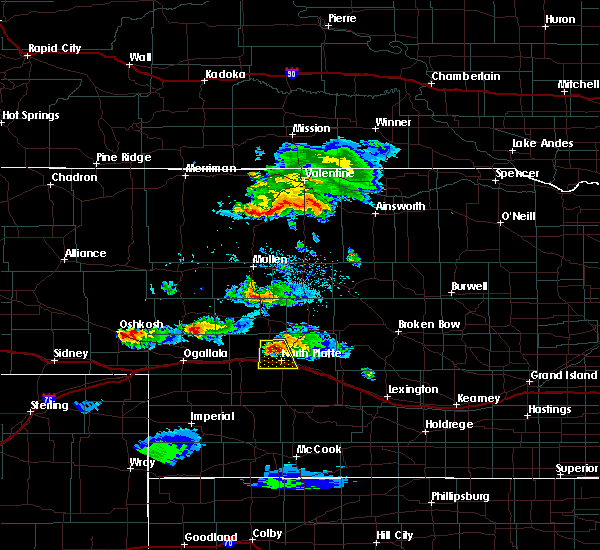 The national weather service in north platte has issued a * severe thunderstorm warning for. north central lincoln county in southwestern nebraska. Until 1045 pm cdt * at 1000 pm cdt, a severe thunderstorm was located 8 miles north of north platte, moving south at 15 mph. The national weather service in north platte has issued a * severe thunderstorm warning for. north central lincoln county in southwestern nebraska. Until 1045 pm cdt * at 1000 pm cdt, a severe thunderstorm was located 8 miles north of north platte, moving south at 15 mph.
|
| 7/12/2017 10:11 AM CDT | Ping Pong Ball sized hail reported 7.8 miles SW of North Platte, NE |
| 7/4/2017 7:36 PM CDT | Golf Ball sized hail reported 10.1 miles SW of North Platte, NE |
| 7/2/2017 8:08 PM CDT |
 The severe thunderstorm warning for central lincoln county will expire at 815 pm cdt, the storms which prompted the warning have moved out of the area. therefore the warning will be allowed to expire. however gusty winds and heavy rain are still possible with these thunderstorms. a severe thunderstorm watch remains in effect until midnight cdt for central and southwestern nebraska. remember, a severe thunderstorm warning still remains in effect for east central lincoln county in southwestern nebraska until 830 pm cdt. The severe thunderstorm warning for central lincoln county will expire at 815 pm cdt, the storms which prompted the warning have moved out of the area. therefore the warning will be allowed to expire. however gusty winds and heavy rain are still possible with these thunderstorms. a severe thunderstorm watch remains in effect until midnight cdt for central and southwestern nebraska. remember, a severe thunderstorm warning still remains in effect for east central lincoln county in southwestern nebraska until 830 pm cdt.
|
| 7/2/2017 8:00 PM CDT |
 At 800 pm cdt, severe thunderstorms were located along a line extending from north platte to near maxwell to near brady, moving south at 5 mph (radar indicated). Hazards include 60 mph wind gusts and quarter size hail. Hail damage to vehicles is expected. expect wind damage to roofs, siding, and trees. locations impacted include, north platte, brady, maxwell, lake maloney state recreation area, north platte airport, keith, cottonwood canyon state wildlife management area, jeffrey canyon state wildlife management area and birdwood. This includes interstate 80 in nebraska between mile markers 170 and 204. At 800 pm cdt, severe thunderstorms were located along a line extending from north platte to near maxwell to near brady, moving south at 5 mph (radar indicated). Hazards include 60 mph wind gusts and quarter size hail. Hail damage to vehicles is expected. expect wind damage to roofs, siding, and trees. locations impacted include, north platte, brady, maxwell, lake maloney state recreation area, north platte airport, keith, cottonwood canyon state wildlife management area, jeffrey canyon state wildlife management area and birdwood. This includes interstate 80 in nebraska between mile markers 170 and 204.
|
| 7/2/2017 7:35 PM CDT | Report from husker inn of 60 mph winds with dime size hai in lincoln county NE, 0.5 miles ESE of North Platte, NE |
| 7/2/2017 7:34 PM CDT |
 At 734 pm cdt, severe thunderstorms were located along a line extending from near north platte to 14 miles northeast of maxwell, moving south at 20 mph (radar indicated). Hazards include golf ball size hail and 60 mph wind gusts. People and animals outdoors will be injured. expect hail damage to roofs, siding, windows, and vehicles. Expect wind damage to roofs, siding, and trees. At 734 pm cdt, severe thunderstorms were located along a line extending from near north platte to 14 miles northeast of maxwell, moving south at 20 mph (radar indicated). Hazards include golf ball size hail and 60 mph wind gusts. People and animals outdoors will be injured. expect hail damage to roofs, siding, windows, and vehicles. Expect wind damage to roofs, siding, and trees.
|
| 7/2/2017 7:30 PM CDT | Hillcrest site in lincoln county NE, 3.7 miles S of North Platte, NE |
| 6/27/2017 8:32 PM CDT | Storm damage reported in lincoln county NE, 2.7 miles W of North Platte, NE |
| 6/27/2017 8:30 PM CDT | Relayed from emergency manager that 8 inch plus tree branch down. estimated wind gust of 70 mp in lincoln county NE, 6.6 miles SW of North Platte, NE |
| 6/27/2017 8:27 PM CDT | Storm damage reported in lincoln county NE, 4.5 miles SSW of North Platte, NE |
| 6/27/2017 8:26 PM CDT | Relayed from off duty nws employee... neighbor had bay window blown out by large tree limb. estimated 70 mph wind in lincoln county NE, 4.6 miles E of North Platte, NE |
| 6/27/2017 8:21 PM CDT | Storm damage reported in lincoln county NE, 5.8 miles S of North Platte, NE |
| 6/27/2017 8:16 PM CDT | Storm damage reported in lincoln county NE, 5.8 miles S of North Platte, NE |
| 6/27/2017 3:22 PM CDT |
 At 821 pm cdt, severe thunderstorms were located along a line extending from 12 miles north of north platte airport to near north platte to lake maloney state recreation area to 13 miles north of wellfleet, moving east at 25 mph. wind gusts of 70 mph have been observed with this line (radar indicated). Hazards include 70 mph wind gusts. Expect considerable tree damage. damage is likely to mobile homes, roofs, and outbuildings. locations impacted include, north platte, maxwell, lake maloney state recreation area, north platte airport, keith, cottonwood canyon state wildlife management area and birdwood. this includes the following highways, highway 97 between mile markers 1 and 16. Interstate 80 in nebraska between mile markers 168 and 194. At 821 pm cdt, severe thunderstorms were located along a line extending from 12 miles north of north platte airport to near north platte to lake maloney state recreation area to 13 miles north of wellfleet, moving east at 25 mph. wind gusts of 70 mph have been observed with this line (radar indicated). Hazards include 70 mph wind gusts. Expect considerable tree damage. damage is likely to mobile homes, roofs, and outbuildings. locations impacted include, north platte, maxwell, lake maloney state recreation area, north platte airport, keith, cottonwood canyon state wildlife management area and birdwood. this includes the following highways, highway 97 between mile markers 1 and 16. Interstate 80 in nebraska between mile markers 168 and 194.
|
| 6/27/2017 3:18 PM CDT |
 At 817 pm cdt, severe thunderstorms were located along a line extending from 13 miles north of north platte to near north platte to near lake maloney state recreation area to 12 miles northeast of dickens, moving east at 25 mph. confirmed gusts of 60 mph are occurring with this line of storms (radar indicated). Hazards include 60 mph wind gusts. Expect damage to roofs, siding, and trees. locations impacted include, north platte, maxwell, lake maloney state recreation area, north platte airport, keith, cottonwood canyon state wildlife management area and birdwood. this includes the following highways, highway 97 between mile markers 1 and 16. Interstate 80 in nebraska between mile markers 168 and 194. At 817 pm cdt, severe thunderstorms were located along a line extending from 13 miles north of north platte to near north platte to near lake maloney state recreation area to 12 miles northeast of dickens, moving east at 25 mph. confirmed gusts of 60 mph are occurring with this line of storms (radar indicated). Hazards include 60 mph wind gusts. Expect damage to roofs, siding, and trees. locations impacted include, north platte, maxwell, lake maloney state recreation area, north platte airport, keith, cottonwood canyon state wildlife management area and birdwood. this includes the following highways, highway 97 between mile markers 1 and 16. Interstate 80 in nebraska between mile markers 168 and 194.
|
| 6/27/2017 3:10 PM CDT |
 At 810 pm cdt, severe thunderstorms were located along a line extending from 13 miles northeast of hershey to near north platte to near lake maloney state recreation area to 10 miles northeast of dickens, moving east at 25 mph (radar indicated). Hazards include 60 mph wind gusts. expect damage to roofs, siding, and trees At 810 pm cdt, severe thunderstorms were located along a line extending from 13 miles northeast of hershey to near north platte to near lake maloney state recreation area to 10 miles northeast of dickens, moving east at 25 mph (radar indicated). Hazards include 60 mph wind gusts. expect damage to roofs, siding, and trees
|
| 10/3/2016 7:33 PM CDT |
 At 733 pm cdt, severe thunderstorms were located along a line extending from 7 miles southeast of ringgold to near north platte, moving northeast at 35 mph (radar indicated). Hazards include ping pong ball size hail and 60 mph wind gusts. People and animals outdoors will be injured. expect hail damage to roofs, siding, windows, and vehicles. expect wind damage to roofs, siding, and trees. Locations impacted include, stapleton, gandy, ringgold, hoagland and tarboz lake. At 733 pm cdt, severe thunderstorms were located along a line extending from 7 miles southeast of ringgold to near north platte, moving northeast at 35 mph (radar indicated). Hazards include ping pong ball size hail and 60 mph wind gusts. People and animals outdoors will be injured. expect hail damage to roofs, siding, windows, and vehicles. expect wind damage to roofs, siding, and trees. Locations impacted include, stapleton, gandy, ringgold, hoagland and tarboz lake.
|
| 10/3/2016 7:06 PM CDT |
 At 706 pm cdt, a severe thunderstorm was located 9 miles north of north platte, moving northeast at 30 mph (radar indicated). Hazards include ping pong ball size hail and 60 mph wind gusts. People and animals outdoors will be injured. expect hail damage to roofs, siding, windows, and vehicles. Expect wind damage to roofs, siding, and trees. At 706 pm cdt, a severe thunderstorm was located 9 miles north of north platte, moving northeast at 30 mph (radar indicated). Hazards include ping pong ball size hail and 60 mph wind gusts. People and animals outdoors will be injured. expect hail damage to roofs, siding, windows, and vehicles. Expect wind damage to roofs, siding, and trees.
|
| 9/5/2016 9:24 PM CDT | Quarter sized hail reported 8.7 miles SW of North Platte, NE, time estimated...quarter size hail. |
| 9/5/2016 8:55 PM CDT | Quarter sized hail reported 0.5 miles ESE of North Platte, NE |
| 8/12/2016 12:49 AM CDT |
 At 1248 am cdt, severe thunderstorms were located along a line extending from 10 miles northeast of maxwell to 8 miles south of brady to 8 miles southwest of curtis, moving southeast at 45 mph (radar indicated). Hazards include 70 mph wind gusts and penny size hail. Expect considerable tree damage. damage is likely to mobile homes, roofs, and outbuildings. locations impacted include, north platte, curtis, brady, maxwell, wellfleet, moorefield, stockville, lake maloney state recreation area, north platte airport, maywood, somerset, hansen memorial reserve state wildlife management area, marengo, etna, hayes center state wildlife management area, orafino, jeffrey canyon state wildlife management area, vroman, dancing leaf earth lodge and cottonwood canyon state wildlife management area. this includes the following highways, interstate 80 in nebraska between mile markers 178 and 207. Highway 83 between mile markers 37 and 81, and between mile markers 90 and 102. At 1248 am cdt, severe thunderstorms were located along a line extending from 10 miles northeast of maxwell to 8 miles south of brady to 8 miles southwest of curtis, moving southeast at 45 mph (radar indicated). Hazards include 70 mph wind gusts and penny size hail. Expect considerable tree damage. damage is likely to mobile homes, roofs, and outbuildings. locations impacted include, north platte, curtis, brady, maxwell, wellfleet, moorefield, stockville, lake maloney state recreation area, north platte airport, maywood, somerset, hansen memorial reserve state wildlife management area, marengo, etna, hayes center state wildlife management area, orafino, jeffrey canyon state wildlife management area, vroman, dancing leaf earth lodge and cottonwood canyon state wildlife management area. this includes the following highways, interstate 80 in nebraska between mile markers 178 and 207. Highway 83 between mile markers 37 and 81, and between mile markers 90 and 102.
|
| 8/12/2016 12:38 AM CDT | Measured at north platte regional airport in lincoln county NE, 4.4 miles WSW of North Platte, NE |
| 8/12/2016 12:34 AM CDT | Sustained winds of 58 mph gusting to 72 mph at the north platte aso in lincoln county NE, 2.7 miles W of North Platte, NE |
| 8/12/2016 12:29 AM CDT |
 At 1229 am cdt, severe thunderstorms were located along a line extending from 9 miles north of north platte airport to 8 miles south of maxwell to 13 miles south of wellfleet, moving southeast at 35 mph (radar indicated). Hazards include 70 mph wind gusts and penny size hail. Expect considerable tree damage. Damage is likely to mobile homes, roofs, and outbuildings. At 1229 am cdt, severe thunderstorms were located along a line extending from 9 miles north of north platte airport to 8 miles south of maxwell to 13 miles south of wellfleet, moving southeast at 35 mph (radar indicated). Hazards include 70 mph wind gusts and penny size hail. Expect considerable tree damage. Damage is likely to mobile homes, roofs, and outbuildings.
|
| 8/12/2016 12:05 AM CDT | Storm damage reported in lincoln county NE, 11.4 miles SSE of North Platte, NE |
| 8/12/2016 12:02 AM CDT |
 At 1202 am cdt, severe thunderstorms were located along a line extending from 15 miles southwest of tryon to near sutherland reservoir state recreation area to 6 miles south of elsie, moving east at 55 mph (radar indicated). Hazards include 70 mph wind gusts and penny size hail. Expect considerable tree damage. damage is likely to mobile homes, roofs, and outbuildings. locations impacted include, north platte, sutherland, hershey, wallace, dickens, lake maloney state recreation area, north platte airport, sutherland reservoir state recreation area, somerset, marengo, hayes center state wildlife management area, coker, o`fallons and birdwood. this includes the following highways, highway 97 between mile markers 1 and 15. interstate 80 in nebraska between mile markers 152 and 183. Highway 83 between mile markers 61 and 103. At 1202 am cdt, severe thunderstorms were located along a line extending from 15 miles southwest of tryon to near sutherland reservoir state recreation area to 6 miles south of elsie, moving east at 55 mph (radar indicated). Hazards include 70 mph wind gusts and penny size hail. Expect considerable tree damage. damage is likely to mobile homes, roofs, and outbuildings. locations impacted include, north platte, sutherland, hershey, wallace, dickens, lake maloney state recreation area, north platte airport, sutherland reservoir state recreation area, somerset, marengo, hayes center state wildlife management area, coker, o`fallons and birdwood. this includes the following highways, highway 97 between mile markers 1 and 15. interstate 80 in nebraska between mile markers 152 and 183. Highway 83 between mile markers 61 and 103.
|
| 8/11/2016 11:45 PM CDT |
 At 1144 pm cdt/1044 pm mdt/, severe thunderstorms were located along a line extending from 14 miles north of sutherland to 11 miles south of elsie, moving southeast at 50 mph (radar indicated). Hazards include 70 mph wind gusts. Expect considerable tree damage. Damage is likely to mobile homes, roofs, and outbuildings. At 1144 pm cdt/1044 pm mdt/, severe thunderstorms were located along a line extending from 14 miles north of sutherland to 11 miles south of elsie, moving southeast at 50 mph (radar indicated). Hazards include 70 mph wind gusts. Expect considerable tree damage. Damage is likely to mobile homes, roofs, and outbuildings.
|
| 8/11/2016 11:19 PM CDT | Sustained winds of 58 mph gusting to 72 mph at the north platte aso in lincoln county NE, 2.7 miles W of North Platte, NE |
| 7/27/2016 12:09 AM CDT |
 At 1208 am cdt, severe thunderstorms were located along a line extending from near north platte airport to near brady to 8 miles east of callaway to near sargent, moving southeast at 60 mph (radar indicated). Hazards include 70 mph wind gusts. Expect considerable tree damage. damage is likely to mobile homes, roofs, and outbuildings. locations impacted include, north platte, broken bow, stapleton, taylor, arnold, callaway, sargent, ansley, brady, merna, maxwell, mason city, oconto, anselmo, comstock, berwyn, gandy, calamus reservoir state recreation area, ringgold and north platte airport. this includes the following highways, highway 183 between mile markers 81 and 130. highway 2 between mile markers 254 and 302. highway 92 between mile markers 208 and 308. highway 97 between mile markers 1 and 26. interstate 80 in nebraska between mile markers 177 and 208. Highway 83 between mile markers 78 and 113. At 1208 am cdt, severe thunderstorms were located along a line extending from near north platte airport to near brady to 8 miles east of callaway to near sargent, moving southeast at 60 mph (radar indicated). Hazards include 70 mph wind gusts. Expect considerable tree damage. damage is likely to mobile homes, roofs, and outbuildings. locations impacted include, north platte, broken bow, stapleton, taylor, arnold, callaway, sargent, ansley, brady, merna, maxwell, mason city, oconto, anselmo, comstock, berwyn, gandy, calamus reservoir state recreation area, ringgold and north platte airport. this includes the following highways, highway 183 between mile markers 81 and 130. highway 2 between mile markers 254 and 302. highway 92 between mile markers 208 and 308. highway 97 between mile markers 1 and 26. interstate 80 in nebraska between mile markers 177 and 208. Highway 83 between mile markers 78 and 113.
|
| 7/27/2016 12:06 AM CDT | Storm damage reported in lincoln county NE, 2.7 miles SW of North Platte, NE |
| 7/27/2016 12:00 AM CDT | Storm damage reported in lincoln county NE, 4.4 miles S of North Platte, NE |
| 7/26/2016 11:58 PM CDT |
 At 1157 pm cdt, severe thunderstorms were located along a line extending from near north platte to 7 miles north of brady to near taylor, moving southeast at 50 mph (radar indicated). Hazards include 70 mph wind gusts. Expect considerable tree damage. damage is likely to mobile homes, roofs, and outbuildings. locations impacted include, north platte, broken bow, stapleton, taylor, arnold, callaway, sargent, ansley, brady, merna, maxwell, mason city, oconto, anselmo, comstock, berwyn, gandy, calamus reservoir state recreation area, ringgold and north platte airport. this includes the following highways, highway 183 between mile markers 81 and 130. highway 2 between mile markers 254 and 302. highway 92 between mile markers 208 and 308. highway 97 between mile markers 1 and 26. interstate 80 in nebraska between mile markers 177 and 208. Highway 83 between mile markers 78 and 113. At 1157 pm cdt, severe thunderstorms were located along a line extending from near north platte to 7 miles north of brady to near taylor, moving southeast at 50 mph (radar indicated). Hazards include 70 mph wind gusts. Expect considerable tree damage. damage is likely to mobile homes, roofs, and outbuildings. locations impacted include, north platte, broken bow, stapleton, taylor, arnold, callaway, sargent, ansley, brady, merna, maxwell, mason city, oconto, anselmo, comstock, berwyn, gandy, calamus reservoir state recreation area, ringgold and north platte airport. this includes the following highways, highway 183 between mile markers 81 and 130. highway 2 between mile markers 254 and 302. highway 92 between mile markers 208 and 308. highway 97 between mile markers 1 and 26. interstate 80 in nebraska between mile markers 177 and 208. Highway 83 between mile markers 78 and 113.
|
| 7/26/2016 11:36 PM CDT |
 At 1136 pm cdt, severe thunderstorms were located along a line extending from 8 miles southwest of ringgold to near gandy to 7 miles northwest of calamus reservoir state recreation area, moving southeast at 45 mph (radar indicated). Hazards include 60 mph wind gusts. Expect damage to roofs. siding. And trees. At 1136 pm cdt, severe thunderstorms were located along a line extending from 8 miles southwest of ringgold to near gandy to 7 miles northwest of calamus reservoir state recreation area, moving southeast at 45 mph (radar indicated). Hazards include 60 mph wind gusts. Expect damage to roofs. siding. And trees.
|
| 7/15/2016 9:13 AM CDT |
 At 912 am cdt, severe thunderstorms were located along a line extending from 7 miles northeast of north platte airport to near dickens, moving southeast at 35 mph (radar indicated). Hazards include 60 mph wind gusts and quarter size hail. Hail damage to vehicles is expected. expect wind damage to roofs, siding, and trees. locations impacted include, north platte, maxwell, wellfleet, lake maloney state recreation area, north platte airport, somerset, cottonwood canyon state wildlife management area and keith. this includes the following highways, interstate 80 in nebraska between mile markers 173 and 195. Highway 83 between mile markers 57 and 87, and between mile markers 89 and 92. At 912 am cdt, severe thunderstorms were located along a line extending from 7 miles northeast of north platte airport to near dickens, moving southeast at 35 mph (radar indicated). Hazards include 60 mph wind gusts and quarter size hail. Hail damage to vehicles is expected. expect wind damage to roofs, siding, and trees. locations impacted include, north platte, maxwell, wellfleet, lake maloney state recreation area, north platte airport, somerset, cottonwood canyon state wildlife management area and keith. this includes the following highways, interstate 80 in nebraska between mile markers 173 and 195. Highway 83 between mile markers 57 and 87, and between mile markers 89 and 92.
|
| 7/15/2016 8:52 AM CDT |
 At 851 am cdt, severe thunderstorms were located along a line extending from 7 miles north of north platte to 6 miles southeast of sutherland reservoir state recreation area, moving southeast at 35 mph (public and radar indicated). Hazards include ping pong ball size hail and 60 mph wind gusts. People and animals outdoors will be injured. expect hail damage to roofs, siding, windows, and vehicles. expect wind damage to roofs, siding, and trees. locations impacted include, north platte, sutherland, hershey, maxwell, wellfleet, lake maloney state recreation area, sutherland reservoir state recreation area, north platte airport, somerset, cottonwood canyon state wildlife management area, keith, o`fallons and birdwood. this includes the following highways, highway 97 between mile markers 1 and 15. interstate 80 in nebraska between mile markers 159 and 195. Highway 83 between mile markers 57 and 95. At 851 am cdt, severe thunderstorms were located along a line extending from 7 miles north of north platte to 6 miles southeast of sutherland reservoir state recreation area, moving southeast at 35 mph (public and radar indicated). Hazards include ping pong ball size hail and 60 mph wind gusts. People and animals outdoors will be injured. expect hail damage to roofs, siding, windows, and vehicles. expect wind damage to roofs, siding, and trees. locations impacted include, north platte, sutherland, hershey, maxwell, wellfleet, lake maloney state recreation area, sutherland reservoir state recreation area, north platte airport, somerset, cottonwood canyon state wildlife management area, keith, o`fallons and birdwood. this includes the following highways, highway 97 between mile markers 1 and 15. interstate 80 in nebraska between mile markers 159 and 195. Highway 83 between mile markers 57 and 95.
|
| 7/15/2016 8:50 AM CDT | Golf Ball sized hail reported 8.6 miles ESE of North Platte, NE |
| 7/15/2016 8:39 AM CDT |
 At 839 am cdt, severe thunderstorms were located along a line extending from 12 miles northeast of hershey to sutherland reservoir state recreation area, moving southeast at 35 mph (public). Hazards include 60 mph wind gusts and quarter size hail. Hail damage to vehicles is expected. Expect wind damage to roofs, siding, and trees. At 839 am cdt, severe thunderstorms were located along a line extending from 12 miles northeast of hershey to sutherland reservoir state recreation area, moving southeast at 35 mph (public). Hazards include 60 mph wind gusts and quarter size hail. Hail damage to vehicles is expected. Expect wind damage to roofs, siding, and trees.
|
| 7/6/2016 9:19 PM CDT |
 At 919 pm cdt, a severe thunderstorm capable of producing a tornado was located near maxwell, or 11 miles east of north platte, moving east at 40 mph (radar indicated rotation). Hazards include tornado and quarter size hail. Flying debris will be dangerous to those caught without shelter. mobile homes will be damaged or destroyed. damage to roofs, windows, and vehicles will occur. tree damage is likely. this tornadic thunderstorm will remain over mainly rural areas of northeastern lincoln county, including the following locations: keith. this includes the following highways, interstate 80 in nebraska between mile markers 179 and 186. Highway 83 between mile markers 90 and 94. At 919 pm cdt, a severe thunderstorm capable of producing a tornado was located near maxwell, or 11 miles east of north platte, moving east at 40 mph (radar indicated rotation). Hazards include tornado and quarter size hail. Flying debris will be dangerous to those caught without shelter. mobile homes will be damaged or destroyed. damage to roofs, windows, and vehicles will occur. tree damage is likely. this tornadic thunderstorm will remain over mainly rural areas of northeastern lincoln county, including the following locations: keith. this includes the following highways, interstate 80 in nebraska between mile markers 179 and 186. Highway 83 between mile markers 90 and 94.
|
| 7/6/2016 9:15 PM CDT | Storm damage reported in lincoln county NE, 3.7 miles S of North Platte, NE |
| 7/6/2016 9:15 PM CDT | Golf Ball sized hail reported 6.5 miles S of North Platte, NE, via social media |
| 7/6/2016 9:14 PM CDT | Storm damage reported in lincoln county NE, 4.5 miles SSW of North Platte, NE |
| 7/6/2016 9:12 PM CDT | Ping Pong Ball sized hail reported 3.7 miles S of North Platte, NE, 70 mph winds. |
| 7/6/2016 9:05 PM CDT | Storm damage reported in lincoln county NE, 5.8 miles S of North Platte, NE |
| 7/6/2016 9:01 PM CDT |
 At 901 pm cdt, a severe thunderstorm capable of producing a tornado was located near north platte, moving east at 40 mph (weather spotters reported funnel cloud). Hazards include tornado and quarter size hail. Flying debris will be dangerous to those caught without shelter. mobile homes will be damaged or destroyed. damage to roofs, windows, and vehicles will occur. tree damage is likely. this dangerous storm will be near, north platte airport around 910 pm cdt. maxwell around 925 pm cdt. Other locations impacted by this tornadic thunderstorm include cottonwood canyon state wildlife management area, keith and birdwood. At 901 pm cdt, a severe thunderstorm capable of producing a tornado was located near north platte, moving east at 40 mph (weather spotters reported funnel cloud). Hazards include tornado and quarter size hail. Flying debris will be dangerous to those caught without shelter. mobile homes will be damaged or destroyed. damage to roofs, windows, and vehicles will occur. tree damage is likely. this dangerous storm will be near, north platte airport around 910 pm cdt. maxwell around 925 pm cdt. Other locations impacted by this tornadic thunderstorm include cottonwood canyon state wildlife management area, keith and birdwood.
|
| 7/6/2016 8:54 PM CDT |
 At 854 pm cdt, a severe thunderstorm was located 8 miles northwest of north platte, moving east at 45 mph (trained weather spotters). Hazards include golf ball size hail and 60 mph wind gusts. People and animals outdoors will be injured. expect hail damage to roofs, siding, windows, and vehicles. expect wind damage to roofs, siding, and trees. locations impacted include, north platte and birdwood. this includes the following highways, highway 97 between mile markers 1 and 22. interstate 80 in nebraska between mile markers 176 and 178. Highway 83 between mile markers 81 and 93. At 854 pm cdt, a severe thunderstorm was located 8 miles northwest of north platte, moving east at 45 mph (trained weather spotters). Hazards include golf ball size hail and 60 mph wind gusts. People and animals outdoors will be injured. expect hail damage to roofs, siding, windows, and vehicles. expect wind damage to roofs, siding, and trees. locations impacted include, north platte and birdwood. this includes the following highways, highway 97 between mile markers 1 and 22. interstate 80 in nebraska between mile markers 176 and 178. Highway 83 between mile markers 81 and 93.
|
| 7/6/2016 8:47 PM CDT |
 At 845 pm cdt, a severe thunderstorm was located 8 miles north of hershey, or 14 miles northwest of north platte, moving east at 45 mph (trained weather spotters). Hazards include golf ball size hail and 60 mph wind gusts. People and animals outdoors will be injured. expect hail damage to roofs, siding, windows, and vehicles. expect wind damage to roofs, siding, and trees. locations impacted include, north platte, hershey and birdwood. this includes the following highways, highway 97 between mile markers 1 and 22. interstate 80 in nebraska between mile markers 169 and 178. Highway 83 between mile markers 79 and 93. At 845 pm cdt, a severe thunderstorm was located 8 miles north of hershey, or 14 miles northwest of north platte, moving east at 45 mph (trained weather spotters). Hazards include golf ball size hail and 60 mph wind gusts. People and animals outdoors will be injured. expect hail damage to roofs, siding, windows, and vehicles. expect wind damage to roofs, siding, and trees. locations impacted include, north platte, hershey and birdwood. this includes the following highways, highway 97 between mile markers 1 and 22. interstate 80 in nebraska between mile markers 169 and 178. Highway 83 between mile markers 79 and 93.
|
| 7/6/2016 8:45 PM CDT | Quarter sized hail reported 2.4 miles S of North Platte, NE |
| 7/6/2016 8:45 PM CDT | Golf Ball sized hail reported 15.1 miles SSE of North Platte, NE |
| 7/6/2016 8:43 PM CDT |
 At 842 pm cdt, a severe thunderstorm was located 8 miles north of hershey, or 17 miles northwest of north platte, moving east at 40 mph (radar indicated). Hazards include 60 mph wind gusts and quarter size hail. Hail damage to vehicles is expected. Expect wind damage to roofs, siding, and trees. At 842 pm cdt, a severe thunderstorm was located 8 miles north of hershey, or 17 miles northwest of north platte, moving east at 40 mph (radar indicated). Hazards include 60 mph wind gusts and quarter size hail. Hail damage to vehicles is expected. Expect wind damage to roofs, siding, and trees.
|
| 7/6/2016 7:46 PM CDT |
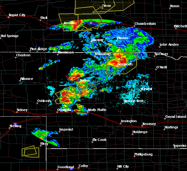 At 745 pm cdt, a severe thunderstorm was located over hershey, or 14 miles west of north platte, moving east at 30 mph (radar indicated). Hazards include half dollar size hail. damage to vehicles is expected At 745 pm cdt, a severe thunderstorm was located over hershey, or 14 miles west of north platte, moving east at 30 mph (radar indicated). Hazards include half dollar size hail. damage to vehicles is expected
|
| 6/28/2016 10:32 PM CDT |
 At 1031 pm cdt, severe thunderstorms were located along a line extending from 7 miles northeast of arnold to 11 miles south of maxwell, moving east at 45 mph (radar indicated). Hazards include 70 mph wind gusts. Expect considerable tree damage. damage is likely to mobile homes, roofs, and outbuildings. locations impacted include, north platte, arnold, callaway, brady, maxwell, lake maloney state recreation area, north platte airport, keith, logan, etna, pleasant hill, cottonwood canyon state wildlife management area, milldale and finchville. this includes the following highways, highway 92 between mile markers 236 and 268. interstate 80 in nebraska between mile markers 176 and 202. Highway 83 between mile markers 73 and 83. At 1031 pm cdt, severe thunderstorms were located along a line extending from 7 miles northeast of arnold to 11 miles south of maxwell, moving east at 45 mph (radar indicated). Hazards include 70 mph wind gusts. Expect considerable tree damage. damage is likely to mobile homes, roofs, and outbuildings. locations impacted include, north platte, arnold, callaway, brady, maxwell, lake maloney state recreation area, north platte airport, keith, logan, etna, pleasant hill, cottonwood canyon state wildlife management area, milldale and finchville. this includes the following highways, highway 92 between mile markers 236 and 268. interstate 80 in nebraska between mile markers 176 and 202. Highway 83 between mile markers 73 and 83.
|
| 6/28/2016 10:04 PM CDT |
 At 1003 pm cdt, severe thunderstorms were located along a line extending from 6 miles north of stapleton to 10 miles west of lake maloney state recreation area, moving east at 45 mph (trained weather spotters). Hazards include 70 mph wind gusts. Expect considerable tree damage. damage is likely to mobile homes, roofs, and outbuildings. locations impacted include, north platte, stapleton, hershey, arnold, callaway, brady, maxwell, gandy, lake maloney state recreation area, north platte airport, keith, logan, etna, pleasant hill, cottonwood canyon state wildlife management area, shanklin bluff, milldale, hoagland, tarboz lake and birdwood. this includes the following highways, highway 92 between mile markers 219 and 268. highway 97 between mile markers 1 and 11. interstate 80 in nebraska between mile markers 162 and 202. Highway 83 between mile markers 73 and 122. At 1003 pm cdt, severe thunderstorms were located along a line extending from 6 miles north of stapleton to 10 miles west of lake maloney state recreation area, moving east at 45 mph (trained weather spotters). Hazards include 70 mph wind gusts. Expect considerable tree damage. damage is likely to mobile homes, roofs, and outbuildings. locations impacted include, north platte, stapleton, hershey, arnold, callaway, brady, maxwell, gandy, lake maloney state recreation area, north platte airport, keith, logan, etna, pleasant hill, cottonwood canyon state wildlife management area, shanklin bluff, milldale, hoagland, tarboz lake and birdwood. this includes the following highways, highway 92 between mile markers 219 and 268. highway 97 between mile markers 1 and 11. interstate 80 in nebraska between mile markers 162 and 202. Highway 83 between mile markers 73 and 122.
|
| 6/28/2016 10:01 PM CDT | Storm damage reported in lincoln county NE, 10.6 miles S of North Platte, NE |
| 6/28/2016 9:59 PM CDT |
 At 959 pm cdt, severe thunderstorms were located along a line extending from 7 miles north of stapleton to 9 miles southeast of sutherland reservoir state recreation area, moving east at 45 mph (radar indicated). Hazards include 60 mph wind gusts. Expect damage to roofs. siding. And trees. At 959 pm cdt, severe thunderstorms were located along a line extending from 7 miles north of stapleton to 9 miles southeast of sutherland reservoir state recreation area, moving east at 45 mph (radar indicated). Hazards include 60 mph wind gusts. Expect damage to roofs. siding. And trees.
|
| 6/28/2016 9:52 PM CDT | Storm damage reported in lincoln county NE, 10.6 miles S of North Platte, NE |
| 6/28/2016 9:25 PM CDT |
 At 925 pm cdt/825 pm mdt/, severe thunderstorms were located along a line extending from near stapleton to 6 miles north of sarben to near madrid, moving southeast at 55 mph (radar indicated). Hazards include 70 mph wind gusts and nickel size hail. Expect considerable tree damage. Damage is likely to mobile homes, roofs, and outbuildings. At 925 pm cdt/825 pm mdt/, severe thunderstorms were located along a line extending from near stapleton to 6 miles north of sarben to near madrid, moving southeast at 55 mph (radar indicated). Hazards include 70 mph wind gusts and nickel size hail. Expect considerable tree damage. Damage is likely to mobile homes, roofs, and outbuildings.
|
| 6/26/2016 9:04 PM CDT |
 At 903 pm cdt/803 pm mdt/, severe thunderstorms were located along a line extending from near hershey to near sarben, moving southeast at 30 mph (radar indicated). Hazards include golf ball size hail and 60 mph wind gusts. People and animals outdoors will be injured. expect hail damage to roofs, siding, windows, and vehicles. expect wind damage to roofs, siding, and trees. locations impacted include, north platte, sutherland, hershey, paxton, sarben, sutherland reservoir state recreation area, big bald hill, coker, o`fallons and birdwood. this includes the following highways, highway 97 between mile markers 1 and 16. interstate 80 in nebraska between mile markers 146 and 168. Highway 83 between mile markers 85 and 90. At 903 pm cdt/803 pm mdt/, severe thunderstorms were located along a line extending from near hershey to near sarben, moving southeast at 30 mph (radar indicated). Hazards include golf ball size hail and 60 mph wind gusts. People and animals outdoors will be injured. expect hail damage to roofs, siding, windows, and vehicles. expect wind damage to roofs, siding, and trees. locations impacted include, north platte, sutherland, hershey, paxton, sarben, sutherland reservoir state recreation area, big bald hill, coker, o`fallons and birdwood. this includes the following highways, highway 97 between mile markers 1 and 16. interstate 80 in nebraska between mile markers 146 and 168. Highway 83 between mile markers 85 and 90.
|
| 6/26/2016 8:30 PM CDT |
 At 830 pm cdt/730 pm mdt/, severe thunderstorms were located along a line extending from 10 miles southwest of tryon to 16 miles northeast of keystone, moving southeast at 35 mph (radar indicated). Hazards include ping pong ball size hail and 60 mph wind gusts. People and animals outdoors will be injured. expect hail damage to roofs, siding, windows, and vehicles. Expect wind damage to roofs, siding, and trees. At 830 pm cdt/730 pm mdt/, severe thunderstorms were located along a line extending from 10 miles southwest of tryon to 16 miles northeast of keystone, moving southeast at 35 mph (radar indicated). Hazards include ping pong ball size hail and 60 mph wind gusts. People and animals outdoors will be injured. expect hail damage to roofs, siding, windows, and vehicles. Expect wind damage to roofs, siding, and trees.
|
| 5/30/2016 7:41 PM CDT |
 At 740 pm cdt, a severe thunderstorm was located 9 miles north of brady, or 24 miles east of north platte, moving east at 45 mph (trained weather spotters). Hazards include 70 mph wind gusts. Expect considerable tree damage. damage is likely to mobile homes, roofs, and outbuildings. locations impacted include, north platte, brady, maxwell, lake maloney state recreation area, north platte airport, keith, cottonwood canyon state wildlife management area, birdwood and vroman. this includes the following highways, highway 97 between mile markers 1 and 15. interstate 80 in nebraska between mile markers 171 and 206. Highway 83 between mile markers 73 and 105. At 740 pm cdt, a severe thunderstorm was located 9 miles north of brady, or 24 miles east of north platte, moving east at 45 mph (trained weather spotters). Hazards include 70 mph wind gusts. Expect considerable tree damage. damage is likely to mobile homes, roofs, and outbuildings. locations impacted include, north platte, brady, maxwell, lake maloney state recreation area, north platte airport, keith, cottonwood canyon state wildlife management area, birdwood and vroman. this includes the following highways, highway 97 between mile markers 1 and 15. interstate 80 in nebraska between mile markers 171 and 206. Highway 83 between mile markers 73 and 105.
|
| 5/30/2016 7:29 PM CDT |
 At 728 pm cdt, a severe thunderstorm was located near maxwell, or 14 miles east of north platte, moving east at 35 mph (trained weather spotters). Hazards include 70 mph wind gusts. Expect considerable tree damage. damage is likely to mobile homes, roofs, and outbuildings. locations impacted include, north platte, hershey, brady, maxwell, lake maloney state recreation area, north platte airport, keith, cottonwood canyon state wildlife management area, o`fallons, birdwood and vroman. this includes the following highways, highway 97 between mile markers 1 and 15. interstate 80 in nebraska between mile markers 161 and 206. Highway 83 between mile markers 73 and 105. At 728 pm cdt, a severe thunderstorm was located near maxwell, or 14 miles east of north platte, moving east at 35 mph (trained weather spotters). Hazards include 70 mph wind gusts. Expect considerable tree damage. damage is likely to mobile homes, roofs, and outbuildings. locations impacted include, north platte, hershey, brady, maxwell, lake maloney state recreation area, north platte airport, keith, cottonwood canyon state wildlife management area, o`fallons, birdwood and vroman. this includes the following highways, highway 97 between mile markers 1 and 15. interstate 80 in nebraska between mile markers 161 and 206. Highway 83 between mile markers 73 and 105.
|
| 5/30/2016 7:15 PM CDT | Storm damage reported in lincoln county NE, 5.8 miles S of North Platte, NE |
| 5/30/2016 7:12 PM CDT |
 At 711 pm cdt, a severe thunderstorm was located over north platte airport, moving east at 45 mph (trained weather spotters). Hazards include 70 mph wind gusts. Expect considerable tree damage. Damage is likely to mobile homes, roofs, and outbuildings. At 711 pm cdt, a severe thunderstorm was located over north platte airport, moving east at 45 mph (trained weather spotters). Hazards include 70 mph wind gusts. Expect considerable tree damage. Damage is likely to mobile homes, roofs, and outbuildings.
|
| 5/30/2016 7:08 PM CDT | Storm damage reported in lincoln county NE, 5.8 miles S of North Platte, NE |
| 5/30/2016 7:06 PM CDT | Storm damage reported in lincoln county NE, 16.4 miles NNE of North Platte, NE |
| 5/30/2016 7:05 PM CDT | Storm damage reported in lincoln county NE, 5.8 miles S of North Platte, NE |
| 5/30/2016 6:51 PM CDT |
 At 651 pm cdt/551 pm mdt/, a severe thunderstorm was located over hershey, or 10 miles west of north platte, moving east at 50 mph (trained weather spotters). Hazards include 70 mph wind gusts. Expect considerable tree damage. damage is likely to mobile homes, roofs, and outbuildings. locations impacted include, north platte, sutherland, hershey, lake maloney state recreation area, sarben, sutherland reservoir state recreation area, north platte airport, coker, o`fallons and birdwood. this includes the following highways, highway 97 between mile markers 1 and 15. interstate 80 in nebraska between mile markers 148 and 184. Highway 83 between mile markers 73 and 98. At 651 pm cdt/551 pm mdt/, a severe thunderstorm was located over hershey, or 10 miles west of north platte, moving east at 50 mph (trained weather spotters). Hazards include 70 mph wind gusts. Expect considerable tree damage. damage is likely to mobile homes, roofs, and outbuildings. locations impacted include, north platte, sutherland, hershey, lake maloney state recreation area, sarben, sutherland reservoir state recreation area, north platte airport, coker, o`fallons and birdwood. this includes the following highways, highway 97 between mile markers 1 and 15. interstate 80 in nebraska between mile markers 148 and 184. Highway 83 between mile markers 73 and 98.
|
| 5/30/2016 6:41 PM CDT |
 At 640 pm cdt/540 pm mdt/, a severe thunderstorm was located over sutherland, or 18 miles west of north platte, moving east at 50 mph (trained weather spotters). Hazards include 60 mph wind gusts. Expect damage to roofs. siding. And trees. At 640 pm cdt/540 pm mdt/, a severe thunderstorm was located over sutherland, or 18 miles west of north platte, moving east at 50 mph (trained weather spotters). Hazards include 60 mph wind gusts. Expect damage to roofs. siding. And trees.
|
| 5/29/2016 8:12 PM CDT |
 At 811 pm cdt, a severe thunderstorm was located 9 miles northeast of hershey, or 10 miles northwest of north platte, moving northeast at 10 mph (radar indicated). Hazards include quarter size hail. damage to vehicles is expected At 811 pm cdt, a severe thunderstorm was located 9 miles northeast of hershey, or 10 miles northwest of north platte, moving northeast at 10 mph (radar indicated). Hazards include quarter size hail. damage to vehicles is expected
|
| 5/29/2016 7:29 PM CDT | Golf Ball sized hail reported 2.7 miles SW of North Platte, NE |
| 5/29/2016 7:26 PM CDT | Golf Ball sized hail reported 2.7 miles SW of North Platte, NE |
| 5/29/2016 7:26 PM CDT |
 At 726 pm cdt, a severe thunderstorm was located over north platte airport, or near north platte, moving northeast at 15 mph (trained weather spotters). Hazards include golf ball size hail. People and animals outdoors will be injured. Expect damage to roofs, siding, windows, and vehicles. At 726 pm cdt, a severe thunderstorm was located over north platte airport, or near north platte, moving northeast at 15 mph (trained weather spotters). Hazards include golf ball size hail. People and animals outdoors will be injured. Expect damage to roofs, siding, windows, and vehicles.
|
| 5/29/2016 7:24 PM CDT | Quarter sized hail reported 2.7 miles SW of North Platte, NE |
| 5/29/2016 7:02 PM CDT | Quarter sized hail reported 6.6 miles N of North Platte, NE |
| 5/29/2016 6:56 PM CDT |
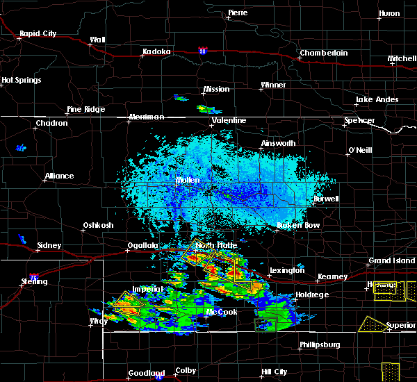 At 655 pm cdt, a severe thunderstorm was located near lake maloney state recreation area, or near north platte, moving northeast at 10 mph (radar indicated). Hazards include quarter size hail. damage to vehicles is expected At 655 pm cdt, a severe thunderstorm was located near lake maloney state recreation area, or near north platte, moving northeast at 10 mph (radar indicated). Hazards include quarter size hail. damage to vehicles is expected
|
| 5/29/2016 6:54 PM CDT | Quarter sized hail reported 5.3 miles N of North Platte, NE, hail ranged from pea to quarter size. |
| 5/25/2016 8:18 PM CDT |
 At 817 pm cdt, severe thunderstorms were located along a line extending from 12 miles north of brady to near moorefield, moving east at 50 mph (trained weather spotters). Hazards include 60 mph wind gusts and quarter size hail. Hail damage to vehicles is expected. expect wind damage to roofs, siding, and trees. locations impacted include, north platte, callaway, brady, maxwell, wellfleet, lake maloney state recreation area, north platte airport, keith, hansen memorial reserve state wildlife management area, etna, jeffrey canyon state wildlife management area, lodi, vroman and cottonwood canyon state wildlife management area. this includes the following highways, highway 97 between mile markers 1 and 3. interstate 80 in nebraska between mile markers 176 and 208. Highway 83 between mile markers 53 and 92. At 817 pm cdt, severe thunderstorms were located along a line extending from 12 miles north of brady to near moorefield, moving east at 50 mph (trained weather spotters). Hazards include 60 mph wind gusts and quarter size hail. Hail damage to vehicles is expected. expect wind damage to roofs, siding, and trees. locations impacted include, north platte, callaway, brady, maxwell, wellfleet, lake maloney state recreation area, north platte airport, keith, hansen memorial reserve state wildlife management area, etna, jeffrey canyon state wildlife management area, lodi, vroman and cottonwood canyon state wildlife management area. this includes the following highways, highway 97 between mile markers 1 and 3. interstate 80 in nebraska between mile markers 176 and 208. Highway 83 between mile markers 53 and 92.
|
| 5/25/2016 7:53 PM CDT | Storm damage reported in lincoln county NE, 3.7 miles W of North Platte, NE |
| 5/25/2016 7:51 PM CDT |
 At 751 pm cdt, severe thunderstorms were located along a line extending from near north platte airport to wellfleet, moving east at 50 mph (radar indicated). Hazards include 60 mph wind gusts and quarter size hail. Hail damage to vehicles is expected. Expect wind damage to roofs, siding, and trees. At 751 pm cdt, severe thunderstorms were located along a line extending from near north platte airport to wellfleet, moving east at 50 mph (radar indicated). Hazards include 60 mph wind gusts and quarter size hail. Hail damage to vehicles is expected. Expect wind damage to roofs, siding, and trees.
|
| 5/25/2016 7:47 PM CDT | Storm damage reported in lincoln county NE, 3.7 miles W of North Platte, NE |
| 5/24/2016 10:45 PM CDT | Large trampoline was thrown onto telephone wire west side of town...time estimated by rada in lincoln county NE, 0.5 miles ESE of North Platte, NE |
| 5/9/2016 8:45 PM CDT | Ping Pong Ball sized hail reported 25.5 miles SSE of North Platte, NE, ground covered with up to ping pong ball size hail |
| 9/22/2015 7:15 PM CDT | A tree was blown down onto a roof in the northeast part of the cit in lincoln county NE, 0.5 miles ESE of North Platte, NE |
| 9/22/2015 7:14 PM CDT | Storm damage reported in lincoln county NE, 0.5 miles ESE of North Platte, NE |
| 9/22/2015 7:10 PM CDT | Part of a roof was blown off of a mobile home in the southeast part of the cit in lincoln county NE, 0.5 miles ESE of North Platte, NE |
| 9/22/2015 7:10 PM CDT | At 710 pm cdt, a severe thunderstorm was located over north platte airport, or near north platte, moving north at 25 mph (radar indicated). Hazards include 60 mph wind gusts and penny size hail. Expect damage to roofs. siding and trees. this severe thunderstorm will remain over mainly rural areas of northeastern lincoln county. people attending test event should seek safe shelter immediately! this includes the following highways, highway 97 between mile markers 1 and 16. interstate 80 in nebraska between mile markers 173 and 184. Highway 83 between mile markers 79 and 105. |
| 8/13/2015 9:24 PM CDT | Report of power out across city of north platte and power lines dow in lincoln county NE, 0.5 miles ESE of North Platte, NE |
| 8/13/2015 9:12 PM CDT | Tree branches down... some 6 to 8 inches in diameter. live power lines down. large tree split in half from win in lincoln county NE, 0.5 miles ESE of North Platte, NE |
| 8/13/2015 8:58 PM CDT | Trees down on west 1st street in north platt in lincoln county NE, 0.5 miles ESE of North Platte, NE |
| 8/13/2015 8:54 PM CDT |
 At 854 pm cdt, severe thunderstorms were located along a line extending from near callaway to 10 miles northeast of gothenburg to near brady to 8 miles northeast of dickens, moving southeast at 30 mph (radar indicated). Hazards include 60 mph wind gusts and quarter size hail. Hail damage to vehicles is expected. expect wind damage to roofs, siding and trees. this includes the following highways, highway 97 between mile markers 1 and 10. interstate 80 in nebraska between mile markers 167 and 208. highway 83 between mile markers 55 and 95. Locations impacted include, somerset, hansen memorial reserve state wildlife management area, etna, jeffrey canyon state wildlife management area, lodi, vroman, brady, lake maloney state recreation area, callaway, cottonwood canyon state wildlife management area, maxwell, north platte, milldale, north platte airport, keith, wellfleet, birdwood and finchville. At 854 pm cdt, severe thunderstorms were located along a line extending from near callaway to 10 miles northeast of gothenburg to near brady to 8 miles northeast of dickens, moving southeast at 30 mph (radar indicated). Hazards include 60 mph wind gusts and quarter size hail. Hail damage to vehicles is expected. expect wind damage to roofs, siding and trees. this includes the following highways, highway 97 between mile markers 1 and 10. interstate 80 in nebraska between mile markers 167 and 208. highway 83 between mile markers 55 and 95. Locations impacted include, somerset, hansen memorial reserve state wildlife management area, etna, jeffrey canyon state wildlife management area, lodi, vroman, brady, lake maloney state recreation area, callaway, cottonwood canyon state wildlife management area, maxwell, north platte, milldale, north platte airport, keith, wellfleet, birdwood and finchville.
|
| 8/13/2015 8:47 PM CDT |
 At 847 pm cdt, severe thunderstorms were located along a line extending from 6 miles south of callaway to 10 miles north of gothenburg to near brady to near lake maloney state recreation area, moving southeast at 35 mph (radar indicated). Hazards include 60 mph wind gusts and quarter size hail. Hail damage to vehicles is expected. expect wind damage to roofs, siding and trees. this includes the following highways, highway 97 between mile markers 1 and 10. interstate 80 in nebraska between mile markers 167 and 208. highway 83 between mile markers 55 and 95. Locations impacted include, somerset, hansen memorial reserve state wildlife management area, etna, jeffrey canyon state wildlife management area, lodi, vroman, brady, lake maloney state recreation area, callaway, cottonwood canyon state wildlife management area, maxwell, north platte, milldale, north platte airport, keith, wellfleet, birdwood and finchville. At 847 pm cdt, severe thunderstorms were located along a line extending from 6 miles south of callaway to 10 miles north of gothenburg to near brady to near lake maloney state recreation area, moving southeast at 35 mph (radar indicated). Hazards include 60 mph wind gusts and quarter size hail. Hail damage to vehicles is expected. expect wind damage to roofs, siding and trees. this includes the following highways, highway 97 between mile markers 1 and 10. interstate 80 in nebraska between mile markers 167 and 208. highway 83 between mile markers 55 and 95. Locations impacted include, somerset, hansen memorial reserve state wildlife management area, etna, jeffrey canyon state wildlife management area, lodi, vroman, brady, lake maloney state recreation area, callaway, cottonwood canyon state wildlife management area, maxwell, north platte, milldale, north platte airport, keith, wellfleet, birdwood and finchville.
|
| 8/13/2015 8:46 PM CDT | Storm damage reported in lincoln county NE, 8.1 miles NE of North Platte, NE |
| 8/13/2015 8:33 PM CDT |
 At 832 pm cdt, severe thunderstorms were located along a line extending from near callaway to 10 miles northeast of gothenburg to near brady to near north platte, moving southeast at 40 mph (radar indicated). Hazards include golf ball size hail and 70 mph wind gusts. People and animals outdoors will be injured. expect hail damage to roofs, siding, windows and vehicles. expect considerable tree damage. wind damage is also likely to mobile homes, roofs and outbuildings. this includes the following highways, highway 97 between mile markers 1 and 10. interstate 80 in nebraska between mile markers 167 and 208. highway 83 between mile markers 55 and 95. Locations impacted include, somerset, hansen memorial reserve state wildlife management area, etna, jeffrey canyon state wildlife management area, lodi, vroman, brady, lake maloney state recreation area, callaway, cottonwood canyon state wildlife management area, maxwell, north platte, milldale, north platte airport, keith, wellfleet, birdwood and finchville. At 832 pm cdt, severe thunderstorms were located along a line extending from near callaway to 10 miles northeast of gothenburg to near brady to near north platte, moving southeast at 40 mph (radar indicated). Hazards include golf ball size hail and 70 mph wind gusts. People and animals outdoors will be injured. expect hail damage to roofs, siding, windows and vehicles. expect considerable tree damage. wind damage is also likely to mobile homes, roofs and outbuildings. this includes the following highways, highway 97 between mile markers 1 and 10. interstate 80 in nebraska between mile markers 167 and 208. highway 83 between mile markers 55 and 95. Locations impacted include, somerset, hansen memorial reserve state wildlife management area, etna, jeffrey canyon state wildlife management area, lodi, vroman, brady, lake maloney state recreation area, callaway, cottonwood canyon state wildlife management area, maxwell, north platte, milldale, north platte airport, keith, wellfleet, birdwood and finchville.
|
| 8/13/2015 8:29 PM CDT | Golf Ball sized hail reported 0.5 miles ESE of North Platte, NE |
| 8/13/2015 8:29 PM CDT | Storm damage reported in lincoln county NE, 0.5 miles ESE of North Platte, NE |
| 8/13/2015 8:28 PM CDT | Ping Pong Ball sized hail reported 7.2 miles S of North Platte, NE |
| 8/13/2015 8:28 PM CDT | Storm damage reported in lincoln county NE, 7.2 miles S of North Platte, NE |
| 8/13/2015 8:27 PM CDT | Golf Ball sized hail reported 2.7 miles SW of North Platte, NE, golf ball size hail measured at the nws office. |
| 8/13/2015 8:27 PM CDT |
 At 826 pm cdt, severe thunderstorms were located along a line extending from near callaway to 15 miles north of gothenburg to near maxwell to 6 miles west of north platte, moving southeast at 35 mph (radar indicated). Hazards include golf ball size hail and 60 mph wind gusts. People and animals outdoors will be injured. expect hail damage to roofs, siding, windows and vehicles. Expect wind damage to roofs, siding and trees. At 826 pm cdt, severe thunderstorms were located along a line extending from near callaway to 15 miles north of gothenburg to near maxwell to 6 miles west of north platte, moving southeast at 35 mph (radar indicated). Hazards include golf ball size hail and 60 mph wind gusts. People and animals outdoors will be injured. expect hail damage to roofs, siding, windows and vehicles. Expect wind damage to roofs, siding and trees.
|
| 8/13/2015 8:26 PM CDT | Storm damage reported in lincoln county NE, 0.5 miles ESE of North Platte, NE |
| 8/13/2015 8:25 PM CDT | Storm damage reported in lincoln county NE, 0.5 miles ESE of North Platte, NE |
| 8/13/2015 8:15 PM CDT |
 At 814 pm cdt, severe thunderstorms were located along a line extending from near arnold to 16 miles west of callaway to near maxwell to near north platte, moving south at 35 mph (radar indicated). Hazards include golf ball size hail and 70 mph wind gusts. People and animals outdoors will be injured. expect hail damage to roofs, siding, windows and vehicles. expect considerable tree damage. wind damage is also likely to mobile homes, roofs and outbuildings. this includes the following highways, highway 92 between mile markers 217 and 254. highway 97 between mile markers 1 and 25. interstate 80 in nebraska between mile markers 166 and 199. highway 83 between mile markers 77 and 113. Locations impacted include, etna, logan, brady, gandy, maxwell, north platte, stapleton, north platte airport, hoagland, keith, arnold, birdwood, finchville and lake maloney state recreation area. At 814 pm cdt, severe thunderstorms were located along a line extending from near arnold to 16 miles west of callaway to near maxwell to near north platte, moving south at 35 mph (radar indicated). Hazards include golf ball size hail and 70 mph wind gusts. People and animals outdoors will be injured. expect hail damage to roofs, siding, windows and vehicles. expect considerable tree damage. wind damage is also likely to mobile homes, roofs and outbuildings. this includes the following highways, highway 92 between mile markers 217 and 254. highway 97 between mile markers 1 and 25. interstate 80 in nebraska between mile markers 166 and 199. highway 83 between mile markers 77 and 113. Locations impacted include, etna, logan, brady, gandy, maxwell, north platte, stapleton, north platte airport, hoagland, keith, arnold, birdwood, finchville and lake maloney state recreation area.
|
| 8/13/2015 8:08 PM CDT |
 At 808 pm cdt, severe thunderstorms were located along a line extending from arnold to 15 miles west of callaway to 7 miles north of maxwell to 8 miles northwest of north platte, moving south at 30 mph (radar indicated). Hazards include golf ball size hail and 60 mph wind gusts. People and animals outdoors will be injured. expect hail damage to roofs, siding, windows and vehicles. expect wind damage to roofs, siding and trees. this includes the following highways, highway 92 between mile markers 217 and 254. highway 97 between mile markers 1 and 25. interstate 80 in nebraska between mile markers 166 and 199. highway 83 between mile markers 77 and 113. Locations impacted include, etna, logan, brady, gandy, maxwell, north platte, stapleton, north platte airport, hoagland, keith, arnold, birdwood, finchville and lake maloney state recreation area. At 808 pm cdt, severe thunderstorms were located along a line extending from arnold to 15 miles west of callaway to 7 miles north of maxwell to 8 miles northwest of north platte, moving south at 30 mph (radar indicated). Hazards include golf ball size hail and 60 mph wind gusts. People and animals outdoors will be injured. expect hail damage to roofs, siding, windows and vehicles. expect wind damage to roofs, siding and trees. this includes the following highways, highway 92 between mile markers 217 and 254. highway 97 between mile markers 1 and 25. interstate 80 in nebraska between mile markers 166 and 199. highway 83 between mile markers 77 and 113. Locations impacted include, etna, logan, brady, gandy, maxwell, north platte, stapleton, north platte airport, hoagland, keith, arnold, birdwood, finchville and lake maloney state recreation area.
|
| 8/13/2015 7:58 PM CDT |
 At 757 pm cdt, severe thunderstorms were located along a line extending from 13 miles east of gandy to near arnold to 12 miles north of north platte airport to 13 miles southwest of ringgold, moving southeast at 30 mph (radar indicated). Hazards include golf ball size hail and 60 mph wind gusts. People and animals outdoors will be injured. expect hail damage to roofs, siding, windows and vehicles. expect wind damage to roofs, siding and trees. this includes the following highways, highway 92 between mile markers 217 and 254. highway 97 between mile markers 1 and 25. interstate 80 in nebraska between mile markers 166 and 199. highway 83 between mile markers 77 and 113. locations impacted include, etna, logan, brady, gandy, maxwell, north platte, stapleton, north platte airport, hoagland, keith, arnold, birdwood, finchville and lake maloney state recreation area. At 755 pm cdt, 2 inch hail was reported 15 miles north northeast of north platte. At 757 pm cdt, severe thunderstorms were located along a line extending from 13 miles east of gandy to near arnold to 12 miles north of north platte airport to 13 miles southwest of ringgold, moving southeast at 30 mph (radar indicated). Hazards include golf ball size hail and 60 mph wind gusts. People and animals outdoors will be injured. expect hail damage to roofs, siding, windows and vehicles. expect wind damage to roofs, siding and trees. this includes the following highways, highway 92 between mile markers 217 and 254. highway 97 between mile markers 1 and 25. interstate 80 in nebraska between mile markers 166 and 199. highway 83 between mile markers 77 and 113. locations impacted include, etna, logan, brady, gandy, maxwell, north platte, stapleton, north platte airport, hoagland, keith, arnold, birdwood, finchville and lake maloney state recreation area. At 755 pm cdt, 2 inch hail was reported 15 miles north northeast of north platte.
|
| 8/13/2015 7:41 PM CDT |
 At 740 pm cdt, severe thunderstorms were located along a line extending from 13 miles north of arnold to 6 miles east of gandy to 7 miles southwest of stapleton to 6 miles south of tryon, moving southeast at 30 mph (radar indicated). Hazards include 60 mph wind gusts and quarter size hail. Hail damage to vehicles is expected. Expect wind damage to roofs, siding and trees. At 740 pm cdt, severe thunderstorms were located along a line extending from 13 miles north of arnold to 6 miles east of gandy to 7 miles southwest of stapleton to 6 miles south of tryon, moving southeast at 30 mph (radar indicated). Hazards include 60 mph wind gusts and quarter size hail. Hail damage to vehicles is expected. Expect wind damage to roofs, siding and trees.
|
| 7/18/2015 9:16 PM CDT |
 At 915 pm cdt, a severe thunderstorm was located 8 miles northeast of hershey, and moving east at 15 mph (radar indicated). Hazards include quarter size hail. Damage to vehicles is expected. locations impacted include, north platte and birdwood. this includes interstate 80 between mile markers 172 and 180. this includes highway 83 between mile markers 80 and 94. This includes highway 97 between mile markers 1 and 11. At 915 pm cdt, a severe thunderstorm was located 8 miles northeast of hershey, and moving east at 15 mph (radar indicated). Hazards include quarter size hail. Damage to vehicles is expected. locations impacted include, north platte and birdwood. this includes interstate 80 between mile markers 172 and 180. this includes highway 83 between mile markers 80 and 94. This includes highway 97 between mile markers 1 and 11.
|
| 7/18/2015 9:00 PM CDT |
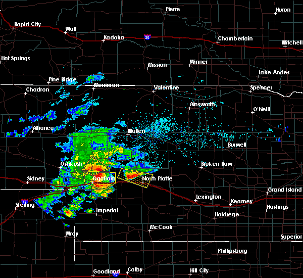 At 859 pm cdt, a severe thunderstorm was located 7 miles northeast of hershey, and moving east at 15 mph (radar indicated). Hazards include quarter size hail. Damage to vehicles is expected. locations impacted include, north platte, birdwood and beck. this includes interstate 80 between mile markers 167 and 181. this includes highway 83 between mile markers 79 and 95. This includes highway 97 between mile markers 1 and 11. At 859 pm cdt, a severe thunderstorm was located 7 miles northeast of hershey, and moving east at 15 mph (radar indicated). Hazards include quarter size hail. Damage to vehicles is expected. locations impacted include, north platte, birdwood and beck. this includes interstate 80 between mile markers 167 and 181. this includes highway 83 between mile markers 79 and 95. This includes highway 97 between mile markers 1 and 11.
|
| 7/18/2015 8:34 PM CDT |
 At 832 pm cdt, a severe thunderstorm was located 9 miles north of sutherland, and moving east at 15 mph (law enforcement). Hazards include golf ball size hail. People and animals outdoors will be injured. Expect damage to roofs, siding, windows and vehicles. At 832 pm cdt, a severe thunderstorm was located 9 miles north of sutherland, and moving east at 15 mph (law enforcement). Hazards include golf ball size hail. People and animals outdoors will be injured. Expect damage to roofs, siding, windows and vehicles.
|
| 7/17/2015 7:46 PM CDT |
 At 743 pm cdt, a severe thunderstorm was located 9 miles north of maxwell, and moving northeast at 35 mph (public). Hazards include quarter size hail. Damage to vehicles is expected. locations impacted include, mainly rural areas of northeastern lincoln county. this includes interstate 80 between mile markers 181 and 182. This includes highway 83 between mile markers 87 and 104. At 743 pm cdt, a severe thunderstorm was located 9 miles north of maxwell, and moving northeast at 35 mph (public). Hazards include quarter size hail. Damage to vehicles is expected. locations impacted include, mainly rural areas of northeastern lincoln county. this includes interstate 80 between mile markers 181 and 182. This includes highway 83 between mile markers 87 and 104.
|
| 7/17/2015 7:38 PM CDT | Quarter sized hail reported 13.4 miles SW of North Platte, NE |
| 7/17/2015 7:35 PM CDT | Quarter sized hail reported 10.1 miles SW of North Platte, NE |
| 7/17/2015 7:25 PM CDT |
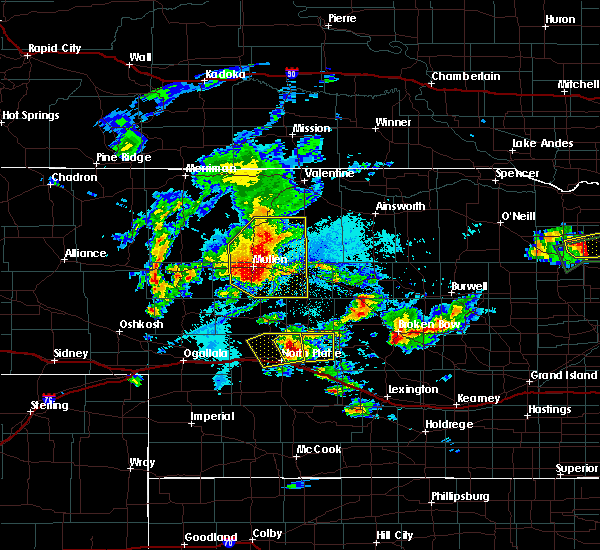 At 721 pm cdt, a severe thunderstorm was located 10 miles northeast of north platte, and moving east at 35 mph (radar indicated). Hazards include half dollar size hail. damage to vehicles is expected At 721 pm cdt, a severe thunderstorm was located 10 miles northeast of north platte, and moving east at 35 mph (radar indicated). Hazards include half dollar size hail. damage to vehicles is expected
|
| 7/17/2015 7:23 PM CDT | Half Dollar sized hail reported 7.8 miles SW of North Platte, NE |
| 7/17/2015 7:16 PM CDT | Quarter sized hail reported 7.2 miles S of North Platte, NE, largest stone measured 1.125 inch in diameter. |
| 7/17/2015 7:05 PM CDT |
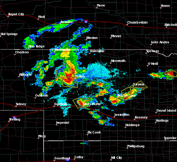 At 703 pm cdt, a severe thunderstorm was located 7 miles northwest of north platte, and moving east at 30 mph (radar indicated). Hazards include half dollar size hail. Damage to vehicles is expected. locations impacted include, north platte and beck. this includes interstate 80 between mile markers 166 and 181. this includes highway 83 between mile markers 80 and 103. This includes highway 97 between mile markers 1 and 16. At 703 pm cdt, a severe thunderstorm was located 7 miles northwest of north platte, and moving east at 30 mph (radar indicated). Hazards include half dollar size hail. Damage to vehicles is expected. locations impacted include, north platte and beck. this includes interstate 80 between mile markers 166 and 181. this includes highway 83 between mile markers 80 and 103. This includes highway 97 between mile markers 1 and 16.
|
| 7/17/2015 6:46 PM CDT | Quarter sized hail reported 11.2 miles ESE of North Platte, NE |
| 7/17/2015 6:43 PM CDT |
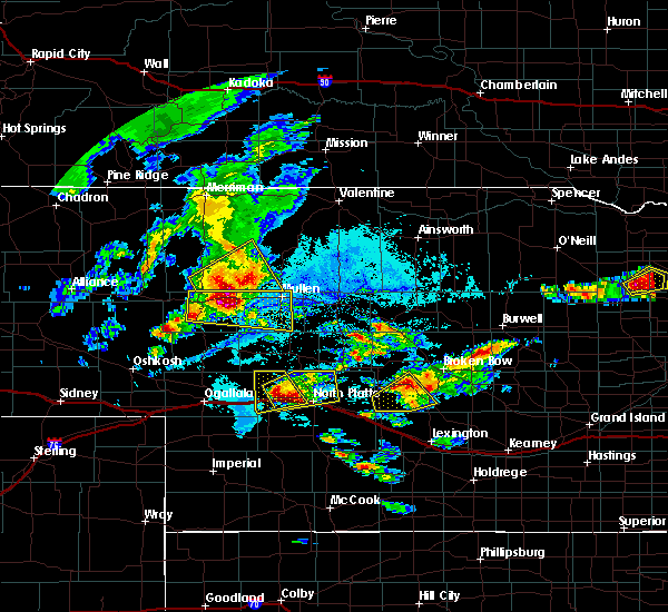 At 641 pm cdt, a severe thunderstorm was located near hershey, and moving northeast at 25 mph (radar indicated). Hazards include golf ball size hail. People and animals outdoors will be injured. Expect damage to roofs, siding, windows and vehicles. At 641 pm cdt, a severe thunderstorm was located near hershey, and moving northeast at 25 mph (radar indicated). Hazards include golf ball size hail. People and animals outdoors will be injured. Expect damage to roofs, siding, windows and vehicles.
|
| 7/17/2015 6:33 PM CDT |
 At 631 pm cdt, a severe thunderstorm was located near sutherland, and moving northeast at 25 mph (radar indicated). Hazards include golf ball size hail and 60 mph wind gusts. People and animals outdoors will be injured. expect hail damage to roofs, siding, windows and vehicles. expect wind damage to roofs, siding and trees. locations impacted include, hershey, o`fallons and birdwood. This includes interstate 80 between mile markers 151 and 174. At 631 pm cdt, a severe thunderstorm was located near sutherland, and moving northeast at 25 mph (radar indicated). Hazards include golf ball size hail and 60 mph wind gusts. People and animals outdoors will be injured. expect hail damage to roofs, siding, windows and vehicles. expect wind damage to roofs, siding and trees. locations impacted include, hershey, o`fallons and birdwood. This includes interstate 80 between mile markers 151 and 174.
|
| 7/17/2015 6:22 PM CDT |
 At 621 pm cdt, a severe thunderstorm was located near sutherland, and moving east at 20 mph (radar indicated). Hazards include 60 mph wind gusts and half dollar size hail. Hail damage to vehicles is expected. expect wind damage to roofs, siding and trees. locations impacted include, sutherland reservoir state recreation area, sutherland, hershey, coker, o`fallons and birdwood. This includes interstate 80 between mile markers 145 and 174. At 621 pm cdt, a severe thunderstorm was located near sutherland, and moving east at 20 mph (radar indicated). Hazards include 60 mph wind gusts and half dollar size hail. Hail damage to vehicles is expected. expect wind damage to roofs, siding and trees. locations impacted include, sutherland reservoir state recreation area, sutherland, hershey, coker, o`fallons and birdwood. This includes interstate 80 between mile markers 145 and 174.
|
| 7/17/2015 6:04 PM CDT |
 At 501 pm mdt, a severe thunderstorm was located near sarben, and moving northeast at 25 mph (radar indicated). Hazards include half dollar size hail. damage to vehicles is expected At 501 pm mdt, a severe thunderstorm was located near sarben, and moving northeast at 25 mph (radar indicated). Hazards include half dollar size hail. damage to vehicles is expected
|
| 7/17/2015 4:46 PM CDT |
 At 444 pm cdt, a severe thunderstorm was located 9 miles north of maxwell, and moving northeast at 30 mph (radar indicated). Hazards include golf ball size hail and 60 mph wind gusts. People and animals outdoors will be injured. expect hail damage to roofs, siding, windows and vehicles. expect wind damage to roofs, siding and trees. locations impacted include, mainly rural areas of northern lincoln county. this includes interstate 80 between mile markers 180 and 197. This includes highway 83 between mile markers 90 and 104. At 444 pm cdt, a severe thunderstorm was located 9 miles north of maxwell, and moving northeast at 30 mph (radar indicated). Hazards include golf ball size hail and 60 mph wind gusts. People and animals outdoors will be injured. expect hail damage to roofs, siding, windows and vehicles. expect wind damage to roofs, siding and trees. locations impacted include, mainly rural areas of northern lincoln county. this includes interstate 80 between mile markers 180 and 197. This includes highway 83 between mile markers 90 and 104.
|
| 7/17/2015 4:31 PM CDT |
 At 429 pm cdt, a severe thunderstorm was located 7 miles west of maxwell, and moving north at 35 mph (radar indicated). Hazards include 60 mph wind gusts and half dollar size hail. Hail damage to vehicles is expected. Expect wind damage to roofs, siding and trees. At 429 pm cdt, a severe thunderstorm was located 7 miles west of maxwell, and moving north at 35 mph (radar indicated). Hazards include 60 mph wind gusts and half dollar size hail. Hail damage to vehicles is expected. Expect wind damage to roofs, siding and trees.
|
| 6/21/2015 7:06 AM MDT |
 At 804 am cdt, a severe thunderstorm was located near sarben, and moving southeast at 35 mph (radar indicated). Hazards include tennis ball size hail. People and animals outdoors will be injured. expect damage to roofs, siding, windows and vehicles. locations impacted include, sutherland, sutherland reservoir state recreation area, hershey, coker, o`fallons and birdwood. This includes interstate 80 between mile markers 141 and 177. At 804 am cdt, a severe thunderstorm was located near sarben, and moving southeast at 35 mph (radar indicated). Hazards include tennis ball size hail. People and animals outdoors will be injured. expect damage to roofs, siding, windows and vehicles. locations impacted include, sutherland, sutherland reservoir state recreation area, hershey, coker, o`fallons and birdwood. This includes interstate 80 between mile markers 141 and 177.
|
| 6/21/2015 7:01 AM MDT |
 At 659 am mdt, a severe thunderstorm was located near sarben, and moving southeast at 45 mph (radar indicated). Hazards include half dollar size hail. Damage to vehicles is expected. locations impacted include, sutherland, sutherland reservoir state recreation area, hershey, coker, o`fallons and birdwood. This includes interstate 80 between mile markers 141 and 177. At 659 am mdt, a severe thunderstorm was located near sarben, and moving southeast at 45 mph (radar indicated). Hazards include half dollar size hail. Damage to vehicles is expected. locations impacted include, sutherland, sutherland reservoir state recreation area, hershey, coker, o`fallons and birdwood. This includes interstate 80 between mile markers 141 and 177.
|
| 6/21/2015 6:46 AM MDT |
 At 643 am mdt, a severe thunderstorm was located 13 miles north of sarben, and moving southeast at 45 mph (radar indicated). Hazards include quarter size hail. Damage to vehicles is expected. locations impacted include, sarben, paxton, sutherland, sutherland reservoir state recreation area, hershey, nevens, coker, o`fallons and birdwood. This includes interstate 80 between mile markers 141 and 177. At 643 am mdt, a severe thunderstorm was located 13 miles north of sarben, and moving southeast at 45 mph (radar indicated). Hazards include quarter size hail. Damage to vehicles is expected. locations impacted include, sarben, paxton, sutherland, sutherland reservoir state recreation area, hershey, nevens, coker, o`fallons and birdwood. This includes interstate 80 between mile markers 141 and 177.
|
| 6/21/2015 6:29 AM MDT |
 At 625 am mdt, a severe thunderstorm was located 12 miles southeast of arthur, and moving southeast at 45 mph (radar indicated). Hazards include quarter size hail. damage to vehicles is expected At 625 am mdt, a severe thunderstorm was located 12 miles southeast of arthur, and moving southeast at 45 mph (radar indicated). Hazards include quarter size hail. damage to vehicles is expected
|
| 6/16/2015 8:55 PM CDT |
 The severe thunderstorm warning for central lincoln county will expire at 900 pm cdt, the storm which prompted the warning has weakened below severe limits, and no longer poses an immediate threat to life or property. however, heavy rain is still possible with this thunderstorm. in addition, strong thunderstorms may redevelop, and a tornado watch remains in effect until midnight cdt. The severe thunderstorm warning for central lincoln county will expire at 900 pm cdt, the storm which prompted the warning has weakened below severe limits, and no longer poses an immediate threat to life or property. however, heavy rain is still possible with this thunderstorm. in addition, strong thunderstorms may redevelop, and a tornado watch remains in effect until midnight cdt.
|
| 6/16/2015 8:42 PM CDT | Quarter sized hail reported 7.3 miles NE of North Platte, NE |
| 6/16/2015 8:15 PM CDT |
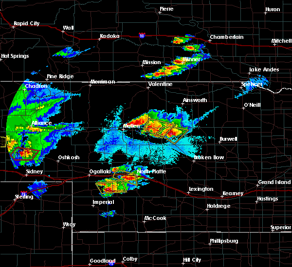 At 812 pm cdt, a severe thunderstorm was located 8 miles southeast of hershey, and moving east at 20 mph (radar indicated). Hazards include 60 mph wind gusts and quarter size hail. Hail damage to vehicles is expected. Expect wind damage to roofs, siding and trees. At 812 pm cdt, a severe thunderstorm was located 8 miles southeast of hershey, and moving east at 20 mph (radar indicated). Hazards include 60 mph wind gusts and quarter size hail. Hail damage to vehicles is expected. Expect wind damage to roofs, siding and trees.
|
| 6/16/2015 8:07 PM CDT |
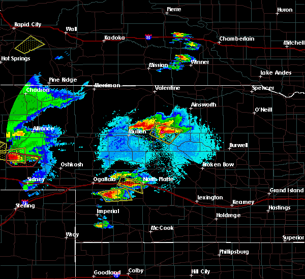 At 804 pm cdt, a severe thunderstorm was located near hershey, and moving east at 20 mph (radar indicated). Hazards include half dollar size hail. Damage to vehicles is expected. locations impacted include, birdwood. This includes interstate 80 between mile markers 154 and 175. At 804 pm cdt, a severe thunderstorm was located near hershey, and moving east at 20 mph (radar indicated). Hazards include half dollar size hail. Damage to vehicles is expected. locations impacted include, birdwood. This includes interstate 80 between mile markers 154 and 175.
|
| 6/16/2015 7:44 PM CDT |
 At 743 pm cdt, a severe thunderstorm was located near sutherland reservoir state recreation area, and moving east at 15 mph (radar indicated). Hazards include golf ball size hail and 60 mph wind gusts. People and animals outdoors will be injured. expect hail damage to roofs, siding, windows and vehicles. expect wind damage to roofs, siding and trees. locations impacted include, hershey and birdwood. This includes interstate 80 between mile markers 154 and 175. At 743 pm cdt, a severe thunderstorm was located near sutherland reservoir state recreation area, and moving east at 15 mph (radar indicated). Hazards include golf ball size hail and 60 mph wind gusts. People and animals outdoors will be injured. expect hail damage to roofs, siding, windows and vehicles. expect wind damage to roofs, siding and trees. locations impacted include, hershey and birdwood. This includes interstate 80 between mile markers 154 and 175.
|
| 6/16/2015 7:28 PM CDT |
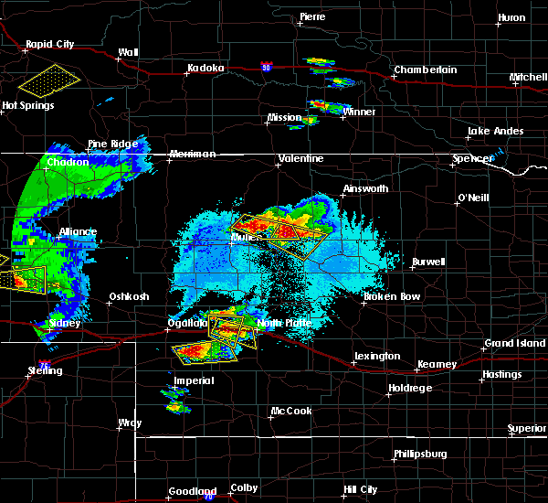 At 727 pm cdt, a severe thunderstorm was located near sutherland reservoir state recreation area, and moving east at 20 mph (radar indicated). Hazards include golf ball size hail and 60 mph wind gusts. People and animals outdoors will be injured. expect hail damage to roofs, siding, windows and vehicles. Expect wind damage to roofs, siding and trees. At 727 pm cdt, a severe thunderstorm was located near sutherland reservoir state recreation area, and moving east at 20 mph (radar indicated). Hazards include golf ball size hail and 60 mph wind gusts. People and animals outdoors will be injured. expect hail damage to roofs, siding, windows and vehicles. Expect wind damage to roofs, siding and trees.
|
| 6/14/2015 6:31 PM CDT | Large tree down on the corner of sycamore and e street in lincoln county NE, 0.5 miles ESE of North Platte, NE |
| 5/28/2015 7:43 PM CDT | The severe thunderstorm warning for northwestern lincoln county will expire at 745 pm cdt, the line of storms which prompted the warning has weakened below severe limits, and no longer poses an immediate threat to life or property. however, gusty winds and heavy rain are still possible with these thunderstorms. in addition, strong thunderstorms may redevelop, and a severe thunderstorm watch remains in effect. |
| 5/28/2015 7:14 PM CDT | At 711 pm cdt, severe thunderstorms were located along a line extending from 10 miles northwest of north platte to 11 miles southwest of sutherland reservoir state recreation area, and were nearly stationary (radar indicated). Hazards include quarter size hail. Damage to vehicles is expected. locations impacted include, birdwood. this includes interstate 80 between mile markers 157 and 174. this includes highway 83 between mile markers 86 and 96. This includes highway 97 between mile markers 1 and 13. |
| 5/28/2015 6:59 PM CDT | At 658 pm cdt, severe thunderstorms were located along a line extending from 10 miles northwest of north platte to 11 miles southwest of sutherland reservoir state recreation area, and were nearly stationary (radar indicated). Hazards include quarter size hail. damage to vehicles is expected |
| 5/15/2015 5:39 AM CDT | Quarter sized hail reported 0.5 miles ESE of North Platte, NE, estimated nickle to quarter size hail on west side of town near the rail yard. |
| 5/15/2015 5:25 AM CDT | Quarter sized hail reported 0.5 miles ESE of North Platte, NE, quarter to maybe half dollar size reported from 5th and silver in north platte. |
| 10/5/2014 5:02 PM CDT | Storm damage reported in lincoln county NE, 2.7 miles SW of North Platte, NE |
| 8/9/2014 8:34 PM CDT | Ping Pong Ball sized hail reported 6.7 miles NNE of North Platte, NE, hail ranged from quarter to ping pong ball size |
| 7/9/2014 8:55 PM CDT | Baseball sized hail reported 0.5 miles ESE of North Platte, NE, lincoln county emergency management reports numerous vehicles damaged from large hail in and around the city of north platte. |
| 7/9/2014 7:00 PM CDT | Hen Egg sized hail reported 6.6 miles N of North Platte, NE |
| 7/9/2014 6:57 PM CDT | Baseball sized hail reported 5.3 miles N of North Platte, NE, severe damage to lights...tables...and trees. |
| 7/9/2014 6:55 PM CDT | Half Dollar sized hail reported 9.4 miles N of North Platte, NE |
| 7/9/2014 6:53 PM CDT | Baseball sized hail reported 3.2 miles N of North Platte, NE |
| 7/9/2014 6:52 PM CDT | Baseball sized hail reported 6.6 miles N of North Platte, NE |
| 7/9/2014 6:47 PM CDT | Hen Egg sized hail reported 3.2 miles N of North Platte, NE, hail was described as broccoli florets in size. |
| 7/9/2014 6:39 PM CDT | Golf Ball sized hail reported 2.5 miles N of North Platte, NE |
| 7/9/2014 6:36 PM CDT | Tennis Ball sized hail reported 3.7 miles S of North Platte, NE |
| 7/9/2014 6:36 PM CDT | Baseball sized hail reported 1 miles ENE of North Platte, NE |
| 7/9/2014 6:35 PM CDT | Hen Egg sized hail reported 1.5 miles E of North Platte, NE |
| 7/9/2014 6:34 PM CDT | Quarter sized hail reported 5.7 miles E of North Platte, NE |
| 7/9/2014 6:34 PM CDT | Golf Ball sized hail reported 0.5 miles ESE of North Platte, NE, downtown |
| 7/9/2014 6:34 PM CDT | Golf Ball sized hail reported 1.5 miles E of North Platte, NE, buffalo bill and a-street |
| 7/9/2014 6:34 PM CDT | Baseball sized hail reported 1.9 miles NNE of North Platte, NE |
| 7/9/2014 6:33 PM CDT | Golf Ball sized hail reported 1 miles ENE of North Platte, NE |
| 7/9/2014 6:29 PM CDT | Golf Ball sized hail reported 1.9 miles NNE of North Platte, NE |
| 7/9/2014 6:28 PM CDT | Ping Pong Ball sized hail reported 3.7 miles S of North Platte, NE |
| 7/9/2014 6:25 PM CDT | Golf Ball sized hail reported 0.5 miles ESE of North Platte, NE, multiple golf ball hail reports from nws employees in north platte. |
| 7/9/2014 6:23 PM CDT | Half Dollar sized hail reported 0.5 miles ESE of North Platte, NE |
| 7/9/2014 6:23 PM CDT | Golf Ball sized hail reported 0.5 miles ESE of North Platte, NE, at ninth and willow in north platte. |
| 6/20/2014 7:50 PM CDT | Half Dollar sized hail reported 11.5 miles N of North Platte, NE |
| 6/20/2014 7:48 PM CDT | Quarter sized hail reported 11.9 miles NNE of North Platte, NE |
| 6/20/2014 7:09 PM CDT | Golf Ball sized hail reported 7.2 miles S of North Platte, NE |
| 6/20/2014 7:02 PM CDT | Ping Pong Ball sized hail reported 7.2 miles S of North Platte, NE |
| 6/20/2014 6:39 PM CDT | Ping Pong Ball sized hail reported 7.2 miles S of North Platte, NE |
| 6/20/2014 5:41 PM CDT | Golf Ball sized hail reported 6.6 miles WSW of North Platte, NE |
| 6/6/2014 5:18 PM CDT | Storm damage reported in lincoln county NE, 2.7 miles SW of North Platte, NE |
| 6/6/2014 5:15 PM CDT | Semi van trailer blow over at nebraska machiner in lincoln county NE, 0.6 miles NE of North Platte, NE |
| 6/6/2014 5:15 PM CDT | Storm damage reported in lincoln county NE, 2.7 miles SW of North Platte, NE |
| 6/3/2014 5:55 PM CDT | Quarter sized hail reported 2.7 miles SW of North Platte, NE |
| 6/3/2014 5:38 PM CDT | Golf Ball sized hail reported 7.3 miles N of North Platte, NE |
| 4/27/2014 1:10 PM CDT | Quarter sized hail reported 22.7 miles SSE of North Platte, NE |
| 10/14/2013 3:25 PM CDT | Quarter sized hail reported 0.6 miles NE of North Platte, NE, trained spotter estimated wind gust above 50 mph at same time as hail. |
| 8/31/2013 9:22 PM CDT | Ping Pong Ball sized hail reported 0.5 miles ESE of North Platte, NE, hail nearly covering the ground. |
| 8/31/2013 9:22 PM CDT | Golf Ball sized hail reported 0.5 miles ESE of North Platte, NE, hail nearly covering the ground. |
| 8/31/2013 9:19 PM CDT | Half Dollar sized hail reported 0.5 miles ESE of North Platte, NE, west side of north platte...near buffalo road and phillip |
| 8/31/2013 9:13 PM CDT | Quarter sized hail reported 5.8 miles S of North Platte, NE |
| 8/30/2013 8:14 PM CDT | Half Dollar sized hail reported 0.5 miles ESE of North Platte, NE |
| 8/30/2013 8:08 PM CDT | Quarter sized hail reported 0.5 miles ESE of North Platte, NE, quarter size hail reported by emergency manager on walker road and homestead. |
| 8/5/2013 8:42 PM CDT | Storm damage reported in lincoln county NE, 2.7 miles W of North Platte, NE |
| 8/5/2013 8:38 PM CDT | Large branches were reported down across highway 30 just west of the airpor in lincoln county NE, 0.7 miles WSW of North Platte, NE |
| 8/1/2013 10:53 PM CDT | Large tree limbs from 10 to 14 inches in diameter down on the northeast side of north platt in lincoln county NE, 0.5 miles ESE of North Platte, NE |
| 8/1/2013 10:44 PM CDT | Eight inch diameter tree branch fell onto a car in northeast part of north platt in lincoln county NE, 0.5 miles ESE of North Platte, NE |
| 8/1/2013 10:41 PM CDT | Numerous large tree limbs down in north platte with power outage reported near the platte river mal in lincoln county NE, 0.5 miles ESE of North Platte, NE |
| 8/1/2013 10:38 PM CDT | Storm damage reported in lincoln county NE, 0.5 miles ESE of North Platte, NE |
| 7/30/2013 8:45 PM CDT | Numerous tree branches dow in lincoln county NE, 0.5 miles ESE of North Platte, NE |
| 7/30/2013 8:43 PM CDT | Large 4 burner grill thrown 25 yards from deck and destroyed. also a large patio table flipped with glass shattere in lincoln county NE, 0.5 miles ESE of North Platte, NE |
| 7/30/2013 8:40 PM CDT | Storm damage reported in lincoln county NE, 7.2 miles S of North Platte, NE |
| 7/30/2013 8:31 PM CDT | Three metal buildings destroyed the largest a 70 by 90 building. power lines down on surburban road and several large trees blown down. a house had the north face slidi in lincoln county NE, 4.7 miles SE of North Platte, NE |
| 7/30/2013 8:27 PM CDT | Storm damage reported in lincoln county NE, 15.5 miles S of North Platte, NE |
| 7/25/2013 4:49 PM CDT | Storm damage reported in lincoln county NE, 4.3 miles W of North Platte, NE |
| 7/25/2013 4:45 PM CDT | Storm damage reported in lincoln county NE, 4.3 miles W of North Platte, NE |
| 7/7/2013 8:06 PM CDT | Baseball sized hail reported 3.7 miles SW of North Platte, NE |
| 7/7/2013 8:01 PM CDT | Golf Ball sized hail reported 12.2 miles SW of North Platte, NE |
| 6/22/2013 10:55 PM CDT | Wind gust of 67 mph recorded by the north platte airport aso in lincoln county NE, 3.2 miles W of North Platte, NE |
| 6/21/2013 9:05 PM CDT | Quarter sized hail reported 0.5 miles ESE of North Platte, NE |
| 5/29/2013 1:16 AM CDT | Straightline winds between 65 to 90 mph destroyed a pole barn that measured 73 by 30 feet.the debris hit a second building where visible damage occurred to the roof...s in lincoln county NE, 7.5 miles NE of North Platte, NE |
| 5/27/2013 8:20 PM CDT | Quarter sized hail reported 0.5 miles ESE of North Platte, NE |
| 3/29/2013 7:20 PM CDT | Golf Ball sized hail reported 11.2 miles WNW of North Platte, NE, very soft hail...largest stones to the size of golf ball. |
| 3/29/2013 6:53 PM CDT | Quarter sized hail reported 1.9 miles NNE of North Platte, NE, most stones the size of a quarter...a few larger. soft hail. |
| 3/29/2013 6:51 PM CDT | Quarter sized hail reported 3.2 miles N of North Platte, NE |
| 3/29/2013 6:50 PM CDT | Ping Pong Ball sized hail reported 5.3 miles N of North Platte, NE, police report quarter to ping pong size hail. |
| 3/29/2013 6:50 PM CDT | Half Dollar sized hail reported 4.6 miles N of North Platte, NE, report relayed through facebook. |
| 3/29/2013 6:23 PM CDT | Quarter sized hail reported 8.6 miles ESE of North Platte, NE, on highway 30. |
| 8/6/2012 9:10 PM CDT | Emergency manager estimated thunderstorm wind gust speed to 60 mph along with some pea sized ha in lincoln county NE, 6.5 miles S of North Platte, NE |
| 8/6/2012 9:06 PM CDT | Off duty nws employee estimated 60 mph thunderstorm wind gus in lincoln county NE, 3.7 miles S of North Platte, NE |
| 8/1/2012 8:17 PM CDT | Ping Pong Ball sized hail reported 5.3 miles N of North Platte, NE, quarter to ping pong ball sized hail reported at lake maloney. |
| 6/29/2012 2:00 AM CDT | Downburst caused winds gusts of 64 mph. the temperature rose from 73 to 81 degrees and the dew point dropped from 61 to 52 degree in lincoln county NE, 2.7 miles W of North Platte, NE |
| 6/29/2012 1:39 AM CDT | Downburst caused winds gusts of 60 mph. the temperature rose from 73 to 81 degrees and the dew point dropped from 61 to 5 in lincoln county NE, 2.7 miles W of North Platte, NE |
| 6/28/2012 11:37 PM CDT | Storm damage reported in lincoln county NE, 2.7 miles W of North Platte, NE |
| 5/30/2012 4:58 PM CDT | Golf Ball sized hail reported 15.4 miles NNW of North Platte, NE, considerable damage done to a new convertible from the hail. |
| 5/5/2012 11:42 PM CDT | Quarter sized hail reported 0.5 miles ESE of North Platte, NE, near north platte high school |
| 5/5/2012 11:40 PM CDT | Ping Pong Ball sized hail reported 0.5 miles ESE of North Platte, NE, west side of north platte |
| 5/5/2012 10:13 PM CDT | Half Dollar sized hail reported 10.6 miles S of North Platte, NE |
| 4/14/2012 6:50 PM CDT | Ping Pong Ball sized hail reported 2.7 miles W of North Platte, NE, ping pong ball sized hail at the lbf weather office. |
| 4/14/2012 6:43 PM CDT | Quarter sized hail reported 0.5 miles ESE of North Platte, NE |
| 4/14/2012 6:40 PM CDT | Golf Ball sized hail reported 1.5 miles ENE of North Platte, NE |
| 4/14/2012 6:14 PM CDT | Tennis Ball sized hail reported 0.5 miles ESE of North Platte, NE |
| 4/14/2012 5:46 PM CDT | Quarter sized hail reported 9 miles NNE of North Platte, NE |
| 4/14/2012 5:39 PM CDT | Golf Ball sized hail reported 0.6 miles NE of North Platte, NE, at hwy 83 and dodge hill road. |
| 4/14/2012 5:27 PM CDT | Golf Ball sized hail reported 0.5 miles ESE of North Platte, NE, golf ball sized hail in north platte on south chestnut st. |
| 4/14/2012 5:09 PM CDT | Quarter sized hail reported 7.2 miles S of North Platte, NE |
| 4/14/2012 4:30 PM CDT | Quarter sized hail reported 7.6 miles SE of North Platte, NE |
| 4/14/2012 4:17 PM CDT | Quarter sized hail reported 5.8 miles S of North Platte, NE |
| 3/18/2012 9:45 PM CDT | Quarter sized hail reported 2.5 miles E of North Platte, NE |
| 1/1/0001 12:00 AM | Storm damage reported in lincoln county NE, 1.7 miles W of North Platte, NE |
| 1/1/0001 12:00 AM | Storm damage reported in lincoln county NE, 1.7 miles W of North Platte, NE |
| 1/1/0001 12:00 AM | Quarter sized hail reported 6.2 miles NW of North Platte, NE, ground covered with hail...largest was quarters. |
| 6/26/2011 11:57 PM CDT | Quarter sized hail reported 0.5 miles ESE of North Platte, NE |
| 6/26/2011 11:36 PM CDT | Quarter sized hail reported 0.5 miles ESE of North Platte, NE, reported from knop tv. |
| 1/1/0001 12:00 AM | Ping Pong Ball sized hail reported 10.8 miles N of North Platte, NE |
| 1/1/0001 12:00 AM | Half Dollar sized hail reported 9.4 miles N of North Platte, NE |
| 1/1/0001 12:00 AM | Quarter sized hail reported 16.4 miles N of North Platte, NE, mostly nickel sized hail along with very heavy rainfall at time of report. |
| 1/1/0001 12:00 AM | Golf Ball sized hail reported 14.2 miles N of North Platte, NE |
| 1/1/0001 12:00 AM | Quarter sized hail reported 0.5 miles ESE of North Platte, NE |
| 1/1/0001 12:00 AM | Golf Ball sized hail reported 0.5 miles ESE of North Platte, NE, deputy reported quarter to golf ball size hail at walker rd and buffalo rd in north platte. |
Hail Maps for North Platte, NE
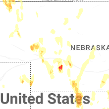

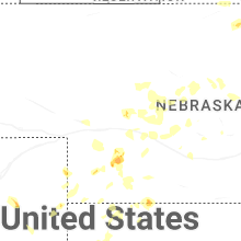
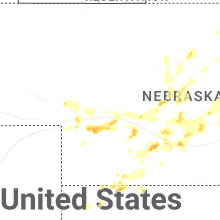
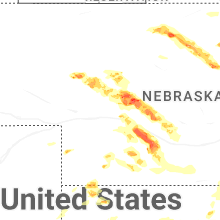
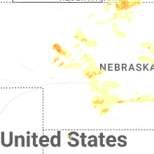
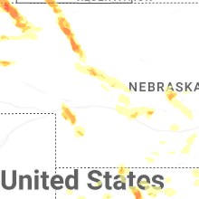
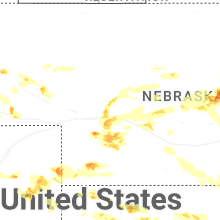


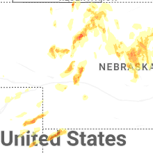
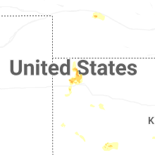


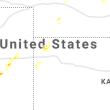


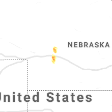


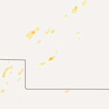


Connect with Interactive Hail Maps