

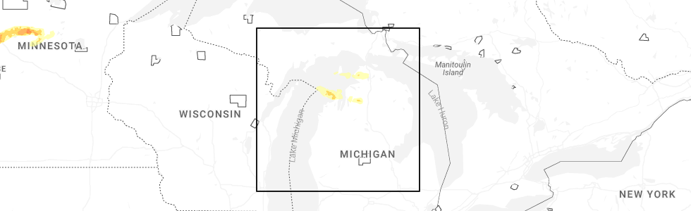
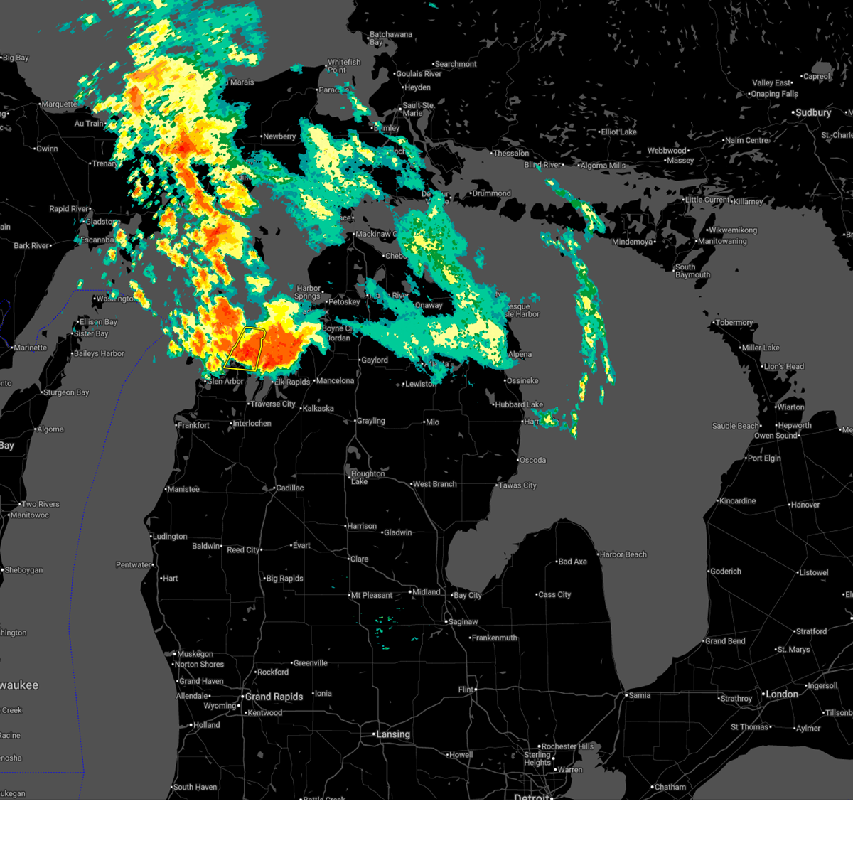
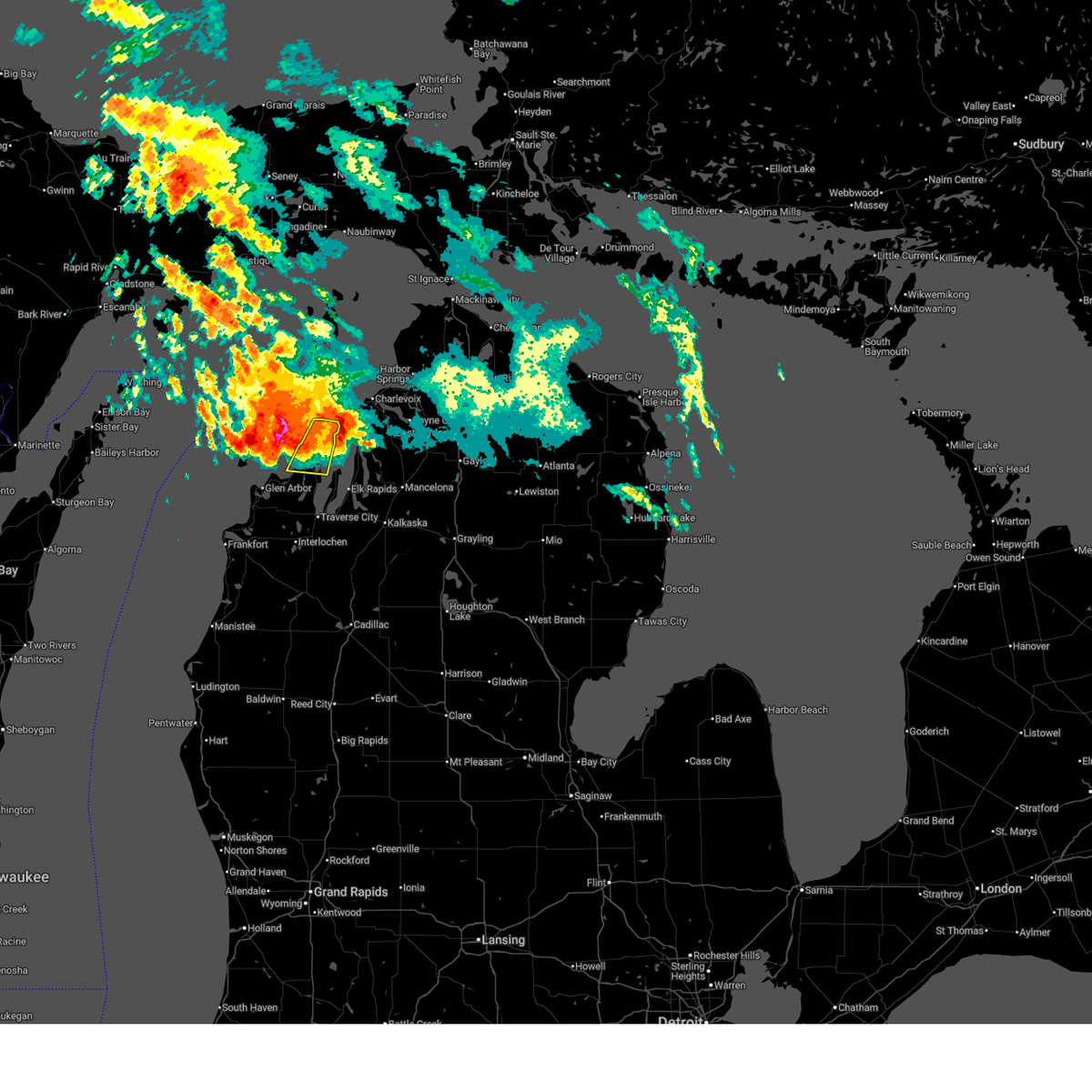
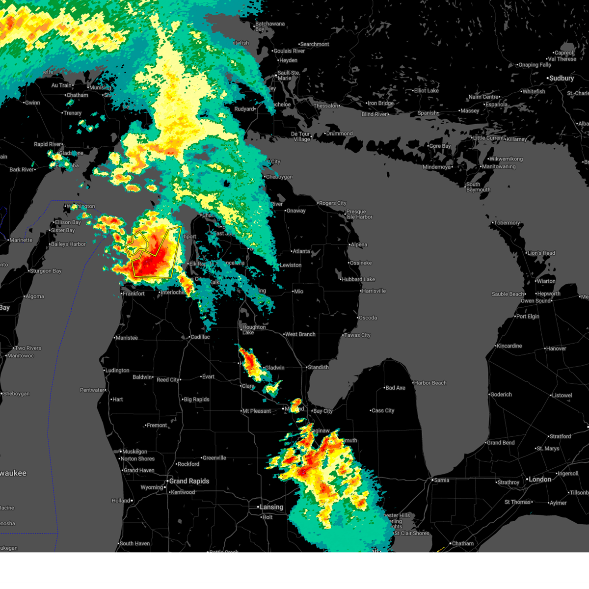
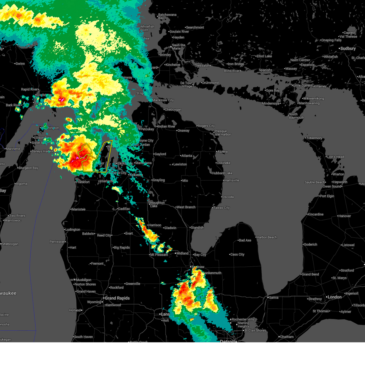
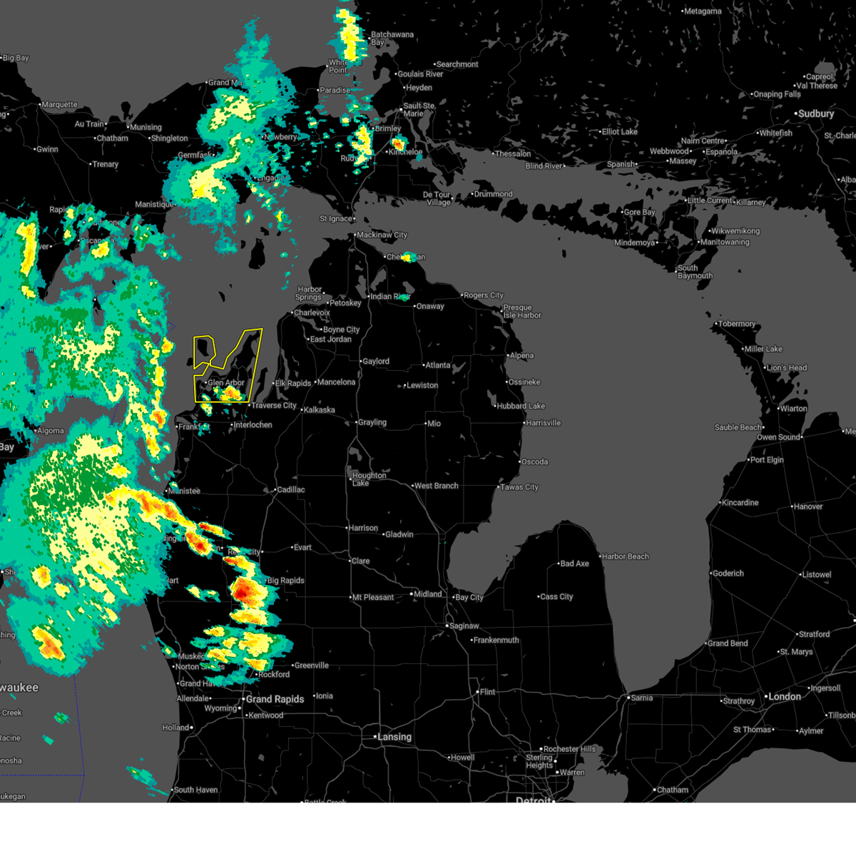
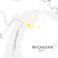
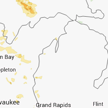
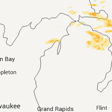
Hail Map for Northport, MI
The Northport, MI area has had 2 reports of on-the-ground hail by trained spotters, and has been under severe weather warnings 5 times during the past 12 months. Doppler radar has detected hail at or near Northport, MI on 19 occasions, including 1 occasion during the past year.
| Name: | Northport, MI |
| Where Located: | 25.5 miles N of Traverse City, MI |
| Map: | Google Map for Northport, MI |
| Population: | 526 |
| Housing Units: | 405 |
| More Info: | Search Google for Northport, MI |
3
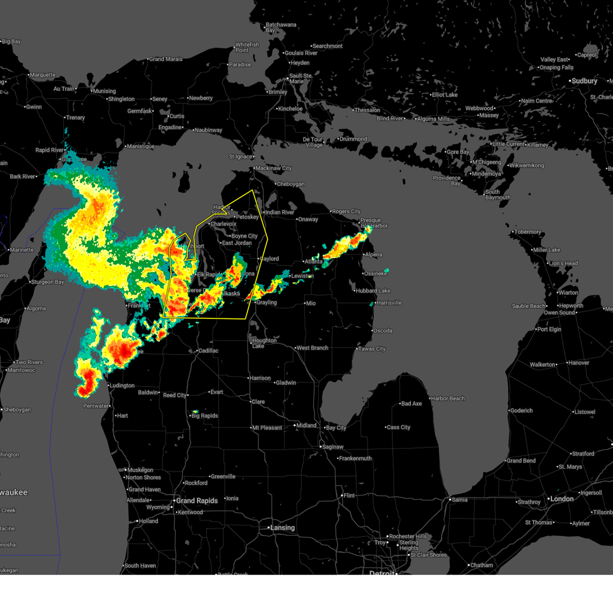
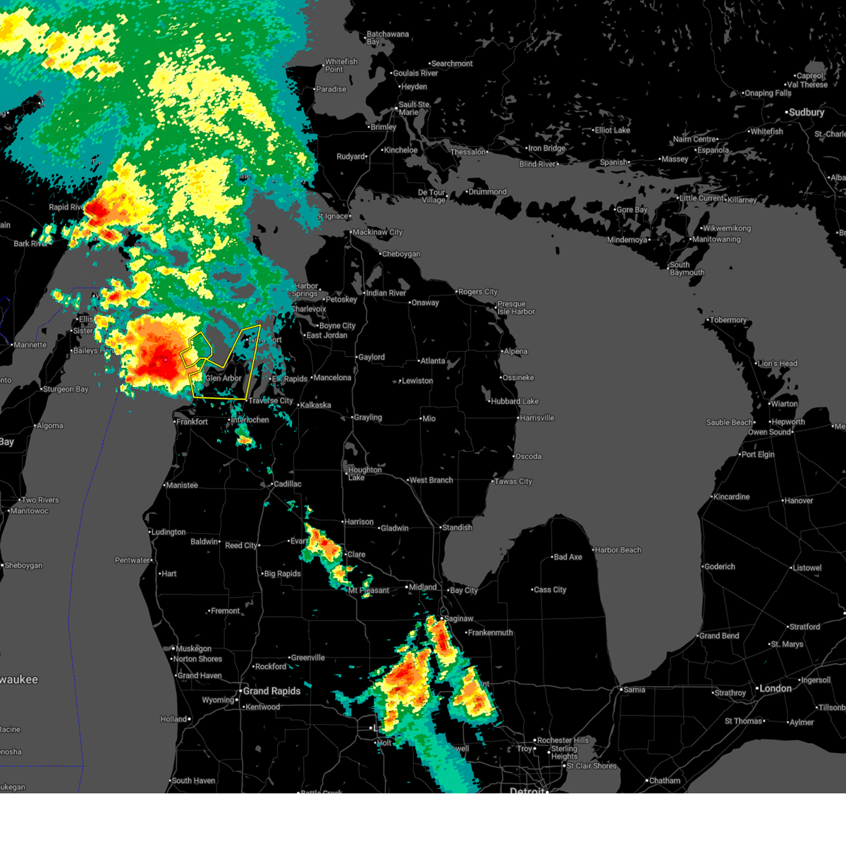
The Top Recent Hail Date for Northport, MI is Monday, June 29, 2026 (5th out of 19)
Hail and Wind Damage Spotted near Northport, MI
| Date / Time | Report Details |
|---|---|
| 7/1/2026 11:42 AM EDT |
 Svrapx the national weather service in gaylord has issued a * severe thunderstorm warning for, southeastern leelanau county in northern michigan, grand traverse county in northern michigan, southwestern cheboygan county in northern michigan, western otsego county in northern michigan, antrim county in northern michigan, western crawford county in northern michigan, southern emmet county in northern michigan, kalkaska county in northern michigan, charlevoix county in northern michigan, * until 1230 pm edt. * at 1141 am edt, severe thunderstorms were located along a line extending from near norwood to near torch lake to near kingsley, moving east at 60 mph (law enforcement. at 1140 am, law enforcement reported power lines down northwest of honor). Hazards include 60 mph wind gusts and nickel size hail. Expect damage to roofs, siding, and trees. severe thunderstorms will be near, charlevoix, bellaire, ellsworth, central lake, norwood, fife lake, williamsburg, rapid city, barker creek, and kewadin around 1145 am edt. east jordan, kalkaska, ironton, south boardman, and jordan township around 1150 am edt. petoskey, boyne city, mancelona, antrim, horton bay, young state park, bayshore, warner township, and darragh around 1155 am edt. harbor springs, elmira, boyne falls, alba, sigma, and walloon lake around 1200 pm edt. conway, petoskey state park, clarion, and bay view around 1205 pm edt. gaylord, alanson, vanderbilt, reasoners corner, and oden around 1210 pm edt. pellston, indian river, frederic, wolverine, burt lake, otsego lake state park, brutus, and waters around 1215 pm edt. Other locations impacted by these severe thunderstorms include bates, blue lake township, and lake bellaire. Svrapx the national weather service in gaylord has issued a * severe thunderstorm warning for, southeastern leelanau county in northern michigan, grand traverse county in northern michigan, southwestern cheboygan county in northern michigan, western otsego county in northern michigan, antrim county in northern michigan, western crawford county in northern michigan, southern emmet county in northern michigan, kalkaska county in northern michigan, charlevoix county in northern michigan, * until 1230 pm edt. * at 1141 am edt, severe thunderstorms were located along a line extending from near norwood to near torch lake to near kingsley, moving east at 60 mph (law enforcement. at 1140 am, law enforcement reported power lines down northwest of honor). Hazards include 60 mph wind gusts and nickel size hail. Expect damage to roofs, siding, and trees. severe thunderstorms will be near, charlevoix, bellaire, ellsworth, central lake, norwood, fife lake, williamsburg, rapid city, barker creek, and kewadin around 1145 am edt. east jordan, kalkaska, ironton, south boardman, and jordan township around 1150 am edt. petoskey, boyne city, mancelona, antrim, horton bay, young state park, bayshore, warner township, and darragh around 1155 am edt. harbor springs, elmira, boyne falls, alba, sigma, and walloon lake around 1200 pm edt. conway, petoskey state park, clarion, and bay view around 1205 pm edt. gaylord, alanson, vanderbilt, reasoners corner, and oden around 1210 pm edt. pellston, indian river, frederic, wolverine, burt lake, otsego lake state park, brutus, and waters around 1215 pm edt. Other locations impacted by these severe thunderstorms include bates, blue lake township, and lake bellaire.
|
| 7/1/2026 11:38 AM EDT | Report via social media of damage between northport and omena. numerous cherry trees felled or leaning... along with a 16 x 16 garage door blown into the structure and in leelanau county MI, 2.8 miles N of Northport, MI |
| 7/1/2026 11:34 AM EDT |
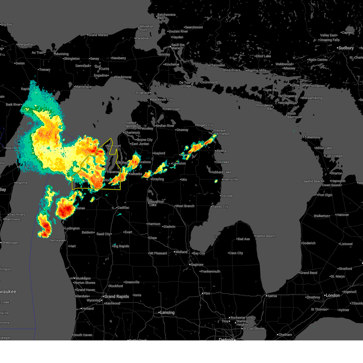 At 1134 am edt, severe thunderstorms were located along a line extending from near peshawbestown to near buckley, moving east at 45 mph (radar indicated). Hazards include 60 mph wind gusts and nickel size hail. Expect damage to roofs, siding, and trees. these severe storms will be near, traverse city, kingsley, hannah, spider lake, traverse city state park, old mission, and mapleton around 1140 am edt. elk rapids and williamsburg around 1145 am edt. fife lake around 1150 am edt. Other locations impacted by these severe thunderstorms include wallin, good harbor, blaine township, and bates. At 1134 am edt, severe thunderstorms were located along a line extending from near peshawbestown to near buckley, moving east at 45 mph (radar indicated). Hazards include 60 mph wind gusts and nickel size hail. Expect damage to roofs, siding, and trees. these severe storms will be near, traverse city, kingsley, hannah, spider lake, traverse city state park, old mission, and mapleton around 1140 am edt. elk rapids and williamsburg around 1145 am edt. fife lake around 1150 am edt. Other locations impacted by these severe thunderstorms include wallin, good harbor, blaine township, and bates.
|
| 7/1/2026 10:59 AM EDT |
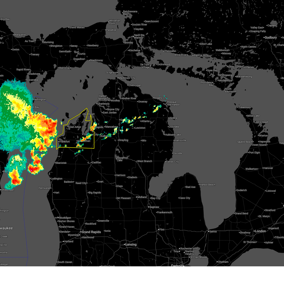 Svrapx the national weather service in gaylord has issued a * severe thunderstorm warning for, leelanau county in northern michigan, benzie county in northern michigan, grand traverse county in northern michigan, * until 1145 am edt. * at 1059 am edt, severe thunderstorms were located along a line extending from 22 miles northwest of sleeping bear point to near empire, moving east at 60 mph (radar indicated). Hazards include 60 mph wind gusts and quarter size hail. Hail damage to vehicles is expected. expect wind damage to roofs, siding, and trees. severe thunderstorms will be near, empire, sleeping bear point, glen arbor, burdickville, maple city, and glen haven around 1105 am edt. cedar around 1110 am edt. leland, bingham, greilickville, fouch, and lake leelanau around 1115 am edt. suttons bay and peshawbestown around 1120 am edt. northport, omena, old mission, and mapleton around 1125 am edt. elk rapids, grand traverse light, and leelanau state park around 1130 am edt. Other locations impacted by these severe thunderstorms include wallin, good harbor, blaine township, and bates. Svrapx the national weather service in gaylord has issued a * severe thunderstorm warning for, leelanau county in northern michigan, benzie county in northern michigan, grand traverse county in northern michigan, * until 1145 am edt. * at 1059 am edt, severe thunderstorms were located along a line extending from 22 miles northwest of sleeping bear point to near empire, moving east at 60 mph (radar indicated). Hazards include 60 mph wind gusts and quarter size hail. Hail damage to vehicles is expected. expect wind damage to roofs, siding, and trees. severe thunderstorms will be near, empire, sleeping bear point, glen arbor, burdickville, maple city, and glen haven around 1105 am edt. cedar around 1110 am edt. leland, bingham, greilickville, fouch, and lake leelanau around 1115 am edt. suttons bay and peshawbestown around 1120 am edt. northport, omena, old mission, and mapleton around 1125 am edt. elk rapids, grand traverse light, and leelanau state park around 1130 am edt. Other locations impacted by these severe thunderstorms include wallin, good harbor, blaine township, and bates.
|
| 6/29/2026 9:40 AM EDT |
 The storm which prompted the warning has weakened below severe limits, and no longer poses an immediate threat to life or property. therefore, the warning will be allowed to expire. however, small hail is still possible with this thunderstorm. The storm which prompted the warning has weakened below severe limits, and no longer poses an immediate threat to life or property. therefore, the warning will be allowed to expire. however, small hail is still possible with this thunderstorm.
|
| 6/29/2026 8:56 AM EDT |
 Svrapx the national weather service in gaylord has issued a * severe thunderstorm warning for, east central leelanau county in northern michigan, * until 945 am edt. * at 856 am edt, a severe thunderstorm was located 8 miles west of northport, or 9 miles north of leland, moving east at 25 mph (radar indicated). Hazards include 60 mph wind gusts and half dollar size hail. Hail damage to vehicles is expected. expect wind damage to roofs, siding, and trees. this severe thunderstorm will be near, northport around 900 am edt. leelanau state park around 905 am edt. Grand traverse light and omena around 910 am edt. Svrapx the national weather service in gaylord has issued a * severe thunderstorm warning for, east central leelanau county in northern michigan, * until 945 am edt. * at 856 am edt, a severe thunderstorm was located 8 miles west of northport, or 9 miles north of leland, moving east at 25 mph (radar indicated). Hazards include 60 mph wind gusts and half dollar size hail. Hail damage to vehicles is expected. expect wind damage to roofs, siding, and trees. this severe thunderstorm will be near, northport around 900 am edt. leelanau state park around 905 am edt. Grand traverse light and omena around 910 am edt.
|
| 6/21/2025 7:01 AM EDT |
 At 701 am edt, a severe thunderstorm was located over cedar, or 10 miles northwest of traverse city, moving southeast at 30 mph (radar indicated). Hazards include two inch hail and 70 mph wind gusts. People and animals outdoors will be injured. expect hail damage to roofs, siding, windows, and vehicles. expect considerable tree damage. wind damage is also likely to mobile homes, roofs, and outbuildings. this severe storm will be near, traverse city, bingham, greilickville, and fouch around 705 am edt. Other locations impacted by this severe thunderstorm include good harbor. At 701 am edt, a severe thunderstorm was located over cedar, or 10 miles northwest of traverse city, moving southeast at 30 mph (radar indicated). Hazards include two inch hail and 70 mph wind gusts. People and animals outdoors will be injured. expect hail damage to roofs, siding, windows, and vehicles. expect considerable tree damage. wind damage is also likely to mobile homes, roofs, and outbuildings. this severe storm will be near, traverse city, bingham, greilickville, and fouch around 705 am edt. Other locations impacted by this severe thunderstorm include good harbor.
|
| 6/21/2025 6:32 AM EDT |
 At 631 am edt, a severe thunderstorm was located near sleeping bear point, moving east at 30 mph (radar indicated). Hazards include two inch hail and 60 mph wind gusts. People and animals outdoors will be injured. expect hail damage to roofs, siding, windows, and vehicles. expect wind damage to roofs, siding, and trees. this severe storm will be near, glen arbor, glen haven, and burdickville around 635 am edt. maple city around 640 am edt. leland, cedar, and lake leelanau around 645 am edt. bingham and suttons bay around 650 am edt. fouch around 655 am edt. peshawbestown and greilickville around 700 am edt. Other locations impacted by this severe thunderstorm include good harbor. At 631 am edt, a severe thunderstorm was located near sleeping bear point, moving east at 30 mph (radar indicated). Hazards include two inch hail and 60 mph wind gusts. People and animals outdoors will be injured. expect hail damage to roofs, siding, windows, and vehicles. expect wind damage to roofs, siding, and trees. this severe storm will be near, glen arbor, glen haven, and burdickville around 635 am edt. maple city around 640 am edt. leland, cedar, and lake leelanau around 645 am edt. bingham and suttons bay around 650 am edt. fouch around 655 am edt. peshawbestown and greilickville around 700 am edt. Other locations impacted by this severe thunderstorm include good harbor.
|
| 6/21/2025 6:12 AM EDT |
 Svrapx the national weather service in gaylord has issued a * severe thunderstorm warning for, leelanau county in northern michigan, * until 730 am edt. * at 611 am edt, a severe thunderstorm was located 9 miles northwest of sleeping bear point, moving east at 35 mph (radar indicated). Hazards include 60 mph wind gusts and quarter size hail. Hail damage to vehicles is expected. expect wind damage to roofs, siding, and trees. this severe thunderstorm will be near, sleeping bear point and glen haven around 615 am edt. glen arbor around 620 am edt. leland around 630 am edt. lake leelanau around 635 am edt. suttons bay around 640 am edt. peshawbestown around 645 am edt. omena around 650 am edt. northport around 655 am edt. Other locations impacted by this severe thunderstorm include good harbor. Svrapx the national weather service in gaylord has issued a * severe thunderstorm warning for, leelanau county in northern michigan, * until 730 am edt. * at 611 am edt, a severe thunderstorm was located 9 miles northwest of sleeping bear point, moving east at 35 mph (radar indicated). Hazards include 60 mph wind gusts and quarter size hail. Hail damage to vehicles is expected. expect wind damage to roofs, siding, and trees. this severe thunderstorm will be near, sleeping bear point and glen haven around 615 am edt. glen arbor around 620 am edt. leland around 630 am edt. lake leelanau around 635 am edt. suttons bay around 640 am edt. peshawbestown around 645 am edt. omena around 650 am edt. northport around 655 am edt. Other locations impacted by this severe thunderstorm include good harbor.
|
| 5/16/2025 8:13 PM EDT |
 At 812 pm edt, a severe thunderstorm was located near lake leelanau, or near leland, moving north at 25 mph (radar indicated). Hazards include 70 mph wind gusts and quarter size hail. Hail damage to vehicles is expected. expect considerable tree damage. wind damage is also likely to mobile homes, roofs, and outbuildings. this severe storm will be near, suttons bay, lake leelanau, and leland around 820 pm edt. Other locations impacted by this severe thunderstorm include good harbor. At 812 pm edt, a severe thunderstorm was located near lake leelanau, or near leland, moving north at 25 mph (radar indicated). Hazards include 70 mph wind gusts and quarter size hail. Hail damage to vehicles is expected. expect considerable tree damage. wind damage is also likely to mobile homes, roofs, and outbuildings. this severe storm will be near, suttons bay, lake leelanau, and leland around 820 pm edt. Other locations impacted by this severe thunderstorm include good harbor.
|
| 5/16/2025 7:53 PM EDT |
 Svrapx the national weather service in gaylord has issued a * severe thunderstorm warning for, leelanau county in northern michigan, * until 845 pm edt. * at 753 pm edt, a severe thunderstorm was located over cedar, or 10 miles northwest of traverse city, moving north at 20 mph (radar indicated). Hazards include 60 mph wind gusts. Expect damage to roofs, siding, and trees. this severe thunderstorm will be near, lake leelanau and burdickville around 800 pm edt. leland around 805 pm edt. suttons bay around 810 pm edt. Other locations impacted by this severe thunderstorm include good harbor. Svrapx the national weather service in gaylord has issued a * severe thunderstorm warning for, leelanau county in northern michigan, * until 845 pm edt. * at 753 pm edt, a severe thunderstorm was located over cedar, or 10 miles northwest of traverse city, moving north at 20 mph (radar indicated). Hazards include 60 mph wind gusts. Expect damage to roofs, siding, and trees. this severe thunderstorm will be near, lake leelanau and burdickville around 800 pm edt. leland around 805 pm edt. suttons bay around 810 pm edt. Other locations impacted by this severe thunderstorm include good harbor.
|
| 6/25/2023 7:06 PM EDT |
 At 706 pm edt, severe thunderstorms were located along a line extending from 13 miles northwest of leelanau state park to near torch lake, moving east at 25 mph (radar indicated). Hazards include 60 mph wind gusts. Expect damage to roofs, siding, and trees. locations impacted include, grand traverse light, northport, peshawbestown, leelanau state park and omena. hail threat, radar indicated max hail size, <. 75 in wind threat, radar indicated max wind gust, 60 mph. At 706 pm edt, severe thunderstorms were located along a line extending from 13 miles northwest of leelanau state park to near torch lake, moving east at 25 mph (radar indicated). Hazards include 60 mph wind gusts. Expect damage to roofs, siding, and trees. locations impacted include, grand traverse light, northport, peshawbestown, leelanau state park and omena. hail threat, radar indicated max hail size, <. 75 in wind threat, radar indicated max wind gust, 60 mph.
|
| 6/25/2023 6:48 PM EDT |
 At 648 pm edt, severe thunderstorms were located along a line extending from 11 miles west of northport to near torch lake, moving north at 25 mph (radar indicated). Hazards include 60 mph wind gusts and penny size hail. expect damage to roofs, siding, and trees At 648 pm edt, severe thunderstorms were located along a line extending from 11 miles west of northport to near torch lake, moving north at 25 mph (radar indicated). Hazards include 60 mph wind gusts and penny size hail. expect damage to roofs, siding, and trees
|
| 6/25/2023 6:36 PM EDT |
 At 635 pm edt, severe thunderstorms were located along a line extending from 8 miles west of leland to near omena to old mission, moving north at 45 mph (radar indicated). Hazards include 60 mph wind gusts and penny size hail. Expect damage to roofs, siding, and trees. locations impacted include, leland, grand traverse light, suttons bay, northport, old mission, omena, lake leelanau, peshawbestown, mapleton, leelanau state park and good harbor. hail threat, radar indicated max hail size, 0. 75 in wind threat, radar indicated max wind gust, 60 mph. At 635 pm edt, severe thunderstorms were located along a line extending from 8 miles west of leland to near omena to old mission, moving north at 45 mph (radar indicated). Hazards include 60 mph wind gusts and penny size hail. Expect damage to roofs, siding, and trees. locations impacted include, leland, grand traverse light, suttons bay, northport, old mission, omena, lake leelanau, peshawbestown, mapleton, leelanau state park and good harbor. hail threat, radar indicated max hail size, 0. 75 in wind threat, radar indicated max wind gust, 60 mph.
|
| 6/25/2023 6:21 PM EDT |
 At 621 pm edt, severe thunderstorms were located along a line extending from near glen arbor to near elk rapids, moving north at 30 mph (radar indicated). Hazards include 60 mph wind gusts and penny size hail. expect damage to roofs, siding, and trees At 621 pm edt, severe thunderstorms were located along a line extending from near glen arbor to near elk rapids, moving north at 30 mph (radar indicated). Hazards include 60 mph wind gusts and penny size hail. expect damage to roofs, siding, and trees
|
| 5/20/2022 2:48 PM EDT |
 At 248 pm edt, severe thunderstorms were located along a line extending from near norwood to near grawn, moving east at 50 mph (radar indicated). Hazards include 70 mph wind gusts and quarter size hail. Hail damage to vehicles is expected. expect considerable tree damage. wind damage is also likely to mobile homes, roofs, and outbuildings. locations impacted include, traverse city, leland, bingham, suttons bay, northport, cedar, lake ann, greilickville, lake leelanau, mapleton, burdickville, maple city, grawn, traverse city state park, old mission, omena, peshawbestown, leelanau state park, fouch and good harbor. thunderstorm damage threat, considerable hail threat, radar indicated max hail size, 1. 00 in wind threat, radar indicated max wind gust, 70 mph. At 248 pm edt, severe thunderstorms were located along a line extending from near norwood to near grawn, moving east at 50 mph (radar indicated). Hazards include 70 mph wind gusts and quarter size hail. Hail damage to vehicles is expected. expect considerable tree damage. wind damage is also likely to mobile homes, roofs, and outbuildings. locations impacted include, traverse city, leland, bingham, suttons bay, northport, cedar, lake ann, greilickville, lake leelanau, mapleton, burdickville, maple city, grawn, traverse city state park, old mission, omena, peshawbestown, leelanau state park, fouch and good harbor. thunderstorm damage threat, considerable hail threat, radar indicated max hail size, 1. 00 in wind threat, radar indicated max wind gust, 70 mph.
|
| 5/20/2022 2:23 PM EDT |
 At 223 pm edt, severe thunderstorms were located along a line extending from 10 miles northwest of leland to near benzonia, moving northeast at 75 mph (radar indicated). Hazards include 70 mph wind gusts and quarter size hail. Hail damage to vehicles is expected. expect considerable tree damage. wind damage is also likely to mobile homes, roofs, and outbuildings. locations impacted include, northport, lake ann, leelanau state park, interlochen, grawn, interlochen state park, traverse city, greilickville, fouch, traverse city state park and mapleton. thunderstorm damage threat, considerable hail threat, radar indicated max hail size, 1. 00 in wind threat, radar indicated max wind gust, 70 mph. At 223 pm edt, severe thunderstorms were located along a line extending from 10 miles northwest of leland to near benzonia, moving northeast at 75 mph (radar indicated). Hazards include 70 mph wind gusts and quarter size hail. Hail damage to vehicles is expected. expect considerable tree damage. wind damage is also likely to mobile homes, roofs, and outbuildings. locations impacted include, northport, lake ann, leelanau state park, interlochen, grawn, interlochen state park, traverse city, greilickville, fouch, traverse city state park and mapleton. thunderstorm damage threat, considerable hail threat, radar indicated max hail size, 1. 00 in wind threat, radar indicated max wind gust, 70 mph.
|
| 6/29/2021 9:19 PM EDT |
 At 918 pm edt, a severe thunderstorm was located over lake leelanau, or near leland, moving east at 40 mph (radar indicated). Hazards include 60 mph wind gusts. Expect damage to roofs, siding, and trees. this severe storm will be near, bingham around 925 pm edt. suttons bay and peshawbestown around 930 pm edt. omena around 935 pm edt. Other locations impacted by this severe thunderstorm include good harbor. At 918 pm edt, a severe thunderstorm was located over lake leelanau, or near leland, moving east at 40 mph (radar indicated). Hazards include 60 mph wind gusts. Expect damage to roofs, siding, and trees. this severe storm will be near, bingham around 925 pm edt. suttons bay and peshawbestown around 930 pm edt. omena around 935 pm edt. Other locations impacted by this severe thunderstorm include good harbor.
|
| 6/29/2021 9:10 PM EDT |
 At 910 pm edt, a severe thunderstorm was located 7 miles northeast of glen arbor, or 7 miles southwest of leland, moving east at 35 mph (radar indicated). Hazards include 60 mph wind gusts. Expect damage to roofs, siding, and trees. this severe storm will be near, leland around 920 pm edt. bingham and lake leelanau around 925 pm edt. suttons bay around 930 pm edt. peshawbestown and omena around 935 pm edt. Other locations impacted by this severe thunderstorm include good harbor. At 910 pm edt, a severe thunderstorm was located 7 miles northeast of glen arbor, or 7 miles southwest of leland, moving east at 35 mph (radar indicated). Hazards include 60 mph wind gusts. Expect damage to roofs, siding, and trees. this severe storm will be near, leland around 920 pm edt. bingham and lake leelanau around 925 pm edt. suttons bay around 930 pm edt. peshawbestown and omena around 935 pm edt. Other locations impacted by this severe thunderstorm include good harbor.
|
| 6/29/2021 9:02 PM EDT |
 At 901 pm edt, a severe thunderstorm was located near sleeping bear point, moving east at 40 mph (radar indicated). Hazards include 60 mph wind gusts. Expect damage to roofs, siding, and trees. this severe storm will be near, leland around 920 pm edt. lake leelanau around 925 pm edt. bingham and suttons bay around 930 pm edt. peshawbestown around 935 pm edt. Other locations impacted by this severe thunderstorm include good harbor. At 901 pm edt, a severe thunderstorm was located near sleeping bear point, moving east at 40 mph (radar indicated). Hazards include 60 mph wind gusts. Expect damage to roofs, siding, and trees. this severe storm will be near, leland around 920 pm edt. lake leelanau around 925 pm edt. bingham and suttons bay around 930 pm edt. peshawbestown around 935 pm edt. Other locations impacted by this severe thunderstorm include good harbor.
|
| 6/29/2021 8:52 PM EDT |
 At 851 pm edt, a severe thunderstorm was located 8 miles northwest of sleeping bear point, moving east at 40 mph (radar indicated). Hazards include 60 mph wind gusts. Expect damage to roofs, siding, and trees. this severe thunderstorm will be near, sleeping bear point, glen arbor and glen haven around 900 pm edt. leland around 920 pm edt. lake leelanau around 925 pm edt. suttons bay and peshawbestown around 930 pm edt. Other locations impacted by this severe thunderstorm include good harbor. At 851 pm edt, a severe thunderstorm was located 8 miles northwest of sleeping bear point, moving east at 40 mph (radar indicated). Hazards include 60 mph wind gusts. Expect damage to roofs, siding, and trees. this severe thunderstorm will be near, sleeping bear point, glen arbor and glen haven around 900 pm edt. leland around 920 pm edt. lake leelanau around 925 pm edt. suttons bay and peshawbestown around 930 pm edt. Other locations impacted by this severe thunderstorm include good harbor.
|
| 9/3/2019 4:49 PM EDT |
 The national weather service in gaylord has issued a * severe thunderstorm warning for. southern leelanau county in northern michigan. until 515 pm edt. At 449 pm edt, a severe thunderstorm was located near leland, moving east at 60 mph. The national weather service in gaylord has issued a * severe thunderstorm warning for. southern leelanau county in northern michigan. until 515 pm edt. At 449 pm edt, a severe thunderstorm was located near leland, moving east at 60 mph.
|
| 7/20/2019 2:16 PM EDT |
 At 215 pm edt, severe thunderstorms were located along a line extending from 13 miles northwest of leland to near empire, moving east at 35 mph (radar indicated). Hazards include 60 mph wind gusts and nickel size hail. expect damage to roofs, siding, and trees At 215 pm edt, severe thunderstorms were located along a line extending from 13 miles northwest of leland to near empire, moving east at 35 mph (radar indicated). Hazards include 60 mph wind gusts and nickel size hail. expect damage to roofs, siding, and trees
|
| 7/20/2019 12:57 AM EDT |
 The severe thunderstorm warning for leelanau, benzie, wexford, grand traverse and manistee counties will expire at 100 am edt, the storms which prompted the warning have weakened below severe limits, and no longer pose an immediate threat to life or property. therefore, the warning will be allowed to expire. however gusty winds are still possible with these thunderstorms as they track into kalkaska and missaukee counties. a severe thunderstorm watch remains in effect until 600 am edt for northern michigan. The severe thunderstorm warning for leelanau, benzie, wexford, grand traverse and manistee counties will expire at 100 am edt, the storms which prompted the warning have weakened below severe limits, and no longer pose an immediate threat to life or property. therefore, the warning will be allowed to expire. however gusty winds are still possible with these thunderstorms as they track into kalkaska and missaukee counties. a severe thunderstorm watch remains in effect until 600 am edt for northern michigan.
|
| 7/20/2019 12:34 AM EDT |
 At 1232 am edt, severe thunderstorms were located along a line extending from 7 miles northwest of sleeping bear point to mesick to near dublin to near mears state park, moving east at 55 mph (radar indicated). Hazards include 70 mph wind gusts and penny size hail. Expect considerable tree damage. damage is likely to mobile homes, roofs, and outbuildings. several reports of downed trees have been reported across benzie county. wind gusts over 50 mph have also been reported with this line of thunderstorms. Locations impacted include, traverse city, cadillac, manistee, leland, elk rapids, frankfort, thompsonville, empire, beulah, grand traverse light, sleeping bear point, arcadia, bingham, kingsley, manton, sherman, glen arbor, buckley, boon and suttons bay. At 1232 am edt, severe thunderstorms were located along a line extending from 7 miles northwest of sleeping bear point to mesick to near dublin to near mears state park, moving east at 55 mph (radar indicated). Hazards include 70 mph wind gusts and penny size hail. Expect considerable tree damage. damage is likely to mobile homes, roofs, and outbuildings. several reports of downed trees have been reported across benzie county. wind gusts over 50 mph have also been reported with this line of thunderstorms. Locations impacted include, traverse city, cadillac, manistee, leland, elk rapids, frankfort, thompsonville, empire, beulah, grand traverse light, sleeping bear point, arcadia, bingham, kingsley, manton, sherman, glen arbor, buckley, boon and suttons bay.
|
| 7/20/2019 12:15 AM EDT |
 At 1214 am edt, severe thunderstorms were located along a line extending from 21 miles west of sleeping bear point to near copemish to near free soil to 12 miles southwest of ludington, moving east at 55 mph (radar indicated). Hazards include 70 mph wind gusts and penny size hail. Expect considerable tree damage. damage is likely to mobile homes, roofs, and outbuildings. at 1202 am, a 51 mph wind gust was reported in manistee. Locations impacted include, traverse city, cadillac, manistee, leland, elk rapids, frankfort, thompsonville, empire, beulah, grand traverse light, sleeping bear point, arcadia, bingham, kingsley, manton, sherman, glen arbor, buckley, boon and suttons bay. At 1214 am edt, severe thunderstorms were located along a line extending from 21 miles west of sleeping bear point to near copemish to near free soil to 12 miles southwest of ludington, moving east at 55 mph (radar indicated). Hazards include 70 mph wind gusts and penny size hail. Expect considerable tree damage. damage is likely to mobile homes, roofs, and outbuildings. at 1202 am, a 51 mph wind gust was reported in manistee. Locations impacted include, traverse city, cadillac, manistee, leland, elk rapids, frankfort, thompsonville, empire, beulah, grand traverse light, sleeping bear point, arcadia, bingham, kingsley, manton, sherman, glen arbor, buckley, boon and suttons bay.
|
| 7/19/2019 11:57 PM EDT |
 At 1156 pm edt, severe thunderstorms were located along a line extending from 18 miles southeast of newport state park to near arcadia to 7 miles west of manistee to 23 miles west of ludington state park, moving east at 50 mph (radar indicated). Hazards include 70 mph wind gusts and penny size hail. Expect considerable tree damage. damage is likely to mobile homes, roofs, and outbuildings. Locations impacted include, traverse city, cadillac, manistee, leland, elk rapids, frankfort, thompsonville, empire, beulah, grand traverse light, sleeping bear point, arcadia, bingham, kingsley, manton, sherman, glen arbor, buckley, boon and suttons bay. At 1156 pm edt, severe thunderstorms were located along a line extending from 18 miles southeast of newport state park to near arcadia to 7 miles west of manistee to 23 miles west of ludington state park, moving east at 50 mph (radar indicated). Hazards include 70 mph wind gusts and penny size hail. Expect considerable tree damage. damage is likely to mobile homes, roofs, and outbuildings. Locations impacted include, traverse city, cadillac, manistee, leland, elk rapids, frankfort, thompsonville, empire, beulah, grand traverse light, sleeping bear point, arcadia, bingham, kingsley, manton, sherman, glen arbor, buckley, boon and suttons bay.
|
| 7/19/2019 11:40 PM EDT |
 At 1139 pm edt, severe thunderstorms were located along a line extending from 7 miles southeast of newport state park to 16 miles west of frankfort to 20 miles west of manistee to 22 miles east of manitowoc, moving east at 55 mph (radar indicated). Hazards include 70 mph wind gusts. Expect considerable tree damage. Damage is likely to mobile homes, roofs, and outbuildings. At 1139 pm edt, severe thunderstorms were located along a line extending from 7 miles southeast of newport state park to 16 miles west of frankfort to 20 miles west of manistee to 22 miles east of manitowoc, moving east at 55 mph (radar indicated). Hazards include 70 mph wind gusts. Expect considerable tree damage. Damage is likely to mobile homes, roofs, and outbuildings.
|
| 8/28/2018 6:19 PM EDT |
 At 619 pm edt, a severe thunderstorm was located over leland, moving northeast at 30 mph (radar indicated). Hazards include 60 mph wind gusts and penny size hail. Expect damage to roofs, siding, and trees. Locations impacted include, bingham, glen arbor, suttons bay, northport, glen haven, omena, lake leelanau, peshawbestown, burdickville, maple city and good harbor. At 619 pm edt, a severe thunderstorm was located over leland, moving northeast at 30 mph (radar indicated). Hazards include 60 mph wind gusts and penny size hail. Expect damage to roofs, siding, and trees. Locations impacted include, bingham, glen arbor, suttons bay, northport, glen haven, omena, lake leelanau, peshawbestown, burdickville, maple city and good harbor.
|
| 8/28/2018 5:54 PM EDT |
 At 554 pm edt, a severe thunderstorm was located near sleeping bear point, moving northeast at 25 mph (radar indicated). Hazards include 60 mph wind gusts and quarter size hail. Hail damage to vehicles is expected. Expect wind damage to roofs, siding, and trees. At 554 pm edt, a severe thunderstorm was located near sleeping bear point, moving northeast at 25 mph (radar indicated). Hazards include 60 mph wind gusts and quarter size hail. Hail damage to vehicles is expected. Expect wind damage to roofs, siding, and trees.
|
| 8/28/2018 1:17 AM EDT |
 At 117 am edt, severe thunderstorms were located along a line extending from near grand traverse light to near fouch to near eastlake, moving east at 60 mph (radar indicated. at 110 am, leland harbor reported a wind gust of 65 mph). Hazards include 70 mph wind gusts. Expect considerable tree damage. damage is likely to mobile homes, roofs, and outbuildings. Locations impacted include, traverse city, manistee, frankfort, thompsonville, empire, beulah, sleeping bear point, arcadia, bingham, glen arbor, suttons bay, northport, eastlake, benzonia, kaleva, cedar, onekama, elberta, honor and lake ann. At 117 am edt, severe thunderstorms were located along a line extending from near grand traverse light to near fouch to near eastlake, moving east at 60 mph (radar indicated. at 110 am, leland harbor reported a wind gust of 65 mph). Hazards include 70 mph wind gusts. Expect considerable tree damage. damage is likely to mobile homes, roofs, and outbuildings. Locations impacted include, traverse city, manistee, frankfort, thompsonville, empire, beulah, sleeping bear point, arcadia, bingham, glen arbor, suttons bay, northport, eastlake, benzonia, kaleva, cedar, onekama, elberta, honor and lake ann.
|
| 8/28/2018 1:06 AM EDT |
 At 105 am edt, severe thunderstorms were located along a line extending from 12 miles northwest of leelanau state park to near platte township to 8 miles west of manistee, moving east at 45 mph (radar indicated). Hazards include 60 mph wind gusts. Expect damage to roofs, siding, and trees. Locations impacted include, traverse city, manistee, frankfort, thompsonville, empire, beulah, sleeping bear point, arcadia, bingham, glen arbor, suttons bay, northport, eastlake, benzonia, kaleva, cedar, onekama, elberta, honor and lake ann. At 105 am edt, severe thunderstorms were located along a line extending from 12 miles northwest of leelanau state park to near platte township to 8 miles west of manistee, moving east at 45 mph (radar indicated). Hazards include 60 mph wind gusts. Expect damage to roofs, siding, and trees. Locations impacted include, traverse city, manistee, frankfort, thompsonville, empire, beulah, sleeping bear point, arcadia, bingham, glen arbor, suttons bay, northport, eastlake, benzonia, kaleva, cedar, onekama, elberta, honor and lake ann.
|
| 8/28/2018 12:26 AM EDT |
 At 1224 am edt, severe thunderstorms were located along a line extending from 29 miles south of garden to 27 miles northwest of ludington sp, moving east at 65 mph (radar indicated). Hazards include 60 mph wind gusts. expect damage to roofs, siding, and trees At 1224 am edt, severe thunderstorms were located along a line extending from 29 miles south of garden to 27 miles northwest of ludington sp, moving east at 65 mph (radar indicated). Hazards include 60 mph wind gusts. expect damage to roofs, siding, and trees
|
| 9/4/2017 11:31 AM EDT |
 At 1130 am edt, a cluster of severe thunderstorms were located along a line extending from near leelanau state park to near leland, moving east at 45 mph (radar indicated). Hazards include 60 mph wind gusts and quarter size hail. Hail damage to vehicles is expected. expect wind damage to roofs, siding, and trees. severe thunderstorms will be near, ellsworth and omena around 1145 am edt. east jordan, old mission and mapleton around 1150 am edt. elk rapids, torch lake, kewadin and jordan township around 1155 am edt. boyne city, bellaire, central lake, boyne falls, warner township, clam river and alden around 1200 pm edt. Other locations impacted by these severe thunderstorms include good harbor and lake bellaire. At 1130 am edt, a cluster of severe thunderstorms were located along a line extending from near leelanau state park to near leland, moving east at 45 mph (radar indicated). Hazards include 60 mph wind gusts and quarter size hail. Hail damage to vehicles is expected. expect wind damage to roofs, siding, and trees. severe thunderstorms will be near, ellsworth and omena around 1145 am edt. east jordan, old mission and mapleton around 1150 am edt. elk rapids, torch lake, kewadin and jordan township around 1155 am edt. boyne city, bellaire, central lake, boyne falls, warner township, clam river and alden around 1200 pm edt. Other locations impacted by these severe thunderstorms include good harbor and lake bellaire.
|
| 6/12/2017 11:20 PM EDT |
 At 1120 pm edt, severe thunderstorms were located along a line extending from 10 miles west of sleeping bear point to glen arbor to lake ann, moving northeast at 45 mph (radar indicated). Hazards include 60 mph wind gusts. expect damage to roofs, siding, and trees At 1120 pm edt, severe thunderstorms were located along a line extending from 10 miles west of sleeping bear point to glen arbor to lake ann, moving northeast at 45 mph (radar indicated). Hazards include 60 mph wind gusts. expect damage to roofs, siding, and trees
|
| 6/12/2017 4:23 AM EDT |
 The severe thunderstorm warning for southeastern leelanau, central grand traverse and western antrim counties will expire at 430 am edt, the storm which prompted the warning has weakened below severe limits, and has exited the warned area. therefore, the warning will be allowed to expire. The severe thunderstorm warning for southeastern leelanau, central grand traverse and western antrim counties will expire at 430 am edt, the storm which prompted the warning has weakened below severe limits, and has exited the warned area. therefore, the warning will be allowed to expire.
|
| 6/12/2017 3:55 AM EDT |
 At 354 am edt, a severe thunderstorm was located near peshawbestown, or 10 miles northwest of elk rapids, moving east at 40 mph (radar indicated). Hazards include 60 mph wind gusts. expect damage to roofs, siding, and trees At 354 am edt, a severe thunderstorm was located near peshawbestown, or 10 miles northwest of elk rapids, moving east at 40 mph (radar indicated). Hazards include 60 mph wind gusts. expect damage to roofs, siding, and trees
|
| 6/11/2017 4:07 PM EDT |
 At 406 pm edt, severe thunderstorms were located along a line extending from 16 miles northwest of grand traverse light to 17 miles northwest of leland to near sleeping bear point to near frankfort, moving east at 50 mph (radar indicated). Hazards include 60 mph wind gusts and penny size hail. Expect damage to roofs, siding, and trees. Locations impacted include, leland, empire, grand traverse light, sleeping bear point, bingham, glen arbor, suttons bay, northport, cedar, lake leelanau, burdickville, maple city, glen haven, omena, peshawbestown, leelanau state park, fouch, greilickville and good harbor. At 406 pm edt, severe thunderstorms were located along a line extending from 16 miles northwest of grand traverse light to 17 miles northwest of leland to near sleeping bear point to near frankfort, moving east at 50 mph (radar indicated). Hazards include 60 mph wind gusts and penny size hail. Expect damage to roofs, siding, and trees. Locations impacted include, leland, empire, grand traverse light, sleeping bear point, bingham, glen arbor, suttons bay, northport, cedar, lake leelanau, burdickville, maple city, glen haven, omena, peshawbestown, leelanau state park, fouch, greilickville and good harbor.
|
| 6/11/2017 3:51 PM EDT |
 At 351 pm edt, severe thunderstorms were located along a line extending from 27 miles northwest of leland to 24 miles northwest of glen haven to 13 miles west of sleeping bear point to 13 miles west of frankfort, moving east at 50 mph (radar indicated). Hazards include 60 mph wind gusts and penny size hail. expect damage to roofs, siding, and trees At 351 pm edt, severe thunderstorms were located along a line extending from 27 miles northwest of leland to 24 miles northwest of glen haven to 13 miles west of sleeping bear point to 13 miles west of frankfort, moving east at 50 mph (radar indicated). Hazards include 60 mph wind gusts and penny size hail. expect damage to roofs, siding, and trees
|
| 4/10/2017 11:41 AM EDT |
 At 1141 am edt, a severe thunderstorm was located near leelanau state park, or near grand traverse light, moving northeast at 50 mph (radar indicated). Hazards include quarter size hail. Damage to vehicles is expected. Locations impacted include, grand traverse light, northport and leelanau state park. At 1141 am edt, a severe thunderstorm was located near leelanau state park, or near grand traverse light, moving northeast at 50 mph (radar indicated). Hazards include quarter size hail. Damage to vehicles is expected. Locations impacted include, grand traverse light, northport and leelanau state park.
|
| 4/10/2017 11:28 AM EDT |
 At 1128 am edt, a severe thunderstorm was located over leland, moving northeast at 35 mph (radar indicated). Hazards include quarter size hail. damage to vehicles is expected At 1128 am edt, a severe thunderstorm was located over leland, moving northeast at 35 mph (radar indicated). Hazards include quarter size hail. damage to vehicles is expected
|
| 10/17/2016 7:43 AM EDT |
 At 742 am edt, severe thunderstorms were located along a line extending from norwood to 6 miles northeast of glen arbor, moving east at 30 mph (radar indicated). Hazards include 70 mph wind gusts and ping pong ball size hail. People and animals outdoors will be injured. expect hail damage to roofs, siding, windows, and vehicles. expect considerable tree damage. Wind damage is also likely to mobile homes, roofs, and outbuildings. At 742 am edt, severe thunderstorms were located along a line extending from norwood to 6 miles northeast of glen arbor, moving east at 30 mph (radar indicated). Hazards include 70 mph wind gusts and ping pong ball size hail. People and animals outdoors will be injured. expect hail damage to roofs, siding, windows, and vehicles. expect considerable tree damage. Wind damage is also likely to mobile homes, roofs, and outbuildings.
|
| 10/17/2016 7:09 AM EDT |
 At 708 am edt, doppler radar indicated a severe thunderstorm capable of producing quarter size hail and damaging winds in excess of 60 mph. this storm was located 10 miles west of northport, or 11 miles north of leland, and moving northeast at 50 mph. At 708 am edt, doppler radar indicated a severe thunderstorm capable of producing quarter size hail and damaging winds in excess of 60 mph. this storm was located 10 miles west of northport, or 11 miles north of leland, and moving northeast at 50 mph.
|
| 7/8/2016 11:46 AM EDT |
 At 1146 am edt, a severe thunderstorm was located over torch lake, or 7 miles southwest of ellsworth, moving northeast at 35 mph (radar indicated). Hazards include two inch hail and 70 mph wind gusts. People and animals outdoors will be injured. expect hail damage to roofs, siding, windows, and vehicles. expect considerable tree damage. wind damage is also likely to mobile homes, roofs, and outbuildings. Locations impacted include, petoskey, boyne city, charlevoix, east jordan, ellsworth, torch lake, central lake, norwood, northport, omena, ironton, bayshore, peshawbestown, mapleton, fishermans island state park, young state park, horton bay, old mission, clarion and walloon lake. At 1146 am edt, a severe thunderstorm was located over torch lake, or 7 miles southwest of ellsworth, moving northeast at 35 mph (radar indicated). Hazards include two inch hail and 70 mph wind gusts. People and animals outdoors will be injured. expect hail damage to roofs, siding, windows, and vehicles. expect considerable tree damage. wind damage is also likely to mobile homes, roofs, and outbuildings. Locations impacted include, petoskey, boyne city, charlevoix, east jordan, ellsworth, torch lake, central lake, norwood, northport, omena, ironton, bayshore, peshawbestown, mapleton, fishermans island state park, young state park, horton bay, old mission, clarion and walloon lake.
|
| 7/8/2016 11:29 AM EDT |
 At 1128 am edt, a severe thunderstorm was located near torch lake, or 10 miles south of grand traverse light, moving northeast at 35 mph (radar indicated). Hazards include two inch hail and 70 mph wind gusts. People and animals outdoors will be injured. expect hail damage to roofs, siding, windows, and vehicles. expect considerable tree damage. Wind damage is also likely to mobile homes, roofs, and outbuildings. At 1128 am edt, a severe thunderstorm was located near torch lake, or 10 miles south of grand traverse light, moving northeast at 35 mph (radar indicated). Hazards include two inch hail and 70 mph wind gusts. People and animals outdoors will be injured. expect hail damage to roofs, siding, windows, and vehicles. expect considerable tree damage. Wind damage is also likely to mobile homes, roofs, and outbuildings.
|
| 7/8/2016 11:25 AM EDT |
 At 1122 am edt, a severe thunderstorm was located over peshawbestown, or near leland, moving east at 40 mph. this is a very dangerous storm (radar indicated. at 1100 am very large 3 inch diameter hail was reported in glen arbor). Hazards include three inch hail and 60 mph wind gusts. People and animals outdoors will be severely injured. expect shattered windows, extensive damage to roofs, siding, and vehicles. This severe thunderstorm will remain over mainly rural areas of leelanau county, including the following locations: good harbor. At 1122 am edt, a severe thunderstorm was located over peshawbestown, or near leland, moving east at 40 mph. this is a very dangerous storm (radar indicated. at 1100 am very large 3 inch diameter hail was reported in glen arbor). Hazards include three inch hail and 60 mph wind gusts. People and animals outdoors will be severely injured. expect shattered windows, extensive damage to roofs, siding, and vehicles. This severe thunderstorm will remain over mainly rural areas of leelanau county, including the following locations: good harbor.
|
| 7/8/2016 11:08 AM EDT |
 At 1107 am edt, a severe thunderstorm was located near leland, moving east at 40 mph (radar indicated). Hazards include golf ball size hail and 60 mph wind gusts. People and animals outdoors will be injured. expect hail damage to roofs, siding, windows, and vehicles. expect wind damage to roofs, siding, and trees. this severe storm will be near, leland around 1115 am edt. suttons bay and lake leelanau around 1120 am edt. peshawbestown around 1125 am edt. omena around 1130 am edt. Other locations impacted by this severe thunderstorm include good harbor. At 1107 am edt, a severe thunderstorm was located near leland, moving east at 40 mph (radar indicated). Hazards include golf ball size hail and 60 mph wind gusts. People and animals outdoors will be injured. expect hail damage to roofs, siding, windows, and vehicles. expect wind damage to roofs, siding, and trees. this severe storm will be near, leland around 1115 am edt. suttons bay and lake leelanau around 1120 am edt. peshawbestown around 1125 am edt. omena around 1130 am edt. Other locations impacted by this severe thunderstorm include good harbor.
|
| 7/8/2016 10:33 AM EDT |
 At 1033 am edt, a severe thunderstorm was located 13 miles west of sleeping bear point, moving east at 35 mph (radar indicated). Hazards include golf ball size hail and 60 mph wind gusts. People and animals outdoors will be injured. expect hail damage to roofs, siding, windows, and vehicles. Expect wind damage to roofs, siding, and trees. At 1033 am edt, a severe thunderstorm was located 13 miles west of sleeping bear point, moving east at 35 mph (radar indicated). Hazards include golf ball size hail and 60 mph wind gusts. People and animals outdoors will be injured. expect hail damage to roofs, siding, windows, and vehicles. Expect wind damage to roofs, siding, and trees.
|
| 6/10/2016 9:18 PM EDT |
 At 917 pm edt, severe thunderstorms were located along a line extending from near norwood to near lake leelanau to elberta, moving east at 40 mph (radar indicated). Hazards include 60 mph wind gusts and quarter size hail. Hail damage to vehicles is expected. expect wind damage to roofs, siding, and trees. Locations impacted include, traverse city, leland, frankfort, thompsonville, empire, beulah, grand traverse light, sleeping bear point, arcadia, bingham, glen arbor, norwood, suttons bay, northport, benzonia, cedar, elberta, honor, lake ann and omena. At 917 pm edt, severe thunderstorms were located along a line extending from near norwood to near lake leelanau to elberta, moving east at 40 mph (radar indicated). Hazards include 60 mph wind gusts and quarter size hail. Hail damage to vehicles is expected. expect wind damage to roofs, siding, and trees. Locations impacted include, traverse city, leland, frankfort, thompsonville, empire, beulah, grand traverse light, sleeping bear point, arcadia, bingham, glen arbor, norwood, suttons bay, northport, benzonia, cedar, elberta, honor, lake ann and omena.
|
| 6/10/2016 8:52 PM EDT |
 At 851 pm edt, severe thunderstorms were located along a line extending from 12 miles northwest of grand traverse light to near sleeping bear point to 15 miles west of frankfort, moving east at 40 mph (radar indicated). Hazards include 60 mph wind gusts and quarter size hail. Hail damage to vehicles is expected. Expect wind damage to roofs, siding, and trees. At 851 pm edt, severe thunderstorms were located along a line extending from 12 miles northwest of grand traverse light to near sleeping bear point to 15 miles west of frankfort, moving east at 40 mph (radar indicated). Hazards include 60 mph wind gusts and quarter size hail. Hail damage to vehicles is expected. Expect wind damage to roofs, siding, and trees.
|
| 8/2/2015 4:44 PM EDT |
 At 440 pm edt, severe thunderstorms were located along a line extending from 18 miles northwest of sleeping bear point to 20 miles east of algoma, and are nearly stationary (radar indicated. at 426pm and later 60 mph winds were reported in leelanau and grand traverse counties). Hazards include 70 mph wind gusts and quarter size hail. Hail damage to vehicles is expected. expect considerable tree damage. wind damage is also likely to mobile homes, roofs and outbuildings. Locations impacted include, traverse city, cadillac, manistee, elk rapids, thompsonville, empire, beulah, sleeping bear point, bingham, kingsley, manton, sherman, glen arbor, buckley, boon, suttons bay, northport, eastlake, benzonia and kaleva. At 440 pm edt, severe thunderstorms were located along a line extending from 18 miles northwest of sleeping bear point to 20 miles east of algoma, and are nearly stationary (radar indicated. at 426pm and later 60 mph winds were reported in leelanau and grand traverse counties). Hazards include 70 mph wind gusts and quarter size hail. Hail damage to vehicles is expected. expect considerable tree damage. wind damage is also likely to mobile homes, roofs and outbuildings. Locations impacted include, traverse city, cadillac, manistee, elk rapids, thompsonville, empire, beulah, sleeping bear point, bingham, kingsley, manton, sherman, glen arbor, buckley, boon, suttons bay, northport, eastlake, benzonia and kaleva.
|
| 8/2/2015 4:16 PM EDT |
 At 416 pm edt, severe thunderstorms were located along a line extending from 18 miles northwest of sleeping bear point to 20 miles east of algoma, and are nearly stationary (radar indicated). Hazards include 70 mph wind gusts and penny size hail. Expect considerable tree damage. damage is likely to mobile homes, roofs and outbuildings. Locations impacted include, traverse city, cadillac, manistee, elk rapids, thompsonville, empire, beulah, sleeping bear point, bingham, kingsley, manton, sherman, glen arbor, buckley, boon, suttons bay, northport, eastlake, benzonia and kaleva. At 416 pm edt, severe thunderstorms were located along a line extending from 18 miles northwest of sleeping bear point to 20 miles east of algoma, and are nearly stationary (radar indicated). Hazards include 70 mph wind gusts and penny size hail. Expect considerable tree damage. damage is likely to mobile homes, roofs and outbuildings. Locations impacted include, traverse city, cadillac, manistee, elk rapids, thompsonville, empire, beulah, sleeping bear point, bingham, kingsley, manton, sherman, glen arbor, buckley, boon, suttons bay, northport, eastlake, benzonia and kaleva.
|
| 8/2/2015 3:57 PM EDT |
 At 356 pm edt, severe thunderstorms were located along a line extending from 18 miles northwest of sleeping bear point to 20 miles east of algoma, moving southeast at 45 mph (radar indicated). Hazards include 70 mph wind gusts and penny size hail. Expect considerable tree damage. Damage is likely to mobile homes, roofs and outbuildings. At 356 pm edt, severe thunderstorms were located along a line extending from 18 miles northwest of sleeping bear point to 20 miles east of algoma, moving southeast at 45 mph (radar indicated). Hazards include 70 mph wind gusts and penny size hail. Expect considerable tree damage. Damage is likely to mobile homes, roofs and outbuildings.
|
| 8/2/2015 12:09 PM EDT |
 The severe thunderstorm warning for leelanau county will expire at 1215 pm edt, the storms which prompted the warning have moved out of the area. therefore the warning will be allowed to expire. a severe thunderstorm watch remains in effect until 500 pm edt for northern michigan. The severe thunderstorm warning for leelanau county will expire at 1215 pm edt, the storms which prompted the warning have moved out of the area. therefore the warning will be allowed to expire. a severe thunderstorm watch remains in effect until 500 pm edt for northern michigan.
|
| 8/2/2015 11:21 AM EDT |
 At 1121 am edt, severe thunderstorms were located along a line extending from 21 miles northwest of leland to 7 miles north of sleeping bear point to 23 miles northwest of frankfort, moving east at 45 mph (radar indicated). Hazards include 60 mph wind gusts and quarter size hail. Hail damage to vehicles is expected. Expect wind damage to roofs, siding and trees. At 1121 am edt, severe thunderstorms were located along a line extending from 21 miles northwest of leland to 7 miles north of sleeping bear point to 23 miles northwest of frankfort, moving east at 45 mph (radar indicated). Hazards include 60 mph wind gusts and quarter size hail. Hail damage to vehicles is expected. Expect wind damage to roofs, siding and trees.
|
| 8/30/2013 9:10 AM EDT | Ping Pong Ball sized hail reported 0.4 miles E of Northport, MI |
| 8/30/2013 9:06 AM EDT | Quarter sized hail reported 0.8 miles NNE of Northport, MI, hail lasted just shy of 2 minutes. |
| 1/1/0001 12:00 AM | About 100 cherry trees damaged...destroyed on one farm. time estimated by rada in leelanau county MI, 0.4 miles E of Northport, MI |
Hail Maps for Northport, MI


Connect with Interactive Hail Maps