

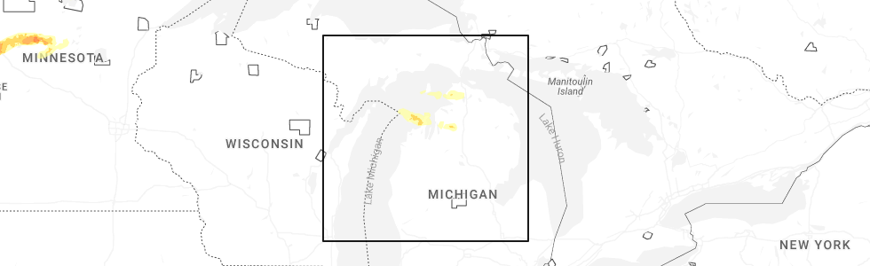
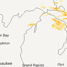
Hail Map for Norwood, MI
The Norwood, MI area has had 0 reports of on-the-ground hail by trained spotters, and has been under severe weather warnings 3 times during the past 12 months. Doppler radar has detected hail at or near Norwood, MI on 17 occasions, including 1 occasion during the past year.
| Name: | Norwood, MI |
| Where Located: | 34.2 miles NNE of Traverse City, MI |
| Map: | Google Map for Norwood, MI |
| Population: | 142 |
| Housing Units: | 88 |
| More Info: | Search Google for Norwood, MI |
0
The Top Recent Hail Date for Norwood, MI is Monday, June 29, 2026 (12th out of 17)
Hail and Wind Damage Spotted near Norwood, MI
| Date / Time | Report Details |
|---|---|
| 7/1/2026 11:58 AM EDT |
 the severe thunderstorm warning has been cancelled and is no longer in effect the severe thunderstorm warning has been cancelled and is no longer in effect
|
| 7/1/2026 11:58 AM EDT |
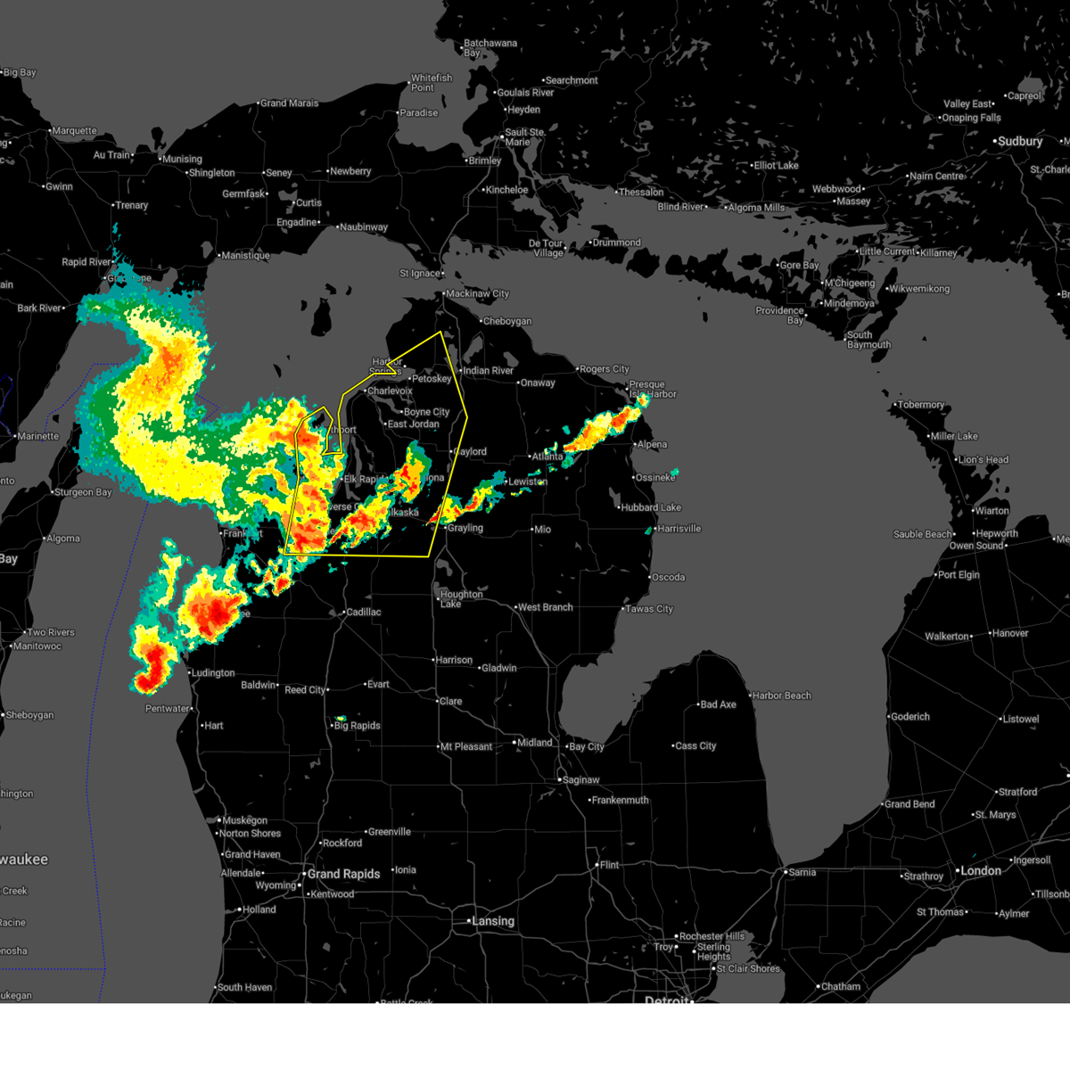
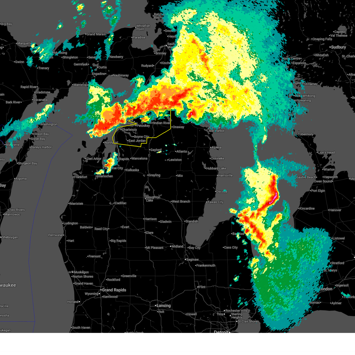
 At 1157 am edt, severe thunderstorms were located along a line extending from near charlevoix to near bellaire to near sharon, moving east at 60 mph (law enforcement. wind damage and power outages are being reported across northwest lower michigan). Hazards include 70 mph wind gusts and nickel size hail. Expect considerable tree damage. damage is likely to mobile homes, roofs, and outbuildings. these severe storms will be near, petoskey, boyne city, east jordan, mancelona, antrim, sharon, horton bay, young state park, bayshore, and sigma around 1200 pm edt. elmira, boyne falls, alba, clarion, bay view, warner township, and walloon lake around 1205 pm edt. petoskey state park around 1210 pm edt. gaylord, frederic, vanderbilt, otsego lake state park, waters, and reasoners corner around 1215 pm edt. wolverine around 1220 pm edt. Other locations impacted by these severe thunderstorms include bates, blue lake township, and lake bellaire. At 1157 am edt, severe thunderstorms were located along a line extending from near charlevoix to near bellaire to near sharon, moving east at 60 mph (law enforcement. wind damage and power outages are being reported across northwest lower michigan). Hazards include 70 mph wind gusts and nickel size hail. Expect considerable tree damage. damage is likely to mobile homes, roofs, and outbuildings. these severe storms will be near, petoskey, boyne city, east jordan, mancelona, antrim, sharon, horton bay, young state park, bayshore, and sigma around 1200 pm edt. elmira, boyne falls, alba, clarion, bay view, warner township, and walloon lake around 1205 pm edt. petoskey state park around 1210 pm edt. gaylord, frederic, vanderbilt, otsego lake state park, waters, and reasoners corner around 1215 pm edt. wolverine around 1220 pm edt. Other locations impacted by these severe thunderstorms include bates, blue lake township, and lake bellaire.
|
| 7/1/2026 11:42 AM EDT |
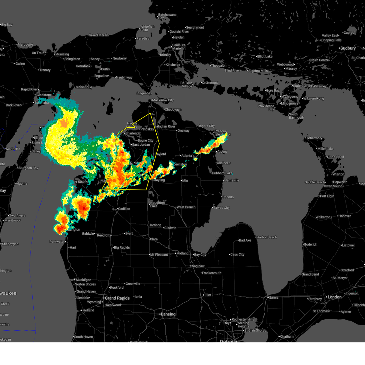
 Svrapx the national weather service in gaylord has issued a * severe thunderstorm warning for, southeastern leelanau county in northern michigan, grand traverse county in northern michigan, southwestern cheboygan county in northern michigan, western otsego county in northern michigan, antrim county in northern michigan, western crawford county in northern michigan, southern emmet county in northern michigan, kalkaska county in northern michigan, charlevoix county in northern michigan, * until 1230 pm edt. * at 1141 am edt, severe thunderstorms were located along a line extending from near norwood to near torch lake to near kingsley, moving east at 60 mph (law enforcement. at 1140 am, law enforcement reported power lines down northwest of honor). Hazards include 60 mph wind gusts and nickel size hail. Expect damage to roofs, siding, and trees. severe thunderstorms will be near, charlevoix, bellaire, ellsworth, central lake, norwood, fife lake, williamsburg, rapid city, barker creek, and kewadin around 1145 am edt. east jordan, kalkaska, ironton, south boardman, and jordan township around 1150 am edt. petoskey, boyne city, mancelona, antrim, horton bay, young state park, bayshore, warner township, and darragh around 1155 am edt. harbor springs, elmira, boyne falls, alba, sigma, and walloon lake around 1200 pm edt. conway, petoskey state park, clarion, and bay view around 1205 pm edt. gaylord, alanson, vanderbilt, reasoners corner, and oden around 1210 pm edt. pellston, indian river, frederic, wolverine, burt lake, otsego lake state park, brutus, and waters around 1215 pm edt. Other locations impacted by these severe thunderstorms include bates, blue lake township, and lake bellaire. Svrapx the national weather service in gaylord has issued a * severe thunderstorm warning for, southeastern leelanau county in northern michigan, grand traverse county in northern michigan, southwestern cheboygan county in northern michigan, western otsego county in northern michigan, antrim county in northern michigan, western crawford county in northern michigan, southern emmet county in northern michigan, kalkaska county in northern michigan, charlevoix county in northern michigan, * until 1230 pm edt. * at 1141 am edt, severe thunderstorms were located along a line extending from near norwood to near torch lake to near kingsley, moving east at 60 mph (law enforcement. at 1140 am, law enforcement reported power lines down northwest of honor). Hazards include 60 mph wind gusts and nickel size hail. Expect damage to roofs, siding, and trees. severe thunderstorms will be near, charlevoix, bellaire, ellsworth, central lake, norwood, fife lake, williamsburg, rapid city, barker creek, and kewadin around 1145 am edt. east jordan, kalkaska, ironton, south boardman, and jordan township around 1150 am edt. petoskey, boyne city, mancelona, antrim, horton bay, young state park, bayshore, warner township, and darragh around 1155 am edt. harbor springs, elmira, boyne falls, alba, sigma, and walloon lake around 1200 pm edt. conway, petoskey state park, clarion, and bay view around 1205 pm edt. gaylord, alanson, vanderbilt, reasoners corner, and oden around 1210 pm edt. pellston, indian river, frederic, wolverine, burt lake, otsego lake state park, brutus, and waters around 1215 pm edt. Other locations impacted by these severe thunderstorms include bates, blue lake township, and lake bellaire.
|
| 6/21/2025 11:13 AM EDT |
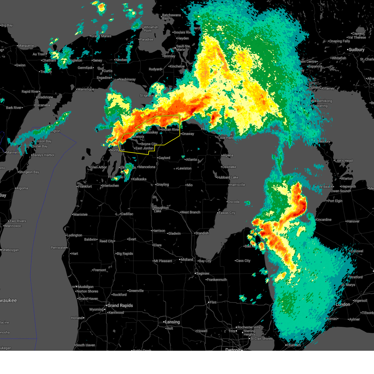 At 1111 am edt, severe thunderstorms were located along a line extending from mullet lake to grand traverse light, moving east at 65 mph (radar indicated). Hazards include 60 mph wind gusts and penny size hail. Expect damage to roofs, siding, and trees. these severe storms will be near, petoskey, boyne city, charlevoix, ellsworth, indian river, conway, aloha, alanson, norwood, and ironton around 1115 am edt. east jordan and koehler township around 1120 am edt. boyne falls and wolverine around 1125 am edt. afton and tower around 1130 am edt. warner township around 1135 am edt. Other locations impacted by these severe thunderstorms include riggsville. At 1111 am edt, severe thunderstorms were located along a line extending from mullet lake to grand traverse light, moving east at 65 mph (radar indicated). Hazards include 60 mph wind gusts and penny size hail. Expect damage to roofs, siding, and trees. these severe storms will be near, petoskey, boyne city, charlevoix, ellsworth, indian river, conway, aloha, alanson, norwood, and ironton around 1115 am edt. east jordan and koehler township around 1120 am edt. boyne falls and wolverine around 1125 am edt. afton and tower around 1130 am edt. warner township around 1135 am edt. Other locations impacted by these severe thunderstorms include riggsville.
|
| 6/21/2025 11:00 AM EDT |
 Svrapx the national weather service in gaylord has issued a * severe thunderstorm warning for, cheboygan county in northern michigan, northern antrim county in northern michigan, southern emmet county in northern michigan, charlevoix county in northern michigan, * until 1145 am edt. * at 1059 am edt, severe thunderstorms were located along a line extending from pellston to 14 miles northwest of leland, moving east at 65 mph (radar indicated). Hazards include 60 mph wind gusts and penny size hail. Expect damage to roofs, siding, and trees. severe thunderstorms will be near, petoskey, charlevoix, harbor springs, pellston, conway, alanson, norwood, petoskey state park, bayshore, and brutus around 1105 am edt. indian river, aloha, ironton, aloha state park, burt lake, topinabee, horton bay, and alverno around 1110 am edt. burt lake state park and reasoners corner around 1115 am edt. boyne city, east jordan, ellsworth, black lake, young state park, walloon lake, clarion, and koehler township around 1120 am edt. boyne falls, wolverine, and afton around 1130 am edt. tower around 1135 am edt. Other locations impacted by these severe thunderstorms include riggsville. Svrapx the national weather service in gaylord has issued a * severe thunderstorm warning for, cheboygan county in northern michigan, northern antrim county in northern michigan, southern emmet county in northern michigan, charlevoix county in northern michigan, * until 1145 am edt. * at 1059 am edt, severe thunderstorms were located along a line extending from pellston to 14 miles northwest of leland, moving east at 65 mph (radar indicated). Hazards include 60 mph wind gusts and penny size hail. Expect damage to roofs, siding, and trees. severe thunderstorms will be near, petoskey, charlevoix, harbor springs, pellston, conway, alanson, norwood, petoskey state park, bayshore, and brutus around 1105 am edt. indian river, aloha, ironton, aloha state park, burt lake, topinabee, horton bay, and alverno around 1110 am edt. burt lake state park and reasoners corner around 1115 am edt. boyne city, east jordan, ellsworth, black lake, young state park, walloon lake, clarion, and koehler township around 1120 am edt. boyne falls, wolverine, and afton around 1130 am edt. tower around 1135 am edt. Other locations impacted by these severe thunderstorms include riggsville.
|
| 5/20/2022 2:46 PM EDT |
 At 246 pm edt, severe thunderstorms were located along a line extending from grand traverse light to traverse city, moving northeast at 50 mph (radar indicated). Hazards include 60 mph wind gusts and quarter size hail. Hail damage to vehicles is expected. expect wind damage to roofs, siding, and trees. severe thunderstorms will be near, elk rapids, norwood, fishermans island state park and barker creek around 255 pm edt. charlevoix, rapid city, alden, ironton, clam river and kewadin around 300 pm edt. bayshore and horton bay around 305 pm edt. other locations in the path of these severe thunderstorms include petoskey, mancelona, harbor springs, antrim, bay view, conway, oden, petoskey state park, alba, alanson and brutus. hail threat, radar indicated max hail size, 1. 00 in wind threat, radar indicated max wind gust, 60 mph. At 246 pm edt, severe thunderstorms were located along a line extending from grand traverse light to traverse city, moving northeast at 50 mph (radar indicated). Hazards include 60 mph wind gusts and quarter size hail. Hail damage to vehicles is expected. expect wind damage to roofs, siding, and trees. severe thunderstorms will be near, elk rapids, norwood, fishermans island state park and barker creek around 255 pm edt. charlevoix, rapid city, alden, ironton, clam river and kewadin around 300 pm edt. bayshore and horton bay around 305 pm edt. other locations in the path of these severe thunderstorms include petoskey, mancelona, harbor springs, antrim, bay view, conway, oden, petoskey state park, alba, alanson and brutus. hail threat, radar indicated max hail size, 1. 00 in wind threat, radar indicated max wind gust, 60 mph.
|
| 8/29/2021 1:37 PM EDT |
 At 136 pm edt, severe thunderstorms were located along a line extending from near fishermans island state park to peshawbestown to near lake ann, moving northeast at 50 mph (radar indicated). Hazards include 60 mph wind gusts. Expect damage to roofs, siding, and trees. severe thunderstorms will be near, charlevoix and fishermans island state park around 140 pm edt. norwood, bayshore and mapleton around 150 pm edt. elk rapids, harbor springs and ironton around 155 pm edt. other locations in the path of these severe thunderstorms include horton bay, kewadin, petoskey, torch lake, central lake, clarion, walloon lake, ellsworth, bay view, petoskey state park, boyne city, east jordan, conway, alanson, oden, young state park and jordan township. hail threat, radar indicated max hail size, <. 75 in wind threat, radar indicated max wind gust, 60 mph. At 136 pm edt, severe thunderstorms were located along a line extending from near fishermans island state park to peshawbestown to near lake ann, moving northeast at 50 mph (radar indicated). Hazards include 60 mph wind gusts. Expect damage to roofs, siding, and trees. severe thunderstorms will be near, charlevoix and fishermans island state park around 140 pm edt. norwood, bayshore and mapleton around 150 pm edt. elk rapids, harbor springs and ironton around 155 pm edt. other locations in the path of these severe thunderstorms include horton bay, kewadin, petoskey, torch lake, central lake, clarion, walloon lake, ellsworth, bay view, petoskey state park, boyne city, east jordan, conway, alanson, oden, young state park and jordan township. hail threat, radar indicated max hail size, <. 75 in wind threat, radar indicated max wind gust, 60 mph.
|
| 7/19/2020 5:26 AM EDT |
 At 525 am edt, severe thunderstorms were located along a line extending from 6 miles north of torch lake to near omena, moving east at 40 mph (radar indicated). Hazards include 60 mph wind gusts and quarter size hail. Hail damage to vehicles is expected. Expect wind damage to roofs, siding, and trees. At 525 am edt, severe thunderstorms were located along a line extending from 6 miles north of torch lake to near omena, moving east at 40 mph (radar indicated). Hazards include 60 mph wind gusts and quarter size hail. Hail damage to vehicles is expected. Expect wind damage to roofs, siding, and trees.
|
| 10/4/2018 12:25 AM EDT |
 At 1225 am edt, a severe thunderstorm was located near wolverine, or near indian river, moving east at 50 mph (radar indicated). Hazards include 60 mph wind gusts. Expect damage to roofs, siding, and trees. Locations impacted include, petoskey, boyne city, charlevoix, east jordan, harbor springs, indian river, conway, aloha, alanson, boyne falls, wolverine, aloha state park, young state park, reasoners corner, ironton, horton bay, alverno, clarion, burt lake and walloon lake. At 1225 am edt, a severe thunderstorm was located near wolverine, or near indian river, moving east at 50 mph (radar indicated). Hazards include 60 mph wind gusts. Expect damage to roofs, siding, and trees. Locations impacted include, petoskey, boyne city, charlevoix, east jordan, harbor springs, indian river, conway, aloha, alanson, boyne falls, wolverine, aloha state park, young state park, reasoners corner, ironton, horton bay, alverno, clarion, burt lake and walloon lake.
|
| 10/3/2018 11:54 PM EDT |
 At 1153 pm edt, a severe thunderstorm was located over grand traverse light, moving east at 65 mph (radar indicated). Hazards include 60 mph wind gusts. expect damage to roofs, siding, and trees At 1153 pm edt, a severe thunderstorm was located over grand traverse light, moving east at 65 mph (radar indicated). Hazards include 60 mph wind gusts. expect damage to roofs, siding, and trees
|
| 8/28/2018 6:59 PM EDT |
 At 658 pm edt, a severe thunderstorm capable of producing a tornado was located near torch lake, or 10 miles southeast of grand traverse light, moving northeast at 25 mph (radar indicated rotation). Hazards include tornado. Flying debris will be dangerous to those caught without shelter. mobile homes will be damaged or destroyed. damage to roofs, windows, and vehicles will occur. tree damage is likely. this dangerous storm will be near, torch lake around 705 pm edt. central lake around 720 pm edt. East jordan, ellsworth and ironton around 730 pm edt. At 658 pm edt, a severe thunderstorm capable of producing a tornado was located near torch lake, or 10 miles southeast of grand traverse light, moving northeast at 25 mph (radar indicated rotation). Hazards include tornado. Flying debris will be dangerous to those caught without shelter. mobile homes will be damaged or destroyed. damage to roofs, windows, and vehicles will occur. tree damage is likely. this dangerous storm will be near, torch lake around 705 pm edt. central lake around 720 pm edt. East jordan, ellsworth and ironton around 730 pm edt.
|
| 8/28/2018 1:51 AM EDT |
 At 151 am edt, severe thunderstorms were located along a line extending from hessel to near jordan township, moving east at 50 mph (radar indicated). Hazards include 60 mph wind gusts. Expect damage to roofs, siding, and trees. Locations impacted include, petoskey, boyne city, charlevoix, east jordan, harbor springs, pellston, mackinaw city, conway, carp lake, alanson, bliss, boyne falls, cross village, young state park, stutsmanville, reasoners corner, ironton, pleasant view, horton bay and clarion. At 151 am edt, severe thunderstorms were located along a line extending from hessel to near jordan township, moving east at 50 mph (radar indicated). Hazards include 60 mph wind gusts. Expect damage to roofs, siding, and trees. Locations impacted include, petoskey, boyne city, charlevoix, east jordan, harbor springs, pellston, mackinaw city, conway, carp lake, alanson, bliss, boyne falls, cross village, young state park, stutsmanville, reasoners corner, ironton, pleasant view, horton bay and clarion.
|
| 8/28/2018 1:24 AM EDT |
 At 124 am edt, severe thunderstorms were located along a line extending from near moran to near torch lake, moving east at 50 mph (radar indicated). Hazards include 60 mph wind gusts. expect damage to roofs, siding, and trees At 124 am edt, severe thunderstorms were located along a line extending from near moran to near torch lake, moving east at 50 mph (radar indicated). Hazards include 60 mph wind gusts. expect damage to roofs, siding, and trees
|
| 8/28/2018 1:19 AM EDT |
 At 119 am edt, severe thunderstorms were located along a line extending from 6 miles northwest of fishermans island state park to greilickville to near norwalk, moving east at 60 mph (radar indicated. at 110 am, leland harbor reported a wind gust to 65 mph). Hazards include 70 mph wind gusts. Expect considerable tree damage. damage is likely to mobile homes, roofs, and outbuildings. Locations impacted include, traverse city, cadillac, kalkaska, elk rapids, mancelona, bellaire, lake city, ellsworth, antrim, sharon, kingsley, manton, torch lake, sherman, central lake, buckley, boon, mcbain, fife lake and mesick. At 119 am edt, severe thunderstorms were located along a line extending from 6 miles northwest of fishermans island state park to greilickville to near norwalk, moving east at 60 mph (radar indicated. at 110 am, leland harbor reported a wind gust to 65 mph). Hazards include 70 mph wind gusts. Expect considerable tree damage. damage is likely to mobile homes, roofs, and outbuildings. Locations impacted include, traverse city, cadillac, kalkaska, elk rapids, mancelona, bellaire, lake city, ellsworth, antrim, sharon, kingsley, manton, torch lake, sherman, central lake, buckley, boon, mcbain, fife lake and mesick.
|
| 8/28/2018 1:01 AM EDT |
 At 101 am edt, severe thunderstorms were located along a line extending from 14 miles northwest of grand traverse light to near empire to 9 miles west of manistee, moving east at 60 mph (radar indicated). Hazards include 70 mph wind gusts. Expect considerable tree damage. Damage is likely to mobile homes, roofs, and outbuildings. At 101 am edt, severe thunderstorms were located along a line extending from 14 miles northwest of grand traverse light to near empire to 9 miles west of manistee, moving east at 60 mph (radar indicated). Hazards include 70 mph wind gusts. Expect considerable tree damage. Damage is likely to mobile homes, roofs, and outbuildings.
|
| 7/1/2018 8:08 PM EDT |
 At 808 pm edt, severe thunderstorms were located along a line extending from charlevoix to near central lake to near sherman, moving northeast at 55 mph (radar indicated). Hazards include 60 mph wind gusts. Expect damage to roofs, siding, and trees. Locations impacted include, boyne city, east jordan, kalkaska, elk rapids, mancelona, bellaire, ellsworth, antrim, central lake, fife lake, boyne falls, clam river, kewadin, sigma, warner township, young state park, ironton, alba, horton bay and clarion. At 808 pm edt, severe thunderstorms were located along a line extending from charlevoix to near central lake to near sherman, moving northeast at 55 mph (radar indicated). Hazards include 60 mph wind gusts. Expect damage to roofs, siding, and trees. Locations impacted include, boyne city, east jordan, kalkaska, elk rapids, mancelona, bellaire, ellsworth, antrim, central lake, fife lake, boyne falls, clam river, kewadin, sigma, warner township, young state park, ironton, alba, horton bay and clarion.
|
| 7/1/2018 7:59 PM EDT |
 At 759 pm edt, severe thunderstorms were located along a line extending from norwood to near central lake to mesick, moving northeast at 50 mph (radar indicated). Hazards include 60 mph wind gusts. Expect damage to roofs, siding, and trees. Locations impacted include, boyne city, east jordan, kalkaska, elk rapids, mancelona, bellaire, ellsworth, antrim, central lake, fife lake, boyne falls, clam river, kewadin, sigma, warner township, young state park, ironton, alba, horton bay and clarion. At 759 pm edt, severe thunderstorms were located along a line extending from norwood to near central lake to mesick, moving northeast at 50 mph (radar indicated). Hazards include 60 mph wind gusts. Expect damage to roofs, siding, and trees. Locations impacted include, boyne city, east jordan, kalkaska, elk rapids, mancelona, bellaire, ellsworth, antrim, central lake, fife lake, boyne falls, clam river, kewadin, sigma, warner township, young state park, ironton, alba, horton bay and clarion.
|
| 7/1/2018 7:37 PM EDT |
 At 736 pm edt, severe thunderstorms were located along a line extending from near peshawbestown to hannah, moving northeast at 40 mph (radar indicated). Hazards include 60 mph wind gusts. expect damage to roofs, siding, and trees At 736 pm edt, severe thunderstorms were located along a line extending from near peshawbestown to hannah, moving northeast at 40 mph (radar indicated). Hazards include 60 mph wind gusts. expect damage to roofs, siding, and trees
|
| 9/4/2017 11:31 AM EDT |
 At 1130 am edt, a cluster of severe thunderstorms were located along a line extending from near leelanau state park to near leland, moving east at 45 mph (radar indicated). Hazards include 60 mph wind gusts and quarter size hail. Hail damage to vehicles is expected. expect wind damage to roofs, siding, and trees. severe thunderstorms will be near, ellsworth and omena around 1145 am edt. east jordan, old mission and mapleton around 1150 am edt. elk rapids, torch lake, kewadin and jordan township around 1155 am edt. boyne city, bellaire, central lake, boyne falls, warner township, clam river and alden around 1200 pm edt. Other locations impacted by these severe thunderstorms include good harbor and lake bellaire. At 1130 am edt, a cluster of severe thunderstorms were located along a line extending from near leelanau state park to near leland, moving east at 45 mph (radar indicated). Hazards include 60 mph wind gusts and quarter size hail. Hail damage to vehicles is expected. expect wind damage to roofs, siding, and trees. severe thunderstorms will be near, ellsworth and omena around 1145 am edt. east jordan, old mission and mapleton around 1150 am edt. elk rapids, torch lake, kewadin and jordan township around 1155 am edt. boyne city, bellaire, central lake, boyne falls, warner township, clam river and alden around 1200 pm edt. Other locations impacted by these severe thunderstorms include good harbor and lake bellaire.
|
| 6/12/2017 11:46 PM EDT |
 At 1145 pm edt, severe thunderstorms were located along a line extending from peshawbestown to near mapleton, moving east at 50 mph (radar indicated). Hazards include 60 mph wind gusts. Expect damage to roofs, siding, and trees. Locations impacted include, boyne city, charlevoix, east jordan, elk rapids, bellaire, ellsworth, torch lake, central lake, norwood, fishermans island state park, clam river, kewadin, alden, mapleton, young state park, ironton, old mission and lake bellaire. At 1145 pm edt, severe thunderstorms were located along a line extending from peshawbestown to near mapleton, moving east at 50 mph (radar indicated). Hazards include 60 mph wind gusts. Expect damage to roofs, siding, and trees. Locations impacted include, boyne city, charlevoix, east jordan, elk rapids, bellaire, ellsworth, torch lake, central lake, norwood, fishermans island state park, clam river, kewadin, alden, mapleton, young state park, ironton, old mission and lake bellaire.
|
| 6/12/2017 11:20 PM EDT |
 At 1120 pm edt, severe thunderstorms were located along a line extending from 10 miles west of sleeping bear point to glen arbor to lake ann, moving northeast at 45 mph (radar indicated). Hazards include 60 mph wind gusts. expect damage to roofs, siding, and trees At 1120 pm edt, severe thunderstorms were located along a line extending from 10 miles west of sleeping bear point to glen arbor to lake ann, moving northeast at 45 mph (radar indicated). Hazards include 60 mph wind gusts. expect damage to roofs, siding, and trees
|
| 6/12/2017 4:23 AM EDT |
 The severe thunderstorm warning for southeastern leelanau, central grand traverse and western antrim counties will expire at 430 am edt, the storm which prompted the warning has weakened below severe limits, and has exited the warned area. therefore, the warning will be allowed to expire. The severe thunderstorm warning for southeastern leelanau, central grand traverse and western antrim counties will expire at 430 am edt, the storm which prompted the warning has weakened below severe limits, and has exited the warned area. therefore, the warning will be allowed to expire.
|
| 6/12/2017 3:55 AM EDT |
 At 354 am edt, a severe thunderstorm was located near peshawbestown, or 10 miles northwest of elk rapids, moving east at 40 mph (radar indicated). Hazards include 60 mph wind gusts. expect damage to roofs, siding, and trees At 354 am edt, a severe thunderstorm was located near peshawbestown, or 10 miles northwest of elk rapids, moving east at 40 mph (radar indicated). Hazards include 60 mph wind gusts. expect damage to roofs, siding, and trees
|
| 10/17/2016 7:43 AM EDT |
 At 742 am edt, severe thunderstorms were located along a line extending from norwood to 6 miles northeast of glen arbor, moving east at 30 mph (radar indicated). Hazards include 70 mph wind gusts and ping pong ball size hail. People and animals outdoors will be injured. expect hail damage to roofs, siding, windows, and vehicles. expect considerable tree damage. Wind damage is also likely to mobile homes, roofs, and outbuildings. At 742 am edt, severe thunderstorms were located along a line extending from norwood to 6 miles northeast of glen arbor, moving east at 30 mph (radar indicated). Hazards include 70 mph wind gusts and ping pong ball size hail. People and animals outdoors will be injured. expect hail damage to roofs, siding, windows, and vehicles. expect considerable tree damage. Wind damage is also likely to mobile homes, roofs, and outbuildings.
|
| 10/17/2016 7:09 AM EDT |
 At 708 am edt, doppler radar indicated a severe thunderstorm capable of producing quarter size hail and damaging winds in excess of 60 mph. this storm was located 10 miles west of northport, or 11 miles north of leland, and moving northeast at 50 mph. At 708 am edt, doppler radar indicated a severe thunderstorm capable of producing quarter size hail and damaging winds in excess of 60 mph. this storm was located 10 miles west of northport, or 11 miles north of leland, and moving northeast at 50 mph.
|
| 9/6/2016 2:58 PM EDT |
 At 257 pm edt, a severe thunderstorm was located over eastern grand traverse bay lake, or 7 miles southwest of ellsworth, moving east at 45 mph (radar indicated). Hazards include 60 mph wind gusts. Expect damage to roofs. siding. and trees. this severe thunderstorm will be near, ellsworth and central lake around 305 pm edt. east jordan around 315 pm edt. boyne city, jordan township and young state park around 320 pm edt. boyne falls and warner township around 325 pm edt. elmira around 330 pm edt. Other locations impacted by this severe thunderstorm include lake bellaire. At 257 pm edt, a severe thunderstorm was located over eastern grand traverse bay lake, or 7 miles southwest of ellsworth, moving east at 45 mph (radar indicated). Hazards include 60 mph wind gusts. Expect damage to roofs. siding. and trees. this severe thunderstorm will be near, ellsworth and central lake around 305 pm edt. east jordan around 315 pm edt. boyne city, jordan township and young state park around 320 pm edt. boyne falls and warner township around 325 pm edt. elmira around 330 pm edt. Other locations impacted by this severe thunderstorm include lake bellaire.
|
| 7/8/2016 11:46 AM EDT |
 At 1146 am edt, a severe thunderstorm was located over torch lake, or 7 miles southwest of ellsworth, moving northeast at 35 mph (radar indicated). Hazards include two inch hail and 70 mph wind gusts. People and animals outdoors will be injured. expect hail damage to roofs, siding, windows, and vehicles. expect considerable tree damage. wind damage is also likely to mobile homes, roofs, and outbuildings. Locations impacted include, petoskey, boyne city, charlevoix, east jordan, ellsworth, torch lake, central lake, norwood, northport, omena, ironton, bayshore, peshawbestown, mapleton, fishermans island state park, young state park, horton bay, old mission, clarion and walloon lake. At 1146 am edt, a severe thunderstorm was located over torch lake, or 7 miles southwest of ellsworth, moving northeast at 35 mph (radar indicated). Hazards include two inch hail and 70 mph wind gusts. People and animals outdoors will be injured. expect hail damage to roofs, siding, windows, and vehicles. expect considerable tree damage. wind damage is also likely to mobile homes, roofs, and outbuildings. Locations impacted include, petoskey, boyne city, charlevoix, east jordan, ellsworth, torch lake, central lake, norwood, northport, omena, ironton, bayshore, peshawbestown, mapleton, fishermans island state park, young state park, horton bay, old mission, clarion and walloon lake.
|
| 7/8/2016 11:29 AM EDT |
 At 1128 am edt, a severe thunderstorm was located near torch lake, or 10 miles south of grand traverse light, moving northeast at 35 mph (radar indicated). Hazards include two inch hail and 70 mph wind gusts. People and animals outdoors will be injured. expect hail damage to roofs, siding, windows, and vehicles. expect considerable tree damage. Wind damage is also likely to mobile homes, roofs, and outbuildings. At 1128 am edt, a severe thunderstorm was located near torch lake, or 10 miles south of grand traverse light, moving northeast at 35 mph (radar indicated). Hazards include two inch hail and 70 mph wind gusts. People and animals outdoors will be injured. expect hail damage to roofs, siding, windows, and vehicles. expect considerable tree damage. Wind damage is also likely to mobile homes, roofs, and outbuildings.
|
| 6/10/2016 9:18 PM EDT |
 At 917 pm edt, severe thunderstorms were located along a line extending from near norwood to near lake leelanau to elberta, moving east at 40 mph (radar indicated). Hazards include 60 mph wind gusts and quarter size hail. Hail damage to vehicles is expected. expect wind damage to roofs, siding, and trees. Locations impacted include, traverse city, leland, frankfort, thompsonville, empire, beulah, grand traverse light, sleeping bear point, arcadia, bingham, glen arbor, norwood, suttons bay, northport, benzonia, cedar, elberta, honor, lake ann and omena. At 917 pm edt, severe thunderstorms were located along a line extending from near norwood to near lake leelanau to elberta, moving east at 40 mph (radar indicated). Hazards include 60 mph wind gusts and quarter size hail. Hail damage to vehicles is expected. expect wind damage to roofs, siding, and trees. Locations impacted include, traverse city, leland, frankfort, thompsonville, empire, beulah, grand traverse light, sleeping bear point, arcadia, bingham, glen arbor, norwood, suttons bay, northport, benzonia, cedar, elberta, honor, lake ann and omena.
|
| 6/10/2016 8:52 PM EDT |
 At 851 pm edt, severe thunderstorms were located along a line extending from 12 miles northwest of grand traverse light to near sleeping bear point to 15 miles west of frankfort, moving east at 40 mph (radar indicated). Hazards include 60 mph wind gusts and quarter size hail. Hail damage to vehicles is expected. Expect wind damage to roofs, siding, and trees. At 851 pm edt, severe thunderstorms were located along a line extending from 12 miles northwest of grand traverse light to near sleeping bear point to 15 miles west of frankfort, moving east at 40 mph (radar indicated). Hazards include 60 mph wind gusts and quarter size hail. Hail damage to vehicles is expected. Expect wind damage to roofs, siding, and trees.
|
| 8/2/2015 5:04 PM EDT |
 At 502 pm edt, severe thunderstorms were located along a line extending from near northport to cedar to near bendon to near elberta, and are nearly stationary (radar indicated. there have numerous reports of 60 to 70 mph winds and widespread wind damage). Hazards include 60 mph wind gusts and quarter size hail. Expect damage to roofs. siding and trees. Locations impacted include, east jordan, kalkaska, elk rapids, mancelona, bellaire, lake city, ellsworth, antrim, sharon, torch lake, central lake, mcbain, fife lake, darragh, kewadin, moddersville, vogel center, sigma, morey and south boardman. At 502 pm edt, severe thunderstorms were located along a line extending from near northport to cedar to near bendon to near elberta, and are nearly stationary (radar indicated. there have numerous reports of 60 to 70 mph winds and widespread wind damage). Hazards include 60 mph wind gusts and quarter size hail. Expect damage to roofs. siding and trees. Locations impacted include, east jordan, kalkaska, elk rapids, mancelona, bellaire, lake city, ellsworth, antrim, sharon, torch lake, central lake, mcbain, fife lake, darragh, kewadin, moddersville, vogel center, sigma, morey and south boardman.
|
| 8/2/2015 4:31 PM EDT |
 At 428 pm edt, severe thunderstorms were located along a line extending from near northport to cedar to near bendon to near elberta, moving east at 60 mph (radar indicated. at 426 pm 60 mph wind gust was reported at lake ann). Hazards include 60 mph wind gusts and penny size hail. Expect damage to roofs. Siding and trees. At 428 pm edt, severe thunderstorms were located along a line extending from near northport to cedar to near bendon to near elberta, moving east at 60 mph (radar indicated. at 426 pm 60 mph wind gust was reported at lake ann). Hazards include 60 mph wind gusts and penny size hail. Expect damage to roofs. Siding and trees.
|
| 8/2/2015 11:52 AM EDT |
 At 1151 am edt, severe thunderstorms were located along a line extending from near good hart to bingham, moving east at 55 mph (radar indicated). Hazards include 60 mph wind gusts and quarter size hail. Hail damage to vehicles is expected. Expect wind damage to roofs, siding and trees. At 1151 am edt, severe thunderstorms were located along a line extending from near good hart to bingham, moving east at 55 mph (radar indicated). Hazards include 60 mph wind gusts and quarter size hail. Hail damage to vehicles is expected. Expect wind damage to roofs, siding and trees.
|
Hail Maps for Norwood, MI


Connect with Interactive Hail Maps