

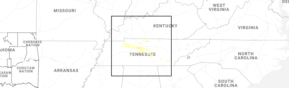
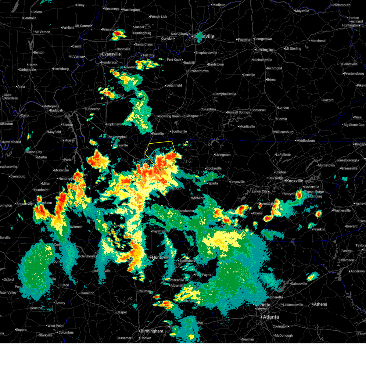
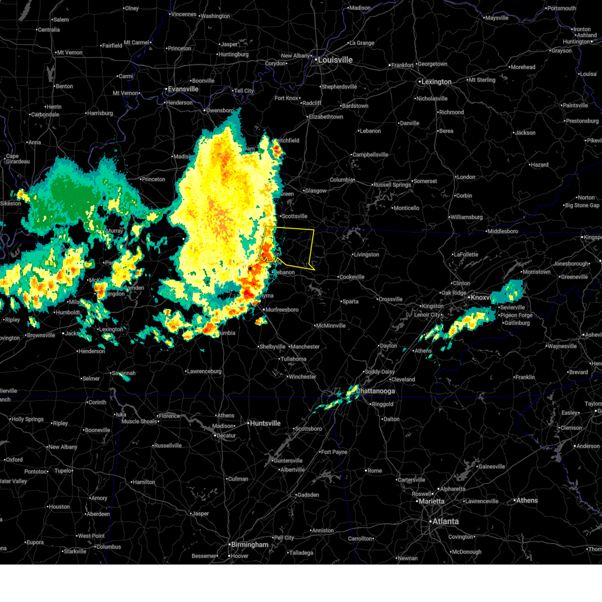
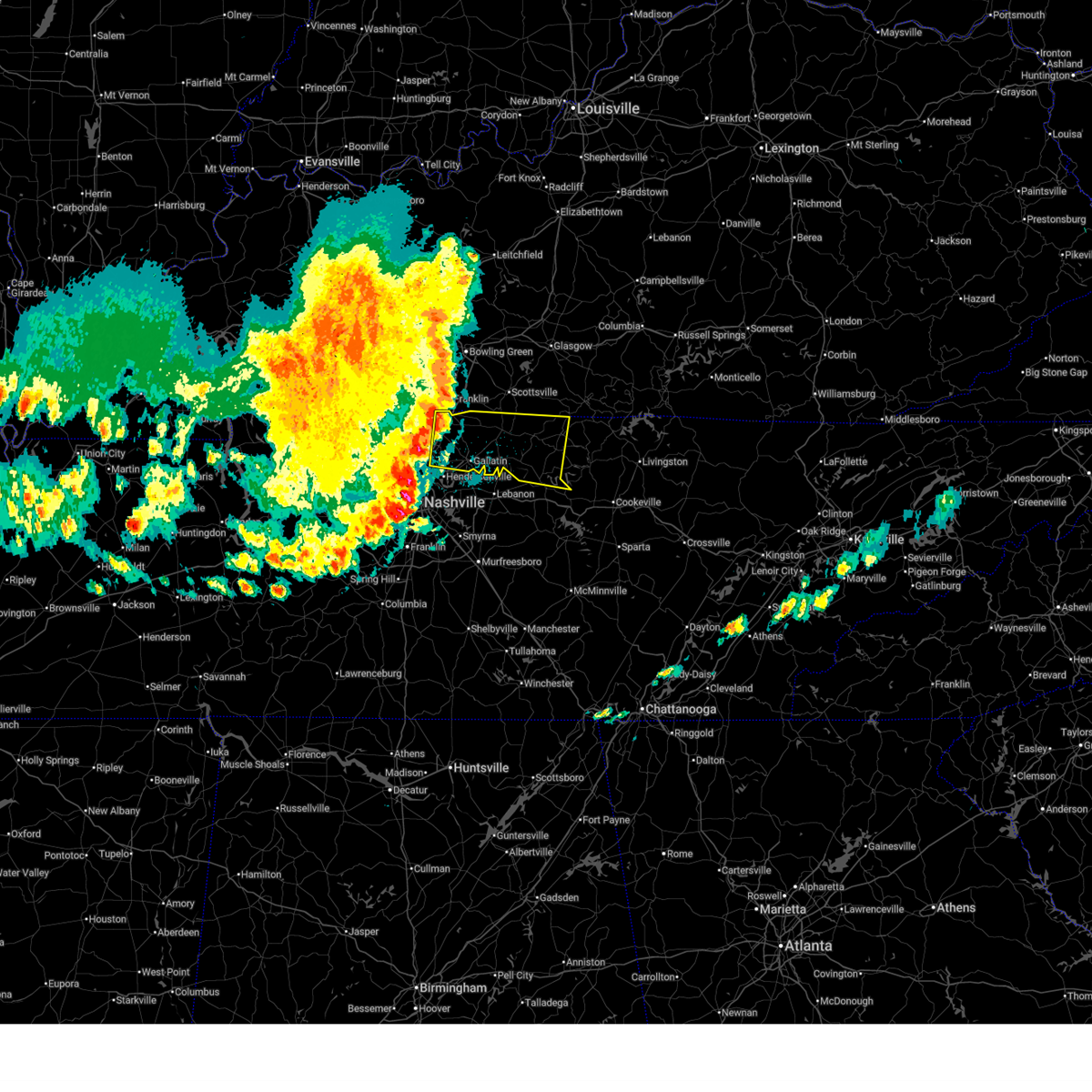
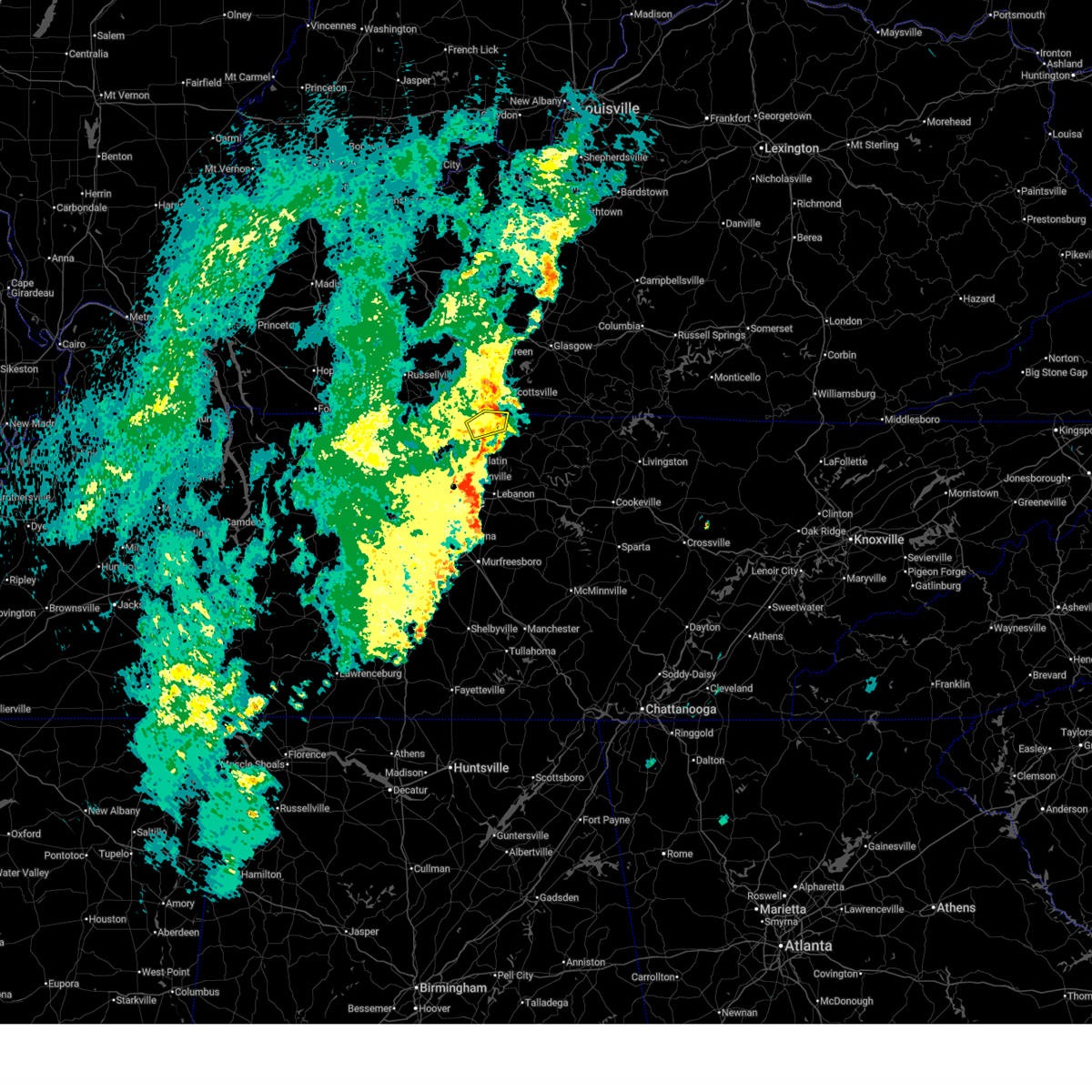
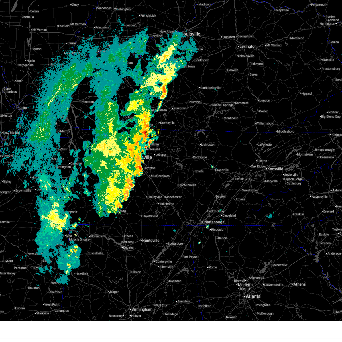
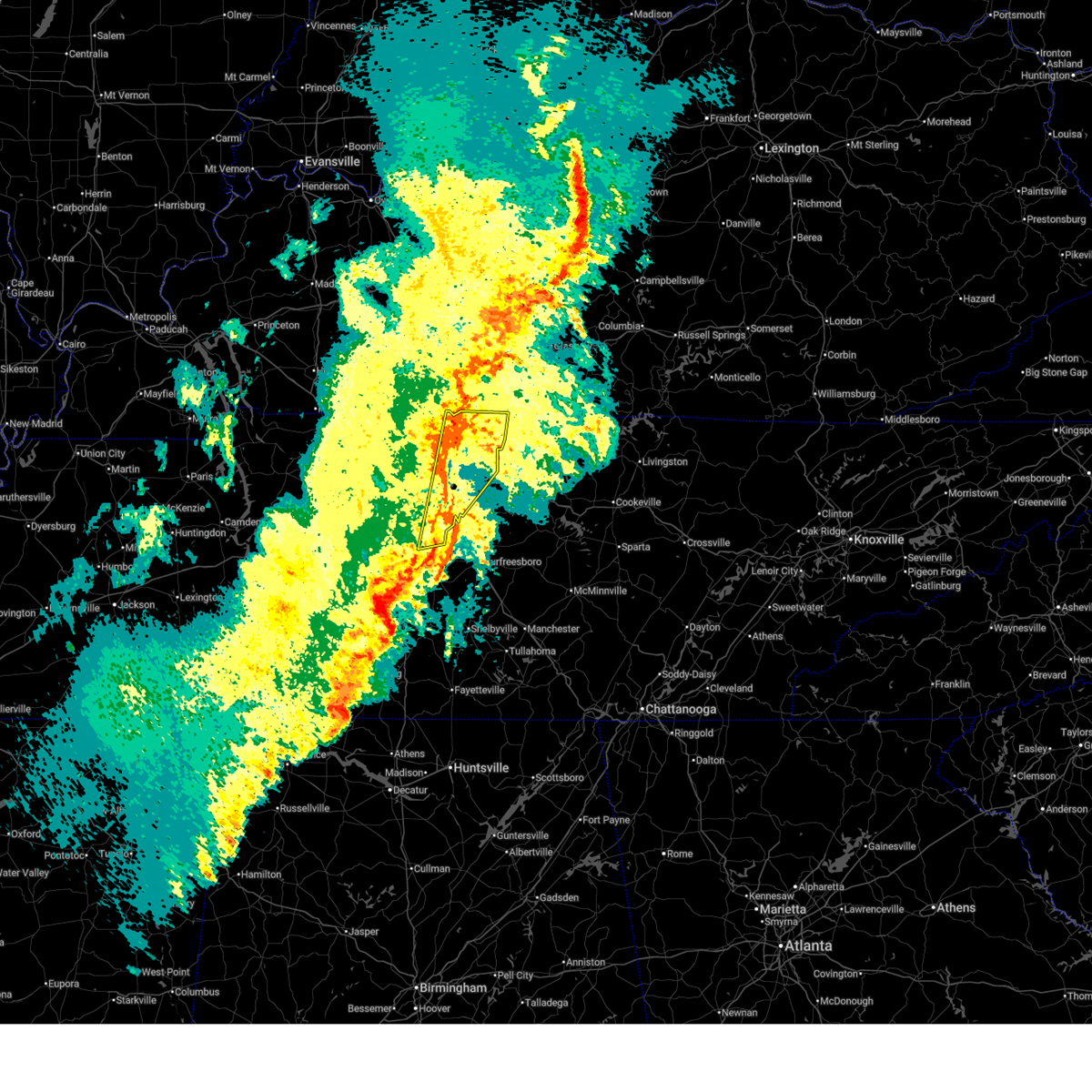
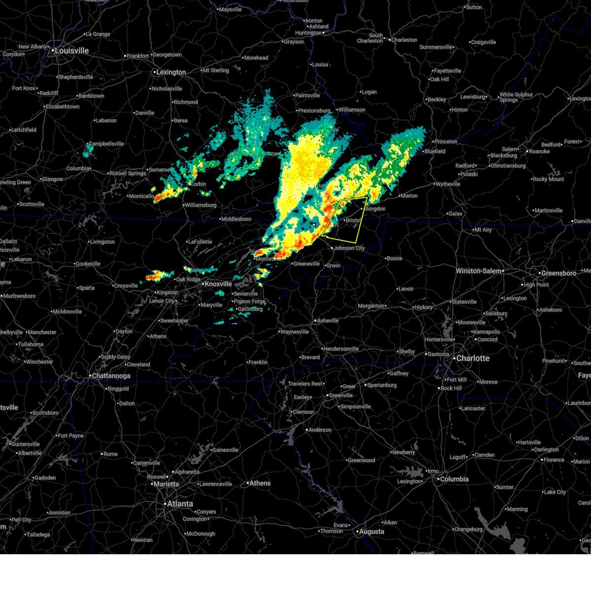
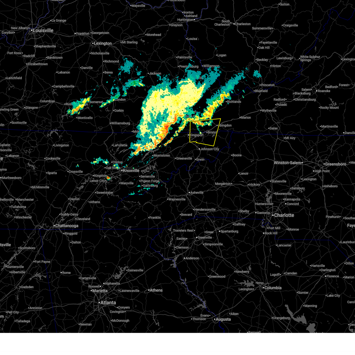
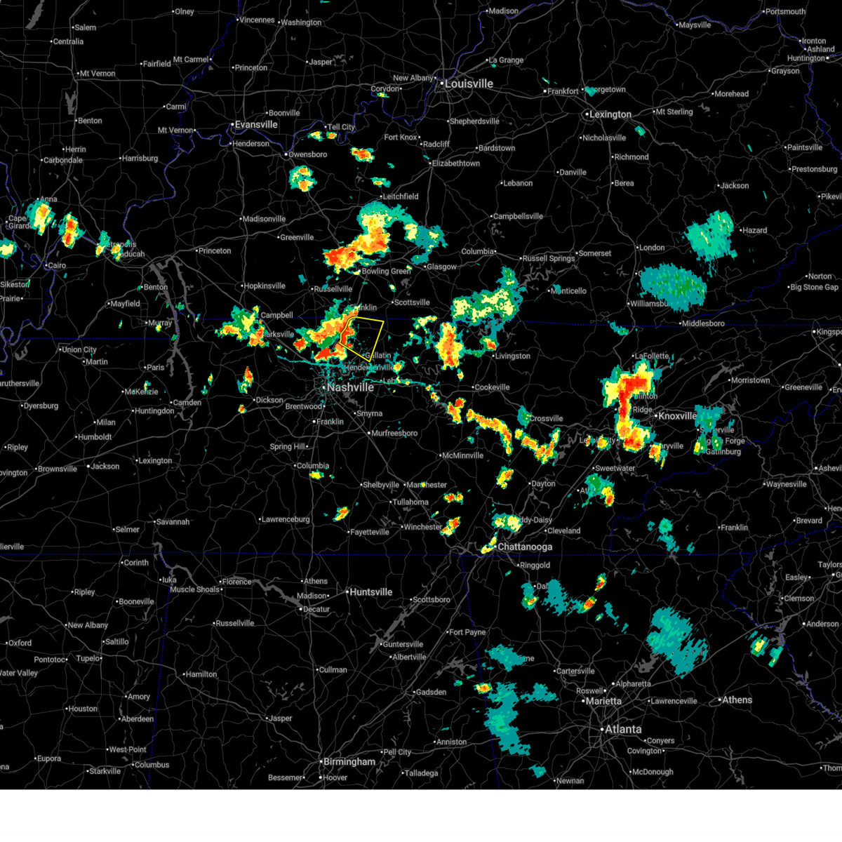
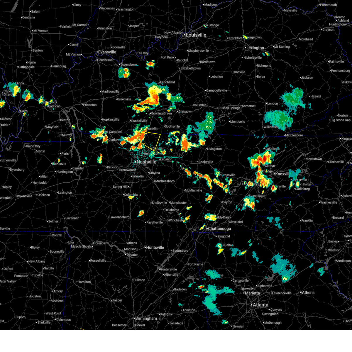
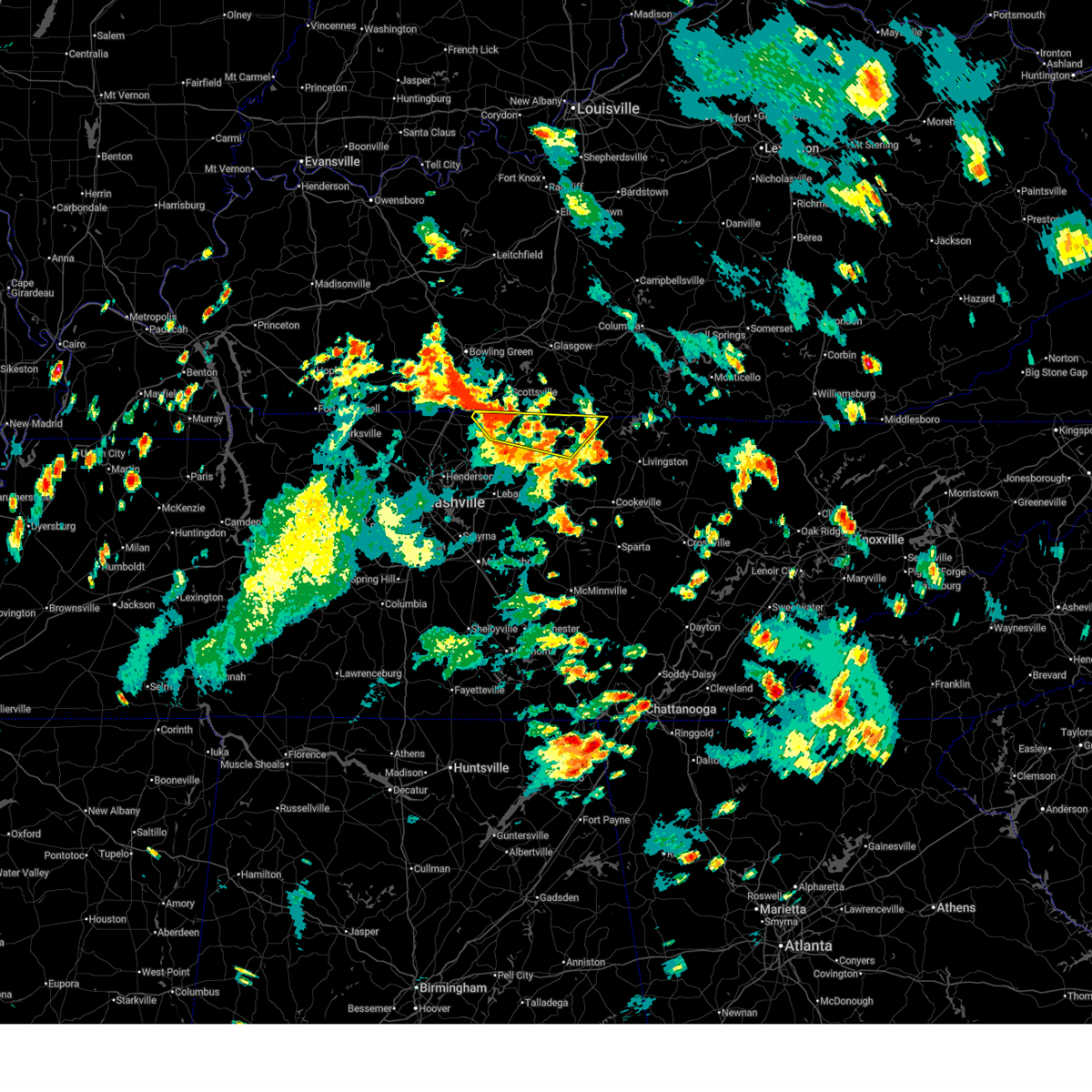
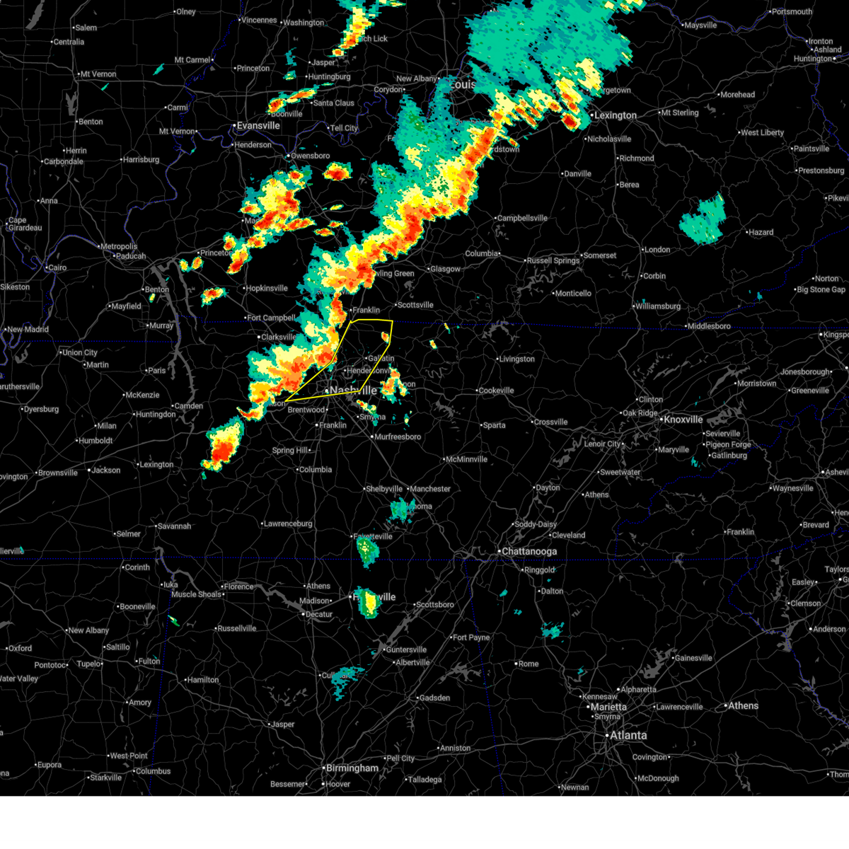
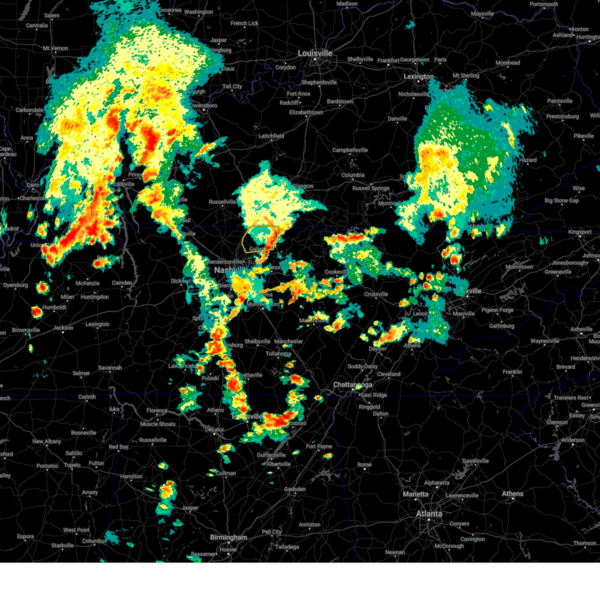
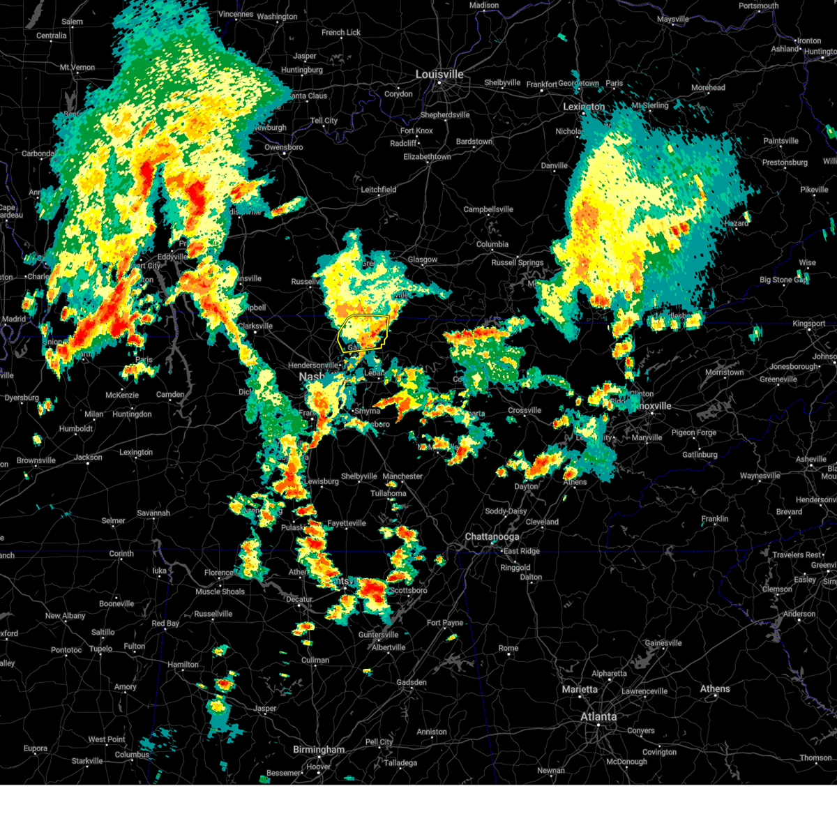
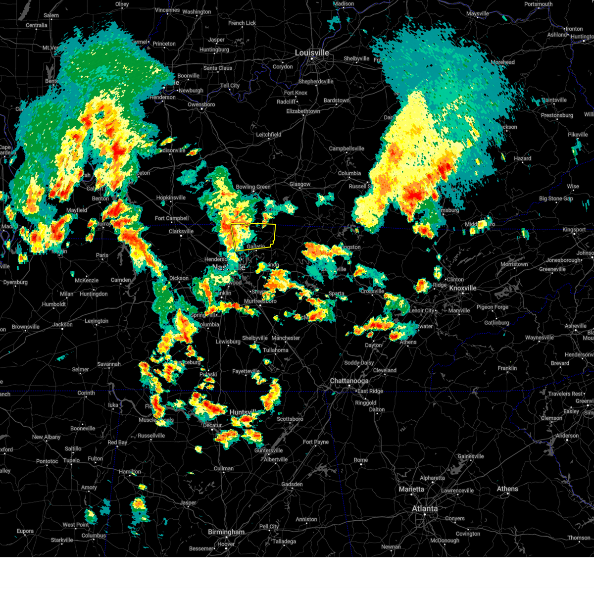
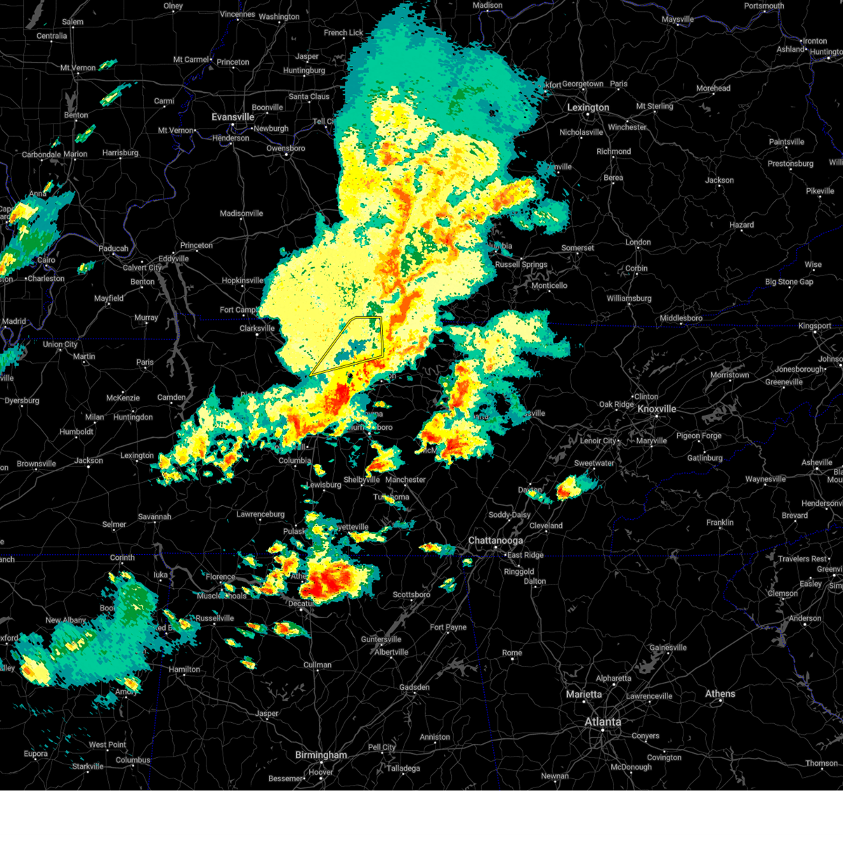
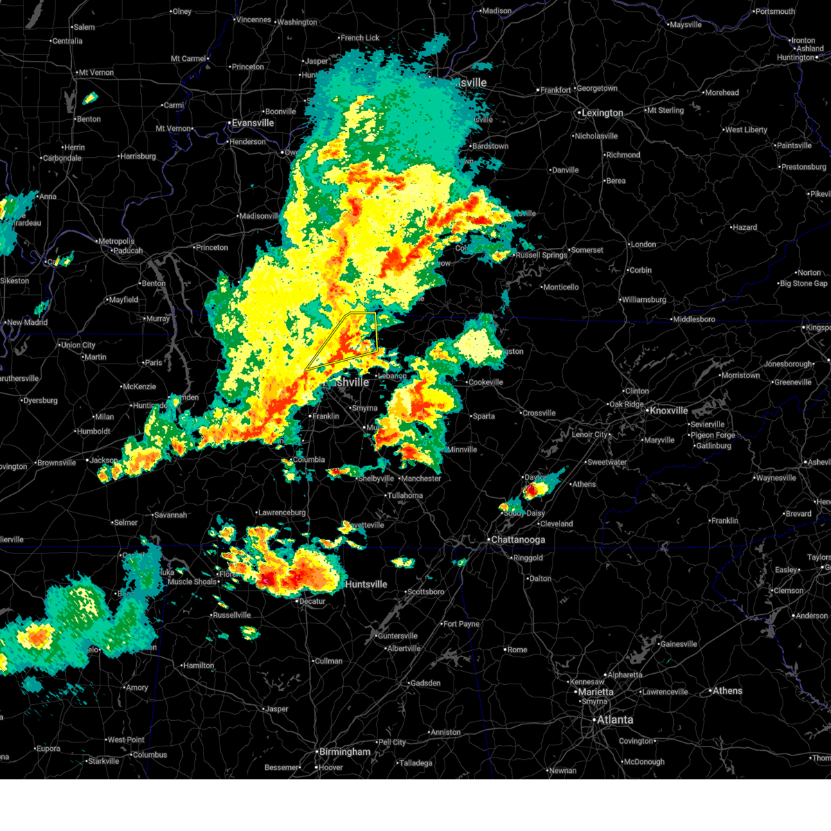
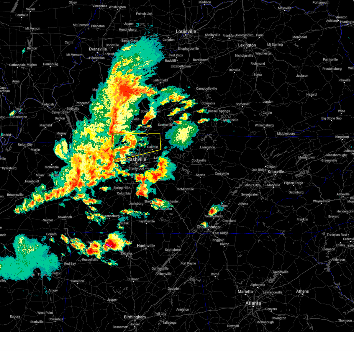
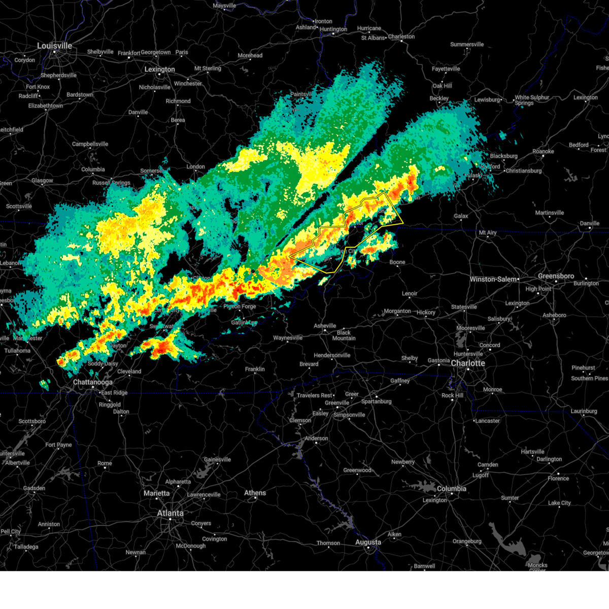
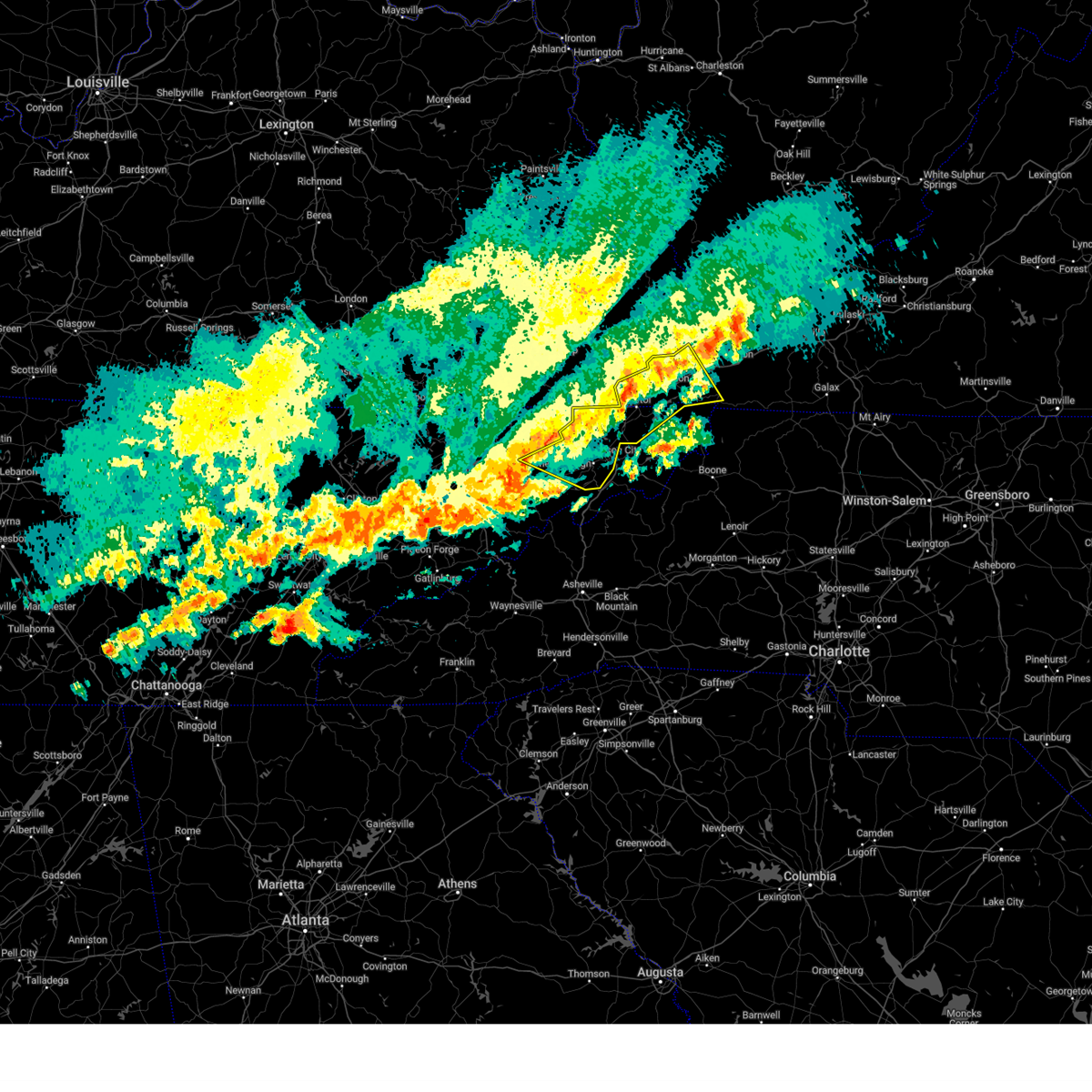
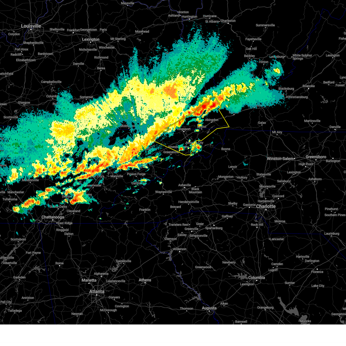
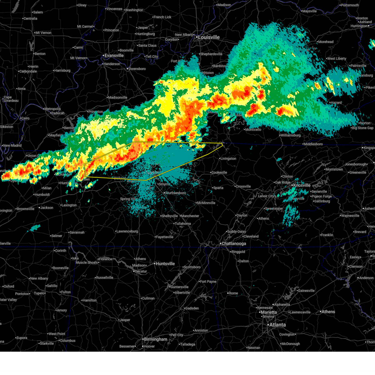
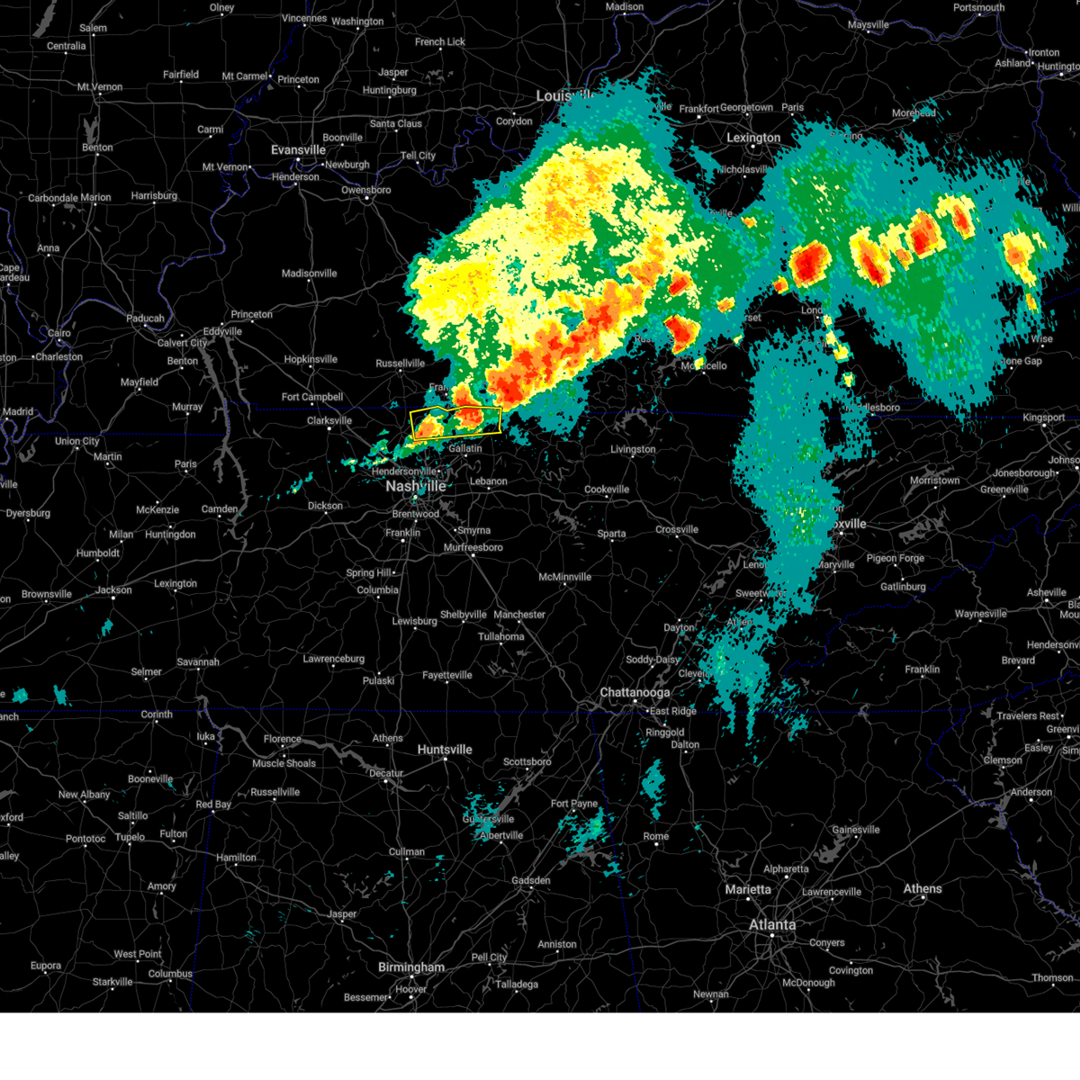
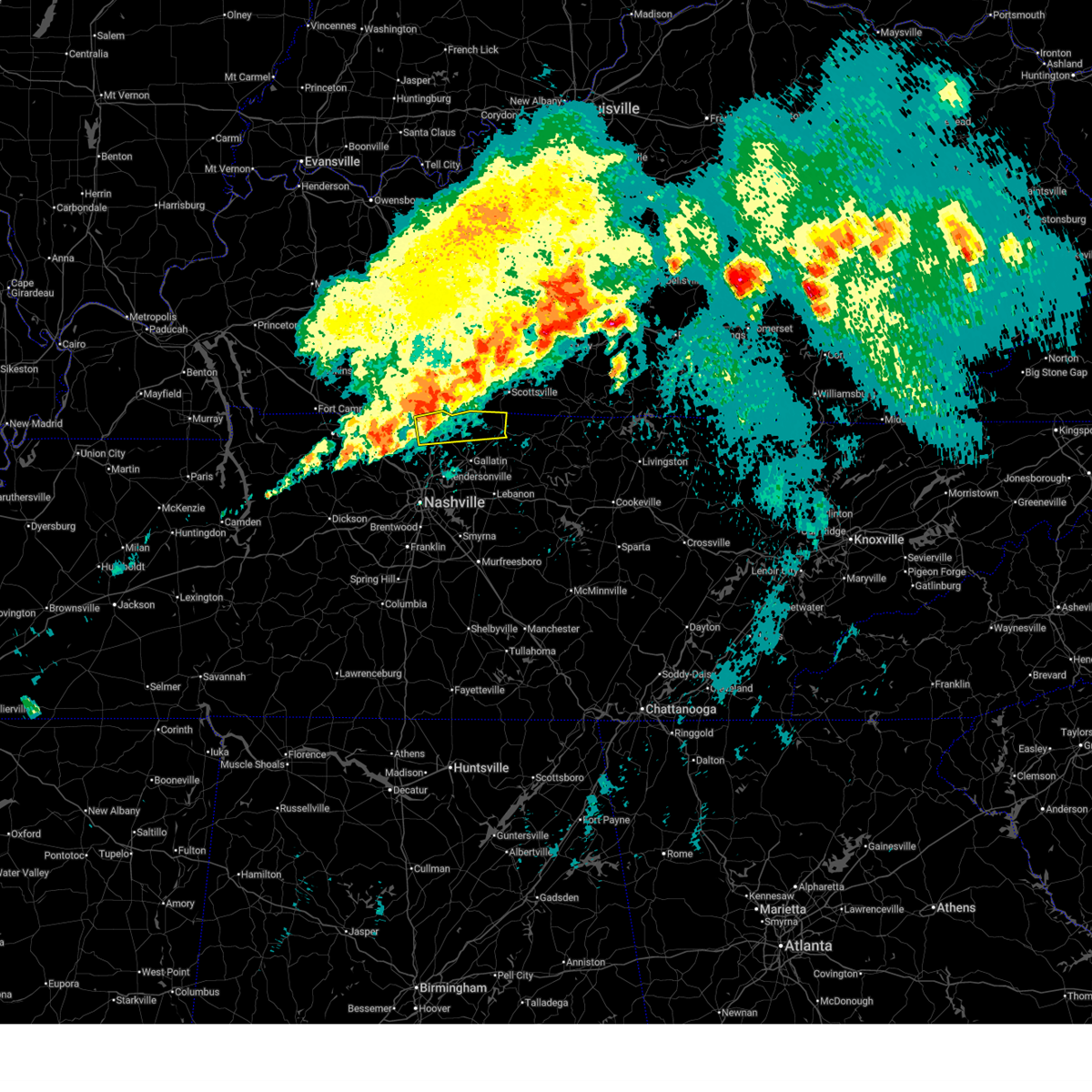
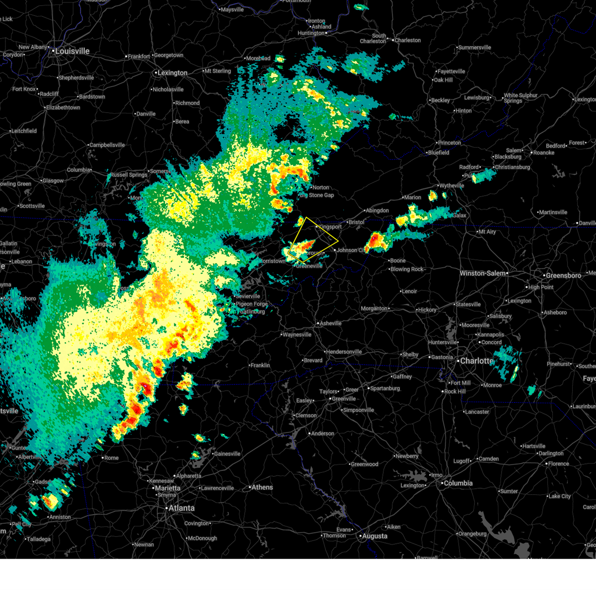
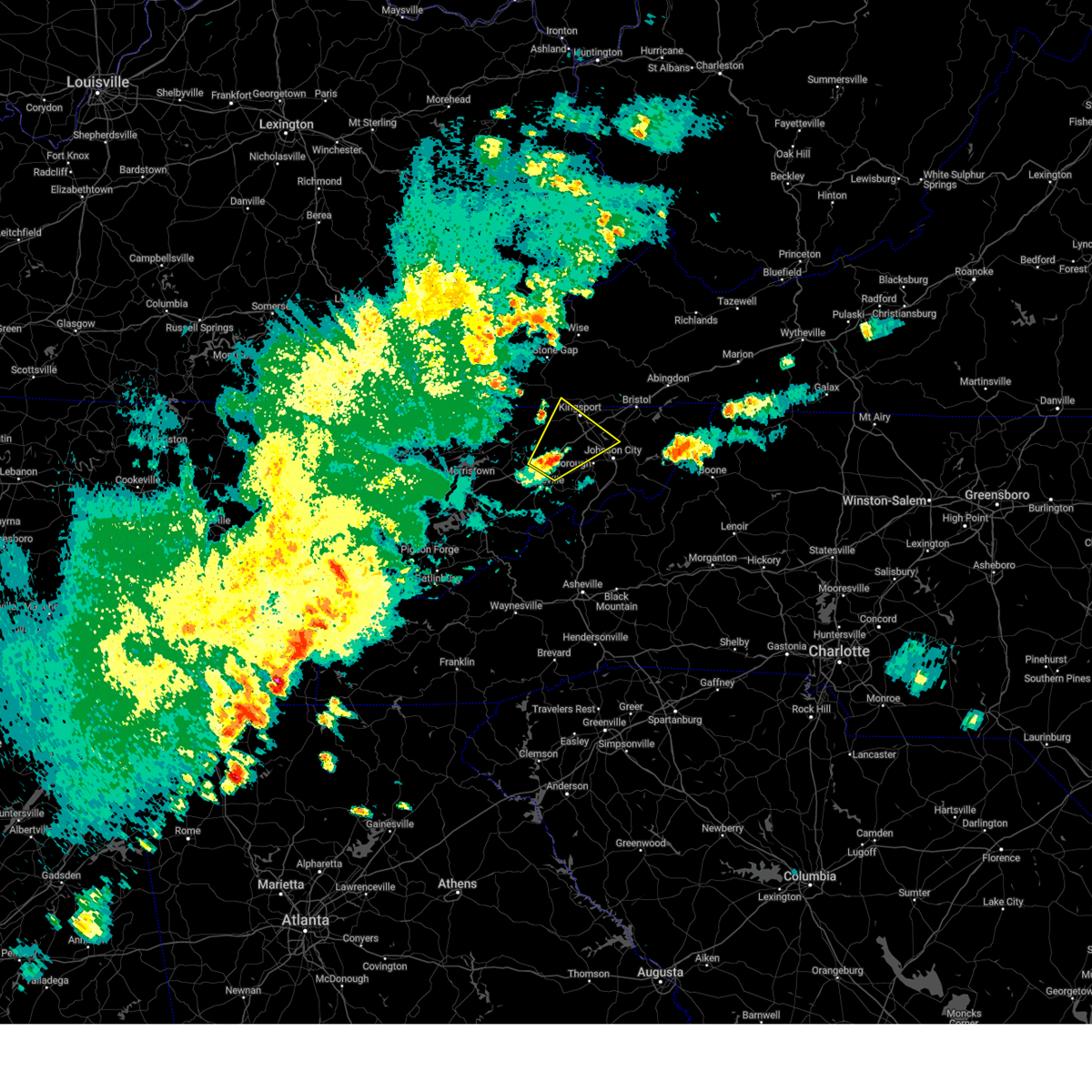
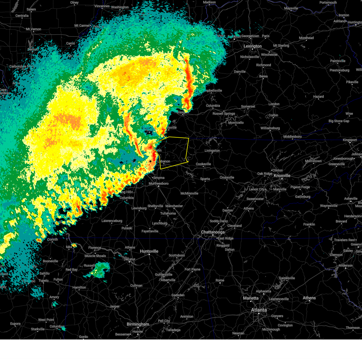
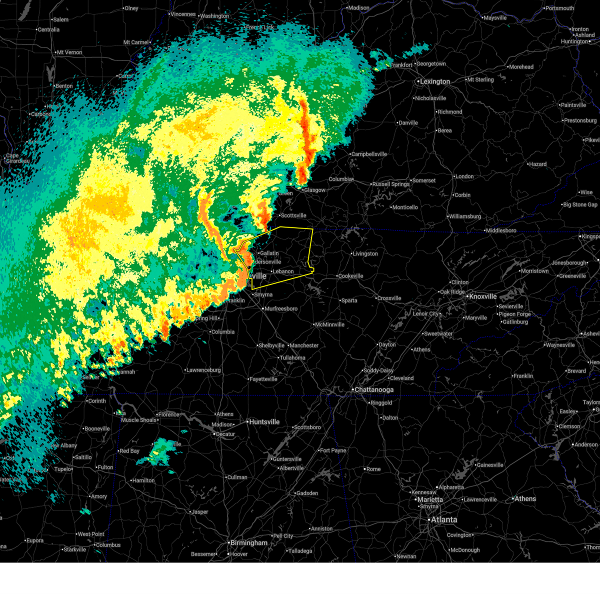
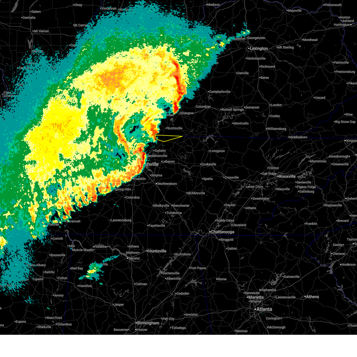
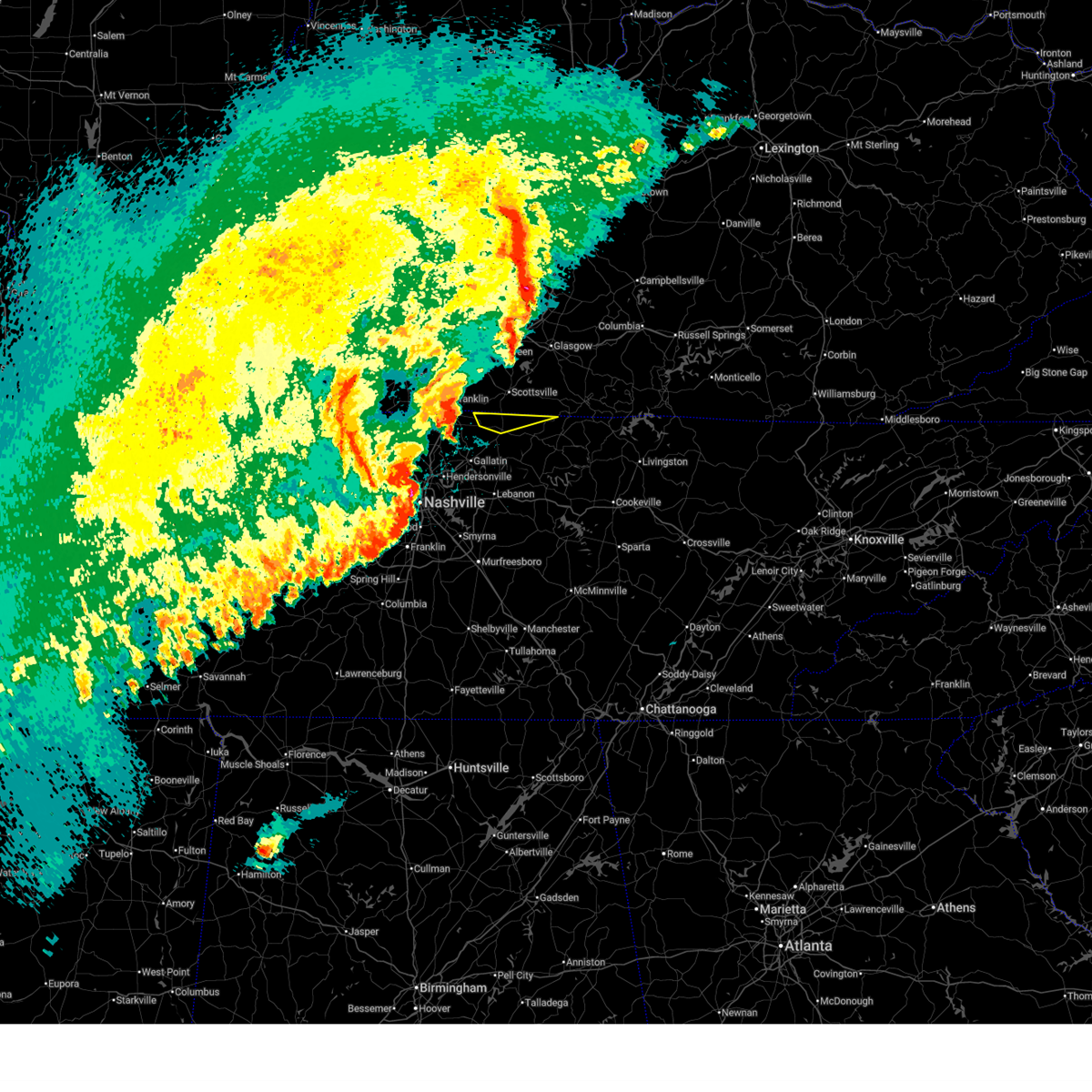
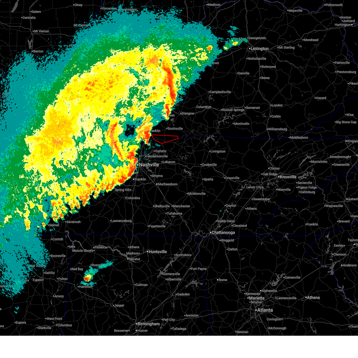
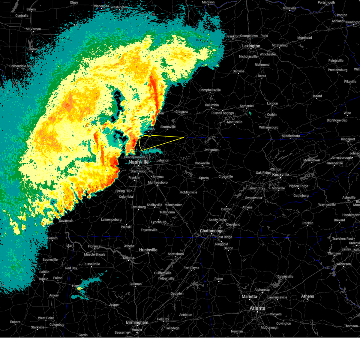
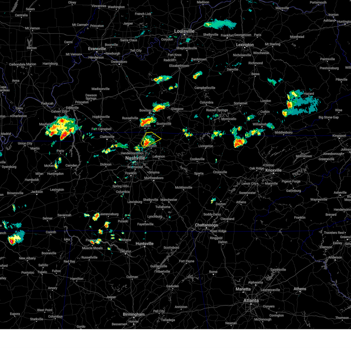
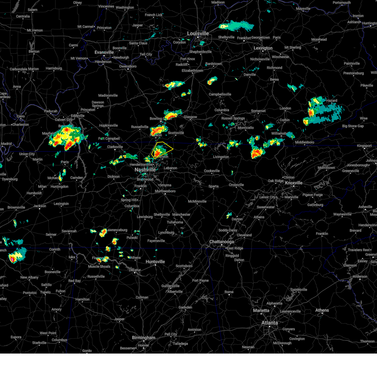
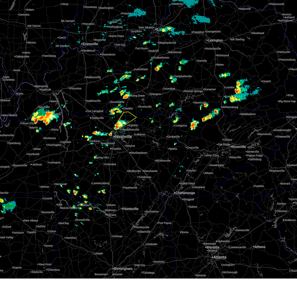
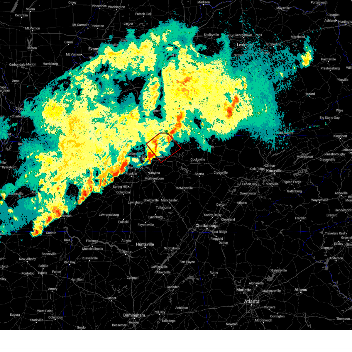
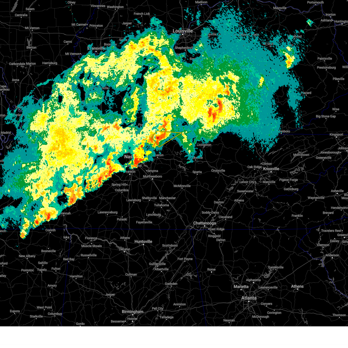
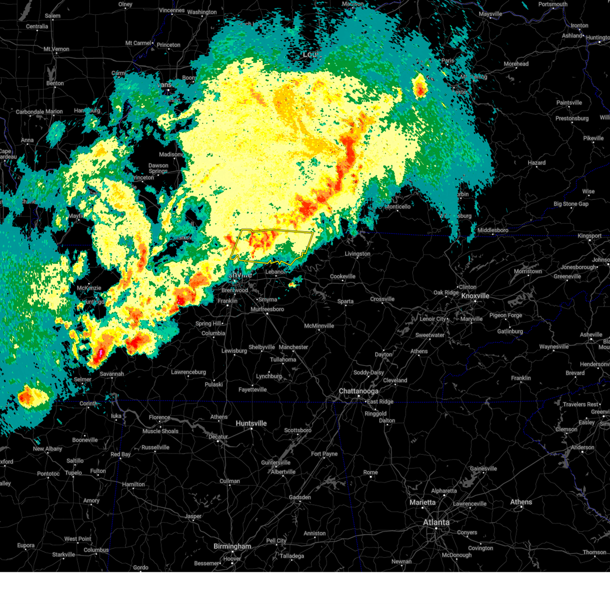
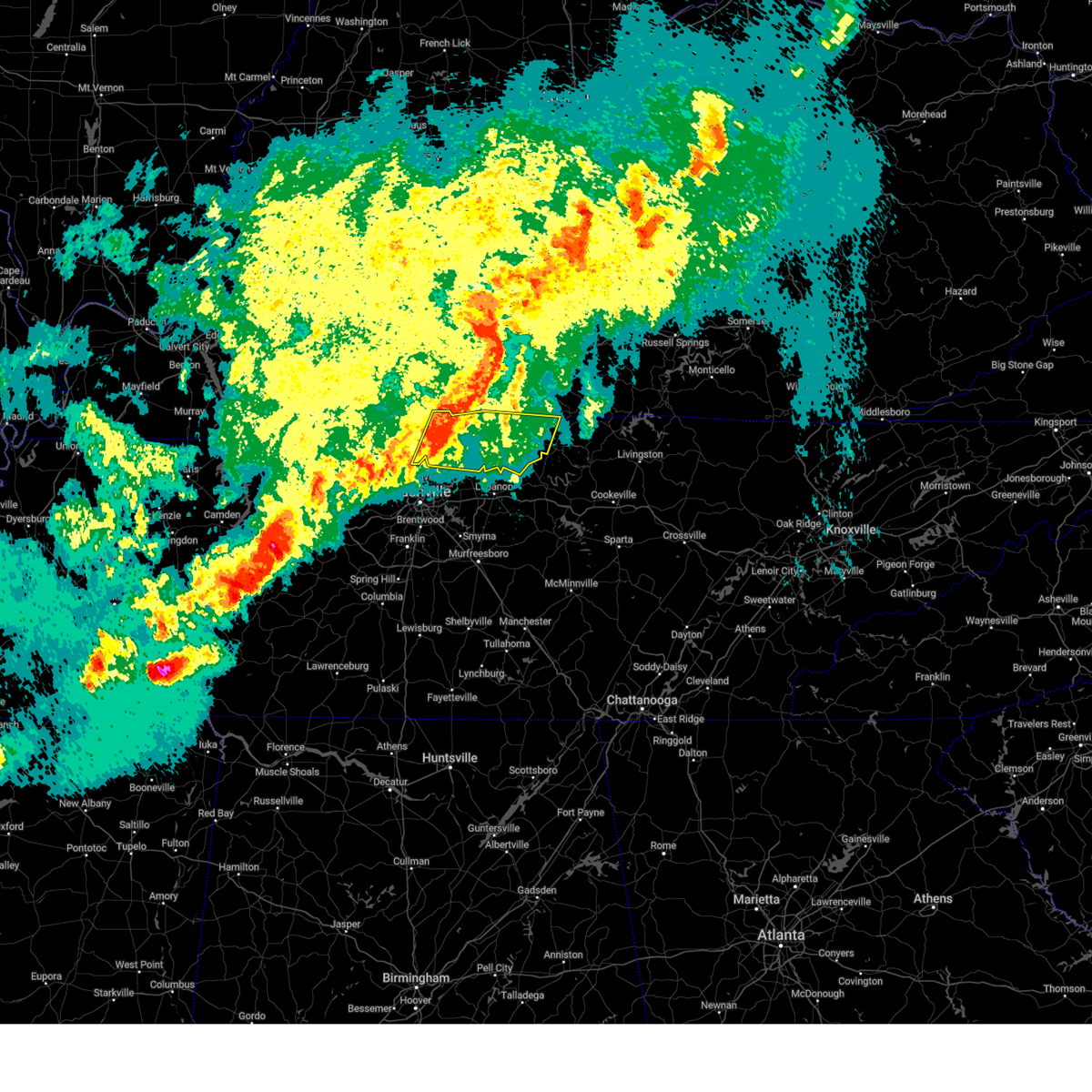
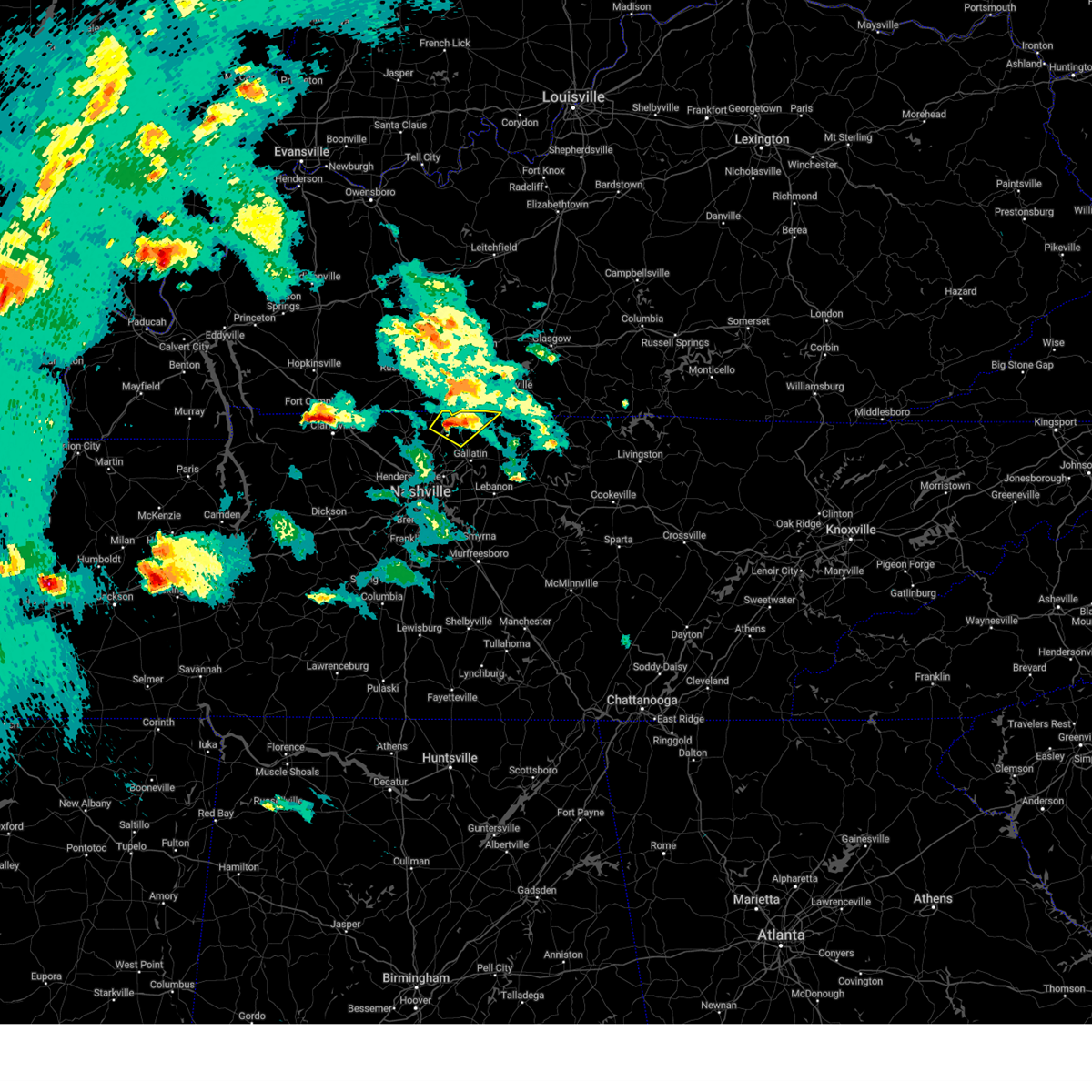
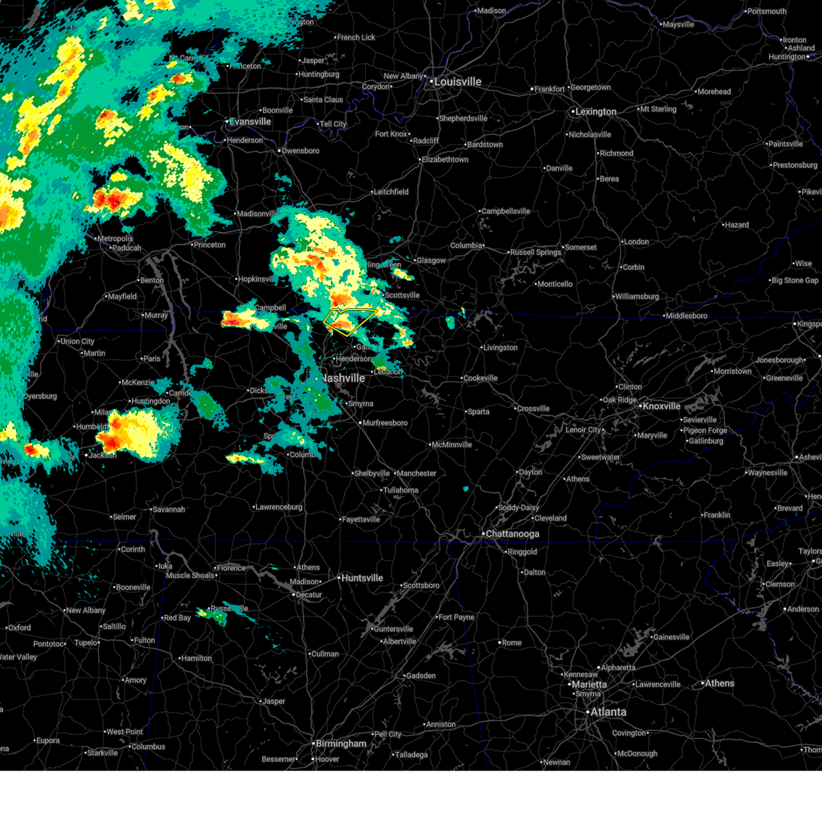
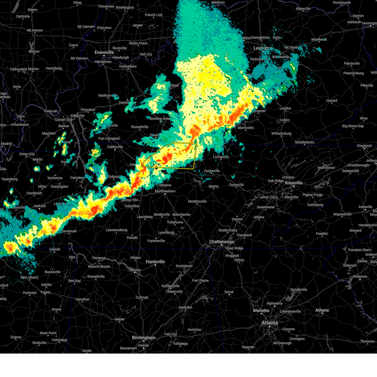
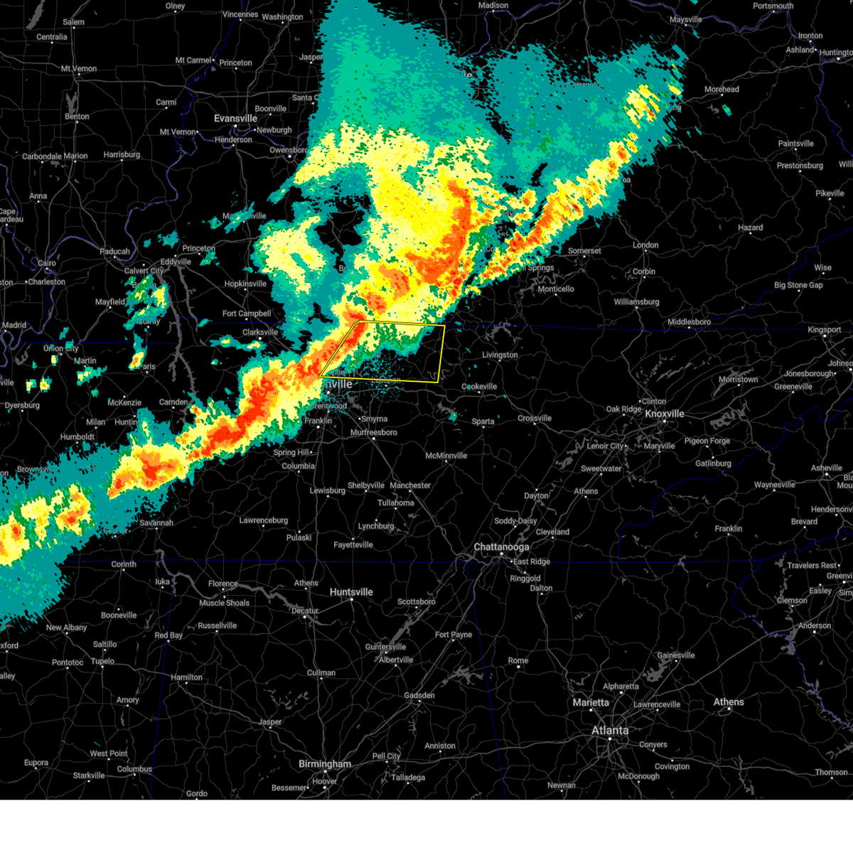
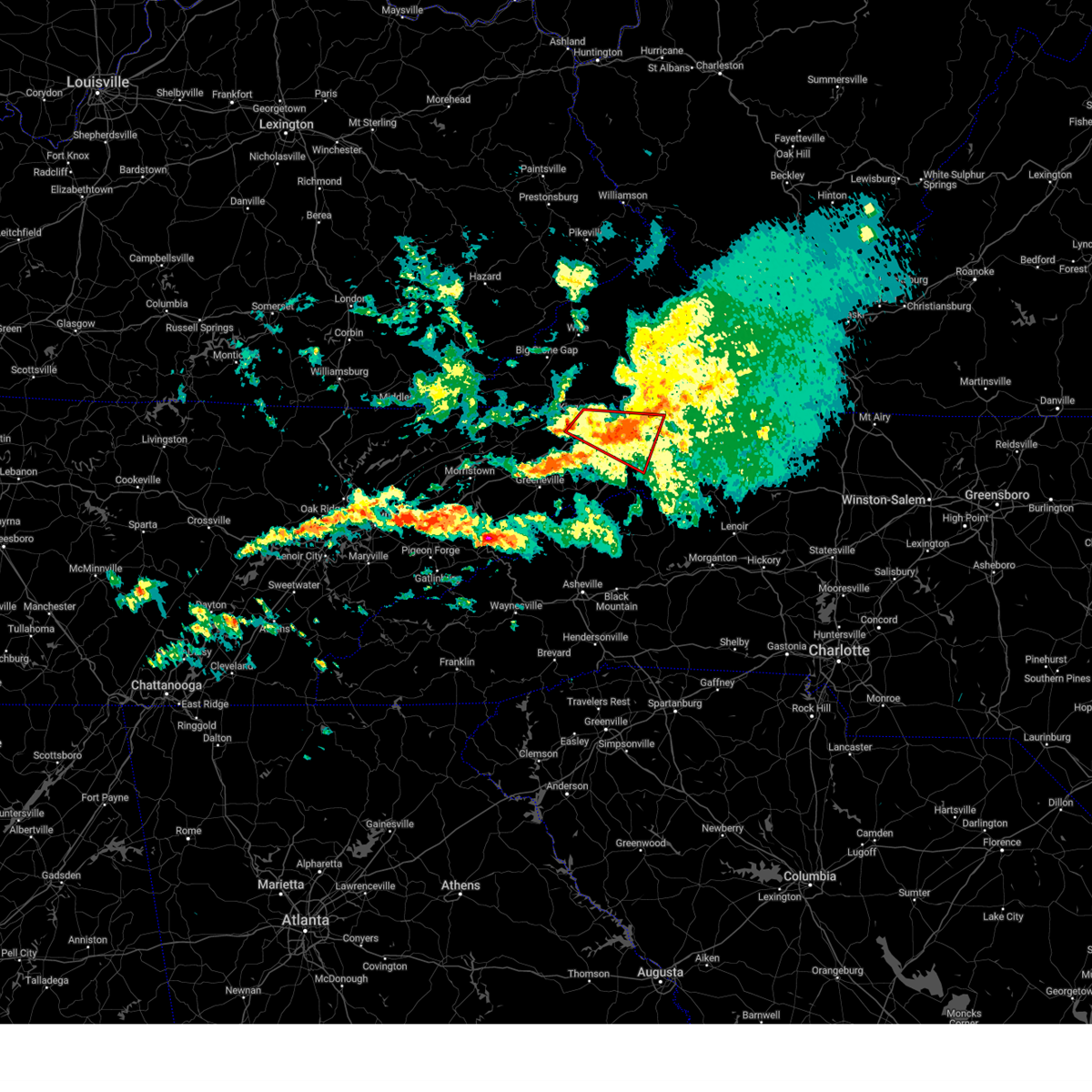
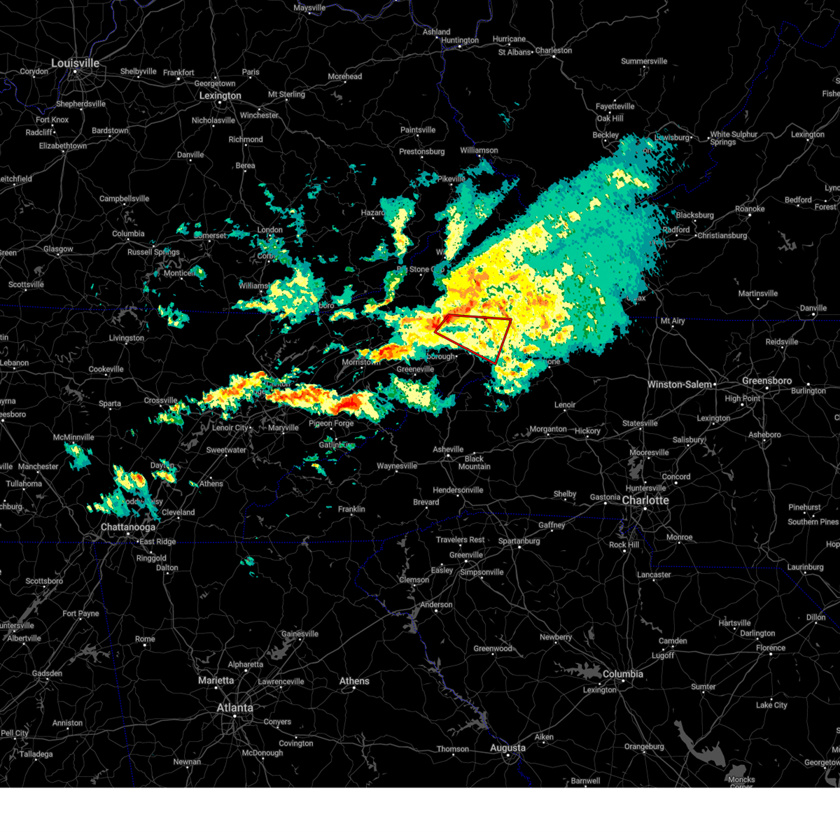
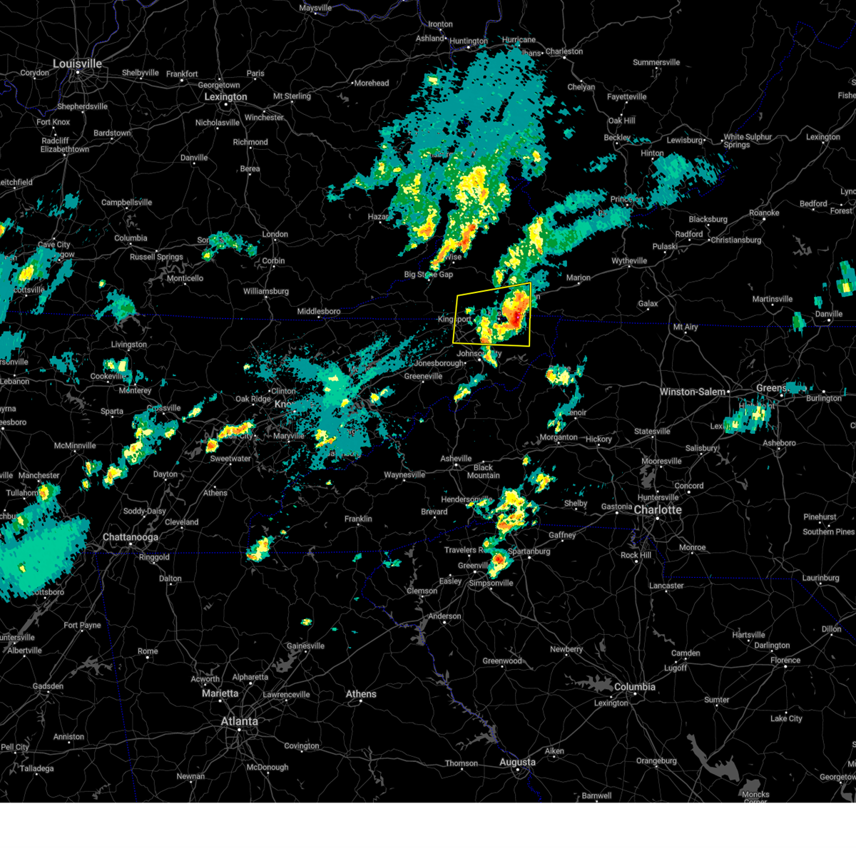
Hail Map for Oak Grove, TN
The Oak Grove, TN area has had 0 reports of on-the-ground hail by trained spotters, and has been under severe weather warnings 30 times during the past 12 months. Doppler radar has detected hail at or near Oak Grove, TN on 113 occasions, including 2 occasions during the past year.
| Name: | Oak Grove, TN |
| Where Located: | 16.7 miles SW of Bristol, TN |
| Map: | Google Map for Oak Grove, TN |
| Population: | 4425 |
| Housing Units: | 2075 |
| More Info: | Search Google for Oak Grove, TN |
0
The Top Recent Hail Date for Oak Grove, TN is Friday, November 7, 2025 (98th out of 113)
Hail and Wind Damage Spotted near Oak Grove, TN
| Date / Time | Report Details |
|---|---|
| 7/4/2026 11:41 PM EDT |
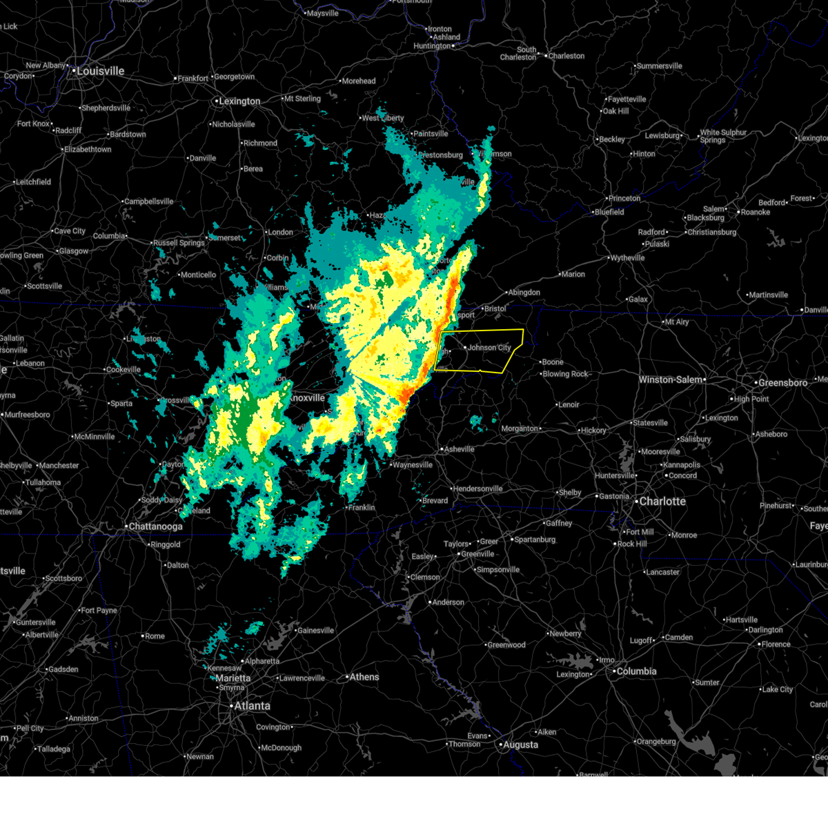
 At 1141 pm edt, a severe thunderstorm was located 8 miles southwest of jonesborough, or 9 miles northwest of erwin, moving northeast at 15 mph (radar indicated). Hazards include 60 mph wind gusts and penny size hail. Expect damage to roofs, siding, and trees. locations impacted include, johnson city, elizabethton, erwin, jonesborough, central, hampton, midway, pine crest, banner hill, and oak grove. This includes interstate 26 in tennessee between mile markers 15 and 40, and near mile marker 42. At 1141 pm edt, a severe thunderstorm was located 8 miles southwest of jonesborough, or 9 miles northwest of erwin, moving northeast at 15 mph (radar indicated). Hazards include 60 mph wind gusts and penny size hail. Expect damage to roofs, siding, and trees. locations impacted include, johnson city, elizabethton, erwin, jonesborough, central, hampton, midway, pine crest, banner hill, and oak grove. This includes interstate 26 in tennessee between mile markers 15 and 40, and near mile marker 42.
|
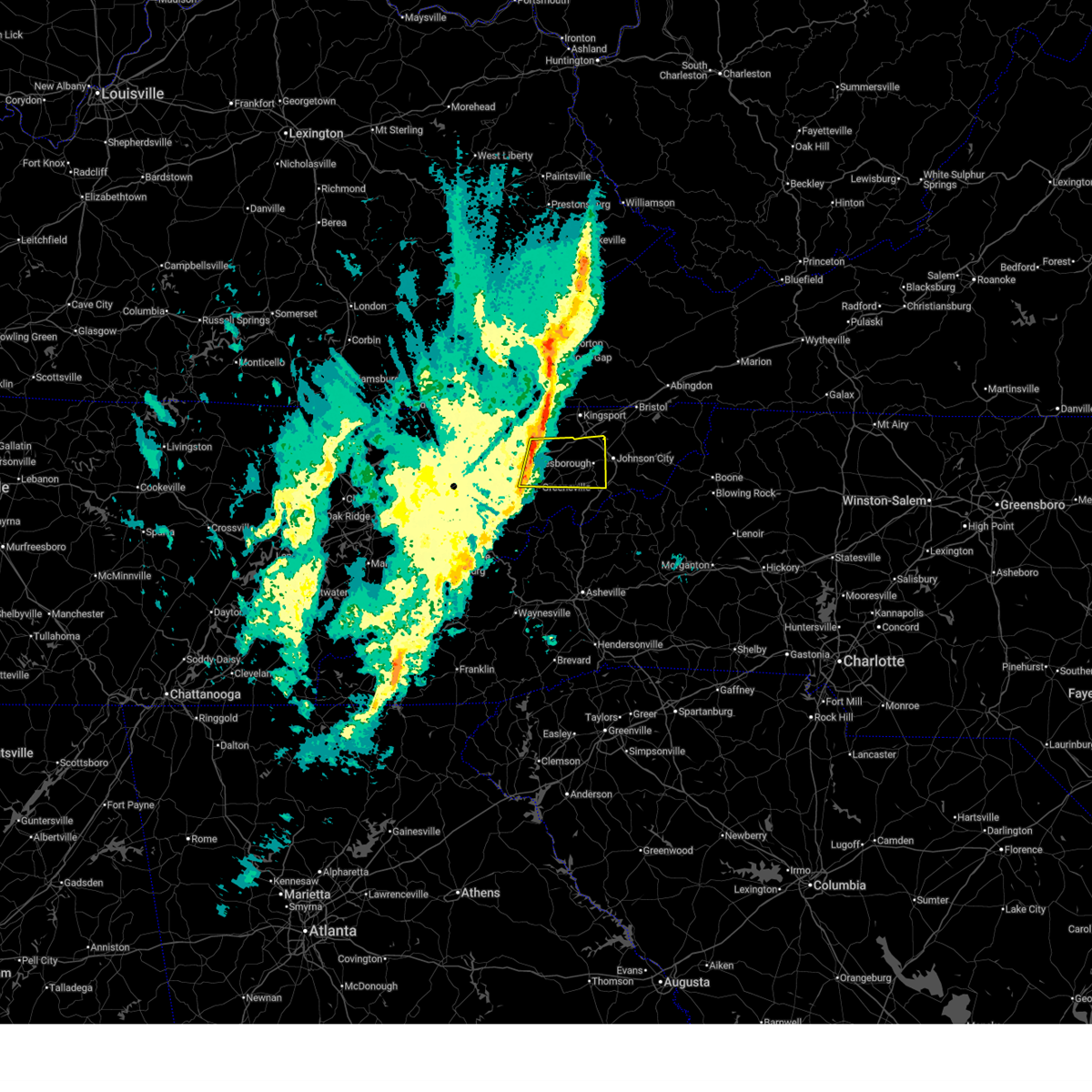
| 7/4/2026 11:25 PM EDT |
 Svrmrx the national weather service in morristown has issued a * severe thunderstorm warning for, south central sullivan county in east tennessee, washington county in east tennessee, east central greene county in east tennessee, northern unicoi county in east tennessee, west central carter county in east tennessee, * until 1215 am edt. * at 1124 pm edt, a severe thunderstorm was located 8 miles east of tusculum, or 10 miles west of erwin, moving northeast at 15 mph (radar indicated). Hazards include 60 mph wind gusts and penny size hail. expect damage to roofs, siding, and trees Svrmrx the national weather service in morristown has issued a * severe thunderstorm warning for, south central sullivan county in east tennessee, washington county in east tennessee, east central greene county in east tennessee, northern unicoi county in east tennessee, west central carter county in east tennessee, * until 1215 am edt. * at 1124 pm edt, a severe thunderstorm was located 8 miles east of tusculum, or 10 miles west of erwin, moving northeast at 15 mph (radar indicated). Hazards include 60 mph wind gusts and penny size hail. expect damage to roofs, siding, and trees
|
| 7/3/2026 5:04 PM CDT |
 At 504 pm cdt, a severe thunderstorm was located over gallatin, moving northwest at 15 mph (radar indicated). Hazards include 60 mph wind gusts. Expect damage to roofs, siding, and trees. Locations impacted include, gallatin, hartsville, hendersonville, mount juliet, goodlettsville, white house, millersville, westmoreland, cross plains, bethpage, oak grove, bledsoe creek state park, dickerson chapel recreation area, and cottontown. At 504 pm cdt, a severe thunderstorm was located over gallatin, moving northwest at 15 mph (radar indicated). Hazards include 60 mph wind gusts. Expect damage to roofs, siding, and trees. Locations impacted include, gallatin, hartsville, hendersonville, mount juliet, goodlettsville, white house, millersville, westmoreland, cross plains, bethpage, oak grove, bledsoe creek state park, dickerson chapel recreation area, and cottontown.
|
| 7/3/2026 4:40 PM CDT |
 Svrohx the national weather service in nashville has issued a * severe thunderstorm warning for, sumner county in middle tennessee, northern wilson county in middle tennessee, southwestern macon county in middle tennessee, trousdale county in middle tennessee, * until 530 pm cdt. * at 440 pm cdt, a severe thunderstorm was located near lebanon, moving northwest at 35 mph (radar indicated). Hazards include 60 mph wind gusts and penny size hail. expect damage to roofs, siding, and trees Svrohx the national weather service in nashville has issued a * severe thunderstorm warning for, sumner county in middle tennessee, northern wilson county in middle tennessee, southwestern macon county in middle tennessee, trousdale county in middle tennessee, * until 530 pm cdt. * at 440 pm cdt, a severe thunderstorm was located near lebanon, moving northwest at 35 mph (radar indicated). Hazards include 60 mph wind gusts and penny size hail. expect damage to roofs, siding, and trees
|
| 4/16/2026 7:53 PM CDT |
 At 753 pm cdt, a severe thunderstorm was located near hartsville, moving east at 50 mph (radar indicated). Hazards include 60 mph wind gusts and penny size hail. Expect damage to roofs, siding, and trees. Locations impacted include, gallatin, lafayette, carthage, hartsville, westmoreland, red boiling springs, south carthage, bethpage, dixon springs, oak grove, pleasant shade, and bledsoe creek state park. At 753 pm cdt, a severe thunderstorm was located near hartsville, moving east at 50 mph (radar indicated). Hazards include 60 mph wind gusts and penny size hail. Expect damage to roofs, siding, and trees. Locations impacted include, gallatin, lafayette, carthage, hartsville, westmoreland, red boiling springs, south carthage, bethpage, dixon springs, oak grove, pleasant shade, and bledsoe creek state park.
|
| 4/16/2026 7:25 PM CDT |
 Svrohx the national weather service in nashville has issued a * severe thunderstorm warning for, northern smith county in middle tennessee, sumner county in middle tennessee, macon county in middle tennessee, trousdale county in middle tennessee, eastern robertson county in middle tennessee, * until 830 pm cdt. * at 725 pm cdt, a severe thunderstorm was located near white house, or 10 miles northwest of gallatin, moving east at 60 mph (radar indicated). Hazards include 60 mph wind gusts and nickel size hail. expect damage to roofs, siding, and trees Svrohx the national weather service in nashville has issued a * severe thunderstorm warning for, northern smith county in middle tennessee, sumner county in middle tennessee, macon county in middle tennessee, trousdale county in middle tennessee, eastern robertson county in middle tennessee, * until 830 pm cdt. * at 725 pm cdt, a severe thunderstorm was located near white house, or 10 miles northwest of gallatin, moving east at 60 mph (radar indicated). Hazards include 60 mph wind gusts and nickel size hail. expect damage to roofs, siding, and trees
|
| 4/4/2026 4:45 PM CDT |
 the severe thunderstorm warning has been cancelled and is no longer in effect the severe thunderstorm warning has been cancelled and is no longer in effect
|
| 4/4/2026 4:27 PM CDT |
 Svrohx the national weather service in nashville has issued a * severe thunderstorm warning for, northeastern sumner county in middle tennessee, * until 500 pm cdt. * at 427 pm cdt, a severe thunderstorm was located near portland, or 13 miles north of gallatin, moving northeast at 45 mph (radar indicated). Hazards include 60 mph wind gusts. expect damage to roofs, siding, and trees Svrohx the national weather service in nashville has issued a * severe thunderstorm warning for, northeastern sumner county in middle tennessee, * until 500 pm cdt. * at 427 pm cdt, a severe thunderstorm was located near portland, or 13 miles north of gallatin, moving northeast at 45 mph (radar indicated). Hazards include 60 mph wind gusts. expect damage to roofs, siding, and trees
|
| 3/16/2026 5:26 AM EDT |
 At 525 am edt, severe thunderstorms were located along a line extending from near grundy to near weber city, moving northeast at 40 mph (radar indicated). Hazards include 60 mph wind gusts. Expect damage to roofs, siding, and trees. locations impacted include, johnson city, kingsport, bristol tn, bristol va, abingdon, lebanon, gate city, weber city, cleveland va, and spurgeon. this includes the following highways, interstate 26 in tennessee between mile markers 1 and 14. interstate 81 in tennessee between mile markers 50 and 75. Interstate 81 in virginia between mile markers 1 and 19. At 525 am edt, severe thunderstorms were located along a line extending from near grundy to near weber city, moving northeast at 40 mph (radar indicated). Hazards include 60 mph wind gusts. Expect damage to roofs, siding, and trees. locations impacted include, johnson city, kingsport, bristol tn, bristol va, abingdon, lebanon, gate city, weber city, cleveland va, and spurgeon. this includes the following highways, interstate 26 in tennessee between mile markers 1 and 14. interstate 81 in tennessee between mile markers 50 and 75. Interstate 81 in virginia between mile markers 1 and 19.
|
| 3/16/2026 5:26 AM EDT |
 the severe thunderstorm warning has been cancelled and is no longer in effect the severe thunderstorm warning has been cancelled and is no longer in effect
|
| 3/16/2026 5:06 AM EDT |
 Svrmrx the national weather service in morristown has issued a * severe thunderstorm warning for, sullivan county in east tennessee, northeastern hawkins county in east tennessee, northern washington county in east tennessee, northeastern greene county in east tennessee, northwestern carter county in east tennessee, russell county in southwestern virginia, the city of norton in southwestern virginia, the city of bristol in southwestern virginia, scott county in southwestern virginia, western washington county in southwestern virginia, central wise county in southwestern virginia, * until 600 am edt. * at 506 am edt, severe thunderstorms were located along a line extending from near wise to near surgoinsville, moving northeast at 40 mph (radar indicated). Hazards include 60 mph wind gusts. expect damage to roofs, siding, and trees Svrmrx the national weather service in morristown has issued a * severe thunderstorm warning for, sullivan county in east tennessee, northeastern hawkins county in east tennessee, northern washington county in east tennessee, northeastern greene county in east tennessee, northwestern carter county in east tennessee, russell county in southwestern virginia, the city of norton in southwestern virginia, the city of bristol in southwestern virginia, scott county in southwestern virginia, western washington county in southwestern virginia, central wise county in southwestern virginia, * until 600 am edt. * at 506 am edt, severe thunderstorms were located along a line extending from near wise to near surgoinsville, moving northeast at 40 mph (radar indicated). Hazards include 60 mph wind gusts. expect damage to roofs, siding, and trees
|
| 3/15/2026 11:08 PM CDT |
 Svrohx the national weather service in nashville has issued a * severe thunderstorm warning for, smith county in middle tennessee, northwestern de kalb county in middle tennessee, northern rutherford county in middle tennessee, western jackson county in middle tennessee, eastern sumner county in middle tennessee, wilson county in middle tennessee, northwestern clay county in middle tennessee, macon county in middle tennessee, trousdale county in middle tennessee, * until midnight cdt. * at 1107 pm cdt, severe thunderstorms were located along a line extending from 7 miles northwest of westmoreland to near walterhill, moving east at 60 mph (radar indicated). Hazards include 70 mph wind gusts and penny size hail. Expect considerable tree damage. Damage is likely to mobile homes, roofs, and outbuildings. Svrohx the national weather service in nashville has issued a * severe thunderstorm warning for, smith county in middle tennessee, northwestern de kalb county in middle tennessee, northern rutherford county in middle tennessee, western jackson county in middle tennessee, eastern sumner county in middle tennessee, wilson county in middle tennessee, northwestern clay county in middle tennessee, macon county in middle tennessee, trousdale county in middle tennessee, * until midnight cdt. * at 1107 pm cdt, severe thunderstorms were located along a line extending from 7 miles northwest of westmoreland to near walterhill, moving east at 60 mph (radar indicated). Hazards include 70 mph wind gusts and penny size hail. Expect considerable tree damage. Damage is likely to mobile homes, roofs, and outbuildings.
|
| 3/15/2026 11:05 PM CDT |
 At 1105 pm cdt, severe thunderstorms were located along a line extending from 9 miles northeast of portland to near nolensville, moving east at 45 mph (radar indicated). Hazards include 70 mph wind gusts and quarter size hail. Hail damage to vehicles is expected. expect considerable tree damage. wind damage is also likely to mobile homes, roofs, and outbuildings. locations impacted include, franklin, gallatin, lebanon, hendersonville, brentwood, la vergne, mount juliet, goodlettsville, white house, millersville, nolensville, lakewood, westmoreland, cross plains, portland, hermitage, rural hill, antioch, belinda city, and old hickory. this includes the following highways, interstate 40 between mile markers 213 and 231. interstate 65 between mile markers 114 and 121. Interstate 24 between mile markers 52 and 63. At 1105 pm cdt, severe thunderstorms were located along a line extending from 9 miles northeast of portland to near nolensville, moving east at 45 mph (radar indicated). Hazards include 70 mph wind gusts and quarter size hail. Hail damage to vehicles is expected. expect considerable tree damage. wind damage is also likely to mobile homes, roofs, and outbuildings. locations impacted include, franklin, gallatin, lebanon, hendersonville, brentwood, la vergne, mount juliet, goodlettsville, white house, millersville, nolensville, lakewood, westmoreland, cross plains, portland, hermitage, rural hill, antioch, belinda city, and old hickory. this includes the following highways, interstate 40 between mile markers 213 and 231. interstate 65 between mile markers 114 and 121. Interstate 24 between mile markers 52 and 63.
|
| 3/15/2026 11:05 PM CDT |
 the severe thunderstorm warning has been cancelled and is no longer in effect the severe thunderstorm warning has been cancelled and is no longer in effect
|
| 3/15/2026 10:45 PM CDT |
 At 1045 pm cdt, severe thunderstorms were located along a line extending from 7 miles northwest of portland to near thompson's station, moving east at 45 mph (radar indicated). Hazards include 70 mph wind gusts and quarter size hail. Hail damage to vehicles is expected. expect considerable tree damage. wind damage is also likely to mobile homes, roofs, and outbuildings. locations impacted include, franklin, gallatin, lebanon, springfield, ashland city, nashville, madison, hendersonville, brentwood, la vergne, mount juliet, goodlettsville, white house, millersville, greenbrier, nolensville, forest hills, oak hill, coopertown, and belle meade. this includes the following highways, interstate 40 between mile markers 189 and 231. interstate 65 between mile markers 66 and 121. interstate 24 between mile markers 27 and 63. Interstate 840 between mile markers 12 and 14. At 1045 pm cdt, severe thunderstorms were located along a line extending from 7 miles northwest of portland to near thompson's station, moving east at 45 mph (radar indicated). Hazards include 70 mph wind gusts and quarter size hail. Hail damage to vehicles is expected. expect considerable tree damage. wind damage is also likely to mobile homes, roofs, and outbuildings. locations impacted include, franklin, gallatin, lebanon, springfield, ashland city, nashville, madison, hendersonville, brentwood, la vergne, mount juliet, goodlettsville, white house, millersville, greenbrier, nolensville, forest hills, oak hill, coopertown, and belle meade. this includes the following highways, interstate 40 between mile markers 189 and 231. interstate 65 between mile markers 66 and 121. interstate 24 between mile markers 27 and 63. Interstate 840 between mile markers 12 and 14.
|
| 3/15/2026 10:45 PM CDT |
 the severe thunderstorm warning has been cancelled and is no longer in effect the severe thunderstorm warning has been cancelled and is no longer in effect
|
| 3/15/2026 10:22 PM CDT |
 Svrohx the national weather service in nashville has issued a * severe thunderstorm warning for, davidson county in middle tennessee, southeastern dickson county in middle tennessee, sumner county in middle tennessee, northern williamson county in middle tennessee, northwestern wilson county in middle tennessee, cheatham county in middle tennessee, northeastern hickman county in middle tennessee, robertson county in middle tennessee, * until 1115 pm cdt. * at 1021 pm cdt, severe thunderstorms were located along a line extending from 9 miles north of springfield to 11 miles southwest of fairview, moving east at 45 mph (radar indicated). Hazards include 70 mph wind gusts and quarter size hail. Hail damage to vehicles is expected. expect considerable tree damage. Wind damage is also likely to mobile homes, roofs, and outbuildings. Svrohx the national weather service in nashville has issued a * severe thunderstorm warning for, davidson county in middle tennessee, southeastern dickson county in middle tennessee, sumner county in middle tennessee, northern williamson county in middle tennessee, northwestern wilson county in middle tennessee, cheatham county in middle tennessee, northeastern hickman county in middle tennessee, robertson county in middle tennessee, * until 1115 pm cdt. * at 1021 pm cdt, severe thunderstorms were located along a line extending from 9 miles north of springfield to 11 miles southwest of fairview, moving east at 45 mph (radar indicated). Hazards include 70 mph wind gusts and quarter size hail. Hail damage to vehicles is expected. expect considerable tree damage. Wind damage is also likely to mobile homes, roofs, and outbuildings.
|
| 12/19/2025 12:45 AM EST |
 Svrmrx the national weather service in morristown has issued a * severe thunderstorm warning for, south central sullivan county in east tennessee, washington county in east tennessee, northeastern unicoi county in east tennessee, southwestern johnson county in east tennessee, carter county in east tennessee, * until 130 am est. * at 1244 am est, a severe thunderstorm was located over jonesborough, or near johnson city, moving east at 45 mph (radar indicated). Hazards include 60 mph wind gusts. expect damage to roofs, siding, and trees Svrmrx the national weather service in morristown has issued a * severe thunderstorm warning for, south central sullivan county in east tennessee, washington county in east tennessee, northeastern unicoi county in east tennessee, southwestern johnson county in east tennessee, carter county in east tennessee, * until 130 am est. * at 1244 am est, a severe thunderstorm was located over jonesborough, or near johnson city, moving east at 45 mph (radar indicated). Hazards include 60 mph wind gusts. expect damage to roofs, siding, and trees
|
| 12/19/2025 12:23 AM EST |
 the severe thunderstorm warning has been cancelled and is no longer in effect the severe thunderstorm warning has been cancelled and is no longer in effect
|
| 12/19/2025 12:23 AM EST |
 At 1223 am est, a severe thunderstorm was located 9 miles north of greeneville, moving east at 45 mph (radar indicated). Hazards include 60 mph wind gusts. Expect damage to roofs, siding, and trees. locations impacted include, johnson city, greeneville, erwin, jonesborough, tusculum, gray, oak grove, midway, spurgeon, and mosheim. this includes the following highways, interstate 26 in tennessee between mile markers 11 and 18, and near mile marker 36. Interstate 81 in tennessee between mile markers 30 and 53. At 1223 am est, a severe thunderstorm was located 9 miles north of greeneville, moving east at 45 mph (radar indicated). Hazards include 60 mph wind gusts. Expect damage to roofs, siding, and trees. locations impacted include, johnson city, greeneville, erwin, jonesborough, tusculum, gray, oak grove, midway, spurgeon, and mosheim. this includes the following highways, interstate 26 in tennessee between mile markers 11 and 18, and near mile marker 36. Interstate 81 in tennessee between mile markers 30 and 53.
|
| 12/19/2025 12:06 AM EST |
 Svrmrx the national weather service in morristown has issued a * severe thunderstorm warning for, southeastern hawkins county in east tennessee, washington county in east tennessee, northern greene county in east tennessee, north central unicoi county in east tennessee, east central hamblen county in east tennessee, * until 1245 am est. * at 1206 am est, a severe thunderstorm was located 8 miles east of russellville, or 8 miles south of rogersville, moving east at 45 mph (radar indicated). Hazards include 60 mph wind gusts. expect damage to roofs, siding, and trees Svrmrx the national weather service in morristown has issued a * severe thunderstorm warning for, southeastern hawkins county in east tennessee, washington county in east tennessee, northern greene county in east tennessee, north central unicoi county in east tennessee, east central hamblen county in east tennessee, * until 1245 am est. * at 1206 am est, a severe thunderstorm was located 8 miles east of russellville, or 8 miles south of rogersville, moving east at 45 mph (radar indicated). Hazards include 60 mph wind gusts. expect damage to roofs, siding, and trees
|
| 9/23/2025 2:40 AM CDT | the severe thunderstorm warning has been cancelled and is no longer in effect |
| 9/23/2025 2:31 AM CDT | At 231 am cdt, a severe thunderstorm was located near westmoreland, or 12 miles northeast of gallatin, moving northeast at 35 mph (radar indicated). Hazards include 60 mph wind gusts and nickel size hail. Expect damage to roofs, siding, and trees. Locations impacted include, westmoreland, oak grove, and bethpage. |
| 9/23/2025 2:15 AM CDT | Svrohx the national weather service in nashville has issued a * severe thunderstorm warning for, northeastern sumner county in middle tennessee, northwestern macon county in middle tennessee, * until 300 am cdt. * at 215 am cdt, a severe thunderstorm was located near gallatin, moving northeast at 35 mph (radar indicated). Hazards include 60 mph wind gusts and nickel size hail. expect damage to roofs, siding, and trees |
| 9/4/2025 12:40 PM EDT |
 The storms which prompted the warning have weakened below severe limits, and no longer pose an immediate threat to life or property. therefore, the warning will be allowed to expire. however, gusty winds are still possible with these thunderstorms. The storms which prompted the warning have weakened below severe limits, and no longer pose an immediate threat to life or property. therefore, the warning will be allowed to expire. however, gusty winds are still possible with these thunderstorms.
|
| 9/4/2025 12:31 PM EDT |
 At 1231 pm edt, severe thunderstorms were located along a line extending from near bristol va to 6 miles north of elizabethton, moving east at 45 mph (radar indicated). Hazards include 60 mph wind gusts. Expect damage to roofs, siding, and trees. locations impacted include, kingsport, bristol tn, bristol va, abingdon, walnut hill, spurgeon, oak grove, bluff city, hunter, and morril's cave. this includes the following highways, interstate 81 in tennessee between mile markers 64 and 75. Interstate 81 in virginia between mile markers 1 and 19. At 1231 pm edt, severe thunderstorms were located along a line extending from near bristol va to 6 miles north of elizabethton, moving east at 45 mph (radar indicated). Hazards include 60 mph wind gusts. Expect damage to roofs, siding, and trees. locations impacted include, kingsport, bristol tn, bristol va, abingdon, walnut hill, spurgeon, oak grove, bluff city, hunter, and morril's cave. this includes the following highways, interstate 81 in tennessee between mile markers 64 and 75. Interstate 81 in virginia between mile markers 1 and 19.
|
| 9/4/2025 12:02 PM EDT |
 Svrmrx the national weather service in morristown has issued a * severe thunderstorm warning for, sullivan county in east tennessee, northwestern carter county in east tennessee, southwestern russell county in southwestern virginia, the city of bristol in southwestern virginia, southeastern scott county in southwestern virginia, southwestern washington county in southwestern virginia, * until 1245 pm edt. * at 1202 pm edt, severe thunderstorms were located along a line extending from near gate city to 8 miles southwest of colonial heights, moving east at 45 mph (radar indicated). Hazards include 60 mph wind gusts. expect damage to roofs, siding, and trees Svrmrx the national weather service in morristown has issued a * severe thunderstorm warning for, sullivan county in east tennessee, northwestern carter county in east tennessee, southwestern russell county in southwestern virginia, the city of bristol in southwestern virginia, southeastern scott county in southwestern virginia, southwestern washington county in southwestern virginia, * until 1245 pm edt. * at 1202 pm edt, severe thunderstorms were located along a line extending from near gate city to 8 miles southwest of colonial heights, moving east at 45 mph (radar indicated). Hazards include 60 mph wind gusts. expect damage to roofs, siding, and trees
|
| 7/21/2025 3:58 PM CDT |
 the severe thunderstorm warning has been cancelled and is no longer in effect the severe thunderstorm warning has been cancelled and is no longer in effect
|
| 7/21/2025 3:58 PM CDT |
 At 357 pm cdt, a severe thunderstorm was located near portland, or 11 miles north of gallatin, moving east at 30 mph (radar indicated). Hazards include 60 mph wind gusts. Expect damage to roofs, siding, and trees. Locations impacted include, gallatin, white house, cross plains, portland, mitchellville, cottontown, oak grove, and black jack. At 357 pm cdt, a severe thunderstorm was located near portland, or 11 miles north of gallatin, moving east at 30 mph (radar indicated). Hazards include 60 mph wind gusts. Expect damage to roofs, siding, and trees. Locations impacted include, gallatin, white house, cross plains, portland, mitchellville, cottontown, oak grove, and black jack.
|
| 7/21/2025 3:49 PM CDT |
 Svrohx the national weather service in nashville has issued a * severe thunderstorm warning for, northern sumner county in middle tennessee, northeastern robertson county in middle tennessee, * until 415 pm cdt. * at 349 pm cdt, a severe thunderstorm was located near portland, or 14 miles northwest of gallatin, moving east at 35 mph (trained weather spotters). Hazards include 60 mph wind gusts. expect damage to roofs, siding, and trees Svrohx the national weather service in nashville has issued a * severe thunderstorm warning for, northern sumner county in middle tennessee, northeastern robertson county in middle tennessee, * until 415 pm cdt. * at 349 pm cdt, a severe thunderstorm was located near portland, or 14 miles northwest of gallatin, moving east at 35 mph (trained weather spotters). Hazards include 60 mph wind gusts. expect damage to roofs, siding, and trees
|
| 6/27/2025 3:52 PM CDT |
 Svrohx the national weather service in nashville has issued a * severe thunderstorm warning for, northwestern jackson county in middle tennessee, northeastern sumner county in middle tennessee, northwestern clay county in middle tennessee, macon county in middle tennessee, * until 430 pm cdt. * at 351 pm cdt, severe thunderstorms were located along a line extending from 6 miles northwest of westmoreland to 8 miles southwest of red boiling springs, moving northeast at 20 mph (radar indicated). Hazards include 60 mph wind gusts and penny size hail. expect damage to roofs, siding, and trees Svrohx the national weather service in nashville has issued a * severe thunderstorm warning for, northwestern jackson county in middle tennessee, northeastern sumner county in middle tennessee, northwestern clay county in middle tennessee, macon county in middle tennessee, * until 430 pm cdt. * at 351 pm cdt, severe thunderstorms were located along a line extending from 6 miles northwest of westmoreland to 8 miles southwest of red boiling springs, moving northeast at 20 mph (radar indicated). Hazards include 60 mph wind gusts and penny size hail. expect damage to roofs, siding, and trees
|
| 6/18/2025 8:03 PM CDT |
 Svrohx the national weather service in nashville has issued a * severe thunderstorm warning for, central davidson county in middle tennessee, sumner county in middle tennessee, northwestern wilson county in middle tennessee, southeastern cheatham county in middle tennessee, southeastern robertson county in middle tennessee, * until 830 pm cdt. * at 802 pm cdt, severe thunderstorms were located along a line extending from near portland to near millersville to pegram, moving east at 50 mph (radar indicated). Hazards include 60 mph wind gusts. expect damage to roofs, siding, and trees Svrohx the national weather service in nashville has issued a * severe thunderstorm warning for, central davidson county in middle tennessee, sumner county in middle tennessee, northwestern wilson county in middle tennessee, southeastern cheatham county in middle tennessee, southeastern robertson county in middle tennessee, * until 830 pm cdt. * at 802 pm cdt, severe thunderstorms were located along a line extending from near portland to near millersville to pegram, moving east at 50 mph (radar indicated). Hazards include 60 mph wind gusts. expect damage to roofs, siding, and trees
|
| 6/6/2025 3:29 PM CDT |
 the severe thunderstorm warning has been cancelled and is no longer in effect the severe thunderstorm warning has been cancelled and is no longer in effect
|
| 6/6/2025 3:17 PM CDT |
 At 317 pm cdt, a severe thunderstorm was located near portland, or 16 miles north of gallatin, moving east at 40 mph (radar indicated). Hazards include 60 mph wind gusts and nickel size hail. Expect damage to roofs, siding, and trees. Locations impacted include, gallatin, white house, westmoreland, cross plains, portland, mitchellville, cottontown, bethpage, and oak grove. At 317 pm cdt, a severe thunderstorm was located near portland, or 16 miles north of gallatin, moving east at 40 mph (radar indicated). Hazards include 60 mph wind gusts and nickel size hail. Expect damage to roofs, siding, and trees. Locations impacted include, gallatin, white house, westmoreland, cross plains, portland, mitchellville, cottontown, bethpage, and oak grove.
|
| 6/6/2025 3:17 PM CDT |
 the severe thunderstorm warning has been cancelled and is no longer in effect the severe thunderstorm warning has been cancelled and is no longer in effect
|
| 6/6/2025 2:55 PM CDT |
 Svrohx the national weather service in nashville has issued a * severe thunderstorm warning for, sumner county in middle tennessee, eastern robertson county in middle tennessee, * until 345 pm cdt. * at 255 pm cdt, a severe thunderstorm was located over cross plains, or 12 miles northeast of springfield, moving east at 40 mph (radar indicated). Hazards include 60 mph wind gusts and nickel size hail. expect damage to roofs, siding, and trees Svrohx the national weather service in nashville has issued a * severe thunderstorm warning for, sumner county in middle tennessee, eastern robertson county in middle tennessee, * until 345 pm cdt. * at 255 pm cdt, a severe thunderstorm was located over cross plains, or 12 miles northeast of springfield, moving east at 40 mph (radar indicated). Hazards include 60 mph wind gusts and nickel size hail. expect damage to roofs, siding, and trees
|
| 5/20/2025 6:34 PM CDT |
 the severe thunderstorm warning has been cancelled and is no longer in effect the severe thunderstorm warning has been cancelled and is no longer in effect
|
| 5/20/2025 6:07 PM CDT |
 At 607 pm cdt, severe thunderstorms were located along a line extending from near portland to near hendersonville, moving east at 50 mph (radar indicated). Hazards include 60 mph wind gusts and quarter size hail. Hail damage to vehicles is expected. expect wind damage to roofs, siding, and trees. Locations impacted include, portland, ridgetop, bethpage, goodlettsville, mitchellville, oak grove, millersville, gallatin, white house, bledsoe creek state park, cottontown, hendersonville, cross plains, and orlinda. At 607 pm cdt, severe thunderstorms were located along a line extending from near portland to near hendersonville, moving east at 50 mph (radar indicated). Hazards include 60 mph wind gusts and quarter size hail. Hail damage to vehicles is expected. expect wind damage to roofs, siding, and trees. Locations impacted include, portland, ridgetop, bethpage, goodlettsville, mitchellville, oak grove, millersville, gallatin, white house, bledsoe creek state park, cottontown, hendersonville, cross plains, and orlinda.
|
| 5/20/2025 6:07 PM CDT |
 the severe thunderstorm warning has been cancelled and is no longer in effect the severe thunderstorm warning has been cancelled and is no longer in effect
|
| 5/20/2025 5:30 PM CDT |
 Svrohx the national weather service in nashville has issued a * severe thunderstorm warning for, northwestern davidson county in middle tennessee, northeastern dickson county in middle tennessee, eastern montgomery county in middle tennessee, sumner county in middle tennessee, cheatham county in middle tennessee, robertson county in middle tennessee, * until 645 pm cdt. * at 530 pm cdt, severe thunderstorms were located along a line extending from elkton to ashland city, moving east at 45 mph (radar indicated). Hazards include 60 mph wind gusts and quarter size hail. Hail damage to vehicles is expected. Expect wind damage to roofs, siding, and trees. Svrohx the national weather service in nashville has issued a * severe thunderstorm warning for, northwestern davidson county in middle tennessee, northeastern dickson county in middle tennessee, eastern montgomery county in middle tennessee, sumner county in middle tennessee, cheatham county in middle tennessee, robertson county in middle tennessee, * until 645 pm cdt. * at 530 pm cdt, severe thunderstorms were located along a line extending from elkton to ashland city, moving east at 45 mph (radar indicated). Hazards include 60 mph wind gusts and quarter size hail. Hail damage to vehicles is expected. Expect wind damage to roofs, siding, and trees.
|
| 5/17/2025 2:59 AM EDT |
 the severe thunderstorm warning has been cancelled and is no longer in effect the severe thunderstorm warning has been cancelled and is no longer in effect
|
| 5/17/2025 2:59 AM EDT |
 At 258 am edt, severe thunderstorms were located along a line extending from near cedar bluff to 6 miles east of lebanon to 9 miles northwest of walnut hill to near rogersville, moving southeast at 45 mph (emergency dispatch reports trees down across the warned area). Hazards include 60 mph wind gusts and penny size hail. Expect damage to roofs, siding, and trees. locations impacted include, leesburg, chucky, damascus, limestone, spurgeon, south holston dam, sullivan gardens, bristol tn, jonesborough, and johnson city. this includes the following highways, interstate 26 in tennessee between mile markers 1 and 23. interstate 81 in tennessee between mile markers 32 and 75. Interstate 81 in virginia between mile markers 1 and 32. At 258 am edt, severe thunderstorms were located along a line extending from near cedar bluff to 6 miles east of lebanon to 9 miles northwest of walnut hill to near rogersville, moving southeast at 45 mph (emergency dispatch reports trees down across the warned area). Hazards include 60 mph wind gusts and penny size hail. Expect damage to roofs, siding, and trees. locations impacted include, leesburg, chucky, damascus, limestone, spurgeon, south holston dam, sullivan gardens, bristol tn, jonesborough, and johnson city. this includes the following highways, interstate 26 in tennessee between mile markers 1 and 23. interstate 81 in tennessee between mile markers 32 and 75. Interstate 81 in virginia between mile markers 1 and 32.
|
| 5/17/2025 2:29 AM EDT |
 Svrmrx the national weather service in morristown has issued a * severe thunderstorm warning for, sullivan county in east tennessee, hawkins county in east tennessee, washington county in east tennessee, northeastern greene county in east tennessee, north central johnson county in east tennessee, northwestern carter county in east tennessee, russell county in southwestern virginia, the city of bristol in southwestern virginia, scott county in southwestern virginia, washington county in southwestern virginia, * until 330 am edt. * at 229 am edt, severe thunderstorms were located along a line extending from 7 miles southeast of grundy to near trammel to 8 miles southeast of big stone gap to sneedville, moving southeast at 40 mph (radar indicated). Hazards include 60 mph wind gusts and penny size hail. expect damage to roofs, siding, and trees Svrmrx the national weather service in morristown has issued a * severe thunderstorm warning for, sullivan county in east tennessee, hawkins county in east tennessee, washington county in east tennessee, northeastern greene county in east tennessee, north central johnson county in east tennessee, northwestern carter county in east tennessee, russell county in southwestern virginia, the city of bristol in southwestern virginia, scott county in southwestern virginia, washington county in southwestern virginia, * until 330 am edt. * at 229 am edt, severe thunderstorms were located along a line extending from 7 miles southeast of grundy to near trammel to 8 miles southeast of big stone gap to sneedville, moving southeast at 40 mph (radar indicated). Hazards include 60 mph wind gusts and penny size hail. expect damage to roofs, siding, and trees
|
| 5/16/2025 11:08 PM CDT |
 At 1107 pm cdt, severe thunderstorms were located along a line extending from near red boiling springs to near burns, moving east at 55 mph (radar indicated). Hazards include 60 mph wind gusts and quarter size hail. Hail damage to vehicles is expected. expect wind damage to roofs, siding, and trees. locations impacted include, charlotte, black jack, hartsville, moss, pleasant shade, millersville, gallatin, bledsoe creek state park, dickerson chapel recreation area, hendersonville, cottontown, mount juliet, westmoreland, white bluff, forest hills, cheatham dam, goodlettsville, dixon springs, oak grove, and nashville. this includes the following highways, interstate 40 between mile markers 186 and 235. interstate 65 between mile markers 75 and 121. interstate 24 between mile markers 22 and 57. Interstate 840 near mile marker 76. At 1107 pm cdt, severe thunderstorms were located along a line extending from near red boiling springs to near burns, moving east at 55 mph (radar indicated). Hazards include 60 mph wind gusts and quarter size hail. Hail damage to vehicles is expected. expect wind damage to roofs, siding, and trees. locations impacted include, charlotte, black jack, hartsville, moss, pleasant shade, millersville, gallatin, bledsoe creek state park, dickerson chapel recreation area, hendersonville, cottontown, mount juliet, westmoreland, white bluff, forest hills, cheatham dam, goodlettsville, dixon springs, oak grove, and nashville. this includes the following highways, interstate 40 between mile markers 186 and 235. interstate 65 between mile markers 75 and 121. interstate 24 between mile markers 22 and 57. Interstate 840 near mile marker 76.
|
| 5/16/2025 11:08 PM CDT |
 the severe thunderstorm warning has been cancelled and is no longer in effect the severe thunderstorm warning has been cancelled and is no longer in effect
|
| 5/16/2025 10:40 PM CDT |
 Svrohx the national weather service in nashville has issued a * severe thunderstorm warning for, northern smith county in middle tennessee, southern montgomery county in middle tennessee, sumner county in middle tennessee, southeastern stewart county in middle tennessee, houston county in middle tennessee, northern wilson county in middle tennessee, cheatham county in middle tennessee, clay county in middle tennessee, northern humphreys county in middle tennessee, robertson county in middle tennessee, davidson county in middle tennessee, dickson county in middle tennessee, northern jackson county in middle tennessee, macon county in middle tennessee, trousdale county in middle tennessee, * until 1145 pm cdt. * at 1040 pm cdt, severe thunderstorms were located along a line extending from near westmoreland to near mcewen, moving east at 55 mph (radar indicated). Hazards include 60 mph wind gusts and quarter size hail. Hail damage to vehicles is expected. Expect wind damage to roofs, siding, and trees. Svrohx the national weather service in nashville has issued a * severe thunderstorm warning for, northern smith county in middle tennessee, southern montgomery county in middle tennessee, sumner county in middle tennessee, southeastern stewart county in middle tennessee, houston county in middle tennessee, northern wilson county in middle tennessee, cheatham county in middle tennessee, clay county in middle tennessee, northern humphreys county in middle tennessee, robertson county in middle tennessee, davidson county in middle tennessee, dickson county in middle tennessee, northern jackson county in middle tennessee, macon county in middle tennessee, trousdale county in middle tennessee, * until 1145 pm cdt. * at 1040 pm cdt, severe thunderstorms were located along a line extending from near westmoreland to near mcewen, moving east at 55 mph (radar indicated). Hazards include 60 mph wind gusts and quarter size hail. Hail damage to vehicles is expected. Expect wind damage to roofs, siding, and trees.
|
| 5/16/2025 11:03 AM CDT |
 the severe thunderstorm warning has been cancelled and is no longer in effect the severe thunderstorm warning has been cancelled and is no longer in effect
|
| 5/16/2025 10:29 AM CDT |
 Svrohx the national weather service in nashville has issued a * severe thunderstorm warning for, northern sumner county in middle tennessee, northeastern robertson county in middle tennessee, * until 1115 am cdt. * at 1028 am cdt, a severe thunderstorm was located over cross plains, or 10 miles northeast of springfield, moving east at 65 mph (radar indicated). Hazards include 60 mph wind gusts and quarter size hail. Hail damage to vehicles is expected. Expect wind damage to roofs, siding, and trees. Svrohx the national weather service in nashville has issued a * severe thunderstorm warning for, northern sumner county in middle tennessee, northeastern robertson county in middle tennessee, * until 1115 am cdt. * at 1028 am cdt, a severe thunderstorm was located over cross plains, or 10 miles northeast of springfield, moving east at 65 mph (radar indicated). Hazards include 60 mph wind gusts and quarter size hail. Hail damage to vehicles is expected. Expect wind damage to roofs, siding, and trees.
|
| 5/2/2025 7:37 PM EDT |
 the severe thunderstorm warning has been cancelled and is no longer in effect the severe thunderstorm warning has been cancelled and is no longer in effect
|
| 5/2/2025 7:23 PM EDT |
 Svrmrx the national weather service in morristown has issued a * severe thunderstorm warning for, southwestern sullivan county in east tennessee, northeastern hawkins county in east tennessee, northern washington county in east tennessee, northeastern greene county in east tennessee, south central scott county in southwestern virginia, * until 815 pm edt. * at 723 pm edt, a severe thunderstorm was located 8 miles north of tusculum, or 9 miles north of greeneville, moving northeast at 25 mph (radar indicated). Hazards include 60 mph wind gusts and quarter size hail. Hail damage to vehicles is expected. Expect wind damage to roofs, siding, and trees. Svrmrx the national weather service in morristown has issued a * severe thunderstorm warning for, southwestern sullivan county in east tennessee, northeastern hawkins county in east tennessee, northern washington county in east tennessee, northeastern greene county in east tennessee, south central scott county in southwestern virginia, * until 815 pm edt. * at 723 pm edt, a severe thunderstorm was located 8 miles north of tusculum, or 9 miles north of greeneville, moving northeast at 25 mph (radar indicated). Hazards include 60 mph wind gusts and quarter size hail. Hail damage to vehicles is expected. Expect wind damage to roofs, siding, and trees.
|
| 4/5/2025 5:32 PM CDT |
 At 532 pm cdt, severe thunderstorms were located along a line extending from westmoreland to hartsville to near lebanon, moving east at 60 mph (radar indicated). Hazards include 70 mph wind gusts and quarter size hail. Hail damage to vehicles is expected. expect considerable tree damage. wind damage is also likely to mobile homes, roofs, and outbuildings. locations impacted include, red boiling springs, tuckers crossroads, bethpage, hartsville, dixon springs, oak grove, pleasant shade, bledsoe creek state park, dickerson chapel recreation area, carthage, lebanon, lafayette, westmoreland, south carthage, and gallatin. this includes the following highways, interstate 40 between mile markers 235 and 248. Interstate 840 between mile markers 75 and 76. At 532 pm cdt, severe thunderstorms were located along a line extending from westmoreland to hartsville to near lebanon, moving east at 60 mph (radar indicated). Hazards include 70 mph wind gusts and quarter size hail. Hail damage to vehicles is expected. expect considerable tree damage. wind damage is also likely to mobile homes, roofs, and outbuildings. locations impacted include, red boiling springs, tuckers crossroads, bethpage, hartsville, dixon springs, oak grove, pleasant shade, bledsoe creek state park, dickerson chapel recreation area, carthage, lebanon, lafayette, westmoreland, south carthage, and gallatin. this includes the following highways, interstate 40 between mile markers 235 and 248. Interstate 840 between mile markers 75 and 76.
|
| 4/5/2025 5:32 PM CDT |
 the severe thunderstorm warning has been cancelled and is no longer in effect the severe thunderstorm warning has been cancelled and is no longer in effect
|
| 4/5/2025 5:31 PM CDT |
 the tornado warning has been cancelled and is no longer in effect the tornado warning has been cancelled and is no longer in effect
|
| 4/5/2025 5:31 PM CDT |
 At 531 pm cdt, a severe thunderstorm capable of producing a tornado was located near westmoreland, or 7 miles northwest of hartsville, moving east at 55 mph (radar indicated rotation). Hazards include tornado. Flying debris will be dangerous to those caught without shelter. mobile homes will be damaged or destroyed. damage to roofs, windows, and vehicles will occur. tree damage is likely. this dangerous storm will be near, lafayette around 535 pm cdt. Other locations impacted by this tornadic thunderstorm include oak grove, bethpage, and bledsoe creek state park. At 531 pm cdt, a severe thunderstorm capable of producing a tornado was located near westmoreland, or 7 miles northwest of hartsville, moving east at 55 mph (radar indicated rotation). Hazards include tornado. Flying debris will be dangerous to those caught without shelter. mobile homes will be damaged or destroyed. damage to roofs, windows, and vehicles will occur. tree damage is likely. this dangerous storm will be near, lafayette around 535 pm cdt. Other locations impacted by this tornadic thunderstorm include oak grove, bethpage, and bledsoe creek state park.
|
| 4/5/2025 5:24 PM CDT |
 At 524 pm cdt, severe thunderstorms were located along a line extending from 6 miles west of westmoreland to 7 miles southwest of hartsville to near rural hill, moving east at 60 mph (radar indicated). Hazards include 70 mph wind gusts and quarter size hail. Hail damage to vehicles is expected. expect considerable tree damage. wind damage is also likely to mobile homes, roofs, and outbuildings. locations impacted include, red boiling springs, gordonsville, hartsville, pleasant shade, millersville, gallatin, bledsoe creek state park, dickerson chapel recreation area, hendersonville, carthage, cottontown, mount juliet, westmoreland, south carthage, green hill, tuckers crossroads, bethpage, rural hill, dixon springs, and oak grove. this includes the following highways, interstate 40 between mile markers 223 and 260. interstate 65 between mile markers 102 and 103. Interstate 840 between mile markers 66 and 76. At 524 pm cdt, severe thunderstorms were located along a line extending from 6 miles west of westmoreland to 7 miles southwest of hartsville to near rural hill, moving east at 60 mph (radar indicated). Hazards include 70 mph wind gusts and quarter size hail. Hail damage to vehicles is expected. expect considerable tree damage. wind damage is also likely to mobile homes, roofs, and outbuildings. locations impacted include, red boiling springs, gordonsville, hartsville, pleasant shade, millersville, gallatin, bledsoe creek state park, dickerson chapel recreation area, hendersonville, carthage, cottontown, mount juliet, westmoreland, south carthage, green hill, tuckers crossroads, bethpage, rural hill, dixon springs, and oak grove. this includes the following highways, interstate 40 between mile markers 223 and 260. interstate 65 between mile markers 102 and 103. Interstate 840 between mile markers 66 and 76.
|
| 4/5/2025 5:24 PM CDT |
 the severe thunderstorm warning has been cancelled and is no longer in effect the severe thunderstorm warning has been cancelled and is no longer in effect
|
| 4/5/2025 5:23 PM CDT |
 The storm which prompted the warning has weakened below severe limits, and has exited the warned area. therefore, the warning will be allowed to expire. a tornado watch remains in effect until 900 pm cdt for middle tennessee. remember, a severe thunderstorm warning still remains in effect for northeastern sumner and northwestern macon until 600 pm cdt. The storm which prompted the warning has weakened below severe limits, and has exited the warned area. therefore, the warning will be allowed to expire. a tornado watch remains in effect until 900 pm cdt for middle tennessee. remember, a severe thunderstorm warning still remains in effect for northeastern sumner and northwestern macon until 600 pm cdt.
|
| 4/5/2025 5:13 PM CDT |
 At 513 pm cdt, a severe thunderstorm was located near scottsville, or 15 miles northwest of lafayette, moving east at 55 mph (radar indicated). Hazards include 60 mph wind gusts and nickel size hail. Expect damage to roofs, siding, and trees. Locations impacted include, oak grove and westmoreland. At 513 pm cdt, a severe thunderstorm was located near scottsville, or 15 miles northwest of lafayette, moving east at 55 mph (radar indicated). Hazards include 60 mph wind gusts and nickel size hail. Expect damage to roofs, siding, and trees. Locations impacted include, oak grove and westmoreland.
|
| 4/5/2025 5:12 PM CDT |
 The tornado threat has diminished and the tornado warning has been cancelled. however, large hail and damaging winds remain likely and a severe thunderstorm warning remains in effect for the area. a tornado watch remains in effect until 900 pm cdt for middle tennessee. The tornado threat has diminished and the tornado warning has been cancelled. however, large hail and damaging winds remain likely and a severe thunderstorm warning remains in effect for the area. a tornado watch remains in effect until 900 pm cdt for middle tennessee.
|
| 4/5/2025 5:10 PM CDT |
 Torohx the national weather service in nashville has issued a * tornado warning for, sumner county in middle tennessee, northwestern wilson county in middle tennessee, western macon county in middle tennessee, trousdale county in middle tennessee, * until 600 pm cdt. * at 510 pm cdt, a severe thunderstorm capable of producing a tornado was located near gallatin, moving east at 60 mph (radar indicated rotation). Hazards include tornado. Flying debris will be dangerous to those caught without shelter. mobile homes will be damaged or destroyed. damage to roofs, windows, and vehicles will occur. tree damage is likely. this dangerous storm will be near, gallatin around 515 pm cdt. lafayette around 535 pm cdt. Other locations impacted by this tornadic thunderstorm include oak grove, bledsoe creek state park, cottontown, dickerson chapel recreation area, and bethpage. Torohx the national weather service in nashville has issued a * tornado warning for, sumner county in middle tennessee, northwestern wilson county in middle tennessee, western macon county in middle tennessee, trousdale county in middle tennessee, * until 600 pm cdt. * at 510 pm cdt, a severe thunderstorm capable of producing a tornado was located near gallatin, moving east at 60 mph (radar indicated rotation). Hazards include tornado. Flying debris will be dangerous to those caught without shelter. mobile homes will be damaged or destroyed. damage to roofs, windows, and vehicles will occur. tree damage is likely. this dangerous storm will be near, gallatin around 515 pm cdt. lafayette around 535 pm cdt. Other locations impacted by this tornadic thunderstorm include oak grove, bledsoe creek state park, cottontown, dickerson chapel recreation area, and bethpage.
|
| 4/5/2025 5:09 PM CDT |
 At 509 pm cdt, a severe thunderstorm capable of producing a tornado was located near westmoreland, or 16 miles northwest of lafayette, moving east at 55 mph (radar indicated rotation). Hazards include tornado. Flying debris will be dangerous to those caught without shelter. mobile homes will be damaged or destroyed. damage to roofs, windows, and vehicles will occur. tree damage is likely. Locations impacted include, oak grove and westmoreland. At 509 pm cdt, a severe thunderstorm capable of producing a tornado was located near westmoreland, or 16 miles northwest of lafayette, moving east at 55 mph (radar indicated rotation). Hazards include tornado. Flying debris will be dangerous to those caught without shelter. mobile homes will be damaged or destroyed. damage to roofs, windows, and vehicles will occur. tree damage is likely. Locations impacted include, oak grove and westmoreland.
|
| 4/5/2025 5:00 PM CDT |
 the severe thunderstorm warning has been cancelled and is no longer in effect the severe thunderstorm warning has been cancelled and is no longer in effect
|
| 4/5/2025 5:00 PM CDT |
 At 500 pm cdt, a severe thunderstorm was located near portland, or 16 miles north of gallatin, moving east at 55 mph (radar indicated). Hazards include 60 mph wind gusts and nickel size hail. Expect damage to roofs, siding, and trees. locations impacted include, oak grove, westmoreland, portland, mitchellville, and orlinda. This includes interstate 65 near mile marker 119. At 500 pm cdt, a severe thunderstorm was located near portland, or 16 miles north of gallatin, moving east at 55 mph (radar indicated). Hazards include 60 mph wind gusts and nickel size hail. Expect damage to roofs, siding, and trees. locations impacted include, oak grove, westmoreland, portland, mitchellville, and orlinda. This includes interstate 65 near mile marker 119.
|
| 4/5/2025 5:00 PM CDT |
 Svrohx the national weather service in nashville has issued a * severe thunderstorm warning for, smith county in middle tennessee, eastern davidson county in middle tennessee, northwestern rutherford county in middle tennessee, sumner county in middle tennessee, wilson county in middle tennessee, macon county in middle tennessee, trousdale county in middle tennessee, * until 600 pm cdt. * at 500 pm cdt, severe thunderstorms were located along a line extending from millersville to lakewood to brentwood, moving east at 60 mph (radar indicated). Hazards include 70 mph wind gusts and quarter size hail. Hail damage to vehicles is expected. expect considerable tree damage. Wind damage is also likely to mobile homes, roofs, and outbuildings. Svrohx the national weather service in nashville has issued a * severe thunderstorm warning for, smith county in middle tennessee, eastern davidson county in middle tennessee, northwestern rutherford county in middle tennessee, sumner county in middle tennessee, wilson county in middle tennessee, macon county in middle tennessee, trousdale county in middle tennessee, * until 600 pm cdt. * at 500 pm cdt, severe thunderstorms were located along a line extending from millersville to lakewood to brentwood, moving east at 60 mph (radar indicated). Hazards include 70 mph wind gusts and quarter size hail. Hail damage to vehicles is expected. expect considerable tree damage. Wind damage is also likely to mobile homes, roofs, and outbuildings.
|
| 4/5/2025 4:58 PM CDT |
 the tornado warning has been cancelled and is no longer in effect the tornado warning has been cancelled and is no longer in effect
|
| 4/5/2025 4:58 PM CDT |
 At 457 pm cdt, a severe thunderstorm capable of producing a tornado was located over portland, or 14 miles north of gallatin, moving east at 55 mph (radar indicated rotation). Hazards include tornado. Flying debris will be dangerous to those caught without shelter. mobile homes will be damaged or destroyed. damage to roofs, windows, and vehicles will occur. tree damage is likely. this tornadic thunderstorm will remain over mainly rural areas of northeastern sumner and northwestern macon counties, including the following locations, oak grove and mitchellville. This includes interstate 65 near mile marker 119. At 457 pm cdt, a severe thunderstorm capable of producing a tornado was located over portland, or 14 miles north of gallatin, moving east at 55 mph (radar indicated rotation). Hazards include tornado. Flying debris will be dangerous to those caught without shelter. mobile homes will be damaged or destroyed. damage to roofs, windows, and vehicles will occur. tree damage is likely. this tornadic thunderstorm will remain over mainly rural areas of northeastern sumner and northwestern macon counties, including the following locations, oak grove and mitchellville. This includes interstate 65 near mile marker 119.
|
| 4/5/2025 4:54 PM CDT |
 At 453 pm cdt, a severe thunderstorm was located over portland, or 14 miles north of gallatin, moving northeast at 50 mph (radar indicated). Hazards include 60 mph wind gusts and nickel size hail. Expect damage to roofs, siding, and trees. locations impacted include, orlinda, portland, cross plains, mitchellville, oak grove, westmoreland, and white house. This includes interstate 65 between mile markers 111 and 120. At 453 pm cdt, a severe thunderstorm was located over portland, or 14 miles north of gallatin, moving northeast at 50 mph (radar indicated). Hazards include 60 mph wind gusts and nickel size hail. Expect damage to roofs, siding, and trees. locations impacted include, orlinda, portland, cross plains, mitchellville, oak grove, westmoreland, and white house. This includes interstate 65 between mile markers 111 and 120.
|
| 4/5/2025 4:51 PM CDT |
 Torohx the national weather service in nashville has issued a * tornado warning for, northern sumner county in middle tennessee, northwestern macon county in middle tennessee, northeastern robertson county in middle tennessee, * until 515 pm cdt. * at 451 pm cdt, a confirmed tornado was located near cross plains, or 14 miles northwest of gallatin, moving east at 55 mph (emergency management confirmed tornado). Hazards include damaging tornado. Flying debris will be dangerous to those caught without shelter. mobile homes will be damaged or destroyed. damage to roofs, windows, and vehicles will occur. tree damage is likely. the tornado will be near, portland around 455 pm cdt. other locations impacted by this tornadic thunderstorm include oak grove, mitchellville, and orlinda. This includes interstate 65 between mile markers 112 and 120. Torohx the national weather service in nashville has issued a * tornado warning for, northern sumner county in middle tennessee, northwestern macon county in middle tennessee, northeastern robertson county in middle tennessee, * until 515 pm cdt. * at 451 pm cdt, a confirmed tornado was located near cross plains, or 14 miles northwest of gallatin, moving east at 55 mph (emergency management confirmed tornado). Hazards include damaging tornado. Flying debris will be dangerous to those caught without shelter. mobile homes will be damaged or destroyed. damage to roofs, windows, and vehicles will occur. tree damage is likely. the tornado will be near, portland around 455 pm cdt. other locations impacted by this tornadic thunderstorm include oak grove, mitchellville, and orlinda. This includes interstate 65 between mile markers 112 and 120.
|
| 4/5/2025 4:42 PM CDT |
 Svrohx the national weather service in nashville has issued a * severe thunderstorm warning for, northern sumner county in middle tennessee, northwestern macon county in middle tennessee, eastern robertson county in middle tennessee, * until 530 pm cdt. * at 442 pm cdt, a severe thunderstorm was located over cross plains, or 10 miles east of springfield, moving east at 55 mph (radar indicated). Hazards include 60 mph wind gusts and nickel size hail. expect damage to roofs, siding, and trees Svrohx the national weather service in nashville has issued a * severe thunderstorm warning for, northern sumner county in middle tennessee, northwestern macon county in middle tennessee, eastern robertson county in middle tennessee, * until 530 pm cdt. * at 442 pm cdt, a severe thunderstorm was located over cross plains, or 10 miles east of springfield, moving east at 55 mph (radar indicated). Hazards include 60 mph wind gusts and nickel size hail. expect damage to roofs, siding, and trees
|
| 4/4/2025 3:19 PM CDT |
 the severe thunderstorm warning has been cancelled and is no longer in effect the severe thunderstorm warning has been cancelled and is no longer in effect
|
| 4/4/2025 3:16 PM CDT |
 At 315 pm cdt, a severe thunderstorm was located near white house, or 8 miles northwest of gallatin, moving northeast at 35 mph (radar indicated). Hazards include 60 mph wind gusts and quarter size hail. Hail damage to vehicles is expected. expect wind damage to roofs, siding, and trees. Locations impacted include, oak grove, cottontown, portland, mitchellville, white house, and westmoreland. At 315 pm cdt, a severe thunderstorm was located near white house, or 8 miles northwest of gallatin, moving northeast at 35 mph (radar indicated). Hazards include 60 mph wind gusts and quarter size hail. Hail damage to vehicles is expected. expect wind damage to roofs, siding, and trees. Locations impacted include, oak grove, cottontown, portland, mitchellville, white house, and westmoreland.
|
| 4/4/2025 3:16 PM CDT |
 the severe thunderstorm warning has been cancelled and is no longer in effect the severe thunderstorm warning has been cancelled and is no longer in effect
|
| 4/4/2025 3:02 PM CDT |
 Svrohx the national weather service in nashville has issued a * severe thunderstorm warning for, central sumner county in middle tennessee, southeastern robertson county in middle tennessee, * until 345 pm cdt. * at 302 pm cdt, a severe thunderstorm was located near millersville, or 11 miles west of gallatin, moving northeast at 35 mph (radar indicated). Hazards include 60 mph wind gusts and quarter size hail. Hail damage to vehicles is expected. Expect wind damage to roofs, siding, and trees. Svrohx the national weather service in nashville has issued a * severe thunderstorm warning for, central sumner county in middle tennessee, southeastern robertson county in middle tennessee, * until 345 pm cdt. * at 302 pm cdt, a severe thunderstorm was located near millersville, or 11 miles west of gallatin, moving northeast at 35 mph (radar indicated). Hazards include 60 mph wind gusts and quarter size hail. Hail damage to vehicles is expected. Expect wind damage to roofs, siding, and trees.
|
| 4/3/2025 3:25 AM CDT |
 Torohx the national weather service in nashville has issued a * tornado warning for, northwestern smith county in middle tennessee, eastern sumner county in middle tennessee, northeastern wilson county in middle tennessee, western macon county in middle tennessee, trousdale county in middle tennessee, * until 415 am cdt. * at 325 am cdt, a severe thunderstorm capable of producing a tornado was located near mount juliet, or near lebanon, moving northeast at 45 mph (radar indicated rotation). Hazards include tornado and golf ball size hail. Flying debris will be dangerous to those caught without shelter. mobile homes will be damaged or destroyed. damage to roofs, windows, and vehicles will occur. Tree damage is likely. Torohx the national weather service in nashville has issued a * tornado warning for, northwestern smith county in middle tennessee, eastern sumner county in middle tennessee, northeastern wilson county in middle tennessee, western macon county in middle tennessee, trousdale county in middle tennessee, * until 415 am cdt. * at 325 am cdt, a severe thunderstorm capable of producing a tornado was located near mount juliet, or near lebanon, moving northeast at 45 mph (radar indicated rotation). Hazards include tornado and golf ball size hail. Flying debris will be dangerous to those caught without shelter. mobile homes will be damaged or destroyed. damage to roofs, windows, and vehicles will occur. Tree damage is likely.
|
| 4/3/2025 3:07 AM CDT |
 Svrohx the national weather service in nashville has issued a * severe thunderstorm warning for, northeastern sumner county in middle tennessee, northwestern macon county in middle tennessee, northwestern trousdale county in middle tennessee, * until 345 am cdt. * at 307 am cdt, a severe thunderstorm was located over westmoreland, or 10 miles west of lafayette, moving northeast at 45 mph (radar indicated). Hazards include 60 mph wind gusts and quarter size hail. Hail damage to vehicles is expected. Expect wind damage to roofs, siding, and trees. Svrohx the national weather service in nashville has issued a * severe thunderstorm warning for, northeastern sumner county in middle tennessee, northwestern macon county in middle tennessee, northwestern trousdale county in middle tennessee, * until 345 am cdt. * at 307 am cdt, a severe thunderstorm was located over westmoreland, or 10 miles west of lafayette, moving northeast at 45 mph (radar indicated). Hazards include 60 mph wind gusts and quarter size hail. Hail damage to vehicles is expected. Expect wind damage to roofs, siding, and trees.
|
| 4/3/2025 1:32 AM CDT |
 the severe thunderstorm warning has been cancelled and is no longer in effect the severe thunderstorm warning has been cancelled and is no longer in effect
|
| 4/3/2025 12:54 AM CDT |
 Svrohx the national weather service in nashville has issued a * severe thunderstorm warning for, sumner county in middle tennessee, macon county in middle tennessee, trousdale county in middle tennessee, eastern robertson county in middle tennessee, * until 200 am cdt. * at 1254 am cdt, severe thunderstorms were located along a line extending from 7 miles north of portland to near joelton, moving east at 45 mph (radar indicated). Hazards include 60 mph wind gusts and nickel size hail. expect damage to roofs, siding, and trees Svrohx the national weather service in nashville has issued a * severe thunderstorm warning for, sumner county in middle tennessee, macon county in middle tennessee, trousdale county in middle tennessee, eastern robertson county in middle tennessee, * until 200 am cdt. * at 1254 am cdt, severe thunderstorms were located along a line extending from 7 miles north of portland to near joelton, moving east at 45 mph (radar indicated). Hazards include 60 mph wind gusts and nickel size hail. expect damage to roofs, siding, and trees
|
| 4/2/2025 7:15 PM CDT |
 the severe thunderstorm warning has been cancelled and is no longer in effect the severe thunderstorm warning has been cancelled and is no longer in effect
|
| 4/2/2025 6:54 PM CDT |
 Svrohx the national weather service in nashville has issued a * severe thunderstorm warning for, northwestern sumner county in middle tennessee, northeastern robertson county in middle tennessee, * until 730 pm cdt. * at 653 pm cdt, a severe thunderstorm was located near cross plains, or 13 miles northwest of gallatin, moving northeast at 50 mph (radar indicated). Hazards include 60 mph wind gusts and quarter size hail. Hail damage to vehicles is expected. Expect wind damage to roofs, siding, and trees. Svrohx the national weather service in nashville has issued a * severe thunderstorm warning for, northwestern sumner county in middle tennessee, northeastern robertson county in middle tennessee, * until 730 pm cdt. * at 653 pm cdt, a severe thunderstorm was located near cross plains, or 13 miles northwest of gallatin, moving northeast at 50 mph (radar indicated). Hazards include 60 mph wind gusts and quarter size hail. Hail damage to vehicles is expected. Expect wind damage to roofs, siding, and trees.
|
| 3/30/2025 11:21 PM CDT |
 At 1121 pm cdt, a severe thunderstorm was located near lafayette, moving east at 45 mph (radar indicated). Hazards include 70 mph wind gusts and penny size hail. Expect considerable tree damage. damage is likely to mobile homes, roofs, and outbuildings. locations impacted include, red boiling springs, bethpage, goodlettsville, hartsville, dixon springs, oak grove, pleasant shade, millersville, gallatin, bledsoe creek state park, dickerson chapel recreation area, hendersonville, carthage, cottontown, lafayette, westmoreland, south carthage, white house, and mount juliet. this includes the following highways, interstate 65 between mile markers 93 and 102. Interstate 24 between mile markers 38 and 41. At 1121 pm cdt, a severe thunderstorm was located near lafayette, moving east at 45 mph (radar indicated). Hazards include 70 mph wind gusts and penny size hail. Expect considerable tree damage. damage is likely to mobile homes, roofs, and outbuildings. locations impacted include, red boiling springs, bethpage, goodlettsville, hartsville, dixon springs, oak grove, pleasant shade, millersville, gallatin, bledsoe creek state park, dickerson chapel recreation area, hendersonville, carthage, cottontown, lafayette, westmoreland, south carthage, white house, and mount juliet. this includes the following highways, interstate 65 between mile markers 93 and 102. Interstate 24 between mile markers 38 and 41.
|
| 3/30/2025 11:21 PM CDT |
 the severe thunderstorm warning has been cancelled and is no longer in effect the severe thunderstorm warning has been cancelled and is no longer in effect
|
| 3/30/2025 10:45 PM CDT |
 Svrohx the national weather service in nashville has issued a * severe thunderstorm warning for, northern smith county in middle tennessee, northeastern davidson county in middle tennessee, sumner county in middle tennessee, northern wilson county in middle tennessee, macon county in middle tennessee, trousdale county in middle tennessee, southeastern robertson county in middle tennessee, * until 1145 pm cdt. * at 1044 pm cdt, a severe thunderstorm was located over portland, or 13 miles north of gallatin, moving east at 55 mph (radar indicated). Hazards include 70 mph wind gusts and penny size hail. Expect considerable tree damage. Damage is likely to mobile homes, roofs, and outbuildings. Svrohx the national weather service in nashville has issued a * severe thunderstorm warning for, northern smith county in middle tennessee, northeastern davidson county in middle tennessee, sumner county in middle tennessee, northern wilson county in middle tennessee, macon county in middle tennessee, trousdale county in middle tennessee, southeastern robertson county in middle tennessee, * until 1145 pm cdt. * at 1044 pm cdt, a severe thunderstorm was located over portland, or 13 miles north of gallatin, moving east at 55 mph (radar indicated). Hazards include 70 mph wind gusts and penny size hail. Expect considerable tree damage. Damage is likely to mobile homes, roofs, and outbuildings.
|
| 2/6/2025 10:15 PM EST |
 the tornado warning has been cancelled and is no longer in effect the tornado warning has been cancelled and is no longer in effect
|
| 2/6/2025 9:57 PM EST |
 Tormrx the national weather service in morristown has issued a * tornado warning for, sullivan county in east tennessee, northeastern washington county in east tennessee, central carter county in east tennessee, * until 1045 pm est. * at 957 pm est, a severe thunderstorm capable of producing a tornado was located over colonial heights, or over kingsport, moving east at 50 mph (radar indicated rotation). Hazards include tornado. Flying debris will be dangerous to those caught without shelter. mobile homes will be damaged or destroyed. damage to roofs, windows, and vehicles will occur. tree damage is likely. this dangerous storm will be near, johnson city, kingsport, oak grove, and spurgeon around 1005 pm est. bristol tn around 1010 pm est. elizabethton around 1020 pm est. other locations impacted by this tornadic thunderstorm include hunter, morril's cave, bluff city, tri-city airport, blountville, watauga, sadie, south holston dam, sullivan gardens, and rocky mount state park. this includes the following highways, interstate 26 in tennessee between mile markers 2 and 21. Interstate 81 in tennessee between mile markers 54 and 71. Tormrx the national weather service in morristown has issued a * tornado warning for, sullivan county in east tennessee, northeastern washington county in east tennessee, central carter county in east tennessee, * until 1045 pm est. * at 957 pm est, a severe thunderstorm capable of producing a tornado was located over colonial heights, or over kingsport, moving east at 50 mph (radar indicated rotation). Hazards include tornado. Flying debris will be dangerous to those caught without shelter. mobile homes will be damaged or destroyed. damage to roofs, windows, and vehicles will occur. tree damage is likely. this dangerous storm will be near, johnson city, kingsport, oak grove, and spurgeon around 1005 pm est. bristol tn around 1010 pm est. elizabethton around 1020 pm est. other locations impacted by this tornadic thunderstorm include hunter, morril's cave, bluff city, tri-city airport, blountville, watauga, sadie, south holston dam, sullivan gardens, and rocky mount state park. this includes the following highways, interstate 26 in tennessee between mile markers 2 and 21. Interstate 81 in tennessee between mile markers 54 and 71.
|
| 2/6/2025 9:52 PM EST |
 Svrmrx the national weather service in morristown has issued a * severe thunderstorm warning for, sullivan county in east tennessee, northeastern washington county in east tennessee, central carter county in east tennessee, * until 1030 pm est. * at 952 pm est, a severe thunderstorm was located over kingsport, moving east at 45 mph (radar indicated). Hazards include 60 mph wind gusts. expect damage to roofs, siding, and trees Svrmrx the national weather service in morristown has issued a * severe thunderstorm warning for, sullivan county in east tennessee, northeastern washington county in east tennessee, central carter county in east tennessee, * until 1030 pm est. * at 952 pm est, a severe thunderstorm was located over kingsport, moving east at 45 mph (radar indicated). Hazards include 60 mph wind gusts. expect damage to roofs, siding, and trees
|
| 9/24/2024 8:37 PM EDT |
 The storm which prompted the warning has weakened below severe limits, and has exited the warned area. therefore, the warning will be allowed to expire. however, gusty winds and heavy rain are still possible with this thunderstorm. The storm which prompted the warning has weakened below severe limits, and has exited the warned area. therefore, the warning will be allowed to expire. however, gusty winds and heavy rain are still possible with this thunderstorm.
|
| 9/24/2024 7:42 PM EDT |
 Svrmrx the national weather service in morristown has issued a * severe thunderstorm warning for, sullivan county in east tennessee, north central washington county in east tennessee, northwestern johnson county in east tennessee, northeastern carter county in east tennessee, southwestern russell county in southwestern virginia, the city of bristol in southwestern virginia, southeastern scott county in southwestern virginia, southwestern washington county in southwestern virginia, * until 845 pm edt. * at 742 pm edt, a severe thunderstorm was located near weber city, or 8 miles northeast of kingsport, moving east at 30 mph (radar indicated). Hazards include 60 mph wind gusts and quarter size hail. Hail damage to vehicles is expected. Expect wind damage to roofs, siding, and trees. Svrmrx the national weather service in morristown has issued a * severe thunderstorm warning for, sullivan county in east tennessee, north central washington county in east tennessee, northwestern johnson county in east tennessee, northeastern carter county in east tennessee, southwestern russell county in southwestern virginia, the city of bristol in southwestern virginia, southeastern scott county in southwestern virginia, southwestern washington county in southwestern virginia, * until 845 pm edt. * at 742 pm edt, a severe thunderstorm was located near weber city, or 8 miles northeast of kingsport, moving east at 30 mph (radar indicated). Hazards include 60 mph wind gusts and quarter size hail. Hail damage to vehicles is expected. Expect wind damage to roofs, siding, and trees.
|
| 9/24/2024 7:31 PM EDT |
 the severe thunderstorm warning has been cancelled and is no longer in effect the severe thunderstorm warning has been cancelled and is no longer in effect
|
| 9/24/2024 7:31 PM EDT |
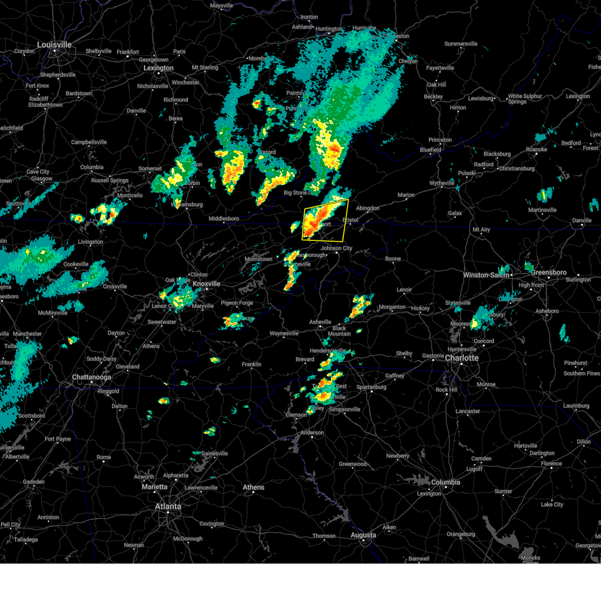 At 730 pm edt, a severe thunderstorm was located over weber city, or near gate city, moving east at 30 mph (radar indicated). Hazards include 60 mph wind gusts and half dollar size hail. Hail damage to vehicles is expected. expect wind damage to roofs, siding, and trees. locations impacted include, kingsport, bristol tn, gate city, weber city, walnut hill, spurgeon, colonial heights, oak grove, gray, and church hill. this includes the following highways, interstate 26 in tennessee between mile markers 1 and 10. Interstate 81 in tennessee between mile markers 54 and 75. At 730 pm edt, a severe thunderstorm was located over weber city, or near gate city, moving east at 30 mph (radar indicated). Hazards include 60 mph wind gusts and half dollar size hail. Hail damage to vehicles is expected. expect wind damage to roofs, siding, and trees. locations impacted include, kingsport, bristol tn, gate city, weber city, walnut hill, spurgeon, colonial heights, oak grove, gray, and church hill. this includes the following highways, interstate 26 in tennessee between mile markers 1 and 10. Interstate 81 in tennessee between mile markers 54 and 75.
|
| 9/24/2024 6:55 PM EDT |
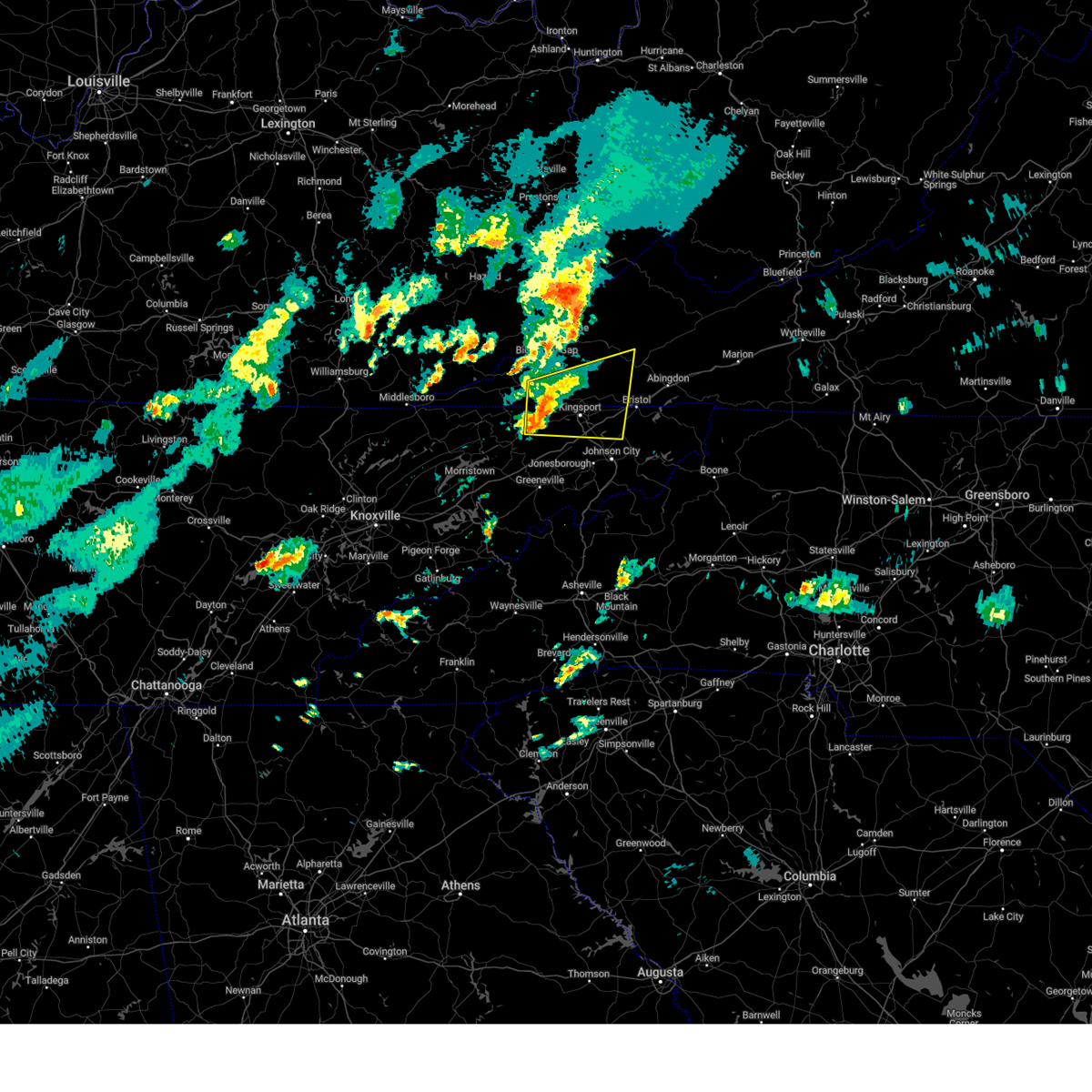 Svrmrx the national weather service in morristown has issued a * severe thunderstorm warning for, western sullivan county in east tennessee, northeastern hawkins county in east tennessee, north central washington county in east tennessee, eastern hancock county in east tennessee, southwestern russell county in southwestern virginia, eastern lee county in southwestern virginia, scott county in southwestern virginia, southwestern washington county in southwestern virginia, * until 745 pm edt. * at 655 pm edt, a severe thunderstorm was located 10 miles west of gate city, moving east at 30 mph (radar indicated). Hazards include 60 mph wind gusts and quarter size hail. Hail damage to vehicles is expected. Expect wind damage to roofs, siding, and trees. Svrmrx the national weather service in morristown has issued a * severe thunderstorm warning for, western sullivan county in east tennessee, northeastern hawkins county in east tennessee, north central washington county in east tennessee, eastern hancock county in east tennessee, southwestern russell county in southwestern virginia, eastern lee county in southwestern virginia, scott county in southwestern virginia, southwestern washington county in southwestern virginia, * until 745 pm edt. * at 655 pm edt, a severe thunderstorm was located 10 miles west of gate city, moving east at 30 mph (radar indicated). Hazards include 60 mph wind gusts and quarter size hail. Hail damage to vehicles is expected. Expect wind damage to roofs, siding, and trees.
|
| 9/24/2024 2:37 PM CDT |
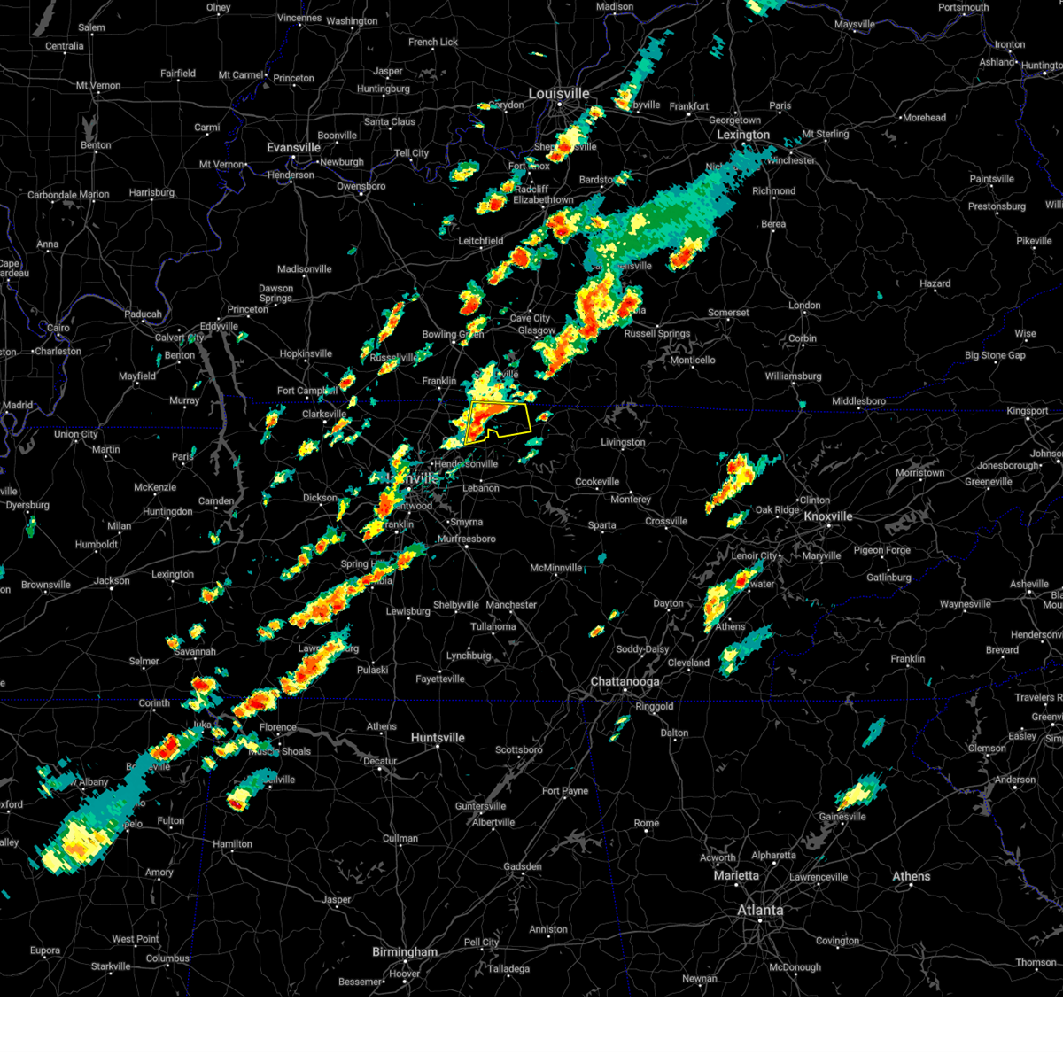 At 237 pm cdt, a severe thunderstorm was located over westmoreland, or 13 miles northwest of hartsville, moving northeast at 35 mph (radar indicated). Hazards include 60 mph wind gusts and quarter size hail. Hail damage to vehicles is expected. expect wind damage to roofs, siding, and trees. Locations impacted include, gallatin, lafayette, westmoreland, and bethpage. At 237 pm cdt, a severe thunderstorm was located over westmoreland, or 13 miles northwest of hartsville, moving northeast at 35 mph (radar indicated). Hazards include 60 mph wind gusts and quarter size hail. Hail damage to vehicles is expected. expect wind damage to roofs, siding, and trees. Locations impacted include, gallatin, lafayette, westmoreland, and bethpage.
|
| 9/24/2024 2:24 PM CDT |
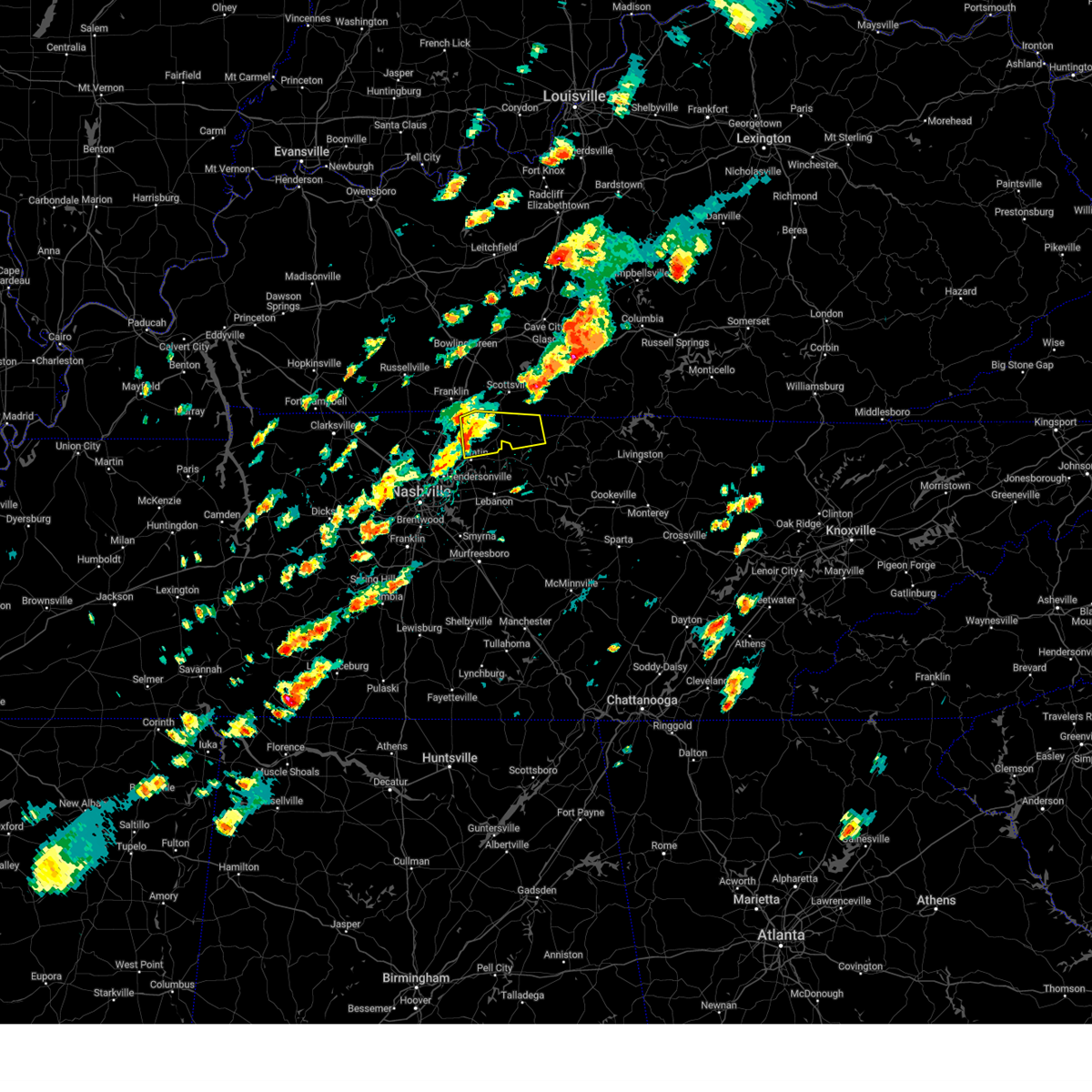 Svrohx the national weather service in nashville has issued a * severe thunderstorm warning for, northeastern sumner county in middle tennessee, western macon county in middle tennessee, * until 300 pm cdt. * at 223 pm cdt, a severe thunderstorm was located near portland, or 9 miles north of gallatin, moving northeast at 35 mph (radar indicated). Hazards include 60 mph wind gusts and quarter size hail. Hail damage to vehicles is expected. Expect wind damage to roofs, siding, and trees. Svrohx the national weather service in nashville has issued a * severe thunderstorm warning for, northeastern sumner county in middle tennessee, western macon county in middle tennessee, * until 300 pm cdt. * at 223 pm cdt, a severe thunderstorm was located near portland, or 9 miles north of gallatin, moving northeast at 35 mph (radar indicated). Hazards include 60 mph wind gusts and quarter size hail. Hail damage to vehicles is expected. Expect wind damage to roofs, siding, and trees.
|
| 9/24/2024 2:11 PM CDT |
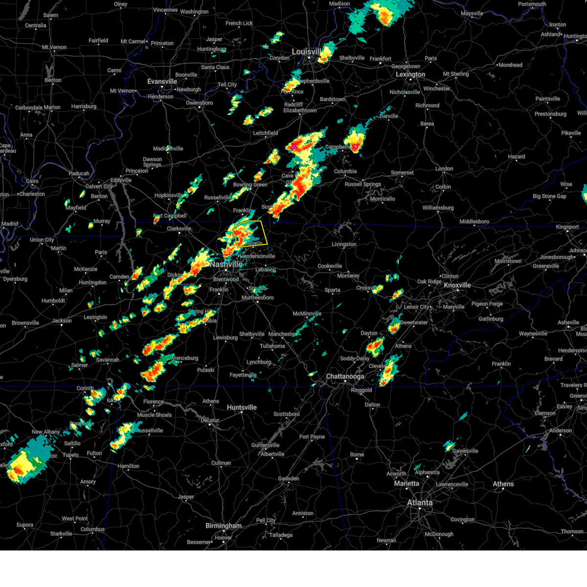 At 211 pm cdt, a severe thunderstorm was located near cross plains, or 12 miles northwest of gallatin, moving northeast at 35 mph (radar indicated). Hazards include 60 mph wind gusts and penny size hail. Expect damage to roofs, siding, and trees. locations impacted include, gallatin, white house, cross plains, portland, orlinda, mitchellville, cottontown, black jack, bethpage, and oak grove. This includes interstate 65 between mile markers 110 and 121. At 211 pm cdt, a severe thunderstorm was located near cross plains, or 12 miles northwest of gallatin, moving northeast at 35 mph (radar indicated). Hazards include 60 mph wind gusts and penny size hail. Expect damage to roofs, siding, and trees. locations impacted include, gallatin, white house, cross plains, portland, orlinda, mitchellville, cottontown, black jack, bethpage, and oak grove. This includes interstate 65 between mile markers 110 and 121.
|
| 9/24/2024 1:57 PM CDT |
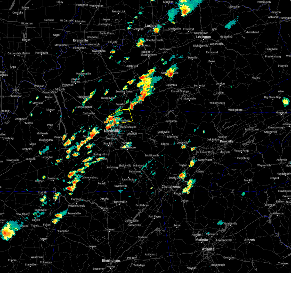 Svrohx the national weather service in nashville has issued a * severe thunderstorm warning for, sumner county in middle tennessee, eastern robertson county in middle tennessee, * until 230 pm cdt. * at 157 pm cdt, a severe thunderstorm was located near white house, or 7 miles east of springfield, moving northeast at 35 mph (radar indicated). Hazards include 60 mph wind gusts and penny size hail. expect damage to roofs, siding, and trees Svrohx the national weather service in nashville has issued a * severe thunderstorm warning for, sumner county in middle tennessee, eastern robertson county in middle tennessee, * until 230 pm cdt. * at 157 pm cdt, a severe thunderstorm was located near white house, or 7 miles east of springfield, moving northeast at 35 mph (radar indicated). Hazards include 60 mph wind gusts and penny size hail. expect damage to roofs, siding, and trees
|
| 8/16/2024 6:22 PM EDT |
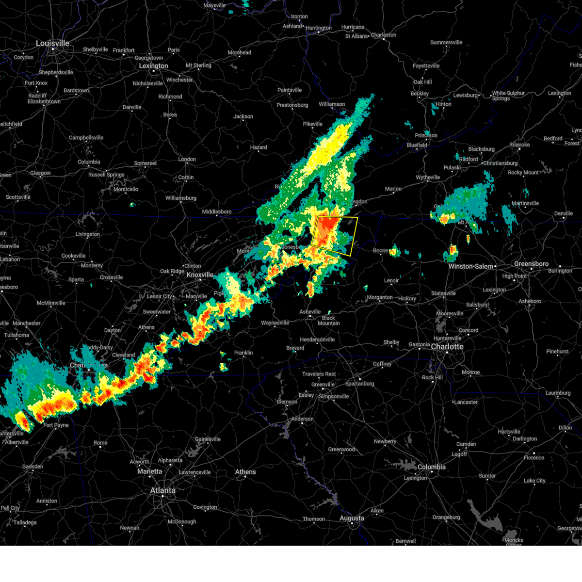 At 622 pm edt, a severe thunderstorm was located 7 miles northwest of elizabethton, moving east at 25 mph (trained weather spotters report damaging wind gusts and torrential rainfall). Hazards include 60 mph wind gusts and penny size hail. Expect damage to roofs, siding, and trees. locations impacted include, johnson city, kingsport, bristol tn, elizabethton, jonesborough, central, spurgeon, midway, pine crest, and gray. this includes the following highways, interstate 26 in tennessee between mile markers 12 and 27. Interstate 81 in tennessee between mile markers 60 and 75. At 622 pm edt, a severe thunderstorm was located 7 miles northwest of elizabethton, moving east at 25 mph (trained weather spotters report damaging wind gusts and torrential rainfall). Hazards include 60 mph wind gusts and penny size hail. Expect damage to roofs, siding, and trees. locations impacted include, johnson city, kingsport, bristol tn, elizabethton, jonesborough, central, spurgeon, midway, pine crest, and gray. this includes the following highways, interstate 26 in tennessee between mile markers 12 and 27. Interstate 81 in tennessee between mile markers 60 and 75.
|
| 8/16/2024 5:58 PM EDT |
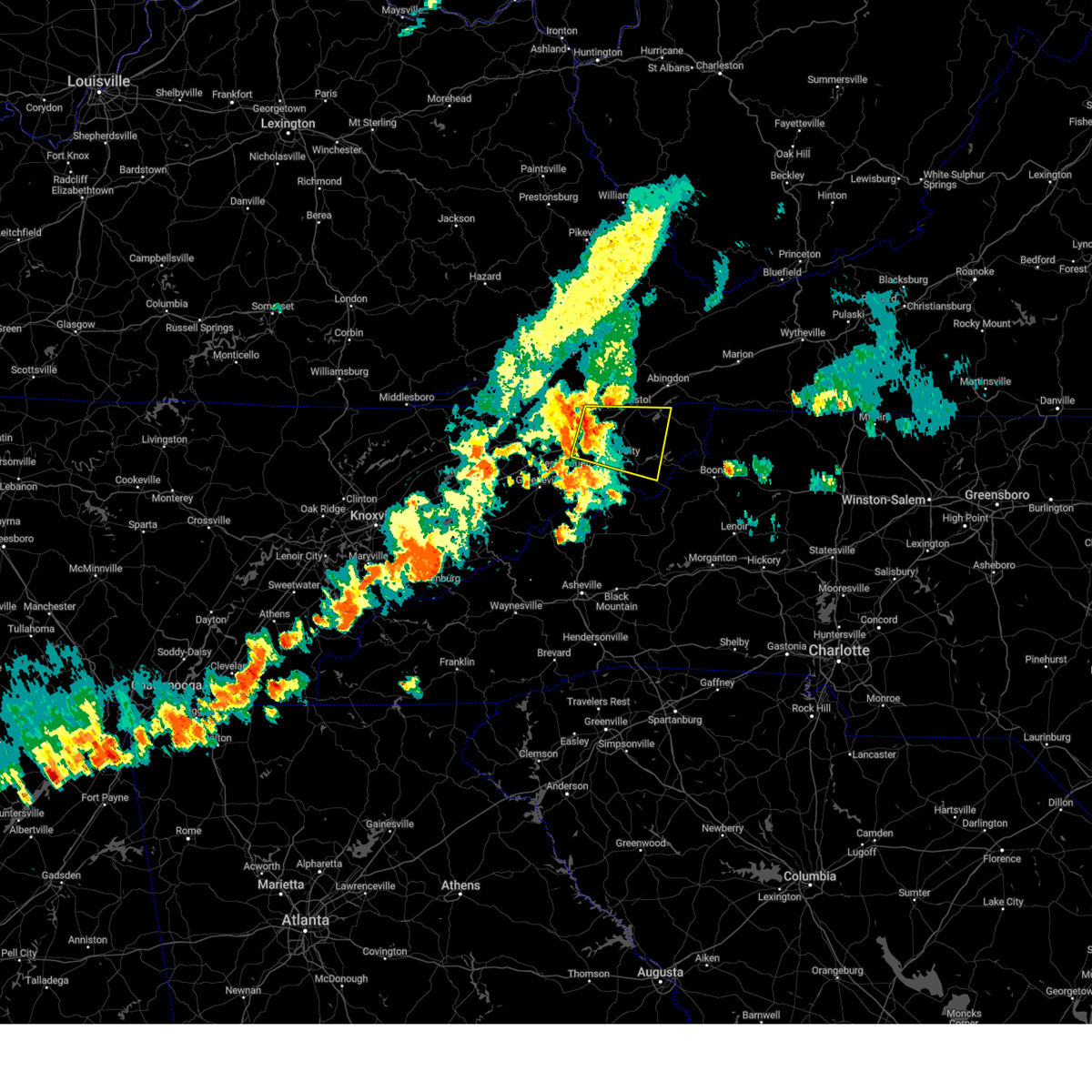 Svrmrx the national weather service in morristown has issued a * severe thunderstorm warning for, sullivan county in east tennessee, northern washington county in east tennessee, west central johnson county in east tennessee, carter county in east tennessee, * until 700 pm edt. * at 558 pm edt, a severe thunderstorm was located over spurgeon, or near kingsport, moving east at 25 mph (radar indicated). Hazards include 60 mph wind gusts and penny size hail. expect damage to roofs, siding, and trees Svrmrx the national weather service in morristown has issued a * severe thunderstorm warning for, sullivan county in east tennessee, northern washington county in east tennessee, west central johnson county in east tennessee, carter county in east tennessee, * until 700 pm edt. * at 558 pm edt, a severe thunderstorm was located over spurgeon, or near kingsport, moving east at 25 mph (radar indicated). Hazards include 60 mph wind gusts and penny size hail. expect damage to roofs, siding, and trees
|
| 7/30/2024 2:41 PM CDT |
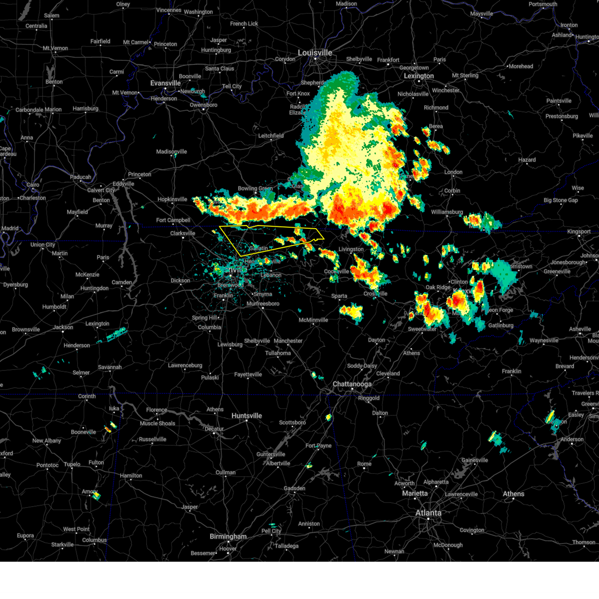 Svrohx the national weather service in nashville has issued a * severe thunderstorm warning for, sumner county in middle tennessee, northwestern clay county in middle tennessee, macon county in middle tennessee, northwestern trousdale county in middle tennessee, eastern robertson county in middle tennessee, * until 315 pm cdt. * at 241 pm cdt, severe thunderstorms were located along a line extending from 10 miles northwest of cross plains to 12 miles northwest of red boiling springs, moving southeast at 35 mph (radar indicated). Hazards include 60 mph wind gusts. expect damage to roofs, siding, and trees Svrohx the national weather service in nashville has issued a * severe thunderstorm warning for, sumner county in middle tennessee, northwestern clay county in middle tennessee, macon county in middle tennessee, northwestern trousdale county in middle tennessee, eastern robertson county in middle tennessee, * until 315 pm cdt. * at 241 pm cdt, severe thunderstorms were located along a line extending from 10 miles northwest of cross plains to 12 miles northwest of red boiling springs, moving southeast at 35 mph (radar indicated). Hazards include 60 mph wind gusts. expect damage to roofs, siding, and trees
|
| 7/30/2024 7:19 AM EDT |
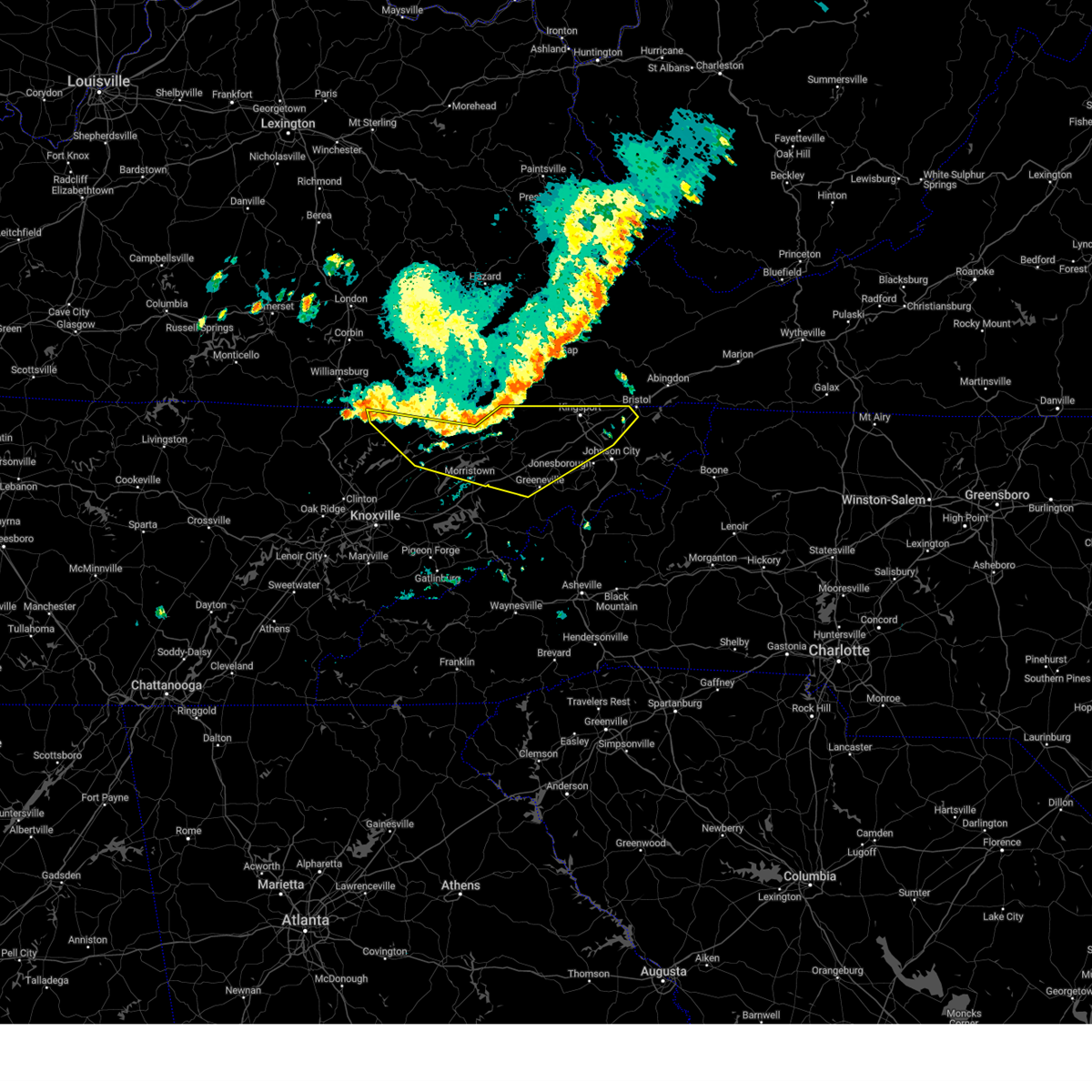 Svrmrx the national weather service in morristown has issued a * severe thunderstorm warning for, sullivan county in east tennessee, claiborne county in east tennessee, hawkins county in east tennessee, northern washington county in east tennessee, central hancock county in east tennessee, northern greene county in east tennessee, northeastern union county in east tennessee, grainger county in east tennessee, hamblen county in east tennessee, * until 815 am edt. * at 719 am edt, severe thunderstorms were located along a line extending from 10 miles southeast of pennington gap to 8 miles east of sneedville to 8 miles northwest of bean station to wilkerson, moving southeast at 30 mph (radar indicated). Hazards include 60 mph wind gusts. expect damage to roofs, siding, and trees Svrmrx the national weather service in morristown has issued a * severe thunderstorm warning for, sullivan county in east tennessee, claiborne county in east tennessee, hawkins county in east tennessee, northern washington county in east tennessee, central hancock county in east tennessee, northern greene county in east tennessee, northeastern union county in east tennessee, grainger county in east tennessee, hamblen county in east tennessee, * until 815 am edt. * at 719 am edt, severe thunderstorms were located along a line extending from 10 miles southeast of pennington gap to 8 miles east of sneedville to 8 miles northwest of bean station to wilkerson, moving southeast at 30 mph (radar indicated). Hazards include 60 mph wind gusts. expect damage to roofs, siding, and trees
|
| 7/5/2024 3:15 PM EDT |
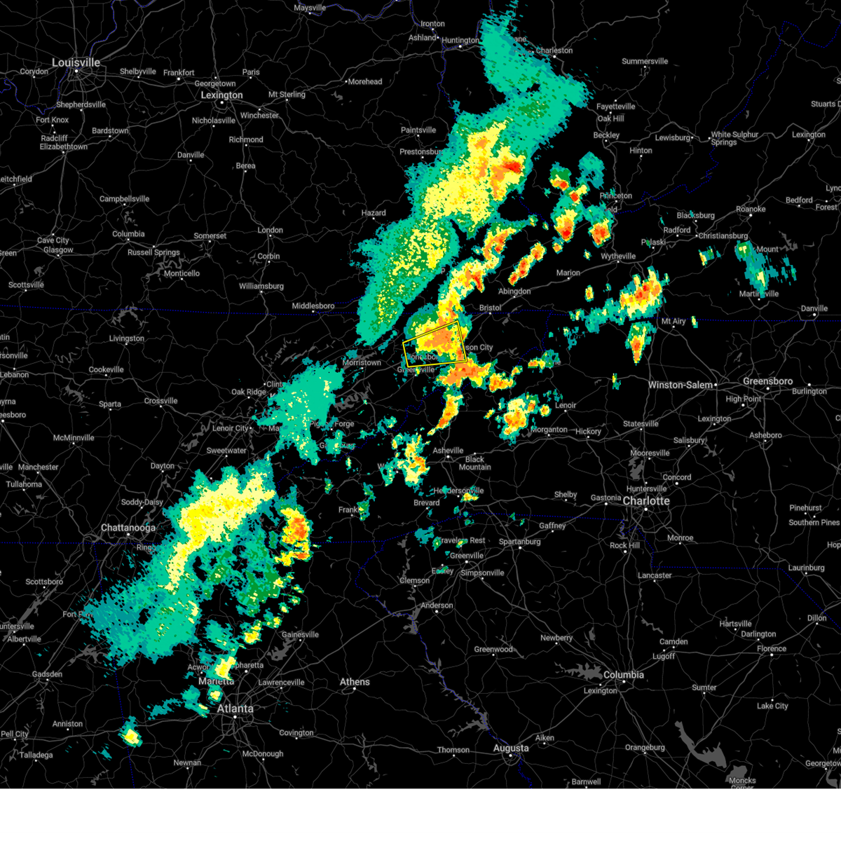 the severe thunderstorm warning has been cancelled and is no longer in effect the severe thunderstorm warning has been cancelled and is no longer in effect
|
| 7/5/2024 3:03 PM EDT |
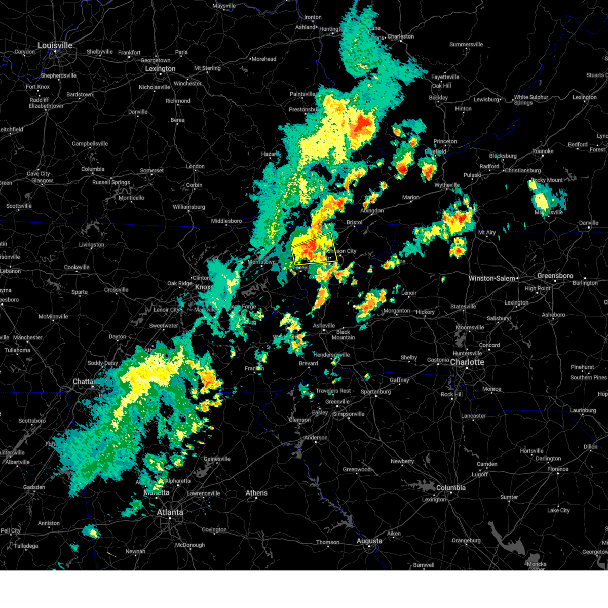 At 303 pm edt, a severe thunderstorm was located 11 miles west of jonesborough, or 14 miles southwest of kingsport, moving east at 30 mph (radar indicated). Hazards include 60 mph wind gusts. Expect damage to roofs, siding, and trees. locations impacted include, johnson city, kingsport, jonesborough, gray, spurgeon, midway, colonial heights, oak grove, baileyton, and leesburg. this includes the following highways, interstate 26 in tennessee between mile markers 4 and 17. Interstate 81 in tennessee between mile markers 31 and 61. At 303 pm edt, a severe thunderstorm was located 11 miles west of jonesborough, or 14 miles southwest of kingsport, moving east at 30 mph (radar indicated). Hazards include 60 mph wind gusts. Expect damage to roofs, siding, and trees. locations impacted include, johnson city, kingsport, jonesborough, gray, spurgeon, midway, colonial heights, oak grove, baileyton, and leesburg. this includes the following highways, interstate 26 in tennessee between mile markers 4 and 17. Interstate 81 in tennessee between mile markers 31 and 61.
|
| 7/5/2024 2:48 PM EDT |
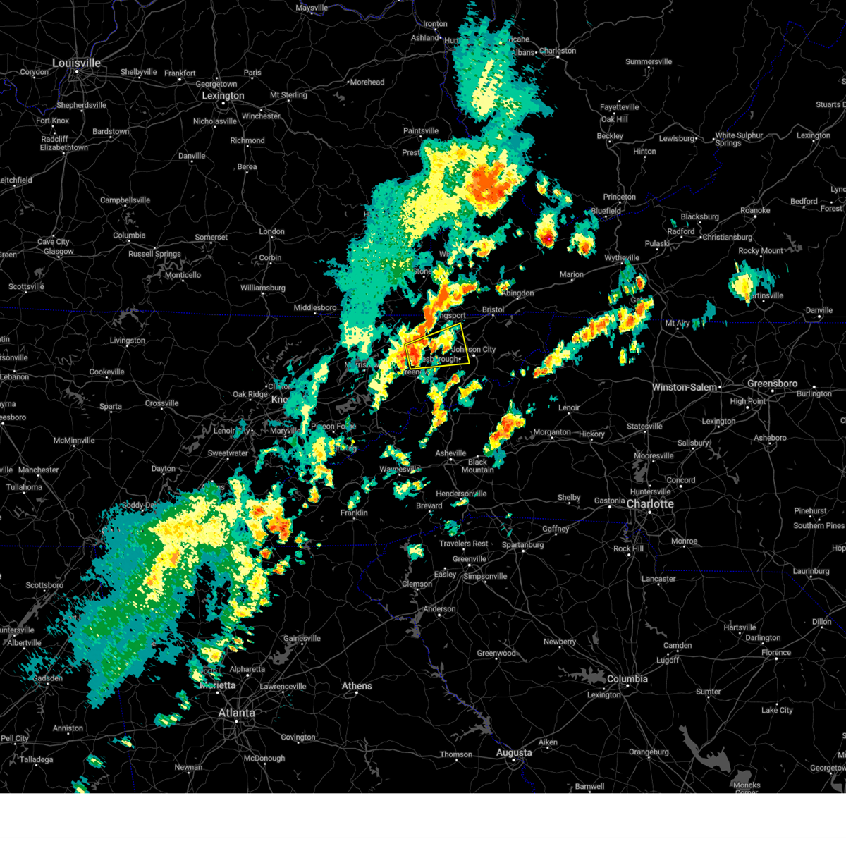 Svrmrx the national weather service in morristown has issued a * severe thunderstorm warning for, southwestern sullivan county in east tennessee, east central hawkins county in east tennessee, northwestern washington county in east tennessee, northeastern greene county in east tennessee, * until 330 pm edt. * at 248 pm edt, a severe thunderstorm was located 10 miles south of surgoinsville, or 10 miles north of greeneville, moving east at 30 mph (radar indicated). Hazards include 60 mph wind gusts and penny size hail. expect damage to roofs, siding, and trees Svrmrx the national weather service in morristown has issued a * severe thunderstorm warning for, southwestern sullivan county in east tennessee, east central hawkins county in east tennessee, northwestern washington county in east tennessee, northeastern greene county in east tennessee, * until 330 pm edt. * at 248 pm edt, a severe thunderstorm was located 10 miles south of surgoinsville, or 10 miles north of greeneville, moving east at 30 mph (radar indicated). Hazards include 60 mph wind gusts and penny size hail. expect damage to roofs, siding, and trees
|
| 6/26/2024 5:53 PM CDT |
 At 552 pm cdt, severe thunderstorms were located along a line extending from near portland to near hartsville, moving northeast at 30 mph (radar indicated). Hazards include 60 mph wind gusts. Expect damage to roofs, siding, and trees. locations impacted include, lafayette, hartsville, westmoreland, cross plains, portland, orlinda, mitchellville, bethpage, and oak grove. This includes interstate 65 between mile markers 113 and 120. At 552 pm cdt, severe thunderstorms were located along a line extending from near portland to near hartsville, moving northeast at 30 mph (radar indicated). Hazards include 60 mph wind gusts. Expect damage to roofs, siding, and trees. locations impacted include, lafayette, hartsville, westmoreland, cross plains, portland, orlinda, mitchellville, bethpage, and oak grove. This includes interstate 65 between mile markers 113 and 120.
|
| 6/26/2024 5:53 PM CDT |
 the severe thunderstorm warning has been cancelled and is no longer in effect the severe thunderstorm warning has been cancelled and is no longer in effect
|
| 6/26/2024 5:28 PM CDT |
 Svrohx the national weather service in nashville has issued a * severe thunderstorm warning for, sumner county in middle tennessee, northwestern wilson county in middle tennessee, macon county in middle tennessee, trousdale county in middle tennessee, northeastern robertson county in middle tennessee, * until 630 pm cdt. * at 527 pm cdt, severe thunderstorms were located along a line extending from cross plains to near lebanon, moving northeast at 35 mph. these storms have blown down trees and power lines across the nashville metro area (public). Hazards include 60 mph wind gusts. expect damage to roofs, siding, and trees Svrohx the national weather service in nashville has issued a * severe thunderstorm warning for, sumner county in middle tennessee, northwestern wilson county in middle tennessee, macon county in middle tennessee, trousdale county in middle tennessee, northeastern robertson county in middle tennessee, * until 630 pm cdt. * at 527 pm cdt, severe thunderstorms were located along a line extending from cross plains to near lebanon, moving northeast at 35 mph. these storms have blown down trees and power lines across the nashville metro area (public). Hazards include 60 mph wind gusts. expect damage to roofs, siding, and trees
|
| 5/26/2024 2:18 PM CDT |
 At 218 pm cdt, severe thunderstorms were located along a line extending from 7 miles southwest of westmoreland to near burns, moving east at 50 mph (radar indicated). Hazards include 60 mph wind gusts and nickel size hail. Expect damage to roofs, siding, and trees. locations impacted include, murfreesboro, franklin, gallatin, lebanon, ashland city, lafayette, hartsville, nashville, madison, hendersonville, smyrna, brentwood, la vergne, mount juliet, goodlettsville, millersville, nolensville, forest hills, oak hill, and belle meade. this includes the following highways, interstate 40 between mile markers 182 and 243. interstate 65 between mile markers 67 and 101. interstate 24 between mile markers 33 and 71. Interstate 840 between mile markers 56 and 76. At 218 pm cdt, severe thunderstorms were located along a line extending from 7 miles southwest of westmoreland to near burns, moving east at 50 mph (radar indicated). Hazards include 60 mph wind gusts and nickel size hail. Expect damage to roofs, siding, and trees. locations impacted include, murfreesboro, franklin, gallatin, lebanon, ashland city, lafayette, hartsville, nashville, madison, hendersonville, smyrna, brentwood, la vergne, mount juliet, goodlettsville, millersville, nolensville, forest hills, oak hill, and belle meade. this includes the following highways, interstate 40 between mile markers 182 and 243. interstate 65 between mile markers 67 and 101. interstate 24 between mile markers 33 and 71. Interstate 840 between mile markers 56 and 76.
|
| 5/26/2024 2:18 PM CDT |
 the severe thunderstorm warning has been cancelled and is no longer in effect the severe thunderstorm warning has been cancelled and is no longer in effect
|
| 5/26/2024 1:53 PM CDT |
 Svrohx the national weather service in nashville has issued a * severe thunderstorm warning for, davidson county in middle tennessee, northwestern rutherford county in middle tennessee, sumner county in middle tennessee, northern williamson county in middle tennessee, wilson county in middle tennessee, cheatham county in middle tennessee, western macon county in middle tennessee, trousdale county in middle tennessee, robertson county in middle tennessee, * until 300 pm cdt. * at 153 pm cdt, severe thunderstorms were located along a line extending from near springfield to 6 miles west of dickson, moving east at 50 mph (radar indicated). Hazards include 60 mph wind gusts and nickel size hail. expect damage to roofs, siding, and trees Svrohx the national weather service in nashville has issued a * severe thunderstorm warning for, davidson county in middle tennessee, northwestern rutherford county in middle tennessee, sumner county in middle tennessee, northern williamson county in middle tennessee, wilson county in middle tennessee, cheatham county in middle tennessee, western macon county in middle tennessee, trousdale county in middle tennessee, robertson county in middle tennessee, * until 300 pm cdt. * at 153 pm cdt, severe thunderstorms were located along a line extending from near springfield to 6 miles west of dickson, moving east at 50 mph (radar indicated). Hazards include 60 mph wind gusts and nickel size hail. expect damage to roofs, siding, and trees
|
| 5/26/2024 1:37 PM CDT |
 At 137 pm cdt, a severe thunderstorm was located near white house, or 7 miles east of springfield, moving east at 40 mph (radar indicated). Hazards include 60 mph wind gusts and quarter size hail. Hail damage to vehicles is expected. expect wind damage to roofs, siding, and trees. locations impacted include, springfield, white house, millersville, greenbrier, westmoreland, ridgetop, cross plains, portland, orlinda, mitchellville, bethpage, oak grove, and cottontown. This includes interstate 65 between mile markers 103 and 120. At 137 pm cdt, a severe thunderstorm was located near white house, or 7 miles east of springfield, moving east at 40 mph (radar indicated). Hazards include 60 mph wind gusts and quarter size hail. Hail damage to vehicles is expected. expect wind damage to roofs, siding, and trees. locations impacted include, springfield, white house, millersville, greenbrier, westmoreland, ridgetop, cross plains, portland, orlinda, mitchellville, bethpage, oak grove, and cottontown. This includes interstate 65 between mile markers 103 and 120.
|
| 5/26/2024 1:26 PM CDT |
 At 126 pm cdt, a severe thunderstorm was located near springfield, moving east at 40 mph (emergency management). Hazards include ping pong ball size hail and 60 mph wind gusts. People and animals outdoors will be injured. expect hail damage to roofs, siding, windows, and vehicles. expect wind damage to roofs, siding, and trees. locations impacted include, springfield, white house, millersville, greenbrier, coopertown, westmoreland, ridgetop, cross plains, portland, orlinda, mitchellville, bethpage, oak grove, and cottontown. This includes interstate 65 between mile markers 103 and 120. At 126 pm cdt, a severe thunderstorm was located near springfield, moving east at 40 mph (emergency management). Hazards include ping pong ball size hail and 60 mph wind gusts. People and animals outdoors will be injured. expect hail damage to roofs, siding, windows, and vehicles. expect wind damage to roofs, siding, and trees. locations impacted include, springfield, white house, millersville, greenbrier, coopertown, westmoreland, ridgetop, cross plains, portland, orlinda, mitchellville, bethpage, oak grove, and cottontown. This includes interstate 65 between mile markers 103 and 120.
|
| 5/26/2024 1:18 PM CDT |
 At 117 pm cdt, a severe thunderstorm was located near springfield, moving east at 40 mph (emergency management). Hazards include ping pong ball size hail and 60 mph wind gusts. People and animals outdoors will be injured. expect hail damage to roofs, siding, windows, and vehicles. expect wind damage to roofs, siding, and trees. locations impacted include, springfield, white house, millersville, greenbrier, coopertown, westmoreland, ridgetop, cross plains, portland, orlinda, adams, cedar hill, mitchellville, bethpage, oak grove, and cottontown. this includes the following highways, interstate 65 between mile markers 103 and 120. Interstate 24 between mile markers 18 and 26. At 117 pm cdt, a severe thunderstorm was located near springfield, moving east at 40 mph (emergency management). Hazards include ping pong ball size hail and 60 mph wind gusts. People and animals outdoors will be injured. expect hail damage to roofs, siding, windows, and vehicles. expect wind damage to roofs, siding, and trees. locations impacted include, springfield, white house, millersville, greenbrier, coopertown, westmoreland, ridgetop, cross plains, portland, orlinda, adams, cedar hill, mitchellville, bethpage, oak grove, and cottontown. this includes the following highways, interstate 65 between mile markers 103 and 120. Interstate 24 between mile markers 18 and 26.
|
| 5/26/2024 1:11 PM CDT |
 Svrohx the national weather service in nashville has issued a * severe thunderstorm warning for, northern sumner county in middle tennessee, robertson county in middle tennessee, * until 215 pm cdt. * at 110 pm cdt, a severe thunderstorm was located 7 miles north of coopertown, or 8 miles west of springfield, moving east at 40 mph (radar indicated). Hazards include 60 mph wind gusts and quarter size hail. Hail damage to vehicles is expected. Expect wind damage to roofs, siding, and trees. Svrohx the national weather service in nashville has issued a * severe thunderstorm warning for, northern sumner county in middle tennessee, robertson county in middle tennessee, * until 215 pm cdt. * at 110 pm cdt, a severe thunderstorm was located 7 miles north of coopertown, or 8 miles west of springfield, moving east at 40 mph (radar indicated). Hazards include 60 mph wind gusts and quarter size hail. Hail damage to vehicles is expected. Expect wind damage to roofs, siding, and trees.
|
| 5/26/2024 10:17 AM CDT |
 At 1017 am cdt, severe thunderstorms were located along a line extending from near scottsville to near portland to near greenbrier, moving east at 65 mph (radar indicated). Hazards include 60 mph wind gusts and nickel size hail. Expect damage to roofs, siding, and trees. locations impacted include, gallatin, lebanon, springfield, lafayette, carthage, hartsville, hendersonville, mount juliet, goodlettsville, white house, millersville, greenbrier, coopertown, westmoreland, ridgetop, cross plains, red boiling springs, portland, pleasant view, and south carthage. this includes the following highways, interstate 65 between mile markers 98 and 121. Interstate 24 between mile markers 18 and 28. At 1017 am cdt, severe thunderstorms were located along a line extending from near scottsville to near portland to near greenbrier, moving east at 65 mph (radar indicated). Hazards include 60 mph wind gusts and nickel size hail. Expect damage to roofs, siding, and trees. locations impacted include, gallatin, lebanon, springfield, lafayette, carthage, hartsville, hendersonville, mount juliet, goodlettsville, white house, millersville, greenbrier, coopertown, westmoreland, ridgetop, cross plains, red boiling springs, portland, pleasant view, and south carthage. this includes the following highways, interstate 65 between mile markers 98 and 121. Interstate 24 between mile markers 18 and 28.
|
| 5/26/2024 10:17 AM CDT |
 the severe thunderstorm warning has been cancelled and is no longer in effect the severe thunderstorm warning has been cancelled and is no longer in effect
|
| 5/26/2024 10:10 AM CDT |
 At 1010 am cdt, a severe thunderstorm capable of producing a tornado was located 7 miles northwest of westmoreland, or 17 miles northwest of lafayette, moving east at 60 mph (radar indicated rotation). Hazards include tornado. Flying debris will be dangerous to those caught without shelter. mobile homes will be damaged or destroyed. damage to roofs, windows, and vehicles will occur. tree damage is likely. Locations impacted include, westmoreland. At 1010 am cdt, a severe thunderstorm capable of producing a tornado was located 7 miles northwest of westmoreland, or 17 miles northwest of lafayette, moving east at 60 mph (radar indicated rotation). Hazards include tornado. Flying debris will be dangerous to those caught without shelter. mobile homes will be damaged or destroyed. damage to roofs, windows, and vehicles will occur. tree damage is likely. Locations impacted include, westmoreland.
|
| 5/26/2024 10:06 AM CDT |
 Torohx the national weather service in nashville has issued a * tornado warning for, northeastern sumner county in middle tennessee, northwestern macon county in middle tennessee, * until 1030 am cdt. * at 1005 am cdt, a severe thunderstorm capable of producing a tornado was located 8 miles northeast of portland, or 18 miles north of gallatin, moving east at 60 mph (radar indicated rotation). Hazards include tornado. Flying debris will be dangerous to those caught without shelter. mobile homes will be damaged or destroyed. damage to roofs, windows, and vehicles will occur. tree damage is likely. This tornadic thunderstorm will remain over mainly rural areas of northeastern sumner and northwestern macon counties. Torohx the national weather service in nashville has issued a * tornado warning for, northeastern sumner county in middle tennessee, northwestern macon county in middle tennessee, * until 1030 am cdt. * at 1005 am cdt, a severe thunderstorm capable of producing a tornado was located 8 miles northeast of portland, or 18 miles north of gallatin, moving east at 60 mph (radar indicated rotation). Hazards include tornado. Flying debris will be dangerous to those caught without shelter. mobile homes will be damaged or destroyed. damage to roofs, windows, and vehicles will occur. tree damage is likely. This tornadic thunderstorm will remain over mainly rural areas of northeastern sumner and northwestern macon counties.
|
| 5/26/2024 10:01 AM CDT |
 the severe thunderstorm warning has been cancelled and is no longer in effect the severe thunderstorm warning has been cancelled and is no longer in effect
|
| 5/26/2024 10:01 AM CDT |
 At 1000 am cdt, severe thunderstorms were located along a line extending from 12 miles north of portland to near white house to 9 miles southeast of clarksville, moving east at 65 mph (radar indicated). Hazards include 70 mph wind gusts and nickel size hail. Expect considerable tree damage. damage is likely to mobile homes, roofs, and outbuildings. locations impacted include, clarksville, gallatin, lebanon, springfield, ashland city, lafayette, carthage, hartsville, madison, hendersonville, mount juliet, goodlettsville, white house, millersville, greenbrier, coopertown, lakewood, westmoreland, ridgetop, and cross plains. this includes the following highways, interstate 65 between mile markers 92 and 121. Interstate 24 between mile markers 1 and 42. At 1000 am cdt, severe thunderstorms were located along a line extending from 12 miles north of portland to near white house to 9 miles southeast of clarksville, moving east at 65 mph (radar indicated). Hazards include 70 mph wind gusts and nickel size hail. Expect considerable tree damage. damage is likely to mobile homes, roofs, and outbuildings. locations impacted include, clarksville, gallatin, lebanon, springfield, ashland city, lafayette, carthage, hartsville, madison, hendersonville, mount juliet, goodlettsville, white house, millersville, greenbrier, coopertown, lakewood, westmoreland, ridgetop, and cross plains. this includes the following highways, interstate 65 between mile markers 92 and 121. Interstate 24 between mile markers 1 and 42.
|
| 5/26/2024 9:51 AM CDT |
 Svrohx the national weather service in nashville has issued a * severe thunderstorm warning for, smith county in middle tennessee, northern davidson county in middle tennessee, northeastern dickson county in middle tennessee, montgomery county in middle tennessee, sumner county in middle tennessee, southeastern stewart county in middle tennessee, northern wilson county in middle tennessee, northeastern houston county in middle tennessee, northern cheatham county in middle tennessee, macon county in middle tennessee, trousdale county in middle tennessee, robertson county in middle tennessee, * until 1045 am cdt. * at 951 am cdt, severe thunderstorms were located along a line extending from 12 miles north of cross plains to near coopertown to 13 miles northeast of erin, moving east at 65 mph (radar indicated). Hazards include 70 mph wind gusts and nickel size hail. Expect considerable tree damage. Damage is likely to mobile homes, roofs, and outbuildings. Svrohx the national weather service in nashville has issued a * severe thunderstorm warning for, smith county in middle tennessee, northern davidson county in middle tennessee, northeastern dickson county in middle tennessee, montgomery county in middle tennessee, sumner county in middle tennessee, southeastern stewart county in middle tennessee, northern wilson county in middle tennessee, northeastern houston county in middle tennessee, northern cheatham county in middle tennessee, macon county in middle tennessee, trousdale county in middle tennessee, robertson county in middle tennessee, * until 1045 am cdt. * at 951 am cdt, severe thunderstorms were located along a line extending from 12 miles north of cross plains to near coopertown to 13 miles northeast of erin, moving east at 65 mph (radar indicated). Hazards include 70 mph wind gusts and nickel size hail. Expect considerable tree damage. Damage is likely to mobile homes, roofs, and outbuildings.
|
| 5/9/2024 1:59 AM CDT |
 The storm which prompted the warning has weakened below severe limits, and no longer poses an immediate threat to life or property. therefore, the warning will be allowed to expire. however, small hail and gusty winds are still possible with this thunderstorm. a tornado watch remains in effect until 300 am cdt for middle tennessee. The storm which prompted the warning has weakened below severe limits, and no longer poses an immediate threat to life or property. therefore, the warning will be allowed to expire. however, small hail and gusty winds are still possible with this thunderstorm. a tornado watch remains in effect until 300 am cdt for middle tennessee.
|
| 5/9/2024 1:46 AM CDT |
 At 145 am cdt, a severe thunderstorm was located over westmoreland, or 14 miles west of lafayette, moving east at 50 mph (radar indicated). Hazards include 60 mph wind gusts and quarter size hail. Hail damage to vehicles is expected. expect wind damage to roofs, siding, and trees. Locations impacted include, lafayette, westmoreland, oak grove, and bethpage. At 145 am cdt, a severe thunderstorm was located over westmoreland, or 14 miles west of lafayette, moving east at 50 mph (radar indicated). Hazards include 60 mph wind gusts and quarter size hail. Hail damage to vehicles is expected. expect wind damage to roofs, siding, and trees. Locations impacted include, lafayette, westmoreland, oak grove, and bethpage.
|
| 5/9/2024 1:46 AM CDT |
 the severe thunderstorm warning has been cancelled and is no longer in effect the severe thunderstorm warning has been cancelled and is no longer in effect
|
| 5/9/2024 1:27 AM CDT |
 Svrohx the national weather service in nashville has issued a * severe thunderstorm warning for, northern sumner county in middle tennessee, macon county in middle tennessee, northeastern robertson county in middle tennessee, * until 200 am cdt. * at 126 am cdt, a severe thunderstorm was located near portland, or 16 miles north of gallatin, moving east at 50 mph (radar indicated). Hazards include 60 mph wind gusts and quarter size hail. Hail damage to vehicles is expected. Expect wind damage to roofs, siding, and trees. Svrohx the national weather service in nashville has issued a * severe thunderstorm warning for, northern sumner county in middle tennessee, macon county in middle tennessee, northeastern robertson county in middle tennessee, * until 200 am cdt. * at 126 am cdt, a severe thunderstorm was located near portland, or 16 miles north of gallatin, moving east at 50 mph (radar indicated). Hazards include 60 mph wind gusts and quarter size hail. Hail damage to vehicles is expected. Expect wind damage to roofs, siding, and trees.
|
| 5/8/2024 4:33 PM CDT |
 At 432 pm cdt, a severe thunderstorm was located over westmoreland, or 10 miles west of lafayette, moving east at 30 mph (radar indicated). Hazards include 60 mph wind gusts and quarter size hail. Hail damage to vehicles is expected. expect wind damage to roofs, siding, and trees. Locations impacted include, westmoreland and oak grove. At 432 pm cdt, a severe thunderstorm was located over westmoreland, or 10 miles west of lafayette, moving east at 30 mph (radar indicated). Hazards include 60 mph wind gusts and quarter size hail. Hail damage to vehicles is expected. expect wind damage to roofs, siding, and trees. Locations impacted include, westmoreland and oak grove.
|
| 5/8/2024 4:15 PM CDT |
 At 415 pm cdt, a severe thunderstorm was located near westmoreland, or 13 miles northeast of gallatin, moving east at 30 mph (radar indicated). Hazards include 60 mph wind gusts and quarter size hail. Hail damage to vehicles is expected. expect wind damage to roofs, siding, and trees. Locations impacted include, westmoreland, oak grove, and bethpage. At 415 pm cdt, a severe thunderstorm was located near westmoreland, or 13 miles northeast of gallatin, moving east at 30 mph (radar indicated). Hazards include 60 mph wind gusts and quarter size hail. Hail damage to vehicles is expected. expect wind damage to roofs, siding, and trees. Locations impacted include, westmoreland, oak grove, and bethpage.
|
| 5/8/2024 3:58 PM CDT |
 Svrohx the national weather service in nashville has issued a * severe thunderstorm warning for, northeastern sumner county in middle tennessee, northwestern macon county in middle tennessee, * until 445 pm cdt. * at 357 pm cdt, a severe thunderstorm was located near portland, or 11 miles north of gallatin, moving east at 25 mph (radar indicated). Hazards include 60 mph wind gusts and half dollar size hail. Hail damage to vehicles is expected. Expect wind damage to roofs, siding, and trees. Svrohx the national weather service in nashville has issued a * severe thunderstorm warning for, northeastern sumner county in middle tennessee, northwestern macon county in middle tennessee, * until 445 pm cdt. * at 357 pm cdt, a severe thunderstorm was located near portland, or 11 miles north of gallatin, moving east at 25 mph (radar indicated). Hazards include 60 mph wind gusts and half dollar size hail. Hail damage to vehicles is expected. Expect wind damage to roofs, siding, and trees.
|
| 5/8/2024 6:27 AM CDT |
 Svrohx the national weather service in nashville has issued a * severe thunderstorm warning for, northeastern sumner county in middle tennessee, macon county in middle tennessee, * until 700 am cdt. * at 627 am cdt, a severe thunderstorm was located near westmoreland, or 13 miles northwest of lafayette, moving east at 40 mph (radar indicated). Hazards include 60 mph wind gusts and nickel size hail. expect damage to roofs, siding, and trees Svrohx the national weather service in nashville has issued a * severe thunderstorm warning for, northeastern sumner county in middle tennessee, macon county in middle tennessee, * until 700 am cdt. * at 627 am cdt, a severe thunderstorm was located near westmoreland, or 13 miles northwest of lafayette, moving east at 40 mph (radar indicated). Hazards include 60 mph wind gusts and nickel size hail. expect damage to roofs, siding, and trees
|
| 2/28/2024 1:08 PM EST |
 At 107 pm est, severe thunderstorms were located along a line extending from near walnut hill to 6 miles east of russellville, moving east at 40 mph (radar indicated). Hazards include 60 mph wind gusts. Expect damage to roofs, siding, and trees. locations impacted include, johnson city, kingsport, bristol tn, bristol va, greeneville, abingdon, rogersville, jonesborough, surgoinsville, and weber city. this includes the following highways, interstate 26 in tennessee between mile markers 1 and 21. interstate 81 in tennessee between mile markers 21 and 75. Interstate 81 in virginia between mile markers 1 and 22. At 107 pm est, severe thunderstorms were located along a line extending from near walnut hill to 6 miles east of russellville, moving east at 40 mph (radar indicated). Hazards include 60 mph wind gusts. Expect damage to roofs, siding, and trees. locations impacted include, johnson city, kingsport, bristol tn, bristol va, greeneville, abingdon, rogersville, jonesborough, surgoinsville, and weber city. this includes the following highways, interstate 26 in tennessee between mile markers 1 and 21. interstate 81 in tennessee between mile markers 21 and 75. Interstate 81 in virginia between mile markers 1 and 22.
|
| 2/28/2024 12:39 PM EST |
 Svrmrx the national weather service in morristown has issued a * severe thunderstorm warning for, sullivan county in east tennessee, hawkins county in east tennessee, northern washington county in east tennessee, central hancock county in east tennessee, northern greene county in east tennessee, northeastern grainger county in east tennessee, west central carter county in east tennessee, northeastern hamblen county in east tennessee, southern russell county in southwestern virginia, the city of bristol in southwestern virginia, southeastern scott county in southwestern virginia, southwestern washington county in southwestern virginia, * until 130 pm est. * at 1238 pm est, severe thunderstorms were located along a line extending from 6 miles northwest of kingsport to near rutledge, moving east at 40 mph (radar indicated). Hazards include 60 mph wind gusts. expect damage to roofs, siding, and trees Svrmrx the national weather service in morristown has issued a * severe thunderstorm warning for, sullivan county in east tennessee, hawkins county in east tennessee, northern washington county in east tennessee, central hancock county in east tennessee, northern greene county in east tennessee, northeastern grainger county in east tennessee, west central carter county in east tennessee, northeastern hamblen county in east tennessee, southern russell county in southwestern virginia, the city of bristol in southwestern virginia, southeastern scott county in southwestern virginia, southwestern washington county in southwestern virginia, * until 130 pm est. * at 1238 pm est, severe thunderstorms were located along a line extending from 6 miles northwest of kingsport to near rutledge, moving east at 40 mph (radar indicated). Hazards include 60 mph wind gusts. expect damage to roofs, siding, and trees
|
| 8/14/2023 11:56 PM EDT |
 At 1155 pm edt, a severe thunderstorm was located 8 miles west of greeneville, moving east at 50 mph (radar indicated). Hazards include 60 mph wind gusts and penny size hail. expect damage to roofs, siding, and trees At 1155 pm edt, a severe thunderstorm was located 8 miles west of greeneville, moving east at 50 mph (radar indicated). Hazards include 60 mph wind gusts and penny size hail. expect damage to roofs, siding, and trees
|
| 8/14/2023 10:09 PM EDT |
 At 1009 pm edt, a severe thunderstorm capable of producing a tornado was located over colonial heights, or near kingsport, moving east at 30 mph (radar indicated rotation). Hazards include tornado and quarter size hail. Flying debris will be dangerous to those caught without shelter. mobile homes will be damaged or destroyed. damage to roofs, windows, and vehicles will occur. tree damage is likely. this dangerous storm will be near, kingsport, colonial heights, gray, oak grove, and spurgeon around 1015 pm edt. bristol tn around 1025 pm edt. walnut hill around 1035 pm edt. other locations impacted by this tornadic thunderstorm include hunter, sullivan gardens, fall branch, rocky mount state park, morril`s cave, bluff city, warriors path state park, tri-city airport, blountville, and bays mountain park. this includes the following highways, interstate 26 in tennessee between mile markers 2 and 15. Interstate 81 in tennessee between mile markers 50 and 73. At 1009 pm edt, a severe thunderstorm capable of producing a tornado was located over colonial heights, or near kingsport, moving east at 30 mph (radar indicated rotation). Hazards include tornado and quarter size hail. Flying debris will be dangerous to those caught without shelter. mobile homes will be damaged or destroyed. damage to roofs, windows, and vehicles will occur. tree damage is likely. this dangerous storm will be near, kingsport, colonial heights, gray, oak grove, and spurgeon around 1015 pm edt. bristol tn around 1025 pm edt. walnut hill around 1035 pm edt. other locations impacted by this tornadic thunderstorm include hunter, sullivan gardens, fall branch, rocky mount state park, morril`s cave, bluff city, warriors path state park, tri-city airport, blountville, and bays mountain park. this includes the following highways, interstate 26 in tennessee between mile markers 2 and 15. Interstate 81 in tennessee between mile markers 50 and 73.
|
| 8/14/2023 9:50 PM EDT |
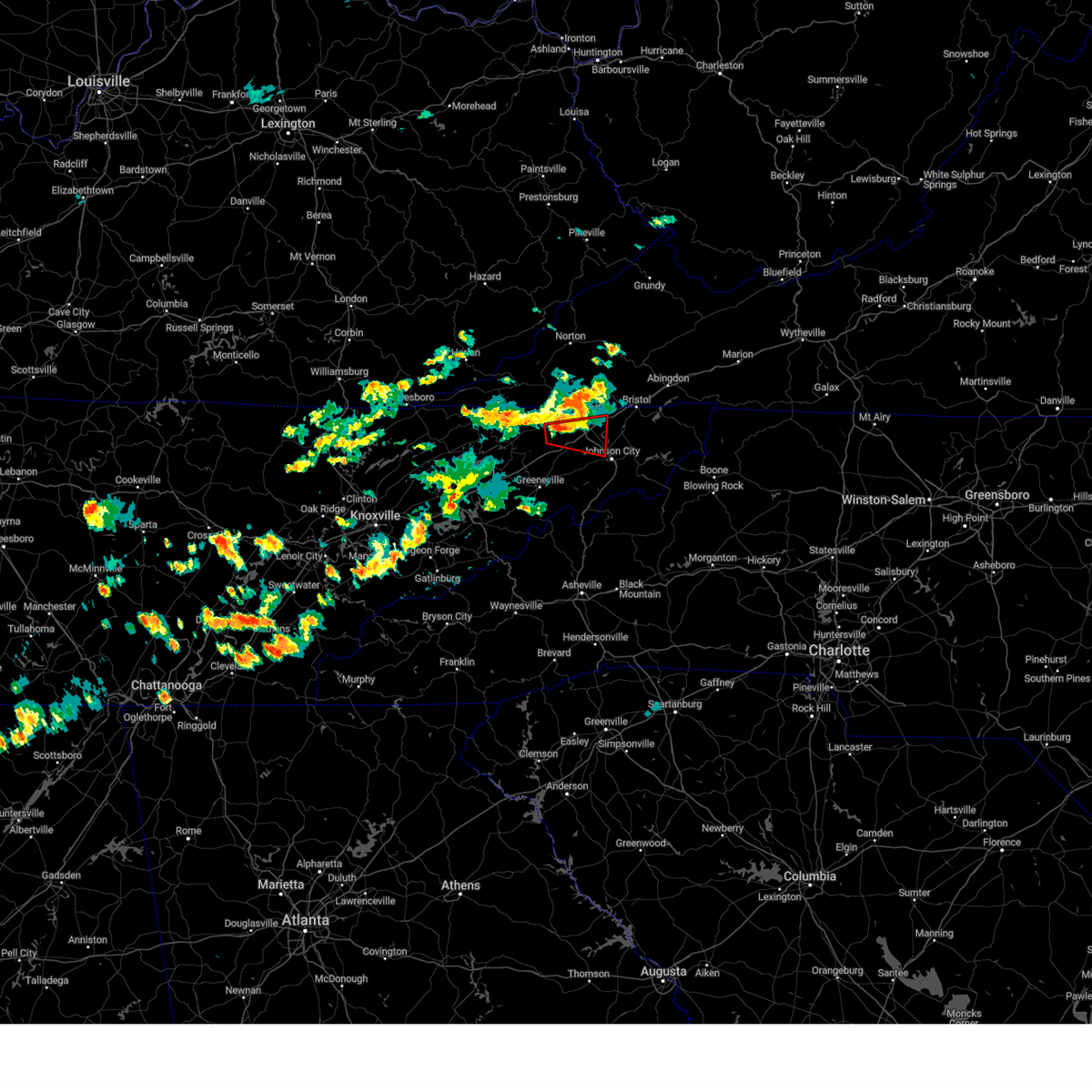 At 950 pm edt, a severe thunderstorm capable of producing a tornado was located 7 miles east of surgoinsville, or 10 miles southwest of kingsport, moving east at 25 mph (radar indicated rotation). Hazards include tornado and quarter size hail. Flying debris will be dangerous to those caught without shelter. mobile homes will be damaged or destroyed. damage to roofs, windows, and vehicles will occur. tree damage is likely. this dangerous storm will be near, kingsport around 955 pm edt. colonial heights around 1005 pm edt. johnson city around 1010 pm edt. gray and spurgeon around 1015 pm edt. oak grove around 1020 pm edt. other locations impacted by this tornadic thunderstorm include sullivan gardens, fall branch, warriors path state park, bays mountain park, tri-city airport, and church hill. this includes the following highways, interstate 26 in tennessee between mile markers 3 and 18. Interstate 81 in tennessee between mile markers 47 and 66. At 950 pm edt, a severe thunderstorm capable of producing a tornado was located 7 miles east of surgoinsville, or 10 miles southwest of kingsport, moving east at 25 mph (radar indicated rotation). Hazards include tornado and quarter size hail. Flying debris will be dangerous to those caught without shelter. mobile homes will be damaged or destroyed. damage to roofs, windows, and vehicles will occur. tree damage is likely. this dangerous storm will be near, kingsport around 955 pm edt. colonial heights around 1005 pm edt. johnson city around 1010 pm edt. gray and spurgeon around 1015 pm edt. oak grove around 1020 pm edt. other locations impacted by this tornadic thunderstorm include sullivan gardens, fall branch, warriors path state park, bays mountain park, tri-city airport, and church hill. this includes the following highways, interstate 26 in tennessee between mile markers 3 and 18. Interstate 81 in tennessee between mile markers 47 and 66.
|
| 8/14/2023 9:45 PM EDT |
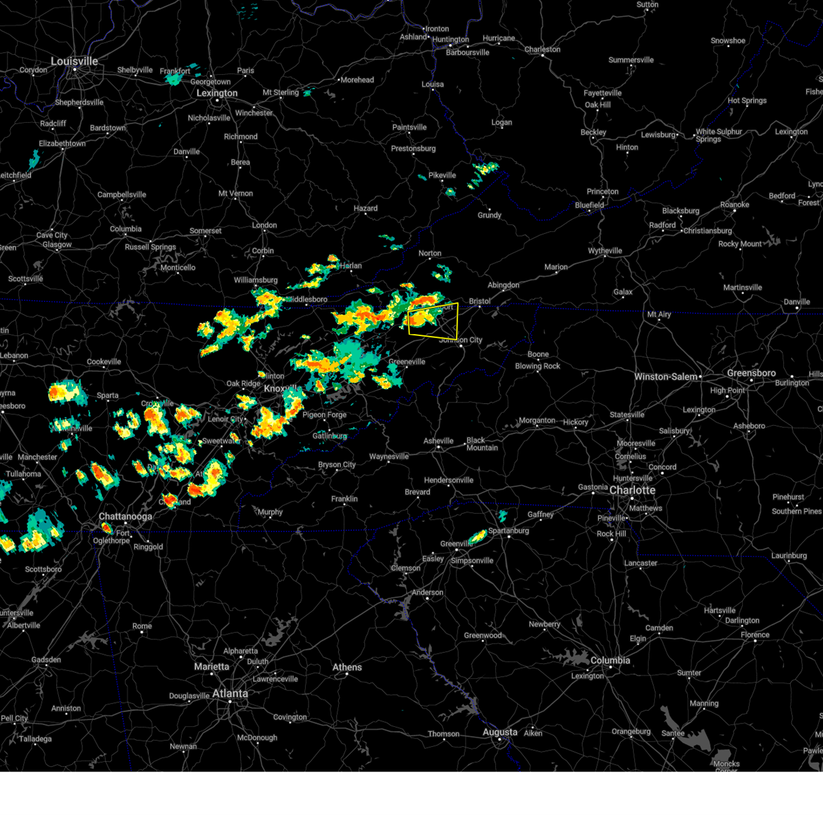 At 945 pm edt, a severe thunderstorm was located 7 miles east of surgoinsville, or 10 miles west of kingsport, moving east at 25 mph (radar indicated). Hazards include 60 mph wind gusts and nickel size hail. expect damage to roofs, siding, and trees At 945 pm edt, a severe thunderstorm was located 7 miles east of surgoinsville, or 10 miles west of kingsport, moving east at 25 mph (radar indicated). Hazards include 60 mph wind gusts and nickel size hail. expect damage to roofs, siding, and trees
|
| 8/7/2023 2:09 PM EDT |
 At 208 pm edt, a severe thunderstorm was located 7 miles southwest of greeneville, moving east at 45 mph (radar indicated). Hazards include 60 mph wind gusts and quarter size hail. Hail damage to vehicles is expected. Expect wind damage to roofs, siding, and trees. At 208 pm edt, a severe thunderstorm was located 7 miles southwest of greeneville, moving east at 45 mph (radar indicated). Hazards include 60 mph wind gusts and quarter size hail. Hail damage to vehicles is expected. Expect wind damage to roofs, siding, and trees.
|
| 7/29/2023 5:17 PM EDT |
 At 515 pm edt, a severe thunderstorm was located near lebanon, moving east at 20 mph (radar indicated). Hazards include 60 mph wind gusts and quarter size hail. Hail damage to vehicles is expected. expect wind damage to roofs, siding, and trees. locations impacted include, johnson city, kingsport, bristol tn, bristol va, abingdon, lebanon, mountain city, gate city, weber city and spurgeon. this includes the following highways, interstate 26 in tennessee between mile markers 1 and 17. interstate 81 in tennessee between mile markers 40 and 75. interstate 81 in virginia between mile markers 1 and 34. hail threat, radar indicated max hail size, 1. 00 in wind threat, radar indicated max wind gust, 60 mph. At 515 pm edt, a severe thunderstorm was located near lebanon, moving east at 20 mph (radar indicated). Hazards include 60 mph wind gusts and quarter size hail. Hail damage to vehicles is expected. expect wind damage to roofs, siding, and trees. locations impacted include, johnson city, kingsport, bristol tn, bristol va, abingdon, lebanon, mountain city, gate city, weber city and spurgeon. this includes the following highways, interstate 26 in tennessee between mile markers 1 and 17. interstate 81 in tennessee between mile markers 40 and 75. interstate 81 in virginia between mile markers 1 and 34. hail threat, radar indicated max hail size, 1. 00 in wind threat, radar indicated max wind gust, 60 mph.
|
| 7/29/2023 4:53 PM EDT |
 At 452 pm edt, a severe thunderstorm was located near lebanon, moving east at 20 mph (radar indicated). Hazards include 60 mph wind gusts and quarter size hail. Hail damage to vehicles is expected. Expect wind damage to roofs, siding, and trees. At 452 pm edt, a severe thunderstorm was located near lebanon, moving east at 20 mph (radar indicated). Hazards include 60 mph wind gusts and quarter size hail. Hail damage to vehicles is expected. Expect wind damage to roofs, siding, and trees.
|
| 7/29/2023 3:31 PM CDT |
 At 331 pm cdt, a severe thunderstorm was located near westmoreland, or 14 miles northwest of hartsville, moving southeast at 30 mph (radar indicated). Hazards include 60 mph wind gusts and quarter size hail. Hail damage to vehicles is expected. expect wind damage to roofs, siding, and trees. locations impacted include, lafayette, hartsville, westmoreland, bethpage, dixon springs, oak grove and bledsoe creek state park. hail threat, radar indicated max hail size, 1. 00 in wind threat, radar indicated max wind gust, 60 mph. At 331 pm cdt, a severe thunderstorm was located near westmoreland, or 14 miles northwest of hartsville, moving southeast at 30 mph (radar indicated). Hazards include 60 mph wind gusts and quarter size hail. Hail damage to vehicles is expected. expect wind damage to roofs, siding, and trees. locations impacted include, lafayette, hartsville, westmoreland, bethpage, dixon springs, oak grove and bledsoe creek state park. hail threat, radar indicated max hail size, 1. 00 in wind threat, radar indicated max wind gust, 60 mph.
|
| 7/29/2023 3:11 PM CDT |
 At 311 pm cdt, a severe thunderstorm was located 7 miles east of portland, or 15 miles north of gallatin, moving southeast at 30 mph (radar indicated). Hazards include 60 mph wind gusts and quarter size hail. Hail damage to vehicles is expected. Expect wind damage to roofs, siding, and trees. At 311 pm cdt, a severe thunderstorm was located 7 miles east of portland, or 15 miles north of gallatin, moving southeast at 30 mph (radar indicated). Hazards include 60 mph wind gusts and quarter size hail. Hail damage to vehicles is expected. Expect wind damage to roofs, siding, and trees.
|
| 7/18/2023 4:28 PM CDT |
 At 428 pm cdt, severe thunderstorms were located along a line extending from 7 miles northwest of westmoreland to near lebanon to antioch, moving east at 50 mph (radar indicated). Hazards include 60 mph wind gusts and penny size hail. Expect damage to roofs, siding, and trees. locations impacted include, murfreesboro, gallatin, lebanon, lafayette, carthage, hartsville, nashville, hendersonville, smyrna, la vergne, mount juliet, lakewood, westmoreland, watertown, gordonsville, red boiling springs, hermitage, walterhill, rural hill and belinda city. this includes the following highways, interstate 40 between mile markers 207 and 264. interstate 65 between mile markers 82 and 88. interstate 24 between mile markers 47 and 54. interstate 840 between mile markers 58 and 76. hail threat, radar indicated max hail size, 0. 75 in wind threat, radar indicated max wind gust, 60 mph. At 428 pm cdt, severe thunderstorms were located along a line extending from 7 miles northwest of westmoreland to near lebanon to antioch, moving east at 50 mph (radar indicated). Hazards include 60 mph wind gusts and penny size hail. Expect damage to roofs, siding, and trees. locations impacted include, murfreesboro, gallatin, lebanon, lafayette, carthage, hartsville, nashville, hendersonville, smyrna, la vergne, mount juliet, lakewood, westmoreland, watertown, gordonsville, red boiling springs, hermitage, walterhill, rural hill and belinda city. this includes the following highways, interstate 40 between mile markers 207 and 264. interstate 65 between mile markers 82 and 88. interstate 24 between mile markers 47 and 54. interstate 840 between mile markers 58 and 76. hail threat, radar indicated max hail size, 0. 75 in wind threat, radar indicated max wind gust, 60 mph.
|
| 7/18/2023 4:13 PM CDT |
 At 413 pm cdt, severe thunderstorms were located along a line extending from 7 miles northeast of portland to near hendersonville to forest hills, moving east at 50 mph (radar indicated). Hazards include 60 mph wind gusts and penny size hail. expect damage to roofs, siding, and trees At 413 pm cdt, severe thunderstorms were located along a line extending from 7 miles northeast of portland to near hendersonville to forest hills, moving east at 50 mph (radar indicated). Hazards include 60 mph wind gusts and penny size hail. expect damage to roofs, siding, and trees
|
| 7/18/2023 3:43 PM CDT |
 At 343 pm cdt, severe thunderstorms were located along a line extending from near cross plains to near nashville to burns, moving east at 50 mph (radar indicated). Hazards include 70 mph wind gusts and quarter size hail. Hail damage to vehicles is expected. expect considerable tree damage. wind damage is also likely to mobile homes, roofs, and outbuildings. locations impacted include, franklin, gallatin, lebanon, springfield, ashland city, nashville, madison, hendersonville, smyrna, brentwood, la vergne, mount juliet, goodlettsville, white house, millersville, greenbrier, nolensville, forest hills, oak hill and coopertown. this includes the following highways, interstate 40 between mile markers 191 and 243. interstate 65 between mile markers 66 and 121. interstate 24 between mile markers 31 and 65. interstate 840 between mile markers 64 and 76. thunderstorm damage threat, considerable hail threat, radar indicated max hail size, 1. 00 in wind threat, radar indicated max wind gust, 70 mph. At 343 pm cdt, severe thunderstorms were located along a line extending from near cross plains to near nashville to burns, moving east at 50 mph (radar indicated). Hazards include 70 mph wind gusts and quarter size hail. Hail damage to vehicles is expected. expect considerable tree damage. wind damage is also likely to mobile homes, roofs, and outbuildings. locations impacted include, franklin, gallatin, lebanon, springfield, ashland city, nashville, madison, hendersonville, smyrna, brentwood, la vergne, mount juliet, goodlettsville, white house, millersville, greenbrier, nolensville, forest hills, oak hill and coopertown. this includes the following highways, interstate 40 between mile markers 191 and 243. interstate 65 between mile markers 66 and 121. interstate 24 between mile markers 31 and 65. interstate 840 between mile markers 64 and 76. thunderstorm damage threat, considerable hail threat, radar indicated max hail size, 1. 00 in wind threat, radar indicated max wind gust, 70 mph.
|
| 7/18/2023 3:21 PM CDT |
 At 320 pm cdt, severe thunderstorms were located along a line extending from 10 miles south of russellville to near ashland city to 7 miles northeast of mcewen, moving east at 50 mph (radar indicated). Hazards include 70 mph wind gusts and penny size hail. Expect considerable tree damage. Damage is likely to mobile homes, roofs, and outbuildings. At 320 pm cdt, severe thunderstorms were located along a line extending from 10 miles south of russellville to near ashland city to 7 miles northeast of mcewen, moving east at 50 mph (radar indicated). Hazards include 70 mph wind gusts and penny size hail. Expect considerable tree damage. Damage is likely to mobile homes, roofs, and outbuildings.
|
| 7/8/2023 4:27 PM CDT |
 At 427 pm cdt, severe thunderstorms were located along a line extending from near portland to near lafayette, and are nearly stationary (radar indicated). Hazards include 60 mph wind gusts and penny size hail. expect damage to roofs, siding, and trees At 427 pm cdt, severe thunderstorms were located along a line extending from near portland to near lafayette, and are nearly stationary (radar indicated). Hazards include 60 mph wind gusts and penny size hail. expect damage to roofs, siding, and trees
|
| 7/8/2023 4:03 PM CDT |
 At 403 pm cdt, severe thunderstorms were located along a line extending from 6 miles northwest of lafayette to near westmoreland to near portland, moving southeast at 20 mph (radar indicated). Hazards include 60 mph wind gusts. expect damage to roofs, siding, and trees At 403 pm cdt, severe thunderstorms were located along a line extending from 6 miles northwest of lafayette to near westmoreland to near portland, moving southeast at 20 mph (radar indicated). Hazards include 60 mph wind gusts. expect damage to roofs, siding, and trees
|
| 7/1/2023 2:00 PM CDT |
 At 200 pm cdt, a severe thunderstorm was located near westmoreland, or 10 miles northwest of hartsville, moving east at 45 mph (radar indicated). Hazards include 60 mph wind gusts. expect damage to roofs, siding, and trees At 200 pm cdt, a severe thunderstorm was located near westmoreland, or 10 miles northwest of hartsville, moving east at 45 mph (radar indicated). Hazards include 60 mph wind gusts. expect damage to roofs, siding, and trees
|
| 7/1/2023 1:43 PM CDT |
 At 142 pm cdt, a severe thunderstorm was located near portland, or 8 miles north of gallatin, moving east at 45 mph (radar indicated). Hazards include 60 mph wind gusts. Expect damage to roofs, siding, and trees. locations impacted include, gallatin, hendersonville, goodlettsville, white house, millersville, cross plains, portland, orlinda, mitchellville, bethpage, oak grove, bledsoe creek state park and cottontown. this includes interstate 65 between mile markers 99 and 121. hail threat, radar indicated max hail size, <. 75 in wind threat, radar indicated max wind gust, 60 mph. At 142 pm cdt, a severe thunderstorm was located near portland, or 8 miles north of gallatin, moving east at 45 mph (radar indicated). Hazards include 60 mph wind gusts. Expect damage to roofs, siding, and trees. locations impacted include, gallatin, hendersonville, goodlettsville, white house, millersville, cross plains, portland, orlinda, mitchellville, bethpage, oak grove, bledsoe creek state park and cottontown. this includes interstate 65 between mile markers 99 and 121. hail threat, radar indicated max hail size, <. 75 in wind threat, radar indicated max wind gust, 60 mph.
|
| 7/1/2023 1:29 PM CDT |
 At 129 pm cdt, a severe thunderstorm was located over white house, or 12 miles east of springfield, moving east at 45 mph (radar indicated). Hazards include 60 mph wind gusts. expect damage to roofs, siding, and trees At 129 pm cdt, a severe thunderstorm was located over white house, or 12 miles east of springfield, moving east at 45 mph (radar indicated). Hazards include 60 mph wind gusts. expect damage to roofs, siding, and trees
|
| 6/30/2023 7:47 PM CDT |
 At 747 pm cdt, a severe thunderstorm was located 8 miles north of gallatin, moving south at 20 mph (radar indicated). Hazards include 60 mph wind gusts and quarter size hail. Hail damage to vehicles is expected. expect wind damage to roofs, siding, and trees. locations impacted include, gallatin, hartsville, hendersonville, westmoreland, portland, mitchellville, cottontown, bethpage, oak grove and bledsoe creek state park. hail threat, radar indicated max hail size, 1. 00 in wind threat, radar indicated max wind gust, 60 mph. At 747 pm cdt, a severe thunderstorm was located 8 miles north of gallatin, moving south at 20 mph (radar indicated). Hazards include 60 mph wind gusts and quarter size hail. Hail damage to vehicles is expected. expect wind damage to roofs, siding, and trees. locations impacted include, gallatin, hartsville, hendersonville, westmoreland, portland, mitchellville, cottontown, bethpage, oak grove and bledsoe creek state park. hail threat, radar indicated max hail size, 1. 00 in wind threat, radar indicated max wind gust, 60 mph.
|
| 6/30/2023 7:15 PM CDT |
 At 714 pm cdt, a severe thunderstorm was located 7 miles northeast of portland, or 19 miles north of gallatin, moving south at 20 mph (radar indicated). Hazards include ping pong ball size hail and 60 mph wind gusts. People and animals outdoors will be injured. expect hail damage to roofs, siding, windows, and vehicles. Expect wind damage to roofs, siding, and trees. At 714 pm cdt, a severe thunderstorm was located 7 miles northeast of portland, or 19 miles north of gallatin, moving south at 20 mph (radar indicated). Hazards include ping pong ball size hail and 60 mph wind gusts. People and animals outdoors will be injured. expect hail damage to roofs, siding, windows, and vehicles. Expect wind damage to roofs, siding, and trees.
|
| 6/29/2023 11:30 AM CDT |
 At 1129 am cdt, severe thunderstorms were located along a line extending from near memphis junction to 6 miles southwest of russellville, moving south at 35 mph (radar indicated). Hazards include 60 mph wind gusts and nickel size hail. expect damage to roofs, siding, and trees At 1129 am cdt, severe thunderstorms were located along a line extending from near memphis junction to 6 miles southwest of russellville, moving south at 35 mph (radar indicated). Hazards include 60 mph wind gusts and nickel size hail. expect damage to roofs, siding, and trees
|
| 6/26/2023 1:34 AM CDT |
 At 133 am cdt, a severe thunderstorm was located near hartsville, moving east at 60 mph (radar indicated). Hazards include 60 mph wind gusts and nickel size hail. Expect damage to roofs, siding, and trees. locations impacted include, gallatin, portland, oak grove, bledsoe creek state park, cottontown and bethpage. hail threat, radar indicated max hail size, 0. 88 in wind threat, radar indicated max wind gust, 60 mph. At 133 am cdt, a severe thunderstorm was located near hartsville, moving east at 60 mph (radar indicated). Hazards include 60 mph wind gusts and nickel size hail. Expect damage to roofs, siding, and trees. locations impacted include, gallatin, portland, oak grove, bledsoe creek state park, cottontown and bethpage. hail threat, radar indicated max hail size, 0. 88 in wind threat, radar indicated max wind gust, 60 mph.
|
| 6/26/2023 1:24 AM CDT |
 At 124 am cdt, a severe thunderstorm was located 7 miles southwest of westmoreland, or 10 miles northeast of gallatin, moving east at 50 mph (radar indicated). Hazards include 60 mph wind gusts and quarter size hail. Hail damage to vehicles is expected. expect wind damage to roofs, siding, and trees. locations impacted include, gallatin, hendersonville, goodlettsville, white house, millersville, cross plains, portland, orlinda, cottontown, bethpage, oak grove and bledsoe creek state park. this includes interstate 65 between mile markers 98 and 118. hail threat, radar indicated max hail size, 1. 00 in wind threat, radar indicated max wind gust, 60 mph. At 124 am cdt, a severe thunderstorm was located 7 miles southwest of westmoreland, or 10 miles northeast of gallatin, moving east at 50 mph (radar indicated). Hazards include 60 mph wind gusts and quarter size hail. Hail damage to vehicles is expected. expect wind damage to roofs, siding, and trees. locations impacted include, gallatin, hendersonville, goodlettsville, white house, millersville, cross plains, portland, orlinda, cottontown, bethpage, oak grove and bledsoe creek state park. this includes interstate 65 between mile markers 98 and 118. hail threat, radar indicated max hail size, 1. 00 in wind threat, radar indicated max wind gust, 60 mph.
|
| 6/26/2023 1:08 AM CDT |
 At 108 am cdt, a severe thunderstorm was located 7 miles southeast of portland, or 11 miles north of gallatin, moving east at 60 mph (radar indicated). Hazards include 60 mph wind gusts and quarter size hail. Hail damage to vehicles is expected. Expect wind damage to roofs, siding, and trees. At 108 am cdt, a severe thunderstorm was located 7 miles southeast of portland, or 11 miles north of gallatin, moving east at 60 mph (radar indicated). Hazards include 60 mph wind gusts and quarter size hail. Hail damage to vehicles is expected. Expect wind damage to roofs, siding, and trees.
|
| 6/4/2023 7:52 PM EDT |
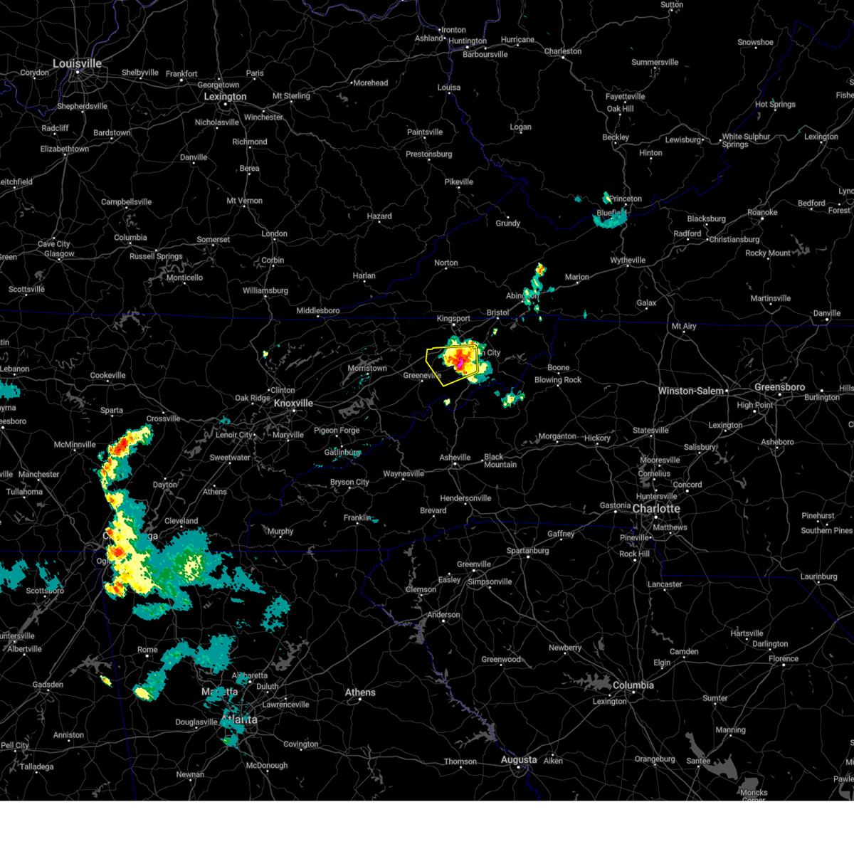 At 751 pm edt, a severe thunderstorm was located over jonesborough, or 7 miles west of johnson city, and is nearly stationary (radar indicated). Hazards include ping pong ball size hail and 60 mph wind gusts. People and animals outdoors will be injured. expect hail damage to roofs, siding, windows, and vehicles. Expect wind damage to roofs, siding, and trees. At 751 pm edt, a severe thunderstorm was located over jonesborough, or 7 miles west of johnson city, and is nearly stationary (radar indicated). Hazards include ping pong ball size hail and 60 mph wind gusts. People and animals outdoors will be injured. expect hail damage to roofs, siding, windows, and vehicles. Expect wind damage to roofs, siding, and trees.
|
| 6/4/2023 7:12 PM EDT |
 At 711 pm edt, a severe thunderstorm was located near pine crest, or near elizabethton, and is nearly stationary (radar indicated). Hazards include 60 mph wind gusts and quarter size hail. Hail damage to vehicles is expected. Expect wind damage to roofs, siding, and trees. At 711 pm edt, a severe thunderstorm was located near pine crest, or near elizabethton, and is nearly stationary (radar indicated). Hazards include 60 mph wind gusts and quarter size hail. Hail damage to vehicles is expected. Expect wind damage to roofs, siding, and trees.
|
| 3/25/2023 5:03 AM EDT |
 At 503 am edt, severe thunderstorms were located along a line extending from 6 miles west of walnut hill to 10 miles northwest of mars hill, moving east at 55 mph (radar indicated). Hazards include 60 mph wind gusts. Expect damage to roofs, siding, and trees. locations impacted include, johnson city, kingsport, bristol tn, elizabethton, erwin, jonesborough, banner hill, central, spurgeon and midway. this includes the following highways, interstate 26 in tennessee between mile markers 11 and 54. interstate 81 in tennessee between mile markers 59 and 74. hail threat, radar indicated max hail size, <. 75 in wind threat, radar indicated max wind gust, 60 mph. At 503 am edt, severe thunderstorms were located along a line extending from 6 miles west of walnut hill to 10 miles northwest of mars hill, moving east at 55 mph (radar indicated). Hazards include 60 mph wind gusts. Expect damage to roofs, siding, and trees. locations impacted include, johnson city, kingsport, bristol tn, elizabethton, erwin, jonesborough, banner hill, central, spurgeon and midway. this includes the following highways, interstate 26 in tennessee between mile markers 11 and 54. interstate 81 in tennessee between mile markers 59 and 74. hail threat, radar indicated max hail size, <. 75 in wind threat, radar indicated max wind gust, 60 mph.
|
| 3/25/2023 4:40 AM EDT |
 At 440 am edt, severe thunderstorms were located along a line extending from near surgoinsville to near newport, moving east at 65 mph (radar indicated). Hazards include 60 mph wind gusts. expect damage to roofs, siding, and trees At 440 am edt, severe thunderstorms were located along a line extending from near surgoinsville to near newport, moving east at 65 mph (radar indicated). Hazards include 60 mph wind gusts. expect damage to roofs, siding, and trees
|
| 3/24/2023 11:13 PM CDT |
 At 1112 pm cdt, severe thunderstorms were located along a line extending from 8 miles northwest of portland to 6 miles north of hendersonville, moving northeast at 45 mph (radar indicated). Hazards include 60 mph wind gusts. expect damage to roofs, siding, and trees At 1112 pm cdt, severe thunderstorms were located along a line extending from 8 miles northwest of portland to 6 miles north of hendersonville, moving northeast at 45 mph (radar indicated). Hazards include 60 mph wind gusts. expect damage to roofs, siding, and trees
|
| 3/3/2023 4:37 PM EST |
 At 436 pm est, a severe thunderstorm was located 7 miles west of walnut hill, or 8 miles east of kingsport, moving northeast at 70 mph (radar indicated). Hazards include 60 mph wind gusts. expect damage to roofs, siding, and trees At 436 pm est, a severe thunderstorm was located 7 miles west of walnut hill, or 8 miles east of kingsport, moving northeast at 70 mph (radar indicated). Hazards include 60 mph wind gusts. expect damage to roofs, siding, and trees
|
| 3/3/2023 12:02 PM CST |
 At 1202 pm cst, a severe thunderstorm was located 9 miles southwest of scottsville, or 20 miles south of bowling green, moving northeast at 65 mph (radar indicated). Hazards include 70 mph wind gusts. Expect considerable tree damage. damage is likely to mobile homes, roofs, and outbuildings. locations impacted include, gallatin, portland and oak grove. thunderstorm damage threat, considerable hail threat, radar indicated max hail size, <. 75 in wind threat, radar indicated max wind gust, 70 mph. At 1202 pm cst, a severe thunderstorm was located 9 miles southwest of scottsville, or 20 miles south of bowling green, moving northeast at 65 mph (radar indicated). Hazards include 70 mph wind gusts. Expect considerable tree damage. damage is likely to mobile homes, roofs, and outbuildings. locations impacted include, gallatin, portland and oak grove. thunderstorm damage threat, considerable hail threat, radar indicated max hail size, <. 75 in wind threat, radar indicated max wind gust, 70 mph.
|
| 3/3/2023 11:53 AM CST |
 At 1152 am cst, a severe thunderstorm was located near portland, or 12 miles north of gallatin, moving northeast at 65 mph (radar indicated). Hazards include 70 mph wind gusts. Expect considerable tree damage. damage is likely to mobile homes, roofs, and outbuildings. locations impacted include, gallatin, hendersonville, white house, portland, mitchellville, cottontown and oak grove. thunderstorm damage threat, considerable hail threat, radar indicated max hail size, <. 75 in wind threat, radar indicated max wind gust, 70 mph. At 1152 am cst, a severe thunderstorm was located near portland, or 12 miles north of gallatin, moving northeast at 65 mph (radar indicated). Hazards include 70 mph wind gusts. Expect considerable tree damage. damage is likely to mobile homes, roofs, and outbuildings. locations impacted include, gallatin, hendersonville, white house, portland, mitchellville, cottontown and oak grove. thunderstorm damage threat, considerable hail threat, radar indicated max hail size, <. 75 in wind threat, radar indicated max wind gust, 70 mph.
|
| 3/3/2023 11:49 AM CST |
 At 1148 am cst, a severe thunderstorm was located near portland, or 9 miles north of gallatin, moving northeast at 65 mph (radar indicated). Hazards include 70 mph wind gusts. Expect considerable tree damage. Damage is likely to mobile homes, roofs, and outbuildings. At 1148 am cst, a severe thunderstorm was located near portland, or 9 miles north of gallatin, moving northeast at 65 mph (radar indicated). Hazards include 70 mph wind gusts. Expect considerable tree damage. Damage is likely to mobile homes, roofs, and outbuildings.
|
| 1/12/2023 2:22 PM EST |
 The severe thunderstorm warning for washington and unicoi counties will expire at 230 pm est, the storms which prompted the warning have moved out of the area. therefore, the warning will be allowed to expire. however gusty winds are still possible with these thunderstorms. The severe thunderstorm warning for washington and unicoi counties will expire at 230 pm est, the storms which prompted the warning have moved out of the area. therefore, the warning will be allowed to expire. however gusty winds are still possible with these thunderstorms.
|
| 1/12/2023 2:08 PM EST |
 At 208 pm est, severe thunderstorms were located along a line extending from near gray to near jonesborough to near banner hill to near mars hill, moving east at 60 mph (radar indicated). Hazards include 70 mph wind gusts. Expect considerable tree damage. damage is likely to mobile homes, roofs, and outbuildings. locations impacted include, johnson city, erwin, jonesborough, gray, banner hill, midway, oak grove, unicoi, leesburg and limestone. this includes the following highways, interstate 26 in tennessee between mile markers 12 and 23, and between mile markers 29 and 54. Interstate 81 in tennessee between mile markers 50 and 53. At 208 pm est, severe thunderstorms were located along a line extending from near gray to near jonesborough to near banner hill to near mars hill, moving east at 60 mph (radar indicated). Hazards include 70 mph wind gusts. Expect considerable tree damage. damage is likely to mobile homes, roofs, and outbuildings. locations impacted include, johnson city, erwin, jonesborough, gray, banner hill, midway, oak grove, unicoi, leesburg and limestone. this includes the following highways, interstate 26 in tennessee between mile markers 12 and 23, and between mile markers 29 and 54. Interstate 81 in tennessee between mile markers 50 and 53.
|
| 1/12/2023 2:07 PM EST |
 At 207 pm est, severe thunderstorms were located along a line extending from colonial heights to near erwin to 6 miles southwest of banner hill, moving east at 55 mph (radar indicated). Hazards include 70 mph wind gusts. Expect considerable tree damage. Damage is likely to mobile homes, roofs, and outbuildings. At 207 pm est, severe thunderstorms were located along a line extending from colonial heights to near erwin to 6 miles southwest of banner hill, moving east at 55 mph (radar indicated). Hazards include 70 mph wind gusts. Expect considerable tree damage. Damage is likely to mobile homes, roofs, and outbuildings.
|
| 1/12/2023 1:51 PM EST |
 At 151 pm est, severe thunderstorms were located along a line extending from 7 miles south of surgoinsville to near greeneville to 8 miles south of tusculum to near hot springs, moving east at 60 mph (radar indicated and public damage reports). Hazards include 70 mph wind gusts. Expect considerable tree damage. damage is likely to mobile homes, roofs, and outbuildings. locations impacted include, johnson city, kingsport, greeneville, erwin, rogersville, jonesborough, tusculum, banner hill, midway and gray. this includes the following highways, interstate 26 in tennessee between mile markers 12 and 23, and between mile markers 29 and 54. Interstate 81 in tennessee between mile markers 27 and 53. At 151 pm est, severe thunderstorms were located along a line extending from 7 miles south of surgoinsville to near greeneville to 8 miles south of tusculum to near hot springs, moving east at 60 mph (radar indicated and public damage reports). Hazards include 70 mph wind gusts. Expect considerable tree damage. damage is likely to mobile homes, roofs, and outbuildings. locations impacted include, johnson city, kingsport, greeneville, erwin, rogersville, jonesborough, tusculum, banner hill, midway and gray. this includes the following highways, interstate 26 in tennessee between mile markers 12 and 23, and between mile markers 29 and 54. Interstate 81 in tennessee between mile markers 27 and 53.
|
| 1/12/2023 1:40 PM EST |
 At 139 pm est, severe thunderstorms were located along a line extending from near rogersville to 10 miles southeast of russellville to near parrottsville to 6 miles north of smoky mountains-big creek, moving east at 65 mph (radar indicated and public observed damage). Hazards include 70 mph wind gusts. Expect considerable tree damage. damage is likely to mobile homes, roofs, and outbuildings. locations impacted include, johnson city, kingsport, greeneville, erwin, rogersville, jonesborough, tusculum, parrottsville, banner hill and midway. this includes the following highways, interstate 26 in tennessee between mile markers 13 and 23, and between mile markers 29 and 54. interstate 40 in tennessee between mile markers 450 and 451. Interstate 81 in tennessee between mile markers 18 and 52. At 139 pm est, severe thunderstorms were located along a line extending from near rogersville to 10 miles southeast of russellville to near parrottsville to 6 miles north of smoky mountains-big creek, moving east at 65 mph (radar indicated and public observed damage). Hazards include 70 mph wind gusts. Expect considerable tree damage. damage is likely to mobile homes, roofs, and outbuildings. locations impacted include, johnson city, kingsport, greeneville, erwin, rogersville, jonesborough, tusculum, parrottsville, banner hill and midway. this includes the following highways, interstate 26 in tennessee between mile markers 13 and 23, and between mile markers 29 and 54. interstate 40 in tennessee between mile markers 450 and 451. Interstate 81 in tennessee between mile markers 18 and 52.
|
| 1/12/2023 1:34 PM EST |
 At 134 pm est, severe thunderstorms were located along a line extending from 6 miles northeast of russellville to 11 miles east of morristown to parrottsville to 6 miles north of smoky mountains-big creek, moving east at 60 mph (radar indicated). Hazards include 60 mph wind gusts. expect damage to roofs, siding, and trees At 134 pm est, severe thunderstorms were located along a line extending from 6 miles northeast of russellville to 11 miles east of morristown to parrottsville to 6 miles north of smoky mountains-big creek, moving east at 60 mph (radar indicated). Hazards include 60 mph wind gusts. expect damage to roofs, siding, and trees
|
| 11/29/2022 6:42 PM CST |
 At 642 pm cst, a severe thunderstorm was located over white house, or 12 miles east of springfield, moving northeast at 65 mph (radar indicated). Hazards include 60 mph wind gusts and quarter size hail. Hail damage to vehicles is expected. expect wind damage to roofs, siding, and trees. locations impacted include, white house, cross plains, portland, orlinda and mitchellville. this includes interstate 65 between mile markers 107 and 120. hail threat, radar indicated max hail size, 1. 00 in wind threat, radar indicated max wind gust, 60 mph. At 642 pm cst, a severe thunderstorm was located over white house, or 12 miles east of springfield, moving northeast at 65 mph (radar indicated). Hazards include 60 mph wind gusts and quarter size hail. Hail damage to vehicles is expected. expect wind damage to roofs, siding, and trees. locations impacted include, white house, cross plains, portland, orlinda and mitchellville. this includes interstate 65 between mile markers 107 and 120. hail threat, radar indicated max hail size, 1. 00 in wind threat, radar indicated max wind gust, 60 mph.
|
| 11/29/2022 6:29 PM CST |
 At 628 pm cst, a severe thunderstorm was located near joelton, or 9 miles south of springfield, moving northeast at 65 mph (radar indicated). Hazards include 60 mph wind gusts and quarter size hail. Hail damage to vehicles is expected. Expect wind damage to roofs, siding, and trees. At 628 pm cst, a severe thunderstorm was located near joelton, or 9 miles south of springfield, moving northeast at 65 mph (radar indicated). Hazards include 60 mph wind gusts and quarter size hail. Hail damage to vehicles is expected. Expect wind damage to roofs, siding, and trees.
|
| 9/25/2022 6:54 PM EDT |
 At 654 pm edt, severe thunderstorms were located along a line extending from 9 miles southeast of bristol va to elizabethton to near erwin, moving southeast at 45 mph (radar indicated). Hazards include 60 mph wind gusts. expect damage to roofs, siding, and trees At 654 pm edt, severe thunderstorms were located along a line extending from 9 miles southeast of bristol va to elizabethton to near erwin, moving southeast at 45 mph (radar indicated). Hazards include 60 mph wind gusts. expect damage to roofs, siding, and trees
|
| 9/25/2022 6:23 PM EDT |
 At 623 pm edt, a severe thunderstorm was located 9 miles southwest of kingsport, moving east at 45 mph (radar indicated). Hazards include 60 mph wind gusts and quarter size hail. Hail damage to vehicles is expected. Expect wind damage to roofs, siding, and trees. At 623 pm edt, a severe thunderstorm was located 9 miles southwest of kingsport, moving east at 45 mph (radar indicated). Hazards include 60 mph wind gusts and quarter size hail. Hail damage to vehicles is expected. Expect wind damage to roofs, siding, and trees.
|
| 8/5/2022 5:09 PM EDT |
 At 508 pm edt, severe thunderstorms were located along a line extending from 6 miles east of bristol va to near bristol tn to 7 miles southwest of colonial heights, moving north at 15 mph (radar indicated). Hazards include 60 mph wind gusts and nickel size hail. expect damage to roofs, siding, and trees At 508 pm edt, severe thunderstorms were located along a line extending from 6 miles east of bristol va to near bristol tn to 7 miles southwest of colonial heights, moving north at 15 mph (radar indicated). Hazards include 60 mph wind gusts and nickel size hail. expect damage to roofs, siding, and trees
|
| 7/21/2022 2:14 AM CDT |
 At 214 am cdt, a severe thunderstorm was located near cross plains, or 14 miles northwest of gallatin, moving east at 35 mph (radar indicated). Hazards include 60 mph wind gusts. expect damage to roofs, siding, and trees At 214 am cdt, a severe thunderstorm was located near cross plains, or 14 miles northwest of gallatin, moving east at 35 mph (radar indicated). Hazards include 60 mph wind gusts. expect damage to roofs, siding, and trees
|
| 7/12/2022 4:10 PM CDT |
 At 409 pm cdt, a severe thunderstorm was located near portland, or 11 miles north of gallatin, moving southeast at 15 mph (radar indicated). Hazards include 60 mph wind gusts and nickel size hail. Expect damage to roofs, siding, and trees. locations impacted include, gallatin, westmoreland, portland, oak grove and cottontown. hail threat, radar indicated max hail size, 0. 88 in wind threat, radar indicated max wind gust, 60 mph. At 409 pm cdt, a severe thunderstorm was located near portland, or 11 miles north of gallatin, moving southeast at 15 mph (radar indicated). Hazards include 60 mph wind gusts and nickel size hail. Expect damage to roofs, siding, and trees. locations impacted include, gallatin, westmoreland, portland, oak grove and cottontown. hail threat, radar indicated max hail size, 0. 88 in wind threat, radar indicated max wind gust, 60 mph.
|
| 7/12/2022 3:56 PM CDT |
 At 356 pm cdt, a severe thunderstorm was located near portland, or 13 miles northwest of gallatin, moving southeast at 15 mph (radar indicated). Hazards include 60 mph wind gusts and nickel size hail. expect damage to roofs, siding, and trees At 356 pm cdt, a severe thunderstorm was located near portland, or 13 miles northwest of gallatin, moving southeast at 15 mph (radar indicated). Hazards include 60 mph wind gusts and nickel size hail. expect damage to roofs, siding, and trees
|
| 7/7/2022 3:03 PM CDT |
 At 302 pm cdt, severe thunderstorms were located along a line extending from 6 miles south of westmoreland to gallatin, moving east at 15 mph (radar indicated). Hazards include 60 mph wind gusts and penny size hail. Expect damage to roofs, siding, and trees. locations impacted include, gallatin, hartsville, westmoreland, bledsoe creek state park, cottontown and bethpage. hail threat, radar indicated max hail size, 0. 75 in wind threat, radar indicated max wind gust, 60 mph. At 302 pm cdt, severe thunderstorms were located along a line extending from 6 miles south of westmoreland to gallatin, moving east at 15 mph (radar indicated). Hazards include 60 mph wind gusts and penny size hail. Expect damage to roofs, siding, and trees. locations impacted include, gallatin, hartsville, westmoreland, bledsoe creek state park, cottontown and bethpage. hail threat, radar indicated max hail size, 0. 75 in wind threat, radar indicated max wind gust, 60 mph.
|
| 7/7/2022 2:50 PM CDT |
 At 250 pm cdt, severe thunderstorms were located along a line extending from westmoreland to near millersville, moving east at 15 mph (radar indicated). Hazards include 60 mph wind gusts and penny size hail. Expect damage to roofs, siding, and trees. locations impacted include, gallatin, hartsville, westmoreland, cottontown, bethpage, oak grove and bledsoe creek state park. hail threat, radar indicated max hail size, 0. 75 in wind threat, radar indicated max wind gust, 60 mph. At 250 pm cdt, severe thunderstorms were located along a line extending from westmoreland to near millersville, moving east at 15 mph (radar indicated). Hazards include 60 mph wind gusts and penny size hail. Expect damage to roofs, siding, and trees. locations impacted include, gallatin, hartsville, westmoreland, cottontown, bethpage, oak grove and bledsoe creek state park. hail threat, radar indicated max hail size, 0. 75 in wind threat, radar indicated max wind gust, 60 mph.
|
| 7/7/2022 2:36 PM CDT |
 At 236 pm cdt, severe thunderstorms were located along a line extending from near westmoreland to millersville, moving east at 15 mph (radar indicated). Hazards include 60 mph wind gusts and penny size hail. expect damage to roofs, siding, and trees At 236 pm cdt, severe thunderstorms were located along a line extending from near westmoreland to millersville, moving east at 15 mph (radar indicated). Hazards include 60 mph wind gusts and penny size hail. expect damage to roofs, siding, and trees
|
| 7/5/2022 5:16 PM EDT |
 At 515 pm edt, a severe thunderstorm was located near walnut hill, or 7 miles southwest of bristol tn, moving southeast at 25 mph (radar indicated). Hazards include 60 mph wind gusts and quarter size hail. Hail damage to vehicles is expected. Expect wind damage to roofs, siding, and trees. At 515 pm edt, a severe thunderstorm was located near walnut hill, or 7 miles southwest of bristol tn, moving southeast at 25 mph (radar indicated). Hazards include 60 mph wind gusts and quarter size hail. Hail damage to vehicles is expected. Expect wind damage to roofs, siding, and trees.
|
| 6/17/2022 10:02 AM CDT |
 At 1001 am cdt, severe thunderstorms were located along a line extending from portland to nashville, moving east at 50 mph (radar indicated). Hazards include 60 mph wind gusts. expect damage to roofs, siding, and trees At 1001 am cdt, severe thunderstorms were located along a line extending from portland to nashville, moving east at 50 mph (radar indicated). Hazards include 60 mph wind gusts. expect damage to roofs, siding, and trees
|
| 6/7/2022 1:33 AM CDT |
 At 133 am cdt, severe thunderstorms were located along a line extending from near westmoreland to near gallatin, moving east at 35 mph (radar indicated). Hazards include 60 mph wind gusts and quarter size hail. Hail damage to vehicles is expected. expect wind damage to roofs, siding, and trees. Locations impacted include, gallatin, hendersonville, westmoreland, oak grove and bethpage. At 133 am cdt, severe thunderstorms were located along a line extending from near westmoreland to near gallatin, moving east at 35 mph (radar indicated). Hazards include 60 mph wind gusts and quarter size hail. Hail damage to vehicles is expected. expect wind damage to roofs, siding, and trees. Locations impacted include, gallatin, hendersonville, westmoreland, oak grove and bethpage.
|
| 6/7/2022 1:13 AM CDT |
 At 113 am cdt, severe thunderstorms were located along a line extending from portland to millersville, moving east at 25 mph (radar indicated). Hazards include 60 mph wind gusts and quarter size hail. Hail damage to vehicles is expected. Expect wind damage to roofs, siding, and trees. At 113 am cdt, severe thunderstorms were located along a line extending from portland to millersville, moving east at 25 mph (radar indicated). Hazards include 60 mph wind gusts and quarter size hail. Hail damage to vehicles is expected. Expect wind damage to roofs, siding, and trees.
|
| 6/7/2022 12:41 AM CDT |
 At 1240 am cdt, a severe thunderstorm was located over springfield, moving east at 40 mph (radar indicated). Hazards include 60 mph wind gusts and nickel size hail. expect damage to roofs, siding, and trees At 1240 am cdt, a severe thunderstorm was located over springfield, moving east at 40 mph (radar indicated). Hazards include 60 mph wind gusts and nickel size hail. expect damage to roofs, siding, and trees
|
| 5/21/2022 4:56 PM EDT |
 At 455 pm edt, a severe thunderstorm was located near surgoinsville, or near rogersville, moving west at 15 mph (radar indicated). Hazards include 60 mph wind gusts and quarter size hail. Hail damage to vehicles is expected. Expect wind damage to roofs, siding, and trees. At 455 pm edt, a severe thunderstorm was located near surgoinsville, or near rogersville, moving west at 15 mph (radar indicated). Hazards include 60 mph wind gusts and quarter size hail. Hail damage to vehicles is expected. Expect wind damage to roofs, siding, and trees.
|
| 5/21/2022 4:18 PM EDT |
 At 417 pm edt, a severe thunderstorm was located near tusculum, or 8 miles east of greeneville, moving northeast at 35 mph (radar indicated). Hazards include 60 mph wind gusts and quarter size hail. Hail damage to vehicles is expected. Expect wind damage to roofs, siding, and trees. At 417 pm edt, a severe thunderstorm was located near tusculum, or 8 miles east of greeneville, moving northeast at 35 mph (radar indicated). Hazards include 60 mph wind gusts and quarter size hail. Hail damage to vehicles is expected. Expect wind damage to roofs, siding, and trees.
|
| 5/19/2022 7:50 PM EDT |
 At 750 pm edt, a severe thunderstorm was located near central, or near elizabethton, moving east at 30 mph (radar indicated). Hazards include 60 mph wind gusts and quarter size hail. Hail damage to vehicles is expected. expect wind damage to roofs, siding, and trees. locations impacted include, johnson city, bristol tn, elizabethton, oak grove, central, bluff city, watauga, hunter, morril`s cave and rocky mount state park. hail threat, radar indicated max hail size, 1. 00 in wind threat, radar indicated max wind gust, 60 mph. At 750 pm edt, a severe thunderstorm was located near central, or near elizabethton, moving east at 30 mph (radar indicated). Hazards include 60 mph wind gusts and quarter size hail. Hail damage to vehicles is expected. expect wind damage to roofs, siding, and trees. locations impacted include, johnson city, bristol tn, elizabethton, oak grove, central, bluff city, watauga, hunter, morril`s cave and rocky mount state park. hail threat, radar indicated max hail size, 1. 00 in wind threat, radar indicated max wind gust, 60 mph.
|
| 5/19/2022 7:35 PM EDT |
 At 733 pm edt, a severe thunderstorm was located over oak grove, or near gray, moving east at 30 mph (radar indicated). Hazards include 60 mph wind gusts and half dollar size hail. Hail damage to vehicles is expected. expect wind damage to roofs, siding, and trees. locations impacted include, johnson city, kingsport, gray, oak grove, spurgeon, colonial heights, watauga and rocky mount state park. this includes the following highways, interstate 26 in tennessee between mile markers 7 and 23. interstate 81 in tennessee between mile markers 52 and 57. hail threat, radar indicated max hail size, 1. 25 in wind threat, radar indicated max wind gust, 60 mph. At 733 pm edt, a severe thunderstorm was located over oak grove, or near gray, moving east at 30 mph (radar indicated). Hazards include 60 mph wind gusts and half dollar size hail. Hail damage to vehicles is expected. expect wind damage to roofs, siding, and trees. locations impacted include, johnson city, kingsport, gray, oak grove, spurgeon, colonial heights, watauga and rocky mount state park. this includes the following highways, interstate 26 in tennessee between mile markers 7 and 23. interstate 81 in tennessee between mile markers 52 and 57. hail threat, radar indicated max hail size, 1. 25 in wind threat, radar indicated max wind gust, 60 mph.
|
| 5/19/2022 7:30 PM EDT |
 At 730 pm edt, a severe thunderstorm was located over spurgeon, or near kingsport, moving east at 30 mph (radar indicated). Hazards include 60 mph wind gusts and half dollar size hail. Hail damage to vehicles is expected. Expect wind damage to roofs, siding, and trees. At 730 pm edt, a severe thunderstorm was located over spurgeon, or near kingsport, moving east at 30 mph (radar indicated). Hazards include 60 mph wind gusts and half dollar size hail. Hail damage to vehicles is expected. Expect wind damage to roofs, siding, and trees.
|
| 5/19/2022 7:22 PM EDT |
 At 721 pm edt, a severe thunderstorm was located near gray, or near kingsport, moving east at 30 mph (radar indicated). Hazards include 60 mph wind gusts and half dollar size hail. Hail damage to vehicles is expected. expect wind damage to roofs, siding, and trees. locations impacted include, johnson city, kingsport, jonesborough, gray, oak grove, spurgeon, midway, colonial heights, watauga and leesburg. this includes the following highways, interstate 26 in tennessee between mile markers 8 and 23. interstate 81 in tennessee between mile markers 43 and 57. hail threat, radar indicated max hail size, 1. 25 in wind threat, radar indicated max wind gust, 60 mph. At 721 pm edt, a severe thunderstorm was located near gray, or near kingsport, moving east at 30 mph (radar indicated). Hazards include 60 mph wind gusts and half dollar size hail. Hail damage to vehicles is expected. expect wind damage to roofs, siding, and trees. locations impacted include, johnson city, kingsport, jonesborough, gray, oak grove, spurgeon, midway, colonial heights, watauga and leesburg. this includes the following highways, interstate 26 in tennessee between mile markers 8 and 23. interstate 81 in tennessee between mile markers 43 and 57. hail threat, radar indicated max hail size, 1. 25 in wind threat, radar indicated max wind gust, 60 mph.
|
| 5/19/2022 7:20 PM EDT |
 At 719 pm edt, a severe thunderstorm was located over colonial heights, or near kingsport, moving east at 25 mph (radar indicated). Hazards include 60 mph wind gusts and half dollar size hail. Hail damage to vehicles is expected. expect wind damage to roofs, siding, and trees. locations impacted include, kingsport, bristol tn, walnut hill, colonial heights, spurgeon, oak grove, bluff city, tri-city airport, blountville and sullivan gardens. this includes the following highways, interstate 26 in tennessee between mile markers 2 and 8. interstate 81 in tennessee between mile markers 57 and 74. hail threat, radar indicated max hail size, 1. 25 in wind threat, radar indicated max wind gust, 60 mph. At 719 pm edt, a severe thunderstorm was located over colonial heights, or near kingsport, moving east at 25 mph (radar indicated). Hazards include 60 mph wind gusts and half dollar size hail. Hail damage to vehicles is expected. expect wind damage to roofs, siding, and trees. locations impacted include, kingsport, bristol tn, walnut hill, colonial heights, spurgeon, oak grove, bluff city, tri-city airport, blountville and sullivan gardens. this includes the following highways, interstate 26 in tennessee between mile markers 2 and 8. interstate 81 in tennessee between mile markers 57 and 74. hail threat, radar indicated max hail size, 1. 25 in wind threat, radar indicated max wind gust, 60 mph.
|
| 5/19/2022 7:06 PM EDT |
 At 705 pm edt, a severe thunderstorm was located over kingsport, moving east southeast at 30 mph (radar indicated). Hazards include golf ball size hail and 60 mph wind gusts. People and animals outdoors will be injured. expect hail damage to roofs, siding, windows, and vehicles. expect wind damage to roofs, siding, and trees. locations impacted include, kingsport, bristol tn, gate city, surgoinsville, weber city, walnut hill, colonial heights, spurgeon, oak grove and church hill. this includes the following highways, interstate 26 in tennessee between mile markers 1 and 8. interstate 81 in tennessee between mile markers 57 and 75. thunderstorm damage threat, considerable hail threat, radar indicated max hail size, 1. 75 in wind threat, radar indicated max wind gust, 60 mph. At 705 pm edt, a severe thunderstorm was located over kingsport, moving east southeast at 30 mph (radar indicated). Hazards include golf ball size hail and 60 mph wind gusts. People and animals outdoors will be injured. expect hail damage to roofs, siding, windows, and vehicles. expect wind damage to roofs, siding, and trees. locations impacted include, kingsport, bristol tn, gate city, surgoinsville, weber city, walnut hill, colonial heights, spurgeon, oak grove and church hill. this includes the following highways, interstate 26 in tennessee between mile markers 1 and 8. interstate 81 in tennessee between mile markers 57 and 75. thunderstorm damage threat, considerable hail threat, radar indicated max hail size, 1. 75 in wind threat, radar indicated max wind gust, 60 mph.
|
| 5/19/2022 7:03 PM EDT |
 At 702 pm edt, a severe thunderstorm was located 7 miles east of surgoinsville, or 10 miles west of kingsport, moving east southeast at 30 mph (radar indicated). Hazards include golf ball size hail and 60 mph wind gusts. People and animals outdoors will be injured. expect hail damage to roofs, siding, windows, and vehicles. Expect wind damage to roofs, siding, and trees. At 702 pm edt, a severe thunderstorm was located 7 miles east of surgoinsville, or 10 miles west of kingsport, moving east southeast at 30 mph (radar indicated). Hazards include golf ball size hail and 60 mph wind gusts. People and animals outdoors will be injured. expect hail damage to roofs, siding, windows, and vehicles. Expect wind damage to roofs, siding, and trees.
|
| 5/19/2022 6:45 PM EDT |
 At 644 pm edt, a severe thunderstorm was located 8 miles northeast of surgoinsville, or 12 miles west of gate city, moving east at 30 mph (radar indicated). Hazards include tennis ball size hail and 60 mph wind gusts. People and animals outdoors will be injured. expect hail damage to roofs, siding, windows, and vehicles. expect wind damage to roofs, siding, and trees. locations impacted include, kingsport, bristol tn, gate city, surgoinsville, weber city, walnut hill, colonial heights, spurgeon, oak grove and church hill. this includes the following highways, interstate 26 in tennessee between mile markers 1 and 8. Interstate 81 in tennessee between mile markers 57 and 75. At 644 pm edt, a severe thunderstorm was located 8 miles northeast of surgoinsville, or 12 miles west of gate city, moving east at 30 mph (radar indicated). Hazards include tennis ball size hail and 60 mph wind gusts. People and animals outdoors will be injured. expect hail damage to roofs, siding, windows, and vehicles. expect wind damage to roofs, siding, and trees. locations impacted include, kingsport, bristol tn, gate city, surgoinsville, weber city, walnut hill, colonial heights, spurgeon, oak grove and church hill. this includes the following highways, interstate 26 in tennessee between mile markers 1 and 8. Interstate 81 in tennessee between mile markers 57 and 75.
|
| 5/19/2022 6:40 PM EDT |
 At 639 pm edt, a severe thunderstorm was located 8 miles north of surgoinsville, or 14 miles west of gate city, moving east at 25 mph (radar indicated). Hazards include ping pong ball size hail and 60 mph wind gusts. People and animals outdoors will be injured. expect hail damage to roofs, siding, windows, and vehicles. Expect wind damage to roofs, siding, and trees. At 639 pm edt, a severe thunderstorm was located 8 miles north of surgoinsville, or 14 miles west of gate city, moving east at 25 mph (radar indicated). Hazards include ping pong ball size hail and 60 mph wind gusts. People and animals outdoors will be injured. expect hail damage to roofs, siding, windows, and vehicles. Expect wind damage to roofs, siding, and trees.
|
| 5/19/2022 4:55 AM EDT |
 At 455 am edt, a severe thunderstorm was located near kingsport, moving southeast at 40 mph (trained weather spotters). Hazards include 60 mph wind gusts and half dollar size hail. Hail damage to vehicles is expected. expect wind damage to roofs, siding, and trees. locations impacted include, johnson city, kingsport, surgoinsville, weber city, gray, oak grove, spurgeon, colonial heights, church hill and mount carmel. this includes the following highways, interstate 26 in tennessee between mile markers 1 and 16. interstate 81 in tennessee between mile markers 50 and 70. hail threat, observed max hail size, 1. 25 in wind threat, observed max wind gust, 60 mph. At 455 am edt, a severe thunderstorm was located near kingsport, moving southeast at 40 mph (trained weather spotters). Hazards include 60 mph wind gusts and half dollar size hail. Hail damage to vehicles is expected. expect wind damage to roofs, siding, and trees. locations impacted include, johnson city, kingsport, surgoinsville, weber city, gray, oak grove, spurgeon, colonial heights, church hill and mount carmel. this includes the following highways, interstate 26 in tennessee between mile markers 1 and 16. interstate 81 in tennessee between mile markers 50 and 70. hail threat, observed max hail size, 1. 25 in wind threat, observed max wind gust, 60 mph.
|
| 5/19/2022 4:50 AM EDT |
 At 450 am edt, a severe thunderstorm was located near kingsport, moving southeast at 40 mph (trained weather spotters). Hazards include 60 mph wind gusts and half dollar size hail. Hail damage to vehicles is expected. expect wind damage to roofs, siding, and trees. locations impacted include, johnson city, kingsport, surgoinsville, weber city, gray, oak grove, spurgeon, colonial heights, church hill and mount carmel. this includes the following highways, interstate 26 in tennessee between mile markers 1 and 16. interstate 81 in tennessee between mile markers 50 and 70. hail threat, radar indicated max hail size, 1. 25 in wind threat, radar indicated max wind gust, 60 mph. At 450 am edt, a severe thunderstorm was located near kingsport, moving southeast at 40 mph (trained weather spotters). Hazards include 60 mph wind gusts and half dollar size hail. Hail damage to vehicles is expected. expect wind damage to roofs, siding, and trees. locations impacted include, johnson city, kingsport, surgoinsville, weber city, gray, oak grove, spurgeon, colonial heights, church hill and mount carmel. this includes the following highways, interstate 26 in tennessee between mile markers 1 and 16. interstate 81 in tennessee between mile markers 50 and 70. hail threat, radar indicated max hail size, 1. 25 in wind threat, radar indicated max wind gust, 60 mph.
|
| 5/19/2022 4:26 AM EDT |
 At 425 am edt, a severe thunderstorm was located 8 miles northwest of surgoinsville, or 12 miles southeast of jonesville, moving southeast at 40 mph (radar indicated). Hazards include 60 mph wind gusts and quarter size hail. Hail damage to vehicles is expected. Expect wind damage to roofs, siding, and trees. At 425 am edt, a severe thunderstorm was located 8 miles northwest of surgoinsville, or 12 miles southeast of jonesville, moving southeast at 40 mph (radar indicated). Hazards include 60 mph wind gusts and quarter size hail. Hail damage to vehicles is expected. Expect wind damage to roofs, siding, and trees.
|
| 5/6/2022 6:30 PM EDT |
 At 630 pm edt, severe thunderstorms were located along a line extending from near walnut hill to near elizabethton to near hampton to near elk park, moving northeast at 50 mph (radar indicated). Hazards include 60 mph wind gusts and quarter size hail. Hail damage to vehicles is expected. expect wind damage to roofs, siding, and trees. locations impacted include, johnson city, bristol tn, elizabethton, hampton, central, oak grove, bluff city, watauga, hunter and morril`s cave. hail threat, radar indicated max hail size, 1. 00 in wind threat, radar indicated max wind gust, 60 mph. At 630 pm edt, severe thunderstorms were located along a line extending from near walnut hill to near elizabethton to near hampton to near elk park, moving northeast at 50 mph (radar indicated). Hazards include 60 mph wind gusts and quarter size hail. Hail damage to vehicles is expected. expect wind damage to roofs, siding, and trees. locations impacted include, johnson city, bristol tn, elizabethton, hampton, central, oak grove, bluff city, watauga, hunter and morril`s cave. hail threat, radar indicated max hail size, 1. 00 in wind threat, radar indicated max wind gust, 60 mph.
|
| 5/6/2022 6:18 PM EDT |
 At 618 pm edt, severe thunderstorms were located along a line extending from near colonial heights to central to near pine crest to near bakersville, moving northeast at 50 mph (radar indicated). Hazards include 60 mph wind gusts and quarter size hail. Hail damage to vehicles is expected. expect wind damage to roofs, siding, and trees. locations impacted include, johnson city, bristol tn, elizabethton, jonesborough, central, spurgeon, pine crest, gray, oak grove and hampton. this includes interstate 26 in tennessee between mile markers 11 and 31. hail threat, radar indicated max hail size, 1. 00 in wind threat, radar indicated max wind gust, 60 mph. At 618 pm edt, severe thunderstorms were located along a line extending from near colonial heights to central to near pine crest to near bakersville, moving northeast at 50 mph (radar indicated). Hazards include 60 mph wind gusts and quarter size hail. Hail damage to vehicles is expected. expect wind damage to roofs, siding, and trees. locations impacted include, johnson city, bristol tn, elizabethton, jonesborough, central, spurgeon, pine crest, gray, oak grove and hampton. this includes interstate 26 in tennessee between mile markers 11 and 31. hail threat, radar indicated max hail size, 1. 00 in wind threat, radar indicated max wind gust, 60 mph.
|
| 5/6/2022 6:14 PM EDT |
 At 613 pm edt, severe thunderstorms were located along a line extending from near jonesville to 8 miles southwest of gate city to gray, moving northeast at 45 mph. this line of storm has a history of producing damaging winds (radar indicated). Hazards include 60 mph wind gusts and quarter size hail. Hail damage to vehicles is expected. Expect wind damage to roofs, siding, and trees. At 613 pm edt, severe thunderstorms were located along a line extending from near jonesville to 8 miles southwest of gate city to gray, moving northeast at 45 mph. this line of storm has a history of producing damaging winds (radar indicated). Hazards include 60 mph wind gusts and quarter size hail. Hail damage to vehicles is expected. Expect wind damage to roofs, siding, and trees.
|
| 5/6/2022 5:56 PM EDT |
 At 556 pm edt, severe thunderstorms were located along a line extending from 9 miles southeast of surgoinsville to 7 miles southwest of jonesborough to 6 miles west of erwin to 10 miles north of mars hill, moving northeast at 50 mph (radar indicated). Hazards include 60 mph wind gusts and quarter size hail. Hail damage to vehicles is expected. Expect wind damage to roofs, siding, and trees. At 556 pm edt, severe thunderstorms were located along a line extending from 9 miles southeast of surgoinsville to 7 miles southwest of jonesborough to 6 miles west of erwin to 10 miles north of mars hill, moving northeast at 50 mph (radar indicated). Hazards include 60 mph wind gusts and quarter size hail. Hail damage to vehicles is expected. Expect wind damage to roofs, siding, and trees.
|
| 5/6/2022 5:43 PM EDT |
 At 543 pm edt, severe thunderstorms were located along a line extending from 8 miles southeast of surgoinsville to near tusculum to 11 miles northeast of hot springs, moving northeast at 50 mph (radar indicated). Hazards include 60 mph wind gusts and quarter size hail. Hail damage to vehicles is expected. expect wind damage to roofs, siding, and trees. locations impacted include, johnson city, greeneville, erwin, jonesborough, tusculum, gray, banner hill, oak grove, spurgeon and midway. this includes the following highways, interstate 26 in tennessee between mile markers 10 and 23, and between mile markers 29 and 48. interstate 81 in tennessee between mile markers 44 and 46, and between mile markers 51 and 52. hail threat, radar indicated max hail size, 1. 00 in wind threat, radar indicated max wind gust, 60 mph. At 543 pm edt, severe thunderstorms were located along a line extending from 8 miles southeast of surgoinsville to near tusculum to 11 miles northeast of hot springs, moving northeast at 50 mph (radar indicated). Hazards include 60 mph wind gusts and quarter size hail. Hail damage to vehicles is expected. expect wind damage to roofs, siding, and trees. locations impacted include, johnson city, greeneville, erwin, jonesborough, tusculum, gray, banner hill, oak grove, spurgeon and midway. this includes the following highways, interstate 26 in tennessee between mile markers 10 and 23, and between mile markers 29 and 48. interstate 81 in tennessee between mile markers 44 and 46, and between mile markers 51 and 52. hail threat, radar indicated max hail size, 1. 00 in wind threat, radar indicated max wind gust, 60 mph.
|
| 5/6/2022 5:22 PM EDT |
 At 521 pm edt, severe thunderstorms were located along a line extending from 7 miles southeast of russellville to near parrottsville to 9 miles northeast of smoky mountains-big creek, moving northeast at 50 mph (radar indicated). Hazards include 60 mph wind gusts and quarter size hail. Hail damage to vehicles is expected. Expect wind damage to roofs, siding, and trees. At 521 pm edt, severe thunderstorms were located along a line extending from 7 miles southeast of russellville to near parrottsville to 9 miles northeast of smoky mountains-big creek, moving northeast at 50 mph (radar indicated). Hazards include 60 mph wind gusts and quarter size hail. Hail damage to vehicles is expected. Expect wind damage to roofs, siding, and trees.
|
| 5/6/2022 5:13 PM EDT |
 At 512 pm edt, a severe thunderstorm was located near oak grove, or 9 miles southwest of bristol tn, moving northeast at 40 mph (radar indicated). Hazards include 60 mph wind gusts and quarter size hail. Hail damage to vehicles is expected. expect wind damage to roofs, siding, and trees. locations impacted include, johnson city, kingsport, bristol tn, bristol va, walnut hill, oak grove, bluff city, south holston dam, morril`s cave and rocky mount state park. this includes the following highways, interstate 81 in tennessee between mile markers 62 and 75. interstate 81 in virginia between mile markers 1 and 4. hail threat, radar indicated max hail size, 1. 00 in wind threat, radar indicated max wind gust, 60 mph. At 512 pm edt, a severe thunderstorm was located near oak grove, or 9 miles southwest of bristol tn, moving northeast at 40 mph (radar indicated). Hazards include 60 mph wind gusts and quarter size hail. Hail damage to vehicles is expected. expect wind damage to roofs, siding, and trees. locations impacted include, johnson city, kingsport, bristol tn, bristol va, walnut hill, oak grove, bluff city, south holston dam, morril`s cave and rocky mount state park. this includes the following highways, interstate 81 in tennessee between mile markers 62 and 75. interstate 81 in virginia between mile markers 1 and 4. hail threat, radar indicated max hail size, 1. 00 in wind threat, radar indicated max wind gust, 60 mph.
|
| 5/6/2022 4:58 PM EDT |
 At 458 pm edt, a severe thunderstorm was located over gray, or near kingsport, moving northeast at 45 mph (radar indicated). Hazards include 60 mph wind gusts and quarter size hail. Hail damage to vehicles is expected. Expect wind damage to roofs, siding, and trees. At 458 pm edt, a severe thunderstorm was located over gray, or near kingsport, moving northeast at 45 mph (radar indicated). Hazards include 60 mph wind gusts and quarter size hail. Hail damage to vehicles is expected. Expect wind damage to roofs, siding, and trees.
|
| 4/13/2022 6:43 PM CDT |
 At 643 pm cdt, severe thunderstorms were located along a line extending from 13 miles west of scottsville to near portland to near nashville, moving east at 60 mph (radar indicated). Hazards include 60 mph wind gusts. Expect damage to roofs, siding, and trees. locations impacted include, gallatin, springfield, hendersonville, goodlettsville, white house, millersville, greenbrier, coopertown, ridgetop, cross plains, portland, pleasant view, orlinda, adams, cedar hill, mitchellville, oak grove, cottontown and black jack. this includes the following highways, interstate 65 between mile markers 98 and 121. interstate 24 between mile markers 18 and 33. hail threat, radar indicated max hail size, <. 75 in wind threat, radar indicated max wind gust, 60 mph. At 643 pm cdt, severe thunderstorms were located along a line extending from 13 miles west of scottsville to near portland to near nashville, moving east at 60 mph (radar indicated). Hazards include 60 mph wind gusts. Expect damage to roofs, siding, and trees. locations impacted include, gallatin, springfield, hendersonville, goodlettsville, white house, millersville, greenbrier, coopertown, ridgetop, cross plains, portland, pleasant view, orlinda, adams, cedar hill, mitchellville, oak grove, cottontown and black jack. this includes the following highways, interstate 65 between mile markers 98 and 121. interstate 24 between mile markers 18 and 33. hail threat, radar indicated max hail size, <. 75 in wind threat, radar indicated max wind gust, 60 mph.
|
| 4/13/2022 6:13 PM CDT |
 At 613 pm cdt, severe thunderstorms were located along a line extending from 11 miles south of russellville to 8 miles northwest of coopertown to near dickson, moving east at 60 mph (radar indicated). Hazards include 60 mph wind gusts. expect damage to roofs, siding, and trees At 613 pm cdt, severe thunderstorms were located along a line extending from 11 miles south of russellville to 8 miles northwest of coopertown to near dickson, moving east at 60 mph (radar indicated). Hazards include 60 mph wind gusts. expect damage to roofs, siding, and trees
|
| 3/30/2022 9:29 PM CDT |
 At 928 pm cdt, a severe thunderstorm was located over old hickory, or 10 miles northeast of nashville, moving northeast at 70 mph (radar indicated). Hazards include 60 mph wind gusts. expect damage to roofs, siding, and trees At 928 pm cdt, a severe thunderstorm was located over old hickory, or 10 miles northeast of nashville, moving northeast at 70 mph (radar indicated). Hazards include 60 mph wind gusts. expect damage to roofs, siding, and trees
|
| 12/6/2021 5:31 AM CST |
 At 530 am cst, severe thunderstorms were located along a line extending from portland to old hickory to near bellevue, moving east at 45 mph (radar indicated). Hazards include 60 mph wind gusts. Expect damage to roofs, siding, and trees. locations impacted include, gallatin, lebanon, nashville, madison, hendersonville, mount juliet, goodlettsville, white house, millersville, forest hills, oak hill, belle meade, lakewood, westmoreland, portland, hermitage, rural hill, antioch, belinda city and old hickory. this includes the following highways, interstate 40 between mile markers 203 and 234. interstate 65 between mile markers 77 and 100. interstate 24 between mile markers 42 and 59. hail threat, radar indicated max hail size, <. 75 in wind threat, radar indicated max wind gust, 60 mph. At 530 am cst, severe thunderstorms were located along a line extending from portland to old hickory to near bellevue, moving east at 45 mph (radar indicated). Hazards include 60 mph wind gusts. Expect damage to roofs, siding, and trees. locations impacted include, gallatin, lebanon, nashville, madison, hendersonville, mount juliet, goodlettsville, white house, millersville, forest hills, oak hill, belle meade, lakewood, westmoreland, portland, hermitage, rural hill, antioch, belinda city and old hickory. this includes the following highways, interstate 40 between mile markers 203 and 234. interstate 65 between mile markers 77 and 100. interstate 24 between mile markers 42 and 59. hail threat, radar indicated max hail size, <. 75 in wind threat, radar indicated max wind gust, 60 mph.
|
| 12/6/2021 5:09 AM CST |
 At 508 am cst, severe thunderstorms were located along a line extending from cross plains to joelton to white bluff, moving east at 55 mph (radar indicated). Hazards include 60 mph wind gusts. expect damage to roofs, siding, and trees At 508 am cst, severe thunderstorms were located along a line extending from cross plains to joelton to white bluff, moving east at 55 mph (radar indicated). Hazards include 60 mph wind gusts. expect damage to roofs, siding, and trees
|
| 5/6/2021 5:29 PM CDT |
 At 528 pm cdt, a severe thunderstorm was located near portland, or 10 miles north of gallatin, moving east at 35 mph (radar indicated). Hazards include 60 mph wind gusts. expect damage to roofs, siding, and trees At 528 pm cdt, a severe thunderstorm was located near portland, or 10 miles north of gallatin, moving east at 35 mph (radar indicated). Hazards include 60 mph wind gusts. expect damage to roofs, siding, and trees
|
| 5/6/2021 5:19 PM CDT |
 A severe thunderstorm warning remains in effect until 530 pm cdt for sumner and eastern robertson counties. at 518 pm cdt, severe thunderstorms were located along a line extending from 7 miles north of portland to near white house to near goodlettsville, moving east at 35 mph. hazard. 60 mph wind gusts. A severe thunderstorm warning remains in effect until 530 pm cdt for sumner and eastern robertson counties. at 518 pm cdt, severe thunderstorms were located along a line extending from 7 miles north of portland to near white house to near goodlettsville, moving east at 35 mph. hazard. 60 mph wind gusts.
|
| 5/6/2021 4:56 PM CDT |
 At 456 pm cdt, severe thunderstorms were located along a line extending from 10 miles southeast of russellville to near springfield to near coopertown, moving east at 35 mph (radar indicated). Hazards include 60 mph wind gusts. expect damage to roofs, siding, and trees At 456 pm cdt, severe thunderstorms were located along a line extending from 10 miles southeast of russellville to near springfield to near coopertown, moving east at 35 mph (radar indicated). Hazards include 60 mph wind gusts. expect damage to roofs, siding, and trees
|
| 5/4/2021 6:26 AM CDT |
 At 626 am cdt, a severe thunderstorm capable of producing a tornado was located near cottontown, moving east at 40 mph (radar indicated rotation). Hazards include tornado. Flying debris will be dangerous to those caught without shelter. mobile homes will be damaged or destroyed. damage to roofs, windows, and vehicles will occur. tree damage is likely. Locations impacted include, westmoreland, oak grove and bethpage. At 626 am cdt, a severe thunderstorm capable of producing a tornado was located near cottontown, moving east at 40 mph (radar indicated rotation). Hazards include tornado. Flying debris will be dangerous to those caught without shelter. mobile homes will be damaged or destroyed. damage to roofs, windows, and vehicles will occur. tree damage is likely. Locations impacted include, westmoreland, oak grove and bethpage.
|
| 5/4/2021 6:17 AM CDT |
 At 617 am cdt, a severe thunderstorm capable of producing a tornado was located near portland, or 14 miles north of gallatin, moving east at 45 mph. another possible tornado was located just east of white house, moving east at 45 mph (radar indicated rotation). Hazards include tornado. Flying debris will be dangerous to those caught without shelter. mobile homes will be damaged or destroyed. damage to roofs, windows, and vehicles will occur. tree damage is likely. this dangerous storm will be near, westmoreland around 640 am cdt. Other locations impacted by this tornadic thunderstorm include oak grove, bethpage and cottontown. At 617 am cdt, a severe thunderstorm capable of producing a tornado was located near portland, or 14 miles north of gallatin, moving east at 45 mph. another possible tornado was located just east of white house, moving east at 45 mph (radar indicated rotation). Hazards include tornado. Flying debris will be dangerous to those caught without shelter. mobile homes will be damaged or destroyed. damage to roofs, windows, and vehicles will occur. tree damage is likely. this dangerous storm will be near, westmoreland around 640 am cdt. Other locations impacted by this tornadic thunderstorm include oak grove, bethpage and cottontown.
|
| 5/4/2021 6:16 AM CDT |
 At 615 am cdt, severe thunderstorms were located along a line extending from near portland to forest hills, moving east at 45 mph (radar indicated). Hazards include 60 mph wind gusts and penny size hail. expect damage to roofs, siding, and trees At 615 am cdt, severe thunderstorms were located along a line extending from near portland to forest hills, moving east at 45 mph (radar indicated). Hazards include 60 mph wind gusts and penny size hail. expect damage to roofs, siding, and trees
|
| 5/4/2021 6:10 AM CDT |
 At 610 am cdt, a severe thunderstorm capable of producing a tornado was located near orlinda, or 14 miles northeast of springfield, moving east at 45 mph. another possible tornado was located near white house, moving east at 45 mph (radar indicated rotation). Hazards include tornado. Flying debris will be dangerous to those caught without shelter. mobile homes will be damaged or destroyed. damage to roofs, windows, and vehicles will occur. tree damage is likely. this dangerous storm will be near, portland around 620 am cdt. westmoreland around 640 am cdt. other locations impacted by this tornadic thunderstorm include oak grove, cottontown, orlinda and bethpage. This includes interstate 65 between mile markers 107 and 120. At 610 am cdt, a severe thunderstorm capable of producing a tornado was located near orlinda, or 14 miles northeast of springfield, moving east at 45 mph. another possible tornado was located near white house, moving east at 45 mph (radar indicated rotation). Hazards include tornado. Flying debris will be dangerous to those caught without shelter. mobile homes will be damaged or destroyed. damage to roofs, windows, and vehicles will occur. tree damage is likely. this dangerous storm will be near, portland around 620 am cdt. westmoreland around 640 am cdt. other locations impacted by this tornadic thunderstorm include oak grove, cottontown, orlinda and bethpage. This includes interstate 65 between mile markers 107 and 120.
|
| 3/28/2021 2:10 AM EDT |
 At 209 am edt, a severe thunderstorm was located 7 miles west of walnut hill, or 8 miles east of kingsport, moving east at 55 mph (radar indicated). Hazards include ping pong ball size hail and 60 mph wind gusts. People and animals outdoors will be injured. expect hail damage to roofs, siding, windows, and vehicles. expect wind damage to roofs, siding, and trees. locations impacted include, johnson city, kingsport, bristol tn, weber city, gray, oak grove, spurgeon, colonial heights, church hill and mount carmel. this includes the following highways, interstate 26 in tennessee between mile markers 1 and 13. Interstate 81 in tennessee between mile markers 50 and 72. At 209 am edt, a severe thunderstorm was located 7 miles west of walnut hill, or 8 miles east of kingsport, moving east at 55 mph (radar indicated). Hazards include ping pong ball size hail and 60 mph wind gusts. People and animals outdoors will be injured. expect hail damage to roofs, siding, windows, and vehicles. expect wind damage to roofs, siding, and trees. locations impacted include, johnson city, kingsport, bristol tn, weber city, gray, oak grove, spurgeon, colonial heights, church hill and mount carmel. this includes the following highways, interstate 26 in tennessee between mile markers 1 and 13. Interstate 81 in tennessee between mile markers 50 and 72.
|
| 3/28/2021 2:08 AM EDT |
 At 207 am edt, a severe thunderstorm was located near colonial heights, or near kingsport, moving east at 55 mph (radar indicated). Hazards include 60 mph wind gusts and quarter size hail. Hail damage to vehicles is expected. expect wind damage to roofs, siding, and trees. locations impacted include, johnson city, kingsport, bristol tn, weber city, gray, oak grove, spurgeon, colonial heights, church hill and mount carmel. this includes the following highways, interstate 26 in tennessee between mile markers 1 and 13. Interstate 81 in tennessee between mile markers 50 and 72. At 207 am edt, a severe thunderstorm was located near colonial heights, or near kingsport, moving east at 55 mph (radar indicated). Hazards include 60 mph wind gusts and quarter size hail. Hail damage to vehicles is expected. expect wind damage to roofs, siding, and trees. locations impacted include, johnson city, kingsport, bristol tn, weber city, gray, oak grove, spurgeon, colonial heights, church hill and mount carmel. this includes the following highways, interstate 26 in tennessee between mile markers 1 and 13. Interstate 81 in tennessee between mile markers 50 and 72.
|
| 3/28/2021 1:47 AM EDT |
 At 147 am edt, a severe thunderstorm was located near surgoinsville, or 11 miles west of kingsport, moving east at 55 mph (radar indicated). Hazards include 60 mph wind gusts and quarter size hail. Hail damage to vehicles is expected. Expect wind damage to roofs, siding, and trees. At 147 am edt, a severe thunderstorm was located near surgoinsville, or 11 miles west of kingsport, moving east at 55 mph (radar indicated). Hazards include 60 mph wind gusts and quarter size hail. Hail damage to vehicles is expected. Expect wind damage to roofs, siding, and trees.
|
| 3/25/2021 5:06 PM CDT |
 The severe thunderstorm warning for north central sumner county will expire at 515 pm cdt, the storm which prompted the warning has moved out of the area. therefore, the warning will be allowed to expire. a tornado watch remains in effect until 1100 pm cdt for middle tennessee. The severe thunderstorm warning for north central sumner county will expire at 515 pm cdt, the storm which prompted the warning has moved out of the area. therefore, the warning will be allowed to expire. a tornado watch remains in effect until 1100 pm cdt for middle tennessee.
|
| 3/25/2021 5:01 PM CDT |
 At 501 pm cdt, a severe thunderstorm was located over portland, or 14 miles north of gallatin, moving northeast at 70 mph (trained weather spotters). Hazards include 60 mph wind gusts and half dollar size hail. Hail damage to vehicles is expected. expect wind damage to roofs, siding, and trees. Locations impacted include, portland, mitchellville and oak grove. At 501 pm cdt, a severe thunderstorm was located over portland, or 14 miles north of gallatin, moving northeast at 70 mph (trained weather spotters). Hazards include 60 mph wind gusts and half dollar size hail. Hail damage to vehicles is expected. expect wind damage to roofs, siding, and trees. Locations impacted include, portland, mitchellville and oak grove.
|
| 3/25/2021 4:50 PM CDT |
 At 450 pm cdt, a severe thunderstorm was located near white house, or 7 miles northwest of gallatin, moving northeast at 70 mph (trained weather spotters). Hazards include 60 mph wind gusts and half dollar size hail. Hail damage to vehicles is expected. Expect wind damage to roofs, siding, and trees. At 450 pm cdt, a severe thunderstorm was located near white house, or 7 miles northwest of gallatin, moving northeast at 70 mph (trained weather spotters). Hazards include 60 mph wind gusts and half dollar size hail. Hail damage to vehicles is expected. Expect wind damage to roofs, siding, and trees.
|
| 2/28/2021 7:15 PM CST |
 At 715 pm cst, severe thunderstorms were located along a line extending from near westmoreland to near gallatin to millersville, moving east at 45 mph (radar indicated). Hazards include 60 mph wind gusts. expect damage to roofs, siding, and trees At 715 pm cst, severe thunderstorms were located along a line extending from near westmoreland to near gallatin to millersville, moving east at 45 mph (radar indicated). Hazards include 60 mph wind gusts. expect damage to roofs, siding, and trees
|
| 2/28/2021 7:03 PM CST |
 At 703 pm cst, a severe thunderstorm was located near white house, or 9 miles northwest of gallatin, moving east at 60 mph (radar indicated). Hazards include 60 mph wind gusts and penny size hail. Expect damage to roofs, siding, and trees. Locations impacted include, gallatin, hendersonville, goodlettsville, white house, westmoreland, portland, mitchellville, cottontown, bethpage, oak grove and bledsoe creek state park. At 703 pm cst, a severe thunderstorm was located near white house, or 9 miles northwest of gallatin, moving east at 60 mph (radar indicated). Hazards include 60 mph wind gusts and penny size hail. Expect damage to roofs, siding, and trees. Locations impacted include, gallatin, hendersonville, goodlettsville, white house, westmoreland, portland, mitchellville, cottontown, bethpage, oak grove and bledsoe creek state park.
|
| 2/28/2021 6:48 PM CST |
 At 647 pm cst, a severe thunderstorm was located near springfield, moving east at 55 mph (radar indicated). Hazards include 60 mph wind gusts and penny size hail. expect damage to roofs, siding, and trees At 647 pm cst, a severe thunderstorm was located near springfield, moving east at 55 mph (radar indicated). Hazards include 60 mph wind gusts and penny size hail. expect damage to roofs, siding, and trees
|
| 8/30/2020 5:39 PM CDT |
 At 539 pm cdt, a severe thunderstorm was located near portland, or 12 miles northwest of gallatin, moving east at 25 mph (radar indicated). Hazards include 60 mph wind gusts. Expect damage to roofs, siding, and trees. locations impacted include, cross plains, portland, orlinda, mitchellville and oak grove. This includes interstate 65 between mile markers 110 and 120. At 539 pm cdt, a severe thunderstorm was located near portland, or 12 miles northwest of gallatin, moving east at 25 mph (radar indicated). Hazards include 60 mph wind gusts. Expect damage to roofs, siding, and trees. locations impacted include, cross plains, portland, orlinda, mitchellville and oak grove. This includes interstate 65 between mile markers 110 and 120.
|
| 8/30/2020 5:23 PM CDT |
 At 522 pm cdt, a severe thunderstorm was located over cross plains, or 11 miles east of springfield, moving east at 25 mph (radar indicated). Hazards include 60 mph wind gusts. expect damage to roofs, siding, and trees At 522 pm cdt, a severe thunderstorm was located over cross plains, or 11 miles east of springfield, moving east at 25 mph (radar indicated). Hazards include 60 mph wind gusts. expect damage to roofs, siding, and trees
|
| 7/31/2020 7:43 PM EDT |
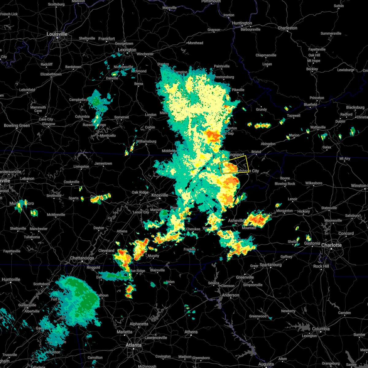 The severe thunderstorm warning for western sullivan, east central hawkins, northern washington and northeastern greene counties will expire at 745 pm edt, the storm which prompted the warning has weakened below severe limits, and no longer poses an immediate threat to life or property. therefore, the warning will be allowed to expire. gusty winds are still possible with this thunderstorm. The severe thunderstorm warning for western sullivan, east central hawkins, northern washington and northeastern greene counties will expire at 745 pm edt, the storm which prompted the warning has weakened below severe limits, and no longer poses an immediate threat to life or property. therefore, the warning will be allowed to expire. gusty winds are still possible with this thunderstorm.
|
| 7/31/2020 7:16 PM EDT |
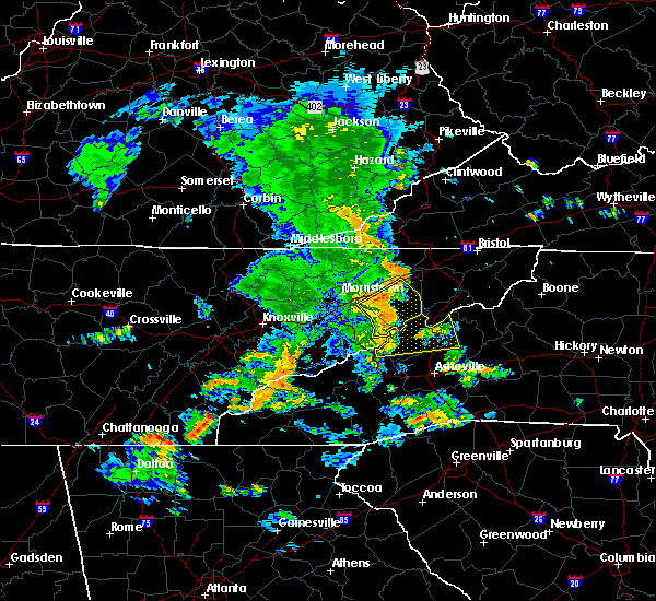 At 716 pm edt, a severe thunderstorm was located 8 miles southeast of surgoinsville, or 12 miles southwest of kingsport, moving east at 35 mph (radar indicated). Hazards include 60 mph wind gusts. expect damage to roofs, siding, and trees At 716 pm edt, a severe thunderstorm was located 8 miles southeast of surgoinsville, or 12 miles southwest of kingsport, moving east at 35 mph (radar indicated). Hazards include 60 mph wind gusts. expect damage to roofs, siding, and trees
|
| 7/24/2020 6:44 PM EDT |
 At 644 pm edt, a severe thunderstorm was located over walnut hill, or near bristol tn, moving south at 20 mph (radar indicated). Hazards include 60 mph wind gusts. expect damage to roofs, siding, and trees At 644 pm edt, a severe thunderstorm was located over walnut hill, or near bristol tn, moving south at 20 mph (radar indicated). Hazards include 60 mph wind gusts. expect damage to roofs, siding, and trees
|
| 7/23/2020 5:26 PM EDT |
 At 526 pm edt, severe thunderstorms were located along a line extending from 8 miles northeast of gate city to spurgeon to 7 miles southwest of jonesborough, moving east at 20 mph (radar indicated). Hazards include 60 mph wind gusts. Expect damage to roofs, siding, and trees. locations impacted include, johnson city, kingsport, bristol tn, gate city, jonesborough, weber city, spurgeon, midway, colonial heights and gray. this includes the following highways, interstate 26 in tennessee between mile markers 1 and 23. Interstate 81 in tennessee between mile markers 50 and 73. At 526 pm edt, severe thunderstorms were located along a line extending from 8 miles northeast of gate city to spurgeon to 7 miles southwest of jonesborough, moving east at 20 mph (radar indicated). Hazards include 60 mph wind gusts. Expect damage to roofs, siding, and trees. locations impacted include, johnson city, kingsport, bristol tn, gate city, jonesborough, weber city, spurgeon, midway, colonial heights and gray. this includes the following highways, interstate 26 in tennessee between mile markers 1 and 23. Interstate 81 in tennessee between mile markers 50 and 73.
|
| 7/23/2020 5:16 PM EDT |
 At 515 pm edt, severe thunderstorms were located along a line extending from 6 miles north of gate city to near colonial heights to 6 miles northeast of tusculum, moving east at 20 mph (radar indicated). Hazards include 60 mph wind gusts and penny size hail. Expect damage to roofs, siding, and trees. locations impacted include, johnson city, kingsport, bristol tn, gate city, jonesborough, weber city, spurgeon, midway, colonial heights and gray. this includes the following highways, interstate 26 in tennessee between mile markers 1 and 23. Interstate 81 in tennessee between mile markers 43 and 73. At 515 pm edt, severe thunderstorms were located along a line extending from 6 miles north of gate city to near colonial heights to 6 miles northeast of tusculum, moving east at 20 mph (radar indicated). Hazards include 60 mph wind gusts and penny size hail. Expect damage to roofs, siding, and trees. locations impacted include, johnson city, kingsport, bristol tn, gate city, jonesborough, weber city, spurgeon, midway, colonial heights and gray. this includes the following highways, interstate 26 in tennessee between mile markers 1 and 23. Interstate 81 in tennessee between mile markers 43 and 73.
|
| 7/23/2020 5:03 PM EDT |
 At 503 pm edt, severe thunderstorms were located along a line extending from 6 miles west of gate city to 8 miles north of tusculum, moving east at 15 mph (radar indicated). Hazards include 60 mph wind gusts and penny size hail. expect damage to roofs, siding, and trees At 503 pm edt, severe thunderstorms were located along a line extending from 6 miles west of gate city to 8 miles north of tusculum, moving east at 15 mph (radar indicated). Hazards include 60 mph wind gusts and penny size hail. expect damage to roofs, siding, and trees
|
| 7/5/2020 4:22 PM EDT |
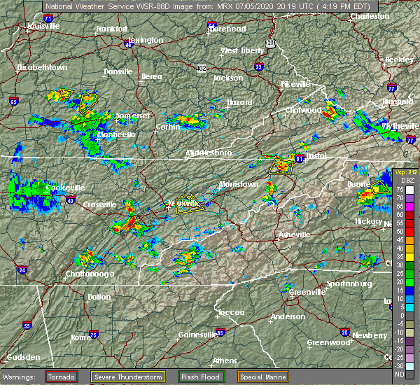 At 422 pm edt, a severe thunderstorm was located over colonial heights, or near kingsport, and is nearly stationary (radar indicated). Hazards include 60 mph wind gusts and nickel size hail. Expect damage to roofs, siding, and trees. locations impacted include, johnson city, kingsport, gray, oak grove, spurgeon, colonial heights, tri-city airport, sullivan gardens, fall branch and warriors path state park. this includes the following highways, interstate 26 in tennessee between mile markers 1 and 12. Interstate 81 in tennessee between mile markers 52 and 68. At 422 pm edt, a severe thunderstorm was located over colonial heights, or near kingsport, and is nearly stationary (radar indicated). Hazards include 60 mph wind gusts and nickel size hail. Expect damage to roofs, siding, and trees. locations impacted include, johnson city, kingsport, gray, oak grove, spurgeon, colonial heights, tri-city airport, sullivan gardens, fall branch and warriors path state park. this includes the following highways, interstate 26 in tennessee between mile markers 1 and 12. Interstate 81 in tennessee between mile markers 52 and 68.
|
| 7/5/2020 4:10 PM EDT |
 At 410 pm edt, a severe thunderstorm was located over colonial heights, or near kingsport, moving west at 5 mph (radar indicated). Hazards include 60 mph wind gusts and nickel size hail. expect damage to roofs, siding, and trees At 410 pm edt, a severe thunderstorm was located over colonial heights, or near kingsport, moving west at 5 mph (radar indicated). Hazards include 60 mph wind gusts and nickel size hail. expect damage to roofs, siding, and trees
|
| 6/14/2020 2:28 PM EDT |
 At 227 pm edt, a severe thunderstorm was located over johnson city, moving east at 15 mph. at 220 pm, public report of quarter size hail in boones creek, tennessee (radar indicated). Hazards include 60 mph wind gusts and quarter size hail. Hail damage to vehicles is expected. expect wind damage to roofs, siding, and trees. locations impacted include, johnson city, elizabethton, jonesborough, central, hampton, midway, pine crest, oak grove, unicoi and bluff city. This includes interstate 26 in tennessee between mile markers 17 and 30. At 227 pm edt, a severe thunderstorm was located over johnson city, moving east at 15 mph. at 220 pm, public report of quarter size hail in boones creek, tennessee (radar indicated). Hazards include 60 mph wind gusts and quarter size hail. Hail damage to vehicles is expected. expect wind damage to roofs, siding, and trees. locations impacted include, johnson city, elizabethton, jonesborough, central, hampton, midway, pine crest, oak grove, unicoi and bluff city. This includes interstate 26 in tennessee between mile markers 17 and 30.
|
| 6/14/2020 2:06 PM EDT |
 At 206 pm edt, a severe thunderstorm was located near jonesborough, or near johnson city, moving east at 15 mph (radar indicated). Hazards include 60 mph wind gusts and quarter size hail. Hail damage to vehicles is expected. Expect wind damage to roofs, siding, and trees. At 206 pm edt, a severe thunderstorm was located near jonesborough, or near johnson city, moving east at 15 mph (radar indicated). Hazards include 60 mph wind gusts and quarter size hail. Hail damage to vehicles is expected. Expect wind damage to roofs, siding, and trees.
|
| 5/3/2020 5:03 PM CDT |
 At 503 pm cdt, severe thunderstorms were located along a line extending from 13 miles south of memphis junction to 8 miles east of portland to near gallatin, moving northeast at 65 mph. these are very dangerous storms (radar indicated). Hazards include 80 mph wind gusts and nickel size hail. Flying debris will be dangerous to those caught without shelter. mobile homes will be heavily damaged. expect considerable damage to roofs, windows, and vehicles. extensive tree damage and power outages are likely. Locations impacted include, gallatin, lebanon, springfield, hartsville, hendersonville, mount juliet, goodlettsville, white house, millersville, lakewood, westmoreland, cross plains, portland, hermitage, belinda city, old hickory, orlinda, mitchellville, bledsoe creek state park and dickerson chapel recreation area. At 503 pm cdt, severe thunderstorms were located along a line extending from 13 miles south of memphis junction to 8 miles east of portland to near gallatin, moving northeast at 65 mph. these are very dangerous storms (radar indicated). Hazards include 80 mph wind gusts and nickel size hail. Flying debris will be dangerous to those caught without shelter. mobile homes will be heavily damaged. expect considerable damage to roofs, windows, and vehicles. extensive tree damage and power outages are likely. Locations impacted include, gallatin, lebanon, springfield, hartsville, hendersonville, mount juliet, goodlettsville, white house, millersville, lakewood, westmoreland, cross plains, portland, hermitage, belinda city, old hickory, orlinda, mitchellville, bledsoe creek state park and dickerson chapel recreation area.
|
| 5/3/2020 4:43 PM CDT |
 At 443 pm cdt, severe thunderstorms were located along a line extending from near springfield to near white house to near hermitage, moving northeast at 65 mph (radar indicated). Hazards include 60 mph wind gusts and nickel size hail. expect damage to roofs, siding, and trees At 443 pm cdt, severe thunderstorms were located along a line extending from near springfield to near white house to near hermitage, moving northeast at 65 mph (radar indicated). Hazards include 60 mph wind gusts and nickel size hail. expect damage to roofs, siding, and trees
|
| 4/8/2020 10:02 PM CDT |
 At 1001 pm cdt, severe thunderstorms were located along a line extending from 7 miles southwest of westmoreland to near hendersonville, moving east at 50 mph (radar indicated). Hazards include 70 mph wind gusts and quarter size hail. Hail damage to vehicles is expected. expect considerable tree damage. wind damage is also likely to mobile homes, roofs, and outbuildings. locations impacted include, gallatin, lebanon, hendersonville, mount juliet, goodlettsville, westmoreland, portland, cottontown, bethpage, oak grove and bledsoe creek state park. this includes the following highways, interstate 40 between mile markers 229 and 233. Interstate 65 between mile markers 95 and 96. At 1001 pm cdt, severe thunderstorms were located along a line extending from 7 miles southwest of westmoreland to near hendersonville, moving east at 50 mph (radar indicated). Hazards include 70 mph wind gusts and quarter size hail. Hail damage to vehicles is expected. expect considerable tree damage. wind damage is also likely to mobile homes, roofs, and outbuildings. locations impacted include, gallatin, lebanon, hendersonville, mount juliet, goodlettsville, westmoreland, portland, cottontown, bethpage, oak grove and bledsoe creek state park. this includes the following highways, interstate 40 between mile markers 229 and 233. Interstate 65 between mile markers 95 and 96.
|
| 4/8/2020 9:36 PM CDT |
 At 936 pm cdt, severe thunderstorms were located along a line extending from near cross plains to near greenbrier, moving east at 50 mph (radar indicated). Hazards include 70 mph wind gusts and quarter size hail. Hail damage to vehicles is expected. expect considerable tree damage. Wind damage is also likely to mobile homes, roofs, and outbuildings. At 936 pm cdt, severe thunderstorms were located along a line extending from near cross plains to near greenbrier, moving east at 50 mph (radar indicated). Hazards include 70 mph wind gusts and quarter size hail. Hail damage to vehicles is expected. expect considerable tree damage. Wind damage is also likely to mobile homes, roofs, and outbuildings.
|
| 3/29/2020 7:13 AM EDT |
 The severe thunderstorm warning for western sullivan, northeastern hawkins, western washington, northeastern greene and southeastern scott counties will expire at 715 am edt, the storms which prompted the warning have moved out of the area. therefore, the warning will be allowed to expire. remember, a severe thunderstorm warning still remains in effect for eastern greene county, central and eastern sullivan county, and southeastern scott county. The severe thunderstorm warning for western sullivan, northeastern hawkins, western washington, northeastern greene and southeastern scott counties will expire at 715 am edt, the storms which prompted the warning have moved out of the area. therefore, the warning will be allowed to expire. remember, a severe thunderstorm warning still remains in effect for eastern greene county, central and eastern sullivan county, and southeastern scott county.
|
| 3/29/2020 7:13 AM EDT |
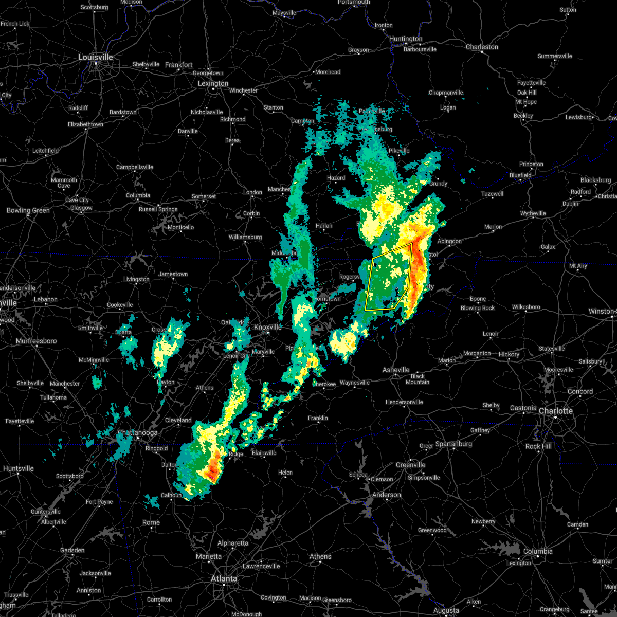 The severe thunderstorm warning for western sullivan, northeastern hawkins, western washington, northeastern greene and southeastern scott counties will expire at 715 am edt, the storms which prompted the warning have moved out of the area. therefore, the warning will be allowed to expire. remember, a severe thunderstorm warning still remains in effect for eastern greene county, central and eastern sullivan county, and southeastern scott county. The severe thunderstorm warning for western sullivan, northeastern hawkins, western washington, northeastern greene and southeastern scott counties will expire at 715 am edt, the storms which prompted the warning have moved out of the area. therefore, the warning will be allowed to expire. remember, a severe thunderstorm warning still remains in effect for eastern greene county, central and eastern sullivan county, and southeastern scott county.
|
| 3/29/2020 7:06 AM EDT |
 At 705 am edt, severe thunderstorms were located along a line extending from near weber city to oak grove to near erwin, moving east at 75 mph (radar indicated). Hazards include 60 mph wind gusts. expect damage to roofs, siding, and trees At 705 am edt, severe thunderstorms were located along a line extending from near weber city to oak grove to near erwin, moving east at 75 mph (radar indicated). Hazards include 60 mph wind gusts. expect damage to roofs, siding, and trees
|
| 3/29/2020 6:55 AM EDT |
 At 654 am edt, severe thunderstorms were located along a line extending from 7 miles southwest of gate city to tusculum, moving northeast at 75 mph (radar indicated). Hazards include 60 mph wind gusts. Expect damage to roofs, siding, and trees. locations impacted include, johnson city, kingsport, greeneville, gate city, jonesborough, tusculum, surgoinsville, weber city, spurgeon and colonial heights. this includes the following highways, interstate 26 in tennessee between mile markers 1 and 17. Interstate 81 in tennessee between mile markers 36 and 65. At 654 am edt, severe thunderstorms were located along a line extending from 7 miles southwest of gate city to tusculum, moving northeast at 75 mph (radar indicated). Hazards include 60 mph wind gusts. Expect damage to roofs, siding, and trees. locations impacted include, johnson city, kingsport, greeneville, gate city, jonesborough, tusculum, surgoinsville, weber city, spurgeon and colonial heights. this includes the following highways, interstate 26 in tennessee between mile markers 1 and 17. Interstate 81 in tennessee between mile markers 36 and 65.
|
| 3/29/2020 6:55 AM EDT |
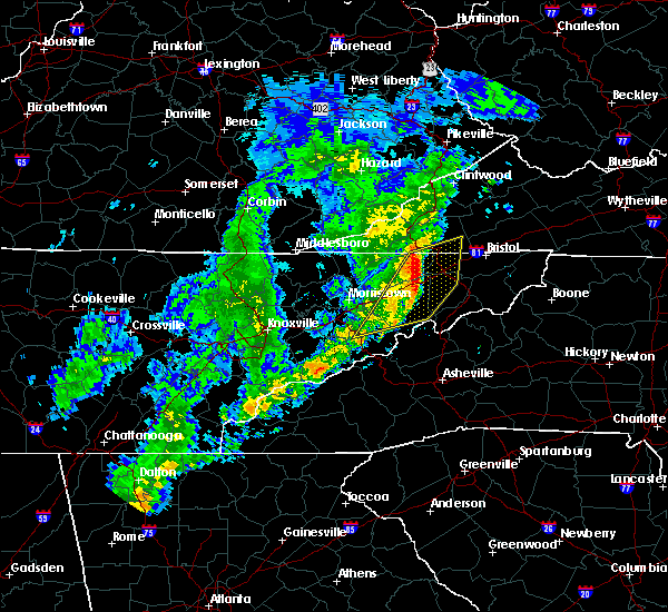 At 654 am edt, severe thunderstorms were located along a line extending from 7 miles southwest of gate city to tusculum, moving northeast at 75 mph (radar indicated). Hazards include 60 mph wind gusts. Expect damage to roofs, siding, and trees. locations impacted include, johnson city, kingsport, greeneville, gate city, jonesborough, tusculum, surgoinsville, weber city, spurgeon and colonial heights. this includes the following highways, interstate 26 in tennessee between mile markers 1 and 17. Interstate 81 in tennessee between mile markers 36 and 65. At 654 am edt, severe thunderstorms were located along a line extending from 7 miles southwest of gate city to tusculum, moving northeast at 75 mph (radar indicated). Hazards include 60 mph wind gusts. Expect damage to roofs, siding, and trees. locations impacted include, johnson city, kingsport, greeneville, gate city, jonesborough, tusculum, surgoinsville, weber city, spurgeon and colonial heights. this includes the following highways, interstate 26 in tennessee between mile markers 1 and 17. Interstate 81 in tennessee between mile markers 36 and 65.
|
| 3/29/2020 6:38 AM EDT |
 At 638 am edt, severe thunderstorms were located along a line extending from near rogersville to 10 miles southeast of russellville to near newport, moving east at 75 mph (radar indicated). Hazards include 60 mph wind gusts. expect damage to roofs, siding, and trees At 638 am edt, severe thunderstorms were located along a line extending from near rogersville to 10 miles southeast of russellville to near newport, moving east at 75 mph (radar indicated). Hazards include 60 mph wind gusts. expect damage to roofs, siding, and trees
|
| 3/29/2020 6:38 AM EDT |
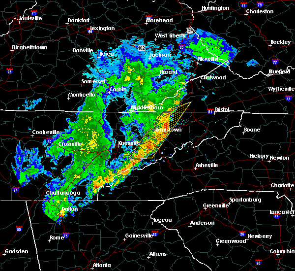 At 638 am edt, severe thunderstorms were located along a line extending from near rogersville to 10 miles southeast of russellville to near newport, moving east at 75 mph (radar indicated). Hazards include 60 mph wind gusts. expect damage to roofs, siding, and trees At 638 am edt, severe thunderstorms were located along a line extending from near rogersville to 10 miles southeast of russellville to near newport, moving east at 75 mph (radar indicated). Hazards include 60 mph wind gusts. expect damage to roofs, siding, and trees
|
| 1/11/2020 6:13 PM CST |
 At 613 pm cst, a severe thunderstorm was located near westmoreland, or 11 miles northwest of lafayette, moving east at 50 mph (radar indicated). Hazards include 60 mph wind gusts. Expect damage to roofs, siding, and trees. Locations impacted include, lafayette, westmoreland and oak grove. At 613 pm cst, a severe thunderstorm was located near westmoreland, or 11 miles northwest of lafayette, moving east at 50 mph (radar indicated). Hazards include 60 mph wind gusts. Expect damage to roofs, siding, and trees. Locations impacted include, lafayette, westmoreland and oak grove.
|
| 1/11/2020 7:03 PM EST |
 At 703 pm est, severe thunderstorms were located along a line extending from 6 miles west of walnut hill to near erwin, moving east at 55 mph (radar indicated). Hazards include 70 mph wind gusts. Expect considerable tree damage. damage is likely to mobile homes, roofs, and outbuildings. Locations impacted include, johnson city, kingsport, bristol tn, bristol va, elizabethton, erwin, jonesborough, central, spurgeon and midway. At 703 pm est, severe thunderstorms were located along a line extending from 6 miles west of walnut hill to near erwin, moving east at 55 mph (radar indicated). Hazards include 70 mph wind gusts. Expect considerable tree damage. damage is likely to mobile homes, roofs, and outbuildings. Locations impacted include, johnson city, kingsport, bristol tn, bristol va, elizabethton, erwin, jonesborough, central, spurgeon and midway.
|
| 1/11/2020 5:43 PM CST |
 At 543 pm cst, a severe thunderstorm was located near cross plains, or 14 miles northeast of springfield, moving east at 50 mph (radar indicated). Hazards include 60 mph wind gusts. expect damage to roofs, siding, and trees At 543 pm cst, a severe thunderstorm was located near cross plains, or 14 miles northeast of springfield, moving east at 50 mph (radar indicated). Hazards include 60 mph wind gusts. expect damage to roofs, siding, and trees
|
| 1/11/2020 6:39 PM EST |
 At 638 pm est, severe thunderstorms were located along a line extending from near surgoinsville to 7 miles south of tusculum, moving east at 55 mph (radar indicated). Hazards include 70 mph wind gusts. Expect considerable tree damage. Damage is likely to mobile homes, roofs, and outbuildings. At 638 pm est, severe thunderstorms were located along a line extending from near surgoinsville to 7 miles south of tusculum, moving east at 55 mph (radar indicated). Hazards include 70 mph wind gusts. Expect considerable tree damage. Damage is likely to mobile homes, roofs, and outbuildings.
|
| 10/31/2019 12:58 PM EDT |
 At 1257 pm edt, severe thunderstorms were located along a line extending from 8 miles southwest of kingsport to near greeneville, moving east at 45 mph (radar indicated). Hazards include 60 mph wind gusts. expect damage to roofs, siding, and trees At 1257 pm edt, severe thunderstorms were located along a line extending from 8 miles southwest of kingsport to near greeneville, moving east at 45 mph (radar indicated). Hazards include 60 mph wind gusts. expect damage to roofs, siding, and trees
|
| 6/27/2019 7:06 PM CDT |
 The severe thunderstorm warning for northern sumner and northeastern robertson counties will expire at 715 pm cdt, the storms which prompted the warning have moved out of the area. therefore, the warning will be allowed to expire. The severe thunderstorm warning for northern sumner and northeastern robertson counties will expire at 715 pm cdt, the storms which prompted the warning have moved out of the area. therefore, the warning will be allowed to expire.
|
| 6/27/2019 6:39 PM CDT |
 At 638 pm cdt, severe thunderstorms were located along a line extending from 7 miles northwest of cross plains to 6 miles west of westmoreland, moving north at 30 mph (radar indicated). Hazards include 60 mph wind gusts and penny size hail. expect damage to roofs, siding, and trees At 638 pm cdt, severe thunderstorms were located along a line extending from 7 miles northwest of cross plains to 6 miles west of westmoreland, moving north at 30 mph (radar indicated). Hazards include 60 mph wind gusts and penny size hail. expect damage to roofs, siding, and trees
|
| 6/27/2019 6:31 PM CDT |
 At 630 pm cdt, severe thunderstorms were located along a line extending from near springfield to 7 miles southwest of westmoreland, moving north at 30 mph (radar indicated). Hazards include 60 mph wind gusts and penny size hail. Expect damage to roofs, siding, and trees. locations impacted include, gallatin, white house, millersville, greenbrier, ridgetop, cross plains, portland, orlinda, cottontown, bethpage, oak grove and bledsoe creek state park. This includes interstate 65 between mile markers 101 and 120. At 630 pm cdt, severe thunderstorms were located along a line extending from near springfield to 7 miles southwest of westmoreland, moving north at 30 mph (radar indicated). Hazards include 60 mph wind gusts and penny size hail. Expect damage to roofs, siding, and trees. locations impacted include, gallatin, white house, millersville, greenbrier, ridgetop, cross plains, portland, orlinda, cottontown, bethpage, oak grove and bledsoe creek state park. This includes interstate 65 between mile markers 101 and 120.
|
| 6/27/2019 6:05 PM CDT |
 At 605 pm cdt, severe thunderstorms were located along a line extending from near millersville to near lebanon, moving north at 35 mph (radar indicated). Hazards include 60 mph wind gusts and penny size hail. expect damage to roofs, siding, and trees At 605 pm cdt, severe thunderstorms were located along a line extending from near millersville to near lebanon, moving north at 35 mph (radar indicated). Hazards include 60 mph wind gusts and penny size hail. expect damage to roofs, siding, and trees
|
| 6/22/2019 4:53 PM CDT |
 The severe thunderstorm warning for sumner, northwestern wilson and southeastern robertson counties will expire at 500 pm cdt, the storms which prompted the warning have moved out of the area. therefore, the warning will be allowed to expire. to report severe weather, contact your nearest law enforcement agency. they will relay your report to the national weather service nashville. The severe thunderstorm warning for sumner, northwestern wilson and southeastern robertson counties will expire at 500 pm cdt, the storms which prompted the warning have moved out of the area. therefore, the warning will be allowed to expire. to report severe weather, contact your nearest law enforcement agency. they will relay your report to the national weather service nashville.
|
| 6/22/2019 4:28 PM CDT |
 At 417 pm cdt, severe thunderstorms were located along a line extending from near cross plains to near greenbrier, moving east at 45 mph (radar indicated). Hazards include 60 mph wind gusts. expect damage to roofs, siding, and trees At 417 pm cdt, severe thunderstorms were located along a line extending from near cross plains to near greenbrier, moving east at 45 mph (radar indicated). Hazards include 60 mph wind gusts. expect damage to roofs, siding, and trees
|
| 6/22/2019 4:17 PM CDT |
 At 417 pm cdt, severe thunderstorms were located along a line extending from near cross plains to near greenbrier, moving east at 45 mph (radar indicated). Hazards include 60 mph wind gusts. expect damage to roofs, siding, and trees At 417 pm cdt, severe thunderstorms were located along a line extending from near cross plains to near greenbrier, moving east at 45 mph (radar indicated). Hazards include 60 mph wind gusts. expect damage to roofs, siding, and trees
|
| 6/22/2019 1:11 AM EDT |
 At 111 am edt, severe thunderstorms were located along a line extending from 10 miles southeast of norton to 9 miles east of weber city to near oak grove, moving east at 40 mph (radar indicated). Hazards include 60 mph wind gusts. Expect damage to roofs, siding, and trees. Locations impacted include, johnson city, kingsport, gate city, weber city, spurgeon, colonial heights, oak grove, nickelsville, dungannon, tri-city airport, blountville, rocky mount state park, warriors path state park, fort blackmore, hiltons and bloomingdale. At 111 am edt, severe thunderstorms were located along a line extending from 10 miles southeast of norton to 9 miles east of weber city to near oak grove, moving east at 40 mph (radar indicated). Hazards include 60 mph wind gusts. Expect damage to roofs, siding, and trees. Locations impacted include, johnson city, kingsport, gate city, weber city, spurgeon, colonial heights, oak grove, nickelsville, dungannon, tri-city airport, blountville, rocky mount state park, warriors path state park, fort blackmore, hiltons and bloomingdale.
|
| 6/22/2019 1:01 AM EDT |
 At 100 am edt, severe thunderstorms were located along a line extending from gray to near mars hill, moving east at 50 mph (radar indicated). Hazards include 60 mph wind gusts. Expect damage to roofs, siding, and trees. Locations impacted include, johnson city, erwin, jonesborough, gray, banner hill, oak grove, midway, spurgeon, unicoi, leesburg, limestone, rocky fork, telford, fall branch, avondale and embreeville. At 100 am edt, severe thunderstorms were located along a line extending from gray to near mars hill, moving east at 50 mph (radar indicated). Hazards include 60 mph wind gusts. Expect damage to roofs, siding, and trees. Locations impacted include, johnson city, erwin, jonesborough, gray, banner hill, oak grove, midway, spurgeon, unicoi, leesburg, limestone, rocky fork, telford, fall branch, avondale and embreeville.
|
| 6/22/2019 12:55 AM EDT |
 At 1254 am edt, severe thunderstorms were located along a line extending from near norton to near gate city to near colonial heights, moving northeast at 45 mph (radar indicated). Hazards include 60 mph wind gusts. Expect damage to roofs, siding, and trees. Locations impacted include, johnson city, kingsport, norton, wise, gate city, big stone gap, weber city, spurgeon, colonial heights, oak grove, gray, church hill, mount carmel, coeburn, appalachia, pound, nickelsville, dungannon, clinchport and sullivan gardens. At 1254 am edt, severe thunderstorms were located along a line extending from near norton to near gate city to near colonial heights, moving northeast at 45 mph (radar indicated). Hazards include 60 mph wind gusts. Expect damage to roofs, siding, and trees. Locations impacted include, johnson city, kingsport, norton, wise, gate city, big stone gap, weber city, spurgeon, colonial heights, oak grove, gray, church hill, mount carmel, coeburn, appalachia, pound, nickelsville, dungannon, clinchport and sullivan gardens.
|
| 6/22/2019 12:47 AM EDT |
 At 1247 am edt, severe thunderstorms were located along a line extending from 9 miles west of gray to near hot springs, moving east at 55 mph (radar indicated). Hazards include 60 mph wind gusts. Expect damage to roofs, siding, and trees. Locations impacted include, johnson city, greeneville, erwin, jonesborough, tusculum, gray, banner hill, oak grove, midway, spurgeon, unicoi, baileyton, leesburg, chucky, cedar creek, limestone, rocky fork, telford, fall branch and avondale. At 1247 am edt, severe thunderstorms were located along a line extending from 9 miles west of gray to near hot springs, moving east at 55 mph (radar indicated). Hazards include 60 mph wind gusts. Expect damage to roofs, siding, and trees. Locations impacted include, johnson city, greeneville, erwin, jonesborough, tusculum, gray, banner hill, oak grove, midway, spurgeon, unicoi, baileyton, leesburg, chucky, cedar creek, limestone, rocky fork, telford, fall branch and avondale.
|
| 6/22/2019 12:35 AM EDT |
 At 1234 am edt, severe thunderstorms were located along a line extending from near clover fork to near surgoinsville to 7 miles southeast of rogersville, moving east at 45 mph (radar indicated). Hazards include 60 mph wind gusts. expect damage to roofs, siding, and trees At 1234 am edt, severe thunderstorms were located along a line extending from near clover fork to near surgoinsville to 7 miles southeast of rogersville, moving east at 45 mph (radar indicated). Hazards include 60 mph wind gusts. expect damage to roofs, siding, and trees
|
| 6/22/2019 12:26 AM EDT |
 The national weather service in morristown has issued a * severe thunderstorm warning for. washington county in east tennessee. southeastern cocke county in east tennessee. greene county in east tennessee. Unicoi county in east tennessee. The national weather service in morristown has issued a * severe thunderstorm warning for. washington county in east tennessee. southeastern cocke county in east tennessee. greene county in east tennessee. Unicoi county in east tennessee.
|
| 6/21/2019 7:57 PM CDT |
 At 741 pm cdt, severe thunderstorms were located along a line extending from near portland to near greenbrier to near joelton, moving east at 30 mph. these are very dangerous storms (radar indicated). Hazards include spotter reports of 80 mph wind gusts and half dollar size hail. Flying debris will be dangerous to those caught without shelter. mobile homes will be heavily damaged. expect considerable damage to roofs, windows, and vehicles. extensive tree damage and power outages are likely. locations impacted include, gallatin, lebanon, springfield, madison, hendersonville, mount juliet, goodlettsville, white house, millersville, greenbrier, coopertown, lakewood, westmoreland, ridgetop, cross plains, portland, hermitage, rural hill, belinda city and old hickory. this includes the following highways, interstate 40 between mile markers 217 and 234. interstate 65 between mile markers 86 and 121. interstate 24 between mile markers 22 and 47. Interstate 840 between mile markers 68 and 69, and near mile marker 71. At 741 pm cdt, severe thunderstorms were located along a line extending from near portland to near greenbrier to near joelton, moving east at 30 mph. these are very dangerous storms (radar indicated). Hazards include spotter reports of 80 mph wind gusts and half dollar size hail. Flying debris will be dangerous to those caught without shelter. mobile homes will be heavily damaged. expect considerable damage to roofs, windows, and vehicles. extensive tree damage and power outages are likely. locations impacted include, gallatin, lebanon, springfield, madison, hendersonville, mount juliet, goodlettsville, white house, millersville, greenbrier, coopertown, lakewood, westmoreland, ridgetop, cross plains, portland, hermitage, rural hill, belinda city and old hickory. this includes the following highways, interstate 40 between mile markers 217 and 234. interstate 65 between mile markers 86 and 121. interstate 24 between mile markers 22 and 47. Interstate 840 between mile markers 68 and 69, and near mile marker 71.
|
| 6/21/2019 7:41 PM CDT |
 At 741 pm cdt, severe thunderstorms were located along a line extending from near portland to near greenbrier to near joelton, moving east at 30 mph. these are very dangerous storms (radar indicated). Hazards include spotter reports of 80 mph wind gusts and half dollar size hail. Flying debris will be dangerous to those caught without shelter. mobile homes will be heavily damaged. expect considerable damage to roofs, windows, and vehicles. extensive tree damage and power outages are likely. locations impacted include, gallatin, lebanon, springfield, madison, hendersonville, mount juliet, goodlettsville, white house, millersville, greenbrier, coopertown, lakewood, westmoreland, ridgetop, cross plains, portland, hermitage, rural hill, belinda city and old hickory. this includes the following highways, interstate 40 between mile markers 217 and 234. interstate 65 between mile markers 86 and 121. interstate 24 between mile markers 22 and 47. Interstate 840 between mile markers 68 and 69, and near mile marker 71. At 741 pm cdt, severe thunderstorms were located along a line extending from near portland to near greenbrier to near joelton, moving east at 30 mph. these are very dangerous storms (radar indicated). Hazards include spotter reports of 80 mph wind gusts and half dollar size hail. Flying debris will be dangerous to those caught without shelter. mobile homes will be heavily damaged. expect considerable damage to roofs, windows, and vehicles. extensive tree damage and power outages are likely. locations impacted include, gallatin, lebanon, springfield, madison, hendersonville, mount juliet, goodlettsville, white house, millersville, greenbrier, coopertown, lakewood, westmoreland, ridgetop, cross plains, portland, hermitage, rural hill, belinda city and old hickory. this includes the following highways, interstate 40 between mile markers 217 and 234. interstate 65 between mile markers 86 and 121. interstate 24 between mile markers 22 and 47. Interstate 840 between mile markers 68 and 69, and near mile marker 71.
|
| 6/21/2019 7:29 PM CDT |
 At 729 pm cdt, severe thunderstorms were located along a line extending from 9 miles northwest of cross plains to springfield to near coopertown, moving east at 30 mph (radar indicated). Hazards include 70 mph wind gusts and ping pong ball size hail. People and animals outdoors will be injured. expect hail damage to roofs, siding, windows, and vehicles. expect considerable tree damage. Wind damage is also likely to mobile homes, roofs, and outbuildings. At 729 pm cdt, severe thunderstorms were located along a line extending from 9 miles northwest of cross plains to springfield to near coopertown, moving east at 30 mph (radar indicated). Hazards include 70 mph wind gusts and ping pong ball size hail. People and animals outdoors will be injured. expect hail damage to roofs, siding, windows, and vehicles. expect considerable tree damage. Wind damage is also likely to mobile homes, roofs, and outbuildings.
|
| 5/18/2019 5:45 PM EDT |
 At 545 pm edt, a severe thunderstorm was located over johnson city, moving north at 5 mph (radar indicated). Hazards include 60 mph wind gusts and quarter size hail. Hail damage to vehicles is expected. expect wind damage to roofs, siding, and trees. Locations impacted include, johnson city, elizabethton, jonesborough, oak grove, central, midway, pine crest and watauga. At 545 pm edt, a severe thunderstorm was located over johnson city, moving north at 5 mph (radar indicated). Hazards include 60 mph wind gusts and quarter size hail. Hail damage to vehicles is expected. expect wind damage to roofs, siding, and trees. Locations impacted include, johnson city, elizabethton, jonesborough, oak grove, central, midway, pine crest and watauga.
|
| 5/18/2019 5:32 PM EDT |
 At 532 pm edt, a severe thunderstorm was located near midway, or near johnson city, moving north at 5 mph (radar indicated). Hazards include 60 mph wind gusts and quarter size hail. Hail damage to vehicles is expected. Expect wind damage to roofs, siding, and trees. At 532 pm edt, a severe thunderstorm was located near midway, or near johnson city, moving north at 5 mph (radar indicated). Hazards include 60 mph wind gusts and quarter size hail. Hail damage to vehicles is expected. Expect wind damage to roofs, siding, and trees.
|
| 5/4/2019 3:50 PM EDT |
 The severe thunderstorm warning for washington, northern unicoi and southwestern carter counties will expire at 400 pm edt, the storm which prompted the warning has weakened below severe limits, and has exited the warned area. therefore, the warning will be allowed to expire. however gusty winds and heavy rain are still possible with this thunderstorm. The severe thunderstorm warning for washington, northern unicoi and southwestern carter counties will expire at 400 pm edt, the storm which prompted the warning has weakened below severe limits, and has exited the warned area. therefore, the warning will be allowed to expire. however gusty winds and heavy rain are still possible with this thunderstorm.
|
| 5/4/2019 3:30 PM EDT |
 At 329 pm edt, a severe thunderstorm was located near jonesborough, or 8 miles northwest of erwin, moving northeast at 35 mph (radar indicated). Hazards include 60 mph wind gusts and quarter size hail. Hail damage to vehicles is expected. expect wind damage to roofs, siding, and trees. Locations impacted include, johnson city, elizabethton, erwin, jonesborough, gray, banner hill, oak grove, central, midway, pine crest, spurgeon, unicoi, watauga, leesburg, limestone cove, telford, milligan college, avondale and embreeville. At 329 pm edt, a severe thunderstorm was located near jonesborough, or 8 miles northwest of erwin, moving northeast at 35 mph (radar indicated). Hazards include 60 mph wind gusts and quarter size hail. Hail damage to vehicles is expected. expect wind damage to roofs, siding, and trees. Locations impacted include, johnson city, elizabethton, erwin, jonesborough, gray, banner hill, oak grove, central, midway, pine crest, spurgeon, unicoi, watauga, leesburg, limestone cove, telford, milligan college, avondale and embreeville.
|
| 5/4/2019 3:12 PM EDT |
 At 312 pm edt, a severe thunderstorm was located near tusculum, or 10 miles east of greeneville, moving northeast at 35 mph (radar indicated). Hazards include 60 mph wind gusts and quarter size hail. Hail damage to vehicles is expected. Expect wind damage to roofs, siding, and trees. At 312 pm edt, a severe thunderstorm was located near tusculum, or 10 miles east of greeneville, moving northeast at 35 mph (radar indicated). Hazards include 60 mph wind gusts and quarter size hail. Hail damage to vehicles is expected. Expect wind damage to roofs, siding, and trees.
|
| 5/3/2019 2:10 PM EDT |
 At 210 pm edt, a severe thunderstorm was located near jonesborough, or 11 miles west of johnson city, moving northeast at 35 mph (radar indicated). Hazards include 60 mph wind gusts and quarter size hail. Hail damage to vehicles is expected. expect wind damage to roofs, siding, and trees. Locations impacted include, johnson city, jonesborough, gray, oak grove, midway, spurgeon, watauga, telford, fall branch, leesburg, limestone and avondale. At 210 pm edt, a severe thunderstorm was located near jonesborough, or 11 miles west of johnson city, moving northeast at 35 mph (radar indicated). Hazards include 60 mph wind gusts and quarter size hail. Hail damage to vehicles is expected. expect wind damage to roofs, siding, and trees. Locations impacted include, johnson city, jonesborough, gray, oak grove, midway, spurgeon, watauga, telford, fall branch, leesburg, limestone and avondale.
|
| 5/3/2019 1:55 PM EDT |
 At 155 pm edt, a severe thunderstorm was located near tusculum, or 8 miles northeast of greeneville, moving northeast at 30 mph (radar indicated). Hazards include 60 mph wind gusts and quarter size hail. Hail damage to vehicles is expected. expect wind damage to roofs, siding, and trees. Locations impacted include, johnson city, greeneville, jonesborough, tusculum, gray, oak grove, midway, spurgeon, watauga, leesburg, chucky, limestone, telford, fall branch, avondale and davy crockett birthplace. At 155 pm edt, a severe thunderstorm was located near tusculum, or 8 miles northeast of greeneville, moving northeast at 30 mph (radar indicated). Hazards include 60 mph wind gusts and quarter size hail. Hail damage to vehicles is expected. expect wind damage to roofs, siding, and trees. Locations impacted include, johnson city, greeneville, jonesborough, tusculum, gray, oak grove, midway, spurgeon, watauga, leesburg, chucky, limestone, telford, fall branch, avondale and davy crockett birthplace.
|
| 5/3/2019 1:37 PM EDT |
 The national weather service in morristown has issued a * severe thunderstorm warning for. washington county in east tennessee. northeastern greene county in east tennessee. until 230 pm edt. At 137 pm edt, a severe thunderstorm was located over greeneville,. The national weather service in morristown has issued a * severe thunderstorm warning for. washington county in east tennessee. northeastern greene county in east tennessee. until 230 pm edt. At 137 pm edt, a severe thunderstorm was located over greeneville,.
|
| 3/30/2019 6:46 PM CDT |
 At 646 pm cdt, severe thunderstorms were located along a line extending from near portland to madison, moving east at 65 mph (radar indicated). Hazards include 60 mph wind gusts. expect damage to roofs, siding, and trees At 646 pm cdt, severe thunderstorms were located along a line extending from near portland to madison, moving east at 65 mph (radar indicated). Hazards include 60 mph wind gusts. expect damage to roofs, siding, and trees
|
| 12/31/2018 2:51 PM CST |
 At 250 pm cst, severe thunderstorms were located along a line extending from 9 miles northeast of scottsville to near mount juliet, moving northeast at 70 mph (radar indicated). Hazards include 60 mph wind gusts. Expect damage to roofs, siding, and trees. Locations impacted include, murfreesboro, franklin, gallatin, lebanon, lafayette, hartsville, hendersonville, smyrna, brentwood, la vergne, mount juliet, nolensville, westmoreland, hermitage, walterhill, rural hill, antioch, belinda city, bethpage and oak grove. At 250 pm cst, severe thunderstorms were located along a line extending from 9 miles northeast of scottsville to near mount juliet, moving northeast at 70 mph (radar indicated). Hazards include 60 mph wind gusts. Expect damage to roofs, siding, and trees. Locations impacted include, murfreesboro, franklin, gallatin, lebanon, lafayette, hartsville, hendersonville, smyrna, brentwood, la vergne, mount juliet, nolensville, westmoreland, hermitage, walterhill, rural hill, antioch, belinda city, bethpage and oak grove.
|
| 12/31/2018 2:25 PM CST |
 At 224 pm cst, severe thunderstorms were located along a line extending from portland to near franklin, moving northeast at 60 mph (radar indicated). Hazards include 60 mph wind gusts. expect damage to roofs, siding, and trees At 224 pm cst, severe thunderstorms were located along a line extending from portland to near franklin, moving northeast at 60 mph (radar indicated). Hazards include 60 mph wind gusts. expect damage to roofs, siding, and trees
|
| 11/6/2018 6:50 AM EST |
 The severe thunderstorm warning for sullivan, southeastern scott and southwestern washington counties and the city of bristol will expire at 700 am est, the storm which prompted the warning has weakened below severe limits, and no longer poses an immediate threat to life or property. therefore, the warning will be allowed to expire. The severe thunderstorm warning for sullivan, southeastern scott and southwestern washington counties and the city of bristol will expire at 700 am est, the storm which prompted the warning has weakened below severe limits, and no longer poses an immediate threat to life or property. therefore, the warning will be allowed to expire.
|
| 11/6/2018 6:20 AM EST |
 At 620 am est, a severe thunderstorm was located near kingsport, moving east at 50 mph (radar indicated). Hazards include 60 mph wind gusts. expect damage to roofs, siding, and trees At 620 am est, a severe thunderstorm was located near kingsport, moving east at 50 mph (radar indicated). Hazards include 60 mph wind gusts. expect damage to roofs, siding, and trees
|
| 11/6/2018 5:58 AM EST |
 At 556 am est, severe thunderstorms were located along a line extending from near tusculum to near hot springs, moving northeast at 65 mph (radar indicated). Hazards include 60 mph wind gusts. expect damage to roofs, siding, and trees At 556 am est, severe thunderstorms were located along a line extending from near tusculum to near hot springs, moving northeast at 65 mph (radar indicated). Hazards include 60 mph wind gusts. expect damage to roofs, siding, and trees
|
| 9/9/2018 7:12 PM EDT |
 At 712 pm edt, severe thunderstorms were located along a line extending from 12 miles north of surgoinsville to near oak grove, moving northeast at 40 mph (radar indicated). Hazards include 60 mph wind gusts and penny size hail. expect damage to roofs, siding, and trees At 712 pm edt, severe thunderstorms were located along a line extending from 12 miles north of surgoinsville to near oak grove, moving northeast at 40 mph (radar indicated). Hazards include 60 mph wind gusts and penny size hail. expect damage to roofs, siding, and trees
|
| 9/9/2018 7:03 PM EDT |
 At 703 pm edt, severe thunderstorms were located along a line extending from 6 miles east of sneedville to 6 miles northeast of surgoinsville to near gray, moving northeast at 40 mph (radar indicated). Hazards include 60 mph wind gusts and penny size hail. Expect damage to roofs, siding, and trees. Locations impacted include, johnson city, kingsport, bristol tn, bristol va, gate city, surgoinsville, weber city, spurgeon, colonial heights, gray, oak grove, walnut hill, church hill, mount carmel, bluff city, duffield, clinchport, bays mountain state park, sullivan gardens and okolona. At 703 pm edt, severe thunderstorms were located along a line extending from 6 miles east of sneedville to 6 miles northeast of surgoinsville to near gray, moving northeast at 40 mph (radar indicated). Hazards include 60 mph wind gusts and penny size hail. Expect damage to roofs, siding, and trees. Locations impacted include, johnson city, kingsport, bristol tn, bristol va, gate city, surgoinsville, weber city, spurgeon, colonial heights, gray, oak grove, walnut hill, church hill, mount carmel, bluff city, duffield, clinchport, bays mountain state park, sullivan gardens and okolona.
|
| 9/9/2018 6:42 PM EDT |
 At 642 pm edt, severe thunderstorms were located along a line extending from near bean station to near rogersville to 7 miles north of tusculum, moving northeast at 35 mph (radar indicated). Hazards include 60 mph wind gusts and penny size hail. expect damage to roofs, siding, and trees At 642 pm edt, severe thunderstorms were located along a line extending from near bean station to near rogersville to 7 miles north of tusculum, moving northeast at 35 mph (radar indicated). Hazards include 60 mph wind gusts and penny size hail. expect damage to roofs, siding, and trees
|
| 8/21/2018 12:27 AM CDT |
 At 1226 am cdt, a severe thunderstorm was located near westmoreland, or 9 miles northwest of lafayette, moving northeast at 50 mph (radar indicated). Hazards include 60 mph wind gusts. Expect damage to roofs, siding, and trees. Locations impacted include, lafayette, westmoreland and oak grove. At 1226 am cdt, a severe thunderstorm was located near westmoreland, or 9 miles northwest of lafayette, moving northeast at 50 mph (radar indicated). Hazards include 60 mph wind gusts. Expect damage to roofs, siding, and trees. Locations impacted include, lafayette, westmoreland and oak grove.
|
| 8/21/2018 12:08 AM CDT |
 The national weather service in nashville has issued a * severe thunderstorm warning for. eastern sumner county in middle tennessee. northwestern macon county in middle tennessee. northwestern trousdale county in middle tennessee. Until 1245 am cdt. The national weather service in nashville has issued a * severe thunderstorm warning for. eastern sumner county in middle tennessee. northwestern macon county in middle tennessee. northwestern trousdale county in middle tennessee. Until 1245 am cdt.
|
| 7/20/2018 10:10 PM EDT |
 The national weather service in morristown has issued a * severe thunderstorm warning for. sullivan county in east tennessee. washington county in east tennessee. jefferson county in east tennessee. Cocke county in east tennessee. The national weather service in morristown has issued a * severe thunderstorm warning for. sullivan county in east tennessee. washington county in east tennessee. jefferson county in east tennessee. Cocke county in east tennessee.
|
| 7/20/2018 10:10 PM EDT |
 At 1009 pm edt, severe thunderstorms were located along a line extending from 7 miles northeast of gate city to near kingsport to 10 miles southwest of colonial heights to 9 miles north of greeneville to near russellville to 6 miles northeast of jefferson city, moving southeast at 55 mph (radar indicated). Hazards include 60 mph wind gusts and penny size hail. expect damage to roofs, siding, and trees At 1009 pm edt, severe thunderstorms were located along a line extending from 7 miles northeast of gate city to near kingsport to 10 miles southwest of colonial heights to 9 miles north of greeneville to near russellville to 6 miles northeast of jefferson city, moving southeast at 55 mph (radar indicated). Hazards include 60 mph wind gusts and penny size hail. expect damage to roofs, siding, and trees
|
| 6/27/2018 4:46 PM CDT |
 At 446 pm cdt, a severe thunderstorm was located near castalian springs, moving east at 45 mph (radar indicated). Hazards include 70 mph wind gusts and penny size hail. Expect considerable tree damage. damage is likely to mobile homes, roofs, and outbuildings. Locations impacted include, gallatin, lafayette, hartsville, westmoreland, bethpage, oak grove, bledsoe creek state park and dickerson chapel recreation area. At 446 pm cdt, a severe thunderstorm was located near castalian springs, moving east at 45 mph (radar indicated). Hazards include 70 mph wind gusts and penny size hail. Expect considerable tree damage. damage is likely to mobile homes, roofs, and outbuildings. Locations impacted include, gallatin, lafayette, hartsville, westmoreland, bethpage, oak grove, bledsoe creek state park and dickerson chapel recreation area.
|
| 6/27/2018 4:39 PM CDT |
 At 439 pm cdt, severe thunderstorms were located along a line extending from near westmoreland to near gallatin, moving east at 50 mph (radar indicated). Hazards include 60 mph wind gusts and penny size hail. Expect damage to roofs, siding, and trees. Locations impacted include, gallatin, lafayette, hartsville, hendersonville, goodlettsville, white house, millersville, westmoreland, portland, mitchellville, bethpage, oak grove, bledsoe creek state park, dickerson chapel recreation area and cottontown. At 439 pm cdt, severe thunderstorms were located along a line extending from near westmoreland to near gallatin, moving east at 50 mph (radar indicated). Hazards include 60 mph wind gusts and penny size hail. Expect damage to roofs, siding, and trees. Locations impacted include, gallatin, lafayette, hartsville, hendersonville, goodlettsville, white house, millersville, westmoreland, portland, mitchellville, bethpage, oak grove, bledsoe creek state park, dickerson chapel recreation area and cottontown.
|
| 6/27/2018 4:24 PM CDT |
 At 424 pm cdt, severe thunderstorms were located along a line extending from near portland to near white house, moving east at 45 mph (radar indicated). Hazards include 60 mph wind gusts and penny size hail. expect damage to roofs, siding, and trees At 424 pm cdt, severe thunderstorms were located along a line extending from near portland to near white house, moving east at 45 mph (radar indicated). Hazards include 60 mph wind gusts and penny size hail. expect damage to roofs, siding, and trees
|
| 6/27/2018 4:08 PM CDT |
 At 407 pm cdt, a severe thunderstorm was located near orlinda, or 9 miles northeast of springfield, moving east at 30 mph (radar indicated). Hazards include 60 mph wind gusts. expect damage to roofs, siding, and trees At 407 pm cdt, a severe thunderstorm was located near orlinda, or 9 miles northeast of springfield, moving east at 30 mph (radar indicated). Hazards include 60 mph wind gusts. expect damage to roofs, siding, and trees
|
| 6/17/2018 5:11 PM CDT |
 At 511 pm cdt, a severe thunderstorm was located 8 miles west of westmoreland, or 11 miles north of gallatin, moving northeast at 10 mph (radar indicated). Hazards include 60 mph wind gusts and nickel size hail. Expect damage to roofs, siding, and trees. Locations impacted include, oak grove and bethpage. At 511 pm cdt, a severe thunderstorm was located 8 miles west of westmoreland, or 11 miles north of gallatin, moving northeast at 10 mph (radar indicated). Hazards include 60 mph wind gusts and nickel size hail. Expect damage to roofs, siding, and trees. Locations impacted include, oak grove and bethpage.
|
| 6/17/2018 4:56 PM CDT |
 At 455 pm cdt, a severe thunderstorm was located 9 miles west of westmoreland, or 10 miles north of gallatin, moving northeast at 15 mph (radar indicated). Hazards include 60 mph wind gusts and nickel size hail. expect damage to roofs, siding, and trees At 455 pm cdt, a severe thunderstorm was located 9 miles west of westmoreland, or 10 miles north of gallatin, moving northeast at 15 mph (radar indicated). Hazards include 60 mph wind gusts and nickel size hail. expect damage to roofs, siding, and trees
|
| 6/11/2018 7:39 PM CDT |
 At 724 pm cdt, a severe thunderstorm was located 7 miles east of gallatin, and is nearly stationary (radar indicated). Hazards include 60 mph wind gusts and quarter size hail. Hail damage to vehicles is expected. Expect wind damage to roofs, siding, and trees. At 724 pm cdt, a severe thunderstorm was located 7 miles east of gallatin, and is nearly stationary (radar indicated). Hazards include 60 mph wind gusts and quarter size hail. Hail damage to vehicles is expected. Expect wind damage to roofs, siding, and trees.
|
| 6/11/2018 7:24 PM CDT |
 At 724 pm cdt, a severe thunderstorm was located 7 miles east of gallatin, and is nearly stationary (radar indicated). Hazards include 60 mph wind gusts and quarter size hail. Hail damage to vehicles is expected. Expect wind damage to roofs, siding, and trees. At 724 pm cdt, a severe thunderstorm was located 7 miles east of gallatin, and is nearly stationary (radar indicated). Hazards include 60 mph wind gusts and quarter size hail. Hail damage to vehicles is expected. Expect wind damage to roofs, siding, and trees.
|
| 6/10/2018 3:43 PM CDT |
 At 342 pm cdt, a severe thunderstorm was located near white house, or 7 miles northwest of gallatin, moving south at 20 mph (radar indicated). Hazards include 60 mph wind gusts and penny size hail. Expect damage to roofs, siding, and trees. locations impacted include, gallatin, hendersonville, goodlettsville, white house, millersville, cross plains, portland, orlinda, cottontown and bledsoe creek state park. This includes interstate 65 between mile markers 101 and 102, and between mile markers 105 and 120. At 342 pm cdt, a severe thunderstorm was located near white house, or 7 miles northwest of gallatin, moving south at 20 mph (radar indicated). Hazards include 60 mph wind gusts and penny size hail. Expect damage to roofs, siding, and trees. locations impacted include, gallatin, hendersonville, goodlettsville, white house, millersville, cross plains, portland, orlinda, cottontown and bledsoe creek state park. This includes interstate 65 between mile markers 101 and 102, and between mile markers 105 and 120.
|
| 6/10/2018 3:28 PM CDT |
 At 328 pm cdt, a severe thunderstorm was located near cross plains, or 12 miles northwest of gallatin, moving south at 20 mph (radar indicated). Hazards include 60 mph wind gusts and penny size hail. expect damage to roofs, siding, and trees At 328 pm cdt, a severe thunderstorm was located near cross plains, or 12 miles northwest of gallatin, moving south at 20 mph (radar indicated). Hazards include 60 mph wind gusts and penny size hail. expect damage to roofs, siding, and trees
|
| 5/20/2018 6:58 PM CDT |
 At 658 pm cdt, a severe thunderstorm was located near westmoreland, or 13 miles northeast of gallatin, moving northeast at 20 mph (radar indicated). Hazards include 60 mph wind gusts and quarter size hail. Hail damage to vehicles is expected. expect wind damage to roofs, siding, and trees. Locations impacted include, gallatin, westmoreland, oak grove and bethpage. At 658 pm cdt, a severe thunderstorm was located near westmoreland, or 13 miles northeast of gallatin, moving northeast at 20 mph (radar indicated). Hazards include 60 mph wind gusts and quarter size hail. Hail damage to vehicles is expected. expect wind damage to roofs, siding, and trees. Locations impacted include, gallatin, westmoreland, oak grove and bethpage.
|
| 5/20/2018 6:38 PM CDT |
 At 638 pm cdt, a severe thunderstorm was located 8 miles north of gallatin, moving northeast at 20 mph (radar indicated). Hazards include 60 mph wind gusts and quarter size hail. Hail damage to vehicles is expected. Expect wind damage to roofs, siding, and trees. At 638 pm cdt, a severe thunderstorm was located 8 miles north of gallatin, moving northeast at 20 mph (radar indicated). Hazards include 60 mph wind gusts and quarter size hail. Hail damage to vehicles is expected. Expect wind damage to roofs, siding, and trees.
|
| 5/18/2018 8:09 PM CDT |
 The severe thunderstorm warning for northern sumner, northwestern macon and northeastern robertson counties will expire at 815 pm cdt, the storms which prompted the warning have weakened below severe limits, and have exited the warned area. therefore, the warning will be allowed to expire. The severe thunderstorm warning for northern sumner, northwestern macon and northeastern robertson counties will expire at 815 pm cdt, the storms which prompted the warning have weakened below severe limits, and have exited the warned area. therefore, the warning will be allowed to expire.
|
| 5/18/2018 7:52 PM CDT |
 At 752 pm cdt, severe thunderstorms were located along a line extending from near portland to near westmoreland, moving north at 15 mph (radar indicated). Hazards include 60 mph wind gusts and quarter size hail. Hail damage to vehicles is expected. expect wind damage to roofs, siding, and trees. severe thunderstorms will be near, portland around 755 pm cdt. westmoreland around 810 pm cdt. other locations impacted by these severe thunderstorms include oak grove, orlinda, bethpage and mitchellville. This includes interstate 65 between mile markers 112 and 120. At 752 pm cdt, severe thunderstorms were located along a line extending from near portland to near westmoreland, moving north at 15 mph (radar indicated). Hazards include 60 mph wind gusts and quarter size hail. Hail damage to vehicles is expected. expect wind damage to roofs, siding, and trees. severe thunderstorms will be near, portland around 755 pm cdt. westmoreland around 810 pm cdt. other locations impacted by these severe thunderstorms include oak grove, orlinda, bethpage and mitchellville. This includes interstate 65 between mile markers 112 and 120.
|
| 4/14/2018 8:46 AM CDT |
 At 845 am cdt, a severe thunderstorm was located 7 miles east of white house, or 8 miles northwest of gallatin, moving east at 35 mph (radar indicated). Hazards include 60 mph wind gusts. Expect damage to roofs, siding, and trees. Locations impacted include, gallatin, westmoreland, oak grove, bledsoe creek state park, cottontown and bethpage. At 845 am cdt, a severe thunderstorm was located 7 miles east of white house, or 8 miles northwest of gallatin, moving east at 35 mph (radar indicated). Hazards include 60 mph wind gusts. Expect damage to roofs, siding, and trees. Locations impacted include, gallatin, westmoreland, oak grove, bledsoe creek state park, cottontown and bethpage.
|
| 4/14/2018 8:31 AM CDT |
 At 831 am cdt, a severe thunderstorm was located over cross plains, or 10 miles east of springfield, moving east at 35 mph (radar indicated). Hazards include 60 mph wind gusts. expect damage to roofs, siding, and trees At 831 am cdt, a severe thunderstorm was located over cross plains, or 10 miles east of springfield, moving east at 35 mph (radar indicated). Hazards include 60 mph wind gusts. expect damage to roofs, siding, and trees
|
| 4/4/2018 2:28 AM EDT |
 At 228 am edt, a severe thunderstorm was located over colonial heights, or near kingsport, moving east at 55 mph (radar indicated). Hazards include 60 mph wind gusts. Expect damage to roofs, siding, and trees. Locations impacted include, johnson city, kingsport, bristol tn, gray, oak grove, spurgeon, colonial heights, walnut hill, church hill, mount carmel, bluff city, watauga, bays mountain state park, tri-city airport, blountville, sullivan gardens, fall branch, rocky mount state park, warriors path state park and bloomingdale. At 228 am edt, a severe thunderstorm was located over colonial heights, or near kingsport, moving east at 55 mph (radar indicated). Hazards include 60 mph wind gusts. Expect damage to roofs, siding, and trees. Locations impacted include, johnson city, kingsport, bristol tn, gray, oak grove, spurgeon, colonial heights, walnut hill, church hill, mount carmel, bluff city, watauga, bays mountain state park, tri-city airport, blountville, sullivan gardens, fall branch, rocky mount state park, warriors path state park and bloomingdale.
|
| 4/4/2018 2:07 AM EDT |
 At 207 am edt, a severe thunderstorm was located near surgoinsville, or near rogersville, moving east at 55 mph (radar indicated). Hazards include 60 mph wind gusts. expect damage to roofs, siding, and trees At 207 am edt, a severe thunderstorm was located near surgoinsville, or near rogersville, moving east at 55 mph (radar indicated). Hazards include 60 mph wind gusts. expect damage to roofs, siding, and trees
|
| 4/3/2018 9:36 PM CDT |
 At 935 pm cdt, a severe thunderstorm was located near portland, or 14 miles north of gallatin, moving east at 70 mph (radar indicated). Hazards include 70 mph wind gusts and nickel size hail. Expect considerable tree damage. damage is likely to mobile homes, roofs, and outbuildings. Locations impacted include, lafayette, white house, westmoreland, portland, mitchellville, bethpage and oak grove. At 935 pm cdt, a severe thunderstorm was located near portland, or 14 miles north of gallatin, moving east at 70 mph (radar indicated). Hazards include 70 mph wind gusts and nickel size hail. Expect considerable tree damage. damage is likely to mobile homes, roofs, and outbuildings. Locations impacted include, lafayette, white house, westmoreland, portland, mitchellville, bethpage and oak grove.
|
| 4/3/2018 9:26 PM CDT |
 At 926 pm cdt, a severe thunderstorm was located near cross plains, or 12 miles northeast of springfield, moving east at 70 mph (radar indicated). Hazards include 60 mph wind gusts and nickel size hail. expect damage to roofs, siding, and trees At 926 pm cdt, a severe thunderstorm was located near cross plains, or 12 miles northeast of springfield, moving east at 70 mph (radar indicated). Hazards include 60 mph wind gusts and nickel size hail. expect damage to roofs, siding, and trees
|
| 3/19/2018 5:25 PM CDT |
 At 525 pm cdt, a severe thunderstorm was located near cross plains, or 8 miles northeast of springfield, moving east at 35 mph (radar indicated). Hazards include 60 mph wind gusts and nickel size hail. expect damage to roofs, siding, and trees At 525 pm cdt, a severe thunderstorm was located near cross plains, or 8 miles northeast of springfield, moving east at 35 mph (radar indicated). Hazards include 60 mph wind gusts and nickel size hail. expect damage to roofs, siding, and trees
|
| 3/17/2018 10:12 PM EDT |
 At 1011 pm edt, a severe thunderstorm was located over hampton, or near elizabethton, moving east at 45 mph (radar indicated). Hazards include 60 mph wind gusts and quarter size hail. Hail damage to vehicles is expected. expect wind damage to roofs, siding, and trees. Locations impacted include, johnson city, elizabethton, mountain city, jonesborough, central, midway, pine crest, hampton, unicoi, bluff city, watauga, leesburg, roane mountain state park, hampton creek cove state park, limestone cove, trade, doeville, milligan college, avondale and hunter. At 1011 pm edt, a severe thunderstorm was located over hampton, or near elizabethton, moving east at 45 mph (radar indicated). Hazards include 60 mph wind gusts and quarter size hail. Hail damage to vehicles is expected. expect wind damage to roofs, siding, and trees. Locations impacted include, johnson city, elizabethton, mountain city, jonesborough, central, midway, pine crest, hampton, unicoi, bluff city, watauga, leesburg, roane mountain state park, hampton creek cove state park, limestone cove, trade, doeville, milligan college, avondale and hunter.
|
| 3/17/2018 9:51 PM EDT |
 At 950 pm edt, a severe thunderstorm was located near oak grove, or near johnson city, moving east at 50 mph (radar indicated). Hazards include 60 mph wind gusts and quarter size hail. Hail damage to vehicles is expected. Expect wind damage to roofs, siding, and trees. At 950 pm edt, a severe thunderstorm was located near oak grove, or near johnson city, moving east at 50 mph (radar indicated). Hazards include 60 mph wind gusts and quarter size hail. Hail damage to vehicles is expected. Expect wind damage to roofs, siding, and trees.
|
| 3/17/2018 9:35 PM EDT |
 At 935 pm edt, a severe thunderstorm was located 9 miles southwest of colonial heights, or 9 miles southwest of kingsport, moving east at 50 mph (radar indicated). Hazards include 60 mph wind gusts and quarter size hail. Hail damage to vehicles is expected. expect wind damage to roofs, siding, and trees. Locations impacted include, johnson city, kingsport, bristol tn, rogersville, jonesborough, surgoinsville, gray, oak grove, spurgeon, midway, colonial heights, church hill, mount carmel, leesburg, bays mountain state park, tri-city airport, sullivan gardens, fall branch, rocky mount state park and warriors path state park. At 935 pm edt, a severe thunderstorm was located 9 miles southwest of colonial heights, or 9 miles southwest of kingsport, moving east at 50 mph (radar indicated). Hazards include 60 mph wind gusts and quarter size hail. Hail damage to vehicles is expected. expect wind damage to roofs, siding, and trees. Locations impacted include, johnson city, kingsport, bristol tn, rogersville, jonesborough, surgoinsville, gray, oak grove, spurgeon, midway, colonial heights, church hill, mount carmel, leesburg, bays mountain state park, tri-city airport, sullivan gardens, fall branch, rocky mount state park and warriors path state park.
|
| 3/17/2018 9:11 PM EDT |
 At 911 pm edt, a severe thunderstorm was located near rogersville, moving east at 50 mph (radar indicated). Hazards include 60 mph wind gusts and quarter size hail. Hail damage to vehicles is expected. Expect wind damage to roofs, siding, and trees. At 911 pm edt, a severe thunderstorm was located near rogersville, moving east at 50 mph (radar indicated). Hazards include 60 mph wind gusts and quarter size hail. Hail damage to vehicles is expected. Expect wind damage to roofs, siding, and trees.
|
| 3/17/2018 9:05 PM EDT |
 At 905 pm edt, a severe thunderstorm was located near hampton, or 9 miles southeast of elizabethton, moving east at 40 mph (radar indicated). Hazards include 60 mph wind gusts and quarter size hail. Hail damage to vehicles is expected. expect wind damage to roofs, siding, and trees. Locations impacted include, johnson city, elizabethton, erwin, jonesborough, banner hill, central, hampton, midway, pine crest, oak grove, unicoi, watauga, roane mountain state park, hampton creek cove state park, limestone cove, elk mills, milligan college, avondale, embreeville and roan mountain. At 905 pm edt, a severe thunderstorm was located near hampton, or 9 miles southeast of elizabethton, moving east at 40 mph (radar indicated). Hazards include 60 mph wind gusts and quarter size hail. Hail damage to vehicles is expected. expect wind damage to roofs, siding, and trees. Locations impacted include, johnson city, elizabethton, erwin, jonesborough, banner hill, central, hampton, midway, pine crest, oak grove, unicoi, watauga, roane mountain state park, hampton creek cove state park, limestone cove, elk mills, milligan college, avondale, embreeville and roan mountain.
|
| 3/17/2018 9:00 PM EDT |
 A severe thunderstorm warning remains in effect until 930 pm edt for western washington and northeastern greene counties. at 859 pm edt, a severe thunderstorm was located 9 miles north of tusculum, or 11 miles northeast of greeneville, moving east at 40 mph. hazard. 60 mph wind gusts and quarter size hail. A severe thunderstorm warning remains in effect until 930 pm edt for western washington and northeastern greene counties. at 859 pm edt, a severe thunderstorm was located 9 miles north of tusculum, or 11 miles northeast of greeneville, moving east at 40 mph. hazard. 60 mph wind gusts and quarter size hail.
|
| 3/17/2018 8:41 PM EDT |
 At 841 pm edt, a severe thunderstorm was located over johnson city, moving east at 40 mph (radar indicated). Hazards include 60 mph wind gusts and quarter size hail. Hail damage to vehicles is expected. Expect wind damage to roofs, siding, and trees. At 841 pm edt, a severe thunderstorm was located over johnson city, moving east at 40 mph (radar indicated). Hazards include 60 mph wind gusts and quarter size hail. Hail damage to vehicles is expected. Expect wind damage to roofs, siding, and trees.
|
| 3/17/2018 8:37 PM EDT |
 The national weather service in morristown has issued a * severe thunderstorm warning for. central hawkins county in east tennessee. western washington county in east tennessee. northeastern greene county in east tennessee. Until 930 pm edt. The national weather service in morristown has issued a * severe thunderstorm warning for. central hawkins county in east tennessee. western washington county in east tennessee. northeastern greene county in east tennessee. Until 930 pm edt.
|
| 3/17/2018 8:24 PM EDT |
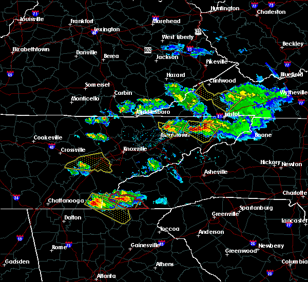 At 823 pm edt, a severe thunderstorm was located 10 miles west of gray, or 12 miles southwest of kingsport, moving east at 40 mph (radar indicated). Hazards include 60 mph wind gusts and half dollar size hail. Hail damage to vehicles is expected. expect wind damage to roofs, siding, and trees. Locations impacted include, johnson city, kingsport, jonesborough, surgoinsville, gray, oak grove, spurgeon, midway, colonial heights, church hill, bluff city, watauga, baileyton, leesburg, limestone, telford, sullivan gardens, fall branch, rocky mount state park and avondale. At 823 pm edt, a severe thunderstorm was located 10 miles west of gray, or 12 miles southwest of kingsport, moving east at 40 mph (radar indicated). Hazards include 60 mph wind gusts and half dollar size hail. Hail damage to vehicles is expected. expect wind damage to roofs, siding, and trees. Locations impacted include, johnson city, kingsport, jonesborough, surgoinsville, gray, oak grove, spurgeon, midway, colonial heights, church hill, bluff city, watauga, baileyton, leesburg, limestone, telford, sullivan gardens, fall branch, rocky mount state park and avondale.
|
| 3/17/2018 8:02 PM EDT |
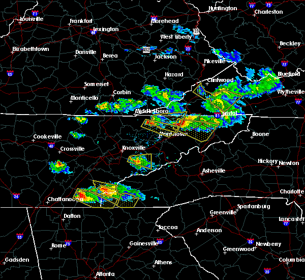 At 802 pm edt, a severe thunderstorm was located near surgoinsville, or near rogersville, moving east at 40 mph (radar indicated). Hazards include 60 mph wind gusts and half dollar size hail. Hail damage to vehicles is expected. Expect wind damage to roofs, siding, and trees. At 802 pm edt, a severe thunderstorm was located near surgoinsville, or near rogersville, moving east at 40 mph (radar indicated). Hazards include 60 mph wind gusts and half dollar size hail. Hail damage to vehicles is expected. Expect wind damage to roofs, siding, and trees.
|
| 2/24/2018 10:15 PM CST |
 At 1014 pm cst, a severe thunderstorm was located 8 miles southwest of westmoreland, or 9 miles northeast of gallatin, moving east at 35 mph (radar indicated). Hazards include 60 mph wind gusts and penny size hail. Expect damage to roofs, siding, and trees. this severe storm will be near, hartsville and westmoreland around 1030 pm cst. other locations impacted by this severe thunderstorm include oak grove, bledsoe creek state park, cottontown and bethpage. A tornado watch remains in effect until 200 am cst for middle tennessee. At 1014 pm cst, a severe thunderstorm was located 8 miles southwest of westmoreland, or 9 miles northeast of gallatin, moving east at 35 mph (radar indicated). Hazards include 60 mph wind gusts and penny size hail. Expect damage to roofs, siding, and trees. this severe storm will be near, hartsville and westmoreland around 1030 pm cst. other locations impacted by this severe thunderstorm include oak grove, bledsoe creek state park, cottontown and bethpage. A tornado watch remains in effect until 200 am cst for middle tennessee.
|
| 2/24/2018 9:59 PM CST |
 At 958 pm cst, a severe thunderstorm was located near white house, or 10 miles northwest of gallatin, moving east at 35 mph (radar indicated). Hazards include 60 mph wind gusts and penny size hail. Expect damage to roofs, siding, and trees. this severe thunderstorm will be near, gallatin around 1010 pm cst. hartsville and westmoreland around 1030 pm cst. other locations impacted by this severe thunderstorm include oak grove, bledsoe creek state park, cottontown and bethpage. A tornado watch remains in effect until 200 am cst for middle tennessee. At 958 pm cst, a severe thunderstorm was located near white house, or 10 miles northwest of gallatin, moving east at 35 mph (radar indicated). Hazards include 60 mph wind gusts and penny size hail. Expect damage to roofs, siding, and trees. this severe thunderstorm will be near, gallatin around 1010 pm cst. hartsville and westmoreland around 1030 pm cst. other locations impacted by this severe thunderstorm include oak grove, bledsoe creek state park, cottontown and bethpage. A tornado watch remains in effect until 200 am cst for middle tennessee.
|
| 2/24/2018 9:34 PM CST |
 At 933 pm cst, a severe thunderstorm was located over springfield, moving east at 50 mph (radar indicated). Hazards include 60 mph wind gusts. expect damage to roofs, siding, and trees At 933 pm cst, a severe thunderstorm was located over springfield, moving east at 50 mph (radar indicated). Hazards include 60 mph wind gusts. expect damage to roofs, siding, and trees
|
| 11/18/2017 4:38 PM CST |
 At 438 pm cst, severe thunderstorms were located along a line extending from portland to thompson`s station, moving east at 50 mph (radar indicated). Hazards include 70 mph wind gusts. Expect considerable tree damage. damage is likely to mobile homes, roofs, and outbuildings. Locations impacted include, murfreesboro, franklin, gallatin, lebanon, springfield, nashville, madison, hendersonville, smyrna, brentwood, la vergne, spring hill, mount juliet, goodlettsville, white house, millersville, greenbrier, nolensville, forest hills and oak hill. At 438 pm cst, severe thunderstorms were located along a line extending from portland to thompson`s station, moving east at 50 mph (radar indicated). Hazards include 70 mph wind gusts. Expect considerable tree damage. damage is likely to mobile homes, roofs, and outbuildings. Locations impacted include, murfreesboro, franklin, gallatin, lebanon, springfield, nashville, madison, hendersonville, smyrna, brentwood, la vergne, spring hill, mount juliet, goodlettsville, white house, millersville, greenbrier, nolensville, forest hills and oak hill.
|
| 11/18/2017 4:25 PM CST |
 At 424 pm cst, severe thunderstorms were located along a line extending from cross plains to leiper`s fork, moving east at 50 mph (radar indicated). Hazards include 70 mph wind gusts. Expect considerable tree damage. Damage is likely to mobile homes, roofs, and outbuildings. At 424 pm cst, severe thunderstorms were located along a line extending from cross plains to leiper`s fork, moving east at 50 mph (radar indicated). Hazards include 70 mph wind gusts. Expect considerable tree damage. Damage is likely to mobile homes, roofs, and outbuildings.
|
| 5/28/2017 12:14 AM EDT |
 At 1214 am edt, severe thunderstorms were located along a line extending from 7 miles southwest of jonesborough to 6 miles north of mars hill, moving east at 40 mph (radar indicated). Hazards include 60 mph wind gusts. Expect damage to roofs, siding, and trees. locations impacted include, johnson city, elizabethton, erwin, jonesborough, banner hill, central, hampton, midway, pine crest, unicoi, watauga, hunter, leesburg, limestone, roane mountain s. p. limestone cove, rocky fork, telford, milligan college and hampton creek cove s. P At 1214 am edt, severe thunderstorms were located along a line extending from 7 miles southwest of jonesborough to 6 miles north of mars hill, moving east at 40 mph (radar indicated). Hazards include 60 mph wind gusts. Expect damage to roofs, siding, and trees. locations impacted include, johnson city, elizabethton, erwin, jonesborough, banner hill, central, hampton, midway, pine crest, unicoi, watauga, hunter, leesburg, limestone, roane mountain s. p. limestone cove, rocky fork, telford, milligan college and hampton creek cove s. P
|
| 5/27/2017 11:54 PM EDT |
 At 1153 pm edt, severe thunderstorms were located along a line extending from 8 miles north of greeneville to 6 miles northeast of hot springs, moving east at 40 mph (radar indicated). Hazards include 60 mph wind gusts. expect damage to roofs, siding, and trees At 1153 pm edt, severe thunderstorms were located along a line extending from 8 miles north of greeneville to 6 miles northeast of hot springs, moving east at 40 mph (radar indicated). Hazards include 60 mph wind gusts. expect damage to roofs, siding, and trees
|
| 5/27/2017 7:31 PM CDT |
 At 730 pm cdt, a severe thunderstorm was located over hartsville, moving east at 45 mph (radar indicated). Hazards include 70 mph wind gusts and quarter size hail. Hail damage to vehicles is expected. expect considerable tree damage. wind damage is also likely to mobile homes, roofs, and outbuildings. Locations impacted include, gallatin, lafayette, hartsville, hendersonville, westmoreland, cottontown, bethpage, dixon springs, oak grove, bledsoe creek state park and dickerson chapel recreation area. At 730 pm cdt, a severe thunderstorm was located over hartsville, moving east at 45 mph (radar indicated). Hazards include 70 mph wind gusts and quarter size hail. Hail damage to vehicles is expected. expect considerable tree damage. wind damage is also likely to mobile homes, roofs, and outbuildings. Locations impacted include, gallatin, lafayette, hartsville, hendersonville, westmoreland, cottontown, bethpage, dixon springs, oak grove, bledsoe creek state park and dickerson chapel recreation area.
|
| 5/27/2017 7:15 PM CDT |
 At 715 pm cdt, a severe thunderstorm was located over gallatin, moving east at 50 mph (radar indicated). Hazards include 70 mph wind gusts and quarter size hail. Hail damage to vehicles is expected. expect considerable tree damage. Wind damage is also likely to mobile homes, roofs, and outbuildings. At 715 pm cdt, a severe thunderstorm was located over gallatin, moving east at 50 mph (radar indicated). Hazards include 70 mph wind gusts and quarter size hail. Hail damage to vehicles is expected. expect considerable tree damage. Wind damage is also likely to mobile homes, roofs, and outbuildings.
|
| 5/27/2017 6:51 PM CDT |
 At 651 pm cdt, a severe thunderstorm was located near greenbrier, or 7 miles east of springfield, moving southeast at 45 mph (radar indicated). Hazards include 70 mph wind gusts and quarter size hail. Hail damage to vehicles is expected. expect considerable tree damage. Wind damage is also likely to mobile homes, roofs, and outbuildings. At 651 pm cdt, a severe thunderstorm was located near greenbrier, or 7 miles east of springfield, moving southeast at 45 mph (radar indicated). Hazards include 70 mph wind gusts and quarter size hail. Hail damage to vehicles is expected. expect considerable tree damage. Wind damage is also likely to mobile homes, roofs, and outbuildings.
|
| 5/24/2017 1:46 PM EDT |
 At 145 pm edt, severe thunderstorms were located along a line extending from wise to 7 miles east of weber city to near walnut hill to near pine crest, moving east at 40 mph (radar indicated). Hazards include 60 mph wind gusts and quarter size hail. Hail damage to vehicles is expected. expect wind damage to roofs, siding, and trees. locations impacted include, johnson city, kingsport, bristol tn, elizabethton, norton, wise, gate city, big stone gap, weber city, central, spurgeon, pine crest, colonial heights, oak grove, gray, walnut hill, coeburn, appalachia, bluff city and pound. A tornado watch remains in effect until 800 pm edt for eastern tennessee, and southwestern virginia. At 145 pm edt, severe thunderstorms were located along a line extending from wise to 7 miles east of weber city to near walnut hill to near pine crest, moving east at 40 mph (radar indicated). Hazards include 60 mph wind gusts and quarter size hail. Hail damage to vehicles is expected. expect wind damage to roofs, siding, and trees. locations impacted include, johnson city, kingsport, bristol tn, elizabethton, norton, wise, gate city, big stone gap, weber city, central, spurgeon, pine crest, colonial heights, oak grove, gray, walnut hill, coeburn, appalachia, bluff city and pound. A tornado watch remains in effect until 800 pm edt for eastern tennessee, and southwestern virginia.
|
| 5/24/2017 1:31 PM EDT |
 At 131 pm edt, severe thunderstorms were located along a line extending from near big stone gap to weber city to spurgeon to near erwin, moving northeast at 40 mph (radar indicated). Hazards include 60 mph wind gusts and quarter size hail. Hail damage to vehicles is expected. expect wind damage to roofs, siding, and trees. locations impacted include, johnson city, kingsport, bristol tn, elizabethton, norton, wise, gate city, big stone gap, jonesborough, weber city, central, midway, pine crest, colonial heights, gray, oak grove, spurgeon, walnut hill, church hill and mount carmel. A tornado watch remains in effect until 800 pm edt for eastern tennessee, and southwestern virginia. At 131 pm edt, severe thunderstorms were located along a line extending from near big stone gap to weber city to spurgeon to near erwin, moving northeast at 40 mph (radar indicated). Hazards include 60 mph wind gusts and quarter size hail. Hail damage to vehicles is expected. expect wind damage to roofs, siding, and trees. locations impacted include, johnson city, kingsport, bristol tn, elizabethton, norton, wise, gate city, big stone gap, jonesborough, weber city, central, midway, pine crest, colonial heights, gray, oak grove, spurgeon, walnut hill, church hill and mount carmel. A tornado watch remains in effect until 800 pm edt for eastern tennessee, and southwestern virginia.
|
| 5/24/2017 1:01 PM EDT |
 At 100 pm edt, severe thunderstorms were located along a line extending from near pennington gap to 6 miles southeast of surgoinsville to 6 miles northeast of tusculum to 10 miles northeast of hot springs, moving east at 40 mph (radar indicated). Hazards include 60 mph wind gusts and quarter size hail. Hail damage to vehicles is expected. Expect wind damage to roofs, siding, and trees. At 100 pm edt, severe thunderstorms were located along a line extending from near pennington gap to 6 miles southeast of surgoinsville to 6 miles northeast of tusculum to 10 miles northeast of hot springs, moving east at 40 mph (radar indicated). Hazards include 60 mph wind gusts and quarter size hail. Hail damage to vehicles is expected. Expect wind damage to roofs, siding, and trees.
|
| 5/24/2017 1:01 PM EDT |
 The national weather service in morristown has issued a * severe thunderstorm warning for. sullivan county in eastern tennessee. northeastern hawkins county in eastern tennessee. washington county in eastern tennessee. Northeastern hancock county in eastern tennessee. The national weather service in morristown has issued a * severe thunderstorm warning for. sullivan county in eastern tennessee. northeastern hawkins county in eastern tennessee. washington county in eastern tennessee. Northeastern hancock county in eastern tennessee.
|
| 4/30/2017 3:47 PM CDT |
 At 346 pm cdt, severe thunderstorms were located along a line extending from 9 miles southwest of scottsville to near westmoreland, moving northeast at 55 mph (radar indicated). Hazards include 60 mph wind gusts. Expect damage to roofs, siding, and trees. locations impacted include, gallatin, lafayette, hartsville, westmoreland, bethpage, oak grove and bledsoe creek state park. A tornado watch remains in effect until 700 pm cdt for middle tennessee. At 346 pm cdt, severe thunderstorms were located along a line extending from 9 miles southwest of scottsville to near westmoreland, moving northeast at 55 mph (radar indicated). Hazards include 60 mph wind gusts. Expect damage to roofs, siding, and trees. locations impacted include, gallatin, lafayette, hartsville, westmoreland, bethpage, oak grove and bledsoe creek state park. A tornado watch remains in effect until 700 pm cdt for middle tennessee.
|
| 4/30/2017 3:29 PM CDT |
 At 329 pm cdt, severe thunderstorms were located along a line extending from 8 miles east of white house to 6 miles southeast of gallatin, moving northeast at 55 mph (radar indicated). Hazards include 60 mph wind gusts. expect damage to roofs, siding, and trees At 329 pm cdt, severe thunderstorms were located along a line extending from 8 miles east of white house to 6 miles southeast of gallatin, moving northeast at 55 mph (radar indicated). Hazards include 60 mph wind gusts. expect damage to roofs, siding, and trees
|
| 3/27/2017 4:39 PM CDT |
 The severe thunderstorm warning for sumner, north central wilson, southwestern macon and northwestern trousdale counties will expire at 445 pm cdt, the storm which prompted the warning has been replaced with a new severe thunderstorm warning. a severe thunderstorm watch remains in effect until 1000 pm cdt for middle tennessee. remember, a severe thunderstorm warning still remains in effect for sumner, trousdale, and macon counties. The severe thunderstorm warning for sumner, north central wilson, southwestern macon and northwestern trousdale counties will expire at 445 pm cdt, the storm which prompted the warning has been replaced with a new severe thunderstorm warning. a severe thunderstorm watch remains in effect until 1000 pm cdt for middle tennessee. remember, a severe thunderstorm warning still remains in effect for sumner, trousdale, and macon counties.
|
| 3/27/2017 4:38 PM CDT |
 At 438 pm cdt, a severe thunderstorm was located near westmoreland, or 9 miles northwest of lafayette, moving northeast at 50 mph (radar indicated). Hazards include 60 mph wind gusts and penny size hail. expect damage to roofs, siding, and trees At 438 pm cdt, a severe thunderstorm was located near westmoreland, or 9 miles northwest of lafayette, moving northeast at 50 mph (radar indicated). Hazards include 60 mph wind gusts and penny size hail. expect damage to roofs, siding, and trees
|
| 3/27/2017 4:28 PM CDT |
 At 427 pm cdt, a severe thunderstorm was located near gallatin, moving northeast at 45 mph (radar indicated). Hazards include 60 mph wind gusts and quarter size hail. Hail damage to vehicles is expected. expect wind damage to roofs, siding, and trees. Locations impacted include, gallatin, lafayette, white house, westmoreland, portland, mitchellville, cottontown, bethpage, oak grove and bledsoe creek state park. At 427 pm cdt, a severe thunderstorm was located near gallatin, moving northeast at 45 mph (radar indicated). Hazards include 60 mph wind gusts and quarter size hail. Hail damage to vehicles is expected. expect wind damage to roofs, siding, and trees. Locations impacted include, gallatin, lafayette, white house, westmoreland, portland, mitchellville, cottontown, bethpage, oak grove and bledsoe creek state park.
|
| 3/27/2017 4:19 PM CDT |
 At 418 pm cdt, a severe thunderstorm was located over gallatin, moving northeast at 50 mph (emergency management. radar indicated). Hazards include 70 mph wind gusts and quarter size hail. Hail damage to vehicles is expected. expect considerable tree damage. wind damage is also likely to mobile homes, roofs, and outbuildings. Locations impacted include, gallatin, lafayette, hendersonville, mount juliet, goodlettsville, white house, millersville, westmoreland, portland, mitchellville, bethpage, oak grove, bledsoe creek state park and cottontown. At 418 pm cdt, a severe thunderstorm was located over gallatin, moving northeast at 50 mph (emergency management. radar indicated). Hazards include 70 mph wind gusts and quarter size hail. Hail damage to vehicles is expected. expect considerable tree damage. wind damage is also likely to mobile homes, roofs, and outbuildings. Locations impacted include, gallatin, lafayette, hendersonville, mount juliet, goodlettsville, white house, millersville, westmoreland, portland, mitchellville, bethpage, oak grove, bledsoe creek state park and cottontown.
|
| 3/27/2017 4:14 PM CDT |
 At 413 pm cdt, a severe thunderstorm was located near gallatin, moving northeast at 45 mph (radar indicated). Hazards include 60 mph wind gusts and quarter size hail. Hail damage to vehicles is expected. Expect wind damage to roofs, siding, and trees. At 413 pm cdt, a severe thunderstorm was located near gallatin, moving northeast at 45 mph (radar indicated). Hazards include 60 mph wind gusts and quarter size hail. Hail damage to vehicles is expected. Expect wind damage to roofs, siding, and trees.
|
| 3/1/2017 1:06 PM EST |
 At 105 pm est, a severe thunderstorm was located over gray, or 8 miles northwest of johnson city, moving east at 55 mph (radar indicated). Hazards include 60 mph wind gusts and nickel size hail. expect damage to roofs, siding, and trees At 105 pm est, a severe thunderstorm was located over gray, or 8 miles northwest of johnson city, moving east at 55 mph (radar indicated). Hazards include 60 mph wind gusts and nickel size hail. expect damage to roofs, siding, and trees
|
| 3/1/2017 7:26 AM CST |
 At 726 am cst, severe thunderstorms were located along a line extending from 7 miles northwest of westmoreland to near murfreesboro, moving east at 70 mph (radar indicated). Hazards include 60 mph wind gusts and penny size hail. expect damage to roofs, siding, and trees At 726 am cst, severe thunderstorms were located along a line extending from 7 miles northwest of westmoreland to near murfreesboro, moving east at 70 mph (radar indicated). Hazards include 60 mph wind gusts and penny size hail. expect damage to roofs, siding, and trees
|
| 3/1/2017 6:55 AM CST |
 At 654 am cst, severe thunderstorms were located along a line extending from near springfield to near oak hill to near thompson`s station, moving east at 65 mph (radar indicated). Hazards include 70 mph wind gusts and nickel size hail. Expect considerable tree damage. Damage is likely to mobile homes, roofs, and outbuildings. At 654 am cst, severe thunderstorms were located along a line extending from near springfield to near oak hill to near thompson`s station, moving east at 65 mph (radar indicated). Hazards include 70 mph wind gusts and nickel size hail. Expect considerable tree damage. Damage is likely to mobile homes, roofs, and outbuildings.
|
| 11/30/2016 7:02 AM EST |
 At 701 am est, severe thunderstorms were located along a line extending from 9 miles southwest of cleveland va to 6 miles west of walnut hill to near midway, moving east at 55 mph (radar indicated). Hazards include 60 mph wind gusts. Expect damage to roofs. siding. and trees. Locations impacted include, johnson city, kingsport, bristol tn, bristol va, elizabethton, abingdon, lebanon, mountain city, jonesborough, cleveland va, central, walnut hill, oak grove, spurgeon, hampton, gray, pine crest, midway, colonial heights and bluff city. At 701 am est, severe thunderstorms were located along a line extending from 9 miles southwest of cleveland va to 6 miles west of walnut hill to near midway, moving east at 55 mph (radar indicated). Hazards include 60 mph wind gusts. Expect damage to roofs. siding. and trees. Locations impacted include, johnson city, kingsport, bristol tn, bristol va, elizabethton, abingdon, lebanon, mountain city, jonesborough, cleveland va, central, walnut hill, oak grove, spurgeon, hampton, gray, pine crest, midway, colonial heights and bluff city.
|
| 11/30/2016 6:47 AM EST |
 At 646 am est, severe thunderstorms were located along a line extending from 11 miles southeast of norton to near kingsport to near tusculum, moving east at 50 mph (radar indicated). Hazards include 60 mph wind gusts. Expect damage to roofs. siding. And trees. At 646 am est, severe thunderstorms were located along a line extending from 11 miles southeast of norton to near kingsport to near tusculum, moving east at 50 mph (radar indicated). Hazards include 60 mph wind gusts. Expect damage to roofs. siding. And trees.
|
| 11/30/2016 4:51 AM EST |
 At 451 am est, a severe thunderstorm was located over oak grove, or near johnson city, moving east at 50 mph (radar indicated). Hazards include 60 mph wind gusts and quarter size hail. Hail damage to vehicles is expected. Expect wind damage to roofs, siding, and trees. At 451 am est, a severe thunderstorm was located over oak grove, or near johnson city, moving east at 50 mph (radar indicated). Hazards include 60 mph wind gusts and quarter size hail. Hail damage to vehicles is expected. Expect wind damage to roofs, siding, and trees.
|
| 11/28/2016 6:49 PM CST |
 At 648 pm cst, severe thunderstorms were located along a line extending from near westmoreland to castalian springs to near la vergne, moving east at 45 mph (radar indicated). Hazards include 60 mph wind gusts. Expect damage to roofs. siding. and trees. Locations impacted include, gallatin, lebanon, lafayette, hartsville, smyrna, la vergne, mount juliet, westmoreland, belinda city, walterhill, dickerson chapel recreation area, bledsoe creek state park, cedars of lebanon state park, tuckers crossroads, gladeville and bethpage. At 648 pm cst, severe thunderstorms were located along a line extending from near westmoreland to castalian springs to near la vergne, moving east at 45 mph (radar indicated). Hazards include 60 mph wind gusts. Expect damage to roofs. siding. and trees. Locations impacted include, gallatin, lebanon, lafayette, hartsville, smyrna, la vergne, mount juliet, westmoreland, belinda city, walterhill, dickerson chapel recreation area, bledsoe creek state park, cedars of lebanon state park, tuckers crossroads, gladeville and bethpage.
|
| 11/28/2016 6:34 PM CST |
 At 634 pm cst, severe thunderstorms were located along a line extending from portland to near antioch, moving east at 40 mph (radar indicated). Hazards include 60 mph wind gusts. Expect damage to roofs. siding. And trees. At 634 pm cst, severe thunderstorms were located along a line extending from portland to near antioch, moving east at 40 mph (radar indicated). Hazards include 60 mph wind gusts. Expect damage to roofs. siding. And trees.
|
| 8/15/2016 3:10 PM EDT |
 At 309 pm edt, severe thunderstorms were located along a line extending from pennington gap to near spurgeon, moving northeast at 25 mph (radar indicated). Hazards include 60 mph wind gusts and quarter size hail. Hail damage to vehicles is expected. expect wind damage to roofs, siding, and trees. locations impacted include, johnson city, kingsport, bristol tn, bristol va, gate city, jonesville, pennington gap, weber city, colonial heights, walnut hill, spurgeon, oak grove, church hill, mount carmel, bluff city, st. Charles, duffield, clinchport, pattonsville and south holston dam. At 309 pm edt, severe thunderstorms were located along a line extending from pennington gap to near spurgeon, moving northeast at 25 mph (radar indicated). Hazards include 60 mph wind gusts and quarter size hail. Hail damage to vehicles is expected. expect wind damage to roofs, siding, and trees. locations impacted include, johnson city, kingsport, bristol tn, bristol va, gate city, jonesville, pennington gap, weber city, colonial heights, walnut hill, spurgeon, oak grove, church hill, mount carmel, bluff city, st. Charles, duffield, clinchport, pattonsville and south holston dam.
|
| 8/15/2016 2:49 PM EDT |
 At 249 pm edt, severe thunderstorms were located along a line extending from near jonesville to 6 miles southwest of gray, moving northeast at 20 mph (radar indicated). Hazards include 60 mph wind gusts and quarter size hail. Hail damage to vehicles is expected. Expect wind damage to roofs, siding, and trees. At 249 pm edt, severe thunderstorms were located along a line extending from near jonesville to 6 miles southwest of gray, moving northeast at 20 mph (radar indicated). Hazards include 60 mph wind gusts and quarter size hail. Hail damage to vehicles is expected. Expect wind damage to roofs, siding, and trees.
|
| 7/19/2016 3:23 PM EDT |
 At 322 pm edt, a severe thunderstorm was located near jonesborough, or 8 miles west of johnson city, moving southeast at 25 mph (radar indicated). Hazards include 60 mph wind gusts and half dollar size hail. Hail damage to vehicles is expected. expect wind damage to roofs, siding, and trees. Locations impacted include, johnson city, erwin, jonesborough, gray, banner hill, midway, oak grove, spurgeon, pine crest, unicoi, fall branch, avondale, limestone cove, embreeville, leesburg, rocky fork and telford. At 322 pm edt, a severe thunderstorm was located near jonesborough, or 8 miles west of johnson city, moving southeast at 25 mph (radar indicated). Hazards include 60 mph wind gusts and half dollar size hail. Hail damage to vehicles is expected. expect wind damage to roofs, siding, and trees. Locations impacted include, johnson city, erwin, jonesborough, gray, banner hill, midway, oak grove, spurgeon, pine crest, unicoi, fall branch, avondale, limestone cove, embreeville, leesburg, rocky fork and telford.
|
| 7/19/2016 3:15 PM EDT |
 At 315 pm edt, a severe thunderstorm was located near gray, or 10 miles south of kingsport, moving southeast at 25 mph (radar indicated). Hazards include 60 mph wind gusts and quarter size hail. Hail damage to vehicles is expected. Expect wind damage to roofs, siding, and trees. At 315 pm edt, a severe thunderstorm was located near gray, or 10 miles south of kingsport, moving southeast at 25 mph (radar indicated). Hazards include 60 mph wind gusts and quarter size hail. Hail damage to vehicles is expected. Expect wind damage to roofs, siding, and trees.
|
| 7/14/2016 7:03 PM EDT |
 At 659 pm edt, a severe thunderstorm was located near chucky, moving east at 35 mph (radar indicated). Hazards include 60 mph wind gusts and quarter size hail. Hail damage to vehicles is possible. expect wind damage to roofs, siding, and trees. Locations impacted include, johnson city, greeneville, jonesborough, tusculum, gray, mosheim, baileyton, limestone, chucky, avondale, davy crockett birthplace, jearoldstown, leesburg, telford and fall branch. At 659 pm edt, a severe thunderstorm was located near chucky, moving east at 35 mph (radar indicated). Hazards include 60 mph wind gusts and quarter size hail. Hail damage to vehicles is possible. expect wind damage to roofs, siding, and trees. Locations impacted include, johnson city, greeneville, jonesborough, tusculum, gray, mosheim, baileyton, limestone, chucky, avondale, davy crockett birthplace, jearoldstown, leesburg, telford and fall branch.
|
| 7/14/2016 6:45 PM EDT |
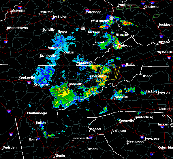 At 643 pm edt, severe thunderstorms were located along a line extending from 7 miles northeast of surgoinsville to near greeneville, moving east at 35 mph. the strongest storm was just west of greeneville (radar indicated). Hazards include 60 mph wind gusts and half dollar size hail. Hail damage to vehicles is possible. expect wind damage to roofs, siding, and trees. locations impacted include, johnson city, kingsport, greeneville, rogersville, jonesborough, tusculum, surgoinsville, colonial heights, oak grove, spurgeon, gray, church hill, mount carmel, mosheim, baileyton, limestone, kepler, chucky, warriors path s. p. And fall branch. At 643 pm edt, severe thunderstorms were located along a line extending from 7 miles northeast of surgoinsville to near greeneville, moving east at 35 mph. the strongest storm was just west of greeneville (radar indicated). Hazards include 60 mph wind gusts and half dollar size hail. Hail damage to vehicles is possible. expect wind damage to roofs, siding, and trees. locations impacted include, johnson city, kingsport, greeneville, rogersville, jonesborough, tusculum, surgoinsville, colonial heights, oak grove, spurgeon, gray, church hill, mount carmel, mosheim, baileyton, limestone, kepler, chucky, warriors path s. p. And fall branch.
|
| 7/14/2016 6:25 PM EDT |
 At 625 pm edt, severe thunderstorms were located along a line extending from near surgoinsville to 9 miles north of parrottsville, moving east at 35 mph (radar indicated). Hazards include 60 mph wind gusts and quarter size hail. Hail damage to vehicles is expected. Expect wind damage to roofs, siding, and trees. At 625 pm edt, severe thunderstorms were located along a line extending from near surgoinsville to 9 miles north of parrottsville, moving east at 35 mph (radar indicated). Hazards include 60 mph wind gusts and quarter size hail. Hail damage to vehicles is expected. Expect wind damage to roofs, siding, and trees.
|
| 7/8/2016 9:10 PM CDT |
 At 909 pm cdt, severe thunderstorms were located along a line extending from lafayette to thompson`s station, moving east at 60 mph (trained weather spotters. numerous trees and power lines have been blown down with these storms all across the nashville metro area). Hazards include 70 mph wind gusts and quarter size hail. Hail damage to vehicles is expected. expect considerable tree damage. wind damage is also likely to mobile homes, roofs, and outbuildings. Locations impacted include, murfreesboro, franklin, gallatin, lebanon, lafayette, carthage, hartsville, nashville, madison, hendersonville, smyrna, brentwood, la vergne, spring hill, mount juliet, goodlettsville, white house, nolensville, forest hills and oak hill. At 909 pm cdt, severe thunderstorms were located along a line extending from lafayette to thompson`s station, moving east at 60 mph (trained weather spotters. numerous trees and power lines have been blown down with these storms all across the nashville metro area). Hazards include 70 mph wind gusts and quarter size hail. Hail damage to vehicles is expected. expect considerable tree damage. wind damage is also likely to mobile homes, roofs, and outbuildings. Locations impacted include, murfreesboro, franklin, gallatin, lebanon, lafayette, carthage, hartsville, nashville, madison, hendersonville, smyrna, brentwood, la vergne, spring hill, mount juliet, goodlettsville, white house, nolensville, forest hills and oak hill.
|
| 7/8/2016 9:06 PM CDT |
 At 905 pm cdt, severe thunderstorms were located along a line extending from westmoreland to near thompson`s station, moving east at 45 mph (trained spotters. at 9 pm cdt...60 mph winds were estimated at the nws nashville office in old hickory. numerous trees and power lines have been blown down with these storms across the nashville metro area). Hazards include 60 mph wind gusts and quarter size hail. Hail damage to vehicles is expected. expect wind damage to roofs, siding, and trees. Locations impacted include, murfreesboro, franklin, gallatin, lebanon, lafayette, carthage, hartsville, nashville, madison, hendersonville, smyrna, brentwood, la vergne, spring hill, mount juliet, goodlettsville, white house, nolensville, forest hills and oak hill. At 905 pm cdt, severe thunderstorms were located along a line extending from westmoreland to near thompson`s station, moving east at 45 mph (trained spotters. at 9 pm cdt...60 mph winds were estimated at the nws nashville office in old hickory. numerous trees and power lines have been blown down with these storms across the nashville metro area). Hazards include 60 mph wind gusts and quarter size hail. Hail damage to vehicles is expected. expect wind damage to roofs, siding, and trees. Locations impacted include, murfreesboro, franklin, gallatin, lebanon, lafayette, carthage, hartsville, nashville, madison, hendersonville, smyrna, brentwood, la vergne, spring hill, mount juliet, goodlettsville, white house, nolensville, forest hills and oak hill.
|
| 7/8/2016 8:50 PM CDT |
 At 849 pm cdt, severe thunderstorms were located along a line extending from portland to near thompson`s station, moving east at 55 mph (radar indicated). Hazards include 60 mph wind gusts and quarter size hail. Hail damage to vehicles is expected. Expect wind damage to roofs, siding, and trees. At 849 pm cdt, severe thunderstorms were located along a line extending from portland to near thompson`s station, moving east at 55 mph (radar indicated). Hazards include 60 mph wind gusts and quarter size hail. Hail damage to vehicles is expected. Expect wind damage to roofs, siding, and trees.
|
| 7/8/2016 6:30 PM EDT |
 At 629 pm edt, severe thunderstorms were located along a line extending from 7 miles south of walnut hill to johnson city to 8 miles east of tusculum to near greeneville, moving southeast at 50 mph (radar indicated). Hazards include 70 mph wind gusts. Expect considerable tree damage. damage is likely to mobile homes, roofs, and outbuildings. Locations impacted include, johnson city, kingsport, bristol tn, bristol va, greeneville, jonesborough, tusculum, walnut hill, midway, oak grove, spurgeon, gray, mosheim, bluff city, cedar creek, limestone, chucky, south holston dam, avondale and camp creek. At 629 pm edt, severe thunderstorms were located along a line extending from 7 miles south of walnut hill to johnson city to 8 miles east of tusculum to near greeneville, moving southeast at 50 mph (radar indicated). Hazards include 70 mph wind gusts. Expect considerable tree damage. damage is likely to mobile homes, roofs, and outbuildings. Locations impacted include, johnson city, kingsport, bristol tn, bristol va, greeneville, jonesborough, tusculum, walnut hill, midway, oak grove, spurgeon, gray, mosheim, bluff city, cedar creek, limestone, chucky, south holston dam, avondale and camp creek.
|
| 7/8/2016 6:19 PM EDT |
 At 618 pm edt, severe thunderstorms were located along a line extending from 6 miles northeast of oak grove to near gray to near tusculum to 7 miles west of greeneville, moving southeast at 45 mph (radar indicated). Hazards include 60 mph wind gusts. Expect damage to roofs. siding. and trees. Locations impacted include, johnson city, kingsport, bristol tn, bristol va, greeneville, jonesborough, tusculum, colonial heights, walnut hill, midway, oak grove, spurgeon, gray, mosheim, bluff city, baileyton, cedar creek, limestone, chucky and south holston dam. At 618 pm edt, severe thunderstorms were located along a line extending from 6 miles northeast of oak grove to near gray to near tusculum to 7 miles west of greeneville, moving southeast at 45 mph (radar indicated). Hazards include 60 mph wind gusts. Expect damage to roofs. siding. and trees. Locations impacted include, johnson city, kingsport, bristol tn, bristol va, greeneville, jonesborough, tusculum, colonial heights, walnut hill, midway, oak grove, spurgeon, gray, mosheim, bluff city, baileyton, cedar creek, limestone, chucky and south holston dam.
|
| 7/8/2016 6:06 PM EDT |
 At 605 pm edt, severe thunderstorms were located along a line extending from near kingsport to near colonial heights to 6 miles north of greeneville to 7 miles southeast of russellville, moving east at 45 mph (radar indicated). Hazards include 60 mph wind gusts. Expect damage to roofs. siding. and trees. Locations impacted include, johnson city, kingsport, morristown, bristol tn, greeneville, rogersville, jonesborough, tusculum, surgoinsville, colonial heights, oak grove, spurgeon, gray, walnut hill, midway, russellville, church hill, mount carmel, mosheim and bluff city. At 605 pm edt, severe thunderstorms were located along a line extending from near kingsport to near colonial heights to 6 miles north of greeneville to 7 miles southeast of russellville, moving east at 45 mph (radar indicated). Hazards include 60 mph wind gusts. Expect damage to roofs. siding. and trees. Locations impacted include, johnson city, kingsport, morristown, bristol tn, greeneville, rogersville, jonesborough, tusculum, surgoinsville, colonial heights, oak grove, spurgeon, gray, walnut hill, midway, russellville, church hill, mount carmel, mosheim and bluff city.
|
| 7/8/2016 5:52 PM EDT |
 At 551 pm edt, severe thunderstorms were located along a line extending from 10 miles west of gate city to surgoinsville to near rogersville to russellville, moving southeast at 45 mph (radar indicated). Hazards include 60 mph wind gusts. Expect damage to roofs. siding. And trees. At 551 pm edt, severe thunderstorms were located along a line extending from 10 miles west of gate city to surgoinsville to near rogersville to russellville, moving southeast at 45 mph (radar indicated). Hazards include 60 mph wind gusts. Expect damage to roofs. siding. And trees.
|
| 7/7/2016 3:09 PM CDT |
 At 308 pm cdt, a severe thunderstorm was located 8 miles west of westmoreland, or 11 miles north of gallatin, moving east at 40 mph (radar indicated). Hazards include 60 mph wind gusts. Expect damage to roofs. siding. And trees. At 308 pm cdt, a severe thunderstorm was located 8 miles west of westmoreland, or 11 miles north of gallatin, moving east at 40 mph (radar indicated). Hazards include 60 mph wind gusts. Expect damage to roofs. siding. And trees.
|
| 7/7/2016 3:03 PM CDT |
 At 301 pm cdt, a severe thunderstorm was located near white house, or 9 miles northwest of gallatin, moving east at 45 mph (radar indicated. this storm has a history of wind damage in northwest robertson county). Hazards include 60 mph wind gusts and penny size hail. Expect damage to roofs. siding. and trees. Locations impacted include, gallatin, springfield, hendersonville, goodlettsville, white house, millersville, greenbrier, coopertown, ridgetop, cross plains, portland, orlinda, cedar hill, mitchellville, cottontown and oak grove. At 301 pm cdt, a severe thunderstorm was located near white house, or 9 miles northwest of gallatin, moving east at 45 mph (radar indicated. this storm has a history of wind damage in northwest robertson county). Hazards include 60 mph wind gusts and penny size hail. Expect damage to roofs. siding. and trees. Locations impacted include, gallatin, springfield, hendersonville, goodlettsville, white house, millersville, greenbrier, coopertown, ridgetop, cross plains, portland, orlinda, cedar hill, mitchellville, cottontown and oak grove.
|
| 7/7/2016 2:38 PM CDT |
 At 238 pm cdt, a severe thunderstorm was located near springfield, moving east at 50 mph (radar indicated). Hazards include 60 mph wind gusts and penny size hail. Expect damage to roofs. siding. And trees. At 238 pm cdt, a severe thunderstorm was located near springfield, moving east at 50 mph (radar indicated). Hazards include 60 mph wind gusts and penny size hail. Expect damage to roofs. siding. And trees.
|
| 7/7/2016 12:57 AM CDT |
 The severe thunderstorm warning for northeastern robertson and central sumner counties will expire at 100 am cdt, the storm which prompted the warning has weakened below severe limits, and no longer poses an immediate threat to life or property. therefore the warning will be allowed to expire. The severe thunderstorm warning for northeastern robertson and central sumner counties will expire at 100 am cdt, the storm which prompted the warning has weakened below severe limits, and no longer poses an immediate threat to life or property. therefore the warning will be allowed to expire.
|
| 7/7/2016 12:44 AM CDT |
 At 1243 am cdt, a severe thunderstorm was located 8 miles east of white house, or 8 miles northwest of gallatin, moving southeast at 35 mph (radar indicated). Hazards include 60 mph wind gusts. Expect damage to roofs. siding. and trees. Locations impacted include, gallatin, hendersonville, white house, cross plains, portland, orlinda and cottontown. At 1243 am cdt, a severe thunderstorm was located 8 miles east of white house, or 8 miles northwest of gallatin, moving southeast at 35 mph (radar indicated). Hazards include 60 mph wind gusts. Expect damage to roofs. siding. and trees. Locations impacted include, gallatin, hendersonville, white house, cross plains, portland, orlinda and cottontown.
|
| 7/7/2016 12:27 AM CDT |
 At 1226 am cdt, a severe thunderstorm was located over cross plains, or 13 miles east of springfield, moving southeast at 35 mph (radar indicated). Hazards include 70 mph wind gusts. Expect considerable tree damage. Damage is likely to mobile homes, roofs, and outbuildings. At 1226 am cdt, a severe thunderstorm was located over cross plains, or 13 miles east of springfield, moving southeast at 35 mph (radar indicated). Hazards include 70 mph wind gusts. Expect considerable tree damage. Damage is likely to mobile homes, roofs, and outbuildings.
|
| 7/6/2016 7:15 PM EDT |
 At 715 pm edt, a severe thunderstorm was located 11 miles north of tusculum, or 12 miles northeast of greeneville, moving east at 30 mph (radar indicated). Hazards include 60 mph wind gusts and quarter size hail. Hail damage to vehicles is expected. Expect wind damage to roofs, siding, and trees. At 715 pm edt, a severe thunderstorm was located 11 miles north of tusculum, or 12 miles northeast of greeneville, moving east at 30 mph (radar indicated). Hazards include 60 mph wind gusts and quarter size hail. Hail damage to vehicles is expected. Expect wind damage to roofs, siding, and trees.
|
| 7/6/2016 4:20 PM CDT |
 At 419 pm cdt, severe thunderstorms were located along a line extending from lafayette to oak hill, moving east at 55 mph (radar indicated). Hazards include 60 mph wind gusts and penny size hail. Expect damage to roofs. siding. and trees. Locations impacted include, gallatin, lebanon, lafayette, hartsville, nashville, madison, hendersonville, mount juliet, goodlettsville, white house, millersville, forest hills, oak hill, belle meade, lakewood, westmoreland, hermitage, belinda city, bellevue and old hickory. At 419 pm cdt, severe thunderstorms were located along a line extending from lafayette to oak hill, moving east at 55 mph (radar indicated). Hazards include 60 mph wind gusts and penny size hail. Expect damage to roofs. siding. and trees. Locations impacted include, gallatin, lebanon, lafayette, hartsville, nashville, madison, hendersonville, mount juliet, goodlettsville, white house, millersville, forest hills, oak hill, belle meade, lakewood, westmoreland, hermitage, belinda city, bellevue and old hickory.
|
| 7/6/2016 4:06 PM CDT |
 At 406 pm cdt, severe thunderstorms were located along a line extending from westmoreland to bellevue, moving east at 50 mph (radar indicated and spotter reported. at 350 pm cdt...trees were blown down in cross plains and ashland city with these storms. at 404 pm cdt, dime size hail was reported near portland). Hazards include 60 mph wind gusts and penny size hail. Expect damage to roofs. siding. and trees. Locations impacted include, gallatin, lebanon, springfield, lafayette, hartsville, nashville, madison, hendersonville, mount juliet, goodlettsville, white house, millersville, greenbrier, forest hills, oak hill, belle meade, lakewood, westmoreland, pegram and ridgetop. At 406 pm cdt, severe thunderstorms were located along a line extending from westmoreland to bellevue, moving east at 50 mph (radar indicated and spotter reported. at 350 pm cdt...trees were blown down in cross plains and ashland city with these storms. at 404 pm cdt, dime size hail was reported near portland). Hazards include 60 mph wind gusts and penny size hail. Expect damage to roofs. siding. and trees. Locations impacted include, gallatin, lebanon, springfield, lafayette, hartsville, nashville, madison, hendersonville, mount juliet, goodlettsville, white house, millersville, greenbrier, forest hills, oak hill, belle meade, lakewood, westmoreland, pegram and ridgetop.
|
| 7/6/2016 3:56 PM CDT |
 At 355 pm cdt, severe thunderstorms were located along a line extending from 8 miles northwest of westmoreland to pegram, moving east at 55 mph (radar indicated). Hazards include 60 mph wind gusts and penny size hail. Expect damage to roofs. siding. And trees. At 355 pm cdt, severe thunderstorms were located along a line extending from 8 miles northwest of westmoreland to pegram, moving east at 55 mph (radar indicated). Hazards include 60 mph wind gusts and penny size hail. Expect damage to roofs. siding. And trees.
|
| 7/6/2016 3:49 PM CDT |
 At 349 pm cdt, severe thunderstorms were located along a line extending from three springs to near white house, moving east at 60 mph (radar indicated). Hazards include 60 mph wind gusts and penny size hail. Expect damage to roofs. siding. and trees. Locations impacted include, gallatin, springfield, white house, millersville, greenbrier, westmoreland, ridgetop, cross plains, portland, orlinda, mitchellville, bledsoe creek state park, cottontown, bethpage, oak grove and black jack. At 349 pm cdt, severe thunderstorms were located along a line extending from three springs to near white house, moving east at 60 mph (radar indicated). Hazards include 60 mph wind gusts and penny size hail. Expect damage to roofs. siding. and trees. Locations impacted include, gallatin, springfield, white house, millersville, greenbrier, westmoreland, ridgetop, cross plains, portland, orlinda, mitchellville, bledsoe creek state park, cottontown, bethpage, oak grove and black jack.
|
| 7/6/2016 3:34 PM CDT |
 At 333 pm cdt, severe thunderstorms were located along a line extending from russellville to near greenbrier, moving east at 60 mph (radar indicated). Hazards include 60 mph wind gusts and penny size hail. Expect damage to roofs. siding. And trees. At 333 pm cdt, severe thunderstorms were located along a line extending from russellville to near greenbrier, moving east at 60 mph (radar indicated). Hazards include 60 mph wind gusts and penny size hail. Expect damage to roofs. siding. And trees.
|
| 6/23/2016 10:12 PM EDT |
 At 1011 pm edt, severe thunderstorms were located along a line extending from 6 miles west of walnut hill to 8 miles northwest of greeneville, moving southeast at 25 mph (radar indicated). Hazards include 60 mph wind gusts and quarter size hail. Hail damage to vehicles is expected. expect wind damage to roofs, siding, and trees. Locations impacted include, johnson city, kingsport, bristol tn, greeneville, jonesborough, tusculum, weber city, colonial heights, walnut hill, midway, oak grove, spurgeon, gray, church hill, mount carmel, mosheim, bluff city, watauga, baileyton and limestone. At 1011 pm edt, severe thunderstorms were located along a line extending from 6 miles west of walnut hill to 8 miles northwest of greeneville, moving southeast at 25 mph (radar indicated). Hazards include 60 mph wind gusts and quarter size hail. Hail damage to vehicles is expected. expect wind damage to roofs, siding, and trees. Locations impacted include, johnson city, kingsport, bristol tn, greeneville, jonesborough, tusculum, weber city, colonial heights, walnut hill, midway, oak grove, spurgeon, gray, church hill, mount carmel, mosheim, bluff city, watauga, baileyton and limestone.
|
| 6/23/2016 9:49 PM EDT |
 At 949 pm edt, severe thunderstorms were located along a line extending from 8 miles northeast of weber city to near rogersville, moving southeast at 45 mph (radar indicated). Hazards include 60 mph wind gusts. Expect damage to roofs. siding. And trees. At 949 pm edt, severe thunderstorms were located along a line extending from 8 miles northeast of weber city to near rogersville, moving southeast at 45 mph (radar indicated). Hazards include 60 mph wind gusts. Expect damage to roofs. siding. And trees.
|
| 6/16/2016 6:24 PM CDT |
 At 624 pm cdt, a severe thunderstorm was located near cross plains, or 14 miles northwest of gallatin, moving south at 35 mph (radar indicated). Hazards include 60 mph wind gusts. Expect damage to roofs. siding. and trees. Locations impacted include, springfield, white house, millersville, greenbrier, coopertown, cross plains, portland, orlinda, mitchellville, cottontown, bethpage, oak grove and black jack. At 624 pm cdt, a severe thunderstorm was located near cross plains, or 14 miles northwest of gallatin, moving south at 35 mph (radar indicated). Hazards include 60 mph wind gusts. Expect damage to roofs. siding. and trees. Locations impacted include, springfield, white house, millersville, greenbrier, coopertown, cross plains, portland, orlinda, mitchellville, cottontown, bethpage, oak grove and black jack.
|
| 6/16/2016 5:55 PM CDT |
 At 554 pm cdt, a severe thunderstorm was located 9 miles northwest of portland, or 18 miles southwest of bowling green, moving southeast at 40 mph (radar indicated). Hazards include 60 mph wind gusts. Expect damage to roofs. siding. And trees. At 554 pm cdt, a severe thunderstorm was located 9 miles northwest of portland, or 18 miles southwest of bowling green, moving southeast at 40 mph (radar indicated). Hazards include 60 mph wind gusts. Expect damage to roofs. siding. And trees.
|
| 6/15/2016 4:07 PM CDT |
 At 405 pm cdt, severe thunderstorms were located along a line extending from portland to goodlettsville to 6 miles northwest of belle meade, moving southeast at 35 mph (radar indicated). Hazards include 60 mph wind gusts. Expect damage to roofs. siding. and trees. Locations impacted include, gallatin, lebanon, springfield, nashville, madison, hendersonville, mount juliet, goodlettsville, white house, millersville, greenbrier, forest hills, oak hill, coopertown, belle meade, lakewood, westmoreland, ridgetop, cross plains and portland. At 405 pm cdt, severe thunderstorms were located along a line extending from portland to goodlettsville to 6 miles northwest of belle meade, moving southeast at 35 mph (radar indicated). Hazards include 60 mph wind gusts. Expect damage to roofs. siding. and trees. Locations impacted include, gallatin, lebanon, springfield, nashville, madison, hendersonville, mount juliet, goodlettsville, white house, millersville, greenbrier, forest hills, oak hill, coopertown, belle meade, lakewood, westmoreland, ridgetop, cross plains and portland.
|
| 6/15/2016 3:52 PM CDT |
 At 351 pm cdt, severe thunderstorms were located along a line extending from 6 miles west of cross plains to near joelton, moving east at 40 mph (radar indicated). Hazards include 60 mph wind gusts. Expect damage to roofs. siding. And trees. At 351 pm cdt, severe thunderstorms were located along a line extending from 6 miles west of cross plains to near joelton, moving east at 40 mph (radar indicated). Hazards include 60 mph wind gusts. Expect damage to roofs. siding. And trees.
|
| 5/12/2016 5:50 PM EDT |
 At 550 pm edt, a severe thunderstorm was located near oak grove, or 10 miles east of kingsport, moving northeast at 30 mph (radar indicated). Hazards include 60 mph wind gusts and quarter size hail. Hail damage to vehicles is expected. Expect wind damage to roofs, siding, and trees. At 550 pm edt, a severe thunderstorm was located near oak grove, or 10 miles east of kingsport, moving northeast at 30 mph (radar indicated). Hazards include 60 mph wind gusts and quarter size hail. Hail damage to vehicles is expected. Expect wind damage to roofs, siding, and trees.
|
| 5/10/2016 10:34 PM CDT |
 At 1034 pm cdt, a severe thunderstorm was located 7 miles southwest of westmoreland, or 9 miles northeast of gallatin, moving east at 30 mph (radar indicated). Hazards include golf ball size hail. People and animals outdoors will be injured. expect damage to roofs, siding, windows, and vehicles. locations impacted include, gallatin, westmoreland, bethpage and bledsoe creek state park. A tornado watch remains in effect until 1100 pm cdt for central tennessee. At 1034 pm cdt, a severe thunderstorm was located 7 miles southwest of westmoreland, or 9 miles northeast of gallatin, moving east at 30 mph (radar indicated). Hazards include golf ball size hail. People and animals outdoors will be injured. expect damage to roofs, siding, windows, and vehicles. locations impacted include, gallatin, westmoreland, bethpage and bledsoe creek state park. A tornado watch remains in effect until 1100 pm cdt for central tennessee.
|
| 5/10/2016 10:12 PM CDT |
 At 1011 pm cdt, a severe thunderstorm was located 7 miles northeast of white house, or 10 miles northwest of gallatin, moving east at 30 mph (radar indicated). Hazards include golf ball size hail. People and animals outdoors will be injured. Expect damage to roofs, siding, windows, and vehicles. At 1011 pm cdt, a severe thunderstorm was located 7 miles northeast of white house, or 10 miles northwest of gallatin, moving east at 30 mph (radar indicated). Hazards include golf ball size hail. People and animals outdoors will be injured. Expect damage to roofs, siding, windows, and vehicles.
|
| 5/10/2016 10:01 PM CDT |
 At 1000 pm cdt, a severe thunderstorm was located near white house, or 12 miles northwest of gallatin, moving east at 30 mph (radar indicated). Hazards include golf ball size hail and 60 mph wind gusts. People and animals outdoors will be injured. expect hail damage to roofs, siding, windows, and vehicles. expect wind damage to roofs, siding, and trees. locations impacted include, gallatin, white house, cross plains, portland, orlinda, cottontown and oak grove. nickel size hail was reported at cross plains. A tornado watch remains in effect until 1100 pm cdt for middle tennessee. At 1000 pm cdt, a severe thunderstorm was located near white house, or 12 miles northwest of gallatin, moving east at 30 mph (radar indicated). Hazards include golf ball size hail and 60 mph wind gusts. People and animals outdoors will be injured. expect hail damage to roofs, siding, windows, and vehicles. expect wind damage to roofs, siding, and trees. locations impacted include, gallatin, white house, cross plains, portland, orlinda, cottontown and oak grove. nickel size hail was reported at cross plains. A tornado watch remains in effect until 1100 pm cdt for middle tennessee.
|
| 5/10/2016 9:43 PM CDT |
 At 942 pm cdt, a severe thunderstorm was located near cross plains, or near springfield, moving east at 30 mph (radar indicated). Hazards include golf ball size hail and 60 mph wind gusts. People and animals outdoors will be injured. expect hail damage to roofs, siding, windows, and vehicles. Expect wind damage to roofs, siding, and trees. At 942 pm cdt, a severe thunderstorm was located near cross plains, or near springfield, moving east at 30 mph (radar indicated). Hazards include golf ball size hail and 60 mph wind gusts. People and animals outdoors will be injured. expect hail damage to roofs, siding, windows, and vehicles. Expect wind damage to roofs, siding, and trees.
|
| 3/14/2016 3:05 PM EDT |
 At 304 pm edt, a severe thunderstorm was located over spurgeon, or 7 miles southeast of kingsport, moving northeast at 30 mph (radar indicated). Hazards include 60 mph wind gusts and quarter size hail. Hail damage to vehicles is expected. expect wind damage to roofs, siding, and trees. Locations impacted include, johnson city, kingsport, bristol, jonesborough, spurgeon, oak grove, colonial heights, walnut hill, gray, bluff city, blountville, bloomingdale and tri-city airport. At 304 pm edt, a severe thunderstorm was located over spurgeon, or 7 miles southeast of kingsport, moving northeast at 30 mph (radar indicated). Hazards include 60 mph wind gusts and quarter size hail. Hail damage to vehicles is expected. expect wind damage to roofs, siding, and trees. Locations impacted include, johnson city, kingsport, bristol, jonesborough, spurgeon, oak grove, colonial heights, walnut hill, gray, bluff city, blountville, bloomingdale and tri-city airport.
|
| 3/14/2016 3:05 PM EDT |
 A severe thunderstorm warning remains in effect until 330 pm edt for northeastern washington. western sullivan and southeastern scott counties. at 304 pm edt. a severe thunderstorm was located over spurgeon. or 7 miles southeast of kingsport. moving northeast at 30 mph. hazard. 60 mph wind gusts and quarter size hail. A severe thunderstorm warning remains in effect until 330 pm edt for northeastern washington. western sullivan and southeastern scott counties. at 304 pm edt. a severe thunderstorm was located over spurgeon. or 7 miles southeast of kingsport. moving northeast at 30 mph. hazard. 60 mph wind gusts and quarter size hail.
|
| 3/14/2016 2:49 PM EDT |
 At 248 pm edt, a severe thunderstorm was located near gray, or 11 miles west of johnson city, moving northeast at 30 mph (radar indicated). Hazards include 60 mph wind gusts and quarter size hail. Hail damage to vehicles is expected. Expect wind damage to roofs, siding, and trees. At 248 pm edt, a severe thunderstorm was located near gray, or 11 miles west of johnson city, moving northeast at 30 mph (radar indicated). Hazards include 60 mph wind gusts and quarter size hail. Hail damage to vehicles is expected. Expect wind damage to roofs, siding, and trees.
|
| 7/14/2015 11:23 PM CDT |
 The severe thunderstorm warning for northern smith, sumner, trousdale and southern macon counties will expire at 1130 pm cdt, the storms which prompted the warning have weakened below severe limits, and no longer pose an immediate threat to life or property. therefore the warning will be allowed to expire. however gusty winds are still possible with these thunderstorms. The severe thunderstorm warning for northern smith, sumner, trousdale and southern macon counties will expire at 1130 pm cdt, the storms which prompted the warning have weakened below severe limits, and no longer pose an immediate threat to life or property. therefore the warning will be allowed to expire. however gusty winds are still possible with these thunderstorms.
|
| 7/14/2015 11:16 PM CDT |
 At 1115 pm cdt, severe thunderstorms were located along a line extending from gallatin to 7 miles north of carthage, moving southeast at 40 mph (radar indicated). Hazards include 60 mph wind gusts and penny size hail. Expect damage to roofs. siding and trees. These severe thunderstorms will remain over mainly rural areas of northern smith, sumner, trousdale and southern macon counties, including the following locations, castalian springs, mitchellville, bledsoe creek state park, dixon springs, pleasant shade, cottontown, bethpage and oak grove. At 1115 pm cdt, severe thunderstorms were located along a line extending from gallatin to 7 miles north of carthage, moving southeast at 40 mph (radar indicated). Hazards include 60 mph wind gusts and penny size hail. Expect damage to roofs. siding and trees. These severe thunderstorms will remain over mainly rural areas of northern smith, sumner, trousdale and southern macon counties, including the following locations, castalian springs, mitchellville, bledsoe creek state park, dixon springs, pleasant shade, cottontown, bethpage and oak grove.
|
| 7/14/2015 11:03 PM CDT |
 At 1102 pm cdt, severe thunderstorms were located along a line extending from near portland to near westmoreland to 8 miles south of red boiling springs, moving southeast at 35 mph (radar indicated). Hazards include 60 mph wind gusts and penny size hail. Expect damage to roofs. siding and trees. these severe storms will be near, castalian springs around 1115 pm cdt. hartsville around 1115 pm cdt. Other locations impacted by these severe thunderstorms include mitchellville, bledsoe creek state park, dixon springs, pleasant shade, cottontown, bethpage and oak grove. At 1102 pm cdt, severe thunderstorms were located along a line extending from near portland to near westmoreland to 8 miles south of red boiling springs, moving southeast at 35 mph (radar indicated). Hazards include 60 mph wind gusts and penny size hail. Expect damage to roofs. siding and trees. these severe storms will be near, castalian springs around 1115 pm cdt. hartsville around 1115 pm cdt. Other locations impacted by these severe thunderstorms include mitchellville, bledsoe creek state park, dixon springs, pleasant shade, cottontown, bethpage and oak grove.
|
| 7/14/2015 10:46 PM CDT |
 At 1044 pm cdt, severe thunderstorms were located along a line extending from 7 miles northwest of portland to 7 miles southeast of scottsville, moving southeast at 45 mph (radar indicated. at 1038 pm cdt...trees were blown down in scottsville kentucky with these storms). Hazards include 60 mph wind gusts and nickel size hail. Expect damage to roofs. siding and trees. severe thunderstorms will be near, lafayette around 1045 pm cdt. gallatin, red boiling springs around 1110 pm cdt. hartsville around 1125 pm cdt. Other locations impacted by these severe thunderstorms include mitchellville, bledsoe creek state park, dixon springs, pleasant shade, cottontown, bethpage and oak grove. At 1044 pm cdt, severe thunderstorms were located along a line extending from 7 miles northwest of portland to 7 miles southeast of scottsville, moving southeast at 45 mph (radar indicated. at 1038 pm cdt...trees were blown down in scottsville kentucky with these storms). Hazards include 60 mph wind gusts and nickel size hail. Expect damage to roofs. siding and trees. severe thunderstorms will be near, lafayette around 1045 pm cdt. gallatin, red boiling springs around 1110 pm cdt. hartsville around 1125 pm cdt. Other locations impacted by these severe thunderstorms include mitchellville, bledsoe creek state park, dixon springs, pleasant shade, cottontown, bethpage and oak grove.
|
| 7/13/2015 6:56 PM EDT |
 At 655 pm edt, severe thunderstorms were located along a line extending from 6 miles northeast of elizabethton to 6 miles north of tusculum, moving southeast at 30 mph (radar indicated). Hazards include 60 mph wind gusts and quarter size hail. Hail damage to vehicles is expected. Expect wind damage to roofs, siding and trees. At 655 pm edt, severe thunderstorms were located along a line extending from 6 miles northeast of elizabethton to 6 miles north of tusculum, moving southeast at 30 mph (radar indicated). Hazards include 60 mph wind gusts and quarter size hail. Hail damage to vehicles is expected. Expect wind damage to roofs, siding and trees.
|
| 7/13/2015 6:52 PM EDT |
 At 651 pm edt, severe thunderstorms were located along a line extending from near hampton to 6 miles east of tusculum, moving southeast at 45 mph (radar indicated). Hazards include 60 mph wind gusts and quarter size hail. Hail damage to vehicles is expected. expect wind damage to roofs, siding and trees. Locations impacted include, johnson city, kingsport, greeneville, elizabethton, erwin, bristol, jonesborough, tusculum, midway, spurgeon, oak grove, colonial heights, central, hampton, banner hill, pine crest, gray, unicoi, bluff city and watauga. At 651 pm edt, severe thunderstorms were located along a line extending from near hampton to 6 miles east of tusculum, moving southeast at 45 mph (radar indicated). Hazards include 60 mph wind gusts and quarter size hail. Hail damage to vehicles is expected. expect wind damage to roofs, siding and trees. Locations impacted include, johnson city, kingsport, greeneville, elizabethton, erwin, bristol, jonesborough, tusculum, midway, spurgeon, oak grove, colonial heights, central, hampton, banner hill, pine crest, gray, unicoi, bluff city and watauga.
|
| 7/13/2015 6:40 PM EDT |
 At 640 pm edt, severe thunderstorms were located along a line extending from 7 miles northeast of elizabethton to 8 miles northeast of tusculum, moving southeast at 45 mph (radar indicated). Hazards include 60 mph wind gusts and quarter size hail. Hail damage to vehicles is expected. expect wind damage to roofs, siding and trees. Locations impacted include, johnson city, kingsport, greeneville, elizabethton, erwin, bristol tn, bristol, jonesborough, tusculum, surgoinsville, midway, spurgeon, oak grove, colonial heights, walnut hill, central, hampton, banner hill, pine crest and gray. At 640 pm edt, severe thunderstorms were located along a line extending from 7 miles northeast of elizabethton to 8 miles northeast of tusculum, moving southeast at 45 mph (radar indicated). Hazards include 60 mph wind gusts and quarter size hail. Hail damage to vehicles is expected. expect wind damage to roofs, siding and trees. Locations impacted include, johnson city, kingsport, greeneville, elizabethton, erwin, bristol tn, bristol, jonesborough, tusculum, surgoinsville, midway, spurgeon, oak grove, colonial heights, walnut hill, central, hampton, banner hill, pine crest and gray.
|
| 7/13/2015 6:19 PM EDT |
 At 618 pm edt, severe thunderstorms were located along a line extending from near walnut hill to near surgoinsville, moving southeast at 45 mph (radar indicated). Hazards include 60 mph wind gusts and quarter size hail. Hail damage to vehicles is expected. Expect wind damage to roofs, siding and trees. At 618 pm edt, severe thunderstorms were located along a line extending from near walnut hill to near surgoinsville, moving southeast at 45 mph (radar indicated). Hazards include 60 mph wind gusts and quarter size hail. Hail damage to vehicles is expected. Expect wind damage to roofs, siding and trees.
|
| 7/13/2015 5:36 PM EDT |
 At 535 pm edt, a severe thunderstorm was located near walnut hill, or 10 miles east of kingsport, moving southeast at 20 mph (radar indicated). Hazards include 60 mph wind gusts and half dollar size hail. Hail damage to vehicles is expected. Expect wind damage to roofs, siding and trees. At 535 pm edt, a severe thunderstorm was located near walnut hill, or 10 miles east of kingsport, moving southeast at 20 mph (radar indicated). Hazards include 60 mph wind gusts and half dollar size hail. Hail damage to vehicles is expected. Expect wind damage to roofs, siding and trees.
|
| 6/8/2015 6:02 PM EDT | At 601 pm edt, a severe thunderstorm was located near walnut hill, or 9 miles west of bristol tn, moving east at 35 mph (radar indicated). Hazards include 60 mph wind gusts and nickel size hail. Expect damage to roofs. Siding and trees. |
| 6/8/2015 6:02 PM EDT | At 601 pm edt, a severe thunderstorm was located near walnut hill, or 9 miles west of bristol tn, moving east at 35 mph (radar indicated). Hazards include 60 mph wind gusts and nickel size hail. Expect damage to roofs. Siding and trees. |
| 6/8/2015 5:50 PM EDT | At 548 pm edt, a severe thunderstorm was located over kingsport, moving northeast at 35 mph (radar indicated). Hazards include 70 mph wind gusts and quarter size hail. Hail damage to vehicles is possible. expect considerable tree damage. wind damage is also likely to mobile homes, roofs and outbuildings. locations impacted include, johnson city, kingsport, bristol tn, gate city, surgoinsville, weber city, spurgeon, colonial heights, gray, oak grove, walnut hill, church hill, mount carmel, bluff city, tri-city airport, warriors path s. p,. fall branch, bays mountain s. p,. rocky mount s. p. And hiltons. |
| 6/8/2015 5:50 PM EDT | At 548 pm edt, a severe thunderstorm was located over kingsport, moving northeast at 35 mph (radar indicated). Hazards include 70 mph wind gusts and quarter size hail. Hail damage to vehicles is possible. expect considerable tree damage. wind damage is also likely to mobile homes, roofs and outbuildings. locations impacted include, johnson city, kingsport, bristol tn, gate city, surgoinsville, weber city, spurgeon, colonial heights, gray, oak grove, walnut hill, church hill, mount carmel, bluff city, tri-city airport, warriors path s. p,. fall branch, bays mountain s. p,. rocky mount s. p. And hiltons. |
| 6/8/2015 5:35 PM EDT | At 535 pm edt, a severe thunderstorm was located 7 miles southwest of kingsport, moving northeast at 35 mph (radar indicated). Hazards include 70 mph wind gusts and quarter size hail. Hail damage to vehicles is expected. expect considerable tree damage. wind damage is also likely to mobile homes, roofs and outbuildings. locations impacted include, johnson city, kingsport, bristol tn, rogersville, gate city, surgoinsville, weber city, colonial heights, oak grove, spurgeon, gray, walnut hill, church hill, mount carmel, bluff city, baileyton, kepler, warriors path s. p,. fall branch and rocky mount s. P |
| 6/8/2015 5:35 PM EDT | At 535 pm edt, a severe thunderstorm was located 7 miles southwest of kingsport, moving northeast at 35 mph (radar indicated). Hazards include 70 mph wind gusts and quarter size hail. Hail damage to vehicles is expected. expect considerable tree damage. wind damage is also likely to mobile homes, roofs and outbuildings. locations impacted include, johnson city, kingsport, bristol tn, rogersville, gate city, surgoinsville, weber city, colonial heights, oak grove, spurgeon, gray, walnut hill, church hill, mount carmel, bluff city, baileyton, kepler, warriors path s. p,. fall branch and rocky mount s. P |
| 6/8/2015 5:25 PM EDT | At 524 pm edt, a severe thunderstorm was located near surgoinsville, or 10 miles east of rogersville, moving northeast at 35 mph (radar indicated). Hazards include 60 mph wind gusts and quarter size hail. Hail damage to vehicles is possible. Expect wind damage to roofs, siding and trees. |
| 6/8/2015 5:25 PM EDT | At 524 pm edt, a severe thunderstorm was located near surgoinsville, or 10 miles east of rogersville, moving northeast at 35 mph (radar indicated). Hazards include 60 mph wind gusts and quarter size hail. Hail damage to vehicles is possible. Expect wind damage to roofs, siding and trees. |
| 6/8/2015 2:23 PM CDT |
 The severe thunderstorm warning for central sumner and east central robertson counties will expire at 230 pm cdt, the storm which prompted the warning has weakened below severe limits, and no longer poses an immediate threat to life or property. The severe thunderstorm warning for central sumner and east central robertson counties will expire at 230 pm cdt, the storm which prompted the warning has weakened below severe limits, and no longer poses an immediate threat to life or property.
|
| 6/8/2015 2:10 PM CDT |
 At 209 pm cdt, a severe thunderstorm was located 6 miles east of white house, and moving east at 30 mph (radar indicated). Hazards include 60 mph wind gusts and quarter size hail. Hail damage to vehicles is expected. expect wind damage to roofs, siding and trees. The severe thunderstorm will affect mainly rural areas of central sumner and east central robertson counties. At 209 pm cdt, a severe thunderstorm was located 6 miles east of white house, and moving east at 30 mph (radar indicated). Hazards include 60 mph wind gusts and quarter size hail. Hail damage to vehicles is expected. expect wind damage to roofs, siding and trees. The severe thunderstorm will affect mainly rural areas of central sumner and east central robertson counties.
|
| 6/8/2015 1:56 PM CDT |
 At 154 pm cdt, a severe thunderstorm was located near white house, and moving east at 30 mph (radar indicated). Hazards include 60 mph wind gusts and quarter size hail. Hail damage to vehicles is expected. expect wind damage to roofs, siding and trees. the severe thunderstorm will be near, gallatin around 220 pm cdt. Other locations in the warning include cottontown. At 154 pm cdt, a severe thunderstorm was located near white house, and moving east at 30 mph (radar indicated). Hazards include 60 mph wind gusts and quarter size hail. Hail damage to vehicles is expected. expect wind damage to roofs, siding and trees. the severe thunderstorm will be near, gallatin around 220 pm cdt. Other locations in the warning include cottontown.
|
| 6/8/2015 1:41 PM CDT |
 The severe thunderstorm warning for northwestern macon and northeastern sumner counties will expire at 145 pm cdt, the storm which prompted the warning has weakened below severe limits, and no longer poses an immediate threat to life or property. The severe thunderstorm warning for northwestern macon and northeastern sumner counties will expire at 145 pm cdt, the storm which prompted the warning has weakened below severe limits, and no longer poses an immediate threat to life or property.
|
| 6/8/2015 1:23 PM CDT |
 At 120 pm cdt, a severe thunderstorm was located 8 miles east of portland, and moving east at 35 mph (radar indicated). Hazards include 60 mph wind gusts and half dollar size hail. Hail damage to vehicles is expected. expect wind damage to roofs, siding and trees. The severe thunderstorm will be near, westmoreland around 130 pm cdt. At 120 pm cdt, a severe thunderstorm was located 8 miles east of portland, and moving east at 35 mph (radar indicated). Hazards include 60 mph wind gusts and half dollar size hail. Hail damage to vehicles is expected. expect wind damage to roofs, siding and trees. The severe thunderstorm will be near, westmoreland around 130 pm cdt.
|
| 6/8/2015 1:13 PM CDT |
 At 112 pm cdt, a severe thunderstorm was located 5 miles northeast of portland, and moving east at 35 mph (radar indicated). Hazards include 60 mph wind gusts and quarter size hail. Hail damage to vehicles is expected. expect wind damage to roofs, siding and trees. The severe thunderstorm will be near, westmoreland around 130 pm cdt. At 112 pm cdt, a severe thunderstorm was located 5 miles northeast of portland, and moving east at 35 mph (radar indicated). Hazards include 60 mph wind gusts and quarter size hail. Hail damage to vehicles is expected. expect wind damage to roofs, siding and trees. The severe thunderstorm will be near, westmoreland around 130 pm cdt.
|
| 5/26/2015 3:09 PM CDT | The severe thunderstorm warning for northwestern macon and northeastern sumner counties will expire at 315 pm cdt, the storm which prompted the warning has weakened below severe limits, and no longer poses an immediate threat to life or property. however, gusty winds are still possible with this thunderstorm. |
| 5/26/2015 2:59 PM CDT | At 255 pm cdt, a severe thunderstorm was located 8 miles southeast of portland, and moving northeast at 40 mph (radar indicated). Hazards include 60 mph wind gusts. Expect damage to roofs. siding and trees. The severe thunderstorm will be near, westmoreland around 310 pm cdt. |
| 4/26/2015 12:44 AM EDT | At 1244 am edt, a severe thunderstorm was located 7 miles south of surgoinsville, or 9 miles east of rogersville, moving east at 35 mph (radar indicated). Hazards include 60 mph wind gusts and penny size hail. Expect damage to roofs. siding and trees. locations impacted include, johnson city, kingsport, rogersville, gate city, bristol, jonesborough, surgoinsville, weber city, midway, spurgeon, oak grove, colonial heights, gray, walnut hill, church hill, mount carmel, unicoi, bluff city, baileyton and leesburg. 0. 75in. |
| 4/26/2015 12:44 AM EDT | At 1244 am edt, a severe thunderstorm was located 7 miles south of surgoinsville, or 9 miles east of rogersville, moving east at 35 mph (radar indicated). Hazards include 60 mph wind gusts and penny size hail. Expect damage to roofs. siding and trees. locations impacted include, johnson city, kingsport, rogersville, gate city, bristol, jonesborough, surgoinsville, weber city, midway, spurgeon, oak grove, colonial heights, gray, walnut hill, church hill, mount carmel, unicoi, bluff city, baileyton and leesburg. 0. 75in. |
| 4/26/2015 12:16 AM EDT | At 1215 am edt, a severe thunderstorm was located near rogersville, moving east at 45 mph (radar indicated). Hazards include 60 mph wind gusts and penny size hail. Expect damage to roofs. Siding and trees. |
| 4/26/2015 12:16 AM EDT | At 1215 am edt, a severe thunderstorm was located near rogersville, moving east at 45 mph (radar indicated). Hazards include 60 mph wind gusts and penny size hail. Expect damage to roofs. Siding and trees. |
| 4/20/2015 1:35 AM CDT | Tree down partially blocking the road at highway 52 and mount vernon road in sumner county TN, 2 miles W of Oak Grove, TN |
| 4/19/2015 10:21 PM EDT | At 1021 pm edt, severe thunderstorms were located along a line extending from 9 miles northwest of surgoinsville to near greeneville, moving east at 40 mph (radar indicated). Hazards include 60 mph wind gusts. Expect damage to roofs. Siding and trees. |
| 4/10/2015 2:38 AM CDT | A severe thunderstorm warning remains in effect for northwestern macon and northern sumner counties until 300 am cdt. at 235 am cdt. a severe thunderstorm was located near scottsville. and moving northeast at 85 mph. hazard. 60 mph wind gusts and quarter size hail. source. Radar indicated. |
| 4/10/2015 2:27 AM CDT | The national weather service in nashville has issued a * severe thunderstorm warning for. northwestern macon county in middle tennessee. northern sumner county in middle tennessee. until 300 am cdt * at 227 am cdt. A severe thunderstorm was located near portland. |
| 4/3/2015 2:06 PM CDT | A severe thunderstorm warning remains in effect for northern sumner and extreme northeastern robertson counties until 230 pm cdt. at 205 pm cdt. a severe thunderstorm was located 5 miles southeast of portland. and moving east at 60 mph. hazard. 60 mph wind gusts and quarter size hail. |
| 4/3/2015 1:56 PM CDT | The national weather service in nashville has issued a * severe thunderstorm warning for. eastern robertson county in middle tennessee. northern sumner county in middle tennessee. until 230 pm cdt * at 155 pm cdt. A severe thunderstorm was located near cross. |
| 7/8/2014 4:53 PM EDT | Trees down near the boones creek are in washington county TN, 0.8 miles NE of Oak Grove, TN |
| 1/1/0001 12:00 AM | Trees down at switchboard rd and womack rd near the community of oak grove. road completely blocke in sumner county TN, 1.4 miles SSW of Oak Grove, TN |
Hail Maps for Oak Grove, TN


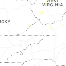
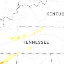
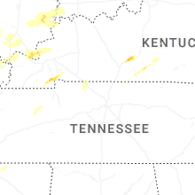


Connect with Interactive Hail Maps