

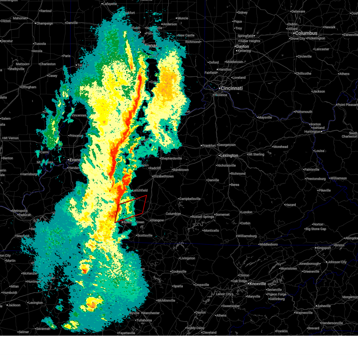
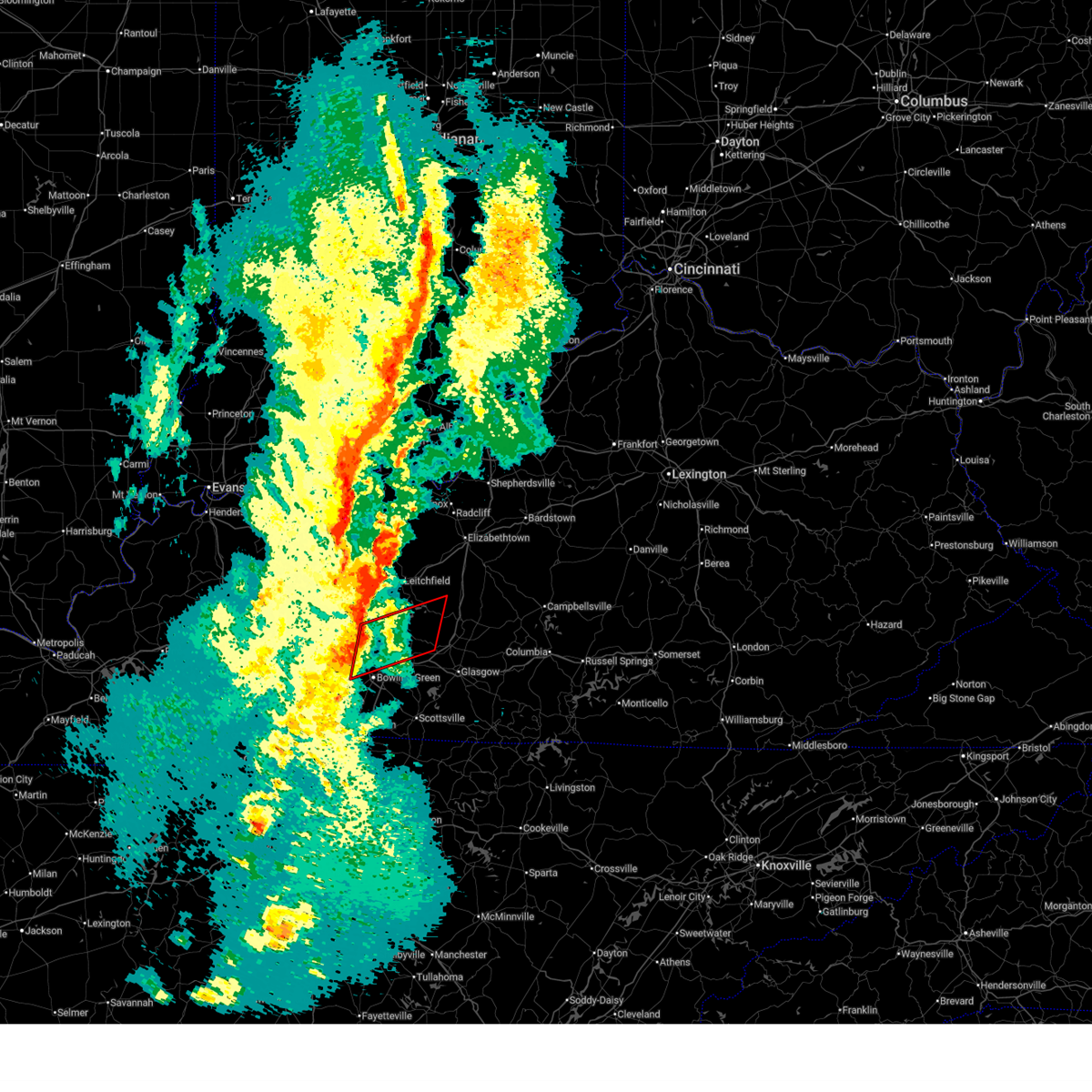
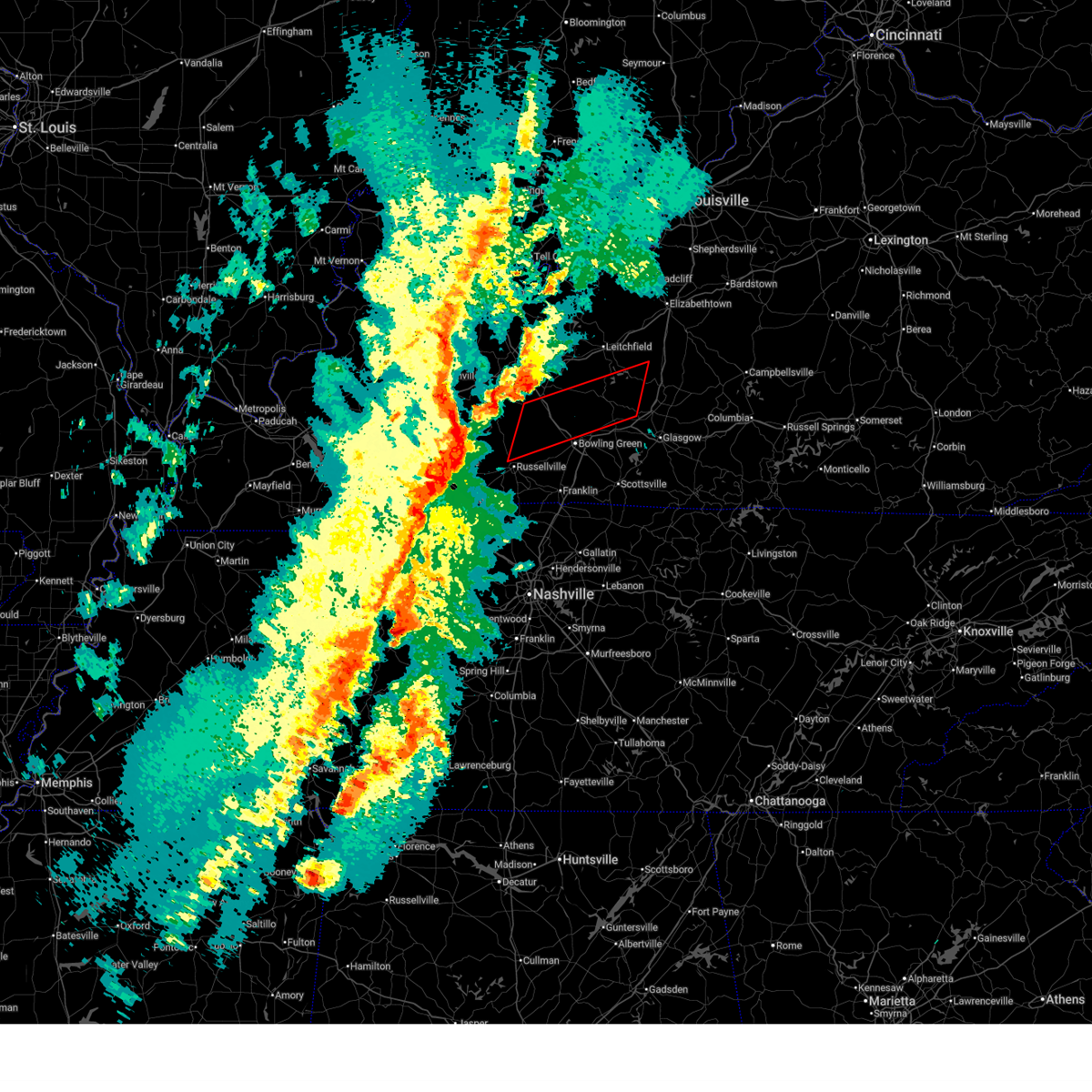
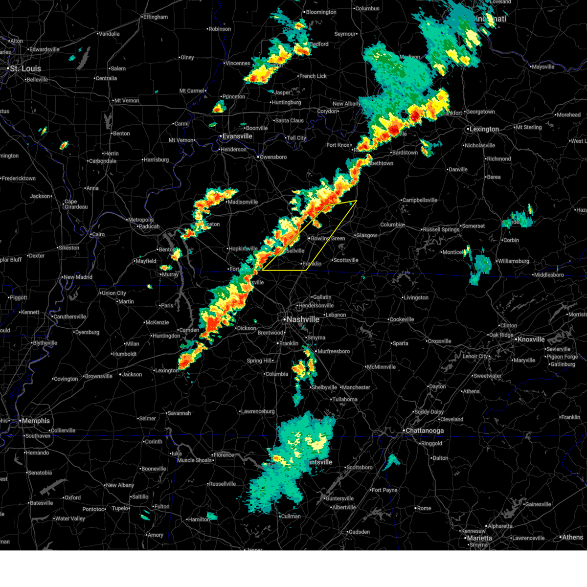
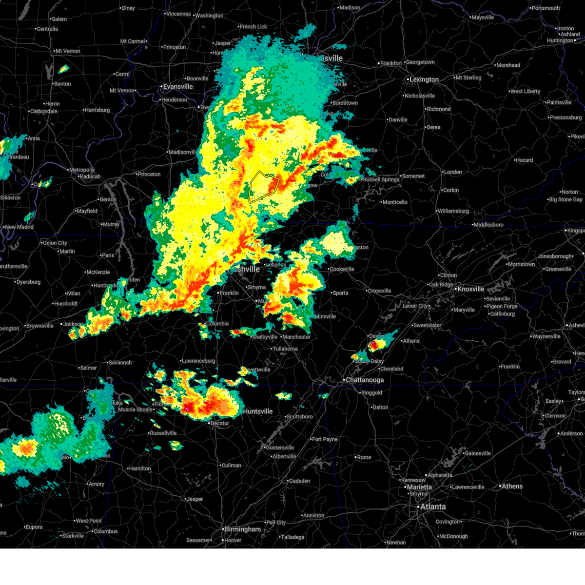
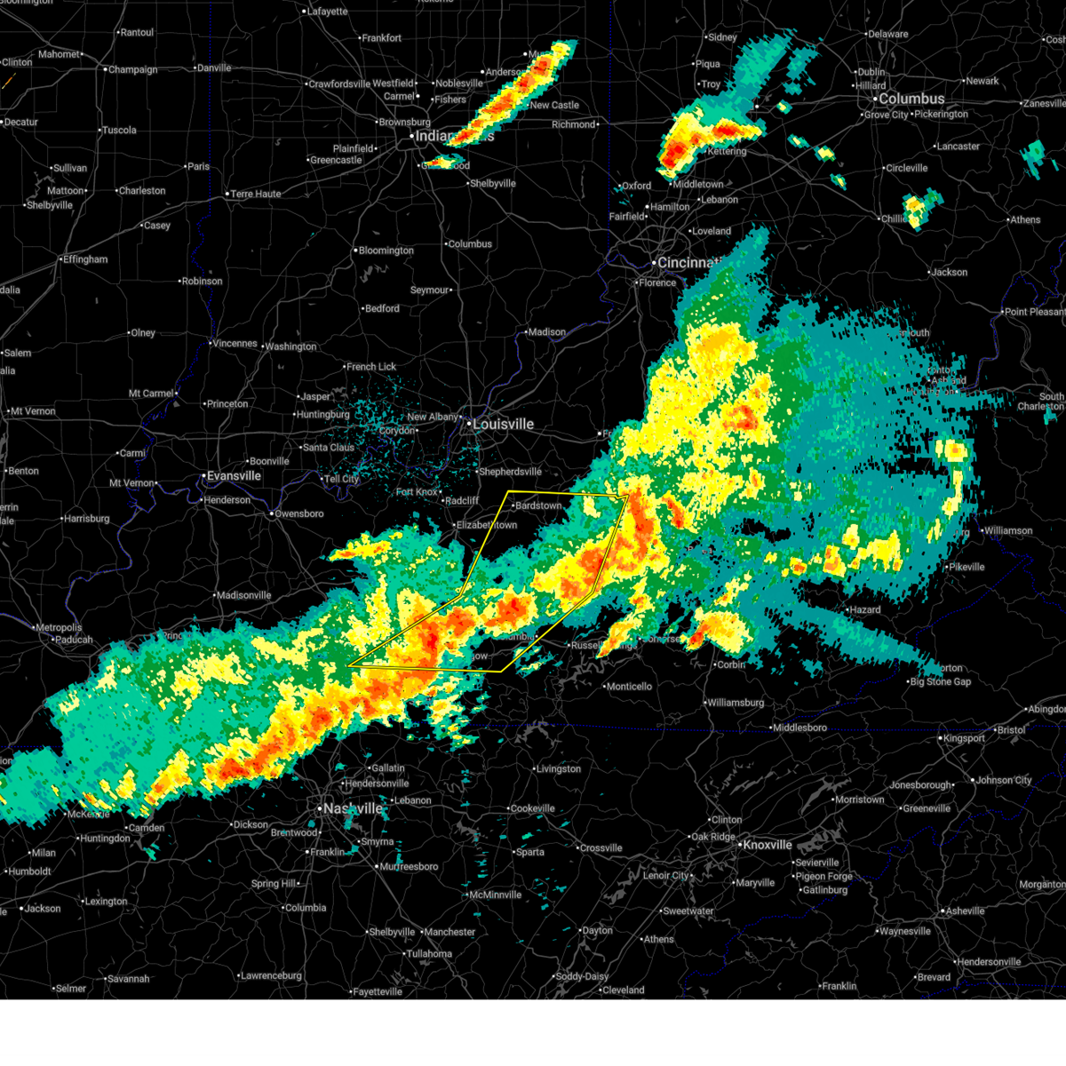
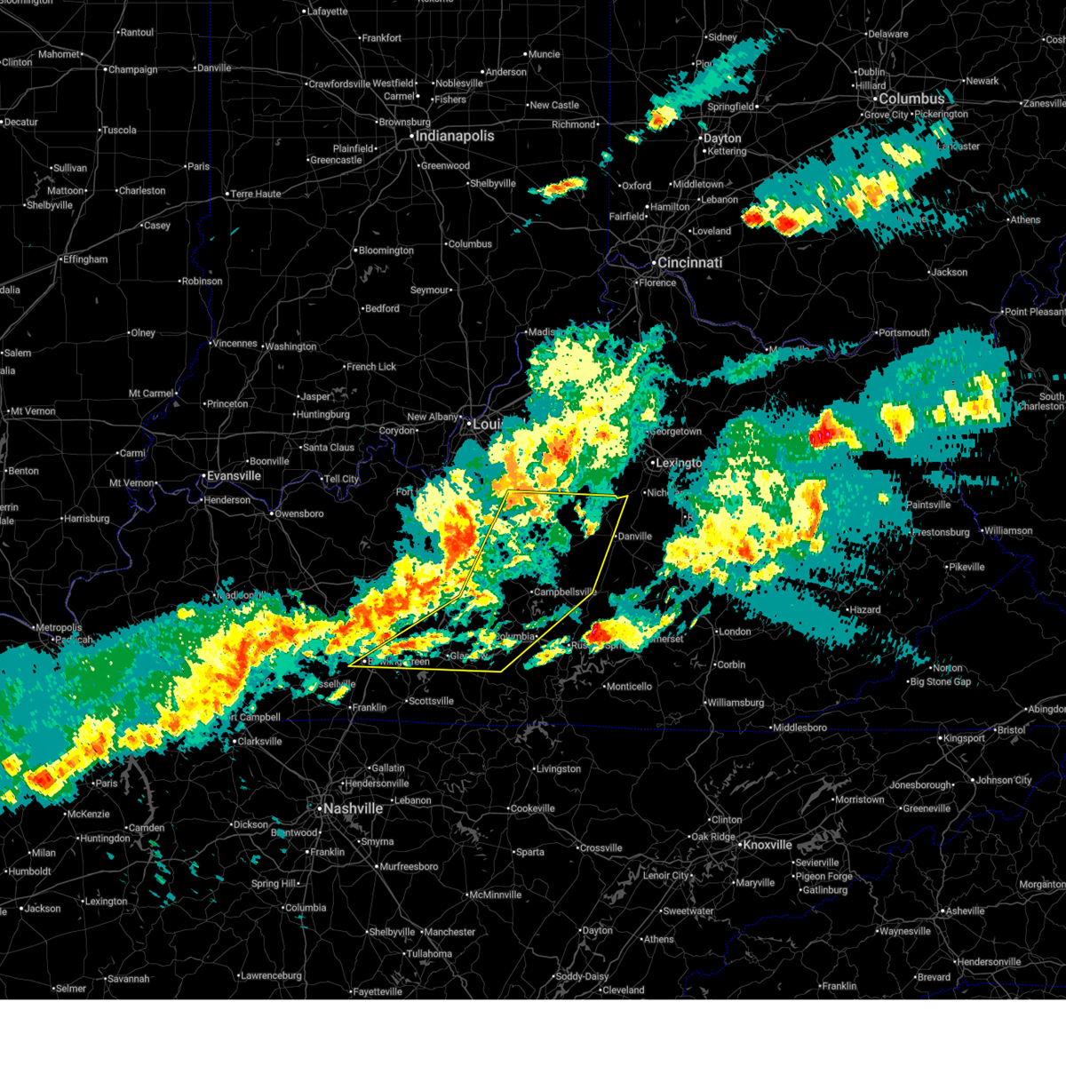
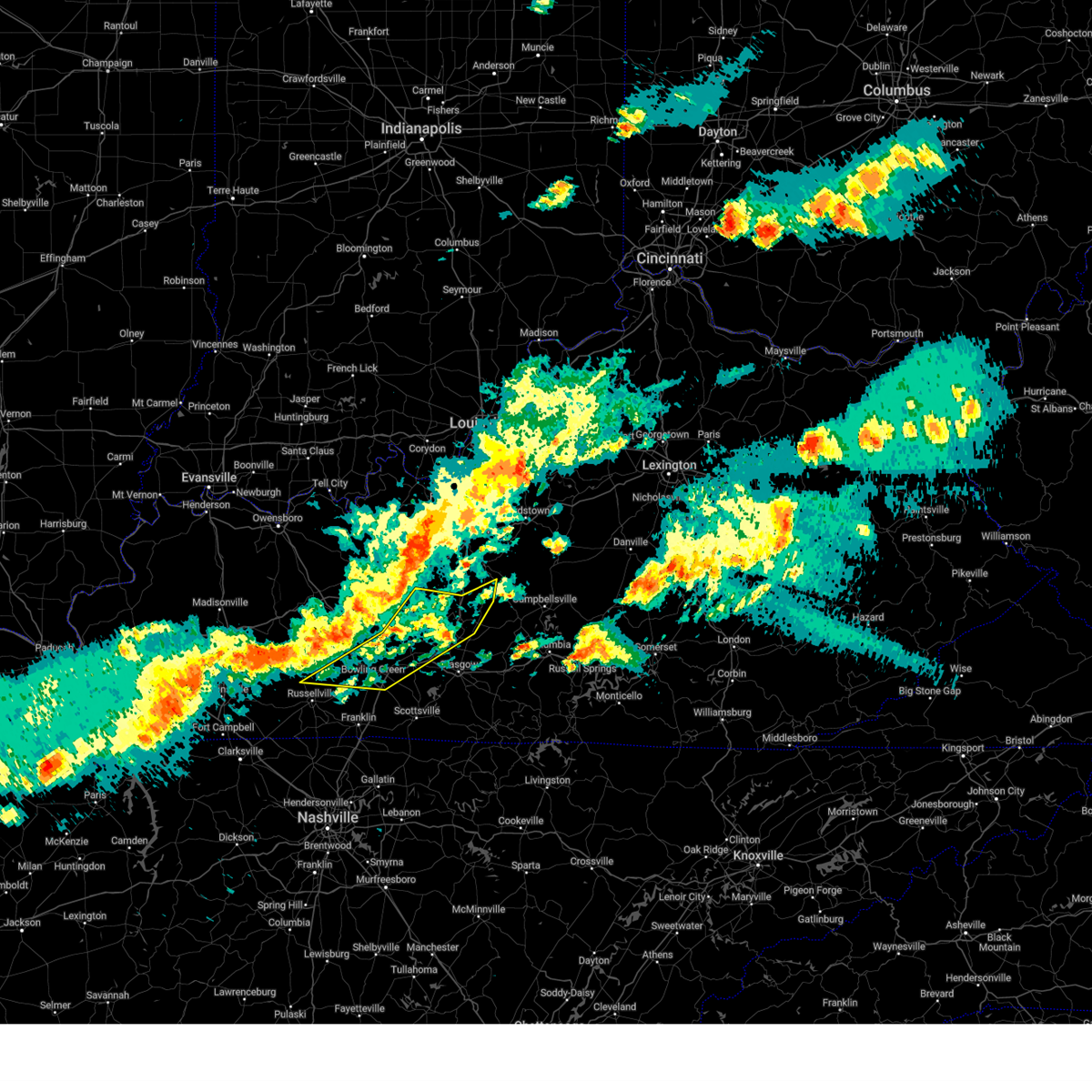
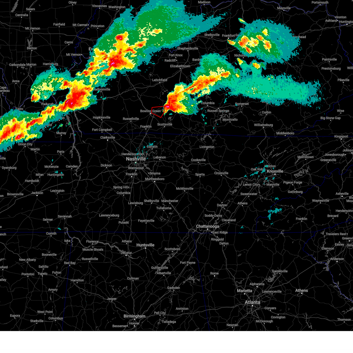
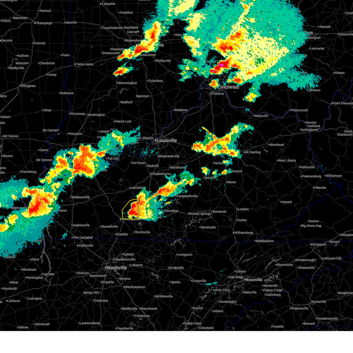
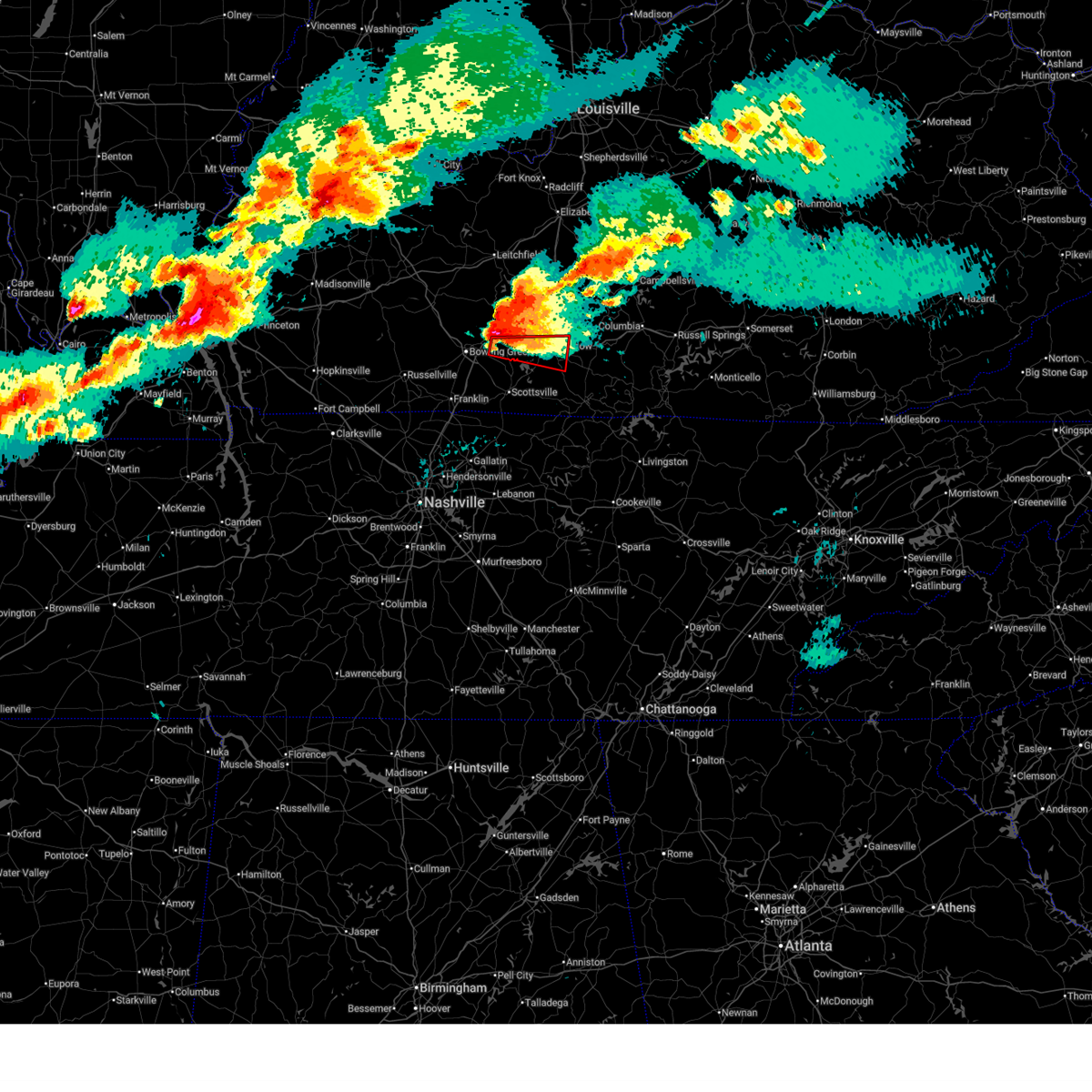
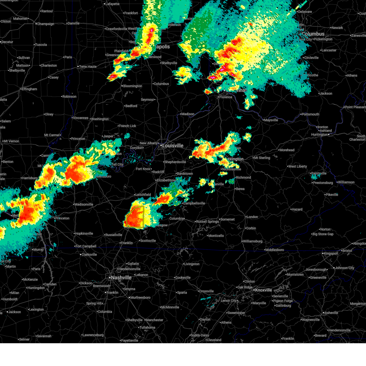
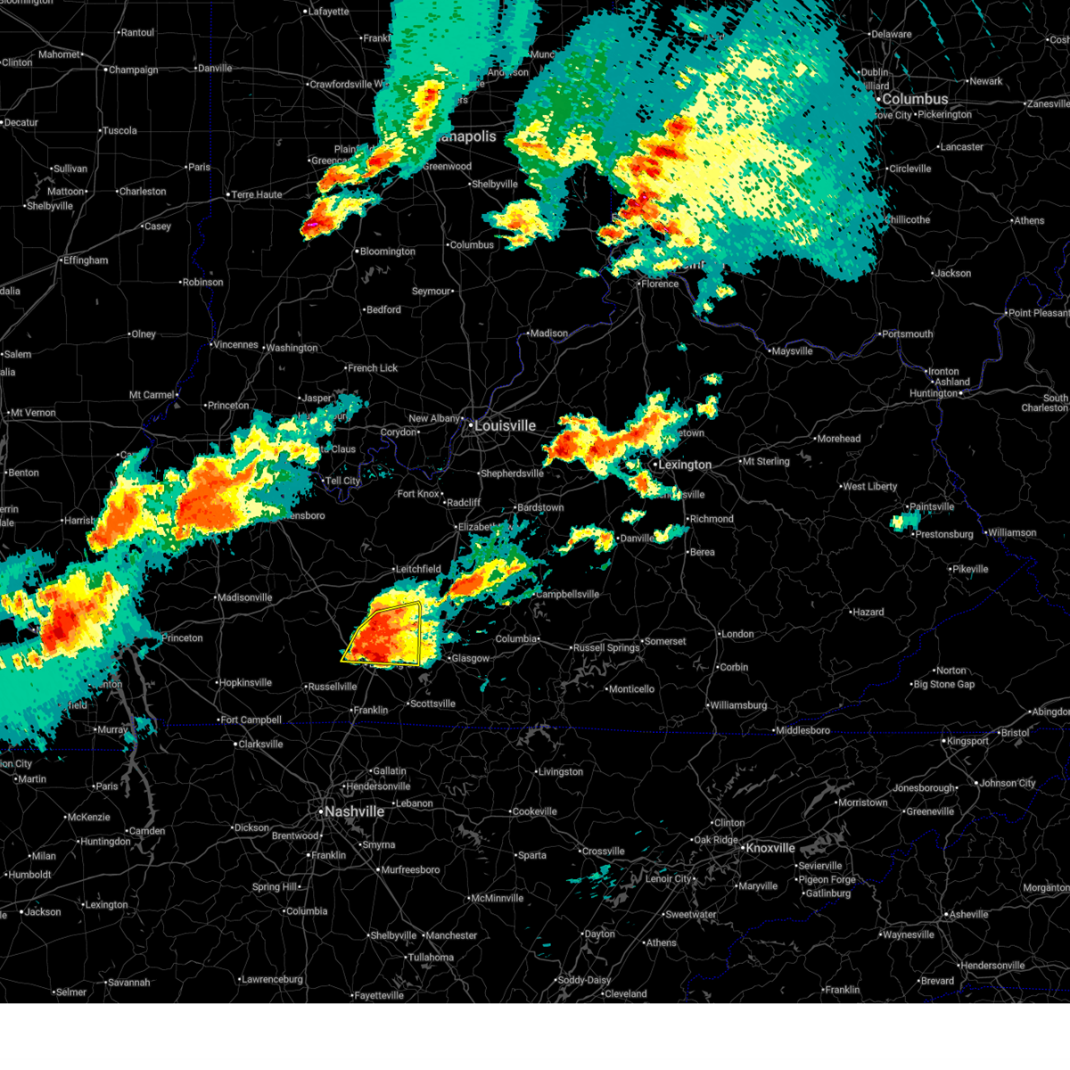
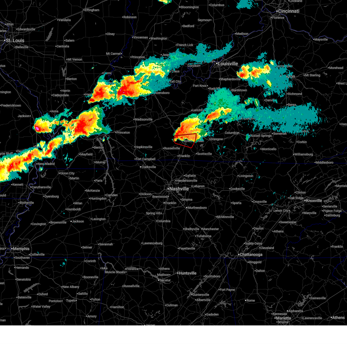
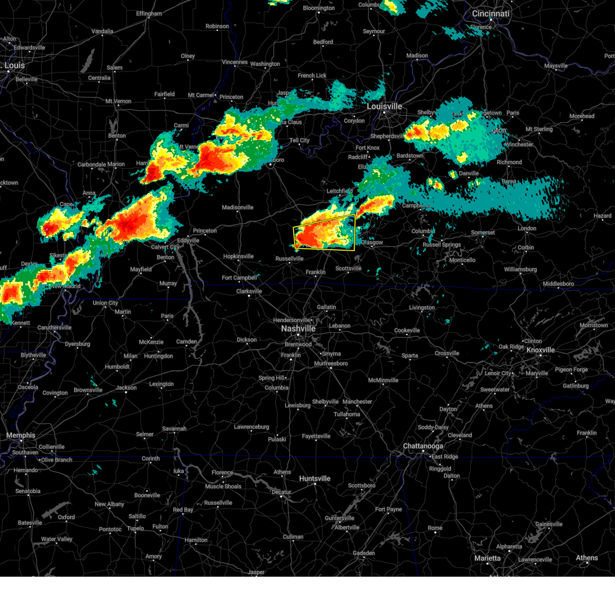
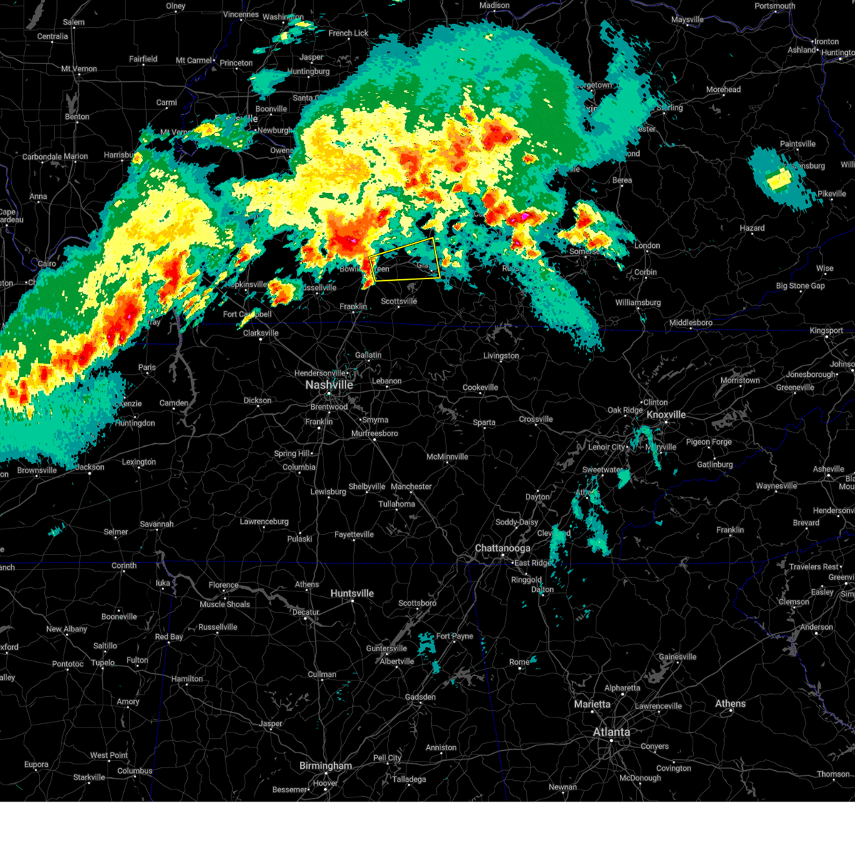
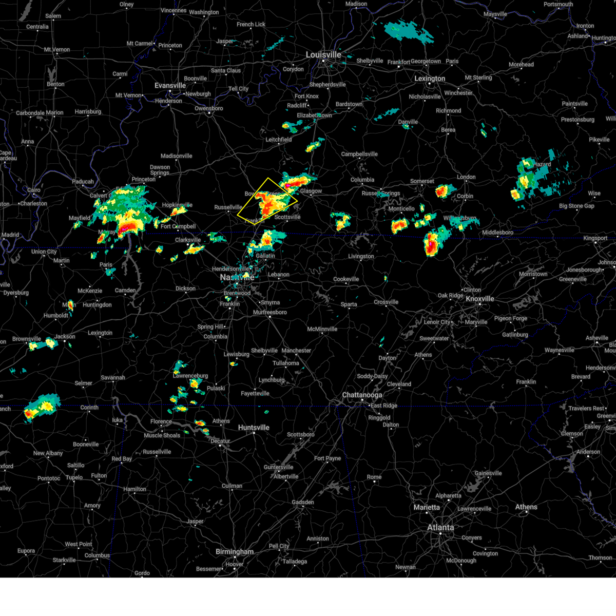
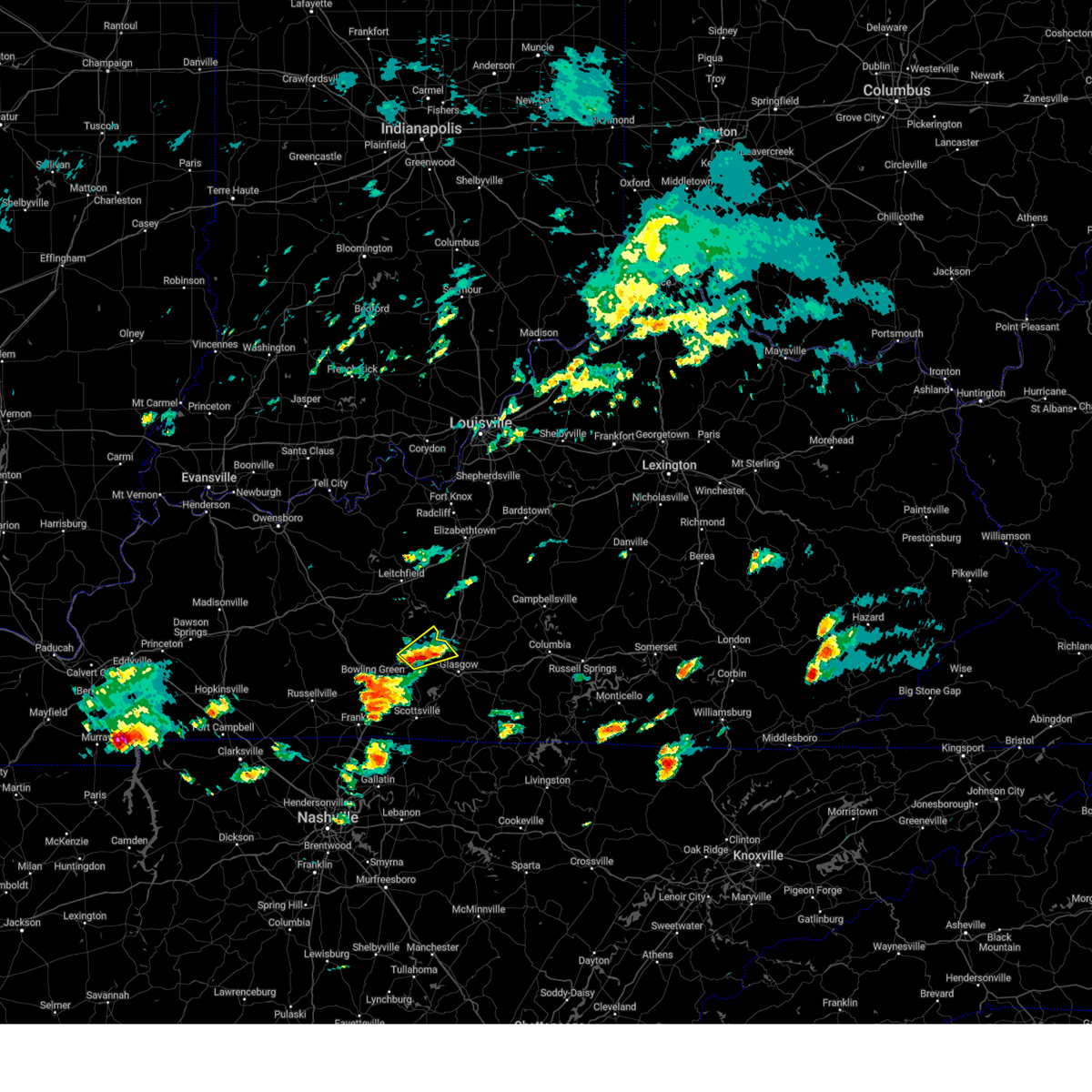
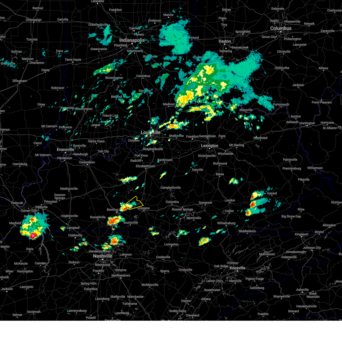
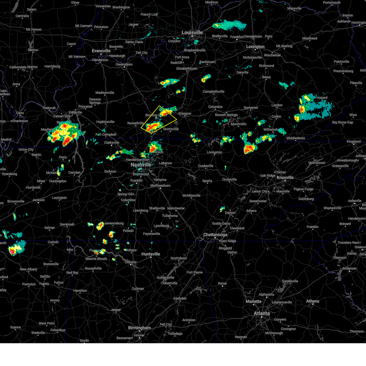
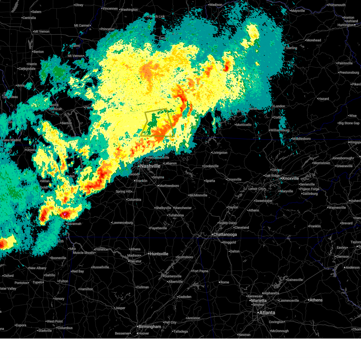
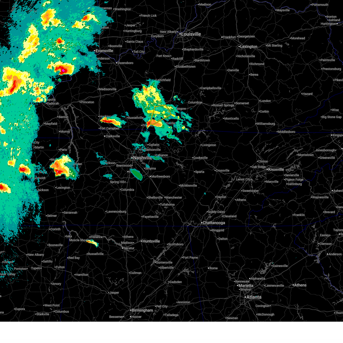
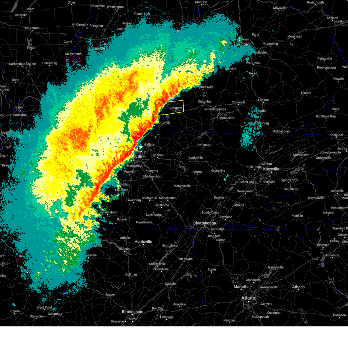
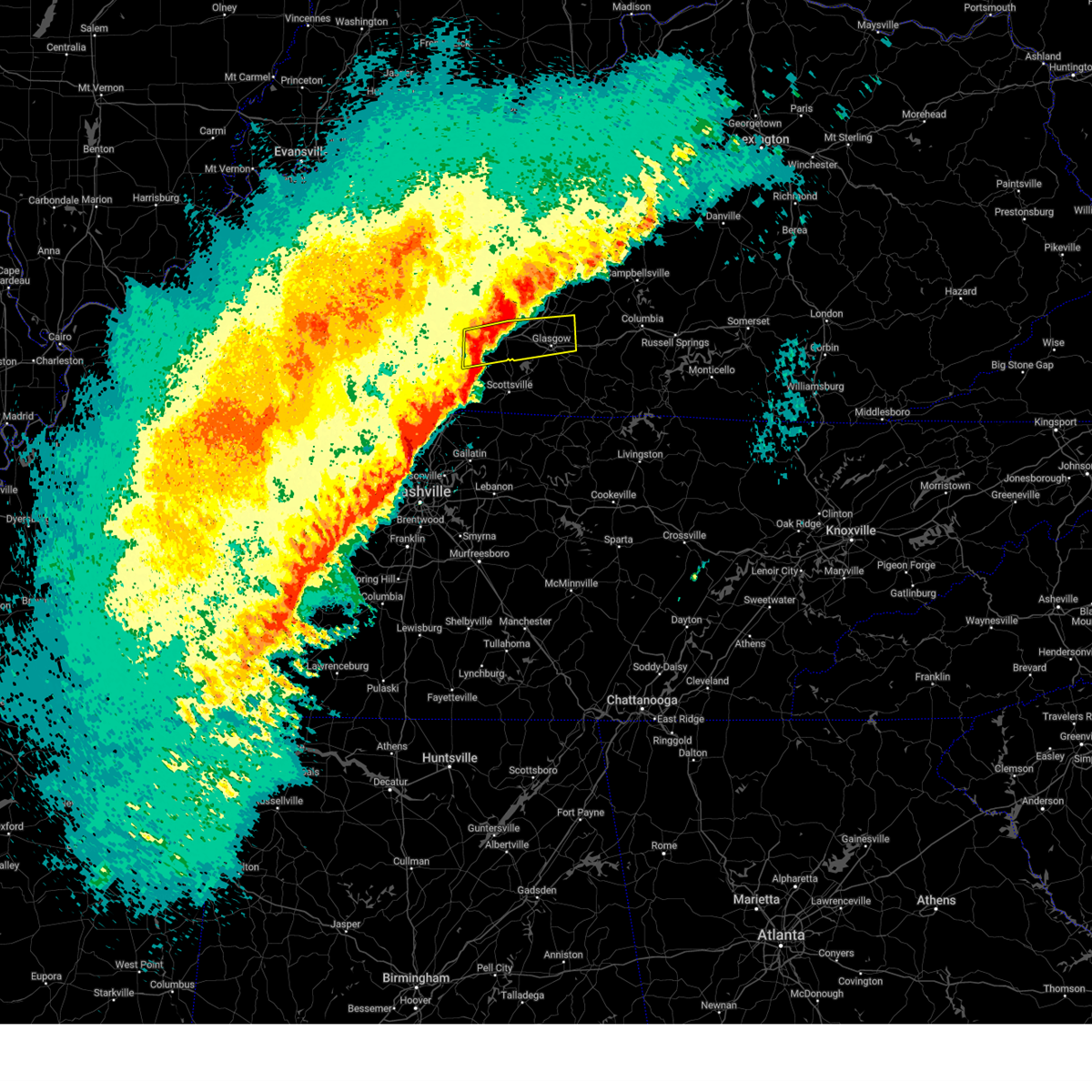
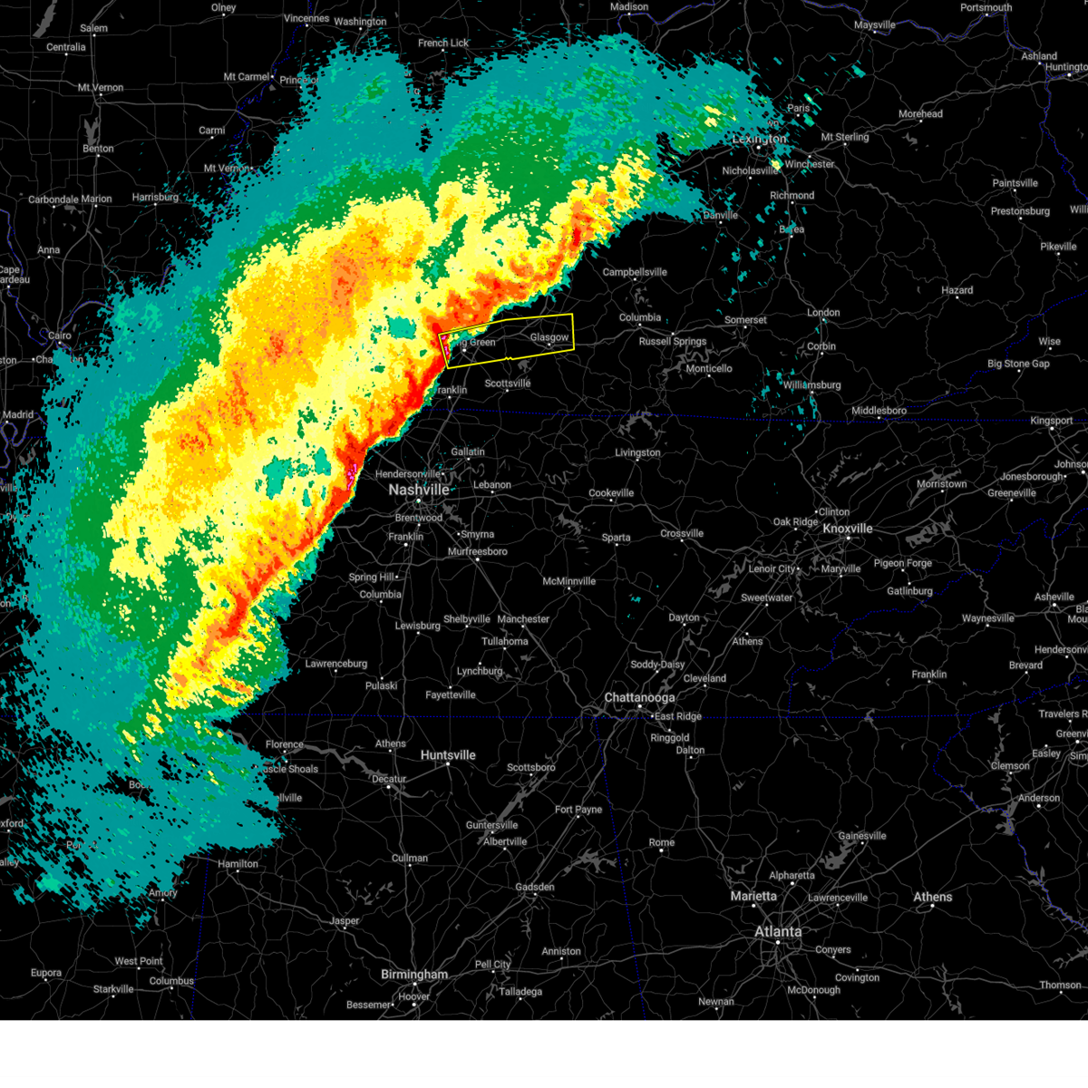
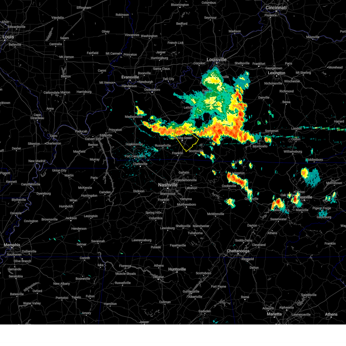
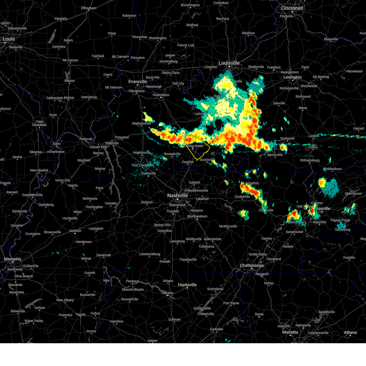
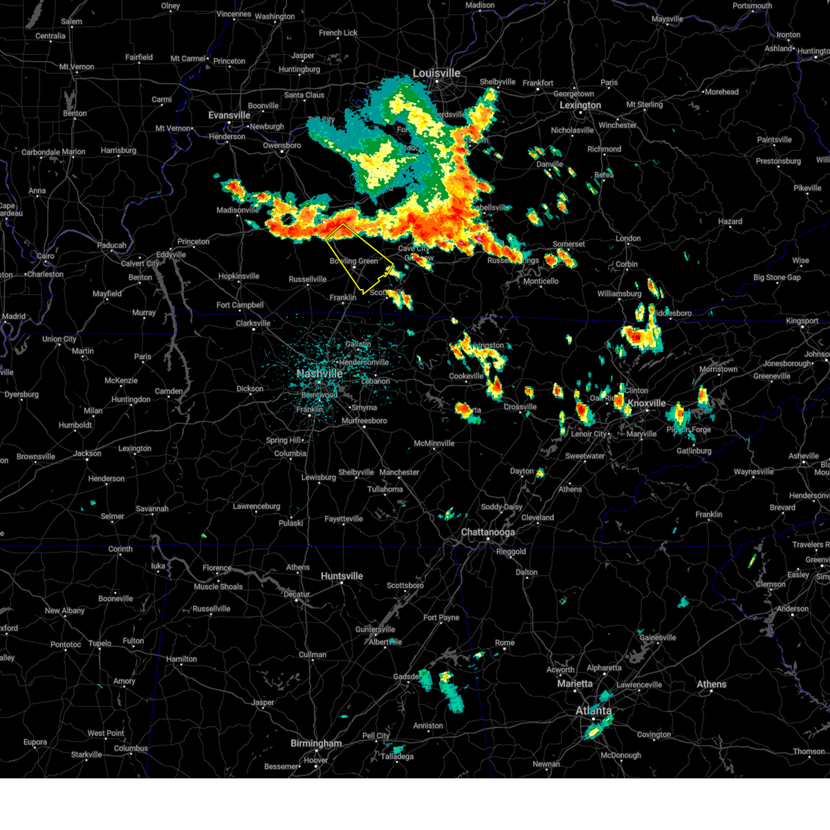
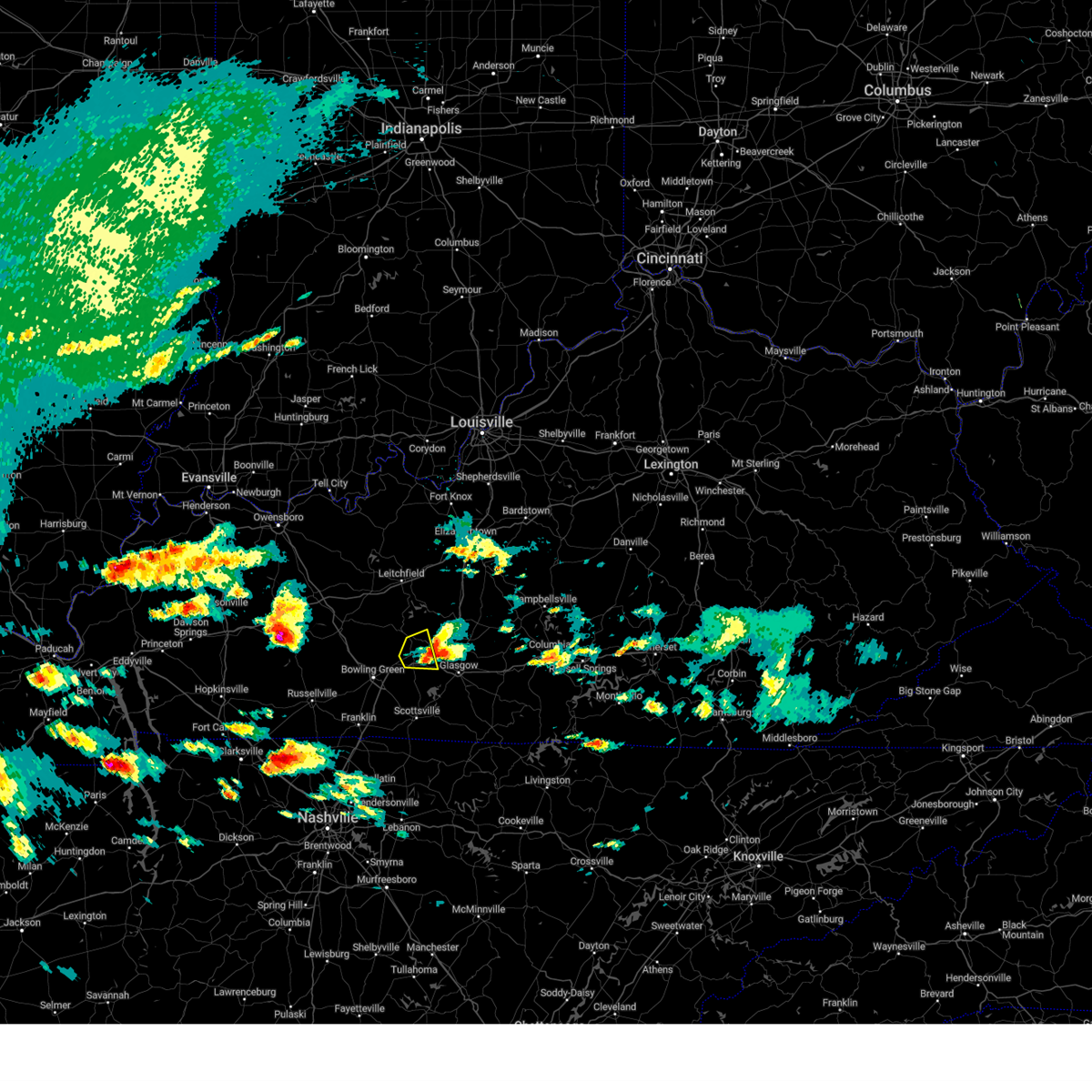
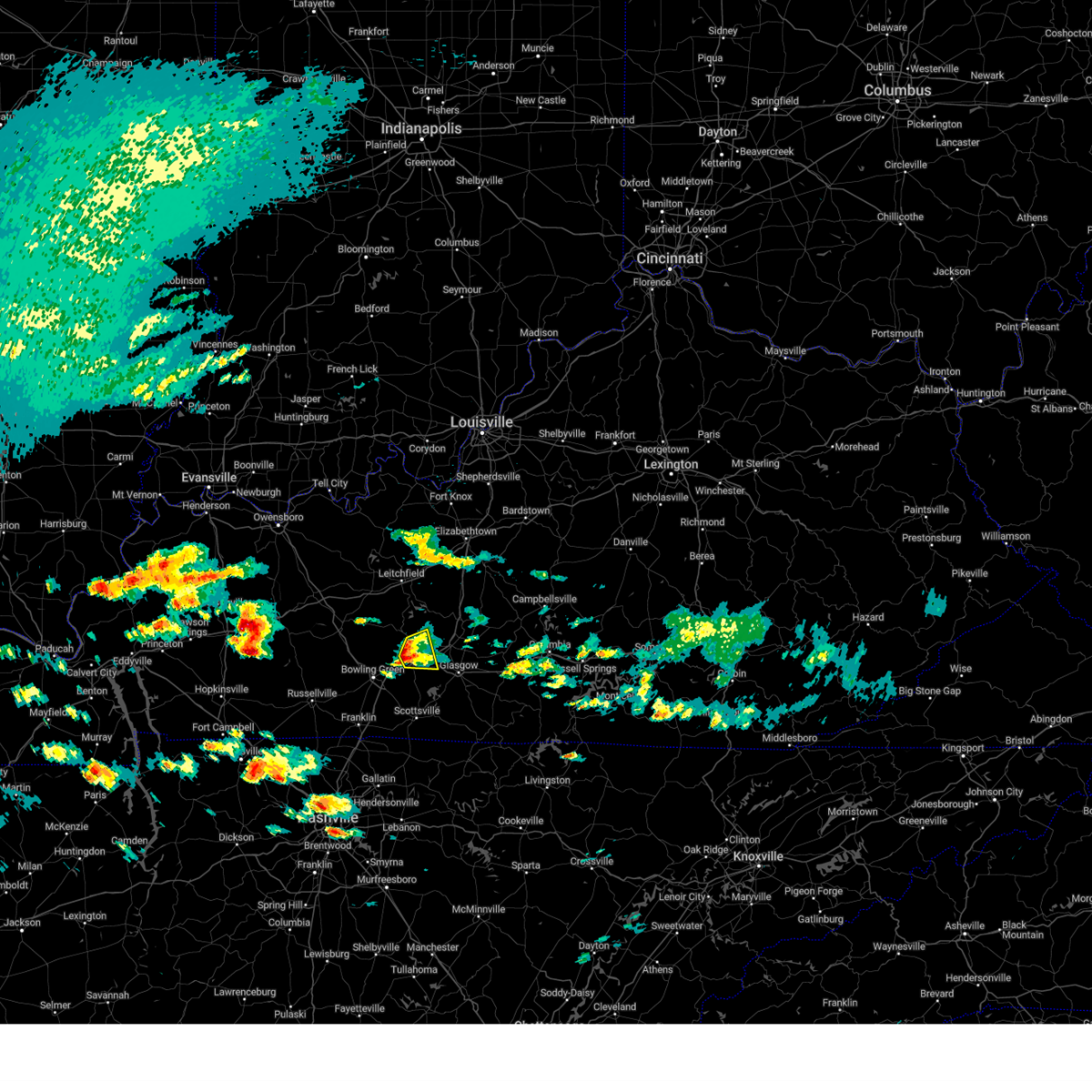
Hail Map for Oakland, KY
The Oakland, KY area has had 2 reports of on-the-ground hail by trained spotters, and has been under severe weather warnings 6 times during the past 12 months. Doppler radar has detected hail at or near Oakland, KY on 66 occasions, including 1 occasion during the past year.
| Name: | Oakland, KY |
| Where Located: | 67.4 miles NNE of Nashville, TN |
| Map: | Google Map for Oakland, KY |
| Population: | 225 |
| Housing Units: | 101 |
| More Info: | Search Google for Oakland, KY |
0
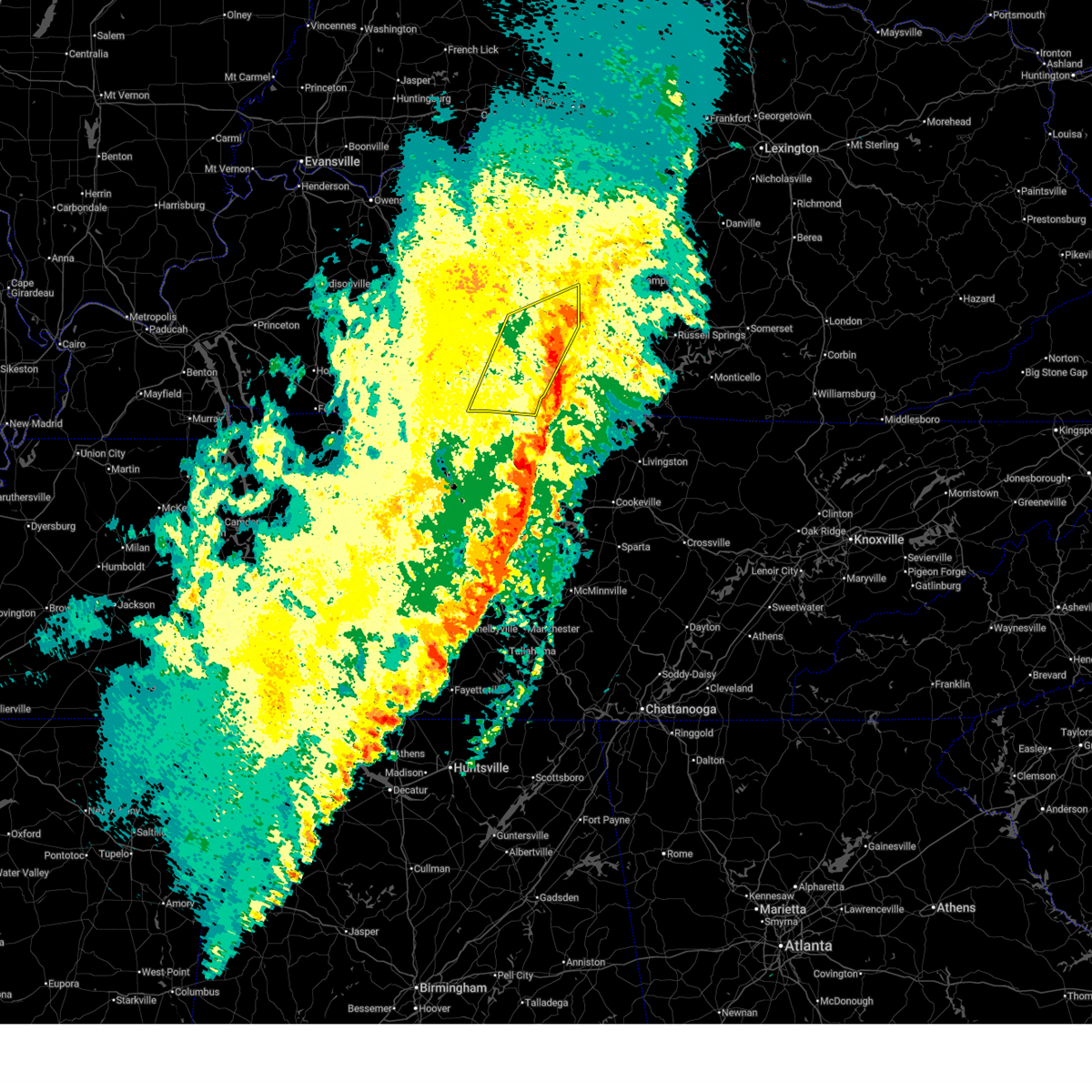
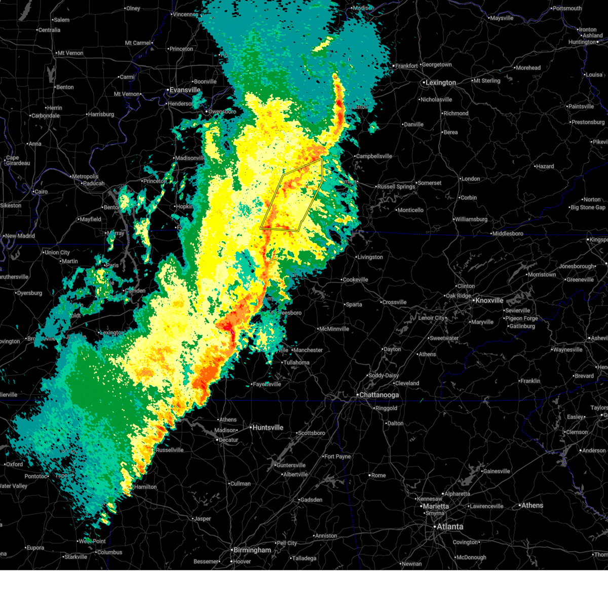
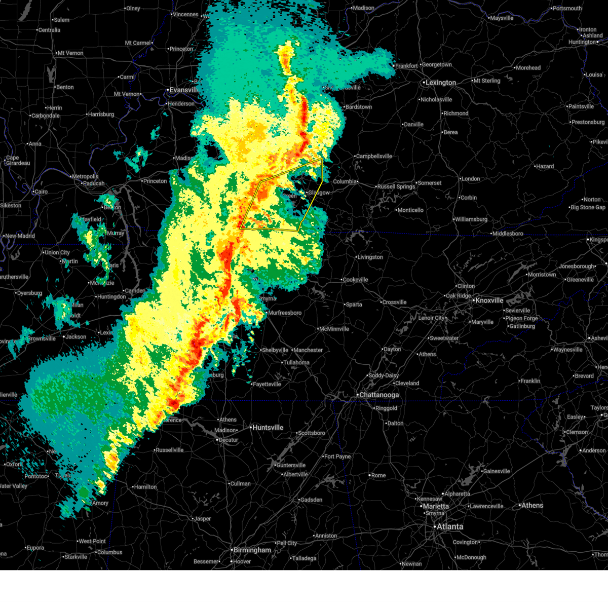
The Top Recent Hail Date for Oakland, KY is Thursday, July 31, 2025 (34th out of 66)
Hail and Wind Damage Spotted near Oakland, KY
| Date / Time | Report Details |
|---|---|
| 3/15/2026 11:37 PM CDT |
 The storms which prompted the warning have moved out of the area. therefore, the warning has been allowed to expire. a tornado watch remains in effect until 400 am cdt for south central kentucky. to report severe weather, contact your nearest law enforcement agency. they will relay your report to the national weather service louisville. The storms which prompted the warning have moved out of the area. therefore, the warning has been allowed to expire. a tornado watch remains in effect until 400 am cdt for south central kentucky. to report severe weather, contact your nearest law enforcement agency. they will relay your report to the national weather service louisville.
|
| 3/15/2026 11:11 PM CDT |
 At 1111 pm cdt, severe thunderstorms were located along a line extending from 8 miles northwest of glasgow to 7 miles northwest of westmoreland, moving east at 45 mph (radar indicated). Hazards include 60 mph wind gusts. Expect damage to roofs, siding, and trees. Locations impacted include, glasgow, scottsville, munfordville, three springs, horse cave, cave city, smiths grove, park city, oakland, and fountain run. At 1111 pm cdt, severe thunderstorms were located along a line extending from 8 miles northwest of glasgow to 7 miles northwest of westmoreland, moving east at 45 mph (radar indicated). Hazards include 60 mph wind gusts. Expect damage to roofs, siding, and trees. Locations impacted include, glasgow, scottsville, munfordville, three springs, horse cave, cave city, smiths grove, park city, oakland, and fountain run.
|
| 3/15/2026 10:46 PM CDT |
 Svrlmk the national weather service in louisville has issued a * severe thunderstorm warning for, simpson county in south central kentucky, southern hart county in central kentucky, allen county in south central kentucky, warren county in south central kentucky, barren county in south central kentucky, northwestern metcalfe county in south central kentucky, southeastern edmonson county in south central kentucky, * until 1130 pm cdt. * at 1046 pm cdt, severe thunderstorms were located along a line extending from 6 miles northeast of plum springs to 7 miles north of cross plains, moving east at 45 mph (radar indicated). Hazards include 60 mph wind gusts. expect damage to roofs, siding, and trees Svrlmk the national weather service in louisville has issued a * severe thunderstorm warning for, simpson county in south central kentucky, southern hart county in central kentucky, allen county in south central kentucky, warren county in south central kentucky, barren county in south central kentucky, northwestern metcalfe county in south central kentucky, southeastern edmonson county in south central kentucky, * until 1130 pm cdt. * at 1046 pm cdt, severe thunderstorms were located along a line extending from 6 miles northeast of plum springs to 7 miles north of cross plains, moving east at 45 mph (radar indicated). Hazards include 60 mph wind gusts. expect damage to roofs, siding, and trees
|
| 3/15/2026 10:14 PM CDT |
 At 1013 pm cdt, a severe squall line capable of producing both tornadoes and extensive straight line wind damage was located 11 miles east of morgantown, moving northeast at 65 mph (radar indicated rotation). Hazards include tornado. Flying debris will be dangerous to those caught without shelter. mobile homes will be damaged or destroyed. damage to roofs, windows, and vehicles will occur. tree damage is likely. these dangerous storms will be near, brownsville around 1025 pm cdt. Other locations impacted by this tornadic thunderstorm include windyville, chalybeate, roundhill, black gold, girkin, cub run, lines mill, broadway, rockland, and tuckertown. At 1013 pm cdt, a severe squall line capable of producing both tornadoes and extensive straight line wind damage was located 11 miles east of morgantown, moving northeast at 65 mph (radar indicated rotation). Hazards include tornado. Flying debris will be dangerous to those caught without shelter. mobile homes will be damaged or destroyed. damage to roofs, windows, and vehicles will occur. tree damage is likely. these dangerous storms will be near, brownsville around 1025 pm cdt. Other locations impacted by this tornadic thunderstorm include windyville, chalybeate, roundhill, black gold, girkin, cub run, lines mill, broadway, rockland, and tuckertown.
|
| 3/15/2026 10:14 PM CDT |
 the tornado warning has been cancelled and is no longer in effect the tornado warning has been cancelled and is no longer in effect
|
| 3/15/2026 9:59 PM CDT |
 Torlmk the national weather service in louisville has issued a * tornado warning for, northeastern logan county in south central kentucky, western hart county in central kentucky, southern butler county in south central kentucky, southeastern grayson county in central kentucky, northern warren county in south central kentucky, edmonson county in south central kentucky, * until 1045 pm cdt. * at 958 pm cdt, severe thunderstorms capable of producing both tornadoes and extensive straight line wind damage were located 13 miles east of dunmor, moving northeast at 75 mph (radar indicated rotation). Hazards include tornado. Flying debris will be dangerous to those caught without shelter. mobile homes will be damaged or destroyed. damage to roofs, windows, and vehicles will occur. tree damage is likely. these dangerous storms will be near, brownsville around 1020 pm cdt. Other locations impacted by this tornadic thunderstorm include roundhill, chalybeate, insco, dimple, girkin, black gold, leetown, cub run, rockland, and sunfish. Torlmk the national weather service in louisville has issued a * tornado warning for, northeastern logan county in south central kentucky, western hart county in central kentucky, southern butler county in south central kentucky, southeastern grayson county in central kentucky, northern warren county in south central kentucky, edmonson county in south central kentucky, * until 1045 pm cdt. * at 958 pm cdt, severe thunderstorms capable of producing both tornadoes and extensive straight line wind damage were located 13 miles east of dunmor, moving northeast at 75 mph (radar indicated rotation). Hazards include tornado. Flying debris will be dangerous to those caught without shelter. mobile homes will be damaged or destroyed. damage to roofs, windows, and vehicles will occur. tree damage is likely. these dangerous storms will be near, brownsville around 1020 pm cdt. Other locations impacted by this tornadic thunderstorm include roundhill, chalybeate, insco, dimple, girkin, black gold, leetown, cub run, rockland, and sunfish.
|
| 6/18/2025 7:14 PM CDT |
 Svrlmk the national weather service in louisville has issued a * severe thunderstorm warning for, southern logan county in south central kentucky, simpson county in south central kentucky, southwestern hart county in central kentucky, warren county in south central kentucky, edmonson county in south central kentucky, * until 800 pm cdt. * at 714 pm cdt, severe thunderstorms were located along a line extending from near brownsville to near russellville, moving east at 30 mph (radar indicated). Hazards include 60 mph wind gusts. expect damage to roofs, siding, and trees Svrlmk the national weather service in louisville has issued a * severe thunderstorm warning for, southern logan county in south central kentucky, simpson county in south central kentucky, southwestern hart county in central kentucky, warren county in south central kentucky, edmonson county in south central kentucky, * until 800 pm cdt. * at 714 pm cdt, severe thunderstorms were located along a line extending from near brownsville to near russellville, moving east at 30 mph (radar indicated). Hazards include 60 mph wind gusts. expect damage to roofs, siding, and trees
|
| 5/20/2025 6:02 PM CDT |
 the severe thunderstorm warning has been cancelled and is no longer in effect the severe thunderstorm warning has been cancelled and is no longer in effect
|
| 5/20/2025 5:48 PM CDT |
 At 547 pm cdt, a severe thunderstorm was located over mount victor, or just southeast of bowling green, moving northeast at 30 mph (radar indicated). Hazards include 60 mph wind gusts and quarter size hail. Hail damage to vehicles is expected. expect wind damage to roofs, siding, and trees. Locations impacted include, bowling green, plum springs, crestmoor, mount victor, smiths grove, oakland, three forks, bristow, hardcastle, girkin, pondsville, greenhill, loving, tuckertown, matlock, alvaton, hays, sunnyside, gotts, and polkville. At 547 pm cdt, a severe thunderstorm was located over mount victor, or just southeast of bowling green, moving northeast at 30 mph (radar indicated). Hazards include 60 mph wind gusts and quarter size hail. Hail damage to vehicles is expected. expect wind damage to roofs, siding, and trees. Locations impacted include, bowling green, plum springs, crestmoor, mount victor, smiths grove, oakland, three forks, bristow, hardcastle, girkin, pondsville, greenhill, loving, tuckertown, matlock, alvaton, hays, sunnyside, gotts, and polkville.
|
| 5/20/2025 5:35 PM CDT |
 At 535 pm cdt, a severe thunderstorm was located near memphis junction, or near bowling green, moving northeast at 40 mph (radar indicated). Hazards include 70 mph wind gusts and quarter size hail. Hail damage to vehicles is expected. expect considerable tree damage. wind damage is also likely to mobile homes, roofs, and outbuildings. Locations impacted include, bowling green, plum springs, crestmoor, memphis junction, mount victor, smiths grove, woodburn, oakland, three forks, hardcastle, girkin, rich pond, greenhill, loving, tuckertown, hays, sunnyside, polkville, martinsville, and motley. At 535 pm cdt, a severe thunderstorm was located near memphis junction, or near bowling green, moving northeast at 40 mph (radar indicated). Hazards include 70 mph wind gusts and quarter size hail. Hail damage to vehicles is expected. expect considerable tree damage. wind damage is also likely to mobile homes, roofs, and outbuildings. Locations impacted include, bowling green, plum springs, crestmoor, memphis junction, mount victor, smiths grove, woodburn, oakland, three forks, hardcastle, girkin, rich pond, greenhill, loving, tuckertown, hays, sunnyside, polkville, martinsville, and motley.
|
| 5/20/2025 5:31 PM CDT |
 the severe thunderstorm warning has been cancelled and is no longer in effect the severe thunderstorm warning has been cancelled and is no longer in effect
|
| 5/20/2025 5:31 PM CDT |
 At 530 pm cdt, a severe thunderstorm was located near memphis junction, or near bowling green, moving northeast at 40 mph (radar indicated). Hazards include 60 mph wind gusts and quarter size hail. Hail damage to vehicles is expected. expect wind damage to roofs, siding, and trees. Locations impacted include, bowling green, plum springs, crestmoor, memphis junction, mount victor, smiths grove, woodburn, oakland, three forks, hardcastle, girkin, rich pond, greenhill, loving, tuckertown, hays, sunnyside, polkville, martinsville, and motley. At 530 pm cdt, a severe thunderstorm was located near memphis junction, or near bowling green, moving northeast at 40 mph (radar indicated). Hazards include 60 mph wind gusts and quarter size hail. Hail damage to vehicles is expected. expect wind damage to roofs, siding, and trees. Locations impacted include, bowling green, plum springs, crestmoor, memphis junction, mount victor, smiths grove, woodburn, oakland, three forks, hardcastle, girkin, rich pond, greenhill, loving, tuckertown, hays, sunnyside, polkville, martinsville, and motley.
|
| 5/20/2025 5:23 PM CDT |
 Svrlmk the national weather service in louisville has issued a * severe thunderstorm warning for, east central logan county in south central kentucky, northern simpson county in south central kentucky, warren county in south central kentucky, * until 615 pm cdt. * at 523 pm cdt, a severe thunderstorm was located 9 miles southwest of memphis junction, or 12 miles southwest of bowling green, moving northeast at 35 mph (radar indicated). Hazards include 60 mph wind gusts and quarter size hail. Hail damage to vehicles is expected. Expect wind damage to roofs, siding, and trees. Svrlmk the national weather service in louisville has issued a * severe thunderstorm warning for, east central logan county in south central kentucky, northern simpson county in south central kentucky, warren county in south central kentucky, * until 615 pm cdt. * at 523 pm cdt, a severe thunderstorm was located 9 miles southwest of memphis junction, or 12 miles southwest of bowling green, moving northeast at 35 mph (radar indicated). Hazards include 60 mph wind gusts and quarter size hail. Hail damage to vehicles is expected. Expect wind damage to roofs, siding, and trees.
|
| 5/16/2025 11:33 PM EDT |
 The storms which prompted the warning have moved out of the area. therefore, the warning has been allowed to expire. however, gusty winds and heavy rain are still possible with these thunderstorms. a tornado watch remains in effect until 100 am edt/midnight cdt/ for south central kentucky. a tornado watch also remains in effect until 300 am edt/200 am cdt/ for south central and central kentucky. The storms which prompted the warning have moved out of the area. therefore, the warning has been allowed to expire. however, gusty winds and heavy rain are still possible with these thunderstorms. a tornado watch remains in effect until 100 am edt/midnight cdt/ for south central kentucky. a tornado watch also remains in effect until 300 am edt/200 am cdt/ for south central and central kentucky.
|
| 5/16/2025 10:40 PM EDT |
 Svrlmk the national weather service in louisville has issued a * severe thunderstorm warning for, central nelson county in central kentucky, eastern larue county in central kentucky, marion county in central kentucky, eastern hart county in central kentucky, taylor county in central kentucky, west central jessamine county in central kentucky, northwestern casey county in central kentucky, central adair county in south central kentucky, southeastern edmonson county in south central kentucky, mercer county in central kentucky, green county in central kentucky, central warren county in south central kentucky, washington county in central kentucky, boyle county in central kentucky, barren county in south central kentucky, metcalfe county in south central kentucky, * until 1130 pm edt/1030 pm cdt/. * at 1040 pm edt/940 pm cdt/, severe thunderstorms were located along a line extending from 9 miles west of bardstown to 9 miles west of munfordville to near memphis junction, moving east at 65 mph (radar indicated). Hazards include 70 mph wind gusts and penny size hail. Expect considerable tree damage. Damage is likely to mobile homes, roofs, and outbuildings. Svrlmk the national weather service in louisville has issued a * severe thunderstorm warning for, central nelson county in central kentucky, eastern larue county in central kentucky, marion county in central kentucky, eastern hart county in central kentucky, taylor county in central kentucky, west central jessamine county in central kentucky, northwestern casey county in central kentucky, central adair county in south central kentucky, southeastern edmonson county in south central kentucky, mercer county in central kentucky, green county in central kentucky, central warren county in south central kentucky, washington county in central kentucky, boyle county in central kentucky, barren county in south central kentucky, metcalfe county in south central kentucky, * until 1130 pm edt/1030 pm cdt/. * at 1040 pm edt/940 pm cdt/, severe thunderstorms were located along a line extending from 9 miles west of bardstown to 9 miles west of munfordville to near memphis junction, moving east at 65 mph (radar indicated). Hazards include 70 mph wind gusts and penny size hail. Expect considerable tree damage. Damage is likely to mobile homes, roofs, and outbuildings.
|
| 5/16/2025 9:22 PM CDT |
 Svrlmk the national weather service in louisville has issued a * severe thunderstorm warning for, northern logan county in south central kentucky, south central larue county in central kentucky, hart county in central kentucky, southeastern butler county in south central kentucky, southeastern grayson county in central kentucky, warren county in south central kentucky, northwestern barren county in south central kentucky, edmonson county in south central kentucky, * until 1100 pm edt/1000 pm cdt/. * at 1021 pm edt/921 pm cdt/, severe thunderstorms were located along a line extending from 7 miles south of leitchfield to 9 miles west of brownsville to 9 miles southeast of morgantown to 8 miles south of dunmor, moving east at 40 mph (radar indicated). Hazards include 70 mph wind gusts. Expect considerable tree damage. Damage is likely to mobile homes, roofs, and outbuildings. Svrlmk the national weather service in louisville has issued a * severe thunderstorm warning for, northern logan county in south central kentucky, south central larue county in central kentucky, hart county in central kentucky, southeastern butler county in south central kentucky, southeastern grayson county in central kentucky, warren county in south central kentucky, northwestern barren county in south central kentucky, edmonson county in south central kentucky, * until 1100 pm edt/1000 pm cdt/. * at 1021 pm edt/921 pm cdt/, severe thunderstorms were located along a line extending from 7 miles south of leitchfield to 9 miles west of brownsville to 9 miles southeast of morgantown to 8 miles south of dunmor, moving east at 40 mph (radar indicated). Hazards include 70 mph wind gusts. Expect considerable tree damage. Damage is likely to mobile homes, roofs, and outbuildings.
|
| 5/16/2025 8:05 PM CDT |
 The storm which prompted the warning has moved out of the area. therefore, the warning will be allowed to expire. a tornado watch remains in effect until 1000 pm cdt for south central kentucky. to report severe weather, contact your nearest law enforcement agency. they will relay your report to the national weather service louisville. The storm which prompted the warning has moved out of the area. therefore, the warning will be allowed to expire. a tornado watch remains in effect until 1000 pm cdt for south central kentucky. to report severe weather, contact your nearest law enforcement agency. they will relay your report to the national weather service louisville.
|
| 5/16/2025 8:02 PM CDT |
 The storm which prompted the warning has moved out of the area. therefore, the warning has been allowed to expire. a tornado watch remains in effect until 1000 pm cdt for south central kentucky. a tornado watch also remains in effect until 200 am cdt for south central and central kentucky. to report severe weather, contact your nearest law enforcement agency. they will relay your report to the national weather service louisville. The storm which prompted the warning has moved out of the area. therefore, the warning has been allowed to expire. a tornado watch remains in effect until 1000 pm cdt for south central kentucky. a tornado watch also remains in effect until 200 am cdt for south central and central kentucky. to report severe weather, contact your nearest law enforcement agency. they will relay your report to the national weather service louisville.
|
| 5/16/2025 7:59 PM CDT |
 Svrlmk the national weather service in louisville has issued a * severe thunderstorm warning for, southwestern green county in central kentucky, hart county in central kentucky, northeastern warren county in south central kentucky, barren county in south central kentucky, western metcalfe county in south central kentucky, eastern edmonson county in south central kentucky, * until 845 pm cdt. * at 759 pm cdt, a severe thunderstorm was located 9 miles east of plum springs, moving east at 45 mph (radar indicated). Hazards include two inch hail and 70 mph wind gusts. People and animals outdoors will be injured. expect hail damage to roofs, siding, windows, and vehicles. expect considerable tree damage. Wind damage is also likely to mobile homes, roofs, and outbuildings. Svrlmk the national weather service in louisville has issued a * severe thunderstorm warning for, southwestern green county in central kentucky, hart county in central kentucky, northeastern warren county in south central kentucky, barren county in south central kentucky, western metcalfe county in south central kentucky, eastern edmonson county in south central kentucky, * until 845 pm cdt. * at 759 pm cdt, a severe thunderstorm was located 9 miles east of plum springs, moving east at 45 mph (radar indicated). Hazards include two inch hail and 70 mph wind gusts. People and animals outdoors will be injured. expect hail damage to roofs, siding, windows, and vehicles. expect considerable tree damage. Wind damage is also likely to mobile homes, roofs, and outbuildings.
|
| 5/16/2025 7:55 PM CDT |
 Torlmk the national weather service in louisville has issued a * tornado warning for, east central warren county in south central kentucky, central barren county in south central kentucky, * until 845 pm cdt. * at 755 pm cdt, a severe thunderstorm capable of producing a tornado was located near plum springs, moving east at 35 mph (radar indicated rotation). Hazards include tornado and golf ball size hail. Flying debris will be dangerous to those caught without shelter. mobile homes will be damaged or destroyed. damage to roofs, windows, and vehicles will occur. tree damage is likely. this dangerous storm will be near, glasgow around 820 pm cdt. Other locations impacted by this tornadic thunderstorm include three forks, red cross, roseville, pritchardsville, lecta, haywood, loving, hays, sunnyside, and polkville. Torlmk the national weather service in louisville has issued a * tornado warning for, east central warren county in south central kentucky, central barren county in south central kentucky, * until 845 pm cdt. * at 755 pm cdt, a severe thunderstorm capable of producing a tornado was located near plum springs, moving east at 35 mph (radar indicated rotation). Hazards include tornado and golf ball size hail. Flying debris will be dangerous to those caught without shelter. mobile homes will be damaged or destroyed. damage to roofs, windows, and vehicles will occur. tree damage is likely. this dangerous storm will be near, glasgow around 820 pm cdt. Other locations impacted by this tornadic thunderstorm include three forks, red cross, roseville, pritchardsville, lecta, haywood, loving, hays, sunnyside, and polkville.
|
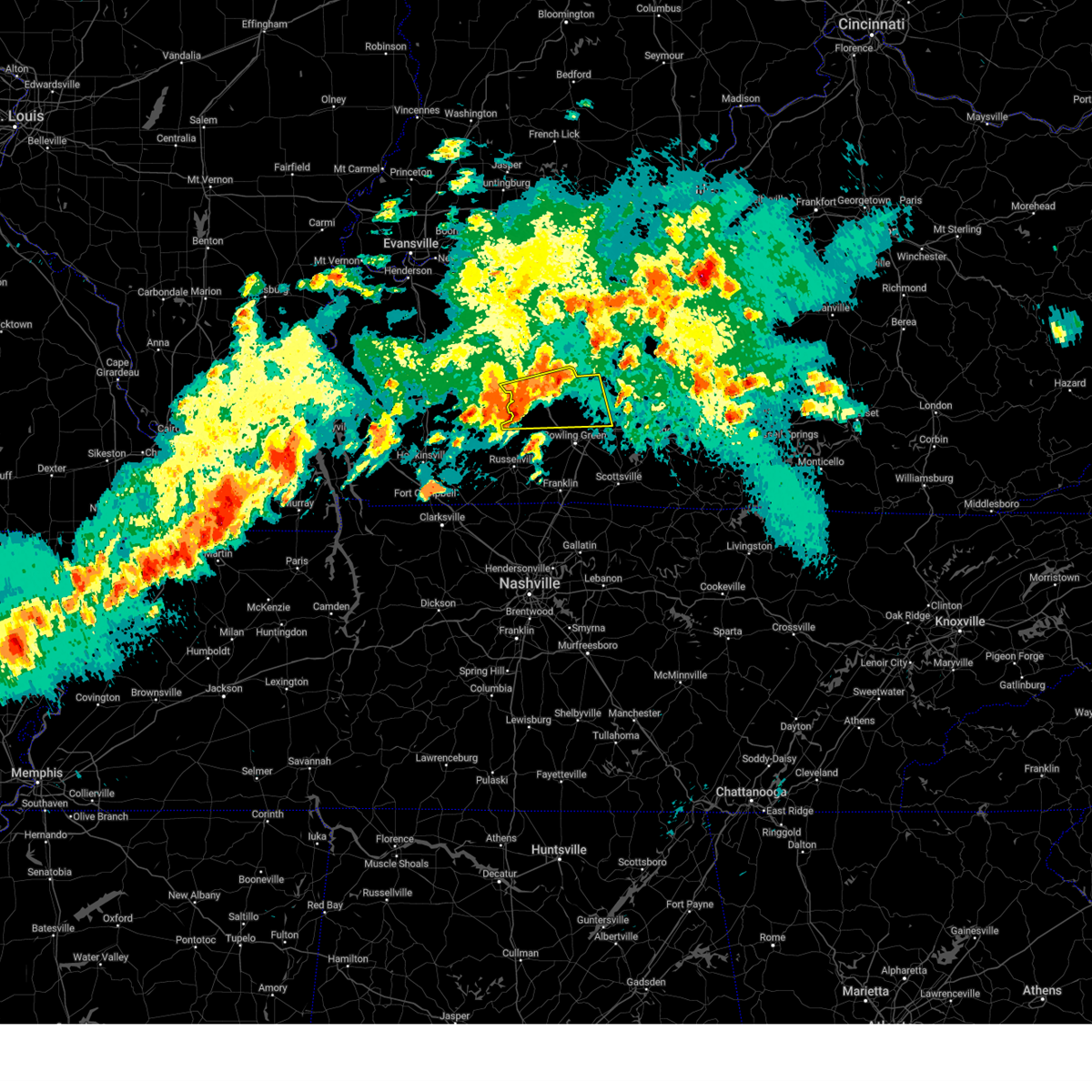
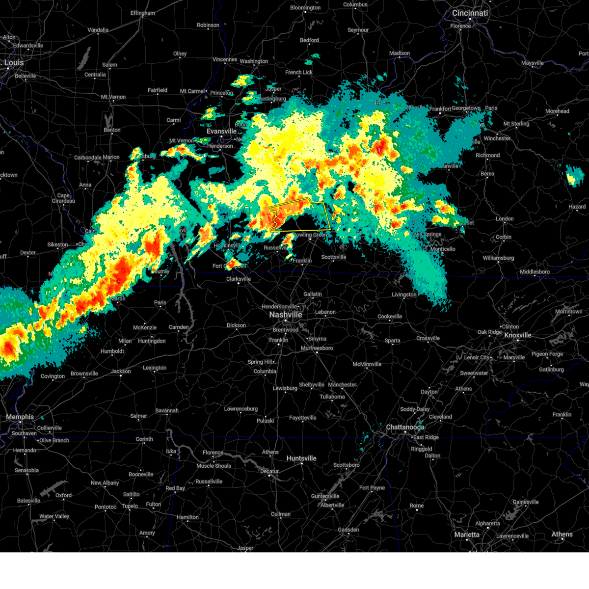
| 5/16/2025 7:54 PM CDT | Hen Egg sized hail reported 0.5 miles N of Oakland, KY, picture on x. |
| 5/16/2025 7:51 PM CDT |
 At 750 pm cdt, a severe thunderstorm capable of producing a tornado was located over bowling green, moving east at 45 mph (radar indicated rotation). Hazards include tornado and golf ball size hail. Flying debris will be dangerous to those caught without shelter. mobile homes will be damaged or destroyed. damage to roofs, windows, and vehicles will occur. tree damage is likely. this dangerous storm will be near, bowling green, plum springs, and mount victor around 755 pm cdt. Other locations impacted by this tornadic thunderstorm include bristow, hardcastle, sunnyside, girkin, gotts, polkville, smiths grove, loving, oakland, and tuckertown. At 750 pm cdt, a severe thunderstorm capable of producing a tornado was located over bowling green, moving east at 45 mph (radar indicated rotation). Hazards include tornado and golf ball size hail. Flying debris will be dangerous to those caught without shelter. mobile homes will be damaged or destroyed. damage to roofs, windows, and vehicles will occur. tree damage is likely. this dangerous storm will be near, bowling green, plum springs, and mount victor around 755 pm cdt. Other locations impacted by this tornadic thunderstorm include bristow, hardcastle, sunnyside, girkin, gotts, polkville, smiths grove, loving, oakland, and tuckertown.
|
| 5/16/2025 7:49 PM CDT |
 At 749 pm cdt, a severe thunderstorm was located near plum springs, moving east at 45 mph (radar indicated). Hazards include two inch hail and 70 mph wind gusts. People and animals outdoors will be injured. expect hail damage to roofs, siding, windows, and vehicles. expect considerable tree damage. wind damage is also likely to mobile homes, roofs, and outbuildings. Locations impacted include, bowling green, brownsville, plum springs, mount victor, smiths grove, oakland, windyville, chalybeate, girkin, and rocky hill. At 749 pm cdt, a severe thunderstorm was located near plum springs, moving east at 45 mph (radar indicated). Hazards include two inch hail and 70 mph wind gusts. People and animals outdoors will be injured. expect hail damage to roofs, siding, windows, and vehicles. expect considerable tree damage. wind damage is also likely to mobile homes, roofs, and outbuildings. Locations impacted include, bowling green, brownsville, plum springs, mount victor, smiths grove, oakland, windyville, chalybeate, girkin, and rocky hill.
|
| 5/16/2025 7:49 PM CDT |
 the severe thunderstorm warning has been cancelled and is no longer in effect the severe thunderstorm warning has been cancelled and is no longer in effect
|
| 5/16/2025 7:40 PM CDT |
 At 740 pm cdt, a severe thunderstorm was located 7 miles northwest of plum springs, moving east at 45 mph (radar indicated). Hazards include two inch hail and 70 mph wind gusts. People and animals outdoors will be injured. expect hail damage to roofs, siding, windows, and vehicles. expect considerable tree damage. wind damage is also likely to mobile homes, roofs, and outbuildings. Locations impacted include, bowling green, brownsville, plum springs, mount victor, smiths grove, oakland, windyville, chalybeate, girkin, and black gold. At 740 pm cdt, a severe thunderstorm was located 7 miles northwest of plum springs, moving east at 45 mph (radar indicated). Hazards include two inch hail and 70 mph wind gusts. People and animals outdoors will be injured. expect hail damage to roofs, siding, windows, and vehicles. expect considerable tree damage. wind damage is also likely to mobile homes, roofs, and outbuildings. Locations impacted include, bowling green, brownsville, plum springs, mount victor, smiths grove, oakland, windyville, chalybeate, girkin, and black gold.
|
| 5/16/2025 7:40 PM CDT |
 the severe thunderstorm warning has been cancelled and is no longer in effect the severe thunderstorm warning has been cancelled and is no longer in effect
|
| 5/16/2025 7:37 PM CDT |
 the tornado warning has been cancelled and is no longer in effect the tornado warning has been cancelled and is no longer in effect
|
| 5/16/2025 7:37 PM CDT |
 At 736 pm cdt, a severe thunderstorm capable of producing a tornado was located 8 miles west of memphis junction, moving east at 45 mph (radar indicated rotation). Hazards include tornado and golf ball size hail. Flying debris will be dangerous to those caught without shelter. mobile homes will be damaged or destroyed. damage to roofs, windows, and vehicles will occur. tree damage is likely. this dangerous storm will be near, bowling green around 740 pm cdt. memphis junction and crestmoor around 745 pm cdt. plum springs and mount victor around 750 pm cdt. Other locations impacted by this tornadic thunderstorm include barren river, bristow, hardcastle, girkin, greenhill, loving, oakland, tuckertown, alvaton, and browning. At 736 pm cdt, a severe thunderstorm capable of producing a tornado was located 8 miles west of memphis junction, moving east at 45 mph (radar indicated rotation). Hazards include tornado and golf ball size hail. Flying debris will be dangerous to those caught without shelter. mobile homes will be damaged or destroyed. damage to roofs, windows, and vehicles will occur. tree damage is likely. this dangerous storm will be near, bowling green around 740 pm cdt. memphis junction and crestmoor around 745 pm cdt. plum springs and mount victor around 750 pm cdt. Other locations impacted by this tornadic thunderstorm include barren river, bristow, hardcastle, girkin, greenhill, loving, oakland, tuckertown, alvaton, and browning.
|
| 5/16/2025 7:23 PM CDT |
 Torlmk the national weather service in louisville has issued a * tornado warning for, northeastern logan county in south central kentucky, south central butler county in south central kentucky, central warren county in south central kentucky, * until 815 pm cdt. * at 723 pm cdt, a severe thunderstorm capable of producing a tornado was located 10 miles northeast of russellville, moving east at 45 mph (radar indicated rotation). Hazards include tornado and golf ball size hail. Flying debris will be dangerous to those caught without shelter. mobile homes will be damaged or destroyed. damage to roofs, windows, and vehicles will occur. tree damage is likely. this dangerous storm will be near, bowling green around 740 pm cdt. memphis junction and crestmoor around 745 pm cdt. plum springs and mount victor around 750 pm cdt. Other locations impacted by this tornadic thunderstorm include hardcastle, girkin, rich pond, greenhill, buffalo fork, loving, oakland, tuckertown, sunnyside, and polkville. Torlmk the national weather service in louisville has issued a * tornado warning for, northeastern logan county in south central kentucky, south central butler county in south central kentucky, central warren county in south central kentucky, * until 815 pm cdt. * at 723 pm cdt, a severe thunderstorm capable of producing a tornado was located 10 miles northeast of russellville, moving east at 45 mph (radar indicated rotation). Hazards include tornado and golf ball size hail. Flying debris will be dangerous to those caught without shelter. mobile homes will be damaged or destroyed. damage to roofs, windows, and vehicles will occur. tree damage is likely. this dangerous storm will be near, bowling green around 740 pm cdt. memphis junction and crestmoor around 745 pm cdt. plum springs and mount victor around 750 pm cdt. Other locations impacted by this tornadic thunderstorm include hardcastle, girkin, rich pond, greenhill, buffalo fork, loving, oakland, tuckertown, sunnyside, and polkville.
|
| 5/16/2025 7:22 PM CDT |
 Svrlmk the national weather service in louisville has issued a * severe thunderstorm warning for, northeastern logan county in south central kentucky, southern butler county in south central kentucky, northern warren county in south central kentucky, western barren county in south central kentucky, edmonson county in south central kentucky, * until 800 pm cdt. * at 721 pm cdt, a severe thunderstorm was located 11 miles south of morgantown, moving east at 40 mph (radar indicated). Hazards include two inch hail and 70 mph wind gusts. People and animals outdoors will be injured. expect hail damage to roofs, siding, windows, and vehicles. expect considerable tree damage. Wind damage is also likely to mobile homes, roofs, and outbuildings. Svrlmk the national weather service in louisville has issued a * severe thunderstorm warning for, northeastern logan county in south central kentucky, southern butler county in south central kentucky, northern warren county in south central kentucky, western barren county in south central kentucky, edmonson county in south central kentucky, * until 800 pm cdt. * at 721 pm cdt, a severe thunderstorm was located 11 miles south of morgantown, moving east at 40 mph (radar indicated). Hazards include two inch hail and 70 mph wind gusts. People and animals outdoors will be injured. expect hail damage to roofs, siding, windows, and vehicles. expect considerable tree damage. Wind damage is also likely to mobile homes, roofs, and outbuildings.
|
| 5/16/2025 8:48 AM CDT |
 the severe thunderstorm warning has been cancelled and is no longer in effect the severe thunderstorm warning has been cancelled and is no longer in effect
|
| 5/16/2025 8:29 AM CDT |
 The storm which prompted the warning has weakened below severe limits, and no longer poses an immediate threat to life or property. therefore, the warning will be allowed to expire. however, small hail and gusty winds are still possible with this thunderstorm. a severe thunderstorm watch remains in effect until 900 am cdt for south central and central kentucky. The storm which prompted the warning has weakened below severe limits, and no longer poses an immediate threat to life or property. therefore, the warning will be allowed to expire. however, small hail and gusty winds are still possible with this thunderstorm. a severe thunderstorm watch remains in effect until 900 am cdt for south central and central kentucky.
|
| 5/16/2025 8:27 AM CDT |
 Svrlmk the national weather service in louisville has issued a * severe thunderstorm warning for, south central hart county in central kentucky, northeastern warren county in south central kentucky, northern barren county in south central kentucky, southeastern edmonson county in south central kentucky, * until 900 am cdt. * at 827 am cdt, a severe thunderstorm was located near plum springs, moving east at 50 mph (radar indicated). Hazards include quarter size hail. damage to vehicles is expected Svrlmk the national weather service in louisville has issued a * severe thunderstorm warning for, south central hart county in central kentucky, northeastern warren county in south central kentucky, northern barren county in south central kentucky, southeastern edmonson county in south central kentucky, * until 900 am cdt. * at 827 am cdt, a severe thunderstorm was located near plum springs, moving east at 50 mph (radar indicated). Hazards include quarter size hail. damage to vehicles is expected
|
| 5/16/2025 8:11 AM CDT |
 At 810 am cdt, a severe thunderstorm was located near morgantown, moving east at 65 mph (radar indicated). Hazards include ping pong ball size hail and 60 mph wind gusts. People and animals outdoors will be injured. expect hail damage to roofs, siding, windows, and vehicles. expect wind damage to roofs, siding, and trees. Locations impacted include, morgantown, brownsville, casey, lee, oakland, rochester, woodbury, roundhill, mining city, and dimple. At 810 am cdt, a severe thunderstorm was located near morgantown, moving east at 65 mph (radar indicated). Hazards include ping pong ball size hail and 60 mph wind gusts. People and animals outdoors will be injured. expect hail damage to roofs, siding, windows, and vehicles. expect wind damage to roofs, siding, and trees. Locations impacted include, morgantown, brownsville, casey, lee, oakland, rochester, woodbury, roundhill, mining city, and dimple.
|
| 5/16/2025 8:06 AM CDT |
 Svrlmk the national weather service in louisville has issued a * severe thunderstorm warning for, north central logan county in south central kentucky, butler county in south central kentucky, northern warren county in south central kentucky, south central ohio county in central kentucky, western edmonson county in south central kentucky, * until 830 am cdt. * at 805 am cdt, a severe thunderstorm was located 8 miles northeast of dunmor, moving east at 65 mph (radar indicated). Hazards include 60 mph wind gusts and half dollar size hail. Hail damage to vehicles is expected. Expect wind damage to roofs, siding, and trees. Svrlmk the national weather service in louisville has issued a * severe thunderstorm warning for, north central logan county in south central kentucky, butler county in south central kentucky, northern warren county in south central kentucky, south central ohio county in central kentucky, western edmonson county in south central kentucky, * until 830 am cdt. * at 805 am cdt, a severe thunderstorm was located 8 miles northeast of dunmor, moving east at 65 mph (radar indicated). Hazards include 60 mph wind gusts and half dollar size hail. Hail damage to vehicles is expected. Expect wind damage to roofs, siding, and trees.
|
| 4/5/2025 4:38 PM CDT |
 Svrlmk the national weather service in louisville has issued a * severe thunderstorm warning for, western hart county in central kentucky, northeastern warren county in south central kentucky, north central barren county in south central kentucky, edmonson county in south central kentucky, * until 515 pm cdt. * at 438 pm cdt, severe thunderstorms were located along a line extending from near brownsville to 10 miles northeast of mount victor to near plum springs, moving northeast at 45 mph (radar indicated). Hazards include 60 mph wind gusts. expect damage to roofs, siding, and trees Svrlmk the national weather service in louisville has issued a * severe thunderstorm warning for, western hart county in central kentucky, northeastern warren county in south central kentucky, north central barren county in south central kentucky, edmonson county in south central kentucky, * until 515 pm cdt. * at 438 pm cdt, severe thunderstorms were located along a line extending from near brownsville to 10 miles northeast of mount victor to near plum springs, moving northeast at 45 mph (radar indicated). Hazards include 60 mph wind gusts. expect damage to roofs, siding, and trees
|
| 4/4/2025 3:37 PM CDT |
 The storm which prompted the warning has weakened below severe limits, and no longer poses an immediate threat to life or property. therefore, the warning will be allowed to expire. however, gusty winds and heavy rain are still possible with this thunderstorm. The storm which prompted the warning has weakened below severe limits, and no longer poses an immediate threat to life or property. therefore, the warning will be allowed to expire. however, gusty winds and heavy rain are still possible with this thunderstorm.
|
| 4/4/2025 3:36 PM CDT |
 The storm which prompted the warning has weakened below severe limits, and no longer poses an immediate threat to life or property. therefore, the warning will be allowed to expire. however, gusty winds and heavy rain are still possible with this thunderstorm. The storm which prompted the warning has weakened below severe limits, and no longer poses an immediate threat to life or property. therefore, the warning will be allowed to expire. however, gusty winds and heavy rain are still possible with this thunderstorm.
|
| 4/4/2025 3:32 PM CDT |
 At 331 pm cdt, a severe thunderstorm was located 9 miles southeast of brownsville, moving northeast at 35 mph (radar indicated). Hazards include 60 mph wind gusts and half dollar size hail. Hail damage to vehicles is expected. expect wind damage to roofs, siding, and trees. Locations impacted include, cave city, smiths grove, park city, oakland, chalybeate, rocky hill, tuckertown, pig, mammoth cave, and hays. At 331 pm cdt, a severe thunderstorm was located 9 miles southeast of brownsville, moving northeast at 35 mph (radar indicated). Hazards include 60 mph wind gusts and half dollar size hail. Hail damage to vehicles is expected. expect wind damage to roofs, siding, and trees. Locations impacted include, cave city, smiths grove, park city, oakland, chalybeate, rocky hill, tuckertown, pig, mammoth cave, and hays.
|
| 4/4/2025 3:21 PM CDT |
 Svrlmk the national weather service in louisville has issued a * severe thunderstorm warning for, northeastern warren county in south central kentucky, northwestern barren county in south central kentucky, southeastern edmonson county in south central kentucky, * until 345 pm cdt. * at 321 pm cdt, a severe thunderstorm was located 8 miles east of plum springs, moving northeast at 35 mph (radar indicated). Hazards include 60 mph wind gusts and quarter size hail. Hail damage to vehicles is expected. Expect wind damage to roofs, siding, and trees. Svrlmk the national weather service in louisville has issued a * severe thunderstorm warning for, northeastern warren county in south central kentucky, northwestern barren county in south central kentucky, southeastern edmonson county in south central kentucky, * until 345 pm cdt. * at 321 pm cdt, a severe thunderstorm was located 8 miles east of plum springs, moving northeast at 35 mph (radar indicated). Hazards include 60 mph wind gusts and quarter size hail. Hail damage to vehicles is expected. Expect wind damage to roofs, siding, and trees.
|
| 4/4/2025 3:17 PM CDT |
 Svrlmk the national weather service in louisville has issued a * severe thunderstorm warning for, east central logan county in south central kentucky, northern simpson county in south central kentucky, northwestern allen county in south central kentucky, warren county in south central kentucky, west central barren county in south central kentucky, * until 345 pm cdt. * at 317 pm cdt, a severe thunderstorm was located 7 miles south of memphis junction, moving northeast at 40 mph (radar indicated). Hazards include 60 mph wind gusts and quarter size hail. Hail damage to vehicles is expected. Expect wind damage to roofs, siding, and trees. Svrlmk the national weather service in louisville has issued a * severe thunderstorm warning for, east central logan county in south central kentucky, northern simpson county in south central kentucky, northwestern allen county in south central kentucky, warren county in south central kentucky, west central barren county in south central kentucky, * until 345 pm cdt. * at 317 pm cdt, a severe thunderstorm was located 7 miles south of memphis junction, moving northeast at 40 mph (radar indicated). Hazards include 60 mph wind gusts and quarter size hail. Hail damage to vehicles is expected. Expect wind damage to roofs, siding, and trees.
|
| 4/3/2025 1:07 AM CDT |
 The storm which prompted the warning has weakened below severe limits, and has exited the warned area. therefore, the warning has been allowed to expire. however, gusty winds and heavy rain are still possible with this thunderstorm. a tornado watch remains in effect until 600 am cdt for south central kentucky. to report severe weather, contact your nearest law enforcement agency. they will relay your report to the national weather service louisville. The storm which prompted the warning has weakened below severe limits, and has exited the warned area. therefore, the warning has been allowed to expire. however, gusty winds and heavy rain are still possible with this thunderstorm. a tornado watch remains in effect until 600 am cdt for south central kentucky. to report severe weather, contact your nearest law enforcement agency. they will relay your report to the national weather service louisville.
|
| 4/3/2025 12:51 AM CDT |
 Svrlmk the national weather service in louisville has issued a * severe thunderstorm warning for, green county in central kentucky, southeastern larue county in central kentucky, southwestern marion county in central kentucky, hart county in central kentucky, taylor county in central kentucky, north central allen county in south central kentucky, northeastern warren county in south central kentucky, barren county in south central kentucky, central adair county in south central kentucky, northern metcalfe county in south central kentucky, southern edmonson county in south central kentucky, * until 230 am edt/130 am cdt/. * at 150 am edt/1250 am cdt/, a severe thunderstorm was located 10 miles east of plum springs, moving northeast at 80 mph (radar indicated). Hazards include 60 mph wind gusts. expect damage to roofs, siding, and trees Svrlmk the national weather service in louisville has issued a * severe thunderstorm warning for, green county in central kentucky, southeastern larue county in central kentucky, southwestern marion county in central kentucky, hart county in central kentucky, taylor county in central kentucky, north central allen county in south central kentucky, northeastern warren county in south central kentucky, barren county in south central kentucky, central adair county in south central kentucky, northern metcalfe county in south central kentucky, southern edmonson county in south central kentucky, * until 230 am edt/130 am cdt/. * at 150 am edt/1250 am cdt/, a severe thunderstorm was located 10 miles east of plum springs, moving northeast at 80 mph (radar indicated). Hazards include 60 mph wind gusts. expect damage to roofs, siding, and trees
|
| 4/3/2025 12:41 AM CDT |
 the severe thunderstorm warning has been cancelled and is no longer in effect the severe thunderstorm warning has been cancelled and is no longer in effect
|
| 4/3/2025 12:41 AM CDT |
 At 1241 am cdt, a severe thunderstorm was located 12 miles west of scottsville, moving east at 65 mph (radar indicated). Hazards include 70 mph wind gusts. Expect considerable tree damage. damage is likely to mobile homes, roofs, and outbuildings. Locations impacted include, bowling green, scottsville, plum springs, crestmoor, memphis junction, mount victor, franklin, smiths grove, woodburn, and oakland. At 1241 am cdt, a severe thunderstorm was located 12 miles west of scottsville, moving east at 65 mph (radar indicated). Hazards include 70 mph wind gusts. Expect considerable tree damage. damage is likely to mobile homes, roofs, and outbuildings. Locations impacted include, bowling green, scottsville, plum springs, crestmoor, memphis junction, mount victor, franklin, smiths grove, woodburn, and oakland.
|
| 4/3/2025 12:14 AM CDT |
 Svrlmk the national weather service in louisville has issued a * severe thunderstorm warning for, logan county in south central kentucky, simpson county in south central kentucky, allen county in south central kentucky, warren county in south central kentucky, * until 100 am cdt. * at 1213 am cdt, a severe thunderstorm was located 7 miles southwest of russellville, moving east at 60 mph (radar indicated). Hazards include 60 mph wind gusts. expect damage to roofs, siding, and trees Svrlmk the national weather service in louisville has issued a * severe thunderstorm warning for, logan county in south central kentucky, simpson county in south central kentucky, allen county in south central kentucky, warren county in south central kentucky, * until 100 am cdt. * at 1213 am cdt, a severe thunderstorm was located 7 miles southwest of russellville, moving east at 60 mph (radar indicated). Hazards include 60 mph wind gusts. expect damage to roofs, siding, and trees
|
| 4/2/2025 7:28 PM CDT |
 Svrlmk the national weather service in louisville has issued a * severe thunderstorm warning for, northwestern allen county in south central kentucky, southeastern warren county in south central kentucky, west central barren county in south central kentucky, * until 800 pm cdt. * at 727 pm cdt, a severe thunderstorm was located 7 miles northwest of scottsville, moving northeast at 50 mph (radar indicated). Hazards include 60 mph wind gusts and quarter size hail. Hail damage to vehicles is expected. Expect wind damage to roofs, siding, and trees. Svrlmk the national weather service in louisville has issued a * severe thunderstorm warning for, northwestern allen county in south central kentucky, southeastern warren county in south central kentucky, west central barren county in south central kentucky, * until 800 pm cdt. * at 727 pm cdt, a severe thunderstorm was located 7 miles northwest of scottsville, moving northeast at 50 mph (radar indicated). Hazards include 60 mph wind gusts and quarter size hail. Hail damage to vehicles is expected. Expect wind damage to roofs, siding, and trees.
|
| 3/30/2025 10:06 PM CDT |
 Svrlmk the national weather service in louisville has issued a * severe thunderstorm warning for, southeastern logan county in south central kentucky, simpson county in south central kentucky, hart county in central kentucky, western allen county in south central kentucky, northeastern butler county in south central kentucky, southeastern grayson county in central kentucky, warren county in south central kentucky, northern barren county in south central kentucky, edmonson county in south central kentucky, * until 1045 pm cdt. * at 1005 pm cdt, severe thunderstorms were located along a line extending from 12 miles northwest of brownsville to 8 miles north of plum springs to 11 miles south of russellville, moving east at 60 mph (radar indicated). Hazards include 60 mph wind gusts and penny size hail. expect damage to roofs, siding, and trees Svrlmk the national weather service in louisville has issued a * severe thunderstorm warning for, southeastern logan county in south central kentucky, simpson county in south central kentucky, hart county in central kentucky, western allen county in south central kentucky, northeastern butler county in south central kentucky, southeastern grayson county in central kentucky, warren county in south central kentucky, northern barren county in south central kentucky, edmonson county in south central kentucky, * until 1045 pm cdt. * at 1005 pm cdt, severe thunderstorms were located along a line extending from 12 miles northwest of brownsville to 8 miles north of plum springs to 11 miles south of russellville, moving east at 60 mph (radar indicated). Hazards include 60 mph wind gusts and penny size hail. expect damage to roofs, siding, and trees
|
| 2/15/2025 10:16 PM CST |
 At 1016 pm cst, a severe thunderstorm was located 10 miles southeast of brownsville, moving east at 65 mph (radar indicated). Hazards include 60 mph wind gusts and nickel size hail. Expect damage to roofs, siding, and trees. Locations impacted include, bowling green, glasgow, cave city, smiths grove, park city, oakland, three forks, red cross, hardcastle, and coral hill. At 1016 pm cst, a severe thunderstorm was located 10 miles southeast of brownsville, moving east at 65 mph (radar indicated). Hazards include 60 mph wind gusts and nickel size hail. Expect damage to roofs, siding, and trees. Locations impacted include, bowling green, glasgow, cave city, smiths grove, park city, oakland, three forks, red cross, hardcastle, and coral hill.
|
| 2/15/2025 10:08 PM CST |
 At 1008 pm cst, a severe thunderstorm was located near plum springs, moving east at 55 mph (radar indicated). Hazards include 60 mph wind gusts and nickel size hail. Expect damage to roofs, siding, and trees. Locations impacted include, bowling green, glasgow, plum springs, crestmoor, memphis junction, mount victor, cave city, smiths grove, park city, and oakland. At 1008 pm cst, a severe thunderstorm was located near plum springs, moving east at 55 mph (radar indicated). Hazards include 60 mph wind gusts and nickel size hail. Expect damage to roofs, siding, and trees. Locations impacted include, bowling green, glasgow, plum springs, crestmoor, memphis junction, mount victor, cave city, smiths grove, park city, and oakland.
|
| 2/15/2025 9:46 PM CST |
 Svrlmk the national weather service in louisville has issued a * severe thunderstorm warning for, warren county in south central kentucky, northern barren county in south central kentucky, western metcalfe county in south central kentucky, southeastern edmonson county in south central kentucky, * until 1030 pm cst. * at 945 pm cst, a severe thunderstorm was located over memphis junction, moving east at 65 mph (radar indicated). Hazards include 60 mph wind gusts and nickel size hail. expect damage to roofs, siding, and trees Svrlmk the national weather service in louisville has issued a * severe thunderstorm warning for, warren county in south central kentucky, northern barren county in south central kentucky, western metcalfe county in south central kentucky, southeastern edmonson county in south central kentucky, * until 1030 pm cst. * at 945 pm cst, a severe thunderstorm was located over memphis junction, moving east at 65 mph (radar indicated). Hazards include 60 mph wind gusts and nickel size hail. expect damage to roofs, siding, and trees
|
| 7/30/2024 1:55 PM CDT |
 the severe thunderstorm warning has been cancelled and is no longer in effect the severe thunderstorm warning has been cancelled and is no longer in effect
|
| 7/30/2024 1:55 PM CDT |
 At 155 pm cdt, a severe thunderstorm was located over plum springs, moving southeast at 45 mph (radar indicated). Hazards include 60 mph wind gusts. Expect damage to roofs, siding, and trees. Locations impacted include, bowling green, plum springs, crestmoor, memphis junction, mount victor, oakland, three forks, hardcastle, girkin, and rockland. At 155 pm cdt, a severe thunderstorm was located over plum springs, moving southeast at 45 mph (radar indicated). Hazards include 60 mph wind gusts. Expect damage to roofs, siding, and trees. Locations impacted include, bowling green, plum springs, crestmoor, memphis junction, mount victor, oakland, three forks, hardcastle, girkin, and rockland.
|
| 7/30/2024 1:38 PM CDT |
 Svrlmk the national weather service in louisville has issued a * severe thunderstorm warning for, central butler county in south central kentucky, warren county in south central kentucky, * until 215 pm cdt. * at 138 pm cdt, a severe thunderstorm was located 7 miles southeast of morgantown, moving southeast at 45 mph (radar indicated). Hazards include 60 mph wind gusts. expect damage to roofs, siding, and trees Svrlmk the national weather service in louisville has issued a * severe thunderstorm warning for, central butler county in south central kentucky, warren county in south central kentucky, * until 215 pm cdt. * at 138 pm cdt, a severe thunderstorm was located 7 miles southeast of morgantown, moving southeast at 45 mph (radar indicated). Hazards include 60 mph wind gusts. expect damage to roofs, siding, and trees
|
| 7/5/2024 7:14 AM CDT |
 The storm which prompted the warning has weakened below severe limits, and no longer poses an immediate threat to life or property. therefore, the warning will be allowed to expire. however, heavy rain is still possible with this thunderstorm. to report severe weather, contact your nearest law enforcement agency. they will relay your report to the national weather service louisville. The storm which prompted the warning has weakened below severe limits, and no longer poses an immediate threat to life or property. therefore, the warning will be allowed to expire. however, heavy rain is still possible with this thunderstorm. to report severe weather, contact your nearest law enforcement agency. they will relay your report to the national weather service louisville.
|
| 7/5/2024 7:03 AM CDT |
 At 703 am cdt, a severe thunderstorm was located near brownsville, moving northeast at 40 mph (radar indicated). Hazards include 60 mph wind gusts. Expect damage to roofs, siding, and trees. Locations impacted include, bowling green, brownsville, plum springs, crestmoor, mount victor, smiths grove, oakland, windyville, chalybeate, and girkin. At 703 am cdt, a severe thunderstorm was located near brownsville, moving northeast at 40 mph (radar indicated). Hazards include 60 mph wind gusts. Expect damage to roofs, siding, and trees. Locations impacted include, bowling green, brownsville, plum springs, crestmoor, mount victor, smiths grove, oakland, windyville, chalybeate, and girkin.
|
| 7/5/2024 6:50 AM CDT |
 At 649 am cdt, a severe thunderstorm was located near plum springs, moving northeast at 40 mph (radar indicated). Hazards include 60 mph wind gusts and penny size hail. Expect damage to roofs, siding, and trees. Locations impacted include, bowling green, brownsville, plum springs, crestmoor, memphis junction, mount victor, smiths grove, oakland, windyville, and chalybeate. At 649 am cdt, a severe thunderstorm was located near plum springs, moving northeast at 40 mph (radar indicated). Hazards include 60 mph wind gusts and penny size hail. Expect damage to roofs, siding, and trees. Locations impacted include, bowling green, brownsville, plum springs, crestmoor, memphis junction, mount victor, smiths grove, oakland, windyville, and chalybeate.
|
| 7/5/2024 6:38 AM CDT |
 Svrlmk the national weather service in louisville has issued a * severe thunderstorm warning for, southeastern butler county in south central kentucky, central warren county in south central kentucky, central edmonson county in south central kentucky, * until 715 am cdt. * at 638 am cdt, a severe thunderstorm was located near crestmoor, moving northeast at 40 mph (radar indicated). Hazards include 60 mph wind gusts and quarter size hail. Hail damage to vehicles is expected. Expect wind damage to roofs, siding, and trees. Svrlmk the national weather service in louisville has issued a * severe thunderstorm warning for, southeastern butler county in south central kentucky, central warren county in south central kentucky, central edmonson county in south central kentucky, * until 715 am cdt. * at 638 am cdt, a severe thunderstorm was located near crestmoor, moving northeast at 40 mph (radar indicated). Hazards include 60 mph wind gusts and quarter size hail. Hail damage to vehicles is expected. Expect wind damage to roofs, siding, and trees.
|
| 5/26/2024 10:42 PM CDT |
 the severe thunderstorm warning has been cancelled and is no longer in effect the severe thunderstorm warning has been cancelled and is no longer in effect
|
| 5/26/2024 10:42 PM CDT |
 At 1042 pm cdt, severe thunderstorms were located along a line extending from 9 miles south of brownsville to 8 miles south of mount victor to 12 miles north of springfield, moving east at 80 mph (radar indicated). Hazards include 60 mph wind gusts. Expect damage to roofs, siding, and trees. Locations impacted include, bowling green, russellville, plum springs, crestmoor, memphis junction, mount victor, anderson, franklin, auburn, and adairville. At 1042 pm cdt, severe thunderstorms were located along a line extending from 9 miles south of brownsville to 8 miles south of mount victor to 12 miles north of springfield, moving east at 80 mph (radar indicated). Hazards include 60 mph wind gusts. Expect damage to roofs, siding, and trees. Locations impacted include, bowling green, russellville, plum springs, crestmoor, memphis junction, mount victor, anderson, franklin, auburn, and adairville.
|
| 5/26/2024 10:40 PM CDT |
 Svrlmk the national weather service in louisville has issued a * severe thunderstorm warning for, west central monroe county in south central kentucky, southeastern simpson county in south central kentucky, hart county in central kentucky, allen county in south central kentucky, southeastern warren county in south central kentucky, barren county in south central kentucky, eastern edmonson county in south central kentucky, * until 1115 pm cdt. * at 1040 pm cdt, severe thunderstorms were located along a line extending from 12 miles northwest of munfordville to 6 miles northwest of portland, moving east at 50 mph (radar indicated). Hazards include 60 mph wind gusts and quarter size hail. Hail damage to vehicles is expected. Expect wind damage to roofs, siding, and trees. Svrlmk the national weather service in louisville has issued a * severe thunderstorm warning for, west central monroe county in south central kentucky, southeastern simpson county in south central kentucky, hart county in central kentucky, allen county in south central kentucky, southeastern warren county in south central kentucky, barren county in south central kentucky, eastern edmonson county in south central kentucky, * until 1115 pm cdt. * at 1040 pm cdt, severe thunderstorms were located along a line extending from 12 miles northwest of munfordville to 6 miles northwest of portland, moving east at 50 mph (radar indicated). Hazards include 60 mph wind gusts and quarter size hail. Hail damage to vehicles is expected. Expect wind damage to roofs, siding, and trees.
|
| 5/26/2024 10:11 PM CDT |
 Svrlmk the national weather service in louisville has issued a * severe thunderstorm warning for, logan county in south central kentucky, simpson county in south central kentucky, northwestern allen county in south central kentucky, central butler county in south central kentucky, warren county in south central kentucky, southwestern edmonson county in south central kentucky, * until 1100 pm cdt. * at 1010 pm cdt, severe thunderstorms were located along a line extending from 10 miles northeast of morgantown to 8 miles southwest of russellville, moving southeast at 50 mph (radar indicated). Hazards include 60 mph wind gusts. expect damage to roofs, siding, and trees Svrlmk the national weather service in louisville has issued a * severe thunderstorm warning for, logan county in south central kentucky, simpson county in south central kentucky, northwestern allen county in south central kentucky, central butler county in south central kentucky, warren county in south central kentucky, southwestern edmonson county in south central kentucky, * until 1100 pm cdt. * at 1010 pm cdt, severe thunderstorms were located along a line extending from 10 miles northeast of morgantown to 8 miles southwest of russellville, moving southeast at 50 mph (radar indicated). Hazards include 60 mph wind gusts. expect damage to roofs, siding, and trees
|
| 5/8/2024 2:38 PM CDT |
 The storm which prompted the warning has moved out of the area. therefore, the warning will be allowed to expire. a tornado watch remains in effect until 900 pm cdt for south central kentucky. The storm which prompted the warning has moved out of the area. therefore, the warning will be allowed to expire. a tornado watch remains in effect until 900 pm cdt for south central kentucky.
|
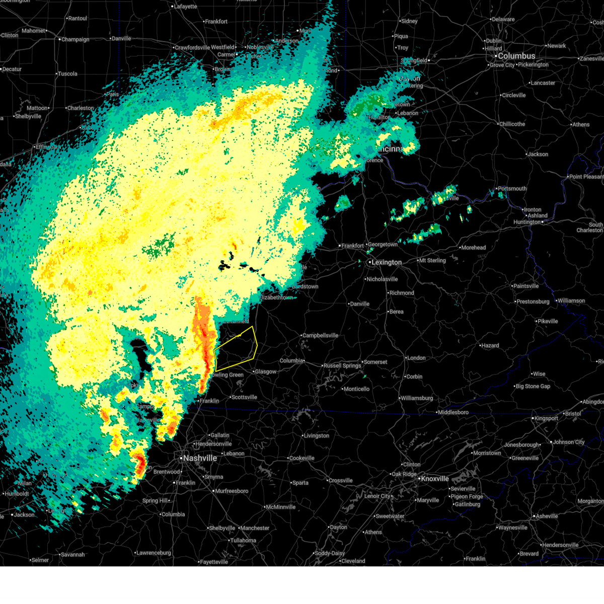
| 5/8/2024 2:23 PM CDT | Quarter sized hail reported 0.5 miles N of Oakland, KY |
| 5/8/2024 2:22 PM CDT |
 At 222 pm cdt, a severe thunderstorm was located 7 miles south of brownsville, moving east at 30 mph (radar indicated). Hazards include 60 mph wind gusts and half dollar size hail. Hail damage to vehicles is expected. expect wind damage to roofs, siding, and trees. Locations impacted include, brownsville, smiths grove, oakland, chalybeate, rhoda, rocky hill, tuckertown, pig, hays, and bon ayr. At 222 pm cdt, a severe thunderstorm was located 7 miles south of brownsville, moving east at 30 mph (radar indicated). Hazards include 60 mph wind gusts and half dollar size hail. Hail damage to vehicles is expected. expect wind damage to roofs, siding, and trees. Locations impacted include, brownsville, smiths grove, oakland, chalybeate, rhoda, rocky hill, tuckertown, pig, hays, and bon ayr.
|
| 5/8/2024 2:08 PM CDT |
 Svrlmk the national weather service in louisville has issued a * severe thunderstorm warning for, northeastern warren county in south central kentucky, west central barren county in south central kentucky, southeastern edmonson county in south central kentucky, * until 245 pm cdt. * at 208 pm cdt, a severe thunderstorm was located near plum springs, moving east at 30 mph (radar indicated). Hazards include 60 mph wind gusts and half dollar size hail. Hail damage to vehicles is expected. Expect wind damage to roofs, siding, and trees. Svrlmk the national weather service in louisville has issued a * severe thunderstorm warning for, northeastern warren county in south central kentucky, west central barren county in south central kentucky, southeastern edmonson county in south central kentucky, * until 245 pm cdt. * at 208 pm cdt, a severe thunderstorm was located near plum springs, moving east at 30 mph (radar indicated). Hazards include 60 mph wind gusts and half dollar size hail. Hail damage to vehicles is expected. Expect wind damage to roofs, siding, and trees.
|
| 4/2/2024 5:47 PM CDT |
 At 547 pm cdt, a severe thunderstorm capable of producing a tornado was located near mount victor, moving northeast at 45 mph (radar indicated rotation). Hazards include tornado. Flying debris will be dangerous to those caught without shelter. mobile homes will be damaged or destroyed. damage to roofs, windows, and vehicles will occur. tree damage is likely. This tornadic thunderstorm will remain over mainly rural areas of north central allen, southeastern warren, west central barren and southeastern edmonson counties, including the following locations, three forks, red cross, hardcastle, greenhill, rocky hill, loving, oakland, hays, sunnyside, and polkville. At 547 pm cdt, a severe thunderstorm capable of producing a tornado was located near mount victor, moving northeast at 45 mph (radar indicated rotation). Hazards include tornado. Flying debris will be dangerous to those caught without shelter. mobile homes will be damaged or destroyed. damage to roofs, windows, and vehicles will occur. tree damage is likely. This tornadic thunderstorm will remain over mainly rural areas of north central allen, southeastern warren, west central barren and southeastern edmonson counties, including the following locations, three forks, red cross, hardcastle, greenhill, rocky hill, loving, oakland, hays, sunnyside, and polkville.
|
| 4/2/2024 5:34 PM CDT |
 Torlmk the national weather service in louisville has issued a * tornado warning for, north central allen county in south central kentucky, central warren county in south central kentucky, west central barren county in south central kentucky, southeastern edmonson county in south central kentucky, * until 600 pm cdt. * at 534 pm cdt, a severe thunderstorm capable of producing a tornado was located near memphis junction, moving northeast at 45 mph (radar indicated rotation). Hazards include tornado. Flying debris will be dangerous to those caught without shelter. mobile homes will be damaged or destroyed. damage to roofs, windows, and vehicles will occur. tree damage is likely. this dangerous storm will be near, bowling green around 540 pm cdt. mount victor around 545 pm cdt. Other locations impacted by this tornadic thunderstorm include three forks, red cross, hardcastle, rich pond, greenhill, rocky hill, loving, oakland, tuckertown, and hays. Torlmk the national weather service in louisville has issued a * tornado warning for, north central allen county in south central kentucky, central warren county in south central kentucky, west central barren county in south central kentucky, southeastern edmonson county in south central kentucky, * until 600 pm cdt. * at 534 pm cdt, a severe thunderstorm capable of producing a tornado was located near memphis junction, moving northeast at 45 mph (radar indicated rotation). Hazards include tornado. Flying debris will be dangerous to those caught without shelter. mobile homes will be damaged or destroyed. damage to roofs, windows, and vehicles will occur. tree damage is likely. this dangerous storm will be near, bowling green around 540 pm cdt. mount victor around 545 pm cdt. Other locations impacted by this tornadic thunderstorm include three forks, red cross, hardcastle, rich pond, greenhill, rocky hill, loving, oakland, tuckertown, and hays.
|
| 4/2/2024 11:29 AM CDT |
 The storm which prompted the warning has weakened below severe limits, and no longer poses an immediate threat to life or property. therefore, the warning will be allowed to expire. however, small hail, gusty winds and heavy rain are still possible with this thunderstorm. a tornado watch remains in effect until 300 pm cdt for south central kentucky. to report severe weather, contact your nearest law enforcement agency. they will relay your report to the national weather service louisville. The storm which prompted the warning has weakened below severe limits, and no longer poses an immediate threat to life or property. therefore, the warning will be allowed to expire. however, small hail, gusty winds and heavy rain are still possible with this thunderstorm. a tornado watch remains in effect until 300 pm cdt for south central kentucky. to report severe weather, contact your nearest law enforcement agency. they will relay your report to the national weather service louisville.
|
| 4/2/2024 11:12 AM CDT |
 the severe thunderstorm warning has been cancelled and is no longer in effect the severe thunderstorm warning has been cancelled and is no longer in effect
|
| 4/2/2024 11:12 AM CDT |
 At 1112 am cdt, a severe thunderstorm was located 7 miles north of scottsville, moving northeast at 60 mph (radar indicated). Hazards include 60 mph wind gusts and quarter size hail. Hail damage to vehicles is expected. expect wind damage to roofs, siding, and trees. Locations impacted include, glasgow, scottsville, cave city, smiths grove, park city, oakland, three forks, red cross, hardcastle, and lecta. At 1112 am cdt, a severe thunderstorm was located 7 miles north of scottsville, moving northeast at 60 mph (radar indicated). Hazards include 60 mph wind gusts and quarter size hail. Hail damage to vehicles is expected. expect wind damage to roofs, siding, and trees. Locations impacted include, glasgow, scottsville, cave city, smiths grove, park city, oakland, three forks, red cross, hardcastle, and lecta.
|
| 4/2/2024 11:02 AM CDT |
 Svrlmk the national weather service in louisville has issued a * severe thunderstorm warning for, southeastern simpson county in south central kentucky, northwestern allen county in south central kentucky, southeastern warren county in south central kentucky, central barren county in south central kentucky, southeastern edmonson county in south central kentucky, * until 1130 am cdt. * at 1102 am cdt, a severe thunderstorm was located 10 miles west of scottsville, moving northeast at 60 mph (radar indicated). Hazards include 60 mph wind gusts and quarter size hail. Hail damage to vehicles is expected. Expect wind damage to roofs, siding, and trees. Svrlmk the national weather service in louisville has issued a * severe thunderstorm warning for, southeastern simpson county in south central kentucky, northwestern allen county in south central kentucky, southeastern warren county in south central kentucky, central barren county in south central kentucky, southeastern edmonson county in south central kentucky, * until 1130 am cdt. * at 1102 am cdt, a severe thunderstorm was located 10 miles west of scottsville, moving northeast at 60 mph (radar indicated). Hazards include 60 mph wind gusts and quarter size hail. Hail damage to vehicles is expected. Expect wind damage to roofs, siding, and trees.
|
| 3/6/2024 10:06 AM EST |
 Torlmk the national weather service in louisville has issued a * this is a test message. tornado warning for, meade county in central kentucky, larue county in central kentucky, jessamine county in central kentucky, nicholas county in central kentucky, adair county in south central kentucky, bourbon county in central kentucky, warren county in south central kentucky, cumberland county in south central kentucky, henry county in central kentucky, russell county in south central kentucky, taylor county in central kentucky, jefferson county in central kentucky, hardin county in central kentucky, spencer county in central kentucky, scott county in central kentucky, hancock county in central kentucky, trimble county in central kentucky, monroe county in south central kentucky, metcalfe county in south central kentucky, shelby county in central kentucky, logan county in south central kentucky, nelson county in central kentucky, anderson county in central kentucky, clark county in central kentucky, marion county in central kentucky, simpson county in south central kentucky, grayson county in central kentucky, casey county in central kentucky, franklin county in central kentucky, edmonson county in south central kentucky, lincoln county in central kentucky, woodford county in central kentucky, butler county in south central kentucky, madison county in central kentucky, barren county in south central kentucky, ohio county in central kentucky, oldham county in central kentucky, garrard county in central kentucky, hart county in central kentucky, bullitt county in central kentucky, harrison county in central kentucky, mercer county in central kentucky, clinton county in south central kentucky, green county in central kentucky, allen county in south central kentucky, washington county in central kentucky, boyle county in central kentucky, breckinridge county in central kentucky, fayette county in central kentucky, * this is a test message. until 1030 am est/930 am cst/. * this is a test message. Torlmk the national weather service in louisville has issued a * this is a test message. tornado warning for, meade county in central kentucky, larue county in central kentucky, jessamine county in central kentucky, nicholas county in central kentucky, adair county in south central kentucky, bourbon county in central kentucky, warren county in south central kentucky, cumberland county in south central kentucky, henry county in central kentucky, russell county in south central kentucky, taylor county in central kentucky, jefferson county in central kentucky, hardin county in central kentucky, spencer county in central kentucky, scott county in central kentucky, hancock county in central kentucky, trimble county in central kentucky, monroe county in south central kentucky, metcalfe county in south central kentucky, shelby county in central kentucky, logan county in south central kentucky, nelson county in central kentucky, anderson county in central kentucky, clark county in central kentucky, marion county in central kentucky, simpson county in south central kentucky, grayson county in central kentucky, casey county in central kentucky, franklin county in central kentucky, edmonson county in south central kentucky, lincoln county in central kentucky, woodford county in central kentucky, butler county in south central kentucky, madison county in central kentucky, barren county in south central kentucky, ohio county in central kentucky, oldham county in central kentucky, garrard county in central kentucky, hart county in central kentucky, bullitt county in central kentucky, harrison county in central kentucky, mercer county in central kentucky, clinton county in south central kentucky, green county in central kentucky, allen county in south central kentucky, washington county in central kentucky, boyle county in central kentucky, breckinridge county in central kentucky, fayette county in central kentucky, * this is a test message. until 1030 am est/930 am cst/. * this is a test message.
|
| 12/9/2023 3:32 PM CST |
 At 332 pm cst, a severe thunderstorm capable of producing a tornado was located 10 miles east of plum springs, moving northeast at 40 mph (radar indicated rotation). Hazards include tornado. Flying debris will be dangerous to those caught without shelter. mobile homes will be damaged or destroyed. damage to roofs, windows, and vehicles will occur. tree damage is likely. Locations impacted include, glasgow, cave city, smiths grove, park city, oakland, three forks, oil city, red cross, pondsville and glasgow municipal airport. At 332 pm cst, a severe thunderstorm capable of producing a tornado was located 10 miles east of plum springs, moving northeast at 40 mph (radar indicated rotation). Hazards include tornado. Flying debris will be dangerous to those caught without shelter. mobile homes will be damaged or destroyed. damage to roofs, windows, and vehicles will occur. tree damage is likely. Locations impacted include, glasgow, cave city, smiths grove, park city, oakland, three forks, oil city, red cross, pondsville and glasgow municipal airport.
|
| 12/9/2023 3:21 PM CST |
 At 319 pm cst, a severe thunderstorm capable of producing a tornado was located 2 miles east of mount victor, moving northeast at 40 mph (radar indicated rotation). Hazards include tornado. Flying debris will be dangerous to those caught without shelter. mobile homes will be damaged or destroyed. damage to roofs, windows, and vehicles will occur. tree damage is likely. Locations impacted include, bowling green, glasgow, cave city, smiths grove, park city, oakland, three forks, red cross, hardcastle and rocky hill. At 319 pm cst, a severe thunderstorm capable of producing a tornado was located 2 miles east of mount victor, moving northeast at 40 mph (radar indicated rotation). Hazards include tornado. Flying debris will be dangerous to those caught without shelter. mobile homes will be damaged or destroyed. damage to roofs, windows, and vehicles will occur. tree damage is likely. Locations impacted include, bowling green, glasgow, cave city, smiths grove, park city, oakland, three forks, red cross, hardcastle and rocky hill.
|
| 12/9/2023 2:55 PM CST |
 At 254 pm cst, a severe thunderstorm capable of producing a tornado was located 8 miles southwest of memphis junction, moving northeast at 40 mph (radar indicated rotation). Hazards include tornado. Flying debris will be dangerous to those caught without shelter. mobile homes will be damaged or destroyed. damage to roofs, windows, and vehicles will occur. Tree damage is likely. At 254 pm cst, a severe thunderstorm capable of producing a tornado was located 8 miles southwest of memphis junction, moving northeast at 40 mph (radar indicated rotation). Hazards include tornado. Flying debris will be dangerous to those caught without shelter. mobile homes will be damaged or destroyed. damage to roofs, windows, and vehicles will occur. Tree damage is likely.
|
| 7/18/2023 4:05 PM CDT |
 At 404 pm cdt, severe thunderstorms were located along a line extending from 6 miles northwest of brownsville to near westmoreland to near nashville, moving east at 45 mph (radar indicated). Hazards include 60 mph wind gusts. Expect damage to roofs, siding, and trees. locations impacted include, bowling green, scottsville, brownsville, plum springs, mount victor, smiths grove, oakland, chalybeate, hardcastle and girkin. hail threat, radar indicated max hail size, <. 75 in wind threat, radar indicated max wind gust, 60 mph. At 404 pm cdt, severe thunderstorms were located along a line extending from 6 miles northwest of brownsville to near westmoreland to near nashville, moving east at 45 mph (radar indicated). Hazards include 60 mph wind gusts. Expect damage to roofs, siding, and trees. locations impacted include, bowling green, scottsville, brownsville, plum springs, mount victor, smiths grove, oakland, chalybeate, hardcastle and girkin. hail threat, radar indicated max hail size, <. 75 in wind threat, radar indicated max wind gust, 60 mph.
|
| 7/18/2023 3:51 PM CDT |
 At 350 pm cdt, severe thunderstorms were located along a line extending from 9 miles east of morgantown to near portland to near ashland city, moving east at 55 mph (radar indicated). Hazards include 60 mph wind gusts. Expect damage to roofs, siding, and trees. locations impacted include, bowling green, scottsville, morgantown, brownsville, plum springs, crestmoor, memphis junction, mount victor, smiths grove and woodburn. hail threat, radar indicated max hail size, <. 75 in wind threat, radar indicated max wind gust, 60 mph. At 350 pm cdt, severe thunderstorms were located along a line extending from 9 miles east of morgantown to near portland to near ashland city, moving east at 55 mph (radar indicated). Hazards include 60 mph wind gusts. Expect damage to roofs, siding, and trees. locations impacted include, bowling green, scottsville, morgantown, brownsville, plum springs, crestmoor, memphis junction, mount victor, smiths grove and woodburn. hail threat, radar indicated max hail size, <. 75 in wind threat, radar indicated max wind gust, 60 mph.
|
| 7/18/2023 3:15 PM CDT |
 At 314 pm cdt, severe thunderstorms were located along a line extending from 6 miles east of powderly to 8 miles northwest of springfield to 7 miles northeast of mcewen, moving east at 45 mph (radar indicated). Hazards include 60 mph wind gusts. expect damage to roofs, siding, and trees At 314 pm cdt, severe thunderstorms were located along a line extending from 6 miles east of powderly to 8 miles northwest of springfield to 7 miles northeast of mcewen, moving east at 45 mph (radar indicated). Hazards include 60 mph wind gusts. expect damage to roofs, siding, and trees
|
| 6/25/2023 11:40 PM CDT |
 The severe thunderstorm warning for butler, northern warren, south central ohio and edmonson counties will expire at 1145 pm cdt, the storms which prompted the warning have moved out of the area. therefore, the warning will be allowed to expire. however gusty winds are still possible with these thunderstorms. a severe thunderstorm watch remains in effect until 300 am cdt for south central and central kentucky. to report severe weather, contact your nearest law enforcement agency. they will relay your report to the national weather service louisville. remember, a severe thunderstorm warning still remains in effect for warren county. The severe thunderstorm warning for butler, northern warren, south central ohio and edmonson counties will expire at 1145 pm cdt, the storms which prompted the warning have moved out of the area. therefore, the warning will be allowed to expire. however gusty winds are still possible with these thunderstorms. a severe thunderstorm watch remains in effect until 300 am cdt for south central and central kentucky. to report severe weather, contact your nearest law enforcement agency. they will relay your report to the national weather service louisville. remember, a severe thunderstorm warning still remains in effect for warren county.
|
| 6/25/2023 10:58 PM CDT |
 At 1057 pm cdt, severe thunderstorms were located along a line extending from near central city to near morgantown to brownsville, moving southeast at 45 mph (radar indicated). Hazards include 60 mph wind gusts and quarter size hail. Hail damage to vehicles is expected. Expect wind damage to roofs, siding, and trees. At 1057 pm cdt, severe thunderstorms were located along a line extending from near central city to near morgantown to brownsville, moving southeast at 45 mph (radar indicated). Hazards include 60 mph wind gusts and quarter size hail. Hail damage to vehicles is expected. Expect wind damage to roofs, siding, and trees.
|
| 4/5/2023 3:57 PM CDT |
 At 457 pm edt/357 pm cdt/, severe thunderstorms were located along a line extending from 13 miles east of leitchfield to near portland, moving east at 45 mph (radar indicated). Hazards include 60 mph wind gusts. expect damage to roofs, siding, and trees At 457 pm edt/357 pm cdt/, severe thunderstorms were located along a line extending from 13 miles east of leitchfield to near portland, moving east at 45 mph (radar indicated). Hazards include 60 mph wind gusts. expect damage to roofs, siding, and trees
|
| 4/5/2023 3:29 PM CDT |
 At 429 pm edt/329 pm cdt/, severe thunderstorms were located along a line extending from 8 miles northwest of leitchfield to 9 miles northwest of cross plains, moving east at 65 mph (radar indicated). Hazards include 60 mph wind gusts. Expect damage to roofs, siding, and trees. severe thunderstorms will be near, leitchfield around 335 pm cdt. hail threat, radar indicated max hail size, <. 75 in wind threat, radar indicated max wind gust, 60 mph. At 429 pm edt/329 pm cdt/, severe thunderstorms were located along a line extending from 8 miles northwest of leitchfield to 9 miles northwest of cross plains, moving east at 65 mph (radar indicated). Hazards include 60 mph wind gusts. Expect damage to roofs, siding, and trees. severe thunderstorms will be near, leitchfield around 335 pm cdt. hail threat, radar indicated max hail size, <. 75 in wind threat, radar indicated max wind gust, 60 mph.
|
| 3/3/2023 12:07 PM CST |
 At 1207 pm cst, severe thunderstorms were located along a line extending from 8 miles southeast of brownsville to near scottsville to westmoreland, moving northeast at 70 mph (radar indicated). Hazards include 70 mph wind gusts. Expect considerable tree damage. damage is likely to mobile homes, roofs, and outbuildings. These severe thunderstorms will remain over mainly rural areas of western allen, southeastern warren and southeastern edmonson counties, including the following locations, hardcastle, allen springs, west fork, greenhill, settle, yesse, loving, oakland, tuckertown and raley ford. At 1207 pm cst, severe thunderstorms were located along a line extending from 8 miles southeast of brownsville to near scottsville to westmoreland, moving northeast at 70 mph (radar indicated). Hazards include 70 mph wind gusts. Expect considerable tree damage. damage is likely to mobile homes, roofs, and outbuildings. These severe thunderstorms will remain over mainly rural areas of western allen, southeastern warren and southeastern edmonson counties, including the following locations, hardcastle, allen springs, west fork, greenhill, settle, yesse, loving, oakland, tuckertown and raley ford.
|
| 3/3/2023 11:39 AM CST |
 At 1138 am cst, severe thunderstorms were located along a line extending from 10 miles north of portland to white house to lakewood, moving northeast at 70 mph (radar indicated). Hazards include 70 mph wind gusts. Expect considerable tree damage. damage is likely to mobile homes, roofs, and outbuildings. severe thunderstorms will be near, mount victor around 1150 am cst. bowling green around 1155 am cst. Other locations in the path of these severe thunderstorms include scottsville. At 1138 am cst, severe thunderstorms were located along a line extending from 10 miles north of portland to white house to lakewood, moving northeast at 70 mph (radar indicated). Hazards include 70 mph wind gusts. Expect considerable tree damage. damage is likely to mobile homes, roofs, and outbuildings. severe thunderstorms will be near, mount victor around 1150 am cst. bowling green around 1155 am cst. Other locations in the path of these severe thunderstorms include scottsville.
|
| 1/3/2023 6:02 AM CST |
 At 701 am est/601 am cst/, severe thunderstorms were located along a line extending from 14 miles south of leitchfield to near brownsville to 6 miles northeast of plum springs, moving northeast at 50 mph (radar indicated). Hazards include 60 mph wind gusts and penny size hail. Expect damage to roofs, siding, and trees. these severe storms will be near, brownsville around 605 am cst. Other locations in the path of these severe thunderstorms include munfordville. At 701 am est/601 am cst/, severe thunderstorms were located along a line extending from 14 miles south of leitchfield to near brownsville to 6 miles northeast of plum springs, moving northeast at 50 mph (radar indicated). Hazards include 60 mph wind gusts and penny size hail. Expect damage to roofs, siding, and trees. these severe storms will be near, brownsville around 605 am cst. Other locations in the path of these severe thunderstorms include munfordville.
|
| 1/3/2023 5:52 AM CST |
 At 651 am est/551 am cst/, severe thunderstorms were located along a line extending from 9 miles west of brownsville to 7 miles north of plum springs to near bowling green, moving northeast at 50 mph (radar indicated). Hazards include 60 mph wind gusts and penny size hail. Expect damage to roofs, siding, and trees. severe thunderstorms will be near, brownsville around 605 am cst. Other locations in the path of these severe thunderstorms include munfordville. At 651 am est/551 am cst/, severe thunderstorms were located along a line extending from 9 miles west of brownsville to 7 miles north of plum springs to near bowling green, moving northeast at 50 mph (radar indicated). Hazards include 60 mph wind gusts and penny size hail. Expect damage to roofs, siding, and trees. severe thunderstorms will be near, brownsville around 605 am cst. Other locations in the path of these severe thunderstorms include munfordville.
|
| 8/6/2022 2:30 PM CDT |
 At 229 pm cdt, severe thunderstorms were from near brownsville to 11 miles northwest of glasgow, moving east at 20 mph (radar indicated). Hazards include 60 mph wind gusts and nickel size hail. Expect damage to roofs, siding, and trees. locations impacted include, mammoth cave national park, brownsville, smiths grove, oakland, chalybeate, rhoda, lindseyville, girkin, black gold, nick, and tuckertown. hail threat, radar indicated max hail size, 0. 88 in wind threat, radar indicated max wind gust, 60 mph. At 229 pm cdt, severe thunderstorms were from near brownsville to 11 miles northwest of glasgow, moving east at 20 mph (radar indicated). Hazards include 60 mph wind gusts and nickel size hail. Expect damage to roofs, siding, and trees. locations impacted include, mammoth cave national park, brownsville, smiths grove, oakland, chalybeate, rhoda, lindseyville, girkin, black gold, nick, and tuckertown. hail threat, radar indicated max hail size, 0. 88 in wind threat, radar indicated max wind gust, 60 mph.
|
| 8/6/2022 2:09 PM CDT |
 At 209 pm cdt, severe thunderstorms were from 8 miles west of brownsville to 9 miles east of plum springs, moving east at 20 mph (radar indicated). Hazards include 60 mph wind gusts and quarter size hail. Hail damage to vehicles is expected. Expect wind damage to roofs, siding, and trees. At 209 pm cdt, severe thunderstorms were from 8 miles west of brownsville to 9 miles east of plum springs, moving east at 20 mph (radar indicated). Hazards include 60 mph wind gusts and quarter size hail. Hail damage to vehicles is expected. Expect wind damage to roofs, siding, and trees.
|
| 7/27/2022 6:43 PM CDT |
 At 642 pm cdt, a severe thunderstorm was located near brownsville, moving southeast at 25 mph (radar indicated). Hazards include 60 mph wind gusts and penny size hail. Expect damage to roofs, siding, and trees. this severe thunderstorm will remain over mainly rural areas of northeastern warren and southeastern edmonson counties, including the following locations, chalybeate, nick, smiths grove, loving, oakland, cedar spring, tuckertown, pig, girkin and sunnyside. hail threat, radar indicated max hail size, 0. 75 in wind threat, radar indicated max wind gust, 60 mph. At 642 pm cdt, a severe thunderstorm was located near brownsville, moving southeast at 25 mph (radar indicated). Hazards include 60 mph wind gusts and penny size hail. Expect damage to roofs, siding, and trees. this severe thunderstorm will remain over mainly rural areas of northeastern warren and southeastern edmonson counties, including the following locations, chalybeate, nick, smiths grove, loving, oakland, cedar spring, tuckertown, pig, girkin and sunnyside. hail threat, radar indicated max hail size, 0. 75 in wind threat, radar indicated max wind gust, 60 mph.
|
| 7/27/2022 6:28 PM CDT |
 At 628 pm cdt, a severe thunderstorm was located 7 miles southwest of brownsville, moving southeast at 25 mph (radar indicated). Hazards include 60 mph wind gusts and penny size hail. Expect damage to roofs, siding, and trees. this severe thunderstorm will be near, brownsville around 640 pm cdt. hail threat, radar indicated max hail size, 0. 75 in wind threat, radar indicated max wind gust, 60 mph. At 628 pm cdt, a severe thunderstorm was located 7 miles southwest of brownsville, moving southeast at 25 mph (radar indicated). Hazards include 60 mph wind gusts and penny size hail. Expect damage to roofs, siding, and trees. this severe thunderstorm will be near, brownsville around 640 pm cdt. hail threat, radar indicated max hail size, 0. 75 in wind threat, radar indicated max wind gust, 60 mph.
|
| 7/8/2022 4:11 PM CDT |
 The severe thunderstorm warning for central warren county will expire at 415 pm cdt, the storm which prompted the warning has moved out of the area. therefore, the warning will be allowed to expire. remember, a severe thunderstorm warning still remains in effect for southeastern warren, northern allen, and western barren counties until 445 pm cdt. The severe thunderstorm warning for central warren county will expire at 415 pm cdt, the storm which prompted the warning has moved out of the area. therefore, the warning will be allowed to expire. remember, a severe thunderstorm warning still remains in effect for southeastern warren, northern allen, and western barren counties until 445 pm cdt.
|
| 7/8/2022 3:57 PM CDT |
 At 356 pm cdt, a severe thunderstorm was located near bowling green, moving southeast at 30 mph (radar indicated). Hazards include 60 mph wind gusts and penny size hail. Expect damage to roofs, siding, and trees. locations impacted include, bowling green, plum springs, crestmoor, mount victor, oakland, bristow, hardcastle, girkin, greenhill and loving. hail threat, radar indicated max hail size, 0. 75 in wind threat, radar indicated max wind gust, 60 mph. At 356 pm cdt, a severe thunderstorm was located near bowling green, moving southeast at 30 mph (radar indicated). Hazards include 60 mph wind gusts and penny size hail. Expect damage to roofs, siding, and trees. locations impacted include, bowling green, plum springs, crestmoor, mount victor, oakland, bristow, hardcastle, girkin, greenhill and loving. hail threat, radar indicated max hail size, 0. 75 in wind threat, radar indicated max wind gust, 60 mph.
|
| 7/8/2022 3:39 PM CDT |
 At 339 pm cdt, a severe thunderstorm was located 9 miles southeast of morgantown, moving southeast at 30 mph (radar indicated). Hazards include 60 mph wind gusts and penny size hail. expect damage to roofs, siding, and trees At 339 pm cdt, a severe thunderstorm was located 9 miles southeast of morgantown, moving southeast at 30 mph (radar indicated). Hazards include 60 mph wind gusts and penny size hail. expect damage to roofs, siding, and trees
|
| 5/5/2022 4:10 PM CDT |
 At 409 pm cdt, a severe thunderstorm was located near mount victor, moving east at 35 mph (radar indicated). Hazards include 60 mph wind gusts and half dollar size hail. Hail damage to vehicles is expected. expect wind damage to roofs, siding, and trees. this severe thunderstorm will remain over mainly rural areas of north central allen and southeastern warren counties, including the following locations, hardcastle, pondsville, greenhill, settle, raley ford, claypool, alvaton, gotts, polkville and port oliver ford. hail threat, radar indicated max hail size, 1. 25 in wind threat, radar indicated max wind gust, 60 mph. At 409 pm cdt, a severe thunderstorm was located near mount victor, moving east at 35 mph (radar indicated). Hazards include 60 mph wind gusts and half dollar size hail. Hail damage to vehicles is expected. expect wind damage to roofs, siding, and trees. this severe thunderstorm will remain over mainly rural areas of north central allen and southeastern warren counties, including the following locations, hardcastle, pondsville, greenhill, settle, raley ford, claypool, alvaton, gotts, polkville and port oliver ford. hail threat, radar indicated max hail size, 1. 25 in wind threat, radar indicated max wind gust, 60 mph.
|
| 5/5/2022 3:54 PM CDT |
 At 354 pm cdt, a severe thunderstorm was located over three springs, moving east at 35 mph (radar indicated). Hazards include 60 mph wind gusts and quarter size hail. Hail damage to vehicles is expected. expect wind damage to roofs, siding, and trees. this severe thunderstorm will be near, bowling green around 405 pm cdt. hail threat, radar indicated max hail size, 1. 00 in wind threat, radar indicated max wind gust, 60 mph. At 354 pm cdt, a severe thunderstorm was located over three springs, moving east at 35 mph (radar indicated). Hazards include 60 mph wind gusts and quarter size hail. Hail damage to vehicles is expected. expect wind damage to roofs, siding, and trees. this severe thunderstorm will be near, bowling green around 405 pm cdt. hail threat, radar indicated max hail size, 1. 00 in wind threat, radar indicated max wind gust, 60 mph.
|
| 4/13/2022 7:11 PM CDT |
 The severe thunderstorm warning for east central butler, grayson, northeastern warren, southwestern hardin, southeastern breckinridge and edmonson counties will expire at 815 pm edt/715 pm cdt/, the storms which prompted the warning have moved out of the area. therefore, the warning will be allowed to expire. a tornado watch remains in effect until 1100 pm edt/1000 pm cdt/ for south central and central kentucky. The severe thunderstorm warning for east central butler, grayson, northeastern warren, southwestern hardin, southeastern breckinridge and edmonson counties will expire at 815 pm edt/715 pm cdt/, the storms which prompted the warning have moved out of the area. therefore, the warning will be allowed to expire. a tornado watch remains in effect until 1100 pm edt/1000 pm cdt/ for south central and central kentucky.
|
| 4/13/2022 6:56 PM CDT |
 At 755 pm edt/655 pm cdt/, severe thunderstorms were located along a line extending from 13 miles south of carefree town to 10 miles northwest of brownsville, moving northeast at 60 mph (radar indicated). Hazards include 70 mph wind gusts and quarter size hail. Hail damage to vehicles is expected. expect considerable tree damage. wind damage is also likely to mobile homes, roofs, and outbuildings. Locations impacted include, bowling green, leitchfield, hardinsburg, brownsville, plum springs, mount victor, irvington, clarkson, smiths grove and park city. At 755 pm edt/655 pm cdt/, severe thunderstorms were located along a line extending from 13 miles south of carefree town to 10 miles northwest of brownsville, moving northeast at 60 mph (radar indicated). Hazards include 70 mph wind gusts and quarter size hail. Hail damage to vehicles is expected. expect considerable tree damage. wind damage is also likely to mobile homes, roofs, and outbuildings. Locations impacted include, bowling green, leitchfield, hardinsburg, brownsville, plum springs, mount victor, irvington, clarkson, smiths grove and park city.
|
| 4/13/2022 6:37 PM CDT |
 At 737 pm edt/637 pm cdt/, severe thunderstorms were located along a line extending from 8 miles southeast of hawesville to 10 miles southeast of morgantown, moving northeast at 60 mph (radar indicated). Hazards include 70 mph wind gusts and quarter size hail. Hail damage to vehicles is expected. expect considerable tree damage. wind damage is also likely to mobile homes, roofs, and outbuildings. Locations impacted include, bowling green, leitchfield, morgantown, hardinsburg, brownsville, plum springs, mount victor, crestmoor, casey and webster. At 737 pm edt/637 pm cdt/, severe thunderstorms were located along a line extending from 8 miles southeast of hawesville to 10 miles southeast of morgantown, moving northeast at 60 mph (radar indicated). Hazards include 70 mph wind gusts and quarter size hail. Hail damage to vehicles is expected. expect considerable tree damage. wind damage is also likely to mobile homes, roofs, and outbuildings. Locations impacted include, bowling green, leitchfield, morgantown, hardinsburg, brownsville, plum springs, mount victor, crestmoor, casey and webster.
|
| 4/13/2022 6:31 PM CDT |
 At 730 pm edt/630 pm cdt/, severe thunderstorms were located along a line extending from 8 miles southeast of hawesville to 10 miles northwest of crestmoor, moving northeast at 60 mph (radar indicated). Hazards include 70 mph wind gusts and penny size hail. Expect considerable tree damage. Damage is likely to mobile homes, roofs, and outbuildings. At 730 pm edt/630 pm cdt/, severe thunderstorms were located along a line extending from 8 miles southeast of hawesville to 10 miles northwest of crestmoor, moving northeast at 60 mph (radar indicated). Hazards include 70 mph wind gusts and penny size hail. Expect considerable tree damage. Damage is likely to mobile homes, roofs, and outbuildings.
|
| 1/1/2022 12:02 PM CST |
 At 1201 pm cst, a severe thunderstorm capable of producing a tornado was located 7 miles east of plum springs, moving northeast at 70 mph (radar indicated rotation). Hazards include tornado. Flying debris will be dangerous to those caught without shelter. mobile homes will be damaged or destroyed. damage to roofs, windows, and vehicles will occur. tree damage is likely. This tornadic thunderstorm will remain over mainly rural areas of east central warren county, including the following locations, hays, sunnyside, gotts, polkville, pondsville, smiths grove, kepler, loving and oakland. At 1201 pm cst, a severe thunderstorm capable of producing a tornado was located 7 miles east of plum springs, moving northeast at 70 mph (radar indicated rotation). Hazards include tornado. Flying debris will be dangerous to those caught without shelter. mobile homes will be damaged or destroyed. damage to roofs, windows, and vehicles will occur. tree damage is likely. This tornadic thunderstorm will remain over mainly rural areas of east central warren county, including the following locations, hays, sunnyside, gotts, polkville, pondsville, smiths grove, kepler, loving and oakland.
|
| 1/1/2022 11:52 AM CST |
 At 1152 am cst, a severe thunderstorm capable of producing a tornado was located over mount victor, moving northeast at 70 mph (radar indicated rotation). Hazards include tornado. Flying debris will be dangerous to those caught without shelter. mobile homes will be damaged or destroyed. damage to roofs, windows, and vehicles will occur. tree damage is likely. this dangerous storm will be near, plum springs around 1155 am cst. Other locations impacted by this tornadic thunderstorm include bristow, hardcastle, rich pond, pondsville, greenhill, loving, oakland, hays, sunnyside and gotts. At 1152 am cst, a severe thunderstorm capable of producing a tornado was located over mount victor, moving northeast at 70 mph (radar indicated rotation). Hazards include tornado. Flying debris will be dangerous to those caught without shelter. mobile homes will be damaged or destroyed. damage to roofs, windows, and vehicles will occur. tree damage is likely. this dangerous storm will be near, plum springs around 1155 am cst. Other locations impacted by this tornadic thunderstorm include bristow, hardcastle, rich pond, pondsville, greenhill, loving, oakland, hays, sunnyside and gotts.
|
| 1/1/2022 11:39 AM CST |
 At 1138 am cst, a severe thunderstorm capable of producing a tornado was located 10 miles east of russellville, moving northeast at 60 mph (radar indicated rotation). Hazards include tornado. Flying debris will be dangerous to those caught without shelter. mobile homes will be damaged or destroyed. damage to roofs, windows, and vehicles will occur. tree damage is likely. this dangerous storm will be near, memphis junction and crestmoor around 1150 am cst. plum springs and mount victor around 1155 am cst. Other locations in the path of this tornadic thunderstorm include bowling green. At 1138 am cst, a severe thunderstorm capable of producing a tornado was located 10 miles east of russellville, moving northeast at 60 mph (radar indicated rotation). Hazards include tornado. Flying debris will be dangerous to those caught without shelter. mobile homes will be damaged or destroyed. damage to roofs, windows, and vehicles will occur. tree damage is likely. this dangerous storm will be near, memphis junction and crestmoor around 1150 am cst. plum springs and mount victor around 1155 am cst. Other locations in the path of this tornadic thunderstorm include bowling green.
|
| 1/1/2022 4:41 AM CST |
 The severe thunderstorm warning for north central allen, central warren, barren and southeastern edmonson counties will expire at 445 am cst, the storm which prompted the warning has moved out of the area. therefore, the warning will be allowed to expire. a new severe thunderstorm warning has been issued for barren county. a tornado watch remains in effect until 700 am cst for south central and central kentucky. to report severe weather, contact your nearest law enforcement agency. they will relay your report to the national weather service louisville. remember, a severe thunderstorm warning still remains in effect for barren county until 515 am cst. The severe thunderstorm warning for north central allen, central warren, barren and southeastern edmonson counties will expire at 445 am cst, the storm which prompted the warning has moved out of the area. therefore, the warning will be allowed to expire. a new severe thunderstorm warning has been issued for barren county. a tornado watch remains in effect until 700 am cst for south central and central kentucky. to report severe weather, contact your nearest law enforcement agency. they will relay your report to the national weather service louisville. remember, a severe thunderstorm warning still remains in effect for barren county until 515 am cst.
|
| 1/1/2022 4:20 AM CST |
 At 420 am cst, a severe thunderstorm was located over mount victor, moving east at 60 mph (radar indicated). Hazards include quarter size hail. damage to vehicles is expected At 420 am cst, a severe thunderstorm was located over mount victor, moving east at 60 mph (radar indicated). Hazards include quarter size hail. damage to vehicles is expected
|
| 12/11/2021 3:47 AM CST |
 At 447 am est/347 am cst/, severe thunderstorms were located along a line extending from 14 miles east of leitchfield to 8 miles northwest of westmoreland, moving east at 50 mph (radar indicated). Hazards include 60 mph wind gusts. Expect damage to roofs, siding, and trees. these severe thunderstorms will remain over mainly rural areas of larue, southwestern marion, hart, northwestern taylor, southeastern grayson, south central hardin, eastern edmonson, green, monroe, allen, southeastern warren, barren and metcalfe counties, including the following locations, logsdon valley, node, broad ford, haywood, austin, settle, new roe, lone star, pascal and oil city. hail threat, radar indicated max hail size, <. 75 in wind threat, radar indicated max wind gust, 60 mph. At 447 am est/347 am cst/, severe thunderstorms were located along a line extending from 14 miles east of leitchfield to 8 miles northwest of westmoreland, moving east at 50 mph (radar indicated). Hazards include 60 mph wind gusts. Expect damage to roofs, siding, and trees. these severe thunderstorms will remain over mainly rural areas of larue, southwestern marion, hart, northwestern taylor, southeastern grayson, south central hardin, eastern edmonson, green, monroe, allen, southeastern warren, barren and metcalfe counties, including the following locations, logsdon valley, node, broad ford, haywood, austin, settle, new roe, lone star, pascal and oil city. hail threat, radar indicated max hail size, <. 75 in wind threat, radar indicated max wind gust, 60 mph.
|
| 6/11/2021 9:13 PM CDT |
 At 913 pm cdt, a severe thunderstorm was located near brownsville, moving south at 25 mph (radar indicated). Hazards include 60 mph wind gusts. Expect damage to roofs, siding, and trees. Locations impacted include, bowling green and plum springs. At 913 pm cdt, a severe thunderstorm was located near brownsville, moving south at 25 mph (radar indicated). Hazards include 60 mph wind gusts. Expect damage to roofs, siding, and trees. Locations impacted include, bowling green and plum springs.
|
| 6/11/2021 8:55 PM CDT |
 At 855 pm cdt, a severe thunderstorm was located over brownsville, moving south at 25 mph (radar indicated). Hazards include 60 mph wind gusts. Expect damage to roofs, siding, and trees. this severe thunderstorm will be near, brownsville around 900 pm cdt. Other locations in the path of this severe thunderstorm include bowling green and plum springs. At 855 pm cdt, a severe thunderstorm was located over brownsville, moving south at 25 mph (radar indicated). Hazards include 60 mph wind gusts. Expect damage to roofs, siding, and trees. this severe thunderstorm will be near, brownsville around 900 pm cdt. Other locations in the path of this severe thunderstorm include bowling green and plum springs.
|
| 5/4/2021 12:29 AM CDT |
 At 1228 am cdt, a severe thunderstorm was located near plum springs, moving northeast at 30 mph. quarter size and larger hail has been reported with this storm (radar indicated). Hazards include 60 mph wind gusts and half dollar size hail. Hail damage to vehicles is expected. expect wind damage to roofs, siding, and trees. Locations impacted include, bowling green, plum springs, mount victor, smiths grove, oakland, bristow, girkin, nick, loving and tuckertown. At 1228 am cdt, a severe thunderstorm was located near plum springs, moving northeast at 30 mph. quarter size and larger hail has been reported with this storm (radar indicated). Hazards include 60 mph wind gusts and half dollar size hail. Hail damage to vehicles is expected. expect wind damage to roofs, siding, and trees. Locations impacted include, bowling green, plum springs, mount victor, smiths grove, oakland, bristow, girkin, nick, loving and tuckertown.
|
| 5/4/2021 12:12 AM CDT |
 At 1211 am cdt, a severe thunderstorm was located over bowling green, moving northeast at 30 mph (radar indicated). Hazards include 60 mph wind gusts and quarter size hail. Hail damage to vehicles is expected. Expect wind damage to roofs, siding, and trees. At 1211 am cdt, a severe thunderstorm was located over bowling green, moving northeast at 30 mph (radar indicated). Hazards include 60 mph wind gusts and quarter size hail. Hail damage to vehicles is expected. Expect wind damage to roofs, siding, and trees.
|
| 3/25/2021 5:39 PM CDT |
 The severe thunderstorm warning for northwestern allen, southeastern warren and west central barren counties will expire at 545 pm cdt, the storm which prompted the warning has moved out of the area. therefore, the warning will be allowed to expire. however gusty winds are still possible with this thunderstorm. a tornado watch remains in effect until 1100 pm cdt for south central kentucky. The severe thunderstorm warning for northwestern allen, southeastern warren and west central barren counties will expire at 545 pm cdt, the storm which prompted the warning has moved out of the area. therefore, the warning will be allowed to expire. however gusty winds are still possible with this thunderstorm. a tornado watch remains in effect until 1100 pm cdt for south central kentucky.
|
| 3/25/2021 5:24 PM CDT |
 At 524 pm cdt, a severe thunderstorm was located 12 miles east of plum springs, moving northeast at 75 mph (emergency management). Hazards include two inch hail and 60 mph wind gusts. People and animals outdoors will be injured. expect hail damage to roofs, siding, windows, and vehicles. Expect wind damage to roofs, siding, and trees. At 524 pm cdt, a severe thunderstorm was located 12 miles east of plum springs, moving northeast at 75 mph (emergency management). Hazards include two inch hail and 60 mph wind gusts. People and animals outdoors will be injured. expect hail damage to roofs, siding, windows, and vehicles. Expect wind damage to roofs, siding, and trees.
|
| 3/25/2021 5:18 PM CDT |
 At 518 pm cdt, a severe thunderstorm was located 10 miles southeast of mount victor, moving northeast at 75 mph (emergency management). Hazards include two inch hail and 60 mph wind gusts. People and animals outdoors will be injured. expect hail damage to roofs, siding, windows, and vehicles. expect wind damage to roofs, siding, and trees. Locations impacted include, smiths grove, oakland, red cross, hardcastle, allen springs, greenhill, rocky hill, settle, yesse and raley ford. At 518 pm cdt, a severe thunderstorm was located 10 miles southeast of mount victor, moving northeast at 75 mph (emergency management). Hazards include two inch hail and 60 mph wind gusts. People and animals outdoors will be injured. expect hail damage to roofs, siding, windows, and vehicles. expect wind damage to roofs, siding, and trees. Locations impacted include, smiths grove, oakland, red cross, hardcastle, allen springs, greenhill, rocky hill, settle, yesse and raley ford.
|
| 3/25/2021 4:59 PM CDT |
 At 458 pm cdt, a severe thunderstorm was located near portland, moving northeast at 75 mph (radar indicated). Hazards include 60 mph wind gusts and quarter size hail. Hail damage to vehicles is expected. Expect wind damage to roofs, siding, and trees. At 458 pm cdt, a severe thunderstorm was located near portland, moving northeast at 75 mph (radar indicated). Hazards include 60 mph wind gusts and quarter size hail. Hail damage to vehicles is expected. Expect wind damage to roofs, siding, and trees.
|
| 9/2/2020 4:27 AM CDT |
 At 427 am cdt, a severe thunderstorm was located near plum springs, moving east at 40 mph (radar indicated). Hazards include 60 mph wind gusts. expect damage to roofs, siding, and trees At 427 am cdt, a severe thunderstorm was located near plum springs, moving east at 40 mph (radar indicated). Hazards include 60 mph wind gusts. expect damage to roofs, siding, and trees
|
| 3/28/2020 11:44 PM CDT |
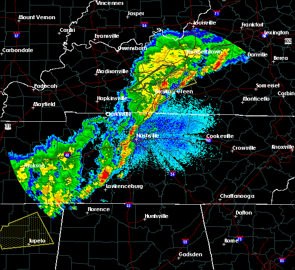 At 1143 pm cdt, severe thunderstorms were located along a line extending from 8 miles south of brownsville to 9 miles east of mount victor, moving northeast at 55 mph (radar indicated). Hazards include 60 mph wind gusts. Expect damage to roofs, siding, and trees. Locations impacted include, smiths grove, oakland, hardcastle, pondsville, greenhill, loving, tuckertown, claypool, alvaton and hays. At 1143 pm cdt, severe thunderstorms were located along a line extending from 8 miles south of brownsville to 9 miles east of mount victor, moving northeast at 55 mph (radar indicated). Hazards include 60 mph wind gusts. Expect damage to roofs, siding, and trees. Locations impacted include, smiths grove, oakland, hardcastle, pondsville, greenhill, loving, tuckertown, claypool, alvaton and hays.
|
| 3/28/2020 11:14 PM CDT |
 At 1114 pm cdt, severe thunderstorms were located along a line extending from 9 miles west of memphis junction to 12 miles east of russellville, moving east at 55 mph (radar indicated). Hazards include 60 mph wind gusts and penny size hail. expect damage to roofs, siding, and trees At 1114 pm cdt, severe thunderstorms were located along a line extending from 9 miles west of memphis junction to 12 miles east of russellville, moving east at 55 mph (radar indicated). Hazards include 60 mph wind gusts and penny size hail. expect damage to roofs, siding, and trees
|
| 3/28/2020 10:39 PM CDT |
 At 1038 pm cdt, a severe thunderstorm was located over crestmoor, moving northeast at 50 mph (radar indicated). Hazards include 60 mph wind gusts and quarter size hail. Hail damage to vehicles is expected. expect wind damage to roofs, siding, and trees. Locations impacted include, bowling green, brownsville, plum springs, crestmoor, memphis junction, mount victor, smiths grove, oakland, chalybeate and rhoda. At 1038 pm cdt, a severe thunderstorm was located over crestmoor, moving northeast at 50 mph (radar indicated). Hazards include 60 mph wind gusts and quarter size hail. Hail damage to vehicles is expected. expect wind damage to roofs, siding, and trees. Locations impacted include, bowling green, brownsville, plum springs, crestmoor, memphis junction, mount victor, smiths grove, oakland, chalybeate and rhoda.
|
| 3/28/2020 10:22 PM CDT |
 At 1022 pm cdt, a severe thunderstorm was located 10 miles east of russellville, moving northeast at 50 mph (radar indicated). Hazards include 60 mph wind gusts and quarter size hail. Hail damage to vehicles is expected. Expect wind damage to roofs, siding, and trees. At 1022 pm cdt, a severe thunderstorm was located 10 miles east of russellville, moving northeast at 50 mph (radar indicated). Hazards include 60 mph wind gusts and quarter size hail. Hail damage to vehicles is expected. Expect wind damage to roofs, siding, and trees.
|
| 3/12/2020 6:37 PM CDT |
 At 636 pm cdt, a severe thunderstorm was located near plum springs, moving east at 55 mph (radar indicated). Hazards include tennis ball size hail and 70 mph wind gusts. People and animals outdoors will be injured. expect hail damage to roofs, siding, windows, and vehicles. expect considerable tree damage. wind damage is also likely to mobile homes, roofs, and outbuildings. Locations impacted include, bowling green, plum springs, smiths grove, oakland, chalybeate, bristow, sunnyside, girkin, nick and loving. At 636 pm cdt, a severe thunderstorm was located near plum springs, moving east at 55 mph (radar indicated). Hazards include tennis ball size hail and 70 mph wind gusts. People and animals outdoors will be injured. expect hail damage to roofs, siding, windows, and vehicles. expect considerable tree damage. wind damage is also likely to mobile homes, roofs, and outbuildings. Locations impacted include, bowling green, plum springs, smiths grove, oakland, chalybeate, bristow, sunnyside, girkin, nick and loving.
|
| 3/12/2020 6:24 PM CDT |
 At 623 pm cdt, a severe thunderstorm was located near plum springs, moving east at 55 mph (radar indicated). Hazards include 70 mph wind gusts and ping pong ball size hail. People and animals outdoors will be injured. expect hail damage to roofs, siding, windows, and vehicles. expect considerable tree damage. Wind damage is also likely to mobile homes, roofs, and outbuildings. At 623 pm cdt, a severe thunderstorm was located near plum springs, moving east at 55 mph (radar indicated). Hazards include 70 mph wind gusts and ping pong ball size hail. People and animals outdoors will be injured. expect hail damage to roofs, siding, windows, and vehicles. expect considerable tree damage. Wind damage is also likely to mobile homes, roofs, and outbuildings.
|
| 3/12/2020 6:06 PM CDT |
 At 605 pm cdt, a severe thunderstorm was located near plum springs, moving east at 35 mph (radar indicated). Hazards include 70 mph wind gusts and half dollar size hail. Hail damage to vehicles is expected. expect considerable tree damage. wind damage is also likely to mobile homes, roofs, and outbuildings. Locations impacted include, bowling green, smiths grove, park city, oakland, bristow, girkin, pondsville, loving, tuckertown and hays. At 605 pm cdt, a severe thunderstorm was located near plum springs, moving east at 35 mph (radar indicated). Hazards include 70 mph wind gusts and half dollar size hail. Hail damage to vehicles is expected. expect considerable tree damage. wind damage is also likely to mobile homes, roofs, and outbuildings. Locations impacted include, bowling green, smiths grove, park city, oakland, bristow, girkin, pondsville, loving, tuckertown and hays.
|
| 3/12/2020 5:54 PM CDT |
 At 554 pm cdt, a severe thunderstorm was located near bowling green, moving east at 35 mph (radar indicated). Hazards include 70 mph wind gusts and half dollar size hail. Hail damage to vehicles is expected. expect considerable tree damage. wind damage is also likely to mobile homes, roofs, and outbuildings. Locations impacted include, bowling green, plum springs, mount victor, smiths grove, park city, oakland, chalybeate, girkin, loving and tuckertown. At 554 pm cdt, a severe thunderstorm was located near bowling green, moving east at 35 mph (radar indicated). Hazards include 70 mph wind gusts and half dollar size hail. Hail damage to vehicles is expected. expect considerable tree damage. wind damage is also likely to mobile homes, roofs, and outbuildings. Locations impacted include, bowling green, plum springs, mount victor, smiths grove, park city, oakland, chalybeate, girkin, loving and tuckertown.
|
| 3/12/2020 5:43 PM CDT |
 At 543 pm cdt, a severe thunderstorm was located 9 miles northwest of bowling green, moving east at 35 mph. this is a very dangerous storm (radar indicated). Hazards include 80 mph wind gusts and golf ball size hail. Flying debris will be dangerous to those caught without shelter. mobile homes will be heavily damaged. expect considerable damage to roofs, windows, and vehicles. extensive tree damage and power outages are likely. Locations impacted include, bowling green, plum springs, crestmoor, mount victor, smiths grove, park city, oakland, chalybeate, hardcastle and girkin. At 543 pm cdt, a severe thunderstorm was located 9 miles northwest of bowling green, moving east at 35 mph. this is a very dangerous storm (radar indicated). Hazards include 80 mph wind gusts and golf ball size hail. Flying debris will be dangerous to those caught without shelter. mobile homes will be heavily damaged. expect considerable damage to roofs, windows, and vehicles. extensive tree damage and power outages are likely. Locations impacted include, bowling green, plum springs, crestmoor, mount victor, smiths grove, park city, oakland, chalybeate, hardcastle and girkin.
|
| 3/12/2020 5:27 PM CDT |
 At 527 pm cdt, a severe thunderstorm was located 7 miles southwest of morgantown, moving east at 35 mph. this is a very dangerous storm (radar indicated). Hazards include 80 mph wind gusts and golf ball size hail. Flying debris will be dangerous to those caught without shelter. mobile homes will be heavily damaged. expect considerable damage to roofs, windows, and vehicles. Extensive tree damage and power outages are likely. At 527 pm cdt, a severe thunderstorm was located 7 miles southwest of morgantown, moving east at 35 mph. this is a very dangerous storm (radar indicated). Hazards include 80 mph wind gusts and golf ball size hail. Flying debris will be dangerous to those caught without shelter. mobile homes will be heavily damaged. expect considerable damage to roofs, windows, and vehicles. Extensive tree damage and power outages are likely.
|
| 3/2/2020 9:58 PM CST |
 At 958 pm cst, a severe thunderstorm was located over plum springs, moving east at 35 mph (radar indicated). Hazards include 60 mph wind gusts and quarter size hail. Hail damage to vehicles is expected. Expect wind damage to roofs, siding, and trees. At 958 pm cst, a severe thunderstorm was located over plum springs, moving east at 35 mph (radar indicated). Hazards include 60 mph wind gusts and quarter size hail. Hail damage to vehicles is expected. Expect wind damage to roofs, siding, and trees.
|
| 3/2/2020 9:51 PM CST |
 At 951 pm cst, a severe thunderstorm was located over brownsville, moving east at 45 mph (radar indicated). Hazards include 60 mph wind gusts and quarter size hail. Hail damage to vehicles is expected. expect wind damage to roofs, siding, and trees. Locations impacted include, bowling green, brownsville, plum springs, smiths grove, oakland, ollie, segal, chalybeate, rhoda and lindseyville. At 951 pm cst, a severe thunderstorm was located over brownsville, moving east at 45 mph (radar indicated). Hazards include 60 mph wind gusts and quarter size hail. Hail damage to vehicles is expected. expect wind damage to roofs, siding, and trees. Locations impacted include, bowling green, brownsville, plum springs, smiths grove, oakland, ollie, segal, chalybeate, rhoda and lindseyville.
|
| 3/2/2020 9:30 PM CST |
 At 930 pm cst, a severe thunderstorm was located 8 miles north of bowling green, moving east at 45 mph (radar indicated). Hazards include 60 mph wind gusts and quarter size hail. Hail damage to vehicles is expected. Expect wind damage to roofs, siding, and trees. At 930 pm cst, a severe thunderstorm was located 8 miles north of bowling green, moving east at 45 mph (radar indicated). Hazards include 60 mph wind gusts and quarter size hail. Hail damage to vehicles is expected. Expect wind damage to roofs, siding, and trees.
|
| 1/11/2020 9:19 AM CST |
 At 918 am cst, a severe thunderstorm was located near plum springs, moving east at 45 mph (radar indicated). Hazards include 60 mph wind gusts. Expect damage to roofs, siding, and trees. Locations impacted include, bowling green, plum springs, crestmoor, memphis junction, mount victor, oakland, bristow, hardcastle, girkin, and rich pond. At 918 am cst, a severe thunderstorm was located near plum springs, moving east at 45 mph (radar indicated). Hazards include 60 mph wind gusts. Expect damage to roofs, siding, and trees. Locations impacted include, bowling green, plum springs, crestmoor, memphis junction, mount victor, oakland, bristow, hardcastle, girkin, and rich pond.
|
| 1/11/2020 8:59 AM CST |
 At 858 am cst, a severe thunderstorm was located 9 miles west of memphis junction, moving northeast at 45 mph (radar indicated). Hazards include 60 mph wind gusts. expect damage to roofs, siding, and trees At 858 am cst, a severe thunderstorm was located 9 miles west of memphis junction, moving northeast at 45 mph (radar indicated). Hazards include 60 mph wind gusts. expect damage to roofs, siding, and trees
|
| 8/20/2019 4:50 PM CDT |
 The national weather service in louisville has issued a * severe thunderstorm warning for. east central simpson county in south central kentucky. central warren county in south central kentucky. until 515 pm cdt. At 450 pm cdt, a severe thunderstorm was located near crestmoor,. The national weather service in louisville has issued a * severe thunderstorm warning for. east central simpson county in south central kentucky. central warren county in south central kentucky. until 515 pm cdt. At 450 pm cdt, a severe thunderstorm was located near crestmoor,.
|
| 6/27/2019 7:06 PM CDT |
 At 705 pm cdt, severe thunderstorms were located along a line extending from 7 miles southeast of russellville to 6 miles south of memphis junction to scottsville, moving north at 40 mph (radar indicated). Hazards include 60 mph wind gusts. expect damage to roofs, siding, and trees At 705 pm cdt, severe thunderstorms were located along a line extending from 7 miles southeast of russellville to 6 miles south of memphis junction to scottsville, moving north at 40 mph (radar indicated). Hazards include 60 mph wind gusts. expect damage to roofs, siding, and trees
|
| 6/21/2019 7:34 PM CDT |
 At 734 pm cdt, a severe thunderstorm was located near plum springs, moving east at 35 mph (radar indicated). Hazards include 60 mph wind gusts and penny size hail. Expect damage to roofs, siding, and trees. Locations impacted include, brownsville, smiths grove, oakland, segal, chalybeate, rhoda, girkin, nick, glenmore and tuckertown. At 734 pm cdt, a severe thunderstorm was located near plum springs, moving east at 35 mph (radar indicated). Hazards include 60 mph wind gusts and penny size hail. Expect damage to roofs, siding, and trees. Locations impacted include, brownsville, smiths grove, oakland, segal, chalybeate, rhoda, girkin, nick, glenmore and tuckertown.
|
| 6/21/2019 7:19 PM CDT |
 At 719 pm cdt, a severe thunderstorm was located 9 miles northwest of bowling green, moving east at 40 mph (radar indicated). Hazards include 60 mph wind gusts and quarter size hail. Hail damage to vehicles is expected. Expect wind damage to roofs, siding, and trees. At 719 pm cdt, a severe thunderstorm was located 9 miles northwest of bowling green, moving east at 40 mph (radar indicated). Hazards include 60 mph wind gusts and quarter size hail. Hail damage to vehicles is expected. Expect wind damage to roofs, siding, and trees.
|
| 6/21/2019 7:18 PM CDT |
 At 717 pm cdt, a severe thunderstorm was located 7 miles northeast of russellville, moving east at 45 mph. this storm has a long history of producing wind damage (radar indicated). Hazards include 70 mph wind gusts. Expect considerable tree damage. Damage is likely to mobile homes, roofs, and outbuildings. At 717 pm cdt, a severe thunderstorm was located 7 miles northeast of russellville, moving east at 45 mph. this storm has a long history of producing wind damage (radar indicated). Hazards include 70 mph wind gusts. Expect considerable tree damage. Damage is likely to mobile homes, roofs, and outbuildings.
|
| 6/26/2018 12:17 PM CDT |
 At 1217 pm cdt, severe thunderstorms were located along a line extending from 11 miles southeast of leitchfield to plum springs, moving east at 35 mph (radar indicated). Hazards include 60 mph wind gusts. expect damage to roofs, siding, and trees At 1217 pm cdt, severe thunderstorms were located along a line extending from 11 miles southeast of leitchfield to plum springs, moving east at 35 mph (radar indicated). Hazards include 60 mph wind gusts. expect damage to roofs, siding, and trees
|
| 4/3/2018 9:01 PM CDT |
 At 900 pm cdt, a severe thunderstorm was located near plum springs, moving east at 65 mph (radar indicated). Hazards include 60 mph wind gusts. Expect damage to roofs, siding, and trees. locations impacted include, bowling green, brownsville, plum springs, crestmoor, memphis junction, mount victor, smiths grove, oakland, chalybeate and girkin. A tornado watch remains in effect until midnight cdt for south central kentucky. At 900 pm cdt, a severe thunderstorm was located near plum springs, moving east at 65 mph (radar indicated). Hazards include 60 mph wind gusts. Expect damage to roofs, siding, and trees. locations impacted include, bowling green, brownsville, plum springs, crestmoor, memphis junction, mount victor, smiths grove, oakland, chalybeate and girkin. A tornado watch remains in effect until midnight cdt for south central kentucky.
|
| 4/3/2018 8:46 PM CDT |
 At 846 pm cdt, a severe thunderstorm was located 14 miles northeast of russellville, moving east at 70 mph (radar indicated). Hazards include 60 mph wind gusts. expect damage to roofs, siding, and trees At 846 pm cdt, a severe thunderstorm was located 14 miles northeast of russellville, moving east at 70 mph (radar indicated). Hazards include 60 mph wind gusts. expect damage to roofs, siding, and trees
|
| 2/24/2018 9:51 PM CST |
 At 950 pm cst, a severe thunderstorm was located near plum springs, moving east at 45 mph (radar indicated). Hazards include 60 mph wind gusts. expect damage to roofs, siding, and trees At 950 pm cst, a severe thunderstorm was located near plum springs, moving east at 45 mph (radar indicated). Hazards include 60 mph wind gusts. expect damage to roofs, siding, and trees
|
| 5/20/2017 5:26 PM CDT |
 The severe thunderstorm warning for eastern simpson, northwestern allen, central warren and west central barren counties will expire at 530 pm cdt, the storm which prompted the warning has moved out of the area. therefore the warning will be allowed to expire. a severe thunderstorm watch remains in effect until 1000 pm cdt for south central kentucky. report severe weather to local law enforcement, post your report to the national weather service louisville facebook page, or tweet your report using hashtag l, m, k, spotter. The severe thunderstorm warning for eastern simpson, northwestern allen, central warren and west central barren counties will expire at 530 pm cdt, the storm which prompted the warning has moved out of the area. therefore the warning will be allowed to expire. a severe thunderstorm watch remains in effect until 1000 pm cdt for south central kentucky. report severe weather to local law enforcement, post your report to the national weather service louisville facebook page, or tweet your report using hashtag l, m, k, spotter.
|
| 5/20/2017 4:52 PM CDT |
 At 451 pm cdt, a severe thunderstorm was located 7 miles south of three springs, moving northeast at 40 mph (radar indicated). Hazards include 60 mph wind gusts and penny size hail. expect damage to roofs, siding, and trees At 451 pm cdt, a severe thunderstorm was located 7 miles south of three springs, moving northeast at 40 mph (radar indicated). Hazards include 60 mph wind gusts and penny size hail. expect damage to roofs, siding, and trees
|
| 5/19/2017 1:54 PM CDT |
 At 154 pm cdt, a severe thunderstorm was located near plum springs, moving east at 30 mph (radar indicated). Hazards include 60 mph wind gusts. Expect damage to roofs, siding, and trees. Locations impacted include, brownsville, smiths grove, oakland, chalybeate, girkin, nick, tuckertown and anna. At 154 pm cdt, a severe thunderstorm was located near plum springs, moving east at 30 mph (radar indicated). Hazards include 60 mph wind gusts. Expect damage to roofs, siding, and trees. Locations impacted include, brownsville, smiths grove, oakland, chalybeate, girkin, nick, tuckertown and anna.
|
| 5/19/2017 1:37 PM CDT |
 At 136 pm cdt, a severe thunderstorm was located near bowling green, moving east at 30 mph (radar indicated). Hazards include 60 mph wind gusts and penny size hail. expect damage to roofs, siding, and trees At 136 pm cdt, a severe thunderstorm was located near bowling green, moving east at 30 mph (radar indicated). Hazards include 60 mph wind gusts and penny size hail. expect damage to roofs, siding, and trees
|
| 5/11/2017 4:01 PM CDT |
 At 401 pm cdt, a severe thunderstorm was located 11 miles southeast of brownsville, moving east at 25 mph (radar indicated). Hazards include 60 mph wind gusts and quarter size hail. Hail damage to vehicles is expected. expect wind damage to roofs, siding, and trees. Locations impacted include, glasgow, cave city, smiths grove, park city, oakland, oil city, pig, hays, beckton and stovall. At 401 pm cdt, a severe thunderstorm was located 11 miles southeast of brownsville, moving east at 25 mph (radar indicated). Hazards include 60 mph wind gusts and quarter size hail. Hail damage to vehicles is expected. expect wind damage to roofs, siding, and trees. Locations impacted include, glasgow, cave city, smiths grove, park city, oakland, oil city, pig, hays, beckton and stovall.
|
| 5/11/2017 3:48 PM CDT |
 At 348 pm cdt, a severe thunderstorm was located near brownsville, moving east at 35 mph (radar indicated). Hazards include 60 mph wind gusts and quarter size hail. Hail damage to vehicles is expected. Expect wind damage to roofs, siding, and trees. At 348 pm cdt, a severe thunderstorm was located near brownsville, moving east at 35 mph (radar indicated). Hazards include 60 mph wind gusts and quarter size hail. Hail damage to vehicles is expected. Expect wind damage to roofs, siding, and trees.
|
| 4/30/2017 4:12 PM CDT |
 At 412 pm cdt, a severe thunderstorm was located 8 miles west of glasgow, moving northeast at 55 mph (radar indicated). Hazards include 70 mph wind gusts. Expect considerable tree damage. damage is likely to mobile homes, roofs, and outbuildings. Locations impacted include, glasgow, cave city, smiths grove, park city, red cross, coral hill, pritchardsville, lecta, haywood and austin. At 412 pm cdt, a severe thunderstorm was located 8 miles west of glasgow, moving northeast at 55 mph (radar indicated). Hazards include 70 mph wind gusts. Expect considerable tree damage. damage is likely to mobile homes, roofs, and outbuildings. Locations impacted include, glasgow, cave city, smiths grove, park city, red cross, coral hill, pritchardsville, lecta, haywood and austin.
|
| 4/5/2017 4:29 PM CDT | Barn damage in warren county KY, 1.3 miles SE of Oakland, KY |
| 4/5/2017 4:26 PM CDT |
 At 426 pm cdt, a severe thunderstorm was located over plum springs, moving north at 60 mph (radar indicated). Hazards include 60 mph wind gusts and half dollar size hail. Hail damage to vehicles is expected. Expect wind damage to roofs, siding, and trees. At 426 pm cdt, a severe thunderstorm was located over plum springs, moving north at 60 mph (radar indicated). Hazards include 60 mph wind gusts and half dollar size hail. Hail damage to vehicles is expected. Expect wind damage to roofs, siding, and trees.
|
| 4/5/2017 4:25 PM CDT |
 The severe thunderstorm warning for south central grayson, northeastern warren and central edmonson counties will expire at 430 pm cdt, the storm which prompted the warning has weakened below severe limits, and have exited the warned area. therefore the warning will be allowed to expire. a tornado watch remains in effect until 900 pm cdt for south central and central kentucky. report severe weather to local law enforcement, post your report to the national weather service louisville facebook page, or tweet your report using hashtag l, m, k, spotter. The severe thunderstorm warning for south central grayson, northeastern warren and central edmonson counties will expire at 430 pm cdt, the storm which prompted the warning has weakened below severe limits, and have exited the warned area. therefore the warning will be allowed to expire. a tornado watch remains in effect until 900 pm cdt for south central and central kentucky. report severe weather to local law enforcement, post your report to the national weather service louisville facebook page, or tweet your report using hashtag l, m, k, spotter.
|
| 4/5/2017 4:23 PM CDT |
 At 523 pm edt/423 pm cdt/, severe thunderstorms were located along a line extending from 9 miles east of leitchfield to 6 miles east of plum springs, moving east at 40 mph (radar indicated). Hazards include 60 mph wind gusts and half dollar size hail. Hail damage to vehicles is expected. Expect wind damage to roofs, siding, and trees. At 523 pm edt/423 pm cdt/, severe thunderstorms were located along a line extending from 9 miles east of leitchfield to 6 miles east of plum springs, moving east at 40 mph (radar indicated). Hazards include 60 mph wind gusts and half dollar size hail. Hail damage to vehicles is expected. Expect wind damage to roofs, siding, and trees.
|
| 4/5/2017 4:12 PM CDT |
 At 412 pm cdt, a severe thunderstorm was located near brownsville, moving northeast at 60 mph (radar indicated). Hazards include 60 mph wind gusts and quarter size hail. Hail damage to vehicles is expected. expect wind damage to roofs, siding, and trees. locations impacted include, bowling green, brownsville, oakland, chalybeate, girkin, black gold, broadway, sadler, loving and tuckertown. A tornado watch remains in effect until 900 pm cdt for south central and central kentucky. At 412 pm cdt, a severe thunderstorm was located near brownsville, moving northeast at 60 mph (radar indicated). Hazards include 60 mph wind gusts and quarter size hail. Hail damage to vehicles is expected. expect wind damage to roofs, siding, and trees. locations impacted include, bowling green, brownsville, oakland, chalybeate, girkin, black gold, broadway, sadler, loving and tuckertown. A tornado watch remains in effect until 900 pm cdt for south central and central kentucky.
|
| 4/5/2017 4:04 PM CDT |
 At 404 pm cdt, a severe thunderstorm was located 7 miles north of plum springs, moving northeast at 55 mph. a second severe thunderstorm was located near sunfish moving northeast at 55 mph (radar indicated). Hazards include 60 mph wind gusts and quarter size hail. Hail damage to vehicles is expected. Expect wind damage to roofs, siding, and trees. At 404 pm cdt, a severe thunderstorm was located 7 miles north of plum springs, moving northeast at 55 mph. a second severe thunderstorm was located near sunfish moving northeast at 55 mph (radar indicated). Hazards include 60 mph wind gusts and quarter size hail. Hail damage to vehicles is expected. Expect wind damage to roofs, siding, and trees.
|
| 3/27/2017 4:14 PM CDT |
 At 409 pm cdt, severe thunderstorms were located along a line extending from near crestmoor to near three springs to near portland, moving northeast at 50 mph (radar indicated). Hazards include 70 mph wind gusts and quarter size hail. Hail damage to vehicles is expected. expect considerable tree damage. wind damage is also likely to mobile homes, roofs, and outbuildings. locations impacted include, bowling green, plum springs, crestmoor, memphis junction, mount victor, smiths grove, woodburn, oakland, hardcastle and black jack. the greatest damaging wind threat at this timne is over the southern part of warren county where gusts around 70 mph are possible. these storms will move into northwest allen county. elsewhere in the warning, 60 mph wind gusts are possible. precautionary/preparedness actions, for your protection move to an interior room on the lowest floor of a building. At 409 pm cdt, severe thunderstorms were located along a line extending from near crestmoor to near three springs to near portland, moving northeast at 50 mph (radar indicated). Hazards include 70 mph wind gusts and quarter size hail. Hail damage to vehicles is expected. expect considerable tree damage. wind damage is also likely to mobile homes, roofs, and outbuildings. locations impacted include, bowling green, plum springs, crestmoor, memphis junction, mount victor, smiths grove, woodburn, oakland, hardcastle and black jack. the greatest damaging wind threat at this timne is over the southern part of warren county where gusts around 70 mph are possible. these storms will move into northwest allen county. elsewhere in the warning, 60 mph wind gusts are possible. precautionary/preparedness actions, for your protection move to an interior room on the lowest floor of a building.
|
| 3/27/2017 3:54 PM CDT |
 At 354 pm cdt, severe thunderstorms were located along a line extending from 13 miles northeast of russellville to 12 miles southwest of memphis junction to 8 miles northwest of cross plains, moving northeast at 50 mph (radar indicated). Hazards include 60 mph wind gusts and quarter size hail. Hail damage to vehicles is expected. Expect wind damage to roofs, siding, and trees. At 354 pm cdt, severe thunderstorms were located along a line extending from 13 miles northeast of russellville to 12 miles southwest of memphis junction to 8 miles northwest of cross plains, moving northeast at 50 mph (radar indicated). Hazards include 60 mph wind gusts and quarter size hail. Hail damage to vehicles is expected. Expect wind damage to roofs, siding, and trees.
|
| 3/1/2017 7:40 AM CST | Multiple structures damage in warren county KY, 0.5 miles N of Oakland, KY |
| 3/1/2017 7:21 AM CST | Multiple structures damage in warren county KY, 0.5 miles N of Oakland, KY |
| 3/1/2017 7:20 AM CST | Multiple structures damged near 292 martinsville r in warren county KY, 7.8 miles NNW of Oakland, KY |
| 3/1/2017 6:52 AM CST |
 At 651 am cst, severe thunderstorms were located along a line extending from 10 miles east of dunmor to 10 miles north of springfield, moving east at 50 mph (radar indicated). Hazards include 60 mph wind gusts. Expect damage to roofs, siding, and trees. locations impacted include, bowling green, glasgow, russellville, scottsville, plum springs, memphis junction, mount victor, delafield, crestmoor and anderson. a tornado watch remains in effect until 800 am cst for south central and central kentucky. A tornado watch also remains in effect until 1000 am cst for south central and central kentucky. At 651 am cst, severe thunderstorms were located along a line extending from 10 miles east of dunmor to 10 miles north of springfield, moving east at 50 mph (radar indicated). Hazards include 60 mph wind gusts. Expect damage to roofs, siding, and trees. locations impacted include, bowling green, glasgow, russellville, scottsville, plum springs, memphis junction, mount victor, delafield, crestmoor and anderson. a tornado watch remains in effect until 800 am cst for south central and central kentucky. A tornado watch also remains in effect until 1000 am cst for south central and central kentucky.
|
| 3/1/2017 6:29 AM CST |
 At 629 am cst, severe thunderstorms were located along a line extending from near weir to near guthrie, moving east at 65 mph (radar indicated). Hazards include 70 mph wind gusts and nickel size hail. Expect considerable tree damage. Damage is likely to mobile homes, roofs, and outbuildings. At 629 am cst, severe thunderstorms were located along a line extending from near weir to near guthrie, moving east at 65 mph (radar indicated). Hazards include 70 mph wind gusts and nickel size hail. Expect considerable tree damage. Damage is likely to mobile homes, roofs, and outbuildings.
|
| 11/28/2016 6:33 PM CST |
 At 633 pm cst, a severe thunderstorm was located 8 miles east of plum springs, moving east at 45 mph (automated wind gauges. at 626 pm cst...the gauge at bowling green airport reported 58 mph winds). Hazards include 60 mph wind gusts. Expect damage to roofs. siding. And trees. At 633 pm cst, a severe thunderstorm was located 8 miles east of plum springs, moving east at 45 mph (automated wind gauges. at 626 pm cst...the gauge at bowling green airport reported 58 mph winds). Hazards include 60 mph wind gusts. Expect damage to roofs. siding. And trees.
|
| 7/8/2016 9:22 PM CDT |
 At 922 pm cdt, a severe thunderstorm was located 13 miles east of scottsville, moving east at 30 mph (radar indicated). Hazards include 60 mph wind gusts. Expect damage to roofs. siding. and trees. Locations impacted include, glasgow, scottsville, smiths grove, oakland, fountain run, cedar springs, railton, kepler, settle and dry fork. At 922 pm cdt, a severe thunderstorm was located 13 miles east of scottsville, moving east at 30 mph (radar indicated). Hazards include 60 mph wind gusts. Expect damage to roofs. siding. and trees. Locations impacted include, glasgow, scottsville, smiths grove, oakland, fountain run, cedar springs, railton, kepler, settle and dry fork.
|
| 7/8/2016 8:56 PM CDT |
 At 856 pm cdt, a severe thunderstorm was located near scottsville, moving east at 30 mph (radar indicated). Hazards include 60 mph wind gusts. Expect damage to roofs. siding. And trees. At 856 pm cdt, a severe thunderstorm was located near scottsville, moving east at 30 mph (radar indicated). Hazards include 60 mph wind gusts. Expect damage to roofs. siding. And trees.
|
| 7/8/2016 8:48 PM CDT |
 At 848 pm cdt, a severe thunderstorm was located near morgantown, moving east at 50 mph (radar indicated). Hazards include 60 mph wind gusts. Expect damage to roofs. siding. and trees. Locations impacted include, bowling green, morgantown, brownsville, plum springs, delafield, mount victor, casey, lee, beaver dam and smiths grove. At 848 pm cdt, a severe thunderstorm was located near morgantown, moving east at 50 mph (radar indicated). Hazards include 60 mph wind gusts. Expect damage to roofs. siding. and trees. Locations impacted include, bowling green, morgantown, brownsville, plum springs, delafield, mount victor, casey, lee, beaver dam and smiths grove.
|
| 7/8/2016 8:35 PM CDT |
 At 835 pm cdt, a severe thunderstorm was located 9 miles west of morgantown, moving east at 50 mph (radar indicated). Hazards include 60 mph wind gusts. Expect damage to roofs. siding. And trees. At 835 pm cdt, a severe thunderstorm was located 9 miles west of morgantown, moving east at 50 mph (radar indicated). Hazards include 60 mph wind gusts. Expect damage to roofs. siding. And trees.
|
| 7/7/2016 3:02 PM CDT |
 At 302 pm cdt, severe thunderstorms were located along a line extending from leitchfield to glasgow, moving east at 45 mph (radar indicated). Hazards include 70 mph wind gusts. Expect considerable tree damage. Damage is likely to mobile homes, roofs, and outbuildings. At 302 pm cdt, severe thunderstorms were located along a line extending from leitchfield to glasgow, moving east at 45 mph (radar indicated). Hazards include 70 mph wind gusts. Expect considerable tree damage. Damage is likely to mobile homes, roofs, and outbuildings.
|
| 7/6/2016 3:51 PM CDT |
 At 351 pm cdt, severe thunderstorms were located along a line extending from near munfordville to 12 miles west of tompkinsville, moving east at 45 mph (radar indicated). Hazards include 60 mph wind gusts and penny size hail. Expect damage to roofs. siding. And trees. At 351 pm cdt, severe thunderstorms were located along a line extending from near munfordville to 12 miles west of tompkinsville, moving east at 45 mph (radar indicated). Hazards include 60 mph wind gusts and penny size hail. Expect damage to roofs. siding. And trees.
|
| 7/6/2016 3:23 PM CDT |
 At 323 pm cdt, a severe thunderstorm was located over brownsville, moving northeast at 45 mph (radar indicated). Hazards include 60 mph wind gusts and penny size hail. Expect damage to roofs. siding. And trees. At 323 pm cdt, a severe thunderstorm was located over brownsville, moving northeast at 45 mph (radar indicated). Hazards include 60 mph wind gusts and penny size hail. Expect damage to roofs. siding. And trees.
|
| 7/4/2016 1:44 PM CDT |
 At 144 pm cdt, a severe thunderstorm was located 10 miles east of mount victor, moving east at 55 mph (radar indicated). Hazards include 60 mph wind gusts. Expect damage to roofs. siding. And trees. At 144 pm cdt, a severe thunderstorm was located 10 miles east of mount victor, moving east at 55 mph (radar indicated). Hazards include 60 mph wind gusts. Expect damage to roofs. siding. And trees.
|
| 7/4/2016 1:20 PM CDT |
 At 120 pm cdt, a severe thunderstorm was located 8 miles southwest of memphis junction, moving east at 50 mph (radar indicated). Hazards include 60 mph wind gusts. Expect damage to roofs. siding. And trees. At 120 pm cdt, a severe thunderstorm was located 8 miles southwest of memphis junction, moving east at 50 mph (radar indicated). Hazards include 60 mph wind gusts. Expect damage to roofs. siding. And trees.
|
| 7/4/2016 1:10 PM CDT |
 At 110 pm cdt, a severe thunderstorm was located 8 miles east of plum springs, moving east at 50 mph (radar indicated). Hazards include 60 mph wind gusts. Expect damage to roofs. siding. And trees. At 110 pm cdt, a severe thunderstorm was located 8 miles east of plum springs, moving east at 50 mph (radar indicated). Hazards include 60 mph wind gusts. Expect damage to roofs. siding. And trees.
|
| 7/3/2016 2:19 PM CDT |
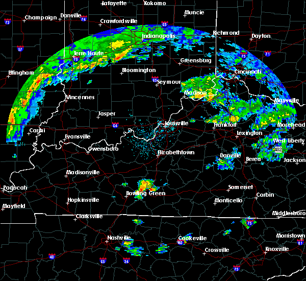 At 219 pm cdt, a severe thunderstorm was located 9 miles southeast of brownsville, moving northeast at 35 mph (radar indicated). Hazards include 60 mph wind gusts and penny size hail. Expect damage to roofs. siding. And trees. At 219 pm cdt, a severe thunderstorm was located 9 miles southeast of brownsville, moving northeast at 35 mph (radar indicated). Hazards include 60 mph wind gusts and penny size hail. Expect damage to roofs. siding. And trees.
|
| 6/23/2016 8:57 PM CDT |
 The severe thunderstorm warning for northeastern warren, northwestern barren and southeastern edmonson counties will expire at 900 pm cdt, the storm which prompted the warning has weakened below severe limits and exited the warned area. therefore the warning will be allowed to expire. however gusty winds and heavy rain are still possible with this thunderstorm. a severe thunderstorm watch remains in effect until 1000 pm cdt for south central kentucky. The severe thunderstorm warning for northeastern warren, northwestern barren and southeastern edmonson counties will expire at 900 pm cdt, the storm which prompted the warning has weakened below severe limits and exited the warned area. therefore the warning will be allowed to expire. however gusty winds and heavy rain are still possible with this thunderstorm. a severe thunderstorm watch remains in effect until 1000 pm cdt for south central kentucky.
|
| 6/23/2016 8:41 PM CDT |
 At 840 pm cdt, a severe thunderstorm was located 7 miles east of plum springs, moving southeast at 25 mph. a tornado warning is also in effect for this storm (radar indicated). Hazards include 60 mph wind gusts and half dollar size hail. Hail damage to vehicles is expected. expect wind damage to roofs, siding, and trees. Locations impacted include, bowling green, smiths grove, park city, oakland, hays, railton, chalybeate, kepler, loving and hydro. At 840 pm cdt, a severe thunderstorm was located 7 miles east of plum springs, moving southeast at 25 mph. a tornado warning is also in effect for this storm (radar indicated). Hazards include 60 mph wind gusts and half dollar size hail. Hail damage to vehicles is expected. expect wind damage to roofs, siding, and trees. Locations impacted include, bowling green, smiths grove, park city, oakland, hays, railton, chalybeate, kepler, loving and hydro.
|
| 6/23/2016 8:38 PM CDT |
 At 838 pm cdt, a severe thunderstorm capable of producing a tornado was located 8 miles east of plum springs, moving southeast at 30 mph (radar indicated rotation). Hazards include tornado and half dollar size hail. Flying debris will be dangerous to those caught without shelter. mobile homes will be damaged or destroyed. damage to roofs, windows, and vehicles will occur. tree damage is likely. Locations impacted include, smiths grove, oakland, hays, kepler, loving, hydro, merry oaks, apple grove, sunnyside and pondsville. At 838 pm cdt, a severe thunderstorm capable of producing a tornado was located 8 miles east of plum springs, moving southeast at 30 mph (radar indicated rotation). Hazards include tornado and half dollar size hail. Flying debris will be dangerous to those caught without shelter. mobile homes will be damaged or destroyed. damage to roofs, windows, and vehicles will occur. tree damage is likely. Locations impacted include, smiths grove, oakland, hays, kepler, loving, hydro, merry oaks, apple grove, sunnyside and pondsville.
|
| 6/23/2016 8:28 PM CDT |
 At 828 pm cdt, a severe thunderstorm capable of producing a tornado was located near brownsville, moving southeast at 35 mph (radar indicated rotation). Hazards include tornado and quarter size hail. Flying debris will be dangerous to those caught without shelter. mobile homes will be damaged or destroyed. damage to roofs, windows, and vehicles will occur. Tree damage is likely. At 828 pm cdt, a severe thunderstorm capable of producing a tornado was located near brownsville, moving southeast at 35 mph (radar indicated rotation). Hazards include tornado and quarter size hail. Flying debris will be dangerous to those caught without shelter. mobile homes will be damaged or destroyed. damage to roofs, windows, and vehicles will occur. Tree damage is likely.
|
| 6/23/2016 8:26 PM CDT |
 At 825 pm cdt, a severe thunderstorm was located near plum springs, moving southeast at 25 mph (radar indicated). Hazards include 60 mph wind gusts and penny size hail. Expect damage to roofs. siding. And trees. At 825 pm cdt, a severe thunderstorm was located near plum springs, moving southeast at 25 mph (radar indicated). Hazards include 60 mph wind gusts and penny size hail. Expect damage to roofs. siding. And trees.
|
| 6/15/2016 3:13 PM CDT |
 At 312 pm cdt, a severe thunderstorm was located 8 miles east of morgantown, moving southeast at 35 mph (radar indicated). Hazards include 60 mph wind gusts. Expect damage to roofs. siding. And trees. At 312 pm cdt, a severe thunderstorm was located 8 miles east of morgantown, moving southeast at 35 mph (radar indicated). Hazards include 60 mph wind gusts. Expect damage to roofs. siding. And trees.
|
| 4/27/2016 7:12 PM CDT |
 At 711 pm cdt, severe thunderstorms were located along a line extending from 8 miles north of morgantown to 6 miles north of delafield to 6 miles west of westmoreland, moving northeast at 25 mph (radar indicated). Hazards include 60 mph wind gusts and penny size hail. Expect damage to roofs. siding. and trees. locations impacted include, bowling green, leitchfield, scottsville, brownsville, plum springs, crestmoor, mount victor, delafield, memphis junction and casey. A tornado watch remains in effect until 1100 pm cdt for south central kentucky. At 711 pm cdt, severe thunderstorms were located along a line extending from 8 miles north of morgantown to 6 miles north of delafield to 6 miles west of westmoreland, moving northeast at 25 mph (radar indicated). Hazards include 60 mph wind gusts and penny size hail. Expect damage to roofs. siding. and trees. locations impacted include, bowling green, leitchfield, scottsville, brownsville, plum springs, crestmoor, mount victor, delafield, memphis junction and casey. A tornado watch remains in effect until 1100 pm cdt for south central kentucky.
|
| 4/27/2016 6:51 PM CDT |
 At 650 pm cdt, severe thunderstorms were located along a line extending from 6 miles northwest of morgantown to 7 miles west of delafield to near portland, moving northeast at 25 mph (radar indicated). Hazards include 60 mph wind gusts and penny size hail. Expect damage to roofs. siding. And trees. At 650 pm cdt, severe thunderstorms were located along a line extending from 6 miles northwest of morgantown to 7 miles west of delafield to near portland, moving northeast at 25 mph (radar indicated). Hazards include 60 mph wind gusts and penny size hail. Expect damage to roofs. siding. And trees.
|
| 3/31/2016 3:55 PM CDT |
 At 354 pm cdt, a severe thunderstorm was located 9 miles northeast of russellville, moving northeast at 55 mph (radar indicated). Hazards include 60 mph wind gusts. Expect damage to roofs. siding. And trees. At 354 pm cdt, a severe thunderstorm was located 9 miles northeast of russellville, moving northeast at 55 mph (radar indicated). Hazards include 60 mph wind gusts. Expect damage to roofs. siding. And trees.
|
| 12/23/2015 6:50 PM CST | At 650 pm cst, a severe thunderstorm capable of producing a tornado was located 8 miles northwest of memphis junction, moving northeast at 50 mph (radar indicated rotation). Hazards include tornado. Flying debris will be dangerous to those caught without shelter. mobile homes will be damaged or destroyed. damage to roofs, windows and vehicles will occur. tree damage is likely. this dangerous storm will be near, delafield and crestmoor around 700 pm cst. bowling green and plum springs around 705 pm cst. brownsville around 715 pm cst. Other locations impacted by this tornadic thunderstorm include blue level, chalybeate, riverside, benleo, browning, smiths grove, bristow, guy, rockland and nick. |
| 7/20/2015 11:43 PM CDT |
 At 1141 pm cdt, severe thunderstorms were located along a line extending from 7 miles north of brownsville to 6 miles southwest of brownsville to delafield, and moving east at 40 mph (radar indicated). Hazards include 60 mph wind gusts. Expect damage to roofs. Siding and trees. At 1141 pm cdt, severe thunderstorms were located along a line extending from 7 miles north of brownsville to 6 miles southwest of brownsville to delafield, and moving east at 40 mph (radar indicated). Hazards include 60 mph wind gusts. Expect damage to roofs. Siding and trees.
|
| 6/26/2015 3:40 PM CDT | At 339 pm cdt, a severe thunderstorm was located 8 miles east of plum springs, and moving east at 25 mph (radar indicated). Hazards include 60 mph wind gusts and quarter size hail. Hail damage to vehicles is expected. Expect wind damage to roofs, siding and trees. |
| 6/26/2015 3:23 PM CDT | At 320 pm cdt, a severe thunderstorm was located near greenwood, and moving east at 20 mph (radar indicated. quarter size hail has been reported near bowling green). Hazards include 70 mph wind gusts and quarter size hail. Hail damage to vehicles is expected. expect considerable tree damage. wind damage is also likely to mobile homes, roofs and outbuildings. Locations impacted include, mount victor, plum springs, greenhill, hardcastle, bristow, girkin, gotts, sunnyside, loving, polkville, oakland, kepler, tuckertown, three forks, smiths grove, martinsville, pondsville, hydro and chalybeate. |
| 6/26/2015 3:16 PM CDT | At 314 pm cdt, a severe thunderstorm was located near crestmoor, and moving east at 20 mph (radar indicated). Hazards include 60 mph wind gusts and quarter size hail. Hail damage to vehicles is expected. expect wind damage to roofs, siding and trees. Locations impacted include, bowling green, greenwood, delafield, mount victor, plum springs, warren county regional airport, greenhill, hardcastle, bristow, girkin, gotts, sunnyside, loving, polkville, oakland, kepler, three forks, tuckertown, smiths grove and martinsville. |
| 6/26/2015 3:12 PM CDT | At 311 pm cdt, a severe thunderstorm was located near memphis junction, and moving east at 20 mph (radar indicated). Hazards include 60 mph wind gusts and quarter size hail. Hail damage to vehicles is expected. Expect wind damage to roofs, siding and trees. |
| 6/26/2015 2:55 PM CDT | At 254 pm cdt, severe thunderstorms were located along a line extending from 11 miles northwest of glasgow to delafield, and moving northeast at 15 mph (radar indicated). Hazards include 60 mph wind gusts. Expect damage to roofs. siding and trees. Locations impacted include, munfordville, girkin, cave city, union city, cedar spring, sand hill, pig, sloans crossing, chalybeate, horse cave, elko, nick, rhoda, mammoth cave, northtown, arthur, bear wallow, griderville, goodnight and uno. |
| 6/26/2015 2:46 PM CDT | At 244 pm cdt, severe thunderstorms were located along a line extending from 12 miles northwest of glasgow to delafield, and moving northeast at 15 mph (radar indicated). Hazards include 60 mph wind gusts and quarter size hail. Hail damage to vehicles is expected. Expect wind damage to roofs, siding and trees. |
| 6/26/2015 2:01 PM CDT |
 At 159 pm cdt, a severe thunderstorm was located 5 miles northwest of delafield, and moving northeast at 20 mph (radar indicated). Hazards include 60 mph wind gusts and quarter size hail. Hail damage to vehicles is expected. Expect wind damage to roofs, siding and trees. At 159 pm cdt, a severe thunderstorm was located 5 miles northwest of delafield, and moving northeast at 20 mph (radar indicated). Hazards include 60 mph wind gusts and quarter size hail. Hail damage to vehicles is expected. Expect wind damage to roofs, siding and trees.
|
| 5/30/2015 6:39 PM CDT | At 637 pm cdt, a severe thunderstorm was located near crestmoor, and moving northeast at 30 mph (radar indicated). Hazards include 60 mph wind gusts. Expect damage to roofs. siding and trees. Locations impacted include, mount victor, delafield, plum springs, hardcastle, barren river, gotts, polkville, bristow, greencastle, richardsville, anna, sand hill, girkin, sunnyside, loving, tuckertown, oakland and smiths grove. |
| 5/30/2015 6:32 PM CDT | At 629 pm cdt, a severe thunderstorm was located near memphis junction, and moving northeast at 35 mph (radar indicated). Hazards include 60 mph wind gusts. Expect damage to roofs. siding and trees. Locations impacted include, bowling green, greenwood, crestmoor, mount victor, delafield, plum springs, warren county regional airport, hardcastle, barren river, gotts, bristow, polkville, greencastle, richardsville, anna, sand hill, girkin, sunnyside, loving and tuckertown. |
| 5/30/2015 6:18 PM CDT | At 617 pm cdt, a severe thunderstorm was located 5 miles north of franklin, and was nearly stationary (radar indicated). Hazards include 60 mph wind gusts. Expect damage to roofs. Siding and trees. |
| 4/10/2015 2:04 AM CDT | The national weather service in louisville has issued a * severe thunderstorm warning for. northern barren county in south central kentucky. edmonson county in south central kentucky. southwestern hart county in south central kentucky. Northern warren county in south central kentucky. |
| 1/30/2013 3:35 AM CST | 50-70 mph winds downed trees. part of 28 mile long 1 mile wide path of straight line wind damag in warren county KY, 1.2 miles N of Oakland, KY |
| 1/30/2013 2:35 AM CST | 50-70 mph winds downed trees. part of 28 mile long 1 mile wide path of straight line wind damag in warren county KY, 1.2 miles N of Oakland, KY |
| 3/2/2012 5:00 PM CST | Small porch ripped off a home in warren county KY, 7.1 miles NNW of Oakland, KY |
Hail Maps for Oakland, KY
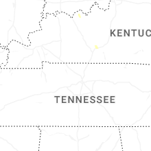


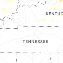
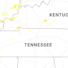


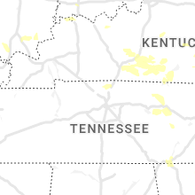


Connect with Interactive Hail Maps